

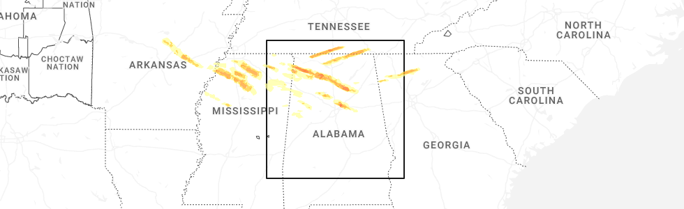
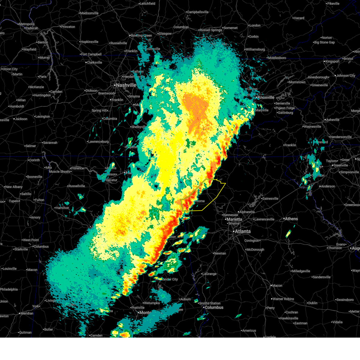
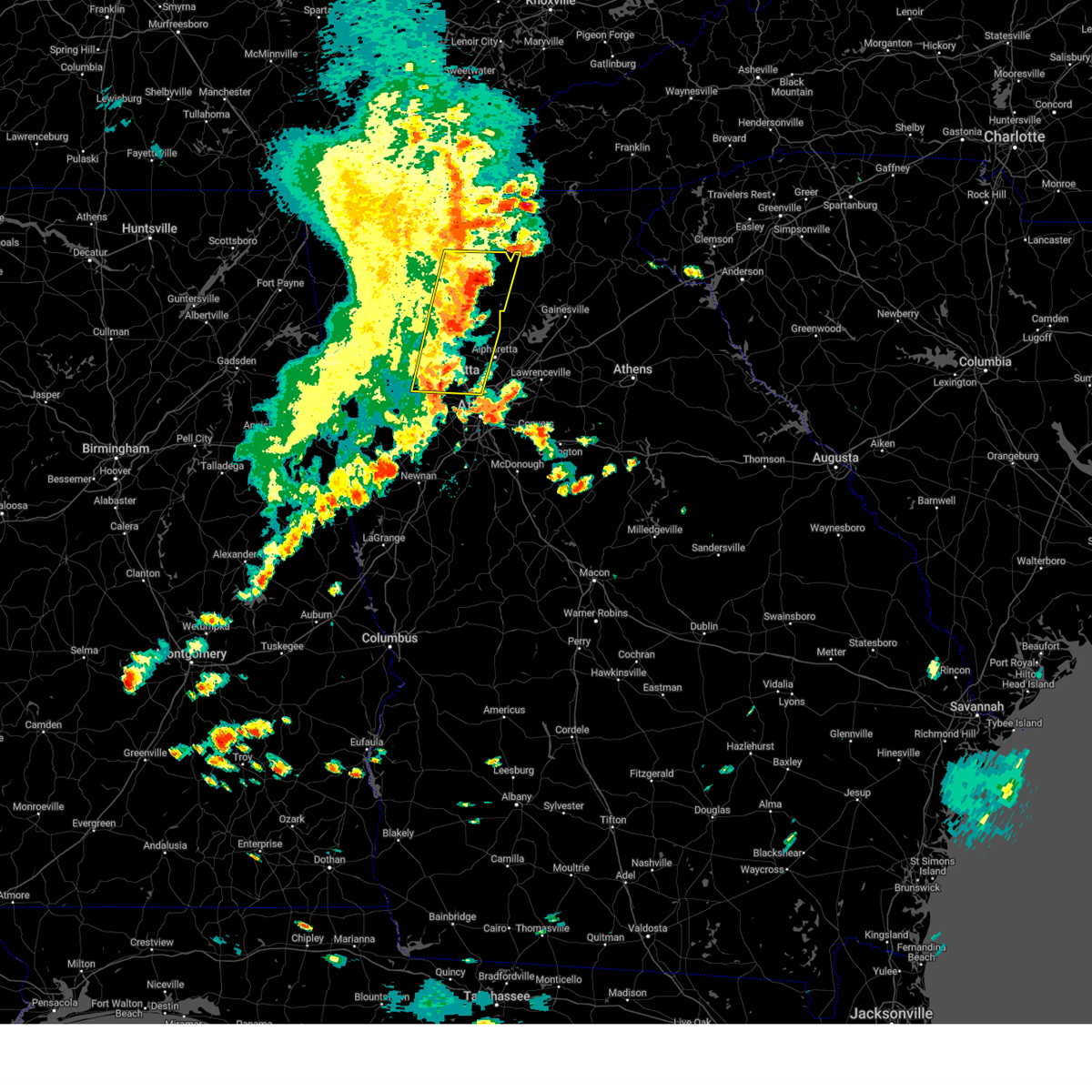
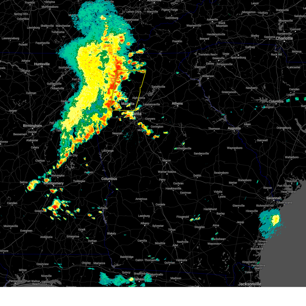
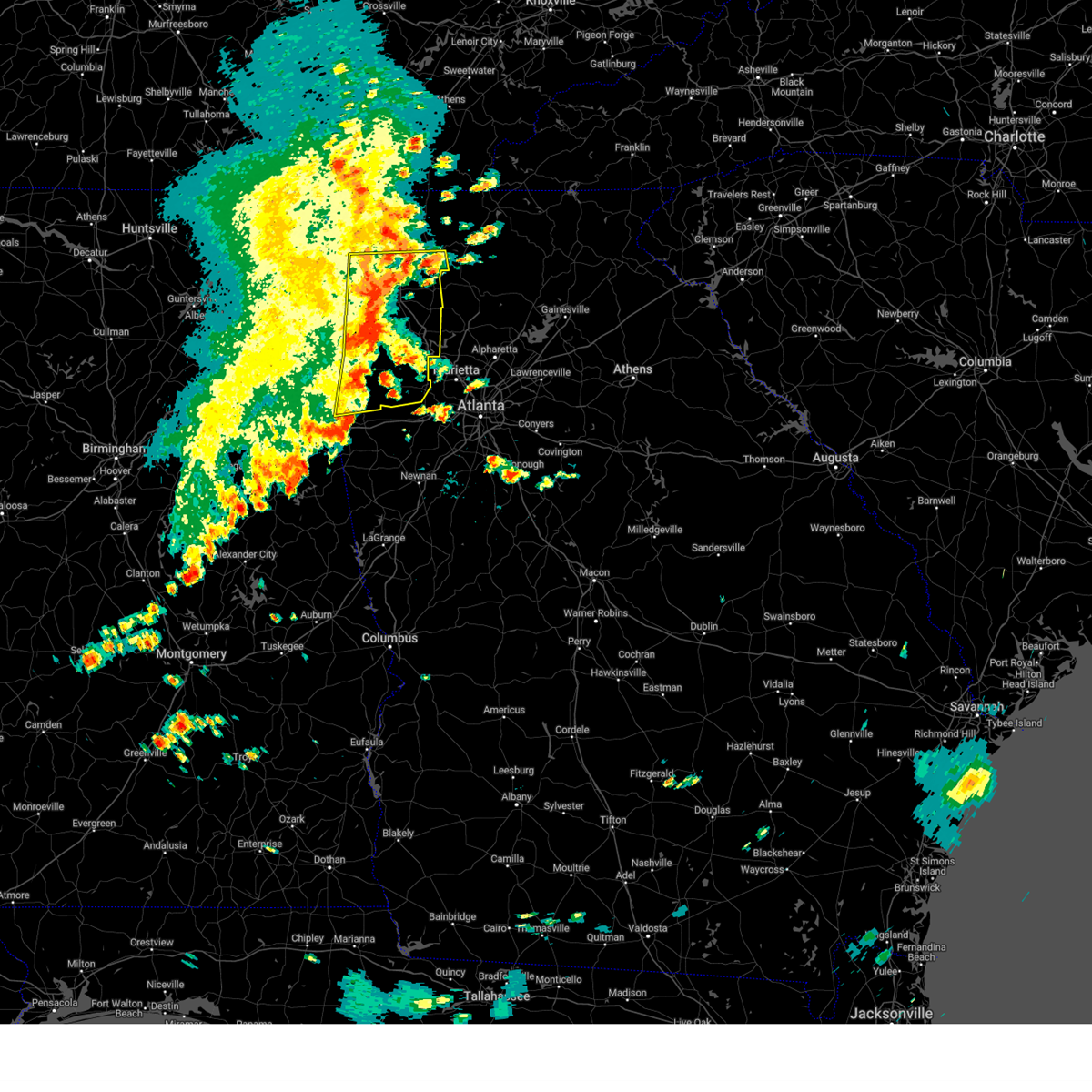
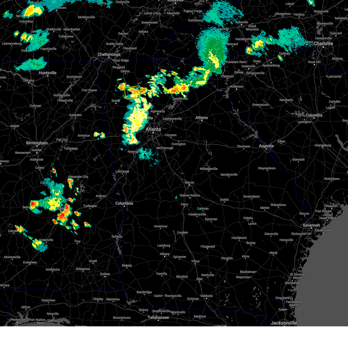
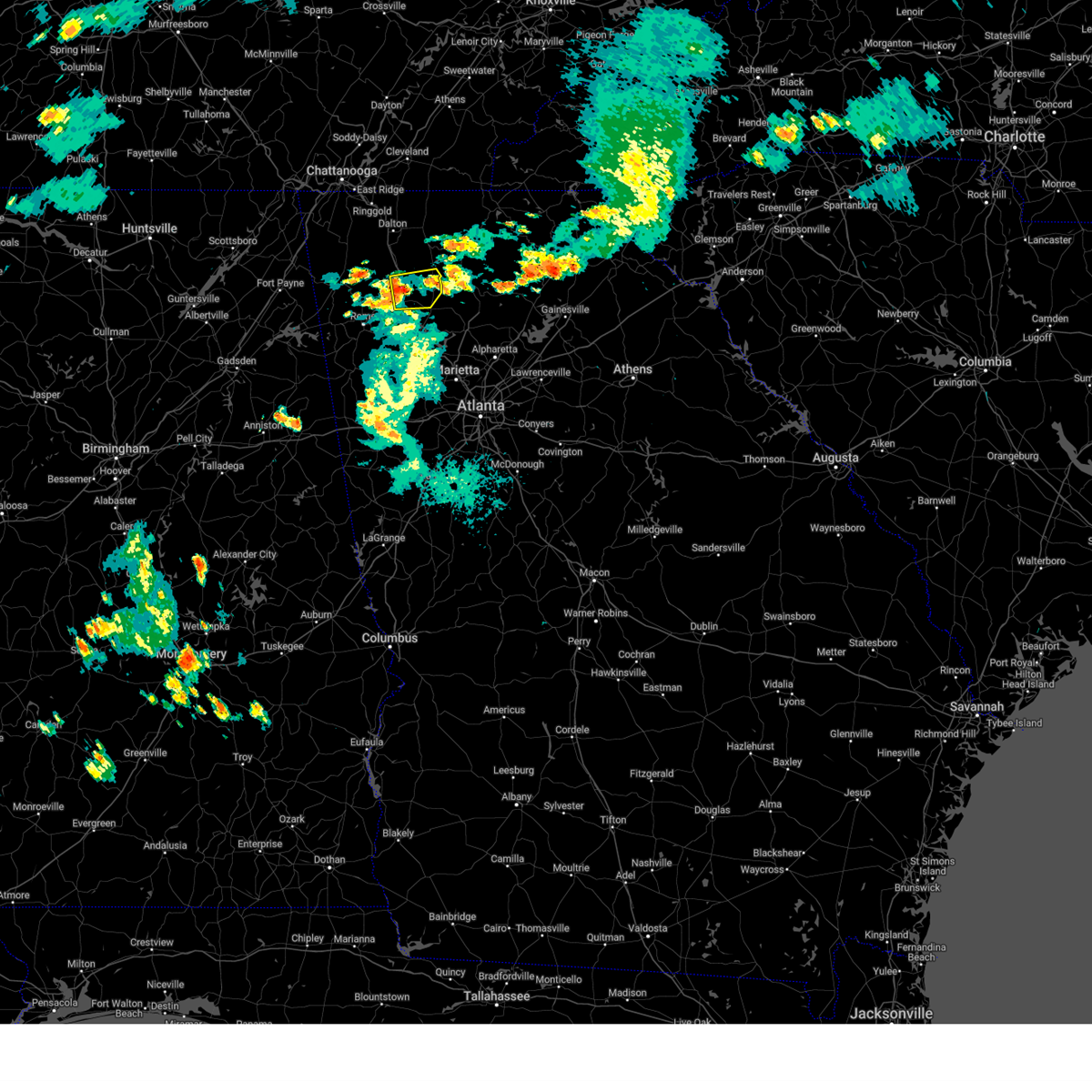
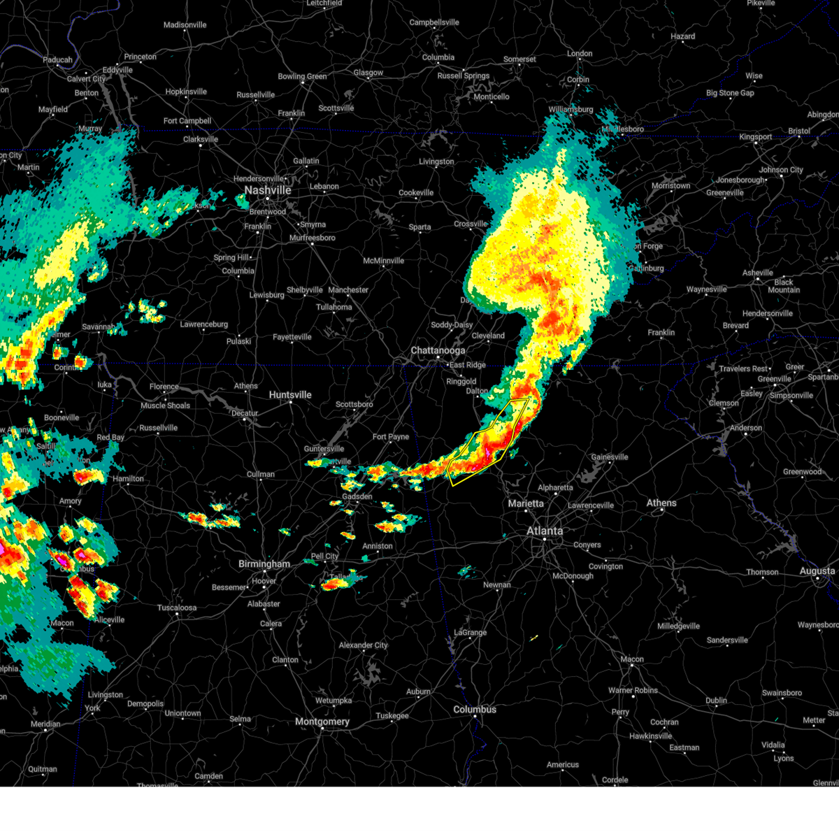
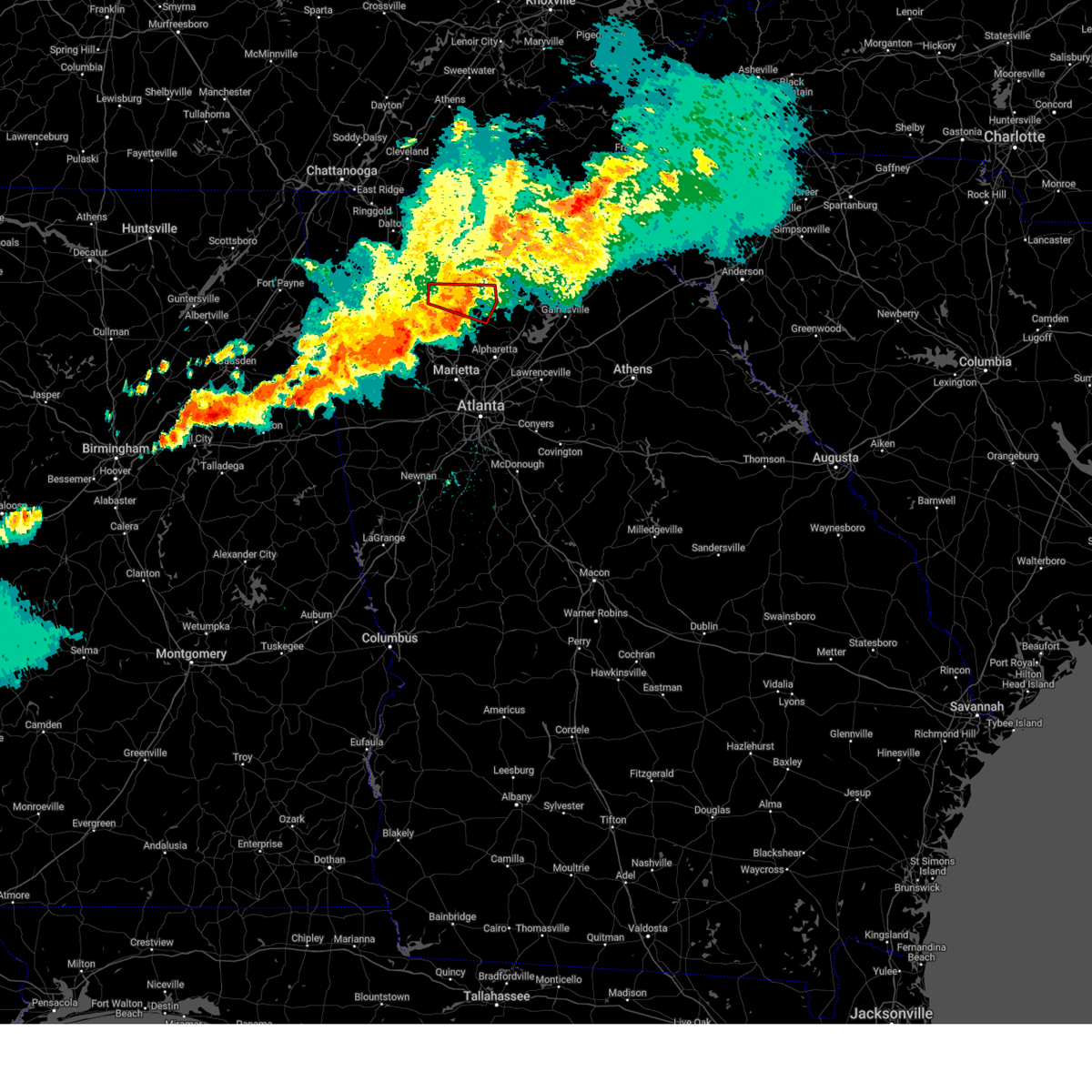
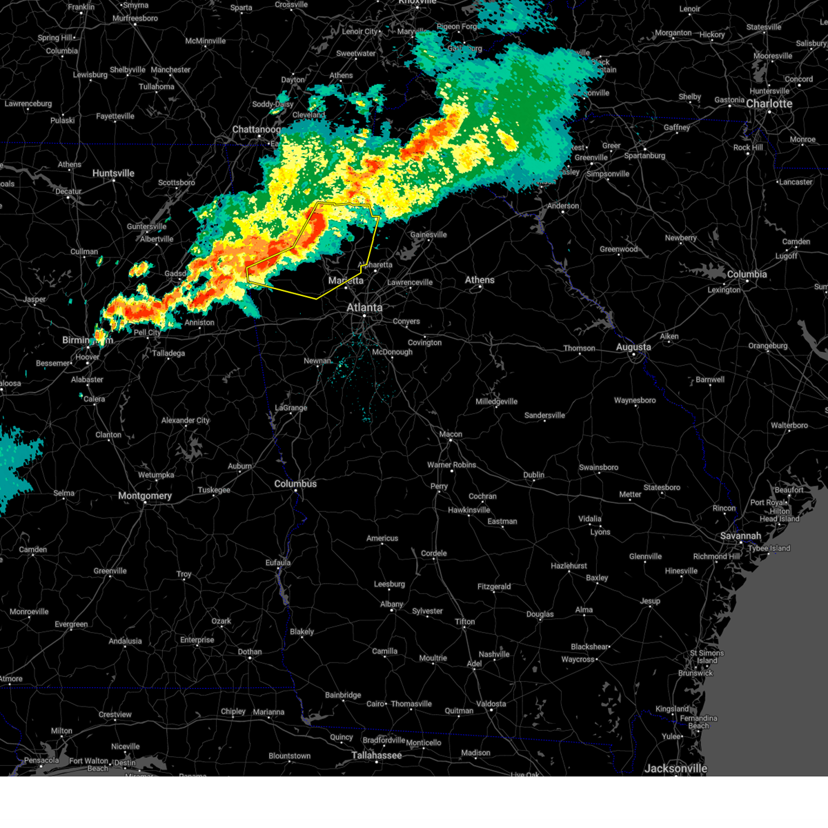
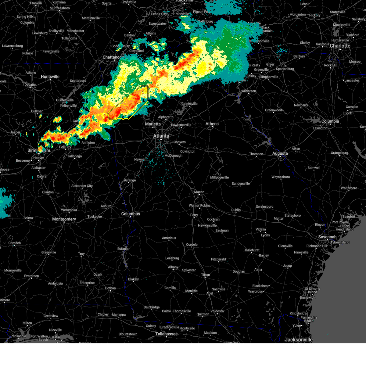
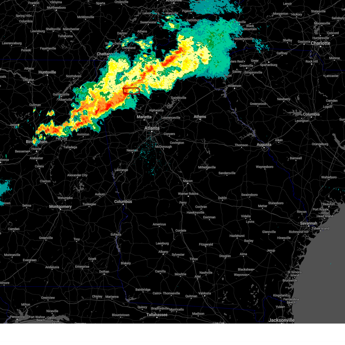
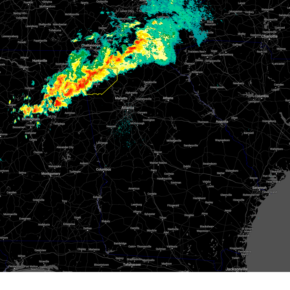
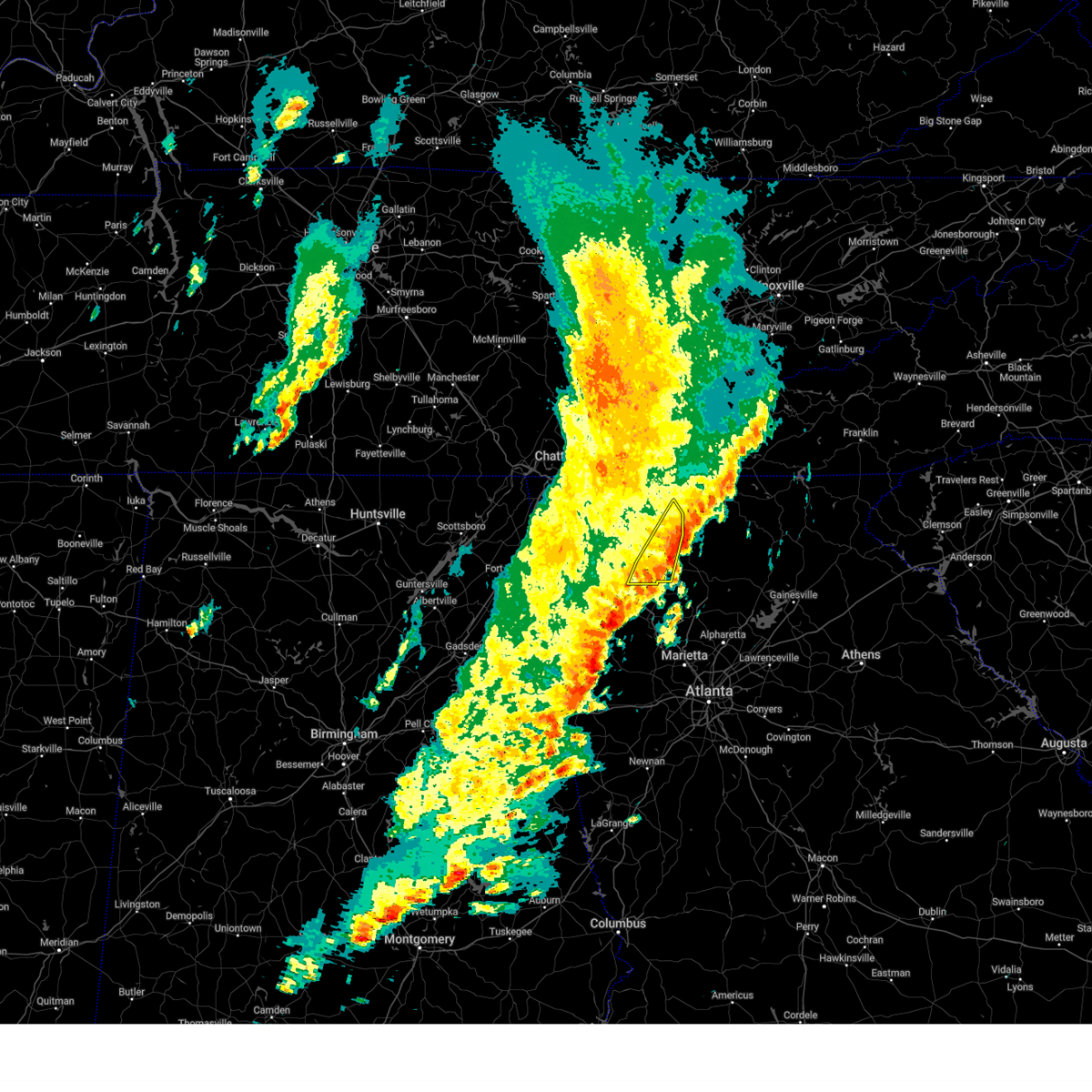
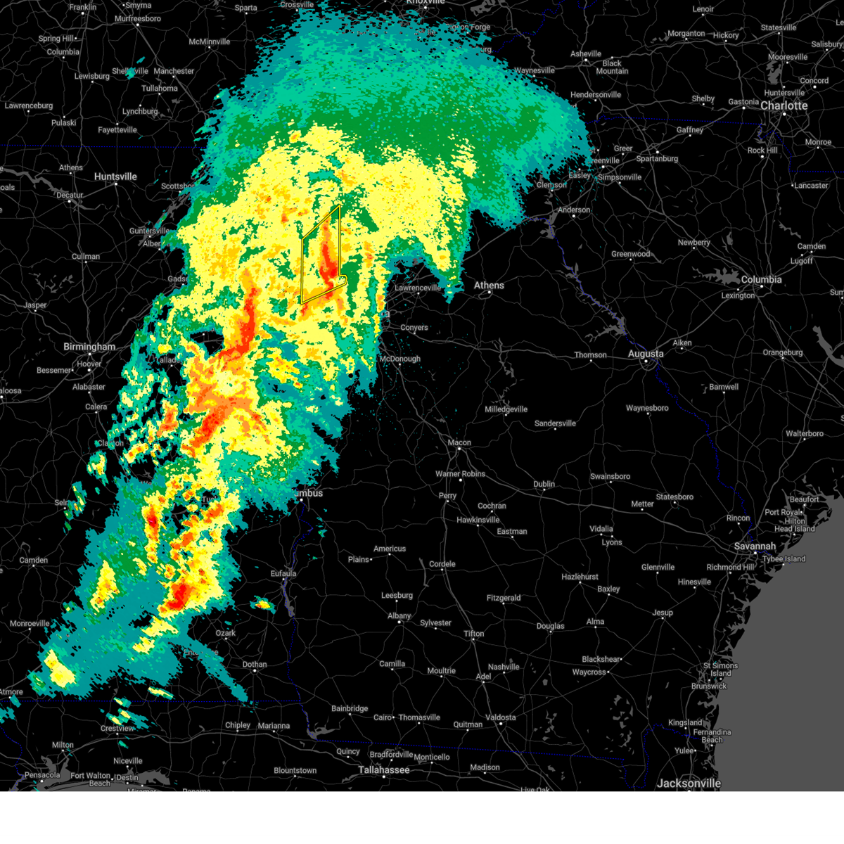
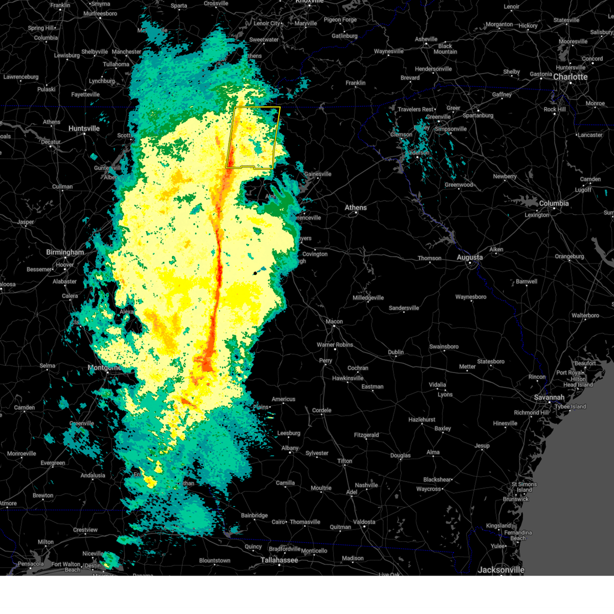
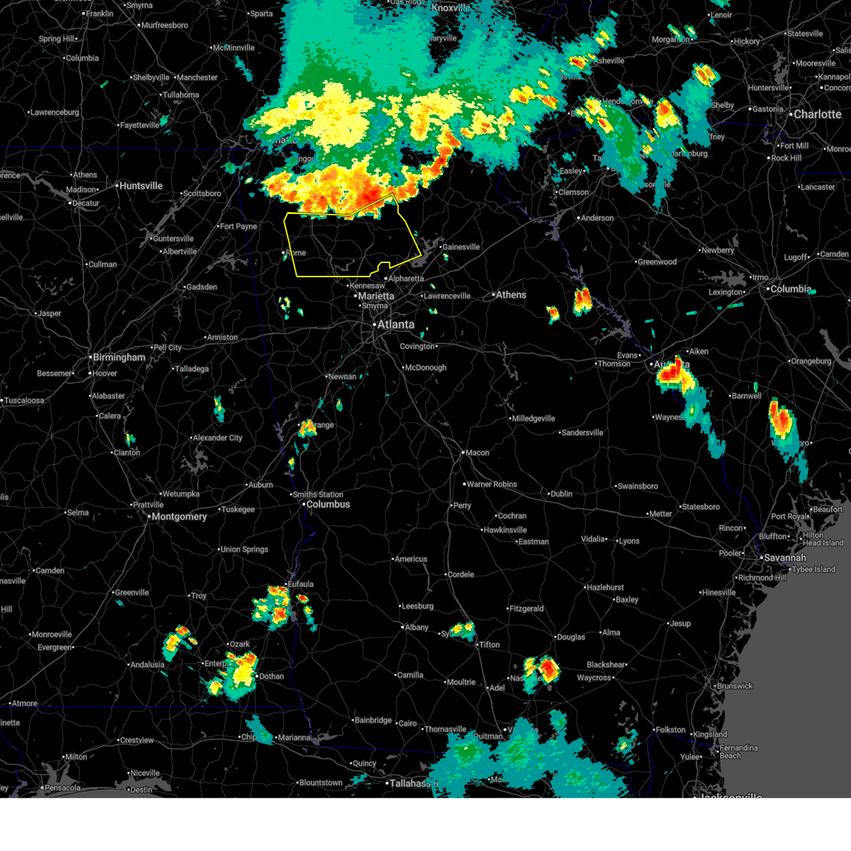
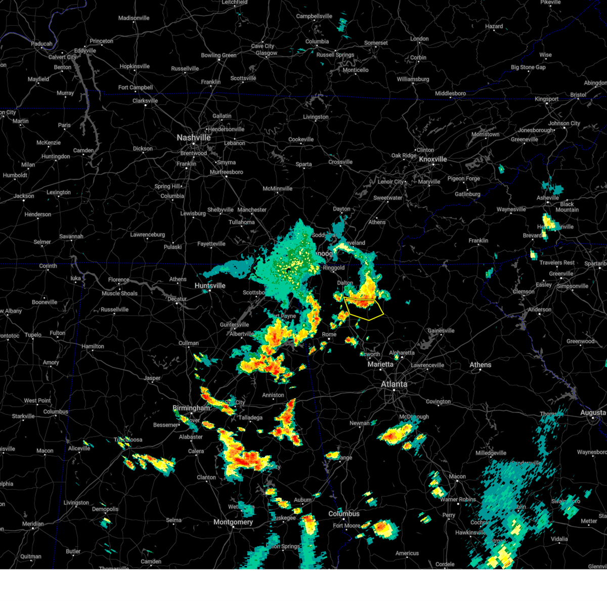
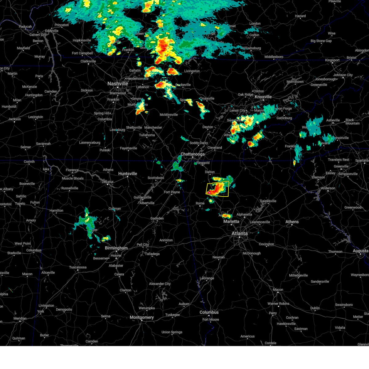
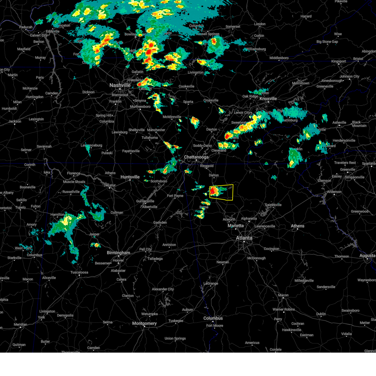
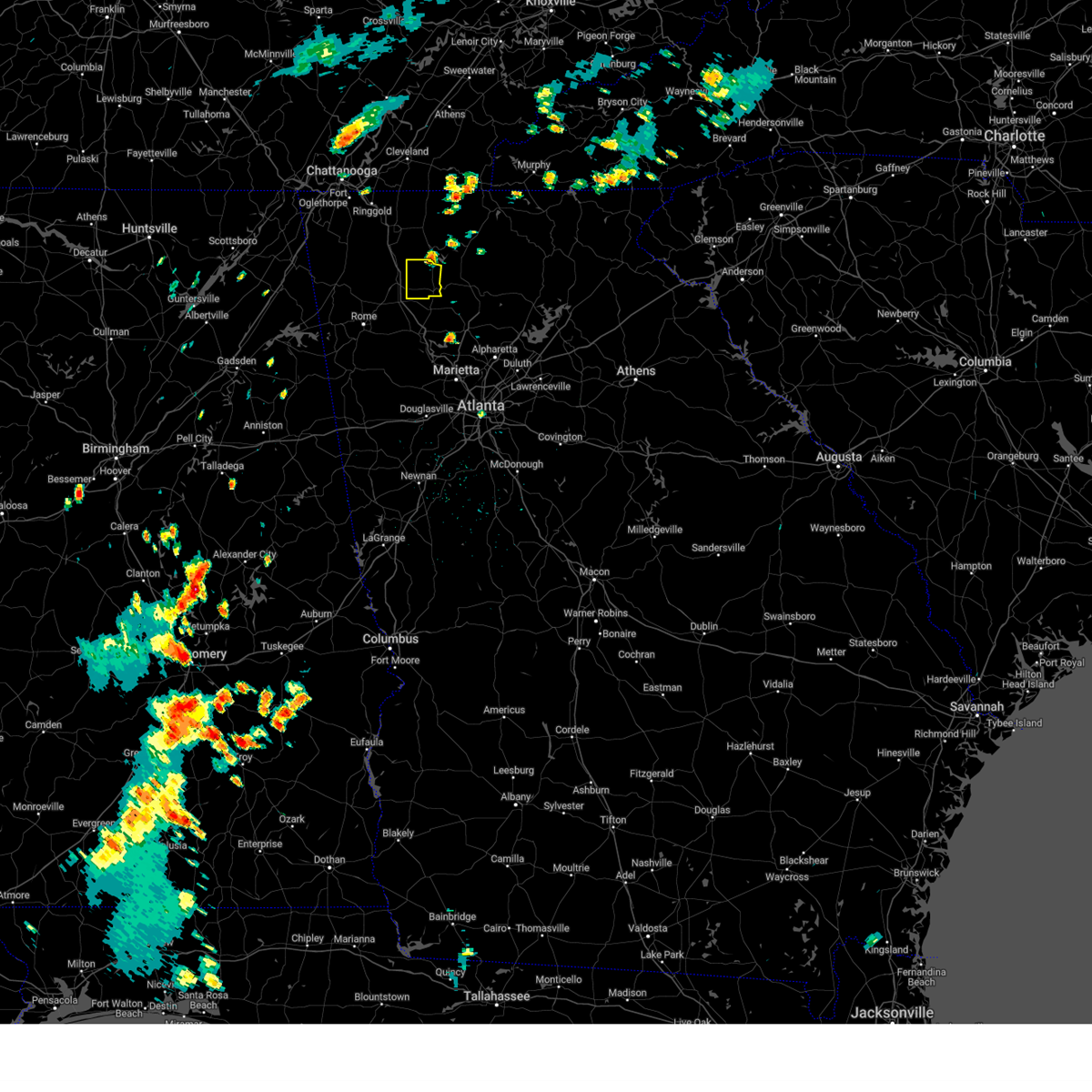
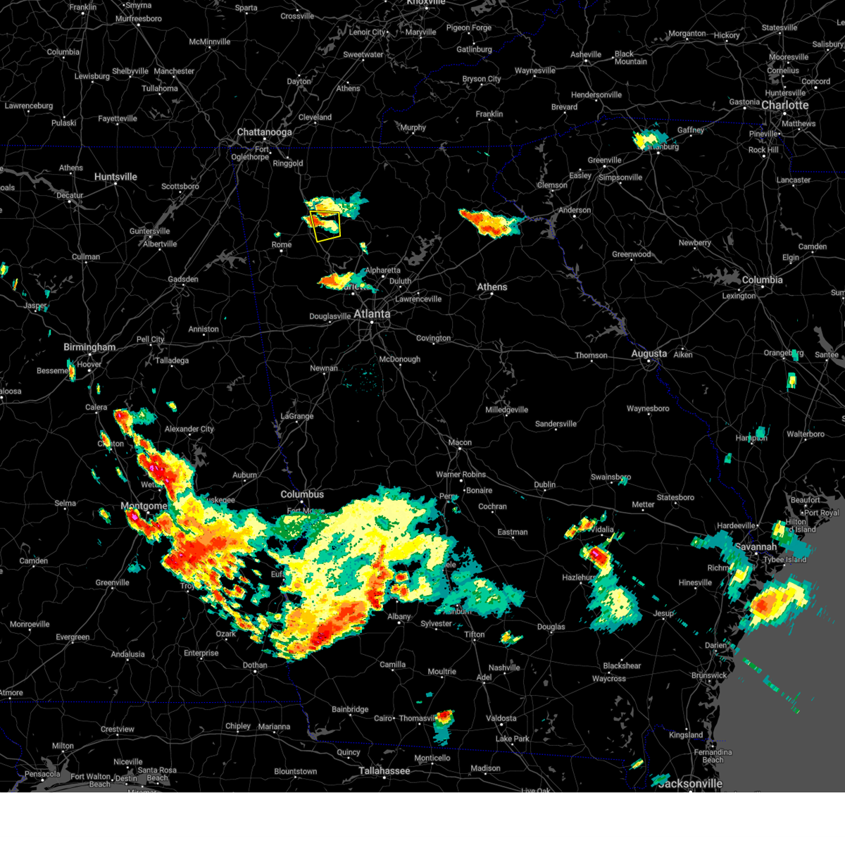
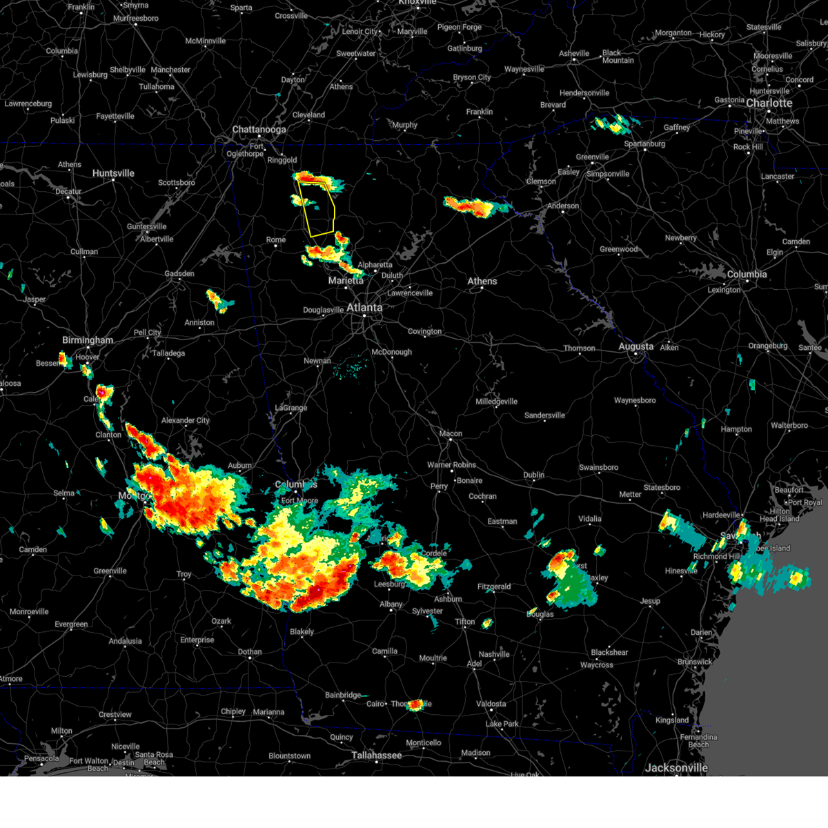
Hail Map for Fairmount, GA
The Fairmount, GA area has had 0 reports of on-the-ground hail by trained spotters, and has been under severe weather warnings 5 times during the past 12 months. Doppler radar has detected hail at or near Fairmount, GA on 34 occasions, including 1 occasion during the past year.
| Name: | Fairmount, GA |
| Where Located: | 50.9 miles NNW of Atlanta, GA |
| Map: | Google Map for Fairmount, GA |
| Population: | 720 |
| Housing Units: | 370 |
| More Info: | Search Google for Fairmount, GA |
2
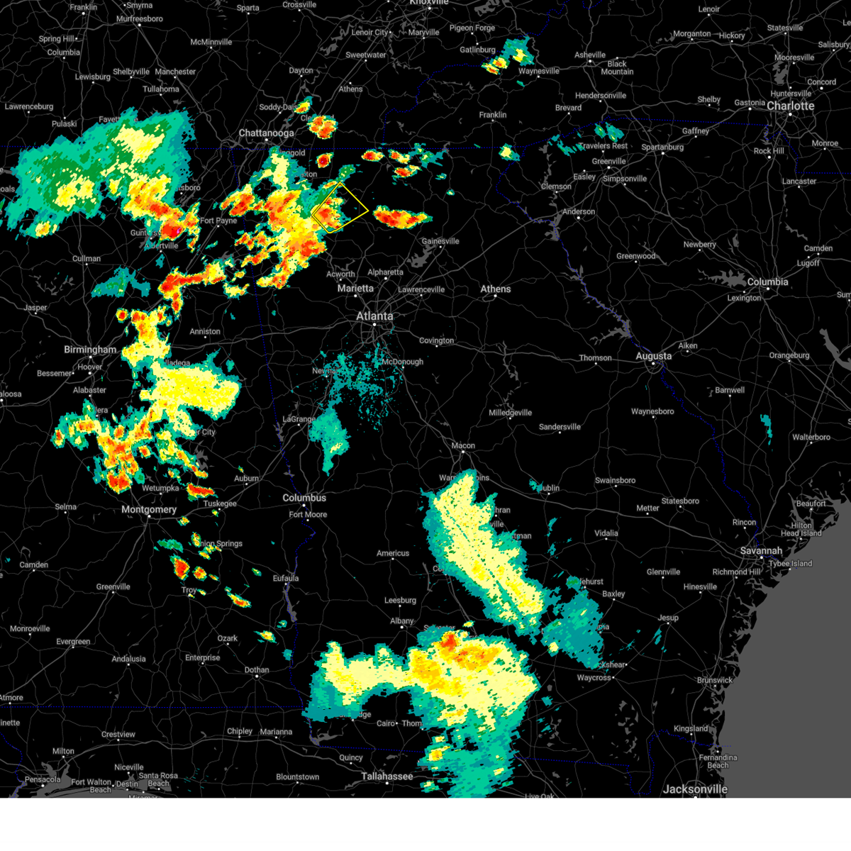
The Top Recent Hail Date for Fairmount, GA is Thursday, February 26, 2026 (2nd out of 34)
Hail and Wind Damage Spotted near Fairmount, GA
| Date / Time | Report Details |
|---|---|
| 3/16/2026 5:18 AM EDT |
 the severe thunderstorm warning has been cancelled and is no longer in effect the severe thunderstorm warning has been cancelled and is no longer in effect
|
| 3/16/2026 4:54 AM EDT |
 The storms which prompted the warning have moved out of the area. therefore, the warning will be allowed to expire. however, gusty winds and heavy rain are still possible with these thunderstorms. a tornado watch remains in effect until 600 am edt for north central and northwestern georgia. a tornado watch also remains in effect until 1000 am edt for northwestern georgia. to report severe weather, contact your nearest law enforcement agency. they will relay your report to the national weather service peachtree city. remember, a severe thunderstorm warning still remains in effect for bartow county and eastern gordon county until 530 am edt. The storms which prompted the warning have moved out of the area. therefore, the warning will be allowed to expire. however, gusty winds and heavy rain are still possible with these thunderstorms. a tornado watch remains in effect until 600 am edt for north central and northwestern georgia. a tornado watch also remains in effect until 1000 am edt for northwestern georgia. to report severe weather, contact your nearest law enforcement agency. they will relay your report to the national weather service peachtree city. remember, a severe thunderstorm warning still remains in effect for bartow county and eastern gordon county until 530 am edt.
|
| 3/16/2026 4:52 AM EDT |
 Svrffc the national weather service in peachtree city has issued a * severe thunderstorm warning for, western cherokee county in north central georgia, west central dawson county in north central georgia, southeastern gordon county in northwestern georgia, pickens county in north central georgia, bartow county in northwestern georgia, * until 530 am edt. * at 452 am edt, severe thunderstorms were located along a line extending from near hinton to stilesboro, moving northeast at 45 mph (radar indicated). Hazards include 60 mph wind gusts. expect damage to roofs, siding, and trees Svrffc the national weather service in peachtree city has issued a * severe thunderstorm warning for, western cherokee county in north central georgia, west central dawson county in north central georgia, southeastern gordon county in northwestern georgia, pickens county in north central georgia, bartow county in northwestern georgia, * until 530 am edt. * at 452 am edt, severe thunderstorms were located along a line extending from near hinton to stilesboro, moving northeast at 45 mph (radar indicated). Hazards include 60 mph wind gusts. expect damage to roofs, siding, and trees
|
| 3/16/2026 4:36 AM EDT |
 At 435 am edt, severe thunderstorms were located along a line extending from ramhurst to near rome, moving northeast at 45 mph (radar indicated). Hazards include 60 mph wind gusts. Expect damage to roofs, siding, and trees. Locations impacted include, rome, calhoun, adairsville, kingston, plainville, cassville, shannon, fairmount, ranger, pinson, sonoraville, lindale, redbud, folsom, audubon, pine log, oakman, and funkhouser. At 435 am edt, severe thunderstorms were located along a line extending from ramhurst to near rome, moving northeast at 45 mph (radar indicated). Hazards include 60 mph wind gusts. Expect damage to roofs, siding, and trees. Locations impacted include, rome, calhoun, adairsville, kingston, plainville, cassville, shannon, fairmount, ranger, pinson, sonoraville, lindale, redbud, folsom, audubon, pine log, oakman, and funkhouser.
|
| 3/16/2026 4:19 AM EDT |
 Svrffc the national weather service in peachtree city has issued a * severe thunderstorm warning for, floyd county in northwestern georgia, gordon county in northwestern georgia, northwestern pickens county in north central georgia, central bartow county in northwestern georgia, * until 500 am edt. * at 419 am edt, severe thunderstorms were located along a line extending from nickelsville to near cave spring, moving northeast at 45 mph (radar indicated). Hazards include 60 mph wind gusts. expect damage to roofs, siding, and trees Svrffc the national weather service in peachtree city has issued a * severe thunderstorm warning for, floyd county in northwestern georgia, gordon county in northwestern georgia, northwestern pickens county in north central georgia, central bartow county in northwestern georgia, * until 500 am edt. * at 419 am edt, severe thunderstorms were located along a line extending from nickelsville to near cave spring, moving northeast at 45 mph (radar indicated). Hazards include 60 mph wind gusts. expect damage to roofs, siding, and trees
|
| 6/14/2025 5:36 PM EDT |
 At 536 pm edt, a severe thunderstorm was located over jasper, moving east at 40 mph (radar indicated). Hazards include 60 mph wind gusts and penny size hail. Expect damage to roofs, siding, and trees. Locations impacted include, fairmount, ranger, salacoa valley, and funkhouser. At 536 pm edt, a severe thunderstorm was located over jasper, moving east at 40 mph (radar indicated). Hazards include 60 mph wind gusts and penny size hail. Expect damage to roofs, siding, and trees. Locations impacted include, fairmount, ranger, salacoa valley, and funkhouser.
|
| 6/14/2025 5:18 PM EDT |
 At 517 pm edt, a severe thunderstorm was located near salacoa valley, or 12 miles west of jasper, moving east at 40 mph (radar indicated). Hazards include 60 mph wind gusts and dime size hail. Expect damage to roofs, siding, and trees. Locations impacted include, calhoun, white, fairmount, ranger, sonoraville, salacoa valley, pine log, redbud, folsom, and funkhouser. At 517 pm edt, a severe thunderstorm was located near salacoa valley, or 12 miles west of jasper, moving east at 40 mph (radar indicated). Hazards include 60 mph wind gusts and dime size hail. Expect damage to roofs, siding, and trees. Locations impacted include, calhoun, white, fairmount, ranger, sonoraville, salacoa valley, pine log, redbud, folsom, and funkhouser.
|
| 6/14/2025 4:58 PM EDT |
 Svrffc the national weather service in peachtree city has issued a * severe thunderstorm warning for, northwestern cherokee county in north central georgia, southeastern gordon county in northwestern georgia, southwestern pickens county in north central georgia, northeastern bartow county in northwestern georgia, * until 545 pm edt. * at 457 pm edt, a severe thunderstorm was located over adairsville, or 8 miles south of calhoun, moving east at 40 mph (radar indicated). Hazards include 60 mph wind gusts and dime size hail. expect damage to roofs, siding, and trees Svrffc the national weather service in peachtree city has issued a * severe thunderstorm warning for, northwestern cherokee county in north central georgia, southeastern gordon county in northwestern georgia, southwestern pickens county in north central georgia, northeastern bartow county in northwestern georgia, * until 545 pm edt. * at 457 pm edt, a severe thunderstorm was located over adairsville, or 8 miles south of calhoun, moving east at 40 mph (radar indicated). Hazards include 60 mph wind gusts and dime size hail. expect damage to roofs, siding, and trees
|
| 6/7/2025 5:35 PM EDT |
 the severe thunderstorm warning has been cancelled and is no longer in effect the severe thunderstorm warning has been cancelled and is no longer in effect
|
| 6/7/2025 5:35 PM EDT |
 At 535 pm edt, severe thunderstorms were located along a line extending from near talona to near powder springs, moving east at 45 mph (radar indicated). Hazards include 60 mph wind gusts. Expect damage to roofs, siding, and trees. Locations impacted include, atlanta, marietta, canton, cartersville, dallas, jasper, mountain park, sandy springs, roswell, alpharetta, smyrna, milton, kennesaw, woodstock, acworth, powder springs, holly springs, hiram, emerson, and ball ground. At 535 pm edt, severe thunderstorms were located along a line extending from near talona to near powder springs, moving east at 45 mph (radar indicated). Hazards include 60 mph wind gusts. Expect damage to roofs, siding, and trees. Locations impacted include, atlanta, marietta, canton, cartersville, dallas, jasper, mountain park, sandy springs, roswell, alpharetta, smyrna, milton, kennesaw, woodstock, acworth, powder springs, holly springs, hiram, emerson, and ball ground.
|
| 6/7/2025 5:25 PM EDT |
 The storms which prompted the warning have moved out of the area. therefore, the warning will be allowed to expire. however, gusty winds and heavy rain are still possible with these thunderstorms. a severe thunderstorm watch remains in effect until 900 pm edt for north central and northwestern georgia. remember, a severe thunderstorm warning still remains in effect for eastern gordon, bartow, and paulding counties. The storms which prompted the warning have moved out of the area. therefore, the warning will be allowed to expire. however, gusty winds and heavy rain are still possible with these thunderstorms. a severe thunderstorm watch remains in effect until 900 pm edt for north central and northwestern georgia. remember, a severe thunderstorm warning still remains in effect for eastern gordon, bartow, and paulding counties.
|
| 6/7/2025 5:20 PM EDT |
 At 519 pm edt, severe thunderstorms were located along a line extending from carters to holly springs to near new georgia, moving east at 55 mph (radar indicated). Hazards include 60 mph wind gusts. Expect damage to roofs, siding, and trees. Locations impacted include, cartersville, calhoun, dallas, adairsville, rockmart, euharlee, hiram, emerson, aragon, white, kingston, resaca, braswell, taylorsville, cassville, yorkville, fairmount, ranger, burnt hickory ridge, and red top mountain state park. At 519 pm edt, severe thunderstorms were located along a line extending from carters to holly springs to near new georgia, moving east at 55 mph (radar indicated). Hazards include 60 mph wind gusts. Expect damage to roofs, siding, and trees. Locations impacted include, cartersville, calhoun, dallas, adairsville, rockmart, euharlee, hiram, emerson, aragon, white, kingston, resaca, braswell, taylorsville, cassville, yorkville, fairmount, ranger, burnt hickory ridge, and red top mountain state park.
|
| 6/7/2025 5:20 PM EDT |
 the severe thunderstorm warning has been cancelled and is no longer in effect the severe thunderstorm warning has been cancelled and is no longer in effect
|
| 6/7/2025 5:14 PM EDT |
 Svrffc the national weather service in peachtree city has issued a * severe thunderstorm warning for, central paulding county in northwestern georgia, cherokee county in north central georgia, cobb county in north central georgia, west central lumpkin county in north central georgia, southern gilmer county in north central georgia, south central murray county in northwestern georgia, western dawson county in north central georgia, eastern gordon county in northwestern georgia, north central fulton county in north central georgia, pickens county in north central georgia, bartow county in northwestern georgia, * until 600 pm edt. * at 513 pm edt, severe thunderstorms were located along a line extending from carters to near yorkville, moving east at 40 mph (radar indicated). Hazards include 60 mph wind gusts. expect damage to roofs, siding, and trees Svrffc the national weather service in peachtree city has issued a * severe thunderstorm warning for, central paulding county in northwestern georgia, cherokee county in north central georgia, cobb county in north central georgia, west central lumpkin county in north central georgia, southern gilmer county in north central georgia, south central murray county in northwestern georgia, western dawson county in north central georgia, eastern gordon county in northwestern georgia, north central fulton county in north central georgia, pickens county in north central georgia, bartow county in northwestern georgia, * until 600 pm edt. * at 513 pm edt, severe thunderstorms were located along a line extending from carters to near yorkville, moving east at 40 mph (radar indicated). Hazards include 60 mph wind gusts. expect damage to roofs, siding, and trees
|
| 6/7/2025 4:57 PM EDT |
 At 457 pm edt, severe thunderstorms were located along a line extending from near sugar valley to cartersville to buchanan, moving east at 55 mph (radar indicated). Hazards include 70 mph wind gusts. Expect considerable tree damage. damage is likely to mobile homes, roofs, and outbuildings. Locations impacted include, rome, cartersville, calhoun, dallas, cedartown, buchanan, adairsville, rockmart, euharlee, hiram, tallapoosa, emerson, aragon, white, kingston, resaca, braswell, plainville, taylorsville, and shannon. At 457 pm edt, severe thunderstorms were located along a line extending from near sugar valley to cartersville to buchanan, moving east at 55 mph (radar indicated). Hazards include 70 mph wind gusts. Expect considerable tree damage. damage is likely to mobile homes, roofs, and outbuildings. Locations impacted include, rome, cartersville, calhoun, dallas, cedartown, buchanan, adairsville, rockmart, euharlee, hiram, tallapoosa, emerson, aragon, white, kingston, resaca, braswell, plainville, taylorsville, and shannon.
|
| 6/7/2025 4:38 PM EDT |
 Svrffc the national weather service in peachtree city has issued a * severe thunderstorm warning for, paulding county in northwestern georgia, haralson county in northwestern georgia, southwestern gilmer county in north central georgia, southwestern murray county in northwestern georgia, floyd county in northwestern georgia, south central whitfield county in northwestern georgia, southeastern walker county in northwestern georgia, gordon county in northwestern georgia, polk county in northwestern georgia, chattooga county in northwestern georgia, bartow county in northwestern georgia, * until 530 pm edt. * at 438 pm edt, severe thunderstorms were located along a line extending from near trion to near seney to near fruithurst, moving east at 55 mph (radar indicated). Hazards include 60 mph wind gusts. expect damage to roofs, siding, and trees Svrffc the national weather service in peachtree city has issued a * severe thunderstorm warning for, paulding county in northwestern georgia, haralson county in northwestern georgia, southwestern gilmer county in north central georgia, southwestern murray county in northwestern georgia, floyd county in northwestern georgia, south central whitfield county in northwestern georgia, southeastern walker county in northwestern georgia, gordon county in northwestern georgia, polk county in northwestern georgia, chattooga county in northwestern georgia, bartow county in northwestern georgia, * until 530 pm edt. * at 438 pm edt, severe thunderstorms were located along a line extending from near trion to near seney to near fruithurst, moving east at 55 mph (radar indicated). Hazards include 60 mph wind gusts. expect damage to roofs, siding, and trees
|
| 6/6/2025 9:32 PM EDT |
 the severe thunderstorm warning has been cancelled and is no longer in effect the severe thunderstorm warning has been cancelled and is no longer in effect
|
| 6/6/2025 9:14 PM EDT |
 Svrffc the national weather service in peachtree city has issued a * severe thunderstorm warning for, southeastern gordon county in northwestern georgia, northeastern bartow county in northwestern georgia, * until 945 pm edt. * at 914 pm edt, a severe thunderstorm was located near sonoraville, or near calhoun, moving east at 40 mph (radar indicated). Hazards include 60 mph wind gusts and quarter size hail. Hail damage to vehicles is expected. Expect wind damage to roofs, siding, and trees. Svrffc the national weather service in peachtree city has issued a * severe thunderstorm warning for, southeastern gordon county in northwestern georgia, northeastern bartow county in northwestern georgia, * until 945 pm edt. * at 914 pm edt, a severe thunderstorm was located near sonoraville, or near calhoun, moving east at 40 mph (radar indicated). Hazards include 60 mph wind gusts and quarter size hail. Hail damage to vehicles is expected. Expect wind damage to roofs, siding, and trees.
|
| 5/25/2025 7:30 PM EDT |
 The storms which prompted the warning have moved out of the area. therefore, the warning will be allowed to expire. a severe thunderstorm watch remains in effect until midnight edt for north central and northwestern georgia. remember, a severe thunderstorm warning still remains in effect for southwestern gilmer, southeast gordon, bartow, and southeast floyd counties through 815 pm edt. The storms which prompted the warning have moved out of the area. therefore, the warning will be allowed to expire. a severe thunderstorm watch remains in effect until midnight edt for north central and northwestern georgia. remember, a severe thunderstorm warning still remains in effect for southwestern gilmer, southeast gordon, bartow, and southeast floyd counties through 815 pm edt.
|
| 5/25/2025 7:27 PM EDT |
 Svrffc the national weather service in peachtree city has issued a * severe thunderstorm warning for, northwestern cherokee county in north central georgia, southwestern gilmer county in north central georgia, southeastern floyd county in northwestern georgia, southeastern gordon county in northwestern georgia, pickens county in north central georgia, bartow county in northwestern georgia, * until 815 pm edt. * at 727 pm edt, severe thunderstorms were located along a line extending from near roundtop to folsom to near lindale, moving southeast at 35 mph (radar indicated). Hazards include 60 mph wind gusts and quarter size hail. Hail damage to vehicles is expected. Expect wind damage to roofs, siding, and trees. Svrffc the national weather service in peachtree city has issued a * severe thunderstorm warning for, northwestern cherokee county in north central georgia, southwestern gilmer county in north central georgia, southeastern floyd county in northwestern georgia, southeastern gordon county in northwestern georgia, pickens county in north central georgia, bartow county in northwestern georgia, * until 815 pm edt. * at 727 pm edt, severe thunderstorms were located along a line extending from near roundtop to folsom to near lindale, moving southeast at 35 mph (radar indicated). Hazards include 60 mph wind gusts and quarter size hail. Hail damage to vehicles is expected. Expect wind damage to roofs, siding, and trees.
|
| 5/25/2025 7:21 PM EDT |
 At 721 pm edt, severe thunderstorms were located along a line extending from near white bluff to near lyles to 6 miles south of centerville, moving southeast at 45 mph (radar indicated). Hazards include 60 mph wind gusts and quarter size hail. Hail damage to vehicles is expected. expect wind damage to roofs, siding, and trees. Locations impacted include, rome, calhoun, adairsville, kingston, plainville, shannon, fairmount, ranger, carters, sonoraville, pinson, tails creek, lindale, redbud, folsom, audubon, and oakman. At 721 pm edt, severe thunderstorms were located along a line extending from near white bluff to near lyles to 6 miles south of centerville, moving southeast at 45 mph (radar indicated). Hazards include 60 mph wind gusts and quarter size hail. Hail damage to vehicles is expected. expect wind damage to roofs, siding, and trees. Locations impacted include, rome, calhoun, adairsville, kingston, plainville, shannon, fairmount, ranger, carters, sonoraville, pinson, tails creek, lindale, redbud, folsom, audubon, and oakman.
|
| 5/25/2025 7:07 PM EDT |
 the severe thunderstorm warning has been cancelled and is no longer in effect the severe thunderstorm warning has been cancelled and is no longer in effect
|
| 5/25/2025 7:07 PM EDT |
 At 707 pm edt, severe thunderstorms were located along a line extending from near hillsboro to near belvidere to francisco, moving southeast at 45 mph (radar indicated). Hazards include 60 mph wind gusts and nickel size hail. Expect damage to roofs, siding, and trees. Locations impacted include, rome, calhoun, chatsworth, adairsville, kingston, resaca, plainville, shannon, fairmount, ranger, pinson, redbud, folsom, oakman, fort mountain state park, carters, sonoraville, tails creek, lindale, and ramhurst. At 707 pm edt, severe thunderstorms were located along a line extending from near hillsboro to near belvidere to francisco, moving southeast at 45 mph (radar indicated). Hazards include 60 mph wind gusts and nickel size hail. Expect damage to roofs, siding, and trees. Locations impacted include, rome, calhoun, chatsworth, adairsville, kingston, resaca, plainville, shannon, fairmount, ranger, pinson, redbud, folsom, oakman, fort mountain state park, carters, sonoraville, tails creek, lindale, and ramhurst.
|
| 5/25/2025 6:49 PM EDT |
 Svrffc the national weather service in peachtree city has issued a * severe thunderstorm warning for, western gilmer county in north central georgia, murray county in northwestern georgia, floyd county in northwestern georgia, southeastern whitfield county in northwestern georgia, southeastern walker county in northwestern georgia, gordon county in northwestern georgia, central chattooga county in northwestern georgia, northwestern bartow county in northwestern georgia, * until 730 pm edt. * at 649 pm edt, severe thunderstorms were located along a line extending from near dawnville to near subligna to near tidings, moving southeast at 45 mph (radar indicated). Hazards include 60 mph wind gusts. expect damage to roofs, siding, and trees Svrffc the national weather service in peachtree city has issued a * severe thunderstorm warning for, western gilmer county in north central georgia, murray county in northwestern georgia, floyd county in northwestern georgia, southeastern whitfield county in northwestern georgia, southeastern walker county in northwestern georgia, gordon county in northwestern georgia, central chattooga county in northwestern georgia, northwestern bartow county in northwestern georgia, * until 730 pm edt. * at 649 pm edt, severe thunderstorms were located along a line extending from near dawnville to near subligna to near tidings, moving southeast at 45 mph (radar indicated). Hazards include 60 mph wind gusts. expect damage to roofs, siding, and trees
|
| 5/21/2025 12:15 AM EDT |
 the tornado warning has been cancelled and is no longer in effect the tornado warning has been cancelled and is no longer in effect
|
| 5/21/2025 12:08 AM EDT |
 The storm which prompted the warning has moved out of the area. therefore, the warning will be allowed to expire. a tornado watch remains in effect until 200 am edt for north central and northwestern georgia. The storm which prompted the warning has moved out of the area. therefore, the warning will be allowed to expire. a tornado watch remains in effect until 200 am edt for north central and northwestern georgia.
|
| 5/20/2025 11:58 PM EDT |
 At 1158 pm edt, a severe thunderstorm capable of producing a tornado was located near sonoraville, or 10 miles east of calhoun, moving east at 30 mph (radar indicated rotation). Hazards include tornado. Flying debris will be dangerous to those caught without shelter. mobile homes will be damaged or destroyed. damage to roofs, windows, and vehicles will occur. tree damage is likely. Locations impacted include, fairmount, ranger, and sonoraville. At 1158 pm edt, a severe thunderstorm capable of producing a tornado was located near sonoraville, or 10 miles east of calhoun, moving east at 30 mph (radar indicated rotation). Hazards include tornado. Flying debris will be dangerous to those caught without shelter. mobile homes will be damaged or destroyed. damage to roofs, windows, and vehicles will occur. tree damage is likely. Locations impacted include, fairmount, ranger, and sonoraville.
|
| 5/20/2025 11:54 PM EDT |
 Torffc the national weather service in peachtree city has issued a * tornado warning for, northern cherokee county in north central georgia, southeastern gordon county in northwestern georgia, southern pickens county in north central georgia, northeastern bartow county in northwestern georgia, * until 1230 am edt. * at 1153 pm edt, a severe thunderstorm capable of producing a tornado was located over funkhouser, or 14 miles west of jasper, moving east at 50 mph (radar indicated rotation). Hazards include tornado. Flying debris will be dangerous to those caught without shelter. mobile homes will be damaged or destroyed. damage to roofs, windows, and vehicles will occur. Tree damage is likely. Torffc the national weather service in peachtree city has issued a * tornado warning for, northern cherokee county in north central georgia, southeastern gordon county in northwestern georgia, southern pickens county in north central georgia, northeastern bartow county in northwestern georgia, * until 1230 am edt. * at 1153 pm edt, a severe thunderstorm capable of producing a tornado was located over funkhouser, or 14 miles west of jasper, moving east at 50 mph (radar indicated rotation). Hazards include tornado. Flying debris will be dangerous to those caught without shelter. mobile homes will be damaged or destroyed. damage to roofs, windows, and vehicles will occur. Tree damage is likely.
|
| 5/20/2025 11:51 PM EDT |
 At 1151 pm edt, severe thunderstorms were located along a line extending from near roundtop to near kingston to near etna, moving east at 40 mph (radar indicated). Hazards include 60 mph wind gusts. Expect damage to roofs, siding, and trees. Locations impacted include, marietta, canton, cartersville, dallas, cedartown, jasper, kennesaw, woodstock, acworth, holly springs, adairsville, rockmart, euharlee, hiram, emerson, ball ground, nelson, aragon, cave spring, and white. At 1151 pm edt, severe thunderstorms were located along a line extending from near roundtop to near kingston to near etna, moving east at 40 mph (radar indicated). Hazards include 60 mph wind gusts. Expect damage to roofs, siding, and trees. Locations impacted include, marietta, canton, cartersville, dallas, cedartown, jasper, kennesaw, woodstock, acworth, holly springs, adairsville, rockmart, euharlee, hiram, emerson, ball ground, nelson, aragon, cave spring, and white.
|
| 5/20/2025 11:49 PM EDT |
 the severe thunderstorm warning has been cancelled and is no longer in effect the severe thunderstorm warning has been cancelled and is no longer in effect
|
| 5/20/2025 11:49 PM EDT |
 Svrffc the national weather service in peachtree city has issued a * severe thunderstorm warning for, northern paulding county in northwestern georgia, cherokee county in north central georgia, northwestern cobb county in north central georgia, southeastern floyd county in northwestern georgia, southeastern gordon county in northwestern georgia, polk county in northwestern georgia, pickens county in north central georgia, bartow county in northwestern georgia, * until 1230 am edt. * at 1148 pm edt, severe thunderstorms were located along a line extending from near roundtop to kingston to near etna, moving east at 40 mph (radar indicated). Hazards include 60 mph wind gusts. expect damage to roofs, siding, and trees Svrffc the national weather service in peachtree city has issued a * severe thunderstorm warning for, northern paulding county in northwestern georgia, cherokee county in north central georgia, northwestern cobb county in north central georgia, southeastern floyd county in northwestern georgia, southeastern gordon county in northwestern georgia, polk county in northwestern georgia, pickens county in north central georgia, bartow county in northwestern georgia, * until 1230 am edt. * at 1148 pm edt, severe thunderstorms were located along a line extending from near roundtop to kingston to near etna, moving east at 40 mph (radar indicated). Hazards include 60 mph wind gusts. expect damage to roofs, siding, and trees
|
| 5/20/2025 11:49 PM EDT |
 At 1149 pm edt, severe thunderstorms were located along a line extending from carters to near forney, moving east at 35 mph (radar indicated). Hazards include 60 mph wind gusts. Expect damage to roofs, siding, and trees. Locations impacted include, rome, calhoun, adairsville, euharlee, cave spring, kingston, plainville, cassville, shannon, fairmount, ranger, carters, sonoraville, pinson, lindale, redbud, folsom, audubon, seney, and pine log. At 1149 pm edt, severe thunderstorms were located along a line extending from carters to near forney, moving east at 35 mph (radar indicated). Hazards include 60 mph wind gusts. Expect damage to roofs, siding, and trees. Locations impacted include, rome, calhoun, adairsville, euharlee, cave spring, kingston, plainville, cassville, shannon, fairmount, ranger, carters, sonoraville, pinson, lindale, redbud, folsom, audubon, seney, and pine log.
|
| 5/20/2025 11:39 PM EDT |
 Torffc the national weather service in peachtree city has issued a * tornado warning for, southeastern gordon county in northwestern georgia, * until 1215 am edt. * at 1139 pm edt, a severe thunderstorm capable of producing a tornado was located over calhoun, moving east at 35 mph (radar indicated rotation). Hazards include tornado. Flying debris will be dangerous to those caught without shelter. mobile homes will be damaged or destroyed. damage to roofs, windows, and vehicles will occur. Tree damage is likely. Torffc the national weather service in peachtree city has issued a * tornado warning for, southeastern gordon county in northwestern georgia, * until 1215 am edt. * at 1139 pm edt, a severe thunderstorm capable of producing a tornado was located over calhoun, moving east at 35 mph (radar indicated rotation). Hazards include tornado. Flying debris will be dangerous to those caught without shelter. mobile homes will be damaged or destroyed. damage to roofs, windows, and vehicles will occur. Tree damage is likely.
|
| 5/20/2025 11:13 PM EDT |
 Svrffc the national weather service in peachtree city has issued a * severe thunderstorm warning for, southwestern murray county in northwestern georgia, floyd county in northwestern georgia, gordon county in northwestern georgia, central chattooga county in northwestern georgia, central bartow county in northwestern georgia, * until midnight edt. * at 1112 pm edt, severe thunderstorms were located along a line extending from near sugar valley to near slackland, moving east at 35 mph (radar indicated). Hazards include 60 mph wind gusts. expect damage to roofs, siding, and trees Svrffc the national weather service in peachtree city has issued a * severe thunderstorm warning for, southwestern murray county in northwestern georgia, floyd county in northwestern georgia, gordon county in northwestern georgia, central chattooga county in northwestern georgia, central bartow county in northwestern georgia, * until midnight edt. * at 1112 pm edt, severe thunderstorms were located along a line extending from near sugar valley to near slackland, moving east at 35 mph (radar indicated). Hazards include 60 mph wind gusts. expect damage to roofs, siding, and trees
|
| 5/3/2025 6:57 PM EDT |
 The storms which prompted the warning have moved out of the area. therefore, the warning will be allowed to expire. a severe thunderstorm watch remains in effect until 1100 pm edt for north central and northwestern georgia. The storms which prompted the warning have moved out of the area. therefore, the warning will be allowed to expire. a severe thunderstorm watch remains in effect until 1100 pm edt for north central and northwestern georgia.
|
| 5/3/2025 6:42 PM EDT |
 At 642 pm edt, severe thunderstorms were located along a line extending from near fort mountain state park to sonoraville, moving east at 30 mph (radar indicated). Hazards include 60 mph wind gusts. Expect damage to roofs, siding, and trees. Locations impacted include, fairmount, ranger, carters, sonoraville, tails creek, ramhurst, oakman, redbud, audubon, and mountaintown. At 642 pm edt, severe thunderstorms were located along a line extending from near fort mountain state park to sonoraville, moving east at 30 mph (radar indicated). Hazards include 60 mph wind gusts. Expect damage to roofs, siding, and trees. Locations impacted include, fairmount, ranger, carters, sonoraville, tails creek, ramhurst, oakman, redbud, audubon, and mountaintown.
|
| 5/3/2025 6:42 PM EDT |
 the severe thunderstorm warning has been cancelled and is no longer in effect the severe thunderstorm warning has been cancelled and is no longer in effect
|
| 5/3/2025 6:14 PM EDT |
 Svrffc the national weather service in peachtree city has issued a * severe thunderstorm warning for, western gilmer county in north central georgia, murray county in northwestern georgia, southeastern whitfield county in northwestern georgia, gordon county in northwestern georgia, northwestern pickens county in north central georgia, * until 700 pm edt. * at 614 pm edt, severe thunderstorms were located along a line extending from near dawnville to near oostanaula, moving east at 30 mph (radar indicated). Hazards include 60 mph wind gusts. expect damage to roofs, siding, and trees Svrffc the national weather service in peachtree city has issued a * severe thunderstorm warning for, western gilmer county in north central georgia, murray county in northwestern georgia, southeastern whitfield county in northwestern georgia, gordon county in northwestern georgia, northwestern pickens county in north central georgia, * until 700 pm edt. * at 614 pm edt, severe thunderstorms were located along a line extending from near dawnville to near oostanaula, moving east at 30 mph (radar indicated). Hazards include 60 mph wind gusts. expect damage to roofs, siding, and trees
|
| 5/2/2025 8:15 PM EDT |
 Svrffc the national weather service in peachtree city has issued a * severe thunderstorm warning for, northern cherokee county in north central georgia, western dawson county in north central georgia, southeastern gordon county in northwestern georgia, pickens county in north central georgia, northeastern bartow county in northwestern georgia, * until 915 pm edt. * at 815 pm edt, a severe thunderstorm was located over hinton, or 10 miles west of jasper, moving east at 40 mph (radar indicated). Hazards include 60 mph wind gusts and quarter size hail. Hail damage to vehicles is expected. Expect wind damage to roofs, siding, and trees. Svrffc the national weather service in peachtree city has issued a * severe thunderstorm warning for, northern cherokee county in north central georgia, western dawson county in north central georgia, southeastern gordon county in northwestern georgia, pickens county in north central georgia, northeastern bartow county in northwestern georgia, * until 915 pm edt. * at 815 pm edt, a severe thunderstorm was located over hinton, or 10 miles west of jasper, moving east at 40 mph (radar indicated). Hazards include 60 mph wind gusts and quarter size hail. Hail damage to vehicles is expected. Expect wind damage to roofs, siding, and trees.
|
| 3/15/2025 11:57 PM EDT |
 The storms which prompted the warning have moved out of the area. therefore, the warning will be allowed to expire. a tornado watch remains in effect until 100 am edt for northwestern georgia. a tornado watch also remains in effect until 400 am edt for north central and northwestern georgia. remember, a severe thunderstorm warning still remains in effect for paulding, gordon, bartow, and cobb counties. The storms which prompted the warning have moved out of the area. therefore, the warning will be allowed to expire. a tornado watch remains in effect until 100 am edt for northwestern georgia. a tornado watch also remains in effect until 400 am edt for north central and northwestern georgia. remember, a severe thunderstorm warning still remains in effect for paulding, gordon, bartow, and cobb counties.
|
| 3/15/2025 11:43 PM EDT |
 the severe thunderstorm warning has been cancelled and is no longer in effect the severe thunderstorm warning has been cancelled and is no longer in effect
|
| 3/15/2025 11:43 PM EDT |
 At 1140 pm edt, severe thunderstorms were located along a line extending from adairsville to near new georgia, moving northeast at 70 mph (radar indicated). Hazards include 60 mph wind gusts. Expect damage to roofs, siding, and trees. Locations impacted include, cassville, ranger, sonoraville, burnt hickory ridge, fairmount, red top mountain state park, acworth, kingston, cartersville, folsom, euharlee, emerson, george washington carver st pk, cross roads, white, pine log, stilesboro, braswell, adairsville, and new hope. At 1140 pm edt, severe thunderstorms were located along a line extending from adairsville to near new georgia, moving northeast at 70 mph (radar indicated). Hazards include 60 mph wind gusts. Expect damage to roofs, siding, and trees. Locations impacted include, cassville, ranger, sonoraville, burnt hickory ridge, fairmount, red top mountain state park, acworth, kingston, cartersville, folsom, euharlee, emerson, george washington carver st pk, cross roads, white, pine log, stilesboro, braswell, adairsville, and new hope.
|
| 3/15/2025 11:24 PM EDT |
 At 1123 pm edt, severe thunderstorms were located along a line extending from near lindale to john tanner state park, moving northeast at 55 mph (radar indicated). Hazards include 60 mph wind gusts. Expect damage to roofs, siding, and trees. Locations impacted include, ranger, carrollton, brownsville, aragon, bill arp, fairplay, cross roads, abilene, draketown, winston, lake val-do-mar, new hope, funkhouser, rockmart, cassville, bowdon junction, acworth, emerson, van wert, and buchanan. At 1123 pm edt, severe thunderstorms were located along a line extending from near lindale to john tanner state park, moving northeast at 55 mph (radar indicated). Hazards include 60 mph wind gusts. Expect damage to roofs, siding, and trees. Locations impacted include, ranger, carrollton, brownsville, aragon, bill arp, fairplay, cross roads, abilene, draketown, winston, lake val-do-mar, new hope, funkhouser, rockmart, cassville, bowdon junction, acworth, emerson, van wert, and buchanan.
|
| 3/15/2025 11:24 PM EDT |
 the severe thunderstorm warning has been cancelled and is no longer in effect the severe thunderstorm warning has been cancelled and is no longer in effect
|
| 3/15/2025 10:55 PM EDT |
 Svrffc the national weather service in peachtree city has issued a * severe thunderstorm warning for, paulding county in northwestern georgia, haralson county in northwestern georgia, carroll county in northwestern georgia, northwestern cobb county in north central georgia, douglas county in north central georgia, southeastern floyd county in northwestern georgia, northern heard county in west central georgia, northwestern coweta county in west central georgia, southwestern fulton county in north central georgia, southeastern gordon county in northwestern georgia, polk county in northwestern georgia, bartow county in northwestern georgia, * until midnight edt. * at 1054 pm edt, severe thunderstorms were located along a line extending from esom hill to corinth, moving northeast at 70 mph (radar indicated). Hazards include 60 mph wind gusts. expect damage to roofs, siding, and trees Svrffc the national weather service in peachtree city has issued a * severe thunderstorm warning for, paulding county in northwestern georgia, haralson county in northwestern georgia, carroll county in northwestern georgia, northwestern cobb county in north central georgia, douglas county in north central georgia, southeastern floyd county in northwestern georgia, northern heard county in west central georgia, northwestern coweta county in west central georgia, southwestern fulton county in north central georgia, southeastern gordon county in northwestern georgia, polk county in northwestern georgia, bartow county in northwestern georgia, * until midnight edt. * at 1054 pm edt, severe thunderstorms were located along a line extending from esom hill to corinth, moving northeast at 70 mph (radar indicated). Hazards include 60 mph wind gusts. expect damage to roofs, siding, and trees
|
| 3/5/2025 1:09 AM EST |
 Svrffc the national weather service in peachtree city has issued a * severe thunderstorm warning for, gilmer county in north central georgia, murray county in northwestern georgia, eastern gordon county in northwestern georgia, pickens county in north central georgia, northwestern fannin county in north central georgia, * until 200 am est. * at 109 am est, severe thunderstorms were located along a line extending from cisco to near folsom, moving east at 30 mph (radar indicated). Hazards include 60 mph wind gusts. expect damage to roofs, siding, and trees Svrffc the national weather service in peachtree city has issued a * severe thunderstorm warning for, gilmer county in north central georgia, murray county in northwestern georgia, eastern gordon county in northwestern georgia, pickens county in north central georgia, northwestern fannin county in north central georgia, * until 200 am est. * at 109 am est, severe thunderstorms were located along a line extending from cisco to near folsom, moving east at 30 mph (radar indicated). Hazards include 60 mph wind gusts. expect damage to roofs, siding, and trees
|
| 3/5/2025 12:51 AM EST |
 Svrffc the national weather service in peachtree city has issued a * severe thunderstorm warning for, paulding county in northwestern georgia, northeastern carroll county in northwestern georgia, northern douglas county in north central georgia, southeastern floyd county in northwestern georgia, gordon county in northwestern georgia, western cherokee county in north central georgia, northeastern haralson county in northwestern georgia, cobb county in north central georgia, southwestern gilmer county in north central georgia, southern murray county in northwestern georgia, eastern polk county in northwestern georgia, pickens county in north central georgia, bartow county in northwestern georgia, * until 130 am est. * at 1250 am est, severe thunderstorms were located along a line extending from near resaca to near euharlee to near abilene, moving east at 30 mph (radar indicated). Hazards include 60 mph wind gusts. expect damage to roofs, siding, and trees Svrffc the national weather service in peachtree city has issued a * severe thunderstorm warning for, paulding county in northwestern georgia, northeastern carroll county in northwestern georgia, northern douglas county in north central georgia, southeastern floyd county in northwestern georgia, gordon county in northwestern georgia, western cherokee county in north central georgia, northeastern haralson county in northwestern georgia, cobb county in north central georgia, southwestern gilmer county in north central georgia, southern murray county in northwestern georgia, eastern polk county in northwestern georgia, pickens county in north central georgia, bartow county in northwestern georgia, * until 130 am est. * at 1250 am est, severe thunderstorms were located along a line extending from near resaca to near euharlee to near abilene, moving east at 30 mph (radar indicated). Hazards include 60 mph wind gusts. expect damage to roofs, siding, and trees
|
| 3/5/2025 12:46 AM EST |
 At 1246 am est, severe thunderstorms were located along a line extending from near sugar valley to near bremen, moving east at 35 mph (radar indicated). Hazards include 60 mph wind gusts. Expect damage to roofs, siding, and trees. Locations impacted include, rome, cartersville, calhoun, dallas, buchanan, villa rica, bremen, adairsville, temple, rockmart, euharlee, hiram, emerson, aragon, white, kingston, resaca, waco, braswell, and plainville. At 1246 am est, severe thunderstorms were located along a line extending from near sugar valley to near bremen, moving east at 35 mph (radar indicated). Hazards include 60 mph wind gusts. Expect damage to roofs, siding, and trees. Locations impacted include, rome, cartersville, calhoun, dallas, buchanan, villa rica, bremen, adairsville, temple, rockmart, euharlee, hiram, emerson, aragon, white, kingston, resaca, waco, braswell, and plainville.
|
| 3/5/2025 12:46 AM EST |
 the severe thunderstorm warning has been cancelled and is no longer in effect the severe thunderstorm warning has been cancelled and is no longer in effect
|
| 3/5/2025 12:11 AM EST |
 Svrffc the national weather service in peachtree city has issued a * severe thunderstorm warning for, paulding county in northwestern georgia, haralson county in northwestern georgia, northern carroll county in northwestern georgia, northwestern douglas county in north central georgia, southern murray county in northwestern georgia, floyd county in northwestern georgia, gordon county in northwestern georgia, polk county in northwestern georgia, chattooga county in northwestern georgia, bartow county in northwestern georgia, * until 100 am est. * at 1211 am est, severe thunderstorms were located along a line extending from trion to near fruithurst, moving east at 50 mph (radar indicated). Hazards include 60 mph wind gusts. expect damage to roofs, siding, and trees Svrffc the national weather service in peachtree city has issued a * severe thunderstorm warning for, paulding county in northwestern georgia, haralson county in northwestern georgia, northern carroll county in northwestern georgia, northwestern douglas county in north central georgia, southern murray county in northwestern georgia, floyd county in northwestern georgia, gordon county in northwestern georgia, polk county in northwestern georgia, chattooga county in northwestern georgia, bartow county in northwestern georgia, * until 100 am est. * at 1211 am est, severe thunderstorms were located along a line extending from trion to near fruithurst, moving east at 50 mph (radar indicated). Hazards include 60 mph wind gusts. expect damage to roofs, siding, and trees
|
| 2/16/2025 3:37 AM EST |
 Svrffc the national weather service in peachtree city has issued a * severe thunderstorm warning for, northeastern paulding county in northwestern georgia, cherokee county in north central georgia, northwestern cobb county in north central georgia, gilmer county in north central georgia, murray county in northwestern georgia, southeastern floyd county in northwestern georgia, eastern whitfield county in northwestern georgia, gordon county in northwestern georgia, central polk county in northwestern georgia, pickens county in north central georgia, northwestern fannin county in north central georgia, bartow county in northwestern georgia, * until 430 am est. * at 337 am est, severe thunderstorms were located along a line extending from gap springs to near north georgia speedway to near adairsville to near taylorsville to near fish creek, moving east at 45 mph (radar indicated). Hazards include 60 mph wind gusts. expect damage to roofs, siding, and trees Svrffc the national weather service in peachtree city has issued a * severe thunderstorm warning for, northeastern paulding county in northwestern georgia, cherokee county in north central georgia, northwestern cobb county in north central georgia, gilmer county in north central georgia, murray county in northwestern georgia, southeastern floyd county in northwestern georgia, eastern whitfield county in northwestern georgia, gordon county in northwestern georgia, central polk county in northwestern georgia, pickens county in north central georgia, northwestern fannin county in north central georgia, bartow county in northwestern georgia, * until 430 am est. * at 337 am est, severe thunderstorms were located along a line extending from gap springs to near north georgia speedway to near adairsville to near taylorsville to near fish creek, moving east at 45 mph (radar indicated). Hazards include 60 mph wind gusts. expect damage to roofs, siding, and trees
|
| 2/16/2025 3:24 AM EST |
 At 324 am est, severe thunderstorms were located along a line extending from tilton to near rome to near esom hill, moving east at 60 mph (radar indicated). Hazards include 60 mph wind gusts. Expect damage to roofs, siding, and trees. Locations impacted include, rome, dalton, cartersville, calhoun, cedartown, chatsworth, ringgold, adairsville, rockmart, euharlee, varnell, aragon, cave spring, eton, tunnel hill, white, cohutta, kingston, resaca, and plainville. At 324 am est, severe thunderstorms were located along a line extending from tilton to near rome to near esom hill, moving east at 60 mph (radar indicated). Hazards include 60 mph wind gusts. Expect damage to roofs, siding, and trees. Locations impacted include, rome, dalton, cartersville, calhoun, cedartown, chatsworth, ringgold, adairsville, rockmart, euharlee, varnell, aragon, cave spring, eton, tunnel hill, white, cohutta, kingston, resaca, and plainville.
|
| 2/16/2025 3:12 AM EST |
 At 312 am est, severe thunderstorms were located along a line extending from near villanow to near coosa to near spring garden, moving northeast at 75 mph (radar indicated). Hazards include 60 mph wind gusts. Expect damage to roofs, siding, and trees. Locations impacted include, rome, dalton, cartersville, calhoun, cedartown, lafayette, summerville, chatsworth, ringgold, fort oglethorpe, adairsville, rockmart, euharlee, trion, varnell, aragon, cave spring, eton, tunnel hill, and white. At 312 am est, severe thunderstorms were located along a line extending from near villanow to near coosa to near spring garden, moving northeast at 75 mph (radar indicated). Hazards include 60 mph wind gusts. Expect damage to roofs, siding, and trees. Locations impacted include, rome, dalton, cartersville, calhoun, cedartown, lafayette, summerville, chatsworth, ringgold, fort oglethorpe, adairsville, rockmart, euharlee, trion, varnell, aragon, cave spring, eton, tunnel hill, and white.
|
| 2/16/2025 2:59 AM EST |
 Svrffc the national weather service in peachtree city has issued a * severe thunderstorm warning for, catoosa county in northwestern georgia, west central gilmer county in north central georgia, murray county in northwestern georgia, floyd county in northwestern georgia, whitfield county in northwestern georgia, walker county in northwestern georgia, gordon county in northwestern georgia, polk county in northwestern georgia, chattooga county in northwestern georgia, bartow county in northwestern georgia, * until 345 am est. * at 259 am est, severe thunderstorms were located along a line extending from center post to waterhouse to near sulphur springs, moving northeast at 75 mph (radar indicated). Hazards include 60 mph wind gusts. expect damage to roofs, siding, and trees Svrffc the national weather service in peachtree city has issued a * severe thunderstorm warning for, catoosa county in northwestern georgia, west central gilmer county in north central georgia, murray county in northwestern georgia, floyd county in northwestern georgia, whitfield county in northwestern georgia, walker county in northwestern georgia, gordon county in northwestern georgia, polk county in northwestern georgia, chattooga county in northwestern georgia, bartow county in northwestern georgia, * until 345 am est. * at 259 am est, severe thunderstorms were located along a line extending from center post to waterhouse to near sulphur springs, moving northeast at 75 mph (radar indicated). Hazards include 60 mph wind gusts. expect damage to roofs, siding, and trees
|
| 8/17/2024 5:21 PM EDT |
 Svrffc the national weather service in peachtree city has issued a * severe thunderstorm warning for, northwestern cherokee county in north central georgia, southern whitfield county in northwestern georgia, gordon county in northwestern georgia, southwestern pickens county in north central georgia, northeastern bartow county in northwestern georgia, * until 600 pm edt. * at 520 pm edt, a severe thunderstorm was located over resaca, or near calhoun, moving southeast at 15 mph (radar indicated). Hazards include 60 mph wind gusts and quarter size hail. Hail damage to vehicles is expected. Expect wind damage to roofs, siding, and trees. Svrffc the national weather service in peachtree city has issued a * severe thunderstorm warning for, northwestern cherokee county in north central georgia, southern whitfield county in northwestern georgia, gordon county in northwestern georgia, southwestern pickens county in north central georgia, northeastern bartow county in northwestern georgia, * until 600 pm edt. * at 520 pm edt, a severe thunderstorm was located over resaca, or near calhoun, moving southeast at 15 mph (radar indicated). Hazards include 60 mph wind gusts and quarter size hail. Hail damage to vehicles is expected. Expect wind damage to roofs, siding, and trees.
|
| 7/30/2024 7:17 PM EDT |
 Svrffc the national weather service in peachtree city has issued a * severe thunderstorm warning for, cherokee county in north central georgia, northern forsyth county in north central georgia, southeastern gilmer county in north central georgia, eastern floyd county in northwestern georgia, dawson county in north central georgia, gordon county in northwestern georgia, pickens county in north central georgia, bartow county in northwestern georgia, * until 800 pm edt. * at 716 pm edt, severe thunderstorms were located along a line extending from near amicalola falls state park to hinton to near everett springs, moving south at 35 mph (radar indicated). Hazards include 60 mph wind gusts and quarter size hail. Hail damage to vehicles is expected. Expect wind damage to roofs, siding, and trees. Svrffc the national weather service in peachtree city has issued a * severe thunderstorm warning for, cherokee county in north central georgia, northern forsyth county in north central georgia, southeastern gilmer county in north central georgia, eastern floyd county in northwestern georgia, dawson county in north central georgia, gordon county in northwestern georgia, pickens county in north central georgia, bartow county in northwestern georgia, * until 800 pm edt. * at 716 pm edt, severe thunderstorms were located along a line extending from near amicalola falls state park to hinton to near everett springs, moving south at 35 mph (radar indicated). Hazards include 60 mph wind gusts and quarter size hail. Hail damage to vehicles is expected. Expect wind damage to roofs, siding, and trees.
|
| 7/29/2024 7:43 PM EDT |
 the severe thunderstorm warning has been cancelled and is no longer in effect the severe thunderstorm warning has been cancelled and is no longer in effect
|
| 7/29/2024 7:13 PM EDT |
 the severe thunderstorm warning has been cancelled and is no longer in effect the severe thunderstorm warning has been cancelled and is no longer in effect
|
| 7/29/2024 7:11 PM EDT | Power poles broken at davis rd w and ga 53 in pickens county GA, 3.6 miles WSW of Fairmount, GA |
| 7/29/2024 7:11 PM EDT |
 Svrffc the national weather service in peachtree city has issued a * severe thunderstorm warning for, northwestern cherokee county in north central georgia, southeastern gordon county in northwestern georgia, southwestern pickens county in north central georgia, northeastern bartow county in northwestern georgia, * until 800 pm edt. * at 709 pm edt, severe thunderstorms were located along a line extending from ranger to near folsom to near adairsville, moving southeast at 20 mph (radar indicated). Hazards include 60 mph wind gusts and penny size hail. expect damage to roofs, siding, and trees Svrffc the national weather service in peachtree city has issued a * severe thunderstorm warning for, northwestern cherokee county in north central georgia, southeastern gordon county in northwestern georgia, southwestern pickens county in north central georgia, northeastern bartow county in northwestern georgia, * until 800 pm edt. * at 709 pm edt, severe thunderstorms were located along a line extending from ranger to near folsom to near adairsville, moving southeast at 20 mph (radar indicated). Hazards include 60 mph wind gusts and penny size hail. expect damage to roofs, siding, and trees
|
| 7/29/2024 6:48 PM EDT |
 Svrffc the national weather service in peachtree city has issued a * severe thunderstorm warning for, southwestern gilmer county in north central georgia, southwestern murray county in northwestern georgia, southern whitfield county in northwestern georgia, northeastern gordon county in northwestern georgia, northwestern pickens county in north central georgia, * until 730 pm edt. * at 647 pm edt, severe thunderstorms were located along a line extending from near carters to near audubon to near tilton, moving southeast at 10 mph (radar indicated). Hazards include 60 mph wind gusts and penny size hail. expect damage to roofs, siding, and trees Svrffc the national weather service in peachtree city has issued a * severe thunderstorm warning for, southwestern gilmer county in north central georgia, southwestern murray county in northwestern georgia, southern whitfield county in northwestern georgia, northeastern gordon county in northwestern georgia, northwestern pickens county in north central georgia, * until 730 pm edt. * at 647 pm edt, severe thunderstorms were located along a line extending from near carters to near audubon to near tilton, moving southeast at 10 mph (radar indicated). Hazards include 60 mph wind gusts and penny size hail. expect damage to roofs, siding, and trees
|
| 7/8/2024 9:45 PM EDT |
 the severe thunderstorm warning has been cancelled and is no longer in effect the severe thunderstorm warning has been cancelled and is no longer in effect
|
| 7/8/2024 9:22 PM EDT |
 Svrffc the national weather service in peachtree city has issued a * severe thunderstorm warning for, southwestern gilmer county in north central georgia, southeastern murray county in northwestern georgia, eastern gordon county in northwestern georgia, northwestern pickens county in north central georgia, * until 1000 pm edt. * at 921 pm edt, a severe thunderstorm was located over redbud, or 8 miles east of calhoun, moving northeast at 15 mph (radar indicated). Hazards include 60 mph wind gusts and half dollar size hail. Hail damage to vehicles is expected. Expect wind damage to roofs, siding, and trees. Svrffc the national weather service in peachtree city has issued a * severe thunderstorm warning for, southwestern gilmer county in north central georgia, southeastern murray county in northwestern georgia, eastern gordon county in northwestern georgia, northwestern pickens county in north central georgia, * until 1000 pm edt. * at 921 pm edt, a severe thunderstorm was located over redbud, or 8 miles east of calhoun, moving northeast at 15 mph (radar indicated). Hazards include 60 mph wind gusts and half dollar size hail. Hail damage to vehicles is expected. Expect wind damage to roofs, siding, and trees.
|
| 5/23/2024 4:57 PM EDT |
 The storm which prompted the warning has weakened below severe limits, and no longer poses an immediate threat to life or property. therefore, the warning will be allowed to expire. however, small hail, gusty winds, and heavy rain are still possible with this thunderstorm. to report severe weather, contact your nearest law enforcement agency. they will relay your report to the national weather service peachtree city. The storm which prompted the warning has weakened below severe limits, and no longer poses an immediate threat to life or property. therefore, the warning will be allowed to expire. however, small hail, gusty winds, and heavy rain are still possible with this thunderstorm. to report severe weather, contact your nearest law enforcement agency. they will relay your report to the national weather service peachtree city.
|
| 5/23/2024 4:43 PM EDT |
 At 441 pm edt, a severe thunderstorm was located over redbud, or 7 miles northeast of calhoun, moving east at 20 mph. another severe thunderstorm has developed near oostanaula, which is also within the warning area (radar indicated). Hazards include 60 mph wind gusts and quarter size hail. Hail damage to vehicles is expected. expect wind damage to roofs, siding, and trees. Locations impacted include, calhoun, resaca, fairmount, ranger, carters, sonoraville, oostanaula, sugar valley, oakman, redbud, nickelsville, and audubon. At 441 pm edt, a severe thunderstorm was located over redbud, or 7 miles northeast of calhoun, moving east at 20 mph. another severe thunderstorm has developed near oostanaula, which is also within the warning area (radar indicated). Hazards include 60 mph wind gusts and quarter size hail. Hail damage to vehicles is expected. expect wind damage to roofs, siding, and trees. Locations impacted include, calhoun, resaca, fairmount, ranger, carters, sonoraville, oostanaula, sugar valley, oakman, redbud, nickelsville, and audubon.
|
| 5/23/2024 4:43 PM EDT |
 the severe thunderstorm warning has been cancelled and is no longer in effect the severe thunderstorm warning has been cancelled and is no longer in effect
|
| 5/23/2024 4:17 PM EDT |
 Svrffc the national weather service in peachtree city has issued a * severe thunderstorm warning for, southwestern gilmer county in north central georgia, southwestern murray county in northwestern georgia, south central whitfield county in northwestern georgia, gordon county in northwestern georgia, northwestern pickens county in north central georgia, * until 500 pm edt. * at 417 pm edt, a severe thunderstorm was located over resaca, or near calhoun, moving east at 20 mph (radar indicated). Hazards include 60 mph wind gusts and quarter size hail. Hail damage to vehicles is expected. Expect wind damage to roofs, siding, and trees. Svrffc the national weather service in peachtree city has issued a * severe thunderstorm warning for, southwestern gilmer county in north central georgia, southwestern murray county in northwestern georgia, south central whitfield county in northwestern georgia, gordon county in northwestern georgia, northwestern pickens county in north central georgia, * until 500 pm edt. * at 417 pm edt, a severe thunderstorm was located over resaca, or near calhoun, moving east at 20 mph (radar indicated). Hazards include 60 mph wind gusts and quarter size hail. Hail damage to vehicles is expected. Expect wind damage to roofs, siding, and trees.
|
| 5/9/2024 7:01 AM EDT |
 Svrffc the national weather service in peachtree city has issued a * severe thunderstorm warning for, cherokee county in north central georgia, southern lumpkin county in north central georgia, southeastern gilmer county in north central georgia, floyd county in northwestern georgia, dawson county in north central georgia, southern gordon county in northwestern georgia, pickens county in north central georgia, southern chattooga county in northwestern georgia, bartow county in northwestern georgia, * until 745 am edt. * at 701 am edt, severe thunderstorms were located along a line extending from amicalola falls state park to near broomtown, moving southeast at 55 mph (radar indicated). Hazards include 60 mph wind gusts. expect damage to roofs, siding, and trees Svrffc the national weather service in peachtree city has issued a * severe thunderstorm warning for, cherokee county in north central georgia, southern lumpkin county in north central georgia, southeastern gilmer county in north central georgia, floyd county in northwestern georgia, dawson county in north central georgia, southern gordon county in northwestern georgia, pickens county in north central georgia, southern chattooga county in northwestern georgia, bartow county in northwestern georgia, * until 745 am edt. * at 701 am edt, severe thunderstorms were located along a line extending from amicalola falls state park to near broomtown, moving southeast at 55 mph (radar indicated). Hazards include 60 mph wind gusts. expect damage to roofs, siding, and trees
|
| 5/9/2024 6:31 AM EDT |
 Svrffc the national weather service in peachtree city has issued a * severe thunderstorm warning for, southern murray county in northwestern georgia, central floyd county in northwestern georgia, south central whitfield county in northwestern georgia, southeastern walker county in northwestern georgia, gordon county in northwestern georgia, chattooga county in northwestern georgia, * until 715 am edt. * at 630 am edt, severe thunderstorms were located along a line extending from near chatsworth to valley head, moving southeast at 50 mph (radar indicated). Hazards include 60 mph wind gusts and penny size hail. expect damage to roofs, siding, and trees Svrffc the national weather service in peachtree city has issued a * severe thunderstorm warning for, southern murray county in northwestern georgia, central floyd county in northwestern georgia, south central whitfield county in northwestern georgia, southeastern walker county in northwestern georgia, gordon county in northwestern georgia, chattooga county in northwestern georgia, * until 715 am edt. * at 630 am edt, severe thunderstorms were located along a line extending from near chatsworth to valley head, moving southeast at 50 mph (radar indicated). Hazards include 60 mph wind gusts and penny size hail. expect damage to roofs, siding, and trees
|
| 8/28/2023 5:37 PM EDT |
 The severe thunderstorm warning for east central floyd, southeastern gordon and bartow counties will expire at 545 pm edt, the storm which prompted the warning has weakened below severe limits, and no longer poses an immediate threat to life or property. therefore, the warning will be allowed to expire. however, heavy rain is still possible with this thunderstorm. The severe thunderstorm warning for east central floyd, southeastern gordon and bartow counties will expire at 545 pm edt, the storm which prompted the warning has weakened below severe limits, and no longer poses an immediate threat to life or property. therefore, the warning will be allowed to expire. however, heavy rain is still possible with this thunderstorm.
|
| 8/28/2023 5:02 PM EDT |
 At 502 pm edt, a severe thunderstorm was located over kingston, or 10 miles northwest of cartersville, moving northeast at 10 mph (radar indicated). Hazards include 60 mph wind gusts and nickel size hail. expect damage to roofs, siding, and trees At 502 pm edt, a severe thunderstorm was located over kingston, or 10 miles northwest of cartersville, moving northeast at 10 mph (radar indicated). Hazards include 60 mph wind gusts and nickel size hail. expect damage to roofs, siding, and trees
|
| 8/28/2023 3:38 PM EDT |
 At 338 pm edt, a severe thunderstorm was located over redbud, or 9 miles east of calhoun, moving east at 10 mph (radar indicated). Hazards include 60 mph wind gusts and nickel size hail. Expect damage to roofs, siding, and trees. locations impacted include, fairmount, ranger, sonoraville, oakman, redbud, nickelsville and audubon. hail threat, radar indicated max hail size, 0. 88 in wind threat, radar indicated max wind gust, 60 mph. At 338 pm edt, a severe thunderstorm was located over redbud, or 9 miles east of calhoun, moving east at 10 mph (radar indicated). Hazards include 60 mph wind gusts and nickel size hail. Expect damage to roofs, siding, and trees. locations impacted include, fairmount, ranger, sonoraville, oakman, redbud, nickelsville and audubon. hail threat, radar indicated max hail size, 0. 88 in wind threat, radar indicated max wind gust, 60 mph.
|
| 8/28/2023 3:30 PM EDT |
 At 330 pm edt, a severe thunderstorm was located over redbud, or 8 miles east of calhoun, moving east at 10 mph (radar indicated). Hazards include 60 mph wind gusts and nickel size hail. expect damage to roofs, siding, and trees At 330 pm edt, a severe thunderstorm was located over redbud, or 8 miles east of calhoun, moving east at 10 mph (radar indicated). Hazards include 60 mph wind gusts and nickel size hail. expect damage to roofs, siding, and trees
|
| 8/11/2023 5:52 PM EDT |
 At 552 pm edt, a severe thunderstorm was located over redbud, or 8 miles east of calhoun, moving south at 25 mph (radar indicated). Hazards include 60 mph wind gusts and penny size hail. Expect damage to roofs, siding, and trees. locations impacted include, calhoun, fairmount, ranger, sonoraville, redbud, folsom, and funkhouser. hail threat, radar indicated max hail size, 0. 75 in wind threat, radar indicated max wind gust, 60 mph. At 552 pm edt, a severe thunderstorm was located over redbud, or 8 miles east of calhoun, moving south at 25 mph (radar indicated). Hazards include 60 mph wind gusts and penny size hail. Expect damage to roofs, siding, and trees. locations impacted include, calhoun, fairmount, ranger, sonoraville, redbud, folsom, and funkhouser. hail threat, radar indicated max hail size, 0. 75 in wind threat, radar indicated max wind gust, 60 mph.
|
| 8/11/2023 5:32 PM EDT |
 At 531 pm edt, a severe thunderstorm was located over nickelsville, or 10 miles northeast of calhoun, moving south at 25 mph (radar indicated). Hazards include 60 mph wind gusts and penny size hail. expect damage to roofs, siding, and trees At 531 pm edt, a severe thunderstorm was located over nickelsville, or 10 miles northeast of calhoun, moving south at 25 mph (radar indicated). Hazards include 60 mph wind gusts and penny size hail. expect damage to roofs, siding, and trees
|
| 8/7/2023 3:28 PM EDT |
 At 328 pm edt, severe thunderstorms were located along a line extending from cartecay to near blaine to near ranger, moving east at 50 mph (radar indicated). Hazards include 60 mph wind gusts and penny size hail. expect damage to roofs, siding, and trees At 328 pm edt, severe thunderstorms were located along a line extending from cartecay to near blaine to near ranger, moving east at 50 mph (radar indicated). Hazards include 60 mph wind gusts and penny size hail. expect damage to roofs, siding, and trees
|
| 8/7/2023 3:05 PM EDT |
 At 304 pm edt, severe thunderstorms were located along a line extending from near ramhurst to near audubon to oostanaula. another line of severe storms were located over western fannin and northern gilmer counties. the storms were moving east at 40 mph (radar indicated). Hazards include 60 mph wind gusts and half dollar size hail. Hail damage to vehicles is expected. expect wind damage to roofs, siding, and trees. locations impacted include, calhoun, chatsworth, jasper, ellijay, blue ridge, blairsville, east ellijay, resaca, morganton, talking rock, fairmount, ranger, jones mill, gumlog, jones creek, cohutta wilderness, pisgah, mineral bluff, cherry log, and stover creek shelter. hail threat, radar indicated max hail size, 1. 25 in wind threat, radar indicated max wind gust, 60 mph. At 304 pm edt, severe thunderstorms were located along a line extending from near ramhurst to near audubon to oostanaula. another line of severe storms were located over western fannin and northern gilmer counties. the storms were moving east at 40 mph (radar indicated). Hazards include 60 mph wind gusts and half dollar size hail. Hail damage to vehicles is expected. expect wind damage to roofs, siding, and trees. locations impacted include, calhoun, chatsworth, jasper, ellijay, blue ridge, blairsville, east ellijay, resaca, morganton, talking rock, fairmount, ranger, jones mill, gumlog, jones creek, cohutta wilderness, pisgah, mineral bluff, cherry log, and stover creek shelter. hail threat, radar indicated max hail size, 1. 25 in wind threat, radar indicated max wind gust, 60 mph.
|
| 8/7/2023 2:45 PM EDT |
 At 245 pm edt, severe thunderstorms were located along a line extending from colwell to near tails creek to near everett springs, moving east at 35 mph (radar indicated). Hazards include 60 mph wind gusts and quarter size hail. Hail damage to vehicles is expected. Expect wind damage to roofs, siding, and trees. At 245 pm edt, severe thunderstorms were located along a line extending from colwell to near tails creek to near everett springs, moving east at 35 mph (radar indicated). Hazards include 60 mph wind gusts and quarter size hail. Hail damage to vehicles is expected. Expect wind damage to roofs, siding, and trees.
|
| 7/20/2023 6:22 PM EDT |
 The severe thunderstorm warning for northwestern cherokee, northern floyd, southern gordon, central chattooga and northern bartow counties will expire at 630 pm edt, the storms which prompted the warning have moved out of the area. therefore, the warning will be allowed to expire. however gusty winds and heavy rain are still possible with these thunderstorms. a severe thunderstorm watch remains in effect until 1000 pm edt for north central and northwestern georgia. remember, a severe thunderstorm warning still remains in effect for floyd county. The severe thunderstorm warning for northwestern cherokee, northern floyd, southern gordon, central chattooga and northern bartow counties will expire at 630 pm edt, the storms which prompted the warning have moved out of the area. therefore, the warning will be allowed to expire. however gusty winds and heavy rain are still possible with these thunderstorms. a severe thunderstorm watch remains in effect until 1000 pm edt for north central and northwestern georgia. remember, a severe thunderstorm warning still remains in effect for floyd county.
|
| 7/20/2023 5:44 PM EDT |
 At 544 pm edt, severe thunderstorms were located along a line extending from folsom to berryton, moving southeast at 40 mph (radar indicated). Hazards include 60 mph wind gusts and penny size hail. expect damage to roofs, siding, and trees At 544 pm edt, severe thunderstorms were located along a line extending from folsom to berryton, moving southeast at 40 mph (radar indicated). Hazards include 60 mph wind gusts and penny size hail. expect damage to roofs, siding, and trees
|
| 7/2/2023 6:04 PM EDT |
 At 604 pm edt, severe thunderstorms were located along a line extending from near ivy log to fairmount, moving east at 30 mph (radar indicated). Hazards include 60 mph wind gusts and quarter size hail. Hail damage to vehicles is expected. expect wind damage to roofs, siding, and trees. locations impacted include, calhoun, ellijay, blue ridge, blairsville, adairsville, young harris, east ellijay, morganton, talking rock, fairmount, ranger, sequoyah lake, gumlog, redbud, loving, folsom, jones creek, cartecay, pisgah and mineral bluff. hail threat, radar indicated max hail size, 1. 00 in wind threat, radar indicated max wind gust, 60 mph. At 604 pm edt, severe thunderstorms were located along a line extending from near ivy log to fairmount, moving east at 30 mph (radar indicated). Hazards include 60 mph wind gusts and quarter size hail. Hail damage to vehicles is expected. expect wind damage to roofs, siding, and trees. locations impacted include, calhoun, ellijay, blue ridge, blairsville, adairsville, young harris, east ellijay, morganton, talking rock, fairmount, ranger, sequoyah lake, gumlog, redbud, loving, folsom, jones creek, cartecay, pisgah and mineral bluff. hail threat, radar indicated max hail size, 1. 00 in wind threat, radar indicated max wind gust, 60 mph.
|
| 7/2/2023 5:45 PM EDT |
 At 545 pm edt, severe thunderstorms were located along a line extending from near culberson to sonoraville, moving east at 35 mph (radar indicated). Hazards include 60 mph wind gusts. expect damage to roofs, siding, and trees At 545 pm edt, severe thunderstorms were located along a line extending from near culberson to sonoraville, moving east at 35 mph (radar indicated). Hazards include 60 mph wind gusts. expect damage to roofs, siding, and trees
|
| 7/1/2023 5:11 PM EDT |
 At 511 pm edt, a severe thunderstorm was located over audubon, or 9 miles northeast of calhoun, moving east at 10 mph (radar indicated). Hazards include 60 mph wind gusts and quarter size hail. Hail damage to vehicles is expected. Expect wind damage to roofs, siding, and trees. At 511 pm edt, a severe thunderstorm was located over audubon, or 9 miles northeast of calhoun, moving east at 10 mph (radar indicated). Hazards include 60 mph wind gusts and quarter size hail. Hail damage to vehicles is expected. Expect wind damage to roofs, siding, and trees.
|
| 6/25/2023 5:28 PM EDT |
 At 527 pm edt, severe thunderstorms were located along a line extending from sugar valley to near marblehill, moving south at 15 mph (radar indicated). Hazards include 60 mph wind gusts and penny size hail. Expect damage to roofs, siding, and trees. locations impacted include, calhoun, jasper, adairsville, ball ground, nelson, waleska, east ellijay, resaca, plainville, talking rock, fairmount, ranger, sequoyah lake, redbud, folsom, talmadge, oakman, tate, funkhouser and hinton. hail threat, radar indicated max hail size, 0. 75 in wind threat, radar indicated max wind gust, 60 mph. At 527 pm edt, severe thunderstorms were located along a line extending from sugar valley to near marblehill, moving south at 15 mph (radar indicated). Hazards include 60 mph wind gusts and penny size hail. Expect damage to roofs, siding, and trees. locations impacted include, calhoun, jasper, adairsville, ball ground, nelson, waleska, east ellijay, resaca, plainville, talking rock, fairmount, ranger, sequoyah lake, redbud, folsom, talmadge, oakman, tate, funkhouser and hinton. hail threat, radar indicated max hail size, 0. 75 in wind threat, radar indicated max wind gust, 60 mph.
|
| 6/25/2023 4:57 PM EDT |
 At 457 pm edt, severe thunderstorms were located along a line extending from near villanow to near lake tamarack, moving south at 15 mph (radar indicated). Hazards include 60 mph wind gusts and penny size hail. expect damage to roofs, siding, and trees At 457 pm edt, severe thunderstorms were located along a line extending from near villanow to near lake tamarack, moving south at 15 mph (radar indicated). Hazards include 60 mph wind gusts and penny size hail. expect damage to roofs, siding, and trees
|
| 6/25/2023 4:48 PM EDT |
 At 447 pm edt, severe thunderstorms were located along a line extending from near fausett lake to ranger to near villanow, moving south at 30 mph (radar indicated). Hazards include 60 mph wind gusts and penny size hail. Expect damage to roofs, siding, and trees. locations impacted include, dalton, calhoun, chatsworth, jasper, ringgold, ellijay, fort oglethorpe, varnell, eton, tunnel hill, cohutta, east ellijay, resaca, talking rock, fairmount, ranger, amicalola falls state park, crandall, fausett lake and beaverdale. hail threat, radar indicated max hail size, 0. 75 in wind threat, radar indicated max wind gust, 60 mph. At 447 pm edt, severe thunderstorms were located along a line extending from near fausett lake to ranger to near villanow, moving south at 30 mph (radar indicated). Hazards include 60 mph wind gusts and penny size hail. Expect damage to roofs, siding, and trees. locations impacted include, dalton, calhoun, chatsworth, jasper, ringgold, ellijay, fort oglethorpe, varnell, eton, tunnel hill, cohutta, east ellijay, resaca, talking rock, fairmount, ranger, amicalola falls state park, crandall, fausett lake and beaverdale. hail threat, radar indicated max hail size, 0. 75 in wind threat, radar indicated max wind gust, 60 mph.
|
| 6/25/2023 4:27 PM EDT |
 At 426 pm edt, severe thunderstorms were located along a line extending from near stover creek shelter to carters to near tunnel hill, moving south at 30 mph (radar indicated). Hazards include 60 mph wind gusts and penny size hail. Expect damage to roofs, siding, and trees. locations impacted include, dalton, calhoun, chatsworth, jasper, ringgold, ellijay, fort oglethorpe, varnell, eton, tunnel hill, cohutta, east ellijay, resaca, talking rock, fairmount, ranger, amicalola falls state park, crandall, fausett lake and beaverdale. hail threat, radar indicated max hail size, 0. 75 in wind threat, radar indicated max wind gust, 60 mph. At 426 pm edt, severe thunderstorms were located along a line extending from near stover creek shelter to carters to near tunnel hill, moving south at 30 mph (radar indicated). Hazards include 60 mph wind gusts and penny size hail. Expect damage to roofs, siding, and trees. locations impacted include, dalton, calhoun, chatsworth, jasper, ringgold, ellijay, fort oglethorpe, varnell, eton, tunnel hill, cohutta, east ellijay, resaca, talking rock, fairmount, ranger, amicalola falls state park, crandall, fausett lake and beaverdale. hail threat, radar indicated max hail size, 0. 75 in wind threat, radar indicated max wind gust, 60 mph.
|
| 6/25/2023 4:12 PM EDT |
 At 412 pm edt, severe thunderstorms were located along a line extending from near cherry log to near chatsworth to ringgold, moving south at 30 mph (radar indicated). Hazards include 60 mph wind gusts. expect damage to roofs, siding, and trees At 412 pm edt, severe thunderstorms were located along a line extending from near cherry log to near chatsworth to ringgold, moving south at 30 mph (radar indicated). Hazards include 60 mph wind gusts. expect damage to roofs, siding, and trees
|
| 3/3/2023 3:41 PM EST |
 At 341 pm est, severe thunderstorms were located along a line extending from near unaka to loving to cartecay, moving northeast at 60 mph (radar indicated). Hazards include 70 mph wind gusts. Expect considerable tree damage. damage is likely to mobile homes, roofs, and outbuildings. Locations impacted include, jasper, ellijay, blue ridge, blairsville, nelson, east ellijay, morganton, talking rock, suches, fairmount, ranger, amicalola falls state park, jones creek, fausett lake, pisgah, mineral bluff, talmadge, cherry log, tate and stover creek shelter. At 341 pm est, severe thunderstorms were located along a line extending from near unaka to loving to cartecay, moving northeast at 60 mph (radar indicated). Hazards include 70 mph wind gusts. Expect considerable tree damage. damage is likely to mobile homes, roofs, and outbuildings. Locations impacted include, jasper, ellijay, blue ridge, blairsville, nelson, east ellijay, morganton, talking rock, suches, fairmount, ranger, amicalola falls state park, jones creek, fausett lake, pisgah, mineral bluff, talmadge, cherry log, tate and stover creek shelter.
|
| 3/3/2023 3:38 PM EST |
 At 338 pm est, severe thunderstorms were located along a line extending from near fairmount to white to near cassville, moving east at 55 mph (radar indicated). Hazards include 60 mph wind gusts and quarter size hail. Hail damage to vehicles is expected. expect wind damage to roofs, siding, and trees. Locations impacted include, cartersville, adairsville, euharlee, white, kingston, cassville, fairmount, ranger, sonoraville, talona, folsom, pine log, blaine, funkhouser and hinton. At 338 pm est, severe thunderstorms were located along a line extending from near fairmount to white to near cassville, moving east at 55 mph (radar indicated). Hazards include 60 mph wind gusts and quarter size hail. Hail damage to vehicles is expected. expect wind damage to roofs, siding, and trees. Locations impacted include, cartersville, adairsville, euharlee, white, kingston, cassville, fairmount, ranger, sonoraville, talona, folsom, pine log, blaine, funkhouser and hinton.
|
| 3/3/2023 3:23 PM EST | A tree was downed onto a power line on henderson mountain rd at windwood wa in pickens county GA, 6.9 miles WNW of Fairmount, GA |
| 3/3/2023 3:16 PM EST |
 At 315 pm est, severe thunderstorms were located along a line extending from big frog mountain to near tails creek to sonoraville, moving northeast at 60 mph (radar indicated). Hazards include 70 mph wind gusts. Expect considerable tree damage. Damage is likely to mobile homes, roofs, and outbuildings. At 315 pm est, severe thunderstorms were located along a line extending from big frog mountain to near tails creek to sonoraville, moving northeast at 60 mph (radar indicated). Hazards include 70 mph wind gusts. Expect considerable tree damage. Damage is likely to mobile homes, roofs, and outbuildings.
|
| 3/3/2023 3:14 PM EST |
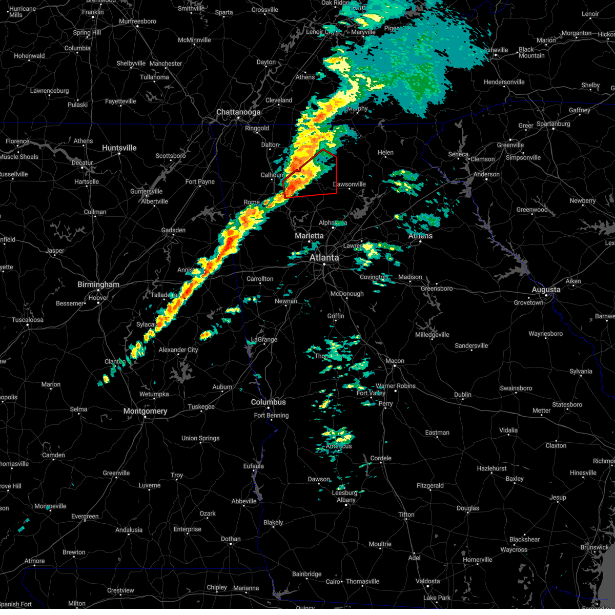 At 313 pm est, severe thunderstorms capable of producing both tornadoes and extensive straight line wind damage were located near ranger, or 10 miles east of calhoun. another area of rotation was located 4 miles northwest of pine log. both areas were moving northeast at 60 mph (radar indicated rotation). Hazards include tornado and quarter size hail. Flying debris will be dangerous to those caught without shelter. mobile homes will be damaged or destroyed. damage to roofs, windows, and vehicles will occur. Tree damage is likely. At 313 pm est, severe thunderstorms capable of producing both tornadoes and extensive straight line wind damage were located near ranger, or 10 miles east of calhoun. another area of rotation was located 4 miles northwest of pine log. both areas were moving northeast at 60 mph (radar indicated rotation). Hazards include tornado and quarter size hail. Flying debris will be dangerous to those caught without shelter. mobile homes will be damaged or destroyed. damage to roofs, windows, and vehicles will occur. Tree damage is likely.
|
| 3/3/2023 3:05 PM EST |
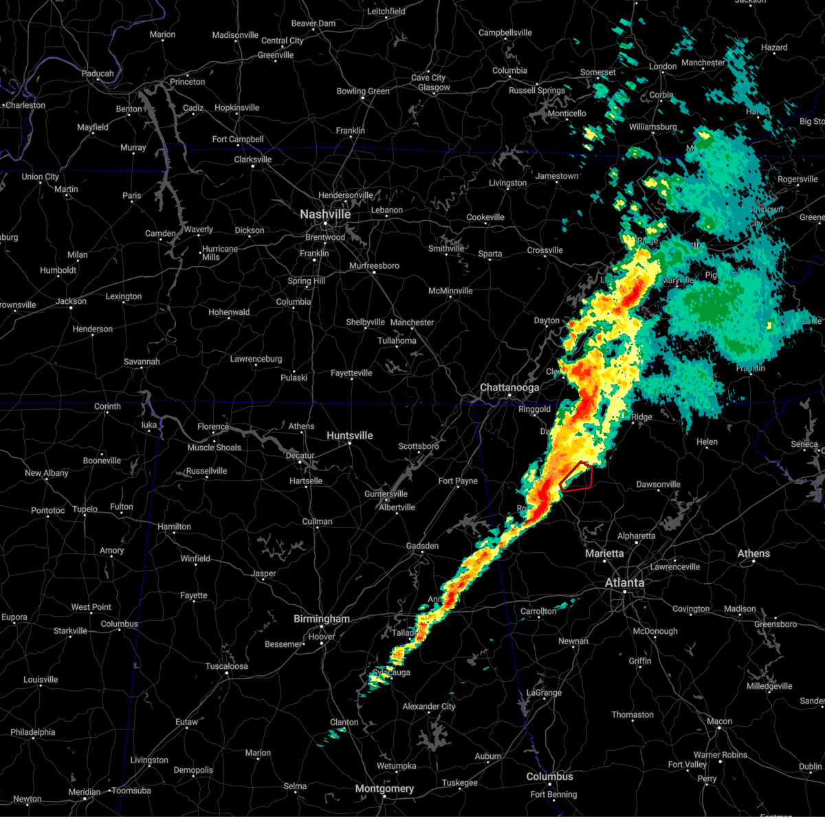 At 305 pm est, a severe squall line capable of producing both tornadoes and extensive straight line wind damage was located over sonoraville, or near calhoun, moving northeast at 65 mph (radar indicated rotation). Hazards include tornado. Flying debris will be dangerous to those caught without shelter. mobile homes will be damaged or destroyed. damage to roofs, windows, and vehicles will occur. tree damage is likely. Locations impacted include, fairmount, ranger, oakman, sonoraville and redbud. At 305 pm est, a severe squall line capable of producing both tornadoes and extensive straight line wind damage was located over sonoraville, or near calhoun, moving northeast at 65 mph (radar indicated rotation). Hazards include tornado. Flying debris will be dangerous to those caught without shelter. mobile homes will be damaged or destroyed. damage to roofs, windows, and vehicles will occur. tree damage is likely. Locations impacted include, fairmount, ranger, oakman, sonoraville and redbud.
|
| 3/3/2023 3:00 PM EST | Power pole down near the intersection of hwy 53 and edwards r in pickens county GA, 2.8 miles WSW of Fairmount, GA |
| 3/3/2023 2:59 PM EST |
 At 259 pm est, a severe squall line capable of producing both tornadoes and extensive straight line wind damage was located near plainville, or near calhoun, moving northeast at 65 mph (radar indicated rotation). Hazards include tornado and quarter size hail. Flying debris will be dangerous to those caught without shelter. mobile homes will be damaged or destroyed. damage to roofs, windows, and vehicles will occur. tree damage is likely. Locations impacted include, calhoun, adairsville, plainville, fairmount, ranger, sonoraville, oakman, redbud and audubon. At 259 pm est, a severe squall line capable of producing both tornadoes and extensive straight line wind damage was located near plainville, or near calhoun, moving northeast at 65 mph (radar indicated rotation). Hazards include tornado and quarter size hail. Flying debris will be dangerous to those caught without shelter. mobile homes will be damaged or destroyed. damage to roofs, windows, and vehicles will occur. tree damage is likely. Locations impacted include, calhoun, adairsville, plainville, fairmount, ranger, sonoraville, oakman, redbud and audubon.
|
| 3/3/2023 2:51 PM EST |
 At 250 pm est, severe thunderstorms capable of producing both tornadoes and extensive straight line wind damage were located over shannon, or near rome, moving northeast at 65 mph (radar indicated rotation). Hazards include tornado. Flying debris will be dangerous to those caught without shelter. mobile homes will be damaged or destroyed. damage to roofs, windows, and vehicles will occur. Tree damage is likely. At 250 pm est, severe thunderstorms capable of producing both tornadoes and extensive straight line wind damage were located over shannon, or near rome, moving northeast at 65 mph (radar indicated rotation). Hazards include tornado. Flying debris will be dangerous to those caught without shelter. mobile homes will be damaged or destroyed. damage to roofs, windows, and vehicles will occur. Tree damage is likely.
|
| 3/3/2023 2:44 PM EST |
 At 244 pm est, severe thunderstorms were located along a line extending from near armuchee to near cave spring to near forney, moving east at 50 mph (radar indicated). Hazards include 60 mph wind gusts and quarter size hail. Hail damage to vehicles is expected. Expect wind damage to roofs, siding, and trees. At 244 pm est, severe thunderstorms were located along a line extending from near armuchee to near cave spring to near forney, moving east at 50 mph (radar indicated). Hazards include 60 mph wind gusts and quarter size hail. Hail damage to vehicles is expected. Expect wind damage to roofs, siding, and trees.
|
| 2/17/2022 8:37 PM EST |
 At 836 pm est, severe thunderstorms were located along a line extending from calhoun to shannon to near lindale, moving east at 55 mph (radar indicated). Hazards include 60 mph wind gusts. expect damage to roofs, siding, and trees At 836 pm est, severe thunderstorms were located along a line extending from calhoun to shannon to near lindale, moving east at 55 mph (radar indicated). Hazards include 60 mph wind gusts. expect damage to roofs, siding, and trees
|
| 12/31/2021 5:37 PM EST |
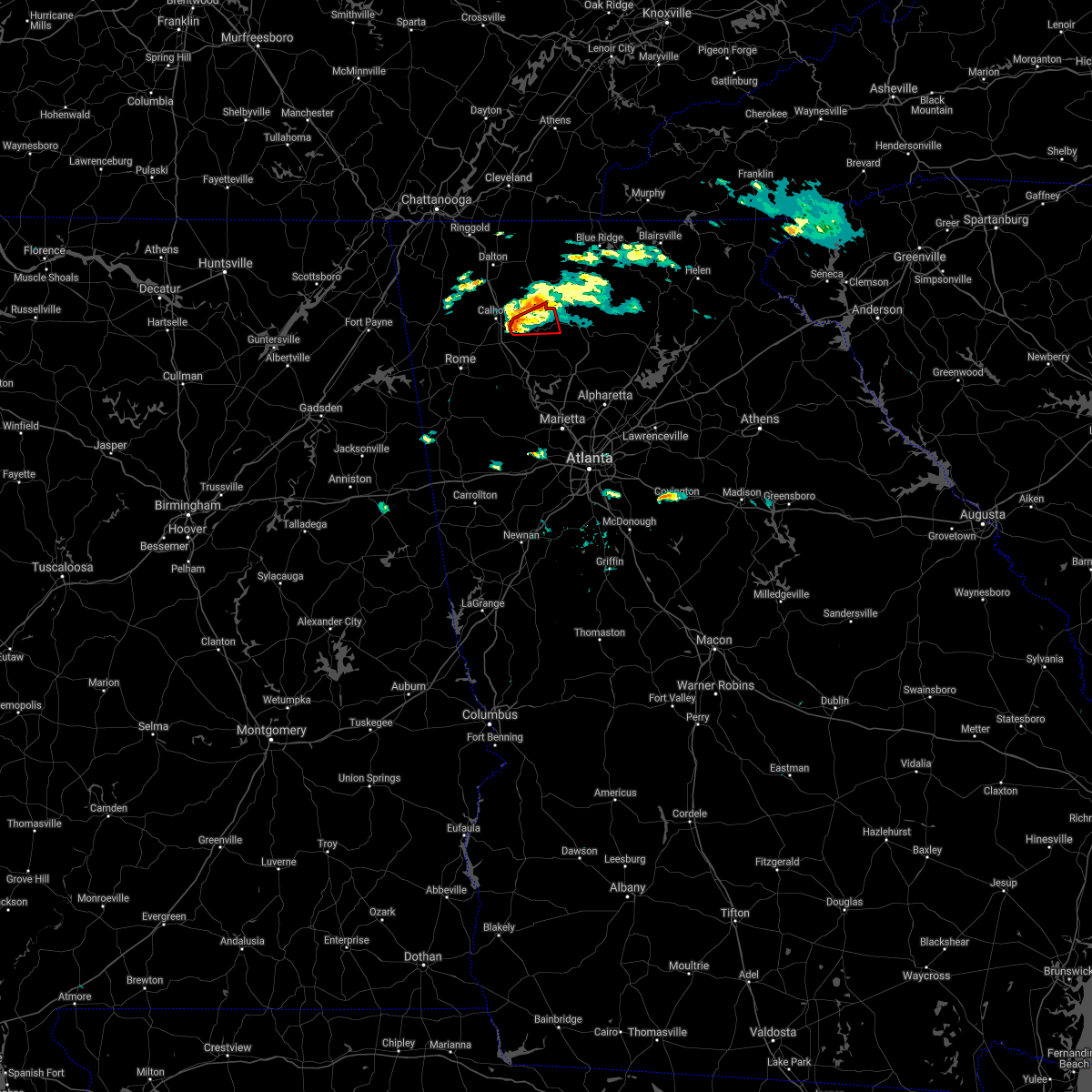 At 537 pm est, a severe thunderstorm capable of producing a tornado was located over sonoraville, or near calhoun, moving east at 30 mph (radar indicated rotation). Hazards include tornado. Flying debris will be dangerous to those caught without shelter. mobile homes will be damaged or destroyed. damage to roofs, windows, and vehicles will occur. Tree damage is likely. At 537 pm est, a severe thunderstorm capable of producing a tornado was located over sonoraville, or near calhoun, moving east at 30 mph (radar indicated rotation). Hazards include tornado. Flying debris will be dangerous to those caught without shelter. mobile homes will be damaged or destroyed. damage to roofs, windows, and vehicles will occur. Tree damage is likely.
|
| 12/29/2021 10:37 PM EST |
 At 1037 pm est, severe thunderstorms were located along a line extending from near audubon to oostanaula to near plainville, moving east at 45 mph (radar indicated). Hazards include 60 mph wind gusts. expect damage to roofs, siding, and trees At 1037 pm est, severe thunderstorms were located along a line extending from near audubon to oostanaula to near plainville, moving east at 45 mph (radar indicated). Hazards include 60 mph wind gusts. expect damage to roofs, siding, and trees
|
| 12/29/2021 10:05 PM EST |
 At 1005 pm est, severe thunderstorms were located along a line extending from near naomi to near subligna to near summerville to holland, moving east at 55 mph (radar indicated). Hazards include 60 mph wind gusts. expect damage to roofs, siding, and trees At 1005 pm est, severe thunderstorms were located along a line extending from near naomi to near subligna to near summerville to holland, moving east at 55 mph (radar indicated). Hazards include 60 mph wind gusts. expect damage to roofs, siding, and trees
|
| 8/9/2021 5:23 PM EDT |
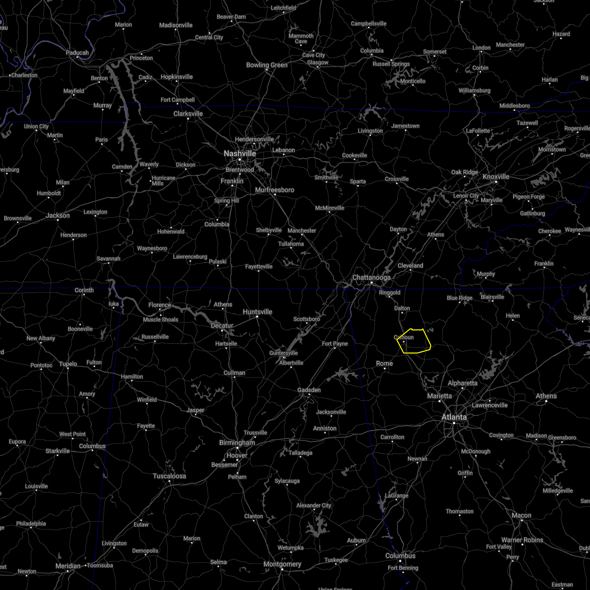 At 523 pm edt, a severe thunderstorm was located over calhoun, moving northeast at 10 mph (radar indicated). Hazards include 60 mph wind gusts and quarter size hail. Hail damage to vehicles is expected. Expect wind damage to roofs, siding, and trees. At 523 pm edt, a severe thunderstorm was located over calhoun, moving northeast at 10 mph (radar indicated). Hazards include 60 mph wind gusts and quarter size hail. Hail damage to vehicles is expected. Expect wind damage to roofs, siding, and trees.
|
| 5/4/2021 12:54 PM EDT |
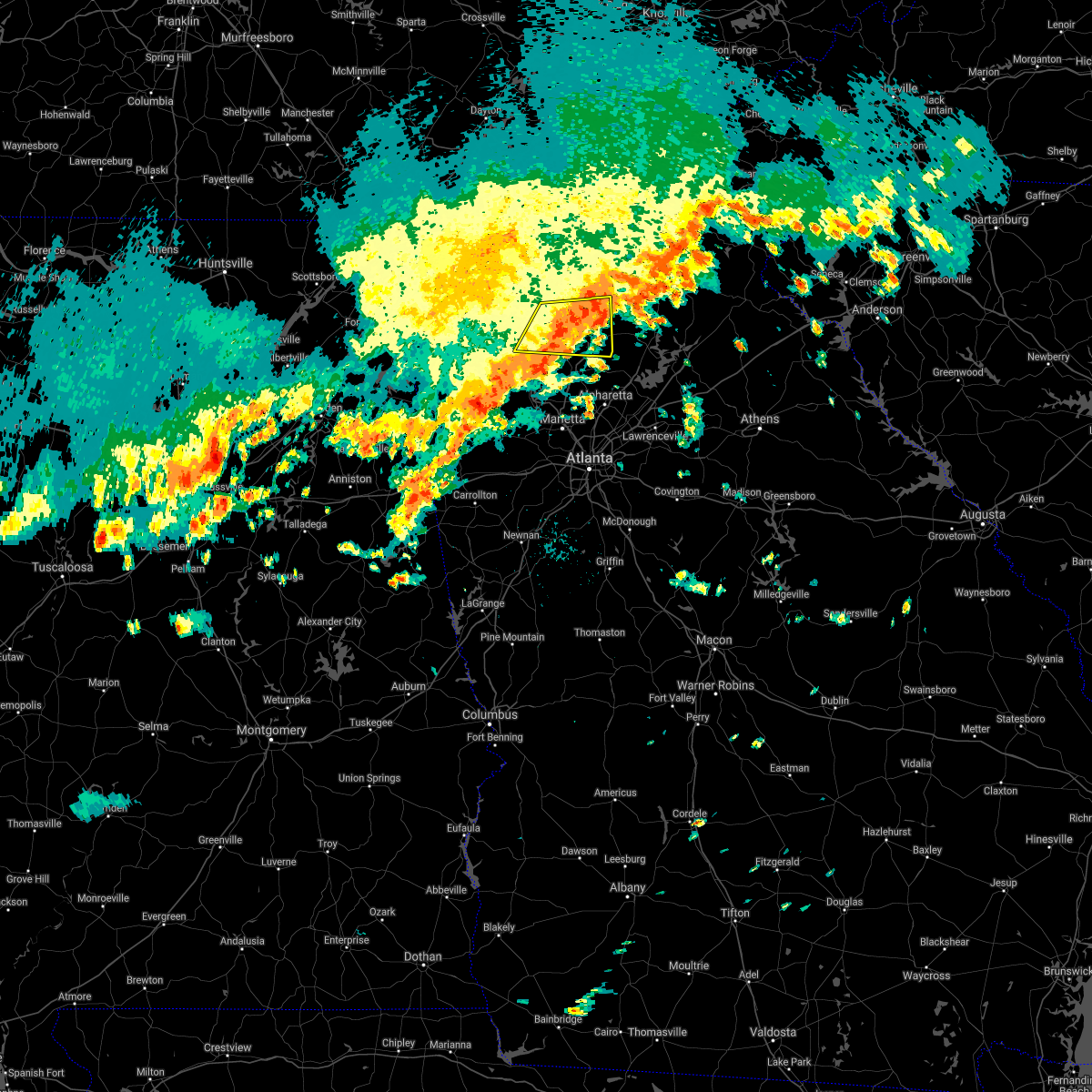 At 1253 pm edt, a severe thunderstorm was located over hinton, or 7 miles west of jasper, moving east at 45 mph (radar indicated). Hazards include 60 mph wind gusts. Expect damage to roofs, siding, and trees. Locations impacted include, jasper, ball ground, nelson, waleska, talking rock, fairmount, ranger, sequoyah lake, marblehill, fausett lake, salacoa valley, pine log, blaine, lake tamarack, hollis lathem reservoir, talmadge, tate, reavis mountain, funkhouser and hinton. At 1253 pm edt, a severe thunderstorm was located over hinton, or 7 miles west of jasper, moving east at 45 mph (radar indicated). Hazards include 60 mph wind gusts. Expect damage to roofs, siding, and trees. Locations impacted include, jasper, ball ground, nelson, waleska, talking rock, fairmount, ranger, sequoyah lake, marblehill, fausett lake, salacoa valley, pine log, blaine, lake tamarack, hollis lathem reservoir, talmadge, tate, reavis mountain, funkhouser and hinton.
|
| 5/4/2021 12:35 PM EDT |
 At 1235 pm edt, a severe thunderstorm was located over sonoraville, or 8 miles east of calhoun, moving east at 45 mph (radar indicated). Hazards include 60 mph wind gusts. expect damage to roofs, siding, and trees At 1235 pm edt, a severe thunderstorm was located over sonoraville, or 8 miles east of calhoun, moving east at 45 mph (radar indicated). Hazards include 60 mph wind gusts. expect damage to roofs, siding, and trees
|
| 3/28/2021 9:38 AM EDT |
 The severe thunderstorm warning for east central floyd, southeastern gordon and northern bartow counties will expire at 945 am edt, the storm which prompted the warning has weakened below severe limits, and has exited the warned area. therefore, the warning will be allowed to expire. however gusty winds are still possible with this thunderstorm. a severe thunderstorm watch remains in effect until 1100 am edt for north central and northwestern georgia. to report severe weather, contact your nearest law enforcement agency. they will relay your report to the national weather service peachtree city. The severe thunderstorm warning for east central floyd, southeastern gordon and northern bartow counties will expire at 945 am edt, the storm which prompted the warning has weakened below severe limits, and has exited the warned area. therefore, the warning will be allowed to expire. however gusty winds are still possible with this thunderstorm. a severe thunderstorm watch remains in effect until 1100 am edt for north central and northwestern georgia. to report severe weather, contact your nearest law enforcement agency. they will relay your report to the national weather service peachtree city.
|
| 3/28/2021 9:29 AM EDT |
 At 928 am edt, a severe thunderstorm was located over folsom, or 13 miles north of cartersville, moving east at 45 mph (radar indicated). Hazards include 60 mph wind gusts. Expect damage to roofs, siding, and trees. Locations impacted include, rome, cartersville, adairsville, white, kingston, cassville, shannon, fairmount, pine log, folsom, funkhouser and lindale. At 928 am edt, a severe thunderstorm was located over folsom, or 13 miles north of cartersville, moving east at 45 mph (radar indicated). Hazards include 60 mph wind gusts. Expect damage to roofs, siding, and trees. Locations impacted include, rome, cartersville, adairsville, white, kingston, cassville, shannon, fairmount, pine log, folsom, funkhouser and lindale.
|
| 3/28/2021 9:05 AM EDT |
 At 904 am edt, a severe thunderstorm was located near shannon, or near rome, moving east at 45 mph (radar indicated). Hazards include 60 mph wind gusts. expect damage to roofs, siding, and trees At 904 am edt, a severe thunderstorm was located near shannon, or near rome, moving east at 45 mph (radar indicated). Hazards include 60 mph wind gusts. expect damage to roofs, siding, and trees
|
| 8/3/2020 1:55 PM EDT |
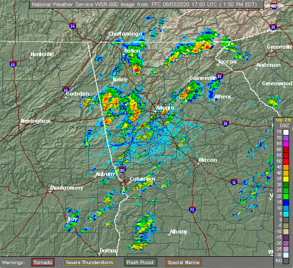 The severe thunderstorm warning for eastern gordon county will expire at 200 pm edt, the storm which prompted the warning has moved out of the area. therefore, the warning will be allowed to expire. however small hail, gusty winds and heavy rain are still possible with this thunderstorm. The severe thunderstorm warning for eastern gordon county will expire at 200 pm edt, the storm which prompted the warning has moved out of the area. therefore, the warning will be allowed to expire. however small hail, gusty winds and heavy rain are still possible with this thunderstorm.
|
| 8/3/2020 1:54 PM EDT |
 At 152 pm edt, a severe thunderstorm was located over ranger, or 12 miles east of calhoun, moving northeast at 25 mph (radar indicated. at 145 pm edt, public reported tennis ball-sized hail on fairmount highway in gordon county). Hazards include golf ball size hail and 60 mph wind gusts. People and animals outdoors will be injured. expect hail damage to roofs, siding, windows, and vehicles. Expect wind damage to roofs, siding, and trees. At 152 pm edt, a severe thunderstorm was located over ranger, or 12 miles east of calhoun, moving northeast at 25 mph (radar indicated. at 145 pm edt, public reported tennis ball-sized hail on fairmount highway in gordon county). Hazards include golf ball size hail and 60 mph wind gusts. People and animals outdoors will be injured. expect hail damage to roofs, siding, windows, and vehicles. Expect wind damage to roofs, siding, and trees.
|
| 8/3/2020 1:39 PM EDT |
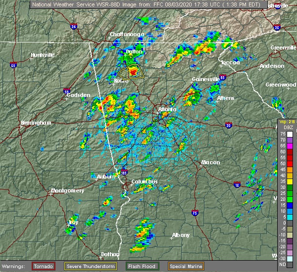 At 137 pm edt, a severe thunderstorm was located over sonoraville, or 8 miles east of calhoun, moving east at 30 mph (radar indicated. at 120 pm downed trees and wind damage was reported near adairsville). Hazards include 60 mph wind gusts and quarter size hail. Hail damage to vehicles is expected. expect wind damage to roofs, siding, and trees. Locations impacted include, calhoun, fairmount, ranger, sonoraville, redbud and audubon. At 137 pm edt, a severe thunderstorm was located over sonoraville, or 8 miles east of calhoun, moving east at 30 mph (radar indicated. at 120 pm downed trees and wind damage was reported near adairsville). Hazards include 60 mph wind gusts and quarter size hail. Hail damage to vehicles is expected. expect wind damage to roofs, siding, and trees. Locations impacted include, calhoun, fairmount, ranger, sonoraville, redbud and audubon.
|
| 8/3/2020 1:20 PM EDT |
 At 120 pm edt, a severe thunderstorm was located near plainville, or near calhoun, moving east at 25 mph (radar indicated). Hazards include 60 mph wind gusts and quarter size hail. Hail damage to vehicles is expected. Expect wind damage to roofs, siding, and trees. At 120 pm edt, a severe thunderstorm was located near plainville, or near calhoun, moving east at 25 mph (radar indicated). Hazards include 60 mph wind gusts and quarter size hail. Hail damage to vehicles is expected. Expect wind damage to roofs, siding, and trees.
|
| 5/5/2020 12:51 AM EDT |
 The severe thunderstorm warning for western gilmer, murray, gordon, northwestern pickens, northwestern fannin and northern bartow counties will expire at 100 am edt, the storms which prompted the warning have weakened below severe limits, and have exited the warned area. therefore, the warning will be allowed to expire. a severe thunderstorm watch remains in effect until 300 am edt for north central georgia. to report severe weather, contact your nearest law enforcement agency. they will relay your report to the national weather service peachtree city. The severe thunderstorm warning for western gilmer, murray, gordon, northwestern pickens, northwestern fannin and northern bartow counties will expire at 100 am edt, the storms which prompted the warning have weakened below severe limits, and have exited the warned area. therefore, the warning will be allowed to expire. a severe thunderstorm watch remains in effect until 300 am edt for north central georgia. to report severe weather, contact your nearest law enforcement agency. they will relay your report to the national weather service peachtree city.
|
| 5/5/2020 12:37 AM EDT |
 At 1237 am edt, severe thunderstorms were located along a line extending from near conasauga lake to ranger to near kingston, moving east at 50 mph (law enforcement). Hazards include 60 mph wind gusts and quarter size hail. Hail damage to vehicles is expected. expect wind damage to roofs, siding, and trees. Locations impacted include, calhoun, chatsworth, ellijay, adairsville, eton, east ellijay, talking rock, cassville, fairmount, ranger, crandall, sumac, jones mill, redbud, gregory, folsom, cohutta wilderness, conasauga lake, oakman and fort mountain state park. At 1237 am edt, severe thunderstorms were located along a line extending from near conasauga lake to ranger to near kingston, moving east at 50 mph (law enforcement). Hazards include 60 mph wind gusts and quarter size hail. Hail damage to vehicles is expected. expect wind damage to roofs, siding, and trees. Locations impacted include, calhoun, chatsworth, ellijay, adairsville, eton, east ellijay, talking rock, cassville, fairmount, ranger, crandall, sumac, jones mill, redbud, gregory, folsom, cohutta wilderness, conasauga lake, oakman and fort mountain state park.
|
| 5/5/2020 12:09 AM EDT |
 At 1208 am edt, severe thunderstorms were located along a line extending from near beaverdale to near sugar valley to armuchee, moving east at 65 mph (radar indicated). Hazards include 60 mph wind gusts. expect damage to roofs, siding, and trees At 1208 am edt, severe thunderstorms were located along a line extending from near beaverdale to near sugar valley to armuchee, moving east at 65 mph (radar indicated). Hazards include 60 mph wind gusts. expect damage to roofs, siding, and trees
|
| 4/13/2020 1:20 AM EDT |
 At 120 am edt, severe thunderstorms were located along a line extending from waleska to burnt hickory ridge, moving east at 55 mph (radar indicated). Hazards include 60 mph wind gusts. Expect damage to roofs, siding, and trees. Locations impacted include, canton, cartersville, dallas, kennesaw, woodstock, acworth, holly springs, rockmart, euharlee, emerson, ball ground, aragon, white, waleska, braswell, taylorsville, free home, cassville, buffington and yorkville. At 120 am edt, severe thunderstorms were located along a line extending from waleska to burnt hickory ridge, moving east at 55 mph (radar indicated). Hazards include 60 mph wind gusts. Expect damage to roofs, siding, and trees. Locations impacted include, canton, cartersville, dallas, kennesaw, woodstock, acworth, holly springs, rockmart, euharlee, emerson, ball ground, aragon, white, waleska, braswell, taylorsville, free home, cassville, buffington and yorkville.
|
| 4/13/2020 1:07 AM EDT |
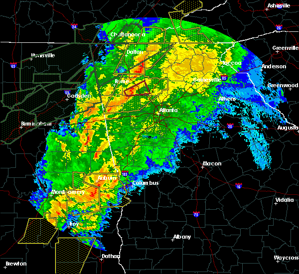 At 107 am edt, a severe thunderstorm capable of producing a tornado was located over ranger, or 13 miles east of calhoun, moving east at 60 mph (radar indicated rotation). Hazards include tornado. Flying debris will be dangerous to those caught without shelter. mobile homes will be damaged or destroyed. damage to roofs, windows, and vehicles will occur. Tree damage is likely. At 107 am edt, a severe thunderstorm capable of producing a tornado was located over ranger, or 13 miles east of calhoun, moving east at 60 mph (radar indicated rotation). Hazards include tornado. Flying debris will be dangerous to those caught without shelter. mobile homes will be damaged or destroyed. damage to roofs, windows, and vehicles will occur. Tree damage is likely.
|
| 4/13/2020 1:05 AM EDT |
 At 105 am edt, severe thunderstorms were located along a line extending from near white to van wert, moving east at 55 mph (radar indicated). Hazards include 60 mph wind gusts. Expect damage to roofs, siding, and trees. Locations impacted include, marietta, canton, cartersville, dallas, buchanan, kennesaw, woodstock, acworth, powder springs, holly springs, adairsville, rockmart, euharlee, hiram, emerson, ball ground, aragon, white, waleska and kingston. At 105 am edt, severe thunderstorms were located along a line extending from near white to van wert, moving east at 55 mph (radar indicated). Hazards include 60 mph wind gusts. Expect damage to roofs, siding, and trees. Locations impacted include, marietta, canton, cartersville, dallas, buchanan, kennesaw, woodstock, acworth, powder springs, holly springs, adairsville, rockmart, euharlee, hiram, emerson, ball ground, aragon, white, waleska and kingston.
|
| 4/13/2020 12:54 AM EDT |
 At 1254 am edt, severe thunderstorms were located along a line extending from near kingston to near antioch, moving east at 55 mph (radar indicated). Hazards include 60 mph wind gusts. expect damage to roofs, siding, and trees At 1254 am edt, severe thunderstorms were located along a line extending from near kingston to near antioch, moving east at 55 mph (radar indicated). Hazards include 60 mph wind gusts. expect damage to roofs, siding, and trees
|
| 4/13/2020 12:46 AM EDT |
 At 1246 am edt, severe thunderstorms were located along a line extending from nickelsville to near muscadine, moving east at 55 mph (radar indicated). Hazards include 70 mph wind gusts. Expect considerable tree damage. damage is likely to mobile homes, roofs, and outbuildings. Locations impacted include, rome, cartersville, calhoun, cedartown, buchanan, bremen, adairsville, rockmart, euharlee, tallapoosa, aragon, kingston, waco, braswell, plainville, taylorsville, shannon, cassville, yorkville and fairmount. At 1246 am edt, severe thunderstorms were located along a line extending from nickelsville to near muscadine, moving east at 55 mph (radar indicated). Hazards include 70 mph wind gusts. Expect considerable tree damage. damage is likely to mobile homes, roofs, and outbuildings. Locations impacted include, rome, cartersville, calhoun, cedartown, buchanan, bremen, adairsville, rockmart, euharlee, tallapoosa, aragon, kingston, waco, braswell, plainville, taylorsville, shannon, cassville, yorkville and fairmount.
|
| 4/13/2020 12:35 AM EDT |
 At 1235 am edt, severe thunderstorms were located along a line extending from sugar valley to near edwardsville, moving east at 55 mph (radar indicated). Hazards include 70 mph wind gusts. Expect considerable tree damage. damage is likely to mobile homes, roofs, and outbuildings. Locations impacted include, rome, cartersville, calhoun, cedartown, buchanan, bremen, adairsville, rockmart, euharlee, tallapoosa, aragon, cave spring, kingston, waco, braswell, plainville, taylorsville, shannon, cassville and yorkville. At 1235 am edt, severe thunderstorms were located along a line extending from sugar valley to near edwardsville, moving east at 55 mph (radar indicated). Hazards include 70 mph wind gusts. Expect considerable tree damage. damage is likely to mobile homes, roofs, and outbuildings. Locations impacted include, rome, cartersville, calhoun, cedartown, buchanan, bremen, adairsville, rockmart, euharlee, tallapoosa, aragon, cave spring, kingston, waco, braswell, plainville, taylorsville, shannon, cassville and yorkville.
|
| 4/13/2020 12:34 AM EDT |
 At 1233 am edt, severe thunderstorms were located along a line extending from near hot house to near sonoraville, moving east at 65 mph (radar indicated). Hazards include 60 mph wind gusts. Expect damage to roofs, siding, and trees. Locations impacted include, dalton, calhoun, chatsworth, ellijay, blue ridge, varnell, eton, east ellijay, resaca, morganton, fairmount, ranger, crandall, sumac, jones mill, higdon, redbud, gregory, loving and lake marvin. At 1233 am edt, severe thunderstorms were located along a line extending from near hot house to near sonoraville, moving east at 65 mph (radar indicated). Hazards include 60 mph wind gusts. Expect damage to roofs, siding, and trees. Locations impacted include, dalton, calhoun, chatsworth, ellijay, blue ridge, varnell, eton, east ellijay, resaca, morganton, fairmount, ranger, crandall, sumac, jones mill, higdon, redbud, gregory, loving and lake marvin.
|
| 4/13/2020 12:24 AM EDT |
 At 1223 am edt, severe thunderstorms were located along a line extending from near copperhill to oostanaula, moving east at 65 mph (radar indicated). Hazards include 60 mph wind gusts. Expect damage to roofs, siding, and trees. Locations impacted include, dalton, calhoun, chatsworth, ellijay, blue ridge, varnell, eton, tunnel hill, cohutta, east ellijay, resaca, morganton, fairmount, ranger, crandall, subligna, jones mill, cohutta wilderness, beaverdale and mineral bluff. At 1223 am edt, severe thunderstorms were located along a line extending from near copperhill to oostanaula, moving east at 65 mph (radar indicated). Hazards include 60 mph wind gusts. Expect damage to roofs, siding, and trees. Locations impacted include, dalton, calhoun, chatsworth, ellijay, blue ridge, varnell, eton, tunnel hill, cohutta, east ellijay, resaca, morganton, fairmount, ranger, crandall, subligna, jones mill, cohutta wilderness, beaverdale and mineral bluff.
|
| 4/13/2020 12:07 AM EDT |
 At 1207 am edt, severe thunderstorms were located along a line extending from tennga to near summerville, moving east at 65 mph (radar indicated). Hazards include 60 mph wind gusts. expect damage to roofs, siding, and trees At 1207 am edt, severe thunderstorms were located along a line extending from tennga to near summerville, moving east at 65 mph (radar indicated). Hazards include 60 mph wind gusts. expect damage to roofs, siding, and trees
|
| 4/13/2020 12:04 AM EDT |
 At 1203 am edt, severe thunderstorms were located along a line extending from near chesterfield to anniston army depot, moving east at 55 mph (radar indicated). Hazards include 60 mph wind gusts. expect damage to roofs, siding, and trees At 1203 am edt, severe thunderstorms were located along a line extending from near chesterfield to anniston army depot, moving east at 55 mph (radar indicated). Hazards include 60 mph wind gusts. expect damage to roofs, siding, and trees
|
| 2/6/2020 5:39 AM EST |
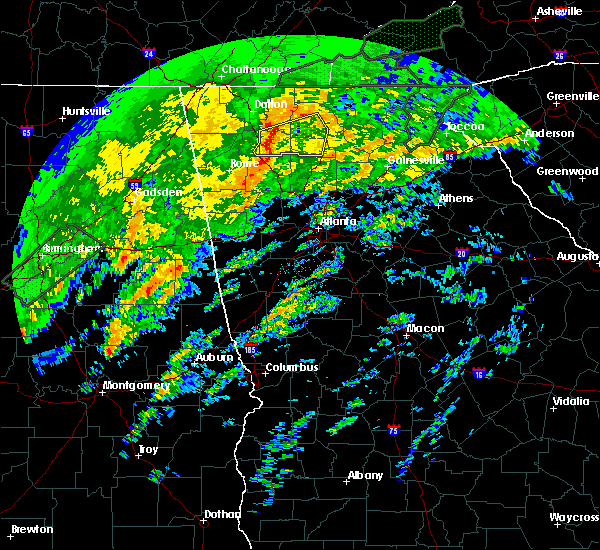 At 525 am est, a severe thunderstorm was located over adairsville, or 3 miles south calhoun. severe thunderstorms were also located further north near resaca. storms were moving east at 40 mph (radar indicated). Hazards include 60 mph wind gusts. expect damage to roofs, siding, and trees At 525 am est, a severe thunderstorm was located over adairsville, or 3 miles south calhoun. severe thunderstorms were also located further north near resaca. storms were moving east at 40 mph (radar indicated). Hazards include 60 mph wind gusts. expect damage to roofs, siding, and trees
|
| 2/6/2020 5:26 AM EST |
 At 525 am est, a severe thunderstorm was located over adairsville, or 3 miles south calhoun. severe thunderstorms were also located further north near resaca. storms were moving east at 40 mph (radar indicated). Hazards include 60 mph wind gusts. expect damage to roofs, siding, and trees At 525 am est, a severe thunderstorm was located over adairsville, or 3 miles south calhoun. severe thunderstorms were also located further north near resaca. storms were moving east at 40 mph (radar indicated). Hazards include 60 mph wind gusts. expect damage to roofs, siding, and trees
|
| 1/11/2020 4:58 PM EST |
 The severe thunderstorm warning for paulding, northwestern cherokee, western gilmer, eastern murray, eastern gordon, east central polk, western pickens, northwestern fannin and bartow counties will expire at 500 pm est, the storms which prompted the warning have moved out of the area. therefore, the warning will be allowed to expire. a severe thunderstorm remains in effect downstream. a tornado watch remains in effect until 900 pm est for north central and northwestern georgia. The severe thunderstorm warning for paulding, northwestern cherokee, western gilmer, eastern murray, eastern gordon, east central polk, western pickens, northwestern fannin and bartow counties will expire at 500 pm est, the storms which prompted the warning have moved out of the area. therefore, the warning will be allowed to expire. a severe thunderstorm remains in effect downstream. a tornado watch remains in effect until 900 pm est for north central and northwestern georgia.
|
| 1/11/2020 4:48 PM EST |
 At 447 pm est, severe thunderstorms were located along a line extending from colwell to near hinton to near brownsville, moving east at 40 mph (radar indicated). Hazards include 60 mph wind gusts. Expect damage to roofs, siding, and trees. Locations impacted include, cartersville, dallas, ellijay, adairsville, euharlee, emerson, white, braswell, cassville, yorkville, fairmount, ranger, burnt hickory ridge, red top mountain state park, jones mill, higdon, folsom, cohutta wilderness, conasauga lake and cross roads. At 447 pm est, severe thunderstorms were located along a line extending from colwell to near hinton to near brownsville, moving east at 40 mph (radar indicated). Hazards include 60 mph wind gusts. Expect damage to roofs, siding, and trees. Locations impacted include, cartersville, dallas, ellijay, adairsville, euharlee, emerson, white, braswell, cassville, yorkville, fairmount, ranger, burnt hickory ridge, red top mountain state park, jones mill, higdon, folsom, cohutta wilderness, conasauga lake and cross roads.
|
| 1/11/2020 4:19 PM EST |
 At 418 pm est, severe thunderstorms were located along a line extending from sumac to near calhoun to near buchanan, moving east at 40 mph (radar indicated). Hazards include 60 mph wind gusts. expect damage to roofs, siding, and trees At 418 pm est, severe thunderstorms were located along a line extending from sumac to near calhoun to near buchanan, moving east at 40 mph (radar indicated). Hazards include 60 mph wind gusts. expect damage to roofs, siding, and trees
|
| 8/19/2019 3:06 PM EDT |
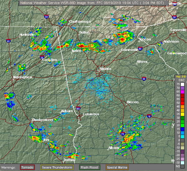 At 305 pm edt, a severe thunderstorm was located over hinton, or 7 miles west of jasper, and is nearly stationary (radar indicated). Hazards include 60 mph wind gusts and half dollar size hail. Hail damage to vehicles is expected. expect wind damage to roofs, siding, and trees. Locations impacted include, fairmount, ranger, salacoa valley, hinton, blaine and talmadge. At 305 pm edt, a severe thunderstorm was located over hinton, or 7 miles west of jasper, and is nearly stationary (radar indicated). Hazards include 60 mph wind gusts and half dollar size hail. Hail damage to vehicles is expected. expect wind damage to roofs, siding, and trees. Locations impacted include, fairmount, ranger, salacoa valley, hinton, blaine and talmadge.
|
| 8/19/2019 2:33 PM EDT |
 The national weather service in peachtree city has issued a * severe thunderstorm warning for. northwestern cherokee county in north central georgia. east central gordon county in northwestern georgia. western pickens county in north central georgia. Until 315 pm edt. The national weather service in peachtree city has issued a * severe thunderstorm warning for. northwestern cherokee county in north central georgia. east central gordon county in northwestern georgia. western pickens county in north central georgia. Until 315 pm edt.
|
| 6/23/2019 4:44 PM EDT |
 At 444 pm edt, a severe thunderstorm was located over fairmount, or 14 miles west of jasper, moving southeast at 10 mph (radar indicated). Hazards include 60 mph wind gusts and half dollar size hail. Hail damage to vehicles is expected. Expect wind damage to roofs, siding, and trees. At 444 pm edt, a severe thunderstorm was located over fairmount, or 14 miles west of jasper, moving southeast at 10 mph (radar indicated). Hazards include 60 mph wind gusts and half dollar size hail. Hail damage to vehicles is expected. Expect wind damage to roofs, siding, and trees.
|
| 6/22/2019 9:09 PM EDT |
 The national weather service in peachtree city has issued a * severe thunderstorm warning for. northern cherokee county in north central georgia. southwestern lumpkin county in north central georgia. southern gilmer county in north central georgia. Southeastern murray county in northwestern georgia. The national weather service in peachtree city has issued a * severe thunderstorm warning for. northern cherokee county in north central georgia. southwestern lumpkin county in north central georgia. southern gilmer county in north central georgia. Southeastern murray county in northwestern georgia.
|
| 6/22/2019 12:49 AM EDT |
 The national weather service in peachtree city has issued a * severe thunderstorm warning for. cherokee county in north central georgia. northwestern forsyth county in north central georgia. lumpkin county in north central georgia. Dawson county in north central georgia. The national weather service in peachtree city has issued a * severe thunderstorm warning for. cherokee county in north central georgia. northwestern forsyth county in north central georgia. lumpkin county in north central georgia. Dawson county in north central georgia.
|
| 6/20/2019 6:24 AM EDT |
 At 624 am edt, a severe thunderstorm was located over funkhouser, or 14 miles southeast of calhoun, moving east at 50 mph (radar indicated). Hazards include 60 mph wind gusts. expect damage to roofs, siding, and trees At 624 am edt, a severe thunderstorm was located over funkhouser, or 14 miles southeast of calhoun, moving east at 50 mph (radar indicated). Hazards include 60 mph wind gusts. expect damage to roofs, siding, and trees
|
| 3/15/2019 2:42 AM EDT |
 At 242 am edt, a severe thunderstorm was located over plainville, or 7 miles south of calhoun, moving northeast at 65 mph (radar indicated). Hazards include 60 mph wind gusts and half dollar size hail. Hail damage to vehicles is expected. Expect wind damage to roofs, siding, and trees. At 242 am edt, a severe thunderstorm was located over plainville, or 7 miles south of calhoun, moving northeast at 65 mph (radar indicated). Hazards include 60 mph wind gusts and half dollar size hail. Hail damage to vehicles is expected. Expect wind damage to roofs, siding, and trees.
|
| 3/14/2019 8:54 PM EDT |
 At 854 pm edt, a severe thunderstorm was located near cassville, or 7 miles north of cartersville, moving east at 30 mph (radar indicated). Hazards include 60 mph wind gusts and quarter size hail. Hail damage to vehicles is expected. expect wind damage to roofs, siding, and trees. locations impacted include, cartersville, adairsville, emerson, white, cassville, fairmount, pine log, sutallee, folsom and funkhouser. A tornado watch remains in effect until 100 am edt for northwestern georgia. At 854 pm edt, a severe thunderstorm was located near cassville, or 7 miles north of cartersville, moving east at 30 mph (radar indicated). Hazards include 60 mph wind gusts and quarter size hail. Hail damage to vehicles is expected. expect wind damage to roofs, siding, and trees. locations impacted include, cartersville, adairsville, emerson, white, cassville, fairmount, pine log, sutallee, folsom and funkhouser. A tornado watch remains in effect until 100 am edt for northwestern georgia.
|
| 3/14/2019 8:37 PM EDT |
 At 837 pm edt, a severe thunderstorm was located over kingston, or 9 miles northwest of cartersville, moving east at 30 mph (radar indicated). Hazards include 60 mph wind gusts and quarter size hail. Hail damage to vehicles is expected. Expect wind damage to roofs, siding, and trees. At 837 pm edt, a severe thunderstorm was located over kingston, or 9 miles northwest of cartersville, moving east at 30 mph (radar indicated). Hazards include 60 mph wind gusts and quarter size hail. Hail damage to vehicles is expected. Expect wind damage to roofs, siding, and trees.
|
| 7/21/2018 5:29 AM EDT |
 A severe thunderstorm warning remains in effect until 600 am edt for northwestern cherokee. southwestern gilmer. southeastern gordon. pickens and northeastern bartow counties. At 527 am edt, severe thunderstorms were located along a line extending from cartecay to salacoa valley to near sonoraville, moving southeast at 40 mph. A severe thunderstorm warning remains in effect until 600 am edt for northwestern cherokee. southwestern gilmer. southeastern gordon. pickens and northeastern bartow counties. At 527 am edt, severe thunderstorms were located along a line extending from cartecay to salacoa valley to near sonoraville, moving southeast at 40 mph.
|
| 7/21/2018 5:09 AM EDT |
 At 509 am edt, severe thunderstorms were located along a line extending from near ellijay to oakman to resaca, moving southeast at 35 mph (radar indicated). Hazards include ping pong ball size hail and 60 mph wind gusts. People and animals outdoors will be injured. expect hail damage to roofs, siding, windows, and vehicles. Expect wind damage to roofs, siding, and trees. At 509 am edt, severe thunderstorms were located along a line extending from near ellijay to oakman to resaca, moving southeast at 35 mph (radar indicated). Hazards include ping pong ball size hail and 60 mph wind gusts. People and animals outdoors will be injured. expect hail damage to roofs, siding, windows, and vehicles. Expect wind damage to roofs, siding, and trees.
|
| 6/28/2018 11:49 AM EDT |
 At 1149 am edt, severe thunderstorms were located along a line extending from hicks gap state park. to near chickamauga to ringgold, moving southeast at 35 mph (radar indicated). Hazards include 60 mph wind gusts. Expect damage to roofs, siding, and trees. Locations impacted include, dalton, calhoun, ringgold, trenton, fort oglethorpe, chickamauga, tunnel hill, resaca, fairmount, ranger, redbud, blue spring, fairview, chattanooga valley, rock spring, sonoraville, noble, indian springs, wood station and rocky face. At 1149 am edt, severe thunderstorms were located along a line extending from hicks gap state park. to near chickamauga to ringgold, moving southeast at 35 mph (radar indicated). Hazards include 60 mph wind gusts. Expect damage to roofs, siding, and trees. Locations impacted include, dalton, calhoun, ringgold, trenton, fort oglethorpe, chickamauga, tunnel hill, resaca, fairmount, ranger, redbud, blue spring, fairview, chattanooga valley, rock spring, sonoraville, noble, indian springs, wood station and rocky face.
|
| 6/28/2018 11:37 AM EDT |
 At 1137 am edt, severe thunderstorms were located along a line extending from near roundtop to ranger to near tilton, moving south at 40 mph (radar indicated). Hazards include 60 mph wind gusts. expect damage to roofs, siding, and trees At 1137 am edt, severe thunderstorms were located along a line extending from near roundtop to ranger to near tilton, moving south at 40 mph (radar indicated). Hazards include 60 mph wind gusts. expect damage to roofs, siding, and trees
|
| 6/28/2018 11:15 AM EDT |
 At 1114 am edt, severe thunderstorms were located along a line extending from signal mountain to near rocky face to ramhurst, moving southeast at 40 mph (radar indicated). Hazards include 60 mph wind gusts. expect damage to roofs, siding, and trees At 1114 am edt, severe thunderstorms were located along a line extending from signal mountain to near rocky face to ramhurst, moving southeast at 40 mph (radar indicated). Hazards include 60 mph wind gusts. expect damage to roofs, siding, and trees
|
| 6/3/2018 4:46 PM EDT |
 At 445 pm edt, a severe thunderstorm was located near ranger, or 13 miles west of jasper, moving south at 30 mph (radar indicated). Hazards include 60 mph wind gusts and quarter size hail. Hail damage to vehicles is expected. Expect wind damage to roofs, siding, and trees. At 445 pm edt, a severe thunderstorm was located near ranger, or 13 miles west of jasper, moving south at 30 mph (radar indicated). Hazards include 60 mph wind gusts and quarter size hail. Hail damage to vehicles is expected. Expect wind damage to roofs, siding, and trees.
|
| 6/1/2018 3:02 PM EDT |
 At 302 pm edt, a severe thunderstorm was located near blaine, or 12 miles northwest of jasper, moving east at 30 mph (radar indicated). Hazards include 60 mph wind gusts and quarter size hail. Hail damage to vehicles is expected. Expect wind damage to roofs, siding, and trees. At 302 pm edt, a severe thunderstorm was located near blaine, or 12 miles northwest of jasper, moving east at 30 mph (radar indicated). Hazards include 60 mph wind gusts and quarter size hail. Hail damage to vehicles is expected. Expect wind damage to roofs, siding, and trees.
|
| 6/1/2018 2:47 PM EDT |
 At 247 pm edt, a severe thunderstorm was located over plainville, or 8 miles southwest of calhoun, moving east at 45 mph (radar indicated). Hazards include 60 mph wind gusts and quarter size hail. Hail damage to vehicles is expected. Expect wind damage to roofs, siding, and trees. At 247 pm edt, a severe thunderstorm was located over plainville, or 8 miles southwest of calhoun, moving east at 45 mph (radar indicated). Hazards include 60 mph wind gusts and quarter size hail. Hail damage to vehicles is expected. Expect wind damage to roofs, siding, and trees.
|
| 6/1/2018 2:34 PM EDT |
 At 234 pm edt, a severe thunderstorm was located near nickelsville, or near calhoun, moving east at 35 mph (radar indicated). Hazards include 60 mph wind gusts and quarter size hail. Hail damage to vehicles is expected. expect wind damage to roofs, siding, and trees. Locations impacted include, calhoun, resaca, fairmount, ranger, carters, sonoraville, oostanaula, sugar valley, oakman, redbud, nickelsville and audubon. At 234 pm edt, a severe thunderstorm was located near nickelsville, or near calhoun, moving east at 35 mph (radar indicated). Hazards include 60 mph wind gusts and quarter size hail. Hail damage to vehicles is expected. expect wind damage to roofs, siding, and trees. Locations impacted include, calhoun, resaca, fairmount, ranger, carters, sonoraville, oostanaula, sugar valley, oakman, redbud, nickelsville and audubon.
|
| 6/1/2018 2:19 PM EDT |
 At 219 pm edt, a severe thunderstorm was located over sugar valley, or near calhoun, moving east at 35 mph (radar indicated). Hazards include 60 mph wind gusts and quarter size hail. Hail damage to vehicles is expected. Expect wind damage to roofs, siding, and trees. At 219 pm edt, a severe thunderstorm was located over sugar valley, or near calhoun, moving east at 35 mph (radar indicated). Hazards include 60 mph wind gusts and quarter size hail. Hail damage to vehicles is expected. Expect wind damage to roofs, siding, and trees.
|
| 4/4/2018 1:45 AM EDT |
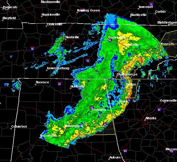 At 144 am edt, severe thunderstorms were located along a line extending from near east cleveland to near conasauga lake to redbud, moving east at 65 mph (radar indicated). Hazards include 60 mph wind gusts. Expect damage to roofs, siding, and trees. Locations impacted include, dalton, calhoun, chatsworth, varnell, eton, cohutta, resaca, fairmount, ranger, crandall, sumac, redbud, gregory, conasauga lake, beaverdale, oakman, fort mountain state park, carters, sonoraville and ramhurst. At 144 am edt, severe thunderstorms were located along a line extending from near east cleveland to near conasauga lake to redbud, moving east at 65 mph (radar indicated). Hazards include 60 mph wind gusts. Expect damage to roofs, siding, and trees. Locations impacted include, dalton, calhoun, chatsworth, varnell, eton, cohutta, resaca, fairmount, ranger, crandall, sumac, redbud, gregory, conasauga lake, beaverdale, oakman, fort mountain state park, carters, sonoraville and ramhurst.
|
| 4/4/2018 1:11 AM EDT |
 At 110 am edt, severe thunderstorms were located along a line extending from hooker to noble to lyerly, moving east at 65 mph (radar indicated). Hazards include 60 mph wind gusts. expect damage to roofs, siding, and trees At 110 am edt, severe thunderstorms were located along a line extending from hooker to noble to lyerly, moving east at 65 mph (radar indicated). Hazards include 60 mph wind gusts. expect damage to roofs, siding, and trees
|
| 8/6/2017 5:03 PM EDT |
 At 502 pm edt, a severe thunderstorm was located near kingston, or 12 miles east of rome, moving northeast at 30 mph (radar indicated). Hazards include 60 mph wind gusts and quarter size hail. Hail damage to vehicles is expected. Expect wind damage to roofs, siding, and trees. At 502 pm edt, a severe thunderstorm was located near kingston, or 12 miles east of rome, moving northeast at 30 mph (radar indicated). Hazards include 60 mph wind gusts and quarter size hail. Hail damage to vehicles is expected. Expect wind damage to roofs, siding, and trees.
|
| 7/7/2017 3:18 PM EDT |
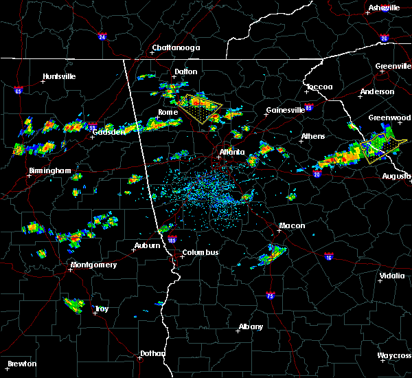 At 306 pm edt, a severe thunderstorm was located over sonoraville, or 10 miles southeast of calhoun, moving southeast at 15 mph (radar indicated). Hazards include 60 mph wind gusts and quarter size hail. Hail damage to vehicles is expected. Expect wind damage to roofs, siding, and trees. At 306 pm edt, a severe thunderstorm was located over sonoraville, or 10 miles southeast of calhoun, moving southeast at 15 mph (radar indicated). Hazards include 60 mph wind gusts and quarter size hail. Hail damage to vehicles is expected. Expect wind damage to roofs, siding, and trees.
|
| 7/7/2017 3:06 PM EDT |
 At 306 pm edt, a severe thunderstorm was located over sonoraville, or 10 miles southeast of calhoun, moving southeast at 15 mph (radar indicated). Hazards include 60 mph wind gusts and quarter size hail. Hail damage to vehicles is expected. Expect wind damage to roofs, siding, and trees. At 306 pm edt, a severe thunderstorm was located over sonoraville, or 10 miles southeast of calhoun, moving southeast at 15 mph (radar indicated). Hazards include 60 mph wind gusts and quarter size hail. Hail damage to vehicles is expected. Expect wind damage to roofs, siding, and trees.
|
| 6/23/2017 6:36 PM EDT |
 The severe thunderstorm warning for western cherokee, southern murray, western gilmer, gordon, pickens and bartow counties will expire at 645 pm edt, the storms which prompted the warning have weakened below severe limits, and no longer pose an immediate threat to life or property. therefore the warning will be allowed to expire. however gusty winds and heavy rain are still possible with these thunderstorms. a tornado watch remains in effect until 900 pm edt for northwestern georgia. The severe thunderstorm warning for western cherokee, southern murray, western gilmer, gordon, pickens and bartow counties will expire at 645 pm edt, the storms which prompted the warning have weakened below severe limits, and no longer pose an immediate threat to life or property. therefore the warning will be allowed to expire. however gusty winds and heavy rain are still possible with these thunderstorms. a tornado watch remains in effect until 900 pm edt for northwestern georgia.
|
| 6/23/2017 6:11 PM EDT |
 At 611 pm edt, severe thunderstorms were located along a line extending from near resaca to sonoraville to near euharlee, moving northeast at 55 mph (radar indicated). Hazards include 60 mph wind gusts. expect damage to roofs, siding, and trees At 611 pm edt, severe thunderstorms were located along a line extending from near resaca to sonoraville to near euharlee, moving northeast at 55 mph (radar indicated). Hazards include 60 mph wind gusts. expect damage to roofs, siding, and trees
|
| 6/15/2017 4:59 PM EDT |
 At 458 pm edt, severe thunderstorms were located along a line extending from calhoun to near adairsville to near shannon to near cave spring, moving east at 25 mph (radar indicated). Hazards include 60 mph wind gusts. expect damage to roofs, siding, and trees At 458 pm edt, severe thunderstorms were located along a line extending from calhoun to near adairsville to near shannon to near cave spring, moving east at 25 mph (radar indicated). Hazards include 60 mph wind gusts. expect damage to roofs, siding, and trees
|
| 4/5/2017 3:03 PM EDT |
 At 302 pm edt, a severe thunderstorm was located near adairsville, or 12 miles south of calhoun, moving northeast at 40 mph (radar indicated). Hazards include 60 mph wind gusts and penny size hail. expect damage to roofs, siding, and trees At 302 pm edt, a severe thunderstorm was located near adairsville, or 12 miles south of calhoun, moving northeast at 40 mph (radar indicated). Hazards include 60 mph wind gusts and penny size hail. expect damage to roofs, siding, and trees
|
| 3/21/2017 8:24 PM EDT |
 The severe thunderstorm warning for murray, gilmer, central floyd, eastern whitfield, gordon, western pickens, chattooga, northern bartow and northwestern fannin counties will expire at 830 pm edt, the storms which prompted the warning have moved out of the area. therefore the warning will be allowed to expire. however gusty winds and heavy rain are still possible with these thunderstorms. a severe thunderstorm watch remains in effect until 1100 pm edt for north central and northwestern georgia. The severe thunderstorm warning for murray, gilmer, central floyd, eastern whitfield, gordon, western pickens, chattooga, northern bartow and northwestern fannin counties will expire at 830 pm edt, the storms which prompted the warning have moved out of the area. therefore the warning will be allowed to expire. however gusty winds and heavy rain are still possible with these thunderstorms. a severe thunderstorm watch remains in effect until 1100 pm edt for north central and northwestern georgia.
|
| 3/21/2017 7:48 PM EDT |
 At 746 pm edt, severe thunderstorms were located extending from near gap springs to near chatsworth to oostanaula to near chattoogaville, moving east-southeast at 45 mph (reports of trees and powerlines down have occurred in dade, catoosa, and whitfield counties). Hazards include 60 mph wind gusts and quarter size hail. Hail damage to vehicles is expected. Expect wind damage to roofs, siding, and trees. At 746 pm edt, severe thunderstorms were located extending from near gap springs to near chatsworth to oostanaula to near chattoogaville, moving east-southeast at 45 mph (reports of trees and powerlines down have occurred in dade, catoosa, and whitfield counties). Hazards include 60 mph wind gusts and quarter size hail. Hail damage to vehicles is expected. Expect wind damage to roofs, siding, and trees.
|
| 3/1/2017 5:11 PM EST |
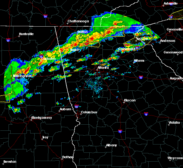 At 510 pm est, a severe thunderstorm was located over ranger, or 12 miles east of calhoun, moving east at 50 mph (radar indicated). Hazards include 60 mph wind gusts and quarter size hail. Hail damage to vehicles is expected. expect wind damage to roofs, siding, and trees. locations impacted include, jasper, talking rock, fairmount, ranger, blaine, lake tamarack, talmadge, tate, hinton and sequoyah lake. A tornado watch remains in effect until 700 pm est for north central and northwestern georgia. At 510 pm est, a severe thunderstorm was located over ranger, or 12 miles east of calhoun, moving east at 50 mph (radar indicated). Hazards include 60 mph wind gusts and quarter size hail. Hail damage to vehicles is expected. expect wind damage to roofs, siding, and trees. locations impacted include, jasper, talking rock, fairmount, ranger, blaine, lake tamarack, talmadge, tate, hinton and sequoyah lake. A tornado watch remains in effect until 700 pm est for north central and northwestern georgia.
|
| 3/1/2017 4:55 PM EST |
 At 455 pm est, a severe thunderstorm was located near oostanaula, or 2 miles southwest of calhoun, moving east at 50 mph (radar indicated). Hazards include two inch hail and 60 mph wind gusts. People and animals outdoors will be injured. expect hail damage to roofs, siding, windows, and vehicles. Expect wind damage to roofs, siding, and trees. At 455 pm est, a severe thunderstorm was located near oostanaula, or 2 miles southwest of calhoun, moving east at 50 mph (radar indicated). Hazards include two inch hail and 60 mph wind gusts. People and animals outdoors will be injured. expect hail damage to roofs, siding, windows, and vehicles. Expect wind damage to roofs, siding, and trees.
|
| 3/1/2017 4:46 PM EST |
 At 446 pm est, a severe thunderstorm was located over everett springs, or 9 miles west of calhoun, moving east at 50 mph (radar indicated). Hazards include ping pong ball size hail and 60 mph wind gusts. People and animals outdoors will be injured. expect hail damage to roofs, siding, windows, and vehicles. expect wind damage to roofs, siding, and trees. locations impacted include, calhoun, adairsville, resaca, plainville, fairmount, ranger, carters, sonoraville, oostanaula, redbud, folsom, lake marvin, audubon, sugar valley, oakman, funkhouser, everett springs and nickelsville. A tornado watch remains in effect until 700 pm est for north central and northwestern georgia. At 446 pm est, a severe thunderstorm was located over everett springs, or 9 miles west of calhoun, moving east at 50 mph (radar indicated). Hazards include ping pong ball size hail and 60 mph wind gusts. People and animals outdoors will be injured. expect hail damage to roofs, siding, windows, and vehicles. expect wind damage to roofs, siding, and trees. locations impacted include, calhoun, adairsville, resaca, plainville, fairmount, ranger, carters, sonoraville, oostanaula, redbud, folsom, lake marvin, audubon, sugar valley, oakman, funkhouser, everett springs and nickelsville. A tornado watch remains in effect until 700 pm est for north central and northwestern georgia.
|
| 3/1/2017 4:19 PM EST |
 At 419 pm est, a severe thunderstorm was located near chesterfield, or 8 miles southwest of summerville, moving east at 60 mph (radar indicated). Hazards include 60 mph wind gusts and quarter size hail. Hail damage to vehicles is expected. Expect wind damage to roofs, siding, and trees. At 419 pm est, a severe thunderstorm was located near chesterfield, or 8 miles southwest of summerville, moving east at 60 mph (radar indicated). Hazards include 60 mph wind gusts and quarter size hail. Hail damage to vehicles is expected. Expect wind damage to roofs, siding, and trees.
|
| 7/14/2015 8:36 PM EDT |
 At 835 pm edt, severe thunderstorms were located extending from near waleska to near canton to acworth to southwest of emerson to near braswell, moving southeast at 45 mph (radar indicated). Hazards include 70 mph wind gusts and quarter size hail. Hail damage to vehicles is expected. expect considerable tree damage. wind damage is also likely to mobile homes, roofs and outbuildings. Other locations in the warning include but are not limited to marietta, canton, cartersville, jasper, smyrna, kennesaw, woodstock, acworth, powder springs, holly springs, hiram, emerson, ball ground, nelson, white, waleska, talking rock, buffington, fair oaks and fairmount. At 835 pm edt, severe thunderstorms were located extending from near waleska to near canton to acworth to southwest of emerson to near braswell, moving southeast at 45 mph (radar indicated). Hazards include 70 mph wind gusts and quarter size hail. Hail damage to vehicles is expected. expect considerable tree damage. wind damage is also likely to mobile homes, roofs and outbuildings. Other locations in the warning include but are not limited to marietta, canton, cartersville, jasper, smyrna, kennesaw, woodstock, acworth, powder springs, holly springs, hiram, emerson, ball ground, nelson, white, waleska, talking rock, buffington, fair oaks and fairmount.
|
| 7/14/2015 8:22 PM EDT |
 At 821 pm edt, severe thunderstorms were located extending from east of resaca to west of waleska to near white and euharlee to northwest of taylorsville, moving southeast at 50 mph (radar indicated). Hazards include 60 mph wind gusts and quarter size hail. Hail damage to vehicles is expected. expect wind damage to roofs, siding and trees. Other locations in the warning include but are not limited to marietta, canton, cartersville, jasper, smyrna, kennesaw, woodstock, acworth, powder springs, holly springs, hiram, emerson, ball ground, nelson, white, waleska, talking rock, buffington, fair oaks and fairmount. At 821 pm edt, severe thunderstorms were located extending from east of resaca to west of waleska to near white and euharlee to northwest of taylorsville, moving southeast at 50 mph (radar indicated). Hazards include 60 mph wind gusts and quarter size hail. Hail damage to vehicles is expected. expect wind damage to roofs, siding and trees. Other locations in the warning include but are not limited to marietta, canton, cartersville, jasper, smyrna, kennesaw, woodstock, acworth, powder springs, holly springs, hiram, emerson, ball ground, nelson, white, waleska, talking rock, buffington, fair oaks and fairmount.
|
| 7/14/2015 7:56 PM EDT |
 At 756 pm edt, severe thunderstorms were located extending from near resaca to near plainville to near shannon, moving southeast at 50 mph (radar indicated). Hazards include 60 mph wind gusts and nickel size hail. Expect damage to roofs. siding and trees. Other locations in the warning include but are not limited to dalton, cartersville, calhoun, adairsville, white, kingston, resaca, plainville, cassville, fairmount, ranger, redbud, pine log, sugar valley, oostanaula, nickelsville, tilton, folsom, sonoraville and oakman. At 756 pm edt, severe thunderstorms were located extending from near resaca to near plainville to near shannon, moving southeast at 50 mph (radar indicated). Hazards include 60 mph wind gusts and nickel size hail. Expect damage to roofs. siding and trees. Other locations in the warning include but are not limited to dalton, cartersville, calhoun, adairsville, white, kingston, resaca, plainville, cassville, fairmount, ranger, redbud, pine log, sugar valley, oostanaula, nickelsville, tilton, folsom, sonoraville and oakman.
|
| 7/14/2015 7:26 PM EDT |
 At 725 pm edt, severe thunderstorms were located extending from southwest of ellijay to west of talking rock to east of calhoun, moving southeast at 25 mph (radar indicated). Hazards include 60 mph wind gusts and nickel size hail. Expect damage to roofs. siding and trees. Other locations in the warning include but are not limited to canton, jasper, ball ground, nelson, waleska, talking rock, fairmount, ranger, funkhouser, salacoa valley, nickelsville, hinton, talona, blaine, sonoraville, reavis mountain, audubon, redbud, pine log and lake tamarack. At 725 pm edt, severe thunderstorms were located extending from southwest of ellijay to west of talking rock to east of calhoun, moving southeast at 25 mph (radar indicated). Hazards include 60 mph wind gusts and nickel size hail. Expect damage to roofs. siding and trees. Other locations in the warning include but are not limited to canton, jasper, ball ground, nelson, waleska, talking rock, fairmount, ranger, funkhouser, salacoa valley, nickelsville, hinton, talona, blaine, sonoraville, reavis mountain, audubon, redbud, pine log and lake tamarack.
|
| 7/2/2015 3:11 PM EDT |
 The severe thunderstorm warning for gordon and north central bartow counties will expire at 315 pm edt, the storm which prompted the warning has weakened below severe limits, and no longer pose an immediate threat to life or property. therefore the warning will be allowed to expire. however gusty winds and heavy rain are still possible with this thunderstorm. to report severe weather, contact your nearest law enforcement agency. they will relay your report to the national weather service peachtree city. The severe thunderstorm warning for gordon and north central bartow counties will expire at 315 pm edt, the storm which prompted the warning has weakened below severe limits, and no longer pose an immediate threat to life or property. therefore the warning will be allowed to expire. however gusty winds and heavy rain are still possible with this thunderstorm. to report severe weather, contact your nearest law enforcement agency. they will relay your report to the national weather service peachtree city.
|
| 7/2/2015 2:44 PM EDT |
 At 244 pm edt, a severe thunderstorm was located over calhoun, moving east at 20 mph (radar indicated). Hazards include 60 mph wind gusts and quarter size hail. Hail damage to vehicles is expected. expect wind damage to roofs, siding and trees. Other locations in the warning include but are not limited to calhoun, adairsville, resaca, plainville, fairmount, ranger, redbud, sugar valley, oostanaula, nickelsville, sonoraville, oakman, audubon and funkhouser. At 244 pm edt, a severe thunderstorm was located over calhoun, moving east at 20 mph (radar indicated). Hazards include 60 mph wind gusts and quarter size hail. Hail damage to vehicles is expected. expect wind damage to roofs, siding and trees. Other locations in the warning include but are not limited to calhoun, adairsville, resaca, plainville, fairmount, ranger, redbud, sugar valley, oostanaula, nickelsville, sonoraville, oakman, audubon and funkhouser.
|
| 6/24/2015 5:44 PM EDT |
 The national weather service in peachtree city has issued a * severe thunderstorm warning for. eastern gordon county in northwestern georgia. until 630 pm edt * at 543 pm edt. a severe thunderstorm was located 7 miles east of calhoun. Moving south at 30 mph. The national weather service in peachtree city has issued a * severe thunderstorm warning for. eastern gordon county in northwestern georgia. until 630 pm edt * at 543 pm edt. a severe thunderstorm was located 7 miles east of calhoun. Moving south at 30 mph.
|
| 4/19/2015 11:42 AM EDT | At 1141 am edt, severe thunderstorms were located along a line extending from 9 miles northwest of talking rock to near dallas, moving northeast at 40 mph (radar indicated). Hazards include 60 mph wind gusts. Expect damage to roofs. siding and trees. other locations in the warning include but are not limited to canton, cartersville, jasper, ellijay, woodstock, emerson, white, waleska, east ellijay, talking rock, cassville, fairmount, ranger, funkhouser, salacoa valley, red top mountain state park, bridgemill, kellogg creek, hinton and talona. a tornado watch remains in effect until 300 pm edt for northwestern georgia. Possible. |
| 4/19/2015 11:24 AM EDT | At 1124 am edt, severe thunderstorms were located along a line extending from 7 miles east of calhoun to 6 miles south of braswell, moving northeast at 40 mph (radar indicated). Hazards include 60 mph wind gusts. Expect damage to roofs. siding and trees. other locations in the warning include but are not limited to canton, cartersville, calhoun, dallas, jasper, ellijay, kennesaw, acworth, adairsville, rockmart, euharlee, emerson, white, waleska, kingston, east ellijay, braswell, taylorsville, talking rock and cassville. a tornado watch remains in effect until 300 pm edt for northwestern georgia. Possible. |
| 6/13/2013 6:25 PM EDT | Numerous trees and powerlines were reported down across the county including a few along high 6 in gordon county GA, 2 miles S of Fairmount, GA |
| 7/5/2012 8:25 PM EDT | Public reports a tree on their house causing roof damage along with several other trees dow in pickens county GA, 3.9 miles WSW of Fairmount, GA |
| 1/1/0001 12:00 AM | 7 trees down...some on power lines in a subdivision. trees in the subdivision were reported as larg in pickens county GA, 4.1 miles WNW of Fairmount, GA |
| 1/1/0001 12:00 AM | Gordon county ema relayed a report of widespread tree damage along with some downed power lines in southeast gordon count in gordon county GA, 0.1 miles ENE of Fairmount, GA |
Hail Maps for Fairmount, GA


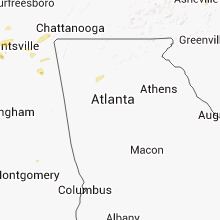


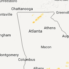


Connect with Interactive Hail Maps