

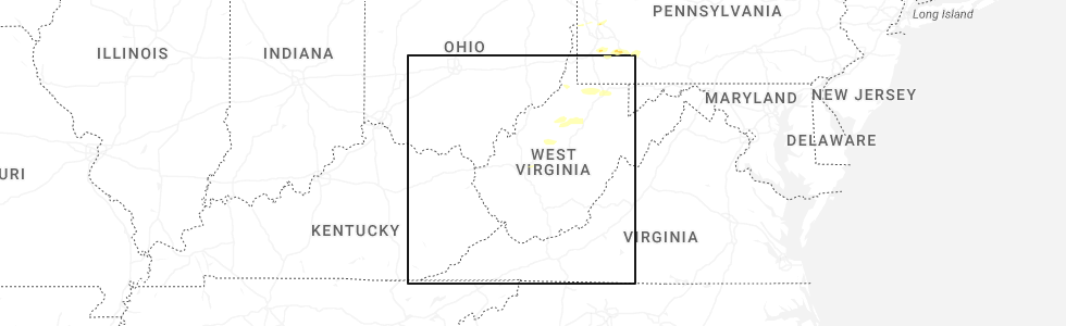
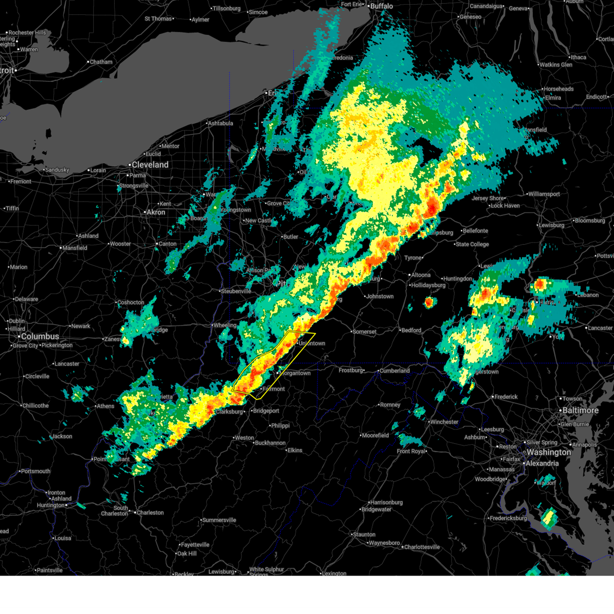
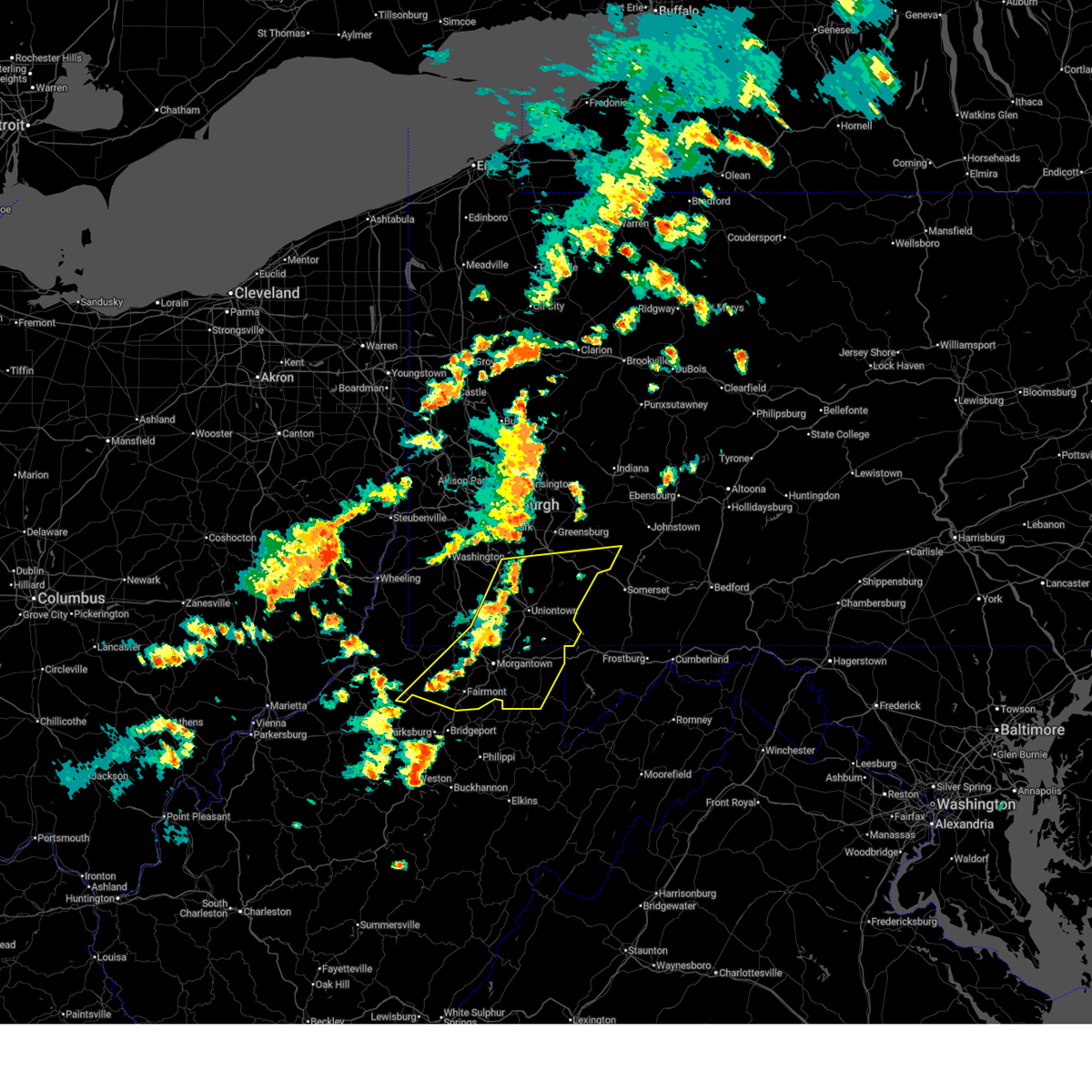
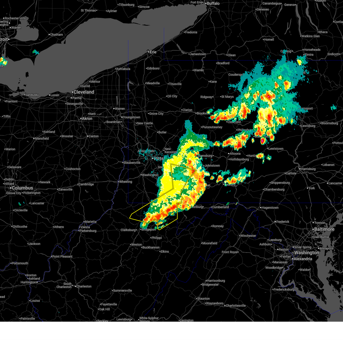
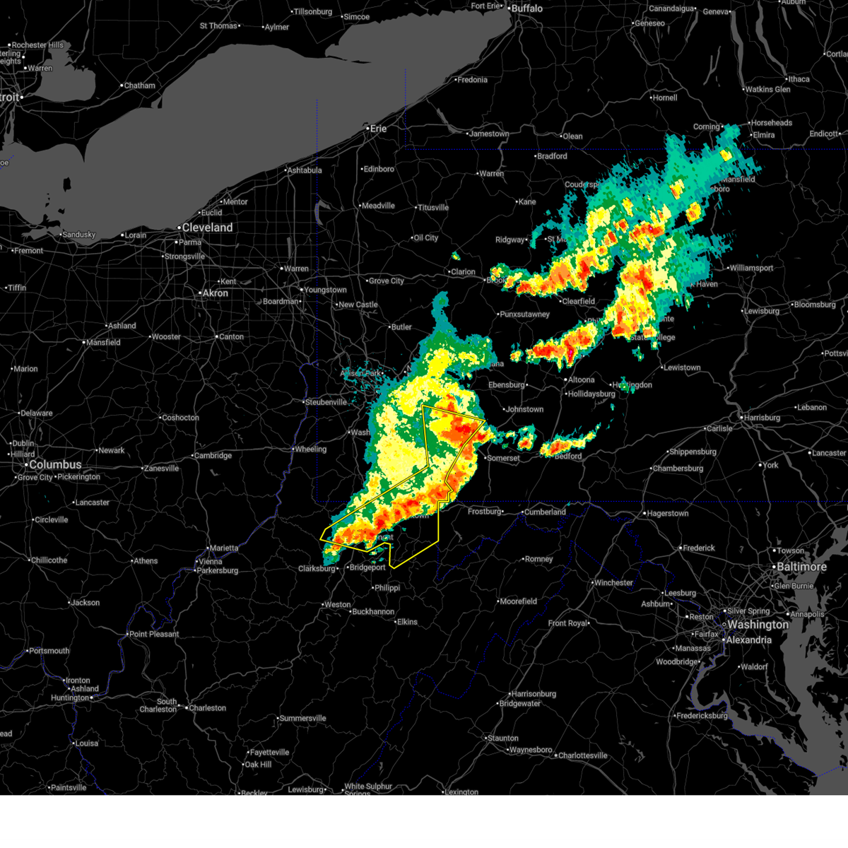
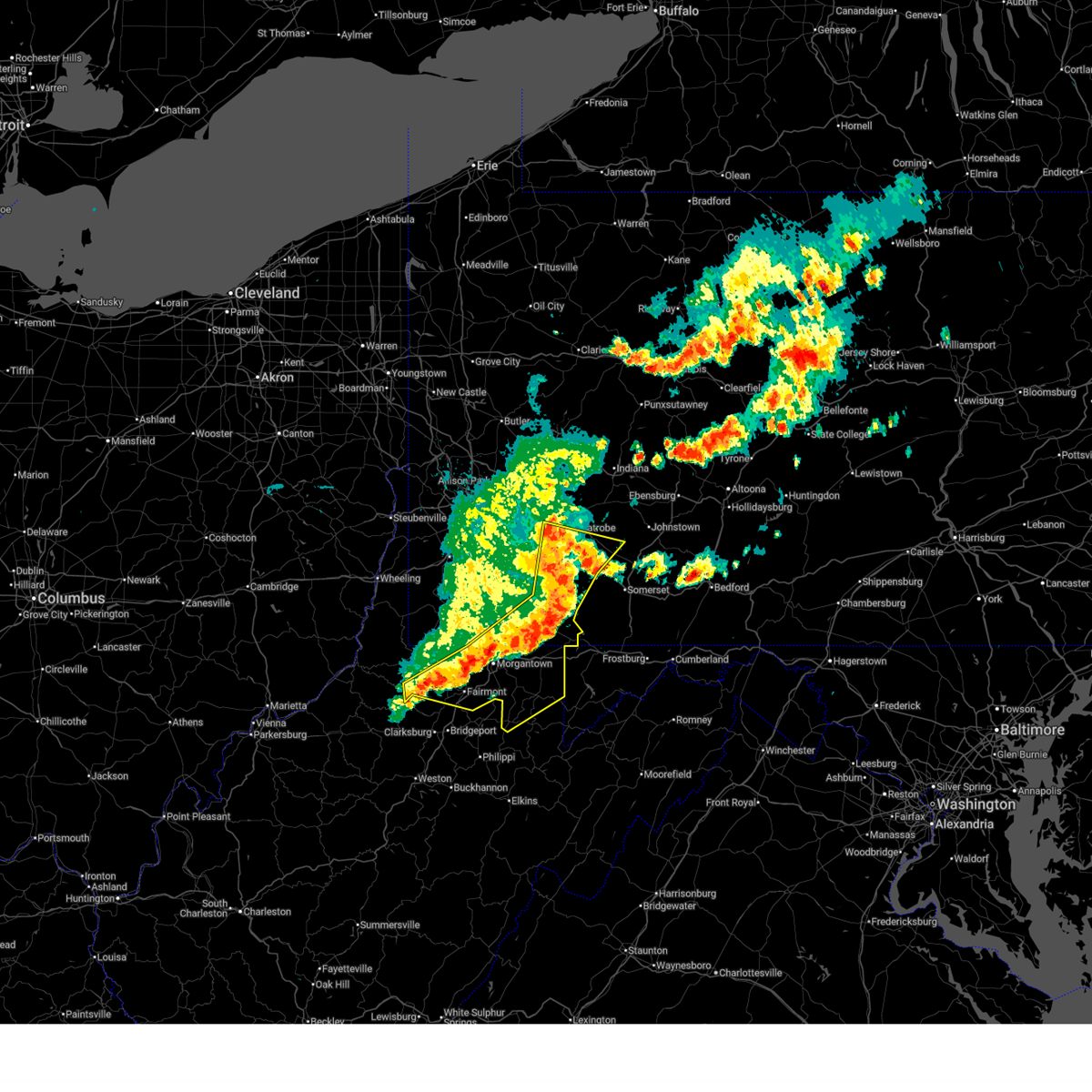
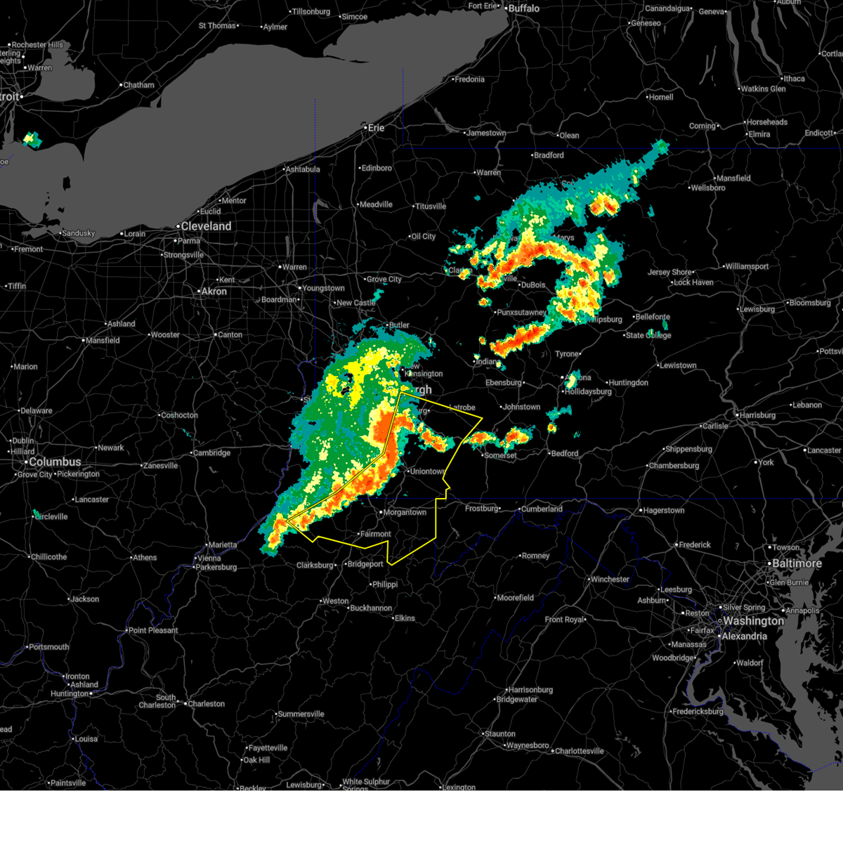
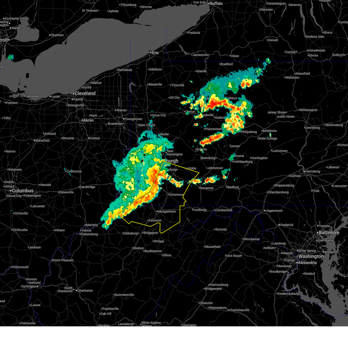
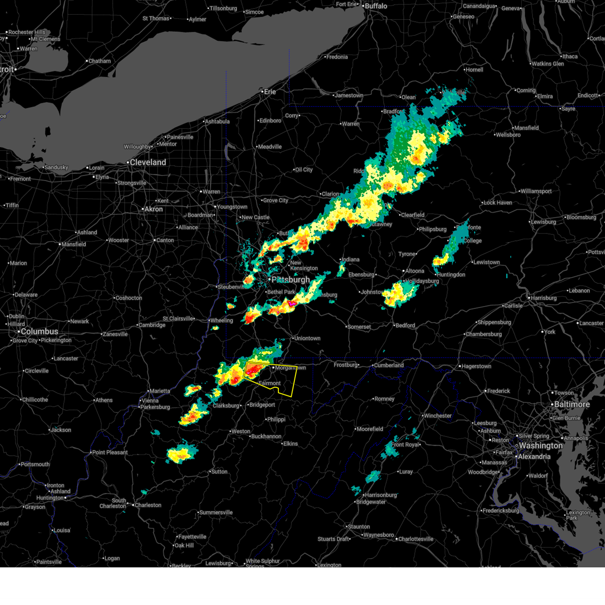
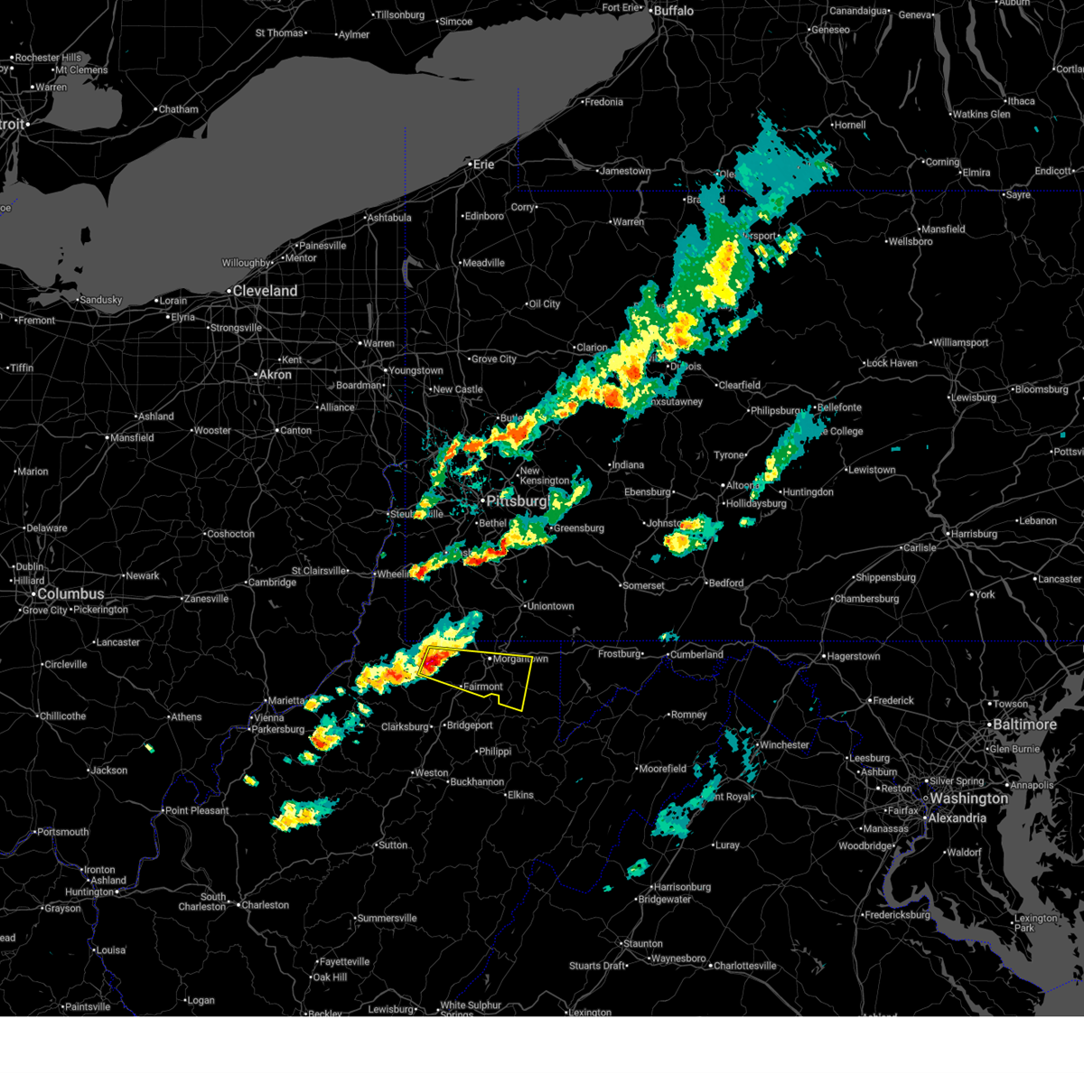
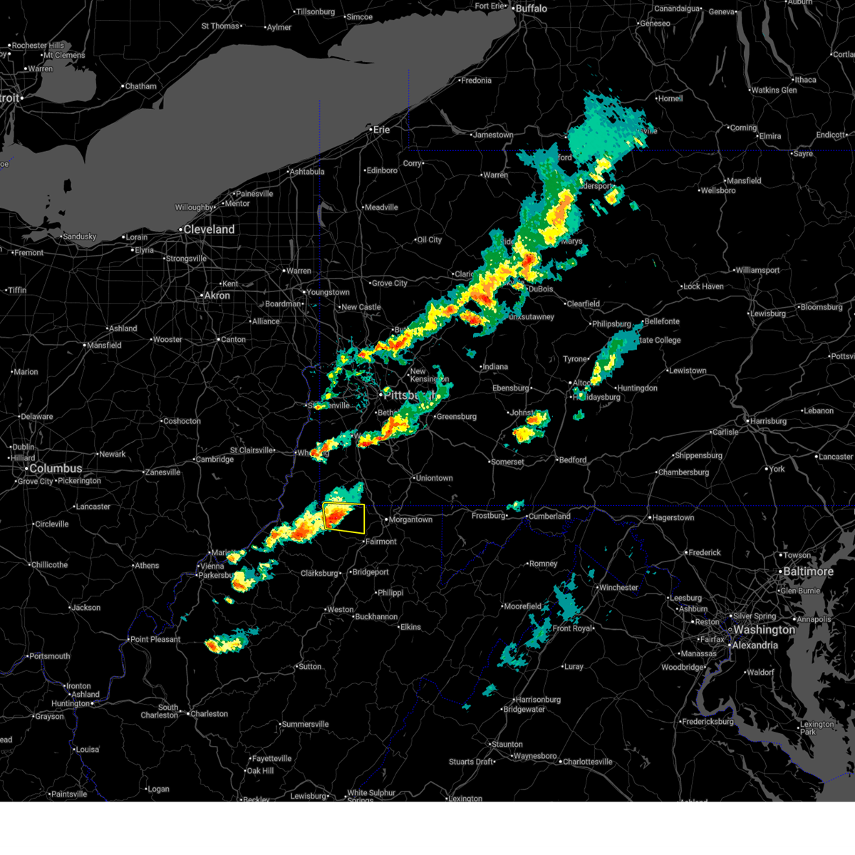
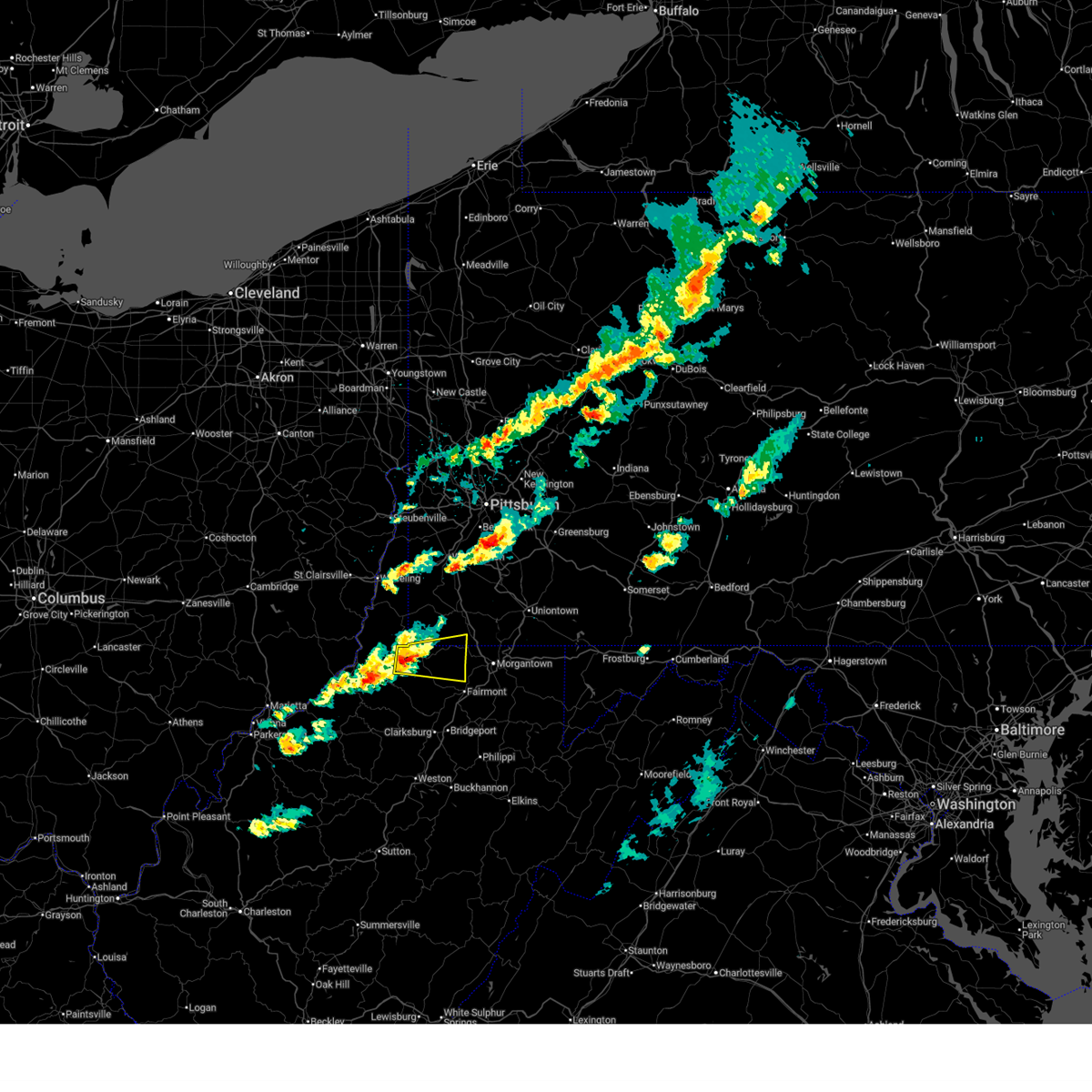
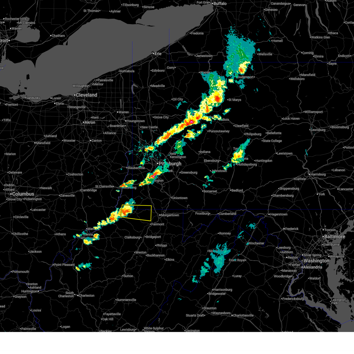
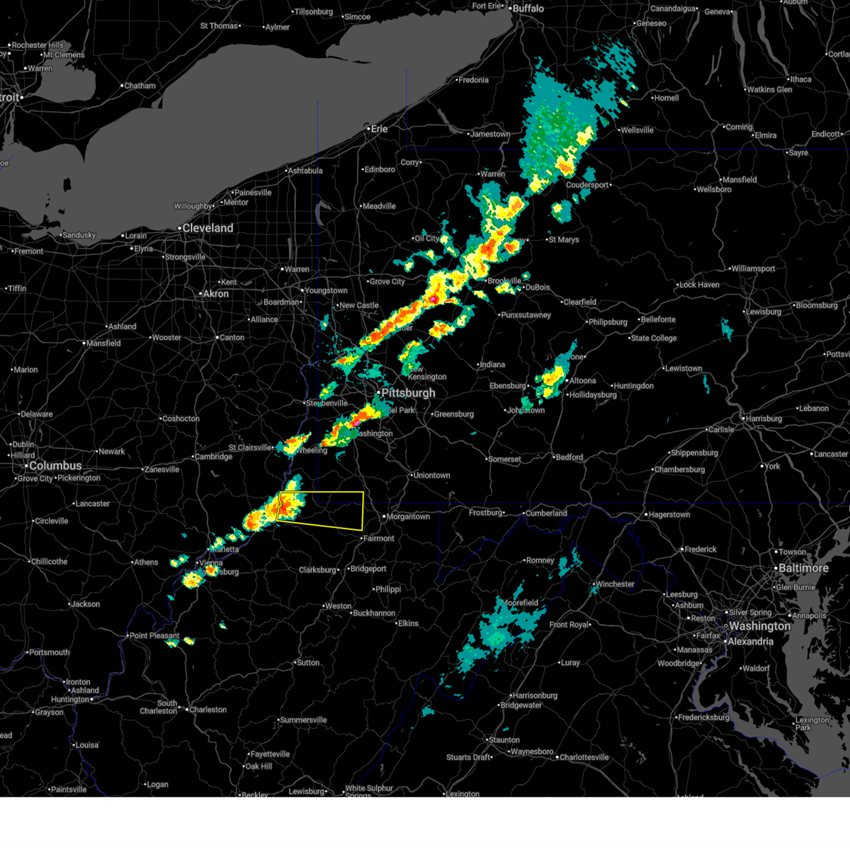
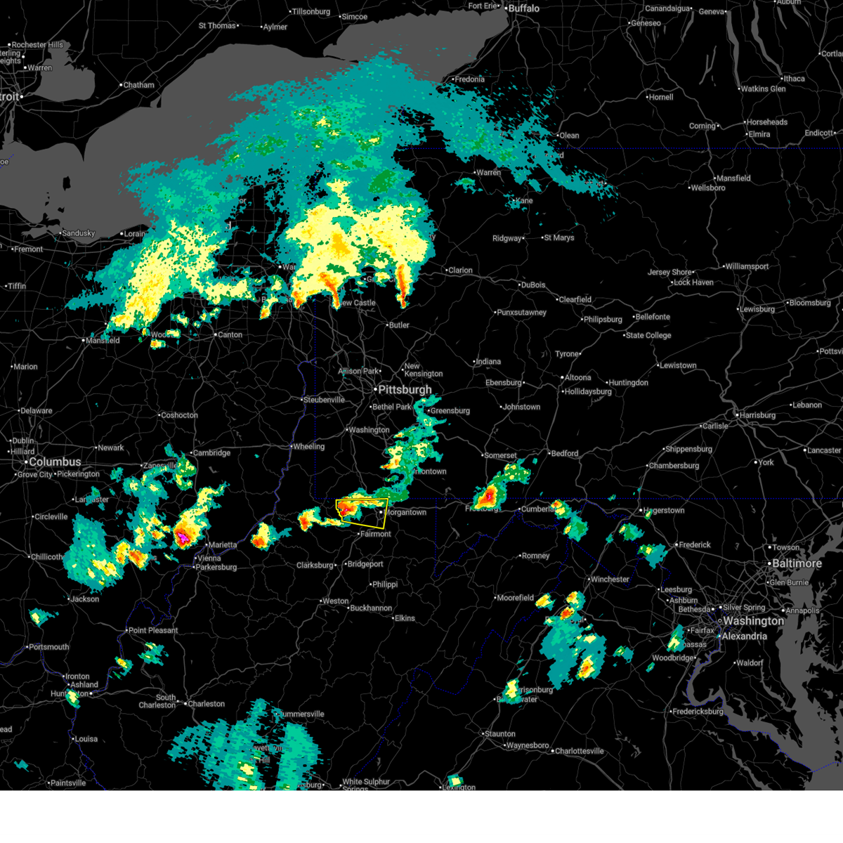
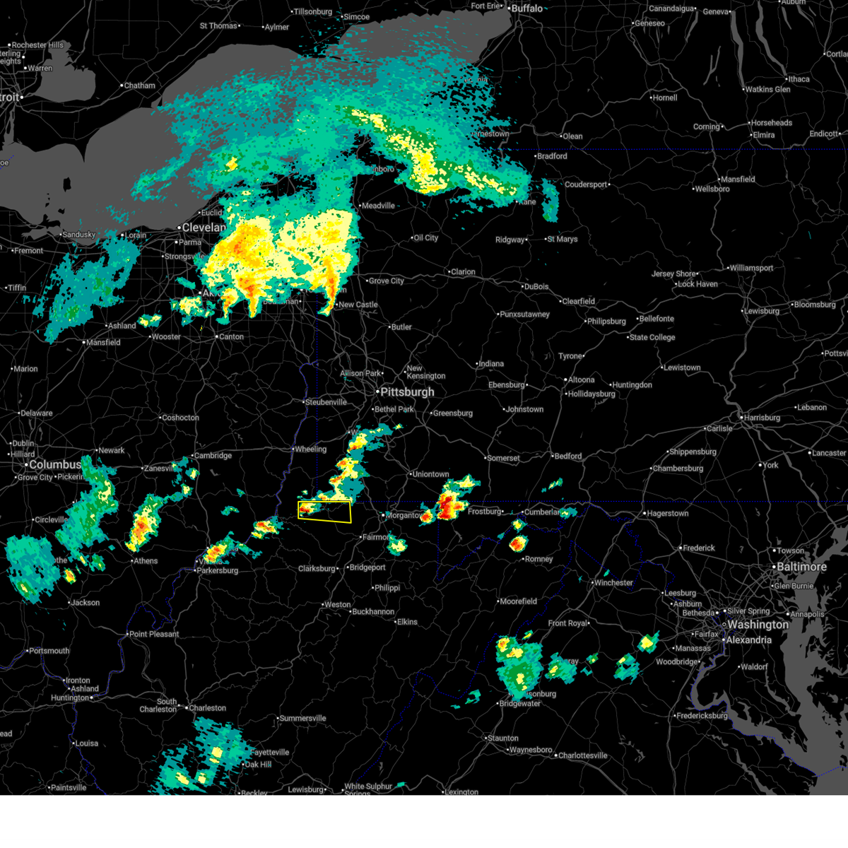
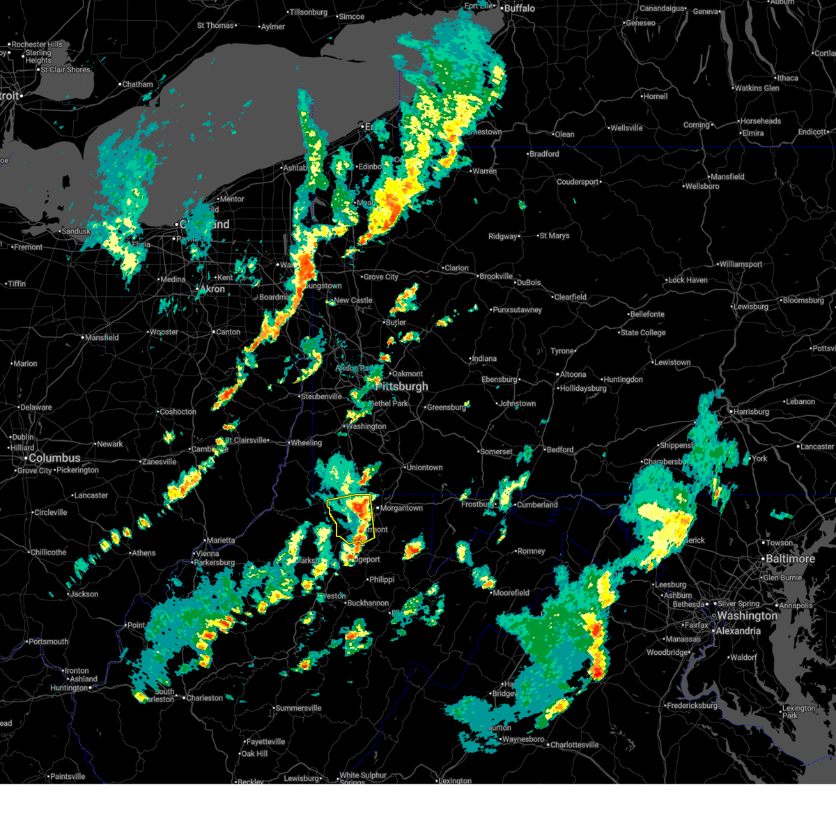
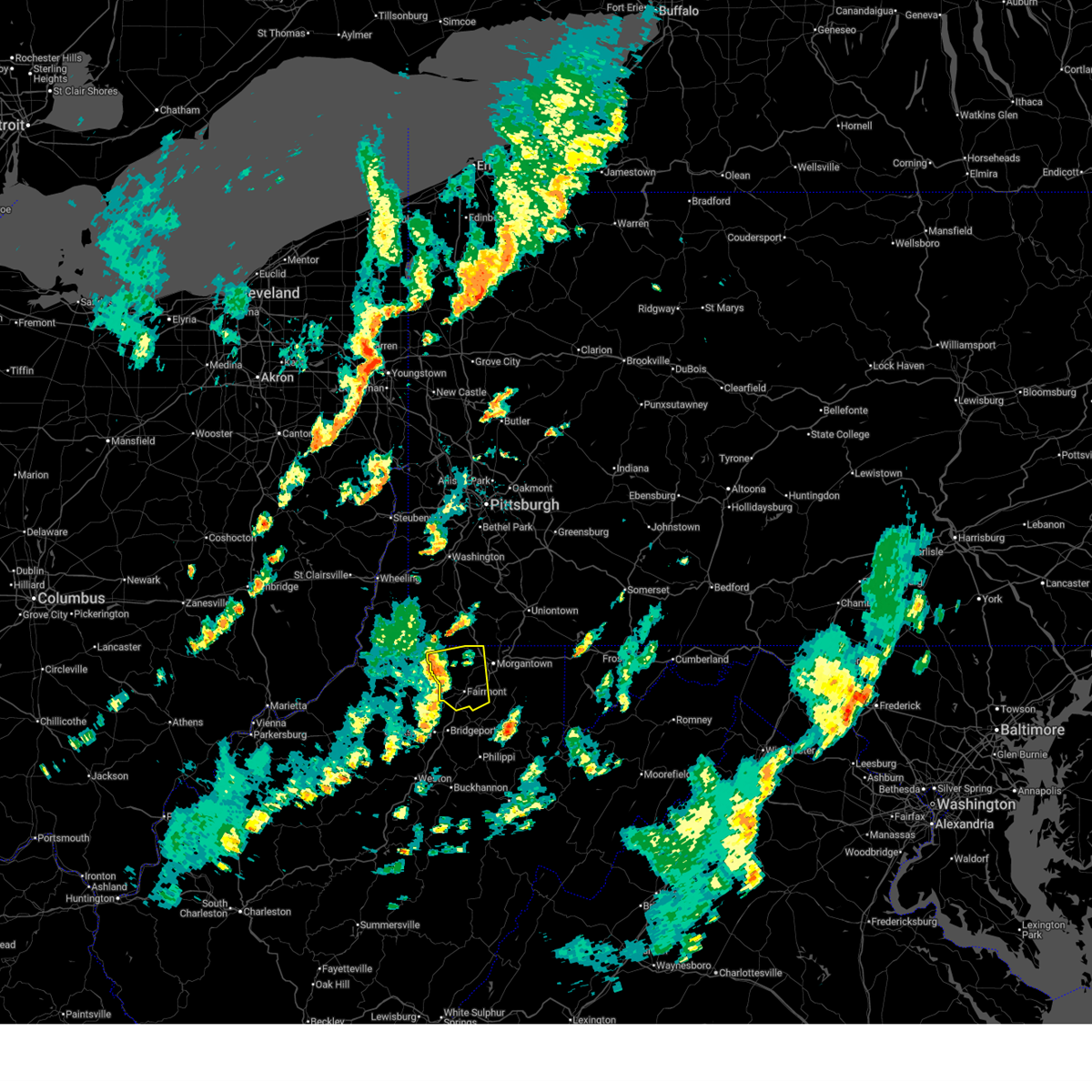
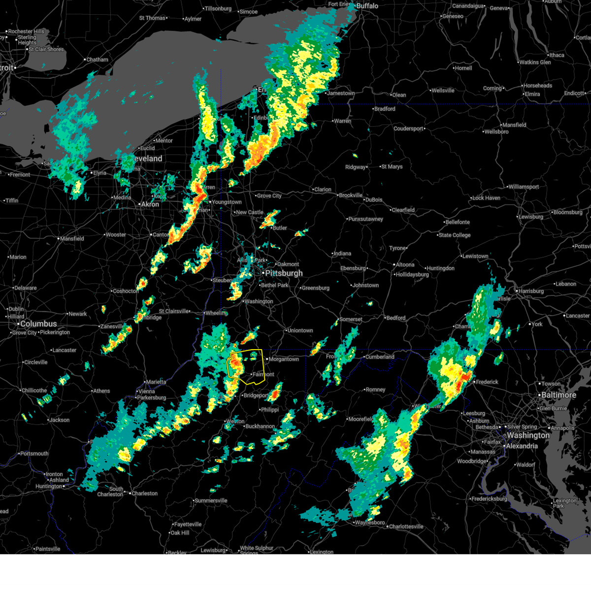
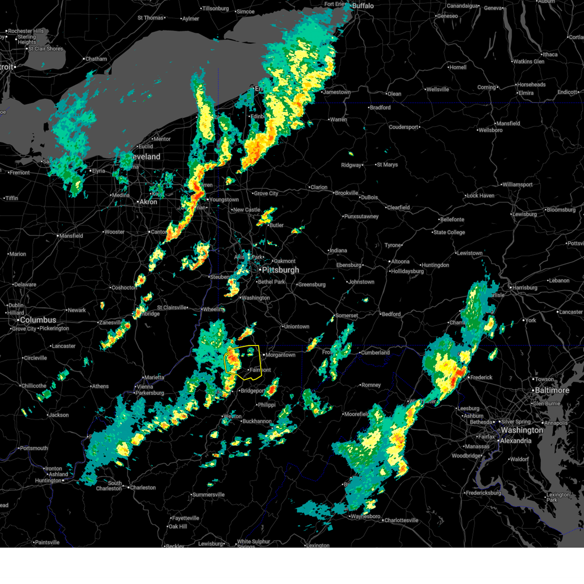
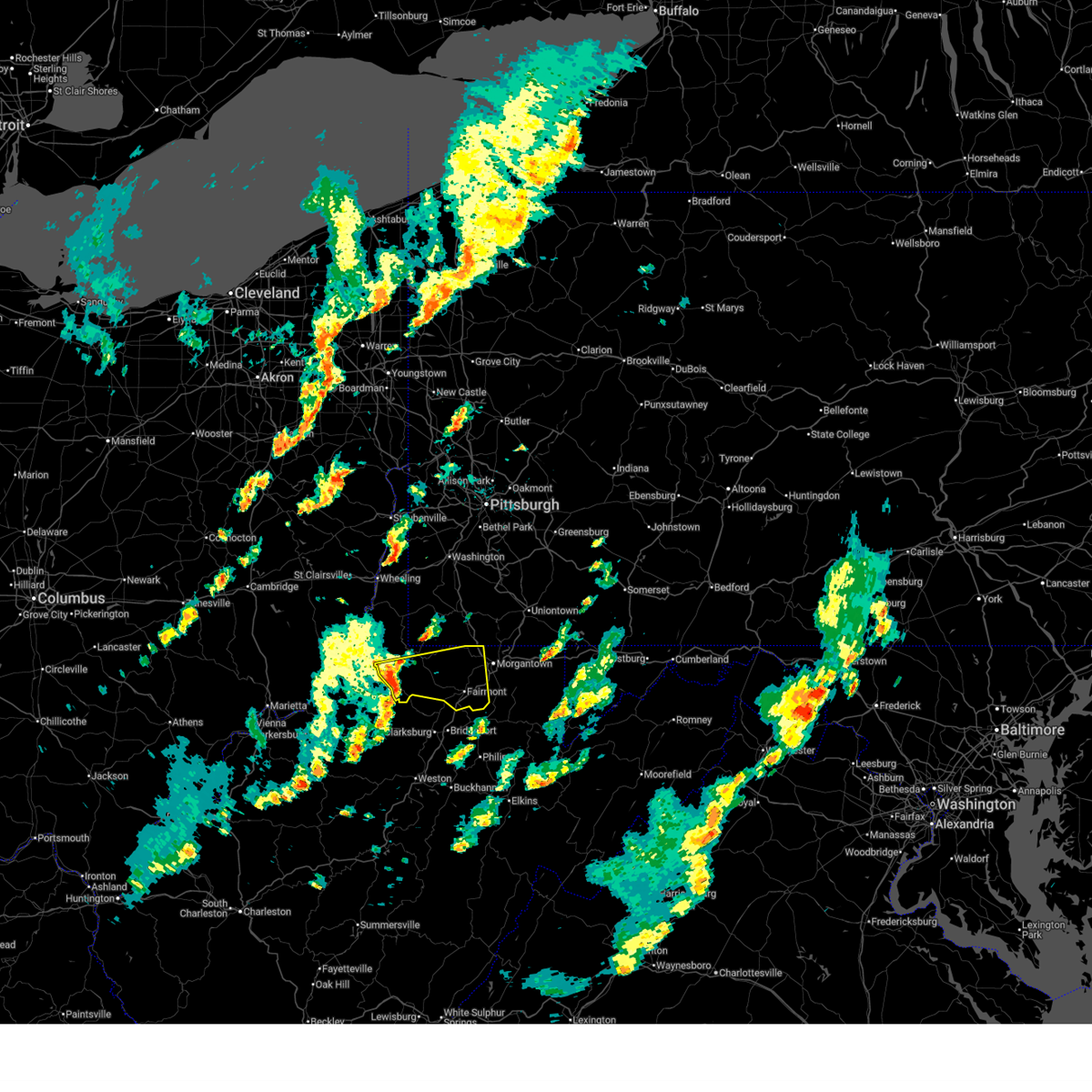
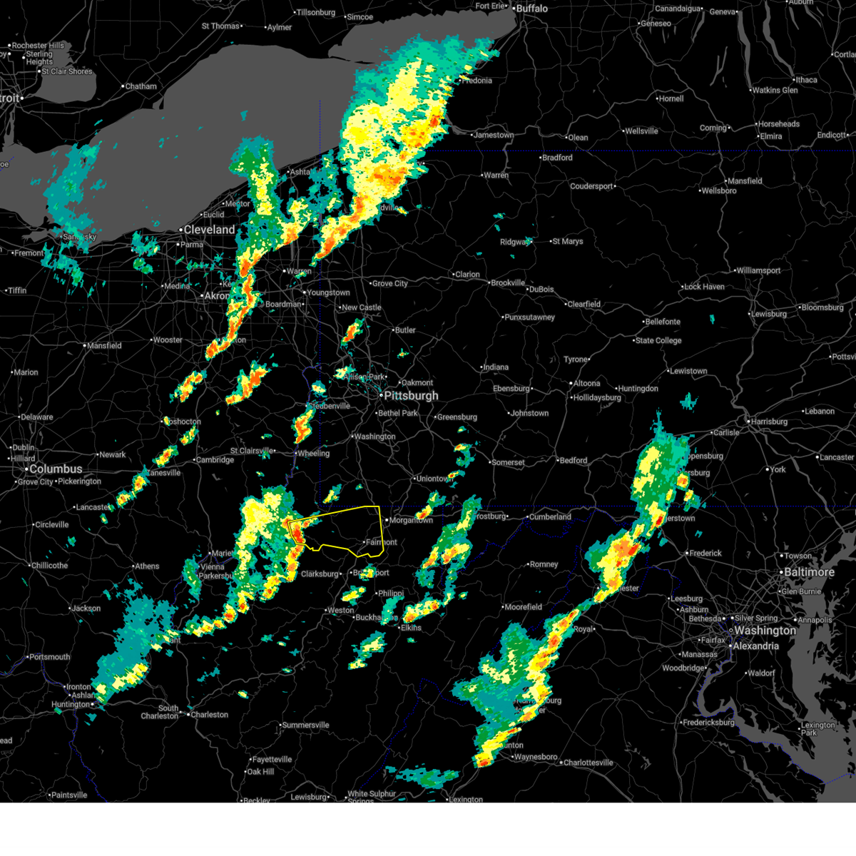
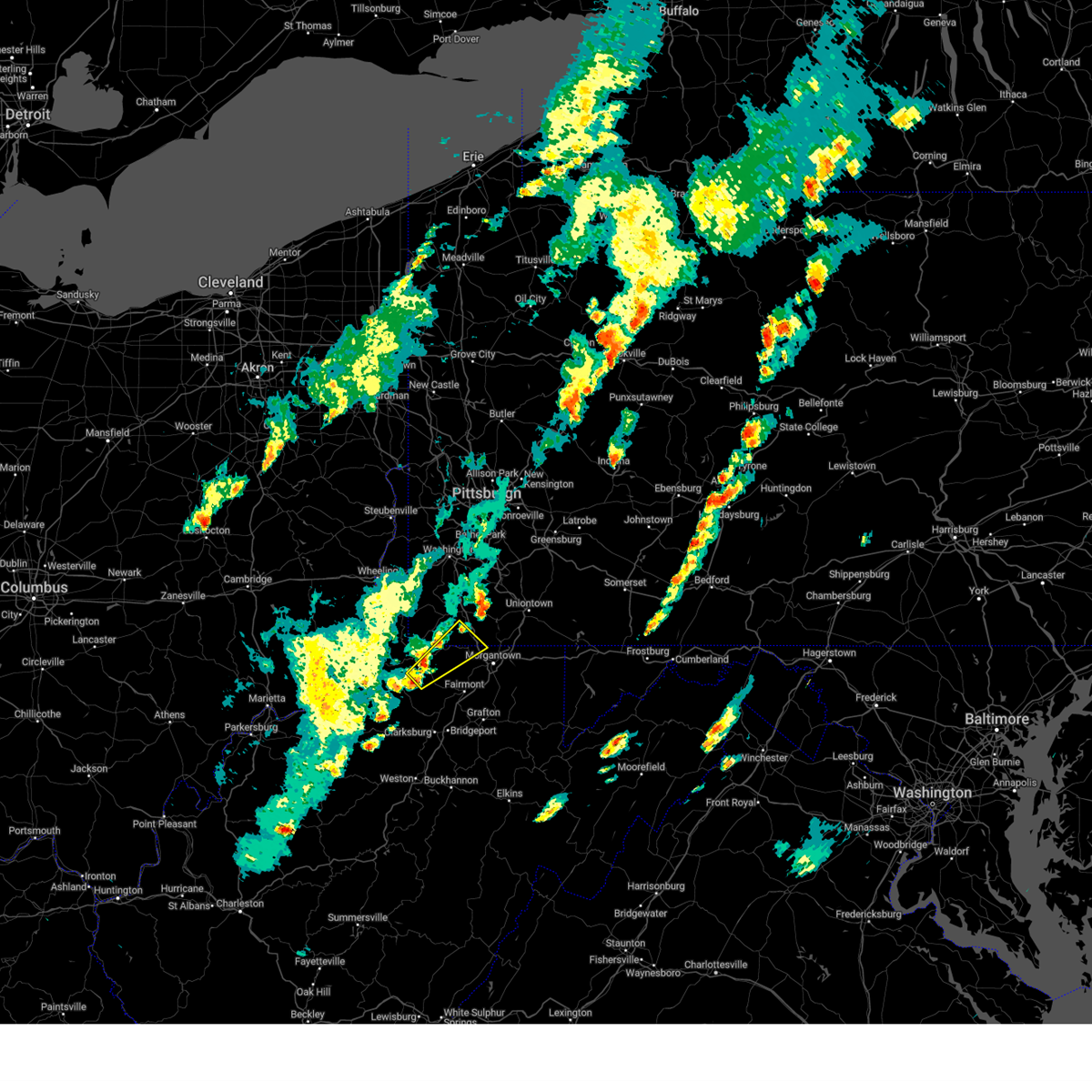
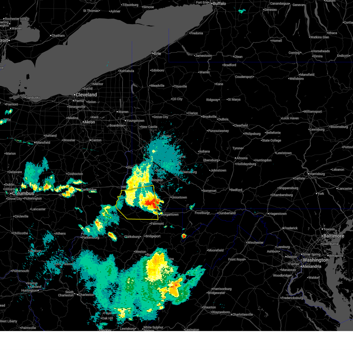
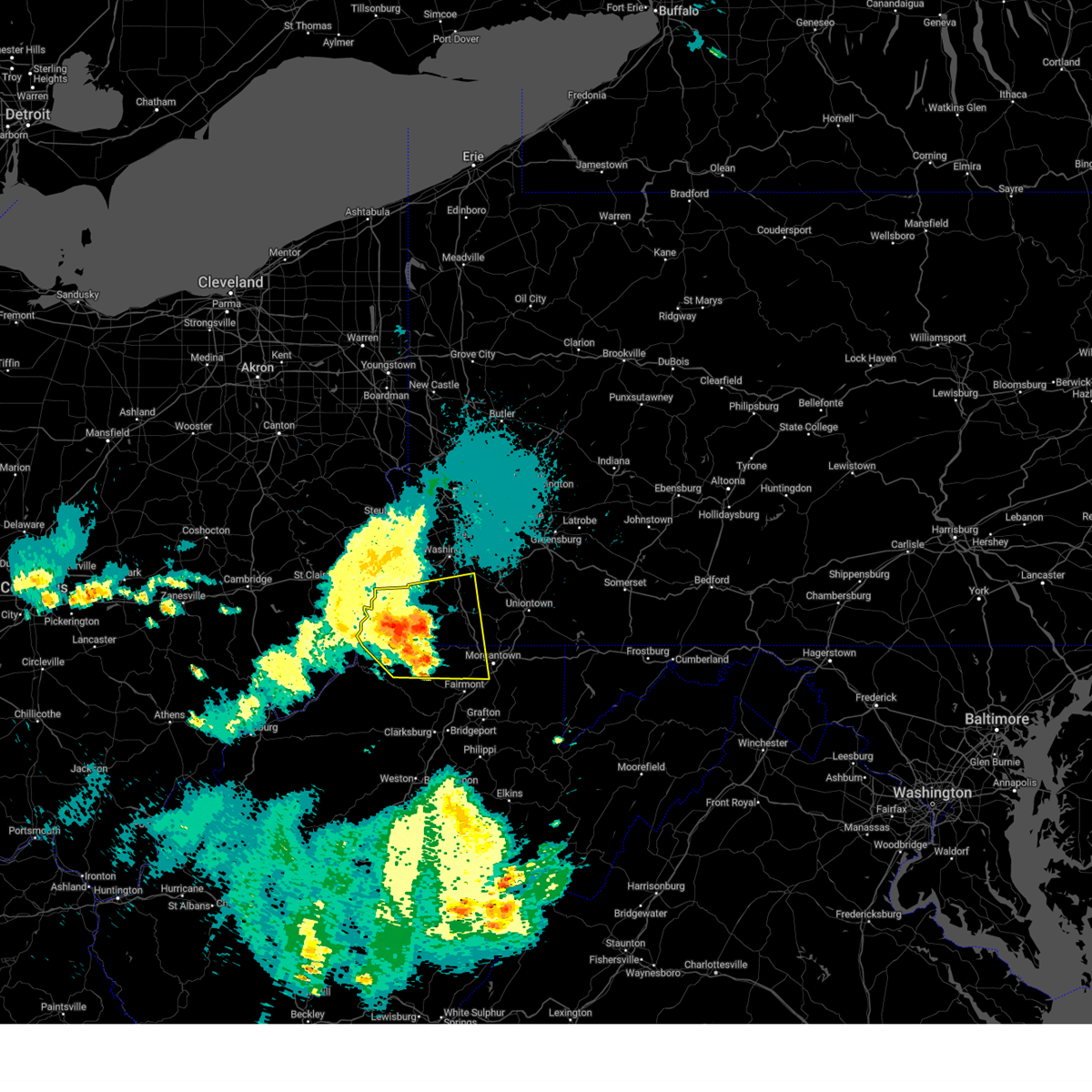
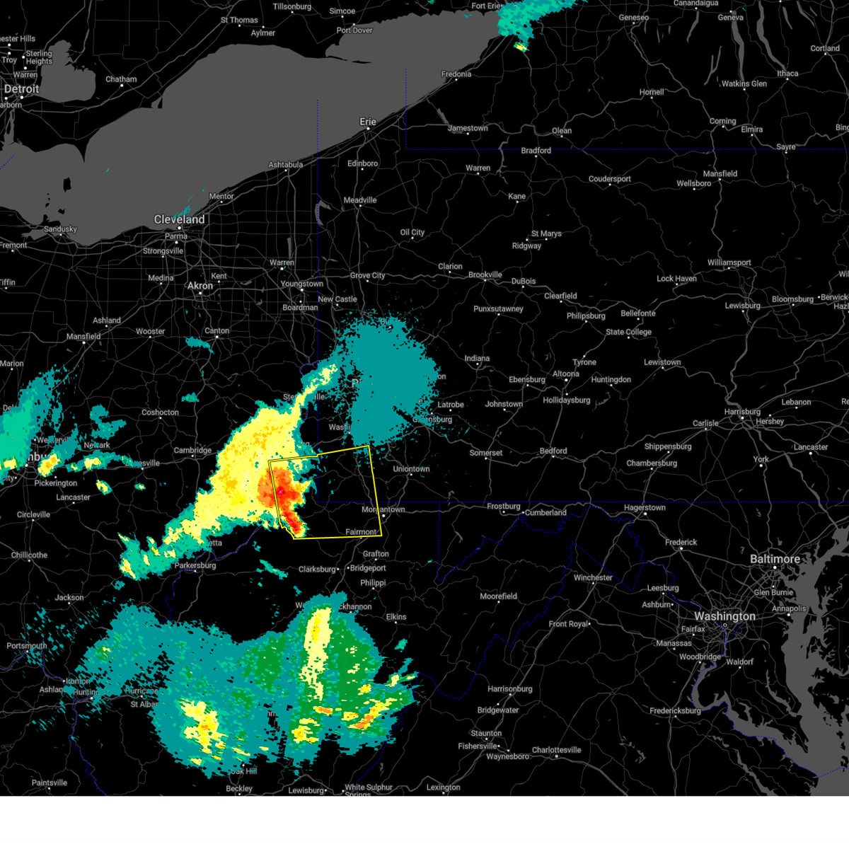
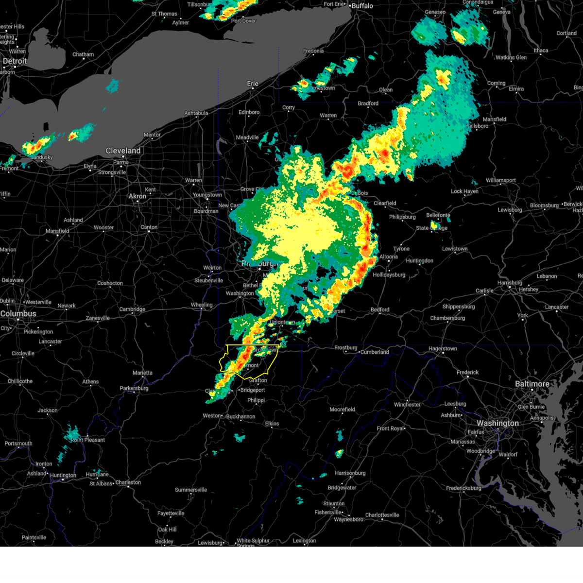
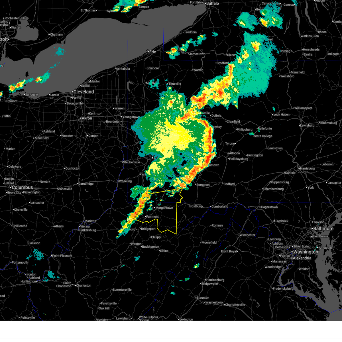
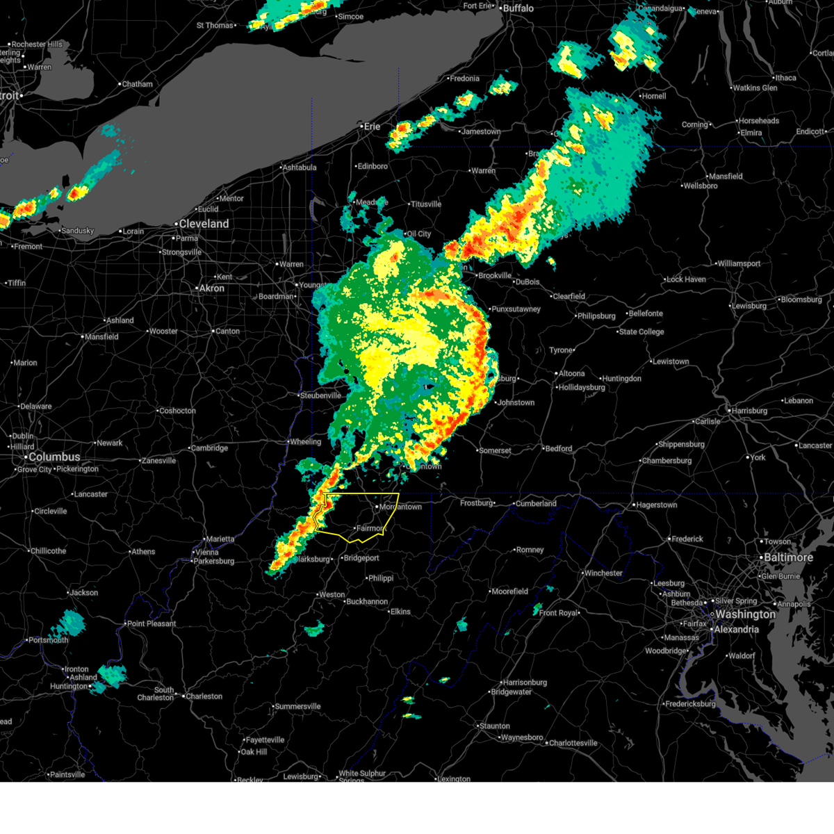
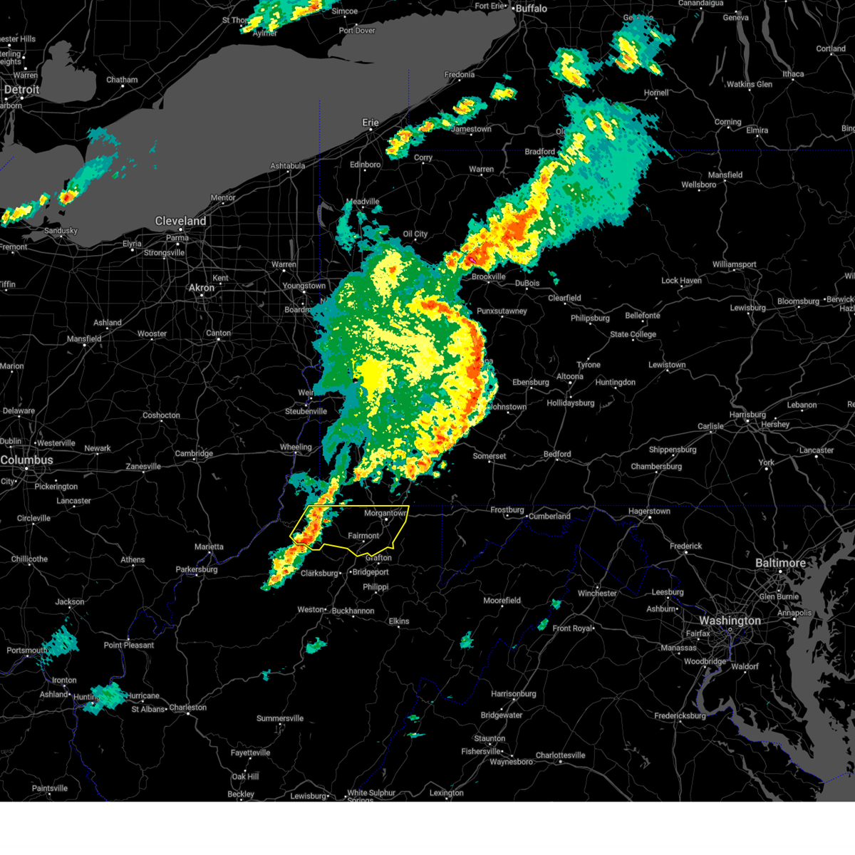
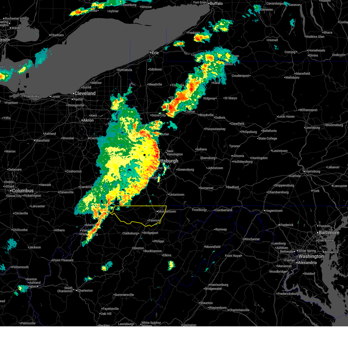
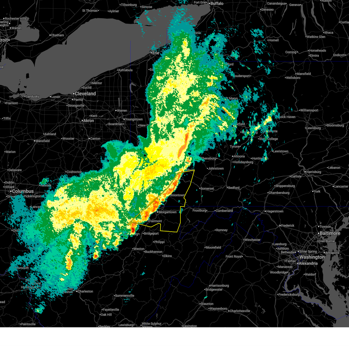
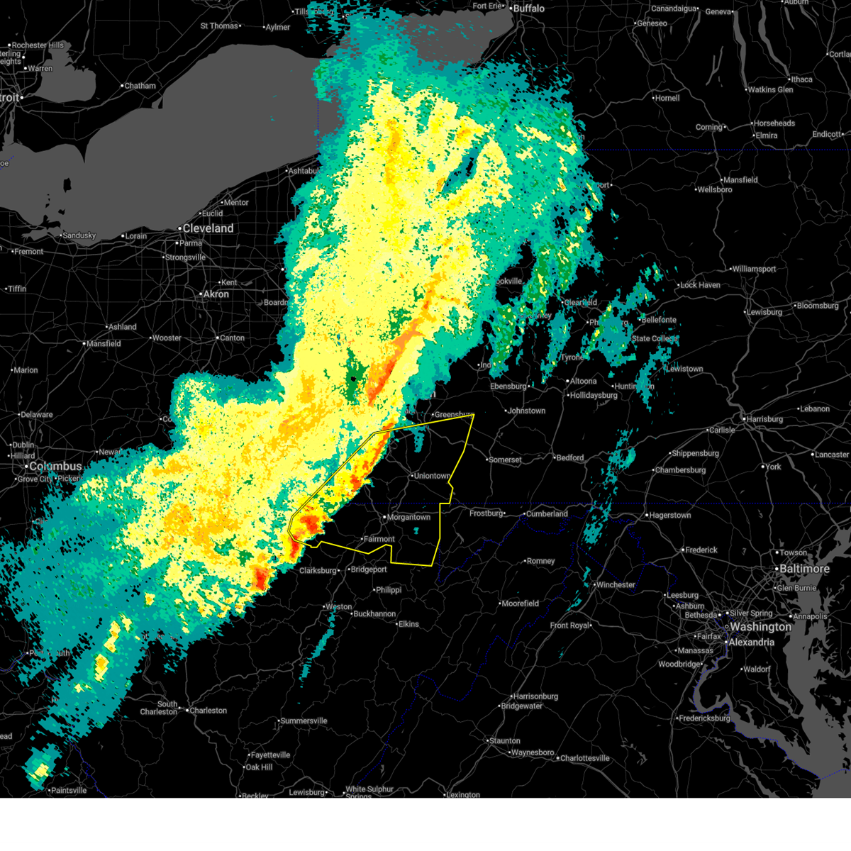
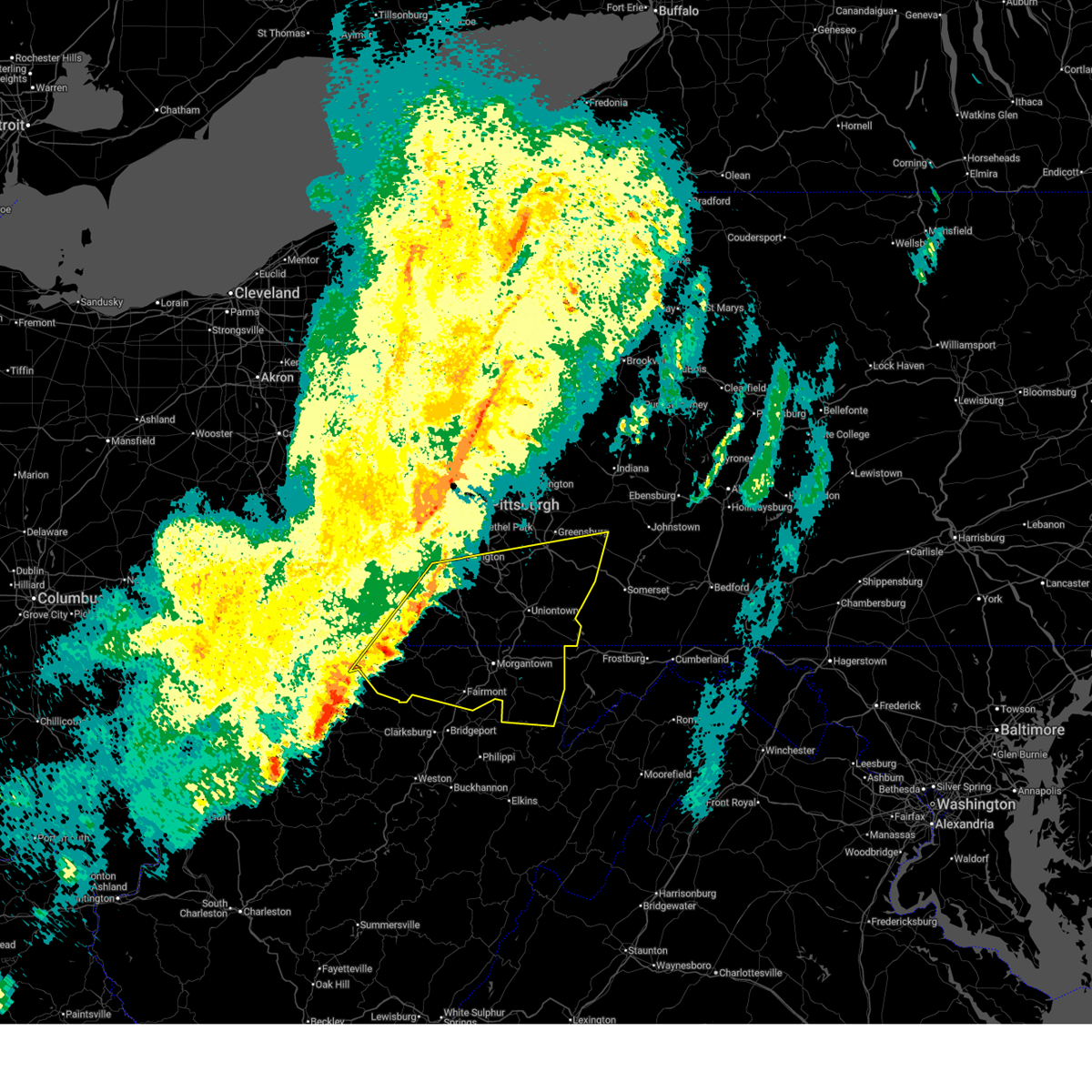
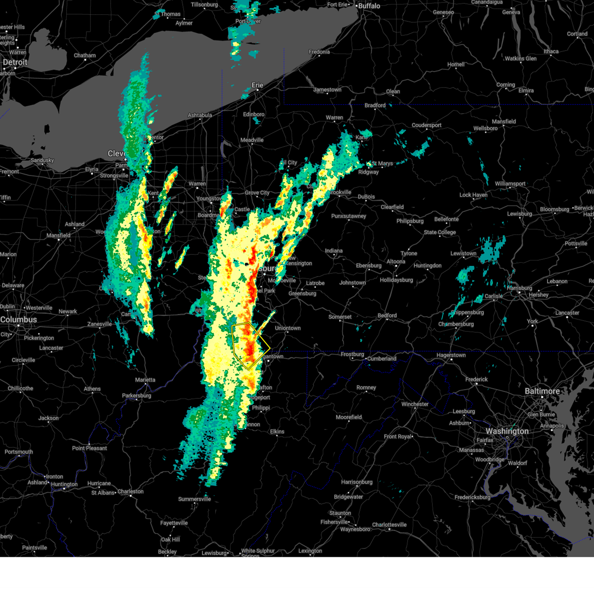
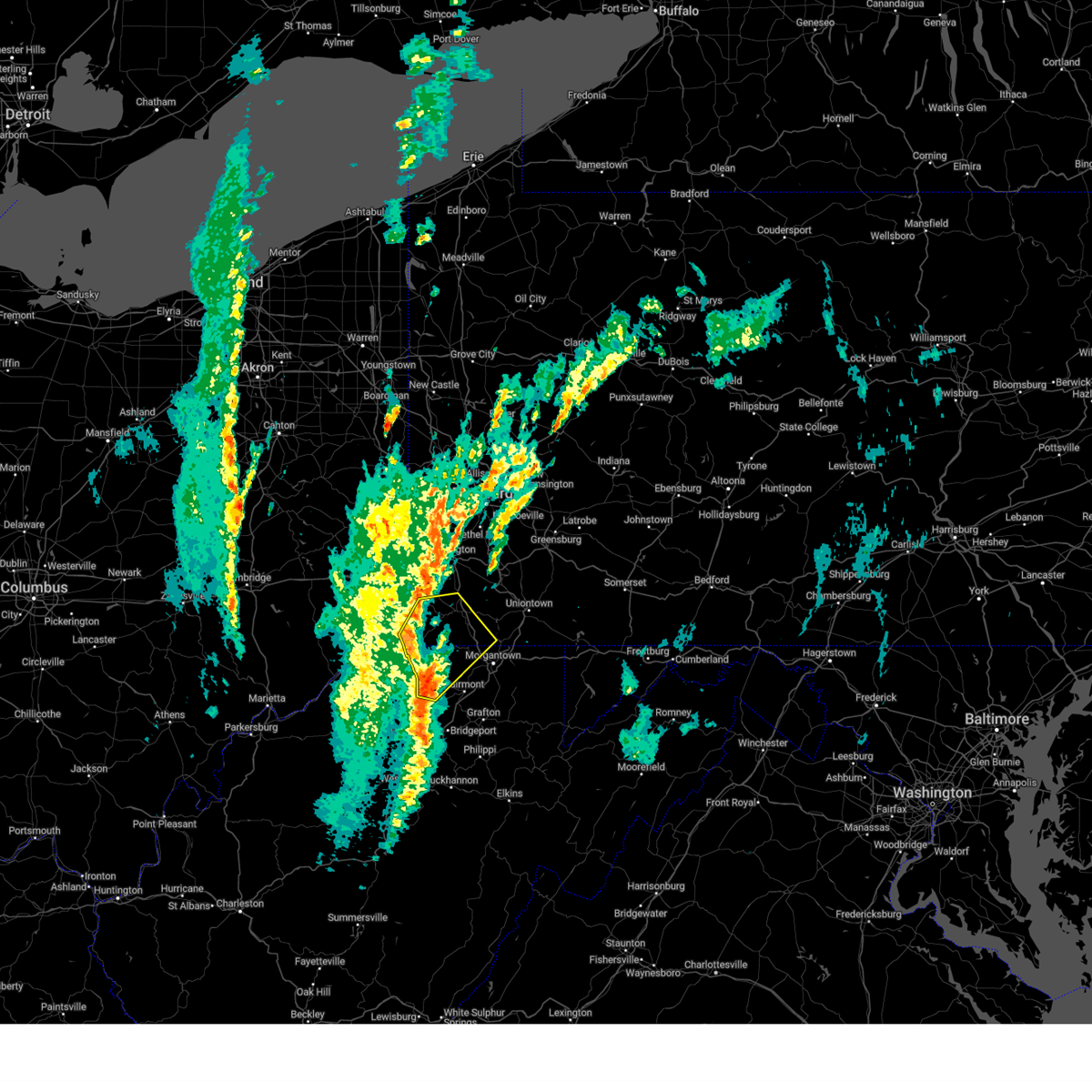
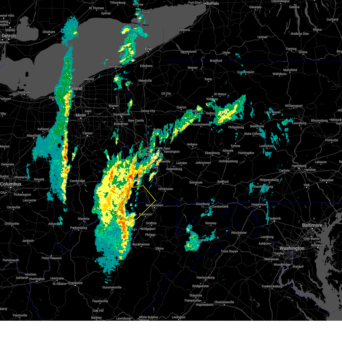
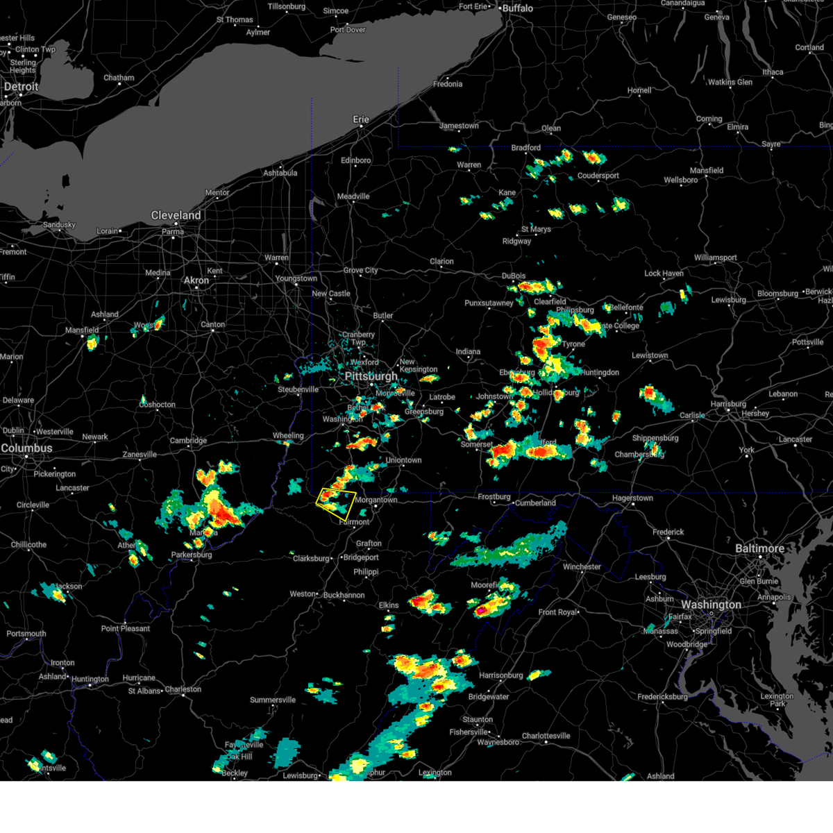
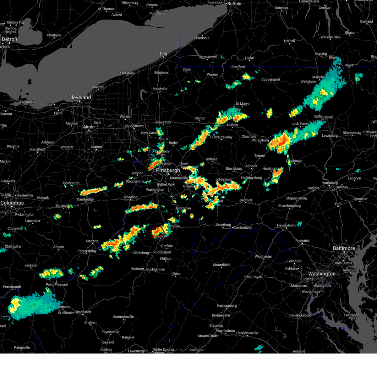
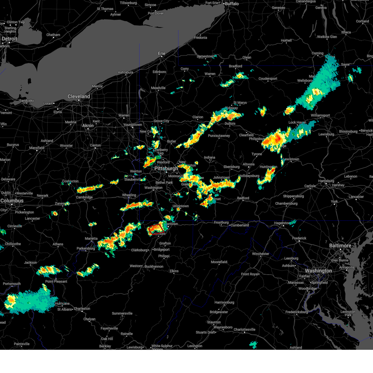
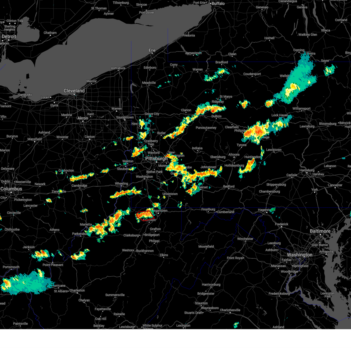
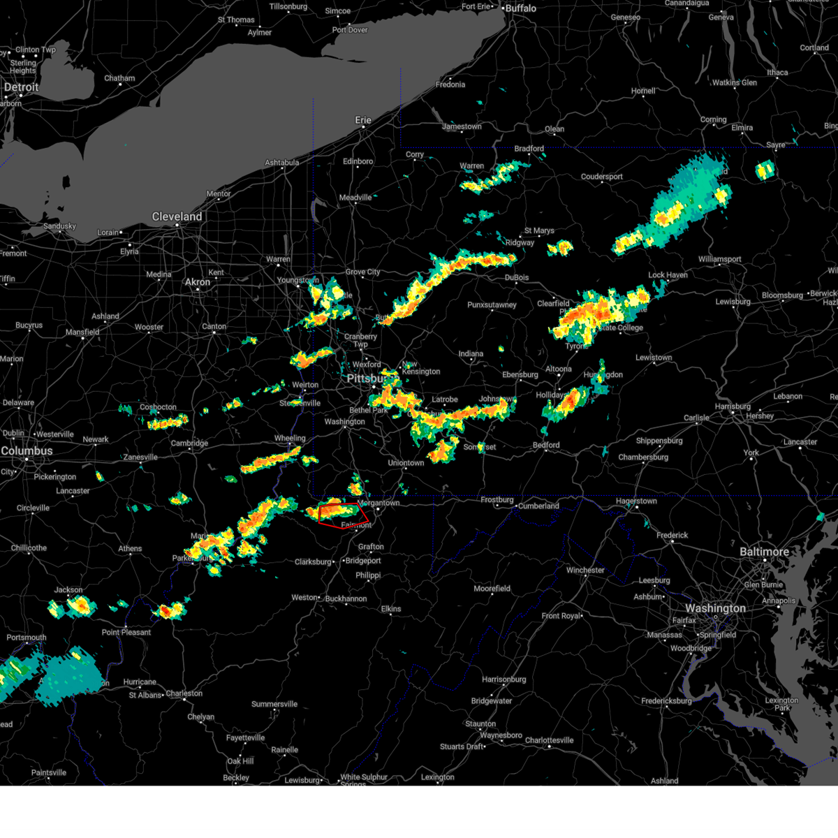
Hail Map for Fairview, WV
The Fairview, WV area has had 2 reports of on-the-ground hail by trained spotters, and has been under severe weather warnings 26 times during the past 12 months. Doppler radar has detected hail at or near Fairview, WV on 15 occasions, including 2 occasions during the past year.
| Name: | Fairview, WV |
| Where Located: | 51 miles NNW of Elkins, WV |
| Map: | Google Map for Fairview, WV |
| Population: | 408 |
| Housing Units: | 199 |
| More Info: | Search Google for Fairview, WV |
5
The Top Recent Hail Date for Fairview, WV is Wednesday, May 13, 2026 (2nd out of 15)
Hail and Wind Damage Spotted near Fairview, WV
| Date / Time | Report Details |
|---|---|
| 6/18/2026 5:31 AM EDT |
 At 531 am edt, a severe thunderstorm was located near westover, moving east at 60 mph (radar indicated). Hazards include 60 mph wind gusts. Expect damage to roofs, siding, and trees. Locations impacted include, morgantown, fairmont, westover, kingwood, star city, pleasant valley, winfield, barrackville, point marion, monongah, granville, fairview, brookhaven, cassville, rivesville, grant town, reedsville, masontown, farmington and albright. At 531 am edt, a severe thunderstorm was located near westover, moving east at 60 mph (radar indicated). Hazards include 60 mph wind gusts. Expect damage to roofs, siding, and trees. Locations impacted include, morgantown, fairmont, westover, kingwood, star city, pleasant valley, winfield, barrackville, point marion, monongah, granville, fairview, brookhaven, cassville, rivesville, grant town, reedsville, masontown, farmington and albright.
|
| 6/18/2026 5:21 AM EDT |
 At 521 am edt, a severe thunderstorm was located near fairview, or 7 miles north of fairmont, moving east at 60 mph (radar indicated). Hazards include 60 mph wind gusts. Expect damage to roofs, siding, and trees. Locations impacted include, morgantown, fairmont, westover, kingwood, mannington, star city, pleasant valley, winfield, barrackville, point marion, monongah, granville, fairview, cassville, brookhaven, rivesville, grant town, reedsville, masontown and farmington. At 521 am edt, a severe thunderstorm was located near fairview, or 7 miles north of fairmont, moving east at 60 mph (radar indicated). Hazards include 60 mph wind gusts. Expect damage to roofs, siding, and trees. Locations impacted include, morgantown, fairmont, westover, kingwood, mannington, star city, pleasant valley, winfield, barrackville, point marion, monongah, granville, fairview, cassville, brookhaven, rivesville, grant town, reedsville, masontown and farmington.
|
| 6/18/2026 5:15 AM EDT |
 At 515 am edt, a severe thunderstorm was located near fairview, or near mannington, moving east at 60 mph (radar indicated). Hazards include 60 mph wind gusts. Expect damage to roofs, siding, and trees. Locations impacted include, morgantown, fairmont, westover, kingwood, mannington, star city, pleasant valley, winfield, barrackville, point marion, monongah, granville, fairview, cassville, brookhaven, rivesville, grant town, reedsville, masontown and farmington. At 515 am edt, a severe thunderstorm was located near fairview, or near mannington, moving east at 60 mph (radar indicated). Hazards include 60 mph wind gusts. Expect damage to roofs, siding, and trees. Locations impacted include, morgantown, fairmont, westover, kingwood, mannington, star city, pleasant valley, winfield, barrackville, point marion, monongah, granville, fairview, cassville, brookhaven, rivesville, grant town, reedsville, masontown and farmington.
|
| 6/14/2026 7:28 PM EDT |
 At 728 pm edt, severe thunderstorms were located along a line from near brownsville to near mannington, or along a line from 8 miles northwest of uniontown to near mannington, moving east at 25 mph (radar indicated). Hazards include 60 mph wind gusts and small hail. Expect damage to roofs, siding, and trees. Locations impacted include, morgantown, fairmont, uniontown, westover, mannington, star city, masontown, pleasant valley, winfield, south connellsville, barrackville, point marion, monongah, granville, fairview, cassville, fairchance, dunbar and rivesville. At 728 pm edt, severe thunderstorms were located along a line from near brownsville to near mannington, or along a line from 8 miles northwest of uniontown to near mannington, moving east at 25 mph (radar indicated). Hazards include 60 mph wind gusts and small hail. Expect damage to roofs, siding, and trees. Locations impacted include, morgantown, fairmont, uniontown, westover, mannington, star city, masontown, pleasant valley, winfield, south connellsville, barrackville, point marion, monongah, granville, fairview, cassville, fairchance, dunbar and rivesville.
|
| 6/14/2026 7:23 PM EDT | Tree down on klondike ln... fairview... wv. time based on radar estimat in monongalia county WV, 3.9 miles SSE of Fairview, WV |
| 6/14/2026 7:21 PM EDT | Corrects previous tstm wnd dmg report from 2 se wadestown. tree across the road near crossroads rd / zeb haught rd... wadestown. time based on radar estimat in monongalia county WV, 5.4 miles SSE of Fairview, WV |
| 6/14/2026 7:17 PM EDT |
 At 717 pm edt, severe thunderstorms were located along a line from over brownsville to 9 miles east of jacksonburg, or along a line from 12 miles northwest of uniontown to 9 miles west of mannington, moving east at 25 mph (radar indicated). Hazards include 60 mph wind gusts and small hail. Expect damage to roofs, siding, and trees. Locations impacted include, morgantown, fairmont, uniontown, westover, mannington, star city, masontown, pleasant valley, brownsville, winfield, south connellsville, fairdale, jefferson boro, barrackville, point marion, monongah, granville, fairview and cassville. At 717 pm edt, severe thunderstorms were located along a line from over brownsville to 9 miles east of jacksonburg, or along a line from 12 miles northwest of uniontown to 9 miles west of mannington, moving east at 25 mph (radar indicated). Hazards include 60 mph wind gusts and small hail. Expect damage to roofs, siding, and trees. Locations impacted include, morgantown, fairmont, uniontown, westover, mannington, star city, masontown, pleasant valley, brownsville, winfield, south connellsville, fairdale, jefferson boro, barrackville, point marion, monongah, granville, fairview and cassville.
|
| 6/14/2026 7:16 PM EDT | Tree across the road near crossroads rd / zeb haught rd... wadestown. time based on radar estimat in monongalia county WV, 5.4 miles SSE of Fairview, WV |
| 6/14/2026 7:07 PM EDT |
 At 707 pm edt, severe thunderstorms were located along a line from over fredericktown-millsboro to near jacksonburg, or along a line from 12 miles northeast of waynesburg to 13 miles west of mannington, moving east at 25 mph (radar indicated). Hazards include 60 mph wind gusts and small hail. Expect damage to roofs, siding, and trees. Locations impacted include, morgantown, fairmont, uniontown, waynesburg, westover, mannington, star city, masontown, pleasant valley, brownsville, winfield, fredericktown-millsboro, south connellsville, jefferson boro, fairdale, barrackville, point marion, monongah, granville and pine grove. At 707 pm edt, severe thunderstorms were located along a line from over fredericktown-millsboro to near jacksonburg, or along a line from 12 miles northeast of waynesburg to 13 miles west of mannington, moving east at 25 mph (radar indicated). Hazards include 60 mph wind gusts and small hail. Expect damage to roofs, siding, and trees. Locations impacted include, morgantown, fairmont, uniontown, waynesburg, westover, mannington, star city, masontown, pleasant valley, brownsville, winfield, fredericktown-millsboro, south connellsville, jefferson boro, fairdale, barrackville, point marion, monongah, granville and pine grove.
|
| 6/14/2026 6:54 PM EDT |
 Svrpbz the national weather service in pittsburgh has issued a * severe thunderstorm warning for, southwestern fayette county in southwestern pennsylvania, greene county in southwestern pennsylvania, southeastern washington county in southwestern pennsylvania, marion county in northern west virginia, marshall county in northern west virginia, monongalia county in northern west virginia, wetzel county in northern west virginia, * until 745 pm edt. * at 654 pm edt, severe thunderstorms were located along a line from near waynesburg to 7 miles southwest of pine grove, or along a line from near waynesburg to 10 miles south of new martinsville, moving southeast at 30 mph (radar indicated). Hazards include 60 mph wind gusts and small hail. expect damage to roofs, siding, and trees Svrpbz the national weather service in pittsburgh has issued a * severe thunderstorm warning for, southwestern fayette county in southwestern pennsylvania, greene county in southwestern pennsylvania, southeastern washington county in southwestern pennsylvania, marion county in northern west virginia, marshall county in northern west virginia, monongalia county in northern west virginia, wetzel county in northern west virginia, * until 745 pm edt. * at 654 pm edt, severe thunderstorms were located along a line from near waynesburg to 7 miles southwest of pine grove, or along a line from near waynesburg to 10 miles south of new martinsville, moving southeast at 30 mph (radar indicated). Hazards include 60 mph wind gusts and small hail. expect damage to roofs, siding, and trees
|
| 6/11/2026 3:41 PM EDT |
 Svrpbz the national weather service in pittsburgh has issued a * severe thunderstorm warning for, fayette county in southwestern pennsylvania, eastern greene county in southwestern pennsylvania, southeastern washington county in southwestern pennsylvania, southern westmoreland county in southwestern pennsylvania, northern preston county in northeastern west virginia, marion county in northern west virginia, monongalia county in northern west virginia, southeastern wetzel county in northern west virginia, * until 445 pm edt. * at 341 pm edt, severe thunderstorms were located along a line from near monessen to 6 miles southwest of mannington, or along a line from 14 miles southeast of gastonville to 6 miles southwest of mannington, moving east at 30 mph (radar indicated). Hazards include 60 mph wind gusts. expect damage to roofs, siding, and trees Svrpbz the national weather service in pittsburgh has issued a * severe thunderstorm warning for, fayette county in southwestern pennsylvania, eastern greene county in southwestern pennsylvania, southeastern washington county in southwestern pennsylvania, southern westmoreland county in southwestern pennsylvania, northern preston county in northeastern west virginia, marion county in northern west virginia, monongalia county in northern west virginia, southeastern wetzel county in northern west virginia, * until 445 pm edt. * at 341 pm edt, severe thunderstorms were located along a line from near monessen to 6 miles southwest of mannington, or along a line from 14 miles southeast of gastonville to 6 miles southwest of mannington, moving east at 30 mph (radar indicated). Hazards include 60 mph wind gusts. expect damage to roofs, siding, and trees
|
| 6/6/2026 3:41 PM EDT |
 The storms which prompted the warning have moved out of the area. therefore, the warning will be allowed to expire. a severe thunderstorm warning still remains in effect for portions of fayette, preston, marion, and monongalia counties until 415 pm. a severe thunderstorm watch remains in effect until 600 pm edt for portions of southwest pennsylvania and west virginia. The storms which prompted the warning have moved out of the area. therefore, the warning will be allowed to expire. a severe thunderstorm warning still remains in effect for portions of fayette, preston, marion, and monongalia counties until 415 pm. a severe thunderstorm watch remains in effect until 600 pm edt for portions of southwest pennsylvania and west virginia.
|
| 6/6/2026 3:29 PM EDT |
 At 329 pm edt, severe thunderstorms were located along a line from 11 miles southeast of ligonier to near monongah, or along a line from 20 miles southeast of latrobe to 8 miles southwest of fairmont, moving southeast at 45 mph (emergency management reported damage to trees and power lines in fayette and westmoreland counties). Hazards include 70 mph wind gusts. Expect considerable tree damage. damage is likely to mobile homes, roofs, and outbuildings. Locations impacted include, morgantown, greensburg, fairmont, uniontown, jeannette, latrobe, connellsville, westover, kingwood, mannington, star city, terra alta, mount pleasant, scottdale, pleasant valley, youngwood, lawson heights and winfield. At 329 pm edt, severe thunderstorms were located along a line from 11 miles southeast of ligonier to near monongah, or along a line from 20 miles southeast of latrobe to 8 miles southwest of fairmont, moving southeast at 45 mph (emergency management reported damage to trees and power lines in fayette and westmoreland counties). Hazards include 70 mph wind gusts. Expect considerable tree damage. damage is likely to mobile homes, roofs, and outbuildings. Locations impacted include, morgantown, greensburg, fairmont, uniontown, jeannette, latrobe, connellsville, westover, kingwood, mannington, star city, terra alta, mount pleasant, scottdale, pleasant valley, youngwood, lawson heights and winfield.
|
| 6/6/2026 3:20 PM EDT |
 the severe thunderstorm warning has been cancelled and is no longer in effect the severe thunderstorm warning has been cancelled and is no longer in effect
|
| 6/6/2026 3:20 PM EDT |
 At 320 pm edt, severe thunderstorms were located along a line from 7 miles south of ligonier to 6 miles south of mannington, or along a line from 14 miles southeast of latrobe to 6 miles south of mannington, moving southeast at 45 mph (radar indicated). Hazards include 70 mph wind gusts. Expect considerable tree damage. damage is likely to mobile homes, roofs, and outbuildings. Locations impacted include, morgantown, greensburg, fairmont, uniontown, jeannette, latrobe, connellsville, westover, kingwood, mannington, star city, terra alta, mount pleasant, scottdale, masontown, pleasant valley, youngwood and lawson heights. At 320 pm edt, severe thunderstorms were located along a line from 7 miles south of ligonier to 6 miles south of mannington, or along a line from 14 miles southeast of latrobe to 6 miles south of mannington, moving southeast at 45 mph (radar indicated). Hazards include 70 mph wind gusts. Expect considerable tree damage. damage is likely to mobile homes, roofs, and outbuildings. Locations impacted include, morgantown, greensburg, fairmont, uniontown, jeannette, latrobe, connellsville, westover, kingwood, mannington, star city, terra alta, mount pleasant, scottdale, masontown, pleasant valley, youngwood and lawson heights.
|
| 6/6/2026 3:04 PM EDT |
 At 304 pm edt, severe thunderstorms were located along a line from over new stanton to 8 miles southeast of jacksonburg, or along a line from 6 miles southwest of greensburg to 9 miles west of mannington, moving southeast at 45 mph (radar indicated). Hazards include 70 mph wind gusts. Expect considerable tree damage. damage is likely to mobile homes, roofs, and outbuildings. Locations impacted include, morgantown, monroeville, greensburg, fairmont, uniontown, jeannette, latrobe, connellsville, westover, kingwood, mannington, star city, terra alta, north versailles, white oak, monessen and california. At 304 pm edt, severe thunderstorms were located along a line from over new stanton to 8 miles southeast of jacksonburg, or along a line from 6 miles southwest of greensburg to 9 miles west of mannington, moving southeast at 45 mph (radar indicated). Hazards include 70 mph wind gusts. Expect considerable tree damage. damage is likely to mobile homes, roofs, and outbuildings. Locations impacted include, morgantown, monroeville, greensburg, fairmont, uniontown, jeannette, latrobe, connellsville, westover, kingwood, mannington, star city, terra alta, north versailles, white oak, monessen and california.
|
| 6/6/2026 3:02 PM EDT | Tree across the roadway and top broke off electric pole; blocking whole road with power lines on road; power is out; additional tree down up the road; road closed. loca in monongalia county WV, 6.3 miles SW of Fairview, WV |
| 6/6/2026 2:47 PM EDT |
 Svrpbz the national weather service in pittsburgh has issued a * severe thunderstorm warning for, southeastern allegheny county in southwestern pennsylvania, fayette county in southwestern pennsylvania, greene county in southwestern pennsylvania, southeastern washington county in southwestern pennsylvania, southern westmoreland county in southwestern pennsylvania, preston county in northeastern west virginia, marion county in northern west virginia, monongalia county in northern west virginia, eastern wetzel county in northern west virginia, * until 345 pm edt. * at 247 pm edt, severe thunderstorms were located along a line from near white oak to near jacksonburg, or along a line from 5 miles southeast of mckeesport to 13 miles west of mannington, moving southeast at 35 mph (radar indicated). Hazards include 70 mph wind gusts. Expect considerable tree damage. Damage is likely to mobile homes, roofs, and outbuildings. Svrpbz the national weather service in pittsburgh has issued a * severe thunderstorm warning for, southeastern allegheny county in southwestern pennsylvania, fayette county in southwestern pennsylvania, greene county in southwestern pennsylvania, southeastern washington county in southwestern pennsylvania, southern westmoreland county in southwestern pennsylvania, preston county in northeastern west virginia, marion county in northern west virginia, monongalia county in northern west virginia, eastern wetzel county in northern west virginia, * until 345 pm edt. * at 247 pm edt, severe thunderstorms were located along a line from near white oak to near jacksonburg, or along a line from 5 miles southeast of mckeesport to 13 miles west of mannington, moving southeast at 35 mph (radar indicated). Hazards include 70 mph wind gusts. Expect considerable tree damage. Damage is likely to mobile homes, roofs, and outbuildings.
|
| 5/13/2026 3:55 PM EDT |
 At 355 pm edt, a severe thunderstorm was located near barrackville, or 6 miles north of fairmont, moving east at 35 mph (radar indicated). Hazards include 60 mph wind gusts and quarter size hail. Hail damage to vehicles is expected. expect wind damage to roofs, siding, and trees. Locations impacted include, morgantown, fairmont, westover, star city, winfield, barrackville, granville, fairview, newburg, brookhaven, cassville, rivesville, grant town, reedsville, masontown, tunnelton, booth and browns chapel. At 355 pm edt, a severe thunderstorm was located near barrackville, or 6 miles north of fairmont, moving east at 35 mph (radar indicated). Hazards include 60 mph wind gusts and quarter size hail. Hail damage to vehicles is expected. expect wind damage to roofs, siding, and trees. Locations impacted include, morgantown, fairmont, westover, star city, winfield, barrackville, granville, fairview, newburg, brookhaven, cassville, rivesville, grant town, reedsville, masontown, tunnelton, booth and browns chapel.
|
| 5/13/2026 3:43 PM EDT |
 Svrpbz the national weather service in pittsburgh has issued a * severe thunderstorm warning for, northwestern preston county in northeastern west virginia, central marion county in northern west virginia, monongalia county in northern west virginia, * until 430 pm edt. * at 343 pm edt, a severe thunderstorm was located near fairview, or near mannington, moving east at 35 mph (radar indicated). Hazards include 60 mph wind gusts and quarter size hail. Hail damage to vehicles is expected. Expect wind damage to roofs, siding, and trees. Svrpbz the national weather service in pittsburgh has issued a * severe thunderstorm warning for, northwestern preston county in northeastern west virginia, central marion county in northern west virginia, monongalia county in northern west virginia, * until 430 pm edt. * at 343 pm edt, a severe thunderstorm was located near fairview, or near mannington, moving east at 35 mph (radar indicated). Hazards include 60 mph wind gusts and quarter size hail. Hail damage to vehicles is expected. Expect wind damage to roofs, siding, and trees.
|
| 5/13/2026 3:33 PM EDT |
 At 333 pm edt, a severe thunderstorm was located near hundred, or 8 miles northwest of mannington, moving east at 35 mph (radar indicated). Hazards include 60 mph wind gusts and quarter size hail. Hail damage to vehicles is expected. expect wind damage to roofs, siding, and trees. Locations impacted include, fairview, hundred, grant town, blacksville, wadestown, wana, metz, brave, daybrook, burton, mccurdyville, pentress, earnshaw and baxter. At 333 pm edt, a severe thunderstorm was located near hundred, or 8 miles northwest of mannington, moving east at 35 mph (radar indicated). Hazards include 60 mph wind gusts and quarter size hail. Hail damage to vehicles is expected. expect wind damage to roofs, siding, and trees. Locations impacted include, fairview, hundred, grant town, blacksville, wadestown, wana, metz, brave, daybrook, burton, mccurdyville, pentress, earnshaw and baxter.
|
| 5/13/2026 3:23 PM EDT |
 At 323 pm edt, a severe thunderstorm was located near hundred, or 12 miles northwest of mannington, moving east at 35 mph (radar indicated). Hazards include 60 mph wind gusts and quarter size hail. Hail damage to vehicles is expected. expect wind damage to roofs, siding, and trees. Locations impacted include, fairview, hundred, grant town, blacksville, wadestown, wana, metz, burton, brave, earnshaw, daybrook, littleton, mccurdyville, pentress, knob fork, baxter and big run. At 323 pm edt, a severe thunderstorm was located near hundred, or 12 miles northwest of mannington, moving east at 35 mph (radar indicated). Hazards include 60 mph wind gusts and quarter size hail. Hail damage to vehicles is expected. expect wind damage to roofs, siding, and trees. Locations impacted include, fairview, hundred, grant town, blacksville, wadestown, wana, metz, burton, brave, earnshaw, daybrook, littleton, mccurdyville, pentress, knob fork, baxter and big run.
|
| 5/13/2026 3:09 PM EDT |
 At 309 pm edt, a severe thunderstorm was located 9 miles north of pine grove, or 12 miles east of new martinsville, moving east at 35 mph (radar indicated). Hazards include 60 mph wind gusts and quarter size hail. Hail damage to vehicles is expected. expect wind damage to roofs, siding, and trees. Locations impacted include, fairview, hundred, grant town, blacksville, new freeport, spraggs, burton, earnshaw, littleton, wadestown, metz, knob fork, wana, big run, brave, daybrook, wileyville, mccurdyville, pentress and lynn camp. At 309 pm edt, a severe thunderstorm was located 9 miles north of pine grove, or 12 miles east of new martinsville, moving east at 35 mph (radar indicated). Hazards include 60 mph wind gusts and quarter size hail. Hail damage to vehicles is expected. expect wind damage to roofs, siding, and trees. Locations impacted include, fairview, hundred, grant town, blacksville, new freeport, spraggs, burton, earnshaw, littleton, wadestown, metz, knob fork, wana, big run, brave, daybrook, wileyville, mccurdyville, pentress and lynn camp.
|
| 5/13/2026 2:59 PM EDT |
 Svrpbz the national weather service in pittsburgh has issued a * severe thunderstorm warning for, southwestern greene county in southwestern pennsylvania, northwestern marion county in northern west virginia, marshall county in northern west virginia, northwestern monongalia county in northern west virginia, wetzel county in northern west virginia, * until 345 pm edt. * at 259 pm edt, a severe thunderstorm was located 6 miles east of new martinsville, moving east at 35 mph (radar indicated). Hazards include 60 mph wind gusts and quarter size hail. Hail damage to vehicles is expected. Expect wind damage to roofs, siding, and trees. Svrpbz the national weather service in pittsburgh has issued a * severe thunderstorm warning for, southwestern greene county in southwestern pennsylvania, northwestern marion county in northern west virginia, marshall county in northern west virginia, northwestern monongalia county in northern west virginia, wetzel county in northern west virginia, * until 345 pm edt. * at 259 pm edt, a severe thunderstorm was located 6 miles east of new martinsville, moving east at 35 mph (radar indicated). Hazards include 60 mph wind gusts and quarter size hail. Hail damage to vehicles is expected. Expect wind damage to roofs, siding, and trees.
|
| 4/1/2026 4:55 PM EDT |
 At 455 pm edt, a severe thunderstorm was located near fairview, or 10 miles northeast of mannington, moving east at 30 mph (radar indicated). Hazards include 60 mph wind gusts and quarter size hail. Hail damage to vehicles is expected. expect wind damage to roofs, siding, and trees. Locations impacted include, morgantown, westover, star city, granville, fairview, cassville, grant town, georgetown, core, crown, mccurdyville, everettville, booth, osage, pentress, daybrook, wana and wadestown. At 455 pm edt, a severe thunderstorm was located near fairview, or 10 miles northeast of mannington, moving east at 30 mph (radar indicated). Hazards include 60 mph wind gusts and quarter size hail. Hail damage to vehicles is expected. expect wind damage to roofs, siding, and trees. Locations impacted include, morgantown, westover, star city, granville, fairview, cassville, grant town, georgetown, core, crown, mccurdyville, everettville, booth, osage, pentress, daybrook, wana and wadestown.
|
| 4/1/2026 4:43 PM EDT |
 The severe thunderstorm warning that was previously in effect has been reissued for marion and monongalia counties and is in effect until 530 pm edt. please refer to that bulletin for the latest severe weather information. to report severe weather, contact your nearest law enforcement agency. they will send your report to the national weather service office. a severe thunderstorm watch remains in effect until 800 pm edt for a portion of northern west virginia. The severe thunderstorm warning that was previously in effect has been reissued for marion and monongalia counties and is in effect until 530 pm edt. please refer to that bulletin for the latest severe weather information. to report severe weather, contact your nearest law enforcement agency. they will send your report to the national weather service office. a severe thunderstorm watch remains in effect until 800 pm edt for a portion of northern west virginia.
|
| 4/1/2026 4:43 PM EDT |
 Svrpbz the national weather service in pittsburgh has issued a * severe thunderstorm warning for, northern marion county in northern west virginia, monongalia county in northern west virginia, * until 530 pm edt. * at 443 pm edt, a severe thunderstorm was located 5 miles northwest of fairview, or 8 miles north of mannington, moving east at 30 mph (radar indicated). Hazards include 60 mph wind gusts and quarter size hail. Hail damage to vehicles is expected. Expect wind damage to roofs, siding, and trees. Svrpbz the national weather service in pittsburgh has issued a * severe thunderstorm warning for, northern marion county in northern west virginia, monongalia county in northern west virginia, * until 530 pm edt. * at 443 pm edt, a severe thunderstorm was located 5 miles northwest of fairview, or 8 miles north of mannington, moving east at 30 mph (radar indicated). Hazards include 60 mph wind gusts and quarter size hail. Hail damage to vehicles is expected. Expect wind damage to roofs, siding, and trees.
|
| 4/1/2026 4:33 PM EDT |
 At 433 pm edt, a severe thunderstorm was located near hundred, or 9 miles north of mannington, moving east at 30 mph (radar indicated). Hazards include 60 mph wind gusts and quarter size hail. Hail damage to vehicles is expected. expect wind damage to roofs, siding, and trees. Locations impacted include, fairview, wadestown, wana, metz and burton. At 433 pm edt, a severe thunderstorm was located near hundred, or 9 miles north of mannington, moving east at 30 mph (radar indicated). Hazards include 60 mph wind gusts and quarter size hail. Hail damage to vehicles is expected. expect wind damage to roofs, siding, and trees. Locations impacted include, fairview, wadestown, wana, metz and burton.
|
| 4/1/2026 4:21 PM EDT |
 At 421 pm edt, a severe thunderstorm was located over hundred, or 12 miles northwest of mannington, moving east at 30 mph (radar indicated). Hazards include 60 mph wind gusts and quarter size hail. Hail damage to vehicles is expected. expect wind damage to roofs, siding, and trees. Locations impacted include, fairview, hundred, burton, wadestown, earnshaw, wana, littleton and knob fork. At 421 pm edt, a severe thunderstorm was located over hundred, or 12 miles northwest of mannington, moving east at 30 mph (radar indicated). Hazards include 60 mph wind gusts and quarter size hail. Hail damage to vehicles is expected. expect wind damage to roofs, siding, and trees. Locations impacted include, fairview, hundred, burton, wadestown, earnshaw, wana, littleton and knob fork.
|
| 4/1/2026 4:07 PM EDT |
 Svrpbz the national weather service in pittsburgh has issued a * severe thunderstorm warning for, northwestern marion county in northern west virginia, northwestern monongalia county in northern west virginia, northeastern wetzel county in northern west virginia, * until 445 pm edt. * at 407 pm edt, a severe thunderstorm was located 8 miles northeast of pine grove, or 14 miles east of new martinsville, moving east at 30 mph (radar indicated). Hazards include 60 mph wind gusts and half dollar size hail. Hail damage to vehicles is expected. Expect wind damage to roofs, siding, and trees. Svrpbz the national weather service in pittsburgh has issued a * severe thunderstorm warning for, northwestern marion county in northern west virginia, northwestern monongalia county in northern west virginia, northeastern wetzel county in northern west virginia, * until 445 pm edt. * at 407 pm edt, a severe thunderstorm was located 8 miles northeast of pine grove, or 14 miles east of new martinsville, moving east at 30 mph (radar indicated). Hazards include 60 mph wind gusts and half dollar size hail. Hail damage to vehicles is expected. Expect wind damage to roofs, siding, and trees.
|
| 6/25/2025 7:25 PM EDT | Svrpbz the national weather service in pittsburgh has issued a * severe thunderstorm warning for, central marion county in northern west virginia, central monongalia county in northern west virginia, * until 815 pm edt. * at 725 pm edt, a severe thunderstorm was located near fairview, or 6 miles northwest of fairmont, moving southeast at 20 mph (radar indicated). Hazards include 60 mph wind gusts. expect damage to roofs, siding, and trees |
| 6/19/2025 3:13 PM EDT |
 The severe thunderstorm warning that was previously in effect has been reissued for marion and monongalia counties and is in effect until 415 pm edt. please refer to that bulletin for the latest severe weather information. to report severe weather, contact your nearest law enforcement agency. they will send your report to the national weather service office. The severe thunderstorm warning that was previously in effect has been reissued for marion and monongalia counties and is in effect until 415 pm edt. please refer to that bulletin for the latest severe weather information. to report severe weather, contact your nearest law enforcement agency. they will send your report to the national weather service office.
|
| 6/19/2025 3:01 PM EDT |
 At 301 pm edt, a severe thunderstorm was located over fairview, or 8 miles north of fairmont, moving east at 45 mph (radar indicated). Hazards include 60 mph wind gusts. Expect damage to roofs, siding, and trees. Locations impacted include, fairmont, pleasant valley, winfield, barrackville, monongah, fairview, cassville, rivesville, grant town, farmington, worthington, baxter, mccurdyville, crown, georgetown, everettville, daybrook, idamay, bentons ferry and core. At 301 pm edt, a severe thunderstorm was located over fairview, or 8 miles north of fairmont, moving east at 45 mph (radar indicated). Hazards include 60 mph wind gusts. Expect damage to roofs, siding, and trees. Locations impacted include, fairmont, pleasant valley, winfield, barrackville, monongah, fairview, cassville, rivesville, grant town, farmington, worthington, baxter, mccurdyville, crown, georgetown, everettville, daybrook, idamay, bentons ferry and core.
|
| 6/19/2025 2:57 PM EDT | Corrects previous non-tstm wnd dmg report from fairview. tree down in fairvie in marion county WV, 0.2 miles N of Fairview, WV |
| 6/19/2025 2:55 PM EDT |
 the severe thunderstorm warning has been cancelled and is no longer in effect the severe thunderstorm warning has been cancelled and is no longer in effect
|
| 6/19/2025 2:55 PM EDT |
 At 255 pm edt, a severe thunderstorm was located over fairview, or 5 miles northeast of mannington, moving east at 45 mph (radar indicated). Hazards include 60 mph wind gusts. Expect damage to roofs, siding, and trees. Locations impacted include, fairmont, mannington, pleasant valley, winfield, barrackville, monongah, fairview, cassville, rivesville, grant town, farmington, worthington, baxter, mccurdyville, idamay, crown, carolina, daybrook, rachel and georgetown. At 255 pm edt, a severe thunderstorm was located over fairview, or 5 miles northeast of mannington, moving east at 45 mph (radar indicated). Hazards include 60 mph wind gusts. Expect damage to roofs, siding, and trees. Locations impacted include, fairmont, mannington, pleasant valley, winfield, barrackville, monongah, fairview, cassville, rivesville, grant town, farmington, worthington, baxter, mccurdyville, idamay, crown, carolina, daybrook, rachel and georgetown.
|
| 6/19/2025 2:38 PM EDT |
 At 238 pm edt, a severe thunderstorm was located 7 miles east of jacksonburg, or 9 miles west of mannington, moving east at 45 mph (radar indicated). Hazards include 60 mph wind gusts. Expect damage to roofs, siding, and trees. Locations impacted include, fairmont, mannington, pleasant valley, winfield, barrackville, monongah, pine grove, fairview, cassville, jacksonburg, rivesville, grant town, farmington, worthington, smithfield, rachel, metz, idamay, carolina and wadestown. At 238 pm edt, a severe thunderstorm was located 7 miles east of jacksonburg, or 9 miles west of mannington, moving east at 45 mph (radar indicated). Hazards include 60 mph wind gusts. Expect damage to roofs, siding, and trees. Locations impacted include, fairmont, mannington, pleasant valley, winfield, barrackville, monongah, pine grove, fairview, cassville, jacksonburg, rivesville, grant town, farmington, worthington, smithfield, rachel, metz, idamay, carolina and wadestown.
|
| 6/19/2025 2:27 PM EDT |
 Svrpbz the national weather service in pittsburgh has issued a * severe thunderstorm warning for, marion county in northern west virginia, western monongalia county in northern west virginia, central wetzel county in northern west virginia, * until 315 pm edt. * at 227 pm edt, a severe thunderstorm was located over jacksonburg, or 14 miles southeast of new martinsville, moving east at 45 mph (radar indicated). Hazards include 60 mph wind gusts. expect damage to roofs, siding, and trees Svrpbz the national weather service in pittsburgh has issued a * severe thunderstorm warning for, marion county in northern west virginia, western monongalia county in northern west virginia, central wetzel county in northern west virginia, * until 315 pm edt. * at 227 pm edt, a severe thunderstorm was located over jacksonburg, or 14 miles southeast of new martinsville, moving east at 45 mph (radar indicated). Hazards include 60 mph wind gusts. expect damage to roofs, siding, and trees
|
| 6/9/2025 7:00 PM EDT |
 Svrpbz the national weather service in pittsburgh has issued a * severe thunderstorm warning for, south central greene county in southwestern pennsylvania, northwestern marion county in northern west virginia, northwestern monongalia county in northern west virginia, east central wetzel county in northern west virginia, * until 745 pm edt. * at 700 pm edt, a severe thunderstorm was located 5 miles northwest of mannington, moving northeast at 30 mph (radar indicated). Hazards include 60 mph wind gusts and small hail. expect damage to roofs, siding, and trees Svrpbz the national weather service in pittsburgh has issued a * severe thunderstorm warning for, south central greene county in southwestern pennsylvania, northwestern marion county in northern west virginia, northwestern monongalia county in northern west virginia, east central wetzel county in northern west virginia, * until 745 pm edt. * at 700 pm edt, a severe thunderstorm was located 5 miles northwest of mannington, moving northeast at 30 mph (radar indicated). Hazards include 60 mph wind gusts and small hail. expect damage to roofs, siding, and trees
|
| 5/17/2025 1:07 AM EDT |
 The severe thunderstorm warning that was previously in effect has been reissued for greene and monongalia counties and is in effect until 200 am edt. please refer to that bulletin for the latest severe weather information. to report severe weather, contact your nearest law enforcement agency. they will send your report to the national weather service office. a severe thunderstorm watch remains in effect until 400 am edt saturday for portions of southwest pennsylvania and west virginia. The severe thunderstorm warning that was previously in effect has been reissued for greene and monongalia counties and is in effect until 200 am edt. please refer to that bulletin for the latest severe weather information. to report severe weather, contact your nearest law enforcement agency. they will send your report to the national weather service office. a severe thunderstorm watch remains in effect until 400 am edt saturday for portions of southwest pennsylvania and west virginia.
|
| 5/17/2025 12:50 AM EDT |
 the severe thunderstorm warning has been cancelled and is no longer in effect the severe thunderstorm warning has been cancelled and is no longer in effect
|
| 5/17/2025 12:50 AM EDT |
 At 1250 am edt, a severe thunderstorm was located 5 miles north of hundred, or 17 miles north of mannington, moving east at 50 mph (radar indicated). Hazards include 70 mph wind gusts and quarter size hail. Hail damage to vehicles is expected. expect considerable tree damage. wind damage is also likely to mobile homes, roofs, and outbuildings. Locations impacted include, moundsville, bellaire, waynesburg, shadyside, mcmechen, powhatan point, glen dale, jefferson boro, cameron, granville, fairview, hundred, cassville, benwood, rogersville, west finley, grant town, marianna, aleppo and blacksville. At 1250 am edt, a severe thunderstorm was located 5 miles north of hundred, or 17 miles north of mannington, moving east at 50 mph (radar indicated). Hazards include 70 mph wind gusts and quarter size hail. Hail damage to vehicles is expected. expect considerable tree damage. wind damage is also likely to mobile homes, roofs, and outbuildings. Locations impacted include, moundsville, bellaire, waynesburg, shadyside, mcmechen, powhatan point, glen dale, jefferson boro, cameron, granville, fairview, hundred, cassville, benwood, rogersville, west finley, grant town, marianna, aleppo and blacksville.
|
| 5/17/2025 12:32 AM EDT |
 Svrpbz the national weather service in pittsburgh has issued a * severe thunderstorm warning for, southeastern belmont county in east central ohio, northeastern monroe county in east central ohio, greene county in southwestern pennsylvania, southwestern washington county in southwestern pennsylvania, northern marion county in northern west virginia, marshall county in northern west virginia, western monongalia county in northern west virginia, wetzel county in northern west virginia, * until 115 am edt. * at 1232 am edt, a severe thunderstorm was located 9 miles southeast of powhatan point, or 9 miles northeast of new martinsville, moving east at 50 mph (radar indicated). Hazards include 60 mph wind gusts and quarter size hail. Hail damage to vehicles is expected. Expect wind damage to roofs, siding, and trees. Svrpbz the national weather service in pittsburgh has issued a * severe thunderstorm warning for, southeastern belmont county in east central ohio, northeastern monroe county in east central ohio, greene county in southwestern pennsylvania, southwestern washington county in southwestern pennsylvania, northern marion county in northern west virginia, marshall county in northern west virginia, western monongalia county in northern west virginia, wetzel county in northern west virginia, * until 115 am edt. * at 1232 am edt, a severe thunderstorm was located 9 miles southeast of powhatan point, or 9 miles northeast of new martinsville, moving east at 50 mph (radar indicated). Hazards include 60 mph wind gusts and quarter size hail. Hail damage to vehicles is expected. Expect wind damage to roofs, siding, and trees.
|
| 4/29/2025 6:14 PM EDT |
 The storms which prompted the warning have moved out of the area. therefore, the warning will be allowed to expire. however, gusty winds are still possible with these thunderstorms. a severe thunderstorm watch remains in effect until 1000 pm edt for northern and northeastern west virginia. remember, a severe thunderstorm warning still remains in effect for marion and monongalia counties. The storms which prompted the warning have moved out of the area. therefore, the warning will be allowed to expire. however, gusty winds are still possible with these thunderstorms. a severe thunderstorm watch remains in effect until 1000 pm edt for northern and northeastern west virginia. remember, a severe thunderstorm warning still remains in effect for marion and monongalia counties.
|
| 4/29/2025 6:13 PM EDT |
 Svrpbz the national weather service in pittsburgh has issued a * severe thunderstorm warning for, southeastern greene county in southwestern pennsylvania, southern fayette county in southwestern pennsylvania, monongalia county in northern west virginia, preston county in northeastern west virginia, marion county in northern west virginia, * until 715 pm edt. * at 612 pm edt, severe thunderstorms were located along a line extending from near fairdale to near lumberport, moving east at 60 mph (radar indicated). Hazards include 60 mph wind gusts. expect damage to trees and power lines, resulting in some power outages Svrpbz the national weather service in pittsburgh has issued a * severe thunderstorm warning for, southeastern greene county in southwestern pennsylvania, southern fayette county in southwestern pennsylvania, monongalia county in northern west virginia, preston county in northeastern west virginia, marion county in northern west virginia, * until 715 pm edt. * at 612 pm edt, severe thunderstorms were located along a line extending from near fairdale to near lumberport, moving east at 60 mph (radar indicated). Hazards include 60 mph wind gusts. expect damage to trees and power lines, resulting in some power outages
|
| 4/29/2025 6:03 PM EDT |
 the severe thunderstorm warning has been cancelled and is no longer in effect the severe thunderstorm warning has been cancelled and is no longer in effect
|
| 4/29/2025 6:03 PM EDT |
 At 603 pm edt, severe thunderstorms were located along a line extending from near point marion to pleasant valley, moving east at 55 mph (radar indicated). Hazards include 60 mph wind gusts. Expect damage to trees and power lines, resulting in some power outages. Locations impacted include, morgantown, fairmont, westover, mannington, star city, pleasant valley, winfield, barrackville, monongah, granville, fairview, brookhaven, cassville, rivesville, grant town, farmington, blacksville, worthington, grangeville, and booth. At 603 pm edt, severe thunderstorms were located along a line extending from near point marion to pleasant valley, moving east at 55 mph (radar indicated). Hazards include 60 mph wind gusts. Expect damage to trees and power lines, resulting in some power outages. Locations impacted include, morgantown, fairmont, westover, mannington, star city, pleasant valley, winfield, barrackville, monongah, granville, fairview, brookhaven, cassville, rivesville, grant town, farmington, blacksville, worthington, grangeville, and booth.
|
| 4/29/2025 5:48 PM EDT |
 At 548 pm edt, severe thunderstorms were located along a line extending from near cassville to near mannington, moving east at 50 mph (radar indicated). Hazards include 60 mph wind gusts. Expect damage to trees and power lines, resulting in some power outages. Locations impacted include, morgantown, fairmont, westover, mannington, star city, pleasant valley, winfield, barrackville, monongah, granville, pine grove, fairview, hundred, brookhaven, cassville, jacksonburg, rivesville, grant town, farmington, and blacksville. At 548 pm edt, severe thunderstorms were located along a line extending from near cassville to near mannington, moving east at 50 mph (radar indicated). Hazards include 60 mph wind gusts. Expect damage to trees and power lines, resulting in some power outages. Locations impacted include, morgantown, fairmont, westover, mannington, star city, pleasant valley, winfield, barrackville, monongah, granville, pine grove, fairview, hundred, brookhaven, cassville, jacksonburg, rivesville, grant town, farmington, and blacksville.
|
| 4/29/2025 5:15 PM EDT |
 Svrpbz the national weather service in pittsburgh has issued a * severe thunderstorm warning for, monongalia county in northern west virginia, wetzel county in northern west virginia, marion county in northern west virginia, * until 615 pm edt. * at 515 pm edt, severe thunderstorms were located along a line extending from 8 miles southwest of cameron to near middlebourne, moving east at 55 mph (radar indicated). Hazards include 60 mph wind gusts. expect damage to trees and power lines, resulting in some power outages Svrpbz the national weather service in pittsburgh has issued a * severe thunderstorm warning for, monongalia county in northern west virginia, wetzel county in northern west virginia, marion county in northern west virginia, * until 615 pm edt. * at 515 pm edt, severe thunderstorms were located along a line extending from 8 miles southwest of cameron to near middlebourne, moving east at 55 mph (radar indicated). Hazards include 60 mph wind gusts. expect damage to trees and power lines, resulting in some power outages
|
| 4/3/2025 5:13 AM EDT |
 At 513 am edt, severe thunderstorms were located along a line from 7 miles northwest of latrobe to 6 miles north of cassville, or along a line from 7 miles northwest of latrobe to 7 miles northwest of star city, moving east at 60 mph (radar indicated). Hazards include 60 mph wind gusts. Expect damage to roofs, siding, and trees. Locations impacted include, morgantown, fairmont, uniontown, connellsville, westover, kingwood, mannington, star city, terra alta, rowlesburg, mount pleasant, scottdale, masontown, pleasant valley, winfield, south connellsville, farmington, ligonier, barrackville and point marion. At 513 am edt, severe thunderstorms were located along a line from 7 miles northwest of latrobe to 6 miles north of cassville, or along a line from 7 miles northwest of latrobe to 7 miles northwest of star city, moving east at 60 mph (radar indicated). Hazards include 60 mph wind gusts. Expect damage to roofs, siding, and trees. Locations impacted include, morgantown, fairmont, uniontown, connellsville, westover, kingwood, mannington, star city, terra alta, rowlesburg, mount pleasant, scottdale, masontown, pleasant valley, winfield, south connellsville, farmington, ligonier, barrackville and point marion.
|
| 4/3/2025 5:11 AM EDT |
 The tornado threat has diminished and the tornado warning has been cancelled. however, damaging winds remain likely and a severe thunderstorm warning remains in effect for the area. a severe thunderstorm watch remains in effect until 700 am edt for portions of southwest pennsylvania and northern west virginia. The tornado threat has diminished and the tornado warning has been cancelled. however, damaging winds remain likely and a severe thunderstorm warning remains in effect for the area. a severe thunderstorm watch remains in effect until 700 am edt for portions of southwest pennsylvania and northern west virginia.
|
| 4/3/2025 5:07 AM EDT |
 At 507 am edt, a severe thunderstorm capable of producing a tornado was located over cassville, or 7 miles west of star city, moving northeast at 60 mph (radar indicated rotation). Hazards include tornado. Flying debris will be dangerous to those caught without shelter. mobile homes will be damaged or destroyed. damage to roofs, windows and vehicles will occur. tree damage is likely. Locations impacted include, morgantown, westover, star city, point marion, granville, fairview, cassville, bobtown, greensboro, mount morris, osage, core, pentress, mccurdyville, daybrook and cheat lake. At 507 am edt, a severe thunderstorm capable of producing a tornado was located over cassville, or 7 miles west of star city, moving northeast at 60 mph (radar indicated rotation). Hazards include tornado. Flying debris will be dangerous to those caught without shelter. mobile homes will be damaged or destroyed. damage to roofs, windows and vehicles will occur. tree damage is likely. Locations impacted include, morgantown, westover, star city, point marion, granville, fairview, cassville, bobtown, greensboro, mount morris, osage, core, pentress, mccurdyville, daybrook and cheat lake.
|
| 4/3/2025 5:02 AM EDT |
 the severe thunderstorm warning has been cancelled and is no longer in effect the severe thunderstorm warning has been cancelled and is no longer in effect
|
| 4/3/2025 5:02 AM EDT |
 At 502 am edt, severe thunderstorms were located along a line from over jeannette to 7 miles north of fairview, or along a line from over jeannette to 12 miles north of mannington, moving east at 60 mph (radar indicated). Hazards include 60 mph wind gusts. Expect damage to roofs, siding, and trees. Locations impacted include, morgantown, fairmont, uniontown, connellsville, westover, kingwood, mannington, star city, terra alta, rowlesburg, california, mount pleasant, scottdale, masontown, pleasant valley, youngwood, brownsville, winfield, new stanton and south connellsville. At 502 am edt, severe thunderstorms were located along a line from over jeannette to 7 miles north of fairview, or along a line from over jeannette to 12 miles north of mannington, moving east at 60 mph (radar indicated). Hazards include 60 mph wind gusts. Expect damage to roofs, siding, and trees. Locations impacted include, morgantown, fairmont, uniontown, connellsville, westover, kingwood, mannington, star city, terra alta, rowlesburg, california, mount pleasant, scottdale, masontown, pleasant valley, youngwood, brownsville, winfield, new stanton and south connellsville.
|
| 4/3/2025 5:01 AM EDT |
 At 501 am edt, a severe thunderstorm capable of producing a tornado was located near fairview, or 11 miles northeast of mannington, moving northeast at 60 mph (radar indicated rotation). Hazards include tornado. Flying debris will be dangerous to those caught without shelter. mobile homes will be damaged or destroyed. damage to roofs, windows and vehicles will occur. tree damage is likely. Locations impacted include, morgantown, westover, star city, point marion, granville, fairview, cassville, bobtown, greensboro, blacksville, mount morris, core, osage, pentress, mccurdyville, daybrook, brave, cheat lake and wana. At 501 am edt, a severe thunderstorm capable of producing a tornado was located near fairview, or 11 miles northeast of mannington, moving northeast at 60 mph (radar indicated rotation). Hazards include tornado. Flying debris will be dangerous to those caught without shelter. mobile homes will be damaged or destroyed. damage to roofs, windows and vehicles will occur. tree damage is likely. Locations impacted include, morgantown, westover, star city, point marion, granville, fairview, cassville, bobtown, greensboro, blacksville, mount morris, core, osage, pentress, mccurdyville, daybrook, brave, cheat lake and wana.
|
| 4/3/2025 5:01 AM EDT |
 the tornado warning has been cancelled and is no longer in effect the tornado warning has been cancelled and is no longer in effect
|
| 4/3/2025 4:58 AM EDT |
 At 458 am edt, a severe thunderstorm capable of producing a tornado was located near fairview, or 9 miles northeast of mannington, moving northeast at 60 mph (radar indicated rotation). Hazards include tornado. Flying debris will be dangerous to those caught without shelter. mobile homes will be damaged or destroyed. damage to roofs, windows and vehicles will occur. tree damage is likely. Locations impacted include, morgantown, westover, mannington, star city, point marion, granville, fairview, cassville, bobtown, greensboro, blacksville, mount morris, pentress, core, mccurdyville, daybrook, georgetown, brave, osage and wana. At 458 am edt, a severe thunderstorm capable of producing a tornado was located near fairview, or 9 miles northeast of mannington, moving northeast at 60 mph (radar indicated rotation). Hazards include tornado. Flying debris will be dangerous to those caught without shelter. mobile homes will be damaged or destroyed. damage to roofs, windows and vehicles will occur. tree damage is likely. Locations impacted include, morgantown, westover, mannington, star city, point marion, granville, fairview, cassville, bobtown, greensboro, blacksville, mount morris, pentress, core, mccurdyville, daybrook, georgetown, brave, osage and wana.
|
| 4/3/2025 4:53 AM EDT |
 At 453 am edt, severe thunderstorms were located along a line from over white oak to near hundred, or along a line from near mckeesport to 10 miles northwest of mannington, moving east at 60 mph (radar indicated). Hazards include 60 mph wind gusts. Expect damage to roofs, siding, and trees. Locations impacted include, morgantown, fairmont, uniontown, connellsville, waynesburg, westover, kingwood, mannington, star city, terra alta, rowlesburg, monessen, california, donora, mount pleasant, scottdale, charleroi, masontown, pleasant valley and youngwood. At 453 am edt, severe thunderstorms were located along a line from over white oak to near hundred, or along a line from near mckeesport to 10 miles northwest of mannington, moving east at 60 mph (radar indicated). Hazards include 60 mph wind gusts. Expect damage to roofs, siding, and trees. Locations impacted include, morgantown, fairmont, uniontown, connellsville, waynesburg, westover, kingwood, mannington, star city, terra alta, rowlesburg, monessen, california, donora, mount pleasant, scottdale, charleroi, masontown, pleasant valley and youngwood.
|
| 4/3/2025 4:53 AM EDT |
 the severe thunderstorm warning has been cancelled and is no longer in effect the severe thunderstorm warning has been cancelled and is no longer in effect
|
| 4/3/2025 4:50 AM EDT |
 At 450 am edt, a severe thunderstorm capable of producing a tornado was located 6 miles northwest of mannington, moving northeast at 60 mph (radar indicated rotation). Hazards include tornado. Flying debris will be dangerous to those caught without shelter. mobile homes will be damaged or destroyed. damage to roofs, windows and vehicles will occur. tree damage is likely. Locations impacted include, morgantown, westover, mannington, star city, point marion, granville, fairview, cassville, bobtown, greensboro, blacksville, mount morris, daybrook, pentress, mccurdyville, core, brave, georgetown, wana and wadestown. At 450 am edt, a severe thunderstorm capable of producing a tornado was located 6 miles northwest of mannington, moving northeast at 60 mph (radar indicated rotation). Hazards include tornado. Flying debris will be dangerous to those caught without shelter. mobile homes will be damaged or destroyed. damage to roofs, windows and vehicles will occur. tree damage is likely. Locations impacted include, morgantown, westover, mannington, star city, point marion, granville, fairview, cassville, bobtown, greensboro, blacksville, mount morris, daybrook, pentress, mccurdyville, core, brave, georgetown, wana and wadestown.
|
| 4/3/2025 4:44 AM EDT |
 At 444 am edt, severe thunderstorms were located along a line from over jefferson hills to 6 miles northeast of jacksonburg, or along a line from over gastonville to 14 miles northwest of mannington, moving east at 60 mph (radar indicated). Hazards include 60 mph wind gusts. Expect damage to roofs, siding, and trees. Locations impacted include, morgantown, fairmont, uniontown, connellsville, waynesburg, westover, kingwood, mannington, star city, terra alta, rowlesburg, monessen, california, donora, mount pleasant, scottdale, monongahela, charleroi, masontown and pleasant valley. At 444 am edt, severe thunderstorms were located along a line from over jefferson hills to 6 miles northeast of jacksonburg, or along a line from over gastonville to 14 miles northwest of mannington, moving east at 60 mph (radar indicated). Hazards include 60 mph wind gusts. Expect damage to roofs, siding, and trees. Locations impacted include, morgantown, fairmont, uniontown, connellsville, waynesburg, westover, kingwood, mannington, star city, terra alta, rowlesburg, monessen, california, donora, mount pleasant, scottdale, monongahela, charleroi, masontown and pleasant valley.
|
| 4/3/2025 4:43 AM EDT |
 Torpbz the national weather service in pittsburgh has issued a * tornado warning for, southwestern fayette county in southwestern pennsylvania, southeastern greene county in southwestern pennsylvania, northwestern marion county in northern west virginia, northern monongalia county in northern west virginia, southeastern wetzel county in northern west virginia, * until 515 am edt. * at 443 am edt, a severe thunderstorm capable of producing a tornado was located 6 miles east of jacksonburg, or 10 miles west of mannington, moving northeast at 60 mph (radar indicated rotation). Hazards include tornado. Flying debris will be dangerous to those caught without shelter. mobile homes will be damaged or destroyed. damage to roofs, windows and vehicles will occur. Tree damage is likely. Torpbz the national weather service in pittsburgh has issued a * tornado warning for, southwestern fayette county in southwestern pennsylvania, southeastern greene county in southwestern pennsylvania, northwestern marion county in northern west virginia, northern monongalia county in northern west virginia, southeastern wetzel county in northern west virginia, * until 515 am edt. * at 443 am edt, a severe thunderstorm capable of producing a tornado was located 6 miles east of jacksonburg, or 10 miles west of mannington, moving northeast at 60 mph (radar indicated rotation). Hazards include tornado. Flying debris will be dangerous to those caught without shelter. mobile homes will be damaged or destroyed. damage to roofs, windows and vehicles will occur. Tree damage is likely.
|
| 4/3/2025 4:28 AM EDT |
 Svrpbz the national weather service in pittsburgh has issued a * severe thunderstorm warning for, fayette county in southwestern pennsylvania, greene county in southwestern pennsylvania, southern washington county in southwestern pennsylvania, southwestern westmoreland county in southwestern pennsylvania, preston county in northeastern west virginia, marion county in northern west virginia, marshall county in northern west virginia, monongalia county in northern west virginia, wetzel county in northern west virginia, * until 530 am edt. * at 428 am edt, severe thunderstorms were located along a line from over washington to 10 miles south of new martinsville, moving east at 60 mph (radar indicated). Hazards include 60 mph wind gusts. expect damage to roofs, siding, and trees Svrpbz the national weather service in pittsburgh has issued a * severe thunderstorm warning for, fayette county in southwestern pennsylvania, greene county in southwestern pennsylvania, southern washington county in southwestern pennsylvania, southwestern westmoreland county in southwestern pennsylvania, preston county in northeastern west virginia, marion county in northern west virginia, marshall county in northern west virginia, monongalia county in northern west virginia, wetzel county in northern west virginia, * until 530 am edt. * at 428 am edt, severe thunderstorms were located along a line from over washington to 10 miles south of new martinsville, moving east at 60 mph (radar indicated). Hazards include 60 mph wind gusts. expect damage to roofs, siding, and trees
|
| 3/16/2025 12:22 PM EDT |
 At 1222 pm edt, a severe thunderstorm was located 6 miles north of mannington, moving northeast at 45 mph (radar indicated). Hazards include 60 mph wind gusts. Expect damage to roofs, siding, and trees. Locations impacted include, waynesburg, fairview, cassville, rogersville, grant town, bobtown, blacksville, spraggs, mount morris, nineveh, brave, pentress, daybrook, wana, core, mccurdyville and wadestown. At 1222 pm edt, a severe thunderstorm was located 6 miles north of mannington, moving northeast at 45 mph (radar indicated). Hazards include 60 mph wind gusts. Expect damage to roofs, siding, and trees. Locations impacted include, waynesburg, fairview, cassville, rogersville, grant town, bobtown, blacksville, spraggs, mount morris, nineveh, brave, pentress, daybrook, wana, core, mccurdyville and wadestown.
|
| 3/16/2025 12:22 PM EDT |
 the severe thunderstorm warning has been cancelled and is no longer in effect the severe thunderstorm warning has been cancelled and is no longer in effect
|
| 3/16/2025 12:11 PM EDT |
 At 1211 pm edt, a severe thunderstorm was located 6 miles west of mannington, moving northeast at 45 mph (radar indicated). Hazards include 60 mph wind gusts. Expect damage to roofs, siding, and trees. Locations impacted include, waynesburg, mannington, fairview, hundred, cassville, rogersville, grant town, bobtown, farmington, aleppo, blacksville, spraggs, new freeport, mount morris, nineveh, brave, wana, wadestown, daybrook and pentress. At 1211 pm edt, a severe thunderstorm was located 6 miles west of mannington, moving northeast at 45 mph (radar indicated). Hazards include 60 mph wind gusts. Expect damage to roofs, siding, and trees. Locations impacted include, waynesburg, mannington, fairview, hundred, cassville, rogersville, grant town, bobtown, farmington, aleppo, blacksville, spraggs, new freeport, mount morris, nineveh, brave, wana, wadestown, daybrook and pentress.
|
| 3/16/2025 11:56 AM EDT |
 Svrpbz the national weather service in pittsburgh has issued a * severe thunderstorm warning for, greene county in southwestern pennsylvania, western marion county in northern west virginia, marshall county in northern west virginia, northwestern monongalia county in northern west virginia, wetzel county in northern west virginia, * until 1245 pm edt. * at 1156 am edt, a severe thunderstorm was located 9 miles south of jacksonburg, or 16 miles southwest of mannington, moving northeast at 45 mph (radar indicated). Hazards include 60 mph wind gusts and small hail. expect damage to roofs, siding, and trees Svrpbz the national weather service in pittsburgh has issued a * severe thunderstorm warning for, greene county in southwestern pennsylvania, western marion county in northern west virginia, marshall county in northern west virginia, northwestern monongalia county in northern west virginia, wetzel county in northern west virginia, * until 1245 pm edt. * at 1156 am edt, a severe thunderstorm was located 9 miles south of jacksonburg, or 16 miles southwest of mannington, moving northeast at 45 mph (radar indicated). Hazards include 60 mph wind gusts and small hail. expect damage to roofs, siding, and trees
|
| 8/31/2024 2:27 PM EDT |
 The storm which prompted the warning has weakened below severe limits, and no longer poses an immediate threat to life or property. therefore, the warning will be allowed to expire. however, gusty winds and heavy rain are still possible with this thunderstorm. a severe thunderstorm watch remains in effect until 700 pm edt for northern west virginia. The storm which prompted the warning has weakened below severe limits, and no longer poses an immediate threat to life or property. therefore, the warning will be allowed to expire. however, gusty winds and heavy rain are still possible with this thunderstorm. a severe thunderstorm watch remains in effect until 700 pm edt for northern west virginia.
|
| 8/31/2024 2:20 PM EDT |
 the severe thunderstorm warning has been cancelled and is no longer in effect the severe thunderstorm warning has been cancelled and is no longer in effect
|
| 8/31/2024 2:20 PM EDT |
 At 220 pm edt, a severe thunderstorm was located near winfield, or near fairmont, moving east at 55 mph (radar indicated). Hazards include 60 mph wind gusts. Expect damage to trees and power lines, resulting in some power outages. Locations impacted include, fairmont, mannington, pleasant valley, winfield, barrackville, monongah, fairview, rivesville, grant town, farmington, worthington, everettville, mccurdyville, metz, curtisville, colfax, georgetown, idamay, baxter, and rachel. At 220 pm edt, a severe thunderstorm was located near winfield, or near fairmont, moving east at 55 mph (radar indicated). Hazards include 60 mph wind gusts. Expect damage to trees and power lines, resulting in some power outages. Locations impacted include, fairmont, mannington, pleasant valley, winfield, barrackville, monongah, fairview, rivesville, grant town, farmington, worthington, everettville, mccurdyville, metz, curtisville, colfax, georgetown, idamay, baxter, and rachel.
|
| 8/31/2024 2:03 PM EDT |
 At 203 pm edt, a severe thunderstorm was located over mannington, moving east at 55 mph (radar indicated). Hazards include 60 mph wind gusts. Expect damage to trees and power lines, resulting in some power outages. Locations impacted include, fairmont, mannington, pleasant valley, winfield, barrackville, monongah, fairview, rivesville, grant town, farmington, worthington, smithfield, everettville, folsom, mccurdyville, metz, curtisville, colfax, georgetown, and idamay. At 203 pm edt, a severe thunderstorm was located over mannington, moving east at 55 mph (radar indicated). Hazards include 60 mph wind gusts. Expect damage to trees and power lines, resulting in some power outages. Locations impacted include, fairmont, mannington, pleasant valley, winfield, barrackville, monongah, fairview, rivesville, grant town, farmington, worthington, smithfield, everettville, folsom, mccurdyville, metz, curtisville, colfax, georgetown, and idamay.
|
| 8/31/2024 1:52 PM EDT |
 Svrpbz the national weather service in pittsburgh has issued a * severe thunderstorm warning for, central monongalia county in northern west virginia, central wetzel county in northern west virginia, marion county in northern west virginia, * until 230 pm edt. * at 152 pm edt, a severe thunderstorm was located 7 miles east of jacksonburg, or 8 miles west of mannington, moving east at 55 mph (radar indicated). Hazards include 60 mph wind gusts. expect damage to trees and power lines, resulting in some power outages Svrpbz the national weather service in pittsburgh has issued a * severe thunderstorm warning for, central monongalia county in northern west virginia, central wetzel county in northern west virginia, marion county in northern west virginia, * until 230 pm edt. * at 152 pm edt, a severe thunderstorm was located 7 miles east of jacksonburg, or 8 miles west of mannington, moving east at 55 mph (radar indicated). Hazards include 60 mph wind gusts. expect damage to trees and power lines, resulting in some power outages
|
| 8/29/2024 4:07 PM EDT |
 The severe thunderstorm warning that was previously in effect has been reissued for marion and monongalia counties and is in effect until 445 pm edt. please refer to that bulletin for the latest severe weather information. however, gusty winds are still possible with this thunderstorm. The severe thunderstorm warning that was previously in effect has been reissued for marion and monongalia counties and is in effect until 445 pm edt. please refer to that bulletin for the latest severe weather information. however, gusty winds are still possible with this thunderstorm.
|
| 8/29/2024 3:56 PM EDT |
 the severe thunderstorm warning has been cancelled and is no longer in effect the severe thunderstorm warning has been cancelled and is no longer in effect
|
| 8/29/2024 3:56 PM EDT |
 At 356 pm edt, a severe thunderstorm was located 7 miles northwest of fairview, or 10 miles north of mannington, moving southeast at 10 mph (radar indicated). Hazards include 60 mph wind gusts. Expect damage to roofs, siding, and trees. Locations impacted include, fairview, blacksville, daybrook, wana, wadestown and pentress. At 356 pm edt, a severe thunderstorm was located 7 miles northwest of fairview, or 10 miles north of mannington, moving southeast at 10 mph (radar indicated). Hazards include 60 mph wind gusts. Expect damage to roofs, siding, and trees. Locations impacted include, fairview, blacksville, daybrook, wana, wadestown and pentress.
|
| 8/29/2024 3:42 PM EDT |
 At 342 pm edt, a severe thunderstorm was located 6 miles east of hundred, or 11 miles north of mannington, moving southeast at 10 mph (radar indicated). Hazards include 60 mph wind gusts. Expect damage to roofs, siding, and trees. Locations impacted include, fairview, blacksville, wana, wadestown, daybrook, brave, pentress and burton. At 342 pm edt, a severe thunderstorm was located 6 miles east of hundred, or 11 miles north of mannington, moving southeast at 10 mph (radar indicated). Hazards include 60 mph wind gusts. Expect damage to roofs, siding, and trees. Locations impacted include, fairview, blacksville, wana, wadestown, daybrook, brave, pentress and burton.
|
| 8/29/2024 3:31 PM EDT |
 Svrpbz the national weather service in pittsburgh has issued a * severe thunderstorm warning for, south central greene county in southwestern pennsylvania, north central marion county in northern west virginia, northwestern monongalia county in northern west virginia, northeastern wetzel county in northern west virginia, * until 415 pm edt. * at 331 pm edt, a severe thunderstorm was located near hundred, or 12 miles north of mannington, moving southeast at 10 mph (radar indicated). Hazards include 60 mph wind gusts. expect damage to roofs, siding, and trees Svrpbz the national weather service in pittsburgh has issued a * severe thunderstorm warning for, south central greene county in southwestern pennsylvania, north central marion county in northern west virginia, northwestern monongalia county in northern west virginia, northeastern wetzel county in northern west virginia, * until 415 pm edt. * at 331 pm edt, a severe thunderstorm was located near hundred, or 12 miles north of mannington, moving southeast at 10 mph (radar indicated). Hazards include 60 mph wind gusts. expect damage to roofs, siding, and trees
|
| 6/29/2024 3:18 PM EDT |
 At 318 pm edt, a severe thunderstorm was located near fairview, or near fairmont, moving east at 35 mph (radar indicated). Hazards include 60 mph wind gusts. Expect damage to trees and power lines, resulting in some power outages. Locations impacted include, morgantown, fairmont, westover, star city, pleasant valley, winfield, barrackville, granville, fairview, brookhaven, cassville, rivesville, grant town, farmington, booth, everettville, cheat lake, mccurdyville, georgetown, and idamay. At 318 pm edt, a severe thunderstorm was located near fairview, or near fairmont, moving east at 35 mph (radar indicated). Hazards include 60 mph wind gusts. Expect damage to trees and power lines, resulting in some power outages. Locations impacted include, morgantown, fairmont, westover, star city, pleasant valley, winfield, barrackville, granville, fairview, brookhaven, cassville, rivesville, grant town, farmington, booth, everettville, cheat lake, mccurdyville, georgetown, and idamay.
|
| 6/29/2024 3:05 PM EDT |
 Svrpbz the national weather service in pittsburgh has issued a * severe thunderstorm warning for, northeastern monongalia county in northern west virginia, west central preston county in northeastern west virginia, marion county in northern west virginia, * until 345 pm edt. * at 304 pm edt, a severe thunderstorm was located over mannington, moving east at 35 mph (radar indicated). Hazards include 60 mph wind gusts and penny size hail. expect damage to trees and power lines, resulting in some power outages Svrpbz the national weather service in pittsburgh has issued a * severe thunderstorm warning for, northeastern monongalia county in northern west virginia, west central preston county in northeastern west virginia, marion county in northern west virginia, * until 345 pm edt. * at 304 pm edt, a severe thunderstorm was located over mannington, moving east at 35 mph (radar indicated). Hazards include 60 mph wind gusts and penny size hail. expect damage to trees and power lines, resulting in some power outages
|
| 6/23/2024 6:52 PM EDT |
 The storm which prompted the warning has weakened below severe limits, and no longer appears capable of producing a tornado. therefore, the warning will be allowed to expire. however, gusty winds and heavy rain are still possible with this thunderstorm. The storm which prompted the warning has weakened below severe limits, and no longer appears capable of producing a tornado. therefore, the warning will be allowed to expire. however, gusty winds and heavy rain are still possible with this thunderstorm.
|
| 6/23/2024 6:47 PM EDT |
 At 647 pm edt, a severe thunderstorm capable of producing a tornado was located over fairview, or 7 miles northeast of mannington, moving east at 20 mph (radar indicated rotation). Hazards include tornado. Flying debris will be dangerous to those caught without shelter. mobile homes will be damaged or destroyed. damage to roofs, windows, and vehicles will occur. tree damage is likely. This tornadic thunderstorm will remain over mainly rural areas of central monongalia and north central marion counties, including the following locations, everettville, grant town, crown, baxter, farmington, mccurdyville, georgetown, and rivesville. At 647 pm edt, a severe thunderstorm capable of producing a tornado was located over fairview, or 7 miles northeast of mannington, moving east at 20 mph (radar indicated rotation). Hazards include tornado. Flying debris will be dangerous to those caught without shelter. mobile homes will be damaged or destroyed. damage to roofs, windows, and vehicles will occur. tree damage is likely. This tornadic thunderstorm will remain over mainly rural areas of central monongalia and north central marion counties, including the following locations, everettville, grant town, crown, baxter, farmington, mccurdyville, georgetown, and rivesville.
|
| 6/23/2024 6:38 PM EDT |
 At 638 pm edt, a severe thunderstorm capable of producing a tornado was located over fairview, or near mannington, moving east at 30 mph (radar indicated rotation). Hazards include tornado. Flying debris will be dangerous to those caught without shelter. mobile homes will be damaged or destroyed. damage to roofs, windows, and vehicles will occur. tree damage is likely. this dangerous storm will be near, fairview around 645 pm edt. Other locations impacted by this tornadic thunderstorm include everettville, grant town, crown, baxter, metz, farmington, mccurdyville, georgetown, daybrook, and rivesville. At 638 pm edt, a severe thunderstorm capable of producing a tornado was located over fairview, or near mannington, moving east at 30 mph (radar indicated rotation). Hazards include tornado. Flying debris will be dangerous to those caught without shelter. mobile homes will be damaged or destroyed. damage to roofs, windows, and vehicles will occur. tree damage is likely. this dangerous storm will be near, fairview around 645 pm edt. Other locations impacted by this tornadic thunderstorm include everettville, grant town, crown, baxter, metz, farmington, mccurdyville, georgetown, daybrook, and rivesville.
|
| 6/23/2024 6:38 PM EDT |
 the tornado warning has been cancelled and is no longer in effect the tornado warning has been cancelled and is no longer in effect
|
| 6/23/2024 6:27 PM EDT |
 Torpbz the national weather service in pittsburgh has issued a * tornado warning for, northwestern monongalia county in northern west virginia, east central wetzel county in northern west virginia, northwestern marion county in northern west virginia, * until 700 pm edt. * at 627 pm edt, a severe thunderstorm capable of producing a tornado was located near mannington, moving east at 35 mph (radar indicated rotation). Hazards include tornado. Flying debris will be dangerous to those caught without shelter. mobile homes will be damaged or destroyed. damage to roofs, windows, and vehicles will occur. tree damage is likely. this dangerous storm will be near, mannington around 630 pm edt. fairview around 635 pm edt. Other locations impacted by this tornadic thunderstorm include rivesville, everettville, grant town, baxter, rachel, mccurdyville, crown, metz, farmington, and daybrook. Torpbz the national weather service in pittsburgh has issued a * tornado warning for, northwestern monongalia county in northern west virginia, east central wetzel county in northern west virginia, northwestern marion county in northern west virginia, * until 700 pm edt. * at 627 pm edt, a severe thunderstorm capable of producing a tornado was located near mannington, moving east at 35 mph (radar indicated rotation). Hazards include tornado. Flying debris will be dangerous to those caught without shelter. mobile homes will be damaged or destroyed. damage to roofs, windows, and vehicles will occur. tree damage is likely. this dangerous storm will be near, mannington around 630 pm edt. fairview around 635 pm edt. Other locations impacted by this tornadic thunderstorm include rivesville, everettville, grant town, baxter, rachel, mccurdyville, crown, metz, farmington, and daybrook.
|
| 5/26/2024 7:07 PM EDT |
 Svrpbz the national weather service in pittsburgh has issued a * severe thunderstorm warning for, monongalia county in northern west virginia, northeastern wetzel county in northern west virginia, tucker county in northeastern west virginia, preston county in northeastern west virginia, marion county in northern west virginia, * until 800 pm edt. * at 707 pm edt, severe thunderstorms were located along a line extending from near hundred to enterprise to near belington to near dailey, moving north at 55 mph (radar indicated). Hazards include 60 mph wind gusts. expect damage to trees and power lines, resulting in some power outages Svrpbz the national weather service in pittsburgh has issued a * severe thunderstorm warning for, monongalia county in northern west virginia, northeastern wetzel county in northern west virginia, tucker county in northeastern west virginia, preston county in northeastern west virginia, marion county in northern west virginia, * until 800 pm edt. * at 707 pm edt, severe thunderstorms were located along a line extending from near hundred to enterprise to near belington to near dailey, moving north at 55 mph (radar indicated). Hazards include 60 mph wind gusts. expect damage to trees and power lines, resulting in some power outages
|
| 5/26/2024 7:01 PM EDT |
 The storms which prompted the warning have weakened below severe limits, and have exited the warned area. therefore, the warning has been allowed to expire. however, gusty winds are still possible with these thunderstorms. a severe warning remains in affect for portions of the prior warning. a severe thunderstorm watch remains in effect until 1100 pm edt for east central ohio, southwestern pennsylvania, and northern west virginia. The storms which prompted the warning have weakened below severe limits, and have exited the warned area. therefore, the warning has been allowed to expire. however, gusty winds are still possible with these thunderstorms. a severe warning remains in affect for portions of the prior warning. a severe thunderstorm watch remains in effect until 1100 pm edt for east central ohio, southwestern pennsylvania, and northern west virginia.
|
| 5/26/2024 6:53 PM EDT |
 At 653 pm edt, severe thunderstorms were located along a line extending from near tiltonsville to near hundred, moving northeast at 45 mph (radar indicated). Hazards include 60 mph wind gusts. Expect damage to trees and power lines, resulting in some power outages. Locations impacted include, wheeling, fairmont, martins ferry, bellaire, warwood, bethlehem, mannington, west liberty, triadelphia, clearview, valley grove, pleasant valley, mcmechen, tiltonsville, barrackville, monongah, cameron, fairview, hundred, and bridgeport. At 653 pm edt, severe thunderstorms were located along a line extending from near tiltonsville to near hundred, moving northeast at 45 mph (radar indicated). Hazards include 60 mph wind gusts. Expect damage to trees and power lines, resulting in some power outages. Locations impacted include, wheeling, fairmont, martins ferry, bellaire, warwood, bethlehem, mannington, west liberty, triadelphia, clearview, valley grove, pleasant valley, mcmechen, tiltonsville, barrackville, monongah, cameron, fairview, hundred, and bridgeport.
|
| 5/26/2024 6:40 PM EDT |
 the severe thunderstorm warning has been cancelled and is no longer in effect the severe thunderstorm warning has been cancelled and is no longer in effect
|
| 5/26/2024 6:40 PM EDT |
 At 639 pm edt, severe thunderstorms were located along a line extending from near st. clairsville to 7 miles west of hundred, moving northeast at 45 mph (radar indicated). Hazards include 70 mph wind gusts. Trees snapped and uprooted. power outages can be expected. locations impacted include, wheeling, fairmont, moundsville, martins ferry, st. Clairsville, bellaire, warwood, bethlehem, mannington, west liberty, triadelphia, clearview, valley grove, shadyside, pleasant valley, mcmechen, powhatan point, glen dale, tiltonsville, and barrackville. At 639 pm edt, severe thunderstorms were located along a line extending from near st. clairsville to 7 miles west of hundred, moving northeast at 45 mph (radar indicated). Hazards include 70 mph wind gusts. Trees snapped and uprooted. power outages can be expected. locations impacted include, wheeling, fairmont, moundsville, martins ferry, st. Clairsville, bellaire, warwood, bethlehem, mannington, west liberty, triadelphia, clearview, valley grove, shadyside, pleasant valley, mcmechen, powhatan point, glen dale, tiltonsville, and barrackville.
|
| 5/26/2024 6:30 PM EDT |
 At 630 pm edt, severe thunderstorms were located along a line extending from near st. clairsville to near pine grove, moving northeast at 45 mph (radar indicated). Hazards include 70 mph wind gusts. highest winds likey near powhatan point. Trees snapped and uprooted. power outages can be expected. locations impacted include, wheeling, fairmont, moundsville, martins ferry, new martinsville, st. Clairsville, bellaire, warwood, bethlehem, mannington, west liberty, triadelphia, clearview, valley grove, shadyside, pleasant valley, mcmechen, powhatan point, glen dale, and tiltonsville. At 630 pm edt, severe thunderstorms were located along a line extending from near st. clairsville to near pine grove, moving northeast at 45 mph (radar indicated). Hazards include 70 mph wind gusts. highest winds likey near powhatan point. Trees snapped and uprooted. power outages can be expected. locations impacted include, wheeling, fairmont, moundsville, martins ferry, new martinsville, st. Clairsville, bellaire, warwood, bethlehem, mannington, west liberty, triadelphia, clearview, valley grove, shadyside, pleasant valley, mcmechen, powhatan point, glen dale, and tiltonsville.
|
| 5/26/2024 6:12 PM EDT |
 Svrpbz the national weather service in pittsburgh has issued a * severe thunderstorm warning for, southeastern jefferson county in east central ohio, eastern monroe county in east central ohio, belmont county in east central ohio, southwestern washington county in southwestern pennsylvania, southwestern greene county in southwestern pennsylvania, northwestern monongalia county in northern west virginia, ohio county in northern west virginia, wetzel county in northern west virginia, marshall county in northern west virginia, marion county in northern west virginia, brooke county in northern west virginia, * until 700 pm edt. * at 612 pm edt, severe thunderstorms were located along a line extending from barnesville to near middlebourne, moving northeast at 45 mph (radar indicated). Hazards include 60 mph wind gusts. expect damage to trees and power lines, resulting in some power outages Svrpbz the national weather service in pittsburgh has issued a * severe thunderstorm warning for, southeastern jefferson county in east central ohio, eastern monroe county in east central ohio, belmont county in east central ohio, southwestern washington county in southwestern pennsylvania, southwestern greene county in southwestern pennsylvania, northwestern monongalia county in northern west virginia, ohio county in northern west virginia, wetzel county in northern west virginia, marshall county in northern west virginia, marion county in northern west virginia, brooke county in northern west virginia, * until 700 pm edt. * at 612 pm edt, severe thunderstorms were located along a line extending from barnesville to near middlebourne, moving northeast at 45 mph (radar indicated). Hazards include 60 mph wind gusts. expect damage to trees and power lines, resulting in some power outages
|
| 5/9/2024 6:50 PM EDT | Trees down in monongalia county WV, 7.5 miles S of Fairview, WV |
| 5/9/2024 6:35 PM EDT |
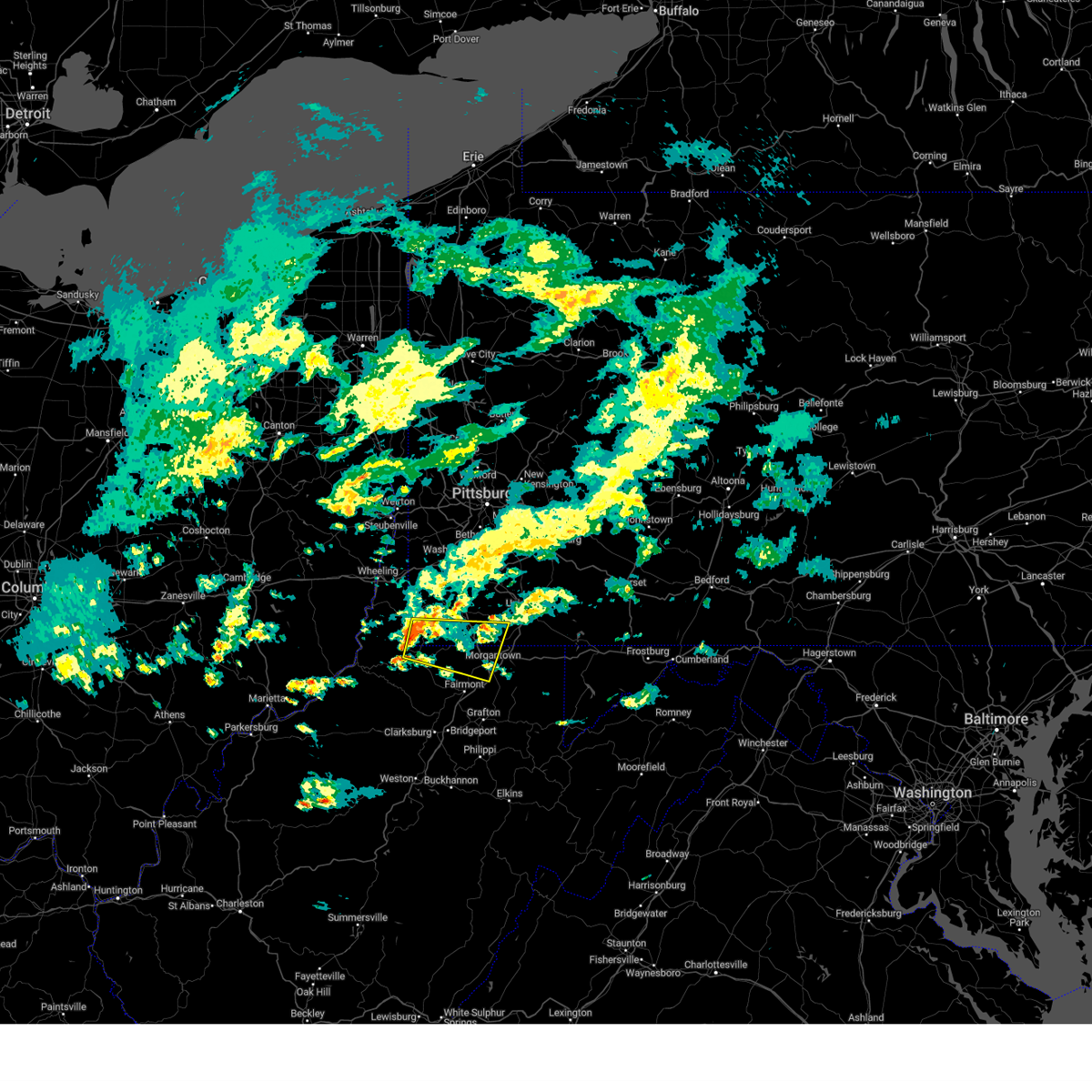 At 635 pm edt, a severe thunderstorm was located near hundred, or 15 miles southwest of waynesburg, moving east at 40 mph (radar indicated). Hazards include 60 mph wind gusts. Expect damage to trees and power lines, resulting in some power outages. Locations impacted include, morgantown, westover, star city, masontown, point marion, granville, fairview, hundred, cassville, bobtown, aleppo, greensboro, blacksville, spraggs, mount morris, new freeport, booth, everettville, mccurdyville, and burton. At 635 pm edt, a severe thunderstorm was located near hundred, or 15 miles southwest of waynesburg, moving east at 40 mph (radar indicated). Hazards include 60 mph wind gusts. Expect damage to trees and power lines, resulting in some power outages. Locations impacted include, morgantown, westover, star city, masontown, point marion, granville, fairview, hundred, cassville, bobtown, aleppo, greensboro, blacksville, spraggs, mount morris, new freeport, booth, everettville, mccurdyville, and burton.
|
| 5/9/2024 6:35 PM EDT |
 the severe thunderstorm warning has been cancelled and is no longer in effect the severe thunderstorm warning has been cancelled and is no longer in effect
|
| 5/9/2024 6:17 PM EDT |
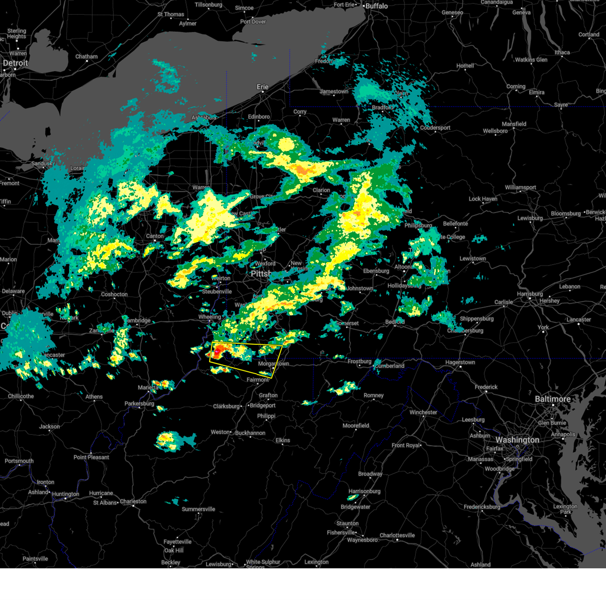 Svrpbz the national weather service in pittsburgh has issued a * severe thunderstorm warning for, southern greene county in southwestern pennsylvania, southwestern fayette county in southwestern pennsylvania, monongalia county in northern west virginia, northeastern wetzel county in northern west virginia, marshall county in northern west virginia, north central marion county in northern west virginia, * until 700 pm edt. * at 617 pm edt, a severe thunderstorm was located near cameron, or 12 miles southeast of moundsville, moving east at 50 mph (radar indicated). Hazards include 60 mph wind gusts and nickel size hail. expect damage to trees and power lines, resulting in some power outages Svrpbz the national weather service in pittsburgh has issued a * severe thunderstorm warning for, southern greene county in southwestern pennsylvania, southwestern fayette county in southwestern pennsylvania, monongalia county in northern west virginia, northeastern wetzel county in northern west virginia, marshall county in northern west virginia, north central marion county in northern west virginia, * until 700 pm edt. * at 617 pm edt, a severe thunderstorm was located near cameron, or 12 miles southeast of moundsville, moving east at 50 mph (radar indicated). Hazards include 60 mph wind gusts and nickel size hail. expect damage to trees and power lines, resulting in some power outages
|
| 8/25/2023 3:21 AM EDT |
 At 321 am edt, severe thunderstorms were located along a line extending from 6 miles southwest of friendsville to near winfield, moving east at 45 mph (radar indicated). Hazards include 60 mph wind gusts. Expect damage to trees and power lines, resulting in some power outages. locations impacted include, fairmont, kingwood, winfield, fairview, newburg, rivesville, grant town, reedsville, masontown, albright, valley point, booth, everettville, baxter, cranesville, mccurdyville, crown, gladesville, browns chapel, and georgetown. hail threat, radar indicated max hail size, <. 75 in wind threat, radar indicated max wind gust, 60 mph. At 321 am edt, severe thunderstorms were located along a line extending from 6 miles southwest of friendsville to near winfield, moving east at 45 mph (radar indicated). Hazards include 60 mph wind gusts. Expect damage to trees and power lines, resulting in some power outages. locations impacted include, fairmont, kingwood, winfield, fairview, newburg, rivesville, grant town, reedsville, masontown, albright, valley point, booth, everettville, baxter, cranesville, mccurdyville, crown, gladesville, browns chapel, and georgetown. hail threat, radar indicated max hail size, <. 75 in wind threat, radar indicated max wind gust, 60 mph.
|
| 8/25/2023 3:14 AM EDT |
 At 314 am edt, severe thunderstorms were located along a line extending from 7 miles southwest of friendsville to winfield, moving southeast at 35 mph (radar indicated). Hazards include 60 mph wind gusts and quarter size hail. Minor hail damage to vehicles is possible. expect wind damage to trees and power lines, resulting in some power outages. locations impacted include, morgantown, fairmont, westover, kingwood, star city, winfield, granville, fairview, newburg, brookhaven, cassville, rivesville, grant town, reedsville, masontown, albright, brandonville, bruceton mills, valley point, and booth. hail threat, radar indicated max hail size, 1. 00 in wind threat, radar indicated max wind gust, 60 mph. At 314 am edt, severe thunderstorms were located along a line extending from 7 miles southwest of friendsville to winfield, moving southeast at 35 mph (radar indicated). Hazards include 60 mph wind gusts and quarter size hail. Minor hail damage to vehicles is possible. expect wind damage to trees and power lines, resulting in some power outages. locations impacted include, morgantown, fairmont, westover, kingwood, star city, winfield, granville, fairview, newburg, brookhaven, cassville, rivesville, grant town, reedsville, masontown, albright, brandonville, bruceton mills, valley point, and booth. hail threat, radar indicated max hail size, 1. 00 in wind threat, radar indicated max wind gust, 60 mph.
|
| 8/25/2023 3:06 AM EDT |
 At 306 am edt, severe thunderstorms were located along a line extending from 7 miles west of friendsville to near grafton, moving southeast at 45 mph (radar indicated). Hazards include 60 mph wind gusts and quarter size hail. Minor hail damage to vehicles is possible. expect wind damage to trees and power lines, resulting in some power outages. locations impacted include, morgantown, fairmont, westover, kingwood, star city, winfield, granville, fairview, newburg, brookhaven, cassville, rivesville, grant town, reedsville, masontown, albright, brandonville, bruceton mills, valley point, and booth. hail threat, radar indicated max hail size, 1. 00 in wind threat, radar indicated max wind gust, 60 mph. At 306 am edt, severe thunderstorms were located along a line extending from 7 miles west of friendsville to near grafton, moving southeast at 45 mph (radar indicated). Hazards include 60 mph wind gusts and quarter size hail. Minor hail damage to vehicles is possible. expect wind damage to trees and power lines, resulting in some power outages. locations impacted include, morgantown, fairmont, westover, kingwood, star city, winfield, granville, fairview, newburg, brookhaven, cassville, rivesville, grant town, reedsville, masontown, albright, brandonville, bruceton mills, valley point, and booth. hail threat, radar indicated max hail size, 1. 00 in wind threat, radar indicated max wind gust, 60 mph.
|
| 8/25/2023 2:56 AM EDT |
 At 255 am edt, severe thunderstorms were located along a line extending from near farmington to near pleasant valley, moving southeast at 45 mph (radar indicated). Hazards include 60 mph wind gusts and quarter size hail. Minor hail damage to vehicles is possible. expect wind damage to trees and power lines, resulting in some power outages. locations impacted include, morgantown, fairmont, westover, kingwood, star city, winfield, farmington, point marion, granville, fairview, newburg, brookhaven, cassville, fairchance, rivesville, grant town, reedsville, masontown, albright, and markleysburg. hail threat, radar indicated max hail size, 1. 00 in wind threat, radar indicated max wind gust, 60 mph. At 255 am edt, severe thunderstorms were located along a line extending from near farmington to near pleasant valley, moving southeast at 45 mph (radar indicated). Hazards include 60 mph wind gusts and quarter size hail. Minor hail damage to vehicles is possible. expect wind damage to trees and power lines, resulting in some power outages. locations impacted include, morgantown, fairmont, westover, kingwood, star city, winfield, farmington, point marion, granville, fairview, newburg, brookhaven, cassville, fairchance, rivesville, grant town, reedsville, masontown, albright, and markleysburg. hail threat, radar indicated max hail size, 1. 00 in wind threat, radar indicated max wind gust, 60 mph.
|
| 8/25/2023 2:42 AM EDT |
 At 242 am edt, severe thunderstorms were located along a line extending from near uniontown to mannington, moving southeast at 45 mph (radar indicated). Hazards include 60 mph wind gusts and quarter size hail. Minor hail damage to vehicles is possible. Expect wind damage to trees and power lines, resulting in some power outages. At 242 am edt, severe thunderstorms were located along a line extending from near uniontown to mannington, moving southeast at 45 mph (radar indicated). Hazards include 60 mph wind gusts and quarter size hail. Minor hail damage to vehicles is possible. Expect wind damage to trees and power lines, resulting in some power outages.
|
| 8/12/2023 9:30 PM EDT | Tree on road on us-19 at mile marker 17. in monongalia county WV, 5.6 miles SSW of Fairview, WV |
| 8/12/2023 9:22 PM EDT |
 At 922 pm edt, a severe thunderstorm was located near mannington, moving east at 30 mph (radar indicated). Hazards include 60 mph wind gusts and quarter size hail. Minor hail damage to vehicles is possible. expect wind damage to trees and power lines, resulting in some power outages. Locations impacted include, fairmont, westover, mannington, pleasant valley, winfield, barrackville, monongah, fairview, rivesville, grant town, farmington, worthington, smithfield, booth, everettville, folsom, mccurdyville, metz, curtisville, and colfax. At 922 pm edt, a severe thunderstorm was located near mannington, moving east at 30 mph (radar indicated). Hazards include 60 mph wind gusts and quarter size hail. Minor hail damage to vehicles is possible. expect wind damage to trees and power lines, resulting in some power outages. Locations impacted include, fairmont, westover, mannington, pleasant valley, winfield, barrackville, monongah, fairview, rivesville, grant town, farmington, worthington, smithfield, booth, everettville, folsom, mccurdyville, metz, curtisville, and colfax.
|
| 8/12/2023 9:12 PM EDT |
 At 911 pm edt, a severe thunderstorm was located near jacksonburg, or 11 miles west of mannington, moving east at 30 mph (radar indicated). Hazards include 60 mph wind gusts and quarter size hail. Minor hail damage to vehicles is possible. Expect wind damage to trees and power lines, resulting in some power outages. At 911 pm edt, a severe thunderstorm was located near jacksonburg, or 11 miles west of mannington, moving east at 30 mph (radar indicated). Hazards include 60 mph wind gusts and quarter size hail. Minor hail damage to vehicles is possible. Expect wind damage to trees and power lines, resulting in some power outages.
|
| 8/7/2023 2:25 PM EDT |
 The severe thunderstorm warning for western monongalia and western marion counties will expire at 230 pm edt, the storm which prompted the warning has moved out of the area. therefore, the warning will be allowed to expire. a tornado watch remains in effect until 600 pm edt for northern west virginia. remember, a severe thunderstorm warning still remains in effect for eastern marion county. The severe thunderstorm warning for western monongalia and western marion counties will expire at 230 pm edt, the storm which prompted the warning has moved out of the area. therefore, the warning will be allowed to expire. a tornado watch remains in effect until 600 pm edt for northern west virginia. remember, a severe thunderstorm warning still remains in effect for eastern marion county.
|
| 8/7/2023 2:10 PM EDT |
 At 209 pm edt, a severe thunderstorm was located near mannington, moving east at 50 mph (radar indicated). Hazards include 60 mph wind gusts and penny size hail. Expect damage to trees and power lines, resulting in some power outages. locations impacted include, fairmont, mannington, monongah, fairview, farmington, worthington, grangeville, rachel, carolina, metz, curtisville, white hall, and idamay. hail threat, radar indicated max hail size, 0. 75 in wind threat, radar indicated max wind gust, 60 mph. At 209 pm edt, a severe thunderstorm was located near mannington, moving east at 50 mph (radar indicated). Hazards include 60 mph wind gusts and penny size hail. Expect damage to trees and power lines, resulting in some power outages. locations impacted include, fairmont, mannington, monongah, fairview, farmington, worthington, grangeville, rachel, carolina, metz, curtisville, white hall, and idamay. hail threat, radar indicated max hail size, 0. 75 in wind threat, radar indicated max wind gust, 60 mph.
|
| 8/7/2023 1:51 PM EDT |
 At 151 pm edt, a severe thunderstorm was located 7 miles south of jacksonburg, or 12 miles east of middlebourne, moving east at 50 mph (radar indicated). Hazards include ping pong ball size hail and 60 mph wind gusts. People and animals outdoors will be injured. expect hail damage to roofs, siding, windows, and vehicles. Expect wind damage to trees and power lines, resulting in some power outages. At 151 pm edt, a severe thunderstorm was located 7 miles south of jacksonburg, or 12 miles east of middlebourne, moving east at 50 mph (radar indicated). Hazards include ping pong ball size hail and 60 mph wind gusts. People and animals outdoors will be injured. expect hail damage to roofs, siding, windows, and vehicles. Expect wind damage to trees and power lines, resulting in some power outages.
|
| 8/7/2023 1:11 PM EDT |
 The severe thunderstorm warning for southeastern greene, southwestern fayette, monongalia, western preston and marion counties will expire at 115 pm edt, the storm which prompted the warning has moved out of the area. therefore, the warning will be allowed to expire. a tornado watch remains in effect until 600 pm edt for southwestern pennsylvania, and northern and northeastern west virginia. remember, a severe thunderstorm warning still remains in effect for monogalia county is still under a warning. The severe thunderstorm warning for southeastern greene, southwestern fayette, monongalia, western preston and marion counties will expire at 115 pm edt, the storm which prompted the warning has moved out of the area. therefore, the warning will be allowed to expire. a tornado watch remains in effect until 600 pm edt for southwestern pennsylvania, and northern and northeastern west virginia. remember, a severe thunderstorm warning still remains in effect for monogalia county is still under a warning.
|
| 8/7/2023 12:34 PM EDT |
 At 1233 pm edt, a severe thunderstorm was located over mannington, moving east at 35 mph (radar indicated). Hazards include 60 mph wind gusts and penny size hail. expect damage to trees and power lines, resulting in some power outages At 1233 pm edt, a severe thunderstorm was located over mannington, moving east at 35 mph (radar indicated). Hazards include 60 mph wind gusts and penny size hail. expect damage to trees and power lines, resulting in some power outages
|
| 7/14/2023 11:09 AM EDT |
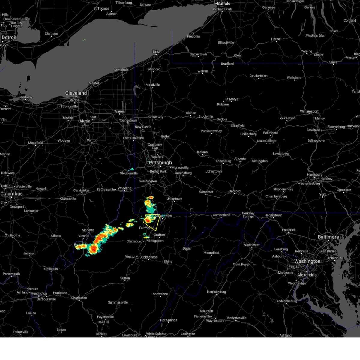 At 1108 am edt, a severe thunderstorm was located over fairview, or near mannington, moving east at 20 mph (radar indicated). Hazards include 60 mph wind gusts and penny size hail. Expect damage to trees and power lines, resulting in some power outages. locations impacted include, fairmont, pleasant valley, winfield, barrackville, fairview, cassville, rivesville, grant town, everettville, baxter, mccurdyville, crown, daybrook, georgetown, core, and osage. hail threat, radar indicated max hail size, 0. 75 in wind threat, radar indicated max wind gust, 60 mph. At 1108 am edt, a severe thunderstorm was located over fairview, or near mannington, moving east at 20 mph (radar indicated). Hazards include 60 mph wind gusts and penny size hail. Expect damage to trees and power lines, resulting in some power outages. locations impacted include, fairmont, pleasant valley, winfield, barrackville, fairview, cassville, rivesville, grant town, everettville, baxter, mccurdyville, crown, daybrook, georgetown, core, and osage. hail threat, radar indicated max hail size, 0. 75 in wind threat, radar indicated max wind gust, 60 mph.
|
| 7/14/2023 10:53 AM EDT |
 At 1052 am edt, a severe thunderstorm was located near fairview, or near mannington, moving east at 20 mph (radar indicated). Hazards include 60 mph wind gusts and penny size hail. expect damage to trees and power lines, resulting in some power outages At 1052 am edt, a severe thunderstorm was located near fairview, or near mannington, moving east at 20 mph (radar indicated). Hazards include 60 mph wind gusts and penny size hail. expect damage to trees and power lines, resulting in some power outages
|
| 9/25/2022 9:56 AM EDT |
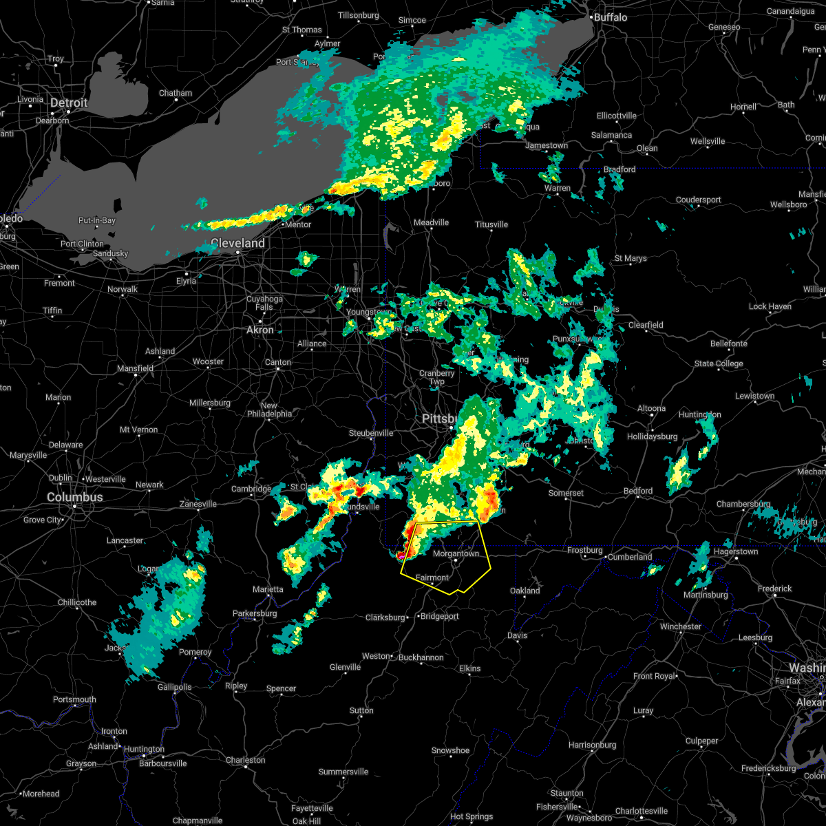 At 956 am edt, a severe thunderstorm was located near fairview, or 12 miles northeast of mannington, moving east at 55 mph (radar indicated). Hazards include 60 mph wind gusts and quarter size hail. Minor hail damage to vehicles is possible. expect wind damage to trees and power lines, resulting in some power outages. locations impacted include, morgantown, fairmont, westover, mannington, star city, pleasant valley, winfield, barrackville, point marion, granville, fairview, and brookhaven. hail threat, radar indicated max hail size, 1. 00 in wind threat, radar indicated max wind gust, 60 mph. At 956 am edt, a severe thunderstorm was located near fairview, or 12 miles northeast of mannington, moving east at 55 mph (radar indicated). Hazards include 60 mph wind gusts and quarter size hail. Minor hail damage to vehicles is possible. expect wind damage to trees and power lines, resulting in some power outages. locations impacted include, morgantown, fairmont, westover, mannington, star city, pleasant valley, winfield, barrackville, point marion, granville, fairview, and brookhaven. hail threat, radar indicated max hail size, 1. 00 in wind threat, radar indicated max wind gust, 60 mph.
|
| 9/25/2022 9:56 AM EDT |
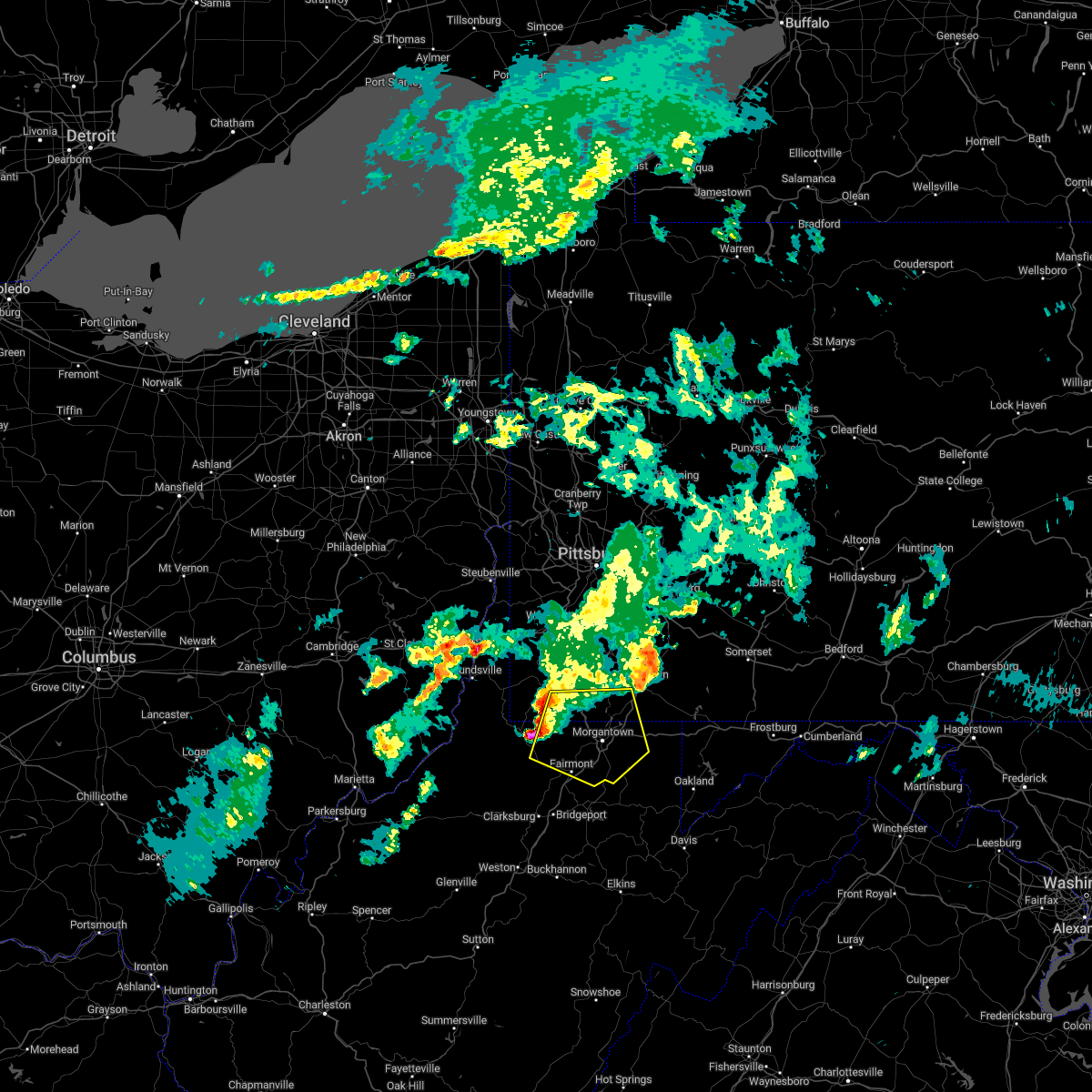 At 956 am edt, a severe thunderstorm was located near fairview, or 12 miles northeast of mannington, moving east at 55 mph (radar indicated). Hazards include 60 mph wind gusts and quarter size hail. Minor hail damage to vehicles is possible. expect wind damage to trees and power lines, resulting in some power outages. locations impacted include, morgantown, fairmont, westover, mannington, star city, pleasant valley, winfield, barrackville, point marion, granville, fairview, and brookhaven. hail threat, radar indicated max hail size, 1. 00 in wind threat, radar indicated max wind gust, 60 mph. At 956 am edt, a severe thunderstorm was located near fairview, or 12 miles northeast of mannington, moving east at 55 mph (radar indicated). Hazards include 60 mph wind gusts and quarter size hail. Minor hail damage to vehicles is possible. expect wind damage to trees and power lines, resulting in some power outages. locations impacted include, morgantown, fairmont, westover, mannington, star city, pleasant valley, winfield, barrackville, point marion, granville, fairview, and brookhaven. hail threat, radar indicated max hail size, 1. 00 in wind threat, radar indicated max wind gust, 60 mph.
|
| 9/25/2022 9:47 AM EDT |
 At 947 am edt, a severe thunderstorm was located near hundred, or 10 miles north of mannington, moving east at 55 mph (radar indicated). Hazards include 60 mph wind gusts and quarter size hail. Minor hail damage to vehicles is possible. expect wind damage to trees and power lines, resulting in some power outages. locations impacted include, morgantown, fairmont, westover, mannington, star city, pleasant valley, winfield, barrackville, point marion, granville, fairview, and hundred. hail threat, radar indicated max hail size, 1. 00 in wind threat, radar indicated max wind gust, 60 mph. At 947 am edt, a severe thunderstorm was located near hundred, or 10 miles north of mannington, moving east at 55 mph (radar indicated). Hazards include 60 mph wind gusts and quarter size hail. Minor hail damage to vehicles is possible. expect wind damage to trees and power lines, resulting in some power outages. locations impacted include, morgantown, fairmont, westover, mannington, star city, pleasant valley, winfield, barrackville, point marion, granville, fairview, and hundred. hail threat, radar indicated max hail size, 1. 00 in wind threat, radar indicated max wind gust, 60 mph.
|
| 9/25/2022 9:47 AM EDT |
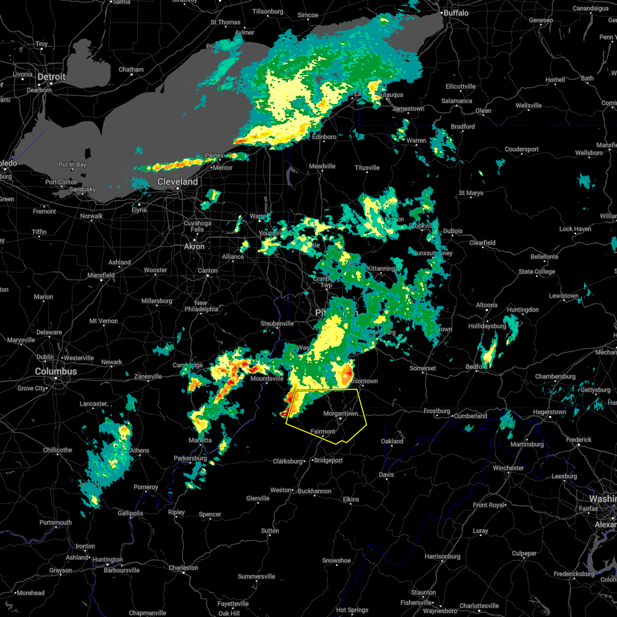 At 947 am edt, a severe thunderstorm was located near hundred, or 10 miles north of mannington, moving east at 55 mph (radar indicated). Hazards include 60 mph wind gusts and quarter size hail. Minor hail damage to vehicles is possible. expect wind damage to trees and power lines, resulting in some power outages. locations impacted include, morgantown, fairmont, westover, mannington, star city, pleasant valley, winfield, barrackville, point marion, granville, fairview, and hundred. hail threat, radar indicated max hail size, 1. 00 in wind threat, radar indicated max wind gust, 60 mph. At 947 am edt, a severe thunderstorm was located near hundred, or 10 miles north of mannington, moving east at 55 mph (radar indicated). Hazards include 60 mph wind gusts and quarter size hail. Minor hail damage to vehicles is possible. expect wind damage to trees and power lines, resulting in some power outages. locations impacted include, morgantown, fairmont, westover, mannington, star city, pleasant valley, winfield, barrackville, point marion, granville, fairview, and hundred. hail threat, radar indicated max hail size, 1. 00 in wind threat, radar indicated max wind gust, 60 mph.
|
| 9/25/2022 9:40 AM EDT |
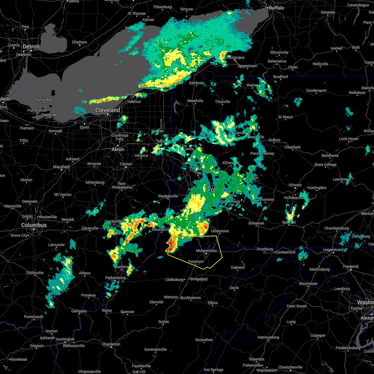 At 940 am edt, a severe thunderstorm was located over hundred, or 13 miles northwest of mannington, moving east at 55 mph (radar indicated). Hazards include 60 mph wind gusts and quarter size hail. Minor hail damage to vehicles is possible. Expect wind damage to trees and power lines, resulting in some power outages. At 940 am edt, a severe thunderstorm was located over hundred, or 13 miles northwest of mannington, moving east at 55 mph (radar indicated). Hazards include 60 mph wind gusts and quarter size hail. Minor hail damage to vehicles is possible. Expect wind damage to trees and power lines, resulting in some power outages.
|
| 7/23/2022 3:38 PM EDT |
 At 338 pm edt, severe thunderstorms were located along a line extending from near cassville to near lumberport, moving southeast at 30 mph (radar indicated). Hazards include 60 mph wind gusts and quarter size hail. Minor hail damage to vehicles is possible. expect wind damage to trees and power lines, resulting in some power outages. locations impacted include, morgantown, fairmont, westover, mannington, star city, pleasant valley, winfield, barrackville, monongah, granville, fairview, and cassville. hail threat, radar indicated max hail size, 1. 00 in wind threat, radar indicated max wind gust, 60 mph. At 338 pm edt, severe thunderstorms were located along a line extending from near cassville to near lumberport, moving southeast at 30 mph (radar indicated). Hazards include 60 mph wind gusts and quarter size hail. Minor hail damage to vehicles is possible. expect wind damage to trees and power lines, resulting in some power outages. locations impacted include, morgantown, fairmont, westover, mannington, star city, pleasant valley, winfield, barrackville, monongah, granville, fairview, and cassville. hail threat, radar indicated max hail size, 1. 00 in wind threat, radar indicated max wind gust, 60 mph.
|
| 7/23/2022 3:14 PM EDT |
 At 314 pm edt, severe thunderstorms were located along a line extending from 9 miles south of waynesburg to 8 miles north of salem, moving southeast at 40 mph (radar indicated). Hazards include 60 mph wind gusts. expect damage to trees and power lines, resulting in some power outages At 314 pm edt, severe thunderstorms were located along a line extending from 9 miles south of waynesburg to 8 miles north of salem, moving southeast at 40 mph (radar indicated). Hazards include 60 mph wind gusts. expect damage to trees and power lines, resulting in some power outages
|
| 7/23/2022 3:06 PM EDT |
 At 306 pm edt, severe thunderstorms were located along a line extending from near waynesburg to 7 miles east of jacksonburg, moving east at 50 mph (radar indicated). Hazards include 60 mph wind gusts. Expect damage to trees and power lines, resulting in some power outages. locations impacted include, mannington, pine grove, fairview, hundred, jacksonburg, grant town, farmington, aleppo, blacksville, smithfield, new freeport, and spraggs. hail threat, radar indicated max hail size, <. 75 in wind threat, radar indicated max wind gust, 60 mph. At 306 pm edt, severe thunderstorms were located along a line extending from near waynesburg to 7 miles east of jacksonburg, moving east at 50 mph (radar indicated). Hazards include 60 mph wind gusts. Expect damage to trees and power lines, resulting in some power outages. locations impacted include, mannington, pine grove, fairview, hundred, jacksonburg, grant town, farmington, aleppo, blacksville, smithfield, new freeport, and spraggs. hail threat, radar indicated max hail size, <. 75 in wind threat, radar indicated max wind gust, 60 mph.
|
| 7/23/2022 2:41 PM EDT |
 At 240 pm edt, severe thunderstorms were located along a line extending from near cameron to near paden city, moving east at 50 mph (radar indicated). Hazards include 60 mph wind gusts. expect damage to trees and power lines, resulting in some power outages At 240 pm edt, severe thunderstorms were located along a line extending from near cameron to near paden city, moving east at 50 mph (radar indicated). Hazards include 60 mph wind gusts. expect damage to trees and power lines, resulting in some power outages
|
| 6/22/2022 7:32 PM EDT |
 At 731 pm edt, severe thunderstorms were located along a line extending from 9 miles southwest of farmington to 6 miles north of fairview, moving southeast at 45 mph (radar indicated). Hazards include 60 mph wind gusts. Expect damage to trees and power lines, resulting in some power outages. locations impacted include, morgantown, fairmont, westover, mannington, star city, pleasant valley, winfield, barrackville, monongah, granville, fairview, and brookhaven. hail threat, radar indicated max hail size, <. 75 in wind threat, radar indicated max wind gust, 60 mph. At 731 pm edt, severe thunderstorms were located along a line extending from 9 miles southwest of farmington to 6 miles north of fairview, moving southeast at 45 mph (radar indicated). Hazards include 60 mph wind gusts. Expect damage to trees and power lines, resulting in some power outages. locations impacted include, morgantown, fairmont, westover, mannington, star city, pleasant valley, winfield, barrackville, monongah, granville, fairview, and brookhaven. hail threat, radar indicated max hail size, <. 75 in wind threat, radar indicated max wind gust, 60 mph.
|
| 6/22/2022 7:22 PM EDT |
 At 722 pm edt, severe thunderstorms were located along a line extending from 8 miles southwest of farmington to 7 miles northeast of hundred, moving southeast at 40 mph (radar indicated). Hazards include 60 mph wind gusts. expect damage to trees and power lines, resulting in some power outages At 722 pm edt, severe thunderstorms were located along a line extending from 8 miles southwest of farmington to 7 miles northeast of hundred, moving southeast at 40 mph (radar indicated). Hazards include 60 mph wind gusts. expect damage to trees and power lines, resulting in some power outages
|
| 6/22/2022 7:18 PM EDT |
 At 717 pm edt, a cluster of severe thunderstorms was centered near hundred, or 9 miles north of mannington, moving southeast at 30 mph (radar indicated). Hazards include 60 mph wind gusts. Expect damage to trees and power lines, resulting in some power outages. locations impacted include, fairmont, mannington, barrackville, fairview, hundred, grant town, farmington, worthington, new freeport, baxter, rachel, and carolina. hail threat, radar indicated max hail size, <. 75 in wind threat, radar indicated max wind gust, 60 mph. At 717 pm edt, a cluster of severe thunderstorms was centered near hundred, or 9 miles north of mannington, moving southeast at 30 mph (radar indicated). Hazards include 60 mph wind gusts. Expect damage to trees and power lines, resulting in some power outages. locations impacted include, fairmont, mannington, barrackville, fairview, hundred, grant town, farmington, worthington, new freeport, baxter, rachel, and carolina. hail threat, radar indicated max hail size, <. 75 in wind threat, radar indicated max wind gust, 60 mph.
|
| 6/22/2022 7:08 PM EDT |
 At 707 pm edt, a cluster of severe thunderstorms was centered over hundred, or 14 miles northwest of mannington, moving southeast at 30 mph (radar indicated). Hazards include 60 mph wind gusts. Expect damage to trees and power lines, resulting in some power outages. locations impacted include, fairmont, mannington, barrackville, fairview, hundred, grant town, farmington, worthington, new freeport, baxter, rachel, and carolina. hail threat, radar indicated max hail size, <. 75 in wind threat, radar indicated max wind gust, 60 mph. At 707 pm edt, a cluster of severe thunderstorms was centered over hundred, or 14 miles northwest of mannington, moving southeast at 30 mph (radar indicated). Hazards include 60 mph wind gusts. Expect damage to trees and power lines, resulting in some power outages. locations impacted include, fairmont, mannington, barrackville, fairview, hundred, grant town, farmington, worthington, new freeport, baxter, rachel, and carolina. hail threat, radar indicated max hail size, <. 75 in wind threat, radar indicated max wind gust, 60 mph.
|
| 6/22/2022 6:58 PM EDT |
 At 658 pm edt, a severe thunderstorm was located near cameron, or 15 miles southeast of moundsville, moving southeast at 30 mph (radar indicated). Hazards include 60 mph wind gusts. expect damage to trees and power lines, resulting in some power outages At 658 pm edt, a severe thunderstorm was located near cameron, or 15 miles southeast of moundsville, moving southeast at 30 mph (radar indicated). Hazards include 60 mph wind gusts. expect damage to trees and power lines, resulting in some power outages
|
| 6/16/2022 6:11 PM EDT |
 At 611 pm edt, a severe thunderstorm was located over cameron, or 12 miles southeast of moundsville, moving southeast at 40 mph (radar indicated). Hazards include 60 mph wind gusts and quarter size hail. Minor hail damage to vehicles is possible. Expect wind damage to trees and power lines, resulting in some power outages. At 611 pm edt, a severe thunderstorm was located over cameron, or 12 miles southeast of moundsville, moving southeast at 40 mph (radar indicated). Hazards include 60 mph wind gusts and quarter size hail. Minor hail damage to vehicles is possible. Expect wind damage to trees and power lines, resulting in some power outages.
|
| 6/16/2022 6:11 PM EDT |
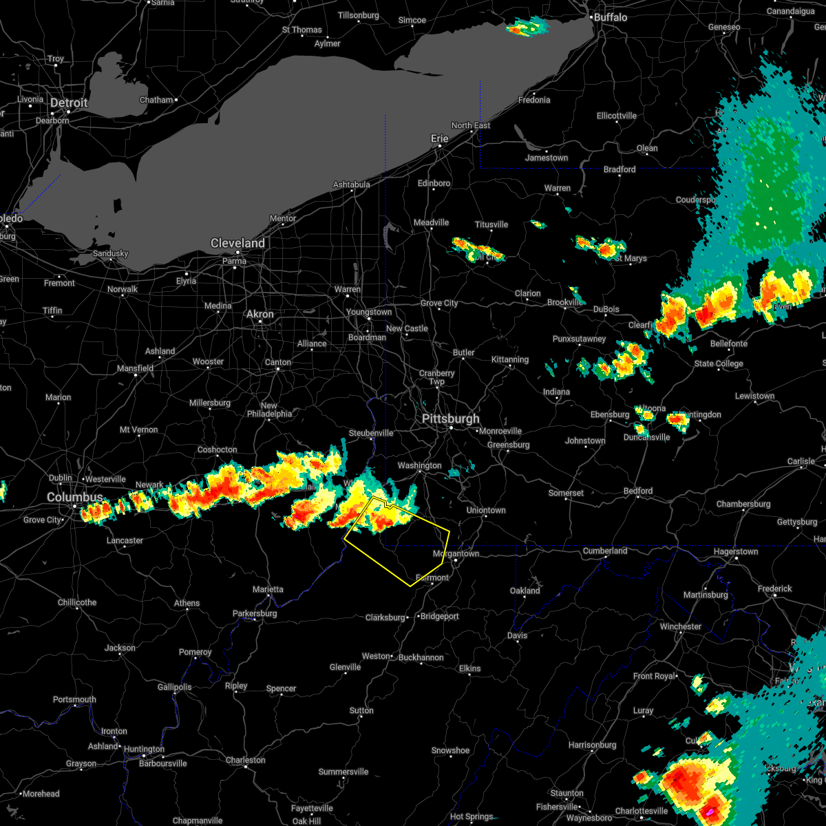 At 611 pm edt, a severe thunderstorm was located over cameron, or 12 miles southeast of moundsville, moving southeast at 40 mph (radar indicated). Hazards include 60 mph wind gusts and quarter size hail. Minor hail damage to vehicles is possible. Expect wind damage to trees and power lines, resulting in some power outages. At 611 pm edt, a severe thunderstorm was located over cameron, or 12 miles southeast of moundsville, moving southeast at 40 mph (radar indicated). Hazards include 60 mph wind gusts and quarter size hail. Minor hail damage to vehicles is possible. Expect wind damage to trees and power lines, resulting in some power outages.
|
| 6/8/2022 10:16 PM EDT |
 At 1016 pm edt, a severe thunderstorm was located 7 miles north of fairview, or 12 miles north of mannington, moving east at 35 mph (radar indicated). Hazards include 60 mph wind gusts. expect damage to trees and power lines, resulting in some power outages At 1016 pm edt, a severe thunderstorm was located 7 miles north of fairview, or 12 miles north of mannington, moving east at 35 mph (radar indicated). Hazards include 60 mph wind gusts. expect damage to trees and power lines, resulting in some power outages
|
| 6/8/2022 10:16 PM EDT |
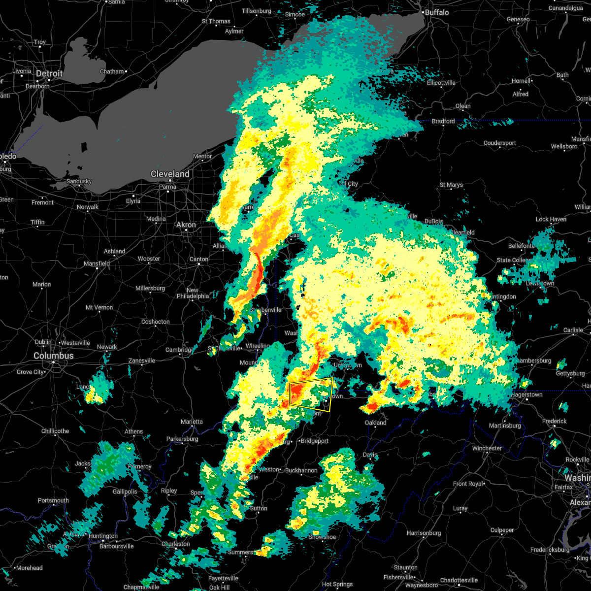 At 1016 pm edt, a severe thunderstorm was located 7 miles north of fairview, or 12 miles north of mannington, moving east at 35 mph (radar indicated). Hazards include 60 mph wind gusts. expect damage to trees and power lines, resulting in some power outages At 1016 pm edt, a severe thunderstorm was located 7 miles north of fairview, or 12 miles north of mannington, moving east at 35 mph (radar indicated). Hazards include 60 mph wind gusts. expect damage to trees and power lines, resulting in some power outages
|
| 6/8/2022 8:57 PM EDT |
 The tornado warning for central monongalia and central marion counties will expire at 900 pm edt, the tornado warning has been cancelled. however, large hail and damaging winds remain likely and a severe thunderstorm warning remains in effect for the area. a tornado watch remains in effect until 100 am edt for northern west virginia. The tornado warning for central monongalia and central marion counties will expire at 900 pm edt, the tornado warning has been cancelled. however, large hail and damaging winds remain likely and a severe thunderstorm warning remains in effect for the area. a tornado watch remains in effect until 100 am edt for northern west virginia.
|
| 6/8/2022 8:54 PM EDT |
 At 853 pm edt, a severe thunderstorm was located near fairview, or near mannington, moving east at 30 mph (radar indicated). Hazards include ping pong ball size hail and 60 mph wind gusts. People and animals outdoors will be injured. expect hail damage to roofs, siding, windows, and vehicles. expect wind damage to trees and power lines, resulting in some power outages. Locations impacted include, morgantown, fairmont, westover, mannington, star city, pleasant valley, winfield, barrackville, monongah, granville, fairview, and cassville. At 853 pm edt, a severe thunderstorm was located near fairview, or near mannington, moving east at 30 mph (radar indicated). Hazards include ping pong ball size hail and 60 mph wind gusts. People and animals outdoors will be injured. expect hail damage to roofs, siding, windows, and vehicles. expect wind damage to trees and power lines, resulting in some power outages. Locations impacted include, morgantown, fairmont, westover, mannington, star city, pleasant valley, winfield, barrackville, monongah, granville, fairview, and cassville.
|
| 6/8/2022 8:53 PM EDT |
 At 852 pm edt, a severe thunderstorm capable of producing a tornado was located near fairview, or near mannington, moving east at 30 mph (doppler radar indicated and weather spotters reported a funnel cloud). Hazards include tornado and quarter size hail. Flying debris will be dangerous to those caught without shelter. mobile homes will be damaged or destroyed. damage to roofs, windows, and vehicles will occur. tree damage is likely. this dangerous storm will be near, pleasant valley and barrackville around 900 pm edt. fairmont around 905 pm edt. winfield around 910 pm edt. Other locations impacted by this tornadic thunderstorm include rivesville, grant town, crown, baxter, rachel, carolina, farmington, mccurdyville, georgetown and idamay. At 852 pm edt, a severe thunderstorm capable of producing a tornado was located near fairview, or near mannington, moving east at 30 mph (doppler radar indicated and weather spotters reported a funnel cloud). Hazards include tornado and quarter size hail. Flying debris will be dangerous to those caught without shelter. mobile homes will be damaged or destroyed. damage to roofs, windows, and vehicles will occur. tree damage is likely. this dangerous storm will be near, pleasant valley and barrackville around 900 pm edt. fairmont around 905 pm edt. winfield around 910 pm edt. Other locations impacted by this tornadic thunderstorm include rivesville, grant town, crown, baxter, rachel, carolina, farmington, mccurdyville, georgetown and idamay.
|
| 6/8/2022 8:51 PM EDT |
 At 851 pm edt, a severe thunderstorm was located over mannington, moving east at 30 mph (radar indicated). Hazards include 60 mph wind gusts and quarter size hail. Minor hail damage to vehicles is possible. expect wind damage to trees and power lines, resulting in some power outages. Locations impacted include, morgantown, fairmont, westover, mannington, star city, pleasant valley, winfield, barrackville, monongah, granville, fairview, and cassville. At 851 pm edt, a severe thunderstorm was located over mannington, moving east at 30 mph (radar indicated). Hazards include 60 mph wind gusts and quarter size hail. Minor hail damage to vehicles is possible. expect wind damage to trees and power lines, resulting in some power outages. Locations impacted include, morgantown, fairmont, westover, mannington, star city, pleasant valley, winfield, barrackville, monongah, granville, fairview, and cassville.
|
| 6/8/2022 8:43 PM EDT |
 At 843 pm edt, a severe thunderstorm was located over mannington, moving east at 30 mph (radar indicated). Hazards include 60 mph wind gusts and quarter size hail. Minor hail damage to vehicles is possible. Expect wind damage to trees and power lines, resulting in some power outages. At 843 pm edt, a severe thunderstorm was located over mannington, moving east at 30 mph (radar indicated). Hazards include 60 mph wind gusts and quarter size hail. Minor hail damage to vehicles is possible. Expect wind damage to trees and power lines, resulting in some power outages.
|
| 6/8/2022 8:43 PM EDT |
 At 843 pm edt, a severe thunderstorm capable of producing a tornado was located over mannington, moving east at 30 mph (radar indicated rotation). Hazards include tornado and quarter size hail. Flying debris will be dangerous to those caught without shelter. mobile homes will be damaged or destroyed. damage to roofs, windows, and vehicles will occur. tree damage is likely. this dangerous storm will be near, monongah around 855 pm edt. fairmont, pleasant valley, barrackville and fairview around 900 pm edt. Other locations impacted by this tornadic thunderstorm include rivesville, grant town, crown, baxter, rachel, carolina, metz, farmington, mccurdyville and georgetown. At 843 pm edt, a severe thunderstorm capable of producing a tornado was located over mannington, moving east at 30 mph (radar indicated rotation). Hazards include tornado and quarter size hail. Flying debris will be dangerous to those caught without shelter. mobile homes will be damaged or destroyed. damage to roofs, windows, and vehicles will occur. tree damage is likely. this dangerous storm will be near, monongah around 855 pm edt. fairmont, pleasant valley, barrackville and fairview around 900 pm edt. Other locations impacted by this tornadic thunderstorm include rivesville, grant town, crown, baxter, rachel, carolina, metz, farmington, mccurdyville and georgetown.
|
| 5/1/2022 8:00 PM EDT |
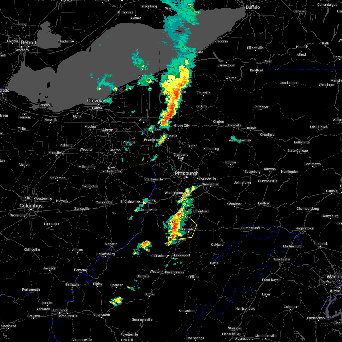 At 759 pm edt, a severe thunderstorm was located over cassville, or near star city, moving northeast at 45 mph (radar indicated). Hazards include 60 mph wind gusts and nickel size hail. Expect damage to trees and power lines, resulting in some power outages. locations impacted include, morgantown, westover, mannington, star city, point marion, granville, fairview, brookhaven, cassville, rivesville, grant town, and bobtown. hail threat, radar indicated max hail size, 0. 88 in wind threat, radar indicated max wind gust, 60 mph. At 759 pm edt, a severe thunderstorm was located over cassville, or near star city, moving northeast at 45 mph (radar indicated). Hazards include 60 mph wind gusts and nickel size hail. Expect damage to trees and power lines, resulting in some power outages. locations impacted include, morgantown, westover, mannington, star city, point marion, granville, fairview, brookhaven, cassville, rivesville, grant town, and bobtown. hail threat, radar indicated max hail size, 0. 88 in wind threat, radar indicated max wind gust, 60 mph.
|
| 5/1/2022 7:42 PM EDT |
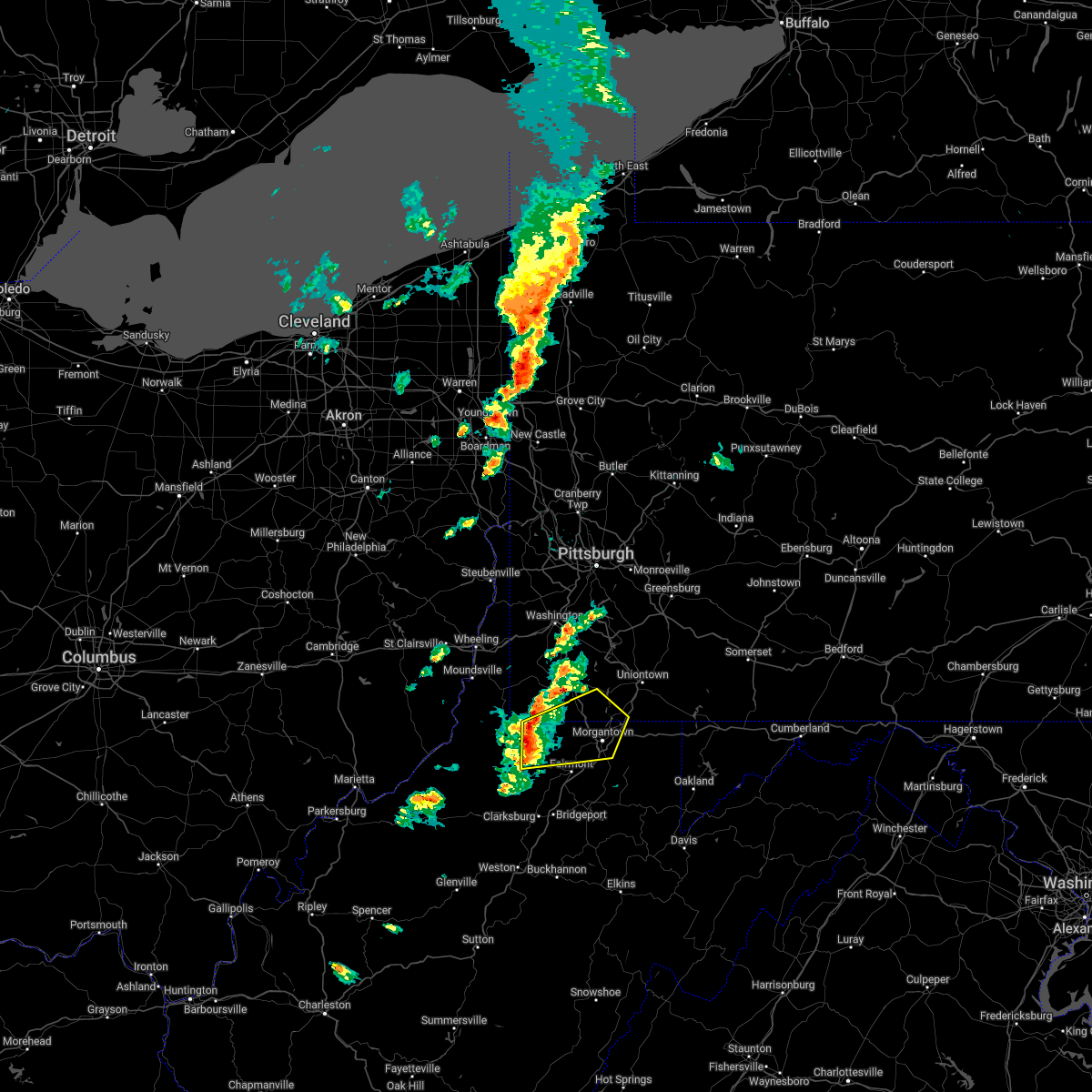 At 740 pm edt, a severe thunderstorm was located near fairview, or near mannington, moving northeast at 45 mph (radar indicated). Hazards include 60 mph wind gusts and nickel size hail. expect damage to trees and power lines, resulting in some power outages At 740 pm edt, a severe thunderstorm was located near fairview, or near mannington, moving northeast at 45 mph (radar indicated). Hazards include 60 mph wind gusts and nickel size hail. expect damage to trees and power lines, resulting in some power outages
|
| 8/10/2021 3:57 PM EDT |
 At 357 pm edt, a severe thunderstorm was located over mannington, moving east at 20 mph (radar indicated). Hazards include 60 mph wind gusts. expect damage to trees and power lines, resulting in some power outages At 357 pm edt, a severe thunderstorm was located over mannington, moving east at 20 mph (radar indicated). Hazards include 60 mph wind gusts. expect damage to trees and power lines, resulting in some power outages
|
| 3/18/2021 5:53 PM EDT |
 At 552 pm edt, a severe thunderstorm was located over mannington, moving east at 25 mph (radar). Hazards include wind gusts to 60 mph and quarter-size hail. Minor hail damage to vehicles is possible. Expect wind damage to trees and power lines, resulting in some power outages. At 552 pm edt, a severe thunderstorm was located over mannington, moving east at 25 mph (radar). Hazards include wind gusts to 60 mph and quarter-size hail. Minor hail damage to vehicles is possible. Expect wind damage to trees and power lines, resulting in some power outages.
|
| 8/25/2020 4:56 PM EDT |
 The severe thunderstorm warning for eastern monongalia, preston and marion counties will expire at 500 pm edt, the storm which prompted the warning has weakened below severe limits, and no longer poses an immediate threat to life or property. therefore, the warning will be allowed to expire. however gusty winds are still possible with this thunderstorm. a severe thunderstorm watch remains in effect until 1100 pm edt for western maryland, and northern and northeastern west virginia. The severe thunderstorm warning for eastern monongalia, preston and marion counties will expire at 500 pm edt, the storm which prompted the warning has weakened below severe limits, and no longer poses an immediate threat to life or property. therefore, the warning will be allowed to expire. however gusty winds are still possible with this thunderstorm. a severe thunderstorm watch remains in effect until 1100 pm edt for western maryland, and northern and northeastern west virginia.
|
| 8/25/2020 4:46 PM EDT |
 At 445 pm edt, a severe thunderstorm was located near brookhaven, or 9 miles southeast of morgantown, moving southeast at 40 mph (radar). Hazards include wind gusts to 60 mph. Expect damage to trees and power lines, resulting in some power outages. locations impacted include, morgantown, fairmont, westover, kingwood, mannington, star city, terra alta, rowlesburg, pleasant valley, winfield, barrackville, monongah, this includes the following highways, interstate 68 in west virginia between mile markers 1 and 31. Interstate 79 in west virginia between mile markers 130 and 158. At 445 pm edt, a severe thunderstorm was located near brookhaven, or 9 miles southeast of morgantown, moving southeast at 40 mph (radar). Hazards include wind gusts to 60 mph. Expect damage to trees and power lines, resulting in some power outages. locations impacted include, morgantown, fairmont, westover, kingwood, mannington, star city, terra alta, rowlesburg, pleasant valley, winfield, barrackville, monongah, this includes the following highways, interstate 68 in west virginia between mile markers 1 and 31. Interstate 79 in west virginia between mile markers 130 and 158.
|
| 8/25/2020 4:32 PM EDT |
 At 431 pm edt, a severe thunderstorm was located near westover, moving southeast at 40 mph (radar). Hazards include wind gusts to 60 mph and quarter-size hail. Minor hail damage to vehicles is possible. expect wind damage to trees and power lines, resulting in some power outages. locations impacted include, morgantown, fairmont, westover, kingwood, mannington, star city, terra alta, rowlesburg, pleasant valley, winfield, barrackville, point marion, this includes the following highways, interstate 68 in west virginia between mile markers 1 and 31. interstate 79 in pennsylvania between mile markers 0 and 6. Interstate 79 in west virginia between mile markers 130 and 160. At 431 pm edt, a severe thunderstorm was located near westover, moving southeast at 40 mph (radar). Hazards include wind gusts to 60 mph and quarter-size hail. Minor hail damage to vehicles is possible. expect wind damage to trees and power lines, resulting in some power outages. locations impacted include, morgantown, fairmont, westover, kingwood, mannington, star city, terra alta, rowlesburg, pleasant valley, winfield, barrackville, point marion, this includes the following highways, interstate 68 in west virginia between mile markers 1 and 31. interstate 79 in pennsylvania between mile markers 0 and 6. Interstate 79 in west virginia between mile markers 130 and 160.
|
| 8/25/2020 4:22 PM EDT | Marion 911 reports several large trees down and trees down on power lines through the county... including the town of fairvie in marion county WV, 0.2 miles N of Fairview, WV |
| 8/25/2020 4:20 PM EDT |
 At 420 pm edt, a severe thunderstorm was located near cassville, or 10 miles north of fairmont, moving southeast at 40 mph (radar). Hazards include wind gusts to 60 mph and quarter-size hail. Minor hail damage to vehicles is possible. Expect wind damage to trees and power lines, resulting in some power outages. At 420 pm edt, a severe thunderstorm was located near cassville, or 10 miles north of fairmont, moving southeast at 40 mph (radar). Hazards include wind gusts to 60 mph and quarter-size hail. Minor hail damage to vehicles is possible. Expect wind damage to trees and power lines, resulting in some power outages.
|
| 6/3/2020 3:58 PM EDT |
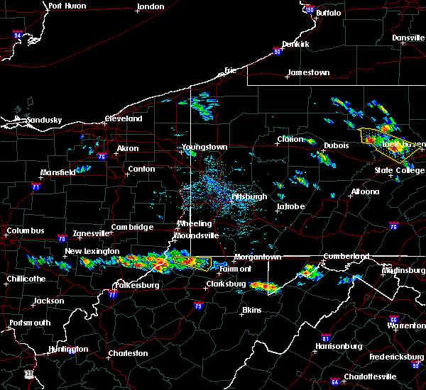 At 358 pm edt, a severe thunderstorm was located 7 miles northeast of pine grove, or 12 miles east of new martinsville, moving east at 30 mph (radar). Hazards include wind gusts to 60 mph and quarter-size hail. Minor hail damage to vehicles is possible. expect wind damage to trees and power lines, resulting in some power outages. Locations impacted include, mannington, fairview, hundred, burton, metz, earnshaw, knob fork, wadestown, littleton, rachel,. At 358 pm edt, a severe thunderstorm was located 7 miles northeast of pine grove, or 12 miles east of new martinsville, moving east at 30 mph (radar). Hazards include wind gusts to 60 mph and quarter-size hail. Minor hail damage to vehicles is possible. expect wind damage to trees and power lines, resulting in some power outages. Locations impacted include, mannington, fairview, hundred, burton, metz, earnshaw, knob fork, wadestown, littleton, rachel,.
|
| 6/3/2020 3:46 PM EDT |
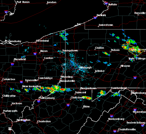 At 346 pm edt, a severe thunderstorm was located near fairview, or 8 miles east of new martinsville, moving east at 30 mph (radar). Hazards include wind gusts to 60 mph and quarter-size hail. Minor hail damage to vehicles is possible. Expect wind damage to trees and power lines, resulting in some power outages. At 346 pm edt, a severe thunderstorm was located near fairview, or 8 miles east of new martinsville, moving east at 30 mph (radar). Hazards include wind gusts to 60 mph and quarter-size hail. Minor hail damage to vehicles is possible. Expect wind damage to trees and power lines, resulting in some power outages.
|
| 8/20/2019 10:50 PM EDT |
 At 1049 pm edt, a severe thunderstorm was located near cassville, or 8 miles northwest of star city, moving northeast at 45 mph (radar). Hazards include wind gusts to 60 mph. Expect damage to trees and power lines, resulting in some power outages. locations impacted include, morgantown, fairmont, westover, kingwood, mannington, star city, pleasant valley, winfield, barrackville, point marion, monongah, granville, this includes the following highways, interstate 68 in west virginia between mile markers 1 and 15. interstate 79 in pennsylvania between mile markers 0 and 3. Interstate 79 in west virginia between mile markers 130 and 160. At 1049 pm edt, a severe thunderstorm was located near cassville, or 8 miles northwest of star city, moving northeast at 45 mph (radar). Hazards include wind gusts to 60 mph. Expect damage to trees and power lines, resulting in some power outages. locations impacted include, morgantown, fairmont, westover, kingwood, mannington, star city, pleasant valley, winfield, barrackville, point marion, monongah, granville, this includes the following highways, interstate 68 in west virginia between mile markers 1 and 15. interstate 79 in pennsylvania between mile markers 0 and 3. Interstate 79 in west virginia between mile markers 130 and 160.
|
| 8/20/2019 10:50 PM EDT |
 A severe thunderstorm warning remains in effect until 1100 pm edt for southeastern greene. southwestern fayette. monongalia. northwestern preston and marion counties. at 1049 pm edt, a severe thunderstorm was located near cassville, or 8 miles northwest of star city, moving northeast at 45 mph. hazard. Wind gusts to 60 mph. A severe thunderstorm warning remains in effect until 1100 pm edt for southeastern greene. southwestern fayette. monongalia. northwestern preston and marion counties. at 1049 pm edt, a severe thunderstorm was located near cassville, or 8 miles northwest of star city, moving northeast at 45 mph. hazard. Wind gusts to 60 mph.
|
| 8/20/2019 10:39 PM EDT |
 At 1039 pm edt, a severe thunderstorm was located 8 miles northeast of mannington, moving northeast at 45 mph (radar). Hazards include wind gusts to 60 mph. Expect damage to trees and power lines, resulting in some power outages. locations impacted include, morgantown, fairmont, westover, kingwood, mannington, star city, pleasant valley, winfield, barrackville, point marion, monongah, granville, this includes the following highways, interstate 68 in west virginia between mile markers 1 and 15. interstate 79 in pennsylvania between mile markers 0 and 3. Interstate 79 in west virginia between mile markers 130 and 160. At 1039 pm edt, a severe thunderstorm was located 8 miles northeast of mannington, moving northeast at 45 mph (radar). Hazards include wind gusts to 60 mph. Expect damage to trees and power lines, resulting in some power outages. locations impacted include, morgantown, fairmont, westover, kingwood, mannington, star city, pleasant valley, winfield, barrackville, point marion, monongah, granville, this includes the following highways, interstate 68 in west virginia between mile markers 1 and 15. interstate 79 in pennsylvania between mile markers 0 and 3. Interstate 79 in west virginia between mile markers 130 and 160.
|
| 8/20/2019 10:18 PM EDT |
 The national weather service in pittsburgh has issued a * severe thunderstorm warning for. southeastern greene county in southwestern pennsylvania. southwestern fayette county in southwestern pennsylvania. monongalia county in northern west virginia. Eastern wetzel county in northern west virginia. The national weather service in pittsburgh has issued a * severe thunderstorm warning for. southeastern greene county in southwestern pennsylvania. southwestern fayette county in southwestern pennsylvania. monongalia county in northern west virginia. Eastern wetzel county in northern west virginia.
|
| 6/16/2019 10:55 PM EDT |
 At 1055 pm edt, a severe thunderstorm was located over barrackville, or near fairmont, moving east at 35 mph (radar). Hazards include wind gusts to 60 mph and quarter-size hail. Minor hail damage to vehicles is possible. Expect wind damage to trees and power lines, resulting in some power outages. At 1055 pm edt, a severe thunderstorm was located over barrackville, or near fairmont, moving east at 35 mph (radar). Hazards include wind gusts to 60 mph and quarter-size hail. Minor hail damage to vehicles is possible. Expect wind damage to trees and power lines, resulting in some power outages.
|
| 5/29/2019 12:45 PM EDT | Half Dollar sized hail reported 8.4 miles SW of Fairview, WV, varied sizes up to size of a half-dollar coin |
| 5/23/2019 8:25 PM EDT |
 The severe thunderstorm warning for southeastern monongalia and marion counties will expire at 830 pm edt, the storm that prompted the warning has weakened and no longer pose an immediate threat to life and property. therefore, the warning will be allowed to expire. however gusty winds are still possible with this thunderstorm. a severe thunderstorm watch remains in effect until midnight edt for northern west virginia. The severe thunderstorm warning for southeastern monongalia and marion counties will expire at 830 pm edt, the storm that prompted the warning has weakened and no longer pose an immediate threat to life and property. therefore, the warning will be allowed to expire. however gusty winds are still possible with this thunderstorm. a severe thunderstorm watch remains in effect until midnight edt for northern west virginia.
|
| 5/23/2019 8:03 PM EDT |
 At 803 pm edt, a severe thunderstorm was located near mannington, moving east at 30 mph (radar). Hazards include wind gusts to 60 mph and quarter-size hail. Minor hail damage to vehicles is possible. expect wind damage to trees and power lines, resulting in some power outages. Locations impacted include, fairmont, mannington, pleasant valley, winfield, barrackville, monongah, rivesville, grant town, farmington, worthington, everettville, baxter, this includes interstate 79 in west virginia between mile markers 130 and 147. At 803 pm edt, a severe thunderstorm was located near mannington, moving east at 30 mph (radar). Hazards include wind gusts to 60 mph and quarter-size hail. Minor hail damage to vehicles is possible. expect wind damage to trees and power lines, resulting in some power outages. Locations impacted include, fairmont, mannington, pleasant valley, winfield, barrackville, monongah, rivesville, grant town, farmington, worthington, everettville, baxter, this includes interstate 79 in west virginia between mile markers 130 and 147.
|
| 5/23/2019 7:52 PM EDT |
 At 752 pm edt, a severe thunderstorm was located over mannington, moving east at 35 mph (radar). Hazards include wind gusts to 60 mph and quarter-size hail. Minor hail damage to vehicles is possible. Expect wind damage to trees and power lines, resulting in some power outages. At 752 pm edt, a severe thunderstorm was located over mannington, moving east at 35 mph (radar). Hazards include wind gusts to 60 mph and quarter-size hail. Minor hail damage to vehicles is possible. Expect wind damage to trees and power lines, resulting in some power outages.
|
| 5/15/2018 7:40 PM EDT |
 At 721 pm edt, a severe thunderstorm was located near pine grove, or 8 miles east of middlebourne, moving east at 35 mph (radar). Hazards include wind gusts to 60 mph and half dollar-size hail. Minor hail damage to vehicles is possible. Expect wind damage to trees and power lines, resulting in some power outages. At 721 pm edt, a severe thunderstorm was located near pine grove, or 8 miles east of middlebourne, moving east at 35 mph (radar). Hazards include wind gusts to 60 mph and half dollar-size hail. Minor hail damage to vehicles is possible. Expect wind damage to trees and power lines, resulting in some power outages.
|
| 5/15/2018 7:21 PM EDT |
 At 721 pm edt, a severe thunderstorm was located near pine grove, or 8 miles east of middlebourne, moving east at 35 mph (radar). Hazards include wind gusts to 60 mph and half dollar-size hail. Minor hail damage to vehicles is possible. Expect wind damage to trees and power lines, resulting in some power outages. At 721 pm edt, a severe thunderstorm was located near pine grove, or 8 miles east of middlebourne, moving east at 35 mph (radar). Hazards include wind gusts to 60 mph and half dollar-size hail. Minor hail damage to vehicles is possible. Expect wind damage to trees and power lines, resulting in some power outages.
|
| 7/22/2017 6:16 PM EDT |
 At 616 pm edt, a severe thunderstorm was located near cassville, or 7 miles north of fairmont, moving southeast at 35 mph (radar). Hazards include 60 mph wind gusts. Expect damage to trees and power lines, resulting in some power outages. locations impacted include, morgantown, fairmont, westover, star city, pleasant valley, winfield, barrackville, granville, cassville, brookhaven, rivesville, grant town, this includes the following highways, interstate 68 in west virginia between mile markers 1 and 7. Interstate 79 in west virginia between mile markers 137 and 157. At 616 pm edt, a severe thunderstorm was located near cassville, or 7 miles north of fairmont, moving southeast at 35 mph (radar). Hazards include 60 mph wind gusts. Expect damage to trees and power lines, resulting in some power outages. locations impacted include, morgantown, fairmont, westover, star city, pleasant valley, winfield, barrackville, granville, cassville, brookhaven, rivesville, grant town, this includes the following highways, interstate 68 in west virginia between mile markers 1 and 7. Interstate 79 in west virginia between mile markers 137 and 157.
|
| 7/22/2017 5:53 PM EDT |
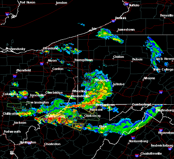 At 553 pm edt, a severe thunderstorm was located over hundred, or 13 miles northwest of mannington, moving southeast at 35 mph (radar). Hazards include 60 mph wind gusts. expect damage to trees and power lines, resulting in some power outages At 553 pm edt, a severe thunderstorm was located over hundred, or 13 miles northwest of mannington, moving southeast at 35 mph (radar). Hazards include 60 mph wind gusts. expect damage to trees and power lines, resulting in some power outages
|
| 6/23/2017 5:29 PM EDT |
 At 528 pm edt, severe thunderstorms were located along a line extending from near waynesburg to near cassville to mannington, moving east at 50 mph (radar). Hazards include 60 mph wind gusts. expect damage to trees and power lines, resulting in some power outages At 528 pm edt, severe thunderstorms were located along a line extending from near waynesburg to near cassville to mannington, moving east at 50 mph (radar). Hazards include 60 mph wind gusts. expect damage to trees and power lines, resulting in some power outages
|
| 6/23/2017 5:08 PM EDT |
 At 507 pm edt, severe thunderstorms were located along a line extending from near cameron to near hundred to jacksonburg, moving east at 55 mph (radar). Hazards include 60 mph wind gusts. Expect damage to trees and power lines, resulting in some power outages. locations impacted include, morgantown, fairmont, waynesburg, westover, mannington, star city, masontown, pleasant valley, winfield, fredericktown-millsboro, fairdale, jefferson boro, this includes the following highways, interstate 68 in west virginia near mile marker 1. interstate 79 in pennsylvania between mile markers 0 and 19. Interstate 79 in west virginia between mile markers 130 and 160. At 507 pm edt, severe thunderstorms were located along a line extending from near cameron to near hundred to jacksonburg, moving east at 55 mph (radar). Hazards include 60 mph wind gusts. Expect damage to trees and power lines, resulting in some power outages. locations impacted include, morgantown, fairmont, waynesburg, westover, mannington, star city, masontown, pleasant valley, winfield, fredericktown-millsboro, fairdale, jefferson boro, this includes the following highways, interstate 68 in west virginia near mile marker 1. interstate 79 in pennsylvania between mile markers 0 and 19. Interstate 79 in west virginia between mile markers 130 and 160.
|
| 6/23/2017 4:46 PM EDT |
 At 446 pm edt, severe thunderstorms were located along a line extending from near cameron to middlebourne, moving east at 45 mph (radar). Hazards include 60 mph wind gusts. expect damage to trees and power lines, resulting in some power outages At 446 pm edt, severe thunderstorms were located along a line extending from near cameron to middlebourne, moving east at 45 mph (radar). Hazards include 60 mph wind gusts. expect damage to trees and power lines, resulting in some power outages
|
| 6/13/2017 3:28 PM EDT |
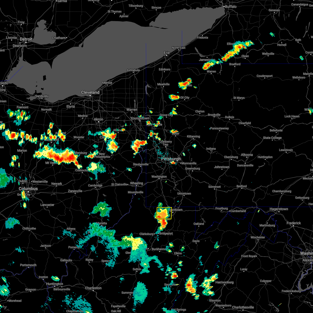 The severe thunderstorm warning for northwestern monongalia and northeastern marion counties will expire at 330 pm edt. the storm that prompted the warning has weakened below severe limits and no longer pose an immediate threat to life and property. therefore, the warning will be allowed to expire. However gusty winds are still possible with this thunderstorm. The severe thunderstorm warning for northwestern monongalia and northeastern marion counties will expire at 330 pm edt. the storm that prompted the warning has weakened below severe limits and no longer pose an immediate threat to life and property. therefore, the warning will be allowed to expire. However gusty winds are still possible with this thunderstorm.
|
| 6/13/2017 2:59 PM EDT | Multiple trees down around the keystone area in marion county WV, 2.3 miles WNW of Fairview, WV |
| 6/13/2017 2:44 PM EDT |
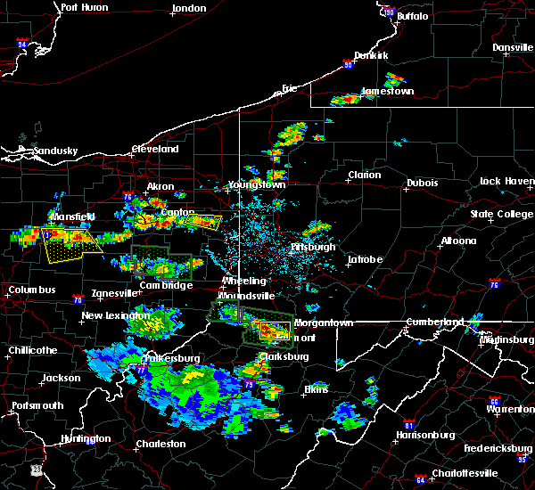 At 244 pm edt, a severe thunderstorm was located 7 miles southwest of cassville, or 9 miles north of fairmont, and is nearly stationary (radar). Hazards include 60 mph wind gusts and quarter-size hail. Minor hail damage to vehicles is possible. Expect wind damage to trees and power lines, resulting in some power outages. At 244 pm edt, a severe thunderstorm was located 7 miles southwest of cassville, or 9 miles north of fairmont, and is nearly stationary (radar). Hazards include 60 mph wind gusts and quarter-size hail. Minor hail damage to vehicles is possible. Expect wind damage to trees and power lines, resulting in some power outages.
|
| 5/1/2017 2:54 PM EDT |
 At 254 pm edt, severe thunderstorms were located along a line extending from castle shannon to near lumberport, moving east at 35 mph (radar). Hazards include 60 mph wind gusts. expect damage to trees and power lines, resulting in some power outages At 254 pm edt, severe thunderstorms were located along a line extending from castle shannon to near lumberport, moving east at 35 mph (radar). Hazards include 60 mph wind gusts. expect damage to trees and power lines, resulting in some power outages
|
| 5/1/2017 2:54 PM EDT |
 The national weather service in pittsburgh has issued a * severe thunderstorm warning for. southeastern washington county in southwestern pennsylvania. southeastern allegheny county in southwestern pennsylvania. southwestern westmoreland county in southwestern pennsylvania. Eastern greene county in southwestern pennsylvania. The national weather service in pittsburgh has issued a * severe thunderstorm warning for. southeastern washington county in southwestern pennsylvania. southeastern allegheny county in southwestern pennsylvania. southwestern westmoreland county in southwestern pennsylvania. Eastern greene county in southwestern pennsylvania.
|
| 5/1/2017 2:41 PM EDT |
 At 241 pm edt, severe thunderstorms were located along a line extending from near mcdonald to 10 miles southwest of waynesburg, moving northeast at 55 mph (radar). Hazards include 70 mph wind gusts. Trees snapped and uprooted. power outages can be expected. locations impacted include, bethel park, morgantown, mcmurray, mckeesport, washington, canonsburg, waynesburg, star city, gastonville, west mifflin, baldwin, upper st. clair, this includes the following highways, interstate 70 in pennsylvania between mile markers 17 and 40. interstate 79 in pennsylvania between mile markers 0 and 21. interstate 79 in west virginia between mile markers 154 and 160. A tornado watch remains in effect until 700 pm edt for southwestern pennsylvania, and northern west virginia. At 241 pm edt, severe thunderstorms were located along a line extending from near mcdonald to 10 miles southwest of waynesburg, moving northeast at 55 mph (radar). Hazards include 70 mph wind gusts. Trees snapped and uprooted. power outages can be expected. locations impacted include, bethel park, morgantown, mcmurray, mckeesport, washington, canonsburg, waynesburg, star city, gastonville, west mifflin, baldwin, upper st. clair, this includes the following highways, interstate 70 in pennsylvania between mile markers 17 and 40. interstate 79 in pennsylvania between mile markers 0 and 21. interstate 79 in west virginia between mile markers 154 and 160. A tornado watch remains in effect until 700 pm edt for southwestern pennsylvania, and northern west virginia.
|
| 5/1/2017 2:36 PM EDT |
 At 236 pm edt, severe thunderstorms were located along a line extending from near cecil-bishop to 7 miles northeast of hundred, moving northeast at 55 mph (radar). Hazards include 70 mph wind gusts. Trees snapped and uprooted. power outages can be expected. locations impacted include, bethel park, morgantown, mcmurray, mckeesport, washington, canonsburg, waynesburg, star city, gastonville, west mifflin, baldwin, upper st. clair, this includes the following highways, interstate 70 in pennsylvania between mile markers 11 and 40. interstate 79 in pennsylvania between mile markers 0 and 21. interstate 79 in west virginia between mile markers 154 and 160. A tornado watch remains in effect until 700 pm edt for southwestern pennsylvania, and northern west virginia. At 236 pm edt, severe thunderstorms were located along a line extending from near cecil-bishop to 7 miles northeast of hundred, moving northeast at 55 mph (radar). Hazards include 70 mph wind gusts. Trees snapped and uprooted. power outages can be expected. locations impacted include, bethel park, morgantown, mcmurray, mckeesport, washington, canonsburg, waynesburg, star city, gastonville, west mifflin, baldwin, upper st. clair, this includes the following highways, interstate 70 in pennsylvania between mile markers 11 and 40. interstate 79 in pennsylvania between mile markers 0 and 21. interstate 79 in west virginia between mile markers 154 and 160. A tornado watch remains in effect until 700 pm edt for southwestern pennsylvania, and northern west virginia.
|
| 5/1/2017 2:27 PM EDT |
 At 226 pm edt, severe thunderstorms were located along a line extending from near avella to near hundred, moving northeast at 55 mph (radar). Hazards include 70 mph wind gusts. Trees snapped and uprooted. power outages can be expected. locations impacted include, bethel park, morgantown, mcmurray, mckeesport, washington, canonsburg, waynesburg, star city, gastonville, west mifflin, baldwin, upper st. clair, this includes the following highways, interstate 70 in pennsylvania between mile markers 3 and 40. interstate 79 in pennsylvania between mile markers 0 and 21. interstate 79 in west virginia between mile markers 154 and 160. A tornado watch remains in effect until 700 pm edt for southwestern pennsylvania, and northern west virginia. At 226 pm edt, severe thunderstorms were located along a line extending from near avella to near hundred, moving northeast at 55 mph (radar). Hazards include 70 mph wind gusts. Trees snapped and uprooted. power outages can be expected. locations impacted include, bethel park, morgantown, mcmurray, mckeesport, washington, canonsburg, waynesburg, star city, gastonville, west mifflin, baldwin, upper st. clair, this includes the following highways, interstate 70 in pennsylvania between mile markers 3 and 40. interstate 79 in pennsylvania between mile markers 0 and 21. interstate 79 in west virginia between mile markers 154 and 160. A tornado watch remains in effect until 700 pm edt for southwestern pennsylvania, and northern west virginia.
|
| 5/1/2017 2:11 PM EDT |
 At 210 pm edt, severe thunderstorms were located along a line extending from near west liberty to near pine grove, moving northeast at 55 mph (radar). Hazards include 70 mph wind gusts. Trees snapped and uprooted. Power outages can be expected. At 210 pm edt, severe thunderstorms were located along a line extending from near west liberty to near pine grove, moving northeast at 55 mph (radar). Hazards include 70 mph wind gusts. Trees snapped and uprooted. Power outages can be expected.
|
| 3/1/2017 10:50 AM EST |
 At 1049 am est, severe thunderstorms were located along a line extending from 6 miles west of connellsville to 7 miles southwest of cassville, moving east at 50 mph (radar). Hazards include 60 mph wind gusts. Expect damage to trees and power lines, resulting in some power outages. locations impacted include, morgantown, uniontown, connellsville, westover, star city, california, scottdale, masontown, brownsville, south connellsville, perryopolis, fairdale, this includes the following highways, interstate 68 in west virginia between mile markers 3 and 11. interstate 79 in pennsylvania between mile markers 0 and 7. Interstate 79 in west virginia between mile markers 150 and 160. At 1049 am est, severe thunderstorms were located along a line extending from 6 miles west of connellsville to 7 miles southwest of cassville, moving east at 50 mph (radar). Hazards include 60 mph wind gusts. Expect damage to trees and power lines, resulting in some power outages. locations impacted include, morgantown, uniontown, connellsville, westover, star city, california, scottdale, masontown, brownsville, south connellsville, perryopolis, fairdale, this includes the following highways, interstate 68 in west virginia between mile markers 3 and 11. interstate 79 in pennsylvania between mile markers 0 and 7. Interstate 79 in west virginia between mile markers 150 and 160.
|
| 3/1/2017 10:40 AM EST |
 At 1039 am est, severe thunderstorms were located along a line extending from near brownsville to near mannington, moving east at 70 mph (radar). Hazards include 60 mph wind gusts. a brief tornado may be possible with individual cells embedded in the line. Expect damage to trees and power lines, resulting in some power outages. locations impacted include, morgantown, uniontown, connellsville, waynesburg, westover, star city, california, scottdale, masontown, brownsville, fredericktown-millsboro, south connellsville, this includes the following highways, interstate 68 in west virginia between mile markers 3 and 11. interstate 79 in pennsylvania between mile markers 0 and 21. Interstate 79 in west virginia between mile markers 150 and 160. At 1039 am est, severe thunderstorms were located along a line extending from near brownsville to near mannington, moving east at 70 mph (radar). Hazards include 60 mph wind gusts. a brief tornado may be possible with individual cells embedded in the line. Expect damage to trees and power lines, resulting in some power outages. locations impacted include, morgantown, uniontown, connellsville, waynesburg, westover, star city, california, scottdale, masontown, brownsville, fredericktown-millsboro, south connellsville, this includes the following highways, interstate 68 in west virginia between mile markers 3 and 11. interstate 79 in pennsylvania between mile markers 0 and 21. Interstate 79 in west virginia between mile markers 150 and 160.
|
| 3/1/2017 10:17 AM EST |
 At 1015 am est, severe thunderstorms were located along a line extending from 7 miles north of waynesburg to near pine grove, moving east at 50 mph (radar). Hazards include 60 mph wind gusts. a brief tornado may be possible with individual cells embedded in the line. expect damage to trees and power lines, resulting in some power outages At 1015 am est, severe thunderstorms were located along a line extending from 7 miles north of waynesburg to near pine grove, moving east at 50 mph (radar). Hazards include 60 mph wind gusts. a brief tornado may be possible with individual cells embedded in the line. expect damage to trees and power lines, resulting in some power outages
|
| 2/12/2017 8:46 PM EST |
 At 846 pm est, severe thunderstorms were located along a line extending from 7 miles northwest of ursina to near mannington, moving east at 50 mph (radar). Hazards include 60 mph wind gusts. expect damage to trees and power lines, resulting in some power outages At 846 pm est, severe thunderstorms were located along a line extending from 7 miles northwest of ursina to near mannington, moving east at 50 mph (radar). Hazards include 60 mph wind gusts. expect damage to trees and power lines, resulting in some power outages
|
| 10/20/2016 4:51 PM EDT |
 At 451 pm edt, a severe thunderstorm was located near pine grove, or 13 miles east of new martinsville, moving east at 50 mph (radar indicated). Hazards include quarter size hail. damage to vehicles is expected At 451 pm edt, a severe thunderstorm was located near pine grove, or 13 miles east of new martinsville, moving east at 50 mph (radar indicated). Hazards include quarter size hail. damage to vehicles is expected
|
| 10/20/2016 4:51 PM EDT |
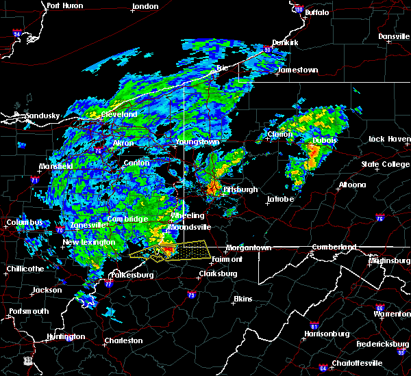 At 451 pm edt, a severe thunderstorm was located near pine grove, or 13 miles east of new martinsville, moving east at 50 mph (radar indicated). Hazards include quarter size hail. damage to vehicles is expected At 451 pm edt, a severe thunderstorm was located near pine grove, or 13 miles east of new martinsville, moving east at 50 mph (radar indicated). Hazards include quarter size hail. damage to vehicles is expected
|
| 6/16/2016 4:43 PM EDT |
 At 442 pm edt, severe thunderstorms were located along a line extending from near perryopolis to cassville to near salem, moving east at 45 mph (radar indicated). Hazards include 60 mph wind gusts and quarter size hail. Hail damage to vehicles is expected. Expect wind damage to trees and power lines, resulting in some power outages. At 442 pm edt, severe thunderstorms were located along a line extending from near perryopolis to cassville to near salem, moving east at 45 mph (radar indicated). Hazards include 60 mph wind gusts and quarter size hail. Hail damage to vehicles is expected. Expect wind damage to trees and power lines, resulting in some power outages.
|
| 6/16/2016 11:57 AM EDT |
 At 1157 am edt, a severe thunderstorm was located 8 miles west of cassville, or 10 miles northeast of mannington, moving southeast at 25 mph (radar indicated). Hazards include quarter size hail. Damage to vehicles is expected. locations impacted include, morgantown, fairmont, westover, pleasant valley, winfield, barrackville, monongah, granville, cassville, rivesville, grant town, blacksville, daybrook, pentress, mccurdyville, white hall, baxter, everettville, georgetown and osage. this includes the following highways, interstate 68 in west virginia between mile markers 1 and 2. interstate 79 in west virginia between mile markers 132 and 157. Please report severe weather by calling 4 1 2, 2 6 2, 1 9 8 8, posting to the nws pittsburgh facebook page, or using twitter @nwspittsburgh. At 1157 am edt, a severe thunderstorm was located 8 miles west of cassville, or 10 miles northeast of mannington, moving southeast at 25 mph (radar indicated). Hazards include quarter size hail. Damage to vehicles is expected. locations impacted include, morgantown, fairmont, westover, pleasant valley, winfield, barrackville, monongah, granville, cassville, rivesville, grant town, blacksville, daybrook, pentress, mccurdyville, white hall, baxter, everettville, georgetown and osage. this includes the following highways, interstate 68 in west virginia between mile markers 1 and 2. interstate 79 in west virginia between mile markers 132 and 157. Please report severe weather by calling 4 1 2, 2 6 2, 1 9 8 8, posting to the nws pittsburgh facebook page, or using twitter @nwspittsburgh.
|
| 6/16/2016 11:42 AM EDT |
 At 1141 am edt, a severe thunderstorm was located 7 miles east of hundred, or 13 miles north of mannington, moving southeast at 25 mph (radar indicated). Hazards include quarter size hail. damage to vehicles is expected At 1141 am edt, a severe thunderstorm was located 7 miles east of hundred, or 13 miles north of mannington, moving southeast at 25 mph (radar indicated). Hazards include quarter size hail. damage to vehicles is expected
|
| 5/1/2016 6:42 PM EDT | Quarter sized hail reported 7.7 miles SW of Fairview, WV |
| 5/1/2016 6:26 PM EDT |
 At 626 pm edt, a severe thunderstorm was located near mannington, moving east at 35 mph (radar indicated). Hazards include 60 mph wind gusts and quarter size hail. Hail damage to vehicles is expected. expect wind damage to trees and power lines, resulting in some power outages. locations impacted include, morgantown, fairmont, westover, mannington, star city, pleasant valley, winfield, barrackville, monongah, granville, cassville, rivesville, grant town, farmington, worthington, daybrook, mccurdyville, white hall, baxter and carolina. this includes the following highways, interstate 68 in west virginia between mile markers 1 and 2, and near mile marker 4. interstate 79 in west virginia between mile markers 130 and 157. Please report severe weather by calling 4 1 2, 2 6 2, 1 9 8 8, posting to the nws pittsburgh facebook page, or using twitter @nwspittsburgh. At 626 pm edt, a severe thunderstorm was located near mannington, moving east at 35 mph (radar indicated). Hazards include 60 mph wind gusts and quarter size hail. Hail damage to vehicles is expected. expect wind damage to trees and power lines, resulting in some power outages. locations impacted include, morgantown, fairmont, westover, mannington, star city, pleasant valley, winfield, barrackville, monongah, granville, cassville, rivesville, grant town, farmington, worthington, daybrook, mccurdyville, white hall, baxter and carolina. this includes the following highways, interstate 68 in west virginia between mile markers 1 and 2, and near mile marker 4. interstate 79 in west virginia between mile markers 130 and 157. Please report severe weather by calling 4 1 2, 2 6 2, 1 9 8 8, posting to the nws pittsburgh facebook page, or using twitter @nwspittsburgh.
|
| 5/1/2016 6:17 PM EDT |
 At 617 pm edt, a severe thunderstorm was located near hundred, or 7 miles northwest of mannington, moving east at 35 mph (radar indicated). Hazards include 60 mph wind gusts and quarter size hail. Hail damage to vehicles is expected. Expect wind damage to trees and power lines, resulting in some power outages. At 617 pm edt, a severe thunderstorm was located near hundred, or 7 miles northwest of mannington, moving east at 35 mph (radar indicated). Hazards include 60 mph wind gusts and quarter size hail. Hail damage to vehicles is expected. Expect wind damage to trees and power lines, resulting in some power outages.
|
| 7/9/2015 1:44 PM EDT |
 At 143 pm edt, severe thunderstorms were located along a line extending from 6 miles west of fredericktown-millsboro to near fairdale to monongah to near salem, moving east at 45 mph (radar indicated). Hazards include 60 mph wind gusts. expect damage to trees and some power outages At 143 pm edt, severe thunderstorms were located along a line extending from 6 miles west of fredericktown-millsboro to near fairdale to monongah to near salem, moving east at 45 mph (radar indicated). Hazards include 60 mph wind gusts. expect damage to trees and some power outages
|
| 6/30/2015 6:26 PM EDT | Tree down in marion county WV, 1.4 miles NW of Fairview, WV |
| 6/12/2015 7:41 PM EDT |
 The severe thunderstorm warning for central wetzel and western marion counties will expire at 745 pm edt, the storm which prompted the warning has weakened below severe limits, and no longer poses an immediate threat to life or property. therefore the warning will be allowed to expire. a severe thunderstorm watch remains in effect until 900 pm edt for northern west virginia. The severe thunderstorm warning for central wetzel and western marion counties will expire at 745 pm edt, the storm which prompted the warning has weakened below severe limits, and no longer poses an immediate threat to life or property. therefore the warning will be allowed to expire. a severe thunderstorm watch remains in effect until 900 pm edt for northern west virginia.
|
| 6/12/2015 7:17 PM EDT |
 At 717 pm edt, a severe thunderstorm was located over pine grove, or 11 miles southeast of new martinsville, moving east at 30 mph (radar indicated). Hazards include 60 mph wind gusts and penny size hail. Expect damage to roofs. Siding and trees. At 717 pm edt, a severe thunderstorm was located over pine grove, or 11 miles southeast of new martinsville, moving east at 30 mph (radar indicated). Hazards include 60 mph wind gusts and penny size hail. Expect damage to roofs. Siding and trees.
|
| 4/9/2015 5:32 PM EDT | A severe thunderstorm warning remains in effect until 545 pm edt for southwestern greene. northeastern wetzel. northwestern monongalia and northwestern marion counties. at 531 pm edt. a severe thunderstorm was located over wadestown. moving east at 35 mph. hazard. 60 mph wind gusts and half dollar size hail. |
| 4/9/2015 5:32 PM EDT | A severe thunderstorm warning remains in effect until 545 pm edt for southwestern greene. northeastern wetzel. northwestern monongalia and northwestern marion counties. at 531 pm edt. a severe thunderstorm was located over wadestown. moving east at 35 mph. hazard. 60 mph wind gusts and half dollar size hail. |
| 4/9/2015 5:17 PM EDT | The national weather service in pittsburgh has issued a * severe thunderstorm warning for. southwestern greene county in southwestern pennsylvania. northeastern wetzel county in northern west virginia. northwestern monongalia county in northern west virginia. Northwestern marion county in northern west virginia. |
| 4/9/2015 5:17 PM EDT | The national weather service in pittsburgh has issued a * severe thunderstorm warning for. southwestern greene county in southwestern pennsylvania. northeastern wetzel county in northern west virginia. northwestern monongalia county in northern west virginia. Northwestern marion county in northern west virginia. |
| 7/17/2013 5:36 PM EDT | Tree down blocking rt 218 in northern marion county in marion county WV, 0.2 miles N of Fairview, WV |
Hail Maps for Fairview, WV


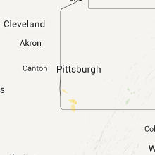
Connect with Interactive Hail Maps