

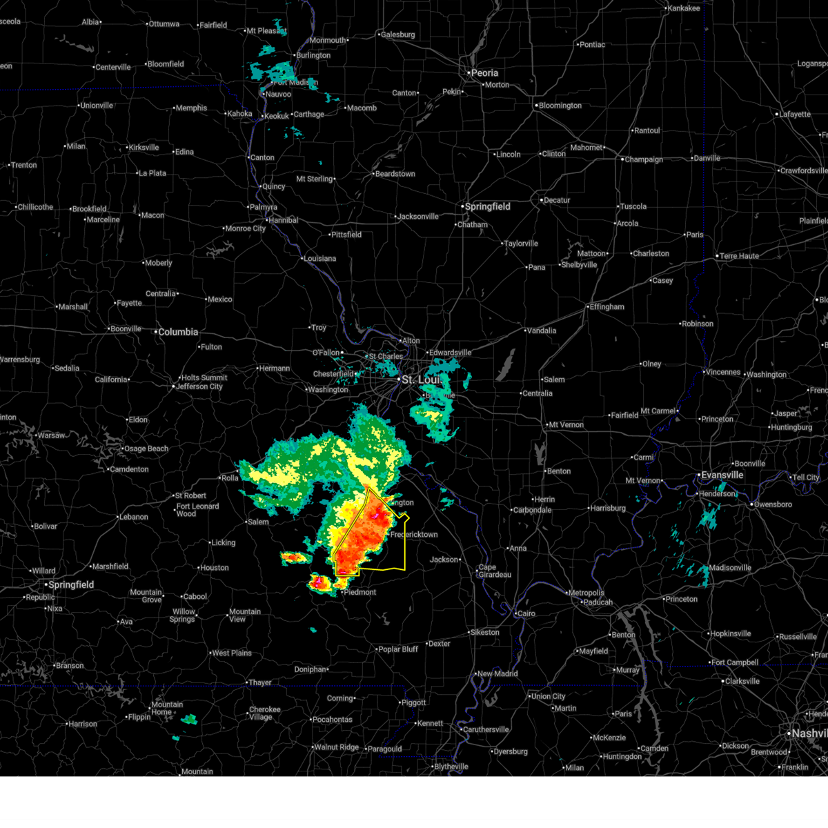
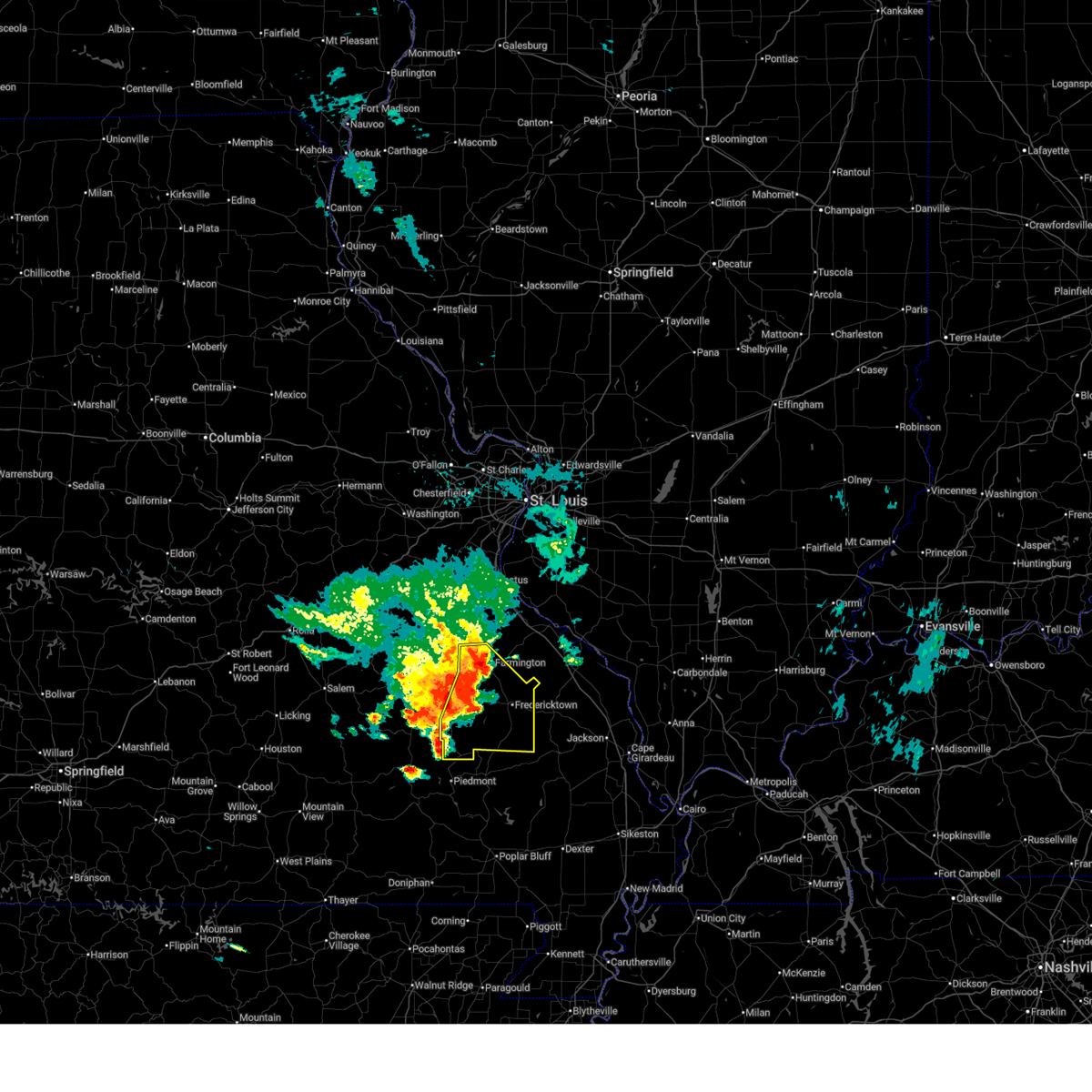
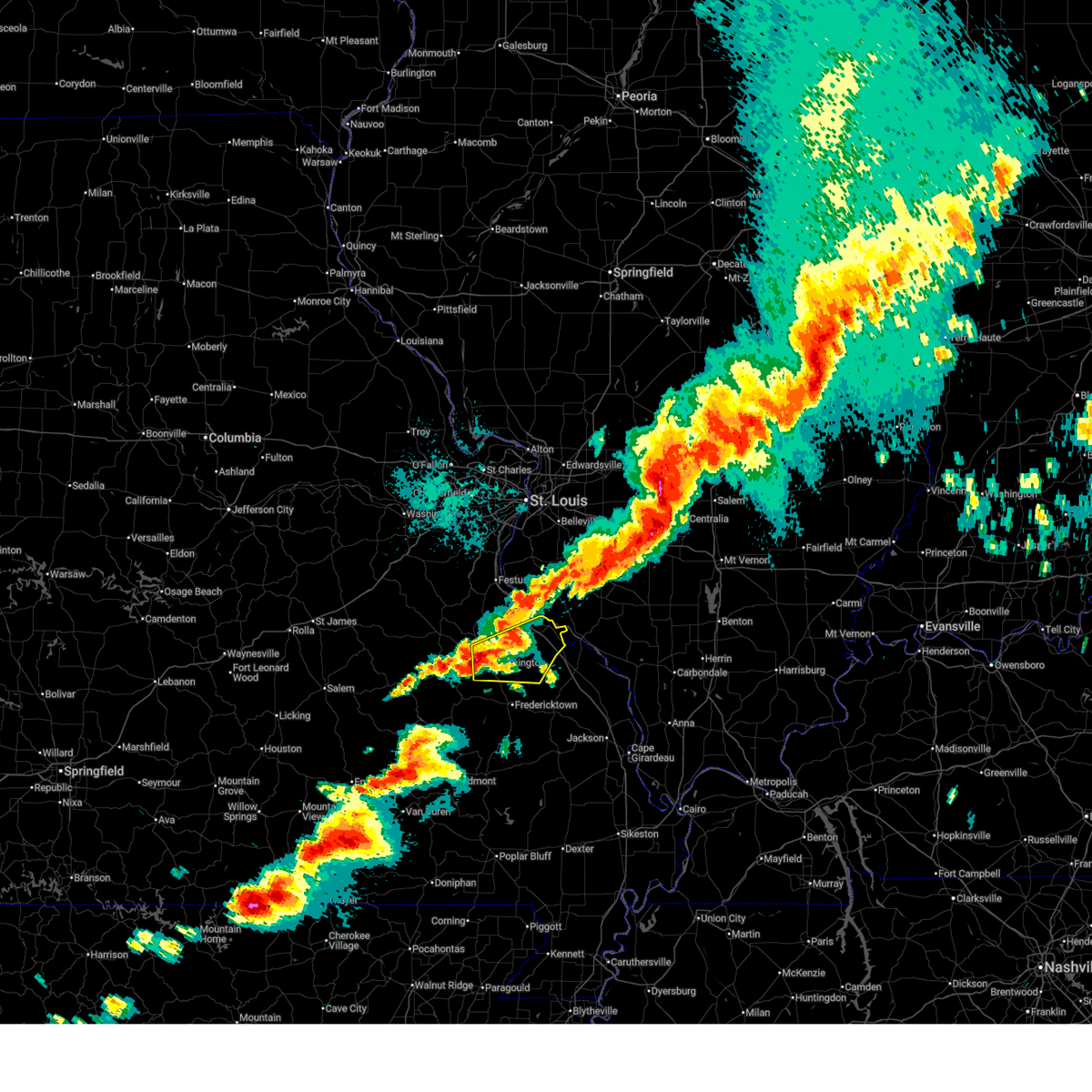
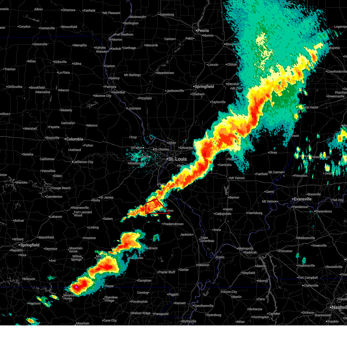
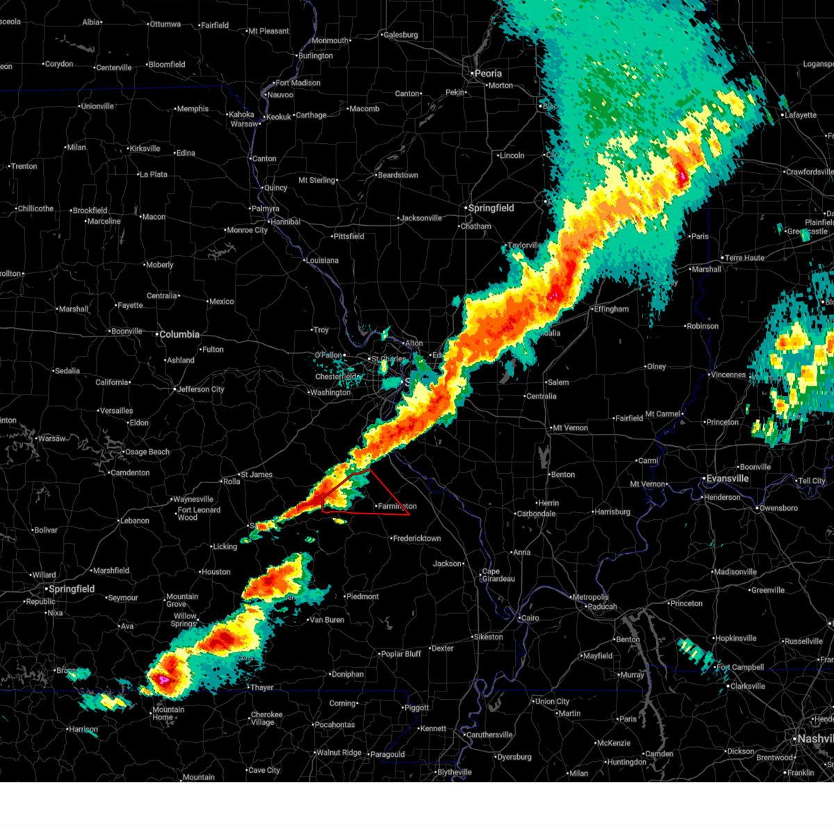
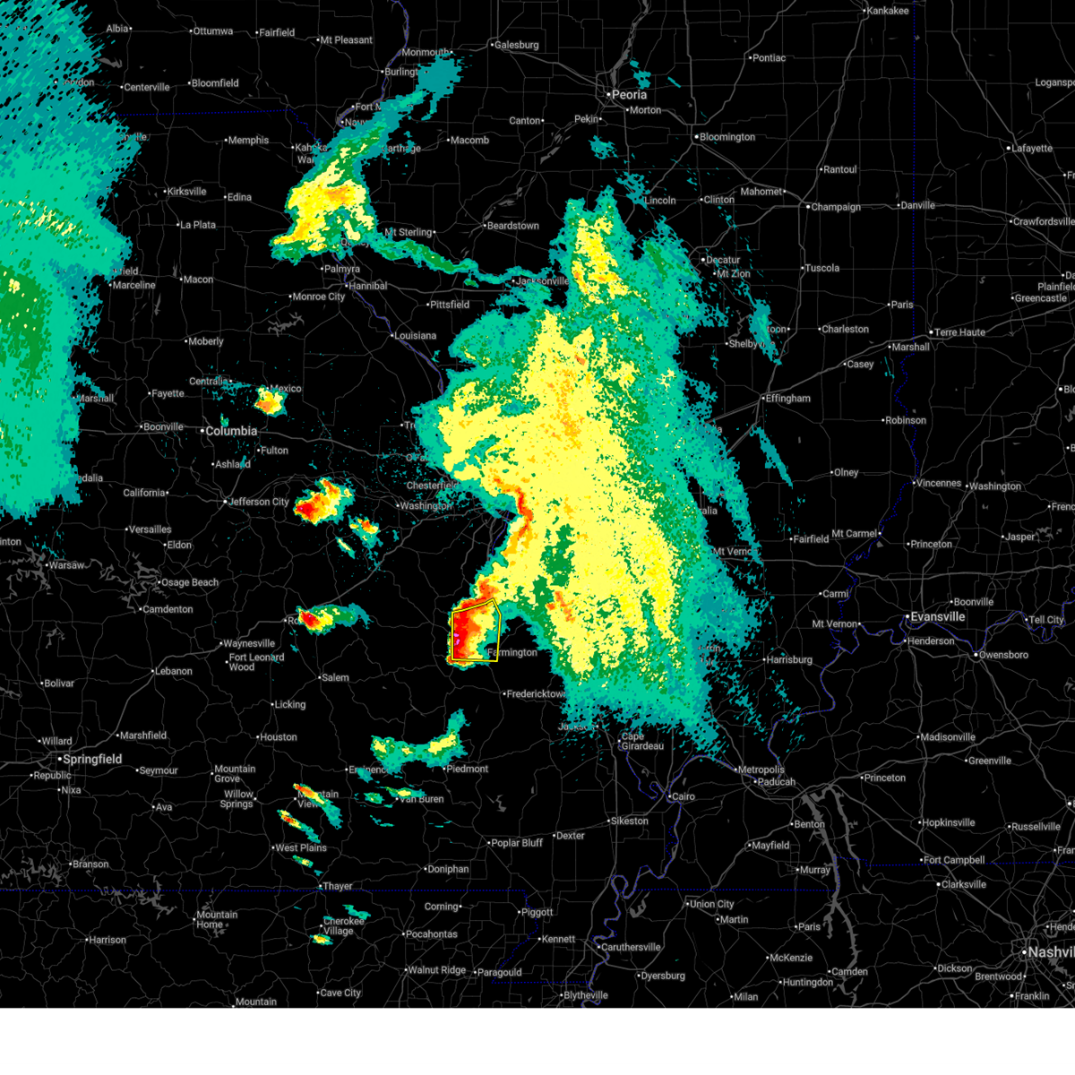
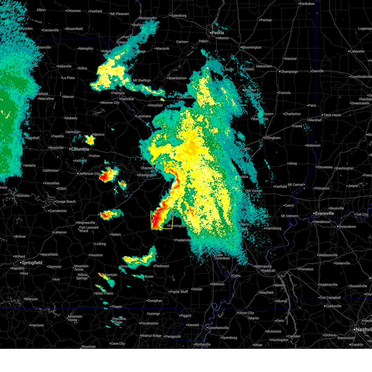
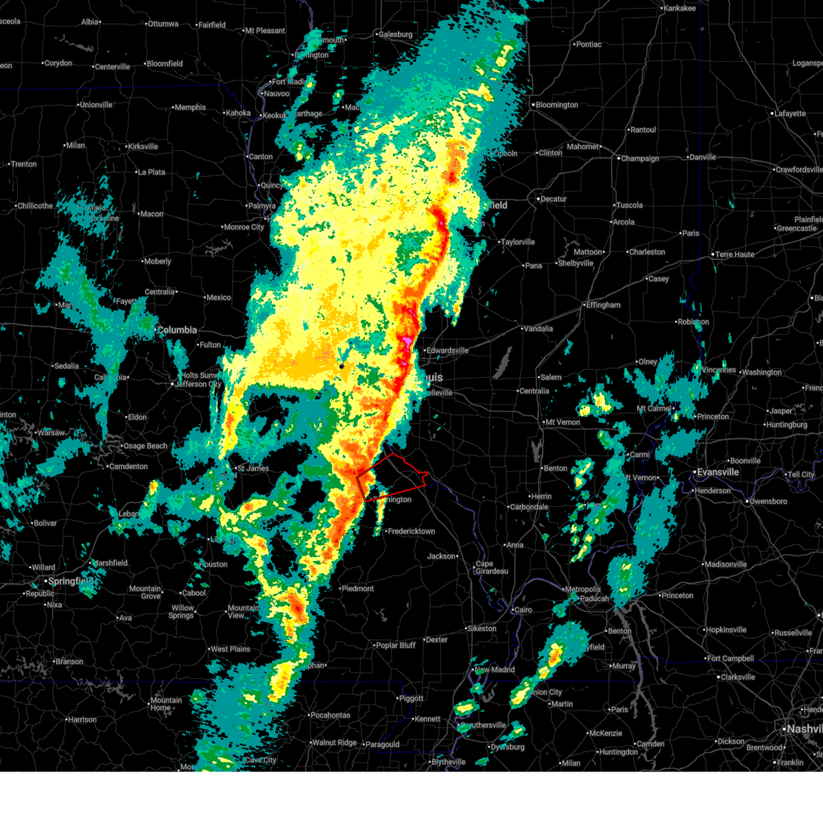
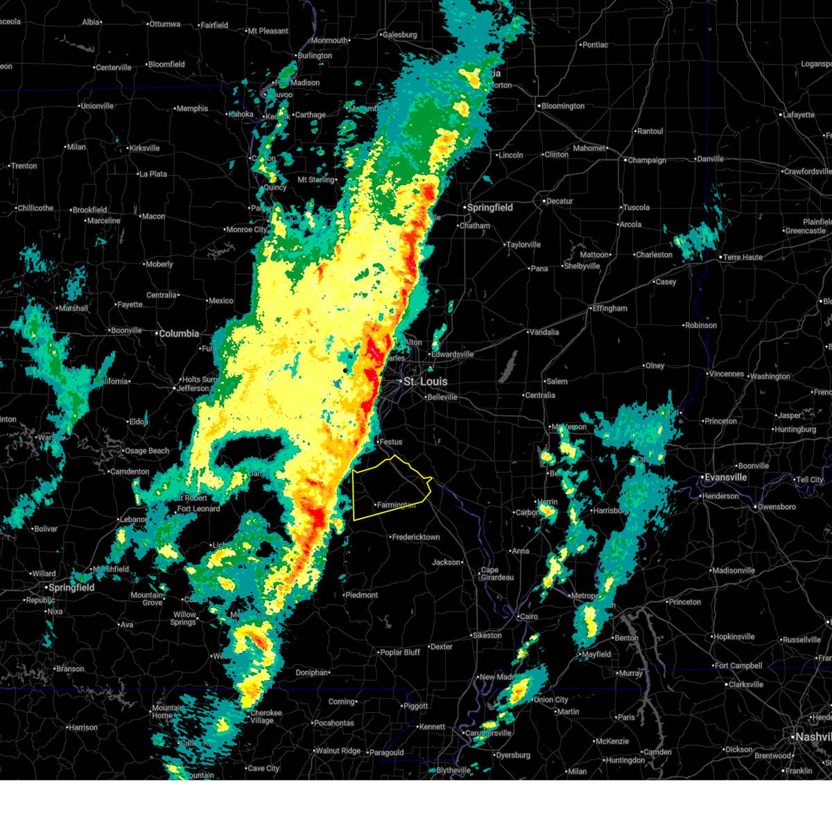
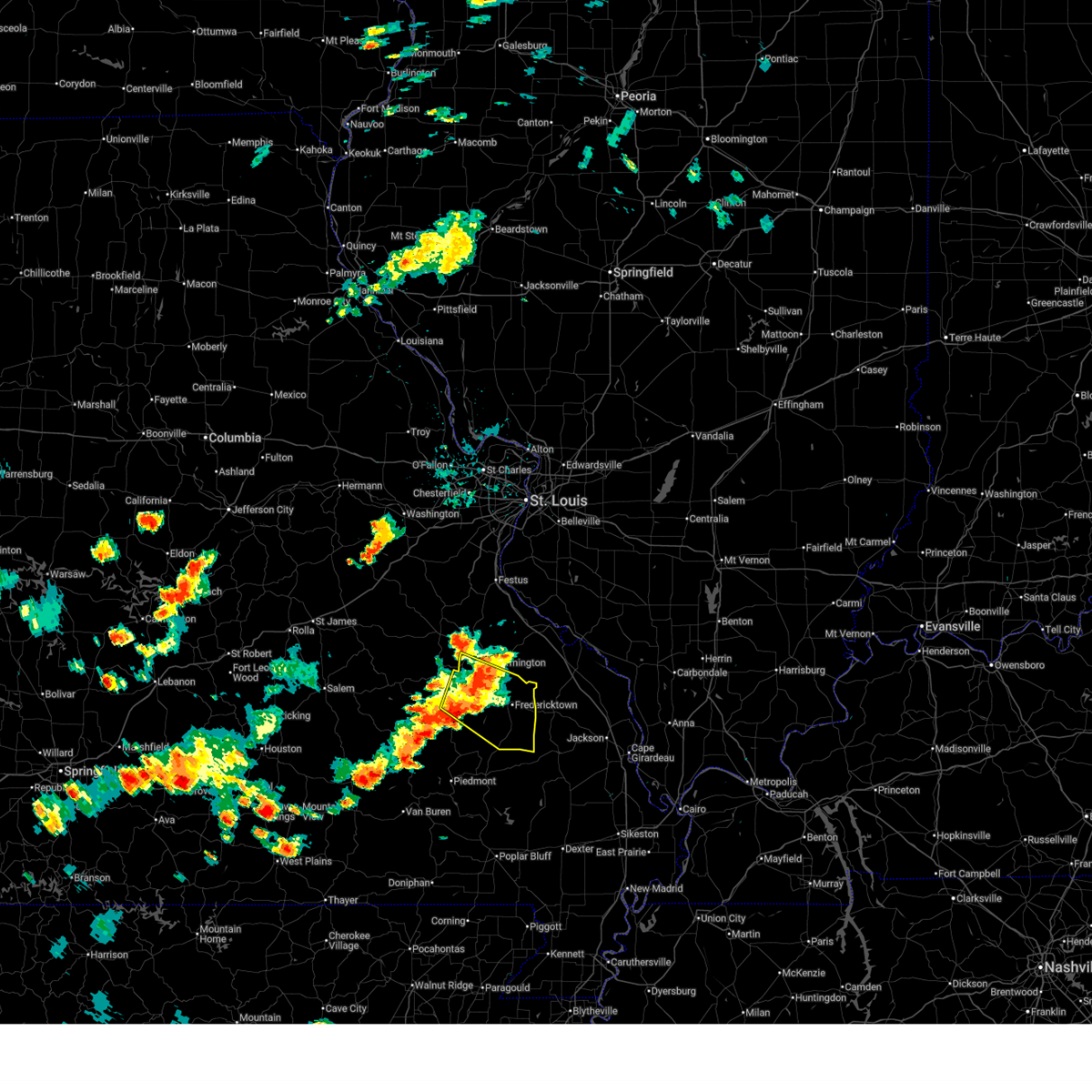
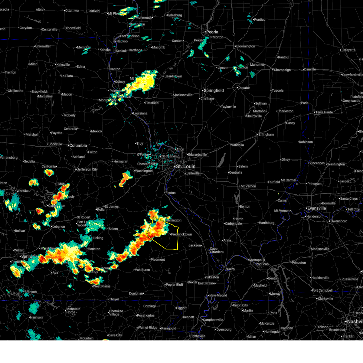
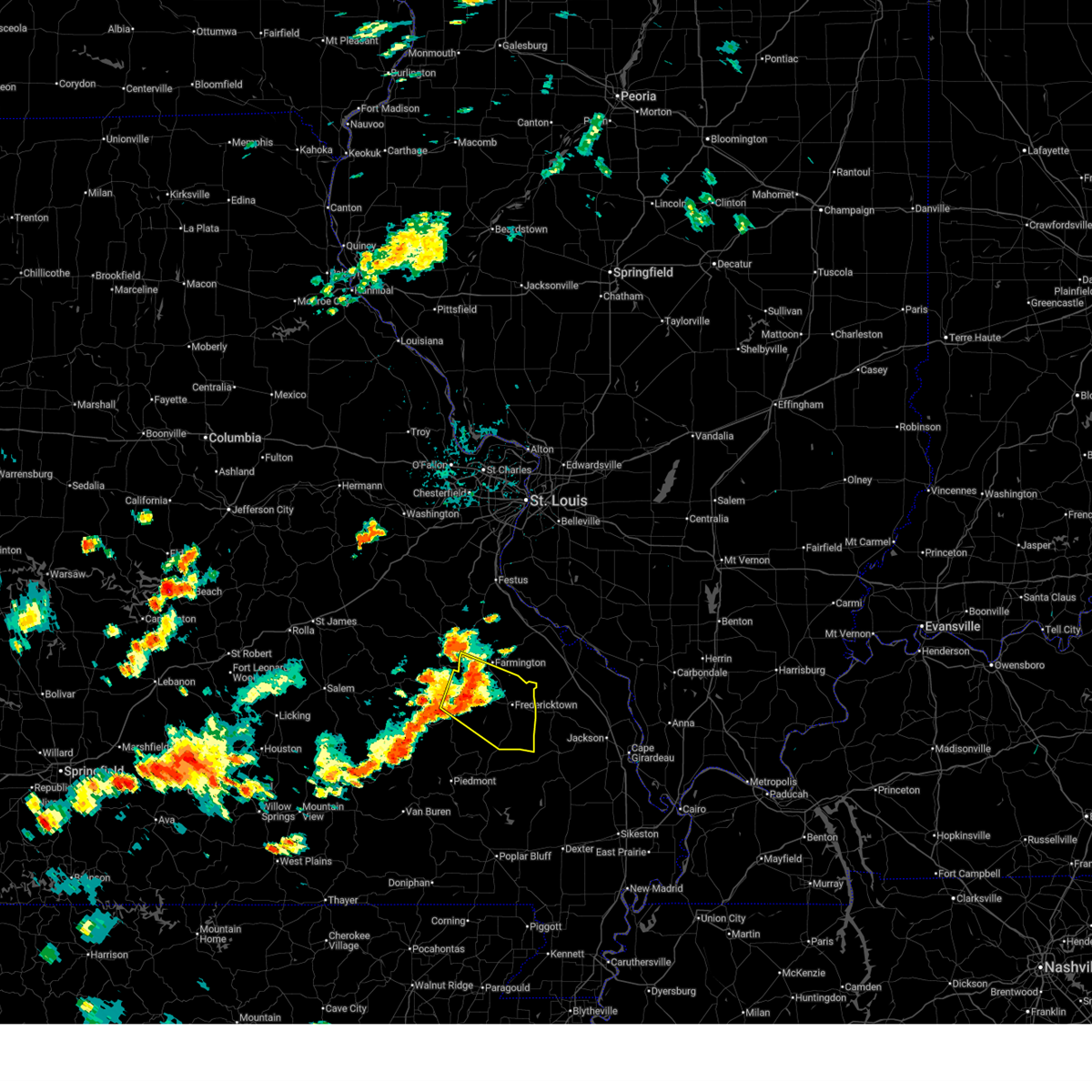
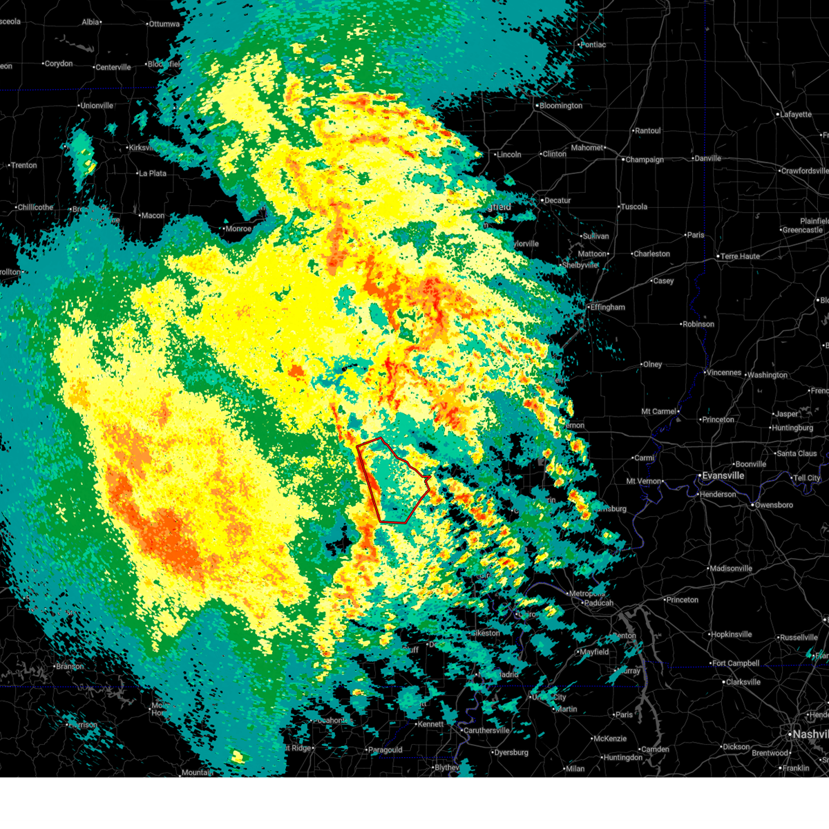
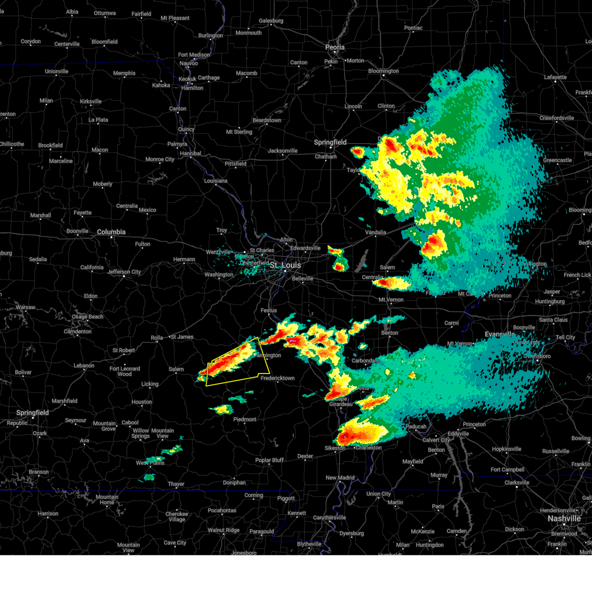
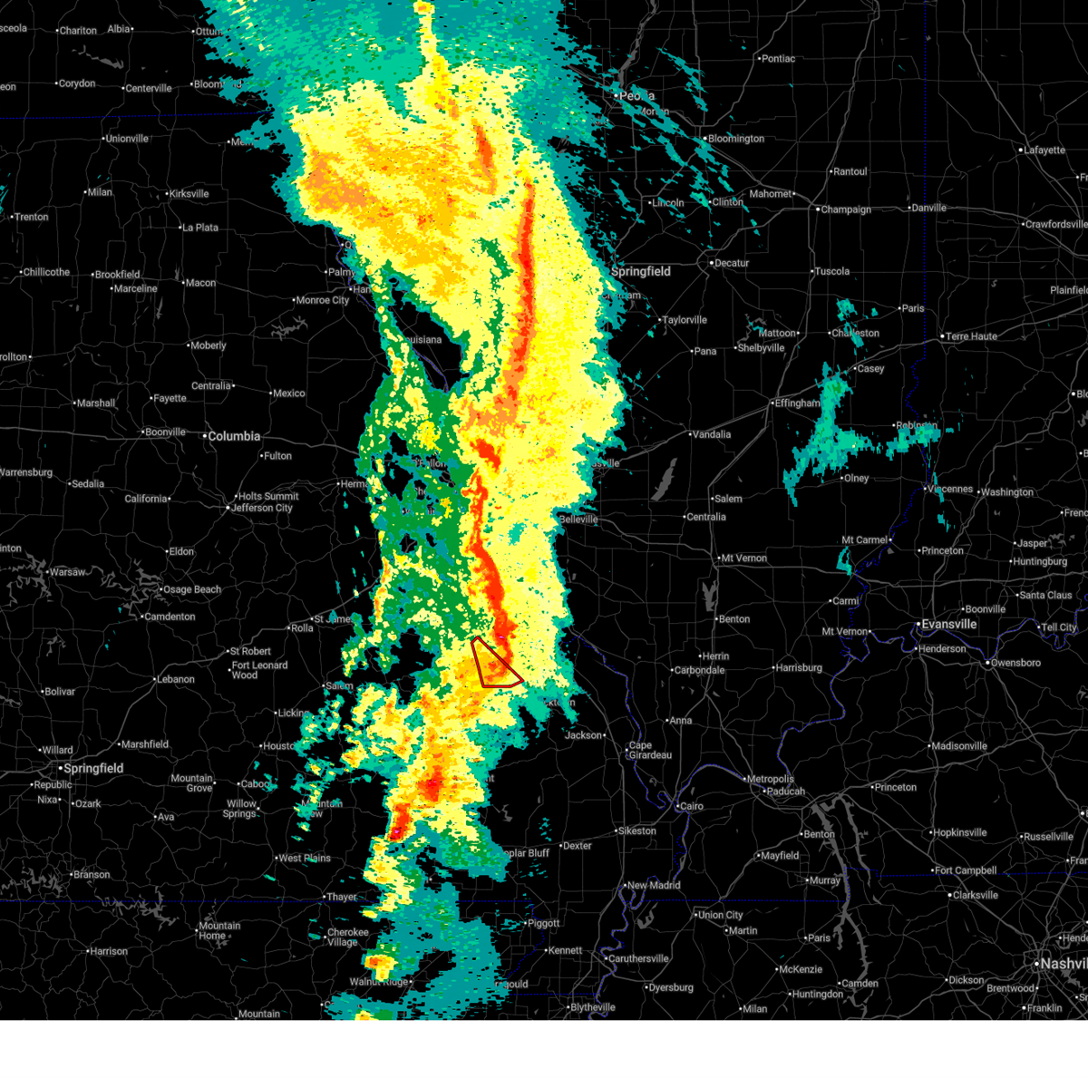
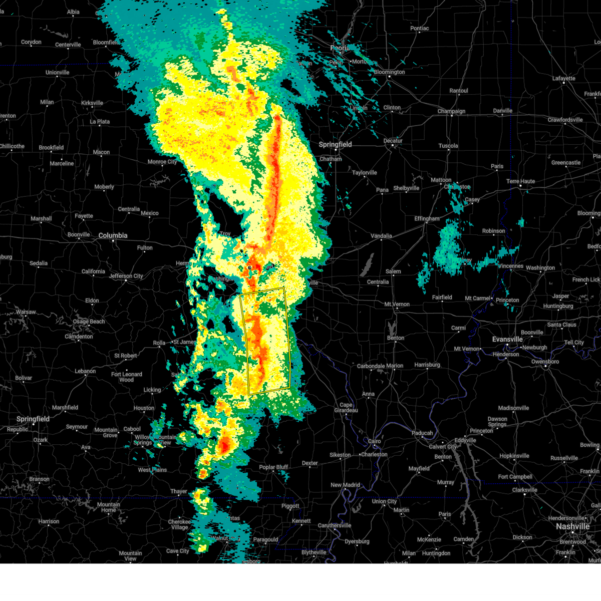
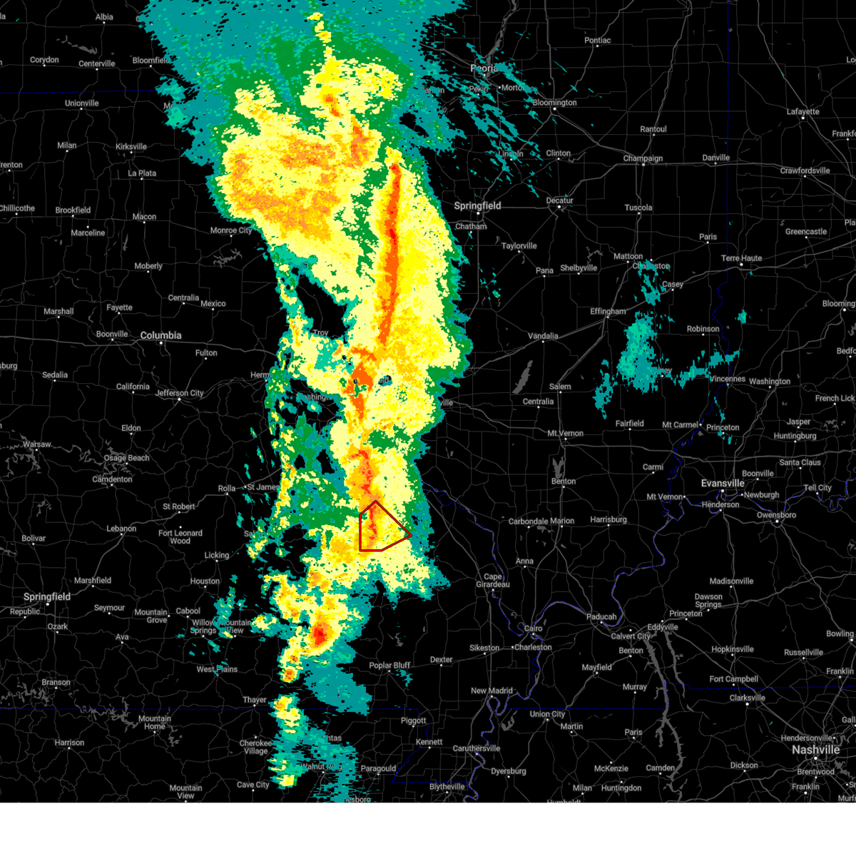
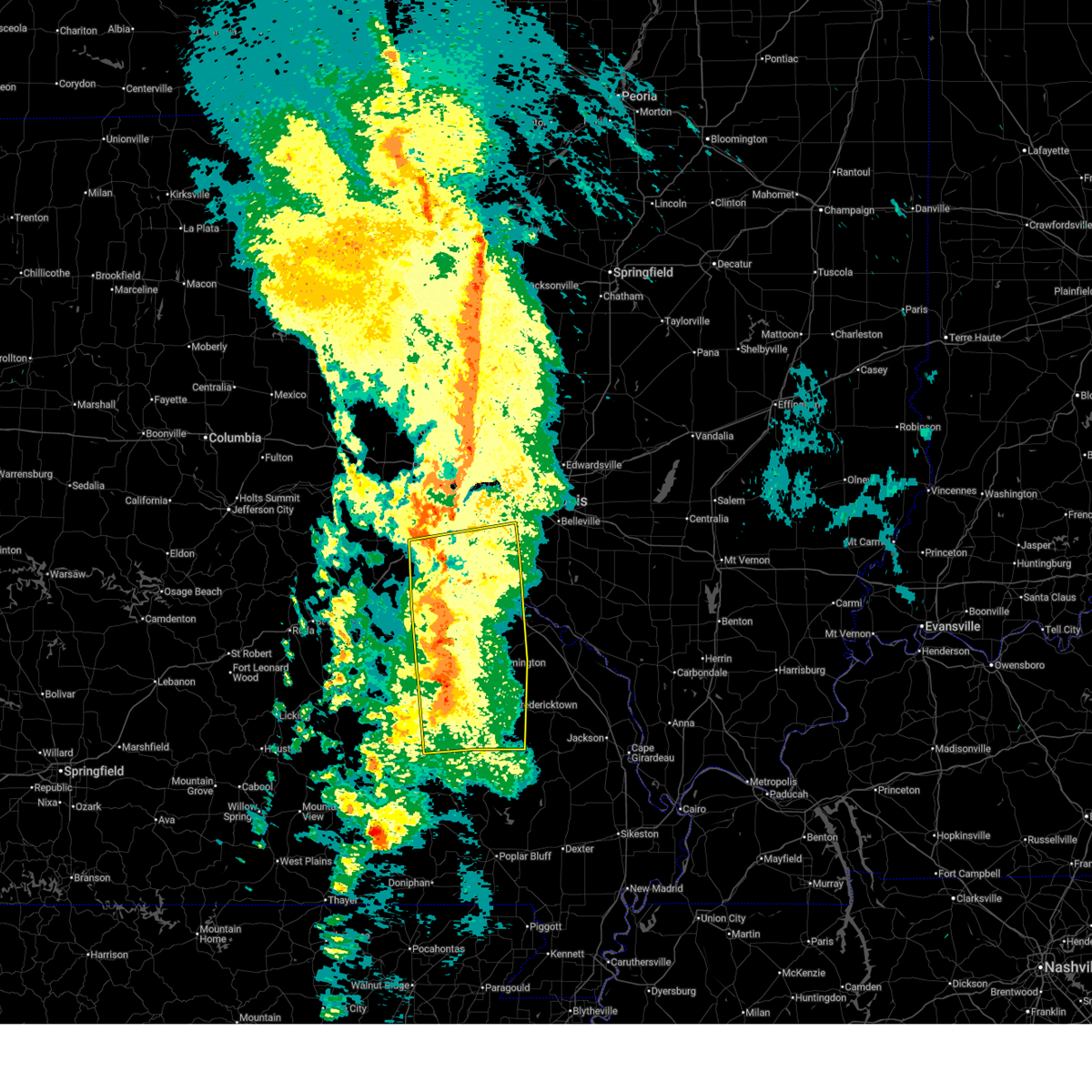
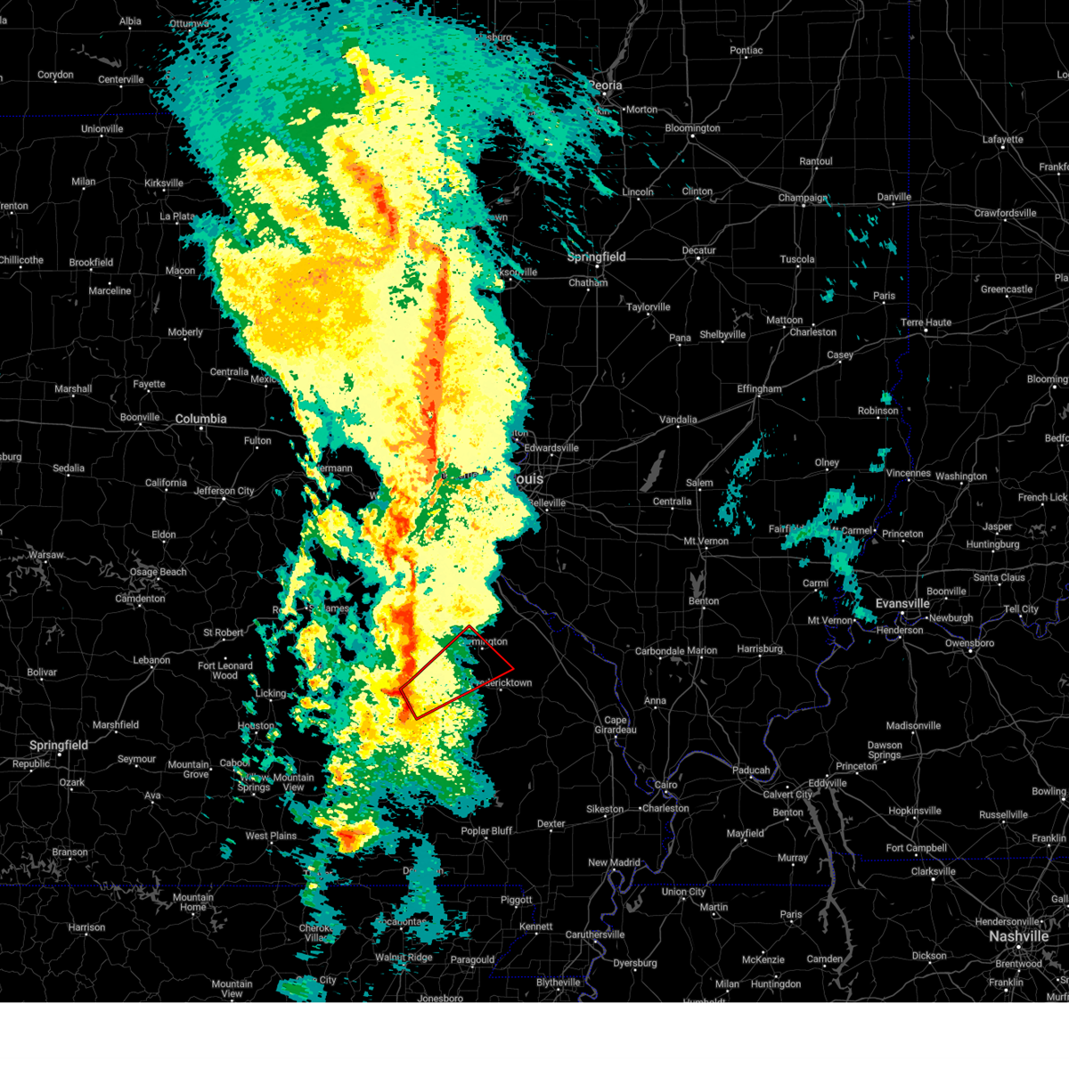
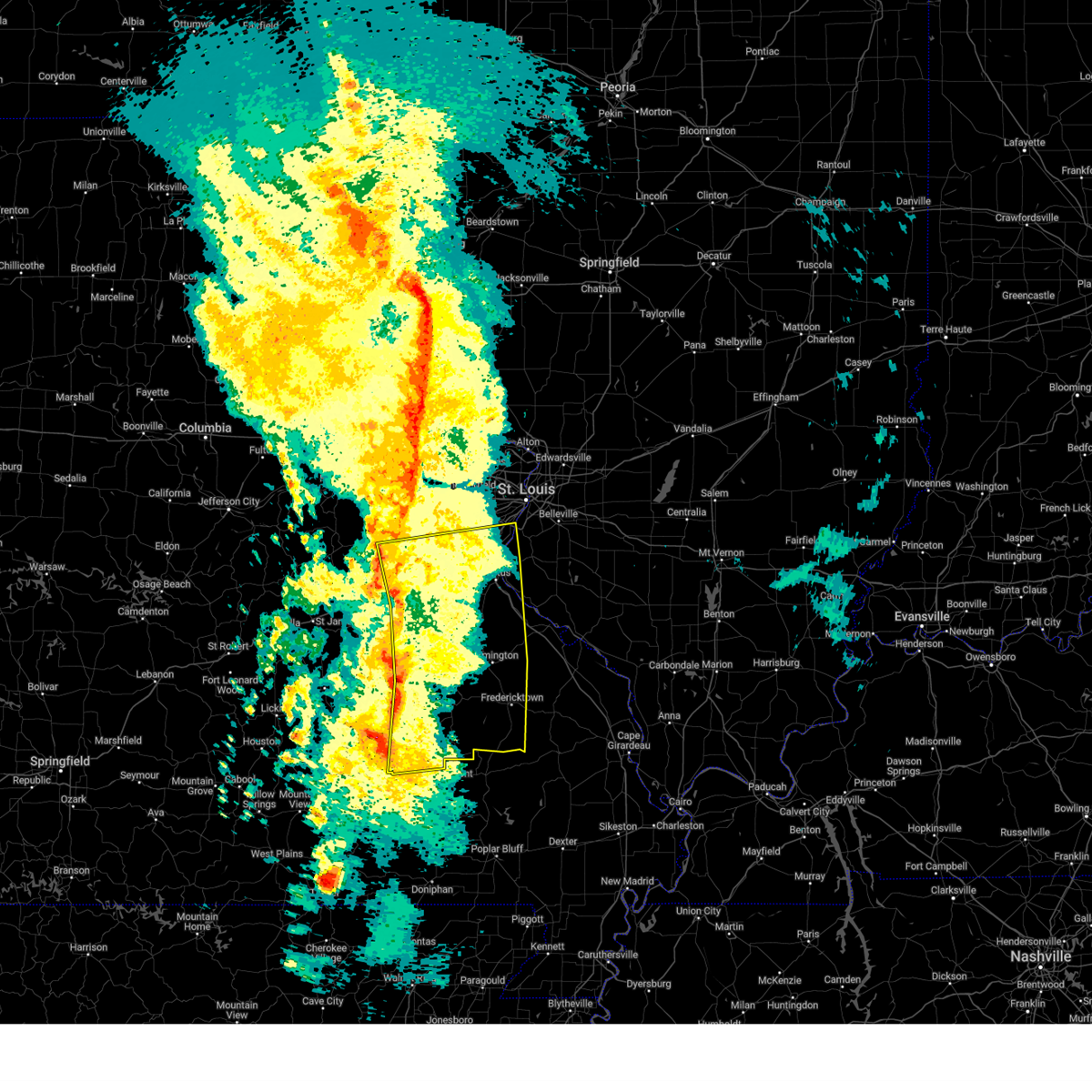
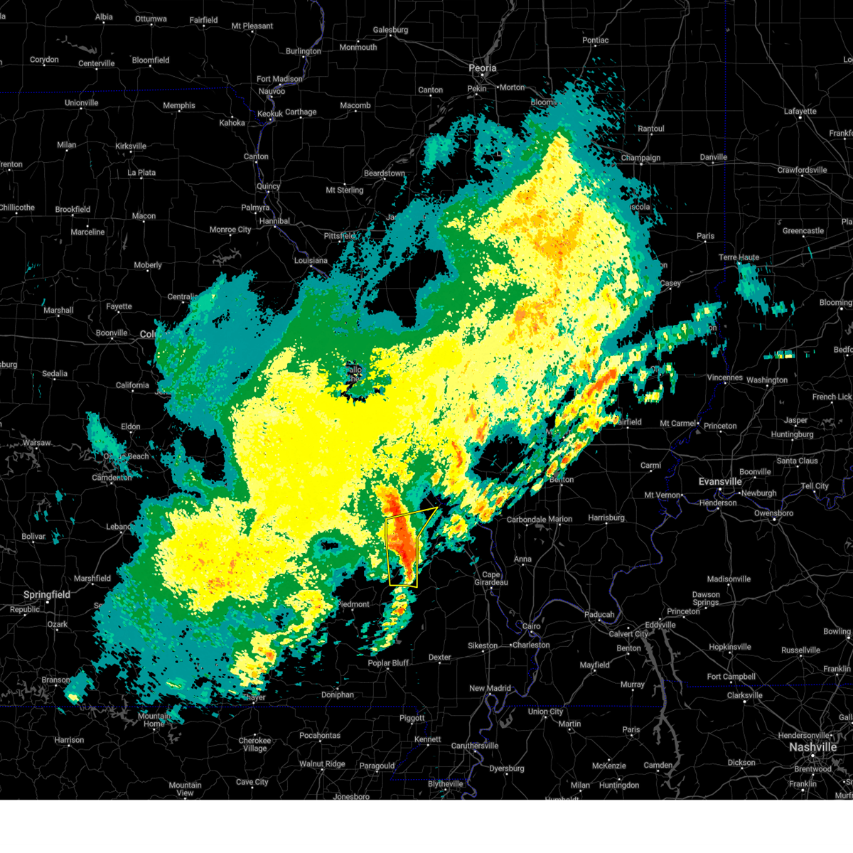
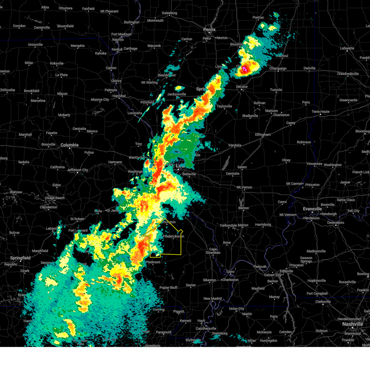
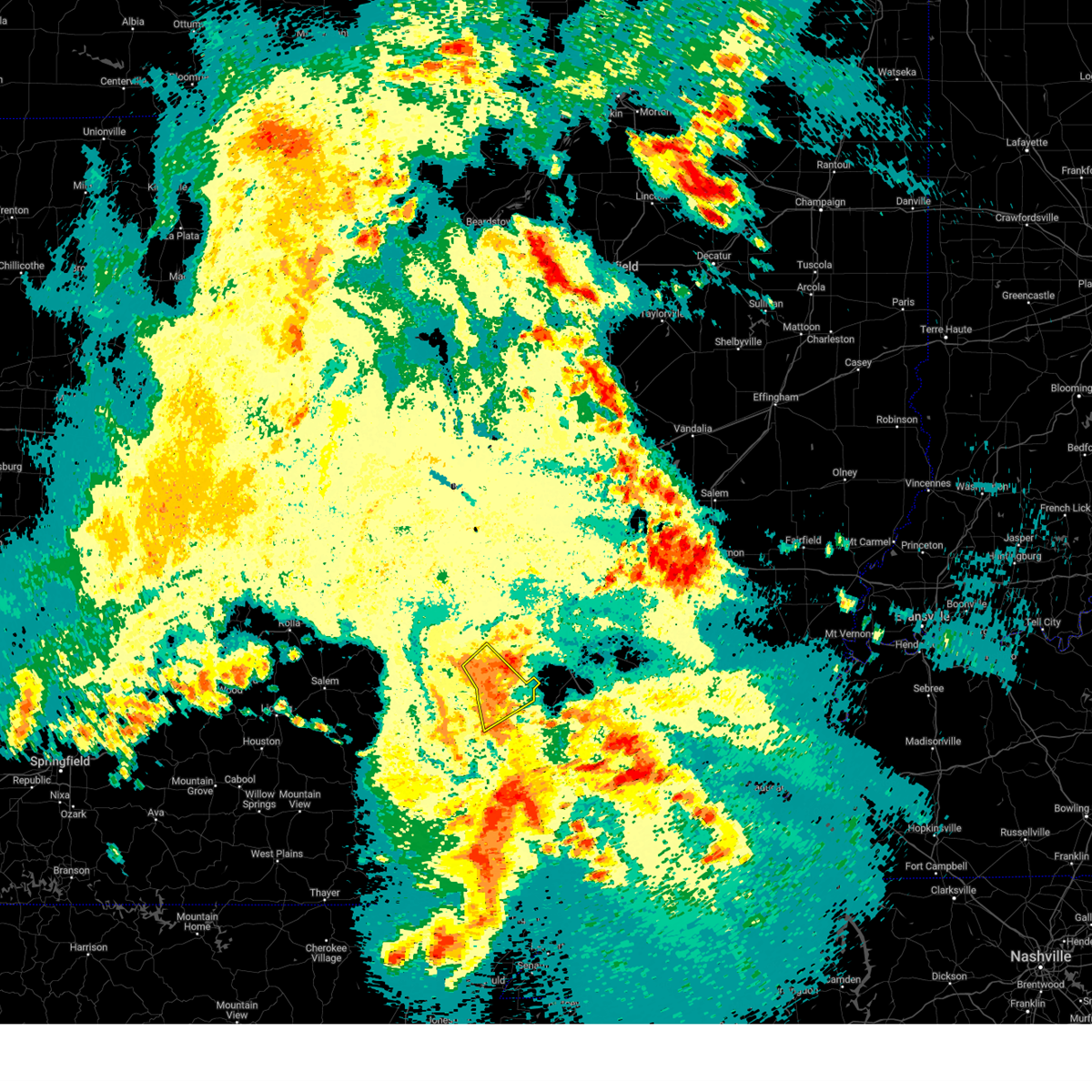
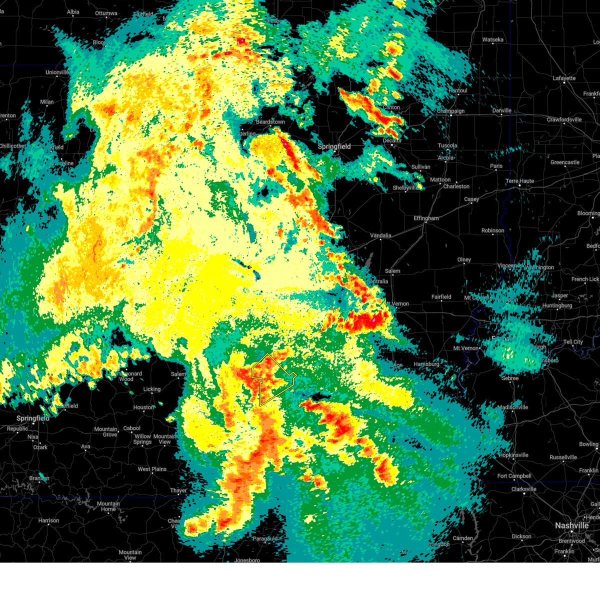
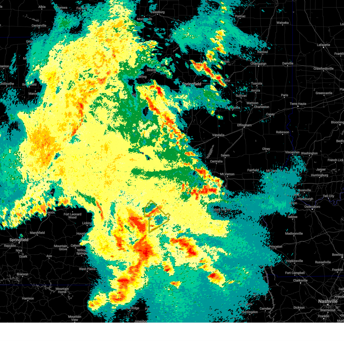
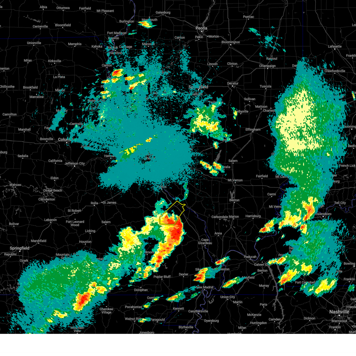
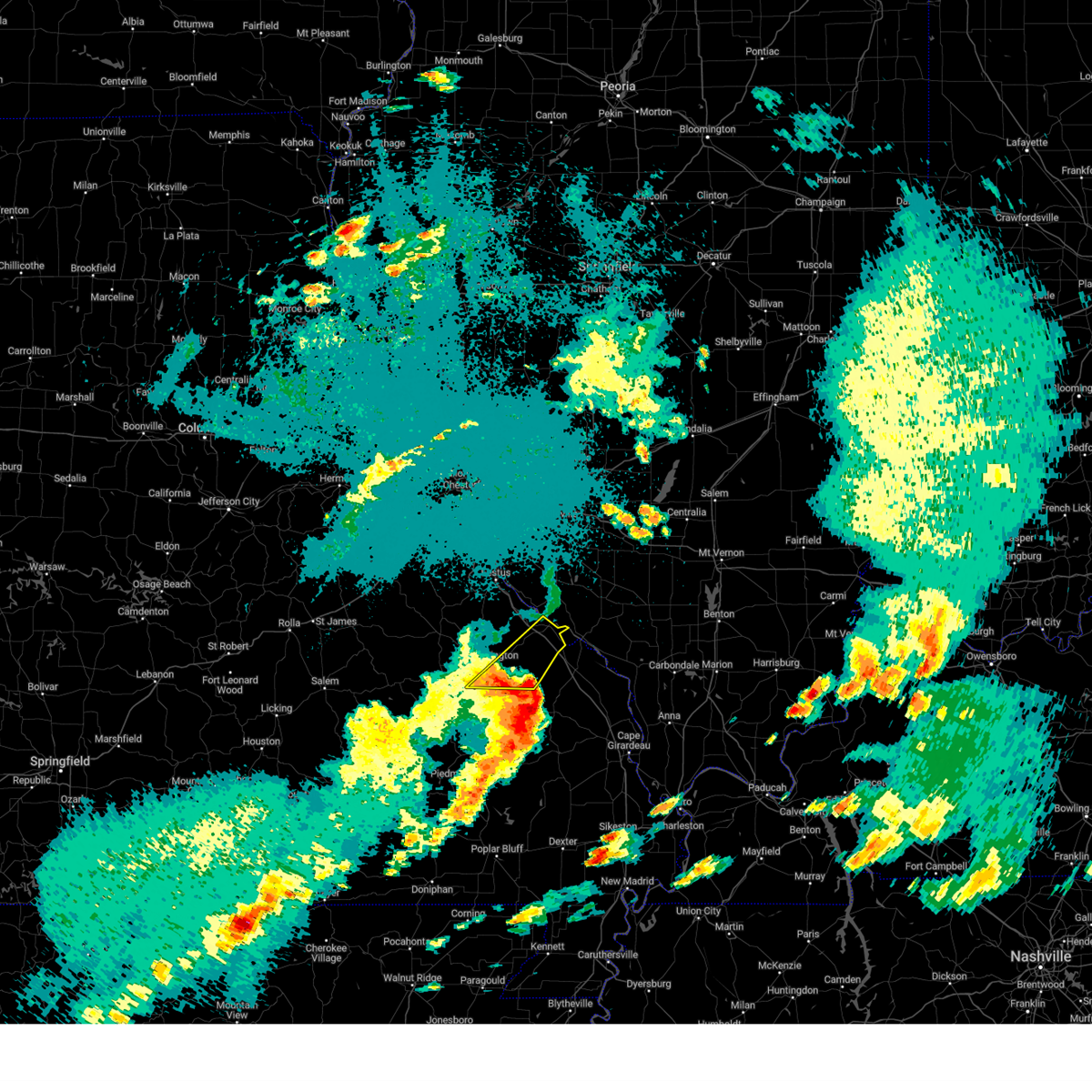
Hail Map for Farmington, MO
The Farmington, MO area has had 26 reports of on-the-ground hail by trained spotters, and has been under severe weather warnings 15 times during the past 12 months. Doppler radar has detected hail at or near Farmington, MO on 72 occasions, including 4 occasions during the past year.
| Name: | Farmington, MO |
| Where Located: | 58.7 miles NW of Cape Girardeau, MO |
| Map: | Google Map for Farmington, MO |
| Population: | 16240 |
| Housing Units: | 6172 |
| More Info: | Search Google for Farmington, MO |
1
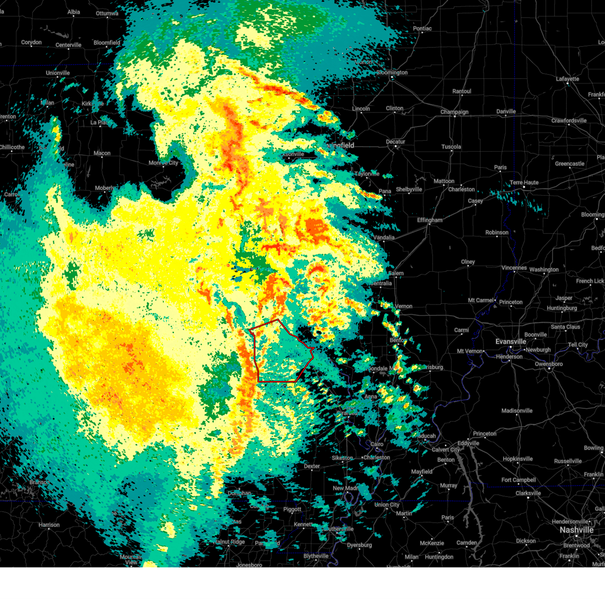
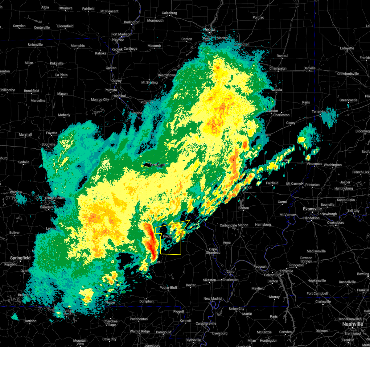
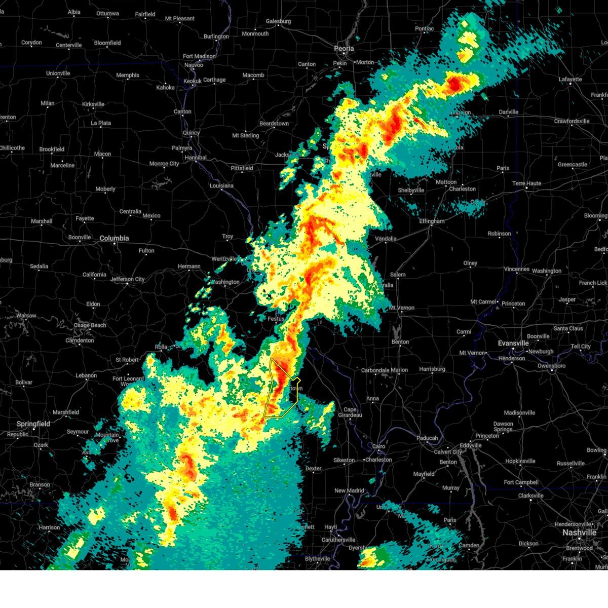
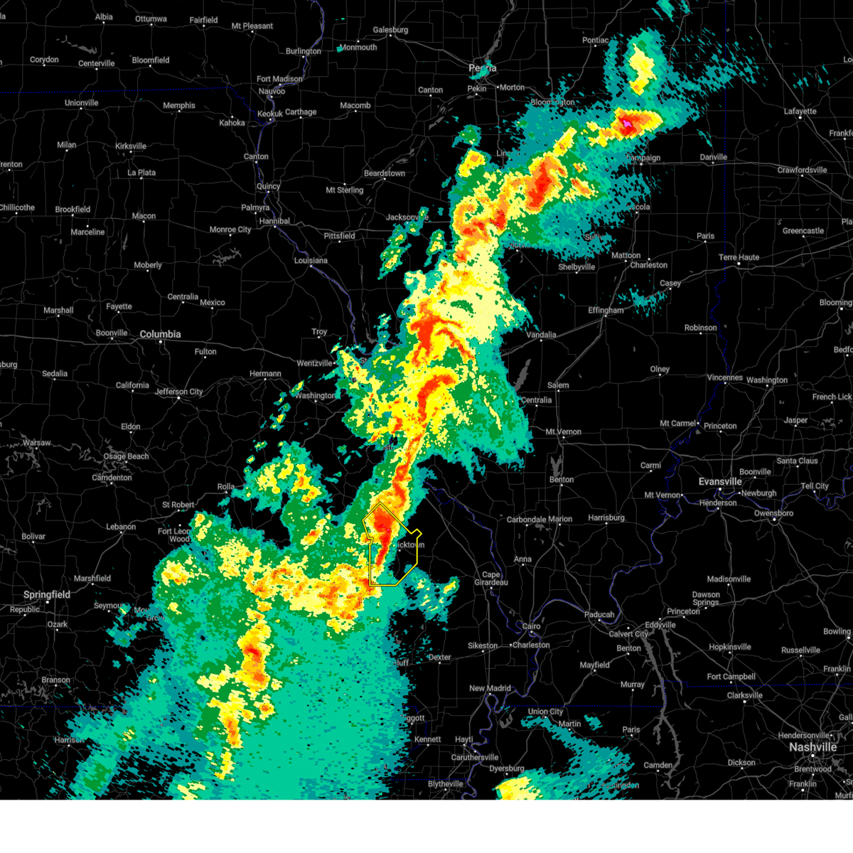
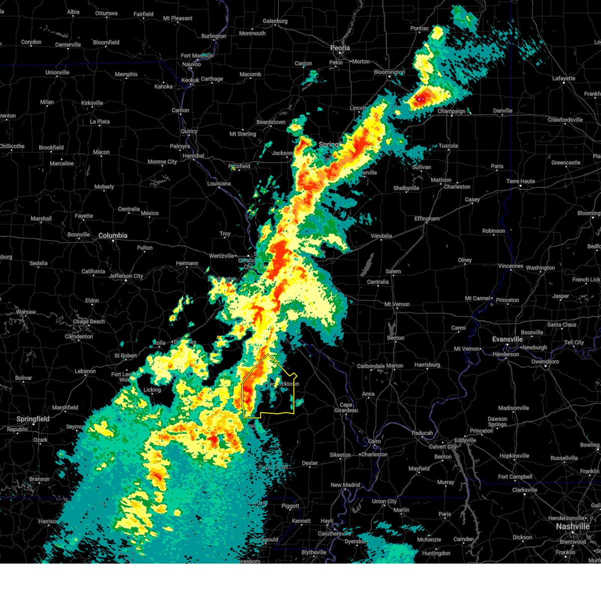
The Top Recent Hail Date for Farmington, MO is Monday, April 27, 2026 (6th out of 72)

Hail and Wind Damage Spotted near Farmington, MO
| Date / Time | Report Details |
|---|---|
| 5/31/2026 2:50 PM CDT | Estimated 50-60 mph winds with small tree limbs down and debris on dd between oo and highway 6 in st. francois county MO, 8.7 miles NW of Farmington, MO |
| 5/31/2026 2:42 PM CDT |
 At 242 pm cdt, severe thunderstorms were located along a line from 6 miles northeast of farmington to 5 miles southeast of annapolis, or along a line from 6 miles northeast of farmington to 21 miles south of ironton, moving east at 15 mph (radar indicated). Hazards include 60 mph wind gusts and small hail. Expect damage to roofs, siding, and trees. Locations impacted include, ironton, arcadia, park hills, glover, leadington, doe run, roselle, farmington, annapolis, knob lick, des arc, catherine place, libertyville, fredericktown, junction city, saco, mine la motte, cobalt, buckhorn and marquand. At 242 pm cdt, severe thunderstorms were located along a line from 6 miles northeast of farmington to 5 miles southeast of annapolis, or along a line from 6 miles northeast of farmington to 21 miles south of ironton, moving east at 15 mph (radar indicated). Hazards include 60 mph wind gusts and small hail. Expect damage to roofs, siding, and trees. Locations impacted include, ironton, arcadia, park hills, glover, leadington, doe run, roselle, farmington, annapolis, knob lick, des arc, catherine place, libertyville, fredericktown, junction city, saco, mine la motte, cobalt, buckhorn and marquand.
|
| 5/31/2026 2:30 PM CDT | Report of numerous trees down in the southern portion of st. francois county. time estimated from rada in st. francois county MO, 7.4 miles NNE of Farmington, MO |
| 5/31/2026 2:25 PM CDT | Via facebook: large... healthy tree downed across driveway. tree pulled powerlines to the ground... but did not completely down the in st. francois county MO, 4.2 miles NE of Farmington, MO |
| 5/31/2026 2:25 PM CDT | Via facebook: a large healthy tree downed across hwy aa near farmingto in st. francois county MO, 5.1 miles N of Farmington, MO |
| 5/31/2026 2:23 PM CDT |
 Svrlsx the national weather service in st louis has issued a * severe thunderstorm warning for, eastern iron county in southeastern missouri, madison county in southeastern missouri, saint francois county in southeastern missouri, * until 345 pm cdt. * at 223 pm cdt, severe thunderstorms were located along a line from near farmington to near annapolis, or along a line from near farmington to 21 miles south of ironton, moving east at 15 mph (radar indicated). Hazards include 60 mph wind gusts and quarter size hail. Hail damage to vehicles is expected. Expect wind damage to roofs, siding, and trees. Svrlsx the national weather service in st louis has issued a * severe thunderstorm warning for, eastern iron county in southeastern missouri, madison county in southeastern missouri, saint francois county in southeastern missouri, * until 345 pm cdt. * at 223 pm cdt, severe thunderstorms were located along a line from near farmington to near annapolis, or along a line from near farmington to 21 miles south of ironton, moving east at 15 mph (radar indicated). Hazards include 60 mph wind gusts and quarter size hail. Hail damage to vehicles is expected. Expect wind damage to roofs, siding, and trees.
|
| 4/27/2026 8:40 PM CDT | Half Dollar sized hail reported 0.4 miles SSE of Farmington, MO, report from mping: half dollar (1.25 in.). |
| 4/27/2026 8:35 PM CDT | Storm damage reported in st. francois county MO, 0.3 miles NNE of Farmington, MO |
| 4/27/2026 8:31 PM CDT |
 Svrlsx the national weather service in st louis has issued a * severe thunderstorm warning for, sainte genevieve county in southeastern missouri, southern saint francois county in southeastern missouri, * until 915 pm cdt. * at 831 pm cdt, a severe thunderstorm was located over farmington, moving east at 45 mph (radar indicated). Hazards include 60 mph wind gusts and quarter size hail. Hail damage to vehicles is expected. Expect wind damage to roofs, siding, and trees. Svrlsx the national weather service in st louis has issued a * severe thunderstorm warning for, sainte genevieve county in southeastern missouri, southern saint francois county in southeastern missouri, * until 915 pm cdt. * at 831 pm cdt, a severe thunderstorm was located over farmington, moving east at 45 mph (radar indicated). Hazards include 60 mph wind gusts and quarter size hail. Hail damage to vehicles is expected. Expect wind damage to roofs, siding, and trees.
|
| 4/27/2026 8:22 PM CDT |
 At 822 pm cdt, a severe thunderstorm capable of producing a tornado was located over farmington, moving east at 45 mph (radar indicated rotation). Hazards include tornado and quarter size hail. Flying debris will be dangerous to those caught without shelter. mobile homes will be damaged or destroyed. damage to roofs, windows and vehicles will occur. tree damage is likely. this tornado will be near, farmington, park hills and desloge around 825 pm cdt. other locations impacted by the tornado include leadington and doe run. this includes the following state parks, st. Joe state park and missouri mines historic site. At 822 pm cdt, a severe thunderstorm capable of producing a tornado was located over farmington, moving east at 45 mph (radar indicated rotation). Hazards include tornado and quarter size hail. Flying debris will be dangerous to those caught without shelter. mobile homes will be damaged or destroyed. damage to roofs, windows and vehicles will occur. tree damage is likely. this tornado will be near, farmington, park hills and desloge around 825 pm cdt. other locations impacted by the tornado include leadington and doe run. this includes the following state parks, st. Joe state park and missouri mines historic site.
|
| 4/27/2026 8:03 PM CDT |
 Torlsx the national weather service in st louis has issued a * tornado warning for, southeastern washington county in east central missouri, southwestern sainte genevieve county in southeastern missouri, western saint francois county in southeastern missouri, * until 845 pm cdt. * at 803 pm cdt, a severe thunderstorm capable of producing a tornado was located near irondale, or 6 miles west of bismarck, moving east at 45 mph (radar indicated rotation). Hazards include tornado and quarter size hail. Flying debris will be dangerous to those caught without shelter. mobile homes will be damaged or destroyed. damage to roofs, windows and vehicles will occur. tree damage is likely. this tornado will be near, irondale around 805 pm cdt. bismarck around 810 pm cdt. leadwood around 815 pm cdt. other locations impacted by the tornado include caledonia, frankclay, leadington and doe run. this includes the following state parks, st. joe state park, st. Francois state park and missouri mines historic site. Torlsx the national weather service in st louis has issued a * tornado warning for, southeastern washington county in east central missouri, southwestern sainte genevieve county in southeastern missouri, western saint francois county in southeastern missouri, * until 845 pm cdt. * at 803 pm cdt, a severe thunderstorm capable of producing a tornado was located near irondale, or 6 miles west of bismarck, moving east at 45 mph (radar indicated rotation). Hazards include tornado and quarter size hail. Flying debris will be dangerous to those caught without shelter. mobile homes will be damaged or destroyed. damage to roofs, windows and vehicles will occur. tree damage is likely. this tornado will be near, irondale around 805 pm cdt. bismarck around 810 pm cdt. leadwood around 815 pm cdt. other locations impacted by the tornado include caledonia, frankclay, leadington and doe run. this includes the following state parks, st. joe state park, st. Francois state park and missouri mines historic site.
|
| 4/27/2026 3:46 AM CDT |
 At 346 am cdt, a severe thunderstorm was located near farmington, moving east at 25 mph (public reported golf ball sized hail 3 miles southeast of farmington). Hazards include golf ball size hail and 60 mph wind gusts. People and animals outdoors will be injured. expect hail damage to roofs, siding, windows, and vehicles. expect wind damage to roofs, siding, and trees. Locations impacted include, farmington. At 346 am cdt, a severe thunderstorm was located near farmington, moving east at 25 mph (public reported golf ball sized hail 3 miles southeast of farmington). Hazards include golf ball size hail and 60 mph wind gusts. People and animals outdoors will be injured. expect hail damage to roofs, siding, windows, and vehicles. expect wind damage to roofs, siding, and trees. Locations impacted include, farmington.
|
| 4/27/2026 3:37 AM CDT |
 At 337 am cdt, a severe thunderstorm was located over farmington, moving east at 30 mph (radar indicated). Hazards include ping pong ball size hail and 60 mph wind gusts. People and animals outdoors will be injured. expect hail damage to roofs, siding, windows, and vehicles. expect wind damage to roofs, siding, and trees. Locations impacted include, doe run, park hills, leadington, farmington and french village. At 337 am cdt, a severe thunderstorm was located over farmington, moving east at 30 mph (radar indicated). Hazards include ping pong ball size hail and 60 mph wind gusts. People and animals outdoors will be injured. expect hail damage to roofs, siding, windows, and vehicles. expect wind damage to roofs, siding, and trees. Locations impacted include, doe run, park hills, leadington, farmington and french village.
|
| 4/27/2026 3:36 AM CDT | Golf Ball sized hail reported 3.1 miles NW of Farmington, MO |
| 4/27/2026 3:33 AM CDT | Golf Ball sized hail reported 0.8 miles ENE of Farmington, MO, time estimated from radar. |
| 4/27/2026 3:33 AM CDT | Hen Egg sized hail reported 1.2 miles NE of Farmington, MO, time estimated from radar. |
| 4/27/2026 3:33 AM CDT | Hen Egg sized hail reported 0.3 miles NNE of Farmington, MO, time estimated from radar. |
| 4/27/2026 3:33 AM CDT | Hen Egg sized hail reported 0.5 miles NW of Farmington, MO, photo of multiple large hail stones... largest is measured at 2 inches. time estimated from radar. |
| 4/27/2026 3:16 AM CDT |
 the severe thunderstorm warning has been cancelled and is no longer in effect the severe thunderstorm warning has been cancelled and is no longer in effect
|
| 4/27/2026 3:16 AM CDT |
 At 316 am cdt, a severe thunderstorm was located over leadwood, moving east at 30 mph (trained spotters reported half dollar sized hail near irondale). Hazards include golf ball size hail. People and animals outdoors will be injured. expect damage to roofs, siding, windows, and vehicles. locations impacted include, bismarck, frankclay, leadwood, park hills, desloge, bonne terre, doe run, leadington, farmington and french village. this includes the following state parks, st. joe state park, st. Francois state park and missouri mines historic site. At 316 am cdt, a severe thunderstorm was located over leadwood, moving east at 30 mph (trained spotters reported half dollar sized hail near irondale). Hazards include golf ball size hail. People and animals outdoors will be injured. expect damage to roofs, siding, windows, and vehicles. locations impacted include, bismarck, frankclay, leadwood, park hills, desloge, bonne terre, doe run, leadington, farmington and french village. this includes the following state parks, st. joe state park, st. Francois state park and missouri mines historic site.
|
| 4/27/2026 3:08 AM CDT |
 Svrlsx the national weather service in st louis has issued a * severe thunderstorm warning for, southeastern washington county in east central missouri, northwestern sainte genevieve county in southeastern missouri, saint francois county in southeastern missouri, * until 400 am cdt. * at 308 am cdt, a severe thunderstorm was located over irondale, or near leadwood, moving east at 30 mph (trained spotters reported golf ball sized hail in caledonia). Hazards include golf ball size hail. People and animals outdoors will be injured. Expect damage to roofs, siding, windows, and vehicles. Svrlsx the national weather service in st louis has issued a * severe thunderstorm warning for, southeastern washington county in east central missouri, northwestern sainte genevieve county in southeastern missouri, saint francois county in southeastern missouri, * until 400 am cdt. * at 308 am cdt, a severe thunderstorm was located over irondale, or near leadwood, moving east at 30 mph (trained spotters reported golf ball sized hail in caledonia). Hazards include golf ball size hail. People and animals outdoors will be injured. Expect damage to roofs, siding, windows, and vehicles.
|
| 3/15/2026 5:15 PM CDT | Tree debris is blocking a part of hwy d just north of hwy o. time of damage estimated from rada in ste. genevieve county MO, 5.3 miles S of Farmington, MO |
| 3/15/2026 5:13 PM CDT |
 Torlsx the national weather service in st louis has issued a * tornado warning for, sainte genevieve county in southeastern missouri, central saint francois county in southeastern missouri, * until 545 pm cdt. * at 513 pm cdt, a severe thunderstorm capable of producing a tornado was located near park hills, or near desloge, moving east at 50 mph (radar indicated rotation). Hazards include tornado. Flying debris will be dangerous to those caught without shelter. mobile homes will be damaged or destroyed. damage to roofs, windows and vehicles will occur. Tree damage is likely. Torlsx the national weather service in st louis has issued a * tornado warning for, sainte genevieve county in southeastern missouri, central saint francois county in southeastern missouri, * until 545 pm cdt. * at 513 pm cdt, a severe thunderstorm capable of producing a tornado was located near park hills, or near desloge, moving east at 50 mph (radar indicated rotation). Hazards include tornado. Flying debris will be dangerous to those caught without shelter. mobile homes will be damaged or destroyed. damage to roofs, windows and vehicles will occur. Tree damage is likely.
|
| 3/15/2026 5:07 PM CDT |
 Svrlsx the national weather service in st louis has issued a * severe thunderstorm warning for, sainte genevieve county in southeastern missouri, saint francois county in southeastern missouri, * until 545 pm cdt. * at 507 pm cdt, a severe thunderstorm was located over desloge, moving east at 50 mph (radar indicated). Hazards include 60 mph wind gusts. expect damage to roofs, siding, and trees Svrlsx the national weather service in st louis has issued a * severe thunderstorm warning for, sainte genevieve county in southeastern missouri, saint francois county in southeastern missouri, * until 545 pm cdt. * at 507 pm cdt, a severe thunderstorm was located over desloge, moving east at 50 mph (radar indicated). Hazards include 60 mph wind gusts. expect damage to roofs, siding, and trees
|
| 3/15/2026 4:18 PM CDT | Storm damage reported in st. francois county MO, 0.4 miles SSE of Farmington, MO |
| 7/30/2025 4:41 PM CDT |
 At 441 pm cdt, a severe thunderstorm was located near knob lick, or 8 miles south of farmington, moving southeast at 15 mph (radar indicated). Hazards include 60 mph wind gusts and quarter size hail. Hail damage to vehicles is expected. expect wind damage to roofs, siding, and trees. locations impacted include, farmington, fredericktown, bismarck, ironton, park hills, pilot knob, iron mountain lake, arcadia, junction city, cobalt, marquand, roselle, knob lick, saco, iron mountain, buckhorn, catherine place, mine la motte, libertyville and doe run. This includes the following state parks, fort davidson historic site and elephant rocks state park. At 441 pm cdt, a severe thunderstorm was located near knob lick, or 8 miles south of farmington, moving southeast at 15 mph (radar indicated). Hazards include 60 mph wind gusts and quarter size hail. Hail damage to vehicles is expected. expect wind damage to roofs, siding, and trees. locations impacted include, farmington, fredericktown, bismarck, ironton, park hills, pilot knob, iron mountain lake, arcadia, junction city, cobalt, marquand, roselle, knob lick, saco, iron mountain, buckhorn, catherine place, mine la motte, libertyville and doe run. This includes the following state parks, fort davidson historic site and elephant rocks state park.
|
| 7/30/2025 4:28 PM CDT |
 At 428 pm cdt, a severe thunderstorm was located 6 miles north of roselle, or 8 miles southwest of farmington, moving southeast at 20 mph (radar indicated). Hazards include ping pong ball size hail and 60 mph wind gusts. People and animals outdoors will be injured. expect hail damage to roofs, siding, windows, and vehicles. expect wind damage to roofs, siding, and trees. locations impacted include, farmington, fredericktown, bismarck, ironton, park hills, pilot knob, iron mountain lake, arcadia, junction city, cobalt, marquand, roselle, knob lick, saco, iron mountain, buckhorn, catherine place, mine la motte, libertyville and doe run. This includes the following state parks, fort davidson historic site and elephant rocks state park. At 428 pm cdt, a severe thunderstorm was located 6 miles north of roselle, or 8 miles southwest of farmington, moving southeast at 20 mph (radar indicated). Hazards include ping pong ball size hail and 60 mph wind gusts. People and animals outdoors will be injured. expect hail damage to roofs, siding, windows, and vehicles. expect wind damage to roofs, siding, and trees. locations impacted include, farmington, fredericktown, bismarck, ironton, park hills, pilot knob, iron mountain lake, arcadia, junction city, cobalt, marquand, roselle, knob lick, saco, iron mountain, buckhorn, catherine place, mine la motte, libertyville and doe run. This includes the following state parks, fort davidson historic site and elephant rocks state park.
|
| 7/30/2025 4:22 PM CDT |
 Svrlsx the national weather service in st louis has issued a * severe thunderstorm warning for, northeastern iron county in southeastern missouri, madison county in southeastern missouri, southern saint francois county in southeastern missouri, * until 515 pm cdt. * at 422 pm cdt, a severe thunderstorm was located near roselle, or 7 miles northeast of ironton, moving southeast at 30 mph (radar indicated). Hazards include 60 mph wind gusts and quarter size hail. Hail damage to vehicles is expected. Expect wind damage to roofs, siding, and trees. Svrlsx the national weather service in st louis has issued a * severe thunderstorm warning for, northeastern iron county in southeastern missouri, madison county in southeastern missouri, southern saint francois county in southeastern missouri, * until 515 pm cdt. * at 422 pm cdt, a severe thunderstorm was located near roselle, or 7 miles northeast of ironton, moving southeast at 30 mph (radar indicated). Hazards include 60 mph wind gusts and quarter size hail. Hail damage to vehicles is expected. Expect wind damage to roofs, siding, and trees.
|
| 5/19/2025 11:59 PM CDT |
 At 1159 pm cdt, severe thunderstorms capable of producing a tornado were located along a line from near olympian village to 5 miles southwest of weingarten, or along a line from 8 miles southeast of de soto to 8 miles northeast of farmington, moving northeast at 45 mph (radar indicated rotation). Hazards include tornado. Flying debris will be dangerous to those caught without shelter. mobile homes will be damaged or destroyed. damage to roofs, windows and vehicles will occur. tree damage is likely. this tornado will be near, knob lick around 1145 pm cdt. other locations impacted by the tornado include valles mill, french village, victoria and river aux vases. this includes the following state parks, hawn state park and felix valle house state park. This includes interstate 55 in missouri between exits 141 and 175. At 1159 pm cdt, severe thunderstorms capable of producing a tornado were located along a line from near olympian village to 5 miles southwest of weingarten, or along a line from 8 miles southeast of de soto to 8 miles northeast of farmington, moving northeast at 45 mph (radar indicated rotation). Hazards include tornado. Flying debris will be dangerous to those caught without shelter. mobile homes will be damaged or destroyed. damage to roofs, windows and vehicles will occur. tree damage is likely. this tornado will be near, knob lick around 1145 pm cdt. other locations impacted by the tornado include valles mill, french village, victoria and river aux vases. this includes the following state parks, hawn state park and felix valle house state park. This includes interstate 55 in missouri between exits 141 and 175.
|
| 5/19/2025 11:33 PM CDT |
 Torlsx the national weather service in st louis has issued a * tornado warning for, southern jefferson county in east central missouri, sainte genevieve county in southeastern missouri, saint francois county in southeastern missouri, * until 1215 am cdt. * at 1133 pm cdt, severe thunderstorms capable of producing a tornado were located along a line from over old mines to over iron mountain lake, or along a line from 7 miles north of potosi to near ironton, moving east at 45 mph (radar indicated rotation). Hazards include tornado. Flying debris will be dangerous to those caught without shelter. mobile homes will be damaged or destroyed. damage to roofs, windows and vehicles will occur. tree damage is likely. this tornado will be near, bismarck around 1135 pm cdt. park hills, leadwood, bonne terre and desloge around 1140 pm cdt. other locations impacted by the tornado include frankclay, doe run, blackwell, leadington, valles mill, french village, libertyville, victoria, river aux vases and minnith. this includes the following state parks, st. joe state park, st. francois state park, hawn state park, felix valle house state park and missouri mines historic site. This includes interstate 55 in missouri between exits 141 and 175. Torlsx the national weather service in st louis has issued a * tornado warning for, southern jefferson county in east central missouri, sainte genevieve county in southeastern missouri, saint francois county in southeastern missouri, * until 1215 am cdt. * at 1133 pm cdt, severe thunderstorms capable of producing a tornado were located along a line from over old mines to over iron mountain lake, or along a line from 7 miles north of potosi to near ironton, moving east at 45 mph (radar indicated rotation). Hazards include tornado. Flying debris will be dangerous to those caught without shelter. mobile homes will be damaged or destroyed. damage to roofs, windows and vehicles will occur. tree damage is likely. this tornado will be near, bismarck around 1135 pm cdt. park hills, leadwood, bonne terre and desloge around 1140 pm cdt. other locations impacted by the tornado include frankclay, doe run, blackwell, leadington, valles mill, french village, libertyville, victoria, river aux vases and minnith. this includes the following state parks, st. joe state park, st. francois state park, hawn state park, felix valle house state park and missouri mines historic site. This includes interstate 55 in missouri between exits 141 and 175.
|
| 5/16/2025 5:01 PM CDT |
 At 501 pm cdt, a severe thunderstorm was located 7 miles northeast of knob lick, or 7 miles east of farmington, moving east at 60 mph (public reported). Hazards include golf ball size hail and 60 mph wind gusts. People and animals outdoors will be injured. expect hail damage to roofs, siding, windows, and vehicles. expect wind damage to roofs, siding, and trees. locations impacted include, farmington, chester, ste. genevieve, park hills, evansville, st. mary, weingarten, rocky ridge, coffman, preston, leadington, ellis grove, kaskaskia, river aux vases, minnith, kellogg, modoc, roots, new palestine and walsh. this includes the following state parks, hawn state park and felix valle house state park. This includes interstate 55 in missouri between exits 141 and 154. At 501 pm cdt, a severe thunderstorm was located 7 miles northeast of knob lick, or 7 miles east of farmington, moving east at 60 mph (public reported). Hazards include golf ball size hail and 60 mph wind gusts. People and animals outdoors will be injured. expect hail damage to roofs, siding, windows, and vehicles. expect wind damage to roofs, siding, and trees. locations impacted include, farmington, chester, ste. genevieve, park hills, evansville, st. mary, weingarten, rocky ridge, coffman, preston, leadington, ellis grove, kaskaskia, river aux vases, minnith, kellogg, modoc, roots, new palestine and walsh. this includes the following state parks, hawn state park and felix valle house state park. This includes interstate 55 in missouri between exits 141 and 154.
|
| 5/16/2025 4:59 PM CDT |
 At 459 pm cdt, a severe thunderstorm was located 5 miles north of knob lick, or near farmington, moving east at 60 mph (radar indicated). Hazards include golf ball size hail and 60 mph wind gusts. People and animals outdoors will be injured. expect hail damage to roofs, siding, windows, and vehicles. expect wind damage to roofs, siding, and trees. locations impacted include, farmington, chester, ste. genevieve, park hills, evansville, st. mary, weingarten, rocky ridge, coffman, preston, leadington, ellis grove, kaskaskia, river aux vases, minnith, kellogg, modoc, roots, new palestine and walsh. this includes the following state parks, hawn state park and felix valle house state park. This includes interstate 55 in missouri between exits 141 and 154. At 459 pm cdt, a severe thunderstorm was located 5 miles north of knob lick, or near farmington, moving east at 60 mph (radar indicated). Hazards include golf ball size hail and 60 mph wind gusts. People and animals outdoors will be injured. expect hail damage to roofs, siding, windows, and vehicles. expect wind damage to roofs, siding, and trees. locations impacted include, farmington, chester, ste. genevieve, park hills, evansville, st. mary, weingarten, rocky ridge, coffman, preston, leadington, ellis grove, kaskaskia, river aux vases, minnith, kellogg, modoc, roots, new palestine and walsh. this includes the following state parks, hawn state park and felix valle house state park. This includes interstate 55 in missouri between exits 141 and 154.
|
| 5/16/2025 4:55 PM CDT | Quarter sized hail reported 1.7 miles NNW of Farmington, MO, report from mping: quarter (1.00 in.). |
| 5/16/2025 4:55 PM CDT | Quarter sized hail reported 1 miles NNW of Farmington, MO, report from mping: quarter (1.00 in.). |
| 5/16/2025 4:55 PM CDT | Ping Pong Ball sized hail reported 1.8 miles SW of Farmington, MO, report from mping: ping pong ball (1.50 in.). |
| 5/16/2025 4:53 PM CDT | Golf Ball sized hail reported 1 miles WSW of Farmington, MO, report near krei radio in farmington. |
| 5/16/2025 4:52 PM CDT |
 At 452 pm cdt, a severe thunderstorm was located near farmington, moving east at 60 mph (radar indicated). Hazards include 60 mph wind gusts and quarter size hail. Hail damage to vehicles is expected. expect wind damage to roofs, siding, and trees. locations impacted include, farmington, chester, ste. genevieve, park hills, evansville, bloomsdale, st. mary, weingarten, rocky ridge, coffman, preston, leadington, ellis grove, kaskaskia, river aux vases, minnith, kellogg, modoc, roots and new palestine. this includes the following state parks, hawn state park and felix valle house state park. This includes interstate 55 in missouri between exits 141 and 157. At 452 pm cdt, a severe thunderstorm was located near farmington, moving east at 60 mph (radar indicated). Hazards include 60 mph wind gusts and quarter size hail. Hail damage to vehicles is expected. expect wind damage to roofs, siding, and trees. locations impacted include, farmington, chester, ste. genevieve, park hills, evansville, bloomsdale, st. mary, weingarten, rocky ridge, coffman, preston, leadington, ellis grove, kaskaskia, river aux vases, minnith, kellogg, modoc, roots and new palestine. this includes the following state parks, hawn state park and felix valle house state park. This includes interstate 55 in missouri between exits 141 and 157.
|
| 5/16/2025 4:51 PM CDT |
 At 451 pm cdt, a severe thunderstorm was located 6 miles south of park hills, or 5 miles southwest of farmington, moving east at 60 mph (radar indicated). Hazards include 60 mph wind gusts and quarter size hail. Hail damage to vehicles is expected. expect wind damage to roofs, siding, and trees. locations impacted include, farmington, desloge, bismarck, park hills, iron mountain lake, iron mountain, leadington and doe run. this includes the following state parks, st. Joe state park and missouri mines historic site. At 451 pm cdt, a severe thunderstorm was located 6 miles south of park hills, or 5 miles southwest of farmington, moving east at 60 mph (radar indicated). Hazards include 60 mph wind gusts and quarter size hail. Hail damage to vehicles is expected. expect wind damage to roofs, siding, and trees. locations impacted include, farmington, desloge, bismarck, park hills, iron mountain lake, iron mountain, leadington and doe run. this includes the following state parks, st. Joe state park and missouri mines historic site.
|
| 5/16/2025 4:51 PM CDT |
 the severe thunderstorm warning has been cancelled and is no longer in effect the severe thunderstorm warning has been cancelled and is no longer in effect
|
| 5/16/2025 4:48 PM CDT |
 At 448 pm cdt, a severe thunderstorm was located over park hills, or near farmington, moving east at 60 mph (radar indicated). Hazards include 60 mph wind gusts and quarter size hail. Hail damage to vehicles is expected. expect wind damage to roofs, siding, and trees. locations impacted include, farmington, bonne terre, desloge, bismarck, leadwood, park hills, iron mountain lake, irondale, iron mountain, leadington, doe run, frankclay and granite. this includes the following state parks, st. Joe state park, elephant rocks state park and missouri mines historic site. At 448 pm cdt, a severe thunderstorm was located over park hills, or near farmington, moving east at 60 mph (radar indicated). Hazards include 60 mph wind gusts and quarter size hail. Hail damage to vehicles is expected. expect wind damage to roofs, siding, and trees. locations impacted include, farmington, bonne terre, desloge, bismarck, leadwood, park hills, iron mountain lake, irondale, iron mountain, leadington, doe run, frankclay and granite. this includes the following state parks, st. Joe state park, elephant rocks state park and missouri mines historic site.
|
| 5/16/2025 4:47 PM CDT |
 Svrlsx the national weather service in st louis has issued a * severe thunderstorm warning for, central randolph county in southwestern illinois, sainte genevieve county in southeastern missouri, south central saint francois county in southeastern missouri, * until 530 pm cdt. * at 447 pm cdt, a severe thunderstorm was located over park hills, or near farmington, moving east at 60 mph (radar indicated). Hazards include 60 mph wind gusts and quarter size hail. Hail damage to vehicles is expected. Expect wind damage to roofs, siding, and trees. Svrlsx the national weather service in st louis has issued a * severe thunderstorm warning for, central randolph county in southwestern illinois, sainte genevieve county in southeastern missouri, south central saint francois county in southeastern missouri, * until 530 pm cdt. * at 447 pm cdt, a severe thunderstorm was located over park hills, or near farmington, moving east at 60 mph (radar indicated). Hazards include 60 mph wind gusts and quarter size hail. Hail damage to vehicles is expected. Expect wind damage to roofs, siding, and trees.
|
| 5/16/2025 4:38 PM CDT |
 At 438 pm cdt, a severe thunderstorm was located over iron mountain, or near bismarck, moving east at 50 mph (radar indicated). Hazards include 60 mph wind gusts and quarter size hail. Hail damage to vehicles is expected. expect wind damage to roofs, siding, and trees. locations impacted include, farmington, bonne terre, desloge, bismarck, leadwood, park hills, pilot knob, iron mountain lake, irondale, iron mountain, belleview, leadington, caledonia, frankclay, granite, doe run and belgrade. this includes the following state parks, st. Joe state park, elephant rocks state park and missouri mines historic site. At 438 pm cdt, a severe thunderstorm was located over iron mountain, or near bismarck, moving east at 50 mph (radar indicated). Hazards include 60 mph wind gusts and quarter size hail. Hail damage to vehicles is expected. expect wind damage to roofs, siding, and trees. locations impacted include, farmington, bonne terre, desloge, bismarck, leadwood, park hills, pilot knob, iron mountain lake, irondale, iron mountain, belleview, leadington, caledonia, frankclay, granite, doe run and belgrade. this includes the following state parks, st. Joe state park, elephant rocks state park and missouri mines historic site.
|
| 5/16/2025 4:28 PM CDT |
 At 428 pm cdt, a severe thunderstorm was located near belleview, or 12 miles west of bismarck, moving east at 50 mph (radar indicated). Hazards include 60 mph wind gusts and quarter size hail. Hail damage to vehicles is expected. expect wind damage to roofs, siding, and trees. locations impacted include, farmington, bonne terre, desloge, bismarck, ironton, leadwood, park hills, pilot knob, iron mountain lake, irondale, belleview, iron mountain, courtois, leadington, caledonia, granite, belgrade, frankclay and doe run. this includes the following state parks, st. Joe state park, fort davidson historic site, elephant rocks state park and missouri mines historic site. At 428 pm cdt, a severe thunderstorm was located near belleview, or 12 miles west of bismarck, moving east at 50 mph (radar indicated). Hazards include 60 mph wind gusts and quarter size hail. Hail damage to vehicles is expected. expect wind damage to roofs, siding, and trees. locations impacted include, farmington, bonne terre, desloge, bismarck, ironton, leadwood, park hills, pilot knob, iron mountain lake, irondale, belleview, iron mountain, courtois, leadington, caledonia, granite, belgrade, frankclay and doe run. this includes the following state parks, st. Joe state park, fort davidson historic site, elephant rocks state park and missouri mines historic site.
|
| 5/16/2025 4:28 PM CDT |
 the severe thunderstorm warning has been cancelled and is no longer in effect the severe thunderstorm warning has been cancelled and is no longer in effect
|
| 5/16/2025 4:14 PM CDT |
 Svrlsx the national weather service in st louis has issued a * severe thunderstorm warning for, southern washington county in east central missouri, northern iron county in southeastern missouri, north central reynolds county in southeastern missouri, southwestern saint francois county in southeastern missouri, * until 500 pm cdt. * at 414 pm cdt, a severe thunderstorm was located over bixby, or 23 miles southwest of potosi, moving east at 50 mph (radar indicated). Hazards include 60 mph wind gusts and half dollar size hail. Hail damage to vehicles is expected. Expect wind damage to roofs, siding, and trees. Svrlsx the national weather service in st louis has issued a * severe thunderstorm warning for, southern washington county in east central missouri, northern iron county in southeastern missouri, north central reynolds county in southeastern missouri, southwestern saint francois county in southeastern missouri, * until 500 pm cdt. * at 414 pm cdt, a severe thunderstorm was located over bixby, or 23 miles southwest of potosi, moving east at 50 mph (radar indicated). Hazards include 60 mph wind gusts and half dollar size hail. Hail damage to vehicles is expected. Expect wind damage to roofs, siding, and trees.
|
| 4/20/2025 7:54 PM CDT |
 The storm which prompted the warning has moved out of the area. therefore, the warning will be allowed to expire. however, small hail and gusty winds are still possible with this thunderstorm. a tornado watch remains in effect until 1100 pm cdt for a portion of southeast missouri. The storm which prompted the warning has moved out of the area. therefore, the warning will be allowed to expire. however, small hail and gusty winds are still possible with this thunderstorm. a tornado watch remains in effect until 1100 pm cdt for a portion of southeast missouri.
|
| 4/20/2025 7:50 PM CDT | Via trained spotte in st. francois county MO, 0.8 miles ESE of Farmington, MO |
| 4/20/2025 7:45 PM CDT |
 the tornado warning has been cancelled and is no longer in effect the tornado warning has been cancelled and is no longer in effect
|
| 4/20/2025 7:45 PM CDT |
 At 745 pm cdt, a severe thunderstorm capable of producing a tornado was located over farmington, moving northeast at 55 mph (radar indicated rotation). Hazards include tornado. Flying debris will be dangerous to those caught without shelter. mobile homes will be damaged or destroyed. damage to roofs, windows and vehicles will occur. tree damage is likely. locations impacted include, farmington, desloge, park hills, knob lick, leadington, doe run and libertyville. this includes the following state parks, st. Joe state park and missouri mines historic site. At 745 pm cdt, a severe thunderstorm capable of producing a tornado was located over farmington, moving northeast at 55 mph (radar indicated rotation). Hazards include tornado. Flying debris will be dangerous to those caught without shelter. mobile homes will be damaged or destroyed. damage to roofs, windows and vehicles will occur. tree damage is likely. locations impacted include, farmington, desloge, park hills, knob lick, leadington, doe run and libertyville. this includes the following state parks, st. Joe state park and missouri mines historic site.
|
| 4/20/2025 7:40 PM CDT |
 At 740 pm cdt, severe thunderstorms were located along a line from over high ridge to near roselle, or along a line from over high ridge to 7 miles southeast of ironton, moving east at 40 mph (radar indicated). Hazards include 60 mph wind gusts and small hail. Expect damage to roofs, siding, and trees. locations impacted include, arnold, farmington, festus, columbia, bonne terre, de soto, pevely, desloge, crystal city, fredericktown, herculaneum, hillsboro, byrnes mill, bismarck, ironton, leadwood, barnhart, antonia, cedar hill and high ridge. this includes the following state parks, washington state park, st. joe state park, st. francois state park, hawn state park, fort davidson historic site, elephant rocks state park, mastodon historic site, sandy creek covered bridge historic site, missouri mines historic site and gov. dunklin's grave historic site. This includes interstate 55 in missouri between exits 157 and 191. At 740 pm cdt, severe thunderstorms were located along a line from over high ridge to near roselle, or along a line from over high ridge to 7 miles southeast of ironton, moving east at 40 mph (radar indicated). Hazards include 60 mph wind gusts and small hail. Expect damage to roofs, siding, and trees. locations impacted include, arnold, farmington, festus, columbia, bonne terre, de soto, pevely, desloge, crystal city, fredericktown, herculaneum, hillsboro, byrnes mill, bismarck, ironton, leadwood, barnhart, antonia, cedar hill and high ridge. this includes the following state parks, washington state park, st. joe state park, st. francois state park, hawn state park, fort davidson historic site, elephant rocks state park, mastodon historic site, sandy creek covered bridge historic site, missouri mines historic site and gov. dunklin's grave historic site. This includes interstate 55 in missouri between exits 157 and 191.
|
| 4/20/2025 7:40 PM CDT |
 the severe thunderstorm warning has been cancelled and is no longer in effect the severe thunderstorm warning has been cancelled and is no longer in effect
|
| 4/20/2025 7:38 PM CDT |
 At 738 pm cdt, a severe thunderstorm capable of producing a tornado was located 5 miles south of park hills, or 5 miles southwest of farmington, moving northeast at 55 mph (radar indicated rotation). Hazards include tornado. Flying debris will be dangerous to those caught without shelter. mobile homes will be damaged or destroyed. damage to roofs, windows and vehicles will occur. tree damage is likely. locations impacted include, farmington, desloge, bismarck, ironton, park hills, pilot knob, iron mountain lake, arcadia, knob lick, roselle, iron mountain, leadington, doe run and libertyville. this includes the following state parks, st. Joe state park, fort davidson historic site and missouri mines historic site. At 738 pm cdt, a severe thunderstorm capable of producing a tornado was located 5 miles south of park hills, or 5 miles southwest of farmington, moving northeast at 55 mph (radar indicated rotation). Hazards include tornado. Flying debris will be dangerous to those caught without shelter. mobile homes will be damaged or destroyed. damage to roofs, windows and vehicles will occur. tree damage is likely. locations impacted include, farmington, desloge, bismarck, ironton, park hills, pilot knob, iron mountain lake, arcadia, knob lick, roselle, iron mountain, leadington, doe run and libertyville. this includes the following state parks, st. Joe state park, fort davidson historic site and missouri mines historic site.
|
| 4/20/2025 7:38 PM CDT |
 the tornado warning has been cancelled and is no longer in effect the tornado warning has been cancelled and is no longer in effect
|
| 4/20/2025 7:26 PM CDT |
 At 726 pm cdt, a severe thunderstorm capable of producing a tornado was located over iron mountain lake, or near ironton, moving northeast at 65 mph (radar indicated rotation). Hazards include tornado. Flying debris will be dangerous to those caught without shelter. mobile homes will be damaged or destroyed. damage to roofs, windows and vehicles will occur. tree damage is likely. locations impacted include, farmington, desloge, bismarck, ironton, park hills, pilot knob, iron mountain lake, arcadia, roselle, iron mountain, knob lick, belleview, glover, leadington, doe run, granite, hogan and libertyville. this includes the following state parks, st. Joe state park, fort davidson historic site, elephant rocks state park and missouri mines historic site. At 726 pm cdt, a severe thunderstorm capable of producing a tornado was located over iron mountain lake, or near ironton, moving northeast at 65 mph (radar indicated rotation). Hazards include tornado. Flying debris will be dangerous to those caught without shelter. mobile homes will be damaged or destroyed. damage to roofs, windows and vehicles will occur. tree damage is likely. locations impacted include, farmington, desloge, bismarck, ironton, park hills, pilot knob, iron mountain lake, arcadia, roselle, iron mountain, knob lick, belleview, glover, leadington, doe run, granite, hogan and libertyville. this includes the following state parks, st. Joe state park, fort davidson historic site, elephant rocks state park and missouri mines historic site.
|
| 4/20/2025 7:26 PM CDT |
 the tornado warning has been cancelled and is no longer in effect the tornado warning has been cancelled and is no longer in effect
|
| 4/20/2025 7:24 PM CDT |
 the severe thunderstorm warning has been cancelled and is no longer in effect the severe thunderstorm warning has been cancelled and is no longer in effect
|
| 4/20/2025 7:24 PM CDT |
 At 724 pm cdt, severe thunderstorms were located along a line from 6 miles south of pacific to 6 miles south of annapolis, or along a line from 6 miles northwest of cedar hill to 23 miles south of ironton, moving east at 40 mph (radar indicated). Hazards include 60 mph wind gusts and small hail. Expect damage to roofs, siding, and trees. locations impacted include, arnold, farmington, festus, union, columbia, bonne terre, de soto, pevely, desloge, crystal city, st. clair, fredericktown, herculaneum, hillsboro, byrnes mill, potosi, bismarck, ironton, leadwood and cedar hill. this includes the following state parks, washington state park, st. joe state park, st. francois state park, johnsons shut-ins state park, hawn state park, fort davidson historic site, elephant rocks state park, mastodon historic site, taum sauk mountain state park, sandy creek covered bridge historic site, missouri mines historic site, gov. dunklin's grave historic site and robertsville state park. this includes the following highways, interstate 44 in missouri near exit 242. Interstate 55 in missouri between exits 157 and 191. At 724 pm cdt, severe thunderstorms were located along a line from 6 miles south of pacific to 6 miles south of annapolis, or along a line from 6 miles northwest of cedar hill to 23 miles south of ironton, moving east at 40 mph (radar indicated). Hazards include 60 mph wind gusts and small hail. Expect damage to roofs, siding, and trees. locations impacted include, arnold, farmington, festus, union, columbia, bonne terre, de soto, pevely, desloge, crystal city, st. clair, fredericktown, herculaneum, hillsboro, byrnes mill, potosi, bismarck, ironton, leadwood and cedar hill. this includes the following state parks, washington state park, st. joe state park, st. francois state park, johnsons shut-ins state park, hawn state park, fort davidson historic site, elephant rocks state park, mastodon historic site, taum sauk mountain state park, sandy creek covered bridge historic site, missouri mines historic site, gov. dunklin's grave historic site and robertsville state park. this includes the following highways, interstate 44 in missouri near exit 242. Interstate 55 in missouri between exits 157 and 191.
|
| 4/20/2025 7:13 PM CDT |
 Torlsx the national weather service in st louis has issued a * tornado warning for, southeastern washington county in east central missouri, northeastern iron county in southeastern missouri, northwestern madison county in southeastern missouri, northeastern reynolds county in southeastern missouri, southwestern saint francois county in southeastern missouri, * until 800 pm cdt. * at 713 pm cdt, a severe thunderstorm capable of producing a tornado was located 8 miles northwest of glover, or 11 miles west of ironton, moving northeast at 65 mph (radar indicated rotation). Hazards include tornado. Flying debris will be dangerous to those caught without shelter. mobile homes will be damaged or destroyed. damage to roofs, windows and vehicles will occur. Tree damage is likely. Torlsx the national weather service in st louis has issued a * tornado warning for, southeastern washington county in east central missouri, northeastern iron county in southeastern missouri, northwestern madison county in southeastern missouri, northeastern reynolds county in southeastern missouri, southwestern saint francois county in southeastern missouri, * until 800 pm cdt. * at 713 pm cdt, a severe thunderstorm capable of producing a tornado was located 8 miles northwest of glover, or 11 miles west of ironton, moving northeast at 65 mph (radar indicated rotation). Hazards include tornado. Flying debris will be dangerous to those caught without shelter. mobile homes will be damaged or destroyed. damage to roofs, windows and vehicles will occur. Tree damage is likely.
|
| 4/20/2025 6:58 PM CDT |
 Svrlsx the national weather service in st louis has issued a * severe thunderstorm warning for, western monroe county in southwestern illinois, northeastern crawford county in east central missouri, southeastern franklin county in east central missouri, jefferson county in east central missouri, southwestern saint louis county in east central missouri, washington county in east central missouri, iron county in southeastern missouri, madison county in southeastern missouri, reynolds county in southeastern missouri, western sainte genevieve county in southeastern missouri, saint francois county in southeastern missouri, * until 800 pm cdt. * at 658 pm cdt, severe thunderstorms were located along a line from near st. clair to over ellington, or along a line from near st. clair to 33 miles southwest of ironton, moving east at 40 mph (radar indicated). Hazards include 60 mph wind gusts and small hail. expect damage to roofs, siding, and trees Svrlsx the national weather service in st louis has issued a * severe thunderstorm warning for, western monroe county in southwestern illinois, northeastern crawford county in east central missouri, southeastern franklin county in east central missouri, jefferson county in east central missouri, southwestern saint louis county in east central missouri, washington county in east central missouri, iron county in southeastern missouri, madison county in southeastern missouri, reynolds county in southeastern missouri, western sainte genevieve county in southeastern missouri, saint francois county in southeastern missouri, * until 800 pm cdt. * at 658 pm cdt, severe thunderstorms were located along a line from near st. clair to over ellington, or along a line from near st. clair to 33 miles southwest of ironton, moving east at 40 mph (radar indicated). Hazards include 60 mph wind gusts and small hail. expect damage to roofs, siding, and trees
|
| 4/19/2025 6:07 AM CDT |
 the severe thunderstorm warning has been cancelled and is no longer in effect the severe thunderstorm warning has been cancelled and is no longer in effect
|
| 4/19/2025 5:56 AM CDT |
 At 556 am cdt, severe thunderstorms were located along a line from over womac to near marquand, or along a line from 11 miles northeast of fredericktown to 16 miles southeast of fredericktown, moving east at 70 mph (radar indicated). Hazards include 60 mph wind gusts. Expect damage to roofs, siding, and trees. Locations impacted include, farmington, fredericktown, junction city, cobalt, marquand, womac, knob lick, coffman, buckhorn, mine la motte, catherine place, libertyville and minnith. At 556 am cdt, severe thunderstorms were located along a line from over womac to near marquand, or along a line from 11 miles northeast of fredericktown to 16 miles southeast of fredericktown, moving east at 70 mph (radar indicated). Hazards include 60 mph wind gusts. Expect damage to roofs, siding, and trees. Locations impacted include, farmington, fredericktown, junction city, cobalt, marquand, womac, knob lick, coffman, buckhorn, mine la motte, catherine place, libertyville and minnith.
|
| 4/19/2025 5:32 AM CDT |
 Svrlsx the national weather service in st louis has issued a * severe thunderstorm warning for, madison county in southeastern missouri, southeastern sainte genevieve county in southeastern missouri, southern saint francois county in southeastern missouri, * until 615 am cdt. * at 532 am cdt, severe thunderstorms were located along a line from over roselle to 16 miles southwest of saco, or along a line from near ironton to 31 miles south of ironton, moving east at 60 mph (radar indicated). Hazards include 60 mph wind gusts. expect damage to roofs, siding, and trees Svrlsx the national weather service in st louis has issued a * severe thunderstorm warning for, madison county in southeastern missouri, southeastern sainte genevieve county in southeastern missouri, southern saint francois county in southeastern missouri, * until 615 am cdt. * at 532 am cdt, severe thunderstorms were located along a line from over roselle to 16 miles southwest of saco, or along a line from near ironton to 31 miles south of ironton, moving east at 60 mph (radar indicated). Hazards include 60 mph wind gusts. expect damage to roofs, siding, and trees
|
| 4/2/2025 4:43 PM CDT | Storm damage reported in st. francois county MO, 1 miles WSW of Farmington, MO |
| 4/2/2025 4:38 PM CDT |
 At 438 pm cdt, severe thunderstorms were located along a line from over rocky ridge to 8 miles north of saco, or along a line from 12 miles northeast of farmington to 12 miles southeast of ironton, moving northeast at 70 mph (radar indicated). Hazards include 60 mph wind gusts and quarter size hail. Hail damage to vehicles is expected. expect wind damage to roofs, siding, and trees. Locations impacted include, farmington, fredericktown, park hills, junction city, cobalt, knob lick, saco, leadington, catherine place, mine la motte and libertyville. At 438 pm cdt, severe thunderstorms were located along a line from over rocky ridge to 8 miles north of saco, or along a line from 12 miles northeast of farmington to 12 miles southeast of ironton, moving northeast at 70 mph (radar indicated). Hazards include 60 mph wind gusts and quarter size hail. Hail damage to vehicles is expected. expect wind damage to roofs, siding, and trees. Locations impacted include, farmington, fredericktown, park hills, junction city, cobalt, knob lick, saco, leadington, catherine place, mine la motte and libertyville.
|
| 4/2/2025 4:33 PM CDT |
 At 433 pm cdt, severe thunderstorms were located along a line from 6 miles northeast of farmington to 7 miles northwest of saco, or along a line from 6 miles northeast of farmington to 13 miles south of ironton, moving northeast at 70 mph (radar indicated). Hazards include 60 mph wind gusts and quarter size hail. Hail damage to vehicles is expected. expect wind damage to roofs, siding, and trees. locations impacted include, farmington, fredericktown, park hills, junction city, cobalt, knob lick, roselle, saco, leadington, catherine place, mine la motte, libertyville and doe run. this includes the following state parks, st. Joe state park and missouri mines historic site. At 433 pm cdt, severe thunderstorms were located along a line from 6 miles northeast of farmington to 7 miles northwest of saco, or along a line from 6 miles northeast of farmington to 13 miles south of ironton, moving northeast at 70 mph (radar indicated). Hazards include 60 mph wind gusts and quarter size hail. Hail damage to vehicles is expected. expect wind damage to roofs, siding, and trees. locations impacted include, farmington, fredericktown, park hills, junction city, cobalt, knob lick, roselle, saco, leadington, catherine place, mine la motte, libertyville and doe run. this includes the following state parks, st. Joe state park and missouri mines historic site.
|
| 4/2/2025 4:33 PM CDT |
 the severe thunderstorm warning has been cancelled and is no longer in effect the severe thunderstorm warning has been cancelled and is no longer in effect
|
| 4/2/2025 4:16 PM CDT |
 At 416 pm cdt, severe thunderstorms were located along a line from over pilot knob to 8 miles east of ellington, or along a line from near ironton to 29 miles south of ironton, moving east at 45 mph (radar indicated). Hazards include 60 mph wind gusts and quarter size hail. Hail damage to vehicles is expected. expect wind damage to roofs, siding, and trees. locations impacted include, farmington, fredericktown, bismarck, ironton, park hills, pilot knob, iron mountain lake, arcadia, annapolis, junction city, cobalt, marquand, roselle, knob lick, saco, glover, iron mountain, buckhorn, leadington and des arc. this includes the following state parks, st. Joe state park, fort davidson historic site, elephant rocks state park and missouri mines historic site. At 416 pm cdt, severe thunderstorms were located along a line from over pilot knob to 8 miles east of ellington, or along a line from near ironton to 29 miles south of ironton, moving east at 45 mph (radar indicated). Hazards include 60 mph wind gusts and quarter size hail. Hail damage to vehicles is expected. expect wind damage to roofs, siding, and trees. locations impacted include, farmington, fredericktown, bismarck, ironton, park hills, pilot knob, iron mountain lake, arcadia, annapolis, junction city, cobalt, marquand, roselle, knob lick, saco, glover, iron mountain, buckhorn, leadington and des arc. this includes the following state parks, st. Joe state park, fort davidson historic site, elephant rocks state park and missouri mines historic site.
|
| 4/2/2025 4:01 PM CDT |
 Svrlsx the national weather service in st louis has issued a * severe thunderstorm warning for, iron county in southeastern missouri, madison county in southeastern missouri, southern saint francois county in southeastern missouri, * until 500 pm cdt. * at 401 pm cdt, severe thunderstorms were located along a line from 7 miles southwest of belleview to 6 miles southwest of ellington, or along a line from 9 miles west of ironton to 37 miles southwest of ironton, moving east at 45 mph (radar indicated). Hazards include 60 mph wind gusts and quarter size hail. Hail damage to vehicles is expected. Expect wind damage to roofs, siding, and trees. Svrlsx the national weather service in st louis has issued a * severe thunderstorm warning for, iron county in southeastern missouri, madison county in southeastern missouri, southern saint francois county in southeastern missouri, * until 500 pm cdt. * at 401 pm cdt, severe thunderstorms were located along a line from 7 miles southwest of belleview to 6 miles southwest of ellington, or along a line from 9 miles west of ironton to 37 miles southwest of ironton, moving east at 45 mph (radar indicated). Hazards include 60 mph wind gusts and quarter size hail. Hail damage to vehicles is expected. Expect wind damage to roofs, siding, and trees.
|
| 3/30/2025 3:17 PM CDT |
 the severe thunderstorm warning has been cancelled and is no longer in effect the severe thunderstorm warning has been cancelled and is no longer in effect
|
| 3/30/2025 3:03 PM CDT |
 At 303 pm cdt, a severe thunderstorm was located near farmington, moving east at 45 mph (radar indicated). Hazards include 60 mph wind gusts and quarter size hail. Hail damage to vehicles is expected. expect wind damage to roofs, siding, and trees. locations impacted include, farmington, desloge, bismarck, leadwood, park hills, leadington and frankclay. this includes the following state parks, st. Joe state park and missouri mines historic site. At 303 pm cdt, a severe thunderstorm was located near farmington, moving east at 45 mph (radar indicated). Hazards include 60 mph wind gusts and quarter size hail. Hail damage to vehicles is expected. expect wind damage to roofs, siding, and trees. locations impacted include, farmington, desloge, bismarck, leadwood, park hills, leadington and frankclay. this includes the following state parks, st. Joe state park and missouri mines historic site.
|
| 3/30/2025 3:03 PM CDT |
 the severe thunderstorm warning has been cancelled and is no longer in effect the severe thunderstorm warning has been cancelled and is no longer in effect
|
| 3/30/2025 2:38 PM CDT |
 Svrlsx the national weather service in st louis has issued a * severe thunderstorm warning for, southeastern washington county in east central missouri, western sainte genevieve county in southeastern missouri, west central saint francois county in southeastern missouri, * until 330 pm cdt. * at 238 pm cdt, a severe thunderstorm was located 7 miles north of belleview, or 9 miles west of bismarck, moving east at 45 mph (radar indicated). Hazards include 60 mph wind gusts and quarter size hail. Hail damage to vehicles is expected. Expect wind damage to roofs, siding, and trees. Svrlsx the national weather service in st louis has issued a * severe thunderstorm warning for, southeastern washington county in east central missouri, western sainte genevieve county in southeastern missouri, west central saint francois county in southeastern missouri, * until 330 pm cdt. * at 238 pm cdt, a severe thunderstorm was located 7 miles north of belleview, or 9 miles west of bismarck, moving east at 45 mph (radar indicated). Hazards include 60 mph wind gusts and quarter size hail. Hail damage to vehicles is expected. Expect wind damage to roofs, siding, and trees.
|
| 5/26/2024 7:31 PM CDT |
 The severe thunderstorm which prompted the warning has moved out of the warned area. therefore, the warning has been allowed to expire. a tornado watch remains in effect until 1100 pm cdt for southwestern illinois, and southeastern missouri. The severe thunderstorm which prompted the warning has moved out of the warned area. therefore, the warning has been allowed to expire. a tornado watch remains in effect until 1100 pm cdt for southwestern illinois, and southeastern missouri.
|
| 5/26/2024 7:15 PM CDT |
 At 715 pm cdt, a severe thunderstorm was located over st. mary, moving east at 55 mph (radar indicated). Hazards include 70 mph wind gusts and penny size hail. Expect considerable tree damage. damage is likely to mobile homes, roofs, and outbuildings. locations impacted include, farmington, chester, ste. genevieve, bremen, st. mary, womac, knob lick, rocky ridge, weingarten, coffman, kaskaskia, minnith, libertyville, and river aux vases. this also includes hawn state park and felix valle house state park. This includes interstate 55 in missouri between exits 141 and 154. At 715 pm cdt, a severe thunderstorm was located over st. mary, moving east at 55 mph (radar indicated). Hazards include 70 mph wind gusts and penny size hail. Expect considerable tree damage. damage is likely to mobile homes, roofs, and outbuildings. locations impacted include, farmington, chester, ste. genevieve, bremen, st. mary, womac, knob lick, rocky ridge, weingarten, coffman, kaskaskia, minnith, libertyville, and river aux vases. this also includes hawn state park and felix valle house state park. This includes interstate 55 in missouri between exits 141 and 154.
|
| 5/26/2024 7:07 PM CDT |
 At 707 pm cdt, a severe thunderstorm was located near weingarten, moving east at 55 mph (radar indicated). Hazards include 70 mph wind gusts and penny size hail. Expect considerable tree damage. damage is likely to mobile homes, roofs, and outbuildings. locations impacted include, farmington, chester, bonne terre, desloge, ste. genevieve, bismarck, leadwood, bremen, park hills, st. mary, womac, knob lick, rocky ridge, weingarten, coffman, leadington, kaskaskia, minnith, libertyville, and frankclay. this also includes st. joe state park, hawn state park, felix valle house state park, and missouri mines historic site. This includes interstate 55 in missouri between exits 141 and 154. At 707 pm cdt, a severe thunderstorm was located near weingarten, moving east at 55 mph (radar indicated). Hazards include 70 mph wind gusts and penny size hail. Expect considerable tree damage. damage is likely to mobile homes, roofs, and outbuildings. locations impacted include, farmington, chester, bonne terre, desloge, ste. genevieve, bismarck, leadwood, bremen, park hills, st. mary, womac, knob lick, rocky ridge, weingarten, coffman, leadington, kaskaskia, minnith, libertyville, and frankclay. this also includes st. joe state park, hawn state park, felix valle house state park, and missouri mines historic site. This includes interstate 55 in missouri between exits 141 and 154.
|
| 5/26/2024 7:07 PM CDT |
 the severe thunderstorm warning has been cancelled and is no longer in effect the severe thunderstorm warning has been cancelled and is no longer in effect
|
| 5/26/2024 7:04 PM CDT | Tree snappe in st. francois county MO, 1 miles WSW of Farmington, MO |
| 5/26/2024 6:54 PM CDT |
 At 653 pm cdt, a severe thunderstorm was located 7 miles northeast of farmington, moving east at 60 mph (radar indicated). Hazards include 70 mph wind gusts and penny size hail. Expect considerable tree damage. damage is likely to mobile homes, roofs, and outbuildings. locations impacted include, farmington, chester, bonne terre, desloge, ste. genevieve, bismarck, leadwood, bremen, park hills, irondale, st. mary, knob lick, weingarten, womac, rocky ridge, coffman, leadington, caledonia, kaskaskia, and minnith. this also includes st. joe state park, st. francois state park, hawn state park, felix valle house state park, and missouri mines historic site. This includes interstate 55 in missouri between exits 141 and 154. At 653 pm cdt, a severe thunderstorm was located 7 miles northeast of farmington, moving east at 60 mph (radar indicated). Hazards include 70 mph wind gusts and penny size hail. Expect considerable tree damage. damage is likely to mobile homes, roofs, and outbuildings. locations impacted include, farmington, chester, bonne terre, desloge, ste. genevieve, bismarck, leadwood, bremen, park hills, irondale, st. mary, knob lick, weingarten, womac, rocky ridge, coffman, leadington, caledonia, kaskaskia, and minnith. this also includes st. joe state park, st. francois state park, hawn state park, felix valle house state park, and missouri mines historic site. This includes interstate 55 in missouri between exits 141 and 154.
|
| 5/26/2024 6:44 PM CDT |
 Svrlsx the national weather service in st louis has issued a * severe thunderstorm warning for, southeastern randolph county in southwestern illinois, north central iron county in southeastern missouri, ste. genevieve county in southeastern missouri, southeastern washington county in east central missouri, st. francois county in southeastern missouri, * until 730 pm cdt. * at 644 pm cdt, a severe thunderstorm was located over leadwood, moving east at 55 mph (radar indicated). Hazards include 70 mph wind gusts and penny size hail. Expect considerable tree damage. Damage is likely to mobile homes, roofs, and outbuildings. Svrlsx the national weather service in st louis has issued a * severe thunderstorm warning for, southeastern randolph county in southwestern illinois, north central iron county in southeastern missouri, ste. genevieve county in southeastern missouri, southeastern washington county in east central missouri, st. francois county in southeastern missouri, * until 730 pm cdt. * at 644 pm cdt, a severe thunderstorm was located over leadwood, moving east at 55 mph (radar indicated). Hazards include 70 mph wind gusts and penny size hail. Expect considerable tree damage. Damage is likely to mobile homes, roofs, and outbuildings.
|
| 5/26/2024 7:00 AM CDT | the severe thunderstorm warning has been cancelled and is no longer in effect |
| 5/26/2024 6:46 AM CDT |
 At 645 am cdt, a severe thunderstorm was located over knob lick, moving northeast at 40 mph (radar indicated). Hazards include 60 mph wind gusts. Expect damage to roofs, siding, and trees. locations impacted include, farmington, fredericktown, bismarck, park hills, junction city, cobalt, knob lick, leadington, mine la motte, libertyville, catherine place, and doe run. this also includes st. Joe state park and missouri mines historic site. At 645 am cdt, a severe thunderstorm was located over knob lick, moving northeast at 40 mph (radar indicated). Hazards include 60 mph wind gusts. Expect damage to roofs, siding, and trees. locations impacted include, farmington, fredericktown, bismarck, park hills, junction city, cobalt, knob lick, leadington, mine la motte, libertyville, catherine place, and doe run. this also includes st. Joe state park and missouri mines historic site.
|
| 5/26/2024 6:35 AM CDT |
 At 634 am cdt, a severe thunderstorm was located over roselle, moving northeast at 35 mph (radar indicated). Hazards include 60 mph wind gusts. Expect damage to roofs, siding, and trees. locations impacted include, farmington, fredericktown, bismarck, park hills, iron mountain lake, junction city, cobalt, knob lick, iron mountain, roselle, leadington, catherine place, mine la motte, libertyville, and doe run. this also includes st. Joe state park and missouri mines historic site. At 634 am cdt, a severe thunderstorm was located over roselle, moving northeast at 35 mph (radar indicated). Hazards include 60 mph wind gusts. Expect damage to roofs, siding, and trees. locations impacted include, farmington, fredericktown, bismarck, park hills, iron mountain lake, junction city, cobalt, knob lick, iron mountain, roselle, leadington, catherine place, mine la motte, libertyville, and doe run. this also includes st. Joe state park and missouri mines historic site.
|
| 5/26/2024 6:15 AM CDT |
 Svrlsx the national weather service in st louis has issued a * severe thunderstorm warning for, northern madison county in southeastern missouri, st. francois county in southeastern missouri, * until 715 am cdt. * at 614 am cdt, a severe thunderstorm was located over glover, moving northeast at 40 mph (radar indicated). Hazards include 60 mph wind gusts. expect damage to roofs, siding, and trees Svrlsx the national weather service in st louis has issued a * severe thunderstorm warning for, northern madison county in southeastern missouri, st. francois county in southeastern missouri, * until 715 am cdt. * at 614 am cdt, a severe thunderstorm was located over glover, moving northeast at 40 mph (radar indicated). Hazards include 60 mph wind gusts. expect damage to roofs, siding, and trees
|
| 5/8/2024 9:27 PM CDT |
 At 927 pm cdt, severe thunderstorms were located along a line extending from near farmington to 6 miles northeast of womac, moving northeast at 55 mph (radar indicated). Hazards include 60 mph wind gusts. Expect damage to roofs, siding, and trees. locations impacted include, farmington, ste. genevieve, st. mary, weingarten, coffman, womac, knob lick, libertyville, river aux vases, and minnith. this also includes hawn state park and felix valle house state park. This includes interstate 55 in missouri between exits 141 and 150. At 927 pm cdt, severe thunderstorms were located along a line extending from near farmington to 6 miles northeast of womac, moving northeast at 55 mph (radar indicated). Hazards include 60 mph wind gusts. Expect damage to roofs, siding, and trees. locations impacted include, farmington, ste. genevieve, st. mary, weingarten, coffman, womac, knob lick, libertyville, river aux vases, and minnith. this also includes hawn state park and felix valle house state park. This includes interstate 55 in missouri between exits 141 and 150.
|
| 5/8/2024 9:17 PM CDT |
 Svrlsx the national weather service in st louis has issued a * severe thunderstorm warning for, ste. genevieve county in southeastern missouri, southeastern st. francois county in southeastern missouri, * until 1000 pm cdt. * at 916 pm cdt, severe thunderstorms were located along a line extending from near knob lick to womac, moving northeast at 75 mph (law enforcement. trees have been reported down in iron county). Hazards include 70 mph wind gusts. Expect considerable tree damage. Damage is likely to mobile homes, roofs, and outbuildings. Svrlsx the national weather service in st louis has issued a * severe thunderstorm warning for, ste. genevieve county in southeastern missouri, southeastern st. francois county in southeastern missouri, * until 1000 pm cdt. * at 916 pm cdt, severe thunderstorms were located along a line extending from near knob lick to womac, moving northeast at 75 mph (law enforcement. trees have been reported down in iron county). Hazards include 70 mph wind gusts. Expect considerable tree damage. Damage is likely to mobile homes, roofs, and outbuildings.
|
| 5/8/2024 6:48 PM CDT | Hen Egg sized hail reported 4.2 miles W of Farmington, MO, corrects previous hail report from 4 e farmington. social media report with photo. time/location approximate... augmented using radar. |
| 5/8/2024 6:48 PM CDT | Hen Egg sized hail reported 5.3 miles W of Farmington, MO, corrects previous report from 4 e farmington. social media report with photo. time approximate... augmented using radar. |
| 5/8/2024 6:46 PM CDT |
 At 646 pm cdt, a severe thunderstorm was located near coffman, moving east at 45 mph (trained weather spotters report half dollar sized hail in farmington, mo). Hazards include golf ball size hail and 60 mph wind gusts. People and animals outdoors will be injured. expect hail damage to roofs, siding, windows, and vehicles. expect wind damage to roofs, siding, and trees. locations impacted include, farmington, park hills, st. mary, weingarten, coffman, leadington, libertyville, river aux vases, and minnith. this also includes hawn state park. This includes interstate 55 in missouri between exits 141 and 143. At 646 pm cdt, a severe thunderstorm was located near coffman, moving east at 45 mph (trained weather spotters report half dollar sized hail in farmington, mo). Hazards include golf ball size hail and 60 mph wind gusts. People and animals outdoors will be injured. expect hail damage to roofs, siding, windows, and vehicles. expect wind damage to roofs, siding, and trees. locations impacted include, farmington, park hills, st. mary, weingarten, coffman, leadington, libertyville, river aux vases, and minnith. this also includes hawn state park. This includes interstate 55 in missouri between exits 141 and 143.
|
| 5/8/2024 6:42 PM CDT | Half Dollar sized hail reported 0.5 miles NW of Farmington, MO, penny to half dollar sized hail in farmington. |
| 5/8/2024 6:39 PM CDT |
 At 639 pm cdt, a severe thunderstorm was located over farmington, moving east at 45 mph (radar indicated). Hazards include golf ball size hail and 60 mph wind gusts. People and animals outdoors will be injured. expect hail damage to roofs, siding, windows, and vehicles. expect wind damage to roofs, siding, and trees. locations impacted include, farmington, park hills, st. mary, weingarten, coffman, leadington, libertyville, doe run, river aux vases, and minnith. this also includes st. joe state park, hawn state park, and missouri mines historic site. This includes interstate 55 in missouri between exits 141 and 143. At 639 pm cdt, a severe thunderstorm was located over farmington, moving east at 45 mph (radar indicated). Hazards include golf ball size hail and 60 mph wind gusts. People and animals outdoors will be injured. expect hail damage to roofs, siding, windows, and vehicles. expect wind damage to roofs, siding, and trees. locations impacted include, farmington, park hills, st. mary, weingarten, coffman, leadington, libertyville, doe run, river aux vases, and minnith. this also includes st. joe state park, hawn state park, and missouri mines historic site. This includes interstate 55 in missouri between exits 141 and 143.
|
| 5/8/2024 6:38 PM CDT | Quarter sized hail reported 1.7 miles NNW of Farmington, MO, report from mping: quarter (1.00 in.). |
| 5/8/2024 6:28 PM CDT |
 the severe thunderstorm warning has been cancelled and is no longer in effect the severe thunderstorm warning has been cancelled and is no longer in effect
|
| 5/8/2024 6:28 PM CDT |
 At 628 pm cdt, a severe thunderstorm was located near bismarck, moving east at 40 mph (radar indicated). Hazards include 60 mph wind gusts and half dollar size hail. Hail damage to vehicles is expected. expect wind damage to roofs, siding, and trees. locations impacted include, farmington, bismarck, park hills, iron mountain lake, st. mary, womac, knob lick, iron mountain, weingarten, coffman, leadington, minnith, libertyville, doe run, and river aux vases. this also includes st. joe state park, hawn state park, and missouri mines historic site. This includes interstate 55 in missouri between exits 141 and 143. At 628 pm cdt, a severe thunderstorm was located near bismarck, moving east at 40 mph (radar indicated). Hazards include 60 mph wind gusts and half dollar size hail. Hail damage to vehicles is expected. expect wind damage to roofs, siding, and trees. locations impacted include, farmington, bismarck, park hills, iron mountain lake, st. mary, womac, knob lick, iron mountain, weingarten, coffman, leadington, minnith, libertyville, doe run, and river aux vases. this also includes st. joe state park, hawn state park, and missouri mines historic site. This includes interstate 55 in missouri between exits 141 and 143.
|
| 5/8/2024 6:12 PM CDT |
 Svrlsx the national weather service in st louis has issued a * severe thunderstorm warning for, northeastern iron county in southeastern missouri, southern ste. genevieve county in southeastern missouri, southeastern washington county in east central missouri, st. francois county in southeastern missouri, * until 715 pm cdt. * at 611 pm cdt, a severe thunderstorm was located over belleview, moving east at 45 mph (trained weather spotters). Hazards include ping pong ball size hail and 60 mph wind gusts. People and animals outdoors will be injured. expect hail damage to roofs, siding, windows, and vehicles. Expect wind damage to roofs, siding, and trees. Svrlsx the national weather service in st louis has issued a * severe thunderstorm warning for, northeastern iron county in southeastern missouri, southern ste. genevieve county in southeastern missouri, southeastern washington county in east central missouri, st. francois county in southeastern missouri, * until 715 pm cdt. * at 611 pm cdt, a severe thunderstorm was located over belleview, moving east at 45 mph (trained weather spotters). Hazards include ping pong ball size hail and 60 mph wind gusts. People and animals outdoors will be injured. expect hail damage to roofs, siding, windows, and vehicles. Expect wind damage to roofs, siding, and trees.
|
| 5/8/2024 5:52 PM CDT |
 At 552 pm cdt, a severe thunderstorm was located near bonne terre, moving east at 40 mph (radar indicated). Hazards include 60 mph wind gusts and quarter size hail. Hail damage to vehicles is expected. expect wind damage to roofs, siding, and trees. locations impacted include, farmington, bonne terre, desloge, potosi, bismarck, leadwood, park hills, irondale, mineral point, leadington, caledonia, belgrade, frankclay, and french village. this also includes st. joe state park, st. Francois state park, and missouri mines historic site. At 552 pm cdt, a severe thunderstorm was located near bonne terre, moving east at 40 mph (radar indicated). Hazards include 60 mph wind gusts and quarter size hail. Hail damage to vehicles is expected. expect wind damage to roofs, siding, and trees. locations impacted include, farmington, bonne terre, desloge, potosi, bismarck, leadwood, park hills, irondale, mineral point, leadington, caledonia, belgrade, frankclay, and french village. this also includes st. joe state park, st. Francois state park, and missouri mines historic site.
|
| 5/8/2024 5:37 PM CDT |
 At 536 pm cdt, a severe thunderstorm was located near mineral point, moving east at 40 mph (trained weather spotters golf ball sized hail in potosi, mo). Hazards include golf ball size hail and 60 mph wind gusts. People and animals outdoors will be injured. expect hail damage to roofs, siding, windows, and vehicles. expect wind damage to roofs, siding, and trees. locations impacted include, farmington, bonne terre, desloge, potosi, bismarck, leadwood, park hills, irondale, mineral point, old mines, leadington, caledonia, belgrade, blackwell, cadet, frankclay, shirley, and french village. this also includes washington state park, st. joe state park, st. Francois state park, and missouri mines historic site. At 536 pm cdt, a severe thunderstorm was located near mineral point, moving east at 40 mph (trained weather spotters golf ball sized hail in potosi, mo). Hazards include golf ball size hail and 60 mph wind gusts. People and animals outdoors will be injured. expect hail damage to roofs, siding, windows, and vehicles. expect wind damage to roofs, siding, and trees. locations impacted include, farmington, bonne terre, desloge, potosi, bismarck, leadwood, park hills, irondale, mineral point, old mines, leadington, caledonia, belgrade, blackwell, cadet, frankclay, shirley, and french village. this also includes washington state park, st. joe state park, st. Francois state park, and missouri mines historic site.
|
| 5/8/2024 5:35 PM CDT |
 At 535 pm cdt, a severe thunderstorm was located over mineral point, moving east at 40 mph (trained weather spotters). Hazards include 60 mph wind gusts and quarter size hail. Hail damage to vehicles is expected. expect wind damage to roofs, siding, and trees. locations impacted include, farmington, bonne terre, desloge, potosi, bismarck, leadwood, park hills, irondale, mineral point, old mines, leadington, caledonia, belgrade, blackwell, cadet, frankclay, shirley, and french village. this also includes washington state park, st. joe state park, st. Francois state park, and missouri mines historic site. At 535 pm cdt, a severe thunderstorm was located over mineral point, moving east at 40 mph (trained weather spotters). Hazards include 60 mph wind gusts and quarter size hail. Hail damage to vehicles is expected. expect wind damage to roofs, siding, and trees. locations impacted include, farmington, bonne terre, desloge, potosi, bismarck, leadwood, park hills, irondale, mineral point, old mines, leadington, caledonia, belgrade, blackwell, cadet, frankclay, shirley, and french village. this also includes washington state park, st. joe state park, st. Francois state park, and missouri mines historic site.
|
| 5/8/2024 5:30 PM CDT |
 Svrlsx the national weather service in st louis has issued a * severe thunderstorm warning for, southern washington county in east central missouri, northwestern st. francois county in southeastern missouri, * until 615 pm cdt. * at 529 pm cdt, a severe thunderstorm was located over potosi, moving east at 40 mph (trained weather spotters 1 inch hail 7 miles south of shirley, mo). Hazards include 60 mph wind gusts and quarter size hail. Hail damage to vehicles is expected. Expect wind damage to roofs, siding, and trees. Svrlsx the national weather service in st louis has issued a * severe thunderstorm warning for, southern washington county in east central missouri, northwestern st. francois county in southeastern missouri, * until 615 pm cdt. * at 529 pm cdt, a severe thunderstorm was located over potosi, moving east at 40 mph (trained weather spotters 1 inch hail 7 miles south of shirley, mo). Hazards include 60 mph wind gusts and quarter size hail. Hail damage to vehicles is expected. Expect wind damage to roofs, siding, and trees.
|
| 5/8/2024 2:46 PM CDT |
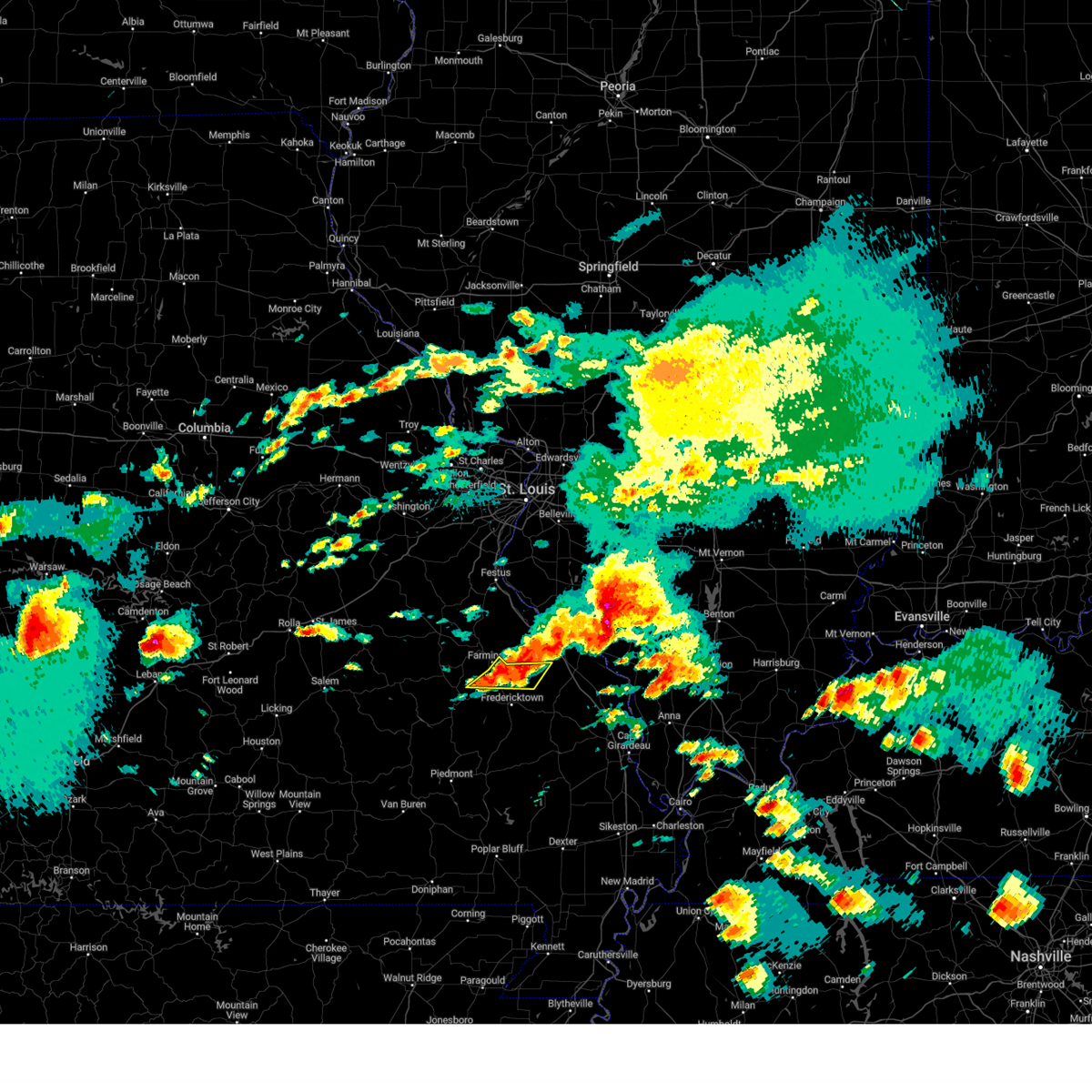 At 245 pm cdt, a severe thunderstorm was located over coffman, moving east at 35 mph (emergency management reported 1 inch hail in farmington, mo). Hazards include 60 mph wind gusts and quarter size hail. Hail damage to vehicles is expected. expect wind damage to roofs, siding, and trees. Locations impacted include, farmington, womac, knob lick, and libertyville. At 245 pm cdt, a severe thunderstorm was located over coffman, moving east at 35 mph (emergency management reported 1 inch hail in farmington, mo). Hazards include 60 mph wind gusts and quarter size hail. Hail damage to vehicles is expected. expect wind damage to roofs, siding, and trees. Locations impacted include, farmington, womac, knob lick, and libertyville.
|
| 5/8/2024 2:30 PM CDT |
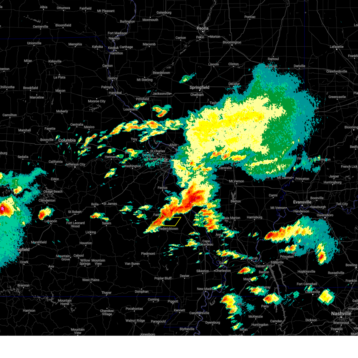 At 230 pm cdt, a severe thunderstorm was located near knob lick, moving east at 45 mph (emergency management reported quarter sized hail in farmington, mo). Hazards include 60 mph wind gusts and quarter size hail. Hail damage to vehicles is expected. expect wind damage to roofs, siding, and trees. Locations impacted include, farmington, iron mountain lake, womac, knob lick, libertyville, and doe run. At 230 pm cdt, a severe thunderstorm was located near knob lick, moving east at 45 mph (emergency management reported quarter sized hail in farmington, mo). Hazards include 60 mph wind gusts and quarter size hail. Hail damage to vehicles is expected. expect wind damage to roofs, siding, and trees. Locations impacted include, farmington, iron mountain lake, womac, knob lick, libertyville, and doe run.
|
| 5/8/2024 2:27 PM CDT |
 Svrlsx the national weather service in st louis has issued a * severe thunderstorm warning for, southeastern ste. genevieve county in southeastern missouri, southern st. francois county in southeastern missouri, * until 300 pm cdt. * at 227 pm cdt, a severe thunderstorm was located near knob lick, moving east at 45 mph (radar indicated). Hazards include 60 mph wind gusts and quarter size hail. Hail damage to vehicles is expected. Expect wind damage to roofs, siding, and trees. Svrlsx the national weather service in st louis has issued a * severe thunderstorm warning for, southeastern ste. genevieve county in southeastern missouri, southern st. francois county in southeastern missouri, * until 300 pm cdt. * at 227 pm cdt, a severe thunderstorm was located near knob lick, moving east at 45 mph (radar indicated). Hazards include 60 mph wind gusts and quarter size hail. Hail damage to vehicles is expected. Expect wind damage to roofs, siding, and trees.
|
| 5/8/2024 2:25 PM CDT | Quarter sized hail reported 1 miles WNW of Farmington, MO, quarter sized hail in farmington pictured next to quarter. |
| 5/8/2024 2:09 PM CDT |
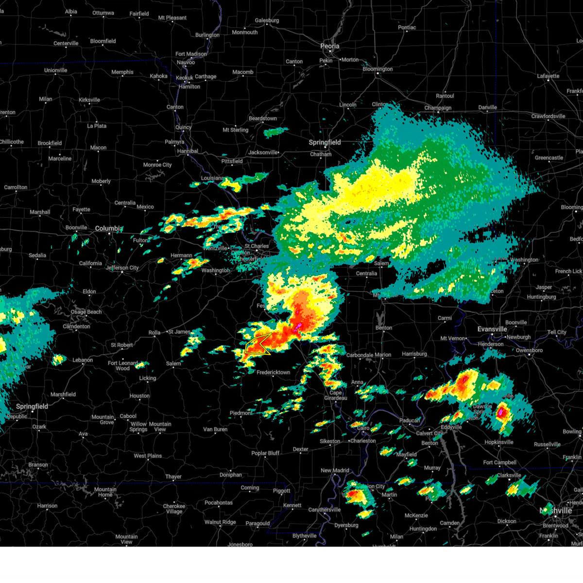 At 208 pm cdt, a severe thunderstorm was located over bismarck, moving northeast at 30 mph (radar indicated). Hazards include 60 mph wind gusts and half dollar size hail. Hail damage to vehicles is expected. expect wind damage to roofs, siding, and trees. locations impacted include, farmington, bonne terre, desloge, leadwood, park hills, leadington, and frankclay. this also includes st. Joe state park and missouri mines historic site. At 208 pm cdt, a severe thunderstorm was located over bismarck, moving northeast at 30 mph (radar indicated). Hazards include 60 mph wind gusts and half dollar size hail. Hail damage to vehicles is expected. expect wind damage to roofs, siding, and trees. locations impacted include, farmington, bonne terre, desloge, leadwood, park hills, leadington, and frankclay. this also includes st. Joe state park and missouri mines historic site.
|
| 5/8/2024 1:56 PM CDT |
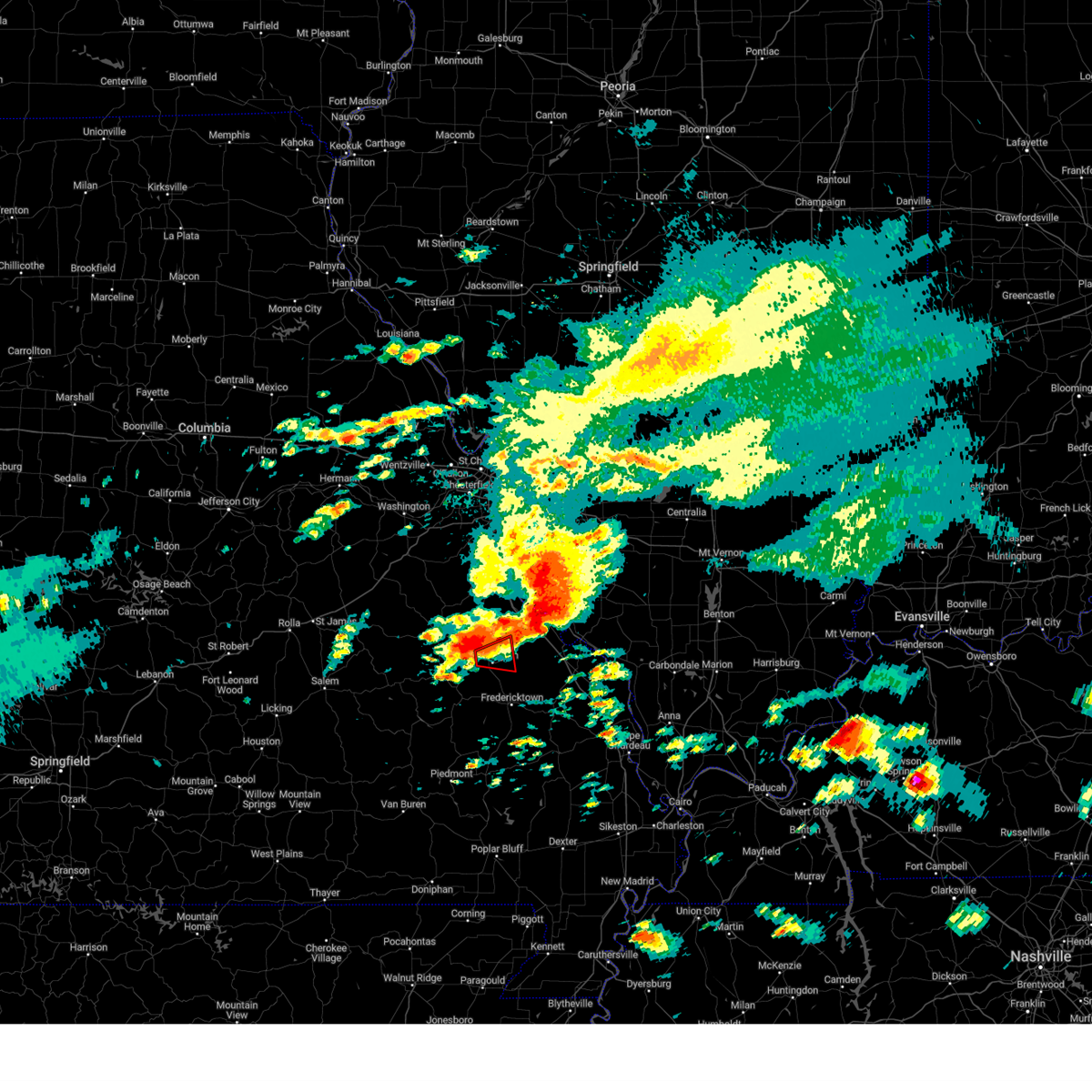 At 156 pm cdt, a severe thunderstorm capable of producing a tornado was located over park hills, moving east at 35 mph (radar indicated rotation). Hazards include tornado and ping pong ball size hail. Flying debris will be dangerous to those caught without shelter. mobile homes will be damaged or destroyed. damage to roofs, windows, and vehicles will occur. tree damage is likely. this dangerous storm will be near, farmington around 200 pm cdt. this also includes st. Joe state park and missouri mines historic site. At 156 pm cdt, a severe thunderstorm capable of producing a tornado was located over park hills, moving east at 35 mph (radar indicated rotation). Hazards include tornado and ping pong ball size hail. Flying debris will be dangerous to those caught without shelter. mobile homes will be damaged or destroyed. damage to roofs, windows, and vehicles will occur. tree damage is likely. this dangerous storm will be near, farmington around 200 pm cdt. this also includes st. Joe state park and missouri mines historic site.
|
| 5/8/2024 1:55 PM CDT |
 the severe thunderstorm warning has been cancelled and is no longer in effect the severe thunderstorm warning has been cancelled and is no longer in effect
|
| 5/8/2024 1:55 PM CDT |
 At 155 pm cdt, a severe thunderstorm was located over desloge, moving east at 30 mph (radar indicated). Hazards include ping pong ball size hail and 60 mph wind gusts. People and animals outdoors will be injured. expect hail damage to roofs, siding, windows, and vehicles. expect wind damage to roofs, siding, and trees. locations impacted include, farmington, bonne terre, desloge, leadwood, park hills, leadington, and frankclay. this also includes st. Joe state park and missouri mines historic site. At 155 pm cdt, a severe thunderstorm was located over desloge, moving east at 30 mph (radar indicated). Hazards include ping pong ball size hail and 60 mph wind gusts. People and animals outdoors will be injured. expect hail damage to roofs, siding, windows, and vehicles. expect wind damage to roofs, siding, and trees. locations impacted include, farmington, bonne terre, desloge, leadwood, park hills, leadington, and frankclay. this also includes st. Joe state park and missouri mines historic site.
|
| 5/8/2024 1:48 PM CDT |
 At 147 pm cdt, a severe thunderstorm was located over leadwood, moving east at 30 mph (radar indicated). Hazards include golf ball size hail and 60 mph wind gusts. People and animals outdoors will be injured. expect hail damage to roofs, siding, windows, and vehicles. expect wind damage to roofs, siding, and trees. locations impacted include, farmington, bonne terre, desloge, bismarck, leadwood, park hills, irondale, leadington, frankclay, and french village. this also includes st. joe state park, st. Francois state park, and missouri mines historic site. At 147 pm cdt, a severe thunderstorm was located over leadwood, moving east at 30 mph (radar indicated). Hazards include golf ball size hail and 60 mph wind gusts. People and animals outdoors will be injured. expect hail damage to roofs, siding, windows, and vehicles. expect wind damage to roofs, siding, and trees. locations impacted include, farmington, bonne terre, desloge, bismarck, leadwood, park hills, irondale, leadington, frankclay, and french village. this also includes st. joe state park, st. Francois state park, and missouri mines historic site.
|
| 5/8/2024 1:47 PM CDT |
 At 146 pm cdt, a severe thunderstorm capable of producing a tornado was located over park hills, moving east at 40 mph (radar indicated rotation). Hazards include tornado and golf ball size hail. Flying debris will be dangerous to those caught without shelter. mobile homes will be damaged or destroyed. damage to roofs, windows, and vehicles will occur. tree damage is likely. this dangerous storm will be near, farmington, desloge, and park hills around 150 pm cdt. this also includes st. Joe state park and missouri mines historic site. At 146 pm cdt, a severe thunderstorm capable of producing a tornado was located over park hills, moving east at 40 mph (radar indicated rotation). Hazards include tornado and golf ball size hail. Flying debris will be dangerous to those caught without shelter. mobile homes will be damaged or destroyed. damage to roofs, windows, and vehicles will occur. tree damage is likely. this dangerous storm will be near, farmington, desloge, and park hills around 150 pm cdt. this also includes st. Joe state park and missouri mines historic site.
|
| 5/8/2024 1:47 PM CDT |
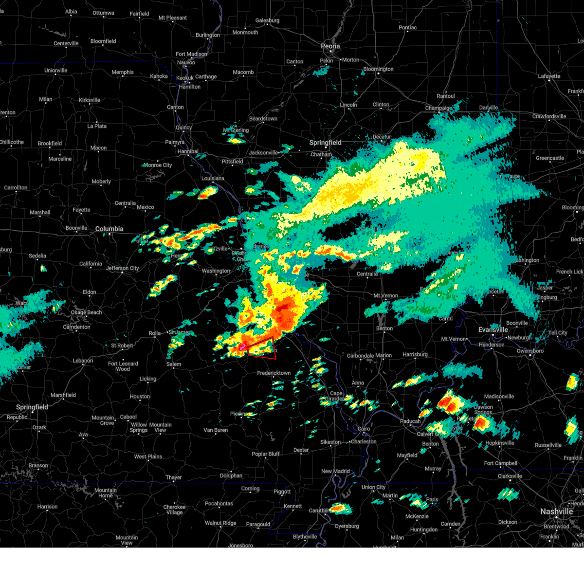 the tornado warning has been cancelled and is no longer in effect the tornado warning has been cancelled and is no longer in effect
|
| 5/8/2024 1:37 PM CDT |
 At 136 pm cdt, a severe thunderstorm was located over irondale, moving east at 30 mph (radar indicated). Hazards include ping pong ball size hail and 60 mph wind gusts. People and animals outdoors will be injured. expect hail damage to roofs, siding, windows, and vehicles. expect wind damage to roofs, siding, and trees. locations impacted include, farmington, bonne terre, desloge, bismarck, leadwood, park hills, irondale, leadington, caledonia, frankclay, doe run, and french village. this also includes st. joe state park, st. Francois state park, and missouri mines historic site. At 136 pm cdt, a severe thunderstorm was located over irondale, moving east at 30 mph (radar indicated). Hazards include ping pong ball size hail and 60 mph wind gusts. People and animals outdoors will be injured. expect hail damage to roofs, siding, windows, and vehicles. expect wind damage to roofs, siding, and trees. locations impacted include, farmington, bonne terre, desloge, bismarck, leadwood, park hills, irondale, leadington, caledonia, frankclay, doe run, and french village. this also includes st. joe state park, st. Francois state park, and missouri mines historic site.
|
| 5/8/2024 1:36 PM CDT |
 Torlsx the national weather service in st louis has issued a * tornado warning for, southwestern ste. genevieve county in southeastern missouri, southeastern washington county in east central missouri, western st. francois county in southeastern missouri, * until 215 pm cdt. * at 135 pm cdt, a severe thunderstorm capable of producing a tornado was located near irondale, moving east at 40 mph (radar indicated rotation). Hazards include tornado and ping pong ball size hail. Flying debris will be dangerous to those caught without shelter. mobile homes will be damaged or destroyed. damage to roofs, windows, and vehicles will occur. tree damage is likely. this dangerous storm will be near, bismarck, leadwood, park hills, and irondale around 140 pm cdt. desloge around 145 pm cdt. farmington around 150 pm cdt. this also includes st. Joe state park and missouri mines historic site. Torlsx the national weather service in st louis has issued a * tornado warning for, southwestern ste. genevieve county in southeastern missouri, southeastern washington county in east central missouri, western st. francois county in southeastern missouri, * until 215 pm cdt. * at 135 pm cdt, a severe thunderstorm capable of producing a tornado was located near irondale, moving east at 40 mph (radar indicated rotation). Hazards include tornado and ping pong ball size hail. Flying debris will be dangerous to those caught without shelter. mobile homes will be damaged or destroyed. damage to roofs, windows, and vehicles will occur. tree damage is likely. this dangerous storm will be near, bismarck, leadwood, park hills, and irondale around 140 pm cdt. desloge around 145 pm cdt. farmington around 150 pm cdt. this also includes st. Joe state park and missouri mines historic site.
|
| 5/8/2024 1:29 PM CDT |
 Svrlsx the national weather service in st louis has issued a * severe thunderstorm warning for, southeastern washington county in east central missouri, st. francois county in southeastern missouri, * until 230 pm cdt. * at 129 pm cdt, a severe thunderstorm was located 7 miles north of belleview, moving east at 30 mph (radar indicated). Hazards include two inch hail and 60 mph wind gusts. People and animals outdoors will be injured. expect hail damage to roofs, siding, windows, and vehicles. Expect wind damage to roofs, siding, and trees. Svrlsx the national weather service in st louis has issued a * severe thunderstorm warning for, southeastern washington county in east central missouri, st. francois county in southeastern missouri, * until 230 pm cdt. * at 129 pm cdt, a severe thunderstorm was located 7 miles north of belleview, moving east at 30 mph (radar indicated). Hazards include two inch hail and 60 mph wind gusts. People and animals outdoors will be injured. expect hail damage to roofs, siding, windows, and vehicles. Expect wind damage to roofs, siding, and trees.
|
| 5/7/2024 4:13 AM CDT |
 Svrlsx the national weather service in st louis has issued a * severe thunderstorm warning for, ste. genevieve county in southeastern missouri, st. francois county in southeastern missouri, * until 500 am cdt. * at 413 am cdt, severe thunderstorms were located along a line extending from 7 miles west of de soto to near belleview, moving east at 40 mph (radar indicated). Hazards include 60 mph wind gusts. expect damage to roofs, siding, and trees Svrlsx the national weather service in st louis has issued a * severe thunderstorm warning for, ste. genevieve county in southeastern missouri, st. francois county in southeastern missouri, * until 500 am cdt. * at 413 am cdt, severe thunderstorms were located along a line extending from 7 miles west of de soto to near belleview, moving east at 40 mph (radar indicated). Hazards include 60 mph wind gusts. expect damage to roofs, siding, and trees
|
| 4/18/2024 6:52 PM CDT |
 the severe thunderstorm warning has been cancelled and is no longer in effect the severe thunderstorm warning has been cancelled and is no longer in effect
|
| 4/18/2024 6:52 PM CDT |
 At 651 pm cdt, severe thunderstorms were located along a line extending from near okawville to baldwin to near rocky ridge, moving east at 70 mph. a severe thunderstorm was also located north of lesterville (radar indicated). Hazards include 70 mph wind gusts and quarter size hail. Hail damage to vehicles is expected. expect considerable tree damage. wind damage is also likely to mobile homes, roofs, and outbuildings. locations impacted include, farmington, chester, bonne terre, desloge, ste. genevieve, sparta, fredericktown, red bud, nashville, bismarck, ironton, leadwood, bremen, park hills, reynolds, steeleville, new athens, marissa, ellington, and coulterville. this also includes st. joe state park, st. francois state park, johnsons shut-ins state park, hawn state park, fort davidson historic site, felix valle house state park, elephant rocks state park, taum sauk mountain state park, missouri mines historic site, and clearwater lake recreational area. this includes the following highways, interstate 64 in illinois between exits 50 and 61. Interstate 55 in missouri between exits 141 and 162. At 651 pm cdt, severe thunderstorms were located along a line extending from near okawville to baldwin to near rocky ridge, moving east at 70 mph. a severe thunderstorm was also located north of lesterville (radar indicated). Hazards include 70 mph wind gusts and quarter size hail. Hail damage to vehicles is expected. expect considerable tree damage. wind damage is also likely to mobile homes, roofs, and outbuildings. locations impacted include, farmington, chester, bonne terre, desloge, ste. genevieve, sparta, fredericktown, red bud, nashville, bismarck, ironton, leadwood, bremen, park hills, reynolds, steeleville, new athens, marissa, ellington, and coulterville. this also includes st. joe state park, st. francois state park, johnsons shut-ins state park, hawn state park, fort davidson historic site, felix valle house state park, elephant rocks state park, taum sauk mountain state park, missouri mines historic site, and clearwater lake recreational area. this includes the following highways, interstate 64 in illinois between exits 50 and 61. Interstate 55 in missouri between exits 141 and 162.
|
| 4/18/2024 6:13 PM CDT |
 Svrlsx the national weather service in st louis has issued a * severe thunderstorm warning for, monroe county in southwestern illinois, washington county in south central illinois, randolph county in southwestern illinois, southeastern st. clair county in southwestern illinois, iron county in southeastern missouri, southeastern jefferson county in east central missouri, ste. genevieve county in southeastern missouri, reynolds county in southeastern missouri, madison county in southeastern missouri, southern washington county in east central missouri, st. francois county in southeastern missouri, * until 730 pm cdt. * at 613 pm cdt, severe thunderstorms were located along a line extending from waterloo to 6 miles northwest of bonne terre to 7 miles north of bunker, moving southeast at 35 mph (radar indicated). Hazards include 60 mph wind gusts and quarter size hail. Hail damage to vehicles is expected. Expect wind damage to roofs, siding, and trees. Svrlsx the national weather service in st louis has issued a * severe thunderstorm warning for, monroe county in southwestern illinois, washington county in south central illinois, randolph county in southwestern illinois, southeastern st. clair county in southwestern illinois, iron county in southeastern missouri, southeastern jefferson county in east central missouri, ste. genevieve county in southeastern missouri, reynolds county in southeastern missouri, madison county in southeastern missouri, southern washington county in east central missouri, st. francois county in southeastern missouri, * until 730 pm cdt. * at 613 pm cdt, severe thunderstorms were located along a line extending from waterloo to 6 miles northwest of bonne terre to 7 miles north of bunker, moving southeast at 35 mph (radar indicated). Hazards include 60 mph wind gusts and quarter size hail. Hail damage to vehicles is expected. Expect wind damage to roofs, siding, and trees.
|
| 4/2/2024 1:55 AM CDT |
 Svrlsx the national weather service in st louis has issued a * severe thunderstorm warning for, central randolph county in southwestern illinois, ste. genevieve county in southeastern missouri, southeastern st. francois county in southeastern missouri, * until 245 am cdt. * at 155 am cdt, severe thunderstorms were located along a line extending from near rocky ridge to near roselle, moving east at 50 mph (radar indicated). Hazards include 60 mph wind gusts and penny size hail. expect damage to roofs, siding, and trees Svrlsx the national weather service in st louis has issued a * severe thunderstorm warning for, central randolph county in southwestern illinois, ste. genevieve county in southeastern missouri, southeastern st. francois county in southeastern missouri, * until 245 am cdt. * at 155 am cdt, severe thunderstorms were located along a line extending from near rocky ridge to near roselle, moving east at 50 mph (radar indicated). Hazards include 60 mph wind gusts and penny size hail. expect damage to roofs, siding, and trees
|
| 4/2/2024 1:40 AM CDT |
 At 139 am cdt, a severe thunderstorm was located 7 miles west of bloomsdale, moving east at 55 mph (radar indicated). Hazards include 60 mph wind gusts. Expect damage to roofs, siding, and trees. locations impacted include, belleville, arnold, farmington, festus, waterloo, columbia, bonne terre, de soto, pevely, desloge, crystal city, ste. genevieve, millstadt, red bud, herculaneum, hillsboro, byrnes mill, bismarck, leadwood, and antonia. this also includes st. joe state park, st. francois state park, hawn state park, felix valle house state park, mastodon historic site, sandy creek covered bridge historic site, missouri mines historic site, and gov. dunklin's grave historic site. This includes interstate 55 in missouri between exits 141 and 191. At 139 am cdt, a severe thunderstorm was located 7 miles west of bloomsdale, moving east at 55 mph (radar indicated). Hazards include 60 mph wind gusts. Expect damage to roofs, siding, and trees. locations impacted include, belleville, arnold, farmington, festus, waterloo, columbia, bonne terre, de soto, pevely, desloge, crystal city, ste. genevieve, millstadt, red bud, herculaneum, hillsboro, byrnes mill, bismarck, leadwood, and antonia. this also includes st. joe state park, st. francois state park, hawn state park, felix valle house state park, mastodon historic site, sandy creek covered bridge historic site, missouri mines historic site, and gov. dunklin's grave historic site. This includes interstate 55 in missouri between exits 141 and 191.
|
| 4/2/2024 1:40 AM CDT |
 the severe thunderstorm warning has been cancelled and is no longer in effect the severe thunderstorm warning has been cancelled and is no longer in effect
|
| 4/2/2024 1:18 AM CDT |
 Svrlsx the national weather service in st louis has issued a * severe thunderstorm warning for, monroe county in southwestern illinois, western randolph county in southwestern illinois, southwestern st. clair county in southwestern illinois, northwestern iron county in southeastern missouri, jefferson county in east central missouri, ste. genevieve county in southeastern missouri, washington county in east central missouri, southeastern franklin county in east central missouri, st. francois county in southeastern missouri, * until 200 am cdt. * at 117 am cdt, a severe thunderstorm was located near de soto, moving east at 55 mph (radar indicated). Hazards include 60 mph wind gusts. expect damage to roofs, siding, and trees Svrlsx the national weather service in st louis has issued a * severe thunderstorm warning for, monroe county in southwestern illinois, western randolph county in southwestern illinois, southwestern st. clair county in southwestern illinois, northwestern iron county in southeastern missouri, jefferson county in east central missouri, ste. genevieve county in southeastern missouri, washington county in east central missouri, southeastern franklin county in east central missouri, st. francois county in southeastern missouri, * until 200 am cdt. * at 117 am cdt, a severe thunderstorm was located near de soto, moving east at 55 mph (radar indicated). Hazards include 60 mph wind gusts. expect damage to roofs, siding, and trees
|
| 3/14/2024 7:07 PM CDT |
 The storms which prompted the warning have weakened below severe limits, and no longer pose an immediate threat to life or property. therefore, the warning will be allowed to expire. a tornado watch remains in effect until 900 pm cdt for southwestern illinois, and southeastern and east central missouri. The storms which prompted the warning have weakened below severe limits, and no longer pose an immediate threat to life or property. therefore, the warning will be allowed to expire. a tornado watch remains in effect until 900 pm cdt for southwestern illinois, and southeastern and east central missouri.
|
| 3/14/2024 6:44 PM CDT |
 At 644 pm cdt, severe thunderstorms were located along a line extending from near de soto to 6 miles northeast of desloge to near womac to near cobalt to lodi, moving east at 50 mph (law enforcement reported power lines down in iron county). Hazards include 60 mph wind gusts. Expect damage to roofs, siding, and trees. locations impacted include, farmington, festus, bonne terre, de soto, pevely, desloge, crystal city, ste. genevieve, fredericktown, herculaneum, hillsboro, barnhart, park hills, olympian village, bloomsdale, st. mary, junction city, cobalt, marquand, and knob lick. this also includes st. joe state park, st. francois state park, hawn state park, felix valle house state park, sandy creek covered bridge historic site, missouri mines historic site, and gov. dunklin's grave historic site. This includes interstate 55 in missouri between exits 141 and 185. At 644 pm cdt, severe thunderstorms were located along a line extending from near de soto to 6 miles northeast of desloge to near womac to near cobalt to lodi, moving east at 50 mph (law enforcement reported power lines down in iron county). Hazards include 60 mph wind gusts. Expect damage to roofs, siding, and trees. locations impacted include, farmington, festus, bonne terre, de soto, pevely, desloge, crystal city, ste. genevieve, fredericktown, herculaneum, hillsboro, barnhart, park hills, olympian village, bloomsdale, st. mary, junction city, cobalt, marquand, and knob lick. this also includes st. joe state park, st. francois state park, hawn state park, felix valle house state park, sandy creek covered bridge historic site, missouri mines historic site, and gov. dunklin's grave historic site. This includes interstate 55 in missouri between exits 141 and 185.
|
| 3/14/2024 6:40 PM CDT | Delayed report... time estimated from radar. business sign blown across the roa in st. francois county MO, 0.6 miles SW of Farmington, MO |
| 3/14/2024 6:37 PM CDT |
 At 637 pm cdt, severe thunderstorms were located along a line extending from near richwoods to desloge to knob lick to near cobalt to sam a. baker state park, moving northeast at 65 mph (law enforcement). Hazards include 60 mph wind gusts. Expect damage to roofs, siding, and trees. locations impacted include, farmington, festus, bonne terre, de soto, pevely, desloge, crystal city, ste. genevieve, fredericktown, herculaneum, hillsboro, bismarck, leadwood, barnhart, park hills, olympian village, iron mountain lake, bloomsdale, st. mary, and junction city. this also includes st. joe state park, st. francois state park, hawn state park, felix valle house state park, sandy creek covered bridge historic site, missouri mines historic site, and gov. dunklin's grave historic site. This includes interstate 55 in missouri between exits 141 and 185. At 637 pm cdt, severe thunderstorms were located along a line extending from near richwoods to desloge to knob lick to near cobalt to sam a. baker state park, moving northeast at 65 mph (law enforcement). Hazards include 60 mph wind gusts. Expect damage to roofs, siding, and trees. locations impacted include, farmington, festus, bonne terre, de soto, pevely, desloge, crystal city, ste. genevieve, fredericktown, herculaneum, hillsboro, bismarck, leadwood, barnhart, park hills, olympian village, iron mountain lake, bloomsdale, st. mary, and junction city. this also includes st. joe state park, st. francois state park, hawn state park, felix valle house state park, sandy creek covered bridge historic site, missouri mines historic site, and gov. dunklin's grave historic site. This includes interstate 55 in missouri between exits 141 and 185.
|
| 3/14/2024 6:18 PM CDT |
 Svrlsx the national weather service in st louis has issued a * severe thunderstorm warning for, southern jefferson county in east central missouri, ste. genevieve county in southeastern missouri, madison county in southeastern missouri, st. francois county in southeastern missouri, * until 715 pm cdt. * at 617 pm cdt, severe thunderstorms were located along a line extending from near anthonies mill to 9 miles northwest of belleview to near ironton to annapolis to near garwood, moving east at 50 mph (law enforcement reported a tree down across the highway in centerville). Hazards include 60 mph wind gusts. expect damage to roofs, siding, and trees Svrlsx the national weather service in st louis has issued a * severe thunderstorm warning for, southern jefferson county in east central missouri, ste. genevieve county in southeastern missouri, madison county in southeastern missouri, st. francois county in southeastern missouri, * until 715 pm cdt. * at 617 pm cdt, severe thunderstorms were located along a line extending from near anthonies mill to 9 miles northwest of belleview to near ironton to annapolis to near garwood, moving east at 50 mph (law enforcement reported a tree down across the highway in centerville). Hazards include 60 mph wind gusts. expect damage to roofs, siding, and trees
|
| 9/4/2023 5:56 PM CDT |
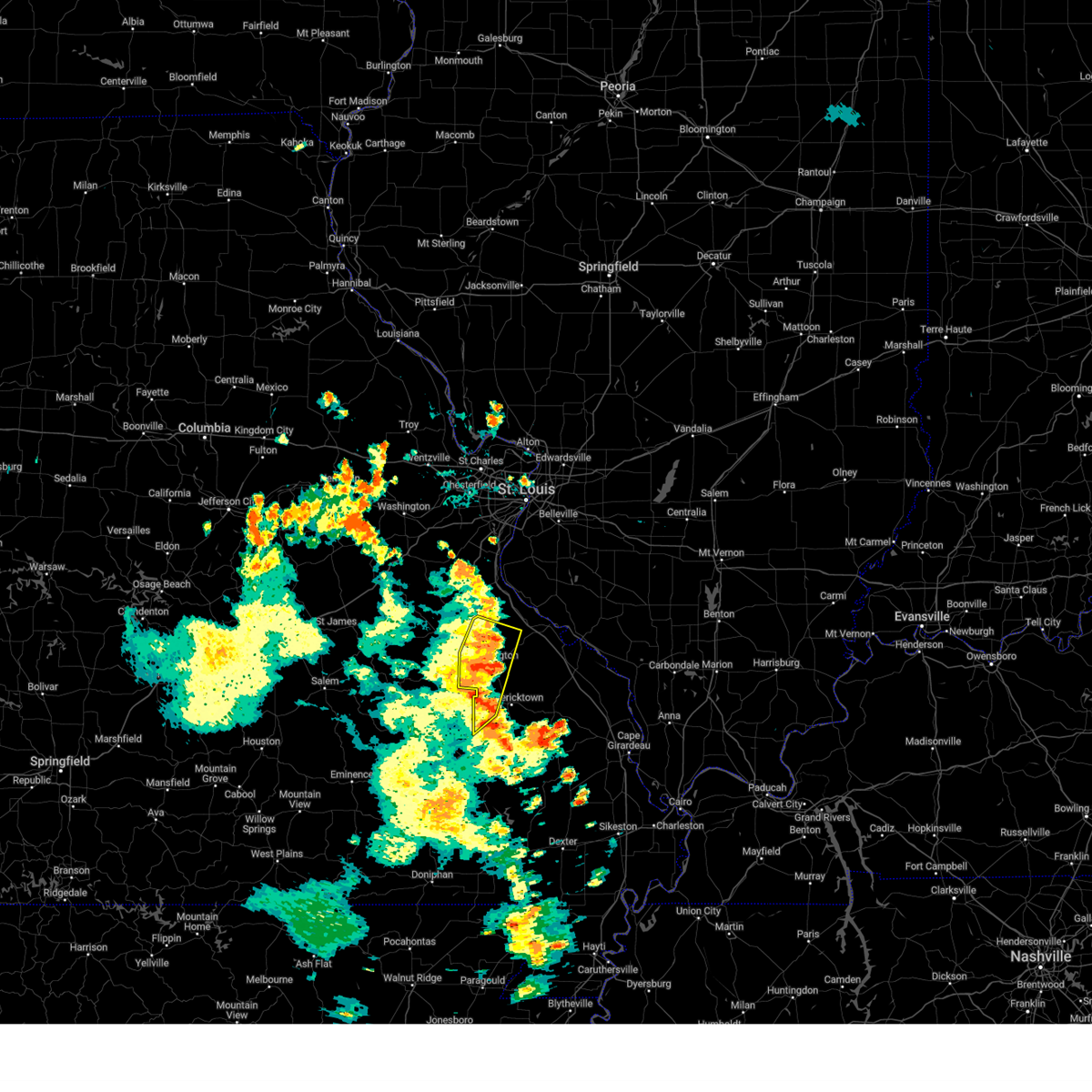 At 555 pm cdt, severe thunderstorms were located along a line extending from near desloge to 6 miles southwest of farmington to near arcadia, moving east at 40 mph (radar indicated). Hazards include 60 mph wind gusts. Expect damage to roofs, siding, and trees. these severe storms will be near, farmington, park hills, knob lick, and roselle around 600 pm cdt. other locations in the path of these severe thunderstorms include rocky ridge. this also includes st. joe state park, st. francois state park, and missouri mines historic site. hail threat, radar indicated max hail size, <. 75 in wind threat, radar indicated max wind gust, 60 mph. At 555 pm cdt, severe thunderstorms were located along a line extending from near desloge to 6 miles southwest of farmington to near arcadia, moving east at 40 mph (radar indicated). Hazards include 60 mph wind gusts. Expect damage to roofs, siding, and trees. these severe storms will be near, farmington, park hills, knob lick, and roselle around 600 pm cdt. other locations in the path of these severe thunderstorms include rocky ridge. this also includes st. joe state park, st. francois state park, and missouri mines historic site. hail threat, radar indicated max hail size, <. 75 in wind threat, radar indicated max wind gust, 60 mph.
|
| 9/4/2023 5:45 PM CDT | Estimated 60 mph winds from multiple sources in the farmington area. time estimated. only minor tree limb damage note in st. francois county MO, 0.3 miles NNE of Farmington, MO |
| 9/4/2023 5:42 PM CDT |
 At 542 pm cdt, severe thunderstorms were located along a line extending from near park hills to roselle to near annapolis, moving north at 40 mph (radar indicated). Hazards include 60 mph wind gusts. Expect damage to roofs, siding, and trees. severe thunderstorms will be near, farmington, bonne terre, desloge, ironton, leadwood, park hills, arcadia, and roselle around 545 pm cdt. this also includes st. joe state park, st. francois state park, fort davidson historic site, elephant rocks state park, and missouri mines historic site. hail threat, radar indicated max hail size, <. 75 in wind threat, radar indicated max wind gust, 60 mph. At 542 pm cdt, severe thunderstorms were located along a line extending from near park hills to roselle to near annapolis, moving north at 40 mph (radar indicated). Hazards include 60 mph wind gusts. Expect damage to roofs, siding, and trees. severe thunderstorms will be near, farmington, bonne terre, desloge, ironton, leadwood, park hills, arcadia, and roselle around 545 pm cdt. this also includes st. joe state park, st. francois state park, fort davidson historic site, elephant rocks state park, and missouri mines historic site. hail threat, radar indicated max hail size, <. 75 in wind threat, radar indicated max wind gust, 60 mph.
|
| 8/2/2023 11:00 PM CDT |
 At 1059 pm cdt, severe thunderstorms were located along a line extending from 6 miles west of rocky ridge to 6 miles west of coffman to near knob lick to iron mountain to 6 miles northeast of oates to near bixby, moving southeast at 45 mph (radar indicated). Hazards include 70 mph wind gusts and penny size hail. Expect considerable tree damage. damage is likely to mobile homes, roofs, and outbuildings. locations impacted include, farmington, bonne terre, desloge, fredericktown, bismarck, ironton, leadwood, park hills, pilot knob, iron mountain lake, viburnum, arcadia, bunker, junction city, cobalt, knob lick, iron mountain, weingarten, glover, and bixby. this also includes st. joe state park, st. francois state park, johnsons shut-ins state park, hawn state park, fort davidson historic site, elephant rocks state park, taum sauk mountain state park, and missouri mines historic site. thunderstorm damage threat, considerable hail threat, radar indicated max hail size, 0. 75 in wind threat, observed max wind gust, 70 mph. At 1059 pm cdt, severe thunderstorms were located along a line extending from 6 miles west of rocky ridge to 6 miles west of coffman to near knob lick to iron mountain to 6 miles northeast of oates to near bixby, moving southeast at 45 mph (radar indicated). Hazards include 70 mph wind gusts and penny size hail. Expect considerable tree damage. damage is likely to mobile homes, roofs, and outbuildings. locations impacted include, farmington, bonne terre, desloge, fredericktown, bismarck, ironton, leadwood, park hills, pilot knob, iron mountain lake, viburnum, arcadia, bunker, junction city, cobalt, knob lick, iron mountain, weingarten, glover, and bixby. this also includes st. joe state park, st. francois state park, johnsons shut-ins state park, hawn state park, fort davidson historic site, elephant rocks state park, taum sauk mountain state park, and missouri mines historic site. thunderstorm damage threat, considerable hail threat, radar indicated max hail size, 0. 75 in wind threat, observed max wind gust, 70 mph.
|
| 8/2/2023 10:55 PM CDT | Corrects previous tstm wnd dmg report from 1 e farmington. county dispatch and em relayed reports of numerous trees and power lines down... and a stop light pole was be in st. francois county MO, 0.5 miles NW of Farmington, MO |
| 8/2/2023 10:48 PM CDT |
 At 1047 pm cdt, severe thunderstorms were located along a line extending from near bonne terre to near desloge to near park hills to 7 miles northwest of belleview to viburnum, moving southeast at 45 mph (trained weather spotters. at 1048 pm a 69 mph wind gust was reported in desloge). Hazards include 70 mph wind gusts and penny size hail. Expect considerable tree damage. damage is likely to mobile homes, roofs, and outbuildings. locations impacted include, farmington, bonne terre, desloge, fredericktown, bismarck, ironton, leadwood, park hills, pilot knob, iron mountain lake, viburnum, arcadia, bunker, junction city, cobalt, knob lick, iron mountain, weingarten, glover, and bixby. this also includes st. joe state park, st. francois state park, johnsons shut-ins state park, hawn state park, fort davidson historic site, elephant rocks state park, taum sauk mountain state park, and missouri mines historic site. thunderstorm damage threat, considerable hail threat, radar indicated max hail size, 0. 75 in wind threat, observed max wind gust, 70 mph. At 1047 pm cdt, severe thunderstorms were located along a line extending from near bonne terre to near desloge to near park hills to 7 miles northwest of belleview to viburnum, moving southeast at 45 mph (trained weather spotters. at 1048 pm a 69 mph wind gust was reported in desloge). Hazards include 70 mph wind gusts and penny size hail. Expect considerable tree damage. damage is likely to mobile homes, roofs, and outbuildings. locations impacted include, farmington, bonne terre, desloge, fredericktown, bismarck, ironton, leadwood, park hills, pilot knob, iron mountain lake, viburnum, arcadia, bunker, junction city, cobalt, knob lick, iron mountain, weingarten, glover, and bixby. this also includes st. joe state park, st. francois state park, johnsons shut-ins state park, hawn state park, fort davidson historic site, elephant rocks state park, taum sauk mountain state park, and missouri mines historic site. thunderstorm damage threat, considerable hail threat, radar indicated max hail size, 0. 75 in wind threat, observed max wind gust, 70 mph.
|
| 8/2/2023 10:39 PM CDT |
 At 1038 pm cdt, severe thunderstorms were located along a line extending from 6 miles north of bonne terre to near irondale to 10 miles east of courtois to near viburnum to 9 miles northeast of salem, moving southeast at 45 mph (radar indicated). Hazards include 70 mph wind gusts and penny size hail. Expect considerable tree damage. damage is likely to mobile homes, roofs, and outbuildings. locations impacted include, farmington, bonne terre, desloge, fredericktown, bismarck, ironton, leadwood, park hills, pilot knob, iron mountain lake, viburnum, arcadia, bunker, junction city, cobalt, knob lick, iron mountain, weingarten, glover, and bixby. this also includes st. joe state park, st. francois state park, johnsons shut-ins state park, hawn state park, fort davidson historic site, elephant rocks state park, taum sauk mountain state park, and missouri mines historic site. thunderstorm damage threat, considerable hail threat, radar indicated max hail size, 0. 75 in wind threat, observed max wind gust, 70 mph. At 1038 pm cdt, severe thunderstorms were located along a line extending from 6 miles north of bonne terre to near irondale to 10 miles east of courtois to near viburnum to 9 miles northeast of salem, moving southeast at 45 mph (radar indicated). Hazards include 70 mph wind gusts and penny size hail. Expect considerable tree damage. damage is likely to mobile homes, roofs, and outbuildings. locations impacted include, farmington, bonne terre, desloge, fredericktown, bismarck, ironton, leadwood, park hills, pilot knob, iron mountain lake, viburnum, arcadia, bunker, junction city, cobalt, knob lick, iron mountain, weingarten, glover, and bixby. this also includes st. joe state park, st. francois state park, johnsons shut-ins state park, hawn state park, fort davidson historic site, elephant rocks state park, taum sauk mountain state park, and missouri mines historic site. thunderstorm damage threat, considerable hail threat, radar indicated max hail size, 0. 75 in wind threat, observed max wind gust, 70 mph.
|
| 8/2/2023 10:29 PM CDT |
 At 1029 pm cdt, severe thunderstorms were located along a line extending from 6 miles southwest of de soto to near potosi to 9 miles northeast of courtois to near cherryville to 9 miles north of salem, moving southeast at 45 mph (radar indicated). Hazards include 60 mph wind gusts and penny size hail. expect damage to roofs, siding, and trees At 1029 pm cdt, severe thunderstorms were located along a line extending from 6 miles southwest of de soto to near potosi to 9 miles northeast of courtois to near cherryville to 9 miles north of salem, moving southeast at 45 mph (radar indicated). Hazards include 60 mph wind gusts and penny size hail. expect damage to roofs, siding, and trees
|
| 7/20/2023 7:28 AM CDT |
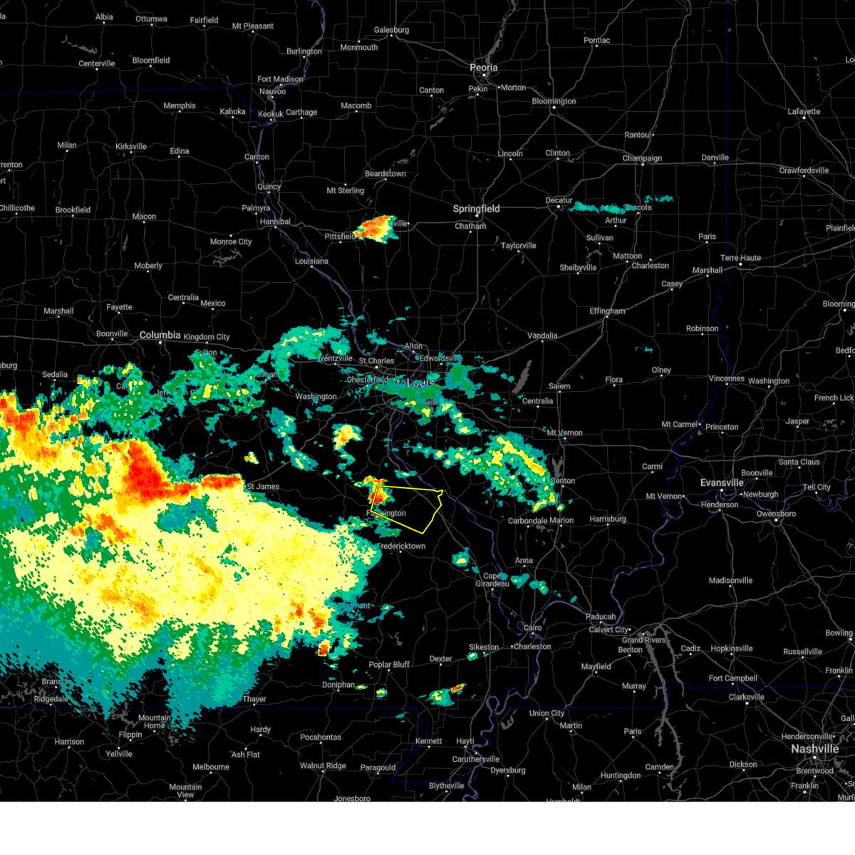 At 728 am cdt, a severe thunderstorm was located near desloge, moving east at 35 mph (radar indicated). Hazards include 60 mph wind gusts and quarter size hail. Hail damage to vehicles is expected. Expect wind damage to roofs, siding, and trees. At 728 am cdt, a severe thunderstorm was located near desloge, moving east at 35 mph (radar indicated). Hazards include 60 mph wind gusts and quarter size hail. Hail damage to vehicles is expected. Expect wind damage to roofs, siding, and trees.
|
| 7/12/2023 9:29 PM CDT |
 At 928 pm cdt, severe thunderstorms were located along a line extending from desloge to bismarck to belleview, moving southeast at 35 mph (law enforcement reported estimated 60 mph and trees down through desloge). Hazards include 60 mph wind gusts and nickel size hail. Expect damage to roofs, siding, and trees. locations impacted include, farmington, fredericktown, ironton, park hills, pilot knob, iron mountain lake, arcadia, knob lick, roselle, catherine place, granite, mine la motte, libertyville, and doe run. this also includes fort davidson historic site and elephant rocks state park. hail threat, radar indicated max hail size, 0. 88 in wind threat, observed max wind gust, 60 mph. At 928 pm cdt, severe thunderstorms were located along a line extending from desloge to bismarck to belleview, moving southeast at 35 mph (law enforcement reported estimated 60 mph and trees down through desloge). Hazards include 60 mph wind gusts and nickel size hail. Expect damage to roofs, siding, and trees. locations impacted include, farmington, fredericktown, ironton, park hills, pilot knob, iron mountain lake, arcadia, knob lick, roselle, catherine place, granite, mine la motte, libertyville, and doe run. this also includes fort davidson historic site and elephant rocks state park. hail threat, radar indicated max hail size, 0. 88 in wind threat, observed max wind gust, 60 mph.
|
| 7/12/2023 9:25 PM CDT |
 At 924 pm cdt, severe thunderstorms were located along a line extending from desloge to bismarck to belleview, moving southeast at 35 mph (radar indicated). Hazards include 60 mph wind gusts and nickel size hail. expect damage to roofs, siding, and trees At 924 pm cdt, severe thunderstorms were located along a line extending from desloge to bismarck to belleview, moving southeast at 35 mph (radar indicated). Hazards include 60 mph wind gusts and nickel size hail. expect damage to roofs, siding, and trees
|
| 7/1/2023 3:58 PM CDT | Trees down in many locations across st. francis county... including bonne terre... knob lick... and the goose creek lake areas. time for knob lick estimated from rada in st. francois county MO, 7.8 miles NNW of Farmington, MO |
| 7/1/2023 3:54 PM CDT |
 At 354 pm cdt, severe thunderstorms were located along a line extending from near farmington to near cobalt, moving northeast at 50 mph (radar indicated). Hazards include 60 mph wind gusts. Expect damage to roofs, siding, and trees. severe thunderstorms will be near, fredericktown, junction city, cobalt, and womac around 400 pm cdt. rocky ridge, coffman, and weingarten around 405 pm cdt. bloomsdale around 410 pm cdt. other locations in the path of these severe thunderstorms include ste. genevieve, st. mary, chester and evansville. this includes interstate 55 in missouri between exits 141 and 157. this also includes hawn state park and felix valle house state park. hail threat, radar indicated max hail size, <. 75 in wind threat, radar indicated max wind gust, 60 mph. At 354 pm cdt, severe thunderstorms were located along a line extending from near farmington to near cobalt, moving northeast at 50 mph (radar indicated). Hazards include 60 mph wind gusts. Expect damage to roofs, siding, and trees. severe thunderstorms will be near, fredericktown, junction city, cobalt, and womac around 400 pm cdt. rocky ridge, coffman, and weingarten around 405 pm cdt. bloomsdale around 410 pm cdt. other locations in the path of these severe thunderstorms include ste. genevieve, st. mary, chester and evansville. this includes interstate 55 in missouri between exits 141 and 157. this also includes hawn state park and felix valle house state park. hail threat, radar indicated max hail size, <. 75 in wind threat, radar indicated max wind gust, 60 mph.
|
| 4/15/2023 6:41 PM CDT |
 At 640 pm cdt, severe thunderstorms were located along a line extending from 7 miles west of rocky ridge to farmington, moving east at 45 mph (trained weather spotters reported downed powerlines southwest of leadwood). Hazards include 60 mph wind gusts. Expect damage to roofs, siding, and trees. locations impacted include, farmington, ste. genevieve, park hills, bloomsdale, st. mary, womac, knob lick, rocky ridge, weingarten, coffman, leadington, minnith, libertyville, doe run, river aux vases, and french village. this also includes hawn state park and felix valle house state park. this includes interstate 55 in missouri between exits 141 and 170. hail threat, radar indicated max hail size, <. 75 in wind threat, observed max wind gust, 60 mph. At 640 pm cdt, severe thunderstorms were located along a line extending from 7 miles west of rocky ridge to farmington, moving east at 45 mph (trained weather spotters reported downed powerlines southwest of leadwood). Hazards include 60 mph wind gusts. Expect damage to roofs, siding, and trees. locations impacted include, farmington, ste. genevieve, park hills, bloomsdale, st. mary, womac, knob lick, rocky ridge, weingarten, coffman, leadington, minnith, libertyville, doe run, river aux vases, and french village. this also includes hawn state park and felix valle house state park. this includes interstate 55 in missouri between exits 141 and 170. hail threat, radar indicated max hail size, <. 75 in wind threat, observed max wind gust, 60 mph.
|
| 4/15/2023 6:23 PM CDT |
 At 622 pm cdt, severe thunderstorms were located along a line extending from near bonne terre to near bismarck, moving east at 50 mph (radar indicated). Hazards include 60 mph wind gusts. expect damage to roofs, siding, and trees At 622 pm cdt, severe thunderstorms were located along a line extending from near bonne terre to near bismarck, moving east at 50 mph (radar indicated). Hazards include 60 mph wind gusts. expect damage to roofs, siding, and trees
|
| 2/22/2023 2:08 PM CST |
 At 208 pm cst, severe thunderstorms were located along a line extending from 7 miles southeast of crystal city to bloomsdale to near junction city, moving northeast at 50 mph (radar indicated). Hazards include 60 mph wind gusts. Expect damage to roofs, siding, and trees. locations impacted include, ste. genevieve, red bud and evansville. this also includes hawn state park and felix valle house state park. This includes interstate 55 in missouri between exits 141 and 162. At 208 pm cst, severe thunderstorms were located along a line extending from 7 miles southeast of crystal city to bloomsdale to near junction city, moving northeast at 50 mph (radar indicated). Hazards include 60 mph wind gusts. Expect damage to roofs, siding, and trees. locations impacted include, ste. genevieve, red bud and evansville. this also includes hawn state park and felix valle house state park. This includes interstate 55 in missouri between exits 141 and 162.
|
| 2/22/2023 1:53 PM CST |
 At 153 pm cst, severe thunderstorms were located along a line extending from near crystal city to near desloge to near roselle, moving east at 35 mph (radar indicated). Hazards include 60 mph wind gusts. Expect damage to roofs, siding, and trees. severe thunderstorms will be near, weingarten and rocky ridge around 210 pm cst. other locations in the path of these severe thunderstorms include bloomsdale, red bud, womac, ste. genevieve and st. mary. this includes interstate 55 in missouri between exits 141 and 170. this also includes st. Joe state park, hawn state park, felix valle house state park, and missouri mines historic site. At 153 pm cst, severe thunderstorms were located along a line extending from near crystal city to near desloge to near roselle, moving east at 35 mph (radar indicated). Hazards include 60 mph wind gusts. Expect damage to roofs, siding, and trees. severe thunderstorms will be near, weingarten and rocky ridge around 210 pm cst. other locations in the path of these severe thunderstorms include bloomsdale, red bud, womac, ste. genevieve and st. mary. this includes interstate 55 in missouri between exits 141 and 170. this also includes st. Joe state park, hawn state park, felix valle house state park, and missouri mines historic site.
|
| 2/16/2023 2:35 AM CST |
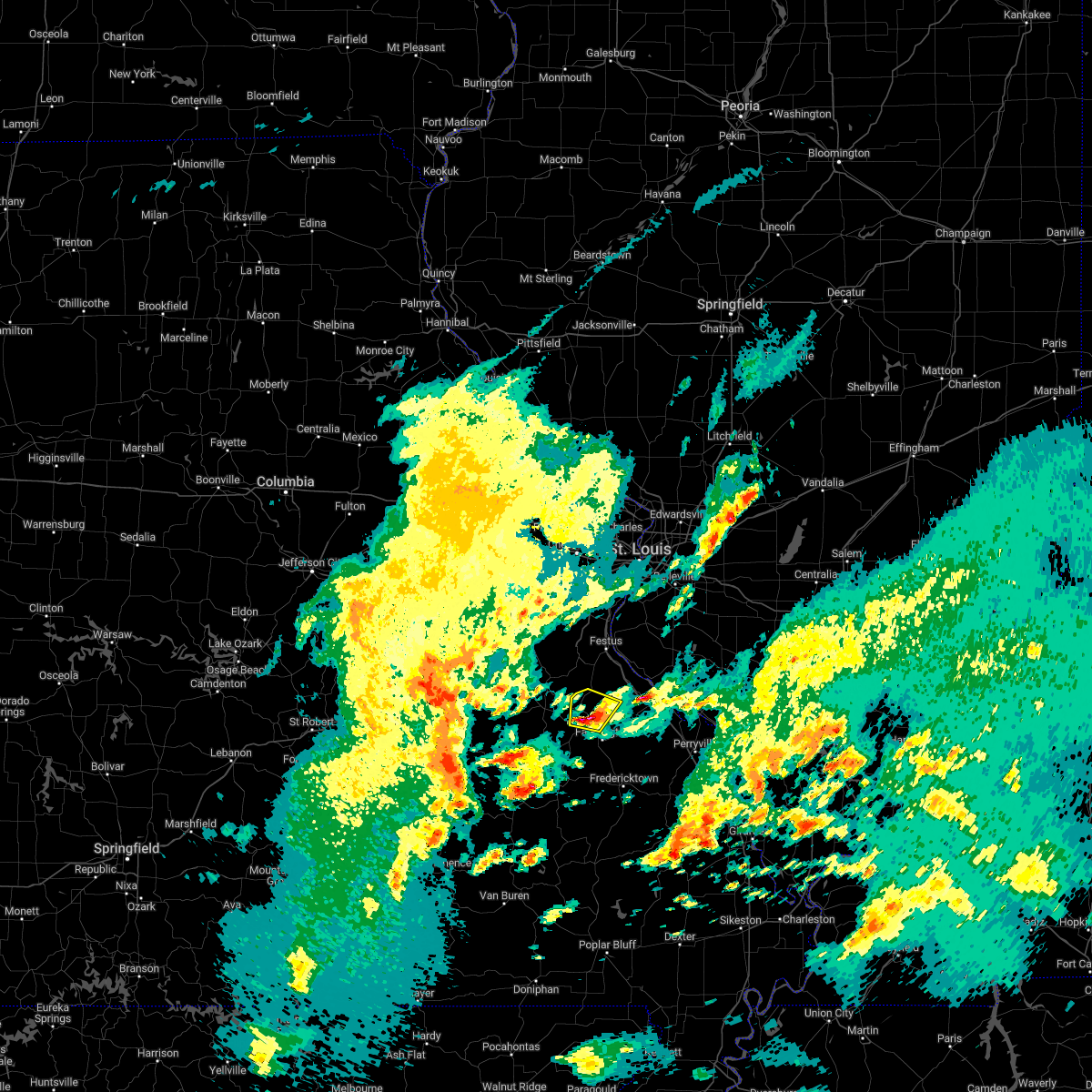 At 235 am cst, a severe thunderstorm was located over bonne terre, moving north at 45 mph (radar indicated). Hazards include 60 mph wind gusts and quarter size hail. Hail damage to vehicles is expected. expect wind damage to roofs, siding, and trees. locations impacted include, bonne terre, desloge, leadwood, park hills, leadington, frankclay and french village. this also includes st. francois state park and missouri mines historic site. hail threat, radar indicated max hail size, 1. 00 in wind threat, radar indicated max wind gust, 60 mph. At 235 am cst, a severe thunderstorm was located over bonne terre, moving north at 45 mph (radar indicated). Hazards include 60 mph wind gusts and quarter size hail. Hail damage to vehicles is expected. expect wind damage to roofs, siding, and trees. locations impacted include, bonne terre, desloge, leadwood, park hills, leadington, frankclay and french village. this also includes st. francois state park and missouri mines historic site. hail threat, radar indicated max hail size, 1. 00 in wind threat, radar indicated max wind gust, 60 mph.
|
| 2/16/2023 2:26 AM CST |
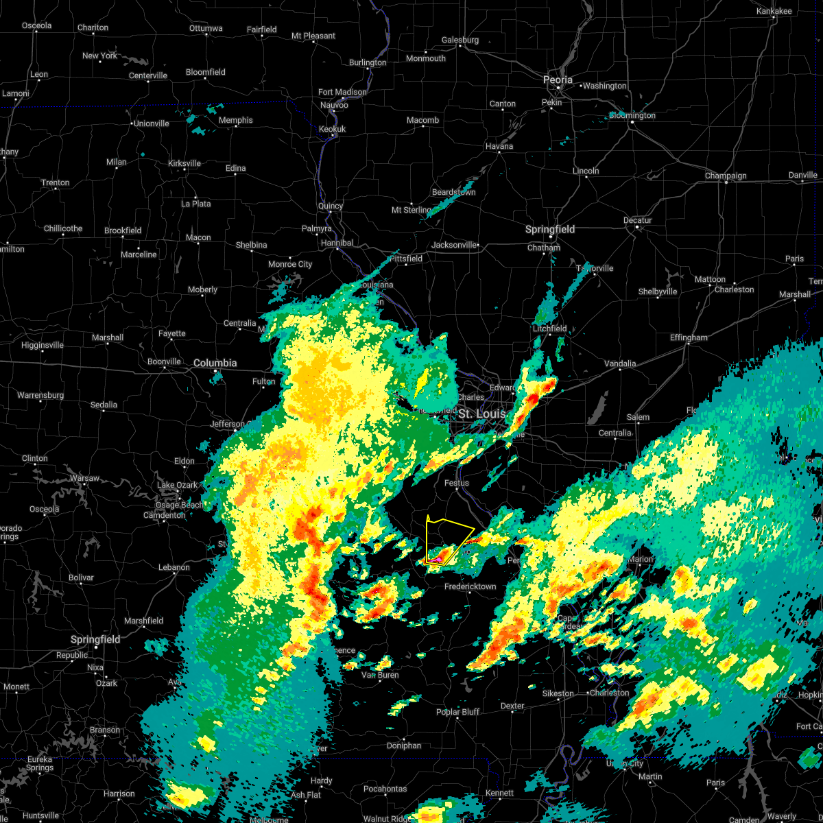 At 226 am cst, a severe thunderstorm was located over park hills, moving northeast at 55 mph (radar indicated). Hazards include 60 mph wind gusts and quarter size hail. Hail damage to vehicles is expected. expect wind damage to roofs, siding, and trees. locations impacted include, bonne terre. this also includes st. joe state park, st. francois state park, and missouri mines historic site. hail threat, radar indicated max hail size, 1. 00 in wind threat, radar indicated max wind gust, 60 mph. At 226 am cst, a severe thunderstorm was located over park hills, moving northeast at 55 mph (radar indicated). Hazards include 60 mph wind gusts and quarter size hail. Hail damage to vehicles is expected. expect wind damage to roofs, siding, and trees. locations impacted include, bonne terre. this also includes st. joe state park, st. francois state park, and missouri mines historic site. hail threat, radar indicated max hail size, 1. 00 in wind threat, radar indicated max wind gust, 60 mph.
|
| 2/16/2023 2:14 AM CST |
 At 213 am cst, a severe thunderstorm was located over mainly rural areas of northern iron county, moving northeast at 55 mph (radar indicated). Hazards include 60 mph wind gusts and quarter size hail. Hail damage to vehicles is expected. expect wind damage to roofs, siding, and trees. this severe thunderstorm will be near, bismarck around 220 am cst. park hills and irondale around 225 am cst. farmington, desloge and leadwood around 230 am cst. other locations in the path of this severe thunderstorm include bonne terre. this also includes st. joe state park, st. francois state park, fort davidson historic site, elephant rocks state park, and missouri mines historic site. hail threat, radar indicated max hail size, 1. 00 in wind threat, radar indicated max wind gust, 60 mph. At 213 am cst, a severe thunderstorm was located over mainly rural areas of northern iron county, moving northeast at 55 mph (radar indicated). Hazards include 60 mph wind gusts and quarter size hail. Hail damage to vehicles is expected. expect wind damage to roofs, siding, and trees. this severe thunderstorm will be near, bismarck around 220 am cst. park hills and irondale around 225 am cst. farmington, desloge and leadwood around 230 am cst. other locations in the path of this severe thunderstorm include bonne terre. this also includes st. joe state park, st. francois state park, fort davidson historic site, elephant rocks state park, and missouri mines historic site. hail threat, radar indicated max hail size, 1. 00 in wind threat, radar indicated max wind gust, 60 mph.
|
| 8/3/2022 6:17 PM CDT |
 At 617 pm cdt, a severe thunderstorm was located near farmington, moving southeast at 30 mph (radar indicated). Hazards include 60 mph wind gusts. Expect damage to roofs, siding, and trees. this severe storm will be near, weingarten around 625 pm cdt. coffman around 635 pm cdt. other locations impacted by this severe thunderstorm include river aux vases, french village, doe run, minnith and leadington. this also includes st. joe state park, hawn state park, and felix valle house state park. this includes interstate 55 in missouri between exits 141 and 157. hail threat, radar indicated max hail size, <. 75 in wind threat, radar indicated max wind gust, 60 mph. At 617 pm cdt, a severe thunderstorm was located near farmington, moving southeast at 30 mph (radar indicated). Hazards include 60 mph wind gusts. Expect damage to roofs, siding, and trees. this severe storm will be near, weingarten around 625 pm cdt. coffman around 635 pm cdt. other locations impacted by this severe thunderstorm include river aux vases, french village, doe run, minnith and leadington. this also includes st. joe state park, hawn state park, and felix valle house state park. this includes interstate 55 in missouri between exits 141 and 157. hail threat, radar indicated max hail size, <. 75 in wind threat, radar indicated max wind gust, 60 mph.
|
| 8/3/2022 5:41 PM CDT |
 At 541 pm cdt, a severe thunderstorm was located 8 miles south of olympian village, moving southeast at 30 mph (radar indicated). Hazards include 60 mph wind gusts and penny size hail. Expect damage to roofs, siding, and trees. this severe thunderstorm will be near, bloomsdale around 600 pm cdt. other locations in the path of this severe thunderstorm include rocky ridge, weingarten, coffman and st. mary. this includes interstate 55 in missouri between exits 141 and 162. this also includes st. joe state park, st. francois state park, hawn state park, felix valle house state park, and missouri mines historic site. hail threat, radar indicated max hail size, 0. 75 in wind threat, radar indicated max wind gust, 60 mph. At 541 pm cdt, a severe thunderstorm was located 8 miles south of olympian village, moving southeast at 30 mph (radar indicated). Hazards include 60 mph wind gusts and penny size hail. Expect damage to roofs, siding, and trees. this severe thunderstorm will be near, bloomsdale around 600 pm cdt. other locations in the path of this severe thunderstorm include rocky ridge, weingarten, coffman and st. mary. this includes interstate 55 in missouri between exits 141 and 162. this also includes st. joe state park, st. francois state park, hawn state park, felix valle house state park, and missouri mines historic site. hail threat, radar indicated max hail size, 0. 75 in wind threat, radar indicated max wind gust, 60 mph.
|
| 7/8/2022 5:45 PM CDT | A few trees and many tree limbs down on highway d. time estimate in ste. genevieve county MO, 5.3 miles S of Farmington, MO |
| 6/17/2022 6:39 AM CDT |
 The severe thunderstorm warning for randolph, ste. genevieve and eastern st. francois counties will expire at 645 am cdt, the storms which prompted the warning have weakened below severe limits, and no longer pose an immediate threat to life or property. therefore, the warning will be allowed to expire. however gusty winds are still possible with these thunderstorms. a severe thunderstorm watch remains in effect until 800 am cdt for south central illinois. The severe thunderstorm warning for randolph, ste. genevieve and eastern st. francois counties will expire at 645 am cdt, the storms which prompted the warning have weakened below severe limits, and no longer pose an immediate threat to life or property. therefore, the warning will be allowed to expire. however gusty winds are still possible with these thunderstorms. a severe thunderstorm watch remains in effect until 800 am cdt for south central illinois.
|
| 6/17/2022 6:26 AM CDT |
 At 625 am cdt, severe thunderstorms were located along a line extending from near coulterville to near ste. genevieve to desloge, moving southeast at 30 mph (radar indicated). Hazards include 60 mph wind gusts. Expect damage to roofs, siding, and trees. locations impacted include, farmington, chester, ste. genevieve, sparta, bremen, park hills, steeleville, percy, coulterville, tilden, evansville, bloomsdale, st. mary, knob lick, weingarten, womac, rocky ridge, coffman, eden and preston. this also includes hawn state park and felix valle house state park. this includes interstate 55 in missouri between exits 141 and 157. hail threat, radar indicated max hail size, <. 75 in wind threat, radar indicated max wind gust, 60 mph. At 625 am cdt, severe thunderstorms were located along a line extending from near coulterville to near ste. genevieve to desloge, moving southeast at 30 mph (radar indicated). Hazards include 60 mph wind gusts. Expect damage to roofs, siding, and trees. locations impacted include, farmington, chester, ste. genevieve, sparta, bremen, park hills, steeleville, percy, coulterville, tilden, evansville, bloomsdale, st. mary, knob lick, weingarten, womac, rocky ridge, coffman, eden and preston. this also includes hawn state park and felix valle house state park. this includes interstate 55 in missouri between exits 141 and 157. hail threat, radar indicated max hail size, <. 75 in wind threat, radar indicated max wind gust, 60 mph.
|
| 6/17/2022 6:16 AM CDT |
 At 616 am cdt, severe thunderstorms were located along a line extending from near coulterville to near ste. genevieve to near bonne terre, moving southeast at 30 mph (radar indicated). Hazards include 60 mph wind gusts. Expect damage to roofs, siding, and trees. locations impacted include, farmington, chester, bonne terre, desloge, ste. genevieve, sparta, red bud, bismarck, leadwood, bremen, park hills, steeleville, marissa, percy, coulterville, tilden, iron mountain lake, evansville, bloomsdale and baldwin. this also includes st. joe state park, st. francois state park, hawn state park, felix valle house state park, and missouri mines historic site. this includes interstate 55 in missouri between exits 141 and 162. hail threat, radar indicated max hail size, <. 75 in wind threat, radar indicated max wind gust, 60 mph. At 616 am cdt, severe thunderstorms were located along a line extending from near coulterville to near ste. genevieve to near bonne terre, moving southeast at 30 mph (radar indicated). Hazards include 60 mph wind gusts. Expect damage to roofs, siding, and trees. locations impacted include, farmington, chester, bonne terre, desloge, ste. genevieve, sparta, red bud, bismarck, leadwood, bremen, park hills, steeleville, marissa, percy, coulterville, tilden, iron mountain lake, evansville, bloomsdale and baldwin. this also includes st. joe state park, st. francois state park, hawn state park, felix valle house state park, and missouri mines historic site. this includes interstate 55 in missouri between exits 141 and 162. hail threat, radar indicated max hail size, <. 75 in wind threat, radar indicated max wind gust, 60 mph.
|
| 6/17/2022 6:11 AM CDT |
 At 611 am cdt, severe thunderstorms were located along a line extending from near tilden to near ste. genevieve to near bonne terre, moving southeast at 30 mph (radar indicated). Hazards include 60 mph wind gusts. Expect damage to roofs, siding, and trees. locations impacted include, ste. genevieve, sparta, coulterville, tilden, evansville, chester, st. mary, farmington, park hills, knob lick and womac. this also includes st. joe state park, st. francois state park, hawn state park, felix valle house state park, and missouri mines historic site. this includes interstate 55 in missouri between exits 141 and 162. hail threat, radar indicated max hail size, <. 75 in wind threat, radar indicated max wind gust, 60 mph. At 611 am cdt, severe thunderstorms were located along a line extending from near tilden to near ste. genevieve to near bonne terre, moving southeast at 30 mph (radar indicated). Hazards include 60 mph wind gusts. Expect damage to roofs, siding, and trees. locations impacted include, ste. genevieve, sparta, coulterville, tilden, evansville, chester, st. mary, farmington, park hills, knob lick and womac. this also includes st. joe state park, st. francois state park, hawn state park, felix valle house state park, and missouri mines historic site. this includes interstate 55 in missouri between exits 141 and 162. hail threat, radar indicated max hail size, <. 75 in wind threat, radar indicated max wind gust, 60 mph.
|
| 6/17/2022 5:45 AM CDT |
 At 545 am cdt, severe thunderstorms were located along a line extending from 6 miles northeast of new athens to 8 miles southwest of new design to near old mines, moving southeast at 30 mph (radar indicated). Hazards include 60 mph wind gusts and penny size hail. Expect damage to roofs, siding, and trees. severe thunderstorms will be near, marissa around 555 am cdt. tilden around 605 am cdt. other locations in the path of these severe thunderstorms include sparta, ste. genevieve, coulterville, evansville, bonne terre, leadwood, desloge, chester, st. mary, farmington and park hills. this includes interstate 55 in missouri between exits 141 and 162. this also includes st. joe state park, st. francois state park, hawn state park, felix valle house state park, and missouri mines historic site. hail threat, radar indicated max hail size, 0. 75 in wind threat, radar indicated max wind gust, 60 mph. At 545 am cdt, severe thunderstorms were located along a line extending from 6 miles northeast of new athens to 8 miles southwest of new design to near old mines, moving southeast at 30 mph (radar indicated). Hazards include 60 mph wind gusts and penny size hail. Expect damage to roofs, siding, and trees. severe thunderstorms will be near, marissa around 555 am cdt. tilden around 605 am cdt. other locations in the path of these severe thunderstorms include sparta, ste. genevieve, coulterville, evansville, bonne terre, leadwood, desloge, chester, st. mary, farmington and park hills. this includes interstate 55 in missouri between exits 141 and 162. this also includes st. joe state park, st. francois state park, hawn state park, felix valle house state park, and missouri mines historic site. hail threat, radar indicated max hail size, 0. 75 in wind threat, radar indicated max wind gust, 60 mph.
|
| 5/19/2022 4:42 PM CDT | Trees down in farmington and power poles. damage throughout the county as wel in st. francois county MO, 0.3 miles NNE of Farmington, MO |
| 5/15/2022 2:51 PM CDT |
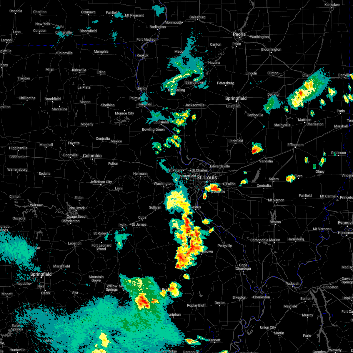 The severe thunderstorm warning for west central ste. genevieve and west central st. francois counties will expire at 300 pm cdt, the storm which prompted the warning has weakened below severe limits, and no longer poses an immediate threat to life or property. therefore, the warning will be allowed to expire. however gusty winds are still possible with this thunderstorm. a severe thunderstorm watch remains in effect until 800 pm cdt for southeastern missouri. The severe thunderstorm warning for west central ste. genevieve and west central st. francois counties will expire at 300 pm cdt, the storm which prompted the warning has weakened below severe limits, and no longer poses an immediate threat to life or property. therefore, the warning will be allowed to expire. however gusty winds are still possible with this thunderstorm. a severe thunderstorm watch remains in effect until 800 pm cdt for southeastern missouri.
|
| 5/15/2022 2:42 PM CDT |
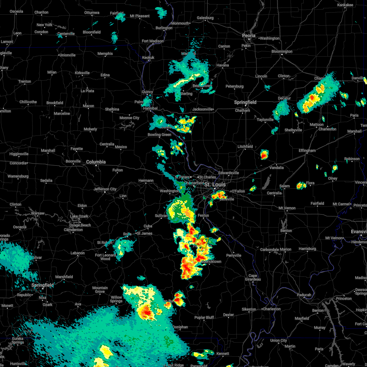 At 241 pm cdt, a severe thunderstorm was located near farmington, moving east at 30 mph (radar indicated). Hazards include 60 mph wind gusts and quarter size hail. Hail damage to vehicles is expected. expect wind damage to roofs, siding, and trees. locations impacted include, farmington, desloge, park hills and leadington. this also includes missouri mines historic site. hail threat, radar indicated max hail size, 1. 00 in wind threat, radar indicated max wind gust, 60 mph. At 241 pm cdt, a severe thunderstorm was located near farmington, moving east at 30 mph (radar indicated). Hazards include 60 mph wind gusts and quarter size hail. Hail damage to vehicles is expected. expect wind damage to roofs, siding, and trees. locations impacted include, farmington, desloge, park hills and leadington. this also includes missouri mines historic site. hail threat, radar indicated max hail size, 1. 00 in wind threat, radar indicated max wind gust, 60 mph.
|
| 5/15/2022 2:21 PM CDT |
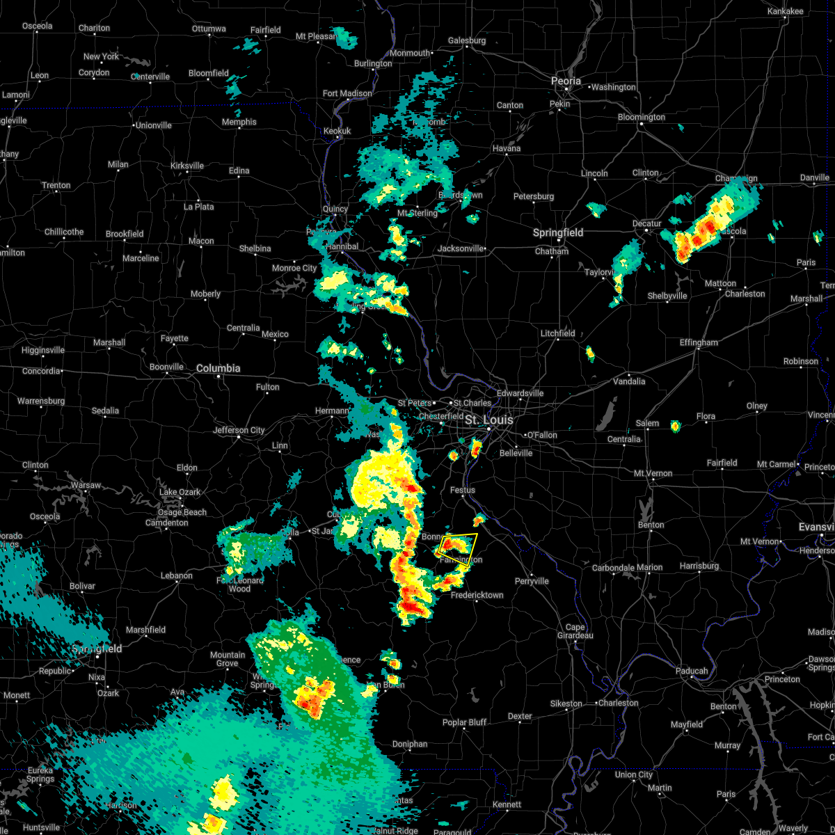 At 221 pm cdt, a severe thunderstorm was located over bonne terre, moving east at 15 mph (radar indicated). Hazards include 60 mph wind gusts and quarter size hail. Hail damage to vehicles is expected. expect wind damage to roofs, siding, and trees. locations impacted include, farmington. this also includes missouri mines historic site. hail threat, radar indicated max hail size, 1. 00 in wind threat, radar indicated max wind gust, 60 mph. At 221 pm cdt, a severe thunderstorm was located over bonne terre, moving east at 15 mph (radar indicated). Hazards include 60 mph wind gusts and quarter size hail. Hail damage to vehicles is expected. expect wind damage to roofs, siding, and trees. locations impacted include, farmington. this also includes missouri mines historic site. hail threat, radar indicated max hail size, 1. 00 in wind threat, radar indicated max wind gust, 60 mph.
|
| 5/15/2022 2:10 PM CDT |
 At 210 pm cdt, a severe thunderstorm was located over bonne terre, moving east at 15 mph (radar indicated). Hazards include 60 mph wind gusts and quarter size hail. Hail damage to vehicles is expected. expect wind damage to roofs, siding, and trees. this severe thunderstorm will be near, desloge around 220 pm cdt. other locations in the path of this severe thunderstorm include farmington. this also includes st. francois state park and missouri mines historic site. hail threat, radar indicated max hail size, 1. 00 in wind threat, radar indicated max wind gust, 60 mph. At 210 pm cdt, a severe thunderstorm was located over bonne terre, moving east at 15 mph (radar indicated). Hazards include 60 mph wind gusts and quarter size hail. Hail damage to vehicles is expected. expect wind damage to roofs, siding, and trees. this severe thunderstorm will be near, desloge around 220 pm cdt. other locations in the path of this severe thunderstorm include farmington. this also includes st. francois state park and missouri mines historic site. hail threat, radar indicated max hail size, 1. 00 in wind threat, radar indicated max wind gust, 60 mph.
|
| 4/30/2022 4:22 PM CDT |
 At 421 pm cdt, a severe thunderstorm was located near knob lick, moving northeast at 40 mph (radar indicated). Hazards include 60 mph wind gusts and quarter size hail. Hail damage to vehicles is expected. expect wind damage to roofs, siding, and trees. locations impacted include, womac, coffman and st. mary. this also includes hawn state park. This includes interstate 55 in missouri between exits 141 and 143. At 421 pm cdt, a severe thunderstorm was located near knob lick, moving northeast at 40 mph (radar indicated). Hazards include 60 mph wind gusts and quarter size hail. Hail damage to vehicles is expected. expect wind damage to roofs, siding, and trees. locations impacted include, womac, coffman and st. mary. this also includes hawn state park. This includes interstate 55 in missouri between exits 141 and 143.
|
| 4/30/2022 4:08 PM CDT |
 At 407 pm cdt, a severe thunderstorm was located over knob lick, moving northeast at 40 mph (radar indicated). Hazards include 60 mph wind gusts and quarter size hail. Hail damage to vehicles is expected. expect wind damage to roofs, siding, and trees. this severe thunderstorm will be near, womac around 425 pm cdt. other locations in the path of this severe thunderstorm include coffman and st. mary. this includes interstate 55 in missouri between exits 141 and 143. This also includes hawn state park. At 407 pm cdt, a severe thunderstorm was located over knob lick, moving northeast at 40 mph (radar indicated). Hazards include 60 mph wind gusts and quarter size hail. Hail damage to vehicles is expected. expect wind damage to roofs, siding, and trees. this severe thunderstorm will be near, womac around 425 pm cdt. other locations in the path of this severe thunderstorm include coffman and st. mary. this includes interstate 55 in missouri between exits 141 and 143. This also includes hawn state park.
|
| 10/24/2021 8:28 PM CDT |
 At 828 pm cdt, a confirmed large and extremely dangerous tornado was located over farmington, moving northeast at 45 mph. this is a particularly dangerous situation. take cover now! (radar confirmed tornado). Hazards include damaging tornado. You are in a life-threatening situation. flying debris may be deadly to those caught without shelter. mobile homes will be destroyed. considerable damage to homes, businesses, and vehicles is likely and complete destruction is possible. the tornado will be near, coffman around 840 pm cdt. other locations in the path of this tornadic thunderstorm include weingarten. this also includes st. Joe state park and hawn state park. At 828 pm cdt, a confirmed large and extremely dangerous tornado was located over farmington, moving northeast at 45 mph. this is a particularly dangerous situation. take cover now! (radar confirmed tornado). Hazards include damaging tornado. You are in a life-threatening situation. flying debris may be deadly to those caught without shelter. mobile homes will be destroyed. considerable damage to homes, businesses, and vehicles is likely and complete destruction is possible. the tornado will be near, coffman around 840 pm cdt. other locations in the path of this tornadic thunderstorm include weingarten. this also includes st. Joe state park and hawn state park.
|
| 10/24/2021 8:20 PM CDT |
 At 820 pm cdt, a severe thunderstorm capable of producing a tornado was located near farmington, moving northeast at 45 mph (radar indicated rotation). Hazards include tornado. Flying debris will be dangerous to those caught without shelter. mobile homes will be damaged or destroyed. damage to roofs, windows, and vehicles will occur. tree damage is likely. this dangerous storm will be near, farmington around 825 pm cdt. other locations in the path of this tornadic thunderstorm include coffman and weingarten. this also includes st. Joe state park and hawn state park. At 820 pm cdt, a severe thunderstorm capable of producing a tornado was located near farmington, moving northeast at 45 mph (radar indicated rotation). Hazards include tornado. Flying debris will be dangerous to those caught without shelter. mobile homes will be damaged or destroyed. damage to roofs, windows, and vehicles will occur. tree damage is likely. this dangerous storm will be near, farmington around 825 pm cdt. other locations in the path of this tornadic thunderstorm include coffman and weingarten. this also includes st. Joe state park and hawn state park.
|
| 10/24/2021 8:09 PM CDT |
 At 808 pm cdt, a severe thunderstorm capable of producing a tornado was located over iron mountain lake, moving northeast at 45 mph (radar indicated rotation). Hazards include tornado. Flying debris will be dangerous to those caught without shelter. mobile homes will be damaged or destroyed. damage to roofs, windows, and vehicles will occur. tree damage is likely. this dangerous storm will be near, park hills around 820 pm cdt. farmington and knob lick around 825 pm cdt. other locations in the path of this tornadic thunderstorm include coffman, weingarten and rocky ridge. this also includes st. Joe state park and hawn state park. At 808 pm cdt, a severe thunderstorm capable of producing a tornado was located over iron mountain lake, moving northeast at 45 mph (radar indicated rotation). Hazards include tornado. Flying debris will be dangerous to those caught without shelter. mobile homes will be damaged or destroyed. damage to roofs, windows, and vehicles will occur. tree damage is likely. this dangerous storm will be near, park hills around 820 pm cdt. farmington and knob lick around 825 pm cdt. other locations in the path of this tornadic thunderstorm include coffman, weingarten and rocky ridge. this also includes st. Joe state park and hawn state park.
|
| 10/24/2021 7:57 PM CDT |
 At 757 pm cdt, a severe thunderstorm capable of producing a tornado was located near ironton, moving northeast at 55 mph (radar indicated rotation). Hazards include tornado. Flying debris will be dangerous to those caught without shelter. mobile homes will be damaged or destroyed. damage to roofs, windows, and vehicles will occur. tree damage is likely. this dangerous storm will be near, ironton, pilot knob and arcadia around 800 pm cdt. iron mountain lake, roselle and iron mountain around 805 pm cdt. other locations in the path of this tornadic thunderstorm include farmington, park hills and knob lick. this also includes st. Joe state park, fort davidson historic site, and elephant rocks state park. At 757 pm cdt, a severe thunderstorm capable of producing a tornado was located near ironton, moving northeast at 55 mph (radar indicated rotation). Hazards include tornado. Flying debris will be dangerous to those caught without shelter. mobile homes will be damaged or destroyed. damage to roofs, windows, and vehicles will occur. tree damage is likely. this dangerous storm will be near, ironton, pilot knob and arcadia around 800 pm cdt. iron mountain lake, roselle and iron mountain around 805 pm cdt. other locations in the path of this tornadic thunderstorm include farmington, park hills and knob lick. this also includes st. Joe state park, fort davidson historic site, and elephant rocks state park.
|
| 10/24/2021 7:48 PM CDT |
 At 748 pm cdt, a severe thunderstorm capable of producing a tornado was located 8 miles southwest of belleview, moving northeast at 60 mph (radar indicated rotation). Hazards include tornado. Flying debris will be dangerous to those caught without shelter. mobile homes will be damaged or destroyed. damage to roofs, windows, and vehicles will occur. tree damage is likely. this dangerous storm will be near, belleview around 755 pm cdt. ironton, pilot knob, arcadia and iron mountain around 800 pm cdt. bismarck, iron mountain lake and roselle around 805 pm cdt. other locations in the path of this tornadic thunderstorm include park hills, farmington and knob lick. this also includes st. Joe state park, johnsons shut-ins state park, fort davidson historic site, elephant rocks state park, taum sauk mountain state park, and missouri mines historic site. At 748 pm cdt, a severe thunderstorm capable of producing a tornado was located 8 miles southwest of belleview, moving northeast at 60 mph (radar indicated rotation). Hazards include tornado. Flying debris will be dangerous to those caught without shelter. mobile homes will be damaged or destroyed. damage to roofs, windows, and vehicles will occur. tree damage is likely. this dangerous storm will be near, belleview around 755 pm cdt. ironton, pilot knob, arcadia and iron mountain around 800 pm cdt. bismarck, iron mountain lake and roselle around 805 pm cdt. other locations in the path of this tornadic thunderstorm include park hills, farmington and knob lick. this also includes st. Joe state park, johnsons shut-ins state park, fort davidson historic site, elephant rocks state park, taum sauk mountain state park, and missouri mines historic site.
|
| 8/31/2021 10:11 PM CDT |
 The severe thunderstorm warning for st. francois county will expire at 1015 pm cdt, the storm which prompted the warning has moved out of the area. therefore, the warning will be allowed to expire. The severe thunderstorm warning for st. francois county will expire at 1015 pm cdt, the storm which prompted the warning has moved out of the area. therefore, the warning will be allowed to expire.
|
| 8/31/2021 9:54 PM CDT |
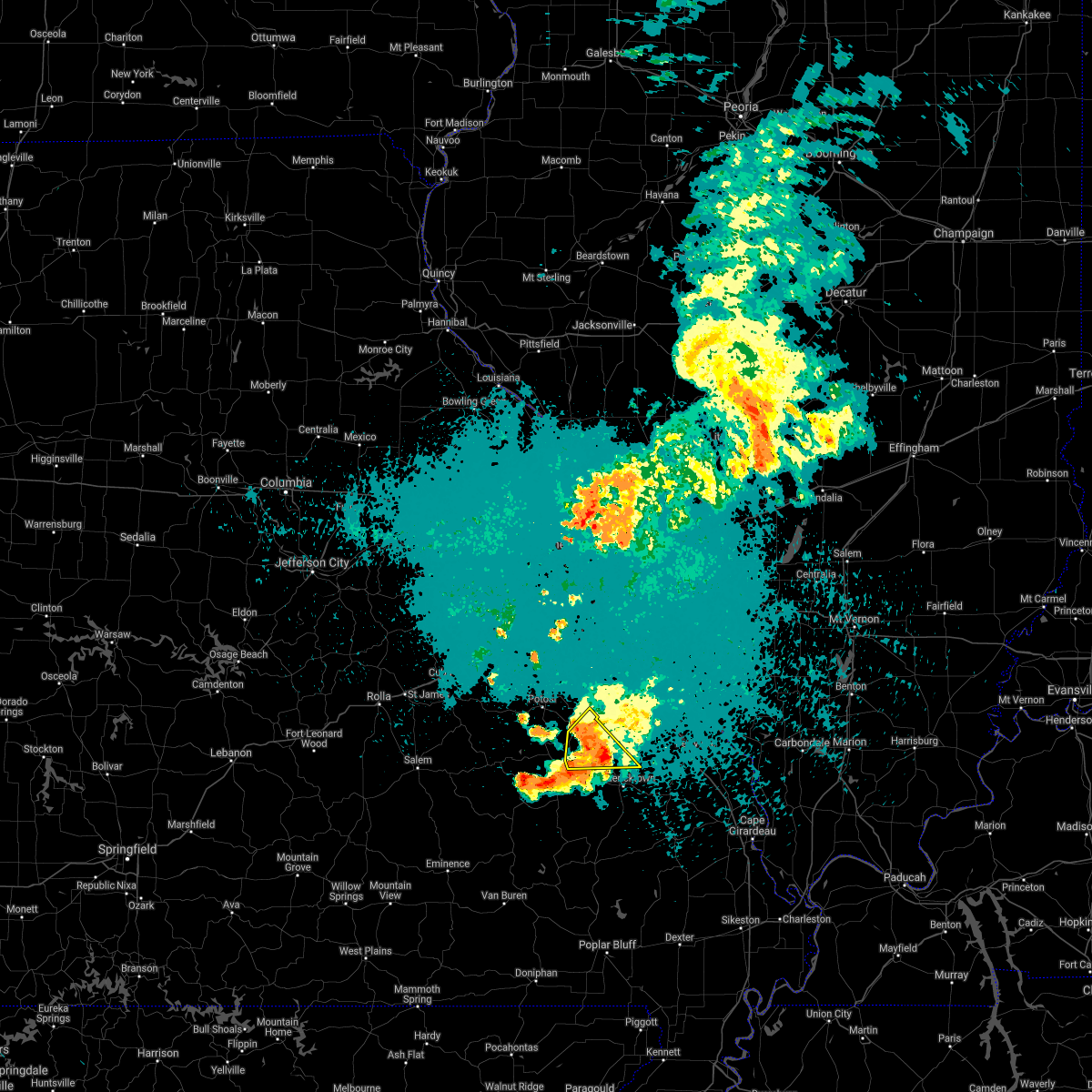 At 953 pm cdt, a severe thunderstorm was located near farmington, moving southeast at 30 mph (radar indicated). Hazards include 60 mph wind gusts. Expect damage to roofs, siding, and trees. locations impacted include, farmington, bonne terre, desloge, bismarck, leadwood, park hills, iron mountain lake, iron mountain, knob lick, leadington, libertyville and doe run. this also includes st. Joe state park and missouri mines historic site. At 953 pm cdt, a severe thunderstorm was located near farmington, moving southeast at 30 mph (radar indicated). Hazards include 60 mph wind gusts. Expect damage to roofs, siding, and trees. locations impacted include, farmington, bonne terre, desloge, bismarck, leadwood, park hills, iron mountain lake, iron mountain, knob lick, leadington, libertyville and doe run. this also includes st. Joe state park and missouri mines historic site.
|
| 8/31/2021 9:49 PM CDT |
 At 948 pm cdt, severe thunderstorms were located along a line extending from near farmington to near knob lick to 9 miles east of oates, moving southeast at 30 mph (radar indicated). Hazards include 60 mph wind gusts. expect damage to roofs, siding, and trees At 948 pm cdt, severe thunderstorms were located along a line extending from near farmington to near knob lick to 9 miles east of oates, moving southeast at 30 mph (radar indicated). Hazards include 60 mph wind gusts. expect damage to roofs, siding, and trees
|
| 8/31/2021 9:31 PM CDT |
 At 930 pm cdt, a severe thunderstorm was located over leadwood, moving southeast at 30 mph (radar indicated). Hazards include 60 mph wind gusts. expect damage to roofs, siding, and trees At 930 pm cdt, a severe thunderstorm was located over leadwood, moving southeast at 30 mph (radar indicated). Hazards include 60 mph wind gusts. expect damage to roofs, siding, and trees
|
| 7/10/2021 2:13 AM CDT |
 At 213 am cdt, severe thunderstorms were located along a line extending from near bremen to 6 miles south of chester to womac, moving southeast at 55 mph (trained weather spotters reported hail up to golf ball size earlier near ellis grove). Hazards include 60 mph wind gusts and quarter size hail. Hail damage to vehicles is expected. expect wind damage to roofs, siding, and trees. these severe storms will be near, steeleville and percy around 220 am cdt. this also includes hawn state park, fort davidson historic site, felix valle house state park, and elephant rocks state park. This includes interstate 55 in missouri between exits 141 and 150. At 213 am cdt, severe thunderstorms were located along a line extending from near bremen to 6 miles south of chester to womac, moving southeast at 55 mph (trained weather spotters reported hail up to golf ball size earlier near ellis grove). Hazards include 60 mph wind gusts and quarter size hail. Hail damage to vehicles is expected. expect wind damage to roofs, siding, and trees. these severe storms will be near, steeleville and percy around 220 am cdt. this also includes hawn state park, fort davidson historic site, felix valle house state park, and elephant rocks state park. This includes interstate 55 in missouri between exits 141 and 150.
|
| 7/10/2021 2:06 AM CDT |
 At 206 am cdt, severe thunderstorms were located along a line extending from 7 miles northwest of bremen to near st. mary to near womac, moving southeast at 55 mph (radar indicated). Hazards include 60 mph wind gusts and quarter size hail. Hail damage to vehicles is expected. expect wind damage to roofs, siding, and trees. these severe storms will be near, bremen around 210 am cdt. other locations in the path of these severe thunderstorms include steeleville and percy. this also includes hawn state park, fort davidson historic site, felix valle house state park, and elephant rocks state park. This includes interstate 55 in missouri between exits 141 and 154. At 206 am cdt, severe thunderstorms were located along a line extending from 7 miles northwest of bremen to near st. mary to near womac, moving southeast at 55 mph (radar indicated). Hazards include 60 mph wind gusts and quarter size hail. Hail damage to vehicles is expected. expect wind damage to roofs, siding, and trees. these severe storms will be near, bremen around 210 am cdt. other locations in the path of these severe thunderstorms include steeleville and percy. this also includes hawn state park, fort davidson historic site, felix valle house state park, and elephant rocks state park. This includes interstate 55 in missouri between exits 141 and 154.
|
| 7/10/2021 1:50 AM CDT |
 At 150 am cdt, severe thunderstorms were located along a line extending from near red bud to near ste. genevieve to near farmington, moving southeast at 55 mph (radar indicated). Hazards include 60 mph wind gusts and quarter size hail. Hail damage to vehicles is expected. expect wind damage to roofs, siding, and trees. severe thunderstorms will be near, ste. genevieve and evansville around 155 am cdt. chester, baldwin and st. mary around 200 am cdt. fredericktown and junction city around 205 am cdt. bremen and womac around 210 am cdt. other locations in the path of these severe thunderstorms include steeleville and percy. this includes interstate 55 in missouri between exits 141 and 154. this also includes st. Joe state park, hawn state park, fort davidson historic site, felix valle house state park, elephant rocks state park, and missouri mines historic site. At 150 am cdt, severe thunderstorms were located along a line extending from near red bud to near ste. genevieve to near farmington, moving southeast at 55 mph (radar indicated). Hazards include 60 mph wind gusts and quarter size hail. Hail damage to vehicles is expected. expect wind damage to roofs, siding, and trees. severe thunderstorms will be near, ste. genevieve and evansville around 155 am cdt. chester, baldwin and st. mary around 200 am cdt. fredericktown and junction city around 205 am cdt. bremen and womac around 210 am cdt. other locations in the path of these severe thunderstorms include steeleville and percy. this includes interstate 55 in missouri between exits 141 and 154. this also includes st. Joe state park, hawn state park, fort davidson historic site, felix valle house state park, elephant rocks state park, and missouri mines historic site.
|
| 7/10/2021 1:37 AM CDT |
 At 136 am cdt, severe thunderstorms were located along a line extending from 6 miles southwest of new design to near bloomsdale to 6 miles north of bonne terre, moving east at 50 mph (trained weather spotters reported estimated 60 mph wind gusts earlier in old mines). Hazards include 60 mph wind gusts. Expect damage to roofs, siding, and trees. locations impacted include, farmington, bonne terre, desloge, ste. genevieve, red bud, potosi, bismarck, leadwood, park hills, olympian village, iron mountain lake, evansville, bloomsdale, irondale, baldwin, st. mary, mineral point, old mines, weingarten and womac. this also includes st. joe state park, st. francois state park, hawn state park, felix valle house state park, and missouri mines historic site. This includes interstate 55 in missouri between exits 141 and 170. At 136 am cdt, severe thunderstorms were located along a line extending from 6 miles southwest of new design to near bloomsdale to 6 miles north of bonne terre, moving east at 50 mph (trained weather spotters reported estimated 60 mph wind gusts earlier in old mines). Hazards include 60 mph wind gusts. Expect damage to roofs, siding, and trees. locations impacted include, farmington, bonne terre, desloge, ste. genevieve, red bud, potosi, bismarck, leadwood, park hills, olympian village, iron mountain lake, evansville, bloomsdale, irondale, baldwin, st. mary, mineral point, old mines, weingarten and womac. this also includes st. joe state park, st. francois state park, hawn state park, felix valle house state park, and missouri mines historic site. This includes interstate 55 in missouri between exits 141 and 170.
|
| 7/10/2021 1:26 AM CDT |
 At 126 am cdt, severe thunderstorms were located along a line extending from crystal city to near olympian village to 6 miles east of old mines, moving east at 50 mph (radar indicated). Hazards include 60 mph wind gusts and quarter size hail. Hail damage to vehicles is expected. expect wind damage to roofs, siding, and trees. locations impacted include, crystal city, bonne terre, bloomsdale, ste. genevieve, red bud, rocky ridge, weingarten, evansville, baldwin and st. mary. this also includes washington state park, st. joe state park, st. francois state park, hawn state park, felix valle house state park, sandy creek covered bridge historic site, and missouri mines historic site. This includes interstate 55 in missouri between exits 141 and 178. At 126 am cdt, severe thunderstorms were located along a line extending from crystal city to near olympian village to 6 miles east of old mines, moving east at 50 mph (radar indicated). Hazards include 60 mph wind gusts and quarter size hail. Hail damage to vehicles is expected. expect wind damage to roofs, siding, and trees. locations impacted include, crystal city, bonne terre, bloomsdale, ste. genevieve, red bud, rocky ridge, weingarten, evansville, baldwin and st. mary. this also includes washington state park, st. joe state park, st. francois state park, hawn state park, felix valle house state park, sandy creek covered bridge historic site, and missouri mines historic site. This includes interstate 55 in missouri between exits 141 and 178.
|
| 7/10/2021 1:08 AM CDT |
 At 108 am cdt, severe thunderstorms were located along a line extending from near cedar hill lakes to 7 miles west of de soto to 6 miles southwest of richwoods, moving east at 50 mph (radar indicated). Hazards include 60 mph wind gusts and half dollar size hail. Hail damage to vehicles is expected. expect wind damage to roofs, siding, and trees. severe thunderstorms will be near, de soto and hillsboro around 115 am cdt. pevely, olympian village and horine around 120 am cdt. festus, crystal city, herculaneum and mineral point around 125 am cdt. other locations in the path of these severe thunderstorms include bonne terre, bloomsdale, ste. genevieve, red bud, evansville, rocky ridge, weingarten, baldwin and st. mary. this includes interstate 55 in missouri between exits 141 and 178. this also includes washington state park, st. joe state park, st. Francois state park, hawn state park, felix valle house state park, sandy creek covered bridge historic site, and missouri mines historic site. At 108 am cdt, severe thunderstorms were located along a line extending from near cedar hill lakes to 7 miles west of de soto to 6 miles southwest of richwoods, moving east at 50 mph (radar indicated). Hazards include 60 mph wind gusts and half dollar size hail. Hail damage to vehicles is expected. expect wind damage to roofs, siding, and trees. severe thunderstorms will be near, de soto and hillsboro around 115 am cdt. pevely, olympian village and horine around 120 am cdt. festus, crystal city, herculaneum and mineral point around 125 am cdt. other locations in the path of these severe thunderstorms include bonne terre, bloomsdale, ste. genevieve, red bud, evansville, rocky ridge, weingarten, baldwin and st. mary. this includes interstate 55 in missouri between exits 141 and 178. this also includes washington state park, st. joe state park, st. Francois state park, hawn state park, felix valle house state park, sandy creek covered bridge historic site, and missouri mines historic site.
|
| 3/27/2021 8:11 PM CDT |
 At 811 pm cdt, severe thunderstorms were located along a line extending from near lively grove to near knob lick, moving east at 35 mph (radar indicated). Hazards include 60 mph wind gusts and quarter size hail. Hail damage to vehicles is expected. Expect wind damage to roofs, siding, and trees. At 811 pm cdt, severe thunderstorms were located along a line extending from near lively grove to near knob lick, moving east at 35 mph (radar indicated). Hazards include 60 mph wind gusts and quarter size hail. Hail damage to vehicles is expected. Expect wind damage to roofs, siding, and trees.
|
| 3/27/2021 8:07 PM CDT |
 At 806 pm cdt, severe thunderstorms were located along a line extending from lively grove to near knob lick, moving east at 35 mph (radar indicated). Hazards include 60 mph wind gusts and quarter size hail. Hail damage to vehicles is expected. expect wind damage to roofs, siding, and trees. locations impacted include, farmington, ste. genevieve, sparta, marissa, tilden, evansville, lively grove, baldwin, st. mary, knob lick, weingarten, womac, rocky ridge, coffman, preston, ellis grove, houston, kaskaskia, roots and modoc. this also includes hawn state park and felix valle house state park. This includes interstate 55 in missouri between exits 141 and 150. At 806 pm cdt, severe thunderstorms were located along a line extending from lively grove to near knob lick, moving east at 35 mph (radar indicated). Hazards include 60 mph wind gusts and quarter size hail. Hail damage to vehicles is expected. expect wind damage to roofs, siding, and trees. locations impacted include, farmington, ste. genevieve, sparta, marissa, tilden, evansville, lively grove, baldwin, st. mary, knob lick, weingarten, womac, rocky ridge, coffman, preston, ellis grove, houston, kaskaskia, roots and modoc. this also includes hawn state park and felix valle house state park. This includes interstate 55 in missouri between exits 141 and 150.
|
| 3/27/2021 7:51 PM CDT |
 At 750 pm cdt, severe thunderstorms were located along a line extending from near marissa to near iron mountain lake, moving east at 30 mph (trained weather spotters reported tree limbs down in farmington). Hazards include 60 mph wind gusts and quarter size hail. Hail damage to vehicles is expected. expect wind damage to roofs, siding, and trees. locations impacted include, farmington, ste. genevieve, sparta, red bud, park hills, new athens, marissa, tilden, iron mountain lake, evansville, lively grove, bloomsdale, baldwin, st. mary, knob lick, weingarten, womac, rocky ridge, coffman and preston. this also includes hawn state park and felix valle house state park. This includes interstate 55 in missouri between exits 141 and 157. At 750 pm cdt, severe thunderstorms were located along a line extending from near marissa to near iron mountain lake, moving east at 30 mph (trained weather spotters reported tree limbs down in farmington). Hazards include 60 mph wind gusts and quarter size hail. Hail damage to vehicles is expected. expect wind damage to roofs, siding, and trees. locations impacted include, farmington, ste. genevieve, sparta, red bud, park hills, new athens, marissa, tilden, iron mountain lake, evansville, lively grove, bloomsdale, baldwin, st. mary, knob lick, weingarten, womac, rocky ridge, coffman and preston. this also includes hawn state park and felix valle house state park. This includes interstate 55 in missouri between exits 141 and 157.
|
| 3/27/2021 7:46 PM CDT | Tree limbs reported down via public repor in st. francois county MO, 1.7 miles NNW of Farmington, MO |
| 3/27/2021 7:38 PM CDT |
 At 738 pm cdt, severe thunderstorms were located along a line extending from near new athens to near pilot knob, moving east at 35 mph (radar indicated). Hazards include 60 mph wind gusts and quarter size hail. Hail damage to vehicles is expected. expect wind damage to roofs, siding, and trees. locations impacted include, farmington, ste. genevieve, sparta, red bud, park hills, new athens, marissa, tilden, iron mountain lake, evansville, lively grove, bloomsdale, baldwin, st. mary, knob lick, weingarten, womac, rocky ridge, coffman and iron mountain. this also includes st. joe state park, hawn state park, felix valle house state park, and missouri mines historic site. This includes interstate 55 in missouri between exits 141 and 162. At 738 pm cdt, severe thunderstorms were located along a line extending from near new athens to near pilot knob, moving east at 35 mph (radar indicated). Hazards include 60 mph wind gusts and quarter size hail. Hail damage to vehicles is expected. expect wind damage to roofs, siding, and trees. locations impacted include, farmington, ste. genevieve, sparta, red bud, park hills, new athens, marissa, tilden, iron mountain lake, evansville, lively grove, bloomsdale, baldwin, st. mary, knob lick, weingarten, womac, rocky ridge, coffman and iron mountain. this also includes st. joe state park, hawn state park, felix valle house state park, and missouri mines historic site. This includes interstate 55 in missouri between exits 141 and 162.
|
| 3/27/2021 7:27 PM CDT |
 At 727 pm cdt, severe thunderstorms were located along a line extending from near smithton to near pilot knob, moving east at 35 mph (radar indicated). Hazards include 60 mph wind gusts and quarter size hail. Hail damage to vehicles is expected. Expect wind damage to roofs, siding, and trees. At 727 pm cdt, severe thunderstorms were located along a line extending from near smithton to near pilot knob, moving east at 35 mph (radar indicated). Hazards include 60 mph wind gusts and quarter size hail. Hail damage to vehicles is expected. Expect wind damage to roofs, siding, and trees.
|
| 3/11/2021 2:43 PM CST |
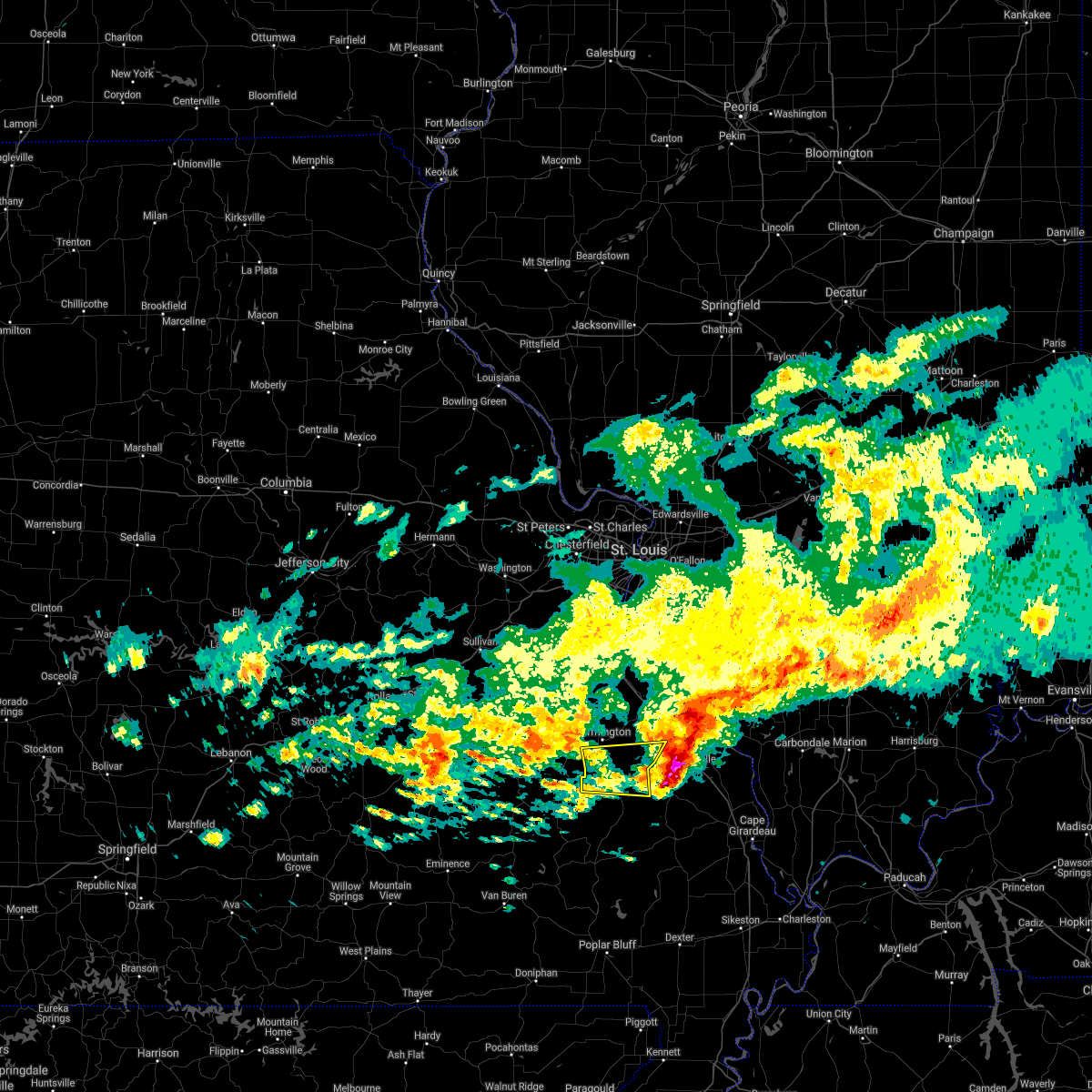 At 217 pm cst, a severe thunderstorm was located near knob lick, moving east at 50 mph (radar indicated). Hazards include 60 mph wind gusts and quarter size hail. Hail damage to vehicles is expected. expect wind damage to roofs, siding, and trees. Locations impacted include, fredericktown, junction city, cobalt, womac, roselle, knob lick, mine la motte, libertyville, catherine place and doe run. At 217 pm cst, a severe thunderstorm was located near knob lick, moving east at 50 mph (radar indicated). Hazards include 60 mph wind gusts and quarter size hail. Hail damage to vehicles is expected. expect wind damage to roofs, siding, and trees. Locations impacted include, fredericktown, junction city, cobalt, womac, roselle, knob lick, mine la motte, libertyville, catherine place and doe run.
|
| 3/11/2021 2:18 PM CST |
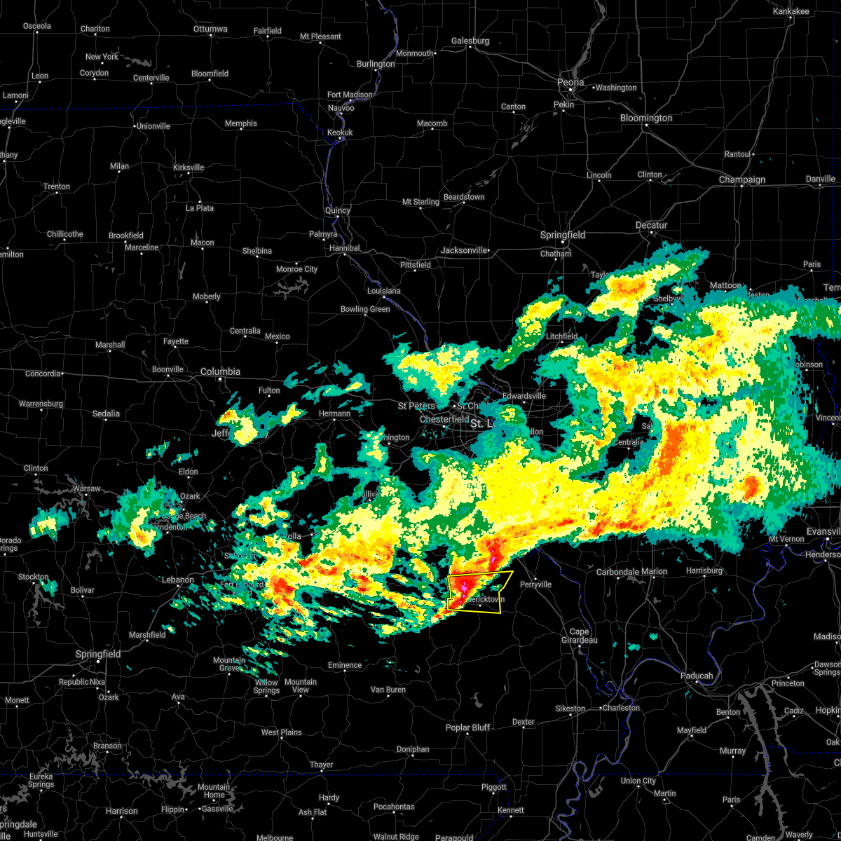 At 217 pm cst, a severe thunderstorm was located near knob lick, moving east at 50 mph (radar indicated). Hazards include 60 mph wind gusts and quarter size hail. Hail damage to vehicles is expected. expect wind damage to roofs, siding, and trees. Locations impacted include, fredericktown, junction city, cobalt, womac, roselle, knob lick, mine la motte, libertyville, catherine place and doe run. At 217 pm cst, a severe thunderstorm was located near knob lick, moving east at 50 mph (radar indicated). Hazards include 60 mph wind gusts and quarter size hail. Hail damage to vehicles is expected. expect wind damage to roofs, siding, and trees. Locations impacted include, fredericktown, junction city, cobalt, womac, roselle, knob lick, mine la motte, libertyville, catherine place and doe run.
|
| 3/11/2021 1:58 PM CST |
 At 158 pm cst, a severe thunderstorm was located near pilot knob, moving east at 45 mph (radar indicated). Hazards include 60 mph wind gusts and quarter size hail. Hail damage to vehicles is expected. Expect wind damage to roofs, siding, and trees. At 158 pm cst, a severe thunderstorm was located near pilot knob, moving east at 45 mph (radar indicated). Hazards include 60 mph wind gusts and quarter size hail. Hail damage to vehicles is expected. Expect wind damage to roofs, siding, and trees.
|
| 3/11/2021 12:56 PM CST |
 At 1256 pm cst, a severe thunderstorm was located near iron mountain lake, moving east at 35 mph (radar indicated). Hazards include 60 mph wind gusts and penny size hail. Expect damage to roofs, siding, and trees. locations impacted include, farmington, fredericktown, bismarck, park hills, iron mountain lake, womac, knob lick, iron mountain, coffman, minnith, mine la motte, libertyville, doe run and river aux vases. this also includes hawn state park. This includes interstate 55 in missouri near exit 143. At 1256 pm cst, a severe thunderstorm was located near iron mountain lake, moving east at 35 mph (radar indicated). Hazards include 60 mph wind gusts and penny size hail. Expect damage to roofs, siding, and trees. locations impacted include, farmington, fredericktown, bismarck, park hills, iron mountain lake, womac, knob lick, iron mountain, coffman, minnith, mine la motte, libertyville, doe run and river aux vases. this also includes hawn state park. This includes interstate 55 in missouri near exit 143.
|
| 3/11/2021 12:43 PM CST |
 At 1242 pm cst, a severe thunderstorm was located over iron mountain, moving east at 40 mph (radar indicated). Hazards include 60 mph wind gusts and penny size hail. expect damage to roofs, siding, and trees At 1242 pm cst, a severe thunderstorm was located over iron mountain, moving east at 40 mph (radar indicated). Hazards include 60 mph wind gusts and penny size hail. expect damage to roofs, siding, and trees
|
| 8/10/2020 7:00 PM CDT | Winds 55 mph... gusting to 65 mp in st. francois county MO, 4.8 miles SE of Farmington, MO |
| 6/27/2020 9:29 PM CDT |
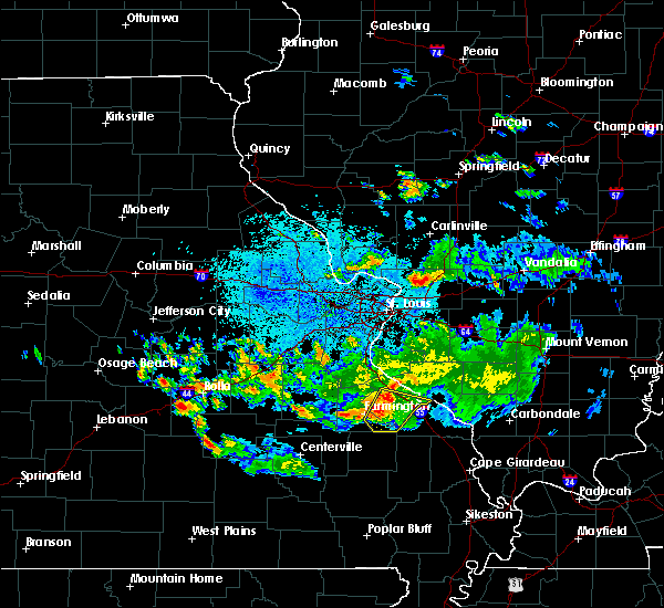 At 928 pm cdt, a severe thunderstorm was located near farmington, moving east at 35 mph (radar indicated). Hazards include 60 mph wind gusts and penny size hail. expect damage to roofs, siding, and trees At 928 pm cdt, a severe thunderstorm was located near farmington, moving east at 35 mph (radar indicated). Hazards include 60 mph wind gusts and penny size hail. expect damage to roofs, siding, and trees
|
| 6/3/2020 6:49 PM CDT | Measured gust by asos at kfa in st. francois county MO, 1.7 miles N of Farmington, MO |
| 4/28/2020 10:06 PM CDT |
 At 1005 pm cdt, severe thunderstorms were located along a line extending from weingarten to near coffman to near knob lick to near roselle to near saco to near greenville to near brush arbor, moving east at 45 mph (radar indicated). Hazards include 60 mph wind gusts and penny size hail. Expect damage to roofs, siding, and trees. locations impacted include, farmington, fredericktown, ironton, park hills, pilot knob, iron mountain lake, arcadia, st. mary, annapolis, junction city, cobalt, marquand, knob lick, iron mountain, buckhorn, weingarten, glover, womac, coffman and roselle. this also includes st. joe state park, hawn state park, fort davidson historic site, elephant rocks state park, and missouri mines historic site. This includes interstate 55 in missouri between exits 141 and 143. At 1005 pm cdt, severe thunderstorms were located along a line extending from weingarten to near coffman to near knob lick to near roselle to near saco to near greenville to near brush arbor, moving east at 45 mph (radar indicated). Hazards include 60 mph wind gusts and penny size hail. Expect damage to roofs, siding, and trees. locations impacted include, farmington, fredericktown, ironton, park hills, pilot knob, iron mountain lake, arcadia, st. mary, annapolis, junction city, cobalt, marquand, knob lick, iron mountain, buckhorn, weingarten, glover, womac, coffman and roselle. this also includes st. joe state park, hawn state park, fort davidson historic site, elephant rocks state park, and missouri mines historic site. This includes interstate 55 in missouri between exits 141 and 143.
|
| 4/28/2020 9:42 PM CDT |
 At 941 pm cdt, severe thunderstorms were located along a line extending from near bonne terre to desloge to near bismarck to near iron mountain to glover to 6 miles northeast of garwood, moving east at 50 mph (radar indicated). Hazards include 60 mph wind gusts and penny size hail. expect damage to roofs, siding, and trees At 941 pm cdt, severe thunderstorms were located along a line extending from near bonne terre to desloge to near bismarck to near iron mountain to glover to 6 miles northeast of garwood, moving east at 50 mph (radar indicated). Hazards include 60 mph wind gusts and penny size hail. expect damage to roofs, siding, and trees
|
| 4/8/2020 6:06 PM CDT | Quarter sized hail reported 9.2 miles W of Farmington, MO |
| 4/8/2020 6:05 PM CDT |
 At 604 pm cdt, a severe thunderstorm was located over coffman, moving east at 30 mph (radar indicated). Hazards include ping pong ball size hail and 60 mph wind gusts. People and animals outdoors will be injured. expect hail damage to roofs, siding, windows, and vehicles. expect wind damage to roofs, siding, and trees. locations impacted include, farmington, womac, knob lick, coffman, libertyville and minnith. This also includes hawn state park. At 604 pm cdt, a severe thunderstorm was located over coffman, moving east at 30 mph (radar indicated). Hazards include ping pong ball size hail and 60 mph wind gusts. People and animals outdoors will be injured. expect hail damage to roofs, siding, windows, and vehicles. expect wind damage to roofs, siding, and trees. locations impacted include, farmington, womac, knob lick, coffman, libertyville and minnith. This also includes hawn state park.
|
| 4/8/2020 5:59 PM CDT | Quarter sized hail reported 0.3 miles NNE of Farmington, MO |
| 4/8/2020 5:45 PM CDT |
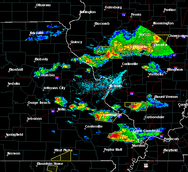 At 544 pm cdt, a severe thunderstorm was located over leadwood, moving east at 35 mph (radar indicated). Hazards include 60 mph wind gusts and quarter size hail. Hail damage to vehicles is expected. Expect wind damage to roofs, siding, and trees. At 544 pm cdt, a severe thunderstorm was located over leadwood, moving east at 35 mph (radar indicated). Hazards include 60 mph wind gusts and quarter size hail. Hail damage to vehicles is expected. Expect wind damage to roofs, siding, and trees.
|
| 3/2/2020 6:43 PM CST |
 A severe thunderstorm warning remains in effect until 715 pm cst for southwestern ste. genevieve and west central st. francois counties. at 642 pm cst, a severe thunderstorm was located over park hills, moving east at 30 mph. Penny size hail has been reported in park hills. A severe thunderstorm warning remains in effect until 715 pm cst for southwestern ste. genevieve and west central st. francois counties. at 642 pm cst, a severe thunderstorm was located over park hills, moving east at 30 mph. Penny size hail has been reported in park hills.
|
| 3/2/2020 6:24 PM CST |
 At 623 pm cst, a severe thunderstorm was located over irondale, moving east at 35 mph (radar indicated). Hazards include quarter size hail. damage to vehicles is expected At 623 pm cst, a severe thunderstorm was located over irondale, moving east at 35 mph (radar indicated). Hazards include quarter size hail. damage to vehicles is expected
|
| 11/26/2019 10:28 PM CST |
 The severe thunderstorm warning for northeastern iron, northwestern madison and southwestern st. francois counties in southeastern missouri will expire at 1030 pm cst, the storm which prompted the warning has weakened below severe limits, and no longer poses an immediate threat to life or property. therefore, the warning will be allowed to expire. however gusty winds are still possible with this thunderstorm. a tornado watch remains in effect until midnight cst for southeastern missouri. The severe thunderstorm warning for northeastern iron, northwestern madison and southwestern st. francois counties in southeastern missouri will expire at 1030 pm cst, the storm which prompted the warning has weakened below severe limits, and no longer poses an immediate threat to life or property. therefore, the warning will be allowed to expire. however gusty winds are still possible with this thunderstorm. a tornado watch remains in effect until midnight cst for southeastern missouri.
|
| 11/26/2019 10:20 PM CST |
 At 1020 pm cst, a severe thunderstorm was located over roselle, moving northeast at 45 mph (radar indicated). Hazards include 60 mph wind gusts. Expect damage to roofs, siding, and trees. locations impacted include, farmington, ironton, pilot knob, iron mountain lake, arcadia, roselle, knob lick and doe run. This also includes fort davidson historic site. At 1020 pm cst, a severe thunderstorm was located over roselle, moving northeast at 45 mph (radar indicated). Hazards include 60 mph wind gusts. Expect damage to roofs, siding, and trees. locations impacted include, farmington, ironton, pilot knob, iron mountain lake, arcadia, roselle, knob lick and doe run. This also includes fort davidson historic site.
|
| 11/26/2019 9:58 PM CST |
 At 958 pm cst, a severe thunderstorm was located 9 miles west of glover, moving northeast at 45 mph (radar indicated). Hazards include 60 mph wind gusts. expect damage to roofs, siding, and trees At 958 pm cst, a severe thunderstorm was located 9 miles west of glover, moving northeast at 45 mph (radar indicated). Hazards include 60 mph wind gusts. expect damage to roofs, siding, and trees
|
| 10/21/2019 3:44 AM CDT |
 At 344 am cdt, severe thunderstorms were located along a line extending from 7 miles east of anthonies mill to leadwood to 6 miles south of cobalt, moving northeast at 75 mph (radar indicated). Hazards include 60 mph wind gusts. expect damage to roofs, siding, and trees At 344 am cdt, severe thunderstorms were located along a line extending from 7 miles east of anthonies mill to leadwood to 6 miles south of cobalt, moving northeast at 75 mph (radar indicated). Hazards include 60 mph wind gusts. expect damage to roofs, siding, and trees
|
| 8/20/2019 2:30 PM CDT | Tree(s) blocking the road at highway dd and old fredericktown road. time estimated from radar. call arrived at dispatch at 2:40 p. in st. francois county MO, 9.1 miles NW of Farmington, MO |
| 8/6/2019 3:52 PM CDT |
 At 352 pm cdt, a severe thunderstorm was located near irondale, moving southeast at 20 mph (radar indicated). Hazards include 60 mph wind gusts and quarter size hail. Hail damage to vehicles is expected. expect wind damage to roofs, siding, and trees. locations impacted include, farmington, desloge, potosi, bismarck, leadwood, park hills, iron mountain lake, irondale, mineral point, leadington and frankclay. this also includes st. Joe state park and missouri mines historic site. At 352 pm cdt, a severe thunderstorm was located near irondale, moving southeast at 20 mph (radar indicated). Hazards include 60 mph wind gusts and quarter size hail. Hail damage to vehicles is expected. expect wind damage to roofs, siding, and trees. locations impacted include, farmington, desloge, potosi, bismarck, leadwood, park hills, iron mountain lake, irondale, mineral point, leadington and frankclay. this also includes st. Joe state park and missouri mines historic site.
|
| 8/6/2019 3:26 PM CDT |
 At 325 pm cdt, a severe thunderstorm was located over potosi, moving southeast at 30 mph (trained weather spotters). Hazards include 60 mph wind gusts and half dollar size hail. Hail damage to vehicles is expected. Expect wind damage to roofs, siding, and trees. At 325 pm cdt, a severe thunderstorm was located over potosi, moving southeast at 30 mph (trained weather spotters). Hazards include 60 mph wind gusts and half dollar size hail. Hail damage to vehicles is expected. Expect wind damage to roofs, siding, and trees.
|
| 6/4/2019 7:21 PM CDT |
 The severe thunderstorm warning for north central iron, south central jefferson, southeastern washington and st. francois counties will expire at 730 pm cdt, the storms which prompted the warning have weakened below severe limits, and have exited the warned area. therefore, the warning will be allowed to expire. however gusty winds are still possible with these thunderstorms. a severe thunderstorm watch remains in effect until 900 pm cdt for southeastern and east central missouri. to report severe weather, contact your nearest law enforcement agency. they will relay your report to the national weather service st louis. The severe thunderstorm warning for north central iron, south central jefferson, southeastern washington and st. francois counties will expire at 730 pm cdt, the storms which prompted the warning have weakened below severe limits, and have exited the warned area. therefore, the warning will be allowed to expire. however gusty winds are still possible with these thunderstorms. a severe thunderstorm watch remains in effect until 900 pm cdt for southeastern and east central missouri. to report severe weather, contact your nearest law enforcement agency. they will relay your report to the national weather service st louis.
|
| 6/4/2019 7:11 PM CDT |
 At 710 pm cdt, severe thunderstorms were located along a line extending from near bonne terre to near park hills, moving east at 30 mph (radar indicated). Hazards include 60 mph wind gusts. Expect damage to roofs, siding, and trees. locations impacted include, farmington, bonne terre, desloge, potosi, bismarck, leadwood, park hills, iron mountain lake, irondale, mineral point, knob lick, iron mountain, old mines, leadington, caledonia, belgrade, blackwell, cadet, frankclay and doe run. this also includes st. joe state park, st. Francois state park, and missouri mines historic site. At 710 pm cdt, severe thunderstorms were located along a line extending from near bonne terre to near park hills, moving east at 30 mph (radar indicated). Hazards include 60 mph wind gusts. Expect damage to roofs, siding, and trees. locations impacted include, farmington, bonne terre, desloge, potosi, bismarck, leadwood, park hills, iron mountain lake, irondale, mineral point, knob lick, iron mountain, old mines, leadington, caledonia, belgrade, blackwell, cadet, frankclay and doe run. this also includes st. joe state park, st. Francois state park, and missouri mines historic site.
|
| 6/4/2019 6:59 PM CDT |
 At 659 pm cdt, severe thunderstorms were located along a line extending from near mineral point to near bismarck, moving east at 40 mph (radar indicated). Hazards include 60 mph wind gusts and quarter size hail. Hail damage to vehicles is expected. expect wind damage to roofs, siding, and trees. locations impacted include, farmington, bonne terre, desloge, potosi, bismarck, leadwood, park hills, iron mountain lake, irondale, mineral point, knob lick, iron mountain, old mines, leadington, caledonia, belgrade, blackwell, cadet, frankclay and doe run. this also includes st. joe state park, st. Francois state park, and missouri mines historic site. At 659 pm cdt, severe thunderstorms were located along a line extending from near mineral point to near bismarck, moving east at 40 mph (radar indicated). Hazards include 60 mph wind gusts and quarter size hail. Hail damage to vehicles is expected. expect wind damage to roofs, siding, and trees. locations impacted include, farmington, bonne terre, desloge, potosi, bismarck, leadwood, park hills, iron mountain lake, irondale, mineral point, knob lick, iron mountain, old mines, leadington, caledonia, belgrade, blackwell, cadet, frankclay and doe run. this also includes st. joe state park, st. Francois state park, and missouri mines historic site.
|
| 6/4/2019 6:44 PM CDT |
 At 644 pm cdt, severe thunderstorms were located along a line extending from near potosi to 9 miles east of courtois, moving east at 30 mph (radar indicated). Hazards include 60 mph wind gusts and quarter size hail. Hail damage to vehicles is expected. Expect wind damage to roofs, siding, and trees. At 644 pm cdt, severe thunderstorms were located along a line extending from near potosi to 9 miles east of courtois, moving east at 30 mph (radar indicated). Hazards include 60 mph wind gusts and quarter size hail. Hail damage to vehicles is expected. Expect wind damage to roofs, siding, and trees.
|
| 5/21/2019 2:10 PM CDT |
 At 710 pm cdt, severe thunderstorms were located along a line extending from caseyville to near grassy, moving east at 45 mph (radar indicated). Hazards include 60 mph wind gusts. Expect damage to roofs, siding, and trees. locations impacted include, st. louis, belleville, university city, granite city, o`fallon, kirkwood, east st. louis, collinsville, edwardsville, webster groves, arnold, fairview heights, clayton, cahokia, jennings, swansea, glen carbon, shiloh, crestwood and festus. this also includes scott joplin historic site, hawn state park, felix valle house state park, mastodon historic site, gov. dunklin`s grave historic site, and horseshoe lake state park. this includes the following highways, interstate 64 in illinois between exits 9 and 27. interstate 44 in missouri near exit 277. Interstate 55 in missouri between exits 141 and 191. At 710 pm cdt, severe thunderstorms were located along a line extending from caseyville to near grassy, moving east at 45 mph (radar indicated). Hazards include 60 mph wind gusts. Expect damage to roofs, siding, and trees. locations impacted include, st. louis, belleville, university city, granite city, o`fallon, kirkwood, east st. louis, collinsville, edwardsville, webster groves, arnold, fairview heights, clayton, cahokia, jennings, swansea, glen carbon, shiloh, crestwood and festus. this also includes scott joplin historic site, hawn state park, felix valle house state park, mastodon historic site, gov. dunklin`s grave historic site, and horseshoe lake state park. this includes the following highways, interstate 64 in illinois between exits 9 and 27. interstate 44 in missouri near exit 277. Interstate 55 in missouri between exits 141 and 191.
|
| 5/21/2019 2:07 PM CDT |
 The severe thunderstorm warning for iron county in southeastern missouri, jefferson county in east central missouri, west central ste. genevieve, northeastern reynolds and western madison counties in southeastern missouri, eastern washington, southeastern franklin counties in east central missouri and st. francois counties in southeastern missouri will expire at 715 pm cdt, the storms which prompted the warning have moved out of the area. therefore, the warning will be allowed to expire. a tornado watch remains in effect until 1000 pm cdt for southeastern and east central missouri. remember, a severe thunderstorm warning still remains in effect for portions of these counties. The severe thunderstorm warning for iron county in southeastern missouri, jefferson county in east central missouri, west central ste. genevieve, northeastern reynolds and western madison counties in southeastern missouri, eastern washington, southeastern franklin counties in east central missouri and st. francois counties in southeastern missouri will expire at 715 pm cdt, the storms which prompted the warning have moved out of the area. therefore, the warning will be allowed to expire. a tornado watch remains in effect until 1000 pm cdt for southeastern and east central missouri. remember, a severe thunderstorm warning still remains in effect for portions of these counties.
|
| 5/21/2019 1:34 PM CDT |
 At 634 pm cdt, severe thunderstorms were located along a line extending from byrnes mill to near sam a. baker state park, moving east at 35 mph (radar indicated). Hazards include 60 mph wind gusts and penny size hail. Expect damage to roofs, siding, and trees. locations impacted include, farmington, festus, bonne terre, de soto, pevely, desloge, herculaneum, hillsboro, byrnes mill, potosi, bismarck, ironton, leadwood, high ridge, antonia, cedar hill, barnhart, murphy, park hills and olympian village. this also includes washington state park, st. joe state park, st. Francois state park, fort davidson historic site, elephant rocks state park, taum sauk mountain state park, sandy creek covered bridge historic site, and missouri mines historic site. At 634 pm cdt, severe thunderstorms were located along a line extending from byrnes mill to near sam a. baker state park, moving east at 35 mph (radar indicated). Hazards include 60 mph wind gusts and penny size hail. Expect damage to roofs, siding, and trees. locations impacted include, farmington, festus, bonne terre, de soto, pevely, desloge, herculaneum, hillsboro, byrnes mill, potosi, bismarck, ironton, leadwood, high ridge, antonia, cedar hill, barnhart, murphy, park hills and olympian village. this also includes washington state park, st. joe state park, st. Francois state park, fort davidson historic site, elephant rocks state park, taum sauk mountain state park, sandy creek covered bridge historic site, and missouri mines historic site.
|
| 5/21/2019 1:32 PM CDT |
 At 631 pm cdt, severe thunderstorms were located along a line extending from clarkson valley to near sam a. baker state park, moving east at 45 mph (radar indicated). Hazards include 60 mph wind gusts and penny size hail. expect damage to roofs, siding, and trees At 631 pm cdt, severe thunderstorms were located along a line extending from clarkson valley to near sam a. baker state park, moving east at 45 mph (radar indicated). Hazards include 60 mph wind gusts and penny size hail. expect damage to roofs, siding, and trees
|
| 5/21/2019 12:59 PM CDT |
 The national weather service in st louis has issued a * severe thunderstorm warning for. iron county in southeastern missouri. eastern crawford county in east central missouri. jefferson county in east central missouri. west central ste. Genevieve county in southeastern missouri. The national weather service in st louis has issued a * severe thunderstorm warning for. iron county in southeastern missouri. eastern crawford county in east central missouri. jefferson county in east central missouri. west central ste. Genevieve county in southeastern missouri.
|
| 3/24/2019 6:54 PM CDT |
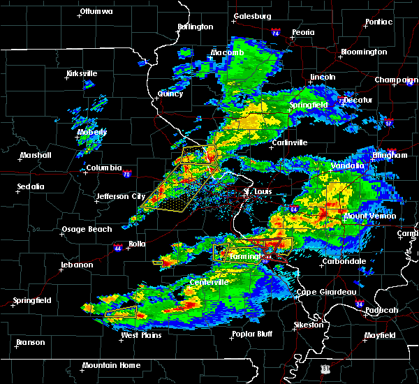 At 653 pm cdt, a severe thunderstorm was located near desloge, moving east at 40 mph (trained weather spotters). Hazards include quarter size hail. damage to vehicles is expected At 653 pm cdt, a severe thunderstorm was located near desloge, moving east at 40 mph (trained weather spotters). Hazards include quarter size hail. damage to vehicles is expected
|
| 12/1/2018 3:39 AM CST |
 At 338 am cst, severe thunderstorms were located along a line extending from 6 miles east of bonne terre to near womac to marquand, moving northeast at 60 mph (radar indicated). Hazards include 60 mph wind gusts. Expect damage to roofs, siding, and trees. locations impacted include, farmington, ste. genevieve, fredericktown, bloomsdale, st. mary, junction city, cobalt, marquand, womac, rocky ridge, buckhorn, weingarten, coffman, catherine place, minnith, mine la motte, libertyville, river aux vases and french village. this also includes st. francois state park, hawn state park, and felix valle house state park. This includes interstate 55 in missouri between exits 141 and 162. At 338 am cst, severe thunderstorms were located along a line extending from 6 miles east of bonne terre to near womac to marquand, moving northeast at 60 mph (radar indicated). Hazards include 60 mph wind gusts. Expect damage to roofs, siding, and trees. locations impacted include, farmington, ste. genevieve, fredericktown, bloomsdale, st. mary, junction city, cobalt, marquand, womac, rocky ridge, buckhorn, weingarten, coffman, catherine place, minnith, mine la motte, libertyville, river aux vases and french village. this also includes st. francois state park, hawn state park, and felix valle house state park. This includes interstate 55 in missouri between exits 141 and 162.
|
| 12/1/2018 3:28 AM CST |
 At 327 am cst, severe thunderstorms were located along a line extending from leadwood to knob lick to buckhorn, moving northeast at 60 mph (radar indicated). Hazards include 60 mph wind gusts. Expect damage to roofs, siding, and trees. locations impacted include, farmington, bonne terre, desloge, ste. genevieve, fredericktown, bismarck, leadwood, park hills, bloomsdale, irondale, st. mary, junction city, cobalt, marquand, knob lick, buckhorn, weingarten, womac, rocky ridge and coffman. this also includes st. joe state park, st. francois state park, hawn state park, felix valle house state park, and missouri mines historic site. This includes interstate 55 in missouri between exits 141 and 162. At 327 am cst, severe thunderstorms were located along a line extending from leadwood to knob lick to buckhorn, moving northeast at 60 mph (radar indicated). Hazards include 60 mph wind gusts. Expect damage to roofs, siding, and trees. locations impacted include, farmington, bonne terre, desloge, ste. genevieve, fredericktown, bismarck, leadwood, park hills, bloomsdale, irondale, st. mary, junction city, cobalt, marquand, knob lick, buckhorn, weingarten, womac, rocky ridge and coffman. this also includes st. joe state park, st. francois state park, hawn state park, felix valle house state park, and missouri mines historic site. This includes interstate 55 in missouri between exits 141 and 162.
|
| 12/1/2018 3:11 AM CST |
 At 311 am cst, severe thunderstorms were located along a line extending from 8 miles northwest of belleview to arcadia to sam a. baker state park, moving northeast at 60 mph (radar indicated). Hazards include 60 mph wind gusts. expect damage to roofs, siding, and trees At 311 am cst, severe thunderstorms were located along a line extending from 8 miles northwest of belleview to arcadia to sam a. baker state park, moving northeast at 60 mph (radar indicated). Hazards include 60 mph wind gusts. expect damage to roofs, siding, and trees
|
| 6/28/2018 8:37 AM CDT |
 At 837 am cdt, a severe thunderstorm was located over weingarten, moving southeast at 25 mph (radar indicated). Hazards include 60 mph wind gusts and quarter size hail. Hail damage to vehicles is expected. Expect wind damage to roofs, siding, and trees. At 837 am cdt, a severe thunderstorm was located over weingarten, moving southeast at 25 mph (radar indicated). Hazards include 60 mph wind gusts and quarter size hail. Hail damage to vehicles is expected. Expect wind damage to roofs, siding, and trees.
|
| 6/26/2018 3:19 PM CDT |
 At 317 pm cdt, a severe thunderstorm was located over womac, moving east at 45 mph (radar indicated). Hazards include 60 mph wind gusts and quarter size hail. Hail damage to vehicles is expected. expect wind damage to roofs, siding, and trees. locations impacted include, farmington, fredericktown, ironton, park hills, pilot knob, iron mountain lake, arcadia, junction city, cobalt, womac, knob lick, iron mountain, coffman, roselle, leadington, catherine place, granite, mine la motte, libertyville and doe run. This also includes hawn state park, fort davidson historic site, and elephant rocks state park. At 317 pm cdt, a severe thunderstorm was located over womac, moving east at 45 mph (radar indicated). Hazards include 60 mph wind gusts and quarter size hail. Hail damage to vehicles is expected. expect wind damage to roofs, siding, and trees. locations impacted include, farmington, fredericktown, ironton, park hills, pilot knob, iron mountain lake, arcadia, junction city, cobalt, womac, knob lick, iron mountain, coffman, roselle, leadington, catherine place, granite, mine la motte, libertyville and doe run. This also includes hawn state park, fort davidson historic site, and elephant rocks state park.
|
| 6/26/2018 2:51 PM CDT |
 At 251 pm cdt, a severe thunderstorm was located over iron mountain lake, moving east at 45 mph (radar indicated). Hazards include 60 mph wind gusts and quarter size hail. Hail damage to vehicles is expected. Expect wind damage to roofs, siding, and trees. At 251 pm cdt, a severe thunderstorm was located over iron mountain lake, moving east at 45 mph (radar indicated). Hazards include 60 mph wind gusts and quarter size hail. Hail damage to vehicles is expected. Expect wind damage to roofs, siding, and trees.
|
| 6/26/2018 7:20 AM CDT | Report of numerous 6 inch or less diameter tree limbs down and a large tree split in farmingto in st. francois county MO, 0.5 miles NW of Farmington, MO |
| 6/14/2018 7:23 PM CDT |
 At 723 pm cdt, severe thunderstorms were located along a line extending from near valmeyer to 7 miles northeast of bloomsdale to near weingarten to near womac, moving southeast at 35 mph (radar indicated). Hazards include 60 mph wind gusts and quarter size hail. Hail damage to vehicles is expected. Expect wind damage to roofs, siding, and trees. At 723 pm cdt, severe thunderstorms were located along a line extending from near valmeyer to 7 miles northeast of bloomsdale to near weingarten to near womac, moving southeast at 35 mph (radar indicated). Hazards include 60 mph wind gusts and quarter size hail. Hail damage to vehicles is expected. Expect wind damage to roofs, siding, and trees.
|
| 6/14/2018 7:18 PM CDT |
 At 717 pm cdt, severe thunderstorms were located along a line extending from near crystal city to near bloomsdale to near coffman, moving southeast at 35 mph (radar indicated). Hazards include 60 mph wind gusts and quarter size hail. Hail damage to vehicles is expected. expect wind damage to roofs, siding, and trees. locations impacted include, farmington, festus, waterloo, bonne terre, pevely, desloge, crystal city, ste. genevieve, herculaneum, barnhart, park hills, valmeyer, olympian village, bloomsdale, weingarten, new design, rocky ridge, horine, imperial and prairie du rocher. this also includes st. joe state park, st. francois state park, hawn state park, felix valle house state park, missouri mines historic site, and gov. dunklin`s grave historic site. This includes interstate 55 in missouri between exits 143 and 180. At 717 pm cdt, severe thunderstorms were located along a line extending from near crystal city to near bloomsdale to near coffman, moving southeast at 35 mph (radar indicated). Hazards include 60 mph wind gusts and quarter size hail. Hail damage to vehicles is expected. expect wind damage to roofs, siding, and trees. locations impacted include, farmington, festus, waterloo, bonne terre, pevely, desloge, crystal city, ste. genevieve, herculaneum, barnhart, park hills, valmeyer, olympian village, bloomsdale, weingarten, new design, rocky ridge, horine, imperial and prairie du rocher. this also includes st. joe state park, st. francois state park, hawn state park, felix valle house state park, missouri mines historic site, and gov. dunklin`s grave historic site. This includes interstate 55 in missouri between exits 143 and 180.
|
| 6/14/2018 6:42 PM CDT |
 At 641 pm cdt, severe thunderstorms were located along a line extending from near house springs to horine to near old mines, moving southeast at 30 mph (radar indicated). Hazards include 60 mph wind gusts and quarter size hail. Hail damage to vehicles is expected. Expect wind damage to roofs, siding, and trees. At 641 pm cdt, severe thunderstorms were located along a line extending from near house springs to horine to near old mines, moving southeast at 30 mph (radar indicated). Hazards include 60 mph wind gusts and quarter size hail. Hail damage to vehicles is expected. Expect wind damage to roofs, siding, and trees.
|
| 6/2/2018 8:04 PM CDT |
 At 804 pm cdt, a severe thunderstorm was located 7 miles west of bloomsdale, moving east at 35 mph (radar indicated). Hazards include 60 mph wind gusts and quarter size hail. Hail damage to vehicles is expected. Expect wind damage to roofs, siding, and trees. At 804 pm cdt, a severe thunderstorm was located 7 miles west of bloomsdale, moving east at 35 mph (radar indicated). Hazards include 60 mph wind gusts and quarter size hail. Hail damage to vehicles is expected. Expect wind damage to roofs, siding, and trees.
|
| 5/31/2018 7:54 PM CDT |
 At 754 pm cdt, a severe thunderstorm was located over leadwood, moving east at 25 mph (radar indicated). Hazards include 60 mph wind gusts and quarter size hail. Hail damage to vehicles is expected. expect wind damage to roofs, siding, and trees. locations impacted include, farmington, bonne terre, desloge, bismarck, leadwood, park hills, iron mountain lake, irondale, mineral point, iron mountain, coffman, leadington, frankclay, doe run and french village. this also includes st. joe state park, st. francois state park, hawn state park, and missouri mines historic site. A tornado watch remains in effect until 800 pm cdt for southeastern and east central missouri. At 754 pm cdt, a severe thunderstorm was located over leadwood, moving east at 25 mph (radar indicated). Hazards include 60 mph wind gusts and quarter size hail. Hail damage to vehicles is expected. expect wind damage to roofs, siding, and trees. locations impacted include, farmington, bonne terre, desloge, bismarck, leadwood, park hills, iron mountain lake, irondale, mineral point, iron mountain, coffman, leadington, frankclay, doe run and french village. this also includes st. joe state park, st. francois state park, hawn state park, and missouri mines historic site. A tornado watch remains in effect until 800 pm cdt for southeastern and east central missouri.
|
| 5/31/2018 7:33 PM CDT |
 At 732 pm cdt, a severe thunderstorm was located near irondale, moving east at 35 mph (trained weather spotters reported tennis ball size hail 3 miles north of caledonia). Hazards include tennis ball size hail and 60 mph wind gusts. People and animals outdoors will be injured. expect hail damage to roofs, siding, windows, and vehicles. Expect wind damage to roofs, siding, and trees. At 732 pm cdt, a severe thunderstorm was located near irondale, moving east at 35 mph (trained weather spotters reported tennis ball size hail 3 miles north of caledonia). Hazards include tennis ball size hail and 60 mph wind gusts. People and animals outdoors will be injured. expect hail damage to roofs, siding, windows, and vehicles. Expect wind damage to roofs, siding, and trees.
|
| 5/31/2018 8:30 AM CDT | Small tree limbs down. also in bonne terre... bismarck... and park hills area in st. francois county MO, 0.3 miles NNE of Farmington, MO |
| 5/21/2018 3:23 PM CDT |
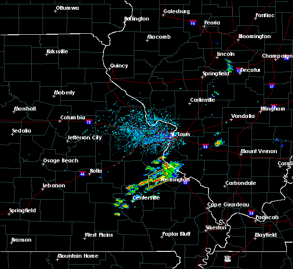 At 323 pm cdt, a severe thunderstorm was located near park hills, moving northeast at 5 mph (trained weather spotters). Hazards include quarter size hail. damage to vehicles is expected At 323 pm cdt, a severe thunderstorm was located near park hills, moving northeast at 5 mph (trained weather spotters). Hazards include quarter size hail. damage to vehicles is expected
|
| 5/14/2018 7:55 PM CDT |
 The severe thunderstorm warning for randolph, ste. genevieve and st. francois counties will expire at 800 pm cdt, the storms which prompted the warning have weakened below severe limits, and no longer pose an immediate threat to life or property. therefore, the warning will be allowed to expire. however gusty winds are still possible with these thunderstorms. a severe thunderstorm watch remains in effect until 1000 pm cdt for east central missouri. a severe thunderstorm watch also remains in effect until 1000 pm cdt for southwestern illinois. The severe thunderstorm warning for randolph, ste. genevieve and st. francois counties will expire at 800 pm cdt, the storms which prompted the warning have weakened below severe limits, and no longer pose an immediate threat to life or property. therefore, the warning will be allowed to expire. however gusty winds are still possible with these thunderstorms. a severe thunderstorm watch remains in effect until 1000 pm cdt for east central missouri. a severe thunderstorm watch also remains in effect until 1000 pm cdt for southwestern illinois.
|
| 5/14/2018 6:50 PM CDT |
 At 649 pm cdt, severe thunderstorms were located along a line extending from near new athens to 7 miles south of de soto, moving southeast at 35 mph (trained weather spotters). Hazards include 60 mph wind gusts. expect damage to roofs, siding, and trees At 649 pm cdt, severe thunderstorms were located along a line extending from near new athens to 7 miles south of de soto, moving southeast at 35 mph (trained weather spotters). Hazards include 60 mph wind gusts. expect damage to roofs, siding, and trees
|
| 4/3/2018 3:37 PM CDT |
 At 337 pm cdt, a severe thunderstorm was located near roselle, moving east at 45 mph (radar indicated). Hazards include 60 mph wind gusts and half dollar size hail. Hail damage to vehicles is expected. expect wind damage to roofs, siding, and trees. locations impacted include, farmington, fredericktown, ironton, pilot knob, iron mountain lake, arcadia, junction city, knob lick, iron mountain, roselle, catherine place, granite, mine la motte, libertyville and doe run. this also includes fort davidson historic site. A tornado watch remains in effect until 800 pm cdt for southeastern and east central missouri. At 337 pm cdt, a severe thunderstorm was located near roselle, moving east at 45 mph (radar indicated). Hazards include 60 mph wind gusts and half dollar size hail. Hail damage to vehicles is expected. expect wind damage to roofs, siding, and trees. locations impacted include, farmington, fredericktown, ironton, pilot knob, iron mountain lake, arcadia, junction city, knob lick, iron mountain, roselle, catherine place, granite, mine la motte, libertyville and doe run. this also includes fort davidson historic site. A tornado watch remains in effect until 800 pm cdt for southeastern and east central missouri.
|
| 4/3/2018 3:14 PM CDT |
 At 314 pm cdt, a severe thunderstorm was located near belleview, moving east at 45 mph (radar indicated). Hazards include 60 mph wind gusts and quarter size hail. Hail damage to vehicles is expected. Expect wind damage to roofs, siding, and trees. At 314 pm cdt, a severe thunderstorm was located near belleview, moving east at 45 mph (radar indicated). Hazards include 60 mph wind gusts and quarter size hail. Hail damage to vehicles is expected. Expect wind damage to roofs, siding, and trees.
|
| 11/5/2017 5:12 PM CDT |
 At 411 pm cst, a severe thunderstorm was located near belleview, moving east at 35 mph (radar indicated). Hazards include 60 mph wind gusts and quarter size hail. Hail damage to vehicles is expected. Expect wind damage to roofs, siding, and trees. At 411 pm cst, a severe thunderstorm was located near belleview, moving east at 35 mph (radar indicated). Hazards include 60 mph wind gusts and quarter size hail. Hail damage to vehicles is expected. Expect wind damage to roofs, siding, and trees.
|
| 11/2/2017 9:06 PM CDT |
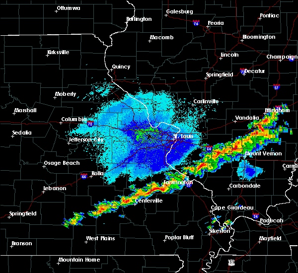 At 906 pm cdt, a severe thunderstorm was located over farmington, moving east at 25 mph (radar indicated). Hazards include quarter size hail. Damage to vehicles is expected. locations impacted include, farmington, park hills, knob lick, libertyville and doe run. this also includes st. Joe state park. At 906 pm cdt, a severe thunderstorm was located over farmington, moving east at 25 mph (radar indicated). Hazards include quarter size hail. Damage to vehicles is expected. locations impacted include, farmington, park hills, knob lick, libertyville and doe run. this also includes st. Joe state park.
|
| 11/2/2017 8:50 PM CDT |
 At 850 pm cdt, a severe thunderstorm was located near bismarck, moving east at 25 mph (radar indicated). Hazards include quarter size hail. damage to vehicles is expected At 850 pm cdt, a severe thunderstorm was located near bismarck, moving east at 25 mph (radar indicated). Hazards include quarter size hail. damage to vehicles is expected
|
| 5/27/2017 5:14 PM CDT | Storm damage reported in st. francois county MO, 1.7 miles N of Farmington, MO |
| 5/27/2017 5:13 PM CDT | Trees downed on highway 221 and 61. size unknown. billboard downed on highway 67 sout in st. francois county MO, 0.8 miles ENE of Farmington, MO |
| 5/27/2017 5:12 PM CDT |
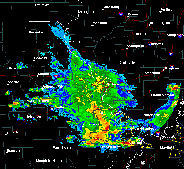 At 511 pm cdt, severe thunderstorms were located along a line extending from near womac to near marquand, moving east at 65 mph. these are very dangerous storms (trained weather spotters). Hazards include 80 mph wind gusts. Flying debris will be dangerous to those caught without shelter. mobile homes will be heavily damaged. expect considerable damage to roofs, windows, and vehicles. extensive tree damage and power outages are likely. locations impacted include, farmington, bonne terre, desloge, ste. genevieve, fredericktown, leadwood, park hills, st. mary, junction city, cobalt, marquand, knob lick, buckhorn, weingarten, womac, rocky ridge, coffman, saco, leadington and minnith. this also includes st. joe state park, hawn state park, and missouri mines historic site. this includes interstate 55 in missouri between exits 141 and 150. A tornado watch remains in effect until 700 pm cdt for southeastern missouri. At 511 pm cdt, severe thunderstorms were located along a line extending from near womac to near marquand, moving east at 65 mph. these are very dangerous storms (trained weather spotters). Hazards include 80 mph wind gusts. Flying debris will be dangerous to those caught without shelter. mobile homes will be heavily damaged. expect considerable damage to roofs, windows, and vehicles. extensive tree damage and power outages are likely. locations impacted include, farmington, bonne terre, desloge, ste. genevieve, fredericktown, leadwood, park hills, st. mary, junction city, cobalt, marquand, knob lick, buckhorn, weingarten, womac, rocky ridge, coffman, saco, leadington and minnith. this also includes st. joe state park, hawn state park, and missouri mines historic site. this includes interstate 55 in missouri between exits 141 and 150. A tornado watch remains in effect until 700 pm cdt for southeastern missouri.
|
| 5/27/2017 5:08 PM CDT | Numerous small to medium size tree limbs down in southwest side of farmingto in st. francois county MO, 0.3 miles NNE of Farmington, MO |
| 5/27/2017 5:08 PM CDT | Trees down in leadingto in st. francois county MO, 4.8 miles SE of Farmington, MO |
| 5/27/2017 4:45 PM CDT |
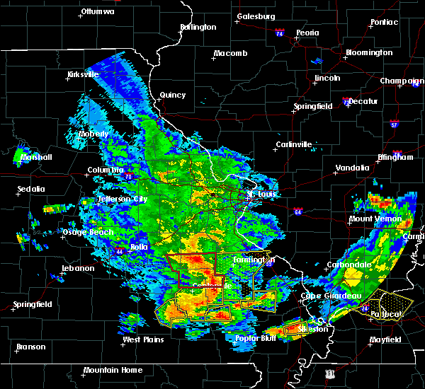 At 445 pm cdt, severe thunderstorms were located along a line extending from bismarck to near annapolis, moving east at 50 mph. these are very dangerous storms (radar indicated). Hazards include 80 mph wind gusts. Flying debris will be dangerous to those caught without shelter. mobile homes will be heavily damaged. expect considerable damage to roofs, windows, and vehicles. Extensive tree damage and power outages are likely. At 445 pm cdt, severe thunderstorms were located along a line extending from bismarck to near annapolis, moving east at 50 mph. these are very dangerous storms (radar indicated). Hazards include 80 mph wind gusts. Flying debris will be dangerous to those caught without shelter. mobile homes will be heavily damaged. expect considerable damage to roofs, windows, and vehicles. Extensive tree damage and power outages are likely.
|
| 4/26/2017 1:14 PM CDT |
 At 112 pm cdt, a severe thunderstorm was located near womac, moving northeast at 40 mph (radar indicated. at 108 pm a storm spotter reported that a flag pole was snapped in fredrecktown). Hazards include 60 mph wind gusts and quarter size hail. Hail damage to vehicles is expected. Expect wind damage to roofs, siding, and trees. At 112 pm cdt, a severe thunderstorm was located near womac, moving northeast at 40 mph (radar indicated. at 108 pm a storm spotter reported that a flag pole was snapped in fredrecktown). Hazards include 60 mph wind gusts and quarter size hail. Hail damage to vehicles is expected. Expect wind damage to roofs, siding, and trees.
|
| 4/26/2017 12:57 PM CDT |
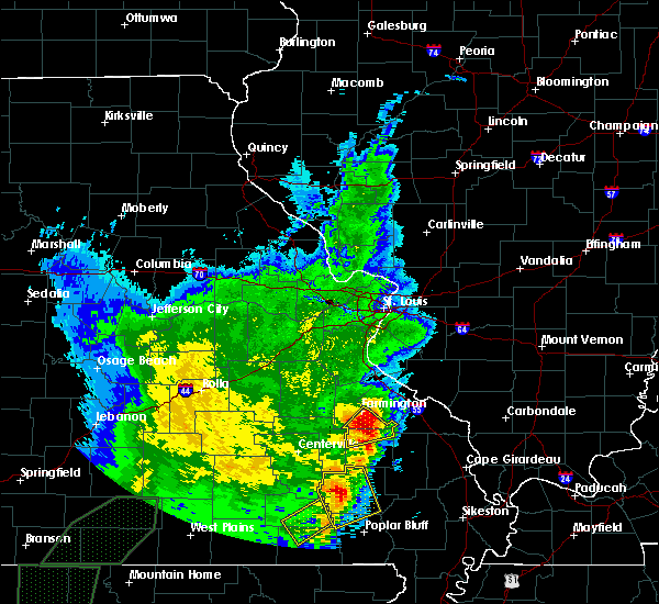 At 1257 pm cdt, a severe thunderstorm was located over knob lick, moving northeast at 40 mph (radar indicated). Hazards include 60 mph wind gusts and quarter size hail. Hail damage to vehicles is expected. expect wind damage to roofs, siding, and trees. Locations impacted include, farmington, fredericktown, junction city, cobalt, roselle, knob lick, mine la motte, libertyville and catherine place. At 1257 pm cdt, a severe thunderstorm was located over knob lick, moving northeast at 40 mph (radar indicated). Hazards include 60 mph wind gusts and quarter size hail. Hail damage to vehicles is expected. expect wind damage to roofs, siding, and trees. Locations impacted include, farmington, fredericktown, junction city, cobalt, roselle, knob lick, mine la motte, libertyville and catherine place.
|
| 4/26/2017 12:33 PM CDT |
 At 1233 pm cdt, a severe thunderstorm was located 7 miles east of glover, moving northeast at 45 mph (radar indicated). Hazards include 60 mph wind gusts and quarter size hail. Hail damage to vehicles is expected. Expect wind damage to roofs, siding, and trees. At 1233 pm cdt, a severe thunderstorm was located 7 miles east of glover, moving northeast at 45 mph (radar indicated). Hazards include 60 mph wind gusts and quarter size hail. Hail damage to vehicles is expected. Expect wind damage to roofs, siding, and trees.
|
| 2/28/2017 7:39 PM CST |
 The severe thunderstorm warning for southwestern ste. genevieve, northern madison and southern st. francois counties in southeastern missouri will expire at 745 pm cst, the storm which prompted the warning has moved out of the area. therefore the warning will be allowed to expire. a tornado watch remains in effect until 900 pm cst for southeastern missouri. remember, a severe thunderstorm warning still remains in effect for portions of ste. genevieve and st. francois counties. remember, a tornado warning still remains in effect for portions of st. francois and ste. genevieve counties. The severe thunderstorm warning for southwestern ste. genevieve, northern madison and southern st. francois counties in southeastern missouri will expire at 745 pm cst, the storm which prompted the warning has moved out of the area. therefore the warning will be allowed to expire. a tornado watch remains in effect until 900 pm cst for southeastern missouri. remember, a severe thunderstorm warning still remains in effect for portions of ste. genevieve and st. francois counties. remember, a tornado warning still remains in effect for portions of st. francois and ste. genevieve counties.
|
| 2/28/2017 7:20 PM CST |
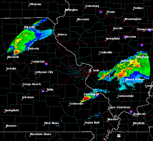 At 719 pm cst, a severe thunderstorm was located over knob lick, moving northeast at 60 mph (radar indicated). Hazards include 60 mph wind gusts and quarter size hail. Hail damage to vehicles is expected. expect wind damage to roofs, siding, and trees. locations impacted include, farmington, fredericktown, park hills, junction city, cobalt, womac, knob lick, weingarten, coffman, roselle, catherine place, mine la motte, libertyville and doe run. this also includes hawn state park. A tornado watch remains in effect until 900 pm cst for southeastern missouri. At 719 pm cst, a severe thunderstorm was located over knob lick, moving northeast at 60 mph (radar indicated). Hazards include 60 mph wind gusts and quarter size hail. Hail damage to vehicles is expected. expect wind damage to roofs, siding, and trees. locations impacted include, farmington, fredericktown, park hills, junction city, cobalt, womac, knob lick, weingarten, coffman, roselle, catherine place, mine la motte, libertyville and doe run. this also includes hawn state park. A tornado watch remains in effect until 900 pm cst for southeastern missouri.
|
| 2/28/2017 7:18 PM CST |
 At 717 pm cst, a severe thunderstorm capable of producing a tornado was located over knob lick, moving northeast at 60 mph (radar indicated rotation). Hazards include tornado and quarter size hail. Flying debris will be dangerous to those caught without shelter. mobile homes will be damaged or destroyed. damage to roofs, windows, and vehicles will occur. tree damage is likely. Locations impacted include, farmington, fredericktown, junction city, roselle, knob lick and catherine place. At 717 pm cst, a severe thunderstorm capable of producing a tornado was located over knob lick, moving northeast at 60 mph (radar indicated rotation). Hazards include tornado and quarter size hail. Flying debris will be dangerous to those caught without shelter. mobile homes will be damaged or destroyed. damage to roofs, windows, and vehicles will occur. tree damage is likely. Locations impacted include, farmington, fredericktown, junction city, roselle, knob lick and catherine place.
|
| 2/28/2017 7:10 PM CST |
 At 710 pm cst, a severe thunderstorm was located over roselle, moving northeast at 60 mph (radar indicated). Hazards include 60 mph wind gusts and quarter size hail. Hail damage to vehicles is expected. expect wind damage to roofs, siding, and trees. locations impacted include, farmington, fredericktown, ironton, park hills, pilot knob, iron mountain lake, arcadia, junction city, cobalt, womac, knob lick, iron mountain, weingarten, coffman, roselle, catherine place, mine la motte, libertyville and doe run. this also includes hawn state park and fort davidson historic site. A tornado watch remains in effect until 900 pm cst for southeastern missouri. At 710 pm cst, a severe thunderstorm was located over roselle, moving northeast at 60 mph (radar indicated). Hazards include 60 mph wind gusts and quarter size hail. Hail damage to vehicles is expected. expect wind damage to roofs, siding, and trees. locations impacted include, farmington, fredericktown, ironton, park hills, pilot knob, iron mountain lake, arcadia, junction city, cobalt, womac, knob lick, iron mountain, weingarten, coffman, roselle, catherine place, mine la motte, libertyville and doe run. this also includes hawn state park and fort davidson historic site. A tornado watch remains in effect until 900 pm cst for southeastern missouri.
|
| 2/28/2017 7:09 PM CST |
 At 709 pm cst, a severe thunderstorm capable of producing a tornado was located over roselle, moving northeast at 60 mph (radar indicated rotation). Hazards include tornado and quarter size hail. Flying debris will be dangerous to those caught without shelter. mobile homes will be damaged or destroyed. damage to roofs, windows, and vehicles will occur. tree damage is likely. locations impacted include, farmington, fredericktown, ironton, pilot knob, iron mountain lake, arcadia, junction city, roselle, knob lick and catherine place. This also includes fort davidson historic site. At 709 pm cst, a severe thunderstorm capable of producing a tornado was located over roselle, moving northeast at 60 mph (radar indicated rotation). Hazards include tornado and quarter size hail. Flying debris will be dangerous to those caught without shelter. mobile homes will be damaged or destroyed. damage to roofs, windows, and vehicles will occur. tree damage is likely. locations impacted include, farmington, fredericktown, ironton, pilot knob, iron mountain lake, arcadia, junction city, roselle, knob lick and catherine place. This also includes fort davidson historic site.
|
| 2/28/2017 7:01 PM CST |
 At 701 pm cst, a severe thunderstorm capable of producing a tornado was located over arcadia, moving northeast at 60 mph (radar indicated rotation). Hazards include tornado and quarter size hail. Flying debris will be dangerous to those caught without shelter. mobile homes will be damaged or destroyed. damage to roofs, windows, and vehicles will occur. tree damage is likely. locations impacted include, farmington, fredericktown, ironton, pilot knob, iron mountain lake, arcadia, junction city, cobalt, knob lick, roselle, catherine place, hogan and granite. This also includes fort davidson historic site and elephant rocks state park. At 701 pm cst, a severe thunderstorm capable of producing a tornado was located over arcadia, moving northeast at 60 mph (radar indicated rotation). Hazards include tornado and quarter size hail. Flying debris will be dangerous to those caught without shelter. mobile homes will be damaged or destroyed. damage to roofs, windows, and vehicles will occur. tree damage is likely. locations impacted include, farmington, fredericktown, ironton, pilot knob, iron mountain lake, arcadia, junction city, cobalt, knob lick, roselle, catherine place, hogan and granite. This also includes fort davidson historic site and elephant rocks state park.
|
| 2/28/2017 6:59 PM CST |
 At 658 pm cst, a severe thunderstorm was located near glover, moving northeast at 60 mph (radar indicated). Hazards include 60 mph wind gusts and quarter size hail. Hail damage to vehicles is expected. Expect wind damage to roofs, siding, and trees. At 658 pm cst, a severe thunderstorm was located near glover, moving northeast at 60 mph (radar indicated). Hazards include 60 mph wind gusts and quarter size hail. Hail damage to vehicles is expected. Expect wind damage to roofs, siding, and trees.
|
| 2/28/2017 6:56 PM CST |
 At 655 pm cst, a severe thunderstorm capable of producing a tornado was located near glover, moving northeast at 60 mph (radar indicated rotation). Hazards include tornado and quarter size hail. Flying debris will be dangerous to those caught without shelter. mobile homes will be damaged or destroyed. damage to roofs, windows, and vehicles will occur. Tree damage is likely. At 655 pm cst, a severe thunderstorm capable of producing a tornado was located near glover, moving northeast at 60 mph (radar indicated rotation). Hazards include tornado and quarter size hail. Flying debris will be dangerous to those caught without shelter. mobile homes will be damaged or destroyed. damage to roofs, windows, and vehicles will occur. Tree damage is likely.
|
| 10/19/2016 4:54 PM CDT |
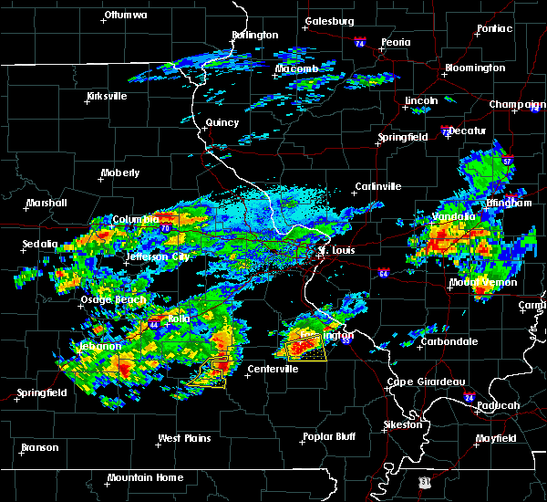 At 454 pm cdt, a severe thunderstorm was located over knob lick, moving east at 35 mph (radar indicated). Hazards include quarter size hail. Damage to vehicles is expected. locations impacted include, farmington, fredericktown, park hills, roselle, womac, coffman, knob lick, mine la motte, libertyville and doe run. This also includes hawn state park. At 454 pm cdt, a severe thunderstorm was located over knob lick, moving east at 35 mph (radar indicated). Hazards include quarter size hail. Damage to vehicles is expected. locations impacted include, farmington, fredericktown, park hills, roselle, womac, coffman, knob lick, mine la motte, libertyville and doe run. This also includes hawn state park.
|
| 10/19/2016 4:32 PM CDT |
 At 432 pm cdt, a severe thunderstorm was located over iron mountain lake, moving east at 35 mph (radar indicated). Hazards include quarter size hail. damage to vehicles is expected At 432 pm cdt, a severe thunderstorm was located over iron mountain lake, moving east at 35 mph (radar indicated). Hazards include quarter size hail. damage to vehicles is expected
|
| 7/13/2016 4:00 PM CDT |
 At 359 pm cdt, a severe thunderstorm was located over chester, moving east at 55 mph (trained weather spotters. numerous trees and power lines down). Hazards include 60 mph wind gusts. Expect damage to roofs. siding. and trees. locations impacted include, farmington, chester, ste. genevieve, sparta, bremen, steeleville, percy, evansville, bloomsdale, st. mary, womac, coffman, rocky ridge, knob lick, weingarten, eden, preston, blair, prairie du rocher and ellis grove. this also includes hawn state park and felix valle house state park. This includes interstate 55 in missouri between exits 141 and 157. At 359 pm cdt, a severe thunderstorm was located over chester, moving east at 55 mph (trained weather spotters. numerous trees and power lines down). Hazards include 60 mph wind gusts. Expect damage to roofs. siding. and trees. locations impacted include, farmington, chester, ste. genevieve, sparta, bremen, steeleville, percy, evansville, bloomsdale, st. mary, womac, coffman, rocky ridge, knob lick, weingarten, eden, preston, blair, prairie du rocher and ellis grove. this also includes hawn state park and felix valle house state park. This includes interstate 55 in missouri between exits 141 and 157.
|
| 7/13/2016 3:42 PM CDT | Trees and power lines down in st. francois county MO, 0.3 miles NNE of Farmington, MO |
| 7/13/2016 3:41 PM CDT | Numerous trees and powerlines down throughout the county in st. francois county MO, 0.3 miles NNE of Farmington, MO |
| 7/13/2016 3:40 PM CDT | Large tree limbs down across town. several power lines down. several roadways blocke in st. francois county MO, 0.3 miles NNE of Farmington, MO |
| 7/13/2016 3:29 PM CDT |
 At 329 pm cdt, a severe thunderstorm was located near desloge, moving east at 65 mph (radar indicated). Hazards include 60 mph wind gusts. Expect damage to roofs. siding. And trees. At 329 pm cdt, a severe thunderstorm was located near desloge, moving east at 65 mph (radar indicated). Hazards include 60 mph wind gusts. Expect damage to roofs. siding. And trees.
|
| 7/13/2016 3:13 PM CDT |
 At 312 pm cdt, a severe thunderstorm was located 9 miles southwest of potosi, moving east at 35 mph (trained weather spotters). Hazards include 60 mph wind gusts. wind damage reported in crawford county. Expect damage to roofs. siding. And trees. At 312 pm cdt, a severe thunderstorm was located 9 miles southwest of potosi, moving east at 35 mph (trained weather spotters). Hazards include 60 mph wind gusts. wind damage reported in crawford county. Expect damage to roofs. siding. And trees.
|
| 7/8/2016 4:30 AM CDT | Several large tree limbs and a couple of trees blown around town...some of which were blocking roadway in st. francois county MO, 0.3 miles NNE of Farmington, MO |
| 7/6/2016 12:00 PM CDT | Auto zone sign blown down in farmington in st. francois county MO, 0.3 miles NNE of Farmington, MO |
| 7/6/2016 11:56 AM CDT |
 At 1155 am cdt, severe thunderstorms were located along a line extending from irondale to near knob lick to near cobalt to buckhorn, moving east at 55 mph (trained weather spotters report damage in caledonia and trees down in reynolds county). Hazards include 60 mph wind gusts. Expect damage to roofs. siding. and trees. locations impacted include, farmington, desloge, fredericktown, bismarck, leadwood, park hills, iron mountain lake, irondale, junction city, cobalt, marquand, iron mountain, roselle, buckhorn, saco, knob lick, leadington, mine la motte, libertyville and catherine place. this also includes st. Joe state park and missouri mines historic site. At 1155 am cdt, severe thunderstorms were located along a line extending from irondale to near knob lick to near cobalt to buckhorn, moving east at 55 mph (trained weather spotters report damage in caledonia and trees down in reynolds county). Hazards include 60 mph wind gusts. Expect damage to roofs. siding. and trees. locations impacted include, farmington, desloge, fredericktown, bismarck, leadwood, park hills, iron mountain lake, irondale, junction city, cobalt, marquand, iron mountain, roselle, buckhorn, saco, knob lick, leadington, mine la motte, libertyville and catherine place. this also includes st. Joe state park and missouri mines historic site.
|
| 7/6/2016 11:46 AM CDT |
 At 1146 am cdt, severe thunderstorms were located along a line extending from near courtois to near irondale to roselle to near saco to near greenville in wayne county, moving east at 50 mph (radar indicated). Hazards include 60 mph wind gusts. Expect damage to roofs. siding. and trees. locations impacted include, farmington, desloge, fredericktown, bismarck, ironton, leadwood, park hills, pilot knob, iron mountain lake, arcadia, irondale, junction city, cobalt, marquand, iron mountain, roselle, saco, knob lick, belleview and buckhorn. this also includes st. Joe state park, fort davidson historic site, elephant rocks state park, and missouri mines historic site. At 1146 am cdt, severe thunderstorms were located along a line extending from near courtois to near irondale to roselle to near saco to near greenville in wayne county, moving east at 50 mph (radar indicated). Hazards include 60 mph wind gusts. Expect damage to roofs. siding. and trees. locations impacted include, farmington, desloge, fredericktown, bismarck, ironton, leadwood, park hills, pilot knob, iron mountain lake, arcadia, irondale, junction city, cobalt, marquand, iron mountain, roselle, saco, knob lick, belleview and buckhorn. this also includes st. Joe state park, fort davidson historic site, elephant rocks state park, and missouri mines historic site.
|
| 7/6/2016 11:25 AM CDT |
 At 1125 am cdt, severe thunderstorms were located along a line extending from 10 miles south of cherryville to near bixby to 6 miles west of glover to near annapolis to near piedmont, moving east at 55 mph (radar indicated). Hazards include 60 mph wind gusts. Expect damage to roofs. siding. And trees. At 1125 am cdt, severe thunderstorms were located along a line extending from 10 miles south of cherryville to near bixby to 6 miles west of glover to near annapolis to near piedmont, moving east at 55 mph (radar indicated). Hazards include 60 mph wind gusts. Expect damage to roofs. siding. And trees.
|
| 5/11/2016 11:07 PM CDT |
 At 1106 pm cdt, severe thunderstorms were located along a line extending from 7 miles north of pinckneyville to near ava to near perryville to 6 miles west of ironton to near bunker, moving northeast at 15 mph (radar indicated). Hazards include 60 mph wind gusts and quarter size hail. Hail damage to vehicles is expected. expect wind damage to roofs, siding, and trees. locations impacted include, farmington, chester, bonne terre, desloge, ste. genevieve, fredericktown, potosi, bismarck, ironton, leadwood, bremen, park hills, pilot knob, iron mountain lake, viburnum, arcadia, bloomsdale, irondale, st. mary and mineral point. this also includes st. joe state park, st. francois state park, johnsons shut-ins state park, hawn state park, fort davidson historic site, felix valle house state park, elephant rocks state park, dillard mill historic site, taum sauk mountain state park, and missouri mines historic site. This includes interstate 55 in missouri between exits 141 and 157. At 1106 pm cdt, severe thunderstorms were located along a line extending from 7 miles north of pinckneyville to near ava to near perryville to 6 miles west of ironton to near bunker, moving northeast at 15 mph (radar indicated). Hazards include 60 mph wind gusts and quarter size hail. Hail damage to vehicles is expected. expect wind damage to roofs, siding, and trees. locations impacted include, farmington, chester, bonne terre, desloge, ste. genevieve, fredericktown, potosi, bismarck, ironton, leadwood, bremen, park hills, pilot knob, iron mountain lake, viburnum, arcadia, bloomsdale, irondale, st. mary and mineral point. this also includes st. joe state park, st. francois state park, johnsons shut-ins state park, hawn state park, fort davidson historic site, felix valle house state park, elephant rocks state park, dillard mill historic site, taum sauk mountain state park, and missouri mines historic site. This includes interstate 55 in missouri between exits 141 and 157.
|
| 5/11/2016 10:31 PM CDT |
 At 1030 pm cdt, severe thunderstorms were located along a line extending from 6 miles southeast of coulterville to 7 miles west of ava to 7 miles west of perryville to near farmington to near bunker, moving east at 15 mph (radar indicated). Hazards include 60 mph wind gusts and quarter size hail. Hail damage to vehicles is expected. Expect wind damage to roofs, siding, and trees. At 1030 pm cdt, severe thunderstorms were located along a line extending from 6 miles southeast of coulterville to 7 miles west of ava to 7 miles west of perryville to near farmington to near bunker, moving east at 15 mph (radar indicated). Hazards include 60 mph wind gusts and quarter size hail. Hail damage to vehicles is expected. Expect wind damage to roofs, siding, and trees.
|
| 5/11/2016 9:29 PM CDT |
 At 929 pm cdt, severe thunderstorms were located along a line extending from near red bud to 10 miles south of anthonies mill, moving east at 35 mph (radar indicated). Hazards include 60 mph wind gusts and quarter size hail. Hail damage to vehicles is expected. Expect wind damage to roofs, siding, and trees. At 929 pm cdt, severe thunderstorms were located along a line extending from near red bud to 10 miles south of anthonies mill, moving east at 35 mph (radar indicated). Hazards include 60 mph wind gusts and quarter size hail. Hail damage to vehicles is expected. Expect wind damage to roofs, siding, and trees.
|
| 5/11/2016 6:29 PM CDT |
 At 629 pm cdt, severe thunderstorms were located along a line extending from 7 miles northeast of anthonies mill to farmington, moving northeast at 15 mph (trained weather spotters reported hail to golf ball with these storms). Hazards include golf ball size hail and 60 mph wind gusts. People and animals outdoors will be injured. expect hail damage to roofs, siding, windows, and vehicles. Expect wind damage to roofs, siding, and trees. At 629 pm cdt, severe thunderstorms were located along a line extending from 7 miles northeast of anthonies mill to farmington, moving northeast at 15 mph (trained weather spotters reported hail to golf ball with these storms). Hazards include golf ball size hail and 60 mph wind gusts. People and animals outdoors will be injured. expect hail damage to roofs, siding, windows, and vehicles. Expect wind damage to roofs, siding, and trees.
|
| 5/11/2016 6:19 PM CDT |
 At 618 pm cdt, severe thunderstorms were located along a line extending from near richwoods to near park hills, and are nearly stationary (trained weather spotters reported hail up to the size of golf balls with these storms. in addition, persistent rotation has been seen with these storms). Hazards include golf ball size hail and 60 mph wind gusts. People and animals outdoors will be injured. expect hail damage to roofs, siding, windows, and vehicles. expect wind damage to roofs, siding, and trees. locations impacted include, farmington, bonne terre, desloge, potosi, bismarck, leadwood, park hills, iron mountain lake, irondale, mineral point, old mines, richwoods, leadington, doe run, latty, frankclay, blackwell and cadet. this also includes washington state park, st. Joe state park, and missouri mines historic site. At 618 pm cdt, severe thunderstorms were located along a line extending from near richwoods to near park hills, and are nearly stationary (trained weather spotters reported hail up to the size of golf balls with these storms. in addition, persistent rotation has been seen with these storms). Hazards include golf ball size hail and 60 mph wind gusts. People and animals outdoors will be injured. expect hail damage to roofs, siding, windows, and vehicles. expect wind damage to roofs, siding, and trees. locations impacted include, farmington, bonne terre, desloge, potosi, bismarck, leadwood, park hills, iron mountain lake, irondale, mineral point, old mines, richwoods, leadington, doe run, latty, frankclay, blackwell and cadet. this also includes washington state park, st. Joe state park, and missouri mines historic site.
|
| 5/11/2016 5:45 PM CDT |
 At 544 pm cdt, severe thunderstorms were located along a line extending from near richwoods to near park hills, moving northeast at 10 mph (radar indicated). Hazards include 60 mph wind gusts and half dollar size hail. Hail damage to vehicles is expected. Expect wind damage to roofs, siding, and trees. At 544 pm cdt, severe thunderstorms were located along a line extending from near richwoods to near park hills, moving northeast at 10 mph (radar indicated). Hazards include 60 mph wind gusts and half dollar size hail. Hail damage to vehicles is expected. Expect wind damage to roofs, siding, and trees.
|
| 5/11/2016 5:09 PM CDT |
 At 507 pm cdt, severe thunderstorms were located along a line extending from 6 miles northwest of chester to near st. mary to near irondale, moving south at 15 mph (trained weather spotters have reported hail to the size of golf balls, most recently in desloge. in addition, these storms have exhibited persistent rotation to them). Hazards include golf ball size hail and 70 mph wind gusts. People and animals outdoors will be injured. expect hail damage to roofs, siding, windows, and vehicles. expect considerable tree damage. wind damage is also likely to mobile homes, roofs, and outbuildings. locations impacted include, farmington, chester, bonne terre, desloge, ste. genevieve, bismarck, leadwood, park hills, iron mountain lake, evansville, bloomsdale, irondale, st. mary, iron mountain, coffman, rocky ridge, knob lick, weingarten, prairie du rocher and leadington. this also includes st. joe state park, st. francois state park, hawn state park, felix valle house state park, and missouri mines historic site. This includes interstate 55 in missouri between exits 141 and 157. At 507 pm cdt, severe thunderstorms were located along a line extending from 6 miles northwest of chester to near st. mary to near irondale, moving south at 15 mph (trained weather spotters have reported hail to the size of golf balls, most recently in desloge. in addition, these storms have exhibited persistent rotation to them). Hazards include golf ball size hail and 70 mph wind gusts. People and animals outdoors will be injured. expect hail damage to roofs, siding, windows, and vehicles. expect considerable tree damage. wind damage is also likely to mobile homes, roofs, and outbuildings. locations impacted include, farmington, chester, bonne terre, desloge, ste. genevieve, bismarck, leadwood, park hills, iron mountain lake, evansville, bloomsdale, irondale, st. mary, iron mountain, coffman, rocky ridge, knob lick, weingarten, prairie du rocher and leadington. this also includes st. joe state park, st. francois state park, hawn state park, felix valle house state park, and missouri mines historic site. This includes interstate 55 in missouri between exits 141 and 157.
|
| 5/11/2016 4:45 PM CDT |
 At 445 pm cdt, severe thunderstorms were located along a line extending from near evansville to near irondale, moving south at 10 mph (radar indicated). Hazards include golf ball size hail and 70 mph wind gusts. People and animals outdoors will be injured. expect hail damage to roofs, siding, windows, and vehicles. expect considerable tree damage. Wind damage is also likely to mobile homes, roofs, and outbuildings. At 445 pm cdt, severe thunderstorms were located along a line extending from near evansville to near irondale, moving south at 10 mph (radar indicated). Hazards include golf ball size hail and 70 mph wind gusts. People and animals outdoors will be injured. expect hail damage to roofs, siding, windows, and vehicles. expect considerable tree damage. Wind damage is also likely to mobile homes, roofs, and outbuildings.
|
| 5/11/2016 4:05 PM CDT |
 At 405 pm cdt, a severe thunderstorm was located near leadwood, moving east at 15 mph (radar indicated). Hazards include 60 mph wind gusts and quarter size hail. Hail damage to vehicles is expected. Expect wind damage to roofs, siding, and trees. At 405 pm cdt, a severe thunderstorm was located near leadwood, moving east at 15 mph (radar indicated). Hazards include 60 mph wind gusts and quarter size hail. Hail damage to vehicles is expected. Expect wind damage to roofs, siding, and trees.
|
| 12/23/2015 10:40 AM CST | The severe thunderstorm warning for south central st. francois and madison counties in southeastern missouri will expire at 1045 am cst, the storms which prompted the warning have moved out of the area. therefore the warning will be allowed to expire. a tornado watch remains in effect until 500 pm cst for southeastern missouri. to report severe weather, contact your nearest law enforcement agency. they will relay your report to the national weather service st louis. |
| 12/23/2015 10:30 AM CST | At 1029 am cst, severe thunderstorms were located along a line extending from 6 miles east of farmington to near cobalt, moving east at 55 mph (radar indicated). Hazards include 60 mph wind gusts. Expect damage to roofs. siding and trees. locations impacted include, farmington, fredericktown, junction city, cobalt, marquand, buckhorn, saco, knob lick, mine la motte, libertyville and catherine place. A tornado watch remains in effect until 500 pm cst for southeastern missouri. |
| 12/23/2015 10:16 AM CST | At 1016 am cst, a severe thunderstorm was located near roselle, moving northeast at 75 mph (radar indicated). Hazards include 60 mph wind gusts. Expect damage to roofs. siding and trees. locations impacted include, farmington, fredericktown, ironton, pilot knob, arcadia, junction city, cobalt, marquand, roselle, buckhorn, saco, knob lick, des arc, mine la motte, libertyville, catherine place, chloride and vulcan. this warning also includes fort davidson historic site. A tornado watch remains in effect until 500 pm cst for southeastern missouri. |
| 12/23/2015 9:58 AM CST | The national weather service in st louis has issued a * severe thunderstorm warning for. southwestern st. francois county in southeastern missouri. eastern iron county in southeastern missouri. madison county in southeastern missouri. Until 1045 am cst. |
| 8/9/2015 11:17 PM CDT |
 At 1117 pm cdt, a severe thunderstorm was located over park hills, moving southeast at 20 mph (radar indicated). Hazards include 60 mph wind gusts. Expect damage to roofs. Siding and trees. At 1117 pm cdt, a severe thunderstorm was located over park hills, moving southeast at 20 mph (radar indicated). Hazards include 60 mph wind gusts. Expect damage to roofs. Siding and trees.
|
| 8/9/2015 10:48 PM CDT |
 At 1048 pm cdt, a severe thunderstorm was located near bonne terre, moving southeast at 30 mph (radar indicated). Hazards include 60 mph wind gusts. Expect damage to roofs. siding and trees. locations impacted include, farmington, bonne terre, desloge, leadwood, park hills, mineral point, old mines, leadington, cadet, blackwell and french village. this warning also includes , washington state park, st. Francois state park, and missouri mines historic site. At 1048 pm cdt, a severe thunderstorm was located near bonne terre, moving southeast at 30 mph (radar indicated). Hazards include 60 mph wind gusts. Expect damage to roofs. siding and trees. locations impacted include, farmington, bonne terre, desloge, leadwood, park hills, mineral point, old mines, leadington, cadet, blackwell and french village. this warning also includes , washington state park, st. Francois state park, and missouri mines historic site.
|
| 8/9/2015 10:23 PM CDT |
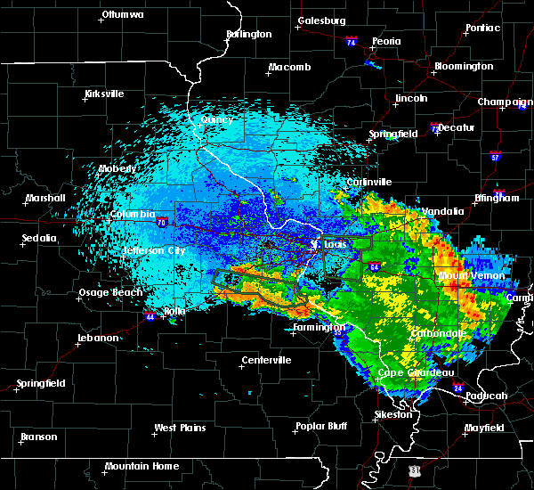 At 1022 pm cdt, a severe thunderstorm was located near old mines, moving southeast at 25 mph (radar indicated). Hazards include 60 mph wind gusts. Expect damage to roofs. Siding and trees. At 1022 pm cdt, a severe thunderstorm was located near old mines, moving southeast at 25 mph (radar indicated). Hazards include 60 mph wind gusts. Expect damage to roofs. Siding and trees.
|
| 8/9/2015 8:00 PM CDT |
 At 759 pm cdt, severe thunderstorms were located along a line extending from near waterloo to near ste. genevieve to near coffman, moving east at 50 mph (radar indicated). Hazards include 60 mph wind gusts. tree damage has been reported throughout the southern half of jefferon county. Expect damage to roofs. siding and trees. locations impacted include, farmington, waterloo, chester, ste. genevieve, sparta, red bud, park hills, new athens, marissa, valmeyer, evansville, bloomsdale, baldwin, st. mary, weingarten, new design, rocky ridge, coffman, preston and blair. this warning also includes hawn state park and felix valle house state park. This includes interstate 55 in missouri between exits 141 and 162. At 759 pm cdt, severe thunderstorms were located along a line extending from near waterloo to near ste. genevieve to near coffman, moving east at 50 mph (radar indicated). Hazards include 60 mph wind gusts. tree damage has been reported throughout the southern half of jefferon county. Expect damage to roofs. siding and trees. locations impacted include, farmington, waterloo, chester, ste. genevieve, sparta, red bud, park hills, new athens, marissa, valmeyer, evansville, bloomsdale, baldwin, st. mary, weingarten, new design, rocky ridge, coffman, preston and blair. this warning also includes hawn state park and felix valle house state park. This includes interstate 55 in missouri between exits 141 and 162.
|
| 8/9/2015 7:55 PM CDT | Power lines down on copenhagen road and route hh in st. francois county MO, 1 miles N of Farmington, MO |
| 8/9/2015 7:47 PM CDT |
 At 746 pm cdt, severe thunderstorms were located along a line extending from fountain to near bloomsdale to near park hills, moving east at 50 mph (radar indicated). Hazards include 60 mph wind gusts. damage to trees was reported in the de soto area around 727 pm. Expect damage to roofs. siding and trees. locations impacted include, farmington, festus, waterloo, chester, bonne terre, pevely, desloge, crystal city, ste. genevieve, sparta, red bud, herculaneum, leadwood, barnhart, park hills, new athens, marissa, valmeyer, olympian village and evansville. this warning also includes , st. francois state park, hawn state park, felix valle house state park, missouri mines historic site, and gov. dunklin`s grave historic site. This includes interstate 55 in missouri between exits 141 and 180. At 746 pm cdt, severe thunderstorms were located along a line extending from fountain to near bloomsdale to near park hills, moving east at 50 mph (radar indicated). Hazards include 60 mph wind gusts. damage to trees was reported in the de soto area around 727 pm. Expect damage to roofs. siding and trees. locations impacted include, farmington, festus, waterloo, chester, bonne terre, pevely, desloge, crystal city, ste. genevieve, sparta, red bud, herculaneum, leadwood, barnhart, park hills, new athens, marissa, valmeyer, olympian village and evansville. this warning also includes , st. francois state park, hawn state park, felix valle house state park, missouri mines historic site, and gov. dunklin`s grave historic site. This includes interstate 55 in missouri between exits 141 and 180.
|
| 8/9/2015 7:35 PM CDT |
 At 735 pm cdt, severe thunderstorms were located along a line extending from antonia to near olympian village to irondale, moving east at 50 mph (radar indicated). Hazards include 60 mph wind gusts. Expect damage to roofs. Siding and trees. At 735 pm cdt, severe thunderstorms were located along a line extending from antonia to near olympian village to irondale, moving east at 50 mph (radar indicated). Hazards include 60 mph wind gusts. Expect damage to roofs. Siding and trees.
|
| 5/24/2015 8:09 PM CDT | Several trees and power lines blown down around tow in st. francois county MO, 0.3 miles NNE of Farmington, MO |
| 5/24/2015 8:08 PM CDT | At 806 pm cdt, a severe thunderstorm capable of producing a tornado was located 5 miles east of farmington, and moving north at 40 mph (radar indicated rotation). Hazards include tornado and quarter size hail. Flying debris will be dangerous to those caught without shelter. mobile homes will be damaged or destroyed. damage to roofs, windows and vehicles will occur. tree damage is likely. this dangerous storm will be near, weingarten around 820 pm cdt. rocky ridge around 825 pm cdt. bloomsdale around 835 pm cdt. this warning includes hawn state park. This warning also includes, interstate 55 in missouri from exit 150 to exit 170. |
| 5/24/2015 7:38 PM CDT | At 736 pm cdt, a severe thunderstorm capable of producing a tornado was located 5 miles northeast of farmington, and moving north at 40 mph (radar indicated rotation). Hazards include tornado. Flying debris will be dangerous to those caught without shelter. mobile homes will be damaged or destroyed. damage to roofs, windows and vehicles will occur. tree damage is likely. this dangerous storm will be near, rocky ridge around 745 pm cdt. bloomsdale around 755 pm cdt. crystal city around 815 pm cdt. other locations in the warning include french village. this warning includes st. joe state park. This warning also includes, interstate 55 in missouri from exit 154 to exit 174. |
| 4/8/2015 5:35 PM CDT | A severe thunderstorm warning remains in effect for st. francois and west central ste. genevieve counties until 600 pm cdt. at 532 pm cdt. a severe thunderstorm was located near bismarck. and moving east at 30 mph. hazard. 60 mph wind gusts and quarter size hail. source. Radar indicated. |
| 4/8/2015 5:25 PM CDT | The national weather service in st louis has issued a * severe thunderstorm warning for. west central ste. genevieve county in southeast missouri. st. francois county in southeast missouri. southeastern washington county in east central missouri. Until 600 pm cdt. |
| 4/8/2015 5:19 PM CDT | A tornado warning remains in effect for st. francois. south central ste. genevieve and northeastern madison counties until 530 pm cdt. at 516 pm cdt. a severe thunderstorm capable of producing a tornado was located near womac. and moving east at 25 mph. in addition. Tennis ball sized hail is occurring to the northwest of the possible. |
| 4/8/2015 5:05 PM CDT | The national weather service in st louis has issued a * tornado warning for. northeastern madison county in southeast missouri. south central ste. genevieve county in southeast missouri. st. francois county in southeast missouri. Until 530 pm cdt. |
| 4/8/2015 5:02 PM CDT | Golf Ball sized hail reported 3.1 miles NW of Farmington, MO, along highway oo. |
| 4/8/2015 4:53 PM CDT | The national weather service in st louis has issued a * tornado warning for. southern ste. genevieve county in southeast missouri. st. francois county in southeast missouri. until 545 pm cdt * at 451 pm cdt. A severe thunderstorm capable of producing a. |
| 4/8/2015 4:52 PM CDT | Hen Egg sized hail reported 5.3 miles W of Farmington, MO, damage to windows. |
| 4/8/2015 4:48 PM CDT | A tornado warning remains in effect for st. francois and southern ste. genevieve counties until 500 pm cdt. at 444 pm cdt. a severe thunderstorm capable of producing a tornado was located near weingarten. and moving east at 25 mph. in addition. Softball sized hail has been reported in the farmington area!. |
| 4/8/2015 4:45 PM CDT | Baseball sized hail reported 0.3 miles NNE of Farmington, MO, golfball to baseball size hail at kdkz station in farmington. |
| 4/8/2015 4:37 PM CDT | A tornado warning remains in effect for st. francois and southern ste. genevieve counties until 500 pm cdt. at 436 pm cdt. a severe thunderstorm capable of producing a tornado was located 6 miles southwest of weingarten. and moving east at 25 mph. in addition. Baseball sized hail has been reported on the north-northwest side of farmington. |
| 4/8/2015 4:36 PM CDT | Baseball sized hail reported 0.3 miles NNE of Farmington, MO, nw side of farmington. |
| 4/8/2015 4:36 PM CDT | Tea Cup sized hail reported 0.3 miles NNE of Farmington, MO, nw side of farmington. |
| 4/8/2015 4:26 PM CDT | The national weather service in st louis has issued a * tornado warning for. southern ste. genevieve county in southeast missouri. st. francois county in southeast missouri. until 500 pm cdt * at 424 pm cdt. A severe thunderstorm capable of producing a. |
| 4/8/2015 4:17 PM CDT | A tornado warning remains in effect for st. francois and southern ste. genevieve counties until 430 pm cdt. at 414 pm cdt. a severe thunderstorm capable of producing a tornado was located near desloge. and moving east at 25 mph. hazard. tornado and golf ball size hail. source. Radar indicated rotation. |
| 4/8/2015 3:59 PM CDT | The national weather service in st louis has issued a * tornado warning for. southern ste. genevieve county in southeast missouri. st. francois county in southeast missouri. until 430 pm cdt * at 357 pm cdt. A severe thunderstorm capable of producing a. |
| 5/9/2014 5:30 PM CDT | Quarter sized hail reported 1 miles N of Farmington, MO |
| 7/20/2013 2:45 PM CDT | Several 12-18 inch diameter tree limbs down and a large 8-10 foot diameter tree down that fell ontu a residential home. time estimated from rada in st. francois county MO, 0.3 miles NNE of Farmington, MO |
| 5/30/2013 5:50 PM CDT | Two trees blown down and partially blocking highway f at highway mm. time estimated from radar in ste. genevieve county MO, 10.5 miles WNW of Farmington, MO |
| 5/20/2013 11:00 PM CDT | Power lines down along carolton street in st. francois county MO, 0.3 miles NNE of Farmington, MO |
| 1/1/0001 12:00 AM | Storm damage reported in st. francois county MO, 1.7 miles N of Farmington, MO |
| 1/1/0001 12:00 AM | Storm damage reported in st. francois county MO, 0.3 miles NNE of Farmington, MO |
| 1/1/0001 12:00 AM | Numerous trees uprooted or snapped...12 to 14 inches in diameter and up to 40 feet tall...on the south side of town. time estimate in st. francois county MO, 0.3 miles NNE of Farmington, MO |
| 1/1/0001 12:00 AM | Storm damage reported in st. francois county MO, 0.3 miles NNE of Farmington, MO |
| 1/1/0001 12:00 AM | Quarter sized hail reported 0.3 miles NNE of Farmington, MO, at city hall |
| 1/1/0001 12:00 AM | Quarter sized hail reported 0.3 miles NNE of Farmington, MO |
| 1/1/0001 12:00 AM | Trees down at hwy 67 and 221 in st. francois county MO, 0.3 miles NNE of Farmington, MO |
| 1/1/0001 12:00 AM | Quarter sized hail reported 0.3 miles NNE of Farmington, MO |
Hail Maps for Farmington, MO

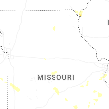

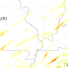


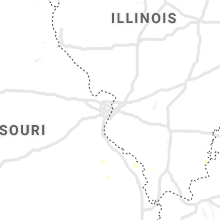


Connect with Interactive Hail Maps