

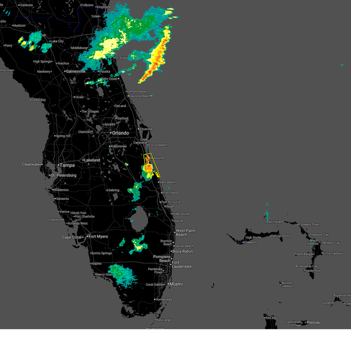
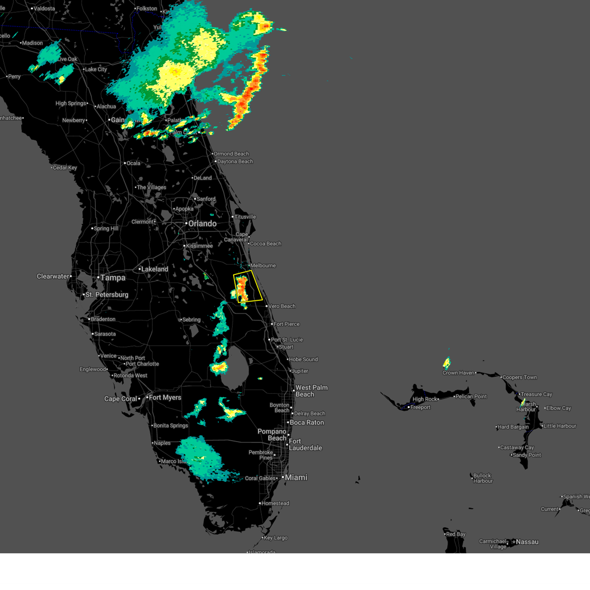
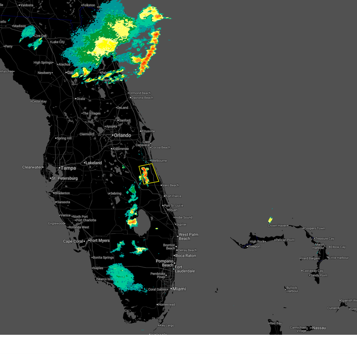
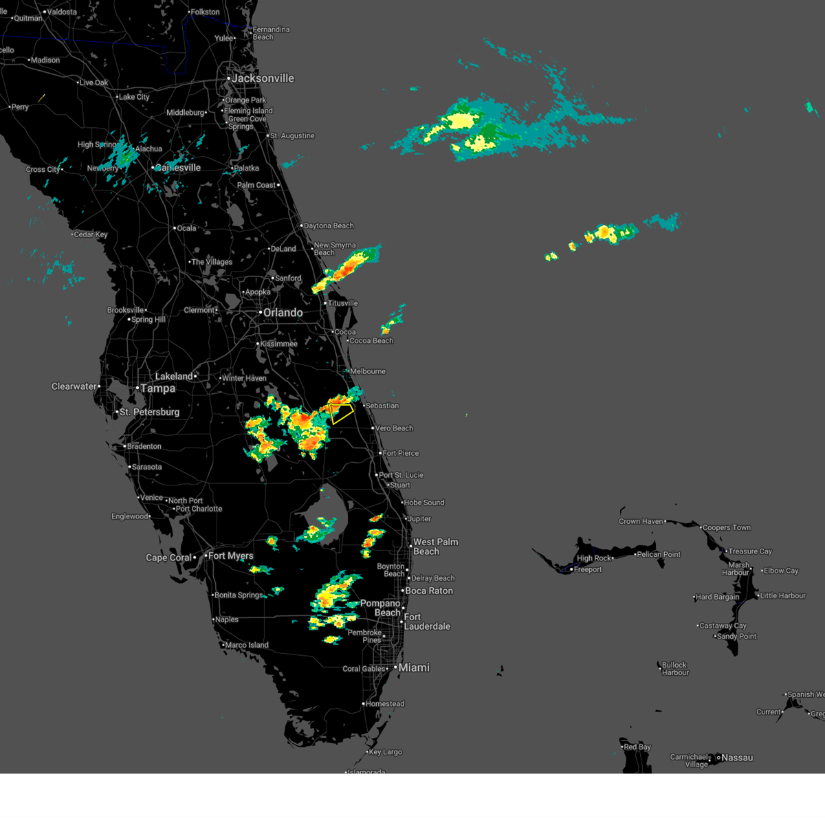
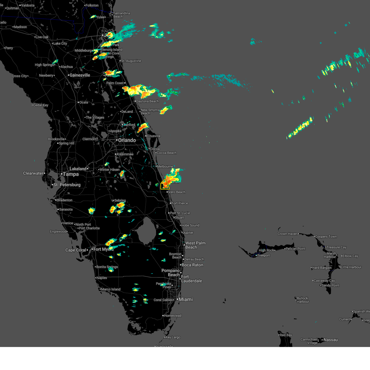
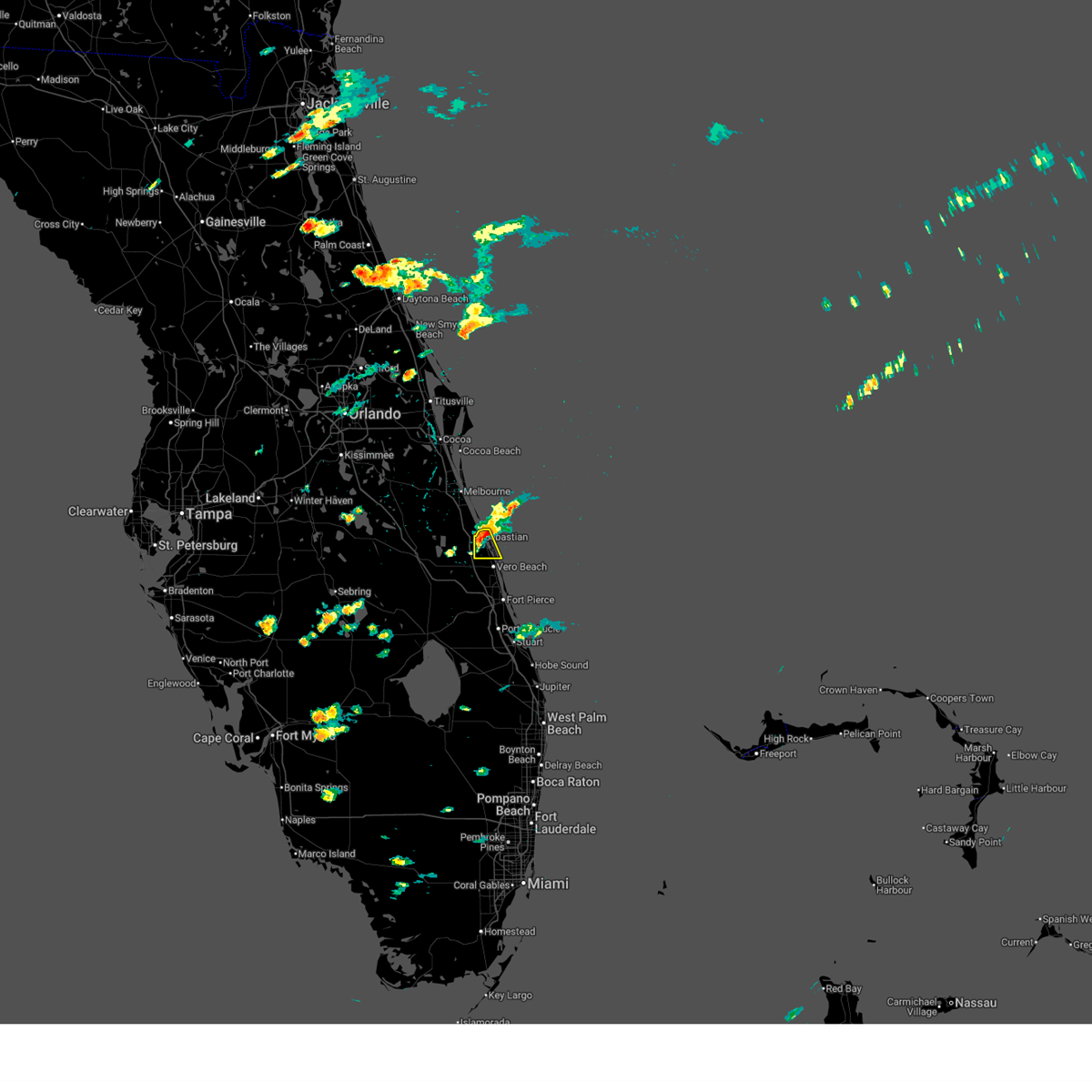
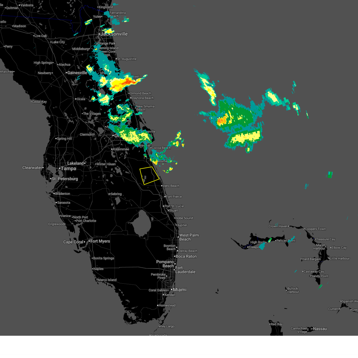
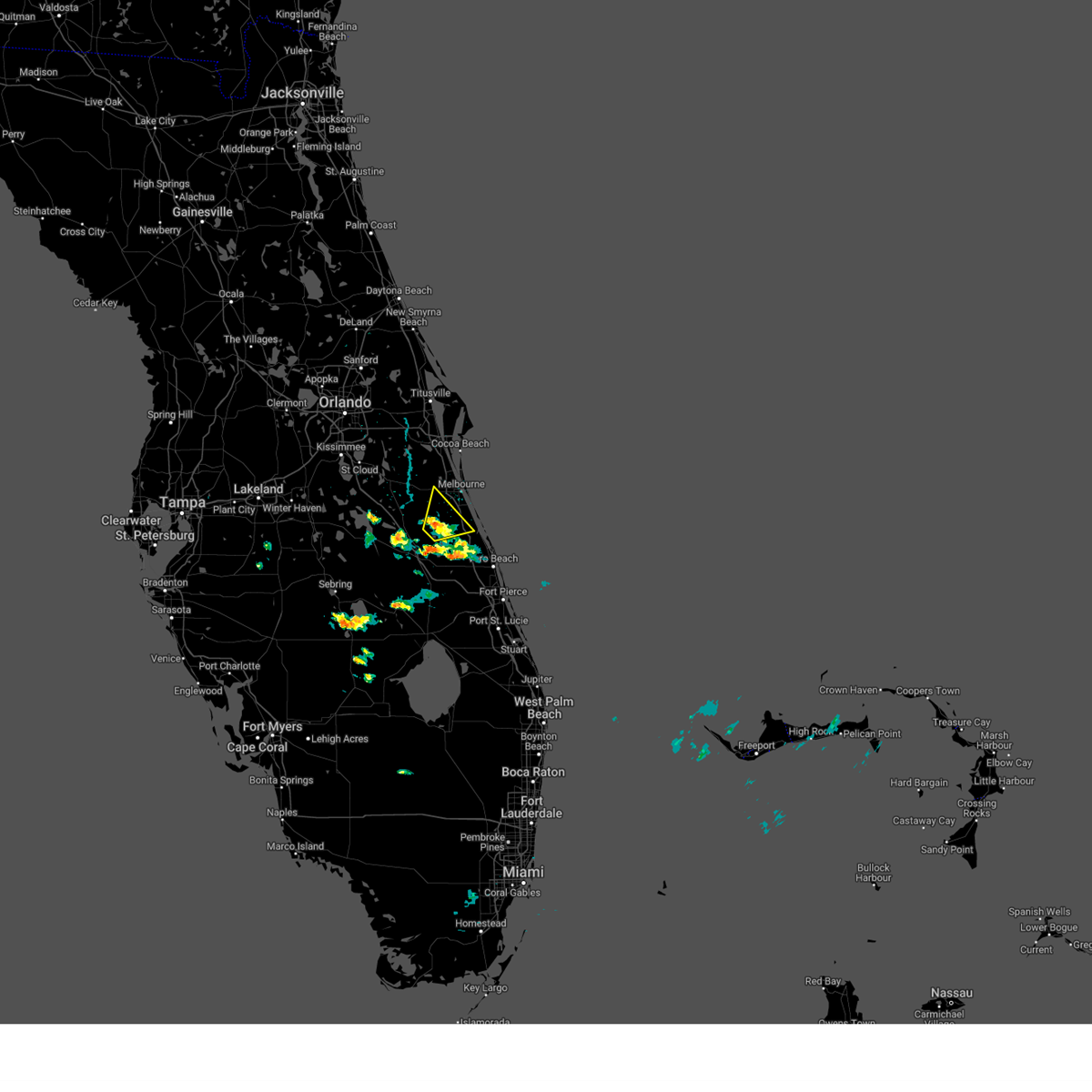
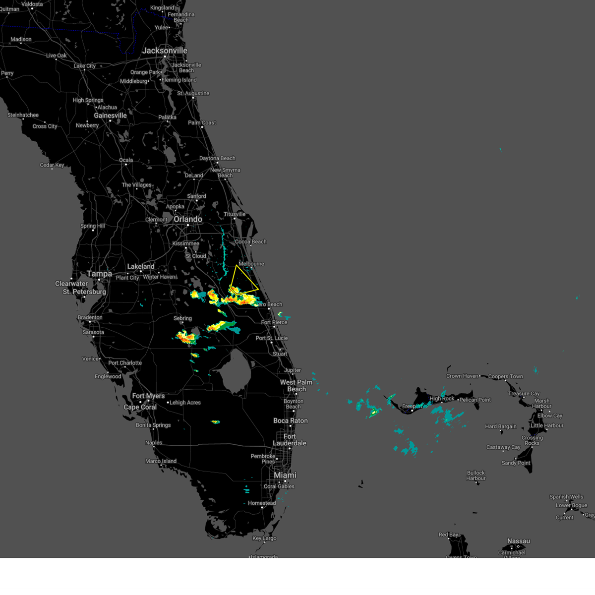
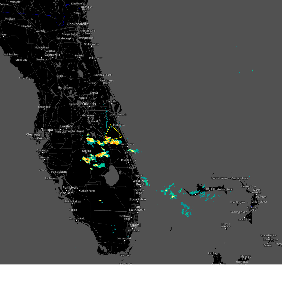
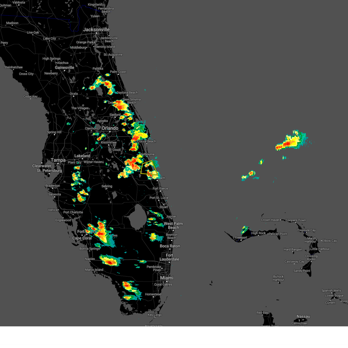
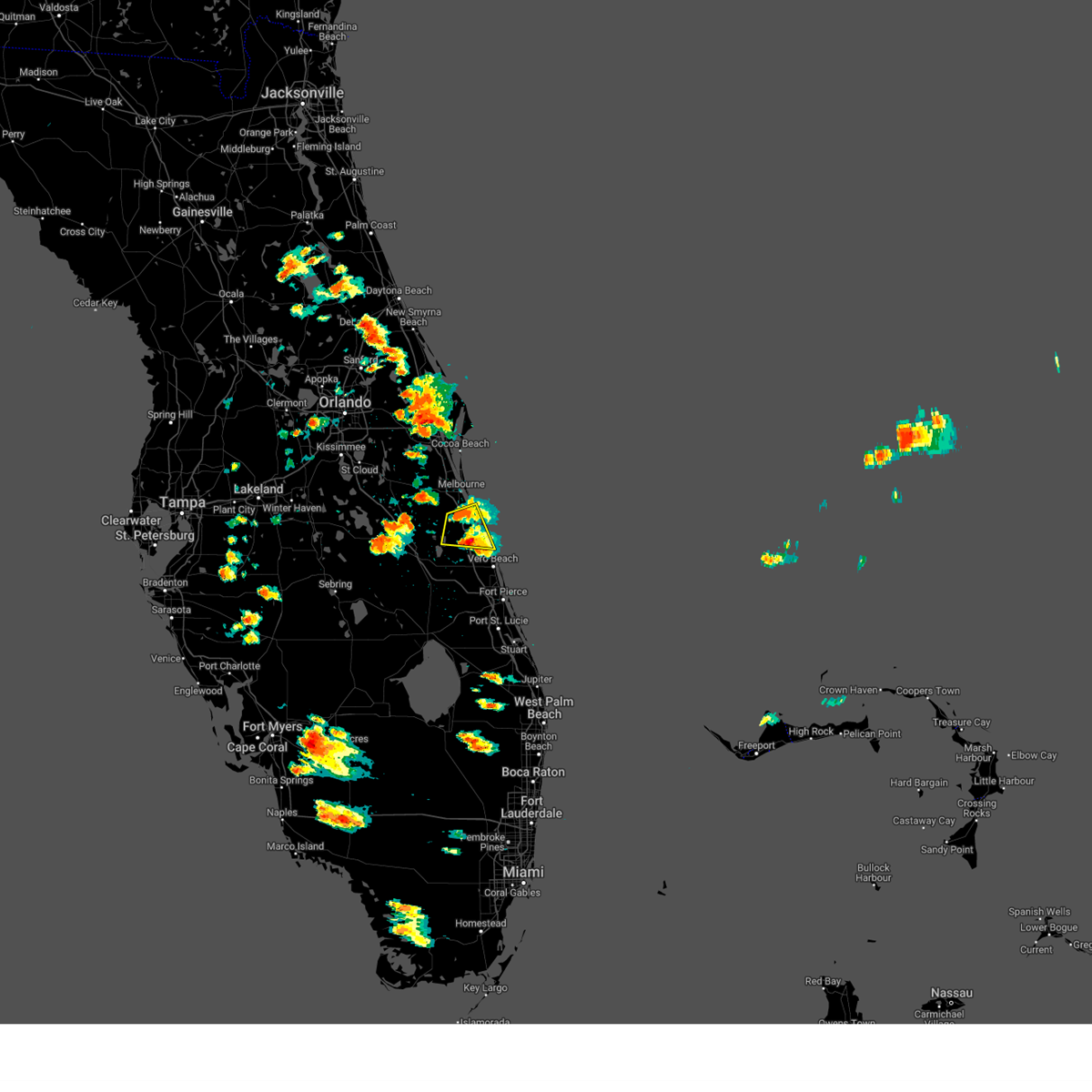
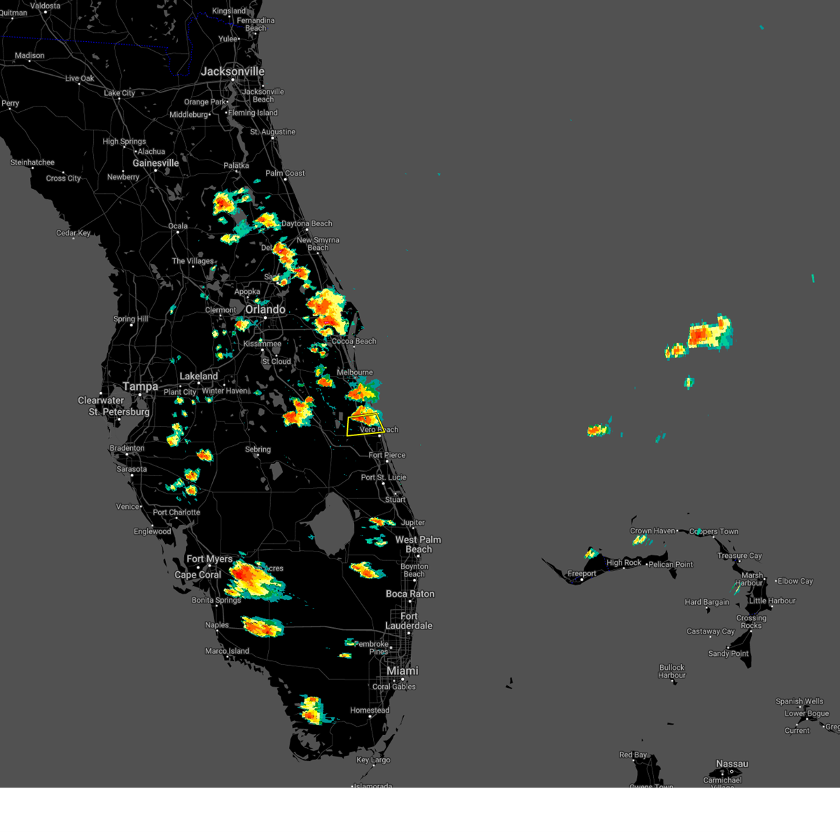
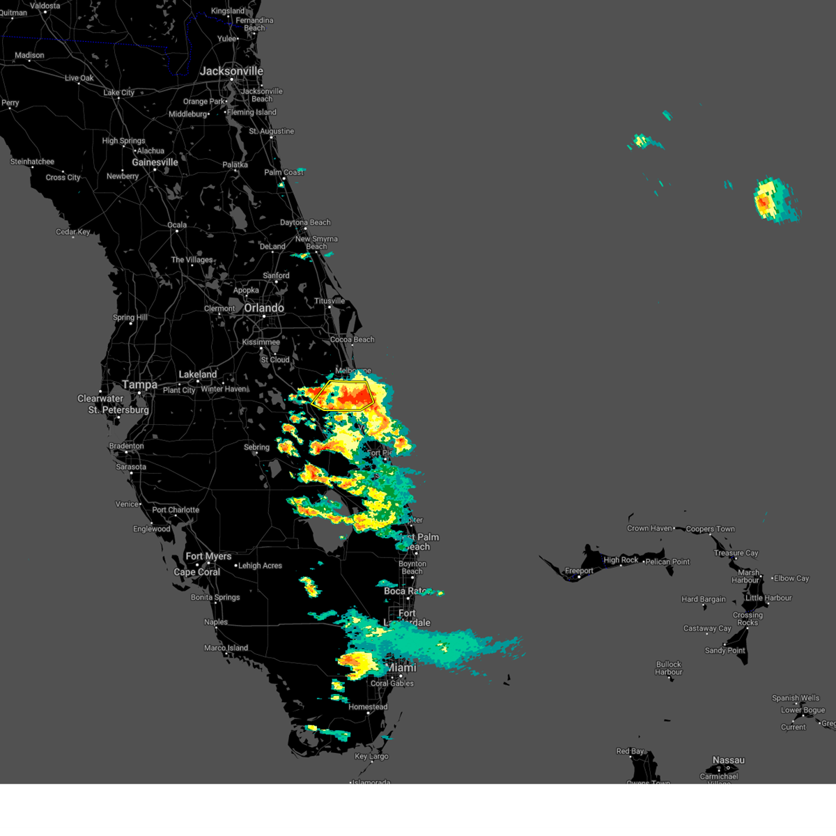
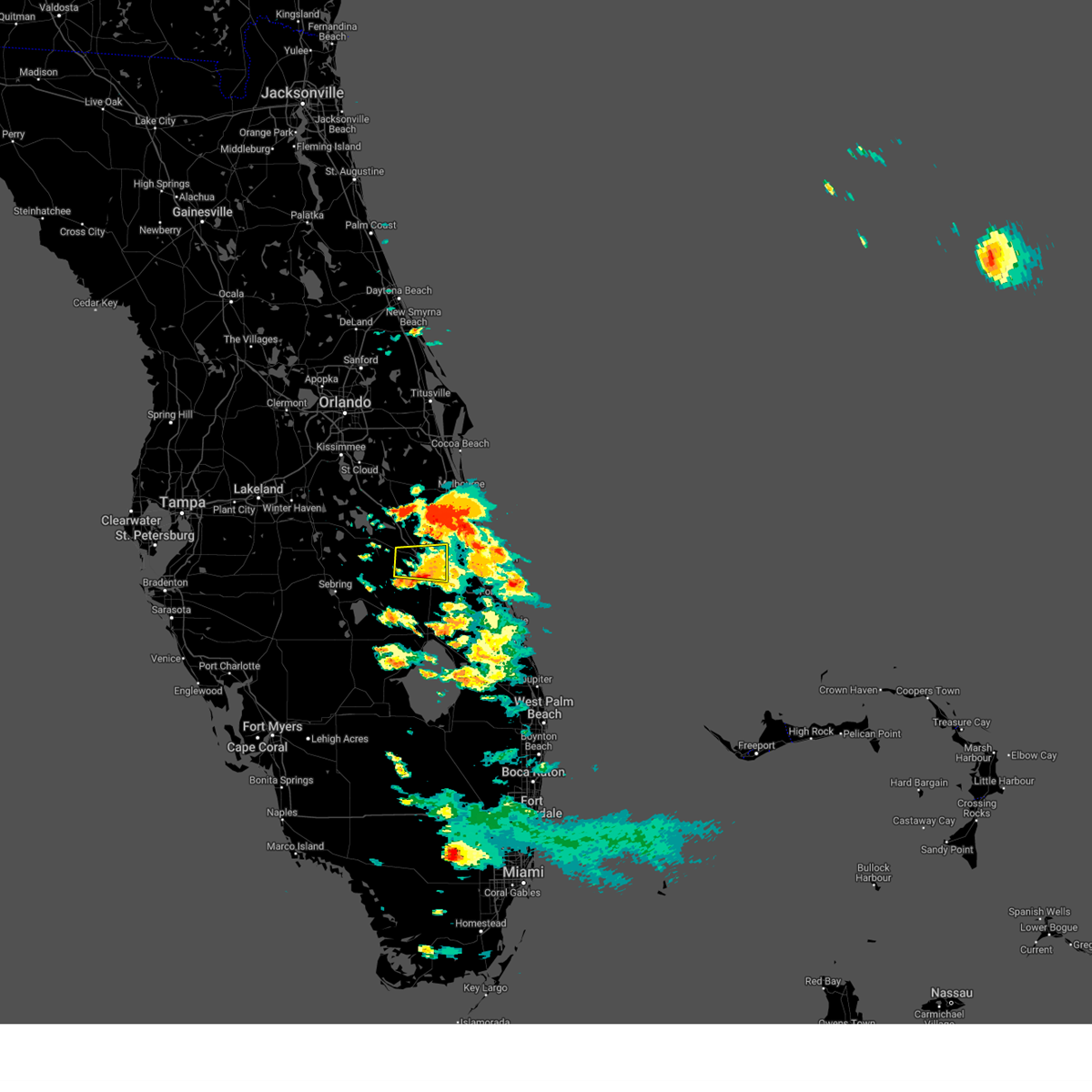
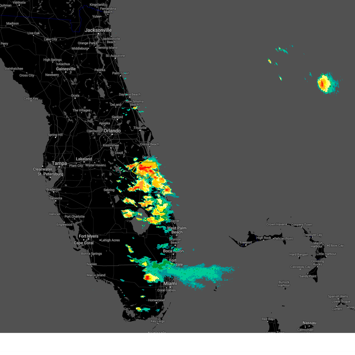
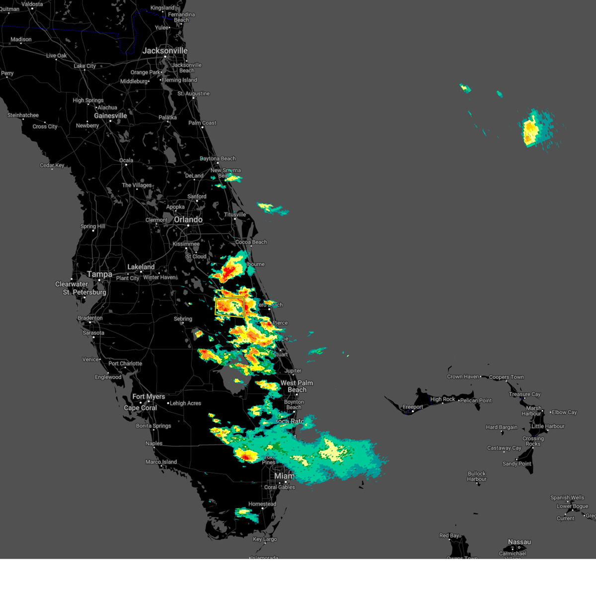
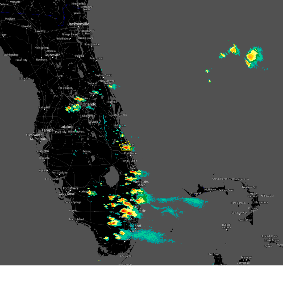
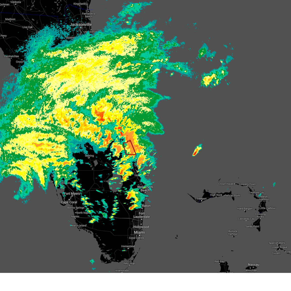
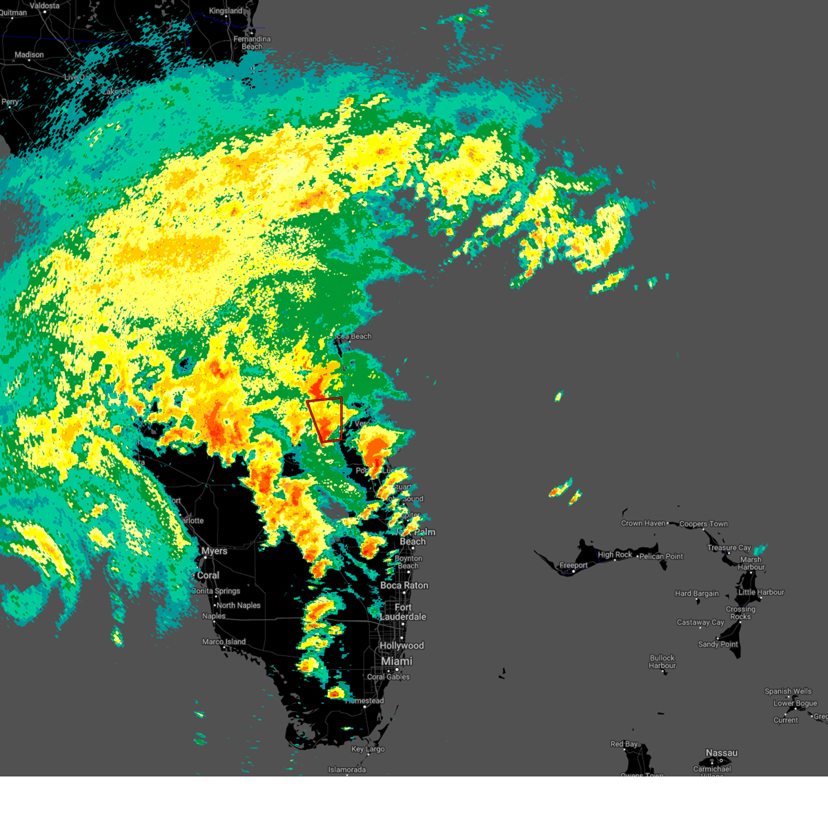
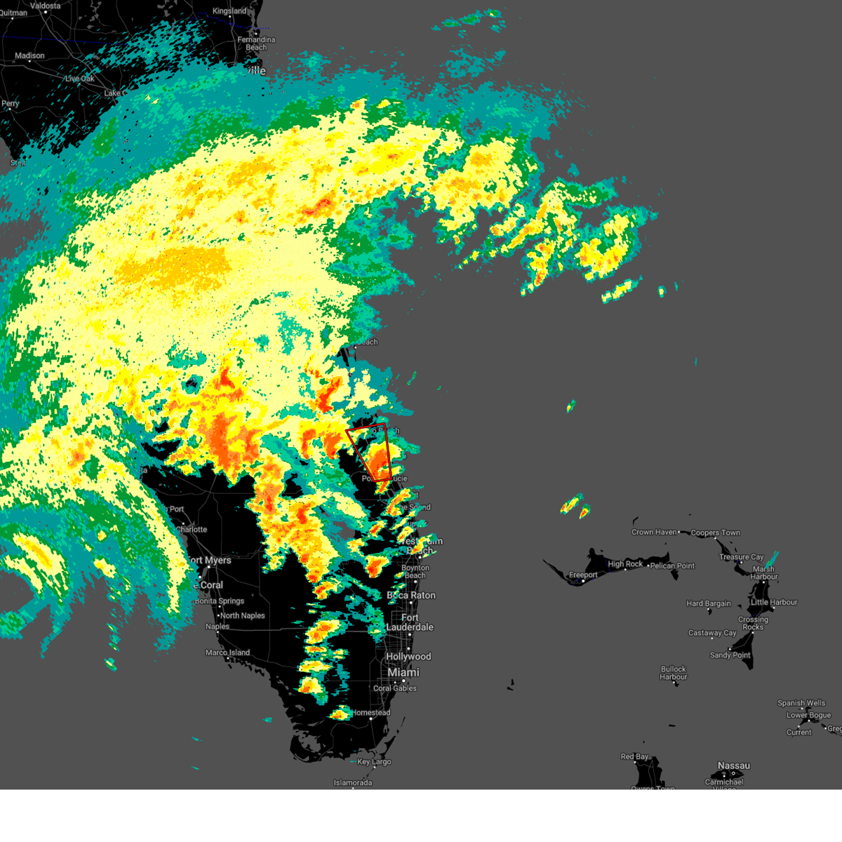
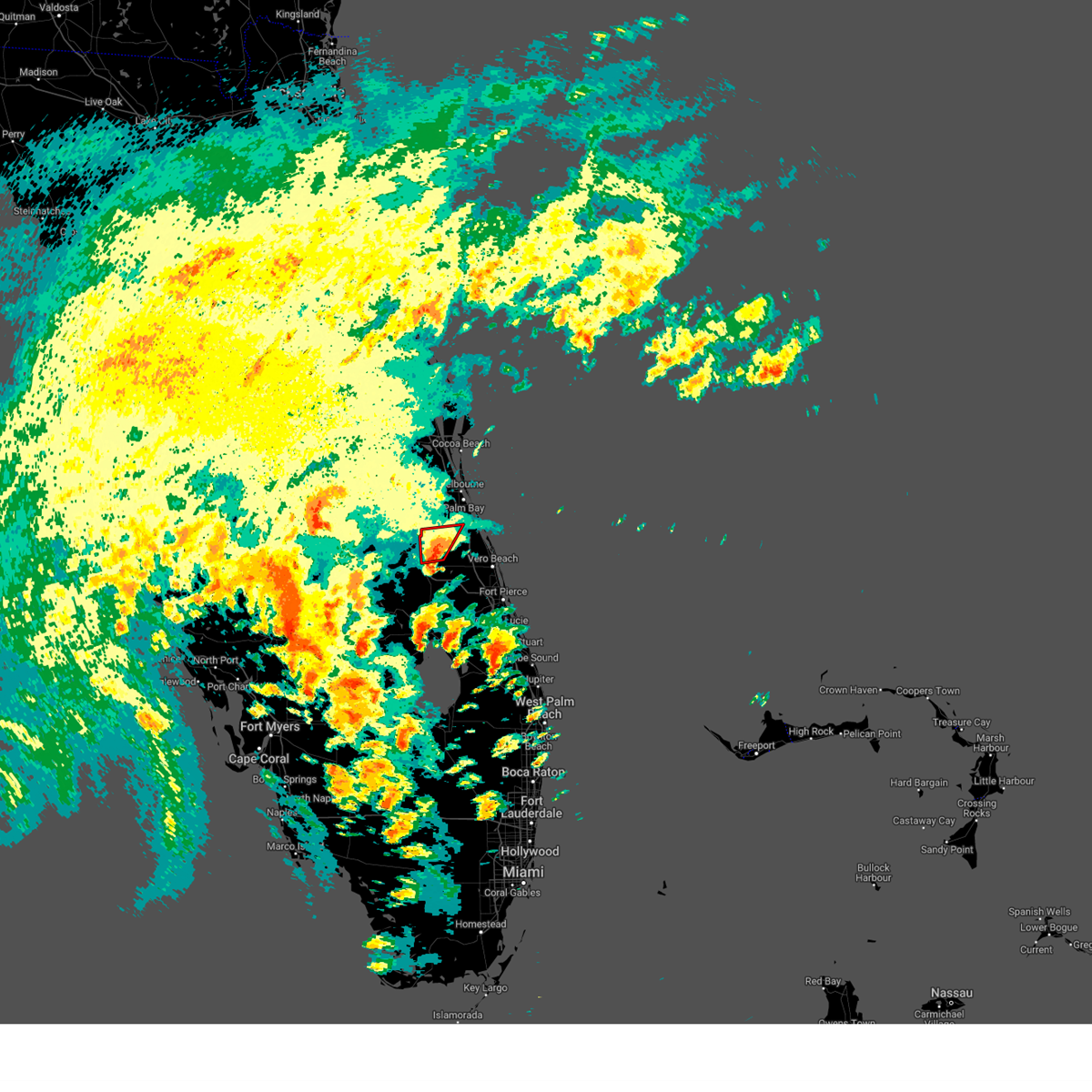
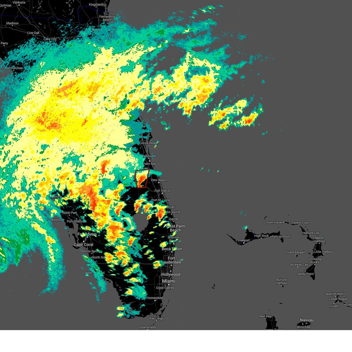
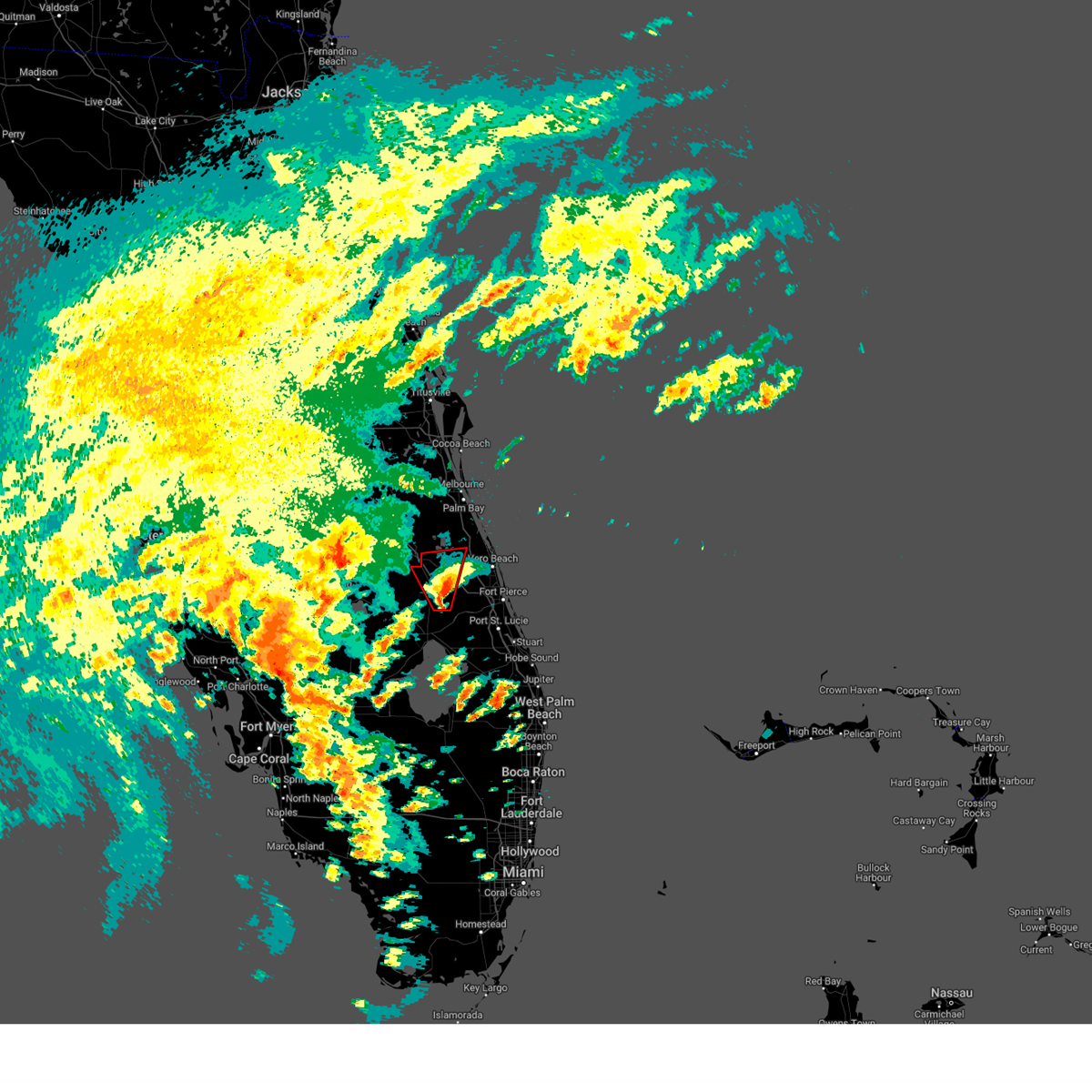
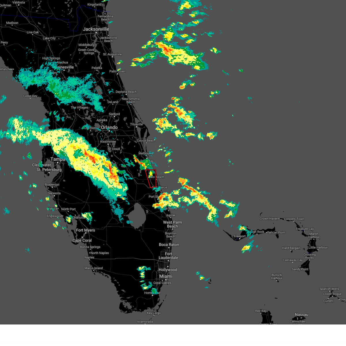
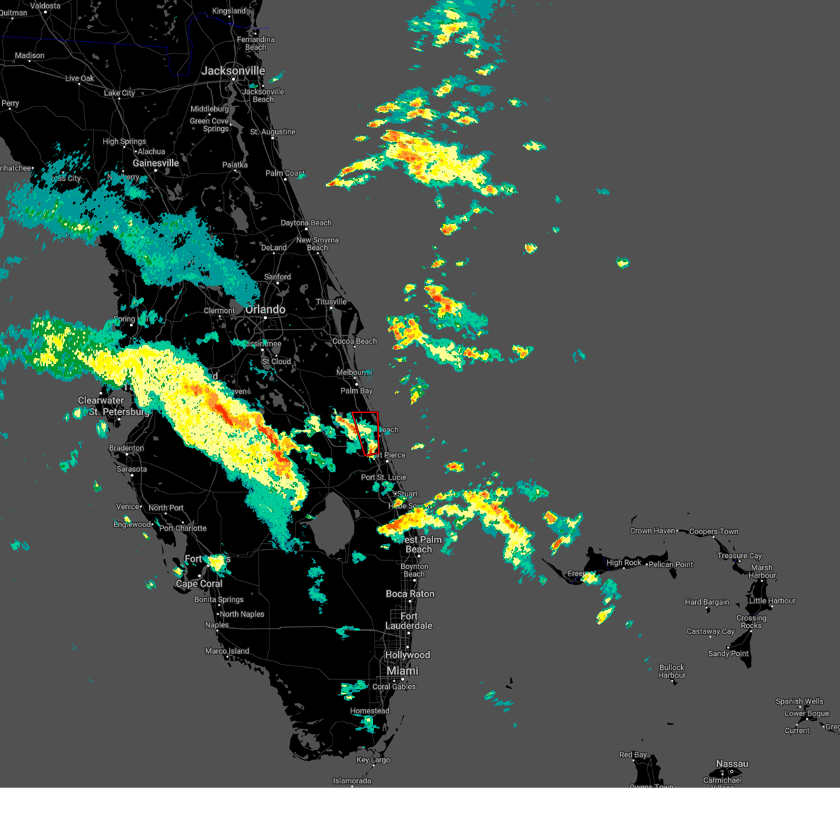
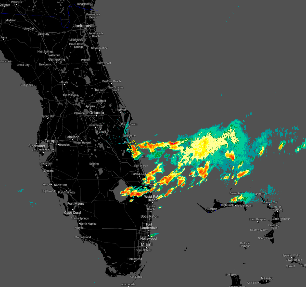
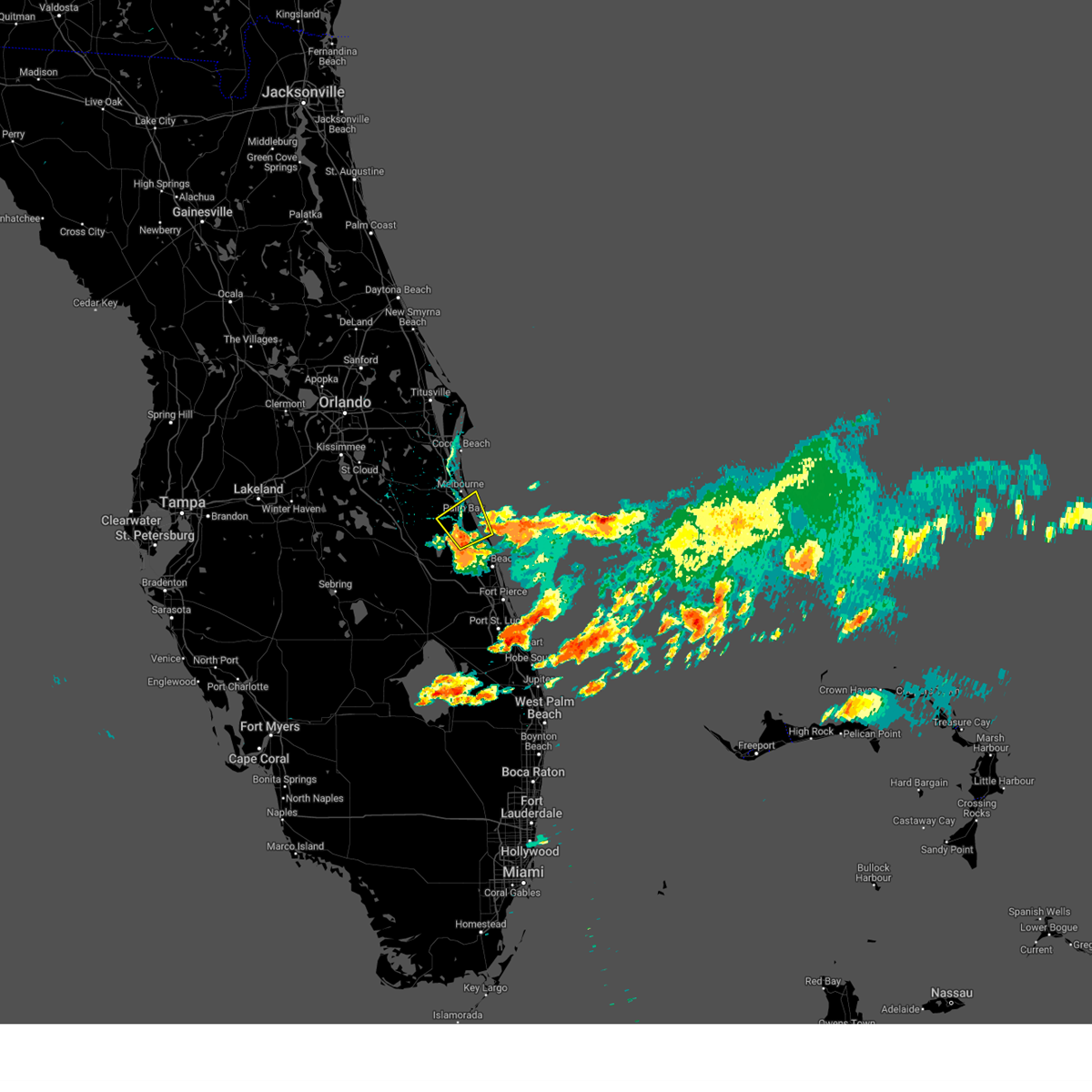
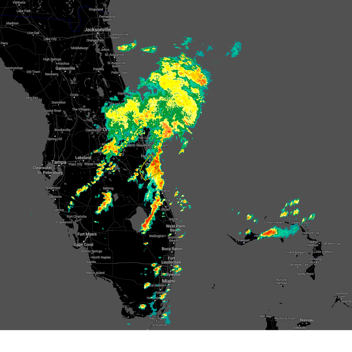
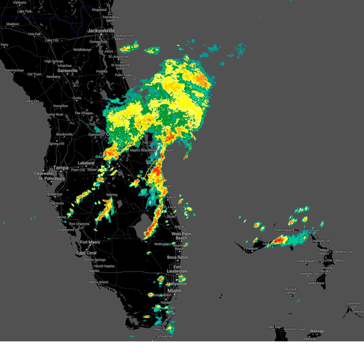
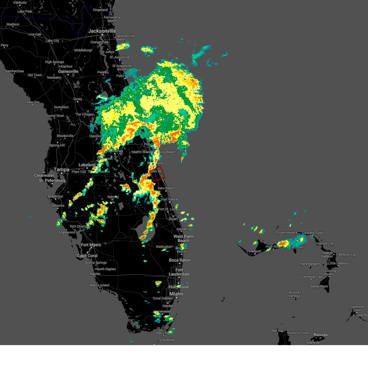
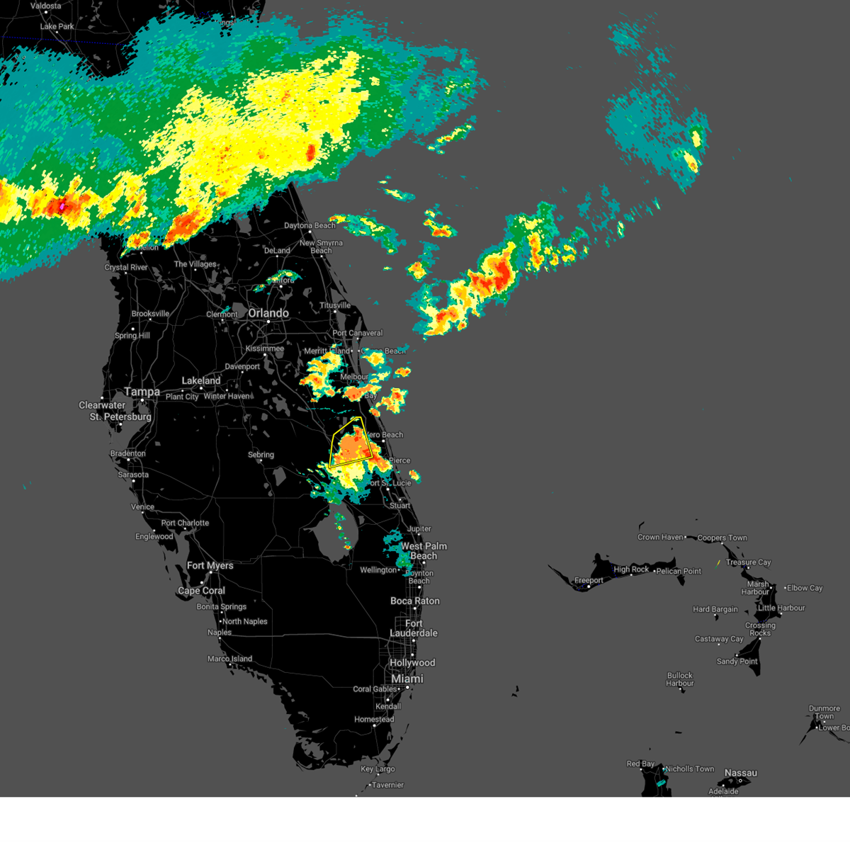
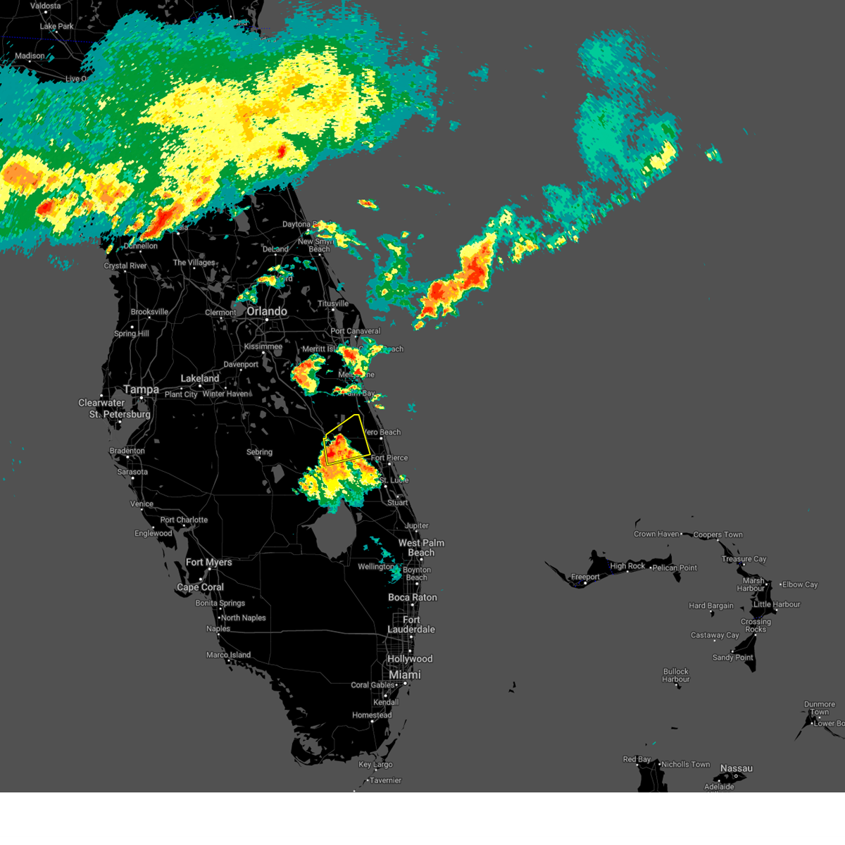
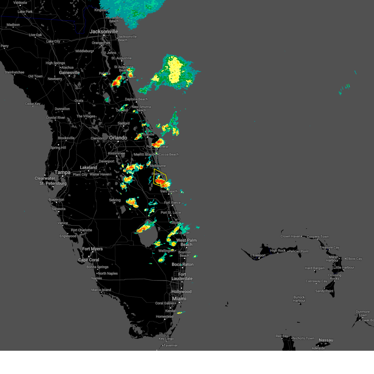
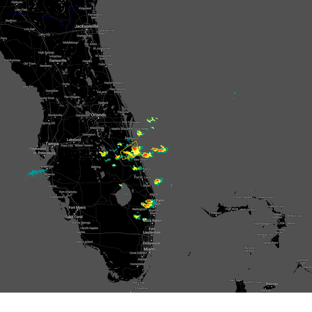
Hail Map for Fellsmere, FL
The Fellsmere, FL area has had 2 reports of on-the-ground hail by trained spotters, and has been under severe weather warnings 9 times during the past 12 months. Doppler radar has detected hail at or near Fellsmere, FL on 93 occasions, including 7 occasions during the past year.
| Name: | Fellsmere, FL |
| Where Located: | 35.8 miles NNW of Port Saint Lucie, FL |
| Map: | Google Map for Fellsmere, FL |
| Population: | 5197 |
| Housing Units: | 1467 |
| More Info: | Search Google for Fellsmere, FL |
2
The Top Recent Hail Date for Fellsmere, FL is Thursday, July 10, 2025 (15th out of 93)

Hail and Wind Damage Spotted near Fellsmere, FL
| Date / Time | Report Details |
|---|---|
| 6/23/2026 7:39 PM EDT |
 Svrmlb the national weather service in melbourne has issued a * severe thunderstorm warning for, southeastern brevard county in east central florida, * until 815 pm edt. * at 739 pm edt, severe thunderstorms were located along a line extending from melbourne to near micco, moving east at 15 mph (radar indicated). Hazards include 60 mph wind gusts and penny size hail. expect damage to roofs, siding, and trees Svrmlb the national weather service in melbourne has issued a * severe thunderstorm warning for, southeastern brevard county in east central florida, * until 815 pm edt. * at 739 pm edt, severe thunderstorms were located along a line extending from melbourne to near micco, moving east at 15 mph (radar indicated). Hazards include 60 mph wind gusts and penny size hail. expect damage to roofs, siding, and trees
|
| 6/23/2026 7:14 PM EDT |
 At 714 pm edt, a severe thunderstorm was located near palm bay, moving northeast at 15 mph (radar indicated). Hazards include 60 mph wind gusts and quarter size hail. Hail damage to vehicles is expected. expect wind damage to roofs, siding, and trees. Locations impacted include, palm bay, sebastian, fellsmere, malabar, and sebastian highlands. At 714 pm edt, a severe thunderstorm was located near palm bay, moving northeast at 15 mph (radar indicated). Hazards include 60 mph wind gusts and quarter size hail. Hail damage to vehicles is expected. expect wind damage to roofs, siding, and trees. Locations impacted include, palm bay, sebastian, fellsmere, malabar, and sebastian highlands.
|
| 6/23/2026 7:06 PM EDT |
 Svrmlb the national weather service in melbourne has issued a * severe thunderstorm warning for, central indian river county in east central florida, south central brevard county in east central florida, * until 730 pm edt. * at 705 pm edt, a severe thunderstorm was located 7 miles north of blue cypress lake, moving east at 15 mph (radar indicated). Hazards include 60 mph wind gusts and quarter size hail. Hail damage to vehicles is expected. Expect wind damage to roofs, siding, and trees. Svrmlb the national weather service in melbourne has issued a * severe thunderstorm warning for, central indian river county in east central florida, south central brevard county in east central florida, * until 730 pm edt. * at 705 pm edt, a severe thunderstorm was located 7 miles north of blue cypress lake, moving east at 15 mph (radar indicated). Hazards include 60 mph wind gusts and quarter size hail. Hail damage to vehicles is expected. Expect wind damage to roofs, siding, and trees.
|
| 5/11/2026 7:54 PM EDT |
 Svrmlb the national weather service in melbourne has issued a * severe thunderstorm warning for, northwestern indian river county in east central florida, * until 815 pm edt. * at 754 pm edt, a severe thunderstorm was located 7 miles northeast of blue cypress lake, moving south at 10 mph (radar indicated). Hazards include 60 mph wind gusts and penny size hail. expect damage to roofs, siding, and trees Svrmlb the national weather service in melbourne has issued a * severe thunderstorm warning for, northwestern indian river county in east central florida, * until 815 pm edt. * at 754 pm edt, a severe thunderstorm was located 7 miles northeast of blue cypress lake, moving south at 10 mph (radar indicated). Hazards include 60 mph wind gusts and penny size hail. expect damage to roofs, siding, and trees
|
| 5/10/2026 4:59 PM EDT |
 At 459 pm edt, a severe thunderstorm was located near wabasso, moving east at 15 mph (radar indicated). Hazards include 60 mph wind gusts and penny size hail. Expect damage to roofs, siding, and trees. Locations impacted include, sebastian, indian river shores, wabasso, sebastian highlands, and winter beach. At 459 pm edt, a severe thunderstorm was located near wabasso, moving east at 15 mph (radar indicated). Hazards include 60 mph wind gusts and penny size hail. Expect damage to roofs, siding, and trees. Locations impacted include, sebastian, indian river shores, wabasso, sebastian highlands, and winter beach.
|
| 5/10/2026 4:45 PM EDT |
 Svrmlb the national weather service in melbourne has issued a * severe thunderstorm warning for, northeastern indian river county in east central florida, * until 515 pm edt. * at 445 pm edt, a severe thunderstorm was located over sebastian, moving east at 15 mph (radar indicated). Hazards include 60 mph wind gusts and quarter size hail. Hail damage to vehicles is expected. Expect wind damage to roofs, siding, and trees. Svrmlb the national weather service in melbourne has issued a * severe thunderstorm warning for, northeastern indian river county in east central florida, * until 515 pm edt. * at 445 pm edt, a severe thunderstorm was located over sebastian, moving east at 15 mph (radar indicated). Hazards include 60 mph wind gusts and quarter size hail. Hail damage to vehicles is expected. Expect wind damage to roofs, siding, and trees.
|
| 7/13/2025 5:36 PM EDT |
 The storm which prompted the warning has weakened below severe limits, and no longer poses an immediate threat to life or property. therefore, the warning will be allowed to expire. however gusty winds are still possible with this thunderstorm. The storm which prompted the warning has weakened below severe limits, and no longer poses an immediate threat to life or property. therefore, the warning will be allowed to expire. however gusty winds are still possible with this thunderstorm.
|
| 7/13/2025 5:20 PM EDT |
 At 519 pm edt, a severe thunderstorm was located 9 miles northwest of fellsmere, moving southeast at 25 mph (radar indicated). Hazards include 60 mph wind gusts and penny size hail. Expect damage to roofs, siding, and trees. Locations impacted include, palm bay, sebastian, fellsmere, malabar, and sebastian highlands. At 519 pm edt, a severe thunderstorm was located 9 miles northwest of fellsmere, moving southeast at 25 mph (radar indicated). Hazards include 60 mph wind gusts and penny size hail. Expect damage to roofs, siding, and trees. Locations impacted include, palm bay, sebastian, fellsmere, malabar, and sebastian highlands.
|
| 7/13/2025 5:04 PM EDT |
 Svrmlb the national weather service in melbourne has issued a * severe thunderstorm warning for, northern indian river county in east central florida, southern brevard county in east central florida, * until 545 pm edt. * at 504 pm edt, a severe thunderstorm was located near palm bay, moving southeast at 20 mph (radar indicated). Hazards include 60 mph wind gusts and penny size hail. expect damage to roofs, siding, and trees Svrmlb the national weather service in melbourne has issued a * severe thunderstorm warning for, northern indian river county in east central florida, southern brevard county in east central florida, * until 545 pm edt. * at 504 pm edt, a severe thunderstorm was located near palm bay, moving southeast at 20 mph (radar indicated). Hazards include 60 mph wind gusts and penny size hail. expect damage to roofs, siding, and trees
|
| 6/1/2025 5:58 PM EDT |
 the severe thunderstorm warning has been cancelled and is no longer in effect the severe thunderstorm warning has been cancelled and is no longer in effect
|
| 6/1/2025 5:40 PM EDT |
 At 540 pm edt, a severe thunderstorm was located 9 miles southwest of palm bay, moving northeast at 25 mph (radar indicated). Hazards include 60 mph wind gusts and quarter size hail. Hail damage to vehicles is expected. expect wind damage to roofs, siding, and trees. Locations impacted include, palm bay. At 540 pm edt, a severe thunderstorm was located 9 miles southwest of palm bay, moving northeast at 25 mph (radar indicated). Hazards include 60 mph wind gusts and quarter size hail. Hail damage to vehicles is expected. expect wind damage to roofs, siding, and trees. Locations impacted include, palm bay.
|
| 6/1/2025 5:40 PM EDT |
 the severe thunderstorm warning has been cancelled and is no longer in effect the severe thunderstorm warning has been cancelled and is no longer in effect
|
| 6/1/2025 5:24 PM EDT |
 Svrmlb the national weather service in melbourne has issued a * severe thunderstorm warning for, northwestern indian river county in east central florida, southwestern brevard county in east central florida, east central osceola county in east central florida, * until 615 pm edt. * at 524 pm edt, a severe thunderstorm was located near kenansville, moving northeast at 25 mph (radar indicated). Hazards include 60 mph wind gusts and quarter size hail. Hail damage to vehicles is expected. Expect wind damage to roofs, siding, and trees. Svrmlb the national weather service in melbourne has issued a * severe thunderstorm warning for, northwestern indian river county in east central florida, southwestern brevard county in east central florida, east central osceola county in east central florida, * until 615 pm edt. * at 524 pm edt, a severe thunderstorm was located near kenansville, moving northeast at 25 mph (radar indicated). Hazards include 60 mph wind gusts and quarter size hail. Hail damage to vehicles is expected. Expect wind damage to roofs, siding, and trees.
|
| 5/24/2025 3:50 PM EDT |
 The severe thunderstorm which prompted the warning has moved out of the warned area. therefore, the warning has been allowed to expire. however gusty winds are still possible with this thunderstorm. The severe thunderstorm which prompted the warning has moved out of the warned area. therefore, the warning has been allowed to expire. however gusty winds are still possible with this thunderstorm.
|
| 5/24/2025 3:33 PM EDT |
 At 333 pm edt, a severe thunderstorm was located near fellsmere, moving south at 25 mph (radar indicated). Hazards include 60 mph wind gusts and quarter size hail. Hail damage to vehicles is expected. expect wind damage to roofs, siding, and trees. Locations impacted include, palm bay, sebastian, fellsmere, indian river shores, and malabar. At 333 pm edt, a severe thunderstorm was located near fellsmere, moving south at 25 mph (radar indicated). Hazards include 60 mph wind gusts and quarter size hail. Hail damage to vehicles is expected. expect wind damage to roofs, siding, and trees. Locations impacted include, palm bay, sebastian, fellsmere, indian river shores, and malabar.
|
| 5/24/2025 3:25 PM EDT |
 Svrmlb the national weather service in melbourne has issued a * severe thunderstorm warning for, central indian river county in east central florida, * until 415 pm edt. * at 325 pm edt, a severe thunderstorm was located over fellsmere, moving south at 10 mph (radar indicated). Hazards include 60 mph wind gusts and quarter size hail. Hail damage to vehicles is expected. Expect wind damage to roofs, siding, and trees. Svrmlb the national weather service in melbourne has issued a * severe thunderstorm warning for, central indian river county in east central florida, * until 415 pm edt. * at 325 pm edt, a severe thunderstorm was located over fellsmere, moving south at 10 mph (radar indicated). Hazards include 60 mph wind gusts and quarter size hail. Hail damage to vehicles is expected. Expect wind damage to roofs, siding, and trees.
|
| 5/24/2025 3:02 PM EDT |
 Svrmlb the national weather service in melbourne has issued a * severe thunderstorm warning for, northeastern indian river county in east central florida, southeastern brevard county in east central florida, * until 345 pm edt. * at 302 pm edt, a severe thunderstorm was located over palm bay, moving south at 25 mph (radar indicated). Hazards include 60 mph wind gusts and quarter size hail. Hail damage to vehicles is expected. Expect wind damage to roofs, siding, and trees. Svrmlb the national weather service in melbourne has issued a * severe thunderstorm warning for, northeastern indian river county in east central florida, southeastern brevard county in east central florida, * until 345 pm edt. * at 302 pm edt, a severe thunderstorm was located over palm bay, moving south at 25 mph (radar indicated). Hazards include 60 mph wind gusts and quarter size hail. Hail damage to vehicles is expected. Expect wind damage to roofs, siding, and trees.
|
| 5/5/2025 7:47 PM EDT |
 the severe thunderstorm warning has been cancelled and is no longer in effect the severe thunderstorm warning has been cancelled and is no longer in effect
|
| 5/5/2025 7:31 PM EDT |
 the severe thunderstorm warning has been cancelled and is no longer in effect the severe thunderstorm warning has been cancelled and is no longer in effect
|
| 5/5/2025 7:31 PM EDT |
 At 731 pm edt, a severe thunderstorm was located over grant-valkaria, or near barefoot bay, moving northeast at 25 mph (radar indicated). Hazards include 60 mph wind gusts and quarter size hail. Hail damage to vehicles is expected. expect wind damage to roofs, siding, and trees. Locations impacted include, palm bay, melbourne, malabar, barefoot bay, and roseland. At 731 pm edt, a severe thunderstorm was located over grant-valkaria, or near barefoot bay, moving northeast at 25 mph (radar indicated). Hazards include 60 mph wind gusts and quarter size hail. Hail damage to vehicles is expected. expect wind damage to roofs, siding, and trees. Locations impacted include, palm bay, melbourne, malabar, barefoot bay, and roseland.
|
| 5/5/2025 7:19 PM EDT |
 the severe thunderstorm warning has been cancelled and is no longer in effect the severe thunderstorm warning has been cancelled and is no longer in effect
|
| 5/5/2025 7:15 PM EDT |
 Svrmlb the national weather service in melbourne has issued a * severe thunderstorm warning for, northwestern indian river county in east central florida, southeastern brevard county in east central florida, east central osceola county in east central florida, * until 800 pm edt. * at 715 pm edt, a severe thunderstorm was located 8 miles west of palm bay, moving southeast at 20 mph (radar indicated). Hazards include 60 mph wind gusts and quarter size hail. Hail damage to vehicles is expected. Expect wind damage to roofs, siding, and trees. Svrmlb the national weather service in melbourne has issued a * severe thunderstorm warning for, northwestern indian river county in east central florida, southeastern brevard county in east central florida, east central osceola county in east central florida, * until 800 pm edt. * at 715 pm edt, a severe thunderstorm was located 8 miles west of palm bay, moving southeast at 20 mph (radar indicated). Hazards include 60 mph wind gusts and quarter size hail. Hail damage to vehicles is expected. Expect wind damage to roofs, siding, and trees.
|
| 5/5/2025 6:54 PM EDT |
 Svrmlb the national weather service in melbourne has issued a * severe thunderstorm warning for, northeastern okeechobee county in east central florida, southwestern indian river county in east central florida, southeastern osceola county in east central florida, * until 730 pm edt. * at 654 pm edt, a severe thunderstorm was located 8 miles northeast of kissimmee prairie preserve, or 11 miles southwest of blue cypress lake, moving east at 15 mph (radar indicated). Hazards include 60 mph wind gusts and quarter size hail. Hail damage to vehicles is expected. Expect wind damage to roofs, siding, and trees. Svrmlb the national weather service in melbourne has issued a * severe thunderstorm warning for, northeastern okeechobee county in east central florida, southwestern indian river county in east central florida, southeastern osceola county in east central florida, * until 730 pm edt. * at 654 pm edt, a severe thunderstorm was located 8 miles northeast of kissimmee prairie preserve, or 11 miles southwest of blue cypress lake, moving east at 15 mph (radar indicated). Hazards include 60 mph wind gusts and quarter size hail. Hail damage to vehicles is expected. Expect wind damage to roofs, siding, and trees.
|
| 5/5/2025 3:50 PM EDT |
 At 349 pm edt, a severe thunderstorm was located over pointe west, or over vero beach south, moving east at 15 mph (trained weather spotters). Hazards include 60 mph wind gusts and quarter size hail. Hail damage to vehicles is expected. expect wind damage to roofs, siding, and trees. Locations impacted include, vero beach, indian river shores, vero beach south, gifford, and winter beach. At 349 pm edt, a severe thunderstorm was located over pointe west, or over vero beach south, moving east at 15 mph (trained weather spotters). Hazards include 60 mph wind gusts and quarter size hail. Hail damage to vehicles is expected. expect wind damage to roofs, siding, and trees. Locations impacted include, vero beach, indian river shores, vero beach south, gifford, and winter beach.
|
| 5/5/2025 3:37 PM EDT |
 Svrmlb the national weather service in melbourne has issued a * severe thunderstorm warning for, southeastern indian river county in east central florida, * until 415 pm edt. * at 337 pm edt, a severe thunderstorm was located over pointe west, or near vero beach south, moving east at 15 mph (radar indicated). Hazards include 60 mph wind gusts and quarter size hail. Hail damage to vehicles is expected. Expect wind damage to roofs, siding, and trees. Svrmlb the national weather service in melbourne has issued a * severe thunderstorm warning for, southeastern indian river county in east central florida, * until 415 pm edt. * at 337 pm edt, a severe thunderstorm was located over pointe west, or near vero beach south, moving east at 15 mph (radar indicated). Hazards include 60 mph wind gusts and quarter size hail. Hail damage to vehicles is expected. Expect wind damage to roofs, siding, and trees.
|
| 5/5/2025 2:44 PM EDT |
 The storm which prompted the warning has weakened below severe limits, and no longer poses an immediate threat to life or property. therefore, the warning will be allowed to expire. however small hail and gusty winds are still possible with this thunderstorm. a severe thunderstorm watch remains in effect until 900 pm edt for east central florida. The storm which prompted the warning has weakened below severe limits, and no longer poses an immediate threat to life or property. therefore, the warning will be allowed to expire. however small hail and gusty winds are still possible with this thunderstorm. a severe thunderstorm watch remains in effect until 900 pm edt for east central florida.
|
| 5/5/2025 2:22 PM EDT |
 Svrmlb the national weather service in melbourne has issued a * severe thunderstorm warning for, northeastern indian river county in east central florida, southeastern brevard county in east central florida, * until 245 pm edt. * at 222 pm edt, a severe thunderstorm was located over sebastian highlands, moving northeast at 15 mph (radar indicated). Hazards include 60 mph wind gusts and quarter size hail. Hail damage to vehicles is expected. Expect wind damage to roofs, siding, and trees. Svrmlb the national weather service in melbourne has issued a * severe thunderstorm warning for, northeastern indian river county in east central florida, southeastern brevard county in east central florida, * until 245 pm edt. * at 222 pm edt, a severe thunderstorm was located over sebastian highlands, moving northeast at 15 mph (radar indicated). Hazards include 60 mph wind gusts and quarter size hail. Hail damage to vehicles is expected. Expect wind damage to roofs, siding, and trees.
|
| 10/9/2024 4:28 PM EDT |
 At 427 pm edt, a confirmed tornado was located over vero beach highland, or near indrio, moving north at 15 mph (radar confirmed tornado). Hazards include damaging tornado. Flying debris will be dangerous to those caught without shelter. mobile homes will be damaged or destroyed. damage to roofs, windows, and vehicles will occur. tree damage is likely. this tornado will be near, vero beach, gifford, and vero beach south around 430 pm edt. indian river shores and pointe west around 440 pm edt. winter beach around 450 pm edt. wabasso around 500 pm edt. Other locations impacted by this tornadic thunderstorm include orchid. At 427 pm edt, a confirmed tornado was located over vero beach highland, or near indrio, moving north at 15 mph (radar confirmed tornado). Hazards include damaging tornado. Flying debris will be dangerous to those caught without shelter. mobile homes will be damaged or destroyed. damage to roofs, windows, and vehicles will occur. tree damage is likely. this tornado will be near, vero beach, gifford, and vero beach south around 430 pm edt. indian river shores and pointe west around 440 pm edt. winter beach around 450 pm edt. wabasso around 500 pm edt. Other locations impacted by this tornadic thunderstorm include orchid.
|
| 10/9/2024 4:14 PM EDT |
 Tormlb the national weather service in melbourne has issued a * tornado warning for, eastern indian river county in east central florida, * until 500 pm edt. * at 414 pm edt, a severe thunderstorm capable of producing a tornado was located over vero beach, moving north at 20 mph (radar indicated rotation). Hazards include tornado. Flying debris will be dangerous to those caught without shelter. mobile homes will be damaged or destroyed. damage to roofs, windows, and vehicles will occur. tree damage is likely. this dangerous storm will be near, sebastian, vero beach, and indian river shores around 420 pm edt. sebastian highlands, roseland, and sebastian inlet around 440 pm edt. Other locations impacted by this tornadic thunderstorm include orchid. Tormlb the national weather service in melbourne has issued a * tornado warning for, eastern indian river county in east central florida, * until 500 pm edt. * at 414 pm edt, a severe thunderstorm capable of producing a tornado was located over vero beach, moving north at 20 mph (radar indicated rotation). Hazards include tornado. Flying debris will be dangerous to those caught without shelter. mobile homes will be damaged or destroyed. damage to roofs, windows, and vehicles will occur. tree damage is likely. this dangerous storm will be near, sebastian, vero beach, and indian river shores around 420 pm edt. sebastian highlands, roseland, and sebastian inlet around 440 pm edt. Other locations impacted by this tornadic thunderstorm include orchid.
|
| 10/9/2024 4:12 PM EDT |
 Tormlb the national weather service in melbourne has issued a * tornado warning for, northwestern st. lucie county in east central florida, northeastern okeechobee county in east central florida, western indian river county in east central florida, * until 500 pm edt. * at 412 pm edt, a severe thunderstorm capable of producing a tornado was located near fort drum, moving north at 40 mph (radar indicated rotation). Hazards include tornado. Flying debris will be dangerous to those caught without shelter. mobile homes will be damaged or destroyed. damage to roofs, windows, and vehicles will occur. tree damage is likely. this dangerous storm will be near, fort drum around 420 pm edt. blue cypress lake around 430 pm edt. Fellsmere around 440 pm edt. Tormlb the national weather service in melbourne has issued a * tornado warning for, northwestern st. lucie county in east central florida, northeastern okeechobee county in east central florida, western indian river county in east central florida, * until 500 pm edt. * at 412 pm edt, a severe thunderstorm capable of producing a tornado was located near fort drum, moving north at 40 mph (radar indicated rotation). Hazards include tornado. Flying debris will be dangerous to those caught without shelter. mobile homes will be damaged or destroyed. damage to roofs, windows, and vehicles will occur. tree damage is likely. this dangerous storm will be near, fort drum around 420 pm edt. blue cypress lake around 430 pm edt. Fellsmere around 440 pm edt.
|
| 10/9/2024 3:46 PM EDT |
 Tormlb the national weather service in melbourne has issued a * tornado warning for, eastern indian river county in east central florida, southeastern brevard county in east central florida, * until 415 pm edt. * at 345 pm edt, a severe thunderstorm capable of producing a tornado was located over winter beach, moving north at 35 mph (radar indicated rotation). Hazards include tornado. Flying debris will be dangerous to those caught without shelter. mobile homes will be damaged or destroyed. damage to roofs, windows, and vehicles will occur. tree damage is likely. this dangerous storm will be near, sebastian, indian river shores, and sebastian highlands around 350 pm edt. sebastian inlet and micco around 400 pm edt. Other locations impacted by this tornadic thunderstorm include orchid. Tormlb the national weather service in melbourne has issued a * tornado warning for, eastern indian river county in east central florida, southeastern brevard county in east central florida, * until 415 pm edt. * at 345 pm edt, a severe thunderstorm capable of producing a tornado was located over winter beach, moving north at 35 mph (radar indicated rotation). Hazards include tornado. Flying debris will be dangerous to those caught without shelter. mobile homes will be damaged or destroyed. damage to roofs, windows, and vehicles will occur. tree damage is likely. this dangerous storm will be near, sebastian, indian river shores, and sebastian highlands around 350 pm edt. sebastian inlet and micco around 400 pm edt. Other locations impacted by this tornadic thunderstorm include orchid.
|
| 10/9/2024 3:12 PM EDT |
 Tormlb the national weather service in melbourne has issued a * tornado warning for, north central st. lucie county in east central florida, central indian river county in east central florida, * until 345 pm edt. * at 311 pm edt, a severe thunderstorm capable of producing a tornado was located near lakewood park, or near indrio, moving northwest at 30 mph (radar indicated rotation). Hazards include tornado. Flying debris will be dangerous to those caught without shelter. mobile homes will be damaged or destroyed. damage to roofs, windows, and vehicles will occur. tree damage is likely. this dangerous storm will be near, vero beach, gifford, and vero beach south around 320 pm edt. winter beach around 330 pm edt. Other locations impacted by this tornadic thunderstorm include orchid. Tormlb the national weather service in melbourne has issued a * tornado warning for, north central st. lucie county in east central florida, central indian river county in east central florida, * until 345 pm edt. * at 311 pm edt, a severe thunderstorm capable of producing a tornado was located near lakewood park, or near indrio, moving northwest at 30 mph (radar indicated rotation). Hazards include tornado. Flying debris will be dangerous to those caught without shelter. mobile homes will be damaged or destroyed. damage to roofs, windows, and vehicles will occur. tree damage is likely. this dangerous storm will be near, vero beach, gifford, and vero beach south around 320 pm edt. winter beach around 330 pm edt. Other locations impacted by this tornadic thunderstorm include orchid.
|
| 10/9/2024 2:46 PM EDT |
 Tormlb the national weather service in melbourne has issued a * tornado warning for, northeastern okeechobee county in east central florida, western indian river county in east central florida, south central brevard county in east central florida, southeastern osceola county in east central florida, * until 330 pm edt. * at 246 pm edt, a confirmed large and extremely dangerous tornado was located 7 miles northeast of fort drum, moving north at 30 mph. this is a particularly dangerous situation. take cover now! (emergency management confirmed tornado). Hazards include damaging tornado. You are in a life-threatening situation. flying debris may be deadly to those caught without shelter. mobile homes will be destroyed. considerable damage to homes, businesses, and vehicles is likely and complete destruction is possible. The tornado will be near, blue cypress lake around 250 pm edt. Tormlb the national weather service in melbourne has issued a * tornado warning for, northeastern okeechobee county in east central florida, western indian river county in east central florida, south central brevard county in east central florida, southeastern osceola county in east central florida, * until 330 pm edt. * at 246 pm edt, a confirmed large and extremely dangerous tornado was located 7 miles northeast of fort drum, moving north at 30 mph. this is a particularly dangerous situation. take cover now! (emergency management confirmed tornado). Hazards include damaging tornado. You are in a life-threatening situation. flying debris may be deadly to those caught without shelter. mobile homes will be destroyed. considerable damage to homes, businesses, and vehicles is likely and complete destruction is possible. The tornado will be near, blue cypress lake around 250 pm edt.
|
| 10/9/2024 2:46 PM EDT |
 At 245 pm edt, a confirmed tornado was located near fort pierce south, or near white city, moving northwest at 30 mph (emergency management confirmed tornado). Hazards include damaging tornado. Flying debris will be dangerous to those caught without shelter. mobile homes will be damaged or destroyed. damage to roofs, windows, and vehicles will occur. tree damage is likely. this tornado will be near, fort pierce, lakewood park, and fort pierce north around 250 pm edt. vero beach south and pointe west around 310 pm edt. Other locations impacted by this tornadic thunderstorm include grovenor estates. At 245 pm edt, a confirmed tornado was located near fort pierce south, or near white city, moving northwest at 30 mph (emergency management confirmed tornado). Hazards include damaging tornado. Flying debris will be dangerous to those caught without shelter. mobile homes will be damaged or destroyed. damage to roofs, windows, and vehicles will occur. tree damage is likely. this tornado will be near, fort pierce, lakewood park, and fort pierce north around 250 pm edt. vero beach south and pointe west around 310 pm edt. Other locations impacted by this tornadic thunderstorm include grovenor estates.
|
| 10/9/2024 2:39 PM EDT |
 Tormlb the national weather service in melbourne has issued a * tornado warning for, northeastern st. lucie county in east central florida, southeastern indian river county in east central florida, * until 315 pm edt. * at 238 pm edt, a severe thunderstorm capable of producing a tornado was located near fort pierce north, or near fort pierce, moving north at 20 mph (radar indicated rotation). Hazards include tornado. Flying debris will be dangerous to those caught without shelter. mobile homes will be damaged or destroyed. damage to roofs, windows, and vehicles will occur. tree damage is likely. this dangerous storm will be near, fort pierce, lakewood park, and fort pierce north around 240 pm edt. vero beach south and vero beach highland around 250 pm edt. vero beach and pointe west around 300 pm edt. gifford around 310 pm edt. Other locations impacted by this tornadic thunderstorm include grovenor estates. Tormlb the national weather service in melbourne has issued a * tornado warning for, northeastern st. lucie county in east central florida, southeastern indian river county in east central florida, * until 315 pm edt. * at 238 pm edt, a severe thunderstorm capable of producing a tornado was located near fort pierce north, or near fort pierce, moving north at 20 mph (radar indicated rotation). Hazards include tornado. Flying debris will be dangerous to those caught without shelter. mobile homes will be damaged or destroyed. damage to roofs, windows, and vehicles will occur. tree damage is likely. this dangerous storm will be near, fort pierce, lakewood park, and fort pierce north around 240 pm edt. vero beach south and vero beach highland around 250 pm edt. vero beach and pointe west around 300 pm edt. gifford around 310 pm edt. Other locations impacted by this tornadic thunderstorm include grovenor estates.
|
| 10/9/2024 2:09 PM EDT |
 At 209 pm edt, a severe thunderstorm capable of producing a tornado was located over blue cypress lake, moving north at 30 mph (radar indicated rotation). Hazards include tornado. Flying debris will be dangerous to those caught without shelter. mobile homes will be damaged or destroyed. damage to roofs, windows, and vehicles will occur. tree damage is likely. This dangerous storm will be near, blue cypress lake around 210 pm edt. At 209 pm edt, a severe thunderstorm capable of producing a tornado was located over blue cypress lake, moving north at 30 mph (radar indicated rotation). Hazards include tornado. Flying debris will be dangerous to those caught without shelter. mobile homes will be damaged or destroyed. damage to roofs, windows, and vehicles will occur. tree damage is likely. This dangerous storm will be near, blue cypress lake around 210 pm edt.
|
| 10/9/2024 2:09 PM EDT |
 the tornado warning has been cancelled and is no longer in effect the tornado warning has been cancelled and is no longer in effect
|
| 10/9/2024 1:52 PM EDT |
 Tormlb the national weather service in melbourne has issued a * tornado warning for, northeastern okeechobee county in east central florida, western indian river county in east central florida, south central brevard county in east central florida, * until 230 pm edt. * at 152 pm edt, a severe thunderstorm capable of producing a tornado was located 7 miles south of blue cypress lake, moving north at 30 mph (radar indicated rotation). Hazards include tornado. Flying debris will be dangerous to those caught without shelter. mobile homes will be damaged or destroyed. damage to roofs, windows, and vehicles will occur. tree damage is likely. This dangerous storm will be near, blue cypress lake around 200 pm edt. Tormlb the national weather service in melbourne has issued a * tornado warning for, northeastern okeechobee county in east central florida, western indian river county in east central florida, south central brevard county in east central florida, * until 230 pm edt. * at 152 pm edt, a severe thunderstorm capable of producing a tornado was located 7 miles south of blue cypress lake, moving north at 30 mph (radar indicated rotation). Hazards include tornado. Flying debris will be dangerous to those caught without shelter. mobile homes will be damaged or destroyed. damage to roofs, windows, and vehicles will occur. tree damage is likely. This dangerous storm will be near, blue cypress lake around 200 pm edt.
|
| 10/9/2024 1:24 PM EDT |
 Tormlb the national weather service in melbourne has issued a * tornado warning for, northwestern st. lucie county in east central florida, northeastern okeechobee county in east central florida, southwestern indian river county in east central florida, * until 200 pm edt. * at 124 pm edt, a confirmed tornado was located near fort drum, moving north at 30 mph (emergency management confirmed tornado). Hazards include damaging tornado. Flying debris will be dangerous to those caught without shelter. mobile homes will be damaged or destroyed. damage to roofs, windows, and vehicles will occur. tree damage is likely. the tornado will be near, fort drum around 130 pm edt. Blue cypress lake around 150 pm edt. Tormlb the national weather service in melbourne has issued a * tornado warning for, northwestern st. lucie county in east central florida, northeastern okeechobee county in east central florida, southwestern indian river county in east central florida, * until 200 pm edt. * at 124 pm edt, a confirmed tornado was located near fort drum, moving north at 30 mph (emergency management confirmed tornado). Hazards include damaging tornado. Flying debris will be dangerous to those caught without shelter. mobile homes will be damaged or destroyed. damage to roofs, windows, and vehicles will occur. tree damage is likely. the tornado will be near, fort drum around 130 pm edt. Blue cypress lake around 150 pm edt.
|
| 9/26/2024 9:21 AM EDT |
 The storm which prompted the warning has weakened below severe limits, and no longer appears capable of producing a tornado. therefore, the warning will be allowed to expire. a tornado watch remains in effect until 800 pm edt for east central florida. The storm which prompted the warning has weakened below severe limits, and no longer appears capable of producing a tornado. therefore, the warning will be allowed to expire. a tornado watch remains in effect until 800 pm edt for east central florida.
|
| 9/26/2024 9:06 AM EDT |
 Tormlb the national weather service in melbourne has issued a * tornado warning for, north central st. lucie county in east central florida, eastern indian river county in east central florida, * until 930 am edt. * at 905 am edt, a severe thunderstorm capable of producing a tornado was located near vero beach highland, or near vero beach south, moving north at 35 mph (radar indicated rotation). Hazards include tornado. Flying debris will be dangerous to those caught without shelter. mobile homes will be damaged or destroyed. damage to roofs, windows, and vehicles will occur. tree damage is likely. this dangerous storm will be near, vero beach, gifford, and vero beach south around 910 am edt. sebastian, fellsmere, and sebastian highlands around 920 am edt. roseland around 930 am edt. Other locations impacted by this tornadic thunderstorm include orchid. Tormlb the national weather service in melbourne has issued a * tornado warning for, north central st. lucie county in east central florida, eastern indian river county in east central florida, * until 930 am edt. * at 905 am edt, a severe thunderstorm capable of producing a tornado was located near vero beach highland, or near vero beach south, moving north at 35 mph (radar indicated rotation). Hazards include tornado. Flying debris will be dangerous to those caught without shelter. mobile homes will be damaged or destroyed. damage to roofs, windows, and vehicles will occur. tree damage is likely. this dangerous storm will be near, vero beach, gifford, and vero beach south around 910 am edt. sebastian, fellsmere, and sebastian highlands around 920 am edt. roseland around 930 am edt. Other locations impacted by this tornadic thunderstorm include orchid.
|
| 6/7/2024 6:27 PM EDT |
 The storm which prompted the warning has weakened below severe limits. therefore, the warning will be allowed to expire. however gusty winds are still possible with this thunderstorm. to report severe weather, contact your nearest law enforcement agency. they will relay your report to the national weather service melbourne. The storm which prompted the warning has weakened below severe limits. therefore, the warning will be allowed to expire. however gusty winds are still possible with this thunderstorm. to report severe weather, contact your nearest law enforcement agency. they will relay your report to the national weather service melbourne.
|
| 6/7/2024 6:16 PM EDT |
 At 616 pm edt, a severe thunderstorm was located 9 miles south of pointe west, or 11 miles southwest of vero beach south, moving northeast at 20 mph (radar indicated). Hazards include 60 mph wind gusts and penny size hail. Expect damage to roofs, siding, and trees. Locations impacted include, lakewood park, grovenor estates, and florida ridge. At 616 pm edt, a severe thunderstorm was located 9 miles south of pointe west, or 11 miles southwest of vero beach south, moving northeast at 20 mph (radar indicated). Hazards include 60 mph wind gusts and penny size hail. Expect damage to roofs, siding, and trees. Locations impacted include, lakewood park, grovenor estates, and florida ridge.
|
| 6/7/2024 5:59 PM EDT |
 Svrmlb the national weather service in melbourne has issued a * severe thunderstorm warning for, northwestern st. lucie county in east central florida, east central okeechobee county in east central florida, south central indian river county in east central florida, * until 630 pm edt. * at 558 pm edt, a severe thunderstorm was located 13 miles southeast of fort drum, moving northeast at 20 mph (radar indicated). Hazards include 60 mph wind gusts and quarter size hail. Hail damage to vehicles is expected. Expect wind damage to roofs, siding, and trees. Svrmlb the national weather service in melbourne has issued a * severe thunderstorm warning for, northwestern st. lucie county in east central florida, east central okeechobee county in east central florida, south central indian river county in east central florida, * until 630 pm edt. * at 558 pm edt, a severe thunderstorm was located 13 miles southeast of fort drum, moving northeast at 20 mph (radar indicated). Hazards include 60 mph wind gusts and quarter size hail. Hail damage to vehicles is expected. Expect wind damage to roofs, siding, and trees.
|
| 5/25/2024 3:37 PM EDT |
 At 335 pm edt, a severe thunderstorm was located near pointe west, or 10 miles west of vero beach south, moving southeast at 35 mph (radar indicated). Hazards include 60 mph wind gusts and quarter size hail. Hail damage to vehicles is expected. expect wind damage to roofs, siding, and trees. Locations impacted include, mostly rural locations of western indian river and northern saint lucie counties. At 335 pm edt, a severe thunderstorm was located near pointe west, or 10 miles west of vero beach south, moving southeast at 35 mph (radar indicated). Hazards include 60 mph wind gusts and quarter size hail. Hail damage to vehicles is expected. expect wind damage to roofs, siding, and trees. Locations impacted include, mostly rural locations of western indian river and northern saint lucie counties.
|
| 5/25/2024 3:18 PM EDT |
 Svrmlb the national weather service in melbourne has issued a * severe thunderstorm warning for, north central st. lucie county in east central florida, southwestern indian river county in east central florida, * until 345 pm edt. * at 317 pm edt, a severe thunderstorm was located near blue cypress lake, moving southeast at 20 mph (radar indicated). Hazards include 60 mph wind gusts and quarter size hail. Hail damage to vehicles is expected. Expect wind damage to roofs, siding, and trees. Svrmlb the national weather service in melbourne has issued a * severe thunderstorm warning for, north central st. lucie county in east central florida, southwestern indian river county in east central florida, * until 345 pm edt. * at 317 pm edt, a severe thunderstorm was located near blue cypress lake, moving southeast at 20 mph (radar indicated). Hazards include 60 mph wind gusts and quarter size hail. Hail damage to vehicles is expected. Expect wind damage to roofs, siding, and trees.
|
| 5/19/2024 3:26 PM EDT |
 At 326 pm edt, a severe thunderstorm was located over barefoot bay, moving northeast at 40 mph (radar indicated). Hazards include 60 mph wind gusts and half dollar size hail. Hail damage to vehicles is expected. expect wind damage to roofs, siding, and trees. Locations impacted include, southeast palm bay, sebastian, malabar, roseland, and barefoot bay. At 326 pm edt, a severe thunderstorm was located over barefoot bay, moving northeast at 40 mph (radar indicated). Hazards include 60 mph wind gusts and half dollar size hail. Hail damage to vehicles is expected. expect wind damage to roofs, siding, and trees. Locations impacted include, southeast palm bay, sebastian, malabar, roseland, and barefoot bay.
|
| 5/19/2024 3:17 PM EDT |
 Svrmlb the national weather service in melbourne has issued a * severe thunderstorm warning for, north central indian river county in east central florida, southeastern brevard county in east central florida, * until 345 pm edt. * at 317 pm edt, a severe thunderstorm was located near grant-valkaria, or near barefoot bay, moving northeast at 45 mph (radar indicated). Hazards include 60 mph wind gusts and quarter size hail. Hail damage to vehicles is expected. Expect wind damage to roofs, siding, and trees. Svrmlb the national weather service in melbourne has issued a * severe thunderstorm warning for, north central indian river county in east central florida, southeastern brevard county in east central florida, * until 345 pm edt. * at 317 pm edt, a severe thunderstorm was located near grant-valkaria, or near barefoot bay, moving northeast at 45 mph (radar indicated). Hazards include 60 mph wind gusts and quarter size hail. Hail damage to vehicles is expected. Expect wind damage to roofs, siding, and trees.
|
| 5/19/2024 3:13 PM EDT |
 The storm which prompted the warning has weakened below severe limits, and no longer poses an immediate threat to life or property. therefore, the warning will be allowed to expire. however small hail and gusty winds are still possible with this thunderstorm. a severe thunderstorm watch remains in effect until 700 pm edt for east central florida. The storm which prompted the warning has weakened below severe limits, and no longer poses an immediate threat to life or property. therefore, the warning will be allowed to expire. however small hail and gusty winds are still possible with this thunderstorm. a severe thunderstorm watch remains in effect until 700 pm edt for east central florida.
|
| 5/19/2024 2:54 PM EDT |
 At 254 pm edt, a severe thunderstorm was located near blue cypress lake, moving northeast at 45 mph (radar indicated). Hazards include 60 mph wind gusts and quarter size hail. Hail damage to vehicles is expected. expect wind damage to roofs, siding, and trees. Locations impacted include, southern palm bay, sebastian, fellsmere, blue cypress lake, and vero lake estates. At 254 pm edt, a severe thunderstorm was located near blue cypress lake, moving northeast at 45 mph (radar indicated). Hazards include 60 mph wind gusts and quarter size hail. Hail damage to vehicles is expected. expect wind damage to roofs, siding, and trees. Locations impacted include, southern palm bay, sebastian, fellsmere, blue cypress lake, and vero lake estates.
|
| 5/19/2024 2:45 PM EDT |
 At 244 pm edt, a severe thunderstorm was located near blue cypress lake, moving northeast at 45 mph (radar indicated). Hazards include 60 mph wind gusts and half dollar size hail. Hail damage to vehicles is expected. expect wind damage to roofs, siding, and trees. Locations impacted include, palm bay, sebastian, fellsmere, blue cypress lake, and vero lake estates. At 244 pm edt, a severe thunderstorm was located near blue cypress lake, moving northeast at 45 mph (radar indicated). Hazards include 60 mph wind gusts and half dollar size hail. Hail damage to vehicles is expected. expect wind damage to roofs, siding, and trees. Locations impacted include, palm bay, sebastian, fellsmere, blue cypress lake, and vero lake estates.
|
| 5/19/2024 2:39 PM EDT |
 Svrmlb the national weather service in melbourne has issued a * severe thunderstorm warning for, north central okeechobee county in east central florida, western indian river county in east central florida, south central brevard county in east central florida, southeastern osceola county in east central florida, * until 315 pm edt. * at 238 pm edt, a severe thunderstorm was located 9 miles west of blue cypress lake, moving northeast at 45 mph (radar indicated). Hazards include 60 mph wind gusts and quarter size hail. Hail damage to vehicles is expected. Expect wind damage to roofs, siding, and trees. Svrmlb the national weather service in melbourne has issued a * severe thunderstorm warning for, north central okeechobee county in east central florida, western indian river county in east central florida, south central brevard county in east central florida, southeastern osceola county in east central florida, * until 315 pm edt. * at 238 pm edt, a severe thunderstorm was located 9 miles west of blue cypress lake, moving northeast at 45 mph (radar indicated). Hazards include 60 mph wind gusts and quarter size hail. Hail damage to vehicles is expected. Expect wind damage to roofs, siding, and trees.
|
| 5/15/2024 12:44 PM EDT |
 Svrmlb the national weather service in melbourne has issued a * severe thunderstorm warning for, central indian river county in east central florida, southeastern brevard county in east central florida, * until 130 pm edt. * at 1244 pm edt, a severe thunderstorm was located over fellsmere, moving east at 40 mph (radar indicated). Hazards include 60 mph wind gusts and quarter size hail. Hail damage to vehicles is expected. Expect wind damage to roofs, siding, and trees. Svrmlb the national weather service in melbourne has issued a * severe thunderstorm warning for, central indian river county in east central florida, southeastern brevard county in east central florida, * until 130 pm edt. * at 1244 pm edt, a severe thunderstorm was located over fellsmere, moving east at 40 mph (radar indicated). Hazards include 60 mph wind gusts and quarter size hail. Hail damage to vehicles is expected. Expect wind damage to roofs, siding, and trees.
|
| 5/15/2024 12:32 PM EDT |
 At 1231 pm edt, a severe thunderstorm was located over sebastian inlet, moving east at 30 mph (radar indicated). Hazards include 60 mph wind gusts and quarter size hail. Hail damage to vehicles is expected. expect wind damage to roofs, siding, and trees. Locations impacted include, palm bay, sebastian, fellsmere, malabar, and roseland. At 1231 pm edt, a severe thunderstorm was located over sebastian inlet, moving east at 30 mph (radar indicated). Hazards include 60 mph wind gusts and quarter size hail. Hail damage to vehicles is expected. expect wind damage to roofs, siding, and trees. Locations impacted include, palm bay, sebastian, fellsmere, malabar, and roseland.
|
| 5/15/2024 12:13 PM EDT |
 Svrmlb the national weather service in melbourne has issued a * severe thunderstorm warning for, northeastern indian river county in east central florida, southeastern brevard county in east central florida, * until 1245 pm edt. * at 1212 pm edt, a severe thunderstorm was located 7 miles west of barefoot bay, moving east at 30 mph (radar indicated). Hazards include 60 mph wind gusts and quarter size hail. Hail damage to vehicles is expected. Expect wind damage to roofs, siding, and trees. Svrmlb the national weather service in melbourne has issued a * severe thunderstorm warning for, northeastern indian river county in east central florida, southeastern brevard county in east central florida, * until 1245 pm edt. * at 1212 pm edt, a severe thunderstorm was located 7 miles west of barefoot bay, moving east at 30 mph (radar indicated). Hazards include 60 mph wind gusts and quarter size hail. Hail damage to vehicles is expected. Expect wind damage to roofs, siding, and trees.
|
| 1/9/2024 8:34 PM EST |
 At 833 pm est, severe thunderstorms were located along a line extending from pointe west to near treasure island, moving northeast at 70 mph (radar indicated). Hazards include 60 mph wind gusts. expect damage to roofs, siding, and trees At 833 pm est, severe thunderstorms were located along a line extending from pointe west to near treasure island, moving northeast at 70 mph (radar indicated). Hazards include 60 mph wind gusts. expect damage to roofs, siding, and trees
|
| 1/9/2024 7:56 PM EST |
 At 756 pm est, a severe thunderstorm was located over melbourne beach, or over indialantic, moving east at 60 mph (radar indicated). Hazards include 60 mph wind gusts. expect damage to roofs, siding, and trees At 756 pm est, a severe thunderstorm was located over melbourne beach, or over indialantic, moving east at 60 mph (radar indicated). Hazards include 60 mph wind gusts. expect damage to roofs, siding, and trees
|
| 1/9/2024 7:43 PM EST |
 At 743 pm est, severe thunderstorms were located along a line extending from near camp holly fish camp to near basinger, moving northeast at 45 mph (radar indicated). Hazards include 60 mph wind gusts. Expect damage to roofs, siding, and trees. Locations impacted include, palm bay, melbourne, satellite beach, fellsmere, and malabar. At 743 pm est, severe thunderstorms were located along a line extending from near camp holly fish camp to near basinger, moving northeast at 45 mph (radar indicated). Hazards include 60 mph wind gusts. Expect damage to roofs, siding, and trees. Locations impacted include, palm bay, melbourne, satellite beach, fellsmere, and malabar.
|
| 1/9/2024 7:12 PM EST |
 At 711 pm est, severe thunderstorms were located along a line extending from 7 miles north of lake marian to near lake istokpoga, moving northeast at 60 mph (radar indicated). Hazards include 60 mph wind gusts. expect damage to roofs, siding, and trees At 711 pm est, severe thunderstorms were located along a line extending from 7 miles north of lake marian to near lake istokpoga, moving northeast at 60 mph (radar indicated). Hazards include 60 mph wind gusts. expect damage to roofs, siding, and trees
|
| 9/25/2023 5:39 PM EDT |
 The severe thunderstorm warning for northwestern indian river, south central brevard and southeastern osceola counties will expire at 545 pm edt, the storm which prompted the warning has weakened below severe limits and no longer poses an immediate threat to life or property. therefore, the warning will be allowed to expire. however small hail, gusty winds and heavy rain are still possible with this thunderstorm. The severe thunderstorm warning for northwestern indian river, south central brevard and southeastern osceola counties will expire at 545 pm edt, the storm which prompted the warning has weakened below severe limits and no longer poses an immediate threat to life or property. therefore, the warning will be allowed to expire. however small hail, gusty winds and heavy rain are still possible with this thunderstorm.
|
| 9/25/2023 5:17 PM EDT |
 At 517 pm edt, a severe thunderstorm was located near blue cypress lake, moving north at 25 mph (radar indicated). Hazards include 60 mph wind gusts and penny size hail. Expect damage to roofs, siding, and trees. locations impacted include, blue cypress lake and yeehaw junction. hail threat, radar indicated max hail size, 0. 75 in wind threat, radar indicated max wind gust, 60 mph. At 517 pm edt, a severe thunderstorm was located near blue cypress lake, moving north at 25 mph (radar indicated). Hazards include 60 mph wind gusts and penny size hail. Expect damage to roofs, siding, and trees. locations impacted include, blue cypress lake and yeehaw junction. hail threat, radar indicated max hail size, 0. 75 in wind threat, radar indicated max wind gust, 60 mph.
|
| 9/25/2023 5:05 PM EDT |
 At 504 pm edt, a severe thunderstorm was located near fort drum, moving north at 25 mph (radar indicated). Hazards include 60 mph wind gusts and penny size hail. expect damage to roofs, siding, and trees At 504 pm edt, a severe thunderstorm was located near fort drum, moving north at 25 mph (radar indicated). Hazards include 60 mph wind gusts and penny size hail. expect damage to roofs, siding, and trees
|
| 9/8/2023 2:56 PM EDT |
 At 256 pm edt, a severe thunderstorm was located near fellsmere, moving east at 15 mph (radar indicated). Hazards include quarter size hail. damage to vehicles is expected At 256 pm edt, a severe thunderstorm was located near fellsmere, moving east at 15 mph (radar indicated). Hazards include quarter size hail. damage to vehicles is expected
|
| 8/29/2023 4:51 PM EDT |
 At 451 pm edt, a severe thunderstorm was located 8 miles southwest of palm bay, moving north at 30 mph (radar indicated). Hazards include 60 mph wind gusts. Expect damage to roofs, siding, and trees. locations impacted include, palm bay, melbourne, malabar, west melbourne, and grant-valkaria. hail threat, radar indicated max hail size, <. 75 in wind threat, radar indicated max wind gust, 60 mph. At 451 pm edt, a severe thunderstorm was located 8 miles southwest of palm bay, moving north at 30 mph (radar indicated). Hazards include 60 mph wind gusts. Expect damage to roofs, siding, and trees. locations impacted include, palm bay, melbourne, malabar, west melbourne, and grant-valkaria. hail threat, radar indicated max hail size, <. 75 in wind threat, radar indicated max wind gust, 60 mph.
|
| 8/29/2023 4:34 PM EDT |
 At 434 pm edt, a severe thunderstorm was located over blue cypress lake, moving north at 30 mph (radar indicated). Hazards include 60 mph wind gusts. expect damage to roofs, siding, and trees At 434 pm edt, a severe thunderstorm was located over blue cypress lake, moving north at 30 mph (radar indicated). Hazards include 60 mph wind gusts. expect damage to roofs, siding, and trees
|
| 6/19/2023 10:33 PM EDT |
 At 1033 pm edt, severe thunderstorms were located along a line extending from 7 miles northwest of blue cypress lake to 8 miles east of fort drum to near basinger, moving southeast at 20 mph (radar indicated). Hazards include 60 mph wind gusts and quarter size hail. Hail damage to vehicles is expected. expect wind damage to roofs, siding, and trees. Locations impacted include, treasure island, okeechobee, basinger, blue cypress lake and fort drum. At 1033 pm edt, severe thunderstorms were located along a line extending from 7 miles northwest of blue cypress lake to 8 miles east of fort drum to near basinger, moving southeast at 20 mph (radar indicated). Hazards include 60 mph wind gusts and quarter size hail. Hail damage to vehicles is expected. expect wind damage to roofs, siding, and trees. Locations impacted include, treasure island, okeechobee, basinger, blue cypress lake and fort drum.
|
| 6/19/2023 10:00 PM EDT |
 At 1000 pm edt, severe thunderstorms were located along a line extending from near kenansville to 6 miles north of fort drum to 7 miles southeast of basinger, moving east at 20 mph (radar indicated). Hazards include 60 mph wind gusts and quarter size hail. Hail damage to vehicles is expected. Expect wind damage to roofs, siding, and trees. At 1000 pm edt, severe thunderstorms were located along a line extending from near kenansville to 6 miles north of fort drum to 7 miles southeast of basinger, moving east at 20 mph (radar indicated). Hazards include 60 mph wind gusts and quarter size hail. Hail damage to vehicles is expected. Expect wind damage to roofs, siding, and trees.
|
| 6/19/2023 8:44 PM EDT |
 At 844 pm edt, a severe thunderstorm was located near pointe west, or 7 miles south of fellsmere, moving southeast at 20 mph (radar indicated). Hazards include 60 mph wind gusts and quarter size hail. Hail damage to vehicles is expected. expect wind damage to roofs, siding, and trees. locations impacted include, sebastian, vero beach, fellsmere, indian river shores and vero beach south. hail threat, radar indicated max hail size, 1. 00 in wind threat, radar indicated max wind gust, 60 mph. At 844 pm edt, a severe thunderstorm was located near pointe west, or 7 miles south of fellsmere, moving southeast at 20 mph (radar indicated). Hazards include 60 mph wind gusts and quarter size hail. Hail damage to vehicles is expected. expect wind damage to roofs, siding, and trees. locations impacted include, sebastian, vero beach, fellsmere, indian river shores and vero beach south. hail threat, radar indicated max hail size, 1. 00 in wind threat, radar indicated max wind gust, 60 mph.
|
| 6/19/2023 8:25 PM EDT |
 At 825 pm edt, a severe thunderstorm was located near fellsmere, moving east at 15 mph (radar indicated). Hazards include 60 mph wind gusts and quarter size hail. Hail damage to vehicles is expected. Expect wind damage to roofs, siding, and trees. At 825 pm edt, a severe thunderstorm was located near fellsmere, moving east at 15 mph (radar indicated). Hazards include 60 mph wind gusts and quarter size hail. Hail damage to vehicles is expected. Expect wind damage to roofs, siding, and trees.
|
| 6/17/2023 12:25 PM EDT |
 The severe thunderstorm warning for northwestern indian river and southeastern brevard counties will expire at 1230 pm edt, the storm which prompted the warning has weakened below severe limits, and has exited the warned area. therefore, the warning will be allowed to expire. The severe thunderstorm warning for northwestern indian river and southeastern brevard counties will expire at 1230 pm edt, the storm which prompted the warning has weakened below severe limits, and has exited the warned area. therefore, the warning will be allowed to expire.
|
| 6/17/2023 12:15 PM EDT |
 At 1213 pm edt, a severe thunderstorm was located near barefoot bay, moving northeast at 35 mph (radar indicated). Hazards include 60 mph wind gusts. Expect damage to roofs, siding, and trees. Locations impacted include, palm bay, melbourne, sebastian, fellsmere and malabar. At 1213 pm edt, a severe thunderstorm was located near barefoot bay, moving northeast at 35 mph (radar indicated). Hazards include 60 mph wind gusts. Expect damage to roofs, siding, and trees. Locations impacted include, palm bay, melbourne, sebastian, fellsmere and malabar.
|
| 6/17/2023 12:08 PM EDT |
 At 1207 pm edt, a severe thunderstorm was located 7 miles northwest of fellsmere, moving northeast at 35 mph (radar indicated). Hazards include 60 mph wind gusts. Expect damage to roofs, siding, and trees. Locations impacted include, palm bay, melbourne, sebastian, satellite beach and fellsmere. At 1207 pm edt, a severe thunderstorm was located 7 miles northwest of fellsmere, moving northeast at 35 mph (radar indicated). Hazards include 60 mph wind gusts. Expect damage to roofs, siding, and trees. Locations impacted include, palm bay, melbourne, sebastian, satellite beach and fellsmere.
|
| 6/17/2023 12:07 PM EDT |
 At 1207 pm edt, a severe thunderstorm capable of producing a tornado was located near grant-valkaria, or near malabar, moving northeast at 45 mph (radar indicated rotation). Hazards include tornado. Flying debris will be dangerous to those caught without shelter. mobile homes will be damaged or destroyed. damage to roofs, windows, and vehicles will occur. tree damage is likely. this dangerous storm will be near, barefoot bay, grant-valkaria and micco around 1210 pm edt. Other locations impacted by this tornadic thunderstorm include spessard holland park. At 1207 pm edt, a severe thunderstorm capable of producing a tornado was located near grant-valkaria, or near malabar, moving northeast at 45 mph (radar indicated rotation). Hazards include tornado. Flying debris will be dangerous to those caught without shelter. mobile homes will be damaged or destroyed. damage to roofs, windows, and vehicles will occur. tree damage is likely. this dangerous storm will be near, barefoot bay, grant-valkaria and micco around 1210 pm edt. Other locations impacted by this tornadic thunderstorm include spessard holland park.
|
| 6/17/2023 11:54 AM EDT |
 At 1153 am edt, a severe thunderstorm was located over blue cypress lake, moving northeast at 35 mph (radar indicated). Hazards include 60 mph wind gusts. expect damage to roofs, siding, and trees At 1153 am edt, a severe thunderstorm was located over blue cypress lake, moving northeast at 35 mph (radar indicated). Hazards include 60 mph wind gusts. expect damage to roofs, siding, and trees
|
| 6/17/2023 11:40 AM EDT |
 At 1139 am edt, a severe thunderstorm was located 9 miles northeast of kissimmee prarie preserve, or 9 miles northwest of fort drum, moving northeast at 45 mph (radar indicated). Hazards include 60 mph wind gusts. Expect damage to roofs, siding, and trees. locations impacted include, palm bay, fellsmere, blue cypress lake, fort drum and vero beach south. hail threat, radar indicated max hail size, <. 75 in wind threat, radar indicated max wind gust, 60 mph. At 1139 am edt, a severe thunderstorm was located 9 miles northeast of kissimmee prarie preserve, or 9 miles northwest of fort drum, moving northeast at 45 mph (radar indicated). Hazards include 60 mph wind gusts. Expect damage to roofs, siding, and trees. locations impacted include, palm bay, fellsmere, blue cypress lake, fort drum and vero beach south. hail threat, radar indicated max hail size, <. 75 in wind threat, radar indicated max wind gust, 60 mph.
|
| 6/17/2023 11:22 AM EDT |
 At 1122 am edt, a severe thunderstorm was located near kissimmee prarie preserve, or 11 miles northwest of basinger, moving northeast at 45 mph (radar indicated). Hazards include 60 mph wind gusts. expect damage to roofs, siding, and trees At 1122 am edt, a severe thunderstorm was located near kissimmee prarie preserve, or 11 miles northwest of basinger, moving northeast at 45 mph (radar indicated). Hazards include 60 mph wind gusts. expect damage to roofs, siding, and trees
|
| 6/16/2023 5:56 PM EDT |
 The severe thunderstorm warning for north central st. lucie and southeastern indian river counties will expire at 600 pm edt, the storm which prompted the warning has moved out of the area. therefore, the warning will be allowed to expire. however gusty winds and heavy rain are still possible with this thunderstorm. to report severe weather, contact your nearest law enforcement agency. they will relay your report to the national weather service melbourne. The severe thunderstorm warning for north central st. lucie and southeastern indian river counties will expire at 600 pm edt, the storm which prompted the warning has moved out of the area. therefore, the warning will be allowed to expire. however gusty winds and heavy rain are still possible with this thunderstorm. to report severe weather, contact your nearest law enforcement agency. they will relay your report to the national weather service melbourne.
|
| 6/16/2023 5:37 PM EDT |
 At 536 pm edt, a severe thunderstorm was located over pointe west, or near gifford, moving east at 35 mph (radar indicated). Hazards include 60 mph wind gusts. expect damage to roofs, siding, and trees At 536 pm edt, a severe thunderstorm was located over pointe west, or near gifford, moving east at 35 mph (radar indicated). Hazards include 60 mph wind gusts. expect damage to roofs, siding, and trees
|
| 6/15/2023 7:55 PM EDT |
 At 755 pm edt, a severe thunderstorm was located over vero beach south, moving northeast at 25 mph (radar indicated). Hazards include 60 mph wind gusts and penny size hail. expect damage to roofs, siding, and trees At 755 pm edt, a severe thunderstorm was located over vero beach south, moving northeast at 25 mph (radar indicated). Hazards include 60 mph wind gusts and penny size hail. expect damage to roofs, siding, and trees
|
| 6/15/2023 7:46 PM EDT |
 At 746 pm edt, a severe thunderstorm was located 8 miles southwest of fellsmere, moving northeast at 20 mph (radar indicated). Hazards include 60 mph wind gusts and penny size hail. Expect damage to roofs, siding, and trees. locations impacted include, fellsmere, blue cypress lake and fort drum. hail threat, radar indicated max hail size, 0. 75 in wind threat, radar indicated max wind gust, 60 mph. At 746 pm edt, a severe thunderstorm was located 8 miles southwest of fellsmere, moving northeast at 20 mph (radar indicated). Hazards include 60 mph wind gusts and penny size hail. Expect damage to roofs, siding, and trees. locations impacted include, fellsmere, blue cypress lake and fort drum. hail threat, radar indicated max hail size, 0. 75 in wind threat, radar indicated max wind gust, 60 mph.
|
| 6/15/2023 7:26 PM EDT |
 At 725 pm edt, a severe thunderstorm was located 7 miles northeast of fort drum, moving northeast at 25 mph (radar indicated). Hazards include 60 mph wind gusts and quarter size hail. Hail damage to vehicles is expected. Expect wind damage to roofs, siding, and trees. At 725 pm edt, a severe thunderstorm was located 7 miles northeast of fort drum, moving northeast at 25 mph (radar indicated). Hazards include 60 mph wind gusts and quarter size hail. Hail damage to vehicles is expected. Expect wind damage to roofs, siding, and trees.
|
| 5/17/2023 6:54 PM EDT |
 At 653 pm edt, a severe thunderstorm was located near barefoot bay, moving north at 15 mph (radar indicated). Hazards include 60 mph wind gusts and quarter size hail. Hail damage to vehicles is expected. Expect wind damage to roofs, siding, and trees. At 653 pm edt, a severe thunderstorm was located near barefoot bay, moving north at 15 mph (radar indicated). Hazards include 60 mph wind gusts and quarter size hail. Hail damage to vehicles is expected. Expect wind damage to roofs, siding, and trees.
|
| 4/30/2023 7:54 AM EDT |
 At 753 am edt, a severe thunderstorm was located 12 miles northwest of tradition, or 13 miles west of white city, moving northeast at 60 mph (radar indicated). Hazards include 60 mph wind gusts and penny size hail. Expect damage to roofs, siding, and trees. Locations impacted include, port saint lucie, walton, fort pierce, sebastian and stuart. At 753 am edt, a severe thunderstorm was located 12 miles northwest of tradition, or 13 miles west of white city, moving northeast at 60 mph (radar indicated). Hazards include 60 mph wind gusts and penny size hail. Expect damage to roofs, siding, and trees. Locations impacted include, port saint lucie, walton, fort pierce, sebastian and stuart.
|
| 4/30/2023 7:24 AM EDT |
 At 724 am edt, a severe thunderstorm was located near buckhead ridge, moving northeast at 65 mph (radar indicated). Hazards include 60 mph wind gusts and penny size hail. expect damage to roofs, siding, and trees At 724 am edt, a severe thunderstorm was located near buckhead ridge, moving northeast at 65 mph (radar indicated). Hazards include 60 mph wind gusts and penny size hail. expect damage to roofs, siding, and trees
|
| 4/28/2023 5:44 PM EDT |
 At 542 pm edt, a severe thunderstorm was located near barefoot bay, moving northeast at 25 mph (public. at 525 pm a cocorahs observer reported three- quarter inch hail in south palm bay). Hazards include 60 mph wind gusts and quarter size hail. Hail damage to vehicles is expected. expect wind damage to roofs, siding, and trees. locations impacted include, palm bay, sebastian, fellsmere, malabar and roseland. hail threat, observed max hail size, 1. 00 in wind threat, radar indicated max wind gust, 60 mph. At 542 pm edt, a severe thunderstorm was located near barefoot bay, moving northeast at 25 mph (public. at 525 pm a cocorahs observer reported three- quarter inch hail in south palm bay). Hazards include 60 mph wind gusts and quarter size hail. Hail damage to vehicles is expected. expect wind damage to roofs, siding, and trees. locations impacted include, palm bay, sebastian, fellsmere, malabar and roseland. hail threat, observed max hail size, 1. 00 in wind threat, radar indicated max wind gust, 60 mph.
|
| 4/28/2023 5:27 PM EDT |
 At 526 pm edt, a severe thunderstorm was located 9 miles south of palm bay, moving northeast at 25 mph (radar indicated). Hazards include 60 mph wind gusts and quarter size hail. Hail damage to vehicles is expected. Expect wind damage to roofs, siding, and trees. At 526 pm edt, a severe thunderstorm was located 9 miles south of palm bay, moving northeast at 25 mph (radar indicated). Hazards include 60 mph wind gusts and quarter size hail. Hail damage to vehicles is expected. Expect wind damage to roofs, siding, and trees.
|
| 4/28/2023 12:11 AM EDT |
 The severe thunderstorm warning for central indian river and southeastern brevard counties will expire at 1215 am edt, the storms which prompted the warning are rapidly moving out of the warned area and into the atlantic. therefore, the warning will be allowed to expire. to report severe weather, contact your nearest law enforcement agency. they will relay your report to the national weather service melbourne. The severe thunderstorm warning for central indian river and southeastern brevard counties will expire at 1215 am edt, the storms which prompted the warning are rapidly moving out of the warned area and into the atlantic. therefore, the warning will be allowed to expire. to report severe weather, contact your nearest law enforcement agency. they will relay your report to the national weather service melbourne.
|
| 4/27/2023 11:56 PM EDT |
 At 1155 pm edt, severe thunderstorms were located along a line extending from 10 miles east of patrick air force base to near barefoot bay, moving east at 50 mph (radar indicated). Hazards include 60 mph wind gusts. Expect damage to roofs, siding, and trees. locations impacted include, sebastian, fellsmere, indian river shores, malabar and roseland. hail threat, radar indicated max hail size, <. 75 in wind threat, radar indicated max wind gust, 60 mph. At 1155 pm edt, severe thunderstorms were located along a line extending from 10 miles east of patrick air force base to near barefoot bay, moving east at 50 mph (radar indicated). Hazards include 60 mph wind gusts. Expect damage to roofs, siding, and trees. locations impacted include, sebastian, fellsmere, indian river shores, malabar and roseland. hail threat, radar indicated max hail size, <. 75 in wind threat, radar indicated max wind gust, 60 mph.
|
| 4/27/2023 11:43 PM EDT |
 At 1142 pm edt, severe thunderstorms were located along a line extending from 13 miles northeast of port canaveral to near indialantic to near blue cypress lake, moving east at 50mph (radar indicated). Hazards include 60 mph wind gusts. expect damage to roofs, siding, and trees At 1142 pm edt, severe thunderstorms were located along a line extending from 13 miles northeast of port canaveral to near indialantic to near blue cypress lake, moving east at 50mph (radar indicated). Hazards include 60 mph wind gusts. expect damage to roofs, siding, and trees
|
| 4/27/2023 11:40 PM EDT |
 At 1140 pm edt, severe thunderstorms were located along a line extending from 13 miles northeast of port canaveral to indialantic to near blue cypress lake, moving northeast at 80 mph (radar indicated). Hazards include 60 mph wind gusts. expect damage to roofs, siding, and trees At 1140 pm edt, severe thunderstorms were located along a line extending from 13 miles northeast of port canaveral to indialantic to near blue cypress lake, moving northeast at 80 mph (radar indicated). Hazards include 60 mph wind gusts. expect damage to roofs, siding, and trees
|
| 4/26/2023 4:34 PM EDT |
 At 433 pm edt, a severe thunderstorm was located over winter beach, moving southeast at 25 mph (radar indicated). Hazards include ping pong ball size hail and 60 mph wind gusts. People and animals outdoors will be injured. expect hail damage to roofs, siding, windows, and vehicles. expect wind damage to roofs, siding, and trees. locations impacted include, sebastian, vero beach, indian river shores, gifford and winter beach. hail threat, radar indicated max hail size, 1. 50 in wind threat, radar indicated max wind gust, 60 mph. At 433 pm edt, a severe thunderstorm was located over winter beach, moving southeast at 25 mph (radar indicated). Hazards include ping pong ball size hail and 60 mph wind gusts. People and animals outdoors will be injured. expect hail damage to roofs, siding, windows, and vehicles. expect wind damage to roofs, siding, and trees. locations impacted include, sebastian, vero beach, indian river shores, gifford and winter beach. hail threat, radar indicated max hail size, 1. 50 in wind threat, radar indicated max wind gust, 60 mph.
|
| 4/26/2023 4:08 PM EDT |
 At 407 pm edt, a severe thunderstorm was located over micco, or over barefoot bay, moving southeast at 25 mph (radar indicated). Hazards include ping pong ball size hail and 60 mph wind gusts. People and animals outdoors will be injured. expect hail damage to roofs, siding, windows, and vehicles. Expect wind damage to roofs, siding, and trees. At 407 pm edt, a severe thunderstorm was located over micco, or over barefoot bay, moving southeast at 25 mph (radar indicated). Hazards include ping pong ball size hail and 60 mph wind gusts. People and animals outdoors will be injured. expect hail damage to roofs, siding, windows, and vehicles. Expect wind damage to roofs, siding, and trees.
|
| 4/26/2023 3:51 PM EDT |
 At 351 pm edt, a severe thunderstorm was located over malabar, moving southeast at 30 mph (radar indicated). Hazards include golf ball size hail and 60 mph wind gusts. People and animals outdoors will be injured. expect hail damage to roofs, siding, windows, and vehicles. expect wind damage to roofs, siding, and trees. locations impacted include, palm bay, melbourne, sebastian, malabar and indialantic. thunderstorm damage threat, considerable hail threat, radar indicated max hail size, 1. 75 in wind threat, radar indicated max wind gust, 60 mph. At 351 pm edt, a severe thunderstorm was located over malabar, moving southeast at 30 mph (radar indicated). Hazards include golf ball size hail and 60 mph wind gusts. People and animals outdoors will be injured. expect hail damage to roofs, siding, windows, and vehicles. expect wind damage to roofs, siding, and trees. locations impacted include, palm bay, melbourne, sebastian, malabar and indialantic. thunderstorm damage threat, considerable hail threat, radar indicated max hail size, 1. 75 in wind threat, radar indicated max wind gust, 60 mph.
|
| 4/26/2023 3:29 PM EDT |
 At 329 pm edt, a severe thunderstorm was located over west melbourne, or near camp holly fish camp, moving southeast at 15 mph (radar indicated). Hazards include golf ball size hail and 60 mph wind gusts. People and animals outdoors will be injured. expect hail damage to roofs, siding, windows, and vehicles. Expect wind damage to roofs, siding, and trees. At 329 pm edt, a severe thunderstorm was located over west melbourne, or near camp holly fish camp, moving southeast at 15 mph (radar indicated). Hazards include golf ball size hail and 60 mph wind gusts. People and animals outdoors will be injured. expect hail damage to roofs, siding, windows, and vehicles. Expect wind damage to roofs, siding, and trees.
|
| 4/25/2023 4:09 PM EDT |
 At 408 pm edt, a severe thunderstorm was located 7 miles southwest of pointe west, or 11 miles west of vero beach south, moving southeast at 20 mph (radar indicated). Hazards include 60 mph wind gusts and penny size hail. expect damage to roofs, siding, and trees At 408 pm edt, a severe thunderstorm was located 7 miles southwest of pointe west, or 11 miles west of vero beach south, moving southeast at 20 mph (radar indicated). Hazards include 60 mph wind gusts and penny size hail. expect damage to roofs, siding, and trees
|
| 4/16/2023 6:05 PM EDT |
 At 603 pm edt, severe thunderstorms were located along a line extending from 13 miles east of melbourne beach to 11 miles east of sebastian inlet state park to indian river shores, moving east at 30 mph (radar indicated). Hazards include 60 mph wind gusts and quarter size hail. Hail damage to vehicles is expected. expect wind damage to roofs, siding, and trees. locations impacted include, palm bay, melbourne, sebastian, vero beach and fellsmere. hail threat, radar indicated max hail size, 1. 00 in wind threat, radar indicated max wind gust, 60 mph. At 603 pm edt, severe thunderstorms were located along a line extending from 13 miles east of melbourne beach to 11 miles east of sebastian inlet state park to indian river shores, moving east at 30 mph (radar indicated). Hazards include 60 mph wind gusts and quarter size hail. Hail damage to vehicles is expected. expect wind damage to roofs, siding, and trees. locations impacted include, palm bay, melbourne, sebastian, vero beach and fellsmere. hail threat, radar indicated max hail size, 1. 00 in wind threat, radar indicated max wind gust, 60 mph.
|
| 4/16/2023 5:30 PM EDT |
 At 529 pm edt, severe thunderstorms were located along a line extending from near west melbourne to near micco to 7 miles southeast of blue cypress lake, moving east at 35 mph (radar indicated). Hazards include 60 mph wind gusts and quarter size hail. Hail damage to vehicles is expected. Expect wind damage to roofs, siding, and trees. At 529 pm edt, severe thunderstorms were located along a line extending from near west melbourne to near micco to 7 miles southeast of blue cypress lake, moving east at 35 mph (radar indicated). Hazards include 60 mph wind gusts and quarter size hail. Hail damage to vehicles is expected. Expect wind damage to roofs, siding, and trees.
|
| 10/17/2022 5:48 PM EDT |
 At 546 pm edt, a severe thunderstorm was located 7 miles northwest of blue cypress lake, moving east at 20 mph (radar indicated). Hazards include 60 mph wind gusts and quarter size hail. Hail damage to vehicles is expected. expect wind damage to roofs, siding, and trees. Locations impacted include, blue cypress lake. At 546 pm edt, a severe thunderstorm was located 7 miles northwest of blue cypress lake, moving east at 20 mph (radar indicated). Hazards include 60 mph wind gusts and quarter size hail. Hail damage to vehicles is expected. expect wind damage to roofs, siding, and trees. Locations impacted include, blue cypress lake.
|
| 10/17/2022 5:30 PM EDT |
 At 529 pm edt, a severe thunderstorm was located near kenansville, moving east at 20 mph (radar indicated). Hazards include 60 mph wind gusts and quarter size hail. Hail damage to vehicles is expected. Expect wind damage to roofs, siding, and trees. At 529 pm edt, a severe thunderstorm was located near kenansville, moving east at 20 mph (radar indicated). Hazards include 60 mph wind gusts and quarter size hail. Hail damage to vehicles is expected. Expect wind damage to roofs, siding, and trees.
|
| 9/28/2022 2:00 PM EDT |
 At 159 pm edt, a severe thunderstorm capable of producing a tornado was located over blue cypress lake, moving north at 25 mph (radar indicated rotation). Hazards include tornado. Flying debris will be dangerous to those caught without shelter. mobile homes will be damaged or destroyed. damage to roofs, windows, and vehicles will occur. tree damage is likely. This dangerous storm will be near, blue cypress lake around 200 pm edt. At 159 pm edt, a severe thunderstorm capable of producing a tornado was located over blue cypress lake, moving north at 25 mph (radar indicated rotation). Hazards include tornado. Flying debris will be dangerous to those caught without shelter. mobile homes will be damaged or destroyed. damage to roofs, windows, and vehicles will occur. tree damage is likely. This dangerous storm will be near, blue cypress lake around 200 pm edt.
|
| 9/28/2022 8:41 AM EDT |
 The tornado warning for northeastern indian river county will expire at 845 am edt, the storm which prompted the warning has weakened below severe limits, and no longer appears capable of producing a tornado. therefore, the warning will be allowed to expire. however gusty winds and heavy rain are still possible with this thunderstorm. a tornado watch remains in effect until 500 pm edt for east central florida. The tornado warning for northeastern indian river county will expire at 845 am edt, the storm which prompted the warning has weakened below severe limits, and no longer appears capable of producing a tornado. therefore, the warning will be allowed to expire. however gusty winds and heavy rain are still possible with this thunderstorm. a tornado watch remains in effect until 500 pm edt for east central florida.
|
| 9/28/2022 8:16 AM EDT |
 At 816 am edt, a severe thunderstorm capable of producing a tornado was located over winter beach, moving northwest at 30 mph (radar indicated rotation). Hazards include tornado. Flying debris will be dangerous to those caught without shelter. mobile homes will be damaged or destroyed. damage to roofs, windows, and vehicles will occur. tree damage is likely. this dangerous storm will be near, wabasso around 820 am edt. sebastian, sebastian highlands and sebastian inlet state park around 830 am edt. roseland, sebastian inlet and micco around 840 am edt. Other locations impacted by this tornadic thunderstorm include orchid. At 816 am edt, a severe thunderstorm capable of producing a tornado was located over winter beach, moving northwest at 30 mph (radar indicated rotation). Hazards include tornado. Flying debris will be dangerous to those caught without shelter. mobile homes will be damaged or destroyed. damage to roofs, windows, and vehicles will occur. tree damage is likely. this dangerous storm will be near, wabasso around 820 am edt. sebastian, sebastian highlands and sebastian inlet state park around 830 am edt. roseland, sebastian inlet and micco around 840 am edt. Other locations impacted by this tornadic thunderstorm include orchid.
|
| 7/14/2022 4:15 PM EDT |
 At 414 pm edt, a severe thunderstorm was located near blue cypress lake, moving northwest at 30 mph (radar indicated). Hazards include 60 mph wind gusts and penny size hail. expect damage to roofs, siding, and trees At 414 pm edt, a severe thunderstorm was located near blue cypress lake, moving northwest at 30 mph (radar indicated). Hazards include 60 mph wind gusts and penny size hail. expect damage to roofs, siding, and trees
|
| 4/15/2022 1:57 PM EDT |
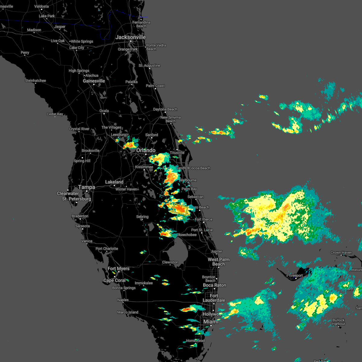 At 156 pm edt, a severe thunderstorm was located near blue cypress lake, and is nearly stationary (radar indicated). Hazards include 60 mph wind gusts and quarter size hail. Hail damage to vehicles is expected. expect wind damage to roofs, siding, and trees. this severe thunderstorm will remain over mainly rural areas of north central okeechobee and southwestern indian river counties. hail threat, radar indicated max hail size, 1. 00 in wind threat, radar indicated max wind gust, 60 mph. At 156 pm edt, a severe thunderstorm was located near blue cypress lake, and is nearly stationary (radar indicated). Hazards include 60 mph wind gusts and quarter size hail. Hail damage to vehicles is expected. expect wind damage to roofs, siding, and trees. this severe thunderstorm will remain over mainly rural areas of north central okeechobee and southwestern indian river counties. hail threat, radar indicated max hail size, 1. 00 in wind threat, radar indicated max wind gust, 60 mph.
|
| 4/2/2022 5:26 PM EDT |
 At 525 pm edt, severe thunderstorms were located along a line extending from near sebastian inlet state park to near vero beach, moving east at 30 mph (radar indicated). Hazards include 60 mph wind gusts. Expect damage to roofs, siding, and trees. locations impacted include, sebastian, vero beach, fellsmere, indian river shores and roseland. hail threat, radar indicated max hail size, <. 75 in wind threat, radar indicated max wind gust, 60 mph. At 525 pm edt, severe thunderstorms were located along a line extending from near sebastian inlet state park to near vero beach, moving east at 30 mph (radar indicated). Hazards include 60 mph wind gusts. Expect damage to roofs, siding, and trees. locations impacted include, sebastian, vero beach, fellsmere, indian river shores and roseland. hail threat, radar indicated max hail size, <. 75 in wind threat, radar indicated max wind gust, 60 mph.
|
| 4/2/2022 5:12 PM EDT |
 At 512 pm edt, severe thunderstorms were located along a line extending from near floridana beach to vero lake estates, moving southeast at 40 mph (radar indicated). Hazards include 60 mph wind gusts. expect damage to roofs, siding, and trees At 512 pm edt, severe thunderstorms were located along a line extending from near floridana beach to vero lake estates, moving southeast at 40 mph (radar indicated). Hazards include 60 mph wind gusts. expect damage to roofs, siding, and trees
|
| 3/16/2022 5:07 PM EDT |
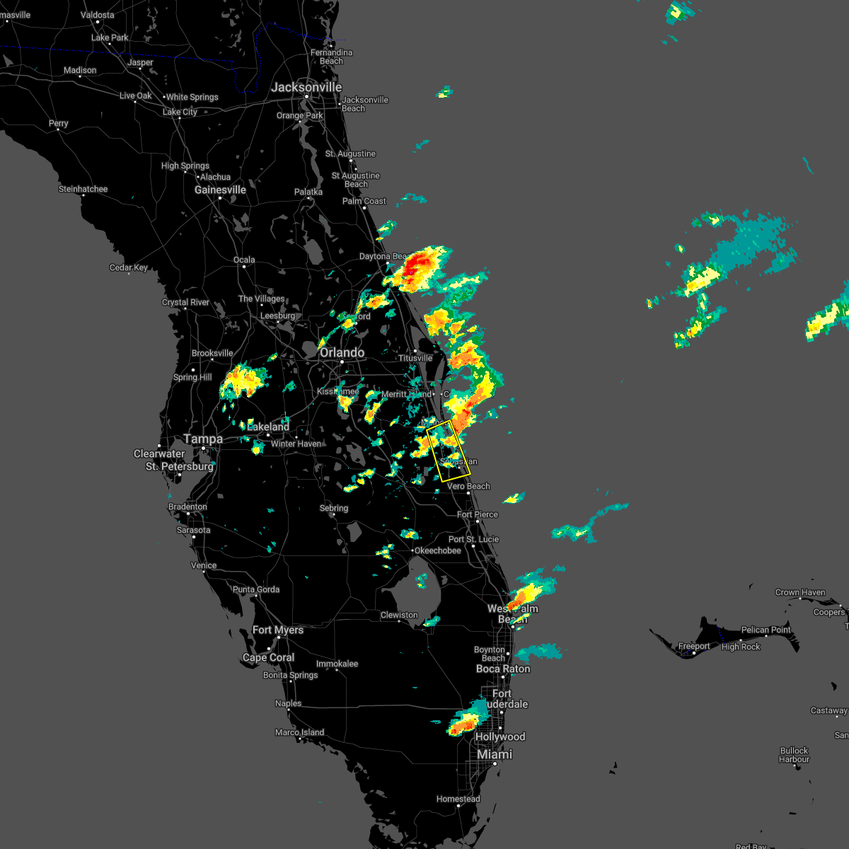 At 506 pm edt, a severe thunderstorm was located over barefoot bay, moving northeast at 35 mph (radar indicated). Hazards include 60 mph wind gusts and quarter size hail. Hail damage to vehicles is expected. expect wind damage to roofs, siding, and trees. Locations impacted include, palm bay, melbourne, sebastian, fellsmere and malabar. At 506 pm edt, a severe thunderstorm was located over barefoot bay, moving northeast at 35 mph (radar indicated). Hazards include 60 mph wind gusts and quarter size hail. Hail damage to vehicles is expected. expect wind damage to roofs, siding, and trees. Locations impacted include, palm bay, melbourne, sebastian, fellsmere and malabar.
|
| 3/16/2022 4:44 PM EDT |
 At 443 pm edt, a severe thunderstorm was located over malabar, moving east at 25 mph (radar indicated. at 435 pm edt dime to nickel sized hail was reported in west melbourne). Hazards include 60 mph wind gusts and quarter size hail. Hail damage to vehicles is expected. Expect wind damage to roofs, siding, and trees. At 443 pm edt, a severe thunderstorm was located over malabar, moving east at 25 mph (radar indicated. at 435 pm edt dime to nickel sized hail was reported in west melbourne). Hazards include 60 mph wind gusts and quarter size hail. Hail damage to vehicles is expected. Expect wind damage to roofs, siding, and trees.
|
| 1/10/2022 5:24 PM EST |
 The severe thunderstorm warning for northeastern okeechobee and southwestern indian river counties will expire at 530 pm est, the storm which prompted the warning has weakened below severe limits, and has exited the warned area. therefore, the warning will be allowed to expire. however gusty winds and heavy rain are still possible with this thunderstorm. The severe thunderstorm warning for northeastern okeechobee and southwestern indian river counties will expire at 530 pm est, the storm which prompted the warning has weakened below severe limits, and has exited the warned area. therefore, the warning will be allowed to expire. however gusty winds and heavy rain are still possible with this thunderstorm.
|
| 1/10/2022 5:05 PM EST |
 At 503 pm est, a severe thunderstorm was located near blue cypress lake, moving east at 25 mph (radar indicated). Hazards include 60 mph wind gusts and quarter size hail. Hail damage to vehicles is expected. expect wind damage to roofs, siding, and trees. locations impacted include, fellsmere and blue cypress lake. hail threat, radar indicated max hail size, 1. 00 in wind threat, radar indicated max wind gust, 60 mph. At 503 pm est, a severe thunderstorm was located near blue cypress lake, moving east at 25 mph (radar indicated). Hazards include 60 mph wind gusts and quarter size hail. Hail damage to vehicles is expected. expect wind damage to roofs, siding, and trees. locations impacted include, fellsmere and blue cypress lake. hail threat, radar indicated max hail size, 1. 00 in wind threat, radar indicated max wind gust, 60 mph.
|
| 1/10/2022 4:45 PM EST |
 At 444 pm est, a severe thunderstorm was located 8 miles northeast of kissimmee prairie preserve, or 12 miles west of blue cypress lake, moving east at 25 mph (radar indicated). Hazards include 60 mph wind gusts and quarter size hail. Hail damage to vehicles is expected. Expect wind damage to roofs, siding, and trees. At 444 pm est, a severe thunderstorm was located 8 miles northeast of kissimmee prairie preserve, or 12 miles west of blue cypress lake, moving east at 25 mph (radar indicated). Hazards include 60 mph wind gusts and quarter size hail. Hail damage to vehicles is expected. Expect wind damage to roofs, siding, and trees.
|
| 10/28/2021 5:35 PM EDT |
 At 534 pm edt, a severe thunderstorm capable of producing a tornado was located 8 miles north of blue cypress lake, moving northeast at 35 mph (radar indicated rotation). Hazards include tornado. Flying debris will be dangerous to those caught without shelter. mobile homes will be damaged or destroyed. damage to roofs, windows, and vehicles will occur. tree damage is likely. Locations impacted include, palm bay. At 534 pm edt, a severe thunderstorm capable of producing a tornado was located 8 miles north of blue cypress lake, moving northeast at 35 mph (radar indicated rotation). Hazards include tornado. Flying debris will be dangerous to those caught without shelter. mobile homes will be damaged or destroyed. damage to roofs, windows, and vehicles will occur. tree damage is likely. Locations impacted include, palm bay.
|
| 10/28/2021 5:21 PM EDT |
 At 521 pm edt, a severe thunderstorm capable of producing a tornado was located near blue cypress lake, moving northeast at 30 mph (radar indicated rotation). Hazards include tornado. Flying debris will be dangerous to those caught without shelter. mobile homes will be damaged or destroyed. damage to roofs, windows, and vehicles will occur. tree damage is likely. This tornadic thunderstorm will remain over mainly rural areas of northwestern indian river and south central brevard counties. At 521 pm edt, a severe thunderstorm capable of producing a tornado was located near blue cypress lake, moving northeast at 30 mph (radar indicated rotation). Hazards include tornado. Flying debris will be dangerous to those caught without shelter. mobile homes will be damaged or destroyed. damage to roofs, windows, and vehicles will occur. tree damage is likely. This tornadic thunderstorm will remain over mainly rural areas of northwestern indian river and south central brevard counties.
|
| 6/16/2021 4:52 PM EDT |
 At 452 pm edt, a severe thunderstorm was located over winter beach, moving east at 25 mph (radar indicated). Hazards include 60 mph wind gusts. expect damage to roofs, siding, and trees At 452 pm edt, a severe thunderstorm was located over winter beach, moving east at 25 mph (radar indicated). Hazards include 60 mph wind gusts. expect damage to roofs, siding, and trees
|
| 4/11/2021 2:15 PM EDT |
 At 214 pm edt, a severe thunderstorm was located over vero beach south, moving southeast at 45 mph (radar indicated). Hazards include 60 mph wind gusts. Expect damage to roofs, siding, and trees. Locations impacted include, sebastian, vero beach, fellsmere, indian river shores and roseland. At 214 pm edt, a severe thunderstorm was located over vero beach south, moving southeast at 45 mph (radar indicated). Hazards include 60 mph wind gusts. Expect damage to roofs, siding, and trees. Locations impacted include, sebastian, vero beach, fellsmere, indian river shores and roseland.
|
| 4/11/2021 1:55 PM EDT |
 At 155 pm edt, a severe thunderstorm was located over grant-valkaria, or near malabar, moving southeast at 20 mph (radar indicated). Hazards include 60 mph wind gusts. expect damage to roofs, siding, and trees At 155 pm edt, a severe thunderstorm was located over grant-valkaria, or near malabar, moving southeast at 20 mph (radar indicated). Hazards include 60 mph wind gusts. expect damage to roofs, siding, and trees
|
| 6/23/2020 8:53 PM EDT |
 At 851 pm edt, a severe thunderstorm was located along a line extending from north of fellsmere to 8 miles southwest of pointe west, moving southeast at 20 mph (radar indicated). Hazards include 60 mph wind gusts and penny size hail. Expect damage to roofs, siding, and trees. Locations impacted include, sebastian, vero beach, fellsmere, indian river shores and vero beach south. At 851 pm edt, a severe thunderstorm was located along a line extending from north of fellsmere to 8 miles southwest of pointe west, moving southeast at 20 mph (radar indicated). Hazards include 60 mph wind gusts and penny size hail. Expect damage to roofs, siding, and trees. Locations impacted include, sebastian, vero beach, fellsmere, indian river shores and vero beach south.
|
| 6/23/2020 8:28 PM EDT |
 At 828 pm edt, severe thunderstorms were located along a line extending from grant-valkaria to 6 miles southeast of blue cypress lake, moving southeast at 20 mph (radar indicated). Hazards include 60 mph wind gusts and nickel size hail. expect damage to roofs, siding, and trees At 828 pm edt, severe thunderstorms were located along a line extending from grant-valkaria to 6 miles southeast of blue cypress lake, moving southeast at 20 mph (radar indicated). Hazards include 60 mph wind gusts and nickel size hail. expect damage to roofs, siding, and trees
|
| 4/26/2020 9:07 AM EDT | Quarter sized hail reported 1.3 miles SSE of Fellsmere, FL, report of nickel to quarter size hail. |
| 4/26/2020 9:07 AM EDT |
 At 905 am edt, a severe thunderstorm was located near fellsmere, moving northeast at 35 mph. the storm will cross i 95 near the st sebastian river state park around 915 am (radar indicated). Hazards include quarter size hail. Damage to vehicles is expected. Locations impacted include, sebastian, fellsmere, indian river shores, roseland and barefoot bay. At 905 am edt, a severe thunderstorm was located near fellsmere, moving northeast at 35 mph. the storm will cross i 95 near the st sebastian river state park around 915 am (radar indicated). Hazards include quarter size hail. Damage to vehicles is expected. Locations impacted include, sebastian, fellsmere, indian river shores, roseland and barefoot bay.
|
| 4/26/2020 8:46 AM EDT |
 At 845 am edt, a severe thunderstorm was located near blue cypress lake, moving northeast at 30 mph (radar indicated). Hazards include quarter size hail. damage to vehicles is expected At 845 am edt, a severe thunderstorm was located near blue cypress lake, moving northeast at 30 mph (radar indicated). Hazards include quarter size hail. damage to vehicles is expected
|
| 10/19/2019 2:46 PM EDT |
 At 245 pm edt, a severe thunderstorm was located near pointe west, or 9 miles south of fellsmere, moving northeast at 30 mph (radar indicated). Hazards include 60 mph wind gusts. Expect damage to roofs, siding, and trees. Locations impacted include, sebastian, vero beach, fellsmere, indian river shores and roseland. At 245 pm edt, a severe thunderstorm was located near pointe west, or 9 miles south of fellsmere, moving northeast at 30 mph (radar indicated). Hazards include 60 mph wind gusts. Expect damage to roofs, siding, and trees. Locations impacted include, sebastian, vero beach, fellsmere, indian river shores and roseland.
|
| 10/19/2019 2:35 PM EDT |
 At 234 pm edt, a severe thunderstorm was located 10 miles southwest of pointe west, or 10 miles east of fort drum, moving northeast at 30 mph (radar indicated). Hazards include 60 mph wind gusts. expect damage to roofs, siding, and trees At 234 pm edt, a severe thunderstorm was located 10 miles southwest of pointe west, or 10 miles east of fort drum, moving northeast at 30 mph (radar indicated). Hazards include 60 mph wind gusts. expect damage to roofs, siding, and trees
|
| 9/3/2019 6:27 PM EDT |
 The tornado warning for eastern indian river and southeastern brevard counties will expire at 630 pm edt, the storms which prompted the warning have weakened below severe limits, and no longer appear capable of producing a tornado. therefore, the warning will be allowed to expire. The tornado warning for eastern indian river and southeastern brevard counties will expire at 630 pm edt, the storms which prompted the warning have weakened below severe limits, and no longer appear capable of producing a tornado. therefore, the warning will be allowed to expire.
|
| 9/3/2019 6:06 PM EDT |
 The national weather service in melbourne has issued a * tornado warning for. eastern indian river county in east central florida. southeastern brevard county in florida. until 630 pm edt. At 606 pm edt, severe thunderstorms capable of producing a tornado. The national weather service in melbourne has issued a * tornado warning for. eastern indian river county in east central florida. southeastern brevard county in florida. until 630 pm edt. At 606 pm edt, severe thunderstorms capable of producing a tornado.
|
| 7/11/2019 2:46 PM EDT |
 At 246 pm edt, a severe thunderstorm was located over sebastian inlet state park, or near sebastian inlet, moving north at 25 mph (radar indicated). Hazards include 60 mph wind gusts. Expect damage to roofs, siding, and trees. Locations impacted include, sebastian, vero beach, fellsmere, indian river shores and vero beach south. At 246 pm edt, a severe thunderstorm was located over sebastian inlet state park, or near sebastian inlet, moving north at 25 mph (radar indicated). Hazards include 60 mph wind gusts. Expect damage to roofs, siding, and trees. Locations impacted include, sebastian, vero beach, fellsmere, indian river shores and vero beach south.
|
| 7/11/2019 2:20 PM EDT |
 At 220 pm edt, a severe thunderstorm was located over vero beach, moving north at 25 mph (radar indicated). Hazards include 60 mph wind gusts. expect damage to roofs, siding, and trees At 220 pm edt, a severe thunderstorm was located over vero beach, moving north at 25 mph (radar indicated). Hazards include 60 mph wind gusts. expect damage to roofs, siding, and trees
|
| 5/4/2019 6:34 PM EDT |
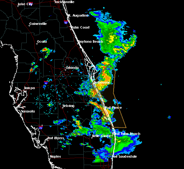 At 631 pm edt, a severe thunderstorm was located over barefoot bay, moving east at 25 mph. this storm is impacting interstate 95 between mile marker 160 and 173 (radar indicated). Hazards include 60 mph wind gusts and quarter size hail. Hail damage to vehicles is expected. expect wind damage to roofs, siding, and trees. Locations impacted include, palm bay, sebastian, malabar, roseland and barefoot bay. At 631 pm edt, a severe thunderstorm was located over barefoot bay, moving east at 25 mph. this storm is impacting interstate 95 between mile marker 160 and 173 (radar indicated). Hazards include 60 mph wind gusts and quarter size hail. Hail damage to vehicles is expected. expect wind damage to roofs, siding, and trees. Locations impacted include, palm bay, sebastian, malabar, roseland and barefoot bay.
|
| 5/4/2019 6:14 PM EDT |
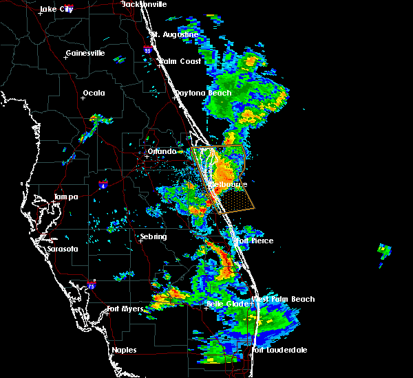 At 614 pm edt, a severe thunderstorm was located 7 miles south of palm bay, moving east at 25 mph. another severe thunderstorm was located over malabar, moving east at 25 mph. these storms will cross interstate 95 between malabar road and the brevard-indian river county line (radar indicated). Hazards include 60 mph wind gusts and quarter size hail. Hail damage to vehicles is expected. Expect wind damage to roofs, siding, and trees. At 614 pm edt, a severe thunderstorm was located 7 miles south of palm bay, moving east at 25 mph. another severe thunderstorm was located over malabar, moving east at 25 mph. these storms will cross interstate 95 between malabar road and the brevard-indian river county line (radar indicated). Hazards include 60 mph wind gusts and quarter size hail. Hail damage to vehicles is expected. Expect wind damage to roofs, siding, and trees.
|
| 1/24/2019 8:03 AM EST |
 At 802 am est, a severe thunderstorm capable of producing a tornado was located near blue cypress lake, moving northeast at 30 mph (radar indicated rotation). Hazards include tornado. Flying debris will be dangerous to those caught without shelter. mobile homes will be damaged or destroyed. damage to roofs, windows, and vehicles will occur. tree damage is likely. This tornadic thunderstorm will pass near the deer run subdivision and cross i-95 near micco. At 802 am est, a severe thunderstorm capable of producing a tornado was located near blue cypress lake, moving northeast at 30 mph (radar indicated rotation). Hazards include tornado. Flying debris will be dangerous to those caught without shelter. mobile homes will be damaged or destroyed. damage to roofs, windows, and vehicles will occur. tree damage is likely. This tornadic thunderstorm will pass near the deer run subdivision and cross i-95 near micco.
|
| 1/24/2019 7:46 AM EST |
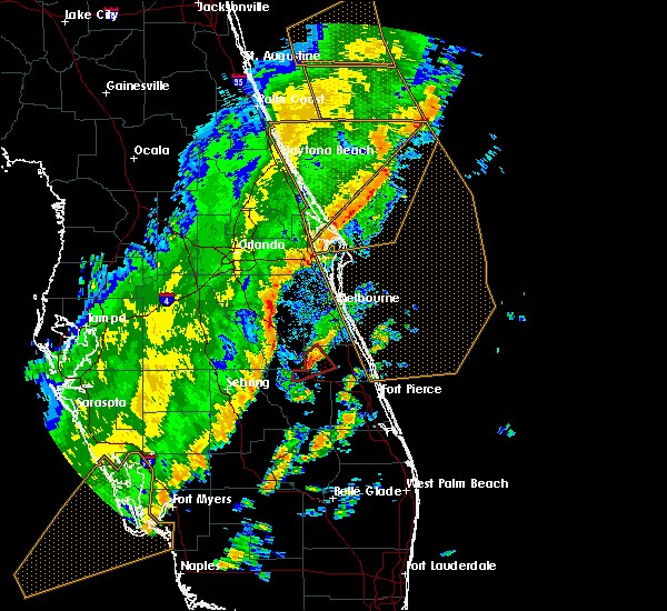 At 745 am est, a severe thunderstorm capable of producing a tornado was located near blue cypress lake, moving northeast at 40 mph (radar indicated rotation). Hazards include tornado. Flying debris will be dangerous to those caught without shelter. mobile homes will be damaged or destroyed. damage to roofs, windows, and vehicles will occur. tree damage is likely. this dangerous storm will be near, blue cypress lake around 750 am est. Fellsmere at 800 am. At 745 am est, a severe thunderstorm capable of producing a tornado was located near blue cypress lake, moving northeast at 40 mph (radar indicated rotation). Hazards include tornado. Flying debris will be dangerous to those caught without shelter. mobile homes will be damaged or destroyed. damage to roofs, windows, and vehicles will occur. tree damage is likely. this dangerous storm will be near, blue cypress lake around 750 am est. Fellsmere at 800 am.
|
| 1/24/2019 7:34 AM EST |
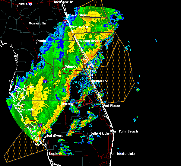 At 732 am est, a severe thunderstorm capable of producing a tornado was located 8 miles northwest of fort drum, moving northeast at 45 mph (radar indicated rotation). Hazards include tornado. Flying debris will be dangerous to those caught without shelter. mobile homes will be damaged or destroyed. damage to roofs, windows, and vehicles will occur. tree damage is likely. locations impacted include, u. s. Highway 441, the florida turnpike, state road 60, and blue cypress lake. At 732 am est, a severe thunderstorm capable of producing a tornado was located 8 miles northwest of fort drum, moving northeast at 45 mph (radar indicated rotation). Hazards include tornado. Flying debris will be dangerous to those caught without shelter. mobile homes will be damaged or destroyed. damage to roofs, windows, and vehicles will occur. tree damage is likely. locations impacted include, u. s. Highway 441, the florida turnpike, state road 60, and blue cypress lake.
|
| 1/24/2019 7:19 AM EST |
 At 719 am est, a severe thunderstorm capable of producing a tornado was located near kissimmee prarie preserve, or 9 miles north of basinger, moving northeast at 45 mph (radar indicated rotation). Hazards include tornado. Flying debris will be dangerous to those caught without shelter. mobile homes will be damaged or destroyed. damage to roofs, windows, and vehicles will occur. tree damage is likely. This tornadic thunderstorm will remain over mainly rural areas of northern okeechobee and western indian river counties. At 719 am est, a severe thunderstorm capable of producing a tornado was located near kissimmee prarie preserve, or 9 miles north of basinger, moving northeast at 45 mph (radar indicated rotation). Hazards include tornado. Flying debris will be dangerous to those caught without shelter. mobile homes will be damaged or destroyed. damage to roofs, windows, and vehicles will occur. tree damage is likely. This tornadic thunderstorm will remain over mainly rural areas of northern okeechobee and western indian river counties.
|
| 6/7/2018 6:22 PM EDT |
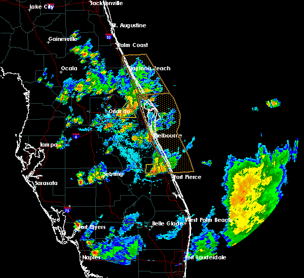 The severe thunderstorm warning for southern indian river county will expire at 630 pm edt, the storm which prompted the warning has weakened below severe limits, and no longer poses an immediate threat to life or property. therefore, the warning will be allowed to expire. however gusty winds and heavy rain are still possible with this thunderstorm. The severe thunderstorm warning for southern indian river county will expire at 630 pm edt, the storm which prompted the warning has weakened below severe limits, and no longer poses an immediate threat to life or property. therefore, the warning will be allowed to expire. however gusty winds and heavy rain are still possible with this thunderstorm.
|
| 6/7/2018 5:55 PM EDT |
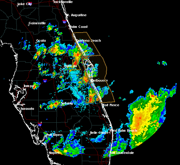 At 554 pm edt, a severe thunderstorm was located 8 miles southeast of blue cypress lake, moving south at 10 mph (radar indicated). Hazards include 60 mph wind gusts and quarter size hail. Hail damage to vehicles is expected. expect wind damage to roofs, siding, and trees. This severe thunderstorm will remain over mainly rural areas of south central indian river county. At 554 pm edt, a severe thunderstorm was located 8 miles southeast of blue cypress lake, moving south at 10 mph (radar indicated). Hazards include 60 mph wind gusts and quarter size hail. Hail damage to vehicles is expected. expect wind damage to roofs, siding, and trees. This severe thunderstorm will remain over mainly rural areas of south central indian river county.
|
| 6/7/2018 5:40 PM EDT |
 At 539 pm edt, a severe thunderstorm was located near blue cypress lake, moving south at 10 mph (radar indicated). Hazards include 60 mph wind gusts and quarter size hail. Hail damage to vehicles is expected. Expect wind damage to roofs, siding, and trees. At 539 pm edt, a severe thunderstorm was located near blue cypress lake, moving south at 10 mph (radar indicated). Hazards include 60 mph wind gusts and quarter size hail. Hail damage to vehicles is expected. Expect wind damage to roofs, siding, and trees.
|
| 6/7/2018 5:03 PM EDT |
 At 503 pm edt, a severe thunderstorm was located over vero lake estates, or near sebastian highlands, and is nearly stationary (radar indicated). Hazards include 60 mph wind gusts and quarter size hail. Hail damage to vehicles is expected. expect wind damage to roofs, siding, and trees. Locations impacted include, sebastian, fellsmere, indian river shores, roseland and wabasso. At 503 pm edt, a severe thunderstorm was located over vero lake estates, or near sebastian highlands, and is nearly stationary (radar indicated). Hazards include 60 mph wind gusts and quarter size hail. Hail damage to vehicles is expected. expect wind damage to roofs, siding, and trees. Locations impacted include, sebastian, fellsmere, indian river shores, roseland and wabasso.
|
| 6/7/2018 4:54 PM EDT |
 At 453 pm edt, a severe thunderstorm was located over vero lake estates, or over sebastian highlands, and is nearly stationary. an additional intensifying storm will approach fellsmere from the west (radar indicated). Hazards include 60 mph wind gusts and penny size hail. expect damage to roofs, siding, and trees At 453 pm edt, a severe thunderstorm was located over vero lake estates, or over sebastian highlands, and is nearly stationary. an additional intensifying storm will approach fellsmere from the west (radar indicated). Hazards include 60 mph wind gusts and penny size hail. expect damage to roofs, siding, and trees
|
| 4/7/2018 3:23 PM EDT |
 At 323 pm edt, a severe thunderstorm was located over fort drum, moving northeast at 25 mph (radar indicated). Hazards include 60 mph wind gusts and quarter size hail. Hail damage to vehicles is expected. Expect wind damage to roofs, siding, and trees. At 323 pm edt, a severe thunderstorm was located over fort drum, moving northeast at 25 mph (radar indicated). Hazards include 60 mph wind gusts and quarter size hail. Hail damage to vehicles is expected. Expect wind damage to roofs, siding, and trees.
|
| 9/10/2017 4:59 PM EDT |
 At 458 pm edt, a severe thunderstorm capable of producing a tornado was located over indian river shores, moving northwest at 60 mph (radar indicated rotation). Hazards include tornado. Flying debris will be dangerous to those caught without shelter. mobile homes will be damaged or destroyed. damage to roofs, windows, and vehicles will occur. tree damage is likely. this dangerous storm will be near, winter beach and wabasso around 500 pm edt. sebastian, fellsmere and sebastian highlands around 510 pm edt. Other locations impacted by this tornadic thunderstorm include orchid. At 458 pm edt, a severe thunderstorm capable of producing a tornado was located over indian river shores, moving northwest at 60 mph (radar indicated rotation). Hazards include tornado. Flying debris will be dangerous to those caught without shelter. mobile homes will be damaged or destroyed. damage to roofs, windows, and vehicles will occur. tree damage is likely. this dangerous storm will be near, winter beach and wabasso around 500 pm edt. sebastian, fellsmere and sebastian highlands around 510 pm edt. Other locations impacted by this tornadic thunderstorm include orchid.
|
| 9/10/2017 4:38 PM EDT |
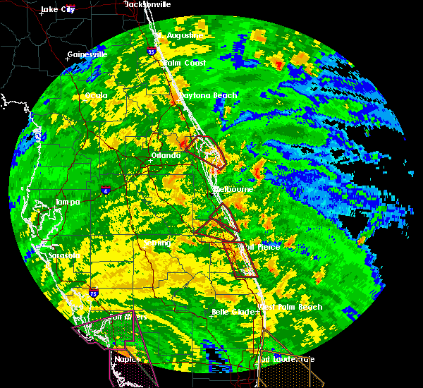 At 436 pm edt, a severe thunderstorm capable of producing a tornado was located 8 miles northeast of south beach, or 9 miles east of indian river shores, moving northwest at 60 mph (radar indicated rotation). Hazards include tornado. Flying debris will be dangerous to those caught without shelter. mobile homes will be damaged or destroyed. damage to roofs, windows, and vehicles will occur. tree damage is likely. this dangerous storm will be near, sebastian, indian river shores and wabasso around 450 pm edt. barefoot bay, micco and grant-valkaria around 500 pm edt. Other locations impacted by this tornadic thunderstorm include orchid. At 436 pm edt, a severe thunderstorm capable of producing a tornado was located 8 miles northeast of south beach, or 9 miles east of indian river shores, moving northwest at 60 mph (radar indicated rotation). Hazards include tornado. Flying debris will be dangerous to those caught without shelter. mobile homes will be damaged or destroyed. damage to roofs, windows, and vehicles will occur. tree damage is likely. this dangerous storm will be near, sebastian, indian river shores and wabasso around 450 pm edt. barefoot bay, micco and grant-valkaria around 500 pm edt. Other locations impacted by this tornadic thunderstorm include orchid.
|
| 9/10/2017 4:14 PM EDT |
 At 413 pm edt, a severe thunderstorm capable of producing a tornado was located over vero beach south, moving northwest at 60 mph (radar indicated rotation). Hazards include tornado. Flying debris will be dangerous to those caught without shelter. mobile homes will be damaged or destroyed. damage to roofs, windows, and vehicles will occur. tree damage is likely. This tornadic thunderstorm will remain over mainly rural areas of central indian river county, including the following locations: grovenor estates. At 413 pm edt, a severe thunderstorm capable of producing a tornado was located over vero beach south, moving northwest at 60 mph (radar indicated rotation). Hazards include tornado. Flying debris will be dangerous to those caught without shelter. mobile homes will be damaged or destroyed. damage to roofs, windows, and vehicles will occur. tree damage is likely. This tornadic thunderstorm will remain over mainly rural areas of central indian river county, including the following locations: grovenor estates.
|
| 9/10/2017 3:12 PM EDT |
 At 311 pm edt, a severe thunderstorm capable of producing a tornado was located 3 miles southeast of vero beach highland, or near vero beach south, moving northwest at 50 mph (radar indicated rotation). Hazards include tornado. Flying debris will be dangerous to those caught without shelter. mobile homes will be damaged or destroyed. damage to roofs, windows, and vehicles will occur. Tree damage is likely. At 311 pm edt, a severe thunderstorm capable of producing a tornado was located 3 miles southeast of vero beach highland, or near vero beach south, moving northwest at 50 mph (radar indicated rotation). Hazards include tornado. Flying debris will be dangerous to those caught without shelter. mobile homes will be damaged or destroyed. damage to roofs, windows, and vehicles will occur. Tree damage is likely.
|
| 9/10/2017 2:37 PM EDT |
 At 236 pm edt, a severe thunderstorm capable of producing a tornado was located 8 miles east of port canaveral, moving northwest at 40 mph. additional rotating cells offshore central and southern brevard will race onshore and will be capable of producing a tornado (radar indicated rotation). Hazards include tornado. Flying debris will be dangerous to those caught without shelter. mobile homes will be damaged or destroyed. damage to roofs, windows, and vehicles will occur. tree damage is likely. This dangerous storm will be near, titusville around 310 pm edt. At 236 pm edt, a severe thunderstorm capable of producing a tornado was located 8 miles east of port canaveral, moving northwest at 40 mph. additional rotating cells offshore central and southern brevard will race onshore and will be capable of producing a tornado (radar indicated rotation). Hazards include tornado. Flying debris will be dangerous to those caught without shelter. mobile homes will be damaged or destroyed. damage to roofs, windows, and vehicles will occur. tree damage is likely. This dangerous storm will be near, titusville around 310 pm edt.
|
| 9/10/2017 1:53 PM EDT |
 At 153 pm edt, a severe thunderstorm capable of producing a tornado was located over fellsmere, moving northwest at 40 mph (radar indicated rotation). Hazards include tornado. Flying debris will be dangerous to those caught without shelter. mobile homes will be damaged or destroyed. damage to roofs, windows, and vehicles will occur. tree damage is likely. This tornadic thunderstorm will remain over mainly rural areas of north central indian river and southwestern brevard counties. At 153 pm edt, a severe thunderstorm capable of producing a tornado was located over fellsmere, moving northwest at 40 mph (radar indicated rotation). Hazards include tornado. Flying debris will be dangerous to those caught without shelter. mobile homes will be damaged or destroyed. damage to roofs, windows, and vehicles will occur. tree damage is likely. This tornadic thunderstorm will remain over mainly rural areas of north central indian river and southwestern brevard counties.
|
| 9/10/2017 1:27 PM EDT |
 At 126 pm edt, a severe thunderstorm capable of producing a tornado was located just offshore south beach, or near vero beach, moving northwest at 50 mph (radar indicated rotation). Hazards include tornado. Flying debris will be dangerous to those caught without shelter. mobile homes will be damaged or destroyed. damage to roofs, windows, and vehicles will occur. tree damage is likely. this dangerous storm will be near, vero beach and gifford around 130 pm edt. sebastian, indian river shores and wabasso around 140 pm edt. sebastian inlet, roseland and barefoot bay around 150 pm edt. malabar and grant-valkaria around 200 pm edt. Other locations impacted by this tornadic thunderstorm include orchid. At 126 pm edt, a severe thunderstorm capable of producing a tornado was located just offshore south beach, or near vero beach, moving northwest at 50 mph (radar indicated rotation). Hazards include tornado. Flying debris will be dangerous to those caught without shelter. mobile homes will be damaged or destroyed. damage to roofs, windows, and vehicles will occur. tree damage is likely. this dangerous storm will be near, vero beach and gifford around 130 pm edt. sebastian, indian river shores and wabasso around 140 pm edt. sebastian inlet, roseland and barefoot bay around 150 pm edt. malabar and grant-valkaria around 200 pm edt. Other locations impacted by this tornadic thunderstorm include orchid.
|
| 9/10/2017 5:53 AM EDT |
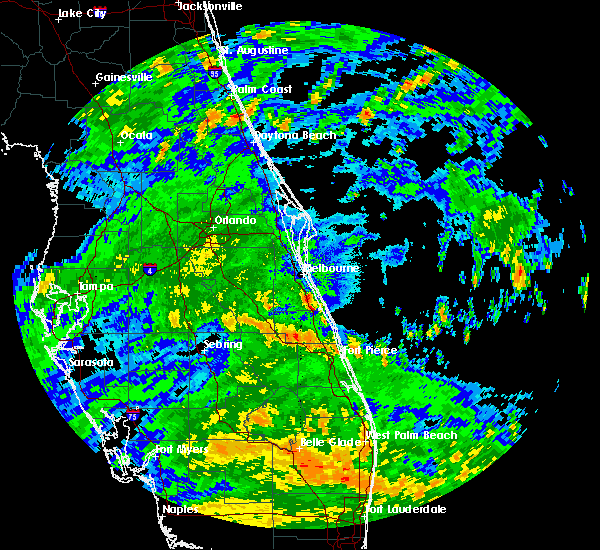 At 552 am edt, a severe thunderstorm capable of producing a tornado was located over barefoot bay, moving west at 35 mph (radar indicated rotation). Hazards include tornado. Flying debris will be dangerous to those caught without shelter. mobile homes will be damaged or destroyed. damage to roofs, windows, and vehicles will occur. tree damage is likely. This tornadic thunderstorm will remain over mainly rural areas of southeastern brevard county. At 552 am edt, a severe thunderstorm capable of producing a tornado was located over barefoot bay, moving west at 35 mph (radar indicated rotation). Hazards include tornado. Flying debris will be dangerous to those caught without shelter. mobile homes will be damaged or destroyed. damage to roofs, windows, and vehicles will occur. tree damage is likely. This tornadic thunderstorm will remain over mainly rural areas of southeastern brevard county.
|
| 5/31/2017 3:19 PM EDT |
 At 319 pm edt, a severe thunderstorm was located over fellsmere, and is nearly stationary (radar indicated). Hazards include 60 mph wind gusts and nickel size hail. expect damage to roofs, siding, and trees At 319 pm edt, a severe thunderstorm was located over fellsmere, and is nearly stationary (radar indicated). Hazards include 60 mph wind gusts and nickel size hail. expect damage to roofs, siding, and trees
|
| 4/6/2017 10:13 AM EDT |
 At 1013 am edt, a severe thunderstorm capable of producing a tornado was located 7 miles south of blue cypress lake, moving east at 25 mph (radar indicated rotation). Hazards include tornado and quarter size hail. Flying debris will be dangerous to those caught without shelter. mobile homes will be damaged or destroyed. damage to roofs, windows, and vehicles will occur. tree damage is likely. this dangerous storm will be near, pointe west around 1040 am edt. Other locations impacted by this tornadic thunderstorm include vero beach airport. At 1013 am edt, a severe thunderstorm capable of producing a tornado was located 7 miles south of blue cypress lake, moving east at 25 mph (radar indicated rotation). Hazards include tornado and quarter size hail. Flying debris will be dangerous to those caught without shelter. mobile homes will be damaged or destroyed. damage to roofs, windows, and vehicles will occur. tree damage is likely. this dangerous storm will be near, pointe west around 1040 am edt. Other locations impacted by this tornadic thunderstorm include vero beach airport.
|
| 4/6/2017 9:52 AM EDT |
 At 952 am edt, a severe thunderstorm capable of producing a tornado was located near fort drum, moving east at 20 mph (radar indicated rotation). Hazards include tornado and quarter size hail. Flying debris will be dangerous to those caught without shelter. mobile homes will be damaged or destroyed. damage to roofs, windows, and vehicles will occur. tree damage is likely. This tornadic thunderstorm will remain over mainly rural areas of southern indian river county, including the following locations: vero beach airport. At 952 am edt, a severe thunderstorm capable of producing a tornado was located near fort drum, moving east at 20 mph (radar indicated rotation). Hazards include tornado and quarter size hail. Flying debris will be dangerous to those caught without shelter. mobile homes will be damaged or destroyed. damage to roofs, windows, and vehicles will occur. tree damage is likely. This tornadic thunderstorm will remain over mainly rural areas of southern indian river county, including the following locations: vero beach airport.
|
| 4/4/2017 4:42 PM EDT |
 At 441 pm edt, a severe thunderstorm was located just north of fort drum, moving east at 15 mph (radar indicated). Hazards include 60 mph wind gusts and quarter size hail. Hail damage to vehicles is expected. Expect wind damage to roofs, siding, and trees. At 441 pm edt, a severe thunderstorm was located just north of fort drum, moving east at 15 mph (radar indicated). Hazards include 60 mph wind gusts and quarter size hail. Hail damage to vehicles is expected. Expect wind damage to roofs, siding, and trees.
|
| 4/4/2017 4:07 PM EDT |
 At 407 pm edt, a severe thunderstorm was located 9 miles northwest of fort drum, moving east-southeast at 20 mph (radar indicated). Hazards include 60 mph wind gusts and quarter size hail. Hail damage to vehicles is expected. Expect wind damage to roofs, siding, and trees. At 407 pm edt, a severe thunderstorm was located 9 miles northwest of fort drum, moving east-southeast at 20 mph (radar indicated). Hazards include 60 mph wind gusts and quarter size hail. Hail damage to vehicles is expected. Expect wind damage to roofs, siding, and trees.
|
| 6/18/2016 5:55 PM EDT | The severe thunderstorm warning for northeastern indian river and southeastern brevard counties will expire at 600 pm edt, the storm which prompted the warning has weakened below severe limits, and no longer pose an immediate threat to life or property. therefore the warning will be allowed to expire. however gusty winds and frequent lightning are still expected with this thunderstorm. |
| 6/18/2016 5:43 PM EDT |
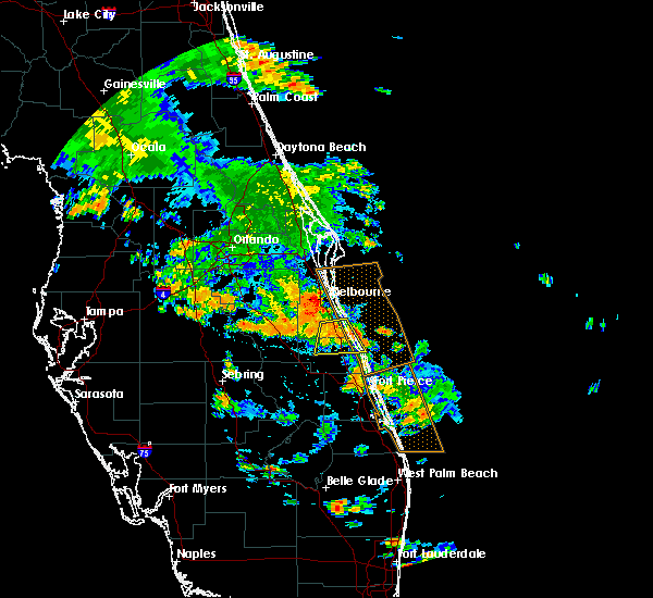 At 542 pm edt, a severe thunderstorm was located over fellsmere, moving south at 15 mph (radar indicated). Hazards include 60 mph wind gusts and quarter size hail. Hail damage to vehicles is expected. expect wind damage to roofs, siding, and trees. Locations impacted include, palm bay, sebastian, fellsmere, indian river shores and barefoot bay. At 542 pm edt, a severe thunderstorm was located over fellsmere, moving south at 15 mph (radar indicated). Hazards include 60 mph wind gusts and quarter size hail. Hail damage to vehicles is expected. expect wind damage to roofs, siding, and trees. Locations impacted include, palm bay, sebastian, fellsmere, indian river shores and barefoot bay.
|
| 6/18/2016 5:20 PM EDT |
 At 520 pm edt, a severe thunderstorm was located near barefoot bay, moving south at 15 mph (radar indicated). Hazards include 60 mph wind gusts and quarter size hail. Hail damage to vehicles is expected. Expect wind damage to roofs, siding, and trees. At 520 pm edt, a severe thunderstorm was located near barefoot bay, moving south at 15 mph (radar indicated). Hazards include 60 mph wind gusts and quarter size hail. Hail damage to vehicles is expected. Expect wind damage to roofs, siding, and trees.
|
| 6/18/2016 4:29 PM EDT |
 At 428 pm edt, a severe thunderstorm was located near yeehaw junction, moving east to southeast at 15 mph (radar indicated). Hazards include 60 mph wind gusts and quarter size hail. Hail damage to vehicles is expected. Expect wind damage to roofs, siding, and trees. At 428 pm edt, a severe thunderstorm was located near yeehaw junction, moving east to southeast at 15 mph (radar indicated). Hazards include 60 mph wind gusts and quarter size hail. Hail damage to vehicles is expected. Expect wind damage to roofs, siding, and trees.
|
| 5/4/2016 8:16 AM EDT |
 At 815 am edt, a severe thunderstorm was located near lake marian, moving east at 50 mph (radar indicated). Hazards include 60 mph wind gusts. Expect damage to roofs. siding. And trees. At 815 am edt, a severe thunderstorm was located near lake marian, moving east at 50 mph (radar indicated). Hazards include 60 mph wind gusts. Expect damage to roofs. siding. And trees.
|
| 4/14/2016 8:33 PM EDT |
 At 833 pm edt, a severe thunderstorm was located over blue cypress lake, moving east at 15 mph (radar indicated). Hazards include 60 mph wind gusts and quarter size hail. Hail damage to vehicles is expected. Expect wind damage to roofs, siding, and trees. At 833 pm edt, a severe thunderstorm was located over blue cypress lake, moving east at 15 mph (radar indicated). Hazards include 60 mph wind gusts and quarter size hail. Hail damage to vehicles is expected. Expect wind damage to roofs, siding, and trees.
|
| 4/14/2016 7:35 PM EDT | Quarter sized hail reported 2.6 miles SSE of Fellsmere, FL, quarter size hail reported in fellsmere. report relayed by emergency manager. |
| 4/14/2016 7:05 PM EDT |
 At 705 pm edt, a severe thunderstorm was located 8 miles northwest of fellsmere, moving east at 15 mph (radar indicated). Hazards include 60 mph wind gusts and quarter size hail. Hail damage to vehicles is expected. Expect wind damage to roofs, siding, and trees. At 705 pm edt, a severe thunderstorm was located 8 miles northwest of fellsmere, moving east at 15 mph (radar indicated). Hazards include 60 mph wind gusts and quarter size hail. Hail damage to vehicles is expected. Expect wind damage to roofs, siding, and trees.
|
| 3/28/2016 4:06 PM EDT |
 At 405 pm edt, a severe thunderstorm was located over blue cypress lake, moving east at 35 mph (radar indicated). Hazards include 60 mph wind gusts and quarter size hail. Hail damage to vehicles is expected. Expect wind damage to roofs, siding, and trees. At 405 pm edt, a severe thunderstorm was located over blue cypress lake, moving east at 35 mph (radar indicated). Hazards include 60 mph wind gusts and quarter size hail. Hail damage to vehicles is expected. Expect wind damage to roofs, siding, and trees.
|
| 3/28/2016 3:30 PM EDT |
 At 330 pm edt, a severe thunderstorm was located over gifford, moving east at 25 mph (radar indicated). Hazards include 60 mph wind gusts and quarter size hail. Hail damage to vehicles is expected. expect wind damage to roofs, siding, and trees. Locations impacted include, vero beach, indian river shores, wabasso, winter beach and vero beach south. At 330 pm edt, a severe thunderstorm was located over gifford, moving east at 25 mph (radar indicated). Hazards include 60 mph wind gusts and quarter size hail. Hail damage to vehicles is expected. expect wind damage to roofs, siding, and trees. Locations impacted include, vero beach, indian river shores, wabasso, winter beach and vero beach south.
|
| 3/28/2016 3:16 PM EDT |
 At 314 pm edt, a severe thunderstorm was located near pointe west, or 7 miles west of gifford, moving east at 30 mph (radar indicated). Hazards include 60 mph wind gusts and quarter size hail. Hail damage to vehicles is expected. Expect wind damage to roofs, siding, and trees. At 314 pm edt, a severe thunderstorm was located near pointe west, or 7 miles west of gifford, moving east at 30 mph (radar indicated). Hazards include 60 mph wind gusts and quarter size hail. Hail damage to vehicles is expected. Expect wind damage to roofs, siding, and trees.
|
| 3/24/2016 6:05 PM EDT |
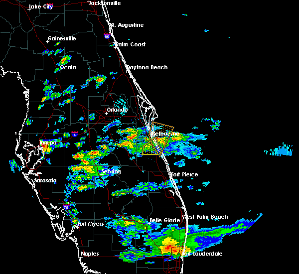 The severe thunderstorm warning for southeastern brevard county will expire at 615 pm edt, the storm which prompted the warning has moved out of the area. therefore the warning will be allowed to expire. however gusty winds are still possible with this thunderstorm. The severe thunderstorm warning for southeastern brevard county will expire at 615 pm edt, the storm which prompted the warning has moved out of the area. therefore the warning will be allowed to expire. however gusty winds are still possible with this thunderstorm.
|
| 3/24/2016 5:48 PM EDT |
 At 548 pm edt, a severe thunderstorm was located over melbourne beach, or near malabar, moving north at 35 mph (trained weather spotters). Hazards include 60 mph wind gusts and penny size hail. Expect damage to roofs. siding. and trees. Locations impacted include, palm bay, melbourne, malabar, indialantic and barefoot bay. At 548 pm edt, a severe thunderstorm was located over melbourne beach, or near malabar, moving north at 35 mph (trained weather spotters). Hazards include 60 mph wind gusts and penny size hail. Expect damage to roofs. siding. and trees. Locations impacted include, palm bay, melbourne, malabar, indialantic and barefoot bay.
|
| 3/24/2016 5:08 PM EDT |
 At 507 pm edt, a severe thunderstorm was located near blue cypress lake, moving north at 35 mph (radar indicated). Hazards include 60 mph wind gusts and quarter size hail. Hail damage to vehicles is expected. Expect wind damage to roofs, siding, and trees. At 507 pm edt, a severe thunderstorm was located near blue cypress lake, moving north at 35 mph (radar indicated). Hazards include 60 mph wind gusts and quarter size hail. Hail damage to vehicles is expected. Expect wind damage to roofs, siding, and trees.
|
| 2/24/2016 12:37 PM EST |
 At 1236 pm est, a severe thunderstorm was located near pointe west, or near vero beach south, moving northeast at 35 mph (radar indicated). Hazards include 60 mph wind gusts and quarter size hail. Hail damage to vehicles is expected. Expect wind damage to roofs, siding, and trees. At 1236 pm est, a severe thunderstorm was located near pointe west, or near vero beach south, moving northeast at 35 mph (radar indicated). Hazards include 60 mph wind gusts and quarter size hail. Hail damage to vehicles is expected. Expect wind damage to roofs, siding, and trees.
|
| 1/17/2016 5:05 AM EST |
 At 503 am est, severe thunderstorms were located along a line extending from 7 miles west of avon park to near southeast arcadia, moving northeast at 60 mph (radar indicated). Hazards include 60 mph wind gusts. Expect damage to roofs. Siding and trees. At 503 am est, severe thunderstorms were located along a line extending from 7 miles west of avon park to near southeast arcadia, moving northeast at 60 mph (radar indicated). Hazards include 60 mph wind gusts. Expect damage to roofs. Siding and trees.
|
| 7/31/2015 3:51 PM EDT |
 At 351 pm edt, doppler radar indicated a severe thunderstorm capable of producing damaging winds in excess of 60 mph. this storm was located over micco, or over roseland, and moving northeast at 35 mph. At 351 pm edt, doppler radar indicated a severe thunderstorm capable of producing damaging winds in excess of 60 mph. this storm was located over micco, or over roseland, and moving northeast at 35 mph.
|
| 4/16/2015 6:56 PM EDT | At 655 pm edt, doppler radar indicated a severe thunderstorm capable of producing quarter size hail and damaging winds in excess of 60 mph. this storm was located over fellsmere, moving east at 15 mph. locations impacted include, sebastian, vero lake estates, fellsmere, indian river shores and interstate 95 between mile markers 146 and 160. |
| 4/16/2015 6:46 PM EDT | At 645 pm edt, doppler radar indicated a severe thunderstorm capable of producing quarter size hail and damaging winds in excess of 60 mph. this storm was located near fellsmere, and moving southeast at 15 mph. |
| 3/26/2015 4:25 PM EDT | The national weather service in melbourne has issued a * severe thunderstorm warning for. southeastern brevard county in florida. northwestern indian river county in east central florida. until 530 pm edt * at 425 pm edt. Doppler radar indicated a severe thunderstorm. |
| 6/13/2014 8:14 PM EDT | Station dw1257 measured 57 kt/66 mph wind gust just north of jaycee beac in indian river county FL, 6.1 miles NNE of Fellsmere, FL |
Hail Maps for Fellsmere, FL
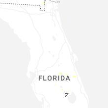
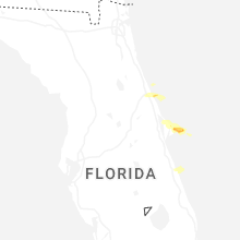

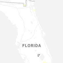
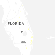
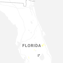
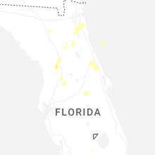
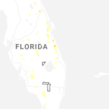
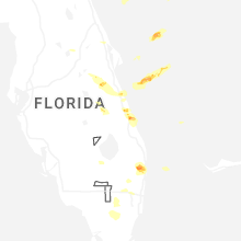
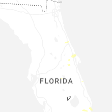
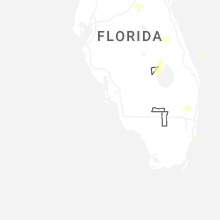
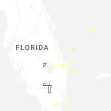


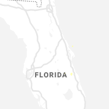


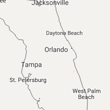
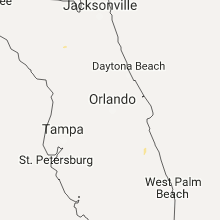


Connect with Interactive Hail Maps