

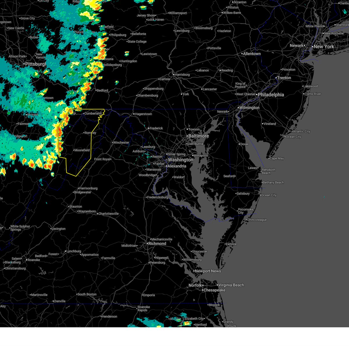
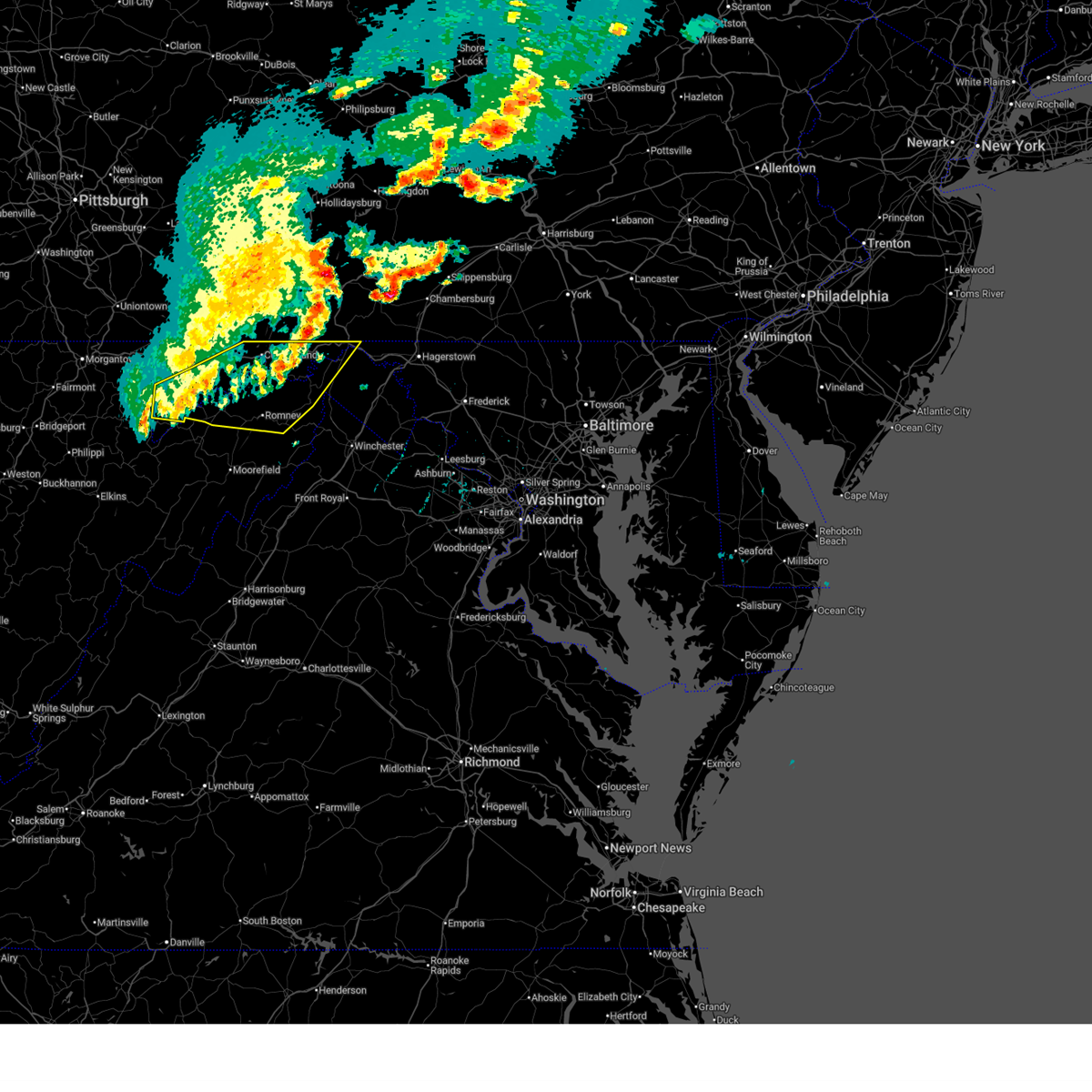
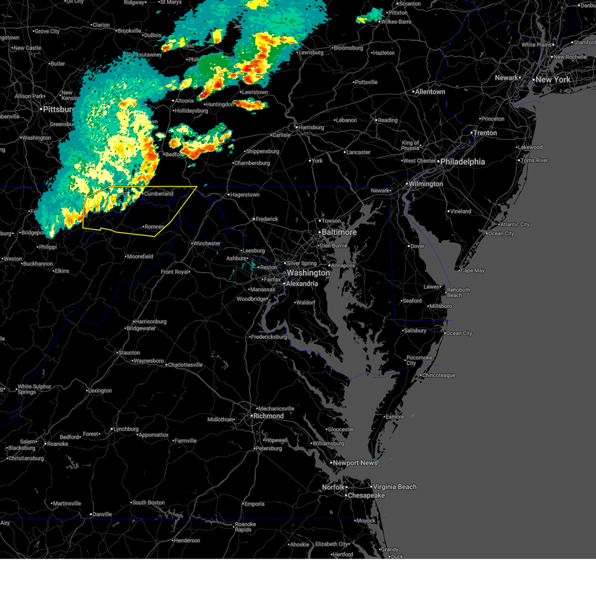
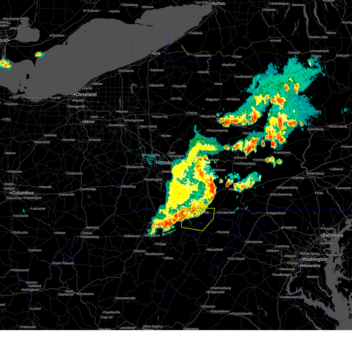
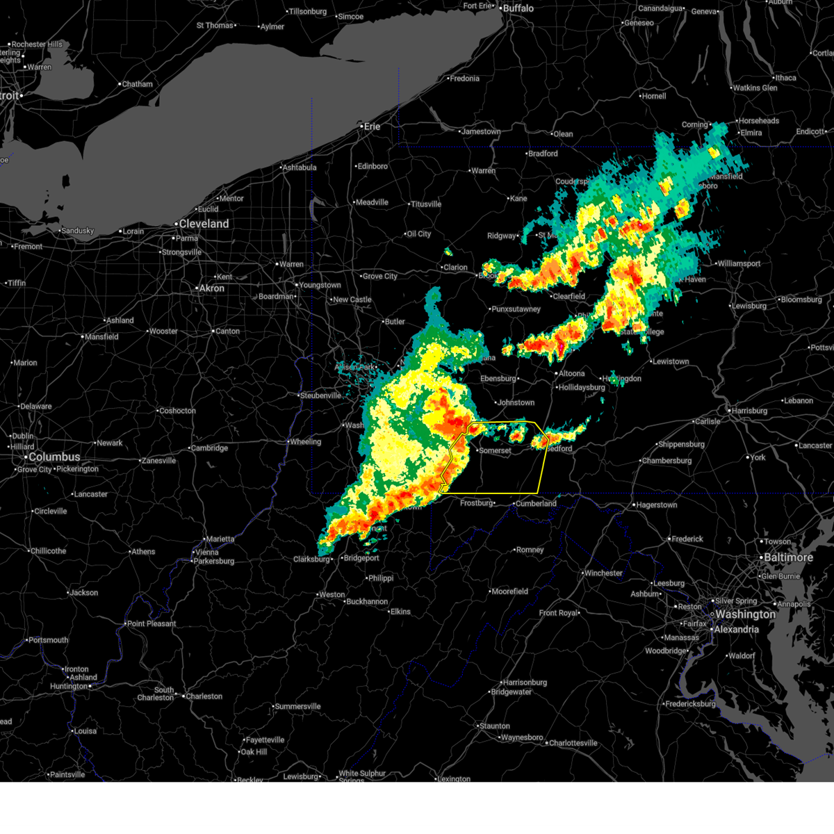
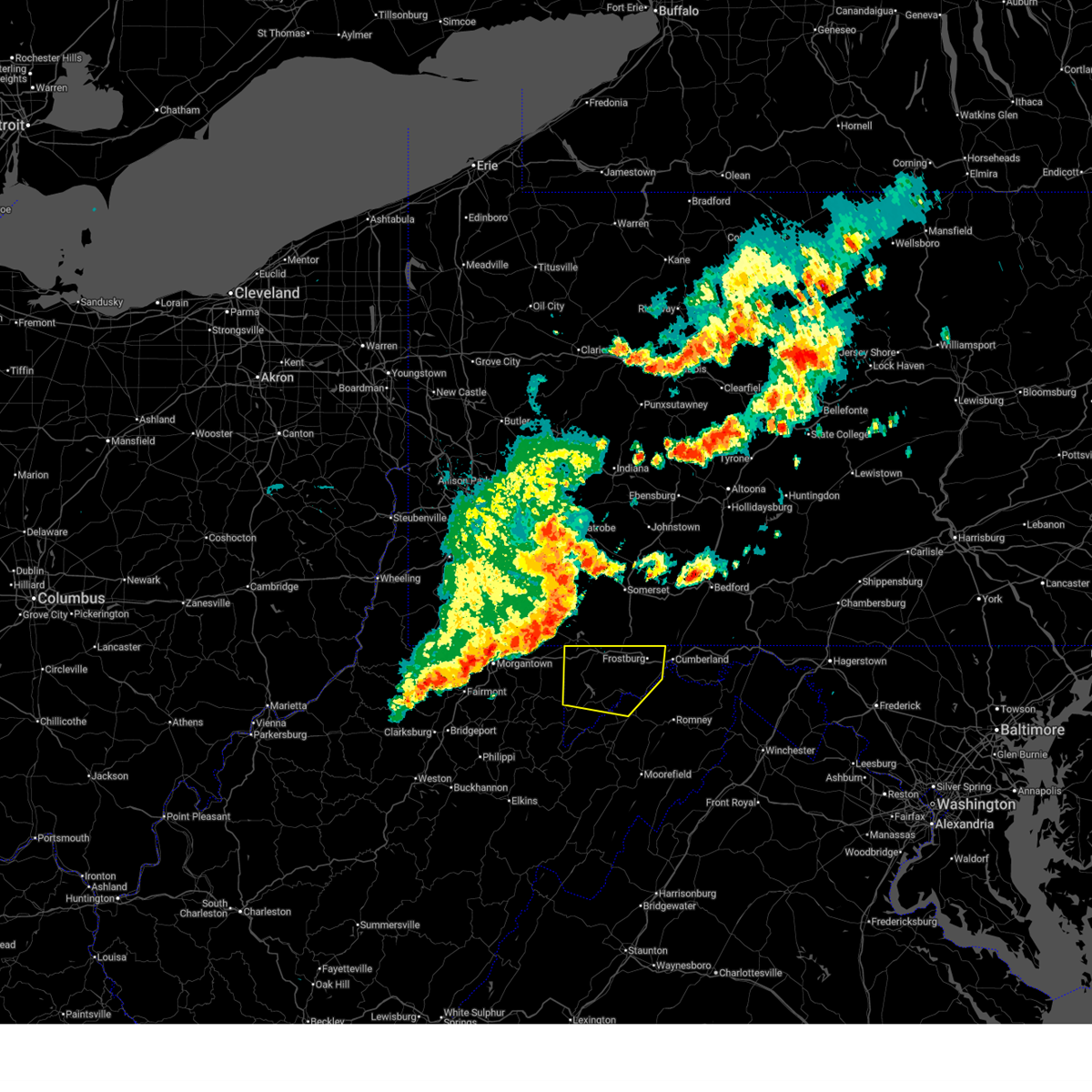
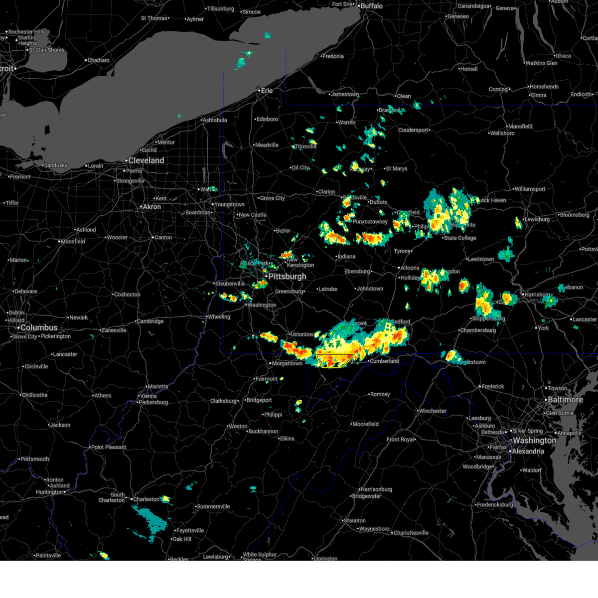
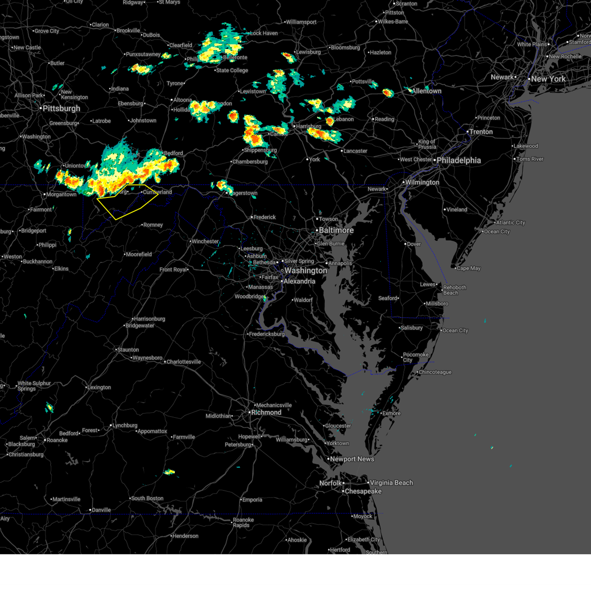
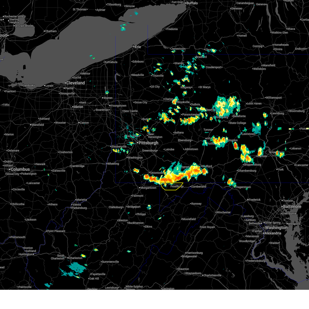
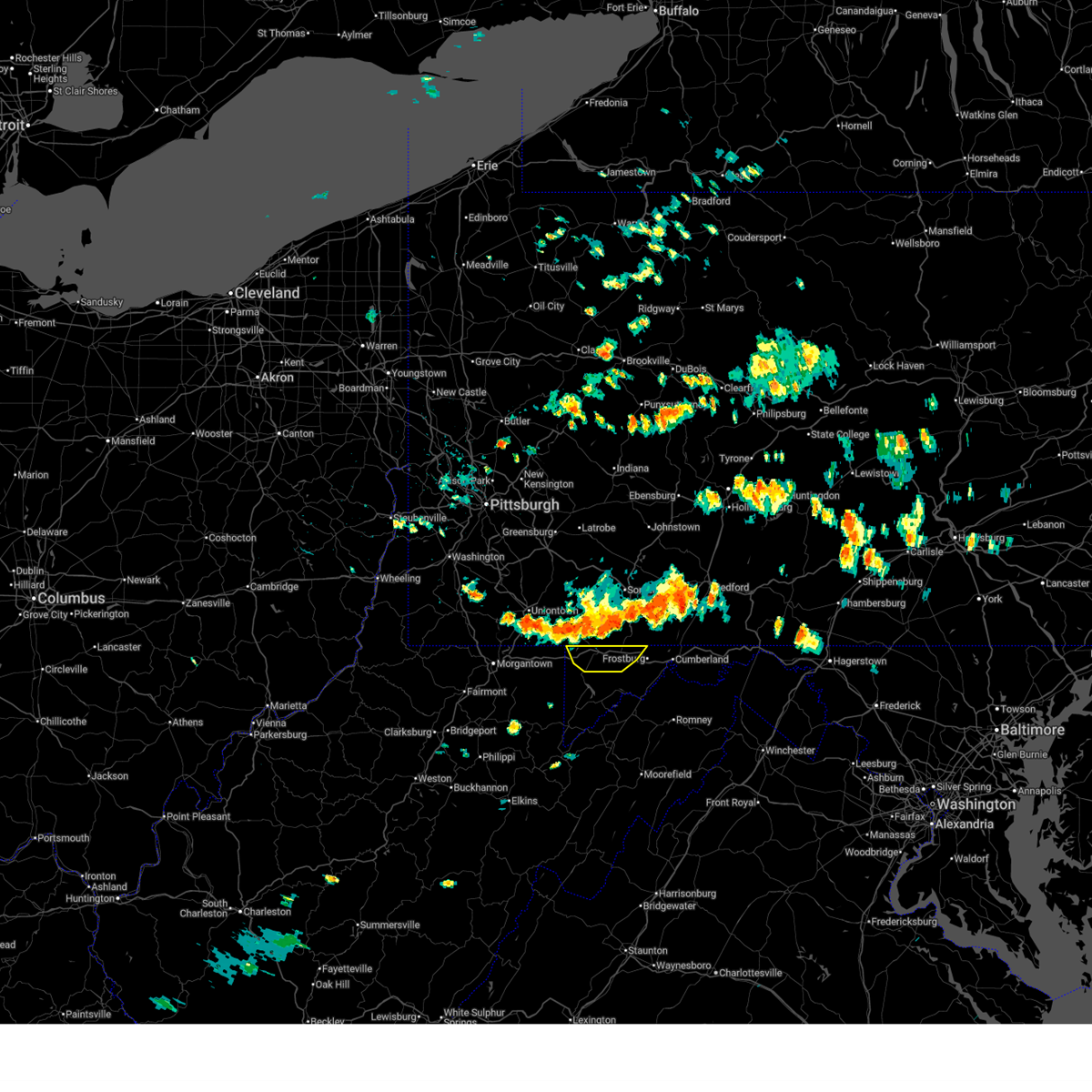
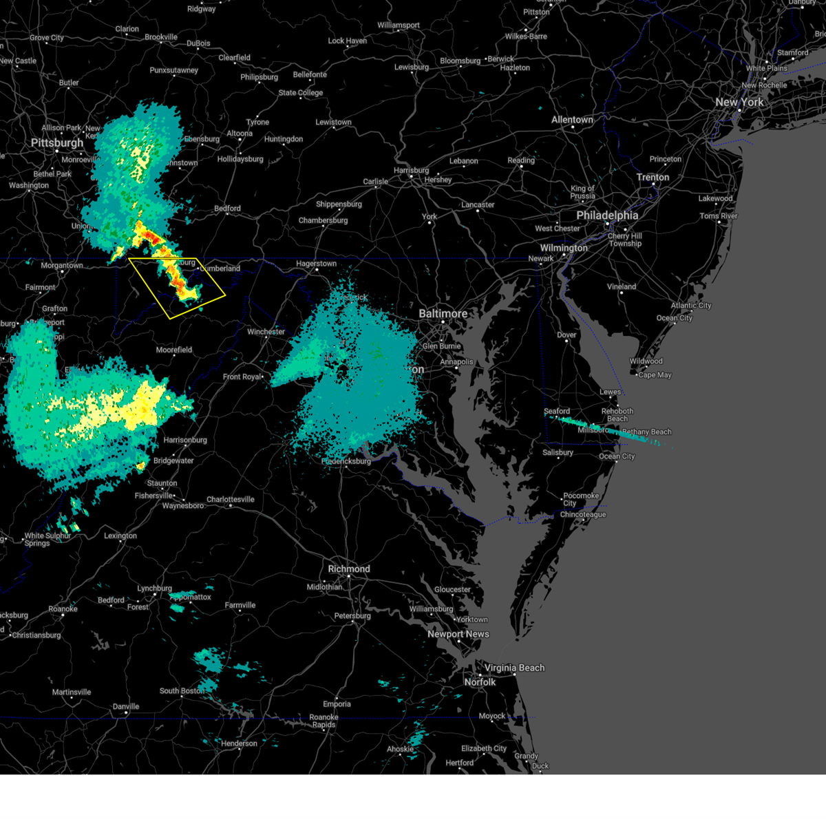
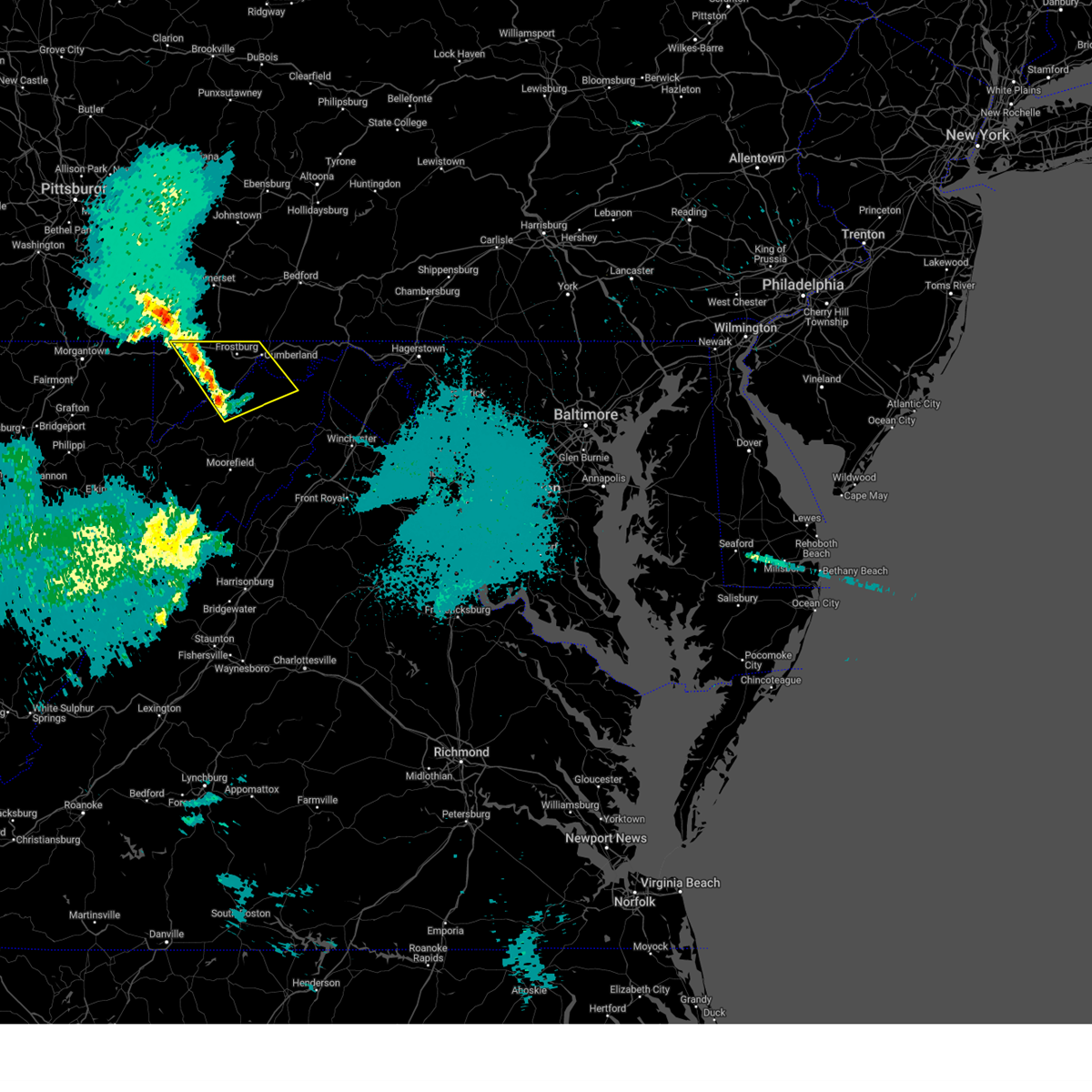
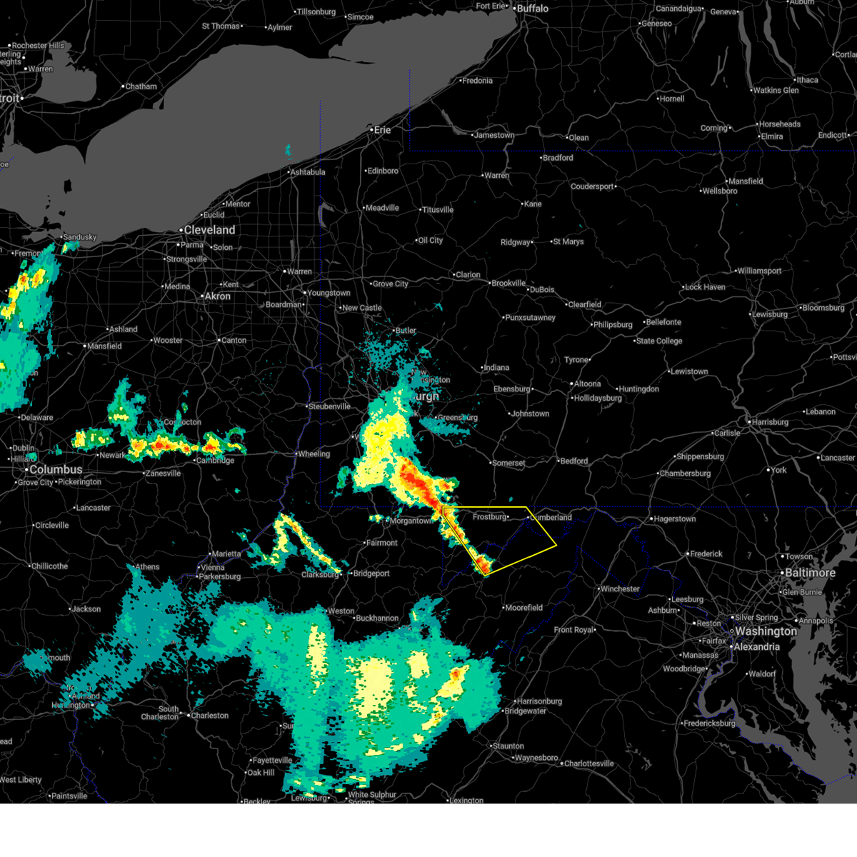
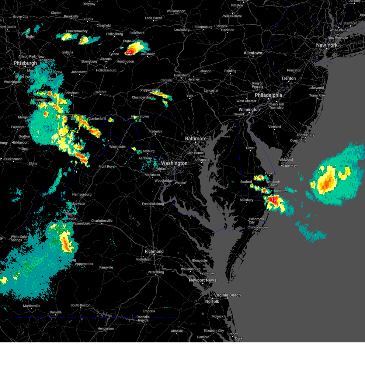
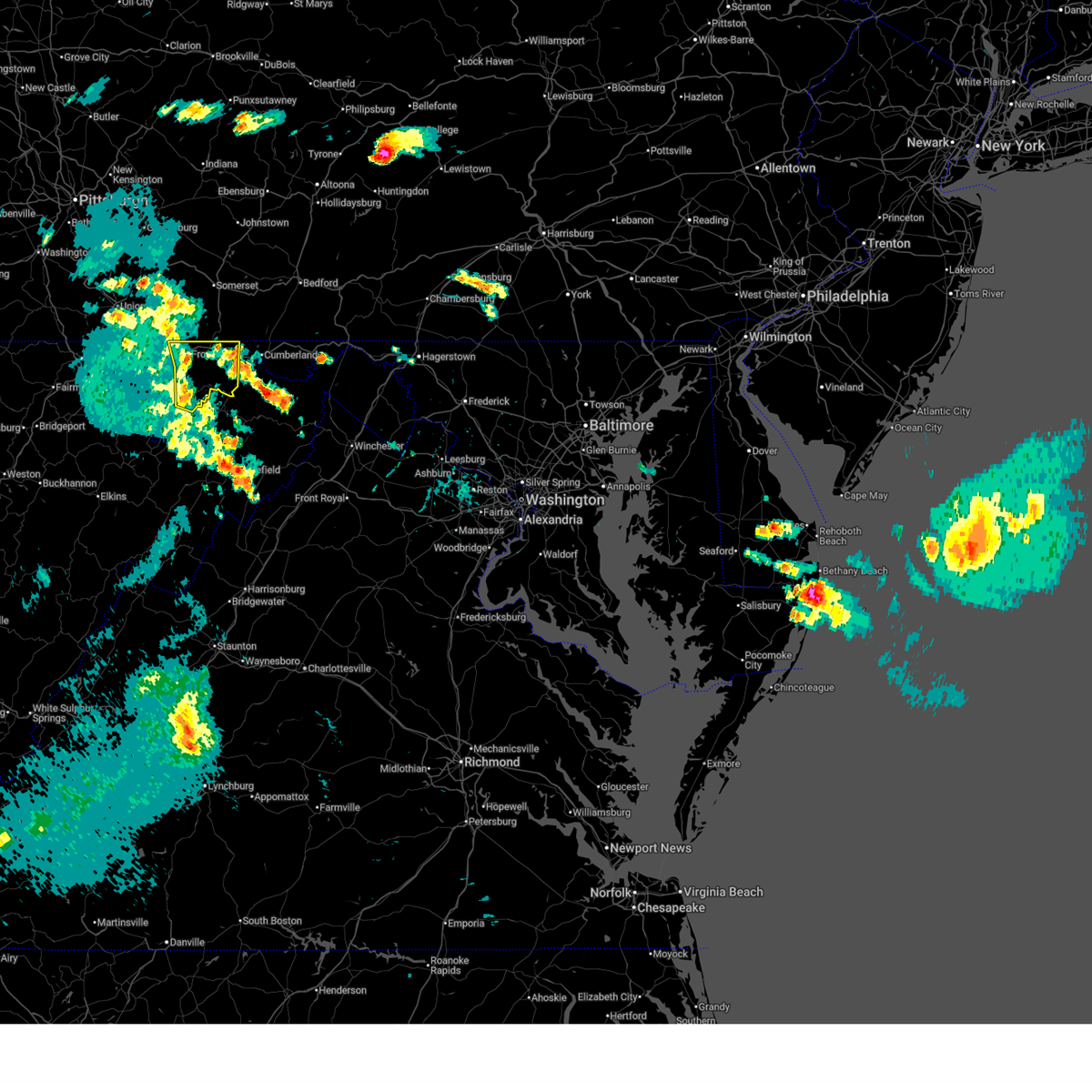
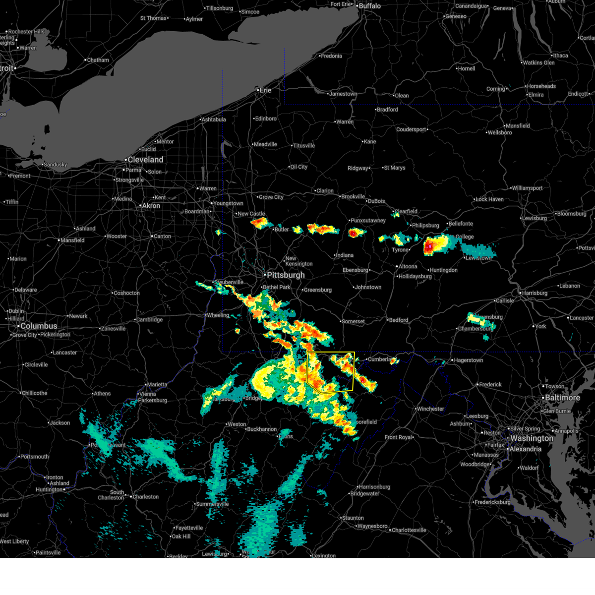
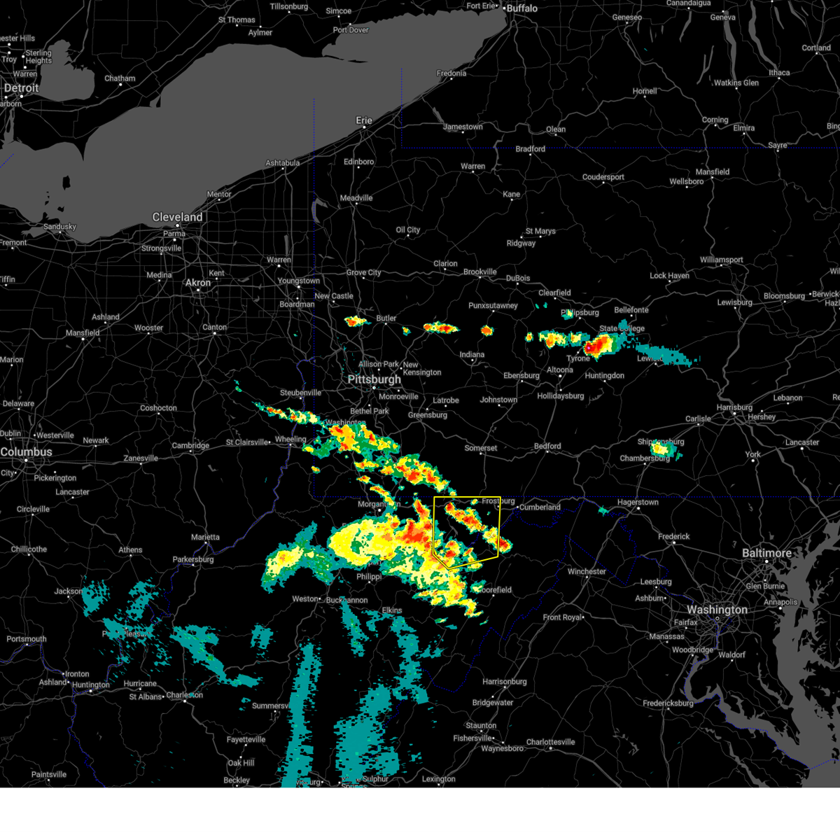
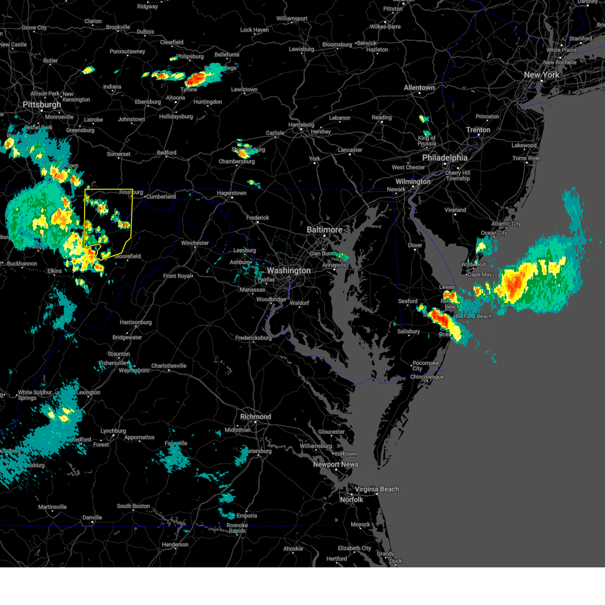
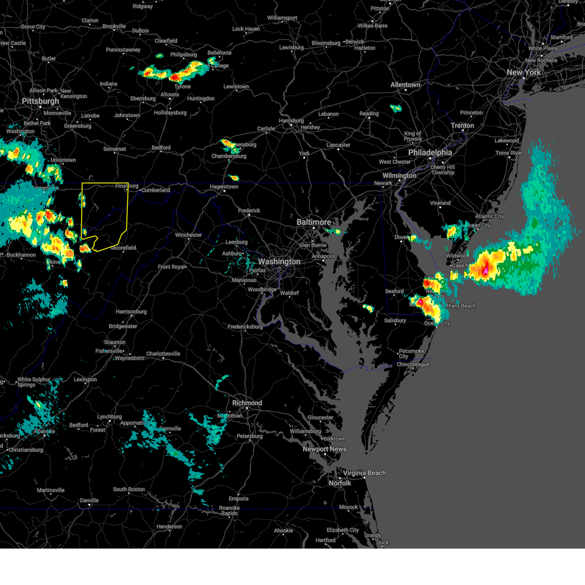
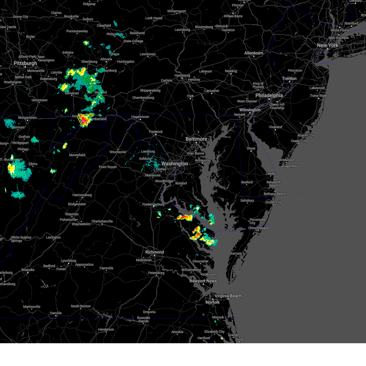
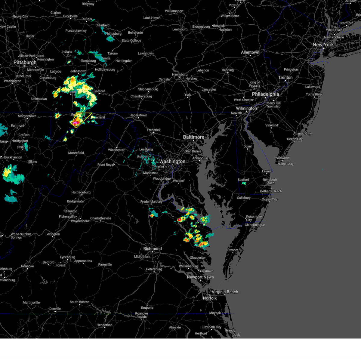
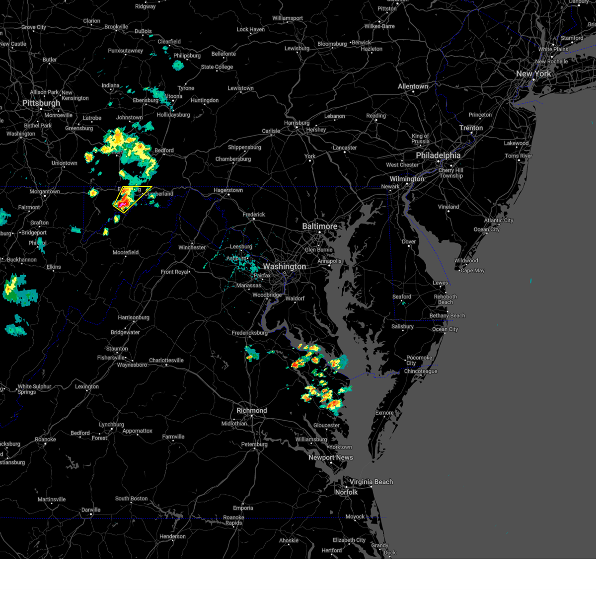
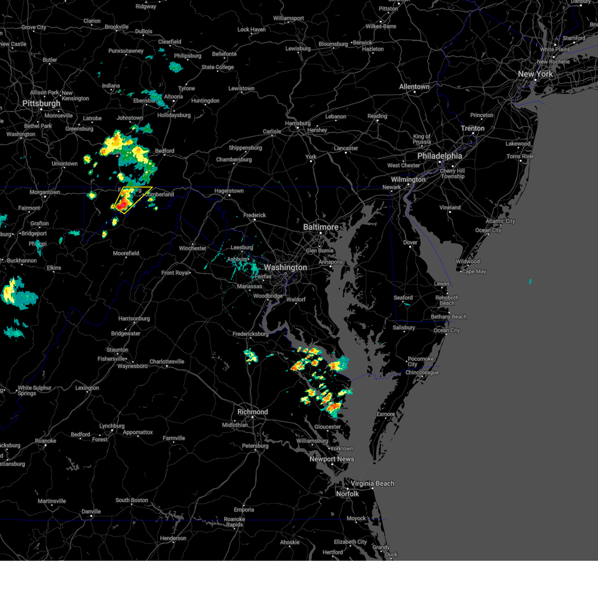
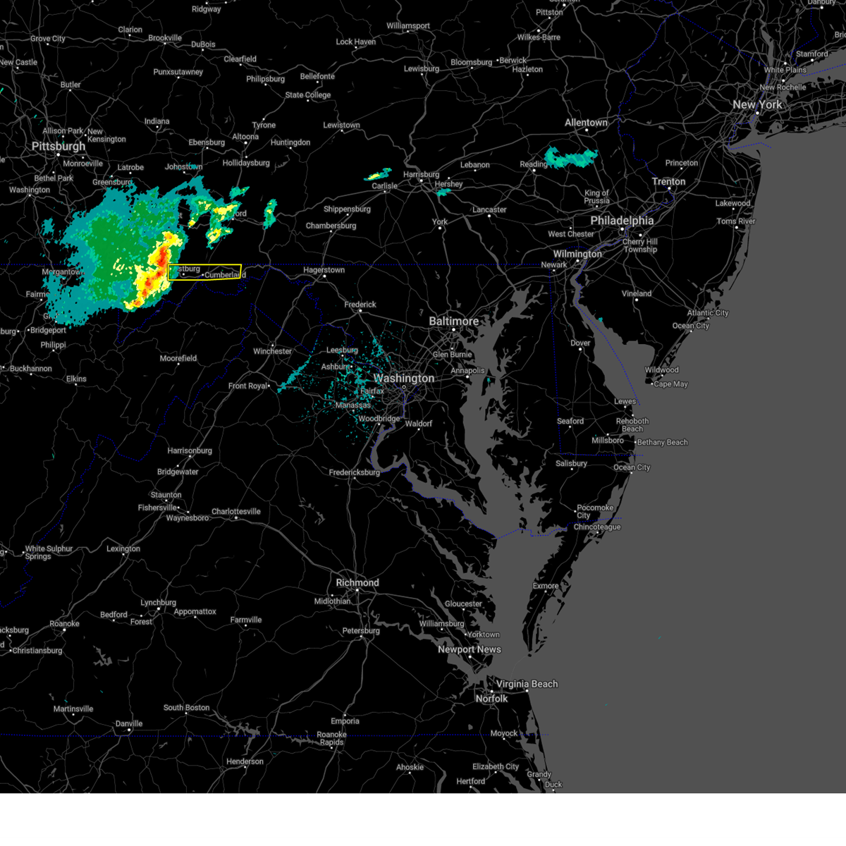
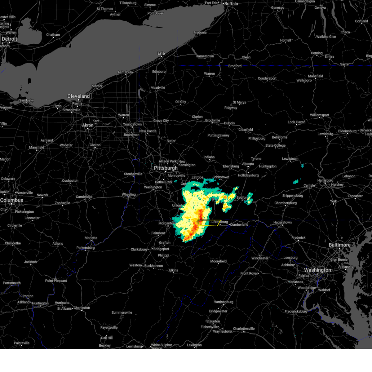
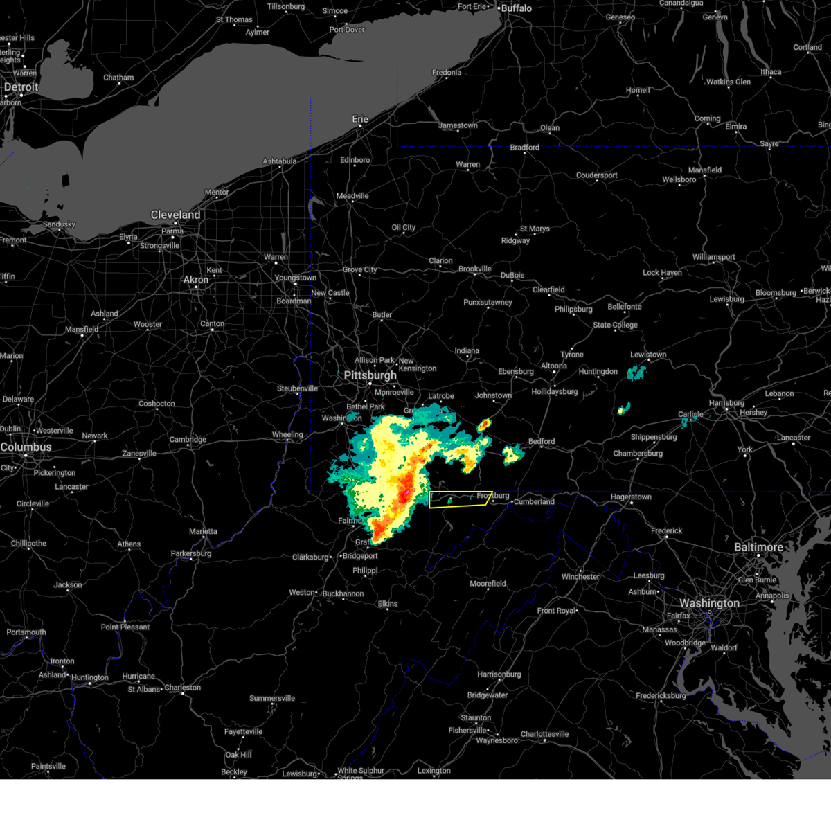
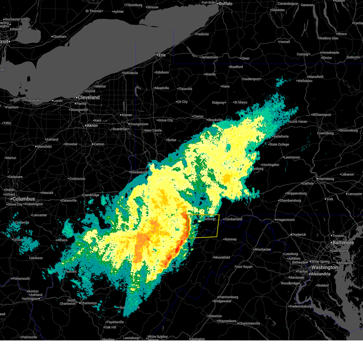
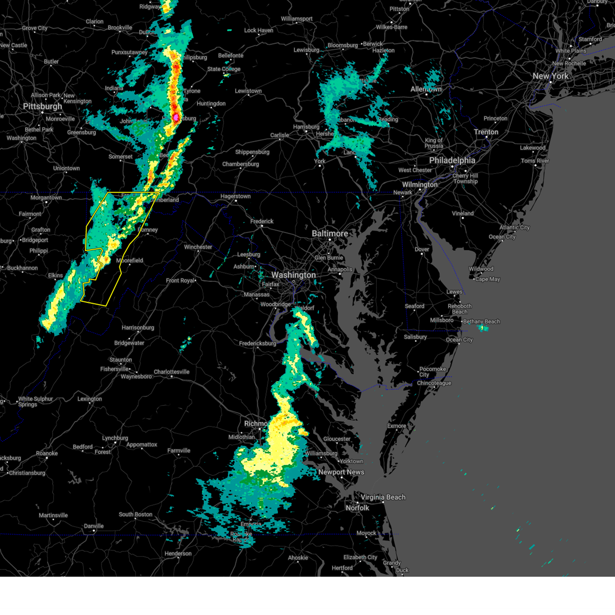
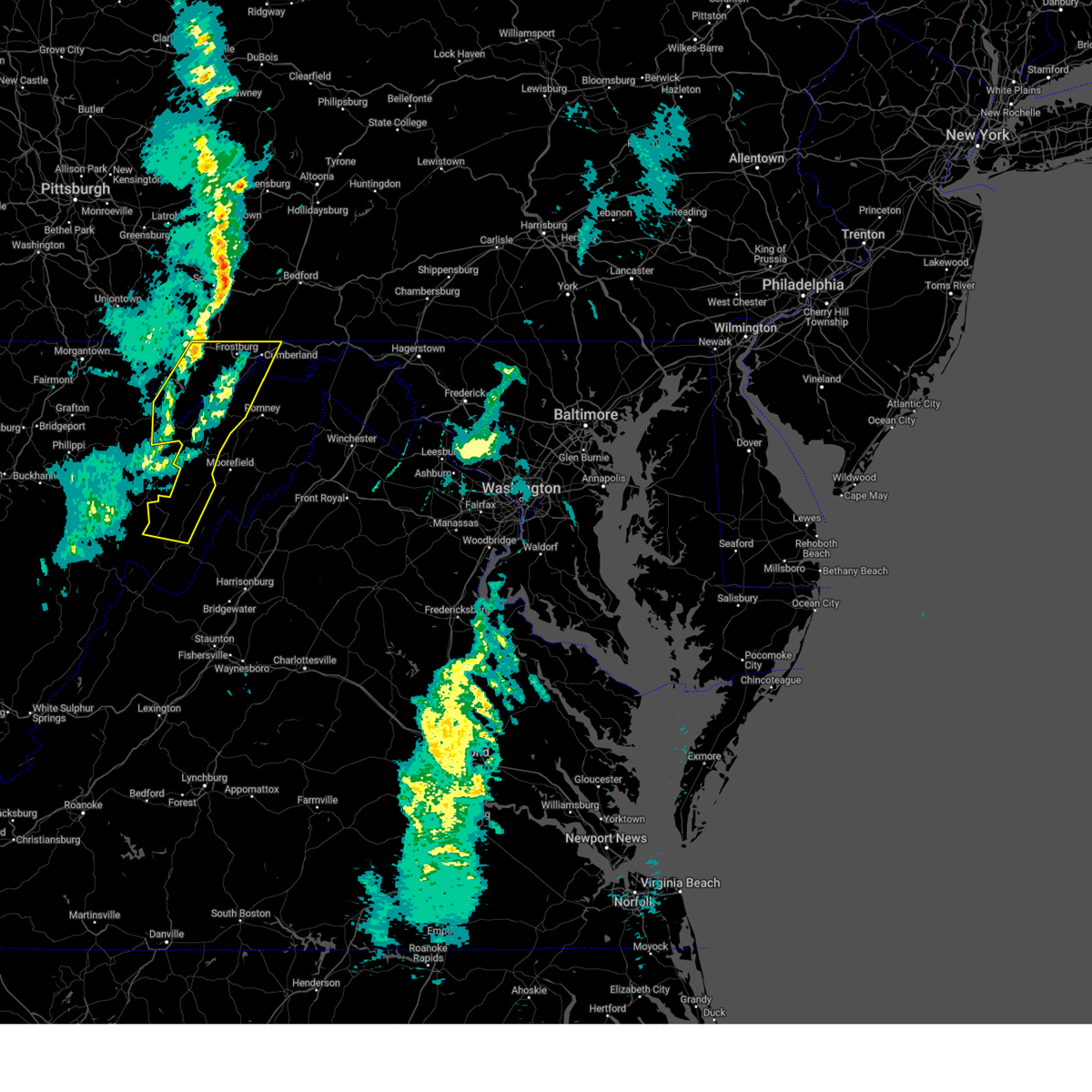
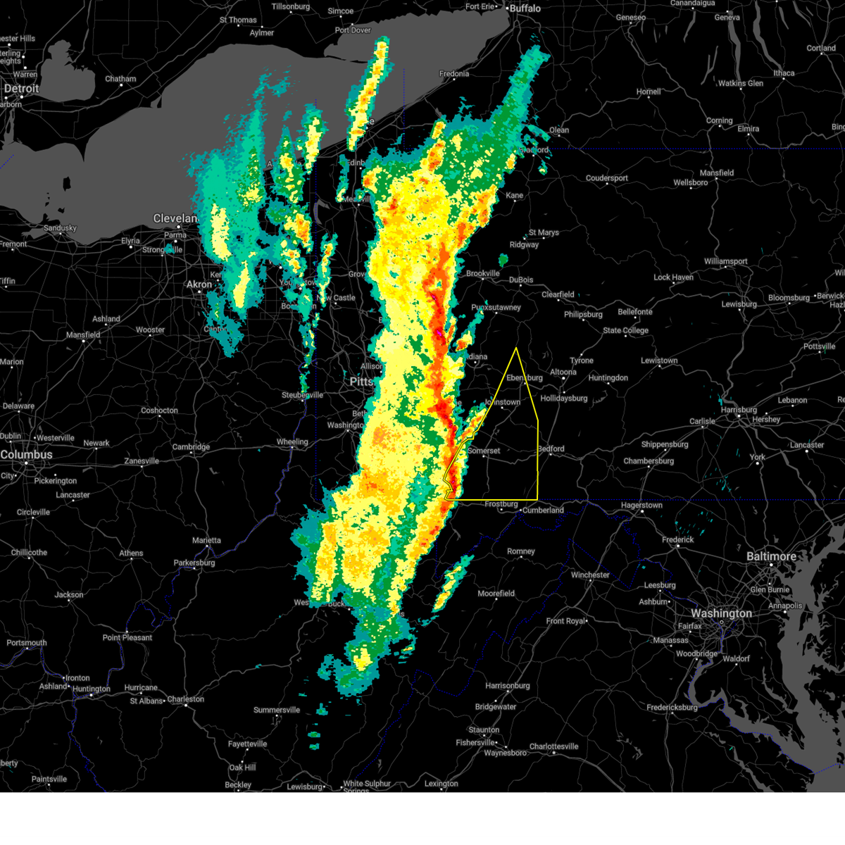
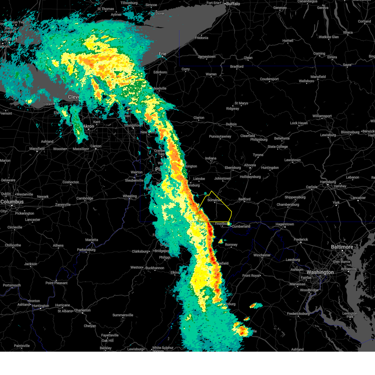
Hail Map for Finzel, MD
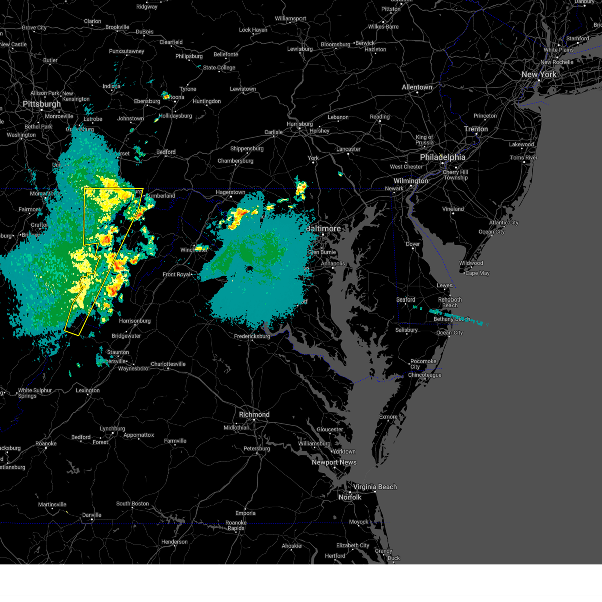
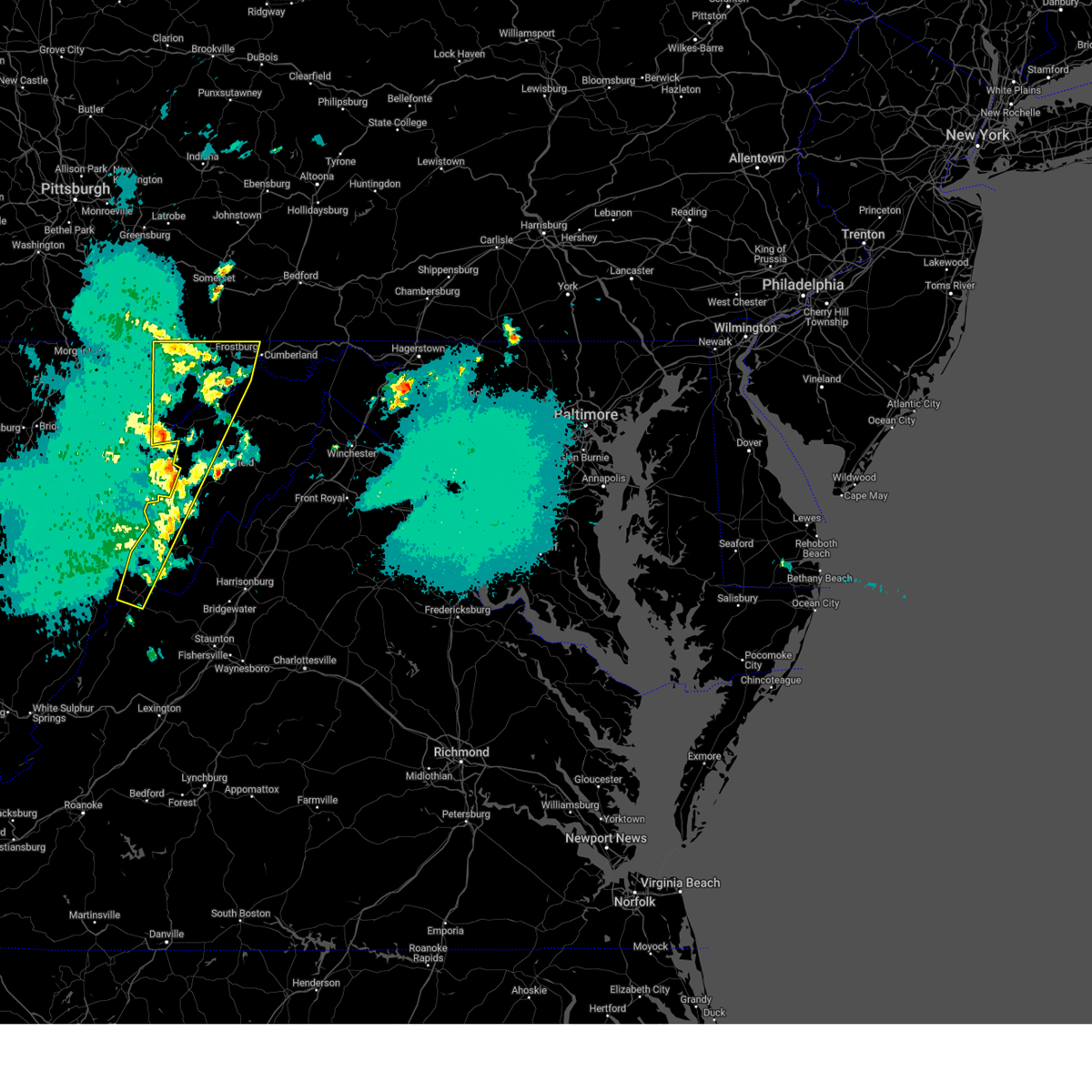
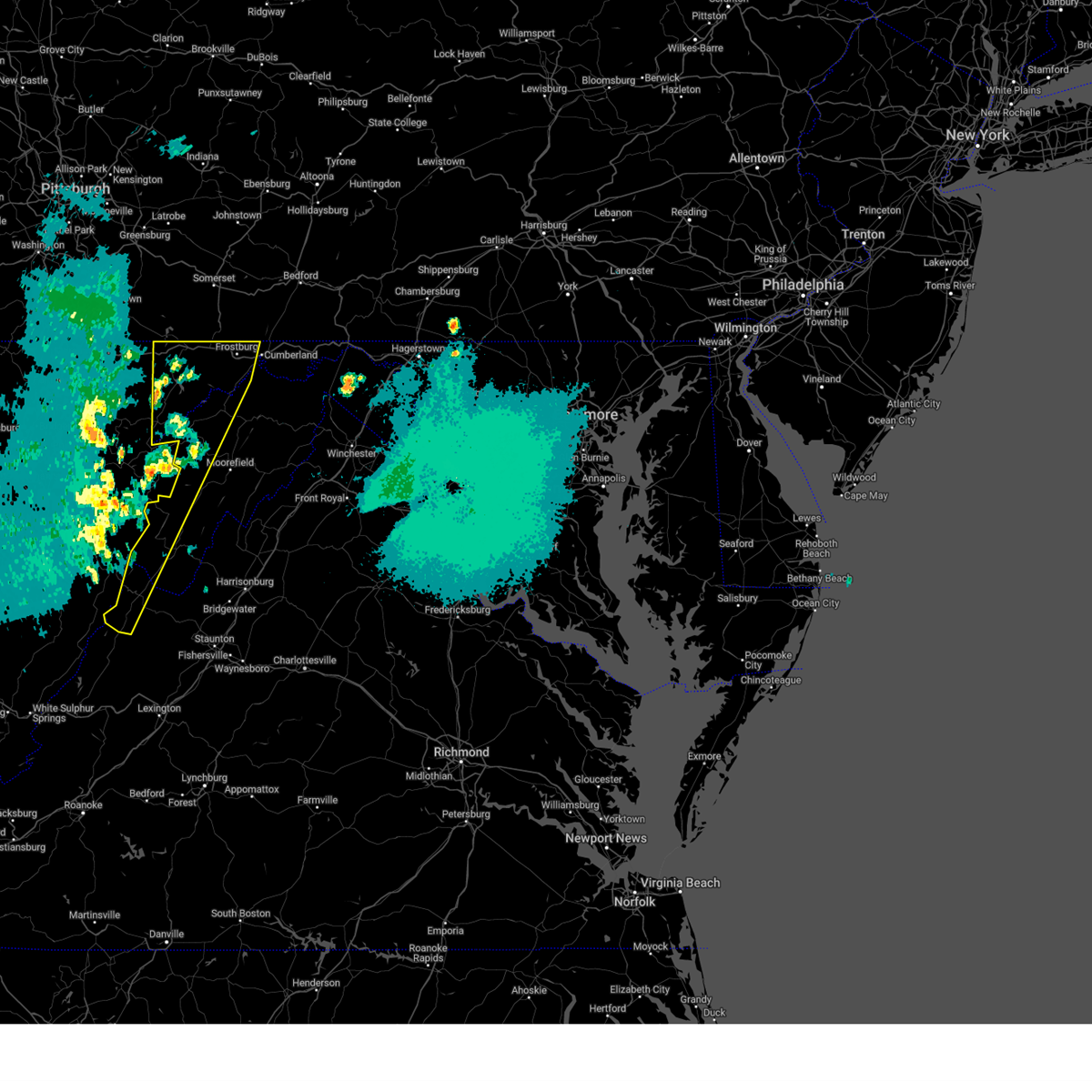
The Finzel, MD area has had 0 reports of on-the-ground hail by trained spotters, and has been under severe weather warnings 20 times during the past 12 months. Doppler radar has detected hail at or near Finzel, MD on 18 occasions.
| Name: | Finzel, MD |
| Where Located: | 71.6 miles NE of Elkins, WV |
| Map: | Google Map for Finzel, MD |
| Population: | 547 |
| Housing Units: | 225 |
| More Info: | Search Google for Finzel, MD |
0
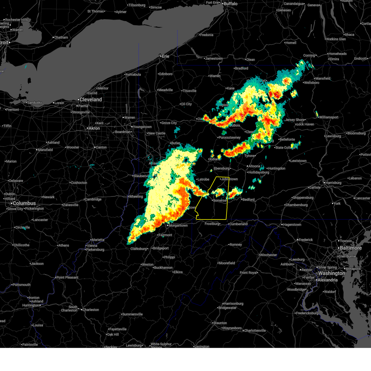
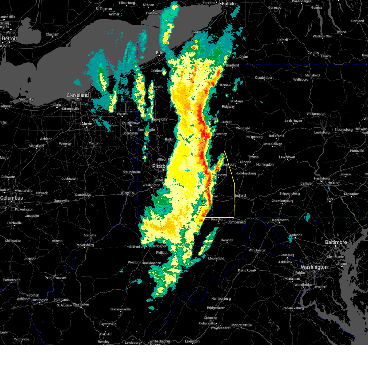
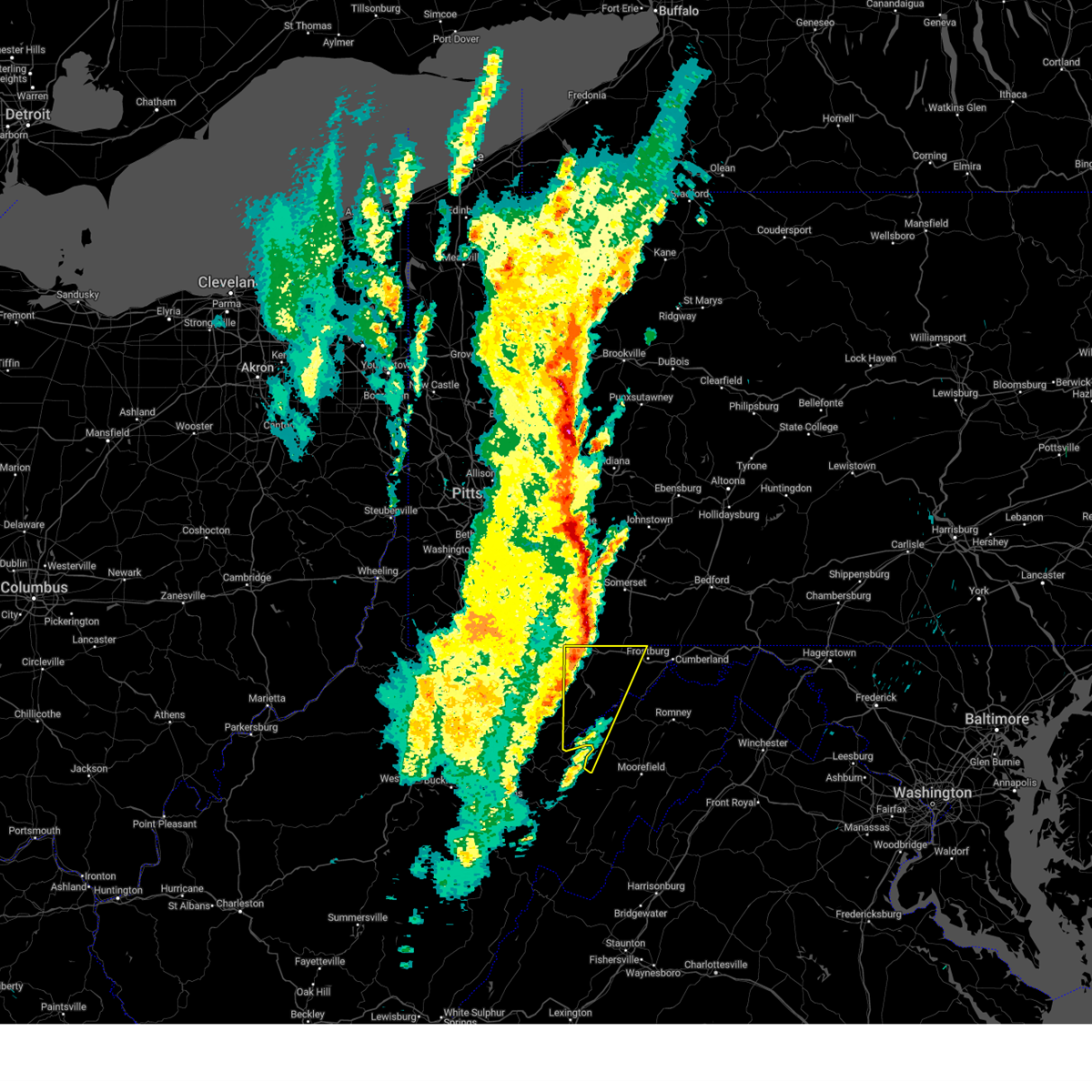
The Top Recent Hail Date for Finzel, MD is Thursday, May 1, 2025 (16th out of 18)
Hail and Wind Damage Spotted near Finzel, MD
| Date / Time | Report Details |
|---|---|
| 6/14/2026 8:37 PM EDT |
 The storms which prompted the warning have weakened below severe limits, and no longer pose an immediate threat to life or property. therefore, the warning will be allowed to expire. however, gusty winds are still possible with these thunderstorms. a severe thunderstorm watch remains in effect until 1100 pm edt for western maryland, and eastern west virginia. The storms which prompted the warning have weakened below severe limits, and no longer pose an immediate threat to life or property. therefore, the warning will be allowed to expire. however, gusty winds are still possible with these thunderstorms. a severe thunderstorm watch remains in effect until 1100 pm edt for western maryland, and eastern west virginia.
|
| 6/14/2026 8:26 PM EDT |
 Svrctp the national weather service in state college pa has issued a * severe thunderstorm warning for, bedford county in south central pennsylvania, north central fulton county in south central pennsylvania, southeastern somerset county in south central pennsylvania, * until 915 pm edt. * at 826 pm edt, severe thunderstorms were located along a line extending from ski gap to near central city to grantsville, moving east at 40 mph (radar indicated). Hazards include 60 mph wind gusts. expect damage to roofs, siding, and trees Svrctp the national weather service in state college pa has issued a * severe thunderstorm warning for, bedford county in south central pennsylvania, north central fulton county in south central pennsylvania, southeastern somerset county in south central pennsylvania, * until 915 pm edt. * at 826 pm edt, severe thunderstorms were located along a line extending from ski gap to near central city to grantsville, moving east at 40 mph (radar indicated). Hazards include 60 mph wind gusts. expect damage to roofs, siding, and trees
|
| 6/14/2026 7:48 PM EDT |
 Svrlwx the national weather service in sterling virginia has issued a * severe thunderstorm warning for, northwestern allegany county in western maryland, garrett county in western maryland, northwestern grant county in eastern west virginia, west central mineral county in eastern west virginia, * until 845 pm edt. * at 748 pm edt, severe thunderstorms were located along a line extending from near seven springs to near point marion to near lumberport, moving southeast at 30 mph (radar indicated). Hazards include 60 mph wind gusts. Damaging winds will cause some trees and large branches to fall. this could injure those outdoors, as well as damage homes and vehicles. roadways may become blocked by downed trees. localized power outages are possible. Unsecured light objects may become projectiles. Svrlwx the national weather service in sterling virginia has issued a * severe thunderstorm warning for, northwestern allegany county in western maryland, garrett county in western maryland, northwestern grant county in eastern west virginia, west central mineral county in eastern west virginia, * until 845 pm edt. * at 748 pm edt, severe thunderstorms were located along a line extending from near seven springs to near point marion to near lumberport, moving southeast at 30 mph (radar indicated). Hazards include 60 mph wind gusts. Damaging winds will cause some trees and large branches to fall. this could injure those outdoors, as well as damage homes and vehicles. roadways may become blocked by downed trees. localized power outages are possible. Unsecured light objects may become projectiles.
|
| 6/11/2026 5:26 PM EDT |
 Svrlwx the national weather service in sterling virginia has issued a * severe thunderstorm warning for, allegany county in western maryland, central garrett county in western maryland, west central shenandoah county in northwestern virginia, northwestern rockingham county in western virginia, northeastern pendleton county in eastern west virginia, grant county in eastern west virginia, mineral county in eastern west virginia, hardy county in eastern west virginia, central hampshire county in eastern west virginia, * until 615 pm edt. * at 526 pm edt, severe thunderstorms were located along a line extending from 6 miles north of la vale to kitzmiller to 10 miles east of bayard to near petersburg, moving east at 35 mph (radar indicated). Hazards include 60 mph wind gusts. Damaging winds will cause some trees and large branches to fall. this could injure those outdoors, as well as damage homes and vehicles. roadways may become blocked by downed trees. localized power outages are possible. Unsecured light objects may become projectiles. Svrlwx the national weather service in sterling virginia has issued a * severe thunderstorm warning for, allegany county in western maryland, central garrett county in western maryland, west central shenandoah county in northwestern virginia, northwestern rockingham county in western virginia, northeastern pendleton county in eastern west virginia, grant county in eastern west virginia, mineral county in eastern west virginia, hardy county in eastern west virginia, central hampshire county in eastern west virginia, * until 615 pm edt. * at 526 pm edt, severe thunderstorms were located along a line extending from 6 miles north of la vale to kitzmiller to 10 miles east of bayard to near petersburg, moving east at 35 mph (radar indicated). Hazards include 60 mph wind gusts. Damaging winds will cause some trees and large branches to fall. this could injure those outdoors, as well as damage homes and vehicles. roadways may become blocked by downed trees. localized power outages are possible. Unsecured light objects may become projectiles.
|
| 6/11/2026 4:57 PM EDT |
 Svrctp the national weather service in state college pa has issued a * severe thunderstorm warning for, northwestern bedford county in south central pennsylvania, western blair county in central pennsylvania, cambria county in central pennsylvania, somerset county in south central pennsylvania, * until 545 pm edt. * at 457 pm edt, severe thunderstorms were located along a line extending from carrolltown to near friedens to meyersdale, moving northeast at 35 mph (radar indicated). Hazards include 60 mph wind gusts. expect damage to roofs, siding, and trees Svrctp the national weather service in state college pa has issued a * severe thunderstorm warning for, northwestern bedford county in south central pennsylvania, western blair county in central pennsylvania, cambria county in central pennsylvania, somerset county in south central pennsylvania, * until 545 pm edt. * at 457 pm edt, severe thunderstorms were located along a line extending from carrolltown to near friedens to meyersdale, moving northeast at 35 mph (radar indicated). Hazards include 60 mph wind gusts. expect damage to roofs, siding, and trees
|
| 6/11/2026 4:56 PM EDT |
 At 456 pm edt, severe thunderstorms were located along a line extending from near mount davis to terra alta to 6 miles southeast of hendricks, moving east at 30 mph (radar indicated). Hazards include 60 mph wind gusts. Damaging winds will cause some trees and large branches to fall. this could injure those outdoors, as well as damage homes and vehicles. roadways may become blocked by downed trees. localized power outages are possible. unsecured light objects may become projectiles. Locations impacted include, mountain lake park, oakland, bayard, bittinger, grantsville, loch lynn heights, friendsville, deer park, accident, elk garden, kitzmiller, franklin, luke, redhouse, hutton, gorman, jennings, crellin, deep creek lake state park, and swallow falls state park. At 456 pm edt, severe thunderstorms were located along a line extending from near mount davis to terra alta to 6 miles southeast of hendricks, moving east at 30 mph (radar indicated). Hazards include 60 mph wind gusts. Damaging winds will cause some trees and large branches to fall. this could injure those outdoors, as well as damage homes and vehicles. roadways may become blocked by downed trees. localized power outages are possible. unsecured light objects may become projectiles. Locations impacted include, mountain lake park, oakland, bayard, bittinger, grantsville, loch lynn heights, friendsville, deer park, accident, elk garden, kitzmiller, franklin, luke, redhouse, hutton, gorman, jennings, crellin, deep creek lake state park, and swallow falls state park.
|
| 6/11/2026 4:27 PM EDT |
 Svrlwx the national weather service in sterling virginia has issued a * severe thunderstorm warning for, garrett county in western maryland, northwestern grant county in eastern west virginia, west central mineral county in eastern west virginia, * until 530 pm edt. * at 426 pm edt, a severe thunderstorm was located near brookhaven, or 8 miles west of kingwood, moving east at 40 mph (radar indicated). Hazards include 60 mph wind gusts. Damaging winds will cause some trees and large branches to fall. this could injure those outdoors, as well as damage homes and vehicles. roadways may become blocked by downed trees. localized power outages are possible. Unsecured light objects may become projectiles. Svrlwx the national weather service in sterling virginia has issued a * severe thunderstorm warning for, garrett county in western maryland, northwestern grant county in eastern west virginia, west central mineral county in eastern west virginia, * until 530 pm edt. * at 426 pm edt, a severe thunderstorm was located near brookhaven, or 8 miles west of kingwood, moving east at 40 mph (radar indicated). Hazards include 60 mph wind gusts. Damaging winds will cause some trees and large branches to fall. this could injure those outdoors, as well as damage homes and vehicles. roadways may become blocked by downed trees. localized power outages are possible. Unsecured light objects may become projectiles.
|
| 6/6/2026 4:23 PM EDT |
 At 423 pm edt, severe thunderstorms were located along a line extending from near barnes gap to paw paw to near romney, moving east at 60 mph (radar indicated). Hazards include 60 mph wind gusts. Damaging winds will cause some trees and large branches to fall. this could injure those outdoors, as well as damage homes and vehicles. roadways may become blocked by downed trees. localized power outages are possible. unsecured light objects may become projectiles. Locations impacted include, cumberland, frostburg, keyser, mountain lake park, oakland, westernport, romney, hancock, bel air, paw paw, la vale, fort ashby, lonaconing, piedmont, berkeley springs, loch lynn heights, deer park, elk garden, kitzmiller, and ridgeley. At 423 pm edt, severe thunderstorms were located along a line extending from near barnes gap to paw paw to near romney, moving east at 60 mph (radar indicated). Hazards include 60 mph wind gusts. Damaging winds will cause some trees and large branches to fall. this could injure those outdoors, as well as damage homes and vehicles. roadways may become blocked by downed trees. localized power outages are possible. unsecured light objects may become projectiles. Locations impacted include, cumberland, frostburg, keyser, mountain lake park, oakland, westernport, romney, hancock, bel air, paw paw, la vale, fort ashby, lonaconing, piedmont, berkeley springs, loch lynn heights, deer park, elk garden, kitzmiller, and ridgeley.
|
| 6/6/2026 4:05 PM EDT |
 Svrlwx the national weather service in sterling virginia has issued a * severe thunderstorm warning for, northwestern washington county in north central maryland, allegany county in western maryland, garrett county in western maryland, northern frederick county in northwestern virginia, northwestern morgan county in the panhandle of west virginia, mineral county in eastern west virginia, northern hampshire county in eastern west virginia, * until 500 pm edt. * at 404 pm edt, severe thunderstorms were located along a line extending from near lake gordon to near ridgeley to near keyser, moving east at 60 mph (radar indicated). Hazards include 60 mph wind gusts. Damaging winds will cause some trees and large branches to fall. this could injure those outdoors, as well as damage homes and vehicles. roadways may become blocked by downed trees. localized power outages are possible. Unsecured light objects may become projectiles. Svrlwx the national weather service in sterling virginia has issued a * severe thunderstorm warning for, northwestern washington county in north central maryland, allegany county in western maryland, garrett county in western maryland, northern frederick county in northwestern virginia, northwestern morgan county in the panhandle of west virginia, mineral county in eastern west virginia, northern hampshire county in eastern west virginia, * until 500 pm edt. * at 404 pm edt, severe thunderstorms were located along a line extending from near lake gordon to near ridgeley to near keyser, moving east at 60 mph (radar indicated). Hazards include 60 mph wind gusts. Damaging winds will cause some trees and large branches to fall. this could injure those outdoors, as well as damage homes and vehicles. roadways may become blocked by downed trees. localized power outages are possible. Unsecured light objects may become projectiles.
|
| 6/6/2026 3:54 PM EDT |
 At 353 pm edt, severe thunderstorms were located along a line extending from near berlin to near meyersdale to near bittinger to near oakland, moving east at 50 mph (radar indicated). Hazards include 60 mph wind gusts. Damaging winds will cause some trees and large branches to fall. this could injure those outdoors, as well as damage homes and vehicles. roadways may become blocked by downed trees. localized power outages are possible. unsecured light objects may become projectiles. Locations impacted include, frostburg, keyser, mountain lake park, oakland, westernport, bel air, bittinger, la vale, lonaconing, piedmont, grantsville, friendsville, deer park, accident, elk garden, kitzmiller, cresaptown, eckhart mines, mount savage, and rawlings. At 353 pm edt, severe thunderstorms were located along a line extending from near berlin to near meyersdale to near bittinger to near oakland, moving east at 50 mph (radar indicated). Hazards include 60 mph wind gusts. Damaging winds will cause some trees and large branches to fall. this could injure those outdoors, as well as damage homes and vehicles. roadways may become blocked by downed trees. localized power outages are possible. unsecured light objects may become projectiles. Locations impacted include, frostburg, keyser, mountain lake park, oakland, westernport, bel air, bittinger, la vale, lonaconing, piedmont, grantsville, friendsville, deer park, accident, elk garden, kitzmiller, cresaptown, eckhart mines, mount savage, and rawlings.
|
| 6/6/2026 3:52 PM EDT |
 At 351 pm edt, severe thunderstorms were located along a line extending from windber to central city to 10 miles south of ogletown to near buffalo mills to near lake gordon to near frostburg, moving east at 70 mph. these is a line of destructive storms (radar indicated). Hazards include 80 mph wind gusts and quarter size hail. Flying debris will be dangerous to those caught without shelter. mobile homes will be heavily damaged. expect considerable damage to roofs, windows, and vehicles. extensive tree damage and power outages are likely. locations impacted include, somerset, bedford, meyersdale, berlin, friedens, central city, buffalo mills, lake gordon, cessna, hyndman, salisbury, and hooversville. this includes the following interstates, the pennsylvania turnpike from mile markers 112 to 148. Interstate 99 from mile markers 0 to 5. At 351 pm edt, severe thunderstorms were located along a line extending from windber to central city to 10 miles south of ogletown to near buffalo mills to near lake gordon to near frostburg, moving east at 70 mph. these is a line of destructive storms (radar indicated). Hazards include 80 mph wind gusts and quarter size hail. Flying debris will be dangerous to those caught without shelter. mobile homes will be heavily damaged. expect considerable damage to roofs, windows, and vehicles. extensive tree damage and power outages are likely. locations impacted include, somerset, bedford, meyersdale, berlin, friedens, central city, buffalo mills, lake gordon, cessna, hyndman, salisbury, and hooversville. this includes the following interstates, the pennsylvania turnpike from mile markers 112 to 148. Interstate 99 from mile markers 0 to 5.
|
| 6/6/2026 3:26 PM EDT |
 Svrctp the national weather service in state college pa has issued a * severe thunderstorm warning for, western bedford county in south central pennsylvania, somerset county in south central pennsylvania, * until 415 pm edt. * at 324 pm edt, severe thunderstorms were located along a line extending from near ligonier to seven springs to new centerville to near friendsville, moving east at 55 mph. these are destructive storms for central and southern somerset county! (radar indicated). Hazards include 80 mph wind gusts and quarter size hail. Flying debris will be dangerous to those caught without shelter. mobile homes will be heavily damaged. expect considerable damage to roofs, windows, and vehicles. Extensive tree damage and power outages are likely. Svrctp the national weather service in state college pa has issued a * severe thunderstorm warning for, western bedford county in south central pennsylvania, somerset county in south central pennsylvania, * until 415 pm edt. * at 324 pm edt, severe thunderstorms were located along a line extending from near ligonier to seven springs to new centerville to near friendsville, moving east at 55 mph. these are destructive storms for central and southern somerset county! (radar indicated). Hazards include 80 mph wind gusts and quarter size hail. Flying debris will be dangerous to those caught without shelter. mobile homes will be heavily damaged. expect considerable damage to roofs, windows, and vehicles. Extensive tree damage and power outages are likely.
|
| 6/6/2026 3:18 PM EDT |
 Svrlwx the national weather service in sterling virginia has issued a * severe thunderstorm warning for, western allegany county in western maryland, garrett county in western maryland, central mineral county in eastern west virginia, * until 415 pm edt. * at 317 pm edt, severe thunderstorms were located along a line extending from 6 miles southwest of seven springs to near farmington to 8 miles northeast of brookhaven to 6 miles south of westover, moving east at 50 mph (radar indicated). Hazards include 60 mph wind gusts. Damaging winds will cause some trees and large branches to fall. this could injure those outdoors, as well as damage homes and vehicles. roadways may become blocked by downed trees. localized power outages are possible. Unsecured light objects may become projectiles. Svrlwx the national weather service in sterling virginia has issued a * severe thunderstorm warning for, western allegany county in western maryland, garrett county in western maryland, central mineral county in eastern west virginia, * until 415 pm edt. * at 317 pm edt, severe thunderstorms were located along a line extending from 6 miles southwest of seven springs to near farmington to 8 miles northeast of brookhaven to 6 miles south of westover, moving east at 50 mph (radar indicated). Hazards include 60 mph wind gusts. Damaging winds will cause some trees and large branches to fall. this could injure those outdoors, as well as damage homes and vehicles. roadways may become blocked by downed trees. localized power outages are possible. Unsecured light objects may become projectiles.
|
| 6/6/2026 3:14 PM EDT |
 Svrctp the national weather service in state college pa has issued a * severe thunderstorm warning for, southwestern cambria county in central pennsylvania, somerset county in south central pennsylvania, * until 415 pm edt. * at 312 pm edt, severe thunderstorms were located along a line extending from jeannette to near south connellsville to near farmington, moving east at 45 mph (radar indicated). Hazards include 60 mph wind gusts and quarter size hail. Hail damage to vehicles is expected. Expect wind damage to roofs, siding, and trees. Svrctp the national weather service in state college pa has issued a * severe thunderstorm warning for, southwestern cambria county in central pennsylvania, somerset county in south central pennsylvania, * until 415 pm edt. * at 312 pm edt, severe thunderstorms were located along a line extending from jeannette to near south connellsville to near farmington, moving east at 45 mph (radar indicated). Hazards include 60 mph wind gusts and quarter size hail. Hail damage to vehicles is expected. Expect wind damage to roofs, siding, and trees.
|
| 4/1/2026 3:57 PM EDT |
 Svrlwx the national weather service in sterling virginia has issued a * severe thunderstorm warning for, northern garrett county in western maryland, * until 430 pm edt. * at 356 pm edt, a severe thunderstorm was located near friendsville, or 16 miles north of terra alta, moving east at 30 mph (radar indicated). Hazards include 60 mph wind gusts and quarter size hail. Damaging winds will cause some trees and large branches to fall. this could injure those outdoors, as well as damage homes and vehicles. roadways may become blocked by downed trees. localized power outages are possible. Unsecured light objects may become projectiles. Svrlwx the national weather service in sterling virginia has issued a * severe thunderstorm warning for, northern garrett county in western maryland, * until 430 pm edt. * at 356 pm edt, a severe thunderstorm was located near friendsville, or 16 miles north of terra alta, moving east at 30 mph (radar indicated). Hazards include 60 mph wind gusts and quarter size hail. Damaging winds will cause some trees and large branches to fall. this could injure those outdoors, as well as damage homes and vehicles. roadways may become blocked by downed trees. localized power outages are possible. Unsecured light objects may become projectiles.
|
| 8/17/2025 3:40 PM EDT |
 The storms which prompted the warning have weakened below severe limits, and have exited the warned area. therefore, the warning will be allowed to expire. however, gusty winds are still possible with these thunderstorms. The storms which prompted the warning have weakened below severe limits, and have exited the warned area. therefore, the warning will be allowed to expire. however, gusty winds are still possible with these thunderstorms.
|
| 8/17/2025 3:25 PM EDT |
 At 325 pm edt, severe thunderstorms were located along a line extending from 6 miles southeast of meyersdale to near grantsville to near bittinger, moving east at 30 mph (radar indicated). Hazards include 60 mph wind gusts. Damaging winds will cause some trees and large branches to fall. this could injure those outdoors, as well as damage homes and vehicles. roadways may become blocked by downed trees. localized power outages are possible. unsecured light objects may become projectiles. Locations impacted include, bittinger, grantsville, accident, selbysport, new germany, piney grove, jennings, keysers ridge, mineral spring, and merrill. At 325 pm edt, severe thunderstorms were located along a line extending from 6 miles southeast of meyersdale to near grantsville to near bittinger, moving east at 30 mph (radar indicated). Hazards include 60 mph wind gusts. Damaging winds will cause some trees and large branches to fall. this could injure those outdoors, as well as damage homes and vehicles. roadways may become blocked by downed trees. localized power outages are possible. unsecured light objects may become projectiles. Locations impacted include, bittinger, grantsville, accident, selbysport, new germany, piney grove, jennings, keysers ridge, mineral spring, and merrill.
|
| 8/17/2025 3:24 PM EDT |
 Svrlwx the national weather service in sterling virginia has issued a * severe thunderstorm warning for, western allegany county in western maryland, northeastern garrett county in western maryland, central mineral county in eastern west virginia, * until 400 pm edt. * at 323 pm edt, severe thunderstorms were located along a line extending from 7 miles north of la vale to near grantsville to bittinger, moving southeast at 35 mph (radar indicated). Hazards include 60 mph wind gusts. Damaging winds will cause some trees and large branches to fall. this could injure those outdoors, as well as damage homes and vehicles. roadways may become blocked by downed trees. localized power outages are possible. Unsecured light objects may become projectiles. Svrlwx the national weather service in sterling virginia has issued a * severe thunderstorm warning for, western allegany county in western maryland, northeastern garrett county in western maryland, central mineral county in eastern west virginia, * until 400 pm edt. * at 323 pm edt, severe thunderstorms were located along a line extending from 7 miles north of la vale to near grantsville to bittinger, moving southeast at 35 mph (radar indicated). Hazards include 60 mph wind gusts. Damaging winds will cause some trees and large branches to fall. this could injure those outdoors, as well as damage homes and vehicles. roadways may become blocked by downed trees. localized power outages are possible. Unsecured light objects may become projectiles.
|
| 8/17/2025 3:19 PM EDT |
 At 319 pm edt, severe thunderstorms were located along a line extending from near meyersdale to grantsville to near accident, moving southeast at 35 mph (radar indicated). Hazards include 60 mph wind gusts. Damaging winds will cause some trees and large branches to fall. this could injure those outdoors, as well as damage homes and vehicles. roadways may become blocked by downed trees. localized power outages are possible. unsecured light objects may become projectiles. Locations impacted include, bittinger, grantsville, friendsville, accident, selbysport, new germany, piney grove, jennings, keysers ridge, mineral spring, and merrill. At 319 pm edt, severe thunderstorms were located along a line extending from near meyersdale to grantsville to near accident, moving southeast at 35 mph (radar indicated). Hazards include 60 mph wind gusts. Damaging winds will cause some trees and large branches to fall. this could injure those outdoors, as well as damage homes and vehicles. roadways may become blocked by downed trees. localized power outages are possible. unsecured light objects may become projectiles. Locations impacted include, bittinger, grantsville, friendsville, accident, selbysport, new germany, piney grove, jennings, keysers ridge, mineral spring, and merrill.
|
| 8/17/2025 3:01 PM EDT |
 Svrlwx the national weather service in sterling virginia has issued a * severe thunderstorm warning for, northwestern allegany county in western maryland, northern garrett county in western maryland, * until 345 pm edt. * at 300 pm edt, severe thunderstorms were located along a line extending from near mount davis to ursina to near farmington, moving southeast at 30 mph (radar indicated). Hazards include 60 mph wind gusts. Damaging winds will cause some trees and large branches to fall. this could injure those outdoors, as well as damage homes and vehicles. roadways may become blocked by downed trees. localized power outages are possible. Unsecured light objects may become projectiles. Svrlwx the national weather service in sterling virginia has issued a * severe thunderstorm warning for, northwestern allegany county in western maryland, northern garrett county in western maryland, * until 345 pm edt. * at 300 pm edt, severe thunderstorms were located along a line extending from near mount davis to ursina to near farmington, moving southeast at 30 mph (radar indicated). Hazards include 60 mph wind gusts. Damaging winds will cause some trees and large branches to fall. this could injure those outdoors, as well as damage homes and vehicles. roadways may become blocked by downed trees. localized power outages are possible. Unsecured light objects may become projectiles.
|
| 5/17/2025 1:59 AM EDT |
 The storms which prompted the warning have weakened below severe limits, and no longer pose an immediate threat to life or property. therefore, the warning will be allowed to expire. The storms which prompted the warning have weakened below severe limits, and no longer pose an immediate threat to life or property. therefore, the warning will be allowed to expire.
|
| 5/17/2025 1:46 AM EDT |
 At 145 am edt, severe thunderstorms were located along a line extending from near ursina to near keyser, moving east at 55 mph (radar indicated). Hazards include 60 mph wind gusts and quarter size hail. Damaging winds will cause some trees and large branches to fall. this could injure those outdoors, as well as damage homes and vehicles. roadways may become blocked by downed trees. localized power outages are possible. unsecured light objects may become projectiles. Locations impacted include, potomac park, franklin, lonaconing, keyser, dogwood flats, fort ashby, bittinger, new creek, short gap, north branch, mccoole, brady, oldtown, big run state park, piney grove, ridgeville, cresaptown, merrill, rawlings, and spring gap. At 145 am edt, severe thunderstorms were located along a line extending from near ursina to near keyser, moving east at 55 mph (radar indicated). Hazards include 60 mph wind gusts and quarter size hail. Damaging winds will cause some trees and large branches to fall. this could injure those outdoors, as well as damage homes and vehicles. roadways may become blocked by downed trees. localized power outages are possible. unsecured light objects may become projectiles. Locations impacted include, potomac park, franklin, lonaconing, keyser, dogwood flats, fort ashby, bittinger, new creek, short gap, north branch, mccoole, brady, oldtown, big run state park, piney grove, ridgeville, cresaptown, merrill, rawlings, and spring gap.
|
| 5/17/2025 1:46 AM EDT |
 the severe thunderstorm warning has been cancelled and is no longer in effect the severe thunderstorm warning has been cancelled and is no longer in effect
|
| 5/17/2025 1:34 AM EDT |
 Svrlwx the national weather service in sterling virginia has issued a * severe thunderstorm warning for, western allegany county in western maryland, garrett county in western maryland, north central grant county in eastern west virginia, mineral county in eastern west virginia, north central hampshire county in eastern west virginia, * until 200 am edt. * at 134 am edt, severe thunderstorms were located along a line extending from 6 miles north of friendsville to near keyser, moving east at 55 mph (radar indicated). Hazards include 60 mph wind gusts. Damaging winds will cause some trees and large branches to fall. this could injure those outdoors, as well as damage homes and vehicles. roadways may become blocked by downed trees. localized power outages are possible. Unsecured light objects may become projectiles. Svrlwx the national weather service in sterling virginia has issued a * severe thunderstorm warning for, western allegany county in western maryland, garrett county in western maryland, north central grant county in eastern west virginia, mineral county in eastern west virginia, north central hampshire county in eastern west virginia, * until 200 am edt. * at 134 am edt, severe thunderstorms were located along a line extending from 6 miles north of friendsville to near keyser, moving east at 55 mph (radar indicated). Hazards include 60 mph wind gusts. Damaging winds will cause some trees and large branches to fall. this could injure those outdoors, as well as damage homes and vehicles. roadways may become blocked by downed trees. localized power outages are possible. Unsecured light objects may become projectiles.
|
| 5/16/2025 3:22 PM EDT |
 The storm which prompted the warning has weakened below severe limits, and no longer poses an immediate threat to life or property. therefore, the warning will be allowed to expire. however, gusty winds and heavy rain are still possible with this thunderstorm. a severe thunderstorm watch remains in effect until 1000 pm edt for western maryland, and eastern west virginia. to report severe weather, contact your nearest law enforcement agency. they will relay your report to the national weather service sterling virginia. The storm which prompted the warning has weakened below severe limits, and no longer poses an immediate threat to life or property. therefore, the warning will be allowed to expire. however, gusty winds and heavy rain are still possible with this thunderstorm. a severe thunderstorm watch remains in effect until 1000 pm edt for western maryland, and eastern west virginia. to report severe weather, contact your nearest law enforcement agency. they will relay your report to the national weather service sterling virginia.
|
| 5/16/2025 3:19 PM EDT |
 the severe thunderstorm warning has been cancelled and is no longer in effect the severe thunderstorm warning has been cancelled and is no longer in effect
|
| 5/16/2025 3:19 PM EDT |
 At 319 pm edt, a severe thunderstorm was located over bittinger, moving northeast at 35 mph (radar indicated). Hazards include 60 mph wind gusts. Damaging winds will cause some trees and large branches to fall. this could injure those outdoors, as well as damage homes and vehicles. roadways may become blocked by downed trees. localized power outages are possible. unsecured light objects may become projectiles. Locations impacted include, franklin, lonaconing, dogwood flats, bittinger, jennings, woodland, deep creek lake state park, mccoole, deer park, big run state park, piney grove, merrill, reynolds, luke, grantsville, westernport, midlothian, keysers ridge, barton, and mineral spring. At 319 pm edt, a severe thunderstorm was located over bittinger, moving northeast at 35 mph (radar indicated). Hazards include 60 mph wind gusts. Damaging winds will cause some trees and large branches to fall. this could injure those outdoors, as well as damage homes and vehicles. roadways may become blocked by downed trees. localized power outages are possible. unsecured light objects may become projectiles. Locations impacted include, franklin, lonaconing, dogwood flats, bittinger, jennings, woodland, deep creek lake state park, mccoole, deer park, big run state park, piney grove, merrill, reynolds, luke, grantsville, westernport, midlothian, keysers ridge, barton, and mineral spring.
|
| 5/16/2025 3:13 PM EDT |
 the severe thunderstorm warning has been cancelled and is no longer in effect the severe thunderstorm warning has been cancelled and is no longer in effect
|
| 5/16/2025 3:13 PM EDT |
 At 312 pm edt, severe thunderstorms were located along a line extending from near friendsville to accident to kitzmiller, moving northeast at 45 mph (radar indicated). Hazards include 60 mph wind gusts. Damaging winds will cause some trees and large branches to fall. this could injure those outdoors, as well as damage homes and vehicles. roadways may become blocked by downed trees. localized power outages are possible. unsecured light objects may become projectiles. Locations impacted include, franklin, lonaconing, keyser, dogwood flats, bittinger, new creek, oakland, jennings, woodland, deep creek lake state park, mccoole, swallow falls state park, deer park, mchenry, big run state park, friendsville, piney grove, mccomas beach, kitzmiller, and merrill. At 312 pm edt, severe thunderstorms were located along a line extending from near friendsville to accident to kitzmiller, moving northeast at 45 mph (radar indicated). Hazards include 60 mph wind gusts. Damaging winds will cause some trees and large branches to fall. this could injure those outdoors, as well as damage homes and vehicles. roadways may become blocked by downed trees. localized power outages are possible. unsecured light objects may become projectiles. Locations impacted include, franklin, lonaconing, keyser, dogwood flats, bittinger, new creek, oakland, jennings, woodland, deep creek lake state park, mccoole, swallow falls state park, deer park, mchenry, big run state park, friendsville, piney grove, mccomas beach, kitzmiller, and merrill.
|
| 5/16/2025 3:06 PM EDT |
 At 305 pm edt, severe thunderstorms were located along a line extending from 6 miles northwest of kingwood to 6 miles northeast of terra alta to near kitzmiller, moving east at 35 mph (radar indicated). Hazards include 60 mph wind gusts. Damaging winds will cause some trees and large branches to fall. this could injure those outdoors, as well as damage homes and vehicles. roadways may become blocked by downed trees. localized power outages are possible. unsecured light objects may become projectiles. Locations impacted include, franklin, lonaconing, keyser, dogwood flats, bittinger, hutton, new creek, oakland, mccoole, deer park, big run state park, piney grove, kitzmiller, ridgeville, merrill, mountain lake park, emoryville, grantsville, westernport, and midlothian. At 305 pm edt, severe thunderstorms were located along a line extending from 6 miles northwest of kingwood to 6 miles northeast of terra alta to near kitzmiller, moving east at 35 mph (radar indicated). Hazards include 60 mph wind gusts. Damaging winds will cause some trees and large branches to fall. this could injure those outdoors, as well as damage homes and vehicles. roadways may become blocked by downed trees. localized power outages are possible. unsecured light objects may become projectiles. Locations impacted include, franklin, lonaconing, keyser, dogwood flats, bittinger, hutton, new creek, oakland, mccoole, deer park, big run state park, piney grove, kitzmiller, ridgeville, merrill, mountain lake park, emoryville, grantsville, westernport, and midlothian.
|
| 5/16/2025 2:47 PM EDT |
 At 244 pm edt, severe thunderstorms were located along a line extending from 6 miles east of winfield to kingwood to near bayard, moving east at 40 mph (a wind gust of 60 mph was observed near bridgeport, wv). Hazards include 60 mph wind gusts. Damaging winds will cause some trees and large branches to fall. this could injure those outdoors, as well as damage homes and vehicles. roadways may become blocked by downed trees. localized power outages are possible. unsecured light objects may become projectiles. Locations impacted include, russelldale, franklin, lonaconing, keyser, dogwood flats, bittinger, hutton, new creek, oakland, lahmansville, mccoole, deer park, big run state park, williamsport, piney grove, kitzmiller, ridgeville, merrill, mountain lake park, and emoryville. At 244 pm edt, severe thunderstorms were located along a line extending from 6 miles east of winfield to kingwood to near bayard, moving east at 40 mph (a wind gust of 60 mph was observed near bridgeport, wv). Hazards include 60 mph wind gusts. Damaging winds will cause some trees and large branches to fall. this could injure those outdoors, as well as damage homes and vehicles. roadways may become blocked by downed trees. localized power outages are possible. unsecured light objects may become projectiles. Locations impacted include, russelldale, franklin, lonaconing, keyser, dogwood flats, bittinger, hutton, new creek, oakland, lahmansville, mccoole, deer park, big run state park, williamsport, piney grove, kitzmiller, ridgeville, merrill, mountain lake park, and emoryville.
|
| 5/16/2025 2:32 PM EDT |
 Svrlwx the national weather service in sterling virginia has issued a * severe thunderstorm warning for, western allegany county in western maryland, garrett county in western maryland, northern grant county in eastern west virginia, southwestern mineral county in eastern west virginia, * until 330 pm edt. * at 231 pm edt, severe thunderstorms were located along a line extending from near pleasant valley to near newburg to near parsons, moving east at 35 mph (radar indicated). Hazards include 60 mph wind gusts. Damaging winds will cause some trees and large branches to fall. this could injure those outdoors, as well as damage homes and vehicles. roadways may become blocked by downed trees. localized power outages are possible. Unsecured light objects may become projectiles. Svrlwx the national weather service in sterling virginia has issued a * severe thunderstorm warning for, western allegany county in western maryland, garrett county in western maryland, northern grant county in eastern west virginia, southwestern mineral county in eastern west virginia, * until 330 pm edt. * at 231 pm edt, severe thunderstorms were located along a line extending from near pleasant valley to near newburg to near parsons, moving east at 35 mph (radar indicated). Hazards include 60 mph wind gusts. Damaging winds will cause some trees and large branches to fall. this could injure those outdoors, as well as damage homes and vehicles. roadways may become blocked by downed trees. localized power outages are possible. Unsecured light objects may become projectiles.
|
| 5/1/2025 4:15 PM EDT |
 At 415 pm edt, a severe thunderstorm was located over la vale, or near cumberland, moving northeast at 25 mph (radar indicated). Hazards include 60 mph wind gusts and quarter size hail. Damaging winds will cause some trees and large branches to fall. this could injure those outdoors, as well as damage homes and vehicles. roadways may become blocked by downed trees. localized power outages are possible. unsecured light objects may become projectiles. Locations impacted include, potomac park, ellerslie, cresaptown, la vale, bel air, eckhart mines, cumberland, mount savage, corriganville, frostburg, wolfe mill, ridgeley, brady, and wiley ford. At 415 pm edt, a severe thunderstorm was located over la vale, or near cumberland, moving northeast at 25 mph (radar indicated). Hazards include 60 mph wind gusts and quarter size hail. Damaging winds will cause some trees and large branches to fall. this could injure those outdoors, as well as damage homes and vehicles. roadways may become blocked by downed trees. localized power outages are possible. unsecured light objects may become projectiles. Locations impacted include, potomac park, ellerslie, cresaptown, la vale, bel air, eckhart mines, cumberland, mount savage, corriganville, frostburg, wolfe mill, ridgeley, brady, and wiley ford.
|
| 5/1/2025 3:56 PM EDT |
 At 356 pm edt, a severe thunderstorm was located over lonaconing, or near frostburg, moving northeast at 25 mph (radar indicated). Hazards include golf ball size hail and 60 mph wind gusts. Expect wind damage to trees and power lines. hail is large enough to dent and damage vehicles. some hail damage to roofs, siding, and windows is possible. Locations impacted include, potomac park, ellerslie, lonaconing, dogwood flats, cresaptown, la vale, bel air, eckhart mines, midlothian, cumberland, barton, mount savage, woodland, corriganville, frostburg, midland, wolfe mill, ridgeley, brady, and rawlings. At 356 pm edt, a severe thunderstorm was located over lonaconing, or near frostburg, moving northeast at 25 mph (radar indicated). Hazards include golf ball size hail and 60 mph wind gusts. Expect wind damage to trees and power lines. hail is large enough to dent and damage vehicles. some hail damage to roofs, siding, and windows is possible. Locations impacted include, potomac park, ellerslie, lonaconing, dogwood flats, cresaptown, la vale, bel air, eckhart mines, midlothian, cumberland, barton, mount savage, woodland, corriganville, frostburg, midland, wolfe mill, ridgeley, brady, and rawlings.
|
| 5/1/2025 3:51 PM EDT |
 At 351 pm edt, a severe thunderstorm was located over lonaconing, or near frostburg, moving northeast at 25 mph (radar indicated). Hazards include 60 mph wind gusts and half dollar size hail. Damaging winds will cause some trees and large branches to fall. this could injure those outdoors, as well as damage homes and vehicles. roadways may become blocked by downed trees. localized power outages are possible. unsecured light objects may become projectiles. Locations impacted include, potomac park, ellerslie, lonaconing, dogwood flats, cresaptown, la vale, bel air, reynolds, eckhart mines, midlothian, cumberland, barton, mount savage, woodland, corriganville, frostburg, midland, wolfe mill, ridgeley, and brady. At 351 pm edt, a severe thunderstorm was located over lonaconing, or near frostburg, moving northeast at 25 mph (radar indicated). Hazards include 60 mph wind gusts and half dollar size hail. Damaging winds will cause some trees and large branches to fall. this could injure those outdoors, as well as damage homes and vehicles. roadways may become blocked by downed trees. localized power outages are possible. unsecured light objects may become projectiles. Locations impacted include, potomac park, ellerslie, lonaconing, dogwood flats, cresaptown, la vale, bel air, reynolds, eckhart mines, midlothian, cumberland, barton, mount savage, woodland, corriganville, frostburg, midland, wolfe mill, ridgeley, and brady.
|
| 5/1/2025 3:48 PM EDT |
 Svrlwx the national weather service in sterling virginia has issued a * severe thunderstorm warning for, northwestern allegany county in western maryland, northeastern garrett county in western maryland, northern mineral county in eastern west virginia, * until 430 pm edt. * at 348 pm edt, a severe thunderstorm was located over lonaconing, or near westernport, moving northeast at 25 mph (radar indicated). Hazards include 60 mph wind gusts and half dollar size hail. Damaging winds will cause some trees and large branches to fall. this could injure those outdoors, as well as damage homes and vehicles. roadways may become blocked by downed trees. localized power outages are possible. Unsecured light objects may become projectiles. Svrlwx the national weather service in sterling virginia has issued a * severe thunderstorm warning for, northwestern allegany county in western maryland, northeastern garrett county in western maryland, northern mineral county in eastern west virginia, * until 430 pm edt. * at 348 pm edt, a severe thunderstorm was located over lonaconing, or near westernport, moving northeast at 25 mph (radar indicated). Hazards include 60 mph wind gusts and half dollar size hail. Damaging winds will cause some trees and large branches to fall. this could injure those outdoors, as well as damage homes and vehicles. roadways may become blocked by downed trees. localized power outages are possible. Unsecured light objects may become projectiles.
|
| 4/30/2025 12:25 AM EDT |
 The storms which prompted the warning have weakened below severe limits, and no longer pose an immediate threat to life or property. therefore, the warning will be allowed to expire. however, gusty winds and heavy rain are still possible with these thunderstorms. The storms which prompted the warning have weakened below severe limits, and no longer pose an immediate threat to life or property. therefore, the warning will be allowed to expire. however, gusty winds and heavy rain are still possible with these thunderstorms.
|
| 4/30/2025 12:10 AM EDT |
 At 1210 am edt, severe thunderstorms were located along a line extending from near kitzmiller to 7 miles south of brandywine, moving east at 60 mph (radar indicated). Hazards include 60 mph wind gusts. Damaging winds will cause some trees and large branches to fall. this could injure those outdoors, as well as damage homes and vehicles. roadways may become blocked by downed trees. localized power outages are possible. unsecured light objects may become projectiles. Locations impacted include, potomac park, franklin, lonaconing, keyser, dogwood flats, arthur, bittinger, hutton, new creek, oakland, lahmansville, mccoole, brady, cabins, deer park, big run state park, kline gap, williamsport, piney grove, and kitzmiller. At 1210 am edt, severe thunderstorms were located along a line extending from near kitzmiller to 7 miles south of brandywine, moving east at 60 mph (radar indicated). Hazards include 60 mph wind gusts. Damaging winds will cause some trees and large branches to fall. this could injure those outdoors, as well as damage homes and vehicles. roadways may become blocked by downed trees. localized power outages are possible. unsecured light objects may become projectiles. Locations impacted include, potomac park, franklin, lonaconing, keyser, dogwood flats, arthur, bittinger, hutton, new creek, oakland, lahmansville, mccoole, brady, cabins, deer park, big run state park, kline gap, williamsport, piney grove, and kitzmiller.
|
| 4/29/2025 11:41 PM EDT |
 Svrlwx the national weather service in sterling virginia has issued a * severe thunderstorm warning for, western allegany county in western maryland, garrett county in western maryland, western highland county in western virginia, western pendleton county in eastern west virginia, grant county in eastern west virginia, western mineral county in eastern west virginia, * until 1230 am edt. * at 1140 pm edt, severe thunderstorms were located along a line extending from near kingwood to 10 miles northeast of greenbank, moving east at 60 mph (radar indicated). Hazards include 60 mph wind gusts. Damaging winds will cause some trees and large branches to fall. this could injure those outdoors, as well as damage homes and vehicles. roadways may become blocked by downed trees. localized power outages are possible. Unsecured light objects may become projectiles. Svrlwx the national weather service in sterling virginia has issued a * severe thunderstorm warning for, western allegany county in western maryland, garrett county in western maryland, western highland county in western virginia, western pendleton county in eastern west virginia, grant county in eastern west virginia, western mineral county in eastern west virginia, * until 1230 am edt. * at 1140 pm edt, severe thunderstorms were located along a line extending from near kingwood to 10 miles northeast of greenbank, moving east at 60 mph (radar indicated). Hazards include 60 mph wind gusts. Damaging winds will cause some trees and large branches to fall. this could injure those outdoors, as well as damage homes and vehicles. roadways may become blocked by downed trees. localized power outages are possible. Unsecured light objects may become projectiles.
|
| 4/19/2025 8:58 PM EDT |
 Svrlwx the national weather service in sterling virginia has issued a * severe thunderstorm warning for, northern allegany county in western maryland, northeastern garrett county in western maryland, northeastern mineral county in eastern west virginia, * until 930 pm edt. * at 858 pm edt, a severe thunderstorm was located near grantsville, or 7 miles northwest of frostburg, moving east at 70 mph (radar indicated). Hazards include 60 mph wind gusts and quarter size hail. Damaging winds will cause some trees and large branches to fall. this could injure those outdoors, as well as damage homes and vehicles. roadways may become blocked by downed trees. localized power outages are possible. Unsecured light objects may become projectiles. Svrlwx the national weather service in sterling virginia has issued a * severe thunderstorm warning for, northern allegany county in western maryland, northeastern garrett county in western maryland, northeastern mineral county in eastern west virginia, * until 930 pm edt. * at 858 pm edt, a severe thunderstorm was located near grantsville, or 7 miles northwest of frostburg, moving east at 70 mph (radar indicated). Hazards include 60 mph wind gusts and quarter size hail. Damaging winds will cause some trees and large branches to fall. this could injure those outdoors, as well as damage homes and vehicles. roadways may become blocked by downed trees. localized power outages are possible. Unsecured light objects may become projectiles.
|
| 4/19/2025 8:51 PM EDT |
 At 851 pm edt, a severe thunderstorm was located over grantsville, or 7 miles north of bittinger, moving east at 70 mph (radar indicated). Hazards include 60 mph wind gusts and quarter size hail. Damaging winds will cause some trees and large branches to fall. this could injure those outdoors, as well as damage homes and vehicles. roadways may become blocked by downed trees. localized power outages are possible. unsecured light objects may become projectiles. Locations impacted include, grantsville, piney grove, keysers ridge, jennings, mineral spring, new germany, and selbysport. At 851 pm edt, a severe thunderstorm was located over grantsville, or 7 miles north of bittinger, moving east at 70 mph (radar indicated). Hazards include 60 mph wind gusts and quarter size hail. Damaging winds will cause some trees and large branches to fall. this could injure those outdoors, as well as damage homes and vehicles. roadways may become blocked by downed trees. localized power outages are possible. unsecured light objects may become projectiles. Locations impacted include, grantsville, piney grove, keysers ridge, jennings, mineral spring, new germany, and selbysport.
|
| 4/19/2025 8:39 PM EDT |
 Svrctp the national weather service in state college pa has issued a * severe thunderstorm warning for, southern somerset county in south central pennsylvania, * until 915 pm edt. * at 839 pm edt, a severe thunderstorm was located over farmington, moving east at 70 mph (radar indicated). Hazards include 60 mph wind gusts and penny size hail. expect damage to roofs, siding, and trees Svrctp the national weather service in state college pa has issued a * severe thunderstorm warning for, southern somerset county in south central pennsylvania, * until 915 pm edt. * at 839 pm edt, a severe thunderstorm was located over farmington, moving east at 70 mph (radar indicated). Hazards include 60 mph wind gusts and penny size hail. expect damage to roofs, siding, and trees
|
| 4/19/2025 8:36 PM EDT |
 Svrlwx the national weather service in sterling virginia has issued a * severe thunderstorm warning for, northern garrett county in western maryland, * until 900 pm edt. * at 836 pm edt, a severe thunderstorm was located 7 miles west of friendsville, or 16 miles northeast of kingwood, moving east at 65 mph (radar indicated). Hazards include 60 mph wind gusts and quarter size hail. Damaging winds will cause some trees and large branches to fall. this could injure those outdoors, as well as damage homes and vehicles. roadways may become blocked by downed trees. localized power outages are possible. Unsecured light objects may become projectiles. Svrlwx the national weather service in sterling virginia has issued a * severe thunderstorm warning for, northern garrett county in western maryland, * until 900 pm edt. * at 836 pm edt, a severe thunderstorm was located 7 miles west of friendsville, or 16 miles northeast of kingwood, moving east at 65 mph (radar indicated). Hazards include 60 mph wind gusts and quarter size hail. Damaging winds will cause some trees and large branches to fall. this could injure those outdoors, as well as damage homes and vehicles. roadways may become blocked by downed trees. localized power outages are possible. Unsecured light objects may become projectiles.
|
| 4/3/2025 6:50 AM EDT |
 Svrlwx the national weather service in sterling virginia has issued a * severe thunderstorm warning for, western allegany county in western maryland, garrett county in western maryland, central mineral county in eastern west virginia, * until 715 am edt. * at 650 am edt, severe thunderstorms were located along a line extending from near friendsville to near loch lynn heights, moving east at 65 mph (radar indicated). Hazards include 60 mph wind gusts. Damaging winds will cause some trees and large branches to fall. this could injure those outdoors, as well as damage homes and vehicles. roadways may become blocked by downed trees. localized power outages are possible. Unsecured light objects may become projectiles. Svrlwx the national weather service in sterling virginia has issued a * severe thunderstorm warning for, western allegany county in western maryland, garrett county in western maryland, central mineral county in eastern west virginia, * until 715 am edt. * at 650 am edt, severe thunderstorms were located along a line extending from near friendsville to near loch lynn heights, moving east at 65 mph (radar indicated). Hazards include 60 mph wind gusts. Damaging winds will cause some trees and large branches to fall. this could injure those outdoors, as well as damage homes and vehicles. roadways may become blocked by downed trees. localized power outages are possible. Unsecured light objects may become projectiles.
|
| 3/16/2025 2:21 PM EDT |
 the severe thunderstorm warning has been cancelled and is no longer in effect the severe thunderstorm warning has been cancelled and is no longer in effect
|
| 3/16/2025 1:47 PM EDT |
 Svrctp the national weather service in state college pa has issued a * severe thunderstorm warning for, bedford county in south central pennsylvania, blair county in central pennsylvania, cambria county in central pennsylvania, southwestern centre county in central pennsylvania, clearfield county in central pennsylvania, eastern elk county in north central pennsylvania, eastern somerset county in south central pennsylvania, * until 230 pm edt. * at 147 pm edt, severe thunderstorms were located along a line extending from near portland mills to near punxsutawney to near friedens, moving northeast at 80 mph (trained weather spotters). Hazards include 60 mph wind gusts and penny size hail. expect damage to roofs, siding, and trees Svrctp the national weather service in state college pa has issued a * severe thunderstorm warning for, bedford county in south central pennsylvania, blair county in central pennsylvania, cambria county in central pennsylvania, southwestern centre county in central pennsylvania, clearfield county in central pennsylvania, eastern elk county in north central pennsylvania, eastern somerset county in south central pennsylvania, * until 230 pm edt. * at 147 pm edt, severe thunderstorms were located along a line extending from near portland mills to near punxsutawney to near friedens, moving northeast at 80 mph (trained weather spotters). Hazards include 60 mph wind gusts and penny size hail. expect damage to roofs, siding, and trees
|
| 3/16/2025 1:44 PM EDT |
 Svrlwx the national weather service in sterling virginia has issued a * severe thunderstorm warning for, western allegany county in western maryland, garrett county in western maryland, northern pendleton county in eastern west virginia, grant county in eastern west virginia, mineral county in eastern west virginia, * until 245 pm edt. * at 144 pm edt, severe thunderstorms were located along a line extending from grantsville to 9 miles south of davis, moving east at 30 mph (radar indicated). Hazards include 60 mph wind gusts. Damaging winds will cause some trees and large branches to fall. this could injure those outdoors, as well as damage homes and vehicles. roadways may become blocked by downed trees. localized power outages are possible. Unsecured light objects may become projectiles. Svrlwx the national weather service in sterling virginia has issued a * severe thunderstorm warning for, western allegany county in western maryland, garrett county in western maryland, northern pendleton county in eastern west virginia, grant county in eastern west virginia, mineral county in eastern west virginia, * until 245 pm edt. * at 144 pm edt, severe thunderstorms were located along a line extending from grantsville to 9 miles south of davis, moving east at 30 mph (radar indicated). Hazards include 60 mph wind gusts. Damaging winds will cause some trees and large branches to fall. this could injure those outdoors, as well as damage homes and vehicles. roadways may become blocked by downed trees. localized power outages are possible. Unsecured light objects may become projectiles.
|
| 3/16/2025 1:31 PM EDT |
 At 130 pm edt, severe thunderstorms were located along a line extending from blairsville to somerset to near grantsville, moving northeast at 55 mph (trained weather spotters). Hazards include 60 mph wind gusts and penny size hail. Expect damage to roofs, siding, and trees. locations impacted include, acosta, salix-beauty line park, mundys corner, northern cambria, belmont, johnstown, elim, central city, buffalo mills, friedens, salisbury, and casselman. This includes the pennsylvania turnpike from mile markers 100 to 138. At 130 pm edt, severe thunderstorms were located along a line extending from blairsville to somerset to near grantsville, moving northeast at 55 mph (trained weather spotters). Hazards include 60 mph wind gusts and penny size hail. Expect damage to roofs, siding, and trees. locations impacted include, acosta, salix-beauty line park, mundys corner, northern cambria, belmont, johnstown, elim, central city, buffalo mills, friedens, salisbury, and casselman. This includes the pennsylvania turnpike from mile markers 100 to 138.
|
| 3/16/2025 1:19 PM EDT |
 At 118 pm edt, severe thunderstorms were located along a line extending from near friendsville to near hendricks, moving east at 45 mph (radar indicated. this line of thunderstorms has a history of producing damaging winds). Hazards include 60 mph wind gusts. Damaging winds will cause some trees and large branches to fall. this could injure those outdoors, as well as damage homes and vehicles. roadways may become blocked by downed trees. localized power outages are possible. unsecured light objects may become projectiles. Locations impacted include, beechwood, redhouse, bittinger, hutton, gorman, oakland, jennings, deep creek lake state park, crellin, swallow falls state park, deer park, mchenry, big run state park, friendsville, piney grove, mccomas beach, kitzmiller, merrill, mountain lake park, and emoryville. At 118 pm edt, severe thunderstorms were located along a line extending from near friendsville to near hendricks, moving east at 45 mph (radar indicated. this line of thunderstorms has a history of producing damaging winds). Hazards include 60 mph wind gusts. Damaging winds will cause some trees and large branches to fall. this could injure those outdoors, as well as damage homes and vehicles. roadways may become blocked by downed trees. localized power outages are possible. unsecured light objects may become projectiles. Locations impacted include, beechwood, redhouse, bittinger, hutton, gorman, oakland, jennings, deep creek lake state park, crellin, swallow falls state park, deer park, mchenry, big run state park, friendsville, piney grove, mccomas beach, kitzmiller, merrill, mountain lake park, and emoryville.
|
| 3/16/2025 1:14 PM EDT |
 At 113 pm edt, severe thunderstorms were located along a line extending from greensburg to near seven springs to friendsville, moving northeast at 55 mph (radar indicated). Hazards include 60 mph wind gusts. Expect damage to roofs, siding, and trees. locations impacted include, acosta, salix-beauty line park, mundys corner, northern cambria, belmont, johnstown, elim, central city, buffalo mills, seven springs, friedens, and salisbury. This includes the pennsylvania turnpike from mile markers 100 to 138. At 113 pm edt, severe thunderstorms were located along a line extending from greensburg to near seven springs to friendsville, moving northeast at 55 mph (radar indicated). Hazards include 60 mph wind gusts. Expect damage to roofs, siding, and trees. locations impacted include, acosta, salix-beauty line park, mundys corner, northern cambria, belmont, johnstown, elim, central city, buffalo mills, seven springs, friedens, and salisbury. This includes the pennsylvania turnpike from mile markers 100 to 138.
|
| 3/16/2025 12:59 PM EDT |
 Svrctp the national weather service in state college pa has issued a * severe thunderstorm warning for, western bedford county in south central pennsylvania, western cambria county in central pennsylvania, somerset county in south central pennsylvania, * until 200 pm edt. * at 1257 pm edt, severe thunderstorms were located along a line extending from west newton to uniontown to kingwood, moving northeast at 55 mph (radar indicated). Hazards include 60 mph wind gusts. expect damage to roofs, siding, and trees Svrctp the national weather service in state college pa has issued a * severe thunderstorm warning for, western bedford county in south central pennsylvania, western cambria county in central pennsylvania, somerset county in south central pennsylvania, * until 200 pm edt. * at 1257 pm edt, severe thunderstorms were located along a line extending from west newton to uniontown to kingwood, moving northeast at 55 mph (radar indicated). Hazards include 60 mph wind gusts. expect damage to roofs, siding, and trees
|
| 3/16/2025 12:52 PM EDT |
 Svrlwx the national weather service in sterling virginia has issued a * severe thunderstorm warning for, garrett county in western maryland, northwestern grant county in eastern west virginia, west central mineral county in eastern west virginia, * until 145 pm edt. * at 1250 pm edt, severe thunderstorms were located along a line extending from near uniontown to near belington, moving east at 45 mph (radar indicated. this line of thunderstorms has a history of producing damaging winds). Hazards include 60 mph wind gusts. Damaging winds will cause some trees and large branches to fall. this could injure those outdoors, as well as damage homes and vehicles. roadways may become blocked by downed trees. localized power outages are possible. Unsecured light objects may become projectiles. Svrlwx the national weather service in sterling virginia has issued a * severe thunderstorm warning for, garrett county in western maryland, northwestern grant county in eastern west virginia, west central mineral county in eastern west virginia, * until 145 pm edt. * at 1250 pm edt, severe thunderstorms were located along a line extending from near uniontown to near belington, moving east at 45 mph (radar indicated. this line of thunderstorms has a history of producing damaging winds). Hazards include 60 mph wind gusts. Damaging winds will cause some trees and large branches to fall. this could injure those outdoors, as well as damage homes and vehicles. roadways may become blocked by downed trees. localized power outages are possible. Unsecured light objects may become projectiles.
|
| 11/20/2024 5:33 PM EST |
 Svrctp the national weather service in state college pa has issued a * severe thunderstorm warning for, cambria county in central pennsylvania, somerset county in south central pennsylvania, * until 645 pm est. * at 532 pm est, severe thunderstorms were located along a line extending from near ford city to near mount pleasant to near friendsville, moving east at 35 mph (radar indicated). Hazards include 60 mph wind gusts. Expect damage to roofs, siding, and trees. severe thunderstorms will be near, seven springs and ursina around 540 pm est. somerset, mount davis, and new centerville around 550 pm est. acosta, boswell, and meyersdale around 600 pm est. westmont, belmont, and johnstown around 610 pm est. windber, nanty-glo, and scalp level around 620 pm est. other locations impacted by these severe thunderstorms include addison, spring hill, mundys corner, cassandra, and elim. This includes the pennsylvania turnpike from mile markers 101 to 130. Svrctp the national weather service in state college pa has issued a * severe thunderstorm warning for, cambria county in central pennsylvania, somerset county in south central pennsylvania, * until 645 pm est. * at 532 pm est, severe thunderstorms were located along a line extending from near ford city to near mount pleasant to near friendsville, moving east at 35 mph (radar indicated). Hazards include 60 mph wind gusts. Expect damage to roofs, siding, and trees. severe thunderstorms will be near, seven springs and ursina around 540 pm est. somerset, mount davis, and new centerville around 550 pm est. acosta, boswell, and meyersdale around 600 pm est. westmont, belmont, and johnstown around 610 pm est. windber, nanty-glo, and scalp level around 620 pm est. other locations impacted by these severe thunderstorms include addison, spring hill, mundys corner, cassandra, and elim. This includes the pennsylvania turnpike from mile markers 101 to 130.
|
| 6/26/2024 9:39 PM EDT |
 At 939 pm edt, severe thunderstorms were located along a line extending from near mount davis to bittinger to near oakland, moving east at 50 mph (radar indicated). Hazards include 60 mph wind gusts. Damaging winds will cause some trees and large branches to fall. this could injure those outdoors, as well as damage homes and vehicles. roadways may become blocked by downed trees. localized power outages are possible. unsecured light objects may become projectiles. Locations impacted include, bittinger, grantsville, accident, deep creek lake state park, merrill, mchenry, big run state park, new germany, piney grove, jennings, and keysers ridge. At 939 pm edt, severe thunderstorms were located along a line extending from near mount davis to bittinger to near oakland, moving east at 50 mph (radar indicated). Hazards include 60 mph wind gusts. Damaging winds will cause some trees and large branches to fall. this could injure those outdoors, as well as damage homes and vehicles. roadways may become blocked by downed trees. localized power outages are possible. unsecured light objects may become projectiles. Locations impacted include, bittinger, grantsville, accident, deep creek lake state park, merrill, mchenry, big run state park, new germany, piney grove, jennings, and keysers ridge.
|
| 6/26/2024 9:26 PM EDT |
 At 926 pm edt, severe thunderstorms were located along a line extending from near ursina to near friendsville to near kingwood, moving east at 45 mph (radar indicated). Hazards include 60 mph wind gusts. Damaging winds will cause some trees and large branches to fall. this could injure those outdoors, as well as damage homes and vehicles. roadways may become blocked by downed trees. localized power outages are possible. unsecured light objects may become projectiles. Locations impacted include, bittinger, grantsville, friendsville, accident, merrill, jennings, keysers ridge, mineral spring, deep creek lake state park, mchenry, selbysport, big run state park, new germany, and piney grove. At 926 pm edt, severe thunderstorms were located along a line extending from near ursina to near friendsville to near kingwood, moving east at 45 mph (radar indicated). Hazards include 60 mph wind gusts. Damaging winds will cause some trees and large branches to fall. this could injure those outdoors, as well as damage homes and vehicles. roadways may become blocked by downed trees. localized power outages are possible. unsecured light objects may become projectiles. Locations impacted include, bittinger, grantsville, friendsville, accident, merrill, jennings, keysers ridge, mineral spring, deep creek lake state park, mchenry, selbysport, big run state park, new germany, and piney grove.
|
| 6/26/2024 9:11 PM EDT |
 Svrlwx the national weather service in sterling virginia has issued a * severe thunderstorm warning for, northern garrett county in western maryland, * until 945 pm edt. * at 911 pm edt, severe thunderstorms were located along a line extending from near ursina to 7 miles west of friendsville to near brookhaven, moving east at 55 mph (radar indicated). Hazards include 60 mph wind gusts. Damaging winds will cause some trees and large branches to fall. this could injure those outdoors, as well as damage homes and vehicles. roadways may become blocked by downed trees. localized power outages are possible. Unsecured light objects may become projectiles. Svrlwx the national weather service in sterling virginia has issued a * severe thunderstorm warning for, northern garrett county in western maryland, * until 945 pm edt. * at 911 pm edt, severe thunderstorms were located along a line extending from near ursina to 7 miles west of friendsville to near brookhaven, moving east at 55 mph (radar indicated). Hazards include 60 mph wind gusts. Damaging winds will cause some trees and large branches to fall. this could injure those outdoors, as well as damage homes and vehicles. roadways may become blocked by downed trees. localized power outages are possible. Unsecured light objects may become projectiles.
|
| 5/26/2024 8:53 PM EDT |
 At 850 pm edt, severe thunderstorms were located along a line extending from mount davis to near westernport to moorefield to 6 miles southwest of mathias to near broadway, moving east at 35 mph. these storms have a history of storm damage including numerous trees reported down (radar indicated. impact...damaging winds will cause some trees and large branches to fall. this could injure those outdoors, as well as damage homes and vehicles. roadways may become blocked by downed trees. localized power outages are possible. unsecured light objects may become projectiles. locations impacted include, cumberland, frostburg, keyser, woodstock, westernport, romney, bel air, luray, la vale, timberville, shenandoah, mount jackson, stanley, fort ashby, lonaconing, piedmont, basye-bryce mountain, mathias, big meadows, and ridgeley). Hazards include 60 mph wind gusts and quarter size hail. At 850 pm edt, severe thunderstorms were located along a line extending from mount davis to near westernport to moorefield to 6 miles southwest of mathias to near broadway, moving east at 35 mph. these storms have a history of storm damage including numerous trees reported down (radar indicated. impact...damaging winds will cause some trees and large branches to fall. this could injure those outdoors, as well as damage homes and vehicles. roadways may become blocked by downed trees. localized power outages are possible. unsecured light objects may become projectiles. locations impacted include, cumberland, frostburg, keyser, woodstock, westernport, romney, bel air, luray, la vale, timberville, shenandoah, mount jackson, stanley, fort ashby, lonaconing, piedmont, basye-bryce mountain, mathias, big meadows, and ridgeley). Hazards include 60 mph wind gusts and quarter size hail.
|
| 5/26/2024 8:53 PM EDT |
 the severe thunderstorm warning has been cancelled and is no longer in effect the severe thunderstorm warning has been cancelled and is no longer in effect
|
| 5/26/2024 8:35 PM EDT |
 At 834 pm edt, severe thunderstorms were located along a line extending from ursina to westernport, moving northeast at 40 mph (radar indicated). Hazards include 60 mph wind gusts. Expect damage to roofs, siding, and trees. locations impacted include, somerset, meyersdale, berlin, friedens, acosta, ursina, new centerville, mount davis, rockwood, confluence, salisbury, and garrett. This includes the pennsylvania turnpike from mile markers 100 to 121. At 834 pm edt, severe thunderstorms were located along a line extending from ursina to westernport, moving northeast at 40 mph (radar indicated). Hazards include 60 mph wind gusts. Expect damage to roofs, siding, and trees. locations impacted include, somerset, meyersdale, berlin, friedens, acosta, ursina, new centerville, mount davis, rockwood, confluence, salisbury, and garrett. This includes the pennsylvania turnpike from mile markers 100 to 121.
|
| 5/26/2024 8:17 PM EDT |
 Svrlwx the national weather service in sterling virginia has issued a * severe thunderstorm warning for, northeastern garrett county in western maryland, western allegany county in western maryland, shenandoah county in northwestern virginia, southwestern rappahannock county in northwestern virginia, northwestern madison county in northwestern virginia, northeastern rockingham county in western virginia, page county in northwestern virginia, northwestern greene county in central virginia, eastern grant county in eastern west virginia, mineral county in eastern west virginia, east central pendleton county in eastern west virginia, hardy county in eastern west virginia, western hampshire county in eastern west virginia, * until 915 pm edt. * at 817 pm edt, severe thunderstorms were located along a line extending from friendsville to near deer park to 6 miles west of rough run to near brandywine to 13 miles west of dale enterprise, moving northeast at 35 mph (radar indicated). Hazards include 60 mph wind gusts and quarter size hail. Damaging winds will cause some trees and large branches to fall. this could injure those outdoors, as well as damage homes and vehicles. roadways may become blocked by downed trees. localized power outages are possible. Unsecured light objects may become projectiles. Svrlwx the national weather service in sterling virginia has issued a * severe thunderstorm warning for, northeastern garrett county in western maryland, western allegany county in western maryland, shenandoah county in northwestern virginia, southwestern rappahannock county in northwestern virginia, northwestern madison county in northwestern virginia, northeastern rockingham county in western virginia, page county in northwestern virginia, northwestern greene county in central virginia, eastern grant county in eastern west virginia, mineral county in eastern west virginia, east central pendleton county in eastern west virginia, hardy county in eastern west virginia, western hampshire county in eastern west virginia, * until 915 pm edt. * at 817 pm edt, severe thunderstorms were located along a line extending from friendsville to near deer park to 6 miles west of rough run to near brandywine to 13 miles west of dale enterprise, moving northeast at 35 mph (radar indicated). Hazards include 60 mph wind gusts and quarter size hail. Damaging winds will cause some trees and large branches to fall. this could injure those outdoors, as well as damage homes and vehicles. roadways may become blocked by downed trees. localized power outages are possible. Unsecured light objects may become projectiles.
|
| 5/26/2024 8:01 PM EDT |
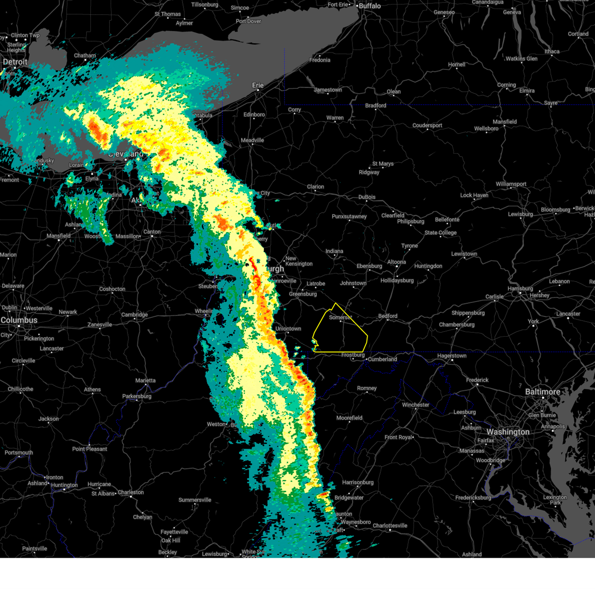 Svrctp the national weather service in state college pa has issued a * severe thunderstorm warning for, somerset county in south central pennsylvania, * until 900 pm edt. * at 800 pm edt, severe thunderstorms were located along a line extending from uniontown to kitzmiller, moving northeast at 45 mph (radar indicated). Hazards include 60 mph wind gusts. expect damage to roofs, siding, and trees Svrctp the national weather service in state college pa has issued a * severe thunderstorm warning for, somerset county in south central pennsylvania, * until 900 pm edt. * at 800 pm edt, severe thunderstorms were located along a line extending from uniontown to kitzmiller, moving northeast at 45 mph (radar indicated). Hazards include 60 mph wind gusts. expect damage to roofs, siding, and trees
|
| 5/11/2024 8:18 PM EDT |
 At 817 pm edt, a severe thunderstorm was located over accident, or near bittinger, moving southeast at 30 mph (the public reported severe hail in fayette county pa. trained spotters reported power outages in friendsville md). Hazards include 60 mph wind gusts and quarter size hail. Damaging winds will cause some trees and large branches to fall. this could injure those outdoors, as well as damage homes and vehicles. roadways may become blocked by downed trees. localized power outages are possible. unsecured light objects may become projectiles. Locations impacted include, bittinger, grantsville, accident, merrill, big run state park, new germany, piney grove, jennings, and keysers ridge. At 817 pm edt, a severe thunderstorm was located over accident, or near bittinger, moving southeast at 30 mph (the public reported severe hail in fayette county pa. trained spotters reported power outages in friendsville md). Hazards include 60 mph wind gusts and quarter size hail. Damaging winds will cause some trees and large branches to fall. this could injure those outdoors, as well as damage homes and vehicles. roadways may become blocked by downed trees. localized power outages are possible. unsecured light objects may become projectiles. Locations impacted include, bittinger, grantsville, accident, merrill, big run state park, new germany, piney grove, jennings, and keysers ridge.
|
| 5/11/2024 8:09 PM EDT |
 At 809 pm edt, a severe thunderstorm with a history of producing hail was located over friendsville, or 7 miles northwest of bittinger, moving southeast at 30 mph (observed. hail has been reported in fayette county pa). Hazards include 60 mph wind gusts and quarter size hail. Damaging winds will cause some trees and large branches to fall. this could injure those outdoors, as well as damage homes and vehicles. roadways may become blocked by downed trees. localized power outages are possible. unsecured light objects may become projectiles. Locations impacted include, bittinger, grantsville, friendsville, accident, merrill, jennings, keysers ridge, mineral spring, mchenry, selbysport, big run state park, new germany, piney grove, and deep creek lake state park. At 809 pm edt, a severe thunderstorm with a history of producing hail was located over friendsville, or 7 miles northwest of bittinger, moving southeast at 30 mph (observed. hail has been reported in fayette county pa). Hazards include 60 mph wind gusts and quarter size hail. Damaging winds will cause some trees and large branches to fall. this could injure those outdoors, as well as damage homes and vehicles. roadways may become blocked by downed trees. localized power outages are possible. unsecured light objects may become projectiles. Locations impacted include, bittinger, grantsville, friendsville, accident, merrill, jennings, keysers ridge, mineral spring, mchenry, selbysport, big run state park, new germany, piney grove, and deep creek lake state park.
|
| 5/11/2024 8:07 PM EDT |
 At 806 pm edt, a severe thunderstorm with a history of producing severe hail was located near accident, or 7 miles northwest of bittinger, moving southeast at 30 mph (observed. hail has been reported in fayette county pa). Hazards include quarter size hail. Some hail damage to agriculture or vehicles is possible. Locations impacted include, bittinger, grantsville, friendsville, accident, merrill, jennings, keysers ridge, mineral spring, mchenry, selbysport, big run state park, new germany, piney grove, and deep creek lake state park. At 806 pm edt, a severe thunderstorm with a history of producing severe hail was located near accident, or 7 miles northwest of bittinger, moving southeast at 30 mph (observed. hail has been reported in fayette county pa). Hazards include quarter size hail. Some hail damage to agriculture or vehicles is possible. Locations impacted include, bittinger, grantsville, friendsville, accident, merrill, jennings, keysers ridge, mineral spring, mchenry, selbysport, big run state park, new germany, piney grove, and deep creek lake state park.
|
| 5/11/2024 7:46 PM EDT |
 Svrlwx the national weather service in sterling virginia has issued a * severe thunderstorm warning for, northern garrett county in western maryland, * until 845 pm edt. * at 744 pm edt, a severe thunderstorm with a history of producing severe hail was located 5 miles northwest of friendsville, or 16 miles southeast of uniontown, moving southeast at 30 mph (observed. hail has been reported in fayette county pa). Hazards include quarter size hail. some hail damage to agriculture or vehicles is possible Svrlwx the national weather service in sterling virginia has issued a * severe thunderstorm warning for, northern garrett county in western maryland, * until 845 pm edt. * at 744 pm edt, a severe thunderstorm with a history of producing severe hail was located 5 miles northwest of friendsville, or 16 miles southeast of uniontown, moving southeast at 30 mph (observed. hail has been reported in fayette county pa). Hazards include quarter size hail. some hail damage to agriculture or vehicles is possible
|
| 4/3/2024 2:01 AM EDT |
 the severe thunderstorm warning has been cancelled and is no longer in effect the severe thunderstorm warning has been cancelled and is no longer in effect
|
| 4/3/2024 1:52 AM EDT |
 At 152 am edt, a severe thunderstorm was located over bayard, moving northeast at 40 mph (radar indicated). Hazards include 60 mph wind gusts and quarter size hail. Damaging winds will cause some trees and large branches to fall. this could injure those outdoors, as well as damage homes and vehicles. roadways may become blocked by downed trees. localized power outages are possible. unsecured light objects may become projectiles. Locations impacted include, cumberland, frostburg, keyser, mountain lake park, oakland, westernport, bel air, bayard, bittinger, la vale, fort ashby, lonaconing, piedmont, loch lynn heights, deer park, elk garden, kitzmiller, cresaptown, potomac park, and wiley ford. At 152 am edt, a severe thunderstorm was located over bayard, moving northeast at 40 mph (radar indicated). Hazards include 60 mph wind gusts and quarter size hail. Damaging winds will cause some trees and large branches to fall. this could injure those outdoors, as well as damage homes and vehicles. roadways may become blocked by downed trees. localized power outages are possible. unsecured light objects may become projectiles. Locations impacted include, cumberland, frostburg, keyser, mountain lake park, oakland, westernport, bel air, bayard, bittinger, la vale, fort ashby, lonaconing, piedmont, loch lynn heights, deer park, elk garden, kitzmiller, cresaptown, potomac park, and wiley ford.
|
| 4/3/2024 1:34 AM EDT |
 Svrlwx the national weather service in sterling virginia has issued a * severe thunderstorm warning for, western allegany county in western maryland, garrett county in western maryland, northern grant county in eastern west virginia, mineral county in eastern west virginia, central hampshire county in eastern west virginia, * until 215 am edt. * at 133 am edt, a severe thunderstorm was located near thomas, moving northeast at 40 mph (radar indicated). Hazards include 60 mph wind gusts and quarter size hail. Damaging winds will cause some trees and large branches to fall. this could injure those outdoors, as well as damage homes and vehicles. roadways may become blocked by downed trees. localized power outages are possible. Unsecured light objects may become projectiles. Svrlwx the national weather service in sterling virginia has issued a * severe thunderstorm warning for, western allegany county in western maryland, garrett county in western maryland, northern grant county in eastern west virginia, mineral county in eastern west virginia, central hampshire county in eastern west virginia, * until 215 am edt. * at 133 am edt, a severe thunderstorm was located near thomas, moving northeast at 40 mph (radar indicated). Hazards include 60 mph wind gusts and quarter size hail. Damaging winds will cause some trees and large branches to fall. this could injure those outdoors, as well as damage homes and vehicles. roadways may become blocked by downed trees. localized power outages are possible. Unsecured light objects may become projectiles.
|
| 3/30/2024 8:11 PM EDT |
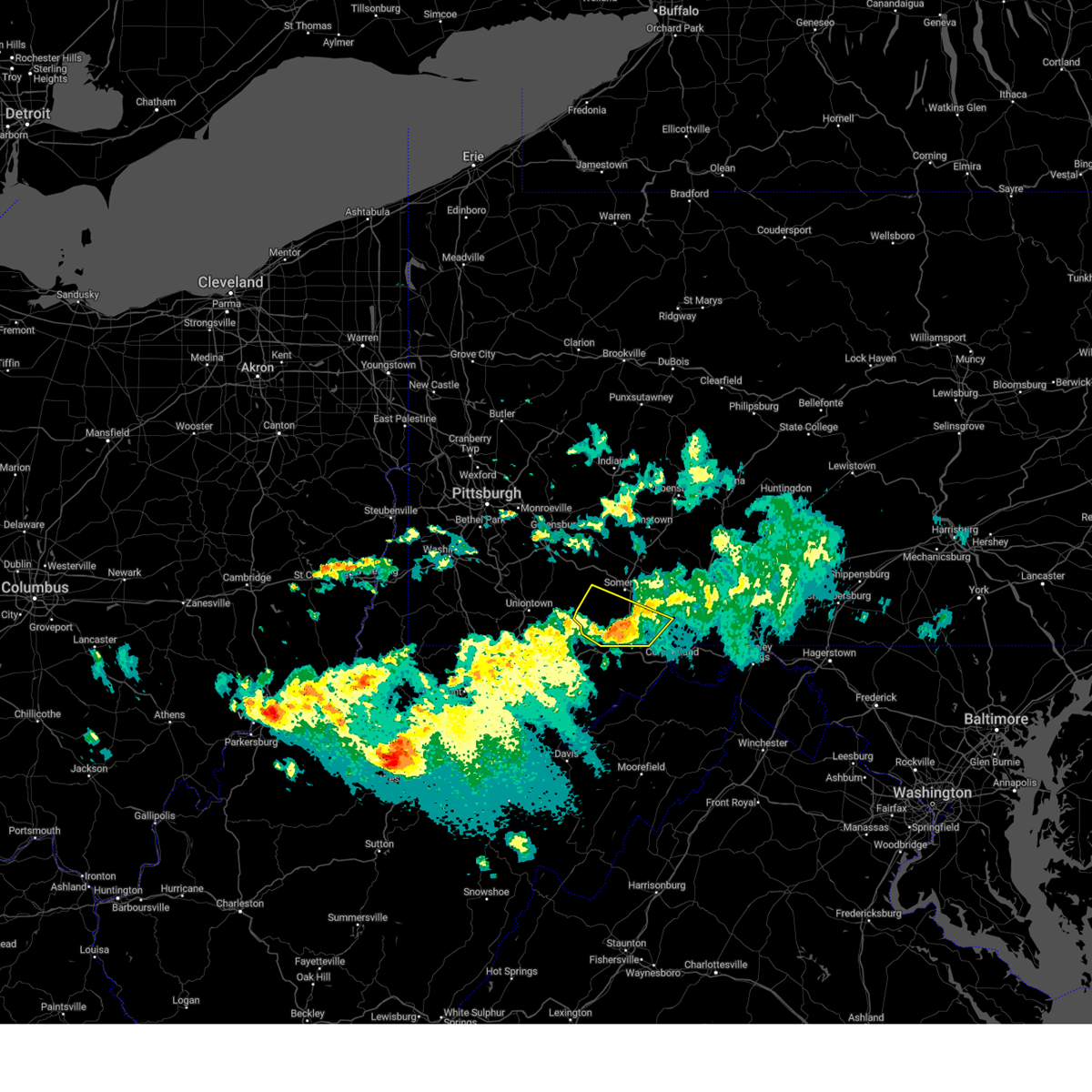 The storm which prompted the warning has weakened below severe limits, and no longer poses an immediate threat to life or property. therefore, the warning will be allowed to expire. The storm which prompted the warning has weakened below severe limits, and no longer poses an immediate threat to life or property. therefore, the warning will be allowed to expire.
|
| 3/30/2024 7:53 PM EDT |
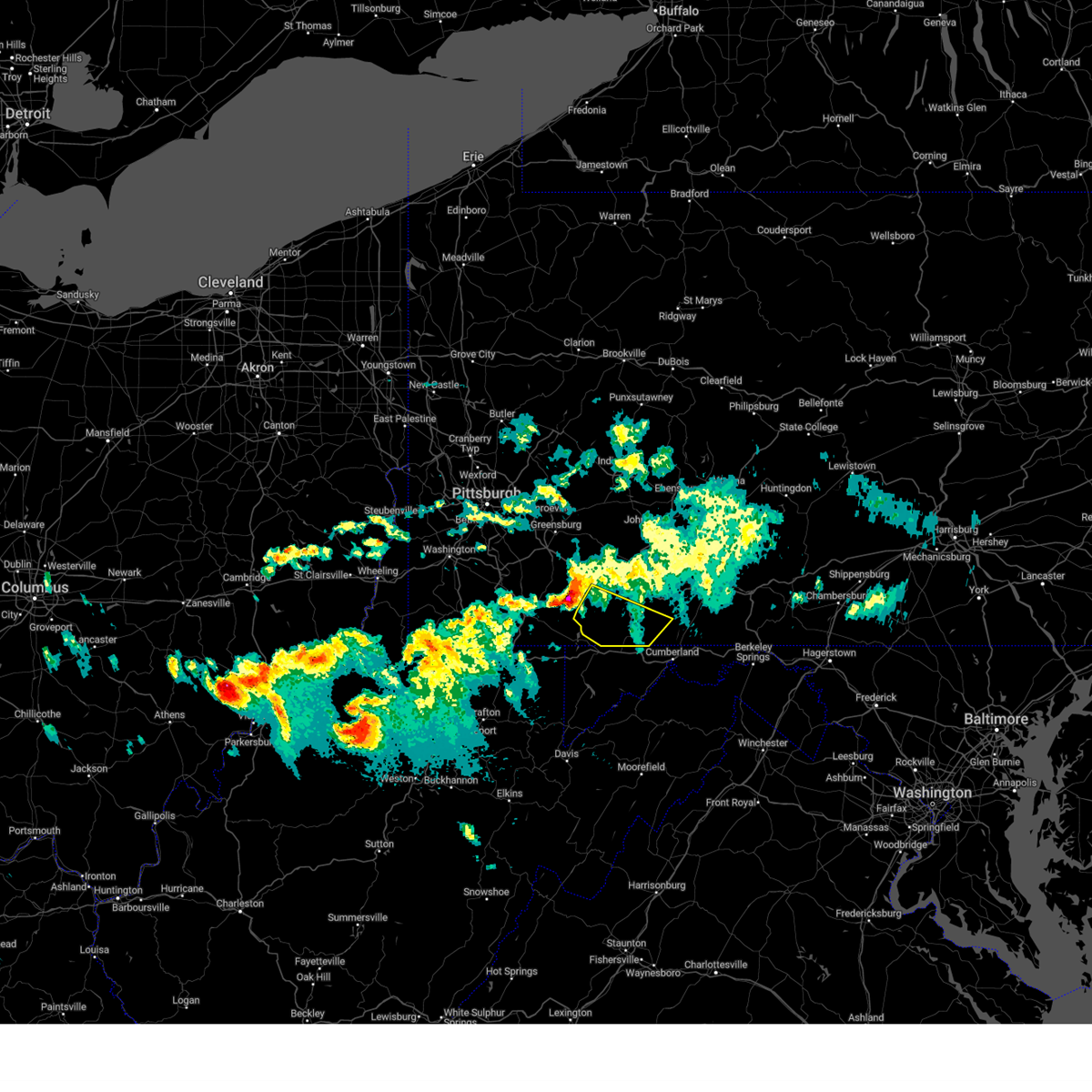 Svrctp the national weather service in state college pa has issued a * severe thunderstorm warning for, southern somerset county in south central pennsylvania, * until 815 pm edt. * at 751 pm edt, a severe thunderstorm was located near seven springs, moving southeast at 65 mph (radar indicated). Hazards include 60 mph wind gusts and quarter size hail. Hail damage to vehicles is expected. Expect wind damage to roofs, siding, and trees. Svrctp the national weather service in state college pa has issued a * severe thunderstorm warning for, southern somerset county in south central pennsylvania, * until 815 pm edt. * at 751 pm edt, a severe thunderstorm was located near seven springs, moving southeast at 65 mph (radar indicated). Hazards include 60 mph wind gusts and quarter size hail. Hail damage to vehicles is expected. Expect wind damage to roofs, siding, and trees.
|
| 8/25/2023 3:25 AM EDT |
 The severe thunderstorm warning for garrett county will expire at 330 am edt, the storm which prompted the warning has weakened below severe limits, and has exited the warned area. therefore, the warning will be allowed to expire. however gusty winds are still possible with this thunderstorm. The severe thunderstorm warning for garrett county will expire at 330 am edt, the storm which prompted the warning has weakened below severe limits, and has exited the warned area. therefore, the warning will be allowed to expire. however gusty winds are still possible with this thunderstorm.
|
| 8/25/2023 3:08 AM EDT |
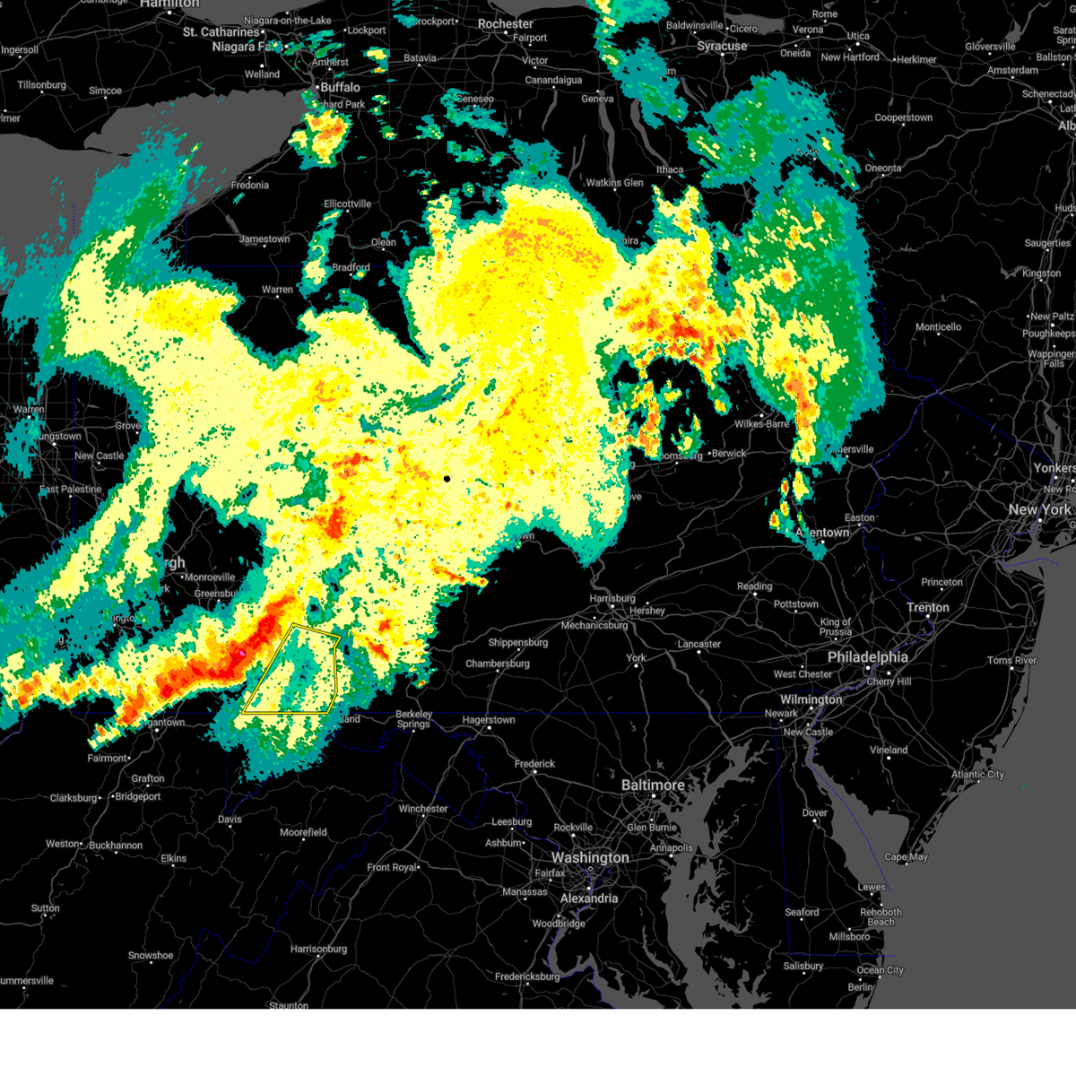 At 307 am edt, severe thunderstorms were located along a line extending from central city to grantsville, moving southeast at 40 mph (radar indicated). Hazards include 60 mph wind gusts and quarter size hail. Hail damage to vehicles is expected. expect wind damage to roofs, siding, and trees. locations impacted include, somerset, meyersdale, berlin, friedens, boswell, central city, acosta, new centerville, mount davis, rockwood, salisbury and jennerstown. this includes the pennsylvania turnpike from mile markers 107 to 130. hail threat, radar indicated max hail size, 1. 00 in wind threat, radar indicated max wind gust, 60 mph. At 307 am edt, severe thunderstorms were located along a line extending from central city to grantsville, moving southeast at 40 mph (radar indicated). Hazards include 60 mph wind gusts and quarter size hail. Hail damage to vehicles is expected. expect wind damage to roofs, siding, and trees. locations impacted include, somerset, meyersdale, berlin, friedens, boswell, central city, acosta, new centerville, mount davis, rockwood, salisbury and jennerstown. this includes the pennsylvania turnpike from mile markers 107 to 130. hail threat, radar indicated max hail size, 1. 00 in wind threat, radar indicated max wind gust, 60 mph.
|
| 8/25/2023 2:58 AM EDT |
 At 257 am edt, a severe thunderstorm was located near farmington, or 9 miles southeast of uniontown, moving east at 40 mph (radar indicated). Hazards include 60 mph wind gusts and quarter size hail. Damaging winds will cause some trees and large branches to fall. this could injure those outdoors, as well as damage homes and vehicles. roadways may become blocked by downed trees. localized power outages are possible. Unsecured light objects may become projectiles. At 257 am edt, a severe thunderstorm was located near farmington, or 9 miles southeast of uniontown, moving east at 40 mph (radar indicated). Hazards include 60 mph wind gusts and quarter size hail. Damaging winds will cause some trees and large branches to fall. this could injure those outdoors, as well as damage homes and vehicles. roadways may become blocked by downed trees. localized power outages are possible. Unsecured light objects may become projectiles.
|
| 8/25/2023 2:48 AM EDT |
 At 248 am edt, severe thunderstorms were located along a line extending from boswell to ursina, moving southeast at 40 mph (radar indicated). Hazards include 70 mph wind gusts and quarter size hail. Hail damage to vehicles is expected. expect considerable tree damage. wind damage is also likely to mobile homes, roofs, and outbuildings. locations impacted include, somerset, meyersdale, berlin, friedens, boswell, davidsville, central city, jerome, acosta, ursina, new centerville and mount davis. this includes the pennsylvania turnpike from mile markers 100 to 130. thunderstorm damage threat, considerable hail threat, radar indicated max hail size, 1. 00 in wind threat, radar indicated max wind gust, 70 mph. At 248 am edt, severe thunderstorms were located along a line extending from boswell to ursina, moving southeast at 40 mph (radar indicated). Hazards include 70 mph wind gusts and quarter size hail. Hail damage to vehicles is expected. expect considerable tree damage. wind damage is also likely to mobile homes, roofs, and outbuildings. locations impacted include, somerset, meyersdale, berlin, friedens, boswell, davidsville, central city, jerome, acosta, ursina, new centerville and mount davis. this includes the pennsylvania turnpike from mile markers 100 to 130. thunderstorm damage threat, considerable hail threat, radar indicated max hail size, 1. 00 in wind threat, radar indicated max wind gust, 70 mph.
|
| 8/25/2023 2:40 AM EDT |
 At 239 am edt, severe thunderstorms were located along a line extending from near jerome to near ursina to masontown, moving southeast at 40 mph (radar indicated). Hazards include 70 mph wind gusts and quarter size hail. Hail damage to vehicles is expected. expect considerable tree damage. Wind damage is also likely to mobile homes, roofs, and outbuildings. At 239 am edt, severe thunderstorms were located along a line extending from near jerome to near ursina to masontown, moving southeast at 40 mph (radar indicated). Hazards include 70 mph wind gusts and quarter size hail. Hail damage to vehicles is expected. expect considerable tree damage. Wind damage is also likely to mobile homes, roofs, and outbuildings.
|
| 8/12/2023 10:04 PM EDT |
 At 1004 pm edt, a severe thunderstorm was located over friendsville, or 9 miles west of bittinger, moving southeast at 45 mph (radar indicated). Hazards include 70 mph wind gusts. Damaging winds will cause some trees and large branches to fall. this could injure those outdoors, as well as damage homes and vehicles. roadways may become blocked by downed trees. localized power outages are possible. unsecured light objects may become projectiles. locations impacted include, mountain lake park, oakland, bittinger, grantsville, loch lynn heights, friendsville, deer park, accident, merrill, keysers ridge, jennings, mineral spring, deep creek lake state park, swallow falls state park, mchenry, selbysport, big run state park, new germany, piney grove, and mccomas beach. thunderstorm damage threat, considerable hail threat, radar indicated max hail size, <. 75 in wind threat, radar indicated max wind gust, 70 mph. At 1004 pm edt, a severe thunderstorm was located over friendsville, or 9 miles west of bittinger, moving southeast at 45 mph (radar indicated). Hazards include 70 mph wind gusts. Damaging winds will cause some trees and large branches to fall. this could injure those outdoors, as well as damage homes and vehicles. roadways may become blocked by downed trees. localized power outages are possible. unsecured light objects may become projectiles. locations impacted include, mountain lake park, oakland, bittinger, grantsville, loch lynn heights, friendsville, deer park, accident, merrill, keysers ridge, jennings, mineral spring, deep creek lake state park, swallow falls state park, mchenry, selbysport, big run state park, new germany, piney grove, and mccomas beach. thunderstorm damage threat, considerable hail threat, radar indicated max hail size, <. 75 in wind threat, radar indicated max wind gust, 70 mph.
|
| 8/12/2023 9:49 PM EDT |
 At 949 pm edt, a severe thunderstorm was located 7 miles south of farmington, or 15 miles southeast of uniontown, moving southeast at 40 mph (radar indicated). Hazards include 60 mph wind gusts. Damaging winds will cause some trees and large branches to fall. this could injure those outdoors, as well as damage homes and vehicles. roadways may become blocked by downed trees. localized power outages are possible. Unsecured light objects may become projectiles. At 949 pm edt, a severe thunderstorm was located 7 miles south of farmington, or 15 miles southeast of uniontown, moving southeast at 40 mph (radar indicated). Hazards include 60 mph wind gusts. Damaging winds will cause some trees and large branches to fall. this could injure those outdoors, as well as damage homes and vehicles. roadways may become blocked by downed trees. localized power outages are possible. Unsecured light objects may become projectiles.
|
| 8/7/2023 2:02 PM EDT |
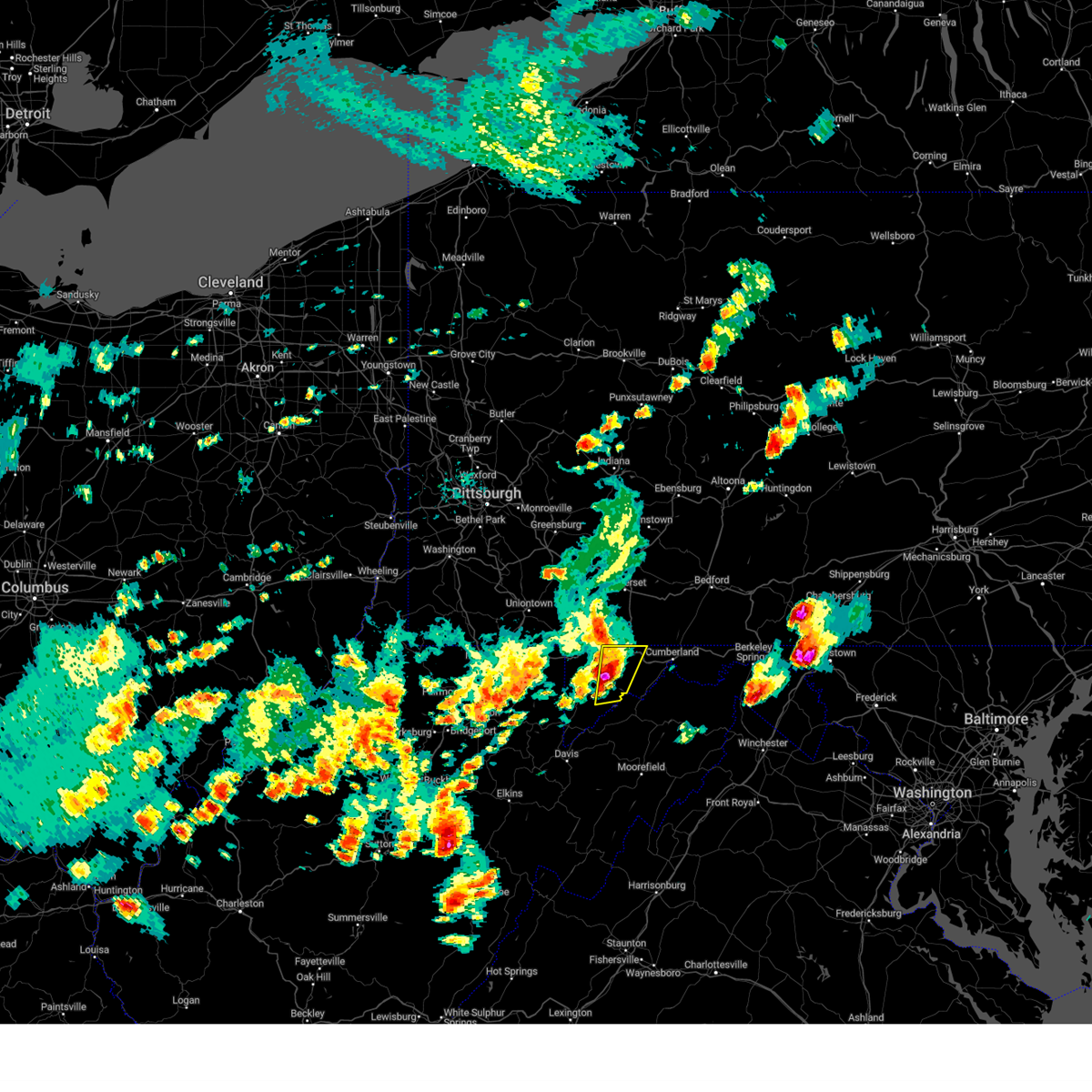 At 202 pm edt, a severe thunderstorm was located near bittinger, moving east at 40 mph (radar indicated). Hazards include 60 mph wind gusts and half dollar size hail. Damaging winds will cause some trees and large branches to fall. this could injure those outdoors, as well as damage homes and vehicles. roadways may become blocked by downed trees. localized power outages are possible. unsecured light objects may become projectiles. Locations impacted include, bittinger, grantsville, merrill, big run state park, new germany, piney grove, jennings and keysers ridge. At 202 pm edt, a severe thunderstorm was located near bittinger, moving east at 40 mph (radar indicated). Hazards include 60 mph wind gusts and half dollar size hail. Damaging winds will cause some trees and large branches to fall. this could injure those outdoors, as well as damage homes and vehicles. roadways may become blocked by downed trees. localized power outages are possible. unsecured light objects may become projectiles. Locations impacted include, bittinger, grantsville, merrill, big run state park, new germany, piney grove, jennings and keysers ridge.
|
| 8/7/2023 1:58 PM EDT |
 At 158 pm edt, a severe thunderstorm was located near bittinger, moving east at 40 mph (radar indicated). Hazards include 70 mph wind gusts and ping pong ball size hail. Damaging winds will cause some trees and large branches to fall. this could injure those outdoors, as well as damage homes and vehicles. roadways may become blocked by downed trees. localized power outages are possible. Unsecured light objects may become projectiles. At 158 pm edt, a severe thunderstorm was located near bittinger, moving east at 40 mph (radar indicated). Hazards include 70 mph wind gusts and ping pong ball size hail. Damaging winds will cause some trees and large branches to fall. this could injure those outdoors, as well as damage homes and vehicles. roadways may become blocked by downed trees. localized power outages are possible. Unsecured light objects may become projectiles.
|
| 8/7/2023 1:51 PM EDT |
 At 151 pm edt, a severe thunderstorm was located over bittinger, moving northeast at 45 mph (radar indicated). Hazards include 60 mph wind gusts and half dollar size hail. Damaging winds will cause some trees and large branches to fall. this could injure those outdoors, as well as damage homes and vehicles. roadways may become blocked by downed trees. localized power outages are possible. unsecured light objects may become projectiles. Locations impacted include, mountain lake park, oakland, bittinger, grantsville, friendsville, deer park, accident, merrill, hutton, keysers ridge, jennings, mineral spring, deep creek lake state park, swallow falls state park, mchenry, selbysport, big run state park, new germany, piney grove and mccomas beach. At 151 pm edt, a severe thunderstorm was located over bittinger, moving northeast at 45 mph (radar indicated). Hazards include 60 mph wind gusts and half dollar size hail. Damaging winds will cause some trees and large branches to fall. this could injure those outdoors, as well as damage homes and vehicles. roadways may become blocked by downed trees. localized power outages are possible. unsecured light objects may become projectiles. Locations impacted include, mountain lake park, oakland, bittinger, grantsville, friendsville, deer park, accident, merrill, hutton, keysers ridge, jennings, mineral spring, deep creek lake state park, swallow falls state park, mchenry, selbysport, big run state park, new germany, piney grove and mccomas beach.
|
| 8/7/2023 1:45 PM EDT |
 At 145 pm edt, a severe thunderstorm was located near accident, or near bittinger, moving east at 40 mph (radar indicated). Hazards include 60 mph wind gusts and quarter size hail. Damaging winds will cause some trees and large branches to fall. this could injure those outdoors, as well as damage homes and vehicles. roadways may become blocked by downed trees. localized power outages are possible. unsecured light objects may become projectiles. locations impacted include, mountain lake park, oakland, bittinger, grantsville, loch lynn heights, friendsville, deer park, accident, merrill, hutton, keysers ridge, jennings, mineral spring, deep creek lake state park, crellin, swallow falls state park, mchenry, selbysport, big run state park and new germany. hail threat, radar indicated max hail size, 1. 00 in wind threat, radar indicated max wind gust, 60 mph. At 145 pm edt, a severe thunderstorm was located near accident, or near bittinger, moving east at 40 mph (radar indicated). Hazards include 60 mph wind gusts and quarter size hail. Damaging winds will cause some trees and large branches to fall. this could injure those outdoors, as well as damage homes and vehicles. roadways may become blocked by downed trees. localized power outages are possible. unsecured light objects may become projectiles. locations impacted include, mountain lake park, oakland, bittinger, grantsville, loch lynn heights, friendsville, deer park, accident, merrill, hutton, keysers ridge, jennings, mineral spring, deep creek lake state park, crellin, swallow falls state park, mchenry, selbysport, big run state park and new germany. hail threat, radar indicated max hail size, 1. 00 in wind threat, radar indicated max wind gust, 60 mph.
|
| 8/7/2023 1:19 PM EDT |
 At 118 pm edt, a severe thunderstorm was located near kingwood, moving northeast at 45 mph (radar indicated). Hazards include ping pong ball size hail and 60 mph wind gusts. Damaging winds will cause some trees and large branches to fall. this could injure those outdoors, as well as damage homes and vehicles. roadways may become blocked by downed trees. localized power outages are possible. Unsecured light objects may become projectiles. At 118 pm edt, a severe thunderstorm was located near kingwood, moving northeast at 45 mph (radar indicated). Hazards include ping pong ball size hail and 60 mph wind gusts. Damaging winds will cause some trees and large branches to fall. this could injure those outdoors, as well as damage homes and vehicles. roadways may become blocked by downed trees. localized power outages are possible. Unsecured light objects may become projectiles.
|
| 7/27/2023 4:30 PM EDT |
 At 430 pm edt, a severe thunderstorm was located near grantsville, or near bittinger, moving southeast at 30 mph (radar indicated). Hazards include 60 mph wind gusts and nickel size hail. Damaging winds will cause some trees and large branches to fall. this could injure those outdoors, as well as damage homes and vehicles. roadways may become blocked by downed trees. localized power outages are possible. unsecured light objects may become projectiles. locations impacted include, bittinger, accident, deep creek lake state park, merrill, mchenry, big run state park, new germany and piney grove. hail threat, radar indicated max hail size, 0. 88 in wind threat, radar indicated max wind gust, 60 mph. At 430 pm edt, a severe thunderstorm was located near grantsville, or near bittinger, moving southeast at 30 mph (radar indicated). Hazards include 60 mph wind gusts and nickel size hail. Damaging winds will cause some trees and large branches to fall. this could injure those outdoors, as well as damage homes and vehicles. roadways may become blocked by downed trees. localized power outages are possible. unsecured light objects may become projectiles. locations impacted include, bittinger, accident, deep creek lake state park, merrill, mchenry, big run state park, new germany and piney grove. hail threat, radar indicated max hail size, 0. 88 in wind threat, radar indicated max wind gust, 60 mph.
|
| 7/27/2023 4:00 PM EDT |
 At 359 pm edt, a severe thunderstorm was located north of friendsville, or 12 miles northwest of bittinger, moving southeast at 30 mph (radar indicated). Hazards include 60 mph wind gusts and quarter size hail. Damaging winds will cause some trees and large branches to fall. this could injure those outdoors, as well as damage homes and vehicles. roadways may become blocked by downed trees. localized power outages are possible. unsecured light objects may become projectiles. locations impacted include, bittinger, grantsville, friendsville, accident, merrill, keysers ridge, jennings, mineral spring, deep creek lake state park, mchenry, selbysport, big run state park, new germany and piney grove. hail threat, radar indicated max hail size, 1. 00 in wind threat, radar indicated max wind gust, 60 mph. At 359 pm edt, a severe thunderstorm was located north of friendsville, or 12 miles northwest of bittinger, moving southeast at 30 mph (radar indicated). Hazards include 60 mph wind gusts and quarter size hail. Damaging winds will cause some trees and large branches to fall. this could injure those outdoors, as well as damage homes and vehicles. roadways may become blocked by downed trees. localized power outages are possible. unsecured light objects may become projectiles. locations impacted include, bittinger, grantsville, friendsville, accident, merrill, keysers ridge, jennings, mineral spring, deep creek lake state park, mchenry, selbysport, big run state park, new germany and piney grove. hail threat, radar indicated max hail size, 1. 00 in wind threat, radar indicated max wind gust, 60 mph.
|
| 7/27/2023 3:51 PM EDT |
 At 351 pm edt, a severe thunderstorm was located near farmington, or 16 miles northwest of bittinger, moving southeast at 30 mph (radar indicated). Hazards include 60 mph wind gusts and quarter size hail. Damaging winds will cause some trees and large branches to fall. this could injure those outdoors, as well as damage homes and vehicles. roadways may become blocked by downed trees. localized power outages are possible. Unsecured light objects may become projectiles. At 351 pm edt, a severe thunderstorm was located near farmington, or 16 miles northwest of bittinger, moving southeast at 30 mph (radar indicated). Hazards include 60 mph wind gusts and quarter size hail. Damaging winds will cause some trees and large branches to fall. this could injure those outdoors, as well as damage homes and vehicles. roadways may become blocked by downed trees. localized power outages are possible. Unsecured light objects may become projectiles.
|
| 7/15/2023 8:21 PM EDT |
 At 821 pm edt, severe thunderstorms were located along a line extending from near frostburg to 9 miles southwest of paw paw, moving northeast at 20 mph (radar indicated). Hazards include 60 mph wind gusts. Damaging winds will cause some trees and large branches to fall. this could injure those outdoors, as well as damage homes and vehicles. roadways may become blocked by downed trees. localized power outages are possible. unsecured light objects may become projectiles. locations impacted include, cumberland, frostburg, bel air, paw paw, la vale, fort ashby, ridgeley, cresaptown, potomac park, wiley ford, eckhart mines, mount savage, rawlings, ellerslie, springfield, corriganville, midland, midlothian, green spring and flintstone. hail threat, radar indicated max hail size, <. 75 in wind threat, radar indicated max wind gust, 60 mph. At 821 pm edt, severe thunderstorms were located along a line extending from near frostburg to 9 miles southwest of paw paw, moving northeast at 20 mph (radar indicated). Hazards include 60 mph wind gusts. Damaging winds will cause some trees and large branches to fall. this could injure those outdoors, as well as damage homes and vehicles. roadways may become blocked by downed trees. localized power outages are possible. unsecured light objects may become projectiles. locations impacted include, cumberland, frostburg, bel air, paw paw, la vale, fort ashby, ridgeley, cresaptown, potomac park, wiley ford, eckhart mines, mount savage, rawlings, ellerslie, springfield, corriganville, midland, midlothian, green spring and flintstone. hail threat, radar indicated max hail size, <. 75 in wind threat, radar indicated max wind gust, 60 mph.
|
| 7/15/2023 7:56 PM EDT |
 At 756 pm edt, severe thunderstorms were located along a line extending from near frostburg to near romney, moving northeast at 20 mph (radar indicated). Hazards include 60 mph wind gusts and quarter size hail. Damaging winds will cause some trees and large branches to fall. this could injure those outdoors, as well as damage homes and vehicles. roadways may become blocked by downed trees. localized power outages are possible. Unsecured light objects may become projectiles. At 756 pm edt, severe thunderstorms were located along a line extending from near frostburg to near romney, moving northeast at 20 mph (radar indicated). Hazards include 60 mph wind gusts and quarter size hail. Damaging winds will cause some trees and large branches to fall. this could injure those outdoors, as well as damage homes and vehicles. roadways may become blocked by downed trees. localized power outages are possible. Unsecured light objects may become projectiles.
|
| 4/5/2023 10:37 PM EDT |
 The severe thunderstorm warning for western bedford, southwestern blair, south central cambria and eastern somerset counties will expire at 1045 pm edt, the storms which prompted the warning have weakened below severe limits, and have exited the warned area. therefore, the warning will be allowed to expire. however, gusty winds are still possible with these thunderstorms. The severe thunderstorm warning for western bedford, southwestern blair, south central cambria and eastern somerset counties will expire at 1045 pm edt, the storms which prompted the warning have weakened below severe limits, and have exited the warned area. therefore, the warning will be allowed to expire. however, gusty winds are still possible with these thunderstorms.
|
| 4/5/2023 10:18 PM EDT |
 At 1018 pm edt, severe thunderstorms were located along a line extending from lilly to near central city to near la vale, moving east at 45 mph (radar indicated). Hazards include 60 mph wind gusts. Expect damage to roofs, siding, and trees. locations impacted include, bedford, portage, claysburg, osterburg, central city, beaverdale-lloydell, buffalo mills, dunlo, st. clairsville, lake gordon, blue knob state park and cessna. this includes the following interstates, the pennsylvania turnpike from mile markers 123 to 151. interstate 99 from mile markers 0 to 15. hail threat, radar indicated max hail size, <. 75 in wind threat, radar indicated max wind gust, 60 mph. At 1018 pm edt, severe thunderstorms were located along a line extending from lilly to near central city to near la vale, moving east at 45 mph (radar indicated). Hazards include 60 mph wind gusts. Expect damage to roofs, siding, and trees. locations impacted include, bedford, portage, claysburg, osterburg, central city, beaverdale-lloydell, buffalo mills, dunlo, st. clairsville, lake gordon, blue knob state park and cessna. this includes the following interstates, the pennsylvania turnpike from mile markers 123 to 151. interstate 99 from mile markers 0 to 15. hail threat, radar indicated max hail size, <. 75 in wind threat, radar indicated max wind gust, 60 mph.
|
| 4/5/2023 10:09 PM EDT |
 At 1009 pm edt, severe thunderstorms were located along a line extending from portage to central city to near meyersdale, moving east at 55 mph (radar indicated). Hazards include 60 mph wind gusts. Expect damage to roofs, siding, and trees. locations impacted include, johnstown, windber, bedford, belmont, portage, geistown, meyersdale, berlin, claysburg, friedens, vinco and osterburg. this includes the following interstates, the pennsylvania turnpike from mile markers 114 to 151. interstate 99 from mile markers 0 to 15. hail threat, radar indicated max hail size, <. 75 in wind threat, radar indicated max wind gust, 60 mph. At 1009 pm edt, severe thunderstorms were located along a line extending from portage to central city to near meyersdale, moving east at 55 mph (radar indicated). Hazards include 60 mph wind gusts. Expect damage to roofs, siding, and trees. locations impacted include, johnstown, windber, bedford, belmont, portage, geistown, meyersdale, berlin, claysburg, friedens, vinco and osterburg. this includes the following interstates, the pennsylvania turnpike from mile markers 114 to 151. interstate 99 from mile markers 0 to 15. hail threat, radar indicated max hail size, <. 75 in wind threat, radar indicated max wind gust, 60 mph.
|
| 4/5/2023 9:57 PM EDT |
 At 957 pm edt, a severe thunderstorm was located over friedens, moving east at 45 mph (radar indicated). Hazards include 60 mph wind gusts. expect damage to roofs, siding, and trees At 957 pm edt, a severe thunderstorm was located over friedens, moving east at 45 mph (radar indicated). Hazards include 60 mph wind gusts. expect damage to roofs, siding, and trees
|
| 11/30/2022 12:25 PM EST |
 The severe thunderstorm warning for western allegany, northeastern garrett, north central grant and southwestern mineral counties will expire at 1230 pm est, the storms which prompted the warning have weakened below severe limits, and have exited the warned area. therefore, the warning will be allowed to expire. however gusty winds are still possible with these thunderstorms. The severe thunderstorm warning for western allegany, northeastern garrett, north central grant and southwestern mineral counties will expire at 1230 pm est, the storms which prompted the warning have weakened below severe limits, and have exited the warned area. therefore, the warning will be allowed to expire. however gusty winds are still possible with these thunderstorms.
|
| 11/30/2022 12:16 PM EST |
 At 1216 pm est, severe thunderstorms were located along a line extending from near meyersdale to 6 miles southeast of bittinger to near kitzmiller, moving east at 45 mph (radar indicated). Hazards include 60 mph wind gusts. Damaging winds will cause some trees and large branches to fall. this could injure those outdoors, as well as damage homes and vehicles. roadways may become blocked by downed trees. localized power outages are possible. unsecured light objects may become projectiles. locations impacted include, frostburg, keyser, westernport, lonaconing, piedmont, grantsville, elk garden, kitzmiller, eckhart mines, mount savage, barton, midland, midlothian, franklin, woodland, luke, big run state park, piney grove, merrill and new germany. hail threat, radar indicated max hail size, <. 75 in wind threat, radar indicated max wind gust, 60 mph. At 1216 pm est, severe thunderstorms were located along a line extending from near meyersdale to 6 miles southeast of bittinger to near kitzmiller, moving east at 45 mph (radar indicated). Hazards include 60 mph wind gusts. Damaging winds will cause some trees and large branches to fall. this could injure those outdoors, as well as damage homes and vehicles. roadways may become blocked by downed trees. localized power outages are possible. unsecured light objects may become projectiles. locations impacted include, frostburg, keyser, westernport, lonaconing, piedmont, grantsville, elk garden, kitzmiller, eckhart mines, mount savage, barton, midland, midlothian, franklin, woodland, luke, big run state park, piney grove, merrill and new germany. hail threat, radar indicated max hail size, <. 75 in wind threat, radar indicated max wind gust, 60 mph.
|
| 11/30/2022 12:00 PM EST |
 At 1159 am est, a strong line of showers were located along a line extending from near new centerville to near accident to near bayard, moving east at 40 mph (radar indicated). Hazards include 60 mph wind gusts. Damaging winds will cause some trees and large branches to fall. this could injure those outdoors, as well as damage homes and vehicles. roadways may become blocked by downed trees. localized power outages are possible. Unsecured light objects may become projectiles. At 1159 am est, a strong line of showers were located along a line extending from near new centerville to near accident to near bayard, moving east at 40 mph (radar indicated). Hazards include 60 mph wind gusts. Damaging winds will cause some trees and large branches to fall. this could injure those outdoors, as well as damage homes and vehicles. roadways may become blocked by downed trees. localized power outages are possible. Unsecured light objects may become projectiles.
|
| 7/23/2022 4:26 PM EDT |
 At 426 pm edt, severe thunderstorms were located along a line extending from somerset to 7 miles northwest of parsons, moving southeast at 50 mph (radar indicated). Hazards include 60 mph wind gusts and quarter size hail. Damaging winds will cause some trees and large branches to fall. this could injure those outdoors, as well as damage homes and vehicles. roadways may become blocked by downed trees. localized power outages are possible. unsecured light objects may become projectiles. locations impacted include, frostburg, mountain lake park, oakland, westernport, bayard, bittinger, lonaconing, piedmont, grantsville, loch lynn heights, friendsville, deer park, accident, elk garden, kitzmiller, eckhart mines, mount savage, barton, midland and midlothian. hail threat, radar indicated max hail size, 1. 00 in wind threat, observed max wind gust, 60 mph. At 426 pm edt, severe thunderstorms were located along a line extending from somerset to 7 miles northwest of parsons, moving southeast at 50 mph (radar indicated). Hazards include 60 mph wind gusts and quarter size hail. Damaging winds will cause some trees and large branches to fall. this could injure those outdoors, as well as damage homes and vehicles. roadways may become blocked by downed trees. localized power outages are possible. unsecured light objects may become projectiles. locations impacted include, frostburg, mountain lake park, oakland, westernport, bayard, bittinger, lonaconing, piedmont, grantsville, loch lynn heights, friendsville, deer park, accident, elk garden, kitzmiller, eckhart mines, mount savage, barton, midland and midlothian. hail threat, radar indicated max hail size, 1. 00 in wind threat, observed max wind gust, 60 mph.
|
| 7/23/2022 4:10 PM EDT |
 At 409 pm edt, severe thunderstorms were located along a line extending from near indiana to near westmont to acosta to near friendsville, moving east at 40 mph (radar indicated). Hazards include 60 mph wind gusts and penny size hail. expect damage to roofs, siding, and trees At 409 pm edt, severe thunderstorms were located along a line extending from near indiana to near westmont to acosta to near friendsville, moving east at 40 mph (radar indicated). Hazards include 60 mph wind gusts and penny size hail. expect damage to roofs, siding, and trees
|
| 7/23/2022 3:56 PM EDT |
 At 355 pm edt, severe thunderstorms were located along a line extending from near seven springs to near philippi, moving east at 60 mph (radar indicated). Hazards include 60 mph wind gusts and quarter size hail. Damaging winds will cause some trees and large branches to fall. this could injure those outdoors, as well as damage homes and vehicles. roadways may become blocked by downed trees. localized power outages are possible. Unsecured light objects may become projectiles. At 355 pm edt, severe thunderstorms were located along a line extending from near seven springs to near philippi, moving east at 60 mph (radar indicated). Hazards include 60 mph wind gusts and quarter size hail. Damaging winds will cause some trees and large branches to fall. this could injure those outdoors, as well as damage homes and vehicles. roadways may become blocked by downed trees. localized power outages are possible. Unsecured light objects may become projectiles.
|
| 7/12/2022 2:53 PM EDT |
 At 252 pm edt, severe thunderstorms were located along a line extending from near lake gordon to near rowlesburg, moving east at 50 mph (radar indicated). Hazards include 60 mph wind gusts and quarter size hail. Damaging winds will cause some trees and large branches to fall. this could injure those outdoors, as well as damage homes and vehicles. roadways may become blocked by downed trees. localized power outages are possible. unsecured light objects may become projectiles. locations impacted include, cumberland, frostburg, keyser, mountain lake park, oakland, westernport, bel air, bayard, bittinger, la vale, lonaconing, piedmont, loch lynn heights, deer park, elk garden, kitzmiller, ridgeley, cresaptown, potomac park and wiley ford. hail threat, radar indicated max hail size, 1. 00 in wind threat, radar indicated max wind gust, 60 mph. At 252 pm edt, severe thunderstorms were located along a line extending from near lake gordon to near rowlesburg, moving east at 50 mph (radar indicated). Hazards include 60 mph wind gusts and quarter size hail. Damaging winds will cause some trees and large branches to fall. this could injure those outdoors, as well as damage homes and vehicles. roadways may become blocked by downed trees. localized power outages are possible. unsecured light objects may become projectiles. locations impacted include, cumberland, frostburg, keyser, mountain lake park, oakland, westernport, bel air, bayard, bittinger, la vale, lonaconing, piedmont, loch lynn heights, deer park, elk garden, kitzmiller, ridgeley, cresaptown, potomac park and wiley ford. hail threat, radar indicated max hail size, 1. 00 in wind threat, radar indicated max wind gust, 60 mph.
|
| 7/12/2022 2:25 PM EDT |
 At 224 pm edt, severe thunderstorms were located along a line extending from near grantsville to near grafton, moving east at 45 mph (radar indicated). Hazards include 60 mph wind gusts and quarter size hail. Damaging winds will cause some trees and large branches to fall. this could injure those outdoors, as well as damage homes and vehicles. roadways may become blocked by downed trees. localized power outages are possible. Unsecured light objects may become projectiles. At 224 pm edt, severe thunderstorms were located along a line extending from near grantsville to near grafton, moving east at 45 mph (radar indicated). Hazards include 60 mph wind gusts and quarter size hail. Damaging winds will cause some trees and large branches to fall. this could injure those outdoors, as well as damage homes and vehicles. roadways may become blocked by downed trees. localized power outages are possible. Unsecured light objects may become projectiles.
|
| 7/12/2022 2:18 PM EDT |
 At 218 pm edt, severe thunderstorms were located along a line extending from 6 miles south of meyersdale to near kingwood, moving east at 35 mph (radar indicated). Hazards include 60 mph wind gusts and quarter size hail. Damaging winds will cause some trees and large branches to fall. this could injure those outdoors, as well as damage homes and vehicles. roadways may become blocked by downed trees. localized power outages are possible. unsecured light objects may become projectiles. locations impacted include, oakland, bittinger, grantsville, friendsville, deer park, accident, merrill, hutton, keysers ridge, jennings, deep creek lake state park, swallow falls state park, mchenry, selbysport, big run state park, new germany, piney grove and mccomas beach. hail threat, radar indicated max hail size, 1. 00 in wind threat, radar indicated max wind gust, 60 mph. At 218 pm edt, severe thunderstorms were located along a line extending from 6 miles south of meyersdale to near kingwood, moving east at 35 mph (radar indicated). Hazards include 60 mph wind gusts and quarter size hail. Damaging winds will cause some trees and large branches to fall. this could injure those outdoors, as well as damage homes and vehicles. roadways may become blocked by downed trees. localized power outages are possible. unsecured light objects may become projectiles. locations impacted include, oakland, bittinger, grantsville, friendsville, deer park, accident, merrill, hutton, keysers ridge, jennings, deep creek lake state park, swallow falls state park, mchenry, selbysport, big run state park, new germany, piney grove and mccomas beach. hail threat, radar indicated max hail size, 1. 00 in wind threat, radar indicated max wind gust, 60 mph.
|
| 7/12/2022 2:07 PM EDT |
 At 206 pm edt, severe thunderstorms were located along a line extending from near grantsville to 6 miles northwest of kingwood, moving east at 35 mph (radar indicated). Hazards include 60 mph wind gusts and quarter size hail. Damaging winds will cause some trees and large branches to fall. this could injure those outdoors, as well as damage homes and vehicles. roadways may become blocked by downed trees. localized power outages are possible. unsecured light objects may become projectiles. locations impacted include, oakland, bittinger, grantsville, friendsville, deer park, accident, merrill, hutton, keysers ridge, jennings, mineral spring, deep creek lake state park, swallow falls state park, mchenry, selbysport, big run state park, new germany, piney grove and mccomas beach. hail threat, radar indicated max hail size, 1. 00 in wind threat, radar indicated max wind gust, 60 mph. At 206 pm edt, severe thunderstorms were located along a line extending from near grantsville to 6 miles northwest of kingwood, moving east at 35 mph (radar indicated). Hazards include 60 mph wind gusts and quarter size hail. Damaging winds will cause some trees and large branches to fall. this could injure those outdoors, as well as damage homes and vehicles. roadways may become blocked by downed trees. localized power outages are possible. unsecured light objects may become projectiles. locations impacted include, oakland, bittinger, grantsville, friendsville, deer park, accident, merrill, hutton, keysers ridge, jennings, mineral spring, deep creek lake state park, swallow falls state park, mchenry, selbysport, big run state park, new germany, piney grove and mccomas beach. hail threat, radar indicated max hail size, 1. 00 in wind threat, radar indicated max wind gust, 60 mph.
|
| 7/12/2022 1:52 PM EDT |
 At 152 pm edt, severe thunderstorms were located along a line extending from near mount davis to near brookhaven, moving east at 35 mph (radar indicated). Hazards include 60 mph wind gusts and quarter size hail. Damaging winds will cause some trees and large branches to fall. this could injure those outdoors, as well as damage homes and vehicles. roadways may become blocked by downed trees. localized power outages are possible. Unsecured light objects may become projectiles. At 152 pm edt, severe thunderstorms were located along a line extending from near mount davis to near brookhaven, moving east at 35 mph (radar indicated). Hazards include 60 mph wind gusts and quarter size hail. Damaging winds will cause some trees and large branches to fall. this could injure those outdoors, as well as damage homes and vehicles. roadways may become blocked by downed trees. localized power outages are possible. Unsecured light objects may become projectiles.
|
| 7/2/2022 3:40 AM EDT |
 At 340 am edt, a severe thunderstorm was located over grantsville, or 7 miles northeast of bittinger, moving east at 35 mph (radar indicated). Hazards include 60 mph wind gusts. Damaging winds will cause some trees and large branches to fall. this could injure those outdoors, as well as damage homes and vehicles. roadways may become blocked by downed trees. localized power outages are possible. unsecured light objects may become projectiles. locations impacted include, bittinger, grantsville, accident, merrill, new germany, piney grove, keysers ridge and jennings. hail threat, radar indicated max hail size, <. 75 in wind threat, radar indicated max wind gust, 60 mph. At 340 am edt, a severe thunderstorm was located over grantsville, or 7 miles northeast of bittinger, moving east at 35 mph (radar indicated). Hazards include 60 mph wind gusts. Damaging winds will cause some trees and large branches to fall. this could injure those outdoors, as well as damage homes and vehicles. roadways may become blocked by downed trees. localized power outages are possible. unsecured light objects may become projectiles. locations impacted include, bittinger, grantsville, accident, merrill, new germany, piney grove, keysers ridge and jennings. hail threat, radar indicated max hail size, <. 75 in wind threat, radar indicated max wind gust, 60 mph.
|
| 7/2/2022 3:32 AM EDT |
 At 332 am edt, a severe thunderstorm was located near grantsville, or near bittinger, moving east at 35 mph (radar indicated). Hazards include 60 mph wind gusts. Damaging winds will cause some trees and large branches to fall. this could injure those outdoors, as well as damage homes and vehicles. roadways may become blocked by downed trees. localized power outages are possible. Unsecured light objects may become projectiles. At 332 am edt, a severe thunderstorm was located near grantsville, or near bittinger, moving east at 35 mph (radar indicated). Hazards include 60 mph wind gusts. Damaging winds will cause some trees and large branches to fall. this could injure those outdoors, as well as damage homes and vehicles. roadways may become blocked by downed trees. localized power outages are possible. Unsecured light objects may become projectiles.
|
| 6/22/2022 7:10 PM EDT |
 The severe thunderstorm warning for western allegany, garrett, northwestern grant and central mineral counties will expire at 715 pm edt, a new severe thunderstorm warning has been issued until 8:00 pm edt. a severe thunderstorm watch remains in effect until 900 pm edt for western maryland, and eastern west virginia. remember, a severe thunderstorm warning still remains in effect for central and southern garrett county and western allegany county until 8:00 pm edt. The severe thunderstorm warning for western allegany, garrett, northwestern grant and central mineral counties will expire at 715 pm edt, a new severe thunderstorm warning has been issued until 8:00 pm edt. a severe thunderstorm watch remains in effect until 900 pm edt for western maryland, and eastern west virginia. remember, a severe thunderstorm warning still remains in effect for central and southern garrett county and western allegany county until 8:00 pm edt.
|
| 6/22/2022 7:07 PM EDT |
 At 707 pm edt, severe thunderstorms were located along a line extending from la vale to near kingwood, moving south at 30 mph (radar indicated). Hazards include 60 mph wind gusts and quarter size hail. Damaging winds will cause some trees and large branches to fall. this could injure those outdoors, as well as damage homes and vehicles. roadways may become blocked by downed trees. localized power outages are possible. Unsecured light objects may become projectiles. At 707 pm edt, severe thunderstorms were located along a line extending from la vale to near kingwood, moving south at 30 mph (radar indicated). Hazards include 60 mph wind gusts and quarter size hail. Damaging winds will cause some trees and large branches to fall. this could injure those outdoors, as well as damage homes and vehicles. roadways may become blocked by downed trees. localized power outages are possible. Unsecured light objects may become projectiles.
|
| 6/22/2022 6:51 PM EDT |
 At 651 pm edt, severe thunderstorms were located along a line extending from near frostburg to near brookhaven, moving southeast at 35 mph (radar indicated). Hazards include 60 mph wind gusts and quarter size hail. Damaging winds will cause some trees and large branches to fall. this could injure those outdoors, as well as damage homes and vehicles. roadways may become blocked by downed trees. localized power outages are possible. unsecured light objects may become projectiles. locations impacted include, frostburg, mountain lake park, oakland, westernport, bel air, bayard, bittinger, la vale, lonaconing, piedmont, grantsville, loch lynn heights, friendsville, deer park, accident, cresaptown, potomac park, eckhart mines, mount savage and rawlings. hail threat, radar indicated max hail size, 1. 00 in wind threat, radar indicated max wind gust, 60 mph. At 651 pm edt, severe thunderstorms were located along a line extending from near frostburg to near brookhaven, moving southeast at 35 mph (radar indicated). Hazards include 60 mph wind gusts and quarter size hail. Damaging winds will cause some trees and large branches to fall. this could injure those outdoors, as well as damage homes and vehicles. roadways may become blocked by downed trees. localized power outages are possible. unsecured light objects may become projectiles. locations impacted include, frostburg, mountain lake park, oakland, westernport, bel air, bayard, bittinger, la vale, lonaconing, piedmont, grantsville, loch lynn heights, friendsville, deer park, accident, cresaptown, potomac park, eckhart mines, mount savage and rawlings. hail threat, radar indicated max hail size, 1. 00 in wind threat, radar indicated max wind gust, 60 mph.
|
| 6/22/2022 6:26 PM EDT |
 At 626 pm edt, severe thunderstorms were located along a line extending from near meyersdale to point marion, moving southeast at 40 mph (radar indicated). Hazards include 60 mph wind gusts and quarter size hail. Damaging winds will cause some trees and large branches to fall. this could injure those outdoors, as well as damage homes and vehicles. roadways may become blocked by downed trees. localized power outages are possible. Unsecured light objects may become projectiles. At 626 pm edt, severe thunderstorms were located along a line extending from near meyersdale to point marion, moving southeast at 40 mph (radar indicated). Hazards include 60 mph wind gusts and quarter size hail. Damaging winds will cause some trees and large branches to fall. this could injure those outdoors, as well as damage homes and vehicles. roadways may become blocked by downed trees. localized power outages are possible. Unsecured light objects may become projectiles.
|
| 6/22/2022 6:21 PM EDT |
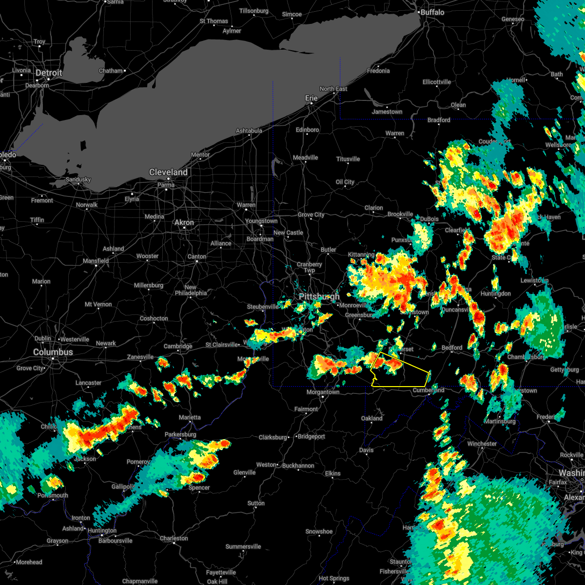 At 621 pm edt, a severe thunderstorm was located over new centerville, moving southeast at 30 mph (radar indicated). Hazards include 60 mph wind gusts and penny size hail. expect damage to roofs, siding, and trees At 621 pm edt, a severe thunderstorm was located over new centerville, moving southeast at 30 mph (radar indicated). Hazards include 60 mph wind gusts and penny size hail. expect damage to roofs, siding, and trees
|
| 6/8/2022 11:06 PM EDT |
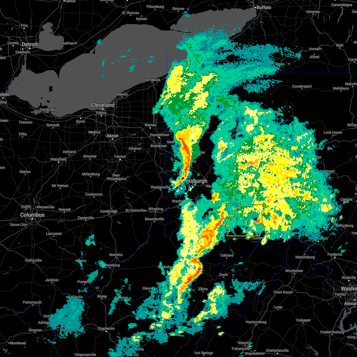 At 1106 pm edt, severe thunderstorms were located along a line extending from seven springs to near ursina to near friendsville, moving east at 45 mph (radar indicated). Hazards include 60 mph wind gusts. expect damage to roofs, siding, and trees At 1106 pm edt, severe thunderstorms were located along a line extending from seven springs to near ursina to near friendsville, moving east at 45 mph (radar indicated). Hazards include 60 mph wind gusts. expect damage to roofs, siding, and trees
|
| 5/20/2022 12:02 PM EDT |
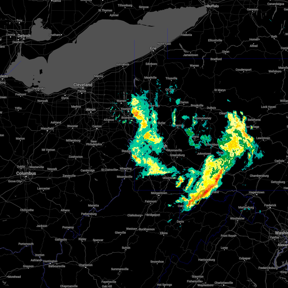 At 1202 pm edt, severe thunderstorms were located along a line extending from near lake gordon to 6 miles north of kitzmiller, moving east at 45 mph (radar indicated). Hazards include 60 mph wind gusts and quarter size hail. Damaging winds will cause some trees and large branches to fall. this could injure those outdoors, as well as damage homes and vehicles. roadways may become blocked by downed trees. localized power outages are possible. unsecured light objects may become projectiles. Locations impacted include, frostburg, franklin, luke, merrill and big run state park. At 1202 pm edt, severe thunderstorms were located along a line extending from near lake gordon to 6 miles north of kitzmiller, moving east at 45 mph (radar indicated). Hazards include 60 mph wind gusts and quarter size hail. Damaging winds will cause some trees and large branches to fall. this could injure those outdoors, as well as damage homes and vehicles. roadways may become blocked by downed trees. localized power outages are possible. unsecured light objects may become projectiles. Locations impacted include, frostburg, franklin, luke, merrill and big run state park.
|
| 5/20/2022 11:51 AM EDT |
 At 1150 am edt, severe thunderstorms were located along a line extending from bedford to near buffalo mills to near cumberland, moving east at 55 mph (radar indicated). Hazards include 70 mph wind gusts. Expect considerable tree damage. damage is likely to mobile homes, roofs, and outbuildings. locations impacted include, bedford, breezewood, clearville, everett, buffalo mills, crystal springs, lake gordon, inglesmith, hyndman, wellersburg and rainsburg. this includes the following interstates, interstate 70 from mile markers 147 to 150. The pennsylvania turnpike from mile markers 149 to 165. At 1150 am edt, severe thunderstorms were located along a line extending from bedford to near buffalo mills to near cumberland, moving east at 55 mph (radar indicated). Hazards include 70 mph wind gusts. Expect considerable tree damage. damage is likely to mobile homes, roofs, and outbuildings. locations impacted include, bedford, breezewood, clearville, everett, buffalo mills, crystal springs, lake gordon, inglesmith, hyndman, wellersburg and rainsburg. this includes the following interstates, interstate 70 from mile markers 147 to 150. The pennsylvania turnpike from mile markers 149 to 165.
|
| 5/20/2022 11:41 AM EDT |
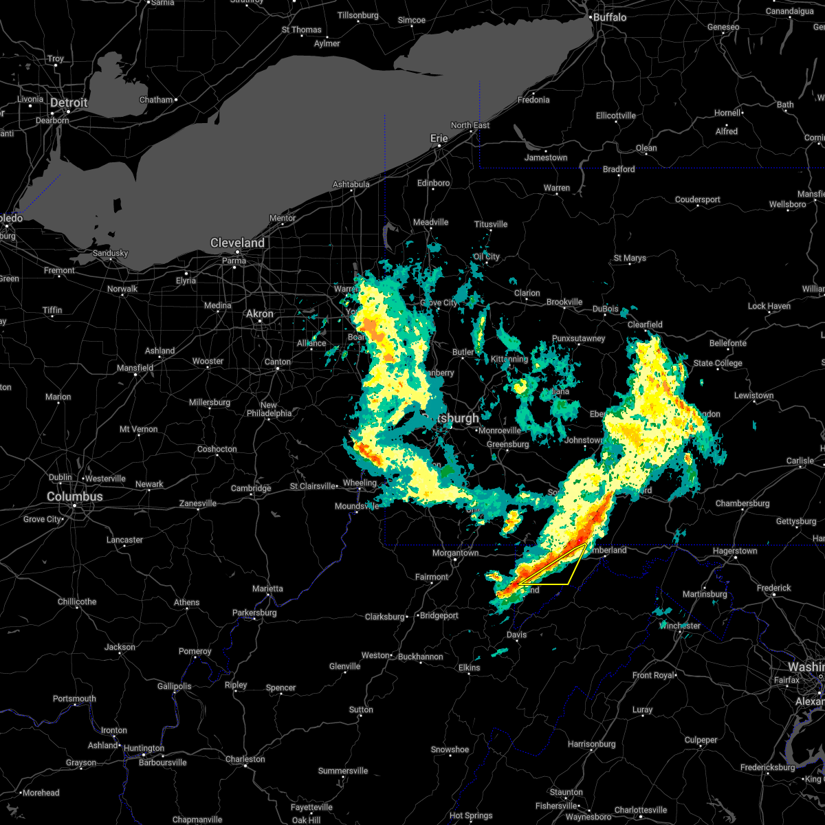 At 1141 am edt, severe thunderstorms were located along a line extending from near frostburg to near terra alta, moving east at 50 mph (radar indicated). Hazards include 60 mph wind gusts and quarter size hail. Damaging winds will cause some trees and large branches to fall. this could injure those outdoors, as well as damage homes and vehicles. roadways may become blocked by downed trees. localized power outages are possible. Unsecured light objects may become projectiles. At 1141 am edt, severe thunderstorms were located along a line extending from near frostburg to near terra alta, moving east at 50 mph (radar indicated). Hazards include 60 mph wind gusts and quarter size hail. Damaging winds will cause some trees and large branches to fall. this could injure those outdoors, as well as damage homes and vehicles. roadways may become blocked by downed trees. localized power outages are possible. Unsecured light objects may become projectiles.
|
| 5/20/2022 11:31 AM EDT |
 At 1131 am edt, severe thunderstorms were located along a line extending from near mount davis to near terra alta, moving east at 40 mph (radar indicated). Hazards include 60 mph wind gusts and quarter size hail. Damaging winds will cause some trees and large branches to fall. this could injure those outdoors, as well as damage homes and vehicles. roadways may become blocked by downed trees. localized power outages are possible. unsecured light objects may become projectiles. Locations impacted include, bittinger, grantsville, accident, merrill, keysers ridge, jennings, deep creek lake state park, swallow falls state park, mchenry, big run state park, new germany, piney grove and mccomas beach. At 1131 am edt, severe thunderstorms were located along a line extending from near mount davis to near terra alta, moving east at 40 mph (radar indicated). Hazards include 60 mph wind gusts and quarter size hail. Damaging winds will cause some trees and large branches to fall. this could injure those outdoors, as well as damage homes and vehicles. roadways may become blocked by downed trees. localized power outages are possible. unsecured light objects may become projectiles. Locations impacted include, bittinger, grantsville, accident, merrill, keysers ridge, jennings, deep creek lake state park, swallow falls state park, mchenry, big run state park, new germany, piney grove and mccomas beach.
|
| 5/20/2022 11:23 AM EDT |
 At 1122 am edt, severe thunderstorms were located along a line extending from mount davis to near terra alta, moving east at 40 mph (radar indicated). Hazards include 60 mph wind gusts and quarter size hail. Damaging winds will cause some trees and large branches to fall. this could injure those outdoors, as well as damage homes and vehicles. roadways may become blocked by downed trees. localized power outages are possible. unsecured light objects may become projectiles. Locations impacted include, bittinger, grantsville, friendsville, accident, merrill, keysers ridge, jennings, mineral spring, deep creek lake state park, swallow falls state park, mchenry, selbysport, big run state park, new germany, piney grove and mccomas beach. At 1122 am edt, severe thunderstorms were located along a line extending from mount davis to near terra alta, moving east at 40 mph (radar indicated). Hazards include 60 mph wind gusts and quarter size hail. Damaging winds will cause some trees and large branches to fall. this could injure those outdoors, as well as damage homes and vehicles. roadways may become blocked by downed trees. localized power outages are possible. unsecured light objects may become projectiles. Locations impacted include, bittinger, grantsville, friendsville, accident, merrill, keysers ridge, jennings, mineral spring, deep creek lake state park, swallow falls state park, mchenry, selbysport, big run state park, new germany, piney grove and mccomas beach.
|
| 5/20/2022 11:20 AM EDT |
 At 1118 am edt, severe thunderstorms were located along a line extending from new centerville to grantsville to accident, moving east at 55 mph (radar indicated). Hazards include 70 mph wind gusts. Expect considerable tree damage. Damage is likely to mobile homes, roofs, and outbuildings. At 1118 am edt, severe thunderstorms were located along a line extending from new centerville to grantsville to accident, moving east at 55 mph (radar indicated). Hazards include 70 mph wind gusts. Expect considerable tree damage. Damage is likely to mobile homes, roofs, and outbuildings.
|
| 5/20/2022 11:06 AM EDT |
 At 1105 am edt, severe thunderstorms were located along a line extending from near ursina to near kingwood, moving east at 40 mph (radar indicated). Hazards include 60 mph wind gusts and quarter size hail. Damaging winds will cause some trees and large branches to fall. this could injure those outdoors, as well as damage homes and vehicles. roadways may become blocked by downed trees. localized power outages are possible. Unsecured light objects may become projectiles. At 1105 am edt, severe thunderstorms were located along a line extending from near ursina to near kingwood, moving east at 40 mph (radar indicated). Hazards include 60 mph wind gusts and quarter size hail. Damaging winds will cause some trees and large branches to fall. this could injure those outdoors, as well as damage homes and vehicles. roadways may become blocked by downed trees. localized power outages are possible. Unsecured light objects may become projectiles.
|
| 3/31/2022 3:00 PM EDT |
 At 259 pm edt, severe thunderstorms were located along a line extending from new enterprise to near la vale, moving northeast at 45 mph (radar indicated). Hazards include 60 mph wind gusts and penny size hail. expect damage to roofs, siding, and trees At 259 pm edt, severe thunderstorms were located along a line extending from new enterprise to near la vale, moving northeast at 45 mph (radar indicated). Hazards include 60 mph wind gusts and penny size hail. expect damage to roofs, siding, and trees
|
| 3/31/2022 2:50 PM EDT |
 At 250 pm edt, severe thunderstorms were located along a line extending from near frostburg to near elk garden, moving east at 30 mph (radar indicated). Hazards include 60 mph wind gusts. Damaging winds will cause some trees and large branches to fall. this could injure those outdoors, as well as damage homes and vehicles. roadways may become blocked by downed trees. localized power outages are possible. Unsecured light objects may become projectiles. At 250 pm edt, severe thunderstorms were located along a line extending from near frostburg to near elk garden, moving east at 30 mph (radar indicated). Hazards include 60 mph wind gusts. Damaging winds will cause some trees and large branches to fall. this could injure those outdoors, as well as damage homes and vehicles. roadways may become blocked by downed trees. localized power outages are possible. Unsecured light objects may become projectiles.
|
| 3/31/2022 1:58 PM EDT |
 At 158 pm edt, a severe thunderstorm was located near accident, or near bittinger, moving northeast at 45 mph (radar indicated). Hazards include 60 mph wind gusts. Damaging winds will cause some trees and large branches to fall. this could injure those outdoors, as well as damage homes and vehicles. roadways may become blocked by downed trees. localized power outages are possible. unsecured light objects may become projectiles. locations impacted include, bittinger, grantsville, friendsville, accident, keysers ridge, jennings, mineral spring, swallow falls state park, mchenry, selbysport, new germany, piney grove, mccomas beach and deep creek lake state park. hail threat, radar indicated max hail size, <. 75 in wind threat, radar indicated max wind gust, 60 mph. At 158 pm edt, a severe thunderstorm was located near accident, or near bittinger, moving northeast at 45 mph (radar indicated). Hazards include 60 mph wind gusts. Damaging winds will cause some trees and large branches to fall. this could injure those outdoors, as well as damage homes and vehicles. roadways may become blocked by downed trees. localized power outages are possible. unsecured light objects may become projectiles. locations impacted include, bittinger, grantsville, friendsville, accident, keysers ridge, jennings, mineral spring, swallow falls state park, mchenry, selbysport, new germany, piney grove, mccomas beach and deep creek lake state park. hail threat, radar indicated max hail size, <. 75 in wind threat, radar indicated max wind gust, 60 mph.
|
| 3/31/2022 1:53 PM EDT |
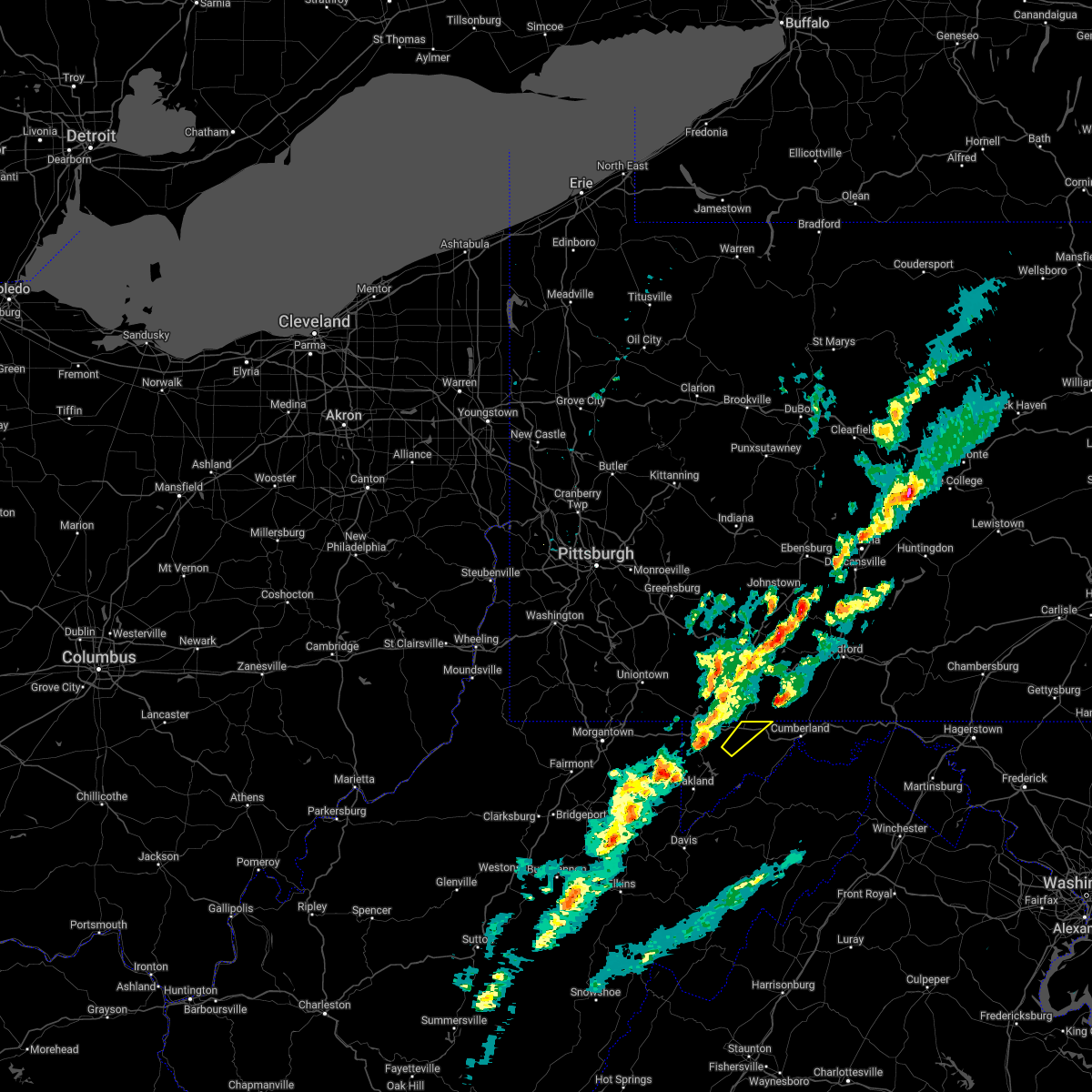 The severe thunderstorm warning for northeastern garrett county will expire at 200 pm edt, the storm which prompted the warning has moved out of the area. therefore, the warning will be allowed to expire. The severe thunderstorm warning for northeastern garrett county will expire at 200 pm edt, the storm which prompted the warning has moved out of the area. therefore, the warning will be allowed to expire.
|
| 3/31/2022 1:34 PM EDT |
 At 133 pm edt, a severe thunderstorm was located near terra alta, moving northeast at 45 mph (radar indicated). Hazards include 60 mph wind gusts. Damaging winds will cause some trees and large branches to fall. this could injure those outdoors, as well as damage homes and vehicles. roadways may become blocked by downed trees. localized power outages are possible. Unsecured light objects may become projectiles. At 133 pm edt, a severe thunderstorm was located near terra alta, moving northeast at 45 mph (radar indicated). Hazards include 60 mph wind gusts. Damaging winds will cause some trees and large branches to fall. this could injure those outdoors, as well as damage homes and vehicles. roadways may become blocked by downed trees. localized power outages are possible. Unsecured light objects may become projectiles.
|
| 3/31/2022 1:24 PM EDT |
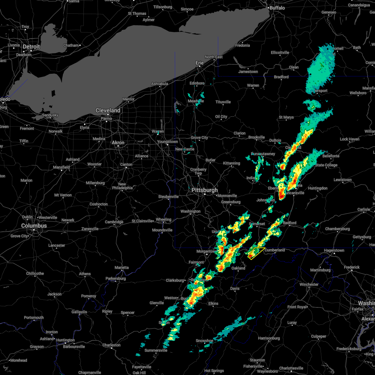 At 124 pm edt, a severe thunderstorm was located near grantsville, or near bittinger, moving northeast at 45 mph (radar indicated). Hazards include 60 mph wind gusts. Damaging winds will cause some trees and large branches to fall. this could injure those outdoors, as well as damage homes and vehicles. roadways may become blocked by downed trees. localized power outages are possible. Unsecured light objects may become projectiles. At 124 pm edt, a severe thunderstorm was located near grantsville, or near bittinger, moving northeast at 45 mph (radar indicated). Hazards include 60 mph wind gusts. Damaging winds will cause some trees and large branches to fall. this could injure those outdoors, as well as damage homes and vehicles. roadways may become blocked by downed trees. localized power outages are possible. Unsecured light objects may become projectiles.
|
| 3/7/2022 5:29 PM EST |
 At 528 pm est, severe thunderstorms were located along a line extending from near mount davis to 6 miles northwest of thomas, moving east at 50 mph (radar indicated). Hazards include 60 mph wind gusts. Damaging winds will cause some trees and large branches to fall. this could injure those outdoors, as well as damage homes and vehicles. roadways may become blocked by downed trees. localized power outages are possible. unsecured light objects may become projectiles. locations impacted include, frostburg, keyser, mountain lake park, oakland, westernport, bayard, bittinger, la vale, lonaconing, piedmont, grantsville, loch lynn heights, friendsville, deer park, accident, elk garden, kitzmiller, cresaptown, eckhart mines and mount savage. hail threat, radar indicated max hail size, <. 75 in wind threat, radar indicated max wind gust, 60 mph. At 528 pm est, severe thunderstorms were located along a line extending from near mount davis to 6 miles northwest of thomas, moving east at 50 mph (radar indicated). Hazards include 60 mph wind gusts. Damaging winds will cause some trees and large branches to fall. this could injure those outdoors, as well as damage homes and vehicles. roadways may become blocked by downed trees. localized power outages are possible. unsecured light objects may become projectiles. locations impacted include, frostburg, keyser, mountain lake park, oakland, westernport, bayard, bittinger, la vale, lonaconing, piedmont, grantsville, loch lynn heights, friendsville, deer park, accident, elk garden, kitzmiller, cresaptown, eckhart mines and mount savage. hail threat, radar indicated max hail size, <. 75 in wind threat, radar indicated max wind gust, 60 mph.
|
| 3/7/2022 5:27 PM EST |
 At 527 pm est, severe thunderstorms were located along a line extending from prince gallitzin state park to ogletown to meyersdale, moving east at 60 mph (trained weather spotters). Hazards include 60 mph wind gusts. expect damage to roofs, siding, and trees At 527 pm est, severe thunderstorms were located along a line extending from prince gallitzin state park to ogletown to meyersdale, moving east at 60 mph (trained weather spotters). Hazards include 60 mph wind gusts. expect damage to roofs, siding, and trees
|
| 3/7/2022 5:02 PM EST |
 At 501 pm est, severe thunderstorms were located along a line extending from near farmington to 10 miles east of philippi, moving east at 50 mph (radar indicated). Hazards include 60 mph wind gusts. Damaging winds will cause some trees and large branches to fall. this could injure those outdoors, as well as damage homes and vehicles. roadways may become blocked by downed trees. localized power outages are possible. Unsecured light objects may become projectiles. At 501 pm est, severe thunderstorms were located along a line extending from near farmington to 10 miles east of philippi, moving east at 50 mph (radar indicated). Hazards include 60 mph wind gusts. Damaging winds will cause some trees and large branches to fall. this could injure those outdoors, as well as damage homes and vehicles. roadways may become blocked by downed trees. localized power outages are possible. Unsecured light objects may become projectiles.
|
| 3/7/2022 4:52 PM EST |
 At 451 pm est, severe thunderstorms were located along a line extending from near indiana to ligonier to near uniontown, moving east at 50 mph (radar indicated). Hazards include 60 mph wind gusts. expect damage to roofs, siding, and trees At 451 pm est, severe thunderstorms were located along a line extending from near indiana to ligonier to near uniontown, moving east at 50 mph (radar indicated). Hazards include 60 mph wind gusts. expect damage to roofs, siding, and trees
|
| 7/13/2021 7:03 PM EDT |
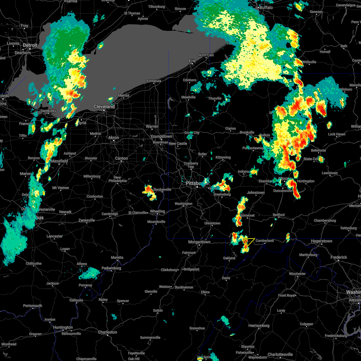 At 655 pm edt, a severe thunderstorm was located over grantsville, or 7 miles northeast of bittinger, moving northeast at 25 mph (radar indicated). Hazards include 60 mph wind gusts and quarter size hail. Damaging winds will cause some trees and large branches to fall. this could injure those outdoors, as well as damage homes and vehicles. roadways may become blocked by downed trees. localized power outages are possible. Unsecured light objects may become projectiles. At 655 pm edt, a severe thunderstorm was located over grantsville, or 7 miles northeast of bittinger, moving northeast at 25 mph (radar indicated). Hazards include 60 mph wind gusts and quarter size hail. Damaging winds will cause some trees and large branches to fall. this could injure those outdoors, as well as damage homes and vehicles. roadways may become blocked by downed trees. localized power outages are possible. Unsecured light objects may become projectiles.
|
| 7/13/2021 6:55 PM EDT |
 At 655 pm edt, a severe thunderstorm was located over grantsville, or 7 miles northeast of bittinger, moving northeast at 25 mph (radar indicated). Hazards include 60 mph wind gusts and quarter size hail. Damaging winds will cause some trees and large branches to fall. this could injure those outdoors, as well as damage homes and vehicles. roadways may become blocked by downed trees. localized power outages are possible. Unsecured light objects may become projectiles. At 655 pm edt, a severe thunderstorm was located over grantsville, or 7 miles northeast of bittinger, moving northeast at 25 mph (radar indicated). Hazards include 60 mph wind gusts and quarter size hail. Damaging winds will cause some trees and large branches to fall. this could injure those outdoors, as well as damage homes and vehicles. roadways may become blocked by downed trees. localized power outages are possible. Unsecured light objects may become projectiles.
|
| 7/13/2021 5:06 PM EDT |
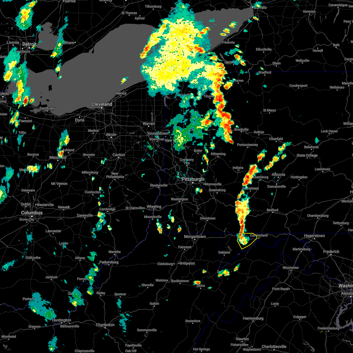 The severe thunderstorm warning for northwestern allegany and northeastern garrett counties will expire at 515 pm edt, the storms which prompted the warning have weakened below severe limits, and have exited the warned area. therefore, the warning will be allowed to expire. The severe thunderstorm warning for northwestern allegany and northeastern garrett counties will expire at 515 pm edt, the storms which prompted the warning have weakened below severe limits, and have exited the warned area. therefore, the warning will be allowed to expire.
|
| 7/13/2021 4:56 PM EDT |
 At 456 pm edt, severe thunderstorms were located along a line extending from near grantsville to westernport, moving northeast at 30 mph (radar indicated). Hazards include 60 mph wind gusts and quarter size hail. Damaging winds will cause some trees and large branches to fall. this could injure those outdoors, as well as damage homes and vehicles. roadways may become blocked by downed trees. localized power outages are possible. unsecured light objects may become projectiles. Locations impacted include, frostburg, la vale, lonaconing, cresaptown, eckhart mines, mount savage, barton, midland, midlothian, franklin, woodland, merrill, new germany, piney grove and dogwood flats. At 456 pm edt, severe thunderstorms were located along a line extending from near grantsville to westernport, moving northeast at 30 mph (radar indicated). Hazards include 60 mph wind gusts and quarter size hail. Damaging winds will cause some trees and large branches to fall. this could injure those outdoors, as well as damage homes and vehicles. roadways may become blocked by downed trees. localized power outages are possible. unsecured light objects may become projectiles. Locations impacted include, frostburg, la vale, lonaconing, cresaptown, eckhart mines, mount savage, barton, midland, midlothian, franklin, woodland, merrill, new germany, piney grove and dogwood flats.
|
| 7/13/2021 4:46 PM EDT |
 At 446 pm edt, a severe thunderstorm was located near westernport, moving northeast at 25 mph (radar indicated). Hazards include 60 mph wind gusts and quarter size hail. Damaging winds will cause some trees and large branches to fall. this could injure those outdoors, as well as damage homes and vehicles. roadways may become blocked by downed trees. localized power outages are possible. unsecured light objects may become projectiles. Locations impacted include, cumberland, frostburg, westernport, bel air, la vale, lonaconing, piedmont, cresaptown, eckhart mines, mount savage, rawlings, barton, midland, midlothian, franklin, woodland, luke, merrill, big run state park and new germany. At 446 pm edt, a severe thunderstorm was located near westernport, moving northeast at 25 mph (radar indicated). Hazards include 60 mph wind gusts and quarter size hail. Damaging winds will cause some trees and large branches to fall. this could injure those outdoors, as well as damage homes and vehicles. roadways may become blocked by downed trees. localized power outages are possible. unsecured light objects may become projectiles. Locations impacted include, cumberland, frostburg, westernport, bel air, la vale, lonaconing, piedmont, cresaptown, eckhart mines, mount savage, rawlings, barton, midland, midlothian, franklin, woodland, luke, merrill, big run state park and new germany.
|
| 7/13/2021 4:40 PM EDT |
 At 440 pm edt, a severe thunderstorm was located over piedmont, or near westernport, moving northeast at 30 mph (radar indicated). Hazards include 60 mph wind gusts and quarter size hail. Damaging winds will cause some trees and large branches to fall. this could injure those outdoors, as well as damage homes and vehicles. roadways may become blocked by downed trees. localized power outages are possible. unsecured light objects may become projectiles. Locations impacted include, cumberland, frostburg, westernport, bel air, la vale, lonaconing, piedmont, grantsville, ridgeley, cresaptown, potomac park, wiley ford, eckhart mines, mount savage, rawlings, barton, midland, midlothian, franklin and woodland. At 440 pm edt, a severe thunderstorm was located over piedmont, or near westernport, moving northeast at 30 mph (radar indicated). Hazards include 60 mph wind gusts and quarter size hail. Damaging winds will cause some trees and large branches to fall. this could injure those outdoors, as well as damage homes and vehicles. roadways may become blocked by downed trees. localized power outages are possible. unsecured light objects may become projectiles. Locations impacted include, cumberland, frostburg, westernport, bel air, la vale, lonaconing, piedmont, grantsville, ridgeley, cresaptown, potomac park, wiley ford, eckhart mines, mount savage, rawlings, barton, midland, midlothian, franklin and woodland.
|
| 7/13/2021 4:33 PM EDT |
 At 433 pm edt, a severe thunderstorm was located near elk garden, or near westernport, moving northeast at 30 mph (radar indicated). Hazards include 60 mph wind gusts and quarter size hail. Damaging winds will cause some trees and large branches to fall. this could injure those outdoors, as well as damage homes and vehicles. roadways may become blocked by downed trees. localized power outages are possible. Unsecured light objects may become projectiles. At 433 pm edt, a severe thunderstorm was located near elk garden, or near westernport, moving northeast at 30 mph (radar indicated). Hazards include 60 mph wind gusts and quarter size hail. Damaging winds will cause some trees and large branches to fall. this could injure those outdoors, as well as damage homes and vehicles. roadways may become blocked by downed trees. localized power outages are possible. Unsecured light objects may become projectiles.
|
| 6/21/2021 6:46 PM EDT |
 At 645 pm edt, a severe thunderstorm was located over terra alta, moving east at 50 mph (radar indicated). Hazards include 60 mph wind gusts and quarter size hail. Damaging winds will cause some trees and large branches to fall. this could injure those outdoors, as well as damage homes and vehicles. roadways may become blocked by downed trees. localized power outages are possible. Unsecured light objects may become projectiles. At 645 pm edt, a severe thunderstorm was located over terra alta, moving east at 50 mph (radar indicated). Hazards include 60 mph wind gusts and quarter size hail. Damaging winds will cause some trees and large branches to fall. this could injure those outdoors, as well as damage homes and vehicles. roadways may become blocked by downed trees. localized power outages are possible. Unsecured light objects may become projectiles.
|
| 11/15/2020 5:21 PM EST |
 At 519 pm est, gradient winds from a passing cold front will continue to produce sporadic gusts around and above 60 mph (radar indicated). Hazards include 60 mph wind gusts. Damaging gradient winds will cause some trees and large branches to fall. this could injure those outdoors, as well as damage homes and vehicles. roadways may become blocked by downed trees. localized power outages are possible. unsecured light objects may become projectiles. Locations impacted include, cumberland, frostburg, keyser, westernport, romney, hancock, bel air, paw paw, bayard, la vale, fort ashby, lonaconing, piedmont, berkeley springs, elk garden, kitzmiller, ridgeley, cresaptown, potomac park and wiley ford. At 519 pm est, gradient winds from a passing cold front will continue to produce sporadic gusts around and above 60 mph (radar indicated). Hazards include 60 mph wind gusts. Damaging gradient winds will cause some trees and large branches to fall. this could injure those outdoors, as well as damage homes and vehicles. roadways may become blocked by downed trees. localized power outages are possible. unsecured light objects may become projectiles. Locations impacted include, cumberland, frostburg, keyser, westernport, romney, hancock, bel air, paw paw, bayard, la vale, fort ashby, lonaconing, piedmont, berkeley springs, elk garden, kitzmiller, ridgeley, cresaptown, potomac park and wiley ford.
|
| 11/15/2020 4:58 PM EST |
 At 456 pm est, gradient winds from a passing cold front were located along a line extending from near frostburg to near thomas, moving east at 35 mph (radar indicated). Hazards include 60 mph wind gusts. Damaging gradint winds from a passing cold front will cause some trees and large branches to fall. this could injure those outdoors, as well as damage homes and vehicles. roadways may become blocked by downed trees. localized power outages are possible. Unsecured light objects may become projectiles. At 456 pm est, gradient winds from a passing cold front were located along a line extending from near frostburg to near thomas, moving east at 35 mph (radar indicated). Hazards include 60 mph wind gusts. Damaging gradint winds from a passing cold front will cause some trees and large branches to fall. this could injure those outdoors, as well as damage homes and vehicles. roadways may become blocked by downed trees. localized power outages are possible. Unsecured light objects may become projectiles.
|
| 11/15/2020 3:57 PM EST |
 At 356 pm est, severe thunderstorms were located along a line extending from 7 miles northeast of farmington to 9 miles southwest of friendsville to near newburg, moving east at 40 mph. this storm has a history of producing wind damage in monongalia county west virginia (radar indicated). Hazards include 60 mph wind gusts. Damaging winds will cause some trees and large branches to fall. this could injure those outdoors, as well as damage homes and vehicles. roadways may become blocked by downed trees. localized power outages are possible. unsecured light objects may become projectiles. Locations impacted include, cumberland, frostburg, keyser, mountain lake park, oakland, westernport, bel air, bayard, bittinger, la vale, lonaconing, piedmont, grantsville, loch lynn heights, friendsville, deer park, accident, elk garden, kitzmiller and cresaptown. At 356 pm est, severe thunderstorms were located along a line extending from 7 miles northeast of farmington to 9 miles southwest of friendsville to near newburg, moving east at 40 mph. this storm has a history of producing wind damage in monongalia county west virginia (radar indicated). Hazards include 60 mph wind gusts. Damaging winds will cause some trees and large branches to fall. this could injure those outdoors, as well as damage homes and vehicles. roadways may become blocked by downed trees. localized power outages are possible. unsecured light objects may become projectiles. Locations impacted include, cumberland, frostburg, keyser, mountain lake park, oakland, westernport, bel air, bayard, bittinger, la vale, lonaconing, piedmont, grantsville, loch lynn heights, friendsville, deer park, accident, elk garden, kitzmiller and cresaptown.
|
| 11/15/2020 3:57 PM EST |
 At 337 pm est, severe thunderstorms were located along a line extending from near uniontown to 6 miles east of brookhaven to grafton, moving east at 40 mph (radar indicated). Hazards include 60 mph wind gusts. Damaging winds will cause some trees and large branches to fall. this could injure those outdoors, as well as damage homes and vehicles. roadways may become blocked by downed trees. localized power outages are possible. Unsecured light objects may become projectiles. At 337 pm est, severe thunderstorms were located along a line extending from near uniontown to 6 miles east of brookhaven to grafton, moving east at 40 mph (radar indicated). Hazards include 60 mph wind gusts. Damaging winds will cause some trees and large branches to fall. this could injure those outdoors, as well as damage homes and vehicles. roadways may become blocked by downed trees. localized power outages are possible. Unsecured light objects may become projectiles.
|
| 11/15/2020 3:46 PM EST |
 At 345 pm est, severe thunderstorms were located along a line extending from near black lick to 7 miles south of farmington, moving east at 60 mph (radar indicated). Hazards include 60 mph wind gusts. expect damage to trees, roofs, and siding At 345 pm est, severe thunderstorms were located along a line extending from near black lick to 7 miles south of farmington, moving east at 60 mph (radar indicated). Hazards include 60 mph wind gusts. expect damage to trees, roofs, and siding
|
| 11/15/2020 3:38 PM EST |
 At 337 pm est, severe thunderstorms were located along a line extending from near uniontown to 6 miles east of brookhaven to grafton, moving east at 40 mph (radar indicated). Hazards include 60 mph wind gusts. Damaging winds will cause some trees and large branches to fall. this could injure those outdoors, as well as damage homes and vehicles. roadways may become blocked by downed trees. localized power outages are possible. Unsecured light objects may become projectiles. At 337 pm est, severe thunderstorms were located along a line extending from near uniontown to 6 miles east of brookhaven to grafton, moving east at 40 mph (radar indicated). Hazards include 60 mph wind gusts. Damaging winds will cause some trees and large branches to fall. this could injure those outdoors, as well as damage homes and vehicles. roadways may become blocked by downed trees. localized power outages are possible. Unsecured light objects may become projectiles.
|
| 8/27/2020 8:24 PM EDT |
 At 824 pm edt, severe thunderstorms were located along a line extending from near meyersdale to near ursina to fairdale to near waynesburg, moving southeast at 30 mph (radar). Hazards include wind gusts to 60 mph. Expect damage to trees and power lines, resulting in some power outages. locations impacted include, morgantown, uniontown, waynesburg, westover, star city, bittinger, masontown, farmington, fairdale, jefferson boro, point marion, granville, this includes the following highways, interstate 68 in maryland between mile markers 1 and 30. interstate 68 in west virginia between mile markers 4 and 32. interstate 79 in pennsylvania between mile markers 0 and 20. Interstate 79 in west virginia between mile markers 152 and 160. At 824 pm edt, severe thunderstorms were located along a line extending from near meyersdale to near ursina to fairdale to near waynesburg, moving southeast at 30 mph (radar). Hazards include wind gusts to 60 mph. Expect damage to trees and power lines, resulting in some power outages. locations impacted include, morgantown, uniontown, waynesburg, westover, star city, bittinger, masontown, farmington, fairdale, jefferson boro, point marion, granville, this includes the following highways, interstate 68 in maryland between mile markers 1 and 30. interstate 68 in west virginia between mile markers 4 and 32. interstate 79 in pennsylvania between mile markers 0 and 20. Interstate 79 in west virginia between mile markers 152 and 160.
|
| 8/27/2020 8:13 PM EDT |
 At 813 pm edt, severe thunderstorms were located along a line extending from near new centerville to near ursina to near fredericktown-millsboro to 11 miles northeast of cameron, moving southeast at 30 mph (radar). Hazards include wind gusts to 60 mph. Expect damage to trees and power lines, resulting in some power outages. locations impacted include, morgantown, uniontown, connellsville, waynesburg, westover, star city, valley grove, bittinger, california, masontown, bentleyville, brownsville, this includes the following highways, interstate 68 in maryland between mile markers 1 and 30. interstate 68 in west virginia between mile markers 4 and 32. interstate 70 in west virginia between mile markers 11 and 14. interstate 70 in pennsylvania between mile markers 0 and 2, and between mile markers 37 and 39. interstate 79 in pennsylvania between mile markers 0 and 28. Interstate 79 in west virginia between mile markers 152 and 160. At 813 pm edt, severe thunderstorms were located along a line extending from near new centerville to near ursina to near fredericktown-millsboro to 11 miles northeast of cameron, moving southeast at 30 mph (radar). Hazards include wind gusts to 60 mph. Expect damage to trees and power lines, resulting in some power outages. locations impacted include, morgantown, uniontown, connellsville, waynesburg, westover, star city, valley grove, bittinger, california, masontown, bentleyville, brownsville, this includes the following highways, interstate 68 in maryland between mile markers 1 and 30. interstate 68 in west virginia between mile markers 4 and 32. interstate 70 in west virginia between mile markers 11 and 14. interstate 70 in pennsylvania between mile markers 0 and 2, and between mile markers 37 and 39. interstate 79 in pennsylvania between mile markers 0 and 28. Interstate 79 in west virginia between mile markers 152 and 160.
|
| 8/27/2020 7:55 PM EDT |
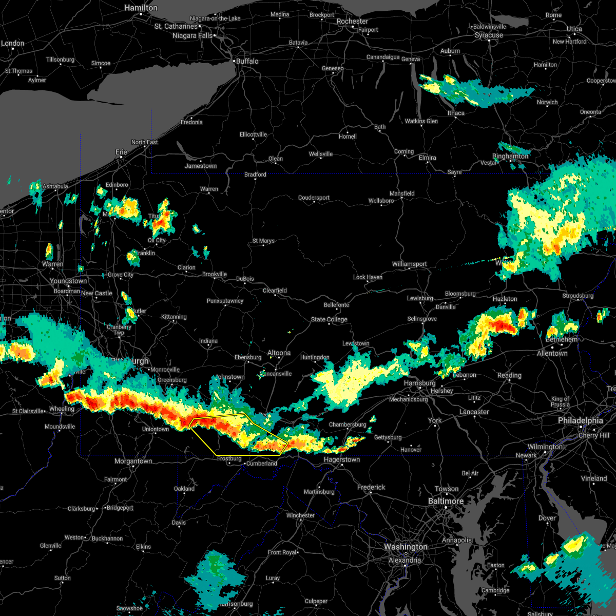 At 755 pm edt, severe thunderstorms were located along a line extending from locust grove to near inglesmith to near frostburg, moving southeast at 40 mph (radar indicated). Hazards include 60 mph wind gusts and quarter size hail. Hail damage to vehicles is expected. expect wind damage to trees, roofs, and siding. locations impacted include, somerset, meyersdale, berlin, friedens, buffalo mills, new centerville, lake gordon, inglesmith, hyndman, rockwood, salisbury, garrett, indian lake, shanksville, wellersburg, new baltimore, rainsburg, casselman, callimont and seven springs. This includes the pennsylvania turnpike from mile markers 109 to 133. At 755 pm edt, severe thunderstorms were located along a line extending from locust grove to near inglesmith to near frostburg, moving southeast at 40 mph (radar indicated). Hazards include 60 mph wind gusts and quarter size hail. Hail damage to vehicles is expected. expect wind damage to trees, roofs, and siding. locations impacted include, somerset, meyersdale, berlin, friedens, buffalo mills, new centerville, lake gordon, inglesmith, hyndman, rockwood, salisbury, garrett, indian lake, shanksville, wellersburg, new baltimore, rainsburg, casselman, callimont and seven springs. This includes the pennsylvania turnpike from mile markers 109 to 133.
|
| 8/27/2020 7:40 PM EDT |
 At 739 pm edt, severe thunderstorms were located along a line extending from 6 miles northeast of seven springs to near connellsville to near east washington to near west liberty, moving southeast at 30 mph (radar). Hazards include wind gusts to 60 mph. expect damage to trees and power lines, resulting in some power outages At 739 pm edt, severe thunderstorms were located along a line extending from 6 miles northeast of seven springs to near connellsville to near east washington to near west liberty, moving southeast at 30 mph (radar). Hazards include wind gusts to 60 mph. expect damage to trees and power lines, resulting in some power outages
|
| 8/27/2020 7:09 PM EDT |
 At 709 pm edt, severe thunderstorms were located along a line extending from near osterburg to near central city to 7 miles northeast of seven springs, moving southeast at 40 mph (radar indicated). Hazards include 60 mph wind gusts and quarter size hail. Hail damage to vehicles is expected. Expect wind damage to trees, roofs, and siding. At 709 pm edt, severe thunderstorms were located along a line extending from near osterburg to near central city to 7 miles northeast of seven springs, moving southeast at 40 mph (radar indicated). Hazards include 60 mph wind gusts and quarter size hail. Hail damage to vehicles is expected. Expect wind damage to trees, roofs, and siding.
|
| 8/25/2020 5:43 PM EDT |
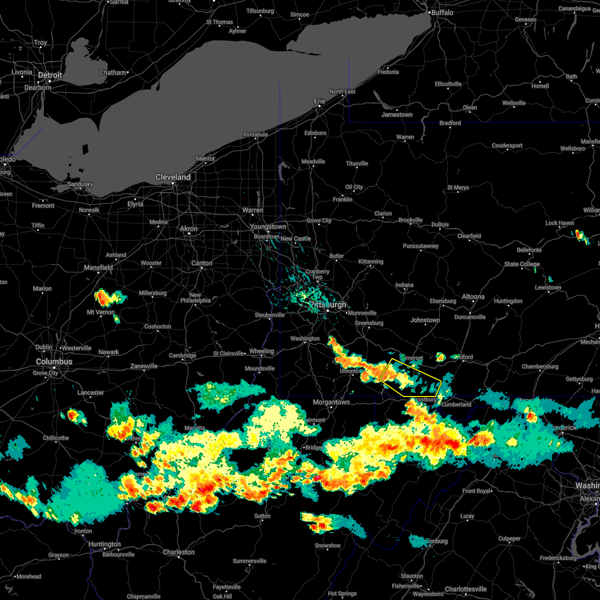 The severe thunderstorm warning for southern somerset county will expire at 545 pm edt, the storm which prompted the warning has weakened below severe limits, and no longer poses an immediate threat to life or property. therefore, the warning will be allowed to expire. additional showers and thunderstorms will track across the area through 6:30 pm, and gusty winds are still possible. a severe thunderstorm watch remains in effect until 1100 pm edt for south central pennsylvania. The severe thunderstorm warning for southern somerset county will expire at 545 pm edt, the storm which prompted the warning has weakened below severe limits, and no longer poses an immediate threat to life or property. therefore, the warning will be allowed to expire. additional showers and thunderstorms will track across the area through 6:30 pm, and gusty winds are still possible. a severe thunderstorm watch remains in effect until 1100 pm edt for south central pennsylvania.
|
| 8/25/2020 5:19 PM EDT |
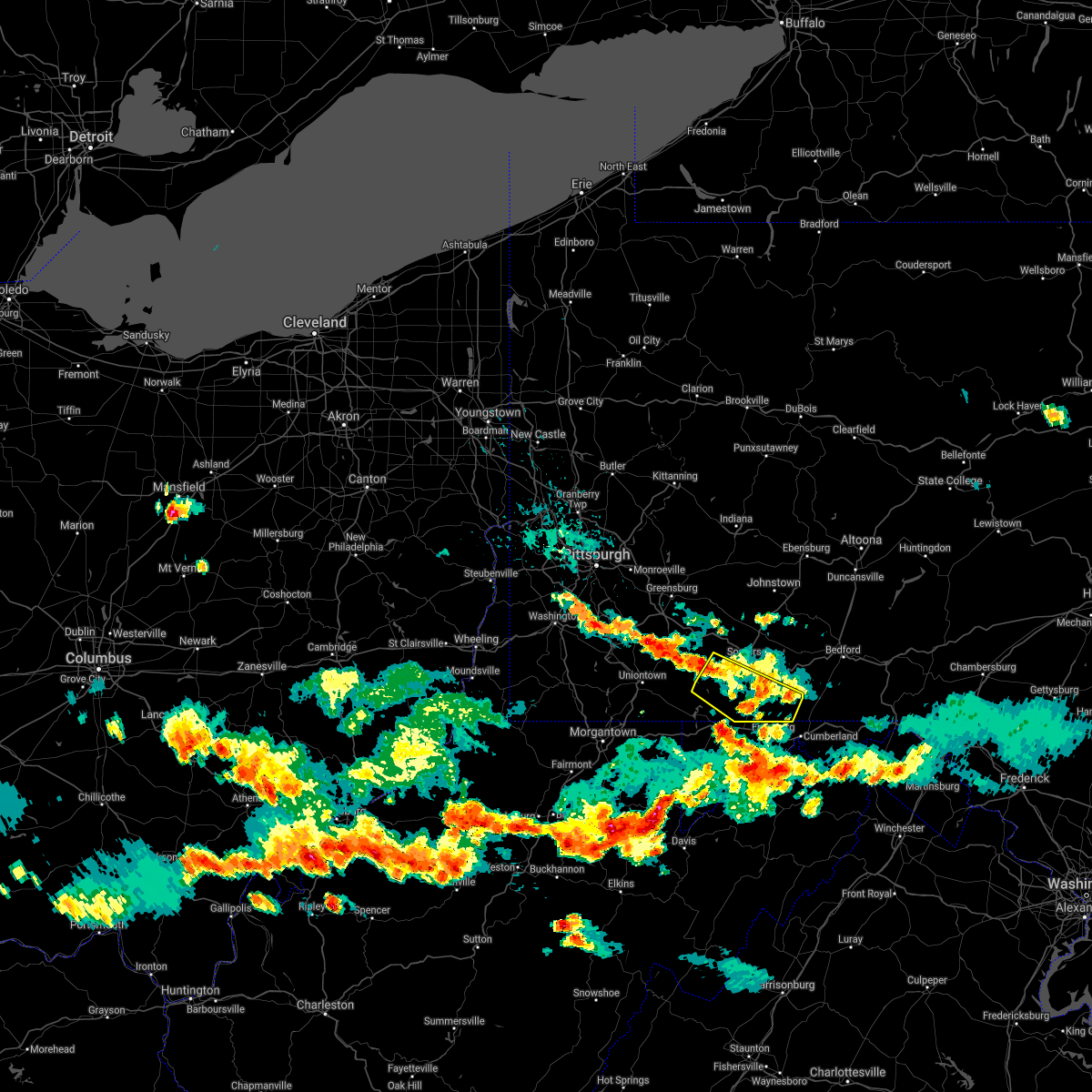 At 519 pm edt, a severe thunderstorm was located near seven springs, moving southeast at 40 mph (radar indicated). Hazards include 60 mph wind gusts and penny size hail. Expect damage to trees, roofs, and siding. Locations impacted include, meyersdale, berlin, ursina, new centerville, mount davis, rockwood, salisbury, garrett, wellersburg, casselman, callimont and seven springs. At 519 pm edt, a severe thunderstorm was located near seven springs, moving southeast at 40 mph (radar indicated). Hazards include 60 mph wind gusts and penny size hail. Expect damage to trees, roofs, and siding. Locations impacted include, meyersdale, berlin, ursina, new centerville, mount davis, rockwood, salisbury, garrett, wellersburg, casselman, callimont and seven springs.
|
| 8/25/2020 4:48 PM EDT |
 At 448 pm edt, a severe thunderstorm was located over bittinger, moving southeast at 40 mph (radar). Hazards include wind gusts to 60 mph. expect damage to trees and power lines, resulting in some power outages At 448 pm edt, a severe thunderstorm was located over bittinger, moving southeast at 40 mph (radar). Hazards include wind gusts to 60 mph. expect damage to trees and power lines, resulting in some power outages
|
| 8/25/2020 4:21 PM EDT |
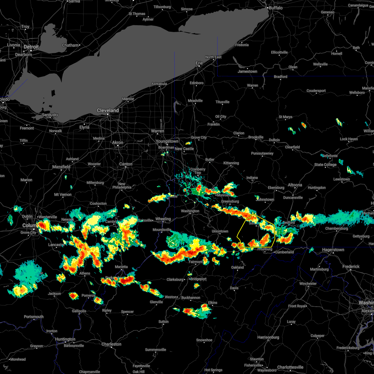 At 421 pm edt, severe thunderstorms were located along a line extending from near new stanton to near acosta, moving east at 25 mph (radar indicated). Hazards include 60 mph wind gusts and quarter size hail. Hail damage to vehicles is expected. Expect wind damage to trees, roofs, and siding. At 421 pm edt, severe thunderstorms were located along a line extending from near new stanton to near acosta, moving east at 25 mph (radar indicated). Hazards include 60 mph wind gusts and quarter size hail. Hail damage to vehicles is expected. Expect wind damage to trees, roofs, and siding.
|
| 4/13/2020 4:56 AM EDT |
 The severe thunderstorm warning for garrett and southeastern tucker counties will expire at 500 am edt, the shower and storms which prompted the warning have moved out of the area; therefore, the warning will be allowed to expire. however gusty wind can be expected through today. high wind warnings and advisories have been issued for today. The severe thunderstorm warning for garrett and southeastern tucker counties will expire at 500 am edt, the shower and storms which prompted the warning have moved out of the area; therefore, the warning will be allowed to expire. however gusty wind can be expected through today. high wind warnings and advisories have been issued for today.
|
| 4/13/2020 4:43 AM EDT |
 At 442 am edt, the back end of severe showers and isolated thunderstorms was located along a line extending from near accident to near thomas, moving northeast at 50 mph (radar). Hazards include wind gusts to 60 mph. Expect damage to trees and power lines, resulting in some power outages. Locations impacted include, mountain lake park, oakland, davis, thomas, bittinger, grantsville, loch lynn heights, deer park, accident, elk, canaan valley state park, jennings, this includes interstate 68 in maryland between mile markers 10 and 29. At 442 am edt, the back end of severe showers and isolated thunderstorms was located along a line extending from near accident to near thomas, moving northeast at 50 mph (radar). Hazards include wind gusts to 60 mph. Expect damage to trees and power lines, resulting in some power outages. Locations impacted include, mountain lake park, oakland, davis, thomas, bittinger, grantsville, loch lynn heights, deer park, accident, elk, canaan valley state park, jennings, this includes interstate 68 in maryland between mile markers 10 and 29.
|
| 4/13/2020 4:31 AM EDT |
 At 430 am edt, the back end of severe showers and isolated thunderstorms was located along a line extending from near friendsville to 8 miles northwest of parsons, moving northeast at 55 mph (radar). Hazards include wind gusts to 60 mph east of that line. Expect damage to trees and power lines, resulting in some power outages. Locations impacted include, mountain lake park, oakland, parsons, terra alta, davis, thomas, rowlesburg, bittinger, grantsville, loch lynn heights, friendsville, deer park, this includes interstate 68 in maryland between mile markers 1 and 29. At 430 am edt, the back end of severe showers and isolated thunderstorms was located along a line extending from near friendsville to 8 miles northwest of parsons, moving northeast at 55 mph (radar). Hazards include wind gusts to 60 mph east of that line. Expect damage to trees and power lines, resulting in some power outages. Locations impacted include, mountain lake park, oakland, parsons, terra alta, davis, thomas, rowlesburg, bittinger, grantsville, loch lynn heights, friendsville, deer park, this includes interstate 68 in maryland between mile markers 1 and 29.
|
| 4/13/2020 4:17 AM EDT |
 At 414 am edt, the back end of severe showers and isolated thunderstorms was located along a line extending from 9 miles west of friendsville to near philippi, moving northeast at 60 mph (radar). Hazards include wind gusts to 60 mph in advance of that line. Expect damage to trees and power lines, resulting in some power outages. locations impacted include, kingwood, mountain lake park, oakland, parsons, terra alta, davis, thomas, rowlesburg, bittinger, grantsville, loch lynn heights, friendsville, this includes the following highways, interstate 68 in maryland between mile markers 1 and 29. Interstate 68 in west virginia between mile markers 17 and 32. At 414 am edt, the back end of severe showers and isolated thunderstorms was located along a line extending from 9 miles west of friendsville to near philippi, moving northeast at 60 mph (radar). Hazards include wind gusts to 60 mph in advance of that line. Expect damage to trees and power lines, resulting in some power outages. locations impacted include, kingwood, mountain lake park, oakland, parsons, terra alta, davis, thomas, rowlesburg, bittinger, grantsville, loch lynn heights, friendsville, this includes the following highways, interstate 68 in maryland between mile markers 1 and 29. Interstate 68 in west virginia between mile markers 17 and 32.
|
| 4/13/2020 3:57 AM EDT |
 At 356 am edt, the back end of severe showers and isolated thunderstorms were located along a line extending from 6 miles northwest of newburg to near belington, moving northeast at 65 mph (radar). Hazards include wind gusts to 65 mph. expect damage to trees and power lines, resulting in some power outages At 356 am edt, the back end of severe showers and isolated thunderstorms were located along a line extending from 6 miles northwest of newburg to near belington, moving northeast at 65 mph (radar). Hazards include wind gusts to 65 mph. expect damage to trees and power lines, resulting in some power outages
|
| 4/8/2020 3:11 AM EDT |
 The severe thunderstorm warning for garrett and preston counties will expire at 315 am edt, the storm that prompted the warning has weakened below severe limits and no longer pose an immediate threat to life and property. therefore, the warning will be allowed to expire. a severe thunderstorm watch remains in effect until 600 am edt for western maryland, and northern and northeastern west virginia. The severe thunderstorm warning for garrett and preston counties will expire at 315 am edt, the storm that prompted the warning has weakened below severe limits and no longer pose an immediate threat to life and property. therefore, the warning will be allowed to expire. a severe thunderstorm watch remains in effect until 600 am edt for western maryland, and northern and northeastern west virginia.
|
| 4/8/2020 2:38 AM EDT |
 The severe thunderstorm warning for somerset and southwestern cambria counties will expire at 245 am edt, the storms which prompted the warning have moved out of the area. therefore, the warning will be allowed to expire. a severe thunderstorm watch remains in effect until 600 am edt for south central pennsylvania. to report severe weather, contact your nearest law enforcement agency. they will relay your report to the national weather service state college pa. The severe thunderstorm warning for somerset and southwestern cambria counties will expire at 245 am edt, the storms which prompted the warning have moved out of the area. therefore, the warning will be allowed to expire. a severe thunderstorm watch remains in effect until 600 am edt for south central pennsylvania. to report severe weather, contact your nearest law enforcement agency. they will relay your report to the national weather service state college pa.
|
| 4/8/2020 2:32 AM EDT |
 At 232 am edt, a severe thunderstorm was located near grantsville, or near frostburg, moving east at 55 mph (radar). Hazards include wind gusts to 60 mph and quarter-size hail. Minor hail damage to vehicles is possible. Expect wind damage to trees and power lines, resulting in some power outages. At 232 am edt, a severe thunderstorm was located near grantsville, or near frostburg, moving east at 55 mph (radar). Hazards include wind gusts to 60 mph and quarter-size hail. Minor hail damage to vehicles is possible. Expect wind damage to trees and power lines, resulting in some power outages.
|
| 4/8/2020 1:59 AM EDT |
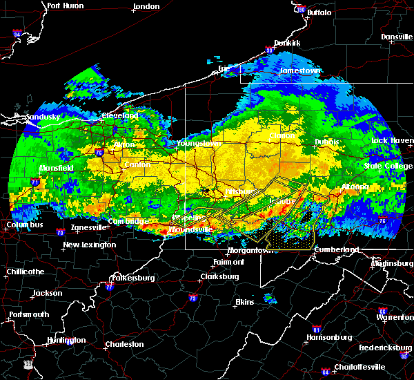 At 158 am edt, severe thunderstorms were located along a line extending from near vinco to near connellsville, moving southeast at 60 mph (radar indicated). Hazards include 70 mph wind gusts. Expect considerable tree damage. damage is likely to mobile homes, roofs, and outbuildings. locations impacted include, johnstown, somerset, westmont, windber, ebensburg, belmont, nanty-glo, portage, geistown, southmont, meyersdale, berlin, friedens, vinco, boswell, dale, east conemaugh, salix-beauty line park, davidsville and central city. This includes the pennsylvania turnpike from mile markers 100 to 130. At 158 am edt, severe thunderstorms were located along a line extending from near vinco to near connellsville, moving southeast at 60 mph (radar indicated). Hazards include 70 mph wind gusts. Expect considerable tree damage. damage is likely to mobile homes, roofs, and outbuildings. locations impacted include, johnstown, somerset, westmont, windber, ebensburg, belmont, nanty-glo, portage, geistown, southmont, meyersdale, berlin, friedens, vinco, boswell, dale, east conemaugh, salix-beauty line park, davidsville and central city. This includes the pennsylvania turnpike from mile markers 100 to 130.
|
| 4/8/2020 1:44 AM EDT |
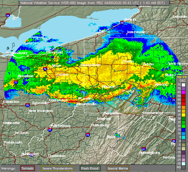 At 143 am edt, severe thunderstorms were located along a line extending from near black lick to youngwood, moving southeast at 60 mph (radar indicated). Hazards include 60 mph wind gusts. expect damage to trees, roofs, and siding At 143 am edt, severe thunderstorms were located along a line extending from near black lick to youngwood, moving southeast at 60 mph (radar indicated). Hazards include 60 mph wind gusts. expect damage to trees, roofs, and siding
|
| 8/20/2019 4:56 PM EDT |
 At 456 pm edt, a severe thunderstorm was located near frostburg, moving east at 5 mph (radar). Hazards include wind gusts to 60 mph. expect damage to trees and power lines, resulting in some power outages At 456 pm edt, a severe thunderstorm was located near frostburg, moving east at 5 mph (radar). Hazards include wind gusts to 60 mph. expect damage to trees and power lines, resulting in some power outages
|
| 4/14/2019 10:17 PM EDT |
 At 1017 pm edt, severe thunderstorms were located along a line extending from belsano to friedens to near frostburg, moving northeast at 60 mph (radar indicated). Hazards include 60 mph wind gusts and penny size hail. expect damage to roofs, siding, and trees At 1017 pm edt, severe thunderstorms were located along a line extending from belsano to friedens to near frostburg, moving northeast at 60 mph (radar indicated). Hazards include 60 mph wind gusts and penny size hail. expect damage to roofs, siding, and trees
|
| 8/21/2018 3:12 PM EDT |
 At 312 pm edt, a severe thunderstorm was located over frostburg, moving northeast at 25 mph (radar indicated). Hazards include 70 mph wind gusts. Expect considerable tree damage. damage is likely to mobile homes, roofs, and outbuildings. this severe thunderstorm will be near, lake gordon around 340 pm edt. clearville around 410 pm edt. other locations impacted by this severe thunderstorm include wellersburg, callimont, hyndman and rainsburg. this includes the following interstates, interstate 70 from mile markers 154 to 170. The pennsylvania turnpike from mile markers 148 to 159. At 312 pm edt, a severe thunderstorm was located over frostburg, moving northeast at 25 mph (radar indicated). Hazards include 70 mph wind gusts. Expect considerable tree damage. damage is likely to mobile homes, roofs, and outbuildings. this severe thunderstorm will be near, lake gordon around 340 pm edt. clearville around 410 pm edt. other locations impacted by this severe thunderstorm include wellersburg, callimont, hyndman and rainsburg. this includes the following interstates, interstate 70 from mile markers 154 to 170. The pennsylvania turnpike from mile markers 148 to 159.
|
| 8/21/2018 2:55 PM EDT |
 The severe thunderstorm warning for northern garrett county will expire at 300 pm edt, the storm that prompted the warning has moved out of the area. therefore, the warning will be allowed to expire. a severe thunderstorm watch remains in effect until 1000 pm edt for western maryland. The severe thunderstorm warning for northern garrett county will expire at 300 pm edt, the storm that prompted the warning has moved out of the area. therefore, the warning will be allowed to expire. a severe thunderstorm watch remains in effect until 1000 pm edt for western maryland.
|
| 8/21/2018 2:45 PM EDT |
 At 245 pm edt, a severe thunderstorm was located near grantsville, or 9 miles northeast of bittinger, moving northeast at 30 mph (radar). Hazards include wind gusts to 60 mph. Expect damage to trees and power lines, resulting in some power outages. Locations impacted include, bittinger, grantsville, accident, merrill, big run state park, new germany, piney grove, keysers ridge, jennings, this includes interstate 68 in maryland between mile markers 13 and 30. At 245 pm edt, a severe thunderstorm was located near grantsville, or 9 miles northeast of bittinger, moving northeast at 30 mph (radar). Hazards include wind gusts to 60 mph. Expect damage to trees and power lines, resulting in some power outages. Locations impacted include, bittinger, grantsville, accident, merrill, big run state park, new germany, piney grove, keysers ridge, jennings, this includes interstate 68 in maryland between mile markers 13 and 30.
|
| 8/21/2018 2:41 PM EDT |
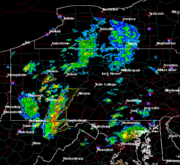 At 241 pm edt, a severe thunderstorm was located over berlin, moving northeast at 40 mph (radar indicated). Hazards include 70 mph wind gusts. Expect considerable tree damage. damage is likely to mobile homes, roofs, and outbuildings. this severe thunderstorm will remain over mainly rural areas of southeastern somerset county, including the following locations, wellersburg, salisbury, callimont, new baltimore, garrett, indian lake and shanksville. This includes the pennsylvania turnpike from mile markers 118 to 130. At 241 pm edt, a severe thunderstorm was located over berlin, moving northeast at 40 mph (radar indicated). Hazards include 70 mph wind gusts. Expect considerable tree damage. damage is likely to mobile homes, roofs, and outbuildings. this severe thunderstorm will remain over mainly rural areas of southeastern somerset county, including the following locations, wellersburg, salisbury, callimont, new baltimore, garrett, indian lake and shanksville. This includes the pennsylvania turnpike from mile markers 118 to 130.
|
| 8/21/2018 2:33 PM EDT |
 At 233 pm edt, a severe thunderstorm was located near bittinger, moving northeast at 30 mph (radar). Hazards include wind gusts to 60 mph. expect damage to trees and power lines, resulting in some power outages At 233 pm edt, a severe thunderstorm was located near bittinger, moving northeast at 30 mph (radar). Hazards include wind gusts to 60 mph. expect damage to trees and power lines, resulting in some power outages
|
| 8/21/2018 2:16 PM EDT |
 At 216 pm edt, a severe thunderstorm was located over mount davis, moving northeast at 40 mph (radar indicated). Hazards include 70 mph wind gusts. Expect considerable tree damage. damage is likely to mobile homes, roofs, and outbuildings. this severe thunderstorm will be near, mount davis around 220 pm edt. meyersdale around 230 pm edt. berlin around 240 pm edt. other locations impacted by this severe thunderstorm include wellersburg, salisbury, callimont, new baltimore, garrett, indian lake and shanksville. This includes the pennsylvania turnpike from mile markers 118 to 130. At 216 pm edt, a severe thunderstorm was located over mount davis, moving northeast at 40 mph (radar indicated). Hazards include 70 mph wind gusts. Expect considerable tree damage. damage is likely to mobile homes, roofs, and outbuildings. this severe thunderstorm will be near, mount davis around 220 pm edt. meyersdale around 230 pm edt. berlin around 240 pm edt. other locations impacted by this severe thunderstorm include wellersburg, salisbury, callimont, new baltimore, garrett, indian lake and shanksville. This includes the pennsylvania turnpike from mile markers 118 to 130.
|
| 5/14/2018 2:45 PM EDT |
 At 244 pm edt, a severe thunderstorm was located near farmington, moving southeast at 30 mph (radar indicated). Hazards include 60 mph wind gusts and quarter size hail. Hail damage to vehicles is possible. Expect wind damage to trees and power lines. At 244 pm edt, a severe thunderstorm was located near farmington, moving southeast at 30 mph (radar indicated). Hazards include 60 mph wind gusts and quarter size hail. Hail damage to vehicles is possible. Expect wind damage to trees and power lines.
|
| 8/22/2017 5:15 PM EDT |
 At 515 pm edt, severe thunderstorms were located along a line extending from near ligonier to 8 miles south of farmington, moving east at 40 mph (radar indicated). Hazards include 60 mph wind gusts. expect damage to trees and power lines At 515 pm edt, severe thunderstorms were located along a line extending from near ligonier to 8 miles south of farmington, moving east at 40 mph (radar indicated). Hazards include 60 mph wind gusts. expect damage to trees and power lines
|
| 8/19/2017 6:30 PM EDT |
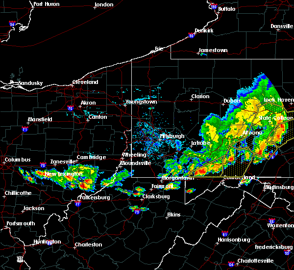 At 630 pm edt, severe thunderstorms were located along a line extending from near cessna to near berlin to 6 miles north of friendsville, moving southeast at 30 mph (radar indicated). Hazards include 60 mph wind gusts and nickel size hail. Expect damage to trees and power lines. Locations impacted include, berlin, ursina, meyersdale, mount davis, addison, indian lake, rockwood, wellersburg, salisbury and callimont. At 630 pm edt, severe thunderstorms were located along a line extending from near cessna to near berlin to 6 miles north of friendsville, moving southeast at 30 mph (radar indicated). Hazards include 60 mph wind gusts and nickel size hail. Expect damage to trees and power lines. Locations impacted include, berlin, ursina, meyersdale, mount davis, addison, indian lake, rockwood, wellersburg, salisbury and callimont.
|
| 8/19/2017 5:39 PM EDT |
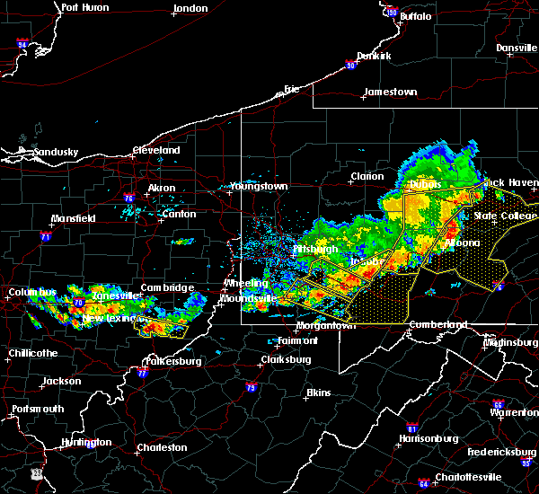 At 536 pm edt, severe thunderstorms were located along a line extending from near westmont to 7 miles southeast of mount pleasant to near brownsville, moving east at 35 mph (radar indicated). Hazards include 60 mph wind gusts and nickel size hail. Expect damage to trees and power lines. severe thunderstorms will be near, jerome around 540 pm edt. tire hill, seven springs and davidsville around 550 pm edt. windber around 600 pm edt. somerset, acosta and ogletown around 610 pm edt. other locations impacted by these severe thunderstorms include benson, addison, stoystown, indian lake, rockwood, wellersburg, salisbury, callimont and new baltimore. This includes the pennsylvania turnpike from mile markers 100 to 129. At 536 pm edt, severe thunderstorms were located along a line extending from near westmont to 7 miles southeast of mount pleasant to near brownsville, moving east at 35 mph (radar indicated). Hazards include 60 mph wind gusts and nickel size hail. Expect damage to trees and power lines. severe thunderstorms will be near, jerome around 540 pm edt. tire hill, seven springs and davidsville around 550 pm edt. windber around 600 pm edt. somerset, acosta and ogletown around 610 pm edt. other locations impacted by these severe thunderstorms include benson, addison, stoystown, indian lake, rockwood, wellersburg, salisbury, callimont and new baltimore. This includes the pennsylvania turnpike from mile markers 100 to 129.
|
| 6/23/2017 7:09 PM EDT |
 The severe thunderstorm warning for northeastern garrett county will expire at 715 pm edt, the storm that prompted the warning has weakened below severe limits and has exited the warned area. therefore, the warning will be allowed to expire. a severe thunderstorm watch remains in effect until 1000 pm edt for western maryland. The severe thunderstorm warning for northeastern garrett county will expire at 715 pm edt, the storm that prompted the warning has weakened below severe limits and has exited the warned area. therefore, the warning will be allowed to expire. a severe thunderstorm watch remains in effect until 1000 pm edt for western maryland.
|
| 6/23/2017 6:55 PM EDT |
 At 655 pm edt, a severe thunderstorm was located over grantsville, or near bittinger, moving east at 40 mph (radar). Hazards include 60 mph wind gusts. Expect damage to trees and power lines, resulting in some power outages. Locations impacted include, bittinger, grantsville, accident, merrill, new germany, keysers ridge, piney grove, jennings, this includes interstate 68 in maryland between mile markers 11 and 30. At 655 pm edt, a severe thunderstorm was located over grantsville, or near bittinger, moving east at 40 mph (radar). Hazards include 60 mph wind gusts. Expect damage to trees and power lines, resulting in some power outages. Locations impacted include, bittinger, grantsville, accident, merrill, new germany, keysers ridge, piney grove, jennings, this includes interstate 68 in maryland between mile markers 11 and 30.
|
| 6/23/2017 6:33 PM EDT |
 At 633 pm edt, a severe thunderstorm was located over friendsville, or 11 miles northwest of bittinger, moving east at 40 mph (radar). Hazards include 60 mph wind gusts. expect damage to trees and power lines, resulting in some power outages At 633 pm edt, a severe thunderstorm was located over friendsville, or 11 miles northwest of bittinger, moving east at 40 mph (radar). Hazards include 60 mph wind gusts. expect damage to trees and power lines, resulting in some power outages
|
| 5/30/2017 1:51 PM EDT |
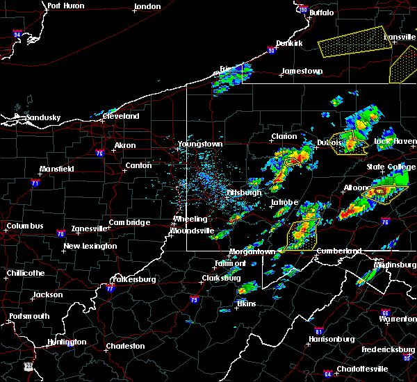 At 151 pm edt, severe thunderstorms were located along a line extending from near friedens to near meyersdale, moving east at 45 mph (radar indicated). Hazards include 60 mph wind gusts and quarter size hail. Hail damage to vehicles is possible. expect wind damage to trees and power lines. Locations impacted include, somerset, berlin, central city, friedens, meyersdale, stoystown, indian lake, wellersburg, salisbury and callimont. At 151 pm edt, severe thunderstorms were located along a line extending from near friedens to near meyersdale, moving east at 45 mph (radar indicated). Hazards include 60 mph wind gusts and quarter size hail. Hail damage to vehicles is possible. expect wind damage to trees and power lines. Locations impacted include, somerset, berlin, central city, friedens, meyersdale, stoystown, indian lake, wellersburg, salisbury and callimont.
|
| 5/30/2017 1:22 PM EDT |
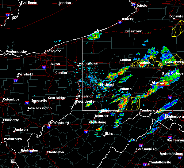 At 122 pm edt, severe thunderstorms were located along a line extending from seven springs to near ursina, moving east at 35 mph (radar indicated). Hazards include 60 mph wind gusts and quarter size hail. Hail damage to vehicles is possible. Expect wind damage to trees and power lines. At 122 pm edt, severe thunderstorms were located along a line extending from seven springs to near ursina, moving east at 35 mph (radar indicated). Hazards include 60 mph wind gusts and quarter size hail. Hail damage to vehicles is possible. Expect wind damage to trees and power lines.
|
| 5/1/2017 5:35 PM EDT |
 At 535 pm edt, a severe thunderstorm was located over tipton, moving northeast at 55 mph (radar indicated). Hazards include 70 mph wind gusts. Expect considerable tree damage. Damage is likely to mobile homes, roofs, and outbuildings. At 535 pm edt, a severe thunderstorm was located over tipton, moving northeast at 55 mph (radar indicated). Hazards include 70 mph wind gusts. Expect considerable tree damage. Damage is likely to mobile homes, roofs, and outbuildings.
|
| 5/1/2017 5:33 PM EDT |
 At 533 pm edt, a severe thunderstorm was located near frostburg, moving northeast at 65 mph (radar). Hazards include 60 mph wind gusts. Expect damage to trees and power lines, resulting in some power outages. Locations impacted include, grantsville, big run state park, new germany, merrill, piney grove, jennings, this includes interstate 68 in maryland between mile markers 19 and 30. At 533 pm edt, a severe thunderstorm was located near frostburg, moving northeast at 65 mph (radar). Hazards include 60 mph wind gusts. Expect damage to trees and power lines, resulting in some power outages. Locations impacted include, grantsville, big run state park, new germany, merrill, piney grove, jennings, this includes interstate 68 in maryland between mile markers 19 and 30.
|
| 5/1/2017 5:26 PM EDT |
 At 526 pm edt, severe thunderstorms were located along a line extending from 7 miles south of ligonier to near mount davis to near grantsville to near oakland, moving northeast at 55 mph (radar). Hazards include 60 mph wind gusts. Expect damage to trees and power lines, resulting in some power outages. Locations impacted include, mountain lake park, oakland, bittinger, grantsville, loch lynn heights, deer park, merrill, jennings, deep creek lake state park, big run state park, new germany, piney grove, this includes interstate 68 in maryland between mile markers 15 and 30. At 526 pm edt, severe thunderstorms were located along a line extending from 7 miles south of ligonier to near mount davis to near grantsville to near oakland, moving northeast at 55 mph (radar). Hazards include 60 mph wind gusts. Expect damage to trees and power lines, resulting in some power outages. Locations impacted include, mountain lake park, oakland, bittinger, grantsville, loch lynn heights, deer park, merrill, jennings, deep creek lake state park, big run state park, new germany, piney grove, this includes interstate 68 in maryland between mile markers 15 and 30.
|
| 5/1/2017 5:19 PM EDT |
 At 519 pm edt, severe thunderstorms were located along a line extending from near seven springs to near ursina to near accident to 6 miles southeast of rowlesburg, moving northeast at 55 mph (radar). Hazards include 60 mph wind gusts. Expect damage to trees and power lines, resulting in some power outages. Locations impacted include, mountain lake park, oakland, thomas, bittinger, grantsville, loch lynn heights, deer park, accident, redhouse, hutton, gorman, jennings, this includes interstate 68 in maryland between mile markers 6 and 30. At 519 pm edt, severe thunderstorms were located along a line extending from near seven springs to near ursina to near accident to 6 miles southeast of rowlesburg, moving northeast at 55 mph (radar). Hazards include 60 mph wind gusts. Expect damage to trees and power lines, resulting in some power outages. Locations impacted include, mountain lake park, oakland, thomas, bittinger, grantsville, loch lynn heights, deer park, accident, redhouse, hutton, gorman, jennings, this includes interstate 68 in maryland between mile markers 6 and 30.
|
| 5/1/2017 5:15 PM EDT |
 At 515 pm edt, severe thunderstorms were located along a line extending from 7 miles east of south connellsville to near friendsville to 7 miles north of deer park to 8 miles north of parsons, moving northeast at 85 mph (radar). Hazards include 60 mph wind gusts. Expect damage to trees and power lines, resulting in some power outages. Locations impacted include, mountain lake park, oakland, parsons, davis, thomas, bittinger, grantsville, loch lynn heights, friendsville, deer park, accident, hendricks, this includes interstate 68 in maryland between mile markers 1 and 30. At 515 pm edt, severe thunderstorms were located along a line extending from 7 miles east of south connellsville to near friendsville to 7 miles north of deer park to 8 miles north of parsons, moving northeast at 85 mph (radar). Hazards include 60 mph wind gusts. Expect damage to trees and power lines, resulting in some power outages. Locations impacted include, mountain lake park, oakland, parsons, davis, thomas, bittinger, grantsville, loch lynn heights, friendsville, deer park, accident, hendricks, this includes interstate 68 in maryland between mile markers 1 and 30.
|
| 5/1/2017 5:03 PM EDT |
 At 503 pm edt, severe thunderstorms were located along a line extending from near farmington to 7 miles north of terra alta to near rowlesburg to near belington, moving northeast at 85 mph (radar). Hazards include 60 mph wind gusts. expect damage to trees and power lines, resulting in some power outages At 503 pm edt, severe thunderstorms were located along a line extending from near farmington to 7 miles north of terra alta to near rowlesburg to near belington, moving northeast at 85 mph (radar). Hazards include 60 mph wind gusts. expect damage to trees and power lines, resulting in some power outages
|
| 5/1/2017 5:01 PM EDT |
 At 500 pm edt, severe thunderstorms were located along a line extending from tire hill to near grantsville, moving northeast at 40 mph (radar indicated). Hazards include 70 mph wind gusts and quarter size hail. Hail damage to vehicles is expected. expect considerable tree damage. Wind damage is also likely to mobile homes, roofs, and outbuildings. At 500 pm edt, severe thunderstorms were located along a line extending from tire hill to near grantsville, moving northeast at 40 mph (radar indicated). Hazards include 70 mph wind gusts and quarter size hail. Hail damage to vehicles is expected. expect considerable tree damage. Wind damage is also likely to mobile homes, roofs, and outbuildings.
|
| 3/1/2017 11:51 AM EST |
 The severe thunderstorm warning for garrett, southeastern fayette, central tucker and southeastern preston counties will expire at noon est, the storms that prompted the warning have weakened below severe limits and have exited the warned area. therefore, the warning will be allowed to expire. The severe thunderstorm warning for garrett, southeastern fayette, central tucker and southeastern preston counties will expire at noon est, the storms that prompted the warning have weakened below severe limits and have exited the warned area. therefore, the warning will be allowed to expire.
|
| 3/1/2017 11:33 AM EST |
 At 1133 am est, severe thunderstorms were located along a line extending from near ursina to near thomas, moving east at 65 mph (radar). Hazards include 60 mph wind gusts. Expect damage to trees and power lines, resulting in some power outages. locations impacted include, mountain lake park, oakland, parsons, terra alta, davis, thomas, bittinger, grantsville, loch lynn heights, friendsville, deer park, accident, this includes the following highways, interstate 68 in maryland between mile markers 1 and 30. Interstate 68 in west virginia near mile marker 32. At 1133 am est, severe thunderstorms were located along a line extending from near ursina to near thomas, moving east at 65 mph (radar). Hazards include 60 mph wind gusts. Expect damage to trees and power lines, resulting in some power outages. locations impacted include, mountain lake park, oakland, parsons, terra alta, davis, thomas, bittinger, grantsville, loch lynn heights, friendsville, deer park, accident, this includes the following highways, interstate 68 in maryland between mile markers 1 and 30. Interstate 68 in west virginia near mile marker 32.
|
| 3/1/2017 11:11 AM EST |
 At 1110 am est, severe thunderstorms were located along a line extending from 7 miles east of point marion to near philippi, moving east at 65 mph (radar). Hazards include 60 mph wind gusts. expect damage to trees and power lines, resulting in some power outages At 1110 am est, severe thunderstorms were located along a line extending from 7 miles east of point marion to near philippi, moving east at 65 mph (radar). Hazards include 60 mph wind gusts. expect damage to trees and power lines, resulting in some power outages
|
| 2/12/2017 9:55 PM EST |
 The severe thunderstorm warning for garrett, southeastern monongalia, northern tucker and preston counties will expire at 1000 pm est, the storms that prompted the warning have moved out of the area. therefore, the warning will be allowed to expire. however gusty winds are still possible through the night. high wind warnings and wind advisories remain in effect. The severe thunderstorm warning for garrett, southeastern monongalia, northern tucker and preston counties will expire at 1000 pm est, the storms that prompted the warning have moved out of the area. therefore, the warning will be allowed to expire. however gusty winds are still possible through the night. high wind warnings and wind advisories remain in effect.
|
| 2/12/2017 9:28 PM EST |
 At 927 pm est, severe thunderstorms were located along a line extending from 7 miles north of la vale to newburg, moving east at 50 mph (radar and automated wind sensors). Hazards include 60 mph wind gusts. Expect damage to trees and power lines, resulting in some power outages. Locations impacted include, kingwood, mountain lake park, oakland, terra alta, davis, thomas, rowlesburg, bayard, bittinger, grantsville, loch lynn heights, deer park, this includes interstate 68 in maryland between mile markers 14 and 30. At 927 pm est, severe thunderstorms were located along a line extending from 7 miles north of la vale to newburg, moving east at 50 mph (radar and automated wind sensors). Hazards include 60 mph wind gusts. Expect damage to trees and power lines, resulting in some power outages. Locations impacted include, kingwood, mountain lake park, oakland, terra alta, davis, thomas, rowlesburg, bayard, bittinger, grantsville, loch lynn heights, deer park, this includes interstate 68 in maryland between mile markers 14 and 30.
|
| 2/12/2017 8:46 PM EST |
 At 846 pm est, severe thunderstorms were located along a line extending from 7 miles northwest of ursina to near mannington, moving east at 50 mph (radar). Hazards include 60 mph wind gusts. expect damage to trees and power lines, resulting in some power outages At 846 pm est, severe thunderstorms were located along a line extending from 7 miles northwest of ursina to near mannington, moving east at 50 mph (radar). Hazards include 60 mph wind gusts. expect damage to trees and power lines, resulting in some power outages
|
| 8/16/2016 8:04 PM EDT |
 At 804 pm edt, severe thunderstorms were located along a line extending from near central city to berlin to near bittinger, moving east at 50 mph (radar indicated). Hazards include 60 mph wind gusts. Expect damage to roofs. siding. And trees. At 804 pm edt, severe thunderstorms were located along a line extending from near central city to berlin to near bittinger, moving east at 50 mph (radar indicated). Hazards include 60 mph wind gusts. Expect damage to roofs. siding. And trees.
|
| 8/16/2016 7:07 PM EDT |
 At 707 pm edt, severe thunderstorms were located along a line extending from near westmont to near acosta to 10 miles southwest of farmington, moving east at 35 mph (radar indicated). Hazards include 60 mph wind gusts. Expect damage to roofs. siding. And trees. At 707 pm edt, severe thunderstorms were located along a line extending from near westmont to near acosta to 10 miles southwest of farmington, moving east at 35 mph (radar indicated). Hazards include 60 mph wind gusts. Expect damage to roofs. siding. And trees.
|
| 8/15/2016 2:45 PM EDT |
 At 245 pm edt, a severe thunderstorm was located over grantsville, or 8 miles northeast of bittinger, moving east at 30 mph (radar indicated). Hazards include 60 mph wind gusts and quarter size hail. Hail damage to vehicles is expected. expect wind damage to trees and power lines, resulting in some power outages. locations impacted include, grantsville, new germany, jennings, piney grove and keysers ridge. this includes interstate 68 in maryland between mile markers 15 and 29. Please report severe weather by calling 4 1 2, 2 6 2, 1 9 8 8, posting to the nws pittsburgh facebook page, or using twitter @nwspittsburgh. At 245 pm edt, a severe thunderstorm was located over grantsville, or 8 miles northeast of bittinger, moving east at 30 mph (radar indicated). Hazards include 60 mph wind gusts and quarter size hail. Hail damage to vehicles is expected. expect wind damage to trees and power lines, resulting in some power outages. locations impacted include, grantsville, new germany, jennings, piney grove and keysers ridge. this includes interstate 68 in maryland between mile markers 15 and 29. Please report severe weather by calling 4 1 2, 2 6 2, 1 9 8 8, posting to the nws pittsburgh facebook page, or using twitter @nwspittsburgh.
|
| 8/15/2016 2:29 PM EDT |
 At 229 pm edt, a severe thunderstorm was located near accident, or near bittinger, moving east at 30 mph (radar indicated). Hazards include 60 mph wind gusts and quarter size hail. Hail damage to vehicles is expected. Expect wind damage to trees and power lines, resulting in some power outages. At 229 pm edt, a severe thunderstorm was located near accident, or near bittinger, moving east at 30 mph (radar indicated). Hazards include 60 mph wind gusts and quarter size hail. Hail damage to vehicles is expected. Expect wind damage to trees and power lines, resulting in some power outages.
|
| 8/15/2016 2:04 PM EDT |
 At 204 pm edt, a severe thunderstorm was located over friendsville, or 12 miles northwest of bittinger, moving east at 55 mph (radar indicated). Hazards include 60 mph wind gusts and quarter size hail. Hail damage to vehicles is expected. Expect wind damage to trees and power lines, resulting in some power outages. At 204 pm edt, a severe thunderstorm was located over friendsville, or 12 miles northwest of bittinger, moving east at 55 mph (radar indicated). Hazards include 60 mph wind gusts and quarter size hail. Hail damage to vehicles is expected. Expect wind damage to trees and power lines, resulting in some power outages.
|
| 6/21/2016 1:00 PM EDT |
 At 1259 pm edt, a severe thunderstorm was located near bel air, moving southeast at 45 mph (radar indicated). Hazards include 60 mph wind gusts and quarter size hail. Hail damage to vehicles is expected. expect wind damage to trees and power lines, resulting in some power outages. locations impacted include, new germany, merrill and piney grove. this includes interstate 68 in maryland between mile markers 21 and 30. Please report severe weather by calling 4 1 2, 2 6 2, 1 9 8 8, posting to the nws pittsburgh facebook page, or using twitter @nwspittsburgh. At 1259 pm edt, a severe thunderstorm was located near bel air, moving southeast at 45 mph (radar indicated). Hazards include 60 mph wind gusts and quarter size hail. Hail damage to vehicles is expected. expect wind damage to trees and power lines, resulting in some power outages. locations impacted include, new germany, merrill and piney grove. this includes interstate 68 in maryland between mile markers 21 and 30. Please report severe weather by calling 4 1 2, 2 6 2, 1 9 8 8, posting to the nws pittsburgh facebook page, or using twitter @nwspittsburgh.
|
| 6/21/2016 12:45 PM EDT |
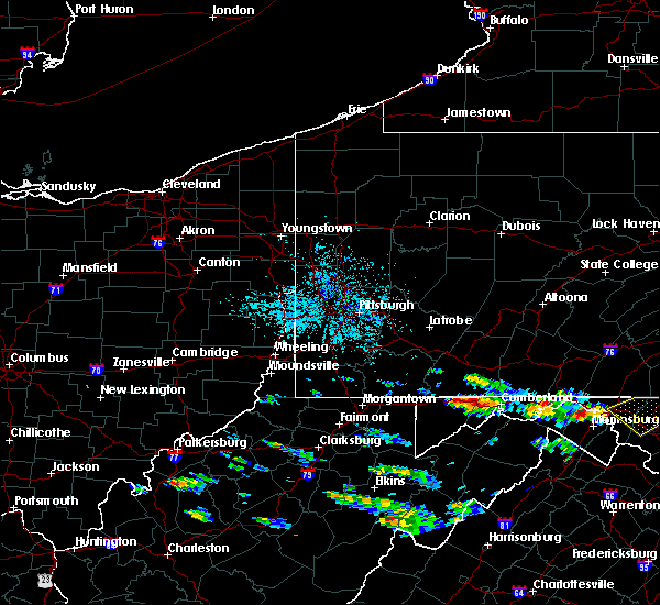 At 1245 pm edt, a severe thunderstorm was located over grantsville, or near bittinger, moving southeast at 45 mph (radar indicated). Hazards include 60 mph wind gusts and quarter size hail. Hail damage to vehicles is expected. Expect wind damage to trees and power lines, resulting in some power outages. At 1245 pm edt, a severe thunderstorm was located over grantsville, or near bittinger, moving southeast at 45 mph (radar indicated). Hazards include 60 mph wind gusts and quarter size hail. Hail damage to vehicles is expected. Expect wind damage to trees and power lines, resulting in some power outages.
|
| 6/16/2016 6:02 PM EDT |
 At 602 pm edt, a severe thunderstorm was located over lonaconing, or near westernport, moving southeast at 45 mph (radar indicated). Hazards include 60 mph wind gusts. Expect damage to trees and power lines. resulting in some power outages. locations impacted include, grantsville, big run state park, new germany, merrill and piney grove. this includes interstate 68 in maryland between mile markers 20 and 30. Please report severe weather by calling 4 1 2, 2 6 2, 1 9 8 8, posting to the nws pittsburgh facebook page, or using twitter @nwspittsburgh. At 602 pm edt, a severe thunderstorm was located over lonaconing, or near westernport, moving southeast at 45 mph (radar indicated). Hazards include 60 mph wind gusts. Expect damage to trees and power lines. resulting in some power outages. locations impacted include, grantsville, big run state park, new germany, merrill and piney grove. this includes interstate 68 in maryland between mile markers 20 and 30. Please report severe weather by calling 4 1 2, 2 6 2, 1 9 8 8, posting to the nws pittsburgh facebook page, or using twitter @nwspittsburgh.
|
| 6/16/2016 6:01 PM EDT |
 At 600 pm edt, severe thunderstorms were located along a line extending from near frostburg to westernport to near bayard to near dailey, moving southeast at 45 mph (radar indicated). Hazards include 60 mph wind gusts and quarter size hail. Damaging winds will cause some trees and large branches to fall. this could injure those outdoors, as well as damage homes and vehicles. roadways may become blocked by downed trees. localized power outages are possible. Unsecured light objects may become projectiles. At 600 pm edt, severe thunderstorms were located along a line extending from near frostburg to westernport to near bayard to near dailey, moving southeast at 45 mph (radar indicated). Hazards include 60 mph wind gusts and quarter size hail. Damaging winds will cause some trees and large branches to fall. this could injure those outdoors, as well as damage homes and vehicles. roadways may become blocked by downed trees. localized power outages are possible. Unsecured light objects may become projectiles.
|
| 6/16/2016 5:44 PM EDT |
 At 543 pm edt, a severe thunderstorm was located over grantsville, or near bittinger, moving southeast at 45 mph (radar indicated). Hazards include 60 mph wind gusts. Expect damage to trees and power lines. Resulting in some power outages. At 543 pm edt, a severe thunderstorm was located over grantsville, or near bittinger, moving southeast at 45 mph (radar indicated). Hazards include 60 mph wind gusts. Expect damage to trees and power lines. Resulting in some power outages.
|
| 6/16/2016 5:32 PM EDT |
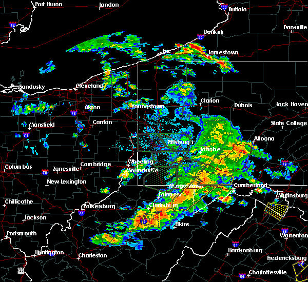 At 531 pm edt, severe thunderstorms were located along a line extending from near new centerville to accident, moving east at 40 mph (radar indicated). Hazards include 60 mph wind gusts. Expect damage to roofs. siding. and trees. Locations impacted include, meyersdale, mount davis, new centerville, ursina, addison, casselman, rockwood, salisbury, wellersburg, callimont, garrett, confluence and finzel. At 531 pm edt, severe thunderstorms were located along a line extending from near new centerville to accident, moving east at 40 mph (radar indicated). Hazards include 60 mph wind gusts. Expect damage to roofs. siding. and trees. Locations impacted include, meyersdale, mount davis, new centerville, ursina, addison, casselman, rockwood, salisbury, wellersburg, callimont, garrett, confluence and finzel.
|
| 6/16/2016 5:03 PM EDT |
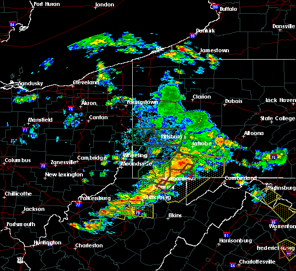 At 501 pm edt, severe thunderstorms were located along a line extending from near mount pleasant to morgantown, moving east at 50 mph (radar indicated). Hazards include 60 mph wind gusts. Expect damage to roofs. siding. And trees. At 501 pm edt, severe thunderstorms were located along a line extending from near mount pleasant to morgantown, moving east at 50 mph (radar indicated). Hazards include 60 mph wind gusts. Expect damage to roofs. siding. And trees.
|
| 8/3/2015 8:05 PM EDT |
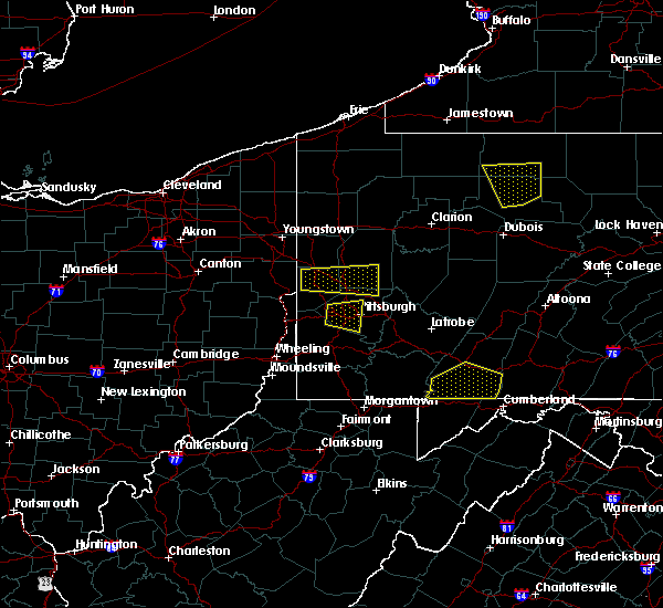 At 804 pm edt, doppler radar indicated a line of severe thunderstorms capable of producing quarter size hail and damaging winds in excess of 60 mph. these storms were located along a line extending from near berlin to near ursina, moving southeast at 30 mph. locations impacted include, somerset, berlin, meyersdale, mount davis, new centerville, ursina, addison, callimont, casselman, confluence, finzel, garrett, rockwood, salisbury and wellersburg. At 804 pm edt, doppler radar indicated a line of severe thunderstorms capable of producing quarter size hail and damaging winds in excess of 60 mph. these storms were located along a line extending from near berlin to near ursina, moving southeast at 30 mph. locations impacted include, somerset, berlin, meyersdale, mount davis, new centerville, ursina, addison, callimont, casselman, confluence, finzel, garrett, rockwood, salisbury and wellersburg.
|
| 8/3/2015 7:32 PM EDT |
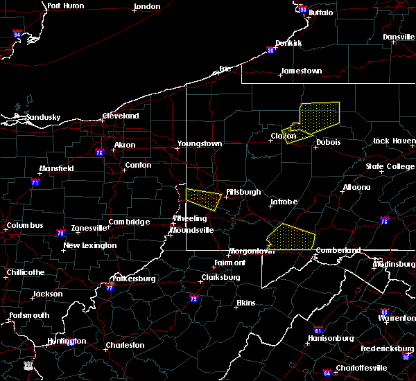 At 730 pm edt, doppler radar indicated a severe thunderstorm capable of producing half dollar size hail and damaging winds in excess of 60 mph. this storm was located near new centerville, moving southeast at 35 mph. the storm has shown a weakening trend but is still capable of causing damaging winds and large hail. locations impacted include, somerset, berlin, meyersdale, mount davis, new centerville, ursina, addison, callimont, casselman, confluence, finzel, garrett, rockwood, salisbury, seven springs and wellersburg. At 730 pm edt, doppler radar indicated a severe thunderstorm capable of producing half dollar size hail and damaging winds in excess of 60 mph. this storm was located near new centerville, moving southeast at 35 mph. the storm has shown a weakening trend but is still capable of causing damaging winds and large hail. locations impacted include, somerset, berlin, meyersdale, mount davis, new centerville, ursina, addison, callimont, casselman, confluence, finzel, garrett, rockwood, salisbury, seven springs and wellersburg.
|
| 8/3/2015 6:57 PM EDT |
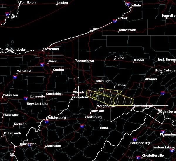 At 656 pm edt, doppler radar indicated a severe thunderstorm capable of producing half dollar size hail and damaging winds around 60 mph. this storm was located near scottdale, and moving southeast at 35 mph. At 656 pm edt, doppler radar indicated a severe thunderstorm capable of producing half dollar size hail and damaging winds around 60 mph. this storm was located near scottdale, and moving southeast at 35 mph.
|
| 7/9/2015 2:54 PM EDT |
 At 253 pm edt, severe thunderstorms were located along a line extending from near mount davis to 6 miles southwest of bittinger to near rowlesburg, moving east at 40 mph (radar indicated). Hazards include 60 mph wind gusts. Expect damage to trees and some power outages locations impacted include, mountain lake park, oakland, terra alta, rowlesburg, bittinger, grantsville, loch lynn heights, deer park, accident, new germany, merrill, piney grove, gorman, hutton, keysers ridge, finzel, jennings, mchenry, crellin and swallow falls state park. A tornado watch remains in effect until 900 pm edt for western maryland and northern west virginia. At 253 pm edt, severe thunderstorms were located along a line extending from near mount davis to 6 miles southwest of bittinger to near rowlesburg, moving east at 40 mph (radar indicated). Hazards include 60 mph wind gusts. Expect damage to trees and some power outages locations impacted include, mountain lake park, oakland, terra alta, rowlesburg, bittinger, grantsville, loch lynn heights, deer park, accident, new germany, merrill, piney grove, gorman, hutton, keysers ridge, finzel, jennings, mchenry, crellin and swallow falls state park. A tornado watch remains in effect until 900 pm edt for western maryland and northern west virginia.
|
| 7/9/2015 2:30 PM EDT |
 At 229 pm edt, severe thunderstorms were located along a line extending from near farmington to 7 miles north of terra alta to newburg, moving east at 45 mph (radar indicated). Hazards include 60 mph wind gusts. expect damage to trees and some power outages At 229 pm edt, severe thunderstorms were located along a line extending from near farmington to 7 miles north of terra alta to newburg, moving east at 45 mph (radar indicated). Hazards include 60 mph wind gusts. expect damage to trees and some power outages
|
| 6/23/2015 4:52 PM EDT |
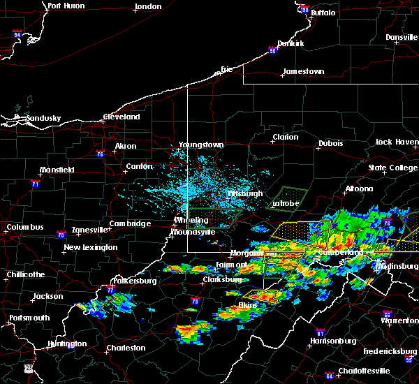 At 452 pm edt, a severe thunderstorm was located near grantsville, or near bittinger, moving east at 35 mph (radar indicated). Hazards include 60 mph wind gusts and penny size hail. Expect damage to roofs. siding and trees. Locations impacted include, bittinger, grantsville, new germany, merrill, piney grove, finzel, keysers ridge, jennings, big run state park and mchenry. At 452 pm edt, a severe thunderstorm was located near grantsville, or near bittinger, moving east at 35 mph (radar indicated). Hazards include 60 mph wind gusts and penny size hail. Expect damage to roofs. siding and trees. Locations impacted include, bittinger, grantsville, new germany, merrill, piney grove, finzel, keysers ridge, jennings, big run state park and mchenry.
|
| 6/23/2015 4:25 PM EDT |
 At 424 pm edt, a severe thunderstorm was located over friendsville, or 12 miles west of bittinger, moving east at 35 mph (radar indicated). Hazards include 60 mph wind gusts and penny size hail. Expect damage to roofs. Siding and trees. At 424 pm edt, a severe thunderstorm was located over friendsville, or 12 miles west of bittinger, moving east at 35 mph (radar indicated). Hazards include 60 mph wind gusts and penny size hail. Expect damage to roofs. Siding and trees.
|
| 6/20/2015 5:59 PM EDT |
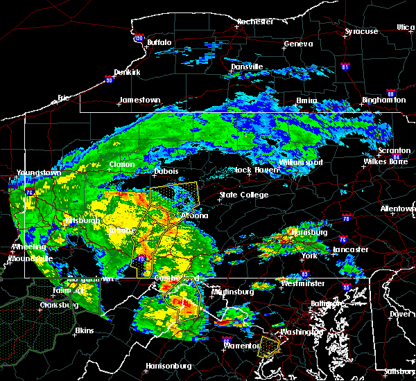 At 557 pm edt, doppler radar indicated a line of severe thunderstorms capable of producing damaging winds in excess of 60 mph. these storms were located along a line extending from near cherry tree to near patton to near windber, moving northeast at 50 mph. locations impacted include, ebensburg, johnstown, nanty- glo, portage, somerset, westmont, windber, beaverdale- lloydell, berlin, boswell, carrolltown, central city, cresson, dale, and davidsville. At 557 pm edt, doppler radar indicated a line of severe thunderstorms capable of producing damaging winds in excess of 60 mph. these storms were located along a line extending from near cherry tree to near patton to near windber, moving northeast at 50 mph. locations impacted include, ebensburg, johnstown, nanty- glo, portage, somerset, westmont, windber, beaverdale- lloydell, berlin, boswell, carrolltown, central city, cresson, dale, and davidsville.
|
| 6/12/2015 9:04 PM EDT |
 At 904 pm edt, severe thunderstorms were located along a line extending from grantsville to bittinger to near bayard, moving east at 50 mph (radar indicated). Hazards include 60 mph wind gusts. Expect damage to roofs. siding and trees. Locations impacted include, mountain lake park, oakland, bittinger, grantsville, loch lynn heights, friendsville, deer park, accident, kitzmiller, new germany, merrill, selbysport, piney grove, gorman, keysers ridge, finzel, jennings, mchenry, swallow falls state park and bloomington. At 904 pm edt, severe thunderstorms were located along a line extending from grantsville to bittinger to near bayard, moving east at 50 mph (radar indicated). Hazards include 60 mph wind gusts. Expect damage to roofs. siding and trees. Locations impacted include, mountain lake park, oakland, bittinger, grantsville, loch lynn heights, friendsville, deer park, accident, kitzmiller, new germany, merrill, selbysport, piney grove, gorman, keysers ridge, finzel, jennings, mchenry, swallow falls state park and bloomington.
|
| 6/12/2015 8:49 PM EDT |
 A severe thunderstorm warning remains in effect until 915 pm edt for garrett and southeastern preston counties. at 849 pm edt. severe thunderstorms were located along a line extending from near accident to near friendsville to near rowlesburg. moving southeast at 50 mph. hazard. 60 mph wind gusts. A severe thunderstorm warning remains in effect until 915 pm edt for garrett and southeastern preston counties. at 849 pm edt. severe thunderstorms were located along a line extending from near accident to near friendsville to near rowlesburg. moving southeast at 50 mph. hazard. 60 mph wind gusts.
|
| 6/12/2015 8:37 PM EDT |
 A severe thunderstorm warning remains in effect until 915 pm edt for garrett. southeastern fayette. preston and southeastern monongalia counties. at 837 pm edt. severe thunderstorms were located along a line extending from near farmington to 8 miles southwest of friendsville to newburg. Moving east at 45 mph. A severe thunderstorm warning remains in effect until 915 pm edt for garrett. southeastern fayette. preston and southeastern monongalia counties. at 837 pm edt. severe thunderstorms were located along a line extending from near farmington to 8 miles southwest of friendsville to newburg. Moving east at 45 mph.
|
| 6/12/2015 8:37 PM EDT |
 At 837 pm edt, severe thunderstorms were located along a line extending from near farmington to 8 miles southwest of friendsville to newburg, moving east at 45 mph (radar indicated). Hazards include 60 mph wind gusts. Expect damage to roofs. siding and trees. Locations impacted include, kingwood, mountain lake park, oakland, terra alta, rowlesburg, bittinger, farmington, grantsville, loch lynn heights, friendsville, deer park, newburg, accident, kitzmiller, reedsville, masontown, albright, tunnelton, markleysburg and brandonville. At 837 pm edt, severe thunderstorms were located along a line extending from near farmington to 8 miles southwest of friendsville to newburg, moving east at 45 mph (radar indicated). Hazards include 60 mph wind gusts. Expect damage to roofs. siding and trees. Locations impacted include, kingwood, mountain lake park, oakland, terra alta, rowlesburg, bittinger, farmington, grantsville, loch lynn heights, friendsville, deer park, newburg, accident, kitzmiller, reedsville, masontown, albright, tunnelton, markleysburg and brandonville.
|
| 6/12/2015 8:19 PM EDT |
 At 818 pm edt, severe thunderstorms were located along a line extending from 7 miles southeast of masontown to near brookhaven to near grafton, moving east at 40 mph (radar indicated). Hazards include 60 mph wind gusts. Expect damage to roofs. Siding and trees. At 818 pm edt, severe thunderstorms were located along a line extending from 7 miles southeast of masontown to near brookhaven to near grafton, moving east at 40 mph (radar indicated). Hazards include 60 mph wind gusts. Expect damage to roofs. Siding and trees.
|
| 6/1/2012 5:48 PM EDT | Numerous trees down in garrett county MD, 0.8 miles SW of Finzel, MD |
Hail Maps for Finzel, MD
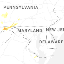


Connect with Interactive Hail Maps