

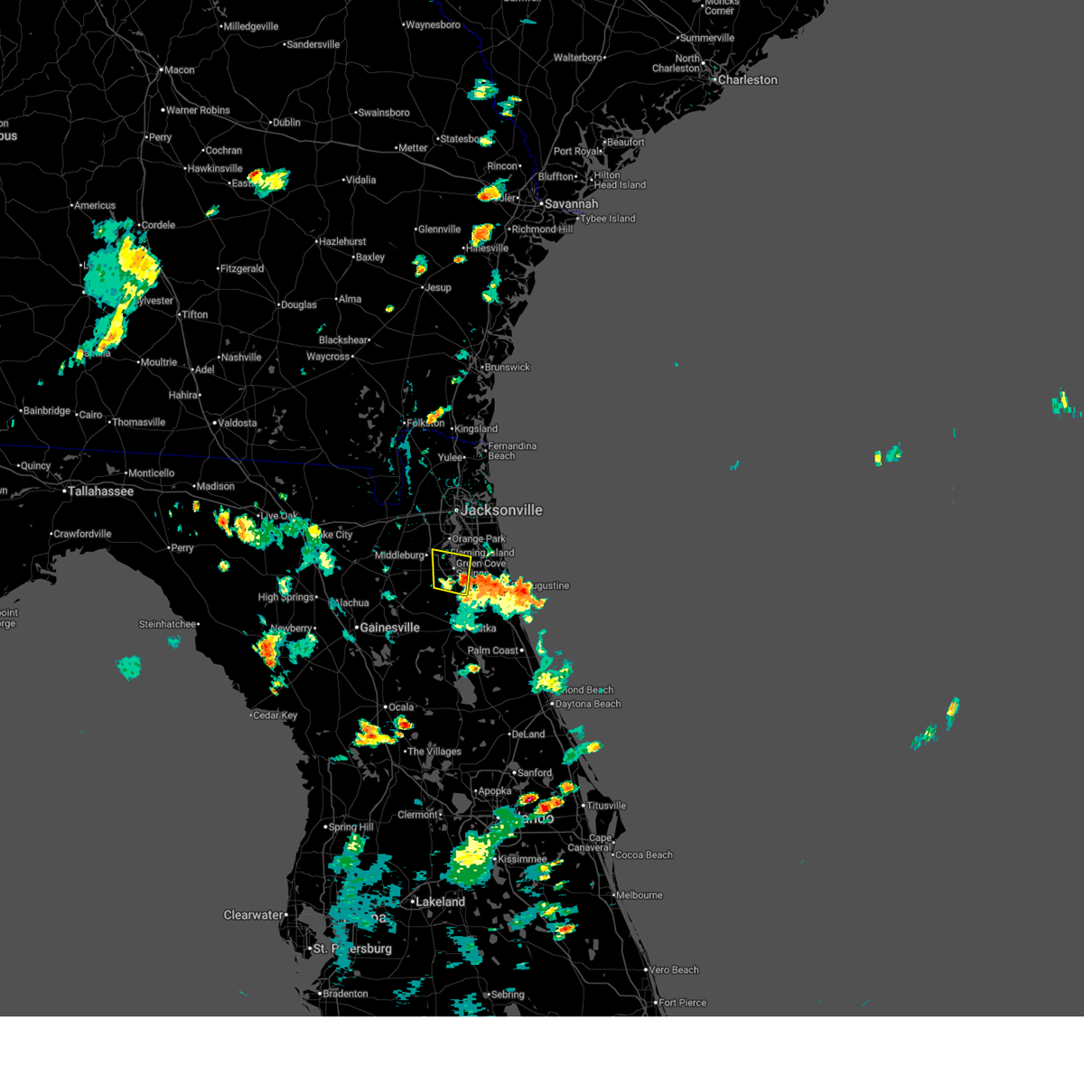
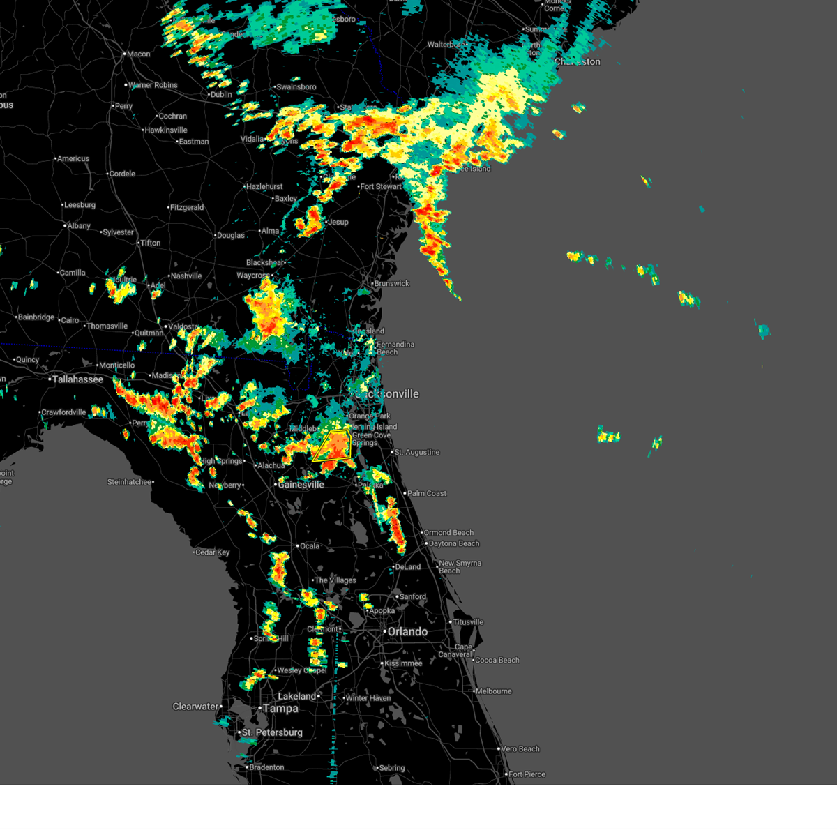
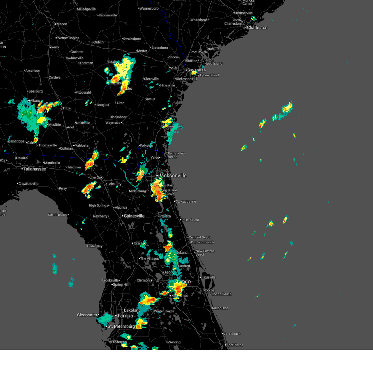
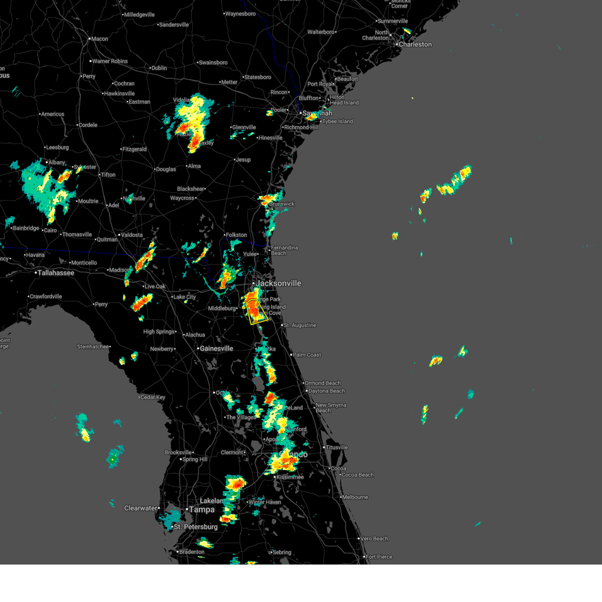
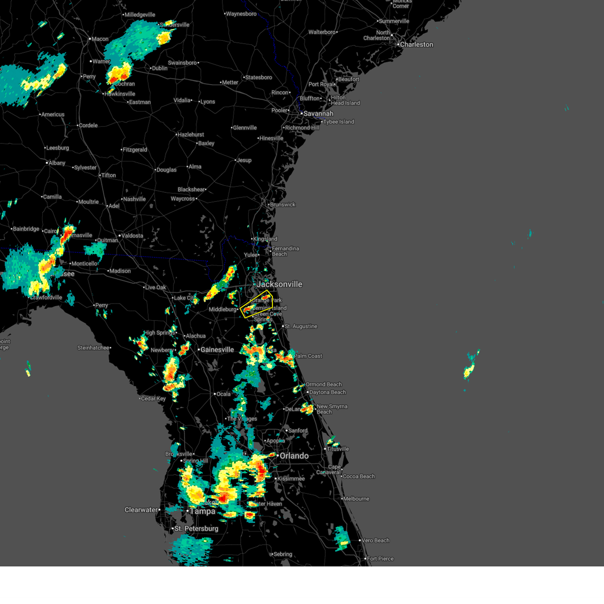
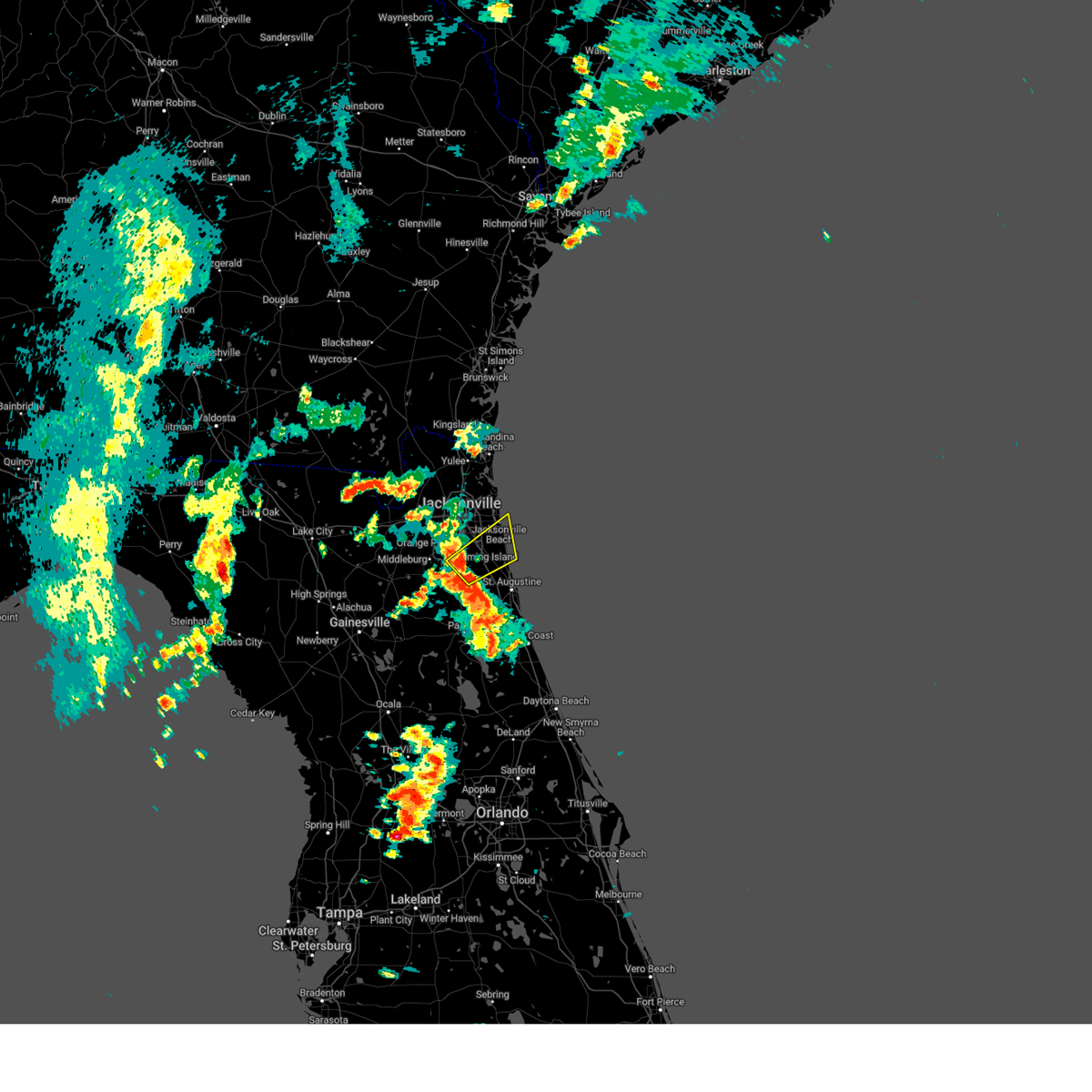
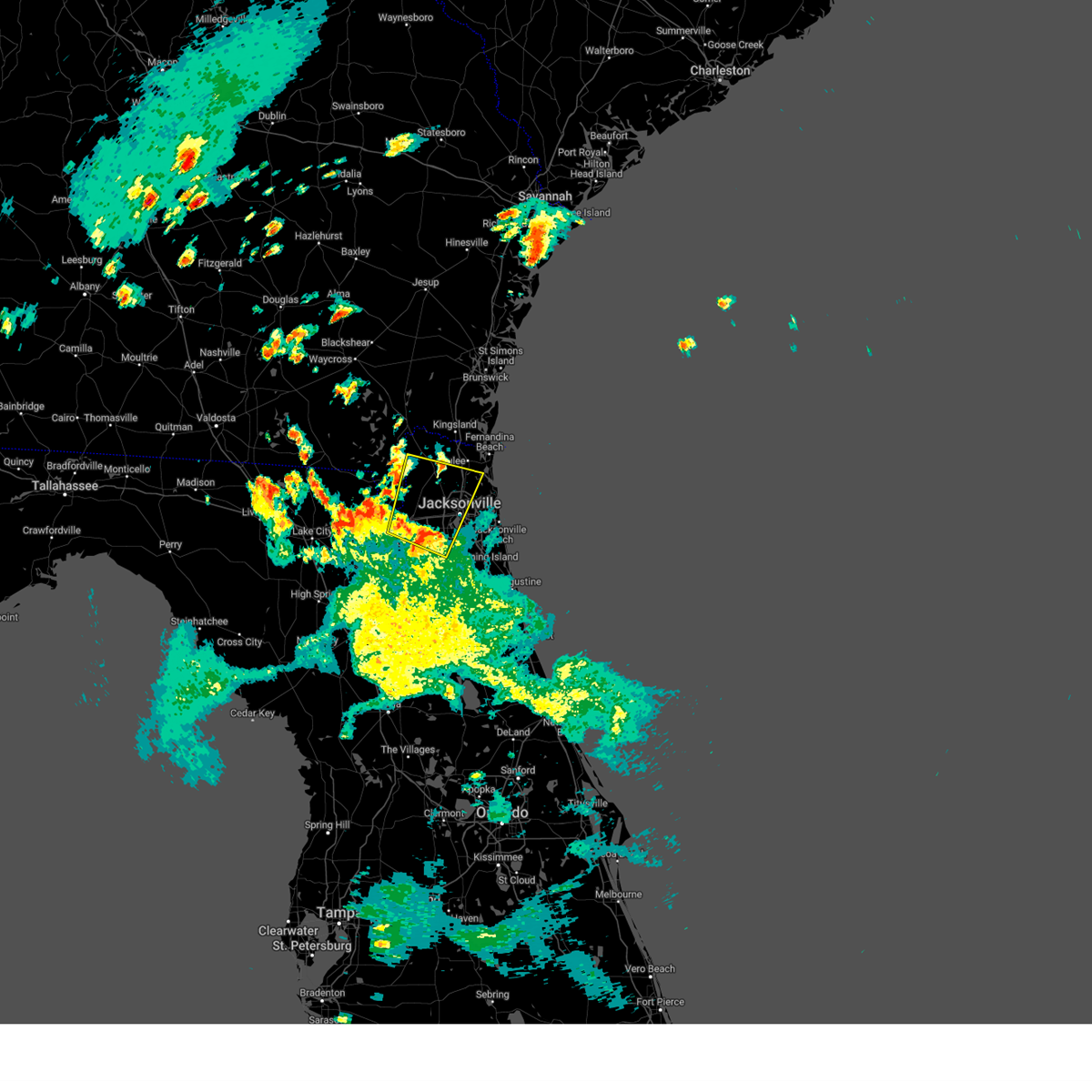
Hail Map for Fleming Island, FL
The Fleming Island, FL area has had 2 reports of on-the-ground hail by trained spotters, and has been under severe weather warnings 10 times during the past 12 months. Doppler radar has detected hail at or near Fleming Island, FL on 83 occasions, including 3 occasions during the past year.
| Name: | Fleming Island, FL |
| Where Located: | 15.9 miles SSW of Jacksonville, FL |
| Map: | Google Map for Fleming Island, FL |
| Population: | 27126 |
| Housing Units: | 10440 |
| More Info: | Search Google for Fleming Island, FL |
1
The Top Recent Hail Date for Fleming Island, FL is Wednesday, August 6, 2025 (19th out of 83)

Hail and Wind Damage Spotted near Fleming Island, FL
| Date / Time | Report Details |
|---|---|
| 6/25/2026 5:18 PM EDT |
 Svrjax the national weather service in jacksonville has issued a * severe thunderstorm warning for, west central st. johns county in northeastern florida, northeastern clay county in northeastern florida, * until 545 pm edt. * at 518 pm edt, a severe thunderstorm was located over picolata, or near green cove springs, moving north at 5 mph (radar indicated). Hazards include 60 mph wind gusts. expect damage to roofs, siding, and trees Svrjax the national weather service in jacksonville has issued a * severe thunderstorm warning for, west central st. johns county in northeastern florida, northeastern clay county in northeastern florida, * until 545 pm edt. * at 518 pm edt, a severe thunderstorm was located over picolata, or near green cove springs, moving north at 5 mph (radar indicated). Hazards include 60 mph wind gusts. expect damage to roofs, siding, and trees
|
| 3/16/2026 2:44 PM EDT |
 Svrjax the national weather service in jacksonville has issued a * severe thunderstorm warning for, central nassau county in northeastern florida, northwestern st. johns county in northeastern florida, northern clay county in northeastern florida, duval county in northeastern florida, * until 315 pm edt. * at 244 pm edt, a severe thunderstorm was located over normandy, or near jacksonville, moving northeast at 55 mph (radar indicated). Hazards include 60 mph wind gusts. expect damage to roofs, siding, and trees Svrjax the national weather service in jacksonville has issued a * severe thunderstorm warning for, central nassau county in northeastern florida, northwestern st. johns county in northeastern florida, northern clay county in northeastern florida, duval county in northeastern florida, * until 315 pm edt. * at 244 pm edt, a severe thunderstorm was located over normandy, or near jacksonville, moving northeast at 55 mph (radar indicated). Hazards include 60 mph wind gusts. expect damage to roofs, siding, and trees
|
| 3/16/2026 1:40 PM EDT |
 The storm which prompted the warning has weakened below severe limits, and no longer poses an immediate threat to life or property. therefore, the warning will be allowed to expire. however, gusty winds are still possible with this thunderstorm. a tornado watch remains in effect until 800 pm edt for northeastern florida. The storm which prompted the warning has weakened below severe limits, and no longer poses an immediate threat to life or property. therefore, the warning will be allowed to expire. however, gusty winds are still possible with this thunderstorm. a tornado watch remains in effect until 800 pm edt for northeastern florida.
|
| 3/16/2026 1:16 PM EDT |
 Svrjax the national weather service in jacksonville has issued a * severe thunderstorm warning for, northwestern clay county in northeastern florida, southwestern duval county in northeastern florida, * until 145 pm edt. * at 116 pm edt, a severe thunderstorm was located over lakeside, or near orange park, moving northeast at 45 mph (radar indicated). Hazards include 60 mph wind gusts and penny size hail. expect damage to roofs, siding, and trees Svrjax the national weather service in jacksonville has issued a * severe thunderstorm warning for, northwestern clay county in northeastern florida, southwestern duval county in northeastern florida, * until 145 pm edt. * at 116 pm edt, a severe thunderstorm was located over lakeside, or near orange park, moving northeast at 45 mph (radar indicated). Hazards include 60 mph wind gusts and penny size hail. expect damage to roofs, siding, and trees
|
| 8/16/2025 4:43 PM EDT |
 The storm which prompted the warning has weakened below severe limits, and has exited the warned area. therefore, the warning will be allowed to expire. however, gusty winds and heavy rain are still possible with this thunderstorm. The storm which prompted the warning has weakened below severe limits, and has exited the warned area. therefore, the warning will be allowed to expire. however, gusty winds and heavy rain are still possible with this thunderstorm.
|
| 8/16/2025 4:20 PM EDT |
 At 419 pm edt, a severe thunderstorm was located 7 miles west of green cove springs, moving south at 10 mph (radar indicated). Hazards include 60 mph wind gusts. Expect damage to roofs, siding, and trees. Locations impacted include, green cove springs, penney farms, and asbury lake. At 419 pm edt, a severe thunderstorm was located 7 miles west of green cove springs, moving south at 10 mph (radar indicated). Hazards include 60 mph wind gusts. Expect damage to roofs, siding, and trees. Locations impacted include, green cove springs, penney farms, and asbury lake.
|
| 8/16/2025 4:01 PM EDT |
 Svrjax the national weather service in jacksonville has issued a * severe thunderstorm warning for, central clay county in northeastern florida, * until 445 pm edt. * at 401 pm edt, a severe thunderstorm was located near doctors inlet, or near middleburg, moving south at 5 mph (radar indicated). Hazards include 60 mph wind gusts. expect damage to roofs, siding, and trees Svrjax the national weather service in jacksonville has issued a * severe thunderstorm warning for, central clay county in northeastern florida, * until 445 pm edt. * at 401 pm edt, a severe thunderstorm was located near doctors inlet, or near middleburg, moving south at 5 mph (radar indicated). Hazards include 60 mph wind gusts. expect damage to roofs, siding, and trees
|
| 8/6/2025 5:15 PM EDT |
 The storm which prompted the warning has moved out of the area. therefore, the warning will be allowed to expire. however, gusty winds are still possible with this thunderstorm. a new warning was issued further south as the storm travels southeast. The storm which prompted the warning has moved out of the area. therefore, the warning will be allowed to expire. however, gusty winds are still possible with this thunderstorm. a new warning was issued further south as the storm travels southeast.
|
| 8/6/2025 5:00 PM EDT | Trees on powerlines; wires down in fleming island. time estimated from radar dat in clay county FL, 0.9 miles WNW of Fleming Island, FL |
| 8/6/2025 4:55 PM EDT |
 At 454 pm edt, a severe thunderstorm was located around switzerland, or near fruit cove, moving south at 15 mph (radar indicated). Hazards include 60 mph wind gusts. Expect damage to roofs, siding, and trees. Locations impacted include, green cove springs, mandarin, fruit cove, and switzerland. At 454 pm edt, a severe thunderstorm was located around switzerland, or near fruit cove, moving south at 15 mph (radar indicated). Hazards include 60 mph wind gusts. Expect damage to roofs, siding, and trees. Locations impacted include, green cove springs, mandarin, fruit cove, and switzerland.
|
| 8/6/2025 4:45 PM EDT |
 Svrjax the national weather service in jacksonville has issued a * severe thunderstorm warning for, west central st. johns county in northeastern florida, northeastern clay county in northeastern florida, southern duval county in northeastern florida, * until 515 pm edt. * at 445 pm edt, a severe thunderstorm was located over switzerland, or near fruit cove, moving south at 10 mph (radar indicated). Hazards include 60 mph wind gusts and small hail. expect damage to roofs, siding, and trees Svrjax the national weather service in jacksonville has issued a * severe thunderstorm warning for, west central st. johns county in northeastern florida, northeastern clay county in northeastern florida, southern duval county in northeastern florida, * until 515 pm edt. * at 445 pm edt, a severe thunderstorm was located over switzerland, or near fruit cove, moving south at 10 mph (radar indicated). Hazards include 60 mph wind gusts and small hail. expect damage to roofs, siding, and trees
|
| 6/19/2025 3:21 PM EDT |
 The storm which prompted the warning has weakened below severe limits, and no longer poses an immediate threat to life or property. therefore, the warning will be allowed to expire. however, gusty winds are still possible with this thunderstorm. The storm which prompted the warning has weakened below severe limits, and no longer poses an immediate threat to life or property. therefore, the warning will be allowed to expire. however, gusty winds are still possible with this thunderstorm.
|
| 6/19/2025 3:04 PM EDT |
 Svrjax the national weather service in jacksonville has issued a * severe thunderstorm warning for, northwestern st. johns county in northeastern florida, northeastern clay county in northeastern florida, southeastern duval county in northeastern florida, * until 330 pm edt. * at 304 pm edt, a severe thunderstorm was located near fleming island, or near green cove springs, moving northeast at 5 mph (radar indicated). Hazards include 60 mph wind gusts and penny size hail. expect damage to roofs, siding, and trees Svrjax the national weather service in jacksonville has issued a * severe thunderstorm warning for, northwestern st. johns county in northeastern florida, northeastern clay county in northeastern florida, southeastern duval county in northeastern florida, * until 330 pm edt. * at 304 pm edt, a severe thunderstorm was located near fleming island, or near green cove springs, moving northeast at 5 mph (radar indicated). Hazards include 60 mph wind gusts and penny size hail. expect damage to roofs, siding, and trees
|
| 5/29/2025 4:50 PM EDT |
 Svrjax the national weather service in jacksonville has issued a * severe thunderstorm warning for, northwestern st. johns county in northeastern florida, northeastern clay county in northeastern florida, southeastern duval county in northeastern florida, * until 515 pm edt. * at 450 pm edt, a severe thunderstorm was located near world golf village, or near fruit cove, moving northeast at 45 mph (radar indicated). Hazards include 60 mph wind gusts and quarter size hail. Hail damage to vehicles is expected. Expect wind damage to roofs, siding, and trees. Svrjax the national weather service in jacksonville has issued a * severe thunderstorm warning for, northwestern st. johns county in northeastern florida, northeastern clay county in northeastern florida, southeastern duval county in northeastern florida, * until 515 pm edt. * at 450 pm edt, a severe thunderstorm was located near world golf village, or near fruit cove, moving northeast at 45 mph (radar indicated). Hazards include 60 mph wind gusts and quarter size hail. Hail damage to vehicles is expected. Expect wind damage to roofs, siding, and trees.
|
| 5/10/2025 7:12 PM EDT |
 Svrjax the national weather service in jacksonville has issued a * severe thunderstorm warning for, southern nassau county in northeastern florida, southeastern baker county in northeastern florida, northwestern clay county in northeastern florida, central duval county in northeastern florida, southeastern charlton county in southeastern georgia, * until 745 pm edt. * at 711 pm edt, a severe thunderstorm was located near cecil field, or 11 miles west of jacksonville, moving north at 35 mph (radar indicated). Hazards include 60 mph wind gusts. expect damage to roofs, siding, and trees Svrjax the national weather service in jacksonville has issued a * severe thunderstorm warning for, southern nassau county in northeastern florida, southeastern baker county in northeastern florida, northwestern clay county in northeastern florida, central duval county in northeastern florida, southeastern charlton county in southeastern georgia, * until 745 pm edt. * at 711 pm edt, a severe thunderstorm was located near cecil field, or 11 miles west of jacksonville, moving north at 35 mph (radar indicated). Hazards include 60 mph wind gusts. expect damage to roofs, siding, and trees
|
| 5/10/2025 6:52 PM EDT |
 Svrjax the national weather service in jacksonville has issued a * severe thunderstorm warning for, southwestern nassau county in northeastern florida, northeastern bradford county in northern florida, southeastern baker county in northeastern florida, northwestern clay county in northeastern florida, central duval county in northeastern florida, * until 715 pm edt. * at 651 pm edt, a severe thunderstorm was located near middleburg, moving north at 25 mph (radar indicated). Hazards include 60 mph wind gusts. expect damage to roofs, siding, and trees Svrjax the national weather service in jacksonville has issued a * severe thunderstorm warning for, southwestern nassau county in northeastern florida, northeastern bradford county in northern florida, southeastern baker county in northeastern florida, northwestern clay county in northeastern florida, central duval county in northeastern florida, * until 715 pm edt. * at 651 pm edt, a severe thunderstorm was located near middleburg, moving north at 25 mph (radar indicated). Hazards include 60 mph wind gusts. expect damage to roofs, siding, and trees
|
| 7/22/2024 3:13 PM EDT |
 the severe thunderstorm warning has been cancelled and is no longer in effect the severe thunderstorm warning has been cancelled and is no longer in effect
|
| 7/22/2024 2:51 PM EDT |
 Svrjax the national weather service in jacksonville has issued a * severe thunderstorm warning for, northwestern st. johns county in northeastern florida, northeastern clay county in northeastern florida, south central duval county in northeastern florida, * until 330 pm edt. * at 251 pm edt, a severe thunderstorm was located near fruit cove, moving southwest at 10 mph (radar indicated). Hazards include 60 mph wind gusts. expect damage to roofs, siding, and trees Svrjax the national weather service in jacksonville has issued a * severe thunderstorm warning for, northwestern st. johns county in northeastern florida, northeastern clay county in northeastern florida, south central duval county in northeastern florida, * until 330 pm edt. * at 251 pm edt, a severe thunderstorm was located near fruit cove, moving southwest at 10 mph (radar indicated). Hazards include 60 mph wind gusts. expect damage to roofs, siding, and trees
|
| 7/19/2024 6:35 PM EDT |
 The storm which prompted the warning has moved out of the area. therefore, the warning will be allowed to expire. however, gusty winds and heavy rain are still possible with this thunderstorm. The storm which prompted the warning has moved out of the area. therefore, the warning will be allowed to expire. however, gusty winds and heavy rain are still possible with this thunderstorm.
|
| 7/19/2024 6:16 PM EDT |
 Svrjax the national weather service in jacksonville has issued a * severe thunderstorm warning for, west central st. johns county in northeastern florida, northeastern clay county in northeastern florida, * until 645 pm edt. * at 616 pm edt, a severe thunderstorm was located near green cove springs, moving northeast at 10 mph (radar indicated). Hazards include 60 mph wind gusts. expect damage to roofs, siding, and trees Svrjax the national weather service in jacksonville has issued a * severe thunderstorm warning for, west central st. johns county in northeastern florida, northeastern clay county in northeastern florida, * until 645 pm edt. * at 616 pm edt, a severe thunderstorm was located near green cove springs, moving northeast at 10 mph (radar indicated). Hazards include 60 mph wind gusts. expect damage to roofs, siding, and trees
|
| 6/28/2024 5:41 PM EDT |
 the severe thunderstorm warning has been cancelled and is no longer in effect the severe thunderstorm warning has been cancelled and is no longer in effect
|
| 6/28/2024 5:34 PM EDT |
 At 534 pm edt, a severe thunderstorm was located over bellair-meadowbrook terrace, or over orange park, moving east at 25 mph (radar indicated). Hazards include 60 mph wind gusts. Expect damage to roofs, siding, and trees. Locations impacted include, jacksonville, orange park, green cove springs, middleburg, mandarin, fruit cove, arlington, fleming island, baymeadows, and ortega. At 534 pm edt, a severe thunderstorm was located over bellair-meadowbrook terrace, or over orange park, moving east at 25 mph (radar indicated). Hazards include 60 mph wind gusts. Expect damage to roofs, siding, and trees. Locations impacted include, jacksonville, orange park, green cove springs, middleburg, mandarin, fruit cove, arlington, fleming island, baymeadows, and ortega.
|
| 6/28/2024 5:17 PM EDT |
 Svrjax the national weather service in jacksonville has issued a * severe thunderstorm warning for, northwestern st. johns county in northeastern florida, northern clay county in northeastern florida, southwestern duval county in northeastern florida, * until 600 pm edt. * at 516 pm edt, a severe thunderstorm was located over oakleaf plantation, or near middleburg, moving east at 25 mph (radar indicated). Hazards include 60 mph wind gusts. expect damage to roofs, siding, and trees Svrjax the national weather service in jacksonville has issued a * severe thunderstorm warning for, northwestern st. johns county in northeastern florida, northern clay county in northeastern florida, southwestern duval county in northeastern florida, * until 600 pm edt. * at 516 pm edt, a severe thunderstorm was located over oakleaf plantation, or near middleburg, moving east at 25 mph (radar indicated). Hazards include 60 mph wind gusts. expect damage to roofs, siding, and trees
|
| 6/25/2024 10:24 PM EDT |
 The storms which prompted the warning have weakened below severe limits, and no longer pose an immediate threat to life or property. therefore, the warning will be allowed to expire. however, heavy rain is still possible with these thunderstorms. The storms which prompted the warning have weakened below severe limits, and no longer pose an immediate threat to life or property. therefore, the warning will be allowed to expire. however, heavy rain is still possible with these thunderstorms.
|
| 6/25/2024 10:08 PM EDT |
 At 1007 pm edt, severe thunderstorms were located along a line extending from near durbin to near switzerland, moving east at 15 mph (radar indicated). Hazards include 60 mph wind gusts and penny size hail. Expect damage to roofs, siding, and trees. Locations impacted include, green cove springs, mandarin, fruit cove, world golf village, fleming island, picolata, switzerland, and bakersville. At 1007 pm edt, severe thunderstorms were located along a line extending from near durbin to near switzerland, moving east at 15 mph (radar indicated). Hazards include 60 mph wind gusts and penny size hail. Expect damage to roofs, siding, and trees. Locations impacted include, green cove springs, mandarin, fruit cove, world golf village, fleming island, picolata, switzerland, and bakersville.
|
| 6/25/2024 9:54 PM EDT |
 Svrjax the national weather service in jacksonville has issued a * severe thunderstorm warning for, central st. johns county in northeastern florida, northeastern clay county in northeastern florida, southeastern duval county in northeastern florida, * until 1030 pm edt. * at 953 pm edt, severe thunderstorms were located along a line extending from near fruit cove to switzerland, moving southeast at 15 mph (radar indicated). Hazards include 60 mph wind gusts and penny size hail. expect damage to roofs, siding, and trees Svrjax the national weather service in jacksonville has issued a * severe thunderstorm warning for, central st. johns county in northeastern florida, northeastern clay county in northeastern florida, southeastern duval county in northeastern florida, * until 1030 pm edt. * at 953 pm edt, severe thunderstorms were located along a line extending from near fruit cove to switzerland, moving southeast at 15 mph (radar indicated). Hazards include 60 mph wind gusts and penny size hail. expect damage to roofs, siding, and trees
|
| 5/10/2024 10:00 AM EDT |
 the severe thunderstorm warning has been cancelled and is no longer in effect the severe thunderstorm warning has been cancelled and is no longer in effect
|
| 5/10/2024 9:59 AM EDT |
 The storms which prompted the warning have moved out of the area. therefore, the warning will be allowed to expire. however, heavy rain is still possible with these thunderstorms. a severe thunderstorm watch remains in effect until noon edt for northern and northeastern florida, and southeastern georgia. The storms which prompted the warning have moved out of the area. therefore, the warning will be allowed to expire. however, heavy rain is still possible with these thunderstorms. a severe thunderstorm watch remains in effect until noon edt for northern and northeastern florida, and southeastern georgia.
|
| 5/10/2024 9:45 AM EDT |
 Svrjax the national weather service in jacksonville has issued a * severe thunderstorm warning for, northwestern flagler county in northeastern florida, northeastern nassau county in northeastern florida, st. johns county in northeastern florida, putnam county in northeastern florida, northeastern clay county in northeastern florida, duval county in northeastern florida, southeastern camden county in southeastern georgia, * until 1015 am edt. * at 945 am edt, severe thunderstorms were located along a line extending from near st. marys to near bostwick to near lake delancy, moving east at 55 mph (radar indicated). Hazards include 60 mph wind gusts and penny size hail. expect damage to roofs, siding, and trees Svrjax the national weather service in jacksonville has issued a * severe thunderstorm warning for, northwestern flagler county in northeastern florida, northeastern nassau county in northeastern florida, st. johns county in northeastern florida, putnam county in northeastern florida, northeastern clay county in northeastern florida, duval county in northeastern florida, southeastern camden county in southeastern georgia, * until 1015 am edt. * at 945 am edt, severe thunderstorms were located along a line extending from near st. marys to near bostwick to near lake delancy, moving east at 55 mph (radar indicated). Hazards include 60 mph wind gusts and penny size hail. expect damage to roofs, siding, and trees
|
| 5/10/2024 9:25 AM EDT |
 Svrjax the national weather service in jacksonville has issued a * severe thunderstorm warning for, nassau county in northeastern florida, southeastern alachua county in northern florida, st. johns county in northeastern florida, central marion county in northern florida, putnam county in northeastern florida, clay county in northeastern florida, duval county in northeastern florida, camden county in southeastern georgia, northeastern charlton county in southeastern georgia, * until 1000 am edt. * at 925 am edt, severe thunderstorms were located along a line extending from near kings ferry to near florahome to near williston municipal airport, moving east at 60 mph (radar indicated). Hazards include 60 mph wind gusts and penny size hail. expect damage to roofs, siding, and trees Svrjax the national weather service in jacksonville has issued a * severe thunderstorm warning for, nassau county in northeastern florida, southeastern alachua county in northern florida, st. johns county in northeastern florida, central marion county in northern florida, putnam county in northeastern florida, clay county in northeastern florida, duval county in northeastern florida, camden county in southeastern georgia, northeastern charlton county in southeastern georgia, * until 1000 am edt. * at 925 am edt, severe thunderstorms were located along a line extending from near kings ferry to near florahome to near williston municipal airport, moving east at 60 mph (radar indicated). Hazards include 60 mph wind gusts and penny size hail. expect damage to roofs, siding, and trees
|
| 5/10/2024 9:20 AM EDT |
 At 920 am edt, severe thunderstorms were located along a line extending from 10 miles east of woodbine to baymeadows to near bardin to 8 miles southwest of cross creek, moving east at 90 mph (radar indicated). Hazards include 60 mph wind gusts and penny size hail. Expect damage to roofs, siding, and trees. locations impacted include, jacksonville, st. Marys, kingsland, fernandina beach, palatka, orange park, green cove springs, rainbow lakes estates, woodbine, and interlachen. At 920 am edt, severe thunderstorms were located along a line extending from 10 miles east of woodbine to baymeadows to near bardin to 8 miles southwest of cross creek, moving east at 90 mph (radar indicated). Hazards include 60 mph wind gusts and penny size hail. Expect damage to roofs, siding, and trees. locations impacted include, jacksonville, st. Marys, kingsland, fernandina beach, palatka, orange park, green cove springs, rainbow lakes estates, woodbine, and interlachen.
|
| 5/10/2024 9:00 AM EDT |
 Svrjax the national weather service in jacksonville has issued a * severe thunderstorm warning for, nassau county in northeastern florida, southeastern bradford county in northern florida, southeastern alachua county in northern florida, northwestern st. johns county in northeastern florida, northwestern marion county in northern florida, northwestern putnam county in northeastern florida, clay county in northeastern florida, duval county in northeastern florida, camden county in southeastern georgia, * until 930 am edt. * at 900 am edt, severe thunderstorms were located along a line extending from near hickox to near bryceville to near keystone heights to near archer, moving east at 70 mph (radar indicated). Hazards include 70 mph wind gusts and quarter size hail. Hail damage to vehicles is expected. expect considerable tree damage. Wind damage is also likely to mobile homes, roofs, and outbuildings. Svrjax the national weather service in jacksonville has issued a * severe thunderstorm warning for, nassau county in northeastern florida, southeastern bradford county in northern florida, southeastern alachua county in northern florida, northwestern st. johns county in northeastern florida, northwestern marion county in northern florida, northwestern putnam county in northeastern florida, clay county in northeastern florida, duval county in northeastern florida, camden county in southeastern georgia, * until 930 am edt. * at 900 am edt, severe thunderstorms were located along a line extending from near hickox to near bryceville to near keystone heights to near archer, moving east at 70 mph (radar indicated). Hazards include 70 mph wind gusts and quarter size hail. Hail damage to vehicles is expected. expect considerable tree damage. Wind damage is also likely to mobile homes, roofs, and outbuildings.
|
| 4/3/2024 11:44 AM EDT |
 The storms which prompted the warning have weakened below severe limits, and no longer pose an immediate threat to life or property. therefore, the warning will be allowed to expire. however, gusty winds and heavy rain are still possible with these thunderstorms. a tornado watch remains in effect until 500 pm edt for northern and northeastern florida. The storms which prompted the warning have weakened below severe limits, and no longer pose an immediate threat to life or property. therefore, the warning will be allowed to expire. however, gusty winds and heavy rain are still possible with these thunderstorms. a tornado watch remains in effect until 500 pm edt for northern and northeastern florida.
|
| 4/3/2024 11:21 AM EDT |
 the severe thunderstorm warning has been cancelled and is no longer in effect the severe thunderstorm warning has been cancelled and is no longer in effect
|
| 4/3/2024 11:21 AM EDT |
 At 1120 am edt, severe thunderstorms were located along a line extending from near normandy to near starke, moving east at 40 mph (radar indicated). Hazards include 60 mph wind gusts. Expect damage to roofs, siding, and trees. Locations impacted include, orange park, green cove springs, starke, keystone heights, unf, mandarin, fruit cove, middleburg, ponte vedra beach, and jacksonville beach. At 1120 am edt, severe thunderstorms were located along a line extending from near normandy to near starke, moving east at 40 mph (radar indicated). Hazards include 60 mph wind gusts. Expect damage to roofs, siding, and trees. Locations impacted include, orange park, green cove springs, starke, keystone heights, unf, mandarin, fruit cove, middleburg, ponte vedra beach, and jacksonville beach.
|
| 4/3/2024 11:04 AM EDT |
 Svrjax the national weather service in jacksonville has issued a * severe thunderstorm warning for, bradford county in northern florida, northeastern alachua county in northern florida, northwestern st. johns county in northeastern florida, southeastern baker county in northeastern florida, north central putnam county in northeastern florida, northeastern union county in northern florida, clay county in northeastern florida, southern duval county in northeastern florida, * until 1145 am edt. * at 1103 am edt, severe thunderstorms were located along a line extending from near maxville to sampson, moving east at 40 mph (radar indicated). Hazards include 60 mph wind gusts. expect damage to roofs, siding, and trees Svrjax the national weather service in jacksonville has issued a * severe thunderstorm warning for, bradford county in northern florida, northeastern alachua county in northern florida, northwestern st. johns county in northeastern florida, southeastern baker county in northeastern florida, north central putnam county in northeastern florida, northeastern union county in northern florida, clay county in northeastern florida, southern duval county in northeastern florida, * until 1145 am edt. * at 1103 am edt, severe thunderstorms were located along a line extending from near maxville to sampson, moving east at 40 mph (radar indicated). Hazards include 60 mph wind gusts. expect damage to roofs, siding, and trees
|
| 1/9/2024 3:53 PM EST |
 The national weather service in jacksonville has issued a * tornado warning for. northwestern st. johns county in northeastern florida. northeastern clay county in northeastern florida. southeastern duval county in northeastern florida. Until 415 pm est. The national weather service in jacksonville has issued a * tornado warning for. northwestern st. johns county in northeastern florida. northeastern clay county in northeastern florida. southeastern duval county in northeastern florida. Until 415 pm est.
|
| 1/9/2024 3:48 PM EST |
 At 348 pm est, severe thunderstorms were located along a line extending from st. marys to near george`s lake, moving east at 45 mph (radar indicated). Hazards include 60 mph wind gusts. expect damage to roofs, siding, and trees At 348 pm est, severe thunderstorms were located along a line extending from st. marys to near george`s lake, moving east at 45 mph (radar indicated). Hazards include 60 mph wind gusts. expect damage to roofs, siding, and trees
|
| 1/9/2024 3:48 PM EST |
 The national weather service in jacksonville has issued a * severe thunderstorm warning for. northeastern nassau county in northeastern florida. st. johns county in northeastern florida. northern putnam county in northeastern florida. Clay county in northeastern florida. The national weather service in jacksonville has issued a * severe thunderstorm warning for. northeastern nassau county in northeastern florida. st. johns county in northeastern florida. northern putnam county in northeastern florida. Clay county in northeastern florida.
|
| 1/9/2024 3:37 PM EST |
 At 337 pm est, severe thunderstorms were located along a line extending from 7 miles west of yulee to 6 miles northeast of keystone heights, moving east at 35 mph (radar indicated). Hazards include 60 mph wind gusts. Expect damage to roofs, siding, and trees. locations impacted include, jacksonville, st. Marys, fernandina beach, orange park, green cove springs, jacksonville international arpt, mandarin, fruit cove, arlington, and middleburg. At 337 pm est, severe thunderstorms were located along a line extending from 7 miles west of yulee to 6 miles northeast of keystone heights, moving east at 35 mph (radar indicated). Hazards include 60 mph wind gusts. Expect damage to roofs, siding, and trees. locations impacted include, jacksonville, st. Marys, fernandina beach, orange park, green cove springs, jacksonville international arpt, mandarin, fruit cove, arlington, and middleburg.
|
| 1/9/2024 3:12 PM EST |
 At 311 pm est, severe thunderstorms were located along a line extending from near hilliard to near sampson, moving east at 35 mph (radar indicated). Hazards include 60 mph wind gusts. Expect damage to roofs, siding, and trees. locations impacted include, jacksonville, st. Marys, fernandina beach, orange park, green cove springs, starke, hilliard, keystone heights, callahan, and jacksonville international arpt. At 311 pm est, severe thunderstorms were located along a line extending from near hilliard to near sampson, moving east at 35 mph (radar indicated). Hazards include 60 mph wind gusts. Expect damage to roofs, siding, and trees. locations impacted include, jacksonville, st. Marys, fernandina beach, orange park, green cove springs, starke, hilliard, keystone heights, callahan, and jacksonville international arpt.
|
| 1/9/2024 3:12 PM EST |
 A severe thunderstorm warning remains in effect until 345 pm est for nassau. eastern bradford. northeastern alachua. west central st. johns. north central putnam. clay. duval and southeastern camden counties. At 311 pm est, severe thunderstorms were located along a line extending from near hilliard to near sampson, moving east at 35 mph. A severe thunderstorm warning remains in effect until 345 pm est for nassau. eastern bradford. northeastern alachua. west central st. johns. north central putnam. clay. duval and southeastern camden counties. At 311 pm est, severe thunderstorms were located along a line extending from near hilliard to near sampson, moving east at 35 mph.
|
| 1/9/2024 2:44 PM EST |
 At 244 pm est, severe thunderstorms were located along a line extending from 11 miles northwest of st. george to near alachua, moving east at 35 mph (radar indicated). Hazards include 60 mph wind gusts. expect damage to roofs, siding, and trees At 244 pm est, severe thunderstorms were located along a line extending from 11 miles northwest of st. george to near alachua, moving east at 35 mph (radar indicated). Hazards include 60 mph wind gusts. expect damage to roofs, siding, and trees
|
| 1/9/2024 2:15 PM EST |
 The national weather service in jacksonville has issued a * severe thunderstorm warning for. southeastern bradford county in northern florida. eastern alachua county in northern florida. northwestern putnam county in northeastern florida. Clay county in northeastern florida. The national weather service in jacksonville has issued a * severe thunderstorm warning for. southeastern bradford county in northern florida. eastern alachua county in northern florida. northwestern putnam county in northeastern florida. Clay county in northeastern florida.
|
| 9/12/2023 9:11 PM EDT |
 The severe thunderstorm warning for northeastern clay and southwestern duval counties will expire at 915 pm edt, the storm which prompted the warning has weakened below severe limits, and no longer poses an immediate threat to life or property. therefore, the warning will be allowed to expire. however, gusty winds and heavy rain are still possible with this thunderstorm. The severe thunderstorm warning for northeastern clay and southwestern duval counties will expire at 915 pm edt, the storm which prompted the warning has weakened below severe limits, and no longer poses an immediate threat to life or property. therefore, the warning will be allowed to expire. however, gusty winds and heavy rain are still possible with this thunderstorm.
|
| 9/12/2023 8:59 PM EDT |
 At 859 pm edt, a severe thunderstorm was located over cecil field, or 11 miles west of orange park, moving east at 20 mph (radar indicated). Hazards include 60 mph wind gusts. Expect damage to roofs, siding, and trees. locations impacted include, jacksonville, orange park, maxville, fleming island, ortega, oakleaf plantation, bellair-meadowbrook terrace, cecil field, nas jax, and doctors inlet. hail threat, radar indicated max hail size, <. 75 in wind threat, radar indicated max wind gust, 60 mph. At 859 pm edt, a severe thunderstorm was located over cecil field, or 11 miles west of orange park, moving east at 20 mph (radar indicated). Hazards include 60 mph wind gusts. Expect damage to roofs, siding, and trees. locations impacted include, jacksonville, orange park, maxville, fleming island, ortega, oakleaf plantation, bellair-meadowbrook terrace, cecil field, nas jax, and doctors inlet. hail threat, radar indicated max hail size, <. 75 in wind threat, radar indicated max wind gust, 60 mph.
|
| 9/12/2023 8:55 PM EDT |
 At 854 pm edt, a severe thunderstorm was located over cecil field, or 12 miles north of middleburg, moving east at 20 mph (radar indicated). Hazards include 60 mph wind gusts. expect damage to roofs, siding, and trees At 854 pm edt, a severe thunderstorm was located over cecil field, or 12 miles north of middleburg, moving east at 20 mph (radar indicated). Hazards include 60 mph wind gusts. expect damage to roofs, siding, and trees
|
| 9/11/2023 4:56 PM EDT |
 The severe thunderstorm warning for west central st. johns and east central clay counties will expire at 500 pm edt, the severe thunderstorm which prompted the warning will expire. a new severe thunderstorm warning has been issued for this storm to report severe weather, contact your nearest law enforcement agency. they will relay your report to the national weather service jacksonville. remember, a severe thunderstorm warning still remains in effect for clay and st. johns counties. The severe thunderstorm warning for west central st. johns and east central clay counties will expire at 500 pm edt, the severe thunderstorm which prompted the warning will expire. a new severe thunderstorm warning has been issued for this storm to report severe weather, contact your nearest law enforcement agency. they will relay your report to the national weather service jacksonville. remember, a severe thunderstorm warning still remains in effect for clay and st. johns counties.
|
| 9/11/2023 4:25 PM EDT |
 At 425 pm edt, a severe thunderstorm was located over green cove springs, moving east at 10 mph (radar indicated). Hazards include 60 mph wind gusts and penny size hail. expect damage to roofs, siding, and trees At 425 pm edt, a severe thunderstorm was located over green cove springs, moving east at 10 mph (radar indicated). Hazards include 60 mph wind gusts and penny size hail. expect damage to roofs, siding, and trees
|
| 8/29/2023 8:12 PM EDT |
 The severe thunderstorm warning for central clay county will expire at 815 pm edt, the storm which prompted the warning has weakened below severe limits, and has exited the warned area. therefore, the warning will be allowed to expire. The severe thunderstorm warning for central clay county will expire at 815 pm edt, the storm which prompted the warning has weakened below severe limits, and has exited the warned area. therefore, the warning will be allowed to expire.
|
| 8/29/2023 7:52 PM EDT |
 At 752 pm edt, a severe thunderstorm was located 7 miles northwest of bostwick, or 10 miles south of green cove springs, moving north at 35 mph (radar indicated). Hazards include 60 mph wind gusts. expect damage to roofs, siding, and trees At 752 pm edt, a severe thunderstorm was located 7 miles northwest of bostwick, or 10 miles south of green cove springs, moving north at 35 mph (radar indicated). Hazards include 60 mph wind gusts. expect damage to roofs, siding, and trees
|
| 8/15/2023 3:12 PM EDT |
 The severe thunderstorm warning for northwestern st. johns, northeastern clay and southeastern duval counties will expire at 315 pm edt, the storm which prompted the warning has weakened below severe limits, and has exited the warned area. therefore, the warning will be allowed to expire. The severe thunderstorm warning for northwestern st. johns, northeastern clay and southeastern duval counties will expire at 315 pm edt, the storm which prompted the warning has weakened below severe limits, and has exited the warned area. therefore, the warning will be allowed to expire.
|
| 8/15/2023 2:36 PM EDT |
 At 236 pm edt, a severe thunderstorm was located over orange park, moving east at 20 mph (radar indicated). Hazards include 60 mph wind gusts. expect damage to roofs, siding, and trees At 236 pm edt, a severe thunderstorm was located over orange park, moving east at 20 mph (radar indicated). Hazards include 60 mph wind gusts. expect damage to roofs, siding, and trees
|
| 7/30/2023 6:51 PM EDT |
 At 650 pm edt, severe thunderstorms were located along a line extending from 7 miles south of maxville to bostwick, moving southeast at 5 mph (radar indicated). Hazards include 60 mph wind gusts and nickel size hail. expect damage to roofs, siding, and trees At 650 pm edt, severe thunderstorms were located along a line extending from 7 miles south of maxville to bostwick, moving southeast at 5 mph (radar indicated). Hazards include 60 mph wind gusts and nickel size hail. expect damage to roofs, siding, and trees
|
| 7/9/2023 12:50 PM EDT |
 At 1249 pm edt, severe thunderstorms were located along a line extending from normandy to doctors inlet, moving east at 40 mph (radar indicated. at 1240 pm, nas jax reported a gust to 62 mph). Hazards include 60 mph wind gusts. Expect damage to roofs, siding, and trees. locations impacted include, jacksonville, orange park, unf, mandarin, fruit cove, arlington, ponte vedra beach, jacksonville beach, atlantic beach and neptune beach. hail threat, radar indicated max hail size, <. 75 in wind threat, radar indicated max wind gust, 60 mph. At 1249 pm edt, severe thunderstorms were located along a line extending from normandy to doctors inlet, moving east at 40 mph (radar indicated. at 1240 pm, nas jax reported a gust to 62 mph). Hazards include 60 mph wind gusts. Expect damage to roofs, siding, and trees. locations impacted include, jacksonville, orange park, unf, mandarin, fruit cove, arlington, ponte vedra beach, jacksonville beach, atlantic beach and neptune beach. hail threat, radar indicated max hail size, <. 75 in wind threat, radar indicated max wind gust, 60 mph.
|
| 7/9/2023 12:36 PM EDT |
 At 1236 pm edt, severe thunderstorms were located along a line extending from near cecil field to near middleburg, moving east at 30 mph (radar indicated). Hazards include 60 mph wind gusts. expect damage to roofs, siding, and trees At 1236 pm edt, severe thunderstorms were located along a line extending from near cecil field to near middleburg, moving east at 30 mph (radar indicated). Hazards include 60 mph wind gusts. expect damage to roofs, siding, and trees
|
| 7/3/2023 4:30 PM EDT |
 At 430 pm edt, a severe thunderstorm was located over nas jax, or near jacksonville, moving south at 20 mph (radar indicated). Hazards include 60 mph wind gusts. expect damage to roofs, siding, and trees At 430 pm edt, a severe thunderstorm was located over nas jax, or near jacksonville, moving south at 20 mph (radar indicated). Hazards include 60 mph wind gusts. expect damage to roofs, siding, and trees
|
| 6/27/2023 7:56 PM EDT |
 At 756 pm edt, a severe thunderstorm was located near fruit cove, moving east at 35 mph (radar indicated). Hazards include 70 mph wind gusts and quarter size hail. Hail damage to vehicles is expected. expect considerable tree damage. wind damage is also likely to mobile homes, roofs, and outbuildings. locations impacted include, saint augustine, orange park, green cove springs, unf, mandarin, fruit cove, ponte vedra beach, jacksonville beach, atlantic beach and neptune beach. thunderstorm damage threat, considerable hail threat, radar indicated max hail size, 1. 00 in wind threat, radar indicated max wind gust, 70 mph. At 756 pm edt, a severe thunderstorm was located near fruit cove, moving east at 35 mph (radar indicated). Hazards include 70 mph wind gusts and quarter size hail. Hail damage to vehicles is expected. expect considerable tree damage. wind damage is also likely to mobile homes, roofs, and outbuildings. locations impacted include, saint augustine, orange park, green cove springs, unf, mandarin, fruit cove, ponte vedra beach, jacksonville beach, atlantic beach and neptune beach. thunderstorm damage threat, considerable hail threat, radar indicated max hail size, 1. 00 in wind threat, radar indicated max wind gust, 70 mph.
|
| 6/27/2023 7:48 PM EDT | Trained storm spotter reported a large oak tree was uprooted and fell across fleming drive near the intersection of emilys wa in clay county FL, 1.9 miles NNW of Fleming Island, FL |
| 6/27/2023 7:44 PM EDT |
 At 744 pm edt, a severe thunderstorm was located over fleming island, or near orange park, moving east at 30 mph (radar indicated). Hazards include 70 mph wind gusts and half dollar size hail. Hail damage to vehicles is expected. expect considerable tree damage. wind damage is also likely to mobile homes, roofs, and outbuildings. locations impacted include, saint augustine, orange park, green cove springs, unf, mandarin, fruit cove, middleburg, ponte vedra beach, jacksonville beach and atlantic beach. thunderstorm damage threat, considerable hail threat, radar indicated max hail size, 1. 25 in wind threat, radar indicated max wind gust, 70 mph. At 744 pm edt, a severe thunderstorm was located over fleming island, or near orange park, moving east at 30 mph (radar indicated). Hazards include 70 mph wind gusts and half dollar size hail. Hail damage to vehicles is expected. expect considerable tree damage. wind damage is also likely to mobile homes, roofs, and outbuildings. locations impacted include, saint augustine, orange park, green cove springs, unf, mandarin, fruit cove, middleburg, ponte vedra beach, jacksonville beach and atlantic beach. thunderstorm damage threat, considerable hail threat, radar indicated max hail size, 1. 25 in wind threat, radar indicated max wind gust, 70 mph.
|
| 6/27/2023 7:27 PM EDT |
 At 726 pm edt, a severe thunderstorm was located near doctors inlet, or near middleburg, moving east at 40 mph (radar indicated). Hazards include 70 mph wind gusts and half dollar size hail. Hail damage to vehicles is expected. expect considerable tree damage. Wind damage is also likely to mobile homes, roofs, and outbuildings. At 726 pm edt, a severe thunderstorm was located near doctors inlet, or near middleburg, moving east at 40 mph (radar indicated). Hazards include 70 mph wind gusts and half dollar size hail. Hail damage to vehicles is expected. expect considerable tree damage. Wind damage is also likely to mobile homes, roofs, and outbuildings.
|
| 6/27/2023 7:02 PM EDT |
 At 702 pm edt, a severe thunderstorm was located near raiford, moving east at 30 mph (radar indicated). Hazards include golf ball size hail and 70 mph wind gusts. People and animals outdoors will be injured. expect hail damage to roofs, siding, windows, and vehicles. expect considerable tree damage. wind damage is also likely to mobile homes, roofs, and outbuildings. locations impacted include, orange park, green cove springs, starke, raiford, middleburg, maxville, fleming island, oakleaf plantation, bellair-meadowbrook terrace and camp blanding. thunderstorm damage threat, considerable hail threat, radar indicated max hail size, 1. 75 in wind threat, radar indicated max wind gust, 70 mph. At 702 pm edt, a severe thunderstorm was located near raiford, moving east at 30 mph (radar indicated). Hazards include golf ball size hail and 70 mph wind gusts. People and animals outdoors will be injured. expect hail damage to roofs, siding, windows, and vehicles. expect considerable tree damage. wind damage is also likely to mobile homes, roofs, and outbuildings. locations impacted include, orange park, green cove springs, starke, raiford, middleburg, maxville, fleming island, oakleaf plantation, bellair-meadowbrook terrace and camp blanding. thunderstorm damage threat, considerable hail threat, radar indicated max hail size, 1. 75 in wind threat, radar indicated max wind gust, 70 mph.
|
| 6/27/2023 6:55 PM EDT |
 At 654 pm edt, a severe thunderstorm was located 7 miles northeast of raiford, moving east at 30 mph (radar indicated). Hazards include 70 mph wind gusts and ping pong ball size hail. People and animals outdoors will be injured. expect hail damage to roofs, siding, windows, and vehicles. expect considerable tree damage. Wind damage is also likely to mobile homes, roofs, and outbuildings. At 654 pm edt, a severe thunderstorm was located 7 miles northeast of raiford, moving east at 30 mph (radar indicated). Hazards include 70 mph wind gusts and ping pong ball size hail. People and animals outdoors will be injured. expect hail damage to roofs, siding, windows, and vehicles. expect considerable tree damage. Wind damage is also likely to mobile homes, roofs, and outbuildings.
|
| 6/13/2023 7:00 PM EDT |
 At 700 pm edt, severe thunderstorms were located along a line extending from guana river state park to switzerland, moving northeast at 15 mph (radar indicated). Hazards include 60 mph wind gusts and penny size hail. expect damage to roofs, siding, and trees At 700 pm edt, severe thunderstorms were located along a line extending from guana river state park to switzerland, moving northeast at 15 mph (radar indicated). Hazards include 60 mph wind gusts and penny size hail. expect damage to roofs, siding, and trees
|
| 6/9/2023 5:35 PM EDT |
 The severe thunderstorm warning for northwestern st. johns, northeastern clay and southwestern duval counties will expire at 545 pm edt, the storm which prompted the warning has weakened below severe limits, and no longer poses an immediate threat to life or property. therefore, the warning will be allowed to expire. however small hail and gusty winds are still possible with this thunderstorm. The severe thunderstorm warning for northwestern st. johns, northeastern clay and southwestern duval counties will expire at 545 pm edt, the storm which prompted the warning has weakened below severe limits, and no longer poses an immediate threat to life or property. therefore, the warning will be allowed to expire. however small hail and gusty winds are still possible with this thunderstorm.
|
| 6/9/2023 5:31 PM EDT |
 At 531 pm edt, a severe thunderstorm was located over lakeside, or near orange park, and is nearly stationary (radar indicated). Hazards include 60 mph wind gusts and quarter size hail. Hail damage to vehicles is expected. expect wind damage to roofs, siding, and trees. locations impacted include, orange park, middleburg, mandarin, fruit cove, fleming island, oakleaf plantation, bellair-meadowbrook terrace, switzerland, cecil field and nas jax. hail threat, radar indicated max hail size, 1. 00 in wind threat, radar indicated max wind gust, 60 mph. At 531 pm edt, a severe thunderstorm was located over lakeside, or near orange park, and is nearly stationary (radar indicated). Hazards include 60 mph wind gusts and quarter size hail. Hail damage to vehicles is expected. expect wind damage to roofs, siding, and trees. locations impacted include, orange park, middleburg, mandarin, fruit cove, fleming island, oakleaf plantation, bellair-meadowbrook terrace, switzerland, cecil field and nas jax. hail threat, radar indicated max hail size, 1. 00 in wind threat, radar indicated max wind gust, 60 mph.
|
| 6/9/2023 5:24 PM EDT |
 At 524 pm edt, a severe thunderstorm was located over bellair-meadowbrook terrace, or near orange park, and is nearly stationary (radar indicated). Hazards include 60 mph wind gusts and quarter size hail. Hail damage to vehicles is expected. expect wind damage to roofs, siding, and trees. locations impacted include, orange park, middleburg, mandarin, fruit cove, fleming island, oakleaf plantation, bellair-meadowbrook terrace, switzerland, cecil field and nas jax. hail threat, radar indicated max hail size, 1. 00 in wind threat, radar indicated max wind gust, 60 mph. At 524 pm edt, a severe thunderstorm was located over bellair-meadowbrook terrace, or near orange park, and is nearly stationary (radar indicated). Hazards include 60 mph wind gusts and quarter size hail. Hail damage to vehicles is expected. expect wind damage to roofs, siding, and trees. locations impacted include, orange park, middleburg, mandarin, fruit cove, fleming island, oakleaf plantation, bellair-meadowbrook terrace, switzerland, cecil field and nas jax. hail threat, radar indicated max hail size, 1. 00 in wind threat, radar indicated max wind gust, 60 mph.
|
| 6/9/2023 5:14 PM EDT |
 At 514 pm edt, a severe thunderstorm was located over bellair-meadowbrook terrace, or near orange park, and is nearly stationary (radar indicated). Hazards include 60 mph wind gusts and quarter size hail. Hail damage to vehicles is expected. Expect wind damage to roofs, siding, and trees. At 514 pm edt, a severe thunderstorm was located over bellair-meadowbrook terrace, or near orange park, and is nearly stationary (radar indicated). Hazards include 60 mph wind gusts and quarter size hail. Hail damage to vehicles is expected. Expect wind damage to roofs, siding, and trees.
|
| 5/21/2023 6:01 PM EDT |
 At 601 pm edt, a severe thunderstorm was located near green cove springs, moving southeast at 5 mph (radar indicated). Hazards include 60 mph wind gusts and quarter size hail. Hail damage to vehicles is expected. expect wind damage to roofs, siding, and trees. locations impacted include, green cove springs. hail threat, radar indicated max hail size, 1. 00 in wind threat, radar indicated max wind gust, 60 mph. At 601 pm edt, a severe thunderstorm was located near green cove springs, moving southeast at 5 mph (radar indicated). Hazards include 60 mph wind gusts and quarter size hail. Hail damage to vehicles is expected. expect wind damage to roofs, siding, and trees. locations impacted include, green cove springs. hail threat, radar indicated max hail size, 1. 00 in wind threat, radar indicated max wind gust, 60 mph.
|
| 5/21/2023 6:00 PM EDT | Quarter sized hail reported 1.6 miles E of Fleming Island, FL, media relayed photo of quarter sized hail near doctors lake. |
| 5/21/2023 5:48 PM EDT |
 At 548 pm edt, a severe thunderstorm was located near fleming island, or near green cove springs, moving southeast at 5 mph (radar indicated). Hazards include 60 mph wind gusts and quarter size hail. Hail damage to vehicles is expected. expect wind damage to roofs, siding, and trees. locations impacted include, green cove springs. hail threat, radar indicated max hail size, 1. 00 in wind threat, radar indicated max wind gust, 60 mph. At 548 pm edt, a severe thunderstorm was located near fleming island, or near green cove springs, moving southeast at 5 mph (radar indicated). Hazards include 60 mph wind gusts and quarter size hail. Hail damage to vehicles is expected. expect wind damage to roofs, siding, and trees. locations impacted include, green cove springs. hail threat, radar indicated max hail size, 1. 00 in wind threat, radar indicated max wind gust, 60 mph.
|
| 5/21/2023 5:43 PM EDT |
 At 543 pm edt, a severe thunderstorm was located near fleming island, or near green cove springs, moving southeast at 5 mph (radar indicated). Hazards include 60 mph wind gusts and penny size hail. expect damage to roofs, siding, and trees At 543 pm edt, a severe thunderstorm was located near fleming island, or near green cove springs, moving southeast at 5 mph (radar indicated). Hazards include 60 mph wind gusts and penny size hail. expect damage to roofs, siding, and trees
|
| 4/27/2023 4:02 PM EDT |
 At 402 pm edt, a severe thunderstorm was located over nas jax, or near orange park, moving east at 20 mph (radar indicated). Hazards include golf ball size hail and 60 mph wind gusts. People and animals outdoors will be injured. expect hail damage to roofs, siding, windows, and vehicles. Expect wind damage to roofs, siding, and trees. At 402 pm edt, a severe thunderstorm was located over nas jax, or near orange park, moving east at 20 mph (radar indicated). Hazards include golf ball size hail and 60 mph wind gusts. People and animals outdoors will be injured. expect hail damage to roofs, siding, windows, and vehicles. Expect wind damage to roofs, siding, and trees.
|
| 4/13/2023 3:17 PM EDT |
 At 317 pm edt, a severe thunderstorm was located near green cove springs, moving northeast at 20 mph (radar indicated). Hazards include 60 mph wind gusts and quarter size hail. Hail damage to vehicles is expected. Expect wind damage to roofs, siding, and trees. At 317 pm edt, a severe thunderstorm was located near green cove springs, moving northeast at 20 mph (radar indicated). Hazards include 60 mph wind gusts and quarter size hail. Hail damage to vehicles is expected. Expect wind damage to roofs, siding, and trees.
|
| 1/4/2023 4:19 PM EST |
 At 419 pm est, severe thunderstorms were located along a line extending from near amelia city to near unf to near green cove springs, moving northeast at 55 mph (radar indicated). Hazards include 60 mph wind gusts and penny size hail. Expect damage to roofs, siding, and trees. locations impacted include, green cove springs, unf, fruit cove, baymeadows, bayard, durbin, craig field, fort caroline, switzerland and penney farms. hail threat, radar indicated max hail size, 0. 75 in wind threat, radar indicated max wind gust, 60 mph. At 419 pm est, severe thunderstorms were located along a line extending from near amelia city to near unf to near green cove springs, moving northeast at 55 mph (radar indicated). Hazards include 60 mph wind gusts and penny size hail. Expect damage to roofs, siding, and trees. locations impacted include, green cove springs, unf, fruit cove, baymeadows, bayard, durbin, craig field, fort caroline, switzerland and penney farms. hail threat, radar indicated max hail size, 0. 75 in wind threat, radar indicated max wind gust, 60 mph.
|
| 1/4/2023 4:03 PM EST |
 At 403 pm est, severe thunderstorms were located along a line extending from oceanway to near mandarin to 7 miles southeast of kingsley, moving northeast at 60 mph (radar indicated). Hazards include 70 mph wind gusts and penny size hail. Expect considerable tree damage. damage is likely to mobile homes, roofs, and outbuildings. locations impacted include, orange park, green cove springs, unf, mandarin, fruit cove, arlington, middleburg, baymeadows, ortega and fort caroline. thunderstorm damage threat, considerable hail threat, radar indicated max hail size, 0. 75 in wind threat, radar indicated max wind gust, 70 mph. At 403 pm est, severe thunderstorms were located along a line extending from oceanway to near mandarin to 7 miles southeast of kingsley, moving northeast at 60 mph (radar indicated). Hazards include 70 mph wind gusts and penny size hail. Expect considerable tree damage. damage is likely to mobile homes, roofs, and outbuildings. locations impacted include, orange park, green cove springs, unf, mandarin, fruit cove, arlington, middleburg, baymeadows, ortega and fort caroline. thunderstorm damage threat, considerable hail threat, radar indicated max hail size, 0. 75 in wind threat, radar indicated max wind gust, 70 mph.
|
| 1/4/2023 3:44 PM EST |
 At 344 pm est, severe thunderstorms were located along a line extending from near ratliff to near middleburg to 6 miles north of gainesville airport, moving northeast at 55 mph (radar indicated). Hazards include 70 mph wind gusts and penny size hail. Expect considerable tree damage. Damage is likely to mobile homes, roofs, and outbuildings. At 344 pm est, severe thunderstorms were located along a line extending from near ratliff to near middleburg to 6 miles north of gainesville airport, moving northeast at 55 mph (radar indicated). Hazards include 70 mph wind gusts and penny size hail. Expect considerable tree damage. Damage is likely to mobile homes, roofs, and outbuildings.
|
| 11/30/2022 1:19 PM EST |
 At 118 pm est, a severe thunderstorm was located near baymeadows, or near mandarin, moving east at 35 mph (radar indicated). Hazards include 60 mph wind gusts. Expect damage to roofs, siding, and trees. locations impacted include, orange park, unf, mandarin, fruit cove, ponte vedra beach, jacksonville beach, sawgrass, baymeadows, nocatee and durbin. hail threat, radar indicated max hail size, <. 75 in wind threat, radar indicated max wind gust, 60 mph. At 118 pm est, a severe thunderstorm was located near baymeadows, or near mandarin, moving east at 35 mph (radar indicated). Hazards include 60 mph wind gusts. Expect damage to roofs, siding, and trees. locations impacted include, orange park, unf, mandarin, fruit cove, ponte vedra beach, jacksonville beach, sawgrass, baymeadows, nocatee and durbin. hail threat, radar indicated max hail size, <. 75 in wind threat, radar indicated max wind gust, 60 mph.
|
| 11/30/2022 1:06 PM EST |
 At 105 pm est, a severe thunderstorm was located over nas jax, or near orange park, moving east at 30 mph (radar indicated). Hazards include 60 mph wind gusts. expect damage to roofs, siding, and trees At 105 pm est, a severe thunderstorm was located over nas jax, or near orange park, moving east at 30 mph (radar indicated). Hazards include 60 mph wind gusts. expect damage to roofs, siding, and trees
|
| 9/9/2022 9:37 PM EDT |
 The tornado warning for northeastern bradford, northwestern clay and southwestern duval counties will expire at 945 pm edt, the storm which prompted the warning has weakened below severe limits, and no longer appears capable of producing a tornado. therefore, the warning will be allowed to expire. The tornado warning for northeastern bradford, northwestern clay and southwestern duval counties will expire at 945 pm edt, the storm which prompted the warning has weakened below severe limits, and no longer appears capable of producing a tornado. therefore, the warning will be allowed to expire.
|
| 9/9/2022 9:28 PM EDT |
 At 928 pm edt, a severe thunderstorm capable of producing a tornado was located near middleburg, moving northeast at 20 mph (radar indicated rotation). Hazards include tornado. Flying debris will be dangerous to those caught without shelter. mobile homes will be damaged or destroyed. damage to roofs, windows, and vehicles will occur. tree damage is likely. this dangerous storm will be near, maxville around 940 pm edt. oakleaf plantation around 955 pm edt. cecil field, doctors inlet and lakeside around 1000 pm edt. Other locations impacted by this tornadic thunderstorm include asbury lake. At 928 pm edt, a severe thunderstorm capable of producing a tornado was located near middleburg, moving northeast at 20 mph (radar indicated rotation). Hazards include tornado. Flying debris will be dangerous to those caught without shelter. mobile homes will be damaged or destroyed. damage to roofs, windows, and vehicles will occur. tree damage is likely. this dangerous storm will be near, maxville around 940 pm edt. oakleaf plantation around 955 pm edt. cecil field, doctors inlet and lakeside around 1000 pm edt. Other locations impacted by this tornadic thunderstorm include asbury lake.
|
| 9/9/2022 9:16 PM EDT |
 At 916 pm edt, a severe thunderstorm capable of producing a tornado was located near camp blanding, or 7 miles west of middleburg, moving northeast at 20 mph (radar indicated rotation). Hazards include tornado. Flying debris will be dangerous to those caught without shelter. mobile homes will be damaged or destroyed. damage to roofs, windows, and vehicles will occur. tree damage is likely. this dangerous storm will be near, middleburg and maxville around 940 pm edt. oakleaf plantation and cecil field around 945 pm edt. Other locations impacted by this tornadic thunderstorm include asbury lake and lawtey. At 916 pm edt, a severe thunderstorm capable of producing a tornado was located near camp blanding, or 7 miles west of middleburg, moving northeast at 20 mph (radar indicated rotation). Hazards include tornado. Flying debris will be dangerous to those caught without shelter. mobile homes will be damaged or destroyed. damage to roofs, windows, and vehicles will occur. tree damage is likely. this dangerous storm will be near, middleburg and maxville around 940 pm edt. oakleaf plantation and cecil field around 945 pm edt. Other locations impacted by this tornadic thunderstorm include asbury lake and lawtey.
|
| 8/23/2022 7:27 PM EDT | At 727 pm edt, a severe thunderstorm was located over bellair-meadowbrook terrace, or over orange park, and is nearly stationary (radar indicated). Hazards include 60 mph wind gusts. expect damage to roofs, siding, and trees |
| 8/21/2022 5:54 PM EDT |
 The severe thunderstorm warning for northwestern st. johns and southern duval counties will expire at 600 pm edt, the severe thunderstorm which prompted the warning has weakened. therefore, the warning will be allowed to expire. The severe thunderstorm warning for northwestern st. johns and southern duval counties will expire at 600 pm edt, the severe thunderstorm which prompted the warning has weakened. therefore, the warning will be allowed to expire.
|
| 8/21/2022 5:53 PM EDT |
 The tornado warning for northwestern st. johns and southern duval counties will expire at 600 pm edt, the tornado threat has diminished and the tornado warning has been cancelled. however, large hail and damaging winds remain likely and a severe thunderstorm warning remains in effect for the area. however gusty winds are still possible with this thunderstorm. remember, a severe thunderstorm warning still remains in effect for st johns county. The tornado warning for northwestern st. johns and southern duval counties will expire at 600 pm edt, the tornado threat has diminished and the tornado warning has been cancelled. however, large hail and damaging winds remain likely and a severe thunderstorm warning remains in effect for the area. however gusty winds are still possible with this thunderstorm. remember, a severe thunderstorm warning still remains in effect for st johns county.
|
| 8/21/2022 5:51 PM EDT |
 At 551 pm edt, a severe thunderstorm capable of producing a tornado was located over fruit cove, and is nearly stationary (radar indicated rotation). Hazards include tornado. Flying debris will be dangerous to those caught without shelter. mobile homes will be damaged or destroyed. damage to roofs, windows, and vehicles will occur. tree damage is likely. this dangerous storm will be near, switzerland around 605 pm edt. Green cove springs around 615 pm edt. At 551 pm edt, a severe thunderstorm capable of producing a tornado was located over fruit cove, and is nearly stationary (radar indicated rotation). Hazards include tornado. Flying debris will be dangerous to those caught without shelter. mobile homes will be damaged or destroyed. damage to roofs, windows, and vehicles will occur. tree damage is likely. this dangerous storm will be near, switzerland around 605 pm edt. Green cove springs around 615 pm edt.
|
| 8/21/2022 5:50 PM EDT |
 At 550 pm edt, a severe thunderstorm was located over switzerland, or near fruit cove, moving southwest at 10 mph (radar indicated). Hazards include 60 mph wind gusts and quarter size hail. Hail damage to vehicles is expected. expect wind damage to roofs, siding, and trees. Locations impacted include, fruit cove, mandarin and switzerland. At 550 pm edt, a severe thunderstorm was located over switzerland, or near fruit cove, moving southwest at 10 mph (radar indicated). Hazards include 60 mph wind gusts and quarter size hail. Hail damage to vehicles is expected. expect wind damage to roofs, siding, and trees. Locations impacted include, fruit cove, mandarin and switzerland.
|
| 8/21/2022 5:46 PM EDT |
 At 545 pm edt, a severe thunderstorm capable of producing a tornado was located over fruit cove, and is nearly stationary (radar indicated rotation). Hazards include tornado. Flying debris will be dangerous to those caught without shelter. mobile homes will be damaged or destroyed. damage to roofs, windows, and vehicles will occur. tree damage is likely. This dangerous storm will be near, green cove springs and switzerland around 600 pm edt. At 545 pm edt, a severe thunderstorm capable of producing a tornado was located over fruit cove, and is nearly stationary (radar indicated rotation). Hazards include tornado. Flying debris will be dangerous to those caught without shelter. mobile homes will be damaged or destroyed. damage to roofs, windows, and vehicles will occur. tree damage is likely. This dangerous storm will be near, green cove springs and switzerland around 600 pm edt.
|
| 8/21/2022 5:46 PM EDT |
 At 546 pm edt, a severe thunderstorm was located over switzerland, or near fruit cove, moving southwest at 10 mph (radar indicated). Hazards include 60 mph wind gusts and quarter size hail. Hail damage to vehicles is expected. expect wind damage to roofs, siding, and trees. Locations impacted include, fruit cove, mandarin and switzerland. At 546 pm edt, a severe thunderstorm was located over switzerland, or near fruit cove, moving southwest at 10 mph (radar indicated). Hazards include 60 mph wind gusts and quarter size hail. Hail damage to vehicles is expected. expect wind damage to roofs, siding, and trees. Locations impacted include, fruit cove, mandarin and switzerland.
|
| 8/21/2022 5:39 PM EDT |
 At 538 pm edt, a severe thunderstorm capable of producing a tornado was located over fruit cove, and is nearly stationary (radar indicated rotation). Hazards include tornado. Flying debris will be dangerous to those caught without shelter. mobile homes will be damaged or destroyed. damage to roofs, windows, and vehicles will occur. tree damage is likely. This dangerous storm will be near, green cove springs and switzerland around 600 pm edt. At 538 pm edt, a severe thunderstorm capable of producing a tornado was located over fruit cove, and is nearly stationary (radar indicated rotation). Hazards include tornado. Flying debris will be dangerous to those caught without shelter. mobile homes will be damaged or destroyed. damage to roofs, windows, and vehicles will occur. tree damage is likely. This dangerous storm will be near, green cove springs and switzerland around 600 pm edt.
|
| 8/21/2022 5:29 PM EDT |
 At 529 pm edt, a severe thunderstorm was located over fruit cove, moving southwest at 10 mph (radar indicated). Hazards include 60 mph wind gusts and quarter size hail. Hail damage to vehicles is expected. Expect wind damage to roofs, siding, and trees. At 529 pm edt, a severe thunderstorm was located over fruit cove, moving southwest at 10 mph (radar indicated). Hazards include 60 mph wind gusts and quarter size hail. Hail damage to vehicles is expected. Expect wind damage to roofs, siding, and trees.
|
| 8/18/2022 3:38 PM EDT |
 At 338 pm edt, a severe thunderstorm was located over nas jax, or near mandarin, moving northeast at 10 mph (radar indicated). Hazards include 60 mph wind gusts and penny size hail. expect damage to roofs, siding, and trees At 338 pm edt, a severe thunderstorm was located over nas jax, or near mandarin, moving northeast at 10 mph (radar indicated). Hazards include 60 mph wind gusts and penny size hail. expect damage to roofs, siding, and trees
|
| 8/17/2022 6:00 PM EDT |
 At 600 pm edt, severe thunderstorms were located along a line extending from near baymeadows to switzerland, moving east at 10 mph (radar indicated). Hazards include 60 mph wind gusts and quarter size hail. Hail damage to vehicles is expected. Expect wind damage to roofs, siding, and trees. At 600 pm edt, severe thunderstorms were located along a line extending from near baymeadows to switzerland, moving east at 10 mph (radar indicated). Hazards include 60 mph wind gusts and quarter size hail. Hail damage to vehicles is expected. Expect wind damage to roofs, siding, and trees.
|
| 8/1/2022 7:22 PM EDT |
 The severe thunderstorm warning for northwestern st. johns and central clay counties will expire at 730 pm edt, the storm which prompted the warning has weakened below severe limits, and no longer poses an immediate threat to life or property. therefore, the warning will be allowed to expire. The severe thunderstorm warning for northwestern st. johns and central clay counties will expire at 730 pm edt, the storm which prompted the warning has weakened below severe limits, and no longer poses an immediate threat to life or property. therefore, the warning will be allowed to expire.
|
| 8/1/2022 7:04 PM EDT |
 At 704 pm edt, a severe thunderstorm was located near fleming island, or near green cove springs, moving southeast at 15 mph (radar indicated). Hazards include 60 mph wind gusts and penny size hail. expect damage to roofs, siding, and trees At 704 pm edt, a severe thunderstorm was located near fleming island, or near green cove springs, moving southeast at 15 mph (radar indicated). Hazards include 60 mph wind gusts and penny size hail. expect damage to roofs, siding, and trees
|
| 5/21/2022 5:39 PM EDT |
 The severe thunderstorm warning for northwestern st. johns, northeastern clay and south central duval counties will expire at 545 pm edt, the storm which prompted the warning has weakened below severe limits, and no longer poses an immediate threat to life or property. therefore, the warning will be allowed to expire. however small hail, gusty winds and heavy rain are still possible with this thunderstorm. to report severe weather, contact your nearest law enforcement agency. they will relay your report to the national weather service jacksonville. The severe thunderstorm warning for northwestern st. johns, northeastern clay and south central duval counties will expire at 545 pm edt, the storm which prompted the warning has weakened below severe limits, and no longer poses an immediate threat to life or property. therefore, the warning will be allowed to expire. however small hail, gusty winds and heavy rain are still possible with this thunderstorm. to report severe weather, contact your nearest law enforcement agency. they will relay your report to the national weather service jacksonville.
|
| 5/21/2022 5:28 PM EDT |
 At 528 pm edt, a severe thunderstorm was located over bellair-meadowbrook terrace, or near orange park, moving north at 20 mph (radar indicated). Hazards include 60 mph wind gusts and quarter size hail. Hail damage to vehicles is expected. expect wind damage to roofs, siding, and trees. locations impacted include, orange park, mandarin, fruit cove, fleming island, baymeadows, ortega, oakleaf plantation, bellair-meadowbrook terrace, switzerland and nas jax. hail threat, radar indicated max hail size, 1. 00 in wind threat, radar indicated max wind gust, 60 mph. At 528 pm edt, a severe thunderstorm was located over bellair-meadowbrook terrace, or near orange park, moving north at 20 mph (radar indicated). Hazards include 60 mph wind gusts and quarter size hail. Hail damage to vehicles is expected. expect wind damage to roofs, siding, and trees. locations impacted include, orange park, mandarin, fruit cove, fleming island, baymeadows, ortega, oakleaf plantation, bellair-meadowbrook terrace, switzerland and nas jax. hail threat, radar indicated max hail size, 1. 00 in wind threat, radar indicated max wind gust, 60 mph.
|
| 5/21/2022 5:21 PM EDT |
 At 521 pm edt, a severe thunderstorm was located over lakeside, or near orange park, moving northeast at 20 mph (radar indicated). Hazards include ping pong ball size hail and 60 mph wind gusts. People and animals outdoors will be injured. expect hail damage to roofs, siding, windows, and vehicles. expect wind damage to roofs, siding, and trees. locations impacted include, orange park, green cove springs, middleburg, mandarin, fruit cove, fleming island, baymeadows, ortega, oakleaf plantation and bellair-meadowbrook terrace. hail threat, radar indicated max hail size, 1. 50 in wind threat, radar indicated max wind gust, 60 mph. At 521 pm edt, a severe thunderstorm was located over lakeside, or near orange park, moving northeast at 20 mph (radar indicated). Hazards include ping pong ball size hail and 60 mph wind gusts. People and animals outdoors will be injured. expect hail damage to roofs, siding, windows, and vehicles. expect wind damage to roofs, siding, and trees. locations impacted include, orange park, green cove springs, middleburg, mandarin, fruit cove, fleming island, baymeadows, ortega, oakleaf plantation and bellair-meadowbrook terrace. hail threat, radar indicated max hail size, 1. 50 in wind threat, radar indicated max wind gust, 60 mph.
|
| 5/21/2022 5:15 PM EDT |
 At 514 pm edt, a severe thunderstorm was located over oakleaf plantation, or 7 miles northeast of middleburg, moving north at 20 mph (radar indicated). Hazards include 60 mph wind gusts and quarter size hail. Hail damage to vehicles is expected. Expect wind damage to roofs, siding, and trees. At 514 pm edt, a severe thunderstorm was located over oakleaf plantation, or 7 miles northeast of middleburg, moving north at 20 mph (radar indicated). Hazards include 60 mph wind gusts and quarter size hail. Hail damage to vehicles is expected. Expect wind damage to roofs, siding, and trees.
|
| 5/6/2022 10:47 PM EDT |
 At 1046 pm edt, severe thunderstorms were located along a line extending from durbin to 6 miles east of picolata to near bostwick, moving east at 40 mph (radar indicated). Hazards include 60 mph wind gusts and penny size hail. Expect damage to roofs, siding, and trees. Locations impacted include, palatka, green cove springs, east palatka, fruit cove, world golf village, fleming island, george`s lake, nocatee, durbin and picolata. At 1046 pm edt, severe thunderstorms were located along a line extending from durbin to 6 miles east of picolata to near bostwick, moving east at 40 mph (radar indicated). Hazards include 60 mph wind gusts and penny size hail. Expect damage to roofs, siding, and trees. Locations impacted include, palatka, green cove springs, east palatka, fruit cove, world golf village, fleming island, george`s lake, nocatee, durbin and picolata.
|
| 5/6/2022 10:23 PM EDT |
 At 1022 pm edt, severe thunderstorms were located along a line extending from fleming island to 7 miles southwest of green cove springs to near george`s lake, moving east at 25 mph (radar indicated). Hazards include 60 mph wind gusts and penny size hail. Expect damage to roofs, siding, and trees. Locations impacted include, palatka, green cove springs, east palatka, fruit cove, world golf village, fleming island, george`s lake, nocatee, durbin and picolata. At 1022 pm edt, severe thunderstorms were located along a line extending from fleming island to 7 miles southwest of green cove springs to near george`s lake, moving east at 25 mph (radar indicated). Hazards include 60 mph wind gusts and penny size hail. Expect damage to roofs, siding, and trees. Locations impacted include, palatka, green cove springs, east palatka, fruit cove, world golf village, fleming island, george`s lake, nocatee, durbin and picolata.
|
| 5/6/2022 10:08 PM EDT |
 At 1008 pm edt, severe thunderstorms were located along a line extending from near doctors inlet to 7 miles north of george`s lake to near keystone heights, moving east at 25 mph (radar indicated). Hazards include 60 mph wind gusts and penny size hail. expect damage to roofs, siding, and trees At 1008 pm edt, severe thunderstorms were located along a line extending from near doctors inlet to 7 miles north of george`s lake to near keystone heights, moving east at 25 mph (radar indicated). Hazards include 60 mph wind gusts and penny size hail. expect damage to roofs, siding, and trees
|
| 4/17/2022 3:27 PM EDT |
 At 326 pm edt, a severe thunderstorm was located over picolata, or near green cove springs, moving south at 15 mph (radar indicated). Hazards include tennis ball size hail and 70 mph wind gusts. People and animals outdoors will be injured. expect hail damage to roofs, siding, windows, and vehicles. expect considerable tree damage. wind damage is also likely to mobile homes, roofs, and outbuildings. Locations impacted include, saint augustine, green cove springs, world golf village, saint augustine beach, vilano beach, picolata, south ponte vedra, saint augustine shores, saint augustine south and guana river state park. At 326 pm edt, a severe thunderstorm was located over picolata, or near green cove springs, moving south at 15 mph (radar indicated). Hazards include tennis ball size hail and 70 mph wind gusts. People and animals outdoors will be injured. expect hail damage to roofs, siding, windows, and vehicles. expect considerable tree damage. wind damage is also likely to mobile homes, roofs, and outbuildings. Locations impacted include, saint augustine, green cove springs, world golf village, saint augustine beach, vilano beach, picolata, south ponte vedra, saint augustine shores, saint augustine south and guana river state park.
|
| 4/17/2022 3:16 PM EDT |
 At 315 pm edt, a severe thunderstorm was located near green cove springs, moving south at 10 mph (radar indicated). Hazards include tennis ball size hail and 70 mph wind gusts. People and animals outdoors will be injured. expect hail damage to roofs, siding, windows, and vehicles. expect considerable tree damage. Wind damage is also likely to mobile homes, roofs, and outbuildings. At 315 pm edt, a severe thunderstorm was located near green cove springs, moving south at 10 mph (radar indicated). Hazards include tennis ball size hail and 70 mph wind gusts. People and animals outdoors will be injured. expect hail damage to roofs, siding, windows, and vehicles. expect considerable tree damage. Wind damage is also likely to mobile homes, roofs, and outbuildings.
|
| 4/17/2022 3:09 PM EDT |
 At 308 pm edt, severe thunderstorms were located along a line extending from guana river state park to near switzerland, moving south at 10 mph (radar indicated). Hazards include golf ball size hail and 70 mph wind gusts. People and animals outdoors will be injured. expect hail damage to roofs, siding, windows, and vehicles. expect considerable tree damage. wind damage is also likely to mobile homes, roofs, and outbuildings. locations impacted include, saint augustine, green cove springs, world golf village, saint augustine beach, south ponte vedra, vilano beach, picolata, guana river state park, saint augustine south and anastasia. thunderstorm damage threat, considerable hail threat, observed max hail size, 1. 75 in wind threat, radar indicated max wind gust, 70 mph. At 308 pm edt, severe thunderstorms were located along a line extending from guana river state park to near switzerland, moving south at 10 mph (radar indicated). Hazards include golf ball size hail and 70 mph wind gusts. People and animals outdoors will be injured. expect hail damage to roofs, siding, windows, and vehicles. expect considerable tree damage. wind damage is also likely to mobile homes, roofs, and outbuildings. locations impacted include, saint augustine, green cove springs, world golf village, saint augustine beach, south ponte vedra, vilano beach, picolata, guana river state park, saint augustine south and anastasia. thunderstorm damage threat, considerable hail threat, observed max hail size, 1. 75 in wind threat, radar indicated max wind gust, 70 mph.
|
| 4/17/2022 3:05 PM EDT |
 At 305 pm edt, severe thunderstorms were located along a line extending from guana river state park to near green cove springs, moving south at 10 mph (radar indicated). Hazards include golf ball size hail and 70 mph wind gusts. People and animals outdoors will be injured. expect hail damage to roofs, siding, windows, and vehicles. expect considerable tree damage. wind damage is also likely to mobile homes, roofs, and outbuildings. locations impacted include, saint augustine, green cove springs, fruit cove, world golf village, saint augustine beach, vilano beach, picolata, switzerland, south ponte vedra and guana river state park. thunderstorm damage threat, considerable hail threat, observed max hail size, 1. 75 in wind threat, radar indicated max wind gust, 70 mph. At 305 pm edt, severe thunderstorms were located along a line extending from guana river state park to near green cove springs, moving south at 10 mph (radar indicated). Hazards include golf ball size hail and 70 mph wind gusts. People and animals outdoors will be injured. expect hail damage to roofs, siding, windows, and vehicles. expect considerable tree damage. wind damage is also likely to mobile homes, roofs, and outbuildings. locations impacted include, saint augustine, green cove springs, fruit cove, world golf village, saint augustine beach, vilano beach, picolata, switzerland, south ponte vedra and guana river state park. thunderstorm damage threat, considerable hail threat, observed max hail size, 1. 75 in wind threat, radar indicated max wind gust, 70 mph.
|
| 4/17/2022 2:57 PM EDT |
 At 256 pm edt, severe thunderstorms were located along a line extending from guana river state park to near switzerland, moving south at 10 mph (radar indicated). Hazards include golf ball size hail and 70 mph wind gusts. People and animals outdoors will be injured. expect hail damage to roofs, siding, windows, and vehicles. expect considerable tree damage. wind damage is also likely to mobile homes, roofs, and outbuildings. locations impacted include, saint augustine, green cove springs, fruit cove, world golf village, saint augustine beach, fleming island, nocatee, durbin, vilano beach and picolata. thunderstorm damage threat, considerable hail threat, observed max hail size, 1. 75 in wind threat, radar indicated max wind gust, 70 mph. At 256 pm edt, severe thunderstorms were located along a line extending from guana river state park to near switzerland, moving south at 10 mph (radar indicated). Hazards include golf ball size hail and 70 mph wind gusts. People and animals outdoors will be injured. expect hail damage to roofs, siding, windows, and vehicles. expect considerable tree damage. wind damage is also likely to mobile homes, roofs, and outbuildings. locations impacted include, saint augustine, green cove springs, fruit cove, world golf village, saint augustine beach, fleming island, nocatee, durbin, vilano beach and picolata. thunderstorm damage threat, considerable hail threat, observed max hail size, 1. 75 in wind threat, radar indicated max wind gust, 70 mph.
|
| 4/17/2022 2:53 PM EDT |
 At 252 pm edt, severe thunderstorms were located along a line extending from guana river state park to near green cove springs, moving south at 10 mph (radar indicated). Hazards include golf ball size hail and 70 mph wind gusts. People and animals outdoors will be injured. expect hail damage to roofs, siding, windows, and vehicles. expect considerable tree damage. wind damage is also likely to mobile homes, roofs, and outbuildings. locations impacted include, saint augustine, green cove springs, fruit cove, world golf village, saint augustine beach, fleming island, nocatee, durbin, vilano beach and picolata. thunderstorm damage threat, considerable hail threat, observed max hail size, 1. 75 in wind threat, radar indicated max wind gust, 70 mph. At 252 pm edt, severe thunderstorms were located along a line extending from guana river state park to near green cove springs, moving south at 10 mph (radar indicated). Hazards include golf ball size hail and 70 mph wind gusts. People and animals outdoors will be injured. expect hail damage to roofs, siding, windows, and vehicles. expect considerable tree damage. wind damage is also likely to mobile homes, roofs, and outbuildings. locations impacted include, saint augustine, green cove springs, fruit cove, world golf village, saint augustine beach, fleming island, nocatee, durbin, vilano beach and picolata. thunderstorm damage threat, considerable hail threat, observed max hail size, 1. 75 in wind threat, radar indicated max wind gust, 70 mph.
|
| 4/17/2022 2:43 PM EDT |
 At 242 pm edt, severe thunderstorms were located along a line extending from near guana river state park to switzerland, moving south at 10 mph (radar indicated). Hazards include golf ball size hail and 70 mph wind gusts. People and animals outdoors will be injured. expect hail damage to roofs, siding, windows, and vehicles. expect considerable tree damage. Wind damage is also likely to mobile homes, roofs, and outbuildings. At 242 pm edt, severe thunderstorms were located along a line extending from near guana river state park to switzerland, moving south at 10 mph (radar indicated). Hazards include golf ball size hail and 70 mph wind gusts. People and animals outdoors will be injured. expect hail damage to roofs, siding, windows, and vehicles. expect considerable tree damage. Wind damage is also likely to mobile homes, roofs, and outbuildings.
|
| 8/20/2021 10:25 PM EDT |
 At 1025 pm edt, a severe thunderstorm was located over switzerland, or over fruit cove, moving east at 15 mph (radar indicated). Hazards include 60 mph wind gusts and penny size hail. expect damage to roofs, siding, and trees At 1025 pm edt, a severe thunderstorm was located over switzerland, or over fruit cove, moving east at 15 mph (radar indicated). Hazards include 60 mph wind gusts and penny size hail. expect damage to roofs, siding, and trees
|
| 7/22/2021 8:25 PM EDT |
 At 825 pm edt, a severe thunderstorm was located near baymeadows, or near mandarin, moving southeast at 20 mph (radar indicated). Hazards include 60 mph wind gusts. Expect damage to roofs, siding, and trees. Locations impacted include, orange park, unf, mandarin, ponte vedra beach, fruit cove, sawgrass, baymeadows, nocatee, durbin and san pablo. At 825 pm edt, a severe thunderstorm was located near baymeadows, or near mandarin, moving southeast at 20 mph (radar indicated). Hazards include 60 mph wind gusts. Expect damage to roofs, siding, and trees. Locations impacted include, orange park, unf, mandarin, ponte vedra beach, fruit cove, sawgrass, baymeadows, nocatee, durbin and san pablo.
|
| 7/22/2021 8:16 PM EDT |
 At 815 pm edt, a severe thunderstorm was located near nas jax, or near mandarin, moving southeast at 20 mph (radar indicated). Hazards include 60 mph wind gusts. Expect damage to roofs, siding, and trees. Locations impacted include, jacksonville, orange park, unf, mandarin, fruit cove, ponte vedra beach, sawgrass, baymeadows, nocatee and ortega. At 815 pm edt, a severe thunderstorm was located near nas jax, or near mandarin, moving southeast at 20 mph (radar indicated). Hazards include 60 mph wind gusts. Expect damage to roofs, siding, and trees. Locations impacted include, jacksonville, orange park, unf, mandarin, fruit cove, ponte vedra beach, sawgrass, baymeadows, nocatee and ortega.
|
| 7/22/2021 8:01 PM EDT |
 At 801 pm edt, a severe thunderstorm was located over nas jax, or near orange park, moving southeast at 20 mph (radar indicated). Hazards include 60 mph wind gusts. expect damage to roofs, siding, and trees At 801 pm edt, a severe thunderstorm was located over nas jax, or near orange park, moving southeast at 20 mph (radar indicated). Hazards include 60 mph wind gusts. expect damage to roofs, siding, and trees
|
| 7/22/2021 7:49 PM EDT |
 At 749 pm edt, a severe thunderstorm was located over lakeside, or near orange park, moving southeast at 25 mph (radar indicated). Hazards include 60 mph wind gusts. Expect damage to roofs, siding, and trees. Locations impacted include, orange park, green cove springs, middleburg, mandarin, fruit cove, fleming island, oakleaf plantation, picolata, bellair-meadowbrook terrace and switzerland. At 749 pm edt, a severe thunderstorm was located over lakeside, or near orange park, moving southeast at 25 mph (radar indicated). Hazards include 60 mph wind gusts. Expect damage to roofs, siding, and trees. Locations impacted include, orange park, green cove springs, middleburg, mandarin, fruit cove, fleming island, oakleaf plantation, picolata, bellair-meadowbrook terrace and switzerland.
|
| 7/22/2021 7:29 PM EDT |
 At 729 pm edt, a severe thunderstorm was located over cecil field, or 9 miles north of middleburg, moving southeast at 25 mph (radar indicated). Hazards include 60 mph wind gusts and penny size hail. expect damage to roofs, siding, and trees At 729 pm edt, a severe thunderstorm was located over cecil field, or 9 miles north of middleburg, moving southeast at 25 mph (radar indicated). Hazards include 60 mph wind gusts and penny size hail. expect damage to roofs, siding, and trees
|
| 7/7/2021 4:37 PM EDT |
 At 437 pm edt, a severe thunderstorm capable of producing a tornado was located over mandarin, moving north at 30 mph (radar indicated rotation). Hazards include tornado. Flying debris will be dangerous to those caught without shelter. mobile homes will be damaged or destroyed. damage to roofs, windows, and vehicles will occur. tree damage is likely. this dangerous storm will be near, nas jax around 445 pm edt. baymeadows and ortega around 450 pm edt. unf, san marco and riverside around 455 pm edt. arlington, craig field and fort caroline around 500 pm edt. Other locations impacted by this tornadic thunderstorm include tallyrand. At 437 pm edt, a severe thunderstorm capable of producing a tornado was located over mandarin, moving north at 30 mph (radar indicated rotation). Hazards include tornado. Flying debris will be dangerous to those caught without shelter. mobile homes will be damaged or destroyed. damage to roofs, windows, and vehicles will occur. tree damage is likely. this dangerous storm will be near, nas jax around 445 pm edt. baymeadows and ortega around 450 pm edt. unf, san marco and riverside around 455 pm edt. arlington, craig field and fort caroline around 500 pm edt. Other locations impacted by this tornadic thunderstorm include tallyrand.
|
| 7/7/2021 4:32 PM EDT |
 At 432 pm edt, a severe thunderstorm capable of producing a tornado was located over fruit cove, moving north at 30 mph (radar indicated rotation). Hazards include tornado. Flying debris will be dangerous to those caught without shelter. mobile homes will be damaged or destroyed. damage to roofs, windows, and vehicles will occur. tree damage is likely. this dangerous storm will be near, nas jax around 445 pm edt. baymeadows and ortega around 450 pm edt. unf, san marco and riverside around 455 pm edt. arlington, craig field and fort caroline around 500 pm edt. Other locations impacted by this tornadic thunderstorm include tallyrand. At 432 pm edt, a severe thunderstorm capable of producing a tornado was located over fruit cove, moving north at 30 mph (radar indicated rotation). Hazards include tornado. Flying debris will be dangerous to those caught without shelter. mobile homes will be damaged or destroyed. damage to roofs, windows, and vehicles will occur. tree damage is likely. this dangerous storm will be near, nas jax around 445 pm edt. baymeadows and ortega around 450 pm edt. unf, san marco and riverside around 455 pm edt. arlington, craig field and fort caroline around 500 pm edt. Other locations impacted by this tornadic thunderstorm include tallyrand.
|
| 6/15/2021 5:07 PM EDT |
 At 506 pm edt, a severe thunderstorm was located near green cove springs, moving northeast at 15 mph (radar indicated). Hazards include 60 mph wind gusts and quarter size hail. Hail damage to vehicles is expected. Expect wind damage to roofs, siding, and trees. At 506 pm edt, a severe thunderstorm was located near green cove springs, moving northeast at 15 mph (radar indicated). Hazards include 60 mph wind gusts and quarter size hail. Hail damage to vehicles is expected. Expect wind damage to roofs, siding, and trees.
|
| 6/15/2021 4:15 PM EDT |
 At 414 pm edt, severe thunderstorms were located along a line extending from 6 miles southwest of maxville to near keystone heights, moving east at 15 mph (radar indicated). Hazards include 60 mph wind gusts and quarter size hail. Hail damage to vehicles is expected. Expect wind damage to roofs, siding, and trees. At 414 pm edt, severe thunderstorms were located along a line extending from 6 miles southwest of maxville to near keystone heights, moving east at 15 mph (radar indicated). Hazards include 60 mph wind gusts and quarter size hail. Hail damage to vehicles is expected. Expect wind damage to roofs, siding, and trees.
|
| 5/11/2021 5:24 PM EDT |
 The severe thunderstorm warning for northwestern st. johns, northeastern clay and southeastern duval counties will expire at 530 pm edt, the storm which prompted the warning has weakened below severe limits, and no longer poses an immediate threat to life or property. therefore, the warning will be allowed to expire. however gusty winds and heavy rain are still possible with this thunderstorm. The severe thunderstorm warning for northwestern st. johns, northeastern clay and southeastern duval counties will expire at 530 pm edt, the storm which prompted the warning has weakened below severe limits, and no longer poses an immediate threat to life or property. therefore, the warning will be allowed to expire. however gusty winds and heavy rain are still possible with this thunderstorm.
|
| 5/11/2021 5:02 PM EDT |
 At 502 pm edt, a severe thunderstorm was located over bellair-meadowbrook terrace, or over orange park, moving east at 15 mph (radar indicated). Hazards include 60 mph wind gusts. Expect damage to roofs, siding, and trees. Locations impacted include, orange park, mandarin, fruit cove, nas jax, fleming island, doctors inlet, baymeadows, lakeside, bellair-meadowbrook terrace and switzerland. At 502 pm edt, a severe thunderstorm was located over bellair-meadowbrook terrace, or over orange park, moving east at 15 mph (radar indicated). Hazards include 60 mph wind gusts. Expect damage to roofs, siding, and trees. Locations impacted include, orange park, mandarin, fruit cove, nas jax, fleming island, doctors inlet, baymeadows, lakeside, bellair-meadowbrook terrace and switzerland.
|
| 5/11/2021 4:49 PM EDT |
 At 449 pm edt, a severe thunderstorm was located over lakeside, or near orange park, moving east at 20 mph (radar indicated). Hazards include 60 mph wind gusts. expect damage to roofs, siding, and trees At 449 pm edt, a severe thunderstorm was located over lakeside, or near orange park, moving east at 20 mph (radar indicated). Hazards include 60 mph wind gusts. expect damage to roofs, siding, and trees
|
| 3/18/2021 4:17 PM EDT |
 At 417 pm edt, a severe thunderstorm capable of producing a tornado was located over oakleaf plantation, or 7 miles northeast of middleburg, moving northeast at 45 mph (radar indicated rotation). Hazards include tornado. Flying debris will be dangerous to those caught without shelter. mobile homes will be damaged or destroyed. damage to roofs, windows, and vehicles will occur. tree damage is likely. this dangerous storm will be near, orange park, mandarin and bellair-meadowbrook terrace around 430 pm edt. nas jax, ortega and riverside around 435 pm edt. san marco around 440 pm edt. Other locations impacted by this tornadic thunderstorm include jacksonville heights. At 417 pm edt, a severe thunderstorm capable of producing a tornado was located over oakleaf plantation, or 7 miles northeast of middleburg, moving northeast at 45 mph (radar indicated rotation). Hazards include tornado. Flying debris will be dangerous to those caught without shelter. mobile homes will be damaged or destroyed. damage to roofs, windows, and vehicles will occur. tree damage is likely. this dangerous storm will be near, orange park, mandarin and bellair-meadowbrook terrace around 430 pm edt. nas jax, ortega and riverside around 435 pm edt. san marco around 440 pm edt. Other locations impacted by this tornadic thunderstorm include jacksonville heights.
|
| 3/18/2021 4:10 PM EDT |
 At 409 pm edt, a severe thunderstorm capable of producing a tornado was located over middleburg, moving northeast at 40 mph (radar indicated rotation). Hazards include tornado. Flying debris will be dangerous to those caught without shelter. mobile homes will be damaged or destroyed. damage to roofs, windows, and vehicles will occur. tree damage is likely. this dangerous storm will be near, oakleaf plantation and cecil field around 420 pm edt. lakeside, doctors inlet and fleming island around 425 pm edt. orange park and bellair-meadowbrook terrace around 430 pm edt. mandarin, fruit cove, nas jax, ortega and normandy around 435 pm edt. san marco and riverside around 440 pm edt. Other locations impacted by this tornadic thunderstorm include jacksonville heights and asbury lake. At 409 pm edt, a severe thunderstorm capable of producing a tornado was located over middleburg, moving northeast at 40 mph (radar indicated rotation). Hazards include tornado. Flying debris will be dangerous to those caught without shelter. mobile homes will be damaged or destroyed. damage to roofs, windows, and vehicles will occur. tree damage is likely. this dangerous storm will be near, oakleaf plantation and cecil field around 420 pm edt. lakeside, doctors inlet and fleming island around 425 pm edt. orange park and bellair-meadowbrook terrace around 430 pm edt. mandarin, fruit cove, nas jax, ortega and normandy around 435 pm edt. san marco and riverside around 440 pm edt. Other locations impacted by this tornadic thunderstorm include jacksonville heights and asbury lake.
|
| 3/18/2021 4:03 PM EDT |
 At 402 pm edt, a severe thunderstorm was located near middleburg, moving northeast at 45 mph (radar indicated). Hazards include 60 mph wind gusts. Expect damage to roofs, siding, and trees. Locations impacted include, jacksonville, orange park, jacksonville international arpt, mandarin, arlington, middleburg, baymeadows, cisco gardens, ortega and oakleaf plantation. At 402 pm edt, a severe thunderstorm was located near middleburg, moving northeast at 45 mph (radar indicated). Hazards include 60 mph wind gusts. Expect damage to roofs, siding, and trees. Locations impacted include, jacksonville, orange park, jacksonville international arpt, mandarin, arlington, middleburg, baymeadows, cisco gardens, ortega and oakleaf plantation.
|
| 3/18/2021 3:57 PM EDT |
 At 356 pm edt, a severe thunderstorm was located near maxville, or 10 miles northwest of middleburg, moving northeast at 55 mph (radar indicated). Hazards include 60 mph wind gusts. possible tornado. expect damage to roofs, siding, and trees At 356 pm edt, a severe thunderstorm was located near maxville, or 10 miles northwest of middleburg, moving northeast at 55 mph (radar indicated). Hazards include 60 mph wind gusts. possible tornado. expect damage to roofs, siding, and trees
|
| 2/9/2021 11:26 AM EST |
 The severe thunderstorm warning for northwestern st. johns, northeastern clay and south central duval counties will expire at 1130 am est, the storm which prompted the warning has weakened below severe limits, and no longer poses an immediate threat to life or property. therefore, the warning will be allowed to expire. however small hail and heavy rain are still possible with this thunderstorm. to report severe weather, contact your nearest law enforcement agency. they will relay your report to the national weather service jacksonville. The severe thunderstorm warning for northwestern st. johns, northeastern clay and south central duval counties will expire at 1130 am est, the storm which prompted the warning has weakened below severe limits, and no longer poses an immediate threat to life or property. therefore, the warning will be allowed to expire. however small hail and heavy rain are still possible with this thunderstorm. to report severe weather, contact your nearest law enforcement agency. they will relay your report to the national weather service jacksonville.
|
| 2/9/2021 11:16 AM EST |
 At 1116 am est, a severe thunderstorm was located over fleming island, or 7 miles northwest of green cove springs, moving east at 40 mph (radar indicated). Hazards include quarter size hail. Damage to vehicles is expected. Locations impacted include, orange park, green cove springs, mandarin, fruit cove, fleming island, baymeadows, oakleaf plantation, bellair-meadowbrook terrace, switzerland and nas jax. At 1116 am est, a severe thunderstorm was located over fleming island, or 7 miles northwest of green cove springs, moving east at 40 mph (radar indicated). Hazards include quarter size hail. Damage to vehicles is expected. Locations impacted include, orange park, green cove springs, mandarin, fruit cove, fleming island, baymeadows, oakleaf plantation, bellair-meadowbrook terrace, switzerland and nas jax.
|
| 2/9/2021 11:08 AM EST |
 At 1108 am est, a severe thunderstorm was located over middleburg, moving east at 45 mph (radar indicated). Hazards include quarter size hail. Damage to vehicles is expected. Locations impacted include, orange park, green cove springs, middleburg, mandarin, fruit cove, fleming island, baymeadows, oakleaf plantation, bellair-meadowbrook terrace and switzerland. At 1108 am est, a severe thunderstorm was located over middleburg, moving east at 45 mph (radar indicated). Hazards include quarter size hail. Damage to vehicles is expected. Locations impacted include, orange park, green cove springs, middleburg, mandarin, fruit cove, fleming island, baymeadows, oakleaf plantation, bellair-meadowbrook terrace and switzerland.
|
| 2/9/2021 10:58 AM EST |
 At 1058 am est, a severe thunderstorm was located near middleburg, moving east at 40 mph (radar indicated). Hazards include quarter size hail. damage to vehicles is expected At 1058 am est, a severe thunderstorm was located near middleburg, moving east at 40 mph (radar indicated). Hazards include quarter size hail. damage to vehicles is expected
|
| 1/27/2021 4:13 PM EST |
 At 412 pm est, a severe thunderstorm capable of producing a tornado was located over mandarin, moving east at 40 mph (radar indicated rotation). Hazards include tornado. Flying debris will be dangerous to those caught without shelter. mobile homes will be damaged or destroyed. damage to roofs, windows, and vehicles will occur. tree damage is likely. This dangerous storm will be near, bayard around 425 pm est. At 412 pm est, a severe thunderstorm capable of producing a tornado was located over mandarin, moving east at 40 mph (radar indicated rotation). Hazards include tornado. Flying debris will be dangerous to those caught without shelter. mobile homes will be damaged or destroyed. damage to roofs, windows, and vehicles will occur. tree damage is likely. This dangerous storm will be near, bayard around 425 pm est.
|
| 1/27/2021 3:59 PM EST |
 At 359 pm est, a severe thunderstorm capable of producing a tornado was located over oakleaf plantation, or near orange park, moving east at 25 mph (radar indicated rotation). Hazards include tornado. Flying debris will be dangerous to those caught without shelter. mobile homes will be damaged or destroyed. damage to roofs, windows, and vehicles will occur. tree damage is likely. this dangerous storm will be near, doctors inlet around 405 pm est. lakeside and bellair-meadowbrook terrace around 410 pm est. orange park and fleming island around 415 pm est. mandarin and switzerland around 425 pm est. fruit cove around 430 pm est. Bayard around 440 pm est. At 359 pm est, a severe thunderstorm capable of producing a tornado was located over oakleaf plantation, or near orange park, moving east at 25 mph (radar indicated rotation). Hazards include tornado. Flying debris will be dangerous to those caught without shelter. mobile homes will be damaged or destroyed. damage to roofs, windows, and vehicles will occur. tree damage is likely. this dangerous storm will be near, doctors inlet around 405 pm est. lakeside and bellair-meadowbrook terrace around 410 pm est. orange park and fleming island around 415 pm est. mandarin and switzerland around 425 pm est. fruit cove around 430 pm est. Bayard around 440 pm est.
|
| 1/27/2021 3:40 PM EST |
 At 339 pm est, a severe thunderstorm was located near normandy, or 10 miles west of jacksonville, moving east at 40 mph (radar indicated). Hazards include 60 mph wind gusts. Expect damage to roofs, siding, and trees. Locations impacted include, jacksonville, orange park, unf, mandarin, arlington, maxville, baymeadows, ortega, craig field and oakleaf plantation. At 339 pm est, a severe thunderstorm was located near normandy, or 10 miles west of jacksonville, moving east at 40 mph (radar indicated). Hazards include 60 mph wind gusts. Expect damage to roofs, siding, and trees. Locations impacted include, jacksonville, orange park, unf, mandarin, arlington, maxville, baymeadows, ortega, craig field and oakleaf plantation.
|
| 1/27/2021 3:24 PM EST |
 At 324 pm est, a severe thunderstorm was located near bryceville, or 18 miles north of middleburg, moving east at 40 mph (radar indicated). Hazards include 60 mph wind gusts. Expect damage to roofs, siding, and trees. locations impacted include, jacksonville, orange park, unf, mandarin, arlington, macclenny, glen st. Mary, baymeadows, cisco gardens and ortega. At 324 pm est, a severe thunderstorm was located near bryceville, or 18 miles north of middleburg, moving east at 40 mph (radar indicated). Hazards include 60 mph wind gusts. Expect damage to roofs, siding, and trees. locations impacted include, jacksonville, orange park, unf, mandarin, arlington, macclenny, glen st. Mary, baymeadows, cisco gardens and ortega.
|
| 1/27/2021 3:12 PM EST |
 At 311 pm est, a severe thunderstorm was located over macclenny, or 18 miles north of raiford, moving east at 40 mph (radar indicated). Hazards include 60 mph wind gusts. expect damage to roofs, siding, and trees At 311 pm est, a severe thunderstorm was located over macclenny, or 18 miles north of raiford, moving east at 40 mph (radar indicated). Hazards include 60 mph wind gusts. expect damage to roofs, siding, and trees
|
| 12/24/2020 7:22 PM EST |
 The severe thunderstorm warning for northeastern nassau, st. johns, north central putnam, northeastern clay, duval, eastern camden and southeastern glynn counties will expire at 730 pm est, the storms which prompted the warning have weakened below severe limits, and have exited the warned area. therefore, the warning will be allowed to expire. however gusty winds and heavy rain are still possible with these thunderstorms. remember, a severe thunderstorm warning still remains in effect for portions of st johns county until 730 pm. The severe thunderstorm warning for northeastern nassau, st. johns, north central putnam, northeastern clay, duval, eastern camden and southeastern glynn counties will expire at 730 pm est, the storms which prompted the warning have weakened below severe limits, and have exited the warned area. therefore, the warning will be allowed to expire. however gusty winds and heavy rain are still possible with these thunderstorms. remember, a severe thunderstorm warning still remains in effect for portions of st johns county until 730 pm.
|
| 12/24/2020 6:56 PM EST |
 At 654 pm est, severe thunderstorms were located along a line extending from near brunswick to jacksonville and green cove springs, moving east at 60 mph (radar indicated). Hazards include 60 mph wind gusts. Expect damage to roofs, siding, and trees. locations impacted include, jacksonville, st. marys, kingsland, brunswick, saint augustine, st. Simons island, fernandina beach, orange park, green cove springs and jacksonville international arpt. At 654 pm est, severe thunderstorms were located along a line extending from near brunswick to jacksonville and green cove springs, moving east at 60 mph (radar indicated). Hazards include 60 mph wind gusts. Expect damage to roofs, siding, and trees. locations impacted include, jacksonville, st. marys, kingsland, brunswick, saint augustine, st. Simons island, fernandina beach, orange park, green cove springs and jacksonville international arpt.
|
| 12/24/2020 6:28 PM EST |
 At 627 pm est, severe thunderstorms were located along a line extending from 10 miles west of woodbine to near orange heights, moving northeast at 55 mph (radar indicated). Hazards include 60 mph wind gusts. expect damage to roofs, siding, and trees At 627 pm est, severe thunderstorms were located along a line extending from 10 miles west of woodbine to near orange heights, moving northeast at 55 mph (radar indicated). Hazards include 60 mph wind gusts. expect damage to roofs, siding, and trees
|
| 8/6/2020 5:51 PM EDT |
 The severe thunderstorm warning for northwestern st. johns, northeastern clay and south central duval counties will expire at 600 pm edt, the storm which prompted the warning has weakened below severe limits, and no longer poses an immediate threat to life or property. therefore, the warning will be allowed to expire. however, frequent lightning, gusty winds and heavy rain are still expected with this thunderstorm. to report severe weather, contact your nearest law enforcement agency. they will relay your report to the national weather service jacksonville. The severe thunderstorm warning for northwestern st. johns, northeastern clay and south central duval counties will expire at 600 pm edt, the storm which prompted the warning has weakened below severe limits, and no longer poses an immediate threat to life or property. therefore, the warning will be allowed to expire. however, frequent lightning, gusty winds and heavy rain are still expected with this thunderstorm. to report severe weather, contact your nearest law enforcement agency. they will relay your report to the national weather service jacksonville.
|
| 8/6/2020 5:30 PM EDT |
 At 529 pm edt, a severe thunderstorm was located near doctors inlet, or near middleburg, moving northeast at 10 mph (radar indicated). Hazards include 60 mph wind gusts and nickel size hail. Expect damage to roofs, siding, and trees. Locations impacted include, orange park, green cove springs, mandarin, fruit cove, nas jax, fleming island, doctors inlet, lakeside, bellair-meadowbrook terrace and switzerland. At 529 pm edt, a severe thunderstorm was located near doctors inlet, or near middleburg, moving northeast at 10 mph (radar indicated). Hazards include 60 mph wind gusts and nickel size hail. Expect damage to roofs, siding, and trees. Locations impacted include, orange park, green cove springs, mandarin, fruit cove, nas jax, fleming island, doctors inlet, lakeside, bellair-meadowbrook terrace and switzerland.
|
| 8/6/2020 5:17 PM EDT |
 At 517 pm edt, a severe thunderstorm was located near middleburg, moving northeast at 10 mph (radar indicated). Hazards include 60 mph wind gusts and quarter size hail. Hail damage to vehicles is expected. Expect wind damage to roofs, siding, and trees. At 517 pm edt, a severe thunderstorm was located near middleburg, moving northeast at 10 mph (radar indicated). Hazards include 60 mph wind gusts and quarter size hail. Hail damage to vehicles is expected. Expect wind damage to roofs, siding, and trees.
|
| 8/5/2020 6:41 PM EDT |
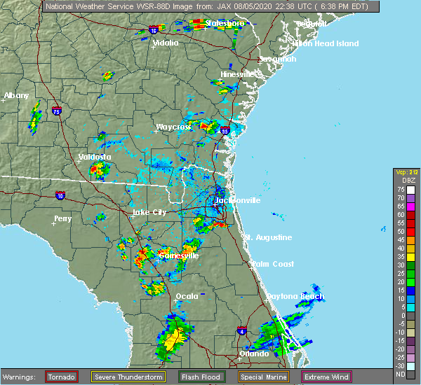 The national weather service in jacksonville has issued a * severe thunderstorm warning for. northwestern st. johns county in northeastern florida. northeastern clay county in northeastern florida. southeastern duval county in northeastern florida. Until 715 pm edt. The national weather service in jacksonville has issued a * severe thunderstorm warning for. northwestern st. johns county in northeastern florida. northeastern clay county in northeastern florida. southeastern duval county in northeastern florida. Until 715 pm edt.
|
| 8/4/2020 8:21 PM EDT |
 At 821 pm edt, a severe thunderstorm was located over bellair-meadowbrook terrace, or near orange park, moving southeast at 5 mph (radar indicated). Hazards include 60 mph wind gusts and quarter size hail. Hail damage to vehicles is expected. expect wind damage to roofs, siding, and trees. Locations impacted include, jacksonville, orange park, jacksonville international arpt, cisco gardens, ortega, oakleaf plantation, bellair-meadowbrook terrace, cecil field, nas jax and normandy. At 821 pm edt, a severe thunderstorm was located over bellair-meadowbrook terrace, or near orange park, moving southeast at 5 mph (radar indicated). Hazards include 60 mph wind gusts and quarter size hail. Hail damage to vehicles is expected. expect wind damage to roofs, siding, and trees. Locations impacted include, jacksonville, orange park, jacksonville international arpt, cisco gardens, ortega, oakleaf plantation, bellair-meadowbrook terrace, cecil field, nas jax and normandy.
|
| 8/4/2020 7:52 PM EDT |
 At 752 pm edt, a severe thunderstorm was located near normandy, or 7 miles northwest of orange park, moving southeast at 5 mph (radar indicated). Hazards include 60 mph wind gusts and quarter size hail. Hail damage to vehicles is expected. Expect wind damage to roofs, siding, and trees. At 752 pm edt, a severe thunderstorm was located near normandy, or 7 miles northwest of orange park, moving southeast at 5 mph (radar indicated). Hazards include 60 mph wind gusts and quarter size hail. Hail damage to vehicles is expected. Expect wind damage to roofs, siding, and trees.
|
| 6/30/2020 4:06 PM EDT |
 The severe thunderstorm warning for northwestern st. johns, northeastern clay and southeastern duval counties will expire at 415 pm edt, the storm which prompted the warning has weakened below severe limits, and has exited the warned area. therefore, the warning will be allowed to expire. however small hail, gusty winds and heavy rain are still possible with this thunderstorm. remember, a severe thunderstorm warning still remains in effect for portions of duval and st johns counties until 445 pm edt. The severe thunderstorm warning for northwestern st. johns, northeastern clay and southeastern duval counties will expire at 415 pm edt, the storm which prompted the warning has weakened below severe limits, and has exited the warned area. therefore, the warning will be allowed to expire. however small hail, gusty winds and heavy rain are still possible with this thunderstorm. remember, a severe thunderstorm warning still remains in effect for portions of duval and st johns counties until 445 pm edt.
|
| 6/30/2020 3:45 PM EDT | A 6 to 8 inch in diamater tree was uprooted at the fleming island post office. the time of damage was based on rada in clay county FL, 0.4 miles NNW of Fleming Island, FL |
| 6/30/2020 3:44 PM EDT |
 At 344 pm edt, a severe thunderstorm was located near middleburg, moving southeast at 20 mph (radar indicated). Hazards include 60 mph wind gusts and quarter size hail. Hail damage to vehicles is expected. Expect wind damage to roofs, siding, and trees. At 344 pm edt, a severe thunderstorm was located near middleburg, moving southeast at 20 mph (radar indicated). Hazards include 60 mph wind gusts and quarter size hail. Hail damage to vehicles is expected. Expect wind damage to roofs, siding, and trees.
|
| 6/30/2020 3:31 PM EDT |
 At 331 pm edt, a severe thunderstorm was located over bellair-meadowbrook terrace, or over orange park, moving southeast at 15 mph (radar indicated). Hazards include 60 mph wind gusts and quarter size hail. Hail damage to vehicles is expected. Expect wind damage to roofs, siding, and trees. At 331 pm edt, a severe thunderstorm was located over bellair-meadowbrook terrace, or over orange park, moving southeast at 15 mph (radar indicated). Hazards include 60 mph wind gusts and quarter size hail. Hail damage to vehicles is expected. Expect wind damage to roofs, siding, and trees.
|
| 6/27/2020 5:25 PM EDT |
 At 525 pm edt, a severe thunderstorm was located over ortega, or near jacksonville, moving east at 15 mph (radar indicated). Hazards include 60 mph wind gusts and quarter size hail. Hail damage to vehicles is expected. Expect wind damage to roofs, siding, and trees. At 525 pm edt, a severe thunderstorm was located over ortega, or near jacksonville, moving east at 15 mph (radar indicated). Hazards include 60 mph wind gusts and quarter size hail. Hail damage to vehicles is expected. Expect wind damage to roofs, siding, and trees.
|
| 6/25/2020 7:08 PM EDT |
 At 708 pm edt, a severe thunderstorm was located near bayard, or near mandarin, moving east at 25 mph (radar indicated). Hazards include 60 mph wind gusts. Expect damage to roofs, siding, and trees. Locations impacted include, orange park, mandarin, unf, fruit cove, nas jax, baymeadows and bayard. At 708 pm edt, a severe thunderstorm was located near bayard, or near mandarin, moving east at 25 mph (radar indicated). Hazards include 60 mph wind gusts. Expect damage to roofs, siding, and trees. Locations impacted include, orange park, mandarin, unf, fruit cove, nas jax, baymeadows and bayard.
|
| 6/25/2020 6:56 PM EDT |
 At 656 pm edt, a severe thunderstorm was located over nas jax, or near mandarin, moving east at 25 mph (radar indicated). Hazards include 60 mph wind gusts. Expect damage to roofs, siding, and trees. Locations impacted include, orange park, mandarin, fruit cove, unf, nas jax, baymeadows, ortega, bayard, bellair-meadowbrook terrace and riverside. At 656 pm edt, a severe thunderstorm was located over nas jax, or near mandarin, moving east at 25 mph (radar indicated). Hazards include 60 mph wind gusts. Expect damage to roofs, siding, and trees. Locations impacted include, orange park, mandarin, fruit cove, unf, nas jax, baymeadows, ortega, bayard, bellair-meadowbrook terrace and riverside.
|
| 6/25/2020 6:38 PM EDT |
 At 638 pm edt, a severe thunderstorm was located near ortega, or near orange park, moving east at 25 mph (radar indicated). Hazards include 60 mph wind gusts. expect damage to roofs, siding, and trees At 638 pm edt, a severe thunderstorm was located near ortega, or near orange park, moving east at 25 mph (radar indicated). Hazards include 60 mph wind gusts. expect damage to roofs, siding, and trees
|
| 6/19/2020 5:32 PM EDT |
 At 532 pm edt, a severe thunderstorm was located over doctors inlet, or 7 miles southwest of orange park, moving northeast at 10 mph (radar indicated). Hazards include 60 mph wind gusts and quarter size hail. Hail damage to vehicles is expected. Expect wind damage to roofs, siding, and trees. At 532 pm edt, a severe thunderstorm was located over doctors inlet, or 7 miles southwest of orange park, moving northeast at 10 mph (radar indicated). Hazards include 60 mph wind gusts and quarter size hail. Hail damage to vehicles is expected. Expect wind damage to roofs, siding, and trees.
|
| 5/28/2020 2:53 PM EDT |
 At 253 pm edt, a severe thunderstorm was located near middleburg, moving northeast at 20 mph (radar indicated). Hazards include 60 mph wind gusts and penny size hail. expect damage to roofs, siding, and trees At 253 pm edt, a severe thunderstorm was located near middleburg, moving northeast at 20 mph (radar indicated). Hazards include 60 mph wind gusts and penny size hail. expect damage to roofs, siding, and trees
|
| 4/13/2020 4:17 PM EDT |
 At 417 pm edt, a severe thunderstorm was located near starke, moving east at 35 mph (radar indicated). Hazards include 60 mph wind gusts and quarter size hail. Hail damage to vehicles is expected. Expect wind damage to roofs, siding, and trees. At 417 pm edt, a severe thunderstorm was located near starke, moving east at 35 mph (radar indicated). Hazards include 60 mph wind gusts and quarter size hail. Hail damage to vehicles is expected. Expect wind damage to roofs, siding, and trees.
|
| 3/31/2020 7:07 PM EDT |
 At 707 pm edt, a severe thunderstorm capable of producing a tornado was located over mandarin, moving east at 50 mph (radar indicated rotation). Hazards include tornado. Flying debris will be dangerous to those caught without shelter. mobile homes will be damaged or destroyed. damage to roofs, windows, and vehicles will occur. tree damage is likely. this dangerous storm will be near, bayard around 715 pm edt. nocatee and durbin around 720 pm edt. ponte vedra beach and sawgrass around 725 pm edt. Palm valley and guana river state park around 730 pm edt. At 707 pm edt, a severe thunderstorm capable of producing a tornado was located over mandarin, moving east at 50 mph (radar indicated rotation). Hazards include tornado. Flying debris will be dangerous to those caught without shelter. mobile homes will be damaged or destroyed. damage to roofs, windows, and vehicles will occur. tree damage is likely. this dangerous storm will be near, bayard around 715 pm edt. nocatee and durbin around 720 pm edt. ponte vedra beach and sawgrass around 725 pm edt. Palm valley and guana river state park around 730 pm edt.
|
| 3/31/2020 7:00 PM EDT | Tree fell on a house causing major damage on fleming island. time estimated by rada in clay county FL, 2.8 miles NNW of Fleming Island, FL |
| 3/31/2020 6:57 PM EDT |
 At 657 pm edt, a severe thunderstorm was located over lakeside, or near orange park, moving east at 45 mph (radar indicated). Hazards include 60 mph wind gusts. Expect damage to roofs, siding, and trees. Locations impacted include, orange park, green cove springs, mandarin, fruit cove, world golf village, fleming island, durbin, bellair-meadowbrook terrace, switzerland and doctors inlet. At 657 pm edt, a severe thunderstorm was located over lakeside, or near orange park, moving east at 45 mph (radar indicated). Hazards include 60 mph wind gusts. Expect damage to roofs, siding, and trees. Locations impacted include, orange park, green cove springs, mandarin, fruit cove, world golf village, fleming island, durbin, bellair-meadowbrook terrace, switzerland and doctors inlet.
|
| 3/31/2020 6:49 PM EDT |
 At 648 pm edt, a severe thunderstorm was located near oakleaf plantation, or near middleburg, moving east at 40 mph (radar indicated). Hazards include 70 mph wind gusts. Expect considerable tree damage. damage is likely to mobile homes, roofs, and outbuildings. Locations impacted include, orange park, green cove springs, middleburg, mandarin, fruit cove, world golf village, fleming island, baymeadows, durbin and oakleaf plantation. At 648 pm edt, a severe thunderstorm was located near oakleaf plantation, or near middleburg, moving east at 40 mph (radar indicated). Hazards include 70 mph wind gusts. Expect considerable tree damage. damage is likely to mobile homes, roofs, and outbuildings. Locations impacted include, orange park, green cove springs, middleburg, mandarin, fruit cove, world golf village, fleming island, baymeadows, durbin and oakleaf plantation.
|
| 3/31/2020 6:39 PM EDT |
 At 639 pm edt, a severe thunderstorm was located near maxville, or 8 miles northwest of middleburg, moving east at 50 mph. this is a very dangerous storm (radar indicated). Hazards include 90 mph wind gusts. You are in a life-threatening situation. flying debris may be deadly to those caught without shelter. mobile homes will be heavily damaged or destroyed. homes and businesses will have substantial roof and window damage. expect extensive tree damage and power outages. Locations impacted include, orange park, green cove springs, middleburg, mandarin, fruit cove, world golf village, maxville, fleming island, baymeadows and durbin. At 639 pm edt, a severe thunderstorm was located near maxville, or 8 miles northwest of middleburg, moving east at 50 mph. this is a very dangerous storm (radar indicated). Hazards include 90 mph wind gusts. You are in a life-threatening situation. flying debris may be deadly to those caught without shelter. mobile homes will be heavily damaged or destroyed. homes and businesses will have substantial roof and window damage. expect extensive tree damage and power outages. Locations impacted include, orange park, green cove springs, middleburg, mandarin, fruit cove, world golf village, maxville, fleming island, baymeadows and durbin.
|
| 3/31/2020 6:31 PM EDT |
 At 630 pm edt, a severe thunderstorm was located 8 miles southwest of maxville, or 8 miles northeast of raiford, moving east at 35 mph (radar indicated). Hazards include 70 mph wind gusts. Expect considerable tree damage. damage is likely to mobile homes, roofs, and outbuildings. Locations impacted include, jacksonville, orange park, green cove springs, starke, unf, mandarin, fruit cove, arlington, middleburg and world golf village. At 630 pm edt, a severe thunderstorm was located 8 miles southwest of maxville, or 8 miles northeast of raiford, moving east at 35 mph (radar indicated). Hazards include 70 mph wind gusts. Expect considerable tree damage. damage is likely to mobile homes, roofs, and outbuildings. Locations impacted include, jacksonville, orange park, green cove springs, starke, unf, mandarin, fruit cove, arlington, middleburg and world golf village.
|
| 3/31/2020 6:28 PM EDT |
 At 628 pm edt, a severe thunderstorm was located 7 miles southwest of maxville, or 8 miles northeast of raiford, moving east at 50 mph (radar indicated). Hazards include 60 mph wind gusts. expect damage to roofs, siding, and trees At 628 pm edt, a severe thunderstorm was located 7 miles southwest of maxville, or 8 miles northeast of raiford, moving east at 50 mph (radar indicated). Hazards include 60 mph wind gusts. expect damage to roofs, siding, and trees
|
| 2/6/2020 10:42 PM EST |
 At 1042 pm est, severe thunderstorms were located along a line extending from 6 miles north of little talbot island to fruit cove to near hollister, moving east at 40 mph (radar indicated). Hazards include 70 mph wind gusts. Expect considerable tree damage. Damage is likely to mobile homes, roofs, and outbuildings. At 1042 pm est, severe thunderstorms were located along a line extending from 6 miles north of little talbot island to fruit cove to near hollister, moving east at 40 mph (radar indicated). Hazards include 70 mph wind gusts. Expect considerable tree damage. Damage is likely to mobile homes, roofs, and outbuildings.
|
| 2/6/2020 10:34 PM EST |
 At 1032 pm est, severe thunderstorms were located along a line extending from near fernandina beach to interlachen, moving east at 65 mph (radar indicated. at 1023 pm, nas jax airport measured a gust to 76 mph). Hazards include up to 70 to 75 mph wind gusts. Expect considerable tree damage. damage is likely to mobile homes, roofs, and outbuildings. Locations impacted include, jacksonville, saint augustine, fernandina beach, palatka, orange park, green cove springs, interlachen, hastings, east palatka and jacksonville international arpt. At 1032 pm est, severe thunderstorms were located along a line extending from near fernandina beach to interlachen, moving east at 65 mph (radar indicated. at 1023 pm, nas jax airport measured a gust to 76 mph). Hazards include up to 70 to 75 mph wind gusts. Expect considerable tree damage. damage is likely to mobile homes, roofs, and outbuildings. Locations impacted include, jacksonville, saint augustine, fernandina beach, palatka, orange park, green cove springs, interlachen, hastings, east palatka and jacksonville international arpt.
|
| 2/6/2020 10:22 PM EST |
 At 1021 pm est, severe thunderstorms were located along a line extending from near yulee to near hawthorne, moving east at 45 mph (radar indicated. at 1012 pm, jacksonville international airport reported a gust to 58 mph). Hazards include 70 mph wind gusts. Expect considerable tree damage. damage is likely to mobile homes, roofs, and outbuildings. Locations impacted include, jacksonville, saint augustine, fernandina beach, palatka, orange park, green cove springs, starke, interlachen, keystone heights and callahan. At 1021 pm est, severe thunderstorms were located along a line extending from near yulee to near hawthorne, moving east at 45 mph (radar indicated. at 1012 pm, jacksonville international airport reported a gust to 58 mph). Hazards include 70 mph wind gusts. Expect considerable tree damage. damage is likely to mobile homes, roofs, and outbuildings. Locations impacted include, jacksonville, saint augustine, fernandina beach, palatka, orange park, green cove springs, starke, interlachen, keystone heights and callahan.
|
| 2/6/2020 9:56 PM EST |
 At 955 pm est, severe thunderstorms were located along a line extending from near callahan to rochelle, moving east at 50 mph (radar indicated). Hazards include 70 mph wind gusts. Expect considerable tree damage. Damage is likely to mobile homes, roofs, and outbuildings. At 955 pm est, severe thunderstorms were located along a line extending from near callahan to rochelle, moving east at 50 mph (radar indicated). Hazards include 70 mph wind gusts. Expect considerable tree damage. Damage is likely to mobile homes, roofs, and outbuildings.
|
| 10/22/2019 3:31 PM EDT |
 At 331 pm edt, severe thunderstorms were located along a line extending from near cecil field to bellair-meadowbrook terrace to 6 miles southwest of fleming island, moving east at 40 mph (radar indicated). Hazards include 60 mph wind gusts. Expect damage to roofs, siding, and trees. Locations impacted include, orange park, mandarin, fruit cove, fleming island, ortega, oakleaf plantation, bellair-meadowbrook terrace, switzerland, cecil field and nas jax. At 331 pm edt, severe thunderstorms were located along a line extending from near cecil field to bellair-meadowbrook terrace to 6 miles southwest of fleming island, moving east at 40 mph (radar indicated). Hazards include 60 mph wind gusts. Expect damage to roofs, siding, and trees. Locations impacted include, orange park, mandarin, fruit cove, fleming island, ortega, oakleaf plantation, bellair-meadowbrook terrace, switzerland, cecil field and nas jax.
|
| 10/22/2019 3:21 PM EDT |
 At 320 pm edt, severe thunderstorms were located along a line extending from near cecil field to near oakleaf plantation to near middleburg, moving east at 40 mph (radar indicated). Hazards include 60 mph wind gusts. Expect damage to roofs, siding, and trees. Locations impacted include, orange park, middleburg, mandarin, fruit cove, fleming island, ortega, oakleaf plantation, bellair-meadowbrook terrace, switzerland and cecil field. At 320 pm edt, severe thunderstorms were located along a line extending from near cecil field to near oakleaf plantation to near middleburg, moving east at 40 mph (radar indicated). Hazards include 60 mph wind gusts. Expect damage to roofs, siding, and trees. Locations impacted include, orange park, middleburg, mandarin, fruit cove, fleming island, ortega, oakleaf plantation, bellair-meadowbrook terrace, switzerland and cecil field.
|
| 10/22/2019 3:14 PM EDT |
 At 313 pm edt, severe thunderstorms were located along a line extending from maxville to near middleburg to camp blanding, moving east at 40 mph (radar indicated). Hazards include 60 mph wind gusts. expect damage to roofs, siding, and trees At 313 pm edt, severe thunderstorms were located along a line extending from maxville to near middleburg to camp blanding, moving east at 40 mph (radar indicated). Hazards include 60 mph wind gusts. expect damage to roofs, siding, and trees
|
| 8/10/2019 6:29 PM EDT |
 At 629 pm edt, a severe thunderstorm was located over fleming island, or over orange park, moving east at 10 mph (radar indicated). Hazards include 60 mph wind gusts. expect damage to roofs, siding, and trees At 629 pm edt, a severe thunderstorm was located over fleming island, or over orange park, moving east at 10 mph (radar indicated). Hazards include 60 mph wind gusts. expect damage to roofs, siding, and trees
|
| 7/17/2019 2:21 PM EDT |
 The severe thunderstorm warning for northwestern st. johns, northeastern clay and southeastern duval counties will expire at 230 pm edt, the storm which prompted the warning has weakened below severe limits, and no longer poses an immediate threat to life or property. therefore, the warning will be allowed to expire. to report severe weather, contact your nearest law enforcement agency. they will relay your report to the national weather service jacksonville. The severe thunderstorm warning for northwestern st. johns, northeastern clay and southeastern duval counties will expire at 230 pm edt, the storm which prompted the warning has weakened below severe limits, and no longer poses an immediate threat to life or property. therefore, the warning will be allowed to expire. to report severe weather, contact your nearest law enforcement agency. they will relay your report to the national weather service jacksonville.
|
| 7/17/2019 2:03 PM EDT |
 At 150 pm edt, a severe thunderstorm was located near baymeadows, or near mandarin, and is nearly stationary (radar indicated). Hazards include 60 mph wind gusts and quarter size hail. Hail damage to vehicles is expected. Expect wind damage to roofs, siding, and trees. At 150 pm edt, a severe thunderstorm was located near baymeadows, or near mandarin, and is nearly stationary (radar indicated). Hazards include 60 mph wind gusts and quarter size hail. Hail damage to vehicles is expected. Expect wind damage to roofs, siding, and trees.
|
| 7/17/2019 1:50 PM EDT |
 At 150 pm edt, a severe thunderstorm was located near baymeadows, or near mandarin, and is nearly stationary (radar indicated). Hazards include 60 mph wind gusts and quarter size hail. Hail damage to vehicles is expected. Expect wind damage to roofs, siding, and trees. At 150 pm edt, a severe thunderstorm was located near baymeadows, or near mandarin, and is nearly stationary (radar indicated). Hazards include 60 mph wind gusts and quarter size hail. Hail damage to vehicles is expected. Expect wind damage to roofs, siding, and trees.
|
| 7/11/2019 6:13 PM EDT |
 The severe thunderstorm warning for north central clay and southwestern duval counties will expire at 615 pm edt. the storm which prompted the warning has moved out of the area. therefore, the warning will be allowed to expire. however gusty winds and heavy rain are still possible with this thunderstorm. To report severe weather, contact your nearest law enforcement. The severe thunderstorm warning for north central clay and southwestern duval counties will expire at 615 pm edt. the storm which prompted the warning has moved out of the area. therefore, the warning will be allowed to expire. however gusty winds and heavy rain are still possible with this thunderstorm. To report severe weather, contact your nearest law enforcement.
|
| 7/11/2019 6:03 PM EDT |
 A severe thunderstorm warning remains in effect until 615 pm edt for north central clay and southwestern duval counties. at 603 pm edt, a severe thunderstorm was located over bellair-meadowbrook terrace, or over orange park, moving northwest at 25 mph. hazard. 60 mph wind gusts. A severe thunderstorm warning remains in effect until 615 pm edt for north central clay and southwestern duval counties. at 603 pm edt, a severe thunderstorm was located over bellair-meadowbrook terrace, or over orange park, moving northwest at 25 mph. hazard. 60 mph wind gusts.
|
| 7/11/2019 5:57 PM EDT |
 A severe thunderstorm warning remains in effect until 615 pm edt for northwestern st. johns. northeastern clay and southwestern duval counties. at 557 pm edt, a severe thunderstorm was located over orange park, moving northwest at 25 mph. hazard. 70 mph wind gusts. A severe thunderstorm warning remains in effect until 615 pm edt for northwestern st. johns. northeastern clay and southwestern duval counties. at 557 pm edt, a severe thunderstorm was located over orange park, moving northwest at 25 mph. hazard. 70 mph wind gusts.
|
| 7/11/2019 5:49 PM EDT |
 A severe thunderstorm warning remains in effect until 615 pm edt for northwestern st. johns. northeastern clay and southwestern duval counties. at 548 pm edt, a severe thunderstorm was located over fleming island, or near fruit cove, moving northwest at 25 mph. hazard. 70 mph wind gusts and penny size hail. A severe thunderstorm warning remains in effect until 615 pm edt for northwestern st. johns. northeastern clay and southwestern duval counties. at 548 pm edt, a severe thunderstorm was located over fleming island, or near fruit cove, moving northwest at 25 mph. hazard. 70 mph wind gusts and penny size hail.
|
| 7/11/2019 5:37 PM EDT |
 The national weather service in jacksonville has issued a * severe thunderstorm warning for. northwestern st. johns county in northeastern florida. northeastern clay county in northeastern florida. southwestern duval county in northeastern florida. Until 615 pm edt. The national weather service in jacksonville has issued a * severe thunderstorm warning for. northwestern st. johns county in northeastern florida. northeastern clay county in northeastern florida. southwestern duval county in northeastern florida. Until 615 pm edt.
|
| 7/3/2019 4:10 PM EDT |
 The severe thunderstorm warning for central clay county will expire at 415 pm edt, the storm which prompted the warning has weakened below severe limits, and no longer poses an immediate threat to life or property. therefore, the warning will be allowed to expire. however gusty winds are still possible with this thunderstorm. The severe thunderstorm warning for central clay county will expire at 415 pm edt, the storm which prompted the warning has weakened below severe limits, and no longer poses an immediate threat to life or property. therefore, the warning will be allowed to expire. however gusty winds are still possible with this thunderstorm.
|
| 7/3/2019 3:34 PM EDT |
 At 334 pm edt, a severe thunderstorm was located near middleburg, moving north at 5 mph (radar indicated). Hazards include 60 mph wind gusts and penny size hail. expect damage to roofs, siding, and trees At 334 pm edt, a severe thunderstorm was located near middleburg, moving north at 5 mph (radar indicated). Hazards include 60 mph wind gusts and penny size hail. expect damage to roofs, siding, and trees
|
| 7/2/2019 5:42 PM EDT |
 The severe thunderstorm warning for north central clay and south central duval counties will expire at 545 pm edt, the storm which prompted the warning has moved out of the area. therefore, the warning will be allowed to expire. however heavy rain is still possible with this thunderstorm. remember, a severe thunderstorm warning still remains in effect for northeastern clay county and west central st. johns county. The severe thunderstorm warning for north central clay and south central duval counties will expire at 545 pm edt, the storm which prompted the warning has moved out of the area. therefore, the warning will be allowed to expire. however heavy rain is still possible with this thunderstorm. remember, a severe thunderstorm warning still remains in effect for northeastern clay county and west central st. johns county.
|
| 7/2/2019 5:33 PM EDT |
 At 532 pm edt, a severe thunderstorm was located over orange park, moving south at 10 mph (trained weather spotters. quarter size hail was recently reported with this storm). Hazards include 60 mph wind gusts and quarter size hail. Hail damage to vehicles is expected. Expect wind damage to roofs, siding, and trees. At 532 pm edt, a severe thunderstorm was located over orange park, moving south at 10 mph (trained weather spotters. quarter size hail was recently reported with this storm). Hazards include 60 mph wind gusts and quarter size hail. Hail damage to vehicles is expected. Expect wind damage to roofs, siding, and trees.
|
| 7/2/2019 5:29 PM EDT |
 At 511 pm edt, a severe thunderstorm was located over nas jax, or near orange park, and is nearly stationary (radar indicated). Hazards include 60 mph wind gusts and quarter size hail. Hail damage to vehicles is expected. Expect wind damage to roofs, siding, and trees. At 511 pm edt, a severe thunderstorm was located over nas jax, or near orange park, and is nearly stationary (radar indicated). Hazards include 60 mph wind gusts and quarter size hail. Hail damage to vehicles is expected. Expect wind damage to roofs, siding, and trees.
|
| 7/2/2019 5:11 PM EDT |
 At 511 pm edt, a severe thunderstorm was located over nas jax, or near orange park, and is nearly stationary (radar indicated). Hazards include 60 mph wind gusts and quarter size hail. Hail damage to vehicles is expected. Expect wind damage to roofs, siding, and trees. At 511 pm edt, a severe thunderstorm was located over nas jax, or near orange park, and is nearly stationary (radar indicated). Hazards include 60 mph wind gusts and quarter size hail. Hail damage to vehicles is expected. Expect wind damage to roofs, siding, and trees.
|
| 6/23/2019 8:47 PM EDT |
 At 847 pm edt, a severe thunderstorm was located over fruit cove, moving southeast at 20 mph (radar indicated). Hazards include 60 mph wind gusts and penny size hail. expect damage to roofs, siding, and trees At 847 pm edt, a severe thunderstorm was located over fruit cove, moving southeast at 20 mph (radar indicated). Hazards include 60 mph wind gusts and penny size hail. expect damage to roofs, siding, and trees
|
| 6/22/2019 7:37 PM EDT |
 The severe thunderstorm warning for central st. johns and east central clay counties will expire at 745 pm edt, the storm which prompted the warning has weakened below severe limits, and no longer poses an immediate threat to life or property. therefore, the warning will be allowed to expire. however gusty winds are still possible with this thunderstorm. The severe thunderstorm warning for central st. johns and east central clay counties will expire at 745 pm edt, the storm which prompted the warning has weakened below severe limits, and no longer poses an immediate threat to life or property. therefore, the warning will be allowed to expire. however gusty winds are still possible with this thunderstorm.
|
| 6/22/2019 7:01 PM EDT |
 At 700 pm edt, a severe thunderstorm was located over picolata, or near green cove springs, moving southeast at 20 mph (radar indicated). Hazards include 60 mph wind gusts and quarter size hail. Hail damage to vehicles is expected. Expect wind damage to roofs, siding, and trees. At 700 pm edt, a severe thunderstorm was located over picolata, or near green cove springs, moving southeast at 20 mph (radar indicated). Hazards include 60 mph wind gusts and quarter size hail. Hail damage to vehicles is expected. Expect wind damage to roofs, siding, and trees.
|
| 5/5/2019 11:55 AM EDT |
 At 1155 am edt, a severe thunderstorm was located over unf, moving northeast at 55 mph (radar indicated). Hazards include 60 mph wind gusts. expect damage to roofs, siding, and trees At 1155 am edt, a severe thunderstorm was located over unf, moving northeast at 55 mph (radar indicated). Hazards include 60 mph wind gusts. expect damage to roofs, siding, and trees
|
| 5/5/2019 11:15 AM EDT |
 At 1114 am edt, severe thunderstorms were located along a line extending from sanderson to near glen st. mary to near maxville to near starke, moving northeast at 45 mph (radar indicated). Hazards include 60 to 70 mph wind gusts. Expect considerable tree damage. Damage is likely to mobile homes, roofs, and outbuildings. At 1114 am edt, severe thunderstorms were located along a line extending from sanderson to near glen st. mary to near maxville to near starke, moving northeast at 45 mph (radar indicated). Hazards include 60 to 70 mph wind gusts. Expect considerable tree damage. Damage is likely to mobile homes, roofs, and outbuildings.
|
| 4/19/2019 12:58 PM EDT |
 At 1257 pm edt, severe thunderstorms were located along a line extending from 7 miles northeast of fernandina beach to jacksonville to 6 miles north of george`s lake, moving east at 40 mph (radar indicated). Hazards include 60 mph wind gusts. Expect damage to roofs, siding, and trees. Locations impacted include, orange park, green cove springs, unf, mandarin, fruit cove, arlington, ponte vedra beach, neptune beach, baymeadows and nocatee. At 1257 pm edt, severe thunderstorms were located along a line extending from 7 miles northeast of fernandina beach to jacksonville to 6 miles north of george`s lake, moving east at 40 mph (radar indicated). Hazards include 60 mph wind gusts. Expect damage to roofs, siding, and trees. Locations impacted include, orange park, green cove springs, unf, mandarin, fruit cove, arlington, ponte vedra beach, neptune beach, baymeadows and nocatee.
|
| 4/19/2019 12:41 PM EDT |
 At 1241 pm edt, severe thunderstorms were located along a line extending from near country club estates to 12 miles east of kings bay base to near hollister, moving northeast at 50 mph (radar indicated). Hazards include 70 mph wind gusts. Expect considerable tree damage. damage is likely to mobile homes, roofs, and outbuildings. locations impacted include, jacksonville, st. marys, brunswick, st. Simons island, fernandina beach, orange park, green cove springs, dock junction, arlington and ponte vedra beach. At 1241 pm edt, severe thunderstorms were located along a line extending from near country club estates to 12 miles east of kings bay base to near hollister, moving northeast at 50 mph (radar indicated). Hazards include 70 mph wind gusts. Expect considerable tree damage. damage is likely to mobile homes, roofs, and outbuildings. locations impacted include, jacksonville, st. marys, brunswick, st. Simons island, fernandina beach, orange park, green cove springs, dock junction, arlington and ponte vedra beach.
|
| 4/19/2019 12:26 PM EDT |
 At 1226 pm edt, severe thunderstorms were located along a line extending from near everett to 6 miles west of waverly to near keystone heights, moving northeast at 50 mph (radar indicated). Hazards include 70 mph wind gusts. Expect considerable tree damage. Damage is likely to mobile homes, roofs, and outbuildings. At 1226 pm edt, severe thunderstorms were located along a line extending from near everett to 6 miles west of waverly to near keystone heights, moving northeast at 50 mph (radar indicated). Hazards include 70 mph wind gusts. Expect considerable tree damage. Damage is likely to mobile homes, roofs, and outbuildings.
|
| 4/19/2019 11:33 AM EDT |
 At 1133 am edt, severe thunderstorms were located along a line extending from near fort mudge to near raiford, moving northeast at 55 mph (radar indicated). Hazards include 70 mph wind gusts. Expect considerable tree damage. Damage is likely to mobile homes, roofs, and outbuildings. At 1133 am edt, severe thunderstorms were located along a line extending from near fort mudge to near raiford, moving northeast at 55 mph (radar indicated). Hazards include 70 mph wind gusts. Expect considerable tree damage. Damage is likely to mobile homes, roofs, and outbuildings.
|
| 12/3/2018 9:50 AM EST |
 At 949 am est, a severe thunderstorm was located over nas jax, or over orange park, moving east at 30 mph (radar indicated). Hazards include 60 mph wind gusts. Expect damage to roofs, siding, and trees. Locations impacted include, orange park, unf, mandarin, fruit cove, ponte vedra beach, neptune beach, sawgrass, baymeadows, nocatee and ortega. At 949 am est, a severe thunderstorm was located over nas jax, or over orange park, moving east at 30 mph (radar indicated). Hazards include 60 mph wind gusts. Expect damage to roofs, siding, and trees. Locations impacted include, orange park, unf, mandarin, fruit cove, ponte vedra beach, neptune beach, sawgrass, baymeadows, nocatee and ortega.
|
| 12/3/2018 9:39 AM EST |
 At 938 am est, a severe thunderstorm was located over bellair-meadowbrook terrace, or near orange park, moving east at 25 mph (radar indicated). Hazards include 60 mph wind gusts. expect damage to roofs, siding, and trees At 938 am est, a severe thunderstorm was located over bellair-meadowbrook terrace, or near orange park, moving east at 25 mph (radar indicated). Hazards include 60 mph wind gusts. expect damage to roofs, siding, and trees
|
| 8/18/2018 7:51 PM EDT |
 The severe thunderstorm warning for northwestern clay county will expire at 800 pm edt, the storm which prompted the warning has weakened below severe limits, and no longer poses an immediate threat to life or property. therefore, the warning will be allowed to expire. however small hail and heavy rain are still possible with this thunderstorm. The severe thunderstorm warning for northwestern clay county will expire at 800 pm edt, the storm which prompted the warning has weakened below severe limits, and no longer poses an immediate threat to life or property. therefore, the warning will be allowed to expire. however small hail and heavy rain are still possible with this thunderstorm.
|
| 8/18/2018 7:45 PM EDT |
 At 745 pm edt, a severe thunderstorm was located over middleburg, and is nearly stationary (radar indicated). Hazards include 60 mph wind gusts and quarter size hail. Hail damage to vehicles is expected. expect wind damage to roofs, siding, and trees. Locations impacted include, middleburg, doctors inlet, lakeside, oakleaf plantation, bellair-meadowbrook terrace, penney farms and asbury lake. At 745 pm edt, a severe thunderstorm was located over middleburg, and is nearly stationary (radar indicated). Hazards include 60 mph wind gusts and quarter size hail. Hail damage to vehicles is expected. expect wind damage to roofs, siding, and trees. Locations impacted include, middleburg, doctors inlet, lakeside, oakleaf plantation, bellair-meadowbrook terrace, penney farms and asbury lake.
|
| 8/18/2018 7:40 PM EDT |
 At 740 pm edt, a severe thunderstorm was located over middleburg, and is nearly stationary (radar indicated). Hazards include quarter size hail. Damage to vehicles is expected. Locations impacted include, middleburg, doctors inlet, lakeside, oakleaf plantation, bellair-meadowbrook terrace, penney farms and asbury lake. At 740 pm edt, a severe thunderstorm was located over middleburg, and is nearly stationary (radar indicated). Hazards include quarter size hail. Damage to vehicles is expected. Locations impacted include, middleburg, doctors inlet, lakeside, oakleaf plantation, bellair-meadowbrook terrace, penney farms and asbury lake.
|
| 8/18/2018 7:35 PM EDT |
 At 735 pm edt, a severe thunderstorm was located over middleburg, and is nearly stationary (radar indicated). Hazards include quarter size hail. damage to vehicles is expected At 735 pm edt, a severe thunderstorm was located over middleburg, and is nearly stationary (radar indicated). Hazards include quarter size hail. damage to vehicles is expected
|
| 7/27/2018 7:01 PM EDT |
 The national weather service in jacksonville has issued a * severe thunderstorm warning for. west central st. johns county in northeastern florida. northeastern clay county in northeastern florida. until 745 pm edt. At 701 pm edt, a severe thunderstorm was located near picolata, or. The national weather service in jacksonville has issued a * severe thunderstorm warning for. west central st. johns county in northeastern florida. northeastern clay county in northeastern florida. until 745 pm edt. At 701 pm edt, a severe thunderstorm was located near picolata, or.
|
| 7/22/2018 1:42 PM EDT |
 At 142 pm edt, severe thunderstorms were located along a line extending from bellair-meadowbrook terrace to 7 miles northwest of bostwick, moving east at 35 mph (radar indicated). Hazards include 70 mph wind gusts and quarter size hail. Hail damage to vehicles is expected. expect considerable tree damage. wind damage is also likely to mobile homes, roofs, and outbuildings. Locations impacted include, orange park, green cove springs, middleburg, fleming island, doctors inlet, lakeside, oakleaf plantation, lake geneva, bellair-meadowbrook terrace and penney farms. At 142 pm edt, severe thunderstorms were located along a line extending from bellair-meadowbrook terrace to 7 miles northwest of bostwick, moving east at 35 mph (radar indicated). Hazards include 70 mph wind gusts and quarter size hail. Hail damage to vehicles is expected. expect considerable tree damage. wind damage is also likely to mobile homes, roofs, and outbuildings. Locations impacted include, orange park, green cove springs, middleburg, fleming island, doctors inlet, lakeside, oakleaf plantation, lake geneva, bellair-meadowbrook terrace and penney farms.
|
| 7/22/2018 1:35 PM EDT |
 At 135 pm edt, severe thunderstorms were located along a line extending from near oakleaf plantation to near george`s lake, moving east at 35 mph (radar indicated). Hazards include 70 mph wind gusts and quarter size hail. Hail damage to vehicles is expected. expect considerable tree damage. wind damage is also likely to mobile homes, roofs, and outbuildings. Locations impacted include, orange park, green cove springs, keystone heights, middleburg, fleming island, oakleaf plantation, lake geneva, bellair-meadowbrook terrace, camp blanding and doctors inlet. At 135 pm edt, severe thunderstorms were located along a line extending from near oakleaf plantation to near george`s lake, moving east at 35 mph (radar indicated). Hazards include 70 mph wind gusts and quarter size hail. Hail damage to vehicles is expected. expect considerable tree damage. wind damage is also likely to mobile homes, roofs, and outbuildings. Locations impacted include, orange park, green cove springs, keystone heights, middleburg, fleming island, oakleaf plantation, lake geneva, bellair-meadowbrook terrace, camp blanding and doctors inlet.
|
| 7/22/2018 1:06 PM EDT |
 At 106 pm edt, severe thunderstorms were located along a line extending from near macclenny to near keystone heights, moving east at 30 mph (radar indicated). Hazards include 70 mph wind gusts and quarter size hail. Hail damage to vehicles is expected. expect considerable tree damage. Wind damage is also likely to mobile homes, roofs, and outbuildings. At 106 pm edt, severe thunderstorms were located along a line extending from near macclenny to near keystone heights, moving east at 30 mph (radar indicated). Hazards include 70 mph wind gusts and quarter size hail. Hail damage to vehicles is expected. expect considerable tree damage. Wind damage is also likely to mobile homes, roofs, and outbuildings.
|
| 7/22/2018 12:07 PM EDT |
 At 1207 pm edt, a severe thunderstorm was located near george`s lake, or 10 miles southwest of green cove springs, moving east at 20 mph (radar indicated). Hazards include 70 mph wind gusts and quarter size hail. Hail damage to vehicles is expected. expect considerable tree damage. wind damage is also likely to mobile homes, roofs, and outbuildings. Locations impacted include, palatka, green cove springs, east palatka, middleburg, fleming island, george`s lake, florahome, bostwick, federal point and doctors inlet. At 1207 pm edt, a severe thunderstorm was located near george`s lake, or 10 miles southwest of green cove springs, moving east at 20 mph (radar indicated). Hazards include 70 mph wind gusts and quarter size hail. Hail damage to vehicles is expected. expect considerable tree damage. wind damage is also likely to mobile homes, roofs, and outbuildings. Locations impacted include, palatka, green cove springs, east palatka, middleburg, fleming island, george`s lake, florahome, bostwick, federal point and doctors inlet.
|
| 7/22/2018 11:57 AM EDT |
 At 1157 am edt, a severe thunderstorm was located near george`s lake, or 12 miles southwest of green cove springs, moving east at 20 mph (radar indicated). Hazards include 70 mph wind gusts and quarter size hail. Hail damage to vehicles is expected. expect considerable tree damage. wind damage is also likely to mobile homes, roofs, and outbuildings. Locations impacted include, palatka, green cove springs, keystone heights, east palatka, middleburg, fleming island, george`s lake, lake geneva, florahome and camp blanding. At 1157 am edt, a severe thunderstorm was located near george`s lake, or 12 miles southwest of green cove springs, moving east at 20 mph (radar indicated). Hazards include 70 mph wind gusts and quarter size hail. Hail damage to vehicles is expected. expect considerable tree damage. wind damage is also likely to mobile homes, roofs, and outbuildings. Locations impacted include, palatka, green cove springs, keystone heights, east palatka, middleburg, fleming island, george`s lake, lake geneva, florahome and camp blanding.
|
| 7/22/2018 11:41 AM EDT |
 At 1140 am edt, a severe thunderstorm was located near kingsley, or 10 miles south of middleburg, moving east at 20 mph (radar indicated). Hazards include 70 mph wind gusts and quarter size hail. Hail damage to vehicles is expected. expect considerable tree damage. Wind damage is also likely to mobile homes, roofs, and outbuildings. At 1140 am edt, a severe thunderstorm was located near kingsley, or 10 miles south of middleburg, moving east at 20 mph (radar indicated). Hazards include 70 mph wind gusts and quarter size hail. Hail damage to vehicles is expected. expect considerable tree damage. Wind damage is also likely to mobile homes, roofs, and outbuildings.
|
| 7/21/2018 2:47 PM EDT |
 At 247 pm edt, severe thunderstorms were located along a line extending from near sawgrass to near camp blanding, moving south at 30 mph (radar indicated). Hazards include 60 mph wind gusts. Expect damage to roofs, siding, and trees. Locations impacted include, saint augustine, palatka, green cove springs, interlachen, keystone heights, hastings, melrose, east palatka, fruit cove and world golf village. At 247 pm edt, severe thunderstorms were located along a line extending from near sawgrass to near camp blanding, moving south at 30 mph (radar indicated). Hazards include 60 mph wind gusts. Expect damage to roofs, siding, and trees. Locations impacted include, saint augustine, palatka, green cove springs, interlachen, keystone heights, hastings, melrose, east palatka, fruit cove and world golf village.
|
| 7/21/2018 2:27 PM EDT |
 At 226 pm edt, severe thunderstorms were located along a line extending from neptune beach to near maxville, moving south at 30 mph (radar indicated). Hazards include 60 mph wind gusts. expect damage to roofs, siding, and trees At 226 pm edt, severe thunderstorms were located along a line extending from neptune beach to near maxville, moving south at 30 mph (radar indicated). Hazards include 60 mph wind gusts. expect damage to roofs, siding, and trees
|
| 6/30/2018 3:17 PM EDT |
 At 317 pm edt, a severe thunderstorm was located over nas jax, or near mandarin, and is nearly stationary (radar indicated). Hazards include 60 mph wind gusts. Expect damage to roofs, siding, and trees. Locations impacted include, orange park, mandarin, fruit cove, nas jax, fleming island, doctors inlet, baymeadows, lakeside and bellair-meadowbrook terrace. At 317 pm edt, a severe thunderstorm was located over nas jax, or near mandarin, and is nearly stationary (radar indicated). Hazards include 60 mph wind gusts. Expect damage to roofs, siding, and trees. Locations impacted include, orange park, mandarin, fruit cove, nas jax, fleming island, doctors inlet, baymeadows, lakeside and bellair-meadowbrook terrace.
|
| 6/30/2018 3:00 PM EDT |
 At 300 pm edt, a severe thunderstorm was located over mandarin, moving southwest at 20 mph (radar indicated). Hazards include 60 mph wind gusts. expect damage to roofs, siding, and trees At 300 pm edt, a severe thunderstorm was located over mandarin, moving southwest at 20 mph (radar indicated). Hazards include 60 mph wind gusts. expect damage to roofs, siding, and trees
|
| 6/26/2018 3:51 PM EDT |
 The severe thunderstorm warning for west central st. johns and east central clay counties will expire at 400 pm edt, the storm which prompted the warning has weakened below severe limits, and no longer poses an immediate threat to life or property. therefore, the warning will be allowed to expire. however heavy rain is still possible with this thunderstorm. to report severe weather, contact your nearest law enforcement agency. they will relay your report to the national weather service jacksonville. The severe thunderstorm warning for west central st. johns and east central clay counties will expire at 400 pm edt, the storm which prompted the warning has weakened below severe limits, and no longer poses an immediate threat to life or property. therefore, the warning will be allowed to expire. however heavy rain is still possible with this thunderstorm. to report severe weather, contact your nearest law enforcement agency. they will relay your report to the national weather service jacksonville.
|
| 6/26/2018 3:34 PM EDT |
 At 333 pm edt, a severe thunderstorm was located over green cove springs, moving south at 10 mph (radar indicated). Hazards include 60 mph wind gusts and penny size hail. Expect damage to roofs, siding, and trees. Locations impacted include, green cove springs, fruit cove and switzerland. At 333 pm edt, a severe thunderstorm was located over green cove springs, moving south at 10 mph (radar indicated). Hazards include 60 mph wind gusts and penny size hail. Expect damage to roofs, siding, and trees. Locations impacted include, green cove springs, fruit cove and switzerland.
|
| 6/26/2018 3:15 PM EDT |
 At 315 pm edt, a severe thunderstorm was located over switzerland, or over fruit cove, moving south at 10 mph (radar indicated). Hazards include 60 mph wind gusts and quarter size hail. Hail damage to vehicles is expected. Expect wind damage to roofs, siding, and trees. At 315 pm edt, a severe thunderstorm was located over switzerland, or over fruit cove, moving south at 10 mph (radar indicated). Hazards include 60 mph wind gusts and quarter size hail. Hail damage to vehicles is expected. Expect wind damage to roofs, siding, and trees.
|
| 6/3/2018 8:01 PM EDT |
 At 800 pm edt, a severe thunderstorm was located over green cove springs, moving east at 15 mph (radar indicated). Hazards include 60 mph wind gusts and quarter size hail. Hail damage to vehicles is expected. expect wind damage to roofs, siding, and trees. Locations impacted include, green cove springs, fruit cove, fleming island, picolata, switzerland, penney farms and bakersville. At 800 pm edt, a severe thunderstorm was located over green cove springs, moving east at 15 mph (radar indicated). Hazards include 60 mph wind gusts and quarter size hail. Hail damage to vehicles is expected. expect wind damage to roofs, siding, and trees. Locations impacted include, green cove springs, fruit cove, fleming island, picolata, switzerland, penney farms and bakersville.
|
| 6/3/2018 7:49 PM EDT |
 At 748 pm edt, a severe thunderstorm was located near green cove springs, moving east at 15 mph (radar indicated). Hazards include 60 mph wind gusts and quarter size hail. Hail damage to vehicles is expected. Expect wind damage to roofs, siding, and trees. At 748 pm edt, a severe thunderstorm was located near green cove springs, moving east at 15 mph (radar indicated). Hazards include 60 mph wind gusts and quarter size hail. Hail damage to vehicles is expected. Expect wind damage to roofs, siding, and trees.
|
| 6/2/2018 6:34 PM EDT |
 At 633 pm edt, a severe thunderstorm was located over nas jax, or near orange park, moving east at 20 mph (radar indicated). Hazards include 60 mph wind gusts and nickel size hail. Expect damage to roofs, siding, and trees. Locations impacted include, jacksonville, orange park, unf, mandarin, ponte vedra beach, arlington, neptune beach, sawgrass, baymeadows and nocatee. At 633 pm edt, a severe thunderstorm was located over nas jax, or near orange park, moving east at 20 mph (radar indicated). Hazards include 60 mph wind gusts and nickel size hail. Expect damage to roofs, siding, and trees. Locations impacted include, jacksonville, orange park, unf, mandarin, ponte vedra beach, arlington, neptune beach, sawgrass, baymeadows and nocatee.
|
| 6/2/2018 6:32 PM EDT |
 At 632 pm edt, a severe thunderstorm was located near middleburg, moving east at 35 mph (radar indicated). Hazards include 60 mph wind gusts. Expect damage to roofs, siding, and trees. Locations impacted include, green cove springs, middleburg, fruit cove, fleming island, doctors inlet, lakeside, switzerland, penney farms and asbury lake. At 632 pm edt, a severe thunderstorm was located near middleburg, moving east at 35 mph (radar indicated). Hazards include 60 mph wind gusts. Expect damage to roofs, siding, and trees. Locations impacted include, green cove springs, middleburg, fruit cove, fleming island, doctors inlet, lakeside, switzerland, penney farms and asbury lake.
|
| 6/2/2018 6:25 PM EDT | Tree down across path between fleming plantation blvd and village square pkw in clay county FL, 1.8 miles N of Fleming Island, FL |
| 6/2/2018 6:17 PM EDT |
 At 617 pm edt, a severe thunderstorm was located over middleburg, moving east at 15 mph (radar indicated). Hazards include 60 mph wind gusts. expect damage to roofs, siding, and trees At 617 pm edt, a severe thunderstorm was located over middleburg, moving east at 15 mph (radar indicated). Hazards include 60 mph wind gusts. expect damage to roofs, siding, and trees
|
| 6/2/2018 6:12 PM EDT |
 At 612 pm edt, a severe thunderstorm was located over ortega, or 7 miles north of orange park, moving east at 25 mph (radar indicated). Hazards include 60 mph wind gusts and nickel size hail. expect damage to roofs, siding, and trees At 612 pm edt, a severe thunderstorm was located over ortega, or 7 miles north of orange park, moving east at 25 mph (radar indicated). Hazards include 60 mph wind gusts and nickel size hail. expect damage to roofs, siding, and trees
|
| 5/28/2018 3:13 PM EDT |
 At 256 pm edt, severe thunderstorms were located along a line extending from near kingsley to near george`s lake to near hollister, moving northeast at 30 mph (radar indicated). Hazards include 60 mph wind gusts. expect damage to roofs, siding, and trees At 256 pm edt, severe thunderstorms were located along a line extending from near kingsley to near george`s lake to near hollister, moving northeast at 30 mph (radar indicated). Hazards include 60 mph wind gusts. expect damage to roofs, siding, and trees
|
| 5/28/2018 2:56 PM EDT |
 At 256 pm edt, severe thunderstorms were located along a line extending from near kingsley to near george`s lake to near hollister, moving northeast at 30 mph (radar indicated). Hazards include 60 mph wind gusts. expect damage to roofs, siding, and trees At 256 pm edt, severe thunderstorms were located along a line extending from near kingsley to near george`s lake to near hollister, moving northeast at 30 mph (radar indicated). Hazards include 60 mph wind gusts. expect damage to roofs, siding, and trees
|
| 4/15/2018 3:22 PM EDT |
 At 321 pm edt, severe thunderstorms were located along a line extending from near baymeadows to near crescent city, moving northeast at 40 mph (radar indicated). Hazards include 60 mph wind gusts. expect damage to roofs, siding, and trees At 321 pm edt, severe thunderstorms were located along a line extending from near baymeadows to near crescent city, moving northeast at 40 mph (radar indicated). Hazards include 60 mph wind gusts. expect damage to roofs, siding, and trees
|
| 4/15/2018 3:04 PM EDT |
 At 303 pm edt, severe thunderstorms were located along a line extending from 6 miles south of kings ferry to jacksonville international arpt to 6 miles southwest of green cove springs, moving northeast at 40 mph (radar indicated). Hazards include 70 mph wind gusts. Expect considerable tree damage. damage is likely to mobile homes, roofs, and outbuildings. locations impacted include, jacksonville, orange park, green cove springs, callahan, jacksonville international arpt, mandarin, fruit cove, arlington, middleburg and yulee. A tornado watch remains in effect until 600 pm edt for northeastern florida, and southeastern georgia. At 303 pm edt, severe thunderstorms were located along a line extending from 6 miles south of kings ferry to jacksonville international arpt to 6 miles southwest of green cove springs, moving northeast at 40 mph (radar indicated). Hazards include 70 mph wind gusts. Expect considerable tree damage. damage is likely to mobile homes, roofs, and outbuildings. locations impacted include, jacksonville, orange park, green cove springs, callahan, jacksonville international arpt, mandarin, fruit cove, arlington, middleburg and yulee. A tornado watch remains in effect until 600 pm edt for northeastern florida, and southeastern georgia.
|
| 4/15/2018 2:45 PM EDT |
 At 245 pm edt, severe thunderstorms were located along a line extending from bryceville to cecil field to near interlachen, moving northeast at 50 mph (radar indicated). Hazards include 70 mph wind gusts. Expect considerable tree damage. Damage is likely to mobile homes, roofs, and outbuildings. At 245 pm edt, severe thunderstorms were located along a line extending from bryceville to cecil field to near interlachen, moving northeast at 50 mph (radar indicated). Hazards include 70 mph wind gusts. Expect considerable tree damage. Damage is likely to mobile homes, roofs, and outbuildings.
|
| 3/20/2018 1:52 PM EDT |
 The severe thunderstorm warning for northwestern st. johns, northeastern clay and southeastern duval counties will expire at 200 pm edt, the storm which prompted the warning has weakened below severe limits, and has exited the warned area. therefore, the warning will be allowed to expire. however small hail, gusty winds and heavy rain are still possible with this thunderstorm. a tornado watch remains in effect until 700 pm edt for northeastern florida. The severe thunderstorm warning for northwestern st. johns, northeastern clay and southeastern duval counties will expire at 200 pm edt, the storm which prompted the warning has weakened below severe limits, and has exited the warned area. therefore, the warning will be allowed to expire. however small hail, gusty winds and heavy rain are still possible with this thunderstorm. a tornado watch remains in effect until 700 pm edt for northeastern florida.
|
| 3/20/2018 1:42 PM EDT |
 At 142 pm edt, a severe thunderstorm was located over fleming island, or near orange park, moving northeast at 50 mph (radar indicated). Hazards include 60 mph wind gusts and quarter size hail. Hail damage to vehicles is expected. expect wind damage to roofs, siding, and trees. locations impacted include, orange park, green cove springs, unf, mandarin, fruit cove, ponte vedra beach, neptune beach, sawgrass, fleming island and baymeadows. A tornado watch remains in effect until 700 pm edt for northeastern florida. At 142 pm edt, a severe thunderstorm was located over fleming island, or near orange park, moving northeast at 50 mph (radar indicated). Hazards include 60 mph wind gusts and quarter size hail. Hail damage to vehicles is expected. expect wind damage to roofs, siding, and trees. locations impacted include, orange park, green cove springs, unf, mandarin, fruit cove, ponte vedra beach, neptune beach, sawgrass, fleming island and baymeadows. A tornado watch remains in effect until 700 pm edt for northeastern florida.
|
| 3/20/2018 1:32 PM EDT |
 At 131 pm edt, a severe thunderstorm was located over middleburg, moving northeast at 50 mph (radar indicated). Hazards include 60 mph wind gusts and penny size hail. Expect damage to roofs, siding, and trees. locations impacted include, jacksonville, orange park, green cove springs, unf, mandarin, fruit cove, arlington, middleburg, ponte vedra beach and neptune beach. A tornado watch remains in effect until 700 pm edt for northeastern florida. At 131 pm edt, a severe thunderstorm was located over middleburg, moving northeast at 50 mph (radar indicated). Hazards include 60 mph wind gusts and penny size hail. Expect damage to roofs, siding, and trees. locations impacted include, jacksonville, orange park, green cove springs, unf, mandarin, fruit cove, arlington, middleburg, ponte vedra beach and neptune beach. A tornado watch remains in effect until 700 pm edt for northeastern florida.
|
| 3/20/2018 1:20 PM EDT |
 At 120 pm edt, a severe thunderstorm was located over kingsley, or near starke, moving northeast at 50 mph (radar indicated). Hazards include 60 mph wind gusts and penny size hail. expect damage to roofs, siding, and trees At 120 pm edt, a severe thunderstorm was located over kingsley, or near starke, moving northeast at 50 mph (radar indicated). Hazards include 60 mph wind gusts and penny size hail. expect damage to roofs, siding, and trees
|
| 8/24/2017 6:15 PM EDT |
 At 615 pm edt, a severe thunderstorm was located near cecil field, or 11 miles northwest of orange park, moving south at 10 mph (radar indicated). Hazards include 60 mph wind gusts and penny size hail. expect damage to roofs, siding, and trees At 615 pm edt, a severe thunderstorm was located near cecil field, or 11 miles northwest of orange park, moving south at 10 mph (radar indicated). Hazards include 60 mph wind gusts and penny size hail. expect damage to roofs, siding, and trees
|
| 8/20/2017 3:39 PM EDT |
 The severe thunderstorm warning for northwestern st. johns, northeastern clay and southeastern duval counties will expire at 345 pm edt, the storm which prompted the warning has weakened below severe limits, and has exited the warned area. therefore, the warning will be allowed to expire. however gusty winds and heavy rain are still possible with this thunderstorm. The severe thunderstorm warning for northwestern st. johns, northeastern clay and southeastern duval counties will expire at 345 pm edt, the storm which prompted the warning has weakened below severe limits, and has exited the warned area. therefore, the warning will be allowed to expire. however gusty winds and heavy rain are still possible with this thunderstorm.
|
| 8/20/2017 3:31 PM EDT |
 At 331 pm edt, a severe thunderstorm was located over nas jax, or near mandarin, moving south at 10 mph (radar indicated). Hazards include 60 mph wind gusts and nickel size hail. Expect damage to roofs, siding, and trees. Locations impacted include, orange park, mandarin, nas jax, baymeadows and bellair-meadowbrook terrace. At 331 pm edt, a severe thunderstorm was located over nas jax, or near mandarin, moving south at 10 mph (radar indicated). Hazards include 60 mph wind gusts and nickel size hail. Expect damage to roofs, siding, and trees. Locations impacted include, orange park, mandarin, nas jax, baymeadows and bellair-meadowbrook terrace.
|
| 8/20/2017 3:22 PM EDT |
 At 322 pm edt, a severe thunderstorm was located over nas jax, or near orange park, moving south at 5 mph (radar indicated). Hazards include 60 mph wind gusts and nickel size hail. Expect damage to roofs, siding, and trees. Locations impacted include, jacksonville, orange park, mandarin, nas jax, baymeadows, ortega, bellair-meadowbrook terrace, riverside, san marco and jacksonville heights. At 322 pm edt, a severe thunderstorm was located over nas jax, or near orange park, moving south at 5 mph (radar indicated). Hazards include 60 mph wind gusts and nickel size hail. Expect damage to roofs, siding, and trees. Locations impacted include, jacksonville, orange park, mandarin, nas jax, baymeadows, ortega, bellair-meadowbrook terrace, riverside, san marco and jacksonville heights.
|
| 8/20/2017 3:10 PM EDT |
 At 310 pm edt, a severe thunderstorm was located near nas jax, or near jacksonville, moving south at 5 mph (radar indicated). Hazards include 60 mph wind gusts and nickel size hail. expect damage to roofs, siding, and trees At 310 pm edt, a severe thunderstorm was located near nas jax, or near jacksonville, moving south at 5 mph (radar indicated). Hazards include 60 mph wind gusts and nickel size hail. expect damage to roofs, siding, and trees
|
| 7/29/2017 3:37 PM EDT |
 At 337 pm edt, a severe thunderstorm was located over green cove springs, moving east at 35 mph (radar indicated). Hazards include 60 mph wind gusts. Expect damage to roofs, siding, and trees. Locations impacted include, saint augustine, green cove springs, fruit cove, world golf village, saint augustine beach, sawgrass, nocatee, durbin, vilano beach and switzerland. At 337 pm edt, a severe thunderstorm was located over green cove springs, moving east at 35 mph (radar indicated). Hazards include 60 mph wind gusts. Expect damage to roofs, siding, and trees. Locations impacted include, saint augustine, green cove springs, fruit cove, world golf village, saint augustine beach, sawgrass, nocatee, durbin, vilano beach and switzerland.
|
| 7/29/2017 3:27 PM EDT |
 At 327 pm edt, a severe thunderstorm was located near green cove springs, moving east at 30 mph (radar indicated). Hazards include 60 mph wind gusts. expect damage to roofs, siding, and trees At 327 pm edt, a severe thunderstorm was located near green cove springs, moving east at 30 mph (radar indicated). Hazards include 60 mph wind gusts. expect damage to roofs, siding, and trees
|
| 7/22/2017 3:31 PM EDT |
 At 330 pm edt, a severe thunderstorm was located over green cove springs, moving northeast at 35 mph (radar indicated). Hazards include 60 mph wind gusts. Expect damage to roofs, siding, and trees. Locations impacted include, green cove springs, fruit cove, switzerland, picolata, fleming island and penney farms. At 330 pm edt, a severe thunderstorm was located over green cove springs, moving northeast at 35 mph (radar indicated). Hazards include 60 mph wind gusts. Expect damage to roofs, siding, and trees. Locations impacted include, green cove springs, fruit cove, switzerland, picolata, fleming island and penney farms.
|
| 7/22/2017 3:09 PM EDT |
 At 309 pm edt, a severe thunderstorm was located near george`s lake, or 11 miles northeast of keystone heights, moving northeast at 35 mph (radar indicated). Hazards include 60 mph wind gusts. expect damage to roofs, siding, and trees At 309 pm edt, a severe thunderstorm was located near george`s lake, or 11 miles northeast of keystone heights, moving northeast at 35 mph (radar indicated). Hazards include 60 mph wind gusts. expect damage to roofs, siding, and trees
|
| 6/26/2017 5:10 PM EDT |
 At 509 pm edt, severe thunderstorms were located along a line extending from near fruit cove to doctors inlet, moving south at 25 mph (radar indicated). Hazards include 60 mph wind gusts and penny size hail. Expect damage to roofs, siding, and trees. Locations impacted include, orange park, green cove springs, unf, mandarin, fruit cove, world golf village, fleming island, baymeadows, durbin and oakleaf plantation. At 509 pm edt, severe thunderstorms were located along a line extending from near fruit cove to doctors inlet, moving south at 25 mph (radar indicated). Hazards include 60 mph wind gusts and penny size hail. Expect damage to roofs, siding, and trees. Locations impacted include, orange park, green cove springs, unf, mandarin, fruit cove, world golf village, fleming island, baymeadows, durbin and oakleaf plantation.
|
| 6/26/2017 4:54 PM EDT |
 At 454 pm edt, severe thunderstorms were located along a line extending from near baymeadows to bellair-meadowbrook terrace, moving south at 25 mph (radar indicated). Hazards include 60 mph wind gusts and penny size hail. expect damage to roofs, siding, and trees At 454 pm edt, severe thunderstorms were located along a line extending from near baymeadows to bellair-meadowbrook terrace, moving south at 25 mph (radar indicated). Hazards include 60 mph wind gusts and penny size hail. expect damage to roofs, siding, and trees
|
| 6/15/2017 7:26 PM EDT |
 The severe thunderstorm warning for northeastern clay county will expire at 730 pm edt, the storm which prompted the warning has weakened below severe limits, and no longer poses an immediate threat to life or property. therefore the warning will be allowed to expire. however gusty winds are still possible with this thunderstorm. The severe thunderstorm warning for northeastern clay county will expire at 730 pm edt, the storm which prompted the warning has weakened below severe limits, and no longer poses an immediate threat to life or property. therefore the warning will be allowed to expire. however gusty winds are still possible with this thunderstorm.
|
| 6/15/2017 7:06 PM EDT |
 At 705 pm edt, a severe thunderstorm was located over fleming island, or near orange park, moving northeast at 10 mph (radar indicated). Hazards include 60 mph wind gusts. Expect damage to roofs, siding, and trees. Locations impacted include, orange park, fleming island, doctors inlet, lakeside and bellair-meadowbrook terrace. At 705 pm edt, a severe thunderstorm was located over fleming island, or near orange park, moving northeast at 10 mph (radar indicated). Hazards include 60 mph wind gusts. Expect damage to roofs, siding, and trees. Locations impacted include, orange park, fleming island, doctors inlet, lakeside and bellair-meadowbrook terrace.
|
| 6/15/2017 6:43 PM EDT |
 At 643 pm edt, a severe thunderstorm was located near doctors inlet, or 7 miles east of middleburg, moving northeast at 10 mph (radar indicated). Hazards include 60 mph wind gusts and quarter size hail. Hail damage to vehicles is expected. Expect wind damage to roofs, siding, and trees. At 643 pm edt, a severe thunderstorm was located near doctors inlet, or 7 miles east of middleburg, moving northeast at 10 mph (radar indicated). Hazards include 60 mph wind gusts and quarter size hail. Hail damage to vehicles is expected. Expect wind damage to roofs, siding, and trees.
|
| 6/14/2017 6:26 PM EDT |
 At 626 pm edt, a severe thunderstorm was located over maxville, or 11 miles northwest of middleburg, moving east at 25 mph (radar indicated). Hazards include 60 mph wind gusts. Expect damage to roofs, siding, and trees. Locations impacted include, cecil field, maxville, doctors inlet, lakeside, oakleaf plantation, bellair-meadowbrook terrace and jacksonville heights. At 626 pm edt, a severe thunderstorm was located over maxville, or 11 miles northwest of middleburg, moving east at 25 mph (radar indicated). Hazards include 60 mph wind gusts. Expect damage to roofs, siding, and trees. Locations impacted include, cecil field, maxville, doctors inlet, lakeside, oakleaf plantation, bellair-meadowbrook terrace and jacksonville heights.
|
| 6/14/2017 6:14 PM EDT |
 At 614 pm edt, a severe thunderstorm was located near maxville, or 11 miles northeast of raiford, moving east at 15 mph (radar indicated). Hazards include 60 mph wind gusts. expect damage to roofs, siding, and trees At 614 pm edt, a severe thunderstorm was located near maxville, or 11 miles northeast of raiford, moving east at 15 mph (radar indicated). Hazards include 60 mph wind gusts. expect damage to roofs, siding, and trees
|
| 5/30/2017 6:25 PM EDT |
 The severe thunderstorm warning for northwestern st. johns, northeastern clay and south central duval counties will expire at 630 pm edt, the storms which prompted the warning have weakened below severe limits, and no longer pose an immediate threat to life or property. therefore the warning will be allowed to expire. however gusty winds and heavy rain are still possible with these thunderstorms. The severe thunderstorm warning for northwestern st. johns, northeastern clay and south central duval counties will expire at 630 pm edt, the storms which prompted the warning have weakened below severe limits, and no longer pose an immediate threat to life or property. therefore the warning will be allowed to expire. however gusty winds and heavy rain are still possible with these thunderstorms.
|
| 5/30/2017 6:02 PM EDT |
 At 602 pm edt, severe thunderstorms were located along a line extending from near doctors inlet to near picolata, moving north at 10 mph (radar indicated). Hazards include 60 mph wind gusts and quarter size hail. Hail damage to vehicles is expected. expect wind damage to roofs, siding, and trees. Locations impacted include, orange park, green cove springs, mandarin, fruit cove, fleming island, bellair-meadowbrook terrace, switzerland, picolata, doctors inlet and bayard. At 602 pm edt, severe thunderstorms were located along a line extending from near doctors inlet to near picolata, moving north at 10 mph (radar indicated). Hazards include 60 mph wind gusts and quarter size hail. Hail damage to vehicles is expected. expect wind damage to roofs, siding, and trees. Locations impacted include, orange park, green cove springs, mandarin, fruit cove, fleming island, bellair-meadowbrook terrace, switzerland, picolata, doctors inlet and bayard.
|
| 5/30/2017 5:46 PM EDT |
 At 546 pm edt, severe thunderstorms were located along a line extending from near doctors inlet to near picolata, moving north at 10 mph (radar indicated). Hazards include 60 mph wind gusts and quarter size hail. Hail damage to vehicles is expected. Expect wind damage to roofs, siding, and trees. At 546 pm edt, severe thunderstorms were located along a line extending from near doctors inlet to near picolata, moving north at 10 mph (radar indicated). Hazards include 60 mph wind gusts and quarter size hail. Hail damage to vehicles is expected. Expect wind damage to roofs, siding, and trees.
|
| 5/24/2017 11:47 AM EDT |
 At 1147 am edt, a severe thunderstorm was located over mandarin, moving northeast at 35 mph (radar indicated). Hazards include 60 mph wind gusts. Expect damage to roofs, siding, and trees. locations impacted include, mandarin, unf, fruit cove, ponte vedra beach, palm valley, nas jax, sawgrass, baymeadows, bayard and san pablo. a tornado watch remains in effect until 300 pm edt for northeastern florida. A tornado watch also remains in effect until 600 pm edt for northeastern florida. At 1147 am edt, a severe thunderstorm was located over mandarin, moving northeast at 35 mph (radar indicated). Hazards include 60 mph wind gusts. Expect damage to roofs, siding, and trees. locations impacted include, mandarin, unf, fruit cove, ponte vedra beach, palm valley, nas jax, sawgrass, baymeadows, bayard and san pablo. a tornado watch remains in effect until 300 pm edt for northeastern florida. A tornado watch also remains in effect until 600 pm edt for northeastern florida.
|
| 5/24/2017 11:37 AM EDT |
 At 1136 am edt, a severe thunderstorm was located over fleming island, or near orange park, moving northeast at 35 mph (radar indicated). Hazards include 60 mph wind gusts. expect damage to roofs, siding, and trees At 1136 am edt, a severe thunderstorm was located over fleming island, or near orange park, moving northeast at 35 mph (radar indicated). Hazards include 60 mph wind gusts. expect damage to roofs, siding, and trees
|
| 5/22/2017 4:43 PM EDT |
 At 443 pm edt, severe thunderstorms were located along a line extending from near oceanway to bayard to near picolata, moving east at 15 mph (radar indicated). Hazards include 60 mph wind gusts and penny size hail. Expect damage to roofs, siding, and trees. Locations impacted include, jacksonville, orange park, green cove springs, unf, mandarin, fruit cove, arlington, ponte vedra beach, neptune beach and world golf village. At 443 pm edt, severe thunderstorms were located along a line extending from near oceanway to bayard to near picolata, moving east at 15 mph (radar indicated). Hazards include 60 mph wind gusts and penny size hail. Expect damage to roofs, siding, and trees. Locations impacted include, jacksonville, orange park, green cove springs, unf, mandarin, fruit cove, arlington, ponte vedra beach, neptune beach and world golf village.
|
| 5/22/2017 4:30 PM EDT |
 At 429 pm edt, severe thunderstorms were located along a line extending from arlington to green cove springs, moving northeast at 40 mph (radar indicated). Hazards include 60 mph wind gusts and penny size hail. expect damage to roofs, siding, and trees At 429 pm edt, severe thunderstorms were located along a line extending from arlington to green cove springs, moving northeast at 40 mph (radar indicated). Hazards include 60 mph wind gusts and penny size hail. expect damage to roofs, siding, and trees
|
| 5/4/2017 4:37 PM EDT |
 At 437 pm edt, a severe thunderstorm was located near bayard, or near fruit cove, moving northeast at 30 mph (radar indicated). Hazards include 70 mph wind gusts and quarter size hail. Hail damage to vehicles is expected. expect considerable tree damage. wind damage is also likely to mobile homes, roofs, and outbuildings. this severe thunderstorm will be near, nocatee around 445 pm edt. baymeadows around 450 pm edt. palm valley around 455 pm edt. unf around 500 pm edt. ponte vedra beach, san pablo, sawgrass and craig field around 505 pm edt. Neptune beach around 515 pm edt. At 437 pm edt, a severe thunderstorm was located near bayard, or near fruit cove, moving northeast at 30 mph (radar indicated). Hazards include 70 mph wind gusts and quarter size hail. Hail damage to vehicles is expected. expect considerable tree damage. wind damage is also likely to mobile homes, roofs, and outbuildings. this severe thunderstorm will be near, nocatee around 445 pm edt. baymeadows around 450 pm edt. palm valley around 455 pm edt. unf around 500 pm edt. ponte vedra beach, san pablo, sawgrass and craig field around 505 pm edt. Neptune beach around 515 pm edt.
|
| 5/4/2017 4:15 PM EDT |
 At 415 pm edt, a severe thunderstorm was located near san marco, or near arlington, moving northeast at 30 mph (radar indicated). Hazards include 60 mph wind gusts and penny size hail. expect damage to roofs, siding, and trees At 415 pm edt, a severe thunderstorm was located near san marco, or near arlington, moving northeast at 30 mph (radar indicated). Hazards include 60 mph wind gusts and penny size hail. expect damage to roofs, siding, and trees
|
| 4/4/2017 5:10 AM EDT |
 The severe thunderstorm warning for northern st. johns and southeastern duval counties will expire at 515 am edt, the storm which prompted the warning has weakened below severe limits, and no longer poses an immediate threat to life or property. therefore the warning will be allowed to expire. The severe thunderstorm warning for northern st. johns and southeastern duval counties will expire at 515 am edt, the storm which prompted the warning has weakened below severe limits, and no longer poses an immediate threat to life or property. therefore the warning will be allowed to expire.
|
| 4/4/2017 4:34 AM EDT |
 At 434 am edt, a severe thunderstorm was located over baymeadows, or near unf, moving east at 35 mph (radar indicated). Hazards include 60 mph wind gusts and penny size hail. expect damage to roofs, siding, and trees At 434 am edt, a severe thunderstorm was located over baymeadows, or near unf, moving east at 35 mph (radar indicated). Hazards include 60 mph wind gusts and penny size hail. expect damage to roofs, siding, and trees
|
| 2/7/2017 10:25 PM EST | Nws employee on way into work estimated wind gusts of 60-70 mph along u.s. highway 17 between pace island and doctors lake bridg in clay county FL, 2.5 miles SSW of Fleming Island, FL |
| 2/7/2017 10:20 PM EST | Large tree blocking town center boulevard near the woodlands subdivision on fleming islan in clay county FL, 1.8 miles NNE of Fleming Island, FL |
| 1/22/2017 7:15 PM EST |
 At 714 pm est, severe thunderstorms were located along a line extending from 6 miles northeast of kings bay base to near bostwick, moving northeast at 95 mph (radar indicated). Hazards include 60 mph wind gusts and quarter size hail. Hail damage to vehicles is expected. Expect wind damage to roofs, siding, and trees. At 714 pm est, severe thunderstorms were located along a line extending from 6 miles northeast of kings bay base to near bostwick, moving northeast at 95 mph (radar indicated). Hazards include 60 mph wind gusts and quarter size hail. Hail damage to vehicles is expected. Expect wind damage to roofs, siding, and trees.
|
| 1/22/2017 7:01 PM EST |
 At 701 pm est, severe thunderstorms were located along a line extending from near kings bay base to near bostwick, moving northeast at 70 mph (radar indicated). Hazards include 60 mph wind gusts and quarter size hail. Hail damage to vehicles is expected. expect wind damage to roofs, siding, and trees. locations impacted include, jacksonville, saint augustine, fernandina beach, palatka, orange park, green cove springs, interlachen, callahan, hastings and jacksonville international arpt. A tornado watch remains in effect until 800 pm est for northern and northeastern florida. At 701 pm est, severe thunderstorms were located along a line extending from near kings bay base to near bostwick, moving northeast at 70 mph (radar indicated). Hazards include 60 mph wind gusts and quarter size hail. Hail damage to vehicles is expected. expect wind damage to roofs, siding, and trees. locations impacted include, jacksonville, saint augustine, fernandina beach, palatka, orange park, green cove springs, interlachen, callahan, hastings and jacksonville international arpt. A tornado watch remains in effect until 800 pm est for northern and northeastern florida.
|
| 1/22/2017 6:55 PM EST |
 At 654 pm est, severe thunderstorms were located along a line extending from st. marys to near bardin, moving northeast at 70 mph (radar indicated). Hazards include 60 mph wind gusts and quarter size hail. Hail damage to vehicles is expected. expect wind damage to roofs, siding, and trees. locations impacted include, jacksonville, saint augustine, fernandina beach, palatka, orange park, green cove springs, interlachen, keystone heights, callahan and hastings. A tornado watch remains in effect until 800 pm est for northeastern and northern florida, and southeastern georgia. At 654 pm est, severe thunderstorms were located along a line extending from st. marys to near bardin, moving northeast at 70 mph (radar indicated). Hazards include 60 mph wind gusts and quarter size hail. Hail damage to vehicles is expected. expect wind damage to roofs, siding, and trees. locations impacted include, jacksonville, saint augustine, fernandina beach, palatka, orange park, green cove springs, interlachen, keystone heights, callahan and hastings. A tornado watch remains in effect until 800 pm est for northeastern and northern florida, and southeastern georgia.
|
| 1/22/2017 6:46 PM EST |
 At 646 pm est, severe thunderstorms were located along a line extending from near yulee to interlachen, moving northeast at 70 mph (radar indicated). Hazards include 60 mph wind gusts and quarter size hail. Hail damage to vehicles is expected. expect wind damage to roofs, siding, and trees. locations impacted include, jacksonville, saint augustine, fernandina beach, palatka, orange park, green cove springs, starke, interlachen, keystone heights and callahan. A tornado watch remains in effect until 800 pm est for northeastern and northern florida, and southeastern georgia. At 646 pm est, severe thunderstorms were located along a line extending from near yulee to interlachen, moving northeast at 70 mph (radar indicated). Hazards include 60 mph wind gusts and quarter size hail. Hail damage to vehicles is expected. expect wind damage to roofs, siding, and trees. locations impacted include, jacksonville, saint augustine, fernandina beach, palatka, orange park, green cove springs, starke, interlachen, keystone heights and callahan. A tornado watch remains in effect until 800 pm est for northeastern and northern florida, and southeastern georgia.
|
| 1/22/2017 6:32 PM EST |
 At 631 pm est, severe thunderstorms were located along a line extending from 6 miles west of ratliff to cross creek, moving northeast at 70 mph (radar indicated). Hazards include 60 mph wind gusts and quarter size hail. Hail damage to vehicles is expected. expect wind damage to roofs, siding, and trees. locations impacted include, jacksonville, gainesville, saint augustine, fernandina beach, palatka, orange park, green cove springs, starke, lake butler and interlachen. A tornado watch remains in effect until 800 pm est for northeastern and northern florida, and southeastern georgia. At 631 pm est, severe thunderstorms were located along a line extending from 6 miles west of ratliff to cross creek, moving northeast at 70 mph (radar indicated). Hazards include 60 mph wind gusts and quarter size hail. Hail damage to vehicles is expected. expect wind damage to roofs, siding, and trees. locations impacted include, jacksonville, gainesville, saint augustine, fernandina beach, palatka, orange park, green cove springs, starke, lake butler and interlachen. A tornado watch remains in effect until 800 pm est for northeastern and northern florida, and southeastern georgia.
|
| 1/22/2017 6:17 PM EST |
 At 617 pm est, severe thunderstorms were located along a line extending from 8 miles north of macclenny to near williston, moving northeast at 70 mph (radar indicated). Hazards include 60 mph wind gusts and quarter size hail. Hail damage to vehicles is expected. expect wind damage to roofs, siding, and trees. locations impacted include, jacksonville, gainesville, saint augustine, fernandina beach, palatka, orange park, green cove springs, starke, lake butler and interlachen. A tornado watch remains in effect until 800 pm est for northeastern and northern florida, and southeastern georgia. At 617 pm est, severe thunderstorms were located along a line extending from 8 miles north of macclenny to near williston, moving northeast at 70 mph (radar indicated). Hazards include 60 mph wind gusts and quarter size hail. Hail damage to vehicles is expected. expect wind damage to roofs, siding, and trees. locations impacted include, jacksonville, gainesville, saint augustine, fernandina beach, palatka, orange park, green cove springs, starke, lake butler and interlachen. A tornado watch remains in effect until 800 pm est for northeastern and northern florida, and southeastern georgia.
|
| 1/22/2017 6:06 PM EST |
 At 605 pm est, severe thunderstorms were located along a line extending from near sanderson to near williston highlands, moving northeast at 70 mph (radar indicated). Hazards include 60 mph wind gusts and quarter size hail. Hail damage to vehicles is expected. Expect wind damage to roofs, siding, and trees. At 605 pm est, severe thunderstorms were located along a line extending from near sanderson to near williston highlands, moving northeast at 70 mph (radar indicated). Hazards include 60 mph wind gusts and quarter size hail. Hail damage to vehicles is expected. Expect wind damage to roofs, siding, and trees.
|
| 1/22/2017 3:22 PM EST |
 At 322 pm est, a severe thunderstorm was located near mandarin, moving northeast at 60 mph (radar indicated). Hazards include 60 mph wind gusts. Expect damage to roofs, siding, and trees. locations impacted include, jacksonville, orange park, middleburg, ponte vedra beach, unf, fruit cove, mandarin, arlington, neptune beach and ortega. A tornado watch remains in effect until 800 pm est for northeastern florida. At 322 pm est, a severe thunderstorm was located near mandarin, moving northeast at 60 mph (radar indicated). Hazards include 60 mph wind gusts. Expect damage to roofs, siding, and trees. locations impacted include, jacksonville, orange park, middleburg, ponte vedra beach, unf, fruit cove, mandarin, arlington, neptune beach and ortega. A tornado watch remains in effect until 800 pm est for northeastern florida.
|
| 1/22/2017 3:03 PM EST |
 At 303 pm est, a severe thunderstorm was located near middleburg, moving northeast at 50 mph (radar indicated). Hazards include 60 mph wind gusts. expect damage to roofs, siding, and trees At 303 pm est, a severe thunderstorm was located near middleburg, moving northeast at 50 mph (radar indicated). Hazards include 60 mph wind gusts. expect damage to roofs, siding, and trees
|
| 12/6/2016 8:51 AM EST |
 The severe thunderstorm warning for northwestern st. johns and southeastern duval counties will expire at 900 am est, the storm which prompted the warning has moved out of the area. therefore the warning will be allowed to expire. to report severe weather, contact your nearest law enforcement agency. they will relay your report to the national weather service jacksonville. The severe thunderstorm warning for northwestern st. johns and southeastern duval counties will expire at 900 am est, the storm which prompted the warning has moved out of the area. therefore the warning will be allowed to expire. to report severe weather, contact your nearest law enforcement agency. they will relay your report to the national weather service jacksonville.
|
| 12/6/2016 8:21 AM EST |
 At 821 am est, a severe thunderstorm was located over switzerland, or over fruit cove, moving east at 40 mph (radar indicated). Hazards include 70 mph wind gusts. Expect considerable tree damage. damage is likely to mobile homes, roofs, and outbuildings. Locations impacted include, ponte vedra beach, fruit cove, mandarin, palm valley, bayard, sawgrass, nocatee, durbin and switzerland. At 821 am est, a severe thunderstorm was located over switzerland, or over fruit cove, moving east at 40 mph (radar indicated). Hazards include 70 mph wind gusts. Expect considerable tree damage. damage is likely to mobile homes, roofs, and outbuildings. Locations impacted include, ponte vedra beach, fruit cove, mandarin, palm valley, bayard, sawgrass, nocatee, durbin and switzerland.
|
| 12/6/2016 8:15 AM EST |
 At 813 am est, a severe thunderstorm was located near fleming island, or near green cove springs, moving northeast at 40 mph (radar indicated). Hazards include 70 mph wind gusts. Expect considerable tree damage. Damage is likely to mobile homes, roofs, and outbuildings. At 813 am est, a severe thunderstorm was located near fleming island, or near green cove springs, moving northeast at 40 mph (radar indicated). Hazards include 70 mph wind gusts. Expect considerable tree damage. Damage is likely to mobile homes, roofs, and outbuildings.
|
| 9/2/2016 11:17 AM EDT |
 At 1116 am edt, radar indicated a thunderstorm with rotation near fruit cove, moving northeast at 45 mph. this storm could produce a brief tornado at any time. a second storm with weak rotation was over northeast clay county and will pass just north of green cove springs (radar indicated rotation). Hazards include tornado. Flying debris will be dangerous to those caught without shelter. mobile homes will be damaged or destroyed. damage to roofs, windows, and vehicles will occur. tree damage is likely. This dangerous storm will be near, durbin and nocatee around 1125 am edt. At 1116 am edt, radar indicated a thunderstorm with rotation near fruit cove, moving northeast at 45 mph. this storm could produce a brief tornado at any time. a second storm with weak rotation was over northeast clay county and will pass just north of green cove springs (radar indicated rotation). Hazards include tornado. Flying debris will be dangerous to those caught without shelter. mobile homes will be damaged or destroyed. damage to roofs, windows, and vehicles will occur. tree damage is likely. This dangerous storm will be near, durbin and nocatee around 1125 am edt.
|
| 9/2/2016 11:09 AM EDT |
 At 1109 am edt, a severe thunderstorm capable of producing a tornado was located near switzerland, or near fruit cove, moving northeast at 45 mph (radar indicated rotation). Hazards include tornado. Flying debris will be dangerous to those caught without shelter. mobile homes will be damaged or destroyed. damage to roofs, windows, and vehicles will occur. tree damage is likely. This dangerous storm will be near, durbin and nocatee around 1125 am edt. At 1109 am edt, a severe thunderstorm capable of producing a tornado was located near switzerland, or near fruit cove, moving northeast at 45 mph (radar indicated rotation). Hazards include tornado. Flying debris will be dangerous to those caught without shelter. mobile homes will be damaged or destroyed. damage to roofs, windows, and vehicles will occur. tree damage is likely. This dangerous storm will be near, durbin and nocatee around 1125 am edt.
|
| 8/13/2016 5:15 PM EDT |
 At 514 pm edt, a severe thunderstorm was located near middleburg, moving west at 15 mph (radar indicated). Hazards include 60 mph wind gusts and quarter size hail. Hail damage to vehicles is expected. Expect wind damage to roofs, siding, and trees. At 514 pm edt, a severe thunderstorm was located near middleburg, moving west at 15 mph (radar indicated). Hazards include 60 mph wind gusts and quarter size hail. Hail damage to vehicles is expected. Expect wind damage to roofs, siding, and trees.
|
| 7/15/2016 3:05 PM EDT |
 At 304 pm edt, a severe thunderstorm was located near green cove springs, moving north at 10 mph (radar indicated). Hazards include 60 mph wind gusts and penny size hail. Expect damage to roofs. siding. and trees. Locations impacted include, jacksonville, orange park, green cove springs, fruit cove, mandarin, middleburg, ortega, baymeadows, oakleaf plantation, switzerland, doctors inlet, cecil field, fleming island, nas jax, lakeside, bellair-meadowbrook terrace, penney farms, jacksonville heights and asbury lake. At 304 pm edt, a severe thunderstorm was located near green cove springs, moving north at 10 mph (radar indicated). Hazards include 60 mph wind gusts and penny size hail. Expect damage to roofs. siding. and trees. Locations impacted include, jacksonville, orange park, green cove springs, fruit cove, mandarin, middleburg, ortega, baymeadows, oakleaf plantation, switzerland, doctors inlet, cecil field, fleming island, nas jax, lakeside, bellair-meadowbrook terrace, penney farms, jacksonville heights and asbury lake.
|
| 7/15/2016 2:47 PM EDT |
 At 246 pm edt, a severe thunderstorm was located over green cove springs, moving north at 20 mph (radar indicated). Hazards include 60 mph wind gusts and penny size hail. Expect damage to roofs. siding. And trees. At 246 pm edt, a severe thunderstorm was located over green cove springs, moving north at 20 mph (radar indicated). Hazards include 60 mph wind gusts and penny size hail. Expect damage to roofs. siding. And trees.
|
| 7/12/2016 4:28 PM EDT |
 At 428 pm edt, a severe thunderstorm was located over green cove springs, moving south at 15 mph (radar indicated). Hazards include 70 mph wind gusts and quarter size hail. Hail damage to vehicles is expected. expect considerable tree damage. wind damage is also likely to mobile homes, roofs, and outbuildings. Locations impacted include, fruit cove and switzerland. At 428 pm edt, a severe thunderstorm was located over green cove springs, moving south at 15 mph (radar indicated). Hazards include 70 mph wind gusts and quarter size hail. Hail damage to vehicles is expected. expect considerable tree damage. wind damage is also likely to mobile homes, roofs, and outbuildings. Locations impacted include, fruit cove and switzerland.
|
| 7/12/2016 4:25 PM EDT | Off-duty nws employee estimated wind gust of 60 to 70 mp in clay county FL, 2.6 miles NNW of Fleming Island, FL |
| 7/12/2016 4:25 PM EDT | Updated...emergency manager reported 15 trees down on homes... 5 roads blocked by trees and 5 out buildings damaged by trees in fleming islan in clay county FL, 1.1 miles ENE of Fleming Island, FL |
| 7/12/2016 4:25 PM EDT |
 At 425 pm edt, a severe thunderstorm was located over green cove springs, moving southwest at 10 mph (radar indicated). Hazards include 70 mph wind gusts and quarter size hail. Hail damage to vehicles is expected. expect considerable tree damage. Wind damage is also likely to mobile homes, roofs, and outbuildings. At 425 pm edt, a severe thunderstorm was located over green cove springs, moving southwest at 10 mph (radar indicated). Hazards include 70 mph wind gusts and quarter size hail. Hail damage to vehicles is expected. expect considerable tree damage. Wind damage is also likely to mobile homes, roofs, and outbuildings.
|
| 7/12/2016 4:12 PM EDT |
 At 412 pm edt, a severe thunderstorm was located over switzerland, or over fruit cove, moving south at 20 mph (radar indicated). Hazards include 60 mph wind gusts and quarter size hail. Hail damage to vehicles is expected. Expect wind damage to roofs, siding, and trees. At 412 pm edt, a severe thunderstorm was located over switzerland, or over fruit cove, moving south at 20 mph (radar indicated). Hazards include 60 mph wind gusts and quarter size hail. Hail damage to vehicles is expected. Expect wind damage to roofs, siding, and trees.
|
| 5/19/2016 6:49 PM EDT | The national weather service in jacksonville has issued a * severe thunderstorm warning for. central st. johns county in northeastern florida. central clay county in northeastern florida. until 730 pm edt * at 649 pm edt. A severe thunderstorm was located near green cove. |
| 4/2/2016 9:21 AM EDT |
 At 921 am edt, a severe thunderstorm was located over new river, or near raiford, moving east at 65 mph (radar indicated). Hazards include 60 mph wind gusts and quarter size hail. Hail damage to vehicles is expected. Expect wind damage to roofs, siding, and trees. At 921 am edt, a severe thunderstorm was located over new river, or near raiford, moving east at 65 mph (radar indicated). Hazards include 60 mph wind gusts and quarter size hail. Hail damage to vehicles is expected. Expect wind damage to roofs, siding, and trees.
|
| 2/24/2016 7:51 AM EST |
 At 751 am est, a severe thunderstorm was located near middleburg, moving northeast at 45 mph (radar indicated). Hazards include 60 mph wind gusts. Expect damage to roofs. siding and trees. locations impacted include, jacksonville, orange park, middleburg, mandarin, arlington, fruit cove, ortega, san marco, riverside, oakleaf plantation, fleming island, nas jax, lakeside, kingsley, bayard, baymeadows, maxville, cisco gardens, camp blanding and doctors inlet. A tornado watch remains in effect until 1000 am est for northeastern florida. At 751 am est, a severe thunderstorm was located near middleburg, moving northeast at 45 mph (radar indicated). Hazards include 60 mph wind gusts. Expect damage to roofs. siding and trees. locations impacted include, jacksonville, orange park, middleburg, mandarin, arlington, fruit cove, ortega, san marco, riverside, oakleaf plantation, fleming island, nas jax, lakeside, kingsley, bayard, baymeadows, maxville, cisco gardens, camp blanding and doctors inlet. A tornado watch remains in effect until 1000 am est for northeastern florida.
|
| 2/24/2016 7:36 AM EST |
 At 735 am est, a severe thunderstorm was located near starke, moving northeast at 45 mph (radar indicated). Hazards include 70 mph wind gusts. Expect considerable tree damage. Damage is likely to mobile homes, roofs and outbuildings. At 735 am est, a severe thunderstorm was located near starke, moving northeast at 45 mph (radar indicated). Hazards include 70 mph wind gusts. Expect considerable tree damage. Damage is likely to mobile homes, roofs and outbuildings.
|
| 8/13/2015 3:33 PM EDT |
 At 333 pm edt, doppler radar indicated a severe thunderstorm capable of producing damaging winds in excess of 60 mph. this storm was located over oakleaf plantation, or 7 miles northeast of middleburg, moving south at 5 mph. locations impacted include, middleburg, doctors inlet, oakleaf plantation, lakeside, bellair-meadowbrook terrace and asbury lake. At 333 pm edt, doppler radar indicated a severe thunderstorm capable of producing damaging winds in excess of 60 mph. this storm was located over oakleaf plantation, or 7 miles northeast of middleburg, moving south at 5 mph. locations impacted include, middleburg, doctors inlet, oakleaf plantation, lakeside, bellair-meadowbrook terrace and asbury lake.
|
| 8/13/2015 3:22 PM EDT |
 At 322 pm edt, doppler radar indicated a severe thunderstorm capable of producing damaging winds in excess of 60 mph. this storm was located over oakleaf plantation, or near orange park. this storm was nearly stationary. At 322 pm edt, doppler radar indicated a severe thunderstorm capable of producing damaging winds in excess of 60 mph. this storm was located over oakleaf plantation, or near orange park. this storm was nearly stationary.
|
| 8/7/2015 3:14 PM EDT |
 At 314 pm edt, doppler radar indicated a line of severe thunderstorms capable of producing damaging winds in excess of 60 mph. these storms were located along a line extending from near neptune beach to 6 miles northeast of macclenny to near glen st. mary, and moving southeast at 35 mph. At 314 pm edt, doppler radar indicated a line of severe thunderstorms capable of producing damaging winds in excess of 60 mph. these storms were located along a line extending from near neptune beach to 6 miles northeast of macclenny to near glen st. mary, and moving southeast at 35 mph.
|
| 7/22/2015 5:00 PM EDT |
 At 458 pm edt, doppler radar indicated a line of severe thunderstorms capable of producing damaging winds in excess of 60 mph. these storms were located along a line extending from near guana river state park to 6 miles southeast of middleburg, moving southeast at 30 mph. penny size hail may also accompany the damaging winds. locations impacted include, saint augustine, green cove springs, fruit cove, middleburg, world golf village, saint augustine beach, saint augustine shores, nocatee, durbin, saint augustine south, switzerland, bardin, fleming island, guana river state park, bostwick, federal point, south ponte vedra, butler beach, palm valley and sawgrass. At 458 pm edt, doppler radar indicated a line of severe thunderstorms capable of producing damaging winds in excess of 60 mph. these storms were located along a line extending from near guana river state park to 6 miles southeast of middleburg, moving southeast at 30 mph. penny size hail may also accompany the damaging winds. locations impacted include, saint augustine, green cove springs, fruit cove, middleburg, world golf village, saint augustine beach, saint augustine shores, nocatee, durbin, saint augustine south, switzerland, bardin, fleming island, guana river state park, bostwick, federal point, south ponte vedra, butler beach, palm valley and sawgrass.
|
| 7/22/2015 4:43 PM EDT |
 At 443 pm edt, doppler radar indicated a line of severe thunderstorms capable of producing damaging winds in excess of 60 mph. these storms were located along a line extending from palm valley to near middleburg, and moving southeast at 30 mph. penny size hail may also accompany the damaging winds. At 443 pm edt, doppler radar indicated a line of severe thunderstorms capable of producing damaging winds in excess of 60 mph. these storms were located along a line extending from palm valley to near middleburg, and moving southeast at 30 mph. penny size hail may also accompany the damaging winds.
|
| 7/22/2015 4:24 PM EDT |
 At 423 pm edt, doppler radar indicated a line of severe thunderstorms capable of producing damaging winds in excess of 60 mph. these storms were located along a line extending from ponte vedra beach to near nas jax, moving southeast at 10 mph. penny size hail may also accompany the damaging winds. locations impacted include, jacksonville, orange park, ponte vedra beach, unf, fruit cove, mandarin, arlington, neptune beach, ortega, craig field, riverside, san marco, nocatee, durbin, switzerland, fleming island, nas jax, lakeside, bayard and baymeadows. At 423 pm edt, doppler radar indicated a line of severe thunderstorms capable of producing damaging winds in excess of 60 mph. these storms were located along a line extending from ponte vedra beach to near nas jax, moving southeast at 10 mph. penny size hail may also accompany the damaging winds. locations impacted include, jacksonville, orange park, ponte vedra beach, unf, fruit cove, mandarin, arlington, neptune beach, ortega, craig field, riverside, san marco, nocatee, durbin, switzerland, fleming island, nas jax, lakeside, bayard and baymeadows.
|
| 7/22/2015 3:41 PM EDT |
 At 340 pm edt, doppler radar indicated a line of severe thunderstorms capable of producing damaging winds in excess of 60 mph. these storms were located along a line extending from craig field to normandy, and moving southeast at 10 mph. At 340 pm edt, doppler radar indicated a line of severe thunderstorms capable of producing damaging winds in excess of 60 mph. these storms were located along a line extending from craig field to normandy, and moving southeast at 10 mph.
|
| 7/12/2015 5:33 PM EDT |
 At 532 pm edt, doppler radar indicated a severe thunderstorm capable of producing damaging winds in excess of 60 mph. this storm was located over fleming island, or near fruit cove, moving south at 15 mph. locations impacted include, orange park, green cove springs, fruit cove, middleburg, doctors inlet, fleming island, lakeside, switzerland, bellair-meadowbrook terrace, picolata, penney farms and asbury lake. At 532 pm edt, doppler radar indicated a severe thunderstorm capable of producing damaging winds in excess of 60 mph. this storm was located over fleming island, or near fruit cove, moving south at 15 mph. locations impacted include, orange park, green cove springs, fruit cove, middleburg, doctors inlet, fleming island, lakeside, switzerland, bellair-meadowbrook terrace, picolata, penney farms and asbury lake.
|
| 7/12/2015 5:17 PM EDT |
 At 516 pm edt, doppler radar indicated a severe thunderstorm capable of producing damaging winds in excess of 60 mph. this storm was located over orange park, and moving south at 15 mph. nickel size hail may also accompany the damaging winds. At 516 pm edt, doppler radar indicated a severe thunderstorm capable of producing damaging winds in excess of 60 mph. this storm was located over orange park, and moving south at 15 mph. nickel size hail may also accompany the damaging winds.
|
| 7/7/2015 6:52 PM EDT |
 The severe thunderstorm warning for northeastern clay, northwestern st. johns and south central duval counties will expire at 700 pm edt, the storm which prompted the warning has weakened below severe limits, and no longer poses an immediate threat to life or property. therefore the warning will be allowed to expire. The severe thunderstorm warning for northeastern clay, northwestern st. johns and south central duval counties will expire at 700 pm edt, the storm which prompted the warning has weakened below severe limits, and no longer poses an immediate threat to life or property. therefore the warning will be allowed to expire.
|
| 7/7/2015 6:32 PM EDT |
 At 631 pm edt, doppler radar indicated a severe thunderstorm capable of producing quarter size hail and damaging winds in excess of 60 mph. this storm was located near doctors inlet, or near middleburg, and moving east at 15 mph. At 631 pm edt, doppler radar indicated a severe thunderstorm capable of producing quarter size hail and damaging winds in excess of 60 mph. this storm was located near doctors inlet, or near middleburg, and moving east at 15 mph.
|
| 7/4/2015 1:48 PM EDT |
 At 148 pm edt, doppler radar indicated a severe thunderstorm capable of producing quarter size hail and damaging winds in excess of 60 mph. this storm was located near middleburg, and moving northeast at 20 mph. At 148 pm edt, doppler radar indicated a severe thunderstorm capable of producing quarter size hail and damaging winds in excess of 60 mph. this storm was located near middleburg, and moving northeast at 20 mph.
|
| 7/2/2015 5:09 PM EDT |
 At 508 pm edt, doppler radar indicated a line of severe thunderstorms capable of producing damaging winds in excess of 60 mph. these storms were located along a line extending from 6 miles north of callahan to maxville, and moving northeast at 20 mph. At 508 pm edt, doppler radar indicated a line of severe thunderstorms capable of producing damaging winds in excess of 60 mph. these storms were located along a line extending from 6 miles north of callahan to maxville, and moving northeast at 20 mph.
|
| 7/1/2015 4:29 PM EDT |
 At 429 pm edt, doppler radar indicated a severe thunderstorm capable of producing quarter size hail and damaging winds in excess of 60 mph. this storm was located 8 miles southwest of green cove springs, moving northeast at 35 mph. locations impacted include, green cove springs, george`s lake and penney farms. At 429 pm edt, doppler radar indicated a severe thunderstorm capable of producing quarter size hail and damaging winds in excess of 60 mph. this storm was located 8 miles southwest of green cove springs, moving northeast at 35 mph. locations impacted include, green cove springs, george`s lake and penney farms.
|
| 7/1/2015 4:10 PM EDT |
 At 410 pm edt, doppler radar indicated a severe thunderstorm capable of producing quarter size hail and damaging winds in excess of 60 mph. this storm was located near lake geneva, or near keystone heights, and moving northeast at 35 mph. At 410 pm edt, doppler radar indicated a severe thunderstorm capable of producing quarter size hail and damaging winds in excess of 60 mph. this storm was located near lake geneva, or near keystone heights, and moving northeast at 35 mph.
|
| 6/28/2015 1:53 PM EDT |
 At 153 pm edt, doppler radar indicated a line of severe thunderstorms capable of producing damaging winds in excess of 60 mph. these storms were located along a line extending from near jacksonville international arpt to near arlington to green cove springs, moving east at 30 mph. locations impacted include, jacksonville, saint augustine, fernandina beach, orange park, green cove springs, jacksonville international arpt, ponte vedra beach, unf, fruit cove, mandarin, arlington, yulee, neptune beach, world golf village, ortega, craig field, riverside, san marco, nocatee and durbin. At 153 pm edt, doppler radar indicated a line of severe thunderstorms capable of producing damaging winds in excess of 60 mph. these storms were located along a line extending from near jacksonville international arpt to near arlington to green cove springs, moving east at 30 mph. locations impacted include, jacksonville, saint augustine, fernandina beach, orange park, green cove springs, jacksonville international arpt, ponte vedra beach, unf, fruit cove, mandarin, arlington, yulee, neptune beach, world golf village, ortega, craig field, riverside, san marco, nocatee and durbin.
|
| 6/28/2015 1:43 PM EDT |
 At 142 pm edt, doppler radar indicated a line of severe thunderstorms capable of producing damaging winds in excess of 60 mph. these storms were located along a line extending from near jacksonville international arpt to near san marco to green cove springs, moving east at 35 mph. locations impacted include, jacksonville, st. marys, saint augustine, fernandina beach, orange park, green cove springs, jacksonville international arpt, ponte vedra beach, unf, fruit cove, mandarin, arlington, yulee, neptune beach, world golf village, ortega, craig field, riverside, san marco and nocatee. At 142 pm edt, doppler radar indicated a line of severe thunderstorms capable of producing damaging winds in excess of 60 mph. these storms were located along a line extending from near jacksonville international arpt to near san marco to green cove springs, moving east at 35 mph. locations impacted include, jacksonville, st. marys, saint augustine, fernandina beach, orange park, green cove springs, jacksonville international arpt, ponte vedra beach, unf, fruit cove, mandarin, arlington, yulee, neptune beach, world golf village, ortega, craig field, riverside, san marco and nocatee.
|
| 6/28/2015 1:37 PM EDT |
 At 137 pm edt, doppler radar indicated a line of severe thunderstorms capable of producing damaging winds in excess of 60 mph. these storms were located along a line extending from callahan to normandy to 7 miles west of green cove springs, moving northeast at 40 mph. locations impacted include, jacksonville, st. marys, saint augustine, fernandina beach, orange park, green cove springs, callahan, jacksonville international arpt, unf, middleburg, ponte vedra beach, fruit cove, mandarin, arlington, yulee, neptune beach, world golf village, ortega, craig field and riverside. At 137 pm edt, doppler radar indicated a line of severe thunderstorms capable of producing damaging winds in excess of 60 mph. these storms were located along a line extending from callahan to normandy to 7 miles west of green cove springs, moving northeast at 40 mph. locations impacted include, jacksonville, st. marys, saint augustine, fernandina beach, orange park, green cove springs, callahan, jacksonville international arpt, unf, middleburg, ponte vedra beach, fruit cove, mandarin, arlington, yulee, neptune beach, world golf village, ortega, craig field and riverside.
|
| 6/28/2015 1:23 PM EDT |
 At 122 pm edt, doppler radar indicated a line of severe thunderstorms capable of producing damaging winds in excess of 60 mph. these storms were located along a line extending from near st. george to near maxville to near kingsley, moving northeast at 40 mph. locations impacted include, jacksonville, st. marys, saint augustine, fernandina beach, orange park, green cove springs, hilliard, callahan, jacksonville international arpt, unf, middleburg, ponte vedra beach, fruit cove, mandarin, arlington, yulee, neptune beach, world golf village, ortega and craig field. At 122 pm edt, doppler radar indicated a line of severe thunderstorms capable of producing damaging winds in excess of 60 mph. these storms were located along a line extending from near st. george to near maxville to near kingsley, moving northeast at 40 mph. locations impacted include, jacksonville, st. marys, saint augustine, fernandina beach, orange park, green cove springs, hilliard, callahan, jacksonville international arpt, unf, middleburg, ponte vedra beach, fruit cove, mandarin, arlington, yulee, neptune beach, world golf village, ortega and craig field.
|
| 6/28/2015 1:12 PM EDT |
 At 112 pm edt, doppler radar indicated a line of severe thunderstorms capable of producing damaging winds in excess of 60 mph. these storms were located along a line extending from near st. george to near maxville to near kingsley, moving east at 30 mph. locations impacted include, jacksonville, st. marys, saint augustine, fernandina beach, orange park, green cove springs, starke, hilliard, callahan, jacksonville international arpt, unf, middleburg, ponte vedra beach, fruit cove, mandarin, arlington, yulee, neptune beach, world golf village and macclenny. At 112 pm edt, doppler radar indicated a line of severe thunderstorms capable of producing damaging winds in excess of 60 mph. these storms were located along a line extending from near st. george to near maxville to near kingsley, moving east at 30 mph. locations impacted include, jacksonville, st. marys, saint augustine, fernandina beach, orange park, green cove springs, starke, hilliard, callahan, jacksonville international arpt, unf, middleburg, ponte vedra beach, fruit cove, mandarin, arlington, yulee, neptune beach, world golf village and macclenny.
|
| 6/28/2015 12:59 PM EDT |
 At 1258 pm edt, doppler radar indicated a line of severe thunderstorms capable of producing damaging winds in excess of 60 mph. these storms were located along a line extending from 6 miles west of st. george to near maxville to 6 miles south of kingsley, and moving northeast at 40 mph. At 1258 pm edt, doppler radar indicated a line of severe thunderstorms capable of producing damaging winds in excess of 60 mph. these storms were located along a line extending from 6 miles west of st. george to near maxville to 6 miles south of kingsley, and moving northeast at 40 mph.
|
| 6/24/2015 5:12 PM EDT |
 At 512 pm edt, doppler radar indicated a severe thunderstorm capable of producing quarter size hail and damaging winds in excess of 60 mph. this storm was located near middleburg, moving northeast at 15 mph. locations impacted include, orange park, green cove springs, middleburg, doctors inlet, fleming island, oakleaf plantation, lakeside, camp blanding, bellair-meadowbrook terrace, penney farms and asbury lake. At 512 pm edt, doppler radar indicated a severe thunderstorm capable of producing quarter size hail and damaging winds in excess of 60 mph. this storm was located near middleburg, moving northeast at 15 mph. locations impacted include, orange park, green cove springs, middleburg, doctors inlet, fleming island, oakleaf plantation, lakeside, camp blanding, bellair-meadowbrook terrace, penney farms and asbury lake.
|
| 6/24/2015 4:59 PM EDT |
 At 459 pm edt, doppler radar indicated a severe thunderstorm capable of producing quarter size hail and destructive winds in excess of 70 mph. this storm was located near middleburg, and moving northeast at 30 mph. At 459 pm edt, doppler radar indicated a severe thunderstorm capable of producing quarter size hail and destructive winds in excess of 70 mph. this storm was located near middleburg, and moving northeast at 30 mph.
|
| 6/24/2015 4:49 PM EDT |
 At 448 pm edt, doppler radar indicated a severe thunderstorm capable of producing quarter size hail and destructive winds in excess of 70 mph. this storm was located over middleburg, moving northeast at 15 mph. locations impacted include, middleburg, doctors inlet, kingsley, oakleaf plantation, lakeside, camp blanding and asbury lake. At 448 pm edt, doppler radar indicated a severe thunderstorm capable of producing quarter size hail and destructive winds in excess of 70 mph. this storm was located over middleburg, moving northeast at 15 mph. locations impacted include, middleburg, doctors inlet, kingsley, oakleaf plantation, lakeside, camp blanding and asbury lake.
|
| 6/24/2015 4:41 PM EDT |
 At 441 pm edt, doppler radar indicated a severe thunderstorm capable of producing quarter size hail and damaging winds in excess of 60 mph. this storm was located near starke, moving northeast at 15 mph. locations impacted include, starke, keystone heights, middleburg, kingsley, oakleaf plantation, camp blanding, beasley, doctors inlet, new river, sampson, lakeside, lawtey, hampton and asbury lake. At 441 pm edt, doppler radar indicated a severe thunderstorm capable of producing quarter size hail and damaging winds in excess of 60 mph. this storm was located near starke, moving northeast at 15 mph. locations impacted include, starke, keystone heights, middleburg, kingsley, oakleaf plantation, camp blanding, beasley, doctors inlet, new river, sampson, lakeside, lawtey, hampton and asbury lake.
|
| 6/24/2015 4:31 PM EDT |
 At 431 pm edt, doppler radar indicated a severe thunderstorm capable of producing quarter size hail and damaging winds in excess of 60 mph. this storm was located near starke, and moving northeast at 30 mph. At 431 pm edt, doppler radar indicated a severe thunderstorm capable of producing quarter size hail and damaging winds in excess of 60 mph. this storm was located near starke, and moving northeast at 30 mph.
|
| 6/23/2015 4:38 PM EDT |
 At 437 pm edt, doppler radar indicated a line of severe thunderstorms capable of producing quarter size hail and damaging winds in excess of 60 mph. these storms were located along a line extending from near doctors inlet to hastings, and moving east at 10 mph. At 437 pm edt, doppler radar indicated a line of severe thunderstorms capable of producing quarter size hail and damaging winds in excess of 60 mph. these storms were located along a line extending from near doctors inlet to hastings, and moving east at 10 mph.
|
| 6/23/2015 4:35 PM EDT |
 At 434 pm edt, doppler radar indicated a severe thunderstorm capable of producing quarter size hail and damaging winds in excess of 60 mph. this storm was located near green cove springs, moving east at 15 mph. locations impacted include, green cove springs, middleburg, fleming island, lakeside, penney farms and asbury lake. At 434 pm edt, doppler radar indicated a severe thunderstorm capable of producing quarter size hail and damaging winds in excess of 60 mph. this storm was located near green cove springs, moving east at 15 mph. locations impacted include, green cove springs, middleburg, fleming island, lakeside, penney farms and asbury lake.
|
| 6/23/2015 4:06 PM EDT |
 At 406 pm edt, doppler radar indicated a severe thunderstorm capable of producing quarter size hail and damaging winds in excess of 60 mph. this storm was located over middleburg, and moving east at 15 mph. At 406 pm edt, doppler radar indicated a severe thunderstorm capable of producing quarter size hail and damaging winds in excess of 60 mph. this storm was located over middleburg, and moving east at 15 mph.
|
| 6/22/2015 11:32 PM EDT |
 At 1131 pm edt, doppler radar indicated a severe thunderstorm capable of producing damaging winds in excess of 60 mph. this storm was located near camp blanding, or near middleburg, and moving north at 15 mph. penny size hail may also accompany the damaging winds. At 1131 pm edt, doppler radar indicated a severe thunderstorm capable of producing damaging winds in excess of 60 mph. this storm was located near camp blanding, or near middleburg, and moving north at 15 mph. penny size hail may also accompany the damaging winds.
|
| 6/13/2015 4:00 PM EDT | Wind gusts to 60 mp and pea sized hail in clay county FL, 2.6 miles NNW of Fleming Island, FL |
| 6/13/2015 4:00 PM EDT | Nws employee reported at least 5 large trees and power lines down. two trees were down at the end of hawkes island drive and three trees were down along pine avenue bet in clay county FL, 2.6 miles NNW of Fleming Island, FL |
| 6/13/2015 3:20 PM EDT |
 The national weather service in jacksonville has issued a * severe thunderstorm warning for. southeastern duval county in northeastern florida. until 400 pm edt * at 319 pm edt. Doppler radar indicated a severe thunderstorm capable of producing damaging winds in excess of 60 to 70 mph. The national weather service in jacksonville has issued a * severe thunderstorm warning for. southeastern duval county in northeastern florida. until 400 pm edt * at 319 pm edt. Doppler radar indicated a severe thunderstorm capable of producing damaging winds in excess of 60 to 70 mph.
|
| 6/12/2015 6:30 PM EDT |
 At 629 pm edt, doppler radar indicated a severe thunderstorm capable of producing damaging winds in excess of 60 mph. this storm was located near middleburg, and moving north at 25 mph. nickel size hail may also accompany the damaging winds. At 629 pm edt, doppler radar indicated a severe thunderstorm capable of producing damaging winds in excess of 60 mph. this storm was located near middleburg, and moving north at 25 mph. nickel size hail may also accompany the damaging winds.
|
| 6/5/2015 4:40 PM EDT | The severe thunderstorm warning for northwestern clay and southwestern duval counties will expire at 445 pm edt, the storms which prompted the warning have weakened below severe limits, and no longer poses an immediate threat to life or property. therefore the warning will be allowed to expire. however small. |
| 6/5/2015 4:29 PM EDT | At 429 pm edt, doppler radar indicated a line of severe thunderstorms capable of producing half dollar size hail and damaging winds in excess of 60 mph. these storms were located along a line extending from normandy to near cecil field, moving southeast at 25 mph. locations impacted include, jacksonville, orange park, middleburg, mandarin, ortega, maxville, oakleaf plantation, camp blanding, doctors inlet, cecil field, fleming island, nas jax, lakeside, normandy, bellair-meadowbrook terrace, jacksonville heights and asbury lake. |
| 6/5/2015 4:13 PM EDT | At 413 pm edt, doppler radar indicated a line of severe thunderstorms capable of producing half dollar size hail and damaging winds in excess of 60 mph. these storms were located along a line extending from cisco gardens to 6 miles northeast of maxville, moving southeast at 20 mph. locations impacted include, jacksonville, orange park, middleburg, mandarin, ortega, maxville, riverside, cisco gardens, oakleaf plantation, camp blanding, doctors inlet, cecil field, fleming island, nas jax, lakeside, normandy, bellair-meadowbrook terrace, baldwin, jacksonville heights and whitehouse air field. |
| 6/5/2015 3:54 PM EDT | At 354 pm edt, doppler radar indicated a line of severe thunderstorms capable of producing half dollar size hail and damaging winds in excess of 60 mph. these storms were located along a line extending from near ratliff to near bryceville, and moving southeast at 20 mph. |
| 5/20/2015 5:29 PM EDT | At 528 pm edt, doppler radar indicated a line of severe thunderstorms capable of producing quarter size hail and damaging winds in excess of 60 mph. these storms were located along a line extending from near mandarin to near palm coast, and moving east at 30 mph. |
| 5/20/2015 5:17 PM EDT | At 516 pm edt, doppler radar indicated a line of severe thunderstorms capable of producing quarter size hail and damaging winds in excess of 60 mph. these storms were located along a line extending from near world golf village to 8 miles west of ormond beach, moving east at 35 mph. locations impacted include, palm coast, saint augustine, green cove springs, flagler beach, bunnell, hastings, fruit cove, world golf village, marineland, saint augustine shores, nocatee, durbin, saint augustine south, switzerland, orange mills, guana river state park, bayard, federal point, south ponte vedra and butler beach. |
| 5/20/2015 5:05 PM EDT | At 504 pm edt, doppler radar indicated a line of severe thunderstorms capable of producing quarter size hail and damaging winds in excess of 60 mph. these storms were located along a line extending from near switzerland to 9 miles northeast of barberville, and moving east at 35 mph. |
| 4/25/2015 3:06 PM EDT | At 305 pm edt, doppler radar indicated a severe thunderstorm capable of producing a tornado. this dangerous storm was located over fleming island, or near mandarin, and moving northeast at 45 mph. |
| 4/25/2015 2:58 PM EDT | At 257 pm edt, doppler radar indicated a severe thunderstorm capable of producing damaging winds in excess of 60 mph. this storm was located over orange park, moving east at 30 mph. locations impacted include, jacksonville, orange park, fruit cove, mandarin, doctors inlet, bayard, fleming island, nas jax, lakeside, switzerland and bellair-meadowbrook terrace. a tornado watch remains in effect until 400 pm edt for northeastern florida. |
| 4/25/2015 2:28 PM EDT | At 228 pm edt, doppler radar indicated a severe thunderstorm capable of producing damaging winds in excess of 60 mph. this storm was located over maxville, or 12 miles northwest of middleburg, and moving east at 40 mph. |
| 4/19/2015 4:34 PM EDT | At 434 pm edt, doppler radar indicated a line of severe thunderstorms capable of producing quarter size hail and damaging winds in excess of 60 mph. these storms were located along a line extending from orange park to world golf village, moving northeast at 35 mph. locations impacted include, jacksonville, saint augustine, orange park, ponte vedra beach, unf, fruit cove, mandarin, arlington, neptune beach, world golf village, ortega, craig field, riverside, san marco, nocatee, durbin, nas jax, guana river state park, bayard and baymeadows. a tornado watch remains in effect until 800 pm edt for northeastern florida. |
| 4/19/2015 4:20 PM EDT | Power lines were blown down on fleming islan in clay county FL, 1.3 miles NW of Fleming Island, FL |
| 4/19/2015 4:15 PM EDT | At 415 pm edt, doppler radar indicated a line of severe thunderstorms capable of producing quarter size hail and damaging winds in excess of 60 mph. these storms were located along a line extending from near doctors inlet to picolata, moving northeast at 40 mph. locations impacted include, jacksonville, saint augustine, orange park, green cove springs, ponte vedra beach, unf, fruit cove, mandarin, arlington, middleburg, neptune beach, world golf village, ortega, craig field, riverside, san marco, oakleaf plantation, nocatee, durbin and switzerland. a tornado watch remains in effect until 800 pm edt for northeastern florida. |
| 4/19/2015 4:07 PM EDT | At 407 pm edt, doppler radar indicated a line of severe thunderstorms capable of producing quarter size hail and damaging winds in excess of 60 mph. these storms were located along a line extending from near middleburg to near picolata, and moving northeast at 35 mph. |
| 6/22/2014 1:15 PM EDT | Nws employee reported large branches downed causing damage to screens on lanai patio in clay county FL, 2.2 miles NW of Fleming Island, FL |
| 6/22/2014 1:15 PM EDT | Nws employee reported multiple large trees downed in the fleming island are in clay county FL, 1.9 miles NNW of Fleming Island, FL |
| 6/22/2014 1:15 PM EDT | Areas of wind damage along hibernia road to water oak lan in clay county FL, 2.6 miles NNW of Fleming Island, FL |
| 2/26/2013 9:30 AM EST | Large 10 inch diameter tree limbs were snapped and blown down along fleming driv in clay county FL, 2.2 miles NW of Fleming Island, FL |
| 7/7/2012 7:05 PM EDT | National weather service employee reported powerlines down on pine avenue in fleming islan in clay county FL, 2.6 miles NNW of Fleming Island, FL |
| 4/21/2012 6:40 PM EDT | Fire rescue reported small tree fell on a house on shadowood lane. time estimated from rada in clay county FL, 1.4 miles SE of Fleming Island, FL |
| 4/21/2012 4:40 PM EDT | Fire rescue reported small tree fell on a house on shadowood lane. time estimated from rada in clay county FL, 1.4 miles SE of Fleming Island, FL |
| 8/12/2011 6:33 PM EDT | Golf Ball sized hail reported 0.9 miles WSW of Fleming Island, FL, golfball size hail was reported along u.s. highway 17 on the northend of fleming island across from pace island. |
Hail Maps for Fleming Island, FL
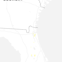
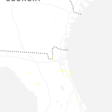
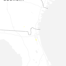
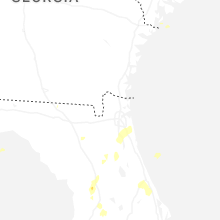
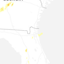


Connect with Interactive Hail Maps