

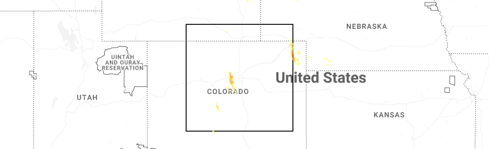
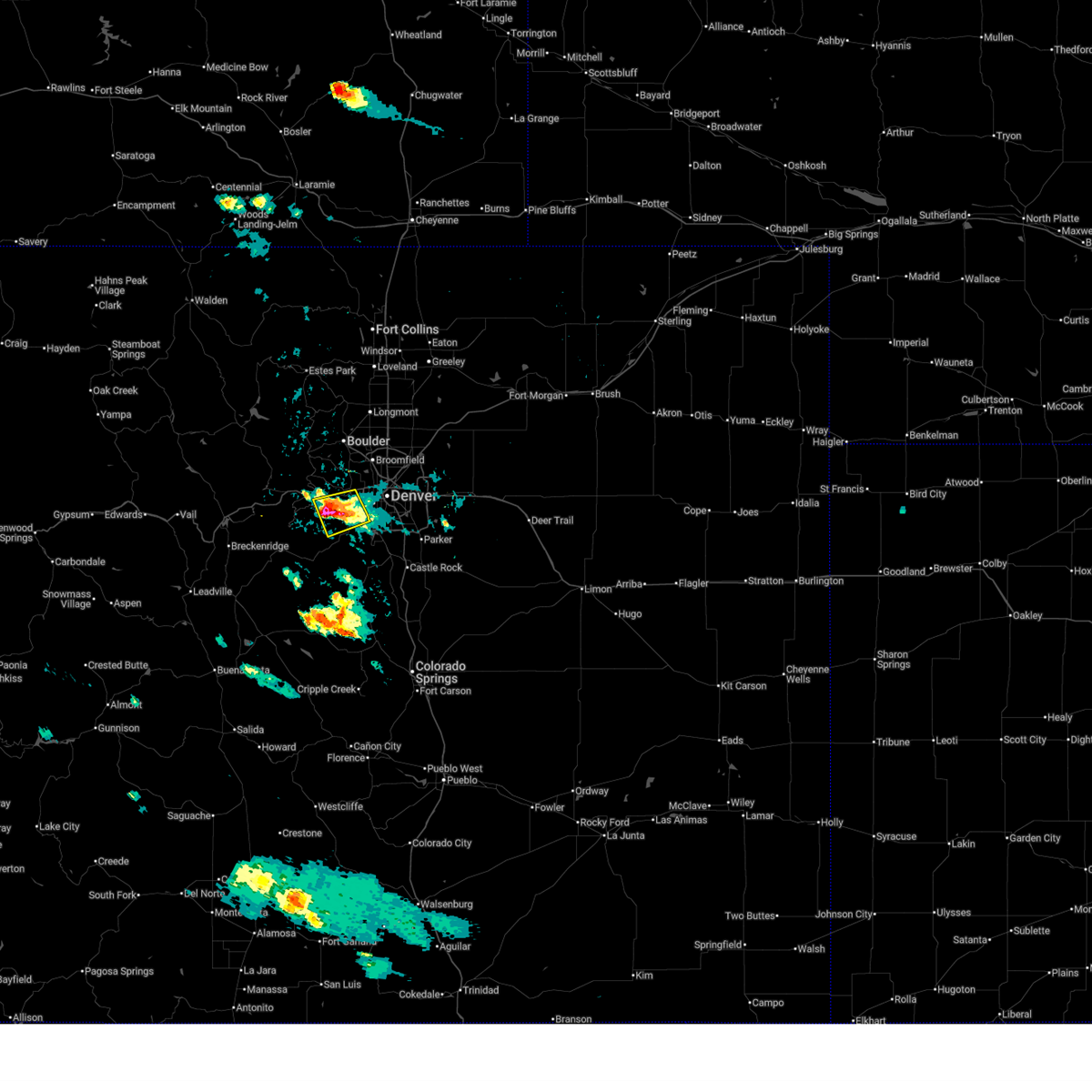
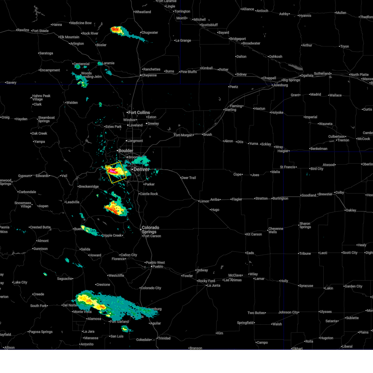
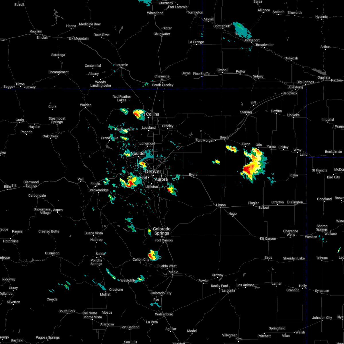
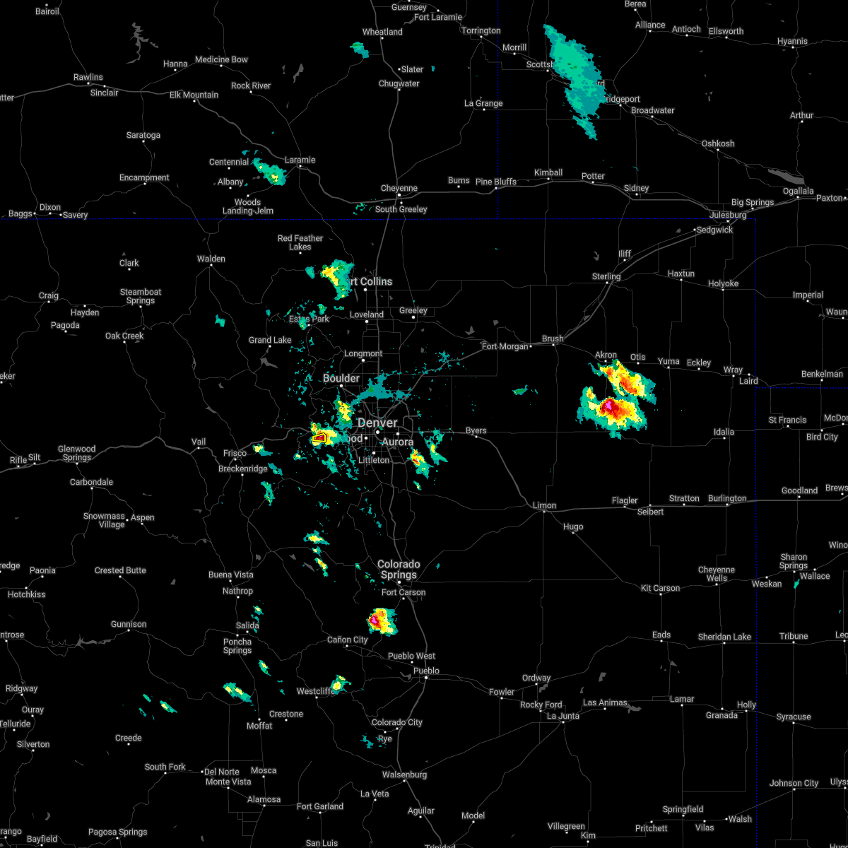
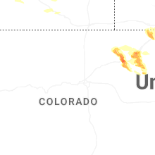
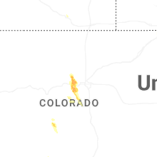
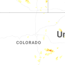
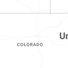
Hail Map for Floyd Hill, CO
The Floyd Hill, CO area has had 1 report of on-the-ground hail by trained spotters, and has been under severe weather warnings 7 times during the past 12 months. Doppler radar has detected hail at or near Floyd Hill, CO on 25 occasions, including 4 occasions during the past year.
| Name: | Floyd Hill, CO |
| Where Located: | 23.2 miles W of Denver, CO |
| Map: | Google Map for Floyd Hill, CO |
| Population: | 998 |
| Housing Units: | 483 |
| More Info: | Search Google for Floyd Hill, CO |
3
The Top Recent Hail Date for Floyd Hill, CO is Saturday, August 23, 2025 (3rd out of 25)
Hail and Wind Damage Spotted near Floyd Hill, CO
| Date / Time | Report Details |
|---|---|
| 6/24/2026 9:26 PM MDT |
 Svrbou the national weather service in denver has issued a * severe thunderstorm warning for, east central clear creek county in central colorado, central jefferson county in central colorado, * until 1015 pm mdt. * at 926 pm mdt, a severe thunderstorm was located near bergen park, or 23 miles west of denver, moving east at 15 mph (radar indicated). Hazards include 60 mph wind gusts and half dollar size hail. Hail damage to vehicles is expected. Expect wind damage to roofs, siding, and trees. Svrbou the national weather service in denver has issued a * severe thunderstorm warning for, east central clear creek county in central colorado, central jefferson county in central colorado, * until 1015 pm mdt. * at 926 pm mdt, a severe thunderstorm was located near bergen park, or 23 miles west of denver, moving east at 15 mph (radar indicated). Hazards include 60 mph wind gusts and half dollar size hail. Hail damage to vehicles is expected. Expect wind damage to roofs, siding, and trees.
|
| 6/8/2026 3:29 PM MDT |
 Svrbou the national weather service in denver has issued a * severe thunderstorm warning for, east central clear creek county in central colorado, northern jefferson county in central colorado, * until 415 pm mdt. * at 329 pm mdt, a severe thunderstorm was located over bergen park, or 21 miles west of denver, moving east at 15 mph (radar indicated). Hazards include 60 mph wind gusts and quarter size hail. Hail damage to vehicles is expected. Expect wind damage to roofs, siding, and trees. Svrbou the national weather service in denver has issued a * severe thunderstorm warning for, east central clear creek county in central colorado, northern jefferson county in central colorado, * until 415 pm mdt. * at 329 pm mdt, a severe thunderstorm was located over bergen park, or 21 miles west of denver, moving east at 15 mph (radar indicated). Hazards include 60 mph wind gusts and quarter size hail. Hail damage to vehicles is expected. Expect wind damage to roofs, siding, and trees.
|
| 8/23/2025 4:59 PM MDT |
 The storm which prompted the warning has moved out of the area. therefore, the warning will be allowed to expire. The storm which prompted the warning has moved out of the area. therefore, the warning will be allowed to expire.
|
| 8/23/2025 4:40 PM MDT |
 At 440 pm mdt, a severe thunderstorm was located over kittredge, or 19 miles west of denver, moving southeast at 15 mph (radar indicated). Hazards include quarter size hail. Damage to vehicles is expected. Locations impacted include, southwestern denver, southwestern lakewood, golden, evergreen, morrison, kittredge, indian hills, idledale, bergen park, tiny town, red rocks park, aspen park, brookvale, floyd hill, wah keeney park, genesee, pleasant view and ken caryl. At 440 pm mdt, a severe thunderstorm was located over kittredge, or 19 miles west of denver, moving southeast at 15 mph (radar indicated). Hazards include quarter size hail. Damage to vehicles is expected. Locations impacted include, southwestern denver, southwestern lakewood, golden, evergreen, morrison, kittredge, indian hills, idledale, bergen park, tiny town, red rocks park, aspen park, brookvale, floyd hill, wah keeney park, genesee, pleasant view and ken caryl.
|
| 8/23/2025 4:40 PM MDT |
 the severe thunderstorm warning has been cancelled and is no longer in effect the severe thunderstorm warning has been cancelled and is no longer in effect
|
| 8/23/2025 4:28 PM MDT |
 At 428 pm mdt, a severe thunderstorm was located near bergen park, or 20 miles west of denver, moving southeast at 15 mph (radar indicated). Hazards include quarter size hail. Damage to vehicles is expected. Locations impacted include, southwestern denver, southwestern lakewood, arvada, golden, evergreen, idaho springs, morrison, kittredge, bergen park, idledale, indian hills, red rocks park, floyd hill, tiny town, white ranch open space, brookvale, aspen park, genesee, wah keeney park and pleasant view. At 428 pm mdt, a severe thunderstorm was located near bergen park, or 20 miles west of denver, moving southeast at 15 mph (radar indicated). Hazards include quarter size hail. Damage to vehicles is expected. Locations impacted include, southwestern denver, southwestern lakewood, arvada, golden, evergreen, idaho springs, morrison, kittredge, bergen park, idledale, indian hills, red rocks park, floyd hill, tiny town, white ranch open space, brookvale, aspen park, genesee, wah keeney park and pleasant view.
|
| 8/23/2025 4:13 PM MDT |
 Svrbou the national weather service in denver has issued a * severe thunderstorm warning for, east central clear creek county in central colorado, southeastern gilpin county in central colorado, northern jefferson county in central colorado, * until 500 pm mdt. * at 413 pm mdt, a severe thunderstorm was located 4 miles north of bergen park, or 22 miles west of denver, moving southeast at 15 mph (radar indicated). Hazards include ping pong ball size hail. People and animals outdoors will be injured. Expect damage to roofs, siding, windows, and vehicles. Svrbou the national weather service in denver has issued a * severe thunderstorm warning for, east central clear creek county in central colorado, southeastern gilpin county in central colorado, northern jefferson county in central colorado, * until 500 pm mdt. * at 413 pm mdt, a severe thunderstorm was located 4 miles north of bergen park, or 22 miles west of denver, moving southeast at 15 mph (radar indicated). Hazards include ping pong ball size hail. People and animals outdoors will be injured. Expect damage to roofs, siding, windows, and vehicles.
|
| 7/28/2023 3:50 PM MDT |
 The severe thunderstorm warning for eastern gilpin, northeastern clear creek and northwestern jefferson counties will expire at 400 pm mdt, the storm which prompted the warning has moved out of the area. therefore, the warning will be allowed to expire. however gusty winds are still possible with this thunderstorm. The severe thunderstorm warning for eastern gilpin, northeastern clear creek and northwestern jefferson counties will expire at 400 pm mdt, the storm which prompted the warning has moved out of the area. therefore, the warning will be allowed to expire. however gusty winds are still possible with this thunderstorm.
|
| 7/28/2023 3:29 PM MDT |
 At 329 pm mdt, a severe thunderstorm was located over aspen springs, or 29 miles west of denver, moving east at 15 mph (radar indicated). Hazards include quarter size hail. Damage to vehicles is expected. this severe thunderstorm will remain over mainly rural areas of eastern gilpin, northeastern clear creek and northwestern jefferson counties, including the following locations, russell gulch. hail threat, radar indicated max hail size, 1. 00 in wind threat, radar indicated max wind gust, <50 mph. At 329 pm mdt, a severe thunderstorm was located over aspen springs, or 29 miles west of denver, moving east at 15 mph (radar indicated). Hazards include quarter size hail. Damage to vehicles is expected. this severe thunderstorm will remain over mainly rural areas of eastern gilpin, northeastern clear creek and northwestern jefferson counties, including the following locations, russell gulch. hail threat, radar indicated max hail size, 1. 00 in wind threat, radar indicated max wind gust, <50 mph.
|
| 6/21/2023 9:11 PM MDT |
 At 911 pm mdt, a severe thunderstorm was located over kittredge, or 18 miles west of denver, moving east at 10 mph (radar indicated). Hazards include tennis ball size hail. People and animals outdoors will be injured. expect damage to roofs, siding, windows, and vehicles. this severe storm will be near, indian hills around 920 pm mdt. other locations in the path of this severe thunderstorm include morrison, idledale, red rocks park and tiny town. thunderstorm damage threat, considerable hail threat, radar indicated max hail size, 2. 50 in wind threat, radar indicated max wind gust, <50 mph. At 911 pm mdt, a severe thunderstorm was located over kittredge, or 18 miles west of denver, moving east at 10 mph (radar indicated). Hazards include tennis ball size hail. People and animals outdoors will be injured. expect damage to roofs, siding, windows, and vehicles. this severe storm will be near, indian hills around 920 pm mdt. other locations in the path of this severe thunderstorm include morrison, idledale, red rocks park and tiny town. thunderstorm damage threat, considerable hail threat, radar indicated max hail size, 2. 50 in wind threat, radar indicated max wind gust, <50 mph.
|
| 6/21/2023 9:04 PM MDT |
 At 904 pm mdt, a severe thunderstorm was located over kittredge, or 20 miles west of denver, moving east at 10 mph (radar indicated). Hazards include golf ball size hail. People and animals outdoors will be injured. expect damage to roofs, siding, windows, and vehicles. this severe thunderstorm will be near, indian hills around 920 pm mdt. other locations in the path of this severe thunderstorm include morrison, idledale, red rocks park and tiny town. thunderstorm damage threat, considerable hail threat, radar indicated max hail size, 1. 75 in wind threat, radar indicated max wind gust, <50 mph. At 904 pm mdt, a severe thunderstorm was located over kittredge, or 20 miles west of denver, moving east at 10 mph (radar indicated). Hazards include golf ball size hail. People and animals outdoors will be injured. expect damage to roofs, siding, windows, and vehicles. this severe thunderstorm will be near, indian hills around 920 pm mdt. other locations in the path of this severe thunderstorm include morrison, idledale, red rocks park and tiny town. thunderstorm damage threat, considerable hail threat, radar indicated max hail size, 1. 75 in wind threat, radar indicated max wind gust, <50 mph.
|
| 6/21/2023 8:55 PM MDT |
 At 855 pm mdt, a severe thunderstorm was located near brookvale, or 29 miles west of denver, moving northeast at 10 mph (radar indicated). Hazards include golf ball size hail. People and animals outdoors will be injured. expect damage to roofs, siding, windows, and vehicles. locations impacted include, evergreen, brookvale, blue valley, bergen park, floyd hill and echo lake. thunderstorm damage threat, considerable hail threat, radar indicated max hail size, 1. 75 in wind threat, radar indicated max wind gust, <50 mph. At 855 pm mdt, a severe thunderstorm was located near brookvale, or 29 miles west of denver, moving northeast at 10 mph (radar indicated). Hazards include golf ball size hail. People and animals outdoors will be injured. expect damage to roofs, siding, windows, and vehicles. locations impacted include, evergreen, brookvale, blue valley, bergen park, floyd hill and echo lake. thunderstorm damage threat, considerable hail threat, radar indicated max hail size, 1. 75 in wind threat, radar indicated max wind gust, <50 mph.
|
| 6/21/2023 8:40 PM MDT |
 At 840 pm mdt, a severe thunderstorm was located 5 miles north of harris park, or 31 miles west of denver, moving northeast at 10 mph (radar indicated). Hazards include ping pong ball size hail. People and animals outdoors will be injured. Expect damage to roofs, siding, windows, and vehicles. At 840 pm mdt, a severe thunderstorm was located 5 miles north of harris park, or 31 miles west of denver, moving northeast at 10 mph (radar indicated). Hazards include ping pong ball size hail. People and animals outdoors will be injured. Expect damage to roofs, siding, windows, and vehicles.
|
| 6/21/2023 8:28 PM MDT |
 The severe thunderstorm warning for north central park, southeastern gilpin, southeastern clear creek and northwestern jefferson counties will expire at 830 pm mdt, the storms which prompted the warning have weakened below severe limits, and no longer pose an immediate threat to life or property. therefore, the warning will be allowed to expire. a severe thunderstorm watch remains in effect until 1000 pm mdt for central colorado. The severe thunderstorm warning for north central park, southeastern gilpin, southeastern clear creek and northwestern jefferson counties will expire at 830 pm mdt, the storms which prompted the warning have weakened below severe limits, and no longer pose an immediate threat to life or property. therefore, the warning will be allowed to expire. a severe thunderstorm watch remains in effect until 1000 pm mdt for central colorado.
|
| 6/21/2023 7:46 PM MDT |
 At 746 pm mdt, severe thunderstorms were located along a line extending from near white ranch open space to 4 miles northwest of grant, or along a line extending from 19 miles west of denver to 68 miles northwest of colorado springs, moving northeast at 10 mph (radar indicated). Hazards include half dollar size hail. Damage to vehicles is expected. severe thunderstorms will be near, bergen park around 750 pm mdt. other locations in the path of these severe thunderstorms include echo lake. hail threat, radar indicated max hail size, 1. 25 in wind threat, radar indicated max wind gust, <50 mph. At 746 pm mdt, severe thunderstorms were located along a line extending from near white ranch open space to 4 miles northwest of grant, or along a line extending from 19 miles west of denver to 68 miles northwest of colorado springs, moving northeast at 10 mph (radar indicated). Hazards include half dollar size hail. Damage to vehicles is expected. severe thunderstorms will be near, bergen park around 750 pm mdt. other locations in the path of these severe thunderstorms include echo lake. hail threat, radar indicated max hail size, 1. 25 in wind threat, radar indicated max wind gust, <50 mph.
|
| 6/21/2023 7:21 PM MDT |
 At 721 pm mdt, a severe thunderstorm was located 4 miles west of brookvale, or 30 miles west of denver, moving northeast at 10 mph (radar indicated). Hazards include ping pong ball size hail. People and animals outdoors will be injured. Expect damage to roofs, siding, windows, and vehicles. At 721 pm mdt, a severe thunderstorm was located 4 miles west of brookvale, or 30 miles west of denver, moving northeast at 10 mph (radar indicated). Hazards include ping pong ball size hail. People and animals outdoors will be injured. Expect damage to roofs, siding, windows, and vehicles.
|
| 6/7/2023 3:52 PM MDT |
 At 352 pm mdt, a severe thunderstorm was located near white ranch open space, or 17 miles west of denver, moving west at 10 mph (radar indicated). Hazards include 60 mph wind gusts and quarter size hail. Expect damage to roofs, siding, and trees. hail damage to vehicles is expected. hail may accumulate on roadways causing hazardous travel. this severe thunderstorm will be near, white ranch open space around 400 pm mdt. hail threat, radar indicated max hail size, 1. 00 in wind threat, radar indicated max wind gust, 60 mph. At 352 pm mdt, a severe thunderstorm was located near white ranch open space, or 17 miles west of denver, moving west at 10 mph (radar indicated). Hazards include 60 mph wind gusts and quarter size hail. Expect damage to roofs, siding, and trees. hail damage to vehicles is expected. hail may accumulate on roadways causing hazardous travel. this severe thunderstorm will be near, white ranch open space around 400 pm mdt. hail threat, radar indicated max hail size, 1. 00 in wind threat, radar indicated max wind gust, 60 mph.
|
| 7/8/2022 6:05 PM MDT |
 The severe thunderstorm warning for east central clear creek county will expire at 615 pm mdt, the storm which prompted the warning has weakened below severe limits, and has exited the warned area. therefore, the warning will be allowed to expire. The severe thunderstorm warning for east central clear creek county will expire at 615 pm mdt, the storm which prompted the warning has weakened below severe limits, and has exited the warned area. therefore, the warning will be allowed to expire.
|
| 7/8/2022 5:51 PM MDT |
 At 551 pm mdt, a severe thunderstorm was located near floyd hill, or 25 miles west of denver, moving south at 10 mph (radar indicated). Hazards include quarter size hail. Damage to vehicles is expected. locations impacted include, blue valley and floyd hill. hail threat, radar indicated max hail size, 1. 00 in wind threat, radar indicated max wind gust, <50 mph. At 551 pm mdt, a severe thunderstorm was located near floyd hill, or 25 miles west of denver, moving south at 10 mph (radar indicated). Hazards include quarter size hail. Damage to vehicles is expected. locations impacted include, blue valley and floyd hill. hail threat, radar indicated max hail size, 1. 00 in wind threat, radar indicated max wind gust, <50 mph.
|
| 7/8/2022 5:41 PM MDT |
 At 540 pm mdt, a severe thunderstorm was located over floyd hill, or 25 miles west of denver, moving south at 10 mph (radar indicated). Hazards include quarter size hail. damage to vehicles is expected At 540 pm mdt, a severe thunderstorm was located over floyd hill, or 25 miles west of denver, moving south at 10 mph (radar indicated). Hazards include quarter size hail. damage to vehicles is expected
|
| 6/6/2020 3:46 PM MDT |
 At 342 pm mdt, severe thunderstorms were located along a line extending from 3 miles north of drake to near aspen springs to 7 miles west of elevenmile canyon reservoir, or along a line extending from 15 miles west of fort collins to 28 miles west of denver to 39 miles north of hayden pass burn scar, the storms are moving northeast at 60 mph. these are very dangerous storms (an automated weather station in lakewood recorded a peak wind gust to 70 mph at bear creek golf club in southwest lakewood). Hazards include 75 mph wind gusts. Flying debris will be dangerous to those caught without shelter. mobile homes will be heavily damaged. expect considerable damage to roofs, windows, and vehicles. extensive tree damage and power outages are likely. Locations impacted include, denver, fort collins, greeley, aurora, lakewood, thornton, arvada, westminster, centennial, boulder, longmont, loveland, broomfield, highlands ranch, castle rock, commerce city, parker, littleton, northglenn and brighton. At 342 pm mdt, severe thunderstorms were located along a line extending from 3 miles north of drake to near aspen springs to 7 miles west of elevenmile canyon reservoir, or along a line extending from 15 miles west of fort collins to 28 miles west of denver to 39 miles north of hayden pass burn scar, the storms are moving northeast at 60 mph. these are very dangerous storms (an automated weather station in lakewood recorded a peak wind gust to 70 mph at bear creek golf club in southwest lakewood). Hazards include 75 mph wind gusts. Flying debris will be dangerous to those caught without shelter. mobile homes will be heavily damaged. expect considerable damage to roofs, windows, and vehicles. extensive tree damage and power outages are likely. Locations impacted include, denver, fort collins, greeley, aurora, lakewood, thornton, arvada, westminster, centennial, boulder, longmont, loveland, broomfield, highlands ranch, castle rock, commerce city, parker, littleton, northglenn and brighton.
|
| 6/6/2020 3:03 PM MDT |
 At 303 pm mdt, severe thunderstorms were located along a line extending from 3 miles north of drake to near aspen springs to 8 miles west of elevenmile canyon reservoir, or along a line extending from 15 miles west of fort collins to 28 miles west of denver to 39 miles north of hayden pass burn scar, moving northeast at 65 mph. these are very dangerous storms (radar indicated). Hazards include 80 mph wind gusts. Flying debris will be dangerous to those caught without shelter. mobile homes will be heavily damaged. expect considerable damage to roofs, windows, and vehicles. Extensive tree damage and power outages are likely. At 303 pm mdt, severe thunderstorms were located along a line extending from 3 miles north of drake to near aspen springs to 8 miles west of elevenmile canyon reservoir, or along a line extending from 15 miles west of fort collins to 28 miles west of denver to 39 miles north of hayden pass burn scar, moving northeast at 65 mph. these are very dangerous storms (radar indicated). Hazards include 80 mph wind gusts. Flying debris will be dangerous to those caught without shelter. mobile homes will be heavily damaged. expect considerable damage to roofs, windows, and vehicles. Extensive tree damage and power outages are likely.
|
| 6/6/2020 2:33 PM MDT |
 At 232 pm mdt, severe thunderstorms were located along a line extending from near cowdrey to near berthoud pass to 10 miles northwest of guffey, or along a line extending from 51 miles southwest of laramie to 43 miles west of denver to 36 miles north of hayden pass burn scar, moving northeast at 65 mph. these are very dangerous storms (radar indicated). Hazards include 80 mph wind gusts. Flying debris will be dangerous to those caught without shelter. mobile homes will be heavily damaged. expect considerable damage to roofs, windows, and vehicles. Extensive tree damage and power outages are likely. At 232 pm mdt, severe thunderstorms were located along a line extending from near cowdrey to near berthoud pass to 10 miles northwest of guffey, or along a line extending from 51 miles southwest of laramie to 43 miles west of denver to 36 miles north of hayden pass burn scar, moving northeast at 65 mph. these are very dangerous storms (radar indicated). Hazards include 80 mph wind gusts. Flying debris will be dangerous to those caught without shelter. mobile homes will be heavily damaged. expect considerable damage to roofs, windows, and vehicles. Extensive tree damage and power outages are likely.
|
| 9/6/2019 2:44 PM MDT |
 At 244 pm mdt, a severe thunderstorm was located over idledale, or 13 miles west of denver, moving east at 15 mph (radar indicated). Hazards include 60 mph wind gusts and quarter size hail. Expect damage to roofs, siding, and trees. Hail damage to vehicles is expected. At 244 pm mdt, a severe thunderstorm was located over idledale, or 13 miles west of denver, moving east at 15 mph (radar indicated). Hazards include 60 mph wind gusts and quarter size hail. Expect damage to roofs, siding, and trees. Hail damage to vehicles is expected.
|
| 9/6/2019 2:30 PM MDT |
 At 202 pm mdt, a severe thunderstorm was located near floyd hill, or 21 miles west of denver, moving east at 15 mph (radar indicated). Hazards include quarter size hail. damage to vehicles is expected At 202 pm mdt, a severe thunderstorm was located near floyd hill, or 21 miles west of denver, moving east at 15 mph (radar indicated). Hazards include quarter size hail. damage to vehicles is expected
|
| 9/6/2019 2:02 PM MDT | Quarter sized hail reported 0.7 miles E of Floyd Hill, CO |
| 9/6/2019 2:02 PM MDT |
 At 202 pm mdt, a severe thunderstorm was located near floyd hill, or 21 miles west of denver, moving east at 15 mph (radar indicated). Hazards include quarter size hail. damage to vehicles is expected At 202 pm mdt, a severe thunderstorm was located near floyd hill, or 21 miles west of denver, moving east at 15 mph (radar indicated). Hazards include quarter size hail. damage to vehicles is expected
|
| 8/3/2018 9:26 PM MDT |
 The severe thunderstorm warning for north central douglas, broomfield, southwestern arapahoe, southeastern gilpin, southwestern denver, jefferson, west central adams and southeastern boulder counties will expire at 930 pm mdt, the winds which prompted the warning have weakened below severe limits, and no longer poses an immediate threat to life or property. therefore, the warning will be allowed to expire. however gusty winds to 50 mph are still possible with in and near the foothills. The severe thunderstorm warning for north central douglas, broomfield, southwestern arapahoe, southeastern gilpin, southwestern denver, jefferson, west central adams and southeastern boulder counties will expire at 930 pm mdt, the winds which prompted the warning have weakened below severe limits, and no longer poses an immediate threat to life or property. therefore, the warning will be allowed to expire. however gusty winds to 50 mph are still possible with in and near the foothills.
|
| 8/3/2018 9:15 PM MDT |
 At 912 pm mdt, doppler radar and reports indicate strong winds to 65 mph in and near the foothiills associated with dissipating thunderstorms over the foothills northwest of denver. wind gusts of 60 to 65 mph will remain possible with this activity over western parts of the denver metro area (radar indicated). Hazards include 60 mph wind gusts. Expect damage to roofs, siding, and trees. Locations impacted include, western denver, lakewood, southwestern thornton, arvada, westminster, southwestern centennial, boulder, broomfield, highlands ranch, northwestern castle rock, littleton, southwestern northglenn, englewood, wheat ridge, lafayette, golden, louisville, erie, greenwood village and evergreen. At 912 pm mdt, doppler radar and reports indicate strong winds to 65 mph in and near the foothiills associated with dissipating thunderstorms over the foothills northwest of denver. wind gusts of 60 to 65 mph will remain possible with this activity over western parts of the denver metro area (radar indicated). Hazards include 60 mph wind gusts. Expect damage to roofs, siding, and trees. Locations impacted include, western denver, lakewood, southwestern thornton, arvada, westminster, southwestern centennial, boulder, broomfield, highlands ranch, northwestern castle rock, littleton, southwestern northglenn, englewood, wheat ridge, lafayette, golden, louisville, erie, greenwood village and evergreen.
|
| 8/3/2018 8:39 PM MDT |
 At 839 pm mdt, doppler radar showed thunderstorms dissipating over the foothills northwest of denver. wind gusts of 60 to 65 mph will be possible with this activity as it pushes through the denver metro area (radar indicated). Hazards include 60 mph wind gusts. expect damage to roofs, siding, and trees At 839 pm mdt, doppler radar showed thunderstorms dissipating over the foothills northwest of denver. wind gusts of 60 to 65 mph will be possible with this activity as it pushes through the denver metro area (radar indicated). Hazards include 60 mph wind gusts. expect damage to roofs, siding, and trees
|
| 5/28/2018 3:25 PM MDT |
 At 324 pm mdt, a severe thunderstorm was located 4 miles northeast of harris park, or 28 miles southwest of denver, moving northeast at 25 mph (radar indicated). Hazards include quarter size hail. damage to vehicles is expected At 324 pm mdt, a severe thunderstorm was located 4 miles northeast of harris park, or 28 miles southwest of denver, moving northeast at 25 mph (radar indicated). Hazards include quarter size hail. damage to vehicles is expected
|
| 5/8/2017 2:25 PM MDT |
 At 224 pm mdt, a severe thunderstorm was located near evergreen, or 22 miles southwest of denver, moving northeast at 5 mph (radar indicated). Hazards include 60 mph wind gusts and quarter size hail. Hail damage to vehicles is expected. Expect wind damage to roofs, siding, and trees. At 224 pm mdt, a severe thunderstorm was located near evergreen, or 22 miles southwest of denver, moving northeast at 5 mph (radar indicated). Hazards include 60 mph wind gusts and quarter size hail. Hail damage to vehicles is expected. Expect wind damage to roofs, siding, and trees.
|
| 6/6/2016 3:45 PM MDT |
 At 344 pm mdt, a severe thunderstorm was located over aspen springs, or 30 miles west of denver, moving southeast at 15 mph (radar indicated). Hazards include 60 mph wind gusts and quarter size hail. Hail damage to vehicles is expected. Expect wind damage to roofs, siding, and trees. At 344 pm mdt, a severe thunderstorm was located over aspen springs, or 30 miles west of denver, moving southeast at 15 mph (radar indicated). Hazards include 60 mph wind gusts and quarter size hail. Hail damage to vehicles is expected. Expect wind damage to roofs, siding, and trees.
|
| 8/17/2015 2:32 PM MDT |
 At 231 pm mdt, a severe thunderstorm was located near evergreen, or 22 miles west of denver, moving southeast at 35 mph (radar indicated). Hazards include 60 mph wind gusts and quarter size hail. Hail damage to vehicles is expected. Expect wind damage to roofs, siding and trees. At 231 pm mdt, a severe thunderstorm was located near evergreen, or 22 miles west of denver, moving southeast at 35 mph (radar indicated). Hazards include 60 mph wind gusts and quarter size hail. Hail damage to vehicles is expected. Expect wind damage to roofs, siding and trees.
|
| 6/3/2015 6:47 PM MDT | At 647 pm mdt, a severe thunderstorm was located near idledale, or 16 miles west of denver, moving east at 25 mph (radar indicated). Hazards include quarter size hail. Damage to vehicles is expected. locations impacted include, lakewood, southern arvada, western wheat ridge, golden, evergreen, morrison, bergen park, kittredge, idledale, red rocks park and indian hills. A tornado watch remains in effect until 900 pm mdt for northeastern colorado. |
| 6/3/2015 6:29 PM MDT | At 629 pm mdt, a severe thunderstorm was located over brookvale, or 23 miles west of denver, moving east at 25 mph (radar indicated). Hazards include quarter size hail. damage to vehicles is expected |
Hail Maps for Floyd Hill, CO


Connect with Interactive Hail Maps