

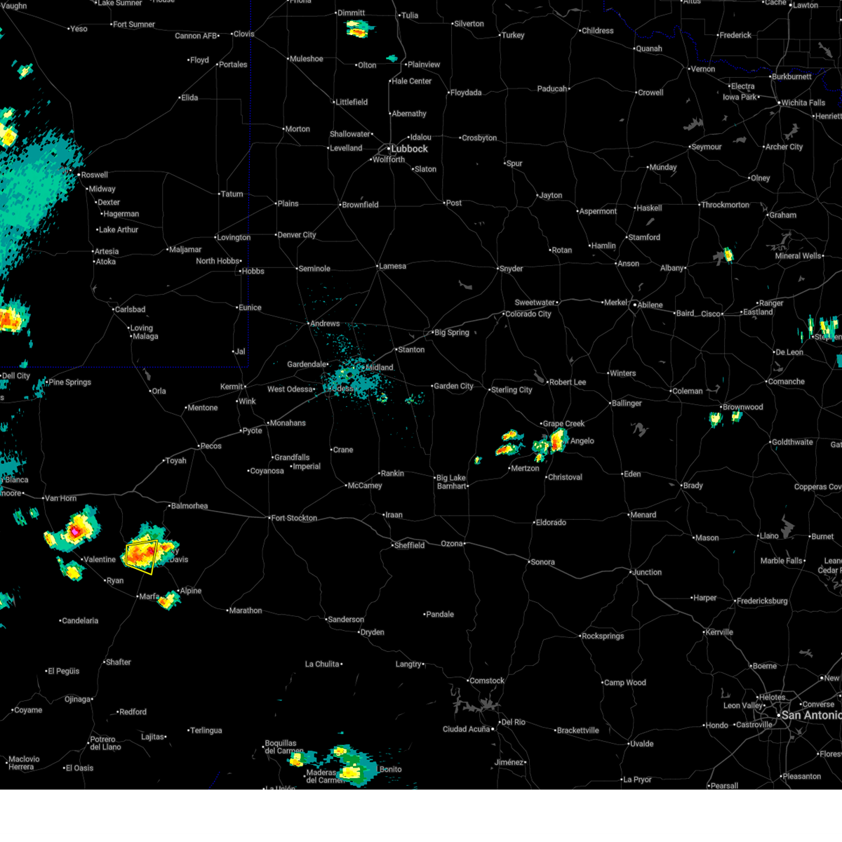
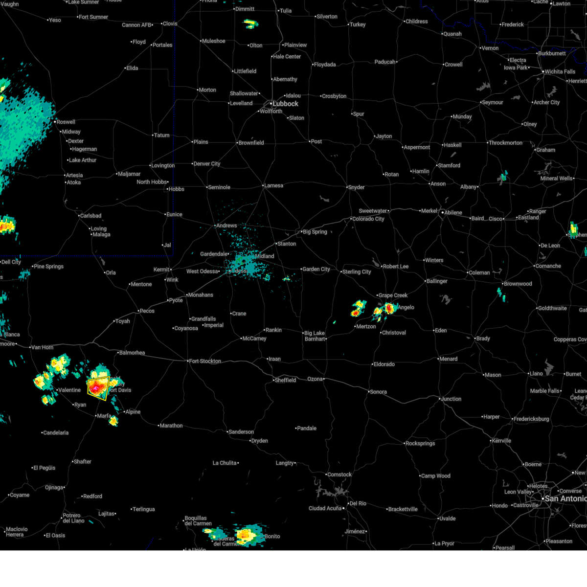
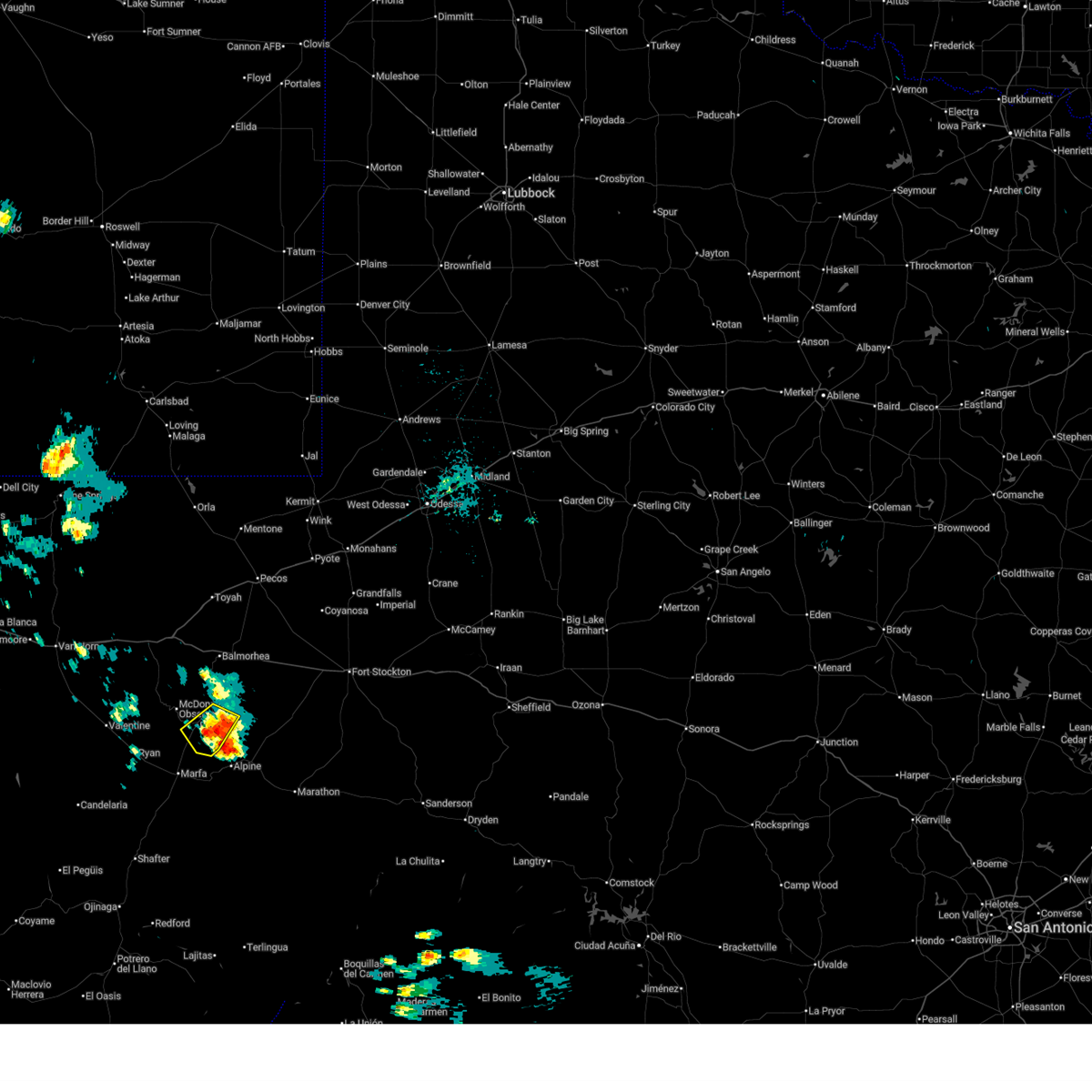
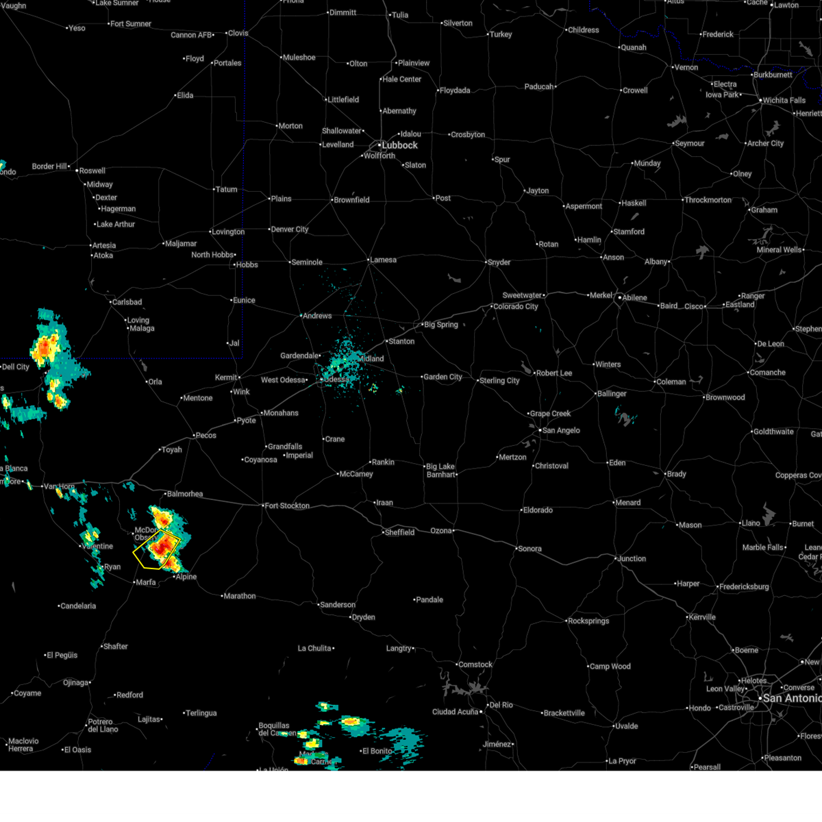
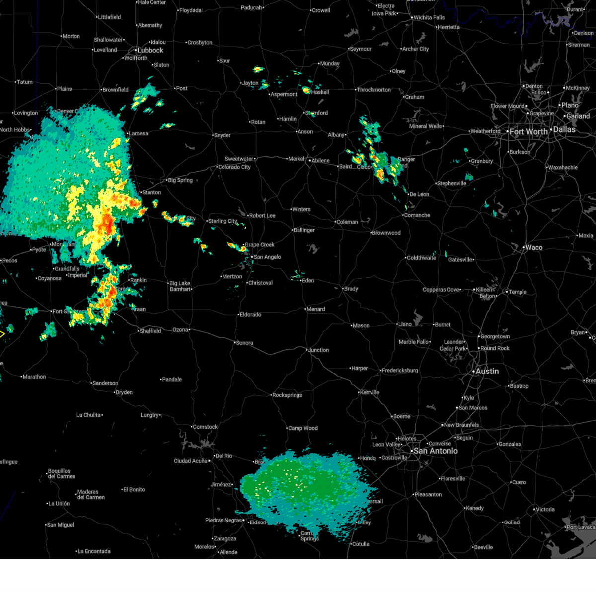
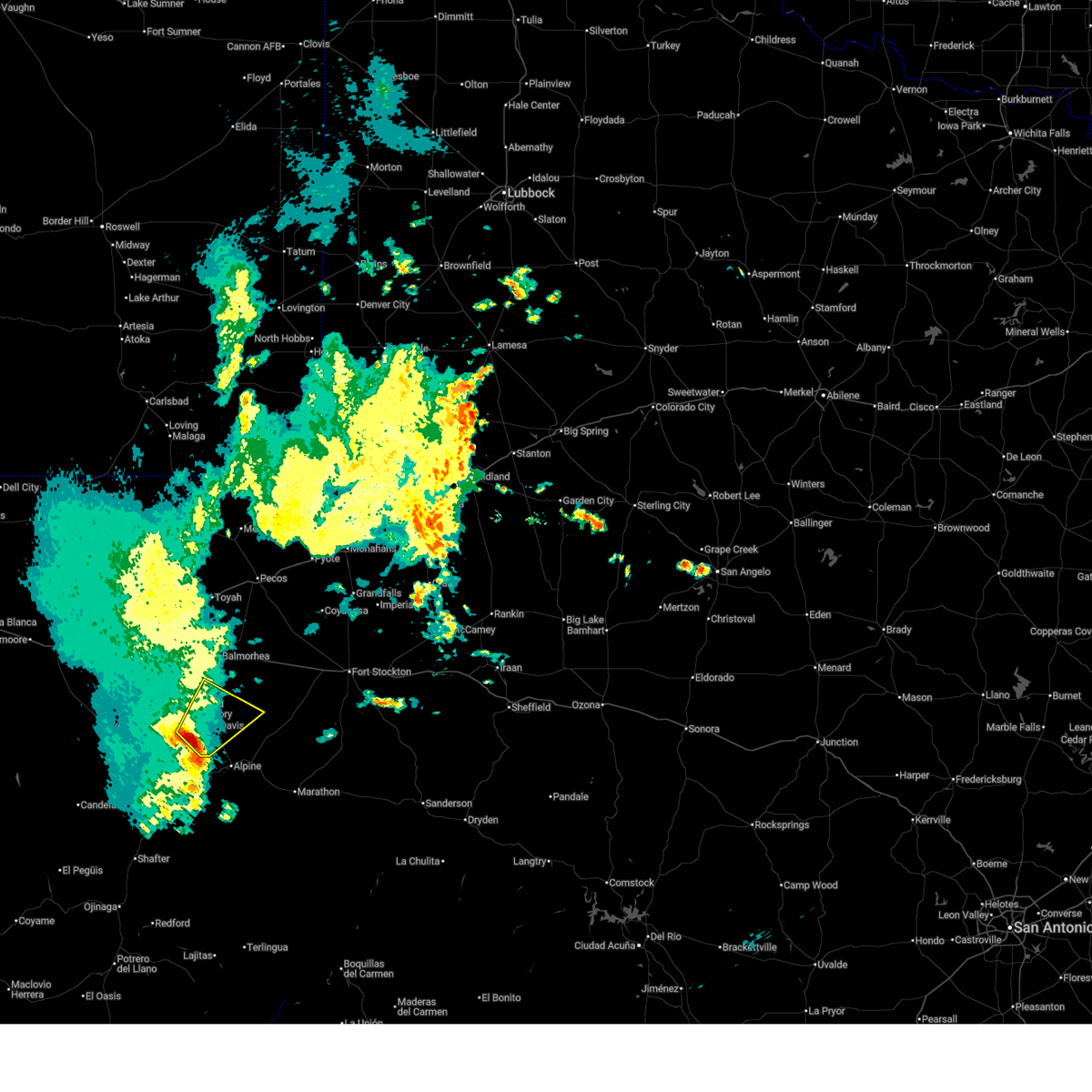
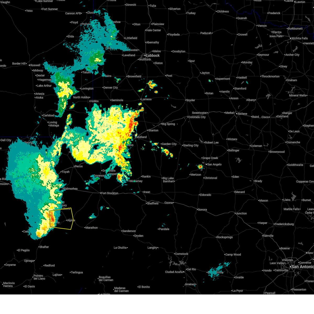
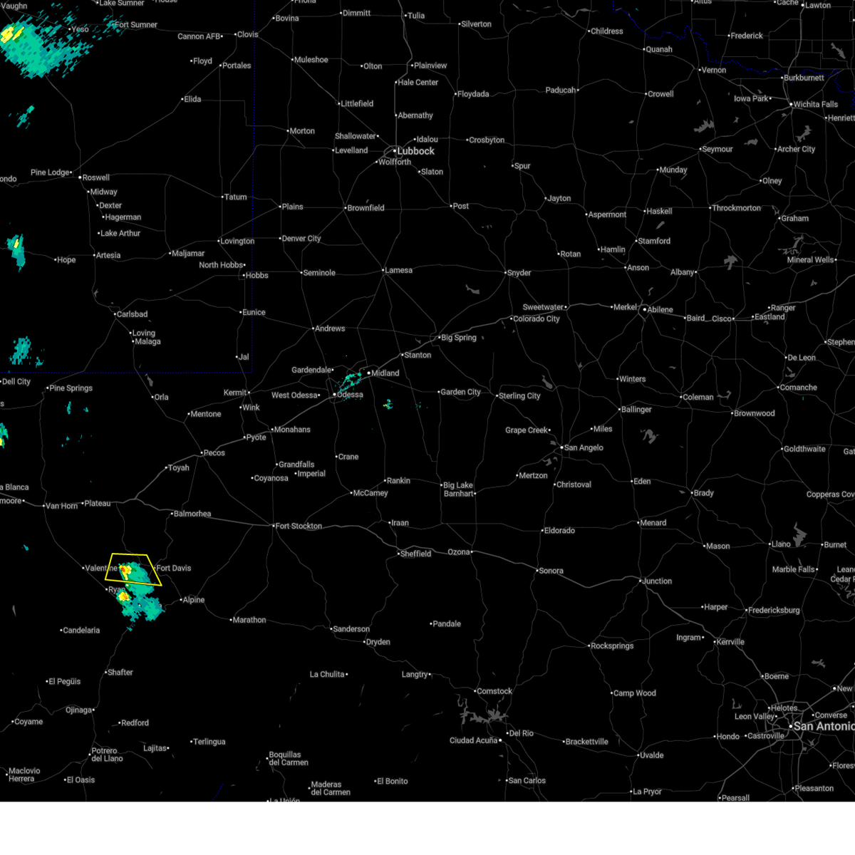
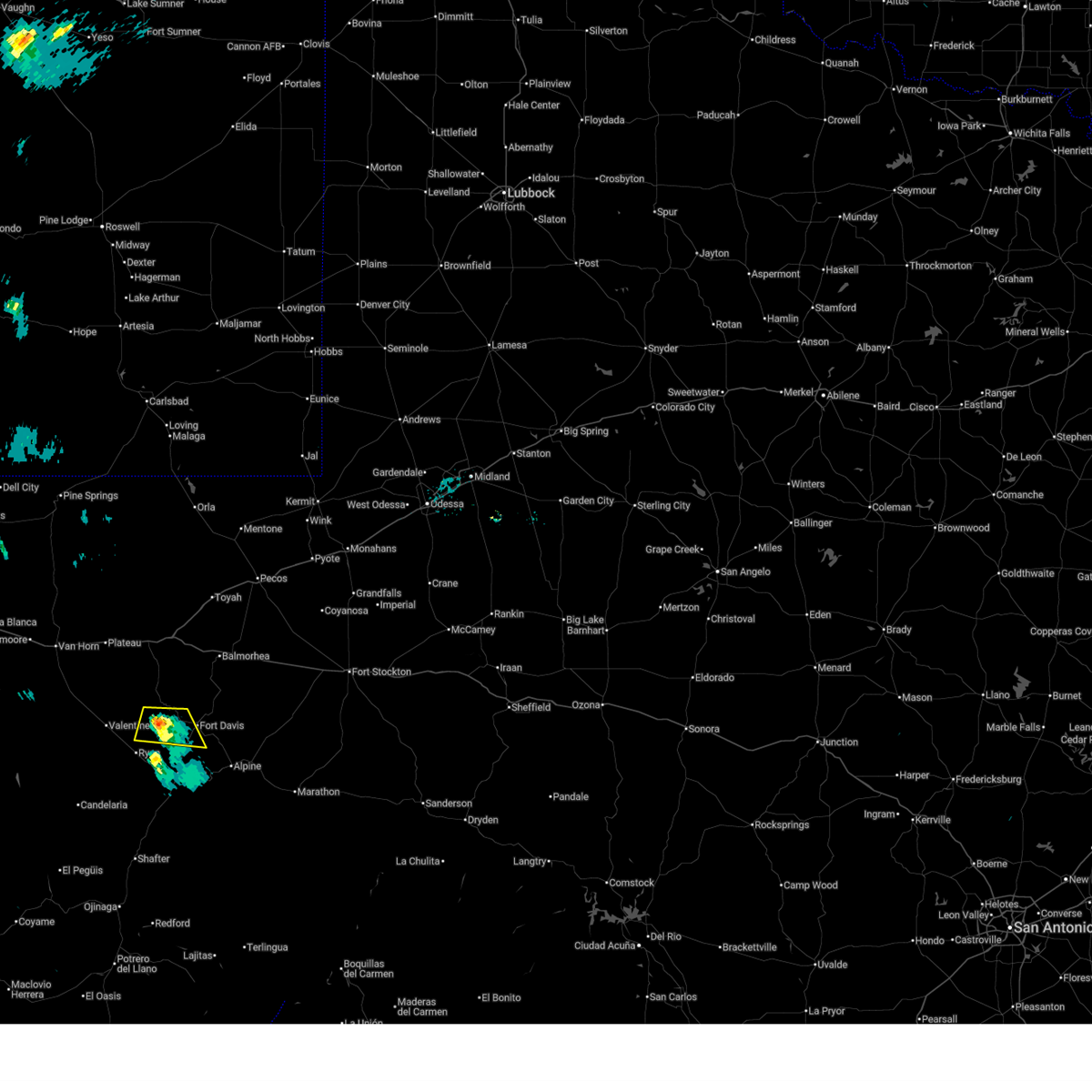
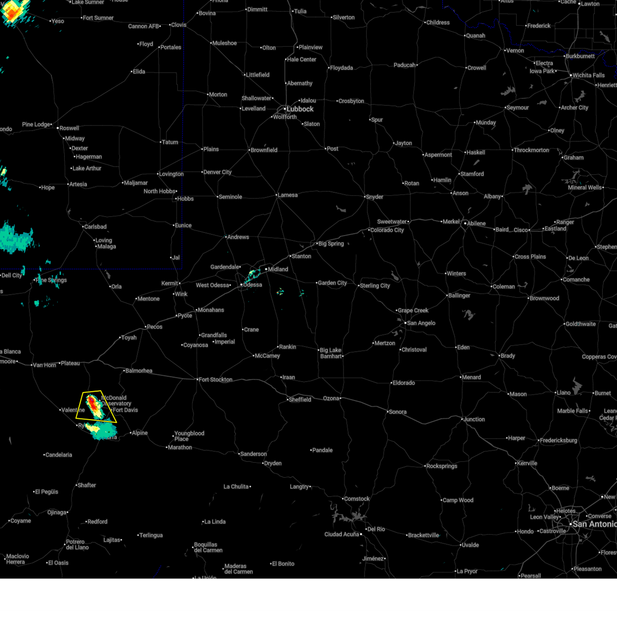
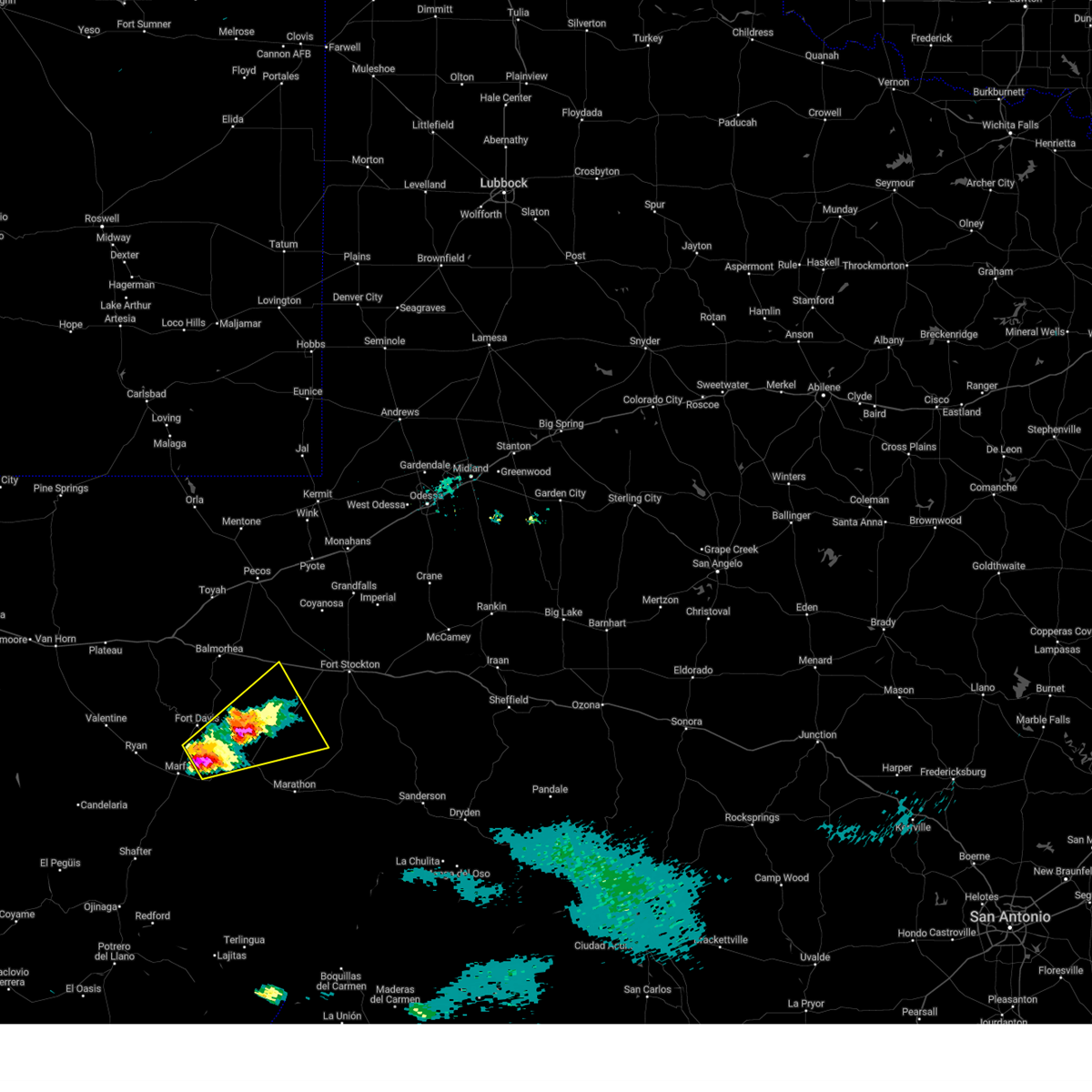
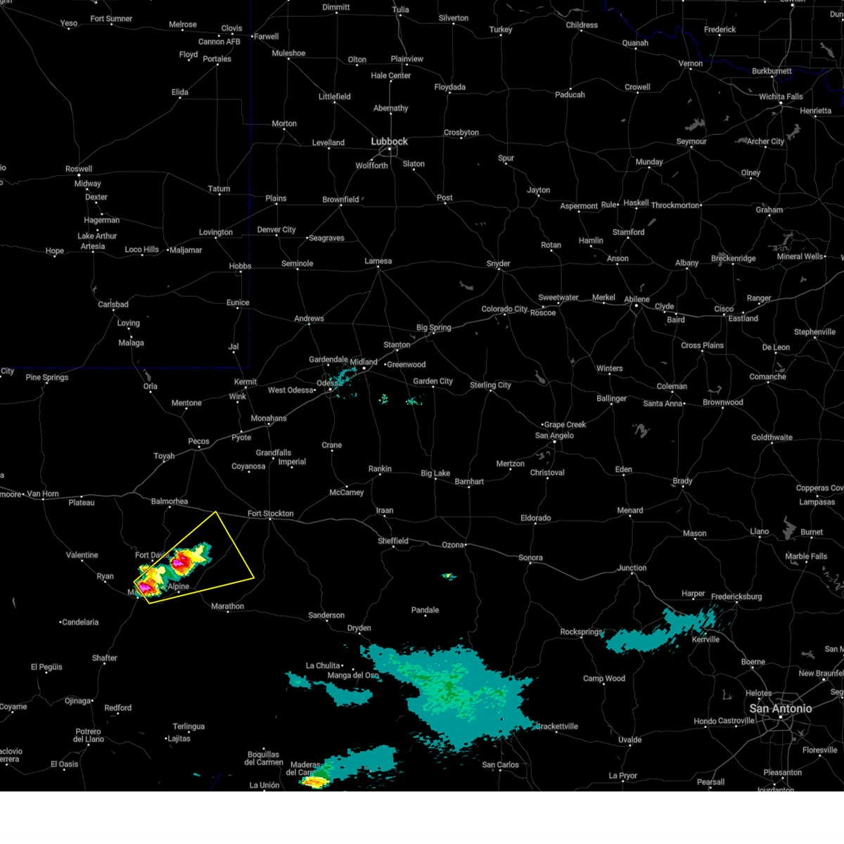
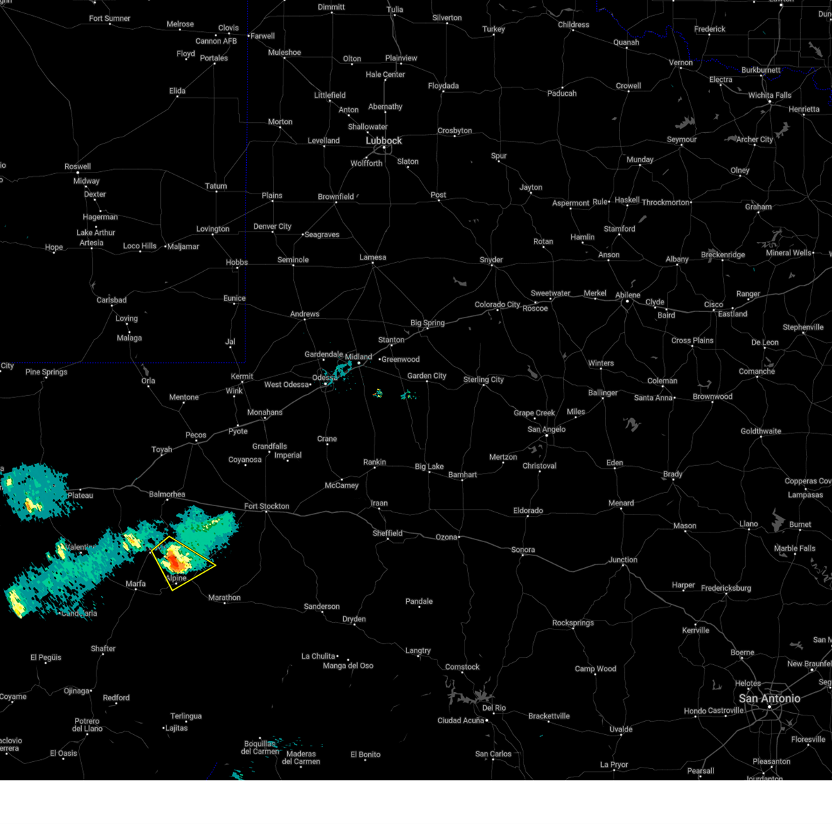
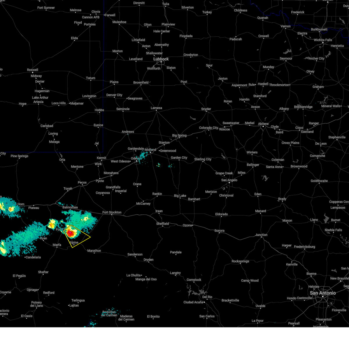
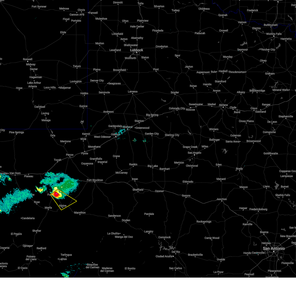
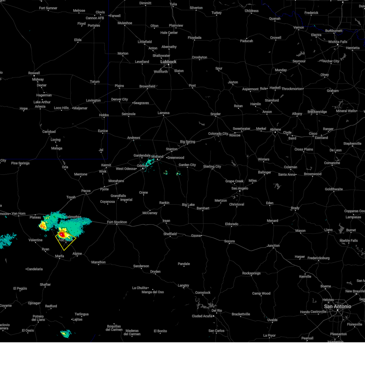
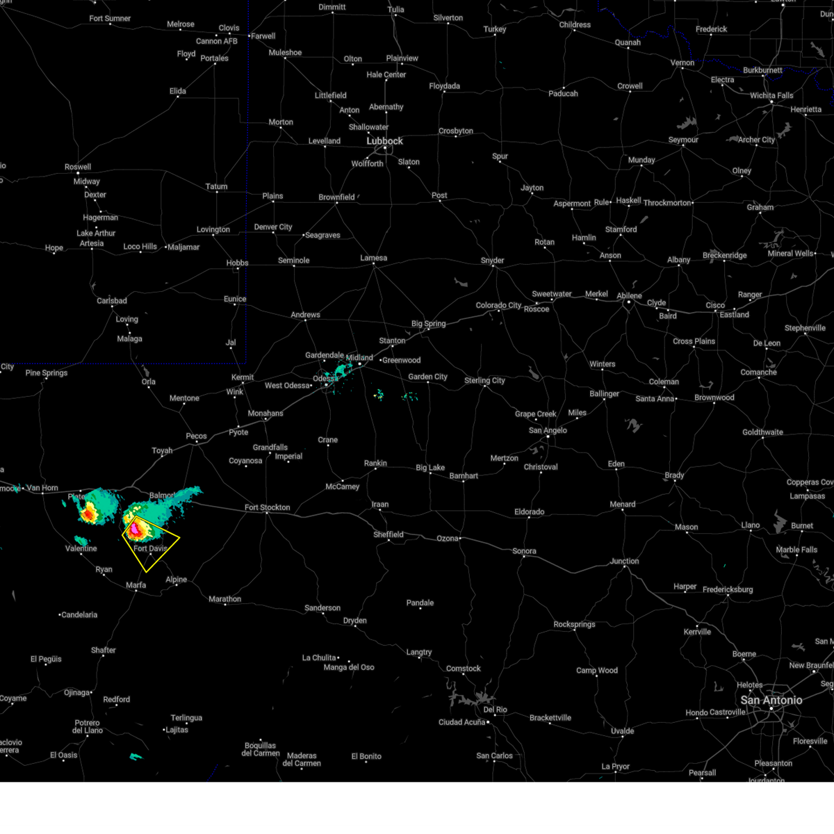
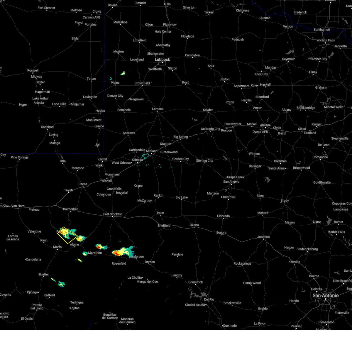
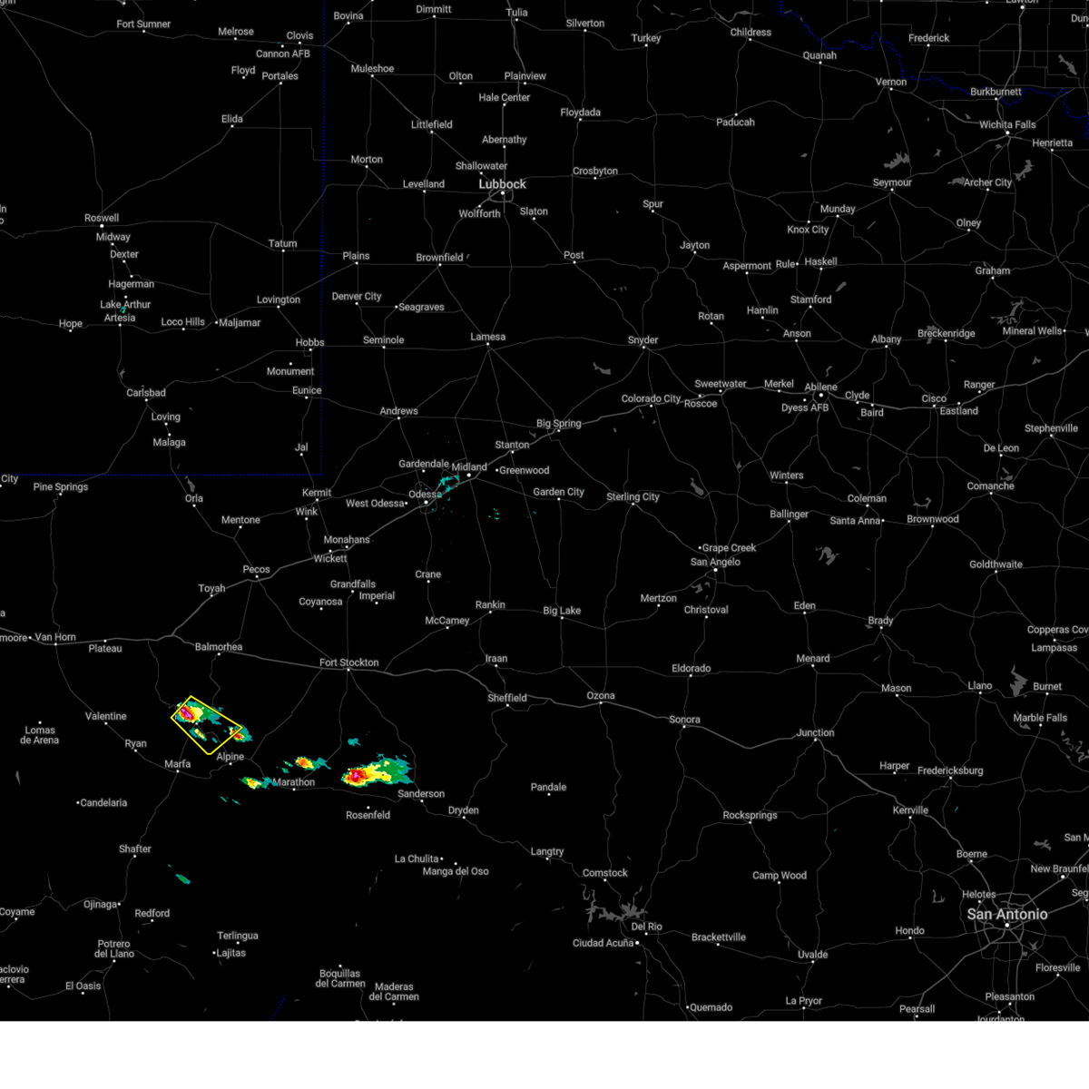
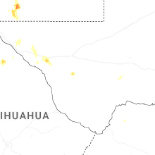
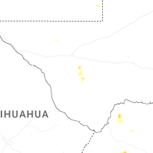
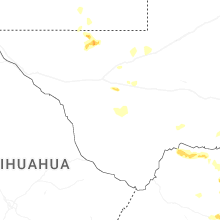
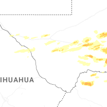
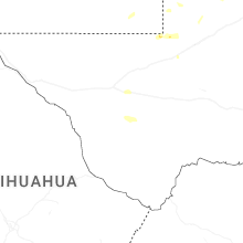
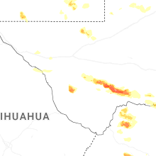
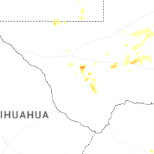
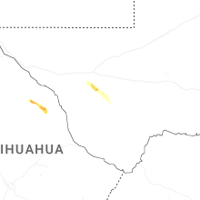
Hail Map for Fort Davis, TX
The Fort Davis, TX area has had 28 reports of on-the-ground hail by trained spotters, and has been under severe weather warnings 13 times during the past 12 months. Doppler radar has detected hail at or near Fort Davis, TX on 46 occasions, including 4 occasions during the past year.
| Name: | Fort Davis, TX |
| Where Located: | 20.5 miles NW of Alpine, TX |
| Map: | Google Map for Fort Davis, TX |
| Population: | 1201 |
| Housing Units: | 672 |
| More Info: | Search Google for Fort Davis, TX |
4
The Top Recent Hail Date for Fort Davis, TX is Friday, October 24, 2025 (4th out of 46)
Hail and Wind Damage Spotted near Fort Davis, TX
| Date / Time | Report Details |
|---|---|
| 6/10/2026 5:36 PM CDT | Mesonet station 167 toyahvale 13w recorded a wind gust of 64 mp in jeff davis county TX, 27 miles SSE of Fort Davis, TX |
| 6/2/2026 3:44 PM CDT |
 At 344 pm cdt, a severe thunderstorm was located near davis mountains state park, or near fort davis, and is nearly stationary (radar indicated). Hazards include 60 mph wind gusts and nickel size hail. Expect damage to roofs, siding, and trees. Locations impacted include, fort davis, mcdonald observatory, davis mountains state park, indian lodge, and fort davis national historical site. At 344 pm cdt, a severe thunderstorm was located near davis mountains state park, or near fort davis, and is nearly stationary (radar indicated). Hazards include 60 mph wind gusts and nickel size hail. Expect damage to roofs, siding, and trees. Locations impacted include, fort davis, mcdonald observatory, davis mountains state park, indian lodge, and fort davis national historical site.
|
| 6/2/2026 3:27 PM CDT |
 Svrmaf the national weather service in midland has issued a * severe thunderstorm warning for, south central jeff davis county in southwestern texas, * until 400 pm cdt. * at 326 pm cdt, a severe thunderstorm was located near mcdonald observatory, or near fort davis, and is nearly stationary (radar indicated). Hazards include 60 mph wind gusts and quarter size hail. Hail damage to vehicles is expected. Expect wind damage to roofs, siding, and trees. Svrmaf the national weather service in midland has issued a * severe thunderstorm warning for, south central jeff davis county in southwestern texas, * until 400 pm cdt. * at 326 pm cdt, a severe thunderstorm was located near mcdonald observatory, or near fort davis, and is nearly stationary (radar indicated). Hazards include 60 mph wind gusts and quarter size hail. Hail damage to vehicles is expected. Expect wind damage to roofs, siding, and trees.
|
| 6/1/2026 3:54 PM CDT |
 At 354 pm cdt, a severe thunderstorm was located near camp mitre peak, or 8 miles east of fort davis, moving south at 10 mph (radar indicated). Hazards include 60 mph wind gusts and quarter size hail. Hail damage to vehicles is expected. expect wind damage to roofs, siding, and trees. Locations impacted include, fort davis, camp mitre peak, davis mountains state park, indian lodge, and fort davis national historical site. At 354 pm cdt, a severe thunderstorm was located near camp mitre peak, or 8 miles east of fort davis, moving south at 10 mph (radar indicated). Hazards include 60 mph wind gusts and quarter size hail. Hail damage to vehicles is expected. expect wind damage to roofs, siding, and trees. Locations impacted include, fort davis, camp mitre peak, davis mountains state park, indian lodge, and fort davis national historical site.
|
| 6/1/2026 3:40 PM CDT |
 Svrmaf the national weather service in midland has issued a * severe thunderstorm warning for, southeastern jeff davis county in southwestern texas, * until 415 pm cdt. * at 339 pm cdt, a severe thunderstorm was located near camp mitre peak, or near fort davis, moving southwest at 15 mph (radar indicated). Hazards include ping pong ball size hail and 60 mph wind gusts. People and animals outdoors will be injured. expect hail damage to roofs, siding, windows, and vehicles. Expect wind damage to roofs, siding, and trees. Svrmaf the national weather service in midland has issued a * severe thunderstorm warning for, southeastern jeff davis county in southwestern texas, * until 415 pm cdt. * at 339 pm cdt, a severe thunderstorm was located near camp mitre peak, or near fort davis, moving southwest at 15 mph (radar indicated). Hazards include ping pong ball size hail and 60 mph wind gusts. People and animals outdoors will be injured. expect hail damage to roofs, siding, windows, and vehicles. Expect wind damage to roofs, siding, and trees.
|
| 5/26/2026 7:06 AM CDT |
 At 706 am cdt, a severe thunderstorm was located near camp mitre peak, or 7 miles east of fort davis, moving northeast at 25 mph (radar indicated). Hazards include 60 mph wind gusts and quarter size hail. Hail damage to vehicles is expected. expect wind damage to roofs, siding, and trees. Locations impacted include, fort davis and camp mitre peak. At 706 am cdt, a severe thunderstorm was located near camp mitre peak, or 7 miles east of fort davis, moving northeast at 25 mph (radar indicated). Hazards include 60 mph wind gusts and quarter size hail. Hail damage to vehicles is expected. expect wind damage to roofs, siding, and trees. Locations impacted include, fort davis and camp mitre peak.
|
| 5/26/2026 6:54 AM CDT |
 Svrmaf the national weather service in midland has issued a * severe thunderstorm warning for, southeastern jeff davis county in southwestern texas, * until 730 am cdt. * at 654 am cdt, a severe thunderstorm was located near fort davis, moving northeast at 25 mph (radar indicated). Hazards include 60 mph wind gusts and quarter size hail. Hail damage to vehicles is expected. Expect wind damage to roofs, siding, and trees. Svrmaf the national weather service in midland has issued a * severe thunderstorm warning for, southeastern jeff davis county in southwestern texas, * until 730 am cdt. * at 654 am cdt, a severe thunderstorm was located near fort davis, moving northeast at 25 mph (radar indicated). Hazards include 60 mph wind gusts and quarter size hail. Hail damage to vehicles is expected. Expect wind damage to roofs, siding, and trees.
|
| 5/26/2026 6:48 AM CDT |
 At 648 am cdt, a severe thunderstorm was located near fort davis, moving northeast at 25 mph (radar indicated). Hazards include 60 mph wind gusts. Expect damage to roofs, siding, and trees. Locations impacted include, alpine-casparis municipal airport and camp mitre peak. At 648 am cdt, a severe thunderstorm was located near fort davis, moving northeast at 25 mph (radar indicated). Hazards include 60 mph wind gusts. Expect damage to roofs, siding, and trees. Locations impacted include, alpine-casparis municipal airport and camp mitre peak.
|
| 5/26/2026 6:35 AM CDT |
 Svrmaf the national weather service in midland has issued a * severe thunderstorm warning for, northwestern brewster county in southwestern texas, southeastern jeff davis county in southwestern texas, northeastern presidio county in southwestern texas, * until 715 am cdt. * at 634 am cdt, severe thunderstorms were located along a line extending from near davis mountains state park to near marfa municipal airport to 7 miles southeast of marfa, moving east at 25 mph (radar indicated). Hazards include 60 mph wind gusts. expect damage to roofs, siding, and trees Svrmaf the national weather service in midland has issued a * severe thunderstorm warning for, northwestern brewster county in southwestern texas, southeastern jeff davis county in southwestern texas, northeastern presidio county in southwestern texas, * until 715 am cdt. * at 634 am cdt, severe thunderstorms were located along a line extending from near davis mountains state park to near marfa municipal airport to 7 miles southeast of marfa, moving east at 25 mph (radar indicated). Hazards include 60 mph wind gusts. expect damage to roofs, siding, and trees
|
| 10/24/2025 2:10 PM CDT | At 209 pm cdt, a severe thunderstorm was located over fort davis, moving northeast at 30 mph (radar indicated). Hazards include 60 mph wind gusts and half dollar size hail. Hail damage to vehicles is expected. expect wind damage to roofs, siding, and trees. Locations impacted include, fort davis, davis mountains state park, indian lodge, and fort davis national historical site. |
| 10/24/2025 1:58 PM CDT | Svrmaf the national weather service in midland has issued a * severe thunderstorm warning for, southeastern jeff davis county in southwestern texas, * until 245 pm cdt. * at 158 pm cdt, a severe thunderstorm was located near davis mountains state park, or near fort davis, moving northeast at 30 mph (radar indicated). Hazards include 60 mph wind gusts and half dollar size hail. Hail damage to vehicles is expected. Expect wind damage to roofs, siding, and trees. |
| 7/24/2025 4:12 PM CDT | Storm damage reported in jeff davis county TX, 25.5 miles SSE of Fort Davis, TX |
| 7/11/2025 6:59 PM CDT |
 The storm which prompted the warning has weakened below severe limits, and no longer poses an immediate threat to life or property. therefore, the warning will be allowed to expire. The storm which prompted the warning has weakened below severe limits, and no longer poses an immediate threat to life or property. therefore, the warning will be allowed to expire.
|
| 7/11/2025 6:52 PM CDT |
 At 651 pm cdt, a severe thunderstorm was located over bloys camp, or 14 miles west of fort davis, moving southwest at 10 mph (radar indicated). Hazards include 60 mph wind gusts and quarter size hail. Hail damage to vehicles is expected. expect wind damage to roofs, siding, and trees. Locations impacted include, fort davis, bloys camp, mcdonald observatory, davis mountains state park, and indian lodge. At 651 pm cdt, a severe thunderstorm was located over bloys camp, or 14 miles west of fort davis, moving southwest at 10 mph (radar indicated). Hazards include 60 mph wind gusts and quarter size hail. Hail damage to vehicles is expected. expect wind damage to roofs, siding, and trees. Locations impacted include, fort davis, bloys camp, mcdonald observatory, davis mountains state park, and indian lodge.
|
| 7/11/2025 6:25 PM CDT |
 Svrmaf the national weather service in midland has issued a * severe thunderstorm warning for, south central jeff davis county in southwestern texas, * until 700 pm cdt. * at 625 pm cdt, a severe thunderstorm was located near bloys camp, or 13 miles west of fort davis, moving south at 10 mph (radar indicated). Hazards include 60 mph wind gusts and quarter size hail. Hail damage to vehicles is expected. Expect wind damage to roofs, siding, and trees. Svrmaf the national weather service in midland has issued a * severe thunderstorm warning for, south central jeff davis county in southwestern texas, * until 700 pm cdt. * at 625 pm cdt, a severe thunderstorm was located near bloys camp, or 13 miles west of fort davis, moving south at 10 mph (radar indicated). Hazards include 60 mph wind gusts and quarter size hail. Hail damage to vehicles is expected. Expect wind damage to roofs, siding, and trees.
|
| 6/4/2025 7:42 PM CDT |
 At 742 pm cdt, a severe thunderstorm was located 7 miles southwest of camp mitre peak, or 10 miles west of alpine, moving east at 15 mph (radar indicated). Hazards include two inch hail and 60 mph wind gusts. People and animals outdoors will be injured. expect hail damage to roofs, siding, windows, and vehicles. expect wind damage to roofs, siding, and trees. locations impacted include, alpine, alpine-casparis municipal airport, and camp mitre peak. This includes interstate 10 near mile marker 231. At 742 pm cdt, a severe thunderstorm was located 7 miles southwest of camp mitre peak, or 10 miles west of alpine, moving east at 15 mph (radar indicated). Hazards include two inch hail and 60 mph wind gusts. People and animals outdoors will be injured. expect hail damage to roofs, siding, windows, and vehicles. expect wind damage to roofs, siding, and trees. locations impacted include, alpine, alpine-casparis municipal airport, and camp mitre peak. This includes interstate 10 near mile marker 231.
|
| 6/4/2025 7:29 PM CDT |
 Svrmaf the national weather service in midland has issued a * severe thunderstorm warning for, west central pecos county in southwestern texas, northwestern brewster county in southwestern texas, southeastern jeff davis county in southwestern texas, northeastern presidio county in southwestern texas, * until 815 pm cdt. * at 729 pm cdt, a severe thunderstorm was located near marfa municipal airport, or 9 miles northeast of marfa, moving northeast at 15 mph (radar indicated). Hazards include ping pong ball size hail and 60 mph wind gusts. People and animals outdoors will be injured. expect hail damage to roofs, siding, windows, and vehicles. Expect wind damage to roofs, siding, and trees. Svrmaf the national weather service in midland has issued a * severe thunderstorm warning for, west central pecos county in southwestern texas, northwestern brewster county in southwestern texas, southeastern jeff davis county in southwestern texas, northeastern presidio county in southwestern texas, * until 815 pm cdt. * at 729 pm cdt, a severe thunderstorm was located near marfa municipal airport, or 9 miles northeast of marfa, moving northeast at 15 mph (radar indicated). Hazards include ping pong ball size hail and 60 mph wind gusts. People and animals outdoors will be injured. expect hail damage to roofs, siding, windows, and vehicles. Expect wind damage to roofs, siding, and trees.
|
| 5/3/2025 7:29 PM CDT |
 The storm which prompted the warning has weakened below severe limits, and no longer poses an immediate threat to life or property. therefore, the warning will be allowed to expire. however, small hail and gusty winds are still possible with this thunderstorm. The storm which prompted the warning has weakened below severe limits, and no longer poses an immediate threat to life or property. therefore, the warning will be allowed to expire. however, small hail and gusty winds are still possible with this thunderstorm.
|
| 5/3/2025 7:07 PM CDT |
 At 707 pm cdt, a severe thunderstorm was located near camp mitre peak, or 9 miles east of fort davis, moving southeast at 20 mph (radar indicated). Hazards include 60 mph wind gusts and half dollar size hail. Hail damage to vehicles is expected. expect wind damage to roofs, siding, and trees. Locations impacted include, alpine, fort davis, camp mitre peak, and alpine-casparis municipal airport. At 707 pm cdt, a severe thunderstorm was located near camp mitre peak, or 9 miles east of fort davis, moving southeast at 20 mph (radar indicated). Hazards include 60 mph wind gusts and half dollar size hail. Hail damage to vehicles is expected. expect wind damage to roofs, siding, and trees. Locations impacted include, alpine, fort davis, camp mitre peak, and alpine-casparis municipal airport.
|
| 5/3/2025 6:42 PM CDT | Quarter sized hail reported 5.3 miles SSW of Fort Davis, TX, report of hail up to quarter size covering the roadway along state highway 17. |
| 5/3/2025 6:42 PM CDT |
 Svrmaf the national weather service in midland has issued a * severe thunderstorm warning for, northwestern brewster county in southwestern texas, southeastern jeff davis county in southwestern texas, * until 730 pm cdt. * at 642 pm cdt, a severe thunderstorm was located near fort davis, moving southeast at 25 mph (radar indicated). Hazards include 60 mph wind gusts and quarter size hail. Hail damage to vehicles is expected. Expect wind damage to roofs, siding, and trees. Svrmaf the national weather service in midland has issued a * severe thunderstorm warning for, northwestern brewster county in southwestern texas, southeastern jeff davis county in southwestern texas, * until 730 pm cdt. * at 642 pm cdt, a severe thunderstorm was located near fort davis, moving southeast at 25 mph (radar indicated). Hazards include 60 mph wind gusts and quarter size hail. Hail damage to vehicles is expected. Expect wind damage to roofs, siding, and trees.
|
| 5/3/2025 6:41 PM CDT | Quarter sized hail reported 5.3 miles SSW of Fort Davis, TX |
| 5/3/2025 6:05 PM CDT |
 At 605 pm cdt, a severe thunderstorm was located near mcdonald observatory, or 9 miles northwest of fort davis, moving southeast at 15 mph (radar indicated). Hazards include 60 mph wind gusts and quarter size hail. Hail damage to vehicles is expected. expect wind damage to roofs, siding, and trees. Locations impacted include, fort davis, mcdonald observatory, davis mountains state park, black mountain, indian lodge, and fort davis national historical site. At 605 pm cdt, a severe thunderstorm was located near mcdonald observatory, or 9 miles northwest of fort davis, moving southeast at 15 mph (radar indicated). Hazards include 60 mph wind gusts and quarter size hail. Hail damage to vehicles is expected. expect wind damage to roofs, siding, and trees. Locations impacted include, fort davis, mcdonald observatory, davis mountains state park, black mountain, indian lodge, and fort davis national historical site.
|
| 5/3/2025 5:45 PM CDT |
 Svrmaf the national weather service in midland has issued a * severe thunderstorm warning for, southeastern jeff davis county in southwestern texas, * until 630 pm cdt. * at 545 pm cdt, a severe thunderstorm was located near mcdonald observatory, or 13 miles northwest of fort davis, moving southeast at 15 mph (radar indicated). Hazards include 60 mph wind gusts and quarter size hail. Hail damage to vehicles is expected. Expect wind damage to roofs, siding, and trees. Svrmaf the national weather service in midland has issued a * severe thunderstorm warning for, southeastern jeff davis county in southwestern texas, * until 630 pm cdt. * at 545 pm cdt, a severe thunderstorm was located near mcdonald observatory, or 13 miles northwest of fort davis, moving southeast at 15 mph (radar indicated). Hazards include 60 mph wind gusts and quarter size hail. Hail damage to vehicles is expected. Expect wind damage to roofs, siding, and trees.
|
| 9/24/2024 2:58 PM CDT |
 At 257 pm cdt, a severe thunderstorm was located over davis mountains state park, or over fort davis, moving southeast at 15 mph (radar indicated). Hazards include 60 mph wind gusts and nickel size hail. Expect damage to roofs, siding, and trees. Locations impacted include, fort davis, camp mitre peak, davis mountains state park, indian lodge, and fort davis national historical site. At 257 pm cdt, a severe thunderstorm was located over davis mountains state park, or over fort davis, moving southeast at 15 mph (radar indicated). Hazards include 60 mph wind gusts and nickel size hail. Expect damage to roofs, siding, and trees. Locations impacted include, fort davis, camp mitre peak, davis mountains state park, indian lodge, and fort davis national historical site.
|
| 9/24/2024 2:43 PM CDT |
 Svrmaf the national weather service in midland has issued a * severe thunderstorm warning for, southeastern jeff davis county in southwestern texas, * until 330 pm cdt. * at 242 pm cdt, a severe thunderstorm was located over davis mountains state park, or near fort davis, moving southeast at 15 mph (radar indicated). Hazards include 60 mph wind gusts and quarter size hail. Hail damage to vehicles is expected. Expect wind damage to roofs, siding, and trees. Svrmaf the national weather service in midland has issued a * severe thunderstorm warning for, southeastern jeff davis county in southwestern texas, * until 330 pm cdt. * at 242 pm cdt, a severe thunderstorm was located over davis mountains state park, or near fort davis, moving southeast at 15 mph (radar indicated). Hazards include 60 mph wind gusts and quarter size hail. Hail damage to vehicles is expected. Expect wind damage to roofs, siding, and trees.
|
| 5/26/2023 10:12 PM CDT |
 At 1012 pm cdt, a severe thunderstorm was located 11 miles northeast of fort davis, moving southeast at 30 mph (radar indicated). Hazards include 60 mph wind gusts and quarter size hail. Hail damage to vehicles is expected. expect wind damage to roofs, siding, and trees. locations impacted include, fort davis, mcdonald observatory, davis mountains state park, black mountain, star mountain, buffalo trail scout camp, indian lodge and fort davis national historical site. hail threat, radar indicated max hail size, 1. 00 in wind threat, radar indicated max wind gust, 60 mph. At 1012 pm cdt, a severe thunderstorm was located 11 miles northeast of fort davis, moving southeast at 30 mph (radar indicated). Hazards include 60 mph wind gusts and quarter size hail. Hail damage to vehicles is expected. expect wind damage to roofs, siding, and trees. locations impacted include, fort davis, mcdonald observatory, davis mountains state park, black mountain, star mountain, buffalo trail scout camp, indian lodge and fort davis national historical site. hail threat, radar indicated max hail size, 1. 00 in wind threat, radar indicated max wind gust, 60 mph.
|
| 5/26/2023 9:57 PM CDT |
 At 957 pm cdt, a cluster of severe thunderstorms were located 11 miles northeast of mcdonald observatory, or 15 miles north of fort davis, moving southeast at 30 mph (radar indicated). Hazards include 60 mph wind gusts and half dollar size hail. Hail damage to vehicles is expected. Expect wind damage to roofs, siding, and trees. At 957 pm cdt, a cluster of severe thunderstorms were located 11 miles northeast of mcdonald observatory, or 15 miles north of fort davis, moving southeast at 30 mph (radar indicated). Hazards include 60 mph wind gusts and half dollar size hail. Hail damage to vehicles is expected. Expect wind damage to roofs, siding, and trees.
|
| 5/26/2023 8:56 PM CDT | Mesonet station fdst2 fort davis. time estimated by rada in jeff davis county TX, 1.1 miles S of Fort Davis, TX |
| 5/26/2023 8:51 PM CDT |
 At 851 pm cdt, a severe thunderstorm was located near bloys camp, or 9 miles west of fort davis, moving southeast at 15 mph (radar indicated). Hazards include golf ball size hail and 60 mph wind gusts. People and animals outdoors will be injured. expect hail damage to roofs, siding, windows, and vehicles. expect wind damage to roofs, siding, and trees. locations impacted include, fort davis, bloys camp, marfa municipal airport, davis mountains state park and indian lodge. thunderstorm damage threat, considerable hail threat, radar indicated max hail size, 1. 75 in wind threat, radar indicated max wind gust, 60 mph. At 851 pm cdt, a severe thunderstorm was located near bloys camp, or 9 miles west of fort davis, moving southeast at 15 mph (radar indicated). Hazards include golf ball size hail and 60 mph wind gusts. People and animals outdoors will be injured. expect hail damage to roofs, siding, windows, and vehicles. expect wind damage to roofs, siding, and trees. locations impacted include, fort davis, bloys camp, marfa municipal airport, davis mountains state park and indian lodge. thunderstorm damage threat, considerable hail threat, radar indicated max hail size, 1. 75 in wind threat, radar indicated max wind gust, 60 mph.
|
| 5/26/2023 8:34 PM CDT |
 At 833 pm cdt, a severe thunderstorm was located near bloys camp, or 10 miles west of fort davis, moving southeast at 15 mph (radar indicated). Hazards include 60 mph wind gusts and quarter size hail. Hail damage to vehicles is expected. Expect wind damage to roofs, siding, and trees. At 833 pm cdt, a severe thunderstorm was located near bloys camp, or 10 miles west of fort davis, moving southeast at 15 mph (radar indicated). Hazards include 60 mph wind gusts and quarter size hail. Hail damage to vehicles is expected. Expect wind damage to roofs, siding, and trees.
|
| 5/26/2023 8:30 PM CDT | Half Dollar sized hail reported 9.7 miles E of Fort Davis, TX, quarter to half dollar size hail observed at the davis mountains resort. |
| 5/26/2023 6:33 PM CDT | Golf Ball sized hail reported 0.8 miles ESE of Fort Davis, TX, report relayed by broadcast media. time estimated from radar. |
| 5/26/2023 6:32 PM CDT |
 At 632 pm cdt, a severe thunderstorm was located over fort davis, moving southeast at 20 mph (radar indicated). Hazards include 60 mph wind gusts and half dollar size hail. Hail damage to vehicles is expected. expect wind damage to roofs, siding, and trees. locations impacted include, fort davis, camp mitre peak, mcdonald observatory, davis mountains state park, indian lodge and fort davis national historical site. hail threat, radar indicated max hail size, 1. 25 in wind threat, radar indicated max wind gust, 60 mph. At 632 pm cdt, a severe thunderstorm was located over fort davis, moving southeast at 20 mph (radar indicated). Hazards include 60 mph wind gusts and half dollar size hail. Hail damage to vehicles is expected. expect wind damage to roofs, siding, and trees. locations impacted include, fort davis, camp mitre peak, mcdonald observatory, davis mountains state park, indian lodge and fort davis national historical site. hail threat, radar indicated max hail size, 1. 25 in wind threat, radar indicated max wind gust, 60 mph.
|
| 5/26/2023 6:22 PM CDT | Roof partially blown off of a shed... minor tree damag in jeff davis county TX, 1.3 miles SE of Fort Davis, TX |
| 5/26/2023 6:21 PM CDT |
 At 620 pm cdt, a severe thunderstorm was located over davis mountains state park, or near fort davis, moving southeast at 20 mph (public reported). Hazards include 60 mph wind gusts and quarter size hail. Hail damage to vehicles is expected. Expect wind damage to roofs, siding, and trees. At 620 pm cdt, a severe thunderstorm was located over davis mountains state park, or near fort davis, moving southeast at 20 mph (public reported). Hazards include 60 mph wind gusts and quarter size hail. Hail damage to vehicles is expected. Expect wind damage to roofs, siding, and trees.
|
| 5/26/2023 6:15 PM CDT | Quarter sized hail reported 9.8 miles SE of Fort Davis, TX, 1 inch diameter hail observed at mcdonald observatory. |
| 5/26/2023 5:22 PM CDT | Corrects previous tstm wnd dmg report from 1 n fort davis. roof partially blown off of a shed... minor tree damag in jeff davis county TX, 1.3 miles SE of Fort Davis, TX |
| 5/26/2023 5:21 PM CDT |
 At 520 pm cdt, a severe thunderstorm was located near camp mitre peak, or near fort davis, moving southeast at 25 mph (radar indicated). Hazards include 60 mph wind gusts and quarter size hail. Hail damage to vehicles is expected. Expect wind damage to roofs, siding, and trees. At 520 pm cdt, a severe thunderstorm was located near camp mitre peak, or near fort davis, moving southeast at 25 mph (radar indicated). Hazards include 60 mph wind gusts and quarter size hail. Hail damage to vehicles is expected. Expect wind damage to roofs, siding, and trees.
|
| 5/26/2023 5:20 PM CDT | Half Dollar sized hail reported 1.1 miles WSW of Fort Davis, TX, half-dollar sized hail near fort davis. |
| 9/14/2022 4:07 PM CDT | Kent mesonet measured a thunderstorm wind gust of 63 mph at 4:07pm cd in jeff davis county TX, 35.2 miles SSE of Fort Davis, TX |
| 6/1/2022 3:59 PM CDT |
 At 359 pm cdt, a severe thunderstorm was located 8 miles northeast of fort davis, moving southeast at 15 mph (radar indicated). Hazards include 60 mph wind gusts and quarter size hail. Hail damage to vehicles is expected. expect wind damage to roofs, siding, and trees. locations impacted include, fort davis, buffalo trail scout camp, black mountain and star mountain. hail threat, radar indicated max hail size, 1. 00 in wind threat, radar indicated max wind gust, 60 mph. At 359 pm cdt, a severe thunderstorm was located 8 miles northeast of fort davis, moving southeast at 15 mph (radar indicated). Hazards include 60 mph wind gusts and quarter size hail. Hail damage to vehicles is expected. expect wind damage to roofs, siding, and trees. locations impacted include, fort davis, buffalo trail scout camp, black mountain and star mountain. hail threat, radar indicated max hail size, 1. 00 in wind threat, radar indicated max wind gust, 60 mph.
|
| 6/1/2022 3:26 PM CDT |
 At 326 pm cdt, a severe thunderstorm was located 7 miles northeast of mcdonald observatory, or 12 miles north of fort davis, moving southeast at 15 mph (radar indicated). Hazards include 60 mph wind gusts and quarter size hail. Hail damage to vehicles is expected. Expect wind damage to roofs, siding, and trees. At 326 pm cdt, a severe thunderstorm was located 7 miles northeast of mcdonald observatory, or 12 miles north of fort davis, moving southeast at 15 mph (radar indicated). Hazards include 60 mph wind gusts and quarter size hail. Hail damage to vehicles is expected. Expect wind damage to roofs, siding, and trees.
|
| 10/21/2021 3:36 PM CDT |
 At 335 pm cdt, a severe thunderstorm was located over camp mitre peak, or 7 miles southeast of fort davis, moving southeast at 15 mph (radar indicated). Hazards include 60 mph wind gusts and quarter size hail. Hail damage to vehicles is expected. Expect wind damage to roofs, siding, and trees. At 335 pm cdt, a severe thunderstorm was located over camp mitre peak, or 7 miles southeast of fort davis, moving southeast at 15 mph (radar indicated). Hazards include 60 mph wind gusts and quarter size hail. Hail damage to vehicles is expected. Expect wind damage to roofs, siding, and trees.
|
| 9/30/2021 2:27 PM CDT |
 At 226 pm cdt, a severe thunderstorm was located over mcdonald observatory, or 7 miles northwest of fort davis, moving northeast at 20 mph (radar indicated). Hazards include 60 mph wind gusts and quarter size hail. Hail damage to vehicles is expected. expect wind damage to roofs, siding, and trees. locations impacted include, fort davis, bloys camp, mcdonald observatory, davis mountains state park, black mountain, indian lodge and fort davis national historical site. hail threat, radar indicated max hail size, 1. 00 in wind threat, radar indicated max wind gust, 60 mph. At 226 pm cdt, a severe thunderstorm was located over mcdonald observatory, or 7 miles northwest of fort davis, moving northeast at 20 mph (radar indicated). Hazards include 60 mph wind gusts and quarter size hail. Hail damage to vehicles is expected. expect wind damage to roofs, siding, and trees. locations impacted include, fort davis, bloys camp, mcdonald observatory, davis mountains state park, black mountain, indian lodge and fort davis national historical site. hail threat, radar indicated max hail size, 1. 00 in wind threat, radar indicated max wind gust, 60 mph.
|
| 9/30/2021 2:10 PM CDT | Quarter sized hail reported 13.7 miles ESE of Fort Davis, TX, cocorahs report of quarter size hail. |
| 9/30/2021 2:09 PM CDT | Quarter sized hail reported 14.5 miles E of Fort Davis, TX, lots of quarter size hail covering the ground at bloys camp. |
| 9/30/2021 2:04 PM CDT |
 At 204 pm cdt, a severe thunderstorm was located near bloys camp, or 11 miles west of fort davis, moving northeast at 20 mph (radar indicated). Hazards include golf ball size hail and 70 mph wind gusts. People and animals outdoors will be injured. expect hail damage to roofs, siding, windows, and vehicles. expect considerable tree damage. wind damage is also likely to mobile homes, roofs, and outbuildings. locations impacted include, fort davis, bloys camp, mcdonald observatory, davis mountains state park, black mountain, indian lodge and fort davis national historical site. thunderstorm damage threat, considerable hail threat, radar indicated max hail size, 1. 75 in wind threat, radar indicated max wind gust, 70 mph. At 204 pm cdt, a severe thunderstorm was located near bloys camp, or 11 miles west of fort davis, moving northeast at 20 mph (radar indicated). Hazards include golf ball size hail and 70 mph wind gusts. People and animals outdoors will be injured. expect hail damage to roofs, siding, windows, and vehicles. expect considerable tree damage. wind damage is also likely to mobile homes, roofs, and outbuildings. locations impacted include, fort davis, bloys camp, mcdonald observatory, davis mountains state park, black mountain, indian lodge and fort davis national historical site. thunderstorm damage threat, considerable hail threat, radar indicated max hail size, 1. 75 in wind threat, radar indicated max wind gust, 70 mph.
|
| 9/30/2021 1:53 PM CDT |
 At 153 pm cdt, a severe thunderstorm was located over bloys camp, or 15 miles west of fort davis, moving northeast at 25 mph. at 150 pm cdt, public reported quarter size hail near bloys camp (public). Hazards include 60 mph wind gusts and quarter size hail. Hail damage to vehicles is expected. Expect wind damage to roofs, siding, and trees. At 153 pm cdt, a severe thunderstorm was located over bloys camp, or 15 miles west of fort davis, moving northeast at 25 mph. at 150 pm cdt, public reported quarter size hail near bloys camp (public). Hazards include 60 mph wind gusts and quarter size hail. Hail damage to vehicles is expected. Expect wind damage to roofs, siding, and trees.
|
| 9/30/2021 1:50 PM CDT | Quarter sized hail reported 15.6 miles E of Fort Davis, TX |
| 5/29/2021 4:11 PM CDT |
 At 411 pm cdt, a severe thunderstorm was located over davis mountains state park, or over fort davis, moving southeast at 15 mph (radar indicated). Hazards include 60 mph wind gusts and quarter size hail. Hail damage to vehicles is expected. Expect wind damage to roofs, siding, and trees. At 411 pm cdt, a severe thunderstorm was located over davis mountains state park, or over fort davis, moving southeast at 15 mph (radar indicated). Hazards include 60 mph wind gusts and quarter size hail. Hail damage to vehicles is expected. Expect wind damage to roofs, siding, and trees.
|
| 5/29/2021 4:10 PM CDT | Quarter sized hail reported 2.5 miles E of Fort Davis, TX |
| 5/29/2021 3:56 PM CDT |
 At 356 pm cdt, a severe thunderstorm was located near davis mountains state park, or near fort davis, moving south at 15 mph (radar indicated). Hazards include 60 mph wind gusts and quarter size hail. Hail damage to vehicles is expected. Expect wind damage to roofs, siding, and trees. At 356 pm cdt, a severe thunderstorm was located near davis mountains state park, or near fort davis, moving south at 15 mph (radar indicated). Hazards include 60 mph wind gusts and quarter size hail. Hail damage to vehicles is expected. Expect wind damage to roofs, siding, and trees.
|
| 5/7/2021 7:21 PM CDT | Storm damage reported in jeff davis county TX, 35.2 miles SSE of Fort Davis, TX |
| 6/17/2019 3:26 PM CDT |
 At 325 pm cdt, a severe thunderstorm was located near camp mitre peak, or 8 miles southeast of fort davis, moving southeast at 15 mph. this storm was located over state hwy 118 ten miles east of fort davis (radar indicated). Hazards include two inch hail and 60 mph wind gusts. People and animals outdoors will be injured. expect hail damage to roofs, siding, windows, and vehicles. expect wind damage to roofs, siding, and trees. Locations impacted include, fort davis, davis mountains state park, indian lodge, star mountain and fort davis national historical site. At 325 pm cdt, a severe thunderstorm was located near camp mitre peak, or 8 miles southeast of fort davis, moving southeast at 15 mph. this storm was located over state hwy 118 ten miles east of fort davis (radar indicated). Hazards include two inch hail and 60 mph wind gusts. People and animals outdoors will be injured. expect hail damage to roofs, siding, windows, and vehicles. expect wind damage to roofs, siding, and trees. Locations impacted include, fort davis, davis mountains state park, indian lodge, star mountain and fort davis national historical site.
|
| 6/17/2019 3:14 PM CDT |
 At 310 pm cdt, a severe thunderstorm was located near fort davis, moving east at 15 mph. the public reported 2 inch hail in fort davis (public). Hazards include two inch hail and 60 mph wind gusts. People and animals outdoors will be injured. expect hail damage to roofs, siding, windows, and vehicles. expect wind damage to roofs, siding, and trees. Locations impacted include, fort davis, davis mountains state park, indian lodge, star mountain and fort davis national historical site. At 310 pm cdt, a severe thunderstorm was located near fort davis, moving east at 15 mph. the public reported 2 inch hail in fort davis (public). Hazards include two inch hail and 60 mph wind gusts. People and animals outdoors will be injured. expect hail damage to roofs, siding, windows, and vehicles. expect wind damage to roofs, siding, and trees. Locations impacted include, fort davis, davis mountains state park, indian lodge, star mountain and fort davis national historical site.
|
| 6/17/2019 3:10 PM CDT | Hen Egg sized hail reported 0.8 miles ESE of Fort Davis, TX |
| 6/17/2019 3:00 PM CDT | Hen Egg sized hail reported 0.8 miles ESE of Fort Davis, TX, windows... skylights... and window panes were broken by the hail. |
| 6/17/2019 3:00 PM CDT | Golf Ball sized hail reported 0.8 miles ESE of Fort Davis, TX, hail shattered a vehicle window. |
| 6/17/2019 2:56 PM CDT |
 At 256 pm cdt, a severe thunderstorm was located over fort davis, moving east at 15 mph (radar indicated). Hazards include 60 mph wind gusts and quarter size hail. Hail damage to vehicles is expected. Expect wind damage to roofs, siding, and trees. At 256 pm cdt, a severe thunderstorm was located over fort davis, moving east at 15 mph (radar indicated). Hazards include 60 mph wind gusts and quarter size hail. Hail damage to vehicles is expected. Expect wind damage to roofs, siding, and trees.
|
| 6/14/2019 8:15 PM CDT | Half Dollar sized hail reported 0.8 miles ESE of Fort Davis, TX, report shared via facebook |
| 6/2/2019 7:47 PM CDT |
 At 747 pm cdt, a severe thunderstorm was located 7 miles north of marfa municipal airport, or 9 miles southwest of fort davis, and is nearly stationary (radar indicated). Hazards include 60 mph wind gusts and quarter size hail. Hail damage to vehicles is expected. expect wind damage to roofs, siding, and trees. Locations impacted include, alpine, marfa, fort davis, camp mitre peak, alpine-casparis municipal airport, davis mountains state park, marfa municipal airport, paisano pass, indian lodge and fort davis national historical site. At 747 pm cdt, a severe thunderstorm was located 7 miles north of marfa municipal airport, or 9 miles southwest of fort davis, and is nearly stationary (radar indicated). Hazards include 60 mph wind gusts and quarter size hail. Hail damage to vehicles is expected. expect wind damage to roofs, siding, and trees. Locations impacted include, alpine, marfa, fort davis, camp mitre peak, alpine-casparis municipal airport, davis mountains state park, marfa municipal airport, paisano pass, indian lodge and fort davis national historical site.
|
| 6/2/2019 7:11 PM CDT |
 At 711 pm cdt, a severe thunderstorm was located near bloys camp, or 11 miles north of marfa, moving east at 20 mph (radar indicated). Hazards include ping pong ball size hail and 60 mph wind gusts. People and animals outdoors will be injured. expect hail damage to roofs, siding, windows, and vehicles. Expect wind damage to roofs, siding, and trees. At 711 pm cdt, a severe thunderstorm was located near bloys camp, or 11 miles north of marfa, moving east at 20 mph (radar indicated). Hazards include ping pong ball size hail and 60 mph wind gusts. People and animals outdoors will be injured. expect hail damage to roofs, siding, windows, and vehicles. Expect wind damage to roofs, siding, and trees.
|
| 6/2/2019 6:53 PM CDT | Ping Pong Ball sized hail reported 22 miles ENE of Fort Davis, TX |
| 5/31/2019 6:37 PM CDT | Quarter sized hail reported 12.8 miles SSW of Fort Davis, TX |
| 5/31/2019 6:30 PM CDT |
 At 630 pm cdt, a severe thunderstorm was located over camp mitre peak, or 7 miles southeast of fort davis, moving northeast at 35 mph (radar indicated). Hazards include 60 mph wind gusts and quarter size hail. Hail damage to vehicles is expected. expect wind damage to roofs, siding, and trees. Locations impacted include, alpine, fort davis, camp mitre peak, alpine-casparis municipal airport and paisano pass. At 630 pm cdt, a severe thunderstorm was located over camp mitre peak, or 7 miles southeast of fort davis, moving northeast at 35 mph (radar indicated). Hazards include 60 mph wind gusts and quarter size hail. Hail damage to vehicles is expected. expect wind damage to roofs, siding, and trees. Locations impacted include, alpine, fort davis, camp mitre peak, alpine-casparis municipal airport and paisano pass.
|
| 5/31/2019 5:56 PM CDT |
 At 555 pm cdt, a severe thunderstorm was located near marfa, moving north at 40 mph (radar indicated). Hazards include golf ball size hail and 60 mph wind gusts. People and animals outdoors will be injured. expect hail damage to roofs, siding, windows, and vehicles. expect wind damage to roofs, siding, and trees. Locations impacted include, alpine, marfa, highway 67 east of marfa, camp mitre peak, alpine-casparis municipal airport, marfa municipal airport and paisano pass. At 555 pm cdt, a severe thunderstorm was located near marfa, moving north at 40 mph (radar indicated). Hazards include golf ball size hail and 60 mph wind gusts. People and animals outdoors will be injured. expect hail damage to roofs, siding, windows, and vehicles. expect wind damage to roofs, siding, and trees. Locations impacted include, alpine, marfa, highway 67 east of marfa, camp mitre peak, alpine-casparis municipal airport, marfa municipal airport and paisano pass.
|
| 5/31/2019 5:40 PM CDT |
 At 540 pm cdt, a severe thunderstorm was located 19 miles south of marfa, moving northeast at 35 mph (radar indicated). Hazards include ping pong ball size hail and 60 mph wind gusts. People and animals outdoors will be injured. expect hail damage to roofs, siding, windows, and vehicles. Expect wind damage to roofs, siding, and trees. At 540 pm cdt, a severe thunderstorm was located 19 miles south of marfa, moving northeast at 35 mph (radar indicated). Hazards include ping pong ball size hail and 60 mph wind gusts. People and animals outdoors will be injured. expect hail damage to roofs, siding, windows, and vehicles. Expect wind damage to roofs, siding, and trees.
|
| 5/30/2019 5:45 PM CDT |
 At 545 pm cdt, a severe thunderstorm was located over camp mitre peak, or 8 miles southeast of fort davis, moving east at 15 mph (radar indicated). Hazards include 60 mph wind gusts and quarter size hail. Hail damage to vehicles is expected. expect wind damage to roofs, siding, and trees. Locations impacted include, alpine, alpine-casparis municipal airport and camp mitre peak. At 545 pm cdt, a severe thunderstorm was located over camp mitre peak, or 8 miles southeast of fort davis, moving east at 15 mph (radar indicated). Hazards include 60 mph wind gusts and quarter size hail. Hail damage to vehicles is expected. expect wind damage to roofs, siding, and trees. Locations impacted include, alpine, alpine-casparis municipal airport and camp mitre peak.
|
| 5/30/2019 5:38 PM CDT |
 At 538 pm cdt, a severe thunderstorm was located near camp mitre peak, or 7 miles south of fort davis, moving east at 15 mph (radar indicated). Hazards include 60 mph wind gusts and quarter size hail. Hail damage to vehicles is expected. expect wind damage to roofs, siding, and trees. Locations impacted include, alpine, fort davis, camp mitre peak, alpine-casparis municipal airport, davis mountains state park, indian lodge and fort davis national historical site. At 538 pm cdt, a severe thunderstorm was located near camp mitre peak, or 7 miles south of fort davis, moving east at 15 mph (radar indicated). Hazards include 60 mph wind gusts and quarter size hail. Hail damage to vehicles is expected. expect wind damage to roofs, siding, and trees. Locations impacted include, alpine, fort davis, camp mitre peak, alpine-casparis municipal airport, davis mountains state park, indian lodge and fort davis national historical site.
|
| 5/30/2019 5:01 PM CDT | Quarter sized hail reported 0.8 miles ESE of Fort Davis, TX |
| 5/30/2019 5:01 PM CDT |
 At 500 pm cdt, a severe thunderstorm was located near bloys camp, or 11 miles southwest of fort davis, moving east at 15 mph (radar indicated). Hazards include 60 mph wind gusts and quarter size hail. Hail damage to vehicles is expected. Expect wind damage to roofs, siding, and trees. At 500 pm cdt, a severe thunderstorm was located near bloys camp, or 11 miles southwest of fort davis, moving east at 15 mph (radar indicated). Hazards include 60 mph wind gusts and quarter size hail. Hail damage to vehicles is expected. Expect wind damage to roofs, siding, and trees.
|
| 5/30/2019 4:37 PM CDT |
 At 437 pm cdt, a severe thunderstorm was located over bloys camp, or 13 miles west of fort davis, moving east at 30 mph (radar indicated). Hazards include 60 mph wind gusts and quarter size hail. Hail damage to vehicles is expected. expect wind damage to roofs, siding, and trees. Locations impacted include, fort davis, bloys camp, mcdonald observatory, davis mountains state park, black mountain, star mountain, indian lodge and fort davis national historical site. At 437 pm cdt, a severe thunderstorm was located over bloys camp, or 13 miles west of fort davis, moving east at 30 mph (radar indicated). Hazards include 60 mph wind gusts and quarter size hail. Hail damage to vehicles is expected. expect wind damage to roofs, siding, and trees. Locations impacted include, fort davis, bloys camp, mcdonald observatory, davis mountains state park, black mountain, star mountain, indian lodge and fort davis national historical site.
|
| 5/30/2019 4:23 PM CDT |
 At 423 pm cdt, a severe thunderstorm was located near bloys camp, or 18 miles northwest of marfa, moving east at 30 mph (radar indicated). Hazards include 60 mph wind gusts and quarter size hail. Hail damage to vehicles is expected. expect wind damage to roofs, siding, and trees. Locations impacted include, fort davis, bloys camp, mcdonald observatory, davis mountains state park, camp mitre peak, black mountain, star mountain, indian lodge and fort davis national historical site. At 423 pm cdt, a severe thunderstorm was located near bloys camp, or 18 miles northwest of marfa, moving east at 30 mph (radar indicated). Hazards include 60 mph wind gusts and quarter size hail. Hail damage to vehicles is expected. expect wind damage to roofs, siding, and trees. Locations impacted include, fort davis, bloys camp, mcdonald observatory, davis mountains state park, camp mitre peak, black mountain, star mountain, indian lodge and fort davis national historical site.
|
| 5/30/2019 4:04 PM CDT |
 At 403 pm cdt, a severe thunderstorm was located near valentine, or 27 miles northwest of marfa, moving east at 30 mph (radar indicated). Hazards include 60 mph wind gusts and quarter size hail. Hail damage to vehicles is expected. Expect wind damage to roofs, siding, and trees. At 403 pm cdt, a severe thunderstorm was located near valentine, or 27 miles northwest of marfa, moving east at 30 mph (radar indicated). Hazards include 60 mph wind gusts and quarter size hail. Hail damage to vehicles is expected. Expect wind damage to roofs, siding, and trees.
|
| 5/6/2019 9:56 PM CDT |
 At 954 pm cdt, a severe thunderstorm was located 7 miles northeast of fort davis along highway 17, moving northeast at 25 mph (radar indicated). Hazards include 60 mph wind gusts and quarter size hail. Hail damage to vehicles is expected. expect wind damage to roofs, siding, and trees. Locations impacted include, highway 17 northeast of fort davis and open country of southeastern jeff davis county. At 954 pm cdt, a severe thunderstorm was located 7 miles northeast of fort davis along highway 17, moving northeast at 25 mph (radar indicated). Hazards include 60 mph wind gusts and quarter size hail. Hail damage to vehicles is expected. expect wind damage to roofs, siding, and trees. Locations impacted include, highway 17 northeast of fort davis and open country of southeastern jeff davis county.
|
| 5/6/2019 9:30 PM CDT |
 At 929 pm cdt, a severe thunderstorm was located over fort davis, moving northeast at 20 mph (radar indicated). Hazards include 60 mph wind gusts and quarter size hail. Hail damage to vehicles is expected. Expect wind damage to roofs, siding, and trees. At 929 pm cdt, a severe thunderstorm was located over fort davis, moving northeast at 20 mph (radar indicated). Hazards include 60 mph wind gusts and quarter size hail. Hail damage to vehicles is expected. Expect wind damage to roofs, siding, and trees.
|
| 6/3/2018 10:47 PM CDT |
 At 1046 pm cdt, severe thunderstorms were located along a line extending from 14 miles southeast of balmorhea state park to 12 miles south of alpine to 16 miles east of big bend ranch state park, moving east at 25 mph (radar indicated). Hazards include 70 mph wind gusts and half dollar size hail. Hail damage to vehicles is expected. expect considerable tree damage. wind damage is also likely to mobile homes, roofs, and outbuildings. Locations impacted include, alpine, marfa, fort davis, alpine-casparis municipal airport, davis mountains state park, mcdonald observatory, camp mitre peak, marfa municipal airport, black mountain, star mountain, paisano pass, indian lodge, casa piedra, fort davis national historical site and elephant mountain wildlife management area. At 1046 pm cdt, severe thunderstorms were located along a line extending from 14 miles southeast of balmorhea state park to 12 miles south of alpine to 16 miles east of big bend ranch state park, moving east at 25 mph (radar indicated). Hazards include 70 mph wind gusts and half dollar size hail. Hail damage to vehicles is expected. expect considerable tree damage. wind damage is also likely to mobile homes, roofs, and outbuildings. Locations impacted include, alpine, marfa, fort davis, alpine-casparis municipal airport, davis mountains state park, mcdonald observatory, camp mitre peak, marfa municipal airport, black mountain, star mountain, paisano pass, indian lodge, casa piedra, fort davis national historical site and elephant mountain wildlife management area.
|
| 6/3/2018 10:27 PM CDT |
 At 1027 pm cdt, severe thunderstorms were located along a line extending from 10 miles north of fort davis to 14 miles southwest of alpine to 7 miles northeast of big bend ranch state park, moving east at 20 mph (radar indicated). Hazards include 70 mph wind gusts and quarter size hail. Hail damage to vehicles is expected. expect considerable tree damage. Wind damage is also likely to mobile homes, roofs, and outbuildings. At 1027 pm cdt, severe thunderstorms were located along a line extending from 10 miles north of fort davis to 14 miles southwest of alpine to 7 miles northeast of big bend ranch state park, moving east at 20 mph (radar indicated). Hazards include 70 mph wind gusts and quarter size hail. Hail damage to vehicles is expected. expect considerable tree damage. Wind damage is also likely to mobile homes, roofs, and outbuildings.
|
| 6/3/2018 10:20 PM CDT |
 At 1020 pm cdt, severe thunderstorms were located along a line extending from 6 miles south of balmorhea state park to 17 miles south of balmorhea lake to 8 miles southwest of alpine-casparis municipal airport to 21 miles northeast of big bend ranch state park, moving northeast at 45 mph (radar indicated). Hazards include 60 mph wind gusts and quarter size hail. Hail damage to vehicles is expected. expect wind damage to roofs, siding, and trees. Locations impacted include, alpine, marfa, fort davis, bloys camp, adobes, alpine-casparis municipal airport, davis mountains state park, mcdonald observatory, camp mitre peak, marfa municipal airport, chinati mountains, black mountain, shafter, star mountain, paisano pass, buffalo trail scout camp, indian lodge, casa piedra and fort davis national historical site. At 1020 pm cdt, severe thunderstorms were located along a line extending from 6 miles south of balmorhea state park to 17 miles south of balmorhea lake to 8 miles southwest of alpine-casparis municipal airport to 21 miles northeast of big bend ranch state park, moving northeast at 45 mph (radar indicated). Hazards include 60 mph wind gusts and quarter size hail. Hail damage to vehicles is expected. expect wind damage to roofs, siding, and trees. Locations impacted include, alpine, marfa, fort davis, bloys camp, adobes, alpine-casparis municipal airport, davis mountains state park, mcdonald observatory, camp mitre peak, marfa municipal airport, chinati mountains, black mountain, shafter, star mountain, paisano pass, buffalo trail scout camp, indian lodge, casa piedra and fort davis national historical site.
|
| 6/3/2018 9:51 PM CDT |
 At 951 pm cdt, severe thunderstorms were located along a line extending from 15 miles north of bloys camp to near mcdonald observatory to 8 miles southwest of marfa to 11 miles north of presidio, moving east at 25 mph (radar indicated). Hazards include 60 mph wind gusts and quarter size hail. Hail damage to vehicles is expected. Expect wind damage to roofs, siding, and trees. At 951 pm cdt, severe thunderstorms were located along a line extending from 15 miles north of bloys camp to near mcdonald observatory to 8 miles southwest of marfa to 11 miles north of presidio, moving east at 25 mph (radar indicated). Hazards include 60 mph wind gusts and quarter size hail. Hail damage to vehicles is expected. Expect wind damage to roofs, siding, and trees.
|
| 5/24/2018 5:26 PM CDT |
 At 526 pm cdt, a severe thunderstorm was located over fort davis, moving south at 15 mph (radar indicated). Hazards include ping pong ball size hail and 60 mph wind gusts. People and animals outdoors will be injured. expect hail damage to roofs, siding, windows, and vehicles. Expect wind damage to roofs, siding, and trees. At 526 pm cdt, a severe thunderstorm was located over fort davis, moving south at 15 mph (radar indicated). Hazards include ping pong ball size hail and 60 mph wind gusts. People and animals outdoors will be injured. expect hail damage to roofs, siding, windows, and vehicles. Expect wind damage to roofs, siding, and trees.
|
| 5/23/2018 5:31 PM CDT |
 At 531 pm cdt, a severe thunderstorm was located 10 miles northeast of mcdonald observatory, or 10 miles north of fort davis, moving northeast at 30 mph (radar indicated). Hazards include 60 mph wind gusts and quarter size hail. Hail damage to vehicles is expected. expect wind damage to roofs, siding, and trees. Locations impacted include, fort davis, mcdonald observatory, davis mountains state park, black mountain, indian lodge and fort davis national historical site. At 531 pm cdt, a severe thunderstorm was located 10 miles northeast of mcdonald observatory, or 10 miles north of fort davis, moving northeast at 30 mph (radar indicated). Hazards include 60 mph wind gusts and quarter size hail. Hail damage to vehicles is expected. expect wind damage to roofs, siding, and trees. Locations impacted include, fort davis, mcdonald observatory, davis mountains state park, black mountain, indian lodge and fort davis national historical site.
|
| 5/23/2018 4:58 PM CDT |
 At 458 pm cdt, a severe thunderstorm was located over mcdonald observatory, or 9 miles northwest of fort davis, moving northeast at 20 mph (radar indicated). Hazards include 60 mph wind gusts and quarter size hail. Hail damage to vehicles is expected. Expect wind damage to roofs, siding, and trees. At 458 pm cdt, a severe thunderstorm was located over mcdonald observatory, or 9 miles northwest of fort davis, moving northeast at 20 mph (radar indicated). Hazards include 60 mph wind gusts and quarter size hail. Hail damage to vehicles is expected. Expect wind damage to roofs, siding, and trees.
|
| 5/29/2017 8:31 PM CDT | Quarter sized hail reported 0.8 miles ESE of Fort Davis, TX |
| 5/29/2017 7:47 PM CDT |
 At 746 pm cdt, a severe thunderstorm was located 8 miles north of marfa on sh17, moving northeast at 10 mph (radar indicated). Hazards include 60 mph wind gusts and quarter size hail. Hail damage to vehicles is expected. expect wind damage to roofs, siding, and trees. Locations impacted include, marfa, marfa municipal airport and camp mitre peak. At 746 pm cdt, a severe thunderstorm was located 8 miles north of marfa on sh17, moving northeast at 10 mph (radar indicated). Hazards include 60 mph wind gusts and quarter size hail. Hail damage to vehicles is expected. expect wind damage to roofs, siding, and trees. Locations impacted include, marfa, marfa municipal airport and camp mitre peak.
|
| 5/29/2017 7:33 PM CDT |
 At 732 pm cdt, a severe thunderstorm was located 7 miles north of marfa, moving northeast at 10 mph. this storm may move across sh 17 (radar indicated). Hazards include 60 mph wind gusts and quarter size hail. Hail damage to vehicles is expected. Expect wind damage to roofs, siding, and trees. At 732 pm cdt, a severe thunderstorm was located 7 miles north of marfa, moving northeast at 10 mph. this storm may move across sh 17 (radar indicated). Hazards include 60 mph wind gusts and quarter size hail. Hail damage to vehicles is expected. Expect wind damage to roofs, siding, and trees.
|
| 4/13/2017 12:54 AM CDT |
 At 1254 am cdt, a severe thunderstorm was located near 5 miles east of fort davis, moving east at 20 mph (radar indicated). Hazards include quarter size hail. Damage to vehicles is expected. Locations impacted include, fort davis, mcdonald observatory, davis mountains state park, black mountain, star mountain, indian lodge and fort davis national historical site. At 1254 am cdt, a severe thunderstorm was located near 5 miles east of fort davis, moving east at 20 mph (radar indicated). Hazards include quarter size hail. Damage to vehicles is expected. Locations impacted include, fort davis, mcdonald observatory, davis mountains state park, black mountain, star mountain, indian lodge and fort davis national historical site.
|
| 4/13/2017 12:26 AM CDT |
 At 1225 am cdt, a severe thunderstorm was located over davis mountains state park, or over fort davis, moving east at 20 mph (radar indicated). Hazards include quarter size hail. damage to vehicles is expected At 1225 am cdt, a severe thunderstorm was located over davis mountains state park, or over fort davis, moving east at 20 mph (radar indicated). Hazards include quarter size hail. damage to vehicles is expected
|
| 4/12/2017 11:19 PM CDT | Half Dollar sized hail reported 6.7 miles E of Fort Davis, TX, fort davis resort. |
| 9/18/2016 5:13 PM CDT |
 At 512 pm cdt, a severe thunderstorm was located 10 miles northeast of fort davis, moving north at 15 mph (radar indicated). Hazards include 60 mph wind gusts and quarter size hail. Hail damage to vehicles is expected. expect wind damage to roofs, siding, and trees. Locations impacted include, fort davis, camp mitre peak, davis mountains state park, indian lodge and fort davis national historical site. At 512 pm cdt, a severe thunderstorm was located 10 miles northeast of fort davis, moving north at 15 mph (radar indicated). Hazards include 60 mph wind gusts and quarter size hail. Hail damage to vehicles is expected. expect wind damage to roofs, siding, and trees. Locations impacted include, fort davis, camp mitre peak, davis mountains state park, indian lodge and fort davis national historical site.
|
| 9/18/2016 4:43 PM CDT |
 At 442 pm cdt, a severe thunderstorm was located near fort davis, moving northwest at 10 mph (radar indicated). Hazards include 60 mph wind gusts and quarter size hail. Hail damage to vehicles is expected. Expect wind damage to roofs, siding, and trees. At 442 pm cdt, a severe thunderstorm was located near fort davis, moving northwest at 10 mph (radar indicated). Hazards include 60 mph wind gusts and quarter size hail. Hail damage to vehicles is expected. Expect wind damage to roofs, siding, and trees.
|
| 6/1/2016 3:02 PM CDT |
 At 259 pm cdt, a severe thunderstorm was located near camp mitre peak, or 9 miles east of fort davis, moving southeast at 15 mph (public reported quarter size hail at the fort davis inn about 1 mile northeast of fort davis). Hazards include 60 mph wind gusts and half dollar size hail. Hail damage to vehicles is expected. expect wind damage to roofs, siding, and trees. Locations impacted include, fort davis, camp mitre peak, davis mountains state park, indian lodge and fort davis national historical site. At 259 pm cdt, a severe thunderstorm was located near camp mitre peak, or 9 miles east of fort davis, moving southeast at 15 mph (public reported quarter size hail at the fort davis inn about 1 mile northeast of fort davis). Hazards include 60 mph wind gusts and half dollar size hail. Hail damage to vehicles is expected. expect wind damage to roofs, siding, and trees. Locations impacted include, fort davis, camp mitre peak, davis mountains state park, indian lodge and fort davis national historical site.
|
| 6/1/2016 2:50 PM CDT | Quarter sized hail reported 1.1 miles S of Fort Davis, TX |
| 6/1/2016 2:46 PM CDT |
 At 246 pm cdt, a severe thunderstorm was located near camp mitre peak, or near fort davis, moving southeast at 15 mph (radar indicated). Hazards include 60 mph wind gusts and quarter size hail. Hail damage to vehicles is expected. expect wind damage to roofs, siding, and trees. Locations impacted include, fort davis, camp mitre peak, davis mountains state park, indian lodge and fort davis national historical site. At 246 pm cdt, a severe thunderstorm was located near camp mitre peak, or near fort davis, moving southeast at 15 mph (radar indicated). Hazards include 60 mph wind gusts and quarter size hail. Hail damage to vehicles is expected. expect wind damage to roofs, siding, and trees. Locations impacted include, fort davis, camp mitre peak, davis mountains state park, indian lodge and fort davis national historical site.
|
| 6/1/2016 2:21 PM CDT |
 At 221 pm cdt, a severe thunderstorm was located near fort davis, moving southeast at 15 mph (radar indicated). Hazards include 60 mph wind gusts and quarter size hail. Hail damage to vehicles is expected. Expect wind damage to roofs, siding, and trees. At 221 pm cdt, a severe thunderstorm was located near fort davis, moving southeast at 15 mph (radar indicated). Hazards include 60 mph wind gusts and quarter size hail. Hail damage to vehicles is expected. Expect wind damage to roofs, siding, and trees.
|
| 10/21/2015 10:52 PM CDT |
 At 1049 pm cdt, a severe thunderstorm was located near buffalo trail scout camp, or 11 miles northwest of fort davis, moving northeast at 35 mph (radar indicated). Hazards include 60 mph wind gusts and quarter size hail. Hail damage to vehicles is expected. expect wind damage to roofs, siding and trees. Locations impacted include, buffalo trail scout camp, bloys camp, star mountain and black mountain. At 1049 pm cdt, a severe thunderstorm was located near buffalo trail scout camp, or 11 miles northwest of fort davis, moving northeast at 35 mph (radar indicated). Hazards include 60 mph wind gusts and quarter size hail. Hail damage to vehicles is expected. expect wind damage to roofs, siding and trees. Locations impacted include, buffalo trail scout camp, bloys camp, star mountain and black mountain.
|
| 10/21/2015 10:47 PM CDT |
 At 1047 pm cdt, a severe thunderstorm was located near buffalo trail scout camp, or 11 miles northwest of fort davis, moving northeast at 35 mph (radar indicated). Hazards include 60 mph wind gusts and quarter size hail. Hail damage to vehicles is expected. expect wind damage to roofs, siding and trees. Locations impacted include, fort davis, buffalo trail scout camp, bloys camp, indian lodge state park, davis mountains state park, mcdonald observatory, fort davis national historical site, star mountain and black mountain. At 1047 pm cdt, a severe thunderstorm was located near buffalo trail scout camp, or 11 miles northwest of fort davis, moving northeast at 35 mph (radar indicated). Hazards include 60 mph wind gusts and quarter size hail. Hail damage to vehicles is expected. expect wind damage to roofs, siding and trees. Locations impacted include, fort davis, buffalo trail scout camp, bloys camp, indian lodge state park, davis mountains state park, mcdonald observatory, fort davis national historical site, star mountain and black mountain.
|
| 10/21/2015 10:21 PM CDT |
 At 1021 pm cdt, a severe thunderstorm was located over bloys camp, or 16 miles west of fort davis, moving northeast at 30 mph (radar indicated). Hazards include 60 mph wind gusts and quarter size hail. Hail damage to vehicles is expected. Expect wind damage to roofs, siding and trees. At 1021 pm cdt, a severe thunderstorm was located over bloys camp, or 16 miles west of fort davis, moving northeast at 30 mph (radar indicated). Hazards include 60 mph wind gusts and quarter size hail. Hail damage to vehicles is expected. Expect wind damage to roofs, siding and trees.
|
| 10/8/2015 1:37 AM CDT |
 At 137 am cdt, a severe thunderstorm was located near fort davis, moving east at 35 mph (radar indicated). Hazards include 60 mph wind gusts and half dollar size hail. Hail damage to vehicles is expected. expect wind damage to roofs, siding and trees. Locations impacted include, fort davis, camp mitre peak, indian lodge state park, davis mountains state park, alpine-casparis municipal airport, mcdonald observatory and fort davis national historical site. At 137 am cdt, a severe thunderstorm was located near fort davis, moving east at 35 mph (radar indicated). Hazards include 60 mph wind gusts and half dollar size hail. Hail damage to vehicles is expected. expect wind damage to roofs, siding and trees. Locations impacted include, fort davis, camp mitre peak, indian lodge state park, davis mountains state park, alpine-casparis municipal airport, mcdonald observatory and fort davis national historical site.
|
| 10/8/2015 1:19 AM CDT |
 At 119 am cdt, a severe thunderstorm was located near bloys camp, or 9 miles west of fort davis, moving east at 35 mph (radar indicated). Hazards include 60 mph wind gusts and half dollar size hail. Hail damage to vehicles is expected. Expect wind damage to roofs, siding and trees. At 119 am cdt, a severe thunderstorm was located near bloys camp, or 9 miles west of fort davis, moving east at 35 mph (radar indicated). Hazards include 60 mph wind gusts and half dollar size hail. Hail damage to vehicles is expected. Expect wind damage to roofs, siding and trees.
|
| 10/7/2015 8:36 PM CDT | Golf Ball sized hail reported 9.8 miles SE of Fort Davis, TX |
| 10/6/2015 5:23 PM CDT |
 At 522 pm cdt, a severe thunderstorm was located over indian lodge state park, or near fort davis, moving northeast at 10 mph (radar indicated). Hazards include 60 mph wind gusts and quarter size hail. Hail damage to vehicles is expected. expect wind damage to roofs, siding and trees. Locations impacted include, fort davis, indian lodge state park, davis mountains state park and fort davis national historical site. At 522 pm cdt, a severe thunderstorm was located over indian lodge state park, or near fort davis, moving northeast at 10 mph (radar indicated). Hazards include 60 mph wind gusts and quarter size hail. Hail damage to vehicles is expected. expect wind damage to roofs, siding and trees. Locations impacted include, fort davis, indian lodge state park, davis mountains state park and fort davis national historical site.
|
| 10/6/2015 4:58 PM CDT |
 At 458 pm cdt, a severe thunderstorm was located near indian lodge state park, or 7 miles west of fort davis, moving northeast at 10 mph (radar indicated). Hazards include 60 mph wind gusts and quarter size hail. Hail damage to vehicles is expected. Expect wind damage to roofs, siding and trees. At 458 pm cdt, a severe thunderstorm was located near indian lodge state park, or 7 miles west of fort davis, moving northeast at 10 mph (radar indicated). Hazards include 60 mph wind gusts and quarter size hail. Hail damage to vehicles is expected. Expect wind damage to roofs, siding and trees.
|
| 6/13/2015 4:42 PM CDT |
 At 440 pm cdt, a severe thunderstorm was located near fort davis, and moving northeast at 25 mph (radar indicated). Hazards include 60 mph wind gusts and quarter size hail. Hail damage to vehicles is expected. expect wind damage to roofs, siding and trees. Locations impacted include, fort davis, camp mitre peak, buffalo trail scout camp, fort davis national historical site, black mountain and star mountain. At 440 pm cdt, a severe thunderstorm was located near fort davis, and moving northeast at 25 mph (radar indicated). Hazards include 60 mph wind gusts and quarter size hail. Hail damage to vehicles is expected. expect wind damage to roofs, siding and trees. Locations impacted include, fort davis, camp mitre peak, buffalo trail scout camp, fort davis national historical site, black mountain and star mountain.
|
| 6/13/2015 4:07 PM CDT |
 At 405 pm cdt, a severe thunderstorm was located 5 miles northwest of marfa municipal airport, and moving northeast at 25 mph (radar indicated). Hazards include 60 mph wind gusts. half dollar size hail. Expect damage to roofs. Siding and trees. At 405 pm cdt, a severe thunderstorm was located 5 miles northwest of marfa municipal airport, and moving northeast at 25 mph (radar indicated). Hazards include 60 mph wind gusts. half dollar size hail. Expect damage to roofs. Siding and trees.
|
| 6/13/2015 4:03 PM CDT | Half Dollar sized hail reported 13.4 miles ENE of Fort Davis, TX |
| 5/23/2014 5:26 PM CDT | Tennis Ball sized hail reported 11.5 miles SW of Fort Davis, TX |
| 5/23/2014 5:20 PM CDT | Half Dollar sized hail reported 11.5 miles SW of Fort Davis, TX |
| 4/19/2014 6:00 PM CDT | Ping Pong Ball sized hail reported 6.6 miles ESE of Fort Davis, TX, trained spotter reports 1.5 inch hail along with strong winds and heavy rainfall. |
| 4/19/2014 6:00 PM CDT | Quarter sized hail reported 9.8 miles SE of Fort Davis, TX |
| 5/31/2012 7:33 PM CDT | Golf Ball sized hail reported 12 miles NE of Fort Davis, TX |
| 5/31/2012 6:44 PM CDT | Baseball sized hail reported 4.8 miles SW of Fort Davis, TX |
Hail Maps for Fort Davis, TX


Connect with Interactive Hail Maps