

Hail Map for Fortine, MT
The Fortine, MT area has had 0 reports of on-the-ground hail by trained spotters, and has been under severe weather warnings 0 times during the past 12 months. Doppler radar has detected hail at or near Fortine, MT on 3 occasions.
| Name: | Fortine, MT |
| Where Located: | 35.9 miles NW of Whitefish, MT |
| Map: | Google Map for Fortine, MT |
| Population: | 325 |
| Housing Units: | 191 |
| More Info: | Search Google for Fortine, MT |
0
The Top Recent Hail Date for Fortine, MT is Friday, June 17, 2022 (2nd out of 3)

Hail and Wind Damage Spotted near Fortine, MT
| Date / Time | Report Details |
|---|---|
| 5/31/2020 10:09 AM MDT | Mesonet station cyfm8 hornet mountai in flathead county MT, 19.3 miles WSW of Fortine, MT |
| 7/18/2016 5:26 PM MDT |
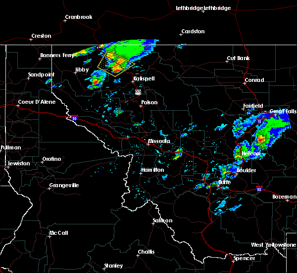 At 526 pm mdt, doppler radar indicated severe thunderstorms capable of producing quarter size hail and damaging winds in excess of 60 mph. these storms were located along a line extending from 16 miles southeast of eureka to 10 miles northwest of whitefish, moving northeast at 45 mph. locations impacted include, olney, stryker, trego, fortine, radnor and lupfer. At 526 pm mdt, doppler radar indicated severe thunderstorms capable of producing quarter size hail and damaging winds in excess of 60 mph. these storms were located along a line extending from 16 miles southeast of eureka to 10 miles northwest of whitefish, moving northeast at 45 mph. locations impacted include, olney, stryker, trego, fortine, radnor and lupfer.
|
| 7/18/2016 4:59 PM MDT |
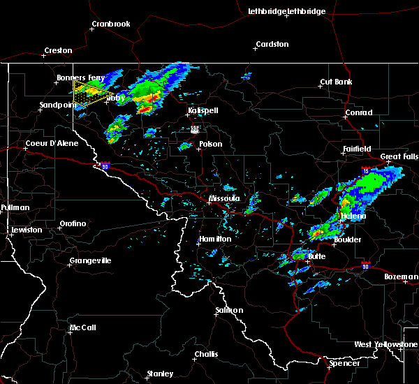 At 459 pm mdt, doppler radar indicated a line of severe thunderstorms capable of producing quarter size hail and damaging winds in excess of 60 mph. these storms were located along a line extending from 25 miles south of eureka to 16 miles west of whitefish, and moving northeast at 40 mph. At 459 pm mdt, doppler radar indicated a line of severe thunderstorms capable of producing quarter size hail and damaging winds in excess of 60 mph. these storms were located along a line extending from 25 miles south of eureka to 16 miles west of whitefish, and moving northeast at 40 mph.
|
Hail Maps for Fortine, MT


Connect with Interactive Hail Maps