

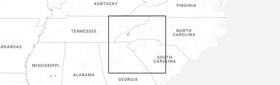
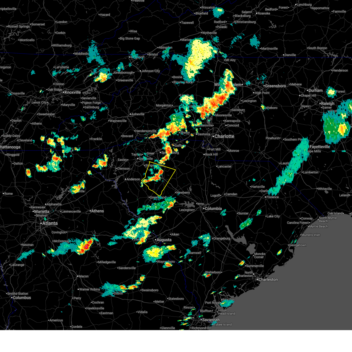
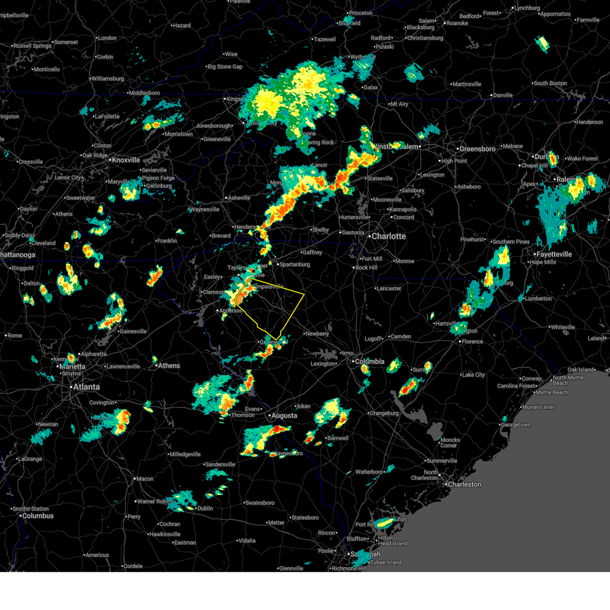
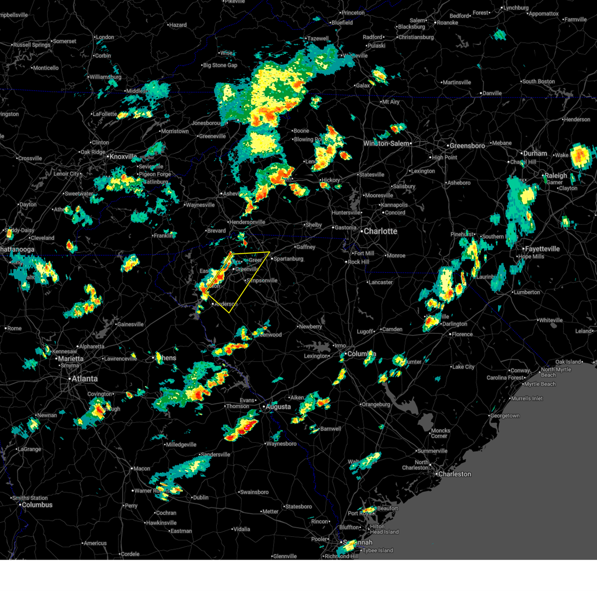
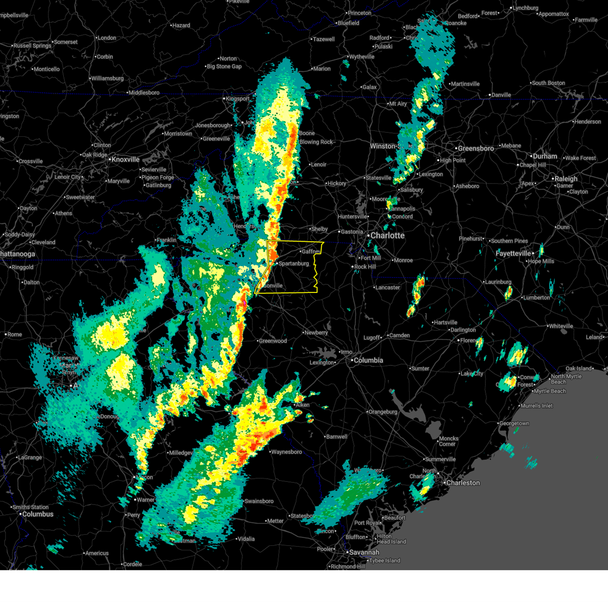
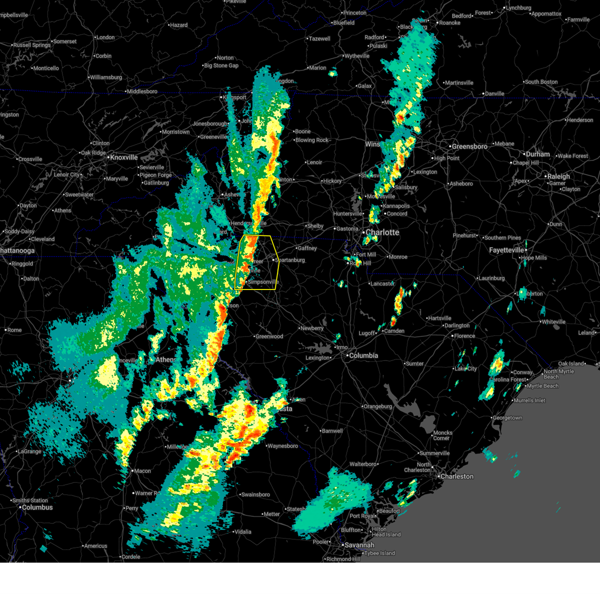
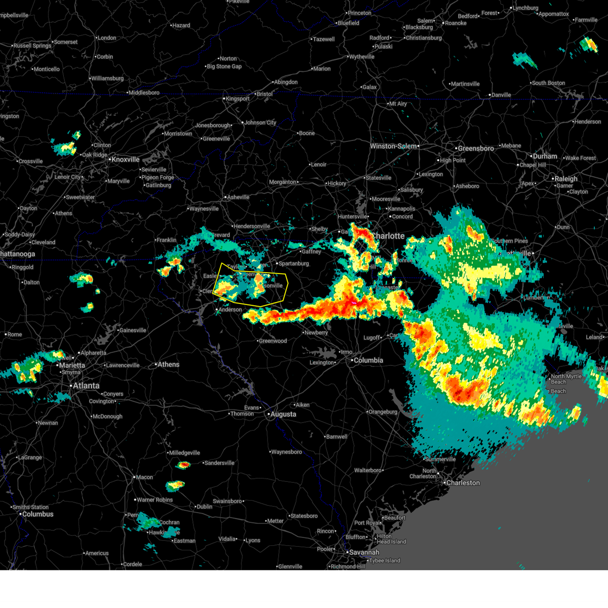
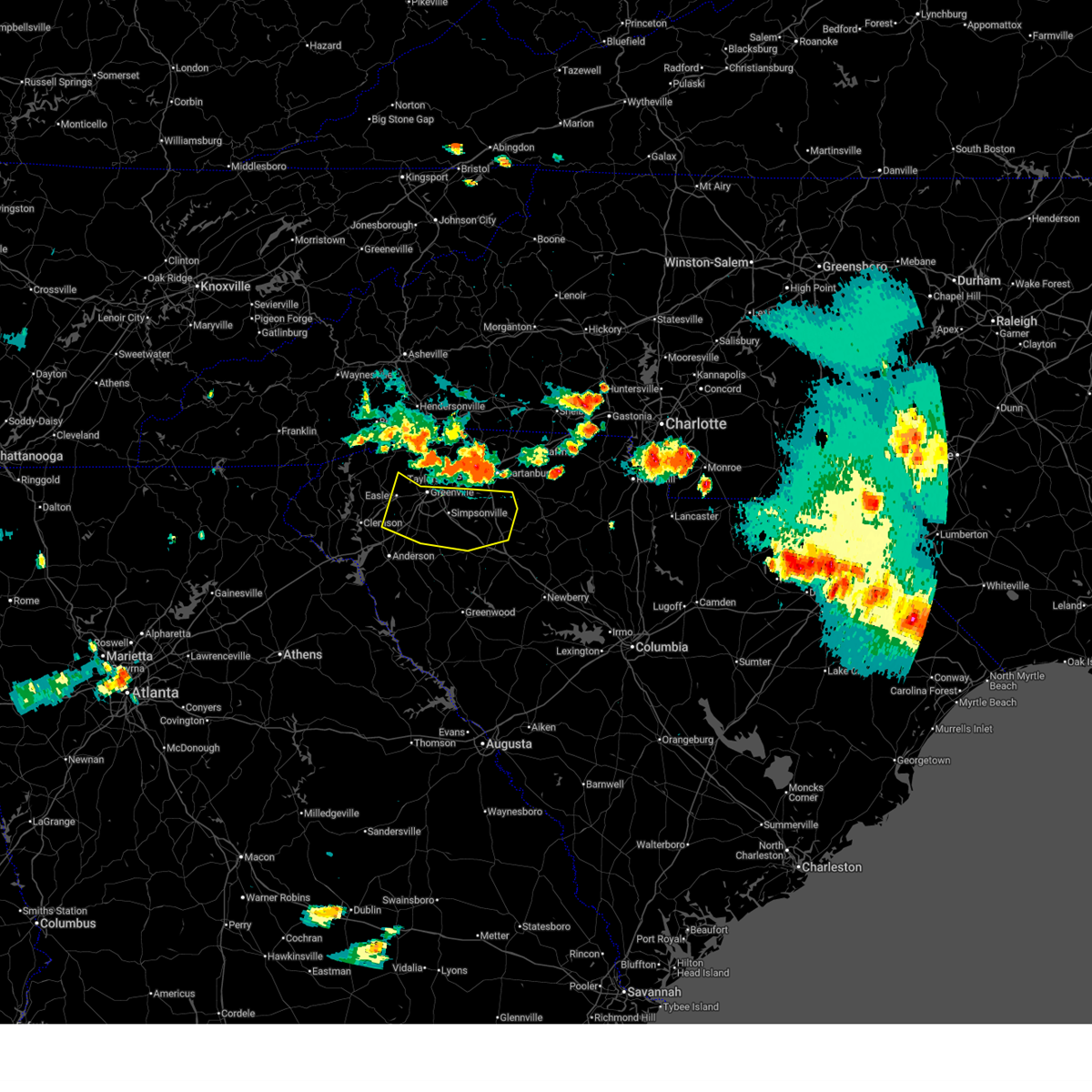
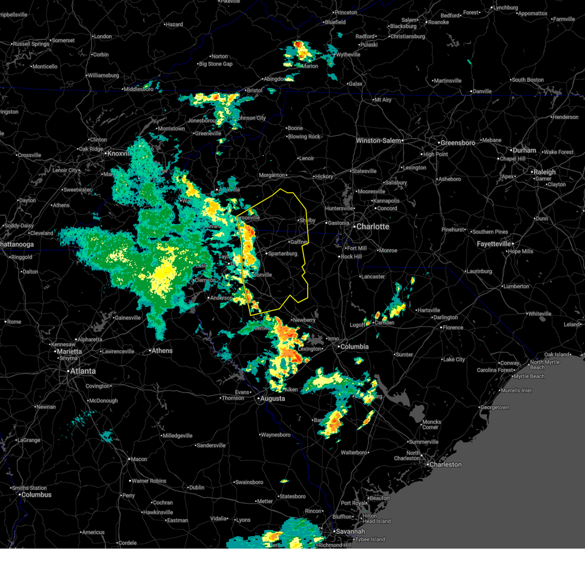
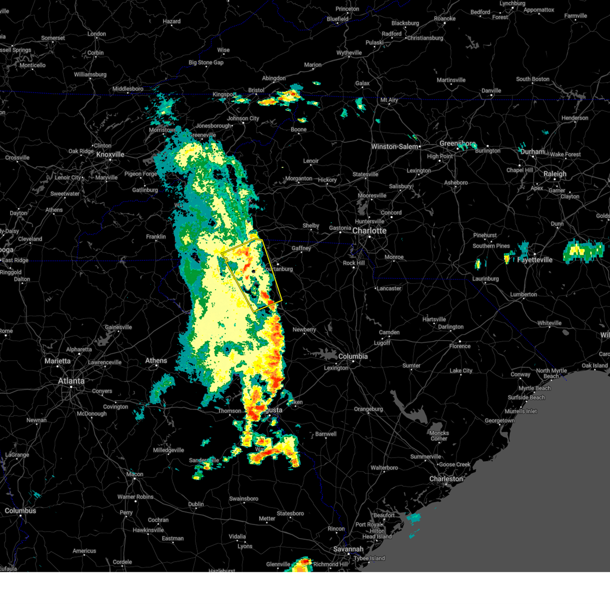
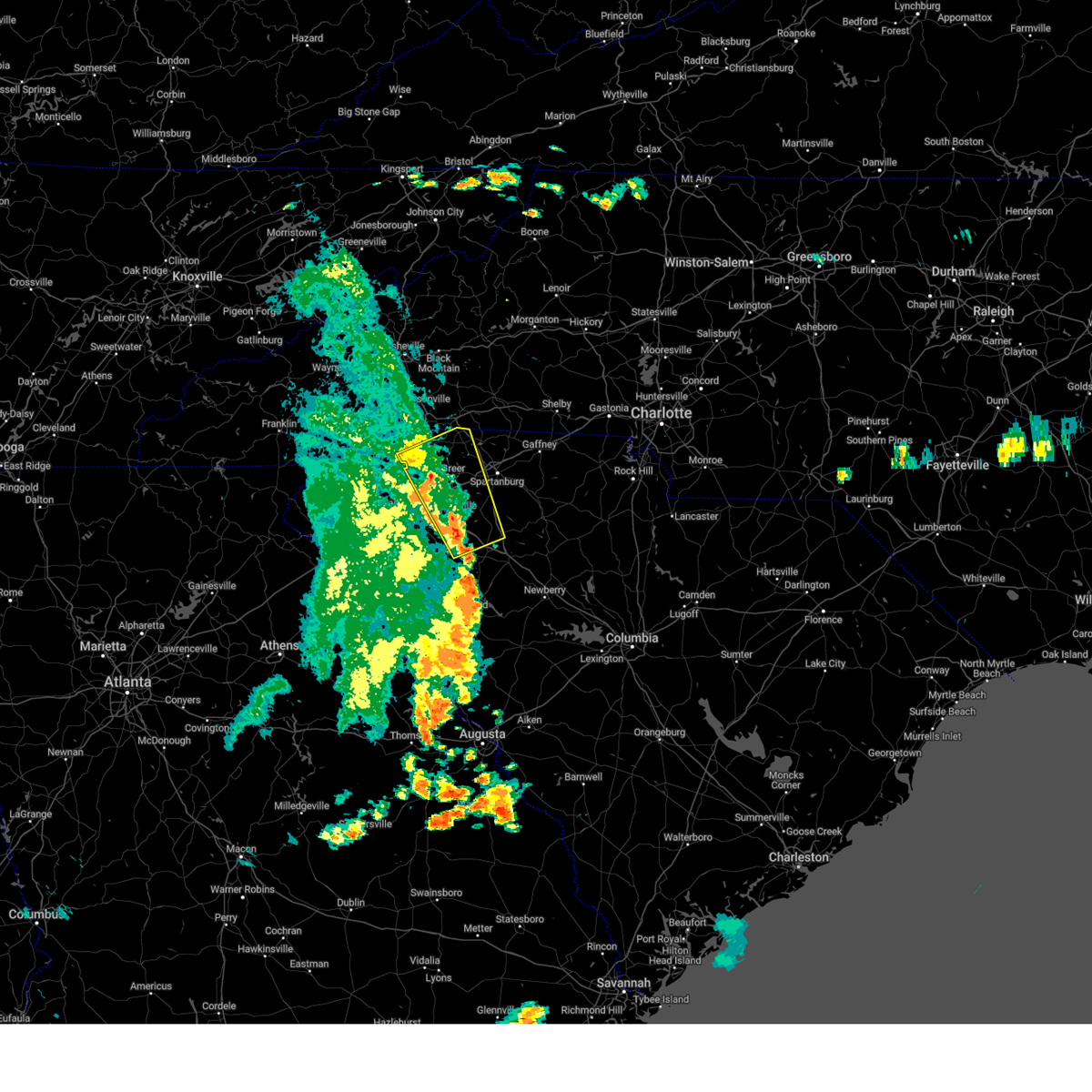
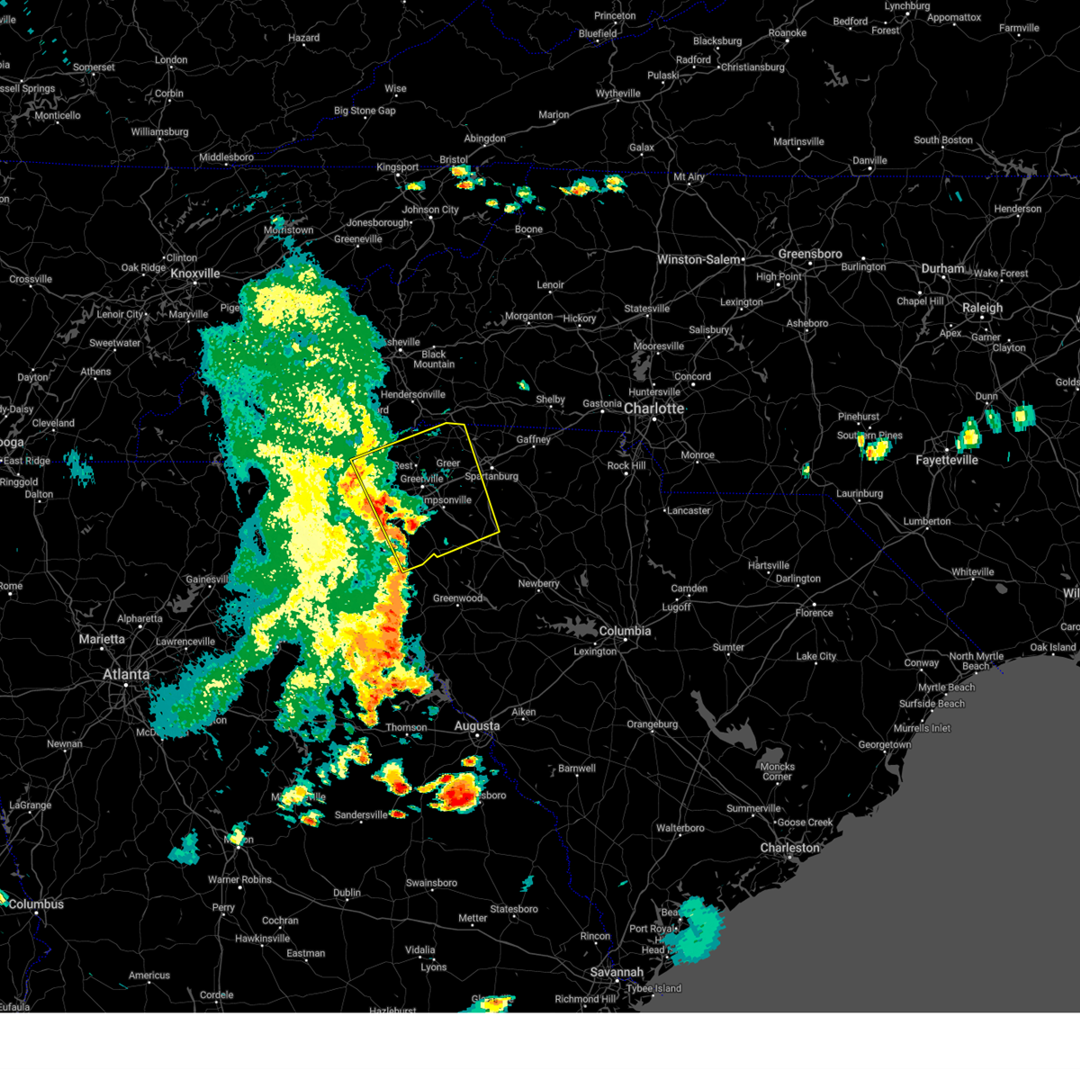
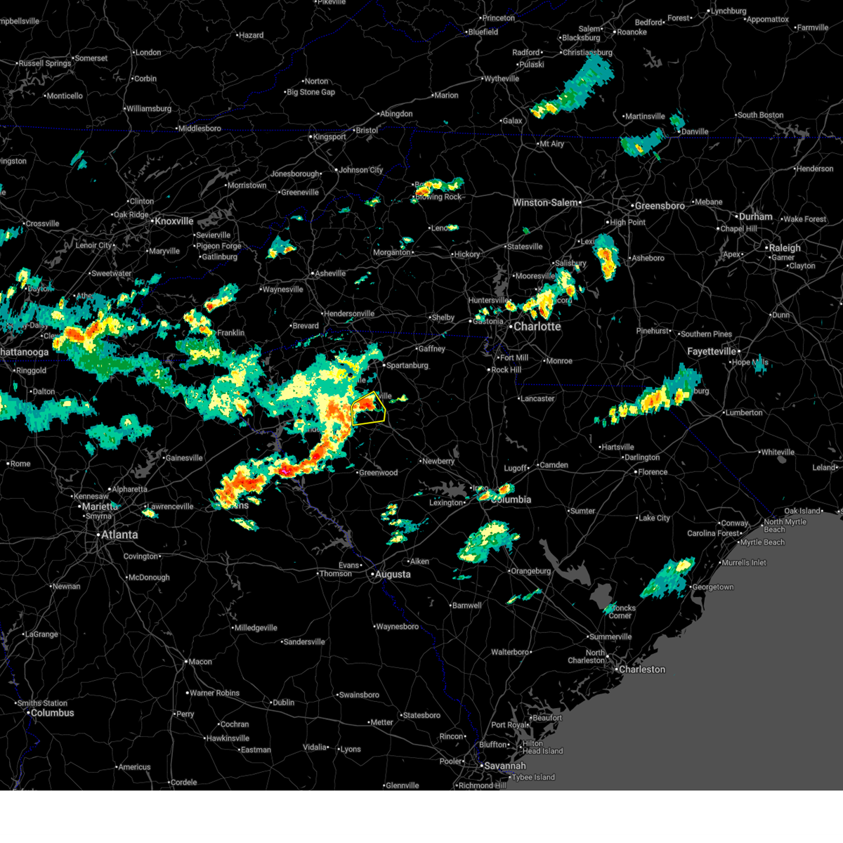
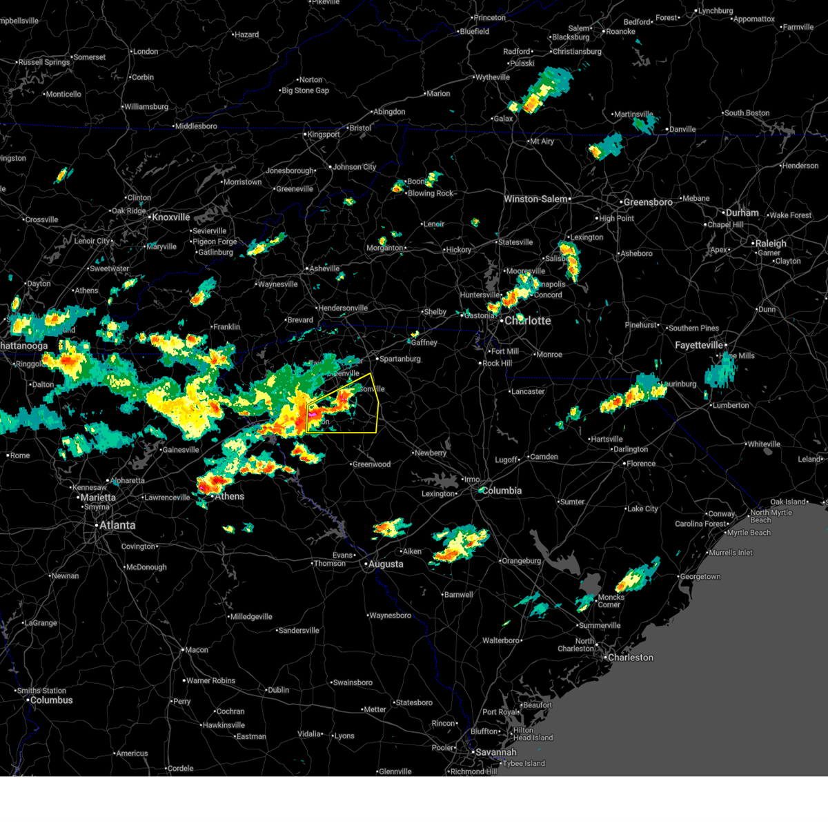
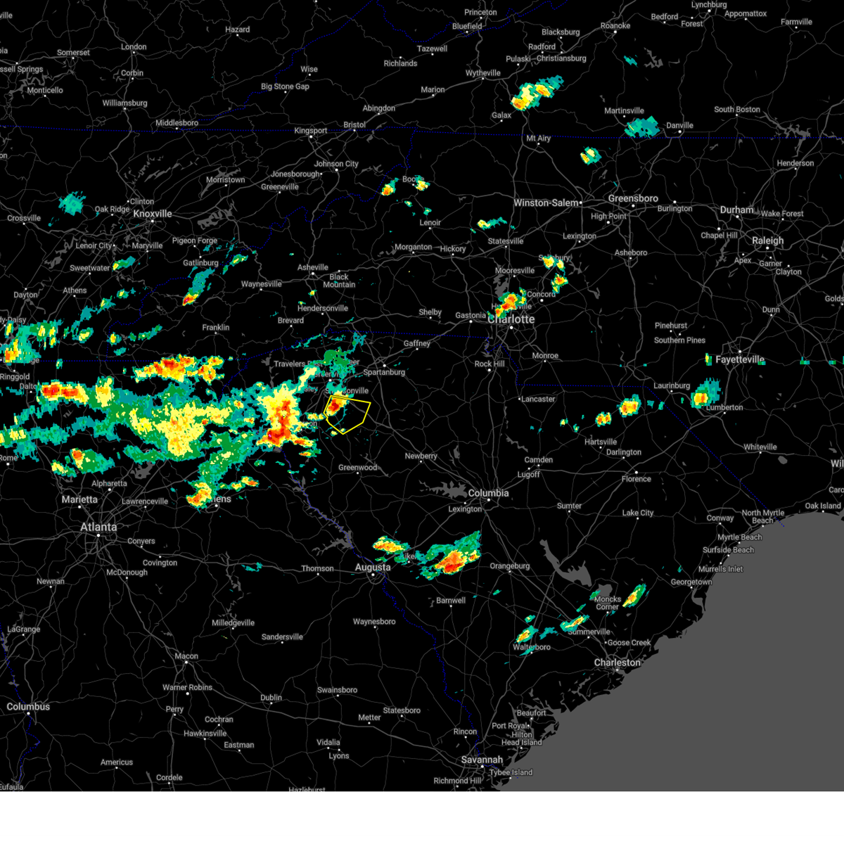
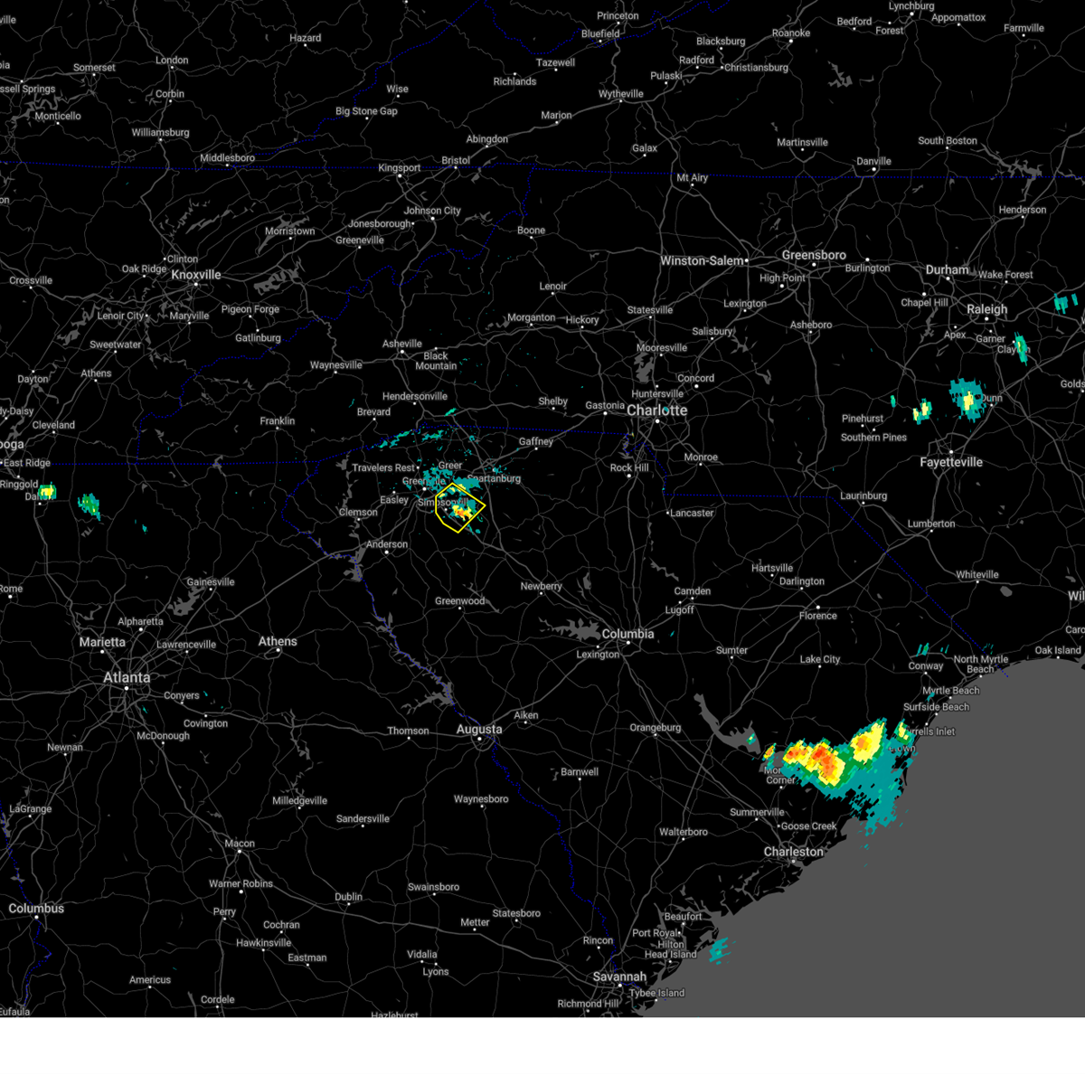
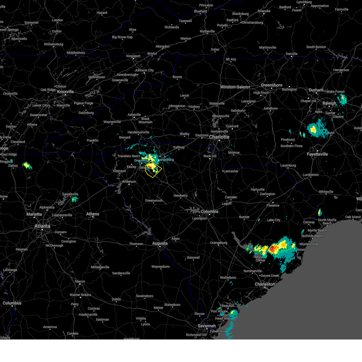
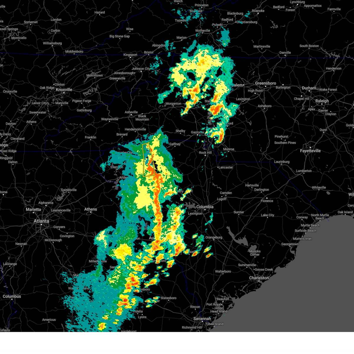
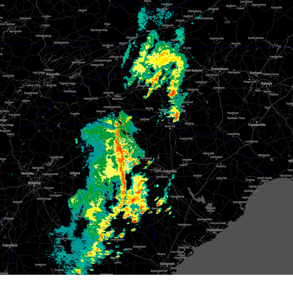
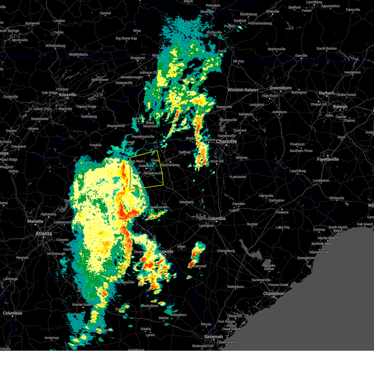
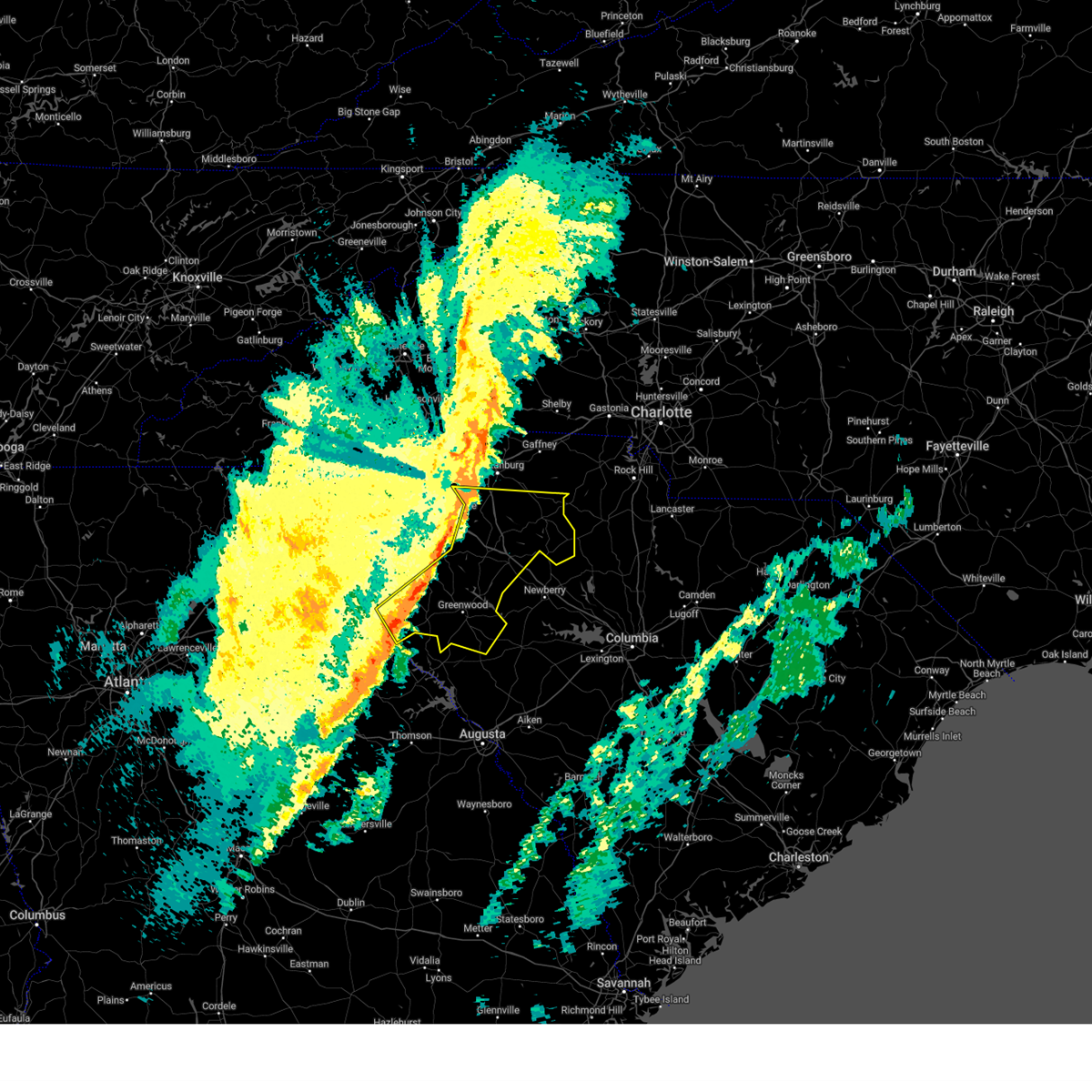
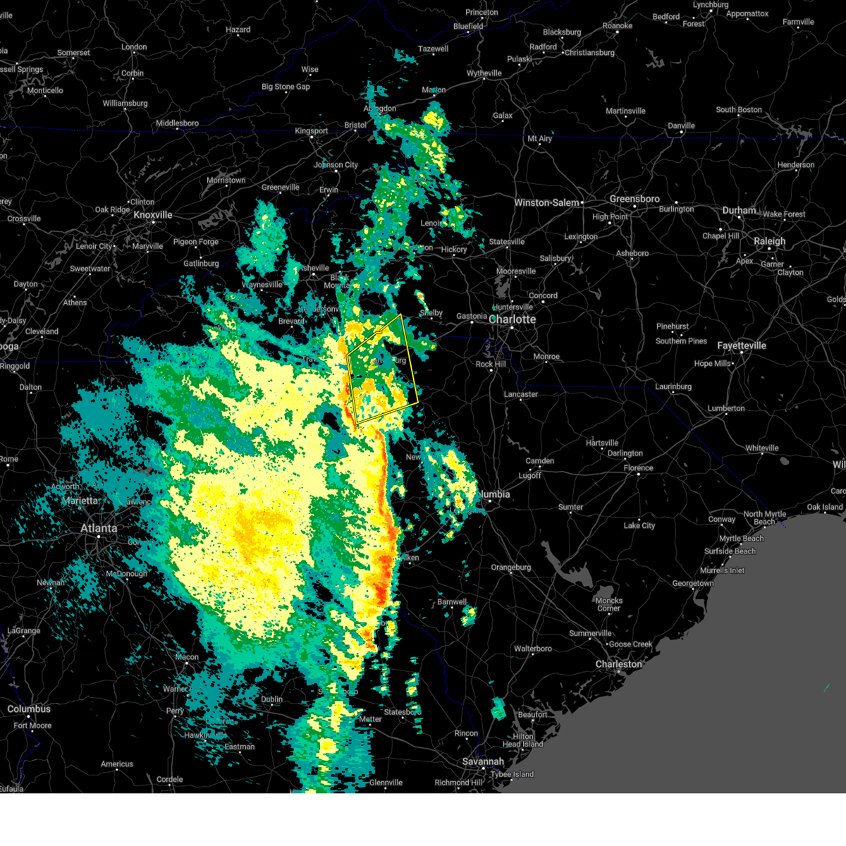
Hail Map for Fountain Inn, SC
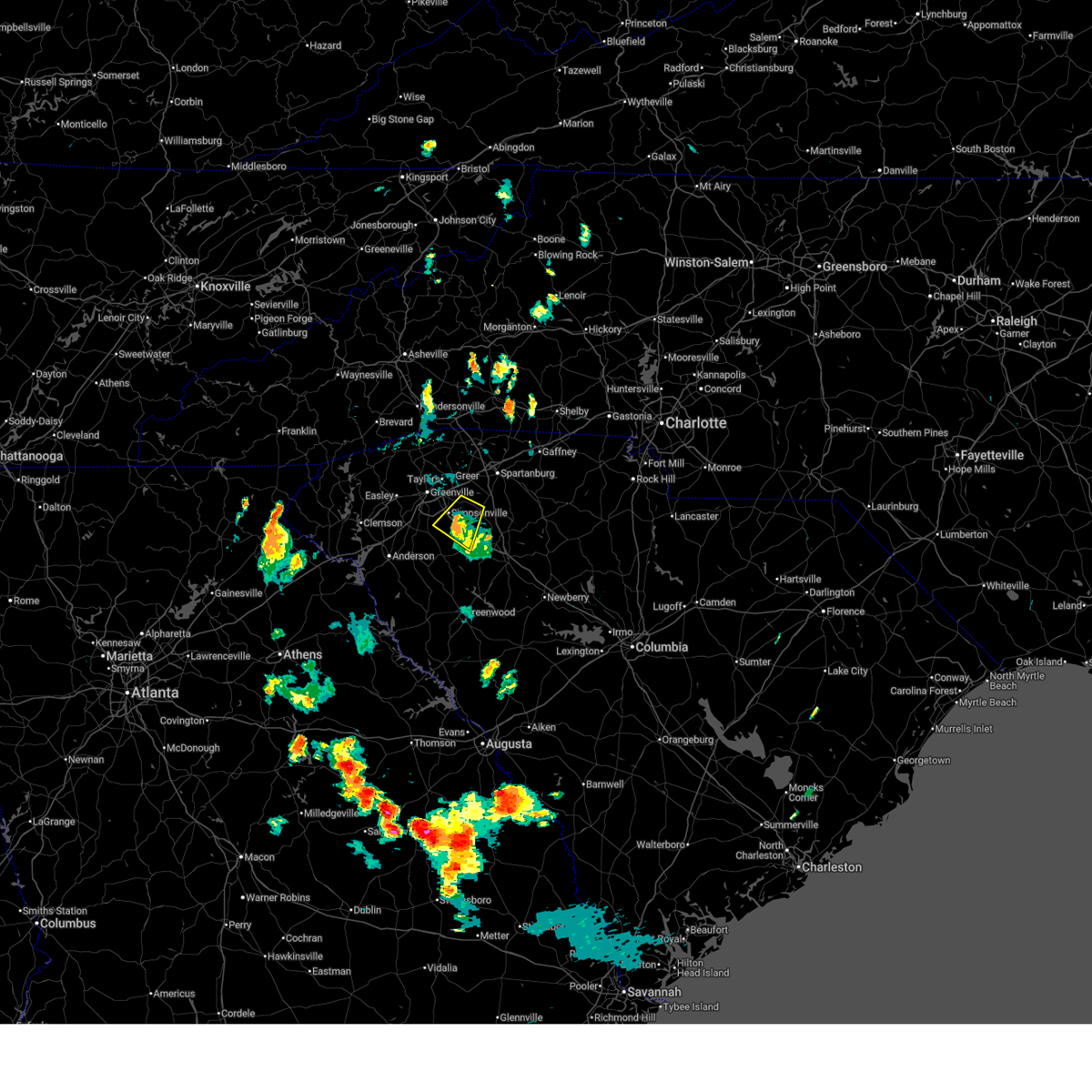
The Fountain Inn, SC area has had 13 reports of on-the-ground hail by trained spotters, and has been under severe weather warnings 12 times during the past 12 months. Doppler radar has detected hail at or near Fountain Inn, SC on 64 occasions, including 2 occasions during the past year.
| Name: | Fountain Inn, SC |
| Where Located: | 24.2 miles ESE of Greenville, SC |
| Map: | Google Map for Fountain Inn, SC |
| Population: | 7799 |
| Housing Units: | 3158 |
| More Info: | Search Google for Fountain Inn, SC |
0
The Top Recent Hail Date for Fountain Inn, SC is Monday, June 29, 2026 (33rd out of 64)
Hail and Wind Damage Spotted near Fountain Inn, SC
| Date / Time | Report Details |
|---|---|
| 6/29/2026 6:11 PM EDT |
 the severe thunderstorm warning has been cancelled and is no longer in effect the severe thunderstorm warning has been cancelled and is no longer in effect
|
| 6/29/2026 5:54 PM EDT |
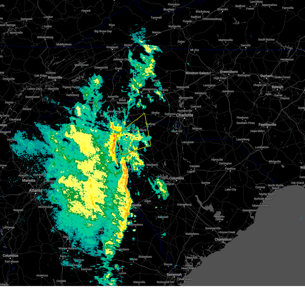
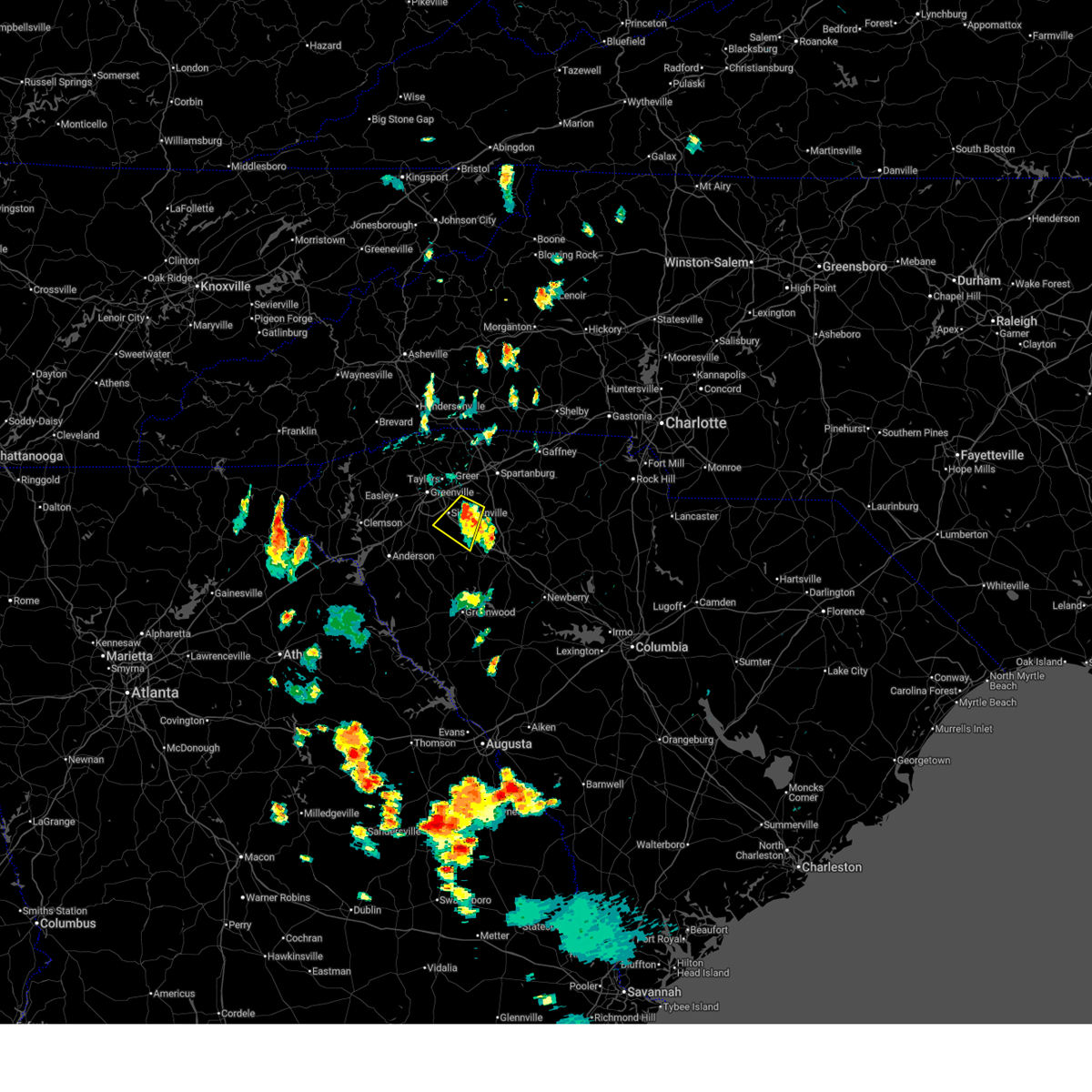 At 554 pm edt, a severe thunderstorm was located 14 miles northwest of laurens, or near fountain inn, moving southwest at 20 mph (radar indicated). Hazards include 60 mph wind gusts and penny size hail. Expect damage to trees and power lines. Locations impacted include, simpsonville, fountain inn, woodruff, gray court, and five forks. At 554 pm edt, a severe thunderstorm was located 14 miles northwest of laurens, or near fountain inn, moving southwest at 20 mph (radar indicated). Hazards include 60 mph wind gusts and penny size hail. Expect damage to trees and power lines. Locations impacted include, simpsonville, fountain inn, woodruff, gray court, and five forks.
|
| 6/29/2026 5:28 PM EDT |
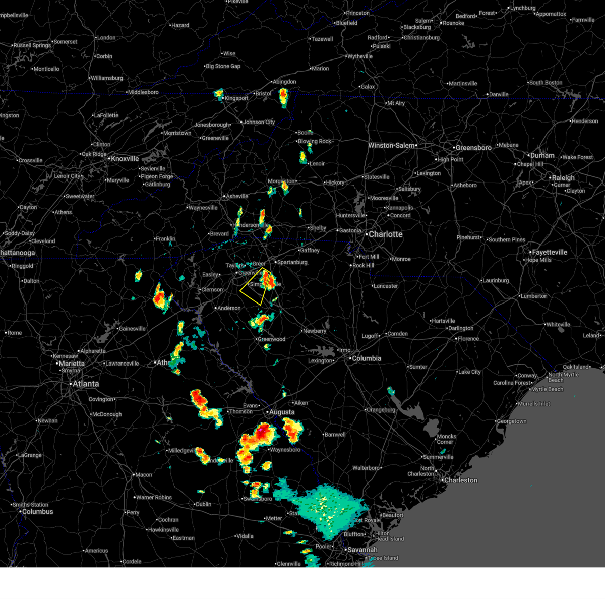 Svrgsp the national weather service in greenville-spartanburg has issued a * severe thunderstorm warning for, northwestern laurens county in upstate south carolina, southeastern greenville county in upstate south carolina, southwestern spartanburg county in upstate south carolina, * until 630 pm edt. * at 528 pm edt, a severe thunderstorm was located 14 miles southwest of spartanburg, or 4 miles northwest of woodruff, moving southwest at 20 mph (radar indicated). Hazards include 60 mph wind gusts and half dollar size hail. Minor hail damage to vehicles is expected. Expect wind damage to trees and power lines. Svrgsp the national weather service in greenville-spartanburg has issued a * severe thunderstorm warning for, northwestern laurens county in upstate south carolina, southeastern greenville county in upstate south carolina, southwestern spartanburg county in upstate south carolina, * until 630 pm edt. * at 528 pm edt, a severe thunderstorm was located 14 miles southwest of spartanburg, or 4 miles northwest of woodruff, moving southwest at 20 mph (radar indicated). Hazards include 60 mph wind gusts and half dollar size hail. Minor hail damage to vehicles is expected. Expect wind damage to trees and power lines.
|
| 6/27/2026 4:22 PM EDT |
 At 421 pm edt, severe thunderstorms were located along a line extending from 10 miles southwest of union to 11 miles south of laurens, moving southeast at 45 mph (radar indicated). Hazards include 60 mph wind gusts. Expect damage to trees and power lines. Locations impacted include, laurens, clinton, woodruff, joanna, gray court, cross hill, waterloo, rose hill state park, mountville, and princeton. At 421 pm edt, severe thunderstorms were located along a line extending from 10 miles southwest of union to 11 miles south of laurens, moving southeast at 45 mph (radar indicated). Hazards include 60 mph wind gusts. Expect damage to trees and power lines. Locations impacted include, laurens, clinton, woodruff, joanna, gray court, cross hill, waterloo, rose hill state park, mountville, and princeton.
|
| 6/27/2026 3:43 PM EDT |
 Svrgsp the national weather service in greenville-spartanburg has issued a * severe thunderstorm warning for, laurens county in upstate south carolina, southeastern greenville county in upstate south carolina, southern spartanburg county in upstate south carolina, southwestern union county in upstate south carolina, * until 445 pm edt. * at 343 pm edt, severe thunderstorms were located along a line extending from 12 miles east of greenville downtown to 14 miles east of anderson, moving southeast at 40 mph (radar indicated). Hazards include 60 mph wind gusts. expect damage to trees and power lines Svrgsp the national weather service in greenville-spartanburg has issued a * severe thunderstorm warning for, laurens county in upstate south carolina, southeastern greenville county in upstate south carolina, southern spartanburg county in upstate south carolina, southwestern union county in upstate south carolina, * until 445 pm edt. * at 343 pm edt, severe thunderstorms were located along a line extending from 12 miles east of greenville downtown to 14 miles east of anderson, moving southeast at 40 mph (radar indicated). Hazards include 60 mph wind gusts. expect damage to trees and power lines
|
| 6/27/2026 3:12 PM EDT |
 Svrgsp the national weather service in greenville-spartanburg has issued a * severe thunderstorm warning for, southeastern greenville county in upstate south carolina, west central spartanburg county in upstate south carolina, northeastern anderson county in upstate south carolina, east central pickens county in upstate south carolina, * until 415 pm edt. * at 311 pm edt, severe thunderstorms were located along a line extending from 7 miles north of greenville downtown to 7 miles north of anderson, moving east at 25 mph (radar indicated). Hazards include 60 mph wind gusts. expect damage to trees and power lines Svrgsp the national weather service in greenville-spartanburg has issued a * severe thunderstorm warning for, southeastern greenville county in upstate south carolina, west central spartanburg county in upstate south carolina, northeastern anderson county in upstate south carolina, east central pickens county in upstate south carolina, * until 415 pm edt. * at 311 pm edt, severe thunderstorms were located along a line extending from 7 miles north of greenville downtown to 7 miles north of anderson, moving east at 25 mph (radar indicated). Hazards include 60 mph wind gusts. expect damage to trees and power lines
|
| 3/16/2026 8:14 AM EDT |
 Svrgsp the national weather service in greenville-spartanburg has issued a * severe thunderstorm warning for, northwestern laurens county in upstate south carolina, spartanburg county in upstate south carolina, cherokee county in upstate south carolina, northern union county in upstate south carolina, * until 915 am edt. * at 813 am edt, severe thunderstorms were located along a line extending from 11 miles southeast of columbus to 7 miles west of spartanburg to 15 miles northwest of laurens, moving east at 50 mph (radar indicated). Hazards include 60 mph wind gusts. expect damage to trees and power lines Svrgsp the national weather service in greenville-spartanburg has issued a * severe thunderstorm warning for, northwestern laurens county in upstate south carolina, spartanburg county in upstate south carolina, cherokee county in upstate south carolina, northern union county in upstate south carolina, * until 915 am edt. * at 813 am edt, severe thunderstorms were located along a line extending from 11 miles southeast of columbus to 7 miles west of spartanburg to 15 miles northwest of laurens, moving east at 50 mph (radar indicated). Hazards include 60 mph wind gusts. expect damage to trees and power lines
|
| 3/16/2026 7:59 AM EDT |
 At 758 am edt, severe thunderstorms were located along a line extending from 16 miles southwest of columbus to near greenville downtown to 6 miles east of anderson, moving east at 45 mph (radar indicated). Hazards include 60 mph wind gusts. Expect damage to trees and power lines. Locations impacted include, spartanburg, greenville eastside, greer, mauldin, taylors, simpsonville, five forks, fountain inn, boiling springs sc, and woodruff. At 758 am edt, severe thunderstorms were located along a line extending from 16 miles southwest of columbus to near greenville downtown to 6 miles east of anderson, moving east at 45 mph (radar indicated). Hazards include 60 mph wind gusts. Expect damage to trees and power lines. Locations impacted include, spartanburg, greenville eastside, greer, mauldin, taylors, simpsonville, five forks, fountain inn, boiling springs sc, and woodruff.
|
| 3/16/2026 7:15 AM EDT |
 Svrgsp the national weather service in greenville-spartanburg has issued a * severe thunderstorm warning for, northwestern laurens county in upstate south carolina, greenville county in upstate south carolina, spartanburg county in upstate south carolina, * until 815 am edt. * at 715 am edt, severe thunderstorms were located along a line extending from 16 miles south of brevard to 9 miles west of pickens to 11 miles northwest of hartwell, moving east at 45 mph (radar indicated). Hazards include 60 mph wind gusts. expect damage to trees and power lines Svrgsp the national weather service in greenville-spartanburg has issued a * severe thunderstorm warning for, northwestern laurens county in upstate south carolina, greenville county in upstate south carolina, spartanburg county in upstate south carolina, * until 815 am edt. * at 715 am edt, severe thunderstorms were located along a line extending from 16 miles south of brevard to 9 miles west of pickens to 11 miles northwest of hartwell, moving east at 45 mph (radar indicated). Hazards include 60 mph wind gusts. expect damage to trees and power lines
|
| 7/11/2025 7:01 PM EDT |
 the severe thunderstorm warning has been cancelled and is no longer in effect the severe thunderstorm warning has been cancelled and is no longer in effect
|
| 7/11/2025 6:34 PM EDT |
 Svrgsp the national weather service in greenville-spartanburg has issued a * severe thunderstorm warning for, northwestern laurens county in upstate south carolina, * until 730 pm edt. * at 633 pm edt, a severe thunderstorm was located 12 miles northwest of laurens, or 4 miles west of gray court, moving east at 10 mph (radar indicated). Hazards include 60 mph wind gusts and penny size hail. expect damage to trees and power lines Svrgsp the national weather service in greenville-spartanburg has issued a * severe thunderstorm warning for, northwestern laurens county in upstate south carolina, * until 730 pm edt. * at 633 pm edt, a severe thunderstorm was located 12 miles northwest of laurens, or 4 miles west of gray court, moving east at 10 mph (radar indicated). Hazards include 60 mph wind gusts and penny size hail. expect damage to trees and power lines
|
| 7/1/2025 6:30 PM EDT |
 Svrgsp the national weather service in greenville-spartanburg has issued a * severe thunderstorm warning for, east central greenville county in upstate south carolina, west central spartanburg county in upstate south carolina, northeastern anderson county in upstate south carolina, * until 715 pm edt. * at 629 pm edt, severe thunderstorms were located along a line extending from 7 miles southeast of easley to near greenville downtown, moving northeast at 20 mph (radar indicated). Hazards include 60 mph wind gusts. expect damage to trees and power lines Svrgsp the national weather service in greenville-spartanburg has issued a * severe thunderstorm warning for, east central greenville county in upstate south carolina, west central spartanburg county in upstate south carolina, northeastern anderson county in upstate south carolina, * until 715 pm edt. * at 629 pm edt, severe thunderstorms were located along a line extending from 7 miles southeast of easley to near greenville downtown, moving northeast at 20 mph (radar indicated). Hazards include 60 mph wind gusts. expect damage to trees and power lines
|
| 6/25/2025 7:55 PM EDT |
 The storm which prompted the warning has moved out of the area. therefore, the warning will be allowed to expire. a severe thunderstorm watch remains in effect until midnight edt for upstate south carolina. The storm which prompted the warning has moved out of the area. therefore, the warning will be allowed to expire. a severe thunderstorm watch remains in effect until midnight edt for upstate south carolina.
|
| 6/25/2025 6:27 PM EDT |
 Svrgsp the national weather service in greenville-spartanburg has issued a * severe thunderstorm warning for, northwestern laurens county in upstate south carolina, southeastern greenville county in upstate south carolina, southern spartanburg county in upstate south carolina, northeastern anderson county in upstate south carolina, east central pickens county in upstate south carolina, * until 800 pm edt. * at 627 pm edt, a severe thunderstorm was located 10 miles east of greenville downtown, or near gsp airport, moving south at 20 mph (radar indicated). Hazards include 60 mph wind gusts and nickel size hail. expect damage to trees and power lines Svrgsp the national weather service in greenville-spartanburg has issued a * severe thunderstorm warning for, northwestern laurens county in upstate south carolina, southeastern greenville county in upstate south carolina, southern spartanburg county in upstate south carolina, northeastern anderson county in upstate south carolina, east central pickens county in upstate south carolina, * until 800 pm edt. * at 627 pm edt, a severe thunderstorm was located 10 miles east of greenville downtown, or near gsp airport, moving south at 20 mph (radar indicated). Hazards include 60 mph wind gusts and nickel size hail. expect damage to trees and power lines
|
| 6/17/2025 9:19 PM EDT |
 the severe thunderstorm warning has been cancelled and is no longer in effect the severe thunderstorm warning has been cancelled and is no longer in effect
|
| 6/17/2025 9:19 PM EDT |
 At 918 pm edt, severe thunderstorms were located along a line extending from 4 miles north of columbus to 13 miles south of rutherfordton to 5 miles southwest of spartanburg to near laurens, moving east at 50 mph (radar indicated). Hazards include 60 mph wind gusts. Expect damage to trees and power lines. Locations impacted include, spartanburg, shelby, gaffney, laurens, union, forest city, rutherfordton, columbus, greer, and clinton. At 918 pm edt, severe thunderstorms were located along a line extending from 4 miles north of columbus to 13 miles south of rutherfordton to 5 miles southwest of spartanburg to near laurens, moving east at 50 mph (radar indicated). Hazards include 60 mph wind gusts. Expect damage to trees and power lines. Locations impacted include, spartanburg, shelby, gaffney, laurens, union, forest city, rutherfordton, columbus, greer, and clinton.
|
| 6/17/2025 8:50 PM EDT |
 Svrgsp the national weather service in greenville-spartanburg has issued a * severe thunderstorm warning for, rutherford county in western north carolina, southeastern henderson county in western north carolina, polk county in western north carolina, cleveland county in the piedmont of north carolina, laurens county in upstate south carolina, northeastern pickens county in upstate south carolina, union county in upstate south carolina, greenville county in upstate south carolina, spartanburg county in upstate south carolina, eastern anderson county in upstate south carolina, cherokee county in upstate south carolina, northeastern abbeville county in upstate south carolina, northwestern greenwood county in upstate south carolina, * until 945 pm edt. * at 849 pm edt, severe thunderstorms were located along a line extending from 12 miles south of hendersonville to 18 miles southwest of columbus to 7 miles south of greenville downtown to 11 miles north of abbeville, moving northeast at 50 mph (radar indicated). Hazards include 60 mph wind gusts. expect damage to trees and power lines Svrgsp the national weather service in greenville-spartanburg has issued a * severe thunderstorm warning for, rutherford county in western north carolina, southeastern henderson county in western north carolina, polk county in western north carolina, cleveland county in the piedmont of north carolina, laurens county in upstate south carolina, northeastern pickens county in upstate south carolina, union county in upstate south carolina, greenville county in upstate south carolina, spartanburg county in upstate south carolina, eastern anderson county in upstate south carolina, cherokee county in upstate south carolina, northeastern abbeville county in upstate south carolina, northwestern greenwood county in upstate south carolina, * until 945 pm edt. * at 849 pm edt, severe thunderstorms were located along a line extending from 12 miles south of hendersonville to 18 miles southwest of columbus to 7 miles south of greenville downtown to 11 miles north of abbeville, moving northeast at 50 mph (radar indicated). Hazards include 60 mph wind gusts. expect damage to trees and power lines
|
| 6/7/2025 8:25 PM EDT |
 The storms which prompted the warning have moved out of the area. therefore, the warning will be allowed to expire. a severe thunderstorm watch remains in effect until 1100 pm edt for upstate south carolina. to report severe weather to the national weather service greenville-spartanburg, call toll free, 1, 800, 2 6 7, 8 1 0 1, or post on our facebook page, or tweet it using hashtag nwsgsp. your message should describe the event and the specific location where it occurred. remember, a severe thunderstorm warning still remains in effect for spartanburg county and eastern laurens county until 900 pm edt. The storms which prompted the warning have moved out of the area. therefore, the warning will be allowed to expire. a severe thunderstorm watch remains in effect until 1100 pm edt for upstate south carolina. to report severe weather to the national weather service greenville-spartanburg, call toll free, 1, 800, 2 6 7, 8 1 0 1, or post on our facebook page, or tweet it using hashtag nwsgsp. your message should describe the event and the specific location where it occurred. remember, a severe thunderstorm warning still remains in effect for spartanburg county and eastern laurens county until 900 pm edt.
|
| 6/7/2025 8:09 PM EDT |
 the severe thunderstorm warning has been cancelled and is no longer in effect the severe thunderstorm warning has been cancelled and is no longer in effect
|
| 6/7/2025 8:09 PM EDT |
 At 808 pm edt, severe thunderstorms were located along a line extending from 14 miles north of greenville downtown to 6 miles west of laurens, moving east at 55 mph (radar indicated). Hazards include 60 mph wind gusts. Expect damage to trees and power lines. Locations impacted include, greenville downtown, greenville eastside, west greenville, greer, mauldin, taylors, simpsonville, berea, five forks, and fountain inn. At 808 pm edt, severe thunderstorms were located along a line extending from 14 miles north of greenville downtown to 6 miles west of laurens, moving east at 55 mph (radar indicated). Hazards include 60 mph wind gusts. Expect damage to trees and power lines. Locations impacted include, greenville downtown, greenville eastside, west greenville, greer, mauldin, taylors, simpsonville, berea, five forks, and fountain inn.
|
| 6/7/2025 7:42 PM EDT |
 Svrgsp the national weather service in greenville-spartanburg has issued a * severe thunderstorm warning for, northwestern laurens county in upstate south carolina, greenville county in upstate south carolina, western spartanburg county in upstate south carolina, northeastern anderson county in upstate south carolina, pickens county in upstate south carolina, * until 830 pm edt. * at 742 pm edt, severe thunderstorms were located along a line extending from 7 miles northwest of pickens to 8 miles southeast of anderson, moving northeast at 45 mph (radar indicated). Hazards include 60 mph wind gusts. expect damage to trees and power lines Svrgsp the national weather service in greenville-spartanburg has issued a * severe thunderstorm warning for, northwestern laurens county in upstate south carolina, greenville county in upstate south carolina, western spartanburg county in upstate south carolina, northeastern anderson county in upstate south carolina, pickens county in upstate south carolina, * until 830 pm edt. * at 742 pm edt, severe thunderstorms were located along a line extending from 7 miles northwest of pickens to 8 miles southeast of anderson, moving northeast at 45 mph (radar indicated). Hazards include 60 mph wind gusts. expect damage to trees and power lines
|
| 5/2/2025 3:46 PM EDT |
 the severe thunderstorm warning has been cancelled and is no longer in effect the severe thunderstorm warning has been cancelled and is no longer in effect
|
| 5/2/2025 3:46 PM EDT |
 At 346 pm edt, a severe thunderstorm was located 10 miles northwest of laurens, or near gray court, moving east at 35 mph (radar indicated). Hazards include 60 mph wind gusts and quarter size hail. Minor hail damage to vehicles is expected. expect wind damage to trees and power lines. Locations impacted include, woodruff, enoree, gray court, ora, fountain inn, and hickory tavern. At 346 pm edt, a severe thunderstorm was located 10 miles northwest of laurens, or near gray court, moving east at 35 mph (radar indicated). Hazards include 60 mph wind gusts and quarter size hail. Minor hail damage to vehicles is expected. expect wind damage to trees and power lines. Locations impacted include, woodruff, enoree, gray court, ora, fountain inn, and hickory tavern.
|
| 5/2/2025 3:18 PM EDT |
 Svrgsp the national weather service in greenville-spartanburg has issued a * severe thunderstorm warning for, northwestern laurens county in upstate south carolina, southeastern greenville county in upstate south carolina, southwestern spartanburg county in upstate south carolina, east central anderson county in upstate south carolina, northeastern abbeville county in upstate south carolina, * until 400 pm edt. * at 318 pm edt, a severe thunderstorm was located 13 miles east of anderson, or 4 miles northeast of belton, moving east at 35 mph (radar indicated). Hazards include 60 mph wind gusts and quarter size hail. Minor hail damage to vehicles is expected. Expect wind damage to trees and power lines. Svrgsp the national weather service in greenville-spartanburg has issued a * severe thunderstorm warning for, northwestern laurens county in upstate south carolina, southeastern greenville county in upstate south carolina, southwestern spartanburg county in upstate south carolina, east central anderson county in upstate south carolina, northeastern abbeville county in upstate south carolina, * until 400 pm edt. * at 318 pm edt, a severe thunderstorm was located 13 miles east of anderson, or 4 miles northeast of belton, moving east at 35 mph (radar indicated). Hazards include 60 mph wind gusts and quarter size hail. Minor hail damage to vehicles is expected. Expect wind damage to trees and power lines.
|
| 5/2/2025 2:47 PM EDT |
 Svrgsp the national weather service in greenville-spartanburg has issued a * severe thunderstorm warning for, northwestern laurens county in upstate south carolina, southeastern greenville county in upstate south carolina, * until 330 pm edt. * at 246 pm edt, a severe thunderstorm was located 13 miles south of greenville downtown, or 5 miles south of donaldson center, moving east at 15 mph (radar indicated). Hazards include 60 mph wind gusts and quarter size hail. Minor hail damage to vehicles is expected. Expect wind damage to trees and power lines. Svrgsp the national weather service in greenville-spartanburg has issued a * severe thunderstorm warning for, northwestern laurens county in upstate south carolina, southeastern greenville county in upstate south carolina, * until 330 pm edt. * at 246 pm edt, a severe thunderstorm was located 13 miles south of greenville downtown, or 5 miles south of donaldson center, moving east at 15 mph (radar indicated). Hazards include 60 mph wind gusts and quarter size hail. Minor hail damage to vehicles is expected. Expect wind damage to trees and power lines.
|
| 4/26/2025 6:33 PM EDT |
 the severe thunderstorm warning has been cancelled and is no longer in effect the severe thunderstorm warning has been cancelled and is no longer in effect
|
| 4/26/2025 6:07 PM EDT |
 Svrgsp the national weather service in greenville-spartanburg has issued a * severe thunderstorm warning for, northwestern laurens county in upstate south carolina, east central greenville county in upstate south carolina, southwestern spartanburg county in upstate south carolina, * until 645 pm edt. * at 607 pm edt, a severe thunderstorm was located 11 miles east of greenville downtown, or near five forks, moving southeast at 15 mph (radar indicated). Hazards include 60 mph wind gusts and quarter size hail. Minor hail damage to vehicles is expected. Expect wind damage to trees and power lines. Svrgsp the national weather service in greenville-spartanburg has issued a * severe thunderstorm warning for, northwestern laurens county in upstate south carolina, east central greenville county in upstate south carolina, southwestern spartanburg county in upstate south carolina, * until 645 pm edt. * at 607 pm edt, a severe thunderstorm was located 11 miles east of greenville downtown, or near five forks, moving southeast at 15 mph (radar indicated). Hazards include 60 mph wind gusts and quarter size hail. Minor hail damage to vehicles is expected. Expect wind damage to trees and power lines.
|
| 3/31/2025 3:54 PM EDT |
 The storms which prompted the warning have moved out of the area. therefore, the warning will be allowed to expire. a severe thunderstorm watch remains in effect until 700 pm edt for upstate south carolina. The storms which prompted the warning have moved out of the area. therefore, the warning will be allowed to expire. a severe thunderstorm watch remains in effect until 700 pm edt for upstate south carolina.
|
| 3/31/2025 3:47 PM EDT | Utility equipment damaged by falling tree in laurens county SC, 5.9 miles WNW of Fountain Inn, SC |
| 3/31/2025 3:42 PM EDT | Social media report of a large limb down on a power lin in greenville county SC, 1.3 miles N of Fountain Inn, SC |
| 3/31/2025 3:42 PM EDT |
 the severe thunderstorm warning has been cancelled and is no longer in effect the severe thunderstorm warning has been cancelled and is no longer in effect
|
| 3/31/2025 3:42 PM EDT |
 At 342 pm edt, severe thunderstorms were located along a line extending from 12 miles south of columbus to 15 miles east of greenville downtown to 10 miles northwest of laurens, moving east at 45 mph (radar indicated). Hazards include 60 mph wind gusts. Expect damage to trees and power lines. Locations impacted include, reidville, simpsonville, lake robinson, gsp airport, gowensville, five forks, gray court, fountain inn, greer, and duncan. At 342 pm edt, severe thunderstorms were located along a line extending from 12 miles south of columbus to 15 miles east of greenville downtown to 10 miles northwest of laurens, moving east at 45 mph (radar indicated). Hazards include 60 mph wind gusts. Expect damage to trees and power lines. Locations impacted include, reidville, simpsonville, lake robinson, gsp airport, gowensville, five forks, gray court, fountain inn, greer, and duncan.
|
| 3/31/2025 3:25 PM EDT |
 the severe thunderstorm warning has been cancelled and is no longer in effect the severe thunderstorm warning has been cancelled and is no longer in effect
|
| 3/31/2025 3:25 PM EDT |
 At 325 pm edt, severe thunderstorms were located along a line extending from 17 miles northeast of easley to 8 miles south of greenville downtown to 13 miles east of anderson, moving east at 45 mph (radar indicated). Hazards include 60 mph wind gusts. Expect damage to trees and power lines. Locations impacted include, paris mountain state park, tigerville, fork shoals, williamston, west pelzer, gsp airport, gowensville, berea, travelers rest, and reidville. At 325 pm edt, severe thunderstorms were located along a line extending from 17 miles northeast of easley to 8 miles south of greenville downtown to 13 miles east of anderson, moving east at 45 mph (radar indicated). Hazards include 60 mph wind gusts. Expect damage to trees and power lines. Locations impacted include, paris mountain state park, tigerville, fork shoals, williamston, west pelzer, gsp airport, gowensville, berea, travelers rest, and reidville.
|
| 3/31/2025 3:15 PM EDT |
 At 314 pm edt, severe thunderstorms were located along a line extending from 11 miles northeast of pickens to 9 miles southeast of easley to 5 miles east of anderson, moving east at 45 mph (radar indicated). Hazards include 60 mph wind gusts. Expect damage to trees and power lines. Locations impacted include, paris mountain state park, tigerville, easley, fork shoals, williamston, west pelzer, gsp airport, powdersville, gowensville, and berea. At 314 pm edt, severe thunderstorms were located along a line extending from 11 miles northeast of pickens to 9 miles southeast of easley to 5 miles east of anderson, moving east at 45 mph (radar indicated). Hazards include 60 mph wind gusts. Expect damage to trees and power lines. Locations impacted include, paris mountain state park, tigerville, easley, fork shoals, williamston, west pelzer, gsp airport, powdersville, gowensville, and berea.
|
| 3/31/2025 2:55 PM EDT |
 Svrgsp the national weather service in greenville-spartanburg has issued a * severe thunderstorm warning for, northwestern laurens county in upstate south carolina, greenville county in upstate south carolina, west central spartanburg county in upstate south carolina, northeastern anderson county in upstate south carolina, northeastern pickens county in upstate south carolina, * until 400 pm edt. * at 255 pm edt, severe thunderstorms were located along a line extending from 7 miles northwest of pickens to 5 miles east of clemson to 7 miles southwest of anderson, moving east at 45 mph (radar indicated). Hazards include 70 mph wind gusts. Expect considerable tree damage. Damage is likely to mobile homes, roofs, and outbuildings. Svrgsp the national weather service in greenville-spartanburg has issued a * severe thunderstorm warning for, northwestern laurens county in upstate south carolina, greenville county in upstate south carolina, west central spartanburg county in upstate south carolina, northeastern anderson county in upstate south carolina, northeastern pickens county in upstate south carolina, * until 400 pm edt. * at 255 pm edt, severe thunderstorms were located along a line extending from 7 miles northwest of pickens to 5 miles east of clemson to 7 miles southwest of anderson, moving east at 45 mph (radar indicated). Hazards include 70 mph wind gusts. Expect considerable tree damage. Damage is likely to mobile homes, roofs, and outbuildings.
|
| 2/16/2025 6:15 AM EST |
 the severe thunderstorm warning has been cancelled and is no longer in effect the severe thunderstorm warning has been cancelled and is no longer in effect
|
| 2/16/2025 6:15 AM EST |
 At 615 am est, severe thunderstorms were located along a line extending from 7 miles southwest of spartanburg to 9 miles northwest of laurens to 10 miles southwest of abbeville, moving east at 75 mph (radar indicated). Hazards include 60 mph wind gusts. Expect damage to trees and power lines. Locations impacted include, greenwood, laurens, union, abbeville, clinton, woodruff, ware shoals, calhoun falls, monarch mill, and ninety six. At 615 am est, severe thunderstorms were located along a line extending from 7 miles southwest of spartanburg to 9 miles northwest of laurens to 10 miles southwest of abbeville, moving east at 75 mph (radar indicated). Hazards include 60 mph wind gusts. Expect damage to trees and power lines. Locations impacted include, greenwood, laurens, union, abbeville, clinton, woodruff, ware shoals, calhoun falls, monarch mill, and ninety six.
|
| 2/16/2025 5:58 AM EST |
 Svrgsp the national weather service in greenville-spartanburg has issued a * severe thunderstorm warning for, eastern elbert county in northeastern georgia, laurens county in upstate south carolina, southeastern greenville county in upstate south carolina, southern spartanburg county in upstate south carolina, eastern anderson county in upstate south carolina, abbeville county in upstate south carolina, union county in upstate south carolina, greenwood county in upstate south carolina, * until 630 am est. * at 558 am est, severe thunderstorms were located along a line extending from near greenville downtown to 11 miles east of anderson to 7 miles east of elberton, moving east at 105 mph (radar indicated). Hazards include 60 mph wind gusts. expect damage to trees and power lines Svrgsp the national weather service in greenville-spartanburg has issued a * severe thunderstorm warning for, eastern elbert county in northeastern georgia, laurens county in upstate south carolina, southeastern greenville county in upstate south carolina, southern spartanburg county in upstate south carolina, eastern anderson county in upstate south carolina, abbeville county in upstate south carolina, union county in upstate south carolina, greenwood county in upstate south carolina, * until 630 am est. * at 558 am est, severe thunderstorms were located along a line extending from near greenville downtown to 11 miles east of anderson to 7 miles east of elberton, moving east at 105 mph (radar indicated). Hazards include 60 mph wind gusts. expect damage to trees and power lines
|
| 12/29/2024 8:00 AM EST |
 At 800 am est, severe thunderstorms were located along a line extending from 9 miles south of columbus to 4 miles northwest of laurens, moving northeast at 50 mph (radar indicated). Hazards include 60 mph wind gusts. Expect damage to trees and power lines. Locations impacted include, spartanburg, greer, five forks, fountain inn, boiling springs sc, woodruff, duncan, lyman, pacolet, and cowpens. At 800 am est, severe thunderstorms were located along a line extending from 9 miles south of columbus to 4 miles northwest of laurens, moving northeast at 50 mph (radar indicated). Hazards include 60 mph wind gusts. Expect damage to trees and power lines. Locations impacted include, spartanburg, greer, five forks, fountain inn, boiling springs sc, woodruff, duncan, lyman, pacolet, and cowpens.
|
| 12/29/2024 7:32 AM EST |
 Svrgsp the national weather service in greenville-spartanburg has issued a * severe thunderstorm warning for, southeastern rutherford county in western north carolina, northwestern laurens county in upstate south carolina, southeastern greenville county in upstate south carolina, spartanburg county in upstate south carolina, western cherokee county in upstate south carolina, northwestern union county in upstate south carolina, * until 845 am est. * at 732 am est, severe thunderstorms were located along a line extending from 10 miles north of greenville downtown to 6 miles northwest of abbeville, moving east at 45 mph (radar indicated). Hazards include 60 mph wind gusts. expect damage to trees and power lines Svrgsp the national weather service in greenville-spartanburg has issued a * severe thunderstorm warning for, southeastern rutherford county in western north carolina, northwestern laurens county in upstate south carolina, southeastern greenville county in upstate south carolina, spartanburg county in upstate south carolina, western cherokee county in upstate south carolina, northwestern union county in upstate south carolina, * until 845 am est. * at 732 am est, severe thunderstorms were located along a line extending from 10 miles north of greenville downtown to 6 miles northwest of abbeville, moving east at 45 mph (radar indicated). Hazards include 60 mph wind gusts. expect damage to trees and power lines
|
| 8/17/2024 6:59 PM EDT |
 Svrgsp the national weather service in greenville-spartanburg has issued a * severe thunderstorm warning for, southeastern greenville county in upstate south carolina, west central spartanburg county in upstate south carolina, * until 800 pm edt. * at 658 pm edt, a severe thunderstorm was located 12 miles east of greenville downtown, or near five forks, moving east at 15 mph (radar indicated). Hazards include 60 mph wind gusts and quarter size hail. Minor hail damage to vehicles is expected. Expect wind damage to trees and power lines. Svrgsp the national weather service in greenville-spartanburg has issued a * severe thunderstorm warning for, southeastern greenville county in upstate south carolina, west central spartanburg county in upstate south carolina, * until 800 pm edt. * at 658 pm edt, a severe thunderstorm was located 12 miles east of greenville downtown, or near five forks, moving east at 15 mph (radar indicated). Hazards include 60 mph wind gusts and quarter size hail. Minor hail damage to vehicles is expected. Expect wind damage to trees and power lines.
|
| 7/30/2024 9:14 PM EDT |
 Svrgsp the national weather service in greenville-spartanburg has issued a * severe thunderstorm warning for, laurens county in upstate south carolina, southeastern greenville county in upstate south carolina, southern spartanburg county in upstate south carolina, east central anderson county in upstate south carolina, northeastern abbeville county in upstate south carolina, union county in upstate south carolina, central greenwood county in upstate south carolina, * until 1015 pm edt. * at 914 pm edt, severe thunderstorms were located along a line extending from 9 miles north of union to 17 miles east of anderson, moving southeast at 30 mph (radar indicated). Hazards include 60 mph wind gusts. expect damage to trees and power lines Svrgsp the national weather service in greenville-spartanburg has issued a * severe thunderstorm warning for, laurens county in upstate south carolina, southeastern greenville county in upstate south carolina, southern spartanburg county in upstate south carolina, east central anderson county in upstate south carolina, northeastern abbeville county in upstate south carolina, union county in upstate south carolina, central greenwood county in upstate south carolina, * until 1015 pm edt. * at 914 pm edt, severe thunderstorms were located along a line extending from 9 miles north of union to 17 miles east of anderson, moving southeast at 30 mph (radar indicated). Hazards include 60 mph wind gusts. expect damage to trees and power lines
|
| 5/26/2024 8:25 PM EDT |
 The storm which prompted the warning has moved out of the area. therefore, the warning will be allowed to expire. however, gusty winds and heavy rain are still possible with this thunderstorm. a severe thunderstorm watch remains in effect until 1100 pm edt for upstate south carolina. The storm which prompted the warning has moved out of the area. therefore, the warning will be allowed to expire. however, gusty winds and heavy rain are still possible with this thunderstorm. a severe thunderstorm watch remains in effect until 1100 pm edt for upstate south carolina.
|
| 5/26/2024 8:02 PM EDT |
 At 801 pm edt, a severe thunderstorm was located 9 miles southeast of greenville downtown, or near simpsonville, moving northeast at 30 mph (radar indicated). Hazards include ping pong ball size hail and 60 mph wind gusts. People and animals outdoors will be injured. expect hail damage to roofs, siding, windows, and vehicles. expect wind damage to trees and power lines. Locations impacted include, mauldin, simpsonville, five forks, fountain inn, donaldson center, piedmont, greenville eastside, and west greenville. At 801 pm edt, a severe thunderstorm was located 9 miles southeast of greenville downtown, or near simpsonville, moving northeast at 30 mph (radar indicated). Hazards include ping pong ball size hail and 60 mph wind gusts. People and animals outdoors will be injured. expect hail damage to roofs, siding, windows, and vehicles. expect wind damage to trees and power lines. Locations impacted include, mauldin, simpsonville, five forks, fountain inn, donaldson center, piedmont, greenville eastside, and west greenville.
|
| 5/26/2024 8:02 PM EDT |
 the severe thunderstorm warning has been cancelled and is no longer in effect the severe thunderstorm warning has been cancelled and is no longer in effect
|
| 5/26/2024 7:50 PM EDT |
 Svrgsp the national weather service in greenville-spartanburg has issued a * severe thunderstorm warning for, northwestern laurens county in upstate south carolina, southeastern greenville county in upstate south carolina, northeastern anderson county in upstate south carolina, * until 830 pm edt. * at 749 pm edt, a severe thunderstorm was located 10 miles south of greenville downtown, or near donaldson center, moving northeast at 35 mph (radar indicated). Hazards include 60 mph wind gusts and quarter size hail. Minor hail damage to vehicles is expected. Expect wind damage to trees and power lines. Svrgsp the national weather service in greenville-spartanburg has issued a * severe thunderstorm warning for, northwestern laurens county in upstate south carolina, southeastern greenville county in upstate south carolina, northeastern anderson county in upstate south carolina, * until 830 pm edt. * at 749 pm edt, a severe thunderstorm was located 10 miles south of greenville downtown, or near donaldson center, moving northeast at 35 mph (radar indicated). Hazards include 60 mph wind gusts and quarter size hail. Minor hail damage to vehicles is expected. Expect wind damage to trees and power lines.
|
| 5/9/2024 2:19 AM EDT |
 the severe thunderstorm warning has been cancelled and is no longer in effect the severe thunderstorm warning has been cancelled and is no longer in effect
|
| 5/9/2024 2:19 AM EDT |
 At 219 am edt, a severe thunderstorm was located 6 miles northwest of laurens, or near gray court, moving east at 50 mph (radar indicated). Hazards include 70 mph wind gusts and penny size hail. Expect considerable tree damage. damage is likely to mobile homes, roofs, and outbuildings. Locations impacted include, laurens, woodruff, ware shoals, gray court, cross hill, waterloo, moore, shoals junction, mountville, and enoree. At 219 am edt, a severe thunderstorm was located 6 miles northwest of laurens, or near gray court, moving east at 50 mph (radar indicated). Hazards include 70 mph wind gusts and penny size hail. Expect considerable tree damage. damage is likely to mobile homes, roofs, and outbuildings. Locations impacted include, laurens, woodruff, ware shoals, gray court, cross hill, waterloo, moore, shoals junction, mountville, and enoree.
|
| 5/9/2024 1:50 AM EDT |
 Torgsp the national weather service in greenville-spartanburg has issued a * tornado warning for, northwestern laurens county in upstate south carolina, southeastern greenville county in upstate south carolina, east central anderson county in upstate south carolina, northeastern abbeville county in upstate south carolina, * until 215 am edt. * at 150 am edt, a severe thunderstorm capable of producing a tornado was located 4 miles southeast of anderson, or near biltmore park, moving east at 55 mph (radar indicated rotation). Hazards include tornado and half dollar size hail. Flying debris will be dangerous to those caught without shelter. mobile homes will be damaged or destroyed. damage to roofs, windows, and vehicles will occur. tree damage is likely. this dangerous storm will be near, belton around 200 am edt. Other locations impacted by this dangerous thunderstorm include fork shoals, princeton, hickory tavern, and broadway lake. Torgsp the national weather service in greenville-spartanburg has issued a * tornado warning for, northwestern laurens county in upstate south carolina, southeastern greenville county in upstate south carolina, east central anderson county in upstate south carolina, northeastern abbeville county in upstate south carolina, * until 215 am edt. * at 150 am edt, a severe thunderstorm capable of producing a tornado was located 4 miles southeast of anderson, or near biltmore park, moving east at 55 mph (radar indicated rotation). Hazards include tornado and half dollar size hail. Flying debris will be dangerous to those caught without shelter. mobile homes will be damaged or destroyed. damage to roofs, windows, and vehicles will occur. tree damage is likely. this dangerous storm will be near, belton around 200 am edt. Other locations impacted by this dangerous thunderstorm include fork shoals, princeton, hickory tavern, and broadway lake.
|
| 5/9/2024 1:29 AM EDT |
 Svrgsp the national weather service in greenville-spartanburg has issued a * severe thunderstorm warning for, laurens county in upstate south carolina, southeastern greenville county in upstate south carolina, southwestern spartanburg county in upstate south carolina, anderson county in upstate south carolina, southern pickens county in upstate south carolina, northeastern abbeville county in upstate south carolina, northwestern greenwood county in upstate south carolina, * until 230 am edt. * at 129 am edt, a severe thunderstorm was located 7 miles southwest of clemson, or 6 miles southwest of pendleton, moving east at 50 mph (radar indicated). Hazards include 60 mph wind gusts and nickel size hail. expect damage to trees and power lines Svrgsp the national weather service in greenville-spartanburg has issued a * severe thunderstorm warning for, laurens county in upstate south carolina, southeastern greenville county in upstate south carolina, southwestern spartanburg county in upstate south carolina, anderson county in upstate south carolina, southern pickens county in upstate south carolina, northeastern abbeville county in upstate south carolina, northwestern greenwood county in upstate south carolina, * until 230 am edt. * at 129 am edt, a severe thunderstorm was located 7 miles southwest of clemson, or 6 miles southwest of pendleton, moving east at 50 mph (radar indicated). Hazards include 60 mph wind gusts and nickel size hail. expect damage to trees and power lines
|
| 5/8/2024 3:15 PM EDT |
 At 315 pm edt, a severe thunderstorm was located 10 miles southwest of spartanburg, or near reidville, moving east at 30 mph (radar indicated). Hazards include 60 mph wind gusts and quarter size hail. Minor hail damage to vehicles is expected. expect wind damage to trees and power lines. Locations impacted include, five forks, reidville, gsp airport, mauldin, woodruff, simpsonville, greer, and moore. At 315 pm edt, a severe thunderstorm was located 10 miles southwest of spartanburg, or near reidville, moving east at 30 mph (radar indicated). Hazards include 60 mph wind gusts and quarter size hail. Minor hail damage to vehicles is expected. expect wind damage to trees and power lines. Locations impacted include, five forks, reidville, gsp airport, mauldin, woodruff, simpsonville, greer, and moore.
|
| 5/8/2024 3:14 PM EDT |
 Svrgsp the national weather service in greenville-spartanburg has issued a * severe thunderstorm warning for, north central laurens county in upstate south carolina, east central greenville county in upstate south carolina, southern spartanburg county in upstate south carolina, * until 400 pm edt. * at 313 pm edt, a severe thunderstorm was located 11 miles east of greenville downtown, or near five forks, moving east at 25 mph (radar indicated). Hazards include 60 mph wind gusts and quarter size hail. Minor hail damage to vehicles is expected. Expect wind damage to trees and power lines. Svrgsp the national weather service in greenville-spartanburg has issued a * severe thunderstorm warning for, north central laurens county in upstate south carolina, east central greenville county in upstate south carolina, southern spartanburg county in upstate south carolina, * until 400 pm edt. * at 313 pm edt, a severe thunderstorm was located 11 miles east of greenville downtown, or near five forks, moving east at 25 mph (radar indicated). Hazards include 60 mph wind gusts and quarter size hail. Minor hail damage to vehicles is expected. Expect wind damage to trees and power lines.
|
| 5/8/2024 2:52 PM EDT |
 At 252 pm edt, a severe thunderstorm was located 5 miles east of greenville downtown, or near taylors, moving east at 30 mph (radar indicated). Hazards include 60 mph wind gusts and half dollar size hail. Minor hail damage to vehicles is expected. expect wind damage to trees and power lines. Locations impacted include, greenville downtown, greenville eastside, west greenville, greer, mauldin, taylors, berea, five forks, welcome, and duncan. At 252 pm edt, a severe thunderstorm was located 5 miles east of greenville downtown, or near taylors, moving east at 30 mph (radar indicated). Hazards include 60 mph wind gusts and half dollar size hail. Minor hail damage to vehicles is expected. expect wind damage to trees and power lines. Locations impacted include, greenville downtown, greenville eastside, west greenville, greer, mauldin, taylors, berea, five forks, welcome, and duncan.
|
| 5/8/2024 2:52 PM EDT |
 the severe thunderstorm warning has been cancelled and is no longer in effect the severe thunderstorm warning has been cancelled and is no longer in effect
|
| 5/8/2024 2:39 PM EDT |
 Svrgsp the national weather service in greenville-spartanburg has issued a * severe thunderstorm warning for, east central greenville county in upstate south carolina, west central spartanburg county in upstate south carolina, north central anderson county in upstate south carolina, east central pickens county in upstate south carolina, * until 330 pm edt. * at 238 pm edt, a severe thunderstorm was located near greenville downtown, or near berea, moving east at 30 mph (radar indicated). Hazards include 60 mph wind gusts and half dollar size hail. Minor hail damage to vehicles is expected. Expect wind damage to trees and power lines. Svrgsp the national weather service in greenville-spartanburg has issued a * severe thunderstorm warning for, east central greenville county in upstate south carolina, west central spartanburg county in upstate south carolina, north central anderson county in upstate south carolina, east central pickens county in upstate south carolina, * until 330 pm edt. * at 238 pm edt, a severe thunderstorm was located near greenville downtown, or near berea, moving east at 30 mph (radar indicated). Hazards include 60 mph wind gusts and half dollar size hail. Minor hail damage to vehicles is expected. Expect wind damage to trees and power lines.
|
| 5/6/2024 9:20 PM EDT |
 Svrgsp the national weather service in greenville-spartanburg has issued a * severe thunderstorm warning for, northwestern laurens county in upstate south carolina, southeastern greenville county in upstate south carolina, northeastern anderson county in upstate south carolina, northeastern abbeville county in upstate south carolina, * until 1015 pm edt. * at 919 pm edt, a severe thunderstorm was located 13 miles east of anderson, or near williamston, moving east at 20 mph (radar indicated). Hazards include 60 mph wind gusts and half dollar size hail. Minor hail damage to vehicles is expected. Expect wind damage to trees and power lines. Svrgsp the national weather service in greenville-spartanburg has issued a * severe thunderstorm warning for, northwestern laurens county in upstate south carolina, southeastern greenville county in upstate south carolina, northeastern anderson county in upstate south carolina, northeastern abbeville county in upstate south carolina, * until 1015 pm edt. * at 919 pm edt, a severe thunderstorm was located 13 miles east of anderson, or near williamston, moving east at 20 mph (radar indicated). Hazards include 60 mph wind gusts and half dollar size hail. Minor hail damage to vehicles is expected. Expect wind damage to trees and power lines.
|
| 5/6/2024 6:30 PM EDT |
 The storm which prompted the warning has weakened below severe limits, and no longer poses an immediate threat to life or property. therefore, the warning has been allowed to expire. to report severe weather to the national weather service greenville-spartanburg, call toll free, 1, 800, 2 6 7, 8 1 0 1, or post on our facebook page, or tweet it using hashtag nwsgsp. your message should describe the event and the specific location where it occurred. The storm which prompted the warning has weakened below severe limits, and no longer poses an immediate threat to life or property. therefore, the warning has been allowed to expire. to report severe weather to the national weather service greenville-spartanburg, call toll free, 1, 800, 2 6 7, 8 1 0 1, or post on our facebook page, or tweet it using hashtag nwsgsp. your message should describe the event and the specific location where it occurred.
|
| 5/6/2024 6:17 PM EDT |
 At 616 pm edt, a severe thunderstorm was located 14 miles south of downtown greenville, or 6 miles east of west pelzer, moving east at 25 mph (radar indicated). Hazards include quarter size hail. Minor damage to vehicles is expected. Locations impacted include, simpsonville, fountain inn, woodruff, gray court, fork shoals, and princeton. At 616 pm edt, a severe thunderstorm was located 14 miles south of downtown greenville, or 6 miles east of west pelzer, moving east at 25 mph (radar indicated). Hazards include quarter size hail. Minor damage to vehicles is expected. Locations impacted include, simpsonville, fountain inn, woodruff, gray court, fork shoals, and princeton.
|
| 5/6/2024 6:17 PM EDT |
 the severe thunderstorm warning has been cancelled and is no longer in effect the severe thunderstorm warning has been cancelled and is no longer in effect
|
| 5/6/2024 5:23 PM EDT |
 Svrgsp the national weather service in greenville-spartanburg has issued a * severe thunderstorm warning for, northwestern laurens county in upstate south carolina, southeastern greenville county in upstate south carolina, southern spartanburg county in upstate south carolina, northeastern anderson county in upstate south carolina, * until 630 pm edt. * at 522 pm edt, severe thunderstorms were located along a line extending from 3 miles southeast of downtown greenville to 8 miles southeast of easley, moving east at 20 mph (radar indicated). Hazards include 60 mph wind gusts and quarter size hail. Minor hail damage to vehicles is expected. Expect wind damage to trees and power lines. Svrgsp the national weather service in greenville-spartanburg has issued a * severe thunderstorm warning for, northwestern laurens county in upstate south carolina, southeastern greenville county in upstate south carolina, southern spartanburg county in upstate south carolina, northeastern anderson county in upstate south carolina, * until 630 pm edt. * at 522 pm edt, severe thunderstorms were located along a line extending from 3 miles southeast of downtown greenville to 8 miles southeast of easley, moving east at 20 mph (radar indicated). Hazards include 60 mph wind gusts and quarter size hail. Minor hail damage to vehicles is expected. Expect wind damage to trees and power lines.
|
| 2/28/2024 4:06 PM EST |
 The storms which prompted the warning have weakened below severe limits, and no longer pose an immediate threat to life or property. therefore, the warning will be allowed to expire. however, gusty winds are still possible with these thunderstorms. to report severe weather to the national weather service greenville-spartanburg, call toll free, 1, 800, 2 6 7, 8 1 0 1, or post on our facebook page, or tweet it using hashtag nwsgsp. your message should describe the event and the specific location where it occurred. The storms which prompted the warning have weakened below severe limits, and no longer pose an immediate threat to life or property. therefore, the warning will be allowed to expire. however, gusty winds are still possible with these thunderstorms. to report severe weather to the national weather service greenville-spartanburg, call toll free, 1, 800, 2 6 7, 8 1 0 1, or post on our facebook page, or tweet it using hashtag nwsgsp. your message should describe the event and the specific location where it occurred.
|
| 2/28/2024 3:52 PM EST |
 The storm which prompted the warning has weakened below severe limits, and no longer poses an immediate threat to life or property. therefore, the warning will be allowed to expire. however, gusty winds are still possible with this thunderstorm. to report severe weather to the national weather service greenville-spartanburg, call toll free, 1, 800, 2 6 7, 8 1 0 1, or post on our facebook page, or tweet it using hashtag nwsgsp. your message should describe the event and the specific location where it occurred. The storm which prompted the warning has weakened below severe limits, and no longer poses an immediate threat to life or property. therefore, the warning will be allowed to expire. however, gusty winds are still possible with this thunderstorm. to report severe weather to the national weather service greenville-spartanburg, call toll free, 1, 800, 2 6 7, 8 1 0 1, or post on our facebook page, or tweet it using hashtag nwsgsp. your message should describe the event and the specific location where it occurred.
|
| 2/28/2024 3:46 PM EST |
 At 345 pm est, severe thunderstorms were located along a line extending from 15 miles south of greenville downtown to 6 miles southwest of hartwell, moving east at 50 mph (radar indicated). Hazards include 60 mph wind gusts. Expect damage to trees and power lines. Locations impacted include, anderson, hartwell, homeland park, belton, williamston, northlake, royston, reed creek, gray court, and west pelzer. At 345 pm est, severe thunderstorms were located along a line extending from 15 miles south of greenville downtown to 6 miles southwest of hartwell, moving east at 50 mph (radar indicated). Hazards include 60 mph wind gusts. Expect damage to trees and power lines. Locations impacted include, anderson, hartwell, homeland park, belton, williamston, northlake, royston, reed creek, gray court, and west pelzer.
|
| 2/28/2024 3:26 PM EST |
 At 326 pm est, a severe thunderstorm was located 6 miles east of greenville downtown, or 4 miles northeast of greenville eastside, moving east at 60 mph (radar indicated). Hazards include 60 mph wind gusts. Expect damage to trees and power lines. Locations impacted include, greenville downtown, greenville eastside, west greenville, mauldin, taylors, simpsonville, five forks, fountain inn, woodruff, and reidville. At 326 pm est, a severe thunderstorm was located 6 miles east of greenville downtown, or 4 miles northeast of greenville eastside, moving east at 60 mph (radar indicated). Hazards include 60 mph wind gusts. Expect damage to trees and power lines. Locations impacted include, greenville downtown, greenville eastside, west greenville, mauldin, taylors, simpsonville, five forks, fountain inn, woodruff, and reidville.
|
| 2/28/2024 3:24 PM EST |
 Svrgsp the national weather service in greenville-spartanburg has issued a * severe thunderstorm warning for, franklin county in northeastern georgia, hart county in northeastern georgia, northwestern laurens county in upstate south carolina, southeastern greenville county in upstate south carolina, anderson county in upstate south carolina, southeastern oconee county in upstate south carolina, * until 415 pm est. * at 323 pm est, severe thunderstorms were located along a line extending from 5 miles east of clemson to 7 miles west of carnesville, moving east at 60 mph (radar indicated). Hazards include 60 mph wind gusts. expect damage to trees and power lines Svrgsp the national weather service in greenville-spartanburg has issued a * severe thunderstorm warning for, franklin county in northeastern georgia, hart county in northeastern georgia, northwestern laurens county in upstate south carolina, southeastern greenville county in upstate south carolina, anderson county in upstate south carolina, southeastern oconee county in upstate south carolina, * until 415 pm est. * at 323 pm est, severe thunderstorms were located along a line extending from 5 miles east of clemson to 7 miles west of carnesville, moving east at 60 mph (radar indicated). Hazards include 60 mph wind gusts. expect damage to trees and power lines
|
| 2/28/2024 3:10 PM EST |
 Svrgsp the national weather service in greenville-spartanburg has issued a * severe thunderstorm warning for, north central laurens county in upstate south carolina, east central greenville county in upstate south carolina, southwestern spartanburg county in upstate south carolina, north central anderson county in upstate south carolina, east central pickens county in upstate south carolina, * until 400 pm est. * at 309 pm est, a severe thunderstorm was located near easley, moving east at 50 mph (radar indicated). Hazards include 60 mph wind gusts. expect damage to trees and power lines Svrgsp the national weather service in greenville-spartanburg has issued a * severe thunderstorm warning for, north central laurens county in upstate south carolina, east central greenville county in upstate south carolina, southwestern spartanburg county in upstate south carolina, north central anderson county in upstate south carolina, east central pickens county in upstate south carolina, * until 400 pm est. * at 309 pm est, a severe thunderstorm was located near easley, moving east at 50 mph (radar indicated). Hazards include 60 mph wind gusts. expect damage to trees and power lines
|
| 1/9/2024 11:27 AM EST |
 At 1127 am est, severe thunderstorms were located along a line extending from 10 miles southwest of spartanburg to 5 miles west of laurens, moving northeast at 55 mph (radar indicated). Hazards include 60 mph wind gusts. Expect damage to trees and power lines. locations impacted include, laurens, woodruff, pacolet, buffalo, gray court, pacolet mills, croft state park, moore, pauline, and enoree. hail threat, radar indicated max hail size, <. 75 in wind threat, radar indicated max wind gust, 60 mph. At 1127 am est, severe thunderstorms were located along a line extending from 10 miles southwest of spartanburg to 5 miles west of laurens, moving northeast at 55 mph (radar indicated). Hazards include 60 mph wind gusts. Expect damage to trees and power lines. locations impacted include, laurens, woodruff, pacolet, buffalo, gray court, pacolet mills, croft state park, moore, pauline, and enoree. hail threat, radar indicated max hail size, <. 75 in wind threat, radar indicated max wind gust, 60 mph.
|
| 1/9/2024 11:14 AM EST |
 At 1114 am est, severe thunderstorms were located along a line extending from 10 miles southeast of greenville downtown to 16 miles southwest of laurens, moving northeast at 55 mph (radar indicated). Hazards include 60 mph wind gusts. expect damage to trees and power lines At 1114 am est, severe thunderstorms were located along a line extending from 10 miles southeast of greenville downtown to 16 miles southwest of laurens, moving northeast at 55 mph (radar indicated). Hazards include 60 mph wind gusts. expect damage to trees and power lines
|
| 9/12/2023 3:57 PM EDT |
 At 357 pm edt, a severe thunderstorm was located 11 miles south of greenville downtown, or near donaldson center, moving northeast at 35 mph (radar indicated). Hazards include 60 mph wind gusts and nickel size hail. expect damage to trees and power lines At 357 pm edt, a severe thunderstorm was located 11 miles south of greenville downtown, or near donaldson center, moving northeast at 35 mph (radar indicated). Hazards include 60 mph wind gusts and nickel size hail. expect damage to trees and power lines
|
| 8/29/2023 12:57 AM EDT |
 The severe thunderstorm warning for northwestern laurens, east central greenville and southwestern spartanburg counties will expire at 100 am edt, the storm which prompted the warning has weakened below severe limits, and no longer poses an immediate threat to life or property. therefore, the warning will be allowed to expire. however gusty winds are still possible with this thunderstorm. The severe thunderstorm warning for northwestern laurens, east central greenville and southwestern spartanburg counties will expire at 100 am edt, the storm which prompted the warning has weakened below severe limits, and no longer poses an immediate threat to life or property. therefore, the warning will be allowed to expire. however gusty winds are still possible with this thunderstorm.
|
| 8/29/2023 12:35 AM EDT |
 At 1235 am edt, a severe thunderstorm was located near greenville downtown, or over greenville eastside, moving east at 10 mph (radar indicated). Hazards include 60 mph wind gusts and quarter size hail. Minor hail damage to vehicles is expected. Expect wind damage to trees and power lines. At 1235 am edt, a severe thunderstorm was located near greenville downtown, or over greenville eastside, moving east at 10 mph (radar indicated). Hazards include 60 mph wind gusts and quarter size hail. Minor hail damage to vehicles is expected. Expect wind damage to trees and power lines.
|
| 8/12/2023 6:35 PM EDT |
 At 635 pm edt, severe thunderstorms were located along a line extending from 6 miles south of columbus to 5 miles east of anderson, moving southeast at 20 mph (radar indicated). Hazards include 60 mph wind gusts. Expect damage to trees and power lines. locations impacted include, simpsonville, five forks, fountain inn, belton, boiling springs sc, honea path, duncan, lyman, ware shoals and wellford. hail threat, radar indicated max hail size, <. 75 in wind threat, radar indicated max wind gust, 60 mph. At 635 pm edt, severe thunderstorms were located along a line extending from 6 miles south of columbus to 5 miles east of anderson, moving southeast at 20 mph (radar indicated). Hazards include 60 mph wind gusts. Expect damage to trees and power lines. locations impacted include, simpsonville, five forks, fountain inn, belton, boiling springs sc, honea path, duncan, lyman, ware shoals and wellford. hail threat, radar indicated max hail size, <. 75 in wind threat, radar indicated max wind gust, 60 mph.
|
| 8/12/2023 6:20 PM EDT | Scdot responded to a tree blocking part of the road near intersection of durbin rd and sullivan r in laurens county SC, 1.9 miles WNW of Fountain Inn, SC |
| 8/12/2023 6:17 PM EDT | Pine tree on railroad track near old laurens rd and owings park dr. time estimate in laurens county SC, 3.8 miles NNW of Fountain Inn, SC |
| 8/12/2023 6:10 PM EDT |
 At 609 pm edt, severe thunderstorms were located along a line extending from 6 miles west of columbus to 6 miles north of anderson, moving southeast at 20 mph (radar indicated). Hazards include 60 mph wind gusts. expect damage to trees and power lines At 609 pm edt, severe thunderstorms were located along a line extending from 6 miles west of columbus to 6 miles north of anderson, moving southeast at 20 mph (radar indicated). Hazards include 60 mph wind gusts. expect damage to trees and power lines
|
| 8/12/2023 5:58 PM EDT |
 At 558 pm edt, severe thunderstorms were located along a line extending from 12 miles south of columbus to 5 miles south of easley, moving east at 35 mph (radar indicated). Hazards include 60 mph wind gusts and penny size hail. Expect damage to trees and power lines. locations impacted include, greenville downtown, easley, greenville eastside, west greenville, greer, mauldin, taylors, simpsonville, berea and five forks. hail threat, radar indicated max hail size, 0. 75 in wind threat, radar indicated max wind gust, 60 mph. At 558 pm edt, severe thunderstorms were located along a line extending from 12 miles south of columbus to 5 miles south of easley, moving east at 35 mph (radar indicated). Hazards include 60 mph wind gusts and penny size hail. Expect damage to trees and power lines. locations impacted include, greenville downtown, easley, greenville eastside, west greenville, greer, mauldin, taylors, simpsonville, berea and five forks. hail threat, radar indicated max hail size, 0. 75 in wind threat, radar indicated max wind gust, 60 mph.
|
| 8/12/2023 5:36 PM EDT |
 At 535 pm edt, severe thunderstorms were located along a line extending from 16 miles south of hendersonville to 3 miles north of clemson, moving east at 35 mph (radar indicated). Hazards include 60 mph wind gusts and quarter size hail. Minor hail damage to vehicles is expected. Expect wind damage to trees and power lines. At 535 pm edt, severe thunderstorms were located along a line extending from 16 miles south of hendersonville to 3 miles north of clemson, moving east at 35 mph (radar indicated). Hazards include 60 mph wind gusts and quarter size hail. Minor hail damage to vehicles is expected. Expect wind damage to trees and power lines.
|
| 8/10/2023 8:21 AM EDT |
 At 819 am edt, severe thunderstorms were located along a line extending from 8 miles southwest of spartanburg to 7 miles west of laurens, moving east at 55 mph (radar indicated). Hazards include 60 mph wind gusts. Expect damage to trees and power lines. Locations impacted include, spartanburg, union, woodruff, pacolet, monarch mill, roebuck, buffalo, gray court, jonesville and pacolet mills. At 819 am edt, severe thunderstorms were located along a line extending from 8 miles southwest of spartanburg to 7 miles west of laurens, moving east at 55 mph (radar indicated). Hazards include 60 mph wind gusts. Expect damage to trees and power lines. Locations impacted include, spartanburg, union, woodruff, pacolet, monarch mill, roebuck, buffalo, gray court, jonesville and pacolet mills.
|
| 8/10/2023 8:12 AM EDT |
 At 811 am edt, severe thunderstorms were located along a line extending from 13 miles east of greenville downtown to 14 miles west of laurens, moving east at 55 mph (radar indicated). Hazards include 60 mph wind gusts and penny size hail. expect damage to trees and power lines At 811 am edt, severe thunderstorms were located along a line extending from 13 miles east of greenville downtown to 14 miles west of laurens, moving east at 55 mph (radar indicated). Hazards include 60 mph wind gusts and penny size hail. expect damage to trees and power lines
|
| 8/7/2023 5:16 PM EDT |
 At 516 pm edt, severe thunderstorms were located along a line extending from 19 miles west of spartanburg to 4 miles east of greenville downtown to 15 miles northeast of anderson, moving southeast at 55 mph (radar indicated). Hazards include 60 mph wind gusts and quarter size hail. Minor hail damage to vehicles is expected. Expect wind damage to trees and power lines. At 516 pm edt, severe thunderstorms were located along a line extending from 19 miles west of spartanburg to 4 miles east of greenville downtown to 15 miles northeast of anderson, moving southeast at 55 mph (radar indicated). Hazards include 60 mph wind gusts and quarter size hail. Minor hail damage to vehicles is expected. Expect wind damage to trees and power lines.
|
| 8/7/2023 5:06 PM EDT | Large tree blocking entire road on hunts bridge road at chapman road. time estimated from rada in laurens county SC, 3.1 miles NW of Fountain Inn, SC |
| 8/7/2023 5:00 PM EDT | Tree on powerlin in greenville county SC, 2 miles N of Fountain Inn, SC |
| 8/7/2023 4:53 PM EDT |
 At 453 pm edt, severe thunderstorms were located along a line extending from 10 miles southwest of spartanburg to 16 miles north of laurens to 14 miles south of greenville downtown, moving east at 45 mph (radar indicated). Hazards include 70 mph wind gusts and quarter size hail. Minor hail damage to vehicles is expected. expect considerable tree damage. Wind damage is also likely to mobile homes, roofs, and outbuildings. At 453 pm edt, severe thunderstorms were located along a line extending from 10 miles southwest of spartanburg to 16 miles north of laurens to 14 miles south of greenville downtown, moving east at 45 mph (radar indicated). Hazards include 70 mph wind gusts and quarter size hail. Minor hail damage to vehicles is expected. expect considerable tree damage. Wind damage is also likely to mobile homes, roofs, and outbuildings.
|
| 8/7/2023 4:47 PM EDT |
 At 446 pm edt, severe thunderstorms were located along a line extending from 3 miles northeast of greenville downtown to 22 miles east of pickens to 10 miles south of easley, moving east at 35 mph. these are destructive storms for downtown greenville, mauldin, shops at greenridge, five forks (radar indicated). Hazards include 80 mph wind gusts. Flying debris will be dangerous to those caught without shelter. mobile homes will be heavily damaged. expect considerable damage to roofs, windows, and vehicles. extensive tree damage and power outages are likely. locations impacted include, greenville downtown, greenville eastside, west greenville, mauldin, simpsonville, five forks, fountain inn, welcome, woodruff and reidville. thunderstorm damage threat, destructive hail threat, radar indicated max hail size, <. 75 in wind threat, radar indicated max wind gust, 80 mph. At 446 pm edt, severe thunderstorms were located along a line extending from 3 miles northeast of greenville downtown to 22 miles east of pickens to 10 miles south of easley, moving east at 35 mph. these are destructive storms for downtown greenville, mauldin, shops at greenridge, five forks (radar indicated). Hazards include 80 mph wind gusts. Flying debris will be dangerous to those caught without shelter. mobile homes will be heavily damaged. expect considerable damage to roofs, windows, and vehicles. extensive tree damage and power outages are likely. locations impacted include, greenville downtown, greenville eastside, west greenville, mauldin, simpsonville, five forks, fountain inn, welcome, woodruff and reidville. thunderstorm damage threat, destructive hail threat, radar indicated max hail size, <. 75 in wind threat, radar indicated max wind gust, 80 mph.
|
| 8/7/2023 4:36 PM EDT | Tree down on powerline in laurens county SC, 3.7 miles WNW of Fountain Inn, SC |
| 8/7/2023 4:36 PM EDT | Corrects previous tstm wnd dmg report from 3 e fountain inn. trees blocking hunts bridge rd. also... tree on power lines on stewart r in laurens county SC, 3.2 miles WNW of Fountain Inn, SC |
| 8/7/2023 4:32 PM EDT |
 At 432 pm edt, severe thunderstorms were located along a line extending from 9 miles northeast of easley to 4 miles southwest of greenville downtown to 8 miles east of clemson, moving east at 35 mph (radar indicated). Hazards include 70 mph wind gusts. Expect considerable tree damage. Damage is likely to mobile homes, roofs, and outbuildings. At 432 pm edt, severe thunderstorms were located along a line extending from 9 miles northeast of easley to 4 miles southwest of greenville downtown to 8 miles east of clemson, moving east at 35 mph (radar indicated). Hazards include 70 mph wind gusts. Expect considerable tree damage. Damage is likely to mobile homes, roofs, and outbuildings.
|
| 7/29/2023 8:43 PM EDT |
 The severe thunderstorm warning for laurens, southeastern greenville, southern spartanburg, northeastern anderson, northeastern abbeville and southwestern union counties will expire at 845 pm edt, the storms which prompted the warning have weakened below severe limits, and no longer pose an immediate threat to life or property. therefore, the warning will be allowed to expire. however gusty winds are still possible with these thunderstorms. to report severe weather to the national weather service greenville-spartanburg, call toll free, 1, 800, 2 6 7, 8 1 0 1, or post on our facebook page, or tweet it using hashtag nwsgsp. your message should describe the event and the specific location where it occurred. The severe thunderstorm warning for laurens, southeastern greenville, southern spartanburg, northeastern anderson, northeastern abbeville and southwestern union counties will expire at 845 pm edt, the storms which prompted the warning have weakened below severe limits, and no longer pose an immediate threat to life or property. therefore, the warning will be allowed to expire. however gusty winds are still possible with these thunderstorms. to report severe weather to the national weather service greenville-spartanburg, call toll free, 1, 800, 2 6 7, 8 1 0 1, or post on our facebook page, or tweet it using hashtag nwsgsp. your message should describe the event and the specific location where it occurred.
|
| 7/29/2023 7:58 PM EDT |
 At 758 pm edt, severe thunderstorms were located along a line extending from 4 miles southwest of spartanburg to 3 miles southwest of greenville downtown, moving south at 35 mph (radar indicated). Hazards include 60 mph wind gusts. expect damage to trees and power lines At 758 pm edt, severe thunderstorms were located along a line extending from 4 miles southwest of spartanburg to 3 miles southwest of greenville downtown, moving south at 35 mph (radar indicated). Hazards include 60 mph wind gusts. expect damage to trees and power lines
|
| 7/4/2023 7:39 PM EDT |
 At 738 pm edt, a severe thunderstorm was located 5 miles southeast of greenville downtown, or near mauldin, moving southeast at 15 mph (radar indicated). Hazards include 60 mph wind gusts and quarter size hail. Minor hail damage to vehicles is expected. expect wind damage to trees and power lines. locations impacted include, greenville downtown, greenville eastside, mauldin, simpsonville, five forks, donaldson center, fork shoals, piedmont, fountain inn and west greenville. hail threat, radar indicated max hail size, 1. 00 in wind threat, radar indicated max wind gust, 60 mph. At 738 pm edt, a severe thunderstorm was located 5 miles southeast of greenville downtown, or near mauldin, moving southeast at 15 mph (radar indicated). Hazards include 60 mph wind gusts and quarter size hail. Minor hail damage to vehicles is expected. expect wind damage to trees and power lines. locations impacted include, greenville downtown, greenville eastside, mauldin, simpsonville, five forks, donaldson center, fork shoals, piedmont, fountain inn and west greenville. hail threat, radar indicated max hail size, 1. 00 in wind threat, radar indicated max wind gust, 60 mph.
|
| 7/4/2023 7:28 PM EDT |
 At 728 pm edt, a severe thunderstorm was located near greenville downtown, or near west greenville, moving southeast at 15 mph (radar indicated). Hazards include 60 mph wind gusts and quarter size hail. Minor hail damage to vehicles is expected. expect wind damage to trees and power lines. locations impacted include, greenville downtown, greenville eastside, west greenville, mauldin, simpsonville, five forks, welcome, powdersville, piedmont and cherrydale point. hail threat, radar indicated max hail size, 1. 00 in wind threat, radar indicated max wind gust, 60 mph. At 728 pm edt, a severe thunderstorm was located near greenville downtown, or near west greenville, moving southeast at 15 mph (radar indicated). Hazards include 60 mph wind gusts and quarter size hail. Minor hail damage to vehicles is expected. expect wind damage to trees and power lines. locations impacted include, greenville downtown, greenville eastside, west greenville, mauldin, simpsonville, five forks, welcome, powdersville, piedmont and cherrydale point. hail threat, radar indicated max hail size, 1. 00 in wind threat, radar indicated max wind gust, 60 mph.
|
| 7/4/2023 7:16 PM EDT |
 At 716 pm edt, a severe thunderstorm was located 5 miles east of easley, or near welcome, moving southeast at 15 mph (radar indicated). Hazards include 60 mph wind gusts and quarter size hail. Minor hail damage to vehicles is expected. Expect wind damage to trees and power lines. At 716 pm edt, a severe thunderstorm was located 5 miles east of easley, or near welcome, moving southeast at 15 mph (radar indicated). Hazards include 60 mph wind gusts and quarter size hail. Minor hail damage to vehicles is expected. Expect wind damage to trees and power lines.
|
| 7/2/2023 9:24 PM EDT |
 At 923 pm edt, severe thunderstorms were located along a line extending from 17 miles northeast of easley to 6 miles northeast of greenville downtown, moving northeast at 35 mph (radar indicated). Hazards include 60 mph wind gusts and penny size hail. expect damage to trees and power lines At 923 pm edt, severe thunderstorms were located along a line extending from 17 miles northeast of easley to 6 miles northeast of greenville downtown, moving northeast at 35 mph (radar indicated). Hazards include 60 mph wind gusts and penny size hail. expect damage to trees and power lines
|
| 7/1/2023 6:26 PM EDT |
 The severe thunderstorm warning for west central laurens, southeastern greenville, central anderson and northeastern abbeville counties will expire at 630 pm edt, the storms which prompted the warning have weakened below severe limits, and have exited the warned area. therefore, the warning will be allowed to expire. to report severe weather to the national weather service greenville-spartanburg, call toll free, 1, 800, 2 6 7, 8 1 0 1, or post on our facebook page, or tweet it using hashtag nwsgsp. your message should describe the event and the specific location where it occurred. The severe thunderstorm warning for west central laurens, southeastern greenville, central anderson and northeastern abbeville counties will expire at 630 pm edt, the storms which prompted the warning have weakened below severe limits, and have exited the warned area. therefore, the warning will be allowed to expire. to report severe weather to the national weather service greenville-spartanburg, call toll free, 1, 800, 2 6 7, 8 1 0 1, or post on our facebook page, or tweet it using hashtag nwsgsp. your message should describe the event and the specific location where it occurred.
|
| 7/1/2023 5:45 PM EDT |
 At 545 pm edt, severe thunderstorms were located along a line extending from 6 miles southeast of greenville downtown to 11 miles northeast of anderson to 5 miles southeast of clemson, moving southeast at 30 mph (radar indicated). Hazards include 60 mph wind gusts and quarter size hail. Minor hail damage to vehicles is expected. Expect wind damage to trees and power lines. At 545 pm edt, severe thunderstorms were located along a line extending from 6 miles southeast of greenville downtown to 11 miles northeast of anderson to 5 miles southeast of clemson, moving southeast at 30 mph (radar indicated). Hazards include 60 mph wind gusts and quarter size hail. Minor hail damage to vehicles is expected. Expect wind damage to trees and power lines.
|
| 6/6/2023 5:26 PM EDT | Half Dollar sized hail reported 1.4 miles NNE of Fountain Inn, SC, 1.25 inch hail reported at coleman avenue in fountain inn. |
| 6/6/2023 5:24 PM EDT |
 At 523 pm edt, severe thunderstorms were located along a line extending from 12 miles north of laurens to 13 miles southeast of greenville downtown, moving southeast at 10 mph (radar indicated). Hazards include 60 mph wind gusts and quarter size hail. Minor hail damage to vehicles is expected. expect wind damage to trees and power lines. locations impacted include, simpsonville, fountain inn, woodruff, gray court, enoree, ora, fork shoals and cross anchor. hail threat, radar indicated max hail size, 1. 00 in wind threat, radar indicated max wind gust, 60 mph. At 523 pm edt, severe thunderstorms were located along a line extending from 12 miles north of laurens to 13 miles southeast of greenville downtown, moving southeast at 10 mph (radar indicated). Hazards include 60 mph wind gusts and quarter size hail. Minor hail damage to vehicles is expected. expect wind damage to trees and power lines. locations impacted include, simpsonville, fountain inn, woodruff, gray court, enoree, ora, fork shoals and cross anchor. hail threat, radar indicated max hail size, 1. 00 in wind threat, radar indicated max wind gust, 60 mph.
|
| 6/6/2023 5:21 PM EDT | Quarter sized hail reported 2.3 miles ENE of Fountain Inn, SC, motorist reported on social media that they drove through quarter size hail on i-385 between simpsonville and fountain inn. |
| 6/6/2023 5:09 PM EDT |
 At 508 pm edt, severe thunderstorms were located along a line extending from 14 miles north of laurens to 10 miles southeast of greenville downtown, moving southeast at 15 mph (radar indicated). Hazards include 60 mph wind gusts and quarter size hail. Minor hail damage to vehicles is expected. Expect wind damage to trees and power lines. At 508 pm edt, severe thunderstorms were located along a line extending from 14 miles north of laurens to 10 miles southeast of greenville downtown, moving southeast at 15 mph (radar indicated). Hazards include 60 mph wind gusts and quarter size hail. Minor hail damage to vehicles is expected. Expect wind damage to trees and power lines.
|
| 5/9/2023 6:45 PM EDT | Approximately 20 trees down on propert in laurens county SC, 3.3 miles WSW of Fountain Inn, SC |
| 5/9/2023 6:24 PM EDT |
 At 624 pm edt, a severe thunderstorm was located 8 miles south of greenville downtown, or over donaldson center, moving southeast at 10 mph (radar indicated). Hazards include quarter size hail. minor damage to vehicles is expected At 624 pm edt, a severe thunderstorm was located 8 miles south of greenville downtown, or over donaldson center, moving southeast at 10 mph (radar indicated). Hazards include quarter size hail. minor damage to vehicles is expected
|
| 5/9/2023 6:06 PM EDT |
 The severe thunderstorm warning for east central greenville county will expire at 615 pm edt, the storm which prompted the warning has moved out of the area. therefore, the warning will be allowed to expire. The severe thunderstorm warning for east central greenville county will expire at 615 pm edt, the storm which prompted the warning has moved out of the area. therefore, the warning will be allowed to expire.
|
| 5/9/2023 5:56 PM EDT |
 At 556 pm edt, a severe thunderstorm was located 12 miles southeast of greenville downtown, or near simpsonville, moving southeast at 15 mph (radar indicated). Hazards include quarter size hail. minor damage to vehicles is expected At 556 pm edt, a severe thunderstorm was located 12 miles southeast of greenville downtown, or near simpsonville, moving southeast at 15 mph (radar indicated). Hazards include quarter size hail. minor damage to vehicles is expected
|
| 5/9/2023 5:52 PM EDT |
 At 551 pm edt, a severe thunderstorm was located 10 miles northwest of laurens, or near gray court, moving southeast at 15 mph (radar indicated). Hazards include quarter size hail. minor damage to vehicles is expected At 551 pm edt, a severe thunderstorm was located 10 miles northwest of laurens, or near gray court, moving southeast at 15 mph (radar indicated). Hazards include quarter size hail. minor damage to vehicles is expected
|
| 5/9/2023 5:38 PM EDT |
 The severe thunderstorm warning for north central laurens, southeastern greenville and southwestern spartanburg counties will expire at 545 pm edt, the storm which prompted the warning has weakened below severe limits, and no longer poses an immediate threat to life or property. therefore, the warning will be allowed to expire. The severe thunderstorm warning for north central laurens, southeastern greenville and southwestern spartanburg counties will expire at 545 pm edt, the storm which prompted the warning has weakened below severe limits, and no longer poses an immediate threat to life or property. therefore, the warning will be allowed to expire.
|
| 5/9/2023 5:26 PM EDT |
 At 526 pm edt, a severe thunderstorm was located near greenville downtown, or near greenville eastside, moving southeast at 5 mph (radar indicated). Hazards include quarter size hail. minor damage to vehicles is expected At 526 pm edt, a severe thunderstorm was located near greenville downtown, or near greenville eastside, moving southeast at 5 mph (radar indicated). Hazards include quarter size hail. minor damage to vehicles is expected
|
| 5/9/2023 5:15 PM EDT |
 At 514 pm edt, a severe thunderstorm was located 16 miles north of laurens, or 5 miles west of woodruff, moving southeast at 15 mph (radar indicated). Hazards include quarter size hail. Minor damage to vehicles is expected. locations impacted include, five forks and woodruff. hail threat, observed max hail size, 1. 00 in wind threat, radar indicated max wind gust, <50 mph. At 514 pm edt, a severe thunderstorm was located 16 miles north of laurens, or 5 miles west of woodruff, moving southeast at 15 mph (radar indicated). Hazards include quarter size hail. Minor damage to vehicles is expected. locations impacted include, five forks and woodruff. hail threat, observed max hail size, 1. 00 in wind threat, radar indicated max wind gust, <50 mph.
|
| 5/9/2023 5:03 PM EDT |
 At 503 pm edt, a severe thunderstorm was located 5 miles east of greenville downtown, or near greenville eastside, moving southeast at 15 mph (trained weather spotters). Hazards include quarter size hail. Minor damage to vehicles is expected. locations impacted include, greenville downtown, greenville eastside, mauldin, taylors, five forks, cherrydale point, gsp airport, paris mountain state park, simpsonville and greer. hail threat, radar indicated max hail size, 1. 00 in wind threat, radar indicated max wind gust, <50 mph. At 503 pm edt, a severe thunderstorm was located 5 miles east of greenville downtown, or near greenville eastside, moving southeast at 15 mph (trained weather spotters). Hazards include quarter size hail. Minor damage to vehicles is expected. locations impacted include, greenville downtown, greenville eastside, mauldin, taylors, five forks, cherrydale point, gsp airport, paris mountain state park, simpsonville and greer. hail threat, radar indicated max hail size, 1. 00 in wind threat, radar indicated max wind gust, <50 mph.
|
| 5/9/2023 5:01 PM EDT | Quarter sized hail reported 0.6 miles N of Fountain Inn, SC |
| 5/9/2023 4:58 PM EDT |
 At 458 pm edt, a severe thunderstorm was located 13 miles southeast of greenville downtown, or near five forks, moving southeast at 15 mph (radar indicated). Hazards include 60 mph wind gusts and quarter size hail. Minor hail damage to vehicles is expected. Expect wind damage to trees and power lines. At 458 pm edt, a severe thunderstorm was located 13 miles southeast of greenville downtown, or near five forks, moving southeast at 15 mph (radar indicated). Hazards include 60 mph wind gusts and quarter size hail. Minor hail damage to vehicles is expected. Expect wind damage to trees and power lines.
|
| 5/9/2023 4:44 PM EDT |
 At 444 pm edt, a severe thunderstorm was located near greenville downtown, or near cherrydale point, moving southeast at 15 mph (radar indicated). Hazards include quarter size hail. minor damage to vehicles is expected At 444 pm edt, a severe thunderstorm was located near greenville downtown, or near cherrydale point, moving southeast at 15 mph (radar indicated). Hazards include quarter size hail. minor damage to vehicles is expected
|
| 3/3/2023 7:22 PM EST |
 At 722 pm est, a severe thunderstorm capable of producing a tornado was located 9 miles northwest of laurens, or over gray court, moving east at 60 mph (radar indicated rotation). Hazards include tornado. Flying debris will be dangerous to those caught without shelter. mobile homes will be damaged or destroyed. damage to roofs, windows, and vehicles will occur. tree damage is likely. This dangerous thunderstorm will remain over mainly rural areas of northwestern laurens, southeastern spartanburg and west central union counties, including the following locations, cross keys, enoree, cross anchor and ora. At 722 pm est, a severe thunderstorm capable of producing a tornado was located 9 miles northwest of laurens, or over gray court, moving east at 60 mph (radar indicated rotation). Hazards include tornado. Flying debris will be dangerous to those caught without shelter. mobile homes will be damaged or destroyed. damage to roofs, windows, and vehicles will occur. tree damage is likely. This dangerous thunderstorm will remain over mainly rural areas of northwestern laurens, southeastern spartanburg and west central union counties, including the following locations, cross keys, enoree, cross anchor and ora.
|
| 3/3/2023 7:10 PM EST | Power lines down on reining wa in laurens county SC, 8.3 miles N of Fountain Inn, SC |
| 3/3/2023 7:07 PM EST |
 At 707 pm est, severe thunderstorms were located along a line extending from 14 miles southwest of spartanburg to 12 miles east of anderson, moving east at 55 mph (radar indicated). Hazards include 60 mph wind gusts. Expect damage to trees and power lines. Locations impacted include, laurens, fountain inn, woodruff, honea path, gray court, jonesville, moore, fork shoals, princeton and pauline. At 707 pm est, severe thunderstorms were located along a line extending from 14 miles southwest of spartanburg to 12 miles east of anderson, moving east at 55 mph (radar indicated). Hazards include 60 mph wind gusts. Expect damage to trees and power lines. Locations impacted include, laurens, fountain inn, woodruff, honea path, gray court, jonesville, moore, fork shoals, princeton and pauline.
|
| 3/3/2023 6:40 PM EST |
 At 640 pm est, severe thunderstorms were located along a line extending from 7 miles south of easley to 5 miles northeast of hartwell, moving east at 50 mph (radar indicated). Hazards include 60 mph wind gusts. expect damage to trees and power lines At 640 pm est, severe thunderstorms were located along a line extending from 7 miles south of easley to 5 miles northeast of hartwell, moving east at 50 mph (radar indicated). Hazards include 60 mph wind gusts. expect damage to trees and power lines
|
| 7/18/2022 8:21 PM EDT |
 At 821 pm edt, a severe thunderstorm was located 10 miles east of greenville downtown, or near gsp airport, moving east at 25 mph (radar indicated). Hazards include 60 mph wind gusts and penny size hail. Expect damage to trees and power lines. locations impacted include, greer, mauldin, taylors, simpsonville, five forks, gsp airport, donaldson center and greenville eastside. hail threat, radar indicated max hail size, 0. 75 in wind threat, radar indicated max wind gust, 60 mph. At 821 pm edt, a severe thunderstorm was located 10 miles east of greenville downtown, or near gsp airport, moving east at 25 mph (radar indicated). Hazards include 60 mph wind gusts and penny size hail. Expect damage to trees and power lines. locations impacted include, greer, mauldin, taylors, simpsonville, five forks, gsp airport, donaldson center and greenville eastside. hail threat, radar indicated max hail size, 0. 75 in wind threat, radar indicated max wind gust, 60 mph.
|
| 7/18/2022 8:08 PM EDT |
 At 808 pm edt, a severe thunderstorm was located 5 miles east of greenville downtown, or near greenville eastside, moving east at 25 mph (radar indicated). Hazards include 60 mph wind gusts and penny size hail. Expect damage to trees and power lines. locations impacted include, greenville downtown, greenville eastside, west greenville, greer, mauldin, taylors, simpsonville, berea, five forks and welcome. hail threat, radar indicated max hail size, 0. 75 in wind threat, radar indicated max wind gust, 60 mph. At 808 pm edt, a severe thunderstorm was located 5 miles east of greenville downtown, or near greenville eastside, moving east at 25 mph (radar indicated). Hazards include 60 mph wind gusts and penny size hail. Expect damage to trees and power lines. locations impacted include, greenville downtown, greenville eastside, west greenville, greer, mauldin, taylors, simpsonville, berea, five forks and welcome. hail threat, radar indicated max hail size, 0. 75 in wind threat, radar indicated max wind gust, 60 mph.
|
| 7/18/2022 7:47 PM EDT |
 At 747 pm edt, a severe thunderstorm was located 5 miles southwest of greenville downtown, or near welcome, moving east at 25 mph (radar indicated). Hazards include 60 mph wind gusts and quarter size hail. Minor hail damage to vehicles is expected. Expect wind damage to trees and power lines. At 747 pm edt, a severe thunderstorm was located 5 miles southwest of greenville downtown, or near welcome, moving east at 25 mph (radar indicated). Hazards include 60 mph wind gusts and quarter size hail. Minor hail damage to vehicles is expected. Expect wind damage to trees and power lines.
|
| 7/6/2022 7:06 PM EDT |
 At 706 pm edt, severe thunderstorms were located along a line extending from 20 miles north of greenwood to 8 miles southeast of laurens, moving northeast at 10 mph (radar indicated). Hazards include 60 mph wind gusts and quarter size hail. Minor hail damage to vehicles is expected. Expect wind damage to trees and power lines. At 706 pm edt, severe thunderstorms were located along a line extending from 20 miles north of greenwood to 8 miles southeast of laurens, moving northeast at 10 mph (radar indicated). Hazards include 60 mph wind gusts and quarter size hail. Minor hail damage to vehicles is expected. Expect wind damage to trees and power lines.
|
| 7/6/2022 6:06 PM EDT |
 At 606 pm edt, a severe thunderstorm was located 11 miles south of greenville downtown, or near donaldson center, and is nearly stationary (radar indicated). Hazards include 60 mph wind gusts. expect damage to trees and power lines At 606 pm edt, a severe thunderstorm was located 11 miles south of greenville downtown, or near donaldson center, and is nearly stationary (radar indicated). Hazards include 60 mph wind gusts. expect damage to trees and power lines
|
| 6/27/2022 5:20 PM EDT |
 The severe thunderstorm warning for western laurens and southeastern greenville counties will expire at 530 pm edt, the storm which prompted the warning has weakened below severe limits, and has exited the warned area. therefore, the warning will be allowed to expire. to report severe weather to the national weather service greenville-spartanburg, call toll free, 1, 800, 2 6 7, 8 1 0 1, or post on our facebook page, or tweet it using hashtag nwsgsp. your message should describe the event and the specific location where it occurred. The severe thunderstorm warning for western laurens and southeastern greenville counties will expire at 530 pm edt, the storm which prompted the warning has weakened below severe limits, and has exited the warned area. therefore, the warning will be allowed to expire. to report severe weather to the national weather service greenville-spartanburg, call toll free, 1, 800, 2 6 7, 8 1 0 1, or post on our facebook page, or tweet it using hashtag nwsgsp. your message should describe the event and the specific location where it occurred.
|
| 6/27/2022 4:45 PM EDT |
 At 444 pm edt, a severe thunderstorm was located 13 miles northwest of laurens, or 5 miles south of fountain inn, moving south at 20 mph (radar indicated). Hazards include 60 mph wind gusts and quarter size hail. Minor hail damage to vehicles is expected. Expect wind damage to trees and power lines. At 444 pm edt, a severe thunderstorm was located 13 miles northwest of laurens, or 5 miles south of fountain inn, moving south at 20 mph (radar indicated). Hazards include 60 mph wind gusts and quarter size hail. Minor hail damage to vehicles is expected. Expect wind damage to trees and power lines.
|
| 6/27/2022 4:43 PM EDT | Minor damage to garage door and multiple tree limbs down... observer also noted pea-sized hai in greenville county SC, 2.9 miles NNE of Fountain Inn, SC |
| 6/3/2022 3:50 PM EDT | Sc highway patrol reported a tree in roadway at the intersection of hillside church rd and bowater pass. time estimated from rada in greenville county SC, 9.3 miles NNE of Fountain Inn, SC |
| 6/3/2022 3:36 PM EDT |
 At 336 pm edt, a severe thunderstorm was located 18 miles east of anderson, or 8 miles east of williamston, moving east at 15 mph (radar indicated). Hazards include 60 mph wind gusts and quarter size hail. Minor hail damage to vehicles is expected. Expect wind damage to trees and power lines. At 336 pm edt, a severe thunderstorm was located 18 miles east of anderson, or 8 miles east of williamston, moving east at 15 mph (radar indicated). Hazards include 60 mph wind gusts and quarter size hail. Minor hail damage to vehicles is expected. Expect wind damage to trees and power lines.
|
| 6/3/2022 2:30 PM EDT |
 At 230 pm edt, a severe thunderstorm was located 14 miles east of greenville downtown, or near reidville, moving east at 20 mph (radar indicated). Hazards include 60 mph wind gusts and quarter size hail. Minor hail damage to vehicles is expected. Expect wind damage to trees and power lines. At 230 pm edt, a severe thunderstorm was located 14 miles east of greenville downtown, or near reidville, moving east at 20 mph (radar indicated). Hazards include 60 mph wind gusts and quarter size hail. Minor hail damage to vehicles is expected. Expect wind damage to trees and power lines.
|
| 6/3/2022 2:05 PM EDT |
 At 205 pm edt, a severe thunderstorm was located 4 miles east of greenville downtown, or near greenville eastside, moving southeast at 15 mph (radar indicated). Hazards include 60 mph wind gusts and penny size hail. Expect damage to trees and power lines. locations impacted include, greenville eastside, mauldin, taylors, simpsonville, five forks, reidville, gsp airport, greenville downtown, fountain inn and west greenville. hail threat, radar indicated max hail size, 0. 75 in wind threat, radar indicated max wind gust, 60 mph. At 205 pm edt, a severe thunderstorm was located 4 miles east of greenville downtown, or near greenville eastside, moving southeast at 15 mph (radar indicated). Hazards include 60 mph wind gusts and penny size hail. Expect damage to trees and power lines. locations impacted include, greenville eastside, mauldin, taylors, simpsonville, five forks, reidville, gsp airport, greenville downtown, fountain inn and west greenville. hail threat, radar indicated max hail size, 0. 75 in wind threat, radar indicated max wind gust, 60 mph.
|
| 6/3/2022 1:42 PM EDT |
 At 141 pm edt, a severe thunderstorm was located near greenville downtown, or over cherrydale point, moving southeast at 15 mph (radar indicated). Hazards include 60 mph wind gusts and penny size hail. expect damage to trees and power lines At 141 pm edt, a severe thunderstorm was located near greenville downtown, or over cherrydale point, moving southeast at 15 mph (radar indicated). Hazards include 60 mph wind gusts and penny size hail. expect damage to trees and power lines
|
| 4/7/2022 3:46 AM EDT |
 At 346 am edt, a severe thunderstorm was located 13 miles southeast of greenville downtown, or 4 miles south of simpsonville, moving northeast at 60 mph (radar indicated). Hazards include 60 mph wind gusts and quarter size hail. Minor hail damage to vehicles is expected. expect wind damage to trees and power lines. locations impacted include, mauldin, simpsonville, fountain inn, piedmont, west pelzer, donaldson center, fork shoals, williamston, greenville eastside and west greenville. hail threat, observed max hail size, 1. 00 in wind threat, radar indicated max wind gust, 60 mph. At 346 am edt, a severe thunderstorm was located 13 miles southeast of greenville downtown, or 4 miles south of simpsonville, moving northeast at 60 mph (radar indicated). Hazards include 60 mph wind gusts and quarter size hail. Minor hail damage to vehicles is expected. expect wind damage to trees and power lines. locations impacted include, mauldin, simpsonville, fountain inn, piedmont, west pelzer, donaldson center, fork shoals, williamston, greenville eastside and west greenville. hail threat, observed max hail size, 1. 00 in wind threat, radar indicated max wind gust, 60 mph.
|
| 4/7/2022 3:29 AM EDT |
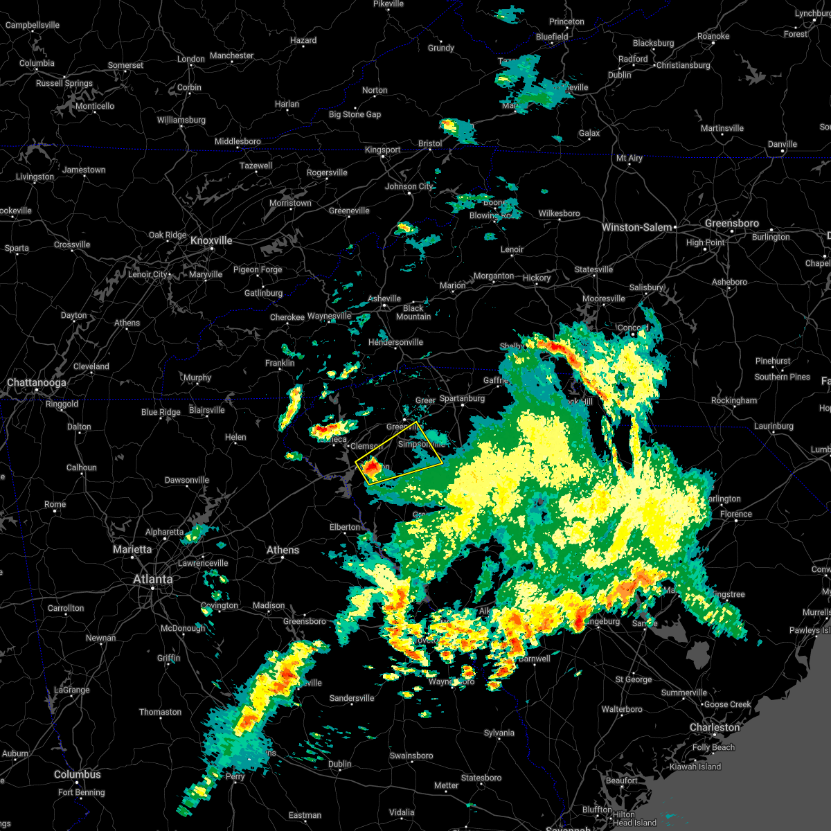 At 329 am edt, a severe thunderstorm was located 6 miles northeast of anderson, or 4 miles northwest of belton, moving northeast at 55 mph (radar indicated). Hazards include 60 mph wind gusts and quarter size hail. Minor hail damage to vehicles is expected. Expect wind damage to trees and power lines. At 329 am edt, a severe thunderstorm was located 6 miles northeast of anderson, or 4 miles northwest of belton, moving northeast at 55 mph (radar indicated). Hazards include 60 mph wind gusts and quarter size hail. Minor hail damage to vehicles is expected. Expect wind damage to trees and power lines.
|
| 2/17/2022 11:44 PM EST |
 At 1143 pm est, severe thunderstorms were located along a line extending from near greenville downtown to 9 miles southeast of easley to 11 miles northeast of anderson, moving east at 80 mph (radar indicated). Hazards include 60 mph wind gusts. Expect damage to trees and power lines. Locations impacted include, greenville, spartanburg, greer, mauldin, taylors, simpsonville, five forks, boiling springs sc and duncan. At 1143 pm est, severe thunderstorms were located along a line extending from near greenville downtown to 9 miles southeast of easley to 11 miles northeast of anderson, moving east at 80 mph (radar indicated). Hazards include 60 mph wind gusts. Expect damage to trees and power lines. Locations impacted include, greenville, spartanburg, greer, mauldin, taylors, simpsonville, five forks, boiling springs sc and duncan.
|
| 2/17/2022 11:30 PM EST |
 At 1129 pm est, severe thunderstorms were located along a line extending from near easley to 6 miles south of clemson, moving east at 70 mph (radar indicated). Hazards include 60 mph wind gusts. Expect damage to trees and power lines. Locations impacted include, greenville, spartanburg, easley, greer, mauldin, taylors, simpsonville and berea. At 1129 pm est, severe thunderstorms were located along a line extending from near easley to 6 miles south of clemson, moving east at 70 mph (radar indicated). Hazards include 60 mph wind gusts. Expect damage to trees and power lines. Locations impacted include, greenville, spartanburg, easley, greer, mauldin, taylors, simpsonville and berea.
|
| 2/17/2022 11:19 PM EST |
 At 1118 pm est, severe thunderstorms were located along a line extending from 6 miles northeast of clemson to 9 miles south of seneca, moving east at 80 mph (radar indicated). Hazards include 60 mph wind gusts. expect damage to trees and power lines At 1118 pm est, severe thunderstorms were located along a line extending from 6 miles northeast of clemson to 9 miles south of seneca, moving east at 80 mph (radar indicated). Hazards include 60 mph wind gusts. expect damage to trees and power lines
|
| 8/31/2021 4:05 PM EDT | Tree down in roadway at knighton chapel road and old plantation road in laurens county SC, 5.4 miles WSW of Fountain Inn, SC |
| 8/17/2021 6:45 PM EDT | Multiple trees down with road blockages on ritchie road in fountain inn in laurens county SC, 4.1 miles WSW of Fountain Inn, SC |
| 8/17/2021 6:22 PM EDT |
 At 622 pm edt, a severe thunderstorm capable of producing a tornado was located 7 miles southwest of spartanburg, or near moore, moving northeast at 45 mph (radar indicated rotation). Hazards include tornado. Flying debris will be dangerous to those caught without shelter. mobile homes will be damaged or destroyed. damage to roofs, windows, and vehicles will occur. tree damage is likely. this dangerous storm will be near, spartanburg, cedar springs and croft state park around 630 pm edt. usc upstate and boiling springs sc around 640 pm edt. cowpens around 650 pm edt. Other locations impacted by this tornadic thunderstorm include pauline. At 622 pm edt, a severe thunderstorm capable of producing a tornado was located 7 miles southwest of spartanburg, or near moore, moving northeast at 45 mph (radar indicated rotation). Hazards include tornado. Flying debris will be dangerous to those caught without shelter. mobile homes will be damaged or destroyed. damage to roofs, windows, and vehicles will occur. tree damage is likely. this dangerous storm will be near, spartanburg, cedar springs and croft state park around 630 pm edt. usc upstate and boiling springs sc around 640 pm edt. cowpens around 650 pm edt. Other locations impacted by this tornadic thunderstorm include pauline.
|
| 8/17/2021 6:05 PM EDT | Trees down and general vegetation damage off thackston road and highway 418 in laurens county SC, 1.4 miles WNW of Fountain Inn, SC |
| 8/17/2021 5:57 PM EDT |
 At 557 pm edt, a severe thunderstorm capable of producing a tornado was located 12 miles northwest of laurens, or near gray court, moving northeast at 40 mph (radar indicated rotation). Hazards include tornado. Flying debris will be dangerous to those caught without shelter. mobile homes will be damaged or destroyed. damage to roofs, windows, and vehicles will occur. tree damage is likely. this dangerous storm will be near, fountain inn around 600 pm edt. woodruff around 610 pm edt. reidville around 620 pm edt. spartanburg, moore, roebuck, cedar springs and croft state park around 630 pm edt. usc upstate, boiling springs sc and cowpens around 640 pm edt. Other locations impacted by this dangerous thunderstorm include pauline. At 557 pm edt, a severe thunderstorm capable of producing a tornado was located 12 miles northwest of laurens, or near gray court, moving northeast at 40 mph (radar indicated rotation). Hazards include tornado. Flying debris will be dangerous to those caught without shelter. mobile homes will be damaged or destroyed. damage to roofs, windows, and vehicles will occur. tree damage is likely. this dangerous storm will be near, fountain inn around 600 pm edt. woodruff around 610 pm edt. reidville around 620 pm edt. spartanburg, moore, roebuck, cedar springs and croft state park around 630 pm edt. usc upstate, boiling springs sc and cowpens around 640 pm edt. Other locations impacted by this dangerous thunderstorm include pauline.
|
| 8/17/2021 5:23 PM EDT |
 At 522 pm edt, a severe thunderstorm capable of producing a tornado was located 13 miles northwest of greenwood, or near ware shoals, moving northeast at 35 mph (radar indicated rotation). Hazards include tornado. Flying debris will be dangerous to those caught without shelter. mobile homes will be damaged or destroyed. damage to roofs, windows, and vehicles will occur. tree damage is likely. this dangerous storm will be near, gray court around 550 pm edt. Other locations impacted by this tornadic thunderstorm include princeton, hickory tavern and ora. At 522 pm edt, a severe thunderstorm capable of producing a tornado was located 13 miles northwest of greenwood, or near ware shoals, moving northeast at 35 mph (radar indicated rotation). Hazards include tornado. Flying debris will be dangerous to those caught without shelter. mobile homes will be damaged or destroyed. damage to roofs, windows, and vehicles will occur. tree damage is likely. this dangerous storm will be near, gray court around 550 pm edt. Other locations impacted by this tornadic thunderstorm include princeton, hickory tavern and ora.
|
| 8/17/2021 5:10 PM EDT |
 At 510 pm edt, a severe thunderstorm capable of producing a tornado was located 6 miles northeast of abbeville, or 4 miles southwest of hodges, moving northeast at 35 mph (radar indicated rotation). Hazards include tornado. Flying debris will be dangerous to those caught without shelter. mobile homes will be damaged or destroyed. damage to roofs, windows, and vehicles will occur. tree damage is likely. this dangerous storm will be near, shoals junction and donalds around 520 pm edt. ware shoals around 530 pm edt. gray court around 600 pm edt. Other locations impacted by this dangerous thunderstorm include princeton, hickory tavern and ora. At 510 pm edt, a severe thunderstorm capable of producing a tornado was located 6 miles northeast of abbeville, or 4 miles southwest of hodges, moving northeast at 35 mph (radar indicated rotation). Hazards include tornado. Flying debris will be dangerous to those caught without shelter. mobile homes will be damaged or destroyed. damage to roofs, windows, and vehicles will occur. tree damage is likely. this dangerous storm will be near, shoals junction and donalds around 520 pm edt. ware shoals around 530 pm edt. gray court around 600 pm edt. Other locations impacted by this dangerous thunderstorm include princeton, hickory tavern and ora.
|
| 8/17/2021 2:52 PM EDT |
 At 252 pm edt, a severe thunderstorm capable of producing a tornado was located 7 miles southeast of greenville downtown, or near mauldin, moving north at 30 mph (radar indicated rotation). Hazards include tornado. Flying debris will be dangerous to those caught without shelter. mobile homes will be damaged or destroyed. damage to roofs, windows, and vehicles will occur. tree damage is likely. this dangerous storm will be near, greenville downtown, greenville eastside, gsp airport, cherrydale point and west greenville around 310 pm edt. taylors, greer, paris mountain state park and travelers rest around 320 pm edt. Lake robinson and tigerville around 330 pm edt. At 252 pm edt, a severe thunderstorm capable of producing a tornado was located 7 miles southeast of greenville downtown, or near mauldin, moving north at 30 mph (radar indicated rotation). Hazards include tornado. Flying debris will be dangerous to those caught without shelter. mobile homes will be damaged or destroyed. damage to roofs, windows, and vehicles will occur. tree damage is likely. this dangerous storm will be near, greenville downtown, greenville eastside, gsp airport, cherrydale point and west greenville around 310 pm edt. taylors, greer, paris mountain state park and travelers rest around 320 pm edt. Lake robinson and tigerville around 330 pm edt.
|
| 8/11/2021 4:04 PM EDT |
 At 404 pm edt, a severe thunderstorm was located 5 miles southeast of greenville downtown, or near mauldin, moving south at 5 mph (radar indicated). Hazards include 60 mph wind gusts and quarter size hail. Minor hail damage to vehicles is expected. Expect wind damage to trees and power lines. At 404 pm edt, a severe thunderstorm was located 5 miles southeast of greenville downtown, or near mauldin, moving south at 5 mph (radar indicated). Hazards include 60 mph wind gusts and quarter size hail. Minor hail damage to vehicles is expected. Expect wind damage to trees and power lines.
|
| 8/10/2021 7:51 PM EDT | 911 call center reported seven trees down between fountain inn and woodruf in laurens county SC, 4.7 miles W of Fountain Inn, SC |
| 8/10/2021 7:51 PM EDT |
 The severe thunderstorm warning for northwestern laurens, east central greenville and southwestern spartanburg counties will expire at 800 pm edt, the storm which prompted the warning has weakened below severe limits, and has exited the warned area. therefore, the warning will be allowed to expire. however heavy rain is still possible with this thunderstorm. The severe thunderstorm warning for northwestern laurens, east central greenville and southwestern spartanburg counties will expire at 800 pm edt, the storm which prompted the warning has weakened below severe limits, and has exited the warned area. therefore, the warning will be allowed to expire. however heavy rain is still possible with this thunderstorm.
|
| 8/10/2021 7:30 PM EDT |
 At 730 pm edt, a severe thunderstorm was located 13 miles northwest of laurens, or near fountain inn, moving southeast at 5 mph (radar indicated). Hazards include 60 mph wind gusts and quarter size hail. Minor hail damage to vehicles is expected. Expect wind damage to trees and power lines. At 730 pm edt, a severe thunderstorm was located 13 miles northwest of laurens, or near fountain inn, moving southeast at 5 mph (radar indicated). Hazards include 60 mph wind gusts and quarter size hail. Minor hail damage to vehicles is expected. Expect wind damage to trees and power lines.
|
| 8/10/2021 7:12 PM EDT |
 At 711 pm edt, a severe thunderstorm was located 16 miles north of laurens, or 4 miles west of woodruff, moving southeast at 15 mph (radar indicated). Hazards include 60 mph wind gusts and quarter size hail. Minor hail damage to vehicles is expected. Expect wind damage to trees and power lines. At 711 pm edt, a severe thunderstorm was located 16 miles north of laurens, or 4 miles west of woodruff, moving southeast at 15 mph (radar indicated). Hazards include 60 mph wind gusts and quarter size hail. Minor hail damage to vehicles is expected. Expect wind damage to trees and power lines.
|
| 8/10/2021 6:26 PM EDT |
 At 626 pm edt, a severe thunderstorm was located 13 miles southwest of spartanburg, or near reidville, moving east at 10 mph (radar indicated). Hazards include 60 mph wind gusts and quarter size hail. Minor hail damage to vehicles is expected. expect wind damage to trees and power lines. locations impacted include, five forks, reidville, moore and mauldin. hail threat, radar indicated max hail size, 1. 00 in wind threat, radar indicated max wind gust, 60 mph. At 626 pm edt, a severe thunderstorm was located 13 miles southwest of spartanburg, or near reidville, moving east at 10 mph (radar indicated). Hazards include 60 mph wind gusts and quarter size hail. Minor hail damage to vehicles is expected. expect wind damage to trees and power lines. locations impacted include, five forks, reidville, moore and mauldin. hail threat, radar indicated max hail size, 1. 00 in wind threat, radar indicated max wind gust, 60 mph.
|
| 8/10/2021 6:09 PM EDT |
 At 608 pm edt, a severe thunderstorm was located 13 miles east of greenville downtown, or near reidville, moving east at 10 mph (radar indicated). Hazards include 60 mph wind gusts and quarter size hail. Minor hail damage to vehicles is expected. Expect wind damage to trees and power lines. At 608 pm edt, a severe thunderstorm was located 13 miles east of greenville downtown, or near reidville, moving east at 10 mph (radar indicated). Hazards include 60 mph wind gusts and quarter size hail. Minor hail damage to vehicles is expected. Expect wind damage to trees and power lines.
|
| 6/21/2021 5:54 PM EDT |
 At 553 pm edt, a severe thunderstorm was located 12 miles southeast of downtown greenville, or near simpsonville, moving northeast at 20 mph (radar indicated). Hazards include 60 mph wind gusts and penny size hail. Expect damage to trees and power lines. Locations impacted include, simpsonville, five forks, fountain inn, woodruff, reidville and mauldin. At 553 pm edt, a severe thunderstorm was located 12 miles southeast of downtown greenville, or near simpsonville, moving northeast at 20 mph (radar indicated). Hazards include 60 mph wind gusts and penny size hail. Expect damage to trees and power lines. Locations impacted include, simpsonville, five forks, fountain inn, woodruff, reidville and mauldin.
|
| 6/21/2021 5:39 PM EDT |
 At 538 pm edt, a severe thunderstorm was located 10 miles southeast of downtown greenville, or near simpsonville, moving northeast at 20 mph (radar indicated). Hazards include 60 mph wind gusts and quarter size hail. Minor hail damage to vehicles is expected. expect wind damage to trees and power lines. Locations impacted include, mauldin, simpsonville, five forks, fountain inn, woodruff, reidville and donaldson center. At 538 pm edt, a severe thunderstorm was located 10 miles southeast of downtown greenville, or near simpsonville, moving northeast at 20 mph (radar indicated). Hazards include 60 mph wind gusts and quarter size hail. Minor hail damage to vehicles is expected. expect wind damage to trees and power lines. Locations impacted include, mauldin, simpsonville, five forks, fountain inn, woodruff, reidville and donaldson center.
|
| 6/21/2021 5:29 PM EDT |
 At 528 pm edt, a severe thunderstorm was located 11 miles south of downtown greenville, or near donaldson center, moving northeast at 25 mph (radar indicated). Hazards include 60 mph wind gusts and quarter size hail. Minor hail damage to vehicles is expected. Expect wind damage to trees and power lines. At 528 pm edt, a severe thunderstorm was located 11 miles south of downtown greenville, or near donaldson center, moving northeast at 25 mph (radar indicated). Hazards include 60 mph wind gusts and quarter size hail. Minor hail damage to vehicles is expected. Expect wind damage to trees and power lines.
|
| 6/14/2021 3:53 PM EDT |
 At 353 pm edt, a severe thunderstorm was located 8 miles south of greenville downtown, or near donaldson center, moving south at 5 mph (radar indicated). Hazards include 60 mph wind gusts and quarter size hail. Minor hail damage to vehicles is expected. Expect wind damage to trees and power lines. At 353 pm edt, a severe thunderstorm was located 8 miles south of greenville downtown, or near donaldson center, moving south at 5 mph (radar indicated). Hazards include 60 mph wind gusts and quarter size hail. Minor hail damage to vehicles is expected. Expect wind damage to trees and power lines.
|
| 6/11/2021 7:36 PM EDT |
 At 735 pm edt, severe thunderstorms were located along a line extending from 5 miles southeast of gaffney to 12 miles east of spartanburg to 5 miles east of greenville downtown to 5 miles north of easley, moving southeast at 20 mph (radar indicated). Hazards include 60 mph wind gusts and penny size hail. Expect damage to trees and power lines. Locations impacted include, greenville downtown, spartanburg, easley, gaffney, greenville eastside, west greenville, greer, mauldin, taylors and simpsonville. At 735 pm edt, severe thunderstorms were located along a line extending from 5 miles southeast of gaffney to 12 miles east of spartanburg to 5 miles east of greenville downtown to 5 miles north of easley, moving southeast at 20 mph (radar indicated). Hazards include 60 mph wind gusts and penny size hail. Expect damage to trees and power lines. Locations impacted include, greenville downtown, spartanburg, easley, gaffney, greenville eastside, west greenville, greer, mauldin, taylors and simpsonville.
|
| 6/11/2021 7:19 PM EDT |
 At 719 pm edt, severe thunderstorms were located along a line extending from near gaffney to 5 miles east of spartanburg to 3 miles northeast of greenville downtown to 6 miles northeast of pickens, moving southeast at 25 mph (radar indicated). Hazards include 60 mph wind gusts and penny size hail. Expect damage to trees and power lines. Locations impacted include, greenville downtown, spartanburg, easley, gaffney, greenville eastside, west greenville, greer, mauldin, taylors and simpsonville. At 719 pm edt, severe thunderstorms were located along a line extending from near gaffney to 5 miles east of spartanburg to 3 miles northeast of greenville downtown to 6 miles northeast of pickens, moving southeast at 25 mph (radar indicated). Hazards include 60 mph wind gusts and penny size hail. Expect damage to trees and power lines. Locations impacted include, greenville downtown, spartanburg, easley, gaffney, greenville eastside, west greenville, greer, mauldin, taylors and simpsonville.
|
| 6/11/2021 6:59 PM EDT |
 At 658 pm edt, severe thunderstorms were located along a line extending from 7 miles west of gaffney to 8 miles north of greenville downtown to 10 miles north of pickens, moving southeast at 20 mph (radar indicated). Hazards include 60 mph wind gusts and penny size hail. expect damage to trees and power lines At 658 pm edt, severe thunderstorms were located along a line extending from 7 miles west of gaffney to 8 miles north of greenville downtown to 10 miles north of pickens, moving southeast at 20 mph (radar indicated). Hazards include 60 mph wind gusts and penny size hail. expect damage to trees and power lines
|
| 6/5/2021 2:17 PM EDT | Large tree limb blown down on a transformer knocking out powe in greenville county SC, 2.2 miles S of Fountain Inn, SC |
| 5/28/2021 10:07 PM EDT |
 The severe thunderstorm warning for greenville and northwestern spartanburg counties will expire at 1015 pm edt, the storms which prompted the warning have weakened below severe limits, and no longer pose an immediate threat to life or property. therefore the warning will be allowed to expire. however, gusty winds to 40 mph and occasional lightning are still possible with these thunderstorms. The severe thunderstorm warning for greenville and northwestern spartanburg counties will expire at 1015 pm edt, the storms which prompted the warning have weakened below severe limits, and no longer pose an immediate threat to life or property. therefore the warning will be allowed to expire. however, gusty winds to 40 mph and occasional lightning are still possible with these thunderstorms.
|
| 5/28/2021 9:45 PM EDT |
 At 944 pm edt, severe thunderstorms were located along a line extending from 16 miles south of hendersonville to near greenville downtown to 13 miles east of anderson, moving northeast at 50 mph (radar indicated). Hazards include 60 mph wind gusts. Expect damage to trees and power lines. Locations impacted include, greenville downtown, greenville eastside, west greenville, greer, mauldin, taylors, simpsonville, berea, five forks and fountain inn. At 944 pm edt, severe thunderstorms were located along a line extending from 16 miles south of hendersonville to near greenville downtown to 13 miles east of anderson, moving northeast at 50 mph (radar indicated). Hazards include 60 mph wind gusts. Expect damage to trees and power lines. Locations impacted include, greenville downtown, greenville eastside, west greenville, greer, mauldin, taylors, simpsonville, berea, five forks and fountain inn.
|
| 5/28/2021 9:28 PM EDT |
 At 927 pm edt, severe thunderstorms were located along a line extending from 10 miles south of brevard to near easley to near anderson, moving northeast at 50 mph (radar indicated). Hazards include 70 mph wind gusts. Expect considerable tree damage. Damage is likely to mobile homes, roofs, and outbuildings. At 927 pm edt, severe thunderstorms were located along a line extending from 10 miles south of brevard to near easley to near anderson, moving northeast at 50 mph (radar indicated). Hazards include 70 mph wind gusts. Expect considerable tree damage. Damage is likely to mobile homes, roofs, and outbuildings.
|
| 3/25/2021 4:02 PM EDT |
 At 402 pm edt, a severe thunderstorm capable of producing a tornado was located 13 miles southeast of anderson, or near honea path, moving east at 40 mph (radar indicated rotation). Hazards include tornado. Flying debris will be dangerous to those caught without shelter. mobile homes will be damaged or destroyed. damage to roofs, windows, and vehicles will occur. tree damage is likely. this dangerous storm will be near, ware shoals around 420 pm edt. Other locations impacted by this dangerous storm include princeton and fork shoals. At 402 pm edt, a severe thunderstorm capable of producing a tornado was located 13 miles southeast of anderson, or near honea path, moving east at 40 mph (radar indicated rotation). Hazards include tornado. Flying debris will be dangerous to those caught without shelter. mobile homes will be damaged or destroyed. damage to roofs, windows, and vehicles will occur. tree damage is likely. this dangerous storm will be near, ware shoals around 420 pm edt. Other locations impacted by this dangerous storm include princeton and fork shoals.
|
| 3/25/2021 3:48 PM EDT |
 At 347 pm edt, a severe thunderstorm capable of producing a tornado was located 9 miles south of anderson, or 5 miles east of starr, moving east at 45 mph (radar indicated rotation). Hazards include tornado. Flying debris will be dangerous to those caught without shelter. mobile homes will be damaged or destroyed. damage to roofs, windows, and vehicles will occur. tree damage is likely. this dangerous storm will be near, honea path and donalds around 410 pm edt. ware shoals around 420 pm edt. Other locations impacted by this dangerous storm include princeton, fork shoals and broadway lake. At 347 pm edt, a severe thunderstorm capable of producing a tornado was located 9 miles south of anderson, or 5 miles east of starr, moving east at 45 mph (radar indicated rotation). Hazards include tornado. Flying debris will be dangerous to those caught without shelter. mobile homes will be damaged or destroyed. damage to roofs, windows, and vehicles will occur. tree damage is likely. this dangerous storm will be near, honea path and donalds around 410 pm edt. ware shoals around 420 pm edt. Other locations impacted by this dangerous storm include princeton, fork shoals and broadway lake.
|
| 3/25/2021 3:27 PM EDT |
 At 327 pm edt, a severe thunderstorm capable of producing a tornado was located 6 miles east of hartwell, or 6 miles west of starr, moving east at 55 mph (radar indicated rotation). Hazards include tornado. Flying debris will be dangerous to those caught without shelter. mobile homes will be damaged or destroyed. damage to roofs, windows, and vehicles will occur. tree damage is likely. this dangerous storm will be near, homeland park, starr, anderson airport and iva around 340 pm edt. belton around 350 pm edt. honea path and ware shoals around 400 pm edt. Other locations impacted by this dangerous thunderstorm include fork shoals, princeton, sadlers creek state park and broadway lake. At 327 pm edt, a severe thunderstorm capable of producing a tornado was located 6 miles east of hartwell, or 6 miles west of starr, moving east at 55 mph (radar indicated rotation). Hazards include tornado. Flying debris will be dangerous to those caught without shelter. mobile homes will be damaged or destroyed. damage to roofs, windows, and vehicles will occur. tree damage is likely. this dangerous storm will be near, homeland park, starr, anderson airport and iva around 340 pm edt. belton around 350 pm edt. honea path and ware shoals around 400 pm edt. Other locations impacted by this dangerous thunderstorm include fork shoals, princeton, sadlers creek state park and broadway lake.
|
| 7/27/2020 7:14 PM EDT |
 At 713 pm edt, a severe thunderstorm was located 10 miles southeast of easley, or near piedmont, moving northeast at 20 mph (radar indicated). Hazards include 60 mph wind gusts and nickel size hail. expect damage to trees and power lines At 713 pm edt, a severe thunderstorm was located 10 miles southeast of easley, or near piedmont, moving northeast at 20 mph (radar indicated). Hazards include 60 mph wind gusts and nickel size hail. expect damage to trees and power lines
|
| 7/24/2020 2:53 PM EDT |
 The severe thunderstorm warning for northwestern laurens, southeastern greenville and southwestern spartanburg counties will expire at 300 pm edt, the storm which prompted the warning has weakened below severe limits, and no longer poses an immediate threat to life or property. therefore, the warning will be allowed to expire. however, gusty winds and heavy rain are still possible with this thunderstorm. The severe thunderstorm warning for northwestern laurens, southeastern greenville and southwestern spartanburg counties will expire at 300 pm edt, the storm which prompted the warning has weakened below severe limits, and no longer poses an immediate threat to life or property. therefore, the warning will be allowed to expire. however, gusty winds and heavy rain are still possible with this thunderstorm.
|
| 7/24/2020 2:38 PM EDT |
 At 238 pm edt, a severe thunderstorm was located 11 miles southeast of greenville downtown, or over simpsonville, moving southeast at 20 mph (radar indicated). Hazards include 60 mph wind gusts and quarter size hail. Minor hail damage to vehicles is expected. expect wind damage to trees and power lines. Locations impacted include, mauldin, simpsonville, five forks, fountain inn, gray court, fork shoals, enoree, princeton, woodruff and greenville eastside. At 238 pm edt, a severe thunderstorm was located 11 miles southeast of greenville downtown, or over simpsonville, moving southeast at 20 mph (radar indicated). Hazards include 60 mph wind gusts and quarter size hail. Minor hail damage to vehicles is expected. expect wind damage to trees and power lines. Locations impacted include, mauldin, simpsonville, five forks, fountain inn, gray court, fork shoals, enoree, princeton, woodruff and greenville eastside.
|
| 7/24/2020 2:21 PM EDT |
 At 221 pm edt, a severe thunderstorm was located 10 miles southeast of greenville downtown, or near five forks, moving southeast at 20 mph (radar indicated). Hazards include 60 mph wind gusts and quarter size hail. Minor hail damage to vehicles is expected. Expect wind damage to trees and power lines. At 221 pm edt, a severe thunderstorm was located 10 miles southeast of greenville downtown, or near five forks, moving southeast at 20 mph (radar indicated). Hazards include 60 mph wind gusts and quarter size hail. Minor hail damage to vehicles is expected. Expect wind damage to trees and power lines.
|
| 7/21/2020 4:45 PM EDT |
 At 445 pm edt, a severe thunderstorm was located near greenville downtown, or near greenville eastside, moving east at 15 mph (radar indicated). Hazards include 60 mph wind gusts. Expect damage to trees and power lines. Locations impacted include, greenville downtown, greenville eastside, west greenville, greer, mauldin, taylors, simpsonville, welcome, powdersville and piedmont. At 445 pm edt, a severe thunderstorm was located near greenville downtown, or near greenville eastside, moving east at 15 mph (radar indicated). Hazards include 60 mph wind gusts. Expect damage to trees and power lines. Locations impacted include, greenville downtown, greenville eastside, west greenville, greer, mauldin, taylors, simpsonville, welcome, powdersville and piedmont.
|
| 7/21/2020 4:15 PM EDT |
 At 415 pm edt, a severe thunderstorm was located 5 miles northeast of easley, or near berea, moving east at 10 mph (radar indicated). Hazards include 60 mph wind gusts and penny size hail. expect damage to trees and power lines At 415 pm edt, a severe thunderstorm was located 5 miles northeast of easley, or near berea, moving east at 10 mph (radar indicated). Hazards include 60 mph wind gusts and penny size hail. expect damage to trees and power lines
|
| 7/21/2020 3:50 PM EDT |
 At 350 pm edt, a severe thunderstorm was located near greenville downtown, moving east at 10 mph (radar indicated). Hazards include 60 mph wind gusts and penny size hail. expect damage to trees and power lines At 350 pm edt, a severe thunderstorm was located near greenville downtown, moving east at 10 mph (radar indicated). Hazards include 60 mph wind gusts and penny size hail. expect damage to trees and power lines
|
| 7/1/2020 3:01 PM EDT |
 At 300 pm edt, a severe thunderstorm was located 15 miles east of greenville downtown, or 4 miles east of five forks, moving southeast at 20 mph (radar indicated). Hazards include 60 mph wind gusts and quarter size hail. Minor hail damage to vehicles is expected. Expect wind damage to trees and power lines. At 300 pm edt, a severe thunderstorm was located 15 miles east of greenville downtown, or 4 miles east of five forks, moving southeast at 20 mph (radar indicated). Hazards include 60 mph wind gusts and quarter size hail. Minor hail damage to vehicles is expected. Expect wind damage to trees and power lines.
|
| 6/29/2020 6:54 PM EDT |
 The severe thunderstorm warning for northwestern laurens and southwestern spartanburg counties will expire at 700 pm edt, the storm which prompted the warning has weakened below severe limits, and no longer poses an immediate threat to life or property. therefore the warning will be allowed to expire. however gusty winds and heavy rain are still possible with this thunderstorm. if you observed large hail or wind damage, please report it to the national weather service greenville-spartanburg by calling toll free, 1, 800, 2 6 7, 8 1 0 1, or by posting on our facebook page, or tweet it using hashtag nwsgsp. your message should describe the event and the specific location where it occurred. The severe thunderstorm warning for northwestern laurens and southwestern spartanburg counties will expire at 700 pm edt, the storm which prompted the warning has weakened below severe limits, and no longer poses an immediate threat to life or property. therefore the warning will be allowed to expire. however gusty winds and heavy rain are still possible with this thunderstorm. if you observed large hail or wind damage, please report it to the national weather service greenville-spartanburg by calling toll free, 1, 800, 2 6 7, 8 1 0 1, or by posting on our facebook page, or tweet it using hashtag nwsgsp. your message should describe the event and the specific location where it occurred.
|
| 6/29/2020 6:43 PM EDT |
 At 642 pm edt, a severe thunderstorm was located 16 miles north of laurens, or 4 miles west of woodruff, moving southeast at 15 mph (radar indicated). Hazards include 60 mph wind gusts and quarter size hail. Minor hail damage to vehicles is expected. expect wind damage to trees and power lines. Locations impacted include, gray court, woodruff, fountain inn and enoree. At 642 pm edt, a severe thunderstorm was located 16 miles north of laurens, or 4 miles west of woodruff, moving southeast at 15 mph (radar indicated). Hazards include 60 mph wind gusts and quarter size hail. Minor hail damage to vehicles is expected. expect wind damage to trees and power lines. Locations impacted include, gray court, woodruff, fountain inn and enoree.
|
| 6/29/2020 6:22 PM EDT |
 At 622 pm edt, a severe thunderstorm was located 12 miles southeast of greenville downtown, or near simpsonville, moving southeast at 15 mph (radar indicated). Hazards include 60 mph wind gusts and quarter size hail. Minor hail damage to vehicles is expected. Expect wind damage to trees and power lines. At 622 pm edt, a severe thunderstorm was located 12 miles southeast of greenville downtown, or near simpsonville, moving southeast at 15 mph (radar indicated). Hazards include 60 mph wind gusts and quarter size hail. Minor hail damage to vehicles is expected. Expect wind damage to trees and power lines.
|
| 6/28/2020 6:14 PM EDT |
 At 613 pm edt, severe thunderstorms were located along a line extending from 12 miles west of spartanburg to 11 miles northwest of laurens to 14 miles north of abbeville, moving southeast at 40 mph (radar indicated). Hazards include 60 mph wind gusts and penny size hail. Expect damage to trees and power lines. Locations impacted include, spartanburg, laurens, clinton, fountain inn, woodruff, duncan, lyman, pacolet, ware shoals and wellford. At 613 pm edt, severe thunderstorms were located along a line extending from 12 miles west of spartanburg to 11 miles northwest of laurens to 14 miles north of abbeville, moving southeast at 40 mph (radar indicated). Hazards include 60 mph wind gusts and penny size hail. Expect damage to trees and power lines. Locations impacted include, spartanburg, laurens, clinton, fountain inn, woodruff, duncan, lyman, pacolet, ware shoals and wellford.
|
| 6/28/2020 5:54 PM EDT |
 At 554 pm edt, severe thunderstorms were located along a line extending from 17 miles south of columbus to 11 miles south of greenville downtown to 5 miles southeast of anderson, moving east at 40 mph (radar indicated). Hazards include 60 mph wind gusts and penny size hail. expect damage to trees and power lines At 554 pm edt, severe thunderstorms were located along a line extending from 17 miles south of columbus to 11 miles south of greenville downtown to 5 miles southeast of anderson, moving east at 40 mph (radar indicated). Hazards include 60 mph wind gusts and penny size hail. expect damage to trees and power lines
|
| 6/28/2020 5:47 PM EDT |
 At 546 pm edt, severe thunderstorms were located along a line extending from 7 miles north of greenville downtown to 13 miles southeast of easley to near anderson, moving east at 35 mph (radar indicated). Hazards include 60 mph wind gusts and penny size hail. Expect damage to trees and power lines. Locations impacted include, greenville downtown, anderson, greenville eastside, west greenville, greer, mauldin, taylors, simpsonville, berea and welcome. At 546 pm edt, severe thunderstorms were located along a line extending from 7 miles north of greenville downtown to 13 miles southeast of easley to near anderson, moving east at 35 mph (radar indicated). Hazards include 60 mph wind gusts and penny size hail. Expect damage to trees and power lines. Locations impacted include, greenville downtown, anderson, greenville eastside, west greenville, greer, mauldin, taylors, simpsonville, berea and welcome.
|
| 6/28/2020 5:24 PM EDT |
 At 524 pm edt, severe thunderstorms were located along a line extending from 11 miles northeast of pickens to 6 miles east of clemson to 10 miles south of seneca, moving east at 35 mph (radar indicated). Hazards include 60 mph wind gusts and penny size hail. expect damage to trees and power lines At 524 pm edt, severe thunderstorms were located along a line extending from 11 miles northeast of pickens to 6 miles east of clemson to 10 miles south of seneca, moving east at 35 mph (radar indicated). Hazards include 60 mph wind gusts and penny size hail. expect damage to trees and power lines
|
| 6/22/2020 4:10 PM EDT |
 The severe thunderstorm warning for northwestern laurens, southeastern greenville and southwestern spartanburg counties will expire at 415 pm edt, the storms which prompted the warning have weakened below severe limits, and no longer pose an immediate threat to life or property. therefore the warning will be allowed to expire. however, gusty winds are still possible with these thunderstorms. The severe thunderstorm warning for northwestern laurens, southeastern greenville and southwestern spartanburg counties will expire at 415 pm edt, the storms which prompted the warning have weakened below severe limits, and no longer pose an immediate threat to life or property. therefore the warning will be allowed to expire. however, gusty winds are still possible with these thunderstorms.
|
| 6/22/2020 3:50 PM EDT | Law enforcement reported tree down on roadway. time estimated by rada in greenville county SC, 9.3 miles NNE of Fountain Inn, SC |
| 6/22/2020 3:49 PM EDT |
 At 348 pm edt, severe thunderstorms were located along a line extending from 12 miles south of greenville downtown to 8 miles west of laurens, moving northeast at 35 mph (radar indicated). Hazards include 60 mph wind gusts and quarter size hail. Minor hail damage to vehicles is expected. expect wind damage to trees and power lines. Locations impacted include, laurens, mauldin, simpsonville, five forks, fountain inn, woodruff, duncan, roebuck, gray court and reidville. At 348 pm edt, severe thunderstorms were located along a line extending from 12 miles south of greenville downtown to 8 miles west of laurens, moving northeast at 35 mph (radar indicated). Hazards include 60 mph wind gusts and quarter size hail. Minor hail damage to vehicles is expected. expect wind damage to trees and power lines. Locations impacted include, laurens, mauldin, simpsonville, five forks, fountain inn, woodruff, duncan, roebuck, gray court and reidville.
|
| 6/22/2020 3:37 PM EDT |
 At 337 pm edt, severe thunderstorms were located along a line extending from 10 miles northeast of anderson to 23 miles south of greenville downtown to 13 miles southwest of laurens, moving northeast at 35 mph (radar indicated). Hazards include 60 mph wind gusts and quarter size hail. Minor hail damage to vehicles is expected. Expect wind damage to trees and power lines. At 337 pm edt, severe thunderstorms were located along a line extending from 10 miles northeast of anderson to 23 miles south of greenville downtown to 13 miles southwest of laurens, moving northeast at 35 mph (radar indicated). Hazards include 60 mph wind gusts and quarter size hail. Minor hail damage to vehicles is expected. Expect wind damage to trees and power lines.
|
| 5/29/2020 9:13 AM EDT |
 At 913 am edt, a severe thunderstorm was located 14 miles southwest of spartanburg, or near reidville, moving northeast at 35 mph (radar indicated). Hazards include 60 mph wind gusts and quarter size hail. Minor hail damage to vehicles is expected. expect wind damage to trees and power lines. Locations impacted include, greer, mauldin, simpsonville, five forks, fountain inn, duncan, lyman, wellford, roebuck and reidville. At 913 am edt, a severe thunderstorm was located 14 miles southwest of spartanburg, or near reidville, moving northeast at 35 mph (radar indicated). Hazards include 60 mph wind gusts and quarter size hail. Minor hail damage to vehicles is expected. expect wind damage to trees and power lines. Locations impacted include, greer, mauldin, simpsonville, five forks, fountain inn, duncan, lyman, wellford, roebuck and reidville.
|
| 5/29/2020 9:02 AM EDT |
 At 902 am edt, a severe thunderstorm was located 12 miles southeast of greenville downtown, or near five forks, moving northeast at 35 mph (radar indicated). Hazards include 60 mph wind gusts and quarter size hail. Minor hail damage to vehicles is expected. Expect wind damage to trees and power lines. At 902 am edt, a severe thunderstorm was located 12 miles southeast of greenville downtown, or near five forks, moving northeast at 35 mph (radar indicated). Hazards include 60 mph wind gusts and quarter size hail. Minor hail damage to vehicles is expected. Expect wind damage to trees and power lines.
|
| 5/28/2020 8:27 PM EDT |
 The severe thunderstorm warning for northwestern laurens county will expire at 830 pm edt, the storm which prompted the warning has weakened below severe limits, and no longer poses an immediate threat to life or property. therefore the warning will be allowed to expire. however gusty winds and heavy rain are still possible with this thunderstorm. The severe thunderstorm warning for northwestern laurens county will expire at 830 pm edt, the storm which prompted the warning has weakened below severe limits, and no longer poses an immediate threat to life or property. therefore the warning will be allowed to expire. however gusty winds and heavy rain are still possible with this thunderstorm.
|
| 5/28/2020 8:05 PM EDT |
 At 805 pm edt, a severe thunderstorm was located 11 miles northwest of laurens, or near gray court, moving northeast at 20 mph (radar indicated). Hazards include 60 mph wind gusts and quarter size hail. Minor hail damage to vehicles is expected. expect wind damage to trees and power lines. Locations impacted include, gray court, ora, enoree, fountain inn and laurens. At 805 pm edt, a severe thunderstorm was located 11 miles northwest of laurens, or near gray court, moving northeast at 20 mph (radar indicated). Hazards include 60 mph wind gusts and quarter size hail. Minor hail damage to vehicles is expected. expect wind damage to trees and power lines. Locations impacted include, gray court, ora, enoree, fountain inn and laurens.
|
| 5/28/2020 7:48 PM EDT |
 At 748 pm edt, a severe thunderstorm was located 13 miles west of laurens, or 7 miles west of gray court, moving east at 15 mph (radar indicated). Hazards include 60 mph wind gusts and quarter size hail. Minor hail damage to vehicles is expected. Expect wind damage to trees and power lines. At 748 pm edt, a severe thunderstorm was located 13 miles west of laurens, or 7 miles west of gray court, moving east at 15 mph (radar indicated). Hazards include 60 mph wind gusts and quarter size hail. Minor hail damage to vehicles is expected. Expect wind damage to trees and power lines.
|
| 5/24/2020 3:40 PM EDT | Trees down on farmwood dr. private drive was also floode in greenville county SC, 3.4 miles NE of Fountain Inn, SC |
| 5/22/2020 3:40 PM EDT |
 The severe thunderstorm warning for southeastern rutherford, southeastern polk, southern cleveland, northwestern laurens, spartanburg, cherokee and central union counties will expire at 345 pm edt, the storms which prompted the warning have moved out of the area. therefore the warning will be allowed to expire. however small hail, gusty winds and heavy rain are still possible with these thunderstorms. a severe thunderstorm watch remains in effect until 800 pm edt for western and the piedmont of north carolina, and upstate south carolina. remember, a severe thunderstorm warning still remains in effect for cherokee county until 4:00 pm. The severe thunderstorm warning for southeastern rutherford, southeastern polk, southern cleveland, northwestern laurens, spartanburg, cherokee and central union counties will expire at 345 pm edt, the storms which prompted the warning have moved out of the area. therefore the warning will be allowed to expire. however small hail, gusty winds and heavy rain are still possible with these thunderstorms. a severe thunderstorm watch remains in effect until 800 pm edt for western and the piedmont of north carolina, and upstate south carolina. remember, a severe thunderstorm warning still remains in effect for cherokee county until 4:00 pm.
|
| 5/22/2020 3:05 PM EDT |
 At 304 pm edt, severe thunderstorms were located along a line extending from 14 miles northwest of laurens to 10 miles south of anderson, moving east at 40 mph (radar indicated). Hazards include 60 mph wind gusts and penny size hail. Expect damage to trees and power lines. Locations impacted include, honea path, due west, iva, gray court, lake secession, donalds, lowndesville, russell state park, lake russell and antreville. At 304 pm edt, severe thunderstorms were located along a line extending from 14 miles northwest of laurens to 10 miles south of anderson, moving east at 40 mph (radar indicated). Hazards include 60 mph wind gusts and penny size hail. Expect damage to trees and power lines. Locations impacted include, honea path, due west, iva, gray court, lake secession, donalds, lowndesville, russell state park, lake russell and antreville.
|
| 5/22/2020 3:03 PM EDT |
 At 303 pm edt, a severe thunderstorm was located 4 miles south of spartanburg, or near roebuck, moving east at 45 mph (radar indicated). Hazards include 60 mph wind gusts and quarter size hail. Minor hail damage to vehicles is expected. expect wind damage to trees and power lines. Locations impacted include, spartanburg, five forks, fountain inn, boiling springs sc, woodruff, duncan, lyman, wellford, inman and roebuck. At 303 pm edt, a severe thunderstorm was located 4 miles south of spartanburg, or near roebuck, moving east at 45 mph (radar indicated). Hazards include 60 mph wind gusts and quarter size hail. Minor hail damage to vehicles is expected. expect wind damage to trees and power lines. Locations impacted include, spartanburg, five forks, fountain inn, boiling springs sc, woodruff, duncan, lyman, wellford, inman and roebuck.
|
| 5/22/2020 2:58 PM EDT |
 At 258 pm edt, severe thunderstorms were located along a line extending from 7 miles south of rutherfordton to 15 miles northwest of laurens, moving east at 40 mph (radar indicated). Hazards include 60 mph wind gusts and quarter size hail. Minor hail damage to vehicles is expected. Expect wind damage to trees and power lines. At 258 pm edt, severe thunderstorms were located along a line extending from 7 miles south of rutherfordton to 15 miles northwest of laurens, moving east at 40 mph (radar indicated). Hazards include 60 mph wind gusts and quarter size hail. Minor hail damage to vehicles is expected. Expect wind damage to trees and power lines.
|
| 5/22/2020 2:55 PM EDT | Public reported 10-12 trees down on windover l in greenville county SC, 4.3 miles NE of Fountain Inn, SC |
| 5/22/2020 2:45 PM EDT |
 At 245 pm edt, a severe thunderstorm was located 13 miles east of greenville downtown, or near duncan, moving east at 45 mph (radar indicated). Hazards include 60 mph wind gusts and quarter size hail. Minor hail damage to vehicles is expected. expect wind damage to trees and power lines. Locations impacted include, greenville downtown, spartanburg, greenville eastside, west greenville, greer, mauldin, taylors, simpsonville, five forks and fountain inn. At 245 pm edt, a severe thunderstorm was located 13 miles east of greenville downtown, or near duncan, moving east at 45 mph (radar indicated). Hazards include 60 mph wind gusts and quarter size hail. Minor hail damage to vehicles is expected. expect wind damage to trees and power lines. Locations impacted include, greenville downtown, spartanburg, greenville eastside, west greenville, greer, mauldin, taylors, simpsonville, five forks and fountain inn.
|
| 5/22/2020 2:42 PM EDT |
 At 242 pm edt, severe thunderstorms were located along a line extending from 11 miles south of greenville downtown to 5 miles northeast of hartwell, moving east at 40 mph (radar indicated). Hazards include 60 mph wind gusts and quarter size hail. Minor hail damage to vehicles is expected. Expect wind damage to trees and power lines. At 242 pm edt, severe thunderstorms were located along a line extending from 11 miles south of greenville downtown to 5 miles northeast of hartwell, moving east at 40 mph (radar indicated). Hazards include 60 mph wind gusts and quarter size hail. Minor hail damage to vehicles is expected. Expect wind damage to trees and power lines.
|
| 5/22/2020 2:24 PM EDT |
 At 224 pm edt, a severe thunderstorm was located 5 miles northwest of greenville downtown, or over furman university, moving east at 45 mph (radar indicated). Hazards include 60 mph wind gusts and quarter size hail. Minor hail damage to vehicles is expected. Expect wind damage to trees and power lines. At 224 pm edt, a severe thunderstorm was located 5 miles northwest of greenville downtown, or over furman university, moving east at 45 mph (radar indicated). Hazards include 60 mph wind gusts and quarter size hail. Minor hail damage to vehicles is expected. Expect wind damage to trees and power lines.
|
| 5/5/2020 3:15 AM EDT |
 At 314 am edt, severe thunderstorms were located along a line extending from 5 miles west of spartanburg to 15 miles northwest of union to 9 miles southwest of laurens, moving east at 55 mph (radar indicated). Hazards include 70 mph wind gusts and quarter size hail. Minor hail damage to vehicles is expected. expect considerable tree damage. wind damage is also likely to mobile homes, roofs, and outbuildings. Locations impacted include, greenville downtown, spartanburg, greenwood, laurens, union, greenville eastside, greer, mauldin, taylors and clinton. At 314 am edt, severe thunderstorms were located along a line extending from 5 miles west of spartanburg to 15 miles northwest of union to 9 miles southwest of laurens, moving east at 55 mph (radar indicated). Hazards include 70 mph wind gusts and quarter size hail. Minor hail damage to vehicles is expected. expect considerable tree damage. wind damage is also likely to mobile homes, roofs, and outbuildings. Locations impacted include, greenville downtown, spartanburg, greenwood, laurens, union, greenville eastside, greer, mauldin, taylors and clinton.
|
| 5/5/2020 3:00 AM EDT |
 At 258 am edt, severe thunderstorms were located along a line extending from 9 miles northeast of greenville downtown to 14 miles southwest of spartanburg to 7 miles north of laurens to 13 miles north of abbeville, moving east at 60 mph (radar indicated). Hazards include 70 mph wind gusts and quarter size hail. Minor hail damage to vehicles is expected. expect considerable tree damage. wind damage is also likely to mobile homes, roofs, and outbuildings. Locations impacted include, greenville downtown, spartanburg, greenwood, laurens, union, abbeville, greenville eastside, west greenville, greer and mauldin. At 258 am edt, severe thunderstorms were located along a line extending from 9 miles northeast of greenville downtown to 14 miles southwest of spartanburg to 7 miles north of laurens to 13 miles north of abbeville, moving east at 60 mph (radar indicated). Hazards include 70 mph wind gusts and quarter size hail. Minor hail damage to vehicles is expected. expect considerable tree damage. wind damage is also likely to mobile homes, roofs, and outbuildings. Locations impacted include, greenville downtown, spartanburg, greenwood, laurens, union, abbeville, greenville eastside, west greenville, greer and mauldin.
|
| 5/5/2020 2:40 AM EDT |
 At 239 am edt, severe thunderstorms were located along a line extending from 10 miles northeast of easley to 7 miles southeast of greenville downtown to 9 miles northwest of abbeville, moving east at 65 mph (radar indicated). Hazards include 70 mph wind gusts and quarter size hail. Minor hail damage to vehicles is expected. expect considerable tree damage. Wind damage is also likely to mobile homes, roofs, and outbuildings. At 239 am edt, severe thunderstorms were located along a line extending from 10 miles northeast of easley to 7 miles southeast of greenville downtown to 9 miles northwest of abbeville, moving east at 65 mph (radar indicated). Hazards include 70 mph wind gusts and quarter size hail. Minor hail damage to vehicles is expected. expect considerable tree damage. Wind damage is also likely to mobile homes, roofs, and outbuildings.
|
| 5/5/2020 2:30 AM EDT |
 At 228 am edt, severe thunderstorms were located along a line extending from 3 miles north of pickens to near easley to 6 miles southwest of anderson, moving east at 50 mph (radar indicated). Hazards include 70 mph wind gusts and quarter size hail. Minor hail damage to vehicles is expected. expect considerable tree damage. wind damage is also likely to mobile homes, roofs, and outbuildings. Locations impacted include, greenville downtown, anderson, easley, clemson, pickens, greenville eastside, west greenville, greer, mauldin and taylors. At 228 am edt, severe thunderstorms were located along a line extending from 3 miles north of pickens to near easley to 6 miles southwest of anderson, moving east at 50 mph (radar indicated). Hazards include 70 mph wind gusts and quarter size hail. Minor hail damage to vehicles is expected. expect considerable tree damage. wind damage is also likely to mobile homes, roofs, and outbuildings. Locations impacted include, greenville downtown, anderson, easley, clemson, pickens, greenville eastside, west greenville, greer, mauldin and taylors.
|
| 5/5/2020 2:16 AM EDT |
 At 215 am edt, severe thunderstorms were located along a line extending from 10 miles west of pickens to 3 miles southeast of clemson to 6 miles north of hartwell, moving east at 45 mph (radar indicated). Hazards include 60 mph wind gusts and quarter size hail. Minor hail damage to vehicles is expected. expect wind damage to trees and power lines. Locations impacted include, greenville downtown, anderson, easley, clemson, seneca, pickens, greenville eastside, west greenville, greer and mauldin. At 215 am edt, severe thunderstorms were located along a line extending from 10 miles west of pickens to 3 miles southeast of clemson to 6 miles north of hartwell, moving east at 45 mph (radar indicated). Hazards include 60 mph wind gusts and quarter size hail. Minor hail damage to vehicles is expected. expect wind damage to trees and power lines. Locations impacted include, greenville downtown, anderson, easley, clemson, seneca, pickens, greenville eastside, west greenville, greer and mauldin.
|
| 5/5/2020 2:00 AM EDT |
 At 159 am edt, severe thunderstorms were located along a line extending from 14 miles north of walhalla to 3 miles northeast of seneca to 7 miles northwest of hartwell, moving east at 65 mph (radar indicated). Hazards include 60 mph wind gusts and quarter size hail. Minor hail damage to vehicles is expected. Expect wind damage to trees and power lines. At 159 am edt, severe thunderstorms were located along a line extending from 14 miles north of walhalla to 3 miles northeast of seneca to 7 miles northwest of hartwell, moving east at 65 mph (radar indicated). Hazards include 60 mph wind gusts and quarter size hail. Minor hail damage to vehicles is expected. Expect wind damage to trees and power lines.
|
| 4/13/2020 4:38 AM EDT |
 The severe thunderstorm warning for east central hart, western laurens, greenville, spartanburg, western cherokee, anderson, northeastern abbeville and northwestern greenwood counties will expire at 445 am edt, the storms which prompted the warning have weakened below severe limits, and no longer pose an immediate threat to life or property. therefore the warning will be allowed to expire. however gusty winds and heavy rain are still possible with these thunderstorms. a tornado watch remains in effect until 800 am edt for northeastern georgia, western north carolina, and upstate south carolina. if you observed large hail or wind damage, please report it to the national weather service greenville-spartanburg by calling toll free, 1, 800, 2 6 7, 8 1 0 1, or by posting on our facebook page, or tweet it using hashtag nwsgsp. your message should describe the event and the specific location where it occurred. The severe thunderstorm warning for east central hart, western laurens, greenville, spartanburg, western cherokee, anderson, northeastern abbeville and northwestern greenwood counties will expire at 445 am edt, the storms which prompted the warning have weakened below severe limits, and no longer pose an immediate threat to life or property. therefore the warning will be allowed to expire. however gusty winds and heavy rain are still possible with these thunderstorms. a tornado watch remains in effect until 800 am edt for northeastern georgia, western north carolina, and upstate south carolina. if you observed large hail or wind damage, please report it to the national weather service greenville-spartanburg by calling toll free, 1, 800, 2 6 7, 8 1 0 1, or by posting on our facebook page, or tweet it using hashtag nwsgsp. your message should describe the event and the specific location where it occurred.
|
| 4/13/2020 4:03 AM EDT |
 At 403 am edt, severe thunderstorms were located along a line extending from 10 miles southwest of columbus to 8 miles northeast of anderson to 5 miles east of hartwell, moving east at 45 mph (radar indicated). Hazards include 60 mph wind gusts and penny size hail. expect damage to trees and power lines At 403 am edt, severe thunderstorms were located along a line extending from 10 miles southwest of columbus to 8 miles northeast of anderson to 5 miles east of hartwell, moving east at 45 mph (radar indicated). Hazards include 60 mph wind gusts and penny size hail. expect damage to trees and power lines
|
| 4/13/2020 3:41 AM EDT |
 At 341 am edt, severe thunderstorms were located along a line extending from 11 miles north of pickens to near clemson to 5 miles west of hartwell, moving east at 60 mph (radar indicated). Hazards include 60 mph wind gusts and quarter size hail. Minor hail damage to vehicles is expected. expect wind damage to trees and power lines. Locations impacted include, greenville downtown, anderson, easley, clemson, hartwell, pickens, greenville eastside, west greenville, mauldin and taylors. At 341 am edt, severe thunderstorms were located along a line extending from 11 miles north of pickens to near clemson to 5 miles west of hartwell, moving east at 60 mph (radar indicated). Hazards include 60 mph wind gusts and quarter size hail. Minor hail damage to vehicles is expected. expect wind damage to trees and power lines. Locations impacted include, greenville downtown, anderson, easley, clemson, hartwell, pickens, greenville eastside, west greenville, mauldin and taylors.
|
| 4/13/2020 3:13 AM EDT |
 At 312 am edt, severe thunderstorms were located along a line extending from 12 miles northeast of clayton to 4 miles east of toccoa to 5 miles northeast of commerce, moving east at 55 mph (radar indicated). Hazards include 60 mph wind gusts and quarter size hail. Minor hail damage to vehicles is expected. Expect wind damage to trees and power lines. At 312 am edt, severe thunderstorms were located along a line extending from 12 miles northeast of clayton to 4 miles east of toccoa to 5 miles northeast of commerce, moving east at 55 mph (radar indicated). Hazards include 60 mph wind gusts and quarter size hail. Minor hail damage to vehicles is expected. Expect wind damage to trees and power lines.
|
| 4/12/2020 11:38 PM EDT |
 The tornado warning for northwestern laurens county will expire at 1145 pm edt, the severe thunderstorm which prompted the warning has weakened, therefore the warning will be allowed to expire. The tornado warning for northwestern laurens county will expire at 1145 pm edt, the severe thunderstorm which prompted the warning has weakened, therefore the warning will be allowed to expire.
|
| 4/12/2020 11:30 PM EDT |
 At 1129 pm edt, a severe thunderstorm capable of producing a tornado was located 9 miles northwest of laurens, or 4 miles southwest of gray court, moving north at 50 mph (radar indicated rotation). Hazards include tornado. Flying debris will be dangerous to those caught without shelter. mobile homes will be damaged or destroyed. damage to roofs, windows, and vehicles will occur. tree damage is likely. this dangerous storm will be near, gray court and fountain inn around 1140 pm edt. woodruff around 1150 pm edt. Other locations impacted by this dangerous storm include enoree and hickory tavern. At 1129 pm edt, a severe thunderstorm capable of producing a tornado was located 9 miles northwest of laurens, or 4 miles southwest of gray court, moving north at 50 mph (radar indicated rotation). Hazards include tornado. Flying debris will be dangerous to those caught without shelter. mobile homes will be damaged or destroyed. damage to roofs, windows, and vehicles will occur. tree damage is likely. this dangerous storm will be near, gray court and fountain inn around 1140 pm edt. woodruff around 1150 pm edt. Other locations impacted by this dangerous storm include enoree and hickory tavern.
|
| 4/12/2020 11:15 PM EDT |
 At 1114 pm edt, a severe thunderstorm capable of producing a tornado was located 14 miles northwest of greenwood, or over ware shoals, moving north at 50 mph (radar indicated rotation). Hazards include tornado. Flying debris will be dangerous to those caught without shelter. mobile homes will be damaged or destroyed. damage to roofs, windows, and vehicles will occur. tree damage is likely. this dangerous storm will be near, gray court, fountain inn and woodruff around 1140 pm edt. Other locations impacted by this dangerous storm include enoree, princeton, hickory tavern and ora. At 1114 pm edt, a severe thunderstorm capable of producing a tornado was located 14 miles northwest of greenwood, or over ware shoals, moving north at 50 mph (radar indicated rotation). Hazards include tornado. Flying debris will be dangerous to those caught without shelter. mobile homes will be damaged or destroyed. damage to roofs, windows, and vehicles will occur. tree damage is likely. this dangerous storm will be near, gray court, fountain inn and woodruff around 1140 pm edt. Other locations impacted by this dangerous storm include enoree, princeton, hickory tavern and ora.
|
| 4/12/2020 11:10 PM EDT |
 At 1109 pm edt, a severe thunderstorm capable of producing a tornado was located 12 miles northwest of greenwood, or near shoals junction, moving northeast at 50 mph (radar indicated rotation). Hazards include tornado. Flying debris will be dangerous to those caught without shelter. mobile homes will be damaged or destroyed. damage to roofs, windows, and vehicles will occur. tree damage is likely. this dangerous storm will be near, ware shoals around 1110 pm edt. gray court, fountain inn and woodruff around 1140 pm edt. Other locations impacted by this dangerous thunderstorm include enoree, princeton, pauline, hickory tavern and ora. At 1109 pm edt, a severe thunderstorm capable of producing a tornado was located 12 miles northwest of greenwood, or near shoals junction, moving northeast at 50 mph (radar indicated rotation). Hazards include tornado. Flying debris will be dangerous to those caught without shelter. mobile homes will be damaged or destroyed. damage to roofs, windows, and vehicles will occur. tree damage is likely. this dangerous storm will be near, ware shoals around 1110 pm edt. gray court, fountain inn and woodruff around 1140 pm edt. Other locations impacted by this dangerous thunderstorm include enoree, princeton, pauline, hickory tavern and ora.
|
| 4/9/2020 4:56 AM EDT |
 At 456 am edt, a severe thunderstorm was located 10 miles northwest of laurens, or near gray court, moving east at 45 mph (radar indicated). Hazards include 60 mph wind gusts and penny size hail. Expect damage to trees and power lines. Locations impacted include, laurens, clinton, gray court, cross keys, cross anchor, enoree, ora, woodruff, fountain inn and buffalo. At 456 am edt, a severe thunderstorm was located 10 miles northwest of laurens, or near gray court, moving east at 45 mph (radar indicated). Hazards include 60 mph wind gusts and penny size hail. Expect damage to trees and power lines. Locations impacted include, laurens, clinton, gray court, cross keys, cross anchor, enoree, ora, woodruff, fountain inn and buffalo.
|
| 4/9/2020 4:38 AM EDT |
 At 437 am edt, a severe thunderstorm was located 12 miles south of greenville downtown, or 4 miles southwest of simpsonville, moving east at 60 mph (radar indicated). Hazards include 60 mph wind gusts and quarter size hail. Minor hail damage to vehicles is expected. Expect wind damage to trees and power lines. At 437 am edt, a severe thunderstorm was located 12 miles south of greenville downtown, or 4 miles southwest of simpsonville, moving east at 60 mph (radar indicated). Hazards include 60 mph wind gusts and quarter size hail. Minor hail damage to vehicles is expected. Expect wind damage to trees and power lines.
|
| 2/13/2020 9:09 AM EST |
 The severe thunderstorm warning for northwestern laurens, southeastern greenville, southwestern spartanburg, central abbeville and northwestern greenwood counties will expire at 915 am est, the storms which prompted the warning have moved out of the area. therefore the warning will be allowed to expire. The severe thunderstorm warning for northwestern laurens, southeastern greenville, southwestern spartanburg, central abbeville and northwestern greenwood counties will expire at 915 am est, the storms which prompted the warning have moved out of the area. therefore the warning will be allowed to expire.
|
| 2/13/2020 8:43 AM EST |
 At 842 am est, severe thunderstorms were located along a line extending from 12 miles southeast of greenville downtown to 15 miles west of laurens to 10 miles northwest of abbeville, moving east at 45 mph (radar indicated). Hazards include 60 mph wind gusts. Expect damage to trees and power lines. Locations impacted include, laurens, simpsonville, five forks, fountain inn, woodruff, ware shoals, roebuck, due west, gray court and lake secession. At 842 am est, severe thunderstorms were located along a line extending from 12 miles southeast of greenville downtown to 15 miles west of laurens to 10 miles northwest of abbeville, moving east at 45 mph (radar indicated). Hazards include 60 mph wind gusts. Expect damage to trees and power lines. Locations impacted include, laurens, simpsonville, five forks, fountain inn, woodruff, ware shoals, roebuck, due west, gray court and lake secession.
|
| 2/13/2020 8:24 AM EST |
 At 824 am est, severe thunderstorms were located along a line extending from 11 miles south of greenville downtown to 8 miles southeast of anderson to 10 miles northeast of elberton, moving east at 45 mph (radar indicated). Hazards include 60 mph wind gusts. expect damage to trees and power lines At 824 am est, severe thunderstorms were located along a line extending from 11 miles south of greenville downtown to 8 miles southeast of anderson to 10 miles northeast of elberton, moving east at 45 mph (radar indicated). Hazards include 60 mph wind gusts. expect damage to trees and power lines
|
| 2/6/2020 1:42 PM EST |
 The severe thunderstorm warning for northern laurens and southeastern greenville counties will expire at 145 pm est, the storm which prompted the warning has weakened below severe limits, and has exited the warned area. therefore the warning will be allowed to expire. a tornado watch remains in effect until 500 pm est for upstate south carolina. The severe thunderstorm warning for northern laurens and southeastern greenville counties will expire at 145 pm est, the storm which prompted the warning has weakened below severe limits, and has exited the warned area. therefore the warning will be allowed to expire. a tornado watch remains in effect until 500 pm est for upstate south carolina.
|
| 2/6/2020 1:13 PM EST |
 At 113 pm est, a severe thunderstorm was located 9 miles west of laurens, or 6 miles southwest of gray court, moving northeast at 65 mph (radar indicated). Hazards include 60 mph wind gusts. Expect damage to trees and power lines. Locations impacted include, laurens, clinton, fountain inn, gray court, fork shoals, princeton, hickory tavern and ora. At 113 pm est, a severe thunderstorm was located 9 miles west of laurens, or 6 miles southwest of gray court, moving northeast at 65 mph (radar indicated). Hazards include 60 mph wind gusts. Expect damage to trees and power lines. Locations impacted include, laurens, clinton, fountain inn, gray court, fork shoals, princeton, hickory tavern and ora.
|
| 2/6/2020 12:59 PM EST |
 The national weather service in greenville-spartanburg has issued a * severe thunderstorm warning for. northern laurens county in upstate south carolina. southeastern greenville county in upstate south carolina. east central anderson county in upstate south carolina. Northeastern abbeville county in upstate south carolina. The national weather service in greenville-spartanburg has issued a * severe thunderstorm warning for. northern laurens county in upstate south carolina. southeastern greenville county in upstate south carolina. east central anderson county in upstate south carolina. Northeastern abbeville county in upstate south carolina.
|
| 2/6/2020 11:15 AM EST |
 At 1115 am est, a severe thunderstorm capable of producing a tornado was located 13 miles northwest of laurens, or near fountain inn, moving east at 35 mph (radar indicated rotation). Hazards include tornado. Flying debris will be dangerous to those caught without shelter. mobile homes will be damaged or destroyed. damage to roofs, windows, and vehicles will occur. tree damage is likely. this dangerous storm will be near, woodruff around 1130 am est. Other locations impacted by this dangerous thunderstorm include enoree, pauline and cross anchor. At 1115 am est, a severe thunderstorm capable of producing a tornado was located 13 miles northwest of laurens, or near fountain inn, moving east at 35 mph (radar indicated rotation). Hazards include tornado. Flying debris will be dangerous to those caught without shelter. mobile homes will be damaged or destroyed. damage to roofs, windows, and vehicles will occur. tree damage is likely. this dangerous storm will be near, woodruff around 1130 am est. Other locations impacted by this dangerous thunderstorm include enoree, pauline and cross anchor.
|
| 2/6/2020 11:02 AM EST |
 At 1102 am est, a severe thunderstorm capable of producing a tornado was located 17 miles east of anderson, or 6 miles east of williamston, moving northeast at 45 mph (radar indicated rotation). Hazards include tornado. Flying debris will be dangerous to those caught without shelter. mobile homes will be damaged or destroyed. damage to roofs, windows, and vehicles will occur. tree damage is likely. this dangerous storm will be near, fountain inn, simpsonville, five forks and mauldin around 1120 am est. Other locations impacted by this dangerous storm include fork shoals. At 1102 am est, a severe thunderstorm capable of producing a tornado was located 17 miles east of anderson, or 6 miles east of williamston, moving northeast at 45 mph (radar indicated rotation). Hazards include tornado. Flying debris will be dangerous to those caught without shelter. mobile homes will be damaged or destroyed. damage to roofs, windows, and vehicles will occur. tree damage is likely. this dangerous storm will be near, fountain inn, simpsonville, five forks and mauldin around 1120 am est. Other locations impacted by this dangerous storm include fork shoals.
|
| 2/6/2020 10:48 AM EST |
 At 1048 am est, a severe thunderstorm capable of producing a tornado was located 5 miles southeast of anderson, or over biltmore park, moving northeast at 65 mph (radar indicated rotation). Hazards include tornado. Flying debris will be dangerous to those caught without shelter. mobile homes will be damaged or destroyed. damage to roofs, windows, and vehicles will occur. tree damage is likely. this dangerous storm will be near, belton around 1050 am est. williamston and west pelzer around 1100 am est. fountain inn and simpsonville around 1110 am est. Other locations impacted by this dangerous thunderstorm include broadway lake and fork shoals. At 1048 am est, a severe thunderstorm capable of producing a tornado was located 5 miles southeast of anderson, or over biltmore park, moving northeast at 65 mph (radar indicated rotation). Hazards include tornado. Flying debris will be dangerous to those caught without shelter. mobile homes will be damaged or destroyed. damage to roofs, windows, and vehicles will occur. tree damage is likely. this dangerous storm will be near, belton around 1050 am est. williamston and west pelzer around 1100 am est. fountain inn and simpsonville around 1110 am est. Other locations impacted by this dangerous thunderstorm include broadway lake and fork shoals.
|
| 1/11/2020 8:53 PM EST |
 At 853 pm est, severe thunderstorms were located along a line extending from 13 miles southwest of forest city to 12 miles southwest of spartanburg, moving northeast at 40 mph (radar indicated). Hazards include 60 mph wind gusts. Expect damage to trees and power lines. locations impacted include, greenville downtown, greenville eastside, greer, mauldin, taylors, simpsonville, five forks, fountain inn, boiling springs sc and woodruff. A tornado watch remains in effect until midnight est for western north carolina, and upstate south carolina. At 853 pm est, severe thunderstorms were located along a line extending from 13 miles southwest of forest city to 12 miles southwest of spartanburg, moving northeast at 40 mph (radar indicated). Hazards include 60 mph wind gusts. Expect damage to trees and power lines. locations impacted include, greenville downtown, greenville eastside, greer, mauldin, taylors, simpsonville, five forks, fountain inn, boiling springs sc and woodruff. A tornado watch remains in effect until midnight est for western north carolina, and upstate south carolina.
|
| 1/11/2020 8:30 PM EST | Public reported multiple trees and a power line blown down on s old fairview rd in greenville county SC, 8.3 miles NE of Fountain Inn, SC |
| 1/11/2020 8:29 PM EST |
 At 828 pm est, severe thunderstorms were located along a line extending from near greenville downtown to near anderson, moving northeast at 45 mph (radar indicated). Hazards include 60 mph wind gusts. expect damage to trees and power lines At 828 pm est, severe thunderstorms were located along a line extending from near greenville downtown to near anderson, moving northeast at 45 mph (radar indicated). Hazards include 60 mph wind gusts. expect damage to trees and power lines
|
| 10/31/2019 3:46 PM EDT |
 At 346 pm edt, severe thunderstorms were located along a line extending from 7 miles northwest of laurens to 12 miles north of abbeville, moving northeast at 60 mph (radar indicated). Hazards include 60 mph wind gusts. expect damage to trees and power lines At 346 pm edt, severe thunderstorms were located along a line extending from 7 miles northwest of laurens to 12 miles north of abbeville, moving northeast at 60 mph (radar indicated). Hazards include 60 mph wind gusts. expect damage to trees and power lines
|
| 10/31/2019 3:36 PM EDT |
 At 336 pm edt, severe thunderstorms were located along a line extending from 7 miles southwest of columbus to near greenville downtown to 7 miles east of anderson, moving east at 45 mph (radar indicated). Hazards include 60 mph wind gusts. Expect damage to trees and power lines. Locations impacted include, greenville downtown, anderson, columbus, greenville eastside, west greenville, greer, mauldin, taylors, simpsonville and berea. At 336 pm edt, severe thunderstorms were located along a line extending from 7 miles southwest of columbus to near greenville downtown to 7 miles east of anderson, moving east at 45 mph (radar indicated). Hazards include 60 mph wind gusts. Expect damage to trees and power lines. Locations impacted include, greenville downtown, anderson, columbus, greenville eastside, west greenville, greer, mauldin, taylors, simpsonville and berea.
|
| 10/31/2019 3:29 PM EDT |
 At 329 pm edt, severe thunderstorms were located along a line extending from 14 miles west of laurens to 6 miles northwest of abbeville, moving northeast at 45 mph (radar indicated). Hazards include 60 mph wind gusts. Expect damage to trees and power lines. Locations impacted include, abbeville, fountain inn, belton, honea path, ware shoals, due west, iva, gray court, lake secession and donalds. At 329 pm edt, severe thunderstorms were located along a line extending from 14 miles west of laurens to 6 miles northwest of abbeville, moving northeast at 45 mph (radar indicated). Hazards include 60 mph wind gusts. Expect damage to trees and power lines. Locations impacted include, abbeville, fountain inn, belton, honea path, ware shoals, due west, iva, gray court, lake secession and donalds.
|
| 10/31/2019 3:17 PM EDT | Multiple trees reported down se of fork shoal in greenville county SC, 8.7 miles NNE of Fountain Inn, SC |
| 10/31/2019 3:15 PM EDT |
 The national weather service in greenville-spartanburg has issued a * severe thunderstorm warning for. polk county in western north carolina. greenville county in upstate south carolina. northwestern spartanburg county in upstate south carolina. Central anderson county in upstate south carolina. The national weather service in greenville-spartanburg has issued a * severe thunderstorm warning for. polk county in western north carolina. greenville county in upstate south carolina. northwestern spartanburg county in upstate south carolina. Central anderson county in upstate south carolina.
|
| 10/31/2019 3:15 PM EDT |
 At 315 pm edt, severe thunderstorms were located along a line extending from 14 miles southeast of brevard to 4 miles south of easley to 10 miles east of hartwell, moving northeast at 45 mph (radar indicated). Hazards include 60 mph wind gusts. expect damage to trees and power lines At 315 pm edt, severe thunderstorms were located along a line extending from 14 miles southeast of brevard to 4 miles south of easley to 10 miles east of hartwell, moving northeast at 45 mph (radar indicated). Hazards include 60 mph wind gusts. expect damage to trees and power lines
|
| 10/31/2019 3:06 PM EDT |
 At 306 pm edt, severe thunderstorms were located along a line extending from 12 miles east of anderson to 13 miles east of elberton, moving northeast at 45 mph (radar indicated). Hazards include 60 mph wind gusts. expect damage to trees and power lines At 306 pm edt, severe thunderstorms were located along a line extending from 12 miles east of anderson to 13 miles east of elberton, moving northeast at 45 mph (radar indicated). Hazards include 60 mph wind gusts. expect damage to trees and power lines
|
| 8/14/2019 1:26 AM EDT |
 The severe thunderstorm warning for northern laurens, southeastern spartanburg and southwestern union counties will expire at 130 am edt, the storm which prompted the warning has weakened below severe limits, and no longer poses an immediate threat to life or property. therefore the warning will be allowed to expire. however, gusty winds are still possible with this thunderstorm. The severe thunderstorm warning for northern laurens, southeastern spartanburg and southwestern union counties will expire at 130 am edt, the storm which prompted the warning has weakened below severe limits, and no longer poses an immediate threat to life or property. therefore the warning will be allowed to expire. however, gusty winds are still possible with this thunderstorm.
|
| 8/14/2019 1:00 AM EDT |
 At 100 am edt, a severe thunderstorm was located 8 miles northwest of laurens, or over gray court, moving east at 15 mph (radar indicated). Hazards include 60 mph wind gusts and penny size hail. Expect damage to trees and power lines. Locations impacted include, gray court, cross keys, cross anchor, sedalia, enoree, ora, fountain inn and hickory tavern. At 100 am edt, a severe thunderstorm was located 8 miles northwest of laurens, or over gray court, moving east at 15 mph (radar indicated). Hazards include 60 mph wind gusts and penny size hail. Expect damage to trees and power lines. Locations impacted include, gray court, cross keys, cross anchor, sedalia, enoree, ora, fountain inn and hickory tavern.
|
| 8/14/2019 12:49 AM EDT |
 At 1249 am edt, a severe thunderstorm was located 13 miles northwest of laurens, or near fountain inn, moving northeast at 20 mph (radar indicated). Hazards include 60 mph wind gusts and penny size hail. expect damage to trees and power lines At 1249 am edt, a severe thunderstorm was located 13 miles northwest of laurens, or near fountain inn, moving northeast at 20 mph (radar indicated). Hazards include 60 mph wind gusts and penny size hail. expect damage to trees and power lines
|
| 6/24/2019 8:06 PM EDT |
 At 805 pm edt, severe thunderstorms were located along a line extending from 8 miles northwest of shelby to 9 miles southwest of gaffney to 8 miles southwest of laurens, moving east at 40 mph (radar indicated). Hazards include 70 mph wind gusts. Expect considerable tree damage. damage is likely to mobile homes, roofs, and outbuildings. Locations impacted include, spartanburg, shelby, gaffney, laurens, union, forest city, kings mountain, clinton, boiling springs sc and woodruff. At 805 pm edt, severe thunderstorms were located along a line extending from 8 miles northwest of shelby to 9 miles southwest of gaffney to 8 miles southwest of laurens, moving east at 40 mph (radar indicated). Hazards include 70 mph wind gusts. Expect considerable tree damage. damage is likely to mobile homes, roofs, and outbuildings. Locations impacted include, spartanburg, shelby, gaffney, laurens, union, forest city, kings mountain, clinton, boiling springs sc and woodruff.
|
| 6/24/2019 7:53 PM EDT |
 At 753 pm edt, severe thunderstorms were located along a line extending from 5 miles northeast of forest city to near spartanburg to 14 miles southwest of laurens, moving east at 40 mph (radar indicated). Hazards include 70 mph wind gusts. Expect considerable tree damage. Damage is likely to mobile homes, roofs, and outbuildings. At 753 pm edt, severe thunderstorms were located along a line extending from 5 miles northeast of forest city to near spartanburg to 14 miles southwest of laurens, moving east at 40 mph (radar indicated). Hazards include 70 mph wind gusts. Expect considerable tree damage. Damage is likely to mobile homes, roofs, and outbuildings.
|
| 4/14/2019 10:29 PM EDT |
 At 1028 pm edt, severe thunderstorms were located along a line extending from 6 miles southwest of spartanburg to 20 miles east of greenville downtown to 13 miles northwest of laurens, moving east at 30 mph (radar indicated). Hazards include 60 mph wind gusts. Expect damage to trees and power lines. locations impacted include, spartanburg, woodruff, pacolet, cowpens, roebuck, pacolet mills, croft state park, moore, cedar springs and pauline. A tornado watch remains in effect until 500 am edt for upstate south carolina. At 1028 pm edt, severe thunderstorms were located along a line extending from 6 miles southwest of spartanburg to 20 miles east of greenville downtown to 13 miles northwest of laurens, moving east at 30 mph (radar indicated). Hazards include 60 mph wind gusts. Expect damage to trees and power lines. locations impacted include, spartanburg, woodruff, pacolet, cowpens, roebuck, pacolet mills, croft state park, moore, cedar springs and pauline. A tornado watch remains in effect until 500 am edt for upstate south carolina.
|
| 4/14/2019 10:15 PM EDT |
 At 1015 pm edt, a severe thunderstorm was located 14 miles southeast of greenville downtown, or 4 miles southeast of five forks, moving east at 40 mph (radar indicated). Hazards include 60 mph wind gusts. expect damage to trees and power lines At 1015 pm edt, a severe thunderstorm was located 14 miles southeast of greenville downtown, or 4 miles southeast of five forks, moving east at 40 mph (radar indicated). Hazards include 60 mph wind gusts. expect damage to trees and power lines
|
| 4/8/2019 4:06 PM EDT |
 At 406 pm edt, a severe thunderstorm was located 11 miles north of greenwood, or 5 miles west of waterloo, moving northeast at 40 mph (radar indicated). Hazards include 60 mph wind gusts. expect damage to trees and power lines At 406 pm edt, a severe thunderstorm was located 11 miles north of greenwood, or 5 miles west of waterloo, moving northeast at 40 mph (radar indicated). Hazards include 60 mph wind gusts. expect damage to trees and power lines
|
| 9/27/2018 7:30 PM EDT | Several trees down in the northern part of the count in laurens county SC, 2.2 miles NW of Fountain Inn, SC |
| 9/27/2018 7:30 PM EDT |
 At 729 pm edt, severe thunderstorms were located along a line extending from 5 miles northeast of easley to 3 miles east of downtown greenville to 18 miles southwest of spartanburg to 8 miles northwest of laurens, moving northeast at 45 mph (radar indicated). Hazards include 60 mph wind gusts. Expect damage to trees and power lines. Locations impacted include, greenville, spartanburg, columbus, greer, mauldin, taylors, berea and five forks. At 729 pm edt, severe thunderstorms were located along a line extending from 5 miles northeast of easley to 3 miles east of downtown greenville to 18 miles southwest of spartanburg to 8 miles northwest of laurens, moving northeast at 45 mph (radar indicated). Hazards include 60 mph wind gusts. Expect damage to trees and power lines. Locations impacted include, greenville, spartanburg, columbus, greer, mauldin, taylors, berea and five forks.
|
| 9/27/2018 7:12 PM EDT |
 At 712 pm edt, severe thunderstorms were located along a line extending from 3 miles southwest of easley to 13 miles south of greenville downtown to 12 miles west of laurens, moving northeast at 50 mph (radar indicated). Hazards include 70 mph wind gusts. Expect considerable tree damage. damage is likely to mobile homes, roofs, and outbuildings. Locations impacted include, greenville, spartanburg, easley, columbus, greer, mauldin, taylors and simpsonville. At 712 pm edt, severe thunderstorms were located along a line extending from 3 miles southwest of easley to 13 miles south of greenville downtown to 12 miles west of laurens, moving northeast at 50 mph (radar indicated). Hazards include 70 mph wind gusts. Expect considerable tree damage. damage is likely to mobile homes, roofs, and outbuildings. Locations impacted include, greenville, spartanburg, easley, columbus, greer, mauldin, taylors and simpsonville.
|
| 9/27/2018 6:53 PM EDT |
 The national weather service in greenville-spartanburg has issued a * severe thunderstorm warning for. southeastern henderson county in western north carolina. southern polk county in western north carolina. northwestern laurens county in upstate south carolina. Greenville county in upstate south carolina. The national weather service in greenville-spartanburg has issued a * severe thunderstorm warning for. southeastern henderson county in western north carolina. southern polk county in western north carolina. northwestern laurens county in upstate south carolina. Greenville county in upstate south carolina.
|
| 8/9/2018 6:20 PM EDT |
 At 620 pm edt, a severe thunderstorm was located 12 miles northwest of laurens, or near gray court, moving southeast at 15 mph (public reported quarter size hail in fountain inn a moment ago). Hazards include 60 mph wind gusts and quarter size hail. Minor hail damage to vehicles is expected. expect wind damage to trees and power lines. Locations impacted include, fountain inn. At 620 pm edt, a severe thunderstorm was located 12 miles northwest of laurens, or near gray court, moving southeast at 15 mph (public reported quarter size hail in fountain inn a moment ago). Hazards include 60 mph wind gusts and quarter size hail. Minor hail damage to vehicles is expected. expect wind damage to trees and power lines. Locations impacted include, fountain inn.
|
| 8/9/2018 6:10 PM EDT | Quarter sized hail reported 1.5 miles WSW of Fountain Inn, SC, public reported quarter (1.00 in) size hail |
| 8/9/2018 6:06 PM EDT |
 At 605 pm edt, a severe thunderstorm was located 14 miles southeast of downtown greenville, or near fountain inn, moving southeast at 15 mph (radar indicated). Hazards include 60 mph wind gusts and quarter size hail. Minor hail damage to vehicles is expected. expect wind damage to trees and power lines. Locations impacted include, simpsonville, five forks, fountain inn and woodruff. At 605 pm edt, a severe thunderstorm was located 14 miles southeast of downtown greenville, or near fountain inn, moving southeast at 15 mph (radar indicated). Hazards include 60 mph wind gusts and quarter size hail. Minor hail damage to vehicles is expected. expect wind damage to trees and power lines. Locations impacted include, simpsonville, five forks, fountain inn and woodruff.
|
| 8/9/2018 5:44 PM EDT |
 At 543 pm edt, a severe thunderstorm was located 9 miles southeast of downtown greenville, or near five forks, moving southeast at 15 mph (radar indicated). Hazards include 60 mph wind gusts and quarter size hail. Minor hail damage to vehicles is expected. Expect wind damage to trees and power lines. At 543 pm edt, a severe thunderstorm was located 9 miles southeast of downtown greenville, or near five forks, moving southeast at 15 mph (radar indicated). Hazards include 60 mph wind gusts and quarter size hail. Minor hail damage to vehicles is expected. Expect wind damage to trees and power lines.
|
| 8/8/2018 7:42 PM EDT |
 At 742 pm edt, severe thunderstorms were located along a line extending from 20 miles southeast of downtown greenville to 10 miles southwest of laurens to 9 miles north of abbeville, moving east at 25 mph (radar indicated). Hazards include 60 mph wind gusts and nickel size hail. expect damage to trees and power lines At 742 pm edt, severe thunderstorms were located along a line extending from 20 miles southeast of downtown greenville to 10 miles southwest of laurens to 9 miles north of abbeville, moving east at 25 mph (radar indicated). Hazards include 60 mph wind gusts and nickel size hail. expect damage to trees and power lines
|
| 8/6/2018 5:25 PM EDT |
 At 525 pm edt, a severe thunderstorm was located 15 miles northwest of laurens, or near fountain inn, moving southeast at 10 mph (radar indicated). Hazards include 60 mph wind gusts and quarter size hail. Minor hail damage to vehicles is expected. expect wind damage to trees and power lines. Locations impacted include, simpsonville, five forks, fountain inn, gray court, hickory tavern, fork shoals, ora and enoree. At 525 pm edt, a severe thunderstorm was located 15 miles northwest of laurens, or near fountain inn, moving southeast at 10 mph (radar indicated). Hazards include 60 mph wind gusts and quarter size hail. Minor hail damage to vehicles is expected. expect wind damage to trees and power lines. Locations impacted include, simpsonville, five forks, fountain inn, gray court, hickory tavern, fork shoals, ora and enoree.
|
| 8/6/2018 5:12 PM EDT | Report of multiple large trees uprooted and a few snapped trees on hartwick ln. time estimated by rada in greenville county SC, 3.8 miles NE of Fountain Inn, SC |
| 8/6/2018 5:02 PM EDT |
 The national weather service in greenville-spartanburg has issued a * severe thunderstorm warning for. northwestern laurens county in upstate south carolina. southeastern greenville county in upstate south carolina. until 545 pm edt. At 501 pm edt, a severe thunderstorm was located 13 miles southeast. The national weather service in greenville-spartanburg has issued a * severe thunderstorm warning for. northwestern laurens county in upstate south carolina. southeastern greenville county in upstate south carolina. until 545 pm edt. At 501 pm edt, a severe thunderstorm was located 13 miles southeast.
|
| 8/1/2018 11:49 PM EDT |
 At 1148 pm edt, a severe thunderstorm was located 12 miles northwest of laurens, or 4 miles south of fountain inn, moving northeast at 20 mph (radar indicated). Hazards include 60 mph wind gusts. Expect damage to trees and power lines. Locations impacted include, fountain inn, gray court and simpsonville. At 1148 pm edt, a severe thunderstorm was located 12 miles northwest of laurens, or 4 miles south of fountain inn, moving northeast at 20 mph (radar indicated). Hazards include 60 mph wind gusts. Expect damage to trees and power lines. Locations impacted include, fountain inn, gray court and simpsonville.
|
| 8/1/2018 11:38 PM EDT |
 The national weather service in greenville-spartanburg has issued a * severe thunderstorm warning for. northwestern laurens county in upstate south carolina. southeastern greenville county in upstate south carolina. until 1215 am edt. At 1138 pm edt, a severe thunderstorm was located 12 miles. The national weather service in greenville-spartanburg has issued a * severe thunderstorm warning for. northwestern laurens county in upstate south carolina. southeastern greenville county in upstate south carolina. until 1215 am edt. At 1138 pm edt, a severe thunderstorm was located 12 miles.
|
| 7/21/2018 10:15 PM EDT |
 At 1014 pm edt, severe thunderstorms were located along a line extending from 15 miles northwest of laurens to 20 miles north of abbeville to 9 miles southeast of anderson, moving east at 20 mph (radar indicated). Hazards include 60 mph wind gusts and penny size hail. Expect damage to trees and power lines. Locations impacted include, honea path, iva, gray court, lake secession, donalds, starr, antreville, fork shoals, princeton and hickory tavern. At 1014 pm edt, severe thunderstorms were located along a line extending from 15 miles northwest of laurens to 20 miles north of abbeville to 9 miles southeast of anderson, moving east at 20 mph (radar indicated). Hazards include 60 mph wind gusts and penny size hail. Expect damage to trees and power lines. Locations impacted include, honea path, iva, gray court, lake secession, donalds, starr, antreville, fork shoals, princeton and hickory tavern.
|
| 7/21/2018 9:42 PM EDT |
 At 941 pm edt, severe thunderstorms were located along a line extending from 13 miles southeast of easley, to near anderson, to 13 miles northeast of hartwell, moving east at 25 mph (radar indicated). Hazards include 60 mph wind gusts and quarter size hail. Minor hail damage to vehicles is expected. Expect wind damage to trees and power lines. At 941 pm edt, severe thunderstorms were located along a line extending from 13 miles southeast of easley, to near anderson, to 13 miles northeast of hartwell, moving east at 25 mph (radar indicated). Hazards include 60 mph wind gusts and quarter size hail. Minor hail damage to vehicles is expected. Expect wind damage to trees and power lines.
|
| 7/17/2018 6:37 PM EDT |
 The severe thunderstorm warning for northwestern laurens and southeastern greenville counties will expire at 645 pm edt, the storm which prompted the warning has weakened below severe limits, and has exited the warned area. therefore the warning will be allowed to expire. however gusty winds and heavy rain are still possible with this thunderstorm. The severe thunderstorm warning for northwestern laurens and southeastern greenville counties will expire at 645 pm edt, the storm which prompted the warning has weakened below severe limits, and has exited the warned area. therefore the warning will be allowed to expire. however gusty winds and heavy rain are still possible with this thunderstorm.
|
| 7/17/2018 6:05 PM EDT | County official reports multiple trees blown down east of simpsonvill in greenville county SC, 0.8 miles S of Fountain Inn, SC |
| 7/17/2018 5:54 PM EDT |
 At 554 pm edt, a severe thunderstorm was located 14 miles southeast of greenville downtown, or near fountain inn, moving south at 15 mph (radar indicated). Hazards include 60 mph wind gusts and penny size hail. expect damage to trees and power lines At 554 pm edt, a severe thunderstorm was located 14 miles southeast of greenville downtown, or near fountain inn, moving south at 15 mph (radar indicated). Hazards include 60 mph wind gusts and penny size hail. expect damage to trees and power lines
|
| 6/27/2018 5:05 PM EDT |
 At 449 pm edt, severe thunderstorms were located along a line extending from 4 miles northwest of spartanburg to 19 miles north of laurens to 13 miles southeast of greenville downtown, moving east at 35 mph (radar indicated). Hazards include 60 mph wind gusts and quarter size hail. Minor hail damage to vehicles is expected. Expect wind damage to trees and power lines. At 449 pm edt, severe thunderstorms were located along a line extending from 4 miles northwest of spartanburg to 19 miles north of laurens to 13 miles southeast of greenville downtown, moving east at 35 mph (radar indicated). Hazards include 60 mph wind gusts and quarter size hail. Minor hail damage to vehicles is expected. Expect wind damage to trees and power lines.
|
| 6/27/2018 4:49 PM EDT |
 At 449 pm edt, severe thunderstorms were located along a line extending from 4 miles northwest of spartanburg to 19 miles north of laurens to 13 miles southeast of greenville downtown, moving east at 35 mph (radar indicated). Hazards include 60 mph wind gusts and quarter size hail. Minor hail damage to vehicles is expected. Expect wind damage to trees and power lines. At 449 pm edt, severe thunderstorms were located along a line extending from 4 miles northwest of spartanburg to 19 miles north of laurens to 13 miles southeast of greenville downtown, moving east at 35 mph (radar indicated). Hazards include 60 mph wind gusts and quarter size hail. Minor hail damage to vehicles is expected. Expect wind damage to trees and power lines.
|
| 6/27/2018 4:43 PM EDT |
 At 443 pm edt, severe thunderstorms were located along a line extending from 7 miles southeast of greenville downtown to 11 miles east of anderson, moving southeast at 30 mph (radar indicated). Hazards include 60 mph wind gusts and quarter size hail. Minor hail damage to vehicles is expected. expect wind damage to trees and power lines. Locations impacted include, anderson, mauldin, simpsonville, fountain inn, homeland park, powdersville, piedmont, belton, williamston and honea path. At 443 pm edt, severe thunderstorms were located along a line extending from 7 miles southeast of greenville downtown to 11 miles east of anderson, moving southeast at 30 mph (radar indicated). Hazards include 60 mph wind gusts and quarter size hail. Minor hail damage to vehicles is expected. expect wind damage to trees and power lines. Locations impacted include, anderson, mauldin, simpsonville, fountain inn, homeland park, powdersville, piedmont, belton, williamston and honea path.
|
| 6/27/2018 4:23 PM EDT |
 At 423 pm edt, severe thunderstorms were located along a line extending from 4 miles east of easley to near anderson, moving southeast at 20 mph (radar indicated). Hazards include 60 mph wind gusts and quarter size hail. Minor hail damage to vehicles is expected. Expect wind damage to trees and power lines. At 423 pm edt, severe thunderstorms were located along a line extending from 4 miles east of easley to near anderson, moving southeast at 20 mph (radar indicated). Hazards include 60 mph wind gusts and quarter size hail. Minor hail damage to vehicles is expected. Expect wind damage to trees and power lines.
|
| 6/25/2018 7:07 PM EDT |
 The severe thunderstorm warning for elbert, laurens, southeastern greenville, southern spartanburg, southeastern anderson, abbeville, northwestern union and northwestern greenwood counties will expire at 715 pm edt, the storms which prompted the warning have moved out of the area. therefore the warning will be allowed to expire. however gusty winds are still possible with these thunderstorms. a severe thunderstorm watch remains in effect until 1000 pm edt for northeastern georgia, and upstate south carolina. The severe thunderstorm warning for elbert, laurens, southeastern greenville, southern spartanburg, southeastern anderson, abbeville, northwestern union and northwestern greenwood counties will expire at 715 pm edt, the storms which prompted the warning have moved out of the area. therefore the warning will be allowed to expire. however gusty winds are still possible with these thunderstorms. a severe thunderstorm watch remains in effect until 1000 pm edt for northeastern georgia, and upstate south carolina.
|
| 6/25/2018 7:07 PM EDT |
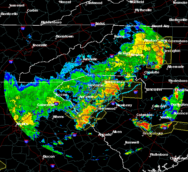 The severe thunderstorm warning for elbert, laurens, southeastern greenville, southern spartanburg, southeastern anderson, abbeville, northwestern union and northwestern greenwood counties will expire at 715 pm edt, the storms which prompted the warning have moved out of the area. therefore the warning will be allowed to expire. however gusty winds are still possible with these thunderstorms. a severe thunderstorm watch remains in effect until 1000 pm edt for northeastern georgia, and upstate south carolina. The severe thunderstorm warning for elbert, laurens, southeastern greenville, southern spartanburg, southeastern anderson, abbeville, northwestern union and northwestern greenwood counties will expire at 715 pm edt, the storms which prompted the warning have moved out of the area. therefore the warning will be allowed to expire. however gusty winds are still possible with these thunderstorms. a severe thunderstorm watch remains in effect until 1000 pm edt for northeastern georgia, and upstate south carolina.
|
| 6/25/2018 6:36 PM EDT |
 The severe thunderstorm warning for northwestern elbert, hart, northwestern laurens, greenville, west central spartanburg, anderson, southeastern pickens and northwestern abbeville counties will expire at 645 pm edt, the storms which prompted the warning have moved out of the area. therefore the warning will be allowed to expire. however gusty winds are still possible with these thunderstorms. a severe thunderstorm watch remains in effect until 1000 pm edt for northeastern georgia, and upstate south carolina. The severe thunderstorm warning for northwestern elbert, hart, northwestern laurens, greenville, west central spartanburg, anderson, southeastern pickens and northwestern abbeville counties will expire at 645 pm edt, the storms which prompted the warning have moved out of the area. therefore the warning will be allowed to expire. however gusty winds are still possible with these thunderstorms. a severe thunderstorm watch remains in effect until 1000 pm edt for northeastern georgia, and upstate south carolina.
|
| 6/25/2018 6:30 PM EDT |
 At 630 pm edt, severe thunderstorms were located along a line extending from 5 miles south of spartanburg to 14 miles north of abbeville to 7 miles south of elberton, moving southeast at 40 mph (radar indicated). Hazards include 60 mph wind gusts and quarter size hail. Minor hail damage to vehicles is expected. Expect wind damage to trees and power lines. At 630 pm edt, severe thunderstorms were located along a line extending from 5 miles south of spartanburg to 14 miles north of abbeville to 7 miles south of elberton, moving southeast at 40 mph (radar indicated). Hazards include 60 mph wind gusts and quarter size hail. Minor hail damage to vehicles is expected. Expect wind damage to trees and power lines.
|
| 6/25/2018 6:25 PM EDT |
 A severe thunderstorm warning remains in effect until 645 pm edt for northwestern elbert. hart. northwestern laurens. greenville. west central spartanburg. anderson. southeastern pickens and northwestern abbeville counties. At 625 pm edt, severe thunderstorms were located along a line extending from 9 miles southwest of spartanburg to 13 miles southeast. A severe thunderstorm warning remains in effect until 645 pm edt for northwestern elbert. hart. northwestern laurens. greenville. west central spartanburg. anderson. southeastern pickens and northwestern abbeville counties. At 625 pm edt, severe thunderstorms were located along a line extending from 9 miles southwest of spartanburg to 13 miles southeast.
|
| 6/25/2018 6:25 PM EDT |
 At 625 pm edt, severe thunderstorms were located along a line extending from 9 miles southwest of spartanburg to 13 miles southeast of anderson to 8 miles south of hartwell, moving southeast at 45 mph (radar indicated). Hazards include 60 mph wind gusts and quarter size hail. Minor hail damage to vehicles is expected. expect wind damage to trees and power lines. Locations impacted include, greenville downtown, spartanburg, anderson, easley, elberton, hartwell, greenville eastside, west greenville, greer and mauldin. At 625 pm edt, severe thunderstorms were located along a line extending from 9 miles southwest of spartanburg to 13 miles southeast of anderson to 8 miles south of hartwell, moving southeast at 45 mph (radar indicated). Hazards include 60 mph wind gusts and quarter size hail. Minor hail damage to vehicles is expected. expect wind damage to trees and power lines. Locations impacted include, greenville downtown, spartanburg, anderson, easley, elberton, hartwell, greenville eastside, west greenville, greer and mauldin.
|
| 6/25/2018 5:59 PM EDT |
 At 558 pm edt, severe thunderstorms were located along a line extending from 8 miles northeast of greenville downtown to 3 miles northwest of anderson to 5 miles southeast of carnesville, moving southeast at 45 mph (radar indicated). Hazards include 60 mph wind gusts and quarter size hail. Minor hail damage to vehicles is expected. Expect wind damage to trees and power lines. At 558 pm edt, severe thunderstorms were located along a line extending from 8 miles northeast of greenville downtown to 3 miles northwest of anderson to 5 miles southeast of carnesville, moving southeast at 45 mph (radar indicated). Hazards include 60 mph wind gusts and quarter size hail. Minor hail damage to vehicles is expected. Expect wind damage to trees and power lines.
|
| 6/25/2018 5:59 PM EDT |
 The national weather service in greenville-spartanburg has issued a * severe thunderstorm warning for. franklin county in northeastern georgia. southeastern stephens county in northeastern georgia. northwestern elbert county in northeastern georgia. Hart county in northeastern georgia. The national weather service in greenville-spartanburg has issued a * severe thunderstorm warning for. franklin county in northeastern georgia. southeastern stephens county in northeastern georgia. northwestern elbert county in northeastern georgia. Hart county in northeastern georgia.
|
| 6/24/2018 5:38 PM EDT |
 The severe thunderstorm warning for greenville, northeastern anderson and eastern pickens counties will expire at 545 pm edt, the storms which prompted the warning have weakened below severe limits, and are starting to move east of greenville county. therefore, the warning will be allowed to expire on schedule. however, gusty winds of 30 to 40 mph are still possible behind these thunderstorms through 6 pm. The severe thunderstorm warning for greenville, northeastern anderson and eastern pickens counties will expire at 545 pm edt, the storms which prompted the warning have weakened below severe limits, and are starting to move east of greenville county. therefore, the warning will be allowed to expire on schedule. however, gusty winds of 30 to 40 mph are still possible behind these thunderstorms through 6 pm.
|
| 6/24/2018 5:21 PM EDT |
 At 521 pm edt, severe thunderstorms were located along a line extending from 20 miles southwest of columbus to 3 miles east of greenville downtown to 10 miles southeast of easley, moving east at 45 mph (radar indicated). Hazards include 60 mph wind gusts and penny size hail. Expect damage to trees and power lines. Locations impacted include, greenville downtown, easley, greenville eastside, west greenville, greer, mauldin, taylors, simpsonville, berea and five forks. At 521 pm edt, severe thunderstorms were located along a line extending from 20 miles southwest of columbus to 3 miles east of greenville downtown to 10 miles southeast of easley, moving east at 45 mph (radar indicated). Hazards include 60 mph wind gusts and penny size hail. Expect damage to trees and power lines. Locations impacted include, greenville downtown, easley, greenville eastside, west greenville, greer, mauldin, taylors, simpsonville, berea and five forks.
|
| 6/24/2018 4:55 PM EDT |
 At 454 pm edt, severe thunderstorms were located along a line extending from 14 miles south of brevard to 3 miles northeast of pickens to 5 miles north of clemson, moving east at 45 mph (radar indicated). Hazards include 60 mph wind gusts and penny size hail. expect damage to trees and power lines At 454 pm edt, severe thunderstorms were located along a line extending from 14 miles south of brevard to 3 miles northeast of pickens to 5 miles north of clemson, moving east at 45 mph (radar indicated). Hazards include 60 mph wind gusts and penny size hail. expect damage to trees and power lines
|
| 6/23/2018 5:49 PM EDT |
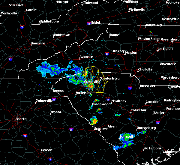 At 548 pm edt, severe thunderstorms were located along a line extending from 8 miles west of columbus to 19 miles southeast of hendersonville to 11 miles northeast of greenville downtown to 15 miles southwest of spartanburg to 14 miles northwest of laurens, moving east at 40 mph (radar indicated). Hazards include 60 mph wind gusts. Expect damage to trees and power lines. Locations impacted include, spartanburg, columbus, greer, five forks, fountain inn, boiling springs sc, woodruff, duncan, lyman and pacolet. At 548 pm edt, severe thunderstorms were located along a line extending from 8 miles west of columbus to 19 miles southeast of hendersonville to 11 miles northeast of greenville downtown to 15 miles southwest of spartanburg to 14 miles northwest of laurens, moving east at 40 mph (radar indicated). Hazards include 60 mph wind gusts. Expect damage to trees and power lines. Locations impacted include, spartanburg, columbus, greer, five forks, fountain inn, boiling springs sc, woodruff, duncan, lyman and pacolet.
|
| 6/23/2018 5:36 PM EDT |
 At 535 pm edt, severe thunderstorms were located along a line extending from 5 miles northwest of hendersonville to 13 miles southwest of columbus to 5 miles southeast of greenville downtown to 15 miles east of anderson, moving east at 45 mph (radar indicated). Hazards include 60 mph wind gusts. Expect damage to trees and power lines. Locations impacted include, greenville downtown, spartanburg, hendersonville, columbus, greenville eastside, west greenville, greer, mauldin, taylors and simpsonville. At 535 pm edt, severe thunderstorms were located along a line extending from 5 miles northwest of hendersonville to 13 miles southwest of columbus to 5 miles southeast of greenville downtown to 15 miles east of anderson, moving east at 45 mph (radar indicated). Hazards include 60 mph wind gusts. Expect damage to trees and power lines. Locations impacted include, greenville downtown, spartanburg, hendersonville, columbus, greenville eastside, west greenville, greer, mauldin, taylors and simpsonville.
|
| 6/23/2018 5:03 PM EDT |
 At 502 pm edt, severe thunderstorms were located along a line extending from 9 miles southeast of waynesville to 5 miles south of brevard to 5 miles south of pickens to 7 miles southeast of clemson, moving east at 55 mph (radar indicated). Hazards include 60 mph wind gusts. expect damage to trees and power lines At 502 pm edt, severe thunderstorms were located along a line extending from 9 miles southeast of waynesville to 5 miles south of brevard to 5 miles south of pickens to 7 miles southeast of clemson, moving east at 55 mph (radar indicated). Hazards include 60 mph wind gusts. expect damage to trees and power lines
|
| 6/16/2018 4:41 PM EDT |
 At 441 pm edt, severe thunderstorms were located along a line extending from near greenville downtown to 4 miles south of easley, moving southeast at 10 mph (radar indicated). Hazards include 60 mph wind gusts and quarter size hail. Minor hail damage to vehicles is expected. expect wind damage to trees and power lines. Locations impacted include, greenville downtown, easley, greenville eastside, west greenville, mauldin, simpsonville, berea, welcome, powdersville and piedmont. At 441 pm edt, severe thunderstorms were located along a line extending from near greenville downtown to 4 miles south of easley, moving southeast at 10 mph (radar indicated). Hazards include 60 mph wind gusts and quarter size hail. Minor hail damage to vehicles is expected. expect wind damage to trees and power lines. Locations impacted include, greenville downtown, easley, greenville eastside, west greenville, mauldin, simpsonville, berea, welcome, powdersville and piedmont.
|
| 6/16/2018 4:19 PM EDT |
 At 419 pm edt, severe thunderstorms were located along a line extending from 4 miles northwest of greenville downtown to 4 miles east of clemson, moving southeast at 10 mph (radar indicated). Hazards include 60 mph wind gusts and quarter size hail. Minor hail damage to vehicles is expected. Expect wind damage to trees and power lines. At 419 pm edt, severe thunderstorms were located along a line extending from 4 miles northwest of greenville downtown to 4 miles east of clemson, moving southeast at 10 mph (radar indicated). Hazards include 60 mph wind gusts and quarter size hail. Minor hail damage to vehicles is expected. Expect wind damage to trees and power lines.
|
| 6/1/2018 6:56 PM EDT |
 The severe thunderstorm warning for northwestern laurens, southeastern greenville, southwestern spartanburg and east central anderson counties will expire at 700 pm edt, the storm which prompted the warning has weakened below severe limits, and has exited the warned area. therefore the warning will be allowed to expire. The severe thunderstorm warning for northwestern laurens, southeastern greenville, southwestern spartanburg and east central anderson counties will expire at 700 pm edt, the storm which prompted the warning has weakened below severe limits, and has exited the warned area. therefore the warning will be allowed to expire.
|
| 6/1/2018 6:35 PM EDT |
 At 634 pm edt, a severe thunderstorm was located 5 miles northwest of laurens, or 4 miles south of gray court, moving northeast at 45 mph (radar indicated). Hazards include 60 mph wind gusts and penny size hail. Expect damage to trees and power lines. Locations impacted include, laurens, fountain inn, woodruff, gray court, fork shoals, princeton, hickory tavern, ora, williamston and belton. At 634 pm edt, a severe thunderstorm was located 5 miles northwest of laurens, or 4 miles south of gray court, moving northeast at 45 mph (radar indicated). Hazards include 60 mph wind gusts and penny size hail. Expect damage to trees and power lines. Locations impacted include, laurens, fountain inn, woodruff, gray court, fork shoals, princeton, hickory tavern, ora, williamston and belton.
|
| 6/1/2018 6:32 PM EDT |
 At 632 pm edt, a severe thunderstorm was located 6 miles east of greenville downtown, or 4 miles southwest of gsp airport, moving northeast at 55 mph (radar indicated). Hazards include 60 mph wind gusts. Expect damage to trees and power lines. Locations impacted include, greenville downtown, easley, greenville eastside, west greenville, mauldin, simpsonville, berea, welcome, powdersville and piedmont. At 632 pm edt, a severe thunderstorm was located 6 miles east of greenville downtown, or 4 miles southwest of gsp airport, moving northeast at 55 mph (radar indicated). Hazards include 60 mph wind gusts. Expect damage to trees and power lines. Locations impacted include, greenville downtown, easley, greenville eastside, west greenville, mauldin, simpsonville, berea, welcome, powdersville and piedmont.
|
| 6/1/2018 6:09 PM EDT |
 At 609 pm edt, a severe thunderstorm was located 14 miles east of anderson, or over honea path, moving northeast at 45 mph (radar indicated). Hazards include 60 mph wind gusts and penny size hail. expect damage to trees and power lines At 609 pm edt, a severe thunderstorm was located 14 miles east of anderson, or over honea path, moving northeast at 45 mph (radar indicated). Hazards include 60 mph wind gusts and penny size hail. expect damage to trees and power lines
|
| 6/1/2018 6:01 PM EDT |
 At 601 pm edt, a severe thunderstorm was located near clemson, or near central, moving east at 55 mph (radar indicated). Hazards include 60 mph wind gusts. expect damage to trees and power lines At 601 pm edt, a severe thunderstorm was located near clemson, or near central, moving east at 55 mph (radar indicated). Hazards include 60 mph wind gusts. expect damage to trees and power lines
|
| 5/31/2018 5:24 PM EDT |
 At 524 pm edt, a severe thunderstorm was located 13 miles southwest of spartanburg, or near reidville, moving southeast at 25 mph (radar indicated). Hazards include 60 mph wind gusts. Expect damage to trees and power lines. Locations impacted include, greer, mauldin, taylors, simpsonville, five forks, fountain inn, duncan, lyman, wellford and inman. At 524 pm edt, a severe thunderstorm was located 13 miles southwest of spartanburg, or near reidville, moving southeast at 25 mph (radar indicated). Hazards include 60 mph wind gusts. Expect damage to trees and power lines. Locations impacted include, greer, mauldin, taylors, simpsonville, five forks, fountain inn, duncan, lyman, wellford and inman.
|
| 5/31/2018 5:00 PM EDT |
 At 500 pm edt, a severe thunderstorm was located 7 miles northeast of greenville downtown, or near taylors, moving southeast at 25 mph (radar indicated). Hazards include 60 mph wind gusts and quarter size hail. Minor hail damage to vehicles is expected. expect wind damage to trees and power lines. Locations impacted include, greenville downtown, greenville eastside, west greenville, greer, mauldin, taylors, simpsonville, berea, five forks and fountain inn. At 500 pm edt, a severe thunderstorm was located 7 miles northeast of greenville downtown, or near taylors, moving southeast at 25 mph (radar indicated). Hazards include 60 mph wind gusts and quarter size hail. Minor hail damage to vehicles is expected. expect wind damage to trees and power lines. Locations impacted include, greenville downtown, greenville eastside, west greenville, greer, mauldin, taylors, simpsonville, berea, five forks and fountain inn.
|
| 5/31/2018 4:39 PM EDT |
 At 438 pm edt, a severe thunderstorm was located 9 miles north of greenville downtown, or near travelers rest, moving southeast at 25 mph. several other thunderstorms developing in northern greenville county may become severe as well, particularly one moving south of gowensville and another near berea (radar indicated). Hazards include 60 mph wind gusts and quarter size hail. Minor hail damage to vehicles is expected. Expect wind damage to trees and power lines. At 438 pm edt, a severe thunderstorm was located 9 miles north of greenville downtown, or near travelers rest, moving southeast at 25 mph. several other thunderstorms developing in northern greenville county may become severe as well, particularly one moving south of gowensville and another near berea (radar indicated). Hazards include 60 mph wind gusts and quarter size hail. Minor hail damage to vehicles is expected. Expect wind damage to trees and power lines.
|
| 4/15/2018 12:54 PM EDT |
 The severe thunderstorm warning for northwestern laurens and spartanburg counties will expire at 100 pm edt, the storm which prompted the warning has moved out of the area. therefore the warning will be allowed to expire. a tornado watch remains in effect until 700 pm edt for western north carolina, and upstate south carolina. if you observed large hail or wind damage, please report it to the national weather service greenville-spartanburg by calling toll free, 1, 800, 2 6 7, 8 1 0 1, or by posting on our facebook page, or tweet it using hashtag nwsgsp. your message should describe the event and the specific location where it occurred. remember, a severe thunderstorm warning still remains in effect for central laurens county and eastern spartanburg county. The severe thunderstorm warning for northwestern laurens and spartanburg counties will expire at 100 pm edt, the storm which prompted the warning has moved out of the area. therefore the warning will be allowed to expire. a tornado watch remains in effect until 700 pm edt for western north carolina, and upstate south carolina. if you observed large hail or wind damage, please report it to the national weather service greenville-spartanburg by calling toll free, 1, 800, 2 6 7, 8 1 0 1, or by posting on our facebook page, or tweet it using hashtag nwsgsp. your message should describe the event and the specific location where it occurred. remember, a severe thunderstorm warning still remains in effect for central laurens county and eastern spartanburg county.
|
| 4/15/2018 12:19 PM EDT |
 At 1219 pm edt, a severe thunderstorm was located 7 miles north of spartanburg, or near mayo, moving northeast at 55 mph (radar indicated). Hazards include 60 mph wind gusts and quarter size hail. Minor hail damage to vehicles is expected. Expect wind damage to trees and power lines. At 1219 pm edt, a severe thunderstorm was located 7 miles north of spartanburg, or near mayo, moving northeast at 55 mph (radar indicated). Hazards include 60 mph wind gusts and quarter size hail. Minor hail damage to vehicles is expected. Expect wind damage to trees and power lines.
|
| 4/15/2018 12:10 PM EDT |
 At 1209 pm edt, a severe thunderstorm was located 7 miles south of spartanburg, or near roebuck, moving northeast at 55 mph. radar continues to indicate possible hail to 1 inch and possible severe wind gusts (radar indicated). Hazards include 60 mph wind gusts and quarter size hail. Minor hail damage to vehicles is expected. expect wind damage to trees and power lines. Locations impacted include, spartanburg, laurens, woodruff, duncan, lyman, wellford, inman, roebuck, gray court and reidville. At 1209 pm edt, a severe thunderstorm was located 7 miles south of spartanburg, or near roebuck, moving northeast at 55 mph. radar continues to indicate possible hail to 1 inch and possible severe wind gusts (radar indicated). Hazards include 60 mph wind gusts and quarter size hail. Minor hail damage to vehicles is expected. expect wind damage to trees and power lines. Locations impacted include, spartanburg, laurens, woodruff, duncan, lyman, wellford, inman, roebuck, gray court and reidville.
|
| 4/15/2018 11:50 AM EDT |
 At 1150 am edt, a severe thunderstorm was located 8 miles northwest of laurens, or over gray court, moving northeast at 55 mph (radar indicated). Hazards include 60 mph wind gusts and quarter size hail. Minor hail damage to vehicles is expected. Expect wind damage to trees and power lines. At 1150 am edt, a severe thunderstorm was located 8 miles northwest of laurens, or over gray court, moving northeast at 55 mph (radar indicated). Hazards include 60 mph wind gusts and quarter size hail. Minor hail damage to vehicles is expected. Expect wind damage to trees and power lines.
|
| 10/23/2017 2:16 PM EDT |
 At 216 pm edt, a severe thunderstorm was located 16 miles southeast of anderson, or near honea path, moving northeast at 35 mph (radar indicated). Hazards include 60 mph wind gusts. expect damage to trees and power lines At 216 pm edt, a severe thunderstorm was located 16 miles southeast of anderson, or near honea path, moving northeast at 35 mph (radar indicated). Hazards include 60 mph wind gusts. expect damage to trees and power lines
|
| 7/28/2017 3:22 PM EDT |
 At 322 pm edt, severe thunderstorms were located along a line extending from 10 miles south of columbus to 7 miles southwest of spartanburg to 15 miles north of laurens, moving east at 40 mph (radar indicated). Hazards include 60 mph wind gusts and quarter size hail. Minor hail damage to vehicles is expected. expect wind damage to trees and power lines. Locations impacted include, woodruff, duncan, lyman, wellford, inman, roebuck, campobello, reidville, gsp airport and moore. At 322 pm edt, severe thunderstorms were located along a line extending from 10 miles south of columbus to 7 miles southwest of spartanburg to 15 miles north of laurens, moving east at 40 mph (radar indicated). Hazards include 60 mph wind gusts and quarter size hail. Minor hail damage to vehicles is expected. expect wind damage to trees and power lines. Locations impacted include, woodruff, duncan, lyman, wellford, inman, roebuck, campobello, reidville, gsp airport and moore.
|
| 7/28/2017 3:06 PM EDT |
 At 305 pm edt, a severe thunderstorm was located 8 miles northeast of laurens, moving east at 35 mph (radar indicated). Hazards include 60 mph wind gusts and quarter size hail. Minor hail damage to vehicles is expected. expect wind damage to trees and power lines. Locations impacted include, laurens, clinton, gray court, enoree, ora, woodruff, hickory tavern and cross anchor. At 305 pm edt, a severe thunderstorm was located 8 miles northeast of laurens, moving east at 35 mph (radar indicated). Hazards include 60 mph wind gusts and quarter size hail. Minor hail damage to vehicles is expected. expect wind damage to trees and power lines. Locations impacted include, laurens, clinton, gray court, enoree, ora, woodruff, hickory tavern and cross anchor.
|
| 7/28/2017 3:04 PM EDT |
 At 304 pm edt, severe thunderstorms were located along a line extending from 17 miles southwest of columbus to 7 miles east of greenville downtown to 19 miles northwest of laurens, moving east at 35 mph (radar indicated). Hazards include 60 mph wind gusts and quarter size hail. Minor hail damage to vehicles is expected. expect wind damage to trees and power lines. Locations impacted include, greenville downtown, greenville eastside, west greenville, greer, mauldin, taylors, simpsonville, berea, five forks and fountain inn. At 304 pm edt, severe thunderstorms were located along a line extending from 17 miles southwest of columbus to 7 miles east of greenville downtown to 19 miles northwest of laurens, moving east at 35 mph (radar indicated). Hazards include 60 mph wind gusts and quarter size hail. Minor hail damage to vehicles is expected. expect wind damage to trees and power lines. Locations impacted include, greenville downtown, greenville eastside, west greenville, greer, mauldin, taylors, simpsonville, berea, five forks and fountain inn.
|
| 7/28/2017 2:46 PM EDT |
 At 246 pm edt, severe thunderstorms were located along a line extending from 10 miles north of easley to 4 miles southwest of greenville downtown to 12 miles northeast of anderson, moving east at 35 mph (radar indicated). Hazards include 60 mph wind gusts and quarter size hail. Minor hail damage to vehicles is expected. Expect wind damage to trees and power lines. At 246 pm edt, severe thunderstorms were located along a line extending from 10 miles north of easley to 4 miles southwest of greenville downtown to 12 miles northeast of anderson, moving east at 35 mph (radar indicated). Hazards include 60 mph wind gusts and quarter size hail. Minor hail damage to vehicles is expected. Expect wind damage to trees and power lines.
|
| 7/28/2017 2:43 PM EDT |
 At 243 pm edt, a severe thunderstorm was located 9 miles west of laurens, or 6 miles southwest of gray court, moving east at 35 mph (radar indicated). Hazards include 60 mph wind gusts and quarter size hail. Minor hail damage to vehicles is expected. Expect wind damage to trees and power lines. At 243 pm edt, a severe thunderstorm was located 9 miles west of laurens, or 6 miles southwest of gray court, moving east at 35 mph (radar indicated). Hazards include 60 mph wind gusts and quarter size hail. Minor hail damage to vehicles is expected. Expect wind damage to trees and power lines.
|
| 7/28/2017 2:30 PM EDT |
 At 230 pm edt, a severe thunderstorm was located 15 miles east of anderson, or 6 miles north of honea path, moving east at 30 mph (radar indicated). Hazards include 60 mph wind gusts and quarter size hail. Minor hail damage to vehicles is expected. expect wind damage to trees and power lines. Locations impacted include, fountain inn, belton, williamston, honea path, fork shoals, princeton, hickory tavern, donalds and ware shoals. At 230 pm edt, a severe thunderstorm was located 15 miles east of anderson, or 6 miles north of honea path, moving east at 30 mph (radar indicated). Hazards include 60 mph wind gusts and quarter size hail. Minor hail damage to vehicles is expected. expect wind damage to trees and power lines. Locations impacted include, fountain inn, belton, williamston, honea path, fork shoals, princeton, hickory tavern, donalds and ware shoals.
|
| 7/28/2017 2:07 PM EDT |
 At 207 pm edt, a severe thunderstorm was located 6 miles east of anderson, or over biltmore park, moving east at 30 mph (radar indicated). Hazards include 60 mph wind gusts and quarter size hail. Minor hail damage to vehicles is expected. Expect wind damage to trees and power lines. At 207 pm edt, a severe thunderstorm was located 6 miles east of anderson, or over biltmore park, moving east at 30 mph (radar indicated). Hazards include 60 mph wind gusts and quarter size hail. Minor hail damage to vehicles is expected. Expect wind damage to trees and power lines.
|
| 7/6/2017 3:59 PM EDT |
 At 359 pm edt, a severe thunderstorm was located 9 miles south of greenville downtown, or near piedmont, moving east at 20 mph (radar indicated). Hazards include 60 mph wind gusts and penny size hail. Expect damage to trees and power lines. Locations impacted include, greenville eastside, west greenville, mauldin, simpsonville, five forks, fountain inn, welcome, powdersville, piedmont and williamston. At 359 pm edt, a severe thunderstorm was located 9 miles south of greenville downtown, or near piedmont, moving east at 20 mph (radar indicated). Hazards include 60 mph wind gusts and penny size hail. Expect damage to trees and power lines. Locations impacted include, greenville eastside, west greenville, mauldin, simpsonville, five forks, fountain inn, welcome, powdersville, piedmont and williamston.
|
| 7/6/2017 3:34 PM EDT |
 At 334 pm edt, a severe thunderstorm was located 5 miles south of easley, moving east at 20 mph (radar indicated). Hazards include 60 mph wind gusts and penny size hail. expect damage to trees and power lines At 334 pm edt, a severe thunderstorm was located 5 miles south of easley, moving east at 20 mph (radar indicated). Hazards include 60 mph wind gusts and penny size hail. expect damage to trees and power lines
|
| 7/2/2017 8:08 PM EDT |
 The severe thunderstorm warning for east central greenville county will expire at 815 pm edt, the storm which prompted the warning has weakened below severe limits, and no longer poses an immediate threat to life or property. therefore the warning will be allowed to expire. however gusty winds and heavy rain are still possible with this thunderstorm. The severe thunderstorm warning for east central greenville county will expire at 815 pm edt, the storm which prompted the warning has weakened below severe limits, and no longer poses an immediate threat to life or property. therefore the warning will be allowed to expire. however gusty winds and heavy rain are still possible with this thunderstorm.
|
| 7/2/2017 7:52 PM EDT |
 At 752 pm edt, a severe thunderstorm was located 8 miles southeast of greenville downtown, or near mauldin, moving south at 5 mph (radar indicated). Hazards include 60 mph wind gusts and quarter size hail. Minor hail damage to vehicles is expected. expect wind damage to trees and power lines. Locations impacted include, mauldin, simpsonville, donaldson center, fountain inn, five forks and west greenville. At 752 pm edt, a severe thunderstorm was located 8 miles southeast of greenville downtown, or near mauldin, moving south at 5 mph (radar indicated). Hazards include 60 mph wind gusts and quarter size hail. Minor hail damage to vehicles is expected. expect wind damage to trees and power lines. Locations impacted include, mauldin, simpsonville, donaldson center, fountain inn, five forks and west greenville.
|
| 7/2/2017 7:35 PM EDT |
 At 734 pm edt, a severe thunderstorm was located 5 miles southeast of greenville downtown, or near mauldin, and is nearly stationary (radar indicated). Hazards include 60 mph wind gusts and quarter size hail. Minor hail damage to vehicles is expected. Expect wind damage to trees and power lines. At 734 pm edt, a severe thunderstorm was located 5 miles southeast of greenville downtown, or near mauldin, and is nearly stationary (radar indicated). Hazards include 60 mph wind gusts and quarter size hail. Minor hail damage to vehicles is expected. Expect wind damage to trees and power lines.
|
| 5/31/2017 4:46 PM EDT |
 At 446 pm edt, severe thunderstorms were located along a line extending from near spartanburg to 3 miles west of greenville downtown, moving southeast at 20 mph (radar indicated). Hazards include 60 mph wind gusts and penny size hail. expect damage to trees and power lines At 446 pm edt, severe thunderstorms were located along a line extending from near spartanburg to 3 miles west of greenville downtown, moving southeast at 20 mph (radar indicated). Hazards include 60 mph wind gusts and penny size hail. expect damage to trees and power lines
|
| 4/6/2017 12:47 AM EDT |
 At 1245 am edt, severe thunderstorms were located along a line extending from 11 miles southeast of columbus to 12 miles southwest of spartanburg to 9 miles west of laurens, moving east at 50 mph (radar indicated). Hazards include 60 mph wind gusts and half dollar size hail. Hail damage to vehicles is expected. expect wind damage to roofs, siding, and trees. Locations impacted include, spartanburg, laurens, greer, simpsonville, five forks, fountain inn, boiling springs sc, woodruff, duncan and lyman. At 1245 am edt, severe thunderstorms were located along a line extending from 11 miles southeast of columbus to 12 miles southwest of spartanburg to 9 miles west of laurens, moving east at 50 mph (radar indicated). Hazards include 60 mph wind gusts and half dollar size hail. Hail damage to vehicles is expected. expect wind damage to roofs, siding, and trees. Locations impacted include, spartanburg, laurens, greer, simpsonville, five forks, fountain inn, boiling springs sc, woodruff, duncan and lyman.
|
| 4/6/2017 12:24 AM EDT |
 At 1224 am edt, severe thunderstorms were located along a line extending from 4 miles northeast of easley to 11 miles east of anderson to 15 miles west of abbeville, moving northeast at 85 mph (radar indicated). Hazards include 60 mph wind gusts and quarter size hail. Hail damage to vehicles is expected. Expect wind damage to roofs, siding, and trees. At 1224 am edt, severe thunderstorms were located along a line extending from 4 miles northeast of easley to 11 miles east of anderson to 15 miles west of abbeville, moving northeast at 85 mph (radar indicated). Hazards include 60 mph wind gusts and quarter size hail. Hail damage to vehicles is expected. Expect wind damage to roofs, siding, and trees.
|
| 4/3/2017 2:44 PM EDT |
 At 244 pm edt, severe thunderstorms were located along a line extending from 18 miles southeast of greenville downtown to 7 miles west of laurens to 13 miles north of greenwood, moving northeast at 50 mph (radar indicated). Hazards include 60 mph wind gusts. expect damage to trees and minor damage to roofs and siding At 244 pm edt, severe thunderstorms were located along a line extending from 18 miles southeast of greenville downtown to 7 miles west of laurens to 13 miles north of greenwood, moving northeast at 50 mph (radar indicated). Hazards include 60 mph wind gusts. expect damage to trees and minor damage to roofs and siding
|
| 4/3/2017 2:41 PM EDT |
 At 241 pm edt, severe thunderstorms were located along a line extending from 9 miles northwest of spartanburg to 16 miles southeast of greenville downtown, moving northeast at 50 mph (radar indicated). Hazards include 60 mph wind gusts. Expect damage to trees and minor damage to roofs and siding. locations impacted include, simpsonville, five forks, fountain inn, boiling springs sc, duncan, lyman, wellford, inman, campobello and reidville. A tornado watch remains in effect until 900 pm edt for upstate south carolina. At 241 pm edt, severe thunderstorms were located along a line extending from 9 miles northwest of spartanburg to 16 miles southeast of greenville downtown, moving northeast at 50 mph (radar indicated). Hazards include 60 mph wind gusts. Expect damage to trees and minor damage to roofs and siding. locations impacted include, simpsonville, five forks, fountain inn, boiling springs sc, duncan, lyman, wellford, inman, campobello and reidville. A tornado watch remains in effect until 900 pm edt for upstate south carolina.
|
| 4/3/2017 2:28 PM EDT |
 At 228 pm edt, severe thunderstorms were located along a line extending from 18 miles south of columbus to 9 miles southeast of greenville downtown, moving northeast at 60 mph (radar indicated). Hazards include 60 mph wind gusts. expect damage to trees and minor damage to roofs and siding At 228 pm edt, severe thunderstorms were located along a line extending from 18 miles south of columbus to 9 miles southeast of greenville downtown, moving northeast at 60 mph (radar indicated). Hazards include 60 mph wind gusts. expect damage to trees and minor damage to roofs and siding
|
| 3/30/2017 7:35 PM EDT |
 At 735 pm edt, a severe thunderstorm was located 8 miles southeast of greenville downtown, or near donaldson center, moving northeast at 20 mph (radar indicated). Hazards include 60 mph wind gusts and quarter size hail. Hail damage to vehicles is expected. expect wind damage to roofs, siding, and trees. Locations impacted include, greenville downtown, greenville eastside, west greenville, mauldin, taylors, simpsonville, five forks, fountain inn, donaldson center and welcome. At 735 pm edt, a severe thunderstorm was located 8 miles southeast of greenville downtown, or near donaldson center, moving northeast at 20 mph (radar indicated). Hazards include 60 mph wind gusts and quarter size hail. Hail damage to vehicles is expected. expect wind damage to roofs, siding, and trees. Locations impacted include, greenville downtown, greenville eastside, west greenville, mauldin, taylors, simpsonville, five forks, fountain inn, donaldson center and welcome.
|
| 3/30/2017 7:18 PM EDT |
 At 717 pm edt, a severe thunderstorm was located 9 miles south of greenville downtown, or near donaldson center, moving northeast at 20 mph (radar indicated). Hazards include 60 mph wind gusts and quarter size hail. Hail damage to vehicles is expected. expect wind damage to roofs, siding, and trees. Locations impacted include, greenville downtown, greenville eastside, west greenville, mauldin, taylors, simpsonville, five forks, fountain inn, welcome and donaldson center. At 717 pm edt, a severe thunderstorm was located 9 miles south of greenville downtown, or near donaldson center, moving northeast at 20 mph (radar indicated). Hazards include 60 mph wind gusts and quarter size hail. Hail damage to vehicles is expected. expect wind damage to roofs, siding, and trees. Locations impacted include, greenville downtown, greenville eastside, west greenville, mauldin, taylors, simpsonville, five forks, fountain inn, welcome and donaldson center.
|
| 3/30/2017 6:54 PM EDT |
 At 654 pm edt, a severe thunderstorm was located 11 miles northeast of anderson, or near west pelzer, moving northeast at 20 mph (radar indicated). Hazards include 60 mph wind gusts and quarter size hail. Hail damage to vehicles is expected. Expect wind damage to roofs, siding, and trees. At 654 pm edt, a severe thunderstorm was located 11 miles northeast of anderson, or near west pelzer, moving northeast at 20 mph (radar indicated). Hazards include 60 mph wind gusts and quarter size hail. Hail damage to vehicles is expected. Expect wind damage to roofs, siding, and trees.
|
| 3/21/2017 7:15 PM EDT |
 At 714 pm edt, a severe thunderstorm was located 11 miles southwest of spartanburg, or over reidville, moving southeast at 15 mph (radar indicated). Hazards include golf ball size hail and 60 mph wind gusts. People and animals outdoors will be injured. expect hail damage to roofs, siding, windows and vehicles. Expect wind damage to roofs, siding and trees. At 714 pm edt, a severe thunderstorm was located 11 miles southwest of spartanburg, or over reidville, moving southeast at 15 mph (radar indicated). Hazards include golf ball size hail and 60 mph wind gusts. People and animals outdoors will be injured. expect hail damage to roofs, siding, windows and vehicles. Expect wind damage to roofs, siding and trees.
|
| 3/21/2017 7:06 PM EDT |
 At 704 pm edt, a severe thunderstorm was located 11 miles east of greenville downtown, or near gsp airport, moving southeast at 15 mph. yet another strong to severe thunderstorm was developing near travelers rest as well (public). Hazards include tennis ball size hail. People and animals outdoors will be injured. expect damage to roofs, siding, windows and vehicles. Locations impacted include, greer, mauldin, taylors, five forks, fountain inn, duncan, lyman, wellford, reidville and paris mountain state park. At 704 pm edt, a severe thunderstorm was located 11 miles east of greenville downtown, or near gsp airport, moving southeast at 15 mph. yet another strong to severe thunderstorm was developing near travelers rest as well (public). Hazards include tennis ball size hail. People and animals outdoors will be injured. expect damage to roofs, siding, windows and vehicles. Locations impacted include, greer, mauldin, taylors, five forks, fountain inn, duncan, lyman, wellford, reidville and paris mountain state park.
|
| 3/21/2017 6:45 PM EDT |
 At 645 pm edt, a severe thunderstorm was located 7 miles east of greenville downtown, or near gsp airport, moving southeast at 15 mph (radar indicated). Hazards include half dollar size hail. damage to vehicles is expected At 645 pm edt, a severe thunderstorm was located 7 miles east of greenville downtown, or near gsp airport, moving southeast at 15 mph (radar indicated). Hazards include half dollar size hail. damage to vehicles is expected
|
| 3/21/2017 6:28 PM EDT |
 At 627 pm edt, a severe thunderstorm was located 7 miles northeast of greenville downtown, or near taylors, moving southeast at 15 mph. another severe thunderstorm was moving south of greer (radar indicated). Hazards include golf ball size hail. People and animals outdoors will be injured. expect damage to roofs, siding, windows and vehicles. Locations impacted include, greenville downtown, greenville eastside, greer, mauldin, taylors, simpsonville, five forks, fountain inn, travelers rest and duncan. At 627 pm edt, a severe thunderstorm was located 7 miles northeast of greenville downtown, or near taylors, moving southeast at 15 mph. another severe thunderstorm was moving south of greer (radar indicated). Hazards include golf ball size hail. People and animals outdoors will be injured. expect damage to roofs, siding, windows and vehicles. Locations impacted include, greenville downtown, greenville eastside, greer, mauldin, taylors, simpsonville, five forks, fountain inn, travelers rest and duncan.
|
| 3/21/2017 5:59 PM EDT |
 At 559 pm edt, a severe thunderstorm was located 7 miles east of greenville downtown, or 4 miles southwest of gsp airport, moving southeast at 20 mph (radar indicated). Hazards include ping pong ball size hail. People and animals outdoors will be injured. Expect damage to roofs, siding, windows and vehicles. At 559 pm edt, a severe thunderstorm was located 7 miles east of greenville downtown, or 4 miles southwest of gsp airport, moving southeast at 20 mph (radar indicated). Hazards include ping pong ball size hail. People and animals outdoors will be injured. Expect damage to roofs, siding, windows and vehicles.
|
| 3/1/2017 7:10 PM EST |
 At 709 pm est, severe thunderstorms were located along a line extending from 7 miles northeast of spartanburg to 16 miles east of greenville downtown to 4 miles southeast of laurens, moving east at 55 mph (radar indicated). Hazards include golf ball size hail and 70 mph wind gusts. People and animals outdoors will be injured. expect hail damage to roofs, siding, windows and vehicles. expect considerable tree damage. Wind damage is also likely to mobile homes, roofs and outbuildings. At 709 pm est, severe thunderstorms were located along a line extending from 7 miles northeast of spartanburg to 16 miles east of greenville downtown to 4 miles southeast of laurens, moving east at 55 mph (radar indicated). Hazards include golf ball size hail and 70 mph wind gusts. People and animals outdoors will be injured. expect hail damage to roofs, siding, windows and vehicles. expect considerable tree damage. Wind damage is also likely to mobile homes, roofs and outbuildings.
|
| 3/1/2017 6:51 PM EST |
 At 651 pm est, severe thunderstorms were located along a line extending from 10 miles southeast of columbus to 12 miles west of laurens, moving east at 55 mph (radar indicated). Hazards include 60 mph wind gusts and quarter size hail. Hail damage to vehicles is expected. expect wind damage to roofs, siding and trees. Locations impacted include, greenville downtown, spartanburg, laurens, greenville eastside, west greenville, greer, mauldin, taylors, simpsonville and berea. At 651 pm est, severe thunderstorms were located along a line extending from 10 miles southeast of columbus to 12 miles west of laurens, moving east at 55 mph (radar indicated). Hazards include 60 mph wind gusts and quarter size hail. Hail damage to vehicles is expected. expect wind damage to roofs, siding and trees. Locations impacted include, greenville downtown, spartanburg, laurens, greenville eastside, west greenville, greer, mauldin, taylors, simpsonville and berea.
|
| 3/1/2017 6:29 PM EST |
 At 629 pm est, severe thunderstorms were located along a line extending from 12 miles north of greenville downtown to 8 miles southeast of anderson, moving east at 55 mph (radar indicated). Hazards include 60 mph wind gusts and quarter size hail. Hail damage to vehicles is expected. Expect wind damage to roofs, siding and trees. At 629 pm est, severe thunderstorms were located along a line extending from 12 miles north of greenville downtown to 8 miles southeast of anderson, moving east at 55 mph (radar indicated). Hazards include 60 mph wind gusts and quarter size hail. Hail damage to vehicles is expected. Expect wind damage to roofs, siding and trees.
|
| 3/1/2017 6:22 PM EST |
 At 622 pm est, severe thunderstorms were located along a line extending from 7 miles northeast of pickens to 4 miles southwest of anderson, moving northeast at 60 mph (radar indicated). Hazards include 60 mph wind gusts and quarter size hail. Hail damage to vehicles is expected. expect wind damage to roofs, siding and trees. Locations impacted include, greenville downtown, anderson, easley, pickens, greenville eastside, west greenville, greer, mauldin, taylors and simpsonville. At 622 pm est, severe thunderstorms were located along a line extending from 7 miles northeast of pickens to 4 miles southwest of anderson, moving northeast at 60 mph (radar indicated). Hazards include 60 mph wind gusts and quarter size hail. Hail damage to vehicles is expected. expect wind damage to roofs, siding and trees. Locations impacted include, greenville downtown, anderson, easley, pickens, greenville eastside, west greenville, greer, mauldin, taylors and simpsonville.
|
| 3/1/2017 6:10 PM EST |
 At 610 pm est, severe thunderstorms were located along a line extending from near pickens to 6 miles northeast of hartwell, moving northeast at 60 mph (radar indicated). Hazards include 60 mph wind gusts and quarter size hail. Hail damage to vehicles is expected. expect wind damage to roofs, siding and trees. Locations impacted include, greenville downtown, anderson, easley, clemson, hartwell, pickens, greenville eastside, west greenville, greer and mauldin. At 610 pm est, severe thunderstorms were located along a line extending from near pickens to 6 miles northeast of hartwell, moving northeast at 60 mph (radar indicated). Hazards include 60 mph wind gusts and quarter size hail. Hail damage to vehicles is expected. expect wind damage to roofs, siding and trees. Locations impacted include, greenville downtown, anderson, easley, clemson, hartwell, pickens, greenville eastside, west greenville, greer and mauldin.
|
| 3/1/2017 5:50 PM EST |
 At 550 pm est, severe thunderstorms were located along a line extending from 3 miles southeast of walhalla to 7 miles east of carnesville, moving northeast at 60 mph (radar indicated). Hazards include 60 mph wind gusts and quarter size hail. Hail damage to vehicles is expected. Expect wind damage to roofs, siding and trees. At 550 pm est, severe thunderstorms were located along a line extending from 3 miles southeast of walhalla to 7 miles east of carnesville, moving northeast at 60 mph (radar indicated). Hazards include 60 mph wind gusts and quarter size hail. Hail damage to vehicles is expected. Expect wind damage to roofs, siding and trees.
|
| 11/30/2016 5:17 PM EST |
 At 517 pm est, severe thunderstorms were located along a line extending from 13 miles southeast of morganton to 4 miles northeast of spartanburg to 13 miles northwest of union to 12 miles southeast of laurens to 9 miles east of greenwood, moving east at 55 mph (radar indicated). Hazards include 60 mph wind gusts. Expect damage to roofs. siding and trees. Locations impacted include, spartanburg, greenwood, shelby, gaffney, laurens, union, forest city, rutherfordton, clinton and boiling springs sc. At 517 pm est, severe thunderstorms were located along a line extending from 13 miles southeast of morganton to 4 miles northeast of spartanburg to 13 miles northwest of union to 12 miles southeast of laurens to 9 miles east of greenwood, moving east at 55 mph (radar indicated). Hazards include 60 mph wind gusts. Expect damage to roofs. siding and trees. Locations impacted include, spartanburg, greenwood, shelby, gaffney, laurens, union, forest city, rutherfordton, clinton and boiling springs sc.
|
| 11/30/2016 5:00 PM EST | Power lines down at highway 14 and howard driv in greenville county SC, 0.5 miles E of Fountain Inn, SC |
| 11/30/2016 4:54 PM EST |
 At 453 pm est, a tornado producing storm was located 12 miles southeast of greenville downtown, or near simpsonville, moving east at 55 mph (radar confirmed tornado). Hazards include damaging tornado. Flying debris will be dangerous to those caught without shelter. mobile homes will be damaged or destroyed. damage to roofs, windows and vehicles will occur. tree damage is likely. this dangerous storm will be near, woodruff and reidville around 500 pm est. moore and roebuck around 510 pm est. spartanburg, croft state park and cedar springs around 520 pm est. pacolet and pacolet mills around 530 pm est. Other locations impacted by this dangerous thunderstorm include pauline. At 453 pm est, a tornado producing storm was located 12 miles southeast of greenville downtown, or near simpsonville, moving east at 55 mph (radar confirmed tornado). Hazards include damaging tornado. Flying debris will be dangerous to those caught without shelter. mobile homes will be damaged or destroyed. damage to roofs, windows and vehicles will occur. tree damage is likely. this dangerous storm will be near, woodruff and reidville around 500 pm est. moore and roebuck around 510 pm est. spartanburg, croft state park and cedar springs around 520 pm est. pacolet and pacolet mills around 530 pm est. Other locations impacted by this dangerous thunderstorm include pauline.
|
| 11/30/2016 4:45 PM EST |
 At 443 pm est, a severe thunderstorm capable of producing a tornado was located 10 miles south of greenville downtown, or near donaldson center, moving east at 55 mph (radar indicated rotation. the rotation has strengthend and become tighter, indicating potential tornado development). Hazards include tornado. Flying debris will be dangerous to those caught without shelter. mobile homes will be damaged or destroyed. damage to roofs, windows and vehicles will occur. tree damage is likely. this tornado will be near, fountain inn and five forks around 450 pm est. Other locations impacted by this dangerous storm include fork shoals. At 443 pm est, a severe thunderstorm capable of producing a tornado was located 10 miles south of greenville downtown, or near donaldson center, moving east at 55 mph (radar indicated rotation. the rotation has strengthend and become tighter, indicating potential tornado development). Hazards include tornado. Flying debris will be dangerous to those caught without shelter. mobile homes will be damaged or destroyed. damage to roofs, windows and vehicles will occur. tree damage is likely. this tornado will be near, fountain inn and five forks around 450 pm est. Other locations impacted by this dangerous storm include fork shoals.
|
| 11/30/2016 4:41 PM EST |
 At 441 pm est, severe thunderstorms were located along a line extending from 7 miles west of rutherfordton to near greenville downtown to 18 miles southeast of easley to 5 miles northeast of abbeville to 21 miles northeast of washington, moving east at 55 mph (radar indicated). Hazards include 60 mph wind gusts. Expect damage to roofs. Siding and trees. At 441 pm est, severe thunderstorms were located along a line extending from 7 miles west of rutherfordton to near greenville downtown to 18 miles southeast of easley to 5 miles northeast of abbeville to 21 miles northeast of washington, moving east at 55 mph (radar indicated). Hazards include 60 mph wind gusts. Expect damage to roofs. Siding and trees.
|
| 11/30/2016 4:35 PM EST |
 At 434 pm est, a severe thunderstorm capable of producing a tornado was located 12 miles southeast of easley, or near west pelzer, moving east at 40 mph (the radar indicated rotation has increased in speed indicating another tornado could develop). Hazards include tornado. Flying debris will be dangerous to those caught without shelter. mobile homes will be damaged or destroyed. damage to roofs, windows and vehicles will occur. tree damage is likely. this dangerous storm will be near, donaldson center and mauldin around 450 pm est. fountain inn, simpsonville and five forks around 500 pm est. Other locations impacted by this dangerous storm include fork shoals. At 434 pm est, a severe thunderstorm capable of producing a tornado was located 12 miles southeast of easley, or near west pelzer, moving east at 40 mph (the radar indicated rotation has increased in speed indicating another tornado could develop). Hazards include tornado. Flying debris will be dangerous to those caught without shelter. mobile homes will be damaged or destroyed. damage to roofs, windows and vehicles will occur. tree damage is likely. this dangerous storm will be near, donaldson center and mauldin around 450 pm est. fountain inn, simpsonville and five forks around 500 pm est. Other locations impacted by this dangerous storm include fork shoals.
|
| 11/30/2016 4:26 PM EST |
 At 423 pm est, a severe thunderstorm capable of producing a tornado was located 8 miles north of anderson, or 6 miles west of williamston, moving east at 45 mph (radar indicated rotation. at 214 pm est...radar indicated a tornado signature east of sandy springs. the radar still shows significant roation with the storm, but the tornado signature has weakened. another tornado may still develop). Hazards include tornado. Flying debris will be dangerous to those caught without shelter. mobile homes will be damaged or destroyed. damage to roofs, windows and vehicles will occur. tree damage is likely. this dangerous storm will be near, west pelzer and williamston around 430 pm est. donaldson center and piedmont around 440 pm est. simpsonville, fountain inn and mauldin around 450 pm est. five forks around 500 pm est. Other locations impacted by this dangerous storm include fork shoals. At 423 pm est, a severe thunderstorm capable of producing a tornado was located 8 miles north of anderson, or 6 miles west of williamston, moving east at 45 mph (radar indicated rotation. at 214 pm est...radar indicated a tornado signature east of sandy springs. the radar still shows significant roation with the storm, but the tornado signature has weakened. another tornado may still develop). Hazards include tornado. Flying debris will be dangerous to those caught without shelter. mobile homes will be damaged or destroyed. damage to roofs, windows and vehicles will occur. tree damage is likely. this dangerous storm will be near, west pelzer and williamston around 430 pm est. donaldson center and piedmont around 440 pm est. simpsonville, fountain inn and mauldin around 450 pm est. five forks around 500 pm est. Other locations impacted by this dangerous storm include fork shoals.
|
| 11/30/2016 4:12 PM EST |
 At 412 pm est, a severe thunderstorm capable of producing a tornado was located 6 miles northwest of anderson, or near northlake, moving east at 55 mph (radar indicated rotation). Hazards include tornado. Flying debris will be dangerous to those caught without shelter. mobile homes will be damaged or destroyed. damage to roofs, windows and vehicles will occur. tree damage is likely. this dangerous storm will be near, west pelzer, williamston and piedmont around 430 pm est. simpsonville, donaldson center and mauldin around 440 pm est. fountain inn and five forks around 450 pm est. Other locations impacted by this dangerous thunderstorm include fork shoals and sandy springs. At 412 pm est, a severe thunderstorm capable of producing a tornado was located 6 miles northwest of anderson, or near northlake, moving east at 55 mph (radar indicated rotation). Hazards include tornado. Flying debris will be dangerous to those caught without shelter. mobile homes will be damaged or destroyed. damage to roofs, windows and vehicles will occur. tree damage is likely. this dangerous storm will be near, west pelzer, williamston and piedmont around 430 pm est. simpsonville, donaldson center and mauldin around 440 pm est. fountain inn and five forks around 450 pm est. Other locations impacted by this dangerous thunderstorm include fork shoals and sandy springs.
|
| 11/30/2016 3:59 PM EST |
 At 359 pm est, severe thunderstorms were located along a line extending from 11 miles northwest of pickens to 6 miles south of clemson to near hartwell to 9 miles north of elberton to 4 miles southwest of lexington, moving east at 40 mph (radar indicated). Hazards include 60 mph wind gusts. Expect damage to roofs. Siding and trees. At 359 pm est, severe thunderstorms were located along a line extending from 11 miles northwest of pickens to 6 miles south of clemson to near hartwell to 9 miles north of elberton to 4 miles southwest of lexington, moving east at 40 mph (radar indicated). Hazards include 60 mph wind gusts. Expect damage to roofs. Siding and trees.
|
| 9/27/2016 11:36 PM EDT |
 The severe thunderstorm warning for northwestern laurens and southeastern greenville counties will expire at 1145 pm edt, the storm which prompted the warning has weakened below severe limits, and no longer poses an immediate threat to life or property. therefore the warning will be allowed to expire. The severe thunderstorm warning for northwestern laurens and southeastern greenville counties will expire at 1145 pm edt, the storm which prompted the warning has weakened below severe limits, and no longer poses an immediate threat to life or property. therefore the warning will be allowed to expire.
|
| 9/27/2016 11:22 PM EDT |
 At 1122 pm edt, a severe thunderstorm was located 14 miles west of laurens, or 8 miles northeast of honea path, moving northeast at 30 mph (radar indicated). Hazards include golf ball size hail and 60 mph wind gusts. People and animals outdoors will be injured. expect hail damage to roofs, siding, windows and vehicles. expect wind damage to roofs, siding and trees. Locations impacted include, gray court, princeton, hickory tavern, fork shoals and fountain inn. At 1122 pm edt, a severe thunderstorm was located 14 miles west of laurens, or 8 miles northeast of honea path, moving northeast at 30 mph (radar indicated). Hazards include golf ball size hail and 60 mph wind gusts. People and animals outdoors will be injured. expect hail damage to roofs, siding, windows and vehicles. expect wind damage to roofs, siding and trees. Locations impacted include, gray court, princeton, hickory tavern, fork shoals and fountain inn.
|
| 9/27/2016 11:06 PM EDT |
 At 1105 pm edt, a severe thunderstorm was located 15 miles east of anderson, or over honea path, moving northeast at 30 mph (radar indicated). Hazards include 60 mph wind gusts and quarter size hail. Hail damage to vehicles is expected. Expect wind damage to roofs, siding and trees. At 1105 pm edt, a severe thunderstorm was located 15 miles east of anderson, or over honea path, moving northeast at 30 mph (radar indicated). Hazards include 60 mph wind gusts and quarter size hail. Hail damage to vehicles is expected. Expect wind damage to roofs, siding and trees.
|
| 8/17/2016 6:18 PM EDT |
 At 618 pm edt, a severe thunderstorm was located 11 miles southeast of greenville downtown, or near simpsonville, moving east at 15 mph (radar indicated). Hazards include 60 mph wind gusts and nickel size hail. Expect damage to roofs. Siding and trees. At 618 pm edt, a severe thunderstorm was located 11 miles southeast of greenville downtown, or near simpsonville, moving east at 15 mph (radar indicated). Hazards include 60 mph wind gusts and nickel size hail. Expect damage to roofs. Siding and trees.
|
| 8/7/2016 6:23 PM EDT |
 At 623 pm edt, a severe thunderstorm was located 13 miles southeast of greenville downtown, or near simpsonville, moving northwest at 10 mph (radar indicated). Hazards include 60 mph wind gusts. Expect damage to roofs. siding and trees. Locations impacted include, five forks, fountain inn, gray court, woodruff and simpsonville. At 623 pm edt, a severe thunderstorm was located 13 miles southeast of greenville downtown, or near simpsonville, moving northwest at 10 mph (radar indicated). Hazards include 60 mph wind gusts. Expect damage to roofs. siding and trees. Locations impacted include, five forks, fountain inn, gray court, woodruff and simpsonville.
|
| 8/7/2016 6:00 PM EDT | Roof off house on thompson rd near intersection with reedy creek rd. power line down on house across the street. a few trees knocked down as wel in laurens county SC, 4.1 miles NW of Fountain Inn, SC |
| 8/7/2016 5:58 PM EDT |
 At 557 pm edt, a severe thunderstorm was located 13 miles northwest of laurens, or near fountain inn, and is moving north at 5 mph (radar indicated). Hazards include 60 mph wind gusts. Expect damage to roofs. Siding and trees. At 557 pm edt, a severe thunderstorm was located 13 miles northwest of laurens, or near fountain inn, and is moving north at 5 mph (radar indicated). Hazards include 60 mph wind gusts. Expect damage to roofs. Siding and trees.
|
| 7/17/2016 6:54 PM EDT |
 The severe thunderstorm warning for west central spartanburg and east central greenville counties will expire at 700 pm edt, the storm which prompted the warning has weakened below severe limits, and no longer poses an immediate threat to life or property. therefore the warning will be allowed to expire. however heavy rain is still possible with this thunderstorm. if you observed large hail or wind damage, please report it to the national weather service greenville-spartanburg by calling toll free, 1, 800, 2 6 7, 8 1 0 1, or by posting on our facebook page, or tweet it using hashtag nwsgsp. your message should describe the event and the specific location where it occurred. The severe thunderstorm warning for west central spartanburg and east central greenville counties will expire at 700 pm edt, the storm which prompted the warning has weakened below severe limits, and no longer poses an immediate threat to life or property. therefore the warning will be allowed to expire. however heavy rain is still possible with this thunderstorm. if you observed large hail or wind damage, please report it to the national weather service greenville-spartanburg by calling toll free, 1, 800, 2 6 7, 8 1 0 1, or by posting on our facebook page, or tweet it using hashtag nwsgsp. your message should describe the event and the specific location where it occurred.
|
| 7/17/2016 6:43 PM EDT |
 At 642 pm edt, a rain shower capable of producing damaging winds was located 5 miles southeast of greenville downtown, or near mauldin, and is nearly stationary (radar indicated). Hazards include 60 mph wind gusts. Expect damage to roofs. siding and trees. Locations impacted include, greenville downtown, greenville eastside, west greenville, mauldin, taylors, simpsonville, five forks, cherrydale point, donaldson center and welcome. At 642 pm edt, a rain shower capable of producing damaging winds was located 5 miles southeast of greenville downtown, or near mauldin, and is nearly stationary (radar indicated). Hazards include 60 mph wind gusts. Expect damage to roofs. siding and trees. Locations impacted include, greenville downtown, greenville eastside, west greenville, mauldin, taylors, simpsonville, five forks, cherrydale point, donaldson center and welcome.
|
| 7/17/2016 6:11 PM EDT |
 At 611 pm edt, a severe thunderstorm was located 4 miles east of greenville downtown, or near greenville eastside, moving southeast at 5 mph (radar indicated). Hazards include 60 mph wind gusts and nickel size hail. Expect damage to roofs. Siding and trees. At 611 pm edt, a severe thunderstorm was located 4 miles east of greenville downtown, or near greenville eastside, moving southeast at 5 mph (radar indicated). Hazards include 60 mph wind gusts and nickel size hail. Expect damage to roofs. Siding and trees.
|
| 7/11/2016 3:14 PM EDT |
 At 314 pm edt, a severe thunderstorm was located 9 miles east of greenville downtown, or near five forks, moving northeast at 10 mph (radar indicated). Hazards include 60 mph wind gusts and quarter size hail. Hail damage to vehicles is expected. Expect wind damage to roofs, siding and trees. At 314 pm edt, a severe thunderstorm was located 9 miles east of greenville downtown, or near five forks, moving northeast at 10 mph (radar indicated). Hazards include 60 mph wind gusts and quarter size hail. Hail damage to vehicles is expected. Expect wind damage to roofs, siding and trees.
|
| 7/7/2016 2:06 PM EDT | Schp reported a tree down at jc cooper rd. and bethany r in laurens county SC, 3.7 miles SW of Fountain Inn, SC |
| 7/7/2016 2:06 PM EDT |
 At 206 pm edt, a severe thunderstorm was located 14 miles south of greenville downtown, or 6 miles east of west pelzer, moving southeast at 10 mph (radar indicated). Hazards include 60 mph wind gusts and quarter size hail. Hail damage to vehicles is expected. expect wind damage to roofs, siding and trees. Locations impacted include, simpsonville, fountain inn, williamston, west pelzer, donaldson center, fork shoals, princeton, piedmont, mauldin and west greenville. At 206 pm edt, a severe thunderstorm was located 14 miles south of greenville downtown, or 6 miles east of west pelzer, moving southeast at 10 mph (radar indicated). Hazards include 60 mph wind gusts and quarter size hail. Hail damage to vehicles is expected. expect wind damage to roofs, siding and trees. Locations impacted include, simpsonville, fountain inn, williamston, west pelzer, donaldson center, fork shoals, princeton, piedmont, mauldin and west greenville.
|
| 7/7/2016 1:52 PM EDT |
 At 152 pm edt, a severe thunderstorm was located 8 miles southeast of easley, or near piedmont, moving southeast at 20 mph (radar indicated). Hazards include 60 mph wind gusts and quarter size hail. Hail damage to vehicles is expected. Expect wind damage to roofs, siding and trees. At 152 pm edt, a severe thunderstorm was located 8 miles southeast of easley, or near piedmont, moving southeast at 20 mph (radar indicated). Hazards include 60 mph wind gusts and quarter size hail. Hail damage to vehicles is expected. Expect wind damage to roofs, siding and trees.
|
| 6/30/2016 3:49 PM EDT |
 At 349 pm edt, a severe thunderstorm was located 8 miles northwest of laurens, or near gray court, moving northeast at 15 mph (radar indicated). Hazards include 60 mph wind gusts and quarter size hail. Hail damage to vehicles is expected. expect wind damage to roofs, siding and trees. Locations impacted include, gray court, ora, hickory tavern, fountain inn and laurens. At 349 pm edt, a severe thunderstorm was located 8 miles northwest of laurens, or near gray court, moving northeast at 15 mph (radar indicated). Hazards include 60 mph wind gusts and quarter size hail. Hail damage to vehicles is expected. expect wind damage to roofs, siding and trees. Locations impacted include, gray court, ora, hickory tavern, fountain inn and laurens.
|
| 6/30/2016 3:29 PM EDT |
 At 329 pm edt, a severe thunderstorm was located 9 miles west of laurens, or 7 miles southwest of gray court, moving northeast at 15 mph (radar indicated). Hazards include 60 mph wind gusts and quarter size hail. Hail damage to vehicles is expected. expect wind damage to roofs, siding and trees. Locations impacted include, gray court, ora, hickory tavern, fountain inn and laurens. At 329 pm edt, a severe thunderstorm was located 9 miles west of laurens, or 7 miles southwest of gray court, moving northeast at 15 mph (radar indicated). Hazards include 60 mph wind gusts and quarter size hail. Hail damage to vehicles is expected. expect wind damage to roofs, siding and trees. Locations impacted include, gray court, ora, hickory tavern, fountain inn and laurens.
|
| 6/30/2016 2:57 PM EDT |
 At 256 pm edt, a severe thunderstorm was located 14 miles southwest of laurens, or near ware shoals, moving northeast at 15 mph (radar indicated). Hazards include ping pong ball size hail and 60 mph wind gusts. People and animals outdoors will be injured. expect hail damage to roofs, siding, windows and vehicles. Expect wind damage to roofs, siding and trees. At 256 pm edt, a severe thunderstorm was located 14 miles southwest of laurens, or near ware shoals, moving northeast at 15 mph (radar indicated). Hazards include ping pong ball size hail and 60 mph wind gusts. People and animals outdoors will be injured. expect hail damage to roofs, siding, windows and vehicles. Expect wind damage to roofs, siding and trees.
|
| 6/29/2016 9:07 PM EDT |
 At 907 pm edt, a severe thunderstorm was located 13 miles west of laurens, or 8 miles west of gray court, moving east at 10 mph (radar indicated). Hazards include 60 mph wind gusts and quarter size hail. Hail damage to vehicles is expected. Expect wind damage to roofs, siding and trees. At 907 pm edt, a severe thunderstorm was located 13 miles west of laurens, or 8 miles west of gray court, moving east at 10 mph (radar indicated). Hazards include 60 mph wind gusts and quarter size hail. Hail damage to vehicles is expected. Expect wind damage to roofs, siding and trees.
|
| 5/12/2016 7:28 PM EDT | The severe thunderstorm warning for northwestern laurens and southeastern greenville counties will expire at 730 pm edt, the storm which prompted the warning has weakened below severe limits, and no longer poses an immediate threat to life or property. therefore the warning will be allowed to expire. |
| 5/12/2016 7:18 PM EDT |
 At 717 pm edt, a severe thunderstorm was located 13 miles southeast of greenville downtown, or near fountain inn, moving east at 25 mph (radar indicated). Hazards include 60 mph wind gusts. Expect damage to roofs. siding and trees. Locations impacted include, mauldin, simpsonville, five forks, fountain inn and fork shoals. At 717 pm edt, a severe thunderstorm was located 13 miles southeast of greenville downtown, or near fountain inn, moving east at 25 mph (radar indicated). Hazards include 60 mph wind gusts. Expect damage to roofs. siding and trees. Locations impacted include, mauldin, simpsonville, five forks, fountain inn and fork shoals.
|
| 5/12/2016 7:08 PM EDT |
 The severe thunderstorm warning for southeastern greenville, northeastern abbeville and southeastern anderson counties will expire at 715 pm edt, the storms which prompted the warning have weakened below severe limits, and no longer pose an immediate threat to life or property. therefore the warning will be allowed to expire. remember, a severe thunderstorm warning still remains in effect for a portion of southern greenville county until 730 pm edt. The severe thunderstorm warning for southeastern greenville, northeastern abbeville and southeastern anderson counties will expire at 715 pm edt, the storms which prompted the warning have weakened below severe limits, and no longer pose an immediate threat to life or property. therefore the warning will be allowed to expire. remember, a severe thunderstorm warning still remains in effect for a portion of southern greenville county until 730 pm edt.
|
| 5/12/2016 6:57 PM EDT |
 At 657 pm edt, severe thunderstorms were located along a line extending from 15 miles east of anderson to 12 miles north of abbeville, moving east at 35 mph (radar indicated). Hazards include 60 mph wind gusts. Expect damage to roofs. siding and trees. Locations impacted include, belton, williamston, honea path, due west, donalds, princeton, fork shoals, shoals junction and ware shoals. At 657 pm edt, severe thunderstorms were located along a line extending from 15 miles east of anderson to 12 miles north of abbeville, moving east at 35 mph (radar indicated). Hazards include 60 mph wind gusts. Expect damage to roofs. siding and trees. Locations impacted include, belton, williamston, honea path, due west, donalds, princeton, fork shoals, shoals junction and ware shoals.
|
| 5/12/2016 6:51 PM EDT |
 At 651 pm edt, a severe thunderstorm was located 12 miles south of downtown greenville, or 4 miles south of donaldson center airport, moving east at 30 mph (radar indicated). Hazards include 60 mph wind gusts. Expect damage to roofs. Siding and trees. At 651 pm edt, a severe thunderstorm was located 12 miles south of downtown greenville, or 4 miles south of donaldson center airport, moving east at 30 mph (radar indicated). Hazards include 60 mph wind gusts. Expect damage to roofs. Siding and trees.
|
| 5/12/2016 6:31 PM EDT |
 At 631 pm edt, severe thunderstorms were located along a line extending from 5 miles north of anderson to 16 miles east of hartwell, moving east at 35 mph (radar indicated). Hazards include 60 mph wind gusts. Expect damage to roofs. Siding and trees. At 631 pm edt, severe thunderstorms were located along a line extending from 5 miles north of anderson to 16 miles east of hartwell, moving east at 35 mph (radar indicated). Hazards include 60 mph wind gusts. Expect damage to roofs. Siding and trees.
|
| 5/12/2016 5:20 PM EDT |
 The severe thunderstorm warning for northwestern laurens and southeastern greenville counties will expire at 530 pm edt, the storm which prompted the warning has weakened below severe limits, and no longer poses an immediate threat to life or property. therefore the warning will be allowed to expire. however gusty winds are still possible with this thunderstorm, and with any additional storms that form between now and sunset. The severe thunderstorm warning for northwestern laurens and southeastern greenville counties will expire at 530 pm edt, the storm which prompted the warning has weakened below severe limits, and no longer poses an immediate threat to life or property. therefore the warning will be allowed to expire. however gusty winds are still possible with this thunderstorm, and with any additional storms that form between now and sunset.
|
| 5/12/2016 5:08 PM EDT |
 At 508 pm edt, a severe thunderstorm was located 15 miles southeast of downtown greenville, or near fountain inn, moving east at 20 mph (radar indicated). Hazards include 60 mph wind gusts and penny size hail. Expect damage to roofs. siding and trees. Locations impacted include, simpsonville, fountain inn, gray court and areas just east of fork shoals. At 508 pm edt, a severe thunderstorm was located 15 miles southeast of downtown greenville, or near fountain inn, moving east at 20 mph (radar indicated). Hazards include 60 mph wind gusts and penny size hail. Expect damage to roofs. siding and trees. Locations impacted include, simpsonville, fountain inn, gray court and areas just east of fork shoals.
|
| 5/12/2016 4:52 PM EDT |
 At 452 pm edt, a severe thunderstorm was located 15 miles south of downtown greenville, or 7 miles southwest of simpsonville, moving east at 20 mph (radar indicated). Hazards include 60 mph wind gusts and quarter size hail. Hail damage to vehicles is expected. Expect wind damage to roofs, siding and trees. At 452 pm edt, a severe thunderstorm was located 15 miles south of downtown greenville, or 7 miles southwest of simpsonville, moving east at 20 mph (radar indicated). Hazards include 60 mph wind gusts and quarter size hail. Hail damage to vehicles is expected. Expect wind damage to roofs, siding and trees.
|
| 8/6/2015 4:03 PM EDT |
 At 403 pm edt, doppler radar indicated a line of severe thunderstorms with a history of producing damaging winds in excess of 60 mph. these storms were located along a line extending from 14 miles west of gaffney to near spartanburg to 16 miles north of laurens, moving east at 35 mph. nickel size hail may also accompany the damaging winds. locations impacted include, spartanburg, boiling springs sc, woodruff, roebuck, usc upstate, cedar springs, moore, enoree, reidville and gray court. At 403 pm edt, doppler radar indicated a line of severe thunderstorms with a history of producing damaging winds in excess of 60 mph. these storms were located along a line extending from 14 miles west of gaffney to near spartanburg to 16 miles north of laurens, moving east at 35 mph. nickel size hail may also accompany the damaging winds. locations impacted include, spartanburg, boiling springs sc, woodruff, roebuck, usc upstate, cedar springs, moore, enoree, reidville and gray court.
|
| 8/6/2015 3:47 PM EDT |
 At 347 pm edt, doppler radar indicated a line of severe thunderstorms with a history of producing damaging winds in excess of 60 mph. these storms were located along a line extending from 13 miles southeast of columbus to 8 miles southwest of spartanburg to 14 miles southeast of greenville downtown, moving east at 35 mph. nickel size hail may also accompany the damaging winds. locations impacted include, spartanburg, greer, simpsonville, five forks, fountain inn, boiling springs sc, woodruff, duncan, lyman and wellford. At 347 pm edt, doppler radar indicated a line of severe thunderstorms with a history of producing damaging winds in excess of 60 mph. these storms were located along a line extending from 13 miles southeast of columbus to 8 miles southwest of spartanburg to 14 miles southeast of greenville downtown, moving east at 35 mph. nickel size hail may also accompany the damaging winds. locations impacted include, spartanburg, greer, simpsonville, five forks, fountain inn, boiling springs sc, woodruff, duncan, lyman and wellford.
|
| 8/6/2015 3:40 PM EDT |
 At 340 pm edt, doppler radar indicated a line of severe thunderstorms capable of producing damaging winds in excess of 60 mph. these storms were located along a line extending from 16 miles west of spartanburg to 7 miles south of greenville downtown, moving east at 30 mph. nickel size hail may also accompany the damaging winds. locations impacted include, mauldin, simpsonville, greenville eastside, donaldson center, piedmont, fork shoals, greenville downtown, five forks, taylors and west greenville. At 340 pm edt, doppler radar indicated a line of severe thunderstorms capable of producing damaging winds in excess of 60 mph. these storms were located along a line extending from 16 miles west of spartanburg to 7 miles south of greenville downtown, moving east at 30 mph. nickel size hail may also accompany the damaging winds. locations impacted include, mauldin, simpsonville, greenville eastside, donaldson center, piedmont, fork shoals, greenville downtown, five forks, taylors and west greenville.
|
| 8/6/2015 3:26 PM EDT |
 At 325 pm edt, doppler radar indicated a line of severe thunderstorms capable of producing damaging winds in excess of 60 mph. these storms were located along a line extending from 4 miles northeast of greenville downtown to 9 miles southeast of easley, moving east at 30 mph. nickel size hail may also accompany the damaging winds. locations impacted include, greenville downtown, mauldin, simpsonville, welcome, powdersville, piedmont, west pelzer, greenville eastside, west greenville and donaldson center. At 325 pm edt, doppler radar indicated a line of severe thunderstorms capable of producing damaging winds in excess of 60 mph. these storms were located along a line extending from 4 miles northeast of greenville downtown to 9 miles southeast of easley, moving east at 30 mph. nickel size hail may also accompany the damaging winds. locations impacted include, greenville downtown, mauldin, simpsonville, welcome, powdersville, piedmont, west pelzer, greenville eastside, west greenville and donaldson center.
|
| 8/6/2015 3:23 PM EDT |
 At 323 pm edt, doppler radar indicated a line of severe thunderstorms capable of producing damaging winds in excess of 60 mph. these storms were located along a line extending from 13 miles south of columbus to 6 miles east of greenville downtown to 12 miles southeast of easley, and moving east at 35 mph. nickel size hail may also accompany the damaging winds. * locations in the warning include, spartanburg, greer, simpsonville, five forks, fountain inn, boiling springs sc, woodruff, duncan, lyman and landrum. At 323 pm edt, doppler radar indicated a line of severe thunderstorms capable of producing damaging winds in excess of 60 mph. these storms were located along a line extending from 13 miles south of columbus to 6 miles east of greenville downtown to 12 miles southeast of easley, and moving east at 35 mph. nickel size hail may also accompany the damaging winds. * locations in the warning include, spartanburg, greer, simpsonville, five forks, fountain inn, boiling springs sc, woodruff, duncan, lyman and landrum.
|
| 8/6/2015 3:03 PM EDT |
 At 303 pm edt, doppler radar indicated a line of severe thunderstorms capable of producing damaging winds in excess of 60 mph. these storms were located along a line extending from 4 miles northeast of easley to 9 miles east of clemson, and moving east at 30 mph. nickel size hail may also accompany the damaging winds. * locations in the warning include, greenville downtown, easley, mauldin, simpsonville, berea, welcome, powdersville, piedmont, west pelzer and greenville eastside. At 303 pm edt, doppler radar indicated a line of severe thunderstorms capable of producing damaging winds in excess of 60 mph. these storms were located along a line extending from 4 miles northeast of easley to 9 miles east of clemson, and moving east at 30 mph. nickel size hail may also accompany the damaging winds. * locations in the warning include, greenville downtown, easley, mauldin, simpsonville, berea, welcome, powdersville, piedmont, west pelzer and greenville eastside.
|
| 7/20/2015 9:22 PM EDT |
 At 920 pm edt, doppler radar indicated a line of severe thunderstorms capable of producing damaging winds in excess of 60 mph. these storms were located along a line extending from 6 miles northwest of columbus to 11 miles northeast of greenville downtown to 5 miles southeast of easley, moving east at 25 mph. locations impacted include, greenville downtown, spartanburg, columbus, greer, mauldin, taylors, simpsonville, five forks, boiling springs sc and duncan. At 920 pm edt, doppler radar indicated a line of severe thunderstorms capable of producing damaging winds in excess of 60 mph. these storms were located along a line extending from 6 miles northwest of columbus to 11 miles northeast of greenville downtown to 5 miles southeast of easley, moving east at 25 mph. locations impacted include, greenville downtown, spartanburg, columbus, greer, mauldin, taylors, simpsonville, five forks, boiling springs sc and duncan.
|
| 7/20/2015 8:36 PM EDT |
 At 835 pm edt, doppler radar indicated a line of severe thunderstorms capable of producing damaging winds in excess of 60 mph. these storms were located along a line extending from 5 miles west of hendersonville to 15 miles north of easley to 6 miles southwest of pickens, and moving east at 30 mph. * locations in the warning include, greenville downtown, spartanburg, easley, hendersonville, pickens, columbus, greer, mauldin, taylors and simpsonville. At 835 pm edt, doppler radar indicated a line of severe thunderstorms capable of producing damaging winds in excess of 60 mph. these storms were located along a line extending from 5 miles west of hendersonville to 15 miles north of easley to 6 miles southwest of pickens, and moving east at 30 mph. * locations in the warning include, greenville downtown, spartanburg, easley, hendersonville, pickens, columbus, greer, mauldin, taylors and simpsonville.
|
| 7/18/2015 5:45 PM EDT | One tree down in green pond communit in laurens county SC, 6.1 miles N of Fountain Inn, SC |
| 7/18/2015 5:34 PM EDT |
 At 534 pm edt, doppler radar indicated a line of severe thunderstorms with a history of producing quarter size hail and damaging winds in excess of 60 mph. these storms were located along a line extending from 18 miles southeast of greenville downtown to 12 miles west of laurens to 7 miles east of anderson, and moving south at 25 mph. * locations in the warning include, laurens, belton, honea path, ware shoals, due west, gray court, lake secession, donalds, cokesbury and waterloo. At 534 pm edt, doppler radar indicated a line of severe thunderstorms with a history of producing quarter size hail and damaging winds in excess of 60 mph. these storms were located along a line extending from 18 miles southeast of greenville downtown to 12 miles west of laurens to 7 miles east of anderson, and moving south at 25 mph. * locations in the warning include, laurens, belton, honea path, ware shoals, due west, gray court, lake secession, donalds, cokesbury and waterloo.
|
| 7/18/2015 5:31 PM EDT |
 At 530 pm edt, doppler radar indicated a line of severe thunderstorms capable of producing quarter size hail and damaging winds in excess of 60 mph. these storms were located along a line extending from 15 miles southeast of greenville downtown to 9 miles northeast of anderson, moving south at 25 mph. these thunderstorms have a history of producing damaging wind gusts in excess of 60 mph. locations impacted include, fountain inn, belton, williamston, honea path, west pelzer, fork shoals, princeton and simpsonville. At 530 pm edt, doppler radar indicated a line of severe thunderstorms capable of producing quarter size hail and damaging winds in excess of 60 mph. these storms were located along a line extending from 15 miles southeast of greenville downtown to 9 miles northeast of anderson, moving south at 25 mph. these thunderstorms have a history of producing damaging wind gusts in excess of 60 mph. locations impacted include, fountain inn, belton, williamston, honea path, west pelzer, fork shoals, princeton and simpsonville.
|
| 7/18/2015 5:15 PM EDT |
 At 514 pm edt, doppler radar indicated a line of severe thunderstorms capable of producing quarter size hail and damaging winds in excess of 60 mph. these storms were located along a line extending from 11 miles southeast of greenville downtown to 16 miles northeast of anderson to 11 miles south of easley, and moving south at 25 mph. * locations in the warning include, simpsonville, five forks, fountain inn, piedmont, belton, williamston, honea path, west pelzer, fork shoals and donaldson center. At 514 pm edt, doppler radar indicated a line of severe thunderstorms capable of producing quarter size hail and damaging winds in excess of 60 mph. these storms were located along a line extending from 11 miles southeast of greenville downtown to 16 miles northeast of anderson to 11 miles south of easley, and moving south at 25 mph. * locations in the warning include, simpsonville, five forks, fountain inn, piedmont, belton, williamston, honea path, west pelzer, fork shoals and donaldson center.
|
| 7/2/2015 2:45 PM EDT | Tree down on fairview rd at hwy 418 in simpsonville in greenville county SC, 4.7 miles NE of Fountain Inn, SC |
| 7/2/2015 2:26 PM EDT |
 At 226 pm edt, doppler radar indicated a line of severe thunderstorms capable of producing damaging winds in excess of 60 mph. these storms were located along a line extending from 5 miles southwest of mauldin to 12 miles south of easley to 5 miles south of anderson, and moving southeast at 30 mph. penny size hail may also accompany the damaging winds. At 226 pm edt, doppler radar indicated a line of severe thunderstorms capable of producing damaging winds in excess of 60 mph. these storms were located along a line extending from 5 miles southwest of mauldin to 12 miles south of easley to 5 miles south of anderson, and moving southeast at 30 mph. penny size hail may also accompany the damaging winds.
|
| 6/30/2015 2:37 PM EDT |
 At 237 pm edt, doppler radar indicated a line of severe thunderstorms with a history of producing damaging winds in excess of 60 mph. these storms were located along a line extending from 10 miles southeast of mauldin to near laurens to 8 miles north of greenwood, moving east at 40 mph. locations impacted include, laurens, fountain inn, ware shoals, gray court, waterloo, ora, cross anchor, hickory tavern, enoree and cokesbury. At 237 pm edt, doppler radar indicated a line of severe thunderstorms with a history of producing damaging winds in excess of 60 mph. these storms were located along a line extending from 10 miles southeast of mauldin to near laurens to 8 miles north of greenwood, moving east at 40 mph. locations impacted include, laurens, fountain inn, ware shoals, gray court, waterloo, ora, cross anchor, hickory tavern, enoree and cokesbury.
|
| 6/30/2015 2:05 PM EDT |
 At 205 pm edt, doppler radar indicated a line of severe thunderstorms with a history of producing damaging winds in excess of 60 mph. these storms were located along a line extending from 11 miles south of mauldin to 13 miles northwest of abbeville, and moving east at 35 mph. penny size hail may also accompany the damaging winds. At 205 pm edt, doppler radar indicated a line of severe thunderstorms with a history of producing damaging winds in excess of 60 mph. these storms were located along a line extending from 11 miles south of mauldin to 13 miles northwest of abbeville, and moving east at 35 mph. penny size hail may also accompany the damaging winds.
|
| 6/23/2015 5:43 PM EDT | The severe thunderstorm warning for northwestern laurens, southwestern spartanburg and east central greenville counties will expire at 545 pm edt, the storm which prompted the warning has weakened below severe limits, and no longer poses an immediate threat to life or property. therefore the warning will be allowed to expire. however gusty winds and lightning are still possible with this thunderstorm. |
| 6/23/2015 5:25 PM EDT |
 At 524 pm edt, doppler radar indicated a severe thunderstorm capable of producing quarter size hail and damaging winds in excess of 60 mph. this storm was located 6 miles east of mauldin, or near five forks, moving southeast at 10 mph. locations impacted include, mauldin, simpsonville, five forks, fountain inn, woodruff, gray court, reidville, gsp airport, enoree and moore. At 524 pm edt, doppler radar indicated a severe thunderstorm capable of producing quarter size hail and damaging winds in excess of 60 mph. this storm was located 6 miles east of mauldin, or near five forks, moving southeast at 10 mph. locations impacted include, mauldin, simpsonville, five forks, fountain inn, woodruff, gray court, reidville, gsp airport, enoree and moore.
|
| 6/23/2015 5:01 PM EDT |
 At 500 pm edt, doppler radar indicated a severe thunderstorm capable of producing quarter size hail and damaging winds in excess of 60 mph. this storm was located near mauldin, or near five forks, and moving southeast at 15 mph. At 500 pm edt, doppler radar indicated a severe thunderstorm capable of producing quarter size hail and damaging winds in excess of 60 mph. this storm was located near mauldin, or near five forks, and moving southeast at 15 mph.
|
| 6/18/2015 6:23 PM EDT | At 621 pm edt, doppler radar indicated a severe thunderstorm capable of producing damaging winds in excess of 60 mph. this storm was located near mauldin, or near donaldson center, moving northeast at 15 mph. penny size hail may also accompany the damaging winds. another severe thunderstorm cell was developing near mauldin. this will likely produce more wind damage near mauldin. locations impacted include, greenville downtown, mauldin, taylors, greenville eastside, simpsonville, five forks, fountain inn, welcome, powderville and piedmont. |
| 6/18/2015 6:08 PM EDT | At 607 pm edt, doppler radar indicated a severe thunderstorm capable of producing damaging winds in excess of 60 mph. this storm was located 7 miles southwest of mauldin, or near piedmont, and moving northeast at 10 mph. penny size hail may also accompany the damaging winds. another potentially severe thunderstorm was located 2 miles southwest of simpsonville. |
| 6/9/2015 7:21 PM EDT |
 At 720 pm edt, doppler radar indicated a severe thunderstorm capable of producing quarter size hail and damaging winds in excess of 60 mph. this storm was located 4 miles south of mauldin, or near donaldson center. this storm was nearly stationary. locations impacted include, mauldin, simpsonville, five forks, fountain inn, gray court, fork shoals, woodruff and greenville eastside. At 720 pm edt, doppler radar indicated a severe thunderstorm capable of producing quarter size hail and damaging winds in excess of 60 mph. this storm was located 4 miles south of mauldin, or near donaldson center. this storm was nearly stationary. locations impacted include, mauldin, simpsonville, five forks, fountain inn, gray court, fork shoals, woodruff and greenville eastside.
|
| 6/9/2015 6:54 PM EDT |
 At 653 pm edt, doppler radar indicated a severe thunderstorm capable of producing quarter size hail and damaging winds in excess of 60 mph. this storm was located 7 miles east of mauldin, or near five forks. this storm was nearly stationary. At 653 pm edt, doppler radar indicated a severe thunderstorm capable of producing quarter size hail and damaging winds in excess of 60 mph. this storm was located 7 miles east of mauldin, or near five forks. this storm was nearly stationary.
|
| 6/9/2015 6:31 PM EDT |
 At 631 pm edt, doppler radar indicated a severe thunderstorm capable of producing quarter size hail and damaging winds in excess of 60 mph. this storm was located 4 miles north of mauldin, or near greenville eastside. this storm was nearly stationary. locations impacted include, greenville downtown, mauldin, taylors, greenville eastside, simpsonville, five forks, fountain inn, welcome, powderville and piedmont. At 631 pm edt, doppler radar indicated a severe thunderstorm capable of producing quarter size hail and damaging winds in excess of 60 mph. this storm was located 4 miles north of mauldin, or near greenville eastside. this storm was nearly stationary. locations impacted include, greenville downtown, mauldin, taylors, greenville eastside, simpsonville, five forks, fountain inn, welcome, powderville and piedmont.
|
| 6/9/2015 6:19 PM EDT |
 At 618 pm edt, doppler radar indicated a severe thunderstorm capable of producing quarter size hail and damaging winds in excess of 60 mph. this storm was located near mauldin, or near greenville eastside, and moving southwest at 10 mph. At 618 pm edt, doppler radar indicated a severe thunderstorm capable of producing quarter size hail and damaging winds in excess of 60 mph. this storm was located near mauldin, or near greenville eastside, and moving southwest at 10 mph.
|
| 6/3/2015 9:57 PM EDT | At 956 pm edt, doppler radar indicated a severe thunderstorm capable of producing damaging winds in excess of 60 mph. this storm was located 13 miles northwest of greenwood, or over ware shoals, and moving north at 20 mph. |
| 6/1/2015 7:34 PM EDT | At 733 pm edt, doppler radar indicated a severe thunderstorm capable of producing quarter size hail and damaging winds in excess of 60 mph. this storm was located 11 miles west of laurens, or 7 miles north of ware shoals, moving northeast at 20 mph. another potentially severe thunderstorm was located about 3 miles east of fountain inn, also moving northeast at 15 to 20 mph. locations impacted include, fountain inn, gray court, donalds, princeton, ora, hickory tavern, due west, ware shoals and shoals junction. |
| 6/1/2015 7:22 PM EDT | At 721 pm edt, doppler radar indicated a severe thunderstorm capable of producing quarter size hail and damaging winds in excess of 60 mph. this storm was located 17 miles west of laurens, or near honea path, and moving northeast at 15 mph. |
| 5/26/2015 8:12 PM EDT | At 811 pm edt, doppler radar indicated a line of severe thunderstorms capable of producing damaging winds in excess of 60 mph. these storms were located along a line extending from 7 miles north of taylors to 11 miles east of mauldin, moving northeast at 40 mph. penny size hail may also accompany the damaging winds. locations impacted include, greenville downtown, mauldin, taylors, greenville eastside, greer, simpsonville, five forks, fountain inn, travelers rest and woodruff. |
| 5/26/2015 8:00 PM EDT | At 758 pm edt, doppler radar indicated a line of severe thunderstorms capable of producing damaging winds in excess of 60 mph. these storms were located along a line extending from 5 miles northwest of taylors to 7 miles southeast of mauldin, moving northeast at 50 mph. this line has a long history of wind damage from southern greenville county west across the savannah river valley. penny size hail may also accompany the damaging winds. locations impacted include, greenville downtown, mauldin, taylors, greenville eastside, greer, simpsonville, berea, five forks, fountain inn and welcome. |
| 5/26/2015 7:47 PM EDT | At 746 pm edt, doppler radar indicated a line of severe thunderstorms capable of producing damaging winds in excess of 60 mph. these storms were located along a line extending from near greenville downtown to 14 miles west of laurens, moving northeast at 45 mph. this line of storms produced widespread tree and power line damage across anderson county. penny size hail may also accompany the damaging winds. locations impacted include, greenville downtown, mauldin, taylors, greenville eastside, greer, simpsonville, berea, five forks, fountain inn and welcome. |
| 5/26/2015 7:47 PM EDT | At 746 pm edt, doppler radar indicated a line of severe thunderstorms capable of producing damaging winds in excess of 60 mph. these storms were located along a line extending from near greenville downtown to 14 miles west of laurens, moving northeast at 45 mph. this line of storms produced widespread tree and power line damage across anderson county. penny size hail may also accompany the damaging winds. locations impacted include, greenville downtown, mauldin, taylors, greenville eastside, greer, simpsonville, berea, five forks, fountain inn and welcome. |
| 5/26/2015 7:30 PM EDT | At 730 pm edt, doppler radar indicated a line of severe thunderstorms capable of producing damaging winds in excess of 60 mph. these storms were located along a line extending from 5 miles south of easley to 13 miles north of abbeville, and moving northeast at 40 mph. penny size hail may also accompany the damaging winds. |
| 5/26/2015 7:30 PM EDT | At 730 pm edt, doppler radar indicated a line of severe thunderstorms capable of producing damaging winds in excess of 60 mph. these storms were located along a line extending from 5 miles south of easley to 13 miles north of abbeville, and moving northeast at 40 mph. penny size hail may also accompany the damaging winds. |
| 5/12/2015 12:14 AM EDT | At 1214 am edt, doppler radar indicated a severe thunderstorm capable of producing damaging winds in excess of 60 mph. this storm was located 10 miles east of mauldin, or 5 miles west of woodruff, moving northeast at 15 mph. penny size hail may also accompany the damaging winds. locations impacted include, woodruff, moore, reidville, fountain inn and roebuck. |
| 5/11/2015 11:48 PM EDT | At 1148 pm edt, doppler radar indicated a severe thunderstorm capable of producing damaging winds in excess of 60 mph. this storm was located 5 miles southeast of mauldin, or over simpsonville, and moving northeast at 20 mph. penny size hail may also accompany the damaging winds. |
| 4/20/2015 4:28 PM EDT | The national weather service in columbia has issued a * severe thunderstorm warning for. anderson county in south carolina. greenville county in south carolina. laurens county in south carolina. This includes the city of laurens. |
| 4/20/2015 3:54 PM EDT | The national weather service in columbia has issued a * tornado warning for. anderson county in south carolina. this includes the city of anderson. greenville county in south carolina. Until 445 pm edt. |
| 4/9/2015 4:58 PM EDT | A severe thunderstorm warning remains in effect until 515 pm edt for northwestern laurens and southeastern greenville counties. at 457 pm edt. doppler radar indicated a severe thunderstorm capable of producing quarter size hail and damaging winds in excess of 60 mph. this storm was located 8 miles southeast of mauldin. or over fountain inn. Moving northeast at 35 mph. |
| 4/9/2015 4:45 PM EDT | The national weather service in greenville-spartanburg has issued a * severe thunderstorm warning for. northwestern laurens county in upstate south carolina. southeastern greenville county in upstate south carolina. until 515 pm edt * at 444 pm edt. Doppler radar indicated a severe thunderstorm. |
| 9/16/2014 6:55 PM EDT | Quarter sized hail reported 6.7 miles NNE of Fountain Inn, SC, 1 inch hail reported east of fork shoals... sc. |
| 8/1/2013 4:48 PM EDT | Quarter sized hail reported 10.2 miles NNE of Fountain Inn, SC, uo to 1 inch hail sse of fork s |
| 8/1/2013 4:15 PM EDT | Tree down near intersection of nash mill rd. and tall pines r in greenville county SC, 4 miles NNE of Fountain Inn, SC |
| 8/9/2012 4:14 PM EDT | Two reports of trees down on power lines near the fox run country club on hunter roa in greenville county SC, 2.2 miles SSE of Fountain Inn, SC |
| 7/3/2012 5:10 PM EDT | Quarter sized hail reported 1.3 miles N of Fountain Inn, SC, quarter sized hail. |
| 7/1/2012 11:48 PM EDT | Tree in roadwa in laurens county SC, 4.3 miles WNW of Fountain Inn, SC |
| 7/1/2012 11:43 PM EDT | Tree in roadway on durbin church roa in laurens county SC, 4.3 miles WNW of Fountain Inn, SC |
| 5/22/2012 6:48 PM EDT | Quarter sized hail reported 2.1 miles NNW of Fountain Inn, SC, up to quarter sized hail reported just to the se of fountain inn. |
| 5/16/2012 11:42 PM EDT | 1.25 inch hail in fountain in in laurens county SC, 4.1 miles N of Fountain Inn, SC |
| 5/16/2012 11:42 PM EDT | Half Dollar sized hail reported 4.1 miles N of Fountain Inn, SC, 1.25 inch hail in fountain inn. |
| 1/1/0001 12:00 AM | Quarter sized hail reported 5.7 miles NNE of Fountain Inn, SC |
| 1/1/0001 12:00 AM | Quarter sized hail reported 4.7 miles W of Fountain Inn, SC, hail to size of qua |
| 1/1/0001 12:00 AM | Tree blocking the roadway at durbin church road and gentry roa in laurens county SC, 5.6 miles WNW of Fountain Inn, SC |
| 1/1/0001 12:00 AM | Large trees down and blocking the roadwa in laurens county SC, 2.5 miles WSW of Fountain Inn, SC |
| 1/1/0001 12:00 AM | Quarter sized hail reported 1.3 miles N of Fountain Inn, SC |
| 1/1/0001 12:00 AM | Large tree limbs down at woodruff rd and gresham rd. brief small hai in greenville county SC, 0.5 miles E of Fountain Inn, SC |
Hail Maps for Fountain Inn, SC
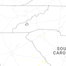
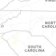

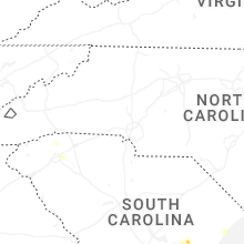


Connect with Interactive Hail Maps