

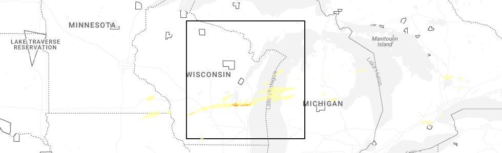
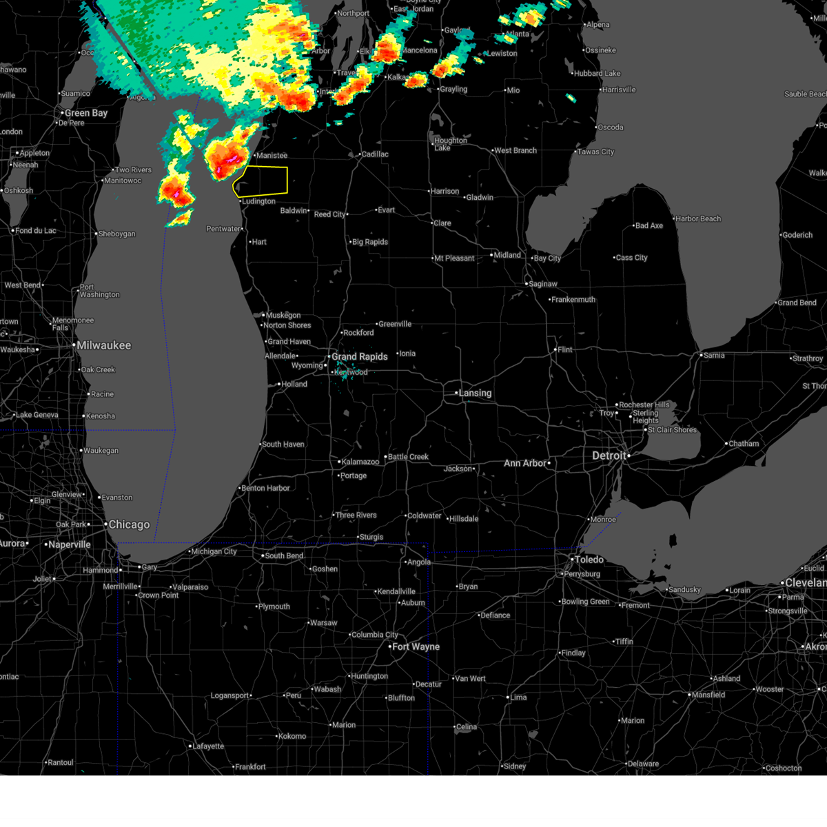
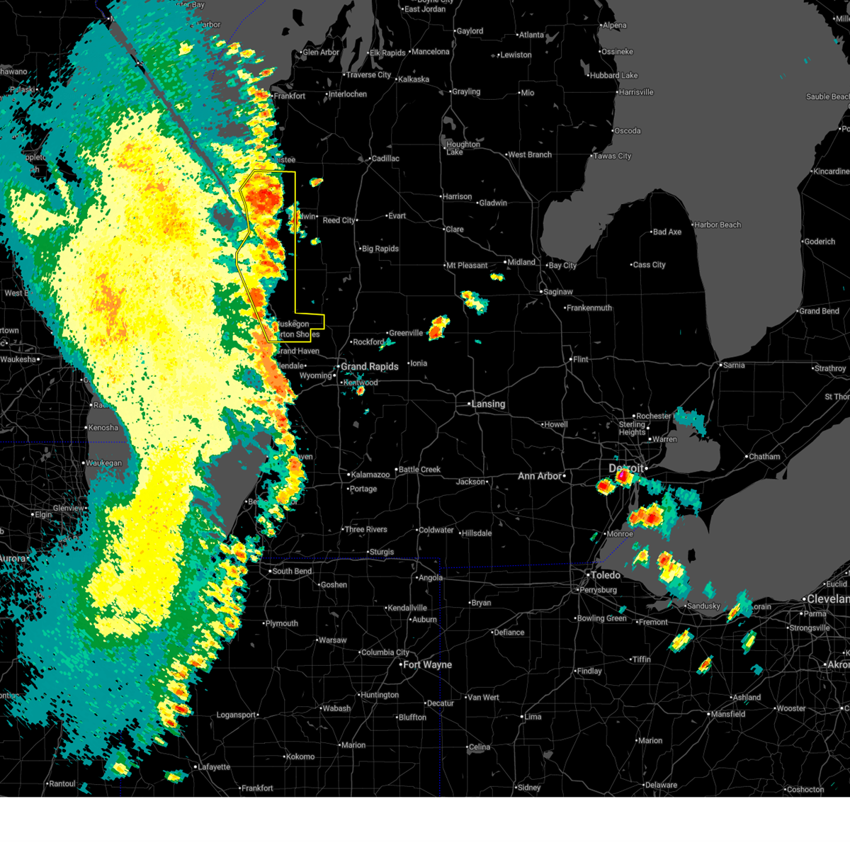
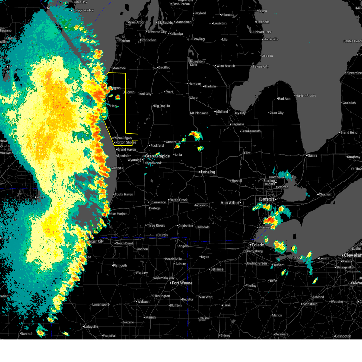
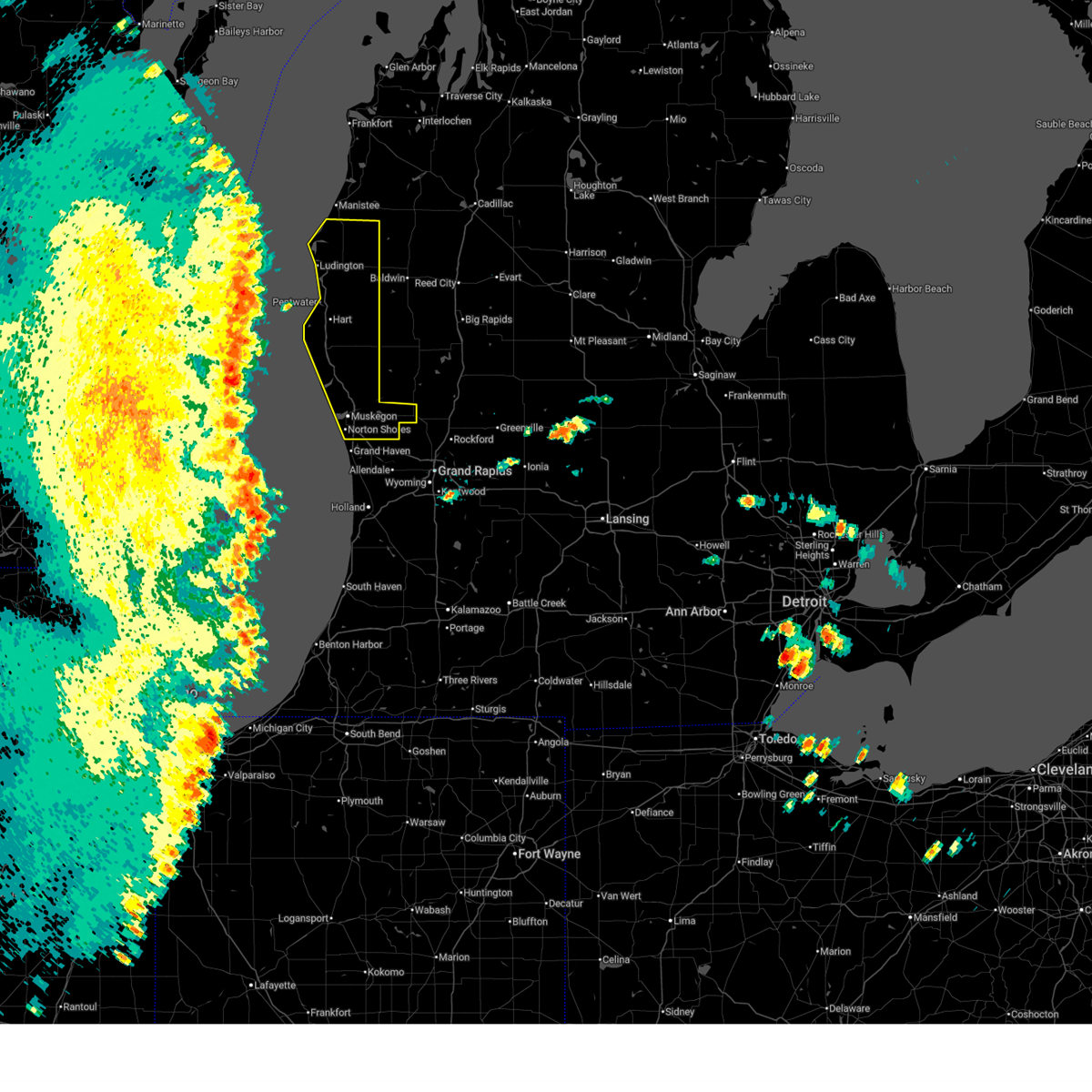
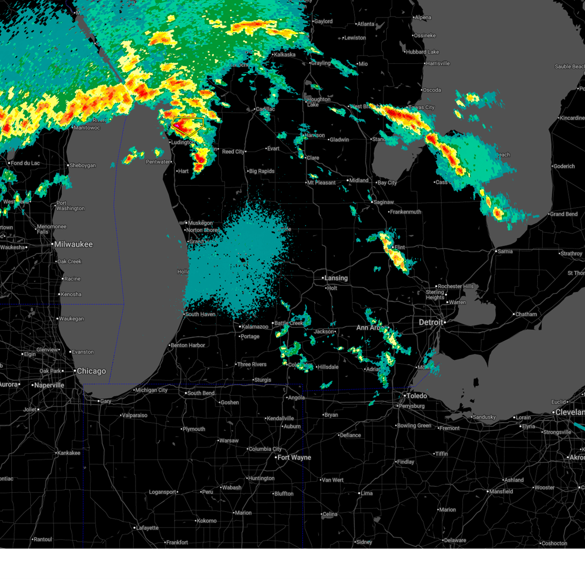
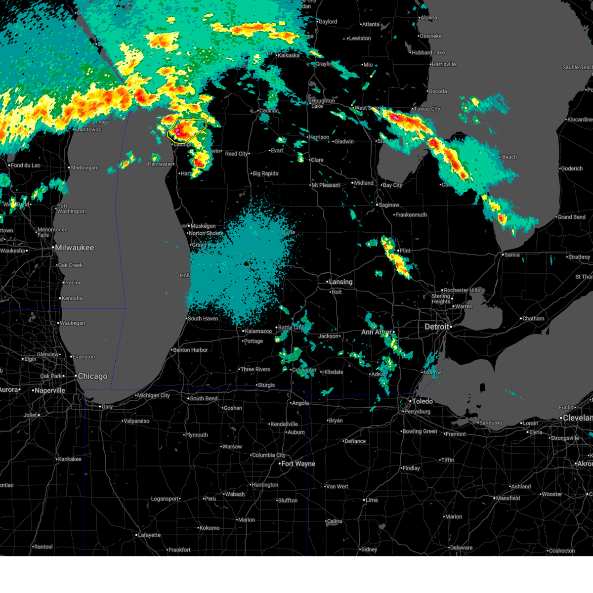
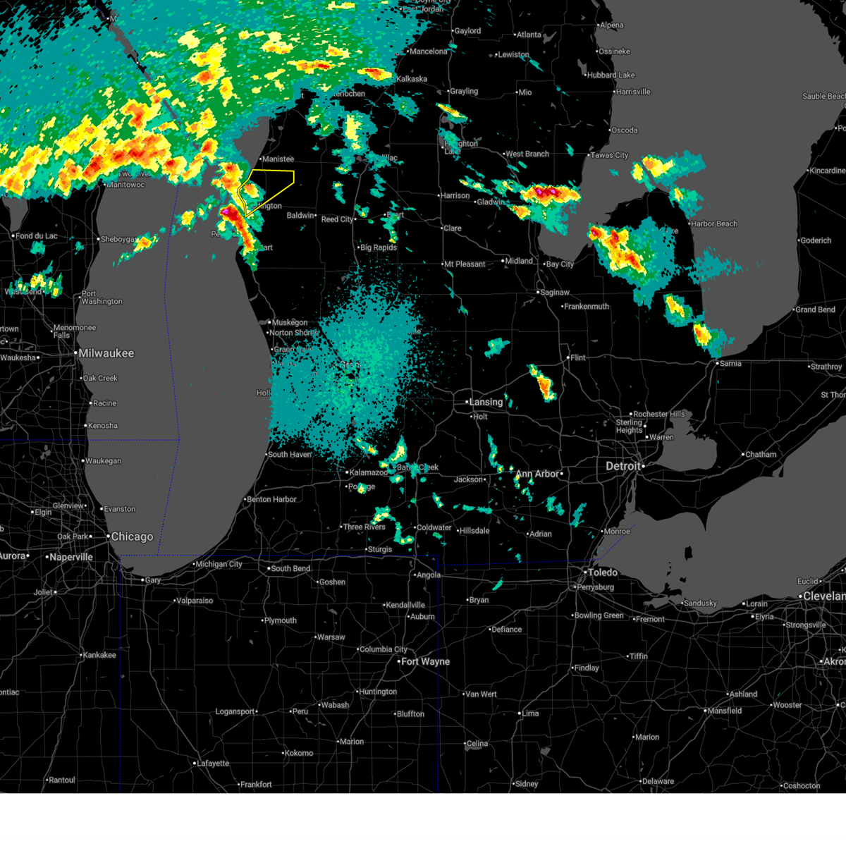
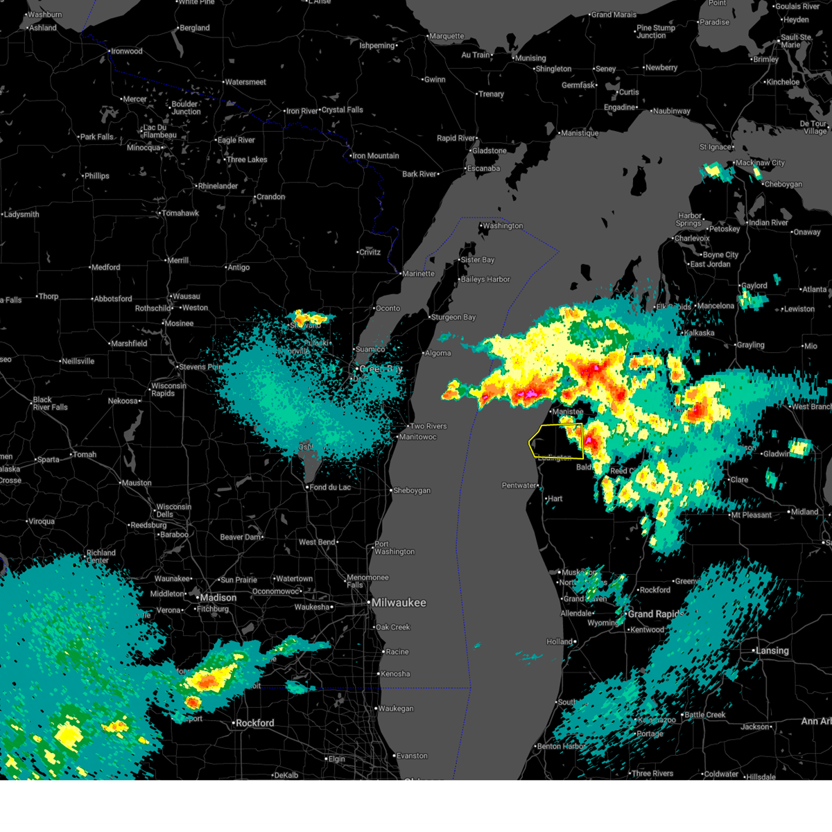
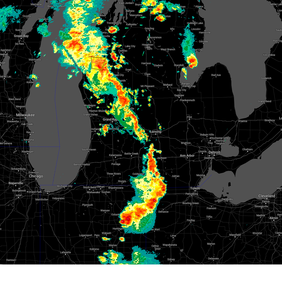
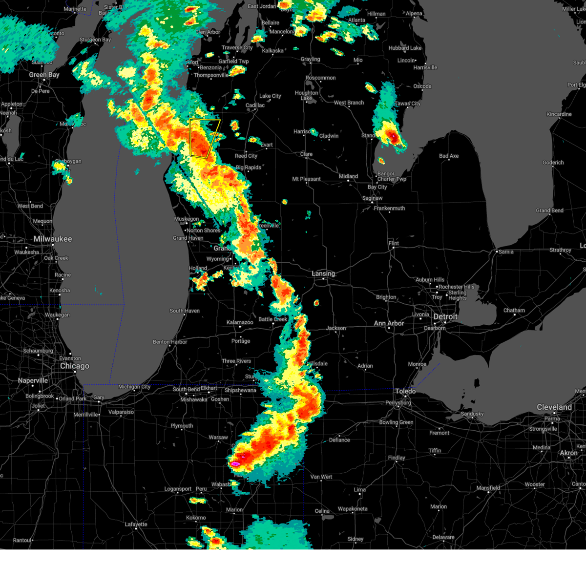
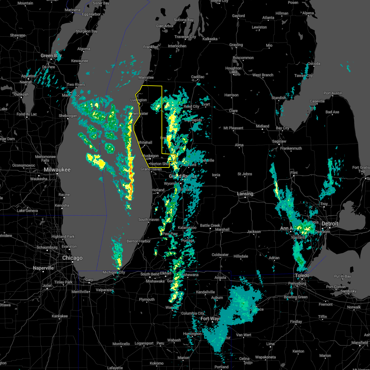
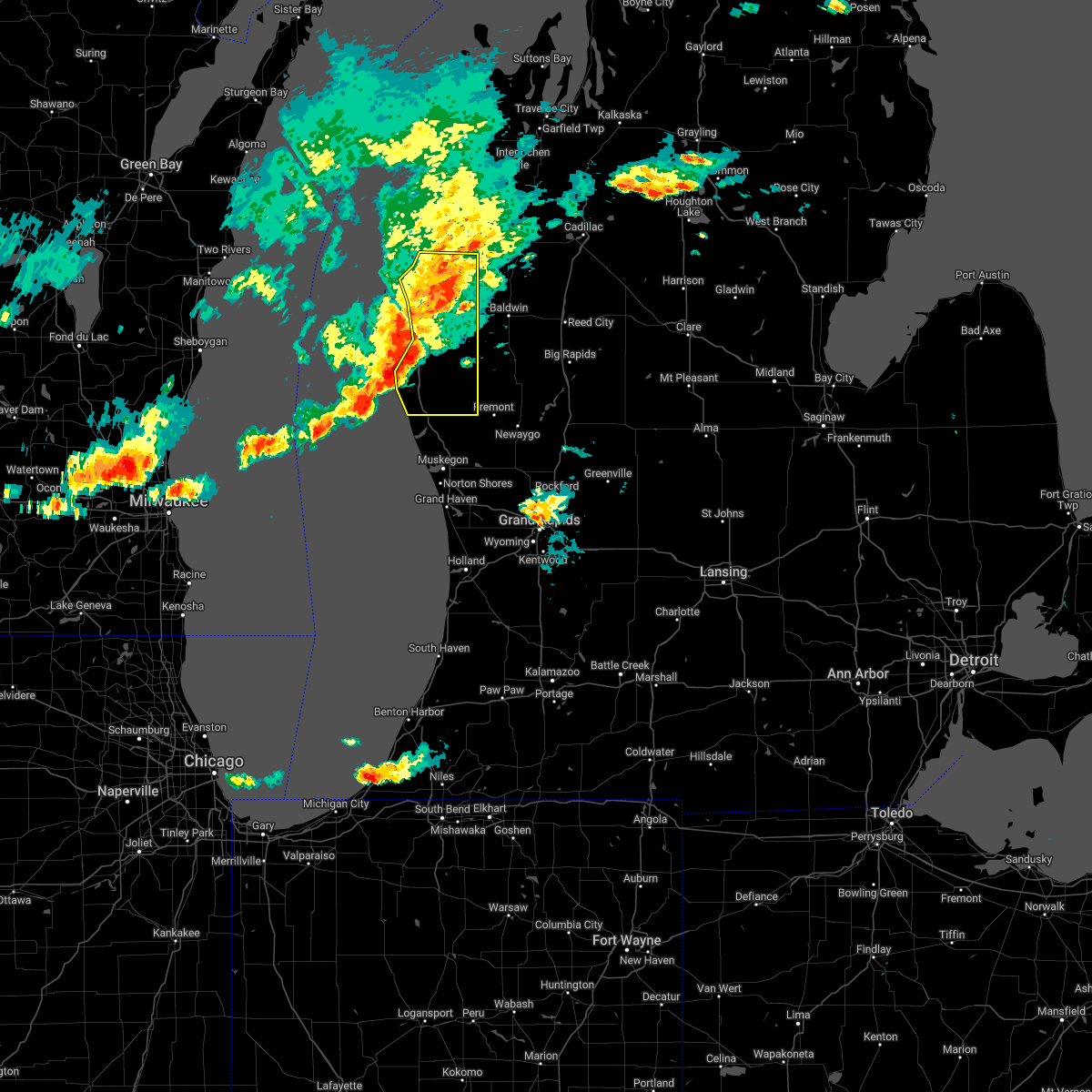
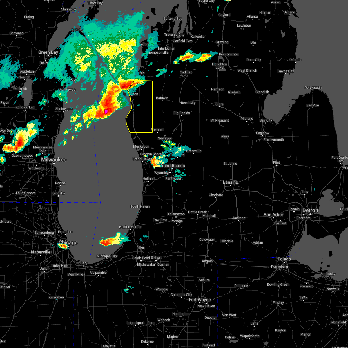
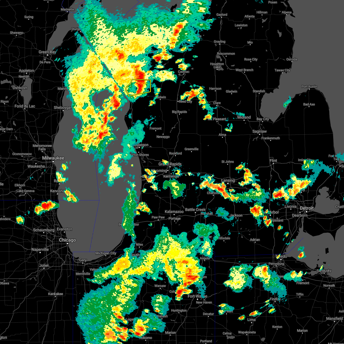
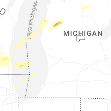
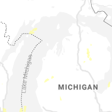
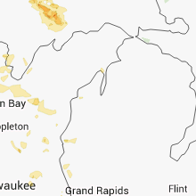
Hail Map for Fountain, MI
The Fountain, MI area has had 0 reports of on-the-ground hail by trained spotters, and has been under severe weather warnings 12 times during the past 12 months. Doppler radar has detected hail at or near Fountain, MI on 21 occasions, including 2 occasions during the past year.
| Name: | Fountain, MI |
| Where Located: | 56.5 miles SSW of Traverse City, MI |
| Map: | Google Map for Fountain, MI |
| Population: | 193 |
| Housing Units: | 83 |
| More Info: | Search Google for Fountain, MI |
1
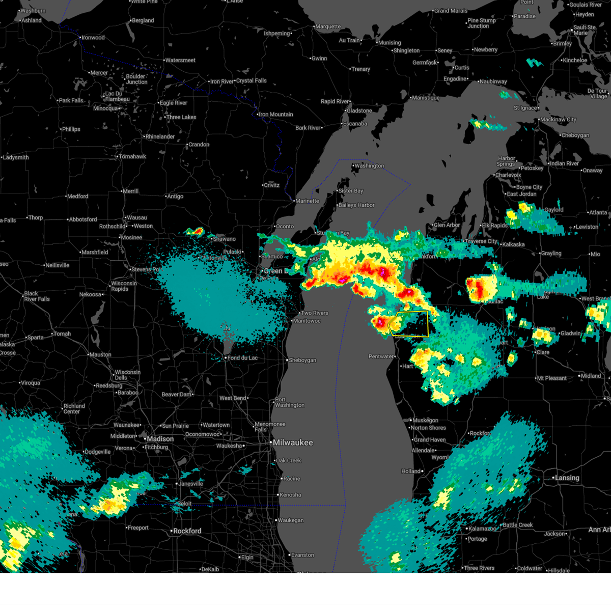
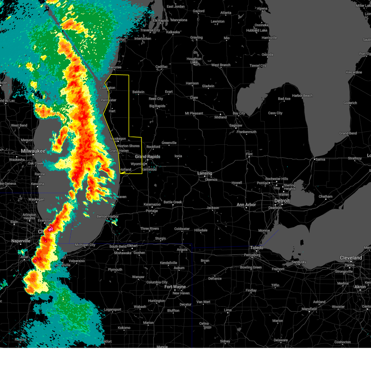
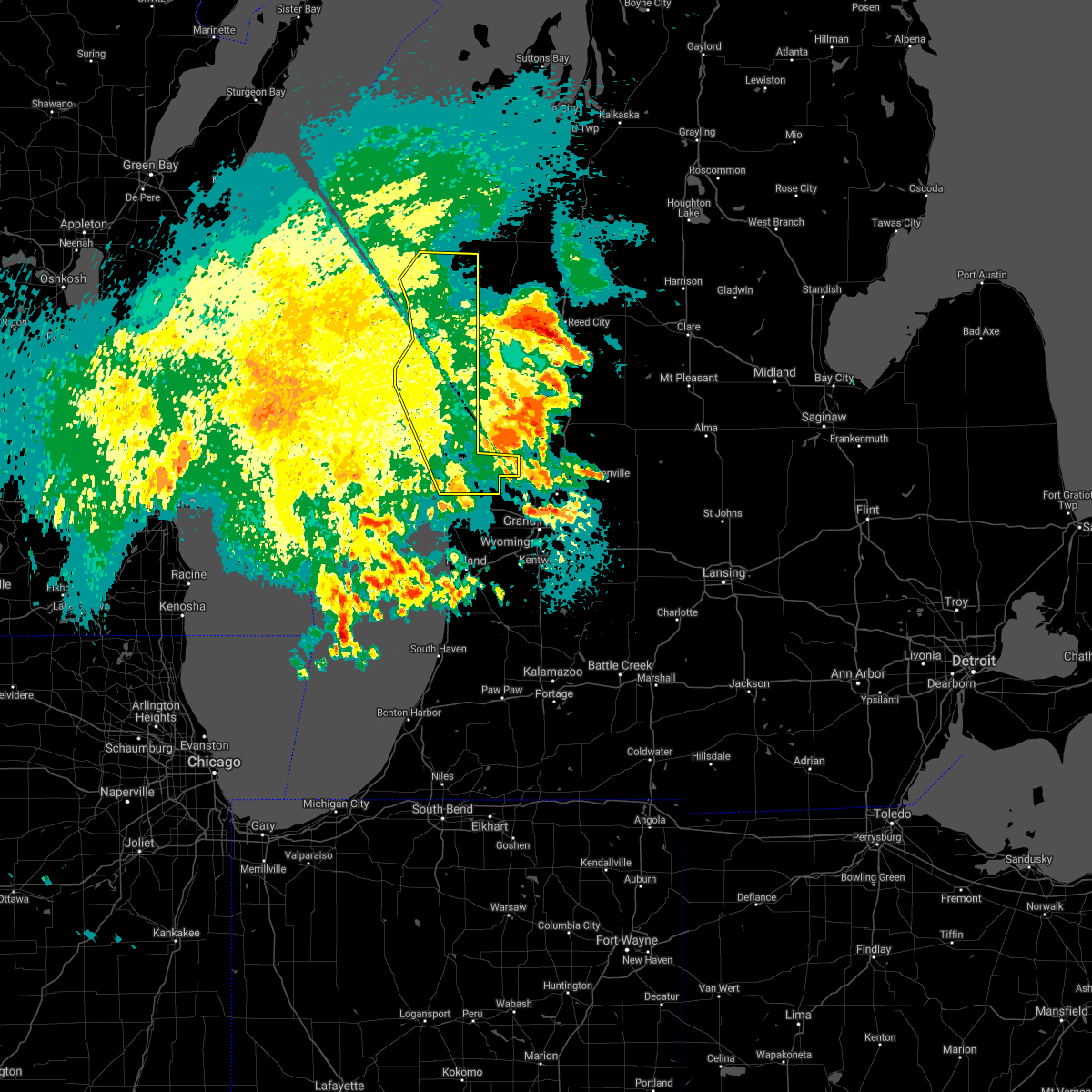
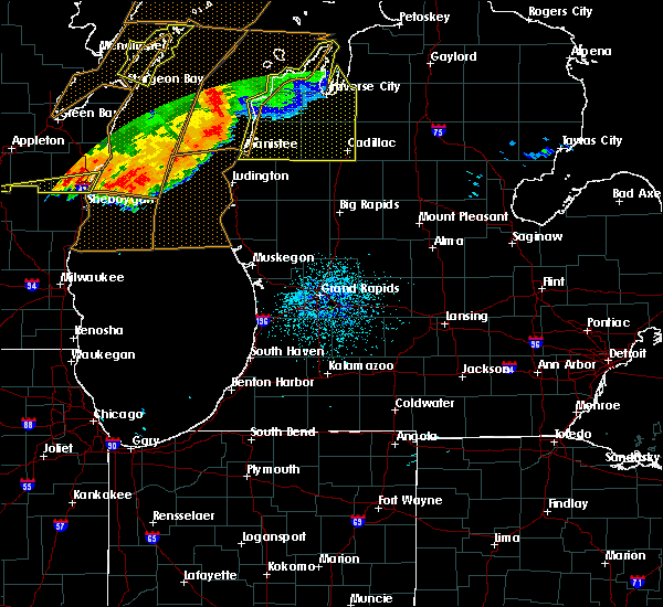
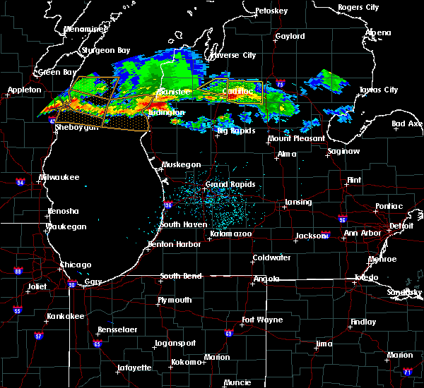
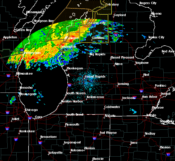
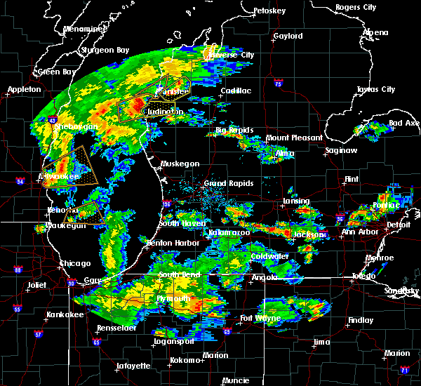
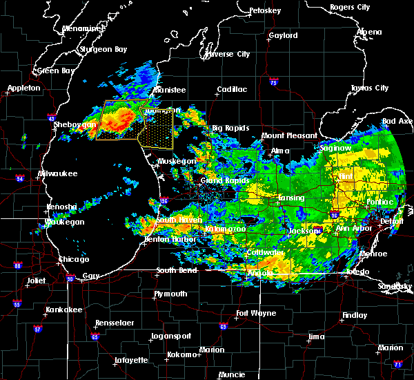
The Top Recent Hail Date for Fountain, MI is Wednesday, July 1, 2026 (7th out of 21)
Hail and Wind Damage Spotted near Fountain, MI
| Date / Time | Report Details |
|---|---|
| 7/1/2026 12:19 PM EDT |
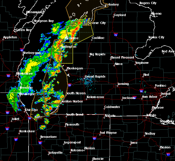
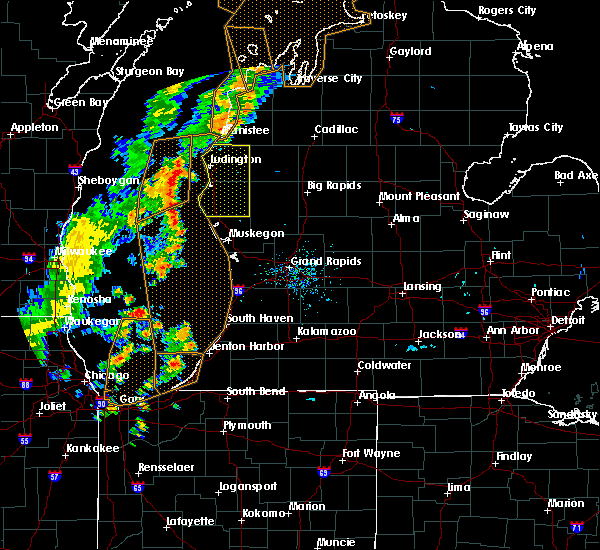
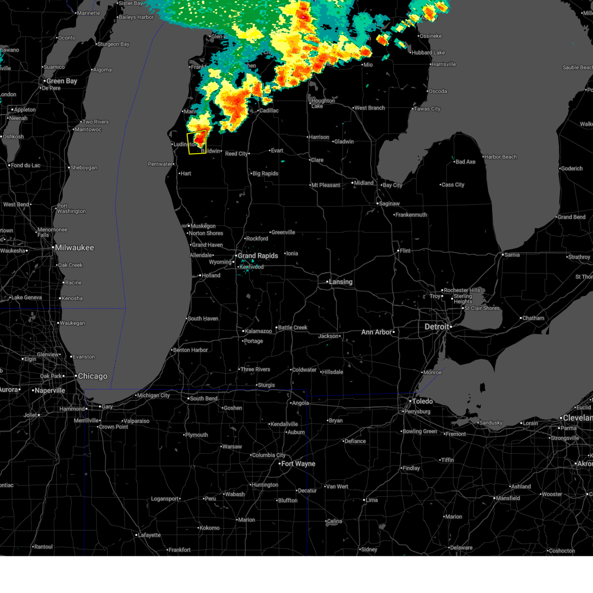 At 1219 pm edt, a severe thunderstorm was located near walhalla, or 13 miles east of ludington, moving east at 40 mph (radar indicated). Hazards include 60 mph wind gusts and penny size hail. Expect damage to roofs, siding, and trees. Locations impacted include, fountain, custer, walhalla,. At 1219 pm edt, a severe thunderstorm was located near walhalla, or 13 miles east of ludington, moving east at 40 mph (radar indicated). Hazards include 60 mph wind gusts and penny size hail. Expect damage to roofs, siding, and trees. Locations impacted include, fountain, custer, walhalla,.
|
| 7/1/2026 11:53 AM EDT |
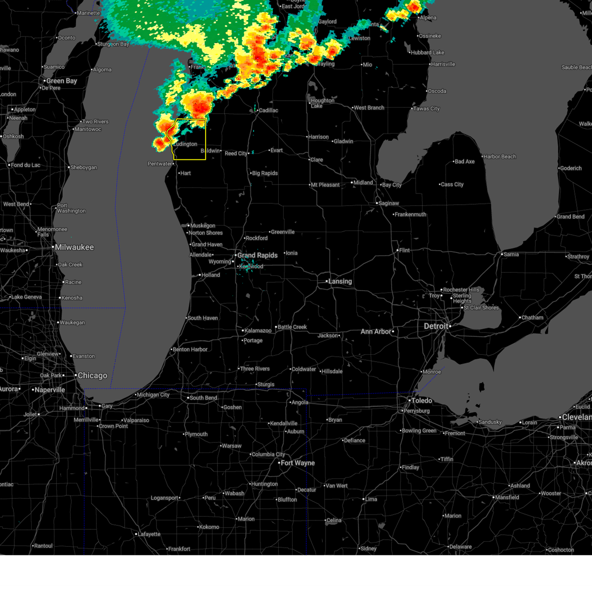 Svrgrr the national weather service in grand rapids has issued a * severe thunderstorm warning for, mason county in west central michigan, * until 100 pm edt. * at 1153 am edt, a severe thunderstorm was located near ludington, moving east at 35 mph (radar indicated). Hazards include 60 mph wind gusts and penny size hail. expect damage to roofs, siding, and trees Svrgrr the national weather service in grand rapids has issued a * severe thunderstorm warning for, mason county in west central michigan, * until 100 pm edt. * at 1153 am edt, a severe thunderstorm was located near ludington, moving east at 35 mph (radar indicated). Hazards include 60 mph wind gusts and penny size hail. expect damage to roofs, siding, and trees
|
| 7/1/2026 11:37 AM EDT |
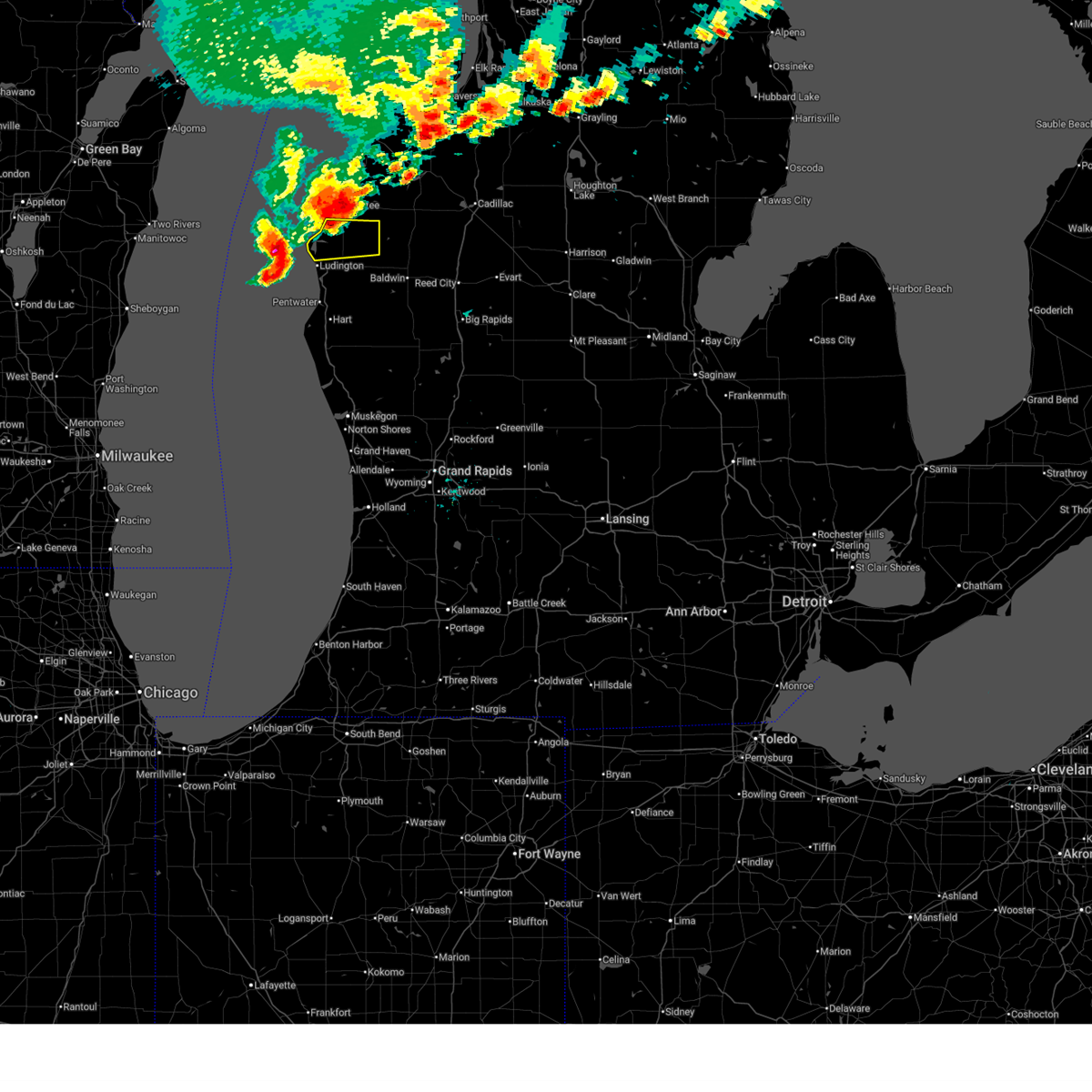 At 1137 am edt, severe thunderstorms were located along a line extending from 5 miles southwest of manistee to 13 miles west of ludington state park, moving east at 40 mph (radar indicated). Hazards include 60 mph wind gusts and quarter size hail. Hail damage to vehicles is expected. expect wind damage to roofs, siding, and trees. Locations impacted include, fountain, free soil, hamlin lake, ludington state park,. At 1137 am edt, severe thunderstorms were located along a line extending from 5 miles southwest of manistee to 13 miles west of ludington state park, moving east at 40 mph (radar indicated). Hazards include 60 mph wind gusts and quarter size hail. Hail damage to vehicles is expected. expect wind damage to roofs, siding, and trees. Locations impacted include, fountain, free soil, hamlin lake, ludington state park,.
|
| 7/1/2026 11:17 AM EDT |
 Svrgrr the national weather service in grand rapids has issued a * severe thunderstorm warning for, northern mason county in west central michigan, * until 1215 pm edt. * at 1117 am edt, a severe thunderstorm was located 8 miles northwest of ludington state park, or 12 miles southwest of manistee, moving east at 40 mph (radar indicated). Hazards include 60 mph wind gusts and quarter size hail. Hail damage to vehicles is expected. Expect wind damage to roofs, siding, and trees. Svrgrr the national weather service in grand rapids has issued a * severe thunderstorm warning for, northern mason county in west central michigan, * until 1215 pm edt. * at 1117 am edt, a severe thunderstorm was located 8 miles northwest of ludington state park, or 12 miles southwest of manistee, moving east at 40 mph (radar indicated). Hazards include 60 mph wind gusts and quarter size hail. Hail damage to vehicles is expected. Expect wind damage to roofs, siding, and trees.
|
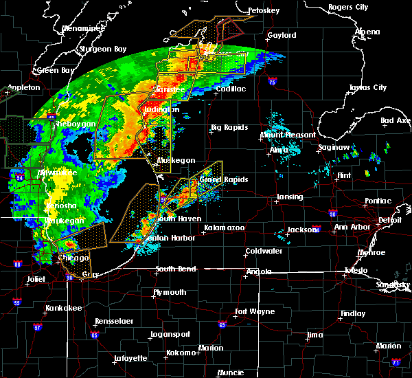
| 6/10/2026 6:30 PM EDT |
 At 629 pm edt, severe thunderstorms were located along a line extending from near parkdale to 8 miles northeast of hart to near roosevelt park, moving east at 50 mph (weather station. at 628 pm 59 mph winds were reported at muskegon asos). Hazards include 60 mph wind gusts and penny size hail. winds may occur along or several miles ahead of thunderstorms. Expect damage to roofs, siding, and trees. Locations impacted include, muskegon, ludington, hart, shelby, muskegon heights, roosevelt park, north muskegon, whitehall, montague, lakewood club, ravenna, scottville, fruitport, hesperia, pentwater, fountain, free soil, hamlin lake, mears sp, mears,. At 629 pm edt, severe thunderstorms were located along a line extending from near parkdale to 8 miles northeast of hart to near roosevelt park, moving east at 50 mph (weather station. at 628 pm 59 mph winds were reported at muskegon asos). Hazards include 60 mph wind gusts and penny size hail. winds may occur along or several miles ahead of thunderstorms. Expect damage to roofs, siding, and trees. Locations impacted include, muskegon, ludington, hart, shelby, muskegon heights, roosevelt park, north muskegon, whitehall, montague, lakewood club, ravenna, scottville, fruitport, hesperia, pentwater, fountain, free soil, hamlin lake, mears sp, mears,.
|
| 6/10/2026 6:12 PM EDT |
 At 612 pm edt, severe thunderstorms were located along a line extending from 7 miles west of manistee to near silver lake sp to 15 miles west of roosevelt park, moving east at 65 mph (radar indicated). Hazards include 60 mph wind gusts and penny size hail. Expect damage to roofs, siding, and trees. Locations impacted include, muskegon, ludington, hart, shelby, muskegon heights, roosevelt park, north muskegon, whitehall, montague, lakewood club, ravenna, scottville, fruitport, hesperia, pentwater, fountain, free soil, hamlin lake, mears sp, mears,. At 612 pm edt, severe thunderstorms were located along a line extending from 7 miles west of manistee to near silver lake sp to 15 miles west of roosevelt park, moving east at 65 mph (radar indicated). Hazards include 60 mph wind gusts and penny size hail. Expect damage to roofs, siding, and trees. Locations impacted include, muskegon, ludington, hart, shelby, muskegon heights, roosevelt park, north muskegon, whitehall, montague, lakewood club, ravenna, scottville, fruitport, hesperia, pentwater, fountain, free soil, hamlin lake, mears sp, mears,.
|
| 6/10/2026 5:49 PM EDT |
 Svrgrr the national weather service in grand rapids has issued a * severe thunderstorm warning for, mason county in west central michigan, muskegon county in west central michigan, oceana county in west central michigan, * until 645 pm edt. * at 549 pm edt, severe thunderstorms were located along a line extending from 20 miles northwest of ludington sp to 32 miles southwest of montague, moving east at 50 mph (radar indicated). Hazards include 60 mph wind gusts and penny size hail. expect damage to roofs, siding, and trees Svrgrr the national weather service in grand rapids has issued a * severe thunderstorm warning for, mason county in west central michigan, muskegon county in west central michigan, oceana county in west central michigan, * until 645 pm edt. * at 549 pm edt, severe thunderstorms were located along a line extending from 20 miles northwest of ludington sp to 32 miles southwest of montague, moving east at 50 mph (radar indicated). Hazards include 60 mph wind gusts and penny size hail. expect damage to roofs, siding, and trees
|
| 4/13/2026 11:47 PM EDT |
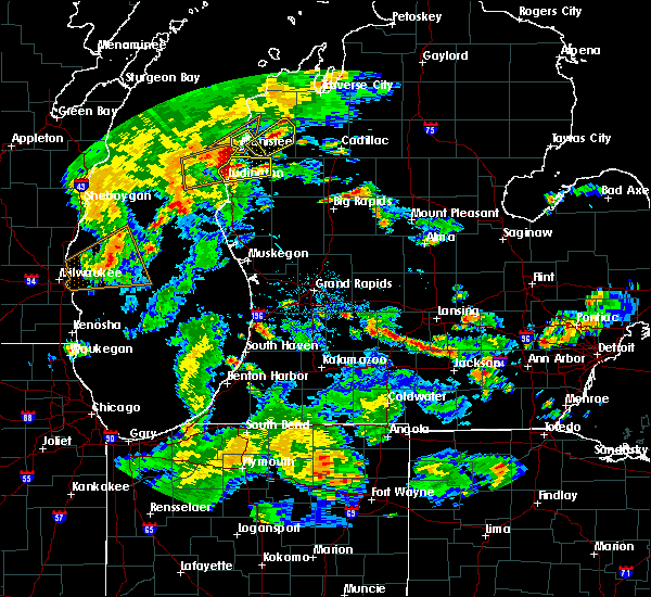
 At 1147 pm edt, a severe thunderstorm was located near free soil, or 8 miles south of manistee, moving northeast at 40 mph (radar indicated). Hazards include ping pong ball size hail and 60 mph wind gusts. People and animals outdoors will be injured. expect hail damage to roofs, siding, windows, and vehicles. expect wind damage to roofs, siding, and trees. Locations impacted include, fountain, free soil,. At 1147 pm edt, a severe thunderstorm was located near free soil, or 8 miles south of manistee, moving northeast at 40 mph (radar indicated). Hazards include ping pong ball size hail and 60 mph wind gusts. People and animals outdoors will be injured. expect hail damage to roofs, siding, windows, and vehicles. expect wind damage to roofs, siding, and trees. Locations impacted include, fountain, free soil,.
|
| 4/13/2026 11:38 PM EDT |
 At 1138 pm edt, a severe thunderstorm was located near hamlin lake, or 8 miles northeast of ludington, moving northeast at 40 mph (radar indicated). Hazards include quarter size hail. Damage to vehicles is expected. Locations impacted include, fountain, free soil, hamlin lake, ludington sp,. At 1138 pm edt, a severe thunderstorm was located near hamlin lake, or 8 miles northeast of ludington, moving northeast at 40 mph (radar indicated). Hazards include quarter size hail. Damage to vehicles is expected. Locations impacted include, fountain, free soil, hamlin lake, ludington sp,.
|
| 4/13/2026 11:21 PM EDT |
 Svrgrr the national weather service in grand rapids has issued a * severe thunderstorm warning for, northern mason county in west central michigan, * until midnight edt. * at 1120 pm edt, a severe thunderstorm was located near ludington, moving northeast at 40 mph (radar indicated). Hazards include ping pong ball size hail and 60 mph wind gusts. People and animals outdoors will be injured. expect hail damage to roofs, siding, windows, and vehicles. Expect wind damage to roofs, siding, and trees. Svrgrr the national weather service in grand rapids has issued a * severe thunderstorm warning for, northern mason county in west central michigan, * until midnight edt. * at 1120 pm edt, a severe thunderstorm was located near ludington, moving northeast at 40 mph (radar indicated). Hazards include ping pong ball size hail and 60 mph wind gusts. People and animals outdoors will be injured. expect hail damage to roofs, siding, windows, and vehicles. Expect wind damage to roofs, siding, and trees.
|
| 3/31/2026 2:20 AM EDT |
 The storm which prompted the warning has moved out of the area. therefore, the warning will be allowed to expire. The storm which prompted the warning has moved out of the area. therefore, the warning will be allowed to expire.
|
| 3/31/2026 1:49 AM EDT |
 Svrgrr the national weather service in grand rapids has issued a * severe thunderstorm warning for, northern mason county in west central michigan, * until 230 am edt. * at 149 am edt, a severe thunderstorm was located over ludington sp, or 8 miles northwest of ludington, moving east at 60 mph (radar indicated). Hazards include 60 mph wind gusts and quarter size hail. Hail damage to vehicles is expected. Expect wind damage to roofs, siding, and trees. Svrgrr the national weather service in grand rapids has issued a * severe thunderstorm warning for, northern mason county in west central michigan, * until 230 am edt. * at 149 am edt, a severe thunderstorm was located over ludington sp, or 8 miles northwest of ludington, moving east at 60 mph (radar indicated). Hazards include 60 mph wind gusts and quarter size hail. Hail damage to vehicles is expected. Expect wind damage to roofs, siding, and trees.
|
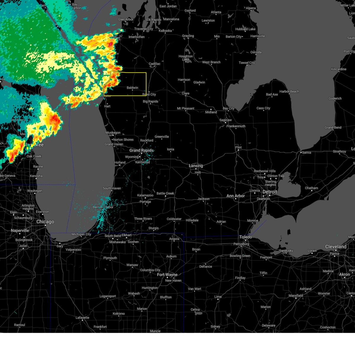
| 5/16/2025 7:53 PM EDT |
 Svrgrr the national weather service in grand rapids has issued a * severe thunderstorm warning for, northwestern lake county in west central michigan, northeastern mason county in west central michigan, * until 830 pm edt. * at 753 pm edt, a severe thunderstorm was located 9 miles northwest of baldwin, moving north at 40 mph (radar indicated). Hazards include 60 mph wind gusts and penny size hail. expect damage to roofs, siding, and trees Svrgrr the national weather service in grand rapids has issued a * severe thunderstorm warning for, northwestern lake county in west central michigan, northeastern mason county in west central michigan, * until 830 pm edt. * at 753 pm edt, a severe thunderstorm was located 9 miles northwest of baldwin, moving north at 40 mph (radar indicated). Hazards include 60 mph wind gusts and penny size hail. expect damage to roofs, siding, and trees
|
| 5/15/2025 10:44 PM EDT |
 The storms which prompted the warning have weakened below severe limits, and no longer pose an immediate threat to life or property. therefore, the warning will be allowed to expire. however, gusty winds around 50 mph and frequent lightning are still possible with these thunderstorms through 1100 pm, particularly over parts of eastern ottawa county. a tornado watch remains in effect until 300 am edt for southwestern and west central michigan. The storms which prompted the warning have weakened below severe limits, and no longer pose an immediate threat to life or property. therefore, the warning will be allowed to expire. however, gusty winds around 50 mph and frequent lightning are still possible with these thunderstorms through 1100 pm, particularly over parts of eastern ottawa county. a tornado watch remains in effect until 300 am edt for southwestern and west central michigan.
|
| 5/15/2025 10:00 PM EDT |
 At 958 pm edt, severe thunderstorms were located along a line extending from near hart to near coopersville to near beechwood, moving east at 60 mph. these are destructive storms for muskegon and ottawa counties! (radar indicated). Hazards include 80 mph wind gusts and penny size hail. Flying debris will be dangerous to those caught without shelter. mobile homes will be heavily damaged. expect considerable damage to roofs, windows, and vehicles. extensive tree damage and power outages are likely. Locations impacted include, muskegon, holland, grand haven, hart, walker, shelby, muskegon heights, hudsonville, zeeland, coopersville, roosevelt park, north muskegon, ferrysburg, whitehall, montague, spring lake, lakewood club, ravenna, scottville, fruitport,. At 958 pm edt, severe thunderstorms were located along a line extending from near hart to near coopersville to near beechwood, moving east at 60 mph. these are destructive storms for muskegon and ottawa counties! (radar indicated). Hazards include 80 mph wind gusts and penny size hail. Flying debris will be dangerous to those caught without shelter. mobile homes will be heavily damaged. expect considerable damage to roofs, windows, and vehicles. extensive tree damage and power outages are likely. Locations impacted include, muskegon, holland, grand haven, hart, walker, shelby, muskegon heights, hudsonville, zeeland, coopersville, roosevelt park, north muskegon, ferrysburg, whitehall, montague, spring lake, lakewood club, ravenna, scottville, fruitport,.
|
| 5/15/2025 9:16 PM EDT |
 Svrgrr the national weather service in grand rapids has issued a * severe thunderstorm warning for, ottawa county in southwestern michigan, mason county in west central michigan, muskegon county in west central michigan, oceana county in west central michigan, * until 1045 pm edt. * at 915 pm edt, severe thunderstorms were located along a line extending from 19 miles northwest of ludington sp to 23 miles southwest of montague to 38 miles east of wind point, moving east at 55 mph (radar indicated). Hazards include 70 mph wind gusts and penny size hail. Expect considerable tree damage. Damage is likely to mobile homes, roofs, and outbuildings. Svrgrr the national weather service in grand rapids has issued a * severe thunderstorm warning for, ottawa county in southwestern michigan, mason county in west central michigan, muskegon county in west central michigan, oceana county in west central michigan, * until 1045 pm edt. * at 915 pm edt, severe thunderstorms were located along a line extending from 19 miles northwest of ludington sp to 23 miles southwest of montague to 38 miles east of wind point, moving east at 55 mph (radar indicated). Hazards include 70 mph wind gusts and penny size hail. Expect considerable tree damage. Damage is likely to mobile homes, roofs, and outbuildings.
|
| 4/18/2025 10:33 PM EDT |
 the severe thunderstorm warning has been cancelled and is no longer in effect the severe thunderstorm warning has been cancelled and is no longer in effect
|
| 4/18/2025 10:13 PM EDT |
 Svrgrr the national weather service in grand rapids has issued a * severe thunderstorm warning for, mason county in west central michigan, * until 1100 pm edt. * at 1013 pm edt, a severe thunderstorm was located over ludington, moving northeast at 55 mph (radar indicated). Hazards include 60 mph wind gusts and quarter size hail. Hail damage to vehicles is expected. Expect wind damage to roofs, siding, and trees. Svrgrr the national weather service in grand rapids has issued a * severe thunderstorm warning for, mason county in west central michigan, * until 1100 pm edt. * at 1013 pm edt, a severe thunderstorm was located over ludington, moving northeast at 55 mph (radar indicated). Hazards include 60 mph wind gusts and quarter size hail. Hail damage to vehicles is expected. Expect wind damage to roofs, siding, and trees.
|
| 8/27/2024 1:51 PM EDT |
 Svrgrr the national weather service in grand rapids has issued a * severe thunderstorm warning for, lake county in west central michigan, mason county in west central michigan, * until 245 pm edt. * at 150 pm edt, a severe thunderstorm was located near scottville, or 9 miles east of ludington, moving east at 45 mph (radar indicated). Hazards include 60 mph wind gusts and penny size hail. expect damage to roofs, siding, and trees Svrgrr the national weather service in grand rapids has issued a * severe thunderstorm warning for, lake county in west central michigan, mason county in west central michigan, * until 245 pm edt. * at 150 pm edt, a severe thunderstorm was located near scottville, or 9 miles east of ludington, moving east at 45 mph (radar indicated). Hazards include 60 mph wind gusts and penny size hail. expect damage to roofs, siding, and trees
|
| 8/3/2023 6:08 PM EDT |
 At 607 pm edt, a severe thunderstorm was located over hamlin lake, or 6 miles north of ludington, moving southeast at 35 mph (radar indicated). Hazards include 60 mph wind gusts and quarter size hail. Hail damage to vehicles is expected. Expect wind damage to roofs, siding, and trees. At 607 pm edt, a severe thunderstorm was located over hamlin lake, or 6 miles north of ludington, moving southeast at 35 mph (radar indicated). Hazards include 60 mph wind gusts and quarter size hail. Hail damage to vehicles is expected. Expect wind damage to roofs, siding, and trees.
|
| 6/25/2023 5:07 PM EDT |
 At 507 pm edt, a severe thunderstorm was located 9 miles south of dublin, or 13 miles northwest of baldwin, moving north at 35 mph (radar indicated). Hazards include 60 mph wind gusts. Expect damage to roofs, siding, and trees. locations impacted include, fountain, free soil, irons, walhalla, sauble lakes, hail threat, radar indicated max hail size, <. 75 in wind threat, radar indicated max wind gust, 60 mph. At 507 pm edt, a severe thunderstorm was located 9 miles south of dublin, or 13 miles northwest of baldwin, moving north at 35 mph (radar indicated). Hazards include 60 mph wind gusts. Expect damage to roofs, siding, and trees. locations impacted include, fountain, free soil, irons, walhalla, sauble lakes, hail threat, radar indicated max hail size, <. 75 in wind threat, radar indicated max wind gust, 60 mph.
|
| 6/25/2023 5:00 PM EDT | 911 call center reports tree wrapped in power line. and multiple other wire and tree down calls. time estimated via rada in lake county MI, 9 miles WNW of Fountain, MI |
| 6/25/2023 4:49 PM EDT |
 At 449 pm edt, a severe thunderstorm was located 8 miles west of baldwin, moving north at 30 mph (radar indicated). Hazards include 60 mph wind gusts. expect damage to roofs, siding, and trees At 449 pm edt, a severe thunderstorm was located 8 miles west of baldwin, moving north at 30 mph (radar indicated). Hazards include 60 mph wind gusts. expect damage to roofs, siding, and trees
|
| 11/5/2022 3:13 PM EDT |
 At 313 pm edt, severe thunderstorms were located along a line extending from near hamlin lake to 13 miles west of roosevelt park, moving northeast at 45 mph (radar indicated). Hazards include 60 mph wind gusts. Expect damage to roofs, siding, and trees. locations impacted include, muskegon, ludington, hart, shelby, muskegon heights, roosevelt park, north muskegon, whitehall, montague, lakewood club, ravenna, scottville, fruitport, hesperia, pentwater, fountain, free soil, hamlin lake, mears sp, ludington sp, hail threat, radar indicated max hail size, <. 75 in wind threat, radar indicated max wind gust, 60 mph. At 313 pm edt, severe thunderstorms were located along a line extending from near hamlin lake to 13 miles west of roosevelt park, moving northeast at 45 mph (radar indicated). Hazards include 60 mph wind gusts. Expect damage to roofs, siding, and trees. locations impacted include, muskegon, ludington, hart, shelby, muskegon heights, roosevelt park, north muskegon, whitehall, montague, lakewood club, ravenna, scottville, fruitport, hesperia, pentwater, fountain, free soil, hamlin lake, mears sp, ludington sp, hail threat, radar indicated max hail size, <. 75 in wind threat, radar indicated max wind gust, 60 mph.
|
| 11/5/2022 2:39 PM EDT |
 At 238 pm edt, severe thunderstorms were located along a line extending from 15 miles northwest of silver lake sp to 30 miles west of grand haven, moving northeast at 65 mph (radar indicated). Hazards include 60 mph wind gusts. expect damage to roofs, siding, and trees At 238 pm edt, severe thunderstorms were located along a line extending from 15 miles northwest of silver lake sp to 30 miles west of grand haven, moving northeast at 65 mph (radar indicated). Hazards include 60 mph wind gusts. expect damage to roofs, siding, and trees
|
| 7/11/2022 9:13 PM EDT |
 The severe thunderstorm warning for mason and oceana counties will expire at 915 pm edt, the storms which prompted the warning have weakened below severe limits, and have exited the warned area. therefore, the warning will be allowed to expire. however, small hail and gusty winds to 50 mph are still possible with these thunderstorms. The severe thunderstorm warning for mason and oceana counties will expire at 915 pm edt, the storms which prompted the warning have weakened below severe limits, and have exited the warned area. therefore, the warning will be allowed to expire. however, small hail and gusty winds to 50 mph are still possible with these thunderstorms.
|
| 7/11/2022 8:45 PM EDT |
 At 845 pm edt, severe thunderstorms were located along a line extending from 5 miles east of fountain to near hart to 14 miles southwest of silver lake sp, moving east at 50 mph (radar indicated). Hazards include 60 mph wind gusts and penny size hail. Expect damage to roofs, siding, and trees. locations impacted include, ludington, hart, ludington sp, shelby, scottville, hesperia, pentwater, fountain, free soil, hamlin lake, mears sp, silver lake sp, weare, elbridge, colfax, new era, rothbury, custer, walkerville, walhalla, hail threat, radar indicated max hail size, 0. 75 in wind threat, radar indicated max wind gust, 60 mph. At 845 pm edt, severe thunderstorms were located along a line extending from 5 miles east of fountain to near hart to 14 miles southwest of silver lake sp, moving east at 50 mph (radar indicated). Hazards include 60 mph wind gusts and penny size hail. Expect damage to roofs, siding, and trees. locations impacted include, ludington, hart, ludington sp, shelby, scottville, hesperia, pentwater, fountain, free soil, hamlin lake, mears sp, silver lake sp, weare, elbridge, colfax, new era, rothbury, custer, walkerville, walhalla, hail threat, radar indicated max hail size, 0. 75 in wind threat, radar indicated max wind gust, 60 mph.
|
| 7/11/2022 8:20 PM EDT |
 At 820 pm edt, a severe thunderstorm was located 12 miles northwest of silver lake sp, or 17 miles southwest of ludington, moving east at 45 mph (radar indicated). Hazards include 60 mph wind gusts and quarter size hail. Hail damage to vehicles is expected. expect wind damage to roofs, siding, and trees. this severe thunderstorm will be near, silver lake sp around 835 pm edt. pentwater, mears sp and mears around 840 pm edt. other locations in the path of this severe thunderstorm include hart. hail threat, radar indicated max hail size, 1. 00 in wind threat, radar indicated max wind gust, 60 mph. At 820 pm edt, a severe thunderstorm was located 12 miles northwest of silver lake sp, or 17 miles southwest of ludington, moving east at 45 mph (radar indicated). Hazards include 60 mph wind gusts and quarter size hail. Hail damage to vehicles is expected. expect wind damage to roofs, siding, and trees. this severe thunderstorm will be near, silver lake sp around 835 pm edt. pentwater, mears sp and mears around 840 pm edt. other locations in the path of this severe thunderstorm include hart. hail threat, radar indicated max hail size, 1. 00 in wind threat, radar indicated max wind gust, 60 mph.
|
| 9/7/2021 12:56 PM EDT |
 At 1254 pm edt, severe thunderstorms were located along a line extending from 5 miles southwest of ludington sp to near ludington to 6 miles northwest of silver lake sp, moving east at 50 mph. another line of severe storms are also near freesoil (radar indicated). Hazards include 60 mph wind gusts and quarter size hail. Hail damage to vehicles is expected. expect wind damage to roofs, siding, and trees. Locations impacted include, ludington, ludington sp, scottville, fountain, free soil, hamlin lake, custer, walhalla,. At 1254 pm edt, severe thunderstorms were located along a line extending from 5 miles southwest of ludington sp to near ludington to 6 miles northwest of silver lake sp, moving east at 50 mph. another line of severe storms are also near freesoil (radar indicated). Hazards include 60 mph wind gusts and quarter size hail. Hail damage to vehicles is expected. expect wind damage to roofs, siding, and trees. Locations impacted include, ludington, ludington sp, scottville, fountain, free soil, hamlin lake, custer, walhalla,.
|
| 9/7/2021 12:25 PM EDT |
 At 1225 pm edt, a severe thunderstorm was located 7 miles west of ludington sp, moving east at 55 mph (radar indicated). Hazards include 60 mph wind gusts and quarter size hail. Hail damage to vehicles is expected. Expect wind damage to roofs, siding, and trees. At 1225 pm edt, a severe thunderstorm was located 7 miles west of ludington sp, moving east at 55 mph (radar indicated). Hazards include 60 mph wind gusts and quarter size hail. Hail damage to vehicles is expected. Expect wind damage to roofs, siding, and trees.
|
| 8/10/2021 10:13 PM EDT |
 At 1013 pm edt, severe thunderstorms were located along a line extending from near free soil to near hartford, moving east at 60 mph (radar indicated). Hazards include 60 mph wind gusts. Expect damage to roofs, siding, and trees. locations impacted include, muskegon, holland, grand haven, ludington, allegan, south haven, paw paw, hart, ludington sp, walker, shelby, muskegon heights, hudsonville, zeeland, coopersville, wayland, otsego, roosevelt park, plainwell, north muskegon, hail threat, radar indicated max hail size, <. 75 in wind threat, radar indicated max wind gust, 60 mph. At 1013 pm edt, severe thunderstorms were located along a line extending from near free soil to near hartford, moving east at 60 mph (radar indicated). Hazards include 60 mph wind gusts. Expect damage to roofs, siding, and trees. locations impacted include, muskegon, holland, grand haven, ludington, allegan, south haven, paw paw, hart, ludington sp, walker, shelby, muskegon heights, hudsonville, zeeland, coopersville, wayland, otsego, roosevelt park, plainwell, north muskegon, hail threat, radar indicated max hail size, <. 75 in wind threat, radar indicated max wind gust, 60 mph.
|
| 8/10/2021 9:40 PM EDT |
 At 939 pm edt, severe thunderstorms were located along a line extending from 20 miles west of ludington state park to 15 miles northwest of st. joseph, moving east at 50 mph (radar indicated). Hazards include 60 mph wind gusts. expect damage to roofs, siding, and trees At 939 pm edt, severe thunderstorms were located along a line extending from 20 miles west of ludington state park to 15 miles northwest of st. joseph, moving east at 50 mph (radar indicated). Hazards include 60 mph wind gusts. expect damage to roofs, siding, and trees
|
| 11/10/2020 7:31 PM EST |
 At 730 pm est, severe thunderstorms were located along a line extending from 6 miles south of manistee, to near hart, to 28 miles west of grand haven, moving northeast at 65 mph (radar indicated). Hazards include 60 mph wind gusts. Expect damage to roofs, siding, and trees. Locations impacted include, muskegon, ludington, hart, ludington sp, shelby, muskegon heights, roosevelt park, north muskegon, whitehall, montague, lakewood club, ravenna, scottville, fruitport, hesperia, pentwater, fountain, free soil, hamlin lake, mears sp,. At 730 pm est, severe thunderstorms were located along a line extending from 6 miles south of manistee, to near hart, to 28 miles west of grand haven, moving northeast at 65 mph (radar indicated). Hazards include 60 mph wind gusts. Expect damage to roofs, siding, and trees. Locations impacted include, muskegon, ludington, hart, ludington sp, shelby, muskegon heights, roosevelt park, north muskegon, whitehall, montague, lakewood club, ravenna, scottville, fruitport, hesperia, pentwater, fountain, free soil, hamlin lake, mears sp,.
|
| 11/10/2020 6:52 PM EST |
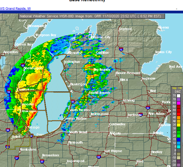 At 651 pm est, severe thunderstorms were located along a line extending from 20 miles west of silver lake sp to 40 miles west of muskegon, moving northeast at 70 mph (radar indicated). Hazards include 60 mph wind gusts. expect damage to roofs, siding, and trees At 651 pm est, severe thunderstorms were located along a line extending from 20 miles west of silver lake sp to 40 miles west of muskegon, moving northeast at 70 mph (radar indicated). Hazards include 60 mph wind gusts. expect damage to roofs, siding, and trees
|
| 8/27/2020 11:28 AM EDT |
 At 1128 am edt, a severe thunderstorm was located 8 miles west of baldwin, moving east at 50 mph (radar indicated). Hazards include 60 mph wind gusts. Expect damage to roofs, siding, and trees. Locations impacted include, ludington, ludington sp, scottville, fountain, hamlin lake, custer, walhalla,. At 1128 am edt, a severe thunderstorm was located 8 miles west of baldwin, moving east at 50 mph (radar indicated). Hazards include 60 mph wind gusts. Expect damage to roofs, siding, and trees. Locations impacted include, ludington, ludington sp, scottville, fountain, hamlin lake, custer, walhalla,.
|
| 8/27/2020 11:10 AM EDT |
 At 1110 am edt, a severe thunderstorm was located near scottville, or 8 miles northeast of ludington, moving southeast at 45 mph (radar indicated). Hazards include 60 mph wind gusts and quarter size hail. Hail damage to vehicles is expected. expect wind damage to roofs, siding, and trees. Locations impacted include, ludington, ludington sp, scottville, fountain, free soil, hamlin lake, custer, walhalla,. At 1110 am edt, a severe thunderstorm was located near scottville, or 8 miles northeast of ludington, moving southeast at 45 mph (radar indicated). Hazards include 60 mph wind gusts and quarter size hail. Hail damage to vehicles is expected. expect wind damage to roofs, siding, and trees. Locations impacted include, ludington, ludington sp, scottville, fountain, free soil, hamlin lake, custer, walhalla,.
|
| 8/27/2020 10:41 AM EDT |
 At 1040 am edt, a severe thunderstorm was located 10 miles northwest of ludington state park, moving east at 50 mph. this thunderstorm may produce hail from quarter to ping pong ball size as well as 60 mph wind gusts (radar indicated). Hazards include 60 mph wind gusts and quarter size hail. Hail damage to vehicles is expected. Expect wind damage to roofs, siding, and trees. At 1040 am edt, a severe thunderstorm was located 10 miles northwest of ludington state park, moving east at 50 mph. this thunderstorm may produce hail from quarter to ping pong ball size as well as 60 mph wind gusts (radar indicated). Hazards include 60 mph wind gusts and quarter size hail. Hail damage to vehicles is expected. Expect wind damage to roofs, siding, and trees.
|
| 7/19/2020 7:07 AM EDT |
 At 707 am edt, a severe thunderstorm was located near hamlin lake, or near ludington sp, moving east at 55 mph (radar indicated). Hazards include 60 mph wind gusts. expect damage to roofs, siding, and trees At 707 am edt, a severe thunderstorm was located near hamlin lake, or near ludington sp, moving east at 55 mph (radar indicated). Hazards include 60 mph wind gusts. expect damage to roofs, siding, and trees
|
| 6/3/2020 12:27 AM EDT |
 The severe thunderstorm warning for mason, muskegon and oceana counties will expire at 1230 am edt, the storms which prompted the warning have moved out of the area. therefore, the warning will be allowed to expire. however gusty winds are still possible through 100 am. a severe thunderstorm watch remains in effect until 400 am edt for southwestern and west central michigan. The severe thunderstorm warning for mason, muskegon and oceana counties will expire at 1230 am edt, the storms which prompted the warning have moved out of the area. therefore, the warning will be allowed to expire. however gusty winds are still possible through 100 am. a severe thunderstorm watch remains in effect until 400 am edt for southwestern and west central michigan.
|
| 6/2/2020 11:51 PM EDT |
 At 1150 pm edt, severe thunderstorms were located along a line extending from near fountain to near ferrysburg, moving east at 45 mph (radar indicated). Hazards include 60 mph wind gusts and quarter size hail. Hail damage to vehicles is expected. expect wind damage to roofs, siding, and trees. Locations impacted include, muskegon, ludington, hart, ludington sp, shelby, muskegon heights, roosevelt park, north muskegon, whitehall, montague, lakewood club, ravenna, scottville, fruitport, hesperia, fountain, free soil, mears sp, silver lake sp, freesoil,. At 1150 pm edt, severe thunderstorms were located along a line extending from near fountain to near ferrysburg, moving east at 45 mph (radar indicated). Hazards include 60 mph wind gusts and quarter size hail. Hail damage to vehicles is expected. expect wind damage to roofs, siding, and trees. Locations impacted include, muskegon, ludington, hart, ludington sp, shelby, muskegon heights, roosevelt park, north muskegon, whitehall, montague, lakewood club, ravenna, scottville, fruitport, hesperia, fountain, free soil, mears sp, silver lake sp, freesoil,.
|
| 6/2/2020 11:07 PM EDT |
 At 1105 pm edt, severe thunderstorms were located along a line extending from 25 miles west of ludington to 40 miles west of muskegon, moving east at 45 mph (radar indicated). Hazards include 60 mph wind gusts. expect damage to roofs, siding, and trees At 1105 pm edt, severe thunderstorms were located along a line extending from 25 miles west of ludington to 40 miles west of muskegon, moving east at 45 mph (radar indicated). Hazards include 60 mph wind gusts. expect damage to roofs, siding, and trees
|
| 7/20/2019 1:45 PM EDT |
 At 143 pm edt, a severe thunderstorm was located 14 miles west of ludington sp, moving east at 65 mph. this storm has a history of producing wind damage in wisconsin. lakeshore flooding may develop with these strong winds and high wave action with the storm. be aware of coastal erosion over the next hour (radar indicated). Hazards include 60 mph wind gusts and penny size hail. expect damage to roofs, siding, and trees At 143 pm edt, a severe thunderstorm was located 14 miles west of ludington sp, moving east at 65 mph. this storm has a history of producing wind damage in wisconsin. lakeshore flooding may develop with these strong winds and high wave action with the storm. be aware of coastal erosion over the next hour (radar indicated). Hazards include 60 mph wind gusts and penny size hail. expect damage to roofs, siding, and trees
|
| 7/20/2019 12:39 AM EDT |
 The severe thunderstorm warning for mason county will expire at 1245 am edt, the storms which prompted the warning have moved out of the area. therefore, the warning will be allowed to expire. to report severe weather, contact your nearest law enforcement agency. they will relay your report to the national weather service grand rapids. The severe thunderstorm warning for mason county will expire at 1245 am edt, the storms which prompted the warning have moved out of the area. therefore, the warning will be allowed to expire. to report severe weather, contact your nearest law enforcement agency. they will relay your report to the national weather service grand rapids.
|
| 7/20/2019 12:25 AM EDT | Trees down in sheridan and branch township in mason county MI, 5.7 miles WNW of Fountain, MI |
| 7/20/2019 12:14 AM EDT |
 At 1213 am edt, severe thunderstorms were located along a line extending from near free soil to 7 miles northwest of mears sp, moving southeast at 55 mph (radar indicated). Hazards include 60 mph wind gusts. Expect damage to roofs, siding, and trees. Locations impacted include, ludington, ludington sp, scottville, fountain, free soil, freesoil, custer, walhalla,. At 1213 am edt, severe thunderstorms were located along a line extending from near free soil to 7 miles northwest of mears sp, moving southeast at 55 mph (radar indicated). Hazards include 60 mph wind gusts. Expect damage to roofs, siding, and trees. Locations impacted include, ludington, ludington sp, scottville, fountain, free soil, freesoil, custer, walhalla,.
|
| 7/19/2019 11:49 PM EDT |
 At 1147 pm edt, severe thunderstorms were located along a line extending from 9 miles west of orchard beach state park to 19 miles west of ludington sp, moving southeast at 55 mph (radar indicated). Hazards include 60 mph wind gusts and penny size hail. expect damage to roofs, siding, and trees At 1147 pm edt, severe thunderstorms were located along a line extending from 9 miles west of orchard beach state park to 19 miles west of ludington sp, moving southeast at 55 mph (radar indicated). Hazards include 60 mph wind gusts and penny size hail. expect damage to roofs, siding, and trees
|
| 5/31/2019 9:41 PM EDT |
 At 941 pm edt, a severe thunderstorm was located near fountain, or 16 miles northwest of baldwin, moving east at 45 mph (radar indicated). Hazards include 60 mph wind gusts and quarter size hail. Hail damage to vehicles is expected. expect wind damage to roofs, siding, and trees. Locations impacted include, baldwin, scottville, luther, fountain, free soil, freesoil, chase, custer, nirvana, wolf lake, idlewild, irons, walhalla, bristol,. At 941 pm edt, a severe thunderstorm was located near fountain, or 16 miles northwest of baldwin, moving east at 45 mph (radar indicated). Hazards include 60 mph wind gusts and quarter size hail. Hail damage to vehicles is expected. expect wind damage to roofs, siding, and trees. Locations impacted include, baldwin, scottville, luther, fountain, free soil, freesoil, chase, custer, nirvana, wolf lake, idlewild, irons, walhalla, bristol,.
|
| 5/31/2019 9:29 PM EDT |
 At 929 pm edt, a severe thunderstorm was located near free soil, or 9 miles southeast of manistee, moving east at 40 mph (radar indicated). Hazards include 60 mph wind gusts and quarter size hail. Hail damage to vehicles is expected. Expect wind damage to roofs, siding, and trees. At 929 pm edt, a severe thunderstorm was located near free soil, or 9 miles southeast of manistee, moving east at 40 mph (radar indicated). Hazards include 60 mph wind gusts and quarter size hail. Hail damage to vehicles is expected. Expect wind damage to roofs, siding, and trees.
|
| 8/28/2018 7:30 PM EDT |
 At 730 pm edt, severe thunderstorms were located along a line extending from near luther to near hesperia to near lakewood club, moving east at 60 mph (radar indicated). Hazards include 60 mph wind gusts. Expect damage to roofs, siding, and trees. locations impacted include, hart, shelby, whitehall, montague, lakewood club, fountain, dalton, holton, elbridge, colfax, new era, rothbury, custer, walkerville, twin lake, walhalla, st. Huberts, stony lake, crystal valley,. At 730 pm edt, severe thunderstorms were located along a line extending from near luther to near hesperia to near lakewood club, moving east at 60 mph (radar indicated). Hazards include 60 mph wind gusts. Expect damage to roofs, siding, and trees. locations impacted include, hart, shelby, whitehall, montague, lakewood club, fountain, dalton, holton, elbridge, colfax, new era, rothbury, custer, walkerville, twin lake, walhalla, st. Huberts, stony lake, crystal valley,.
|
| 8/28/2018 7:24 PM EDT |
 At 723 pm edt, severe thunderstorms were located along a line extending from near irons to near hesperia to near whitehall, moving east at 60 mph (radar indicated). Hazards include 60 mph wind gusts. Expect damage to roofs, siding, and trees. locations impacted include, hart, shelby, whitehall, montague, lakewood club, fountain, dalton, holton, elbridge, colfax, new era, rothbury, custer, walkerville, twin lake, walhalla, st. Huberts, stony lake, crystal valley,. At 723 pm edt, severe thunderstorms were located along a line extending from near irons to near hesperia to near whitehall, moving east at 60 mph (radar indicated). Hazards include 60 mph wind gusts. Expect damage to roofs, siding, and trees. locations impacted include, hart, shelby, whitehall, montague, lakewood club, fountain, dalton, holton, elbridge, colfax, new era, rothbury, custer, walkerville, twin lake, walhalla, st. Huberts, stony lake, crystal valley,.
|
| 8/28/2018 7:06 PM EDT |
 At 706 pm edt, severe thunderstorms were located along a line extending from free soil, to near silver lake state park, to 22 miles west of montague, moving east at 55 mph (radar indicated). Hazards include 60 mph wind gusts. Expect damage to roofs, siding, and trees. Locations impacted include, muskegon, ludington, hart, ludington sp, shelby, muskegon heights, roosevelt park, north muskegon, whitehall, montague, lakewood club, scottville, fruitport, fountain, free soil, mears sp, silver lake sp, freesoil, norton shores, dalton,. At 706 pm edt, severe thunderstorms were located along a line extending from free soil, to near silver lake state park, to 22 miles west of montague, moving east at 55 mph (radar indicated). Hazards include 60 mph wind gusts. Expect damage to roofs, siding, and trees. Locations impacted include, muskegon, ludington, hart, ludington sp, shelby, muskegon heights, roosevelt park, north muskegon, whitehall, montague, lakewood club, scottville, fruitport, fountain, free soil, mears sp, silver lake sp, freesoil, norton shores, dalton,.
|
| 8/28/2018 6:42 PM EDT |
 At 641 pm edt, severe thunderstorms were located along a line extending from 22 miles west of ludington sp to 20 miles northwest of silver lake sp to 30 miles west of shelby to 30 miles east of port washington, moving east at 60 mph (radar indicated). Hazards include 60 mph wind gusts. expect damage to roofs, siding, and trees At 641 pm edt, severe thunderstorms were located along a line extending from 22 miles west of ludington sp to 20 miles northwest of silver lake sp to 30 miles west of shelby to 30 miles east of port washington, moving east at 60 mph (radar indicated). Hazards include 60 mph wind gusts. expect damage to roofs, siding, and trees
|
| 8/28/2018 1:42 AM EDT |
 At 141 am edt, severe thunderstorms were located along a line extending from 6 miles west of wellston to near ludington, moving southeast at 30 mph (radar indicated). Hazards include 60 mph wind gusts. Expect damage to roofs, siding, and trees. Locations impacted include, ludington, ludington sp, scottville, fountain, free soil, freesoil, custer, walhalla,. At 141 am edt, severe thunderstorms were located along a line extending from 6 miles west of wellston to near ludington, moving southeast at 30 mph (radar indicated). Hazards include 60 mph wind gusts. Expect damage to roofs, siding, and trees. Locations impacted include, ludington, ludington sp, scottville, fountain, free soil, freesoil, custer, walhalla,.
|
| 8/28/2018 12:54 AM EDT |
 At 1252 am edt, severe thunderstorms were located along a line extending from 14 miles west of orchard beach state park to 18 miles west of ludington sp, moving east at 45 mph (radar indicated). Hazards include 60 mph wind gusts. expect damage to roofs, siding, and trees At 1252 am edt, severe thunderstorms were located along a line extending from 14 miles west of orchard beach state park to 18 miles west of ludington sp, moving east at 45 mph (radar indicated). Hazards include 60 mph wind gusts. expect damage to roofs, siding, and trees
|
| 7/1/2018 7:27 PM EDT |
 At 727 pm edt, severe thunderstorms were located along a line extending from near free soil to 9 miles southeast of scottville to 6 miles northeast of montague, moving northeast at 50 mph (radar indicated). Hazards include 60 mph wind gusts. Expect damage to roofs, siding, and trees. locations impacted include, hart, shelby, scottville, hesperia, fountain, free soil, freesoil, weare, elbridge, colfax, new era, rothbury, custer, walkerville, walhalla, st. Huberts, crystal valley,. At 727 pm edt, severe thunderstorms were located along a line extending from near free soil to 9 miles southeast of scottville to 6 miles northeast of montague, moving northeast at 50 mph (radar indicated). Hazards include 60 mph wind gusts. Expect damage to roofs, siding, and trees. locations impacted include, hart, shelby, scottville, hesperia, fountain, free soil, freesoil, weare, elbridge, colfax, new era, rothbury, custer, walkerville, walhalla, st. Huberts, crystal valley,.
|
| 7/1/2018 7:14 PM EDT |
 At 645 pm edt, severe thunderstorms were located along a line extending from 12 miles west of ludington to 18 miles west of montague, moving northeast at 45 mph (radar indicated). Hazards include 60 mph wind gusts. expect damage to roofs, siding, and trees At 645 pm edt, severe thunderstorms were located along a line extending from 12 miles west of ludington to 18 miles west of montague, moving northeast at 45 mph (radar indicated). Hazards include 60 mph wind gusts. expect damage to roofs, siding, and trees
|
| 7/1/2018 6:49 PM EDT |
 At 645 pm edt, severe thunderstorms were located along a line extending from 12 miles west of ludington to 18 miles west of montague, moving northeast at 45 mph (radar indicated). Hazards include 60 mph wind gusts. expect damage to roofs, siding, and trees At 645 pm edt, severe thunderstorms were located along a line extending from 12 miles west of ludington to 18 miles west of montague, moving northeast at 45 mph (radar indicated). Hazards include 60 mph wind gusts. expect damage to roofs, siding, and trees
|
| 8/3/2017 5:58 PM EDT |
 The severe thunderstorm warning for northern mason county will expire at 600 pm edt, the storm which prompted the warning has weakened below severe limits, and no longer poses an immediate threat to life or property. therefore the warning will be allowed to expire. however gusty winds are still possible with this thunderstorm. The severe thunderstorm warning for northern mason county will expire at 600 pm edt, the storm which prompted the warning has weakened below severe limits, and no longer poses an immediate threat to life or property. therefore the warning will be allowed to expire. however gusty winds are still possible with this thunderstorm.
|
| 8/3/2017 5:30 PM EDT |
 At 529 pm edt, a severe thunderstorm was located 6 miles east of ludington state park, moving east at 20 mph (radar indicated). Hazards include 60 mph wind gusts and penny size hail. Expect damage to roofs, siding, and trees. Locations impacted include, ludington, ludington sp, fountain, free soil, freesoil,. At 529 pm edt, a severe thunderstorm was located 6 miles east of ludington state park, moving east at 20 mph (radar indicated). Hazards include 60 mph wind gusts and penny size hail. Expect damage to roofs, siding, and trees. Locations impacted include, ludington, ludington sp, fountain, free soil, freesoil,.
|
| 8/3/2017 5:15 PM EDT |
 At 515 pm edt, a severe thunderstorm was located over ludington sp, moving east at 20 mph (radar indicated). Hazards include 60 mph wind gusts and penny size hail. expect damage to roofs, siding, and trees At 515 pm edt, a severe thunderstorm was located over ludington sp, moving east at 20 mph (radar indicated). Hazards include 60 mph wind gusts and penny size hail. expect damage to roofs, siding, and trees
|
| 7/13/2017 1:50 AM EDT |
 At 149 am edt, severe thunderstorms were located along a line extending from 6 miles northeast of free soil to 7 miles east of ludington sp, moving east at 35 mph (radar indicated). Hazards include 60 mph wind gusts and penny size hail. expect damage to roofs, siding, and trees At 149 am edt, severe thunderstorms were located along a line extending from 6 miles northeast of free soil to 7 miles east of ludington sp, moving east at 35 mph (radar indicated). Hazards include 60 mph wind gusts and penny size hail. expect damage to roofs, siding, and trees
|
| 6/14/2017 7:29 PM EDT |
 At 729 pm edt, a severe thunderstorm was located near scottville, or 10 miles east of ludington, moving north at 40 mph (radar indicated). Hazards include 60 mph wind gusts and quarter size hail. Hail damage to vehicles is expected. Expect wind damage to roofs, siding, and trees. At 729 pm edt, a severe thunderstorm was located near scottville, or 10 miles east of ludington, moving north at 40 mph (radar indicated). Hazards include 60 mph wind gusts and quarter size hail. Hail damage to vehicles is expected. Expect wind damage to roofs, siding, and trees.
|
| 7/24/2016 11:19 AM EDT |
 At 1118 am edt, severe thunderstorms were located along a line extending from just off shore of ludington state park to 12 miles west of silver lake state park, moving east at 40 mph (radar indicated). Hazards include 60 mph wind gusts. Expect damage to roofs. Siding and trees. At 1118 am edt, severe thunderstorms were located along a line extending from just off shore of ludington state park to 12 miles west of silver lake state park, moving east at 40 mph (radar indicated). Hazards include 60 mph wind gusts. Expect damage to roofs. Siding and trees.
|
| 8/2/2015 6:01 PM EDT |
 At 600 pm edt, severe thunderstorms were located along a line extending from 23 miles northwest of ludington to near pierport, moving east at 35 mph (radar indicated). Hazards include 60 mph wind gusts and quarter size hail. Hail damage to vehicles is expected. Expect wind damage to roofs, siding and trees. At 600 pm edt, severe thunderstorms were located along a line extending from 23 miles northwest of ludington to near pierport, moving east at 35 mph (radar indicated). Hazards include 60 mph wind gusts and quarter size hail. Hail damage to vehicles is expected. Expect wind damage to roofs, siding and trees.
|
| 7/18/2015 8:31 AM EDT |
 At 831 am edt, severe thunderstorms were located along a line extending from 20 miles west of manistee to 19 miles west of pentwater to 32 miles west of montague, moving east at 45 mph (radar indicated). Hazards include 60 mph wind gusts. Expect damage to roofs. Siding and trees. At 831 am edt, severe thunderstorms were located along a line extending from 20 miles west of manistee to 19 miles west of pentwater to 32 miles west of montague, moving east at 45 mph (radar indicated). Hazards include 60 mph wind gusts. Expect damage to roofs. Siding and trees.
|
| 7/3/2013 5:30 PM EDT | Large oak tree reported to have fallen on a vehicle on main street. several limbs were down. winds estimated to be 60 mph. time of incident estimated by rada in mason county MI, 0.1 miles SW of Fountain, MI |
Hail Maps for Fountain, MI


Connect with Interactive Hail Maps