

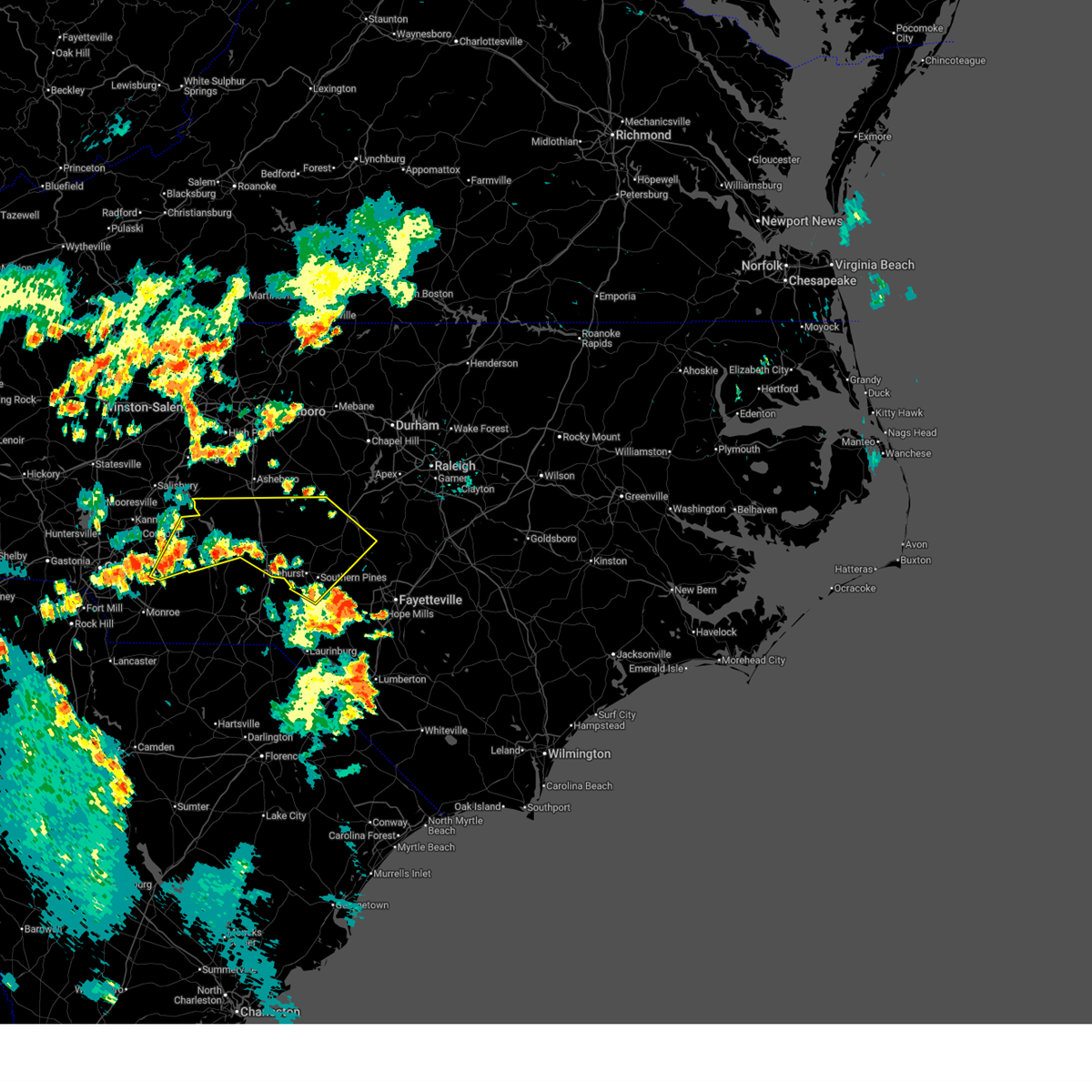
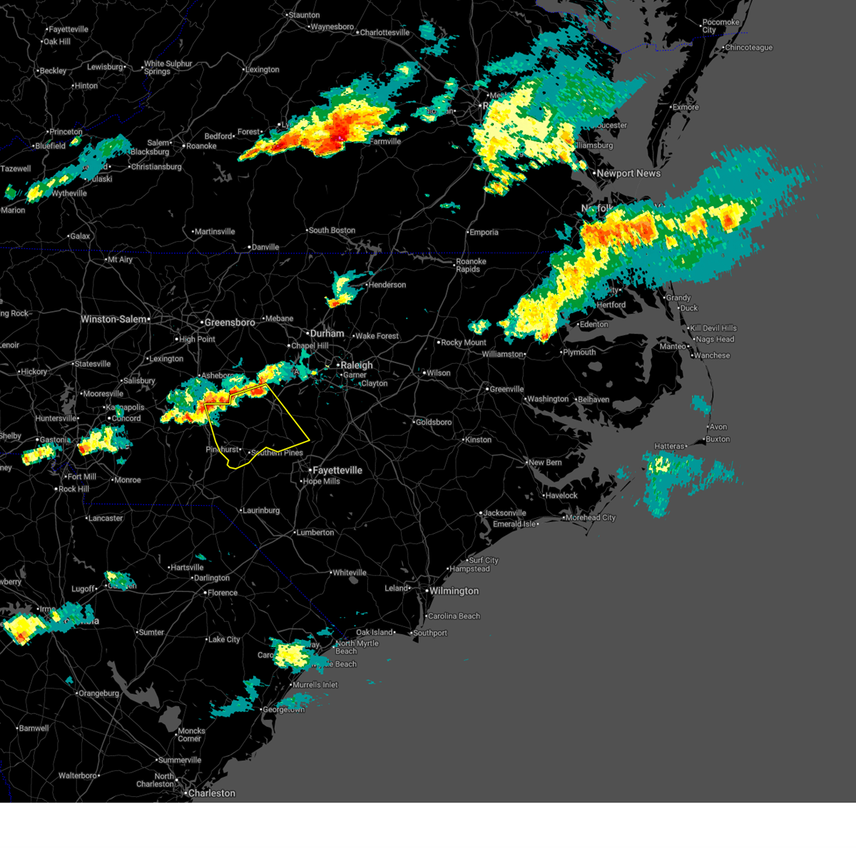
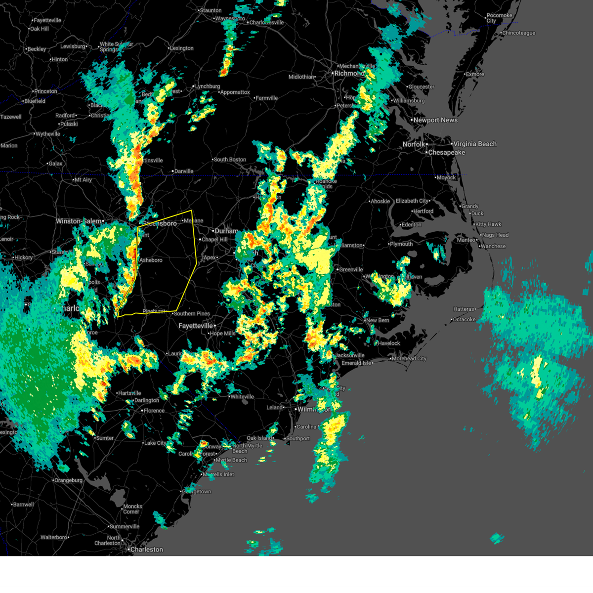
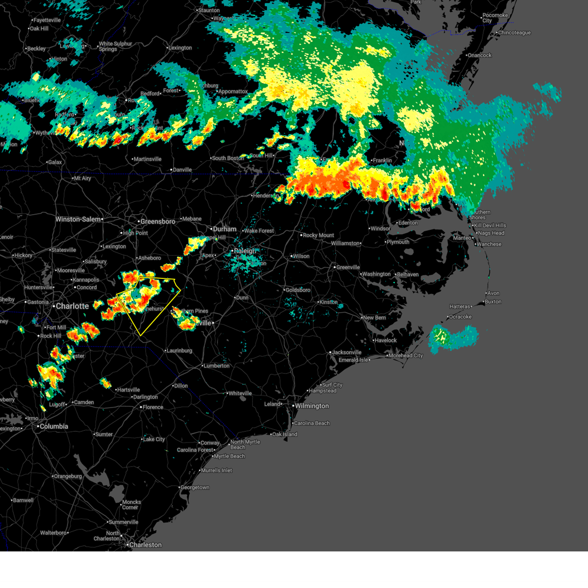
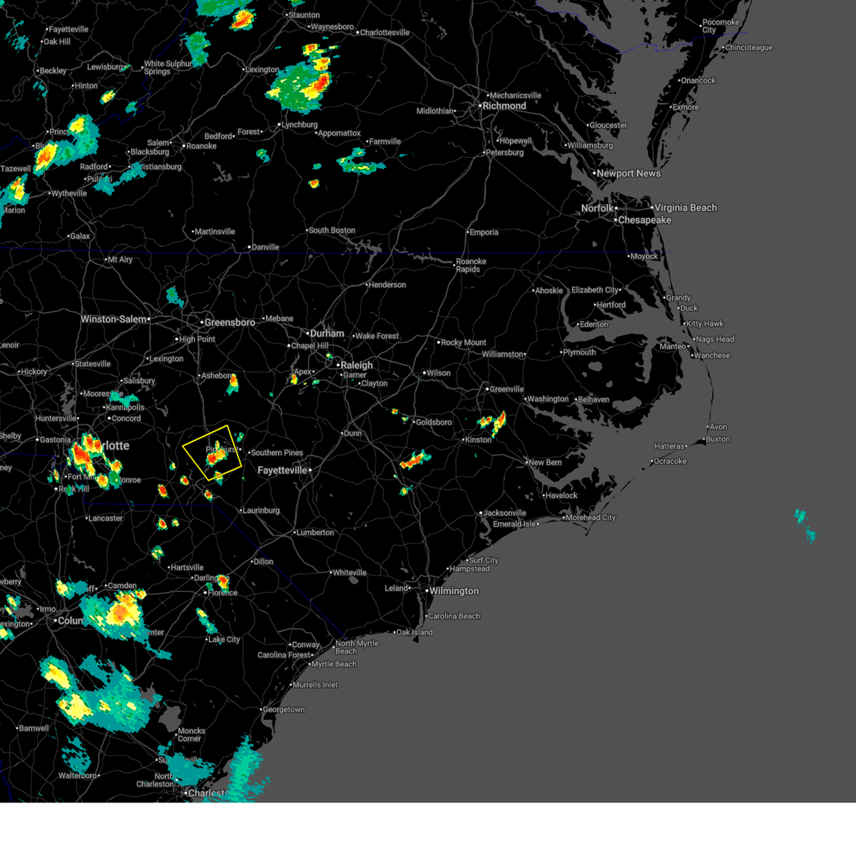
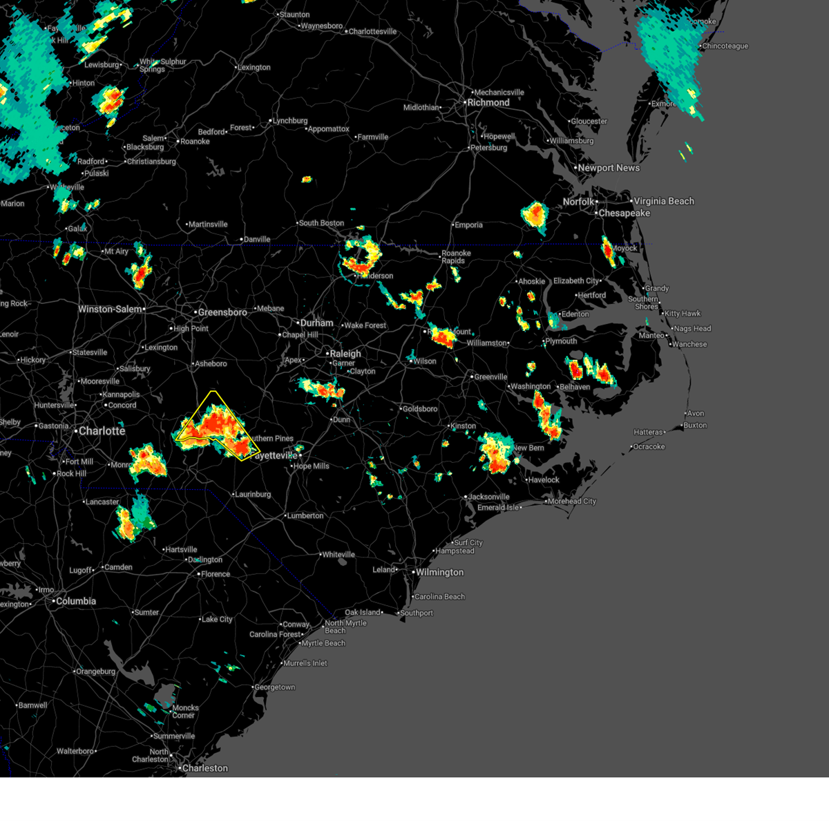
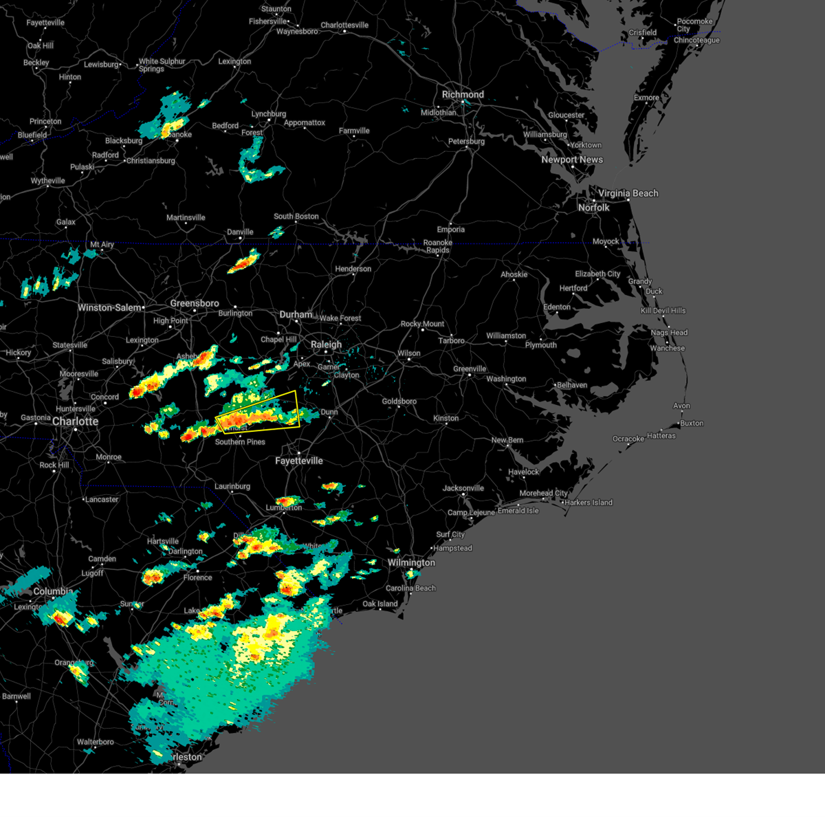
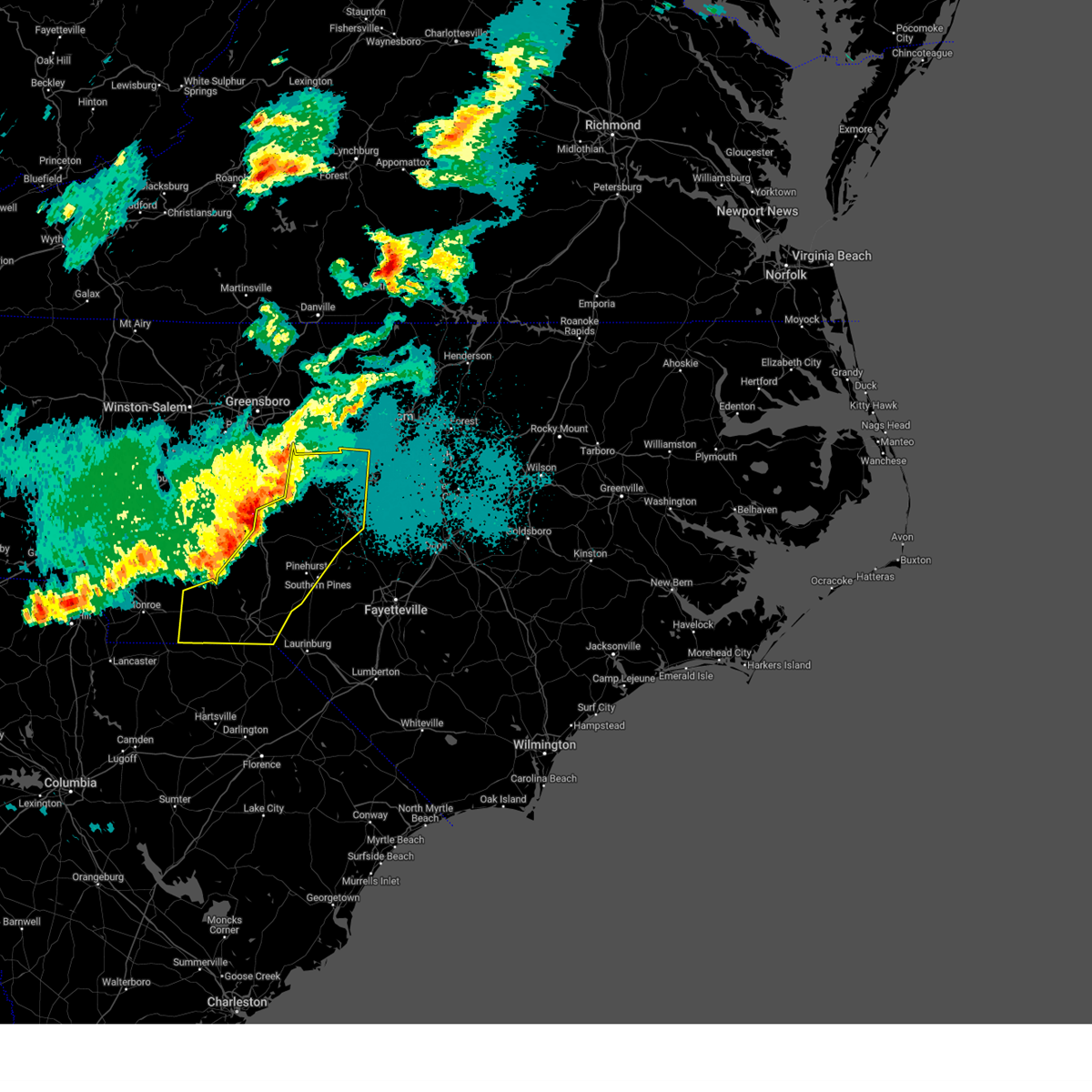
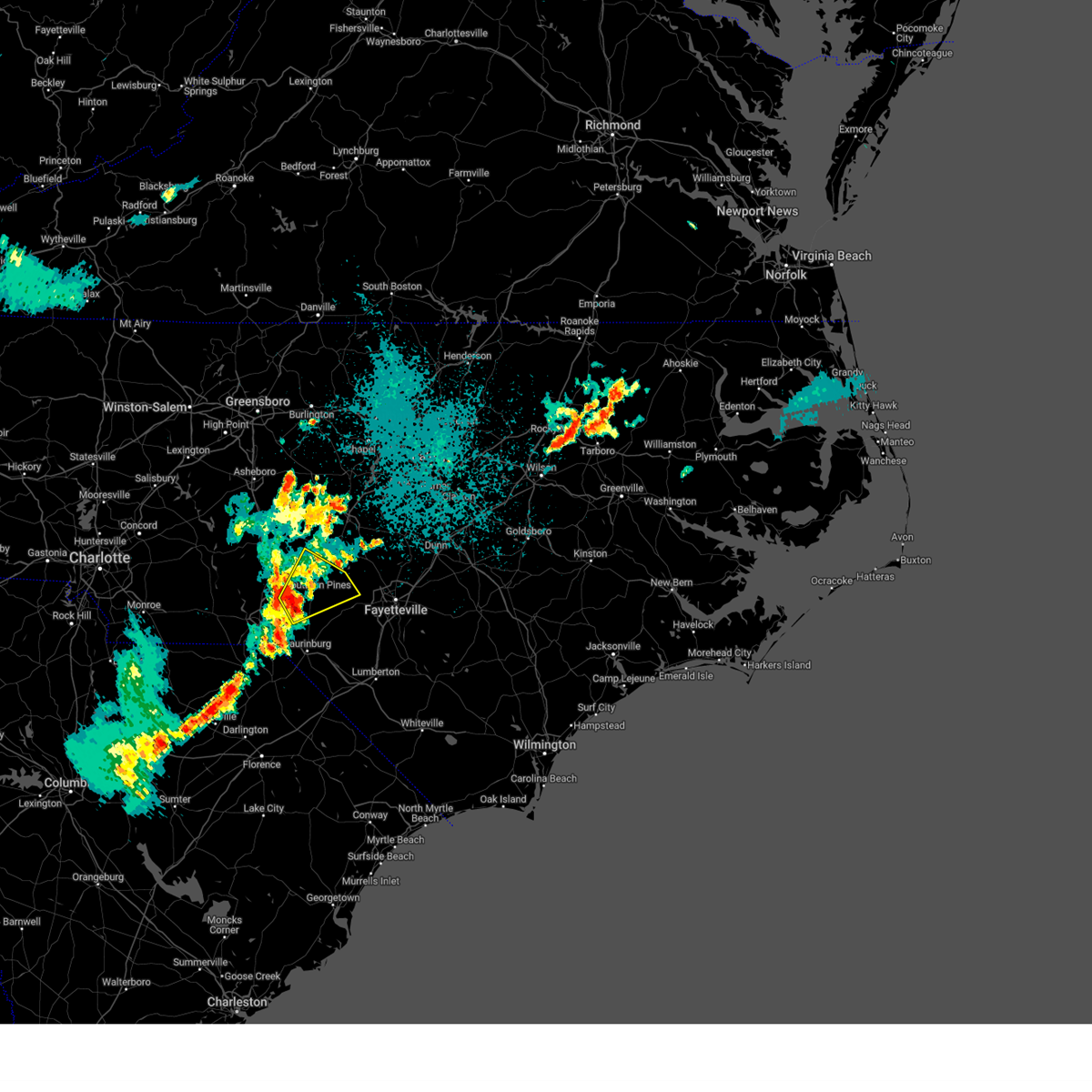
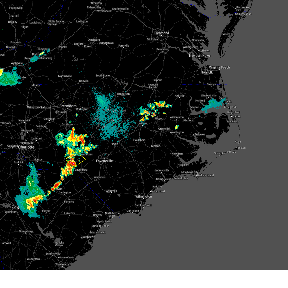
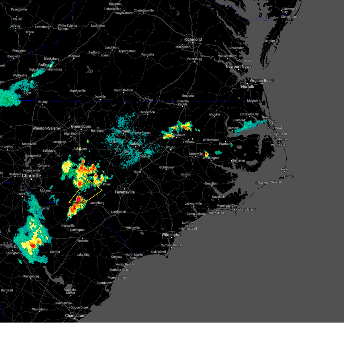
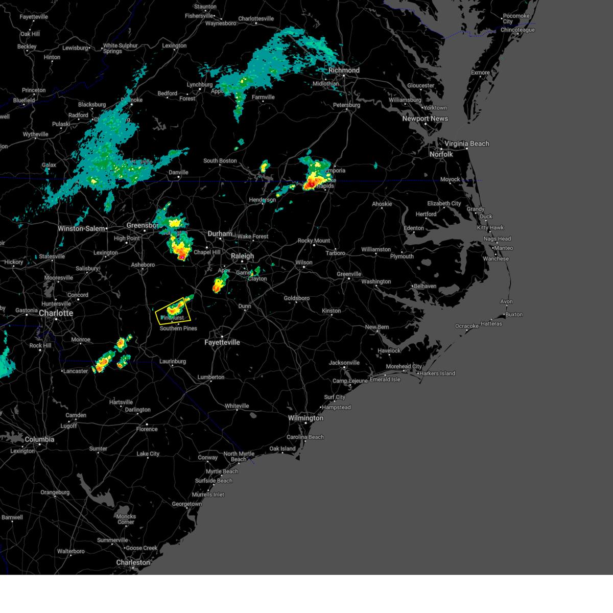
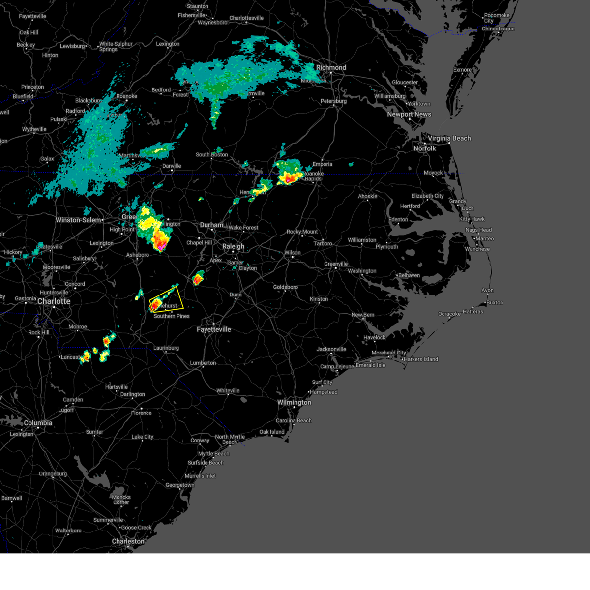
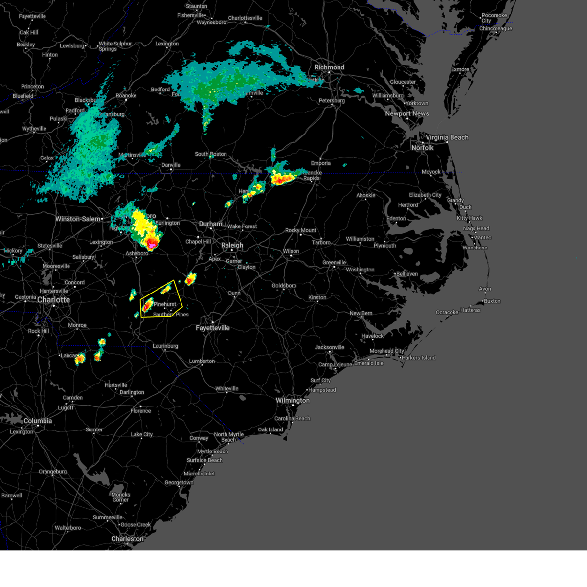
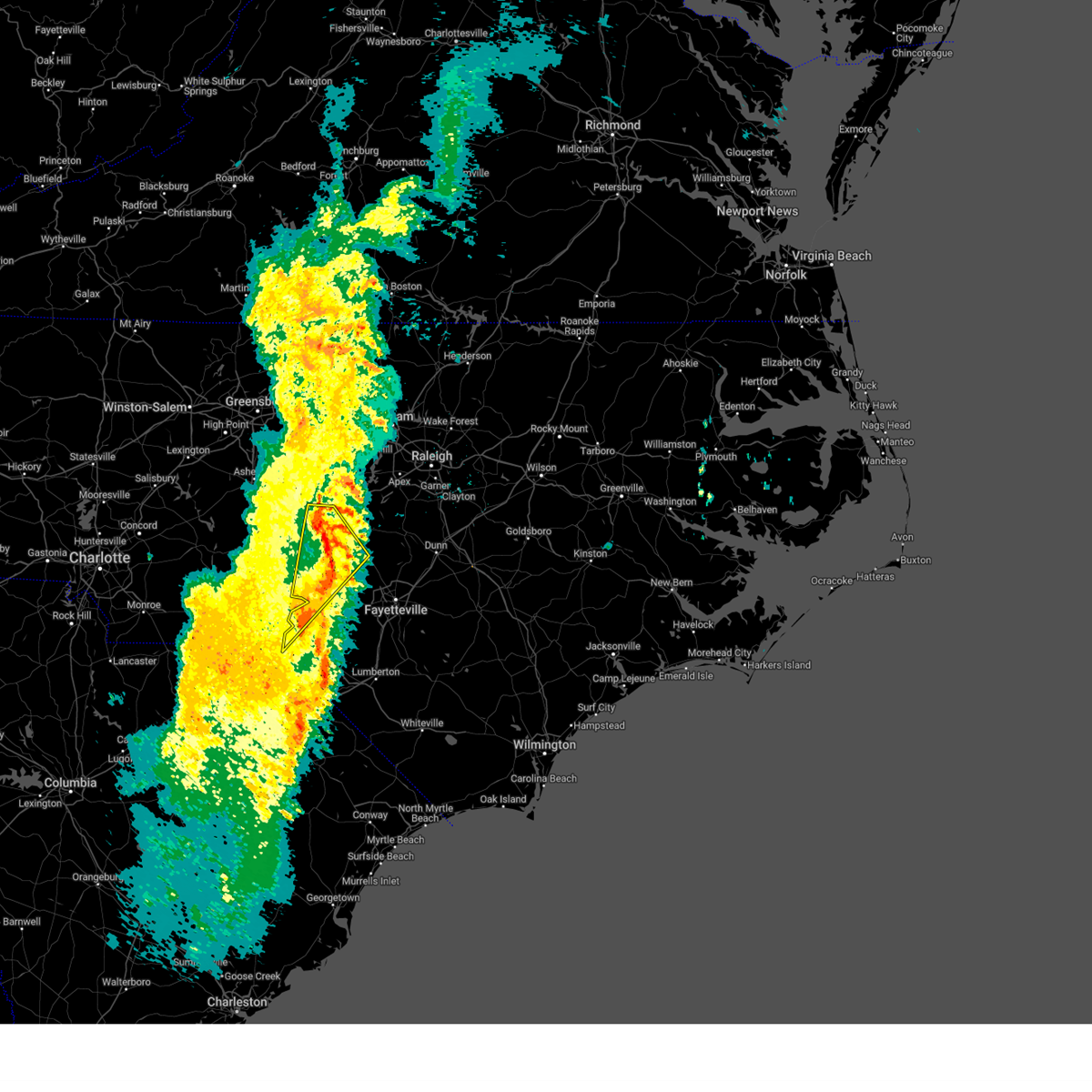
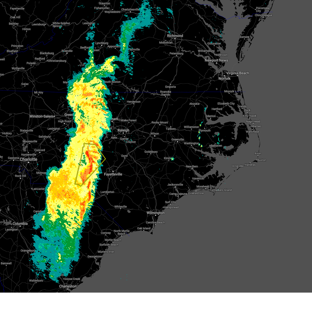
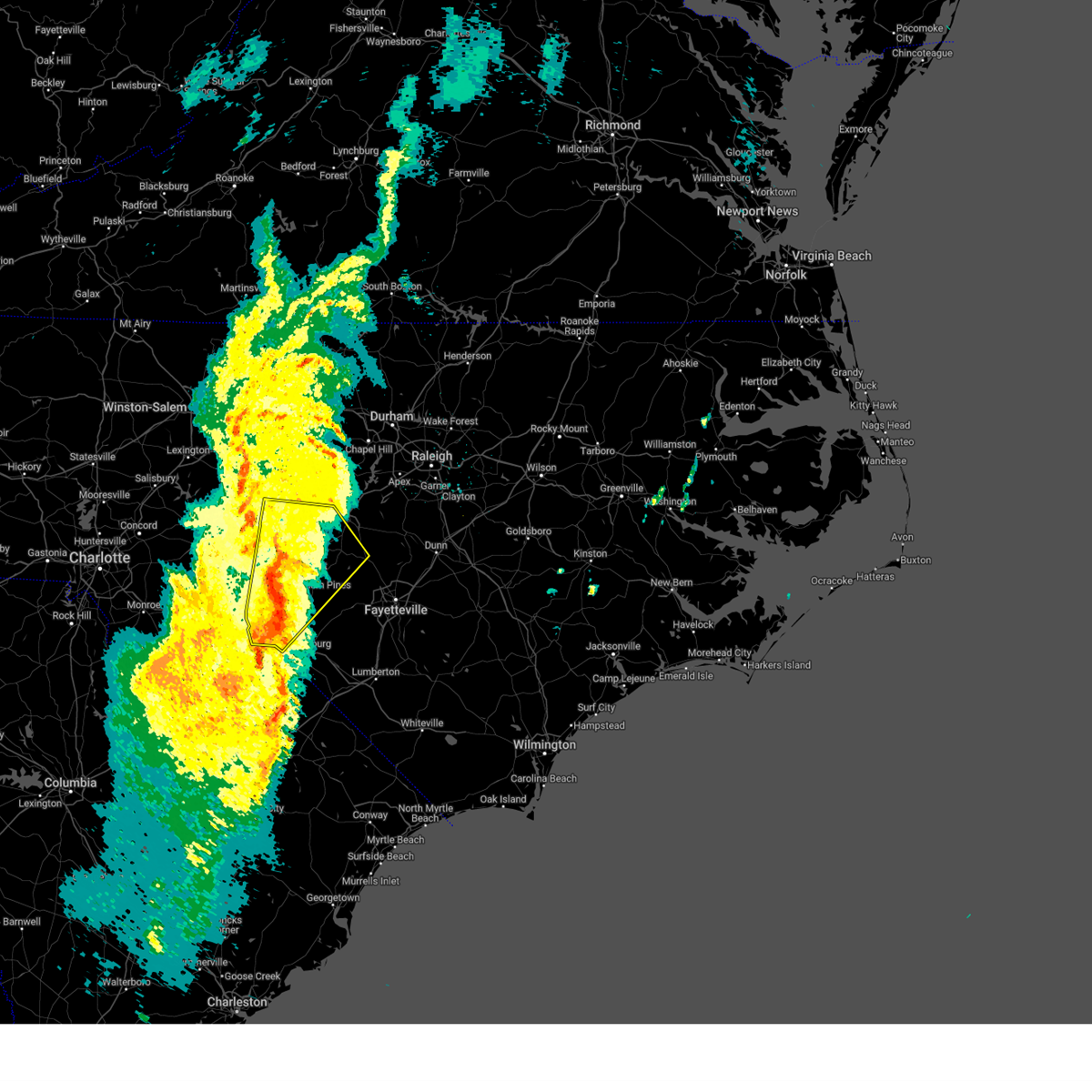
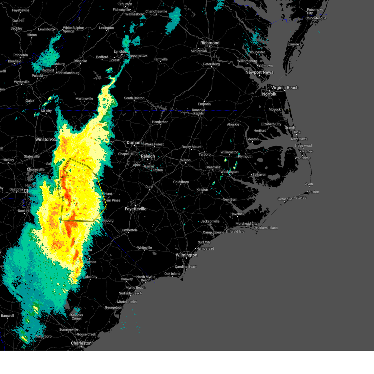
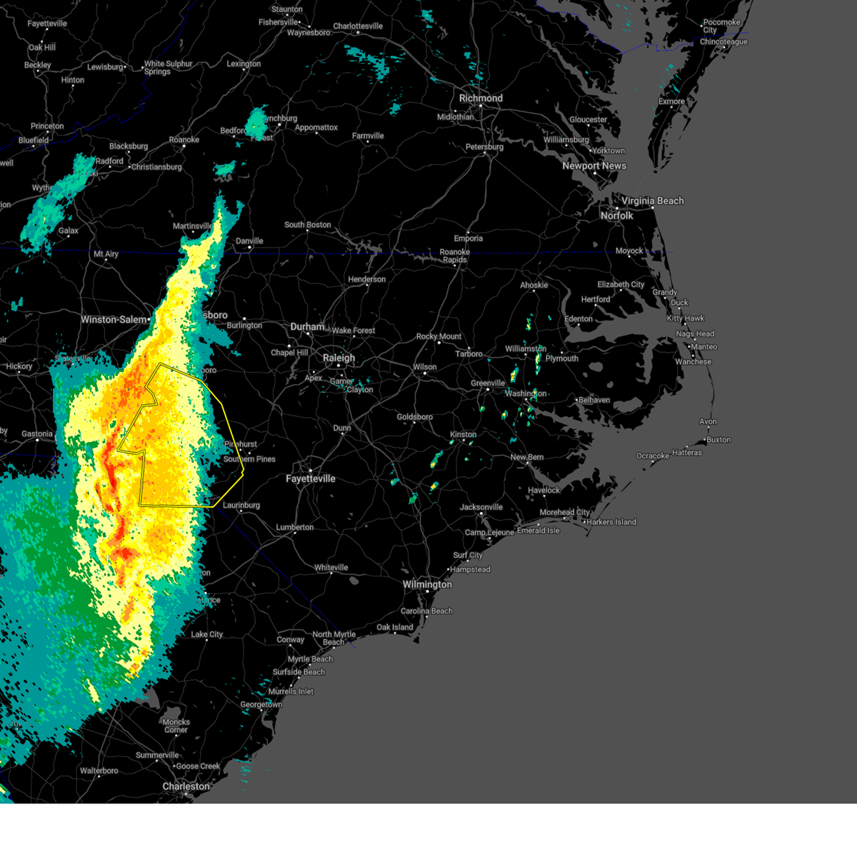
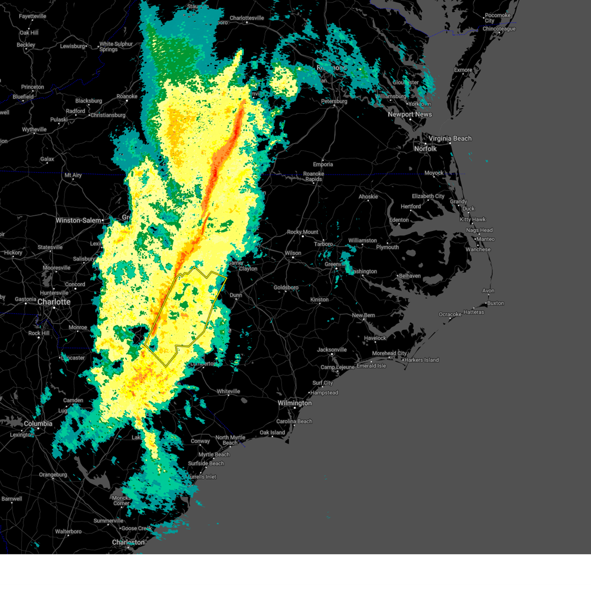
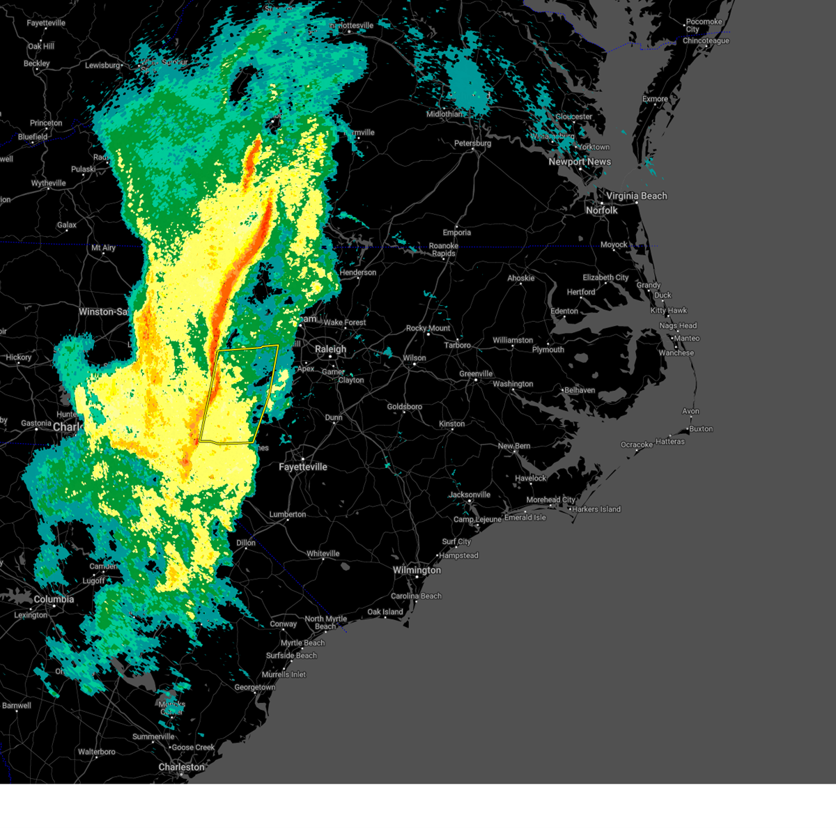
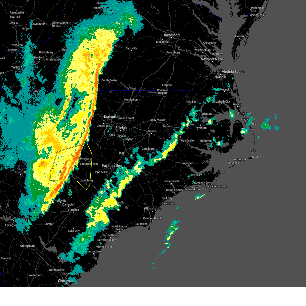
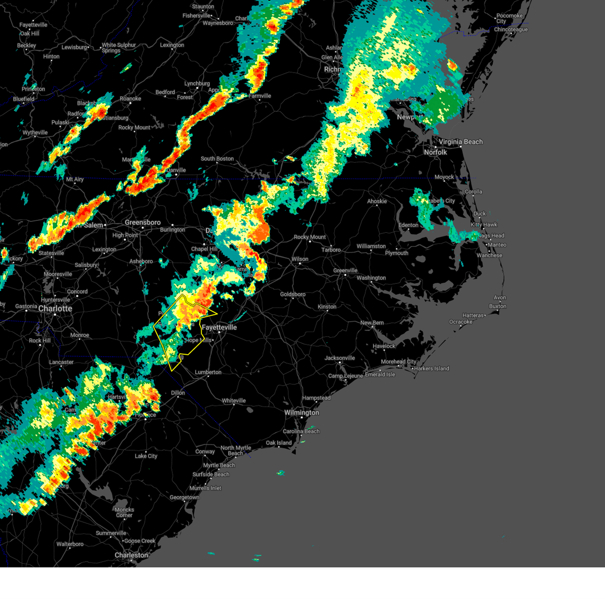
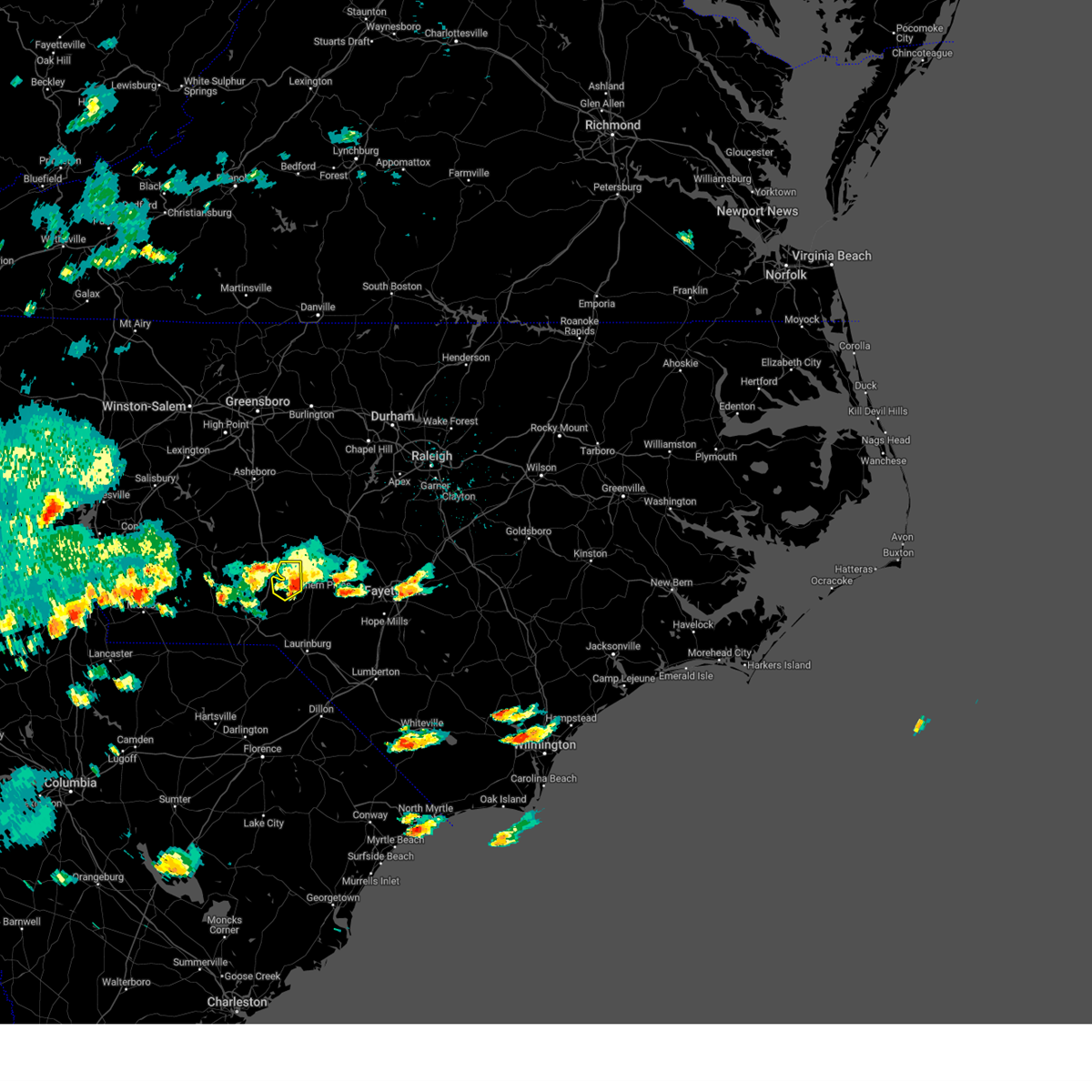
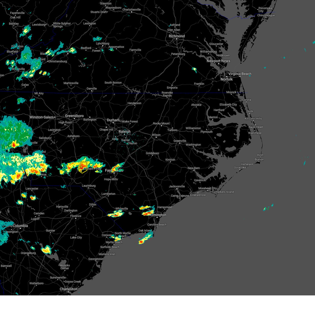
Hail Map for Foxfire, NC
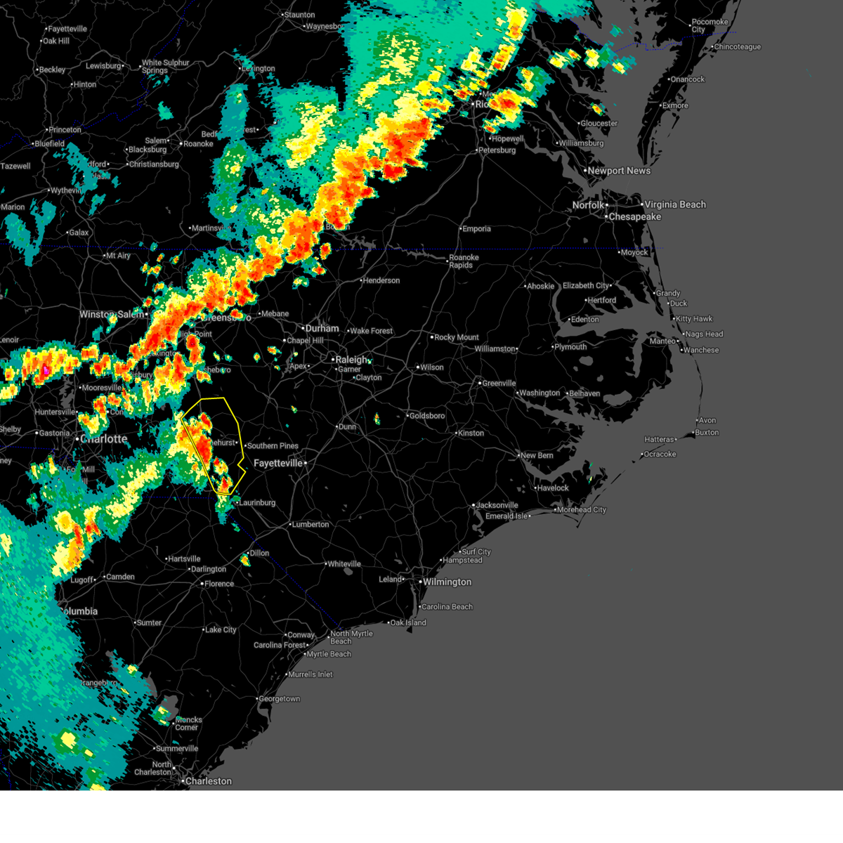
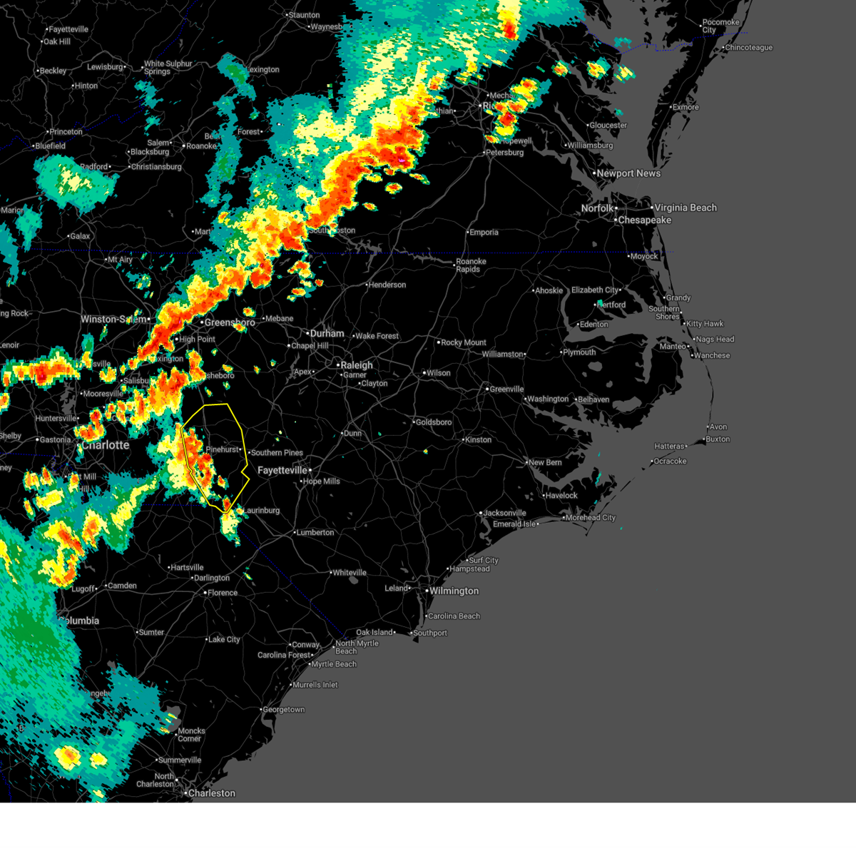
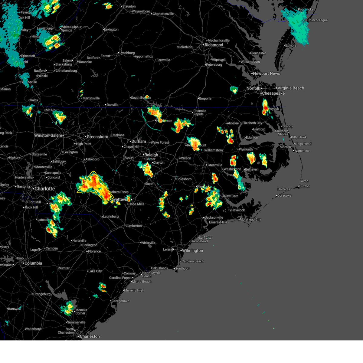
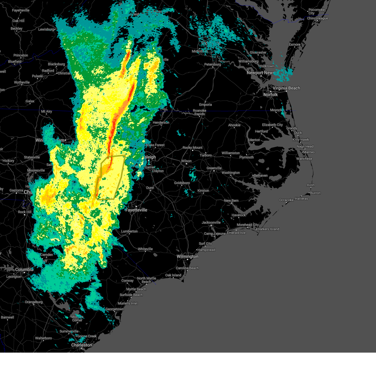
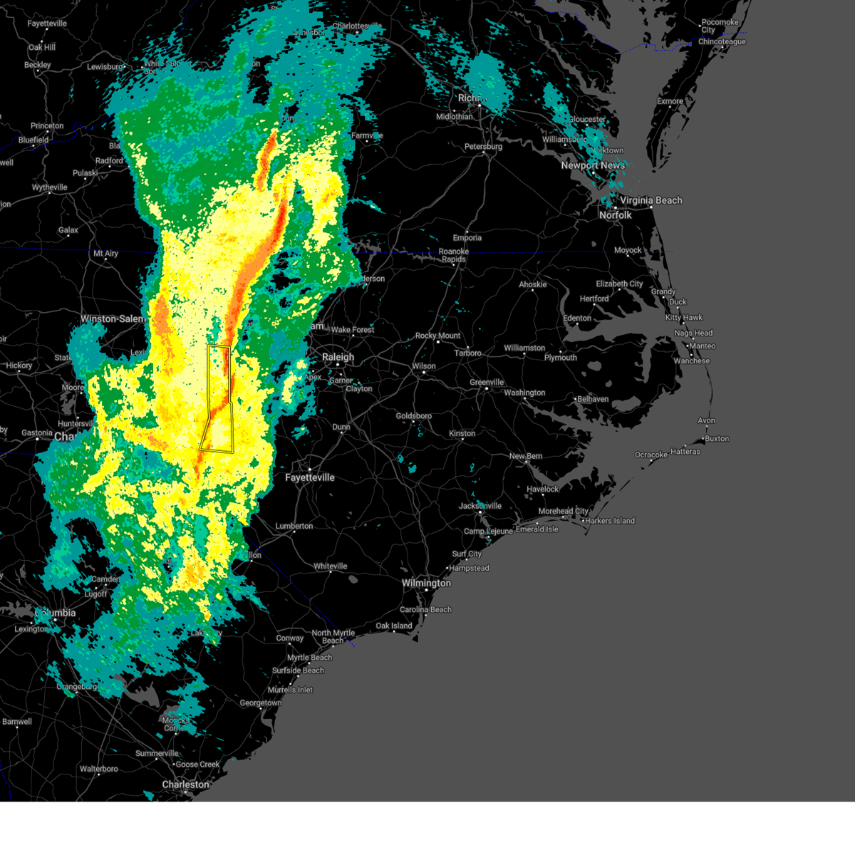
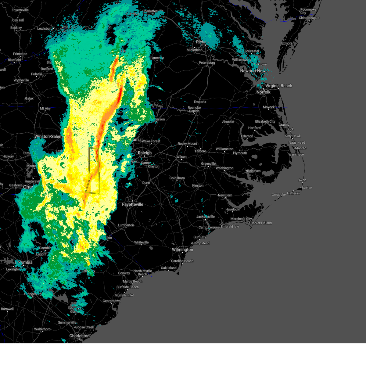
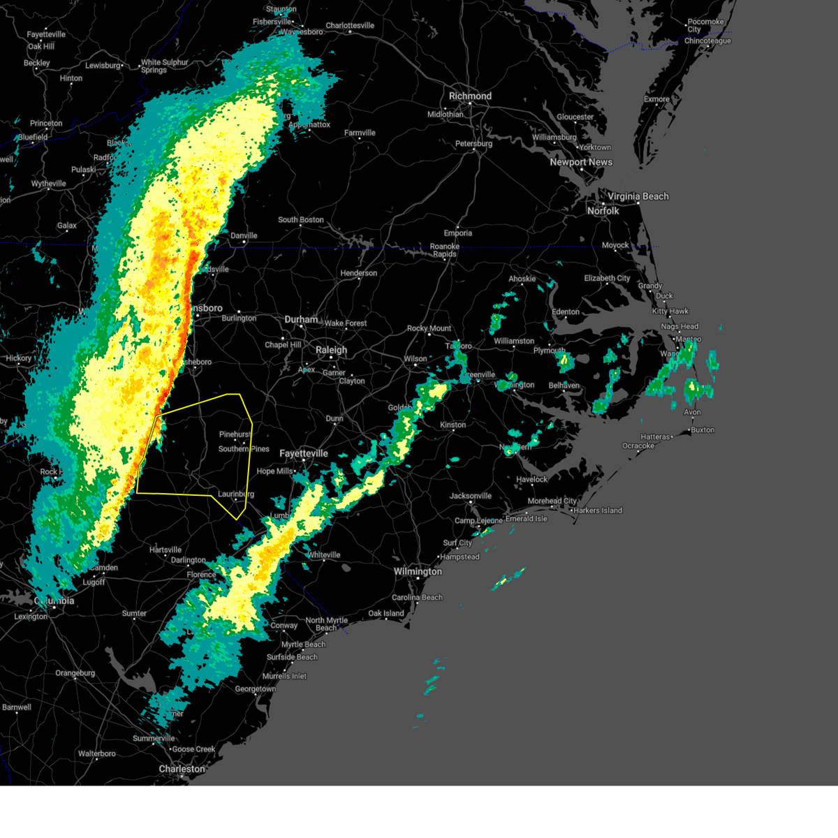
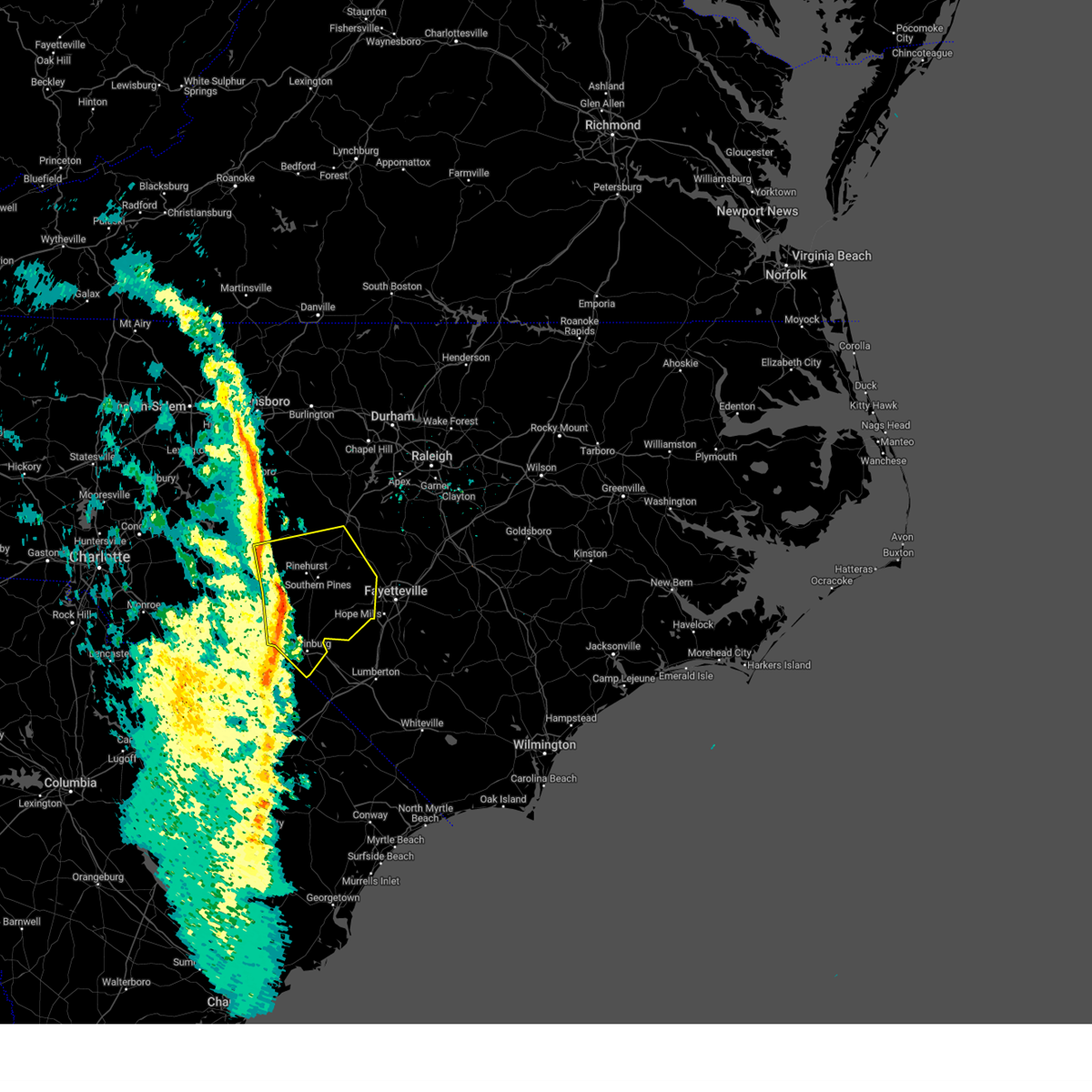
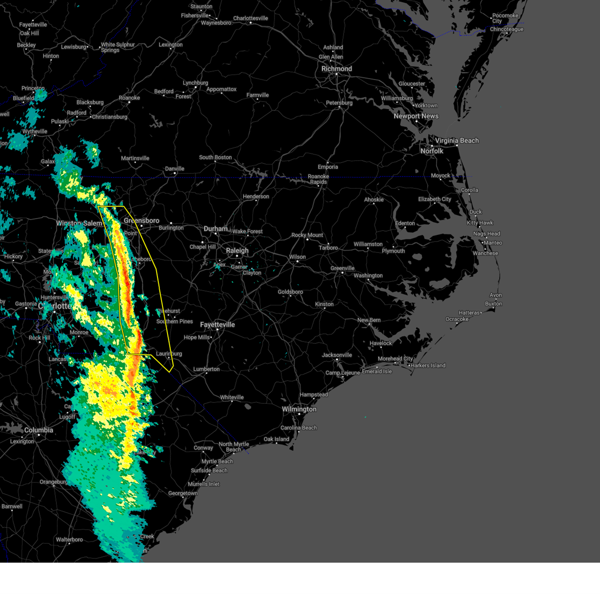
The Foxfire, NC area has had 0 reports of on-the-ground hail by trained spotters, and has been under severe weather warnings 31 times during the past 12 months. Doppler radar has detected hail at or near Foxfire, NC on 52 occasions.
| Name: | Foxfire, NC |
| Where Located: | 67 miles SW of Raleigh, NC |
| Map: | Google Map for Foxfire, NC |
| Population: | 902 |
| Housing Units: | 523 |
| More Info: | Search Google for Foxfire, NC |
2
The Top Recent Hail Date for Foxfire, NC is Sunday, June 30, 2024 (7th out of 52)

Hail and Wind Damage Spotted near Foxfire, NC
| Date / Time | Report Details |
|---|---|
| 6/18/2026 7:54 PM EDT |
 Svrrah the national weather service in raleigh has issued a * severe thunderstorm warning for, moore county in central north carolina, southeastern davidson county in central north carolina, west central harnett county in central north carolina, montgomery county in central north carolina, southern randolph county in central north carolina, stanly county in central north carolina, southwestern lee county in central north carolina, northwestern hoke county in central north carolina, southwestern chatham county in central north carolina, * until 845 pm edt. * at 753 pm edt, severe thunderstorms were located along a line extending from near fairview in union county to near biscoe to 6 miles southeast of aberdeen, moving northeast at 30 mph (radar indicated). Hazards include 60 mph wind gusts and penny size hail. expect damage to roofs, siding, and trees Svrrah the national weather service in raleigh has issued a * severe thunderstorm warning for, moore county in central north carolina, southeastern davidson county in central north carolina, west central harnett county in central north carolina, montgomery county in central north carolina, southern randolph county in central north carolina, stanly county in central north carolina, southwestern lee county in central north carolina, northwestern hoke county in central north carolina, southwestern chatham county in central north carolina, * until 845 pm edt. * at 753 pm edt, severe thunderstorms were located along a line extending from near fairview in union county to near biscoe to 6 miles southeast of aberdeen, moving northeast at 30 mph (radar indicated). Hazards include 60 mph wind gusts and penny size hail. expect damage to roofs, siding, and trees
|
| 6/18/2026 7:26 PM EDT |
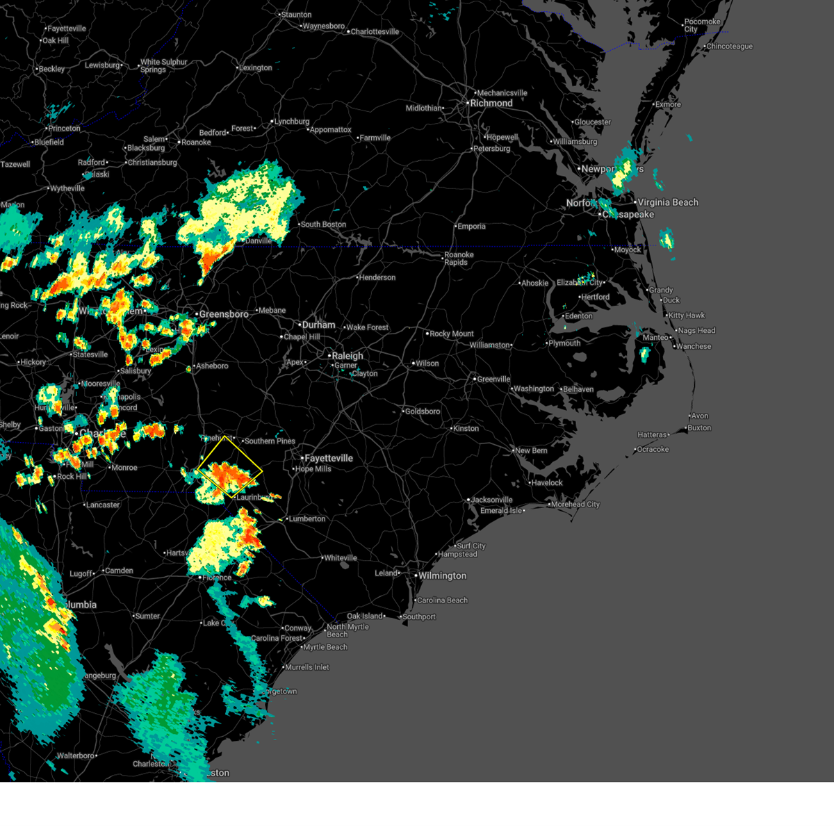 At 726 pm edt, a severe thunderstorm was located 10 miles southwest of raeford, moving northeast at 35 mph (radar indicated). Hazards include 60 mph wind gusts and nickel size hail. Expect damage to roofs, siding, and trees. Locations impacted include, laurinburg, rockingham, raeford, pinehurst, hamlet, hoffman, pinebluff, foxfire, dobbins heights, and wagram. At 726 pm edt, a severe thunderstorm was located 10 miles southwest of raeford, moving northeast at 35 mph (radar indicated). Hazards include 60 mph wind gusts and nickel size hail. Expect damage to roofs, siding, and trees. Locations impacted include, laurinburg, rockingham, raeford, pinehurst, hamlet, hoffman, pinebluff, foxfire, dobbins heights, and wagram.
|
| 6/18/2026 6:58 PM EDT |
 Svrrah the national weather service in raleigh has issued a * severe thunderstorm warning for, south central moore county in central north carolina, scotland county in central north carolina, eastern richmond county in central north carolina, southwestern hoke county in central north carolina, * until 745 pm edt. * at 658 pm edt, a severe thunderstorm was located 7 miles southwest of rockingham, moving northeast at 35 mph (radar indicated). Hazards include 60 mph wind gusts and nickel size hail. expect damage to roofs, siding, and trees Svrrah the national weather service in raleigh has issued a * severe thunderstorm warning for, south central moore county in central north carolina, scotland county in central north carolina, eastern richmond county in central north carolina, southwestern hoke county in central north carolina, * until 745 pm edt. * at 658 pm edt, a severe thunderstorm was located 7 miles southwest of rockingham, moving northeast at 35 mph (radar indicated). Hazards include 60 mph wind gusts and nickel size hail. expect damage to roofs, siding, and trees
|
| 5/27/2026 8:52 PM EDT |
 the severe thunderstorm warning has been cancelled and is no longer in effect the severe thunderstorm warning has been cancelled and is no longer in effect
|
| 5/27/2026 8:52 PM EDT |
 At 851 pm edt, a severe thunderstorm was located near carthage, moving east at 35 mph (radar indicated). Hazards include 60 mph wind gusts. Expect damage to roofs, siding, and trees. locations impacted include, sanford, southern pines, carthage, pinehurst, aberdeen, goldston, whispering pines, robbins, taylortown, and vass. This includes us 1 between mile markers 69 and 73. At 851 pm edt, a severe thunderstorm was located near carthage, moving east at 35 mph (radar indicated). Hazards include 60 mph wind gusts. Expect damage to roofs, siding, and trees. locations impacted include, sanford, southern pines, carthage, pinehurst, aberdeen, goldston, whispering pines, robbins, taylortown, and vass. This includes us 1 between mile markers 69 and 73.
|
| 5/27/2026 8:23 PM EDT |
 Svrrah the national weather service in raleigh has issued a * severe thunderstorm warning for, moore county in central north carolina, southwestern harnett county in central north carolina, lee county in central north carolina, southwestern chatham county in central north carolina, * until 915 pm edt. * at 822 pm edt, a severe thunderstorm was located from near robbins to 5 miles northwest of sanford, moving southeast at 30 mph (radar indicated). Hazards include 60 mph wind gusts. expect damage to roofs, siding, and trees Svrrah the national weather service in raleigh has issued a * severe thunderstorm warning for, moore county in central north carolina, southwestern harnett county in central north carolina, lee county in central north carolina, southwestern chatham county in central north carolina, * until 915 pm edt. * at 822 pm edt, a severe thunderstorm was located from near robbins to 5 miles northwest of sanford, moving southeast at 30 mph (radar indicated). Hazards include 60 mph wind gusts. expect damage to roofs, siding, and trees
|
| 3/16/2026 5:51 PM EDT |
 At 549 pm edt, severe thunderstorms were located along a line extending from monticello to siler city to hoffman, moving northeast at 50 mph (radar indicated). Hazards include 60 mph wind gusts. Expect damage to roofs, siding, and trees. locations impacted include, burlington, sanford, laurinburg, graham, southern pines, raeford, carthage, siler city, pinehurst, and aberdeen. this includes the following highways, interstate 85 between mile markers 129 and 131. interstate 40 between mile markers 132 and 150, and between mile markers 225 and 226. Us 1 near mile marker 69. At 549 pm edt, severe thunderstorms were located along a line extending from monticello to siler city to hoffman, moving northeast at 50 mph (radar indicated). Hazards include 60 mph wind gusts. Expect damage to roofs, siding, and trees. locations impacted include, burlington, sanford, laurinburg, graham, southern pines, raeford, carthage, siler city, pinehurst, and aberdeen. this includes the following highways, interstate 85 between mile markers 129 and 131. interstate 40 between mile markers 132 and 150, and between mile markers 225 and 226. Us 1 near mile marker 69.
|
| 3/16/2026 5:51 PM EDT |
 the severe thunderstorm warning has been cancelled and is no longer in effect the severe thunderstorm warning has been cancelled and is no longer in effect
|
| 3/16/2026 5:23 PM EDT |
 Svrrah the national weather service in raleigh has issued a * severe thunderstorm warning for, alamance county in central north carolina, moore county in central north carolina, scotland county in central north carolina, eastern montgomery county in central north carolina, richmond county in central north carolina, randolph county in central north carolina, guilford county in central north carolina, western lee county in central north carolina, western hoke county in central north carolina, western chatham county in central north carolina, * until 615 pm edt. * at 523 pm edt, severe thunderstorms were located along a line extending from near walnut cove to near biscoe to 7 miles north of wallace, moving east at 50 mph (radar indicated). Hazards include 60 mph wind gusts. expect damage to roofs, siding, and trees Svrrah the national weather service in raleigh has issued a * severe thunderstorm warning for, alamance county in central north carolina, moore county in central north carolina, scotland county in central north carolina, eastern montgomery county in central north carolina, richmond county in central north carolina, randolph county in central north carolina, guilford county in central north carolina, western lee county in central north carolina, western hoke county in central north carolina, western chatham county in central north carolina, * until 615 pm edt. * at 523 pm edt, severe thunderstorms were located along a line extending from near walnut cove to near biscoe to 7 miles north of wallace, moving east at 50 mph (radar indicated). Hazards include 60 mph wind gusts. expect damage to roofs, siding, and trees
|
| 3/16/2026 11:28 AM EDT |
 The storms which prompted the warning have weakened below severe limits, and no longer pose an immediate threat to life or property. therefore, the warning will be allowed to expire. however, gusty winds to 50 mph are still possible with these thunderstorms. a tornado watch remains in effect until 200 pm edt for central north carolina. The storms which prompted the warning have weakened below severe limits, and no longer pose an immediate threat to life or property. therefore, the warning will be allowed to expire. however, gusty winds to 50 mph are still possible with these thunderstorms. a tornado watch remains in effect until 200 pm edt for central north carolina.
|
| 3/16/2026 10:55 AM EDT |
 Svrrah the national weather service in raleigh has issued a * severe thunderstorm warning for, alamance county in central north carolina, moore county in central north carolina, western orange county in central north carolina, montgomery county in central north carolina, eastern randolph county in central north carolina, southeastern guilford county in central north carolina, western lee county in central north carolina, chatham county in central north carolina, * until 1130 am edt. * at 1055 am edt, severe thunderstorms were located along a line extending from 7 miles southeast of greensboro to seagrove to 7 miles northeast of ansonville, moving east at 45 mph (radar indicated). Hazards include 60 mph wind gusts. expect damage to roofs, siding, and trees Svrrah the national weather service in raleigh has issued a * severe thunderstorm warning for, alamance county in central north carolina, moore county in central north carolina, western orange county in central north carolina, montgomery county in central north carolina, eastern randolph county in central north carolina, southeastern guilford county in central north carolina, western lee county in central north carolina, chatham county in central north carolina, * until 1130 am edt. * at 1055 am edt, severe thunderstorms were located along a line extending from 7 miles southeast of greensboro to seagrove to 7 miles northeast of ansonville, moving east at 45 mph (radar indicated). Hazards include 60 mph wind gusts. expect damage to roofs, siding, and trees
|
| 8/1/2025 8:14 PM EDT |
 The storm which prompted the warning has weakened, the warning will be allowed to expire. however, heavy rain is still possible with this thunderstorm. to report severe weather, contact your nearest law enforcement agency. they will relay your report to the national weather service raleigh. The storm which prompted the warning has weakened, the warning will be allowed to expire. however, heavy rain is still possible with this thunderstorm. to report severe weather, contact your nearest law enforcement agency. they will relay your report to the national weather service raleigh.
|
| 8/1/2025 8:00 PM EDT | Thunderstorm damag in moore county NC, 0.3 miles NNE of Foxfire, NC |
| 8/1/2025 7:56 PM EDT |
 At 755 pm edt, a severe thunderstorm was located 7 miles northwest of laurinburg, moving southeast at 25 mph (radar indicated). Hazards include 60 mph wind gusts and quarter size hail. Hail damage to vehicles is expected. expect wind damage to roofs, siding, and trees. this severe storm will be near, laurinburg around 800 pm edt. maxton around 805 pm edt. Other locations impacted by this severe thunderstorm include east laurinburg, laurel hill, derby, pinebluff, and taylortown. At 755 pm edt, a severe thunderstorm was located 7 miles northwest of laurinburg, moving southeast at 25 mph (radar indicated). Hazards include 60 mph wind gusts and quarter size hail. Hail damage to vehicles is expected. expect wind damage to roofs, siding, and trees. this severe storm will be near, laurinburg around 800 pm edt. maxton around 805 pm edt. Other locations impacted by this severe thunderstorm include east laurinburg, laurel hill, derby, pinebluff, and taylortown.
|
| 8/1/2025 7:56 PM EDT |
 the severe thunderstorm warning has been cancelled and is no longer in effect the severe thunderstorm warning has been cancelled and is no longer in effect
|
| 8/1/2025 7:13 PM EDT |
 Svrrah the national weather service in raleigh has issued a * severe thunderstorm warning for, southwestern moore county in central north carolina, scotland county in central north carolina, southeastern montgomery county in central north carolina, richmond county in central north carolina, western hoke county in central north carolina, * until 815 pm edt. * at 712 pm edt, a severe thunderstorm was located 9 miles north of rockingham, moving southeast at 25 mph (radar indicated). Hazards include 60 mph wind gusts and quarter size hail. Hail damage to vehicles is expected. expect wind damage to roofs, siding, and trees. this severe thunderstorm will be near, rockingham, hamlet, and hoffman around 720 pm edt. laurinburg around 755 pm edt. Other locations impacted by this severe thunderstorm include diggs, dobbins heights, norman, laurel hill, and derby. Svrrah the national weather service in raleigh has issued a * severe thunderstorm warning for, southwestern moore county in central north carolina, scotland county in central north carolina, southeastern montgomery county in central north carolina, richmond county in central north carolina, western hoke county in central north carolina, * until 815 pm edt. * at 712 pm edt, a severe thunderstorm was located 9 miles north of rockingham, moving southeast at 25 mph (radar indicated). Hazards include 60 mph wind gusts and quarter size hail. Hail damage to vehicles is expected. expect wind damage to roofs, siding, and trees. this severe thunderstorm will be near, rockingham, hamlet, and hoffman around 720 pm edt. laurinburg around 755 pm edt. Other locations impacted by this severe thunderstorm include diggs, dobbins heights, norman, laurel hill, and derby.
|
| 7/27/2025 8:46 PM EDT |
 The storm which prompted the warning has weakened below severe limits, and no longer poses an immediate threat to life or property. therefore, the warning has been allowed to expire. however, heavy rain is still possible with this thunderstorm. to report severe weather, contact your nearest law enforcement agency. they will relay your report to the national weather service raleigh. The storm which prompted the warning has weakened below severe limits, and no longer poses an immediate threat to life or property. therefore, the warning has been allowed to expire. however, heavy rain is still possible with this thunderstorm. to report severe weather, contact your nearest law enforcement agency. they will relay your report to the national weather service raleigh.
|
| 7/27/2025 8:26 PM EDT |
 At 826 pm edt, a severe thunderstorm was located near biscoe, or 11 miles east of troy, moving southeast at 35 mph (radar indicated). Hazards include 60 mph wind gusts. Expect damage to roofs, siding, and trees. Locations impacted include, rockingham, troy, carthage, pinehurst, biscoe, robbins, ellerbe, foxfire, star, and candor. At 826 pm edt, a severe thunderstorm was located near biscoe, or 11 miles east of troy, moving southeast at 35 mph (radar indicated). Hazards include 60 mph wind gusts. Expect damage to roofs, siding, and trees. Locations impacted include, rockingham, troy, carthage, pinehurst, biscoe, robbins, ellerbe, foxfire, star, and candor.
|
| 7/27/2025 7:58 PM EDT |
 Svrrah the national weather service in raleigh has issued a * severe thunderstorm warning for, moore county in central north carolina, montgomery county in central north carolina, northeastern richmond county in central north carolina, * until 845 pm edt. * at 757 pm edt, a severe thunderstorm was located over troy, moving southeast at 25 mph (radar indicated). Hazards include 60 mph wind gusts. expect damage to roofs, siding, and trees Svrrah the national weather service in raleigh has issued a * severe thunderstorm warning for, moore county in central north carolina, montgomery county in central north carolina, northeastern richmond county in central north carolina, * until 845 pm edt. * at 757 pm edt, a severe thunderstorm was located over troy, moving southeast at 25 mph (radar indicated). Hazards include 60 mph wind gusts. expect damage to roofs, siding, and trees
|
| 7/12/2025 8:13 PM EDT |
 The severe thunderstorm which prompted the warning has weakened. therefore, the warning will be allowed to expire. however, gusty winds and heavy rain are still possible with this thunderstorm. The severe thunderstorm which prompted the warning has weakened. therefore, the warning will be allowed to expire. however, gusty winds and heavy rain are still possible with this thunderstorm.
|
| 7/12/2025 7:38 PM EDT |
 At 738 pm edt, a severe thunderstorm was located 12 miles northwest of hoffman, or 15 miles north of rockingham, and is nearly stationary (radar indicated). Hazards include 60 mph wind gusts. Expect damage to roofs, siding, and trees. Locations impacted include, pinebluff, ellerbe, foxfire, candor, norman, derby, seven lakes, eagle springs, pekin, and covington. At 738 pm edt, a severe thunderstorm was located 12 miles northwest of hoffman, or 15 miles north of rockingham, and is nearly stationary (radar indicated). Hazards include 60 mph wind gusts. Expect damage to roofs, siding, and trees. Locations impacted include, pinebluff, ellerbe, foxfire, candor, norman, derby, seven lakes, eagle springs, pekin, and covington.
|
| 7/12/2025 7:24 PM EDT |
 Svrrah the national weather service in raleigh has issued a * severe thunderstorm warning for, southwestern moore county in central north carolina, southeastern montgomery county in central north carolina, northeastern richmond county in central north carolina, * until 815 pm edt. * at 724 pm edt, a severe thunderstorm was located 11 miles northwest of hoffman, or 16 miles north of rockingham, and is nearly stationary (radar indicated). Hazards include 60 mph wind gusts. expect damage to roofs, siding, and trees Svrrah the national weather service in raleigh has issued a * severe thunderstorm warning for, southwestern moore county in central north carolina, southeastern montgomery county in central north carolina, northeastern richmond county in central north carolina, * until 815 pm edt. * at 724 pm edt, a severe thunderstorm was located 11 miles northwest of hoffman, or 16 miles north of rockingham, and is nearly stationary (radar indicated). Hazards include 60 mph wind gusts. expect damage to roofs, siding, and trees
|
| 7/9/2025 7:30 PM EDT |
 At 730 pm edt, severe thunderstorms were located along a line extending from 8 miles southwest of siler city to near carthage to near pinehurst, moving northeast at 20 mph (radar indicated). Hazards include 60 mph wind gusts. Expect damage to roofs, siding, and trees. Locations impacted include, sanford, southern pines, pittsboro, carthage, pinehurst, aberdeen, goldston, whispering pines, pinebluff, and broadway. At 730 pm edt, severe thunderstorms were located along a line extending from 8 miles southwest of siler city to near carthage to near pinehurst, moving northeast at 20 mph (radar indicated). Hazards include 60 mph wind gusts. Expect damage to roofs, siding, and trees. Locations impacted include, sanford, southern pines, pittsboro, carthage, pinehurst, aberdeen, goldston, whispering pines, pinebluff, and broadway.
|
| 7/9/2025 7:30 PM EDT |
 the severe thunderstorm warning has been cancelled and is no longer in effect the severe thunderstorm warning has been cancelled and is no longer in effect
|
| 7/9/2025 7:26 PM EDT |
 The storms which prompted the warning have moved out of the area. therefore, the warning will be allowed to expire. however, gusty winds and heavy rain are still possible with these thunderstorms. remember, a severe thunderstorm warning still remains in effect for portions of moore county. The storms which prompted the warning have moved out of the area. therefore, the warning will be allowed to expire. however, gusty winds and heavy rain are still possible with these thunderstorms. remember, a severe thunderstorm warning still remains in effect for portions of moore county.
|
| 7/9/2025 7:08 PM EDT |
 the severe thunderstorm warning has been cancelled and is no longer in effect the severe thunderstorm warning has been cancelled and is no longer in effect
|
| 7/9/2025 7:08 PM EDT |
 At 707 pm edt, severe thunderstorms were located along a line extending from near biscoe to 13 miles northwest of hoffman to near hamlet, moving northeast at 30 mph (radar indicated). Hazards include 60 mph wind gusts. Expect damage to roofs, siding, and trees. Locations impacted include, southern pines, pinehurst, aberdeen, hoffman, pinebluff, robbins, foxfire, taylortown, norman, and derby. At 707 pm edt, severe thunderstorms were located along a line extending from near biscoe to 13 miles northwest of hoffman to near hamlet, moving northeast at 30 mph (radar indicated). Hazards include 60 mph wind gusts. Expect damage to roofs, siding, and trees. Locations impacted include, southern pines, pinehurst, aberdeen, hoffman, pinebluff, robbins, foxfire, taylortown, norman, and derby.
|
| 7/9/2025 7:03 PM EDT |
 Svrrah the national weather service in raleigh has issued a * severe thunderstorm warning for, moore county in central north carolina, southwestern harnett county in central north carolina, southeastern randolph county in central north carolina, lee county in central north carolina, northwestern hoke county in central north carolina, chatham county in central north carolina, * until 800 pm edt. * at 703 pm edt, severe thunderstorms were located along a line extending from 10 miles east of biscoe to near pinehurst, moving northeast at 40 mph (radar indicated). Hazards include 60 mph wind gusts. expect damage to roofs, siding, and trees Svrrah the national weather service in raleigh has issued a * severe thunderstorm warning for, moore county in central north carolina, southwestern harnett county in central north carolina, southeastern randolph county in central north carolina, lee county in central north carolina, northwestern hoke county in central north carolina, chatham county in central north carolina, * until 800 pm edt. * at 703 pm edt, severe thunderstorms were located along a line extending from 10 miles east of biscoe to near pinehurst, moving northeast at 40 mph (radar indicated). Hazards include 60 mph wind gusts. expect damage to roofs, siding, and trees
|
| 7/9/2025 6:50 PM EDT |
 At 649 pm edt, severe thunderstorms were located along a line extending from near biscoe to 11 miles north of rockingham to near hamlet, moving northeast at 25 mph (radar indicated). Hazards include 60 mph wind gusts. Expect damage to roofs, siding, and trees. Locations impacted include, southern pines, troy, pinehurst, aberdeen, biscoe, hoffman, pinebluff, robbins, ellerbe, and foxfire. At 649 pm edt, severe thunderstorms were located along a line extending from near biscoe to 11 miles north of rockingham to near hamlet, moving northeast at 25 mph (radar indicated). Hazards include 60 mph wind gusts. Expect damage to roofs, siding, and trees. Locations impacted include, southern pines, troy, pinehurst, aberdeen, biscoe, hoffman, pinebluff, robbins, ellerbe, and foxfire.
|
| 7/9/2025 6:30 PM EDT |
 Svrrah the national weather service in raleigh has issued a * severe thunderstorm warning for, western moore county in central north carolina, northwestern scotland county in central north carolina, central montgomery county in central north carolina, richmond county in central north carolina, * until 730 pm edt. * at 630 pm edt, severe thunderstorms were located along a line extending from 6 miles south of troy to near rockingham, moving northeast at 20 mph (radar indicated). Hazards include 60 mph wind gusts. expect damage to roofs, siding, and trees Svrrah the national weather service in raleigh has issued a * severe thunderstorm warning for, western moore county in central north carolina, northwestern scotland county in central north carolina, central montgomery county in central north carolina, richmond county in central north carolina, * until 730 pm edt. * at 630 pm edt, severe thunderstorms were located along a line extending from 6 miles south of troy to near rockingham, moving northeast at 20 mph (radar indicated). Hazards include 60 mph wind gusts. expect damage to roofs, siding, and trees
|
| 6/27/2025 5:08 PM EDT |
 The storm which prompted the warning has weakened below severe limits, and no longer poses an immediate threat to life or property. therefore, the warning will be allowed to expire. however, gusty winds and heavy rain are still possible with this thunderstorm. to report severe weather, contact your nearest law enforcement agency. they will relay your report to the national weather service raleigh. The storm which prompted the warning has weakened below severe limits, and no longer poses an immediate threat to life or property. therefore, the warning will be allowed to expire. however, gusty winds and heavy rain are still possible with this thunderstorm. to report severe weather, contact your nearest law enforcement agency. they will relay your report to the national weather service raleigh.
|
| 6/27/2025 4:36 PM EDT |
 Svrrah the national weather service in raleigh has issued a * severe thunderstorm warning for, western moore county in central north carolina, southeastern montgomery county in central north carolina, northwestern hoke county in central north carolina, * until 515 pm edt. * at 434 pm edt, a cluster of severe thunderstorms were located from near pinehurst to robbins to near troy, moving northwest at 10 mph (radar indicated). Hazards include 60 mph wind gusts and nickel size hail. expect damage to roofs, siding, and trees Svrrah the national weather service in raleigh has issued a * severe thunderstorm warning for, western moore county in central north carolina, southeastern montgomery county in central north carolina, northwestern hoke county in central north carolina, * until 515 pm edt. * at 434 pm edt, a cluster of severe thunderstorms were located from near pinehurst to robbins to near troy, moving northwest at 10 mph (radar indicated). Hazards include 60 mph wind gusts and nickel size hail. expect damage to roofs, siding, and trees
|
| 6/25/2025 7:31 PM EDT |
 The storm which prompted the warning has weakened below severe limits, and no longer poses an immediate threat to life or property. therefore, the warning has been allowed to expire. however, heavy rain is still possible with this thunderstorm. a severe thunderstorm watch remains in effect until midnight edt for central north carolina. to report severe weather, contact your nearest law enforcement agency. they will relay your report to the national weather service raleigh. The storm which prompted the warning has weakened below severe limits, and no longer poses an immediate threat to life or property. therefore, the warning has been allowed to expire. however, heavy rain is still possible with this thunderstorm. a severe thunderstorm watch remains in effect until midnight edt for central north carolina. to report severe weather, contact your nearest law enforcement agency. they will relay your report to the national weather service raleigh.
|
| 6/25/2025 7:18 PM EDT |
 At 715 pm edt, a severe thunderstorm was located 8 miles west of carthage, moving south at 25 mph (radar indicated). Hazards include 60 mph wind gusts and penny size hail. Expect damage to roofs, siding, and trees. Locations impacted include, southern pines, carthage, pinehurst, aberdeen, whispering pines, pinebluff, robbins, foxfire, taylortown, and seven lakes. At 715 pm edt, a severe thunderstorm was located 8 miles west of carthage, moving south at 25 mph (radar indicated). Hazards include 60 mph wind gusts and penny size hail. Expect damage to roofs, siding, and trees. Locations impacted include, southern pines, carthage, pinehurst, aberdeen, whispering pines, pinebluff, robbins, foxfire, taylortown, and seven lakes.
|
| 6/25/2025 7:18 PM EDT |
 the severe thunderstorm warning has been cancelled and is no longer in effect the severe thunderstorm warning has been cancelled and is no longer in effect
|
| 6/25/2025 6:34 PM EDT |
 Svrrah the national weather service in raleigh has issued a * severe thunderstorm warning for, moore county in central north carolina, northeastern montgomery county in central north carolina, * until 730 pm edt. * at 634 pm edt, a severe thunderstorm was located 8 miles south of goldston, or 9 miles north of carthage, moving west at 15 mph (radar indicated). Hazards include 60 mph wind gusts and penny size hail. expect damage to roofs, siding, and trees Svrrah the national weather service in raleigh has issued a * severe thunderstorm warning for, moore county in central north carolina, northeastern montgomery county in central north carolina, * until 730 pm edt. * at 634 pm edt, a severe thunderstorm was located 8 miles south of goldston, or 9 miles north of carthage, moving west at 15 mph (radar indicated). Hazards include 60 mph wind gusts and penny size hail. expect damage to roofs, siding, and trees
|
| 5/29/2025 3:26 PM EDT |
 Svrrah the national weather service in raleigh has issued a * severe thunderstorm warning for, central moore county in central north carolina, western harnett county in central north carolina, southern lee county in central north carolina, * until 415 pm edt. * at 326 pm edt, a severe thunderstorm was located near carthage, moving east at 25 mph (radar indicated). Hazards include ping pong ball size hail and 60 mph wind gusts. People and animals outdoors will be injured. expect hail damage to roofs, siding, windows, and vehicles. Expect wind damage to roofs, siding, and trees. Svrrah the national weather service in raleigh has issued a * severe thunderstorm warning for, central moore county in central north carolina, western harnett county in central north carolina, southern lee county in central north carolina, * until 415 pm edt. * at 326 pm edt, a severe thunderstorm was located near carthage, moving east at 25 mph (radar indicated). Hazards include ping pong ball size hail and 60 mph wind gusts. People and animals outdoors will be injured. expect hail damage to roofs, siding, windows, and vehicles. Expect wind damage to roofs, siding, and trees.
|
| 5/8/2025 9:50 PM EDT |
 At 949 pm edt, severe thunderstorms were located along a line extending from near pittsboro to near sanford to 12 miles south of goldston to near carthage to near southern pines to 6 miles north of rockingham, moving southeast at 25 mph (radar indicated). Hazards include 60 mph wind gusts. Expect damage to roofs, siding, and trees. Locations impacted include, sanford, southern pines, rockingham, wadesboro, pittsboro, carthage, pinehurst, hamlet, aberdeen, and hoffman. At 949 pm edt, severe thunderstorms were located along a line extending from near pittsboro to near sanford to 12 miles south of goldston to near carthage to near southern pines to 6 miles north of rockingham, moving southeast at 25 mph (radar indicated). Hazards include 60 mph wind gusts. Expect damage to roofs, siding, and trees. Locations impacted include, sanford, southern pines, rockingham, wadesboro, pittsboro, carthage, pinehurst, hamlet, aberdeen, and hoffman.
|
| 5/8/2025 9:50 PM EDT |
 the severe thunderstorm warning has been cancelled and is no longer in effect the severe thunderstorm warning has been cancelled and is no longer in effect
|
| 5/8/2025 9:48 PM EDT |
 Svrrah the national weather service in raleigh has issued a * severe thunderstorm warning for, southeastern moore county in central north carolina, scotland county in central north carolina, harnett county in central north carolina, eastern richmond county in central north carolina, cumberland county in central north carolina, lee county in central north carolina, southwestern wake county in central north carolina, southwestern johnston county in central north carolina, hoke county in central north carolina, eastern chatham county in central north carolina, * until 1045 pm edt. * at 947 pm edt, severe thunderstorms were located along a line extending from pittsboro to near sanford to near southern pines to 7 miles northeast of rockingham, moving east at 35 mph (radar indicated). Hazards include 60 mph wind gusts. expect damage to roofs, siding, and trees Svrrah the national weather service in raleigh has issued a * severe thunderstorm warning for, southeastern moore county in central north carolina, scotland county in central north carolina, harnett county in central north carolina, eastern richmond county in central north carolina, cumberland county in central north carolina, lee county in central north carolina, southwestern wake county in central north carolina, southwestern johnston county in central north carolina, hoke county in central north carolina, eastern chatham county in central north carolina, * until 1045 pm edt. * at 947 pm edt, severe thunderstorms were located along a line extending from pittsboro to near sanford to near southern pines to 7 miles northeast of rockingham, moving east at 35 mph (radar indicated). Hazards include 60 mph wind gusts. expect damage to roofs, siding, and trees
|
| 5/8/2025 9:37 PM EDT |
 At 937 pm edt, severe thunderstorms were located along a line extending from 8 miles northwest of pittsboro to near goldston to 8 miles west of sanford to carthage to 6 miles north of pinehurst to 9 miles northwest of rockingham, moving southeast at 30 mph (radar indicated). Hazards include 60 mph wind gusts. Expect damage to roofs, siding, and trees. Locations impacted include, sanford, southern pines, rockingham, wadesboro, pittsboro, carthage, siler city, pinehurst, hamlet, and aberdeen. At 937 pm edt, severe thunderstorms were located along a line extending from 8 miles northwest of pittsboro to near goldston to 8 miles west of sanford to carthage to 6 miles north of pinehurst to 9 miles northwest of rockingham, moving southeast at 30 mph (radar indicated). Hazards include 60 mph wind gusts. Expect damage to roofs, siding, and trees. Locations impacted include, sanford, southern pines, rockingham, wadesboro, pittsboro, carthage, siler city, pinehurst, hamlet, and aberdeen.
|
| 5/8/2025 9:24 PM EDT |
 At 924 pm edt, severe thunderstorms were located along a line extending from 8 miles northeast of siler city to near goldston to 6 miles northwest of carthage to 10 miles east of biscoe to 11 miles northwest of rockingham, moving east at 30 mph (radar indicated). Hazards include 60 mph wind gusts. Expect damage to roofs, siding, and trees. Locations impacted include, sanford, southern pines, rockingham, wadesboro, pittsboro, carthage, siler city, pinehurst, hamlet, and aberdeen. At 924 pm edt, severe thunderstorms were located along a line extending from 8 miles northeast of siler city to near goldston to 6 miles northwest of carthage to 10 miles east of biscoe to 11 miles northwest of rockingham, moving east at 30 mph (radar indicated). Hazards include 60 mph wind gusts. Expect damage to roofs, siding, and trees. Locations impacted include, sanford, southern pines, rockingham, wadesboro, pittsboro, carthage, siler city, pinehurst, hamlet, and aberdeen.
|
| 5/8/2025 9:24 PM EDT |
 the severe thunderstorm warning has been cancelled and is no longer in effect the severe thunderstorm warning has been cancelled and is no longer in effect
|
| 5/8/2025 9:14 PM EDT |
 At 914 pm edt, severe thunderstorms were located along a line extending from 7 miles north of siler city to 6 miles west of goldston to 13 miles southeast of north carolina zoo to 8 miles southeast of seagrove to 7 miles east of biscoe to 9 miles east of ansonville, moving east at 25 mph (radar indicated). Hazards include 60 mph wind gusts. Expect damage to roofs, siding, and trees. Locations impacted include, sanford, southern pines, rockingham, wadesboro, pittsboro, troy, carthage, siler city, pinehurst, and hamlet. At 914 pm edt, severe thunderstorms were located along a line extending from 7 miles north of siler city to 6 miles west of goldston to 13 miles southeast of north carolina zoo to 8 miles southeast of seagrove to 7 miles east of biscoe to 9 miles east of ansonville, moving east at 25 mph (radar indicated). Hazards include 60 mph wind gusts. Expect damage to roofs, siding, and trees. Locations impacted include, sanford, southern pines, rockingham, wadesboro, pittsboro, troy, carthage, siler city, pinehurst, and hamlet.
|
| 5/8/2025 8:57 PM EDT |
 Svrrah the national weather service in raleigh has issued a * severe thunderstorm warning for, moore county in central north carolina, anson county in central north carolina, eastern montgomery county in central north carolina, richmond county in central north carolina, southeastern randolph county in central north carolina, lee county in central north carolina, chatham county in central north carolina, * until 1000 pm edt. * at 856 pm edt, severe thunderstorms were located along a line extending from 9 miles north of siler city to 12 miles west of goldston to near seagrove to near biscoe to near ansonville, moving southeast at 25 mph (radar indicated). Hazards include 60 mph wind gusts and penny size hail. expect damage to roofs, siding, and trees Svrrah the national weather service in raleigh has issued a * severe thunderstorm warning for, moore county in central north carolina, anson county in central north carolina, eastern montgomery county in central north carolina, richmond county in central north carolina, southeastern randolph county in central north carolina, lee county in central north carolina, chatham county in central north carolina, * until 1000 pm edt. * at 856 pm edt, severe thunderstorms were located along a line extending from 9 miles north of siler city to 12 miles west of goldston to near seagrove to near biscoe to near ansonville, moving southeast at 25 mph (radar indicated). Hazards include 60 mph wind gusts and penny size hail. expect damage to roofs, siding, and trees
|
| 5/2/2025 9:15 PM EDT |
 Svrrah the national weather service in raleigh has issued a * severe thunderstorm warning for, southeastern moore county in central north carolina, northeastern scotland county in central north carolina, northeastern richmond county in central north carolina, northern hoke county in central north carolina, * until 945 pm edt. * at 914 pm edt, a severe thunderstorm was located over hoffman, or 12 miles southwest of southern pines, moving northeast at 30 mph (radar indicated). Hazards include 60 mph wind gusts and quarter size hail. Hail damage to vehicles is expected. Expect wind damage to roofs, siding, and trees. Svrrah the national weather service in raleigh has issued a * severe thunderstorm warning for, southeastern moore county in central north carolina, northeastern scotland county in central north carolina, northeastern richmond county in central north carolina, northern hoke county in central north carolina, * until 945 pm edt. * at 914 pm edt, a severe thunderstorm was located over hoffman, or 12 miles southwest of southern pines, moving northeast at 30 mph (radar indicated). Hazards include 60 mph wind gusts and quarter size hail. Hail damage to vehicles is expected. Expect wind damage to roofs, siding, and trees.
|
| 5/2/2025 8:59 PM EDT |
 At 857 pm edt, a severe thunderstorm was located near rockingham, moving northeast at 30 mph (law enforcement reported one tree down and 0.75 inch hail). Hazards include 60 mph wind gusts and quarter size hail. Hail damage to vehicles is expected. expect wind damage to roofs, siding, and trees. Locations impacted include, rockingham, hamlet, hoffman, pinebluff, ellerbe, foxfire, dobbins heights, derby, sandhills game land, and camp mackall. At 857 pm edt, a severe thunderstorm was located near rockingham, moving northeast at 30 mph (law enforcement reported one tree down and 0.75 inch hail). Hazards include 60 mph wind gusts and quarter size hail. Hail damage to vehicles is expected. expect wind damage to roofs, siding, and trees. Locations impacted include, rockingham, hamlet, hoffman, pinebluff, ellerbe, foxfire, dobbins heights, derby, sandhills game land, and camp mackall.
|
| 5/2/2025 8:59 PM EDT |
 the severe thunderstorm warning has been cancelled and is no longer in effect the severe thunderstorm warning has been cancelled and is no longer in effect
|
| 5/2/2025 8:38 PM EDT |
 Svrrah the national weather service in raleigh has issued a * severe thunderstorm warning for, southwestern moore county in central north carolina, north central scotland county in central north carolina, southeastern anson county in central north carolina, richmond county in central north carolina, west central hoke county in central north carolina, * until 915 pm edt. * at 838 pm edt, a severe thunderstorm was located near rockingham, moving northeast at 45 mph (radar indicated). Hazards include 60 mph wind gusts and quarter size hail. Hail damage to vehicles is expected. Expect wind damage to roofs, siding, and trees. Svrrah the national weather service in raleigh has issued a * severe thunderstorm warning for, southwestern moore county in central north carolina, north central scotland county in central north carolina, southeastern anson county in central north carolina, richmond county in central north carolina, west central hoke county in central north carolina, * until 915 pm edt. * at 838 pm edt, a severe thunderstorm was located near rockingham, moving northeast at 45 mph (radar indicated). Hazards include 60 mph wind gusts and quarter size hail. Hail damage to vehicles is expected. Expect wind damage to roofs, siding, and trees.
|
| 4/22/2025 4:14 PM EDT |
 the severe thunderstorm warning has been cancelled and is no longer in effect the severe thunderstorm warning has been cancelled and is no longer in effect
|
| 4/22/2025 3:59 PM EDT |
 the severe thunderstorm warning has been cancelled and is no longer in effect the severe thunderstorm warning has been cancelled and is no longer in effect
|
| 4/22/2025 3:59 PM EDT |
 At 359 pm edt, a severe thunderstorm was located near pinehurst, or 10 miles west of southern pines, moving east at 35 mph (radar indicated). Hazards include quarter size hail. Damage to vehicles is expected. Locations impacted include, carthage, vass, pinehurst, seven lakes, taylortown, whispering pines, foxfire, and southern pines. At 359 pm edt, a severe thunderstorm was located near pinehurst, or 10 miles west of southern pines, moving east at 35 mph (radar indicated). Hazards include quarter size hail. Damage to vehicles is expected. Locations impacted include, carthage, vass, pinehurst, seven lakes, taylortown, whispering pines, foxfire, and southern pines.
|
| 4/22/2025 3:46 PM EDT |
 Svrrah the national weather service in raleigh has issued a * severe thunderstorm warning for, central moore county in central north carolina, southeastern montgomery county in central north carolina, northeastern richmond county in central north carolina, * until 430 pm edt. * at 346 pm edt, a severe thunderstorm was located 11 miles west of pinehurst, or 15 miles west of southern pines, moving east at 25 mph (radar indicated). Hazards include quarter size hail. damage to vehicles is expected Svrrah the national weather service in raleigh has issued a * severe thunderstorm warning for, central moore county in central north carolina, southeastern montgomery county in central north carolina, northeastern richmond county in central north carolina, * until 430 pm edt. * at 346 pm edt, a severe thunderstorm was located 11 miles west of pinehurst, or 15 miles west of southern pines, moving east at 25 mph (radar indicated). Hazards include quarter size hail. damage to vehicles is expected
|
| 3/16/2025 10:53 AM EDT |
 At 1052 am edt, a severe thunderstorm was located near carthage, moving northeast at 55 mph (radar indicated). Hazards include 60 mph wind gusts and quarter size hail. Hail damage to vehicles is expected. expect wind damage to roofs, siding, and trees. Locations impacted include, vass, pinehurst, lemon springs, aberdeen, pinebluff, gum springs, taylortown, camp mackall, ashley heights, and cameron. At 1052 am edt, a severe thunderstorm was located near carthage, moving northeast at 55 mph (radar indicated). Hazards include 60 mph wind gusts and quarter size hail. Hail damage to vehicles is expected. expect wind damage to roofs, siding, and trees. Locations impacted include, vass, pinehurst, lemon springs, aberdeen, pinebluff, gum springs, taylortown, camp mackall, ashley heights, and cameron.
|
| 3/16/2025 10:53 AM EDT |
 the severe thunderstorm warning has been cancelled and is no longer in effect the severe thunderstorm warning has been cancelled and is no longer in effect
|
| 3/16/2025 10:43 AM EDT |
 At 1042 am edt, a severe thunderstorm was located over carthage, moving northeast at 70 mph (radar indicated). Hazards include 60 mph wind gusts and quarter size hail. Hail damage to vehicles is expected. expect wind damage to roofs, siding, and trees. Locations impacted include, hamlet, vass, aberdeen, pinebluff, harpers crossroads, cameron, foxfire, robbins, carthage, and southern pines. At 1042 am edt, a severe thunderstorm was located over carthage, moving northeast at 70 mph (radar indicated). Hazards include 60 mph wind gusts and quarter size hail. Hail damage to vehicles is expected. expect wind damage to roofs, siding, and trees. Locations impacted include, hamlet, vass, aberdeen, pinebluff, harpers crossroads, cameron, foxfire, robbins, carthage, and southern pines.
|
| 3/16/2025 10:43 AM EDT |
 the severe thunderstorm warning has been cancelled and is no longer in effect the severe thunderstorm warning has been cancelled and is no longer in effect
|
| 3/16/2025 10:25 AM EDT |
 Svrrah the national weather service in raleigh has issued a * severe thunderstorm warning for, moore county in central north carolina, northwestern scotland county in central north carolina, southwestern harnett county in central north carolina, eastern montgomery county in central north carolina, richmond county in central north carolina, southeastern randolph county in central north carolina, southwestern lee county in central north carolina, northwestern hoke county in central north carolina, southwestern chatham county in central north carolina, * until 1115 am edt. * at 1024 am edt, a severe thunderstorm was located near hoffman, or 12 miles northeast of rockingham, moving northeast at 65 mph (radar indicated). Hazards include 60 mph wind gusts and quarter size hail. Hail damage to vehicles is expected. Expect wind damage to roofs, siding, and trees. Svrrah the national weather service in raleigh has issued a * severe thunderstorm warning for, moore county in central north carolina, northwestern scotland county in central north carolina, southwestern harnett county in central north carolina, eastern montgomery county in central north carolina, richmond county in central north carolina, southeastern randolph county in central north carolina, southwestern lee county in central north carolina, northwestern hoke county in central north carolina, southwestern chatham county in central north carolina, * until 1115 am edt. * at 1024 am edt, a severe thunderstorm was located near hoffman, or 12 miles northeast of rockingham, moving northeast at 65 mph (radar indicated). Hazards include 60 mph wind gusts and quarter size hail. Hail damage to vehicles is expected. Expect wind damage to roofs, siding, and trees.
|
| 3/16/2025 9:47 AM EDT |
 At 947 am edt, severe thunderstorms were located along a line extending from 7 miles east of high rock lake to 6 miles north of ansonville to 10 miles southeast of wadesboro, moving northeast at 50 mph (radar indicated). Hazards include 60 mph wind gusts and quarter size hail. Hail damage to vehicles is expected. expect wind damage to roofs, siding, and trees. Locations impacted include, blewett falls lake, steeds, badin, fish tales marina, denton, new london, white store, covington, pekin, and biscoe. At 947 am edt, severe thunderstorms were located along a line extending from 7 miles east of high rock lake to 6 miles north of ansonville to 10 miles southeast of wadesboro, moving northeast at 50 mph (radar indicated). Hazards include 60 mph wind gusts and quarter size hail. Hail damage to vehicles is expected. expect wind damage to roofs, siding, and trees. Locations impacted include, blewett falls lake, steeds, badin, fish tales marina, denton, new london, white store, covington, pekin, and biscoe.
|
| 3/16/2025 9:15 AM EDT |
 Svrrah the national weather service in raleigh has issued a * severe thunderstorm warning for, western moore county in central north carolina, north central scotland county in central north carolina, southeastern davidson county in central north carolina, anson county in central north carolina, montgomery county in central north carolina, richmond county in central north carolina, southwestern randolph county in central north carolina, stanly county in central north carolina, * until 1000 am edt. * at 914 am edt, severe thunderstorms were located along a line extending from near fairview in union county to near pageland to 6 miles east of mt pisgah, moving northeast at 60 mph. upper level roation can be seen on radar moving over trinity, in union county nc (radar indicated). Hazards include 60 mph wind gusts and quarter size hail. Hail damage to vehicles is expected. Expect wind damage to roofs, siding, and trees. Svrrah the national weather service in raleigh has issued a * severe thunderstorm warning for, western moore county in central north carolina, north central scotland county in central north carolina, southeastern davidson county in central north carolina, anson county in central north carolina, montgomery county in central north carolina, richmond county in central north carolina, southwestern randolph county in central north carolina, stanly county in central north carolina, * until 1000 am edt. * at 914 am edt, severe thunderstorms were located along a line extending from near fairview in union county to near pageland to 6 miles east of mt pisgah, moving northeast at 60 mph. upper level roation can be seen on radar moving over trinity, in union county nc (radar indicated). Hazards include 60 mph wind gusts and quarter size hail. Hail damage to vehicles is expected. Expect wind damage to roofs, siding, and trees.
|
| 3/5/2025 10:58 AM EST |
 Svrrah the national weather service in raleigh has issued a * severe thunderstorm warning for, central moore county in central north carolina, scotland county in central north carolina, harnett county in central north carolina, eastern richmond county in central north carolina, northwestern cumberland county in central north carolina, lee county in central north carolina, hoke county in central north carolina, * until noon est. * at 1058 am est, severe thunderstorms were located along a line extending from near pittsboro to near hoffman, moving northeast at 60 mph (radar indicated). Hazards include 60 mph wind gusts. expect damage to roofs, siding, and trees Svrrah the national weather service in raleigh has issued a * severe thunderstorm warning for, central moore county in central north carolina, scotland county in central north carolina, harnett county in central north carolina, eastern richmond county in central north carolina, northwestern cumberland county in central north carolina, lee county in central north carolina, hoke county in central north carolina, * until noon est. * at 1058 am est, severe thunderstorms were located along a line extending from near pittsboro to near hoffman, moving northeast at 60 mph (radar indicated). Hazards include 60 mph wind gusts. expect damage to roofs, siding, and trees
|
| 3/5/2025 10:23 AM EST |
 At 1023 am est, severe thunderstorms were located along a line extending from 9 miles south of graham to 8 miles northwest of pinehurst, moving northeast at 45 mph (radar indicated). Hazards include 60 mph wind gusts and penny size hail. Expect damage to roofs, siding, and trees. Locations impacted include, pittsboro, vass, pinehurst, gum springs, taylortown, siler city, harpers crossroads, goldston, highfalls and eagle springs. At 1023 am est, severe thunderstorms were located along a line extending from 9 miles south of graham to 8 miles northwest of pinehurst, moving northeast at 45 mph (radar indicated). Hazards include 60 mph wind gusts and penny size hail. Expect damage to roofs, siding, and trees. Locations impacted include, pittsboro, vass, pinehurst, gum springs, taylortown, siler city, harpers crossroads, goldston, highfalls and eagle springs.
|
| 3/5/2025 10:23 AM EST |
 the severe thunderstorm warning has been cancelled and is no longer in effect the severe thunderstorm warning has been cancelled and is no longer in effect
|
| 3/5/2025 10:22 AM EST |
 The storms which prompted the warning have moved out of the area. therefore, the warning will be allowed to expire. a tornado watch remains in effect until 100 pm est for central north carolina. The storms which prompted the warning have moved out of the area. therefore, the warning will be allowed to expire. a tornado watch remains in effect until 100 pm est for central north carolina.
|
| 3/5/2025 10:07 AM EST |
 At 1007 am est, severe thunderstorms were located along a line extending from near monroeton to near randleman, moving northeast at 75 mph (radar indicated). Hazards include 60 mph wind gusts and penny size hail. Expect damage to roofs, siding, and trees. Locations impacted include, franklinville, ramseur, seven lakes, candor, coleridge, eagle springs, liberty, robbins, foxfire and north carolina zoo. At 1007 am est, severe thunderstorms were located along a line extending from near monroeton to near randleman, moving northeast at 75 mph (radar indicated). Hazards include 60 mph wind gusts and penny size hail. Expect damage to roofs, siding, and trees. Locations impacted include, franklinville, ramseur, seven lakes, candor, coleridge, eagle springs, liberty, robbins, foxfire and north carolina zoo.
|
| 3/5/2025 10:07 AM EST |
 the severe thunderstorm warning has been cancelled and is no longer in effect the severe thunderstorm warning has been cancelled and is no longer in effect
|
| 3/5/2025 10:05 AM EST |
 Svrrah the national weather service in raleigh has issued a * severe thunderstorm warning for, moore county in central north carolina, southeastern montgomery county in central north carolina, southeastern randolph county in central north carolina, western lee county in central north carolina, chatham county in central north carolina, * until 1045 am est. * at 1004 am est, severe thunderstorms were located along a line extending from 9 miles northwest of siler city to 11 miles south of biscoe, moving northeast at 45 mph (radar indicated). Hazards include 60 mph wind gusts and penny size hail. expect damage to roofs, siding, and trees Svrrah the national weather service in raleigh has issued a * severe thunderstorm warning for, moore county in central north carolina, southeastern montgomery county in central north carolina, southeastern randolph county in central north carolina, western lee county in central north carolina, chatham county in central north carolina, * until 1045 am est. * at 1004 am est, severe thunderstorms were located along a line extending from 9 miles northwest of siler city to 11 miles south of biscoe, moving northeast at 45 mph (radar indicated). Hazards include 60 mph wind gusts and penny size hail. expect damage to roofs, siding, and trees
|
| 3/5/2025 9:28 AM EST |
 Svrrah the national weather service in raleigh has issued a * severe thunderstorm warning for, northwestern moore county in central north carolina, montgomery county in central north carolina, randolph county in central north carolina, southeastern stanly county in central north carolina, * until 1030 am est. * at 928 am est, severe thunderstorms were located along a line extending from 13 miles west of asheboro to 8 miles north of ansonville, moving northeast at 75 mph (radar indicated). Hazards include 60 mph wind gusts and penny size hail. expect damage to roofs, siding, and trees Svrrah the national weather service in raleigh has issued a * severe thunderstorm warning for, northwestern moore county in central north carolina, montgomery county in central north carolina, randolph county in central north carolina, southeastern stanly county in central north carolina, * until 1030 am est. * at 928 am est, severe thunderstorms were located along a line extending from 13 miles west of asheboro to 8 miles north of ansonville, moving northeast at 75 mph (radar indicated). Hazards include 60 mph wind gusts and penny size hail. expect damage to roofs, siding, and trees
|
| 2/16/2025 9:01 AM EST |
 At 901 am est, severe thunderstorms were located along a line extending from 10 miles northeast of sanford to 8 miles northwest of pope afb to 7 miles northwest of wakulla, moving northeast at 90 mph (radar indicated). Hazards include 60 mph wind gusts. Expect damage to roofs, siding, and trees. Locations impacted include, aberdeen, cameron, falcon, carthage, southern pines, east rockingham, dunn, sanford, anderson creek, and fort liberty. At 901 am est, severe thunderstorms were located along a line extending from 10 miles northeast of sanford to 8 miles northwest of pope afb to 7 miles northwest of wakulla, moving northeast at 90 mph (radar indicated). Hazards include 60 mph wind gusts. Expect damage to roofs, siding, and trees. Locations impacted include, aberdeen, cameron, falcon, carthage, southern pines, east rockingham, dunn, sanford, anderson creek, and fort liberty.
|
| 2/16/2025 8:31 AM EST |
 Svrrah the national weather service in raleigh has issued a * severe thunderstorm warning for, central moore county in central north carolina, scotland county in central north carolina, northwestern sampson county in central north carolina, harnett county in central north carolina, eastern richmond county in central north carolina, cumberland county in central north carolina, lee county in central north carolina, southwestern wake county in central north carolina, southwestern johnston county in central north carolina, hoke county in central north carolina, southeastern chatham county in central north carolina, * until 915 am est. * at 831 am est, severe thunderstorms were located along a line extending from 7 miles north of carthage to near pinehurst to near wallace, moving east at 75 mph (radar indicated). Hazards include 60 mph wind gusts. expect damage to roofs, siding, and trees Svrrah the national weather service in raleigh has issued a * severe thunderstorm warning for, central moore county in central north carolina, scotland county in central north carolina, northwestern sampson county in central north carolina, harnett county in central north carolina, eastern richmond county in central north carolina, cumberland county in central north carolina, lee county in central north carolina, southwestern wake county in central north carolina, southwestern johnston county in central north carolina, hoke county in central north carolina, southeastern chatham county in central north carolina, * until 915 am est. * at 831 am est, severe thunderstorms were located along a line extending from 7 miles north of carthage to near pinehurst to near wallace, moving east at 75 mph (radar indicated). Hazards include 60 mph wind gusts. expect damage to roofs, siding, and trees
|
| 2/16/2025 8:19 AM EST |
 At 819 am est, severe thunderstorms were located along a line extending from 8 miles east of biscoe to 13 miles northwest of hoffman to 6 miles east of carolina sandhills wildlife refuge, moving east at 75 mph (radar indicated). Hazards include 60 mph wind gusts. Expect damage to roofs, siding, and trees. Locations impacted include, blewett falls lake, aberdeen, white store, covington, pekin, biscoe, carthage, southern pines, east rockingham, and morven. At 819 am est, severe thunderstorms were located along a line extending from 8 miles east of biscoe to 13 miles northwest of hoffman to 6 miles east of carolina sandhills wildlife refuge, moving east at 75 mph (radar indicated). Hazards include 60 mph wind gusts. Expect damage to roofs, siding, and trees. Locations impacted include, blewett falls lake, aberdeen, white store, covington, pekin, biscoe, carthage, southern pines, east rockingham, and morven.
|
| 2/16/2025 7:51 AM EST |
 Svrrah the national weather service in raleigh has issued a * severe thunderstorm warning for, moore county in central north carolina, scotland county in central north carolina, anson county in central north carolina, montgomery county in central north carolina, richmond county in central north carolina, southeastern stanly county in central north carolina, northwestern hoke county in central north carolina, * until 830 am est. * at 751 am est, severe thunderstorms were located along a line extending from near albemarle to 6 miles northeast of marshville to near westville, moving east at 70 mph (radar indicated). Hazards include 60 mph wind gusts. expect damage to roofs, siding, and trees Svrrah the national weather service in raleigh has issued a * severe thunderstorm warning for, moore county in central north carolina, scotland county in central north carolina, anson county in central north carolina, montgomery county in central north carolina, richmond county in central north carolina, southeastern stanly county in central north carolina, northwestern hoke county in central north carolina, * until 830 am est. * at 751 am est, severe thunderstorms were located along a line extending from near albemarle to 6 miles northeast of marshville to near westville, moving east at 70 mph (radar indicated). Hazards include 60 mph wind gusts. expect damage to roofs, siding, and trees
|
| 12/29/2024 10:57 AM EST |
 Svrrah the national weather service in raleigh has issued a * severe thunderstorm warning for, moore county in central north carolina, scotland county in central north carolina, southwestern harnett county in central north carolina, southeastern montgomery county in central north carolina, eastern richmond county in central north carolina, northwestern cumberland county in central north carolina, southwestern lee county in central north carolina, hoke county in central north carolina, * until 1145 am est. * at 1057 am est, severe thunderstorms were located along a line extending from near biscoe to near hoffman to 7 miles southeast of hamlet, moving east at 40 mph (radar indicated). Hazards include 60 mph wind gusts. expect damage to roofs, siding, and trees Svrrah the national weather service in raleigh has issued a * severe thunderstorm warning for, moore county in central north carolina, scotland county in central north carolina, southwestern harnett county in central north carolina, southeastern montgomery county in central north carolina, eastern richmond county in central north carolina, northwestern cumberland county in central north carolina, southwestern lee county in central north carolina, hoke county in central north carolina, * until 1145 am est. * at 1057 am est, severe thunderstorms were located along a line extending from near biscoe to near hoffman to 7 miles southeast of hamlet, moving east at 40 mph (radar indicated). Hazards include 60 mph wind gusts. expect damage to roofs, siding, and trees
|
| 12/29/2024 10:43 AM EST |
 the severe thunderstorm warning has been cancelled and is no longer in effect the severe thunderstorm warning has been cancelled and is no longer in effect
|
| 12/29/2024 10:43 AM EST |
 At 1043 am est, severe thunderstorms were located along a line extending from near kernersville to 6 miles west of randleman to near biscoe to near hamlet, moving east at 45 mph (radar indicated). Hazards include 60 mph wind gusts. Expect damage to roofs, siding, and trees. Locations impacted include, greensboro, winston-salem, high point, asheboro, laurinburg, rockingham, randleman, troy, north carolina zoo, and badin lake. At 1043 am est, severe thunderstorms were located along a line extending from near kernersville to 6 miles west of randleman to near biscoe to near hamlet, moving east at 45 mph (radar indicated). Hazards include 60 mph wind gusts. Expect damage to roofs, siding, and trees. Locations impacted include, greensboro, winston-salem, high point, asheboro, laurinburg, rockingham, randleman, troy, north carolina zoo, and badin lake.
|
| 12/29/2024 10:21 AM EST |
 Svrrah the national weather service in raleigh has issued a * severe thunderstorm warning for, forsyth county in central north carolina, western moore county in central north carolina, scotland county in central north carolina, davidson county in central north carolina, eastern anson county in central north carolina, montgomery county in central north carolina, richmond county in central north carolina, randolph county in central north carolina, eastern stanly county in central north carolina, western guilford county in central north carolina, * until 1100 am est. * at 1021 am est, severe thunderstorms were located along a line extending from bermuda run to near high rock lake to 6 miles north of ansonville to 8 miles north of chesterfield, moving northeast at 40 mph (radar indicated). Hazards include 60 mph wind gusts. expect damage to roofs, siding, and trees Svrrah the national weather service in raleigh has issued a * severe thunderstorm warning for, forsyth county in central north carolina, western moore county in central north carolina, scotland county in central north carolina, davidson county in central north carolina, eastern anson county in central north carolina, montgomery county in central north carolina, richmond county in central north carolina, randolph county in central north carolina, eastern stanly county in central north carolina, western guilford county in central north carolina, * until 1100 am est. * at 1021 am est, severe thunderstorms were located along a line extending from bermuda run to near high rock lake to 6 miles north of ansonville to 8 miles north of chesterfield, moving northeast at 40 mph (radar indicated). Hazards include 60 mph wind gusts. expect damage to roofs, siding, and trees
|
| 8/3/2024 6:13 PM EDT |
 the severe thunderstorm warning has been cancelled and is no longer in effect the severe thunderstorm warning has been cancelled and is no longer in effect
|
| 8/3/2024 5:34 PM EDT |
 Svrrah the national weather service in raleigh has issued a * severe thunderstorm warning for, eastern moore county in central north carolina, scotland county in central north carolina, southwestern harnett county in central north carolina, northeastern richmond county in central north carolina, hoke county in central north carolina, * until 630 pm edt. * at 533 pm edt, a severe thunderstorm was located near hoffman, or 8 miles southwest of southern pines, moving northeast at 25 mph (radar indicated). Hazards include 60 mph wind gusts. expect damage to roofs, siding, and trees Svrrah the national weather service in raleigh has issued a * severe thunderstorm warning for, eastern moore county in central north carolina, scotland county in central north carolina, southwestern harnett county in central north carolina, northeastern richmond county in central north carolina, hoke county in central north carolina, * until 630 pm edt. * at 533 pm edt, a severe thunderstorm was located near hoffman, or 8 miles southwest of southern pines, moving northeast at 25 mph (radar indicated). Hazards include 60 mph wind gusts. expect damage to roofs, siding, and trees
|
| 8/3/2024 5:27 PM EDT |
 The severe thunderstorm which prompted the warning has weakened. therefore, the warning will be allowed to expire. however, very heavy rainfall is still associated with these storms over holly springs, apex, fuquay-varina, and cary. the storms will affect raleigh by 530 pm. a severe thunderstorm watch remains in effect until 900 pm edt for central north carolina. The severe thunderstorm which prompted the warning has weakened. therefore, the warning will be allowed to expire. however, very heavy rainfall is still associated with these storms over holly springs, apex, fuquay-varina, and cary. the storms will affect raleigh by 530 pm. a severe thunderstorm watch remains in effect until 900 pm edt for central north carolina.
|
| 8/3/2024 5:01 PM EDT |
 At 501 pm edt, a severe thunderstorm was located over sanford, moving northeast at 20 mph (radar indicated). Hazards include 60 mph wind gusts and quarter size hail. Hail damage to vehicles is expected. expect wind damage to roofs, siding, and trees. Locations impacted include, cary, sanford, southern pines, carthage, pinehurst, apex, holly springs, morrisville, whispering pines, and foxfire. At 501 pm edt, a severe thunderstorm was located over sanford, moving northeast at 20 mph (radar indicated). Hazards include 60 mph wind gusts and quarter size hail. Hail damage to vehicles is expected. expect wind damage to roofs, siding, and trees. Locations impacted include, cary, sanford, southern pines, carthage, pinehurst, apex, holly springs, morrisville, whispering pines, and foxfire.
|
| 8/3/2024 4:33 PM EDT |
 Svrrah the national weather service in raleigh has issued a * severe thunderstorm warning for, moore county in central north carolina, lee county in central north carolina, southwestern wake county in central north carolina, chatham county in central north carolina, * until 530 pm edt. * at 432 pm edt, a severe thunderstorm was located near pittsboro, moving northeast at 25 mph (radar indicated). Hazards include 60 mph wind gusts and quarter size hail. Hail damage to vehicles is expected. Expect wind damage to roofs, siding, and trees. Svrrah the national weather service in raleigh has issued a * severe thunderstorm warning for, moore county in central north carolina, lee county in central north carolina, southwestern wake county in central north carolina, chatham county in central north carolina, * until 530 pm edt. * at 432 pm edt, a severe thunderstorm was located near pittsboro, moving northeast at 25 mph (radar indicated). Hazards include 60 mph wind gusts and quarter size hail. Hail damage to vehicles is expected. Expect wind damage to roofs, siding, and trees.
|
| 5/15/2024 4:28 PM EDT |
 The storm which prompted the warning has weakened below severe limits, and has exited the warned area. therefore, the warning will be allowed to expire. a severe thunderstorm watch remains in effect until 800 pm edt for central north carolina. remember, a severe thunderstorm warning still remains in effect for moore and richmond counties through 515 pm edt. The storm which prompted the warning has weakened below severe limits, and has exited the warned area. therefore, the warning will be allowed to expire. a severe thunderstorm watch remains in effect until 800 pm edt for central north carolina. remember, a severe thunderstorm warning still remains in effect for moore and richmond counties through 515 pm edt.
|
| 5/15/2024 4:23 PM EDT |
 Svrrah the national weather service in raleigh has issued a * severe thunderstorm warning for, southwestern moore county in central north carolina, northeastern scotland county in central north carolina, northeastern richmond county in central north carolina, northwestern hoke county in central north carolina, * until 515 pm edt. * at 423 pm edt, a severe thunderstorm was located near hoffman, or 10 miles southwest of southern pines, moving east at 20 mph (radar indicated). Hazards include 60 mph wind gusts and quarter size hail. Hail damage to vehicles is expected. Expect wind damage to roofs, siding, and trees. Svrrah the national weather service in raleigh has issued a * severe thunderstorm warning for, southwestern moore county in central north carolina, northeastern scotland county in central north carolina, northeastern richmond county in central north carolina, northwestern hoke county in central north carolina, * until 515 pm edt. * at 423 pm edt, a severe thunderstorm was located near hoffman, or 10 miles southwest of southern pines, moving east at 20 mph (radar indicated). Hazards include 60 mph wind gusts and quarter size hail. Hail damage to vehicles is expected. Expect wind damage to roofs, siding, and trees.
|
| 5/15/2024 4:15 PM EDT |
 the severe thunderstorm warning has been cancelled and is no longer in effect the severe thunderstorm warning has been cancelled and is no longer in effect
|
| 5/15/2024 4:15 PM EDT |
 At 415 pm edt, a severe thunderstorm was located 7 miles north of hoffman, or 11 miles west of southern pines, moving east at 20 mph (radar indicated). Hazards include 60 mph wind gusts and quarter size hail. Hail damage to vehicles is expected. expect wind damage to roofs, siding, and trees. Locations impacted include, foxfire, derby, seven lakes, and sandhills game land. At 415 pm edt, a severe thunderstorm was located 7 miles north of hoffman, or 11 miles west of southern pines, moving east at 20 mph (radar indicated). Hazards include 60 mph wind gusts and quarter size hail. Hail damage to vehicles is expected. expect wind damage to roofs, siding, and trees. Locations impacted include, foxfire, derby, seven lakes, and sandhills game land.
|
| 5/15/2024 3:56 PM EDT |
 At 356 pm edt, a severe thunderstorm was located 14 miles northwest of hoffman, or 15 miles north of rockingham, moving east at 20 mph (radar indicated). Hazards include 60 mph wind gusts and quarter size hail. Hail damage to vehicles is expected. expect wind damage to roofs, siding, and trees. Locations impacted include, ellerbe, foxfire, norman, sandhills game land, derby, and seven lakes. At 356 pm edt, a severe thunderstorm was located 14 miles northwest of hoffman, or 15 miles north of rockingham, moving east at 20 mph (radar indicated). Hazards include 60 mph wind gusts and quarter size hail. Hail damage to vehicles is expected. expect wind damage to roofs, siding, and trees. Locations impacted include, ellerbe, foxfire, norman, sandhills game land, derby, and seven lakes.
|
| 5/15/2024 3:40 PM EDT |
 Svrrah the national weather service in raleigh has issued a * severe thunderstorm warning for, southwestern moore county in central north carolina, southeastern montgomery county in central north carolina, northeastern richmond county in central north carolina, * until 430 pm edt. * at 339 pm edt, a severe thunderstorm was located 12 miles south of troy, moving east at 15 mph (radar indicated). Hazards include 60 mph wind gusts and quarter size hail. Hail damage to vehicles is expected. Expect wind damage to roofs, siding, and trees. Svrrah the national weather service in raleigh has issued a * severe thunderstorm warning for, southwestern moore county in central north carolina, southeastern montgomery county in central north carolina, northeastern richmond county in central north carolina, * until 430 pm edt. * at 339 pm edt, a severe thunderstorm was located 12 miles south of troy, moving east at 15 mph (radar indicated). Hazards include 60 mph wind gusts and quarter size hail. Hail damage to vehicles is expected. Expect wind damage to roofs, siding, and trees.
|
| 5/14/2024 5:03 PM EDT |
 the severe thunderstorm warning has been cancelled and is no longer in effect the severe thunderstorm warning has been cancelled and is no longer in effect
|
| 5/14/2024 4:46 PM EDT |
 the severe thunderstorm warning has been cancelled and is no longer in effect the severe thunderstorm warning has been cancelled and is no longer in effect
|
| 5/14/2024 4:46 PM EDT |
 At 445 pm edt, severe thunderstorms were located along a line extending from near pinehurst to near hoffman, moving northeast at 20 mph (radar indicated). Hazards include 60 mph wind gusts. Expect damage to roofs, siding, and trees. Locations impacted include, southern pines, pinehurst, aberdeen, pinebluff, foxfire, taylortown, seven lakes, and ashley heights. At 445 pm edt, severe thunderstorms were located along a line extending from near pinehurst to near hoffman, moving northeast at 20 mph (radar indicated). Hazards include 60 mph wind gusts. Expect damage to roofs, siding, and trees. Locations impacted include, southern pines, pinehurst, aberdeen, pinebluff, foxfire, taylortown, seven lakes, and ashley heights.
|
| 5/14/2024 4:25 PM EDT |
 At 424 pm edt, severe thunderstorms were located along a line extending from 13 miles north of rockingham to 6 miles southwest of hoffman to 6 miles east of hamlet, moving northeast at 25 mph (radar indicated). Hazards include 60 mph wind gusts. Expect damage to roofs, siding, and trees. Locations impacted include, southern pines, pinehurst, aberdeen, hoffman, pinebluff, foxfire, taylortown, norman, derby, and sandhills game land. At 424 pm edt, severe thunderstorms were located along a line extending from 13 miles north of rockingham to 6 miles southwest of hoffman to 6 miles east of hamlet, moving northeast at 25 mph (radar indicated). Hazards include 60 mph wind gusts. Expect damage to roofs, siding, and trees. Locations impacted include, southern pines, pinehurst, aberdeen, hoffman, pinebluff, foxfire, taylortown, norman, derby, and sandhills game land.
|
| 5/14/2024 4:10 PM EDT |
 Svrrah the national weather service in raleigh has issued a * severe thunderstorm warning for, southwestern moore county in central north carolina, northern scotland county in central north carolina, southeastern montgomery county in central north carolina, eastern richmond county in central north carolina, northwestern hoke county in central north carolina, * until 515 pm edt. * at 410 pm edt, a severe thunderstorm was located over hamlet, or over rockingham, moving northeast at 25 mph (radar indicated). Hazards include 60 mph wind gusts. expect damage to roofs, siding, and trees Svrrah the national weather service in raleigh has issued a * severe thunderstorm warning for, southwestern moore county in central north carolina, northern scotland county in central north carolina, southeastern montgomery county in central north carolina, eastern richmond county in central north carolina, northwestern hoke county in central north carolina, * until 515 pm edt. * at 410 pm edt, a severe thunderstorm was located over hamlet, or over rockingham, moving northeast at 25 mph (radar indicated). Hazards include 60 mph wind gusts. expect damage to roofs, siding, and trees
|
| 5/8/2024 5:40 PM EDT |
 Svrrah the national weather service in raleigh has issued a * severe thunderstorm warning for, central moore county in central north carolina, southeastern montgomery county in central north carolina, northeastern richmond county in central north carolina, * until 615 pm edt. * at 539 pm edt, a severe thunderstorm was located 7 miles south of biscoe, or 9 miles southeast of troy, moving east at 50 mph (radar indicated). Hazards include 70 mph wind gusts and quarter size hail. Hail damage to vehicles is expected. expect considerable tree damage. Wind damage is also likely to mobile homes, roofs, and outbuildings. Svrrah the national weather service in raleigh has issued a * severe thunderstorm warning for, central moore county in central north carolina, southeastern montgomery county in central north carolina, northeastern richmond county in central north carolina, * until 615 pm edt. * at 539 pm edt, a severe thunderstorm was located 7 miles south of biscoe, or 9 miles southeast of troy, moving east at 50 mph (radar indicated). Hazards include 70 mph wind gusts and quarter size hail. Hail damage to vehicles is expected. expect considerable tree damage. Wind damage is also likely to mobile homes, roofs, and outbuildings.
|
| 4/20/2024 5:09 PM EDT |
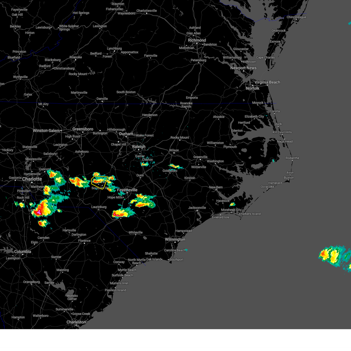 The storm which prompted the warning has weakened below severe limits, and no longer poses an immediate threat to life or property. therefore, the warning will be allowed to expire. however, small hail and gusty winds are still possible with this thunderstorm. a severe thunderstorm watch remains in effect until 1000 pm edt for central north carolina. The storm which prompted the warning has weakened below severe limits, and no longer poses an immediate threat to life or property. therefore, the warning will be allowed to expire. however, small hail and gusty winds are still possible with this thunderstorm. a severe thunderstorm watch remains in effect until 1000 pm edt for central north carolina.
|
| 4/20/2024 5:03 PM EDT |
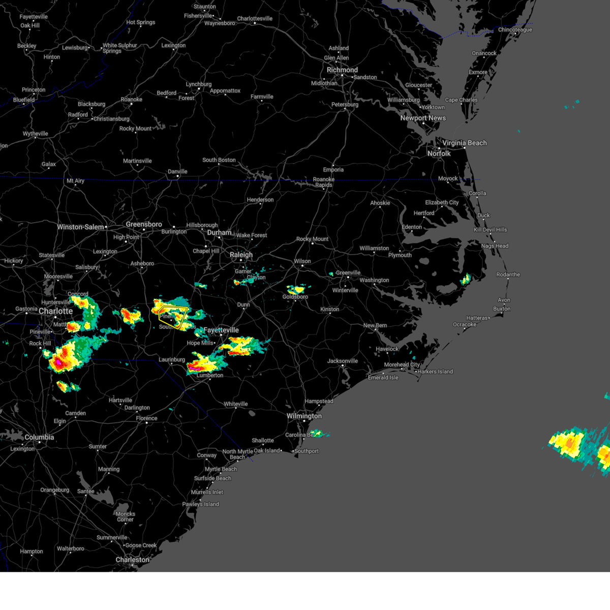 At 503 pm edt, a severe thunderstorm was located near pinehurst, or 8 miles northwest of southern pines, moving southeast at 35 mph (radar indicated). Hazards include 60 mph wind gusts and quarter size hail. Hail damage to vehicles is expected. expect wind damage to roofs, siding, and trees. Locations impacted include, southern pines, pinehurst, aberdeen, whispering pines, foxfire, taylortown, and seven lakes. At 503 pm edt, a severe thunderstorm was located near pinehurst, or 8 miles northwest of southern pines, moving southeast at 35 mph (radar indicated). Hazards include 60 mph wind gusts and quarter size hail. Hail damage to vehicles is expected. expect wind damage to roofs, siding, and trees. Locations impacted include, southern pines, pinehurst, aberdeen, whispering pines, foxfire, taylortown, and seven lakes.
|
| 4/20/2024 4:56 PM EDT |
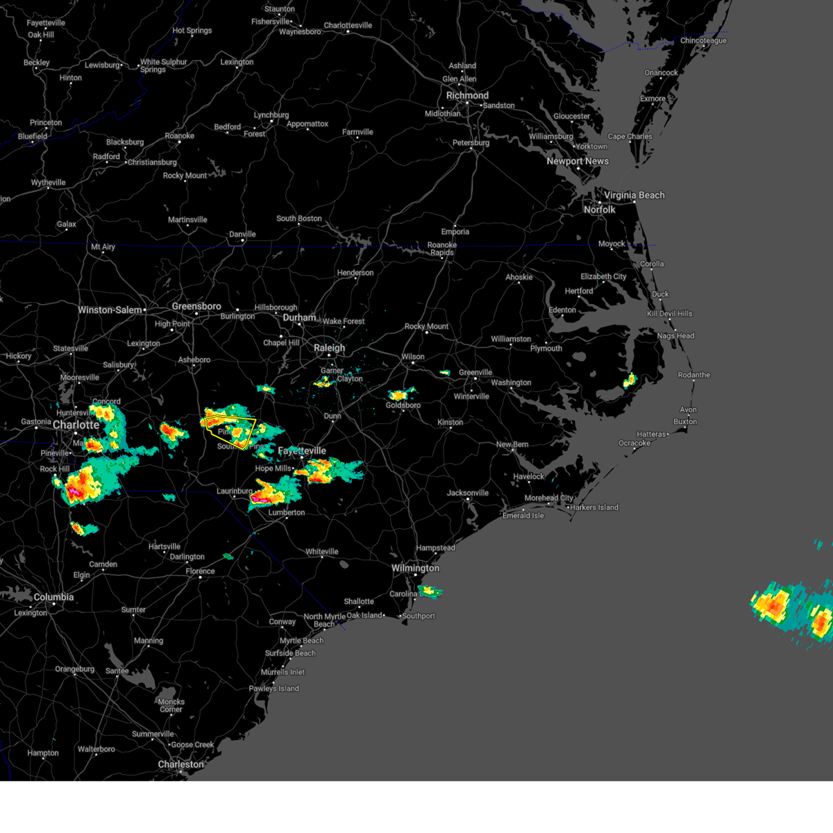 the severe thunderstorm warning has been cancelled and is no longer in effect the severe thunderstorm warning has been cancelled and is no longer in effect
|
| 4/20/2024 4:56 PM EDT |
 At 455 pm edt, a severe thunderstorm was located 9 miles northwest of pinehurst, or 11 miles southwest of carthage, moving southeast at 30 mph (radar indicated). Hazards include 60 mph wind gusts and quarter size hail. Hail damage to vehicles is expected. expect wind damage to roofs, siding, and trees. Locations impacted include, southern pines, pinehurst, aberdeen, whispering pines, foxfire, taylortown, seven lakes, and eagle springs. At 455 pm edt, a severe thunderstorm was located 9 miles northwest of pinehurst, or 11 miles southwest of carthage, moving southeast at 30 mph (radar indicated). Hazards include 60 mph wind gusts and quarter size hail. Hail damage to vehicles is expected. expect wind damage to roofs, siding, and trees. Locations impacted include, southern pines, pinehurst, aberdeen, whispering pines, foxfire, taylortown, seven lakes, and eagle springs.
|
| 4/20/2024 4:45 PM EDT |
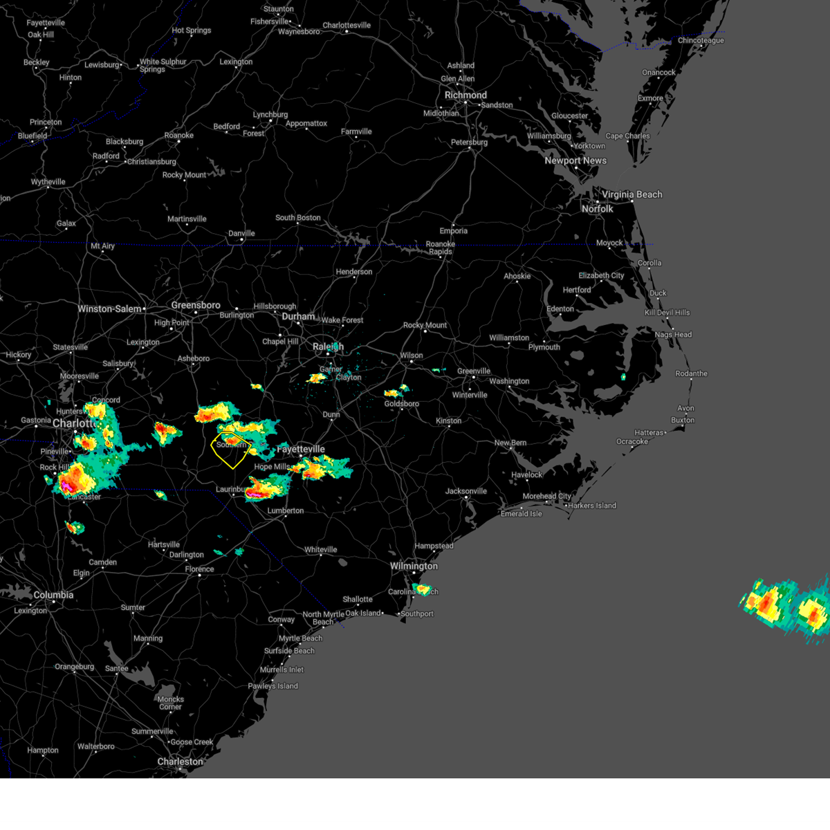 the severe thunderstorm warning has been cancelled and is no longer in effect the severe thunderstorm warning has been cancelled and is no longer in effect
|
| 4/20/2024 4:42 PM EDT |
 At 442 pm edt, a severe thunderstorm was located near biscoe, or 11 miles east of troy, moving southeast at 30 mph (radar indicated). Hazards include two inch hail and 60 mph wind gusts. People and animals outdoors will be injured. expect hail damage to roofs, siding, windows, and vehicles. expect wind damage to roofs, siding, and trees. Locations impacted include, southern pines, carthage, pinehurst, aberdeen, biscoe, whispering pines, foxfire, candor, taylortown, and seven lakes. At 442 pm edt, a severe thunderstorm was located near biscoe, or 11 miles east of troy, moving southeast at 30 mph (radar indicated). Hazards include two inch hail and 60 mph wind gusts. People and animals outdoors will be injured. expect hail damage to roofs, siding, windows, and vehicles. expect wind damage to roofs, siding, and trees. Locations impacted include, southern pines, carthage, pinehurst, aberdeen, biscoe, whispering pines, foxfire, candor, taylortown, and seven lakes.
|
| 4/20/2024 4:36 PM EDT |
 At 436 pm edt, a severe thunderstorm was located near pinehurst, or near southern pines, moving southeast at 30 mph (radar indicated). Hazards include ping pong ball size hail and 60 mph wind gusts. People and animals outdoors will be injured. expect hail damage to roofs, siding, windows, and vehicles. expect wind damage to roofs, siding, and trees. Locations impacted include, southern pines, pinehurst, aberdeen, hoffman, pinebluff, foxfire, taylortown, camp mackall, ashley heights, and sandhills game land. At 436 pm edt, a severe thunderstorm was located near pinehurst, or near southern pines, moving southeast at 30 mph (radar indicated). Hazards include ping pong ball size hail and 60 mph wind gusts. People and animals outdoors will be injured. expect hail damage to roofs, siding, windows, and vehicles. expect wind damage to roofs, siding, and trees. Locations impacted include, southern pines, pinehurst, aberdeen, hoffman, pinebluff, foxfire, taylortown, camp mackall, ashley heights, and sandhills game land.
|
| 4/20/2024 4:36 PM EDT |
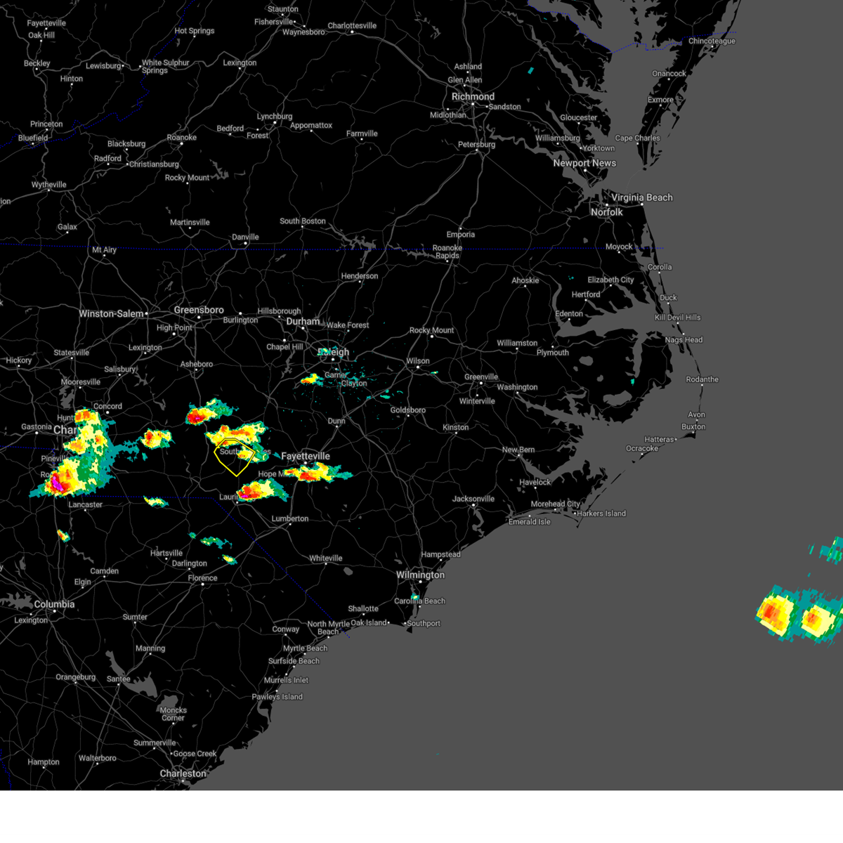 the severe thunderstorm warning has been cancelled and is no longer in effect the severe thunderstorm warning has been cancelled and is no longer in effect
|
| 4/20/2024 4:30 PM EDT |
 Svrrah the national weather service in raleigh has issued a * severe thunderstorm warning for, central moore county in central north carolina, northeastern montgomery county in central north carolina, * until 515 pm edt. * at 430 pm edt, a severe thunderstorm was located over biscoe, or near troy, moving east at 45 mph (radar indicated. at 415 pm the public reported golf ball sized hail near troy). Hazards include two inch hail and 60 mph wind gusts. People and animals outdoors will be injured. expect hail damage to roofs, siding, windows, and vehicles. Expect wind damage to roofs, siding, and trees. Svrrah the national weather service in raleigh has issued a * severe thunderstorm warning for, central moore county in central north carolina, northeastern montgomery county in central north carolina, * until 515 pm edt. * at 430 pm edt, a severe thunderstorm was located over biscoe, or near troy, moving east at 45 mph (radar indicated. at 415 pm the public reported golf ball sized hail near troy). Hazards include two inch hail and 60 mph wind gusts. People and animals outdoors will be injured. expect hail damage to roofs, siding, windows, and vehicles. Expect wind damage to roofs, siding, and trees.
|
| 4/20/2024 4:26 PM EDT |
 At 426 pm edt, a severe thunderstorm was located 7 miles west of pinehurst, or 11 miles west of southern pines, moving east at 30 mph (radar indicated). Hazards include ping pong ball size hail and 60 mph wind gusts. People and animals outdoors will be injured. expect hail damage to roofs, siding, windows, and vehicles. expect wind damage to roofs, siding, and trees. Locations impacted include, southern pines, pinehurst, aberdeen, hoffman, pinebluff, foxfire, taylortown, derby, seven lakes, and camp mackall. At 426 pm edt, a severe thunderstorm was located 7 miles west of pinehurst, or 11 miles west of southern pines, moving east at 30 mph (radar indicated). Hazards include ping pong ball size hail and 60 mph wind gusts. People and animals outdoors will be injured. expect hail damage to roofs, siding, windows, and vehicles. expect wind damage to roofs, siding, and trees. Locations impacted include, southern pines, pinehurst, aberdeen, hoffman, pinebluff, foxfire, taylortown, derby, seven lakes, and camp mackall.
|
| 4/20/2024 4:13 PM EDT |
 Svrrah the national weather service in raleigh has issued a * severe thunderstorm warning for, southwestern moore county in central north carolina, north central scotland county in central north carolina, southeastern montgomery county in central north carolina, northeastern richmond county in central north carolina, northwestern hoke county in central north carolina, * until 500 pm edt. * at 413 pm edt, a severe thunderstorm was located 9 miles south of biscoe, or 12 miles southeast of troy, moving southeast at 30 mph (radar indicated). Hazards include ping pong ball size hail and 60 mph wind gusts. People and animals outdoors will be injured. expect hail damage to roofs, siding, windows, and vehicles. Expect wind damage to roofs, siding, and trees. Svrrah the national weather service in raleigh has issued a * severe thunderstorm warning for, southwestern moore county in central north carolina, north central scotland county in central north carolina, southeastern montgomery county in central north carolina, northeastern richmond county in central north carolina, northwestern hoke county in central north carolina, * until 500 pm edt. * at 413 pm edt, a severe thunderstorm was located 9 miles south of biscoe, or 12 miles southeast of troy, moving southeast at 30 mph (radar indicated). Hazards include ping pong ball size hail and 60 mph wind gusts. People and animals outdoors will be injured. expect hail damage to roofs, siding, windows, and vehicles. Expect wind damage to roofs, siding, and trees.
|
| 4/20/2024 4:07 PM EDT |
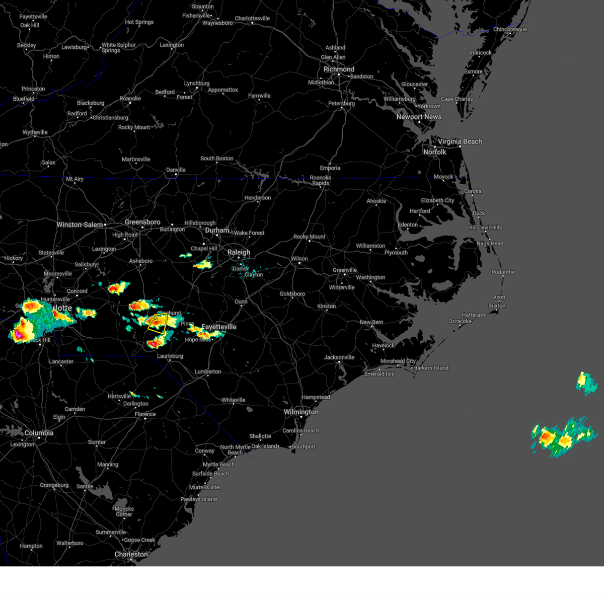 the severe thunderstorm warning has been cancelled and is no longer in effect the severe thunderstorm warning has been cancelled and is no longer in effect
|
| 4/20/2024 4:07 PM EDT |
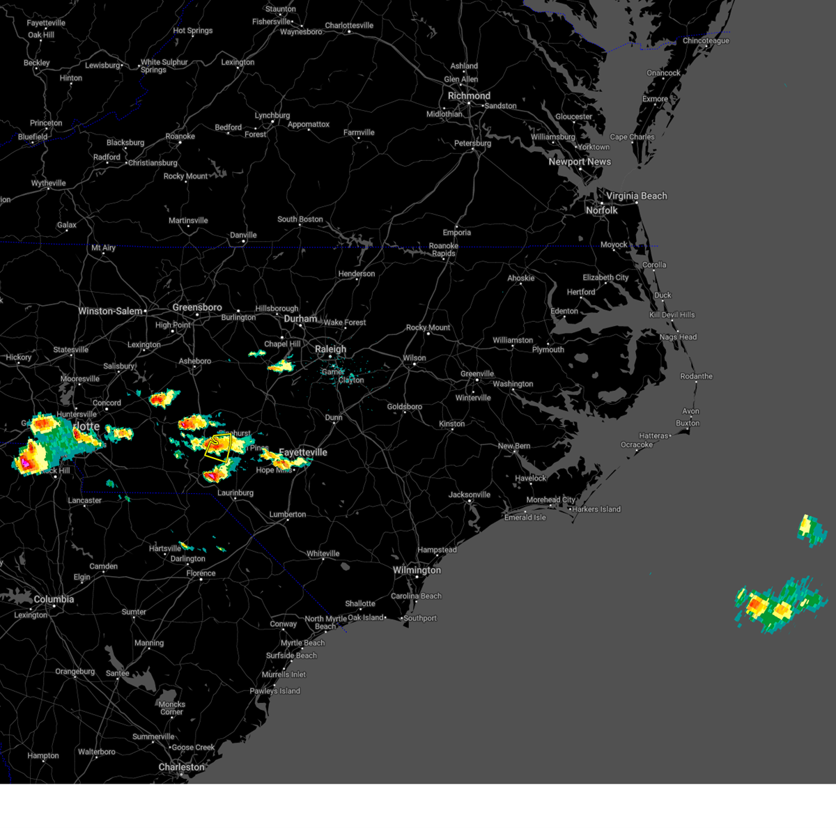 At 406 pm edt, a severe thunderstorm was located 7 miles southwest of pinehurst, or 10 miles west of southern pines, moving east at 25 mph (radar indicated). Hazards include 60 mph wind gusts. Expect damage to roofs, siding, and trees. Locations impacted include, hoffman, foxfire, derby, and sandhills game land. At 406 pm edt, a severe thunderstorm was located 7 miles southwest of pinehurst, or 10 miles west of southern pines, moving east at 25 mph (radar indicated). Hazards include 60 mph wind gusts. Expect damage to roofs, siding, and trees. Locations impacted include, hoffman, foxfire, derby, and sandhills game land.
|
| 4/20/2024 3:43 PM EDT |
 At 341 pm edt, a severe thunderstorm was located 13 miles south of biscoe, or 15 miles southeast of troy, moving southeast at 20 mph. additional storms have developed just to the west and will have the potential to further impact the waring area (radar indicated). Hazards include 60 mph wind gusts. Expect damage to roofs, siding, and trees. Locations impacted include, pinehurst, hoffman, foxfire, norman, derby, seven lakes, covington, pekin, and sandhills game land. At 341 pm edt, a severe thunderstorm was located 13 miles south of biscoe, or 15 miles southeast of troy, moving southeast at 20 mph. additional storms have developed just to the west and will have the potential to further impact the waring area (radar indicated). Hazards include 60 mph wind gusts. Expect damage to roofs, siding, and trees. Locations impacted include, pinehurst, hoffman, foxfire, norman, derby, seven lakes, covington, pekin, and sandhills game land.
|
| 4/20/2024 3:29 PM EDT |
 Svrrah the national weather service in raleigh has issued a * severe thunderstorm warning for, southwestern moore county in central north carolina, southeastern montgomery county in central north carolina, northeastern richmond county in central north carolina, * until 415 pm edt. * at 328 pm edt, a severe thunderstorm was located 11 miles south of biscoe, or 11 miles south of troy, moving east at 15 mph (radar indicated). Hazards include 60 mph wind gusts. expect damage to roofs, siding, and trees Svrrah the national weather service in raleigh has issued a * severe thunderstorm warning for, southwestern moore county in central north carolina, southeastern montgomery county in central north carolina, northeastern richmond county in central north carolina, * until 415 pm edt. * at 328 pm edt, a severe thunderstorm was located 11 miles south of biscoe, or 11 miles south of troy, moving east at 15 mph (radar indicated). Hazards include 60 mph wind gusts. expect damage to roofs, siding, and trees
|
| 4/19/2024 2:38 PM EDT |
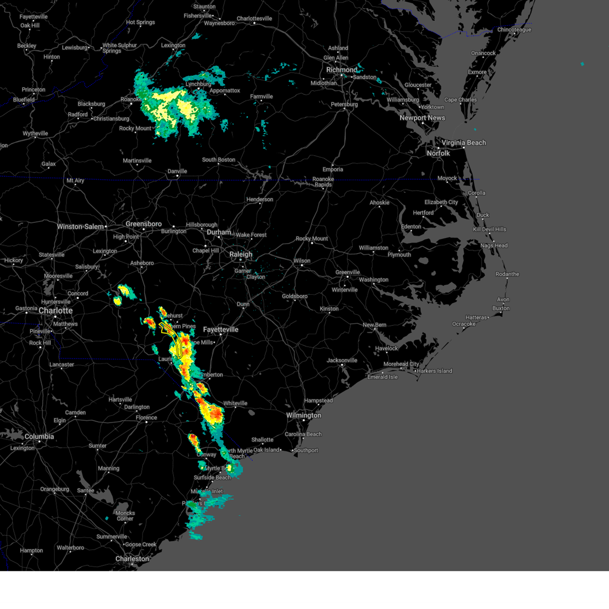 The storms which prompted the warning have moved out of the warnered area. therefore, the warning will be allowed to expire. to report severe weather, contact your nearest law enforcement agency. they will relay your report to the national weather service raleigh. remember, another severe thunderstorm warning remains in effect for hoke and southeastern moore counties until 300 pm edt!. The storms which prompted the warning have moved out of the warnered area. therefore, the warning will be allowed to expire. to report severe weather, contact your nearest law enforcement agency. they will relay your report to the national weather service raleigh. remember, another severe thunderstorm warning remains in effect for hoke and southeastern moore counties until 300 pm edt!.
|
| 4/19/2024 2:29 PM EDT |
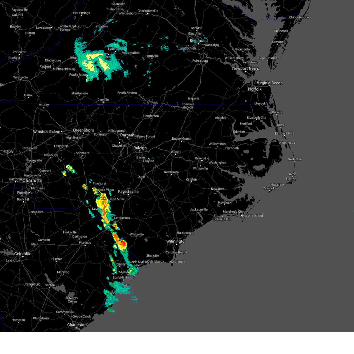 the severe thunderstorm warning has been cancelled and is no longer in effect the severe thunderstorm warning has been cancelled and is no longer in effect
|
| 4/19/2024 2:29 PM EDT |
 At 229 pm edt, severe thunderstorms were located along a line extending from near hoffman to 10 miles southwest of raeford, moving northeast at 20 mph (radar indicated). Hazards include 60 mph wind gusts. Expect damage to roofs, siding, and trees. Locations impacted include, pinebluff, foxfire, and wagram. At 229 pm edt, severe thunderstorms were located along a line extending from near hoffman to 10 miles southwest of raeford, moving northeast at 20 mph (radar indicated). Hazards include 60 mph wind gusts. Expect damage to roofs, siding, and trees. Locations impacted include, pinebluff, foxfire, and wagram.
|
| 4/19/2024 2:19 PM EDT |
 At 219 pm edt, severe thunderstorms were located along a line extending from near hoffman to 8 miles north of laurinburg, moving northeast at 20 mph (radar indicated). Hazards include 60 mph wind gusts. Expect damage to roofs, siding, and trees. Locations impacted include, hoffman, pinebluff, foxfire, wagram, camp mackall, and sandhills game land. At 219 pm edt, severe thunderstorms were located along a line extending from near hoffman to 8 miles north of laurinburg, moving northeast at 20 mph (radar indicated). Hazards include 60 mph wind gusts. Expect damage to roofs, siding, and trees. Locations impacted include, hoffman, pinebluff, foxfire, wagram, camp mackall, and sandhills game land.
|
| 4/19/2024 2:04 PM EDT |
 At 204 pm edt, severe thunderstorms were located along a line extending from near hoffman to 6 miles north of laurinburg, moving east at 30 mph (radar indicated). Hazards include 60 mph wind gusts and quarter size hail. Hail damage to vehicles is expected. expect wind damage to roofs, siding, and trees. Locations impacted include, hoffman, pinebluff, foxfire, wagram, laurel hill, sandhills game land, and camp mackall. At 204 pm edt, severe thunderstorms were located along a line extending from near hoffman to 6 miles north of laurinburg, moving east at 30 mph (radar indicated). Hazards include 60 mph wind gusts and quarter size hail. Hail damage to vehicles is expected. expect wind damage to roofs, siding, and trees. Locations impacted include, hoffman, pinebluff, foxfire, wagram, laurel hill, sandhills game land, and camp mackall.
|
| 4/19/2024 1:49 PM EDT |
 Svrrah the national weather service in raleigh has issued a * severe thunderstorm warning for, south central moore county in central north carolina, scotland county in central north carolina, eastern richmond county in central north carolina, southwestern hoke county in central north carolina, * until 245 pm edt. * at 148 pm edt, severe thunderstorms were located along a line extending from near rockingham to near hamlet, moving northeast at 20 mph (radar indicated). Hazards include 60 mph wind gusts and penny size hail. expect damage to roofs, siding, and trees Svrrah the national weather service in raleigh has issued a * severe thunderstorm warning for, south central moore county in central north carolina, scotland county in central north carolina, eastern richmond county in central north carolina, southwestern hoke county in central north carolina, * until 245 pm edt. * at 148 pm edt, severe thunderstorms were located along a line extending from near rockingham to near hamlet, moving northeast at 20 mph (radar indicated). Hazards include 60 mph wind gusts and penny size hail. expect damage to roofs, siding, and trees
|
| 4/12/2024 5:45 PM EDT |
 Svrrah the national weather service in raleigh has issued a * severe thunderstorm warning for, southeastern moore county in central north carolina, scotland county in central north carolina, southern harnett county in central north carolina, eastern richmond county in central north carolina, cumberland county in central north carolina, hoke county in central north carolina, * until 645 pm edt. * at 545 pm edt, severe thunderstorms were located along a line extending from near carthage to near hoffman to near rockingham, moving east at 50 mph (radar indicated). Hazards include 60 mph wind gusts. expect damage to roofs, siding, and trees Svrrah the national weather service in raleigh has issued a * severe thunderstorm warning for, southeastern moore county in central north carolina, scotland county in central north carolina, southern harnett county in central north carolina, eastern richmond county in central north carolina, cumberland county in central north carolina, hoke county in central north carolina, * until 645 pm edt. * at 545 pm edt, severe thunderstorms were located along a line extending from near carthage to near hoffman to near rockingham, moving east at 50 mph (radar indicated). Hazards include 60 mph wind gusts. expect damage to roofs, siding, and trees
|
| 4/11/2024 8:41 PM EDT |
 At 841 pm edt, a severe thunderstorm was located over biscoe, or 7 miles southeast of troy, moving northeast at 50 mph (radar indicated). Hazards include 60 mph wind gusts. Expect damage to roofs, siding, and trees. Locations impacted include, albemarle, southern pines, rockingham, troy, carthage, pinehurst, hamlet, aberdeen, biscoe, and hoffman. At 841 pm edt, a severe thunderstorm was located over biscoe, or 7 miles southeast of troy, moving northeast at 50 mph (radar indicated). Hazards include 60 mph wind gusts. Expect damage to roofs, siding, and trees. Locations impacted include, albemarle, southern pines, rockingham, troy, carthage, pinehurst, hamlet, aberdeen, biscoe, and hoffman.
|
| 4/11/2024 8:18 PM EDT |
 Svrrah the national weather service in raleigh has issued a * severe thunderstorm warning for, moore county in central north carolina, anson county in central north carolina, montgomery county in central north carolina, richmond county in central north carolina, south central randolph county in central north carolina, southeastern stanly county in central north carolina, * until 900 pm edt. * at 817 pm edt, a severe thunderstorm was located 8 miles east of ansonville, or 11 miles northeast of wadesboro, moving northeast at 40 mph (radar indicated). Hazards include 60 mph wind gusts. expect damage to roofs, siding, and trees Svrrah the national weather service in raleigh has issued a * severe thunderstorm warning for, moore county in central north carolina, anson county in central north carolina, montgomery county in central north carolina, richmond county in central north carolina, south central randolph county in central north carolina, southeastern stanly county in central north carolina, * until 900 pm edt. * at 817 pm edt, a severe thunderstorm was located 8 miles east of ansonville, or 11 miles northeast of wadesboro, moving northeast at 40 mph (radar indicated). Hazards include 60 mph wind gusts. expect damage to roofs, siding, and trees
|
| 1/9/2024 4:55 PM EST |
 At 454 pm est, severe thunderstorms were located along a line extending from near goldston to near carthage to near pinehurst, moving northeast at 65 mph (radar indicated). Hazards include 60 mph wind gusts. expect damage to roofs, siding, and trees At 454 pm est, severe thunderstorms were located along a line extending from near goldston to near carthage to near pinehurst, moving northeast at 65 mph (radar indicated). Hazards include 60 mph wind gusts. expect damage to roofs, siding, and trees
|
| 1/9/2024 4:43 PM EST |
 At 443 pm est, severe thunderstorms were located along a line extending from mebane to 7 miles north of goldston to near carthage, moving northeast at 60 mph (radar indicated). Hazards include 60 mph wind gusts. Expect damage to roofs, siding, and trees. Locations impacted include, durham, chapel hill, sanford, hillsborough, pittsboro, carthage, siler city, carrboro, pinehurst, and goldston. At 443 pm est, severe thunderstorms were located along a line extending from mebane to 7 miles north of goldston to near carthage, moving northeast at 60 mph (radar indicated). Hazards include 60 mph wind gusts. Expect damage to roofs, siding, and trees. Locations impacted include, durham, chapel hill, sanford, hillsborough, pittsboro, carthage, siler city, carrboro, pinehurst, and goldston.
|
| 1/9/2024 4:38 PM EST |
 At 438 pm est, severe thunderstorms were located along a line extending from 12 miles north of rockingham to floyd, moving northeast at 45 mph (radar indicated). Hazards include 60 mph wind gusts. expect damage to roofs, siding, and trees At 438 pm est, severe thunderstorms were located along a line extending from 12 miles north of rockingham to floyd, moving northeast at 45 mph (radar indicated). Hazards include 60 mph wind gusts. expect damage to roofs, siding, and trees
|
| 1/9/2024 4:27 PM EST |
 At 427 pm est, severe thunderstorms were located along a line extending from 12 miles south of biscoe to 6 miles south of cheraw state park, moving northeast at 50 mph (radar indicated). Hazards include 60 mph wind gusts. Expect damage to roofs, siding, and trees. Locations impacted include, rockingham, pinehurst, hamlet, hoffman, pinebluff, ellerbe, foxfire, dobbins heights, taylortown, and gibson. At 427 pm est, severe thunderstorms were located along a line extending from 12 miles south of biscoe to 6 miles south of cheraw state park, moving northeast at 50 mph (radar indicated). Hazards include 60 mph wind gusts. Expect damage to roofs, siding, and trees. Locations impacted include, rockingham, pinehurst, hamlet, hoffman, pinebluff, ellerbe, foxfire, dobbins heights, taylortown, and gibson.
|
| 1/9/2024 4:19 PM EST |
 At 419 pm est, severe thunderstorms were located along a line extending from 12 miles south of mcleansville to 8 miles east of seagrove to 11 miles south of biscoe, moving northeast at 65 mph (radar indicated). Hazards include 60 mph wind gusts. expect damage to roofs, siding, and trees At 419 pm est, severe thunderstorms were located along a line extending from 12 miles south of mcleansville to 8 miles east of seagrove to 11 miles south of biscoe, moving northeast at 65 mph (radar indicated). Hazards include 60 mph wind gusts. expect damage to roofs, siding, and trees
|
| 1/9/2024 3:57 PM EST |
 At 357 pm est, severe thunderstorms were located along a line extending from near wadesboro to 6 miles west of clyde, moving northeast at 55 mph (radar indicated). Hazards include 60 mph wind gusts. expect damage to roofs, siding, and trees At 357 pm est, severe thunderstorms were located along a line extending from near wadesboro to 6 miles west of clyde, moving northeast at 55 mph (radar indicated). Hazards include 60 mph wind gusts. expect damage to roofs, siding, and trees
|
| 1/9/2024 3:22 PM EST |
 At 322 pm est, severe thunderstorms were located along a line extending from 7 miles east of rockwell to near sturdivants, moving northeast at 70 mph (radar indicated). Hazards include 60 mph wind gusts. expect damage to roofs, siding, and trees At 322 pm est, severe thunderstorms were located along a line extending from 7 miles east of rockwell to near sturdivants, moving northeast at 70 mph (radar indicated). Hazards include 60 mph wind gusts. expect damage to roofs, siding, and trees
|
| 9/9/2023 7:05 PM EDT |
 At 705 pm edt, a severe thunderstorm was located 9 miles northwest of hoffman, or 14 miles west of southern pines, moving northwest at 25 mph (radar indicated). Hazards include 60 mph wind gusts and quarter size hail. Hail damage to vehicles is expected. expect wind damage to roofs, siding, and trees. locations impacted include, biscoe, foxfire, candor, norman, derby, seven lakes, eagle springs, pekin and sandhills game land. hail threat, radar indicated max hail size, 1. 00 in wind threat, radar indicated max wind gust, 60 mph. At 705 pm edt, a severe thunderstorm was located 9 miles northwest of hoffman, or 14 miles west of southern pines, moving northwest at 25 mph (radar indicated). Hazards include 60 mph wind gusts and quarter size hail. Hail damage to vehicles is expected. expect wind damage to roofs, siding, and trees. locations impacted include, biscoe, foxfire, candor, norman, derby, seven lakes, eagle springs, pekin and sandhills game land. hail threat, radar indicated max hail size, 1. 00 in wind threat, radar indicated max wind gust, 60 mph.
|
| 9/9/2023 6:43 PM EDT |
 At 643 pm edt, a severe thunderstorm was located over hoffman, or 13 miles southwest of southern pines, moving northwest at 25 mph (radar indicated). Hazards include 60 mph wind gusts. expect damage to roofs, siding, and trees At 643 pm edt, a severe thunderstorm was located over hoffman, or 13 miles southwest of southern pines, moving northwest at 25 mph (radar indicated). Hazards include 60 mph wind gusts. expect damage to roofs, siding, and trees
|
| 8/29/2023 5:18 PM EDT |
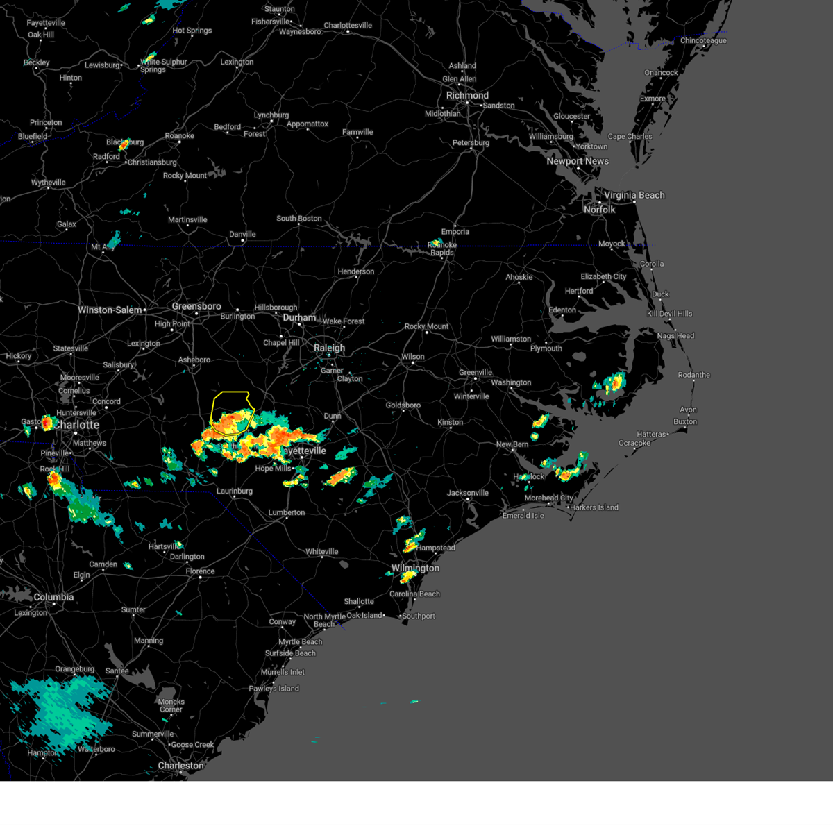 At 518 pm edt, a severe thunderstorm was located near carthage, moving northeast at 5 mph (radar indicated). Hazards include 60 mph wind gusts and penny size hail. expect damage to roofs, siding, and trees At 518 pm edt, a severe thunderstorm was located near carthage, moving northeast at 5 mph (radar indicated). Hazards include 60 mph wind gusts and penny size hail. expect damage to roofs, siding, and trees
|
| 8/10/2023 10:51 AM EDT |
 The severe thunderstorm warning for richmond county will expire at 1100 am edt, the storm which prompted the warning has weakened below severe limits, and no longer poses an immediate threat to life or property. therefore, the warning will be allowed to expire. however gusty winds are still possible with this thunderstorm. The severe thunderstorm warning for richmond county will expire at 1100 am edt, the storm which prompted the warning has weakened below severe limits, and no longer poses an immediate threat to life or property. therefore, the warning will be allowed to expire. however gusty winds are still possible with this thunderstorm.
|
| 8/10/2023 10:47 AM EDT |
 At 1047 am edt, a severe thunderstorm was located near hoffman, or 11 miles southwest of southern pines, moving east at 55 mph (radar indicated). Hazards include 60 mph wind gusts and penny size hail. Expect damage to roofs, siding, and trees. locations impacted include, rockingham, hamlet, hoffman, ellerbe, dobbins heights, norman, east rockingham, derby and sandhills game land. hail threat, radar indicated max hail size, 0. 75 in wind threat, radar indicated max wind gust, 60 mph. At 1047 am edt, a severe thunderstorm was located near hoffman, or 11 miles southwest of southern pines, moving east at 55 mph (radar indicated). Hazards include 60 mph wind gusts and penny size hail. Expect damage to roofs, siding, and trees. locations impacted include, rockingham, hamlet, hoffman, ellerbe, dobbins heights, norman, east rockingham, derby and sandhills game land. hail threat, radar indicated max hail size, 0. 75 in wind threat, radar indicated max wind gust, 60 mph.
|
| 8/10/2023 10:36 AM EDT |
 At 1035 am edt, a severe thunderstorm was located near rockingham, moving northeast at 60 mph (radar indicated). Hazards include 60 mph wind gusts and penny size hail. Expect damage to roofs, siding, and trees. locations impacted include, rockingham, hamlet, hoffman, ellerbe, dobbins heights, norman, mcfarlan, diggs, blewett falls lake and derby. hail threat, radar indicated max hail size, 0. 75 in wind threat, radar indicated max wind gust, 60 mph. At 1035 am edt, a severe thunderstorm was located near rockingham, moving northeast at 60 mph (radar indicated). Hazards include 60 mph wind gusts and penny size hail. Expect damage to roofs, siding, and trees. locations impacted include, rockingham, hamlet, hoffman, ellerbe, dobbins heights, norman, mcfarlan, diggs, blewett falls lake and derby. hail threat, radar indicated max hail size, 0. 75 in wind threat, radar indicated max wind gust, 60 mph.
|
| 8/10/2023 10:25 AM EDT |
 At 1025 am edt, a severe thunderstorm was located 8 miles east of wadesboro, moving east at 55 mph (radar indicated). Hazards include 60 mph wind gusts and penny size hail. expect damage to roofs, siding, and trees At 1025 am edt, a severe thunderstorm was located 8 miles east of wadesboro, moving east at 55 mph (radar indicated). Hazards include 60 mph wind gusts and penny size hail. expect damage to roofs, siding, and trees
|
| 8/7/2023 7:12 PM EDT |
 The severe thunderstorm warning for southeastern moore, scotland, southern anson, western harnett, richmond, lee and central hoke counties will expire at 715 pm edt, the storms which prompted the warning have moved out of the area. therefore, this particular warning will be allowed to expire. however gusty winds are still possible with these thunderstorms and additional severe thunderstorm warnings remain in effect to the east. The severe thunderstorm warning for southeastern moore, scotland, southern anson, western harnett, richmond, lee and central hoke counties will expire at 715 pm edt, the storms which prompted the warning have moved out of the area. therefore, this particular warning will be allowed to expire. however gusty winds are still possible with these thunderstorms and additional severe thunderstorm warnings remain in effect to the east.
|
| 8/7/2023 7:00 PM EDT |
 At 700 pm edt, severe thunderstorms were located along a line extending from near sanford to near raeford to near hamlet, moving east at 45 mph (radar indicated). Hazards include 70 mph wind gusts. Expect considerable tree damage. damage is likely to mobile homes, roofs, and outbuildings. Locations impacted include, sanford, laurinburg, southern pines, rockingham, wadesboro, pinehurst, hamlet, aberdeen, maxton and hoffman. At 700 pm edt, severe thunderstorms were located along a line extending from near sanford to near raeford to near hamlet, moving east at 45 mph (radar indicated). Hazards include 70 mph wind gusts. Expect considerable tree damage. damage is likely to mobile homes, roofs, and outbuildings. Locations impacted include, sanford, laurinburg, southern pines, rockingham, wadesboro, pinehurst, hamlet, aberdeen, maxton and hoffman.
|
| 8/7/2023 6:47 PM EDT |
 At 645 pm edt, severe thunderstorms were located along a line extending from near goldston to near aberdeen to 8 miles north of wallace, moving east at 55 mph (radar indicated). Hazards include 70 mph wind gusts. Expect considerable tree damage. damage is likely to mobile homes, roofs, and outbuildings. Locations impacted include, sanford, laurinburg, southern pines, rockingham, wadesboro, carthage, pinehurst, hamlet, aberdeen and maxton. At 645 pm edt, severe thunderstorms were located along a line extending from near goldston to near aberdeen to 8 miles north of wallace, moving east at 55 mph (radar indicated). Hazards include 70 mph wind gusts. Expect considerable tree damage. damage is likely to mobile homes, roofs, and outbuildings. Locations impacted include, sanford, laurinburg, southern pines, rockingham, wadesboro, carthage, pinehurst, hamlet, aberdeen and maxton.
|
| 8/7/2023 6:21 PM EDT |
 At 620 pm edt, severe thunderstorms were located along a line extending from near seagrove to 7 miles northwest of rockingham to near pageland, moving east at 55 mph (radar indicated). Hazards include 70 mph wind gusts. Expect considerable tree damage. Damage is likely to mobile homes, roofs, and outbuildings. At 620 pm edt, severe thunderstorms were located along a line extending from near seagrove to 7 miles northwest of rockingham to near pageland, moving east at 55 mph (radar indicated). Hazards include 70 mph wind gusts. Expect considerable tree damage. Damage is likely to mobile homes, roofs, and outbuildings.
|
| 7/31/2023 2:57 PM EDT |
 At 256 pm edt, a severe thunderstorm was located near hoffman, or 9 miles northeast of rockingham, moving southeast at 20 mph (radar indicated). Hazards include 60 mph wind gusts. expect damage to roofs, siding, and trees At 256 pm edt, a severe thunderstorm was located near hoffman, or 9 miles northeast of rockingham, moving southeast at 20 mph (radar indicated). Hazards include 60 mph wind gusts. expect damage to roofs, siding, and trees
|
| 7/31/2023 2:26 PM EDT |
 At 225 pm edt, a severe thunderstorm was located near southern pines, moving southeast at 30 mph (radar indicated). Hazards include 60 mph wind gusts. expect damage to roofs, siding, and trees At 225 pm edt, a severe thunderstorm was located near southern pines, moving southeast at 30 mph (radar indicated). Hazards include 60 mph wind gusts. expect damage to roofs, siding, and trees
|
| 7/31/2023 2:12 PM EDT |
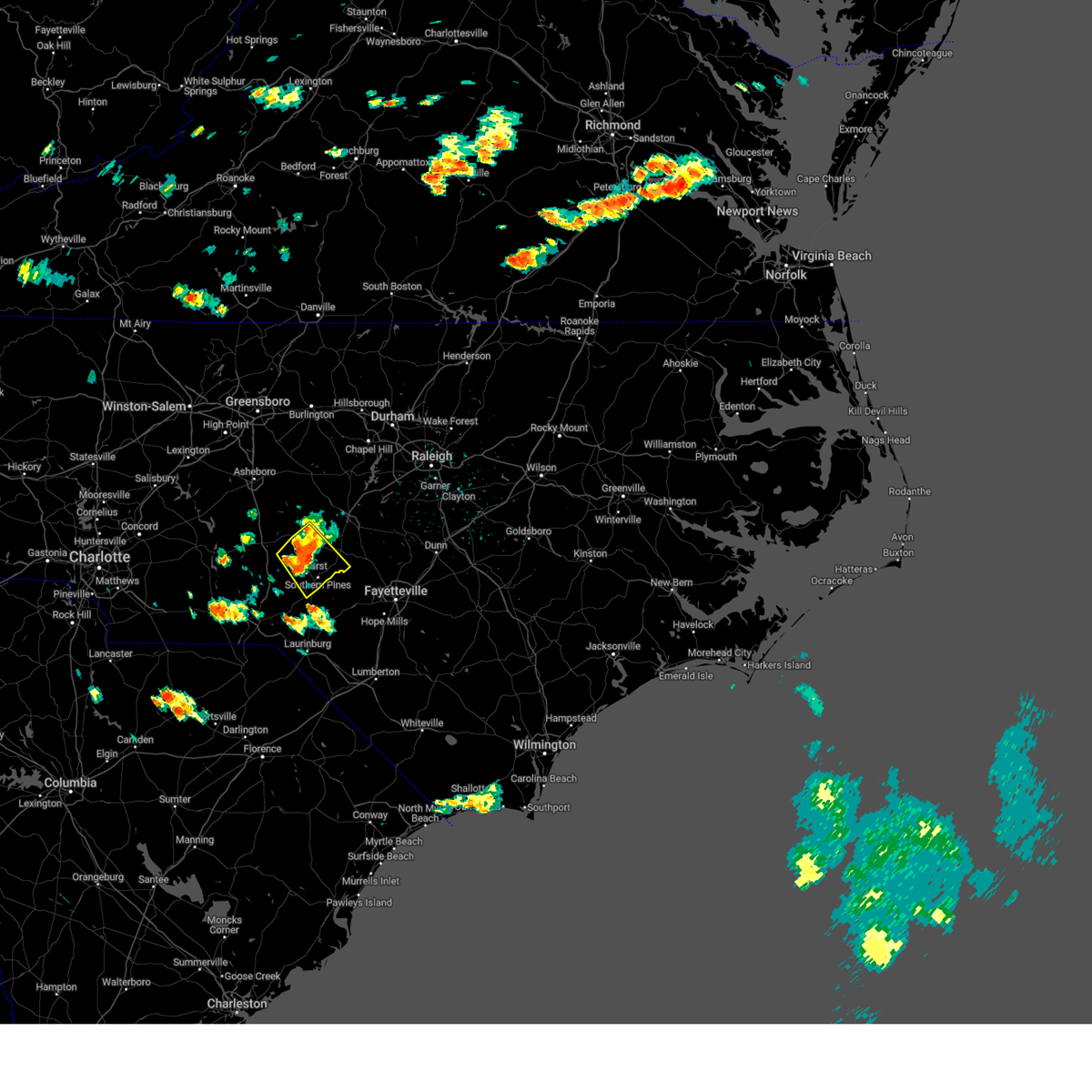 At 212 pm edt, a severe thunderstorm was located near pinehurst, or near carthage, moving southeast at 25 mph (radar indicated). Hazards include 60 mph wind gusts and quarter size hail. Hail damage to vehicles is expected. expect wind damage to roofs, siding, and trees. locations impacted include, southern pines, carthage, pinehurst, aberdeen, whispering pines, pinebluff, foxfire, taylortown, vass and seven lakes. hail threat, radar indicated max hail size, 1. 00 in wind threat, radar indicated max wind gust, 60 mph. At 212 pm edt, a severe thunderstorm was located near pinehurst, or near carthage, moving southeast at 25 mph (radar indicated). Hazards include 60 mph wind gusts and quarter size hail. Hail damage to vehicles is expected. expect wind damage to roofs, siding, and trees. locations impacted include, southern pines, carthage, pinehurst, aberdeen, whispering pines, pinebluff, foxfire, taylortown, vass and seven lakes. hail threat, radar indicated max hail size, 1. 00 in wind threat, radar indicated max wind gust, 60 mph.
|
| 7/31/2023 1:45 PM EDT |
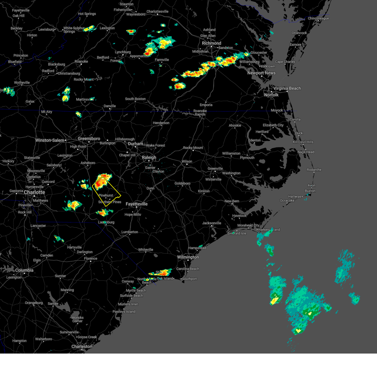 At 145 pm edt, a severe thunderstorm was located 9 miles west of carthage, moving southeast at 25 mph (radar indicated). Hazards include 60 mph wind gusts and quarter size hail. Hail damage to vehicles is expected. Expect wind damage to roofs, siding, and trees. At 145 pm edt, a severe thunderstorm was located 9 miles west of carthage, moving southeast at 25 mph (radar indicated). Hazards include 60 mph wind gusts and quarter size hail. Hail damage to vehicles is expected. Expect wind damage to roofs, siding, and trees.
|
| 7/1/2023 4:15 PM EDT |
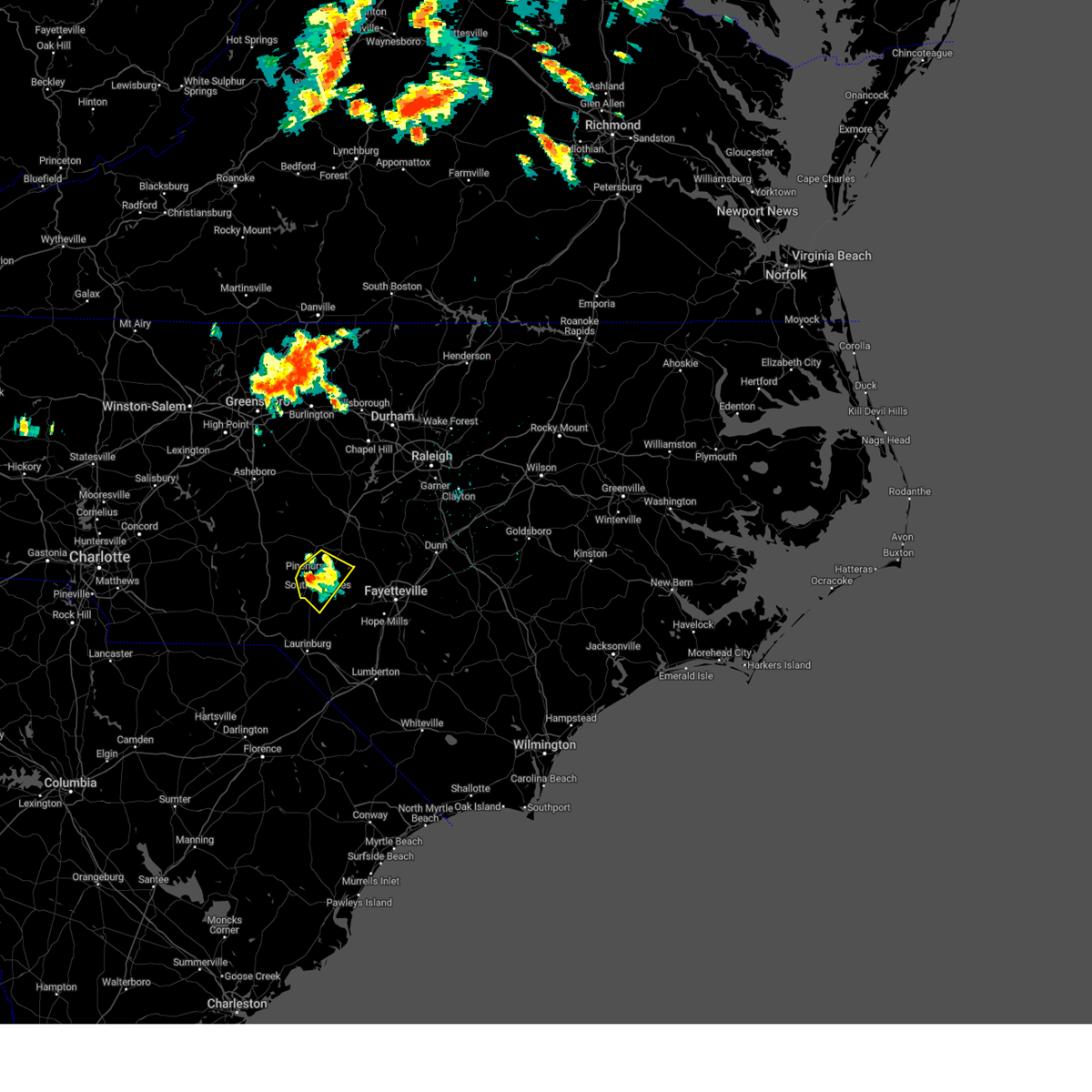 At 415 pm edt, a severe thunderstorm was located over pinehurst, or over southern pines, moving southeast at 10 mph (radar indicated). Hazards include 60 mph wind gusts and quarter size hail. Hail damage to vehicles is expected. expect wind damage to roofs, siding, and trees. locations impacted include, southern pines, pinehurst, aberdeen, whispering pines, pinebluff, taylortown, vass and ashley heights. hail threat, radar indicated max hail size, 1. 00 in wind threat, radar indicated max wind gust, 60 mph. At 415 pm edt, a severe thunderstorm was located over pinehurst, or over southern pines, moving southeast at 10 mph (radar indicated). Hazards include 60 mph wind gusts and quarter size hail. Hail damage to vehicles is expected. expect wind damage to roofs, siding, and trees. locations impacted include, southern pines, pinehurst, aberdeen, whispering pines, pinebluff, taylortown, vass and ashley heights. hail threat, radar indicated max hail size, 1. 00 in wind threat, radar indicated max wind gust, 60 mph.
|
| 7/1/2023 3:42 PM EDT |
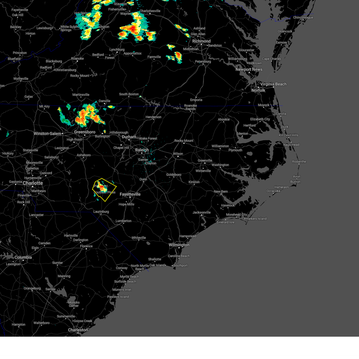 At 341 pm edt, a severe thunderstorm was located over pinehurst, or near southern pines, moving southeast at 10 mph (radar indicated). Hazards include 60 mph wind gusts and quarter size hail. Hail damage to vehicles is expected. Expect wind damage to roofs, siding, and trees. At 341 pm edt, a severe thunderstorm was located over pinehurst, or near southern pines, moving southeast at 10 mph (radar indicated). Hazards include 60 mph wind gusts and quarter size hail. Hail damage to vehicles is expected. Expect wind damage to roofs, siding, and trees.
|
| 6/26/2023 11:54 PM EDT |
 The severe thunderstorm warning for southern moore, north central scotland, southeastern montgomery, northeastern richmond and northern hoke counties will expire at midnight edt, the storms which prompted the warning have weakened below severe limits, and no longer poses an immediate threat to life or property. therefore, the warning will be allowed to expire. however, gusty winds are still possible with these thunderstorms. a severe thunderstorm watch remains in effect until 600 am edt for central north carolina. The severe thunderstorm warning for southern moore, north central scotland, southeastern montgomery, northeastern richmond and northern hoke counties will expire at midnight edt, the storms which prompted the warning have weakened below severe limits, and no longer poses an immediate threat to life or property. therefore, the warning will be allowed to expire. however, gusty winds are still possible with these thunderstorms. a severe thunderstorm watch remains in effect until 600 am edt for central north carolina.
|
| 6/26/2023 11:13 PM EDT |
 At 1113 pm edt, a severe thunderstorm was located 8 miles northwest of pinehurst, or 11 miles west of southern pines, moving east at 20 mph (radar indicated). Hazards include 60 mph wind gusts and quarter size hail. Hail damage to vehicles is expected. Expect wind damage to roofs, siding, and trees. At 1113 pm edt, a severe thunderstorm was located 8 miles northwest of pinehurst, or 11 miles west of southern pines, moving east at 20 mph (radar indicated). Hazards include 60 mph wind gusts and quarter size hail. Hail damage to vehicles is expected. Expect wind damage to roofs, siding, and trees.
|
| 6/26/2023 10:20 PM EDT |
 At 1020 pm edt, severe thunderstorms were located along a line extending from near cary to near troy, moving southeast at 30 mph (radar indicated). Hazards include 60 mph wind gusts and half dollar size hail. Hail damage to vehicles is expected. Expect wind damage to roofs, siding, and trees. At 1020 pm edt, severe thunderstorms were located along a line extending from near cary to near troy, moving southeast at 30 mph (radar indicated). Hazards include 60 mph wind gusts and half dollar size hail. Hail damage to vehicles is expected. Expect wind damage to roofs, siding, and trees.
|
| 6/26/2023 8:35 PM EDT |
 The severe thunderstorm warning for moore, southwestern harnett, southeastern montgomery, lee and north central hoke counties will expire at 845 pm edt, the storm which prompted the warning has weakened below severe limits, and no longer poses an immediate threat to life or property. therefore, the warning will be allowed to expire. however small hail is still possible with this thunderstorm. a severe thunderstorm watch remains in effect until 1100 pm edt for central north carolina. The severe thunderstorm warning for moore, southwestern harnett, southeastern montgomery, lee and north central hoke counties will expire at 845 pm edt, the storm which prompted the warning has weakened below severe limits, and no longer poses an immediate threat to life or property. therefore, the warning will be allowed to expire. however small hail is still possible with this thunderstorm. a severe thunderstorm watch remains in effect until 1100 pm edt for central north carolina.
|
| 6/26/2023 8:17 PM EDT |
 At 817 pm edt, a severe thunderstorm was located near carthage, moving east at 20 mph (radar indicated). Hazards include 60 mph wind gusts and half dollar size hail. Hail damage to vehicles is expected. expect wind damage to roofs, siding, and trees. locations impacted include, sanford, southern pines, carthage, pinehurst, biscoe, whispering pines, broadway, robbins, foxfire and candor. hail threat, radar indicated max hail size, 1. 25 in wind threat, radar indicated max wind gust, 60 mph. At 817 pm edt, a severe thunderstorm was located near carthage, moving east at 20 mph (radar indicated). Hazards include 60 mph wind gusts and half dollar size hail. Hail damage to vehicles is expected. expect wind damage to roofs, siding, and trees. locations impacted include, sanford, southern pines, carthage, pinehurst, biscoe, whispering pines, broadway, robbins, foxfire and candor. hail threat, radar indicated max hail size, 1. 25 in wind threat, radar indicated max wind gust, 60 mph.
|
| 6/26/2023 7:44 PM EDT |
 At 744 pm edt, a severe thunderstorm was located 7 miles southeast of biscoe, or 12 miles east of troy, moving east at 40 mph (radar indicated). Hazards include 60 mph wind gusts and half dollar size hail. Hail damage to vehicles is expected. Expect wind damage to roofs, siding, and trees. At 744 pm edt, a severe thunderstorm was located 7 miles southeast of biscoe, or 12 miles east of troy, moving east at 40 mph (radar indicated). Hazards include 60 mph wind gusts and half dollar size hail. Hail damage to vehicles is expected. Expect wind damage to roofs, siding, and trees.
|
| 4/22/2023 4:01 PM EDT |
 At 401 pm edt, a severe thunderstorm was located over aberdeen, or near southern pines, moving northeast at 35 mph (radar indicated). Hazards include 60 mph wind gusts and quarter size hail. Hail damage to vehicles is expected. expect wind damage to roofs, siding, and trees. locations impacted include, southern pines, fort bragg, pinehurst, aberdeen, pope afb, whispering pines, pinebluff, foxfire, vass and ashley heights. hail threat, radar indicated max hail size, 1. 00 in wind threat, radar indicated max wind gust, 60 mph. At 401 pm edt, a severe thunderstorm was located over aberdeen, or near southern pines, moving northeast at 35 mph (radar indicated). Hazards include 60 mph wind gusts and quarter size hail. Hail damage to vehicles is expected. expect wind damage to roofs, siding, and trees. locations impacted include, southern pines, fort bragg, pinehurst, aberdeen, pope afb, whispering pines, pinebluff, foxfire, vass and ashley heights. hail threat, radar indicated max hail size, 1. 00 in wind threat, radar indicated max wind gust, 60 mph.
|
| 4/22/2023 3:50 PM EDT |
 At 350 pm edt, a severe thunderstorm was located near aberdeen, or 7 miles southwest of southern pines, moving east at 35 mph (radar indicated). Hazards include 60 mph wind gusts and quarter size hail. Hail damage to vehicles is expected. Expect wind damage to roofs, siding, and trees. At 350 pm edt, a severe thunderstorm was located near aberdeen, or 7 miles southwest of southern pines, moving east at 35 mph (radar indicated). Hazards include 60 mph wind gusts and quarter size hail. Hail damage to vehicles is expected. Expect wind damage to roofs, siding, and trees.
|
| 1/12/2023 8:21 PM EST |
 At 821 pm est, severe thunderstorms were located along a line extending from 9 miles south of mebane to 7 miles northwest of rockingham, moving east at 35 mph (radar indicated). Hazards include 60 mph wind gusts. Expect damage to roofs, siding, and trees. locations impacted include, chapel hill, sanford, rockingham, hillsborough, wadesboro, pittsboro, carthage, siler city, carrboro and pinehurst. hail threat, radar indicated max hail size, <. 75 in wind threat, radar indicated max wind gust, 60 mph. At 821 pm est, severe thunderstorms were located along a line extending from 9 miles south of mebane to 7 miles northwest of rockingham, moving east at 35 mph (radar indicated). Hazards include 60 mph wind gusts. Expect damage to roofs, siding, and trees. locations impacted include, chapel hill, sanford, rockingham, hillsborough, wadesboro, pittsboro, carthage, siler city, carrboro and pinehurst. hail threat, radar indicated max hail size, <. 75 in wind threat, radar indicated max wind gust, 60 mph.
|
| 1/12/2023 7:48 PM EST |
 At 748 pm est, severe thunderstorms were located along a line extending from 10 miles east of randleman to sturdivants, moving east at 60 mph (radar indicated). Hazards include 60 mph wind gusts. expect damage to roofs, siding, and trees At 748 pm est, severe thunderstorms were located along a line extending from 10 miles east of randleman to sturdivants, moving east at 60 mph (radar indicated). Hazards include 60 mph wind gusts. expect damage to roofs, siding, and trees
|
| 8/15/2022 4:24 PM EDT |
 At 423 pm edt, a severe thunderstorm was located near southern pines, moving east at 30 mph (radar indicated). Hazards include 60 mph wind gusts and quarter size hail. Hail damage to vehicles is expected. Expect wind damage to roofs, siding, and trees. At 423 pm edt, a severe thunderstorm was located near southern pines, moving east at 30 mph (radar indicated). Hazards include 60 mph wind gusts and quarter size hail. Hail damage to vehicles is expected. Expect wind damage to roofs, siding, and trees.
|
| 7/20/2022 8:51 PM EDT |
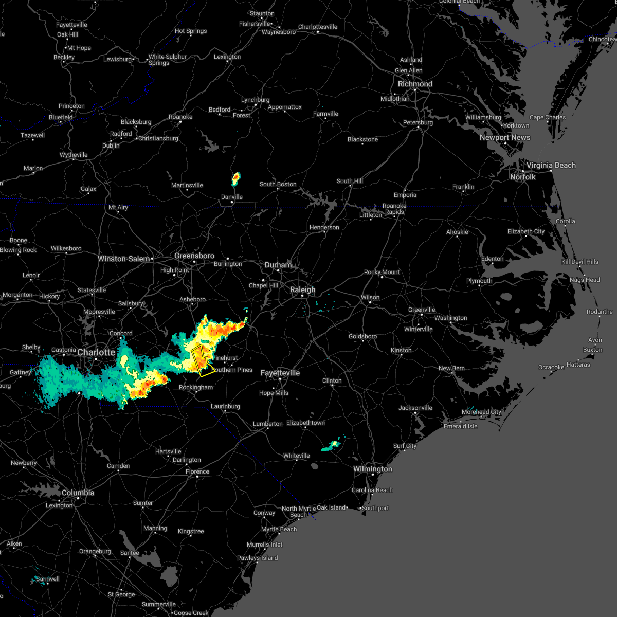 At 851 pm edt, a severe thunderstorm was located 11 miles west of pinehurst, or 14 miles west of southern pines, moving east at 35 mph (radar indicated). Hazards include 60 mph wind gusts. Expect damage to roofs, siding, and trees. locations impacted include, candor, norman, derby and sandhills game land. hail threat, radar indicated max hail size, <. 75 in wind threat, radar indicated max wind gust, 60 mph. At 851 pm edt, a severe thunderstorm was located 11 miles west of pinehurst, or 14 miles west of southern pines, moving east at 35 mph (radar indicated). Hazards include 60 mph wind gusts. Expect damage to roofs, siding, and trees. locations impacted include, candor, norman, derby and sandhills game land. hail threat, radar indicated max hail size, <. 75 in wind threat, radar indicated max wind gust, 60 mph.
|
| 7/20/2022 8:37 PM EDT |
 At 836 pm edt, a severe thunderstorm was located 11 miles south of biscoe, or 12 miles southeast of troy, moving east at 35 mph (radar indicated). Hazards include 60 mph wind gusts. Expect damage to roofs, siding, and trees. locations impacted include, ellerbe, candor, norman, derby, covington, pekin, sandhills game land and blewett falls lake. hail threat, radar indicated max hail size, <. 75 in wind threat, radar indicated max wind gust, 60 mph. At 836 pm edt, a severe thunderstorm was located 11 miles south of biscoe, or 12 miles southeast of troy, moving east at 35 mph (radar indicated). Hazards include 60 mph wind gusts. Expect damage to roofs, siding, and trees. locations impacted include, ellerbe, candor, norman, derby, covington, pekin, sandhills game land and blewett falls lake. hail threat, radar indicated max hail size, <. 75 in wind threat, radar indicated max wind gust, 60 mph.
|
| 7/20/2022 8:16 PM EDT |
 At 816 pm edt, a severe thunderstorm was located 9 miles northeast of ansonville, or 11 miles southwest of troy, moving east at 35 mph (radar indicated). Hazards include 60 mph wind gusts. expect damage to roofs, siding, and trees At 816 pm edt, a severe thunderstorm was located 9 miles northeast of ansonville, or 11 miles southwest of troy, moving east at 35 mph (radar indicated). Hazards include 60 mph wind gusts. expect damage to roofs, siding, and trees
|
| 6/17/2022 7:11 PM EDT |
 At 710 pm edt, severe thunderstorms were located along a line extending from 9 miles west of raeford to near hamlet to near chesterfield, moving southeast at 50 mph (emergency management. at 709 pm, emergency management reported power lines down in rockingham). Hazards include 60 mph wind gusts and nickel size hail. Expect damage to roofs, siding, and trees. locations impacted include, laurinburg, rockingham, wadesboro, hamlet, maxton, hoffman, pinebluff, ellerbe, foxfire and dobbins heights. hail threat, radar indicated max hail size, 0. 88 in wind threat, radar indicated max wind gust, 60 mph. At 710 pm edt, severe thunderstorms were located along a line extending from 9 miles west of raeford to near hamlet to near chesterfield, moving southeast at 50 mph (emergency management. at 709 pm, emergency management reported power lines down in rockingham). Hazards include 60 mph wind gusts and nickel size hail. Expect damage to roofs, siding, and trees. locations impacted include, laurinburg, rockingham, wadesboro, hamlet, maxton, hoffman, pinebluff, ellerbe, foxfire and dobbins heights. hail threat, radar indicated max hail size, 0. 88 in wind threat, radar indicated max wind gust, 60 mph.
|
| 6/17/2022 7:07 PM EDT |
 At 707 pm edt, severe thunderstorms were located along a line extending from 9 miles southeast of hoffman to near hamlet to near chesterfield, moving southeast at 40 mph (radar indicated). Hazards include 60 mph wind gusts and nickel size hail. Expect damage to roofs, siding, and trees. locations impacted include, laurinburg, rockingham, wadesboro, hamlet, maxton, hoffman, pinebluff, ellerbe, foxfire and dobbins heights. hail threat, radar indicated max hail size, 0. 88 in wind threat, radar indicated max wind gust, 60 mph. At 707 pm edt, severe thunderstorms were located along a line extending from 9 miles southeast of hoffman to near hamlet to near chesterfield, moving southeast at 40 mph (radar indicated). Hazards include 60 mph wind gusts and nickel size hail. Expect damage to roofs, siding, and trees. locations impacted include, laurinburg, rockingham, wadesboro, hamlet, maxton, hoffman, pinebluff, ellerbe, foxfire and dobbins heights. hail threat, radar indicated max hail size, 0. 88 in wind threat, radar indicated max wind gust, 60 mph.
|
| 6/17/2022 6:54 PM EDT |
 At 654 pm edt, severe thunderstorms were located along a line extending from near hoffman to near rockingham to near chesterfield, moving east at 45 mph (radar indicated). Hazards include 60 mph wind gusts and nickel size hail. expect damage to roofs, siding, and trees At 654 pm edt, severe thunderstorms were located along a line extending from near hoffman to near rockingham to near chesterfield, moving east at 45 mph (radar indicated). Hazards include 60 mph wind gusts and nickel size hail. expect damage to roofs, siding, and trees
|
| 6/17/2022 6:54 PM EDT |
 At 653 pm edt, severe thunderstorms were located along a line extending from 6 miles east of bunn to 6 miles north of benson to near pope afb to 6 miles south of aberdeen, moving southeast at 40 mph (public). Hazards include 70 mph wind gusts. Expect considerable tree damage. damage is likely to mobile homes, roofs, and outbuildings. locations impacted include, raleigh, fayetteville, southern pines, smithfield, raeford, louisburg, lillington, fort bragg, wilson and garner. thunderstorm damage threat, considerable hail threat, radar indicated max hail size, <. 75 in wind threat, radar indicated max wind gust, 70 mph. At 653 pm edt, severe thunderstorms were located along a line extending from 6 miles east of bunn to 6 miles north of benson to near pope afb to 6 miles south of aberdeen, moving southeast at 40 mph (public). Hazards include 70 mph wind gusts. Expect considerable tree damage. damage is likely to mobile homes, roofs, and outbuildings. locations impacted include, raleigh, fayetteville, southern pines, smithfield, raeford, louisburg, lillington, fort bragg, wilson and garner. thunderstorm damage threat, considerable hail threat, radar indicated max hail size, <. 75 in wind threat, radar indicated max wind gust, 70 mph.
|
| 6/17/2022 6:40 PM EDT |
 At 640 pm edt, severe thunderstorms were located along a line extending from near louisburg to near angier to 10 miles southeast of sanford to near pinehurst, moving southeast at 40 mph (emergency management. at 610 pm, a 63 mph gust was measured northwest of chapel hill). Hazards include 70 mph wind gusts. Expect considerable tree damage. Damage is likely to mobile homes, roofs, and outbuildings. At 640 pm edt, severe thunderstorms were located along a line extending from near louisburg to near angier to 10 miles southeast of sanford to near pinehurst, moving southeast at 40 mph (emergency management. at 610 pm, a 63 mph gust was measured northwest of chapel hill). Hazards include 70 mph wind gusts. Expect considerable tree damage. Damage is likely to mobile homes, roofs, and outbuildings.
|
| 6/17/2022 6:29 PM EDT |
 At 627 pm edt, severe thunderstorms were located along a line extending from near franklinton to near fuquay-varina to near sanford to near biscoe, moving southeast at 45 mph (emergency management. at 610 pm, a 63 mph gust was measured northwest of chapel hill). Hazards include 70 mph wind gusts. Expect considerable tree damage. damage is likely to mobile homes, roofs, and outbuildings. locations impacted include, raleigh, durham, cary, chapel hill, sanford, southern pines, creedmoor, pittsboro, lillington and troy. thunderstorm damage threat, considerable hail threat, radar indicated max hail size, <. 75 in wind threat, observed max wind gust, 70 mph. At 627 pm edt, severe thunderstorms were located along a line extending from near franklinton to near fuquay-varina to near sanford to near biscoe, moving southeast at 45 mph (emergency management. at 610 pm, a 63 mph gust was measured northwest of chapel hill). Hazards include 70 mph wind gusts. Expect considerable tree damage. damage is likely to mobile homes, roofs, and outbuildings. locations impacted include, raleigh, durham, cary, chapel hill, sanford, southern pines, creedmoor, pittsboro, lillington and troy. thunderstorm damage threat, considerable hail threat, radar indicated max hail size, <. 75 in wind threat, observed max wind gust, 70 mph.
|
| 6/17/2022 5:58 PM EDT |
 At 557 pm edt, the outflow from severe thunderstorms was located along a line extending from 8 miles north of butner to near carrboro to near siler city to 10 miles northeast of badin lake, moving southeast at 45 mph. the cores of the thunderstorms remain slightly farther to the west (emergency management). Hazards include 70 mph wind gusts. Expect considerable tree damage. Damage is likely to mobile homes, roofs, and outbuildings. At 557 pm edt, the outflow from severe thunderstorms was located along a line extending from 8 miles north of butner to near carrboro to near siler city to 10 miles northeast of badin lake, moving southeast at 45 mph. the cores of the thunderstorms remain slightly farther to the west (emergency management). Hazards include 70 mph wind gusts. Expect considerable tree damage. Damage is likely to mobile homes, roofs, and outbuildings.
|
| 6/16/2022 6:55 PM EDT |
 At 654 pm edt, a severe thunderstorm was located 9 miles northwest of hoffman, or 14 miles north of rockingham, moving southeast at 15 mph (radar indicated). Hazards include 60 mph wind gusts and quarter size hail. Hail damage to vehicles is expected. expect wind damage to roofs, siding, and trees. locations impacted include, rockingham, hamlet, hoffman, ellerbe, dobbins heights, gibson, norman, diggs, laurel hill and derby. hail threat, radar indicated max hail size, 1. 00 in wind threat, radar indicated max wind gust, 60 mph. At 654 pm edt, a severe thunderstorm was located 9 miles northwest of hoffman, or 14 miles north of rockingham, moving southeast at 15 mph (radar indicated). Hazards include 60 mph wind gusts and quarter size hail. Hail damage to vehicles is expected. expect wind damage to roofs, siding, and trees. locations impacted include, rockingham, hamlet, hoffman, ellerbe, dobbins heights, gibson, norman, diggs, laurel hill and derby. hail threat, radar indicated max hail size, 1. 00 in wind threat, radar indicated max wind gust, 60 mph.
|
| 6/16/2022 6:43 PM EDT |
 At 641 pm edt, a severe thunderstorm was located near hoffman, or 12 miles north of laurinburg, moving south at 20 mph (radar indicated). Hazards include 60 mph wind gusts and nickel size hail. expect damage to roofs, siding, and trees At 641 pm edt, a severe thunderstorm was located near hoffman, or 12 miles north of laurinburg, moving south at 20 mph (radar indicated). Hazards include 60 mph wind gusts and nickel size hail. expect damage to roofs, siding, and trees
|
| 6/16/2022 6:26 PM EDT |
 At 625 pm edt, a severe thunderstorm was located 9 miles south of biscoe, or 13 miles southeast of troy, moving south at 15 mph. there is also a north-south oriented line of strong storms from candor to diggs also capable of producing severe winds and quarter sized hail (radar indicated). Hazards include 60 mph wind gusts and quarter size hail. Hail damage to vehicles is expected. Expect wind damage to roofs, siding, and trees. At 625 pm edt, a severe thunderstorm was located 9 miles south of biscoe, or 13 miles southeast of troy, moving south at 15 mph. there is also a north-south oriented line of strong storms from candor to diggs also capable of producing severe winds and quarter sized hail (radar indicated). Hazards include 60 mph wind gusts and quarter size hail. Hail damage to vehicles is expected. Expect wind damage to roofs, siding, and trees.
|
| 6/16/2022 6:03 PM EDT |
 At 603 pm edt, a severe thunderstorm was located over biscoe, or near troy, moving south at 15 mph (radar indicated). Hazards include 60 mph wind gusts and quarter size hail. Hail damage to vehicles is expected. Expect wind damage to roofs, siding, and trees. At 603 pm edt, a severe thunderstorm was located over biscoe, or near troy, moving south at 15 mph (radar indicated). Hazards include 60 mph wind gusts and quarter size hail. Hail damage to vehicles is expected. Expect wind damage to roofs, siding, and trees.
|
| 5/27/2022 8:52 AM EDT |
 At 851 am edt, severe thunderstorms were located along a line extending from 8 miles northwest of pittsboro to 6 miles west of pinehurst, moving northeast at 25 mph (radar indicated). Hazards include 60 mph wind gusts. Expect damage to roofs, siding, and trees. locations impacted include, durham, sanford, southern pines, pittsboro, carthage, pinehurst, aberdeen, hoffman, goldston and whispering pines. hail threat, radar indicated max hail size, <. 75 in wind threat, radar indicated max wind gust, 60 mph. At 851 am edt, severe thunderstorms were located along a line extending from 8 miles northwest of pittsboro to 6 miles west of pinehurst, moving northeast at 25 mph (radar indicated). Hazards include 60 mph wind gusts. Expect damage to roofs, siding, and trees. locations impacted include, durham, sanford, southern pines, pittsboro, carthage, pinehurst, aberdeen, hoffman, goldston and whispering pines. hail threat, radar indicated max hail size, <. 75 in wind threat, radar indicated max wind gust, 60 mph.
|
| 5/27/2022 8:29 AM EDT |
 At 828 am edt, severe thunderstorms were located along a line extending from near siler city to 9 miles west of hoffman, moving northeast at 25 mph (radar indicated). Hazards include 60 mph wind gusts. expect damage to roofs, siding, and trees At 828 am edt, severe thunderstorms were located along a line extending from near siler city to 9 miles west of hoffman, moving northeast at 25 mph (radar indicated). Hazards include 60 mph wind gusts. expect damage to roofs, siding, and trees
|
| 5/27/2022 8:15 AM EDT |
 At 815 am edt, severe thunderstorms were located along a line extending from 6 miles east of north carolina zoo to 7 miles east of seagrove to near biscoe to 9 miles southeast of troy to 13 miles east of ansonville, moving northeast at 45 mph (radar indicated). Hazards include 60 mph wind gusts. Expect damage to roofs, siding, and trees. locations impacted include, rockingham, troy, biscoe, robbins, ellerbe, foxfire, star, candor, norman and diggs. hail threat, radar indicated max hail size, <. 75 in wind threat, radar indicated max wind gust, 60 mph. At 815 am edt, severe thunderstorms were located along a line extending from 6 miles east of north carolina zoo to 7 miles east of seagrove to near biscoe to 9 miles southeast of troy to 13 miles east of ansonville, moving northeast at 45 mph (radar indicated). Hazards include 60 mph wind gusts. Expect damage to roofs, siding, and trees. locations impacted include, rockingham, troy, biscoe, robbins, ellerbe, foxfire, star, candor, norman and diggs. hail threat, radar indicated max hail size, <. 75 in wind threat, radar indicated max wind gust, 60 mph.
|
| 5/27/2022 7:34 AM EDT |
 At 734 am edt, a severe thunderstorm was located 7 miles east of ansonville, or 12 miles north of wadesboro, moving northeast at 45 mph (radar indicated). Hazards include 60 mph wind gusts and quarter size hail. Hail damage to vehicles is expected. Expect wind damage to roofs, siding, and trees. At 734 am edt, a severe thunderstorm was located 7 miles east of ansonville, or 12 miles north of wadesboro, moving northeast at 45 mph (radar indicated). Hazards include 60 mph wind gusts and quarter size hail. Hail damage to vehicles is expected. Expect wind damage to roofs, siding, and trees.
|
| 5/23/2022 3:12 PM EDT |
 The severe thunderstorm warning for central moore, north central scotland and northern hoke counties will expire at 315 pm edt, the storms which prompted the warning have weakened below severe limits, and no longer pose an immediate threat to life or property. therefore, the warning will be allowed to expire. however gusty winds are still possible with these thunderstorms. The severe thunderstorm warning for central moore, north central scotland and northern hoke counties will expire at 315 pm edt, the storms which prompted the warning have weakened below severe limits, and no longer pose an immediate threat to life or property. therefore, the warning will be allowed to expire. however gusty winds are still possible with these thunderstorms.
|
| 5/23/2022 3:03 PM EDT |
 At 303 pm edt, severe thunderstorms were located along a line extending from near carthage to southern pines to 6 miles east of hoffman, moving northeast at 55 mph (radar indicated). Hazards include 60 mph wind gusts. Expect damage to roofs, siding, and trees. Locations impacted include, southern pines, carthage, pinehurst, aberdeen, whispering pines, pinebluff, foxfire, taylortown, vass and cameron. At 303 pm edt, severe thunderstorms were located along a line extending from near carthage to southern pines to 6 miles east of hoffman, moving northeast at 55 mph (radar indicated). Hazards include 60 mph wind gusts. Expect damage to roofs, siding, and trees. Locations impacted include, southern pines, carthage, pinehurst, aberdeen, whispering pines, pinebluff, foxfire, taylortown, vass and cameron.
|
| 5/23/2022 2:32 PM EDT |
 At 231 pm edt, severe thunderstorms were located along a line extending from 13 miles south of biscoe to near hamlet to near cheraw state park, moving northeast at 35 mph (radar indicated). Hazards include 60 mph wind gusts. expect damage to roofs, siding, and trees At 231 pm edt, severe thunderstorms were located along a line extending from 13 miles south of biscoe to near hamlet to near cheraw state park, moving northeast at 35 mph (radar indicated). Hazards include 60 mph wind gusts. expect damage to roofs, siding, and trees
|
| 5/6/2022 7:58 PM EDT |
 At 757 pm edt, a severe thunderstorm was located over carthage, moving northeast at 55 mph (radar indicated). Hazards include 60 mph wind gusts and half dollar size hail. Hail damage to vehicles is expected. expect wind damage to roofs, siding, and trees. locations impacted include, southern pines, raeford, carthage, pinehurst, aberdeen, biscoe, whispering pines, pinebluff, robbins and foxfire. hail threat, radar indicated max hail size, 1. 25 in wind threat, radar indicated max wind gust, 60 mph. At 757 pm edt, a severe thunderstorm was located over carthage, moving northeast at 55 mph (radar indicated). Hazards include 60 mph wind gusts and half dollar size hail. Hail damage to vehicles is expected. expect wind damage to roofs, siding, and trees. locations impacted include, southern pines, raeford, carthage, pinehurst, aberdeen, biscoe, whispering pines, pinebluff, robbins and foxfire. hail threat, radar indicated max hail size, 1. 25 in wind threat, radar indicated max wind gust, 60 mph.
|
| 5/6/2022 7:21 PM EDT |
 At 720 pm edt, a severe thunderstorm was located 9 miles south of troy, moving northeast at 60 mph (radar indicated). Hazards include 60 mph wind gusts and half dollar size hail. Hail damage to vehicles is expected. Expect wind damage to roofs, siding, and trees. At 720 pm edt, a severe thunderstorm was located 9 miles south of troy, moving northeast at 60 mph (radar indicated). Hazards include 60 mph wind gusts and half dollar size hail. Hail damage to vehicles is expected. Expect wind damage to roofs, siding, and trees.
|
| 5/6/2022 7:13 PM EDT |
 At 713 pm edt, a severe thunderstorm was located near ansonville, or 14 miles north of wadesboro, moving northeast at 65 mph (radar indicated). Hazards include quarter size hail. Damage to vehicles is expected. locations impacted include, albemarle, rockingham, wadesboro, hamlet, ansonville, hoffman, polkton, locust, norwood and badin. hail threat, radar indicated max hail size, 1. 00 in wind threat, radar indicated max wind gust, <50 mph. At 713 pm edt, a severe thunderstorm was located near ansonville, or 14 miles north of wadesboro, moving northeast at 65 mph (radar indicated). Hazards include quarter size hail. Damage to vehicles is expected. locations impacted include, albemarle, rockingham, wadesboro, hamlet, ansonville, hoffman, polkton, locust, norwood and badin. hail threat, radar indicated max hail size, 1. 00 in wind threat, radar indicated max wind gust, <50 mph.
|
| 5/6/2022 7:06 PM EDT |
 At 705 pm edt, a severe thunderstorm was located 7 miles west of carthage, moving northeast at 45 mph (radar indicated). Hazards include 60 mph wind gusts and quarter size hail. Hail damage to vehicles is expected. expect wind damage to roofs, siding, and trees. locations impacted include, southern pines, troy, carthage, pinehurst, aberdeen, biscoe, whispering pines, pinebluff, mount gilead and robbins. hail threat, observed max hail size, 1. 00 in wind threat, radar indicated max wind gust, 60 mph. At 705 pm edt, a severe thunderstorm was located 7 miles west of carthage, moving northeast at 45 mph (radar indicated). Hazards include 60 mph wind gusts and quarter size hail. Hail damage to vehicles is expected. expect wind damage to roofs, siding, and trees. locations impacted include, southern pines, troy, carthage, pinehurst, aberdeen, biscoe, whispering pines, pinebluff, mount gilead and robbins. hail threat, observed max hail size, 1. 00 in wind threat, radar indicated max wind gust, 60 mph.
|
| 5/6/2022 6:50 PM EDT |
 At 649 pm edt, a severe thunderstorm was located near sturdivants, or 15 miles southeast of monroe, moving east at 55 mph (radar indicated). Hazards include 60 mph wind gusts and quarter size hail. Hail damage to vehicles is expected. Expect wind damage to roofs, siding, and trees. At 649 pm edt, a severe thunderstorm was located near sturdivants, or 15 miles southeast of monroe, moving east at 55 mph (radar indicated). Hazards include 60 mph wind gusts and quarter size hail. Hail damage to vehicles is expected. Expect wind damage to roofs, siding, and trees.
|
| 5/6/2022 6:36 PM EDT |
 At 636 pm edt, a severe thunderstorm was located 13 miles northwest of rockingham, moving northeast at 50 mph (radar indicated). Hazards include ping pong ball size hail and 60 mph wind gusts. People and animals outdoors will be injured. expect hail damage to roofs, siding, windows, and vehicles. Expect wind damage to roofs, siding, and trees. At 636 pm edt, a severe thunderstorm was located 13 miles northwest of rockingham, moving northeast at 50 mph (radar indicated). Hazards include ping pong ball size hail and 60 mph wind gusts. People and animals outdoors will be injured. expect hail damage to roofs, siding, windows, and vehicles. Expect wind damage to roofs, siding, and trees.
|
| 5/6/2022 6:19 PM EDT |
 At 619 pm edt, a severe thunderstorm was located near wadesboro, moving northeast at 45 mph (radar indicated). Hazards include ping pong ball size hail and 60 mph wind gusts. People and animals outdoors will be injured. expect hail damage to roofs, siding, windows, and vehicles. expect wind damage to roofs, siding, and trees. locations impacted include, rockingham, wadesboro, hamlet, ansonville, hoffman, polkton, ellerbe, dobbins heights, lilesville and morven. hail threat, radar indicated max hail size, 1. 50 in wind threat, radar indicated max wind gust, 60 mph. At 619 pm edt, a severe thunderstorm was located near wadesboro, moving northeast at 45 mph (radar indicated). Hazards include ping pong ball size hail and 60 mph wind gusts. People and animals outdoors will be injured. expect hail damage to roofs, siding, windows, and vehicles. expect wind damage to roofs, siding, and trees. locations impacted include, rockingham, wadesboro, hamlet, ansonville, hoffman, polkton, ellerbe, dobbins heights, lilesville and morven. hail threat, radar indicated max hail size, 1. 50 in wind threat, radar indicated max wind gust, 60 mph.
|
| 5/6/2022 6:06 PM EDT |
 At 606 pm edt, a severe thunderstorm was located near chesterfield, or 13 miles south of wadesboro, moving northeast at 45 mph (radar indicated). Hazards include 60 mph wind gusts and quarter size hail. Hail damage to vehicles is expected. Expect wind damage to roofs, siding, and trees. At 606 pm edt, a severe thunderstorm was located near chesterfield, or 13 miles south of wadesboro, moving northeast at 45 mph (radar indicated). Hazards include 60 mph wind gusts and quarter size hail. Hail damage to vehicles is expected. Expect wind damage to roofs, siding, and trees.
|
| 4/26/2022 3:34 PM EDT |
 At 334 pm edt, a severe thunderstorm was located near hoffman, or 13 miles southwest of southern pines, moving east at 30 mph (radar indicated). Hazards include 60 mph wind gusts and quarter size hail. Hail damage to vehicles is expected. expect wind damage to roofs, siding, and trees. locations impacted include, rockingham, hamlet, hoffman, ellerbe, dobbins heights, norman, diggs, east rockingham, derby and sandhills game land. hail threat, radar indicated max hail size, 1. 00 in wind threat, radar indicated max wind gust, 60 mph. At 334 pm edt, a severe thunderstorm was located near hoffman, or 13 miles southwest of southern pines, moving east at 30 mph (radar indicated). Hazards include 60 mph wind gusts and quarter size hail. Hail damage to vehicles is expected. expect wind damage to roofs, siding, and trees. locations impacted include, rockingham, hamlet, hoffman, ellerbe, dobbins heights, norman, diggs, east rockingham, derby and sandhills game land. hail threat, radar indicated max hail size, 1. 00 in wind threat, radar indicated max wind gust, 60 mph.
|
| 4/26/2022 3:16 PM EDT |
 At 315 pm edt, a severe thunderstorm was located 7 miles north of rockingham, moving east at 30 mph (radar indicated). Hazards include 60 mph wind gusts and quarter size hail. Hail damage to vehicles is expected. expect wind damage to roofs, siding, and trees. locations impacted include, rockingham, wadesboro, hamlet, hoffman, ellerbe, dobbins heights, lilesville, morven, norman and mcfarlan. hail threat, radar indicated max hail size, 1. 00 in wind threat, radar indicated max wind gust, 60 mph. At 315 pm edt, a severe thunderstorm was located 7 miles north of rockingham, moving east at 30 mph (radar indicated). Hazards include 60 mph wind gusts and quarter size hail. Hail damage to vehicles is expected. expect wind damage to roofs, siding, and trees. locations impacted include, rockingham, wadesboro, hamlet, hoffman, ellerbe, dobbins heights, lilesville, morven, norman and mcfarlan. hail threat, radar indicated max hail size, 1. 00 in wind threat, radar indicated max wind gust, 60 mph.
|
| 4/26/2022 3:12 PM EDT |
 The severe thunderstorm warning for alamance, moore, western orange, east central anson, eastern montgomery, northern richmond, eastern randolph, southeastern guilford, west central lee and western chatham counties will expire at 315 pm edt, the storms which prompted the warning have moved east and new warnings have been issued to include areas farther east. therefore, the original warning will be allowed to expire. The severe thunderstorm warning for alamance, moore, western orange, east central anson, eastern montgomery, northern richmond, eastern randolph, southeastern guilford, west central lee and western chatham counties will expire at 315 pm edt, the storms which prompted the warning have moved east and new warnings have been issued to include areas farther east. therefore, the original warning will be allowed to expire.
|
| 4/26/2022 3:06 PM EDT |
 At 304 pm edt, severe thunderstorms were located along a line extending from 6 miles southeast of prospect hill to near goldston to near pinehurst, moving east at 35 mph (radar indicated). Hazards include 60 mph wind gusts and quarter size hail. Hail damage is expected. expect wind damage to trees and subsequent damage to homes and businesses from falling trees. severe thunderstorms will be near, sanford and hillsborough around 310 pm edt. rougemont around 325 pm edt. butner around 340 pm edt. creedmoor and fuquay-varina around 345 pm edt. angier around 350 pm edt. other locations impacted by these severe thunderstorms include lake wheeler, parkwood, bahama, lake benson and cameron. hail threat, radar indicated max hail size, 1. 00 in wind threat, radar indicated max wind gust, 60 mph. At 304 pm edt, severe thunderstorms were located along a line extending from 6 miles southeast of prospect hill to near goldston to near pinehurst, moving east at 35 mph (radar indicated). Hazards include 60 mph wind gusts and quarter size hail. Hail damage is expected. expect wind damage to trees and subsequent damage to homes and businesses from falling trees. severe thunderstorms will be near, sanford and hillsborough around 310 pm edt. rougemont around 325 pm edt. butner around 340 pm edt. creedmoor and fuquay-varina around 345 pm edt. angier around 350 pm edt. other locations impacted by these severe thunderstorms include lake wheeler, parkwood, bahama, lake benson and cameron. hail threat, radar indicated max hail size, 1. 00 in wind threat, radar indicated max wind gust, 60 mph.
|
| 4/26/2022 2:44 PM EDT |
 At 243 pm edt, severe thunderstorms were located along a line extending from near burlington to 6 miles east of north carolina zoo to 11 miles southeast of biscoe, moving northeast at 35 mph (radar indicated). Hazards include 60 mph wind gusts and quarter size hail. Hail damage to vehicles is expected. expect wind damage to roofs, siding, and trees. these severe storms will be near, burlington and elon around 250 pm edt. graham around 250 pm edt. mebane around 255 pm edt. siler city and pinehurst around 300 pm edt. southern pines around 305 pm edt. carthage around 310 pm edt. other locations impacted by these severe thunderstorms include franklinville, snow camp, pinebluff, alamance and candor. hail threat, radar indicated max hail size, 1. 00 in wind threat, radar indicated max wind gust, 60 mph. At 243 pm edt, severe thunderstorms were located along a line extending from near burlington to 6 miles east of north carolina zoo to 11 miles southeast of biscoe, moving northeast at 35 mph (radar indicated). Hazards include 60 mph wind gusts and quarter size hail. Hail damage to vehicles is expected. expect wind damage to roofs, siding, and trees. these severe storms will be near, burlington and elon around 250 pm edt. graham around 250 pm edt. mebane around 255 pm edt. siler city and pinehurst around 300 pm edt. southern pines around 305 pm edt. carthage around 310 pm edt. other locations impacted by these severe thunderstorms include franklinville, snow camp, pinebluff, alamance and candor. hail threat, radar indicated max hail size, 1. 00 in wind threat, radar indicated max wind gust, 60 mph.
|
| 4/26/2022 2:39 PM EDT |
 At 238 pm edt, a severe thunderstorm was located over wadesboro, moving east at 30 mph (radar indicated). Hazards include 60 mph wind gusts and quarter size hail. Hail damage to vehicles is expected. Expect wind damage to roofs, siding, and trees. At 238 pm edt, a severe thunderstorm was located over wadesboro, moving east at 30 mph (radar indicated). Hazards include 60 mph wind gusts and quarter size hail. Hail damage to vehicles is expected. Expect wind damage to roofs, siding, and trees.
|
| 4/26/2022 2:16 PM EDT |
 At 215 pm edt, severe thunderstorms were located along a line extending from 10 miles south of mcleansville to 6 miles west of seagrove to 9 miles east of ansonville, moving northeast at 35 mph (radar indicated). Hazards include 60 mph wind gusts and quarter size hail. Hail damage to vehicles is expected. expect wind damage to roofs, siding, and trees. severe thunderstorms will be near, seagrove around 225 pm edt. north carolina zoo and mcleansville around 230 pm edt. elon around 240 pm edt. burlington and graham around 250 pm edt. siler city, pinehurst and mebane around 300 pm edt. southern pines around 305 pm edt. hillsborough around 310 pm edt. carthage around 315 pm edt. other locations impacted by these severe thunderstorms include steeds, alamance, harpers crossroads, covington and pekin. hail threat, radar indicated max hail size, 1. 00 in wind threat, radar indicated max wind gust, 60 mph. At 215 pm edt, severe thunderstorms were located along a line extending from 10 miles south of mcleansville to 6 miles west of seagrove to 9 miles east of ansonville, moving northeast at 35 mph (radar indicated). Hazards include 60 mph wind gusts and quarter size hail. Hail damage to vehicles is expected. expect wind damage to roofs, siding, and trees. severe thunderstorms will be near, seagrove around 225 pm edt. north carolina zoo and mcleansville around 230 pm edt. elon around 240 pm edt. burlington and graham around 250 pm edt. siler city, pinehurst and mebane around 300 pm edt. southern pines around 305 pm edt. hillsborough around 310 pm edt. carthage around 315 pm edt. other locations impacted by these severe thunderstorms include steeds, alamance, harpers crossroads, covington and pekin. hail threat, radar indicated max hail size, 1. 00 in wind threat, radar indicated max wind gust, 60 mph.
|
| 3/31/2022 2:15 PM EDT |
 At 215 pm edt, a severe thunderstorm was located 12 miles south of biscoe, or 14 miles southeast of troy, moving northeast at 45 mph (radar indicated). Hazards include 60 mph wind gusts. Expect damage to roofs, siding, and trees. Locations impacted include, wadesboro, mount gilead, ellerbe, candor, lilesville, morven, norman, mcfarlan, blewett falls lake and derby. At 215 pm edt, a severe thunderstorm was located 12 miles south of biscoe, or 14 miles southeast of troy, moving northeast at 45 mph (radar indicated). Hazards include 60 mph wind gusts. Expect damage to roofs, siding, and trees. Locations impacted include, wadesboro, mount gilead, ellerbe, candor, lilesville, morven, norman, mcfarlan, blewett falls lake and derby.
|
| 3/31/2022 1:56 PM EDT |
 At 155 pm edt, a severe thunderstorm was located near ansonville, or near wadesboro, moving northeast at 45 mph (radar indicated). Hazards include 60 mph wind gusts. Expect damage to roofs, siding, and trees. Locations impacted include, wadesboro, ansonville, polkton, mount gilead, ellerbe, candor, lilesville, morven, peachland and norman. At 155 pm edt, a severe thunderstorm was located near ansonville, or near wadesboro, moving northeast at 45 mph (radar indicated). Hazards include 60 mph wind gusts. Expect damage to roofs, siding, and trees. Locations impacted include, wadesboro, ansonville, polkton, mount gilead, ellerbe, candor, lilesville, morven, peachland and norman.
|
| 3/31/2022 1:42 PM EDT |
 At 142 pm edt, a severe thunderstorm was located 7 miles west of wadesboro, moving northeast at 40 mph (radar indicated). Hazards include 60 mph wind gusts. expect damage to roofs, siding, and trees At 142 pm edt, a severe thunderstorm was located 7 miles west of wadesboro, moving northeast at 40 mph (radar indicated). Hazards include 60 mph wind gusts. expect damage to roofs, siding, and trees
|
| 1/3/2022 6:34 AM EST |
 At 634 am est, severe thunderstorms were located along a line extending from near carthage to near wakulla, moving northeast at 50 mph (radar indicated). Hazards include 60 mph wind gusts. Expect damage to roofs, siding, and trees. locations impacted include, fayetteville, sanford, southern pines, raeford, lillington, carthage, fort bragg, pinehurst, dunn and aberdeen. hail threat, radar indicated max hail size, <. 75 in wind threat, radar indicated max wind gust, 60 mph. At 634 am est, severe thunderstorms were located along a line extending from near carthage to near wakulla, moving northeast at 50 mph (radar indicated). Hazards include 60 mph wind gusts. Expect damage to roofs, siding, and trees. locations impacted include, fayetteville, sanford, southern pines, raeford, lillington, carthage, fort bragg, pinehurst, dunn and aberdeen. hail threat, radar indicated max hail size, <. 75 in wind threat, radar indicated max wind gust, 60 mph.
|
| 1/3/2022 6:00 AM EST |
 At 559 am est, severe thunderstorms were located along a line extending from 10 miles northwest of hoffman to near dunbar, moving northeast at 45 mph (radar indicated). Hazards include 60 mph wind gusts. expect damage to roofs, siding, and trees At 559 am est, severe thunderstorms were located along a line extending from 10 miles northwest of hoffman to near dunbar, moving northeast at 45 mph (radar indicated). Hazards include 60 mph wind gusts. expect damage to roofs, siding, and trees
|
| 1/1/2022 12:39 AM EST |
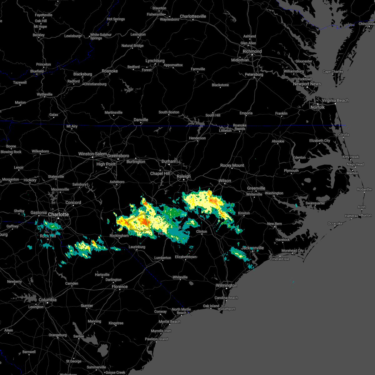 The severe thunderstorm warning for southwestern moore and northwestern hoke counties will expire at 1245 am est, the storm which prompted the warning has weakened below severe limits, and no longer poses an immediate threat to life or property. therefore, the warning will be allowed to expire. however heavy rain is still possible with this thunderstorm. The severe thunderstorm warning for southwestern moore and northwestern hoke counties will expire at 1245 am est, the storm which prompted the warning has weakened below severe limits, and no longer poses an immediate threat to life or property. therefore, the warning will be allowed to expire. however heavy rain is still possible with this thunderstorm.
|
| 1/1/2022 12:19 AM EST |
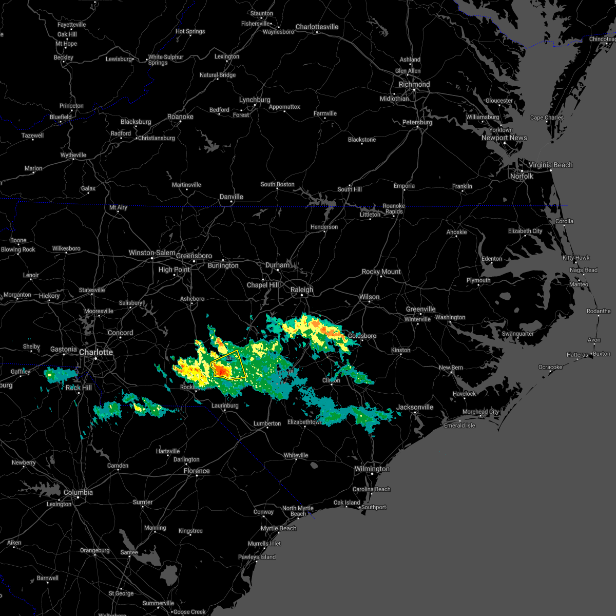 At 1218 am est, a severe thunderstorm was located near aberdeen, or near southern pines, moving east at 25 mph (radar indicated). Hazards include 60 mph wind gusts. Expect damage to roofs, siding, and trees. Locations impacted include, southern pines, pinehurst, aberdeen, whispering pines, pinebluff, foxfire, taylortown and ashley heights. At 1218 am est, a severe thunderstorm was located near aberdeen, or near southern pines, moving east at 25 mph (radar indicated). Hazards include 60 mph wind gusts. Expect damage to roofs, siding, and trees. Locations impacted include, southern pines, pinehurst, aberdeen, whispering pines, pinebluff, foxfire, taylortown and ashley heights.
|
| 12/31/2021 11:48 PM EST |
 At 1147 pm est, a severe thunderstorm was located 8 miles north of rockingham, moving east at 20 mph (radar indicated). Hazards include 60 mph wind gusts. expect damage to roofs, siding, and trees At 1147 pm est, a severe thunderstorm was located 8 miles north of rockingham, moving east at 20 mph (radar indicated). Hazards include 60 mph wind gusts. expect damage to roofs, siding, and trees
|
| 12/11/2021 6:45 PM EST |
 At 644 pm est, severe thunderstorms were located along a line extending from near siler city to near rockingham, moving east at 40 mph (radar indicated). Hazards include 60 mph wind gusts. Expect damage to roofs, siding, and trees. locations impacted include, sanford, southern pines, rockingham, pittsboro, carthage, siler city, pinehurst, hamlet, aberdeen and biscoe. hail threat, radar indicated max hail size, <. 75 in wind threat, radar indicated max wind gust, 60 mph. At 644 pm est, severe thunderstorms were located along a line extending from near siler city to near rockingham, moving east at 40 mph (radar indicated). Hazards include 60 mph wind gusts. Expect damage to roofs, siding, and trees. locations impacted include, sanford, southern pines, rockingham, pittsboro, carthage, siler city, pinehurst, hamlet, aberdeen and biscoe. hail threat, radar indicated max hail size, <. 75 in wind threat, radar indicated max wind gust, 60 mph.
|
| 12/11/2021 6:13 PM EST |
 At 613 pm est, severe thunderstorms were located along a line extending from north carolina zoo to 8 miles northwest of chesterfield, moving east at 40 mph (radar indicated). Hazards include 60 mph wind gusts. expect damage to roofs, siding, and trees At 613 pm est, severe thunderstorms were located along a line extending from north carolina zoo to 8 miles northwest of chesterfield, moving east at 40 mph (radar indicated). Hazards include 60 mph wind gusts. expect damage to roofs, siding, and trees
|
| 8/19/2021 9:33 PM EDT |
 At 933 pm edt, a severe thunderstorm was located near carthage, moving east at 25 mph (radar indicated). Hazards include 60 mph wind gusts. Expect damage to roofs, siding, and trees. locations impacted include, southern pines, carthage, pinehurst, whispering pines, robbins, foxfire, taylortown, vass, harpers crossroads and highfalls. hail threat, radar indicated max hail size, <. 75 in wind threat, radar indicated max wind gust, 60 mph. At 933 pm edt, a severe thunderstorm was located near carthage, moving east at 25 mph (radar indicated). Hazards include 60 mph wind gusts. Expect damage to roofs, siding, and trees. locations impacted include, southern pines, carthage, pinehurst, whispering pines, robbins, foxfire, taylortown, vass, harpers crossroads and highfalls. hail threat, radar indicated max hail size, <. 75 in wind threat, radar indicated max wind gust, 60 mph.
|
| 8/19/2021 9:27 PM EDT |
 At 927 pm edt, severe thunderstorms were located along a line extending from near pinehurst to 6 miles southeast of hamlet, moving east at 30 mph (radar indicated). Hazards include 60 mph wind gusts. expect damage to roofs, siding, and trees At 927 pm edt, severe thunderstorms were located along a line extending from near pinehurst to 6 miles southeast of hamlet, moving east at 30 mph (radar indicated). Hazards include 60 mph wind gusts. expect damage to roofs, siding, and trees
|
| 8/19/2021 9:15 PM EDT |
 At 914 pm edt, a severe thunderstorm was located near carthage, moving east at 25 mph (radar indicated). Hazards include 60 mph wind gusts. Expect damage to roofs, siding, and trees. locations impacted include, southern pines, carthage, pinehurst, biscoe, seagrove, whispering pines, robbins, foxfire, star and candor. hail threat, radar indicated max hail size, <. 75 in wind threat, radar indicated max wind gust, 60 mph. At 914 pm edt, a severe thunderstorm was located near carthage, moving east at 25 mph (radar indicated). Hazards include 60 mph wind gusts. Expect damage to roofs, siding, and trees. locations impacted include, southern pines, carthage, pinehurst, biscoe, seagrove, whispering pines, robbins, foxfire, star and candor. hail threat, radar indicated max hail size, <. 75 in wind threat, radar indicated max wind gust, 60 mph.
|
| 8/19/2021 8:42 PM EDT |
 At 841 pm edt, a severe thunderstorm was located near biscoe, or 8 miles southeast of troy, moving east at 25 mph (radar indicated). Hazards include 60 mph wind gusts. expect damage to roofs, siding, and trees At 841 pm edt, a severe thunderstorm was located near biscoe, or 8 miles southeast of troy, moving east at 25 mph (radar indicated). Hazards include 60 mph wind gusts. expect damage to roofs, siding, and trees
|
| 7/1/2021 8:58 PM EDT |
 At 857 pm edt, severe thunderstorms were located along a line extending from 7 miles south of sanford to near raeford, moving northeast at 55 mph (radar indicated). Hazards include 60 mph wind gusts and quarter size hail. Hail damage to vehicles is expected. expect wind damage to roofs, siding, and trees. Locations impacted include, sanford, laurinburg, southern pines, raeford, carthage, pinehurst, aberdeen, maxton, antioch and whispering pines. At 857 pm edt, severe thunderstorms were located along a line extending from 7 miles south of sanford to near raeford, moving northeast at 55 mph (radar indicated). Hazards include 60 mph wind gusts and quarter size hail. Hail damage to vehicles is expected. expect wind damage to roofs, siding, and trees. Locations impacted include, sanford, laurinburg, southern pines, raeford, carthage, pinehurst, aberdeen, maxton, antioch and whispering pines.
|
| 7/1/2021 8:40 PM EDT |
 At 839 pm edt, severe thunderstorms were located along a line extending from near southern pines to laurinburg, moving northeast at 55 mph (radar indicated). Hazards include 60 mph wind gusts and quarter size hail. Hail damage to vehicles is expected. Expect wind damage to roofs, siding, and trees. At 839 pm edt, severe thunderstorms were located along a line extending from near southern pines to laurinburg, moving northeast at 55 mph (radar indicated). Hazards include 60 mph wind gusts and quarter size hail. Hail damage to vehicles is expected. Expect wind damage to roofs, siding, and trees.
|
| 5/7/2021 6:21 AM EDT |
 At 621 am edt, a severe thunderstorm was located near southern pines, moving east at 25 mph (radar indicated). Hazards include 60 mph wind gusts and quarter size hail. Hail damage to vehicles is expected. expect wind damage to roofs, siding, and trees. Locations impacted include, southern pines, carthage, pinehurst, aberdeen, whispering pines, pinebluff, foxfire, taylortown, vass and cameron. At 621 am edt, a severe thunderstorm was located near southern pines, moving east at 25 mph (radar indicated). Hazards include 60 mph wind gusts and quarter size hail. Hail damage to vehicles is expected. expect wind damage to roofs, siding, and trees. Locations impacted include, southern pines, carthage, pinehurst, aberdeen, whispering pines, pinebluff, foxfire, taylortown, vass and cameron.
|
| 5/7/2021 6:00 AM EDT |
 At 600 am edt, a severe thunderstorm was located near southern pines, moving east at 25 mph (radar indicated). Hazards include quarter size hail. damage to vehicles is expected At 600 am edt, a severe thunderstorm was located near southern pines, moving east at 25 mph (radar indicated). Hazards include quarter size hail. damage to vehicles is expected
|
| 4/9/2021 4:08 PM EDT |
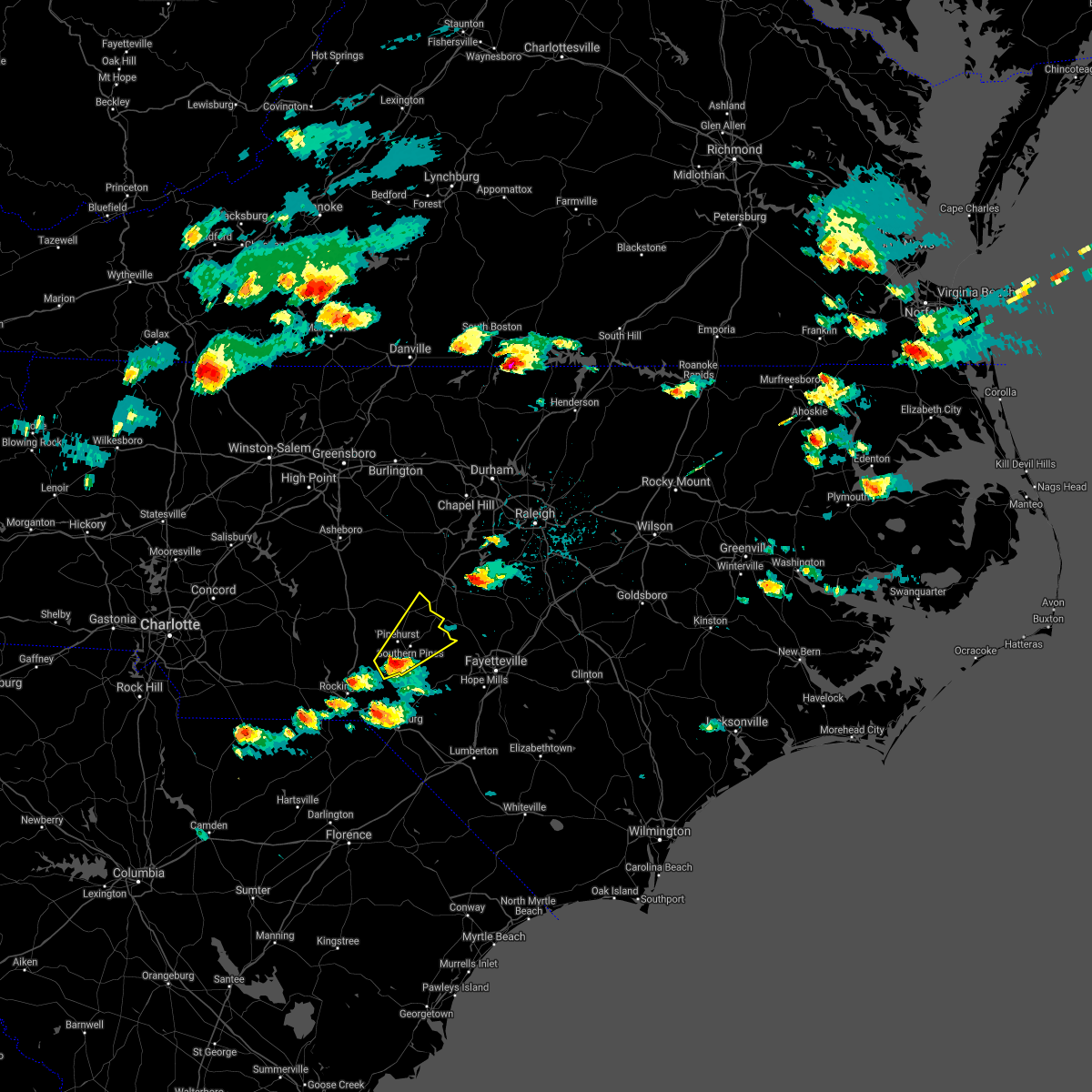 At 407 pm edt, a severe thunderstorm was located near aberdeen, or 7 miles southwest of southern pines, moving northeast at 30 mph (radar indicated). Hazards include 60 mph wind gusts and quarter size hail. Hail damage to vehicles is expected. expect wind damage to roofs, siding, and trees. Locations impacted include, southern pines, carthage, pinehurst, aberdeen, hoffman, whispering pines, pinebluff, foxfire, taylortown and vass. At 407 pm edt, a severe thunderstorm was located near aberdeen, or 7 miles southwest of southern pines, moving northeast at 30 mph (radar indicated). Hazards include 60 mph wind gusts and quarter size hail. Hail damage to vehicles is expected. expect wind damage to roofs, siding, and trees. Locations impacted include, southern pines, carthage, pinehurst, aberdeen, hoffman, whispering pines, pinebluff, foxfire, taylortown and vass.
|
| 4/9/2021 3:57 PM EDT |
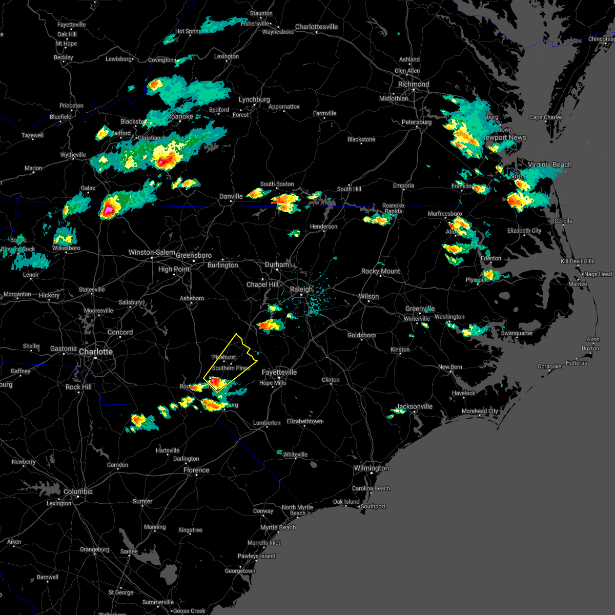 At 356 pm edt, a severe thunderstorm was located over hoffman, or 12 miles southwest of southern pines, moving northeast at 30 mph (radar indicated). Hazards include 60 mph wind gusts and half dollar size hail. Hail damage to vehicles is expected. Expect wind damage to roofs, siding, and trees. At 356 pm edt, a severe thunderstorm was located over hoffman, or 12 miles southwest of southern pines, moving northeast at 30 mph (radar indicated). Hazards include 60 mph wind gusts and half dollar size hail. Hail damage to vehicles is expected. Expect wind damage to roofs, siding, and trees.
|
| 3/27/2021 5:18 PM EDT |
 At 517 pm edt, severe thunderstorms were located along a line extending from 6 miles southeast of seagrove to near unionville, moving east at 45 mph. the storm near seven lakes is showing signs of rotation and a tornado is possible with that storm (radar indicated). Hazards include 60 mph wind gusts. Expect damage to roofs, siding, and trees. Locations impacted include, albemarle, wadesboro, troy, pinehurst, biscoe, ansonville, hoffman, polkton, norwood and oakboro. At 517 pm edt, severe thunderstorms were located along a line extending from 6 miles southeast of seagrove to near unionville, moving east at 45 mph. the storm near seven lakes is showing signs of rotation and a tornado is possible with that storm (radar indicated). Hazards include 60 mph wind gusts. Expect damage to roofs, siding, and trees. Locations impacted include, albemarle, wadesboro, troy, pinehurst, biscoe, ansonville, hoffman, polkton, norwood and oakboro.
|
| 3/27/2021 5:07 PM EDT |
 At 507 pm edt, severe thunderstorms were located along a line extending from near seagrove to near fairview in union county, moving east at 45 mph (radar indicated). Hazards include 60 mph wind gusts. expect damage to roofs, siding, and trees At 507 pm edt, severe thunderstorms were located along a line extending from near seagrove to near fairview in union county, moving east at 45 mph (radar indicated). Hazards include 60 mph wind gusts. expect damage to roofs, siding, and trees
|
| 3/25/2021 7:27 PM EDT |
 At 727 pm edt, severe thunderstorms were located along a line extending from 9 miles northeast of badin lake to near troy to 7 miles east of wadesboro, moving east at 35 mph (radar indicated). Hazards include 60 mph wind gusts. Expect damage to roofs, siding, and trees. Locations impacted include, asheboro, rockingham, randleman, troy, north carolina zoo, hamlet, biscoe, seagrove, robbins and ellerbe. At 727 pm edt, severe thunderstorms were located along a line extending from 9 miles northeast of badin lake to near troy to 7 miles east of wadesboro, moving east at 35 mph (radar indicated). Hazards include 60 mph wind gusts. Expect damage to roofs, siding, and trees. Locations impacted include, asheboro, rockingham, randleman, troy, north carolina zoo, hamlet, biscoe, seagrove, robbins and ellerbe.
|
| 3/25/2021 7:10 PM EDT |
 At 710 pm edt, severe thunderstorms were located along a line extending from near badin lake to 6 miles west of troy to near wadesboro, moving east at 35 mph (radar indicated). Hazards include 60 mph wind gusts. Expect damage to roofs, siding, and trees. Locations impacted include, asheboro, rockingham, wadesboro, randleman, troy, badin lake, north carolina zoo, hamlet, biscoe and seagrove. At 710 pm edt, severe thunderstorms were located along a line extending from near badin lake to 6 miles west of troy to near wadesboro, moving east at 35 mph (radar indicated). Hazards include 60 mph wind gusts. Expect damage to roofs, siding, and trees. Locations impacted include, asheboro, rockingham, wadesboro, randleman, troy, badin lake, north carolina zoo, hamlet, biscoe and seagrove.
|
| 3/25/2021 6:54 PM EDT |
 At 654 pm edt, severe thunderstorms were located along a line extending from 7 miles north of plyler to near albemarle to near sturdivants, moving east at 35 mph (radar indicated). Hazards include 60 mph wind gusts. expect damage to roofs, siding, and trees At 654 pm edt, severe thunderstorms were located along a line extending from 7 miles north of plyler to near albemarle to near sturdivants, moving east at 35 mph (radar indicated). Hazards include 60 mph wind gusts. expect damage to roofs, siding, and trees
|
| 3/18/2021 7:30 PM EDT |
 At 730 pm edt, a severe thunderstorm was located over southern pines, moving northeast at 45 mph (radar indicated). Hazards include 60 mph wind gusts and penny size hail. expect damage to roofs, siding, and trees At 730 pm edt, a severe thunderstorm was located over southern pines, moving northeast at 45 mph (radar indicated). Hazards include 60 mph wind gusts and penny size hail. expect damage to roofs, siding, and trees
|
| 3/18/2021 7:11 PM EDT |
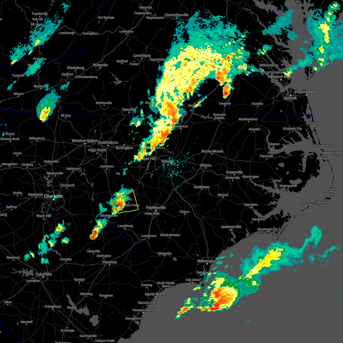 At 710 pm edt, a severe thunderstorm was located 7 miles southwest of pinehurst, or 11 miles west of southern pines, moving east at 35 mph (radar indicated). Hazards include 60 mph wind gusts and penny size hail. Expect damage to roofs, siding, and trees. Locations impacted include, southern pines, pinehurst, aberdeen, hoffman, whispering pines, pinebluff, foxfire, taylortown, vass and norman. At 710 pm edt, a severe thunderstorm was located 7 miles southwest of pinehurst, or 11 miles west of southern pines, moving east at 35 mph (radar indicated). Hazards include 60 mph wind gusts and penny size hail. Expect damage to roofs, siding, and trees. Locations impacted include, southern pines, pinehurst, aberdeen, hoffman, whispering pines, pinebluff, foxfire, taylortown, vass and norman.
|
| 3/18/2021 6:45 PM EDT |
 At 644 pm edt, a severe thunderstorm was located 9 miles northwest of rockingham, moving east at 45 mph (radar indicated). Hazards include 60 mph wind gusts and penny size hail. expect damage to roofs, siding, and trees At 644 pm edt, a severe thunderstorm was located 9 miles northwest of rockingham, moving east at 45 mph (radar indicated). Hazards include 60 mph wind gusts and penny size hail. expect damage to roofs, siding, and trees
|
| 9/25/2020 6:39 PM EDT |
 At 639 pm edt, a severe thunderstorm was located over southern pines, moving northeast at 25 mph (radar indicated). Hazards include 60 mph wind gusts and quarter size hail. Hail damage to vehicles is expected. Expect wind damage to roofs, siding, and trees. At 639 pm edt, a severe thunderstorm was located over southern pines, moving northeast at 25 mph (radar indicated). Hazards include 60 mph wind gusts and quarter size hail. Hail damage to vehicles is expected. Expect wind damage to roofs, siding, and trees.
|
| 7/24/2020 5:07 PM EDT |
 At 506 pm edt, severe thunderstorms were located from near wagram to raeford to rockfish, moving east at 10 mph (radar indicated). Hazards include 60 mph wind gusts. expect damage to roofs, siding, and trees At 506 pm edt, severe thunderstorms were located from near wagram to raeford to rockfish, moving east at 10 mph (radar indicated). Hazards include 60 mph wind gusts. expect damage to roofs, siding, and trees
|
| 7/20/2020 5:29 PM EDT |
 At 529 pm edt, a severe thunderstorm was located 13 miles northwest of hoffman, or 16 miles north of rockingham, moving north at 5 mph (radar indicated). Hazards include 60 mph wind gusts and penny size hail. Expect damage to roofs, siding, and trees. Locations impacted include, southern pines, pinehurst, aberdeen, hoffman, pinebluff, ellerbe, foxfire, candor, taylortown and norman. At 529 pm edt, a severe thunderstorm was located 13 miles northwest of hoffman, or 16 miles north of rockingham, moving north at 5 mph (radar indicated). Hazards include 60 mph wind gusts and penny size hail. Expect damage to roofs, siding, and trees. Locations impacted include, southern pines, pinehurst, aberdeen, hoffman, pinebluff, ellerbe, foxfire, candor, taylortown and norman.
|
| 7/20/2020 5:05 PM EDT |
 At 505 pm edt, a severe thunderstorm was located 12 miles northwest of hoffman, or 14 miles north of rockingham, moving east at 10 mph (radar indicated). Hazards include 60 mph wind gusts and penny size hail. expect damage to roofs, siding, and trees At 505 pm edt, a severe thunderstorm was located 12 miles northwest of hoffman, or 14 miles north of rockingham, moving east at 10 mph (radar indicated). Hazards include 60 mph wind gusts and penny size hail. expect damage to roofs, siding, and trees
|
| 7/10/2020 10:08 PM EDT |
 At 1008 pm edt, severe thunderstorms were located along a line extending from 6 miles west of goldston to 9 miles west of carthage to 13 miles northwest of rockingham, moving east at 30 mph (radar indicated). Hazards include 60 mph wind gusts. Expect damage to roofs, siding, and trees. Locations impacted include, sanford, southern pines, carthage, pinehurst, aberdeen, hoffman, goldston, whispering pines, pinebluff and robbins. At 1008 pm edt, severe thunderstorms were located along a line extending from 6 miles west of goldston to 9 miles west of carthage to 13 miles northwest of rockingham, moving east at 30 mph (radar indicated). Hazards include 60 mph wind gusts. Expect damage to roofs, siding, and trees. Locations impacted include, sanford, southern pines, carthage, pinehurst, aberdeen, hoffman, goldston, whispering pines, pinebluff and robbins.
|
| 7/10/2020 9:48 PM EDT |
 At 947 pm edt, severe thunderstorms were located along a line extending from 11 miles southeast of north carolina zoo to near biscoe to 6 miles east of ansonville, moving east at 25 mph (radar indicated). Hazards include 60 mph wind gusts. expect damage to roofs, siding, and trees At 947 pm edt, severe thunderstorms were located along a line extending from 11 miles southeast of north carolina zoo to near biscoe to 6 miles east of ansonville, moving east at 25 mph (radar indicated). Hazards include 60 mph wind gusts. expect damage to roofs, siding, and trees
|
| 7/10/2020 9:36 PM EDT |
 At 936 pm edt, a severe thunderstorm was located over biscoe, or near troy, moving east at 30 mph (radar indicated). Hazards include 60 mph wind gusts. Expect damage to roofs, siding, and trees. Locations impacted include, troy, north carolina zoo, badin lake, biscoe, seagrove, norwood, badin, mount gilead, robbins and foxfire. At 936 pm edt, a severe thunderstorm was located over biscoe, or near troy, moving east at 30 mph (radar indicated). Hazards include 60 mph wind gusts. Expect damage to roofs, siding, and trees. Locations impacted include, troy, north carolina zoo, badin lake, biscoe, seagrove, norwood, badin, mount gilead, robbins and foxfire.
|
| 7/10/2020 9:16 PM EDT |
 At 915 pm edt, a severe thunderstorm was located 7 miles west of troy, moving east at 25 mph (radar indicated). Hazards include 60 mph wind gusts. expect damage to roofs, siding, and trees At 915 pm edt, a severe thunderstorm was located 7 miles west of troy, moving east at 25 mph (radar indicated). Hazards include 60 mph wind gusts. expect damage to roofs, siding, and trees
|
| 6/22/2020 8:35 PM EDT |
 At 835 pm edt, severe thunderstorms were located along a line extending from 6 miles southwest of seagrove to 9 miles east of biscoe, moving east at 20 mph (radar indicated). Hazards include 60 mph wind gusts. Expect damage to roofs, siding, and trees. Locations impacted include, asheboro, southern pines, troy, carthage, north carolina zoo, pinehurst, biscoe, seagrove, whispering pines and ramseur. At 835 pm edt, severe thunderstorms were located along a line extending from 6 miles southwest of seagrove to 9 miles east of biscoe, moving east at 20 mph (radar indicated). Hazards include 60 mph wind gusts. Expect damage to roofs, siding, and trees. Locations impacted include, asheboro, southern pines, troy, carthage, north carolina zoo, pinehurst, biscoe, seagrove, whispering pines and ramseur.
|
| 6/22/2020 8:01 PM EDT |
 At 801 pm edt, severe thunderstorms were located along a line extending from badin lake to near plyler to 7 miles southwest of troy, moving east at 35 mph (radar indicated). Hazards include 60 mph wind gusts. expect damage to roofs, siding, and trees At 801 pm edt, severe thunderstorms were located along a line extending from badin lake to near plyler to 7 miles southwest of troy, moving east at 35 mph (radar indicated). Hazards include 60 mph wind gusts. expect damage to roofs, siding, and trees
|
| 5/28/2020 5:11 PM EDT |
 At 511 pm edt, severe thunderstorms were located along a line extending from 6 miles south of pittsboro to 6 miles northeast of carthage to 7 miles northwest of wakulla, moving north at 30 mph (radar indicated). Hazards include 60 mph wind gusts and quarter size hail. Hail damage to vehicles is expected. Expect wind damage to roofs, siding, and trees. At 511 pm edt, severe thunderstorms were located along a line extending from 6 miles south of pittsboro to 6 miles northeast of carthage to 7 miles northwest of wakulla, moving north at 30 mph (radar indicated). Hazards include 60 mph wind gusts and quarter size hail. Hail damage to vehicles is expected. Expect wind damage to roofs, siding, and trees.
|
| 5/22/2020 5:56 PM EDT |
 At 556 pm edt, a severe thunderstorm capable of producing a tornado was located over southern pines, moving northeast at 50 mph (radar indicated rotation). Hazards include tornado. Flying debris will be dangerous to those caught without shelter. mobile homes will be damaged or destroyed. damage to roofs, windows, and vehicles will occur. tree damage is likely. This tornadic thunderstorm will remain over mainly rural areas of southeastern moore, southwestern harnett, south central lee and northwestern hoke counties, including the following locations, taylortown, olivia, pineview, vass and whispering pines. At 556 pm edt, a severe thunderstorm capable of producing a tornado was located over southern pines, moving northeast at 50 mph (radar indicated rotation). Hazards include tornado. Flying debris will be dangerous to those caught without shelter. mobile homes will be damaged or destroyed. damage to roofs, windows, and vehicles will occur. tree damage is likely. This tornadic thunderstorm will remain over mainly rural areas of southeastern moore, southwestern harnett, south central lee and northwestern hoke counties, including the following locations, taylortown, olivia, pineview, vass and whispering pines.
|
| 5/22/2020 5:53 PM EDT |
 At 552 pm edt, severe thunderstorms were located along a line extending from 9 miles northwest of pinehurst to 8 miles west of raeford to near mccoll, moving east at 55 mph (radar indicated). Hazards include 60 mph wind gusts and penny size hail. Expect damage to roofs, siding, and trees. Locations impacted include, fayetteville, sanford, laurinburg, southern pines, raeford, carthage, fort bragg, pinehurst, aberdeen and maxton. At 552 pm edt, severe thunderstorms were located along a line extending from 9 miles northwest of pinehurst to 8 miles west of raeford to near mccoll, moving east at 55 mph (radar indicated). Hazards include 60 mph wind gusts and penny size hail. Expect damage to roofs, siding, and trees. Locations impacted include, fayetteville, sanford, laurinburg, southern pines, raeford, carthage, fort bragg, pinehurst, aberdeen and maxton.
|
| 5/22/2020 5:38 PM EDT |
 At 538 pm edt, severe thunderstorms were located along a line extending from 7 miles southeast of biscoe to near hoffman to near bennettsville, moving east at 55 mph (radar indicated). Hazards include 60 mph wind gusts and penny size hail. Expect damage to roofs, siding, and trees. Locations impacted include, fayetteville, sanford, laurinburg, southern pines, rockingham, raeford, carthage, fort bragg, pinehurst and hamlet. At 538 pm edt, severe thunderstorms were located along a line extending from 7 miles southeast of biscoe to near hoffman to near bennettsville, moving east at 55 mph (radar indicated). Hazards include 60 mph wind gusts and penny size hail. Expect damage to roofs, siding, and trees. Locations impacted include, fayetteville, sanford, laurinburg, southern pines, rockingham, raeford, carthage, fort bragg, pinehurst and hamlet.
|
| 5/22/2020 5:27 PM EDT |
 At 527 pm edt, severe thunderstorms were located along a line extending from troy to 11 miles north of rockingham to near wallace, moving east at 45 mph (radar indicated). Hazards include 60 mph wind gusts and penny size hail. expect damage to roofs, siding, and trees At 527 pm edt, severe thunderstorms were located along a line extending from troy to 11 miles north of rockingham to near wallace, moving east at 45 mph (radar indicated). Hazards include 60 mph wind gusts and penny size hail. expect damage to roofs, siding, and trees
|
| 4/13/2020 7:10 AM EDT |
 At 710 am edt, severe thunderstorms were located along a line extending from near pinehurst to 9 miles south of hoffman to 8 miles southwest of bennettsville, moving northeast at 55 mph (radar indicated). Hazards include 60 mph wind gusts. Expect damage to roofs, siding, and trees. Locations impacted include, fayetteville, sanford, laurinburg, southern pines, rockingham, raeford, lillington, carthage, fort bragg and pinehurst. At 710 am edt, severe thunderstorms were located along a line extending from near pinehurst to 9 miles south of hoffman to 8 miles southwest of bennettsville, moving northeast at 55 mph (radar indicated). Hazards include 60 mph wind gusts. Expect damage to roofs, siding, and trees. Locations impacted include, fayetteville, sanford, laurinburg, southern pines, rockingham, raeford, lillington, carthage, fort bragg and pinehurst.
|
| 4/13/2020 6:58 AM EDT |
 At 657 am edt, severe thunderstorms were located along a line extending from 12 miles east of seagrove to near pinehurst to near rockingham, moving northeast at 60 mph (radar indicated). Hazards include 60 mph wind gusts. expect damage to roofs, siding, and trees At 657 am edt, severe thunderstorms were located along a line extending from 12 miles east of seagrove to near pinehurst to near rockingham, moving northeast at 60 mph (radar indicated). Hazards include 60 mph wind gusts. expect damage to roofs, siding, and trees
|
| 4/13/2020 6:54 AM EDT |
 At 653 am edt, severe thunderstorms were located along a line extending from 7 miles east of seagrove to 9 miles southwest of carthage to 7 miles northwest of wallace, moving northeast at 55 mph (radar indicated). Hazards include 60 mph wind gusts. Expect damage to roofs, siding, and trees. Locations impacted include, rockingham, carthage, pinehurst, hamlet, hoffman, robbins, ellerbe, foxfire, dobbins heights and taylortown. At 653 am edt, severe thunderstorms were located along a line extending from 7 miles east of seagrove to 9 miles southwest of carthage to 7 miles northwest of wallace, moving northeast at 55 mph (radar indicated). Hazards include 60 mph wind gusts. Expect damage to roofs, siding, and trees. Locations impacted include, rockingham, carthage, pinehurst, hamlet, hoffman, robbins, ellerbe, foxfire, dobbins heights and taylortown.
|
| 4/13/2020 6:39 AM EDT |
 At 639 am edt, severe thunderstorms were located along a line extending from near seagrove to 10 miles south of biscoe to 6 miles southwest of chesterfield, moving northeast at 60 mph (radar indicated). Hazards include 60 mph wind gusts. Expect damage to roofs, siding, and trees. Locations impacted include, rockingham, wadesboro, troy, carthage, pinehurst, hamlet, biscoe, hoffman, mount gilead and robbins. At 639 am edt, severe thunderstorms were located along a line extending from near seagrove to 10 miles south of biscoe to 6 miles southwest of chesterfield, moving northeast at 60 mph (radar indicated). Hazards include 60 mph wind gusts. Expect damage to roofs, siding, and trees. Locations impacted include, rockingham, wadesboro, troy, carthage, pinehurst, hamlet, biscoe, hoffman, mount gilead and robbins.
|
| 4/13/2020 6:30 AM EDT |
 At 630 am edt, severe thunderstorms were located along a line extending from near seagrove to 12 miles east of ansonville to mt pisgah, moving northeast at 60 mph (radar indicated). Hazards include 60 mph wind gusts. Expect damage to roofs, siding, and trees. Locations impacted include, albemarle, rockingham, wadesboro, troy, carthage, badin lake, pinehurst, hamlet, biscoe and ansonville. At 630 am edt, severe thunderstorms were located along a line extending from near seagrove to 12 miles east of ansonville to mt pisgah, moving northeast at 60 mph (radar indicated). Hazards include 60 mph wind gusts. Expect damage to roofs, siding, and trees. Locations impacted include, albemarle, rockingham, wadesboro, troy, carthage, badin lake, pinehurst, hamlet, biscoe and ansonville.
|
| 4/13/2020 6:12 AM EDT |
 At 612 am edt, severe thunderstorms were located along a line extending from near north carolina zoo to 9 miles northeast of ansonville to near kershaw, moving northeast at 65 mph (radar indicated). Hazards include 60 mph wind gusts. Expect damage to roofs, siding, and trees. Locations impacted include, albemarle, rockingham, wadesboro, troy, carthage, badin lake, pinehurst, hamlet, biscoe and ansonville. At 612 am edt, severe thunderstorms were located along a line extending from near north carolina zoo to 9 miles northeast of ansonville to near kershaw, moving northeast at 65 mph (radar indicated). Hazards include 60 mph wind gusts. Expect damage to roofs, siding, and trees. Locations impacted include, albemarle, rockingham, wadesboro, troy, carthage, badin lake, pinehurst, hamlet, biscoe and ansonville.
|
| 4/13/2020 6:09 AM EDT |
 At 609 am edt, severe thunderstorms were located along a line extending from 6 miles north of troy to near ansonville to westville, moving northeast at 90 mph (radar indicated). Hazards include 60 mph wind gusts. Expect damage to roofs, siding, and trees. Locations impacted include, albemarle, rockingham, wadesboro, troy, carthage, badin lake, pinehurst, hamlet, biscoe and ansonville. At 609 am edt, severe thunderstorms were located along a line extending from 6 miles north of troy to near ansonville to westville, moving northeast at 90 mph (radar indicated). Hazards include 60 mph wind gusts. Expect damage to roofs, siding, and trees. Locations impacted include, albemarle, rockingham, wadesboro, troy, carthage, badin lake, pinehurst, hamlet, biscoe and ansonville.
|
| 4/13/2020 5:52 AM EDT |
 At 552 am edt, severe thunderstorms were located along a line extending from 8 miles southwest of seagrove to near ansonville to near buford, moving northeast at 55 mph (radar indicated). Hazards include 60 mph wind gusts. expect damage to roofs, siding, and trees At 552 am edt, severe thunderstorms were located along a line extending from 8 miles southwest of seagrove to near ansonville to near buford, moving northeast at 55 mph (radar indicated). Hazards include 60 mph wind gusts. expect damage to roofs, siding, and trees
|
| 4/8/2020 8:09 PM EDT |
 The severe thunderstorm warning for moore, harnett and lee counties will expire at 815 pm edt, the storms which prompted the warning have weakened below severe limits, and no longer pose an immediate threat to life or property. therefore, the warning will be allowed to expire. however small hail, gusty winds and heavy rain are still possible with these thunderstorms. to report severe weather, contact your nearest law enforcement agency. they will relay your report to the national weather service raleigh. The severe thunderstorm warning for moore, harnett and lee counties will expire at 815 pm edt, the storms which prompted the warning have weakened below severe limits, and no longer pose an immediate threat to life or property. therefore, the warning will be allowed to expire. however small hail, gusty winds and heavy rain are still possible with these thunderstorms. to report severe weather, contact your nearest law enforcement agency. they will relay your report to the national weather service raleigh.
|
| 4/8/2020 7:55 PM EDT |
 At 755 pm edt, severe thunderstorms were located along a line extending from 8 miles southwest of fuquay-varina to 8 miles northwest of pope afb to 7 miles northwest of pinehurst, moving southeast at 50 mph (radar indicated). Hazards include 60 mph wind gusts and quarter size hail. Hail damage to vehicles is expected. expect wind damage to roofs, siding, and trees. Locations impacted include, sanford, southern pines, lillington, carthage, pinehurst, aberdeen, angier, erwin, whispering pines and coats. At 755 pm edt, severe thunderstorms were located along a line extending from 8 miles southwest of fuquay-varina to 8 miles northwest of pope afb to 7 miles northwest of pinehurst, moving southeast at 50 mph (radar indicated). Hazards include 60 mph wind gusts and quarter size hail. Hail damage to vehicles is expected. expect wind damage to roofs, siding, and trees. Locations impacted include, sanford, southern pines, lillington, carthage, pinehurst, aberdeen, angier, erwin, whispering pines and coats.
|
| 4/8/2020 7:42 PM EDT |
 At 742 pm edt, severe thunderstorms were located along a line extending from 9 miles south of sanford to near carthage to 6 miles northeast of biscoe, moving southeast at 25 mph (radar indicated). Hazards include 60 mph wind gusts. Expect damage to roofs, siding, and trees. Locations impacted include, sanford, southern pines, lillington, carthage, pinehurst, aberdeen, angier, erwin, whispering pines and coats. At 742 pm edt, severe thunderstorms were located along a line extending from 9 miles south of sanford to near carthage to 6 miles northeast of biscoe, moving southeast at 25 mph (radar indicated). Hazards include 60 mph wind gusts. Expect damage to roofs, siding, and trees. Locations impacted include, sanford, southern pines, lillington, carthage, pinehurst, aberdeen, angier, erwin, whispering pines and coats.
|
| 4/8/2020 7:32 PM EDT |
 At 732 pm edt, severe thunderstorms were located along a line extending from near sanford to near biscoe, moving southeast at 25 mph (radar indicated). Hazards include 60 mph wind gusts. Expect damage to roofs, siding, and trees. Locations impacted include, sanford, southern pines, lillington, carthage, north carolina zoo, pinehurst, aberdeen, angier, goldston and seagrove. At 732 pm edt, severe thunderstorms were located along a line extending from near sanford to near biscoe, moving southeast at 25 mph (radar indicated). Hazards include 60 mph wind gusts. Expect damage to roofs, siding, and trees. Locations impacted include, sanford, southern pines, lillington, carthage, north carolina zoo, pinehurst, aberdeen, angier, goldston and seagrove.
|
| 4/8/2020 7:08 PM EDT |
 At 708 pm edt, severe thunderstorms were located along a line extending from 7 miles southwest of goldston to 7 miles west of seagrove, moving southeast at 25 mph (radar indicated). Hazards include 60 mph wind gusts and quarter size hail. Hail damage to vehicles is expected. Expect wind damage to roofs, siding, and trees. At 708 pm edt, severe thunderstorms were located along a line extending from 7 miles southwest of goldston to 7 miles west of seagrove, moving southeast at 25 mph (radar indicated). Hazards include 60 mph wind gusts and quarter size hail. Hail damage to vehicles is expected. Expect wind damage to roofs, siding, and trees.
|
| 2/6/2020 3:45 PM EST |
 At 345 pm est, a severe thunderstorm was located 11 miles east of ansonville, or 14 miles northeast of wadesboro, moving northeast at 55 mph (radar indicated). Hazards include 60 mph wind gusts and penny size hail. Expect damage to roofs, siding, and trees. Locations impacted include, troy, biscoe, hoffman, pinebluff, mount gilead, ellerbe, foxfire, star, candor and norman. At 345 pm est, a severe thunderstorm was located 11 miles east of ansonville, or 14 miles northeast of wadesboro, moving northeast at 55 mph (radar indicated). Hazards include 60 mph wind gusts and penny size hail. Expect damage to roofs, siding, and trees. Locations impacted include, troy, biscoe, hoffman, pinebluff, mount gilead, ellerbe, foxfire, star, candor and norman.
|
| 2/6/2020 3:25 PM EST |
 At 324 pm est, a severe thunderstorm was located 8 miles east of marshville, or 9 miles northwest of wadesboro, moving northeast at 55 mph (radar indicated). Hazards include 60 mph wind gusts and penny size hail. expect damage to roofs, siding, and trees At 324 pm est, a severe thunderstorm was located 8 miles east of marshville, or 9 miles northwest of wadesboro, moving northeast at 55 mph (radar indicated). Hazards include 60 mph wind gusts and penny size hail. expect damage to roofs, siding, and trees
|
| 2/6/2020 1:31 PM EST |
 At 130 pm est, severe thunderstorms were located along a line extending from near siler city to 9 miles northwest of carthage to near biscoe, moving east at 75 mph (radar indicated). Hazards include 60 mph wind gusts. Expect damage to roofs, siding, and trees. Locations impacted include, sanford, southern pines, pittsboro, carthage, siler city, pinehurst, goldston, whispering pines, broadway and robbins. At 130 pm est, severe thunderstorms were located along a line extending from near siler city to 9 miles northwest of carthage to near biscoe, moving east at 75 mph (radar indicated). Hazards include 60 mph wind gusts. Expect damage to roofs, siding, and trees. Locations impacted include, sanford, southern pines, pittsboro, carthage, siler city, pinehurst, goldston, whispering pines, broadway and robbins.
|
| 2/6/2020 1:13 PM EST |
 At 112 pm est, severe thunderstorms were located along a line extending from near seagrove to near biscoe to near ansonville, moving east at 75 mph (radar indicated). Hazards include 60 mph wind gusts. expect damage to roofs, siding, and trees At 112 pm est, severe thunderstorms were located along a line extending from near seagrove to near biscoe to near ansonville, moving east at 75 mph (radar indicated). Hazards include 60 mph wind gusts. expect damage to roofs, siding, and trees
|
| 1/11/2020 11:09 PM EST |
 At 1107 pm est, a line of showers and isolated thunderstorms with damaging winds to 60 mph. the line was moving east at 55 mph into the robbins, carthage, laurinburg and raeford areas (radar indicated). Hazards include 60 mph wind gusts. expect damage to roofs, siding, and trees At 1107 pm est, a line of showers and isolated thunderstorms with damaging winds to 60 mph. the line was moving east at 55 mph into the robbins, carthage, laurinburg and raeford areas (radar indicated). Hazards include 60 mph wind gusts. expect damage to roofs, siding, and trees
|
| 10/31/2019 8:02 PM EDT |
 At 802 pm edt, a severe thunderstorm capable of producing a tornado was located over rockingham, moving northeast at 45 mph (radar indicated rotation). Hazards include tornado. Flying debris will be dangerous to those caught without shelter. mobile homes will be damaged or destroyed. damage to roofs, windows, and vehicles will occur. tree damage is likely. Locations impacted include, rockingham, hamlet, hoffman, ellerbe, dobbins heights, east rockingham, diggs, derby, sandhills game land and camp mackall. At 802 pm edt, a severe thunderstorm capable of producing a tornado was located over rockingham, moving northeast at 45 mph (radar indicated rotation). Hazards include tornado. Flying debris will be dangerous to those caught without shelter. mobile homes will be damaged or destroyed. damage to roofs, windows, and vehicles will occur. tree damage is likely. Locations impacted include, rockingham, hamlet, hoffman, ellerbe, dobbins heights, east rockingham, diggs, derby, sandhills game land and camp mackall.
|
| 10/31/2019 7:50 PM EDT |
 At 749 pm edt, a severe thunderstorm capable of producing a tornado was located 9 miles southwest of rockingham, moving northeast at 40 mph (radar indicated rotation). Hazards include tornado. Flying debris will be dangerous to those caught without shelter. mobile homes will be damaged or destroyed. damage to roofs, windows, and vehicles will occur. Tree damage is likely. At 749 pm edt, a severe thunderstorm capable of producing a tornado was located 9 miles southwest of rockingham, moving northeast at 40 mph (radar indicated rotation). Hazards include tornado. Flying debris will be dangerous to those caught without shelter. mobile homes will be damaged or destroyed. damage to roofs, windows, and vehicles will occur. Tree damage is likely.
|
| 10/31/2019 7:47 PM EDT |
 At 747 pm edt, severe thunderstorms were located along a line extending from 7 miles east of prospect hill to 10 miles southwest of goldston, moving northeast at 50 mph (radar indicated). Hazards include 70 mph wind gusts. Expect considerable tree damage. damage is likely to mobile homes, roofs, and outbuildings. locations impacted include, graham, rockingham, wadesboro, siler city, mebane, hamlet, swepsonville, robbins, ellerbe and foxfire. A tornado watch remains in effect until 1100 pm edt for central north carolina. At 747 pm edt, severe thunderstorms were located along a line extending from 7 miles east of prospect hill to 10 miles southwest of goldston, moving northeast at 50 mph (radar indicated). Hazards include 70 mph wind gusts. Expect considerable tree damage. damage is likely to mobile homes, roofs, and outbuildings. locations impacted include, graham, rockingham, wadesboro, siler city, mebane, hamlet, swepsonville, robbins, ellerbe and foxfire. A tornado watch remains in effect until 1100 pm edt for central north carolina.
|
| 10/31/2019 7:39 PM EDT |
 The national weather service in raleigh has issued a * severe thunderstorm warning for. central moore county in central north carolina. scotland county in central north carolina. harnett county in central north carolina. Eastern richmond county in central north carolina. The national weather service in raleigh has issued a * severe thunderstorm warning for. central moore county in central north carolina. scotland county in central north carolina. harnett county in central north carolina. Eastern richmond county in central north carolina.
|
| 10/31/2019 7:27 PM EDT |
 At 725 pm edt, severe thunderstorms were located along a line extending from near mebane to near biscoe, moving northeast at 55 mph (radar indicated). Hazards include 70 mph wind gusts. the primary location for this wind will be just west of swepsonville and saxapahaw. Expect considerable tree damage. damage is likely to mobile homes, roofs, and outbuildings. locations impacted include, burlington, asheboro, graham, rockingham, wadesboro, troy, siler city, north carolina zoo, mebane and hamlet. A tornado watch remains in effect until 1100 pm edt for central north carolina. At 725 pm edt, severe thunderstorms were located along a line extending from near mebane to near biscoe, moving northeast at 55 mph (radar indicated). Hazards include 70 mph wind gusts. the primary location for this wind will be just west of swepsonville and saxapahaw. Expect considerable tree damage. damage is likely to mobile homes, roofs, and outbuildings. locations impacted include, burlington, asheboro, graham, rockingham, wadesboro, troy, siler city, north carolina zoo, mebane and hamlet. A tornado watch remains in effect until 1100 pm edt for central north carolina.
|
| 10/31/2019 6:48 PM EDT |
 At 647 pm edt, severe thunderstorms were located along a line extending from near randleman to 7 miles west of ansonville, moving northeast at 50 mph (radar indicated). Hazards include 60 mph wind gusts. expect damage to roofs, siding, and trees At 647 pm edt, severe thunderstorms were located along a line extending from near randleman to 7 miles west of ansonville, moving northeast at 50 mph (radar indicated). Hazards include 60 mph wind gusts. expect damage to roofs, siding, and trees
|
| 8/22/2019 7:07 PM EDT |
 A severe thunderstorm warning remains in effect until 730 pm edt for moore. lee and central chatham counties. at 707 pm edt, severe thunderstorms were located along a line extending from 9 miles east of pittsboro to near carthage, moving east at 20 mph. hazard. 60 mph wind gusts. A severe thunderstorm warning remains in effect until 730 pm edt for moore. lee and central chatham counties. at 707 pm edt, severe thunderstorms were located along a line extending from 9 miles east of pittsboro to near carthage, moving east at 20 mph. hazard. 60 mph wind gusts.
|
| 8/22/2019 6:58 PM EDT |
 At 658 pm edt, severe thunderstorms were located along a line extending from near pittsboro to 11 miles northwest of hoffman, moving east at 20 mph (radar indicated). Hazards include 60 mph wind gusts and penny size hail. Expect damage to roofs, siding, and trees. Locations impacted include, sanford, southern pines, pittsboro, carthage, pinehurst, aberdeen, hoffman, goldston, whispering pines and pinebluff. At 658 pm edt, severe thunderstorms were located along a line extending from near pittsboro to 11 miles northwest of hoffman, moving east at 20 mph (radar indicated). Hazards include 60 mph wind gusts and penny size hail. Expect damage to roofs, siding, and trees. Locations impacted include, sanford, southern pines, pittsboro, carthage, pinehurst, aberdeen, hoffman, goldston, whispering pines and pinebluff.
|
| 8/22/2019 6:22 PM EDT |
 At 621 pm edt, severe thunderstorms were located along a line extending from near siler city to 6 miles east of ansonville, moving east at 15 mph (radar indicated). Hazards include 60 mph wind gusts and penny size hail. expect damage to roofs, siding, and trees At 621 pm edt, severe thunderstorms were located along a line extending from near siler city to 6 miles east of ansonville, moving east at 15 mph (radar indicated). Hazards include 60 mph wind gusts and penny size hail. expect damage to roofs, siding, and trees
|
| 7/22/2019 6:10 PM EDT |
 At 610 pm edt, a severe thunderstorm was located near hamlet, or 7 miles southeast of rockingham, moving northeast at 20 mph (radar indicated). Hazards include 60 mph wind gusts. expect damage to roofs, siding, and trees At 610 pm edt, a severe thunderstorm was located near hamlet, or 7 miles southeast of rockingham, moving northeast at 20 mph (radar indicated). Hazards include 60 mph wind gusts. expect damage to roofs, siding, and trees
|
| 7/4/2019 12:55 PM EDT |
 At 1254 pm edt, a severe thunderstorm was located over biscoe, or near troy, and is nearly stationary (radar indicated). Hazards include 60 mph wind gusts and quarter size hail. Hail damage to vehicles is expected. Expect wind damage to roofs, siding, and trees. At 1254 pm edt, a severe thunderstorm was located over biscoe, or near troy, and is nearly stationary (radar indicated). Hazards include 60 mph wind gusts and quarter size hail. Hail damage to vehicles is expected. Expect wind damage to roofs, siding, and trees.
|
| 6/20/2019 5:52 PM EDT |
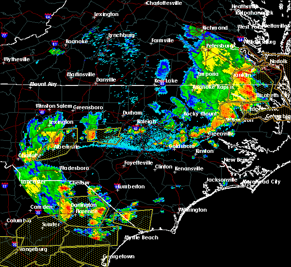 At 552 pm edt, a severe thunderstorm was located near biscoe, or 9 miles southeast of troy, moving east at 45 mph (radar indicated). Hazards include 60 mph wind gusts. expect damage to roofs, siding, and trees At 552 pm edt, a severe thunderstorm was located near biscoe, or 9 miles southeast of troy, moving east at 45 mph (radar indicated). Hazards include 60 mph wind gusts. expect damage to roofs, siding, and trees
|
| 6/5/2019 2:58 PM EDT |
 At 257 pm edt, a severe thunderstorm was located over aberdeen, or near southern pines, moving northeast at 25 mph (radar indicated). Hazards include 60 mph wind gusts and quarter size hail. Hail damage to vehicles is expected. Expect wind damage to roofs, siding, and trees. At 257 pm edt, a severe thunderstorm was located over aberdeen, or near southern pines, moving northeast at 25 mph (radar indicated). Hazards include 60 mph wind gusts and quarter size hail. Hail damage to vehicles is expected. Expect wind damage to roofs, siding, and trees.
|
| 5/4/2019 7:05 PM EDT |
 At 704 pm edt, a severe thunderstorm was located 7 miles northwest of carthage, moving east at 30 mph (radar indicated). Hazards include 60 mph wind gusts and quarter size hail. Hail damage to vehicles is expected. expect wind damage to roofs, siding, and trees. Locations impacted include, southern pines, carthage, pinehurst, whispering pines, robbins, taylortown, seven lakes, highfalls, eagle springs and glendon. At 704 pm edt, a severe thunderstorm was located 7 miles northwest of carthage, moving east at 30 mph (radar indicated). Hazards include 60 mph wind gusts and quarter size hail. Hail damage to vehicles is expected. expect wind damage to roofs, siding, and trees. Locations impacted include, southern pines, carthage, pinehurst, whispering pines, robbins, taylortown, seven lakes, highfalls, eagle springs and glendon.
|
| 5/4/2019 6:35 PM EDT |
 At 635 pm edt, a severe thunderstorm was located near biscoe, or near troy, moving east at 30 mph (radar indicated). Hazards include 60 mph wind gusts, heavy rain, and quarter size hail. Hail damage to vehicles is expected. expect wind damage to roofs, siding, and trees. Locations impacted include, southern pines, troy, carthage, pinehurst, biscoe, whispering pines, robbins, star, candor and taylortown. At 635 pm edt, a severe thunderstorm was located near biscoe, or near troy, moving east at 30 mph (radar indicated). Hazards include 60 mph wind gusts, heavy rain, and quarter size hail. Hail damage to vehicles is expected. expect wind damage to roofs, siding, and trees. Locations impacted include, southern pines, troy, carthage, pinehurst, biscoe, whispering pines, robbins, star, candor and taylortown.
|
| 5/4/2019 6:11 PM EDT |
 At 611 pm edt, a severe thunderstorm was located near troy, moving east at 30 mph (radar indicated). Hazards include 60 mph wind gusts and quarter size hail. Hail damage to vehicles is expected. Expect wind damage to roofs, siding, and trees. At 611 pm edt, a severe thunderstorm was located near troy, moving east at 30 mph (radar indicated). Hazards include 60 mph wind gusts and quarter size hail. Hail damage to vehicles is expected. Expect wind damage to roofs, siding, and trees.
|
| 4/19/2019 3:47 PM EDT |
 At 347 pm edt, severe thunderstorms were located along a line extending from near hightowers to 7 miles west of carthage, moving northeast at 30 mph (radar indicated). Hazards include 60 mph wind gusts. expect damage to roofs, siding, and trees At 347 pm edt, severe thunderstorms were located along a line extending from near hightowers to 7 miles west of carthage, moving northeast at 30 mph (radar indicated). Hazards include 60 mph wind gusts. expect damage to roofs, siding, and trees
|
| 4/19/2019 3:04 PM EDT |
 At 304 pm edt, severe thunderstorms were located along a line extending from 8 miles southeast of seagrove to near hamlet, moving north at 10 mph (radar indicated). Hazards include 60 mph wind gusts. Expect damage to roofs, siding, and trees. locations impacted include, rockingham, troy, pinehurst, hamlet, biscoe, hoffman, robbins, ellerbe, foxfire and star. A tornado watch remains in effect until 500 pm edt for central north carolina. At 304 pm edt, severe thunderstorms were located along a line extending from 8 miles southeast of seagrove to near hamlet, moving north at 10 mph (radar indicated). Hazards include 60 mph wind gusts. Expect damage to roofs, siding, and trees. locations impacted include, rockingham, troy, pinehurst, hamlet, biscoe, hoffman, robbins, ellerbe, foxfire and star. A tornado watch remains in effect until 500 pm edt for central north carolina.
|
| 4/19/2019 2:29 PM EDT |
 At 228 pm edt, severe thunderstorms were located along a line extending from 10 miles south of troy to near hamlet, moving northeast at 50 mph (radar indicated). Hazards include 60 mph wind gusts. expect damage to roofs, siding, and trees At 228 pm edt, severe thunderstorms were located along a line extending from 10 miles south of troy to near hamlet, moving northeast at 50 mph (radar indicated). Hazards include 60 mph wind gusts. expect damage to roofs, siding, and trees
|
| 4/14/2019 6:49 PM EDT |
 At 648 pm edt, a severe thunderstorm was located over hoffman, or 13 miles southwest of southern pines, moving northeast at 50 mph (radar indicated). Hazards include 60 mph wind gusts. Expect damage to roofs, siding, and trees. locations impacted include, pinehurst, aberdeen, hoffman, pinebluff, sandhills game land, ashley heights and camp mackall. A tornado watch remains in effect until 800 pm edt for central north carolina. At 648 pm edt, a severe thunderstorm was located over hoffman, or 13 miles southwest of southern pines, moving northeast at 50 mph (radar indicated). Hazards include 60 mph wind gusts. Expect damage to roofs, siding, and trees. locations impacted include, pinehurst, aberdeen, hoffman, pinebluff, sandhills game land, ashley heights and camp mackall. A tornado watch remains in effect until 800 pm edt for central north carolina.
|
| 4/14/2019 6:35 PM EDT |
 At 633 pm edt, a severe thunderstorm was located over hamlet, or near rockingham, moving northeast at 50 mph (law enforcement recently reported hail to the size of quarters in hamlet). Hazards include 60 mph wind gusts and quarter size hail. Hail damage to vehicles is expected. expect wind damage to roofs, siding, and trees. locations impacted include, rockingham, pinehurst, hamlet, aberdeen, hoffman, pinebluff, dobbins heights, east rockingham, sandhills game land and bowmore. A tornado watch remains in effect until 800 pm edt for central north carolina. At 633 pm edt, a severe thunderstorm was located over hamlet, or near rockingham, moving northeast at 50 mph (law enforcement recently reported hail to the size of quarters in hamlet). Hazards include 60 mph wind gusts and quarter size hail. Hail damage to vehicles is expected. expect wind damage to roofs, siding, and trees. locations impacted include, rockingham, pinehurst, hamlet, aberdeen, hoffman, pinebluff, dobbins heights, east rockingham, sandhills game land and bowmore. A tornado watch remains in effect until 800 pm edt for central north carolina.
|
| 4/14/2019 6:12 PM EDT |
 At 612 pm edt, a severe thunderstorm was located over wallace, or near cheraw, moving northeast at 50 mph (radar indicated). Hazards include 60 mph wind gusts and quarter size hail. Hail damage to vehicles is expected. Expect wind damage to roofs, siding, and trees. At 612 pm edt, a severe thunderstorm was located over wallace, or near cheraw, moving northeast at 50 mph (radar indicated). Hazards include 60 mph wind gusts and quarter size hail. Hail damage to vehicles is expected. Expect wind damage to roofs, siding, and trees.
|
| 4/13/2019 3:32 PM EDT |
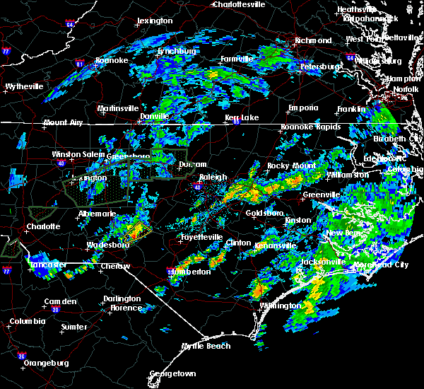 At 332 pm edt, a severe thunderstorm was located over pinehurst, or near southern pines, moving east at 25 mph (radar indicated). Hazards include 60 mph wind gusts and quarter size hail. Hail damage to vehicles is expected. expect wind damage to roofs, siding, and trees. Locations impacted include, southern pines, pinehurst, aberdeen, whispering pines, pinebluff, foxfire and taylortown. At 332 pm edt, a severe thunderstorm was located over pinehurst, or near southern pines, moving east at 25 mph (radar indicated). Hazards include 60 mph wind gusts and quarter size hail. Hail damage to vehicles is expected. expect wind damage to roofs, siding, and trees. Locations impacted include, southern pines, pinehurst, aberdeen, whispering pines, pinebluff, foxfire and taylortown.
|
| 4/13/2019 3:23 PM EDT |
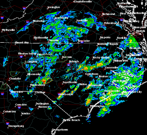 At 320 pm edt, a severe thunderstorm was located near pinehurst, or 9 miles west of southern pines, moving northeast at 25 mph. this storm continues to ride eastward along a residual outflow boundary, which often times can allow for quick spin-ups tornadoes. will be monitoring the possible need to upgrade to a tornado warning closely (radar indicated). Hazards include 60 mph wind gusts, heavy downpours, and quarter size hail. Hail damage to vehicles is expected. expect wind damage to roofs, siding, and trees. Locations impacted include, southern pines, carthage, pinehurst, aberdeen, whispering pines, pinebluff, foxfire, taylortown and seven lakes. At 320 pm edt, a severe thunderstorm was located near pinehurst, or 9 miles west of southern pines, moving northeast at 25 mph. this storm continues to ride eastward along a residual outflow boundary, which often times can allow for quick spin-ups tornadoes. will be monitoring the possible need to upgrade to a tornado warning closely (radar indicated). Hazards include 60 mph wind gusts, heavy downpours, and quarter size hail. Hail damage to vehicles is expected. expect wind damage to roofs, siding, and trees. Locations impacted include, southern pines, carthage, pinehurst, aberdeen, whispering pines, pinebluff, foxfire, taylortown and seven lakes.
|
| 4/13/2019 3:01 PM EDT |
 At 301 pm edt, a severe thunderstorm was located 8 miles northwest of hoffman, or 11 miles northeast of rockingham, moving northeast at 25 mph (radar indicated). Hazards include 60 mph wind gusts and quarter size hail. Hail damage to vehicles is expected. Expect wind damage to roofs, siding, and trees. At 301 pm edt, a severe thunderstorm was located 8 miles northwest of hoffman, or 11 miles northeast of rockingham, moving northeast at 25 mph (radar indicated). Hazards include 60 mph wind gusts and quarter size hail. Hail damage to vehicles is expected. Expect wind damage to roofs, siding, and trees.
|
| 4/8/2019 4:38 PM EDT |
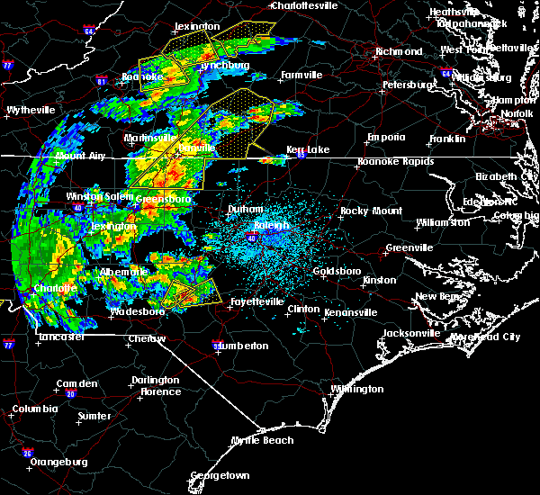 The severe thunderstorm warning for southeastern moore county will expire at 445 pm edt, the storm which prompted the warning is moving out of the area, and this warning will be allowed to expire. however, another severe thunderstorm warning has been issued for this storm further east. a severe thunderstorm watch remains in effect until 1000 pm edt for central north carolina. to report severe weather, contact your nearest law enforcement agency. they will relay your report to the national weather service raleigh. The severe thunderstorm warning for southeastern moore county will expire at 445 pm edt, the storm which prompted the warning is moving out of the area, and this warning will be allowed to expire. however, another severe thunderstorm warning has been issued for this storm further east. a severe thunderstorm watch remains in effect until 1000 pm edt for central north carolina. to report severe weather, contact your nearest law enforcement agency. they will relay your report to the national weather service raleigh.
|
| 4/8/2019 4:11 PM EDT |
 At 410 pm edt, a severe thunderstorm was located over aberdeen, or near southern pines, moving northeast at 25 mph (radar indicated). Hazards include 60 mph wind gusts and nickel size hail. Expect damage to roofs, siding, and trees. Locations impacted include, southern pines, pinehurst, aberdeen, whispering pines, pinebluff, taylortown and vass. At 410 pm edt, a severe thunderstorm was located over aberdeen, or near southern pines, moving northeast at 25 mph (radar indicated). Hazards include 60 mph wind gusts and nickel size hail. Expect damage to roofs, siding, and trees. Locations impacted include, southern pines, pinehurst, aberdeen, whispering pines, pinebluff, taylortown and vass.
|
| 4/8/2019 4:00 PM EDT |
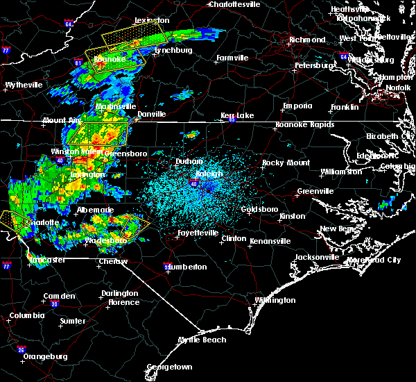 At 359 pm edt, a severe thunderstorm was located near hoffman, or 10 miles southwest of southern pines, moving northeast at 20 mph (radar indicated). Hazards include 60 mph wind gusts and nickel size hail. expect damage to roofs, siding, and trees At 359 pm edt, a severe thunderstorm was located near hoffman, or 10 miles southwest of southern pines, moving northeast at 20 mph (radar indicated). Hazards include 60 mph wind gusts and nickel size hail. expect damage to roofs, siding, and trees
|
| 10/11/2018 6:22 PM EDT |
 The severe thunderstorm warning for central moore, harnett, cumberland, lee and hoke counties will expire at 630 pm edt, the damaging wind gusts which prompted the warning have weakened below severe limits, and no longer pose an immediate threat to life or property. therefore the warning will be allowed to expire. however gusty winds will still be possible over the next few hours as the remnants of tropical storm michael pushes northeast into virginia tonight. The severe thunderstorm warning for central moore, harnett, cumberland, lee and hoke counties will expire at 630 pm edt, the damaging wind gusts which prompted the warning have weakened below severe limits, and no longer pose an immediate threat to life or property. therefore the warning will be allowed to expire. however gusty winds will still be possible over the next few hours as the remnants of tropical storm michael pushes northeast into virginia tonight.
|
| 10/11/2018 5:37 PM EDT |
 At 535 pm edt, a line of damaging winds mixing south along the western side of michael were pushing east along a line extending from near garner through 7 miles northeast of angier to near raeford, moving east at 40 mph (emergency management confirms damage from this area of high wind gusts). Hazards include 60 mph wind gusts. Expect damage to roofs, siding, and trees. locations impacted include, fayetteville, sanford, southern pines, raeford, lillington, carthage, fort bragg, pinehurst, dunn and aberdeen. A tornado watch remains in effect until 900 pm edt for central north carolina. At 535 pm edt, a line of damaging winds mixing south along the western side of michael were pushing east along a line extending from near garner through 7 miles northeast of angier to near raeford, moving east at 40 mph (emergency management confirms damage from this area of high wind gusts). Hazards include 60 mph wind gusts. Expect damage to roofs, siding, and trees. locations impacted include, fayetteville, sanford, southern pines, raeford, lillington, carthage, fort bragg, pinehurst, dunn and aberdeen. A tornado watch remains in effect until 900 pm edt for central north carolina.
|
| 10/11/2018 4:57 PM EDT |
 At 455 pm edt, a line of damaging winds mixing south along the western side of michael were moving along a line extending from 8 miles west of cary through 11 miles southeast of pittsboro to 6 miles northeast of hamlet, moving east at 45 mph. this line of winds have a history of producing extensive wind damage to structures (emergency management). Hazards include 60 mph wind gusts. expect damage to roofs, siding, and trees At 455 pm edt, a line of damaging winds mixing south along the western side of michael were moving along a line extending from 8 miles west of cary through 11 miles southeast of pittsboro to 6 miles northeast of hamlet, moving east at 45 mph. this line of winds have a history of producing extensive wind damage to structures (emergency management). Hazards include 60 mph wind gusts. expect damage to roofs, siding, and trees
|
| 9/27/2018 11:26 PM EDT |
 At 1126 pm edt, severe thunderstorms were located along a line extending from near mebane to near goldston to 6 miles west of hoffman, moving northeast at 35 mph (radar indicated). Hazards include 60 mph wind gusts. Expect damage to roofs, siding, and trees. Locations impacted include, burlington, asheboro, graham, rockingham, wadesboro, troy, carthage, siler city, north carolina zoo and pinehurst. At 1126 pm edt, severe thunderstorms were located along a line extending from near mebane to near goldston to 6 miles west of hoffman, moving northeast at 35 mph (radar indicated). Hazards include 60 mph wind gusts. Expect damage to roofs, siding, and trees. Locations impacted include, burlington, asheboro, graham, rockingham, wadesboro, troy, carthage, siler city, north carolina zoo and pinehurst.
|
| 9/27/2018 10:42 PM EDT |
 At 1041 pm edt, severe thunderstorms were located along a line extending from 7 miles northeast of randleman to troy to 6 miles north of chesterfield, moving northeast at 50 mph (radar indicated). Hazards include 60 mph wind gusts. expect damage to roofs, siding, and trees At 1041 pm edt, severe thunderstorms were located along a line extending from 7 miles northeast of randleman to troy to 6 miles north of chesterfield, moving northeast at 50 mph (radar indicated). Hazards include 60 mph wind gusts. expect damage to roofs, siding, and trees
|
| 9/27/2018 3:49 PM EDT |
 At 348 pm edt, a severe thunderstorm was located 8 miles east of biscoe, or 12 miles west of carthage, moving northeast at 35 mph (radar indicated). Hazards include 60 mph wind gusts. Expect damage to roofs, siding, and trees. Locations impacted include, southern pines, carthage, pinehurst, biscoe, whispering pines, robbins, foxfire, star, candor and taylortown. At 348 pm edt, a severe thunderstorm was located 8 miles east of biscoe, or 12 miles west of carthage, moving northeast at 35 mph (radar indicated). Hazards include 60 mph wind gusts. Expect damage to roofs, siding, and trees. Locations impacted include, southern pines, carthage, pinehurst, biscoe, whispering pines, robbins, foxfire, star, candor and taylortown.
|
| 9/27/2018 3:34 PM EDT |
 At 332 pm edt, a severe thunderstorm was located near biscoe, or 8 miles southeast of troy, moving northeast at 40 mph (radar indicated). Hazards include 60 mph wind gusts. Expect damage to roofs, siding, and trees. Locations impacted include, southern pines, troy, carthage, north carolina zoo, pinehurst, biscoe, seagrove, whispering pines, robbins and foxfire. At 332 pm edt, a severe thunderstorm was located near biscoe, or 8 miles southeast of troy, moving northeast at 40 mph (radar indicated). Hazards include 60 mph wind gusts. Expect damage to roofs, siding, and trees. Locations impacted include, southern pines, troy, carthage, north carolina zoo, pinehurst, biscoe, seagrove, whispering pines, robbins and foxfire.
|
| 9/27/2018 3:07 PM EDT |
 At 307 pm edt, a severe thunderstorm was located near troy, moving northeast at 35 mph (radar indicated). Hazards include 60 mph wind gusts. expect damage to roofs, siding, and trees At 307 pm edt, a severe thunderstorm was located near troy, moving northeast at 35 mph (radar indicated). Hazards include 60 mph wind gusts. expect damage to roofs, siding, and trees
|
| 9/9/2018 9:20 PM EDT |
 The severe thunderstorm warning for central moore and southwestern lee counties will expire at 930 pm edt, the storm which prompted the warning has weakened below severe limits, and no longer poses an immediate threat to life or property. therefore the warning will be allowed to expire. however gusty winds and heavy rain are still possible with this thunderstorm. to report severe weather, contact your nearest law enforcement agency. they will relay your report to the national weather service raleigh. The severe thunderstorm warning for central moore and southwestern lee counties will expire at 930 pm edt, the storm which prompted the warning has weakened below severe limits, and no longer poses an immediate threat to life or property. therefore the warning will be allowed to expire. however gusty winds and heavy rain are still possible with this thunderstorm. to report severe weather, contact your nearest law enforcement agency. they will relay your report to the national weather service raleigh.
|
| 9/9/2018 9:05 PM EDT |
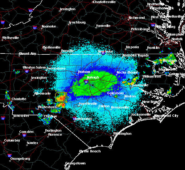 At 905 pm edt, a severe thunderstorm was located near carthage, moving north at 10 mph (radar indicated). Hazards include 60 mph wind gusts. Expect damage to roofs, siding, and trees. Locations impacted include, southern pines, carthage, pinehurst, whispering pines, taylortown, vass and seven lakes. At 905 pm edt, a severe thunderstorm was located near carthage, moving north at 10 mph (radar indicated). Hazards include 60 mph wind gusts. Expect damage to roofs, siding, and trees. Locations impacted include, southern pines, carthage, pinehurst, whispering pines, taylortown, vass and seven lakes.
|
| 9/9/2018 8:49 PM EDT |
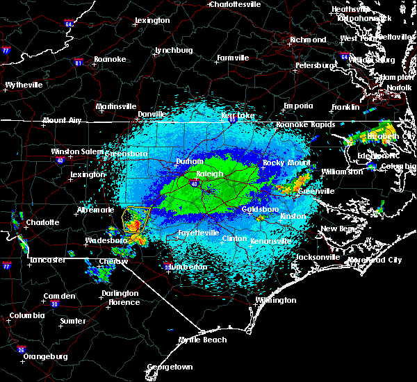 At 848 pm edt, a severe thunderstorm was located near southern pines, moving northeast at 10 mph (radar indicated). Hazards include 60 mph wind gusts. Expect damage to roofs, siding, and trees. Locations impacted include, southern pines, carthage, pinehurst, aberdeen, whispering pines, foxfire, taylortown, vass and seven lakes. At 848 pm edt, a severe thunderstorm was located near southern pines, moving northeast at 10 mph (radar indicated). Hazards include 60 mph wind gusts. Expect damage to roofs, siding, and trees. Locations impacted include, southern pines, carthage, pinehurst, aberdeen, whispering pines, foxfire, taylortown, vass and seven lakes.
|
| 9/9/2018 8:44 PM EDT |
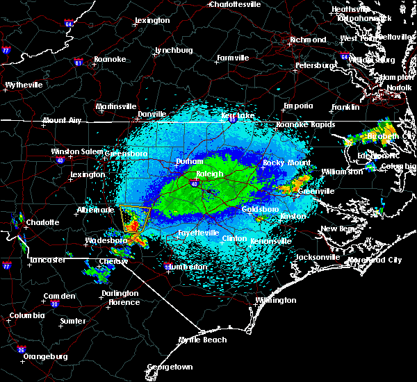 At 843 pm edt, a severe thunderstorm was located near pinehurst, or near southern pines, moving north at 10 mph (radar indicated). Hazards include 60 mph wind gusts. Expect damage to roofs, siding, and trees. Locations impacted include, southern pines, carthage, pinehurst, aberdeen, whispering pines, robbins, foxfire, taylortown, vass and seven lakes. At 843 pm edt, a severe thunderstorm was located near pinehurst, or near southern pines, moving north at 10 mph (radar indicated). Hazards include 60 mph wind gusts. Expect damage to roofs, siding, and trees. Locations impacted include, southern pines, carthage, pinehurst, aberdeen, whispering pines, robbins, foxfire, taylortown, vass and seven lakes.
|
| 9/9/2018 8:42 PM EDT |
 At 842 pm edt, a severe thunderstorm was located near pinehurst, or near southern pines, moving north at 10 mph (radar indicated). Hazards include 60 mph wind gusts. expect damage to roofs, siding, and trees At 842 pm edt, a severe thunderstorm was located near pinehurst, or near southern pines, moving north at 10 mph (radar indicated). Hazards include 60 mph wind gusts. expect damage to roofs, siding, and trees
|
| 8/18/2018 11:44 PM EDT |
 At 1144 pm edt, severe thunderstorms were located along a line extending from 11 miles southeast of pittsboro to 9 miles southeast of sanford to near southern pines, moving east at 35 mph (radar indicated). Hazards include 60 mph wind gusts. Expect damage to roofs, siding, and trees. Locations impacted include, sanford, southern pines, carthage, pinehurst, whispering pines, broadway, foxfire, taylortown, vass and cameron. At 1144 pm edt, severe thunderstorms were located along a line extending from 11 miles southeast of pittsboro to 9 miles southeast of sanford to near southern pines, moving east at 35 mph (radar indicated). Hazards include 60 mph wind gusts. Expect damage to roofs, siding, and trees. Locations impacted include, sanford, southern pines, carthage, pinehurst, whispering pines, broadway, foxfire, taylortown, vass and cameron.
|
| 8/18/2018 11:26 PM EDT |
 At 1126 pm edt, severe thunderstorms were located along a line extending from 6 miles south of pittsboro to 6 miles east of carthage to 8 miles northwest of pinehurst, moving east at 35 mph (radar indicated). Hazards include 60 mph wind gusts. Expect damage to roofs, siding, and trees. Locations impacted include, sanford, southern pines, carthage, pinehurst, goldston, whispering pines, broadway, foxfire, taylortown and vass. At 1126 pm edt, severe thunderstorms were located along a line extending from 6 miles south of pittsboro to 6 miles east of carthage to 8 miles northwest of pinehurst, moving east at 35 mph (radar indicated). Hazards include 60 mph wind gusts. Expect damage to roofs, siding, and trees. Locations impacted include, sanford, southern pines, carthage, pinehurst, goldston, whispering pines, broadway, foxfire, taylortown and vass.
|
| 8/18/2018 11:14 PM EDT |
 At 1113 pm edt, severe thunderstorms were located along a line extending from 9 miles west of goldston to near carthage to 7 miles northwest of pinehurst, moving east at 35 mph (radar indicated). Hazards include 60 mph wind gusts. Expect damage to roofs, siding, and trees. Locations impacted include, sanford, southern pines, carthage, pinehurst, goldston, whispering pines, broadway, robbins, foxfire and taylortown. At 1113 pm edt, severe thunderstorms were located along a line extending from 9 miles west of goldston to near carthage to 7 miles northwest of pinehurst, moving east at 35 mph (radar indicated). Hazards include 60 mph wind gusts. Expect damage to roofs, siding, and trees. Locations impacted include, sanford, southern pines, carthage, pinehurst, goldston, whispering pines, broadway, robbins, foxfire and taylortown.
|
| 8/18/2018 10:53 PM EDT |
 At 1053 pm edt, severe thunderstorms were located along a line extending from near north carolina zoo to 12 miles southeast of seagrove to 7 miles south of biscoe, moving east at 35 mph (radar indicated). Hazards include 60 mph wind gusts. expect damage to roofs, siding, and trees At 1053 pm edt, severe thunderstorms were located along a line extending from near north carolina zoo to 12 miles southeast of seagrove to 7 miles south of biscoe, moving east at 35 mph (radar indicated). Hazards include 60 mph wind gusts. expect damage to roofs, siding, and trees
|
| 8/18/2018 10:37 PM EDT |
 At 1037 pm edt, severe thunderstorms were located along a line extending from 6 miles east of north carolina zoo to near biscoe to 7 miles southwest of troy, moving east at 35 mph (radar indicated). Hazards include 60 mph wind gusts. Expect damage to roofs, siding, and trees. Locations impacted include, asheboro, southern pines, troy, carthage, badin lake, north carolina zoo, siler city, pinehurst, biscoe and goldston. At 1037 pm edt, severe thunderstorms were located along a line extending from 6 miles east of north carolina zoo to near biscoe to 7 miles southwest of troy, moving east at 35 mph (radar indicated). Hazards include 60 mph wind gusts. Expect damage to roofs, siding, and trees. Locations impacted include, asheboro, southern pines, troy, carthage, badin lake, north carolina zoo, siler city, pinehurst, biscoe and goldston.
|
| 8/18/2018 10:17 PM EDT |
 At 1016 pm edt, severe thunderstorms were located along a line extending from 10 miles west of north carolina zoo to 7 miles southwest of seagrove to 6 miles southeast of albemarle, moving east at 40 mph (radar indicated). Hazards include 60 mph wind gusts. expect damage to roofs, siding, and trees At 1016 pm edt, severe thunderstorms were located along a line extending from 10 miles west of north carolina zoo to 7 miles southwest of seagrove to 6 miles southeast of albemarle, moving east at 40 mph (radar indicated). Hazards include 60 mph wind gusts. expect damage to roofs, siding, and trees
|
| 8/11/2018 1:53 AM EDT |
 At 153 am edt, a severe thunderstorm was located 7 miles southwest of carthage, moving east at 25 mph (radar indicated). Hazards include 60 mph wind gusts and penny size hail. expect damage to roofs, siding, and trees At 153 am edt, a severe thunderstorm was located 7 miles southwest of carthage, moving east at 25 mph (radar indicated). Hazards include 60 mph wind gusts and penny size hail. expect damage to roofs, siding, and trees
|
| 8/8/2018 8:41 PM EDT |
 The severe thunderstorm warning for central moore, western harnett, lee and southeastern chatham counties will expire at 845 pm edt, the storms which prompted the warning have moved out of the area. therefore the warning will be allowed to expire. however gusty winds and heavy rain are still possible with these thunderstorms. remember, a severe thunderstorm warning still remains in effect for harnett county until 945 pm edt. The severe thunderstorm warning for central moore, western harnett, lee and southeastern chatham counties will expire at 845 pm edt, the storms which prompted the warning have moved out of the area. therefore the warning will be allowed to expire. however gusty winds and heavy rain are still possible with these thunderstorms. remember, a severe thunderstorm warning still remains in effect for harnett county until 945 pm edt.
|
| 8/8/2018 8:30 PM EDT |
 At 830 pm edt, severe thunderstorms were located along a line extending from 7 miles southeast of pittsboro to 9 miles east of sanford to near aberdeen, moving east at 30 mph (radar indicated). Hazards include 60 mph wind gusts. Expect damage to roofs, siding, and trees. Locations impacted include, sanford, southern pines, pittsboro, carthage, pinehurst, aberdeen, goldston, whispering pines, pinebluff and broadway. At 830 pm edt, severe thunderstorms were located along a line extending from 7 miles southeast of pittsboro to 9 miles east of sanford to near aberdeen, moving east at 30 mph (radar indicated). Hazards include 60 mph wind gusts. Expect damage to roofs, siding, and trees. Locations impacted include, sanford, southern pines, pittsboro, carthage, pinehurst, aberdeen, goldston, whispering pines, pinebluff and broadway.
|
| 8/8/2018 8:27 PM EDT |
 At 827 pm edt, severe thunderstorms were located along a line extending from hoffman to near hamlet, moving east at 25 mph (radar indicated). Hazards include 60 mph wind gusts. Expect damage to roofs, siding, and trees. Locations impacted include, laurinburg, rockingham, raeford, hamlet, maxton, hoffman, ellerbe, dobbins heights, wagram and gibson. At 827 pm edt, severe thunderstorms were located along a line extending from hoffman to near hamlet, moving east at 25 mph (radar indicated). Hazards include 60 mph wind gusts. Expect damage to roofs, siding, and trees. Locations impacted include, laurinburg, rockingham, raeford, hamlet, maxton, hoffman, ellerbe, dobbins heights, wagram and gibson.
|
| 8/8/2018 8:07 PM EDT |
 At 806 pm edt, severe thunderstorms were located along a line extending from near pittsboro to 6 miles west of sanford to near pinehurst, moving east at 40 mph (radar indicated). Hazards include 60 mph wind gusts. Expect damage to roofs, siding, and trees. Locations impacted include, sanford, southern pines, pittsboro, carthage, pinehurst, aberdeen, goldston, whispering pines, pinebluff and broadway. At 806 pm edt, severe thunderstorms were located along a line extending from near pittsboro to 6 miles west of sanford to near pinehurst, moving east at 40 mph (radar indicated). Hazards include 60 mph wind gusts. Expect damage to roofs, siding, and trees. Locations impacted include, sanford, southern pines, pittsboro, carthage, pinehurst, aberdeen, goldston, whispering pines, pinebluff and broadway.
|
| 8/8/2018 7:51 PM EDT |
 At 750 pm edt, severe thunderstorms were located along a line extending from 13 miles south of biscoe to 7 miles northwest of chesterfield, moving east at 25 mph (radar indicated). Hazards include 60 mph wind gusts. expect damage to roofs, siding, and trees At 750 pm edt, severe thunderstorms were located along a line extending from 13 miles south of biscoe to 7 miles northwest of chesterfield, moving east at 25 mph (radar indicated). Hazards include 60 mph wind gusts. expect damage to roofs, siding, and trees
|
| 8/8/2018 7:29 PM EDT |
 At 729 pm edt, severe thunderstorms were located along a line extending from near asheboro to seagrove to near troy, moving east at 40 mph (radar indicated). Hazards include 60 mph wind gusts. expect damage to roofs, siding, and trees At 729 pm edt, severe thunderstorms were located along a line extending from near asheboro to seagrove to near troy, moving east at 40 mph (radar indicated). Hazards include 60 mph wind gusts. expect damage to roofs, siding, and trees
|
| 7/21/2018 10:06 PM EDT |
 At 1006 pm edt, severe thunderstorms were located along a line extending from near hoffman to 9 miles west of pope afb, moving northeast at 10 mph (radar indicated). Hazards include 60 mph wind gusts. Expect damage to roofs, siding, and trees. Locations impacted include, southern pines, raeford, pinehurst, aberdeen, hoffman, pinebluff, foxfire, derby, sandhills game land and rockfish. At 1006 pm edt, severe thunderstorms were located along a line extending from near hoffman to 9 miles west of pope afb, moving northeast at 10 mph (radar indicated). Hazards include 60 mph wind gusts. Expect damage to roofs, siding, and trees. Locations impacted include, southern pines, raeford, pinehurst, aberdeen, hoffman, pinebluff, foxfire, derby, sandhills game land and rockfish.
|
| 7/21/2018 9:53 PM EDT |
 At 953 pm edt, severe thunderstorms were located along a line extending from 6 miles west of hoffman to 10 miles west of pope afb, moving northeast at 15 mph (radar indicated). Hazards include 60 mph wind gusts. Expect damage to roofs, siding, and trees. Locations impacted include, southern pines, raeford, pinehurst, aberdeen, hoffman, pinebluff, foxfire, derby, sandhills game land and rockfish. At 953 pm edt, severe thunderstorms were located along a line extending from 6 miles west of hoffman to 10 miles west of pope afb, moving northeast at 15 mph (radar indicated). Hazards include 60 mph wind gusts. Expect damage to roofs, siding, and trees. Locations impacted include, southern pines, raeford, pinehurst, aberdeen, hoffman, pinebluff, foxfire, derby, sandhills game land and rockfish.
|
| 7/21/2018 9:31 PM EDT |
 At 930 pm edt, severe thunderstorms were located along a line extending from 7 miles north of rockingham to 8 miles east of hoffman, moving northeast at 10 mph (radar indicated). Hazards include 60 mph wind gusts and quarter size hail. Hail damage to vehicles is expected. Expect wind damage to roofs, siding, and trees. At 930 pm edt, severe thunderstorms were located along a line extending from 7 miles north of rockingham to 8 miles east of hoffman, moving northeast at 10 mph (radar indicated). Hazards include 60 mph wind gusts and quarter size hail. Hail damage to vehicles is expected. Expect wind damage to roofs, siding, and trees.
|
| 7/6/2018 5:38 PM EDT |
 At 537 pm edt, severe thunderstorms were located along a line extending from near carthage to 7 miles south of troy to near ansonville, and are nearly stationary (law enforcement). Hazards include 60 mph wind gusts and nickel size hail. Expect damage to roofs, siding, and trees. Locations impacted include, southern pines, rockingham, wadesboro, carthage, pinehurst, hamlet, aberdeen, ansonville, hoffman and polkton. At 537 pm edt, severe thunderstorms were located along a line extending from near carthage to 7 miles south of troy to near ansonville, and are nearly stationary (law enforcement). Hazards include 60 mph wind gusts and nickel size hail. Expect damage to roofs, siding, and trees. Locations impacted include, southern pines, rockingham, wadesboro, carthage, pinehurst, hamlet, aberdeen, ansonville, hoffman and polkton.
|
| 7/6/2018 4:59 PM EDT |
 At 458 pm edt, severe thunderstorms with a history of producing wind damage were located along a line extending from 6 miles west of carthage to 7 miles south of troy to near ansonville, and are nearly stationary (law enforcement reports several trees down across montgomery county, including within the city of troy and biscoe). Hazards include 60 mph wind gusts and quarter size hail. Hail damage to vehicles is expected. expect wind damage to roofs, siding, and trees. Locations impacted include, southern pines, rockingham, wadesboro, troy, carthage, pinehurst, hamlet, aberdeen, biscoe and ansonville. At 458 pm edt, severe thunderstorms with a history of producing wind damage were located along a line extending from 6 miles west of carthage to 7 miles south of troy to near ansonville, and are nearly stationary (law enforcement reports several trees down across montgomery county, including within the city of troy and biscoe). Hazards include 60 mph wind gusts and quarter size hail. Hail damage to vehicles is expected. expect wind damage to roofs, siding, and trees. Locations impacted include, southern pines, rockingham, wadesboro, troy, carthage, pinehurst, hamlet, aberdeen, biscoe and ansonville.
|
| 7/6/2018 4:56 PM EDT |
 The severe thunderstorm warning for western moore and central montgomery counties will expire at 500 pm edt, the storm which prompted the warning continues to impact the area. please refer to severe thunderstorm number 114 for further details. however gusty winds and heavy rain are still possible with this thunderstorm. remember, a severe thunderstorm warning still remains in effect for portions of moore and montgomery county. The severe thunderstorm warning for western moore and central montgomery counties will expire at 500 pm edt, the storm which prompted the warning continues to impact the area. please refer to severe thunderstorm number 114 for further details. however gusty winds and heavy rain are still possible with this thunderstorm. remember, a severe thunderstorm warning still remains in effect for portions of moore and montgomery county.
|
| 7/6/2018 4:46 PM EDT |
 At 445 pm edt, a severe thunderstorm was located over biscoe, or near troy, and is nearly stationary (radar indicated). Hazards include 60 mph wind gusts and quarter size hail. Hail damage to vehicles is expected. expect wind damage to roofs, siding, and trees. Locations impacted include, troy, pinehurst, biscoe, mount gilead, robbins, foxfire, star, candor, norman and seven lakes. At 445 pm edt, a severe thunderstorm was located over biscoe, or near troy, and is nearly stationary (radar indicated). Hazards include 60 mph wind gusts and quarter size hail. Hail damage to vehicles is expected. expect wind damage to roofs, siding, and trees. Locations impacted include, troy, pinehurst, biscoe, mount gilead, robbins, foxfire, star, candor, norman and seven lakes.
|
| 7/6/2018 4:44 PM EDT |
 At 444 pm edt, severe thunderstorms were located along a line extending from 6 miles west of carthage to 7 miles south of troy to near ansonville, and are nearly stationary (radar indicated). Hazards include 60 mph wind gusts and quarter size hail. Hail damage to vehicles is expected. Expect wind damage to roofs, siding, and trees. At 444 pm edt, severe thunderstorms were located along a line extending from 6 miles west of carthage to 7 miles south of troy to near ansonville, and are nearly stationary (radar indicated). Hazards include 60 mph wind gusts and quarter size hail. Hail damage to vehicles is expected. Expect wind damage to roofs, siding, and trees.
|
| 7/6/2018 4:21 PM EDT |
 At 421 pm edt, a severe thunderstorm was located near biscoe, or near troy, moving south at 5 mph (radar indicated). Hazards include 60 mph wind gusts and quarter size hail. Hail damage to vehicles is expected. Expect wind damage to roofs, siding, and trees. At 421 pm edt, a severe thunderstorm was located near biscoe, or near troy, moving south at 5 mph (radar indicated). Hazards include 60 mph wind gusts and quarter size hail. Hail damage to vehicles is expected. Expect wind damage to roofs, siding, and trees.
|
| 6/25/2018 9:28 PM EDT |
 The severe thunderstorm warning for moore and lee counties will expire at 930 pm edt, the storms which prompted the warning have weakened below severe limits, and have exited the warned area. therefore, the warning will be allowed to expire. however gusty winds and heavy rain are still possible with these thunderstorms. a severe thunderstorm watch remains in effect until 1000 pm edt for central north carolina. to report severe weather, contact your nearest law enforcement agency. they will relay your report to the national weather service raleigh. The severe thunderstorm warning for moore and lee counties will expire at 930 pm edt, the storms which prompted the warning have weakened below severe limits, and have exited the warned area. therefore, the warning will be allowed to expire. however gusty winds and heavy rain are still possible with these thunderstorms. a severe thunderstorm watch remains in effect until 1000 pm edt for central north carolina. to report severe weather, contact your nearest law enforcement agency. they will relay your report to the national weather service raleigh.
|
| 6/25/2018 9:04 PM EDT |
 At 903 pm edt, severe thunderstorms were located along a line extending from 6 miles south of siler city to near carthage to 6 miles north of hoffman, moving southeast at 30 mph. wind damage in the form of downed trees have been reported with these storms (radar indicated). Hazards include 60 mph wind gusts and nickel size hail. Expect damage to roofs, siding, and trees. Locations impacted include, sanford, southern pines, carthage, pinehurst, aberdeen, whispering pines, pinebluff, broadway, robbins and foxfire. At 903 pm edt, severe thunderstorms were located along a line extending from 6 miles south of siler city to near carthage to 6 miles north of hoffman, moving southeast at 30 mph. wind damage in the form of downed trees have been reported with these storms (radar indicated). Hazards include 60 mph wind gusts and nickel size hail. Expect damage to roofs, siding, and trees. Locations impacted include, sanford, southern pines, carthage, pinehurst, aberdeen, whispering pines, pinebluff, broadway, robbins and foxfire.
|
| 6/25/2018 8:57 PM EDT |
 At 856 pm edt, severe thunderstorms were located along a line extending from near pinehurst to 7 miles northwest of hoffman to 8 miles southwest of wadesboro, moving southeast at 35 mph. this storm has a history of producing wind damage (radar indicated). Hazards include 60 mph wind gusts and penny size hail. expect damage to roofs, siding, and trees At 856 pm edt, severe thunderstorms were located along a line extending from near pinehurst to 7 miles northwest of hoffman to 8 miles southwest of wadesboro, moving southeast at 35 mph. this storm has a history of producing wind damage (radar indicated). Hazards include 60 mph wind gusts and penny size hail. expect damage to roofs, siding, and trees
|
| 6/25/2018 8:48 PM EDT |
 At 845 pm edt, severe thunderstorms were located along a line extending from 9 miles east of biscoe to 12 miles north of rockingham to near wadesboro, moving southeast at 25 mph (emergency management reported tree damage across montgomery county, including the area of troy and candor). Hazards include 60 mph wind gusts and nickel size hail. Expect damage to roofs, siding, and trees. Locations impacted include, rockingham, wadesboro, hamlet, hoffman, ellerbe, dobbins heights, lilesville, morven, norman and mcfarlan. At 845 pm edt, severe thunderstorms were located along a line extending from 9 miles east of biscoe to 12 miles north of rockingham to near wadesboro, moving southeast at 25 mph (emergency management reported tree damage across montgomery county, including the area of troy and candor). Hazards include 60 mph wind gusts and nickel size hail. Expect damage to roofs, siding, and trees. Locations impacted include, rockingham, wadesboro, hamlet, hoffman, ellerbe, dobbins heights, lilesville, morven, norman and mcfarlan.
|
| 6/25/2018 8:14 PM EDT |
 At 813 pm edt, severe thunderstorms were located along a line extending from near randleman to near seagrove to 7 miles southwest of troy, moving southeast at 30 mph (radar indicated). Hazards include 60 mph wind gusts and nickel size hail. expect damage to roofs, siding, and trees At 813 pm edt, severe thunderstorms were located along a line extending from near randleman to near seagrove to 7 miles southwest of troy, moving southeast at 30 mph (radar indicated). Hazards include 60 mph wind gusts and nickel size hail. expect damage to roofs, siding, and trees
|
| 6/25/2018 7:41 PM EDT |
 The national weather service in raleigh has issued a * severe thunderstorm warning for. anson county in central north carolina. southeastern montgomery county in central north carolina. richmond county in central north carolina. Southeastern stanly county in central north carolina. The national weather service in raleigh has issued a * severe thunderstorm warning for. anson county in central north carolina. southeastern montgomery county in central north carolina. richmond county in central north carolina. Southeastern stanly county in central north carolina.
|
| 6/20/2018 6:53 PM EDT |
 At 653 pm edt, a severe thunderstorm was located over aberdeen, or near southern pines, moving east at 20 mph (radar indicated). Hazards include 60 mph wind gusts. Expect damage to roofs, siding, and trees. Locations impacted include, southern pines, pinehurst, aberdeen, whispering pines, pinebluff, foxfire, taylortown, vass and ashley heights. At 653 pm edt, a severe thunderstorm was located over aberdeen, or near southern pines, moving east at 20 mph (radar indicated). Hazards include 60 mph wind gusts. Expect damage to roofs, siding, and trees. Locations impacted include, southern pines, pinehurst, aberdeen, whispering pines, pinebluff, foxfire, taylortown, vass and ashley heights.
|
| 6/20/2018 6:23 PM EDT |
 At 623 pm edt, a severe thunderstorm was located over southern pines, moving east at 40 mph (radar indicated). Hazards include 60 mph wind gusts. Expect damage to roofs, siding, and trees. Locations impacted include, southern pines, pinehurst, aberdeen, whispering pines, pinebluff, foxfire, taylortown, vass and ashley heights. At 623 pm edt, a severe thunderstorm was located over southern pines, moving east at 40 mph (radar indicated). Hazards include 60 mph wind gusts. Expect damage to roofs, siding, and trees. Locations impacted include, southern pines, pinehurst, aberdeen, whispering pines, pinebluff, foxfire, taylortown, vass and ashley heights.
|
| 6/20/2018 6:08 PM EDT |
 At 608 pm edt, a severe thunderstorm was located near pinehurst, or near southern pines, moving east at 35 mph (radar indicated). Hazards include 60 mph wind gusts. expect damage to roofs, siding, and trees At 608 pm edt, a severe thunderstorm was located near pinehurst, or near southern pines, moving east at 35 mph (radar indicated). Hazards include 60 mph wind gusts. expect damage to roofs, siding, and trees
|
| 6/11/2018 5:14 PM EDT |
 At 514 pm edt, a severe thunderstorm was located 8 miles west of sanford, moving southeast at 15 mph (radar indicated). Hazards include 60 mph wind gusts and quarter size hail. Hail damage to vehicles is expected. Expect wind damage to roofs, siding, and trees. At 514 pm edt, a severe thunderstorm was located 8 miles west of sanford, moving southeast at 15 mph (radar indicated). Hazards include 60 mph wind gusts and quarter size hail. Hail damage to vehicles is expected. Expect wind damage to roofs, siding, and trees.
|
| 4/15/2018 5:38 PM EDT |
 At 538 pm edt, a severe thunderstorm was located near hoffman, or 10 miles south of southern pines, moving north at 20 mph (radar indicated). Hazards include 60 mph wind gusts and quarter size hail. Hail damage to vehicles is expected. expect wind damage to roofs, siding, and trees. locations impacted include, laurinburg, southern pines, raeford, carthage, pinehurst, aberdeen, maxton, antioch, whispering pines and pinebluff. A tornado watch remains in effect until 1100 pm edt for central north carolina. At 538 pm edt, a severe thunderstorm was located near hoffman, or 10 miles south of southern pines, moving north at 20 mph (radar indicated). Hazards include 60 mph wind gusts and quarter size hail. Hail damage to vehicles is expected. expect wind damage to roofs, siding, and trees. locations impacted include, laurinburg, southern pines, raeford, carthage, pinehurst, aberdeen, maxton, antioch, whispering pines and pinebluff. A tornado watch remains in effect until 1100 pm edt for central north carolina.
|
| 4/15/2018 4:55 PM EDT |
 At 453 pm edt, a line of severe thunderstorms were approaching from the south. these storms were located near mccoll, or near bennettsville, moving north at 45 mph (radar indicated). Hazards include 60 mph wind gusts and quarter size hail. Hail damage to vehicles is expected. Expect wind damage to roofs, siding, and trees. At 453 pm edt, a line of severe thunderstorms were approaching from the south. these storms were located near mccoll, or near bennettsville, moving north at 45 mph (radar indicated). Hazards include 60 mph wind gusts and quarter size hail. Hail damage to vehicles is expected. Expect wind damage to roofs, siding, and trees.
|
| 3/1/2018 3:27 PM EST |
 At 327 pm est, a severe thunderstorm was located near aberdeen, or 7 miles south of southern pines, moving east at 40 mph (radar indicated). Hazards include 60 mph wind gusts. expect damage to roofs, siding, and trees At 327 pm est, a severe thunderstorm was located near aberdeen, or 7 miles south of southern pines, moving east at 40 mph (radar indicated). Hazards include 60 mph wind gusts. expect damage to roofs, siding, and trees
|
| 9/5/2017 7:35 PM EDT |
 The severe thunderstorm warning for north central scotland and northeastern richmond counties will expire at 745 pm edt, the storm which prompted the warning has weakened below severe limits, and no longer poses an immediate threat to life or property. therefore the warning will be allowed to expire. however gusty winds and heavy rain are still possible with this thunderstorm. The severe thunderstorm warning for north central scotland and northeastern richmond counties will expire at 745 pm edt, the storm which prompted the warning has weakened below severe limits, and no longer poses an immediate threat to life or property. therefore the warning will be allowed to expire. however gusty winds and heavy rain are still possible with this thunderstorm.
|
| 9/5/2017 7:28 PM EDT |
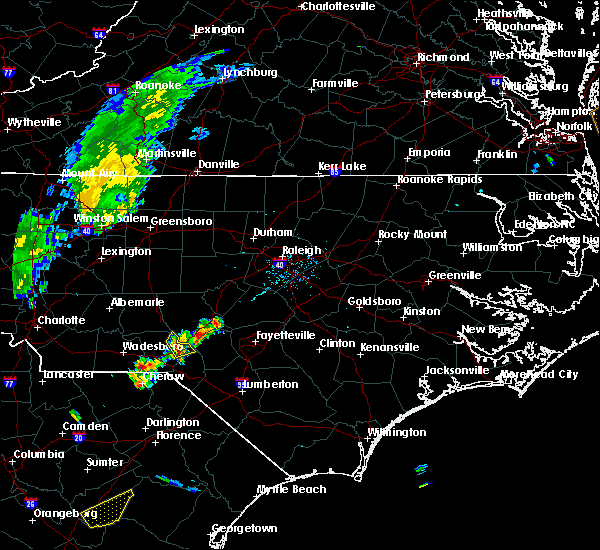 At 727 pm edt, a severe thunderstorm was located over hoffman, or 12 miles southwest of southern pines, moving northeast at 20 mph (radar indicated). Hazards include 60 mph wind gusts. Expect damage to roofs, siding, and trees. Locations impacted include, hoffman, sandhills game land and camp mackall. At 727 pm edt, a severe thunderstorm was located over hoffman, or 12 miles southwest of southern pines, moving northeast at 20 mph (radar indicated). Hazards include 60 mph wind gusts. Expect damage to roofs, siding, and trees. Locations impacted include, hoffman, sandhills game land and camp mackall.
|
| 9/5/2017 7:14 PM EDT |
 At 714 pm edt, a severe thunderstorm was located near hoffman, or 9 miles northeast of rockingham, moving northeast at 25 mph (radar indicated). Hazards include 60 mph wind gusts. Expect damage to roofs, siding, and trees. Locations impacted include, rockingham, hamlet, hoffman, dobbins heights, sandhills game land and camp mackall. At 714 pm edt, a severe thunderstorm was located near hoffman, or 9 miles northeast of rockingham, moving northeast at 25 mph (radar indicated). Hazards include 60 mph wind gusts. Expect damage to roofs, siding, and trees. Locations impacted include, rockingham, hamlet, hoffman, dobbins heights, sandhills game land and camp mackall.
|
| 9/5/2017 7:05 PM EDT |
 At 704 pm edt, a severe thunderstorm was located over rockingham, moving northeast at 20 mph (radar indicated). Hazards include 60 mph wind gusts and penny size hail. Expect damage to roofs, siding, and trees. Locations impacted include, rockingham, hamlet, hoffman, ellerbe, dobbins heights, east rockingham, sandhills game land and camp mackall. At 704 pm edt, a severe thunderstorm was located over rockingham, moving northeast at 20 mph (radar indicated). Hazards include 60 mph wind gusts and penny size hail. Expect damage to roofs, siding, and trees. Locations impacted include, rockingham, hamlet, hoffman, ellerbe, dobbins heights, east rockingham, sandhills game land and camp mackall.
|
| 9/5/2017 6:55 PM EDT |
 At 655 pm edt, a severe thunderstorm was located near rockingham, moving northeast at 20 mph (radar indicated). Hazards include 60 mph wind gusts and nickel size hail. expect damage to roofs, siding, and trees At 655 pm edt, a severe thunderstorm was located near rockingham, moving northeast at 20 mph (radar indicated). Hazards include 60 mph wind gusts and nickel size hail. expect damage to roofs, siding, and trees
|
| 9/1/2017 4:59 PM EDT |
 At 457 pm edt, severe thunderstorms were located along a line extending from near siler city to hamlet, moving east at 35 mph. these storms may produce a few, brief, funnel clouds (radar indicated). Hazards include 60 mph wind gusts. Expect damage to roofs, siding, and trees. locations impacted include, sanford, laurinburg, southern pines, pittsboro, carthage, siler city, pinehurst, hamlet, aberdeen and hoffman. A tornado watch remains in effect until 1000 pm edt for central north carolina. At 457 pm edt, severe thunderstorms were located along a line extending from near siler city to hamlet, moving east at 35 mph. these storms may produce a few, brief, funnel clouds (radar indicated). Hazards include 60 mph wind gusts. Expect damage to roofs, siding, and trees. locations impacted include, sanford, laurinburg, southern pines, pittsboro, carthage, siler city, pinehurst, hamlet, aberdeen and hoffman. A tornado watch remains in effect until 1000 pm edt for central north carolina.
|
| 9/1/2017 4:43 PM EDT |
 At 442 pm edt, severe thunderstorms were located along a line extending from near north carolina zoo to near rockingham, moving east at 30 mph (radar indicated). Hazards include 60 mph wind gusts. Expect damage to roofs, siding, and trees. locations impacted include, sanford, laurinburg, southern pines, rockingham, pittsboro, carthage, north carolina zoo, siler city, pinehurst and hamlet. A tornado watch remains in effect until 1000 pm edt for central north carolina. At 442 pm edt, severe thunderstorms were located along a line extending from near north carolina zoo to near rockingham, moving east at 30 mph (radar indicated). Hazards include 60 mph wind gusts. Expect damage to roofs, siding, and trees. locations impacted include, sanford, laurinburg, southern pines, rockingham, pittsboro, carthage, north carolina zoo, siler city, pinehurst and hamlet. A tornado watch remains in effect until 1000 pm edt for central north carolina.
|
| 9/1/2017 4:25 PM EDT |
 At 425 pm edt, severe thunderstorms were located along a line extending from near north carolina zoo to 8 miles southwest of rockingham, moving east at 30 mph (radar indicated). Hazards include 60 mph wind gusts. expect damage to roofs, siding, and trees At 425 pm edt, severe thunderstorms were located along a line extending from near north carolina zoo to 8 miles southwest of rockingham, moving east at 30 mph (radar indicated). Hazards include 60 mph wind gusts. expect damage to roofs, siding, and trees
|
| 9/1/2017 3:17 PM EDT |
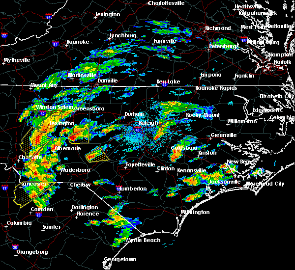 At 317 pm edt, a severe thunderstorm was located near pinehurst, or 7 miles northwest of southern pines, moving northeast at 20 mph (radar indicated). Hazards include 60 mph wind gusts and nickel size hail. Expect damage to roofs, siding, and trees. locations impacted include, southern pines, carthage, pinehurst, whispering pines, taylortown, vass, cameron and seven lakes. A tornado watch remains in effect until 1000 pm edt for central north carolina. At 317 pm edt, a severe thunderstorm was located near pinehurst, or 7 miles northwest of southern pines, moving northeast at 20 mph (radar indicated). Hazards include 60 mph wind gusts and nickel size hail. Expect damage to roofs, siding, and trees. locations impacted include, southern pines, carthage, pinehurst, whispering pines, taylortown, vass, cameron and seven lakes. A tornado watch remains in effect until 1000 pm edt for central north carolina.
|
| 9/1/2017 3:02 PM EDT |
 At 301 pm edt, a severe thunderstorm was located near pinehurst, or 9 miles west of southern pines, moving northeast at 55 mph (radar indicated). Hazards include 70 mph wind gusts and nickel size hail. Expect considerable tree damage. Damage is likely to mobile homes, roofs, and outbuildings. At 301 pm edt, a severe thunderstorm was located near pinehurst, or 9 miles west of southern pines, moving northeast at 55 mph (radar indicated). Hazards include 70 mph wind gusts and nickel size hail. Expect considerable tree damage. Damage is likely to mobile homes, roofs, and outbuildings.
|
| 9/1/2017 2:51 PM EDT |
 At 251 pm edt, a severe thunderstorm was located 9 miles northwest of hoffman, or 14 miles north of rockingham, moving northeast at 30 mph (radar indicated). Hazards include 60 mph wind gusts. Expect damage to roofs, siding, and trees. locations impacted include, pinehurst, ellerbe, foxfire, norman, derby and sandhills game land. A tornado watch remains in effect until 1000 pm edt for central north carolina. At 251 pm edt, a severe thunderstorm was located 9 miles northwest of hoffman, or 14 miles north of rockingham, moving northeast at 30 mph (radar indicated). Hazards include 60 mph wind gusts. Expect damage to roofs, siding, and trees. locations impacted include, pinehurst, ellerbe, foxfire, norman, derby and sandhills game land. A tornado watch remains in effect until 1000 pm edt for central north carolina.
|
| 9/1/2017 2:39 PM EDT |
 At 239 pm edt, a severe thunderstorm was located 10 miles north of rockingham, moving northeast at 25 mph (radar indicated). Hazards include 60 mph wind gusts. Expect damage to roofs, siding, and trees. locations impacted include, pinehurst, ellerbe, foxfire, norman, derby and sandhills game land. A tornado watch remains in effect until 1000 pm edt for central north carolina. At 239 pm edt, a severe thunderstorm was located 10 miles north of rockingham, moving northeast at 25 mph (radar indicated). Hazards include 60 mph wind gusts. Expect damage to roofs, siding, and trees. locations impacted include, pinehurst, ellerbe, foxfire, norman, derby and sandhills game land. A tornado watch remains in effect until 1000 pm edt for central north carolina.
|
| 9/1/2017 2:25 PM EDT |
 At 225 pm edt, a severe thunderstorm was located 7 miles northwest of rockingham, moving northeast at 20 mph (radar indicated). Hazards include 60 mph wind gusts. expect damage to roofs, siding, and trees At 225 pm edt, a severe thunderstorm was located 7 miles northwest of rockingham, moving northeast at 20 mph (radar indicated). Hazards include 60 mph wind gusts. expect damage to roofs, siding, and trees
|
| 7/23/2017 4:57 PM EDT |
 At 457 pm edt, severe thunderstorms were located along a line extending from near raeford to 6 miles north of laurinburg to near rockingham, and are nearly stationary (radar indicated). Hazards include 60 mph wind gusts and quarter size hail. Hail damage to vehicles is expected. Expect wind damage to roofs, siding, and trees. At 457 pm edt, severe thunderstorms were located along a line extending from near raeford to 6 miles north of laurinburg to near rockingham, and are nearly stationary (radar indicated). Hazards include 60 mph wind gusts and quarter size hail. Hail damage to vehicles is expected. Expect wind damage to roofs, siding, and trees.
|
| 7/23/2017 4:06 PM EDT |
 At 406 pm edt, severe thunderstorms were located along a line extending from 6 miles northwest of pinehurst to 10 miles north of rockingham, moving southeast at 10 mph (radar indicated). Hazards include 60 mph wind gusts and quarter size hail. Hail damage to vehicles is expected. expect wind damage to roofs, siding, and trees. Locations impacted include, southern pines, rockingham, pinehurst, aberdeen, hoffman, whispering pines, pinebluff, ellerbe and foxfire. At 406 pm edt, severe thunderstorms were located along a line extending from 6 miles northwest of pinehurst to 10 miles north of rockingham, moving southeast at 10 mph (radar indicated). Hazards include 60 mph wind gusts and quarter size hail. Hail damage to vehicles is expected. expect wind damage to roofs, siding, and trees. Locations impacted include, southern pines, rockingham, pinehurst, aberdeen, hoffman, whispering pines, pinebluff, ellerbe and foxfire.
|
| 7/23/2017 3:43 PM EDT |
 At 342 pm edt, severe thunderstorms were located along a line extending from 10 miles southeast of biscoe to 12 miles north of rockingham, moving southeast at 5 mph (radar indicated). Hazards include 60 mph wind gusts and quarter size hail. Hail damage to vehicles is expected. Expect wind damage to roofs, siding, and trees. At 342 pm edt, severe thunderstorms were located along a line extending from 10 miles southeast of biscoe to 12 miles north of rockingham, moving southeast at 5 mph (radar indicated). Hazards include 60 mph wind gusts and quarter size hail. Hail damage to vehicles is expected. Expect wind damage to roofs, siding, and trees.
|
| 7/18/2017 7:37 PM EDT |
 The severe thunderstorm warning for anson and richmond counties will expire at 745 pm edt, the storm which prompted the warning has weakened below severe limits, and no longer poses an immediate threat to life or property. therefore the warning will be allowed to expire. however gusty winds and heavy rain are still possible with this thunderstorm. to report severe weather, contact your nearest law enforcement agency. they will relay your report to the national weather service raleigh. The severe thunderstorm warning for anson and richmond counties will expire at 745 pm edt, the storm which prompted the warning has weakened below severe limits, and no longer poses an immediate threat to life or property. therefore the warning will be allowed to expire. however gusty winds and heavy rain are still possible with this thunderstorm. to report severe weather, contact your nearest law enforcement agency. they will relay your report to the national weather service raleigh.
|
| 7/18/2017 7:08 PM EDT |
 At 705 pm edt, a severe thunderstorm was located near rockingham, moving southwest at 10 mph (radar indicated). Hazards include 60 mph wind gusts and quarter size hail. Hail damage to vehicles is expected. expect wind damage to roofs, siding, and trees. Locations impacted include, rockingham, wadesboro, hamlet, ansonville, hoffman, polkton, ellerbe, dobbins heights, lilesville and morven. At 705 pm edt, a severe thunderstorm was located near rockingham, moving southwest at 10 mph (radar indicated). Hazards include 60 mph wind gusts and quarter size hail. Hail damage to vehicles is expected. expect wind damage to roofs, siding, and trees. Locations impacted include, rockingham, wadesboro, hamlet, ansonville, hoffman, polkton, ellerbe, dobbins heights, lilesville and morven.
|
| 7/18/2017 6:41 PM EDT |
 The national weather service in raleigh has issued a * severe thunderstorm warning for. anson county in central north carolina. richmond county in central north carolina. Until 745 pm edt * at 641 pm edt, a severe thunderstorm was located over rockingham,. The national weather service in raleigh has issued a * severe thunderstorm warning for. anson county in central north carolina. richmond county in central north carolina. Until 745 pm edt * at 641 pm edt, a severe thunderstorm was located over rockingham,.
|
| 7/1/2017 6:50 PM EDT |
 At 649 pm edt, severe thunderstorms were located along a line extending from near southern pines to near aberdeen to 6 miles north of rockingham, moving east at 25 mph (radar indicated). Hazards include 60 mph wind gusts. Expect damage to roofs, siding, and trees. Locations impacted include, fayetteville, southern pines, raeford, fort bragg, pinehurst, aberdeen, hoffman, pope afb, antioch and hope mills. At 649 pm edt, severe thunderstorms were located along a line extending from near southern pines to near aberdeen to 6 miles north of rockingham, moving east at 25 mph (radar indicated). Hazards include 60 mph wind gusts. Expect damage to roofs, siding, and trees. Locations impacted include, fayetteville, southern pines, raeford, fort bragg, pinehurst, aberdeen, hoffman, pope afb, antioch and hope mills.
|
| 7/1/2017 6:27 PM EDT |
 At 627 pm edt, severe thunderstorms were located along a line extending from near southern pines to 6 miles northwest of hoffman, moving east at 30 mph (radar indicated). Hazards include 60 mph wind gusts. expect damage to roofs, siding, and trees At 627 pm edt, severe thunderstorms were located along a line extending from near southern pines to 6 miles northwest of hoffman, moving east at 30 mph (radar indicated). Hazards include 60 mph wind gusts. expect damage to roofs, siding, and trees
|
| 6/19/2017 7:33 PM EDT |
 At 733 pm edt, severe thunderstorms were located along a line extending from near sanford to 11 miles northwest of pope afb to near aberdeen, moving east at 35 mph (radar indicated). Hazards include 60 mph wind gusts. Expect damage to roofs, siding, and trees. Locations impacted include, sanford, southern pines, pinehurst, aberdeen, whispering pines, pinebluff, broadway, foxfire, taylortown and vass. At 733 pm edt, severe thunderstorms were located along a line extending from near sanford to 11 miles northwest of pope afb to near aberdeen, moving east at 35 mph (radar indicated). Hazards include 60 mph wind gusts. Expect damage to roofs, siding, and trees. Locations impacted include, sanford, southern pines, pinehurst, aberdeen, whispering pines, pinebluff, broadway, foxfire, taylortown and vass.
|
| 6/19/2017 7:16 PM EDT |
 At 716 pm edt, severe thunderstorms were located along a line extending from near carthage to near southern pines to 7 miles west of hoffman, moving east at 35 mph (radar indicated). Hazards include 60 mph wind gusts. Expect damage to roofs, siding, and trees. Locations impacted include, sanford, southern pines, carthage, pinehurst, aberdeen, hoffman, whispering pines, pinebluff, broadway and ellerbe. At 716 pm edt, severe thunderstorms were located along a line extending from near carthage to near southern pines to 7 miles west of hoffman, moving east at 35 mph (radar indicated). Hazards include 60 mph wind gusts. Expect damage to roofs, siding, and trees. Locations impacted include, sanford, southern pines, carthage, pinehurst, aberdeen, hoffman, whispering pines, pinebluff, broadway and ellerbe.
|
| 6/19/2017 7:09 PM EDT |
 At 707 pm edt, severe thunderstorms were located along a line extending from 7 miles north of carthage to near pinehurst to 13 miles north of rockingham, moving east at 25 mph. those in east-central moore county from southern pines and whispering pines eastward to carthage, vass, and cameron should prepare immediately for damaging winds in excess of 60 mph (radar indicated). Hazards include 60 mph wind gusts. Expect damage to roofs, siding, and trees. Locations impacted include, sanford, southern pines, carthage, pinehurst, aberdeen, hoffman, whispering pines, pinebluff, broadway and robbins. At 707 pm edt, severe thunderstorms were located along a line extending from 7 miles north of carthage to near pinehurst to 13 miles north of rockingham, moving east at 25 mph. those in east-central moore county from southern pines and whispering pines eastward to carthage, vass, and cameron should prepare immediately for damaging winds in excess of 60 mph (radar indicated). Hazards include 60 mph wind gusts. Expect damage to roofs, siding, and trees. Locations impacted include, sanford, southern pines, carthage, pinehurst, aberdeen, hoffman, whispering pines, pinebluff, broadway and robbins.
|
| 6/19/2017 6:46 PM EDT |
 At 646 pm edt, severe thunderstorms were located along a line extending from 9 miles northwest of carthage to 10 miles northwest of pinehurst to 11 miles east of ansonville, moving northeast at 30 mph (radar indicated). Hazards include 60 mph wind gusts. expect damage to roofs, siding, and trees At 646 pm edt, severe thunderstorms were located along a line extending from 9 miles northwest of carthage to 10 miles northwest of pinehurst to 11 miles east of ansonville, moving northeast at 30 mph (radar indicated). Hazards include 60 mph wind gusts. expect damage to roofs, siding, and trees
|
| 5/24/2017 4:57 PM EDT |
 At 457 pm edt, a severe thunderstorm was located near aberdeen, or near southern pines, moving north at 40 mph (radar indicated). Hazards include 60 mph wind gusts and penny size hail. expect damage to roofs, siding, and trees At 457 pm edt, a severe thunderstorm was located near aberdeen, or near southern pines, moving north at 40 mph (radar indicated). Hazards include 60 mph wind gusts and penny size hail. expect damage to roofs, siding, and trees
|
| 5/5/2017 4:09 AM EDT |
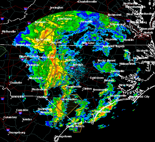 At 409 am edt, severe thunderstorms were located along a line extending from 8 miles northwest of pittsboro to near carthage to near hoffman, moving east at 30 mph (radar indicated). Hazards include 60 mph wind gusts. Expect damage to roofs, siding, and trees. locations impacted include, southern pines, carthage, pinehurst, aberdeen, goldston, whispering pines, pinebluff, foxfire, taylortown and glendon. A tornado watch remains in effect until 900 am edt for central north carolina. At 409 am edt, severe thunderstorms were located along a line extending from 8 miles northwest of pittsboro to near carthage to near hoffman, moving east at 30 mph (radar indicated). Hazards include 60 mph wind gusts. Expect damage to roofs, siding, and trees. locations impacted include, southern pines, carthage, pinehurst, aberdeen, goldston, whispering pines, pinebluff, foxfire, taylortown and glendon. A tornado watch remains in effect until 900 am edt for central north carolina.
|
| 5/5/2017 3:45 AM EDT |
 At 345 am edt, severe thunderstorms were located along a line extending from 7 miles west of siler city to near hoffman, moving northeast at 35 mph (radar indicated). Hazards include 60 mph wind gusts. expect damage to roofs, siding, and trees At 345 am edt, severe thunderstorms were located along a line extending from 7 miles west of siler city to near hoffman, moving northeast at 35 mph (radar indicated). Hazards include 60 mph wind gusts. expect damage to roofs, siding, and trees
|
| 4/3/2017 5:59 PM EDT |
 At 559 pm edt, severe thunderstorms were located along a line extending from 6 miles west of pinehurst to 7 miles west of laurinburg, moving east at 45 mph (radar indicated). Hazards include 60 mph wind gusts. Expect minor damage to roofs, siding, and trees. Locations impacted include, laurinburg, southern pines, pinehurst, aberdeen, maxton, hoffman, pinebluff, foxfire, wagram and gibson. At 559 pm edt, severe thunderstorms were located along a line extending from 6 miles west of pinehurst to 7 miles west of laurinburg, moving east at 45 mph (radar indicated). Hazards include 60 mph wind gusts. Expect minor damage to roofs, siding, and trees. Locations impacted include, laurinburg, southern pines, pinehurst, aberdeen, maxton, hoffman, pinebluff, foxfire, wagram and gibson.
|
| 4/3/2017 5:54 PM EDT |
 At 554 pm edt, severe thunderstorms were located along a line extending from 12 miles east of seagrove to 9 miles west of pinehurst, moving east at 40 mph (radar indicated). Hazards include 60 mph wind gusts. expect minor damage to roofs, siding, and trees At 554 pm edt, severe thunderstorms were located along a line extending from 12 miles east of seagrove to 9 miles west of pinehurst, moving east at 40 mph (radar indicated). Hazards include 60 mph wind gusts. expect minor damage to roofs, siding, and trees
|
| 4/3/2017 5:47 PM EDT |
 At 546 pm edt, severe thunderstorms were located along a line extending from near north carolina zoo to 7 miles southeast of biscoe, moving east at 50 mph (radar indicated). Hazards include 60 mph wind gusts. Expect damage to roofs, siding, and trees. Locations impacted include, robbins, foxfire, candor, norman, eagle springs and seven lakes. At 546 pm edt, severe thunderstorms were located along a line extending from near north carolina zoo to 7 miles southeast of biscoe, moving east at 50 mph (radar indicated). Hazards include 60 mph wind gusts. Expect damage to roofs, siding, and trees. Locations impacted include, robbins, foxfire, candor, norman, eagle springs and seven lakes.
|
| 4/3/2017 5:44 PM EDT |
 At 544 pm edt, severe thunderstorms were located along a line extending from 13 miles south of biscoe to 6 miles north of wallace, moving east at 40 mph (radar indicated). Hazards include 60 mph wind gusts. expect damage to roofs, siding, and trees At 544 pm edt, severe thunderstorms were located along a line extending from 13 miles south of biscoe to 6 miles north of wallace, moving east at 40 mph (radar indicated). Hazards include 60 mph wind gusts. expect damage to roofs, siding, and trees
|
| 4/3/2017 5:23 PM EDT |
 At 523 pm edt, severe thunderstorms were located along a line extending from 8 miles northeast of badin lake to 8 miles northeast of ansonville, moving east at 50 mph (radar indicated). Hazards include 60 mph wind gusts. expect damage to roofs, siding, and trees At 523 pm edt, severe thunderstorms were located along a line extending from 8 miles northeast of badin lake to 8 miles northeast of ansonville, moving east at 50 mph (radar indicated). Hazards include 60 mph wind gusts. expect damage to roofs, siding, and trees
|
| 11/30/2016 7:25 PM EST |
 At 724 pm est, severe thunderstorms were located along a line extending from near badin lake to near wadesboro to 9 miles east of kershaw, moving northeast at 60 mph (radar indicated). Hazards include 60 mph wind gusts. Expect damage to roofs. siding. and trees. Locations impacted include, albemarle, rockingham, wadesboro, troy, badin lake, hamlet, biscoe, ansonville andhoffman. At 724 pm est, severe thunderstorms were located along a line extending from near badin lake to near wadesboro to 9 miles east of kershaw, moving northeast at 60 mph (radar indicated). Hazards include 60 mph wind gusts. Expect damage to roofs. siding. and trees. Locations impacted include, albemarle, rockingham, wadesboro, troy, badin lake, hamlet, biscoe, ansonville andhoffman.
|
| 11/30/2016 6:54 PM EST |
 At 650 pm est, severe thunderstorms were located along a line extending from just east of charlotte to 7 miles south of mineral springs to 12 miles south of great falls, moving northeast at 55 mph (radar indicated). Hazards include 60 mph wind gusts. Expect damage to roofs. siding. And trees. At 650 pm est, severe thunderstorms were located along a line extending from just east of charlotte to 7 miles south of mineral springs to 12 miles south of great falls, moving northeast at 55 mph (radar indicated). Hazards include 60 mph wind gusts. Expect damage to roofs. siding. And trees.
|
| 8/21/2016 7:16 PM EDT |
 At 715 pm edt, a severe thunderstorm was located over carthage, moving east at 45 mph (radar indicated). Hazards include 60 mph wind gusts. Expect damage to roofs. siding. and trees. Locations impacted include, sanford, southern pines, carthage, pinehurst, whispering pines, broadway, taylortown, vass, cameron and seminole. At 715 pm edt, a severe thunderstorm was located over carthage, moving east at 45 mph (radar indicated). Hazards include 60 mph wind gusts. Expect damage to roofs. siding. and trees. Locations impacted include, sanford, southern pines, carthage, pinehurst, whispering pines, broadway, taylortown, vass, cameron and seminole.
|
| 8/21/2016 7:01 PM EDT |
 At 701 pm edt, a severe thunderstorm was located 9 miles west of carthage, moving east at 45 mph (radar indicated). Hazards include 60 mph wind gusts. Expect damage to roofs. siding. And trees. At 701 pm edt, a severe thunderstorm was located 9 miles west of carthage, moving east at 45 mph (radar indicated). Hazards include 60 mph wind gusts. Expect damage to roofs. siding. And trees.
|
| 7/20/2016 12:27 AM EDT | The severe thunderstorm warning for southwestern harnett, southeastern moore, hoke and western cumberland counties will expire at 1230 am edt, the storms which prompted the warning have weakened below severe limits, and no longer pose an immediate threat to life or property. therefore the warning will be allowed to expire. however heavy rain is still possible with these thunderstorms. to report severe weather, contact your nearest law enforcement agency. they will relay your report to the national weather service raleigh. |
| 7/20/2016 12:13 AM EDT |
 At 1212 am edt, severe thunderstorms were located along a line extending from near pope afb to near raeford, moving south at 30 mph (radar indicated). Hazards include 60 mph wind gusts. Expect damage to roofs. siding. and trees. Locations impacted include, fayetteville, southern pines, raeford, fort bragg, pinehurst, aberdeen, pope afb, antioch, hope mills and spring lake. At 1212 am edt, severe thunderstorms were located along a line extending from near pope afb to near raeford, moving south at 30 mph (radar indicated). Hazards include 60 mph wind gusts. Expect damage to roofs. siding. and trees. Locations impacted include, fayetteville, southern pines, raeford, fort bragg, pinehurst, aberdeen, pope afb, antioch, hope mills and spring lake.
|
| 7/19/2016 11:31 PM EDT |
 At 1131 pm edt, severe thunderstorms were located along a line extending from 11 miles southeast of sanford to aberdeen, moving southeast at 15 mph (radar indicated). Hazards include 60 mph wind gusts. Expect damage to roofs. siding. And trees. At 1131 pm edt, severe thunderstorms were located along a line extending from 11 miles southeast of sanford to aberdeen, moving southeast at 15 mph (radar indicated). Hazards include 60 mph wind gusts. Expect damage to roofs. siding. And trees.
|
| 7/16/2016 8:25 PM EDT |
 At 825 pm edt, severe thunderstorms were located along a line extending from near pinehurst to near hoffman to 7 miles southeast of hamlet, moving east at 20 mph (radar indicated). Hazards include 60 mph wind gusts. Expect damage to roofs. siding. and trees. Locations impacted include, laurinburg, southern pines, rockingham, raeford, carthage, pinehurst, hamlet, aberdeen, maxton and hoffman. At 825 pm edt, severe thunderstorms were located along a line extending from near pinehurst to near hoffman to 7 miles southeast of hamlet, moving east at 20 mph (radar indicated). Hazards include 60 mph wind gusts. Expect damage to roofs. siding. and trees. Locations impacted include, laurinburg, southern pines, rockingham, raeford, carthage, pinehurst, hamlet, aberdeen, maxton and hoffman.
|
| 7/16/2016 8:17 PM EDT |
 At 816 pm edt, severe thunderstorms were located along a line extending from 10 miles northwest of carthage to 7 miles northwest of pinehurst to near hamlet, moving east at 25 mph (radar indicated). Hazards include 60 mph wind gusts. Expect damage to roofs. siding. and trees. Locations impacted include, laurinburg, southern pines, rockingham, raeford, carthage, pinehurst, hamlet, aberdeen, maxton and hoffman. At 816 pm edt, severe thunderstorms were located along a line extending from 10 miles northwest of carthage to 7 miles northwest of pinehurst to near hamlet, moving east at 25 mph (radar indicated). Hazards include 60 mph wind gusts. Expect damage to roofs. siding. and trees. Locations impacted include, laurinburg, southern pines, rockingham, raeford, carthage, pinehurst, hamlet, aberdeen, maxton and hoffman.
|
| 7/16/2016 7:45 PM EDT |
 At 743 pm edt, severe thunderstorms were located along a line extending from near seagrove to 6 miles southeast of biscoe to 10 miles northwest of wallace, moving east at 25 mph (radar indicated). Hazards include 60 mph wind gusts. Expect damage to roofs. siding. And trees. At 743 pm edt, severe thunderstorms were located along a line extending from near seagrove to 6 miles southeast of biscoe to 10 miles northwest of wallace, moving east at 25 mph (radar indicated). Hazards include 60 mph wind gusts. Expect damage to roofs. siding. And trees.
|
| 7/15/2016 1:57 PM EDT |
 At 155 pm edt, a severe thunderstorm was located near wadesboro, moving east at 30 mph (radar indicated. at 140 pm...damaging wind was reported in wadesboro, resulting in downed trees and power lines). Hazards include 60 mph wind gusts and quarter size hail. Hail damage to vehicles is expected. expect wind damage to roofs, siding, and trees. Locations impacted include, rockingham, wadesboro, ansonville, polkton, ellerbe, lilesville, morven, norman, mcfarlan and diggs. At 155 pm edt, a severe thunderstorm was located near wadesboro, moving east at 30 mph (radar indicated. at 140 pm...damaging wind was reported in wadesboro, resulting in downed trees and power lines). Hazards include 60 mph wind gusts and quarter size hail. Hail damage to vehicles is expected. expect wind damage to roofs, siding, and trees. Locations impacted include, rockingham, wadesboro, ansonville, polkton, ellerbe, lilesville, morven, norman, mcfarlan and diggs.
|
| 7/15/2016 1:43 PM EDT |
 At 141 pm edt, a severe thunderstorm was located 7 miles southwest of wadesboro, moving northeast at 20 mph (radar indicated). Hazards include 60 mph wind gusts and quarter size hail. Hail damage to vehicles is expected. expect wind damage to roofs, siding, and trees. Locations impacted include, rockingham, wadesboro, ansonville, polkton, ellerbe, lilesville, morven, peachland, norman and mcfarlan. At 141 pm edt, a severe thunderstorm was located 7 miles southwest of wadesboro, moving northeast at 20 mph (radar indicated). Hazards include 60 mph wind gusts and quarter size hail. Hail damage to vehicles is expected. expect wind damage to roofs, siding, and trees. Locations impacted include, rockingham, wadesboro, ansonville, polkton, ellerbe, lilesville, morven, peachland, norman and mcfarlan.
|
| 7/15/2016 1:19 PM EDT |
 At 119 pm edt, a severe thunderstorm was located near sturdivants, or 14 miles southwest of wadesboro, moving northeast at 20 mph (radar indicated). Hazards include 60 mph wind gusts and quarter size hail. Hail damage to vehicles is expected. Expect wind damage to roofs, siding, and trees. At 119 pm edt, a severe thunderstorm was located near sturdivants, or 14 miles southwest of wadesboro, moving northeast at 20 mph (radar indicated). Hazards include 60 mph wind gusts and quarter size hail. Hail damage to vehicles is expected. Expect wind damage to roofs, siding, and trees.
|
| 7/8/2016 9:52 PM EDT |
 At 952 pm edt, a severe thunderstorm was located over rockingham, moving southeast at 55 mph (law enforcement). Hazards include 60 mph wind gusts. Expect damage to roofs. siding. And trees. At 952 pm edt, a severe thunderstorm was located over rockingham, moving southeast at 55 mph (law enforcement). Hazards include 60 mph wind gusts. Expect damage to roofs. siding. And trees.
|
| 7/8/2016 9:26 PM EDT |
 At 925 pm edt, severe thunderstorms were located along a line extending from near goldston to near ansonville, moving southeast at 35 mph (radar indicated). Hazards include 60 mph wind gusts and quarter size hail. Hail damage to vehicles is expected. Expect wind damage to roofs, siding, and trees. At 925 pm edt, severe thunderstorms were located along a line extending from near goldston to near ansonville, moving southeast at 35 mph (radar indicated). Hazards include 60 mph wind gusts and quarter size hail. Hail damage to vehicles is expected. Expect wind damage to roofs, siding, and trees.
|
| 7/8/2016 9:05 PM EDT |
 At 905 pm edt, severe thunderstorms were located along a line extending from albemarle to near lake park, moving east at 45 mph (radar indicated). Hazards include 60 mph wind gusts and penny size hail. Expect damage to roofs. siding. And trees. At 905 pm edt, severe thunderstorms were located along a line extending from albemarle to near lake park, moving east at 45 mph (radar indicated). Hazards include 60 mph wind gusts and penny size hail. Expect damage to roofs. siding. And trees.
|
| 7/7/2016 6:43 PM EDT | At 642 pm edt, severe thunderstorms were located along a line extending from near carthage to near pinehurst to near aberdeen, moving east at 35 mph (radar indicated). Hazards include 60 mph wind gusts. Expect wind damage to roofs. siding. and trees. locations impacted include, sanford, southern pines, raeford, carthage, pinehurst, aberdeen, whispering pines, pinebluff, robbins and foxfire. A severe thunderstorm watch remains in effect until 1100 pm edt for central north carolina. |
| 7/7/2016 6:26 PM EDT |
 At 626 pm edt, severe thunderstorms were located along a line extending from 8 miles east of biscoe to 10 miles west of pinehurst to hoffman, moving east at 40 mph (radar indicated). Hazards include 60 mph wind gusts. Expect wind damage to roofs. siding. And trees. At 626 pm edt, severe thunderstorms were located along a line extending from 8 miles east of biscoe to 10 miles west of pinehurst to hoffman, moving east at 40 mph (radar indicated). Hazards include 60 mph wind gusts. Expect wind damage to roofs. siding. And trees.
|
| 7/7/2016 6:17 PM EDT |
 At 616 pm edt, a severe thunderstorm was located near hoffman, or 10 miles northeast of rockingham, moving east at 35 mph (radar indicated). Hazards include 60 mph wind gusts and penny size hail. Expect wind damage to roofs. siding. and trees. locations impacted include, rockingham, pinehurst, hoffman, pinebluff, ellerbe, wagram, sandhills game land and camp mackall. A severe thunderstorm watch remains in effect until 1100 pm edt for central north carolina. At 616 pm edt, a severe thunderstorm was located near hoffman, or 10 miles northeast of rockingham, moving east at 35 mph (radar indicated). Hazards include 60 mph wind gusts and penny size hail. Expect wind damage to roofs. siding. and trees. locations impacted include, rockingham, pinehurst, hoffman, pinebluff, ellerbe, wagram, sandhills game land and camp mackall. A severe thunderstorm watch remains in effect until 1100 pm edt for central north carolina.
|
| 7/7/2016 6:00 PM EDT |
 At 600 pm edt, a severe thunderstorm was located near rockingham, moving east at 35 mph (radar indicated). Hazards include 60 mph wind gusts and penny size hail. Expect wind damage to roofs. siding. And trees. At 600 pm edt, a severe thunderstorm was located near rockingham, moving east at 35 mph (radar indicated). Hazards include 60 mph wind gusts and penny size hail. Expect wind damage to roofs. siding. And trees.
|
| 7/4/2016 4:35 PM EDT |
 At 435 pm edt, a severe thunderstorm was located near aberdeen, or 7 miles south of southern pines, moving east at 35 mph (radar indicated). Hazards include 60 mph wind gusts and quarter size hail. Hail damage to vehicles is expected. Expect wind damage to roofs, siding, and trees. At 435 pm edt, a severe thunderstorm was located near aberdeen, or 7 miles south of southern pines, moving east at 35 mph (radar indicated). Hazards include 60 mph wind gusts and quarter size hail. Hail damage to vehicles is expected. Expect wind damage to roofs, siding, and trees.
|
| 7/4/2016 4:24 PM EDT |
 The severe thunderstorm warning for southwestern moore, northeastern scotland and northeastern richmond counties will expire at 430 pm edt, the storm which prompted the warning has weakened below severe limits, and no longer poses an immediate threat to life or property. therefore the warning will be allowed to expire. however, the storm is still producing an excessive amount of lightning and is capable of producing wind gusts to 50 mph. The severe thunderstorm warning for southwestern moore, northeastern scotland and northeastern richmond counties will expire at 430 pm edt, the storm which prompted the warning has weakened below severe limits, and no longer poses an immediate threat to life or property. therefore the warning will be allowed to expire. however, the storm is still producing an excessive amount of lightning and is capable of producing wind gusts to 50 mph.
|
| 7/4/2016 4:06 PM EDT |
 At 405 pm edt, a severe thunderstorm was located near hoffman, or 13 miles southwest of southern pines, moving east at 30 mph (radar indicated). Hazards include 60 mph wind gusts and quarter size hail. Hail damage to vehicles is expected. expect wind damage to roofs, siding, and trees. Locations impacted include, southern pines, rockingham, pinehurst, aberdeen, hoffman, whispering pines, pinebluff, ellerbe, foxfire and wagram. At 405 pm edt, a severe thunderstorm was located near hoffman, or 13 miles southwest of southern pines, moving east at 30 mph (radar indicated). Hazards include 60 mph wind gusts and quarter size hail. Hail damage to vehicles is expected. expect wind damage to roofs, siding, and trees. Locations impacted include, southern pines, rockingham, pinehurst, aberdeen, hoffman, whispering pines, pinebluff, ellerbe, foxfire and wagram.
|
| 7/4/2016 3:53 PM EDT |
 At 353 pm edt, a severe thunderstorm was located 9 miles north of rockingham, moving east at 30 mph (radar indicated). Hazards include 60 mph wind gusts and quarter size hail. Hail damage to vehicles is expected. expect wind damage to roofs, siding, and trees. Locations impacted include, southern pines, rockingham, pinehurst, hamlet, aberdeen, hoffman, whispering pines, pinebluff, ellerbe and foxfire. At 353 pm edt, a severe thunderstorm was located 9 miles north of rockingham, moving east at 30 mph (radar indicated). Hazards include 60 mph wind gusts and quarter size hail. Hail damage to vehicles is expected. expect wind damage to roofs, siding, and trees. Locations impacted include, southern pines, rockingham, pinehurst, hamlet, aberdeen, hoffman, whispering pines, pinebluff, ellerbe and foxfire.
|
| 7/4/2016 3:39 PM EDT |
 At 338 pm edt, a severe thunderstorm was located 8 miles northwest of rockingham, moving east at 30 mph (radar indicated). Hazards include 60 mph wind gusts and penny size hail. Expect damage to roofs. siding. And trees. At 338 pm edt, a severe thunderstorm was located 8 miles northwest of rockingham, moving east at 30 mph (radar indicated). Hazards include 60 mph wind gusts and penny size hail. Expect damage to roofs. siding. And trees.
|
| 6/24/2016 8:51 PM EDT |
 At 851 pm edt, a severe thunderstorm was located over southern pines, moving southeast at 20 mph (radar indicated). Hazards include 60 mph wind gusts and quarter size hail. Hail damage to vehicles is expected. Expect wind damage to roofs, siding, and trees. At 851 pm edt, a severe thunderstorm was located over southern pines, moving southeast at 20 mph (radar indicated). Hazards include 60 mph wind gusts and quarter size hail. Hail damage to vehicles is expected. Expect wind damage to roofs, siding, and trees.
|
| 5/11/2016 3:24 PM EDT |
 The severe thunderstorm warning for southeastern montgomery, west central moore and north central richmond counties will expire at 330 pm edt, the severe thunderstorm which prompted the warning has weakened. therefore the warning will be allowed to expire. however heavy rain is still possible with this thunderstorm. The severe thunderstorm warning for southeastern montgomery, west central moore and north central richmond counties will expire at 330 pm edt, the severe thunderstorm which prompted the warning has weakened. therefore the warning will be allowed to expire. however heavy rain is still possible with this thunderstorm.
|
| 5/11/2016 3:03 PM EDT |
 At 303 pm edt, a severe thunderstorm was located 8 miles south of biscoe, or 11 miles southeast of troy, moving southeast at 35 mph (radar indicated). Hazards include 60 mph wind gusts and quarter size hail. Hail damage to vehicles is possible. wind damage to roofs, siding, and trees is also possible. Locations impacted include, troy, biscoe, ellerbe, foxfire, candor, norman, covington, pekin, derby and eagle springs. At 303 pm edt, a severe thunderstorm was located 8 miles south of biscoe, or 11 miles southeast of troy, moving southeast at 35 mph (radar indicated). Hazards include 60 mph wind gusts and quarter size hail. Hail damage to vehicles is possible. wind damage to roofs, siding, and trees is also possible. Locations impacted include, troy, biscoe, ellerbe, foxfire, candor, norman, covington, pekin, derby and eagle springs.
|
| 5/11/2016 2:40 PM EDT |
 At 238 pm edt, a severe thunderstorm was located near troy, moving southeast at 35 mph (radar indicated). Hazards include 60 mph wind gusts and quarter size hail. Hail damage to vehicles is expected. Expect wind damage to roofs, siding, and trees. At 238 pm edt, a severe thunderstorm was located near troy, moving southeast at 35 mph (radar indicated). Hazards include 60 mph wind gusts and quarter size hail. Hail damage to vehicles is expected. Expect wind damage to roofs, siding, and trees.
|
| 5/3/2016 5:51 PM EDT |
 At 551 pm edt, a severe thunderstorm was located near ansonville, or near wadesboro, moving east at 35 mph (radar indicated). Hazards include 60 mph wind gusts and quarter size hail. Hail damage to vehicles is expected. Expect wind damage to roofs, siding, and trees. At 551 pm edt, a severe thunderstorm was located near ansonville, or near wadesboro, moving east at 35 mph (radar indicated). Hazards include 60 mph wind gusts and quarter size hail. Hail damage to vehicles is expected. Expect wind damage to roofs, siding, and trees.
|
| 2/24/2016 3:57 PM EST |
 At 357 pm est, doppler radar indicated a severe thunderstorm capable of producing a tornado. this dangerous storm was located near hoffman, or 12 miles southwest of southern pines, moving northeast at 60 mph. this dangerous storm will be near, southern pines and aberdeen around 410 pm est. other locations impacted by this tornadic thunderstorm include sandhills game land, ashley heights, pinebluff, silver city and camp mackall. At 357 pm est, doppler radar indicated a severe thunderstorm capable of producing a tornado. this dangerous storm was located near hoffman, or 12 miles southwest of southern pines, moving northeast at 60 mph. this dangerous storm will be near, southern pines and aberdeen around 410 pm est. other locations impacted by this tornadic thunderstorm include sandhills game land, ashley heights, pinebluff, silver city and camp mackall.
|
| 2/24/2016 3:47 PM EST |
 At 346 pm est, doppler radar indicated a severe thunderstorm capable of producing a tornado. this dangerous storm was located over hamlet, or near rockingham, and moving northeast at 60 mph. * this dangerous storm will be near, hoffman around 355 pm est. aberdeen around 410 pm est. southern pines around 415 pm est. other locations impacted by this tornadic thunderstorm include sandhills game land, wagram, bowmore, camp mackall and east rockingham. At 346 pm est, doppler radar indicated a severe thunderstorm capable of producing a tornado. this dangerous storm was located over hamlet, or near rockingham, and moving northeast at 60 mph. * this dangerous storm will be near, hoffman around 355 pm est. aberdeen around 410 pm est. southern pines around 415 pm est. other locations impacted by this tornadic thunderstorm include sandhills game land, wagram, bowmore, camp mackall and east rockingham.
|
| 2/24/2016 3:30 PM EST |
 At 330 pm est, doppler radar indicated a severe thunderstorm capable of producing quarter size hail and damaging winds in excess of 58 mph. this storm was located over cheraw, and moving northeast at 55 mph. At 330 pm est, doppler radar indicated a severe thunderstorm capable of producing quarter size hail and damaging winds in excess of 58 mph. this storm was located over cheraw, and moving northeast at 55 mph.
|
| 2/24/2016 3:00 PM EST |
 At 259 pm est, doppler radar indicated a severe thunderstorm capable of producing quarter size hail and damaging winds up to 60 mph. this storm was located over biscoe, or near troy, and moving northeast at 60 mph. At 259 pm est, doppler radar indicated a severe thunderstorm capable of producing quarter size hail and damaging winds up to 60 mph. this storm was located over biscoe, or near troy, and moving northeast at 60 mph.
|
| 12/23/2015 5:09 PM EST | The national weather service in raleigh has issued a * severe thunderstorm warning for. orange county in central north carolina. chatham county in central north carolina. northern moore county in central north carolina. Eastern alamance county in central north carolina. |
| 7/13/2015 10:25 PM EDT |
 At 1024 pm edt, doppler radar indicated a line of severe thunderstorms capable of producing damaging winds in excess of 58 mph. these storms were located along a line extending from 7 miles west of goldston to 10 miles northwest of carthage to 14 miles north of rockingham, and moving east at 35 mph. At 1024 pm edt, doppler radar indicated a line of severe thunderstorms capable of producing damaging winds in excess of 58 mph. these storms were located along a line extending from 7 miles west of goldston to 10 miles northwest of carthage to 14 miles north of rockingham, and moving east at 35 mph.
|
| 7/13/2015 10:19 PM EDT |
 At 1018 pm edt, doppler radar continued to indicate a line of severe thunderstorms capable of producing damaging winds in excess of 58 mph. these storms were located along a line extending from 7 miles southwest of siler city to 8 miles northeast of biscoe to near wadesboro, moving east at 35 mph. locations impacted include, troy, north carolina zoo, pinehurst, biscoe, seagrove, pinebluff, mount gilead, robbins, ellerbe and foxfire. At 1018 pm edt, doppler radar continued to indicate a line of severe thunderstorms capable of producing damaging winds in excess of 58 mph. these storms were located along a line extending from 7 miles southwest of siler city to 8 miles northeast of biscoe to near wadesboro, moving east at 35 mph. locations impacted include, troy, north carolina zoo, pinehurst, biscoe, seagrove, pinebluff, mount gilead, robbins, ellerbe and foxfire.
|
| 7/13/2015 9:49 PM EDT |
 At 948 pm edt, doppler radar continued to indicate a line of severe thunderstorms capable of producing damaging winds in excess of 58 mph. these storms were located along a line extending from 8 miles west of siler city to near troy to near ansonville, moving east at 30 mph. locations impacted include, troy, north carolina zoo, pinehurst, biscoe, seagrove, pinebluff, mount gilead, robbins, ellerbe and foxfire. At 948 pm edt, doppler radar continued to indicate a line of severe thunderstorms capable of producing damaging winds in excess of 58 mph. these storms were located along a line extending from 8 miles west of siler city to near troy to near ansonville, moving east at 30 mph. locations impacted include, troy, north carolina zoo, pinehurst, biscoe, seagrove, pinebluff, mount gilead, robbins, ellerbe and foxfire.
|
| 7/13/2015 9:28 PM EDT |
 At 925 pm edt, doppler radar indicated a severe thunderstorm capable of producing quarter size hail and damaging winds in excess of 58 mph. this storm was located near biscoe, or 9 miles southeast of troy, and moving southeast at 15 mph. in addition, a line of severe thunderstorms extending from high rock lake to albemarle and oakboro will move eastward across the warned area at around 35 mph. At 925 pm edt, doppler radar indicated a severe thunderstorm capable of producing quarter size hail and damaging winds in excess of 58 mph. this storm was located near biscoe, or 9 miles southeast of troy, and moving southeast at 15 mph. in addition, a line of severe thunderstorms extending from high rock lake to albemarle and oakboro will move eastward across the warned area at around 35 mph.
|
| 7/13/2015 8:55 PM EDT |
 At 854 pm edt, doppler radar continued to indicate a line of severe thunderstorms capable of producing quarter size hail and damaging winds in excess of 58 mph. these storms were located along a line extending from 11 miles southeast of seagrove to near biscoe to near troy, moving southeast at 20 mph. locations impacted include, troy, biscoe, mount gilead, foxfire, star, candor, pekin, steeds, eagle springs and uwharrie haven. At 854 pm edt, doppler radar continued to indicate a line of severe thunderstorms capable of producing quarter size hail and damaging winds in excess of 58 mph. these storms were located along a line extending from 11 miles southeast of seagrove to near biscoe to near troy, moving southeast at 20 mph. locations impacted include, troy, biscoe, mount gilead, foxfire, star, candor, pekin, steeds, eagle springs and uwharrie haven.
|
| 7/13/2015 8:28 PM EDT |
 At 828 pm edt, doppler radar indicated a severe thunderstorm capable of producing quarter size hail and damaging winds in excess of 58 mph. this storm was located near badin lake, and moving southeast at 20 mph. At 828 pm edt, doppler radar indicated a severe thunderstorm capable of producing quarter size hail and damaging winds in excess of 58 mph. this storm was located near badin lake, and moving southeast at 20 mph.
|
| 7/8/2015 8:21 PM EDT |
 The severe thunderstorm warning for northwestern hoke, south central moore, northeastern scotland and northeastern richmond counties will expire at 830 pm edt, the storm which prompted the warning has weakened below severe limits, and no longer poses an immediate threat to life or property. therefore the warning will be allowed to expire. however gusty winds and heavy rain are still possible with this thunderstorm. The severe thunderstorm warning for northwestern hoke, south central moore, northeastern scotland and northeastern richmond counties will expire at 830 pm edt, the storm which prompted the warning has weakened below severe limits, and no longer poses an immediate threat to life or property. therefore the warning will be allowed to expire. however gusty winds and heavy rain are still possible with this thunderstorm.
|
| 7/8/2015 8:06 PM EDT |
 At 804 pm edt, doppler radar continued to indicate a severe thunderstorm capable of producing quarter size hail and damaging winds in excess of 58 mph. this storm was located over hoffman, or 13 miles northeast of rockingham, moving southeast at 20 mph. in addition, just before 8 pm, the camp mackall observation site near hoffman recorded a wind gusts of 41 mph. locations impacted include, southern pines, pinehurst, aberdeen, hoffman, pinebluff, sandhills game land, ashley heights and camp mackall. At 804 pm edt, doppler radar continued to indicate a severe thunderstorm capable of producing quarter size hail and damaging winds in excess of 58 mph. this storm was located over hoffman, or 13 miles northeast of rockingham, moving southeast at 20 mph. in addition, just before 8 pm, the camp mackall observation site near hoffman recorded a wind gusts of 41 mph. locations impacted include, southern pines, pinehurst, aberdeen, hoffman, pinebluff, sandhills game land, ashley heights and camp mackall.
|
| 7/8/2015 7:55 PM EDT | Tree down on sycamore ln. a vehicle struck the tree. occupant had minor injurie in richmond county NC, 4.6 miles NNE of Foxfire, NC |
| 7/8/2015 7:50 PM EDT |
 At 750 pm edt, doppler radar indicated a severe thunderstorm capable of producing quarter size hail and damaging winds in excess of 58 mph. this storm was located near hoffman, or 13 miles northeast of rockingham, and moving east at 15 mph. At 750 pm edt, doppler radar indicated a severe thunderstorm capable of producing quarter size hail and damaging winds in excess of 58 mph. this storm was located near hoffman, or 13 miles northeast of rockingham, and moving east at 15 mph.
|
| 6/30/2015 6:39 PM EDT |
 At 638 pm edt, doppler radar continued to indicate a line of severe thunderstorms capable of producing damaging winds in excess of 58 mph. these storms were located along a line extending from near carthage to 6 miles east of southern pines to 7 miles southeast of hamlet, moving east at 25 mph. locations impacted include, fayetteville, sanford, laurinburg, southern pines, raeford, carthage, fort bragg, pinehurst, hamlet and aberdeen. At 638 pm edt, doppler radar continued to indicate a line of severe thunderstorms capable of producing damaging winds in excess of 58 mph. these storms were located along a line extending from near carthage to 6 miles east of southern pines to 7 miles southeast of hamlet, moving east at 25 mph. locations impacted include, fayetteville, sanford, laurinburg, southern pines, raeford, carthage, fort bragg, pinehurst, hamlet and aberdeen.
|
| 6/30/2015 6:07 PM EDT |
 At 607 pm edt, doppler radar indicated a line of severe thunderstorms capable of producing damaging winds in excess of 58 mph. these storms were located along a line extending from 12 miles east of seagrove to pinehurst to 7 miles north of wallace, and moving east at 30 mph. At 607 pm edt, doppler radar indicated a line of severe thunderstorms capable of producing damaging winds in excess of 58 mph. these storms were located along a line extending from 12 miles east of seagrove to pinehurst to 7 miles north of wallace, and moving east at 30 mph.
|
| 6/30/2015 5:45 PM EDT |
 At 543 pm edt, doppler radar continued to indicate a line of severe thunderstorms capable of producing damaging winds in excess of 58 mph. these storms were located along a line extending from 6 miles southeast of seagrove to 10 miles southeast of biscoe to near wadesboro, moving northeast at 40 mph. wind damage has been reported across portions of anson county with these storms. locations impacted include, southern pines, rockingham, wadesboro, carthage, pinehurst, hamlet, aberdeen, biscoe, ansonville and hoffman. At 543 pm edt, doppler radar continued to indicate a line of severe thunderstorms capable of producing damaging winds in excess of 58 mph. these storms were located along a line extending from 6 miles southeast of seagrove to 10 miles southeast of biscoe to near wadesboro, moving northeast at 40 mph. wind damage has been reported across portions of anson county with these storms. locations impacted include, southern pines, rockingham, wadesboro, carthage, pinehurst, hamlet, aberdeen, biscoe, ansonville and hoffman.
|
| 6/30/2015 5:31 PM EDT |
 At 531 pm edt, doppler radar indicated a line of severe thunderstorms capable of producing damaging winds in excess of 58 mph. these storms were located along a line extending from near seagrove to 11 miles south of biscoe to near sturdivants, and moving northeast at 45 mph. At 531 pm edt, doppler radar indicated a line of severe thunderstorms capable of producing damaging winds in excess of 58 mph. these storms were located along a line extending from near seagrove to 11 miles south of biscoe to near sturdivants, and moving northeast at 45 mph.
|
| 6/27/2015 7:00 PM EDT |
 At 700 pm edt, doppler radar continued to indicate a line of severe thunderstorms capable of producing damaging winds in excess of 58 mph. these storms were located along a line extending from sanford to 7 miles east of carthage to near aberdeen, moving northeast at 35 mph. locations impacted include, southern pines, carthage, pinehurst, aberdeen, whispering pines, pinebluff, foxfire, taylortown, vass and cameron. At 700 pm edt, doppler radar continued to indicate a line of severe thunderstorms capable of producing damaging winds in excess of 58 mph. these storms were located along a line extending from sanford to 7 miles east of carthage to near aberdeen, moving northeast at 35 mph. locations impacted include, southern pines, carthage, pinehurst, aberdeen, whispering pines, pinebluff, foxfire, taylortown, vass and cameron.
|
| 6/27/2015 6:34 PM EDT |
 At 632 pm edt, doppler radar continued to indicate a line of severe thunderstorms capable of producing damaging winds in excess of 58 mph. these storms were located along a line extending from near carthage to near pinehurst to near hoffman, moving northeast at 35 mph. locations impacted include, southern pines, carthage, pinehurst, aberdeen, hoffman, whispering pines, pinebluff, robbins, foxfire and taylortown. At 632 pm edt, doppler radar continued to indicate a line of severe thunderstorms capable of producing damaging winds in excess of 58 mph. these storms were located along a line extending from near carthage to near pinehurst to near hoffman, moving northeast at 35 mph. locations impacted include, southern pines, carthage, pinehurst, aberdeen, hoffman, whispering pines, pinebluff, robbins, foxfire and taylortown.
|
| 6/27/2015 6:09 PM EDT |
 At 608 pm edt, doppler radar indicated a line of severe thunderstorms capable of producing quarter size hail and damaging winds in excess of 58 mph. these storms were located along a line extending from biscoe to 15 miles south of troy to near rockingham, and moving northeast at 35 mph. At 608 pm edt, doppler radar indicated a line of severe thunderstorms capable of producing quarter size hail and damaging winds in excess of 58 mph. these storms were located along a line extending from biscoe to 15 miles south of troy to near rockingham, and moving northeast at 35 mph.
|
| 6/27/2015 5:13 PM EDT |
 At 511 pm edt, doppler radar continued to indicate a severe thunderstorm capable of producing quarter size hail and damaging winds in excess of 58 mph. this storm was located near hoffman, or 9 miles southwest of southern pines, moving northeast at 30 mph. locations impacted include, sanford, southern pines, carthage, pinehurst, aberdeen, whispering pines, pinebluff, broadway, foxfire and taylortown. At 511 pm edt, doppler radar continued to indicate a severe thunderstorm capable of producing quarter size hail and damaging winds in excess of 58 mph. this storm was located near hoffman, or 9 miles southwest of southern pines, moving northeast at 30 mph. locations impacted include, sanford, southern pines, carthage, pinehurst, aberdeen, whispering pines, pinebluff, broadway, foxfire and taylortown.
|
| 6/27/2015 5:03 PM EDT |
 At 503 pm edt, doppler radar indicated a severe thunderstorm capable of producing quarter size hail and damaging winds in excess of 58 mph. this storm was located near aberdeen, or 7 miles southwest of southern pines, and moving northeast at 30 mph. At 503 pm edt, doppler radar indicated a severe thunderstorm capable of producing quarter size hail and damaging winds in excess of 58 mph. this storm was located near aberdeen, or 7 miles southwest of southern pines, and moving northeast at 30 mph.
|
| 6/26/2015 9:09 PM EDT | At 908 pm edt, doppler radar continued to indicate a cluster of severe thunderstorms capable of producing damaging winds in excess of 58 mph. these storms were located along a line extending from 7 miles east of ansonville to 6 miles northeast of hamlet to near laurinburg, moving northeast at 20 mph. locations impacted include, laurinburg, rockingham, wadesboro, raeford, hamlet, maxton, ansonville, hoffman, antioch and polkton. |
| 6/26/2015 8:53 PM EDT | At 852 pm edt, doppler radar indicated a line of severe thunderstorms capable of producing quarter size hail and damaging winds in excess of 58 mph. these storms were located along a line extending from 7 miles northwest of rockingham to 6 miles northeast of hamlet, and moving northeast at 20 mph. |
| 6/2/2015 5:09 PM EDT | The severe thunderstorm warning for central montgomery, western moore and richmond counties will expire at 515 pm edt, the storm which prompted the warning has weakened below severe limits, and no longer poses an immediate threat to life or property. therefore the warning will be allowed to expire. to report severe weather, contact your nearest law enforcement agency. they will relay your report to the national weather service raleigh. |
| 6/2/2015 4:58 PM EDT | At 457 pm edt, doppler radar continued to indicate a severe thunderstorm capable of producing damaging winds in excess of 58 mph. this storm was located 10 miles south of biscoe, or 14 miles southeast of troy, moving east at 30 mph. locations impacted include, rockingham, troy, pinehurst, biscoe, hoffman, pinebluff, robbins, ellerbe, foxfire and star. |
| 6/2/2015 4:35 PM EDT | At 435 pm edt, doppler radar indicated a severe thunderstorm capable of producing quarter size hail and damaging winds in excess of 58 mph. this storm was located 12 miles south of troy, and moving east at 30 mph. |
| 6/2/2015 4:35 PM EDT | At 435 pm edt, doppler radar indicated a severe thunderstorm capable of producing quarter size hail and damaging winds in excess of 58 mph. this storm was located 12 miles south of troy, and moving east at 30 mph. |
| 5/11/2015 7:09 PM EDT | At 707 pm edt, doppler radar indicated a severe thunderstorm capable of producing quarter size hail and damaging winds in excess of 58 mph. this storm was located near ashley heights, moving northeast at 15 mph. locations impacted include, southern pines, raeford, pinehurst, aberdeen, whispering pines, pinebluff, foxfire, taylortown, vass and ashley heights. |
| 5/11/2015 7:00 PM EDT | At 659 pm edt, doppler radar indicated a severe thunderstorm capable of producing quarter size hail and damaging winds in excess of 58 mph. this storm was located near aberdeen, or 7 miles south of southern pines, moving northeast at 20 mph. locations impacted include, southern pines, raeford, pinehurst, aberdeen, hoffman, whispering pines, pinebluff, foxfire, taylortown and vass. |
| 5/11/2015 6:43 PM EDT | At 643 pm edt, doppler radar indicated a severe thunderstorm capable of producing quarter size hail and damaging winds in excess of 58 mph. this storm was located near hoffman, or 12 miles south of southern pines, and moving northeast at 15 mph. |
| 4/20/2015 7:21 PM EDT | At 718 pm edt, doppler radar indicated a severe thunderstorm capable of producing damaging winds in excess of 58 mph. this storm was located near biscoe, or 11 miles southeast of troy, moving northeast at 35 mph. although the storm has weakened a little during the past 15 minutes, the nature of the storm suggests it could re- intensify very quickly. locations impacted include, foxfire, eagle springs and seven lakes. |
| 4/20/2015 7:03 PM EDT | At 702 pm edt, doppler radar indicated a severe thunderstorm capable of producing damaging winds in excess of 58 mph. this storm was located 9 miles south of troy, moving east at 30 mph. locations impacted include, biscoe, foxfire, candor, pekin, eagle springs and seven lakes. |
| 4/20/2015 6:45 PM EDT | At 644 pm edt, doppler radar indicated a severe thunderstorm capable of producing quarter size hail and damaging winds in excess of 58 mph. this storm was located 7 miles northeast of ansonville, or 14 miles southwest of troy, and moving east at 30 mph. |
| 6/16/2014 6:45 PM EDT | One tree down at the 1600 block of hoffman r in moore county NC, 1.1 miles S of Foxfire, NC |
| 6/16/2014 6:25 PM EDT | One tree down on hoffman rd at mcduffie l in moore county NC, 2.5 miles S of Foxfire, NC |
Hail Maps for Foxfire, NC
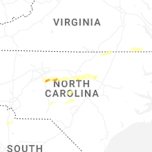


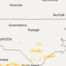


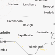


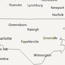


Connect with Interactive Hail Maps