

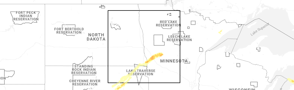
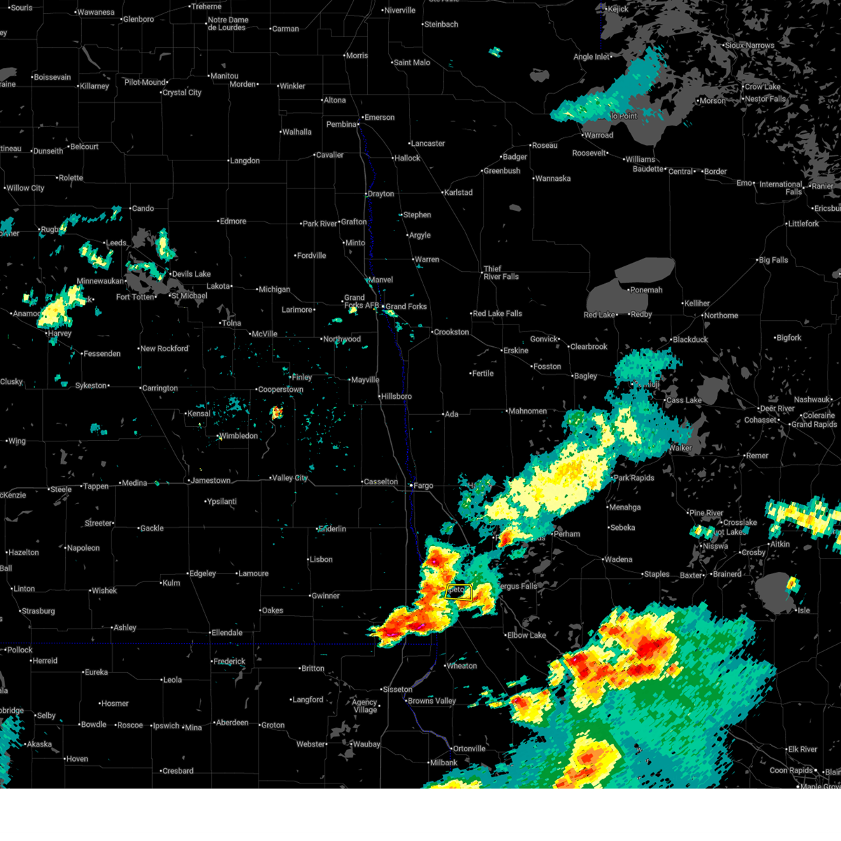
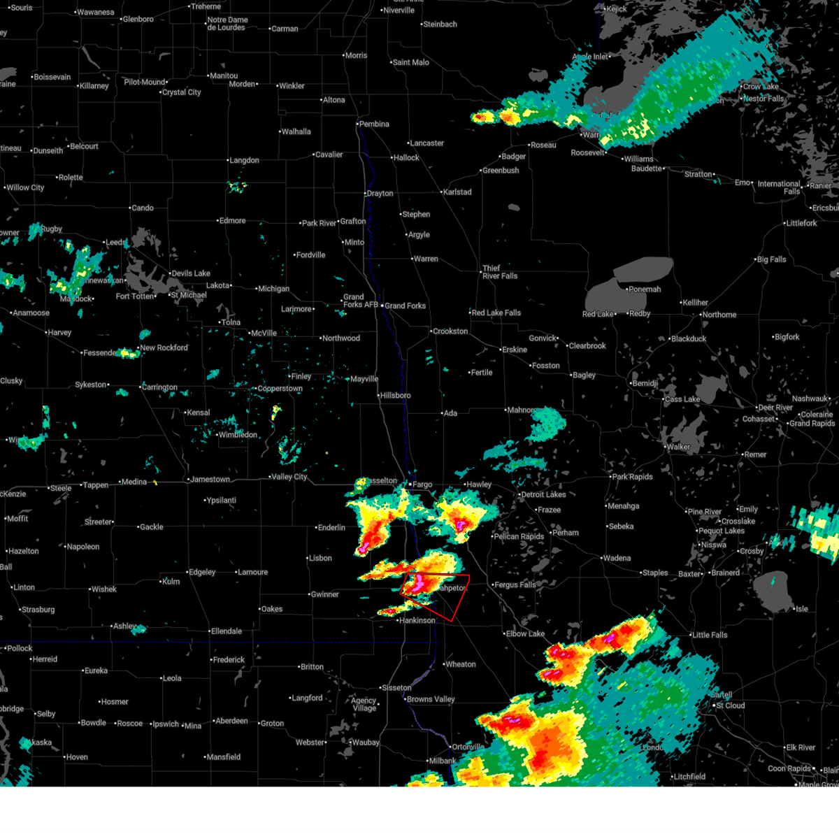
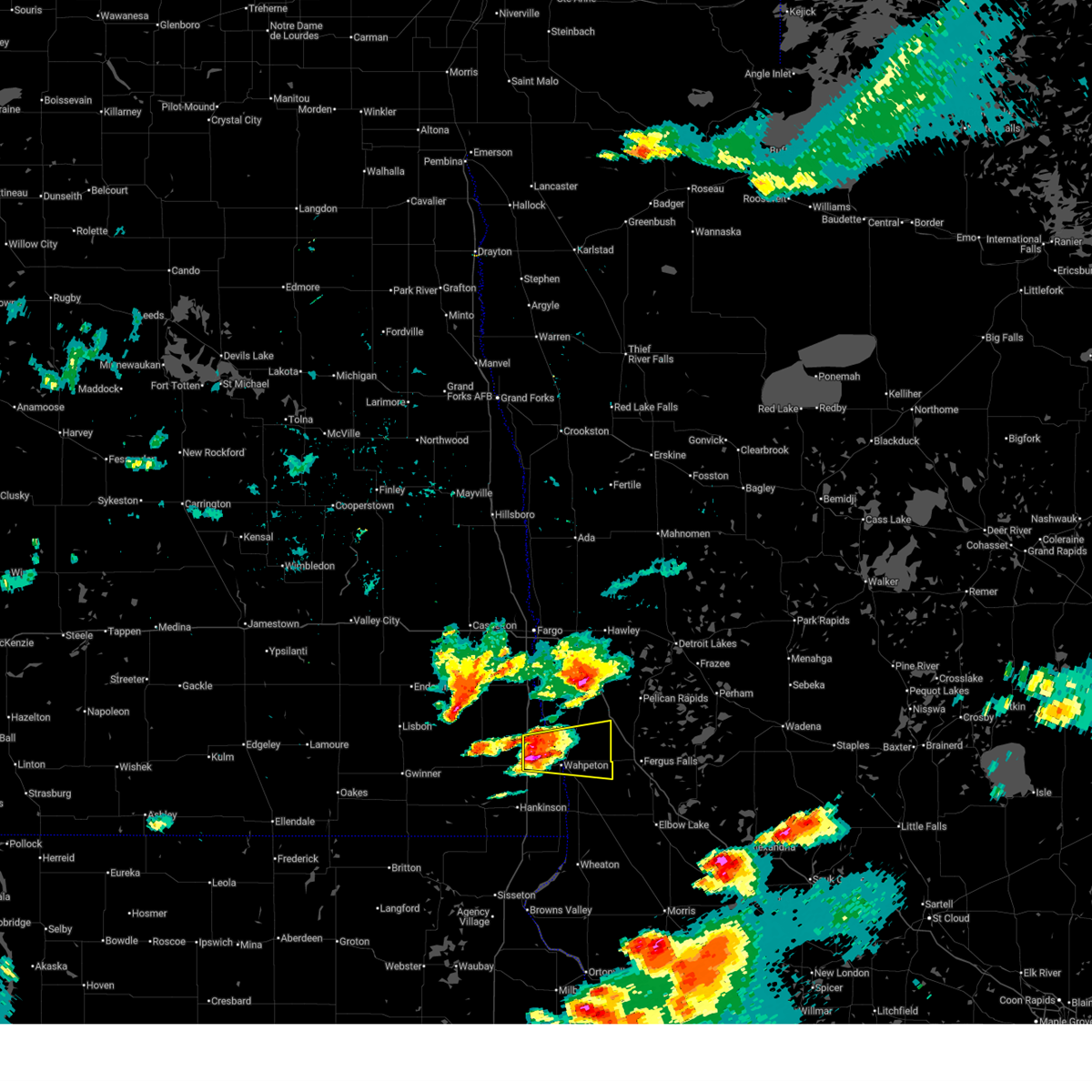
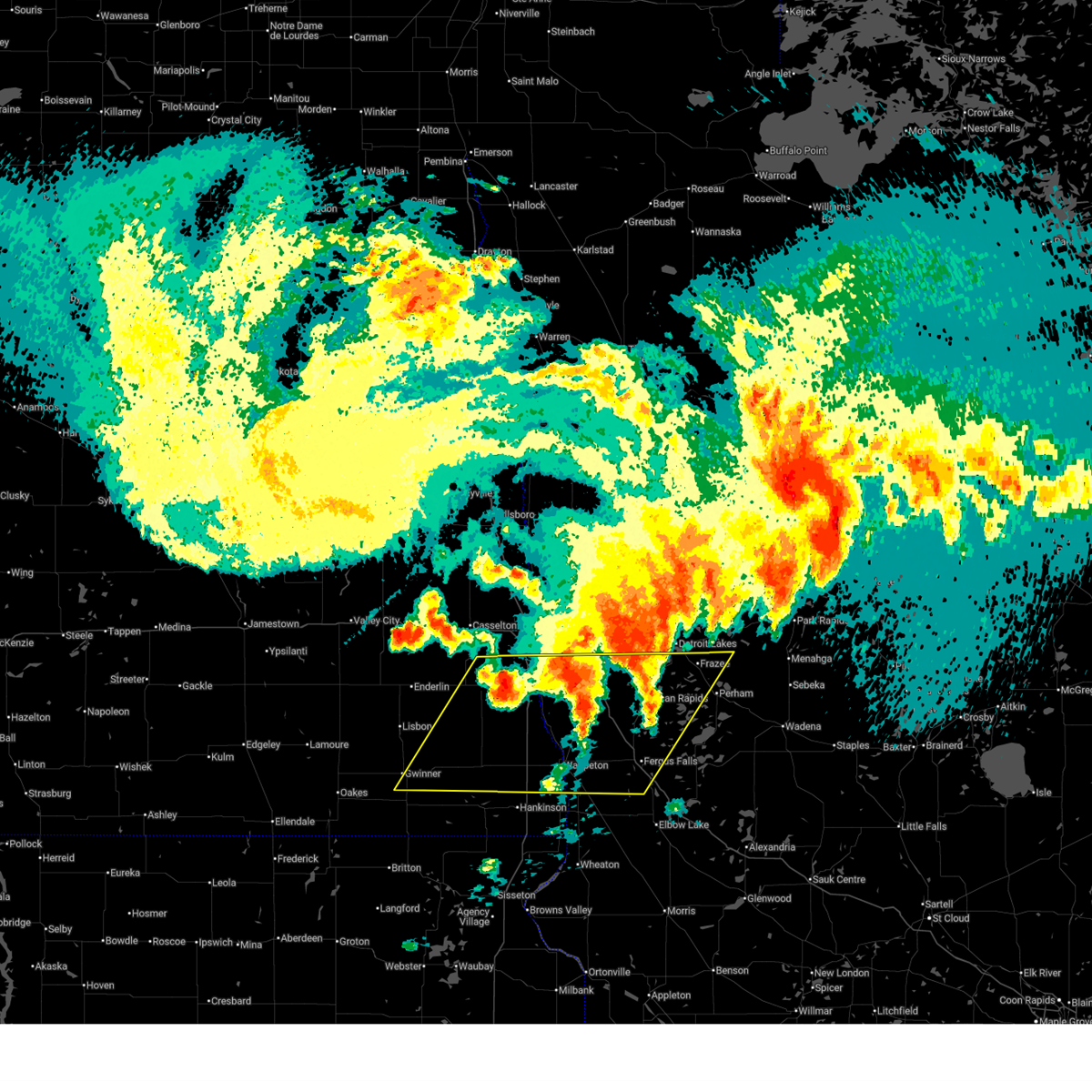
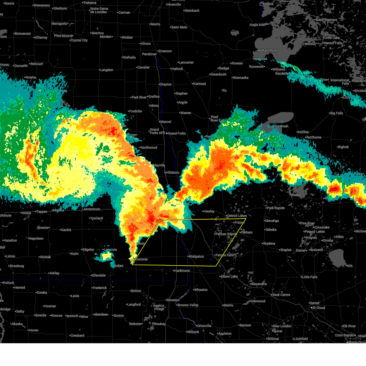
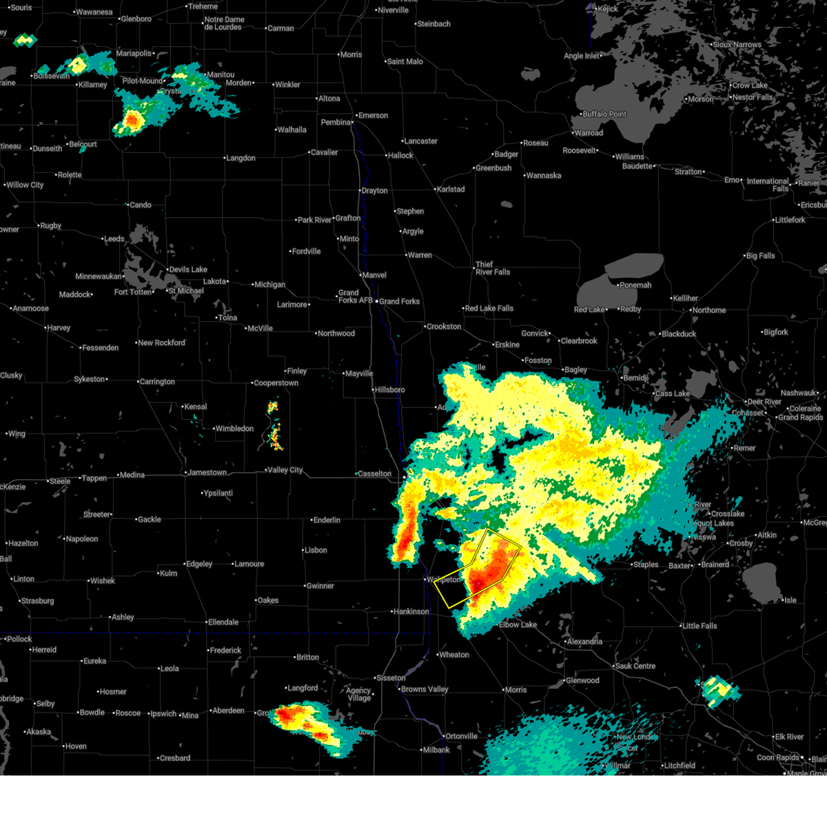
Hail Map for Foxhome, MN
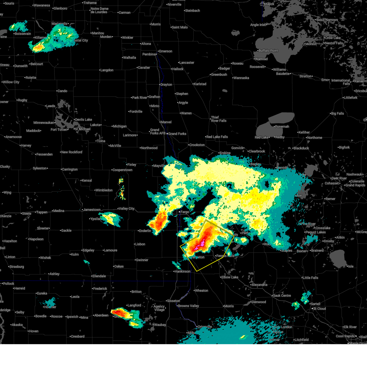
The Foxhome, MN area has had 3 reports of on-the-ground hail by trained spotters, and has been under severe weather warnings 13 times during the past 12 months. Doppler radar has detected hail at or near Foxhome, MN on 39 occasions, including 5 occasions during the past year.
| Name: | Foxhome, MN |
| Where Located: | 47 miles SSE of Fargo, ND |
| Map: | Google Map for Foxhome, MN |
| Population: | 116 |
| Housing Units: | 66 |
| More Info: | Search Google for Foxhome, MN |
3
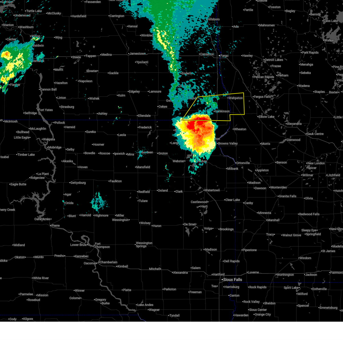
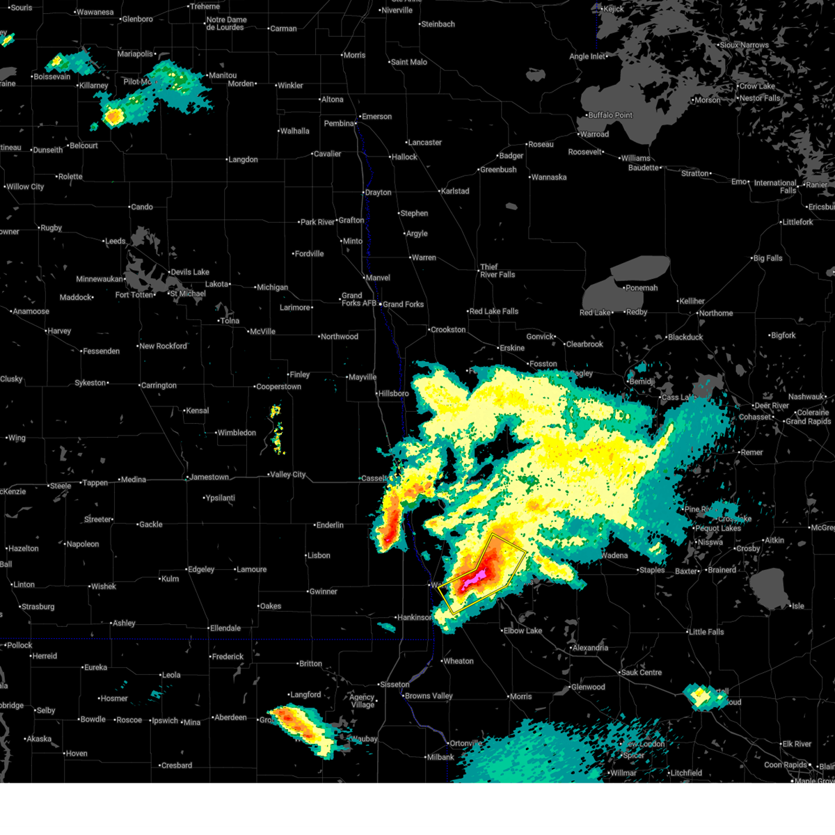
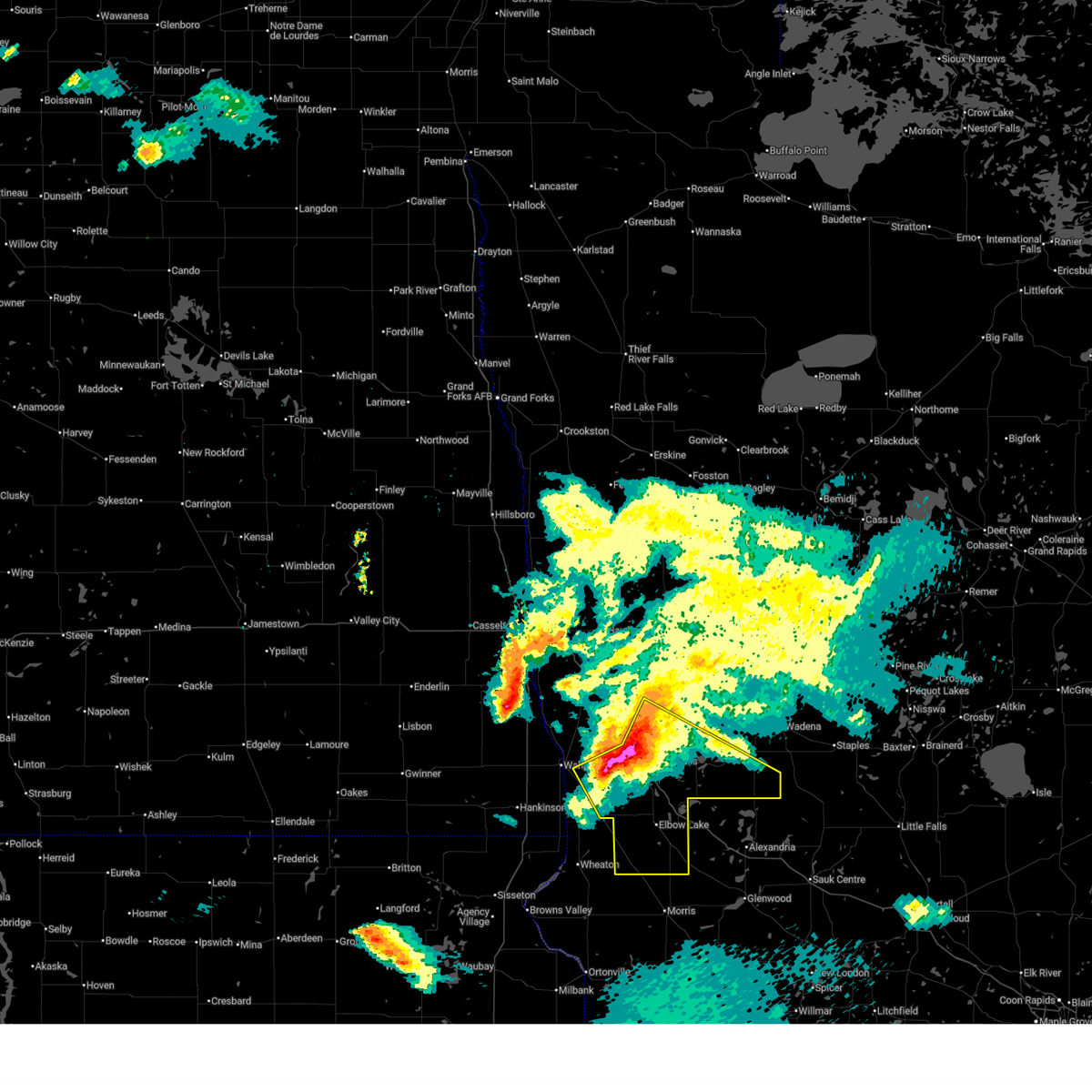
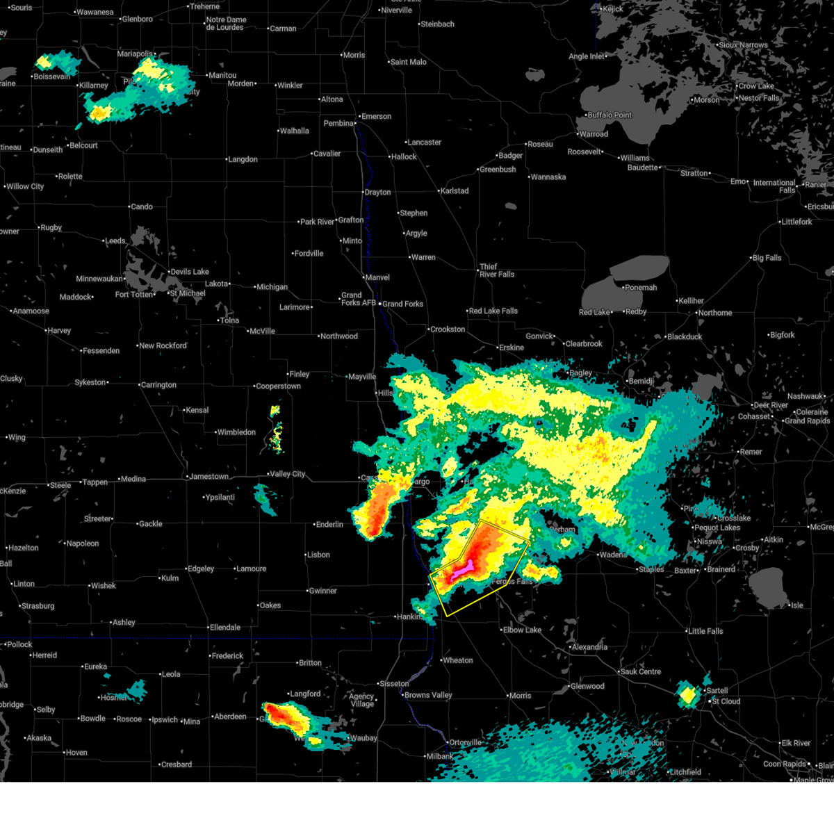
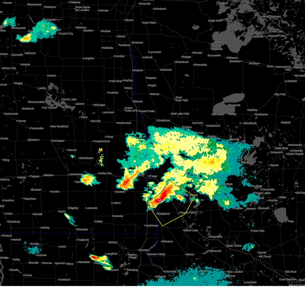
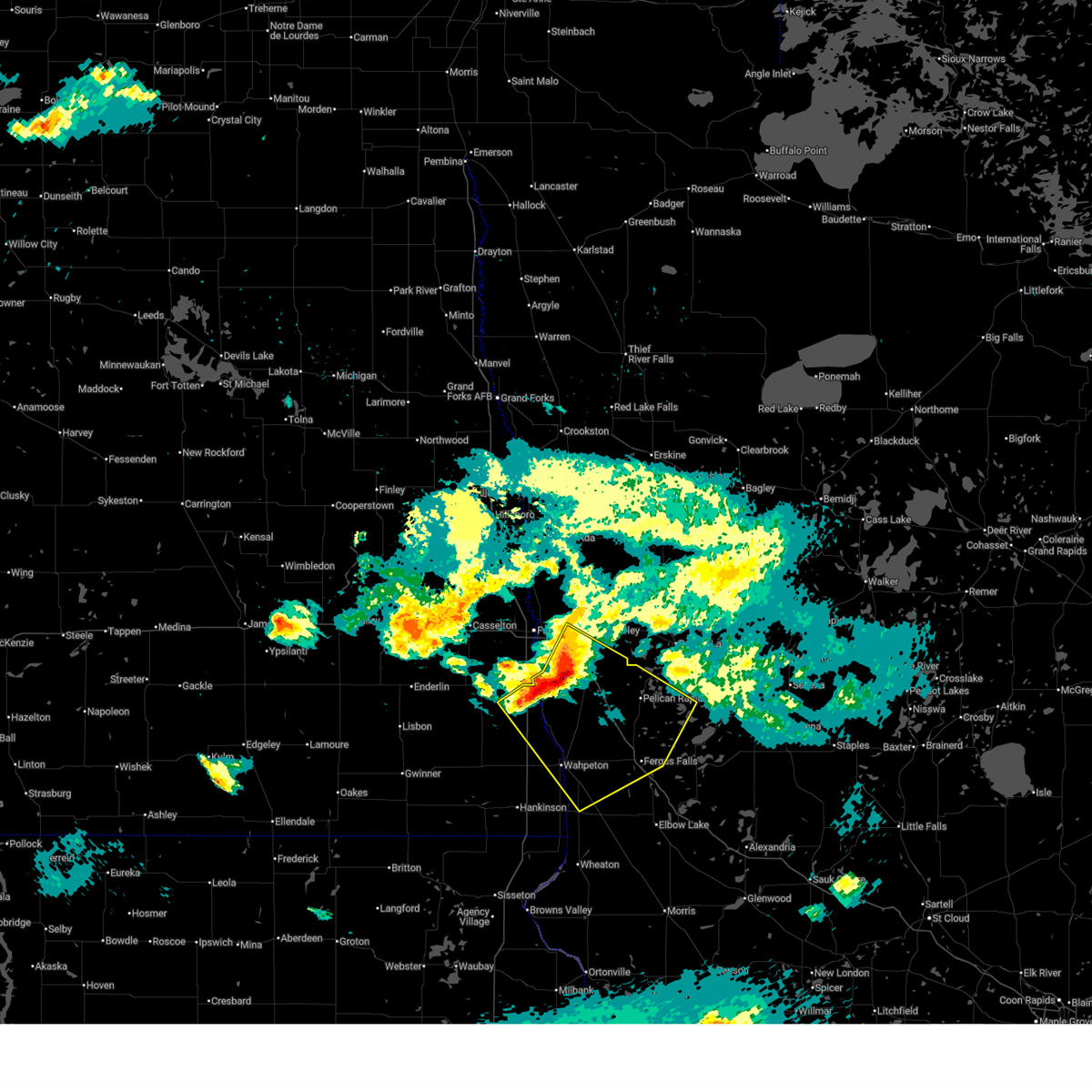
The Top Recent Hail Date for Foxhome, MN is Monday, June 29, 2026 (2nd out of 39)
Hail and Wind Damage Spotted near Foxhome, MN
| Date / Time | Report Details |
|---|---|
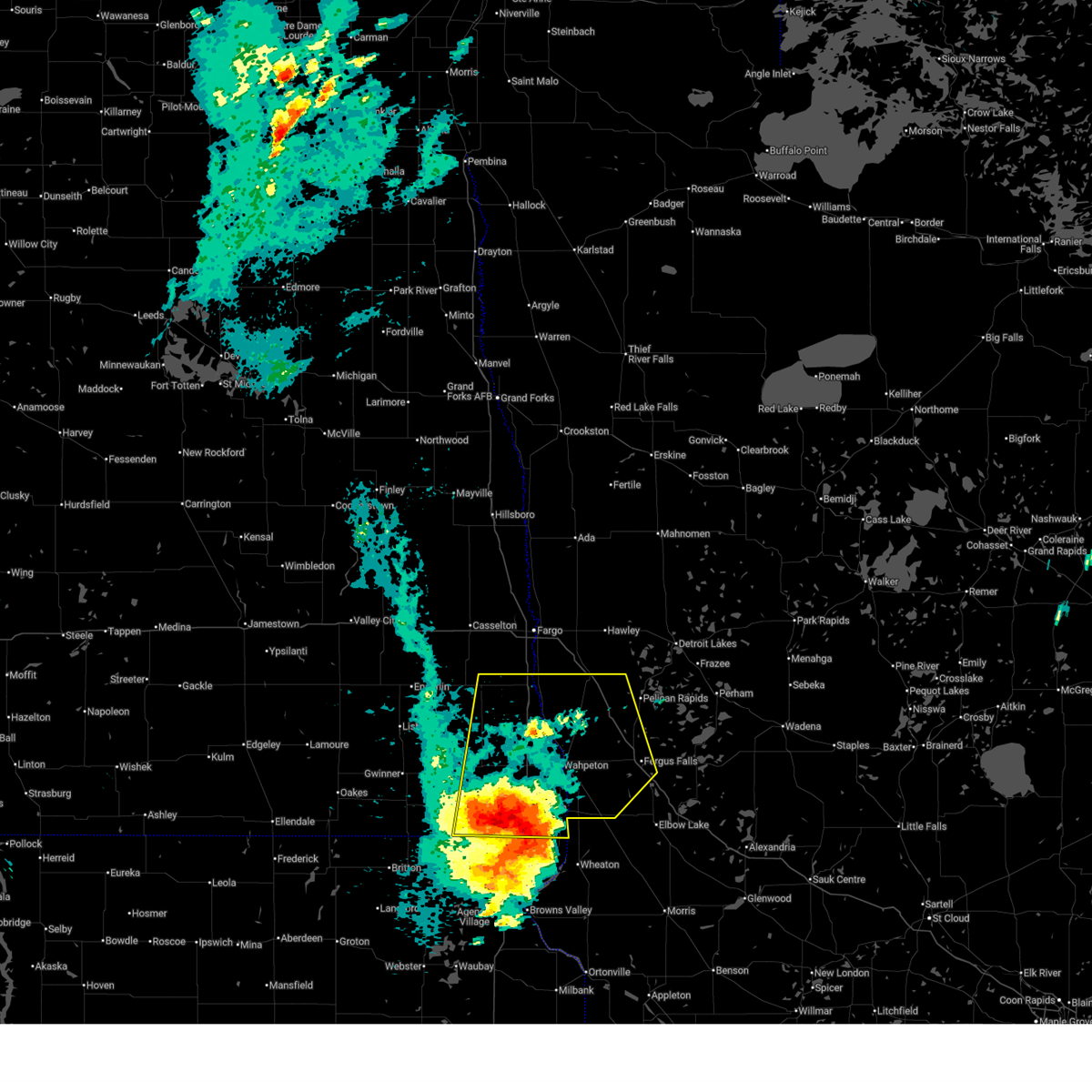
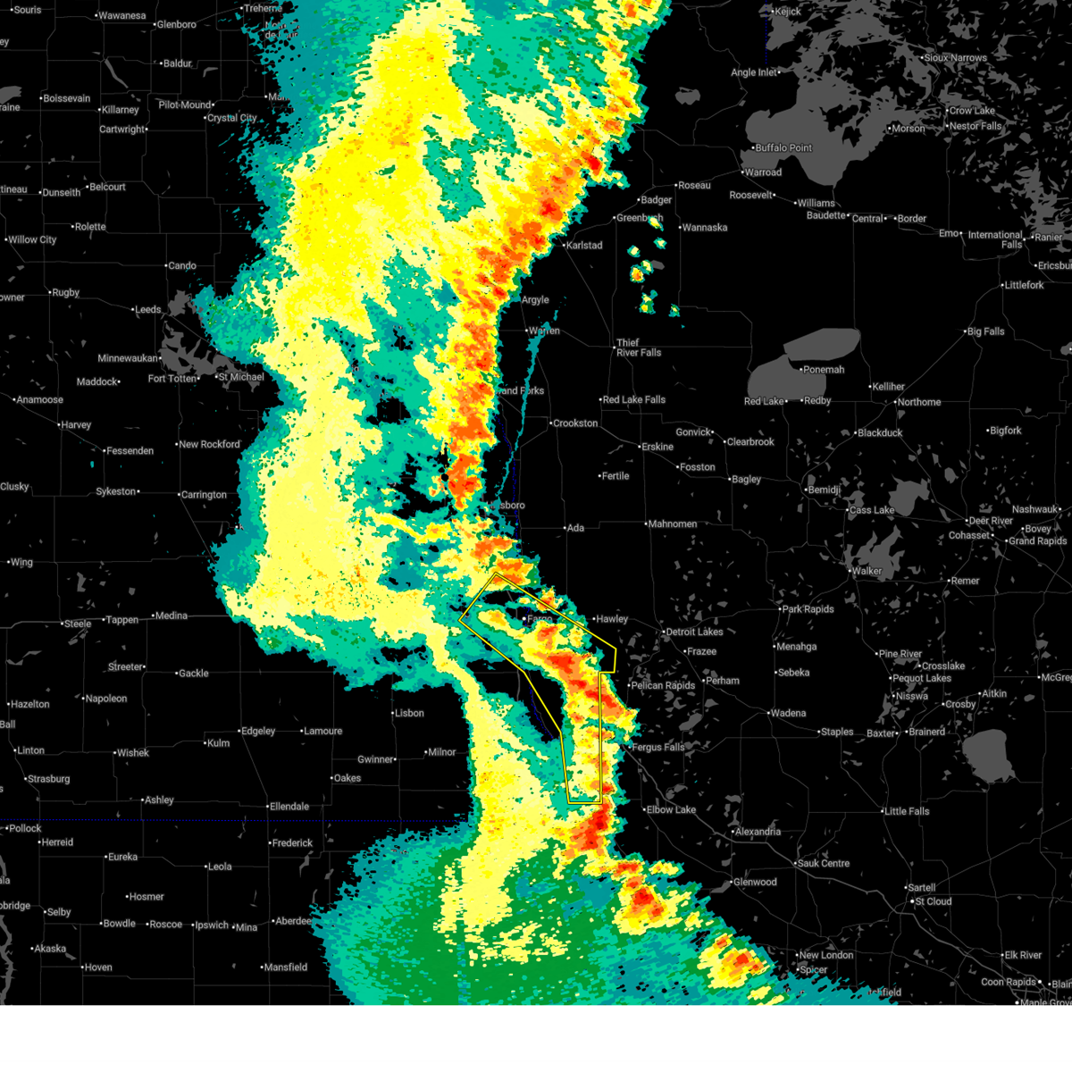
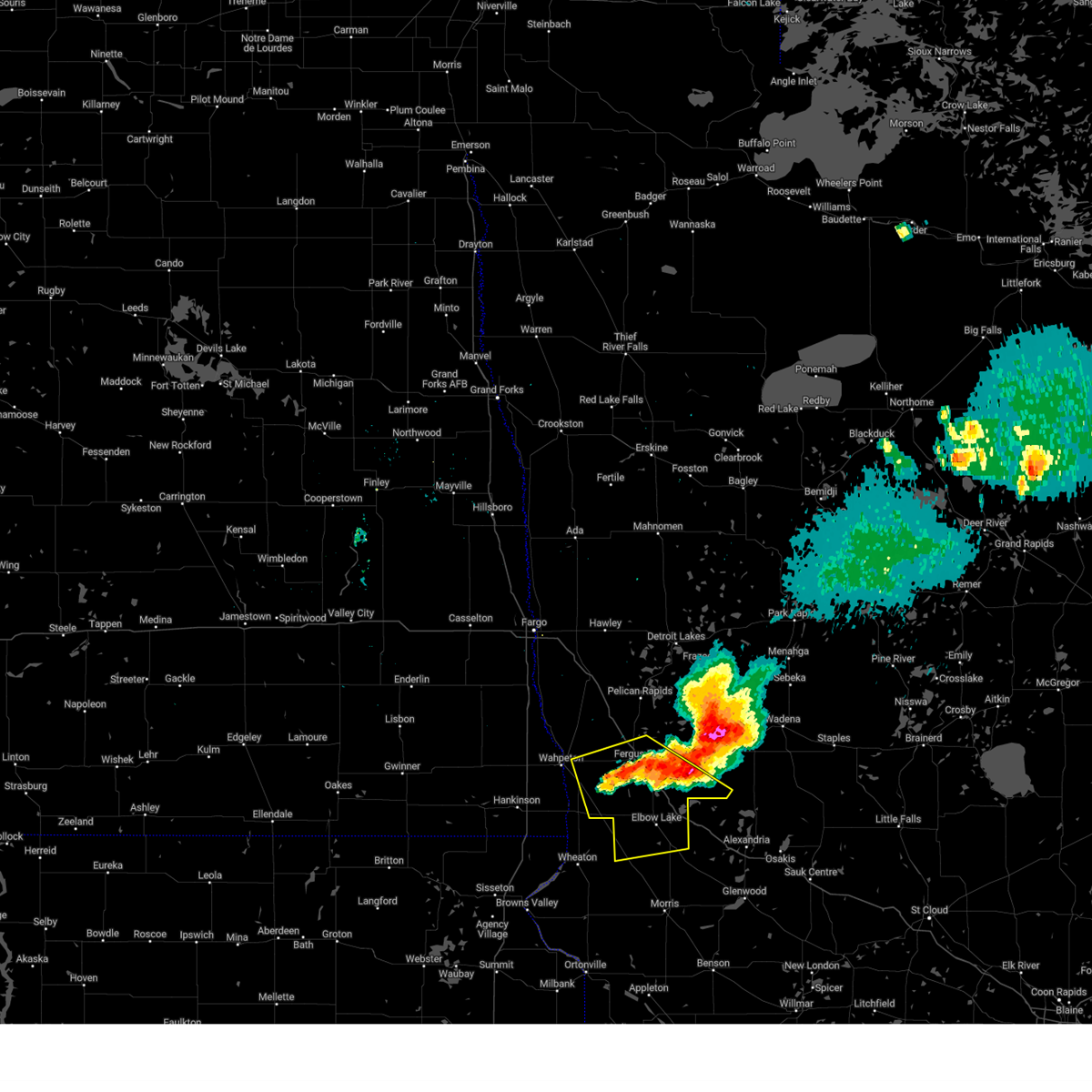
| 6/29/2026 10:03 AM CDT | Storm damage reported in wilkin county MN, 1.9 miles E of Foxhome, MN |
| 6/29/2026 9:55 AM CDT |
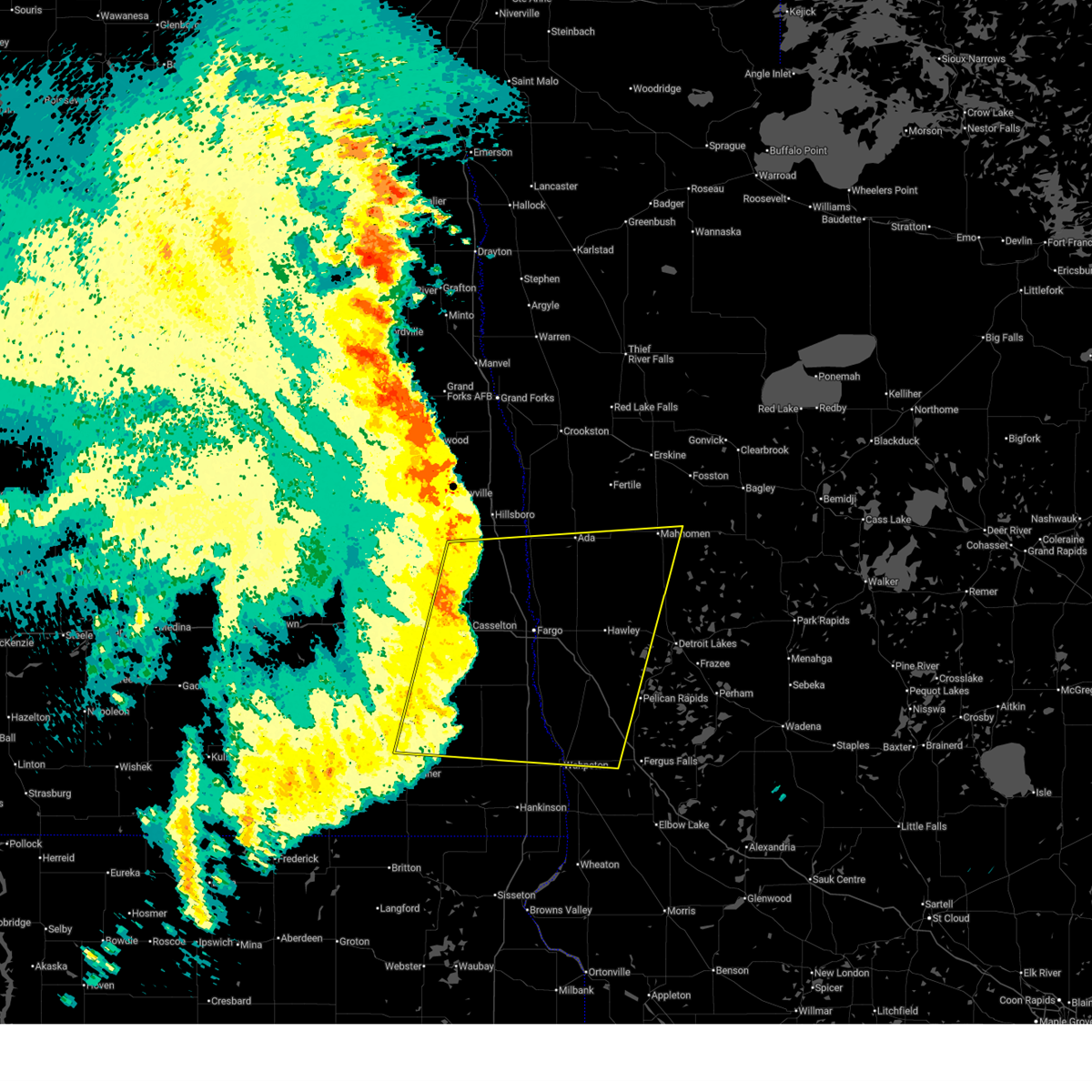
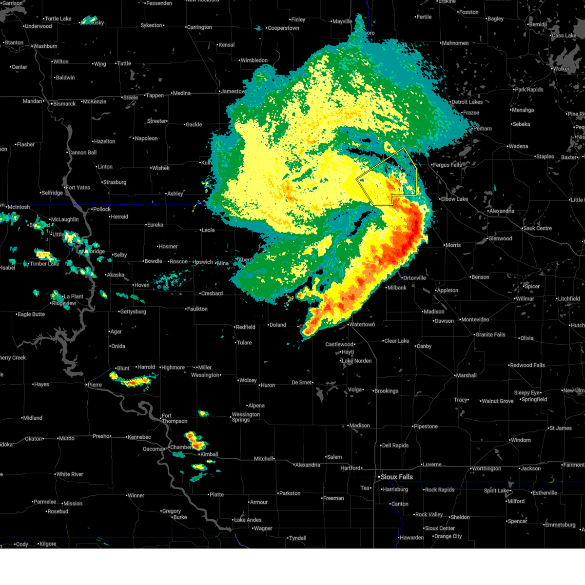
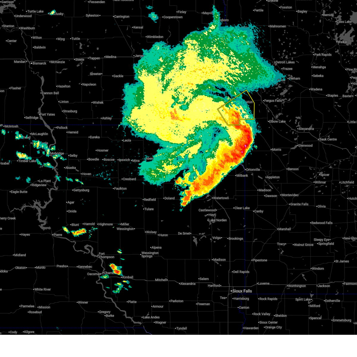
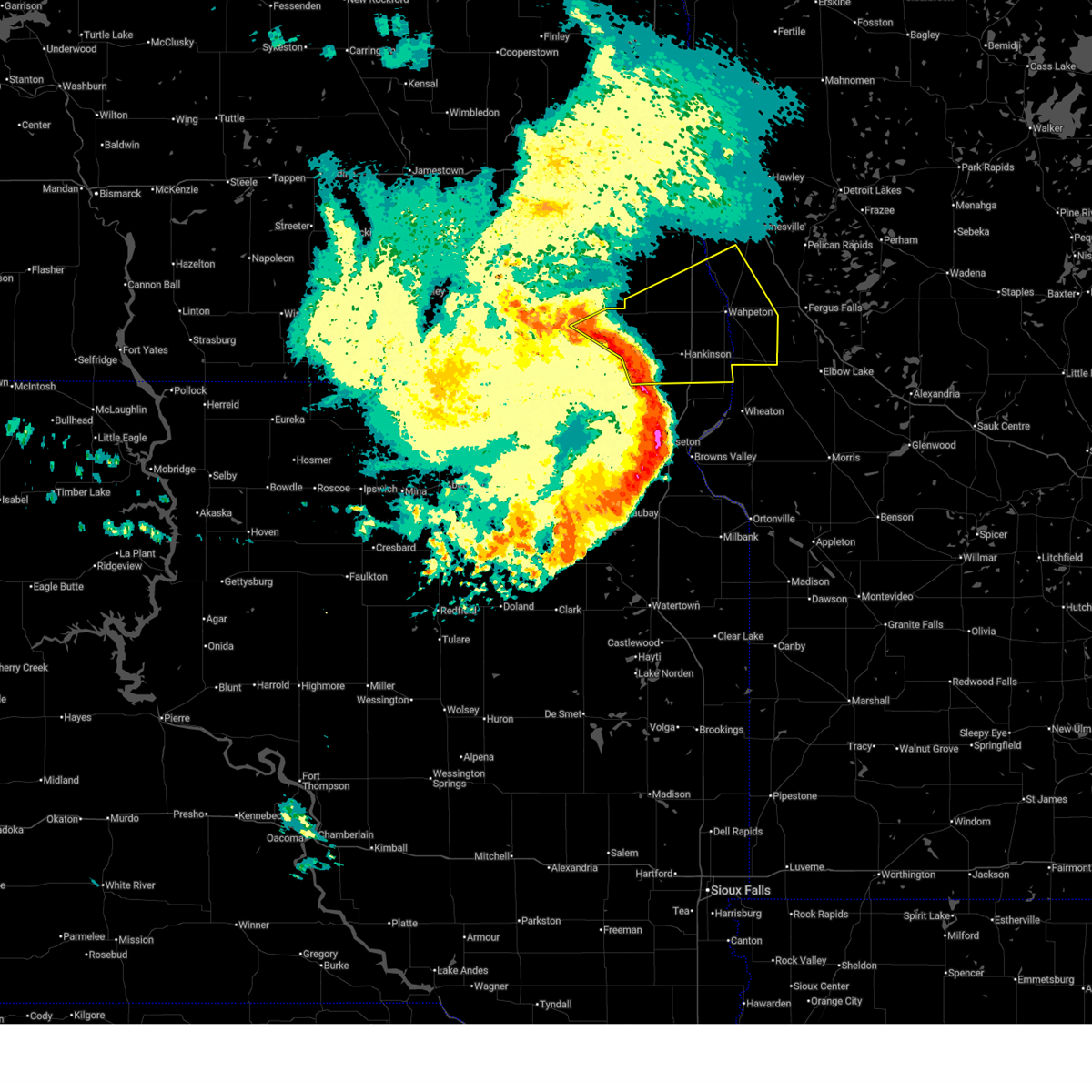
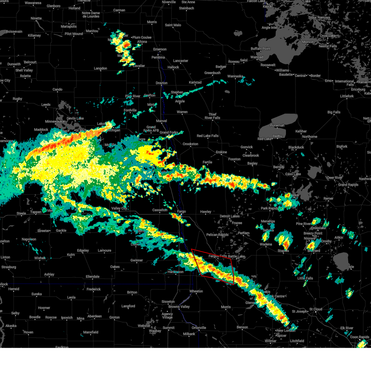
 At 954 am cdt, severe thunderstorms were located along a line extending from near mooreton to foxhome to near wendell, moving east at 50 mph (radar indicated). Hazards include 70 mph wind gusts and quarter size hail. Hail damage to vehicles is expected. expect considerable tree damage. wind damage is also likely to mobile homes, roofs, and outbuildings. Locations impacted include, fergus falls, wahpeton, breckenridge, hankinson, rothsay, fairmount, and mooreton. At 954 am cdt, severe thunderstorms were located along a line extending from near mooreton to foxhome to near wendell, moving east at 50 mph (radar indicated). Hazards include 70 mph wind gusts and quarter size hail. Hail damage to vehicles is expected. expect considerable tree damage. wind damage is also likely to mobile homes, roofs, and outbuildings. Locations impacted include, fergus falls, wahpeton, breckenridge, hankinson, rothsay, fairmount, and mooreton.
|
| 6/29/2026 9:55 AM CDT |
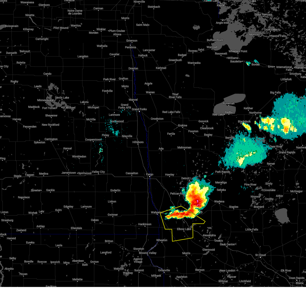
 the severe thunderstorm warning has been cancelled and is no longer in effect the severe thunderstorm warning has been cancelled and is no longer in effect
|
| 6/29/2026 9:28 AM CDT |
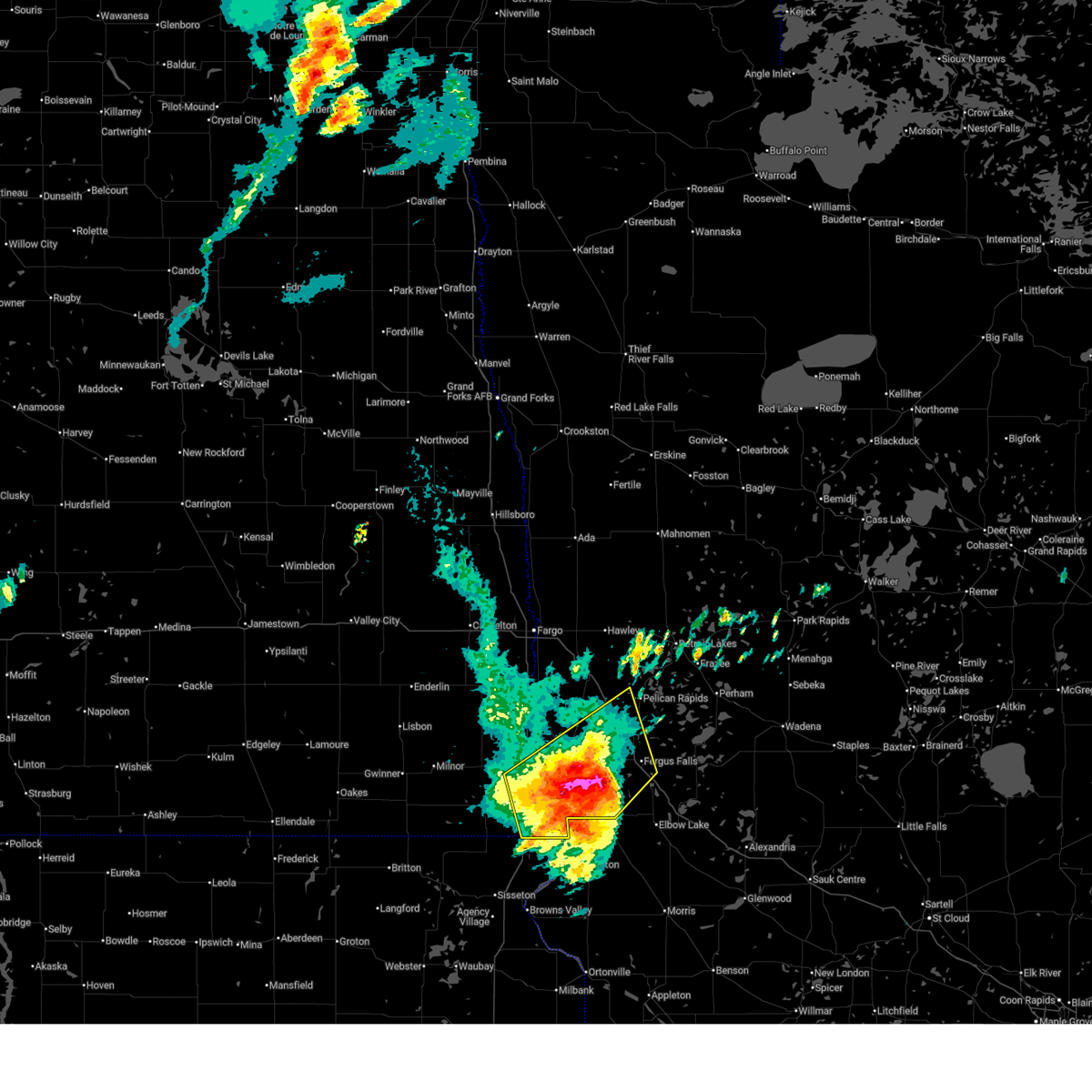
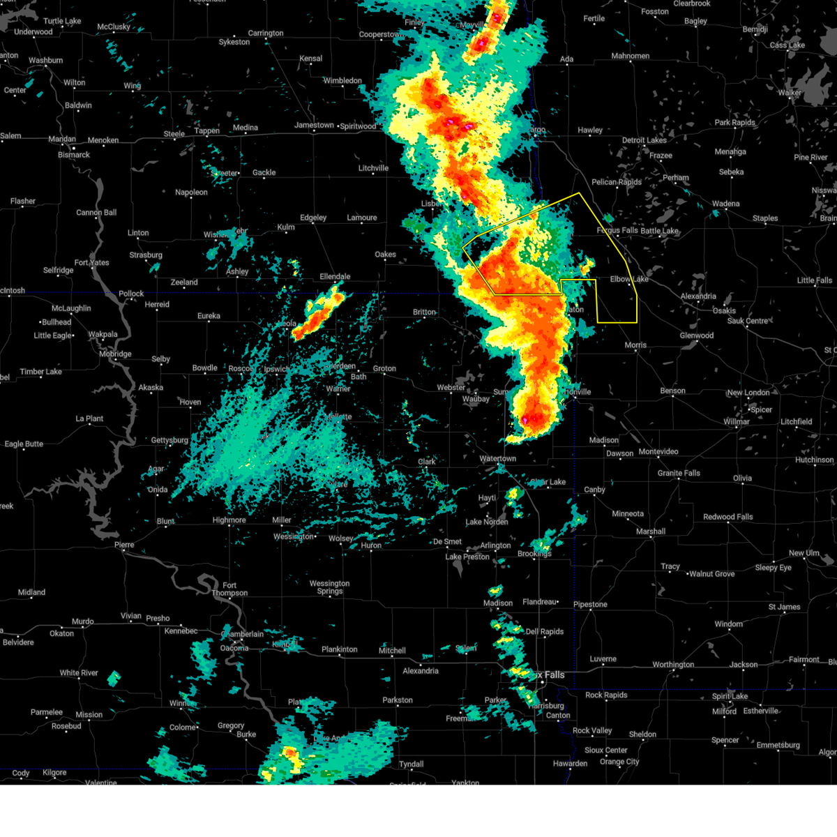
 Svrfgf the national weather service in grand forks has issued a * severe thunderstorm warning for, southern clay county in northwestern minnesota, southwestern otter tail county in west central minnesota, northwestern grant county in west central minnesota, wilkin county in west central minnesota, southeastern cass county in southeastern north dakota, richland county in southeastern north dakota, southeastern sargent county in southeastern north dakota, * until 1030 am cdt. * at 927 am cdt, severe thunderstorms were located over mainly rural areas of of southern richland county near hankinson and lidgerwood, moving northeast at 55 mph (radar indicated). Hazards include 70 mph wind gusts and quarter size hail. Hail damage to vehicles is expected. expect considerable tree damage. Wind damage is also likely to mobile homes, roofs, and outbuildings. Svrfgf the national weather service in grand forks has issued a * severe thunderstorm warning for, southern clay county in northwestern minnesota, southwestern otter tail county in west central minnesota, northwestern grant county in west central minnesota, wilkin county in west central minnesota, southeastern cass county in southeastern north dakota, richland county in southeastern north dakota, southeastern sargent county in southeastern north dakota, * until 1030 am cdt. * at 927 am cdt, severe thunderstorms were located over mainly rural areas of of southern richland county near hankinson and lidgerwood, moving northeast at 55 mph (radar indicated). Hazards include 70 mph wind gusts and quarter size hail. Hail damage to vehicles is expected. expect considerable tree damage. Wind damage is also likely to mobile homes, roofs, and outbuildings.
|
| 6/29/2026 9:16 AM CDT |
 At 915 am cdt, severe thunderstorms were located along a line extending from lake traverse reservation to near hankinson to near victor, moving northeast at 55 mph. these are destructive storms for southeastern sargent county, southern richland county, and southern wilkin county, including the wahpeton and breckenridge areas and the i-29 corridor from the state line to mile marker 26 (radar indicated). Hazards include 80 mph wind gusts and ping pong ball size hail. Flying debris will be dangerous to those caught without shelter. mobile homes will be heavily damaged. expect considerable damage to roofs, windows, and vehicles. extensive tree damage and power outages are likely. Locations impacted include, wahpeton, breckenridge, hankinson, lidgerwood, wyndmere, fairmount, and mooreton. At 915 am cdt, severe thunderstorms were located along a line extending from lake traverse reservation to near hankinson to near victor, moving northeast at 55 mph. these are destructive storms for southeastern sargent county, southern richland county, and southern wilkin county, including the wahpeton and breckenridge areas and the i-29 corridor from the state line to mile marker 26 (radar indicated). Hazards include 80 mph wind gusts and ping pong ball size hail. Flying debris will be dangerous to those caught without shelter. mobile homes will be heavily damaged. expect considerable damage to roofs, windows, and vehicles. extensive tree damage and power outages are likely. Locations impacted include, wahpeton, breckenridge, hankinson, lidgerwood, wyndmere, fairmount, and mooreton.
|
| 6/29/2026 8:40 AM CDT |
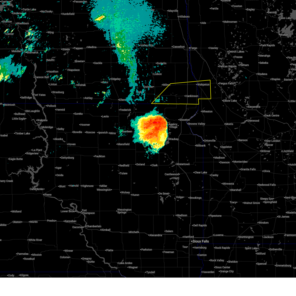 Svrfgf the national weather service in grand forks has issued a * severe thunderstorm warning for, southeastern wilkin county in west central minnesota, southern richland county in southeastern north dakota, southeastern sargent county in southeastern north dakota, * until 930 am cdt. * at 837 am cdt, severe thunderstorms were located along a line extending from near langford to roy lake rec area to lake traverse reservation, moving northeast at 55 mph. these are destructive storms for southeastern sargent county, southern richland county, and southern wilkin county, including the wahpeton and breckenridge areas and the i-29 corridor from the state line to mile marker 26 (radar indicated). Hazards include 80 mph wind gusts and ping pong ball size hail. Flying debris will be dangerous to those caught without shelter. mobile homes will be heavily damaged. expect considerable damage to roofs, windows, and vehicles. Extensive tree damage and power outages are likely. Svrfgf the national weather service in grand forks has issued a * severe thunderstorm warning for, southeastern wilkin county in west central minnesota, southern richland county in southeastern north dakota, southeastern sargent county in southeastern north dakota, * until 930 am cdt. * at 837 am cdt, severe thunderstorms were located along a line extending from near langford to roy lake rec area to lake traverse reservation, moving northeast at 55 mph. these are destructive storms for southeastern sargent county, southern richland county, and southern wilkin county, including the wahpeton and breckenridge areas and the i-29 corridor from the state line to mile marker 26 (radar indicated). Hazards include 80 mph wind gusts and ping pong ball size hail. Flying debris will be dangerous to those caught without shelter. mobile homes will be heavily damaged. expect considerable damage to roofs, windows, and vehicles. Extensive tree damage and power outages are likely.
|
| 6/10/2026 1:56 AM CDT |
 At 155 am cdt, severe thunderstorms were located along a line extending from near moorhead to near lawndale to near dalton, moving east at 45 mph (radar indicated). Hazards include 60 mph wind gusts and penny size hail. Expect damage to roofs, siding, and trees. Locations impacted include, fargo, moorhead, west fargo, dilworth, barnesville, horace, and casselton. At 155 am cdt, severe thunderstorms were located along a line extending from near moorhead to near lawndale to near dalton, moving east at 45 mph (radar indicated). Hazards include 60 mph wind gusts and penny size hail. Expect damage to roofs, siding, and trees. Locations impacted include, fargo, moorhead, west fargo, dilworth, barnesville, horace, and casselton.
|
| 6/10/2026 1:16 AM CDT |
 Svrfgf the national weather service in grand forks has issued a * severe thunderstorm warning for, southern clay county in northwestern minnesota, wilkin county in west central minnesota, southeastern cass county in southeastern north dakota, eastern richland county in southeastern north dakota, * until 215 am cdt. * at 114 am cdt, severe thunderstorms were located along a line extending from near leonard to colfax to fairmount, moving east at 45 mph (radar indicated. at 1:10 am, a 58 mph wind gust was reported at ekre north dakota). Hazards include 60 mph wind gusts and penny size hail. expect damage to roofs, siding, and trees Svrfgf the national weather service in grand forks has issued a * severe thunderstorm warning for, southern clay county in northwestern minnesota, wilkin county in west central minnesota, southeastern cass county in southeastern north dakota, eastern richland county in southeastern north dakota, * until 215 am cdt. * at 114 am cdt, severe thunderstorms were located along a line extending from near leonard to colfax to fairmount, moving east at 45 mph (radar indicated. at 1:10 am, a 58 mph wind gust was reported at ekre north dakota). Hazards include 60 mph wind gusts and penny size hail. expect damage to roofs, siding, and trees
|
| 8/8/2025 4:34 AM CDT |
 At 434 am cdt, severe thunderstorms were located along a line extending from near twin valley to near kent, moving east at 60 mph (radar indicated). Hazards include 70 mph wind gusts. Expect considerable tree damage. damage is likely to mobile homes, roofs, and outbuildings. Locations impacted include, fargo, wahpeton, moorhead, west fargo, dilworth, breckenridge, and barnesville. At 434 am cdt, severe thunderstorms were located along a line extending from near twin valley to near kent, moving east at 60 mph (radar indicated). Hazards include 70 mph wind gusts. Expect considerable tree damage. damage is likely to mobile homes, roofs, and outbuildings. Locations impacted include, fargo, wahpeton, moorhead, west fargo, dilworth, breckenridge, and barnesville.
|
| 8/8/2025 3:55 AM CDT |
 Svrfgf the national weather service in grand forks has issued a * severe thunderstorm warning for, clay county in northwestern minnesota, southern norman county in northwestern minnesota, northwestern otter tail county in west central minnesota, wilkin county in west central minnesota, southwestern mahnomen county in northwestern minnesota, western becker county in northwestern minnesota, eastern ransom county in southeastern north dakota, cass county in southeastern north dakota, southeastern traill county in southeastern north dakota, northern richland county in southeastern north dakota, * until 500 am cdt. * at 355 am cdt, severe thunderstorms were located along a line extending from near grandin to near venlo, moving east at 60 mph (mesonets). Hazards include 70 mph wind gusts. Expect considerable tree damage. Damage is likely to mobile homes, roofs, and outbuildings. Svrfgf the national weather service in grand forks has issued a * severe thunderstorm warning for, clay county in northwestern minnesota, southern norman county in northwestern minnesota, northwestern otter tail county in west central minnesota, wilkin county in west central minnesota, southwestern mahnomen county in northwestern minnesota, western becker county in northwestern minnesota, eastern ransom county in southeastern north dakota, cass county in southeastern north dakota, southeastern traill county in southeastern north dakota, northern richland county in southeastern north dakota, * until 500 am cdt. * at 355 am cdt, severe thunderstorms were located along a line extending from near grandin to near venlo, moving east at 60 mph (mesonets). Hazards include 70 mph wind gusts. Expect considerable tree damage. Damage is likely to mobile homes, roofs, and outbuildings.
|
| 7/21/2025 5:04 AM CDT |
 the severe thunderstorm warning has been cancelled and is no longer in effect the severe thunderstorm warning has been cancelled and is no longer in effect
|
| 7/21/2025 4:53 AM CDT |
 At 452 am cdt, severe thunderstorms were located along a line extending from near dwight to near doran to near tenney, moving east at 45 mph (radar indicated). Hazards include 60 mph wind gusts and penny size hail. Expect damage to roofs, siding, and trees. Locations impacted include, wahpeton, breckenridge, hankinson, fairmount, campbell, foxhome, and nashua. At 452 am cdt, severe thunderstorms were located along a line extending from near dwight to near doran to near tenney, moving east at 45 mph (radar indicated). Hazards include 60 mph wind gusts and penny size hail. Expect damage to roofs, siding, and trees. Locations impacted include, wahpeton, breckenridge, hankinson, fairmount, campbell, foxhome, and nashua.
|
| 7/21/2025 4:53 AM CDT |
 the severe thunderstorm warning has been cancelled and is no longer in effect the severe thunderstorm warning has been cancelled and is no longer in effect
|
| 7/21/2025 4:10 AM CDT |
 Svrfgf the national weather service in grand forks has issued a * severe thunderstorm warning for, wilkin county in west central minnesota, richland county in southeastern north dakota, northeastern sargent county in southeastern north dakota, * until 515 am cdt. * at 409 am cdt, severe thunderstorms were located along a line extending from 6 miles south of milnor to near geneseo to lake traverse reservation, moving east at 45 mph (radar indicated). Hazards include 60 mph wind gusts and quarter size hail. Hail damage to vehicles is expected. Expect wind damage to roofs, siding, and trees. Svrfgf the national weather service in grand forks has issued a * severe thunderstorm warning for, wilkin county in west central minnesota, richland county in southeastern north dakota, northeastern sargent county in southeastern north dakota, * until 515 am cdt. * at 409 am cdt, severe thunderstorms were located along a line extending from 6 miles south of milnor to near geneseo to lake traverse reservation, moving east at 45 mph (radar indicated). Hazards include 60 mph wind gusts and quarter size hail. Hail damage to vehicles is expected. Expect wind damage to roofs, siding, and trees.
|
| 6/28/2025 8:51 PM CDT |
 The storm which prompted the warning has weakened below severe limits, and no longer poses an immediate threat to life or property. therefore, the warning will be allowed to expire. a severe thunderstorm watch remains in effect until 1100 pm cdt for west central minnesota. The storm which prompted the warning has weakened below severe limits, and no longer poses an immediate threat to life or property. therefore, the warning will be allowed to expire. a severe thunderstorm watch remains in effect until 1100 pm cdt for west central minnesota.
|
| 6/28/2025 8:39 PM CDT |
 At 839 pm cdt, a severe thunderstorm was located near everdell, or 12 miles southeast of wahpeton, moving east at 35 mph (radar indicated). Hazards include 60 mph wind gusts and quarter size hail. Hail damage to vehicles is expected. expect wind damage to roofs, siding, and trees. Locations impacted include, foxhome and everdell. At 839 pm cdt, a severe thunderstorm was located near everdell, or 12 miles southeast of wahpeton, moving east at 35 mph (radar indicated). Hazards include 60 mph wind gusts and quarter size hail. Hail damage to vehicles is expected. expect wind damage to roofs, siding, and trees. Locations impacted include, foxhome and everdell.
|
| 6/28/2025 8:39 PM CDT |
 the severe thunderstorm warning has been cancelled and is no longer in effect the severe thunderstorm warning has been cancelled and is no longer in effect
|
| 6/28/2025 8:24 PM CDT |
 At 824 pm cdt, a severe thunderstorm was located over breckenridge, or near wahpeton, moving east at 20 mph (radar indicated). Hazards include ping pong ball size hail and 60 mph wind gusts. People and animals outdoors will be injured. expect hail damage to roofs, siding, windows, and vehicles. expect wind damage to roofs, siding, and trees. Locations impacted include, wahpeton, breckenridge, foxhome, and everdell. At 824 pm cdt, a severe thunderstorm was located over breckenridge, or near wahpeton, moving east at 20 mph (radar indicated). Hazards include ping pong ball size hail and 60 mph wind gusts. People and animals outdoors will be injured. expect hail damage to roofs, siding, windows, and vehicles. expect wind damage to roofs, siding, and trees. Locations impacted include, wahpeton, breckenridge, foxhome, and everdell.
|
| 6/28/2025 8:06 PM CDT |
 At 805 pm cdt, a severe thunderstorm was located over dwight, or near wahpeton, moving east at 15 mph (radar indicated). Hazards include golf ball size hail and 60 mph wind gusts. People and animals outdoors will be injured. expect hail damage to roofs, siding, windows, and vehicles. expect wind damage to roofs, siding, and trees. locations impacted include, wahpeton, breckenridge, foxhome, dwight, brushvale, and everdell. This includes interstate 29 between mile markers 22 and 24. At 805 pm cdt, a severe thunderstorm was located over dwight, or near wahpeton, moving east at 15 mph (radar indicated). Hazards include golf ball size hail and 60 mph wind gusts. People and animals outdoors will be injured. expect hail damage to roofs, siding, windows, and vehicles. expect wind damage to roofs, siding, and trees. locations impacted include, wahpeton, breckenridge, foxhome, dwight, brushvale, and everdell. This includes interstate 29 between mile markers 22 and 24.
|
| 6/28/2025 8:04 PM CDT |
 Torfgf the national weather service in grand forks has issued a * tornado warning for, southeastern wilkin county in west central minnesota, east central richland county in southeastern north dakota, * until 830 pm cdt. * at 804 pm cdt, a severe thunderstorm capable of producing a tornado was located near wahpeton, moving east at 35 mph (weather spotters reported funnel cloud). Hazards include tornado and golf ball size hail. Flying debris will be dangerous to those caught without shelter. mobile homes will be damaged or destroyed. damage to roofs, windows, and vehicles will occur. Tree damage is likely. Torfgf the national weather service in grand forks has issued a * tornado warning for, southeastern wilkin county in west central minnesota, east central richland county in southeastern north dakota, * until 830 pm cdt. * at 804 pm cdt, a severe thunderstorm capable of producing a tornado was located near wahpeton, moving east at 35 mph (weather spotters reported funnel cloud). Hazards include tornado and golf ball size hail. Flying debris will be dangerous to those caught without shelter. mobile homes will be damaged or destroyed. damage to roofs, windows, and vehicles will occur. Tree damage is likely.
|
| 6/28/2025 7:55 PM CDT |
 Svrfgf the national weather service in grand forks has issued a * severe thunderstorm warning for, central wilkin county in west central minnesota, east central richland county in southeastern north dakota, * until 900 pm cdt. * at 754 pm cdt, a severe thunderstorm was located over dwight, or 7 miles west of wahpeton, moving east at 15 mph (radar indicated). Hazards include 60 mph wind gusts and quarter size hail. Hail damage to vehicles is expected. Expect wind damage to roofs, siding, and trees. Svrfgf the national weather service in grand forks has issued a * severe thunderstorm warning for, central wilkin county in west central minnesota, east central richland county in southeastern north dakota, * until 900 pm cdt. * at 754 pm cdt, a severe thunderstorm was located over dwight, or 7 miles west of wahpeton, moving east at 15 mph (radar indicated). Hazards include 60 mph wind gusts and quarter size hail. Hail damage to vehicles is expected. Expect wind damage to roofs, siding, and trees.
|
| 6/21/2025 12:46 AM CDT |
 The storms which prompted the warning have weakened below severe limits, and have exited the warned area. therefore, the warning has been allowed to expire. however, heavy rain is still possible with these thunderstorms. a tornado watch remains in effect until 300 am cdt for northwestern and west central minnesota, and southeastern north dakota. The storms which prompted the warning have weakened below severe limits, and have exited the warned area. therefore, the warning has been allowed to expire. however, heavy rain is still possible with these thunderstorms. a tornado watch remains in effect until 300 am cdt for northwestern and west central minnesota, and southeastern north dakota.
|
| 6/20/2025 11:52 PM CDT |
 Svrfgf the national weather service in grand forks has issued a * severe thunderstorm warning for, southern clay county in northwestern minnesota, western otter tail county in west central minnesota, wilkin county in west central minnesota, southwestern becker county in northwestern minnesota, southeastern ransom county in southeastern north dakota, southeastern cass county in southeastern north dakota, richland county in southeastern north dakota, northeastern sargent county in southeastern north dakota, * until 1245 am cdt. * at 1151 pm cdt, severe thunderstorms were located along a line extending from near mapleton to near gwinner, moving east at 70 mph (radar indicated). Hazards include 70 mph wind gusts. Expect considerable tree damage. damage is likely to mobile homes, roofs, and outbuildings. severe thunderstorms will be near, horace, kindred, and milnor around 1155 pm cdt. wild rice around 1200 am cdt. wyndmere, oxbow, and walcott around 1205 am cdt. wolverton, colfax, and barney around 1210 am cdt. abercrombie, mooreton, and galchutt around 1215 am cdt. other locations impacted by these severe thunderstorms include fergus falls airport. this includes the following highways, interstate 29 between mile markers 15 and 57. interstate 94 in north dakota between mile markers 15 and 62. Interstate 94 in minnesota between mile markers 15 and 62. Svrfgf the national weather service in grand forks has issued a * severe thunderstorm warning for, southern clay county in northwestern minnesota, western otter tail county in west central minnesota, wilkin county in west central minnesota, southwestern becker county in northwestern minnesota, southeastern ransom county in southeastern north dakota, southeastern cass county in southeastern north dakota, richland county in southeastern north dakota, northeastern sargent county in southeastern north dakota, * until 1245 am cdt. * at 1151 pm cdt, severe thunderstorms were located along a line extending from near mapleton to near gwinner, moving east at 70 mph (radar indicated). Hazards include 70 mph wind gusts. Expect considerable tree damage. damage is likely to mobile homes, roofs, and outbuildings. severe thunderstorms will be near, horace, kindred, and milnor around 1155 pm cdt. wild rice around 1200 am cdt. wyndmere, oxbow, and walcott around 1205 am cdt. wolverton, colfax, and barney around 1210 am cdt. abercrombie, mooreton, and galchutt around 1215 am cdt. other locations impacted by these severe thunderstorms include fergus falls airport. this includes the following highways, interstate 29 between mile markers 15 and 57. interstate 94 in north dakota between mile markers 15 and 62. Interstate 94 in minnesota between mile markers 15 and 62.
|
| 6/20/2025 12:52 AM CDT |
 The storms which prompted the warning have moved out of the area. therefore, the warning will be allowed to expire. however, gusty winds are still possible with these thunderstorms. a severe thunderstorm watch remains in effect until 400 am cdt for west central minnesota. to report severe weather, contact your nearest law enforcement agency. they will relay your report to the national weather service grand forks. remember, a severe thunderstorm warning still remains in effect for wilkin and ottertail counties. The storms which prompted the warning have moved out of the area. therefore, the warning will be allowed to expire. however, gusty winds are still possible with these thunderstorms. a severe thunderstorm watch remains in effect until 400 am cdt for west central minnesota. to report severe weather, contact your nearest law enforcement agency. they will relay your report to the national weather service grand forks. remember, a severe thunderstorm warning still remains in effect for wilkin and ottertail counties.
|
| 6/20/2025 12:45 AM CDT | Corrects previous tstm wnd gst report from foxhome. ndawn at foxhome... wind gusts over 50mph lasted 20 minutes starting at 12:25 peaking around 12:3 in wilkin county MN, 1 miles W of Foxhome, MN |
| 6/20/2025 12:44 AM CDT |
 At 1244 am cdt, severe thunderstorms were located along a line extending from near erhard to near carlisle to everdell, moving southeast at 40 mph (radar indicated). Hazards include 70 mph wind gusts and quarter size hail. Hail damage to vehicles is expected. expect considerable tree damage. wind damage is also likely to mobile homes, roofs, and outbuildings. locations impacted include, fergus falls, elizabeth, campbell, erhard, foxhome, maplewood state park, and carlisle. this includes the following highways, interstate 94 in north dakota between mile markers 47 and 60. Interstate 94 in minnesota between mile markers 47 and 60. At 1244 am cdt, severe thunderstorms were located along a line extending from near erhard to near carlisle to everdell, moving southeast at 40 mph (radar indicated). Hazards include 70 mph wind gusts and quarter size hail. Hail damage to vehicles is expected. expect considerable tree damage. wind damage is also likely to mobile homes, roofs, and outbuildings. locations impacted include, fergus falls, elizabeth, campbell, erhard, foxhome, maplewood state park, and carlisle. this includes the following highways, interstate 94 in north dakota between mile markers 47 and 60. Interstate 94 in minnesota between mile markers 47 and 60.
|
| 6/20/2025 12:43 AM CDT |
 Svrfgf the national weather service in grand forks has issued a * severe thunderstorm warning for, southern otter tail county in west central minnesota, grant county in west central minnesota, southeastern wilkin county in west central minnesota, * until 145 am cdt. * at 1242 am cdt, severe thunderstorms were located along a line extending from edwards to fergus falls to near foxhome, moving southeast at 45 mph (radar indicated). Hazards include 70 mph wind gusts and quarter size hail. Hail damage to vehicles is expected. expect considerable tree damage. Wind damage is also likely to mobile homes, roofs, and outbuildings. Svrfgf the national weather service in grand forks has issued a * severe thunderstorm warning for, southern otter tail county in west central minnesota, grant county in west central minnesota, southeastern wilkin county in west central minnesota, * until 145 am cdt. * at 1242 am cdt, severe thunderstorms were located along a line extending from edwards to fergus falls to near foxhome, moving southeast at 45 mph (radar indicated). Hazards include 70 mph wind gusts and quarter size hail. Hail damage to vehicles is expected. expect considerable tree damage. Wind damage is also likely to mobile homes, roofs, and outbuildings.
|
| 6/20/2025 12:35 AM CDT |
 the severe thunderstorm warning has been cancelled and is no longer in effect the severe thunderstorm warning has been cancelled and is no longer in effect
|
| 6/20/2025 12:35 AM CDT |
 At 1234 am cdt, severe thunderstorms were located along a line extending from near pelican rapids to near carlisle to near breckenridge, moving southeast at 45 mph (radar indicated). Hazards include 70 mph wind gusts and quarter size hail. Hail damage to vehicles is expected. expect considerable tree damage. wind damage is also likely to mobile homes, roofs, and outbuildings. locations impacted include, fergus falls, pelican rapids, lake lida, rothsay, star lake, elizabeth, and campbell. this includes the following highways, interstate 94 in north dakota between mile markers 38 and 60. Interstate 94 in minnesota between mile markers 38 and 60. At 1234 am cdt, severe thunderstorms were located along a line extending from near pelican rapids to near carlisle to near breckenridge, moving southeast at 45 mph (radar indicated). Hazards include 70 mph wind gusts and quarter size hail. Hail damage to vehicles is expected. expect considerable tree damage. wind damage is also likely to mobile homes, roofs, and outbuildings. locations impacted include, fergus falls, pelican rapids, lake lida, rothsay, star lake, elizabeth, and campbell. this includes the following highways, interstate 94 in north dakota between mile markers 38 and 60. Interstate 94 in minnesota between mile markers 38 and 60.
|
| 6/20/2025 12:24 AM CDT | Ndawn at foxhom in wilkin county MN, 1 miles W of Foxhome, MN |
| 6/20/2025 12:21 AM CDT |
 At 1221 am cdt, severe thunderstorms were located along a line extending from near rollag to near lawndale to near kent, moving southeast at 40 mph (radar indicated). Hazards include 70 mph wind gusts and quarter size hail. Hail damage to vehicles is expected. expect considerable tree damage. wind damage is also likely to mobile homes, roofs, and outbuildings. locations impacted include, fergus falls, wahpeton, breckenridge, pelican rapids, lake lida, rothsay, and star lake. this includes the following highways, interstate 94 in north dakota between mile markers 27 and 60. Interstate 94 in minnesota between mile markers 27 and 60. At 1221 am cdt, severe thunderstorms were located along a line extending from near rollag to near lawndale to near kent, moving southeast at 40 mph (radar indicated). Hazards include 70 mph wind gusts and quarter size hail. Hail damage to vehicles is expected. expect considerable tree damage. wind damage is also likely to mobile homes, roofs, and outbuildings. locations impacted include, fergus falls, wahpeton, breckenridge, pelican rapids, lake lida, rothsay, and star lake. this includes the following highways, interstate 94 in north dakota between mile markers 27 and 60. Interstate 94 in minnesota between mile markers 27 and 60.
|
| 6/20/2025 12:13 AM CDT |
 At 1212 am cdt, severe thunderstorms were located along a line extending from near rollag to near lawndale to mccauleyville, moving southeast at 40 mph (radar indicated). Hazards include 60 mph wind gusts and nickel size hail. Expect damage to roofs, siding, and trees. locations impacted include, fergus falls, wahpeton, breckenridge, barnesville, pelican rapids, lake lida, and rothsay. this includes the following highways, interstate 29 between mile markers 34 and 35. interstate 94 in north dakota between mile markers 23 and 60. Interstate 94 in minnesota between mile markers 23 and 60. At 1212 am cdt, severe thunderstorms were located along a line extending from near rollag to near lawndale to mccauleyville, moving southeast at 40 mph (radar indicated). Hazards include 60 mph wind gusts and nickel size hail. Expect damage to roofs, siding, and trees. locations impacted include, fergus falls, wahpeton, breckenridge, barnesville, pelican rapids, lake lida, and rothsay. this includes the following highways, interstate 29 between mile markers 34 and 35. interstate 94 in north dakota between mile markers 23 and 60. Interstate 94 in minnesota between mile markers 23 and 60.
|
| 6/19/2025 11:53 PM CDT |
 Svrfgf the national weather service in grand forks has issued a * severe thunderstorm warning for, southern clay county in northwestern minnesota, western otter tail county in west central minnesota, wilkin county in west central minnesota, northeastern richland county in southeastern north dakota, * until 100 am cdt. * at 1152 pm cdt, severe thunderstorms were located along a line extending from near glyndon to near comstock to walcott, moving southeast at 40 mph (radar indicated). Hazards include 60 mph wind gusts and nickel size hail. expect damage to roofs, siding, and trees Svrfgf the national weather service in grand forks has issued a * severe thunderstorm warning for, southern clay county in northwestern minnesota, western otter tail county in west central minnesota, wilkin county in west central minnesota, northeastern richland county in southeastern north dakota, * until 100 am cdt. * at 1152 pm cdt, severe thunderstorms were located along a line extending from near glyndon to near comstock to walcott, moving southeast at 40 mph (radar indicated). Hazards include 60 mph wind gusts and nickel size hail. expect damage to roofs, siding, and trees
|
| 5/19/2025 5:35 PM CDT | Large tree branches down due to strong wind in wilkin county MN, 0.1 miles SSW of Foxhome, MN |
| 5/15/2025 3:01 PM CDT |
 The storms which prompted the warning have moved out of the area. therefore, the warning has been allowed to expire. however, gusty winds are still possible with these thunderstorms. a tornado watch remains in effect until 800 pm cdt for west central minnesota. The storms which prompted the warning have moved out of the area. therefore, the warning has been allowed to expire. however, gusty winds are still possible with these thunderstorms. a tornado watch remains in effect until 800 pm cdt for west central minnesota.
|
| 5/15/2025 2:41 PM CDT |
 At 241 pm cdt, severe thunderstorms capable of producing tornadoes were located along a line extending from 4 miles west of ashby to 5 miles east of doran, moving north at 40 mph (radar indicated rotation). Hazards include tornado. Flying debris will be dangerous to those caught without shelter. mobile homes will be damaged or destroyed. damage to roofs, windows, and vehicles will occur. tree damage is likely. Locations impacted include, fergus falls, elbow lake, ashby, underwood, dalton, wendell, and campbell. At 241 pm cdt, severe thunderstorms capable of producing tornadoes were located along a line extending from 4 miles west of ashby to 5 miles east of doran, moving north at 40 mph (radar indicated rotation). Hazards include tornado. Flying debris will be dangerous to those caught without shelter. mobile homes will be damaged or destroyed. damage to roofs, windows, and vehicles will occur. tree damage is likely. Locations impacted include, fergus falls, elbow lake, ashby, underwood, dalton, wendell, and campbell.
|
| 5/15/2025 2:21 PM CDT |
 Torfgf the national weather service in grand forks has issued a * tornado warning for, southwestern otter tail county in west central minnesota, grant county in west central minnesota, southeastern wilkin county in west central minnesota, * until 300 pm cdt. * at 220 pm cdt, tornado producing storms were reported over mainly rural areas of grant county, moving north at 40 mph (radar indicated rotation). Hazards include tornado. Flying debris will be dangerous to those caught without shelter. mobile homes will be damaged or destroyed. damage to roofs, windows, and vehicles will occur. Tree damage is likely. Torfgf the national weather service in grand forks has issued a * tornado warning for, southwestern otter tail county in west central minnesota, grant county in west central minnesota, southeastern wilkin county in west central minnesota, * until 300 pm cdt. * at 220 pm cdt, tornado producing storms were reported over mainly rural areas of grant county, moving north at 40 mph (radar indicated rotation). Hazards include tornado. Flying debris will be dangerous to those caught without shelter. mobile homes will be damaged or destroyed. damage to roofs, windows, and vehicles will occur. Tree damage is likely.
|
| 7/31/2024 1:43 PM CDT |
 At 142 pm cdt, severe thunderstorms were located along a line extending from near midway to 6 miles east of poplar to barrows to near bowlus, moving east at 45 mph (radar indicated). Hazards include 70 mph wind gusts and nickel size hail. Expect considerable tree damage. damage is likely to mobile homes, roofs, and outbuildings. locations impacted include, fergus falls, wahpeton, breckenridge, pelican rapids, ottertail lake, lake lida, and elbow lake. this includes the following highways, interstate 29 near mile marker 31. Interstate 94 in minnesota between mile markers 32 and 80. At 142 pm cdt, severe thunderstorms were located along a line extending from near midway to 6 miles east of poplar to barrows to near bowlus, moving east at 45 mph (radar indicated). Hazards include 70 mph wind gusts and nickel size hail. Expect considerable tree damage. damage is likely to mobile homes, roofs, and outbuildings. locations impacted include, fergus falls, wahpeton, breckenridge, pelican rapids, ottertail lake, lake lida, and elbow lake. this includes the following highways, interstate 29 near mile marker 31. Interstate 94 in minnesota between mile markers 32 and 80.
|
| 7/31/2024 1:19 PM CDT |
 Svrfgf the national weather service in grand forks has issued a * severe thunderstorm warning for, otter tail county in west central minnesota, grant county in west central minnesota, wilkin county in west central minnesota, east central richland county in southeastern north dakota, * until 215 pm cdt. * at 119 pm cdt, severe thunderstorms were located along a line extending from 6 miles north of perham to near blue grass to near cushing to near birch lakes state forest, moving east at 45 mph (radar indicated). Hazards include 70 mph wind gusts and nickel size hail. Expect considerable tree damage. Damage is likely to mobile homes, roofs, and outbuildings. Svrfgf the national weather service in grand forks has issued a * severe thunderstorm warning for, otter tail county in west central minnesota, grant county in west central minnesota, wilkin county in west central minnesota, east central richland county in southeastern north dakota, * until 215 pm cdt. * at 119 pm cdt, severe thunderstorms were located along a line extending from 6 miles north of perham to near blue grass to near cushing to near birch lakes state forest, moving east at 45 mph (radar indicated). Hazards include 70 mph wind gusts and nickel size hail. Expect considerable tree damage. Damage is likely to mobile homes, roofs, and outbuildings.
|
| 7/31/2024 12:45 PM CDT |
 Svrfgf the national weather service in grand forks has issued a * severe thunderstorm warning for, southwestern otter tail county in west central minnesota, grant county in west central minnesota, wilkin county in west central minnesota, richland county in southeastern north dakota, northeastern sargent county in southeastern north dakota, * until 130 pm cdt. * at 1244 pm cdt, severe thunderstorms were located along a line extending from near barney to near sonora to mud lake landing to lismore colony, moving east at 45 mph (radar indicated). Hazards include 70 mph wind gusts and nickel size hail. Expect considerable tree damage. Damage is likely to mobile homes, roofs, and outbuildings. Svrfgf the national weather service in grand forks has issued a * severe thunderstorm warning for, southwestern otter tail county in west central minnesota, grant county in west central minnesota, wilkin county in west central minnesota, richland county in southeastern north dakota, northeastern sargent county in southeastern north dakota, * until 130 pm cdt. * at 1244 pm cdt, severe thunderstorms were located along a line extending from near barney to near sonora to mud lake landing to lismore colony, moving east at 45 mph (radar indicated). Hazards include 70 mph wind gusts and nickel size hail. Expect considerable tree damage. Damage is likely to mobile homes, roofs, and outbuildings.
|
| 7/15/2024 5:23 AM CDT |
 The storms which prompted the warning have moved out of the area. therefore, the warning will be allowed to expire. a severe thunderstorm watch remains in effect until 700 am cdt for west central minnesota, and southeastern north dakota. The storms which prompted the warning have moved out of the area. therefore, the warning will be allowed to expire. a severe thunderstorm watch remains in effect until 700 am cdt for west central minnesota, and southeastern north dakota.
|
| 7/15/2024 5:07 AM CDT |
 At 506 am cdt, severe thunderstorms were located along a line extending from near rothsay to near western to near whiterock colony, moving southeast at 60 mph (radar indicated). Hazards include 60 mph wind gusts and quarter size hail. Hail damage to vehicles is expected. expect wind damage to roofs, siding, and trees. locations impacted include, fergus falls, wahpeton, breckenridge, southwestern ottertail lake, elbow lake, hankinson, and battle lake. this includes the following highways, interstate 29 between mile markers 0 and 43. Interstate 94 in minnesota between mile markers 36 and 75. At 506 am cdt, severe thunderstorms were located along a line extending from near rothsay to near western to near whiterock colony, moving southeast at 60 mph (radar indicated). Hazards include 60 mph wind gusts and quarter size hail. Hail damage to vehicles is expected. expect wind damage to roofs, siding, and trees. locations impacted include, fergus falls, wahpeton, breckenridge, southwestern ottertail lake, elbow lake, hankinson, and battle lake. this includes the following highways, interstate 29 between mile markers 0 and 43. Interstate 94 in minnesota between mile markers 36 and 75.
|
| 7/15/2024 4:47 AM CDT |
 At 447 am cdt, severe thunderstorms were located along a line extending from near wolverton to breckenridge to near hankinson, moving east at 60 mph (radar indicated). Hazards include 60 mph wind gusts and quarter size hail. Hail damage to vehicles is expected. expect wind damage to roofs, siding, and trees. locations impacted include, fergus falls, wahpeton, breckenridge, southwestern ottertail lake, elbow lake, hankinson, and battle lake. this includes the following highways, interstate 29 between mile markers 0 and 48. Interstate 94 in minnesota between mile markers 36 and 75. At 447 am cdt, severe thunderstorms were located along a line extending from near wolverton to breckenridge to near hankinson, moving east at 60 mph (radar indicated). Hazards include 60 mph wind gusts and quarter size hail. Hail damage to vehicles is expected. expect wind damage to roofs, siding, and trees. locations impacted include, fergus falls, wahpeton, breckenridge, southwestern ottertail lake, elbow lake, hankinson, and battle lake. this includes the following highways, interstate 29 between mile markers 0 and 48. Interstate 94 in minnesota between mile markers 36 and 75.
|
| 7/15/2024 4:47 AM CDT |
 the severe thunderstorm warning has been cancelled and is no longer in effect the severe thunderstorm warning has been cancelled and is no longer in effect
|
| 7/15/2024 4:30 AM CDT |
 Svrfgf the national weather service in grand forks has issued a * severe thunderstorm warning for, southwestern otter tail county in west central minnesota, northern grant county in west central minnesota, wilkin county in west central minnesota, southeastern ransom county in southeastern north dakota, richland county in southeastern north dakota, eastern sargent county in southeastern north dakota, * until 530 am cdt. * at 429 am cdt, severe thunderstorms were located along a line extending from near kindred to near galchutt to near lidgerwood, moving southeast at 60 mph (radar indicated). Hazards include 60 mph wind gusts and quarter size hail. Hail damage to vehicles is expected. Expect wind damage to roofs, siding, and trees. Svrfgf the national weather service in grand forks has issued a * severe thunderstorm warning for, southwestern otter tail county in west central minnesota, northern grant county in west central minnesota, wilkin county in west central minnesota, southeastern ransom county in southeastern north dakota, richland county in southeastern north dakota, eastern sargent county in southeastern north dakota, * until 530 am cdt. * at 429 am cdt, severe thunderstorms were located along a line extending from near kindred to near galchutt to near lidgerwood, moving southeast at 60 mph (radar indicated). Hazards include 60 mph wind gusts and quarter size hail. Hail damage to vehicles is expected. Expect wind damage to roofs, siding, and trees.
|
| 7/13/2024 9:52 PM CDT |
 At 952 pm cdt, severe thunderstorms were located along a line extending from 7 miles north of melby to near campbell, moving southeast at 25 mph (trained weather spotters). Hazards include 60 mph wind gusts and quarter size hail. Hail damage to vehicles is expected. expect wind damage to roofs, siding, and trees. locations impacted include, fergus falls, elbow lake, ashby, barrett, underwood, dalton, and elizabeth. This includes interstate 94 in minnesota between mile markers 48 and 80. At 952 pm cdt, severe thunderstorms were located along a line extending from 7 miles north of melby to near campbell, moving southeast at 25 mph (trained weather spotters). Hazards include 60 mph wind gusts and quarter size hail. Hail damage to vehicles is expected. expect wind damage to roofs, siding, and trees. locations impacted include, fergus falls, elbow lake, ashby, barrett, underwood, dalton, and elizabeth. This includes interstate 94 in minnesota between mile markers 48 and 80.
|
| 7/13/2024 9:43 PM CDT |
 Svrfgf the national weather service in grand forks has issued a * severe thunderstorm warning for, southwestern otter tail county in west central minnesota, grant county in west central minnesota, southeastern wilkin county in west central minnesota, * until 1045 pm cdt. * at 942 pm cdt, severe thunderstorms were located along a line extending from near battle lake to near everdell, moving southeast at 25 mph (radar indicated). Hazards include 60 mph wind gusts and quarter size hail. Hail damage to vehicles is expected. Expect wind damage to roofs, siding, and trees. Svrfgf the national weather service in grand forks has issued a * severe thunderstorm warning for, southwestern otter tail county in west central minnesota, grant county in west central minnesota, southeastern wilkin county in west central minnesota, * until 1045 pm cdt. * at 942 pm cdt, severe thunderstorms were located along a line extending from near battle lake to near everdell, moving southeast at 25 mph (radar indicated). Hazards include 60 mph wind gusts and quarter size hail. Hail damage to vehicles is expected. Expect wind damage to roofs, siding, and trees.
|
| 6/18/2024 4:57 AM CDT |
 At 457 am cdt, severe thunderstorms were located along a line extending from near perham to 6 miles northeast of donnelly, moving east at 35 mph (radar indicated). Hazards include 60 mph wind gusts. Expect damage to roofs, siding, and trees. locations impacted include, fergus falls, wadena, perham, pelican rapids, ottertail lake, lake lida, and new york mills. This includes interstate 94 in minnesota between mile markers 40 and 80. At 457 am cdt, severe thunderstorms were located along a line extending from near perham to 6 miles northeast of donnelly, moving east at 35 mph (radar indicated). Hazards include 60 mph wind gusts. Expect damage to roofs, siding, and trees. locations impacted include, fergus falls, wadena, perham, pelican rapids, ottertail lake, lake lida, and new york mills. This includes interstate 94 in minnesota between mile markers 40 and 80.
|
| 6/18/2024 4:57 AM CDT |
 the severe thunderstorm warning has been cancelled and is no longer in effect the severe thunderstorm warning has been cancelled and is no longer in effect
|
| 6/18/2024 4:27 AM CDT |
 Svrfgf the national weather service in grand forks has issued a * severe thunderstorm warning for, southeastern clay county in northwestern minnesota, southern wadena county in central minnesota, otter tail county in west central minnesota, grant county in west central minnesota, wilkin county in west central minnesota, richland county in southeastern north dakota, southeastern sargent county in southeastern north dakota, * until 530 am cdt. * at 427 am cdt, severe thunderstorms were located along a line extending from near vergas to near barry, moving southeast at 50 mph (radar indicated). Hazards include 60 mph wind gusts. expect damage to roofs, siding, and trees Svrfgf the national weather service in grand forks has issued a * severe thunderstorm warning for, southeastern clay county in northwestern minnesota, southern wadena county in central minnesota, otter tail county in west central minnesota, grant county in west central minnesota, wilkin county in west central minnesota, richland county in southeastern north dakota, southeastern sargent county in southeastern north dakota, * until 530 am cdt. * at 427 am cdt, severe thunderstorms were located along a line extending from near vergas to near barry, moving southeast at 50 mph (radar indicated). Hazards include 60 mph wind gusts. expect damage to roofs, siding, and trees
|
| 6/18/2024 3:58 AM CDT |
 At 358 am cdt, severe thunderstorms were located along a line extending from near wolverton to near hillhead, moving east at 55 mph (radar indicated). Hazards include 60 mph wind gusts. Expect damage to roofs, siding, and trees. locations impacted include, fergus falls, wahpeton, breckenridge, pelican rapids, lake lida, hankinson, and gwinner. this includes the following highways, interstate 29 between mile markers 0 and 48. Interstate 94 in minnesota between mile markers 28 and 54. At 358 am cdt, severe thunderstorms were located along a line extending from near wolverton to near hillhead, moving east at 55 mph (radar indicated). Hazards include 60 mph wind gusts. Expect damage to roofs, siding, and trees. locations impacted include, fergus falls, wahpeton, breckenridge, pelican rapids, lake lida, hankinson, and gwinner. this includes the following highways, interstate 29 between mile markers 0 and 48. Interstate 94 in minnesota between mile markers 28 and 54.
|
| 6/18/2024 3:25 AM CDT |
 Svrfgf the national weather service in grand forks has issued a * severe thunderstorm warning for, western otter tail county in west central minnesota, wilkin county in west central minnesota, ransom county in southeastern north dakota, richland county in southeastern north dakota, sargent county in southeastern north dakota, * until 430 am cdt. * at 325 am cdt, severe thunderstorms were located along a line extending from near comstock to 7 miles south of havana, moving east at 45 mph (radar indicated). Hazards include 60 mph wind gusts. expect damage to roofs, siding, and trees Svrfgf the national weather service in grand forks has issued a * severe thunderstorm warning for, western otter tail county in west central minnesota, wilkin county in west central minnesota, ransom county in southeastern north dakota, richland county in southeastern north dakota, sargent county in southeastern north dakota, * until 430 am cdt. * at 325 am cdt, severe thunderstorms were located along a line extending from near comstock to 7 miles south of havana, moving east at 45 mph (radar indicated). Hazards include 60 mph wind gusts. expect damage to roofs, siding, and trees
|
| 6/12/2024 4:48 PM CDT |
 Svrfgf the national weather service in grand forks has issued a * severe thunderstorm warning for, southwestern otter tail county in west central minnesota, northern grant county in west central minnesota, southeastern wilkin county in west central minnesota, * until 545 pm cdt. * at 447 pm cdt, a severe thunderstorm was located near western, or 13 miles southwest of fergus falls, moving east at 35 mph (radar indicated). Hazards include two inch hail and 60 mph wind gusts. People and animals outdoors will be injured. expect hail damage to roofs, siding, windows, and vehicles. Expect wind damage to roofs, siding, and trees. Svrfgf the national weather service in grand forks has issued a * severe thunderstorm warning for, southwestern otter tail county in west central minnesota, northern grant county in west central minnesota, southeastern wilkin county in west central minnesota, * until 545 pm cdt. * at 447 pm cdt, a severe thunderstorm was located near western, or 13 miles southwest of fergus falls, moving east at 35 mph (radar indicated). Hazards include two inch hail and 60 mph wind gusts. People and animals outdoors will be injured. expect hail damage to roofs, siding, windows, and vehicles. Expect wind damage to roofs, siding, and trees.
|
| 6/12/2024 4:34 PM CDT |
 the severe thunderstorm warning has been cancelled and is no longer in effect the severe thunderstorm warning has been cancelled and is no longer in effect
|
| 6/12/2024 4:34 PM CDT |
 At 434 pm cdt, a severe thunderstorm was located near doran, or 11 miles southeast of wahpeton, moving east at 40 mph (radar indicated). Hazards include two inch hail and 60 mph wind gusts. People and animals outdoors will be injured. expect hail damage to roofs, siding, windows, and vehicles. expect wind damage to roofs, siding, and trees. Locations impacted include, wahpeton, breckenridge, campbell, foxhome, nashua, doran, and everdell. At 434 pm cdt, a severe thunderstorm was located near doran, or 11 miles southeast of wahpeton, moving east at 40 mph (radar indicated). Hazards include two inch hail and 60 mph wind gusts. People and animals outdoors will be injured. expect hail damage to roofs, siding, windows, and vehicles. expect wind damage to roofs, siding, and trees. Locations impacted include, wahpeton, breckenridge, campbell, foxhome, nashua, doran, and everdell.
|
| 6/12/2024 4:09 PM CDT |
 Svrfgf the national weather service in grand forks has issued a * severe thunderstorm warning for, southeastern wilkin county in west central minnesota, east central richland county in southeastern north dakota, * until 500 pm cdt. * at 409 pm cdt, a severe thunderstorm was located near dwight, or near wahpeton, moving east at 35 mph (radar indicated). Hazards include ping pong ball size hail and 60 mph wind gusts. People and animals outdoors will be injured. expect hail damage to roofs, siding, windows, and vehicles. Expect wind damage to roofs, siding, and trees. Svrfgf the national weather service in grand forks has issued a * severe thunderstorm warning for, southeastern wilkin county in west central minnesota, east central richland county in southeastern north dakota, * until 500 pm cdt. * at 409 pm cdt, a severe thunderstorm was located near dwight, or near wahpeton, moving east at 35 mph (radar indicated). Hazards include ping pong ball size hail and 60 mph wind gusts. People and animals outdoors will be injured. expect hail damage to roofs, siding, windows, and vehicles. Expect wind damage to roofs, siding, and trees.
|
| 6/2/2024 9:58 PM CDT |
 Svrfgf the national weather service in grand forks has issued a * severe thunderstorm warning for, southwestern otter tail county in west central minnesota, wilkin county in west central minnesota, southeastern richland county in southeastern north dakota, * until 1100 pm cdt. * at 958 pm cdt, severe thunderstorms were located along a line extending from near galchutt to near dwight to great bend to lake traverse reservation, moving east at 30 mph (radar indicated). Hazards include 60 mph wind gusts and nickel size hail. expect damage to roofs, siding, and trees Svrfgf the national weather service in grand forks has issued a * severe thunderstorm warning for, southwestern otter tail county in west central minnesota, wilkin county in west central minnesota, southeastern richland county in southeastern north dakota, * until 1100 pm cdt. * at 958 pm cdt, severe thunderstorms were located along a line extending from near galchutt to near dwight to great bend to lake traverse reservation, moving east at 30 mph (radar indicated). Hazards include 60 mph wind gusts and nickel size hail. expect damage to roofs, siding, and trees
|
| 9/29/2023 8:04 AM CDT |
 At 804 am cdt, severe thunderstorms were located along a line extending from near hickson to 6 miles southwest of lawndale to everdell, moving east at 50 mph (radar indicated). Hazards include 60 mph wind gusts and quarter size hail. Hail damage to vehicles is expected. expect wind damage to roofs, siding, and trees. locations impacted include, fargo, fergus falls, wahpeton, moorhead, west fargo, dilworth and breckenridge. this includes the following highways, interstate 29 between mile markers 17 and 75. interstate 94 in north dakota between mile markers 339 and 352. interstate 94 in minnesota between mile markers 1 and 60. hail threat, radar indicated max hail size, 1. 00 in wind threat, radar indicated max wind gust, 60 mph. At 804 am cdt, severe thunderstorms were located along a line extending from near hickson to 6 miles southwest of lawndale to everdell, moving east at 50 mph (radar indicated). Hazards include 60 mph wind gusts and quarter size hail. Hail damage to vehicles is expected. expect wind damage to roofs, siding, and trees. locations impacted include, fargo, fergus falls, wahpeton, moorhead, west fargo, dilworth and breckenridge. this includes the following highways, interstate 29 between mile markers 17 and 75. interstate 94 in north dakota between mile markers 339 and 352. interstate 94 in minnesota between mile markers 1 and 60. hail threat, radar indicated max hail size, 1. 00 in wind threat, radar indicated max wind gust, 60 mph.
|
| 9/29/2023 7:41 AM CDT |
 At 741 am cdt, severe thunderstorms were located along a line extending from near barrie to galchutt to near great bend, moving northeast at 50 mph (radar indicated). Hazards include 60 mph wind gusts and quarter size hail. Hail damage to vehicles is expected. Expect wind damage to roofs, siding, and trees. At 741 am cdt, severe thunderstorms were located along a line extending from near barrie to galchutt to near great bend, moving northeast at 50 mph (radar indicated). Hazards include 60 mph wind gusts and quarter size hail. Hail damage to vehicles is expected. Expect wind damage to roofs, siding, and trees.
|
| 8/8/2023 8:33 PM CDT |
 At 833 pm cdt, a severe thunderstorm was located near rothsay, or 15 miles northeast of wahpeton, moving southeast at 20 mph (radar indicated). Hazards include 60 mph wind gusts. Expect damage to roofs, siding, and trees. locations impacted include, fergus falls, rothsay, elizabeth, foxhome, doran, carlisle and western. this includes interstate 94 in minnesota between mile markers 38 and 62. hail threat, radar indicated max hail size, <. 75 in wind threat, radar indicated max wind gust, 60 mph. At 833 pm cdt, a severe thunderstorm was located near rothsay, or 15 miles northeast of wahpeton, moving southeast at 20 mph (radar indicated). Hazards include 60 mph wind gusts. Expect damage to roofs, siding, and trees. locations impacted include, fergus falls, rothsay, elizabeth, foxhome, doran, carlisle and western. this includes interstate 94 in minnesota between mile markers 38 and 62. hail threat, radar indicated max hail size, <. 75 in wind threat, radar indicated max wind gust, 60 mph.
|
| 8/8/2023 8:08 PM CDT |
 At 808 pm cdt, a severe thunderstorm was located near rothsay, or 14 miles northwest of fergus falls, moving southeast at 25 mph (radar indicated). Hazards include 60 mph wind gusts and quarter size hail. Hail damage to vehicles is expected. Expect wind damage to roofs, siding, and trees. At 808 pm cdt, a severe thunderstorm was located near rothsay, or 14 miles northwest of fergus falls, moving southeast at 25 mph (radar indicated). Hazards include 60 mph wind gusts and quarter size hail. Hail damage to vehicles is expected. Expect wind damage to roofs, siding, and trees.
|
| 8/8/2023 7:55 PM CDT |
 At 755 pm cdt, a severe thunderstorm was located over edwards, or 10 miles north of fergus falls, moving southeast at 25 mph (radar indicated). Hazards include 60 mph wind gusts and quarter size hail. Hail damage to vehicles is expected. expect wind damage to roofs, siding, and trees. locations impacted include, fergus falls, pelican rapids, ottertail lake, lake lida, battle lake, rothsay and underwood. this includes interstate 94 in minnesota between mile markers 30 and 65. hail threat, radar indicated max hail size, 1. 00 in wind threat, radar indicated max wind gust, 60 mph. At 755 pm cdt, a severe thunderstorm was located over edwards, or 10 miles north of fergus falls, moving southeast at 25 mph (radar indicated). Hazards include 60 mph wind gusts and quarter size hail. Hail damage to vehicles is expected. expect wind damage to roofs, siding, and trees. locations impacted include, fergus falls, pelican rapids, ottertail lake, lake lida, battle lake, rothsay and underwood. this includes interstate 94 in minnesota between mile markers 30 and 65. hail threat, radar indicated max hail size, 1. 00 in wind threat, radar indicated max wind gust, 60 mph.
|
| 8/8/2023 7:41 PM CDT |
 At 741 pm cdt, a severe thunderstorm was located over erhard, or 13 miles north of fergus falls, moving southeast at 30 mph (radar indicated). Hazards include 60 mph wind gusts and quarter size hail. Hail damage to vehicles is expected. expect wind damage to roofs, siding, and trees. locations impacted include, fergus falls, pelican rapids, ottertail lake, lake lida, battle lake, rothsay and underwood. this includes interstate 94 in minnesota between mile markers 27 and 65. hail threat, radar indicated max hail size, 1. 00 in wind threat, radar indicated max wind gust, 60 mph. At 741 pm cdt, a severe thunderstorm was located over erhard, or 13 miles north of fergus falls, moving southeast at 30 mph (radar indicated). Hazards include 60 mph wind gusts and quarter size hail. Hail damage to vehicles is expected. expect wind damage to roofs, siding, and trees. locations impacted include, fergus falls, pelican rapids, ottertail lake, lake lida, battle lake, rothsay and underwood. this includes interstate 94 in minnesota between mile markers 27 and 65. hail threat, radar indicated max hail size, 1. 00 in wind threat, radar indicated max wind gust, 60 mph.
|
| 8/8/2023 7:20 PM CDT |
 At 719 pm cdt, a severe thunderstorm was located near lawndale, or 23 miles northwest of fergus falls, moving southeast at 40 mph (radar indicated). Hazards include 60 mph wind gusts and quarter size hail. Hail damage to vehicles is expected. Expect wind damage to roofs, siding, and trees. At 719 pm cdt, a severe thunderstorm was located near lawndale, or 23 miles northwest of fergus falls, moving southeast at 40 mph (radar indicated). Hazards include 60 mph wind gusts and quarter size hail. Hail damage to vehicles is expected. Expect wind damage to roofs, siding, and trees.
|
| 8/1/2023 8:23 PM CDT |
 At 823 pm cdt, a severe thunderstorm was located near brushvale, or 9 miles north of wahpeton, moving south at 15 mph (radar indicated). Hazards include 60 mph wind gusts and quarter size hail. Hail damage to vehicles is expected. Expect wind damage to roofs, siding, and trees. At 823 pm cdt, a severe thunderstorm was located near brushvale, or 9 miles north of wahpeton, moving south at 15 mph (radar indicated). Hazards include 60 mph wind gusts and quarter size hail. Hail damage to vehicles is expected. Expect wind damage to roofs, siding, and trees.
|
| 7/15/2022 4:01 AM CDT |
 At 401 am cdt, a severe thunderstorm was located over carlisle, or 9 miles northwest of fergus falls, moving southeast at 35 mph (radar indicated). Hazards include 60 mph wind gusts and quarter size hail. Hail damage to vehicles is expected. expect wind damage to roofs, siding, and trees. locations impacted include, elizabeth, foxhome and fergus falls. this includes interstate 94 in minnesota between mile markers 23 and 56. hail threat, radar indicated max hail size, 1. 00 in wind threat, radar indicated max wind gust, 60 mph. At 401 am cdt, a severe thunderstorm was located over carlisle, or 9 miles northwest of fergus falls, moving southeast at 35 mph (radar indicated). Hazards include 60 mph wind gusts and quarter size hail. Hail damage to vehicles is expected. expect wind damage to roofs, siding, and trees. locations impacted include, elizabeth, foxhome and fergus falls. this includes interstate 94 in minnesota between mile markers 23 and 56. hail threat, radar indicated max hail size, 1. 00 in wind threat, radar indicated max wind gust, 60 mph.
|
| 7/15/2022 3:35 AM CDT |
 At 335 am cdt, a severe thunderstorm was located over lawndale, or 25 miles northeast of wahpeton, moving southeast at 35 mph (radar indicated). Hazards include 60 mph wind gusts and quarter size hail. Hail damage to vehicles is expected. expect wind damage to roofs, siding, and trees. this severe thunderstorm will be near, rothsay around 350 am cdt. erhard around 355 am cdt. other locations in the path of this severe thunderstorm include carlisle, elizabeth, foxhome and fergus falls. this includes interstate 94 in minnesota between mile markers 23 and 56. hail threat, radar indicated max hail size, 1. 00 in wind threat, radar indicated max wind gust, 60 mph. At 335 am cdt, a severe thunderstorm was located over lawndale, or 25 miles northeast of wahpeton, moving southeast at 35 mph (radar indicated). Hazards include 60 mph wind gusts and quarter size hail. Hail damage to vehicles is expected. expect wind damage to roofs, siding, and trees. this severe thunderstorm will be near, rothsay around 350 am cdt. erhard around 355 am cdt. other locations in the path of this severe thunderstorm include carlisle, elizabeth, foxhome and fergus falls. this includes interstate 94 in minnesota between mile markers 23 and 56. hail threat, radar indicated max hail size, 1. 00 in wind threat, radar indicated max wind gust, 60 mph.
|
| 6/24/2022 11:33 PM CDT |
 At 1133 pm cdt, severe thunderstorms were located along a line extending from near phelps to near charlesville, moving east at 60 mph (radar indicated). Hazards include 60 mph wind gusts and nickel size hail. Expect damage to roofs, siding, and trees. locations impacted include, phelps, star lake, elbow lake, erdahl and barrett. this includes interstate 94 in minnesota between mile markers 39 and 81. hail threat, radar indicated max hail size, 0. 88 in wind threat, radar indicated max wind gust, 60 mph. At 1133 pm cdt, severe thunderstorms were located along a line extending from near phelps to near charlesville, moving east at 60 mph (radar indicated). Hazards include 60 mph wind gusts and nickel size hail. Expect damage to roofs, siding, and trees. locations impacted include, phelps, star lake, elbow lake, erdahl and barrett. this includes interstate 94 in minnesota between mile markers 39 and 81. hail threat, radar indicated max hail size, 0. 88 in wind threat, radar indicated max wind gust, 60 mph.
|
| 6/24/2022 11:02 PM CDT |
 At 1102 pm cdt, severe thunderstorms were located along a line extending from 7 miles north of everdell to lake traverse reservation, moving east at 40 mph (radar indicated). Hazards include 60 mph wind gusts and nickel size hail. Expect damage to roofs, siding, and trees. severe thunderstorms will be near, everdell around 1105 pm cdt. foxhome around 1110 pm cdt. rothsay around 1115 pm cdt. carlisle around 1120 pm cdt. other locations in the path of these severe thunderstorms include elizabeth. this includes the following highways, interstate 29 between mile markers 1 and 18. interstate 94 in minnesota between mile markers 38 and 81. hail threat, radar indicated max hail size, 0. 88 in wind threat, radar indicated max wind gust, 60 mph. At 1102 pm cdt, severe thunderstorms were located along a line extending from 7 miles north of everdell to lake traverse reservation, moving east at 40 mph (radar indicated). Hazards include 60 mph wind gusts and nickel size hail. Expect damage to roofs, siding, and trees. severe thunderstorms will be near, everdell around 1105 pm cdt. foxhome around 1110 pm cdt. rothsay around 1115 pm cdt. carlisle around 1120 pm cdt. other locations in the path of these severe thunderstorms include elizabeth. this includes the following highways, interstate 29 between mile markers 1 and 18. interstate 94 in minnesota between mile markers 38 and 81. hail threat, radar indicated max hail size, 0. 88 in wind threat, radar indicated max wind gust, 60 mph.
|
| 6/20/2022 11:17 PM CDT |
 At 1117 pm cdt, severe thunderstorms were located along a line extending from near lawndale to near western to near barrett, moving east at 55 mph. these are destructive storms for grant county (radar indicated). Hazards include 80 mph wind gusts and nickel size hail. Flying debris will be dangerous to those caught without shelter. mobile homes will be heavily damaged. expect considerable damage to roofs, windows, and vehicles. extensive tree damage and power outages are likely. locations impacted include, fergus falls, breckenridge, pelican rapids, lake lida, elbow lake, hoffman and rothsay. this includes interstate 94 in minnesota between mile markers 29 and 80. thunderstorm damage threat, destructive hail threat, radar indicated max hail size, 0. 88 in wind threat, radar indicated max wind gust, 80 mph. At 1117 pm cdt, severe thunderstorms were located along a line extending from near lawndale to near western to near barrett, moving east at 55 mph. these are destructive storms for grant county (radar indicated). Hazards include 80 mph wind gusts and nickel size hail. Flying debris will be dangerous to those caught without shelter. mobile homes will be heavily damaged. expect considerable damage to roofs, windows, and vehicles. extensive tree damage and power outages are likely. locations impacted include, fergus falls, breckenridge, pelican rapids, lake lida, elbow lake, hoffman and rothsay. this includes interstate 94 in minnesota between mile markers 29 and 80. thunderstorm damage threat, destructive hail threat, radar indicated max hail size, 0. 88 in wind threat, radar indicated max wind gust, 80 mph.
|
| 6/20/2022 11:13 PM CDT |
 At 1113 pm cdt, severe thunderstorms were located along a line extending from near rothsay to near herman, moving east at 50 mph. these are destructive storms. highest wind gusts up to 80 mph expected in grant county (radar indicated). Hazards include 80 mph wind gusts and nickel size hail. Flying debris will be dangerous to those caught without shelter. mobile homes will be heavily damaged. expect considerable damage to roofs, windows, and vehicles. extensive tree damage and power outages are likely. locations impacted include, hoffman, erhard, pelican rapids, lake lida, maplewood state park, edwards, star lake and big mcdonald lake. this includes the following highways, interstate 29 between mile markers 0 and 40. interstate 94 in minnesota between mile markers 29 and 80. thunderstorm damage threat, destructive hail threat, radar indicated max hail size, 0. 88 in wind threat, radar indicated max wind gust, 80 mph. At 1113 pm cdt, severe thunderstorms were located along a line extending from near rothsay to near herman, moving east at 50 mph. these are destructive storms. highest wind gusts up to 80 mph expected in grant county (radar indicated). Hazards include 80 mph wind gusts and nickel size hail. Flying debris will be dangerous to those caught without shelter. mobile homes will be heavily damaged. expect considerable damage to roofs, windows, and vehicles. extensive tree damage and power outages are likely. locations impacted include, hoffman, erhard, pelican rapids, lake lida, maplewood state park, edwards, star lake and big mcdonald lake. this includes the following highways, interstate 29 between mile markers 0 and 40. interstate 94 in minnesota between mile markers 29 and 80. thunderstorm damage threat, destructive hail threat, radar indicated max hail size, 0. 88 in wind threat, radar indicated max wind gust, 80 mph.
|
| 6/20/2022 10:58 PM CDT |
 At 1057 pm cdt, severe thunderstorms were located along a line extending from near brushvale to near dumont, moving east at 65 mph. these are destructive storms. the strongest wind gusts around 80 mph are expected in grant county (radar indicated). Hazards include 80 mph wind gusts and nickel size hail. Flying debris will be dangerous to those caught without shelter. mobile homes will be heavily damaged. expect considerable damage to roofs, windows, and vehicles. extensive tree damage and power outages are likely. these severe storms will be near, herman around 1105 pm cdt. other locations in the path of these severe thunderstorms include rothsay, elizabeth, carlisle, erhard, hoffman, edwards, maplewood state park and southern lake lida. this includes the following highways, interstate 29 between mile markers 0 and 40. interstate 94 in minnesota between mile markers 29 and 80. thunderstorm damage threat, destructive hail threat, radar indicated max hail size, 0. 88 in wind threat, radar indicated max wind gust, 80 mph. At 1057 pm cdt, severe thunderstorms were located along a line extending from near brushvale to near dumont, moving east at 65 mph. these are destructive storms. the strongest wind gusts around 80 mph are expected in grant county (radar indicated). Hazards include 80 mph wind gusts and nickel size hail. Flying debris will be dangerous to those caught without shelter. mobile homes will be heavily damaged. expect considerable damage to roofs, windows, and vehicles. extensive tree damage and power outages are likely. these severe storms will be near, herman around 1105 pm cdt. other locations in the path of these severe thunderstorms include rothsay, elizabeth, carlisle, erhard, hoffman, edwards, maplewood state park and southern lake lida. this includes the following highways, interstate 29 between mile markers 0 and 40. interstate 94 in minnesota between mile markers 29 and 80. thunderstorm damage threat, destructive hail threat, radar indicated max hail size, 0. 88 in wind threat, radar indicated max wind gust, 80 mph.
|
| 6/20/2022 10:46 PM CDT |
 At 1046 pm cdt, severe thunderstorms were located along a line extending from galchutt to near siloah country church, moving east at 55 mph (radar indicated). Hazards include 60 mph wind gusts and nickel size hail. Expect damage to roofs, siding, and trees. severe thunderstorms will be near, mccauleyville, kent and abercrombie around 1050 pm cdt. brushvale and wahpeton around 1055 pm cdt. other locations in the path of these severe thunderstorms include lawndale, rothsay, herman, erhard and elizabeth. this includes the following highways, interstate 29 between mile markers 0 and 40. interstate 94 in minnesota between mile markers 29 and 80. hail threat, radar indicated max hail size, 0. 88 in wind threat, radar indicated max wind gust, 60 mph. At 1046 pm cdt, severe thunderstorms were located along a line extending from galchutt to near siloah country church, moving east at 55 mph (radar indicated). Hazards include 60 mph wind gusts and nickel size hail. Expect damage to roofs, siding, and trees. severe thunderstorms will be near, mccauleyville, kent and abercrombie around 1050 pm cdt. brushvale and wahpeton around 1055 pm cdt. other locations in the path of these severe thunderstorms include lawndale, rothsay, herman, erhard and elizabeth. this includes the following highways, interstate 29 between mile markers 0 and 40. interstate 94 in minnesota between mile markers 29 and 80. hail threat, radar indicated max hail size, 0. 88 in wind threat, radar indicated max wind gust, 60 mph.
|
| 5/30/2022 8:24 PM CDT |
 At 823 pm cdt, severe thunderstorms were located along a line extending from 6 miles north of wyndmere to 6 miles west of lawndale to near fergus falls, moving north at 55 mph. at 820 pm cdt, 59 mph winds were reporting 6 miles north of wahpeton (radar indicated). Hazards include 60 mph wind gusts and nickel size hail. Expect damage to roofs, siding, and trees. severe thunderstorms will be near, lawndale around 825 pm cdt. fergus falls around 830 pm cdt. barnesville and baker around 835 pm cdt. barrie, edwards and downer around 840 pm cdt. other locations in the path of these severe thunderstorms include kindred, maplewood state park and rollag. this includes the following highways, interstate 29 between mile markers 14 and 68. interstate 94 in north dakota between mile markers 334 and 352. interstate 94 in minnesota between mile markers 1 and 60. hail threat, radar indicated max hail size, 0. 88 in wind threat, observed max wind gust, 60 mph. At 823 pm cdt, severe thunderstorms were located along a line extending from 6 miles north of wyndmere to 6 miles west of lawndale to near fergus falls, moving north at 55 mph. at 820 pm cdt, 59 mph winds were reporting 6 miles north of wahpeton (radar indicated). Hazards include 60 mph wind gusts and nickel size hail. Expect damage to roofs, siding, and trees. severe thunderstorms will be near, lawndale around 825 pm cdt. fergus falls around 830 pm cdt. barnesville and baker around 835 pm cdt. barrie, edwards and downer around 840 pm cdt. other locations in the path of these severe thunderstorms include kindred, maplewood state park and rollag. this includes the following highways, interstate 29 between mile markers 14 and 68. interstate 94 in north dakota between mile markers 334 and 352. interstate 94 in minnesota between mile markers 1 and 60. hail threat, radar indicated max hail size, 0. 88 in wind threat, observed max wind gust, 60 mph.
|
| 5/30/2022 4:45 PM CDT |
 At 444 pm cdt, severe thunderstorms were located along a line extending from near downer to near amor, moving north at 85 mph (radar indicated). Hazards include 70 mph wind gusts. Expect considerable tree damage. damage is likely to mobile homes, roofs, and outbuildings. locations impacted include, fergus falls, detroit lakes, wadena, perham, pelican rapids, ottertail lake and frazee. This includes interstate 94 in minnesota between mile markers 29 and 69. At 444 pm cdt, severe thunderstorms were located along a line extending from near downer to near amor, moving north at 85 mph (radar indicated). Hazards include 70 mph wind gusts. Expect considerable tree damage. damage is likely to mobile homes, roofs, and outbuildings. locations impacted include, fergus falls, detroit lakes, wadena, perham, pelican rapids, ottertail lake and frazee. This includes interstate 94 in minnesota between mile markers 29 and 69.
|
| 5/30/2022 4:26 PM CDT |
 At 426 pm cdt, severe thunderstorms were located along a line extending from 9 miles east of brushvale to near melby, moving north at 85 mph (radar indicated). Hazards include 70 mph wind gusts. Expect considerable tree damage. damage is likely to mobile homes, roofs, and outbuildings. severe thunderstorms will be near, rothsay around 430 pm cdt. battle lake, lawndale and clitherall around 435 pm cdt. ottertail lake, amor and phelps around 440 pm cdt. richville, star lake and ottertail around 445 pm cdt. other locations in the path of these severe thunderstorms include dent and big mcdonald lake. This includes interstate 94 in minnesota between mile markers 29 and 80. At 426 pm cdt, severe thunderstorms were located along a line extending from 9 miles east of brushvale to near melby, moving north at 85 mph (radar indicated). Hazards include 70 mph wind gusts. Expect considerable tree damage. damage is likely to mobile homes, roofs, and outbuildings. severe thunderstorms will be near, rothsay around 430 pm cdt. battle lake, lawndale and clitherall around 435 pm cdt. ottertail lake, amor and phelps around 440 pm cdt. richville, star lake and ottertail around 445 pm cdt. other locations in the path of these severe thunderstorms include dent and big mcdonald lake. This includes interstate 94 in minnesota between mile markers 29 and 80.
|
| 5/30/2022 3:50 PM CDT |
 At 350 pm cdt, a severe thunderstorm was located over immanuel church, or 28 miles southeast of wahpeton, moving north at 40 mph (radar indicated). Hazards include 70 mph wind gusts and quarter size hail. Hail damage to vehicles is expected. expect considerable tree damage. Wind damage is also likely to mobile homes, roofs, and outbuildings. At 350 pm cdt, a severe thunderstorm was located over immanuel church, or 28 miles southeast of wahpeton, moving north at 40 mph (radar indicated). Hazards include 70 mph wind gusts and quarter size hail. Hail damage to vehicles is expected. expect considerable tree damage. Wind damage is also likely to mobile homes, roofs, and outbuildings.
|
| 5/12/2022 7:22 PM CDT |
 At 721 pm cdt, a severe squall line capable of producing both tornadoes and extensive straight line wind damage was located along a line extending from near mantador to near western, moving north at 70 mph (radar indicated rotation). Hazards include tornado. Flying debris will be dangerous to those caught without shelter. mobile homes will be damaged or destroyed. damage to roofs, windows, and vehicles will occur. tree damage is likely. locations impacted include, foxhome, carlisle, galchutt, colfax, rothsay, walcott, christine and pelican rapids. this includes the following highways, interstate 29 between mile markers 7 and 45. Interstate 94 in minnesota between mile markers 31 and 49. At 721 pm cdt, a severe squall line capable of producing both tornadoes and extensive straight line wind damage was located along a line extending from near mantador to near western, moving north at 70 mph (radar indicated rotation). Hazards include tornado. Flying debris will be dangerous to those caught without shelter. mobile homes will be damaged or destroyed. damage to roofs, windows, and vehicles will occur. tree damage is likely. locations impacted include, foxhome, carlisle, galchutt, colfax, rothsay, walcott, christine and pelican rapids. this includes the following highways, interstate 29 between mile markers 7 and 45. Interstate 94 in minnesota between mile markers 31 and 49.
|
| 5/12/2022 7:15 PM CDT |
 At 715 pm cdt, severe thunderstorms were located along a line extending from near crete to near donnelly, moving north at 55 mph (radar indicated). Hazards include 70 mph wind gusts and quarter size hail. Hail damage to vehicles is expected. expect considerable tree damage. wind damage is also likely to mobile homes, roofs, and outbuildings. locations impacted include, crete, englevale, elbow lake, erdahl, elliott, fort ransom, ashby and dalton. this includes the following highways, interstate 29 between mile markers 0 and 34. Interstate 94 in minnesota between mile markers 49 and 81. At 715 pm cdt, severe thunderstorms were located along a line extending from near crete to near donnelly, moving north at 55 mph (radar indicated). Hazards include 70 mph wind gusts and quarter size hail. Hail damage to vehicles is expected. expect considerable tree damage. wind damage is also likely to mobile homes, roofs, and outbuildings. locations impacted include, crete, englevale, elbow lake, erdahl, elliott, fort ransom, ashby and dalton. this includes the following highways, interstate 29 between mile markers 0 and 34. Interstate 94 in minnesota between mile markers 49 and 81.
|
| 5/12/2022 7:07 PM CDT |
 At 706 pm cdt, severe thunderstorms capable of producing both tornadoes and extensive straight line wind damage were located along a line extending from 6 miles south of lidgerwood to near immanuel church, moving north at 60 mph (radar indicated rotation). Hazards include tornado. Flying debris will be dangerous to those caught without shelter. mobile homes will be damaged or destroyed. damage to roofs, windows, and vehicles will occur. tree damage is likely. these dangerous storms will be near, tenney around 710 pm cdt. nashua and campbell around 715 pm cdt. mantador and wyndmere around 720 pm cdt. barney, foxhome and mooreton around 725 pm cdt. other locations in the path of these tornadic storms include carlisle and galchutt. this includes the following highways, interstate 29 between mile markers 0 and 45. Interstate 94 in minnesota between mile markers 31 and 49. At 706 pm cdt, severe thunderstorms capable of producing both tornadoes and extensive straight line wind damage were located along a line extending from 6 miles south of lidgerwood to near immanuel church, moving north at 60 mph (radar indicated rotation). Hazards include tornado. Flying debris will be dangerous to those caught without shelter. mobile homes will be damaged or destroyed. damage to roofs, windows, and vehicles will occur. tree damage is likely. these dangerous storms will be near, tenney around 710 pm cdt. nashua and campbell around 715 pm cdt. mantador and wyndmere around 720 pm cdt. barney, foxhome and mooreton around 725 pm cdt. other locations in the path of these tornadic storms include carlisle and galchutt. this includes the following highways, interstate 29 between mile markers 0 and 45. Interstate 94 in minnesota between mile markers 31 and 49.
|
| 5/12/2022 6:47 PM CDT |
 At 646 pm cdt, severe thunderstorms were located along a line from near britton south dakota to morris minnesota, moving north at 55 mph (radar indicated). Hazards include 70 mph wind gusts and quarter size hail. Hail damage to vehicles is expected. expect considerable tree damage. wind damage is also likely to mobile homes, roofs, and outbuildings. severe thunderstorms will be near, straubville around 705 pm cdt. other locations in the path of these severe thunderstorms include crete, stirum, hoffman, barrett, englevale, elbow lake and erdahl. this includes the following highways, interstate 29 between mile markers 0 and 34. Interstate 94 in minnesota between mile markers 49 and 81. At 646 pm cdt, severe thunderstorms were located along a line from near britton south dakota to morris minnesota, moving north at 55 mph (radar indicated). Hazards include 70 mph wind gusts and quarter size hail. Hail damage to vehicles is expected. expect considerable tree damage. wind damage is also likely to mobile homes, roofs, and outbuildings. severe thunderstorms will be near, straubville around 705 pm cdt. other locations in the path of these severe thunderstorms include crete, stirum, hoffman, barrett, englevale, elbow lake and erdahl. this includes the following highways, interstate 29 between mile markers 0 and 34. Interstate 94 in minnesota between mile markers 49 and 81.
|
| 5/9/2022 8:12 AM CDT |
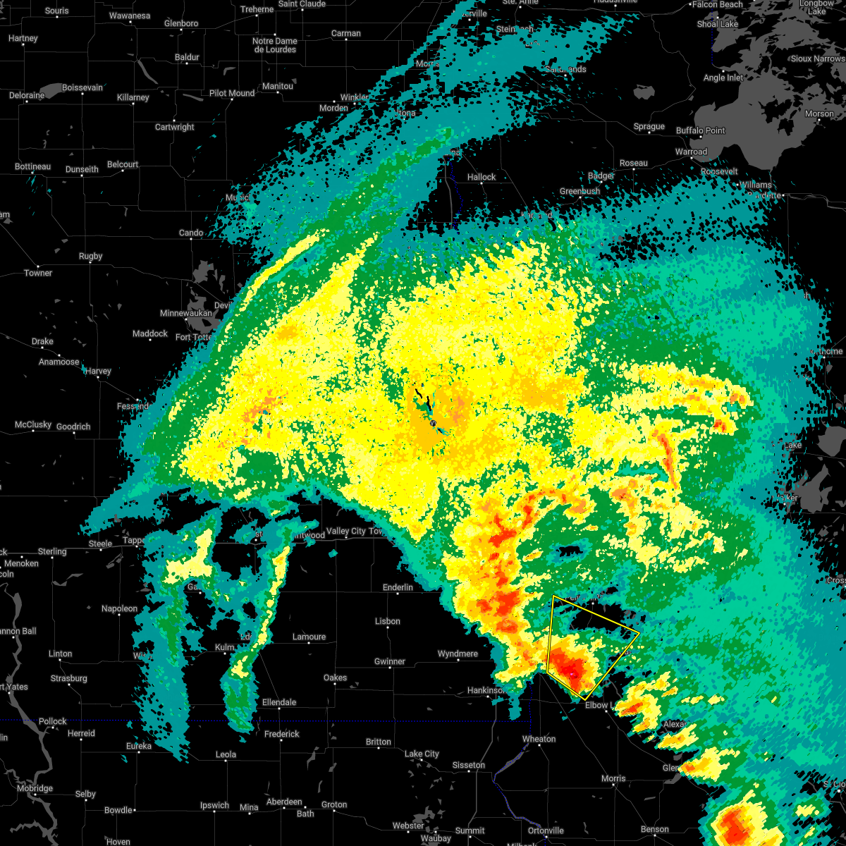 At 812 am cdt, a severe thunderstorm was located near foxhome, or 11 miles southwest of fergus falls, moving northeast at 65 mph (radar indicated). Hazards include ping pong ball size hail and 60 mph wind gusts. People and animals outdoors will be injured. expect hail damage to roofs, siding, windows, and vehicles. expect wind damage to roofs, siding, and trees. locations impacted include, fergus falls, rothsay, underwood, elizabeth, erhard, foxhome and carlisle. this includes interstate 94 in minnesota between mile markers 30 and 63. hail threat, radar indicated max hail size, 1. 50 in wind threat, radar indicated max wind gust, 60 mph. At 812 am cdt, a severe thunderstorm was located near foxhome, or 11 miles southwest of fergus falls, moving northeast at 65 mph (radar indicated). Hazards include ping pong ball size hail and 60 mph wind gusts. People and animals outdoors will be injured. expect hail damage to roofs, siding, windows, and vehicles. expect wind damage to roofs, siding, and trees. locations impacted include, fergus falls, rothsay, underwood, elizabeth, erhard, foxhome and carlisle. this includes interstate 94 in minnesota between mile markers 30 and 63. hail threat, radar indicated max hail size, 1. 50 in wind threat, radar indicated max wind gust, 60 mph.
|
| 5/9/2022 7:50 AM CDT |
 At 750 am cdt, a severe thunderstorm was located over white rock, or 25 miles south of wahpeton, moving northeast at 65 mph (radar indicated). Hazards include ping pong ball size hail and 60 mph wind gusts. People and animals outdoors will be injured. expect hail damage to roofs, siding, windows, and vehicles. Expect wind damage to roofs, siding, and trees. At 750 am cdt, a severe thunderstorm was located over white rock, or 25 miles south of wahpeton, moving northeast at 65 mph (radar indicated). Hazards include ping pong ball size hail and 60 mph wind gusts. People and animals outdoors will be injured. expect hail damage to roofs, siding, windows, and vehicles. Expect wind damage to roofs, siding, and trees.
|
| 10/9/2021 8:06 PM CDT |
 At 805 pm cdt, severe thunderstorms were located along a line extending from near barrie to 6 miles southwest of rothsay to near erdahl, moving northeast at 35 mph (radar indicated). Hazards include 60 mph wind gusts. Expect damage to roofs, siding, and trees. severe thunderstorms will be near, erdahl around 810 pm cdt. rothsay and carlisle around 815 pm cdt. elizabeth around 820 pm cdt. other locations in the path of these severe thunderstorms include erhard, christine, hickson, oxbow and maplewood state park. this includes the following highways, interstate 29 between mile markers 34 and 56. Interstate 94 in minnesota between mile markers 16 and 80. At 805 pm cdt, severe thunderstorms were located along a line extending from near barrie to 6 miles southwest of rothsay to near erdahl, moving northeast at 35 mph (radar indicated). Hazards include 60 mph wind gusts. Expect damage to roofs, siding, and trees. severe thunderstorms will be near, erdahl around 810 pm cdt. rothsay and carlisle around 815 pm cdt. elizabeth around 820 pm cdt. other locations in the path of these severe thunderstorms include erhard, christine, hickson, oxbow and maplewood state park. this includes the following highways, interstate 29 between mile markers 34 and 56. Interstate 94 in minnesota between mile markers 16 and 80.
|
| 10/9/2021 7:51 PM CDT |
 At 750 pm cdt, severe thunderstorms were located along a line extending from near venlo to near everdell to near barrett, moving northeast at 40 mph (radar indicated). Hazards include 60 mph wind gusts. Expect damage to roofs, siding, and trees. locations impacted include, everdell, foxhome, hoffman, barrett, elbow lake, carlisle, rothsay, erdahl and ashby. this includes the following highways, interstate 29 between mile markers 18 and 40. Interstate 94 in minnesota between mile markers 40 and 81. At 750 pm cdt, severe thunderstorms were located along a line extending from near venlo to near everdell to near barrett, moving northeast at 40 mph (radar indicated). Hazards include 60 mph wind gusts. Expect damage to roofs, siding, and trees. locations impacted include, everdell, foxhome, hoffman, barrett, elbow lake, carlisle, rothsay, erdahl and ashby. this includes the following highways, interstate 29 between mile markers 18 and 40. Interstate 94 in minnesota between mile markers 40 and 81.
|
| 10/9/2021 7:26 PM CDT |
 At 726 pm cdt, severe thunderstorms were located along a line extending from near mcleod to near doran to near norcross, moving northeast at 55 mph (radar indicated). Hazards include 70 mph wind gusts and penny size hail. Expect considerable tree damage. damage is likely to mobile homes, roofs, and outbuildings. severe thunderstorms will be near, norcross, doran and herman around 730 pm cdt. everdell around 735 pm cdt. foxhome around 740 pm cdt. elbow lake and wendell around 745 pm cdt. other locations in the path of these severe thunderstorms include carlisle, rothsay and elizabeth. this includes the following highways, interstate 29 between mile markers 7 and 40. Interstate 94 in minnesota between mile markers 40 and 81. At 726 pm cdt, severe thunderstorms were located along a line extending from near mcleod to near doran to near norcross, moving northeast at 55 mph (radar indicated). Hazards include 70 mph wind gusts and penny size hail. Expect considerable tree damage. damage is likely to mobile homes, roofs, and outbuildings. severe thunderstorms will be near, norcross, doran and herman around 730 pm cdt. everdell around 735 pm cdt. foxhome around 740 pm cdt. elbow lake and wendell around 745 pm cdt. other locations in the path of these severe thunderstorms include carlisle, rothsay and elizabeth. this includes the following highways, interstate 29 between mile markers 7 and 40. Interstate 94 in minnesota between mile markers 40 and 81.
|
| 8/24/2021 2:44 AM CDT |
 At 243 am cdt, severe thunderstorms were located along a line extending from 6 miles northeast of wolverton to near doran to white rock, moving east at 50 mph (radar indicated). Hazards include 60 mph wind gusts and penny size hail. Expect damage to roofs, siding, and trees. locations impacted include, doran, everdell, foxhome, western, norcross and herman. this includes the following highways, interstate 29 between mile markers 0 and 37. interstate 94 in minnesota between mile markers 40 and 80. hail threat, radar indicated max hail size, 0. 75 in wind threat, radar indicated max wind gust, 60 mph. At 243 am cdt, severe thunderstorms were located along a line extending from 6 miles northeast of wolverton to near doran to white rock, moving east at 50 mph (radar indicated). Hazards include 60 mph wind gusts and penny size hail. Expect damage to roofs, siding, and trees. locations impacted include, doran, everdell, foxhome, western, norcross and herman. this includes the following highways, interstate 29 between mile markers 0 and 37. interstate 94 in minnesota between mile markers 40 and 80. hail threat, radar indicated max hail size, 0. 75 in wind threat, radar indicated max wind gust, 60 mph.
|
| 8/24/2021 2:14 AM CDT |
 At 214 am cdt, severe thunderstorms were located along a line extending from near kindred to near mooreton to lake traverse reservation, moving east at 50 mph (radar indicated). Hazards include 60 mph wind gusts and nickel size hail. Expect damage to roofs, siding, and trees. severe thunderstorms will be near, mooreton around 215 am cdt. walcott and great bend around 220 am cdt. dwight around 225 am cdt. christine, wolverton and lamars around 230 am cdt. other locations in the path of these severe thunderstorms include breckenridge, wahpeton and blackmer. this includes the following highways, interstate 29 between mile markers 0 and 48. interstate 94 in minnesota between mile markers 28 and 80. hail threat, radar indicated max hail size, 0. 88 in wind threat, radar indicated max wind gust, 60 mph. At 214 am cdt, severe thunderstorms were located along a line extending from near kindred to near mooreton to lake traverse reservation, moving east at 50 mph (radar indicated). Hazards include 60 mph wind gusts and nickel size hail. Expect damage to roofs, siding, and trees. severe thunderstorms will be near, mooreton around 215 am cdt. walcott and great bend around 220 am cdt. dwight around 225 am cdt. christine, wolverton and lamars around 230 am cdt. other locations in the path of these severe thunderstorms include breckenridge, wahpeton and blackmer. this includes the following highways, interstate 29 between mile markers 0 and 48. interstate 94 in minnesota between mile markers 28 and 80. hail threat, radar indicated max hail size, 0. 88 in wind threat, radar indicated max wind gust, 60 mph.
|
| 7/24/2021 1:09 AM CDT |
 At 109 am cdt, a severe thunderstorm was located over dalton, or 10 miles southeast of fergus falls, moving east at 45 mph (radar indicated). Hazards include 60 mph wind gusts and quarter size hail. Hail damage to vehicles is expected. expect wind damage to roofs, siding, and trees. locations impacted include, underwood and ashby. This includes interstate 94 in minnesota between mile markers 52 and 73. At 109 am cdt, a severe thunderstorm was located over dalton, or 10 miles southeast of fergus falls, moving east at 45 mph (radar indicated). Hazards include 60 mph wind gusts and quarter size hail. Hail damage to vehicles is expected. expect wind damage to roofs, siding, and trees. locations impacted include, underwood and ashby. This includes interstate 94 in minnesota between mile markers 52 and 73.
|
| 7/24/2021 12:41 AM CDT |
 At 1241 am cdt, a severe thunderstorm was located near foxhome, or 13 miles southwest of fergus falls, moving east at 40 mph (radar indicated). Hazards include 60 mph wind gusts and half dollar size hail. Hail damage to vehicles is expected. expect wind damage to roofs, siding, and trees. this severe thunderstorm will be near, western around 1250 am cdt. fergus falls around 100 am cdt. other locations in the path of this severe thunderstorm include dalton, ashby and underwood. This includes interstate 94 in minnesota between mile markers 52 and 73. At 1241 am cdt, a severe thunderstorm was located near foxhome, or 13 miles southwest of fergus falls, moving east at 40 mph (radar indicated). Hazards include 60 mph wind gusts and half dollar size hail. Hail damage to vehicles is expected. expect wind damage to roofs, siding, and trees. this severe thunderstorm will be near, western around 1250 am cdt. fergus falls around 100 am cdt. other locations in the path of this severe thunderstorm include dalton, ashby and underwood. This includes interstate 94 in minnesota between mile markers 52 and 73.
|
| 7/19/2021 4:10 PM CDT |
 The severe thunderstorm warning for southwestern otter tail, wilkin, southeastern ransom, richland and northeastern sargent counties will expire at 415 pm cdt, the storms which prompted the warning have weakened below severe limits, and no longer pose an immediate threat to life or property. therefore, the warning will be allowed to expire. The severe thunderstorm warning for southwestern otter tail, wilkin, southeastern ransom, richland and northeastern sargent counties will expire at 415 pm cdt, the storms which prompted the warning have weakened below severe limits, and no longer pose an immediate threat to life or property. therefore, the warning will be allowed to expire.
|
| 7/19/2021 3:41 PM CDT |
 At 340 pm cdt, severe thunderstorms were located along a line extending from lawndale to 8 miles north of everdell to near lidgerwood, moving south at 40 mph (radar indicated). Hazards include 60 mph wind gusts. Expect damage to roofs, siding, and trees. locations impacted include, lidgerwood, stiles, everdell, doran and carlisle. this includes the following highways, interstate 29 between mile markers 0 and 33. Interstate 94 in minnesota between mile markers 28 and 56. At 340 pm cdt, severe thunderstorms were located along a line extending from lawndale to 8 miles north of everdell to near lidgerwood, moving south at 40 mph (radar indicated). Hazards include 60 mph wind gusts. Expect damage to roofs, siding, and trees. locations impacted include, lidgerwood, stiles, everdell, doran and carlisle. this includes the following highways, interstate 29 between mile markers 0 and 33. Interstate 94 in minnesota between mile markers 28 and 56.
|
| 7/19/2021 3:13 PM CDT |
 At 312 pm cdt, severe thunderstorms were located along a line extending from near glyndon to 6 miles east of comstock to mcleod, moving south at 40 mph (radar indicated). Hazards include 60 mph wind gusts and penny size hail. Expect damage to roofs, siding, and trees. severe thunderstorms will be near, wolverton around 315 pm cdt. de lamere around 325 pm cdt. barnesville, wyndmere and kent around 330 pm cdt. other locations in the path of these severe thunderstorms include hamlin, brushvale and lawndale. this includes the following highways, interstate 29 between mile markers 0 and 52. Interstate 94 in minnesota between mile markers 7 and 56. At 312 pm cdt, severe thunderstorms were located along a line extending from near glyndon to 6 miles east of comstock to mcleod, moving south at 40 mph (radar indicated). Hazards include 60 mph wind gusts and penny size hail. Expect damage to roofs, siding, and trees. severe thunderstorms will be near, wolverton around 315 pm cdt. de lamere around 325 pm cdt. barnesville, wyndmere and kent around 330 pm cdt. other locations in the path of these severe thunderstorms include hamlin, brushvale and lawndale. this includes the following highways, interstate 29 between mile markers 0 and 52. Interstate 94 in minnesota between mile markers 7 and 56.
|
| 6/11/2021 6:36 AM CDT |
 The severe thunderstorm warning for clay, otter tail, grant, wilkin, southeastern mahnomen, becker and south central clearwater counties will expire at 645 am cdt, the storms which prompted the warning have weakened below severe limits, and no longer pose an immediate threat to life or property. therefore, the warning will be allowed to expire. however small hail and gusty winds are still possible with these thunderstorms. a severe thunderstorm watch remains in effect until 700 am cdt for northwestern and west central minnesota, and southeastern north dakota. The severe thunderstorm warning for clay, otter tail, grant, wilkin, southeastern mahnomen, becker and south central clearwater counties will expire at 645 am cdt, the storms which prompted the warning have weakened below severe limits, and no longer pose an immediate threat to life or property. therefore, the warning will be allowed to expire. however small hail and gusty winds are still possible with these thunderstorms. a severe thunderstorm watch remains in effect until 700 am cdt for northwestern and west central minnesota, and southeastern north dakota.
|
| 6/11/2021 6:15 AM CDT |
 At 613 am cdt, severe thunderstorms were located along a line extending from white earth nation to near ashby, moving east at 60 mph (radar indicated). Hazards include 60 mph wind gusts and quarter size hail. Hail damage to vehicles is expected. expect wind damage to roofs, siding, and trees. Locations impacted include, fergus falls, detroit lakes, moorhead, dilworth, breckenridge, perham and barnesville. At 613 am cdt, severe thunderstorms were located along a line extending from white earth nation to near ashby, moving east at 60 mph (radar indicated). Hazards include 60 mph wind gusts and quarter size hail. Hail damage to vehicles is expected. expect wind damage to roofs, siding, and trees. Locations impacted include, fergus falls, detroit lakes, moorhead, dilworth, breckenridge, perham and barnesville.
|
| 6/11/2021 5:47 AM CDT |
 At 546 am cdt, severe thunderstorms were located along a line extending from hitterdal to near nashua, moving east at 55 mph (radar indicated). Hazards include 60 mph wind gusts and quarter size hail. Hail damage to vehicles is expected. Expect wind damage to roofs, siding, and trees. At 546 am cdt, severe thunderstorms were located along a line extending from hitterdal to near nashua, moving east at 55 mph (radar indicated). Hazards include 60 mph wind gusts and quarter size hail. Hail damage to vehicles is expected. Expect wind damage to roofs, siding, and trees.
|
| 6/11/2021 5:39 AM CDT |
 At 538 am cdt, severe thunderstorms were located along a line extending from 6 miles west of hitterdal to campbell, moving east at 60 mph (radar indicated). Hazards include 60 mph wind gusts and quarter size hail. Hail damage to vehicles is expected. Expect wind damage to roofs, siding, and trees. At 538 am cdt, severe thunderstorms were located along a line extending from 6 miles west of hitterdal to campbell, moving east at 60 mph (radar indicated). Hazards include 60 mph wind gusts and quarter size hail. Hail damage to vehicles is expected. Expect wind damage to roofs, siding, and trees.
|
| 6/11/2021 5:18 AM CDT |
 At 517 am cdt, severe thunderstorms were located along a line extending from north river to near hankinson, moving east at 135 mph (radar indicated). Hazards include 70 mph wind gusts and quarter size hail. Hail damage to vehicles is expected. expect considerable tree damage. wind damage is also likely to mobile homes, roofs, and outbuildings. locations impacted include, fargo, wahpeton, moorhead, west fargo, dilworth, breckenridge and barnesville. Time, mot, loc 1017z 259deg 115kt 4695 9681 4604 9683. At 517 am cdt, severe thunderstorms were located along a line extending from north river to near hankinson, moving east at 135 mph (radar indicated). Hazards include 70 mph wind gusts and quarter size hail. Hail damage to vehicles is expected. expect considerable tree damage. wind damage is also likely to mobile homes, roofs, and outbuildings. locations impacted include, fargo, wahpeton, moorhead, west fargo, dilworth, breckenridge and barnesville. Time, mot, loc 1017z 259deg 115kt 4695 9681 4604 9683.
|
| 6/11/2021 4:42 AM CDT |
 At 442 am cdt, severe thunderstorms were located along a line extending from near wheatland to near geneseo, moving east at 60 mph (radar indicated). Hazards include 70 mph wind gusts. Expect considerable tree damage. Damage is likely to mobile homes, roofs, and outbuildings. At 442 am cdt, severe thunderstorms were located along a line extending from near wheatland to near geneseo, moving east at 60 mph (radar indicated). Hazards include 70 mph wind gusts. Expect considerable tree damage. Damage is likely to mobile homes, roofs, and outbuildings.
|
| 6/7/2021 11:51 PM CDT |
 At 1151 pm cdt, severe thunderstorms were located along a line extending from vergas to 6 miles west of dalton, moving east at 35 mph (radar indicated). Hazards include 60 mph wind gusts. Expect damage to roofs, siding, and trees. Locations impacted include, fergus falls, perham, pelican rapids, ottertail lake, lake lida, battle lake and ottertail. At 1151 pm cdt, severe thunderstorms were located along a line extending from vergas to 6 miles west of dalton, moving east at 35 mph (radar indicated). Hazards include 60 mph wind gusts. Expect damage to roofs, siding, and trees. Locations impacted include, fergus falls, perham, pelican rapids, ottertail lake, lake lida, battle lake and ottertail.
|
| 6/7/2021 11:26 PM CDT |
 At 1125 pm cdt, severe thunderstorms were located along a line extending from near cormorant to near everdell, moving east at 35 mph (radar indicated. at 2318, a wind gust to 64 mph was reported at rothsay). Hazards include 70 mph wind gusts. Expect considerable tree damage. Damage is likely to mobile homes, roofs, and outbuildings. At 1125 pm cdt, severe thunderstorms were located along a line extending from near cormorant to near everdell, moving east at 35 mph (radar indicated. at 2318, a wind gust to 64 mph was reported at rothsay). Hazards include 70 mph wind gusts. Expect considerable tree damage. Damage is likely to mobile homes, roofs, and outbuildings.
|
| 8/14/2020 4:31 AM CDT |
 At 431 am cdt, a severe thunderstorm was located over brushvale, or near wahpeton, moving northeast at 25 mph (radar indicated). Hazards include half dollar size hail. Damage to vehicles is expected. locations impacted include, wahpeton, foxhome, dwight, lawndale, brushvale, everdell and breckenridge. this includes the following highways, interstate 29 near mile marker 28. Interstate 94 in minnesota near mile marker 29. At 431 am cdt, a severe thunderstorm was located over brushvale, or near wahpeton, moving northeast at 25 mph (radar indicated). Hazards include half dollar size hail. Damage to vehicles is expected. locations impacted include, wahpeton, foxhome, dwight, lawndale, brushvale, everdell and breckenridge. this includes the following highways, interstate 29 near mile marker 28. Interstate 94 in minnesota near mile marker 29.
|
| 8/14/2020 4:04 AM CDT |
 At 404 am cdt, a severe thunderstorm was located over dwight, or 9 miles west of wahpeton, moving northeast at 20 mph (radar indicated). Hazards include half dollar size hail. damage to vehicles is expected At 404 am cdt, a severe thunderstorm was located over dwight, or 9 miles west of wahpeton, moving northeast at 20 mph (radar indicated). Hazards include half dollar size hail. damage to vehicles is expected
|
| 8/14/2020 3:18 AM CDT |
 At 318 am cdt, a severe thunderstorm was located near carlisle, or near fergus falls, moving northeast at 25 mph (radar indicated). Hazards include half dollar size hail. damage to vehicles is expected At 318 am cdt, a severe thunderstorm was located near carlisle, or near fergus falls, moving northeast at 25 mph (radar indicated). Hazards include half dollar size hail. damage to vehicles is expected
|
| 8/14/2020 12:12 AM CDT |
 At 1212 am cdt, severe thunderstorms were located along a line extending from near frazee to near carlisle, moving east at 25 mph (radar indicated). Hazards include 60 mph wind gusts and nickel size hail. Expect damage to roofs, siding, and trees. locations impacted include, fergus falls, perham, ottertail lake, frazee, lake lida, new york mills and battle lake. This includes interstate 94 in minnesota between mile markers 42 and 65. At 1212 am cdt, severe thunderstorms were located along a line extending from near frazee to near carlisle, moving east at 25 mph (radar indicated). Hazards include 60 mph wind gusts and nickel size hail. Expect damage to roofs, siding, and trees. locations impacted include, fergus falls, perham, ottertail lake, frazee, lake lida, new york mills and battle lake. This includes interstate 94 in minnesota between mile markers 42 and 65.
|
| 8/13/2020 11:41 PM CDT |
 At 1141 pm cdt, severe thunderstorms were located along a line extending from near cormorant to 8 miles north of everdell, moving east at 25 mph (radar indicated). Hazards include 60 mph wind gusts and quarter size hail. Hail damage to vehicles is expected. Expect wind damage to roofs, siding, and trees. At 1141 pm cdt, severe thunderstorms were located along a line extending from near cormorant to 8 miles north of everdell, moving east at 25 mph (radar indicated). Hazards include 60 mph wind gusts and quarter size hail. Hail damage to vehicles is expected. Expect wind damage to roofs, siding, and trees.
|
| 7/9/2020 1:20 AM CDT |
 The severe thunderstorm warning for west central otter tail, wilkin and eastern richland counties will expire at 130 am cdt, the storms which prompted the warning have weakened below severe limits, and no longer poses an immediate threat to life or property. therefore, the warning will be allowed to expire. however gusty winds are still possible with these thunderstorms. to report severe weather, contact your nearest law enforcement agency. they will relay your report to the national weather service grand forks. The severe thunderstorm warning for west central otter tail, wilkin and eastern richland counties will expire at 130 am cdt, the storms which prompted the warning have weakened below severe limits, and no longer poses an immediate threat to life or property. therefore, the warning will be allowed to expire. however gusty winds are still possible with these thunderstorms. to report severe weather, contact your nearest law enforcement agency. they will relay your report to the national weather service grand forks.
|
| 7/9/2020 12:50 AM CDT |
 At 1250 am cdt, severe thunderstorms were located along a line extending from everdell to near great bend, moving northeast at 50 mph (radar indicated). Hazards include ping pong ball size hail and 60 mph wind gusts. People and animals outdoors will be injured. expect hail damage to roofs, siding, windows, and vehicles. expect wind damage to roofs, siding, and trees. severe thunderstorms will be near, foxhome and everdell around 1255 am cdt. carlisle, elizabeth and brushvale around 105 am cdt. rothsay around 110 am cdt. erhard and edwards around 115 am cdt. other locations impacted by these severe thunderstorms include fergus falls airport. This includes interstate 94 in minnesota between mile markers 34 and 54. At 1250 am cdt, severe thunderstorms were located along a line extending from everdell to near great bend, moving northeast at 50 mph (radar indicated). Hazards include ping pong ball size hail and 60 mph wind gusts. People and animals outdoors will be injured. expect hail damage to roofs, siding, windows, and vehicles. expect wind damage to roofs, siding, and trees. severe thunderstorms will be near, foxhome and everdell around 1255 am cdt. carlisle, elizabeth and brushvale around 105 am cdt. rothsay around 110 am cdt. erhard and edwards around 115 am cdt. other locations impacted by these severe thunderstorms include fergus falls airport. This includes interstate 94 in minnesota between mile markers 34 and 54.
|
| 7/8/2020 4:39 AM CDT |
 At 438 am cdt, severe thunderstorms were located along a line extending from near edwards to near charlesville, moving east at 50 mph. these are very dangerous storms (observed. at 435 am, 83 mph winds were reported at the fergus falls airport). Hazards include 80 mph wind gusts and nickel size hail. Flying debris will be dangerous to those caught without shelter. mobile homes will be heavily damaged. expect considerable damage to roofs, windows, and vehicles. extensive tree damage and power outages are likely. these severe storms will be near, maplewood state park, star lake and edwards around 440 am cdt. amor and phelps around 445 am cdt. ottertail lake and glendalough state park around 450 am cdt. richville and elbow lake around 455 am cdt. barrett and ottertail around 500 am cdt. other locations impacted by these severe thunderstorms include fergus falls airport. this includes the following highways, interstate 29 between mile markers 0 and 27. Interstate 94 in minnesota between mile markers 29 and 80. At 438 am cdt, severe thunderstorms were located along a line extending from near edwards to near charlesville, moving east at 50 mph. these are very dangerous storms (observed. at 435 am, 83 mph winds were reported at the fergus falls airport). Hazards include 80 mph wind gusts and nickel size hail. Flying debris will be dangerous to those caught without shelter. mobile homes will be heavily damaged. expect considerable damage to roofs, windows, and vehicles. extensive tree damage and power outages are likely. these severe storms will be near, maplewood state park, star lake and edwards around 440 am cdt. amor and phelps around 445 am cdt. ottertail lake and glendalough state park around 450 am cdt. richville and elbow lake around 455 am cdt. barrett and ottertail around 500 am cdt. other locations impacted by these severe thunderstorms include fergus falls airport. this includes the following highways, interstate 29 between mile markers 0 and 27. Interstate 94 in minnesota between mile markers 29 and 80.
|
| 7/8/2020 4:31 AM CDT |
 At 430 am cdt, severe thunderstorms were located along a line extending from edwards to 6 miles west of charlesville, moving east at 50 mph (radar indicated). Hazards include 70 mph wind gusts and nickel size hail. Expect considerable tree damage. damage is likely to mobile homes, roofs, and outbuildings. these severe storms will be near, maplewood state park and edwards around 435 am cdt. star lake and phelps around 440 am cdt. amor, ottertail lake and herman around 445 am cdt. richville and glendalough state park around 450 am cdt. ottertail and elbow lake around 455 am cdt. other locations impacted by these severe thunderstorms include fergus falls airport. this includes the following highways, interstate 29 between mile markers 0 and 35. Interstate 94 in minnesota between mile markers 29 and 80. At 430 am cdt, severe thunderstorms were located along a line extending from edwards to 6 miles west of charlesville, moving east at 50 mph (radar indicated). Hazards include 70 mph wind gusts and nickel size hail. Expect considerable tree damage. damage is likely to mobile homes, roofs, and outbuildings. these severe storms will be near, maplewood state park and edwards around 435 am cdt. star lake and phelps around 440 am cdt. amor, ottertail lake and herman around 445 am cdt. richville and glendalough state park around 450 am cdt. ottertail and elbow lake around 455 am cdt. other locations impacted by these severe thunderstorms include fergus falls airport. this includes the following highways, interstate 29 between mile markers 0 and 35. Interstate 94 in minnesota between mile markers 29 and 80.
|
| 7/8/2020 4:27 AM CDT |
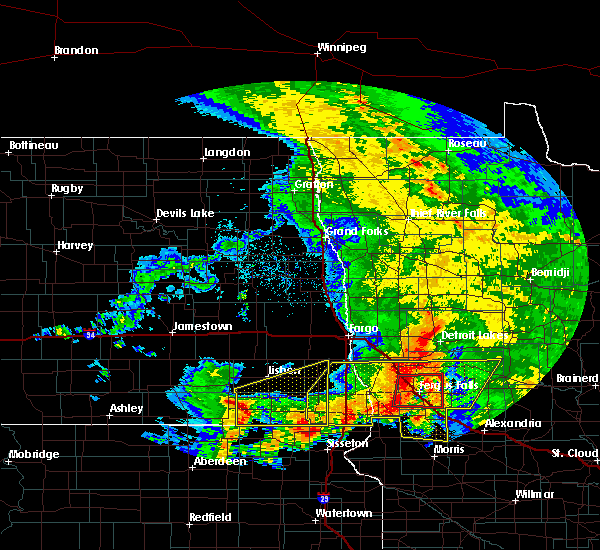 At 427 am cdt, a severe thunderstorm capable of producing a tornado was located over elizabeth, or 8 miles north of fergus falls, moving east at 55 mph (radar indicated rotation). Hazards include tornado. Expect damage to mobile homes, roofs, and vehicles. this dangerous storm will be near, edwards around 435 am cdt. phelps and underwood around 440 am cdt. other locations impacted by this tornadic thunderstorm include fergus falls airport. This includes interstate 94 in minnesota between mile markers 41 and 69. At 427 am cdt, a severe thunderstorm capable of producing a tornado was located over elizabeth, or 8 miles north of fergus falls, moving east at 55 mph (radar indicated rotation). Hazards include tornado. Expect damage to mobile homes, roofs, and vehicles. this dangerous storm will be near, edwards around 435 am cdt. phelps and underwood around 440 am cdt. other locations impacted by this tornadic thunderstorm include fergus falls airport. This includes interstate 94 in minnesota between mile markers 41 and 69.
|
| 7/8/2020 4:14 AM CDT |
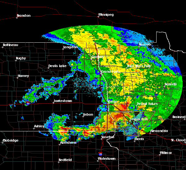 At 413 am cdt, a severe thunderstorm capable of producing a tornado was located 7 miles southwest of rothsay, or 14 miles northeast of wahpeton, moving east at 50 mph (radar indicated rotation). Hazards include tornado. Expect damage to mobile homes, roofs, and vehicles. this dangerous storm will be near, foxhome around 415 am cdt. carlisle and elizabeth around 425 am cdt. fergus falls around 430 am cdt. edwards around 435 am cdt. phelps and underwood around 445 am cdt. other locations impacted by this tornadic thunderstorm include fergus falls airport. This includes interstate 94 in minnesota between mile markers 40 and 69. At 413 am cdt, a severe thunderstorm capable of producing a tornado was located 7 miles southwest of rothsay, or 14 miles northeast of wahpeton, moving east at 50 mph (radar indicated rotation). Hazards include tornado. Expect damage to mobile homes, roofs, and vehicles. this dangerous storm will be near, foxhome around 415 am cdt. carlisle and elizabeth around 425 am cdt. fergus falls around 430 am cdt. edwards around 435 am cdt. phelps and underwood around 445 am cdt. other locations impacted by this tornadic thunderstorm include fergus falls airport. This includes interstate 94 in minnesota between mile markers 40 and 69.
|
| 7/8/2020 3:58 AM CDT |
 At 358 am cdt, severe thunderstorms were located along a line extending from 8 miles east of kent to 6 miles north of new effington, moving east at 50 mph (radar indicated). Hazards include 60 mph wind gusts and nickel size hail. Expect damage to roofs, siding, and trees. severe thunderstorms will be near, lawndale around 405 am cdt. lamars and rothsay around 410 am cdt. blackmer and carlisle around 415 am cdt. erhard and elizabeth around 420 am cdt. southwestern lake lida and tenney around 425 am cdt. other locations impacted by these severe thunderstorms include fergus falls airport. this includes the following highways, interstate 29 between mile markers 0 and 46. Interstate 94 in minnesota between mile markers 29 and 80. At 358 am cdt, severe thunderstorms were located along a line extending from 8 miles east of kent to 6 miles north of new effington, moving east at 50 mph (radar indicated). Hazards include 60 mph wind gusts and nickel size hail. Expect damage to roofs, siding, and trees. severe thunderstorms will be near, lawndale around 405 am cdt. lamars and rothsay around 410 am cdt. blackmer and carlisle around 415 am cdt. erhard and elizabeth around 420 am cdt. southwestern lake lida and tenney around 425 am cdt. other locations impacted by these severe thunderstorms include fergus falls airport. this includes the following highways, interstate 29 between mile markers 0 and 46. Interstate 94 in minnesota between mile markers 29 and 80.
|
| 7/8/2020 3:49 AM CDT |
 At 349 am cdt, severe thunderstorms were located along a line extending from near rustad to near stiles, moving east at 40 mph (radar indicated). Hazards include 60 mph wind gusts and penny size hail. Expect damage to roofs, siding, and trees. these severe storms will be near, rustad, comstock and oxbow around 350 am cdt. baker around 400 am cdt. downer and barnesville around 405 am cdt. sonora and lamars around 410 am cdt. fairmount and blackmer around 415 am cdt. this includes the following highways, interstate 29 between mile markers 0 and 56. Interstate 94 in minnesota between mile markers 15 and 38. At 349 am cdt, severe thunderstorms were located along a line extending from near rustad to near stiles, moving east at 40 mph (radar indicated). Hazards include 60 mph wind gusts and penny size hail. Expect damage to roofs, siding, and trees. these severe storms will be near, rustad, comstock and oxbow around 350 am cdt. baker around 400 am cdt. downer and barnesville around 405 am cdt. sonora and lamars around 410 am cdt. fairmount and blackmer around 415 am cdt. this includes the following highways, interstate 29 between mile markers 0 and 56. Interstate 94 in minnesota between mile markers 15 and 38.
|
| 7/8/2020 3:42 AM CDT |
 At 342 am cdt, severe thunderstorms were located along a line extending from near comstock to near stiles, moving east at 40 mph (radar indicated). Hazards include 60 mph wind gusts and penny size hail. Expect damage to roofs, siding, and trees. these severe storms will be near, rustad, comstock and oxbow around 345 am cdt. baker around 355 am cdt. downer and barnesville around 400 am cdt. sonora and lamars around 405 am cdt. fairmount and blackmer around 410 am cdt. this includes the following highways, interstate 29 between mile markers 0 and 56. Interstate 94 in minnesota between mile markers 15 and 38. At 342 am cdt, severe thunderstorms were located along a line extending from near comstock to near stiles, moving east at 40 mph (radar indicated). Hazards include 60 mph wind gusts and penny size hail. Expect damage to roofs, siding, and trees. these severe storms will be near, rustad, comstock and oxbow around 345 am cdt. baker around 355 am cdt. downer and barnesville around 400 am cdt. sonora and lamars around 405 am cdt. fairmount and blackmer around 410 am cdt. this includes the following highways, interstate 29 between mile markers 0 and 56. Interstate 94 in minnesota between mile markers 15 and 38.
|
| 7/8/2020 3:22 AM CDT |
 At 322 am cdt, severe thunderstorms were located along a line extending from kindred to 6 miles south of geneseo, moving east at 50 mph (radar indicated). Hazards include 60 mph wind gusts and penny size hail. Expect damage to roofs, siding, and trees. severe thunderstorms will be near, kindred and davenport around 325 am cdt. oxbow, hickson and comstock around 335 am cdt. hankinson around 345 am cdt. baker and downer around 350 am cdt. barnesville, lamars and sonora around 355 am cdt. this includes the following highways, interstate 29 between mile markers 0 and 56. Interstate 94 in minnesota between mile markers 15 and 38. At 322 am cdt, severe thunderstorms were located along a line extending from kindred to 6 miles south of geneseo, moving east at 50 mph (radar indicated). Hazards include 60 mph wind gusts and penny size hail. Expect damage to roofs, siding, and trees. severe thunderstorms will be near, kindred and davenport around 325 am cdt. oxbow, hickson and comstock around 335 am cdt. hankinson around 345 am cdt. baker and downer around 350 am cdt. barnesville, lamars and sonora around 355 am cdt. this includes the following highways, interstate 29 between mile markers 0 and 56. Interstate 94 in minnesota between mile markers 15 and 38.
|
| 6/9/2020 2:05 AM CDT |
 At 205 am cdt, a severe thunderstorm was located over dwight, or 7 miles west of wahpeton, moving east at 40 mph (radar indicated). Hazards include 60 mph wind gusts and quarter size hail. Hail damage to vehicles is expected. Expect wind damage to roofs, siding, and trees. At 205 am cdt, a severe thunderstorm was located over dwight, or 7 miles west of wahpeton, moving east at 40 mph (radar indicated). Hazards include 60 mph wind gusts and quarter size hail. Hail damage to vehicles is expected. Expect wind damage to roofs, siding, and trees.
|
| 6/7/2020 10:23 PM CDT |
 At 1021 pm cdt, severe thunderstorms were located along a line extending from 6 miles southwest of buffalo river state park to lamars, moving east at 55 mph (radar indicated). Hazards include 60 mph wind gusts. expect damage to roofs, siding, and trees At 1021 pm cdt, severe thunderstorms were located along a line extending from 6 miles southwest of buffalo river state park to lamars, moving east at 55 mph (radar indicated). Hazards include 60 mph wind gusts. expect damage to roofs, siding, and trees
|
| 4/7/2020 1:53 AM CDT |
 At 153 am cdt, a severe thunderstorm was located 7 miles southwest of rothsay, or 13 miles northeast of wahpeton, moving east at 40 mph (radar indicated). Hazards include quarter size hail. damage to vehicles is expected At 153 am cdt, a severe thunderstorm was located 7 miles southwest of rothsay, or 13 miles northeast of wahpeton, moving east at 40 mph (radar indicated). Hazards include quarter size hail. damage to vehicles is expected
|
| 9/2/2019 7:27 PM CDT |
 At 726 pm cdt, severe thunderstorms were located along a line extending from fergus falls to near wheaton, moving southeast at 40 mph (radar indicated). Hazards include 70 mph wind gusts and quarter size hail. Hail damage to vehicles is expected. expect considerable tree damage. Wind damage is also likely to mobile homes, roofs, and outbuildings. At 726 pm cdt, severe thunderstorms were located along a line extending from fergus falls to near wheaton, moving southeast at 40 mph (radar indicated). Hazards include 70 mph wind gusts and quarter size hail. Hail damage to vehicles is expected. expect considerable tree damage. Wind damage is also likely to mobile homes, roofs, and outbuildings.
|
| 9/2/2019 7:18 PM CDT |
 At 717 pm cdt, severe thunderstorms were located along a line extending from 6 miles north of foxhome to near lamars to lake city, moving southeast at 40 mph (radar indicated). Hazards include 70 mph wind gusts and half dollar size hail. Hail damage to vehicles is expected. expect considerable tree damage. wind damage is also likely to mobile homes, roofs, and outbuildings. locations impacted include, fergus falls, wahpeton, breckenridge, hankinson, rothsay, fairmount and elizabeth. this includes the following highways, interstate 29 between mile markers 0 and 25. Interstate 94 in minnesota between mile markers 40 and 59. At 717 pm cdt, severe thunderstorms were located along a line extending from 6 miles north of foxhome to near lamars to lake city, moving southeast at 40 mph (radar indicated). Hazards include 70 mph wind gusts and half dollar size hail. Hail damage to vehicles is expected. expect considerable tree damage. wind damage is also likely to mobile homes, roofs, and outbuildings. locations impacted include, fergus falls, wahpeton, breckenridge, hankinson, rothsay, fairmount and elizabeth. this includes the following highways, interstate 29 between mile markers 0 and 25. Interstate 94 in minnesota between mile markers 40 and 59.
|
| 9/2/2019 7:00 PM CDT |
 At 659 pm cdt, severe thunderstorms were located along a line extending from 8 miles east of kent to near hankinson to 7 miles west of hillhead, moving southeast at 40 mph (radar indicated). Hazards include 70 mph wind gusts and half dollar size hail. Hail damage to vehicles is expected. expect considerable tree damage. wind damage is also likely to mobile homes, roofs, and outbuildings. locations impacted include, fergus falls, wahpeton, breckenridge, hankinson, lidgerwood, rothsay and fairmount. this includes the following highways, interstate 29 between mile markers 0 and 45. Interstate 94 in minnesota between mile markers 40 and 59. At 659 pm cdt, severe thunderstorms were located along a line extending from 8 miles east of kent to near hankinson to 7 miles west of hillhead, moving southeast at 40 mph (radar indicated). Hazards include 70 mph wind gusts and half dollar size hail. Hail damage to vehicles is expected. expect considerable tree damage. wind damage is also likely to mobile homes, roofs, and outbuildings. locations impacted include, fergus falls, wahpeton, breckenridge, hankinson, lidgerwood, rothsay and fairmount. this includes the following highways, interstate 29 between mile markers 0 and 45. Interstate 94 in minnesota between mile markers 40 and 59.
|
| 9/2/2019 6:29 PM CDT |
 At 629 pm cdt, severe thunderstorms were located along a line extending from hickson to near wyndmere to near brampton, moving southeast at 40 mph (radar indicated). Hazards include 70 mph wind gusts and half dollar size hail. Hail damage to vehicles is expected. expect considerable tree damage. Wind damage is also likely to mobile homes, roofs, and outbuildings. At 629 pm cdt, severe thunderstorms were located along a line extending from hickson to near wyndmere to near brampton, moving southeast at 40 mph (radar indicated). Hazards include 70 mph wind gusts and half dollar size hail. Hail damage to vehicles is expected. expect considerable tree damage. Wind damage is also likely to mobile homes, roofs, and outbuildings.
|
| 7/8/2019 11:33 PM CDT |
 At 1132 pm cdt, severe thunderstorms were located along a line extending from near toad lake to shoreham to elizabeth, moving east at 40 mph (radar indicated). Hazards include 60 mph wind gusts. Expect damage to roofs, siding, and trees. locations impacted include, fergus falls, detroit lakes, wahpeton, breckenridge, perham, barnesville and pelican rapids. this includes the following highways, interstate 29 between mile markers 25 and 30. Interstate 94 in minnesota between mile markers 18 and 70. At 1132 pm cdt, severe thunderstorms were located along a line extending from near toad lake to shoreham to elizabeth, moving east at 40 mph (radar indicated). Hazards include 60 mph wind gusts. Expect damage to roofs, siding, and trees. locations impacted include, fergus falls, detroit lakes, wahpeton, breckenridge, perham, barnesville and pelican rapids. this includes the following highways, interstate 29 between mile markers 25 and 30. Interstate 94 in minnesota between mile markers 18 and 70.
|
| 7/8/2019 10:42 PM CDT |
 At 1042 pm cdt, severe thunderstorms were located along a line extending from near height of land lake to near rollag to near lawndale, moving east at 40 mph (radar indicated). Hazards include 60 mph wind gusts and quarter size hail. Hail damage to vehicles is expected. Expect wind damage to roofs, siding, and trees. At 1042 pm cdt, severe thunderstorms were located along a line extending from near height of land lake to near rollag to near lawndale, moving east at 40 mph (radar indicated). Hazards include 60 mph wind gusts and quarter size hail. Hail damage to vehicles is expected. Expect wind damage to roofs, siding, and trees.
|
| 8/31/2018 5:05 PM CDT |
 At 503 pm cdt, a severe thunderstorm was located over tenney, or 14 miles southeast of wahpeton, moving northeast at 45 mph (radar indicated). Hazards include 60 mph wind gusts and quarter size hail. Hail damage to vehicles is expected. expect wind damage to roofs, siding, and trees. this severe storm will be near, campbell and nashua around 510 pm cdt. western around 525 pm cdt. fergus falls around 535 pm cdt. dalton around 540 pm cdt. underwood around 545 pm cdt. other locations impacted by this severe thunderstorm include fergus falls airport. This includes interstate 94 in minnesota between mile markers 49 and 68. At 503 pm cdt, a severe thunderstorm was located over tenney, or 14 miles southeast of wahpeton, moving northeast at 45 mph (radar indicated). Hazards include 60 mph wind gusts and quarter size hail. Hail damage to vehicles is expected. expect wind damage to roofs, siding, and trees. this severe storm will be near, campbell and nashua around 510 pm cdt. western around 525 pm cdt. fergus falls around 535 pm cdt. dalton around 540 pm cdt. underwood around 545 pm cdt. other locations impacted by this severe thunderstorm include fergus falls airport. This includes interstate 94 in minnesota between mile markers 49 and 68.
|
| 8/31/2018 4:43 PM CDT |
 At 443 pm cdt, a severe thunderstorm was located over lamars, or 21 miles south of wahpeton, moving northeast at 45 mph (radar indicated). Hazards include 60 mph wind gusts and quarter size hail. Hail damage to vehicles is expected. expect wind damage to roofs, siding, and trees. this severe thunderstorm will be near, lamars and sonora around 445 pm cdt. blackmer around 450 pm cdt. fairmount around 455 pm cdt. tenney around 505 pm cdt. campbell, nashua and doran around 510 pm cdt. other locations impacted by this severe thunderstorm include fergus falls airport. this includes the following highways, interstate 29 between mile markers 2 and 8. Interstate 94 in minnesota between mile markers 48 and 68. At 443 pm cdt, a severe thunderstorm was located over lamars, or 21 miles south of wahpeton, moving northeast at 45 mph (radar indicated). Hazards include 60 mph wind gusts and quarter size hail. Hail damage to vehicles is expected. expect wind damage to roofs, siding, and trees. this severe thunderstorm will be near, lamars and sonora around 445 pm cdt. blackmer around 450 pm cdt. fairmount around 455 pm cdt. tenney around 505 pm cdt. campbell, nashua and doran around 510 pm cdt. other locations impacted by this severe thunderstorm include fergus falls airport. this includes the following highways, interstate 29 between mile markers 2 and 8. Interstate 94 in minnesota between mile markers 48 and 68.
|
| 8/31/2018 4:30 PM CDT |
 At 429 pm cdt, a severe thunderstorm was located near campbell, or 12 miles southeast of wahpeton, moving east at 45 mph. at 421 pm cdt there was a report of quarter sized hail 2 wnw of fairmount, nd (public). Hazards include 60 mph wind gusts and quarter size hail. Hail damage to vehicles is expected. expect wind damage to roofs, siding, and trees. this severe storm will be near, everdell around 435 pm cdt. foxhome around 440 pm cdt. Western around 445 pm cdt. At 429 pm cdt, a severe thunderstorm was located near campbell, or 12 miles southeast of wahpeton, moving east at 45 mph. at 421 pm cdt there was a report of quarter sized hail 2 wnw of fairmount, nd (public). Hazards include 60 mph wind gusts and quarter size hail. Hail damage to vehicles is expected. expect wind damage to roofs, siding, and trees. this severe storm will be near, everdell around 435 pm cdt. foxhome around 440 pm cdt. Western around 445 pm cdt.
|
| 8/31/2018 4:20 PM CDT |
 At 420 pm cdt, a severe thunderstorm was located near doran, or 10 miles south of wahpeton, moving east at 45 mph (radar indicated). Hazards include 60 mph wind gusts and quarter size hail. Hail damage to vehicles is expected. expect wind damage to roofs, siding, and trees. this severe storm will be near, doran around 425 pm cdt. campbell around 430 pm cdt. everdell around 435 pm cdt. foxhome around 440 pm cdt. Western around 445 pm cdt. At 420 pm cdt, a severe thunderstorm was located near doran, or 10 miles south of wahpeton, moving east at 45 mph (radar indicated). Hazards include 60 mph wind gusts and quarter size hail. Hail damage to vehicles is expected. expect wind damage to roofs, siding, and trees. this severe storm will be near, doran around 425 pm cdt. campbell around 430 pm cdt. everdell around 435 pm cdt. foxhome around 440 pm cdt. Western around 445 pm cdt.
|
| 8/31/2018 3:58 PM CDT |
 The national weather service in grand forks has issued a * severe thunderstorm warning for. southwestern otter tail county in west central minnesota. northwestern grant county in west central minnesota. southeastern wilkin county in west central minnesota. Southeastern richland county in southeastern north dakota. The national weather service in grand forks has issued a * severe thunderstorm warning for. southwestern otter tail county in west central minnesota. northwestern grant county in west central minnesota. southeastern wilkin county in west central minnesota. Southeastern richland county in southeastern north dakota.
|
| 8/26/2018 11:01 AM CDT |
 At 1101 am cdt, severe thunderstorms were located along a line extending from near dunvilla to maplewood state park to near fergus falls to near barrett, moving east at 70 mph (radar indicated). Hazards include 70 mph wind gusts and quarter size hail. Hail damage to vehicles is expected. expect considerable tree damage. Wind damage is also likely to mobile homes, roofs, and outbuildings. At 1101 am cdt, severe thunderstorms were located along a line extending from near dunvilla to maplewood state park to near fergus falls to near barrett, moving east at 70 mph (radar indicated). Hazards include 70 mph wind gusts and quarter size hail. Hail damage to vehicles is expected. expect considerable tree damage. Wind damage is also likely to mobile homes, roofs, and outbuildings.
|
| 6/29/2018 4:57 AM CDT |
 At 456 am cdt, severe thunderstorms were located along a line extending from near hitterdal to near barnesville to near great bend, moving east at 60 mph (radar indicated). Hazards include 60 mph wind gusts and penny size hail. Expect damage to roofs, siding, and trees. severe thunderstorms will be near, lawndale, barnesville and hawley around 500 am cdt. dale around 505 am cdt. everdell and lake park around 510 am cdt. pelican rapids, dunvilla and lake lida around 515 am cdt. western around 520 am cdt. other locations impacted by these severe thunderstorms include fergus falls airport. this includes interstate 94 in minnesota between mile markers 9 and 69. This storm has a history of producing measured wind gusts around 60 mph. At 456 am cdt, severe thunderstorms were located along a line extending from near hitterdal to near barnesville to near great bend, moving east at 60 mph (radar indicated). Hazards include 60 mph wind gusts and penny size hail. Expect damage to roofs, siding, and trees. severe thunderstorms will be near, lawndale, barnesville and hawley around 500 am cdt. dale around 505 am cdt. everdell and lake park around 510 am cdt. pelican rapids, dunvilla and lake lida around 515 am cdt. western around 520 am cdt. other locations impacted by these severe thunderstorms include fergus falls airport. this includes interstate 94 in minnesota between mile markers 9 and 69. This storm has a history of producing measured wind gusts around 60 mph.
|
| 6/29/2018 4:36 AM CDT |
 At 435 am cdt, severe thunderstorms were located along a line extending from harwood to near walcott to 6 miles north of claire city, moving east at 50 mph (radar indicated). Hazards include 60 mph wind gusts and penny size hail. Expect damage to roofs, siding, and trees. these severe storms will be near, north river, fargo and christine around 440 am cdt. wolverton, oakport and moorhead around 445 am cdt. lamars, glyndon and sonora around 455 am cdt. blackmer, lawndale and fairmount around 500 am cdt. other locations impacted by these severe thunderstorms include moorhead airport and casselton airport. this includes the following highways, interstate 29 between mile markers 0 and 71. interstate 94 in north dakota between mile markers 331 and 352. Interstate 94 in minnesota between mile markers 1 and 44. At 435 am cdt, severe thunderstorms were located along a line extending from harwood to near walcott to 6 miles north of claire city, moving east at 50 mph (radar indicated). Hazards include 60 mph wind gusts and penny size hail. Expect damage to roofs, siding, and trees. these severe storms will be near, north river, fargo and christine around 440 am cdt. wolverton, oakport and moorhead around 445 am cdt. lamars, glyndon and sonora around 455 am cdt. blackmer, lawndale and fairmount around 500 am cdt. other locations impacted by these severe thunderstorms include moorhead airport and casselton airport. this includes the following highways, interstate 29 between mile markers 0 and 71. interstate 94 in north dakota between mile markers 331 and 352. Interstate 94 in minnesota between mile markers 1 and 44.
|
| 6/29/2018 4:06 AM CDT |
 At 405 am cdt, severe thunderstorms were located along a line extending from absaraka to near venlo to near havana, moving east at 50 mph (radar indicated). Hazards include 60 mph wind gusts and penny size hail. Expect damage to roofs, siding, and trees. severe thunderstorms will be near, wheatland around 410 am cdt. casselton around 415 am cdt. barrie around 420 am cdt. mapleton around 425 am cdt. prosper, walcott and west fargo around 430 am cdt. other locations impacted by these severe thunderstorms include moorhead airport and casselton airport. this includes the following highways, interstate 29 between mile markers 0 and 71. interstate 94 in north dakota between mile markers 309 and 352. Interstate 94 in minnesota between mile markers 1 and 44. At 405 am cdt, severe thunderstorms were located along a line extending from absaraka to near venlo to near havana, moving east at 50 mph (radar indicated). Hazards include 60 mph wind gusts and penny size hail. Expect damage to roofs, siding, and trees. severe thunderstorms will be near, wheatland around 410 am cdt. casselton around 415 am cdt. barrie around 420 am cdt. mapleton around 425 am cdt. prosper, walcott and west fargo around 430 am cdt. other locations impacted by these severe thunderstorms include moorhead airport and casselton airport. this includes the following highways, interstate 29 between mile markers 0 and 71. interstate 94 in north dakota between mile markers 309 and 352. Interstate 94 in minnesota between mile markers 1 and 44.
|
| 6/16/2018 9:40 PM CDT |
 At 940 pm cdt, a severe thunderstorm was located over fergus falls, moving east at 50 mph (radar indicated). Hazards include 70 mph wind gusts and half dollar size hail. Hail damage to vehicles is expected. expect considerable tree damage. wind damage is also likely to mobile homes, roofs, and outbuildings. this severe thunderstorm will be near, dalton around 950 pm cdt. underwood around 955 pm cdt. battle lake and clitherall around 1005 pm cdt. vining and urbank around 1015 pm cdt. parkers prairie and almora around 1025 pm cdt. other locations impacted by this severe thunderstorm include fergus falls airport. this includes interstate 94 in minnesota between mile markers 46 and 80. A tornado watch remains in effect until midnight cdt for west central minnesota. At 940 pm cdt, a severe thunderstorm was located over fergus falls, moving east at 50 mph (radar indicated). Hazards include 70 mph wind gusts and half dollar size hail. Hail damage to vehicles is expected. expect considerable tree damage. wind damage is also likely to mobile homes, roofs, and outbuildings. this severe thunderstorm will be near, dalton around 950 pm cdt. underwood around 955 pm cdt. battle lake and clitherall around 1005 pm cdt. vining and urbank around 1015 pm cdt. parkers prairie and almora around 1025 pm cdt. other locations impacted by this severe thunderstorm include fergus falls airport. this includes interstate 94 in minnesota between mile markers 46 and 80. A tornado watch remains in effect until midnight cdt for west central minnesota.
|
| 6/16/2018 9:27 PM CDT |
 At 927 pm cdt, a severe thunderstorm was located near foxhome, or 8 miles west of fergus falls, moving east at 50 mph (radar indicated). Hazards include 60 mph wind gusts and half dollar size hail. Hail damage to vehicles is expected. expect wind damage to roofs, siding, and trees. this severe storm will be near, carlisle around 930 pm cdt. fergus falls and elizabeth around 935 pm cdt. underwood around 950 pm cdt. amor and phelps around 955 pm cdt. southwestern ottertail lake and battle lake around 1000 pm cdt. other locations impacted by this severe thunderstorm include fergus falls airport. this includes interstate 94 in minnesota between mile markers 32 and 63. A tornado watch remains in effect until midnight cdt for west central minnesota. At 927 pm cdt, a severe thunderstorm was located near foxhome, or 8 miles west of fergus falls, moving east at 50 mph (radar indicated). Hazards include 60 mph wind gusts and half dollar size hail. Hail damage to vehicles is expected. expect wind damage to roofs, siding, and trees. this severe storm will be near, carlisle around 930 pm cdt. fergus falls and elizabeth around 935 pm cdt. underwood around 950 pm cdt. amor and phelps around 955 pm cdt. southwestern ottertail lake and battle lake around 1000 pm cdt. other locations impacted by this severe thunderstorm include fergus falls airport. this includes interstate 94 in minnesota between mile markers 32 and 63. A tornado watch remains in effect until midnight cdt for west central minnesota.
|
| 6/16/2018 9:02 PM CDT |
 At 901 pm cdt, a severe thunderstorm was located over brushvale, or near wahpeton, moving east at 55 mph (radar indicated). Hazards include 60 mph wind gusts and quarter size hail. Hail damage to vehicles is expected. expect wind damage to roofs, siding, and trees. this severe thunderstorm will be near, everdell around 910 pm cdt. foxhome around 915 pm cdt. rothsay around 920 pm cdt. elizabeth and carlisle around 925 pm cdt. fergus falls and erhard around 930 pm cdt. other locations impacted by this severe thunderstorm include fergus falls airport. this includes interstate 94 in minnesota between mile markers 31 and 63. A tornado watch remains in effect until midnight cdt for west central minnesota, and southeastern north dakota. At 901 pm cdt, a severe thunderstorm was located over brushvale, or near wahpeton, moving east at 55 mph (radar indicated). Hazards include 60 mph wind gusts and quarter size hail. Hail damage to vehicles is expected. expect wind damage to roofs, siding, and trees. this severe thunderstorm will be near, everdell around 910 pm cdt. foxhome around 915 pm cdt. rothsay around 920 pm cdt. elizabeth and carlisle around 925 pm cdt. fergus falls and erhard around 930 pm cdt. other locations impacted by this severe thunderstorm include fergus falls airport. this includes interstate 94 in minnesota between mile markers 31 and 63. A tornado watch remains in effect until midnight cdt for west central minnesota, and southeastern north dakota.
|
| 6/16/2018 8:37 AM CDT |
 At 836 am cdt, severe thunderstorms were located along a line extending from near chaffee to sabin to near erhard, moving northeast at 45 mph (radar indicated). Hazards include 60 mph wind gusts and quarter size hail. Hail damage to vehicles is expected. expect wind damage to roofs, siding, and trees. these severe storms will be near, sabin, erhard and baker around 840 am cdt. moorhead, dilworth and pelican rapids around 845 am cdt. glyndon, absaraka and buffalo river state park around 850 am cdt. amenia, dunvilla and averill around 855 am cdt. cormorant around 900 am cdt. other locations impacted by these severe thunderstorms include fargo, moorhead, casselton, and argusville. this includes the following highways, interstate 29 between mile markers 41 and 89. interstate 94 in north dakota between mile markers 316 and 352. Interstate 94 in minnesota between mile markers 1 and 50. At 836 am cdt, severe thunderstorms were located along a line extending from near chaffee to sabin to near erhard, moving northeast at 45 mph (radar indicated). Hazards include 60 mph wind gusts and quarter size hail. Hail damage to vehicles is expected. expect wind damage to roofs, siding, and trees. these severe storms will be near, sabin, erhard and baker around 840 am cdt. moorhead, dilworth and pelican rapids around 845 am cdt. glyndon, absaraka and buffalo river state park around 850 am cdt. amenia, dunvilla and averill around 855 am cdt. cormorant around 900 am cdt. other locations impacted by these severe thunderstorms include fargo, moorhead, casselton, and argusville. this includes the following highways, interstate 29 between mile markers 41 and 89. interstate 94 in north dakota between mile markers 316 and 352. Interstate 94 in minnesota between mile markers 1 and 50.
|
| 6/16/2018 8:23 AM CDT |
 At 822 am cdt, severe thunderstorms were located along a line extending from 6 miles north of sheldon to near comstock to near carlisle, moving northeast at 40 mph (radar indicated). Hazards include 60 mph wind gusts and quarter size hail. Hail damage to vehicles is expected. expect wind damage to roofs, siding, and trees. severe thunderstorms will be near, oxbow, wolverton and comstock around 825 am cdt. elizabeth around 830 am cdt. rothsay, baker and rustad around 835 am cdt. sabin, erhard and briarwood around 840 am cdt. wheatland around 845 am cdt. other locations impacted by these severe thunderstorms include fargo, moorhead, casselton, and argusville. this includes the following highways, interstate 29 between mile markers 34 and 89. interstate 94 in north dakota between mile markers 316 and 352. Interstate 94 in minnesota between mile markers 1 and 50. At 822 am cdt, severe thunderstorms were located along a line extending from 6 miles north of sheldon to near comstock to near carlisle, moving northeast at 40 mph (radar indicated). Hazards include 60 mph wind gusts and quarter size hail. Hail damage to vehicles is expected. expect wind damage to roofs, siding, and trees. severe thunderstorms will be near, oxbow, wolverton and comstock around 825 am cdt. elizabeth around 830 am cdt. rothsay, baker and rustad around 835 am cdt. sabin, erhard and briarwood around 840 am cdt. wheatland around 845 am cdt. other locations impacted by these severe thunderstorms include fargo, moorhead, casselton, and argusville. this includes the following highways, interstate 29 between mile markers 34 and 89. interstate 94 in north dakota between mile markers 316 and 352. Interstate 94 in minnesota between mile markers 1 and 50.
|
| 7/21/2017 7:58 PM CDT |
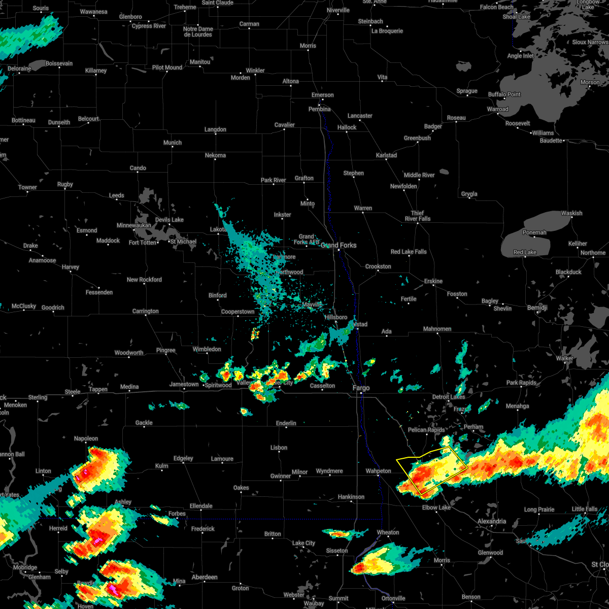 The severe thunderstorm warning for southwestern otter tail and east central wilkin counties will expire at 800 pm cdt, the storm which prompted the warning has weakened below severe limits, and no longer pose an immediate threat to life or property. therefore the warning will be allowed to expire. a severe thunderstorm watch remains in effect until 1100 pm cdt for west central minnesota. The severe thunderstorm warning for southwestern otter tail and east central wilkin counties will expire at 800 pm cdt, the storm which prompted the warning has weakened below severe limits, and no longer pose an immediate threat to life or property. therefore the warning will be allowed to expire. a severe thunderstorm watch remains in effect until 1100 pm cdt for west central minnesota.
|
| 7/21/2017 7:41 PM CDT |
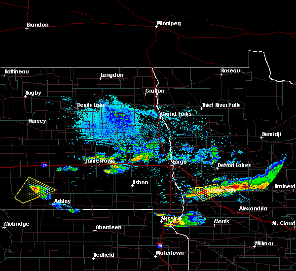 At 741 pm cdt, a severe thunderstorm was located near fergus falls, moving southeast at 20 mph (radar indicated). Hazards include 60 mph wind gusts and penny size hail. Expect damage to roofs, siding, and trees. this severe storm will be near, fergus falls around 750 pm cdt. other locations impacted by this severe thunderstorm include fergus falls airport. This includes interstate 94 in minnesota between mile markers 46 and 64. At 741 pm cdt, a severe thunderstorm was located near fergus falls, moving southeast at 20 mph (radar indicated). Hazards include 60 mph wind gusts and penny size hail. Expect damage to roofs, siding, and trees. this severe storm will be near, fergus falls around 750 pm cdt. other locations impacted by this severe thunderstorm include fergus falls airport. This includes interstate 94 in minnesota between mile markers 46 and 64.
|
| 7/17/2017 3:48 PM CDT |
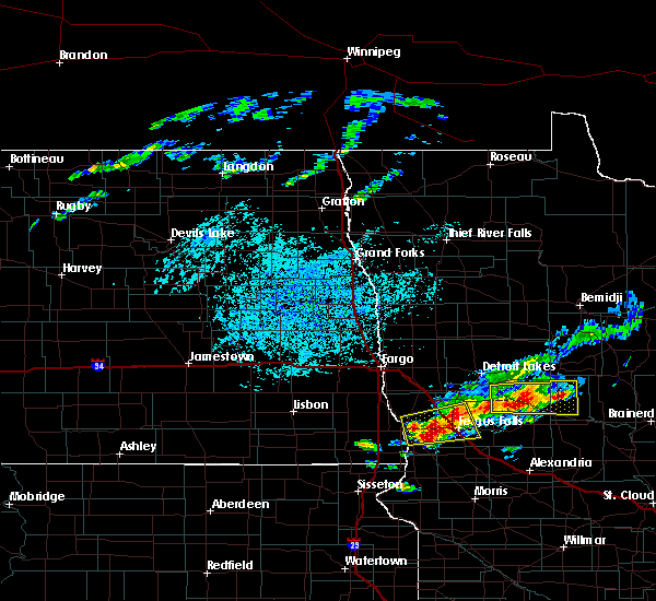 At 348 pm cdt, a severe thunderstorm was located near foxhome, or 12 miles west of fergus falls, moving east at 25 mph (radar indicated). Hazards include 60 mph wind gusts and half dollar size hail. Hail damage to vehicles is expected. expect wind damage to roofs, siding, and trees. this severe storm will be near, carlisle around 405 pm cdt. fergus falls and elizabeth around 410 pm cdt. erhard and edwards around 415 pm cdt. other locations impacted by this severe thunderstorm include fergus falls airport. This includes interstate 94 in minnesota between mile markers 40 and 64. At 348 pm cdt, a severe thunderstorm was located near foxhome, or 12 miles west of fergus falls, moving east at 25 mph (radar indicated). Hazards include 60 mph wind gusts and half dollar size hail. Hail damage to vehicles is expected. expect wind damage to roofs, siding, and trees. this severe storm will be near, carlisle around 405 pm cdt. fergus falls and elizabeth around 410 pm cdt. erhard and edwards around 415 pm cdt. other locations impacted by this severe thunderstorm include fergus falls airport. This includes interstate 94 in minnesota between mile markers 40 and 64.
|
| 7/17/2017 3:18 PM CDT |
 At 318 pm cdt, a severe thunderstorm was located over breckenridge, or over wahpeton, moving east at 25 mph (radar indicated). Hazards include 60 mph wind gusts and half dollar size hail. Hail damage to vehicles is expected. expect wind damage to roofs, siding, and trees. this severe thunderstorm will be near, doran around 325 pm cdt. everdell around 335 pm cdt. foxhome around 350 pm cdt. carlisle around 405 pm cdt. elizabeth around 410 pm cdt. other locations impacted by this severe thunderstorm include fergus falls airport. This includes interstate 94 in minnesota between mile markers 40 and 64. At 318 pm cdt, a severe thunderstorm was located over breckenridge, or over wahpeton, moving east at 25 mph (radar indicated). Hazards include 60 mph wind gusts and half dollar size hail. Hail damage to vehicles is expected. expect wind damage to roofs, siding, and trees. this severe thunderstorm will be near, doran around 325 pm cdt. everdell around 335 pm cdt. foxhome around 350 pm cdt. carlisle around 405 pm cdt. elizabeth around 410 pm cdt. other locations impacted by this severe thunderstorm include fergus falls airport. This includes interstate 94 in minnesota between mile markers 40 and 64.
|
| 6/21/2017 6:41 PM CDT |
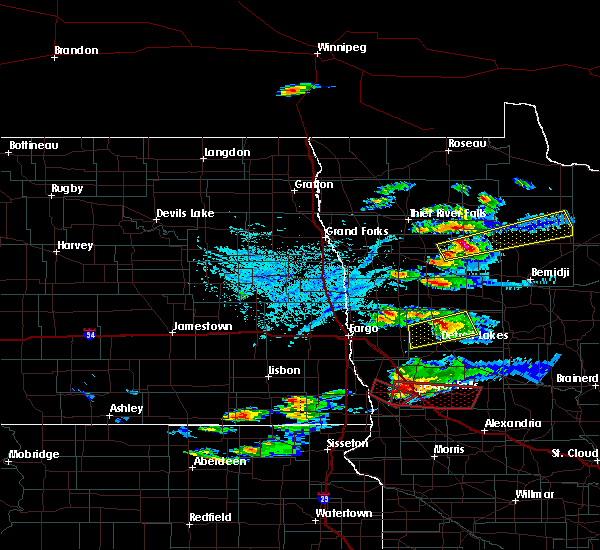 At 641 pm cdt, a severe thunderstorm capable of producing a tornado was located over foxhome, or 9 miles west of fergus falls, moving east at 45 mph (radar indicated rotation). Hazards include tornado and quarter size hail. Expect damage to mobile homes, roofs, and vehicles. this dangerous storm will be near, elizabeth around 645 pm cdt. fergus falls around 650 pm cdt. dalton and underwood around 705 pm cdt. clitherall around 720 pm cdt. vining around 725 pm cdt. This includes interstate 94 in minnesota between mile markers 47 and 70. At 641 pm cdt, a severe thunderstorm capable of producing a tornado was located over foxhome, or 9 miles west of fergus falls, moving east at 45 mph (radar indicated rotation). Hazards include tornado and quarter size hail. Expect damage to mobile homes, roofs, and vehicles. this dangerous storm will be near, elizabeth around 645 pm cdt. fergus falls around 650 pm cdt. dalton and underwood around 705 pm cdt. clitherall around 720 pm cdt. vining around 725 pm cdt. This includes interstate 94 in minnesota between mile markers 47 and 70.
|
| 6/21/2017 6:33 PM CDT |
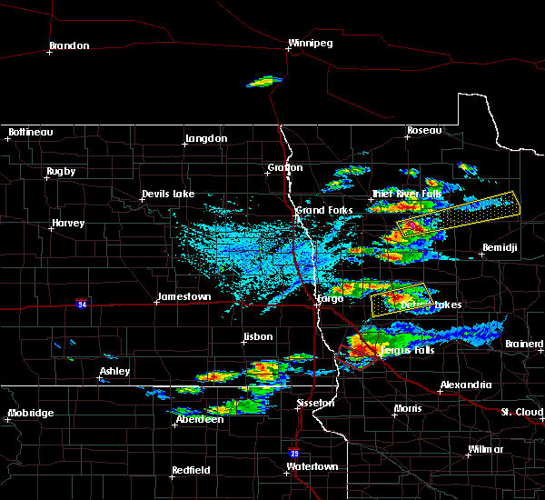 At 632 pm cdt, a severe thunderstorm capable of producing a tornado was located near everdell, or 9 miles east of wahpeton, moving southeast at 35 mph (weather spotters reported a funnel cloud). Hazards include tornado and quarter size hail. Expect damage to mobile homes, roofs, and vehicles. this dangerous storm will be near, everdell around 635 pm cdt. Foxhome around 645 pm cdt. At 632 pm cdt, a severe thunderstorm capable of producing a tornado was located near everdell, or 9 miles east of wahpeton, moving southeast at 35 mph (weather spotters reported a funnel cloud). Hazards include tornado and quarter size hail. Expect damage to mobile homes, roofs, and vehicles. this dangerous storm will be near, everdell around 635 pm cdt. Foxhome around 645 pm cdt.
|
| 6/21/2017 6:21 PM CDT |
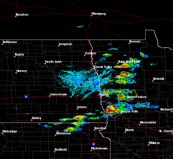 At 620 pm cdt, a severe thunderstorm capable of producing a tornado was located near brushvale, or 7 miles north of wahpeton, moving southeast at 35 mph. spotters were observing a developing wall cloud with brief funnel (radar indicated rotation). Hazards include tornado and quarter size hail. Expect damage to mobile homes, roofs, and vehicles. this dangerous storm will be near, everdell around 640 pm cdt. Foxhome around 645 pm cdt. At 620 pm cdt, a severe thunderstorm capable of producing a tornado was located near brushvale, or 7 miles north of wahpeton, moving southeast at 35 mph. spotters were observing a developing wall cloud with brief funnel (radar indicated rotation). Hazards include tornado and quarter size hail. Expect damage to mobile homes, roofs, and vehicles. this dangerous storm will be near, everdell around 640 pm cdt. Foxhome around 645 pm cdt.
|
| 6/13/2017 9:32 PM CDT |
 At 931 pm cdt, severe thunderstorms were located along a line extending from near muskoda to 6 miles north of melby, moving east at 55 mph (public. public reported tree limbs down 2 w urbank). Hazards include 70 mph wind gusts and penny size hail. Expect considerable tree damage. damage is likely to mobile homes, roofs, and outbuildings. these severe storms will be near, clitherall around 935 pm cdt. vining and urbank around 940 pm cdt. this includes the following highways, interstate 29 between mile markers 44 and 51. Interstate 94 in minnesota between mile markers 13 and 73. At 931 pm cdt, severe thunderstorms were located along a line extending from near muskoda to 6 miles north of melby, moving east at 55 mph (public. public reported tree limbs down 2 w urbank). Hazards include 70 mph wind gusts and penny size hail. Expect considerable tree damage. damage is likely to mobile homes, roofs, and outbuildings. these severe storms will be near, clitherall around 935 pm cdt. vining and urbank around 940 pm cdt. this includes the following highways, interstate 29 between mile markers 44 and 51. Interstate 94 in minnesota between mile markers 13 and 73.
|
| 6/13/2017 9:10 PM CDT |
 At 910 pm cdt, severe thunderstorms were located along a line extending from rustad to near wendell, moving east at 70 mph (public. at 909 pm, the public reported estimated 70 mph winds east of breckenridge). Hazards include 70 mph wind gusts and penny size hail. Expect considerable tree damage. damage is likely to mobile homes, roofs, and outbuildings. these severe storms will be near, dalton and ashby around 920 pm cdt. hawley, clitherall and battle lake around 930 pm cdt. vining, dale and urbank around 935 pm cdt. this includes the following highways, interstate 29 between mile markers 44 and 51. Interstate 94 in minnesota between mile markers 13 and 73. At 910 pm cdt, severe thunderstorms were located along a line extending from rustad to near wendell, moving east at 70 mph (public. at 909 pm, the public reported estimated 70 mph winds east of breckenridge). Hazards include 70 mph wind gusts and penny size hail. Expect considerable tree damage. damage is likely to mobile homes, roofs, and outbuildings. these severe storms will be near, dalton and ashby around 920 pm cdt. hawley, clitherall and battle lake around 930 pm cdt. vining, dale and urbank around 935 pm cdt. this includes the following highways, interstate 29 between mile markers 44 and 51. Interstate 94 in minnesota between mile markers 13 and 73.
|
| 6/13/2017 8:54 PM CDT |
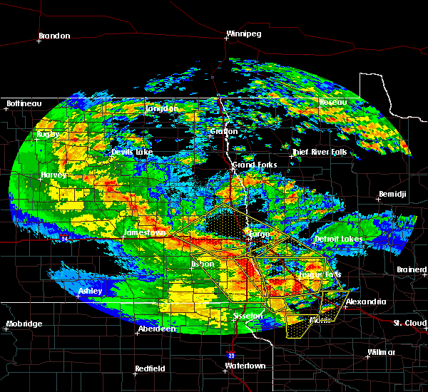 At 854 pm cdt, severe thunderstorms were located along a line extending from near kindred to near white rock, moving northeast at 55 mph (radar indicated). Hazards include 60 mph wind gusts and penny size hail. Expect damage to roofs, siding, and trees. severe thunderstorms will be near, tenney around 900 pm cdt. oxbow, nashua and hickson around 905 pm cdt. baker around 915 pm cdt. downer around 920 pm cdt. dalton around 925 pm cdt. this includes the following highways, interstate 29 between mile markers 28 and 51. Interstate 94 in minnesota between mile markers 12 and 73. At 854 pm cdt, severe thunderstorms were located along a line extending from near kindred to near white rock, moving northeast at 55 mph (radar indicated). Hazards include 60 mph wind gusts and penny size hail. Expect damage to roofs, siding, and trees. severe thunderstorms will be near, tenney around 900 pm cdt. oxbow, nashua and hickson around 905 pm cdt. baker around 915 pm cdt. downer around 920 pm cdt. dalton around 925 pm cdt. this includes the following highways, interstate 29 between mile markers 28 and 51. Interstate 94 in minnesota between mile markers 12 and 73.
|
| 6/13/2017 8:51 PM CDT |
 At 851 pm cdt, a severe thunderstorm was located over foxhome, or 12 miles east of wahpeton, moving north at 50 mph (radar indicated). Hazards include 60 mph wind gusts and penny size hail. Expect damage to roofs, siding, and trees. this severe storm will be near, carlisle around 900 pm cdt. rothsay around 910 pm cdt. lawndale around 915 pm cdt. This includes interstate 94 in minnesota between mile markers 29 and 73. At 851 pm cdt, a severe thunderstorm was located over foxhome, or 12 miles east of wahpeton, moving north at 50 mph (radar indicated). Hazards include 60 mph wind gusts and penny size hail. Expect damage to roofs, siding, and trees. this severe storm will be near, carlisle around 900 pm cdt. rothsay around 910 pm cdt. lawndale around 915 pm cdt. This includes interstate 94 in minnesota between mile markers 29 and 73.
|
| 6/13/2017 8:27 PM CDT |
 At 827 pm cdt, a severe thunderstorm was located near charlesville, or 19 miles northeast of wheaton, moving north at 40 mph (radar indicated). Hazards include 60 mph wind gusts and quarter size hail. Hail damage to vehicles is expected. expect wind damage to roofs, siding, and trees. this severe thunderstorm will be near, wendell and nashua around 830 pm cdt. western around 845 pm cdt. foxhome around 900 pm cdt. carlisle around 905 pm cdt. elizabeth around 910 pm cdt. This includes interstate 94 in minnesota between mile markers 28 and 80. At 827 pm cdt, a severe thunderstorm was located near charlesville, or 19 miles northeast of wheaton, moving north at 40 mph (radar indicated). Hazards include 60 mph wind gusts and quarter size hail. Hail damage to vehicles is expected. expect wind damage to roofs, siding, and trees. this severe thunderstorm will be near, wendell and nashua around 830 pm cdt. western around 845 pm cdt. foxhome around 900 pm cdt. carlisle around 905 pm cdt. elizabeth around 910 pm cdt. This includes interstate 94 in minnesota between mile markers 28 and 80.
|
| 6/13/2017 7:29 PM CDT |
 At 729 pm cdt, a severe thunderstorm was located near foxhome, or 10 miles west of fergus falls, moving north at 50 mph (radar indicated). Hazards include 60 mph wind gusts and quarter size hail. Hail damage to vehicles is expected. expect wind damage to roofs, siding, and trees. this severe storm will be near, elizabeth and carlisle around 735 pm cdt. rothsay and lawndale around 745 pm cdt. This includes interstate 94 in minnesota between mile markers 28 and 57. At 729 pm cdt, a severe thunderstorm was located near foxhome, or 10 miles west of fergus falls, moving north at 50 mph (radar indicated). Hazards include 60 mph wind gusts and quarter size hail. Hail damage to vehicles is expected. expect wind damage to roofs, siding, and trees. this severe storm will be near, elizabeth and carlisle around 735 pm cdt. rothsay and lawndale around 745 pm cdt. This includes interstate 94 in minnesota between mile markers 28 and 57.
|
| 6/13/2017 7:13 PM CDT |
 At 712 pm cdt, a severe thunderstorm was located near foxhome, or 10 miles west of fergus falls, moving north at 35 mph (radar indicated). Hazards include 60 mph wind gusts and quarter size hail. Hail damage to vehicles is expected. expect wind damage to roofs, siding, and trees. this severe storm will be near, everdell around 715 pm cdt. foxhome around 720 pm cdt. elizabeth and carlisle around 730 pm cdt. rothsay and erhard around 740 pm cdt. lawndale around 745 pm cdt. This includes interstate 94 in minnesota between mile markers 28 and 60. At 712 pm cdt, a severe thunderstorm was located near foxhome, or 10 miles west of fergus falls, moving north at 35 mph (radar indicated). Hazards include 60 mph wind gusts and quarter size hail. Hail damage to vehicles is expected. expect wind damage to roofs, siding, and trees. this severe storm will be near, everdell around 715 pm cdt. foxhome around 720 pm cdt. elizabeth and carlisle around 730 pm cdt. rothsay and erhard around 740 pm cdt. lawndale around 745 pm cdt. This includes interstate 94 in minnesota between mile markers 28 and 60.
|
| 6/13/2017 6:55 PM CDT |
 At 655 pm cdt, a severe thunderstorm was located near nashua, or 17 miles southwest of fergus falls, moving north at 35 mph (radar indicated). Hazards include 60 mph wind gusts and quarter size hail. Hail damage to vehicles is expected. expect wind damage to roofs, siding, and trees. this severe thunderstorm will be near, western around 705 pm cdt. everdell around 715 pm cdt. foxhome around 720 pm cdt. elizabeth and carlisle around 730 pm cdt. rothsay and erhard around 740 pm cdt. This includes interstate 94 in minnesota between mile markers 28 and 60. At 655 pm cdt, a severe thunderstorm was located near nashua, or 17 miles southwest of fergus falls, moving north at 35 mph (radar indicated). Hazards include 60 mph wind gusts and quarter size hail. Hail damage to vehicles is expected. expect wind damage to roofs, siding, and trees. this severe thunderstorm will be near, western around 705 pm cdt. everdell around 715 pm cdt. foxhome around 720 pm cdt. elizabeth and carlisle around 730 pm cdt. rothsay and erhard around 740 pm cdt. This includes interstate 94 in minnesota between mile markers 28 and 60.
|
| 8/27/2016 4:57 PM CDT |
 At 457 pm cdt, a severe thunderstorm was located near fergus falls, moving southeast at 35 mph (radar indicated). Hazards include quarter size hail. Damage to vehicles is expected. this severe storm will be near, underwood around 505 pm cdt. phelps around 510 pm cdt. battle lake, ottertail lake and amor around 515 pm cdt. clitherall around 520 pm cdt. vining around 530 pm cdt. This includes interstate 94 in minnesota between mile markers 43 and 66. At 457 pm cdt, a severe thunderstorm was located near fergus falls, moving southeast at 35 mph (radar indicated). Hazards include quarter size hail. Damage to vehicles is expected. this severe storm will be near, underwood around 505 pm cdt. phelps around 510 pm cdt. battle lake, ottertail lake and amor around 515 pm cdt. clitherall around 520 pm cdt. vining around 530 pm cdt. This includes interstate 94 in minnesota between mile markers 43 and 66.
|
| 8/27/2016 4:56 PM CDT | Quarter sized hail reported 0.9 miles SSE of Foxhome, MN |
| 8/27/2016 4:38 PM CDT |
 At 437 pm cdt, a severe thunderstorm was located near foxhome, or 12 miles west of fergus falls, moving east at 30 mph (radar indicated). Hazards include quarter size hail. Damage to vehicles is expected. this severe thunderstorm will be near, carlisle around 445 pm cdt. elizabeth around 450 pm cdt. fergus falls around 455 pm cdt. underwood around 505 pm cdt. phelps around 510 pm cdt. This includes interstate 94 in minnesota between mile markers 44 and 66. At 437 pm cdt, a severe thunderstorm was located near foxhome, or 12 miles west of fergus falls, moving east at 30 mph (radar indicated). Hazards include quarter size hail. Damage to vehicles is expected. this severe thunderstorm will be near, carlisle around 445 pm cdt. elizabeth around 450 pm cdt. fergus falls around 455 pm cdt. underwood around 505 pm cdt. phelps around 510 pm cdt. This includes interstate 94 in minnesota between mile markers 44 and 66.
|
| 8/16/2016 2:42 PM CDT |
 At 242 pm cdt, a severe thunderstorm was located near lawndale, or 20 miles north of wahpeton, moving southeast at 20 mph (radar indicated). Hazards include quarter size hail. Damage to vehicles is expected. this severe thunderstorm will be near, lawndale around 255 pm cdt. rothsay around 315 pm cdt. foxhome, elizabeth and carlisle around 345 pm cdt. Also includes interstate 94 in minnesota between mile markers 30 and 55. At 242 pm cdt, a severe thunderstorm was located near lawndale, or 20 miles north of wahpeton, moving southeast at 20 mph (radar indicated). Hazards include quarter size hail. Damage to vehicles is expected. this severe thunderstorm will be near, lawndale around 255 pm cdt. rothsay around 315 pm cdt. foxhome, elizabeth and carlisle around 345 pm cdt. Also includes interstate 94 in minnesota between mile markers 30 and 55.
|
| 8/10/2016 3:55 AM CDT |
 At 355 am cdt, severe thunderstorms were located along a line extending from 7 miles west of rothsay to near wendell to herman, moving east at 50 mph (radar indicated). Hazards include 70 mph wind gusts and penny size hail. Expect considerable tree damage. damage is likely to mobile homes, roofs, and outbuildings. severe thunderstorms will be near, wendell around 400 am cdt. elbow lake around 405 am cdt. dalton, barrett and elizabeth around 410 am cdt. erhard, hoffman and ashby around 415 am cdt. maplewood state park and edwards around 420 am cdt. Also includes interstate 94 in minnesota between mile markers 37 and 80. At 355 am cdt, severe thunderstorms were located along a line extending from 7 miles west of rothsay to near wendell to herman, moving east at 50 mph (radar indicated). Hazards include 70 mph wind gusts and penny size hail. Expect considerable tree damage. damage is likely to mobile homes, roofs, and outbuildings. severe thunderstorms will be near, wendell around 400 am cdt. elbow lake around 405 am cdt. dalton, barrett and elizabeth around 410 am cdt. erhard, hoffman and ashby around 415 am cdt. maplewood state park and edwards around 420 am cdt. Also includes interstate 94 in minnesota between mile markers 37 and 80.
|
| 8/10/2016 3:42 AM CDT |
 At 341 am cdt, severe thunderstorms were located along a line extending from near kent to near tenney to 6 miles east of wheaton, moving east at 50 mph (radar indicated). Hazards include 70 mph wind gusts and quarter size hail. Hail damage to vehicles is expected. expect considerable tree damage. wind damage is also likely to mobile homes, roofs, and outbuildings. these severe storms will be near, campbell and nashua around 345 am cdt. norcross around 350 am cdt. herman and western around 355 am cdt. wendell around 400 am cdt. elbow lake around 405 am cdt. Also includes interstate 29 between mile markers 15 and 36. At 341 am cdt, severe thunderstorms were located along a line extending from near kent to near tenney to 6 miles east of wheaton, moving east at 50 mph (radar indicated). Hazards include 70 mph wind gusts and quarter size hail. Hail damage to vehicles is expected. expect considerable tree damage. wind damage is also likely to mobile homes, roofs, and outbuildings. these severe storms will be near, campbell and nashua around 345 am cdt. norcross around 350 am cdt. herman and western around 355 am cdt. wendell around 400 am cdt. elbow lake around 405 am cdt. Also includes interstate 29 between mile markers 15 and 36.
|
| 8/10/2016 3:09 AM CDT |
 At 308 am cdt, severe thunderstorms were located along a line extending from mcleod to 7 miles southwest of hankinson to 7 miles north of sisseton, moving east at 50 mph (radar indicated). Hazards include 70 mph wind gusts and quarter size hail. Hail damage to vehicles is expected. expect considerable tree damage. wind damage is also likely to mobile homes, roofs, and outbuildings. severe thunderstorms will be near, stiles around 310 am cdt. hankinson around 315 am cdt. sonora around 320 am cdt. lamars around 325 am cdt. colfax, fairmount and blackmer around 330 am cdt. Also includes interstate 29 between mile markers 0 and 37. At 308 am cdt, severe thunderstorms were located along a line extending from mcleod to 7 miles southwest of hankinson to 7 miles north of sisseton, moving east at 50 mph (radar indicated). Hazards include 70 mph wind gusts and quarter size hail. Hail damage to vehicles is expected. expect considerable tree damage. wind damage is also likely to mobile homes, roofs, and outbuildings. severe thunderstorms will be near, stiles around 310 am cdt. hankinson around 315 am cdt. sonora around 320 am cdt. lamars around 325 am cdt. colfax, fairmount and blackmer around 330 am cdt. Also includes interstate 29 between mile markers 0 and 37.
|
| 7/21/2016 1:49 AM CDT |
 At 148 am cdt, severe thunderstorms were located along a line extending from near motley to 6 miles south of wrightstown to near campbell, moving southeast at 45 mph (radar indicated). Hazards include 60 mph wind gusts and penny size hail. Expect damage to roofs. siding. and trees. these severe storms will be near, wrightstown around 150 am cdt. western around 155 am cdt. wendell and charlesville around 205 am cdt. elbow lake and barrett around 215 am cdt. Also includes interstate 94 in minnesota between mile markers 24 and 80. At 148 am cdt, severe thunderstorms were located along a line extending from near motley to 6 miles south of wrightstown to near campbell, moving southeast at 45 mph (radar indicated). Hazards include 60 mph wind gusts and penny size hail. Expect damage to roofs. siding. and trees. these severe storms will be near, wrightstown around 150 am cdt. western around 155 am cdt. wendell and charlesville around 205 am cdt. elbow lake and barrett around 215 am cdt. Also includes interstate 94 in minnesota between mile markers 24 and 80.
|
| 7/21/2016 1:20 AM CDT |
 At 120 am cdt, severe thunderstorms were located along a line extending from near nimrod to near ottertail to near brushvale, moving southeast at 45 mph (radar indicated). Hazards include 60 mph wind gusts and penny size hail. Expect damage to roofs. siding. and trees. severe thunderstorms will be near, henning, ottertail and blue grass around 125 am cdt. deer creek around 130 am cdt. almora around 135 am cdt. parkers prairie, staples airport and wrightstown around 140 am cdt. western around 145 am cdt. Also includes interstate 94 in minnesota between mile markers 24 and 80. At 120 am cdt, severe thunderstorms were located along a line extending from near nimrod to near ottertail to near brushvale, moving southeast at 45 mph (radar indicated). Hazards include 60 mph wind gusts and penny size hail. Expect damage to roofs. siding. and trees. severe thunderstorms will be near, henning, ottertail and blue grass around 125 am cdt. deer creek around 130 am cdt. almora around 135 am cdt. parkers prairie, staples airport and wrightstown around 140 am cdt. western around 145 am cdt. Also includes interstate 94 in minnesota between mile markers 24 and 80.
|
| 7/21/2016 1:04 AM CDT |
 At 103 am cdt, severe thunderstorms were located along a line extending from butler to near rothsay to barrie, moving southeast at 55 mph (radar indicated). Hazards include 60 mph wind gusts and penny size hail. Expect damage to roofs. siding. and trees. these severe storms will be near, pelican rapids and butler around 105 am cdt. erhard, lake lida and elizabeth around 110 am cdt. edwards and maplewood state park around 115 am cdt. colfax around 120 am cdt. abercrombie, underwood and phelps around 125 am cdt. also includes the following highways, interstate 29 between mile markers 29 and 67. interstate 94 in north dakota between mile markers 333 and 352. Interstate 94 in minnesota between mile markers 1 and 65. At 103 am cdt, severe thunderstorms were located along a line extending from butler to near rothsay to barrie, moving southeast at 55 mph (radar indicated). Hazards include 60 mph wind gusts and penny size hail. Expect damage to roofs. siding. and trees. these severe storms will be near, pelican rapids and butler around 105 am cdt. erhard, lake lida and elizabeth around 110 am cdt. edwards and maplewood state park around 115 am cdt. colfax around 120 am cdt. abercrombie, underwood and phelps around 125 am cdt. also includes the following highways, interstate 29 between mile markers 29 and 67. interstate 94 in north dakota between mile markers 333 and 352. Interstate 94 in minnesota between mile markers 1 and 65.
|
| 7/21/2016 12:37 AM CDT |
 At 1237 am cdt, a severe thunderstorm was located over sabin, or 12 miles southeast of fargo, moving east at 80 mph (radar indicated). Hazards include 60 mph wind gusts and quarter size hail. Hail damage to vehicles is expected. expect wind damage to roofs, siding, and trees. this severe thunderstorm will be near, downer around 1240 am cdt. barnesville around 1245 am cdt. rollag around 1250 am cdt. cormorant around 1255 am cdt. shoreham and dunvilla around 100 am cdt. also includes the following highways, interstate 29 between mile markers 29 and 67. interstate 94 in north dakota between mile markers 320 and 352. Interstate 94 in minnesota between mile markers 1 and 65. At 1237 am cdt, a severe thunderstorm was located over sabin, or 12 miles southeast of fargo, moving east at 80 mph (radar indicated). Hazards include 60 mph wind gusts and quarter size hail. Hail damage to vehicles is expected. expect wind damage to roofs, siding, and trees. this severe thunderstorm will be near, downer around 1240 am cdt. barnesville around 1245 am cdt. rollag around 1250 am cdt. cormorant around 1255 am cdt. shoreham and dunvilla around 100 am cdt. also includes the following highways, interstate 29 between mile markers 29 and 67. interstate 94 in north dakota between mile markers 320 and 352. Interstate 94 in minnesota between mile markers 1 and 65.
|
| 7/11/2016 2:34 AM CDT |
 At 233 am cdt, severe thunderstorms were located along a line extending from near becida to hubbard to near almora, moving east at 55 mph (radar indicated). Hazards include 70 mph wind gusts and penny size hail. Expect considerable tree damage. damage is likely to mobile homes, roofs, and outbuildings. these severe storms will be near, lake george, park rapids and menahga around 235 am cdt. huntersville, kabekona and dorset around 240 am cdt. laporte, wrightstown and badoura around 245 am cdt. Also includes interstate 94 in minnesota between mile markers 42 and 58. At 233 am cdt, severe thunderstorms were located along a line extending from near becida to hubbard to near almora, moving east at 55 mph (radar indicated). Hazards include 70 mph wind gusts and penny size hail. Expect considerable tree damage. damage is likely to mobile homes, roofs, and outbuildings. these severe storms will be near, lake george, park rapids and menahga around 235 am cdt. huntersville, kabekona and dorset around 240 am cdt. laporte, wrightstown and badoura around 245 am cdt. Also includes interstate 94 in minnesota between mile markers 42 and 58.
|
| 7/11/2016 1:45 AM CDT |
 At 143 am cdt, severe thunderstorms were located along a line extending from near faith to just east of lake park to near elizabeth, moving east at 60 mph. these are very dangerous storms (radar indicated). Hazards include 80 mph wind gusts. Flying debris will be dangerous to those caught without shelter. mobile homes will be heavily damaged. expect considerable damage to roofs, windows, and vehicles. extensive tree damage and power outages are likely. a trained spotter measured 91 mph wind gust near 2 miles west of lake park. severe thunderstorms will be near, shoreham and westbury around 145 am cdt. detroit lakes and waubun around 150 am cdt. rochert around 155 am cdt. underwood, height of land lake and phelps around 200 am cdt. toad lake, battle lake and naytahwaush around 205 am cdt. Also includes interstate 94 in minnesota between mile markers 42 and 58. At 143 am cdt, severe thunderstorms were located along a line extending from near faith to just east of lake park to near elizabeth, moving east at 60 mph. these are very dangerous storms (radar indicated). Hazards include 80 mph wind gusts. Flying debris will be dangerous to those caught without shelter. mobile homes will be heavily damaged. expect considerable damage to roofs, windows, and vehicles. extensive tree damage and power outages are likely. a trained spotter measured 91 mph wind gust near 2 miles west of lake park. severe thunderstorms will be near, shoreham and westbury around 145 am cdt. detroit lakes and waubun around 150 am cdt. rochert around 155 am cdt. underwood, height of land lake and phelps around 200 am cdt. toad lake, battle lake and naytahwaush around 205 am cdt. Also includes interstate 94 in minnesota between mile markers 42 and 58.
|
| 7/11/2016 1:22 AM CDT |
 At 121 am cdt, severe thunderstorms were located along a line extending from near borup to near hawley to near wahpeton, moving east at 65 mph (radar indicated). Hazards include 70 mph wind gusts and quarter size hail. Hail damage to vehicles is expected. expect considerable tree damage. wind damage is also likely to mobile homes, roofs, and outbuildings. storm spotters reported widespread 55 to 65 mph winds across the fargo-moorhead metro area in the past half hour. these severe storms will be near, hawley, dale and rollag around 125 am cdt. lake park and syre around 130 am cdt. foxhome and flom around 135 am cdt. shoreham and westbury around 140 am cdt. detroit lakes, fergus falls and waubun around 145 am cdt. also includes the following highways, interstate 29 between mile markers 20 and 76. interstate 94 in north dakota between mile markers 348 and 352. Interstate 94 in minnesota between mile markers 1 and 59. At 121 am cdt, severe thunderstorms were located along a line extending from near borup to near hawley to near wahpeton, moving east at 65 mph (radar indicated). Hazards include 70 mph wind gusts and quarter size hail. Hail damage to vehicles is expected. expect considerable tree damage. wind damage is also likely to mobile homes, roofs, and outbuildings. storm spotters reported widespread 55 to 65 mph winds across the fargo-moorhead metro area in the past half hour. these severe storms will be near, hawley, dale and rollag around 125 am cdt. lake park and syre around 130 am cdt. foxhome and flom around 135 am cdt. shoreham and westbury around 140 am cdt. detroit lakes, fergus falls and waubun around 145 am cdt. also includes the following highways, interstate 29 between mile markers 20 and 76. interstate 94 in north dakota between mile markers 348 and 352. Interstate 94 in minnesota between mile markers 1 and 59.
|
| 7/11/2016 12:58 AM CDT |
 At 1258 am cdt, severe thunderstorms were located along a line extending from near grandin to fargo to wyndmere, moving east at 65 mph (radar indicated). Hazards include 70 mph wind gusts and quarter size hail. Hail damage to vehicles is expected. expect considerable tree damage. wind damage is also likely to mobile homes, roofs, and outbuildings. severe thunderstorms will be near, fargo, moorhead and frontier around 100 am cdt. dilworth, sabin and perley around 105 am cdt. mooreton, glyndon and downer around 110 am cdt. borup, muskoda and dwight around 115 am cdt. wahpeton and hawley around 120 am cdt. also includes the following highways, interstate 29 between mile markers 20 and 76. interstate 94 in north dakota between mile markers 348 and 352. Interstate 94 in minnesota between mile markers 1 and 59. At 1258 am cdt, severe thunderstorms were located along a line extending from near grandin to fargo to wyndmere, moving east at 65 mph (radar indicated). Hazards include 70 mph wind gusts and quarter size hail. Hail damage to vehicles is expected. expect considerable tree damage. wind damage is also likely to mobile homes, roofs, and outbuildings. severe thunderstorms will be near, fargo, moorhead and frontier around 100 am cdt. dilworth, sabin and perley around 105 am cdt. mooreton, glyndon and downer around 110 am cdt. borup, muskoda and dwight around 115 am cdt. wahpeton and hawley around 120 am cdt. also includes the following highways, interstate 29 between mile markers 20 and 76. interstate 94 in north dakota between mile markers 348 and 352. Interstate 94 in minnesota between mile markers 1 and 59.
|
| 7/10/2016 2:04 AM CDT |
 At 203 am cdt, severe thunderstorms were located along a line extending from foxhome to near wheaton, moving east at 50 mph (radar indicated). Hazards include 60 mph wind gusts and penny size hail. Expect damage to roofs. siding. and trees. these severe storms will be near, western around 210 am cdt. norcross around 220 am cdt. herman around 225 am cdt. ashby around 230 am cdt. Also includes interstate 94 in minnesota between mile markers 65 and 81. At 203 am cdt, severe thunderstorms were located along a line extending from foxhome to near wheaton, moving east at 50 mph (radar indicated). Hazards include 60 mph wind gusts and penny size hail. Expect damage to roofs. siding. and trees. these severe storms will be near, western around 210 am cdt. norcross around 220 am cdt. herman around 225 am cdt. ashby around 230 am cdt. Also includes interstate 94 in minnesota between mile markers 65 and 81.
|
| 7/10/2016 1:41 AM CDT |
 At 139 am cdt, severe thunderstorms were located along a line extending from brushvale to near victor, moving east at 50 mph (radar indicated). Hazards include 60 mph wind gusts and penny size hail. Expect damage to roofs. siding. and trees. severe thunderstorms will be near, wahpeton around 145 am cdt. breckenridge and lamars around 150 am cdt. everdell and blackmer around 155 am cdt. foxhome around 200 am cdt. western around 210 am cdt. also includes the following highways, interstate 29 between mile markers 0 and 19. Interstate 94 in minnesota between mile markers 65 and 80. At 139 am cdt, severe thunderstorms were located along a line extending from brushvale to near victor, moving east at 50 mph (radar indicated). Hazards include 60 mph wind gusts and penny size hail. Expect damage to roofs. siding. and trees. severe thunderstorms will be near, wahpeton around 145 am cdt. breckenridge and lamars around 150 am cdt. everdell and blackmer around 155 am cdt. foxhome around 200 am cdt. western around 210 am cdt. also includes the following highways, interstate 29 between mile markers 0 and 19. Interstate 94 in minnesota between mile markers 65 and 80.
|
| 7/10/2016 12:32 AM CDT |
 At 1231 am cdt, severe thunderstorms were located along a line extending from near western to near barney, moving southwest at 15 mph (radar indicated). Hazards include quarter size hail. Damage to vehicles is expected. these severe storms will be near, mooreton around 1235 am cdt. barney around 1245 am cdt. mantador around 1255 am cdt. doran and tenney around 100 am cdt. Also includes interstate 29 between mile markers 0 and 30. At 1231 am cdt, severe thunderstorms were located along a line extending from near western to near barney, moving southwest at 15 mph (radar indicated). Hazards include quarter size hail. Damage to vehicles is expected. these severe storms will be near, mooreton around 1235 am cdt. barney around 1245 am cdt. mantador around 1255 am cdt. doran and tenney around 100 am cdt. Also includes interstate 29 between mile markers 0 and 30.
|
| 7/10/2016 12:02 AM CDT |
 At 1202 am cdt, a severe thunderstorm was located over breckenridge, or over wahpeton, moving southeast at 10 mph (radar indicated). Hazards include quarter size hail. Damage to vehicles is expected. this severe thunderstorm will be near, everdell around 1235 am cdt. doran around 1250 am cdt. campbell around 100 am cdt. Also includes interstate 29 between mile markers 0 and 36. At 1202 am cdt, a severe thunderstorm was located over breckenridge, or over wahpeton, moving southeast at 10 mph (radar indicated). Hazards include quarter size hail. Damage to vehicles is expected. this severe thunderstorm will be near, everdell around 1235 am cdt. doran around 1250 am cdt. campbell around 100 am cdt. Also includes interstate 29 between mile markers 0 and 36.
|
| 7/9/2016 11:27 PM CDT |
 At 1127 pm cdt, severe thunderstorms were located along a line extending from height of land lake to near pelican rapids to near rothsay, moving south at 25 mph (radar indicated). Hazards include 60 mph wind gusts and quarter size hail. Hail damage to vehicles is expected. expect wind damage to roofs, siding, and trees. these severe storms will be near, lake lida and pelican rapids around 1130 pm cdt. rothsay around 1135 pm cdt. erhard around 1140 pm cdt. maplewood state park around 1145 pm cdt. frazee, star lake and edwards around 1150 pm cdt. Also includes interstate 94 in minnesota between mile markers 26 and 56. At 1127 pm cdt, severe thunderstorms were located along a line extending from height of land lake to near pelican rapids to near rothsay, moving south at 25 mph (radar indicated). Hazards include 60 mph wind gusts and quarter size hail. Hail damage to vehicles is expected. expect wind damage to roofs, siding, and trees. these severe storms will be near, lake lida and pelican rapids around 1130 pm cdt. rothsay around 1135 pm cdt. erhard around 1140 pm cdt. maplewood state park around 1145 pm cdt. frazee, star lake and edwards around 1150 pm cdt. Also includes interstate 94 in minnesota between mile markers 26 and 56.
|
| 7/9/2016 10:57 PM CDT |
 At 1057 pm cdt, severe thunderstorms were located along a line extending from near white earth to near cormorant to near barnesville, moving south at 35 mph (radar indicated). Hazards include 60 mph wind gusts and half dollar size hail. Hail damage to vehicles is expected. expect wind damage to roofs, siding, and trees. severe thunderstorms will be near, barnesville, cormorant and rollag around 1100 pm cdt. dunvilla and richwood around 1110 pm cdt. lawndale around 1115 pm cdt. pelican rapids around 1120 pm cdt. rothsay and lake lida around 1125 pm cdt. Also includes interstate 94 in minnesota between mile markers 18 and 56. At 1057 pm cdt, severe thunderstorms were located along a line extending from near white earth to near cormorant to near barnesville, moving south at 35 mph (radar indicated). Hazards include 60 mph wind gusts and half dollar size hail. Hail damage to vehicles is expected. expect wind damage to roofs, siding, and trees. severe thunderstorms will be near, barnesville, cormorant and rollag around 1100 pm cdt. dunvilla and richwood around 1110 pm cdt. lawndale around 1115 pm cdt. pelican rapids around 1120 pm cdt. rothsay and lake lida around 1125 pm cdt. Also includes interstate 94 in minnesota between mile markers 18 and 56.
|
| 7/7/2016 7:55 PM CDT |
 At 754 pm cdt, a severe thunderstorm was located near rothsay, or 13 miles northwest of fergus falls, moving east at 25 mph (radar indicated). Hazards include ping pong ball size hail and 60 mph wind gusts. People and animals outdoors will be injured. expect hail damage to roofs, siding, windows, and vehicles. expect wind damage to roofs, siding, and trees. this severe thunderstorm will be near, carlisle around 800 pm cdt. elizabeth around 805 pm cdt. erhard around 810 pm cdt. edwards and maplewood state park around 825 pm cdt. star lake and phelps around 840 pm cdt. Also includes interstate 94 in minnesota between mile markers 31 and 55. At 754 pm cdt, a severe thunderstorm was located near rothsay, or 13 miles northwest of fergus falls, moving east at 25 mph (radar indicated). Hazards include ping pong ball size hail and 60 mph wind gusts. People and animals outdoors will be injured. expect hail damage to roofs, siding, windows, and vehicles. expect wind damage to roofs, siding, and trees. this severe thunderstorm will be near, carlisle around 800 pm cdt. elizabeth around 805 pm cdt. erhard around 810 pm cdt. edwards and maplewood state park around 825 pm cdt. star lake and phelps around 840 pm cdt. Also includes interstate 94 in minnesota between mile markers 31 and 55.
|
| 6/12/2016 3:37 PM CDT |
 At 336 pm cdt, a severe thunderstorm was located over rothsay, or 16 miles northwest of fergus falls, moving northeast at 40 mph (radar indicated). Hazards include 70 mph wind gusts and half dollar size hail. Hail damage to vehicles is expected. expect considerable tree damage. wind damage is also likely to mobile homes, roofs, and outbuildings. this severe storm will be near, erhard around 340 pm cdt. pelican rapids around 345 pm cdt. lake lida and maplewood state park around 350 pm cdt. dunvilla around 355 pm cdt. big mcdonald lake around 400 pm cdt. Also includes interstate 94 in minnesota between mile markers 26 and 60. At 336 pm cdt, a severe thunderstorm was located over rothsay, or 16 miles northwest of fergus falls, moving northeast at 40 mph (radar indicated). Hazards include 70 mph wind gusts and half dollar size hail. Hail damage to vehicles is expected. expect considerable tree damage. wind damage is also likely to mobile homes, roofs, and outbuildings. this severe storm will be near, erhard around 340 pm cdt. pelican rapids around 345 pm cdt. lake lida and maplewood state park around 350 pm cdt. dunvilla around 355 pm cdt. big mcdonald lake around 400 pm cdt. Also includes interstate 94 in minnesota between mile markers 26 and 60.
|
| 6/12/2016 3:19 PM CDT |
 At 318 pm cdt, a severe thunderstorm was located 8 miles east of brushvale, or 9 miles northeast of wahpeton, moving northeast at 40 mph (radar indicated). Hazards include 70 mph wind gusts and half dollar size hail. Hail damage to vehicles is expected. expect considerable tree damage. wind damage is also likely to mobile homes, roofs, and outbuildings. this severe thunderstorm will be near, rothsay and lawndale around 335 pm cdt. pelican rapids around 345 pm cdt. cormorant and dunvilla around 355 pm cdt. shoreham around 405 pm cdt. detroit lakes around 410 pm cdt. Also includes interstate 94 in minnesota between mile markers 20 and 59. At 318 pm cdt, a severe thunderstorm was located 8 miles east of brushvale, or 9 miles northeast of wahpeton, moving northeast at 40 mph (radar indicated). Hazards include 70 mph wind gusts and half dollar size hail. Hail damage to vehicles is expected. expect considerable tree damage. wind damage is also likely to mobile homes, roofs, and outbuildings. this severe thunderstorm will be near, rothsay and lawndale around 335 pm cdt. pelican rapids around 345 pm cdt. cormorant and dunvilla around 355 pm cdt. shoreham around 405 pm cdt. detroit lakes around 410 pm cdt. Also includes interstate 94 in minnesota between mile markers 20 and 59.
|
| 6/12/2016 3:16 PM CDT |
 At 313 pm cdt, a severe thunderstorm was located near everdell, or near wahpeton, moving northeast at 35 mph (radar indicated). Hazards include half dollar size hail. Damage to vehicles is expected. this severe storm will be near, everdell around 315 pm cdt. Foxhome around 320 pm cdt. At 313 pm cdt, a severe thunderstorm was located near everdell, or near wahpeton, moving northeast at 35 mph (radar indicated). Hazards include half dollar size hail. Damage to vehicles is expected. this severe storm will be near, everdell around 315 pm cdt. Foxhome around 320 pm cdt.
|
| 6/12/2016 2:53 PM CDT |
 At 253 pm cdt, a severe thunderstorm was located over fairmount, or 13 miles south of wahpeton, moving northeast at 35 mph (radar indicated). Hazards include half dollar size hail. Damage to vehicles is expected. this severe storm will be near, fairmount around 255 pm cdt. breckenridge, campbell and doran around 310 pm cdt. everdell around 325 pm cdt. foxhome around 330 pm cdt. Also includes interstate 29 between mile markers 6 and 17. At 253 pm cdt, a severe thunderstorm was located over fairmount, or 13 miles south of wahpeton, moving northeast at 35 mph (radar indicated). Hazards include half dollar size hail. Damage to vehicles is expected. this severe storm will be near, fairmount around 255 pm cdt. breckenridge, campbell and doran around 310 pm cdt. everdell around 325 pm cdt. foxhome around 330 pm cdt. Also includes interstate 29 between mile markers 6 and 17.
|
| 6/12/2016 2:32 PM CDT |
 At 231 pm cdt, a severe thunderstorm was located near lamars, or 19 miles northwest of wheaton, moving northeast at 35 mph (radar indicated). Hazards include half dollar size hail. Damage to vehicles is expected. this severe thunderstorm will be near, lamars around 240 pm cdt. sonora and blackmer around 245 pm cdt. fairmount around 250 pm cdt. breckenridge, campbell and doran around 310 pm cdt. everdell around 320 pm cdt. Also includes interstate 29 between mile markers 0 and 16. At 231 pm cdt, a severe thunderstorm was located near lamars, or 19 miles northwest of wheaton, moving northeast at 35 mph (radar indicated). Hazards include half dollar size hail. Damage to vehicles is expected. this severe thunderstorm will be near, lamars around 240 pm cdt. sonora and blackmer around 245 pm cdt. fairmount around 250 pm cdt. breckenridge, campbell and doran around 310 pm cdt. everdell around 320 pm cdt. Also includes interstate 29 between mile markers 0 and 16.
|
| 7/12/2015 6:44 PM CDT | Quarter sized hail reported 6.1 miles SSE of Foxhome, MN |
| 7/12/2015 5:37 PM CDT |
 At 535 pm cdt, a confirmed tornado was located near fergus falls, moving east at 20 mph. other tornados have been reported west and southwest of fergus falls and near the grant and otter tail county line (weather spotters confirmed tornado). Hazards include tornado and golf ball size hail. Expect damage to mobile homes. roofs and vehicles. the tornado will be near, dalton around 550 pm cdt. underwood around 555 pm cdt. phelps around 605 pm cdt. Battle lake, clitherall, southwestern ottertail lake and vining around 615 pm cdt. At 535 pm cdt, a confirmed tornado was located near fergus falls, moving east at 20 mph. other tornados have been reported west and southwest of fergus falls and near the grant and otter tail county line (weather spotters confirmed tornado). Hazards include tornado and golf ball size hail. Expect damage to mobile homes. roofs and vehicles. the tornado will be near, dalton around 550 pm cdt. underwood around 555 pm cdt. phelps around 605 pm cdt. Battle lake, clitherall, southwestern ottertail lake and vining around 615 pm cdt.
|
| 7/12/2015 5:24 PM CDT |
 At 523 pm cdt, a confirmed tornado was located near campbell, moving east at 20 mph (weather spotters confirmed tornado). Hazards include tornado and golf ball size hail. Expect damage to mobile homes. roofs and vehicles. this tornado will be near, fergus falls around 525 pm cdt. underwood and dalton around 530 pm cdt. clitherall and battle lake around 540 pm cdt. Henning, vining and almora around 545 pm cdt. At 523 pm cdt, a confirmed tornado was located near campbell, moving east at 20 mph (weather spotters confirmed tornado). Hazards include tornado and golf ball size hail. Expect damage to mobile homes. roofs and vehicles. this tornado will be near, fergus falls around 525 pm cdt. underwood and dalton around 530 pm cdt. clitherall and battle lake around 540 pm cdt. Henning, vining and almora around 545 pm cdt.
|
| 7/12/2015 5:07 PM CDT |
 At 505 pm cdt, a severe thunderstorm capable of producing a tornado was located over western, or 10 miles southwest of fergus falls, moving east at 35 mph. this warning is for new development southwest of foxhome, where multiple reports are coming in of funnel clouds and rotating wall clouds. stor (radar indicated rotation). Hazards include tornado and quarter size hail. Expect damage to mobile homes. roofs and vehicles. this dangerous storm will be near, dalton around 515 pm cdt. underwood around 520 pm cdt. battle lake and southern ottertail lake around 525 pm cdt. clitherall and vining around 530 pm cdt. Henning and almora around 535 pm cdt. At 505 pm cdt, a severe thunderstorm capable of producing a tornado was located over western, or 10 miles southwest of fergus falls, moving east at 35 mph. this warning is for new development southwest of foxhome, where multiple reports are coming in of funnel clouds and rotating wall clouds. stor (radar indicated rotation). Hazards include tornado and quarter size hail. Expect damage to mobile homes. roofs and vehicles. this dangerous storm will be near, dalton around 515 pm cdt. underwood around 520 pm cdt. battle lake and southern ottertail lake around 525 pm cdt. clitherall and vining around 530 pm cdt. Henning and almora around 535 pm cdt.
|
| 7/12/2015 5:00 PM CDT |
 At 459 pm cdt, a severe thunderstorm capable of producing a tornado was located over carlisle, or 9 miles northwest of fergus falls, moving east at 15 mph (weather spotters reported a rotating wall cloud). Hazards include tornado and ping pong ball size hail. Expect damage to mobile homes. roofs and vehicles. this dangerous storm will be near, fergus falls and elizabeth around 505 pm cdt. Erhard, edwards and southwestern maplewood state park around 515 pm cdt. At 459 pm cdt, a severe thunderstorm capable of producing a tornado was located over carlisle, or 9 miles northwest of fergus falls, moving east at 15 mph (weather spotters reported a rotating wall cloud). Hazards include tornado and ping pong ball size hail. Expect damage to mobile homes. roofs and vehicles. this dangerous storm will be near, fergus falls and elizabeth around 505 pm cdt. Erhard, edwards and southwestern maplewood state park around 515 pm cdt.
|
| 7/12/2015 4:36 PM CDT |
 At 435 pm cdt, a severe thunderstorm capable of producing a tornado was located over carlisle, or 10 miles northwest of fergus falls, moving northeast at 30 mph (radar indicated rotation). Hazards include tornado and ping pong ball size hail. Expect damage to mobile homes. roofs and vehicles. this dangerous storm will be near, elizabeth around 440 pm cdt. erhard around 445 pm cdt. southern lake lida, maplewood state park and edwards around 450 pm cdt. star lake and big mcdonald lake around 500 pm cdt. Dent and richville around 505 pm cdt. At 435 pm cdt, a severe thunderstorm capable of producing a tornado was located over carlisle, or 10 miles northwest of fergus falls, moving northeast at 30 mph (radar indicated rotation). Hazards include tornado and ping pong ball size hail. Expect damage to mobile homes. roofs and vehicles. this dangerous storm will be near, elizabeth around 440 pm cdt. erhard around 445 pm cdt. southern lake lida, maplewood state park and edwards around 450 pm cdt. star lake and big mcdonald lake around 500 pm cdt. Dent and richville around 505 pm cdt.
|
| 6/17/2012 6:17 PM CDT | Quarter sized hail reported 0.7 miles NE of Foxhome, MN, quarter sized hail for about 5 minutes |
Hail Maps for Foxhome, MN
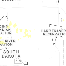
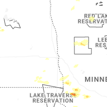
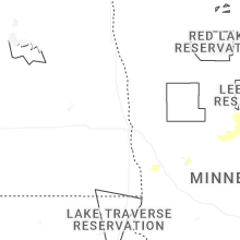
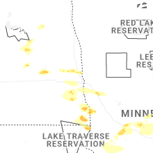
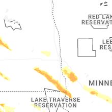


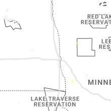


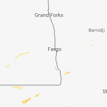


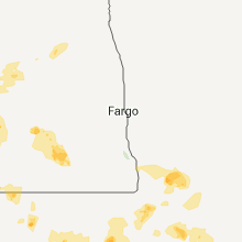


Connect with Interactive Hail Maps