

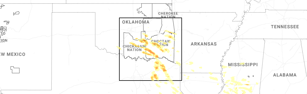
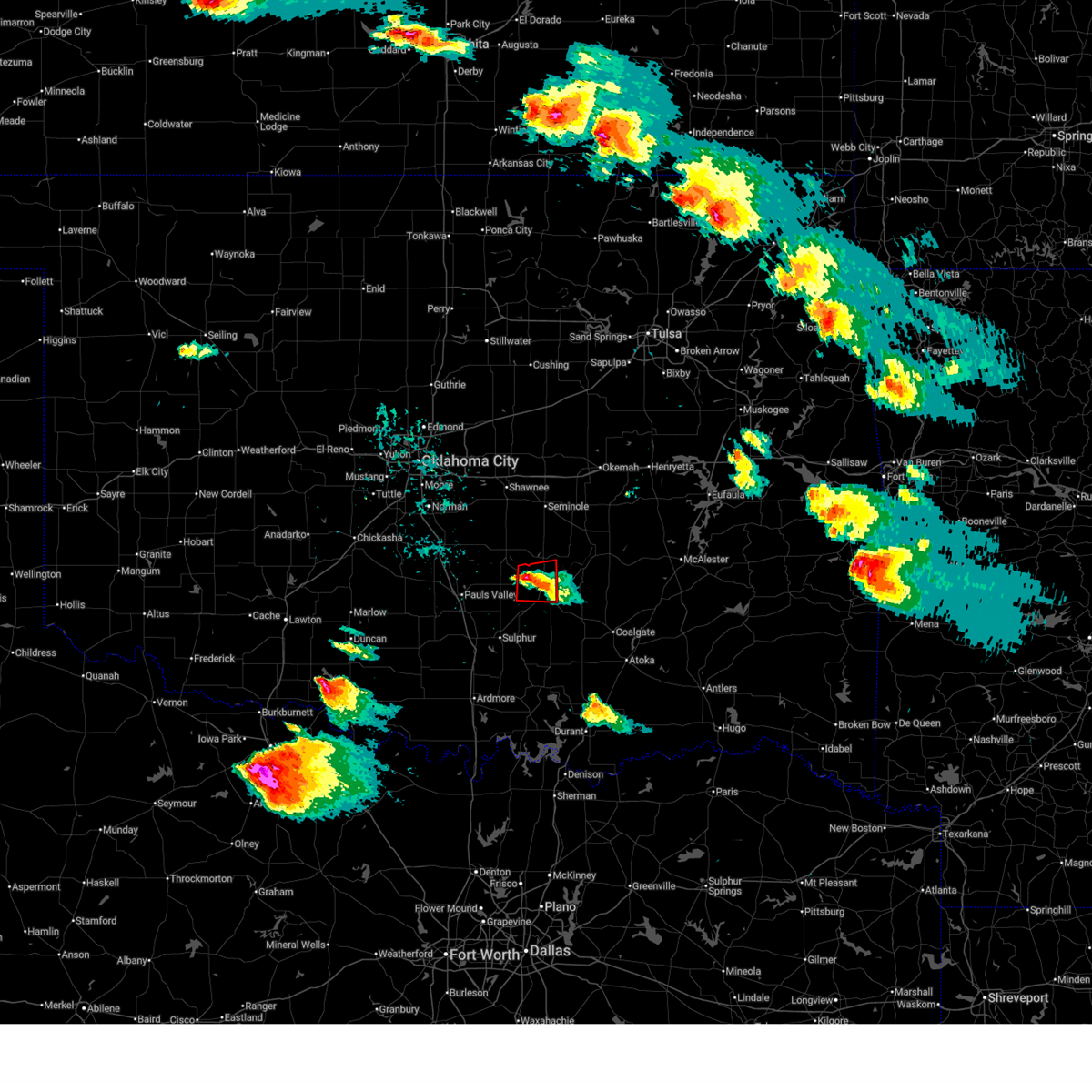
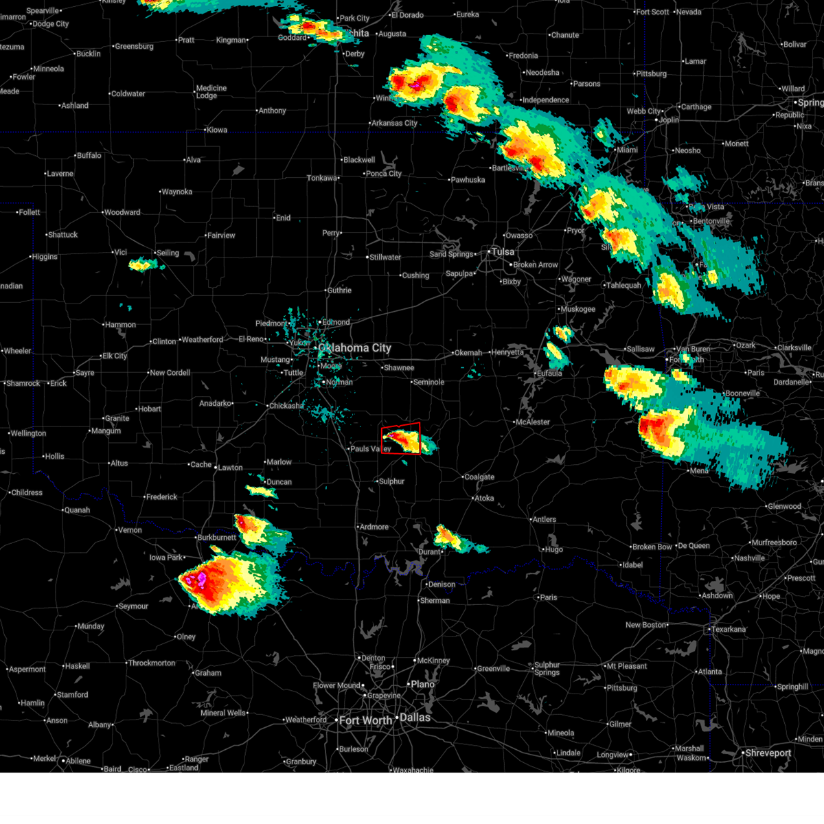
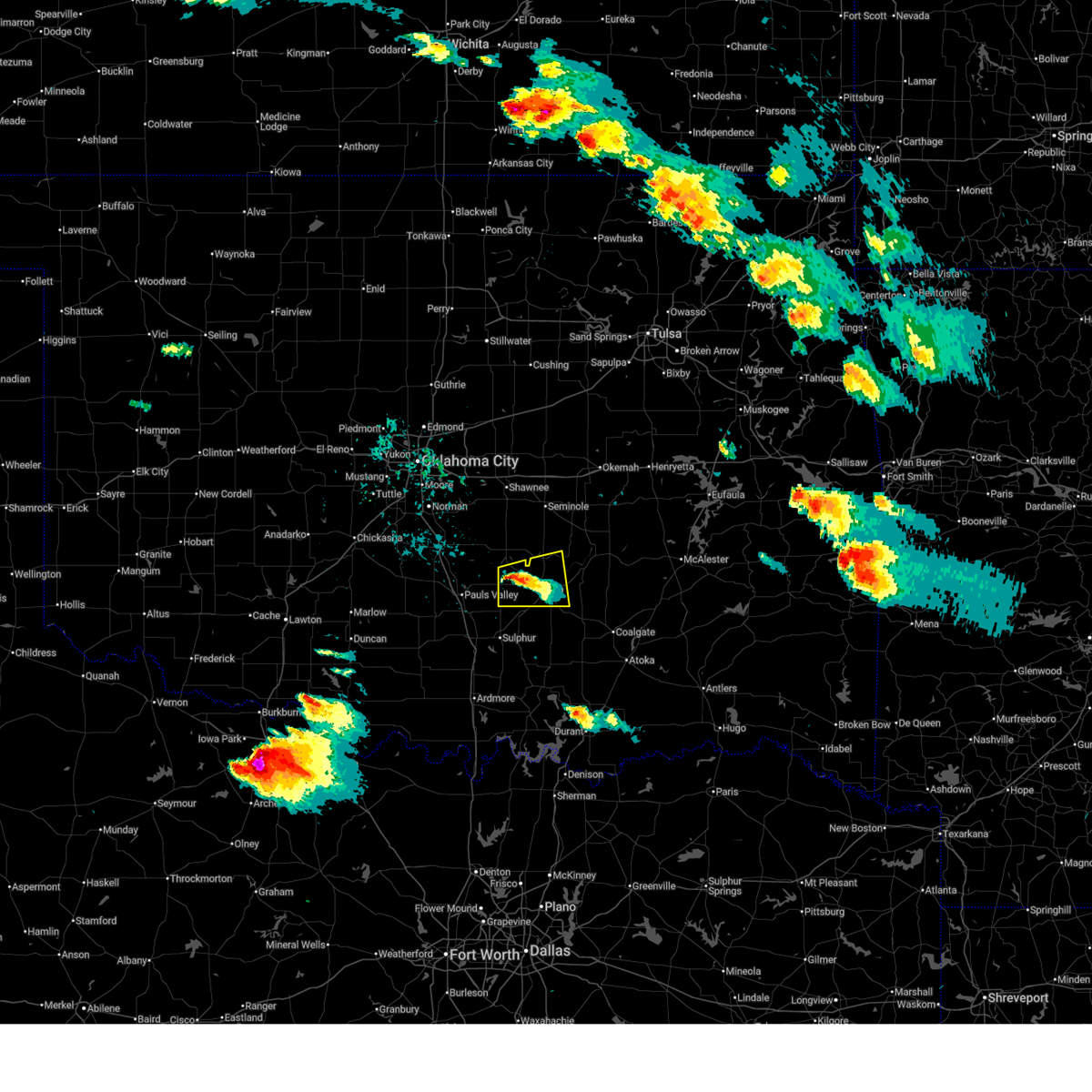
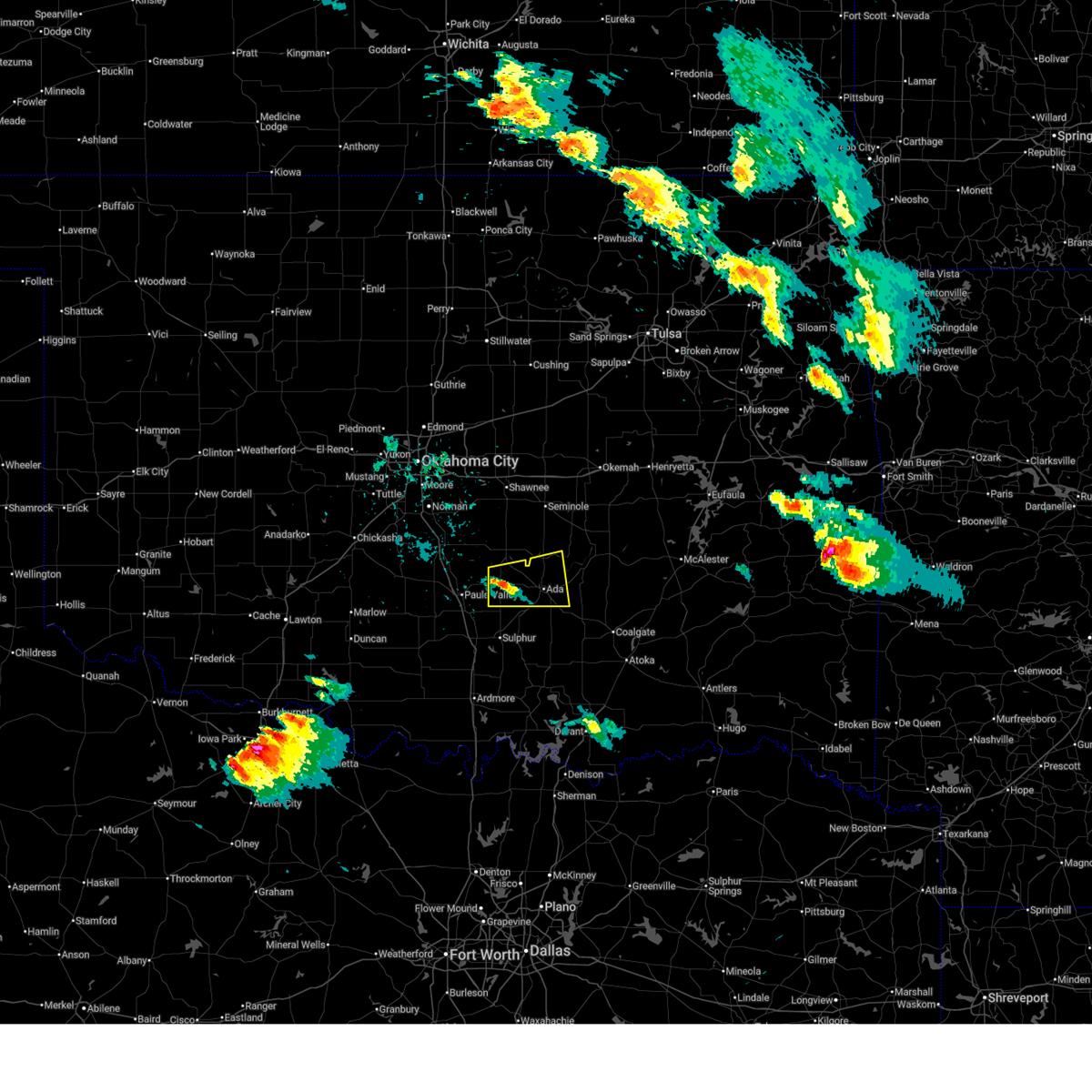
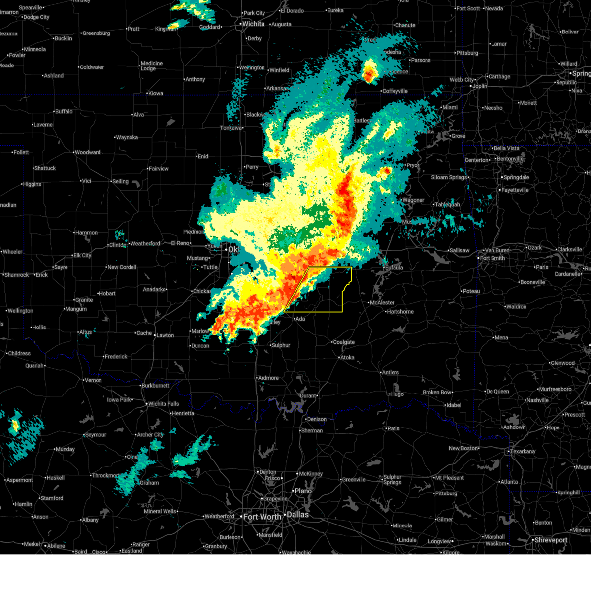
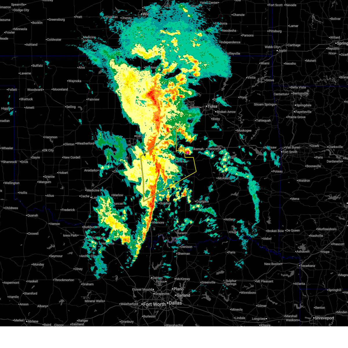
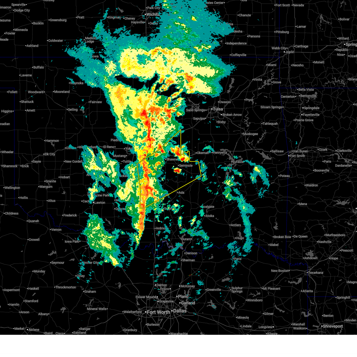
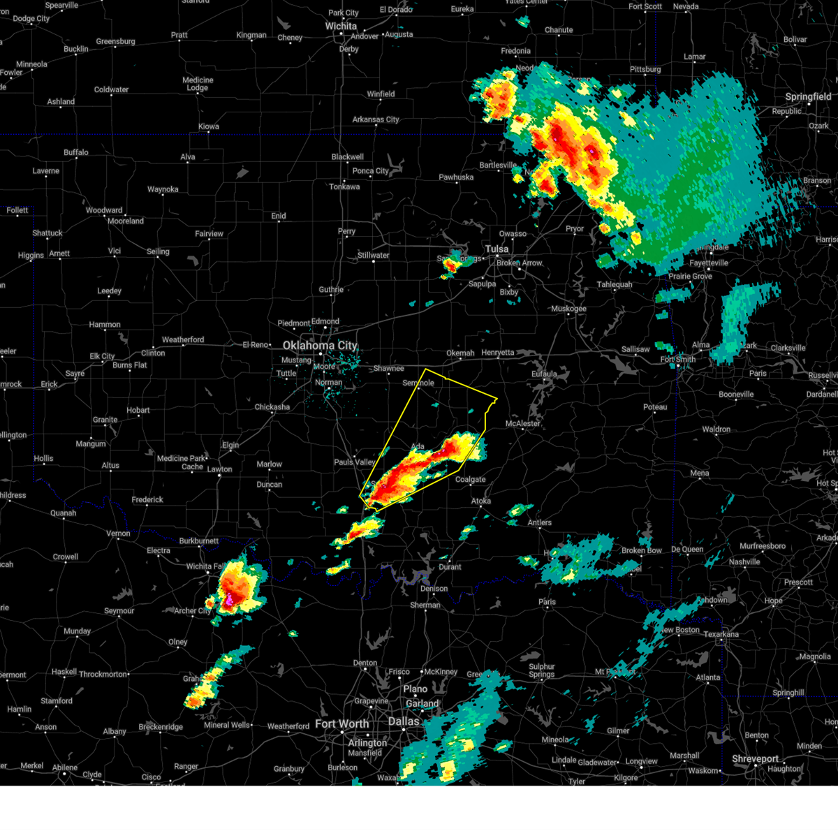
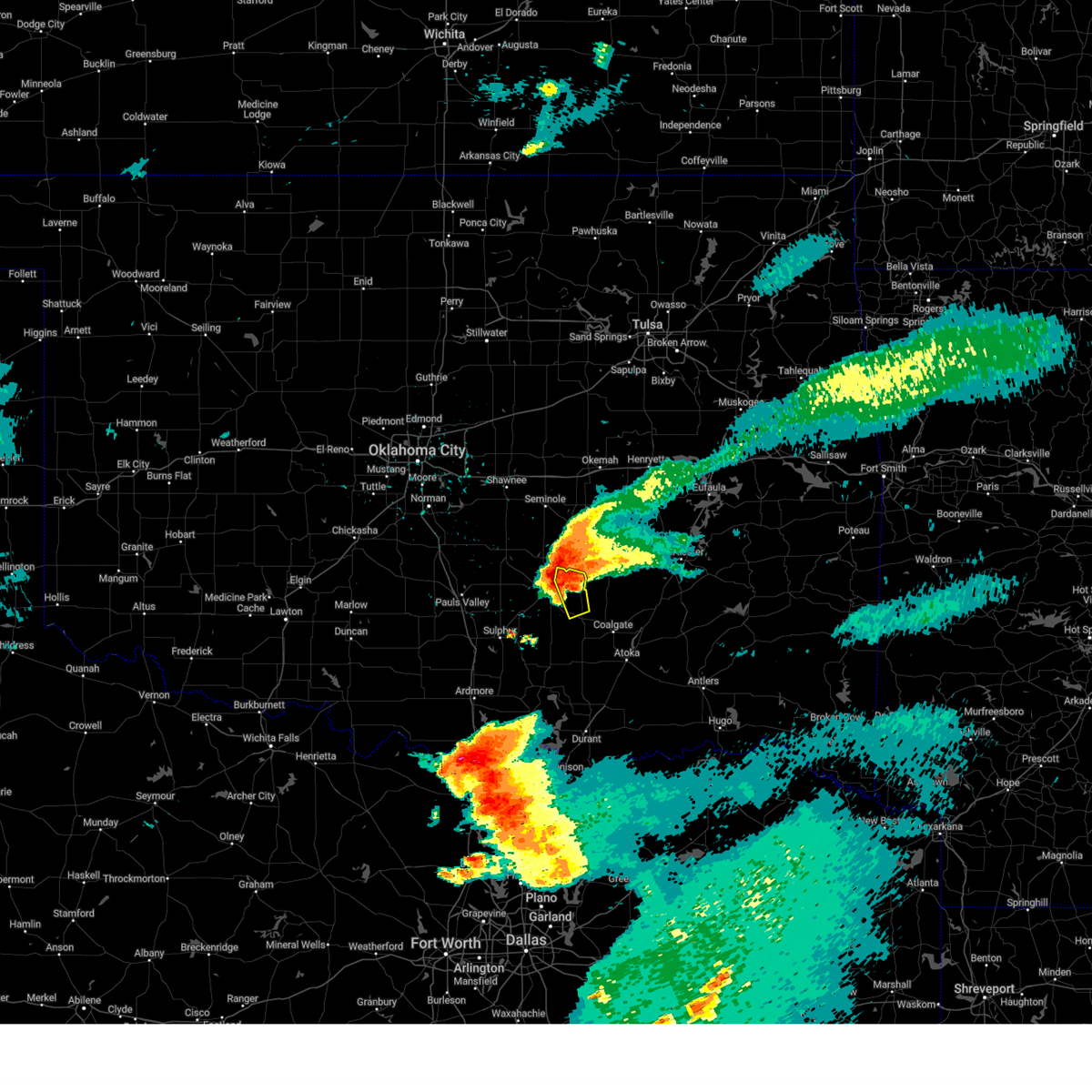
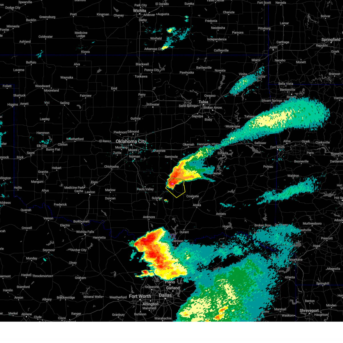
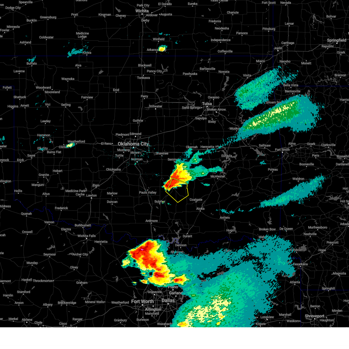
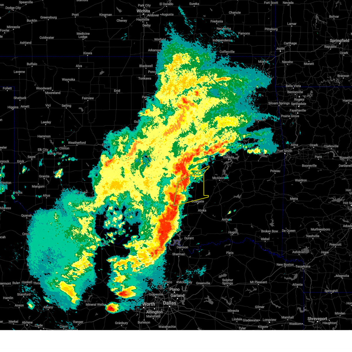
Hail Map for Francis, OK
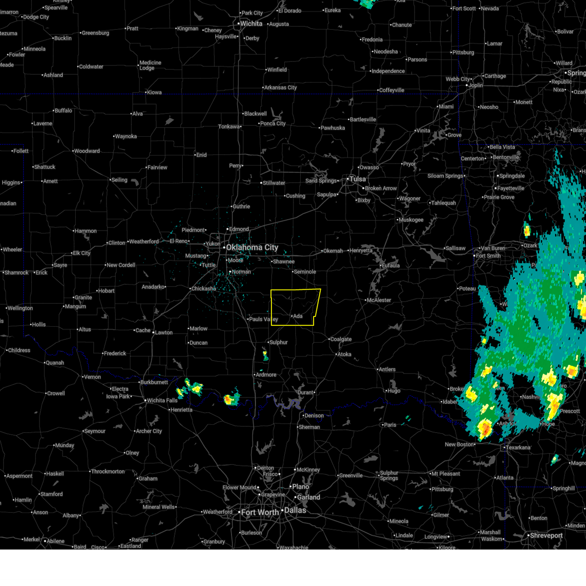
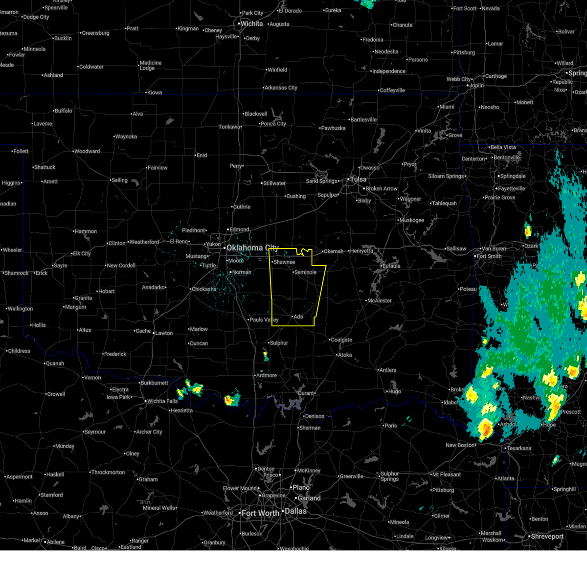
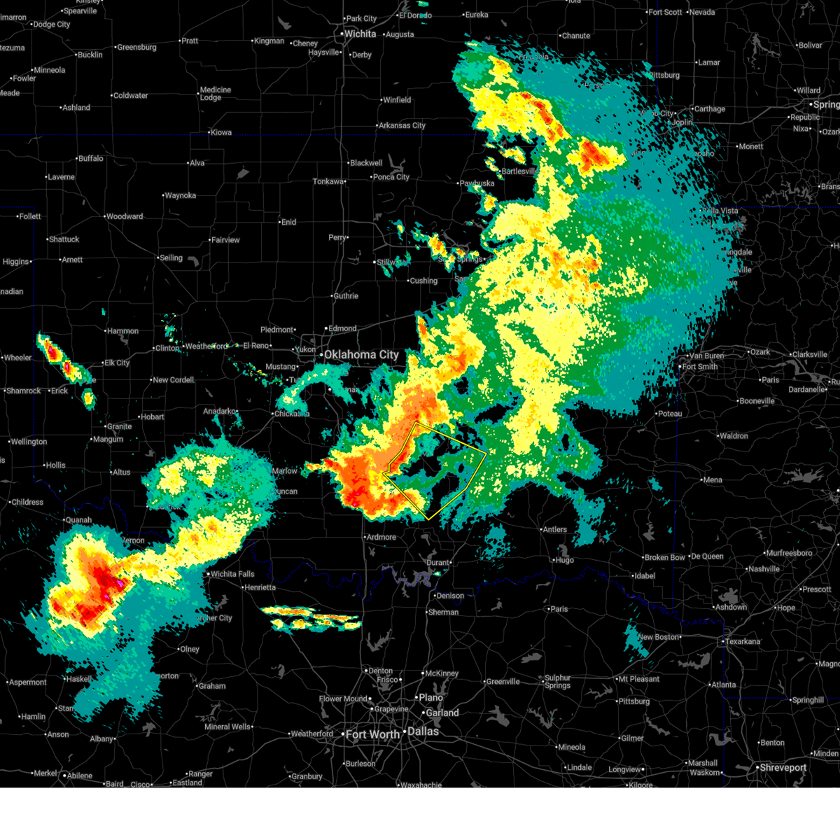
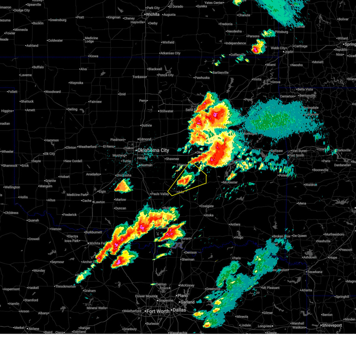
The Francis, OK area has had 0 reports of on-the-ground hail by trained spotters, and has been under severe weather warnings 37 times during the past 12 months. Doppler radar has detected hail at or near Francis, OK on 82 occasions, including 5 occasions during the past year.
| Name: | Francis, OK |
| Where Located: | 42.8 miles NW of Atoka, OK |
| Map: | Google Map for Francis, OK |
| Population: | 315 |
| Housing Units: | 140 |
| More Info: | Search Google for Francis, OK |
4
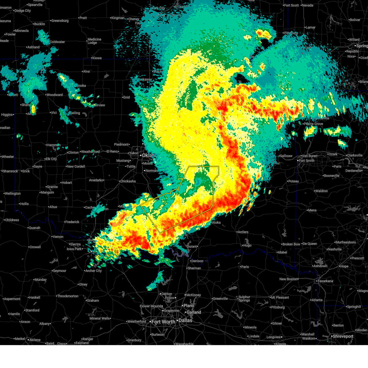
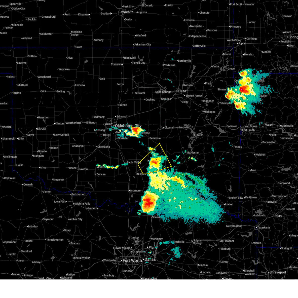
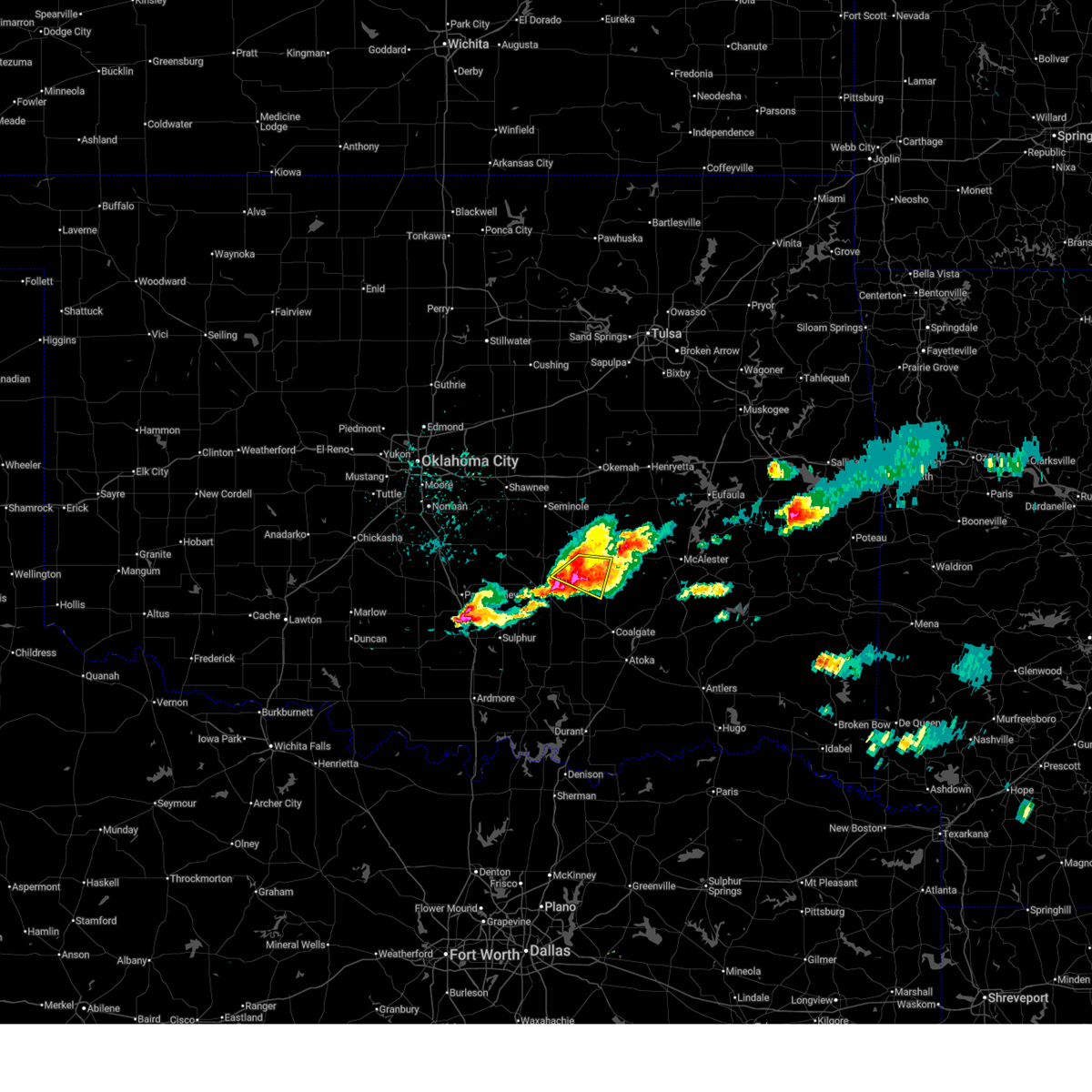
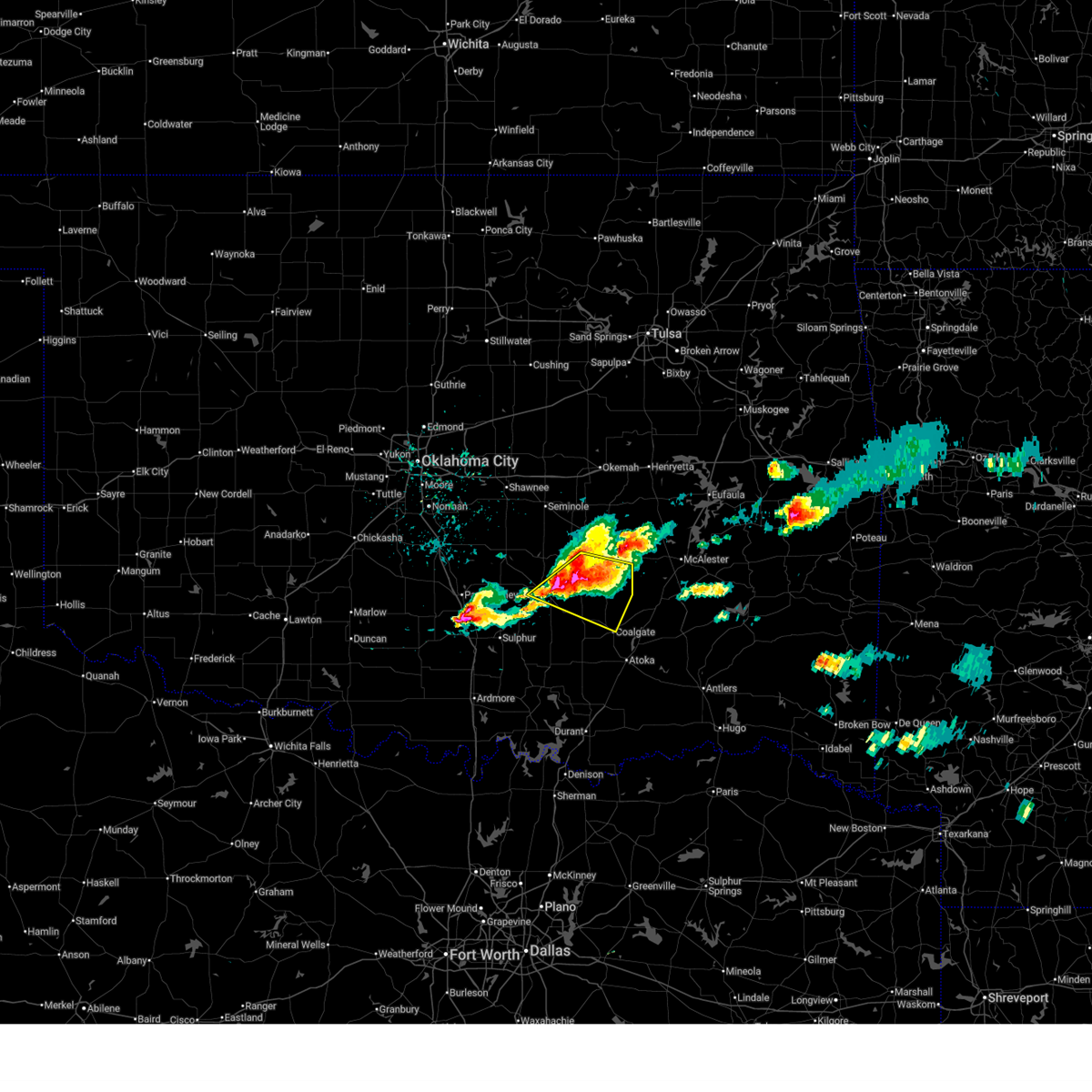
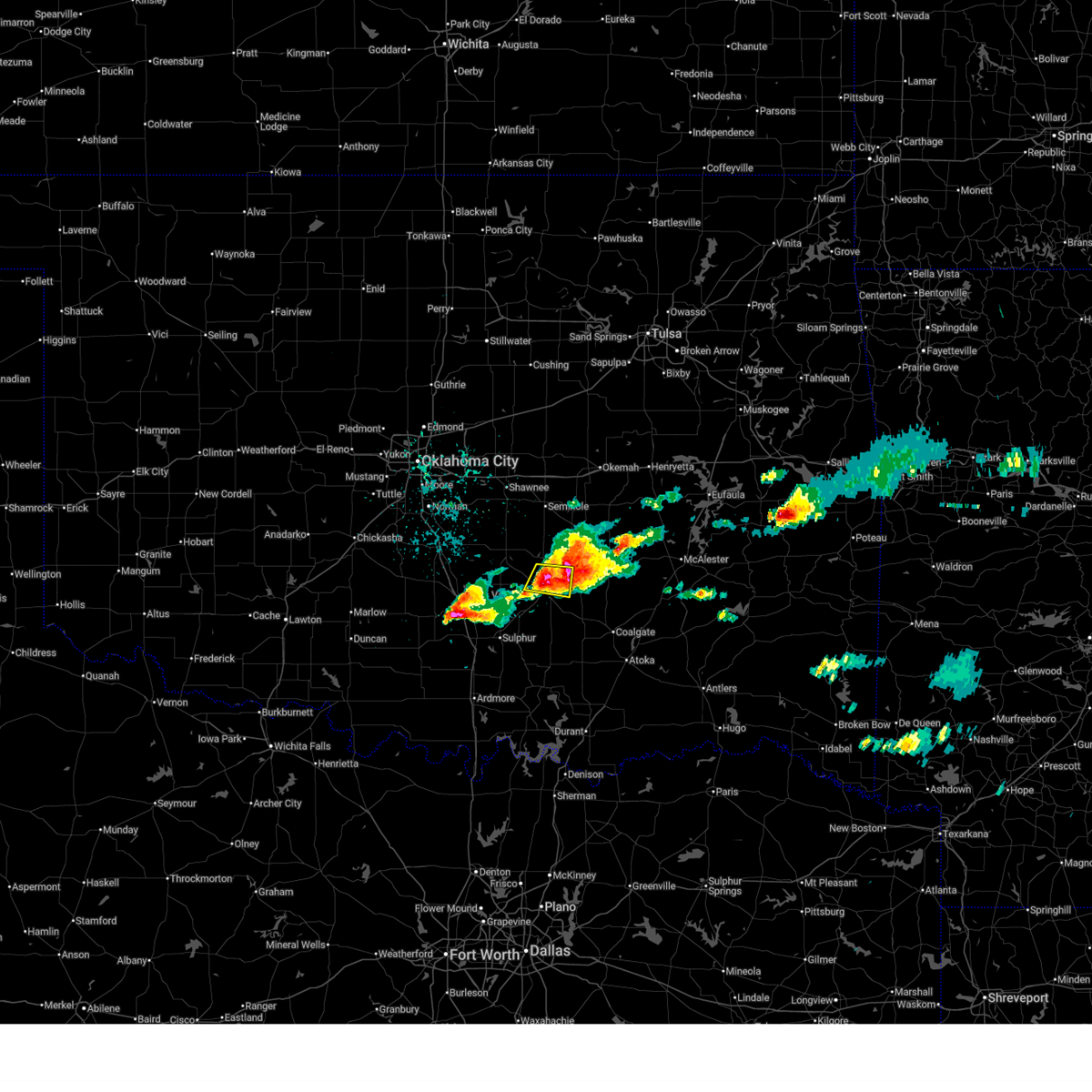
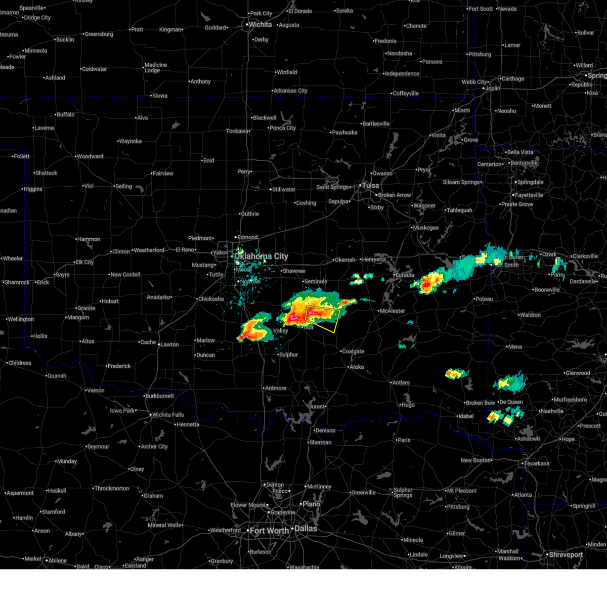
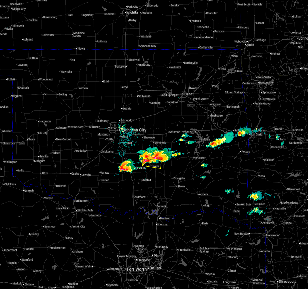
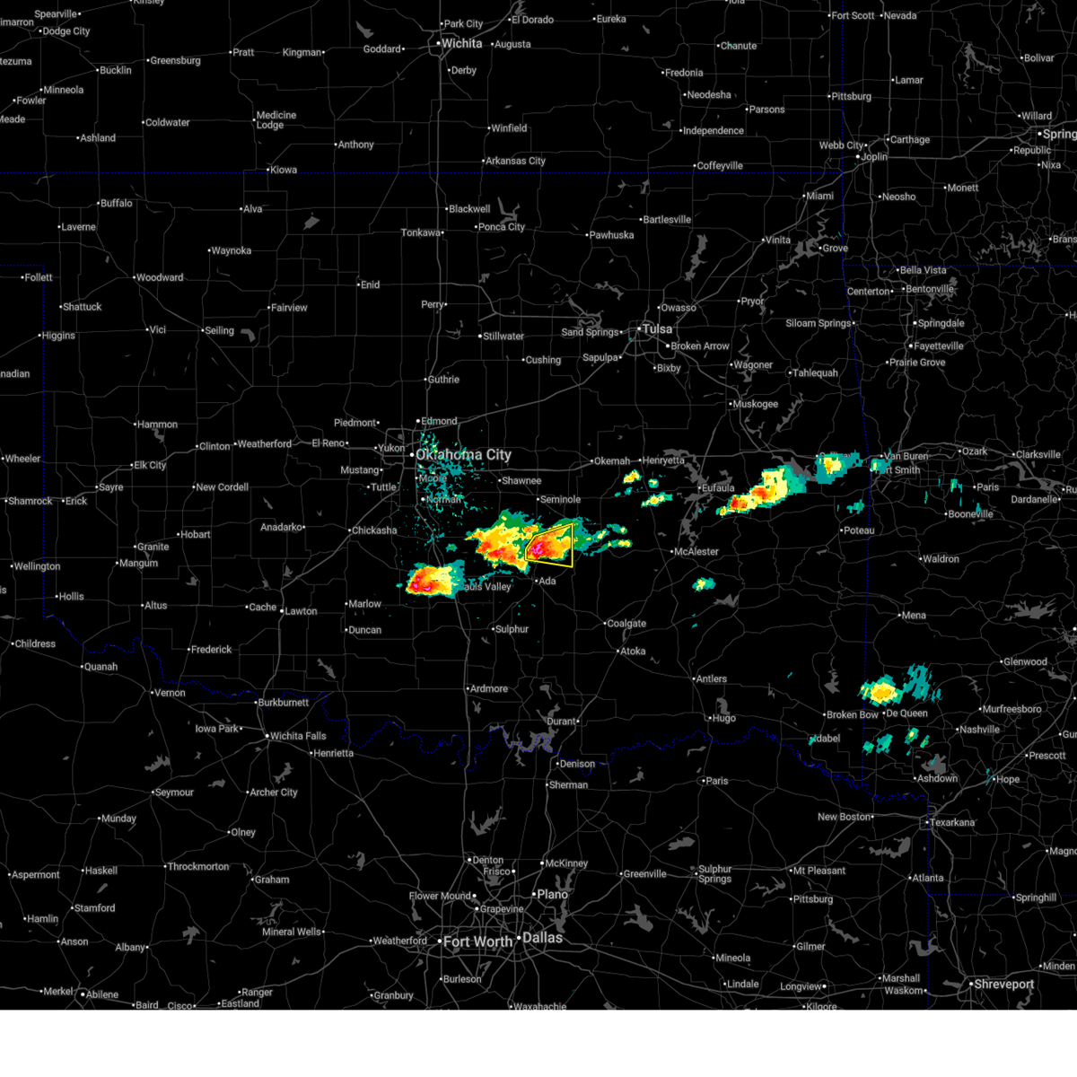
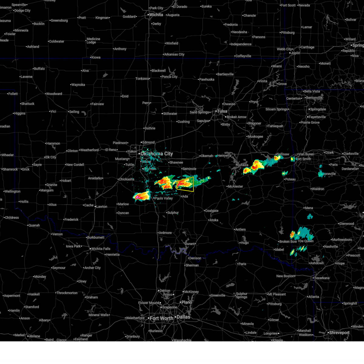
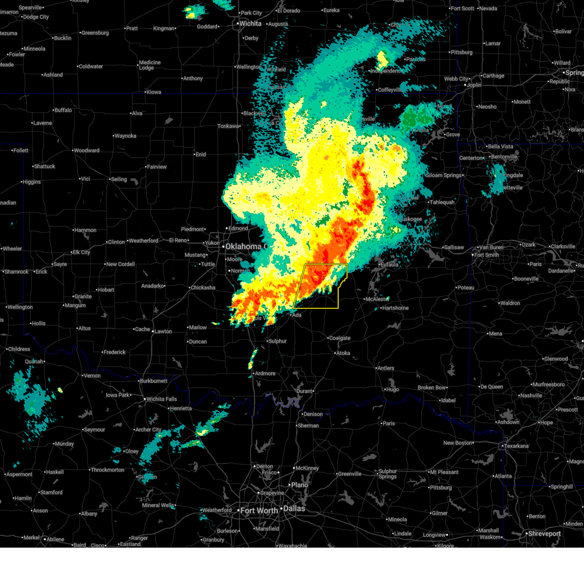
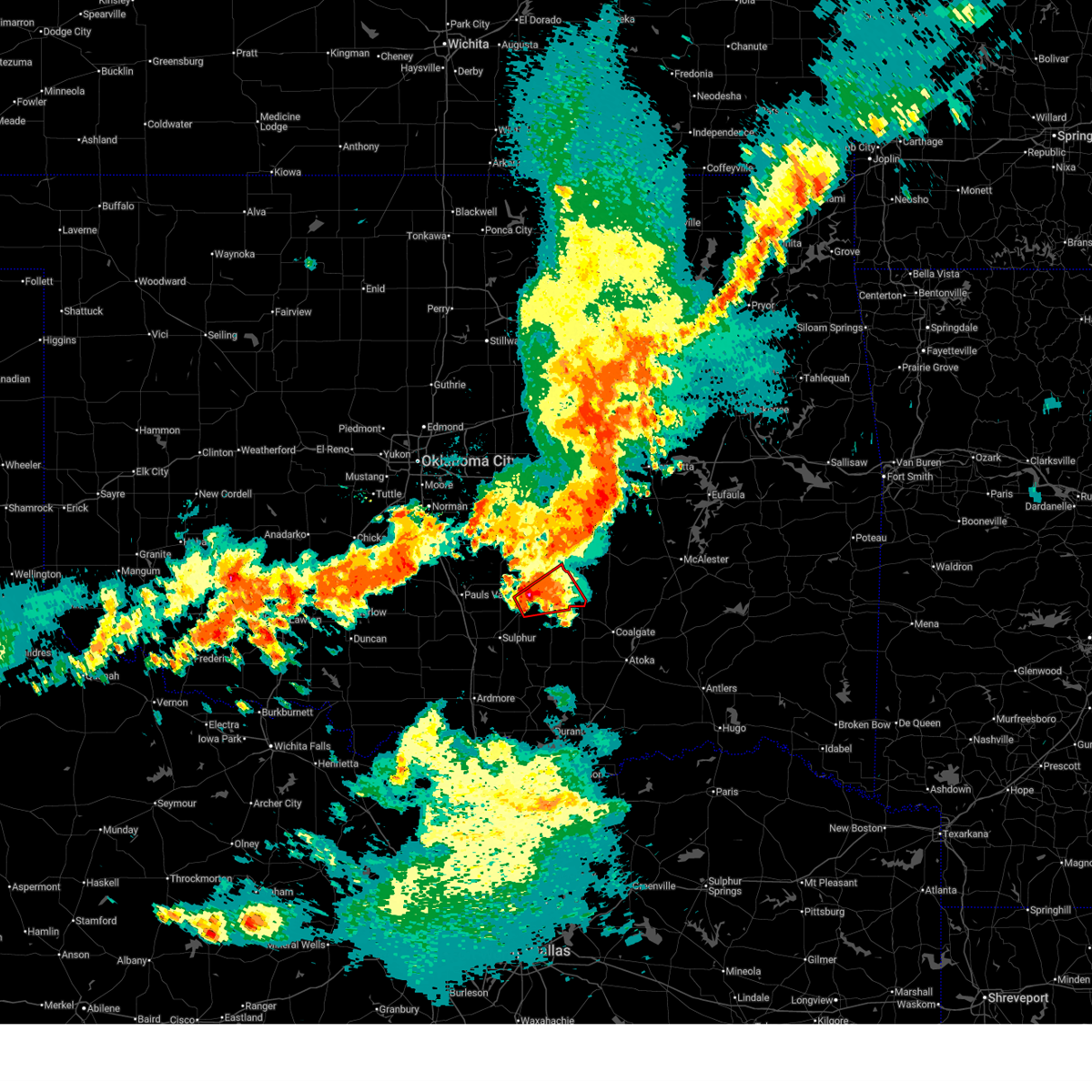
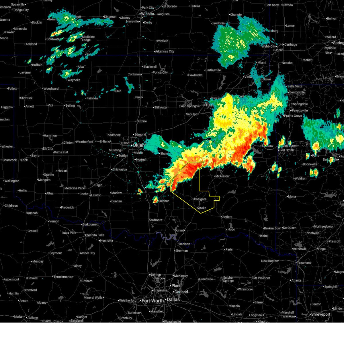
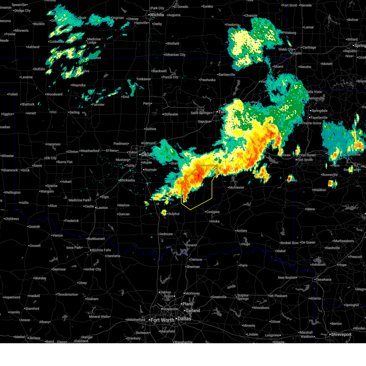
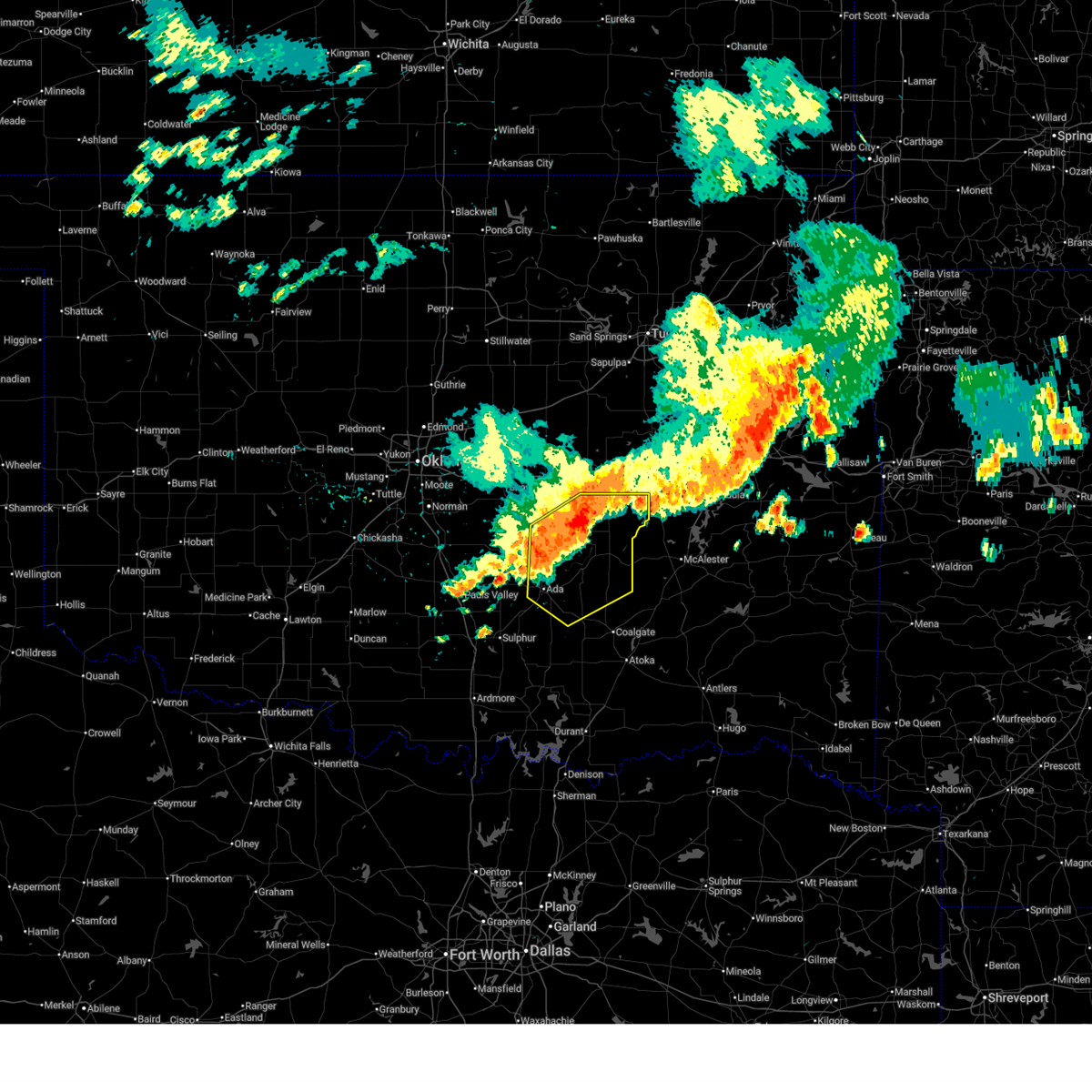
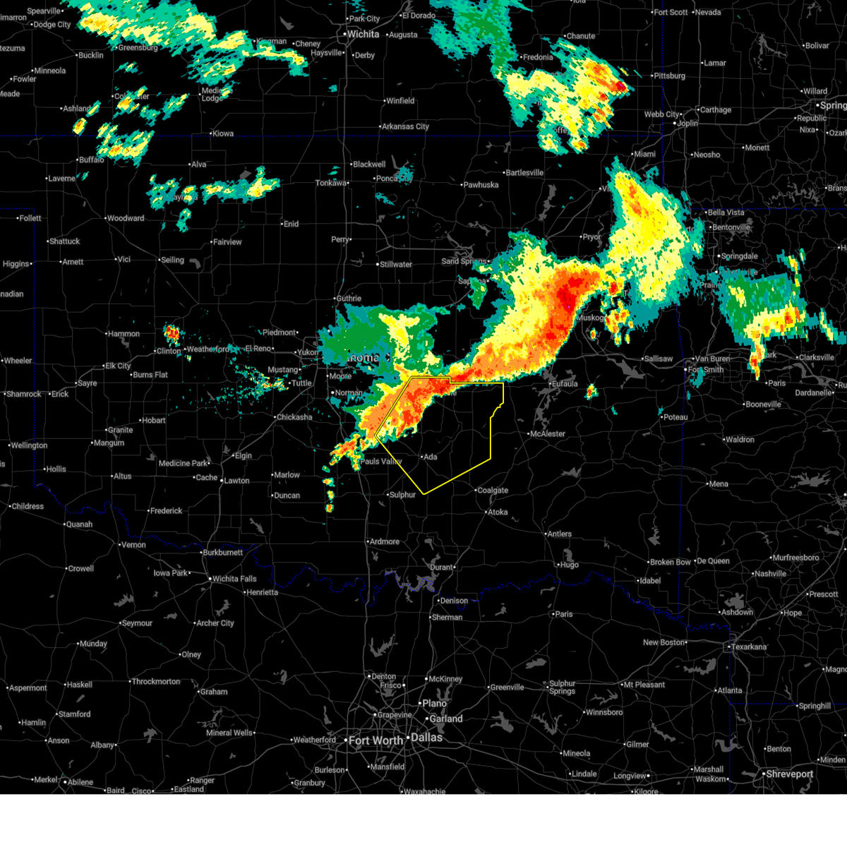
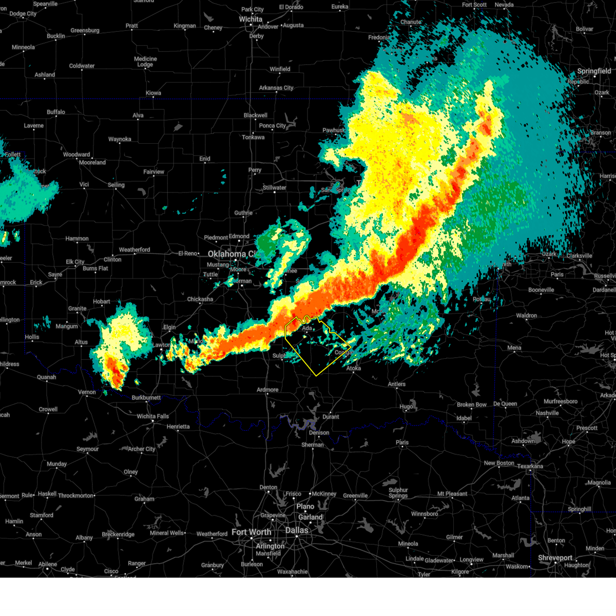
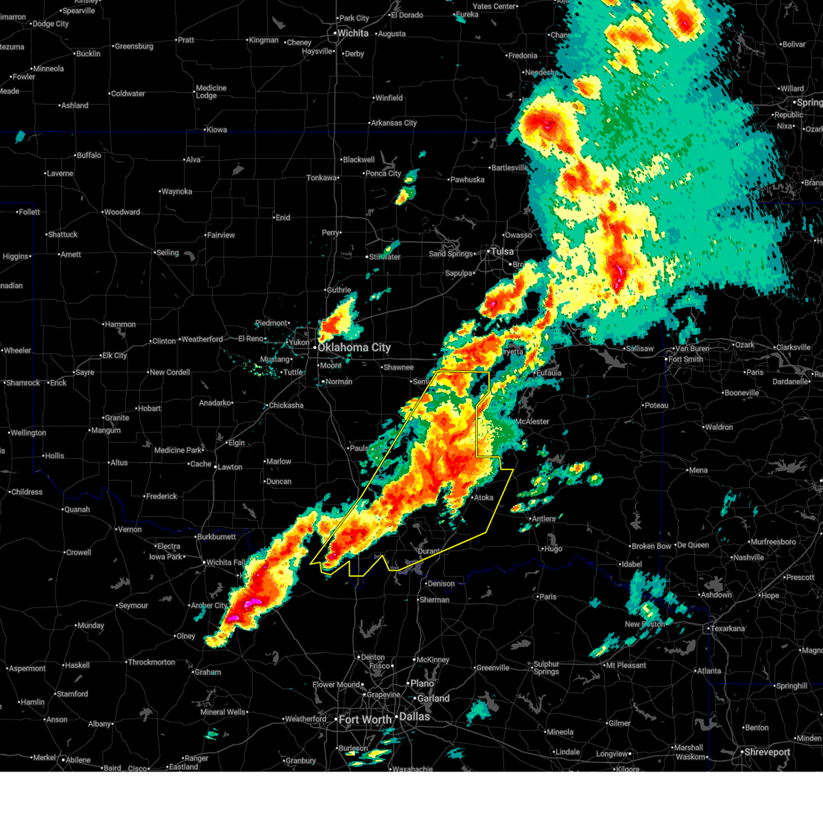
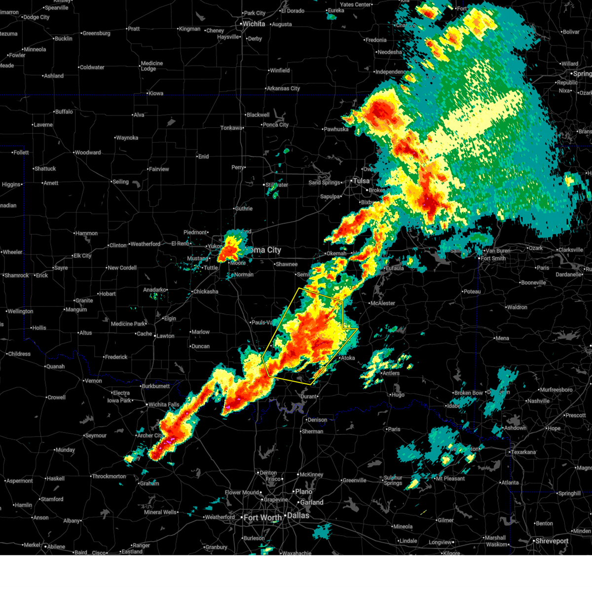
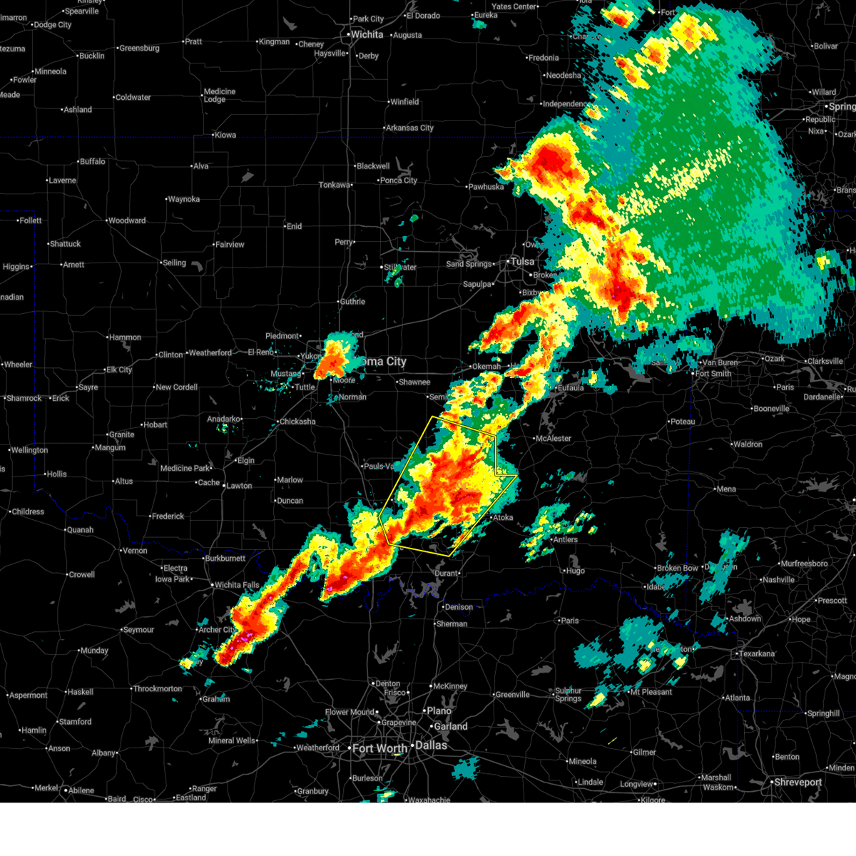
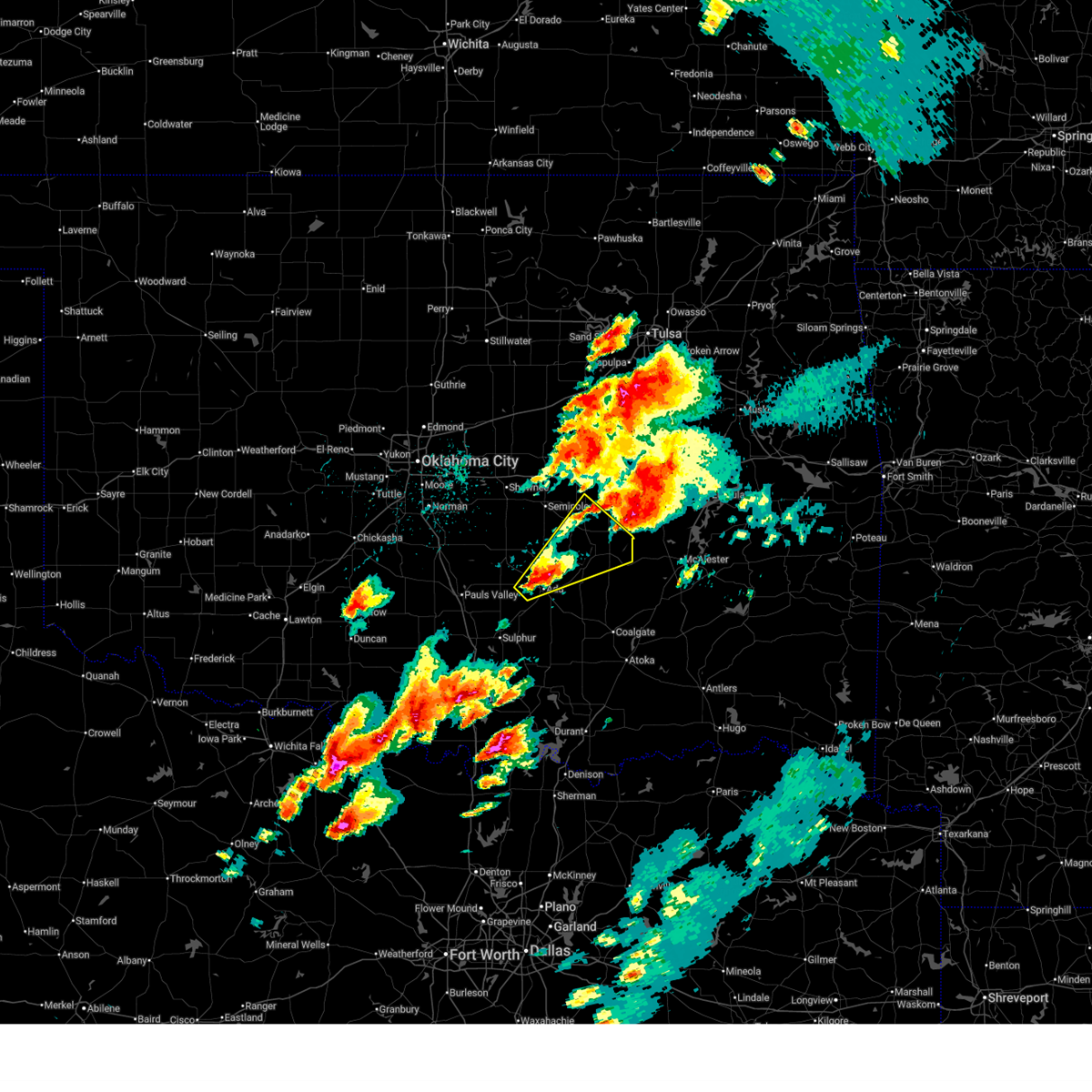
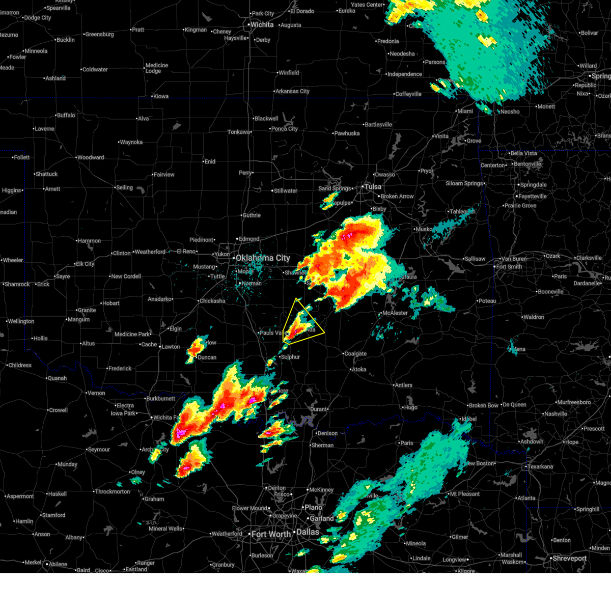
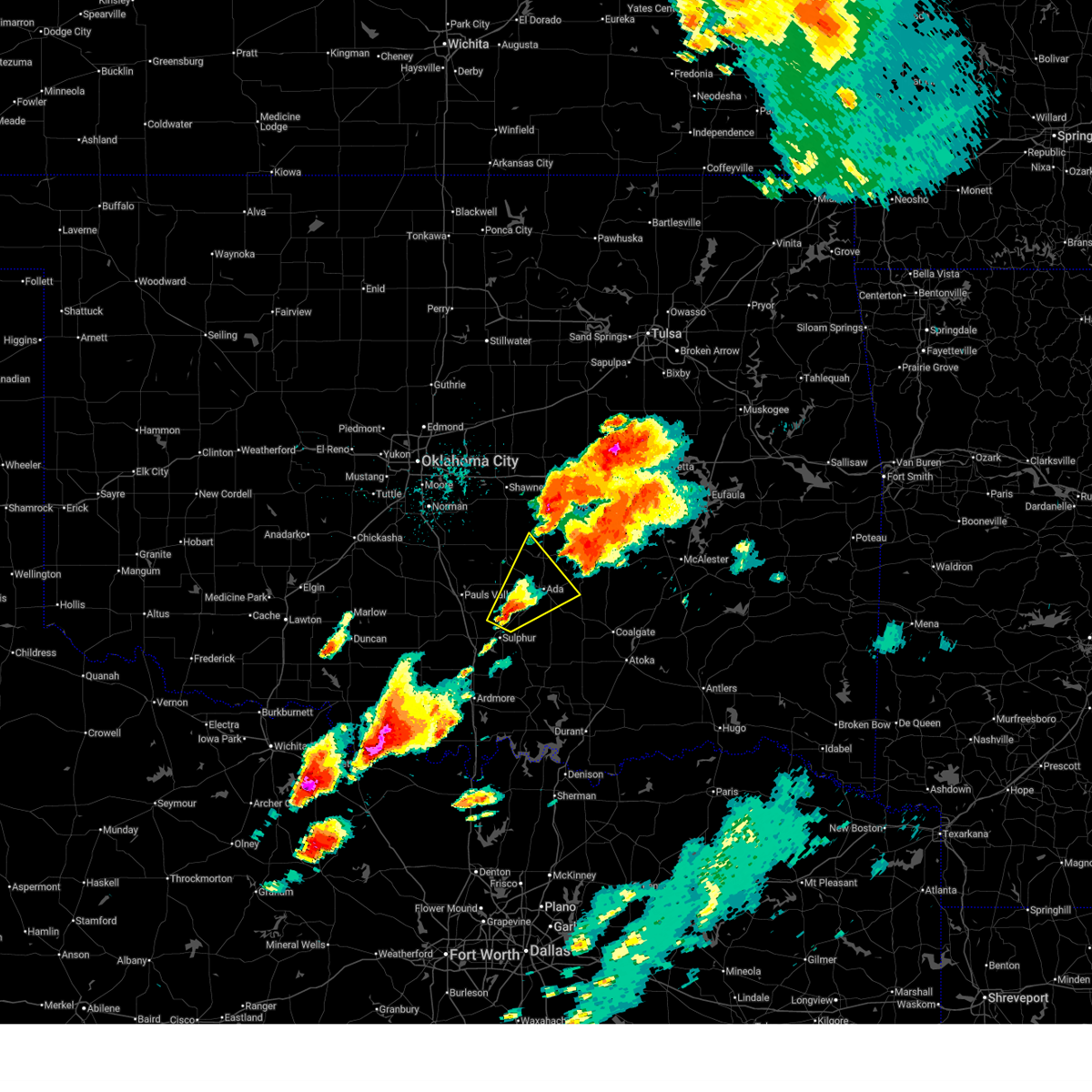
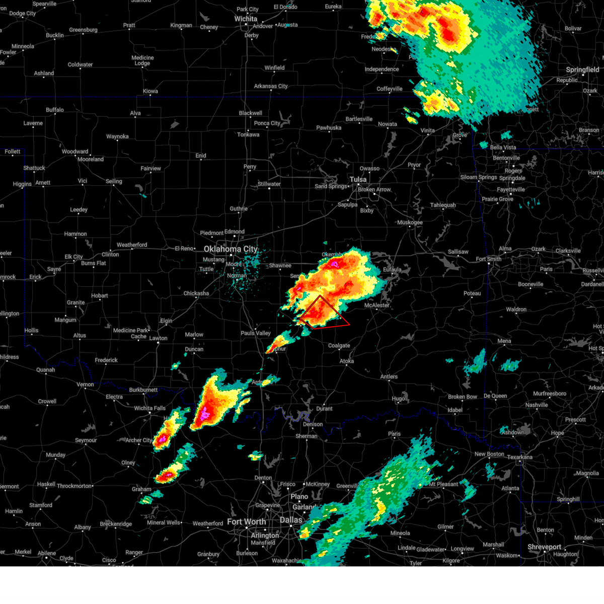
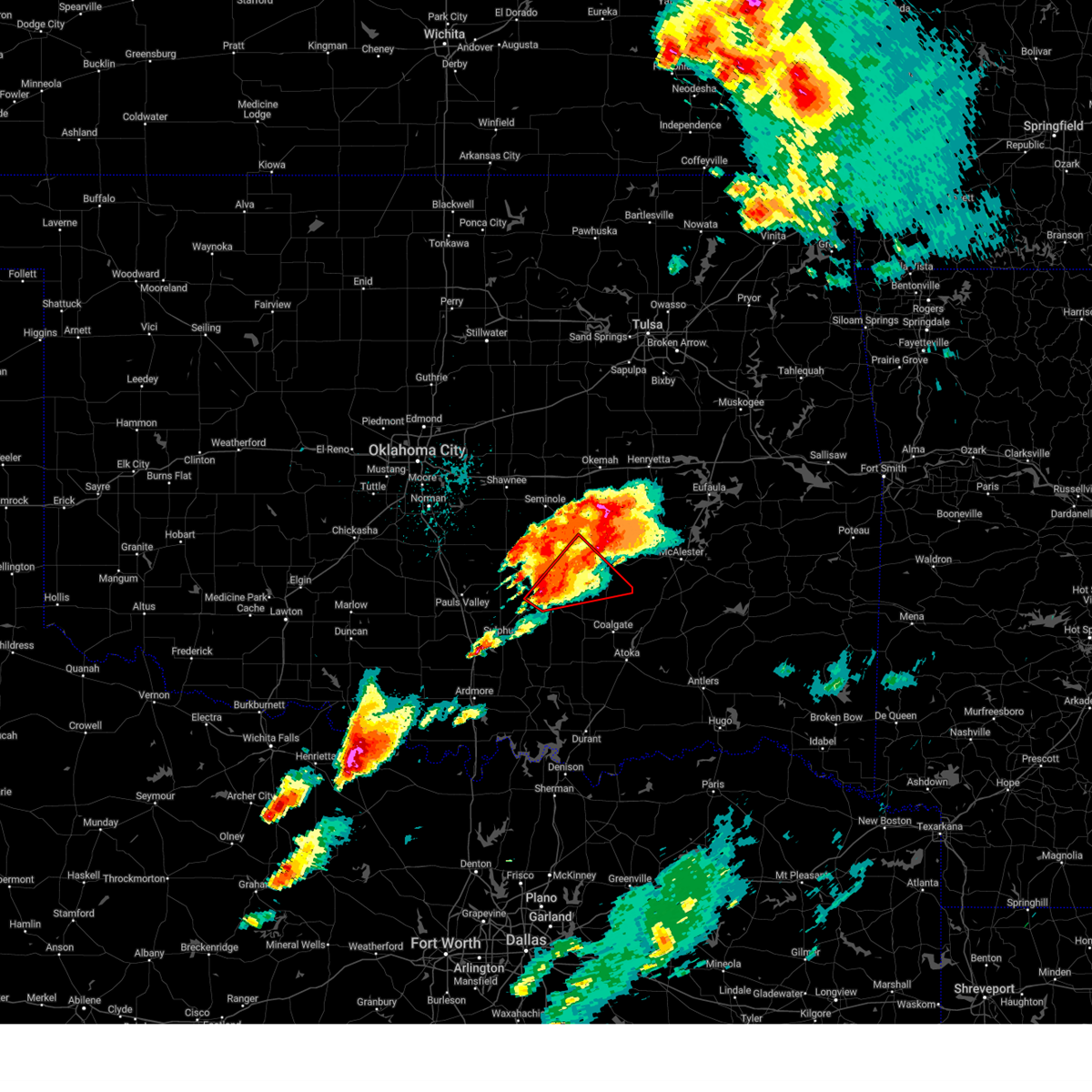
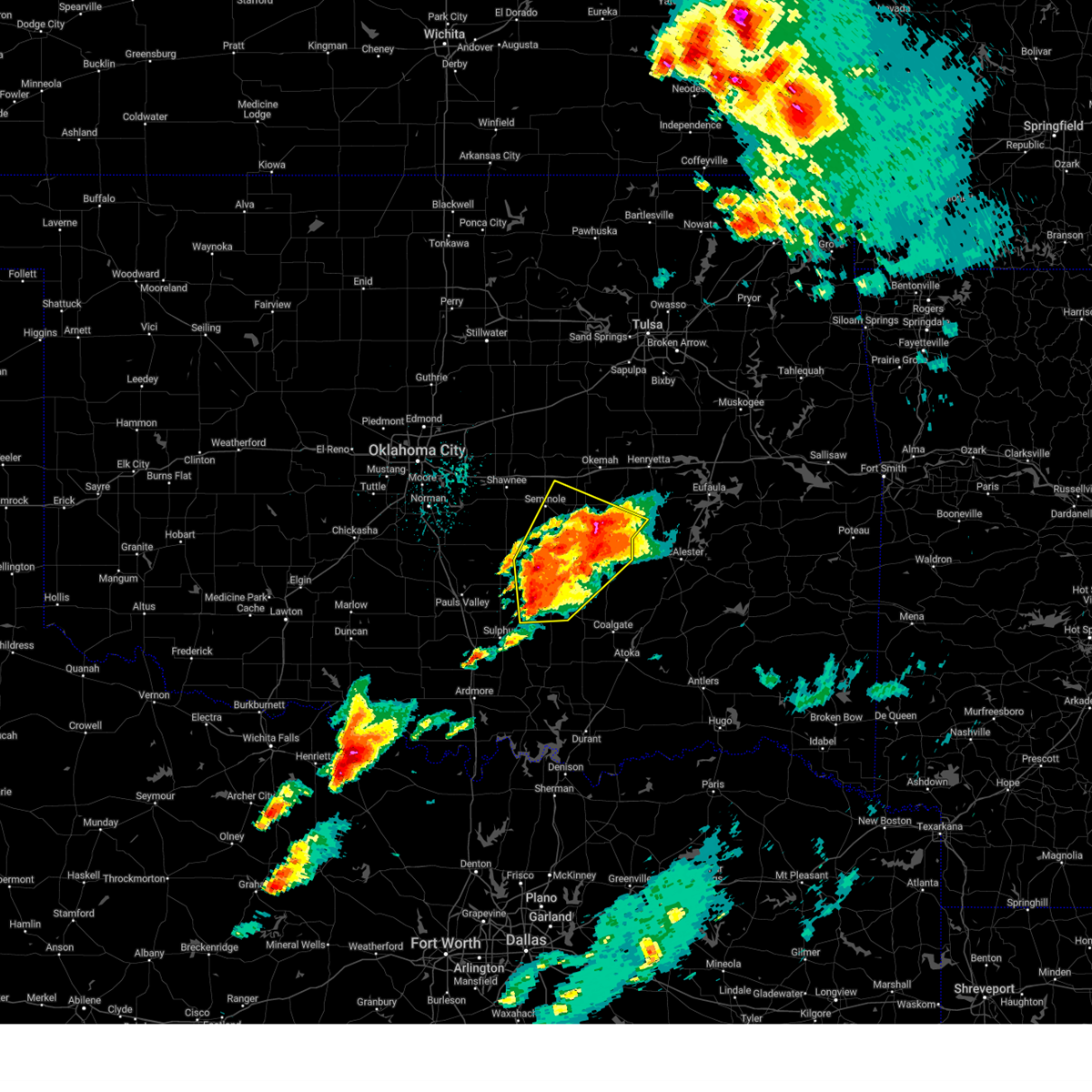
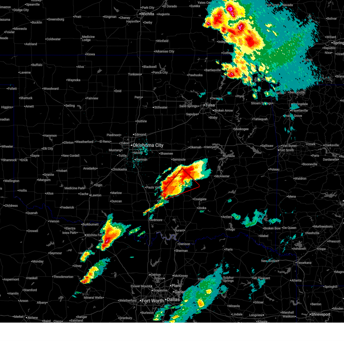
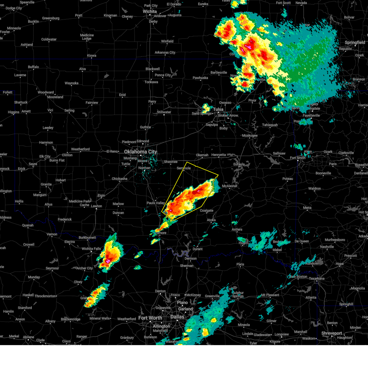
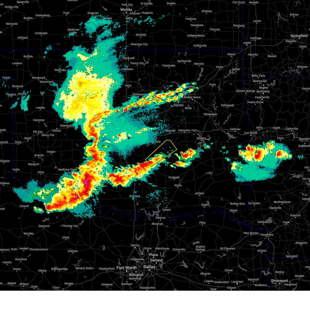
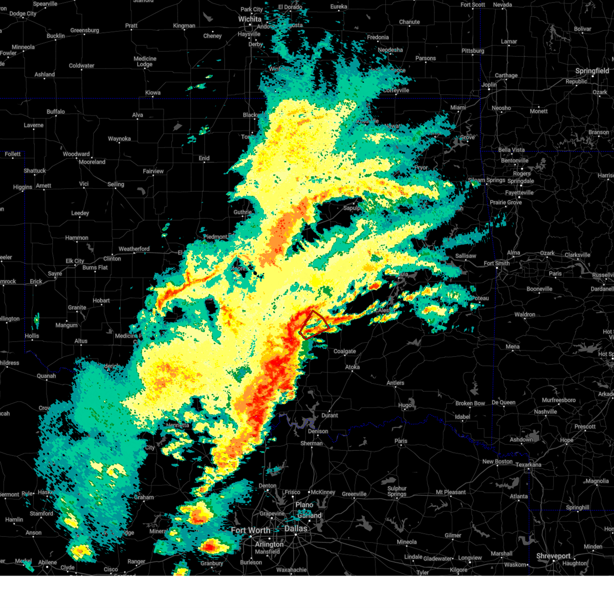
The Top Recent Hail Date for Francis, OK is Friday, April 24, 2026 (4th out of 82)
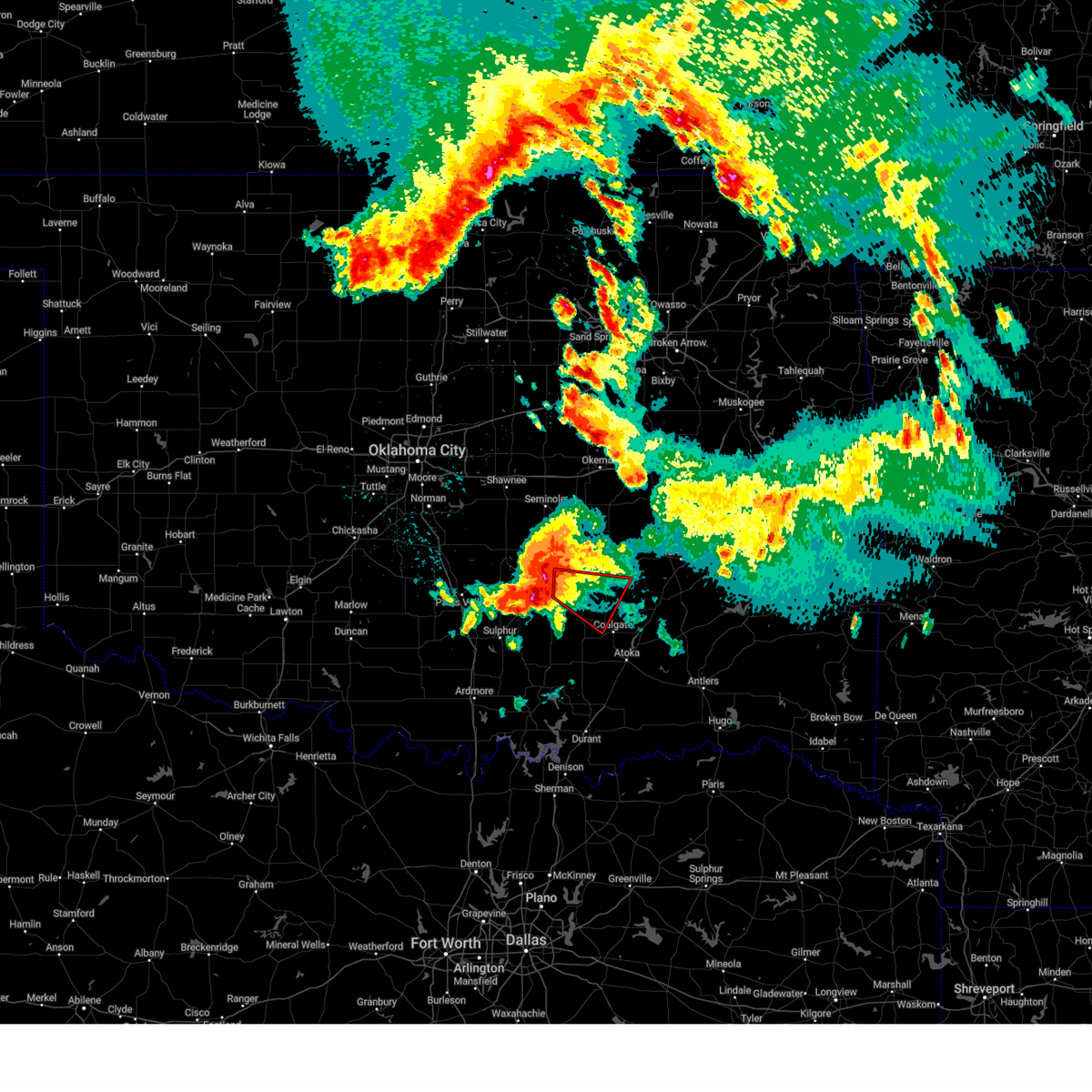
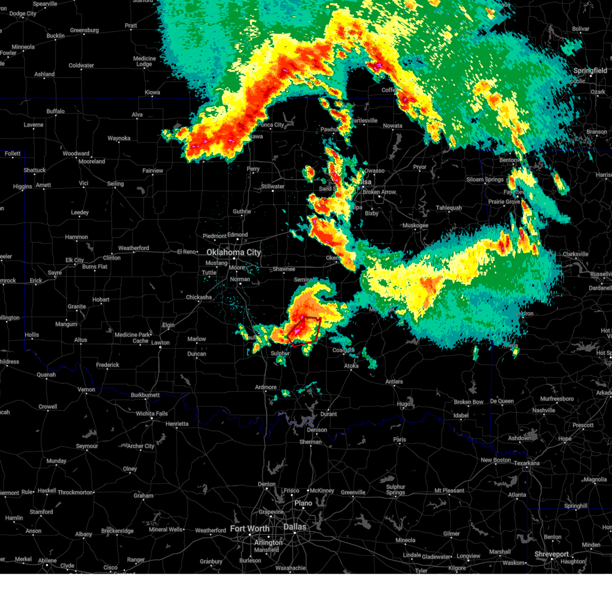
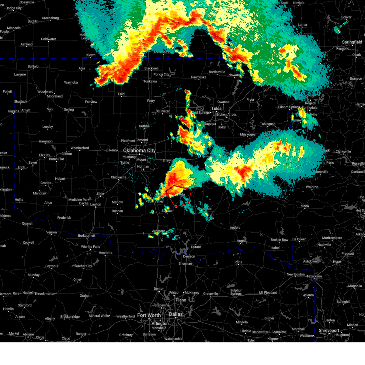
Hail and Wind Damage Spotted near Francis, OK
| Date / Time | Report Details |
|---|---|
| 7/4/2026 11:33 PM CDT |
 At 1133 pm cdt, severe thunderstorms were located along a line extending from 3 miles southwest of allen to 4 miles south of ada, moving southeast at 35 mph (radar indicated). Hazards include 60 mph wind gusts. Expect damage to roofs, siding, and trees. Locations impacted include, ada, konawa, byng, allen, asher, francis, sasakwa, vanoss, and spaulding. At 1133 pm cdt, severe thunderstorms were located along a line extending from 3 miles southwest of allen to 4 miles south of ada, moving southeast at 35 mph (radar indicated). Hazards include 60 mph wind gusts. Expect damage to roofs, siding, and trees. Locations impacted include, ada, konawa, byng, allen, asher, francis, sasakwa, vanoss, and spaulding.
|
| 7/4/2026 11:02 PM CDT |
 Svroun the national weather service in norman has issued a * severe thunderstorm warning for, seminole county in east central oklahoma, pontotoc county in east central oklahoma, central pottawatomie county in central oklahoma, western hughes county in southeastern oklahoma, * until 1145 pm cdt. * at 1102 pm cdt, severe thunderstorms were located along a line extending from near earlsboro to near vanoss, moving east at 30 mph (radar indicated). Hazards include 70 mph wind gusts and nickel size hail. Expect considerable tree damage. Damage is likely to mobile homes, roofs, and outbuildings. Svroun the national weather service in norman has issued a * severe thunderstorm warning for, seminole county in east central oklahoma, pontotoc county in east central oklahoma, central pottawatomie county in central oklahoma, western hughes county in southeastern oklahoma, * until 1145 pm cdt. * at 1102 pm cdt, severe thunderstorms were located along a line extending from near earlsboro to near vanoss, moving east at 30 mph (radar indicated). Hazards include 70 mph wind gusts and nickel size hail. Expect considerable tree damage. Damage is likely to mobile homes, roofs, and outbuildings.
|
| 7/4/2026 9:45 PM CDT |
 Svroun the national weather service in norman has issued a * severe thunderstorm warning for, seminole county in east central oklahoma, southern lincoln county in central oklahoma, northeastern pontotoc county in east central oklahoma, pottawatomie county in central oklahoma, hughes county in southeastern oklahoma, * until 1030 pm cdt. * at 944 pm cdt, severe thunderstorms were located along a line extending from 6 miles south of dustin to near holdenville to 3 miles southwest of dale, moving southeast at 45 mph. a wind gust of 60 mph was measured at the seminole airport (radar indicated). Hazards include 60 mph wind gusts and penny size hail. expect damage to roofs, siding, and trees Svroun the national weather service in norman has issued a * severe thunderstorm warning for, seminole county in east central oklahoma, southern lincoln county in central oklahoma, northeastern pontotoc county in east central oklahoma, pottawatomie county in central oklahoma, hughes county in southeastern oklahoma, * until 1030 pm cdt. * at 944 pm cdt, severe thunderstorms were located along a line extending from 6 miles south of dustin to near holdenville to 3 miles southwest of dale, moving southeast at 45 mph. a wind gust of 60 mph was measured at the seminole airport (radar indicated). Hazards include 60 mph wind gusts and penny size hail. expect damage to roofs, siding, and trees
|
| 6/23/2026 3:12 PM CDT |
 Svroun the national weather service in norman has issued a * severe thunderstorm warning for, northeastern johnston county in southeastern oklahoma, coal county in southeastern oklahoma, southwestern seminole county in east central oklahoma, pontotoc county in east central oklahoma, northeastern murray county in southern oklahoma, southwestern hughes county in southeastern oklahoma, * until 345 pm cdt. * at 312 pm cdt, severe thunderstorms were located along a line extending from near francis to 5 miles northeast of fitzhugh to near sulphur, moving southeast at 45 mph (radar indicated). Hazards include 60 mph wind gusts. expect damage to roofs, siding, and trees Svroun the national weather service in norman has issued a * severe thunderstorm warning for, northeastern johnston county in southeastern oklahoma, coal county in southeastern oklahoma, southwestern seminole county in east central oklahoma, pontotoc county in east central oklahoma, northeastern murray county in southern oklahoma, southwestern hughes county in southeastern oklahoma, * until 345 pm cdt. * at 312 pm cdt, severe thunderstorms were located along a line extending from near francis to 5 miles northeast of fitzhugh to near sulphur, moving southeast at 45 mph (radar indicated). Hazards include 60 mph wind gusts. expect damage to roofs, siding, and trees
|
| 6/22/2026 4:09 AM CDT |
 The storms which prompted the warning have moved out of the area. therefore, the warning will be allowed to expire. The storms which prompted the warning have moved out of the area. therefore, the warning will be allowed to expire.
|
| 6/22/2026 3:12 AM CDT |
 Svroun the national weather service in norman has issued a * severe thunderstorm warning for, northwestern johnston county in southeastern oklahoma, central garvin county in southern oklahoma, coal county in southeastern oklahoma, southern seminole county in east central oklahoma, northeastern carter county in southern oklahoma, pontotoc county in east central oklahoma, murray county in southern oklahoma, hughes county in southeastern oklahoma, * until 415 am cdt. * at 312 am cdt, severe thunderstorms were located along a line extending from 6 miles north of yeager to near francis to near katie, moving southeast at 35 mph (radar indicated). Hazards include 70 mph wind gusts and quarter size hail. Hail damage to vehicles is expected. expect considerable tree damage. Wind damage is also likely to mobile homes, roofs, and outbuildings. Svroun the national weather service in norman has issued a * severe thunderstorm warning for, northwestern johnston county in southeastern oklahoma, central garvin county in southern oklahoma, coal county in southeastern oklahoma, southern seminole county in east central oklahoma, northeastern carter county in southern oklahoma, pontotoc county in east central oklahoma, murray county in southern oklahoma, hughes county in southeastern oklahoma, * until 415 am cdt. * at 312 am cdt, severe thunderstorms were located along a line extending from 6 miles north of yeager to near francis to near katie, moving southeast at 35 mph (radar indicated). Hazards include 70 mph wind gusts and quarter size hail. Hail damage to vehicles is expected. expect considerable tree damage. Wind damage is also likely to mobile homes, roofs, and outbuildings.
|
| 6/22/2026 2:30 AM CDT |
 Svroun the national weather service in norman has issued a * severe thunderstorm warning for, garvin county in southern oklahoma, east central grady county in central oklahoma, seminole county in east central oklahoma, eastern cleveland county in central oklahoma, northwestern pontotoc county in east central oklahoma, north central murray county in southern oklahoma, pottawatomie county in central oklahoma, northwestern hughes county in southeastern oklahoma, mcclain county in central oklahoma, * until 330 am cdt. * at 230 am cdt, severe thunderstorms were located along a line extending from near johnson to near etowah to 3 miles south of criner, moving southeast at 50 mph (radar indicated). Hazards include 70 mph wind gusts and quarter size hail. Hail damage to vehicles is expected. expect considerable tree damage. Wind damage is also likely to mobile homes, roofs, and outbuildings. Svroun the national weather service in norman has issued a * severe thunderstorm warning for, garvin county in southern oklahoma, east central grady county in central oklahoma, seminole county in east central oklahoma, eastern cleveland county in central oklahoma, northwestern pontotoc county in east central oklahoma, north central murray county in southern oklahoma, pottawatomie county in central oklahoma, northwestern hughes county in southeastern oklahoma, mcclain county in central oklahoma, * until 330 am cdt. * at 230 am cdt, severe thunderstorms were located along a line extending from near johnson to near etowah to 3 miles south of criner, moving southeast at 50 mph (radar indicated). Hazards include 70 mph wind gusts and quarter size hail. Hail damage to vehicles is expected. expect considerable tree damage. Wind damage is also likely to mobile homes, roofs, and outbuildings.
|
| 6/6/2026 6:28 PM CDT |
 At 628 pm cdt, a severe thunderstorm was located near francis, moving northeast at 15 mph (radar indicated). Hazards include 60 mph wind gusts and penny size hail. Expect damage to roofs, siding, and trees. Locations impacted include, ada, byng, and francis. At 628 pm cdt, a severe thunderstorm was located near francis, moving northeast at 15 mph (radar indicated). Hazards include 60 mph wind gusts and penny size hail. Expect damage to roofs, siding, and trees. Locations impacted include, ada, byng, and francis.
|
| 6/6/2026 5:54 PM CDT |
 Svroun the national weather service in norman has issued a * severe thunderstorm warning for, central pontotoc county in east central oklahoma, * until 645 pm cdt. * at 554 pm cdt, a severe thunderstorm was located near ada, moving northeast at 20 mph (radar indicated). Hazards include 60 mph wind gusts and penny size hail. expect damage to roofs, siding, and trees Svroun the national weather service in norman has issued a * severe thunderstorm warning for, central pontotoc county in east central oklahoma, * until 645 pm cdt. * at 554 pm cdt, a severe thunderstorm was located near ada, moving northeast at 20 mph (radar indicated). Hazards include 60 mph wind gusts and penny size hail. expect damage to roofs, siding, and trees
|
| 4/28/2026 3:03 PM CDT |
 the severe thunderstorm warning has been cancelled and is no longer in effect the severe thunderstorm warning has been cancelled and is no longer in effect
|
| 4/28/2026 3:03 PM CDT |
 At 303 pm cdt, a severe thunderstorm was located 5 miles northeast of sasakwa, moving northeast at 40 mph (radar indicated). Hazards include golf ball size hail and 60 mph wind gusts. People and animals outdoors will be injured. expect hail damage to roofs, siding, windows, and vehicles. expect wind damage to roofs, siding, and trees. Locations impacted include, allen, francis, and sasakwa. At 303 pm cdt, a severe thunderstorm was located 5 miles northeast of sasakwa, moving northeast at 40 mph (radar indicated). Hazards include golf ball size hail and 60 mph wind gusts. People and animals outdoors will be injured. expect hail damage to roofs, siding, windows, and vehicles. expect wind damage to roofs, siding, and trees. Locations impacted include, allen, francis, and sasakwa.
|
| 4/28/2026 2:57 PM CDT |
 Svroun the national weather service in norman has issued a * severe thunderstorm warning for, southern seminole county in east central oklahoma, northeastern pontotoc county in east central oklahoma, hughes county in southeastern oklahoma, * until 345 pm cdt. * at 257 pm cdt, a severe thunderstorm was located near sasakwa, moving northeast at 55 mph (radar indicated). Hazards include golf ball size hail and 60 mph wind gusts. People and animals outdoors will be injured. expect hail damage to roofs, siding, windows, and vehicles. Expect wind damage to roofs, siding, and trees. Svroun the national weather service in norman has issued a * severe thunderstorm warning for, southern seminole county in east central oklahoma, northeastern pontotoc county in east central oklahoma, hughes county in southeastern oklahoma, * until 345 pm cdt. * at 257 pm cdt, a severe thunderstorm was located near sasakwa, moving northeast at 55 mph (radar indicated). Hazards include golf ball size hail and 60 mph wind gusts. People and animals outdoors will be injured. expect hail damage to roofs, siding, windows, and vehicles. Expect wind damage to roofs, siding, and trees.
|
| 4/28/2026 2:46 PM CDT |
 At 246 pm cdt, a severe thunderstorm was located near byng, moving northeast at 50 mph (radar indicated). Hazards include golf ball size hail and 60 mph wind gusts. People and animals outdoors will be injured. expect hail damage to roofs, siding, windows, and vehicles. expect wind damage to roofs, siding, and trees. Locations impacted include, ada, konawa, byng, allen, francis, and sasakwa. At 246 pm cdt, a severe thunderstorm was located near byng, moving northeast at 50 mph (radar indicated). Hazards include golf ball size hail and 60 mph wind gusts. People and animals outdoors will be injured. expect hail damage to roofs, siding, windows, and vehicles. expect wind damage to roofs, siding, and trees. Locations impacted include, ada, konawa, byng, allen, francis, and sasakwa.
|
| 4/28/2026 2:29 PM CDT |
 Svroun the national weather service in norman has issued a * severe thunderstorm warning for, northeastern garvin county in southern oklahoma, southern seminole county in east central oklahoma, northern pontotoc county in east central oklahoma, southeastern pottawatomie county in central oklahoma, southwestern hughes county in southeastern oklahoma, southeastern mcclain county in central oklahoma, * until 315 pm cdt. * at 229 pm cdt, a severe thunderstorm was located near vanoss, moving northeast at 40 mph (radar indicated). Hazards include two inch hail and 70 mph wind gusts. People and animals outdoors will be injured. expect hail damage to roofs, siding, windows, and vehicles. expect considerable tree damage. Wind damage is also likely to mobile homes, roofs, and outbuildings. Svroun the national weather service in norman has issued a * severe thunderstorm warning for, northeastern garvin county in southern oklahoma, southern seminole county in east central oklahoma, northern pontotoc county in east central oklahoma, southeastern pottawatomie county in central oklahoma, southwestern hughes county in southeastern oklahoma, southeastern mcclain county in central oklahoma, * until 315 pm cdt. * at 229 pm cdt, a severe thunderstorm was located near vanoss, moving northeast at 40 mph (radar indicated). Hazards include two inch hail and 70 mph wind gusts. People and animals outdoors will be injured. expect hail damage to roofs, siding, windows, and vehicles. expect considerable tree damage. Wind damage is also likely to mobile homes, roofs, and outbuildings.
|
| 4/28/2026 10:20 AM CDT |
 The storm which prompted the warning has weakened below severe limits, therefore the warning will be allowed to expire. The storm which prompted the warning has weakened below severe limits, therefore the warning will be allowed to expire.
|
| 4/28/2026 10:07 AM CDT |
 At 1007 am cdt, a severe thunderstorm was located 5 miles southeast of ada, moving northeast at 50 mph (radar indicated). Hazards include 60 mph wind gusts and quarter size hail. Hail damage to vehicles is expected. expect wind damage to roofs, siding, and trees. Locations impacted include, ada, holdenville, byng, allen, roff, stonewall, tupelo, francis, fitzhugh, sasakwa, gerty, centrahoma, atwood, fittstown, spaulding, and jesse. At 1007 am cdt, a severe thunderstorm was located 5 miles southeast of ada, moving northeast at 50 mph (radar indicated). Hazards include 60 mph wind gusts and quarter size hail. Hail damage to vehicles is expected. expect wind damage to roofs, siding, and trees. Locations impacted include, ada, holdenville, byng, allen, roff, stonewall, tupelo, francis, fitzhugh, sasakwa, gerty, centrahoma, atwood, fittstown, spaulding, and jesse.
|
| 4/28/2026 9:38 AM CDT |
 Svroun the national weather service in norman has issued a * severe thunderstorm warning for, northwestern johnston county in southeastern oklahoma, east central garvin county in southern oklahoma, northern coal county in southeastern oklahoma, southeastern seminole county in east central oklahoma, pontotoc county in east central oklahoma, eastern murray county in southern oklahoma, southwestern hughes county in southeastern oklahoma, * until 1030 am cdt. * at 937 am cdt, a severe thunderstorm was located near sulphur, moving northeast at 60 mph (radar indicated). Hazards include ping pong ball size hail and 60 mph wind gusts. People and animals outdoors will be injured. expect hail damage to roofs, siding, windows, and vehicles. Expect wind damage to roofs, siding, and trees. Svroun the national weather service in norman has issued a * severe thunderstorm warning for, northwestern johnston county in southeastern oklahoma, east central garvin county in southern oklahoma, northern coal county in southeastern oklahoma, southeastern seminole county in east central oklahoma, pontotoc county in east central oklahoma, eastern murray county in southern oklahoma, southwestern hughes county in southeastern oklahoma, * until 1030 am cdt. * at 937 am cdt, a severe thunderstorm was located near sulphur, moving northeast at 60 mph (radar indicated). Hazards include ping pong ball size hail and 60 mph wind gusts. People and animals outdoors will be injured. expect hail damage to roofs, siding, windows, and vehicles. Expect wind damage to roofs, siding, and trees.
|
| 4/25/2026 6:12 PM CDT |
 Svroun the national weather service in norman has issued a * severe thunderstorm warning for, west central coal county in southeastern oklahoma, south central seminole county in east central oklahoma, northeastern pontotoc county in east central oklahoma, southwestern hughes county in southeastern oklahoma, * until 700 pm cdt. * at 612 pm cdt, a severe thunderstorm was located near ada, moving east at 20 mph (radar indicated). Hazards include 60 mph wind gusts and half dollar size hail. Hail damage to vehicles is expected. Expect wind damage to roofs, siding, and trees. Svroun the national weather service in norman has issued a * severe thunderstorm warning for, west central coal county in southeastern oklahoma, south central seminole county in east central oklahoma, northeastern pontotoc county in east central oklahoma, southwestern hughes county in southeastern oklahoma, * until 700 pm cdt. * at 612 pm cdt, a severe thunderstorm was located near ada, moving east at 20 mph (radar indicated). Hazards include 60 mph wind gusts and half dollar size hail. Hail damage to vehicles is expected. Expect wind damage to roofs, siding, and trees.
|
| 4/25/2026 6:07 PM CDT |
 At 607 pm cdt, a severe thunderstorm capable of producing a tornado was located 5 miles northeast of vanoss, moving east at 10 mph (radar indicated rotation). Hazards include tornado and golf ball size hail. Flying debris will be dangerous to those caught without shelter. mobile homes will be damaged or destroyed. damage to roofs, windows, and vehicles will occur. tree damage is likely. Locations impacted include, ada, byng, and francis. At 607 pm cdt, a severe thunderstorm capable of producing a tornado was located 5 miles northeast of vanoss, moving east at 10 mph (radar indicated rotation). Hazards include tornado and golf ball size hail. Flying debris will be dangerous to those caught without shelter. mobile homes will be damaged or destroyed. damage to roofs, windows, and vehicles will occur. tree damage is likely. Locations impacted include, ada, byng, and francis.
|
| 4/25/2026 5:50 PM CDT |
 Toroun the national weather service in norman has issued a * tornado warning for, southwestern seminole county in east central oklahoma, northwestern pontotoc county in east central oklahoma, * until 630 pm cdt. * at 550 pm cdt, a severe thunderstorm capable of producing a tornado was located near vanoss, moving east at 10 mph (radar indicated rotation). Hazards include tornado and golf ball size hail. Flying debris will be dangerous to those caught without shelter. mobile homes will be damaged or destroyed. damage to roofs, windows, and vehicles will occur. Tree damage is likely. Toroun the national weather service in norman has issued a * tornado warning for, southwestern seminole county in east central oklahoma, northwestern pontotoc county in east central oklahoma, * until 630 pm cdt. * at 550 pm cdt, a severe thunderstorm capable of producing a tornado was located near vanoss, moving east at 10 mph (radar indicated rotation). Hazards include tornado and golf ball size hail. Flying debris will be dangerous to those caught without shelter. mobile homes will be damaged or destroyed. damage to roofs, windows, and vehicles will occur. Tree damage is likely.
|
| 4/25/2026 5:42 PM CDT |
 At 542 pm cdt, a severe thunderstorm was located near stratford, moving east at 10 mph (radar indicated). Hazards include 60 mph wind gusts and half dollar size hail. Hail damage to vehicles is expected. expect wind damage to roofs, siding, and trees. Locations impacted include, ada, stratford, byng, francis, and vanoss. At 542 pm cdt, a severe thunderstorm was located near stratford, moving east at 10 mph (radar indicated). Hazards include 60 mph wind gusts and half dollar size hail. Hail damage to vehicles is expected. expect wind damage to roofs, siding, and trees. Locations impacted include, ada, stratford, byng, francis, and vanoss.
|
| 4/25/2026 5:22 PM CDT |
 Svroun the national weather service in norman has issued a * severe thunderstorm warning for, northeastern garvin county in southern oklahoma, southwestern seminole county in east central oklahoma, central pontotoc county in east central oklahoma, southeastern mcclain county in central oklahoma, * until 615 pm cdt. * at 522 pm cdt, a severe thunderstorm was located near stratford, moving east at 25 mph (radar indicated). Hazards include 60 mph wind gusts and half dollar size hail. Hail damage to vehicles is expected. Expect wind damage to roofs, siding, and trees. Svroun the national weather service in norman has issued a * severe thunderstorm warning for, northeastern garvin county in southern oklahoma, southwestern seminole county in east central oklahoma, central pontotoc county in east central oklahoma, southeastern mcclain county in central oklahoma, * until 615 pm cdt. * at 522 pm cdt, a severe thunderstorm was located near stratford, moving east at 25 mph (radar indicated). Hazards include 60 mph wind gusts and half dollar size hail. Hail damage to vehicles is expected. Expect wind damage to roofs, siding, and trees.
|
| 4/24/2026 4:03 PM CDT |
 Svroun the national weather service in norman has issued a * severe thunderstorm warning for, north central coal county in southeastern oklahoma, southern seminole county in east central oklahoma, northeastern pontotoc county in east central oklahoma, southwestern hughes county in southeastern oklahoma, * until 445 pm cdt. * at 403 pm cdt, a severe thunderstorm was located 4 miles southwest of allen, moving southeast at 15 mph (radar indicated). Hazards include tennis ball size hail and 60 mph wind gusts. People and animals outdoors will be injured. expect hail damage to roofs, siding, windows, and vehicles. Expect wind damage to roofs, siding, and trees. Svroun the national weather service in norman has issued a * severe thunderstorm warning for, north central coal county in southeastern oklahoma, southern seminole county in east central oklahoma, northeastern pontotoc county in east central oklahoma, southwestern hughes county in southeastern oklahoma, * until 445 pm cdt. * at 403 pm cdt, a severe thunderstorm was located 4 miles southwest of allen, moving southeast at 15 mph (radar indicated). Hazards include tennis ball size hail and 60 mph wind gusts. People and animals outdoors will be injured. expect hail damage to roofs, siding, windows, and vehicles. Expect wind damage to roofs, siding, and trees.
|
| 4/24/2026 3:56 PM CDT |
 Svroun the national weather service in norman has issued a * severe thunderstorm warning for, northern coal county in southeastern oklahoma, southern seminole county in east central oklahoma, northeastern pontotoc county in east central oklahoma, southern hughes county in southeastern oklahoma, * until 445 pm cdt. * at 356 pm cdt, severe thunderstorms were located along a line extending from 3 miles southwest of allen to 3 miles east of ada, moving east at 20 mph (radar indicated). Hazards include tennis ball size hail and 60 mph wind gusts. People and animals outdoors will be injured. expect hail damage to roofs, siding, windows, and vehicles. Expect wind damage to roofs, siding, and trees. Svroun the national weather service in norman has issued a * severe thunderstorm warning for, northern coal county in southeastern oklahoma, southern seminole county in east central oklahoma, northeastern pontotoc county in east central oklahoma, southern hughes county in southeastern oklahoma, * until 445 pm cdt. * at 356 pm cdt, severe thunderstorms were located along a line extending from 3 miles southwest of allen to 3 miles east of ada, moving east at 20 mph (radar indicated). Hazards include tennis ball size hail and 60 mph wind gusts. People and animals outdoors will be injured. expect hail damage to roofs, siding, windows, and vehicles. Expect wind damage to roofs, siding, and trees.
|
| 4/24/2026 3:42 PM CDT |
 At 342 pm cdt, a severe thunderstorm was located near byng, moving east at 35 mph (radar indicated). Hazards include golf ball size hail and 60 mph wind gusts. People and animals outdoors will be injured. expect hail damage to roofs, siding, windows, and vehicles. expect wind damage to roofs, siding, and trees. Locations impacted include, ada, byng, and francis. At 342 pm cdt, a severe thunderstorm was located near byng, moving east at 35 mph (radar indicated). Hazards include golf ball size hail and 60 mph wind gusts. People and animals outdoors will be injured. expect hail damage to roofs, siding, windows, and vehicles. expect wind damage to roofs, siding, and trees. Locations impacted include, ada, byng, and francis.
|
| 4/24/2026 3:24 PM CDT |
 Svroun the national weather service in norman has issued a * severe thunderstorm warning for, north central coal county in southeastern oklahoma, southeastern seminole county in east central oklahoma, northeastern pontotoc county in east central oklahoma, southwestern hughes county in southeastern oklahoma, * until 415 pm cdt. * at 323 pm cdt, a severe thunderstorm was located near sasakwa, moving east at 15 mph (radar indicated). Hazards include tennis ball size hail and 60 mph wind gusts. People and animals outdoors will be injured. expect hail damage to roofs, siding, windows, and vehicles. Expect wind damage to roofs, siding, and trees. Svroun the national weather service in norman has issued a * severe thunderstorm warning for, north central coal county in southeastern oklahoma, southeastern seminole county in east central oklahoma, northeastern pontotoc county in east central oklahoma, southwestern hughes county in southeastern oklahoma, * until 415 pm cdt. * at 323 pm cdt, a severe thunderstorm was located near sasakwa, moving east at 15 mph (radar indicated). Hazards include tennis ball size hail and 60 mph wind gusts. People and animals outdoors will be injured. expect hail damage to roofs, siding, windows, and vehicles. Expect wind damage to roofs, siding, and trees.
|
| 4/24/2026 3:09 PM CDT |
 Svroun the national weather service in norman has issued a * severe thunderstorm warning for, southwestern seminole county in east central oklahoma, northern pontotoc county in east central oklahoma, * until 400 pm cdt. * at 309 pm cdt, a severe thunderstorm was located 7 miles southwest of konawa, moving east at 25 mph (radar indicated). Hazards include golf ball size hail and 60 mph wind gusts. People and animals outdoors will be injured. expect hail damage to roofs, siding, windows, and vehicles. Expect wind damage to roofs, siding, and trees. Svroun the national weather service in norman has issued a * severe thunderstorm warning for, southwestern seminole county in east central oklahoma, northern pontotoc county in east central oklahoma, * until 400 pm cdt. * at 309 pm cdt, a severe thunderstorm was located 7 miles southwest of konawa, moving east at 25 mph (radar indicated). Hazards include golf ball size hail and 60 mph wind gusts. People and animals outdoors will be injured. expect hail damage to roofs, siding, windows, and vehicles. Expect wind damage to roofs, siding, and trees.
|
| 4/24/2026 2:58 PM CDT |
 At 258 pm cdt, a severe thunderstorm was located 4 miles north of byng, moving east at 15 mph (radar indicated). Hazards include tennis ball size hail and 60 mph wind gusts. People and animals outdoors will be injured. expect hail damage to roofs, siding, windows, and vehicles. expect wind damage to roofs, siding, and trees. Locations impacted include, konawa, byng, francis, sasakwa, and spaulding. At 258 pm cdt, a severe thunderstorm was located 4 miles north of byng, moving east at 15 mph (radar indicated). Hazards include tennis ball size hail and 60 mph wind gusts. People and animals outdoors will be injured. expect hail damage to roofs, siding, windows, and vehicles. expect wind damage to roofs, siding, and trees. Locations impacted include, konawa, byng, francis, sasakwa, and spaulding.
|
| 4/24/2026 2:49 PM CDT |
 Svroun the national weather service in norman has issued a * severe thunderstorm warning for, southern seminole county in east central oklahoma, northeastern pontotoc county in east central oklahoma, west central hughes county in southeastern oklahoma, * until 330 pm cdt. * at 248 pm cdt, a severe thunderstorm was located near konawa, moving east at 15 mph (radar indicated). Hazards include golf ball size hail and 60 mph wind gusts. People and animals outdoors will be injured. expect hail damage to roofs, siding, windows, and vehicles. Expect wind damage to roofs, siding, and trees. Svroun the national weather service in norman has issued a * severe thunderstorm warning for, southern seminole county in east central oklahoma, northeastern pontotoc county in east central oklahoma, west central hughes county in southeastern oklahoma, * until 330 pm cdt. * at 248 pm cdt, a severe thunderstorm was located near konawa, moving east at 15 mph (radar indicated). Hazards include golf ball size hail and 60 mph wind gusts. People and animals outdoors will be injured. expect hail damage to roofs, siding, windows, and vehicles. Expect wind damage to roofs, siding, and trees.
|
| 4/14/2026 10:19 PM CDT |
 At 1019 pm cdt, severe thunderstorms were located along a line extending from 5 miles south of henryetta to 3 miles west of horntown to near francis, moving east at 50 mph (radar indicated). Hazards include 60 mph wind gusts. Expect damage to roofs, siding, and trees. Locations impacted include, holdenville, wewoka, wetumka, allen, dustin, francis, calvin, stuart, lamar, sasakwa, horntown, yeager, atwood, and spaulding. At 1019 pm cdt, severe thunderstorms were located along a line extending from 5 miles south of henryetta to 3 miles west of horntown to near francis, moving east at 50 mph (radar indicated). Hazards include 60 mph wind gusts. Expect damage to roofs, siding, and trees. Locations impacted include, holdenville, wewoka, wetumka, allen, dustin, francis, calvin, stuart, lamar, sasakwa, horntown, yeager, atwood, and spaulding.
|
| 4/14/2026 10:00 PM CDT |
 Svroun the national weather service in norman has issued a * severe thunderstorm warning for, southern seminole county in east central oklahoma, northeastern pontotoc county in east central oklahoma, hughes county in southeastern oklahoma, * until 1045 pm cdt. * at 1000 pm cdt, severe thunderstorms were located along a line extending from 5 miles north of wetumka to 7 miles north of sasakwa to 4 miles southwest of byng, moving east at 45 mph (radar indicated). Hazards include 60 mph wind gusts. expect damage to roofs, siding, and trees Svroun the national weather service in norman has issued a * severe thunderstorm warning for, southern seminole county in east central oklahoma, northeastern pontotoc county in east central oklahoma, hughes county in southeastern oklahoma, * until 1045 pm cdt. * at 1000 pm cdt, severe thunderstorms were located along a line extending from 5 miles north of wetumka to 7 miles north of sasakwa to 4 miles southwest of byng, moving east at 45 mph (radar indicated). Hazards include 60 mph wind gusts. expect damage to roofs, siding, and trees
|
| 4/3/2026 11:33 PM CDT |
 the tornado warning has been cancelled and is no longer in effect the tornado warning has been cancelled and is no longer in effect
|
| 4/3/2026 11:24 PM CDT |
 At 1124 pm cdt, a severe thunderstorm capable of producing a tornado was located 4 miles east of ada, moving northeast at 20 mph (radar indicated rotation). Hazards include tornado. Flying debris will be dangerous to those caught without shelter. mobile homes will be damaged or destroyed. damage to roofs, windows, and vehicles will occur. tree damage is likely. Locations impacted include, ada. At 1124 pm cdt, a severe thunderstorm capable of producing a tornado was located 4 miles east of ada, moving northeast at 20 mph (radar indicated rotation). Hazards include tornado. Flying debris will be dangerous to those caught without shelter. mobile homes will be damaged or destroyed. damage to roofs, windows, and vehicles will occur. tree damage is likely. Locations impacted include, ada.
|
| 4/3/2026 11:12 PM CDT |
 At 1112 pm cdt, a severe thunderstorm capable of producing a tornado was located near ada, moving northeast at 20 mph (radar indicated rotation). Hazards include tornado. Flying debris will be dangerous to those caught without shelter. mobile homes will be damaged or destroyed. damage to roofs, windows, and vehicles will occur. tree damage is likely. Locations impacted include, ada, byng, and francis. At 1112 pm cdt, a severe thunderstorm capable of producing a tornado was located near ada, moving northeast at 20 mph (radar indicated rotation). Hazards include tornado. Flying debris will be dangerous to those caught without shelter. mobile homes will be damaged or destroyed. damage to roofs, windows, and vehicles will occur. tree damage is likely. Locations impacted include, ada, byng, and francis.
|
| 4/3/2026 10:53 PM CDT |
 Toroun the national weather service in norman has issued a * tornado warning for, central pontotoc county in east central oklahoma, * until 1145 pm cdt. * at 1053 pm cdt, a severe thunderstorm capable of producing a tornado was located near fitzhugh, moving northeast at 20 mph (radar indicated rotation). Hazards include tornado. Flying debris will be dangerous to those caught without shelter. mobile homes will be damaged or destroyed. damage to roofs, windows, and vehicles will occur. Tree damage is likely. Toroun the national weather service in norman has issued a * tornado warning for, central pontotoc county in east central oklahoma, * until 1145 pm cdt. * at 1053 pm cdt, a severe thunderstorm capable of producing a tornado was located near fitzhugh, moving northeast at 20 mph (radar indicated rotation). Hazards include tornado. Flying debris will be dangerous to those caught without shelter. mobile homes will be damaged or destroyed. damage to roofs, windows, and vehicles will occur. Tree damage is likely.
|
| 1/8/2026 7:50 AM CST |
 At 750 am cst, severe thunderstorms were located along a line extending from 3 miles east of harrah to near tribbey to 4 miles east of pauls valley, moving northeast at 70 mph (radar indicated). Hazards include 60 mph wind gusts and penny size hail. Expect damage to roofs, siding, and trees. Locations impacted include, southeastern oklahoma city, eastern norman, shawnee, seminole, tecumseh, pauls valley, holdenville, slaughterville, mcloud, wewoka, stroud, prague, wynnewood, lexington, pink, stratford, konawa, wetumka, byng, and meeker. At 750 am cst, severe thunderstorms were located along a line extending from 3 miles east of harrah to near tribbey to 4 miles east of pauls valley, moving northeast at 70 mph (radar indicated). Hazards include 60 mph wind gusts and penny size hail. Expect damage to roofs, siding, and trees. Locations impacted include, southeastern oklahoma city, eastern norman, shawnee, seminole, tecumseh, pauls valley, holdenville, slaughterville, mcloud, wewoka, stroud, prague, wynnewood, lexington, pink, stratford, konawa, wetumka, byng, and meeker.
|
| 1/8/2026 7:33 AM CST |
 Svroun the national weather service in norman has issued a * severe thunderstorm warning for, garvin county in southern oklahoma, seminole county in east central oklahoma, southeastern lincoln county in central oklahoma, southeastern oklahoma county in central oklahoma, cleveland county in central oklahoma, northwestern pontotoc county in east central oklahoma, north central murray county in southern oklahoma, pottawatomie county in central oklahoma, northwestern hughes county in southeastern oklahoma, southeastern mcclain county in central oklahoma, * until 815 am cst. * at 733 am cst, severe thunderstorms were located along a line extending from near norman to 4 miles southeast of wayne to near hennepin, moving northeast at 70 mph (radar indicated). Hazards include 60 mph wind gusts and penny size hail. expect damage to roofs, siding, and trees Svroun the national weather service in norman has issued a * severe thunderstorm warning for, garvin county in southern oklahoma, seminole county in east central oklahoma, southeastern lincoln county in central oklahoma, southeastern oklahoma county in central oklahoma, cleveland county in central oklahoma, northwestern pontotoc county in east central oklahoma, north central murray county in southern oklahoma, pottawatomie county in central oklahoma, northwestern hughes county in southeastern oklahoma, southeastern mcclain county in central oklahoma, * until 815 am cst. * at 733 am cst, severe thunderstorms were located along a line extending from near norman to 4 miles southeast of wayne to near hennepin, moving northeast at 70 mph (radar indicated). Hazards include 60 mph wind gusts and penny size hail. expect damage to roofs, siding, and trees
|
| 6/14/2025 12:57 PM CDT |
 Svroun the national weather service in norman has issued a * severe thunderstorm warning for, coal county in southeastern oklahoma, southeastern seminole county in east central oklahoma, eastern pontotoc county in east central oklahoma, central atoka county in southeastern oklahoma, hughes county in southeastern oklahoma, * until 200 pm cdt. * at 1256 pm cdt, severe thunderstorms were located along a line extending from near lamar to near gerty to 3 miles north of fittstown, moving southeast at 40 mph (radar indicated). Hazards include 70 mph wind gusts and nickel size hail. Expect considerable tree damage. Damage is likely to mobile homes, roofs, and outbuildings. Svroun the national weather service in norman has issued a * severe thunderstorm warning for, coal county in southeastern oklahoma, southeastern seminole county in east central oklahoma, eastern pontotoc county in east central oklahoma, central atoka county in southeastern oklahoma, hughes county in southeastern oklahoma, * until 200 pm cdt. * at 1256 pm cdt, severe thunderstorms were located along a line extending from near lamar to near gerty to 3 miles north of fittstown, moving southeast at 40 mph (radar indicated). Hazards include 70 mph wind gusts and nickel size hail. Expect considerable tree damage. Damage is likely to mobile homes, roofs, and outbuildings.
|
| 6/14/2025 12:47 PM CDT |
 At 1247 pm cdt, severe thunderstorms were located along a line extending from 4 miles southeast of wetumka to 4 miles east of allen to 5 miles north of fittstown, moving southeast at 35 mph (radar indicated). Hazards include 70 mph wind gusts and penny size hail. Expect considerable tree damage. damage is likely to mobile homes, roofs, and outbuildings. Locations impacted include, ada, holdenville, wewoka, wetumka, byng, allen, stonewall, dustin, francis, calvin, stuart, lamar, sasakwa, gerty, horntown, yeager, atwood, spaulding, and jesse. At 1247 pm cdt, severe thunderstorms were located along a line extending from 4 miles southeast of wetumka to 4 miles east of allen to 5 miles north of fittstown, moving southeast at 35 mph (radar indicated). Hazards include 70 mph wind gusts and penny size hail. Expect considerable tree damage. damage is likely to mobile homes, roofs, and outbuildings. Locations impacted include, ada, holdenville, wewoka, wetumka, byng, allen, stonewall, dustin, francis, calvin, stuart, lamar, sasakwa, gerty, horntown, yeager, atwood, spaulding, and jesse.
|
| 6/14/2025 12:37 PM CDT |
 the severe thunderstorm warning has been cancelled and is no longer in effect the severe thunderstorm warning has been cancelled and is no longer in effect
|
| 6/14/2025 12:37 PM CDT |
 At 1236 pm cdt, severe thunderstorms were located along a line extending from 3 miles north of wetumka to 4 miles west of atwood to near ada, moving east at 35 mph (radar indicated). Hazards include 60 mph wind gusts and penny size hail. Expect damage to roofs, siding, and trees. Locations impacted include, ada, holdenville, wewoka, konawa, wetumka, byng, allen, stonewall, bowlegs, dustin, francis, calvin, stuart, lamar, sasakwa, gerty, horntown, yeager, atwood, and spaulding. At 1236 pm cdt, severe thunderstorms were located along a line extending from 3 miles north of wetumka to 4 miles west of atwood to near ada, moving east at 35 mph (radar indicated). Hazards include 60 mph wind gusts and penny size hail. Expect damage to roofs, siding, and trees. Locations impacted include, ada, holdenville, wewoka, konawa, wetumka, byng, allen, stonewall, bowlegs, dustin, francis, calvin, stuart, lamar, sasakwa, gerty, horntown, yeager, atwood, and spaulding.
|
| 6/14/2025 12:13 PM CDT |
 Svroun the national weather service in norman has issued a * severe thunderstorm warning for, northeastern garvin county in southern oklahoma, northern coal county in southeastern oklahoma, seminole county in east central oklahoma, pontotoc county in east central oklahoma, south central pottawatomie county in central oklahoma, hughes county in southeastern oklahoma, southeastern mcclain county in central oklahoma, * until 100 pm cdt. * at 1213 pm cdt, severe thunderstorms were located along a line extending from 3 miles east of weleetka to near stratford, moving southeast at 30 mph (radar indicated). Hazards include 60 mph wind gusts and nickel size hail. expect damage to roofs, siding, and trees Svroun the national weather service in norman has issued a * severe thunderstorm warning for, northeastern garvin county in southern oklahoma, northern coal county in southeastern oklahoma, seminole county in east central oklahoma, pontotoc county in east central oklahoma, south central pottawatomie county in central oklahoma, hughes county in southeastern oklahoma, southeastern mcclain county in central oklahoma, * until 100 pm cdt. * at 1213 pm cdt, severe thunderstorms were located along a line extending from 3 miles east of weleetka to near stratford, moving southeast at 30 mph (radar indicated). Hazards include 60 mph wind gusts and nickel size hail. expect damage to roofs, siding, and trees
|
| 6/8/2025 9:03 PM CDT |
 Svroun the national weather service in norman has issued a * severe thunderstorm warning for, northeastern garvin county in southern oklahoma, seminole county in east central oklahoma, southern lincoln county in central oklahoma, southeastern oklahoma county in central oklahoma, eastern cleveland county in central oklahoma, northern pontotoc county in east central oklahoma, pottawatomie county in central oklahoma, northwestern hughes county in southeastern oklahoma, southeastern mcclain county in central oklahoma, * until 945 pm cdt. * at 903 pm cdt, severe thunderstorms were located along a line extending from near harrah to near pink to near rosedale, moving east at 40 mph (radar indicated). Hazards include 60 mph wind gusts. expect damage to roofs, siding, and trees Svroun the national weather service in norman has issued a * severe thunderstorm warning for, northeastern garvin county in southern oklahoma, seminole county in east central oklahoma, southern lincoln county in central oklahoma, southeastern oklahoma county in central oklahoma, eastern cleveland county in central oklahoma, northern pontotoc county in east central oklahoma, pottawatomie county in central oklahoma, northwestern hughes county in southeastern oklahoma, southeastern mcclain county in central oklahoma, * until 945 pm cdt. * at 903 pm cdt, severe thunderstorms were located along a line extending from near harrah to near pink to near rosedale, moving east at 40 mph (radar indicated). Hazards include 60 mph wind gusts. expect damage to roofs, siding, and trees
|
| 6/6/2025 6:22 AM CDT |
 Svroun the national weather service in norman has issued a * severe thunderstorm warning for, northeastern johnston county in southeastern oklahoma, northwestern coal county in southeastern oklahoma, pontotoc county in east central oklahoma, * until 715 am cdt. * at 622 am cdt, a severe thunderstorm was located near vanoss, or near ada, moving southeast at 40 mph (radar indicated). Hazards include 65 mph wind gusts and penny size hail. Expect damage to roofs, siding, and trees. this severe thunderstorm will be near, ada and fitzhugh around 630 am cdt. fittstown around 635 am cdt. clarita around 655 am cdt. Other locations impacted by this severe thunderstorm include jesse. Svroun the national weather service in norman has issued a * severe thunderstorm warning for, northeastern johnston county in southeastern oklahoma, northwestern coal county in southeastern oklahoma, pontotoc county in east central oklahoma, * until 715 am cdt. * at 622 am cdt, a severe thunderstorm was located near vanoss, or near ada, moving southeast at 40 mph (radar indicated). Hazards include 65 mph wind gusts and penny size hail. Expect damage to roofs, siding, and trees. this severe thunderstorm will be near, ada and fitzhugh around 630 am cdt. fittstown around 635 am cdt. clarita around 655 am cdt. Other locations impacted by this severe thunderstorm include jesse.
|
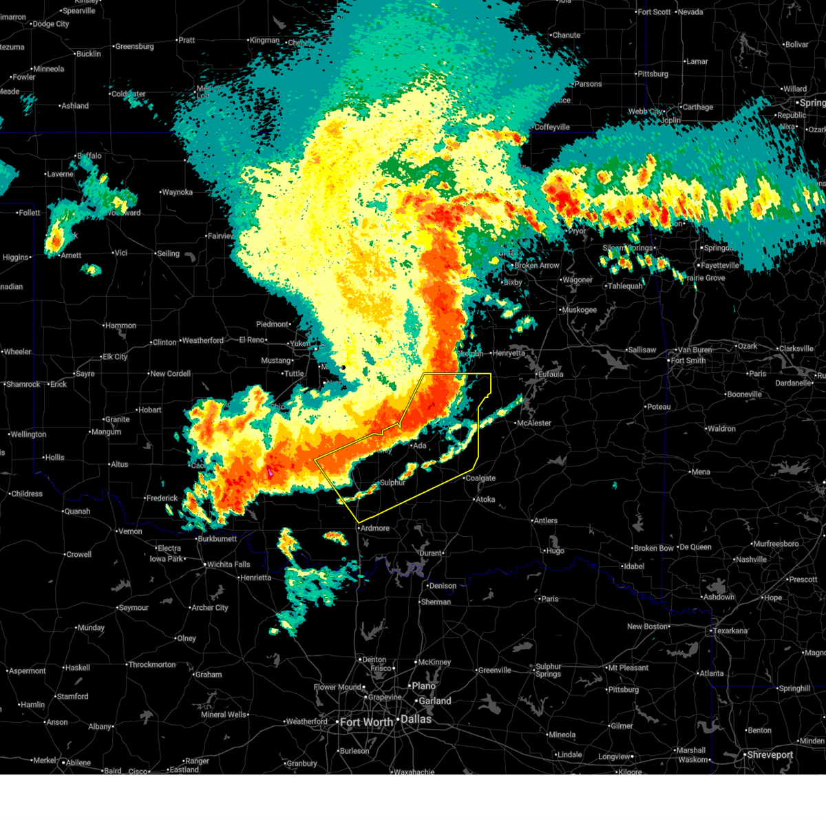
| 5/24/2025 4:33 AM CDT |
 Toroun the national weather service in norman has issued a * tornado warning for, northwestern coal county in southeastern oklahoma, northeastern pontotoc county in east central oklahoma, south central hughes county in southeastern oklahoma, * until 515 am cdt. * at 433 am cdt, a severe thunderstorm capable of producing a tornado was located 5 miles southeast of francis, moving east at 25 mph (radar indicated rotation). Hazards include tornado and baseball size hail. Flying debris will be dangerous to those caught without shelter. mobile homes will be damaged or destroyed. damage to roofs, windows, and vehicles will occur. Tree damage is likely. Toroun the national weather service in norman has issued a * tornado warning for, northwestern coal county in southeastern oklahoma, northeastern pontotoc county in east central oklahoma, south central hughes county in southeastern oklahoma, * until 515 am cdt. * at 433 am cdt, a severe thunderstorm capable of producing a tornado was located 5 miles southeast of francis, moving east at 25 mph (radar indicated rotation). Hazards include tornado and baseball size hail. Flying debris will be dangerous to those caught without shelter. mobile homes will be damaged or destroyed. damage to roofs, windows, and vehicles will occur. Tree damage is likely.
|
| 5/24/2025 4:22 AM CDT |
 At 421 am cdt, a severe thunderstorm capable of producing a tornado was located near ada, moving southeast at 30 mph (radar indicated rotation). Hazards include tornado and baseball size hail. Flying debris will be dangerous to those caught without shelter. mobile homes will be damaged or destroyed. damage to roofs, windows, and vehicles will occur. tree damage is likely. Locations impacted include, ada, byng, francis, and fitzhugh. At 421 am cdt, a severe thunderstorm capable of producing a tornado was located near ada, moving southeast at 30 mph (radar indicated rotation). Hazards include tornado and baseball size hail. Flying debris will be dangerous to those caught without shelter. mobile homes will be damaged or destroyed. damage to roofs, windows, and vehicles will occur. tree damage is likely. Locations impacted include, ada, byng, francis, and fitzhugh.
|
| 5/24/2025 4:22 AM CDT |
 the tornado warning has been cancelled and is no longer in effect the tornado warning has been cancelled and is no longer in effect
|
| 5/24/2025 3:57 AM CDT |
 Toroun the national weather service in norman has issued a * tornado warning for, northeastern garvin county in southern oklahoma, southwestern seminole county in east central oklahoma, central pontotoc county in east central oklahoma, southeastern pottawatomie county in central oklahoma, southeastern mcclain county in central oklahoma, * until 445 am cdt. * at 356 am cdt, a severe thunderstorm capable of producing a tornado was located 7 miles northeast of stratford, moving southeast at 25 mph (radar indicated rotation). Hazards include tornado and golf ball size hail. Flying debris will be dangerous to those caught without shelter. mobile homes will be damaged or destroyed. damage to roofs, windows, and vehicles will occur. Tree damage is likely. Toroun the national weather service in norman has issued a * tornado warning for, northeastern garvin county in southern oklahoma, southwestern seminole county in east central oklahoma, central pontotoc county in east central oklahoma, southeastern pottawatomie county in central oklahoma, southeastern mcclain county in central oklahoma, * until 445 am cdt. * at 356 am cdt, a severe thunderstorm capable of producing a tornado was located 7 miles northeast of stratford, moving southeast at 25 mph (radar indicated rotation). Hazards include tornado and golf ball size hail. Flying debris will be dangerous to those caught without shelter. mobile homes will be damaged or destroyed. damage to roofs, windows, and vehicles will occur. Tree damage is likely.
|
| 5/19/2025 5:11 PM CDT |
 Svroun the national weather service in norman has issued a * severe thunderstorm warning for, johnston county in southeastern oklahoma, northwestern bryan county in southeastern oklahoma, love county in southern oklahoma, coal county in southeastern oklahoma, southeastern seminole county in east central oklahoma, southeastern carter county in southern oklahoma, pontotoc county in east central oklahoma, marshall county in southeastern oklahoma, atoka county in southeastern oklahoma, eastern murray county in southern oklahoma, hughes county in southeastern oklahoma, * until 600 pm cdt. * at 511 pm cdt, severe thunderstorms were located along a line extending from 4 miles west of haywood to near coleman to 3 miles northeast of burneyville, moving northeast at 45 mph (radar indicated). Hazards include 70 mph wind gusts and quarter size hail. Hail damage to vehicles is expected. expect considerable tree damage. Wind damage is also likely to mobile homes, roofs, and outbuildings. Svroun the national weather service in norman has issued a * severe thunderstorm warning for, johnston county in southeastern oklahoma, northwestern bryan county in southeastern oklahoma, love county in southern oklahoma, coal county in southeastern oklahoma, southeastern seminole county in east central oklahoma, southeastern carter county in southern oklahoma, pontotoc county in east central oklahoma, marshall county in southeastern oklahoma, atoka county in southeastern oklahoma, eastern murray county in southern oklahoma, hughes county in southeastern oklahoma, * until 600 pm cdt. * at 511 pm cdt, severe thunderstorms were located along a line extending from 4 miles west of haywood to near coleman to 3 miles northeast of burneyville, moving northeast at 45 mph (radar indicated). Hazards include 70 mph wind gusts and quarter size hail. Hail damage to vehicles is expected. expect considerable tree damage. Wind damage is also likely to mobile homes, roofs, and outbuildings.
|
| 5/19/2025 4:52 PM CDT |
 the severe thunderstorm warning has been cancelled and is no longer in effect the severe thunderstorm warning has been cancelled and is no longer in effect
|
| 5/19/2025 4:52 PM CDT |
 At 451 pm cdt, a severe thunderstorm was located near stonewall, moving northeast at 40 mph. this is a destructive storm for johnston, pontotoc and coal counties (trained weather spotters). Hazards include 80 mph wind gusts and half dollar size hail. Flying debris will be dangerous to those caught without shelter. mobile homes will be heavily damaged. expect considerable damage to roofs, windows, and vehicles. extensive tree damage and power outages are likely. Locations impacted include, ada, sulphur, tishomingo, coalgate, dickson, byng, allen, mannsville, roff, ravia, stonewall, wapanucka, lehigh, tupelo, mill creek, milburn, francis, calvin, fitzhugh, and dougherty. At 451 pm cdt, a severe thunderstorm was located near stonewall, moving northeast at 40 mph. this is a destructive storm for johnston, pontotoc and coal counties (trained weather spotters). Hazards include 80 mph wind gusts and half dollar size hail. Flying debris will be dangerous to those caught without shelter. mobile homes will be heavily damaged. expect considerable damage to roofs, windows, and vehicles. extensive tree damage and power outages are likely. Locations impacted include, ada, sulphur, tishomingo, coalgate, dickson, byng, allen, mannsville, roff, ravia, stonewall, wapanucka, lehigh, tupelo, mill creek, milburn, francis, calvin, fitzhugh, and dougherty.
|
| 5/19/2025 4:36 PM CDT |
 Svroun the national weather service in norman has issued a * severe thunderstorm warning for, johnston county in southeastern oklahoma, east central garvin county in southern oklahoma, coal county in southeastern oklahoma, southern seminole county in east central oklahoma, east central carter county in southern oklahoma, pontotoc county in east central oklahoma, northeastern marshall county in southeastern oklahoma, northwestern atoka county in southeastern oklahoma, eastern murray county in southern oklahoma, south central pottawatomie county in central oklahoma, southern hughes county in southeastern oklahoma, * until 515 pm cdt. * at 436 pm cdt, a severe thunderstorm was located near pontotoc, moving north at 40 mph (radar indicated). Hazards include 60 mph wind gusts and quarter size hail. Hail damage to vehicles is expected. Expect wind damage to roofs, siding, and trees. Svroun the national weather service in norman has issued a * severe thunderstorm warning for, johnston county in southeastern oklahoma, east central garvin county in southern oklahoma, coal county in southeastern oklahoma, southern seminole county in east central oklahoma, east central carter county in southern oklahoma, pontotoc county in east central oklahoma, northeastern marshall county in southeastern oklahoma, northwestern atoka county in southeastern oklahoma, eastern murray county in southern oklahoma, south central pottawatomie county in central oklahoma, southern hughes county in southeastern oklahoma, * until 515 pm cdt. * at 436 pm cdt, a severe thunderstorm was located near pontotoc, moving north at 40 mph (radar indicated). Hazards include 60 mph wind gusts and quarter size hail. Hail damage to vehicles is expected. Expect wind damage to roofs, siding, and trees.
|
| 5/19/2025 3:59 PM CDT |
 the severe thunderstorm warning has been cancelled and is no longer in effect the severe thunderstorm warning has been cancelled and is no longer in effect
|
| 5/19/2025 3:42 PM CDT |
 Svroun the national weather service in norman has issued a * severe thunderstorm warning for, southern seminole county in east central oklahoma, northern pontotoc county in east central oklahoma, hughes county in southeastern oklahoma, * until 430 pm cdt. * at 342 pm cdt, a severe thunderstorm was located near ada, moving northeast at 45 mph (radar indicated). Hazards include 60 mph wind gusts and quarter size hail. Hail damage to vehicles is expected. Expect wind damage to roofs, siding, and trees. Svroun the national weather service in norman has issued a * severe thunderstorm warning for, southern seminole county in east central oklahoma, northern pontotoc county in east central oklahoma, hughes county in southeastern oklahoma, * until 430 pm cdt. * at 342 pm cdt, a severe thunderstorm was located near ada, moving northeast at 45 mph (radar indicated). Hazards include 60 mph wind gusts and quarter size hail. Hail damage to vehicles is expected. Expect wind damage to roofs, siding, and trees.
|
| 5/19/2025 3:31 PM CDT |
 the severe thunderstorm warning has been cancelled and is no longer in effect the severe thunderstorm warning has been cancelled and is no longer in effect
|
| 5/19/2025 3:31 PM CDT |
 At 331 pm cdt, a severe thunderstorm was located 4 miles east of vanoss, moving northeast at 45 mph (radar indicated). Hazards include ping pong ball size hail and 60 mph wind gusts. People and animals outdoors will be injured. expect hail damage to roofs, siding, windows, and vehicles. expect wind damage to roofs, siding, and trees. Locations impacted include, ada, konawa, byng, roff, francis, fitzhugh, and vanoss. At 331 pm cdt, a severe thunderstorm was located 4 miles east of vanoss, moving northeast at 45 mph (radar indicated). Hazards include ping pong ball size hail and 60 mph wind gusts. People and animals outdoors will be injured. expect hail damage to roofs, siding, windows, and vehicles. expect wind damage to roofs, siding, and trees. Locations impacted include, ada, konawa, byng, roff, francis, fitzhugh, and vanoss.
|
| 5/19/2025 3:23 PM CDT |
 At 322 pm cdt, a severe thunderstorm was located near roff, moving northeast at 40 mph (radar indicated). Hazards include 60 mph wind gusts and quarter size hail. Hail damage to vehicles is expected. expect wind damage to roofs, siding, and trees. Locations impacted include, ada, konawa, byng, roff, francis, fitzhugh, hickory, and vanoss. At 322 pm cdt, a severe thunderstorm was located near roff, moving northeast at 40 mph (radar indicated). Hazards include 60 mph wind gusts and quarter size hail. Hail damage to vehicles is expected. expect wind damage to roofs, siding, and trees. Locations impacted include, ada, konawa, byng, roff, francis, fitzhugh, hickory, and vanoss.
|
| 5/19/2025 3:21 PM CDT |
 The storm which prompted the warning has moved out of the area. therefore, the warning will be allowed to expire. remember, a severe thunderstorm warning still remains in effect for pontotoc county until 3:45 pm. The storm which prompted the warning has moved out of the area. therefore, the warning will be allowed to expire. remember, a severe thunderstorm warning still remains in effect for pontotoc county until 3:45 pm.
|
| 5/19/2025 3:07 PM CDT |
 At 306 pm cdt, a severe thunderstorm capable of producing a tornado was located near allen, moving northeast at 60 mph (radar indicated rotation). Hazards include tornado and golf ball size hail. Flying debris will be dangerous to those caught without shelter. mobile homes will be damaged or destroyed. damage to roofs, windows, and vehicles will occur. tree damage is likely. Locations impacted include, byng, allen, francis, sasakwa, gerty, atwood, and spaulding. At 306 pm cdt, a severe thunderstorm capable of producing a tornado was located near allen, moving northeast at 60 mph (radar indicated rotation). Hazards include tornado and golf ball size hail. Flying debris will be dangerous to those caught without shelter. mobile homes will be damaged or destroyed. damage to roofs, windows, and vehicles will occur. tree damage is likely. Locations impacted include, byng, allen, francis, sasakwa, gerty, atwood, and spaulding.
|
| 5/19/2025 3:00 PM CDT |
 Svroun the national weather service in norman has issued a * severe thunderstorm warning for, southeastern garvin county in southern oklahoma, southwestern seminole county in east central oklahoma, pontotoc county in east central oklahoma, central murray county in southern oklahoma, south central pottawatomie county in central oklahoma, * until 345 pm cdt. * at 300 pm cdt, a severe thunderstorm was located near davis, moving northeast at 50 mph (radar indicated). Hazards include 60 mph wind gusts and quarter size hail. Hail damage to vehicles is expected. Expect wind damage to roofs, siding, and trees. Svroun the national weather service in norman has issued a * severe thunderstorm warning for, southeastern garvin county in southern oklahoma, southwestern seminole county in east central oklahoma, pontotoc county in east central oklahoma, central murray county in southern oklahoma, south central pottawatomie county in central oklahoma, * until 345 pm cdt. * at 300 pm cdt, a severe thunderstorm was located near davis, moving northeast at 50 mph (radar indicated). Hazards include 60 mph wind gusts and quarter size hail. Hail damage to vehicles is expected. Expect wind damage to roofs, siding, and trees.
|
| 5/19/2025 2:57 PM CDT |
 At 255 pm cdt, a severe thunderstorm capable of producing a tornado was located 4 miles southeast of ada, moving northeast at 50 mph (radar indicated rotation). Hazards include tornado and two inch hail. Flying debris will be dangerous to those caught without shelter. mobile homes will be damaged or destroyed. damage to roofs, windows, and vehicles will occur. tree damage is likely. Locations impacted include, ada, byng, allen, francis, sasakwa, gerty, atwood, and spaulding. At 255 pm cdt, a severe thunderstorm capable of producing a tornado was located 4 miles southeast of ada, moving northeast at 50 mph (radar indicated rotation). Hazards include tornado and two inch hail. Flying debris will be dangerous to those caught without shelter. mobile homes will be damaged or destroyed. damage to roofs, windows, and vehicles will occur. tree damage is likely. Locations impacted include, ada, byng, allen, francis, sasakwa, gerty, atwood, and spaulding.
|
| 5/19/2025 2:55 PM CDT |
 At 255 pm cdt, a severe thunderstorm capable of producing a tornado was located 4 miles southeast of ada, moving northeast at 50 mph (radar indicated rotation). Hazards include tornado and two inch hail. Flying debris will be dangerous to those caught without shelter. mobile homes will be damaged or destroyed. damage to roofs, windows, and vehicles will occur. tree damage is likely. Locations impacted include, ada, byng, allen, francis, sasakwa, gerty, atwood, and spaulding. At 255 pm cdt, a severe thunderstorm capable of producing a tornado was located 4 miles southeast of ada, moving northeast at 50 mph (radar indicated rotation). Hazards include tornado and two inch hail. Flying debris will be dangerous to those caught without shelter. mobile homes will be damaged or destroyed. damage to roofs, windows, and vehicles will occur. tree damage is likely. Locations impacted include, ada, byng, allen, francis, sasakwa, gerty, atwood, and spaulding.
|
| 5/19/2025 2:50 PM CDT |
 At 250 pm cdt, a severe thunderstorm was located 5 miles northeast of horntown, moving northeast at 70 mph (radar indicated). Hazards include two inch hail and 60 mph wind gusts. People and animals outdoors will be injured. expect hail damage to roofs, siding, windows, and vehicles. expect wind damage to roofs, siding, and trees. Locations impacted include, ada, seminole, holdenville, wewoka, konawa, wetumka, byng, allen, roff, stonewall, bowlegs, francis, calvin, fitzhugh, lamar, sasakwa, gerty, horntown, yeager, and atwood. At 250 pm cdt, a severe thunderstorm was located 5 miles northeast of horntown, moving northeast at 70 mph (radar indicated). Hazards include two inch hail and 60 mph wind gusts. People and animals outdoors will be injured. expect hail damage to roofs, siding, windows, and vehicles. expect wind damage to roofs, siding, and trees. Locations impacted include, ada, seminole, holdenville, wewoka, konawa, wetumka, byng, allen, roff, stonewall, bowlegs, francis, calvin, fitzhugh, lamar, sasakwa, gerty, horntown, yeager, and atwood.
|
| 5/19/2025 2:50 PM CDT |
 the severe thunderstorm warning has been cancelled and is no longer in effect the severe thunderstorm warning has been cancelled and is no longer in effect
|
| 5/19/2025 2:45 PM CDT |
 Toroun the national weather service in norman has issued a * tornado warning for, northern coal county in southeastern oklahoma, southeastern seminole county in east central oklahoma, pontotoc county in east central oklahoma, southwestern hughes county in southeastern oklahoma, * until 330 pm cdt. * at 245 pm cdt, a severe thunderstorm capable of producing a tornado was located near fitzhugh, moving northeast at 45 mph (radar indicated rotation). Hazards include tornado and golf ball size hail. Flying debris will be dangerous to those caught without shelter. mobile homes will be damaged or destroyed. damage to roofs, windows, and vehicles will occur. Tree damage is likely. Toroun the national weather service in norman has issued a * tornado warning for, northern coal county in southeastern oklahoma, southeastern seminole county in east central oklahoma, pontotoc county in east central oklahoma, southwestern hughes county in southeastern oklahoma, * until 330 pm cdt. * at 245 pm cdt, a severe thunderstorm capable of producing a tornado was located near fitzhugh, moving northeast at 45 mph (radar indicated rotation). Hazards include tornado and golf ball size hail. Flying debris will be dangerous to those caught without shelter. mobile homes will be damaged or destroyed. damage to roofs, windows, and vehicles will occur. Tree damage is likely.
|
| 5/19/2025 2:33 PM CDT |
 At 233 pm cdt, a severe thunderstorm was located near allen, moving northeast at 50 mph (trained weather spotters). Hazards include golf ball size hail and 60 mph wind gusts. People and animals outdoors will be injured. expect hail damage to roofs, siding, windows, and vehicles. expect wind damage to roofs, siding, and trees. Locations impacted include, ada, seminole, holdenville, sulphur, wewoka, stratford, konawa, wetumka, byng, allen, roff, stonewall, bowlegs, tupelo, francis, calvin, fitzhugh, lamar, sasakwa, and gerty. At 233 pm cdt, a severe thunderstorm was located near allen, moving northeast at 50 mph (trained weather spotters). Hazards include golf ball size hail and 60 mph wind gusts. People and animals outdoors will be injured. expect hail damage to roofs, siding, windows, and vehicles. expect wind damage to roofs, siding, and trees. Locations impacted include, ada, seminole, holdenville, sulphur, wewoka, stratford, konawa, wetumka, byng, allen, roff, stonewall, bowlegs, tupelo, francis, calvin, fitzhugh, lamar, sasakwa, and gerty.
|
| 5/19/2025 2:21 PM CDT |
 Svroun the national weather service in norman has issued a * severe thunderstorm warning for, northwestern johnston county in southeastern oklahoma, southeastern garvin county in southern oklahoma, northwestern coal county in southeastern oklahoma, seminole county in east central oklahoma, pontotoc county in east central oklahoma, murray county in southern oklahoma, south central pottawatomie county in central oklahoma, hughes county in southeastern oklahoma, * until 300 pm cdt. * at 220 pm cdt, a severe thunderstorm was located over roff, moving northeast at 55 mph (trained weather spotters). Hazards include golf ball size hail and 60 mph wind gusts. People and animals outdoors will be injured. expect hail damage to roofs, siding, windows, and vehicles. Expect wind damage to roofs, siding, and trees. Svroun the national weather service in norman has issued a * severe thunderstorm warning for, northwestern johnston county in southeastern oklahoma, southeastern garvin county in southern oklahoma, northwestern coal county in southeastern oklahoma, seminole county in east central oklahoma, pontotoc county in east central oklahoma, murray county in southern oklahoma, south central pottawatomie county in central oklahoma, hughes county in southeastern oklahoma, * until 300 pm cdt. * at 220 pm cdt, a severe thunderstorm was located over roff, moving northeast at 55 mph (trained weather spotters). Hazards include golf ball size hail and 60 mph wind gusts. People and animals outdoors will be injured. expect hail damage to roofs, siding, windows, and vehicles. Expect wind damage to roofs, siding, and trees.
|
| 5/17/2025 7:05 PM CDT |
 At 705 pm cdt, a severe thunderstorm was located 6 miles northeast of stonewall, moving southeast at 25 mph (radar indicated). Hazards include two inch hail and 70 mph wind gusts. People and animals outdoors will be injured. expect hail damage to roofs, siding, windows, and vehicles. expect considerable tree damage. wind damage is also likely to mobile homes, roofs, and outbuildings. Locations impacted include, stonewall and francis. At 705 pm cdt, a severe thunderstorm was located 6 miles northeast of stonewall, moving southeast at 25 mph (radar indicated). Hazards include two inch hail and 70 mph wind gusts. People and animals outdoors will be injured. expect hail damage to roofs, siding, windows, and vehicles. expect considerable tree damage. wind damage is also likely to mobile homes, roofs, and outbuildings. Locations impacted include, stonewall and francis.
|
| 5/17/2025 6:54 PM CDT |
 the severe thunderstorm warning has been cancelled and is no longer in effect the severe thunderstorm warning has been cancelled and is no longer in effect
|
| 5/17/2025 6:54 PM CDT |
 At 653 pm cdt, a severe thunderstorm was located over francis, moving east at 15 mph (radar indicated). Hazards include two inch hail and 70 mph wind gusts. People and animals outdoors will be injured. expect hail damage to roofs, siding, windows, and vehicles. expect considerable tree damage. wind damage is also likely to mobile homes, roofs, and outbuildings. Locations impacted include, ada, byng, stonewall, francis, fittstown, and jesse. At 653 pm cdt, a severe thunderstorm was located over francis, moving east at 15 mph (radar indicated). Hazards include two inch hail and 70 mph wind gusts. People and animals outdoors will be injured. expect hail damage to roofs, siding, windows, and vehicles. expect considerable tree damage. wind damage is also likely to mobile homes, roofs, and outbuildings. Locations impacted include, ada, byng, stonewall, francis, fittstown, and jesse.
|
| 5/17/2025 6:40 PM CDT |
 Svroun the national weather service in norman has issued a * severe thunderstorm warning for, northwestern coal county in southeastern oklahoma, south central seminole county in east central oklahoma, central pontotoc county in east central oklahoma, * until 715 pm cdt. * at 640 pm cdt, a severe thunderstorm was located near byng, moving east at 15 mph (radar indicated). Hazards include 70 mph wind gusts and ping pong ball size hail. People and animals outdoors will be injured. expect hail damage to roofs, siding, windows, and vehicles. expect considerable tree damage. Wind damage is also likely to mobile homes, roofs, and outbuildings. Svroun the national weather service in norman has issued a * severe thunderstorm warning for, northwestern coal county in southeastern oklahoma, south central seminole county in east central oklahoma, central pontotoc county in east central oklahoma, * until 715 pm cdt. * at 640 pm cdt, a severe thunderstorm was located near byng, moving east at 15 mph (radar indicated). Hazards include 70 mph wind gusts and ping pong ball size hail. People and animals outdoors will be injured. expect hail damage to roofs, siding, windows, and vehicles. expect considerable tree damage. Wind damage is also likely to mobile homes, roofs, and outbuildings.
|
| 5/2/2025 2:27 AM CDT |
 Svroun the national weather service in norman has issued a * severe thunderstorm warning for, southern seminole county in east central oklahoma, northwestern pontotoc county in east central oklahoma, south central pottawatomie county in central oklahoma, northwestern hughes county in southeastern oklahoma, * until 315 am cdt. * at 227 am cdt, a severe thunderstorm was located 4 miles south of konawa, moving northeast at 40 mph (radar indicated). Hazards include 60 mph wind gusts and quarter size hail. Hail damage to vehicles is expected. Expect wind damage to roofs, siding, and trees. Svroun the national weather service in norman has issued a * severe thunderstorm warning for, southern seminole county in east central oklahoma, northwestern pontotoc county in east central oklahoma, south central pottawatomie county in central oklahoma, northwestern hughes county in southeastern oklahoma, * until 315 am cdt. * at 227 am cdt, a severe thunderstorm was located 4 miles south of konawa, moving northeast at 40 mph (radar indicated). Hazards include 60 mph wind gusts and quarter size hail. Hail damage to vehicles is expected. Expect wind damage to roofs, siding, and trees.
|
| 4/19/2025 10:40 PM CDT |
 Svroun the national weather service in norman has issued a * severe thunderstorm warning for, northern coal county in southeastern oklahoma, southeastern seminole county in east central oklahoma, eastern pontotoc county in east central oklahoma, north central atoka county in southeastern oklahoma, southern hughes county in southeastern oklahoma, * until 1145 pm cdt. * at 1040 pm cdt, severe thunderstorms were located along a line extending from near allen to 4 miles southeast of fittstown, moving northeast at 25 mph (radar indicated). Hazards include 70 mph wind gusts and quarter size hail. Hail damage to vehicles is expected. expect considerable tree damage. Wind damage is also likely to mobile homes, roofs, and outbuildings. Svroun the national weather service in norman has issued a * severe thunderstorm warning for, northern coal county in southeastern oklahoma, southeastern seminole county in east central oklahoma, eastern pontotoc county in east central oklahoma, north central atoka county in southeastern oklahoma, southern hughes county in southeastern oklahoma, * until 1145 pm cdt. * at 1040 pm cdt, severe thunderstorms were located along a line extending from near allen to 4 miles southeast of fittstown, moving northeast at 25 mph (radar indicated). Hazards include 70 mph wind gusts and quarter size hail. Hail damage to vehicles is expected. expect considerable tree damage. Wind damage is also likely to mobile homes, roofs, and outbuildings.
|
| 4/19/2025 10:18 PM CDT |
 Toroun the national weather service in norman has issued a * tornado warning for, southeastern seminole county in east central oklahoma, northeastern pontotoc county in east central oklahoma, west central hughes county in southeastern oklahoma, * until 1100 pm cdt. * at 1017 pm cdt, a tornado producing storm was located near francis, moving northeast at 30 mph (radar confirmed tornado). Hazards include damaging tornado and quarter size hail. Flying debris will be dangerous to those caught without shelter. mobile homes will be damaged or destroyed. damage to roofs, windows, and vehicles will occur. Tree damage is likely. Toroun the national weather service in norman has issued a * tornado warning for, southeastern seminole county in east central oklahoma, northeastern pontotoc county in east central oklahoma, west central hughes county in southeastern oklahoma, * until 1100 pm cdt. * at 1017 pm cdt, a tornado producing storm was located near francis, moving northeast at 30 mph (radar confirmed tornado). Hazards include damaging tornado and quarter size hail. Flying debris will be dangerous to those caught without shelter. mobile homes will be damaged or destroyed. damage to roofs, windows, and vehicles will occur. Tree damage is likely.
|
| 4/19/2025 10:12 PM CDT |
 At 1012 pm cdt, a confirmed tornado was located near ada, moving northeast at 20 mph (radar confirmed tornado). Hazards include damaging tornado and quarter size hail. Flying debris will be dangerous to those caught without shelter. mobile homes will be damaged or destroyed. damage to roofs, windows, and vehicles will occur. tree damage is likely. Locations impacted include, ada, byng, and francis. At 1012 pm cdt, a confirmed tornado was located near ada, moving northeast at 20 mph (radar confirmed tornado). Hazards include damaging tornado and quarter size hail. Flying debris will be dangerous to those caught without shelter. mobile homes will be damaged or destroyed. damage to roofs, windows, and vehicles will occur. tree damage is likely. Locations impacted include, ada, byng, and francis.
|
| 4/19/2025 10:02 PM CDT |
 Toroun the national weather service in norman has issued a * tornado warning for, south central seminole county in east central oklahoma, northeastern pontotoc county in east central oklahoma, * until 1030 pm cdt. * at 1002 pm cdt, a severe thunderstorm capable of producing a tornado was located over ada, moving northeast at 20 mph (radar indicated rotation). Hazards include tornado and quarter size hail. Flying debris will be dangerous to those caught without shelter. mobile homes will be damaged or destroyed. damage to roofs, windows, and vehicles will occur. Tree damage is likely. Toroun the national weather service in norman has issued a * tornado warning for, south central seminole county in east central oklahoma, northeastern pontotoc county in east central oklahoma, * until 1030 pm cdt. * at 1002 pm cdt, a severe thunderstorm capable of producing a tornado was located over ada, moving northeast at 20 mph (radar indicated rotation). Hazards include tornado and quarter size hail. Flying debris will be dangerous to those caught without shelter. mobile homes will be damaged or destroyed. damage to roofs, windows, and vehicles will occur. Tree damage is likely.
|
| 4/18/2025 9:26 PM CDT |
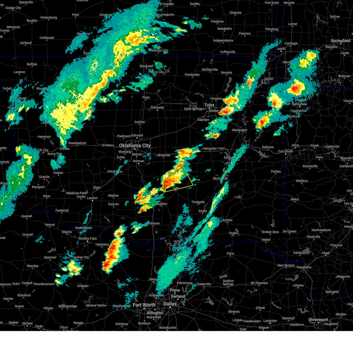 Svroun the national weather service in norman has issued a * severe thunderstorm warning for, southern seminole county in east central oklahoma, northern pontotoc county in east central oklahoma, south central pottawatomie county in central oklahoma, southwestern hughes county in southeastern oklahoma, * until 1015 pm cdt. * at 925 pm cdt, a severe thunderstorm was located 4 miles northeast of stratford, moving northeast at 30 mph (radar indicated). Hazards include ping pong ball size hail and 60 mph wind gusts. People and animals outdoors will be injured. expect hail damage to roofs, siding, windows, and vehicles. Expect wind damage to roofs, siding, and trees. Svroun the national weather service in norman has issued a * severe thunderstorm warning for, southern seminole county in east central oklahoma, northern pontotoc county in east central oklahoma, south central pottawatomie county in central oklahoma, southwestern hughes county in southeastern oklahoma, * until 1015 pm cdt. * at 925 pm cdt, a severe thunderstorm was located 4 miles northeast of stratford, moving northeast at 30 mph (radar indicated). Hazards include ping pong ball size hail and 60 mph wind gusts. People and animals outdoors will be injured. expect hail damage to roofs, siding, windows, and vehicles. Expect wind damage to roofs, siding, and trees.
|
| 4/18/2025 9:01 PM CDT |
 the severe thunderstorm warning has been cancelled and is no longer in effect the severe thunderstorm warning has been cancelled and is no longer in effect
|
| 4/18/2025 9:01 PM CDT |
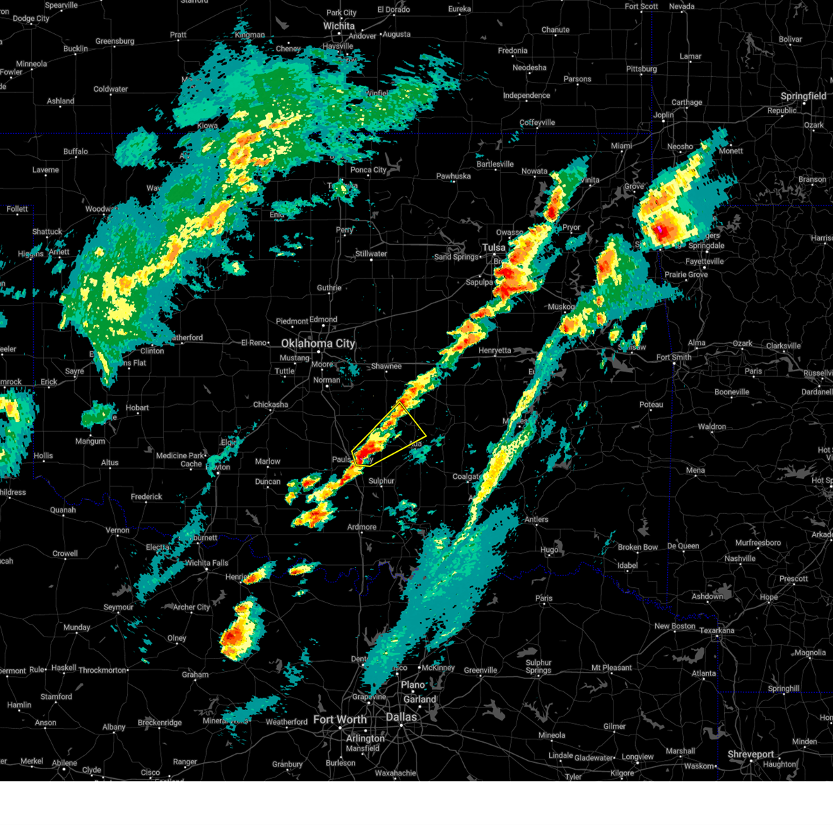 At 901 pm cdt, a severe thunderstorm was located 6 miles southwest of stratford, moving northeast at 40 mph (radar indicated). Hazards include ping pong ball size hail and 60 mph wind gusts. People and animals outdoors will be injured. expect hail damage to roofs, siding, windows, and vehicles. expect wind damage to roofs, siding, and trees. locations impacted include, pauls valley, stratford, konawa, byng, asher, francis, byars, st. Louis, and vanoss. At 901 pm cdt, a severe thunderstorm was located 6 miles southwest of stratford, moving northeast at 40 mph (radar indicated). Hazards include ping pong ball size hail and 60 mph wind gusts. People and animals outdoors will be injured. expect hail damage to roofs, siding, windows, and vehicles. expect wind damage to roofs, siding, and trees. locations impacted include, pauls valley, stratford, konawa, byng, asher, francis, byars, st. Louis, and vanoss.
|
| 4/18/2025 8:58 PM CDT |
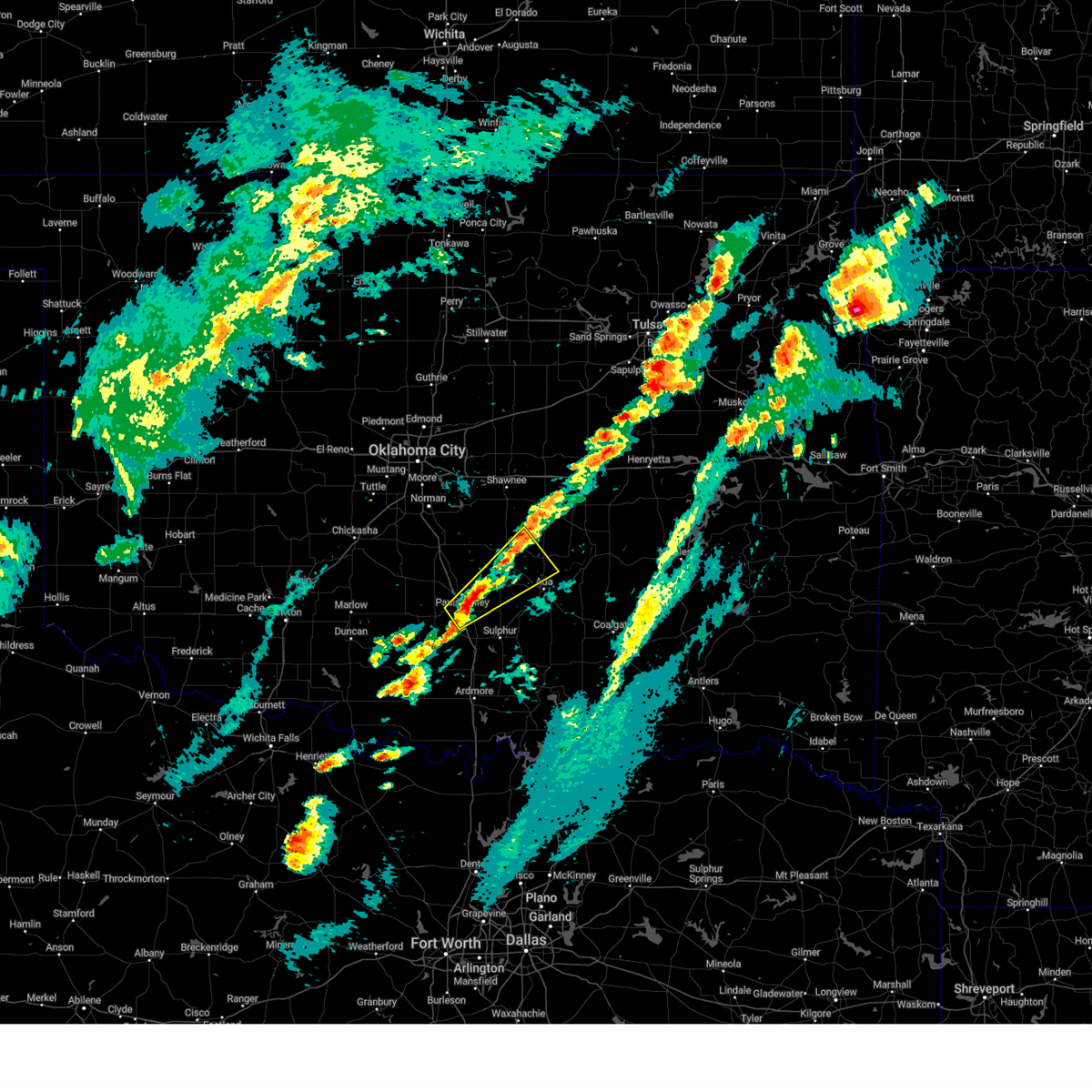 At 857 pm cdt, a severe thunderstorm was located 7 miles northeast of wynnewood, moving northeast at 40 mph (radar indicated). Hazards include ping pong ball size hail and 60 mph wind gusts. People and animals outdoors will be injured. expect hail damage to roofs, siding, windows, and vehicles. expect wind damage to roofs, siding, and trees. locations impacted include, pauls valley, wynnewood, stratford, konawa, byng, asher, francis, byars, st. Louis, and vanoss. At 857 pm cdt, a severe thunderstorm was located 7 miles northeast of wynnewood, moving northeast at 40 mph (radar indicated). Hazards include ping pong ball size hail and 60 mph wind gusts. People and animals outdoors will be injured. expect hail damage to roofs, siding, windows, and vehicles. expect wind damage to roofs, siding, and trees. locations impacted include, pauls valley, wynnewood, stratford, konawa, byng, asher, francis, byars, st. Louis, and vanoss.
|
| 4/18/2025 8:48 PM CDT |
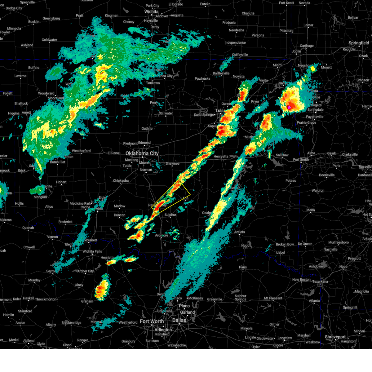 Svroun the national weather service in norman has issued a * severe thunderstorm warning for, eastern garvin county in southern oklahoma, southwestern seminole county in east central oklahoma, northwestern pontotoc county in east central oklahoma, north central murray county in southern oklahoma, south central pottawatomie county in central oklahoma, southeastern mcclain county in central oklahoma, * until 930 pm cdt. * at 847 pm cdt, a severe thunderstorm was located near wynnewood, moving northeast at 40 mph (radar indicated). Hazards include 60 mph wind gusts and quarter size hail. Hail damage to vehicles is expected. Expect wind damage to roofs, siding, and trees. Svroun the national weather service in norman has issued a * severe thunderstorm warning for, eastern garvin county in southern oklahoma, southwestern seminole county in east central oklahoma, northwestern pontotoc county in east central oklahoma, north central murray county in southern oklahoma, south central pottawatomie county in central oklahoma, southeastern mcclain county in central oklahoma, * until 930 pm cdt. * at 847 pm cdt, a severe thunderstorm was located near wynnewood, moving northeast at 40 mph (radar indicated). Hazards include 60 mph wind gusts and quarter size hail. Hail damage to vehicles is expected. Expect wind damage to roofs, siding, and trees.
|
| 4/5/2025 3:47 AM CDT |
 At 346 am cdt, a severe thunderstorm was located 5 miles north of vanoss, moving northeast at 55 mph (public). Hazards include golf ball size hail and 60 mph wind gusts. People and animals outdoors will be injured. expect hail damage to roofs, siding, windows, and vehicles. expect wind damage to roofs, siding, and trees. locations impacted include, byars, francis, sasakwa, wanette, vanoss, konawa, asher, roff, st. Louis, fitzhugh, byng, and ada. At 346 am cdt, a severe thunderstorm was located 5 miles north of vanoss, moving northeast at 55 mph (public). Hazards include golf ball size hail and 60 mph wind gusts. People and animals outdoors will be injured. expect hail damage to roofs, siding, windows, and vehicles. expect wind damage to roofs, siding, and trees. locations impacted include, byars, francis, sasakwa, wanette, vanoss, konawa, asher, roff, st. Louis, fitzhugh, byng, and ada.
|
| 4/5/2025 3:47 AM CDT |
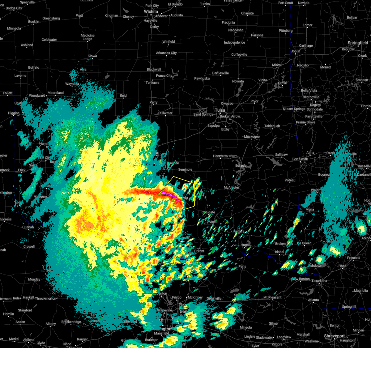 the severe thunderstorm warning has been cancelled and is no longer in effect the severe thunderstorm warning has been cancelled and is no longer in effect
|
| 4/5/2025 3:35 AM CDT |
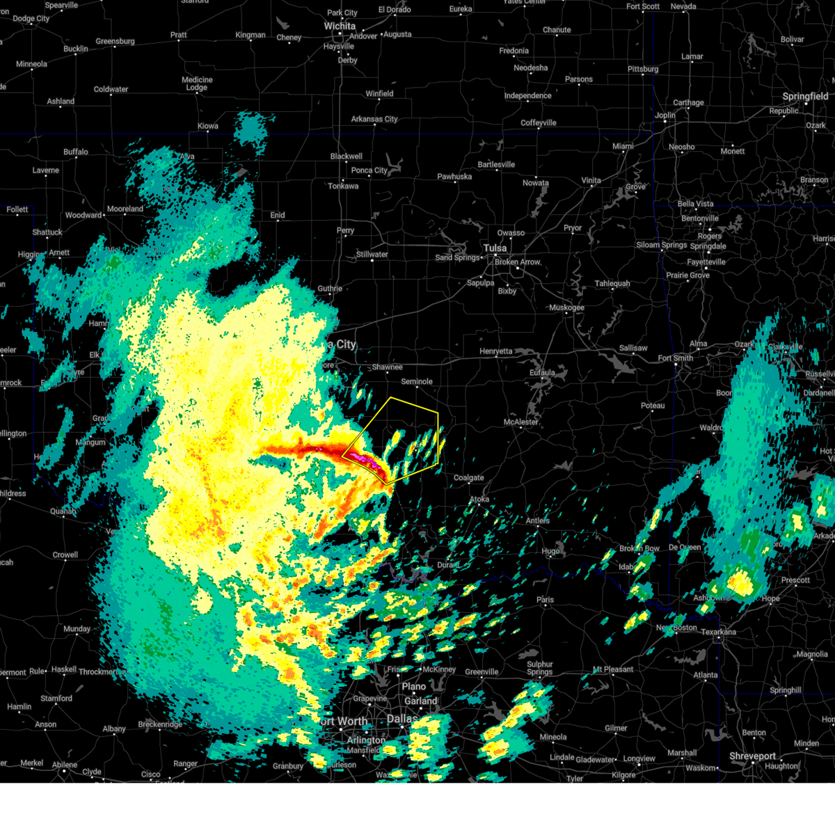 At 335 am cdt, a severe thunderstorm was located 6 miles south of stratford, moving northeast at 55 mph (radar indicated). Hazards include golf ball size hail and 60 mph wind gusts. People and animals outdoors will be injured. expect hail damage to roofs, siding, windows, and vehicles. expect wind damage to roofs, siding, and trees. locations impacted include, wanette, pauls valley, vanoss, stratford, konawa, asher, fitzhugh, byng, byars, francis, sasakwa, roff, st. Louis, ada, and hickory. At 335 am cdt, a severe thunderstorm was located 6 miles south of stratford, moving northeast at 55 mph (radar indicated). Hazards include golf ball size hail and 60 mph wind gusts. People and animals outdoors will be injured. expect hail damage to roofs, siding, windows, and vehicles. expect wind damage to roofs, siding, and trees. locations impacted include, wanette, pauls valley, vanoss, stratford, konawa, asher, fitzhugh, byng, byars, francis, sasakwa, roff, st. Louis, ada, and hickory.
|
| 4/5/2025 3:23 AM CDT |
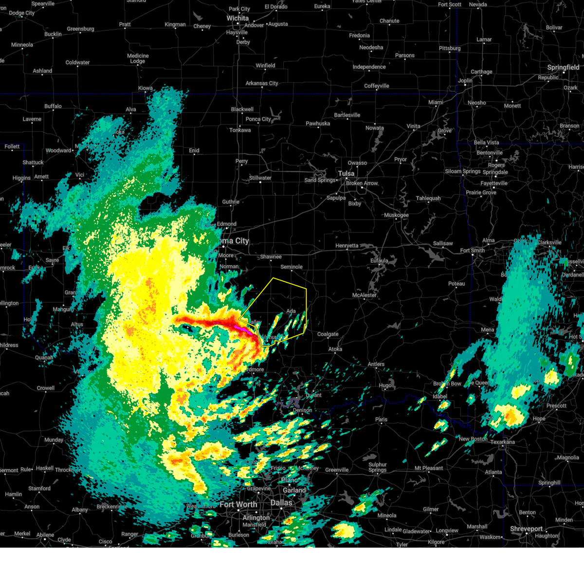 Svroun the national weather service in norman has issued a * severe thunderstorm warning for, northeastern garvin county in southern oklahoma, southern seminole county in east central oklahoma, pontotoc county in east central oklahoma, northeastern murray county in southern oklahoma, southwestern pottawatomie county in central oklahoma, southeastern mcclain county in central oklahoma, * until 415 am cdt. * at 323 am cdt, a severe thunderstorm was located 4 miles northwest of davis, moving northeast at 55 mph (radar indicated). Hazards include golf ball size hail and 60 mph wind gusts. People and animals outdoors will be injured. expect hail damage to roofs, siding, windows, and vehicles. Expect wind damage to roofs, siding, and trees. Svroun the national weather service in norman has issued a * severe thunderstorm warning for, northeastern garvin county in southern oklahoma, southern seminole county in east central oklahoma, pontotoc county in east central oklahoma, northeastern murray county in southern oklahoma, southwestern pottawatomie county in central oklahoma, southeastern mcclain county in central oklahoma, * until 415 am cdt. * at 323 am cdt, a severe thunderstorm was located 4 miles northwest of davis, moving northeast at 55 mph (radar indicated). Hazards include golf ball size hail and 60 mph wind gusts. People and animals outdoors will be injured. expect hail damage to roofs, siding, windows, and vehicles. Expect wind damage to roofs, siding, and trees.
|
| 4/4/2025 5:17 AM CDT |
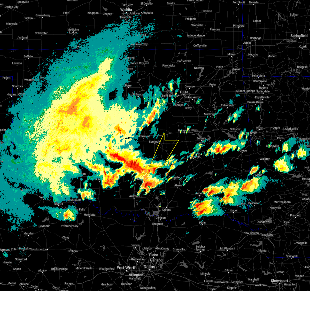 Svroun the national weather service in norman has issued a * severe thunderstorm warning for, southeastern seminole county in east central oklahoma, northeastern pontotoc county in east central oklahoma, northwestern hughes county in southeastern oklahoma, * until 600 am cdt. * at 517 am cdt, a severe thunderstorm was located near byng, moving northeast at 50 mph. quarter size hail was reported with this storm near ada (radar indicated). Hazards include 60 mph wind gusts and quarter size hail. Hail damage to vehicles is expected. Expect wind damage to roofs, siding, and trees. Svroun the national weather service in norman has issued a * severe thunderstorm warning for, southeastern seminole county in east central oklahoma, northeastern pontotoc county in east central oklahoma, northwestern hughes county in southeastern oklahoma, * until 600 am cdt. * at 517 am cdt, a severe thunderstorm was located near byng, moving northeast at 50 mph. quarter size hail was reported with this storm near ada (radar indicated). Hazards include 60 mph wind gusts and quarter size hail. Hail damage to vehicles is expected. Expect wind damage to roofs, siding, and trees.
|
| 4/3/2025 9:13 AM CDT |
 the severe thunderstorm warning has been cancelled and is no longer in effect the severe thunderstorm warning has been cancelled and is no longer in effect
|
| 4/3/2025 9:13 AM CDT |
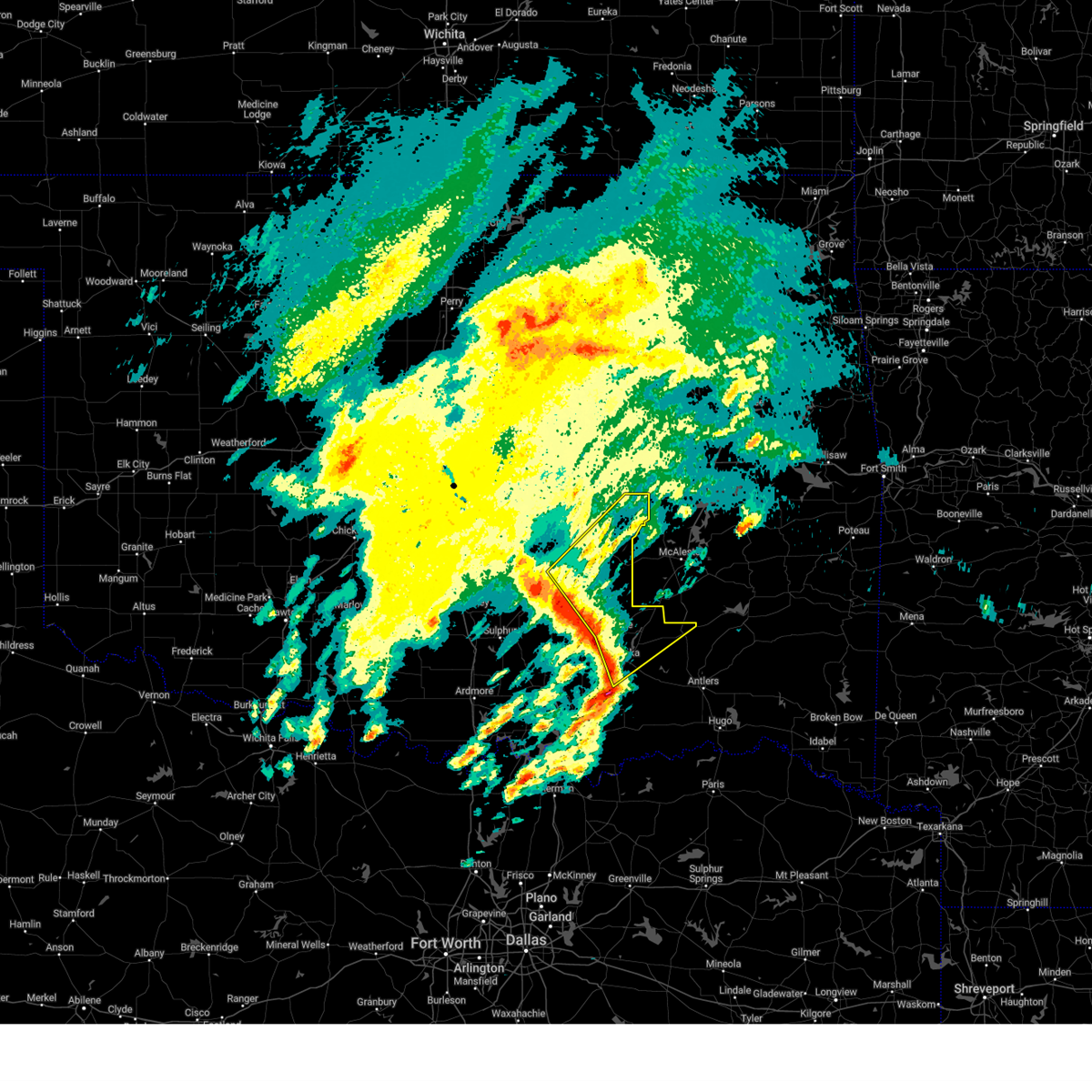 At 913 am cdt, severe thunderstorms were located along a line extending from 5 miles southeast of francis to near centrahoma to near atoka, moving northeast at 75 mph (radar indicated). Hazards include 60 mph wind gusts and quarter size hail. Hail damage to vehicles is expected. expect wind damage to roofs, siding, and trees. Locations impacted include, horntown, atwood, dustin, chockie, lehigh, phillips, centrahoma, francis, sasakwa, redden, atoka, wardville, stringtown, atoka reservoir, spaulding, gerty, tupelo, coalgate, allen, and tushka. At 913 am cdt, severe thunderstorms were located along a line extending from 5 miles southeast of francis to near centrahoma to near atoka, moving northeast at 75 mph (radar indicated). Hazards include 60 mph wind gusts and quarter size hail. Hail damage to vehicles is expected. expect wind damage to roofs, siding, and trees. Locations impacted include, horntown, atwood, dustin, chockie, lehigh, phillips, centrahoma, francis, sasakwa, redden, atoka, wardville, stringtown, atoka reservoir, spaulding, gerty, tupelo, coalgate, allen, and tushka.
|
| 4/3/2025 9:00 AM CDT |
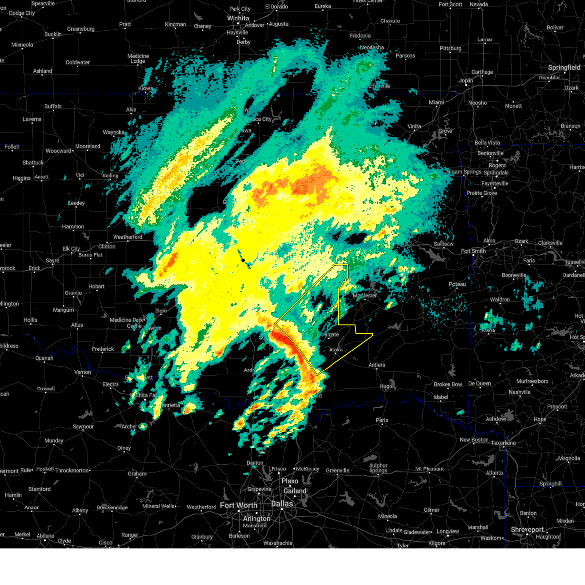 Svroun the national weather service in norman has issued a * severe thunderstorm warning for, northeastern johnston county in southeastern oklahoma, coal county in southeastern oklahoma, southeastern seminole county in east central oklahoma, pontotoc county in east central oklahoma, central atoka county in southeastern oklahoma, hughes county in southeastern oklahoma, * until 945 am cdt. * at 900 am cdt, severe thunderstorms were located along a line extending from near fitzhugh to 4 miles north of bromide to near coleman, moving northeast at 65 mph (radar indicated). Hazards include 60 mph wind gusts and quarter size hail. Hail damage to vehicles is expected. Expect wind damage to roofs, siding, and trees. Svroun the national weather service in norman has issued a * severe thunderstorm warning for, northeastern johnston county in southeastern oklahoma, coal county in southeastern oklahoma, southeastern seminole county in east central oklahoma, pontotoc county in east central oklahoma, central atoka county in southeastern oklahoma, hughes county in southeastern oklahoma, * until 945 am cdt. * at 900 am cdt, severe thunderstorms were located along a line extending from near fitzhugh to 4 miles north of bromide to near coleman, moving northeast at 65 mph (radar indicated). Hazards include 60 mph wind gusts and quarter size hail. Hail damage to vehicles is expected. Expect wind damage to roofs, siding, and trees.
|
| 4/2/2025 7:23 AM CDT |
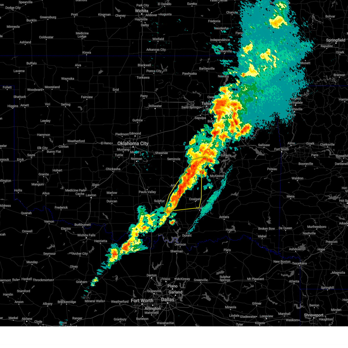 Svroun the national weather service in norman has issued a * severe thunderstorm warning for, northern johnston county in southeastern oklahoma, coal county in southeastern oklahoma, southeastern seminole county in east central oklahoma, eastern pontotoc county in east central oklahoma, west central atoka county in southeastern oklahoma, hughes county in southeastern oklahoma, * until 815 am cdt. * at 723 am cdt, severe thunderstorms were located along a line extending from 5 miles southeast of wetumka to 4 miles northeast of atwood to 3 miles southwest of allen to near fittstown to 5 miles northwest of connerville, moving east at 40 mph (radar indicated). Hazards include 60 mph wind gusts and quarter size hail. Hail damage to vehicles is expected. Expect wind damage to roofs, siding, and trees. Svroun the national weather service in norman has issued a * severe thunderstorm warning for, northern johnston county in southeastern oklahoma, coal county in southeastern oklahoma, southeastern seminole county in east central oklahoma, eastern pontotoc county in east central oklahoma, west central atoka county in southeastern oklahoma, hughes county in southeastern oklahoma, * until 815 am cdt. * at 723 am cdt, severe thunderstorms were located along a line extending from 5 miles southeast of wetumka to 4 miles northeast of atwood to 3 miles southwest of allen to near fittstown to 5 miles northwest of connerville, moving east at 40 mph (radar indicated). Hazards include 60 mph wind gusts and quarter size hail. Hail damage to vehicles is expected. Expect wind damage to roofs, siding, and trees.
|
| 4/2/2025 7:13 AM CDT |
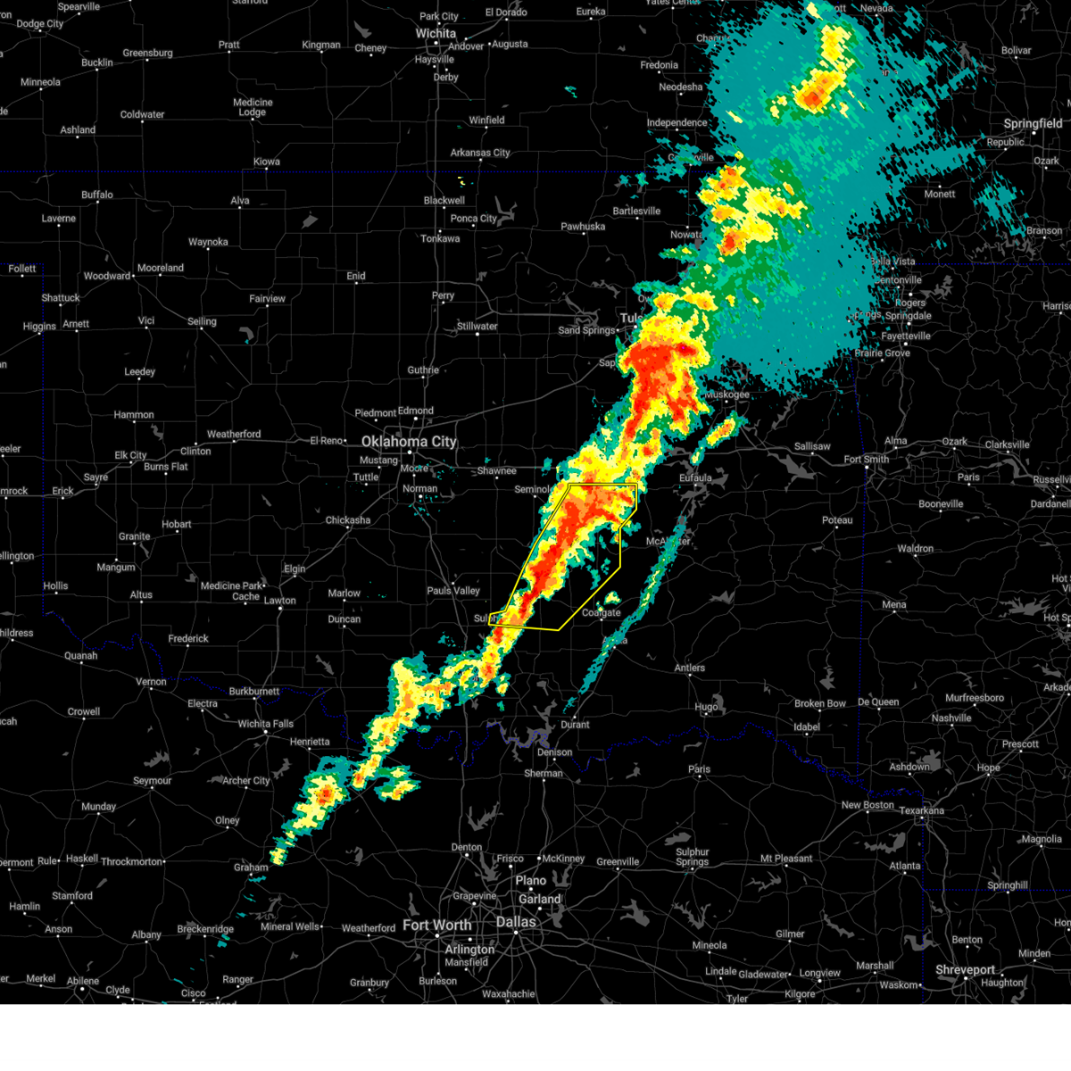 the severe thunderstorm warning has been cancelled and is no longer in effect the severe thunderstorm warning has been cancelled and is no longer in effect
|
| 4/2/2025 7:13 AM CDT |
 At 711 am cdt, severe thunderstorms were located along a line extending from 3 miles southwest of henryetta to 6 miles south of dustin to near calvin to 3 miles south of allen to near stonewall to 5 miles northwest of pontotoc, moving east at 55 mph. dime to nickel size hail has been reported near ada (radar indicated). Hazards include 60 mph wind gusts and quarter size hail. Hail damage to vehicles is expected. expect wind damage to roofs, siding, and trees. Locations impacted include, horntown, wetumka, atwood, dustin, jesse, stonewall, sulphur, fitzhugh, scullin, francis, sasakwa, hickory, wewoka, spaulding, gerty, pontotoc, fittstown, yeager, tupelo, and allen. At 711 am cdt, severe thunderstorms were located along a line extending from 3 miles southwest of henryetta to 6 miles south of dustin to near calvin to 3 miles south of allen to near stonewall to 5 miles northwest of pontotoc, moving east at 55 mph. dime to nickel size hail has been reported near ada (radar indicated). Hazards include 60 mph wind gusts and quarter size hail. Hail damage to vehicles is expected. expect wind damage to roofs, siding, and trees. Locations impacted include, horntown, wetumka, atwood, dustin, jesse, stonewall, sulphur, fitzhugh, scullin, francis, sasakwa, hickory, wewoka, spaulding, gerty, pontotoc, fittstown, yeager, tupelo, and allen.
|
| 4/2/2025 7:00 AM CDT | the severe thunderstorm warning has been cancelled and is no longer in effect |
| 4/2/2025 7:00 AM CDT | At 700 am cdt, severe thunderstorms were located along a line extending from near clearview to 4 miles south of wetumka to 4 miles west of atwood to 3 miles south of francis to near fitzhugh to near scullin, moving east at 55 mph (radar indicated). Hazards include 60 mph wind gusts and quarter size hail. Hail damage to vehicles is expected. expect wind damage to roofs, siding, and trees. Locations impacted include, horntown, wetumka, atwood, dustin, jesse, stonewall, konawa, bowlegs, sulphur, fitzhugh, scullin, francis, sasakwa, lima, seminole, hickory, wewoka, spaulding, gerty, and pontotoc. |
| 4/2/2025 6:39 AM CDT |
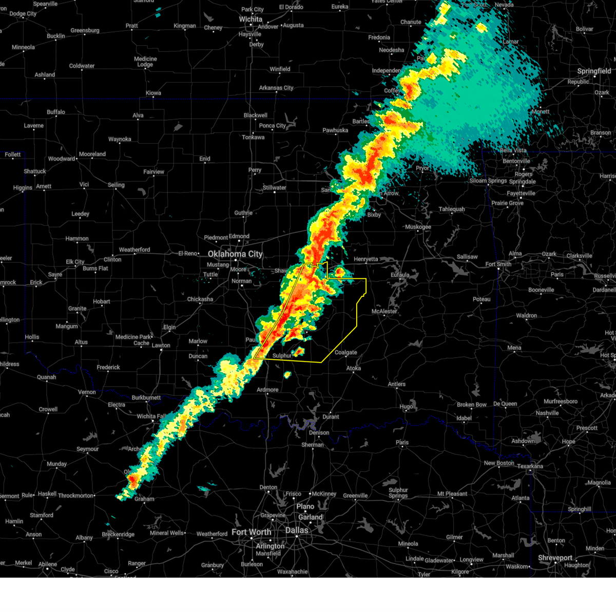 Svroun the national weather service in norman has issued a * severe thunderstorm warning for, north central johnston county in southeastern oklahoma, eastern garvin county in southern oklahoma, northwestern coal county in southeastern oklahoma, seminole county in east central oklahoma, pontotoc county in east central oklahoma, northeastern murray county in southern oklahoma, eastern pottawatomie county in central oklahoma, hughes county in southeastern oklahoma, southeastern mcclain county in central oklahoma, * until 730 am cdt. * at 639 am cdt, severe thunderstorms were located along a line extending from near boley to 4 miles northwest of wewoka to 3 miles east of konawa to 5 miles northeast of vanoss to 8 miles east of wynnewood to near davis, moving east at 55 mph (radar indicated). Hazards include 60 mph wind gusts and quarter size hail. Hail damage to vehicles is expected. Expect wind damage to roofs, siding, and trees. Svroun the national weather service in norman has issued a * severe thunderstorm warning for, north central johnston county in southeastern oklahoma, eastern garvin county in southern oklahoma, northwestern coal county in southeastern oklahoma, seminole county in east central oklahoma, pontotoc county in east central oklahoma, northeastern murray county in southern oklahoma, eastern pottawatomie county in central oklahoma, hughes county in southeastern oklahoma, southeastern mcclain county in central oklahoma, * until 730 am cdt. * at 639 am cdt, severe thunderstorms were located along a line extending from near boley to 4 miles northwest of wewoka to 3 miles east of konawa to 5 miles northeast of vanoss to 8 miles east of wynnewood to near davis, moving east at 55 mph (radar indicated). Hazards include 60 mph wind gusts and quarter size hail. Hail damage to vehicles is expected. Expect wind damage to roofs, siding, and trees.
|
| 4/2/2025 6:27 AM CDT |
 the severe thunderstorm warning has been cancelled and is no longer in effect the severe thunderstorm warning has been cancelled and is no longer in effect
|
| 4/2/2025 6:27 AM CDT |
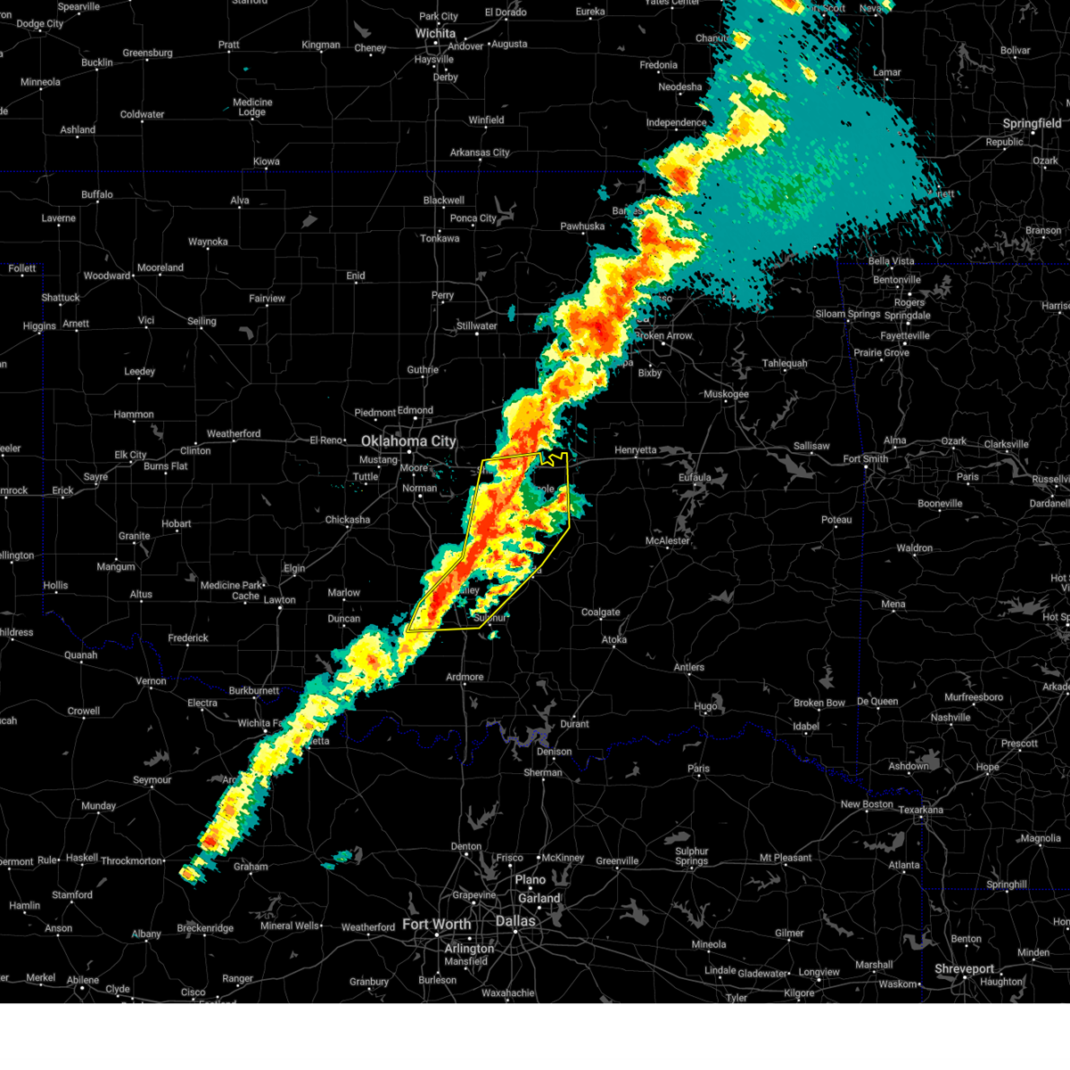 At 626 am cdt, severe thunderstorms were located along a line extending from near prague to 4 miles southeast of st. louis to 3 miles northwest of stratford to 6 miles east of katie, moving northeast at 45 mph (radar indicated). Hazards include 60 mph wind gusts and quarter size hail. Hail damage to vehicles is expected. expect wind damage to roofs, siding, and trees. locations impacted include, tecumseh, wynnewood, konawa, asher, bowlegs, bethel acres, davis, tatums, byars, francis, sasakwa, katie, lima, harjo, seminole, st. Louis, trousdale, macomb, earlsboro, and wewoka. At 626 am cdt, severe thunderstorms were located along a line extending from near prague to 4 miles southeast of st. louis to 3 miles northwest of stratford to 6 miles east of katie, moving northeast at 45 mph (radar indicated). Hazards include 60 mph wind gusts and quarter size hail. Hail damage to vehicles is expected. expect wind damage to roofs, siding, and trees. locations impacted include, tecumseh, wynnewood, konawa, asher, bowlegs, bethel acres, davis, tatums, byars, francis, sasakwa, katie, lima, harjo, seminole, st. Louis, trousdale, macomb, earlsboro, and wewoka.
|
| 4/2/2025 6:05 AM CDT |
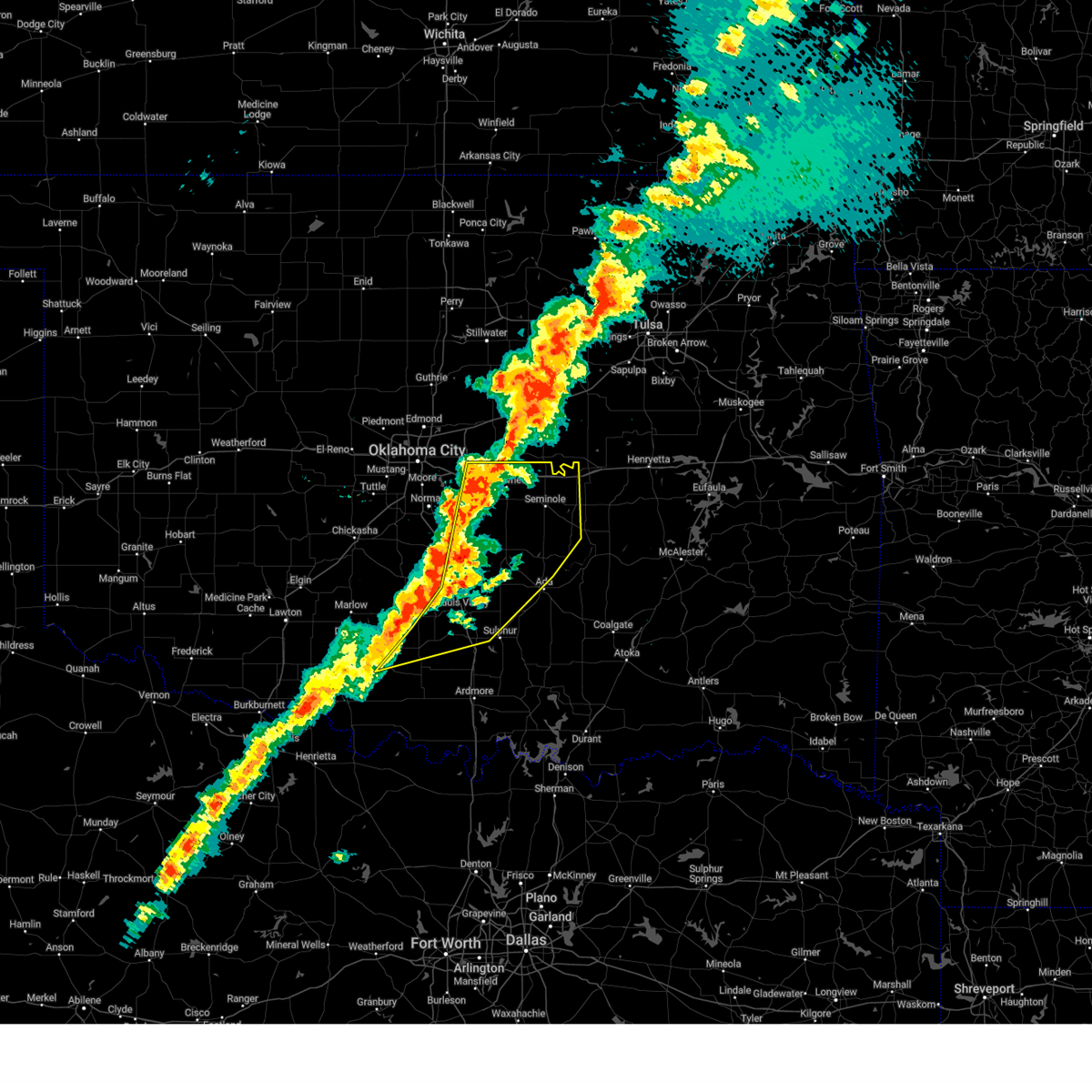 Svroun the national weather service in norman has issued a * severe thunderstorm warning for, garvin county in southern oklahoma, seminole county in east central oklahoma, southeastern oklahoma county in central oklahoma, southeastern stephens county in southern oklahoma, northwestern carter county in southern oklahoma, eastern cleveland county in central oklahoma, northwestern pontotoc county in east central oklahoma, northwestern murray county in southern oklahoma, pottawatomie county in central oklahoma, west central hughes county in southeastern oklahoma, southeastern mcclain county in central oklahoma, * until 645 am cdt. * at 605 am cdt, severe thunderstorms were located along a line extending from 3 miles northwest of shawnee to 3 miles southwest of wanette to near pauls valley to near ratliff city, moving east at 55 mph (radar indicated). Hazards include 60 mph wind gusts and quarter size hail. Hail damage to vehicles is expected. Expect wind damage to roofs, siding, and trees. Svroun the national weather service in norman has issued a * severe thunderstorm warning for, garvin county in southern oklahoma, seminole county in east central oklahoma, southeastern oklahoma county in central oklahoma, southeastern stephens county in southern oklahoma, northwestern carter county in southern oklahoma, eastern cleveland county in central oklahoma, northwestern pontotoc county in east central oklahoma, northwestern murray county in southern oklahoma, pottawatomie county in central oklahoma, west central hughes county in southeastern oklahoma, southeastern mcclain county in central oklahoma, * until 645 am cdt. * at 605 am cdt, severe thunderstorms were located along a line extending from 3 miles northwest of shawnee to 3 miles southwest of wanette to near pauls valley to near ratliff city, moving east at 55 mph (radar indicated). Hazards include 60 mph wind gusts and quarter size hail. Hail damage to vehicles is expected. Expect wind damage to roofs, siding, and trees.
|
| 3/29/2025 11:37 PM CDT |
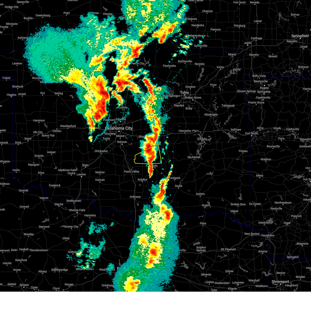 the severe thunderstorm warning has been cancelled and is no longer in effect the severe thunderstorm warning has been cancelled and is no longer in effect
|
| 3/29/2025 11:12 PM CDT |
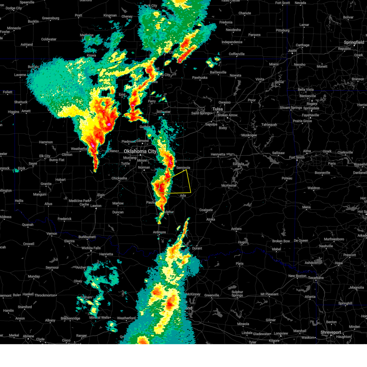 Svroun the national weather service in norman has issued a * severe thunderstorm warning for, southwestern seminole county in east central oklahoma, northwestern pontotoc county in east central oklahoma, southwestern pottawatomie county in central oklahoma, southeastern mcclain county in central oklahoma, * until midnight cdt. * at 1111 pm cdt, a severe thunderstorm was located near wanette, moving east at 35 mph (radar indicated). Hazards include ping pong ball size hail and 60 mph wind gusts. People and animals outdoors will be injured. expect hail damage to roofs, siding, windows, and vehicles. Expect wind damage to roofs, siding, and trees. Svroun the national weather service in norman has issued a * severe thunderstorm warning for, southwestern seminole county in east central oklahoma, northwestern pontotoc county in east central oklahoma, southwestern pottawatomie county in central oklahoma, southeastern mcclain county in central oklahoma, * until midnight cdt. * at 1111 pm cdt, a severe thunderstorm was located near wanette, moving east at 35 mph (radar indicated). Hazards include ping pong ball size hail and 60 mph wind gusts. People and animals outdoors will be injured. expect hail damage to roofs, siding, windows, and vehicles. Expect wind damage to roofs, siding, and trees.
|
| 3/4/2025 5:17 AM CST |
 Svroun the national weather service in norman has issued a * severe thunderstorm warning for, johnston county in southeastern oklahoma, coal county in southeastern oklahoma, southern seminole county in east central oklahoma, pontotoc county in east central oklahoma, northern marshall county in southeastern oklahoma, western atoka county in southeastern oklahoma, hughes county in southeastern oklahoma, * until 600 am cst. * at 517 am cst, severe thunderstorms were located along a line extending from near byng to near stonewall to near madill, moving northeast at 65 mph (radar indicated). Hazards include 70 mph wind gusts and quarter size hail. Hail damage to vehicles is expected. expect considerable tree damage. Wind damage is also likely to mobile homes, roofs, and outbuildings. Svroun the national weather service in norman has issued a * severe thunderstorm warning for, johnston county in southeastern oklahoma, coal county in southeastern oklahoma, southern seminole county in east central oklahoma, pontotoc county in east central oklahoma, northern marshall county in southeastern oklahoma, western atoka county in southeastern oklahoma, hughes county in southeastern oklahoma, * until 600 am cst. * at 517 am cst, severe thunderstorms were located along a line extending from near byng to near stonewall to near madill, moving northeast at 65 mph (radar indicated). Hazards include 70 mph wind gusts and quarter size hail. Hail damage to vehicles is expected. expect considerable tree damage. Wind damage is also likely to mobile homes, roofs, and outbuildings.
|
| 3/4/2025 5:13 AM CST |
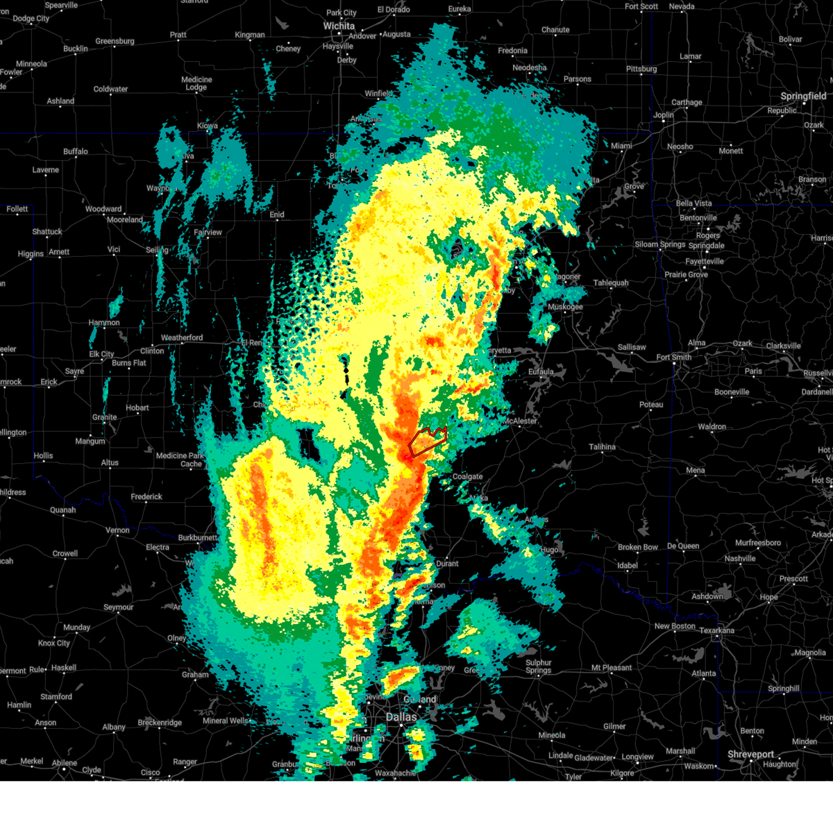 Toroun the national weather service in norman has issued a * tornado warning for, northeastern pontotoc county in east central oklahoma, * until 545 am cst. * at 513 am cst, a severe thunderstorm capable of producing a tornado was located over ada, moving northeast at 45 mph (radar indicated rotation). Hazards include tornado and golf ball size hail. Flying debris will be dangerous to those caught without shelter. mobile homes will be damaged or destroyed. damage to roofs, windows, and vehicles will occur. Tree damage is likely. Toroun the national weather service in norman has issued a * tornado warning for, northeastern pontotoc county in east central oklahoma, * until 545 am cst. * at 513 am cst, a severe thunderstorm capable of producing a tornado was located over ada, moving northeast at 45 mph (radar indicated rotation). Hazards include tornado and golf ball size hail. Flying debris will be dangerous to those caught without shelter. mobile homes will be damaged or destroyed. damage to roofs, windows, and vehicles will occur. Tree damage is likely.
|
| 11/4/2024 12:57 PM CST |
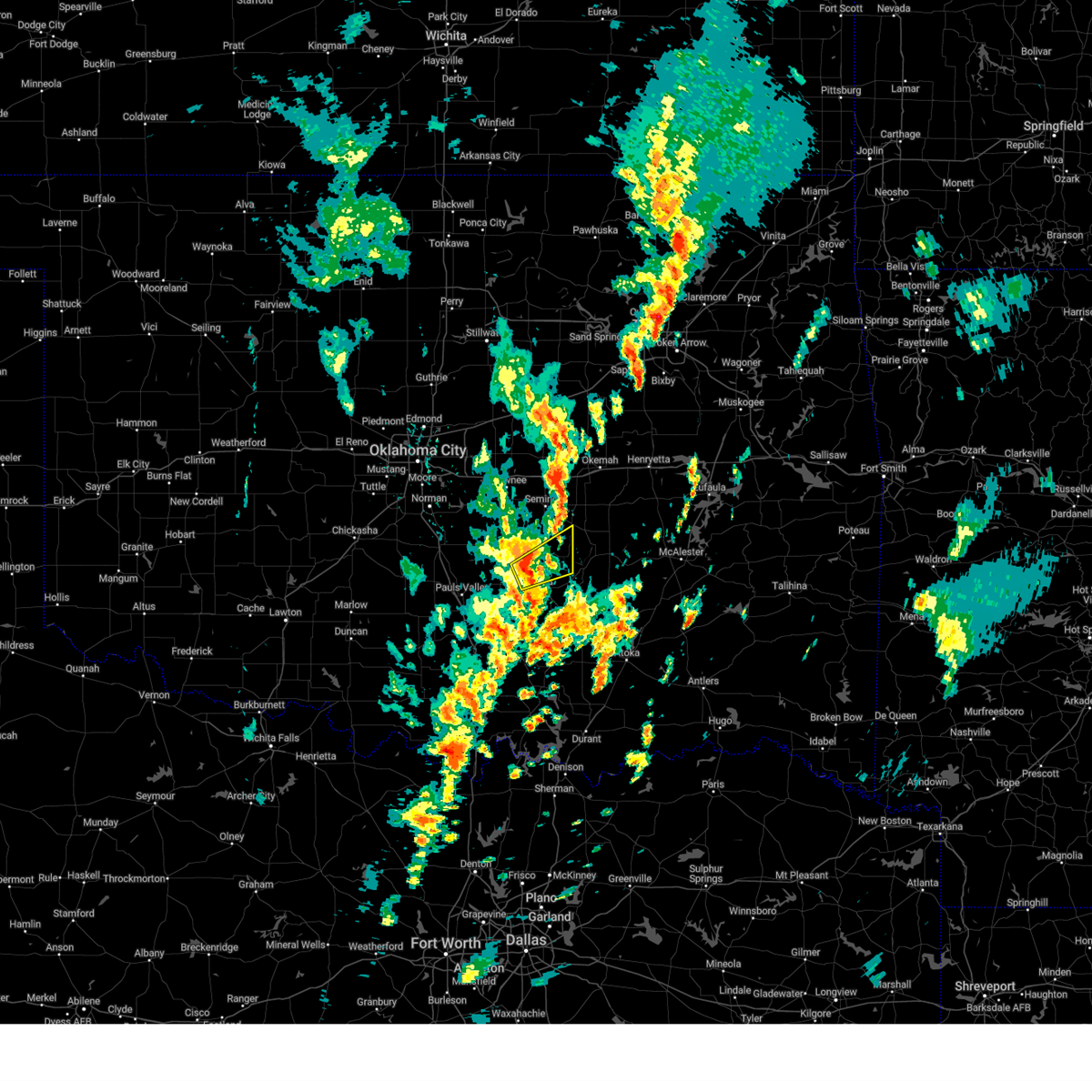 At 1257 pm cst, a severe thunderstorm was located 7 miles northeast of vanoss, moving northeast at 40 mph (radar indicated). Hazards include 60 mph wind gusts and quarter size hail. Hail damage to vehicles is expected. expect wind damage to roofs, siding, and trees. Locations impacted include, ada, konawa, byng, francis, and sasakwa. At 1257 pm cst, a severe thunderstorm was located 7 miles northeast of vanoss, moving northeast at 40 mph (radar indicated). Hazards include 60 mph wind gusts and quarter size hail. Hail damage to vehicles is expected. expect wind damage to roofs, siding, and trees. Locations impacted include, ada, konawa, byng, francis, and sasakwa.
|
| 11/4/2024 12:47 PM CST |
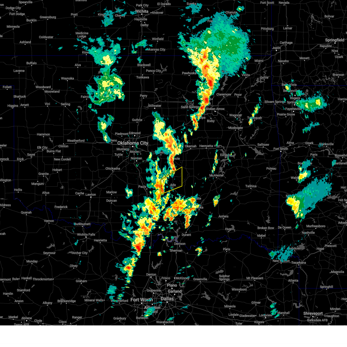 Svroun the national weather service in norman has issued a * severe thunderstorm warning for, southern seminole county in east central oklahoma, northern pontotoc county in east central oklahoma, south central pottawatomie county in central oklahoma, * until 130 pm cst. * at 1247 pm cst, a severe thunderstorm was located near vanoss, moving northeast at 40 mph (radar indicated). Hazards include 60 mph wind gusts and quarter size hail. Hail damage to vehicles is expected. Expect wind damage to roofs, siding, and trees. Svroun the national weather service in norman has issued a * severe thunderstorm warning for, southern seminole county in east central oklahoma, northern pontotoc county in east central oklahoma, south central pottawatomie county in central oklahoma, * until 130 pm cst. * at 1247 pm cst, a severe thunderstorm was located near vanoss, moving northeast at 40 mph (radar indicated). Hazards include 60 mph wind gusts and quarter size hail. Hail damage to vehicles is expected. Expect wind damage to roofs, siding, and trees.
|
| 11/3/2024 4:22 PM CST |
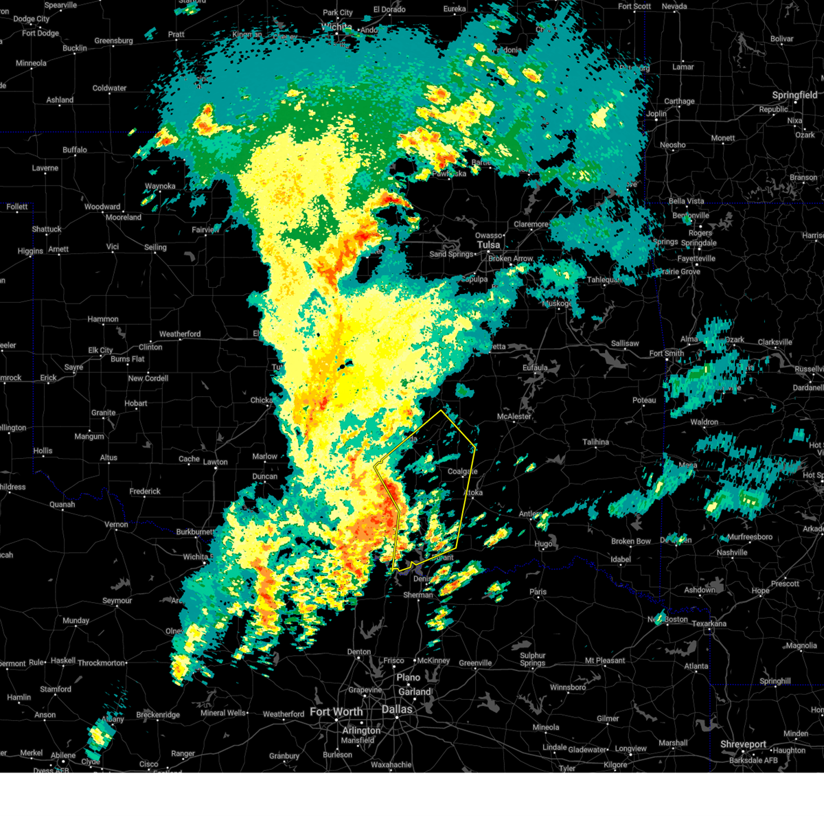 Svroun the national weather service in norman has issued a * severe thunderstorm warning for, johnston county in southeastern oklahoma, northwestern bryan county in southeastern oklahoma, coal county in southeastern oklahoma, southeastern seminole county in east central oklahoma, pontotoc county in east central oklahoma, marshall county in southeastern oklahoma, southwestern atoka county in southeastern oklahoma, northeastern murray county in southern oklahoma, southwestern hughes county in southeastern oklahoma, * until 500 pm cst. * at 422 pm cst, severe thunderstorms were located along a line extending from near roff to 3 miles northeast of reagan to 3 miles south of madill, moving northeast at 50 mph (radar indicated). Hazards include 60 mph wind gusts and quarter size hail. Hail damage to vehicles is expected. Expect wind damage to roofs, siding, and trees. Svroun the national weather service in norman has issued a * severe thunderstorm warning for, johnston county in southeastern oklahoma, northwestern bryan county in southeastern oklahoma, coal county in southeastern oklahoma, southeastern seminole county in east central oklahoma, pontotoc county in east central oklahoma, marshall county in southeastern oklahoma, southwestern atoka county in southeastern oklahoma, northeastern murray county in southern oklahoma, southwestern hughes county in southeastern oklahoma, * until 500 pm cst. * at 422 pm cst, severe thunderstorms were located along a line extending from near roff to 3 miles northeast of reagan to 3 miles south of madill, moving northeast at 50 mph (radar indicated). Hazards include 60 mph wind gusts and quarter size hail. Hail damage to vehicles is expected. Expect wind damage to roofs, siding, and trees.
|
| 11/3/2024 3:25 AM CST |
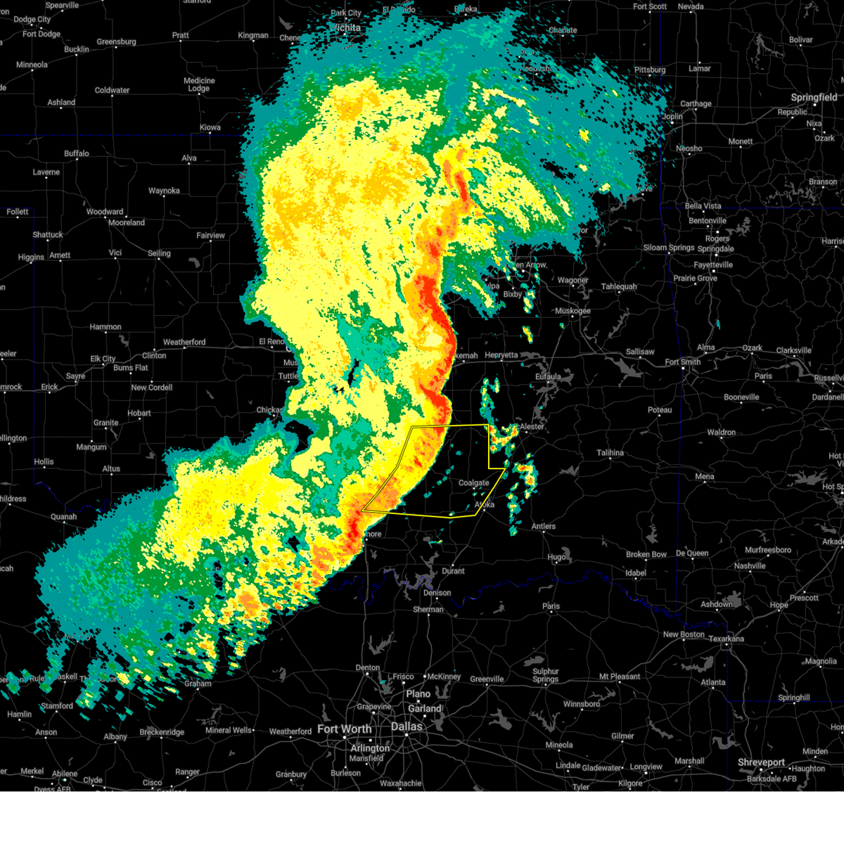 Svroun the national weather service in norman has issued a * severe thunderstorm warning for, northern johnston county in southeastern oklahoma, coal county in southeastern oklahoma, southern seminole county in east central oklahoma, pontotoc county in east central oklahoma, northwestern atoka county in southeastern oklahoma, eastern murray county in southern oklahoma, southern hughes county in southeastern oklahoma, * until 415 am cst. * at 324 am cst, severe thunderstorms were located along a line extending from 5 miles west of atwood to 4 miles southwest of allen to near stonewall to 5 miles west of connerville to 5 miles southwest of mill creek, moving east at 40 mph (radar indicated). Hazards include 60 mph wind gusts and penny size hail. expect damage to roofs, siding, and trees Svroun the national weather service in norman has issued a * severe thunderstorm warning for, northern johnston county in southeastern oklahoma, coal county in southeastern oklahoma, southern seminole county in east central oklahoma, pontotoc county in east central oklahoma, northwestern atoka county in southeastern oklahoma, eastern murray county in southern oklahoma, southern hughes county in southeastern oklahoma, * until 415 am cst. * at 324 am cst, severe thunderstorms were located along a line extending from 5 miles west of atwood to 4 miles southwest of allen to near stonewall to 5 miles west of connerville to 5 miles southwest of mill creek, moving east at 40 mph (radar indicated). Hazards include 60 mph wind gusts and penny size hail. expect damage to roofs, siding, and trees
|
| 11/3/2024 2:42 AM CST |
 Svroun the national weather service in norman has issued a * severe thunderstorm warning for, northern johnston county in southeastern oklahoma, eastern garvin county in southern oklahoma, western coal county in southeastern oklahoma, southern seminole county in east central oklahoma, pontotoc county in east central oklahoma, murray county in southern oklahoma, southwestern pottawatomie county in central oklahoma, southwestern hughes county in southeastern oklahoma, southeastern mcclain county in central oklahoma, * until 330 am cst. * at 242 am cst, severe thunderstorms were located along a line extending from 5 miles southwest of tribbey to near wynnewood to 4 miles northeast of milo, moving east at 55 mph (radar indicated). Hazards include 70 mph wind gusts and nickel size hail. Expect considerable tree damage. Damage is likely to mobile homes, roofs, and outbuildings. Svroun the national weather service in norman has issued a * severe thunderstorm warning for, northern johnston county in southeastern oklahoma, eastern garvin county in southern oklahoma, western coal county in southeastern oklahoma, southern seminole county in east central oklahoma, pontotoc county in east central oklahoma, murray county in southern oklahoma, southwestern pottawatomie county in central oklahoma, southwestern hughes county in southeastern oklahoma, southeastern mcclain county in central oklahoma, * until 330 am cst. * at 242 am cst, severe thunderstorms were located along a line extending from 5 miles southwest of tribbey to near wynnewood to 4 miles northeast of milo, moving east at 55 mph (radar indicated). Hazards include 70 mph wind gusts and nickel size hail. Expect considerable tree damage. Damage is likely to mobile homes, roofs, and outbuildings.
|
| 10/10/2024 11:45 PM CDT |
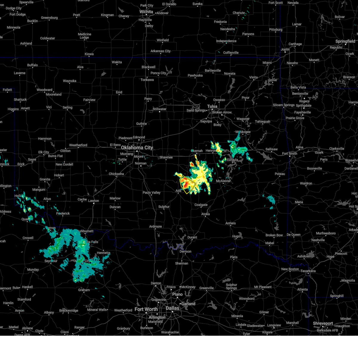 The storms which prompted the warning have weakened below severe limits, therefore the warning will be allowed to expire. however, small hail and gusty winds are still possible with these thunderstorms. The storms which prompted the warning have weakened below severe limits, therefore the warning will be allowed to expire. however, small hail and gusty winds are still possible with these thunderstorms.
|
| 10/10/2024 11:37 PM CDT |
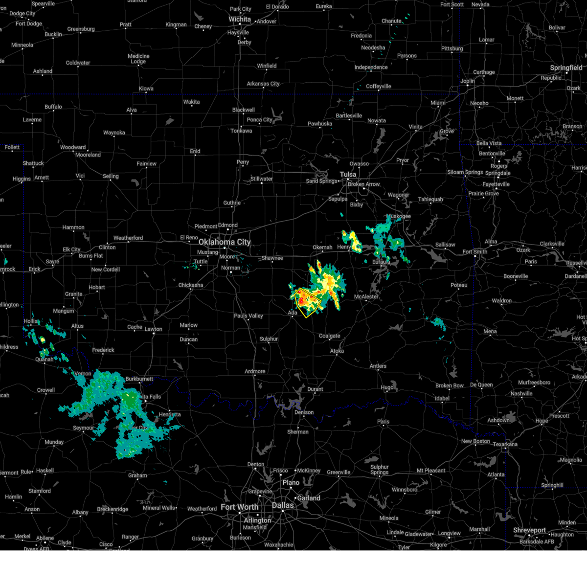 At 1137 pm cdt, severe thunderstorms were located along 9 miles southwest of wewoka and near sasakwa, moving southeast at 15 mph (radar indicated). Hazards include 60 mph wind gusts and quarter size hail. Hail damage to vehicles is expected. expect wind damage to roofs, siding, and trees. Locations impacted include, allen, francis, and sasakwa. At 1137 pm cdt, severe thunderstorms were located along 9 miles southwest of wewoka and near sasakwa, moving southeast at 15 mph (radar indicated). Hazards include 60 mph wind gusts and quarter size hail. Hail damage to vehicles is expected. expect wind damage to roofs, siding, and trees. Locations impacted include, allen, francis, and sasakwa.
|
| 10/10/2024 11:12 PM CDT |
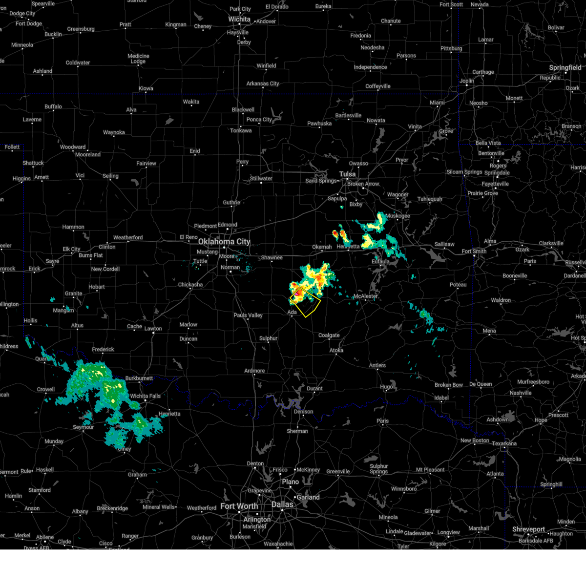 Svroun the national weather service in norman has issued a * severe thunderstorm warning for, southeastern seminole county in east central oklahoma, northeastern pontotoc county in east central oklahoma, southwestern hughes county in southeastern oklahoma, * until 1145 pm cdt. * at 1112 pm cdt, a severe thunderstorm was located near sasakwa, moving southeast at 15 mph (radar indicated). Hazards include 60 mph wind gusts and quarter size hail. Hail damage to vehicles is expected. Expect wind damage to roofs, siding, and trees. Svroun the national weather service in norman has issued a * severe thunderstorm warning for, southeastern seminole county in east central oklahoma, northeastern pontotoc county in east central oklahoma, southwestern hughes county in southeastern oklahoma, * until 1145 pm cdt. * at 1112 pm cdt, a severe thunderstorm was located near sasakwa, moving southeast at 15 mph (radar indicated). Hazards include 60 mph wind gusts and quarter size hail. Hail damage to vehicles is expected. Expect wind damage to roofs, siding, and trees.
|
| 7/7/2024 11:38 AM CDT |
 The storms which prompted the warning have weakened below severe limits, therefore the warning will be allowed to expire. however, gusty winds and heavy rain are still possible with these thunderstorms. The storms which prompted the warning have weakened below severe limits, therefore the warning will be allowed to expire. however, gusty winds and heavy rain are still possible with these thunderstorms.
|
| 7/7/2024 11:22 AM CDT |
 At 1122 am cdt, severe thunderstorms were located along a line extending from 3 miles north of allen to 4 miles northwest of fittstown, moving east at 30 mph (radar indicated). Hazards include 60 mph wind gusts and quarter size hail. Hail damage to vehicles is expected. expect wind damage to roofs, siding, and trees. Locations impacted include, ada, byng, allen, roff, stonewall, tupelo, francis, calvin, fitzhugh, sasakwa, gerty, atwood, fittstown, and jesse. At 1122 am cdt, severe thunderstorms were located along a line extending from 3 miles north of allen to 4 miles northwest of fittstown, moving east at 30 mph (radar indicated). Hazards include 60 mph wind gusts and quarter size hail. Hail damage to vehicles is expected. expect wind damage to roofs, siding, and trees. Locations impacted include, ada, byng, allen, roff, stonewall, tupelo, francis, calvin, fitzhugh, sasakwa, gerty, atwood, fittstown, and jesse.
|
| 7/7/2024 11:02 AM CDT |
 Svroun the national weather service in norman has issued a * severe thunderstorm warning for, northwestern coal county in southeastern oklahoma, southern seminole county in east central oklahoma, pontotoc county in east central oklahoma, southwestern hughes county in southeastern oklahoma, * until 1145 am cdt. * at 1102 am cdt, severe thunderstorms were located along a line extending from 3 miles north of francis to near roff, moving east at 35 mph (radar indicated). Hazards include 60 mph wind gusts and quarter size hail. Hail damage to vehicles is expected. Expect wind damage to roofs, siding, and trees. Svroun the national weather service in norman has issued a * severe thunderstorm warning for, northwestern coal county in southeastern oklahoma, southern seminole county in east central oklahoma, pontotoc county in east central oklahoma, southwestern hughes county in southeastern oklahoma, * until 1145 am cdt. * at 1102 am cdt, severe thunderstorms were located along a line extending from 3 miles north of francis to near roff, moving east at 35 mph (radar indicated). Hazards include 60 mph wind gusts and quarter size hail. Hail damage to vehicles is expected. Expect wind damage to roofs, siding, and trees.
|
| 7/4/2024 5:55 PM CDT |
 At 554 pm cdt, a severe thunderstorm was located near ada, moving east at 20 mph. this is a destructive storm for ada (radar indicated). Hazards include 80 mph wind gusts and half dollar size hail. Flying debris will be dangerous to those caught without shelter. mobile homes will be heavily damaged. expect considerable damage to roofs, windows, and vehicles. extensive tree damage and power outages are likely. Locations impacted include, ada, byng, allen, francis, and sasakwa. At 554 pm cdt, a severe thunderstorm was located near ada, moving east at 20 mph. this is a destructive storm for ada (radar indicated). Hazards include 80 mph wind gusts and half dollar size hail. Flying debris will be dangerous to those caught without shelter. mobile homes will be heavily damaged. expect considerable damage to roofs, windows, and vehicles. extensive tree damage and power outages are likely. Locations impacted include, ada, byng, allen, francis, and sasakwa.
|
| 7/4/2024 5:47 PM CDT |
 At 547 pm cdt, a severe thunderstorm was located near byng, moving east at 10 mph (radar indicated). Hazards include 70 mph wind gusts and half dollar size hail. Hail damage to vehicles is expected. expect considerable tree damage. wind damage is also likely to mobile homes, roofs, and outbuildings. Locations impacted include, ada, byng, allen, francis, and sasakwa. At 547 pm cdt, a severe thunderstorm was located near byng, moving east at 10 mph (radar indicated). Hazards include 70 mph wind gusts and half dollar size hail. Hail damage to vehicles is expected. expect considerable tree damage. wind damage is also likely to mobile homes, roofs, and outbuildings. Locations impacted include, ada, byng, allen, francis, and sasakwa.
|
| 7/4/2024 5:34 PM CDT |
 Svroun the national weather service in norman has issued a * severe thunderstorm warning for, southeastern seminole county in east central oklahoma, northeastern pontotoc county in east central oklahoma, southwestern hughes county in southeastern oklahoma, * until 615 pm cdt. * at 534 pm cdt, a severe thunderstorm was located near francis, moving east at 10 mph (radar indicated). Hazards include 60 mph wind gusts and half dollar size hail. Hail damage to vehicles is expected. Expect wind damage to roofs, siding, and trees. Svroun the national weather service in norman has issued a * severe thunderstorm warning for, southeastern seminole county in east central oklahoma, northeastern pontotoc county in east central oklahoma, southwestern hughes county in southeastern oklahoma, * until 615 pm cdt. * at 534 pm cdt, a severe thunderstorm was located near francis, moving east at 10 mph (radar indicated). Hazards include 60 mph wind gusts and half dollar size hail. Hail damage to vehicles is expected. Expect wind damage to roofs, siding, and trees.
|
| 6/4/2024 10:44 PM CDT |
 The storms which prompted the warning are still strong, but have weakened to below severe limits. therefore, the warning will be allowed to expire. however, gusty winds and heavy rain are still possible with these thunderstorms. The storms which prompted the warning are still strong, but have weakened to below severe limits. therefore, the warning will be allowed to expire. however, gusty winds and heavy rain are still possible with these thunderstorms.
|
| 6/4/2024 10:34 PM CDT |
 the severe thunderstorm warning has been cancelled and is no longer in effect the severe thunderstorm warning has been cancelled and is no longer in effect
|
| 6/4/2024 10:34 PM CDT |
 At 1033 pm cdt, the leading edge of winds from severe thunderstorms was located along a line extending from near little to 4 miles southeast of seminole to near byng to 8 miles west of roff, moving southeast at 40 mph (radar indicated). Hazards include 60 mph wind gusts and quarter size hail. Hail damage to vehicles is expected. expect wind damage to roofs, siding, and trees. Locations impacted include, ada, seminole, wewoka, stratford, konawa, byng, maud, roff, bowlegs, francis, cromwell, fitzhugh, sasakwa, vanoss, little, lima, and centerview. At 1033 pm cdt, the leading edge of winds from severe thunderstorms was located along a line extending from near little to 4 miles southeast of seminole to near byng to 8 miles west of roff, moving southeast at 40 mph (radar indicated). Hazards include 60 mph wind gusts and quarter size hail. Hail damage to vehicles is expected. expect wind damage to roofs, siding, and trees. Locations impacted include, ada, seminole, wewoka, stratford, konawa, byng, maud, roff, bowlegs, francis, cromwell, fitzhugh, sasakwa, vanoss, little, lima, and centerview.
|
| 6/4/2024 10:12 PM CDT |
 At 1011 pm cdt, the leading edge of winds from severe thunderstorms was located along a line extending from near little to near asher to near pauls valley, moving southeast at 45 mph (radar indicated). Hazards include 60 mph wind gusts and quarter size hail. Hail damage to vehicles is expected. expect wind damage to roofs, siding, and trees. Locations impacted include, shawnee, ada, seminole, tecumseh, pauls valley, wewoka, stratford, konawa, byng, maud, roff, earlsboro, paoli, bowlegs, asher, wanette, francis, cromwell, byars, and johnson. At 1011 pm cdt, the leading edge of winds from severe thunderstorms was located along a line extending from near little to near asher to near pauls valley, moving southeast at 45 mph (radar indicated). Hazards include 60 mph wind gusts and quarter size hail. Hail damage to vehicles is expected. expect wind damage to roofs, siding, and trees. Locations impacted include, shawnee, ada, seminole, tecumseh, pauls valley, wewoka, stratford, konawa, byng, maud, roff, earlsboro, paoli, bowlegs, asher, wanette, francis, cromwell, byars, and johnson.
|
| 6/4/2024 10:12 PM CDT |
 the severe thunderstorm warning has been cancelled and is no longer in effect the severe thunderstorm warning has been cancelled and is no longer in effect
|
| 6/4/2024 9:57 PM CDT |
 Svroun the national weather service in norman has issued a * severe thunderstorm warning for, northeastern garvin county in southern oklahoma, seminole county in east central oklahoma, southeastern cleveland county in central oklahoma, western pontotoc county in east central oklahoma, pottawatomie county in central oklahoma, southeastern mcclain county in central oklahoma, * until 1045 pm cdt. * at 957 pm cdt, severe thunderstorms were located along a line extending from johnson to shawnee to tribbey to rosedale, moving southeast at 40 mph (radar indicated). Hazards include 60 mph wind gusts and quarter size hail. Hail damage to vehicles is expected. Expect wind damage to roofs, siding, and trees. Svroun the national weather service in norman has issued a * severe thunderstorm warning for, northeastern garvin county in southern oklahoma, seminole county in east central oklahoma, southeastern cleveland county in central oklahoma, western pontotoc county in east central oklahoma, pottawatomie county in central oklahoma, southeastern mcclain county in central oklahoma, * until 1045 pm cdt. * at 957 pm cdt, severe thunderstorms were located along a line extending from johnson to shawnee to tribbey to rosedale, moving southeast at 40 mph (radar indicated). Hazards include 60 mph wind gusts and quarter size hail. Hail damage to vehicles is expected. Expect wind damage to roofs, siding, and trees.
|
| 6/4/2024 2:37 AM CDT |
 Svroun the national weather service in norman has issued a * severe thunderstorm warning for, northern johnston county in southeastern oklahoma, southeastern garvin county in southern oklahoma, coal county in southeastern oklahoma, southern seminole county in east central oklahoma, northeastern carter county in southern oklahoma, pontotoc county in east central oklahoma, north central atoka county in southeastern oklahoma, murray county in southern oklahoma, south central pottawatomie county in central oklahoma, southwestern hughes county in southeastern oklahoma, southeastern mcclain county in central oklahoma, * until 315 am cdt. * at 237 am cdt, severe thunderstorms were located along a line extending from 7 miles northwest of sasakwa to 3 miles south of foster, moving southeast at 45 mph (radar indicated). Hazards include 60 mph wind gusts and quarter size hail. Hail damage to vehicles is expected. Expect wind damage to roofs, siding, and trees. Svroun the national weather service in norman has issued a * severe thunderstorm warning for, northern johnston county in southeastern oklahoma, southeastern garvin county in southern oklahoma, coal county in southeastern oklahoma, southern seminole county in east central oklahoma, northeastern carter county in southern oklahoma, pontotoc county in east central oklahoma, north central atoka county in southeastern oklahoma, murray county in southern oklahoma, south central pottawatomie county in central oklahoma, southwestern hughes county in southeastern oklahoma, southeastern mcclain county in central oklahoma, * until 315 am cdt. * at 237 am cdt, severe thunderstorms were located along a line extending from 7 miles northwest of sasakwa to 3 miles south of foster, moving southeast at 45 mph (radar indicated). Hazards include 60 mph wind gusts and quarter size hail. Hail damage to vehicles is expected. Expect wind damage to roofs, siding, and trees.
|
| 5/23/2024 2:54 AM CDT |
 The storm which prompted the warning has weakened below severe limits, and has exited the warned area. therefore, the warning will be allowed to expire. however, gusty winds are still possible with this thunderstorm. remember, a severe thunderstorm warning still remains in effect for southern portions of pontotoc and western coal counties until 330 am. The storm which prompted the warning has weakened below severe limits, and has exited the warned area. therefore, the warning will be allowed to expire. however, gusty winds are still possible with this thunderstorm. remember, a severe thunderstorm warning still remains in effect for southern portions of pontotoc and western coal counties until 330 am.
|
| 5/23/2024 2:13 AM CDT |
 Svroun the national weather service in norman has issued a * severe thunderstorm warning for, northwestern coal county in southeastern oklahoma, pontotoc county in east central oklahoma, * until 300 am cdt. * at 213 am cdt, a severe thunderstorm was located near hickory, moving northeast at 35 mph (radar indicated). Hazards include half dollar size hail. damage to vehicles is expected Svroun the national weather service in norman has issued a * severe thunderstorm warning for, northwestern coal county in southeastern oklahoma, pontotoc county in east central oklahoma, * until 300 am cdt. * at 213 am cdt, a severe thunderstorm was located near hickory, moving northeast at 35 mph (radar indicated). Hazards include half dollar size hail. damage to vehicles is expected
|
| 5/22/2024 9:39 AM CDT |
 At 939 am cdt, a severe thunderstorm was located 5 miles north of sulphur, moving east at 45 mph (radar indicated). Hazards include golf ball size hail and 60 mph wind gusts. People and animals outdoors will be injured. expect hail damage to roofs, siding, windows, and vehicles. expect wind damage to roofs, siding, and trees. Locations impacted include, ada, sulphur, davis, wynnewood, stratford, byng, roff, stonewall, tupelo, mill creek, francis, fitzhugh, dougherty, bromide, hickory, clarita, reagan, turner falls, connerville, and scullin. At 939 am cdt, a severe thunderstorm was located 5 miles north of sulphur, moving east at 45 mph (radar indicated). Hazards include golf ball size hail and 60 mph wind gusts. People and animals outdoors will be injured. expect hail damage to roofs, siding, windows, and vehicles. expect wind damage to roofs, siding, and trees. Locations impacted include, ada, sulphur, davis, wynnewood, stratford, byng, roff, stonewall, tupelo, mill creek, francis, fitzhugh, dougherty, bromide, hickory, clarita, reagan, turner falls, connerville, and scullin.
|
| 5/22/2024 9:27 AM CDT |
 Svroun the national weather service in norman has issued a * severe thunderstorm warning for, northern johnston county in southeastern oklahoma, eastern garvin county in southern oklahoma, southwestern coal county in southeastern oklahoma, south central seminole county in east central oklahoma, east central carter county in southern oklahoma, pontotoc county in east central oklahoma, murray county in southern oklahoma, * until 1015 am cdt. * at 927 am cdt, a severe thunderstorm was located 4 miles south of wynnewood, moving east at 45 mph (radar indicated). Hazards include 60 mph wind gusts and half dollar size hail. Hail damage to vehicles is expected. Expect wind damage to roofs, siding, and trees. Svroun the national weather service in norman has issued a * severe thunderstorm warning for, northern johnston county in southeastern oklahoma, eastern garvin county in southern oklahoma, southwestern coal county in southeastern oklahoma, south central seminole county in east central oklahoma, east central carter county in southern oklahoma, pontotoc county in east central oklahoma, murray county in southern oklahoma, * until 1015 am cdt. * at 927 am cdt, a severe thunderstorm was located 4 miles south of wynnewood, moving east at 45 mph (radar indicated). Hazards include 60 mph wind gusts and half dollar size hail. Hail damage to vehicles is expected. Expect wind damage to roofs, siding, and trees.
|
| 4/28/2024 12:52 AM CDT |
 At 1251 am cdt, the leading edge of severe thunderstorms were located along a line extending from 3 miles northwest of ashland to 4 miles west of marietta, moving northeast at 35 mph (radar indicated). Hazards include 60 mph wind gusts and penny size hail. Expect damage to roofs, siding, and trees. Locations impacted include, ardmore, ada, sulphur, madill, atoka, tishomingo, marietta, coalgate, lone grove, wilson, kingston, dickson, allen, mannsville, roff, springer, ravia, stonewall, thackerville, and wapanucka. At 1251 am cdt, the leading edge of severe thunderstorms were located along a line extending from 3 miles northwest of ashland to 4 miles west of marietta, moving northeast at 35 mph (radar indicated). Hazards include 60 mph wind gusts and penny size hail. Expect damage to roofs, siding, and trees. Locations impacted include, ardmore, ada, sulphur, madill, atoka, tishomingo, marietta, coalgate, lone grove, wilson, kingston, dickson, allen, mannsville, roff, springer, ravia, stonewall, thackerville, and wapanucka.
|
| 4/28/2024 12:46 AM CDT |
 Svroun the national weather service in norman has issued a * severe thunderstorm warning for, johnston county in southeastern oklahoma, northwestern bryan county in southeastern oklahoma, love county in southern oklahoma, coal county in southeastern oklahoma, carter county in southern oklahoma, pontotoc county in east central oklahoma, marshall county in southeastern oklahoma, central atoka county in southeastern oklahoma, eastern murray county in southern oklahoma, southern hughes county in southeastern oklahoma, * until 130 am cdt. * at 1246 am cdt, severe thunderstorms were located along a line extending from 5 miles northwest of ashland to 5 miles northeast of burneyville, moving east at 75 mph (radar indicated). Hazards include 60 mph wind gusts and penny size hail. expect damage to roofs, siding, and trees Svroun the national weather service in norman has issued a * severe thunderstorm warning for, johnston county in southeastern oklahoma, northwestern bryan county in southeastern oklahoma, love county in southern oklahoma, coal county in southeastern oklahoma, carter county in southern oklahoma, pontotoc county in east central oklahoma, marshall county in southeastern oklahoma, central atoka county in southeastern oklahoma, eastern murray county in southern oklahoma, southern hughes county in southeastern oklahoma, * until 130 am cdt. * at 1246 am cdt, severe thunderstorms were located along a line extending from 5 miles northwest of ashland to 5 miles northeast of burneyville, moving east at 75 mph (radar indicated). Hazards include 60 mph wind gusts and penny size hail. expect damage to roofs, siding, and trees
|
| 4/27/2024 11:22 PM CDT |
 Toroun the national weather service in norman has issued a * tornado warning for, northwestern johnston county in southeastern oklahoma, pontotoc county in east central oklahoma, northeastern murray county in southern oklahoma, * until 1145 pm cdt. * at 1121 pm cdt, a severe thunderstorm capable of producing a tornado was located near scullin and hickory, moving northeast at 50 mph (radar indicated rotation). Hazards include tornado and quarter size hail. Flying debris will be dangerous to those caught without shelter. mobile homes will be damaged or destroyed. damage to roofs, windows, and vehicles will occur. Tree damage is likely. Toroun the national weather service in norman has issued a * tornado warning for, northwestern johnston county in southeastern oklahoma, pontotoc county in east central oklahoma, northeastern murray county in southern oklahoma, * until 1145 pm cdt. * at 1121 pm cdt, a severe thunderstorm capable of producing a tornado was located near scullin and hickory, moving northeast at 50 mph (radar indicated rotation). Hazards include tornado and quarter size hail. Flying debris will be dangerous to those caught without shelter. mobile homes will be damaged or destroyed. damage to roofs, windows, and vehicles will occur. Tree damage is likely.
|
| 4/27/2024 11:04 PM CDT |
 Toroun the national weather service in norman has issued a * tornado warning for, northeastern pontotoc county in east central oklahoma, * until 1130 pm cdt. * at 1104 pm cdt, a severe thunderstorm capable of producing a tornado was located 4 miles west of ada, moving east-northeast at 25 mph (radar indicated rotation). Hazards include tornado and golf ball size hail. Flying debris will be dangerous to those caught without shelter. mobile homes will be damaged or destroyed. damage to roofs, windows, and vehicles will occur. Tree damage is likely. Toroun the national weather service in norman has issued a * tornado warning for, northeastern pontotoc county in east central oklahoma, * until 1130 pm cdt. * at 1104 pm cdt, a severe thunderstorm capable of producing a tornado was located 4 miles west of ada, moving east-northeast at 25 mph (radar indicated rotation). Hazards include tornado and golf ball size hail. Flying debris will be dangerous to those caught without shelter. mobile homes will be damaged or destroyed. damage to roofs, windows, and vehicles will occur. Tree damage is likely.
|
| 4/27/2024 10:17 PM CDT |
 Toroun the national weather service in norman has issued a * tornado warning for, southeastern seminole county in east central oklahoma, northeastern pontotoc county in east central oklahoma, northwestern hughes county in southeastern oklahoma, * until 1100 pm cdt. * at 1017 pm cdt, a severe thunderstorm capable of producing a tornado was located near francis, moving north at 45 mph (radar indicated rotation). Hazards include tornado and golf ball size hail. Flying debris will be dangerous to those caught without shelter. mobile homes will be damaged or destroyed. damage to roofs, windows, and vehicles will occur. Tree damage is likely. Toroun the national weather service in norman has issued a * tornado warning for, southeastern seminole county in east central oklahoma, northeastern pontotoc county in east central oklahoma, northwestern hughes county in southeastern oklahoma, * until 1100 pm cdt. * at 1017 pm cdt, a severe thunderstorm capable of producing a tornado was located near francis, moving north at 45 mph (radar indicated rotation). Hazards include tornado and golf ball size hail. Flying debris will be dangerous to those caught without shelter. mobile homes will be damaged or destroyed. damage to roofs, windows, and vehicles will occur. Tree damage is likely.
|
| 4/27/2024 9:25 PM CDT |
 Svroun the national weather service in norman has issued a * severe thunderstorm warning for, north central johnston county in southeastern oklahoma, pontotoc county in east central oklahoma, * until 1015 pm cdt. * at 925 pm cdt, a severe thunderstorm was located near pontotoc, moving north at 35 mph (radar indicated). Hazards include 60 mph wind gusts and quarter size hail. Hail damage to vehicles is expected. Expect wind damage to roofs, siding, and trees. Svroun the national weather service in norman has issued a * severe thunderstorm warning for, north central johnston county in southeastern oklahoma, pontotoc county in east central oklahoma, * until 1015 pm cdt. * at 925 pm cdt, a severe thunderstorm was located near pontotoc, moving north at 35 mph (radar indicated). Hazards include 60 mph wind gusts and quarter size hail. Hail damage to vehicles is expected. Expect wind damage to roofs, siding, and trees.
|
| 4/26/2024 6:08 AM CDT |
 the severe thunderstorm warning has been cancelled and is no longer in effect the severe thunderstorm warning has been cancelled and is no longer in effect
|
| 4/26/2024 6:08 AM CDT |
 At 607 am cdt, severe thunderstorms were located along a line extending from 3 miles northeast of wetumka to 5 miles southwest of allen, moving east at 50 mph (radar indicated). Hazards include 60 mph wind gusts and nickel size hail. Expect damage to roofs, siding, and trees. Locations impacted include, ada, holdenville, wewoka, wetumka, byng, allen, francis, calvin, lamar, sasakwa, gerty, horntown, yeager, atwood, and spaulding. At 607 am cdt, severe thunderstorms were located along a line extending from 3 miles northeast of wetumka to 5 miles southwest of allen, moving east at 50 mph (radar indicated). Hazards include 60 mph wind gusts and nickel size hail. Expect damage to roofs, siding, and trees. Locations impacted include, ada, holdenville, wewoka, wetumka, byng, allen, francis, calvin, lamar, sasakwa, gerty, horntown, yeager, atwood, and spaulding.
|
| 4/26/2024 5:29 AM CDT |
 Svroun the national weather service in norman has issued a * severe thunderstorm warning for, seminole county in east central oklahoma, northern pontotoc county in east central oklahoma, south central pottawatomie county in central oklahoma, hughes county in southeastern oklahoma, * until 615 am cdt. * at 529 am cdt, severe thunderstorms were located along a line extending from near maud to near stratford, moving east-northeast at 55 mph (radar indicated). Hazards include 60 mph wind gusts and nickel size hail. expect damage to roofs, siding, and trees Svroun the national weather service in norman has issued a * severe thunderstorm warning for, seminole county in east central oklahoma, northern pontotoc county in east central oklahoma, south central pottawatomie county in central oklahoma, hughes county in southeastern oklahoma, * until 615 am cdt. * at 529 am cdt, severe thunderstorms were located along a line extending from near maud to near stratford, moving east-northeast at 55 mph (radar indicated). Hazards include 60 mph wind gusts and nickel size hail. expect damage to roofs, siding, and trees
|
| 4/1/2024 10:57 PM CDT |
 The storms which prompted the warning have weakened below severe limits, therefore the warning will be allowed to expire. however, small hail and gusty winds are still possible with these thunderstorms. The storms which prompted the warning have weakened below severe limits, therefore the warning will be allowed to expire. however, small hail and gusty winds are still possible with these thunderstorms.
|
| 4/1/2024 10:46 PM CDT |
 At 1046 pm cdt, severe thunderstorms were located along a line extending from 4 miles southeast of st. louis to 3 miles south of ada to near mill creek, moving east at 50 mph (radar indicated). Hazards include 60 mph wind gusts and quarter size hail. Hail damage to vehicles is expected. expect wind damage to roofs, siding, and trees. locations impacted include, ada, sulphur, konawa, byng, roff, stonewall, asher, mill creek, francis, fitzhugh, dougherty, st. Louis, sasakwa, hickory, pontotoc, fittstown, vanoss, lake of the arbuckles, reagan, and connerville. At 1046 pm cdt, severe thunderstorms were located along a line extending from 4 miles southeast of st. louis to 3 miles south of ada to near mill creek, moving east at 50 mph (radar indicated). Hazards include 60 mph wind gusts and quarter size hail. Hail damage to vehicles is expected. expect wind damage to roofs, siding, and trees. locations impacted include, ada, sulphur, konawa, byng, roff, stonewall, asher, mill creek, francis, fitzhugh, dougherty, st. Louis, sasakwa, hickory, pontotoc, fittstown, vanoss, lake of the arbuckles, reagan, and connerville.
|
| 4/1/2024 10:46 PM CDT |
 the severe thunderstorm warning has been cancelled and is no longer in effect the severe thunderstorm warning has been cancelled and is no longer in effect
|
| 4/1/2024 10:36 PM CDT |
 At 1035 pm cdt, severe thunderstorms were located along a line extending from near asher to near fitzhugh to 3 miles southeast of dougherty, moving east at 50 mph (radar indicated). Hazards include 60 mph wind gusts and quarter size hail. Hail damage to vehicles is expected. expect wind damage to roofs, siding, and trees. locations impacted include, ada, sulphur, davis, stratford, konawa, byng, roff, springer, stonewall, asher, wanette, mill creek, francis, byars, fitzhugh, dougherty, st. Louis, sasakwa, hickory, and reagan. At 1035 pm cdt, severe thunderstorms were located along a line extending from near asher to near fitzhugh to 3 miles southeast of dougherty, moving east at 50 mph (radar indicated). Hazards include 60 mph wind gusts and quarter size hail. Hail damage to vehicles is expected. expect wind damage to roofs, siding, and trees. locations impacted include, ada, sulphur, davis, stratford, konawa, byng, roff, springer, stonewall, asher, wanette, mill creek, francis, byars, fitzhugh, dougherty, st. Louis, sasakwa, hickory, and reagan.
|
| 4/1/2024 10:18 PM CDT |
 Svroun the national weather service in norman has issued a * severe thunderstorm warning for, northwestern johnston county in southeastern oklahoma, eastern garvin county in southern oklahoma, southwestern seminole county in east central oklahoma, central carter county in southern oklahoma, pontotoc county in east central oklahoma, murray county in southern oklahoma, southwestern pottawatomie county in central oklahoma, southeastern mcclain county in central oklahoma, * until 1100 pm cdt. * at 1017 pm cdt, severe thunderstorms were located along a line extending from 6 miles north of rosedale to 7 miles southwest of stratford to 5 miles southwest of turner falls, moving east at 50 mph (radar indicated). Hazards include 60 mph wind gusts and quarter size hail. Hail damage to vehicles is expected. Expect wind damage to roofs, siding, and trees. Svroun the national weather service in norman has issued a * severe thunderstorm warning for, northwestern johnston county in southeastern oklahoma, eastern garvin county in southern oklahoma, southwestern seminole county in east central oklahoma, central carter county in southern oklahoma, pontotoc county in east central oklahoma, murray county in southern oklahoma, southwestern pottawatomie county in central oklahoma, southeastern mcclain county in central oklahoma, * until 1100 pm cdt. * at 1017 pm cdt, severe thunderstorms were located along a line extending from 6 miles north of rosedale to 7 miles southwest of stratford to 5 miles southwest of turner falls, moving east at 50 mph (radar indicated). Hazards include 60 mph wind gusts and quarter size hail. Hail damage to vehicles is expected. Expect wind damage to roofs, siding, and trees.
|
| 3/14/2024 5:57 PM CDT |
 Svroun the national weather service in norman has issued a * severe thunderstorm warning for, southeastern seminole county in east central oklahoma, northeastern pontotoc county in east central oklahoma, southwestern hughes county in southeastern oklahoma, * until 645 pm cdt. * at 556 pm cdt, a severe thunderstorm was located near ada, moving northeast at 25 mph. this is a destructive storm for ada and allen (trained weather spotters reported baseball size hail in ada). Hazards include baseball size hail and 60 mph wind gusts. People and animals outdoors will be severely injured. Expect shattered windows, extensive damage to roofs, siding, and vehicles. Svroun the national weather service in norman has issued a * severe thunderstorm warning for, southeastern seminole county in east central oklahoma, northeastern pontotoc county in east central oklahoma, southwestern hughes county in southeastern oklahoma, * until 645 pm cdt. * at 556 pm cdt, a severe thunderstorm was located near ada, moving northeast at 25 mph. this is a destructive storm for ada and allen (trained weather spotters reported baseball size hail in ada). Hazards include baseball size hail and 60 mph wind gusts. People and animals outdoors will be severely injured. Expect shattered windows, extensive damage to roofs, siding, and vehicles.
|
| 3/14/2024 5:52 PM CDT |
 At 551 pm cdt, a severe thunderstorm was located near ada, moving northeast at 30 mph (trained weather spotters reported golf ball size hail in ada). Hazards include tennis ball size hail and 60 mph wind gusts. People and animals outdoors will be injured. expect hail damage to roofs, siding, windows, and vehicles. expect wind damage to roofs, siding, and trees. Locations impacted include, ada, byng, and francis. At 551 pm cdt, a severe thunderstorm was located near ada, moving northeast at 30 mph (trained weather spotters reported golf ball size hail in ada). Hazards include tennis ball size hail and 60 mph wind gusts. People and animals outdoors will be injured. expect hail damage to roofs, siding, windows, and vehicles. expect wind damage to roofs, siding, and trees. Locations impacted include, ada, byng, and francis.
|
| 3/14/2024 5:38 PM CDT |
 At 538 pm cdt, a severe thunderstorm was located 4 miles east of vanoss, moving northeast at 30 mph (radar indicated). Hazards include tennis ball size hail and 60 mph wind gusts. People and animals outdoors will be injured. expect hail damage to roofs, siding, windows, and vehicles. expect wind damage to roofs, siding, and trees. Locations impacted include, ada, byng, francis, and vanoss. At 538 pm cdt, a severe thunderstorm was located 4 miles east of vanoss, moving northeast at 30 mph (radar indicated). Hazards include tennis ball size hail and 60 mph wind gusts. People and animals outdoors will be injured. expect hail damage to roofs, siding, windows, and vehicles. expect wind damage to roofs, siding, and trees. Locations impacted include, ada, byng, francis, and vanoss.
|
| 3/14/2024 5:32 PM CDT |
 At 531 pm cdt, a severe thunderstorm was located near vanoss, moving northeast at 30 mph (radar indicated). Hazards include golf ball size hail and 60 mph wind gusts. People and animals outdoors will be injured. expect hail damage to roofs, siding, windows, and vehicles. expect wind damage to roofs, siding, and trees. Locations impacted include, ada, byng, francis, and vanoss. At 531 pm cdt, a severe thunderstorm was located near vanoss, moving northeast at 30 mph (radar indicated). Hazards include golf ball size hail and 60 mph wind gusts. People and animals outdoors will be injured. expect hail damage to roofs, siding, windows, and vehicles. expect wind damage to roofs, siding, and trees. Locations impacted include, ada, byng, francis, and vanoss.
|
| 3/14/2024 5:27 PM CDT |
 Svroun the national weather service in norman has issued a * severe thunderstorm warning for, south central seminole county in east central oklahoma, central pontotoc county in east central oklahoma, * until 615 pm cdt. * at 527 pm cdt, a severe thunderstorm was located near vanoss, moving northeast at 30 mph (radar indicated). Hazards include 60 mph wind gusts and quarter size hail. Hail damage to vehicles is expected. Expect wind damage to roofs, siding, and trees. Svroun the national weather service in norman has issued a * severe thunderstorm warning for, south central seminole county in east central oklahoma, central pontotoc county in east central oklahoma, * until 615 pm cdt. * at 527 pm cdt, a severe thunderstorm was located near vanoss, moving northeast at 30 mph (radar indicated). Hazards include 60 mph wind gusts and quarter size hail. Hail damage to vehicles is expected. Expect wind damage to roofs, siding, and trees.
|
| 9/23/2023 8:00 PM CDT |
 At 759 pm cdt, a severe thunderstorm was located over sasakwa, moving southeast at 15 mph (radar indicated). Hazards include golf ball size hail and 60 mph wind gusts. People and animals outdoors will be injured. expect hail damage to roofs, siding, windows, and vehicles. expect wind damage to roofs, siding, and trees. Locations impacted include, allen, francis, calvin, sasakwa, gerty, atwood, and spaulding. At 759 pm cdt, a severe thunderstorm was located over sasakwa, moving southeast at 15 mph (radar indicated). Hazards include golf ball size hail and 60 mph wind gusts. People and animals outdoors will be injured. expect hail damage to roofs, siding, windows, and vehicles. expect wind damage to roofs, siding, and trees. Locations impacted include, allen, francis, calvin, sasakwa, gerty, atwood, and spaulding.
|
| 9/23/2023 7:48 PM CDT |
 At 747 pm cdt, a severe thunderstorm was located near sasakwa, moving southeast at 20 mph (radar indicated). Hazards include two inch hail and 60 mph wind gusts. People and animals outdoors will be injured. expect hail damage to roofs, siding, windows, and vehicles. Expect wind damage to roofs, siding, and trees. At 747 pm cdt, a severe thunderstorm was located near sasakwa, moving southeast at 20 mph (radar indicated). Hazards include two inch hail and 60 mph wind gusts. People and animals outdoors will be injured. expect hail damage to roofs, siding, windows, and vehicles. Expect wind damage to roofs, siding, and trees.
|
| 9/23/2023 7:40 PM CDT |
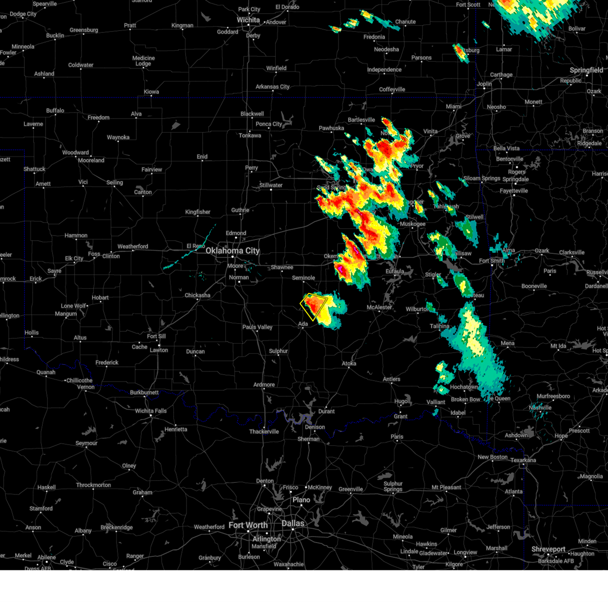 At 740 pm cdt, a severe thunderstorm was located near sasakwa, moving southeast at 20 mph (radar indicated). Hazards include two inch hail and 60 mph wind gusts. People and animals outdoors will be injured. expect hail damage to roofs, siding, windows, and vehicles. expect wind damage to roofs, siding, and trees. locations impacted include, francis, sasakwa, and spaulding. thunderstorm damage threat, considerable hail threat, radar indicated max hail size, 2. 00 in wind threat, radar indicated max wind gust, 60 mph. At 740 pm cdt, a severe thunderstorm was located near sasakwa, moving southeast at 20 mph (radar indicated). Hazards include two inch hail and 60 mph wind gusts. People and animals outdoors will be injured. expect hail damage to roofs, siding, windows, and vehicles. expect wind damage to roofs, siding, and trees. locations impacted include, francis, sasakwa, and spaulding. thunderstorm damage threat, considerable hail threat, radar indicated max hail size, 2. 00 in wind threat, radar indicated max wind gust, 60 mph.
|
| 9/23/2023 7:28 PM CDT |
 At 728 pm cdt, a severe thunderstorm was located 7 miles south of bowlegs, moving southeast at 10 mph (radar indicated). Hazards include 60 mph wind gusts and quarter size hail. Hail damage to vehicles is expected. expect wind damage to roofs, siding, and trees. locations impacted include, holdenville, francis, sasakwa, and spaulding. hail threat, radar indicated max hail size, 1. 00 in wind threat, radar indicated max wind gust, 60 mph. At 728 pm cdt, a severe thunderstorm was located 7 miles south of bowlegs, moving southeast at 10 mph (radar indicated). Hazards include 60 mph wind gusts and quarter size hail. Hail damage to vehicles is expected. expect wind damage to roofs, siding, and trees. locations impacted include, holdenville, francis, sasakwa, and spaulding. hail threat, radar indicated max hail size, 1. 00 in wind threat, radar indicated max wind gust, 60 mph.
|
| 9/23/2023 7:23 PM CDT |
 At 723 pm cdt, a severe thunderstorm was located 6 miles south of bowlegs, moving southeast at 10 mph (radar indicated). Hazards include ping pong ball size hail and 60 mph wind gusts. People and animals outdoors will be injured. expect hail damage to roofs, siding, windows, and vehicles. expect wind damage to roofs, siding, and trees. locations impacted include, holdenville, francis, sasakwa, and spaulding. hail threat, radar indicated max hail size, 1. 50 in wind threat, radar indicated max wind gust, 60 mph. At 723 pm cdt, a severe thunderstorm was located 6 miles south of bowlegs, moving southeast at 10 mph (radar indicated). Hazards include ping pong ball size hail and 60 mph wind gusts. People and animals outdoors will be injured. expect hail damage to roofs, siding, windows, and vehicles. expect wind damage to roofs, siding, and trees. locations impacted include, holdenville, francis, sasakwa, and spaulding. hail threat, radar indicated max hail size, 1. 50 in wind threat, radar indicated max wind gust, 60 mph.
|
| 9/23/2023 7:14 PM CDT |
 At 713 pm cdt, a severe thunderstorm was located 5 miles south of bowlegs, moving southeast at 10 mph. this is a destructive storm for spaulding, sasakwa, francis (radar indicated). Hazards include three inch hail and 70 mph wind gusts. People and animals outdoors will be severely injured. expect shattered windows, extensive damage to roofs, siding, and vehicles. locations impacted include, holdenville, maud, bowlegs, francis, sasakwa, and spaulding. thunderstorm damage threat, destructive hail threat, radar indicated max hail size, 3. 00 in wind threat, radar indicated max wind gust, 70 mph. At 713 pm cdt, a severe thunderstorm was located 5 miles south of bowlegs, moving southeast at 10 mph. this is a destructive storm for spaulding, sasakwa, francis (radar indicated). Hazards include three inch hail and 70 mph wind gusts. People and animals outdoors will be severely injured. expect shattered windows, extensive damage to roofs, siding, and vehicles. locations impacted include, holdenville, maud, bowlegs, francis, sasakwa, and spaulding. thunderstorm damage threat, destructive hail threat, radar indicated max hail size, 3. 00 in wind threat, radar indicated max wind gust, 70 mph.
|
| 9/23/2023 7:08 PM CDT |
 At 708 pm cdt, a severe thunderstorm was located 5 miles south of bowlegs, moving southeast at 10 mph (radar indicated). Hazards include tennis ball size hail and 60 mph wind gusts. People and animals outdoors will be injured. expect hail damage to roofs, siding, windows, and vehicles. Expect wind damage to roofs, siding, and trees. At 708 pm cdt, a severe thunderstorm was located 5 miles south of bowlegs, moving southeast at 10 mph (radar indicated). Hazards include tennis ball size hail and 60 mph wind gusts. People and animals outdoors will be injured. expect hail damage to roofs, siding, windows, and vehicles. Expect wind damage to roofs, siding, and trees.
|
| 7/11/2023 2:46 AM CDT |
 At 246 am cdt, a severe thunderstorm was located near ada, moving east at 25 mph (radar indicated). Hazards include 60 mph wind gusts and half dollar size hail. Hail damage to vehicles is expected. Expect wind damage to roofs, siding, and trees. At 246 am cdt, a severe thunderstorm was located near ada, moving east at 25 mph (radar indicated). Hazards include 60 mph wind gusts and half dollar size hail. Hail damage to vehicles is expected. Expect wind damage to roofs, siding, and trees.
|
| 7/9/2023 6:24 AM CDT |
 At 623 am cdt, severe thunderstorms were located along a line extending from 8 miles northeast of stratford to 6 miles northeast of vanoss to 3 miles north of fitzhugh, moving east at 30 mph (radar indicated). Hazards include 60 mph wind gusts. Expect damage to roofs, siding, and trees. locations impacted include, ada, byng, francis, fitzhugh, sasakwa, and vanoss. hail threat, radar indicated max hail size, <. 75 in wind threat, radar indicated max wind gust, 60 mph. At 623 am cdt, severe thunderstorms were located along a line extending from 8 miles northeast of stratford to 6 miles northeast of vanoss to 3 miles north of fitzhugh, moving east at 30 mph (radar indicated). Hazards include 60 mph wind gusts. Expect damage to roofs, siding, and trees. locations impacted include, ada, byng, francis, fitzhugh, sasakwa, and vanoss. hail threat, radar indicated max hail size, <. 75 in wind threat, radar indicated max wind gust, 60 mph.
|
| 7/9/2023 6:11 AM CDT |
 At 611 am cdt, severe thunderstorms were located along a line extending from near asher to 7 miles southeast of wanette to 3 miles south of vanoss, moving east at 20 mph (radar indicated). Hazards include 60 mph wind gusts. Expect damage to roofs, siding, and trees. locations impacted include, ada, stratford, konawa, byng, asher, wanette, francis, fitzhugh, sasakwa, and vanoss. hail threat, radar indicated max hail size, <. 75 in wind threat, radar indicated max wind gust, 60 mph. At 611 am cdt, severe thunderstorms were located along a line extending from near asher to 7 miles southeast of wanette to 3 miles south of vanoss, moving east at 20 mph (radar indicated). Hazards include 60 mph wind gusts. Expect damage to roofs, siding, and trees. locations impacted include, ada, stratford, konawa, byng, asher, wanette, francis, fitzhugh, sasakwa, and vanoss. hail threat, radar indicated max hail size, <. 75 in wind threat, radar indicated max wind gust, 60 mph.
|
| 7/9/2023 5:48 AM CDT |
 At 548 am cdt, severe thunderstorms were located along a line extending from 3 miles southeast of tribbey to 6 miles south of asher to near scullin, moving east at 35 mph (radar indicated). Hazards include 60 mph wind gusts. expect damage to roofs, siding, and trees At 548 am cdt, severe thunderstorms were located along a line extending from 3 miles southeast of tribbey to 6 miles south of asher to near scullin, moving east at 35 mph (radar indicated). Hazards include 60 mph wind gusts. expect damage to roofs, siding, and trees
|
| 7/9/2023 4:10 AM CDT |
 At 410 am cdt, a severe thunderstorm was located near konawa, moving east at 20 mph (radar indicated). Hazards include 60 mph wind gusts and quarter size hail. Hail damage to vehicles is expected. Expect wind damage to roofs, siding, and trees. At 410 am cdt, a severe thunderstorm was located near konawa, moving east at 20 mph (radar indicated). Hazards include 60 mph wind gusts and quarter size hail. Hail damage to vehicles is expected. Expect wind damage to roofs, siding, and trees.
|
| 7/7/2023 9:14 AM CDT |
 At 913 am cdt, severe thunderstorms were located along a line extending from 3 miles southeast of konawa to near wynnewood, moving east at 40 mph (radar indicated). Hazards include 60 mph wind gusts. expect damage to roofs, siding, and trees At 913 am cdt, severe thunderstorms were located along a line extending from 3 miles southeast of konawa to near wynnewood, moving east at 40 mph (radar indicated). Hazards include 60 mph wind gusts. expect damage to roofs, siding, and trees
|
| 6/23/2023 2:24 PM CDT |
 At 223 pm cdt, severe thunderstorms were located along a line extending from near cromwell to near holdenville to 4 miles north of stonewall to 5 miles east of hickory, moving southeast at 50 mph (trained spotter reported 60 mph wind gusts 2 miles northeast of ada). Hazards include 60 mph wind gusts and penny size hail. expect damage to roofs, siding, and trees At 223 pm cdt, severe thunderstorms were located along a line extending from near cromwell to near holdenville to 4 miles north of stonewall to 5 miles east of hickory, moving southeast at 50 mph (trained spotter reported 60 mph wind gusts 2 miles northeast of ada). Hazards include 60 mph wind gusts and penny size hail. expect damage to roofs, siding, and trees
|
| 6/3/2023 2:20 PM CDT |
 The severe thunderstorm warning for central pontotoc county will expire at 230 pm cdt, the storm which prompted the warning has weakened below severe limits, therefore the warning will be allowed to expire. however, gusty winds and heavy rain are still possible with this thunderstorm. The severe thunderstorm warning for central pontotoc county will expire at 230 pm cdt, the storm which prompted the warning has weakened below severe limits, therefore the warning will be allowed to expire. however, gusty winds and heavy rain are still possible with this thunderstorm.
|
| 6/3/2023 1:53 PM CDT |
 At 153 pm cdt, a severe thunderstorm was located near ada, moving northeast at 15 mph (trained weather spotters). Hazards include 60 mph wind gusts and quarter size hail. Hail damage to vehicles is expected. expect wind damage to roofs, siding, and trees. locations impacted include, ada, byng, and francis. hail threat, radar indicated max hail size, 1. 00 in wind threat, radar indicated max wind gust, 60 mph. At 153 pm cdt, a severe thunderstorm was located near ada, moving northeast at 15 mph (trained weather spotters). Hazards include 60 mph wind gusts and quarter size hail. Hail damage to vehicles is expected. expect wind damage to roofs, siding, and trees. locations impacted include, ada, byng, and francis. hail threat, radar indicated max hail size, 1. 00 in wind threat, radar indicated max wind gust, 60 mph.
|
| 6/3/2023 1:45 PM CDT |
 At 145 pm cdt, a severe thunderstorm was located over ada, moving northeast at 10 mph (radar indicated). Hazards include quarter size hail. damage to vehicles is expected At 145 pm cdt, a severe thunderstorm was located over ada, moving northeast at 10 mph (radar indicated). Hazards include quarter size hail. damage to vehicles is expected
|
| 2/26/2023 10:30 PM CST |
 At 1029 pm cst, severe thunderstorms were located along a line extending from 4 miles north of sasakwa to 7 miles north of tupelo to near reagan, moving east at 70 mph (radar indicated). Hazards include golf ball size hail and 70 mph wind gusts. People and animals outdoors will be injured. expect hail damage to roofs, siding, windows, and vehicles. expect considerable tree damage. wind damage is also likely to mobile homes, roofs, and outbuildings. locations impacted include, ada, holdenville, atoka, coalgate, konawa, byng, allen, stonewall, wapanucka, stringtown, lehigh, tupelo, mill creek, francis, calvin, stuart, bromide, lamar, sasakwa and gerty. thunderstorm damage threat, considerable hail threat, radar indicated max hail size, 1. 75 in wind threat, radar indicated max wind gust, 70 mph. At 1029 pm cst, severe thunderstorms were located along a line extending from 4 miles north of sasakwa to 7 miles north of tupelo to near reagan, moving east at 70 mph (radar indicated). Hazards include golf ball size hail and 70 mph wind gusts. People and animals outdoors will be injured. expect hail damage to roofs, siding, windows, and vehicles. expect considerable tree damage. wind damage is also likely to mobile homes, roofs, and outbuildings. locations impacted include, ada, holdenville, atoka, coalgate, konawa, byng, allen, stonewall, wapanucka, stringtown, lehigh, tupelo, mill creek, francis, calvin, stuart, bromide, lamar, sasakwa and gerty. thunderstorm damage threat, considerable hail threat, radar indicated max hail size, 1. 75 in wind threat, radar indicated max wind gust, 70 mph.
|
| 2/26/2023 10:27 PM CST |
 At 1027 pm cst, a severe thunderstorm capable of producing a tornado was located near ada, moving east at 55 mph (radar indicated rotation). Hazards include tornado and quarter size hail. Flying debris will be dangerous to those caught without shelter. mobile homes will be damaged or destroyed. damage to roofs, windows, and vehicles will occur. tree damage is likely. Locations impacted include, ada, byng, allen, francis, calvin, stuart, gerty and atwood. At 1027 pm cst, a severe thunderstorm capable of producing a tornado was located near ada, moving east at 55 mph (radar indicated rotation). Hazards include tornado and quarter size hail. Flying debris will be dangerous to those caught without shelter. mobile homes will be damaged or destroyed. damage to roofs, windows, and vehicles will occur. tree damage is likely. Locations impacted include, ada, byng, allen, francis, calvin, stuart, gerty and atwood.
|
| 2/26/2023 10:20 PM CST |
 At 1020 pm cst, a severe thunderstorm capable of producing a tornado was located 4 miles west of ada, moving east at 55 mph (radar indicated rotation). Hazards include tornado and quarter size hail. Flying debris will be dangerous to those caught without shelter. mobile homes will be damaged or destroyed. damage to roofs, windows, and vehicles will occur. Tree damage is likely. At 1020 pm cst, a severe thunderstorm capable of producing a tornado was located 4 miles west of ada, moving east at 55 mph (radar indicated rotation). Hazards include tornado and quarter size hail. Flying debris will be dangerous to those caught without shelter. mobile homes will be damaged or destroyed. damage to roofs, windows, and vehicles will occur. Tree damage is likely.
|
| 2/26/2023 10:16 PM CST |
 At 1016 pm cst, severe thunderstorms were located along a line extending from near konawa to 4 miles northwest of fittstown to 3 miles southeast of dougherty, moving east at 70 mph (radar indicated). Hazards include 70 mph wind gusts and half dollar size hail. Hail damage to vehicles is expected. expect considerable tree damage. Wind damage is also likely to mobile homes, roofs, and outbuildings. At 1016 pm cst, severe thunderstorms were located along a line extending from near konawa to 4 miles northwest of fittstown to 3 miles southeast of dougherty, moving east at 70 mph (radar indicated). Hazards include 70 mph wind gusts and half dollar size hail. Hail damage to vehicles is expected. expect considerable tree damage. Wind damage is also likely to mobile homes, roofs, and outbuildings.
|
| 2/26/2023 10:07 PM CST |
 At 1007 pm cst, a severe thunderstorm capable of producing a tornado was located 5 miles southwest of byars, moving east at 55 mph (radar indicated rotation). Hazards include tornado and quarter size hail. Flying debris will be dangerous to those caught without shelter. mobile homes will be damaged or destroyed. damage to roofs, windows, and vehicles will occur. tree damage is likely. Locations impacted include, stratford, konawa, byng, asher, wanette, francis, byars and sasakwa. At 1007 pm cst, a severe thunderstorm capable of producing a tornado was located 5 miles southwest of byars, moving east at 55 mph (radar indicated rotation). Hazards include tornado and quarter size hail. Flying debris will be dangerous to those caught without shelter. mobile homes will be damaged or destroyed. damage to roofs, windows, and vehicles will occur. tree damage is likely. Locations impacted include, stratford, konawa, byng, asher, wanette, francis, byars and sasakwa.
|
| 2/26/2023 10:00 PM CST |
 At 959 pm cst, severe thunderstorms were located along a line extending from near wanette to 5 miles north of davis to near milo, moving east at 70 mph (radar indicated). Hazards include 70 mph wind gusts and ping pong ball size hail. People and animals outdoors will be injured. expect hail damage to roofs, siding, windows, and vehicles. expect considerable tree damage. wind damage is also likely to mobile homes, roofs, and outbuildings. locations impacted include, ardmore, ada, pauls valley, sulphur, davis, lone grove, healdton, wynnewood, stratford, byng, allen, roff, springer, elmore city, paoli, ravia, stonewall, katie, mill creek and francis. thunderstorm damage threat, considerable hail threat, radar indicated max hail size, 1. 50 in wind threat, radar indicated max wind gust, 70 mph. At 959 pm cst, severe thunderstorms were located along a line extending from near wanette to 5 miles north of davis to near milo, moving east at 70 mph (radar indicated). Hazards include 70 mph wind gusts and ping pong ball size hail. People and animals outdoors will be injured. expect hail damage to roofs, siding, windows, and vehicles. expect considerable tree damage. wind damage is also likely to mobile homes, roofs, and outbuildings. locations impacted include, ardmore, ada, pauls valley, sulphur, davis, lone grove, healdton, wynnewood, stratford, byng, allen, roff, springer, elmore city, paoli, ravia, stonewall, katie, mill creek and francis. thunderstorm damage threat, considerable hail threat, radar indicated max hail size, 1. 50 in wind threat, radar indicated max wind gust, 70 mph.
|
| 2/26/2023 9:56 PM CST |
 At 956 pm cst, a severe thunderstorm capable of producing a tornado was located 4 miles southwest of paoli, moving east at 55 mph (radar indicated rotation). Hazards include tornado and quarter size hail. Flying debris will be dangerous to those caught without shelter. mobile homes will be damaged or destroyed. damage to roofs, windows, and vehicles will occur. Tree damage is likely. At 956 pm cst, a severe thunderstorm capable of producing a tornado was located 4 miles southwest of paoli, moving east at 55 mph (radar indicated rotation). Hazards include tornado and quarter size hail. Flying debris will be dangerous to those caught without shelter. mobile homes will be damaged or destroyed. damage to roofs, windows, and vehicles will occur. Tree damage is likely.
|
| 2/26/2023 9:54 PM CST |
 At 954 pm cst, severe thunderstorms were located along a line extending from 4 miles northeast of rosedale to 5 miles southwest of wynnewood to 3 miles south of graham, moving east at 70 mph (radar indicated). Hazards include 70 mph wind gusts and nickel size hail. Expect considerable tree damage. damage is likely to mobile homes, roofs, and outbuildings. locations impacted include, ardmore, ada, pauls valley, sulphur, davis, lone grove, healdton, wynnewood, stratford, byng, allen, roff, springer, elmore city, paoli, ravia, stonewall, katie, mill creek and francis. thunderstorm damage threat, considerable hail threat, radar indicated max hail size, 0. 88 in wind threat, radar indicated max wind gust, 70 mph. At 954 pm cst, severe thunderstorms were located along a line extending from 4 miles northeast of rosedale to 5 miles southwest of wynnewood to 3 miles south of graham, moving east at 70 mph (radar indicated). Hazards include 70 mph wind gusts and nickel size hail. Expect considerable tree damage. damage is likely to mobile homes, roofs, and outbuildings. locations impacted include, ardmore, ada, pauls valley, sulphur, davis, lone grove, healdton, wynnewood, stratford, byng, allen, roff, springer, elmore city, paoli, ravia, stonewall, katie, mill creek and francis. thunderstorm damage threat, considerable hail threat, radar indicated max hail size, 0. 88 in wind threat, radar indicated max wind gust, 70 mph.
|
| 2/26/2023 9:31 PM CST |
 At 931 pm cst, severe thunderstorms were located along a line extending from near criner to 6 miles north of velma to 5 miles east of addington, moving east at 70 mph (radar indicated). Hazards include 70 mph wind gusts and nickel size hail. Expect considerable tree damage. Damage is likely to mobile homes, roofs, and outbuildings. At 931 pm cst, severe thunderstorms were located along a line extending from near criner to 6 miles north of velma to 5 miles east of addington, moving east at 70 mph (radar indicated). Hazards include 70 mph wind gusts and nickel size hail. Expect considerable tree damage. Damage is likely to mobile homes, roofs, and outbuildings.
|
| 2/15/2023 8:57 PM CST |
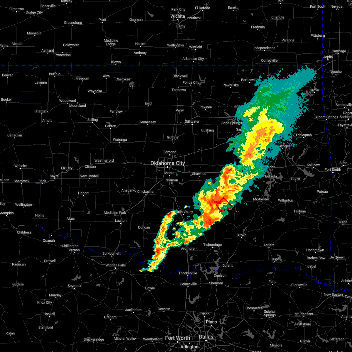 At 857 pm cst, a severe thunderstorm capable of producing a tornado was located 4 miles west of allen, moving northeast at 35 mph (radar indicated rotation). Hazards include tornado and ping pong ball size hail. Flying debris will be dangerous to those caught without shelter. mobile homes will be damaged or destroyed. damage to roofs, windows, and vehicles will occur. tree damage is likely. Locations impacted include, allen, francis and sasakwa. At 857 pm cst, a severe thunderstorm capable of producing a tornado was located 4 miles west of allen, moving northeast at 35 mph (radar indicated rotation). Hazards include tornado and ping pong ball size hail. Flying debris will be dangerous to those caught without shelter. mobile homes will be damaged or destroyed. damage to roofs, windows, and vehicles will occur. tree damage is likely. Locations impacted include, allen, francis and sasakwa.
|
| 2/15/2023 8:51 PM CST |
 At 851 pm cst, a severe thunderstorm capable of producing a tornado was located 4 miles southeast of francis, moving east at 35 mph (radar indicated rotation). Hazards include tornado and ping pong ball size hail. Flying debris will be dangerous to those caught without shelter. mobile homes will be damaged or destroyed. damage to roofs, windows, and vehicles will occur. tree damage is likely. Locations impacted include, allen, francis and sasakwa. At 851 pm cst, a severe thunderstorm capable of producing a tornado was located 4 miles southeast of francis, moving east at 35 mph (radar indicated rotation). Hazards include tornado and ping pong ball size hail. Flying debris will be dangerous to those caught without shelter. mobile homes will be damaged or destroyed. damage to roofs, windows, and vehicles will occur. tree damage is likely. Locations impacted include, allen, francis and sasakwa.
|
| 2/15/2023 8:39 PM CST |
 At 838 pm cst, a severe thunderstorm capable of producing a tornado was located over ada, moving east at 35 mph (radar indicated rotation). Hazards include tornado and ping pong ball size hail. Flying debris will be dangerous to those caught without shelter. mobile homes will be damaged or destroyed. damage to roofs, windows, and vehicles will occur. tree damage is likely. Locations impacted include, ada, byng, allen, francis, sasakwa and gerty. At 838 pm cst, a severe thunderstorm capable of producing a tornado was located over ada, moving east at 35 mph (radar indicated rotation). Hazards include tornado and ping pong ball size hail. Flying debris will be dangerous to those caught without shelter. mobile homes will be damaged or destroyed. damage to roofs, windows, and vehicles will occur. tree damage is likely. Locations impacted include, ada, byng, allen, francis, sasakwa and gerty.
|
| 2/15/2023 8:25 PM CST |
 At 825 pm cst, a severe thunderstorm capable of producing a tornado was located near vanoss, moving east at 35 mph (radar indicated rotation). Hazards include tornado and ping pong ball size hail. Flying debris will be dangerous to those caught without shelter. mobile homes will be damaged or destroyed. damage to roofs, windows, and vehicles will occur. Tree damage is likely. At 825 pm cst, a severe thunderstorm capable of producing a tornado was located near vanoss, moving east at 35 mph (radar indicated rotation). Hazards include tornado and ping pong ball size hail. Flying debris will be dangerous to those caught without shelter. mobile homes will be damaged or destroyed. damage to roofs, windows, and vehicles will occur. Tree damage is likely.
|
| 2/15/2023 8:17 PM CST |
 At 817 pm cst, a severe thunderstorm was located near vanoss, moving northeast at 30 mph (radar indicated). Hazards include 70 mph wind gusts and ping pong ball size hail. People and animals outdoors will be injured. expect hail damage to roofs, siding, windows, and vehicles. expect considerable tree damage. Wind damage is also likely to mobile homes, roofs, and outbuildings. At 817 pm cst, a severe thunderstorm was located near vanoss, moving northeast at 30 mph (radar indicated). Hazards include 70 mph wind gusts and ping pong ball size hail. People and animals outdoors will be injured. expect hail damage to roofs, siding, windows, and vehicles. expect considerable tree damage. Wind damage is also likely to mobile homes, roofs, and outbuildings.
|
| 10/24/2022 10:40 AM CDT |
 At 1040 am cdt, severe thunderstorms were located along a line extending from near vanoss to near scullin to 6 miles southwest of mill creek to 3 miles west of mannsville, moving northeast at 40 mph (radar indicated). Hazards include 60 mph wind gusts. expect damage to roofs, siding, and trees At 1040 am cdt, severe thunderstorms were located along a line extending from near vanoss to near scullin to 6 miles southwest of mill creek to 3 miles west of mannsville, moving northeast at 40 mph (radar indicated). Hazards include 60 mph wind gusts. expect damage to roofs, siding, and trees
|
| 6/8/2022 10:24 AM CDT |
 At 1024 am cdt, severe thunderstorms were located along a line extending from near seminole to 5 miles southwest of holdenville to near francis, moving east at 25 mph (radar indicated). Hazards include 60 mph wind gusts and quarter size hail. Hail damage to vehicles is expected. expect wind damage to roofs, siding, and trees. locations impacted include, seminole, holdenville, wewoka, konawa, byng, maud, allen, bowlegs, francis, st. louis, sasakwa, atwood, spaulding, lima and harjo. hail threat, radar indicated max hail size, 1. 00 in wind threat, radar indicated max wind gust, 60 mph. At 1024 am cdt, severe thunderstorms were located along a line extending from near seminole to 5 miles southwest of holdenville to near francis, moving east at 25 mph (radar indicated). Hazards include 60 mph wind gusts and quarter size hail. Hail damage to vehicles is expected. expect wind damage to roofs, siding, and trees. locations impacted include, seminole, holdenville, wewoka, konawa, byng, maud, allen, bowlegs, francis, st. louis, sasakwa, atwood, spaulding, lima and harjo. hail threat, radar indicated max hail size, 1. 00 in wind threat, radar indicated max wind gust, 60 mph.
|
| 6/8/2022 10:20 AM CDT |
 At 1020 am cdt, severe thunderstorms were located along a line extending from 3 miles north of earlsboro to 6 miles north of sasakwa to near francis, moving east at 30 mph (radar indicated). Hazards include 60 mph wind gusts. Expect damage to roofs, siding, and trees. locations impacted include, shawnee, seminole, tecumseh, holdenville, wewoka, konawa, byng, maud, allen, earlsboro, bowlegs, tribbey, francis, st. louis, sasakwa, atwood, brooksville, macomb, little and spaulding. hail threat, radar indicated max hail size, <. 75 in wind threat, radar indicated max wind gust, 60 mph. At 1020 am cdt, severe thunderstorms were located along a line extending from 3 miles north of earlsboro to 6 miles north of sasakwa to near francis, moving east at 30 mph (radar indicated). Hazards include 60 mph wind gusts. Expect damage to roofs, siding, and trees. locations impacted include, shawnee, seminole, tecumseh, holdenville, wewoka, konawa, byng, maud, allen, earlsboro, bowlegs, tribbey, francis, st. louis, sasakwa, atwood, brooksville, macomb, little and spaulding. hail threat, radar indicated max hail size, <. 75 in wind threat, radar indicated max wind gust, 60 mph.
|
| 6/8/2022 10:06 AM CDT |
 At 1006 am cdt, severe thunderstorms were located along a line extending from 3 miles northwest of tecumseh to 6 miles northeast of konawa to 4 miles west of byng, moving east at 20 mph (radar indicated). Hazards include 60 mph wind gusts. expect damage to roofs, siding, and trees At 1006 am cdt, severe thunderstorms were located along a line extending from 3 miles northwest of tecumseh to 6 miles northeast of konawa to 4 miles west of byng, moving east at 20 mph (radar indicated). Hazards include 60 mph wind gusts. expect damage to roofs, siding, and trees
|
| 5/2/2022 9:13 PM CDT |
 At 913 pm cdt, severe thunderstorms were located along a line extending from near calvin to near hickory, moving east at 30 mph (radar indicated). Hazards include 60 mph wind gusts and quarter size hail. Hail damage to vehicles is expected. Expect wind damage to roofs, siding, and trees. At 913 pm cdt, severe thunderstorms were located along a line extending from near calvin to near hickory, moving east at 30 mph (radar indicated). Hazards include 60 mph wind gusts and quarter size hail. Hail damage to vehicles is expected. Expect wind damage to roofs, siding, and trees.
|
| 5/2/2022 8:46 PM CDT |
 At 845 pm cdt, severe thunderstorms were located along a line extending from near horntown to 3 miles northeast of allen to 4 miles west of ada, moving east at 40 mph (radar indicated). Hazards include 70 mph wind gusts and ping pong ball size hail. People and animals outdoors will be injured. expect hail damage to roofs, siding, windows, and vehicles. expect considerable tree damage. wind damage is also likely to mobile homes, roofs, and outbuildings. Locations impacted include, ada, holdenville, wewoka, stratford, wetumka, byng, allen, stonewall, dustin, francis, calvin, fitzhugh, stuart, lamar, sasakwa, gerty, horntown, yeager, atwood and fittstown. At 845 pm cdt, severe thunderstorms were located along a line extending from near horntown to 3 miles northeast of allen to 4 miles west of ada, moving east at 40 mph (radar indicated). Hazards include 70 mph wind gusts and ping pong ball size hail. People and animals outdoors will be injured. expect hail damage to roofs, siding, windows, and vehicles. expect considerable tree damage. wind damage is also likely to mobile homes, roofs, and outbuildings. Locations impacted include, ada, holdenville, wewoka, stratford, wetumka, byng, allen, stonewall, dustin, francis, calvin, fitzhugh, stuart, lamar, sasakwa, gerty, horntown, yeager, atwood and fittstown.
|
| 5/2/2022 8:22 PM CDT |
 At 822 pm cdt, severe thunderstorms were located along a line extending from 3 miles northeast of wewoka to 6 miles north of francis to near stratford, moving east at 40 mph (radar indicated). Hazards include 70 mph wind gusts and ping pong ball size hail. People and animals outdoors will be injured. expect hail damage to roofs, siding, windows, and vehicles. expect considerable tree damage. Wind damage is also likely to mobile homes, roofs, and outbuildings. At 822 pm cdt, severe thunderstorms were located along a line extending from 3 miles northeast of wewoka to 6 miles north of francis to near stratford, moving east at 40 mph (radar indicated). Hazards include 70 mph wind gusts and ping pong ball size hail. People and animals outdoors will be injured. expect hail damage to roofs, siding, windows, and vehicles. expect considerable tree damage. Wind damage is also likely to mobile homes, roofs, and outbuildings.
|
| 3/17/2022 8:28 PM CDT |
 At 828 pm cdt, a severe thunderstorm was located 5 miles west of byng, moving northeast at 35 mph (radar indicated). Hazards include 60 mph wind gusts and quarter size hail. Hail damage to vehicles is expected. Expect wind damage to roofs, siding, and trees. At 828 pm cdt, a severe thunderstorm was located 5 miles west of byng, moving northeast at 35 mph (radar indicated). Hazards include 60 mph wind gusts and quarter size hail. Hail damage to vehicles is expected. Expect wind damage to roofs, siding, and trees.
|
| 12/17/2021 5:57 PM CST |
 At 557 pm cst, a severe thunderstorm was located near ada, moving northeast at 25 mph (radar indicated). Hazards include 60 mph wind gusts and quarter size hail. Hail damage to vehicles is expected. Expect wind damage to roofs, siding, and trees. At 557 pm cst, a severe thunderstorm was located near ada, moving northeast at 25 mph (radar indicated). Hazards include 60 mph wind gusts and quarter size hail. Hail damage to vehicles is expected. Expect wind damage to roofs, siding, and trees.
|
| 12/17/2021 4:10 PM CST |
 At 409 pm cst, a severe thunderstorm was located near francis, moving northeast at 25 mph (radar indicated). Hazards include 60 mph wind gusts and quarter size hail. Hail damage to vehicles is expected. Expect wind damage to roofs, siding, and trees. At 409 pm cst, a severe thunderstorm was located near francis, moving northeast at 25 mph (radar indicated). Hazards include 60 mph wind gusts and quarter size hail. Hail damage to vehicles is expected. Expect wind damage to roofs, siding, and trees.
|
| 12/17/2021 4:00 PM CST |
 At 359 pm cst, a severe thunderstorm was located near francis, moving northeast at 30 mph. nickel to quarter size hail has been reported northeast of ada (trained weather spotters). Hazards include 60 mph wind gusts and quarter size hail. Hail damage to vehicles is expected. expect wind damage to roofs, siding, and trees. locations impacted include, ada, byng, allen, francis, sasakwa and spaulding. hail threat, radar indicated max hail size, 1. 00 in wind threat, radar indicated max wind gust, 60 mph. At 359 pm cst, a severe thunderstorm was located near francis, moving northeast at 30 mph. nickel to quarter size hail has been reported northeast of ada (trained weather spotters). Hazards include 60 mph wind gusts and quarter size hail. Hail damage to vehicles is expected. expect wind damage to roofs, siding, and trees. locations impacted include, ada, byng, allen, francis, sasakwa and spaulding. hail threat, radar indicated max hail size, 1. 00 in wind threat, radar indicated max wind gust, 60 mph.
|
| 12/17/2021 3:44 PM CST |
 At 344 pm cst, a severe thunderstorm was located 4 miles west of ada, moving east at 30 mph (radar indicated). Hazards include 60 mph wind gusts and quarter size hail. Hail damage to vehicles is expected. expect wind damage to roofs, siding, and trees. locations impacted include, ada, byng, allen, francis, sasakwa and spaulding. hail threat, radar indicated max hail size, 1. 00 in wind threat, radar indicated max wind gust, 60 mph. At 344 pm cst, a severe thunderstorm was located 4 miles west of ada, moving east at 30 mph (radar indicated). Hazards include 60 mph wind gusts and quarter size hail. Hail damage to vehicles is expected. expect wind damage to roofs, siding, and trees. locations impacted include, ada, byng, allen, francis, sasakwa and spaulding. hail threat, radar indicated max hail size, 1. 00 in wind threat, radar indicated max wind gust, 60 mph.
|
| 12/17/2021 3:28 PM CST |
 At 328 pm cst, a severe thunderstorm was located 7 miles east of wynnewood, moving northeast at 30 mph (radar indicated). Hazards include 60 mph wind gusts and quarter size hail. Hail damage to vehicles is expected. Expect wind damage to roofs, siding, and trees. At 328 pm cst, a severe thunderstorm was located 7 miles east of wynnewood, moving northeast at 30 mph (radar indicated). Hazards include 60 mph wind gusts and quarter size hail. Hail damage to vehicles is expected. Expect wind damage to roofs, siding, and trees.
|
| 10/27/2021 1:27 AM CDT |
 At 127 am cdt, severe thunderstorms were located along a line extending from 3 miles southeast of stillwater to 5 miles west of sparks to 6 miles southwest of vanoss, moving east at 30 mph (radar indicated). Hazards include 60 mph wind gusts. expect damage to roofs, siding, and trees At 127 am cdt, severe thunderstorms were located along a line extending from 3 miles southeast of stillwater to 5 miles west of sparks to 6 miles southwest of vanoss, moving east at 30 mph (radar indicated). Hazards include 60 mph wind gusts. expect damage to roofs, siding, and trees
|
| 10/10/2021 9:45 PM CDT |
 At 945 pm cdt, severe thunderstorms were located along a line extending from 7 miles southwest of cromwell to 3 miles west of stonewall, moving northeast at 40 mph (radar indicated). Hazards include 60 mph wind gusts and quarter size hail. Hail damage to vehicles is expected. Expect wind damage to roofs, siding, and trees. At 945 pm cdt, severe thunderstorms were located along a line extending from 7 miles southwest of cromwell to 3 miles west of stonewall, moving northeast at 40 mph (radar indicated). Hazards include 60 mph wind gusts and quarter size hail. Hail damage to vehicles is expected. Expect wind damage to roofs, siding, and trees.
|
| 10/10/2021 9:34 PM CDT |
 At 933 pm cdt, severe thunderstorms were located along a line extending from 4 miles southwest of byng to near fittstown to near ravia, moving east at 45 mph (radar indicated). Hazards include 60 mph wind gusts and quarter size hail. Hail damage to vehicles is expected. expect wind damage to roofs, siding, and trees. locations impacted include, ada, sulphur, byng, roff, stonewall, tupelo, francis, fitzhugh, sasakwa, hickory, fittstown and vanoss. hail threat, radar indicated max hail size, 1. 00 in wind threat, radar indicated max wind gust, 60 mph. At 933 pm cdt, severe thunderstorms were located along a line extending from 4 miles southwest of byng to near fittstown to near ravia, moving east at 45 mph (radar indicated). Hazards include 60 mph wind gusts and quarter size hail. Hail damage to vehicles is expected. expect wind damage to roofs, siding, and trees. locations impacted include, ada, sulphur, byng, roff, stonewall, tupelo, francis, fitzhugh, sasakwa, hickory, fittstown and vanoss. hail threat, radar indicated max hail size, 1. 00 in wind threat, radar indicated max wind gust, 60 mph.
|
| 10/10/2021 8:59 PM CDT |
 At 859 pm cdt, severe thunderstorms were located along a line extending from 5 miles northeast of pauls valley to near davis to 3 miles northwest of ardmore, moving east at 45 mph (radar indicated). Hazards include 60 mph wind gusts and quarter size hail. Hail damage to vehicles is expected. Expect wind damage to roofs, siding, and trees. At 859 pm cdt, severe thunderstorms were located along a line extending from 5 miles northeast of pauls valley to near davis to 3 miles northwest of ardmore, moving east at 45 mph (radar indicated). Hazards include 60 mph wind gusts and quarter size hail. Hail damage to vehicles is expected. Expect wind damage to roofs, siding, and trees.
|
| 7/10/2021 11:22 PM CDT |
 At 1122 pm cdt, severe thunderstorms were located along a line extending from 4 miles southeast of francis to near ada to 3 miles north of roff, moving southeast at 35 mph (radar indicated). Hazards include 70 mph wind gusts and quarter size hail. Hail damage to vehicles is expected. expect considerable tree damage. wind damage is also likely to mobile homes, roofs, and outbuildings. Locations impacted include, ada, coalgate, byng, allen, roff, stonewall, tupelo, francis, fitzhugh, bromide, centrahoma, pontotoc, fittstown, clarita, olney, connerville, phillips and jesse. At 1122 pm cdt, severe thunderstorms were located along a line extending from 4 miles southeast of francis to near ada to 3 miles north of roff, moving southeast at 35 mph (radar indicated). Hazards include 70 mph wind gusts and quarter size hail. Hail damage to vehicles is expected. expect considerable tree damage. wind damage is also likely to mobile homes, roofs, and outbuildings. Locations impacted include, ada, coalgate, byng, allen, roff, stonewall, tupelo, francis, fitzhugh, bromide, centrahoma, pontotoc, fittstown, clarita, olney, connerville, phillips and jesse.
|
| 7/10/2021 11:15 PM CDT |
 At 1115 pm cdt, severe thunderstorms were located along a line extending from near francis to near ada to 3 miles south of vanoss, moving southeast at 35 mph (radar indicated). Hazards include 60 mph wind gusts and quarter size hail. Hail damage to vehicles is expected. Expect wind damage to roofs, siding, and trees. At 1115 pm cdt, severe thunderstorms were located along a line extending from near francis to near ada to 3 miles south of vanoss, moving southeast at 35 mph (radar indicated). Hazards include 60 mph wind gusts and quarter size hail. Hail damage to vehicles is expected. Expect wind damage to roofs, siding, and trees.
|
| 7/10/2021 11:01 PM CDT |
 At 1100 pm cdt, severe thunderstorms were located along a line extending from 7 miles northwest of sasakwa to 4 miles north of byng to 6 miles north of vanoss, moving southeast at 35 mph (radar indicated). Hazards include 60 mph wind gusts and penny size hail. Expect damage to roofs, siding, and trees. Locations impacted include, ada, konawa, byng, asher, francis, sasakwa and spaulding. At 1100 pm cdt, severe thunderstorms were located along a line extending from 7 miles northwest of sasakwa to 4 miles north of byng to 6 miles north of vanoss, moving southeast at 35 mph (radar indicated). Hazards include 60 mph wind gusts and penny size hail. Expect damage to roofs, siding, and trees. Locations impacted include, ada, konawa, byng, asher, francis, sasakwa and spaulding.
|
| 7/10/2021 10:39 PM CDT |
 At 1039 pm cdt, severe thunderstorms were located along a line extending from 3 miles north of maud to 3 miles northeast of asher to near wanette, moving southeast at 35 mph (radar indicated). Hazards include 60 mph wind gusts and penny size hail. expect damage to roofs, siding, and trees At 1039 pm cdt, severe thunderstorms were located along a line extending from 3 miles north of maud to 3 miles northeast of asher to near wanette, moving southeast at 35 mph (radar indicated). Hazards include 60 mph wind gusts and penny size hail. expect damage to roofs, siding, and trees
|
| 5/3/2021 6:02 PM CDT |
 At 601 pm cdt, severe thunderstorms were located along a line extending from near fitzhugh to 4 miles northeast of mill creek, moving northeast at 20 mph (radar indicated). Hazards include 60 mph wind gusts and quarter size hail. Hail damage to vehicles is expected. Expect wind damage to roofs, siding, and trees. At 601 pm cdt, severe thunderstorms were located along a line extending from near fitzhugh to 4 miles northeast of mill creek, moving northeast at 20 mph (radar indicated). Hazards include 60 mph wind gusts and quarter size hail. Hail damage to vehicles is expected. Expect wind damage to roofs, siding, and trees.
|
| 4/9/2021 8:08 PM CDT |
 At 808 pm cdt, severe thunderstorms were located along a line extending from 3 miles east of holdenville to 6 miles east of ada to 3 miles southeast of scullin, moving east at 30 mph (radar indicated). Hazards include 70 mph wind gusts and ping pong ball size hail. People and animals outdoors will be injured. expect hail damage to roofs, siding, windows, and vehicles. expect considerable tree damage. wind damage is also likely to mobile homes, roofs, and outbuildings. Locations impacted include, ada, holdenville, sulphur, allen, stonewall, tupelo, francis, calvin, fitzhugh, stuart, bromide, sasakwa, gerty, centrahoma, horntown, atwood, hickory, pontotoc, fittstown and clarita. At 808 pm cdt, severe thunderstorms were located along a line extending from 3 miles east of holdenville to 6 miles east of ada to 3 miles southeast of scullin, moving east at 30 mph (radar indicated). Hazards include 70 mph wind gusts and ping pong ball size hail. People and animals outdoors will be injured. expect hail damage to roofs, siding, windows, and vehicles. expect considerable tree damage. wind damage is also likely to mobile homes, roofs, and outbuildings. Locations impacted include, ada, holdenville, sulphur, allen, stonewall, tupelo, francis, calvin, fitzhugh, stuart, bromide, sasakwa, gerty, centrahoma, horntown, atwood, hickory, pontotoc, fittstown and clarita.
|
| 4/9/2021 7:51 PM CDT |
 At 751 pm cdt, severe thunderstorms were located along a line extending from near wewoka to near ada to 3 miles west of hickory, moving east at 30 mph (radar indicated). Hazards include golf ball size hail and 70 mph wind gusts. People and animals outdoors will be injured. expect hail damage to roofs, siding, windows, and vehicles. expect considerable tree damage. Wind damage is also likely to mobile homes, roofs, and outbuildings. At 751 pm cdt, severe thunderstorms were located along a line extending from near wewoka to near ada to 3 miles west of hickory, moving east at 30 mph (radar indicated). Hazards include golf ball size hail and 70 mph wind gusts. People and animals outdoors will be injured. expect hail damage to roofs, siding, windows, and vehicles. expect considerable tree damage. Wind damage is also likely to mobile homes, roofs, and outbuildings.
|
| 4/9/2021 7:47 PM CDT |
 At 747 pm cdt, severe thunderstorms were located along a line extending from 5 miles northwest of sasakwa to 6 miles west of ada to near vanoss, moving southeast at 35 mph (radar indicated). Hazards include golf ball size hail and 60 mph wind gusts. People and animals outdoors will be injured. expect hail damage to roofs, siding, windows, and vehicles. expect wind damage to roofs, siding, and trees. Locations impacted include, ada, stratford, konawa, byng, roff, francis, fitzhugh, sasakwa and vanoss. At 747 pm cdt, severe thunderstorms were located along a line extending from 5 miles northwest of sasakwa to 6 miles west of ada to near vanoss, moving southeast at 35 mph (radar indicated). Hazards include golf ball size hail and 60 mph wind gusts. People and animals outdoors will be injured. expect hail damage to roofs, siding, windows, and vehicles. expect wind damage to roofs, siding, and trees. Locations impacted include, ada, stratford, konawa, byng, roff, francis, fitzhugh, sasakwa and vanoss.
|
| 4/9/2021 7:27 PM CDT |
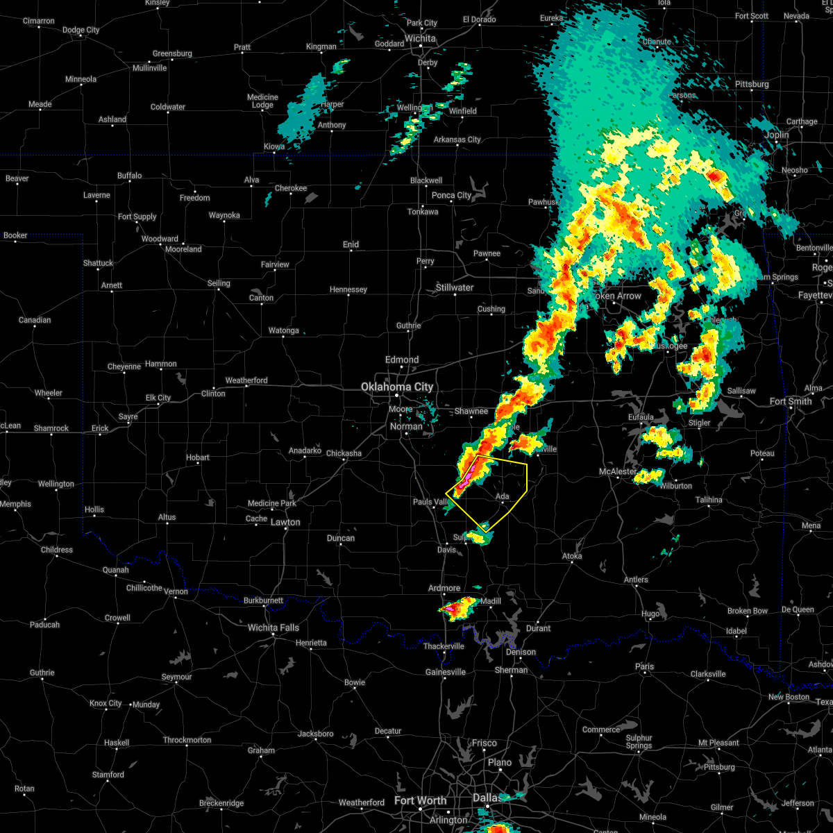 At 726 pm cdt, severe thunderstorms were located along a line extending from 4 miles east of asher to 7 miles east of byars to 3 miles west of stratford, moving southeast at 35 mph (radar indicated). Hazards include two inch hail and 60 mph wind gusts. People and animals outdoors will be injured. expect hail damage to roofs, siding, windows, and vehicles. Expect wind damage to roofs, siding, and trees. At 726 pm cdt, severe thunderstorms were located along a line extending from 4 miles east of asher to 7 miles east of byars to 3 miles west of stratford, moving southeast at 35 mph (radar indicated). Hazards include two inch hail and 60 mph wind gusts. People and animals outdoors will be injured. expect hail damage to roofs, siding, windows, and vehicles. Expect wind damage to roofs, siding, and trees.
|
| 9/1/2020 12:38 AM CDT |
 At 1238 am cdt, a severe thunderstorm capable of producing a tornado was located over francis, moving northeast at 20 mph (radar indicated rotation). Hazards include tornado. Flying debris will be dangerous to those caught without shelter. mobile homes will be damaged or destroyed. damage to roofs, windows, and vehicles will occur. Tree damage is likely. At 1238 am cdt, a severe thunderstorm capable of producing a tornado was located over francis, moving northeast at 20 mph (radar indicated rotation). Hazards include tornado. Flying debris will be dangerous to those caught without shelter. mobile homes will be damaged or destroyed. damage to roofs, windows, and vehicles will occur. Tree damage is likely.
|
| 9/1/2020 12:30 AM CDT |
 At 1229 am cdt, a severe thunderstorm was located over byng, moving northeast at 15 mph (radar indicated). Hazards include 70 mph wind gusts. Expect considerable tree damage. damage is likely to mobile homes, roofs, and outbuildings. Locations impacted include, ada, byng, francis and sasakwa. At 1229 am cdt, a severe thunderstorm was located over byng, moving northeast at 15 mph (radar indicated). Hazards include 70 mph wind gusts. Expect considerable tree damage. damage is likely to mobile homes, roofs, and outbuildings. Locations impacted include, ada, byng, francis and sasakwa.
|
| 9/1/2020 12:14 AM CDT |
 At 1213 am cdt, a severe thunderstorm was located near byng, moving northeast at 15 mph (radar indicated). Hazards include 70 mph wind gusts. Expect considerable tree damage. Damage is likely to mobile homes, roofs, and outbuildings. At 1213 am cdt, a severe thunderstorm was located near byng, moving northeast at 15 mph (radar indicated). Hazards include 70 mph wind gusts. Expect considerable tree damage. Damage is likely to mobile homes, roofs, and outbuildings.
|
| 7/12/2020 1:20 AM CDT |
 At 120 am cdt, severe thunderstorms were located along a line extending from 4 miles southwest of calvin to 4 miles north of pontotoc to 3 miles northwest of springer, moving southeast at 50 mph (radar indicated). Hazards include 70 mph wind gusts and quarter size hail. Hail damage to vehicles is expected. expect considerable tree damage. Wind damage is also likely to mobile homes, roofs, and outbuildings. At 120 am cdt, severe thunderstorms were located along a line extending from 4 miles southwest of calvin to 4 miles north of pontotoc to 3 miles northwest of springer, moving southeast at 50 mph (radar indicated). Hazards include 70 mph wind gusts and quarter size hail. Hail damage to vehicles is expected. expect considerable tree damage. Wind damage is also likely to mobile homes, roofs, and outbuildings.
|
| 7/12/2020 1:00 AM CDT |
 At 1259 am cdt, severe thunderstorms were located along a line extending from 4 miles east of bowlegs to near ada to near davis, moving southeast at 55 mph. these are very dangerous storms (radar indicated). Hazards include 80 mph wind gusts. Flying debris will be dangerous to those caught without shelter. mobile homes will be heavily damaged. expect considerable damage to roofs, windows, and vehicles. extensive tree damage and power outages are likely. Locations impacted include, shawnee, ada, seminole, tecumseh, pauls valley, holdenville, sulphur, davis, wewoka, wynnewood, stratford, konawa, byng, maud, allen, mannsville, roff, elmore city, earlsboro and ravia. At 1259 am cdt, severe thunderstorms were located along a line extending from 4 miles east of bowlegs to near ada to near davis, moving southeast at 55 mph. these are very dangerous storms (radar indicated). Hazards include 80 mph wind gusts. Flying debris will be dangerous to those caught without shelter. mobile homes will be heavily damaged. expect considerable damage to roofs, windows, and vehicles. extensive tree damage and power outages are likely. Locations impacted include, shawnee, ada, seminole, tecumseh, pauls valley, holdenville, sulphur, davis, wewoka, wynnewood, stratford, konawa, byng, maud, allen, mannsville, roff, elmore city, earlsboro and ravia.
|
| 7/12/2020 12:41 AM CDT |
 At 1241 am cdt, severe thunderstorms were located along a line extending from near earlsboro to 5 miles northeast of stratford to 4 miles northeast of katie, moving southeast at 55 mph. these are very dangerous storms (radar indicated). Hazards include 80 mph wind gusts. Flying debris will be dangerous to those caught without shelter. mobile homes will be heavily damaged. expect considerable damage to roofs, windows, and vehicles. Extensive tree damage and power outages are likely. At 1241 am cdt, severe thunderstorms were located along a line extending from near earlsboro to 5 miles northeast of stratford to 4 miles northeast of katie, moving southeast at 55 mph. these are very dangerous storms (radar indicated). Hazards include 80 mph wind gusts. Flying debris will be dangerous to those caught without shelter. mobile homes will be heavily damaged. expect considerable damage to roofs, windows, and vehicles. Extensive tree damage and power outages are likely.
|
| 7/10/2020 12:05 PM CDT |
 At 1205 pm cdt, severe thunderstorms were located along a line extending from 6 miles south of bowlegs to 3 miles south of wayne, moving southeast at 35 mph (radar indicated). Hazards include 60 mph wind gusts. Expect damage to roofs, siding, and trees. locations impacted include, pauls valley, purcell, slaughterville, lexington, stratford, konawa, maysville, byng, maud, wayne, washington, paoli, cole, asher, tribbey, wanette, francis, byars, st. Louis and etowah. At 1205 pm cdt, severe thunderstorms were located along a line extending from 6 miles south of bowlegs to 3 miles south of wayne, moving southeast at 35 mph (radar indicated). Hazards include 60 mph wind gusts. Expect damage to roofs, siding, and trees. locations impacted include, pauls valley, purcell, slaughterville, lexington, stratford, konawa, maysville, byng, maud, wayne, washington, paoli, cole, asher, tribbey, wanette, francis, byars, st. Louis and etowah.
|
| 7/10/2020 11:30 AM CDT |
 At 1130 am cdt, severe thunderstorms were located along a line extending from near brooksville to near dibble, moving southeast at 35 mph (radar indicated). Hazards include 60 mph wind gusts. expect damage to roofs, siding, and trees At 1130 am cdt, severe thunderstorms were located along a line extending from near brooksville to near dibble, moving southeast at 35 mph (radar indicated). Hazards include 60 mph wind gusts. expect damage to roofs, siding, and trees
|
| 5/8/2020 1:58 AM CDT |
 At 158 am cdt, severe thunderstorms were located along a line extending from 3 miles southeast of bowlegs to near byng to 3 miles east of vanoss, moving east at 60 mph (radar indicated). Hazards include 70 mph wind gusts and quarter size hail. Hail damage to vehicles is expected. expect considerable tree damage. Wind damage is also likely to mobile homes, roofs, and outbuildings. At 158 am cdt, severe thunderstorms were located along a line extending from 3 miles southeast of bowlegs to near byng to 3 miles east of vanoss, moving east at 60 mph (radar indicated). Hazards include 70 mph wind gusts and quarter size hail. Hail damage to vehicles is expected. expect considerable tree damage. Wind damage is also likely to mobile homes, roofs, and outbuildings.
|
| 5/8/2020 1:56 AM CDT |
 At 156 am cdt, severe thunderstorms were located along a line extending from near maud to 3 miles south of konawa to near vanoss, moving east at 50 mph (radar indicated). Hazards include 70 mph wind gusts and quarter size hail. Hail damage to vehicles is expected. expect considerable tree damage. wind damage is also likely to mobile homes, roofs, and outbuildings. locations impacted include, ada, konawa, byng, maud, bowlegs, francis, st. Louis, sasakwa and vanoss. At 156 am cdt, severe thunderstorms were located along a line extending from near maud to 3 miles south of konawa to near vanoss, moving east at 50 mph (radar indicated). Hazards include 70 mph wind gusts and quarter size hail. Hail damage to vehicles is expected. expect considerable tree damage. wind damage is also likely to mobile homes, roofs, and outbuildings. locations impacted include, ada, konawa, byng, maud, bowlegs, francis, st. Louis, sasakwa and vanoss.
|
| 5/8/2020 1:31 AM CDT |
 At 130 am cdt, severe thunderstorms were located along a line extending from near tribbey to 6 miles northwest of wanette to 3 miles northwest of rosedale, moving east at 45 mph (radar indicated). Hazards include 60 mph wind gusts and quarter size hail. Hail damage to vehicles is expected. Expect wind damage to roofs, siding, and trees. At 130 am cdt, severe thunderstorms were located along a line extending from near tribbey to 6 miles northwest of wanette to 3 miles northwest of rosedale, moving east at 45 mph (radar indicated). Hazards include 60 mph wind gusts and quarter size hail. Hail damage to vehicles is expected. Expect wind damage to roofs, siding, and trees.
|
| 5/4/2020 7:04 PM CDT |
 At 703 pm cdt, a severe thunderstorm was located near ada, moving southeast at 25 mph (radar indicated). Hazards include 60 mph wind gusts and quarter size hail. Hail damage to vehicles is expected. expect wind damage to roofs, siding, and trees. Locations impacted include, ada, coalgate, byng, stonewall, tupelo, francis, centrahoma and phillips. At 703 pm cdt, a severe thunderstorm was located near ada, moving southeast at 25 mph (radar indicated). Hazards include 60 mph wind gusts and quarter size hail. Hail damage to vehicles is expected. expect wind damage to roofs, siding, and trees. Locations impacted include, ada, coalgate, byng, stonewall, tupelo, francis, centrahoma and phillips.
|
| 5/4/2020 6:59 PM CDT |
 At 659 pm cdt, a severe thunderstorm was located near ada, moving southeast at 25 mph (radar indicated). Hazards include ping pong ball size hail and 60 mph wind gusts. People and animals outdoors will be injured. expect hail damage to roofs, siding, windows, and vehicles. expect wind damage to roofs, siding, and trees. Locations impacted include, ada, coalgate, byng, stonewall, tupelo, francis, centrahoma, olney, phillips and jesse. At 659 pm cdt, a severe thunderstorm was located near ada, moving southeast at 25 mph (radar indicated). Hazards include ping pong ball size hail and 60 mph wind gusts. People and animals outdoors will be injured. expect hail damage to roofs, siding, windows, and vehicles. expect wind damage to roofs, siding, and trees. Locations impacted include, ada, coalgate, byng, stonewall, tupelo, francis, centrahoma, olney, phillips and jesse.
|
| 5/4/2020 6:51 PM CDT |
 At 651 pm cdt, a severe thunderstorm was located 6 miles west of byng, moving southeast at 25 mph (radar indicated). Hazards include golf ball size hail and 60 mph wind gusts. People and animals outdoors will be injured. expect hail damage to roofs, siding, windows, and vehicles. Expect wind damage to roofs, siding, and trees. At 651 pm cdt, a severe thunderstorm was located 6 miles west of byng, moving southeast at 25 mph (radar indicated). Hazards include golf ball size hail and 60 mph wind gusts. People and animals outdoors will be injured. expect hail damage to roofs, siding, windows, and vehicles. Expect wind damage to roofs, siding, and trees.
|
| 5/4/2020 6:38 PM CDT |
 At 637 pm cdt, severe thunderstorms were located along a line extending from 6 miles north of vanoss to 3 miles northeast of paoli, moving southeast at 20 mph (radar indicated). Hazards include up to two inch hail and 60 mph wind gusts. People and animals outdoors will be injured. expect hail damage to roofs, siding, windows, and vehicles. expect wind damage to roofs, siding, and trees. Locations impacted include, ada, pauls valley, wynnewood, stratford, konawa, byng, roff, paoli, stonewall, asher, wanette, francis, byars, fitzhugh, rosedale and vanoss. At 637 pm cdt, severe thunderstorms were located along a line extending from 6 miles north of vanoss to 3 miles northeast of paoli, moving southeast at 20 mph (radar indicated). Hazards include up to two inch hail and 60 mph wind gusts. People and animals outdoors will be injured. expect hail damage to roofs, siding, windows, and vehicles. expect wind damage to roofs, siding, and trees. Locations impacted include, ada, pauls valley, wynnewood, stratford, konawa, byng, roff, paoli, stonewall, asher, wanette, francis, byars, fitzhugh, rosedale and vanoss.
|
| 5/4/2020 6:23 PM CDT |
 At 622 pm cdt, severe thunderstorms were located along a line extending from near asher to near wayne, moving southeast at 15 mph (radar indicated). Hazards include two inch hail and 60 mph wind gusts. People and animals outdoors will be injured. expect hail damage to roofs, siding, windows, and vehicles. expect wind damage to roofs, siding, and trees. locations impacted include, ada, pauls valley, wynnewood, stratford, konawa, byng, roff, paoli, stonewall, asher, wanette, francis, byars, fitzhugh, st. Louis, rosedale, vanoss and trousdale. At 622 pm cdt, severe thunderstorms were located along a line extending from near asher to near wayne, moving southeast at 15 mph (radar indicated). Hazards include two inch hail and 60 mph wind gusts. People and animals outdoors will be injured. expect hail damage to roofs, siding, windows, and vehicles. expect wind damage to roofs, siding, and trees. locations impacted include, ada, pauls valley, wynnewood, stratford, konawa, byng, roff, paoli, stonewall, asher, wanette, francis, byars, fitzhugh, st. Louis, rosedale, vanoss and trousdale.
|
| 5/4/2020 6:08 PM CDT |
 At 608 pm cdt, a severe thunderstorm was located 4 miles northwest of wanette, moving southeast at 20 mph (radar indicated). Hazards include two inch hail and 60 mph wind gusts. People and animals outdoors will be injured. expect hail damage to roofs, siding, windows, and vehicles. Expect wind damage to roofs, siding, and trees. At 608 pm cdt, a severe thunderstorm was located 4 miles northwest of wanette, moving southeast at 20 mph (radar indicated). Hazards include two inch hail and 60 mph wind gusts. People and animals outdoors will be injured. expect hail damage to roofs, siding, windows, and vehicles. Expect wind damage to roofs, siding, and trees.
|
| 4/28/2020 8:39 PM CDT |
 The severe thunderstorm warning for southern seminole, northeastern pontotoc and southwestern hughes counties will expire at 845 pm cdt, the storm which prompted the warning has moved out of the area. therefore, the warning will be allowed to expire. The severe thunderstorm warning for southern seminole, northeastern pontotoc and southwestern hughes counties will expire at 845 pm cdt, the storm which prompted the warning has moved out of the area. therefore, the warning will be allowed to expire.
|
| 4/28/2020 8:29 PM CDT |
 At 829 pm cdt, severe thunderstorms were located along a line extending from near dustin to near holdenville to near konawa, moving southeast at 30 mph (radar indicated). Hazards include ping pong ball size hail and 60 mph wind gusts. People and animals outdoors will be injured. expect hail damage to roofs, siding, windows, and vehicles. Expect wind damage to roofs, siding, and trees. At 829 pm cdt, severe thunderstorms were located along a line extending from near dustin to near holdenville to near konawa, moving southeast at 30 mph (radar indicated). Hazards include ping pong ball size hail and 60 mph wind gusts. People and animals outdoors will be injured. expect hail damage to roofs, siding, windows, and vehicles. Expect wind damage to roofs, siding, and trees.
|
| 4/28/2020 8:11 PM CDT |
 At 811 pm cdt, a severe thunderstorm was located 4 miles west of wewoka, moving southeast at 30 mph (radar indicated). Hazards include 60 mph wind gusts and quarter size hail. Hail damage to vehicles is expected. Expect wind damage to roofs, siding, and trees. At 811 pm cdt, a severe thunderstorm was located 4 miles west of wewoka, moving southeast at 30 mph (radar indicated). Hazards include 60 mph wind gusts and quarter size hail. Hail damage to vehicles is expected. Expect wind damage to roofs, siding, and trees.
|
| 4/11/2020 3:55 PM CDT |
 At 355 pm cdt, a severe thunderstorm was located near wynnewood, moving east at 50 mph (radar indicated). Hazards include 60 mph wind gusts and quarter size hail. Hail damage to vehicles is expected. Expect wind damage to roofs, siding, and trees. At 355 pm cdt, a severe thunderstorm was located near wynnewood, moving east at 50 mph (radar indicated). Hazards include 60 mph wind gusts and quarter size hail. Hail damage to vehicles is expected. Expect wind damage to roofs, siding, and trees.
|
| 10/20/2019 11:16 PM CDT |
 At 1116 pm cdt, severe thunderstorms were located along a line extending from 8 miles northwest of sasakwa to 3 miles east of fitzhugh, moving northeast at 60 mph (radar indicated). Hazards include 60 mph wind gusts and quarter size hail. Hail damage to vehicles is expected. Expect wind damage to roofs, siding, and trees. At 1116 pm cdt, severe thunderstorms were located along a line extending from 8 miles northwest of sasakwa to 3 miles east of fitzhugh, moving northeast at 60 mph (radar indicated). Hazards include 60 mph wind gusts and quarter size hail. Hail damage to vehicles is expected. Expect wind damage to roofs, siding, and trees.
|
| 10/20/2019 11:14 PM CDT |
 At 1114 pm cdt, severe thunderstorms were located along a line extending from 5 miles northeast of konawa to near sulphur, moving east at 45 mph (radar indicated). Hazards include 60 mph wind gusts and quarter size hail. Hail damage to vehicles is expected. expect wind damage to roofs, siding, and trees. Locations impacted include, ada, sulphur, wewoka, konawa, byng, roff, francis, fitzhugh, hickory, scullin, vanoss and lake of the arbuckles. At 1114 pm cdt, severe thunderstorms were located along a line extending from 5 miles northeast of konawa to near sulphur, moving east at 45 mph (radar indicated). Hazards include 60 mph wind gusts and quarter size hail. Hail damage to vehicles is expected. expect wind damage to roofs, siding, and trees. Locations impacted include, ada, sulphur, wewoka, konawa, byng, roff, francis, fitzhugh, hickory, scullin, vanoss and lake of the arbuckles.
|
| 10/20/2019 11:03 PM CDT |
 At 1102 pm cdt, severe thunderstorms were located along a line extending from 5 miles northwest of konawa to near turner falls, moving east at 45 mph (radar indicated). Hazards include 60 mph wind gusts and quarter size hail. Hail damage to vehicles is expected. expect wind damage to roofs, siding, and trees. locations impacted include, ada, sulphur, davis, wewoka, stratford, konawa, byng, roff, asher, francis, fitzhugh, st. Louis, hickory, vanoss, scullin, lake of the arbuckles and turner falls. At 1102 pm cdt, severe thunderstorms were located along a line extending from 5 miles northwest of konawa to near turner falls, moving east at 45 mph (radar indicated). Hazards include 60 mph wind gusts and quarter size hail. Hail damage to vehicles is expected. expect wind damage to roofs, siding, and trees. locations impacted include, ada, sulphur, davis, wewoka, stratford, konawa, byng, roff, asher, francis, fitzhugh, st. Louis, hickory, vanoss, scullin, lake of the arbuckles and turner falls.
|
| 10/20/2019 10:44 PM CDT |
 At 1044 pm cdt, severe thunderstorms were located along a line extending from near wanette to near pooleville, moving east at 45 mph (radar indicated). Hazards include 60 mph wind gusts and quarter size hail. Hail damage to vehicles is expected. Expect wind damage to roofs, siding, and trees. At 1044 pm cdt, severe thunderstorms were located along a line extending from near wanette to near pooleville, moving east at 45 mph (radar indicated). Hazards include 60 mph wind gusts and quarter size hail. Hail damage to vehicles is expected. Expect wind damage to roofs, siding, and trees.
|
| 10/20/2019 10:36 PM CDT |
 At 1036 pm cdt, severe thunderstorms were located along a line extending from 5 miles southeast of bearden to 3 miles east of holdenville to 3 miles northwest of ada, moving east at 50 mph (radar indicated). Hazards include 70 mph wind gusts and ping pong ball size hail. People and animals outdoors will be injured. expect hail damage to roofs, siding, windows, and vehicles. expect considerable tree damage. Wind damage is also likely to mobile homes, roofs, and outbuildings. At 1036 pm cdt, severe thunderstorms were located along a line extending from 5 miles southeast of bearden to 3 miles east of holdenville to 3 miles northwest of ada, moving east at 50 mph (radar indicated). Hazards include 70 mph wind gusts and ping pong ball size hail. People and animals outdoors will be injured. expect hail damage to roofs, siding, windows, and vehicles. expect considerable tree damage. Wind damage is also likely to mobile homes, roofs, and outbuildings.
|
| 10/20/2019 10:31 PM CDT |
 At 1031 pm cdt, severe thunderstorms were located along a line extending from near cromwell to near sasakwa to 4 miles northeast of vanoss, moving east at 55 mph (radar indicated). Hazards include 70 mph wind gusts and ping pong ball size hail. People and animals outdoors will be injured. expect hail damage to roofs, siding, windows, and vehicles. expect considerable tree damage. wind damage is also likely to mobile homes, roofs, and outbuildings. Locations impacted include, ada, seminole, holdenville, wewoka, konawa, wetumka, byng, allen, bowlegs, francis, cromwell, sasakwa, horntown, yeager, atwood, vanoss, spaulding and lima. At 1031 pm cdt, severe thunderstorms were located along a line extending from near cromwell to near sasakwa to 4 miles northeast of vanoss, moving east at 55 mph (radar indicated). Hazards include 70 mph wind gusts and ping pong ball size hail. People and animals outdoors will be injured. expect hail damage to roofs, siding, windows, and vehicles. expect considerable tree damage. wind damage is also likely to mobile homes, roofs, and outbuildings. Locations impacted include, ada, seminole, holdenville, wewoka, konawa, wetumka, byng, allen, bowlegs, francis, cromwell, sasakwa, horntown, yeager, atwood, vanoss, spaulding and lima.
|
| 10/20/2019 10:28 PM CDT |
 At 1028 pm cdt, severe thunderstorms were located along a line extending from near cromwell to near sasakwa to near vanoss, moving east at 55 mph (radar indicated). Hazards include 70 mph wind gusts and ping pong ball size hail. People and animals outdoors will be injured. expect hail damage to roofs, siding, windows, and vehicles. expect considerable tree damage. wind damage is also likely to mobile homes, roofs, and outbuildings. Locations impacted include, ada, seminole, holdenville, wewoka, stratford, konawa, wetumka, byng, allen, bowlegs, francis, cromwell, sasakwa, horntown, yeager, atwood, vanoss, spaulding and lima. At 1028 pm cdt, severe thunderstorms were located along a line extending from near cromwell to near sasakwa to near vanoss, moving east at 55 mph (radar indicated). Hazards include 70 mph wind gusts and ping pong ball size hail. People and animals outdoors will be injured. expect hail damage to roofs, siding, windows, and vehicles. expect considerable tree damage. wind damage is also likely to mobile homes, roofs, and outbuildings. Locations impacted include, ada, seminole, holdenville, wewoka, stratford, konawa, wetumka, byng, allen, bowlegs, francis, cromwell, sasakwa, horntown, yeager, atwood, vanoss, spaulding and lima.
|
| 10/20/2019 10:16 PM CDT |
 At 1016 pm cdt, severe thunderstorms were located along a line extending from 4 miles southeast of little to 3 miles northwest of byng to 7 miles southwest of stratford, moving east at 55 mph (radar indicated). Hazards include 70 mph wind gusts and ping pong ball size hail. People and animals outdoors will be injured. expect hail damage to roofs, siding, windows, and vehicles. expect considerable tree damage. wind damage is also likely to mobile homes, roofs, and outbuildings. locations impacted include, ada, seminole, pauls valley, holdenville, wewoka, wynnewood, stratford, konawa, wetumka, byng, maud, allen, roff, bowlegs, francis, cromwell, byars, fitzhugh, st. Louis and sasakwa. At 1016 pm cdt, severe thunderstorms were located along a line extending from 4 miles southeast of little to 3 miles northwest of byng to 7 miles southwest of stratford, moving east at 55 mph (radar indicated). Hazards include 70 mph wind gusts and ping pong ball size hail. People and animals outdoors will be injured. expect hail damage to roofs, siding, windows, and vehicles. expect considerable tree damage. wind damage is also likely to mobile homes, roofs, and outbuildings. locations impacted include, ada, seminole, pauls valley, holdenville, wewoka, wynnewood, stratford, konawa, wetumka, byng, maud, allen, roff, bowlegs, francis, cromwell, byars, fitzhugh, st. Louis and sasakwa.
|
| 10/20/2019 9:59 PM CDT |
 At 959 pm cdt, severe thunderstorms were located along a line extending from 5 miles southeast of tecumseh to near stratford to near wynnewood, moving east at 55 mph (radar indicated). Hazards include 70 mph wind gusts and quarter size hail. Hail damage to vehicles is expected. expect considerable tree damage. Wind damage is also likely to mobile homes, roofs, and outbuildings. At 959 pm cdt, severe thunderstorms were located along a line extending from 5 miles southeast of tecumseh to near stratford to near wynnewood, moving east at 55 mph (radar indicated). Hazards include 70 mph wind gusts and quarter size hail. Hail damage to vehicles is expected. expect considerable tree damage. Wind damage is also likely to mobile homes, roofs, and outbuildings.
|
| 6/23/2019 3:28 PM CDT |
 The severe thunderstorm warning for southeastern seminole and northeastern pontotoc counties will expire at 330 pm cdt, the storm which prompted the warning has moved out of the area. therefore, the warning will be allowed to expire. The severe thunderstorm warning for southeastern seminole and northeastern pontotoc counties will expire at 330 pm cdt, the storm which prompted the warning has moved out of the area. therefore, the warning will be allowed to expire.
|
| 6/23/2019 3:08 PM CDT |
 At 308 pm cdt, severe thunderstorms were located along a line extending from 3 miles north of yeager to 4 miles north of atwood to 4 miles west of allen, moving east at 40 mph (radar indicated). Hazards include 60 mph wind gusts and quarter size hail. Hail damage to vehicles is expected. Expect wind damage to roofs, siding, and trees. At 308 pm cdt, severe thunderstorms were located along a line extending from 3 miles north of yeager to 4 miles north of atwood to 4 miles west of allen, moving east at 40 mph (radar indicated). Hazards include 60 mph wind gusts and quarter size hail. Hail damage to vehicles is expected. Expect wind damage to roofs, siding, and trees.
|
| 6/23/2019 2:55 PM CDT |
 At 255 pm cdt, a severe thunderstorm was located near francis, moving northeast at 10 mph (radar indicated). Hazards include 60 mph wind gusts and quarter size hail. Hail damage to vehicles is expected. Expect wind damage to roofs, siding, and trees. At 255 pm cdt, a severe thunderstorm was located near francis, moving northeast at 10 mph (radar indicated). Hazards include 60 mph wind gusts and quarter size hail. Hail damage to vehicles is expected. Expect wind damage to roofs, siding, and trees.
|
| 6/19/2019 2:43 AM CDT |
 At 242 am cdt, severe thunderstorms were located along a line extending from 3 miles southeast of sasakwa to 4 miles north of centrahoma to near wapanucka, moving east at 55 mph. this line of thunderstorms is producing widespread wind damage, including damage to homes. take shelter now away from windows in an interior room away from windows! these are very dangerous storms (public). Hazards include 80 mph wind gusts and penny size hail. Flying debris will be dangerous to those caught without shelter. mobile homes will be heavily damaged. expect considerable damage to roofs, windows, and vehicles. extensive tree damage and power outages are likely. Locations impacted include, ada, atoka, coalgate, konawa, byng, allen, stonewall, wapanucka, stringtown, lehigh, tupelo, mill creek, francis, calvin, fitzhugh, stuart, bromide, lamar, sasakwa and gerty. At 242 am cdt, severe thunderstorms were located along a line extending from 3 miles southeast of sasakwa to 4 miles north of centrahoma to near wapanucka, moving east at 55 mph. this line of thunderstorms is producing widespread wind damage, including damage to homes. take shelter now away from windows in an interior room away from windows! these are very dangerous storms (public). Hazards include 80 mph wind gusts and penny size hail. Flying debris will be dangerous to those caught without shelter. mobile homes will be heavily damaged. expect considerable damage to roofs, windows, and vehicles. extensive tree damage and power outages are likely. Locations impacted include, ada, atoka, coalgate, konawa, byng, allen, stonewall, wapanucka, stringtown, lehigh, tupelo, mill creek, francis, calvin, fitzhugh, stuart, bromide, lamar, sasakwa and gerty.
|
| 6/19/2019 2:28 AM CDT |
 At 227 am cdt, severe thunderstorms were located along a line extending from near byng to near stonewall to 4 miles south of connerville, moving east at 70 mph. emergency management reported a roof was blown off a home 2 miles north of vanoss at 215 am. these are very dangerous storms (public). Hazards include 80 mph wind gusts and penny size hail. Flying debris will be dangerous to those caught without shelter. mobile homes will be heavily damaged. expect considerable damage to roofs, windows, and vehicles. extensive tree damage and power outages are likely. Locations impacted include, ada, sulphur, atoka, coalgate, stratford, konawa, byng, allen, roff, paoli, stonewall, wapanucka, stringtown, lehigh, tupelo, mill creek, francis, calvin, byars and fitzhugh. At 227 am cdt, severe thunderstorms were located along a line extending from near byng to near stonewall to 4 miles south of connerville, moving east at 70 mph. emergency management reported a roof was blown off a home 2 miles north of vanoss at 215 am. these are very dangerous storms (public). Hazards include 80 mph wind gusts and penny size hail. Flying debris will be dangerous to those caught without shelter. mobile homes will be heavily damaged. expect considerable damage to roofs, windows, and vehicles. extensive tree damage and power outages are likely. Locations impacted include, ada, sulphur, atoka, coalgate, stratford, konawa, byng, allen, roff, paoli, stonewall, wapanucka, stringtown, lehigh, tupelo, mill creek, francis, calvin, byars and fitzhugh.
|
| 6/19/2019 2:11 AM CDT |
 At 210 am cdt, severe thunderstorms were located along a line extending from near byars to near roff to near lake of the arbuckles, moving east at 55 mph (radar indicated. a 69 mph wind gust occurred in pauls valley). Hazards include 70 mph wind gusts and penny size hail. Expect considerable tree damage. Damage is likely to mobile homes, roofs, and outbuildings. At 210 am cdt, severe thunderstorms were located along a line extending from near byars to near roff to near lake of the arbuckles, moving east at 55 mph (radar indicated. a 69 mph wind gust occurred in pauls valley). Hazards include 70 mph wind gusts and penny size hail. Expect considerable tree damage. Damage is likely to mobile homes, roofs, and outbuildings.
|
| 6/15/2019 11:55 PM CDT |
 At 1155 pm cdt, severe thunderstorms were located along a line extending from 4 miles south of macomb to 6 miles east of wynnewood to near grady, moving east at 45 mph (radar indicated). Hazards include 60 mph wind gusts. expect damage to roofs, siding, and trees At 1155 pm cdt, severe thunderstorms were located along a line extending from 4 miles south of macomb to 6 miles east of wynnewood to near grady, moving east at 45 mph (radar indicated). Hazards include 60 mph wind gusts. expect damage to roofs, siding, and trees
|
| 5/28/2019 11:56 PM CDT |
 At 1155 pm cdt, a severe thunderstorm was located near sasakwa, moving northeast at 40 mph (trained weather spotters). Hazards include 70 mph wind gusts and quarter size hail. Hail damage to vehicles is expected. expect considerable tree damage. wind damage is also likely to mobile homes, roofs, and outbuildings. Locations impacted include, holdenville, wewoka, allen, francis, sasakwa and spaulding. At 1155 pm cdt, a severe thunderstorm was located near sasakwa, moving northeast at 40 mph (trained weather spotters). Hazards include 70 mph wind gusts and quarter size hail. Hail damage to vehicles is expected. expect considerable tree damage. wind damage is also likely to mobile homes, roofs, and outbuildings. Locations impacted include, holdenville, wewoka, allen, francis, sasakwa and spaulding.
|
| 5/28/2019 11:48 PM CDT |
 At 1148 pm cdt, a severe thunderstorm was located near sasakwa, moving east at 40 mph. this storm previously produced wind damage in stratford (trained weather spotters). Hazards include 70 mph wind gusts and quarter size hail. Hail damage to vehicles is expected. expect considerable tree damage. wind damage is also likely to mobile homes, roofs, and outbuildings. Locations impacted include, ada, holdenville, wewoka, konawa, byng, allen, francis, sasakwa, vanoss and spaulding. At 1148 pm cdt, a severe thunderstorm was located near sasakwa, moving east at 40 mph. this storm previously produced wind damage in stratford (trained weather spotters). Hazards include 70 mph wind gusts and quarter size hail. Hail damage to vehicles is expected. expect considerable tree damage. wind damage is also likely to mobile homes, roofs, and outbuildings. Locations impacted include, ada, holdenville, wewoka, konawa, byng, allen, francis, sasakwa, vanoss and spaulding.
|
| 5/28/2019 11:28 PM CDT |
 At 1128 pm cdt, a severe thunderstorm was located 6 miles west of byng, moving east at 40 mph (radar indicated). Hazards include 70 mph wind gusts and quarter size hail. Hail damage to vehicles is expected. expect considerable tree damage. Wind damage is also likely to mobile homes, roofs, and outbuildings. At 1128 pm cdt, a severe thunderstorm was located 6 miles west of byng, moving east at 40 mph (radar indicated). Hazards include 70 mph wind gusts and quarter size hail. Hail damage to vehicles is expected. expect considerable tree damage. Wind damage is also likely to mobile homes, roofs, and outbuildings.
|
| 5/18/2019 10:36 AM CDT |
 At 1036 am cdt, severe thunderstorms were located along a line extending from 4 miles southwest of holdenville to 8 miles southwest of gerty to 3 miles north of tishomingo, moving east at 40 mph (radar indicated). Hazards include 70 mph wind gusts. Expect considerable tree damage. damage is likely to mobile homes, roofs, and outbuildings. Locations impacted include, ada, holdenville, tishomingo, coalgate, allen, ravia, stonewall, wapanucka, lehigh, tupelo, milburn, francis, calvin, stuart, bromide, lamar, sasakwa, gerty, horntown and centrahoma. At 1036 am cdt, severe thunderstorms were located along a line extending from 4 miles southwest of holdenville to 8 miles southwest of gerty to 3 miles north of tishomingo, moving east at 40 mph (radar indicated). Hazards include 70 mph wind gusts. Expect considerable tree damage. damage is likely to mobile homes, roofs, and outbuildings. Locations impacted include, ada, holdenville, tishomingo, coalgate, allen, ravia, stonewall, wapanucka, lehigh, tupelo, milburn, francis, calvin, stuart, bromide, lamar, sasakwa, gerty, horntown and centrahoma.
|
| 5/18/2019 10:11 AM CDT |
 At 1010 am cdt, severe thunderstorms were located along a line extending from 3 miles north of konawa to 5 miles north of fittstown to 5 miles southwest of mill creek, moving east at 40 mph (radar indicated). Hazards include 70 mph wind gusts. Expect considerable tree damage. Damage is likely to mobile homes, roofs, and outbuildings. At 1010 am cdt, severe thunderstorms were located along a line extending from 3 miles north of konawa to 5 miles north of fittstown to 5 miles southwest of mill creek, moving east at 40 mph (radar indicated). Hazards include 70 mph wind gusts. Expect considerable tree damage. Damage is likely to mobile homes, roofs, and outbuildings.
|
| 12/26/2018 9:05 PM CST |
 At 904 pm cst, severe thunderstorms were located along a line extending from 7 miles northwest of wewoka to 3 miles west of holdenville to 4 miles northwest of clarita, moving northeast at 45 mph (radar indicated). Hazards include 60 mph wind gusts. Expect damage to roofs, siding, and trees. Locations impacted include, seminole, holdenville, coalgate, wewoka, wetumka, allen, stonewall, bowlegs, tupelo, francis, calvin, cromwell, sasakwa, gerty, horntown, centrahoma, yeager, atwood, spaulding and phillips. At 904 pm cst, severe thunderstorms were located along a line extending from 7 miles northwest of wewoka to 3 miles west of holdenville to 4 miles northwest of clarita, moving northeast at 45 mph (radar indicated). Hazards include 60 mph wind gusts. Expect damage to roofs, siding, and trees. Locations impacted include, seminole, holdenville, coalgate, wewoka, wetumka, allen, stonewall, bowlegs, tupelo, francis, calvin, cromwell, sasakwa, gerty, horntown, centrahoma, yeager, atwood, spaulding and phillips.
|
| 12/26/2018 8:41 PM CST |
 The severe thunderstorm warning for northeastern garvin, southwestern seminole, eastern oklahoma, southwestern lincoln, cleveland, northwestern pontotoc, pottawatomie and southeastern mcclain counties will expire at 845 pm cst, the storms which prompted the warning have weakened below severe limits, and no longer pose an immediate threat to life or property. therefore, the warning will be allowed to expire. however gusty winds are still possible with these thunderstorms from near shawnee north through eastern oklahoma county. The severe thunderstorm warning for northeastern garvin, southwestern seminole, eastern oklahoma, southwestern lincoln, cleveland, northwestern pontotoc, pottawatomie and southeastern mcclain counties will expire at 845 pm cst, the storms which prompted the warning have weakened below severe limits, and no longer pose an immediate threat to life or property. therefore, the warning will be allowed to expire. however gusty winds are still possible with these thunderstorms from near shawnee north through eastern oklahoma county.
|
| 12/26/2018 8:40 PM CST |
 At 840 pm cst, severe thunderstorms were located along a line extending from 3 miles east of st. louis to 3 miles east of konawa to near ada to 5 miles west of pontotoc, moving northeast at 50 mph (radar indicated). Hazards include 60 mph wind gusts. expect damage to roofs, siding, and trees At 840 pm cst, severe thunderstorms were located along a line extending from 3 miles east of st. louis to 3 miles east of konawa to near ada to 5 miles west of pontotoc, moving northeast at 50 mph (radar indicated). Hazards include 60 mph wind gusts. expect damage to roofs, siding, and trees
|
| 12/26/2018 8:30 PM CST |
 At 830 pm cst, severe thunderstorms were located along a line extending from near edmond to 3 miles north of pink to 6 miles west of byng, moving northeast at 45 mph (radar indicated). Hazards include 60 mph wind gusts. Expect damage to roofs, siding, and trees. Locations impacted include, oklahoma city, norman, southeastern edmond, moore, midwest city, shawnee, del city, ada, tecumseh, choctaw, noble, harrah, slaughterville, mcloud, spencer, nichols hills, jones, nicoma park, pink and stratford. At 830 pm cst, severe thunderstorms were located along a line extending from near edmond to 3 miles north of pink to 6 miles west of byng, moving northeast at 45 mph (radar indicated). Hazards include 60 mph wind gusts. Expect damage to roofs, siding, and trees. Locations impacted include, oklahoma city, norman, southeastern edmond, moore, midwest city, shawnee, del city, ada, tecumseh, choctaw, noble, harrah, slaughterville, mcloud, spencer, nichols hills, jones, nicoma park, pink and stratford.
|
| 12/26/2018 7:55 PM CST |
 At 755 pm cst, severe thunderstorms were located along a line extending from near oklahoma city to 4 miles south of washington to 4 miles southwest of wynnewood, moving northeast at 60 mph (radar indicated). Hazards include 60 mph wind gusts. expect damage to roofs, siding, and trees At 755 pm cst, severe thunderstorms were located along a line extending from near oklahoma city to 4 miles south of washington to 4 miles southwest of wynnewood, moving northeast at 60 mph (radar indicated). Hazards include 60 mph wind gusts. expect damage to roofs, siding, and trees
|
| 10/9/2018 9:26 AM CDT |
 At 926 am cdt, severe thunderstorms were located along a line extending from near francis to near tupelo to 4 miles southwest of caney to 5 miles northeast of achille, moving east at 35 mph (radar indicated). Hazards include 60 mph wind gusts. Expect damage to roofs, siding, and trees. Locations impacted include, ada, durant, atoka, coalgate, byng, colbert, caddo, allen, bokchito, achille, stonewall, wapanucka, stringtown, lehigh, bennington, silo, tupelo, francis, tushka and calvin. At 926 am cdt, severe thunderstorms were located along a line extending from near francis to near tupelo to 4 miles southwest of caney to 5 miles northeast of achille, moving east at 35 mph (radar indicated). Hazards include 60 mph wind gusts. Expect damage to roofs, siding, and trees. Locations impacted include, ada, durant, atoka, coalgate, byng, colbert, caddo, allen, bokchito, achille, stonewall, wapanucka, stringtown, lehigh, bennington, silo, tupelo, francis, tushka and calvin.
|
| 10/9/2018 9:01 AM CDT |
 At 901 am cdt, severe thunderstorms were located along a line extending from 6 miles northeast of vanoss to near fittstown to near nida to near cartwright, moving east at 45 mph (radar indicated). Hazards include 70 mph wind gusts. Expect considerable tree damage. Damage is likely to mobile homes, roofs, and outbuildings. At 901 am cdt, severe thunderstorms were located along a line extending from 6 miles northeast of vanoss to near fittstown to near nida to near cartwright, moving east at 45 mph (radar indicated). Hazards include 70 mph wind gusts. Expect considerable tree damage. Damage is likely to mobile homes, roofs, and outbuildings.
|
| 7/30/2018 5:29 AM CDT |
 At 529 am cdt, severe thunderstorms were located along a line extending from near sasakwa to 8 miles north of stonewall to near fittstown, moving east at 30 mph (radar indicated). Hazards include 60 mph wind gusts. expect damage to roofs, siding, and trees At 529 am cdt, severe thunderstorms were located along a line extending from near sasakwa to 8 miles north of stonewall to near fittstown, moving east at 30 mph (radar indicated). Hazards include 60 mph wind gusts. expect damage to roofs, siding, and trees
|
| 7/30/2018 5:23 AM CDT |
 At 523 am cdt, severe thunderstorms were located along a line extending from 4 miles southeast of holdenville to 5 miles northwest of stonewall, moving east at 35 mph (radar indicated). Hazards include 60 mph wind gusts. Expect damage to roofs, siding, and trees. Locations impacted include, ada, holdenville, wewoka, byng, allen, stonewall, tupelo, francis, calvin, fitzhugh, sasakwa, gerty, centrahoma, atwood, fittstown, spaulding and jesse. At 523 am cdt, severe thunderstorms were located along a line extending from 4 miles southeast of holdenville to 5 miles northwest of stonewall, moving east at 35 mph (radar indicated). Hazards include 60 mph wind gusts. Expect damage to roofs, siding, and trees. Locations impacted include, ada, holdenville, wewoka, byng, allen, stonewall, tupelo, francis, calvin, fitzhugh, sasakwa, gerty, centrahoma, atwood, fittstown, spaulding and jesse.
|
| 7/30/2018 4:58 AM CDT |
 At 446 am cdt, severe thunderstorms were located along a line extending from near bowlegs to near stratford, moving east at 35 mph (radar indicated). Hazards include 60 mph wind gusts. expect damage to roofs, siding, and trees At 446 am cdt, severe thunderstorms were located along a line extending from near bowlegs to near stratford, moving east at 35 mph (radar indicated). Hazards include 60 mph wind gusts. expect damage to roofs, siding, and trees
|
| 7/30/2018 4:46 AM CDT |
 At 446 am cdt, severe thunderstorms were located along a line extending from near bowlegs to near stratford, moving east at 35 mph (radar indicated). Hazards include 60 mph wind gusts. expect damage to roofs, siding, and trees At 446 am cdt, severe thunderstorms were located along a line extending from near bowlegs to near stratford, moving east at 35 mph (radar indicated). Hazards include 60 mph wind gusts. expect damage to roofs, siding, and trees
|
| 6/25/2018 4:02 AM CDT |
 At 401 am cdt, severe thunderstorms were located along a line extending from near asher to near stratford to near wynnewood, moving east at 50 mph (radar indicated). Hazards include 60 mph wind gusts. Expect damage to roofs, siding, and trees. locations impacted include, ada, pauls valley, wynnewood, stratford, konawa, byng, roff, elmore city, paoli, asher, wanette, francis, byars, fitzhugh, sasakwa, hickory, vanoss, antioch and whitebead. This includes interstate 35 between mile markers 62 and 78. At 401 am cdt, severe thunderstorms were located along a line extending from near asher to near stratford to near wynnewood, moving east at 50 mph (radar indicated). Hazards include 60 mph wind gusts. Expect damage to roofs, siding, and trees. locations impacted include, ada, pauls valley, wynnewood, stratford, konawa, byng, roff, elmore city, paoli, asher, wanette, francis, byars, fitzhugh, sasakwa, hickory, vanoss, antioch and whitebead. This includes interstate 35 between mile markers 62 and 78.
|
| 6/25/2018 3:41 AM CDT |
 At 340 am cdt, severe thunderstorms were located along a line extending from 5 miles north of rosedale to near paoli to 4 miles north of foster, moving east at 50 mph (radar indicated). Hazards include 60 mph wind gusts and penny size hail. expect damage to roofs, siding, and trees At 340 am cdt, severe thunderstorms were located along a line extending from 5 miles north of rosedale to near paoli to 4 miles north of foster, moving east at 50 mph (radar indicated). Hazards include 60 mph wind gusts and penny size hail. expect damage to roofs, siding, and trees
|
| 6/24/2018 3:19 PM CDT |
 At 319 pm cdt, a severe thunderstorm was located 6 miles southwest of allen, moving southeast at 35 mph (trained weather spotters reported a 60 mph wind gust in ada). Hazards include 60 mph wind gusts and penny size hail. Expect damage to roofs, siding, and trees. Locations impacted include, ada, holdenville, konawa, byng, allen, francis, sasakwa, horntown, atwood, vanoss and spaulding. At 319 pm cdt, a severe thunderstorm was located 6 miles southwest of allen, moving southeast at 35 mph (trained weather spotters reported a 60 mph wind gust in ada). Hazards include 60 mph wind gusts and penny size hail. Expect damage to roofs, siding, and trees. Locations impacted include, ada, holdenville, konawa, byng, allen, francis, sasakwa, horntown, atwood, vanoss and spaulding.
|
| 6/24/2018 2:59 PM CDT |
 At 259 pm cdt, a severe thunderstorm was located 4 miles northwest of byng, moving east at 30 mph (radar indicated). Hazards include 60 mph wind gusts and penny size hail. expect damage to roofs, siding, and trees At 259 pm cdt, a severe thunderstorm was located 4 miles northwest of byng, moving east at 30 mph (radar indicated). Hazards include 60 mph wind gusts and penny size hail. expect damage to roofs, siding, and trees
|
| 6/23/2018 12:28 AM CDT |
 At 1228 am cdt, severe thunderstorms were located along a line extending from 4 miles west of scipio to near stonewall to 4 miles southwest of lone grove, moving southeast at 40 mph (radar indicated). Hazards include 60 mph wind gusts. expect damage to roofs, siding, and trees At 1228 am cdt, severe thunderstorms were located along a line extending from 4 miles west of scipio to near stonewall to 4 miles southwest of lone grove, moving southeast at 40 mph (radar indicated). Hazards include 60 mph wind gusts. expect damage to roofs, siding, and trees
|
| 6/22/2018 11:44 PM CDT |
 At 1144 pm cdt, severe thunderstorms were located along a line extending from 4 miles southeast of prague to 8 miles south of lindsay, moving southeast at 40 mph (radar indicated). Hazards include 60 mph wind gusts. expect damage to roofs, siding, and trees At 1144 pm cdt, severe thunderstorms were located along a line extending from 4 miles southeast of prague to 8 miles south of lindsay, moving southeast at 40 mph (radar indicated). Hazards include 60 mph wind gusts. expect damage to roofs, siding, and trees
|
| 5/3/2018 8:42 AM CDT |
 At 841 am cdt, severe thunderstorms were located along a line extending from near maud to near sasakwa to 8 miles north of stonewall, moving northeast at 45 mph (radar indicated). Hazards include 70 mph wind gusts. Expect considerable tree damage. damage is likely to mobile homes, roofs, and outbuildings. Locations impacted include, ada, seminole, holdenville, wewoka, wetumka, maud, allen, bowlegs, francis, calvin, cromwell, lamar, sasakwa, horntown, yeager, atwood, spaulding and lima. At 841 am cdt, severe thunderstorms were located along a line extending from near maud to near sasakwa to 8 miles north of stonewall, moving northeast at 45 mph (radar indicated). Hazards include 70 mph wind gusts. Expect considerable tree damage. damage is likely to mobile homes, roofs, and outbuildings. Locations impacted include, ada, seminole, holdenville, wewoka, wetumka, maud, allen, bowlegs, francis, calvin, cromwell, lamar, sasakwa, horntown, yeager, atwood, spaulding and lima.
|
| 5/3/2018 8:31 AM CDT |
 At 830 am cdt, a severe thunderstorm capable of producing a tornado was located near byng, moving northeast at 35 mph (radar indicated rotation). Hazards include tornado. Flying debris will be dangerous to those caught without shelter. mobile homes will be damaged or destroyed. damage to roofs, windows, and vehicles will occur. tree damage is likely. Locations impacted include, byng, francis and sasakwa. At 830 am cdt, a severe thunderstorm capable of producing a tornado was located near byng, moving northeast at 35 mph (radar indicated rotation). Hazards include tornado. Flying debris will be dangerous to those caught without shelter. mobile homes will be damaged or destroyed. damage to roofs, windows, and vehicles will occur. tree damage is likely. Locations impacted include, byng, francis and sasakwa.
|
| 5/3/2018 8:24 AM CDT |
 At 824 am cdt, a severe thunderstorm capable of producing a tornado was located near byng, moving northeast at 40 mph (radar indicated rotation). Hazards include tornado. Flying debris will be dangerous to those caught without shelter. mobile homes will be damaged or destroyed. damage to roofs, windows, and vehicles will occur. Tree damage is likely. At 824 am cdt, a severe thunderstorm capable of producing a tornado was located near byng, moving northeast at 40 mph (radar indicated rotation). Hazards include tornado. Flying debris will be dangerous to those caught without shelter. mobile homes will be damaged or destroyed. damage to roofs, windows, and vehicles will occur. Tree damage is likely.
|
| 5/3/2018 8:20 AM CDT |
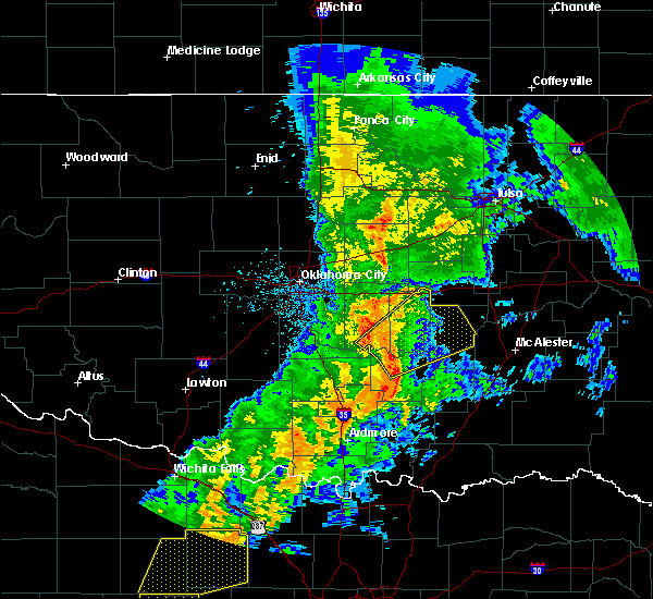 At 820 am cdt, severe thunderstorms were located along a line extending from near asher to 6 miles northwest of ada, moving northeast at 40 mph (radar indicated). Hazards include 70 mph wind gusts. Expect considerable tree damage. Damage is likely to mobile homes, roofs, and outbuildings. At 820 am cdt, severe thunderstorms were located along a line extending from near asher to 6 miles northwest of ada, moving northeast at 40 mph (radar indicated). Hazards include 70 mph wind gusts. Expect considerable tree damage. Damage is likely to mobile homes, roofs, and outbuildings.
|
| 5/2/2018 11:11 PM CDT |
 At 1110 pm cdt, severe thunderstorms were located along a line extending from 6 miles south of allen to near wapanucka, moving northeast at 45 mph (radar indicated). Hazards include 70 mph wind gusts and nickel size hail. Expect considerable tree damage. Damage is likely to mobile homes, roofs, and outbuildings. At 1110 pm cdt, severe thunderstorms were located along a line extending from 6 miles south of allen to near wapanucka, moving northeast at 45 mph (radar indicated). Hazards include 70 mph wind gusts and nickel size hail. Expect considerable tree damage. Damage is likely to mobile homes, roofs, and outbuildings.
|
| 5/2/2018 9:38 PM CDT |
 At 937 pm cdt, severe thunderstorms were located along a line extending from 5 miles southeast of johnson to 5 miles northwest of francis, moving east at 45 mph (radar indicated). Hazards include 70 mph wind gusts. Expect considerable tree damage. damage is likely to mobile homes, roofs, and outbuildings. Locations impacted include, seminole, wewoka, konawa, byng, maud, allen, earlsboro, bowlegs, francis, cromwell, sasakwa, little and lima. At 937 pm cdt, severe thunderstorms were located along a line extending from 5 miles southeast of johnson to 5 miles northwest of francis, moving east at 45 mph (radar indicated). Hazards include 70 mph wind gusts. Expect considerable tree damage. damage is likely to mobile homes, roofs, and outbuildings. Locations impacted include, seminole, wewoka, konawa, byng, maud, allen, earlsboro, bowlegs, francis, cromwell, sasakwa, little and lima.
|
| 5/2/2018 9:27 PM CDT |
 A severe thunderstorm warning remains in effect until 1000 pm cdt for northeastern garvin. seminole. northern pontotoc. central pottawatomie and southeastern mcclain counties. At 927 pm cdt, severe thunderstorms were located along a line extending from near shawnee to 3 miles south of konawa, moving east at 45 mph. A severe thunderstorm warning remains in effect until 1000 pm cdt for northeastern garvin. seminole. northern pontotoc. central pottawatomie and southeastern mcclain counties. At 927 pm cdt, severe thunderstorms were located along a line extending from near shawnee to 3 miles south of konawa, moving east at 45 mph.
|
| 5/2/2018 8:57 PM CDT |
 The national weather service in norman has issued a * severe thunderstorm warning for. northeastern garvin county in southern oklahoma. seminole county in east central oklahoma. southeastern cleveland county in central oklahoma. Northern pontotoc county in east central oklahoma. The national weather service in norman has issued a * severe thunderstorm warning for. northeastern garvin county in southern oklahoma. seminole county in east central oklahoma. southeastern cleveland county in central oklahoma. Northern pontotoc county in east central oklahoma.
|
| 10/21/2017 10:42 PM CDT |
 The severe thunderstorm warning for northeastern garvin, southern seminole and pontotoc counties will expire at 1045 pm cdt, the storms which prompted the warning have weakened below severe limits, therefore the warning will be allowed to expire. however gusty winds are still possible with these thunderstorms. The severe thunderstorm warning for northeastern garvin, southern seminole and pontotoc counties will expire at 1045 pm cdt, the storms which prompted the warning have weakened below severe limits, therefore the warning will be allowed to expire. however gusty winds are still possible with these thunderstorms.
|
| 10/21/2017 10:10 PM CDT |
 At 1010 pm cdt, a severe thunderstorm capable of producing a tornado was located 4 miles southwest of ada, moving northeast at 50 mph (radar indicated rotation). Hazards include tornado. Flying debris will be dangerous to those caught without shelter. mobile homes will be damaged or destroyed. damage to roofs, windows, and vehicles will occur. Tree damage is likely. At 1010 pm cdt, a severe thunderstorm capable of producing a tornado was located 4 miles southwest of ada, moving northeast at 50 mph (radar indicated rotation). Hazards include tornado. Flying debris will be dangerous to those caught without shelter. mobile homes will be damaged or destroyed. damage to roofs, windows, and vehicles will occur. Tree damage is likely.
|
| 10/21/2017 9:55 PM CDT |
 At 955 pm cdt, severe thunderstorms were located along a line extending from 6 miles southwest of konawa to 7 miles west of roff, moving east at 40 mph (radar indicated). Hazards include 60 mph wind gusts. expect damage to roofs, siding, and trees At 955 pm cdt, severe thunderstorms were located along a line extending from 6 miles southwest of konawa to 7 miles west of roff, moving east at 40 mph (radar indicated). Hazards include 60 mph wind gusts. expect damage to roofs, siding, and trees
|
| 7/23/2017 5:54 PM CDT |
 The severe thunderstorm warning for southeastern seminole, northeastern pontotoc and hughes counties will expire at 600 pm cdt, the storms which prompted the warning have weakened below severe limits, and no longer pose an immediate threat to life or property. therefore the warning will be allowed to expire. however gusty winds and heavy rain are still possible with these thunderstorms. The severe thunderstorm warning for southeastern seminole, northeastern pontotoc and hughes counties will expire at 600 pm cdt, the storms which prompted the warning have weakened below severe limits, and no longer pose an immediate threat to life or property. therefore the warning will be allowed to expire. however gusty winds and heavy rain are still possible with these thunderstorms.
|
| 7/23/2017 5:14 PM CDT |
 At 514 pm cdt, severe thunderstorms were located along a line extending from 6 miles northeast of lamar to 7 miles north of sasakwa, moving southeast at 20 mph (radar indicated). Hazards include 60 mph wind gusts and quarter size hail. Hail damage to vehicles is expected. Expect wind damage to roofs, siding, and trees. At 514 pm cdt, severe thunderstorms were located along a line extending from 6 miles northeast of lamar to 7 miles north of sasakwa, moving southeast at 20 mph (radar indicated). Hazards include 60 mph wind gusts and quarter size hail. Hail damage to vehicles is expected. Expect wind damage to roofs, siding, and trees.
|
| 7/4/2017 12:09 AM CDT |
 The severe thunderstorm warning for north central johnston, coal, pontotoc and hughes counties will expire at 1215 am cdt, the storms which prompted the warning have weakened below severe limits, and no longer pose an immediate threat to life or property. therefore the warning will be allowed to expire. however heavy rain is still possible with these thunderstorms. The severe thunderstorm warning for north central johnston, coal, pontotoc and hughes counties will expire at 1215 am cdt, the storms which prompted the warning have weakened below severe limits, and no longer pose an immediate threat to life or property. therefore the warning will be allowed to expire. however heavy rain is still possible with these thunderstorms.
|
| 7/4/2017 12:00 AM CDT |
 At 1200 am cdt, severe thunderstorms were located along a line extending from near lamar to 4 miles west of stuart to near centrahoma to 3 miles east of connerville, moving southeast at 30 mph (radar indicated). Hazards include 60 mph wind gusts. Expect damage to roofs, siding, and trees. Locations impacted include, ada, holdenville, coalgate, wetumka, byng, allen, roff, stonewall, dustin, tupelo, francis, calvin, fitzhugh, stuart, lamar, gerty, horntown, centrahoma, yeager and atwood. At 1200 am cdt, severe thunderstorms were located along a line extending from near lamar to 4 miles west of stuart to near centrahoma to 3 miles east of connerville, moving southeast at 30 mph (radar indicated). Hazards include 60 mph wind gusts. Expect damage to roofs, siding, and trees. Locations impacted include, ada, holdenville, coalgate, wetumka, byng, allen, roff, stonewall, dustin, tupelo, francis, calvin, fitzhugh, stuart, lamar, gerty, horntown, centrahoma, yeager and atwood.
|
| 7/3/2017 11:06 PM CDT |
 At 1106 pm cdt, severe thunderstorms were located along a line extending from 3 miles north of cromwell to 3 miles north of wewoka to near byng to near vanoss, moving southeast at 30 mph (radar indicated). Hazards include 60 mph wind gusts and penny size hail. expect damage to roofs, siding, and trees At 1106 pm cdt, severe thunderstorms were located along a line extending from 3 miles north of cromwell to 3 miles north of wewoka to near byng to near vanoss, moving southeast at 30 mph (radar indicated). Hazards include 60 mph wind gusts and penny size hail. expect damage to roofs, siding, and trees
|
| 6/30/2017 7:48 PM CDT |
 At 747 pm cdt, severe thunderstorms were located along a line extending from 3 miles north of atwood to near francis to 5 miles northeast of vanoss, moving east at 30 mph (radar indicated). Hazards include 60 mph wind gusts and nickel size hail. Expect damage to roofs, siding, and trees. Locations impacted include, ada, konawa, byng, allen, stonewall, francis, calvin, sasakwa, gerty, atwood, vanoss and spaulding. At 747 pm cdt, severe thunderstorms were located along a line extending from 3 miles north of atwood to near francis to 5 miles northeast of vanoss, moving east at 30 mph (radar indicated). Hazards include 60 mph wind gusts and nickel size hail. Expect damage to roofs, siding, and trees. Locations impacted include, ada, konawa, byng, allen, stonewall, francis, calvin, sasakwa, gerty, atwood, vanoss and spaulding.
|
| 6/30/2017 7:32 PM CDT |
 At 732 pm cdt, severe thunderstorms were located along a line extending from 6 miles west of sasakwa to 5 miles south of asher, moving east at 30 mph (radar indicated). Hazards include 60 mph wind gusts and quarter size hail. expect wind damage to roofs, siding, and trees At 732 pm cdt, severe thunderstorms were located along a line extending from 6 miles west of sasakwa to 5 miles south of asher, moving east at 30 mph (radar indicated). Hazards include 60 mph wind gusts and quarter size hail. expect wind damage to roofs, siding, and trees
|
| 5/27/2017 8:35 PM CDT |
 At 834 pm cdt, a severe thunderstorm was located 4 miles northeast of vanoss, moving east at 30 mph (radar indicated). Hazards include 60 mph wind gusts and quarter size hail. Hail damage to vehicles is expected. expect wind damage to roofs, siding, and trees. Locations impacted include, ada, byng, allen, francis, sasakwa and vanoss. At 834 pm cdt, a severe thunderstorm was located 4 miles northeast of vanoss, moving east at 30 mph (radar indicated). Hazards include 60 mph wind gusts and quarter size hail. Hail damage to vehicles is expected. expect wind damage to roofs, siding, and trees. Locations impacted include, ada, byng, allen, francis, sasakwa and vanoss.
|
| 5/27/2017 8:09 PM CDT |
 At 809 pm cdt, a severe thunderstorm was located 7 miles south of konawa, moving northeast at 30 mph (radar indicated). Hazards include 60 mph wind gusts and half dollar size hail. Hail damage to vehicles is expected. Expect wind damage to roofs, siding, and trees. At 809 pm cdt, a severe thunderstorm was located 7 miles south of konawa, moving northeast at 30 mph (radar indicated). Hazards include 60 mph wind gusts and half dollar size hail. Hail damage to vehicles is expected. Expect wind damage to roofs, siding, and trees.
|
| 5/19/2017 9:34 PM CDT |
 At 934 pm cdt, severe thunderstorms were located along a line extending from 7 miles northwest of scipio to near lamar to 4 miles northwest of stuart to near gerty to 4 miles northwest of stonewall, moving northeast at 35 mph (radar indicated). Hazards include 70 mph wind gusts and half dollar size hail. Hail damage to vehicles is expected. expect considerable tree damage. wind damage is also likely to mobile homes, roofs, and outbuildings. Locations impacted include, ada, byng, allen, stonewall, francis, calvin, stuart, lamar, gerty, horntown and atwood. At 934 pm cdt, severe thunderstorms were located along a line extending from 7 miles northwest of scipio to near lamar to 4 miles northwest of stuart to near gerty to 4 miles northwest of stonewall, moving northeast at 35 mph (radar indicated). Hazards include 70 mph wind gusts and half dollar size hail. Hail damage to vehicles is expected. expect considerable tree damage. wind damage is also likely to mobile homes, roofs, and outbuildings. Locations impacted include, ada, byng, allen, stonewall, francis, calvin, stuart, lamar, gerty, horntown and atwood.
|
| 5/19/2017 9:20 PM CDT |
 At 920 pm cdt, severe thunderstorms were located along a line extending from near dustin to 7 miles northwest of scipio to 6 miles southeast of lamar to near stuart to 4 miles southeast of gerty to 5 miles northwest of centrahoma, moving east at 35 mph (radar indicated). Hazards include 70 mph wind gusts and half dollar size hail. Hail damage to vehicles is expected. expect considerable tree damage. Wind damage is also likely to mobile homes, roofs, and outbuildings. At 920 pm cdt, severe thunderstorms were located along a line extending from near dustin to 7 miles northwest of scipio to 6 miles southeast of lamar to near stuart to 4 miles southeast of gerty to 5 miles northwest of centrahoma, moving east at 35 mph (radar indicated). Hazards include 70 mph wind gusts and half dollar size hail. Hail damage to vehicles is expected. expect considerable tree damage. Wind damage is also likely to mobile homes, roofs, and outbuildings.
|
| 5/19/2017 9:01 PM CDT |
 At 901 pm cdt, severe thunderstorms were located along a line extending from 4 miles southwest of dustin to 3 miles northeast of lamar to 8 miles southeast of horntown to 3 miles east of allen to 7 miles north of tupelo to 3 miles west of stonewall, moving northeast at 20 mph (trained weather spotters). Hazards include 70 mph wind gusts and half dollar size hail. Hail damage to vehicles is expected. expect considerable tree damage. wind damage is also likely to mobile homes, roofs, and outbuildings. Locations impacted include, ada, holdenville, wetumka, byng, allen, stonewall, dustin, francis, calvin, stuart, lamar, sasakwa, gerty, horntown, yeager, atwood, fittstown and spaulding. At 901 pm cdt, severe thunderstorms were located along a line extending from 4 miles southwest of dustin to 3 miles northeast of lamar to 8 miles southeast of horntown to 3 miles east of allen to 7 miles north of tupelo to 3 miles west of stonewall, moving northeast at 20 mph (trained weather spotters). Hazards include 70 mph wind gusts and half dollar size hail. Hail damage to vehicles is expected. expect considerable tree damage. wind damage is also likely to mobile homes, roofs, and outbuildings. Locations impacted include, ada, holdenville, wetumka, byng, allen, stonewall, dustin, francis, calvin, stuart, lamar, sasakwa, gerty, horntown, yeager, atwood, fittstown and spaulding.
|
| 5/19/2017 8:43 PM CDT |
 At 843 pm cdt, severe thunderstorms were located along a line extending from near wetumka to near horntown to near calvin to 7 miles north of stonewall to 4 miles southeast of fitzhugh, moving east at 40 mph (trained weather spotters). Hazards include 70 mph wind gusts and ping pong ball size hail. People and animals outdoors will be injured. expect hail damage to roofs, siding, windows, and vehicles. expect considerable tree damage. wind damage is also likely to mobile homes, roofs, and outbuildings. Locations impacted include, ada, holdenville, wewoka, wetumka, byng, allen, stonewall, dustin, francis, calvin, fitzhugh, stuart, lamar, sasakwa, gerty, horntown, yeager, atwood, fittstown and spaulding. At 843 pm cdt, severe thunderstorms were located along a line extending from near wetumka to near horntown to near calvin to 7 miles north of stonewall to 4 miles southeast of fitzhugh, moving east at 40 mph (trained weather spotters). Hazards include 70 mph wind gusts and ping pong ball size hail. People and animals outdoors will be injured. expect hail damage to roofs, siding, windows, and vehicles. expect considerable tree damage. wind damage is also likely to mobile homes, roofs, and outbuildings. Locations impacted include, ada, holdenville, wewoka, wetumka, byng, allen, stonewall, dustin, francis, calvin, fitzhugh, stuart, lamar, sasakwa, gerty, horntown, yeager, atwood, fittstown and spaulding.
|
| 5/19/2017 8:10 PM CDT |
 At 810 pm cdt, severe thunderstorms were located along a line extending from 4 miles west of wetumka to 3 miles southeast of holdenville to 3 miles east of ada to near fitzhugh, moving east at 35 mph (radar indicated). Hazards include 70 mph wind gusts and quarter size hail. Hail damage to vehicles is expected. expect considerable tree damage. Wind damage is also likely to mobile homes, roofs, and outbuildings. At 810 pm cdt, severe thunderstorms were located along a line extending from 4 miles west of wetumka to 3 miles southeast of holdenville to 3 miles east of ada to near fitzhugh, moving east at 35 mph (radar indicated). Hazards include 70 mph wind gusts and quarter size hail. Hail damage to vehicles is expected. expect considerable tree damage. Wind damage is also likely to mobile homes, roofs, and outbuildings.
|
| 5/19/2017 7:38 PM CDT |
 At 737 pm cdt, severe thunderstorms were located along a line extending from 3 miles west of cromwell to 4 miles north of wewoka to 8 miles southeast of bowlegs to 4 miles west of sasakwa to near byng to 3 miles southeast of vanoss, moving northeast at 35 mph (radar indicated). Hazards include 70 mph wind gusts and quarter size hail. Hail damage to vehicles is expected. expect considerable tree damage. wind damage is also likely to mobile homes, roofs, and outbuildings. locations impacted include, ada, seminole, holdenville, wewoka, konawa, wetumka, byng, allen, roff, bowlegs, dustin, francis, calvin, cromwell, fitzhugh, stuart, lamar, sasakwa, gerty and horntown. This includes interstate 40 between mile markers 204 and 213. At 737 pm cdt, severe thunderstorms were located along a line extending from 3 miles west of cromwell to 4 miles north of wewoka to 8 miles southeast of bowlegs to 4 miles west of sasakwa to near byng to 3 miles southeast of vanoss, moving northeast at 35 mph (radar indicated). Hazards include 70 mph wind gusts and quarter size hail. Hail damage to vehicles is expected. expect considerable tree damage. wind damage is also likely to mobile homes, roofs, and outbuildings. locations impacted include, ada, seminole, holdenville, wewoka, konawa, wetumka, byng, allen, roff, bowlegs, dustin, francis, calvin, cromwell, fitzhugh, stuart, lamar, sasakwa, gerty and horntown. This includes interstate 40 between mile markers 204 and 213.
|
| 5/19/2017 7:11 PM CDT |
 At 710 pm cdt, severe thunderstorms were located along a line extending from near little to near bowlegs to 8 miles northwest of sasakwa to 3 miles northwest of francis to 3 miles west of ada to 4 miles northwest of roff, moving northeast at 30 mph (radar indicated). Hazards include 70 mph wind gusts and quarter size hail. Hail damage to vehicles is expected. expect considerable tree damage. Wind damage is also likely to mobile homes, roofs, and outbuildings. At 710 pm cdt, severe thunderstorms were located along a line extending from near little to near bowlegs to 8 miles northwest of sasakwa to 3 miles northwest of francis to 3 miles west of ada to 4 miles northwest of roff, moving northeast at 30 mph (radar indicated). Hazards include 70 mph wind gusts and quarter size hail. Hail damage to vehicles is expected. expect considerable tree damage. Wind damage is also likely to mobile homes, roofs, and outbuildings.
|
| 5/19/2017 7:00 PM CDT |
 At 700 pm cdt, severe thunderstorms were located along a line extending from near johnson to near earlsboro to 3 miles south of maud to near konawa to 4 miles west of byng to near vanoss, moving east at 20 mph (radar indicated). Hazards include 70 mph wind gusts and half dollar size hail. Hail damage to vehicles is expected. expect considerable tree damage. wind damage is also likely to mobile homes, roofs, and outbuildings. locations impacted include, shawnee, ada, seminole, tecumseh, holdenville, wewoka, prague, wynnewood, stratford, konawa, byng, meeker, maud, allen, roff, earlsboro, bowlegs, asher, francis and cromwell. This includes interstate 40 between mile markers 179 and 213. At 700 pm cdt, severe thunderstorms were located along a line extending from near johnson to near earlsboro to 3 miles south of maud to near konawa to 4 miles west of byng to near vanoss, moving east at 20 mph (radar indicated). Hazards include 70 mph wind gusts and half dollar size hail. Hail damage to vehicles is expected. expect considerable tree damage. wind damage is also likely to mobile homes, roofs, and outbuildings. locations impacted include, shawnee, ada, seminole, tecumseh, holdenville, wewoka, prague, wynnewood, stratford, konawa, byng, meeker, maud, allen, roff, earlsboro, bowlegs, asher, francis and cromwell. This includes interstate 40 between mile markers 179 and 213.
|
| 5/19/2017 6:47 PM CDT |
 At 647 pm cdt, severe thunderstorms were located along a line extending from near prague to 3 miles east of shawnee to 3 miles north of maud to 3 miles north of konawa to 7 miles west of byng to 6 miles west of ada to 4 miles southeast of vanoss, moving east at 40 mph (radar indicated). Hazards include 70 mph wind gusts and half dollar size hail. Hail damage to vehicles is expected. expect considerable tree damage. wind damage is also likely to mobile homes, roofs, and outbuildings. locations impacted include, shawnee, ada, seminole, tecumseh, holdenville, wewoka, prague, wynnewood, stratford, konawa, byng, meeker, maud, allen, roff, earlsboro, bowlegs, asher, tribbey and wanette. this includes the following highways, interstate 35 between mile markers 56 and 66. Interstate 40 between mile markers 178 and 213. At 647 pm cdt, severe thunderstorms were located along a line extending from near prague to 3 miles east of shawnee to 3 miles north of maud to 3 miles north of konawa to 7 miles west of byng to 6 miles west of ada to 4 miles southeast of vanoss, moving east at 40 mph (radar indicated). Hazards include 70 mph wind gusts and half dollar size hail. Hail damage to vehicles is expected. expect considerable tree damage. wind damage is also likely to mobile homes, roofs, and outbuildings. locations impacted include, shawnee, ada, seminole, tecumseh, holdenville, wewoka, prague, wynnewood, stratford, konawa, byng, meeker, maud, allen, roff, earlsboro, bowlegs, asher, tribbey and wanette. this includes the following highways, interstate 35 between mile markers 56 and 66. Interstate 40 between mile markers 178 and 213.
|
| 5/19/2017 6:30 PM CDT |
 At 630 pm cdt, severe thunderstorms were located along a line extending from 4 miles south of prague to 4 miles northwest of brooksville to 4 miles southeast of macomb to 5 miles south of asher to near stratford to 6 miles west of roff, moving northeast at 55 mph (radar indicated). Hazards include 60 mph wind gusts and half dollar size hail. Hail damage to vehicles is expected. expect wind damage to roofs, siding, and trees. locations impacted include, shawnee, ada, seminole, tecumseh, holdenville, sulphur, davis, wewoka, prague, wynnewood, pink, stratford, konawa, byng, meeker, maud, allen, roff, earlsboro and stonewall. this includes the following highways, interstate 35 between mile markers 50 and 66. Interstate 40 between mile markers 175 and 213. At 630 pm cdt, severe thunderstorms were located along a line extending from 4 miles south of prague to 4 miles northwest of brooksville to 4 miles southeast of macomb to 5 miles south of asher to near stratford to 6 miles west of roff, moving northeast at 55 mph (radar indicated). Hazards include 60 mph wind gusts and half dollar size hail. Hail damage to vehicles is expected. expect wind damage to roofs, siding, and trees. locations impacted include, shawnee, ada, seminole, tecumseh, holdenville, sulphur, davis, wewoka, prague, wynnewood, pink, stratford, konawa, byng, meeker, maud, allen, roff, earlsboro and stonewall. this includes the following highways, interstate 35 between mile markers 50 and 66. Interstate 40 between mile markers 175 and 213.
|
| 5/19/2017 6:12 PM CDT |
 At 612 pm cdt, severe thunderstorms were located along a line extending from near etowah to 4 miles northeast of rosedale to 6 miles southwest of byars to near wynnewood to 3 miles north of davis, moving northeast at 45 mph (radar indicated). Hazards include golf ball size hail and 60 mph wind gusts. People and animals outdoors will be injured. expect hail damage to roofs, siding, windows, and vehicles. Expect wind damage to roofs, siding, and trees. At 612 pm cdt, severe thunderstorms were located along a line extending from near etowah to 4 miles northeast of rosedale to 6 miles southwest of byars to near wynnewood to 3 miles north of davis, moving northeast at 45 mph (radar indicated). Hazards include golf ball size hail and 60 mph wind gusts. People and animals outdoors will be injured. expect hail damage to roofs, siding, windows, and vehicles. Expect wind damage to roofs, siding, and trees.
|
| 5/18/2017 9:07 PM CDT |
 A severe thunderstorm warning remains in effect until 945 pm cdt for northern johnston. northeastern garvin. western coal. pontotoc. northeastern murray and southwestern hughes counties. At 907 pm cdt, severe thunderstorms were located along a line extending from 4 miles south of konawa to 3 miles northwest of fittstown to near reagan, moving northeast at 55 mph. A severe thunderstorm warning remains in effect until 945 pm cdt for northern johnston. northeastern garvin. western coal. pontotoc. northeastern murray and southwestern hughes counties. At 907 pm cdt, severe thunderstorms were located along a line extending from 4 miles south of konawa to 3 miles northwest of fittstown to near reagan, moving northeast at 55 mph.
|
| 5/18/2017 8:53 PM CDT |
 At 852 pm cdt, severe thunderstorms were located along a line extending from near stratford to near hickory to 5 miles northeast of gene autry, moving northeast at 50 mph (radar indicated). Hazards include 70 mph wind gusts and half dollar size hail. Hail damage to vehicles is expected. expect considerable tree damage. Wind damage is also likely to mobile homes, roofs, and outbuildings. At 852 pm cdt, severe thunderstorms were located along a line extending from near stratford to near hickory to 5 miles northeast of gene autry, moving northeast at 50 mph (radar indicated). Hazards include 70 mph wind gusts and half dollar size hail. Hail damage to vehicles is expected. expect considerable tree damage. Wind damage is also likely to mobile homes, roofs, and outbuildings.
|
| 4/25/2017 11:53 PM CDT |
 At 1153 pm cdt, a severe thunderstorm was located 4 miles southeast of byng, moving east at 30 mph (radar indicated). Hazards include golf ball size hail. People and animals outdoors will be injured. expect damage to roofs, siding, windows, and vehicles. Locations impacted include, ada, byng, allen, stonewall, tupelo, francis, fitzhugh, gerty and centrahoma. At 1153 pm cdt, a severe thunderstorm was located 4 miles southeast of byng, moving east at 30 mph (radar indicated). Hazards include golf ball size hail. People and animals outdoors will be injured. expect damage to roofs, siding, windows, and vehicles. Locations impacted include, ada, byng, allen, stonewall, tupelo, francis, fitzhugh, gerty and centrahoma.
|
| 4/25/2017 11:45 PM CDT |
 At 1145 pm cdt, a severe thunderstorm was located near ada, moving east at 30 mph (trained weather spotters). Hazards include golf ball size hail. People and animals outdoors will be injured. Expect damage to roofs, siding, windows, and vehicles. At 1145 pm cdt, a severe thunderstorm was located near ada, moving east at 30 mph (trained weather spotters). Hazards include golf ball size hail. People and animals outdoors will be injured. Expect damage to roofs, siding, windows, and vehicles.
|
| 4/25/2017 11:28 PM CDT |
 At 1128 pm cdt, a severe thunderstorm was located 4 miles west of byng, moving east at 50 mph (trained weather spotters). Hazards include golf ball size hail. People and animals outdoors will be injured. expect damage to roofs, siding, windows, and vehicles. Locations impacted include, ada, konawa, byng, francis, sasakwa and vanoss. At 1128 pm cdt, a severe thunderstorm was located 4 miles west of byng, moving east at 50 mph (trained weather spotters). Hazards include golf ball size hail. People and animals outdoors will be injured. expect damage to roofs, siding, windows, and vehicles. Locations impacted include, ada, konawa, byng, francis, sasakwa and vanoss.
|
| 4/25/2017 11:24 PM CDT |
 At 1124 pm cdt, a severe thunderstorm was located 7 miles southwest of konawa, moving east at 50 mph (trained weather spotters). Hazards include quarter size hail. Damage to vehicles is possible. Locations impacted include, ada, konawa, byng, francis, sasakwa and vanoss. At 1124 pm cdt, a severe thunderstorm was located 7 miles southwest of konawa, moving east at 50 mph (trained weather spotters). Hazards include quarter size hail. Damage to vehicles is possible. Locations impacted include, ada, konawa, byng, francis, sasakwa and vanoss.
|
| 4/25/2017 11:17 PM CDT |
 At 1117 pm cdt, a severe thunderstorm was located 5 miles northeast of stratford, moving east at 50 mph (radar indicated). Hazards include ping pong ball size hail and 60 mph wind gusts. People and animals outdoors will be injured. expect hail damage to roofs, siding, windows, and vehicles. expect wind damage to roofs, siding, and trees. Locations impacted include, ada, stratford, konawa, byng, francis, byars, sasakwa and vanoss. At 1117 pm cdt, a severe thunderstorm was located 5 miles northeast of stratford, moving east at 50 mph (radar indicated). Hazards include ping pong ball size hail and 60 mph wind gusts. People and animals outdoors will be injured. expect hail damage to roofs, siding, windows, and vehicles. expect wind damage to roofs, siding, and trees. Locations impacted include, ada, stratford, konawa, byng, francis, byars, sasakwa and vanoss.
|
| 4/25/2017 11:02 PM CDT |
 At 1102 pm cdt, a severe thunderstorm was located 4 miles west of byars, moving east at 50 mph (radar indicated). Hazards include golf ball size hail and 60 mph wind gusts. People and animals outdoors will be injured. expect hail damage to roofs, siding, windows, and vehicles. Expect wind damage to roofs, siding, and trees. At 1102 pm cdt, a severe thunderstorm was located 4 miles west of byars, moving east at 50 mph (radar indicated). Hazards include golf ball size hail and 60 mph wind gusts. People and animals outdoors will be injured. expect hail damage to roofs, siding, windows, and vehicles. Expect wind damage to roofs, siding, and trees.
|
| 4/25/2017 10:14 PM CDT |
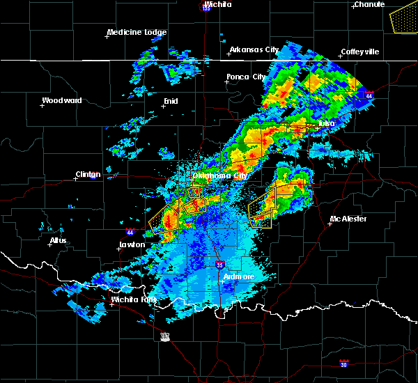 At 1014 pm cdt, a severe thunderstorm was located 5 miles east of konawa, moving east at 40 mph (radar indicated). Hazards include two inch hail and 60 mph wind gusts. People and animals outdoors will be injured. expect hail damage to roofs, siding, windows, and vehicles. expect wind damage to roofs, siding, and trees. Locations impacted include, konawa, byng, francis and sasakwa. At 1014 pm cdt, a severe thunderstorm was located 5 miles east of konawa, moving east at 40 mph (radar indicated). Hazards include two inch hail and 60 mph wind gusts. People and animals outdoors will be injured. expect hail damage to roofs, siding, windows, and vehicles. expect wind damage to roofs, siding, and trees. Locations impacted include, konawa, byng, francis and sasakwa.
|
| 4/25/2017 10:07 PM CDT |
 At 1007 pm cdt, a severe thunderstorm was located near konawa, moving east at 40 mph (radar indicated). Hazards include golf ball size hail and 60 mph wind gusts. People and animals outdoors will be injured. expect hail damage to roofs, siding, windows, and vehicles. expect wind damage to roofs, siding, and trees. Locations impacted include, konawa, byng, francis and sasakwa. At 1007 pm cdt, a severe thunderstorm was located near konawa, moving east at 40 mph (radar indicated). Hazards include golf ball size hail and 60 mph wind gusts. People and animals outdoors will be injured. expect hail damage to roofs, siding, windows, and vehicles. expect wind damage to roofs, siding, and trees. Locations impacted include, konawa, byng, francis and sasakwa.
|
| 4/25/2017 9:57 PM CDT |
 At 956 pm cdt, a severe thunderstorm was located 7 miles southwest of konawa, moving east at 40 mph (radar indicated). Hazards include two inch hail and 60 mph wind gusts. People and animals outdoors will be injured. expect hail damage to roofs, siding, windows, and vehicles. expect wind damage to roofs, siding, and trees. Locations impacted include, ada, konawa, byng, francis and sasakwa. At 956 pm cdt, a severe thunderstorm was located 7 miles southwest of konawa, moving east at 40 mph (radar indicated). Hazards include two inch hail and 60 mph wind gusts. People and animals outdoors will be injured. expect hail damage to roofs, siding, windows, and vehicles. expect wind damage to roofs, siding, and trees. Locations impacted include, ada, konawa, byng, francis and sasakwa.
|
| 4/25/2017 9:42 PM CDT |
 At 941 pm cdt, a severe thunderstorm was located near byars, moving east at 40 mph (radar indicated). Hazards include two inch hail and 60 mph wind gusts. People and animals outdoors will be injured. expect hail damage to roofs, siding, windows, and vehicles. Expect wind damage to roofs, siding, and trees. At 941 pm cdt, a severe thunderstorm was located near byars, moving east at 40 mph (radar indicated). Hazards include two inch hail and 60 mph wind gusts. People and animals outdoors will be injured. expect hail damage to roofs, siding, windows, and vehicles. Expect wind damage to roofs, siding, and trees.
|
| 4/21/2017 4:40 PM CDT |
 At 440 pm cdt, a severe thunderstorm was located 6 miles east of ada, moving east at 35 mph (radar indicated). Hazards include 60 mph wind gusts and quarter size hail. Hail damage to vehicles is expected. expect wind damage to roofs, siding, and trees. Locations impacted include, ada, byng, allen, francis, gerty and atwood. At 440 pm cdt, a severe thunderstorm was located 6 miles east of ada, moving east at 35 mph (radar indicated). Hazards include 60 mph wind gusts and quarter size hail. Hail damage to vehicles is expected. expect wind damage to roofs, siding, and trees. Locations impacted include, ada, byng, allen, francis, gerty and atwood.
|
| 4/21/2017 4:27 PM CDT |
 At 427 pm cdt, a severe thunderstorm was located near ada, moving east at 35 mph (radar indicated). Hazards include 60 mph wind gusts and half dollar size hail. Hail damage to vehicles is expected. Expect wind damage to roofs, siding, and trees. At 427 pm cdt, a severe thunderstorm was located near ada, moving east at 35 mph (radar indicated). Hazards include 60 mph wind gusts and half dollar size hail. Hail damage to vehicles is expected. Expect wind damage to roofs, siding, and trees.
|
| 4/21/2017 11:05 AM CDT |
 At 1105 am cdt, severe thunderstorms were located along a line extending from 4 miles southwest of weleetka to near fitzhugh, moving east at 40 mph (radar indicated). Hazards include 60 mph wind gusts. expect damage to roofs, siding, and trees At 1105 am cdt, severe thunderstorms were located along a line extending from 4 miles southwest of weleetka to near fitzhugh, moving east at 40 mph (radar indicated). Hazards include 60 mph wind gusts. expect damage to roofs, siding, and trees
|
| 4/21/2017 10:24 AM CDT |
 At 1023 am cdt, severe thunderstorms were located along a line extending from near stroud to near earlsboro to near wanette, moving east at 45 mph (radar indicated). Hazards include 60 mph wind gusts. Expect damage to roofs, siding, and trees. this line of storms has a history of wind damage as it moved across the oklahoma city metro area. Locations impacted include, ada, seminole, tecumseh, wewoka, stroud, prague, stratford, konawa, byng, maud, davenport, earlsboro, paoli, bowlegs, asher, tribbey, wanette, francis, cromwell and byars. At 1023 am cdt, severe thunderstorms were located along a line extending from near stroud to near earlsboro to near wanette, moving east at 45 mph (radar indicated). Hazards include 60 mph wind gusts. Expect damage to roofs, siding, and trees. this line of storms has a history of wind damage as it moved across the oklahoma city metro area. Locations impacted include, ada, seminole, tecumseh, wewoka, stroud, prague, stratford, konawa, byng, maud, davenport, earlsboro, paoli, bowlegs, asher, tribbey, wanette, francis, cromwell and byars.
|
| 4/21/2017 10:15 AM CDT |
 At 1012 am cdt, severe thunderstorms were located along a line extending from near chandler to near shawnee to near lindsay, moving east at 55 mph (radar indicated. several locations received wind gusts of around 60 mph with this line of storms as it passed through the oklahoma city metro area). Hazards include 60 mph wind gusts. Expect damage to roofs, siding, and trees. Locations impacted include, southeastern norman, shawnee, ada, seminole, tecumseh, pauls valley, purcell, chandler, noble, slaughterville, mcloud, wewoka, lindsay, stroud, prague, lexington, pink, stratford, konawa and maysville. At 1012 am cdt, severe thunderstorms were located along a line extending from near chandler to near shawnee to near lindsay, moving east at 55 mph (radar indicated. several locations received wind gusts of around 60 mph with this line of storms as it passed through the oklahoma city metro area). Hazards include 60 mph wind gusts. Expect damage to roofs, siding, and trees. Locations impacted include, southeastern norman, shawnee, ada, seminole, tecumseh, pauls valley, purcell, chandler, noble, slaughterville, mcloud, wewoka, lindsay, stroud, prague, lexington, pink, stratford, konawa and maysville.
|
| 4/21/2017 9:59 AM CDT |
 At 958 am cdt, severe thunderstorms were located along a line extending from near carney to near oklahoma city to near rush springs, moving east at 40 mph (radar indicated. several wind gusts to around 60 mph have been reported across the oklahoma city area). Hazards include 60 mph wind gusts. Expect damage to roofs, siding, and trees. Locations impacted include, southeastern norman, shawnee, ada, seminole, tecumseh, pauls valley, purcell, chandler, noble, slaughterville, mcloud, wewoka, lindsay, stroud, prague, lexington, pink, stratford, konawa and maysville. At 958 am cdt, severe thunderstorms were located along a line extending from near carney to near oklahoma city to near rush springs, moving east at 40 mph (radar indicated. several wind gusts to around 60 mph have been reported across the oklahoma city area). Hazards include 60 mph wind gusts. Expect damage to roofs, siding, and trees. Locations impacted include, southeastern norman, shawnee, ada, seminole, tecumseh, pauls valley, purcell, chandler, noble, slaughterville, mcloud, wewoka, lindsay, stroud, prague, lexington, pink, stratford, konawa and maysville.
|
| 4/21/2017 9:42 AM CDT |
 At 941 am cdt, severe thunderstorms were located along a line extending from 7 miles northwest of carney to near oklahoma city to 7 miles east of rush springs, moving east at 45 mph (radar indicated). Hazards include 60 mph wind gusts and penny size hail. expect damage to roofs, siding, and trees At 941 am cdt, severe thunderstorms were located along a line extending from 7 miles northwest of carney to near oklahoma city to 7 miles east of rush springs, moving east at 45 mph (radar indicated). Hazards include 60 mph wind gusts and penny size hail. expect damage to roofs, siding, and trees
|
| 3/26/2017 7:26 PM CDT |
 At 725 pm cdt, a severe thunderstorm was located 6 miles southeast of francis, moving east at 25 mph. this is a very dangerous storm. this warning is in addition to the tornado warning for portions of pontotoc county (radar indicated). Hazards include baseball size hail and 60 mph wind gusts. People and animals outdoors will be severely injured. Expect shattered windows, extensive damage to roofs, siding, and vehicles. At 725 pm cdt, a severe thunderstorm was located 6 miles southeast of francis, moving east at 25 mph. this is a very dangerous storm. this warning is in addition to the tornado warning for portions of pontotoc county (radar indicated). Hazards include baseball size hail and 60 mph wind gusts. People and animals outdoors will be severely injured. Expect shattered windows, extensive damage to roofs, siding, and vehicles.
|
| 3/26/2017 7:04 PM CDT |
 At 704 pm cdt, a severe thunderstorm was located near ada, moving northeast at 20 mph (radar indicated). Hazards include golf ball size hail and 60 mph wind gusts. People and animals outdoors will be injured. expect hail damage to roofs, siding, windows, and vehicles. expect wind damage to roofs, siding, and trees. Locations impacted include, ada, byng, allen and francis. At 704 pm cdt, a severe thunderstorm was located near ada, moving northeast at 20 mph (radar indicated). Hazards include golf ball size hail and 60 mph wind gusts. People and animals outdoors will be injured. expect hail damage to roofs, siding, windows, and vehicles. expect wind damage to roofs, siding, and trees. Locations impacted include, ada, byng, allen and francis.
|
| 3/26/2017 6:41 PM CDT |
 At 641 pm cdt, a severe thunderstorm was located 4 miles west of ada, moving northeast at 20 mph (radar indicated). Hazards include 60 mph wind gusts and half dollar size hail. Hail damage to vehicles is expected. Expect wind damage to roofs, siding, and trees. At 641 pm cdt, a severe thunderstorm was located 4 miles west of ada, moving northeast at 20 mph (radar indicated). Hazards include 60 mph wind gusts and half dollar size hail. Hail damage to vehicles is expected. Expect wind damage to roofs, siding, and trees.
|
| 10/26/2016 2:42 PM CDT |
 At 242 pm cdt, a severe thunderstorm was located near byng, moving southeast at 15 mph (radar indicated). Hazards include ping pong ball size hail and 60 mph wind gusts. People and animals outdoors will be injured. expect hail damage to roofs, siding, windows, and vehicles. expect wind damage to roofs, siding, and trees. Locations impacted include, ada, byng, francis and fittstown. At 242 pm cdt, a severe thunderstorm was located near byng, moving southeast at 15 mph (radar indicated). Hazards include ping pong ball size hail and 60 mph wind gusts. People and animals outdoors will be injured. expect hail damage to roofs, siding, windows, and vehicles. expect wind damage to roofs, siding, and trees. Locations impacted include, ada, byng, francis and fittstown.
|
| 10/26/2016 2:28 PM CDT |
 At 227 pm cdt, a severe thunderstorm was located near byng, moving southeast at 25 mph (radar indicated). Hazards include ping pong ball size hail and 60 mph wind gusts. People and animals outdoors will be injured. expect hail damage to roofs, siding, windows, and vehicles. Expect wind damage to roofs, siding, and trees. At 227 pm cdt, a severe thunderstorm was located near byng, moving southeast at 25 mph (radar indicated). Hazards include ping pong ball size hail and 60 mph wind gusts. People and animals outdoors will be injured. expect hail damage to roofs, siding, windows, and vehicles. Expect wind damage to roofs, siding, and trees.
|
| 10/26/2016 1:50 PM CDT |
 At 149 pm cdt, a severe thunderstorm was located 4 miles northwest of konawa, moving southeast at 15 mph (radar indicated). Hazards include 60 mph wind gusts and quarter size hail. Hail damage to vehicles is expected. Expect wind damage to roofs, siding, and trees. At 149 pm cdt, a severe thunderstorm was located 4 miles northwest of konawa, moving southeast at 15 mph (radar indicated). Hazards include 60 mph wind gusts and quarter size hail. Hail damage to vehicles is expected. Expect wind damage to roofs, siding, and trees.
|
| 9/17/2016 6:50 PM CDT |
 At 649 pm cdt, severe thunderstorms were located along a line extending from 7 miles north of sasakwa to near ada to near scullin, moving east at 40 mph (radar indicated). Hazards include 60 mph wind gusts. Expect damage to roofs. siding. and trees. Locations impacted include, ada, holdenville, sulphur, byng, roff, stonewall, francis, fitzhugh, sasakwa, hickory, fittstown, scullin and spaulding. At 649 pm cdt, severe thunderstorms were located along a line extending from 7 miles north of sasakwa to near ada to near scullin, moving east at 40 mph (radar indicated). Hazards include 60 mph wind gusts. Expect damage to roofs. siding. and trees. Locations impacted include, ada, holdenville, sulphur, byng, roff, stonewall, francis, fitzhugh, sasakwa, hickory, fittstown, scullin and spaulding.
|
| 9/17/2016 6:43 PM CDT |
 At 642 pm cdt, severe thunderstorms were located along a line extending from 6 miles northeast of konawa to near hickory, moving east at 30 mph (radar indicated). Hazards include 60 mph wind gusts and penny size hail. Expect damage to roofs. siding. and trees. Locations impacted include, ada, holdenville, sulphur, konawa, byng, roff, stonewall, francis, fitzhugh, sasakwa, hickory, fittstown, scullin and spaulding. At 642 pm cdt, severe thunderstorms were located along a line extending from 6 miles northeast of konawa to near hickory, moving east at 30 mph (radar indicated). Hazards include 60 mph wind gusts and penny size hail. Expect damage to roofs. siding. and trees. Locations impacted include, ada, holdenville, sulphur, konawa, byng, roff, stonewall, francis, fitzhugh, sasakwa, hickory, fittstown, scullin and spaulding.
|
| 9/17/2016 6:29 PM CDT |
 At 628 pm cdt, severe thunderstorms were located along a line extending from 4 miles south of maud to 7 miles west of roff, moving east at 35 mph (radar indicated). Hazards include 60 mph wind gusts and nickel size hail. Expect damage to roofs. siding. And trees. At 628 pm cdt, severe thunderstorms were located along a line extending from 4 miles south of maud to 7 miles west of roff, moving east at 35 mph (radar indicated). Hazards include 60 mph wind gusts and nickel size hail. Expect damage to roofs. siding. And trees.
|
| 9/9/2016 11:15 PM CDT |
 At 1113 pm cdt, severe thunderstorms were located along a line extending from 3 miles northeast of shawnee to near goldsby to near verden, moving southeast at 40 mph (radar indicated). Hazards include 60 mph wind gusts. Expect damage to roofs. siding. And trees. At 1113 pm cdt, severe thunderstorms were located along a line extending from 3 miles northeast of shawnee to near goldsby to near verden, moving southeast at 40 mph (radar indicated). Hazards include 60 mph wind gusts. Expect damage to roofs. siding. And trees.
|
| 7/31/2016 4:39 PM CDT |
 The severe thunderstorm warning for southeastern seminole, northeastern pontotoc and southwestern hughes counties will expire at 445 pm cdt, the storm which prompted the warning has weakened below severe limits, and no longer pose an immediate threat to life or property. therefore the warning will be allowed to expire. however gusty winds and heavy rain are still possible with this thunderstorm. The severe thunderstorm warning for southeastern seminole, northeastern pontotoc and southwestern hughes counties will expire at 445 pm cdt, the storm which prompted the warning has weakened below severe limits, and no longer pose an immediate threat to life or property. therefore the warning will be allowed to expire. however gusty winds and heavy rain are still possible with this thunderstorm.
|
| 7/31/2016 4:24 PM CDT |
 At 423 pm cdt, a severe thunderstorm was located near francis, and was drifting slowly northeast (radar indicated). Hazards include 60 mph wind gusts and quarter size hail. Hail damage to vehicles is expected. expect wind damage to roofs, siding, and trees. Locations impacted include, ada, byng, allen, francis, sasakwa, atwood and spaulding. At 423 pm cdt, a severe thunderstorm was located near francis, and was drifting slowly northeast (radar indicated). Hazards include 60 mph wind gusts and quarter size hail. Hail damage to vehicles is expected. expect wind damage to roofs, siding, and trees. Locations impacted include, ada, byng, allen, francis, sasakwa, atwood and spaulding.
|
| 7/31/2016 4:04 PM CDT |
 At 404 pm cdt, a severe thunderstorm was located near francis, moving northeast at 15 mph (radar indicated). Hazards include 60 mph wind gusts and quarter size hail. Hail damage to vehicles is expected. Expect wind damage to roofs, siding, and trees. At 404 pm cdt, a severe thunderstorm was located near francis, moving northeast at 15 mph (radar indicated). Hazards include 60 mph wind gusts and quarter size hail. Hail damage to vehicles is expected. Expect wind damage to roofs, siding, and trees.
|
| 7/8/2016 8:08 PM CDT |
 The severe thunderstorm warning for seminole, northern pontotoc, southeastern pottawatomie and hughes counties will expire at 815 pm cdt, the storms which prompted the warning have weakened below severe limits, and no longer pose an immediate threat to life or property. therefore the warning will be allowed to expire. however gusty winds and heavy rain are still possible with these thunderstorms. The severe thunderstorm warning for seminole, northern pontotoc, southeastern pottawatomie and hughes counties will expire at 815 pm cdt, the storms which prompted the warning have weakened below severe limits, and no longer pose an immediate threat to life or property. therefore the warning will be allowed to expire. however gusty winds and heavy rain are still possible with these thunderstorms.
|
| 7/8/2016 7:43 PM CDT |
 At 742 pm cdt, the leading edge of winds from a line of severe thunderstorms was located along a line extending from 3 miles north of cromwell to 7 miles southwest of wewoka to 6 miles northeast of stratford, moving east at 45 mph. damaging winds have been reported in pottawatomie county with these storms. in addition, quarter size hail is possible with a severe storm near asher moving east at 20 mph (radar indicated). Hazards include 60 mph wind gusts and quarter size hail. Hail damage to vehicles is expected. Expect wind damage to roofs, siding, and trees. At 742 pm cdt, the leading edge of winds from a line of severe thunderstorms was located along a line extending from 3 miles north of cromwell to 7 miles southwest of wewoka to 6 miles northeast of stratford, moving east at 45 mph. damaging winds have been reported in pottawatomie county with these storms. in addition, quarter size hail is possible with a severe storm near asher moving east at 20 mph (radar indicated). Hazards include 60 mph wind gusts and quarter size hail. Hail damage to vehicles is expected. Expect wind damage to roofs, siding, and trees.
|
| 7/3/2016 9:44 PM CDT |
 At 944 pm cdt, severe thunderstorms were located along a line extending from 5 miles northeast of wewoka to 4 miles southwest of holdenville to 3 miles southwest of sasakwa, moving east at 30 mph (radar indicated). Hazards include 60 mph wind gusts and penny size hail. Expect damage to roofs. siding. and trees. Locations impacted include, holdenville, wewoka, wetumka, byng, allen, dustin, francis, calvin, lamar, sasakwa, gerty, horntown, yeager, atwood and spaulding. At 944 pm cdt, severe thunderstorms were located along a line extending from 5 miles northeast of wewoka to 4 miles southwest of holdenville to 3 miles southwest of sasakwa, moving east at 30 mph (radar indicated). Hazards include 60 mph wind gusts and penny size hail. Expect damage to roofs. siding. and trees. Locations impacted include, holdenville, wewoka, wetumka, byng, allen, dustin, francis, calvin, lamar, sasakwa, gerty, horntown, yeager, atwood and spaulding.
|
| 7/3/2016 9:23 PM CDT |
 At 923 pm cdt, severe thunderstorms were located along a line extending from 5 miles east of seminole to 7 miles southeast of bowlegs to near konawa, moving east at 25 mph (radar indicated). Hazards include 60 mph wind gusts and penny size hail. Expect damage to roofs. siding. And trees. At 923 pm cdt, severe thunderstorms were located along a line extending from 5 miles east of seminole to 7 miles southeast of bowlegs to near konawa, moving east at 25 mph (radar indicated). Hazards include 60 mph wind gusts and penny size hail. Expect damage to roofs. siding. And trees.
|
| 6/18/2016 8:17 PM CDT |
 At 816 pm cdt, a severe thunderstorm was located near allen, moving northwest at 10 mph (radar indicated). Hazards include 60 mph wind gusts and quarter size hail. Hail damage to vehicles is expected. expect wind damage to roofs, siding, and trees. Locations impacted include, allen, francis and sasakwa. At 816 pm cdt, a severe thunderstorm was located near allen, moving northwest at 10 mph (radar indicated). Hazards include 60 mph wind gusts and quarter size hail. Hail damage to vehicles is expected. expect wind damage to roofs, siding, and trees. Locations impacted include, allen, francis and sasakwa.
|
| 6/18/2016 7:54 PM CDT |
 At 753 pm cdt, a severe thunderstorm was located near gerty, moving west at 10 mph (radar indicated). Hazards include 70 mph wind gusts and quarter size hail. Hail damage to vehicles is expected. expect considerable tree damage. Wind damage is also likely to mobile homes, roofs, and outbuildings. At 753 pm cdt, a severe thunderstorm was located near gerty, moving west at 10 mph (radar indicated). Hazards include 70 mph wind gusts and quarter size hail. Hail damage to vehicles is expected. expect considerable tree damage. Wind damage is also likely to mobile homes, roofs, and outbuildings.
|
| 5/12/2016 2:21 AM CDT |
 At 220 am cdt, severe thunderstorms were located along a line extending from 5 miles northeast of scipio to near stuart to 5 miles east of gerty to 9 miles northeast of centrahoma to near stonewall, moving east at 25 mph (radar indicated). Hazards include 60 mph wind gusts and quarter size hail. Hail damage to vehicles is expected. expect wind damage to roofs, siding, and trees. Locations impacted include, ada, byng, allen, stonewall, francis, calvin, fitzhugh, stuart, sasakwa, gerty and atwood. At 220 am cdt, severe thunderstorms were located along a line extending from 5 miles northeast of scipio to near stuart to 5 miles east of gerty to 9 miles northeast of centrahoma to near stonewall, moving east at 25 mph (radar indicated). Hazards include 60 mph wind gusts and quarter size hail. Hail damage to vehicles is expected. expect wind damage to roofs, siding, and trees. Locations impacted include, ada, byng, allen, stonewall, francis, calvin, fitzhugh, stuart, sasakwa, gerty and atwood.
|
| 5/12/2016 1:43 AM CDT |
 At 142 am cdt, severe thunderstorms were located along a line extending from 4 miles northwest of lamar to 4 miles east of francis to 3 miles southwest of vanoss, moving east at 30 mph (radar indicated). Hazards include ping pong ball size hail and 60 mph wind gusts. People and animals outdoors will be injured. expect hail damage to roofs, siding, windows, and vehicles. Expect wind damage to roofs, siding, and trees. At 142 am cdt, severe thunderstorms were located along a line extending from 4 miles northwest of lamar to 4 miles east of francis to 3 miles southwest of vanoss, moving east at 30 mph (radar indicated). Hazards include ping pong ball size hail and 60 mph wind gusts. People and animals outdoors will be injured. expect hail damage to roofs, siding, windows, and vehicles. Expect wind damage to roofs, siding, and trees.
|
| 4/29/2016 6:52 PM CDT |
 At 652 pm cdt, a severe thunderstorm was located near sasakwa, moving northeast at 45 mph (radar indicated). Hazards include 70 mph wind gusts and quarter size hail. Hail damage to vehicles is expected. expect considerable tree damage. wind damage is also likely to mobile homes, roofs, and outbuildings. Locations impacted include, wewoka, byng, francis and sasakwa. At 652 pm cdt, a severe thunderstorm was located near sasakwa, moving northeast at 45 mph (radar indicated). Hazards include 70 mph wind gusts and quarter size hail. Hail damage to vehicles is expected. expect considerable tree damage. wind damage is also likely to mobile homes, roofs, and outbuildings. Locations impacted include, wewoka, byng, francis and sasakwa.
|
| 4/29/2016 6:30 PM CDT |
 At 630 pm cdt, severe thunderstorms were located along a line extending from near konawa to near lake of the arbuckles, moving northeast at 40 mph (radar indicated). Hazards include 70 mph wind gusts and quarter size hail. Hail damage to vehicles is expected. expect considerable tree damage. Wind damage is also likely to mobile homes, roofs, and outbuildings. At 630 pm cdt, severe thunderstorms were located along a line extending from near konawa to near lake of the arbuckles, moving northeast at 40 mph (radar indicated). Hazards include 70 mph wind gusts and quarter size hail. Hail damage to vehicles is expected. expect considerable tree damage. Wind damage is also likely to mobile homes, roofs, and outbuildings.
|
| 4/29/2016 2:21 AM CDT |
 At 221 am cdt, severe thunderstorms were located along a line extending from 5 miles northeast of stratford to 5 miles southeast of francis, moving north at 35 mph (radar indicated). Hazards include ping pong ball size hail. People and animals outdoors will be injured. Expect damage to roofs, siding, windows, and vehicles. At 221 am cdt, severe thunderstorms were located along a line extending from 5 miles northeast of stratford to 5 miles southeast of francis, moving north at 35 mph (radar indicated). Hazards include ping pong ball size hail. People and animals outdoors will be injured. Expect damage to roofs, siding, windows, and vehicles.
|
| 4/26/2016 10:22 PM CDT |
 At 1022 pm cdt, severe thunderstorms were located along a line extending from 4 miles north of gerty to 5 miles southeast of olney to 4 miles east of achille, moving northeast at 60 mph (radar indicated). Hazards include 60 mph wind gusts and nickel size hail. Expect damage to roofs. siding. And trees. At 1022 pm cdt, severe thunderstorms were located along a line extending from 4 miles north of gerty to 5 miles southeast of olney to 4 miles east of achille, moving northeast at 60 mph (radar indicated). Hazards include 60 mph wind gusts and nickel size hail. Expect damage to roofs. siding. And trees.
|
| 4/26/2016 9:41 PM CDT |
 At 940 pm cdt, severe thunderstorms were located along a line extending from 5 miles north of stratford to near vanoss to 5 miles southeast of roff to 5 miles northeast of mill creek to near lake texoma, moving east at 30 to 40 mph (radar indicated). Hazards include 60 to 70 mph wind gusts and quarter size hail. Hail damage to vehicles is expected. Expect wind damage to roofs, siding, and trees. At 940 pm cdt, severe thunderstorms were located along a line extending from 5 miles north of stratford to near vanoss to 5 miles southeast of roff to 5 miles northeast of mill creek to near lake texoma, moving east at 30 to 40 mph (radar indicated). Hazards include 60 to 70 mph wind gusts and quarter size hail. Hail damage to vehicles is expected. Expect wind damage to roofs, siding, and trees.
|
| 4/11/2016 12:46 AM CDT |
 At 1246 am cdt, severe thunderstorms were located along a line extending from near bowlegs to near lake of the arbuckles to 3 miles south of wilson, moving east at 50 mph (radar indicated). Hazards include 70 mph wind gusts and half dollar size hail. Hail damage to vehicles is expected. expect considerable tree damage. Wind damage is also likely to mobile homes, roofs, and outbuildings. At 1246 am cdt, severe thunderstorms were located along a line extending from near bowlegs to near lake of the arbuckles to 3 miles south of wilson, moving east at 50 mph (radar indicated). Hazards include 70 mph wind gusts and half dollar size hail. Hail damage to vehicles is expected. expect considerable tree damage. Wind damage is also likely to mobile homes, roofs, and outbuildings.
|
| 3/2/2016 10:04 PM CST |
 At 1003 pm cst, a severe thunderstorm was located 5 miles northeast of stratford, moving east at 35 mph (radar indicated). Hazards include 60 mph wind gusts and half dollar size hail. Hail damage to vehicles is expected. Expect wind damage to roofs, siding, and trees. At 1003 pm cst, a severe thunderstorm was located 5 miles northeast of stratford, moving east at 35 mph (radar indicated). Hazards include 60 mph wind gusts and half dollar size hail. Hail damage to vehicles is expected. Expect wind damage to roofs, siding, and trees.
|
| 5/25/2015 4:39 PM CDT | At 438 pm cdt, severe thunderstorms were located along a line extending from 3 miles south of dale to 4 miles southwest of lamar, moving northeast at 40 mph (radar indicated). Hazards include 60 mph wind gusts. Expect damage to roofs. siding and trees. Locations impacted include, norman, shawnee, seminole, tecumseh, holdenville, noble, slaughterville, wewoka, pink, konawa, wetumka, byng, maud, allen, earlsboro, bowlegs, dustin, asher, tribbey and wanette. |
| 5/25/2015 4:09 PM CDT | At 409 pm cdt, severe thunderstorms were located along a line extending from 3 miles northeast of slaughterville to 5 miles southwest of ashland, moving northeast at 40 mph (radar indicated). Hazards include 60 mph wind gusts and nickel size hail. Expect damage to roofs. Siding and trees. |
| 5/25/2015 3:28 PM CDT | At 326 pm cdt, severe thunderstorms were located along a line extending from 4 miles east of tushka to near antioch, and south to near durant. these storms were moving northeast at 30 to 40 mph (radar indicated). Hazards include 60 mph wind gusts and nickel size hail. Expect damage to roofs. Siding and trees. |
| 5/25/2015 2:45 PM CDT | At 245 pm cdt, severe thunderstorms were located along a line extending from near marlow to near gene autry to 8 miles southeast of lane, moving northeast at 95 mph (radar indicated). Hazards include 70 mph wind gusts and ping pong ball size hail. People and animals outdoors will be injured. expect hail damage to roofs, siding, windows and vehicles. expect considerable tree damage. Wind damage is also likely to mobile homes, roofs and outbuildings. |
| 5/23/2015 6:26 PM CDT | At 626 pm cdt, a severe thunderstorm capable of producing a tornado was located near francis, moving north at 20 mph (radar indicated rotation). Hazards include tornado and quarter size hail. Flying debris will be dangerous to those caught without shelter. mobile homes will be damaged or destroyed. damage to roofs, windows and vehicles will occur. Tree damage is likely. |
| 5/23/2015 6:14 PM CDT | At 613 pm cdt, a severe thunderstorm capable of producing a tornado was located 4 miles south of francis, moving north at 20 mph (radar indicated rotation). Hazards include tornado. Flying debris will be dangerous to those caught without shelter. mobile homes will be damaged or destroyed. damage to roofs, windows and vehicles will occur. tree damage is likely. Locations impacted include, ada, byng, francis, sasakwa and spaulding. |
| 5/23/2015 6:01 PM CDT | At 600 pm cdt, a severe thunderstorm capable of producing a tornado was located near ada, moving north at 30 mph (radar indicated rotation). Hazards include tornado. Flying debris will be dangerous to those caught without shelter. mobile homes will be damaged or destroyed. damage to roofs, windows and vehicles will occur. Tree damage is likely. |
| 5/19/2015 10:24 PM CDT | At 1023 pm cdt, a severe thunderstorm was located near konawa, moving east at 25 mph (radar indicated). Hazards include 70 mph wind gusts and half dollar size hail. Hail damage to vehicles is expected. expect considerable tree damage. wind damage is also likely to mobile homes, roofs and outbuildings. Locations impacted include, wewoka, konawa, byng, allen, francis, sasakwa and spaulding. |
| 5/19/2015 10:14 PM CDT | At 1014 pm cdt, a severe thunderstorm was located near konawa, moving east at 30 mph (radar indicated). Hazards include 70 mph wind gusts and quarter size hail. Hail damage to vehicles is expected. expect considerable tree damage. wind damage is also likely to mobile homes, roofs and outbuildings. Locations impacted include, ada, wewoka, konawa, byng, allen, asher, francis, sasakwa and spaulding. |
| 5/19/2015 10:01 PM CDT | At 1001 pm cdt, a severe thunderstorm was located 6 miles southeast of asher, moving east at 30 mph (radar indicated). Hazards include 60 mph wind gusts and quarter size hail. Hail damage to vehicles is expected. Expect wind damage to roofs, siding and trees. |
| 5/16/2015 11:33 PM CDT | At 1131 pm cdt, severe thunderstorms were located along a line extending from 5 miles southeast of ada to 3 miles east of pontotoc to 4 miles east of burneyville, moving east at 50 mph (radar indicated). Hazards include 60 mph wind gusts and quarter size hail. Hail damage to vehicles is expected. Expect wind damage to roofs, siding and trees. |
| 5/16/2015 10:43 PM CDT | At 1043 pm cdt, severe thunderstorms were located along a line extending from 3 miles north of vanoss to near sulphur to near grady, moving east at 35 mph (radar indicated). Hazards include 60 mph wind gusts and half dollar size hail. Hail damage to vehicles is expected. Expect wind damage to roofs, siding and trees. |
| 5/16/2015 10:25 PM CDT | At 1024 pm cdt, severe thunderstorms were located along a line extending from 3 miles east of paoli to near dougherty to 5 miles west of oscar, moving northeast at 60 mph (radar indicated). Hazards include 60 mph wind gusts and quarter size hail. Hail damage to vehicles is expected. expect wind damage to roofs, siding and trees. locations impacted include, ardmore, ada, pauls valley, sulphur, davis, waurika, lone grove, healdton, wynnewood, wilson, stratford, maysville, dickson, byng, ringling, allen, ryan, roff, springer and paoli. 1. 00in. |
| 5/16/2015 9:59 PM CDT | At 959 pm cdt, severe thunderstorms were located along a line extending from 3 miles northeast of paoli to near healdton to 7 miles southeast of petrolia, moving northeast at 65 mph (radar indicated). Hazards include ping pong ball size hail and 60 mph wind gusts. People and animals outdoors will be injured. expect hail damage to roofs, siding, windows and vehicles. Expect wind damage to roofs, siding and trees. |
| 5/16/2015 9:59 PM CDT | At 959 pm cdt, severe thunderstorms were located along a line extending from 3 miles northeast of paoli to near healdton to 7 miles southeast of petrolia, moving northeast at 65 mph (radar indicated). Hazards include ping pong ball size hail and 60 mph wind gusts. People and animals outdoors will be injured. expect hail damage to roofs, siding, windows and vehicles. Expect wind damage to roofs, siding and trees. |
| 5/10/2015 8:05 AM CDT | At 804 am cdt, a severe thunderstorm was located near allen, moving northeast at 30 mph (radar indicated). Hazards include 70 mph wind gusts and quarter size hail. Hail damage to vehicles is expected. expect considerable tree damage. Wind damage is also likely to mobile homes, roofs and outbuildings. |
| 5/9/2015 9:55 PM CDT | At 955 pm cdt, severe thunderstorms were located along a line extending from 5 miles southwest of byng to 4 miles northeast of fitzhugh to 4 miles east of roff, moving east at 35 mph (radar indicated). Hazards include 60 mph wind gusts and quarter size hail. Hail damage to vehicles is expected. expect wind damage to roofs, siding and trees. locations impacted include, ada, byng, allen, roff, stonewall, francis, fitzhugh, hickory, fittstown, vanoss and jesse. 1. 00in. |
| 5/9/2015 9:23 PM CDT | At 923 pm cdt, a severe thunderstorm was located 6 miles south of stratford, moving east at 40 mph (radar indicated). Hazards include 60 mph wind gusts and quarter size hail. Hail damage to vehicles is expected. Expect wind damage to roofs, siding and trees. |
| 5/8/2015 9:03 PM CDT | At 902 pm cdt, severe thunderstorms were located along a line extending from 4 miles north of allen to 9 miles west of gerty to near stonewall, moving east at 45 mph (radar indicated). Hazards include 70 mph wind gusts and quarter size hail. Hail damage to vehicles is expected. expect considerable tree damage. wind damage is also likely to mobile homes, roofs and outbuildings. locations impacted include, ada, byng, allen, stonewall, francis, calvin, sasakwa, gerty, atwood and fittstown. Possible. |
| 5/8/2015 8:56 PM CDT | At 855 pm cdt, severe thunderstorms were located along a line extending from near cromwell to 4 miles east of sasakwa to near stonewall, moving east at 40 mph (radar indicated). Hazards include 70 mph wind gusts and ping pong ball size hail. People and animals outdoors will be injured. expect hail damage to roofs, siding, windows and vehicles. expect considerable tree damage. Wind damage is also likely to mobile homes, roofs and outbuildings. |
| 5/8/2015 8:30 PM CDT | At 829 pm cdt, a severe thunderstorm was located 4 miles east of vanoss, moving east at 50 mph. this is a very dangerous storm (radar indicated). Hazards include 80 mph wind gusts and quarter size hail. Flying debris will be dangerous to those caught without shelter. mobile homes will be heavily damaged. expect considerable damage to roofs, windows and vehicles. Extensive tree damage and power outages are likely. |
| 4/1/2015 1:23 AM CDT | The national weather service in norman has issued a * severe thunderstorm warning for. northeastern johnston county in southeastern oklahoma. seminole county in east central oklahoma. hughes county in southeastern oklahoma. Eastern pontotoc county in east central oklahoma. |
| 3/25/2015 9:24 PM CDT | A severe thunderstorm warning remains in effect until 1015 pm cdt for southeastern seminole. southern hughes. pontotoc and northern coal counties. at 922 pm cdt. a severe thunderstorm was located near sasakwa and also 3 miles south of vanoss. both moving southeast at 40 mph. The strongest storm was located near sasakwa. |
| 3/25/2015 9:11 PM CDT | The national weather service in norman has issued a * severe thunderstorm warning for. southern seminole county in east central oklahoma. southern hughes county in southeastern oklahoma. pontotoc county in east central oklahoma. South central pottawatomie county in central oklahoma. |
Hail Maps for Francis, OK
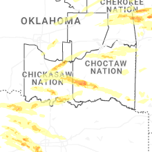
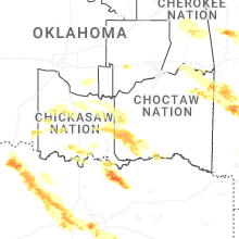
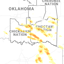
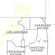
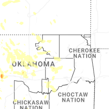


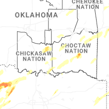


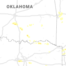


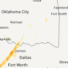


Connect with Interactive Hail Maps