

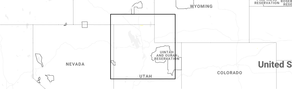
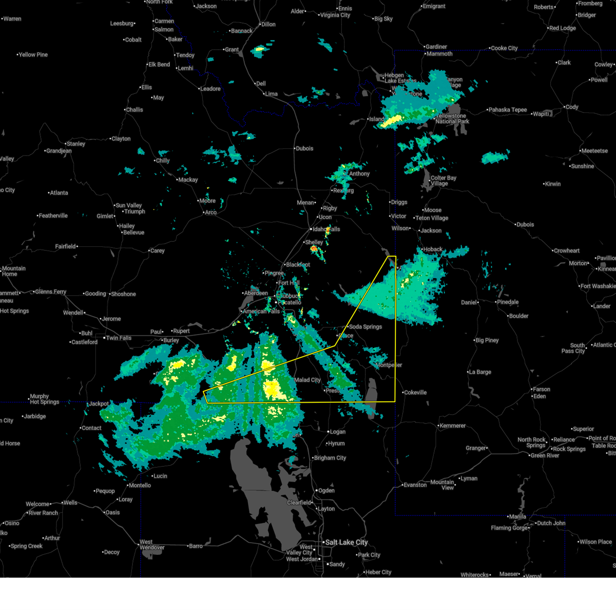
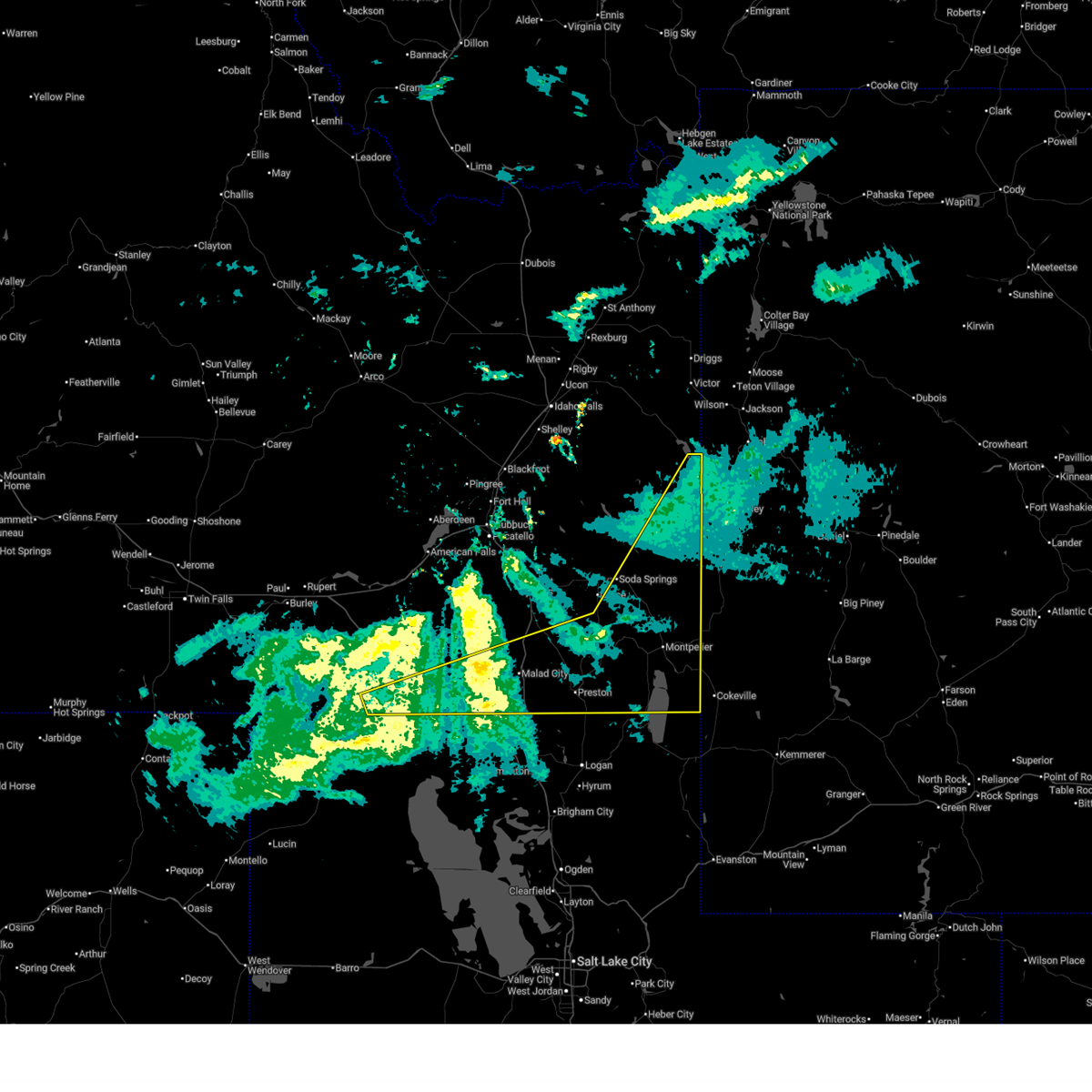
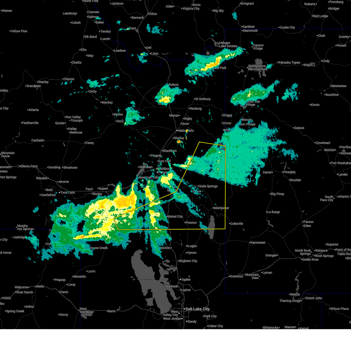
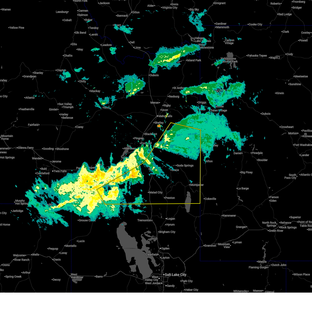
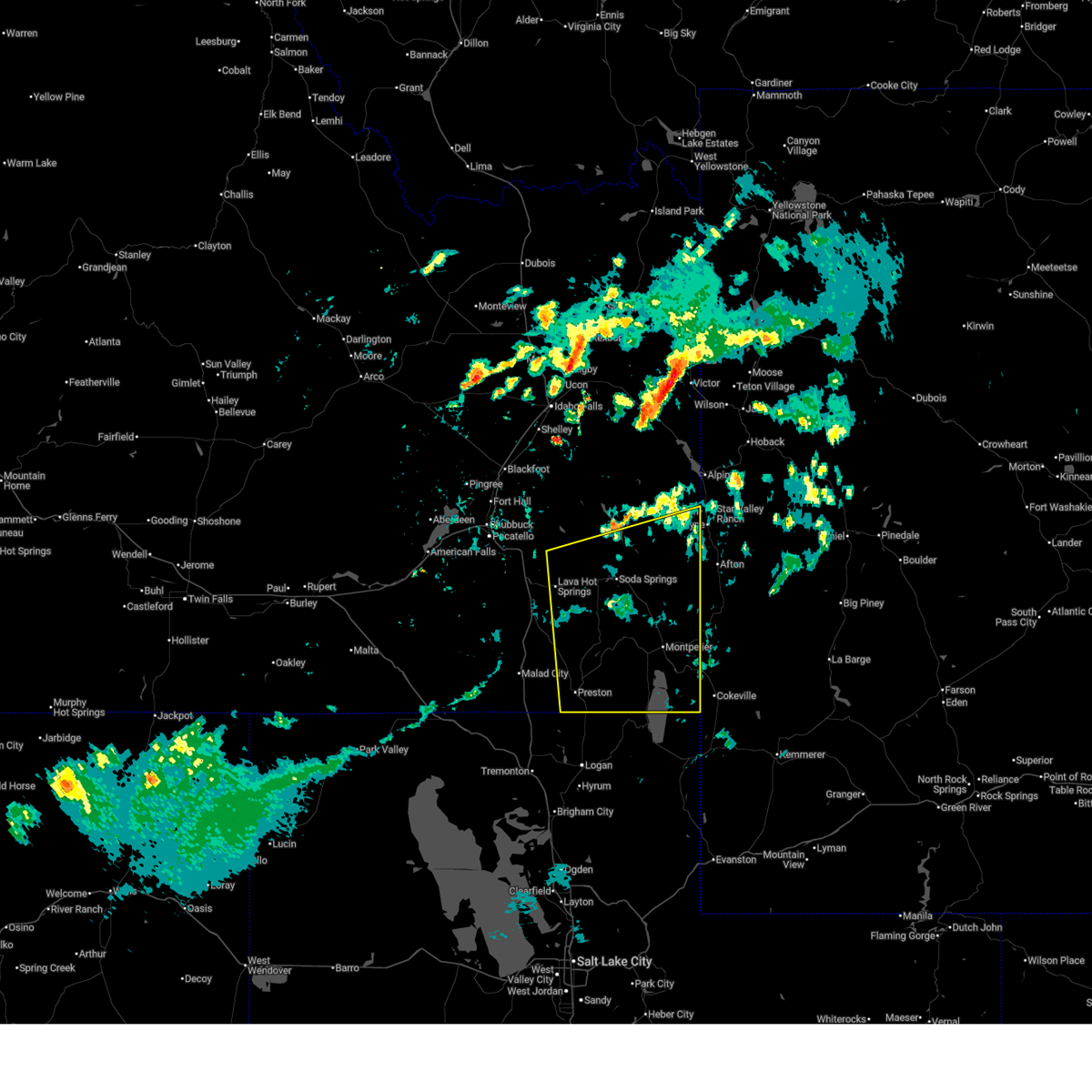
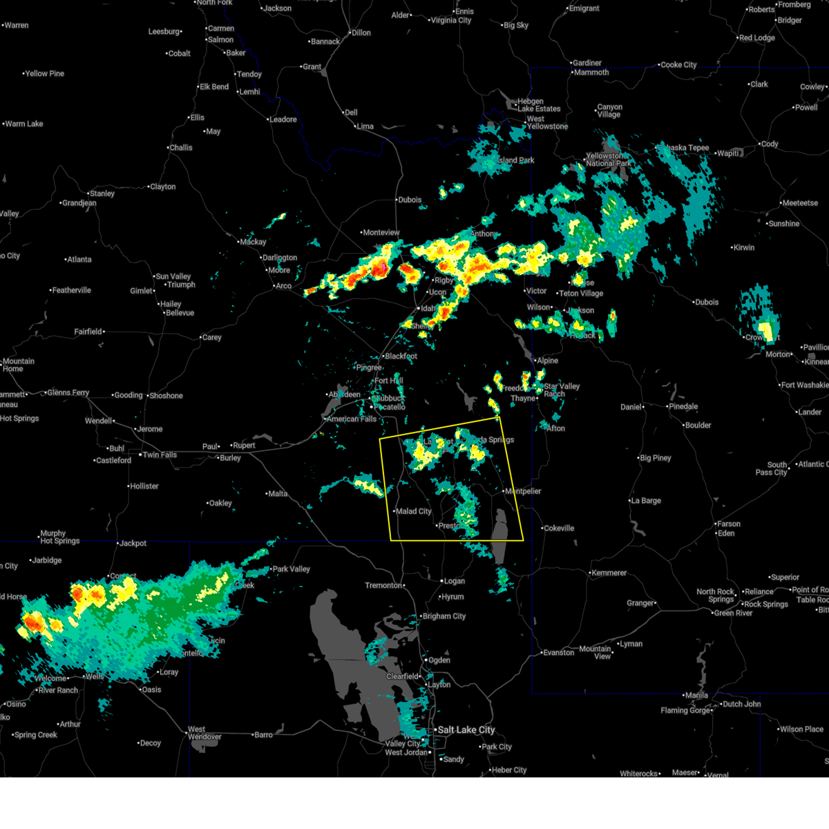
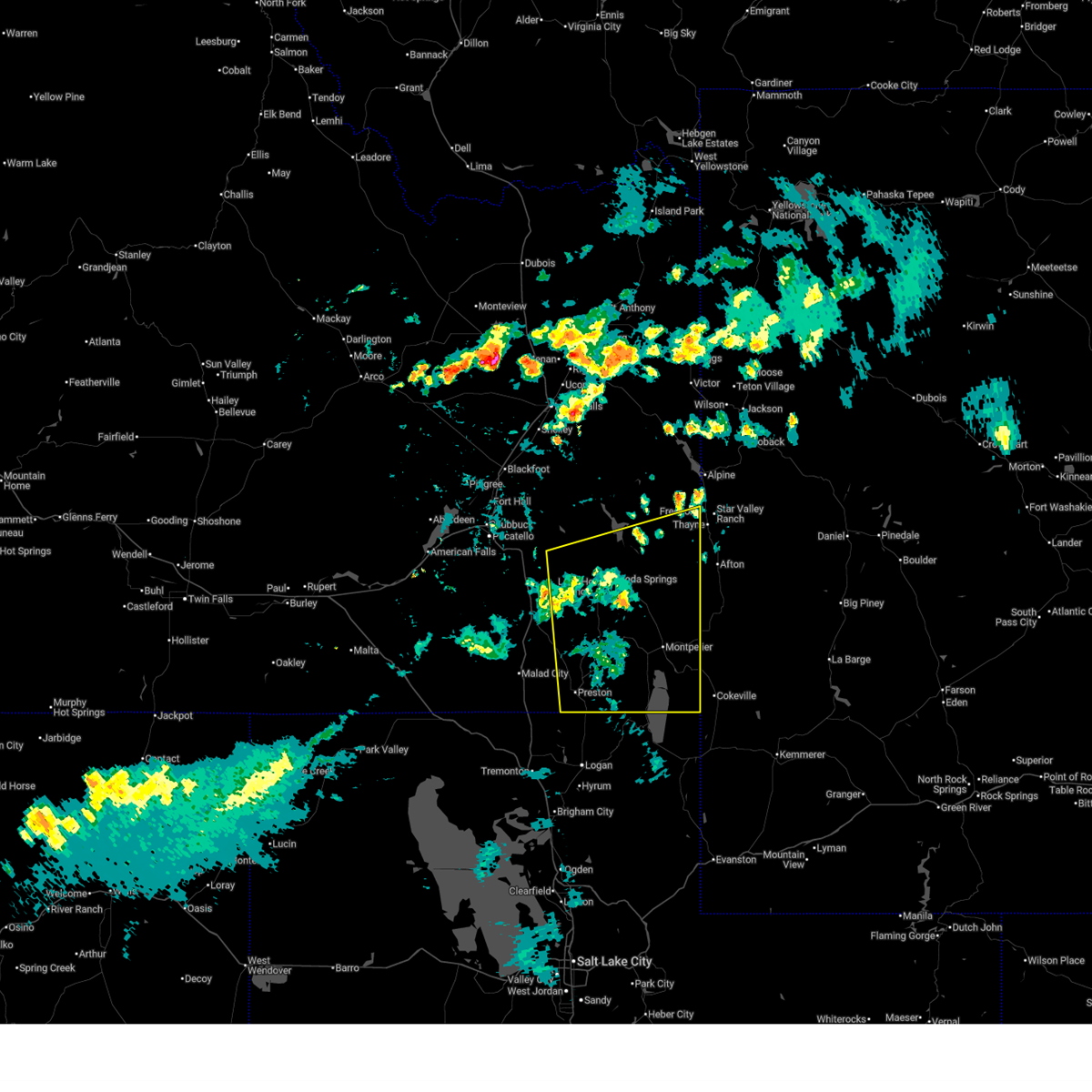
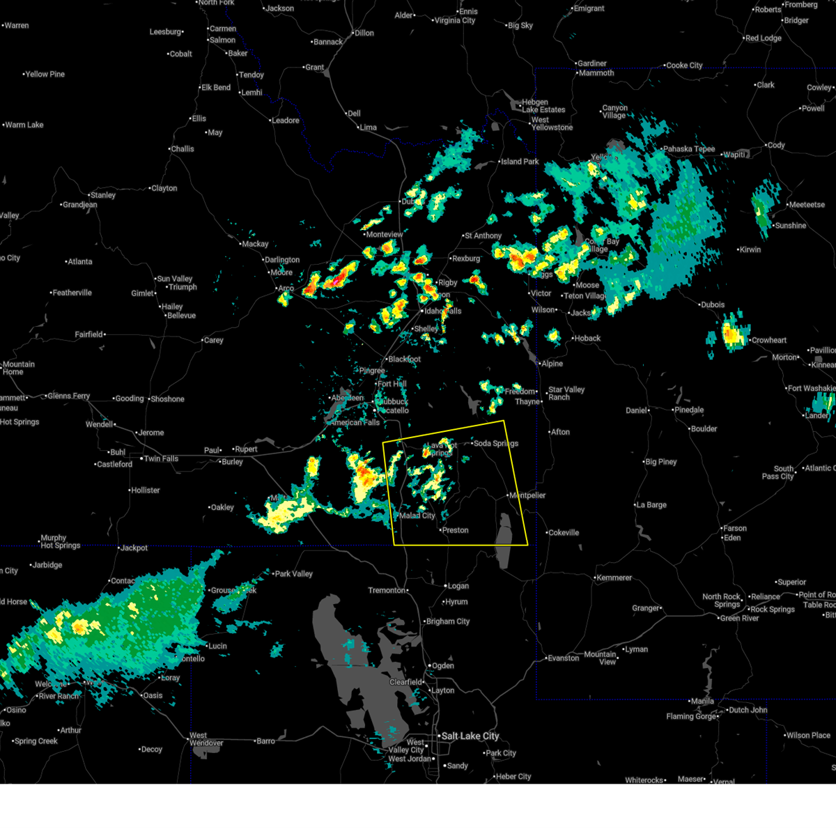
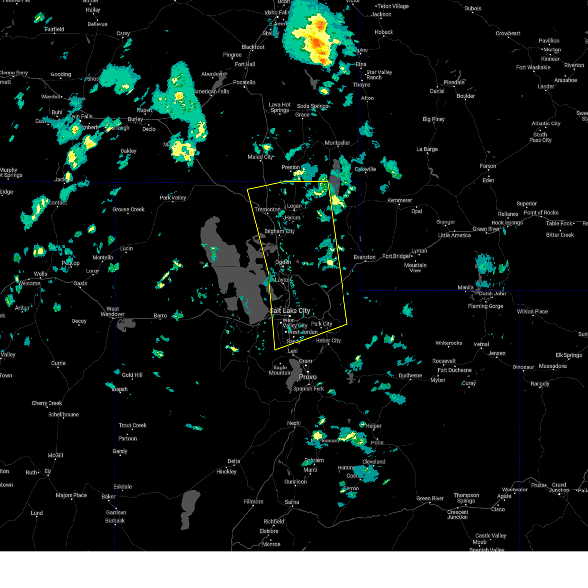
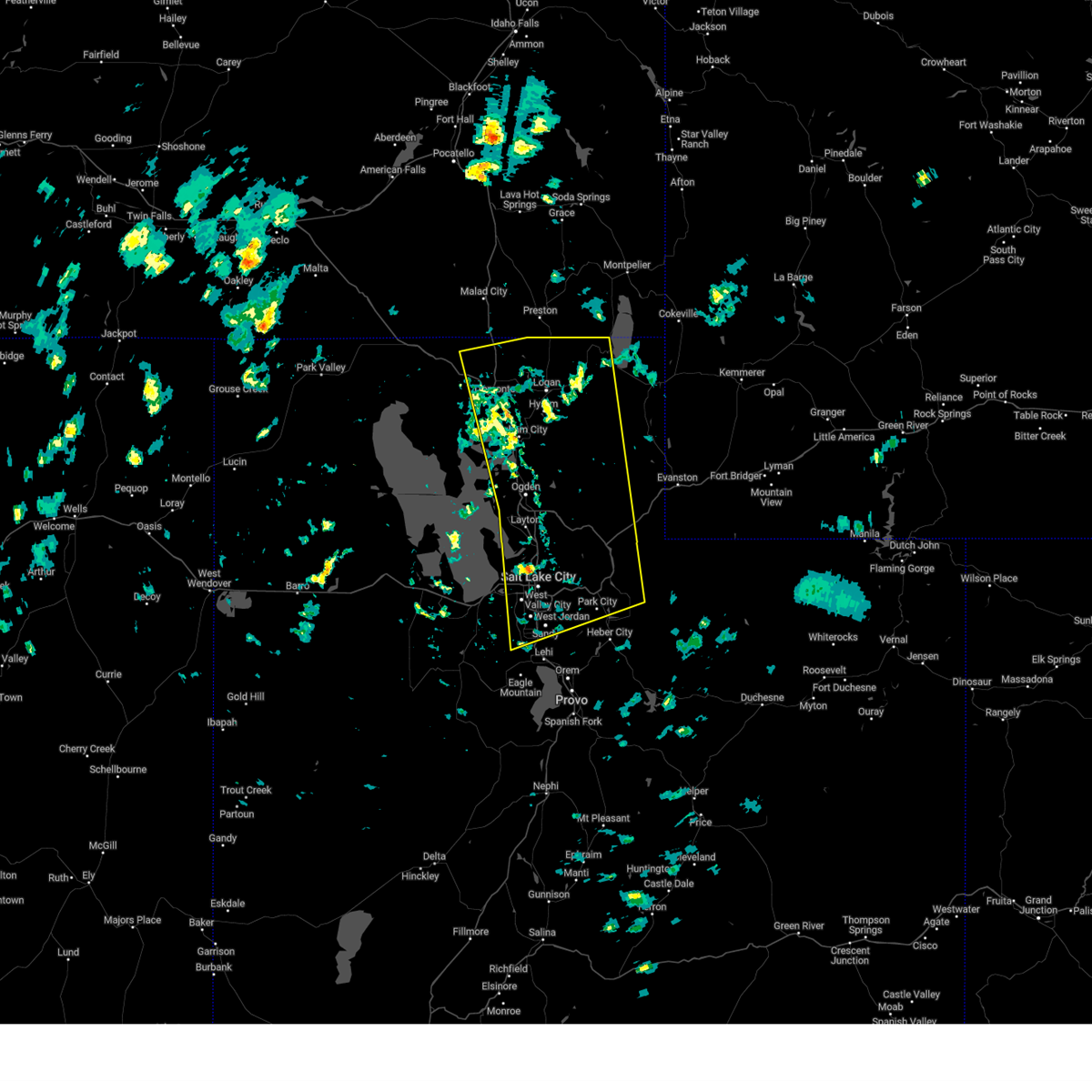
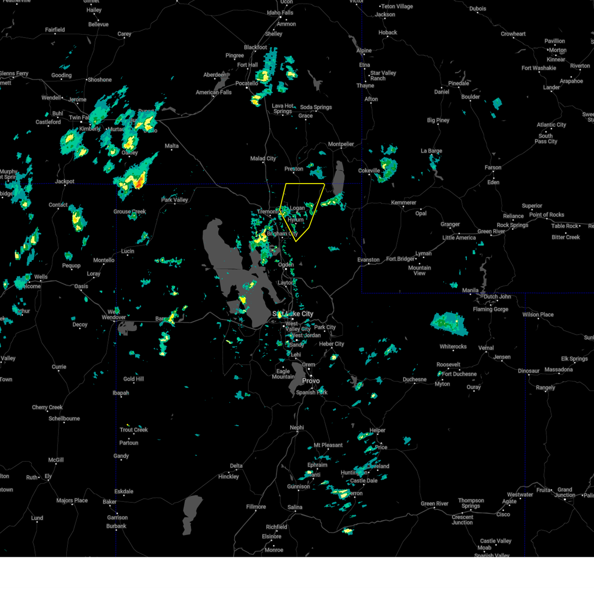
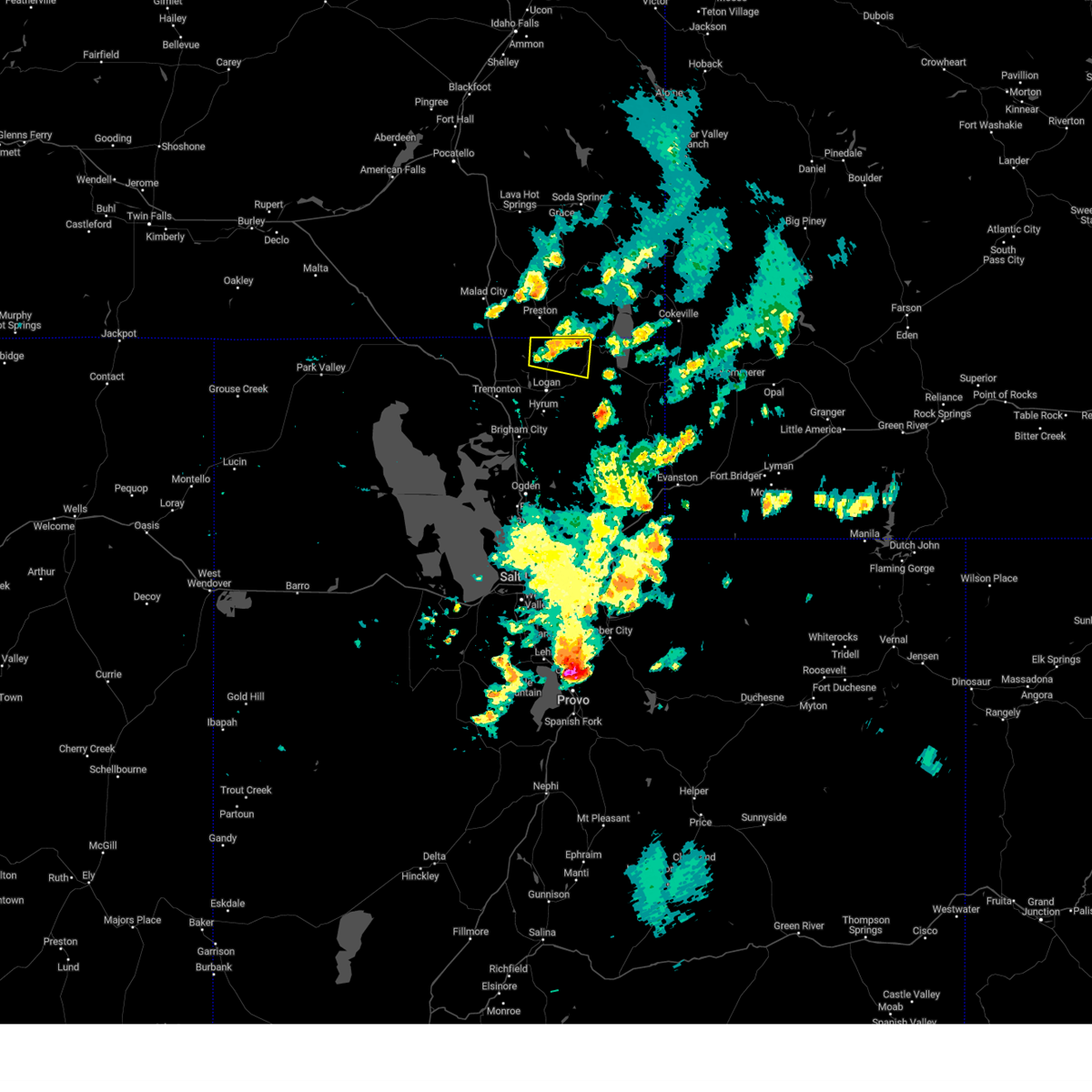
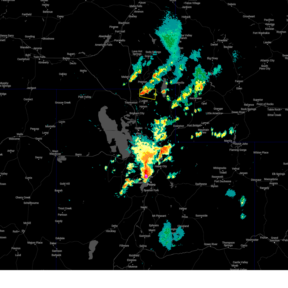
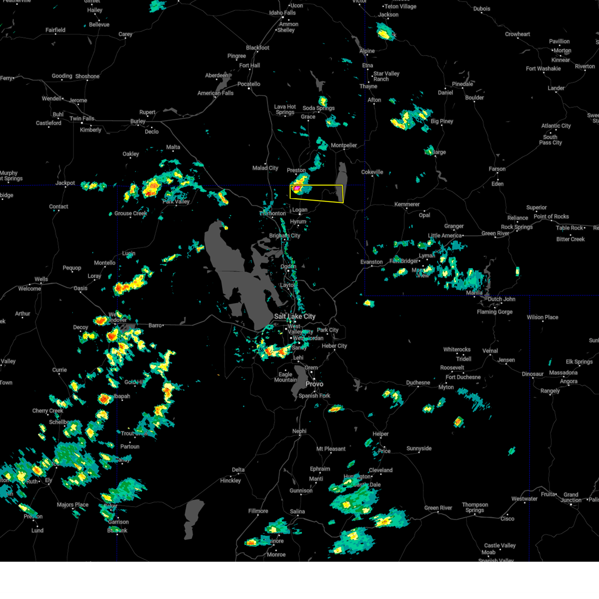
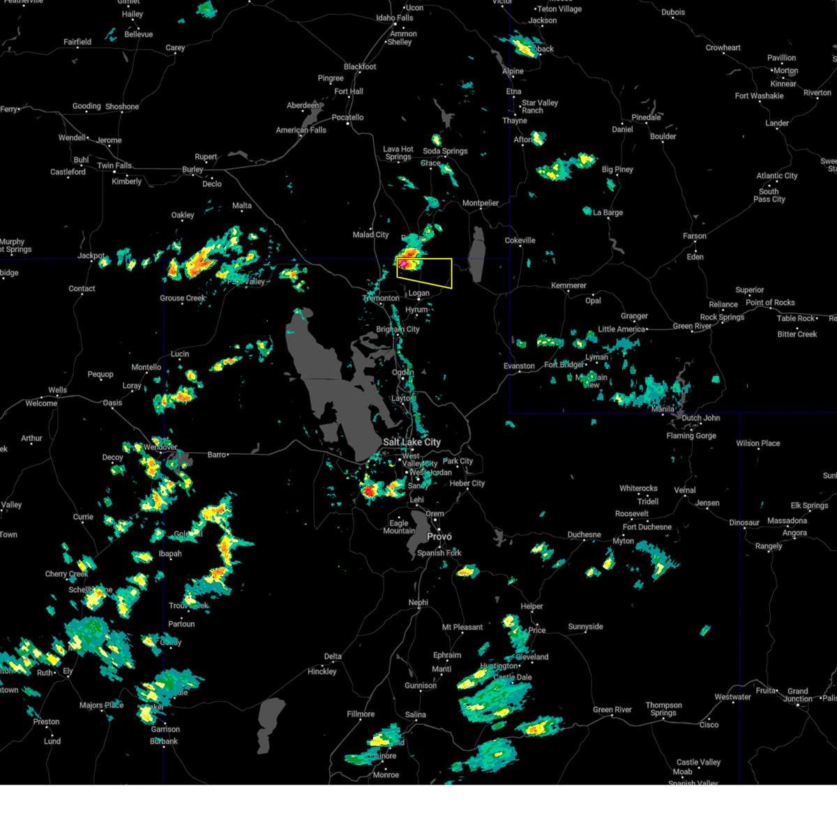
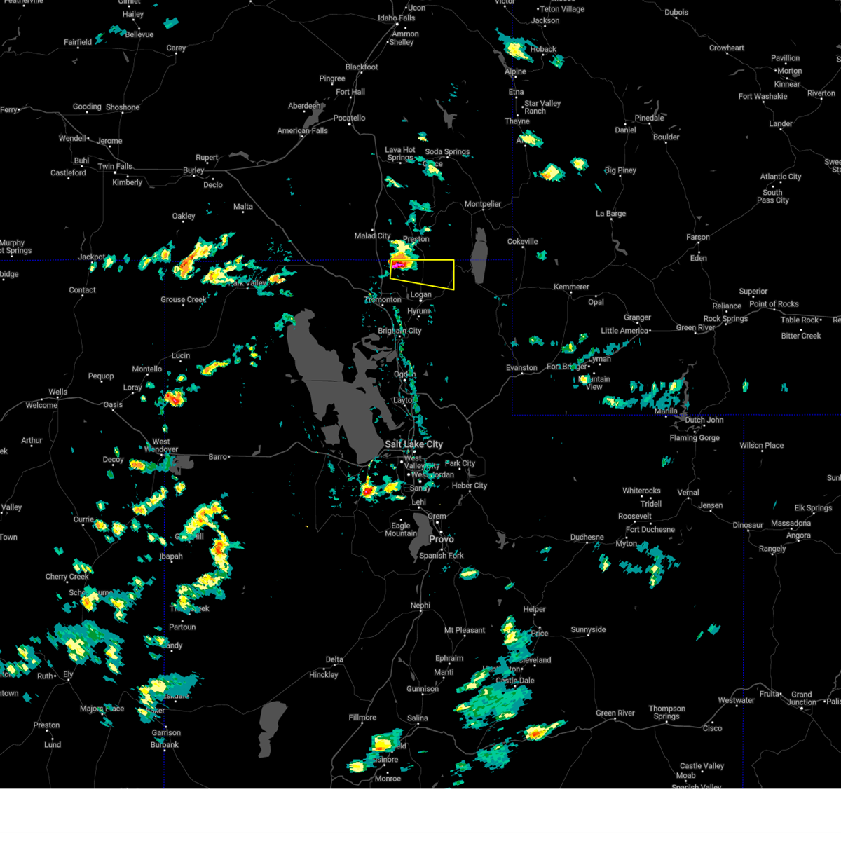
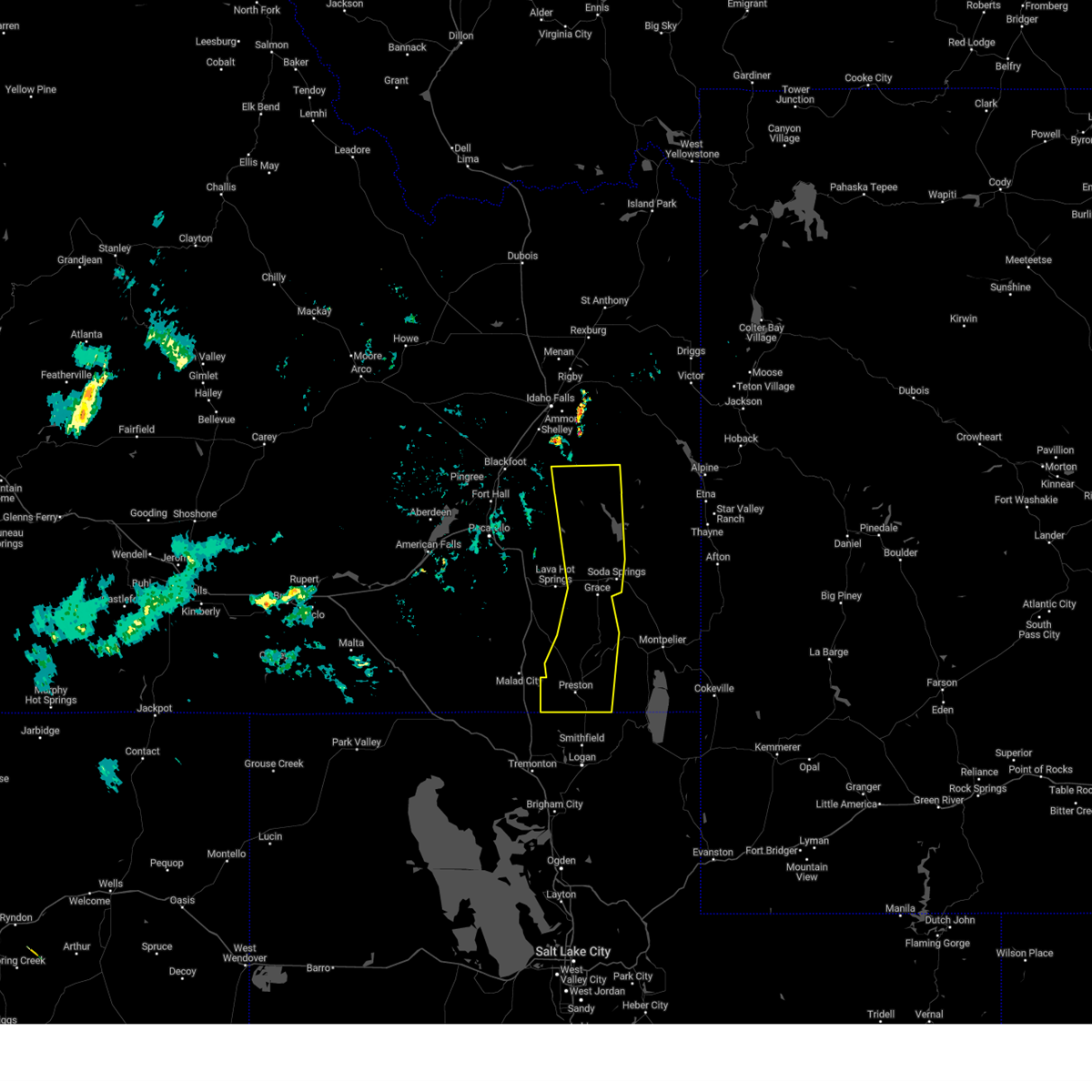
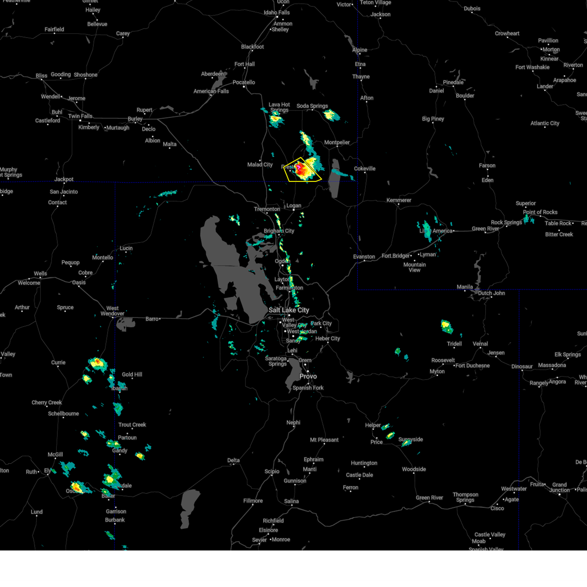
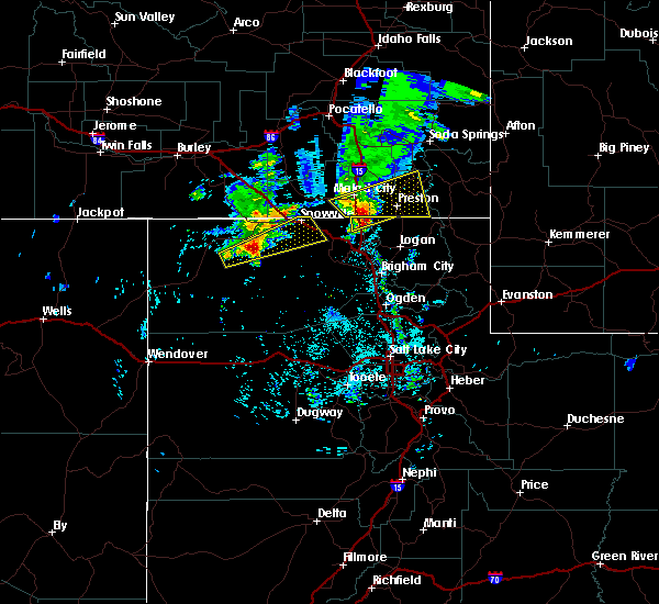
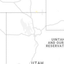
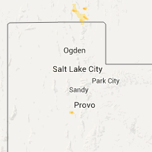
Hail Map for Franklin, ID
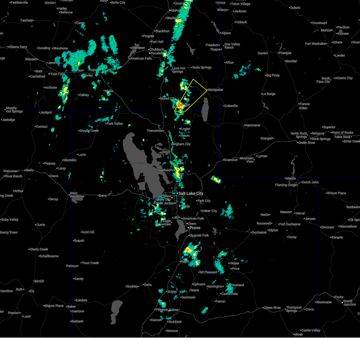
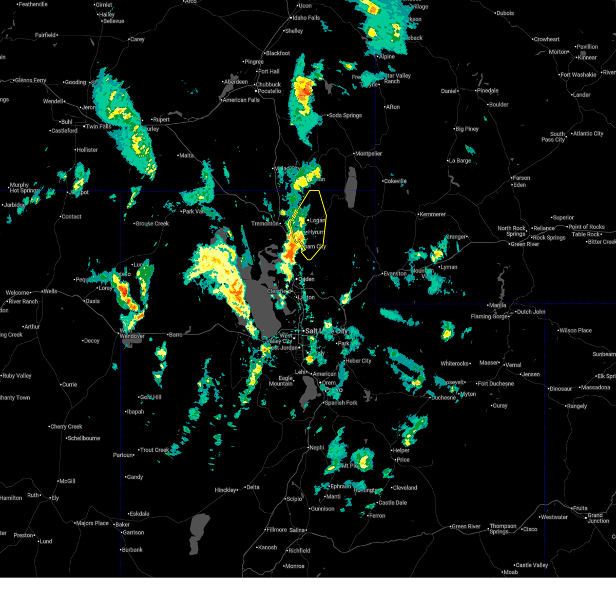
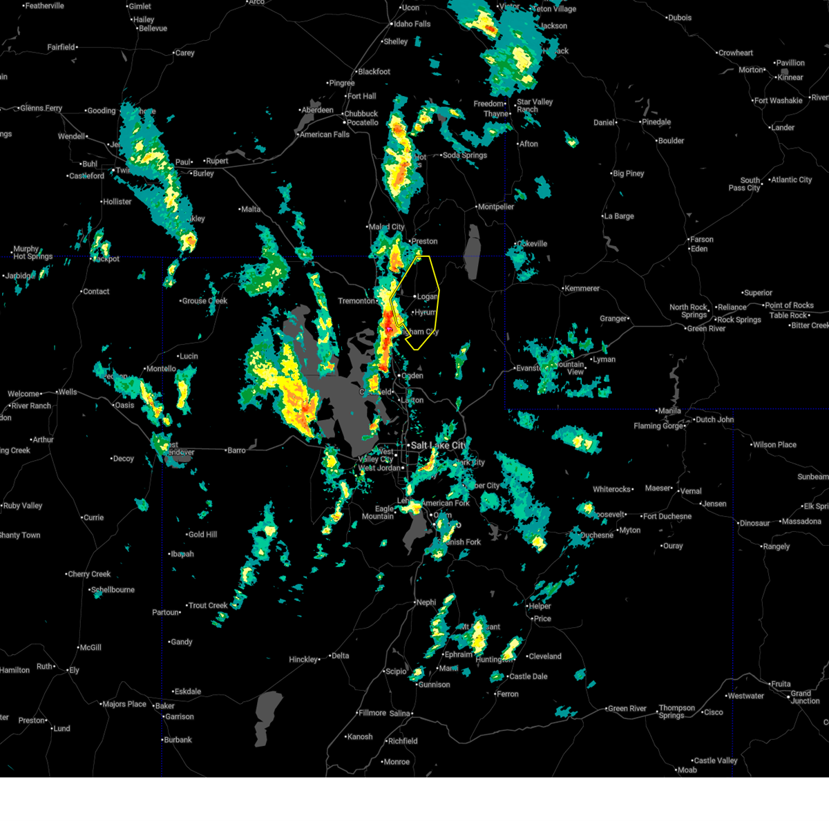
The Franklin, ID area has had 0 reports of on-the-ground hail by trained spotters, and has been under severe weather warnings 13 times during the past 12 months. Doppler radar has detected hail at or near Franklin, ID on 12 occasions, including 1 occasion during the past year.
| Name: | Franklin, ID |
| Where Located: | 86.5 miles N of Salt Lake City, UT |
| Map: | Google Map for Franklin, ID |
| Population: | 641 |
| Housing Units: | 236 |
| More Info: | Search Google for Franklin, ID |
0
The Top Recent Hail Date for Franklin, ID is Tuesday, June 9, 2026 (6th out of 12)
Hail and Wind Damage Spotted near Franklin, ID
| Date / Time | Report Details |
|---|---|
| 5/13/2026 4:11 PM MDT | Power outage in franklin county ID, 0.6 miles SSW of Franklin, ID |
| 5/13/2026 4:05 PM MDT |
 Svrpih the national weather service in pocatello has issued a * severe thunderstorm warning for, south central caribou county in southeastern idaho, eastern franklin county in southeastern idaho, west central bear lake county in southeastern idaho, * until 445 pm mdt. * at 404 pm mdt, a severe thunderstorm was located near franklin, or near preston, moving northeast at 45 mph (radar indicated). Hazards include 60 mph wind gusts. expect damage to roofs, siding, and trees Svrpih the national weather service in pocatello has issued a * severe thunderstorm warning for, south central caribou county in southeastern idaho, eastern franklin county in southeastern idaho, west central bear lake county in southeastern idaho, * until 445 pm mdt. * at 404 pm mdt, a severe thunderstorm was located near franklin, or near preston, moving northeast at 45 mph (radar indicated). Hazards include 60 mph wind gusts. expect damage to roofs, siding, and trees
|
| 4/11/2026 1:52 PM MDT |
 At 151 pm mdt, severe thunderstorms were located along a line extending from benson to near wellsville to willard, moving northeast at 15 mph (radar indicated). Hazards include 60 mph wind gusts and quarter size hail. Hail damage to vehicles is expected. expect wind damage to roofs, siding, and trees. locations impacted include, logan, cache, smithfield, hyrum, wellsville, lewiston, utah state university, benson, peter, north logan, providence, nibley, hyde park, richmond, millville, river heights, mendon, paradise, amalga, and college ward. This includes us route 89 between mile markers 459 and 472. At 151 pm mdt, severe thunderstorms were located along a line extending from benson to near wellsville to willard, moving northeast at 15 mph (radar indicated). Hazards include 60 mph wind gusts and quarter size hail. Hail damage to vehicles is expected. expect wind damage to roofs, siding, and trees. locations impacted include, logan, cache, smithfield, hyrum, wellsville, lewiston, utah state university, benson, peter, north logan, providence, nibley, hyde park, richmond, millville, river heights, mendon, paradise, amalga, and college ward. This includes us route 89 between mile markers 459 and 472.
|
| 4/11/2026 1:33 PM MDT |
 Svrslc the national weather service in salt lake city has issued a * severe thunderstorm warning for, central cache county in northern utah, east central box elder county in northern utah, * until 215 pm mdt. * at 133 pm mdt, severe thunderstorms were located along a line extending from near peter to near brigham city to south willard, moving northeast at 15 mph (radar indicated). Hazards include 60 mph wind gusts and quarter size hail. Hail damage to vehicles is expected. Expect wind damage to roofs, siding, and trees. Svrslc the national weather service in salt lake city has issued a * severe thunderstorm warning for, central cache county in northern utah, east central box elder county in northern utah, * until 215 pm mdt. * at 133 pm mdt, severe thunderstorms were located along a line extending from near peter to near brigham city to south willard, moving northeast at 15 mph (radar indicated). Hazards include 60 mph wind gusts and quarter size hail. Hail damage to vehicles is expected. Expect wind damage to roofs, siding, and trees.
|
| 12/17/2025 11:32 AM MST |
 The storms which prompted the warning have moved out of the area. therefore, this warning has been allowed to expire. a new severe thunderstorm warning has been issued to replace this warning as the line moves to the southeast. The storms which prompted the warning have moved out of the area. therefore, this warning has been allowed to expire. a new severe thunderstorm warning has been issued to replace this warning as the line moves to the southeast.
|
| 12/17/2025 11:30 AM MST |
 Svrpih the national weather service in pocatello has issued a * severe thunderstorm warning for, southeastern caribou county in southeastern idaho, southern oneida county in southeastern idaho, southeastern bannock county in southeastern idaho, franklin county in southeastern idaho, bear lake county in southeastern idaho, southeastern cassia county in southeastern idaho, * until noon mst. * at 1129 am mst, a line of severe thunderstorms was located from freedom, wyoming to near bridge, moving southeast at 50 mph (radar indicated). Hazards include 70 mph wind gusts. Expect considerable tree damage. Damage is likely to mobile homes, roofs, and outbuildings. Svrpih the national weather service in pocatello has issued a * severe thunderstorm warning for, southeastern caribou county in southeastern idaho, southern oneida county in southeastern idaho, southeastern bannock county in southeastern idaho, franklin county in southeastern idaho, bear lake county in southeastern idaho, southeastern cassia county in southeastern idaho, * until noon mst. * at 1129 am mst, a line of severe thunderstorms was located from freedom, wyoming to near bridge, moving southeast at 50 mph (radar indicated). Hazards include 70 mph wind gusts. Expect considerable tree damage. Damage is likely to mobile homes, roofs, and outbuildings.
|
| 12/17/2025 11:21 AM MST |
 At 1119 am mst, a line of severe thunderstorms was located from palisades reservoir to near bridge, moving southeast at 45 mph (radar indicated). Hazards include 70 mph wind gusts. Expect considerable tree damage. damage is likely to mobile homes, roofs, and outbuildings. Locations impacted include, preston, soda springs, montpelier, malad, swanlake, southern palisades reservoir, bear lake idaho portion, franklin, georgetown, saint charles, juniper, dingle, thatcher, oneida narrows reservoir, cherry creek rest area, holbrook summit, pleasantview, paris, dayton, and weston. At 1119 am mst, a line of severe thunderstorms was located from palisades reservoir to near bridge, moving southeast at 45 mph (radar indicated). Hazards include 70 mph wind gusts. Expect considerable tree damage. damage is likely to mobile homes, roofs, and outbuildings. Locations impacted include, preston, soda springs, montpelier, malad, swanlake, southern palisades reservoir, bear lake idaho portion, franklin, georgetown, saint charles, juniper, dingle, thatcher, oneida narrows reservoir, cherry creek rest area, holbrook summit, pleasantview, paris, dayton, and weston.
|
| 12/17/2025 11:21 AM MST |
 the severe thunderstorm warning has been cancelled and is no longer in effect the severe thunderstorm warning has been cancelled and is no longer in effect
|
| 12/17/2025 11:03 AM MST |
 At 1101 am mst, a line of severe thunderstorms was located from just east of bone to near bridge, moving southeast at 45 mph (radar indicated. this storm has a history of producing gusts from 60 to 85 mph). Hazards include 80 mph wind gusts. Flying debris will be dangerous to those caught without shelter. mobile homes will be heavily damaged. expect considerable damage to roofs, windows, and vehicles. extensive tree damage and power outages are likely. Locations impacted include, preston, soda springs, montpelier, malad, lava hot springs, swanlake, blackfoot reservoir, wayan, palisades reservoir, bear lake idaho portion, grace, franklin, downey, georgetown, saint charles, juniper, dingle, thatcher, oneida narrows reservoir, and cherry creek rest area. At 1101 am mst, a line of severe thunderstorms was located from just east of bone to near bridge, moving southeast at 45 mph (radar indicated. this storm has a history of producing gusts from 60 to 85 mph). Hazards include 80 mph wind gusts. Flying debris will be dangerous to those caught without shelter. mobile homes will be heavily damaged. expect considerable damage to roofs, windows, and vehicles. extensive tree damage and power outages are likely. Locations impacted include, preston, soda springs, montpelier, malad, lava hot springs, swanlake, blackfoot reservoir, wayan, palisades reservoir, bear lake idaho portion, grace, franklin, downey, georgetown, saint charles, juniper, dingle, thatcher, oneida narrows reservoir, and cherry creek rest area.
|
| 12/17/2025 10:43 AM MST |
 Svrpih the national weather service in pocatello has issued a * severe thunderstorm warning for, caribou county in southeastern idaho, oneida county in southeastern idaho, bannock county in southeastern idaho, southeastern power county in southeastern idaho, southeastern bonneville county in southeastern idaho, franklin county in southeastern idaho, bear lake county in southeastern idaho, southeastern bingham county in southeastern idaho, southeastern cassia county in southeastern idaho, * until 1130 am mst. * at 1042 am mst, a line of severe thunderstorm was located from near bone to malta, moving southeast at 40 mph (radar indicated. this line of storms has a history of producing gusts from 60 to 85 mph). Hazards include 80 mph wind gusts. Flying debris will be dangerous to those caught without shelter. mobile homes will be heavily damaged. expect considerable damage to roofs, windows, and vehicles. Extensive tree damage and power outages are likely. Svrpih the national weather service in pocatello has issued a * severe thunderstorm warning for, caribou county in southeastern idaho, oneida county in southeastern idaho, bannock county in southeastern idaho, southeastern power county in southeastern idaho, southeastern bonneville county in southeastern idaho, franklin county in southeastern idaho, bear lake county in southeastern idaho, southeastern bingham county in southeastern idaho, southeastern cassia county in southeastern idaho, * until 1130 am mst. * at 1042 am mst, a line of severe thunderstorm was located from near bone to malta, moving southeast at 40 mph (radar indicated. this line of storms has a history of producing gusts from 60 to 85 mph). Hazards include 80 mph wind gusts. Flying debris will be dangerous to those caught without shelter. mobile homes will be heavily damaged. expect considerable damage to roofs, windows, and vehicles. Extensive tree damage and power outages are likely.
|
| 8/2/2025 5:00 PM MDT | Mesonet station 8433 d5 franklin us-9 in franklin county ID, 0.3 miles ENE of Franklin, ID |
| 7/15/2025 7:24 PM MDT |
 The storms which prompted the warning have weakened below severe limits, and no longer pose an immediate threat to life or property. therefore, the warning will be allowed to expire. however, gusty winds around 45 mph are still possible with these thunderstorms. The storms which prompted the warning have weakened below severe limits, and no longer pose an immediate threat to life or property. therefore, the warning will be allowed to expire. however, gusty winds around 45 mph are still possible with these thunderstorms.
|
| 7/15/2025 6:44 PM MDT |
 The storms which prompted the warning have moved out of the original warning area. therefore, the warning will be allowed to expire. however, gusty winds are still possible with these thunderstorms. remember, a severe thunderstorm warning still remains in effect for areas east of the original warning, or portions of caribou, bannock, franklin, and bear lake counties until 730 pm mdt. The storms which prompted the warning have moved out of the original warning area. therefore, the warning will be allowed to expire. however, gusty winds are still possible with these thunderstorms. remember, a severe thunderstorm warning still remains in effect for areas east of the original warning, or portions of caribou, bannock, franklin, and bear lake counties until 730 pm mdt.
|
| 7/15/2025 6:41 PM MDT |
 Svrpih the national weather service in pocatello has issued a * severe thunderstorm warning for, caribou county in southeastern idaho, southeastern bannock county in southeastern idaho, franklin county in southeastern idaho, bear lake county in southeastern idaho, * until 730 pm mdt. * at 639 pm mdt, severe thunderstorms were located along a line extending from 8 miles northeast of soda springs to near garden, moving east at 40 mph (radar indicated). Hazards include 60 mph wind gusts. expect damage to roofs, siding, and trees Svrpih the national weather service in pocatello has issued a * severe thunderstorm warning for, caribou county in southeastern idaho, southeastern bannock county in southeastern idaho, franklin county in southeastern idaho, bear lake county in southeastern idaho, * until 730 pm mdt. * at 639 pm mdt, severe thunderstorms were located along a line extending from 8 miles northeast of soda springs to near garden, moving east at 40 mph (radar indicated). Hazards include 60 mph wind gusts. expect damage to roofs, siding, and trees
|
| 7/15/2025 6:09 PM MDT |
 Svrpih the national weather service in pocatello has issued a * severe thunderstorm warning for, southern caribou county in southeastern idaho, eastern oneida county in southeastern idaho, southeastern bannock county in southeastern idaho, franklin county in southeastern idaho, bear lake county in southeastern idaho, * until 645 pm mdt. * at 608 pm mdt, severe thunderstorms were located along a line extending from near lava hot springs to franklin, moving east at 50 mph (radar indicated). Hazards include 70 mph wind gusts and penny size hail. Expect considerable tree damage. Damage is likely to mobile homes, roofs, and outbuildings. Svrpih the national weather service in pocatello has issued a * severe thunderstorm warning for, southern caribou county in southeastern idaho, eastern oneida county in southeastern idaho, southeastern bannock county in southeastern idaho, franklin county in southeastern idaho, bear lake county in southeastern idaho, * until 645 pm mdt. * at 608 pm mdt, severe thunderstorms were located along a line extending from near lava hot springs to franklin, moving east at 50 mph (radar indicated). Hazards include 70 mph wind gusts and penny size hail. Expect considerable tree damage. Damage is likely to mobile homes, roofs, and outbuildings.
|
| 5/11/2025 2:46 PM MDT |
 The storms which prompted the warning have moved out of the area. therefore, the warning has been allowed to expire. a severe thunderstorm watch remains in effect until 800 pm mdt for northern utah. The storms which prompted the warning have moved out of the area. therefore, the warning has been allowed to expire. a severe thunderstorm watch remains in effect until 800 pm mdt for northern utah.
|
| 5/11/2025 2:00 PM MDT |
 Svrslc the national weather service in salt lake city has issued a * severe thunderstorm warning for, weber county in northern utah, cache county in northern utah, northeastern box elder county in northern utah, western rich county in northern utah, northwestern wasatch county in northern utah, salt lake county in northern utah, eastern davis county in northern utah, morgan county in northern utah, western summit county in northern utah, northwestern utah county in northern utah, * until 245 pm mdt. * at 159 pm mdt, severe thunderstorms were located along a line extending from near riverside to near bluffdale, moving northeast at 40 mph. gusts up to 70 mph have been observed (radar indicated). Hazards include 70 mph wind gusts. Expect considerable tree damage. Damage is likely to mobile homes, roofs, and outbuildings. Svrslc the national weather service in salt lake city has issued a * severe thunderstorm warning for, weber county in northern utah, cache county in northern utah, northeastern box elder county in northern utah, western rich county in northern utah, northwestern wasatch county in northern utah, salt lake county in northern utah, eastern davis county in northern utah, morgan county in northern utah, western summit county in northern utah, northwestern utah county in northern utah, * until 245 pm mdt. * at 159 pm mdt, severe thunderstorms were located along a line extending from near riverside to near bluffdale, moving northeast at 40 mph. gusts up to 70 mph have been observed (radar indicated). Hazards include 70 mph wind gusts. Expect considerable tree damage. Damage is likely to mobile homes, roofs, and outbuildings.
|
| 5/11/2025 1:47 PM MDT |
 Svrslc the national weather service in salt lake city has issued a * severe thunderstorm warning for, northwestern cache county in northern utah, eastern box elder county in northern utah, * until 215 pm mdt. * at 147 pm mdt, a severe thunderstorm was located over smithfield, or near logan, moving northeast at 45 mph. gusts to 60 to 70 mph have been observed (radar indicated). Hazards include 70 mph wind gusts. Expect considerable tree damage. Damage is likely to mobile homes, roofs, and outbuildings. Svrslc the national weather service in salt lake city has issued a * severe thunderstorm warning for, northwestern cache county in northern utah, eastern box elder county in northern utah, * until 215 pm mdt. * at 147 pm mdt, a severe thunderstorm was located over smithfield, or near logan, moving northeast at 45 mph. gusts to 60 to 70 mph have been observed (radar indicated). Hazards include 70 mph wind gusts. Expect considerable tree damage. Damage is likely to mobile homes, roofs, and outbuildings.
|
| 8/23/2024 4:22 PM MDT |
 The storm which prompted the warning has moved out of the area. therefore, the warning will be allowed to expire. however, gusty winds are still expected. The storm which prompted the warning has moved out of the area. therefore, the warning will be allowed to expire. however, gusty winds are still expected.
|
| 8/23/2024 4:02 PM MDT |
 At 401 pm mdt, a severe thunderstorm was located over lewiston, or 8 miles south of preston, moving north at 45 mph (radar indicated and surface observation confirmed. at 350 pm mdt, a gust to 60 mph was observed at the logan airport). Hazards include 60 mph wind gusts. Expect damage to roofs, siding, and trees. locations impacted include, logan, cache, smithfield, hyrum, wellsville, lewiston, trenton, utah state university, benson, peter, north logan, providence, nibley, hyde park, richmond, millville, river heights, honeyville, mendon, and paradise. this includes the following highways, interstate 15 between mile markers 369 and 370. Us route 89 between mile markers 459 and 463. At 401 pm mdt, a severe thunderstorm was located over lewiston, or 8 miles south of preston, moving north at 45 mph (radar indicated and surface observation confirmed. at 350 pm mdt, a gust to 60 mph was observed at the logan airport). Hazards include 60 mph wind gusts. Expect damage to roofs, siding, and trees. locations impacted include, logan, cache, smithfield, hyrum, wellsville, lewiston, trenton, utah state university, benson, peter, north logan, providence, nibley, hyde park, richmond, millville, river heights, honeyville, mendon, and paradise. this includes the following highways, interstate 15 between mile markers 369 and 370. Us route 89 between mile markers 459 and 463.
|
| 8/23/2024 3:42 PM MDT |
 Svrslc the national weather service in salt lake city has issued a * severe thunderstorm warning for, western cache county in northern utah, east central box elder county in northern utah, * until 430 pm mdt. * at 341 pm mdt, a severe thunderstorm was located over benson, or near logan, moving north at 45 mph (radar indicated and surface observation confirmed. at 330 pm mdt, the willard poe udot sensor recorded a gust to 62 mph). Hazards include 60 mph wind gusts. expect damage to roofs, siding, and trees Svrslc the national weather service in salt lake city has issued a * severe thunderstorm warning for, western cache county in northern utah, east central box elder county in northern utah, * until 430 pm mdt. * at 341 pm mdt, a severe thunderstorm was located over benson, or near logan, moving north at 45 mph (radar indicated and surface observation confirmed. at 330 pm mdt, the willard poe udot sensor recorded a gust to 62 mph). Hazards include 60 mph wind gusts. expect damage to roofs, siding, and trees
|
| 8/13/2024 6:36 PM MDT |
 The storm which prompted the warning has weakened below severe limits, and no longer poses an immediate threat to life or property. therefore, the warning will be allowed to expire. however gusty winds and heavy rain are still possible with this thunderstorm. The storm which prompted the warning has weakened below severe limits, and no longer poses an immediate threat to life or property. therefore, the warning will be allowed to expire. however gusty winds and heavy rain are still possible with this thunderstorm.
|
| 8/13/2024 6:16 PM MDT |
 At 616 pm mdt, a severe thunderstorm was located near smithfield, or 10 miles north of logan, moving east at 15 mph (radar indicated). Hazards include 60 mph wind gusts and penny size hail. Expect damage to roofs, siding, and trees. locations impacted include, smithfield, lewiston, trenton, richmond, amalga, and beaver mountain. This includes us route 89 between mile markers 474 and 486. At 616 pm mdt, a severe thunderstorm was located near smithfield, or 10 miles north of logan, moving east at 15 mph (radar indicated). Hazards include 60 mph wind gusts and penny size hail. Expect damage to roofs, siding, and trees. locations impacted include, smithfield, lewiston, trenton, richmond, amalga, and beaver mountain. This includes us route 89 between mile markers 474 and 486.
|
| 8/13/2024 5:56 PM MDT |
 Svrslc the national weather service in salt lake city has issued a * severe thunderstorm warning for, northern cache county in northern utah, * until 645 pm mdt. * at 554 pm mdt, a severe thunderstorm was located over trenton, or 11 miles north of logan, moving east at 15 mph (radar indicated). Hazards include 60 mph wind gusts and quarter size hail. hail damage to vehicles is possible, as well as wind damage to roofs, siding, and trees Svrslc the national weather service in salt lake city has issued a * severe thunderstorm warning for, northern cache county in northern utah, * until 645 pm mdt. * at 554 pm mdt, a severe thunderstorm was located over trenton, or 11 miles north of logan, moving east at 15 mph (radar indicated). Hazards include 60 mph wind gusts and quarter size hail. hail damage to vehicles is possible, as well as wind damage to roofs, siding, and trees
|
| 8/9/2024 3:20 PM MDT |
 the severe thunderstorm warning has been cancelled and is no longer in effect the severe thunderstorm warning has been cancelled and is no longer in effect
|
| 8/9/2024 2:57 PM MDT |
 Svrslc the national weather service in salt lake city has issued a * severe thunderstorm warning for, northeastern cache county in northern utah, northwestern rich county in northern utah, * until 400 pm mdt. * at 257 pm mdt, a severe thunderstorm was located over lewiston, or 8 miles south of preston, moving east at 20 mph (radar indicated). Hazards include 60 mph wind gusts and quarter size hail. Hail damage to vehicles is expected. Expect wind damage to roofs, siding, and trees. Svrslc the national weather service in salt lake city has issued a * severe thunderstorm warning for, northeastern cache county in northern utah, northwestern rich county in northern utah, * until 400 pm mdt. * at 257 pm mdt, a severe thunderstorm was located over lewiston, or 8 miles south of preston, moving east at 20 mph (radar indicated). Hazards include 60 mph wind gusts and quarter size hail. Hail damage to vehicles is expected. Expect wind damage to roofs, siding, and trees.
|
| 8/9/2024 2:50 PM MDT |
 the severe thunderstorm warning has been cancelled and is no longer in effect the severe thunderstorm warning has been cancelled and is no longer in effect
|
| 8/9/2024 2:50 PM MDT |
 At 249 pm mdt, a severe thunderstorm was located over lewiston, or 9 miles south of preston, moving east at 30 mph (radar indicated). Hazards include 60 mph wind gusts and quarter size hail. Hail damage to vehicles is expected. expect wind damage to roofs, siding, and trees. locations impacted include, lewiston, trenton, richmond, amalga, cornish, and beaver mountain. This includes us route 89 between mile markers 475 and 485. At 249 pm mdt, a severe thunderstorm was located over lewiston, or 9 miles south of preston, moving east at 30 mph (radar indicated). Hazards include 60 mph wind gusts and quarter size hail. Hail damage to vehicles is expected. expect wind damage to roofs, siding, and trees. locations impacted include, lewiston, trenton, richmond, amalga, cornish, and beaver mountain. This includes us route 89 between mile markers 475 and 485.
|
| 8/9/2024 2:37 PM MDT |
 Svrslc the national weather service in salt lake city has issued a * severe thunderstorm warning for, northern cache county in northern utah, northeastern box elder county in northern utah, * until 300 pm mdt. * at 236 pm mdt, a severe thunderstorm was located near trenton, or 10 miles southwest of preston, moving east at 30 mph (radar indicated). Hazards include 60 mph wind gusts and quarter size hail. Hail damage to vehicles is expected. Expect wind damage to roofs, siding, and trees. Svrslc the national weather service in salt lake city has issued a * severe thunderstorm warning for, northern cache county in northern utah, northeastern box elder county in northern utah, * until 300 pm mdt. * at 236 pm mdt, a severe thunderstorm was located near trenton, or 10 miles southwest of preston, moving east at 30 mph (radar indicated). Hazards include 60 mph wind gusts and quarter size hail. Hail damage to vehicles is expected. Expect wind damage to roofs, siding, and trees.
|
| 5/13/2024 7:06 PM MDT |
 The storms which prompted the warning have weakened. therefore, the warning will be allowed to expire. however, gusty winds are still possible with these thunderstorms as they move east. The storms which prompted the warning have weakened. therefore, the warning will be allowed to expire. however, gusty winds are still possible with these thunderstorms as they move east.
|
| 5/13/2024 6:54 PM MDT |
 the severe thunderstorm warning has been cancelled and is no longer in effect the severe thunderstorm warning has been cancelled and is no longer in effect
|
| 5/13/2024 6:54 PM MDT |
 At 653 pm mdt, severe thunderstorms were located along a line extending from 8 miles east of fort hall lincoln creek lodge to 6 miles south of chesterfield to near trenton, moving east at 35 mph (radar indicated). Hazards include 60 mph wind gusts. Expect damage to roofs, siding, and trees. Locations impacted include, preston, soda springs, blackfoot reservoir, swanlake, chesterfield reservoir, grace, franklin, oneida narrows reservoir, thatcher, chesterfield, dayton, weston, clifton, oxford, cutthroat trout campground, trail creek campground, mapleton, mink creek, whitney, and riverdale. At 653 pm mdt, severe thunderstorms were located along a line extending from 8 miles east of fort hall lincoln creek lodge to 6 miles south of chesterfield to near trenton, moving east at 35 mph (radar indicated). Hazards include 60 mph wind gusts. Expect damage to roofs, siding, and trees. Locations impacted include, preston, soda springs, blackfoot reservoir, swanlake, chesterfield reservoir, grace, franklin, oneida narrows reservoir, thatcher, chesterfield, dayton, weston, clifton, oxford, cutthroat trout campground, trail creek campground, mapleton, mink creek, whitney, and riverdale.
|
| 5/13/2024 6:05 PM MDT |
 Svrpih the national weather service in pocatello has issued a * severe thunderstorm warning for, western caribou county in southeastern idaho, eastern oneida county in southeastern idaho, bannock county in southeastern idaho, central bonneville county in southeastern idaho, franklin county in southeastern idaho, southeastern bingham county in southeastern idaho, * until 715 pm mdt. * at 604 pm mdt, severe thunderstorms were located along a line extending from rockford to near portneuf gap to 12 miles southwest of pleasantview, moving east at 35 mph (radar indicated). Hazards include 60 mph wind gusts. expect damage to roofs, siding, and trees Svrpih the national weather service in pocatello has issued a * severe thunderstorm warning for, western caribou county in southeastern idaho, eastern oneida county in southeastern idaho, bannock county in southeastern idaho, central bonneville county in southeastern idaho, franklin county in southeastern idaho, southeastern bingham county in southeastern idaho, * until 715 pm mdt. * at 604 pm mdt, severe thunderstorms were located along a line extending from rockford to near portneuf gap to 12 miles southwest of pleasantview, moving east at 35 mph (radar indicated). Hazards include 60 mph wind gusts. expect damage to roofs, siding, and trees
|
| 3/2/2024 12:19 PM MST |
 At 1217 pm mst, a severe thunderstorm was located near saint charles, or 8 miles northwest of bear lake idaho portion, moving northeast at 65 mph (weather station reported. at 1207 pm logan airport gusted to 55 mph and crow mountain, and at 1210 pm crow mountain gusted to 77 mph). Hazards include 70 mph wind gusts. Expect considerable tree damage. damage is likely to mobile homes, roofs, and outbuildings. locations impacted include, logan, laketown, bear lake idaho portion, cache, smithfield, hyrum, wellsville, lewiston, garden city, trenton, bear lake, garden, utah state university, benson, peter, north logan, providence, nibley, hyde park, and richmond. this includes the following highways, us route 89 between mile markers 459 and 502. Utah route 30 between mile markers 110 and 122. At 1217 pm mst, a severe thunderstorm was located near saint charles, or 8 miles northwest of bear lake idaho portion, moving northeast at 65 mph (weather station reported. at 1207 pm logan airport gusted to 55 mph and crow mountain, and at 1210 pm crow mountain gusted to 77 mph). Hazards include 70 mph wind gusts. Expect considerable tree damage. damage is likely to mobile homes, roofs, and outbuildings. locations impacted include, logan, laketown, bear lake idaho portion, cache, smithfield, hyrum, wellsville, lewiston, garden city, trenton, bear lake, garden, utah state university, benson, peter, north logan, providence, nibley, hyde park, and richmond. this includes the following highways, us route 89 between mile markers 459 and 502. Utah route 30 between mile markers 110 and 122.
|
| 3/2/2024 11:51 AM MST |
 Svrslc the national weather service in salt lake city has issued a * severe thunderstorm warning for, cache county in northern utah, northeastern box elder county in northern utah, northwestern rich county in northern utah, * until 1230 pm mst. * at 1150 am mst, a severe thunderstorm was located over trenton, or 12 miles northwest of logan, moving northeast at 60 mph (radar indicated). Hazards include 60 mph wind gusts. expect damage to roofs, siding, and trees Svrslc the national weather service in salt lake city has issued a * severe thunderstorm warning for, cache county in northern utah, northeastern box elder county in northern utah, northwestern rich county in northern utah, * until 1230 pm mst. * at 1150 am mst, a severe thunderstorm was located over trenton, or 12 miles northwest of logan, moving northeast at 60 mph (radar indicated). Hazards include 60 mph wind gusts. expect damage to roofs, siding, and trees
|
| 7/21/2023 5:48 PM MDT |
 At 548 pm mdt, a severe thunderstorm was located near preston, moving southeast at 10 mph (radar indicated). Hazards include quarter size hail. damage to vehicles is expected At 548 pm mdt, a severe thunderstorm was located near preston, moving southeast at 10 mph (radar indicated). Hazards include quarter size hail. damage to vehicles is expected
|
| 8/21/2021 6:43 PM MDT |
 At 640 pm mdt, severe thunderstorms were located along a line extending from 7 miles east of franklin to 11 miles southwest of laketown, moving east at 50 mph (radar indicated). Hazards include 60 mph wind gusts and quarter size hail. the greatest threat for hail exists in eastern cache county and northern rich county. Hail damage to vehicles is expected. expect wind damage to roofs, siding, and trees. locations impacted include, logan, laketown, smithfield, lewiston, garden city, trenton, garden, utah state university, bear lake, benson, north logan, providence, hyde park, richmond, millville, river heights, amalga, cornish, beaver mountain and meadowville. this includes the following highways, us route 89 between mile markers 459 and 502. utah route 30 between mile markers 110 and 135. hail threat, radar indicated max hail size, 1. 00 in wind threat, radar indicated max wind gust, 60 mph. At 640 pm mdt, severe thunderstorms were located along a line extending from 7 miles east of franklin to 11 miles southwest of laketown, moving east at 50 mph (radar indicated). Hazards include 60 mph wind gusts and quarter size hail. the greatest threat for hail exists in eastern cache county and northern rich county. Hail damage to vehicles is expected. expect wind damage to roofs, siding, and trees. locations impacted include, logan, laketown, smithfield, lewiston, garden city, trenton, garden, utah state university, bear lake, benson, north logan, providence, hyde park, richmond, millville, river heights, amalga, cornish, beaver mountain and meadowville. this includes the following highways, us route 89 between mile markers 459 and 502. utah route 30 between mile markers 110 and 135. hail threat, radar indicated max hail size, 1. 00 in wind threat, radar indicated max wind gust, 60 mph.
|
| 8/21/2021 6:29 PM MDT |
 At 629 pm mdt, severe thunderstorms were located along a line extending from near franklin to 12 miles east of hyrum, moving northeast at 50 mph (radar indicated). Hazards include 60 mph wind gusts. expect damage to roofs, siding, and trees At 629 pm mdt, severe thunderstorms were located along a line extending from near franklin to 12 miles east of hyrum, moving northeast at 50 mph (radar indicated). Hazards include 60 mph wind gusts. expect damage to roofs, siding, and trees
|
| 6/27/2020 10:10 PM MDT |
 At 1010 pm mdt, a severe thunderstorm was located near cherry creek rest area, or 11 miles southeast of malad, moving northeast at 45 mph (radar indicated). Hazards include 70 mph wind gusts. Expect considerable tree damage. Damage is likely to mobile homes, roofs, and outbuildings. At 1010 pm mdt, a severe thunderstorm was located near cherry creek rest area, or 11 miles southeast of malad, moving northeast at 45 mph (radar indicated). Hazards include 70 mph wind gusts. Expect considerable tree damage. Damage is likely to mobile homes, roofs, and outbuildings.
|
| 4/30/2020 4:26 PM MDT |
 The severe thunderstorm warning for southeastern oneida and southwestern franklin counties will expire at 430 pm mdt, the storm which prompted the warning has weakened below severe limits, and no longer poses an immediate threat to life or property. therefore, the warning will be allowed to expire. however gusty winds are still possible with this thunderstorm. to report severe weather, contact your nearest law enforcement agency. they will relay your report to the national weather service pocatello. The severe thunderstorm warning for southeastern oneida and southwestern franklin counties will expire at 430 pm mdt, the storm which prompted the warning has weakened below severe limits, and no longer poses an immediate threat to life or property. therefore, the warning will be allowed to expire. however gusty winds are still possible with this thunderstorm. to report severe weather, contact your nearest law enforcement agency. they will relay your report to the national weather service pocatello.
|
| 4/30/2020 4:12 PM MDT |
 At 412 pm mdt, a severe thunderstorm was located over northeastern bear lake idaho portion, moving east at 35 mph (radar indicated). Hazards include 60 mph wind gusts and quarter size hail. Hail damage to vehicles is expected. expect wind damage to roofs, siding, and trees. Locations impacted include, preston, malad, franklin, pleasantview, cherry creek rest area, dayton, weston, clifton, mapleton, samaria, whitney, riverdale and mink creek. At 412 pm mdt, a severe thunderstorm was located over northeastern bear lake idaho portion, moving east at 35 mph (radar indicated). Hazards include 60 mph wind gusts and quarter size hail. Hail damage to vehicles is expected. expect wind damage to roofs, siding, and trees. Locations impacted include, preston, malad, franklin, pleasantview, cherry creek rest area, dayton, weston, clifton, mapleton, samaria, whitney, riverdale and mink creek.
|
| 4/30/2020 3:44 PM MDT |
 At 344 pm mdt, a severe thunderstorm was located near pleasantview, or near malad, moving east at 35 mph (radar indicated). Hazards include ping pong ball size hail and 60 mph wind gusts. People and animals outdoors will be injured. expect hail damage to roofs, siding, windows, and vehicles. Expect wind damage to roofs, siding, and trees. At 344 pm mdt, a severe thunderstorm was located near pleasantview, or near malad, moving east at 35 mph (radar indicated). Hazards include ping pong ball size hail and 60 mph wind gusts. People and animals outdoors will be injured. expect hail damage to roofs, siding, windows, and vehicles. Expect wind damage to roofs, siding, and trees.
|
| 9/10/2019 2:56 PM MDT |
 A severe thunderstorm warning remains in effect until 315 pm mdt for southeastern franklin and southwestern bear lake counties. at 255 pm mdt, a severe thunderstorm was located 9 miles southeast of oneida narrows reservoir or 16 miles southwest of montpelier, moving north at 30 to 35 mph. hazard. Quarter size hail. A severe thunderstorm warning remains in effect until 315 pm mdt for southeastern franklin and southwestern bear lake counties. at 255 pm mdt, a severe thunderstorm was located 9 miles southeast of oneida narrows reservoir or 16 miles southwest of montpelier, moving north at 30 to 35 mph. hazard. Quarter size hail.
|
| 9/10/2019 2:30 PM MDT |
 A severe thunderstorm warning remains in effect until 245 pm mdt for northeastern cache and northwestern rich counties. at 229 pm mdt, a severe thunderstorm was located over franklin, or 9 miles southeast of preston, and is nearly stationary. hazard. quarter size hail. source. Trained weather spotters reported hail. A severe thunderstorm warning remains in effect until 245 pm mdt for northeastern cache and northwestern rich counties. at 229 pm mdt, a severe thunderstorm was located over franklin, or 9 miles southeast of preston, and is nearly stationary. hazard. quarter size hail. source. Trained weather spotters reported hail.
|
| 9/10/2019 2:28 PM MDT |
 The national weather service in pocatello has issued a * severe thunderstorm warning for. southeastern franklin county in southeastern idaho. southwestern bear lake county in southeastern idaho. Until 315 pm mdt * at 227 pm mdt, a severe thunderstorm was located near franklin or. The national weather service in pocatello has issued a * severe thunderstorm warning for. southeastern franklin county in southeastern idaho. southwestern bear lake county in southeastern idaho. Until 315 pm mdt * at 227 pm mdt, a severe thunderstorm was located near franklin or.
|
| 9/10/2019 2:08 PM MDT |
 At 207 pm mdt, a severe thunderstorm was located over smithfield, or near logan, moving north at 35 mph (radar indicated). Hazards include quarter size hail. damage to vehicles is expected At 207 pm mdt, a severe thunderstorm was located over smithfield, or near logan, moving north at 35 mph (radar indicated). Hazards include quarter size hail. damage to vehicles is expected
|
| 8/22/2018 8:30 AM MDT |
 At 830 am mdt, a severe thunderstorm was located over cherry creek rest area or near malad, moving east at 30 mph (radar indicated). Hazards include 60 mph wind gusts and quarter size hail. Hail damage to vehicles is expected. expect wind damage to roofs, siding, and trees. Locations impacted include, preston, malad, franklin, oneida narrows reservoir, pleasantview, cherry creek rest area, dayton, weston, clifton, oxford, mapleton, mink creek, samaria, whitney and riverdale. At 830 am mdt, a severe thunderstorm was located over cherry creek rest area or near malad, moving east at 30 mph (radar indicated). Hazards include 60 mph wind gusts and quarter size hail. Hail damage to vehicles is expected. expect wind damage to roofs, siding, and trees. Locations impacted include, preston, malad, franklin, oneida narrows reservoir, pleasantview, cherry creek rest area, dayton, weston, clifton, oxford, mapleton, mink creek, samaria, whitney and riverdale.
|
| 8/22/2018 8:12 AM MDT |
 At 811 am mdt, a severe thunderstorm was located 10 miles southeast of holbrook summit or 11 miles northeast of snowville, moving east at 15 mph (radar indicated). Hazards include 60 mph wind gusts and quarter size hail. Hail damage to vehicles is expected. Expect wind damage to roofs, siding, and trees. At 811 am mdt, a severe thunderstorm was located 10 miles southeast of holbrook summit or 11 miles northeast of snowville, moving east at 15 mph (radar indicated). Hazards include 60 mph wind gusts and quarter size hail. Hail damage to vehicles is expected. Expect wind damage to roofs, siding, and trees.
|
| 9/22/2016 4:52 PM MDT |
 At 449 pm mdt, doppler radar indicated severe thunderstorms capable of producing damaging winds in excess of 60 mph. these storms were located along a line extending from 6 miles northwest of saint charles to near woodruff, moving northeast at 40 mph. locations impacted include, laketown, garden city, garden, richmond, beaver mtn, pickelville, meadowville and lakota. At 449 pm mdt, doppler radar indicated severe thunderstorms capable of producing damaging winds in excess of 60 mph. these storms were located along a line extending from 6 miles northwest of saint charles to near woodruff, moving northeast at 40 mph. locations impacted include, laketown, garden city, garden, richmond, beaver mtn, pickelville, meadowville and lakota.
|
| 9/22/2016 4:22 PM MDT |
 At 420 pm mdt, doppler radar indicated a line of severe thunderstorms capable of producing destructive winds in excess of 70 mph. these storms were located along a line extending from near lewiston to 20 miles west of woodruff, and moving northeast at 40 mph. penny size hail may also accompany the damaging winds. At 420 pm mdt, doppler radar indicated a line of severe thunderstorms capable of producing destructive winds in excess of 70 mph. these storms were located along a line extending from near lewiston to 20 miles west of woodruff, and moving northeast at 40 mph. penny size hail may also accompany the damaging winds.
|
| 6/12/2016 9:21 PM MDT |
 At 920 pm mdt, doppler radar indicated a severe thunderstorm capable of producing quarter size hail and damaging winds in excess of 60 mph. this storm was located near logan, moving northeast at 40 mph. locations impacted include, logan, cache, smithfield, hyrum, wellsville, lewiston, trenton, benson, peter, north logan, providence, nibley, hyde park, richmond, millville, river heights, mendon, amalga, cornish and beaver mtn. At 920 pm mdt, doppler radar indicated a severe thunderstorm capable of producing quarter size hail and damaging winds in excess of 60 mph. this storm was located near logan, moving northeast at 40 mph. locations impacted include, logan, cache, smithfield, hyrum, wellsville, lewiston, trenton, benson, peter, north logan, providence, nibley, hyde park, richmond, millville, river heights, mendon, amalga, cornish and beaver mtn.
|
| 6/12/2016 8:57 PM MDT |
 At 857 pm mdt, doppler radar indicated a severe thunderstorm capable of producing half dollar size hail and damaging winds in excess of 60 mph. this storm was located near wellsville, or near brigham city, moving northeast at 40 mph. locations impacted include, logan, brigham city, cache, smithfield, hyrum, perry, wellsville, willard, lewiston, bear river city, mantua, corinne, trenton, peter, benson, north logan, providence, nibley, hyde park and richmond. At 857 pm mdt, doppler radar indicated a severe thunderstorm capable of producing half dollar size hail and damaging winds in excess of 60 mph. this storm was located near wellsville, or near brigham city, moving northeast at 40 mph. locations impacted include, logan, brigham city, cache, smithfield, hyrum, perry, wellsville, willard, lewiston, bear river city, mantua, corinne, trenton, peter, benson, north logan, providence, nibley, hyde park and richmond.
|
| 6/12/2016 8:40 PM MDT |
 At 839 pm mdt, doppler radar indicated a severe thunderstorm capable of producing half dollar size hail and damaging winds in excess of 60 mph. this storm was located over perry, or near brigham city, and moving northeast at 45 mph. At 839 pm mdt, doppler radar indicated a severe thunderstorm capable of producing half dollar size hail and damaging winds in excess of 60 mph. this storm was located over perry, or near brigham city, and moving northeast at 45 mph.
|
| 6/3/2015 8:09 PM MDT | The severe thunderstorm warning for north central cache county will expire at 815 pm mdt, the storm which prompted the warning has weakened below severe limits. therefore the warning will be allowed to expire. however gusty winds are still possible with this thunderstorm. |
| 6/3/2015 7:53 PM MDT | At 752 pm mdt, doppler radar indicated a severe thunderstorm capable of producing large hail up to ping pong ball size and damaging winds in excess of 60 mph. this storm was located over lewiston, or 9 miles south of preston, moving east at 20 mph. locations impacted include, lewiston, trenton, richmond and cornish. |
| 6/3/2015 7:41 PM MDT | At 741 pm mdt, doppler radar indicated a severe thunderstorm capable of producing large hail up to ping pong ball size and damaging winds in excess of 60 mph. this storm was located near trenton, or 11 miles southwest of preston, and moving northeast at 25 mph. |
| 6/1/2015 4:53 PM MDT | At 453 pm mdt, doppler radar indicated a severe thunderstorm capable of producing quarter size hail and damaging winds in excess of 60 mph. this storm was located 7 miles northeast of cherry creek rest area, or 8 miles east of malad, moving east at 45 mph. locations impacted include, preston, malad, swanlake, franklin, oneida narrows reservoir, pleasantview, cherry creek rest area, dayton, weston, clifton, oxford, riverdale, whitney, samaria, mapleton and mink creek. |
| 6/1/2015 4:35 PM MDT | At 434 pm mdt, doppler radar indicated a severe thunderstorm capable of producing quarter size hail and damaging winds in excess of 60 mph. this storm was located near cherry creek rest area, or 9 miles southwest of malad, and moving east at 45 mph. |
Hail Maps for Franklin, ID


Connect with Interactive Hail Maps