

Hail Map for Franklin, MD
The Franklin, MD area has had 0 reports of on-the-ground hail by trained spotters, and has been under severe weather warnings 17 times during the past 12 months. Doppler radar has detected hail at or near Franklin, MD on 16 occasions, including 1 occasion during the past year.
| Name: | Franklin, MD |
| Where Located: | 58.3 miles NE of Elkins, WV |
| Map: | Google Map for Franklin, MD |
| Population: | 290 |
| Housing Units: | 100 |
| More Info: | Search Google for Franklin, MD |
0
The Top Recent Hail Date for Franklin, MD is Monday, August 7, 2023 (13th out of 16)

Hail and Wind Damage Spotted near Franklin, MD
| Date / Time | Report Details |
|---|---|
| 4/3/2024 2:01 AM EDT |
 the severe thunderstorm warning has been cancelled and is no longer in effect the severe thunderstorm warning has been cancelled and is no longer in effect
|
| 4/3/2024 1:52 AM EDT |
 At 152 am edt, a severe thunderstorm was located over bayard, moving northeast at 40 mph (radar indicated). Hazards include 60 mph wind gusts and quarter size hail. Damaging winds will cause some trees and large branches to fall. this could injure those outdoors, as well as damage homes and vehicles. roadways may become blocked by downed trees. localized power outages are possible. unsecured light objects may become projectiles. Locations impacted include, cumberland, frostburg, keyser, mountain lake park, oakland, westernport, bel air, bayard, bittinger, la vale, fort ashby, lonaconing, piedmont, loch lynn heights, deer park, elk garden, kitzmiller, cresaptown, potomac park, and wiley ford. At 152 am edt, a severe thunderstorm was located over bayard, moving northeast at 40 mph (radar indicated). Hazards include 60 mph wind gusts and quarter size hail. Damaging winds will cause some trees and large branches to fall. this could injure those outdoors, as well as damage homes and vehicles. roadways may become blocked by downed trees. localized power outages are possible. unsecured light objects may become projectiles. Locations impacted include, cumberland, frostburg, keyser, mountain lake park, oakland, westernport, bel air, bayard, bittinger, la vale, fort ashby, lonaconing, piedmont, loch lynn heights, deer park, elk garden, kitzmiller, cresaptown, potomac park, and wiley ford.
|
| 4/3/2024 1:34 AM EDT |
 Svrlwx the national weather service in sterling virginia has issued a * severe thunderstorm warning for, western allegany county in western maryland, garrett county in western maryland, northern grant county in eastern west virginia, mineral county in eastern west virginia, central hampshire county in eastern west virginia, * until 215 am edt. * at 133 am edt, a severe thunderstorm was located near thomas, moving northeast at 40 mph (radar indicated). Hazards include 60 mph wind gusts and quarter size hail. Damaging winds will cause some trees and large branches to fall. this could injure those outdoors, as well as damage homes and vehicles. roadways may become blocked by downed trees. localized power outages are possible. Unsecured light objects may become projectiles. Svrlwx the national weather service in sterling virginia has issued a * severe thunderstorm warning for, western allegany county in western maryland, garrett county in western maryland, northern grant county in eastern west virginia, mineral county in eastern west virginia, central hampshire county in eastern west virginia, * until 215 am edt. * at 133 am edt, a severe thunderstorm was located near thomas, moving northeast at 40 mph (radar indicated). Hazards include 60 mph wind gusts and quarter size hail. Damaging winds will cause some trees and large branches to fall. this could injure those outdoors, as well as damage homes and vehicles. roadways may become blocked by downed trees. localized power outages are possible. Unsecured light objects may become projectiles.
|
| 8/12/2023 10:51 PM EDT |
 The severe thunderstorm warning for southwestern allegany, central garrett, northern grant and southwestern mineral counties will expire at 1100 pm edt, the storm which prompted the warning has weakened below severe limits, and has exited the warned area. therefore, the warning will be allowed to expire. however heavy rain is still possible with this thunderstorm. a severe thunderstorm watch remains in effect until 200 am edt for western maryland, and eastern west virginia. The severe thunderstorm warning for southwestern allegany, central garrett, northern grant and southwestern mineral counties will expire at 1100 pm edt, the storm which prompted the warning has weakened below severe limits, and has exited the warned area. therefore, the warning will be allowed to expire. however heavy rain is still possible with this thunderstorm. a severe thunderstorm watch remains in effect until 200 am edt for western maryland, and eastern west virginia.
|
| 8/12/2023 10:43 PM EDT |
 At 1043 pm edt, a severe thunderstorm was located over keyser, moving southeast at 40 mph (radar indicated). Hazards include 60 mph wind gusts. Damaging winds will cause some trees and large branches to fall. this could injure those outdoors, as well as damage homes and vehicles. roadways may become blocked by downed trees. localized power outages are possible. unsecured light objects may become projectiles. locations impacted include, keyser, westernport, lonaconing, piedmont, deer park, elk garden, kitzmiller, barton, franklin, luke, big run state park, dogwood flats, sulphur city, reynolds, emoryville, hartmansville, new creek, warnocks, mccoole, and mount pisgah. hail threat, radar indicated max hail size, <. 75 in wind threat, radar indicated max wind gust, 60 mph. At 1043 pm edt, a severe thunderstorm was located over keyser, moving southeast at 40 mph (radar indicated). Hazards include 60 mph wind gusts. Damaging winds will cause some trees and large branches to fall. this could injure those outdoors, as well as damage homes and vehicles. roadways may become blocked by downed trees. localized power outages are possible. unsecured light objects may become projectiles. locations impacted include, keyser, westernport, lonaconing, piedmont, deer park, elk garden, kitzmiller, barton, franklin, luke, big run state park, dogwood flats, sulphur city, reynolds, emoryville, hartmansville, new creek, warnocks, mccoole, and mount pisgah. hail threat, radar indicated max hail size, <. 75 in wind threat, radar indicated max wind gust, 60 mph.
|
| 8/12/2023 10:29 PM EDT |
 At 1029 pm edt, a severe thunderstorm was located near piedmont, or near westernport, moving southeast at 30 mph (radar indicated). Hazards include 70 mph wind gusts. Damaging winds will cause some trees and large branches to fall. this could injure those outdoors, as well as damage homes and vehicles. roadways may become blocked by downed trees. localized power outages are possible. Unsecured light objects may become projectiles. At 1029 pm edt, a severe thunderstorm was located near piedmont, or near westernport, moving southeast at 30 mph (radar indicated). Hazards include 70 mph wind gusts. Damaging winds will cause some trees and large branches to fall. this could injure those outdoors, as well as damage homes and vehicles. roadways may become blocked by downed trees. localized power outages are possible. Unsecured light objects may become projectiles.
|
| 8/7/2023 2:11 PM EDT |
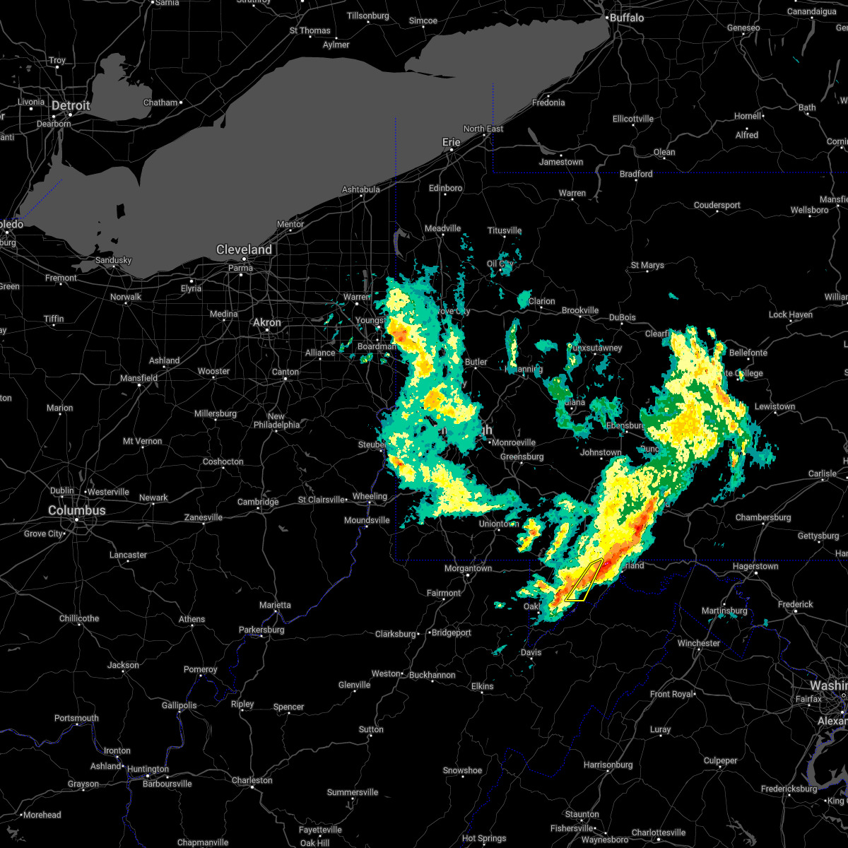
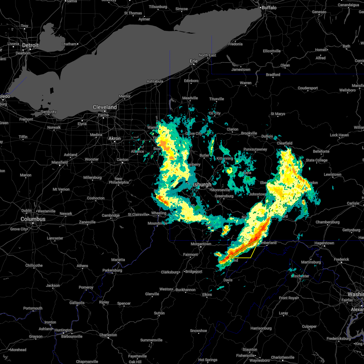
 At 210 pm edt, a severe thunderstorm was located near westernport, moving east at 35 mph. this is a destructive storm for portions of southwestern allegany county, far eastern garrett, and northern mineral counties. (radar indicated). Hazards include 80 mph wind gusts and ping pong ball size hail. Expect considerable damage to trees and power lines. your life is at significant risk if outdoors. In addition to some trees falling into homes, wind damage is possible to roofs, sheds, open garages, and mobile homes. At 210 pm edt, a severe thunderstorm was located near westernport, moving east at 35 mph. this is a destructive storm for portions of southwestern allegany county, far eastern garrett, and northern mineral counties. (radar indicated). Hazards include 80 mph wind gusts and ping pong ball size hail. Expect considerable damage to trees and power lines. your life is at significant risk if outdoors. In addition to some trees falling into homes, wind damage is possible to roofs, sheds, open garages, and mobile homes.
|
| 8/7/2023 2:11 PM EDT |
 At 210 pm edt, a severe thunderstorm was located near westernport, moving east at 35 mph. this is a destructive storm for portions of southwestern allegany county, far eastern garrett, and northern mineral counties. (radar indicated). Hazards include 80 mph wind gusts and ping pong ball size hail. Expect considerable damage to trees and power lines. your life is at significant risk if outdoors. In addition to some trees falling into homes, wind damage is possible to roofs, sheds, open garages, and mobile homes. At 210 pm edt, a severe thunderstorm was located near westernport, moving east at 35 mph. this is a destructive storm for portions of southwestern allegany county, far eastern garrett, and northern mineral counties. (radar indicated). Hazards include 80 mph wind gusts and ping pong ball size hail. Expect considerable damage to trees and power lines. your life is at significant risk if outdoors. In addition to some trees falling into homes, wind damage is possible to roofs, sheds, open garages, and mobile homes.
|
| 8/7/2023 1:58 PM EDT |
 At 158 pm edt, a severe thunderstorm was located near bittinger, moving east at 40 mph (radar indicated). Hazards include 70 mph wind gusts and ping pong ball size hail. Damaging winds will cause some trees and large branches to fall. this could injure those outdoors, as well as damage homes and vehicles. roadways may become blocked by downed trees. localized power outages are possible. Unsecured light objects may become projectiles. At 158 pm edt, a severe thunderstorm was located near bittinger, moving east at 40 mph (radar indicated). Hazards include 70 mph wind gusts and ping pong ball size hail. Damaging winds will cause some trees and large branches to fall. this could injure those outdoors, as well as damage homes and vehicles. roadways may become blocked by downed trees. localized power outages are possible. Unsecured light objects may become projectiles.
|
| 7/2/2023 10:49 PM EDT |
 At 1049 pm edt, severe thunderstorms were located along a line extending from near bittinger to 6 miles south of kitzmiller to 9 miles west of petersburg, moving east at 45 mph (radar indicated). Hazards include 60 mph wind gusts. Damaging winds will cause some trees and large branches to fall. this could injure those outdoors, as well as damage homes and vehicles. roadways may become blocked by downed trees. localized power outages are possible. unsecured light objects may become projectiles. locations impacted include, petersburg, mountain lake park, oakland, bayard, loch lynn heights, deer park, elk garden, kitzmiller, franklin, luke, gorman, deep creek lake state park, swallow falls state park, big run state park, mccomas beach, merrill, mchenry, arthur, hartmansville and new creek. hail threat, radar indicated max hail size, <. 75 in wind threat, radar indicated max wind gust, 60 mph. At 1049 pm edt, severe thunderstorms were located along a line extending from near bittinger to 6 miles south of kitzmiller to 9 miles west of petersburg, moving east at 45 mph (radar indicated). Hazards include 60 mph wind gusts. Damaging winds will cause some trees and large branches to fall. this could injure those outdoors, as well as damage homes and vehicles. roadways may become blocked by downed trees. localized power outages are possible. unsecured light objects may become projectiles. locations impacted include, petersburg, mountain lake park, oakland, bayard, loch lynn heights, deer park, elk garden, kitzmiller, franklin, luke, gorman, deep creek lake state park, swallow falls state park, big run state park, mccomas beach, merrill, mchenry, arthur, hartmansville and new creek. hail threat, radar indicated max hail size, <. 75 in wind threat, radar indicated max wind gust, 60 mph.
|
| 7/2/2023 10:21 PM EDT |
 At 1021 pm edt, severe thunderstorms were located along a line extending from near terra alta to 8 miles southeast of hendricks, moving east at 40 mph (radar indicated). Hazards include 60 mph wind gusts. Damaging winds will cause some trees and large branches to fall. this could injure those outdoors, as well as damage homes and vehicles. roadways may become blocked by downed trees. localized power outages are possible. Unsecured light objects may become projectiles. At 1021 pm edt, severe thunderstorms were located along a line extending from near terra alta to 8 miles southeast of hendricks, moving east at 40 mph (radar indicated). Hazards include 60 mph wind gusts. Damaging winds will cause some trees and large branches to fall. this could injure those outdoors, as well as damage homes and vehicles. roadways may become blocked by downed trees. localized power outages are possible. Unsecured light objects may become projectiles.
|
| 11/30/2022 12:25 PM EST |
 The severe thunderstorm warning for western allegany, northeastern garrett, north central grant and southwestern mineral counties will expire at 1230 pm est, the storms which prompted the warning have weakened below severe limits, and have exited the warned area. therefore, the warning will be allowed to expire. however gusty winds are still possible with these thunderstorms. The severe thunderstorm warning for western allegany, northeastern garrett, north central grant and southwestern mineral counties will expire at 1230 pm est, the storms which prompted the warning have weakened below severe limits, and have exited the warned area. therefore, the warning will be allowed to expire. however gusty winds are still possible with these thunderstorms.
|
| 11/30/2022 12:16 PM EST |
 At 1216 pm est, severe thunderstorms were located along a line extending from near meyersdale to 6 miles southeast of bittinger to near kitzmiller, moving east at 45 mph (radar indicated). Hazards include 60 mph wind gusts. Damaging winds will cause some trees and large branches to fall. this could injure those outdoors, as well as damage homes and vehicles. roadways may become blocked by downed trees. localized power outages are possible. unsecured light objects may become projectiles. locations impacted include, frostburg, keyser, westernport, lonaconing, piedmont, grantsville, elk garden, kitzmiller, eckhart mines, mount savage, barton, midland, midlothian, franklin, woodland, luke, big run state park, piney grove, merrill and new germany. hail threat, radar indicated max hail size, <. 75 in wind threat, radar indicated max wind gust, 60 mph. At 1216 pm est, severe thunderstorms were located along a line extending from near meyersdale to 6 miles southeast of bittinger to near kitzmiller, moving east at 45 mph (radar indicated). Hazards include 60 mph wind gusts. Damaging winds will cause some trees and large branches to fall. this could injure those outdoors, as well as damage homes and vehicles. roadways may become blocked by downed trees. localized power outages are possible. unsecured light objects may become projectiles. locations impacted include, frostburg, keyser, westernport, lonaconing, piedmont, grantsville, elk garden, kitzmiller, eckhart mines, mount savage, barton, midland, midlothian, franklin, woodland, luke, big run state park, piney grove, merrill and new germany. hail threat, radar indicated max hail size, <. 75 in wind threat, radar indicated max wind gust, 60 mph.
|
| 11/30/2022 12:00 PM EST |
 At 1159 am est, a strong line of showers were located along a line extending from near new centerville to near accident to near bayard, moving east at 40 mph (radar indicated). Hazards include 60 mph wind gusts. Damaging winds will cause some trees and large branches to fall. this could injure those outdoors, as well as damage homes and vehicles. roadways may become blocked by downed trees. localized power outages are possible. Unsecured light objects may become projectiles. At 1159 am est, a strong line of showers were located along a line extending from near new centerville to near accident to near bayard, moving east at 40 mph (radar indicated). Hazards include 60 mph wind gusts. Damaging winds will cause some trees and large branches to fall. this could injure those outdoors, as well as damage homes and vehicles. roadways may become blocked by downed trees. localized power outages are possible. Unsecured light objects may become projectiles.
|
| 9/25/2022 11:29 AM EDT |
 At 1128 am edt, a severe thunderstorm was located over lonaconing, or near westernport, moving east at 45 mph (radar indicated). Hazards include ping pong ball size hail and 60 mph wind gusts. Damaging winds will cause some trees and large branches to fall. this could injure those outdoors, as well as damage homes and vehicles. roadways may become blocked by downed trees. localized power outages are possible. unsecured light objects may become projectiles. locations impacted include, cumberland, westernport, bel air, fort ashby, lonaconing, piedmont, cresaptown, potomac park, wiley ford, rawlings, springfield, barton, midland, midlothian, franklin, green spring, woodland, oldtown, luke and spring gap. hail threat, observed max hail size, 1. 50 in wind threat, radar indicated max wind gust, 60 mph. At 1128 am edt, a severe thunderstorm was located over lonaconing, or near westernport, moving east at 45 mph (radar indicated). Hazards include ping pong ball size hail and 60 mph wind gusts. Damaging winds will cause some trees and large branches to fall. this could injure those outdoors, as well as damage homes and vehicles. roadways may become blocked by downed trees. localized power outages are possible. unsecured light objects may become projectiles. locations impacted include, cumberland, westernport, bel air, fort ashby, lonaconing, piedmont, cresaptown, potomac park, wiley ford, rawlings, springfield, barton, midland, midlothian, franklin, green spring, woodland, oldtown, luke and spring gap. hail threat, observed max hail size, 1. 50 in wind threat, radar indicated max wind gust, 60 mph.
|
| 9/25/2022 11:20 AM EDT |
 At 1120 am edt, a severe thunderstorm was located near westernport, moving east at 45 mph (radar indicated). Hazards include 60 mph wind gusts and quarter size hail. Damaging winds will cause some trees and large branches to fall. this could injure those outdoors, as well as damage homes and vehicles. roadways may become blocked by downed trees. localized power outages are possible. Unsecured light objects may become projectiles. At 1120 am edt, a severe thunderstorm was located near westernport, moving east at 45 mph (radar indicated). Hazards include 60 mph wind gusts and quarter size hail. Damaging winds will cause some trees and large branches to fall. this could injure those outdoors, as well as damage homes and vehicles. roadways may become blocked by downed trees. localized power outages are possible. Unsecured light objects may become projectiles.
|
| 7/23/2022 4:26 PM EDT |
 At 426 pm edt, severe thunderstorms were located along a line extending from somerset to 7 miles northwest of parsons, moving southeast at 50 mph (radar indicated). Hazards include 60 mph wind gusts and quarter size hail. Damaging winds will cause some trees and large branches to fall. this could injure those outdoors, as well as damage homes and vehicles. roadways may become blocked by downed trees. localized power outages are possible. unsecured light objects may become projectiles. locations impacted include, frostburg, mountain lake park, oakland, westernport, bayard, bittinger, lonaconing, piedmont, grantsville, loch lynn heights, friendsville, deer park, accident, elk garden, kitzmiller, eckhart mines, mount savage, barton, midland and midlothian. hail threat, radar indicated max hail size, 1. 00 in wind threat, observed max wind gust, 60 mph. At 426 pm edt, severe thunderstorms were located along a line extending from somerset to 7 miles northwest of parsons, moving southeast at 50 mph (radar indicated). Hazards include 60 mph wind gusts and quarter size hail. Damaging winds will cause some trees and large branches to fall. this could injure those outdoors, as well as damage homes and vehicles. roadways may become blocked by downed trees. localized power outages are possible. unsecured light objects may become projectiles. locations impacted include, frostburg, mountain lake park, oakland, westernport, bayard, bittinger, lonaconing, piedmont, grantsville, loch lynn heights, friendsville, deer park, accident, elk garden, kitzmiller, eckhart mines, mount savage, barton, midland and midlothian. hail threat, radar indicated max hail size, 1. 00 in wind threat, observed max wind gust, 60 mph.
|
| 7/23/2022 3:56 PM EDT |
 At 355 pm edt, severe thunderstorms were located along a line extending from near seven springs to near philippi, moving east at 60 mph (radar indicated). Hazards include 60 mph wind gusts and quarter size hail. Damaging winds will cause some trees and large branches to fall. this could injure those outdoors, as well as damage homes and vehicles. roadways may become blocked by downed trees. localized power outages are possible. Unsecured light objects may become projectiles. At 355 pm edt, severe thunderstorms were located along a line extending from near seven springs to near philippi, moving east at 60 mph (radar indicated). Hazards include 60 mph wind gusts and quarter size hail. Damaging winds will cause some trees and large branches to fall. this could injure those outdoors, as well as damage homes and vehicles. roadways may become blocked by downed trees. localized power outages are possible. Unsecured light objects may become projectiles.
|
| 7/12/2022 3:02 PM EDT |
 At 301 pm edt, severe thunderstorms were located along a line extending from near cumberland to near bayard, moving east at 45 mph (radar indicated). Hazards include 60 mph wind gusts and quarter size hail. Damaging winds will cause some trees and large branches to fall. this could injure those outdoors, as well as damage homes and vehicles. roadways may become blocked by downed trees. localized power outages are possible. unsecured light objects may become projectiles. locations impacted include, cumberland, frostburg, keyser, mountain lake park, oakland, westernport, bel air, bayard, la vale, lonaconing, piedmont, loch lynn heights, deer park, elk garden, kitzmiller, ridgeley, cresaptown, potomac park, wiley ford and eckhart mines. hail threat, radar indicated max hail size, 1. 00 in wind threat, radar indicated max wind gust, 60 mph. At 301 pm edt, severe thunderstorms were located along a line extending from near cumberland to near bayard, moving east at 45 mph (radar indicated). Hazards include 60 mph wind gusts and quarter size hail. Damaging winds will cause some trees and large branches to fall. this could injure those outdoors, as well as damage homes and vehicles. roadways may become blocked by downed trees. localized power outages are possible. unsecured light objects may become projectiles. locations impacted include, cumberland, frostburg, keyser, mountain lake park, oakland, westernport, bel air, bayard, la vale, lonaconing, piedmont, loch lynn heights, deer park, elk garden, kitzmiller, ridgeley, cresaptown, potomac park, wiley ford and eckhart mines. hail threat, radar indicated max hail size, 1. 00 in wind threat, radar indicated max wind gust, 60 mph.
|
| 7/12/2022 2:53 PM EDT |
 At 252 pm edt, severe thunderstorms were located along a line extending from near lake gordon to near rowlesburg, moving east at 50 mph (radar indicated). Hazards include 60 mph wind gusts and quarter size hail. Damaging winds will cause some trees and large branches to fall. this could injure those outdoors, as well as damage homes and vehicles. roadways may become blocked by downed trees. localized power outages are possible. unsecured light objects may become projectiles. locations impacted include, cumberland, frostburg, keyser, mountain lake park, oakland, westernport, bel air, bayard, bittinger, la vale, lonaconing, piedmont, loch lynn heights, deer park, elk garden, kitzmiller, ridgeley, cresaptown, potomac park and wiley ford. hail threat, radar indicated max hail size, 1. 00 in wind threat, radar indicated max wind gust, 60 mph. At 252 pm edt, severe thunderstorms were located along a line extending from near lake gordon to near rowlesburg, moving east at 50 mph (radar indicated). Hazards include 60 mph wind gusts and quarter size hail. Damaging winds will cause some trees and large branches to fall. this could injure those outdoors, as well as damage homes and vehicles. roadways may become blocked by downed trees. localized power outages are possible. unsecured light objects may become projectiles. locations impacted include, cumberland, frostburg, keyser, mountain lake park, oakland, westernport, bel air, bayard, bittinger, la vale, lonaconing, piedmont, loch lynn heights, deer park, elk garden, kitzmiller, ridgeley, cresaptown, potomac park and wiley ford. hail threat, radar indicated max hail size, 1. 00 in wind threat, radar indicated max wind gust, 60 mph.
|
| 7/12/2022 2:25 PM EDT |
 At 224 pm edt, severe thunderstorms were located along a line extending from near grantsville to near grafton, moving east at 45 mph (radar indicated). Hazards include 60 mph wind gusts and quarter size hail. Damaging winds will cause some trees and large branches to fall. this could injure those outdoors, as well as damage homes and vehicles. roadways may become blocked by downed trees. localized power outages are possible. Unsecured light objects may become projectiles. At 224 pm edt, severe thunderstorms were located along a line extending from near grantsville to near grafton, moving east at 45 mph (radar indicated). Hazards include 60 mph wind gusts and quarter size hail. Damaging winds will cause some trees and large branches to fall. this could injure those outdoors, as well as damage homes and vehicles. roadways may become blocked by downed trees. localized power outages are possible. Unsecured light objects may become projectiles.
|
| 6/22/2022 7:21 PM EDT |
 At 721 pm edt, severe thunderstorms were located along a line extending from near bel air to near rowlesburg, moving south at 35 mph (radar indicated). Hazards include 60 mph wind gusts and quarter size hail. Damaging winds will cause some trees and large branches to fall. this could injure those outdoors, as well as damage homes and vehicles. roadways may become blocked by downed trees. localized power outages are possible. unsecured light objects may become projectiles. locations impacted include, keyser, mountain lake park, oakland, westernport, bel air, bayard, lonaconing, piedmont, loch lynn heights, deer park, elk garden, kitzmiller, cresaptown, rawlings, barton, franklin, burlington, luke, redhouse and hutton. hail threat, radar indicated max hail size, 1. 00 in wind threat, radar indicated max wind gust, 60 mph. At 721 pm edt, severe thunderstorms were located along a line extending from near bel air to near rowlesburg, moving south at 35 mph (radar indicated). Hazards include 60 mph wind gusts and quarter size hail. Damaging winds will cause some trees and large branches to fall. this could injure those outdoors, as well as damage homes and vehicles. roadways may become blocked by downed trees. localized power outages are possible. unsecured light objects may become projectiles. locations impacted include, keyser, mountain lake park, oakland, westernport, bel air, bayard, lonaconing, piedmont, loch lynn heights, deer park, elk garden, kitzmiller, cresaptown, rawlings, barton, franklin, burlington, luke, redhouse and hutton. hail threat, radar indicated max hail size, 1. 00 in wind threat, radar indicated max wind gust, 60 mph.
|
| 6/22/2022 7:10 PM EDT |
 The severe thunderstorm warning for western allegany, garrett, northwestern grant and central mineral counties will expire at 715 pm edt, a new severe thunderstorm warning has been issued until 8:00 pm edt. a severe thunderstorm watch remains in effect until 900 pm edt for western maryland, and eastern west virginia. remember, a severe thunderstorm warning still remains in effect for central and southern garrett county and western allegany county until 8:00 pm edt. The severe thunderstorm warning for western allegany, garrett, northwestern grant and central mineral counties will expire at 715 pm edt, a new severe thunderstorm warning has been issued until 8:00 pm edt. a severe thunderstorm watch remains in effect until 900 pm edt for western maryland, and eastern west virginia. remember, a severe thunderstorm warning still remains in effect for central and southern garrett county and western allegany county until 8:00 pm edt.
|
| 6/22/2022 7:07 PM EDT |
 At 707 pm edt, severe thunderstorms were located along a line extending from la vale to near kingwood, moving south at 30 mph (radar indicated). Hazards include 60 mph wind gusts and quarter size hail. Damaging winds will cause some trees and large branches to fall. this could injure those outdoors, as well as damage homes and vehicles. roadways may become blocked by downed trees. localized power outages are possible. Unsecured light objects may become projectiles. At 707 pm edt, severe thunderstorms were located along a line extending from la vale to near kingwood, moving south at 30 mph (radar indicated). Hazards include 60 mph wind gusts and quarter size hail. Damaging winds will cause some trees and large branches to fall. this could injure those outdoors, as well as damage homes and vehicles. roadways may become blocked by downed trees. localized power outages are possible. Unsecured light objects may become projectiles.
|
| 6/22/2022 6:51 PM EDT |
 At 651 pm edt, severe thunderstorms were located along a line extending from near frostburg to near brookhaven, moving southeast at 35 mph (radar indicated). Hazards include 60 mph wind gusts and quarter size hail. Damaging winds will cause some trees and large branches to fall. this could injure those outdoors, as well as damage homes and vehicles. roadways may become blocked by downed trees. localized power outages are possible. unsecured light objects may become projectiles. locations impacted include, frostburg, mountain lake park, oakland, westernport, bel air, bayard, bittinger, la vale, lonaconing, piedmont, grantsville, loch lynn heights, friendsville, deer park, accident, cresaptown, potomac park, eckhart mines, mount savage and rawlings. hail threat, radar indicated max hail size, 1. 00 in wind threat, radar indicated max wind gust, 60 mph. At 651 pm edt, severe thunderstorms were located along a line extending from near frostburg to near brookhaven, moving southeast at 35 mph (radar indicated). Hazards include 60 mph wind gusts and quarter size hail. Damaging winds will cause some trees and large branches to fall. this could injure those outdoors, as well as damage homes and vehicles. roadways may become blocked by downed trees. localized power outages are possible. unsecured light objects may become projectiles. locations impacted include, frostburg, mountain lake park, oakland, westernport, bel air, bayard, bittinger, la vale, lonaconing, piedmont, grantsville, loch lynn heights, friendsville, deer park, accident, cresaptown, potomac park, eckhart mines, mount savage and rawlings. hail threat, radar indicated max hail size, 1. 00 in wind threat, radar indicated max wind gust, 60 mph.
|
| 6/22/2022 6:26 PM EDT |
 At 626 pm edt, severe thunderstorms were located along a line extending from near meyersdale to point marion, moving southeast at 40 mph (radar indicated). Hazards include 60 mph wind gusts and quarter size hail. Damaging winds will cause some trees and large branches to fall. this could injure those outdoors, as well as damage homes and vehicles. roadways may become blocked by downed trees. localized power outages are possible. Unsecured light objects may become projectiles. At 626 pm edt, severe thunderstorms were located along a line extending from near meyersdale to point marion, moving southeast at 40 mph (radar indicated). Hazards include 60 mph wind gusts and quarter size hail. Damaging winds will cause some trees and large branches to fall. this could injure those outdoors, as well as damage homes and vehicles. roadways may become blocked by downed trees. localized power outages are possible. Unsecured light objects may become projectiles.
|
| 6/8/2022 11:11 PM EDT |
 At 1111 pm edt, severe thunderstorms were located along a line extending from near kingwood to 6 miles southeast of rowlesburg to 7 miles west of parsons, moving east at 60 mph (radar indicated). Hazards include 60 mph wind gusts. Damaging winds will cause some trees and large branches to fall. this could injure those outdoors, as well as damage homes and vehicles. roadways may become blocked by downed trees. localized power outages are possible. Unsecured light objects may become projectiles. At 1111 pm edt, severe thunderstorms were located along a line extending from near kingwood to 6 miles southeast of rowlesburg to 7 miles west of parsons, moving east at 60 mph (radar indicated). Hazards include 60 mph wind gusts. Damaging winds will cause some trees and large branches to fall. this could injure those outdoors, as well as damage homes and vehicles. roadways may become blocked by downed trees. localized power outages are possible. Unsecured light objects may become projectiles.
|
| 5/20/2022 12:12 PM EDT |
 The severe thunderstorm warning for allegany and northeastern mineral counties will expire at 1215 pm edt, the storms which prompted the warning have moved out of the area. therefore, the warning will be allowed to expire. however heavy rain is still possible with these thunderstorms. a tornado watch remains in effect until 700 pm edt for western maryland, and eastern west virginia. The severe thunderstorm warning for allegany and northeastern mineral counties will expire at 1215 pm edt, the storms which prompted the warning have moved out of the area. therefore, the warning will be allowed to expire. however heavy rain is still possible with these thunderstorms. a tornado watch remains in effect until 700 pm edt for western maryland, and eastern west virginia.
|
| 5/20/2022 12:09 PM EDT |
 At 1208 pm edt, severe thunderstorms were located along a line extending from near lake gordon to westernport, moving east at 45 mph (radar indicated). Hazards include 60 mph wind gusts and quarter size hail. Damaging winds will cause some trees and large branches to fall. this could injure those outdoors, as well as damage homes and vehicles. roadways may become blocked by downed trees. localized power outages are possible. Unsecured light objects may become projectiles. At 1208 pm edt, severe thunderstorms were located along a line extending from near lake gordon to westernport, moving east at 45 mph (radar indicated). Hazards include 60 mph wind gusts and quarter size hail. Damaging winds will cause some trees and large branches to fall. this could injure those outdoors, as well as damage homes and vehicles. roadways may become blocked by downed trees. localized power outages are possible. Unsecured light objects may become projectiles.
|
| 5/20/2022 12:02 PM EDT |
 At 1202 pm edt, severe thunderstorms were located along a line extending from near lake gordon to 6 miles north of kitzmiller, moving east at 45 mph (radar indicated). Hazards include 60 mph wind gusts and quarter size hail. Damaging winds will cause some trees and large branches to fall. this could injure those outdoors, as well as damage homes and vehicles. roadways may become blocked by downed trees. localized power outages are possible. unsecured light objects may become projectiles. Locations impacted include, frostburg, franklin, luke, merrill and big run state park. At 1202 pm edt, severe thunderstorms were located along a line extending from near lake gordon to 6 miles north of kitzmiller, moving east at 45 mph (radar indicated). Hazards include 60 mph wind gusts and quarter size hail. Damaging winds will cause some trees and large branches to fall. this could injure those outdoors, as well as damage homes and vehicles. roadways may become blocked by downed trees. localized power outages are possible. unsecured light objects may become projectiles. Locations impacted include, frostburg, franklin, luke, merrill and big run state park.
|
| 5/20/2022 11:50 AM EDT |
 At 1149 am edt, severe thunderstorms were located along a line extending from near la vale to near westernport, moving east at 45 mph (radar indicated). Hazards include 60 mph wind gusts and quarter size hail. Damaging winds will cause some trees and large branches to fall. this could injure those outdoors, as well as damage homes and vehicles. roadways may become blocked by downed trees. localized power outages are possible. unsecured light objects may become projectiles. Locations impacted include, cumberland, frostburg, westernport, bel air, la vale, fort ashby, lonaconing, piedmont, ridgeley, cresaptown, potomac park, wiley ford, eckhart mines, mount savage, rawlings, ellerslie, barton, corriganville, midland and midlothian. At 1149 am edt, severe thunderstorms were located along a line extending from near la vale to near westernport, moving east at 45 mph (radar indicated). Hazards include 60 mph wind gusts and quarter size hail. Damaging winds will cause some trees and large branches to fall. this could injure those outdoors, as well as damage homes and vehicles. roadways may become blocked by downed trees. localized power outages are possible. unsecured light objects may become projectiles. Locations impacted include, cumberland, frostburg, westernport, bel air, la vale, fort ashby, lonaconing, piedmont, ridgeley, cresaptown, potomac park, wiley ford, eckhart mines, mount savage, rawlings, ellerslie, barton, corriganville, midland and midlothian.
|
| 5/20/2022 11:41 AM EDT |
 At 1141 am edt, severe thunderstorms were located along a line extending from near frostburg to near terra alta, moving east at 50 mph (radar indicated). Hazards include 60 mph wind gusts and quarter size hail. Damaging winds will cause some trees and large branches to fall. this could injure those outdoors, as well as damage homes and vehicles. roadways may become blocked by downed trees. localized power outages are possible. Unsecured light objects may become projectiles. At 1141 am edt, severe thunderstorms were located along a line extending from near frostburg to near terra alta, moving east at 50 mph (radar indicated). Hazards include 60 mph wind gusts and quarter size hail. Damaging winds will cause some trees and large branches to fall. this could injure those outdoors, as well as damage homes and vehicles. roadways may become blocked by downed trees. localized power outages are possible. Unsecured light objects may become projectiles.
|
| 5/20/2022 11:29 AM EDT |
 At 1128 am edt, severe thunderstorms were located along a line extending from near grantsville to 6 miles north of oakland, moving east at 45 mph (radar indicated). Hazards include 60 mph wind gusts and quarter size hail. Damaging winds will cause some trees and large branches to fall. this could injure those outdoors, as well as damage homes and vehicles. roadways may become blocked by downed trees. localized power outages are possible. Unsecured light objects may become projectiles. At 1128 am edt, severe thunderstorms were located along a line extending from near grantsville to 6 miles north of oakland, moving east at 45 mph (radar indicated). Hazards include 60 mph wind gusts and quarter size hail. Damaging winds will cause some trees and large branches to fall. this could injure those outdoors, as well as damage homes and vehicles. roadways may become blocked by downed trees. localized power outages are possible. Unsecured light objects may become projectiles.
|
| 3/31/2022 3:15 PM EDT |
 At 314 pm edt, severe thunderstorms were located along a line extending from near frostburg to near keyser, moving south at 10 mph (radar indicated). Hazards include 60 mph wind gusts. Damaging winds will cause some trees and large branches to fall. this could injure those outdoors, as well as damage homes and vehicles. roadways may become blocked by downed trees. localized power outages are possible. unsecured light objects may become projectiles. locations impacted include, cumberland, frostburg, keyser, westernport, bel air, la vale, fort ashby, lonaconing, piedmont, ridgeley, cresaptown, potomac park, wiley ford, eckhart mines, rawlings, barton, corriganville, midland, midlothian and woodland. hail threat, radar indicated max hail size, <. 75 in wind threat, radar indicated max wind gust, 60 mph. At 314 pm edt, severe thunderstorms were located along a line extending from near frostburg to near keyser, moving south at 10 mph (radar indicated). Hazards include 60 mph wind gusts. Damaging winds will cause some trees and large branches to fall. this could injure those outdoors, as well as damage homes and vehicles. roadways may become blocked by downed trees. localized power outages are possible. unsecured light objects may become projectiles. locations impacted include, cumberland, frostburg, keyser, westernport, bel air, la vale, fort ashby, lonaconing, piedmont, ridgeley, cresaptown, potomac park, wiley ford, eckhart mines, rawlings, barton, corriganville, midland, midlothian and woodland. hail threat, radar indicated max hail size, <. 75 in wind threat, radar indicated max wind gust, 60 mph.
|
| 3/31/2022 2:50 PM EDT |
 At 250 pm edt, severe thunderstorms were located along a line extending from near frostburg to near elk garden, moving east at 30 mph (radar indicated). Hazards include 60 mph wind gusts. Damaging winds will cause some trees and large branches to fall. this could injure those outdoors, as well as damage homes and vehicles. roadways may become blocked by downed trees. localized power outages are possible. Unsecured light objects may become projectiles. At 250 pm edt, severe thunderstorms were located along a line extending from near frostburg to near elk garden, moving east at 30 mph (radar indicated). Hazards include 60 mph wind gusts. Damaging winds will cause some trees and large branches to fall. this could injure those outdoors, as well as damage homes and vehicles. roadways may become blocked by downed trees. localized power outages are possible. Unsecured light objects may become projectiles.
|
| 3/7/2022 5:29 PM EST |
 At 528 pm est, severe thunderstorms were located along a line extending from near mount davis to 6 miles northwest of thomas, moving east at 50 mph (radar indicated). Hazards include 60 mph wind gusts. Damaging winds will cause some trees and large branches to fall. this could injure those outdoors, as well as damage homes and vehicles. roadways may become blocked by downed trees. localized power outages are possible. unsecured light objects may become projectiles. locations impacted include, frostburg, keyser, mountain lake park, oakland, westernport, bayard, bittinger, la vale, lonaconing, piedmont, grantsville, loch lynn heights, friendsville, deer park, accident, elk garden, kitzmiller, cresaptown, eckhart mines and mount savage. hail threat, radar indicated max hail size, <. 75 in wind threat, radar indicated max wind gust, 60 mph. At 528 pm est, severe thunderstorms were located along a line extending from near mount davis to 6 miles northwest of thomas, moving east at 50 mph (radar indicated). Hazards include 60 mph wind gusts. Damaging winds will cause some trees and large branches to fall. this could injure those outdoors, as well as damage homes and vehicles. roadways may become blocked by downed trees. localized power outages are possible. unsecured light objects may become projectiles. locations impacted include, frostburg, keyser, mountain lake park, oakland, westernport, bayard, bittinger, la vale, lonaconing, piedmont, grantsville, loch lynn heights, friendsville, deer park, accident, elk garden, kitzmiller, cresaptown, eckhart mines and mount savage. hail threat, radar indicated max hail size, <. 75 in wind threat, radar indicated max wind gust, 60 mph.
|
| 3/7/2022 5:02 PM EST |
 At 501 pm est, severe thunderstorms were located along a line extending from near farmington to 10 miles east of philippi, moving east at 50 mph (radar indicated). Hazards include 60 mph wind gusts. Damaging winds will cause some trees and large branches to fall. this could injure those outdoors, as well as damage homes and vehicles. roadways may become blocked by downed trees. localized power outages are possible. Unsecured light objects may become projectiles. At 501 pm est, severe thunderstorms were located along a line extending from near farmington to 10 miles east of philippi, moving east at 50 mph (radar indicated). Hazards include 60 mph wind gusts. Damaging winds will cause some trees and large branches to fall. this could injure those outdoors, as well as damage homes and vehicles. roadways may become blocked by downed trees. localized power outages are possible. Unsecured light objects may become projectiles.
|
| 7/13/2021 5:06 PM EDT |
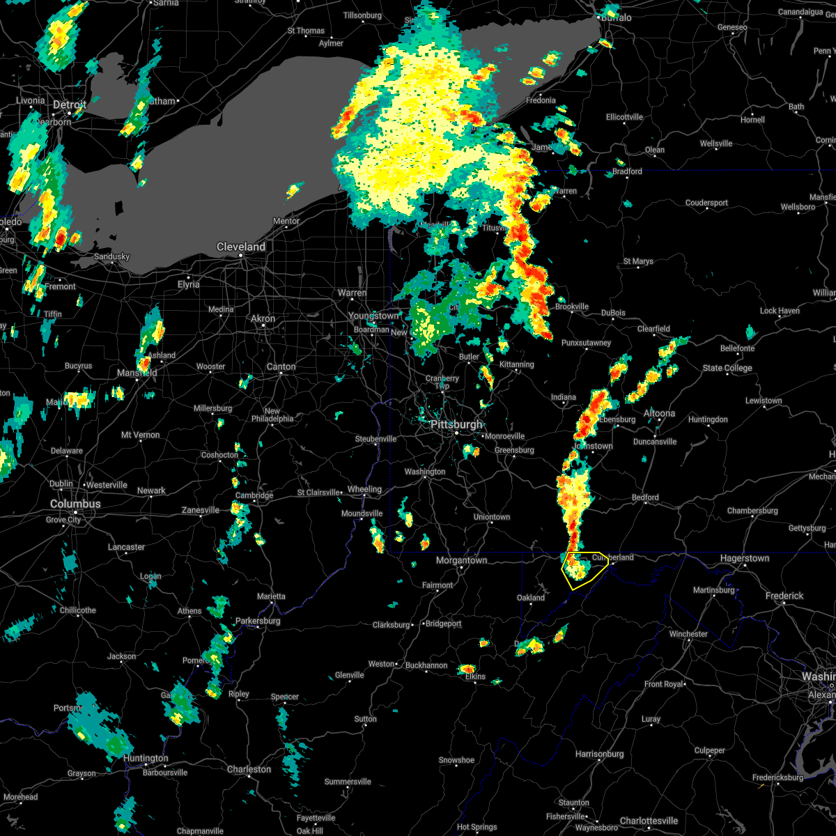 The severe thunderstorm warning for northwestern allegany and northeastern garrett counties will expire at 515 pm edt, the storms which prompted the warning have weakened below severe limits, and have exited the warned area. therefore, the warning will be allowed to expire. The severe thunderstorm warning for northwestern allegany and northeastern garrett counties will expire at 515 pm edt, the storms which prompted the warning have weakened below severe limits, and have exited the warned area. therefore, the warning will be allowed to expire.
|
| 7/13/2021 4:56 PM EDT |
 At 456 pm edt, severe thunderstorms were located along a line extending from near grantsville to westernport, moving northeast at 30 mph (radar indicated). Hazards include 60 mph wind gusts and quarter size hail. Damaging winds will cause some trees and large branches to fall. this could injure those outdoors, as well as damage homes and vehicles. roadways may become blocked by downed trees. localized power outages are possible. unsecured light objects may become projectiles. Locations impacted include, frostburg, la vale, lonaconing, cresaptown, eckhart mines, mount savage, barton, midland, midlothian, franklin, woodland, merrill, new germany, piney grove and dogwood flats. At 456 pm edt, severe thunderstorms were located along a line extending from near grantsville to westernport, moving northeast at 30 mph (radar indicated). Hazards include 60 mph wind gusts and quarter size hail. Damaging winds will cause some trees and large branches to fall. this could injure those outdoors, as well as damage homes and vehicles. roadways may become blocked by downed trees. localized power outages are possible. unsecured light objects may become projectiles. Locations impacted include, frostburg, la vale, lonaconing, cresaptown, eckhart mines, mount savage, barton, midland, midlothian, franklin, woodland, merrill, new germany, piney grove and dogwood flats.
|
| 7/13/2021 4:46 PM EDT |
 At 446 pm edt, a severe thunderstorm was located near westernport, moving northeast at 25 mph (radar indicated). Hazards include 60 mph wind gusts and quarter size hail. Damaging winds will cause some trees and large branches to fall. this could injure those outdoors, as well as damage homes and vehicles. roadways may become blocked by downed trees. localized power outages are possible. unsecured light objects may become projectiles. Locations impacted include, cumberland, frostburg, westernport, bel air, la vale, lonaconing, piedmont, cresaptown, eckhart mines, mount savage, rawlings, barton, midland, midlothian, franklin, woodland, luke, merrill, big run state park and new germany. At 446 pm edt, a severe thunderstorm was located near westernport, moving northeast at 25 mph (radar indicated). Hazards include 60 mph wind gusts and quarter size hail. Damaging winds will cause some trees and large branches to fall. this could injure those outdoors, as well as damage homes and vehicles. roadways may become blocked by downed trees. localized power outages are possible. unsecured light objects may become projectiles. Locations impacted include, cumberland, frostburg, westernport, bel air, la vale, lonaconing, piedmont, cresaptown, eckhart mines, mount savage, rawlings, barton, midland, midlothian, franklin, woodland, luke, merrill, big run state park and new germany.
|
| 7/13/2021 4:40 PM EDT |
 At 440 pm edt, a severe thunderstorm was located over piedmont, or near westernport, moving northeast at 30 mph (radar indicated). Hazards include 60 mph wind gusts and quarter size hail. Damaging winds will cause some trees and large branches to fall. this could injure those outdoors, as well as damage homes and vehicles. roadways may become blocked by downed trees. localized power outages are possible. unsecured light objects may become projectiles. Locations impacted include, cumberland, frostburg, westernport, bel air, la vale, lonaconing, piedmont, grantsville, ridgeley, cresaptown, potomac park, wiley ford, eckhart mines, mount savage, rawlings, barton, midland, midlothian, franklin and woodland. At 440 pm edt, a severe thunderstorm was located over piedmont, or near westernport, moving northeast at 30 mph (radar indicated). Hazards include 60 mph wind gusts and quarter size hail. Damaging winds will cause some trees and large branches to fall. this could injure those outdoors, as well as damage homes and vehicles. roadways may become blocked by downed trees. localized power outages are possible. unsecured light objects may become projectiles. Locations impacted include, cumberland, frostburg, westernport, bel air, la vale, lonaconing, piedmont, grantsville, ridgeley, cresaptown, potomac park, wiley ford, eckhart mines, mount savage, rawlings, barton, midland, midlothian, franklin and woodland.
|
| 7/13/2021 4:40 PM EDT |
 At 446 pm edt, a severe thunderstorm was located near westernport, moving northeast at 25 mph (radar indicated). Hazards include 60 mph wind gusts and quarter size hail. Damaging winds will cause some trees and large branches to fall. this could injure those outdoors, as well as damage homes and vehicles. roadways may become blocked by downed trees. localized power outages are possible. unsecured light objects may become projectiles. Locations impacted include, cumberland, frostburg, westernport, bel air, la vale, lonaconing, piedmont, cresaptown, eckhart mines, mount savage, rawlings, barton, midland, midlothian, franklin, woodland, luke, merrill, big run state park and new germany. At 446 pm edt, a severe thunderstorm was located near westernport, moving northeast at 25 mph (radar indicated). Hazards include 60 mph wind gusts and quarter size hail. Damaging winds will cause some trees and large branches to fall. this could injure those outdoors, as well as damage homes and vehicles. roadways may become blocked by downed trees. localized power outages are possible. unsecured light objects may become projectiles. Locations impacted include, cumberland, frostburg, westernport, bel air, la vale, lonaconing, piedmont, cresaptown, eckhart mines, mount savage, rawlings, barton, midland, midlothian, franklin, woodland, luke, merrill, big run state park and new germany.
|
| 7/13/2021 4:33 PM EDT |
 At 433 pm edt, a severe thunderstorm was located near elk garden, or near westernport, moving northeast at 30 mph (radar indicated). Hazards include 60 mph wind gusts and quarter size hail. Damaging winds will cause some trees and large branches to fall. this could injure those outdoors, as well as damage homes and vehicles. roadways may become blocked by downed trees. localized power outages are possible. Unsecured light objects may become projectiles. At 433 pm edt, a severe thunderstorm was located near elk garden, or near westernport, moving northeast at 30 mph (radar indicated). Hazards include 60 mph wind gusts and quarter size hail. Damaging winds will cause some trees and large branches to fall. this could injure those outdoors, as well as damage homes and vehicles. roadways may become blocked by downed trees. localized power outages are possible. Unsecured light objects may become projectiles.
|
| 6/21/2021 6:46 PM EDT |
 At 645 pm edt, a severe thunderstorm was located over terra alta, moving east at 50 mph (radar indicated). Hazards include 60 mph wind gusts and quarter size hail. Damaging winds will cause some trees and large branches to fall. this could injure those outdoors, as well as damage homes and vehicles. roadways may become blocked by downed trees. localized power outages are possible. Unsecured light objects may become projectiles. At 645 pm edt, a severe thunderstorm was located over terra alta, moving east at 50 mph (radar indicated). Hazards include 60 mph wind gusts and quarter size hail. Damaging winds will cause some trees and large branches to fall. this could injure those outdoors, as well as damage homes and vehicles. roadways may become blocked by downed trees. localized power outages are possible. Unsecured light objects may become projectiles.
|
| 11/15/2020 5:21 PM EST |
 At 519 pm est, gradient winds from a passing cold front will continue to produce sporadic gusts around and above 60 mph (radar indicated). Hazards include 60 mph wind gusts. Damaging gradient winds will cause some trees and large branches to fall. this could injure those outdoors, as well as damage homes and vehicles. roadways may become blocked by downed trees. localized power outages are possible. unsecured light objects may become projectiles. Locations impacted include, cumberland, frostburg, keyser, westernport, romney, hancock, bel air, paw paw, bayard, la vale, fort ashby, lonaconing, piedmont, berkeley springs, elk garden, kitzmiller, ridgeley, cresaptown, potomac park and wiley ford. At 519 pm est, gradient winds from a passing cold front will continue to produce sporadic gusts around and above 60 mph (radar indicated). Hazards include 60 mph wind gusts. Damaging gradient winds will cause some trees and large branches to fall. this could injure those outdoors, as well as damage homes and vehicles. roadways may become blocked by downed trees. localized power outages are possible. unsecured light objects may become projectiles. Locations impacted include, cumberland, frostburg, keyser, westernport, romney, hancock, bel air, paw paw, bayard, la vale, fort ashby, lonaconing, piedmont, berkeley springs, elk garden, kitzmiller, ridgeley, cresaptown, potomac park and wiley ford.
|
| 11/15/2020 4:58 PM EST |
 At 456 pm est, gradient winds from a passing cold front were located along a line extending from near frostburg to near thomas, moving east at 35 mph (radar indicated). Hazards include 60 mph wind gusts. Damaging gradint winds from a passing cold front will cause some trees and large branches to fall. this could injure those outdoors, as well as damage homes and vehicles. roadways may become blocked by downed trees. localized power outages are possible. Unsecured light objects may become projectiles. At 456 pm est, gradient winds from a passing cold front were located along a line extending from near frostburg to near thomas, moving east at 35 mph (radar indicated). Hazards include 60 mph wind gusts. Damaging gradint winds from a passing cold front will cause some trees and large branches to fall. this could injure those outdoors, as well as damage homes and vehicles. roadways may become blocked by downed trees. localized power outages are possible. Unsecured light objects may become projectiles.
|
| 11/15/2020 3:57 PM EST |
 At 337 pm est, severe thunderstorms were located along a line extending from near uniontown to 6 miles east of brookhaven to grafton, moving east at 40 mph (radar indicated). Hazards include 60 mph wind gusts. Damaging winds will cause some trees and large branches to fall. this could injure those outdoors, as well as damage homes and vehicles. roadways may become blocked by downed trees. localized power outages are possible. Unsecured light objects may become projectiles. At 337 pm est, severe thunderstorms were located along a line extending from near uniontown to 6 miles east of brookhaven to grafton, moving east at 40 mph (radar indicated). Hazards include 60 mph wind gusts. Damaging winds will cause some trees and large branches to fall. this could injure those outdoors, as well as damage homes and vehicles. roadways may become blocked by downed trees. localized power outages are possible. Unsecured light objects may become projectiles.
|
| 11/15/2020 3:57 PM EST |
 At 356 pm est, severe thunderstorms were located along a line extending from 7 miles northeast of farmington to 9 miles southwest of friendsville to near newburg, moving east at 40 mph. this storm has a history of producing wind damage in monongalia county west virginia (radar indicated). Hazards include 60 mph wind gusts. Damaging winds will cause some trees and large branches to fall. this could injure those outdoors, as well as damage homes and vehicles. roadways may become blocked by downed trees. localized power outages are possible. unsecured light objects may become projectiles. Locations impacted include, cumberland, frostburg, keyser, mountain lake park, oakland, westernport, bel air, bayard, bittinger, la vale, lonaconing, piedmont, grantsville, loch lynn heights, friendsville, deer park, accident, elk garden, kitzmiller and cresaptown. At 356 pm est, severe thunderstorms were located along a line extending from 7 miles northeast of farmington to 9 miles southwest of friendsville to near newburg, moving east at 40 mph. this storm has a history of producing wind damage in monongalia county west virginia (radar indicated). Hazards include 60 mph wind gusts. Damaging winds will cause some trees and large branches to fall. this could injure those outdoors, as well as damage homes and vehicles. roadways may become blocked by downed trees. localized power outages are possible. unsecured light objects may become projectiles. Locations impacted include, cumberland, frostburg, keyser, mountain lake park, oakland, westernport, bel air, bayard, bittinger, la vale, lonaconing, piedmont, grantsville, loch lynn heights, friendsville, deer park, accident, elk garden, kitzmiller and cresaptown.
|
| 11/15/2020 3:38 PM EST |
 At 337 pm est, severe thunderstorms were located along a line extending from near uniontown to 6 miles east of brookhaven to grafton, moving east at 40 mph (radar indicated). Hazards include 60 mph wind gusts. Damaging winds will cause some trees and large branches to fall. this could injure those outdoors, as well as damage homes and vehicles. roadways may become blocked by downed trees. localized power outages are possible. Unsecured light objects may become projectiles. At 337 pm est, severe thunderstorms were located along a line extending from near uniontown to 6 miles east of brookhaven to grafton, moving east at 40 mph (radar indicated). Hazards include 60 mph wind gusts. Damaging winds will cause some trees and large branches to fall. this could injure those outdoors, as well as damage homes and vehicles. roadways may become blocked by downed trees. localized power outages are possible. Unsecured light objects may become projectiles.
|
| 8/27/2020 8:30 PM EDT |
 At 829 pm edt, severe thunderstorms were located along a line extending from meyersdale to near mount davis to near grantsville, moving southeast at 35 mph (radar indicated). Hazards include 60 mph wind gusts and quarter size hail. Damaging winds will cause some trees and large branches to fall. this could injure those outdoors, as well as damage homes and vehicles. roadways may become blocked by downed trees. localized power outages are possible. Unsecured light objects may become projectiles. At 829 pm edt, severe thunderstorms were located along a line extending from meyersdale to near mount davis to near grantsville, moving southeast at 35 mph (radar indicated). Hazards include 60 mph wind gusts and quarter size hail. Damaging winds will cause some trees and large branches to fall. this could injure those outdoors, as well as damage homes and vehicles. roadways may become blocked by downed trees. localized power outages are possible. Unsecured light objects may become projectiles.
|
| 8/25/2020 5:19 PM EDT |
 At 519 pm edt, a severe thunderstorm was located near keyser, moving southeast at 30 mph (radar indicated). Hazards include 60 mph wind gusts. Damaging winds will cause some trees and large branches to fall. this could injure those outdoors, as well as damage homes and vehicles. roadways may become blocked by downed trees. localized power outages are possible. unsecured light objects may become projectiles. Locations impacted include, keyser, westernport, fort ashby, lonaconing, piedmont, rawlings, barton, franklin, burlington, luke, russelldale, dogwood flats, reynolds, headsville, short gap, new creek, wagoner, antioch, mccoole and reeses mill. At 519 pm edt, a severe thunderstorm was located near keyser, moving southeast at 30 mph (radar indicated). Hazards include 60 mph wind gusts. Damaging winds will cause some trees and large branches to fall. this could injure those outdoors, as well as damage homes and vehicles. roadways may become blocked by downed trees. localized power outages are possible. unsecured light objects may become projectiles. Locations impacted include, keyser, westernport, fort ashby, lonaconing, piedmont, rawlings, barton, franklin, burlington, luke, russelldale, dogwood flats, reynolds, headsville, short gap, new creek, wagoner, antioch, mccoole and reeses mill.
|
| 8/25/2020 5:04 PM EDT |
 At 504 pm edt, a severe thunderstorm was located over piedmont, or over westernport, moving southeast at 30 mph (radar indicated). Hazards include 60 mph wind gusts. Damaging winds will cause some trees and large branches to fall. this could injure those outdoors, as well as damage homes and vehicles. roadways may become blocked by downed trees. localized power outages are possible. unsecured light objects may become projectiles. Locations impacted include, frostburg, keyser, westernport, bel air, fort ashby, lonaconing, piedmont, cresaptown, potomac park, wiley ford, eckhart mines, rawlings, barton, midland, midlothian, franklin, burlington, woodland, luke and spring gap. At 504 pm edt, a severe thunderstorm was located over piedmont, or over westernport, moving southeast at 30 mph (radar indicated). Hazards include 60 mph wind gusts. Damaging winds will cause some trees and large branches to fall. this could injure those outdoors, as well as damage homes and vehicles. roadways may become blocked by downed trees. localized power outages are possible. unsecured light objects may become projectiles. Locations impacted include, frostburg, keyser, westernport, bel air, fort ashby, lonaconing, piedmont, cresaptown, potomac park, wiley ford, eckhart mines, rawlings, barton, midland, midlothian, franklin, burlington, woodland, luke and spring gap.
|
| 8/25/2020 4:52 PM EDT |
 At 451 pm edt, a severe thunderstorm was located near bittinger, moving southeast at 30 mph (radar indicated). Hazards include 60 mph wind gusts. Damaging winds will cause some trees and large branches to fall. this could injure those outdoors, as well as damage homes and vehicles. roadways may become blocked by downed trees. localized power outages are possible. Unsecured light objects may become projectiles. At 451 pm edt, a severe thunderstorm was located near bittinger, moving southeast at 30 mph (radar indicated). Hazards include 60 mph wind gusts. Damaging winds will cause some trees and large branches to fall. this could injure those outdoors, as well as damage homes and vehicles. roadways may become blocked by downed trees. localized power outages are possible. Unsecured light objects may become projectiles.
|
| 8/7/2020 4:53 PM EDT |
 At 453 pm edt, a severe thunderstorm was located near westernport, moving southeast at 15 mph (radar indicated). Hazards include 60 mph wind gusts. Damaging winds will cause some trees and large branches to fall. this could injure those outdoors, as well as damage homes and vehicles. roadways may become blocked by downed trees. localized power outages are possible. Unsecured light objects may become projectiles. At 453 pm edt, a severe thunderstorm was located near westernport, moving southeast at 15 mph (radar indicated). Hazards include 60 mph wind gusts. Damaging winds will cause some trees and large branches to fall. this could injure those outdoors, as well as damage homes and vehicles. roadways may become blocked by downed trees. localized power outages are possible. Unsecured light objects may become projectiles.
|
| 7/16/2020 3:21 PM EDT |
 At 321 pm edt, a severe thunderstorm was located over lonaconing, or near westernport, moving northeast at 20 mph (radar indicated). Hazards include 60 mph wind gusts and quarter size hail. Damaging winds will cause some trees and large branches to fall. this could injure those outdoors, as well as damage homes and vehicles. roadways may become blocked by downed trees. localized power outages are possible. unsecured light objects may become projectiles. Locations impacted include, cumberland, frostburg, westernport, bel air, la vale, lonaconing, ridgeley, cresaptown, potomac park, wiley ford, eckhart mines, mount savage, rawlings, ellerslie, barton, corriganville, midland, midlothian, franklin and flintstone. At 321 pm edt, a severe thunderstorm was located over lonaconing, or near westernport, moving northeast at 20 mph (radar indicated). Hazards include 60 mph wind gusts and quarter size hail. Damaging winds will cause some trees and large branches to fall. this could injure those outdoors, as well as damage homes and vehicles. roadways may become blocked by downed trees. localized power outages are possible. unsecured light objects may become projectiles. Locations impacted include, cumberland, frostburg, westernport, bel air, la vale, lonaconing, ridgeley, cresaptown, potomac park, wiley ford, eckhart mines, mount savage, rawlings, ellerslie, barton, corriganville, midland, midlothian, franklin and flintstone.
|
| 7/16/2020 3:17 PM EDT |
 At 317 pm edt, a severe thunderstorm was located over lonaconing, or near westernport, moving northeast at 20 mph (radar indicated). Hazards include 60 mph wind gusts and quarter size hail. Damaging winds will cause some trees and large branches to fall. this could injure those outdoors, as well as damage homes and vehicles. roadways may become blocked by downed trees. localized power outages are possible. Unsecured light objects may become projectiles. At 317 pm edt, a severe thunderstorm was located over lonaconing, or near westernport, moving northeast at 20 mph (radar indicated). Hazards include 60 mph wind gusts and quarter size hail. Damaging winds will cause some trees and large branches to fall. this could injure those outdoors, as well as damage homes and vehicles. roadways may become blocked by downed trees. localized power outages are possible. Unsecured light objects may become projectiles.
|
| 4/8/2020 2:29 AM EDT |
 At 229 am edt, severe thunderstorms were located along a line extending from near berlin to near accident to 6 miles east of point marion, moving southeast at 65 mph (radar indicated). Hazards include 60 mph wind gusts. Damaging winds will cause some trees and large branches to fall. this could injure those outdoors, as well as damage homes and vehicles. roadways may become blocked by downed trees. localized power outages are possible. Unsecured light objects may become projectiles. At 229 am edt, severe thunderstorms were located along a line extending from near berlin to near accident to 6 miles east of point marion, moving southeast at 65 mph (radar indicated). Hazards include 60 mph wind gusts. Damaging winds will cause some trees and large branches to fall. this could injure those outdoors, as well as damage homes and vehicles. roadways may become blocked by downed trees. localized power outages are possible. Unsecured light objects may become projectiles.
|
| 3/3/2020 10:03 PM EST |
 At 1003 pm est, severe thunderstorms were located along a line extending from 6 miles southwest of inglesmith to near keyser, moving east at 55 mph (trained weather spotters). Hazards include 60 mph wind gusts. Damaging winds will cause some trees and large branches to fall. this could injure those outdoors, as well as damage homes and vehicles. roadways may become blocked by downed trees. localized power outages are possible. Unsecured light objects may become projectiles. At 1003 pm est, severe thunderstorms were located along a line extending from 6 miles southwest of inglesmith to near keyser, moving east at 55 mph (trained weather spotters). Hazards include 60 mph wind gusts. Damaging winds will cause some trees and large branches to fall. this could injure those outdoors, as well as damage homes and vehicles. roadways may become blocked by downed trees. localized power outages are possible. Unsecured light objects may become projectiles.
|
| 6/29/2019 10:48 PM EDT |
 At 1048 pm edt, a severe thunderstorm was located near deer park, or near oakland, moving southeast at 35 mph (radar). Hazards include wind gusts to 60 mph and quarter-size hail. Minor hail damage to vehicles is possible. expect wind damage to trees and power lines, resulting in some power outages. Locations impacted include, mountain lake park, oakland, terra alta, loch lynn heights, deer park, redhouse, hutton, cranesville, deep creek lake state park, crellin, swallow falls state park, mchenry,. At 1048 pm edt, a severe thunderstorm was located near deer park, or near oakland, moving southeast at 35 mph (radar). Hazards include wind gusts to 60 mph and quarter-size hail. Minor hail damage to vehicles is possible. expect wind damage to trees and power lines, resulting in some power outages. Locations impacted include, mountain lake park, oakland, terra alta, loch lynn heights, deer park, redhouse, hutton, cranesville, deep creek lake state park, crellin, swallow falls state park, mchenry,.
|
| 6/29/2019 10:36 PM EDT |
 At 1036 pm edt, a severe thunderstorm was located 7 miles southwest of friendsville, or 9 miles northeast of terra alta, moving southeast at 35 mph (radar). Hazards include wind gusts to 60 mph. Expect damage to trees and power lines, resulting in some power outages. Locations impacted include, mountain lake park, oakland, terra alta, bittinger, loch lynn heights, friendsville, deer park, accident, redhouse, hutton, cranesville, deep creek lake state park,. At 1036 pm edt, a severe thunderstorm was located 7 miles southwest of friendsville, or 9 miles northeast of terra alta, moving southeast at 35 mph (radar). Hazards include wind gusts to 60 mph. Expect damage to trees and power lines, resulting in some power outages. Locations impacted include, mountain lake park, oakland, terra alta, bittinger, loch lynn heights, friendsville, deer park, accident, redhouse, hutton, cranesville, deep creek lake state park,.
|
| 6/29/2019 10:18 PM EDT |
 At 1018 pm edt, a severe thunderstorm was located 9 miles south of farmington, or 14 miles north of kingwood, moving southeast at 35 mph (radar). Hazards include wind gusts to 60 mph. expect damage to trees and power lines, resulting in some power outages At 1018 pm edt, a severe thunderstorm was located 9 miles south of farmington, or 14 miles north of kingwood, moving southeast at 35 mph (radar). Hazards include wind gusts to 60 mph. expect damage to trees and power lines, resulting in some power outages
|
| 6/29/2019 10:14 PM EDT |
 At 1013 pm edt, a severe thunderstorm was located over piedmont, or over westernport, moving southeast at 25 mph (radar indicated). Hazards include 60 mph wind gusts. Damaging winds will cause some trees and large branches to fall. this could injure those outdoors, as well as damage homes and vehicles. roadways may become blocked by downed trees. localized power outages are possible. Unsecured light objects may become projectiles. At 1013 pm edt, a severe thunderstorm was located over piedmont, or over westernport, moving southeast at 25 mph (radar indicated). Hazards include 60 mph wind gusts. Damaging winds will cause some trees and large branches to fall. this could injure those outdoors, as well as damage homes and vehicles. roadways may become blocked by downed trees. localized power outages are possible. Unsecured light objects may become projectiles.
|
| 4/14/2019 10:38 PM EDT |
 At 1037 pm edt, severe thunderstorms were located along a line extending from near lake gordon to near ridgeley to 10 miles southeast of elk garden, moving east at 35 mph (radar indicated). Hazards include 60 mph wind gusts. Damaging winds will cause some trees and large branches to fall. this could injure those outdoors, as well as damage homes and vehicles. roadways may become blocked by downed trees. localized power outages are possible. unsecured light objects may become projectiles. Locations impacted include, cumberland, frostburg, keyser, westernport, romney, bel air, la vale, fort ashby, lonaconing, piedmont, ridgeley, cresaptown, potomac park, wiley ford, eckhart mines, mount savage, rawlings, ellerslie, springfield and barton. At 1037 pm edt, severe thunderstorms were located along a line extending from near lake gordon to near ridgeley to 10 miles southeast of elk garden, moving east at 35 mph (radar indicated). Hazards include 60 mph wind gusts. Damaging winds will cause some trees and large branches to fall. this could injure those outdoors, as well as damage homes and vehicles. roadways may become blocked by downed trees. localized power outages are possible. unsecured light objects may become projectiles. Locations impacted include, cumberland, frostburg, keyser, westernport, romney, bel air, la vale, fort ashby, lonaconing, piedmont, ridgeley, cresaptown, potomac park, wiley ford, eckhart mines, mount savage, rawlings, ellerslie, springfield and barton.
|
| 4/14/2019 10:11 PM EDT |
 At 1011 pm edt, severe thunderstorms were located along a line extending from 6 miles east of grantsville to piedmont to near bayard, moving east at 40 mph (radar indicated). Hazards include 60 mph wind gusts. Damaging winds will cause some trees and large branches to fall. this could injure those outdoors, as well as damage homes and vehicles. roadways may become blocked by downed trees. localized power outages are possible. unsecured light objects may become projectiles. Locations impacted include, cumberland, frostburg, keyser, westernport, romney, bel air, bayard, la vale, fort ashby, lonaconing, piedmont, elk garden, kitzmiller, ridgeley, cresaptown, potomac park, wiley ford, eckhart mines, mount savage and rawlings. At 1011 pm edt, severe thunderstorms were located along a line extending from 6 miles east of grantsville to piedmont to near bayard, moving east at 40 mph (radar indicated). Hazards include 60 mph wind gusts. Damaging winds will cause some trees and large branches to fall. this could injure those outdoors, as well as damage homes and vehicles. roadways may become blocked by downed trees. localized power outages are possible. unsecured light objects may become projectiles. Locations impacted include, cumberland, frostburg, keyser, westernport, romney, bel air, bayard, la vale, fort ashby, lonaconing, piedmont, elk garden, kitzmiller, ridgeley, cresaptown, potomac park, wiley ford, eckhart mines, mount savage and rawlings.
|
| 4/14/2019 9:55 PM EDT |
 At 955 pm edt, severe thunderstorms were located along a line extending from near accident to near davis, moving east at 40 mph (radar indicated). Hazards include 60 mph wind gusts. Damaging winds will cause some trees and large branches to fall. this could injure those outdoors, as well as damage homes and vehicles. roadways may become blocked by downed trees. localized power outages are possible. Unsecured light objects may become projectiles. At 955 pm edt, severe thunderstorms were located along a line extending from near accident to near davis, moving east at 40 mph (radar indicated). Hazards include 60 mph wind gusts. Damaging winds will cause some trees and large branches to fall. this could injure those outdoors, as well as damage homes and vehicles. roadways may become blocked by downed trees. localized power outages are possible. Unsecured light objects may become projectiles.
|
| 8/21/2018 2:56 PM EDT |
 At 255 pm edt, a severe thunderstorm was located near lonaconing, or near westernport, moving northeast at 35 mph (radar indicated). Hazards include 60 mph wind gusts and quarter size hail. Damaging winds will cause some trees and large branches to fall. this could injure those outdoors, as well as damage homes and vehicles. roadways may become blocked by downed trees. localized power outages are possible. unsecured light objects may become projectiles. Locations impacted include, cumberland, frostburg, keyser, westernport, bel air, la vale, fort ashby, lonaconing, piedmont, ridgeley, cresaptown, potomac park, wiley ford, eckhart mines, rawlings, barton, corriganville, midland, midlothian and franklin. At 255 pm edt, a severe thunderstorm was located near lonaconing, or near westernport, moving northeast at 35 mph (radar indicated). Hazards include 60 mph wind gusts and quarter size hail. Damaging winds will cause some trees and large branches to fall. this could injure those outdoors, as well as damage homes and vehicles. roadways may become blocked by downed trees. localized power outages are possible. unsecured light objects may become projectiles. Locations impacted include, cumberland, frostburg, keyser, westernport, bel air, la vale, fort ashby, lonaconing, piedmont, ridgeley, cresaptown, potomac park, wiley ford, eckhart mines, rawlings, barton, corriganville, midland, midlothian and franklin.
|
| 8/21/2018 2:34 PM EDT |
 At 234 pm edt, a severe thunderstorm was located near kitzmiller, or 9 miles southwest of westernport, moving northeast at 35 mph (radar indicated). Hazards include 60 mph wind gusts and quarter size hail. Damaging winds will cause some trees and large branches to fall. this could injure those outdoors, as well as damage homes and vehicles. roadways may become blocked by downed trees. localized power outages are possible. Unsecured light objects may become projectiles. At 234 pm edt, a severe thunderstorm was located near kitzmiller, or 9 miles southwest of westernport, moving northeast at 35 mph (radar indicated). Hazards include 60 mph wind gusts and quarter size hail. Damaging winds will cause some trees and large branches to fall. this could injure those outdoors, as well as damage homes and vehicles. roadways may become blocked by downed trees. localized power outages are possible. Unsecured light objects may become projectiles.
|
| 8/6/2018 12:40 PM EDT |
 At 1240 pm edt, a severe thunderstorm was located near lonaconing, or near keyser, and is nearly stationary (radar indicated). Hazards include 60 mph wind gusts and quarter size hail. Damaging winds will cause some trees and large branches to fall. this could injure those outdoors, as well as damage homes and vehicles. roadways may become blocked by downed trees. localized power outages are possible. Unsecured light objects may become projectiles. At 1240 pm edt, a severe thunderstorm was located near lonaconing, or near keyser, and is nearly stationary (radar indicated). Hazards include 60 mph wind gusts and quarter size hail. Damaging winds will cause some trees and large branches to fall. this could injure those outdoors, as well as damage homes and vehicles. roadways may become blocked by downed trees. localized power outages are possible. Unsecured light objects may become projectiles.
|
| 7/7/2017 5:55 PM EDT |
 At 554 pm edt, severe thunderstorms were located along a line extending from near oakland to bayard to near hambleton, moving east at 40 mph (radar indicated). Hazards include 60 mph wind gusts. Damaging winds will cause some trees and large branches to fall. this could injure those outdoors, as well as damage homes and vehicles. roadways may become blocked by downed trees. localized power outages are possible. Unsecured light objects may become projectiles. At 554 pm edt, severe thunderstorms were located along a line extending from near oakland to bayard to near hambleton, moving east at 40 mph (radar indicated). Hazards include 60 mph wind gusts. Damaging winds will cause some trees and large branches to fall. this could injure those outdoors, as well as damage homes and vehicles. roadways may become blocked by downed trees. localized power outages are possible. Unsecured light objects may become projectiles.
|
| 6/23/2017 9:52 PM EDT |
 The severe thunderstorm warning for central garrett county will expire at 1000 pm edt, the storm that prompted the warning has weakened below severe limits and no longer pose an immediate threat to life and property. therefore, the warning will be allowed to expire. The severe thunderstorm warning for central garrett county will expire at 1000 pm edt, the storm that prompted the warning has weakened below severe limits and no longer pose an immediate threat to life and property. therefore, the warning will be allowed to expire.
|
| 6/23/2017 9:38 PM EDT |
 At 938 pm edt, a severe thunderstorm was located near deer park, or 7 miles southwest of bittinger, moving east at 45 mph (radar). Hazards include 60 mph wind gusts. Expect damage to trees and power lines, resulting in some power outages. Locations impacted include, bittinger, deep creek lake state park, swallow falls state park, merrill, mchenry, big run state park, mccomas beach,. At 938 pm edt, a severe thunderstorm was located near deer park, or 7 miles southwest of bittinger, moving east at 45 mph (radar). Hazards include 60 mph wind gusts. Expect damage to trees and power lines, resulting in some power outages. Locations impacted include, bittinger, deep creek lake state park, swallow falls state park, merrill, mchenry, big run state park, mccomas beach,.
|
| 6/23/2017 9:22 PM EDT |
 At 922 pm edt, a severe thunderstorm was located over terra alta, moving east at 40 mph (radar). Hazards include 60 mph wind gusts. Expect damage to trees and power lines, resulting in some power outages. Locations impacted include, mountain lake park, oakland, terra alta, bittinger, deer park, merrill, hutton, cranesville, deep creek lake state park, swallow falls state park, mchenry, big run state park,. At 922 pm edt, a severe thunderstorm was located over terra alta, moving east at 40 mph (radar). Hazards include 60 mph wind gusts. Expect damage to trees and power lines, resulting in some power outages. Locations impacted include, mountain lake park, oakland, terra alta, bittinger, deer park, merrill, hutton, cranesville, deep creek lake state park, swallow falls state park, mchenry, big run state park,.
|
| 6/23/2017 8:56 PM EDT |
 At 855 pm edt, a severe thunderstorm was located over newburg, or 7 miles east of grafton, moving east at 40 mph (radar). Hazards include 60 mph wind gusts. expect damage to trees and power lines, resulting in some power outages At 855 pm edt, a severe thunderstorm was located over newburg, or 7 miles east of grafton, moving east at 40 mph (radar). Hazards include 60 mph wind gusts. expect damage to trees and power lines, resulting in some power outages
|
| 5/19/2017 5:14 PM EDT |
 At 514 pm edt, a severe thunderstorm was located near accident, or near bittinger, moving east at 20 mph (radar). Hazards include 60 mph wind gusts and quarter-size hail. Minor hail damage to vehicles is possible. expect wind damage to trees and power lines, resulting in some power outages. Locations impacted include, bittinger, grantsville, accident, franklin, deep creek lake state park, merrill, mchenry, big run state park, new germany, piney grove, jennings, keysers ridge, this includes interstate 68 in maryland between mile markers 14 and 26. At 514 pm edt, a severe thunderstorm was located near accident, or near bittinger, moving east at 20 mph (radar). Hazards include 60 mph wind gusts and quarter-size hail. Minor hail damage to vehicles is possible. expect wind damage to trees and power lines, resulting in some power outages. Locations impacted include, bittinger, grantsville, accident, franklin, deep creek lake state park, merrill, mchenry, big run state park, new germany, piney grove, jennings, keysers ridge, this includes interstate 68 in maryland between mile markers 14 and 26.
|
| 5/19/2017 4:53 PM EDT |
 At 453 pm edt, a severe thunderstorm was located 7 miles south of friendsville, or 9 miles northeast of terra alta, moving east at 20 mph (radar). Hazards include 60 mph wind gusts and quarter-size hail. Minor hail damage to vehicles is possible. Expect wind damage to trees and power lines, resulting in some power outages. At 453 pm edt, a severe thunderstorm was located 7 miles south of friendsville, or 9 miles northeast of terra alta, moving east at 20 mph (radar). Hazards include 60 mph wind gusts and quarter-size hail. Minor hail damage to vehicles is possible. Expect wind damage to trees and power lines, resulting in some power outages.
|
| 5/1/2017 5:37 PM EDT |
 At 536 pm edt, severe thunderstorms were located along a line extending from 6 miles east of berlin to near kitzmiller, moving northeast at 60 mph (radar indicated). Hazards include 60 mph wind gusts. Damaging winds will cause some trees and large branches to fall. this could injure those outdoors, as well as damage homes and vehicles. roadways may become blocked by downed trees. localized power outages are possible. unsecured light objects may become projectiles. Locations impacted include, cumberland, frostburg, westernport, bel air, la vale, lonaconing, ridgeley, cresaptown, potomac park, wiley ford, eckhart mines, mount savage, rawlings, ellerslie, barton, corriganville, midland, midlothian, franklin and flintstone. At 536 pm edt, severe thunderstorms were located along a line extending from 6 miles east of berlin to near kitzmiller, moving northeast at 60 mph (radar indicated). Hazards include 60 mph wind gusts. Damaging winds will cause some trees and large branches to fall. this could injure those outdoors, as well as damage homes and vehicles. roadways may become blocked by downed trees. localized power outages are possible. unsecured light objects may become projectiles. Locations impacted include, cumberland, frostburg, westernport, bel air, la vale, lonaconing, ridgeley, cresaptown, potomac park, wiley ford, eckhart mines, mount savage, rawlings, ellerslie, barton, corriganville, midland, midlothian, franklin and flintstone.
|
| 5/1/2017 5:25 PM EDT |
 At 524 pm edt, severe thunderstorms were located along a line extending from near meyersdale to near loch lynn heights, moving northeast at 60 mph (radar indicated). Hazards include 60 mph wind gusts. Damaging winds will cause some trees and large branches to fall. this could injure those outdoors, as well as damage homes and vehicles. roadways may become blocked by downed trees. localized power outages are possible. Unsecured light objects may become projectiles. At 524 pm edt, severe thunderstorms were located along a line extending from near meyersdale to near loch lynn heights, moving northeast at 60 mph (radar indicated). Hazards include 60 mph wind gusts. Damaging winds will cause some trees and large branches to fall. this could injure those outdoors, as well as damage homes and vehicles. roadways may become blocked by downed trees. localized power outages are possible. Unsecured light objects may become projectiles.
|
| 2/12/2017 9:26 PM EST |
 At 925 pm est, severe thunderstorms were located along a line extending from 6 miles southwest of clearville to westernport to near grafton, moving east at 45 mph (radar indicated). Hazards include 60 mph wind gusts. Damaging winds will cause some trees and large branches to fall. this could injure those outdoors, as well as damage homes and vehicles. roadways may become blocked by downed trees. localized power outages are possible. unsecured light objects may become projectiles. Locations impacted include, cumberland, frostburg, keyser, westernport, romney, hancock, bel air, paw paw, bayard, la vale, fort ashby, lonaconing, piedmont, berkeley springs, elk garden, kitzmiller, ridgeley, cresaptown, potomac park and wiley ford. At 925 pm est, severe thunderstorms were located along a line extending from 6 miles southwest of clearville to westernport to near grafton, moving east at 45 mph (radar indicated). Hazards include 60 mph wind gusts. Damaging winds will cause some trees and large branches to fall. this could injure those outdoors, as well as damage homes and vehicles. roadways may become blocked by downed trees. localized power outages are possible. unsecured light objects may become projectiles. Locations impacted include, cumberland, frostburg, keyser, westernport, romney, hancock, bel air, paw paw, bayard, la vale, fort ashby, lonaconing, piedmont, berkeley springs, elk garden, kitzmiller, ridgeley, cresaptown, potomac park and wiley ford.
|
| 2/12/2017 9:00 PM EST |
 At 900 pm est, severe thunderstorms were located along a line extending from near buffalo mills to near bittinger to near enterprise, moving southeast at 45 mph (radar indicated). Hazards include 60 mph wind gusts. Damaging winds will cause some trees and large branches to fall. this could injure those outdoors, as well as damage homes and vehicles. roadways may become blocked by downed trees. localized power outages are possible. Unsecured light objects may become projectiles. At 900 pm est, severe thunderstorms were located along a line extending from near buffalo mills to near bittinger to near enterprise, moving southeast at 45 mph (radar indicated). Hazards include 60 mph wind gusts. Damaging winds will cause some trees and large branches to fall. this could injure those outdoors, as well as damage homes and vehicles. roadways may become blocked by downed trees. localized power outages are possible. Unsecured light objects may become projectiles.
|
| 6/16/2016 6:01 PM EDT |
 At 600 pm edt, severe thunderstorms were located along a line extending from near frostburg to westernport to near bayard to near dailey, moving southeast at 45 mph (radar indicated). Hazards include 60 mph wind gusts and quarter size hail. Damaging winds will cause some trees and large branches to fall. this could injure those outdoors, as well as damage homes and vehicles. roadways may become blocked by downed trees. localized power outages are possible. Unsecured light objects may become projectiles. At 600 pm edt, severe thunderstorms were located along a line extending from near frostburg to westernport to near bayard to near dailey, moving southeast at 45 mph (radar indicated). Hazards include 60 mph wind gusts and quarter size hail. Damaging winds will cause some trees and large branches to fall. this could injure those outdoors, as well as damage homes and vehicles. roadways may become blocked by downed trees. localized power outages are possible. Unsecured light objects may become projectiles.
|
| 5/30/2015 1:54 PM EDT | At 154 pm edt, doppler radar indicated a severe thunderstorm capable of producing damaging winds in excess of 60 mph. this storm was located near keyser, moving northeast at 35 mph. locations impacted include, cumberland, keyser, westernport, piedmont, fort ashby, ridgeley, la vale, luke, springfield, wolfe mill, reeses mill, new creek, reynolds, wiley ford, short gap, wapocomo, headsville, patterson creek, rawlings and three churches. lightning is one of natures number one killers. remember, if you can hear thunder, you are close enough to be struck by lightning. |
| 5/30/2015 1:54 PM EDT | At 154 pm edt, doppler radar indicated a severe thunderstorm capable of producing damaging winds in excess of 60 mph. this storm was located near keyser, moving northeast at 35 mph. locations impacted include, cumberland, keyser, westernport, piedmont, fort ashby, ridgeley, la vale, luke, springfield, wolfe mill, reeses mill, new creek, reynolds, wiley ford, short gap, wapocomo, headsville, patterson creek, rawlings and three churches. lightning is one of natures number one killers. remember, if you can hear thunder, you are close enough to be struck by lightning. |
| 5/30/2015 1:43 PM EDT | At 142 pm edt, doppler radar indicated a severe thunderstorm capable of producing damaging winds in excess of 60 mph. this storm was located over keyser, and moving northeast at 35 mph. penny size hail, frequent lightning and very heavy rain are also possible with this storm. |
| 5/30/2015 1:43 PM EDT | At 142 pm edt, doppler radar indicated a severe thunderstorm capable of producing damaging winds in excess of 60 mph. this storm was located over keyser, and moving northeast at 35 mph. penny size hail, frequent lightning and very heavy rain are also possible with this storm. |
| 4/9/2015 6:41 PM EDT | The national weather service in pittsburgh has issued a * tornado warning for. central garrett county in western maryland. southeastern preston county in northern west virginia. until 730 pm edt * at 641 pm edt. A severe thunderstorm capable of producing a. |
| 4/9/2015 6:41 PM EDT | The national weather service in pittsburgh has issued a * tornado warning for. central garrett county in western maryland. southeastern preston county in northern west virginia. until 730 pm edt * at 641 pm edt. A severe thunderstorm capable of producing a. |
Hail Maps for Franklin, MD


Connect with Interactive Hail Maps