

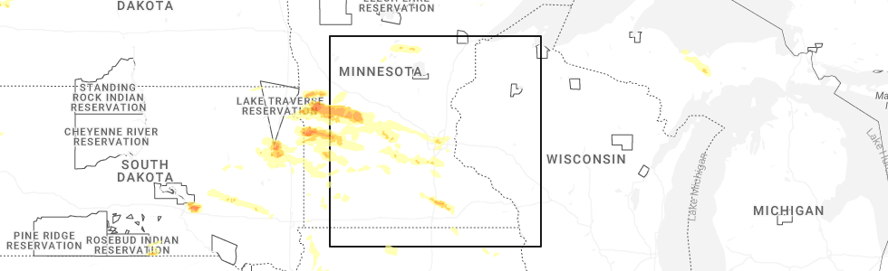
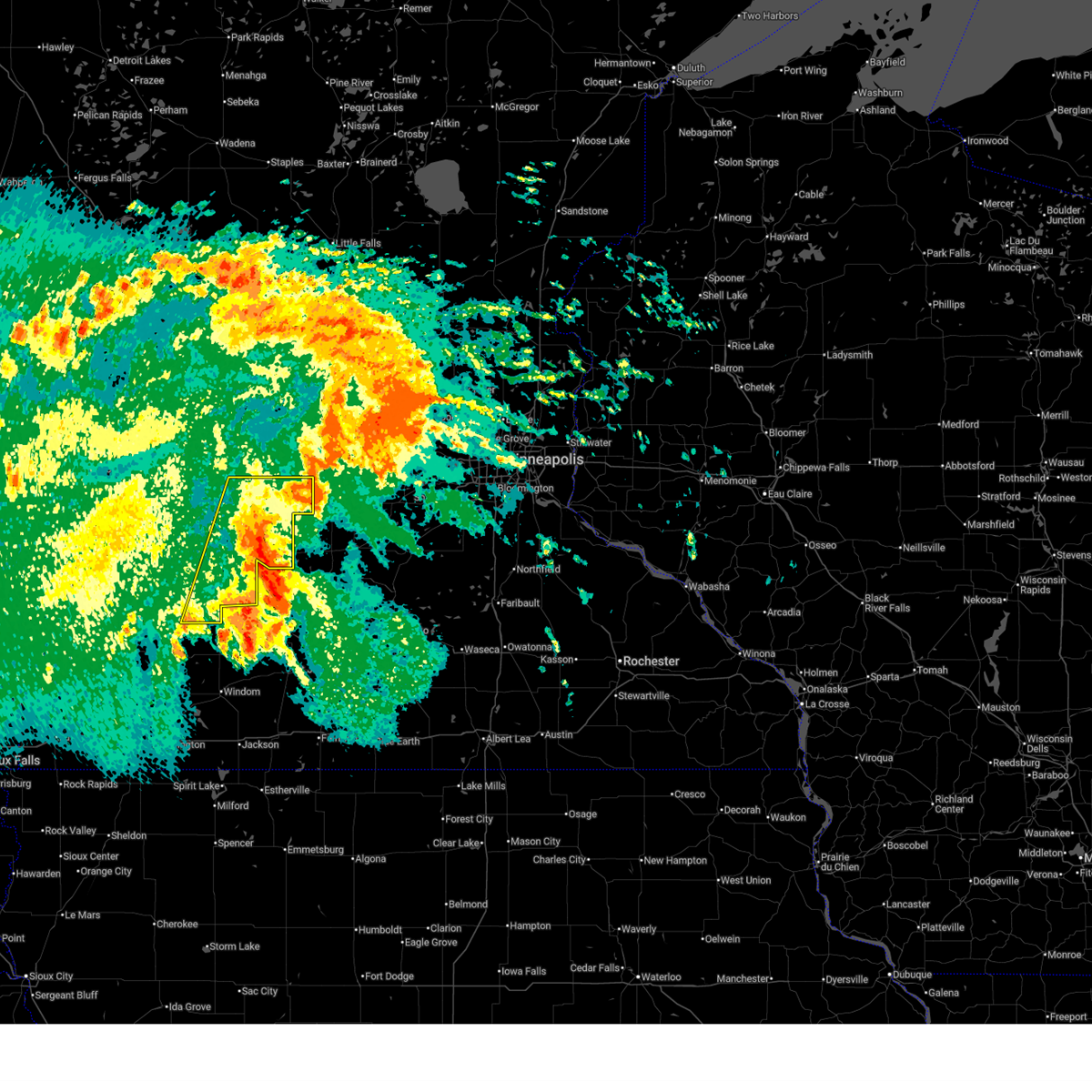
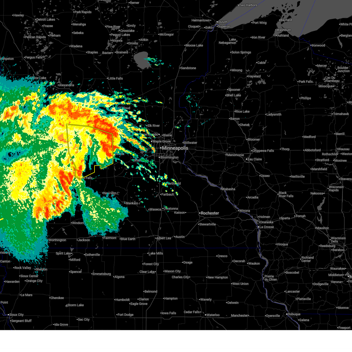
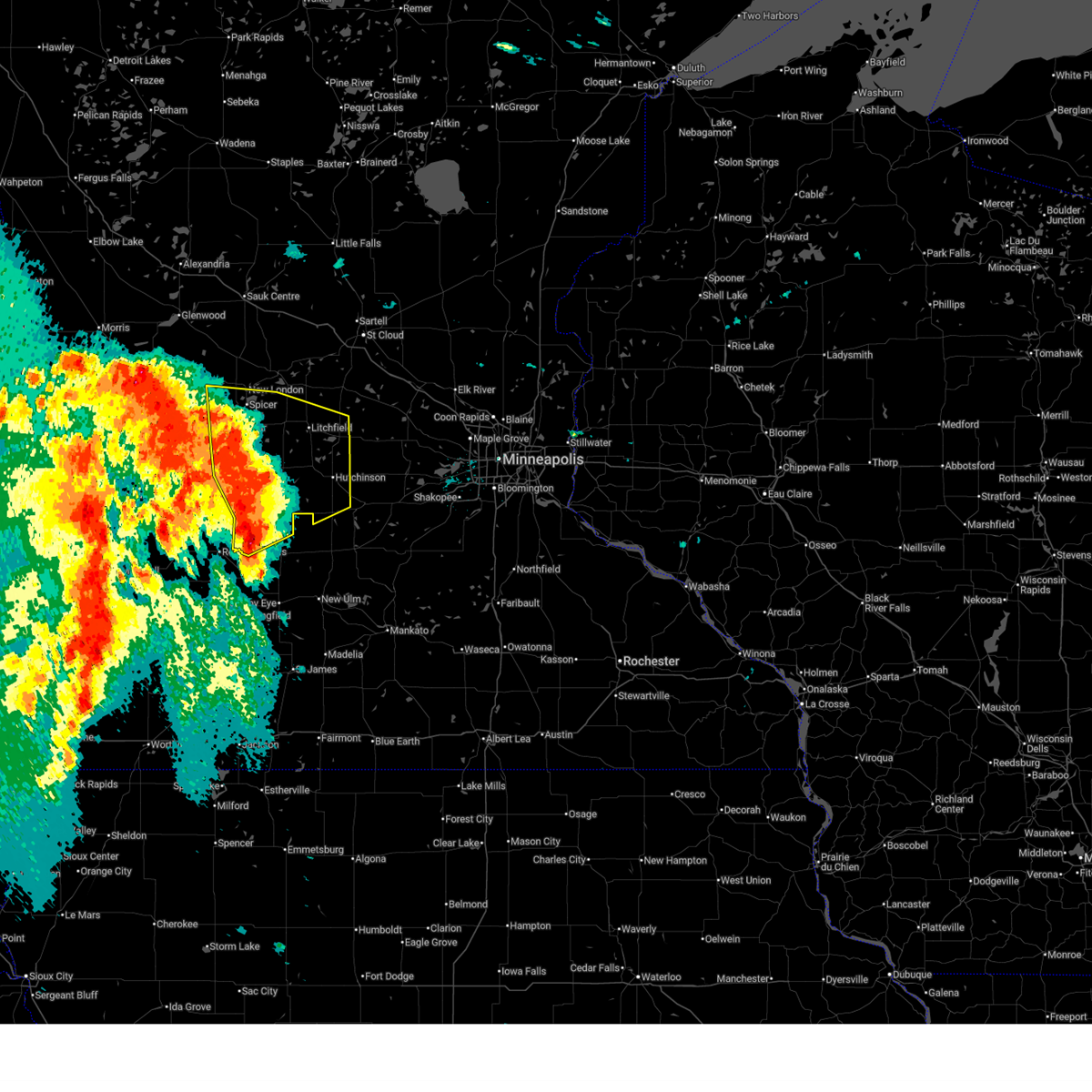
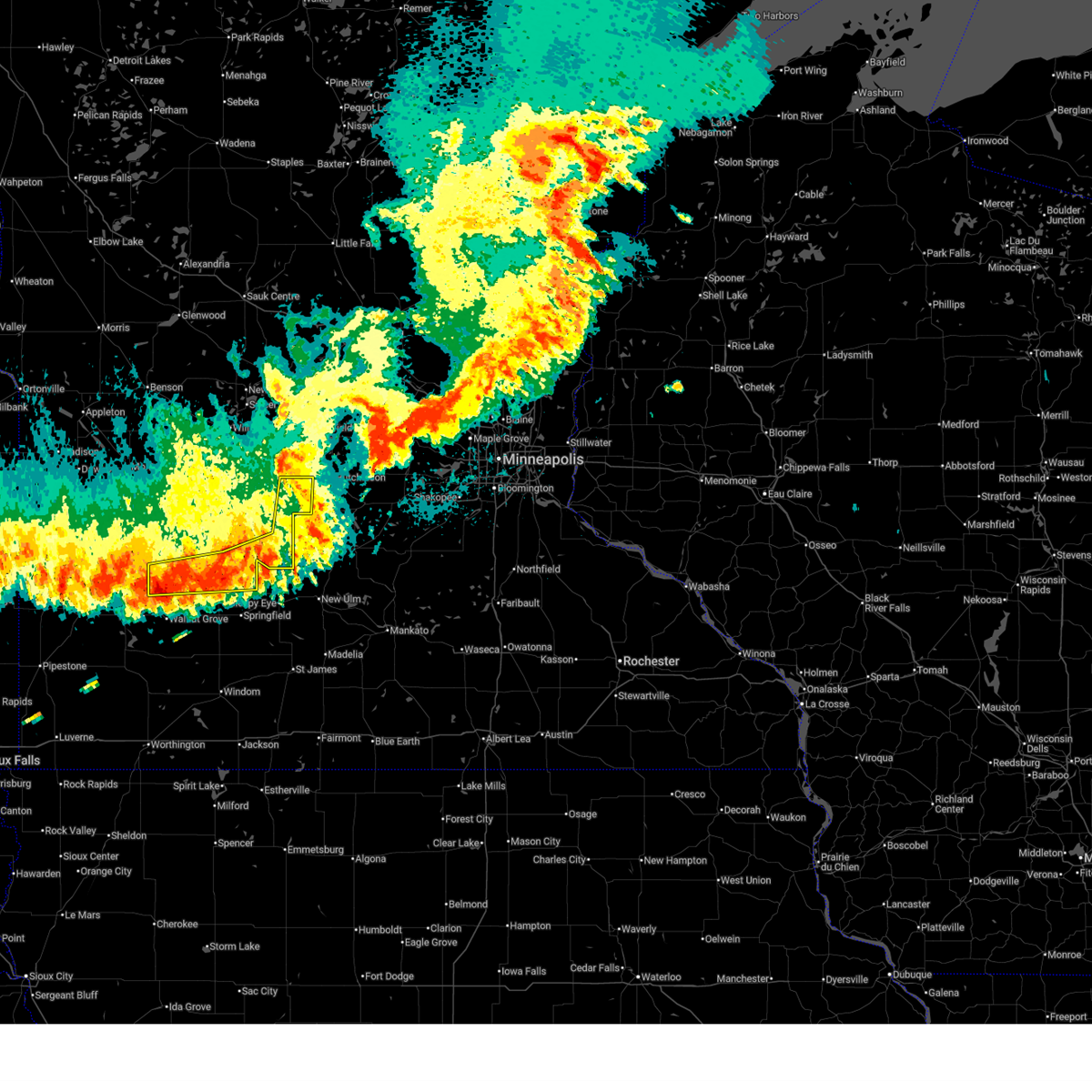
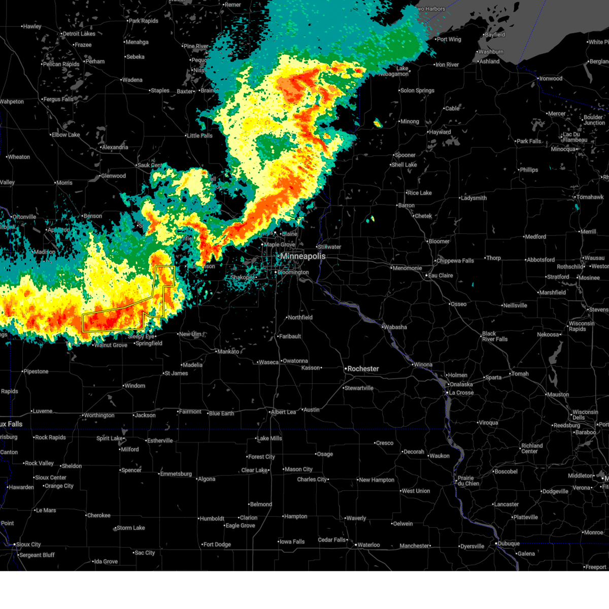
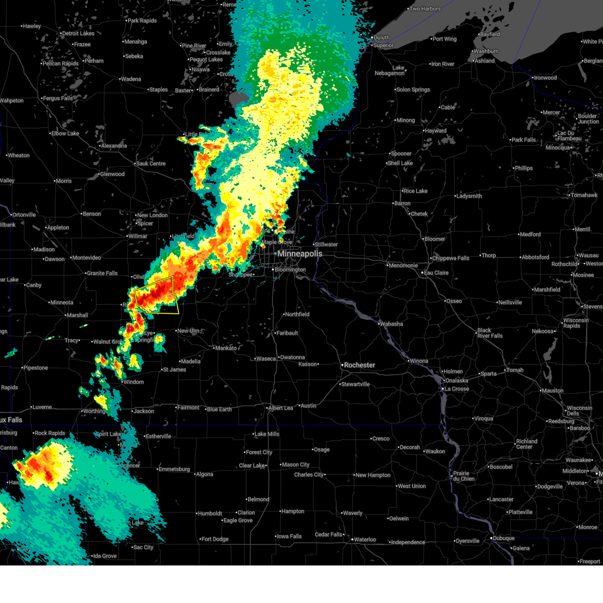
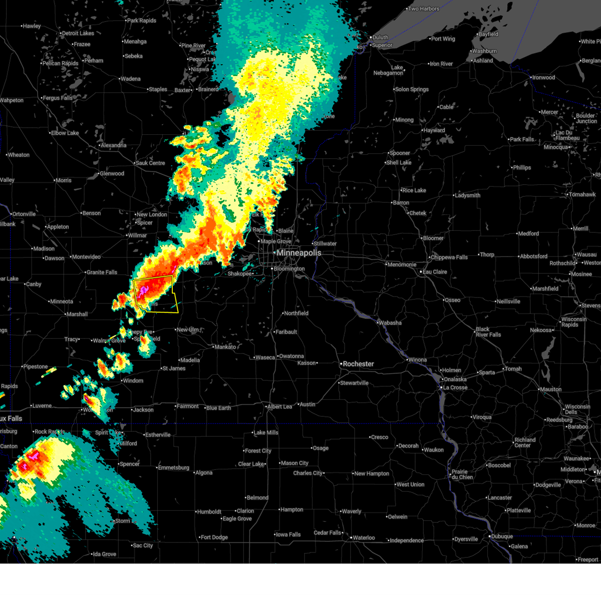
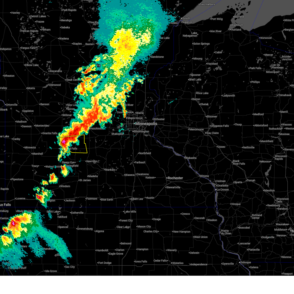
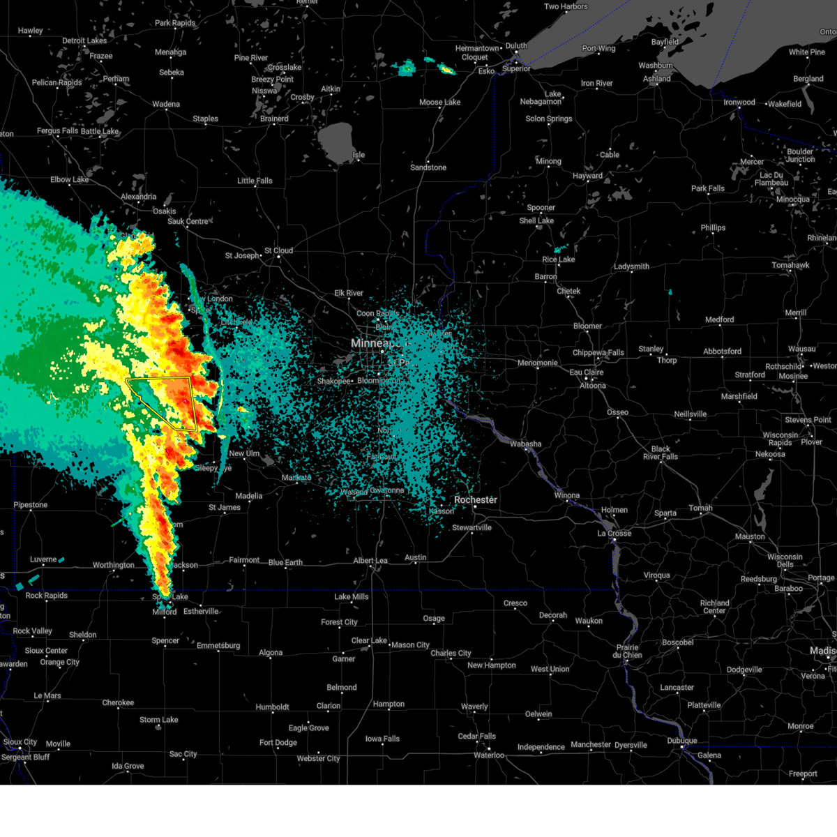
Hail Map for Franklin, MN
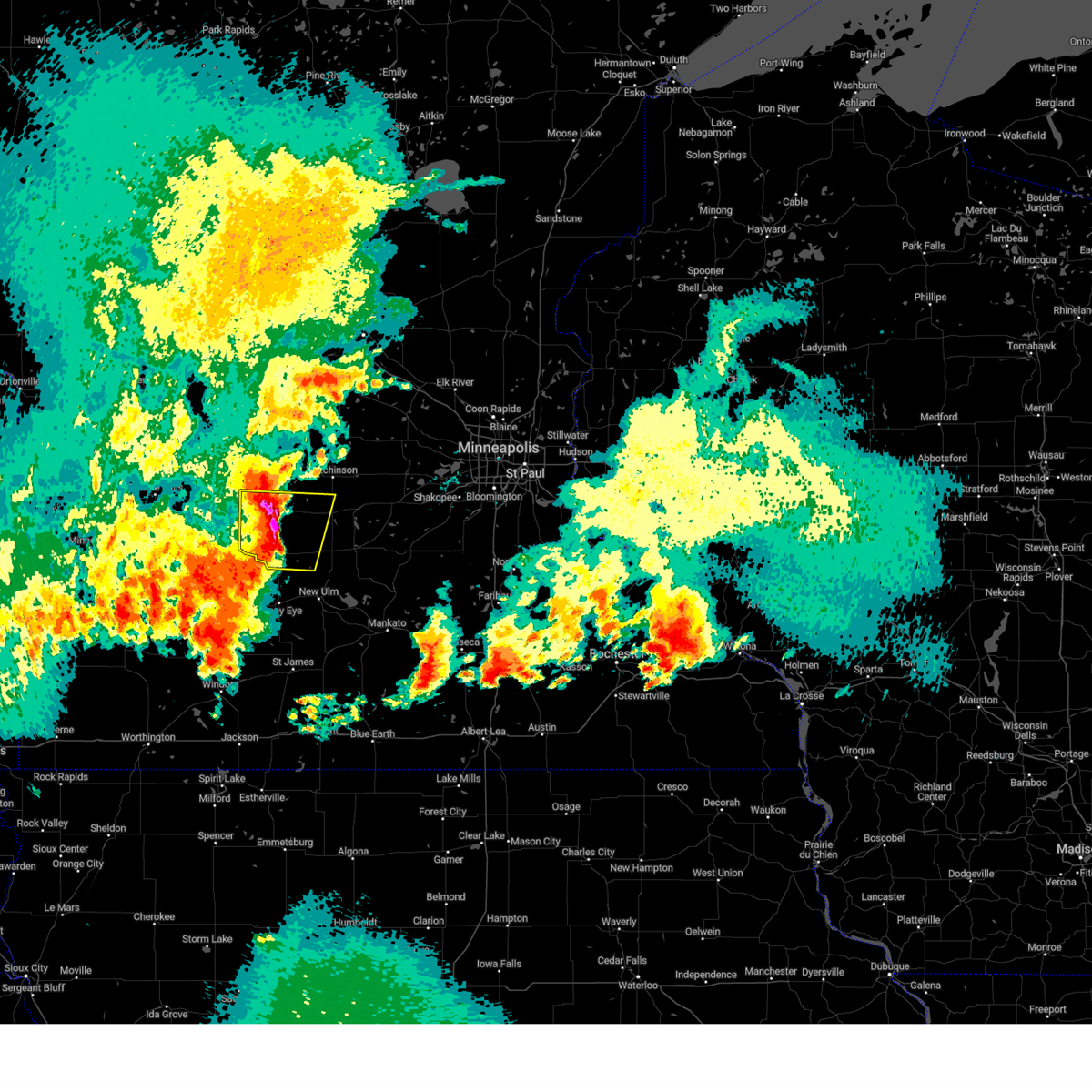
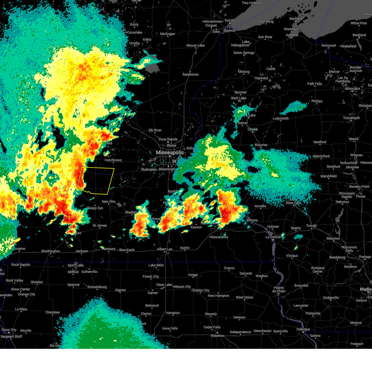
The Franklin, MN area has had 2 reports of on-the-ground hail by trained spotters, and has been under severe weather warnings 14 times during the past 12 months. Doppler radar has detected hail at or near Franklin, MN on 59 occasions, including 4 occasions during the past year.
| Name: | Franklin, MN |
| Where Located: | 50.1 miles SE of Montevideo, MN |
| Map: | Google Map for Franklin, MN |
| Population: | 510 |
| Housing Units: | 230 |
| More Info: | Search Google for Franklin, MN |
1
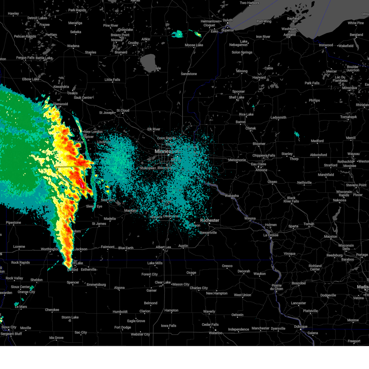
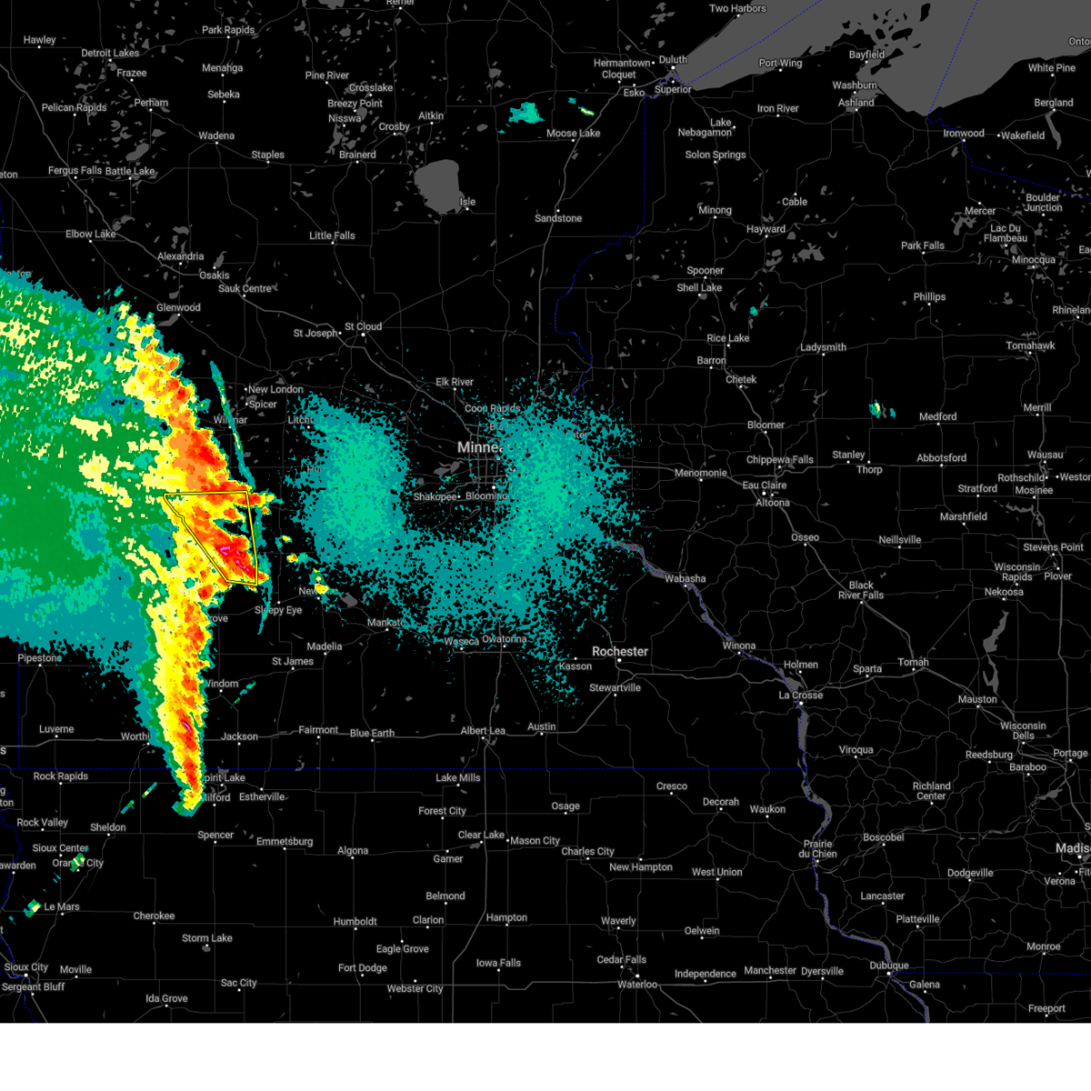
The Top Recent Hail Date for Franklin, MN is Sunday, July 27, 2025 (9th out of 59)
Hail and Wind Damage Spotted near Franklin, MN
| Date / Time | Report Details |
|---|---|
| 9/4/2025 6:09 PM CDT |
 The storms which prompted the warning have weakened below severe limits, and have exited the warned area. therefore, the warning will be allowed to expire. however, gusty winds are still possible with these thunderstorms. The storms which prompted the warning have weakened below severe limits, and have exited the warned area. therefore, the warning will be allowed to expire. however, gusty winds are still possible with these thunderstorms.
|
| 9/4/2025 5:56 PM CDT |
 At 556 pm cdt, severe thunderstorms were located along a line from over morton to near lamberton, or along a line from 8 miles east of redwood falls to 23 miles south of redwood falls, moving southeast at 50 mph (radar indicated). Hazards include 60 mph wind gusts. Expect damage to roofs, siding, and trees. Locations impacted include, springfield, fairfax, morgan, lamberton, franklin, morton, sanborn, clements, revere, evan, wanda, cobden and fort ridgely state park. At 556 pm cdt, severe thunderstorms were located along a line from over morton to near lamberton, or along a line from 8 miles east of redwood falls to 23 miles south of redwood falls, moving southeast at 50 mph (radar indicated). Hazards include 60 mph wind gusts. Expect damage to roofs, siding, and trees. Locations impacted include, springfield, fairfax, morgan, lamberton, franklin, morton, sanborn, clements, revere, evan, wanda, cobden and fort ridgely state park.
|
| 9/4/2025 5:36 PM CDT |
 Svrmpx the national weather service in the twin cities has issued a * severe thunderstorm warning for, southern renville county in central minnesota, western brown county in south central minnesota, western nicollet county in south central minnesota, redwood county in southwestern minnesota, * until 615 pm cdt. * at 536 pm cdt, severe thunderstorms were located along a line from 10 miles south of renville to 8 miles north of walnut grove, or along a line from 10 miles northwest of redwood falls to 24 miles southwest of redwood falls, moving southeast at 50 mph (radar indicated). Hazards include 60 mph wind gusts. expect damage to roofs, siding, and trees Svrmpx the national weather service in the twin cities has issued a * severe thunderstorm warning for, southern renville county in central minnesota, western brown county in south central minnesota, western nicollet county in south central minnesota, redwood county in southwestern minnesota, * until 615 pm cdt. * at 536 pm cdt, severe thunderstorms were located along a line from 10 miles south of renville to 8 miles north of walnut grove, or along a line from 10 miles northwest of redwood falls to 24 miles southwest of redwood falls, moving southeast at 50 mph (radar indicated). Hazards include 60 mph wind gusts. expect damage to roofs, siding, and trees
|
| 8/16/2025 6:28 AM CDT |
 The storms which prompted the warning have weakened below severe limits, and no longer pose an immediate threat to life or property. therefore, the warning will be allowed to expire. a severe thunderstorm watch remains in effect until 900 am cdt for portions of central and southwest minnesota. The storms which prompted the warning have weakened below severe limits, and no longer pose an immediate threat to life or property. therefore, the warning will be allowed to expire. a severe thunderstorm watch remains in effect until 900 am cdt for portions of central and southwest minnesota.
|
| 8/16/2025 6:08 AM CDT |
 At 608 am cdt, severe thunderstorms were located along a line from 10 miles north of bird island to 6 miles south of fairfax, or along a line from 18 miles southeast of willmar to 18 miles northwest of new ulm, moving east at 50 mph (radar indicated). Hazards include 60 mph wind gusts and quarter size hail. Hail damage to vehicles is expected. expect wind damage to roofs, siding, and trees. Locations impacted include, redwood falls, olivia, fairfax, hector, bird island, morgan, lamberton, buffalo lake, wabasso, franklin, morton, danube, lakeside, sanborn, clements, revere, wanda, redwood falls airport, north redwood and bechyn. At 608 am cdt, severe thunderstorms were located along a line from 10 miles north of bird island to 6 miles south of fairfax, or along a line from 18 miles southeast of willmar to 18 miles northwest of new ulm, moving east at 50 mph (radar indicated). Hazards include 60 mph wind gusts and quarter size hail. Hail damage to vehicles is expected. expect wind damage to roofs, siding, and trees. Locations impacted include, redwood falls, olivia, fairfax, hector, bird island, morgan, lamberton, buffalo lake, wabasso, franklin, morton, danube, lakeside, sanborn, clements, revere, wanda, redwood falls airport, north redwood and bechyn.
|
| 8/16/2025 6:07 AM CDT |
 The storms which prompted the warning have moved out of the area. therefore, the warning has been allowed to expire. to report severe weather, contact your nearest law enforcement agency. they will send your report to the national weather service office. The storms which prompted the warning have moved out of the area. therefore, the warning has been allowed to expire. to report severe weather, contact your nearest law enforcement agency. they will send your report to the national weather service office.
|
| 8/16/2025 5:43 AM CDT |
 Svrmpx the national weather service in the twin cities has issued a * severe thunderstorm warning for, renville county in central minnesota, redwood county in southwestern minnesota, * until 630 am cdt. * at 543 am cdt, severe thunderstorms were located along a line from near renville to near wabasso, or along a line from 20 miles northwest of redwood falls to 14 miles south of redwood falls, moving east at 50 mph (radar indicated). Hazards include 60 mph wind gusts and quarter size hail. Hail damage to vehicles is expected. Expect wind damage to roofs, siding, and trees. Svrmpx the national weather service in the twin cities has issued a * severe thunderstorm warning for, renville county in central minnesota, redwood county in southwestern minnesota, * until 630 am cdt. * at 543 am cdt, severe thunderstorms were located along a line from near renville to near wabasso, or along a line from 20 miles northwest of redwood falls to 14 miles south of redwood falls, moving east at 50 mph (radar indicated). Hazards include 60 mph wind gusts and quarter size hail. Hail damage to vehicles is expected. Expect wind damage to roofs, siding, and trees.
|
| 8/16/2025 5:07 AM CDT |
 Svrmpx the national weather service in the twin cities has issued a * severe thunderstorm warning for, kandiyohi county in central minnesota, western mcleod county in central minnesota, meeker county in central minnesota, eastern renville county in central minnesota, * until 600 am cdt. * at 507 am cdt, severe thunderstorms were located along a line from 8 miles southwest of atwater to 5 miles south of buffalo lake, or along a line from 11 miles southeast of willmar to 20 miles southwest of hutchinson, moving northeast at 50 mph (radar indicated). Hazards include 60 mph wind gusts and quarter size hail. Hail damage to vehicles is expected. Expect wind damage to roofs, siding, and trees. Svrmpx the national weather service in the twin cities has issued a * severe thunderstorm warning for, kandiyohi county in central minnesota, western mcleod county in central minnesota, meeker county in central minnesota, eastern renville county in central minnesota, * until 600 am cdt. * at 507 am cdt, severe thunderstorms were located along a line from 8 miles southwest of atwater to 5 miles south of buffalo lake, or along a line from 11 miles southeast of willmar to 20 miles southwest of hutchinson, moving northeast at 50 mph (radar indicated). Hazards include 60 mph wind gusts and quarter size hail. Hail damage to vehicles is expected. Expect wind damage to roofs, siding, and trees.
|
| 6/28/2025 11:41 PM CDT |
 The storms which prompted the warning have moved out of the area. therefore, the warning will be allowed to expire. however, heavy rain is still possible with these thunderstorms. a tornado watch remains in effect until 100 am cdt for portions of central and southwest minnesota. The storms which prompted the warning have moved out of the area. therefore, the warning will be allowed to expire. however, heavy rain is still possible with these thunderstorms. a tornado watch remains in effect until 100 am cdt for portions of central and southwest minnesota.
|
| 6/28/2025 11:34 PM CDT |
 At 1134 pm cdt, severe thunderstorms were located along a line from near stewart to near lamberton, or along a line from 10 miles southwest of hutchinson to 20 miles southwest of redwood falls, moving east at 45 mph (radar indicated). Hazards include 60 mph wind gusts and small hail. Expect damage to roofs, siding, and trees. Locations impacted include, redwood falls, fairfax, hector, morgan, buffalo lake, wabasso, franklin, morton, lakeside, vesta, milroy, lucan, clements and seaforth. At 1134 pm cdt, severe thunderstorms were located along a line from near stewart to near lamberton, or along a line from 10 miles southwest of hutchinson to 20 miles southwest of redwood falls, moving east at 45 mph (radar indicated). Hazards include 60 mph wind gusts and small hail. Expect damage to roofs, siding, and trees. Locations impacted include, redwood falls, fairfax, hector, morgan, buffalo lake, wabasso, franklin, morton, lakeside, vesta, milroy, lucan, clements and seaforth.
|
| 6/28/2025 11:21 PM CDT |
 the severe thunderstorm warning has been cancelled and is no longer in effect the severe thunderstorm warning has been cancelled and is no longer in effect
|
| 6/28/2025 11:21 PM CDT |
 At 1121 pm cdt, severe thunderstorms were located along a line from 5 miles north of hector to 7 miles north of walnut grove, or along a line from 17 miles west of hutchinson to 24 miles southwest of redwood falls, moving east at 45 mph (radar indicated). Hazards include 60 mph wind gusts and small hail. Expect damage to roofs, siding, and trees. Locations impacted include, redwood falls, fairfax, hector, bird island, morgan, buffalo lake, wabasso, franklin, morton, lakeside, vesta, milroy, lucan, clements, seaforth, delhi, redwood falls airport and north redwood. At 1121 pm cdt, severe thunderstorms were located along a line from 5 miles north of hector to 7 miles north of walnut grove, or along a line from 17 miles west of hutchinson to 24 miles southwest of redwood falls, moving east at 45 mph (radar indicated). Hazards include 60 mph wind gusts and small hail. Expect damage to roofs, siding, and trees. Locations impacted include, redwood falls, fairfax, hector, bird island, morgan, buffalo lake, wabasso, franklin, morton, lakeside, vesta, milroy, lucan, clements, seaforth, delhi, redwood falls airport and north redwood.
|
| 6/28/2025 11:03 PM CDT |
 At 1103 pm cdt, severe thunderstorms were located along a line from 7 miles northeast of bird island to 8 miles west of wabasso, or along a line from 22 miles west of hutchinson to 17 miles southwest of redwood falls, moving east at 50 mph (radar indicated). Hazards include 60 mph wind gusts and small hail. Expect damage to roofs, siding, and trees. Locations impacted include, redwood falls, olivia, fairfax, hector, bird island, morgan, buffalo lake, wabasso, franklin, morton, echo, danube, lakeside, belview, vesta, milroy, lucan, clements, seaforth and delhi. At 1103 pm cdt, severe thunderstorms were located along a line from 7 miles northeast of bird island to 8 miles west of wabasso, or along a line from 22 miles west of hutchinson to 17 miles southwest of redwood falls, moving east at 50 mph (radar indicated). Hazards include 60 mph wind gusts and small hail. Expect damage to roofs, siding, and trees. Locations impacted include, redwood falls, olivia, fairfax, hector, bird island, morgan, buffalo lake, wabasso, franklin, morton, echo, danube, lakeside, belview, vesta, milroy, lucan, clements, seaforth and delhi.
|
| 6/28/2025 10:48 PM CDT |
 Svrmpx the national weather service in the twin cities has issued a * severe thunderstorm warning for, renville county in central minnesota, redwood county in southwestern minnesota, southeastern yellow medicine county in west central minnesota, * until 1145 pm cdt. * at 1048 pm cdt, severe thunderstorms were located along a line from 6 miles north of bird island to 12 miles southwest of hanley falls, or along a line from 20 miles south of willmar to 29 miles south of montevideo, moving east at 45 mph (radar indicated). Hazards include 60 mph wind gusts and half dollar size hail. Hail damage to vehicles is expected. Expect wind damage to roofs, siding, and trees. Svrmpx the national weather service in the twin cities has issued a * severe thunderstorm warning for, renville county in central minnesota, redwood county in southwestern minnesota, southeastern yellow medicine county in west central minnesota, * until 1145 pm cdt. * at 1048 pm cdt, severe thunderstorms were located along a line from 6 miles north of bird island to 12 miles southwest of hanley falls, or along a line from 20 miles south of willmar to 29 miles south of montevideo, moving east at 45 mph (radar indicated). Hazards include 60 mph wind gusts and half dollar size hail. Hail damage to vehicles is expected. Expect wind damage to roofs, siding, and trees.
|
| 6/2/2025 6:02 PM CDT |
 At 602 pm cdt, a severe thunderstorm was located near buffalo lake, or 20 miles southwest of hutchinson, moving east at 30 mph (radar indicated). Hazards include 60 mph wind gusts and quarter size hail. Hail damage to vehicles is expected. expect wind damage to roofs, siding, and trees. Locations impacted include, fairfax, gibbon, buffalo lake and franklin. At 602 pm cdt, a severe thunderstorm was located near buffalo lake, or 20 miles southwest of hutchinson, moving east at 30 mph (radar indicated). Hazards include 60 mph wind gusts and quarter size hail. Hail damage to vehicles is expected. expect wind damage to roofs, siding, and trees. Locations impacted include, fairfax, gibbon, buffalo lake and franklin.
|
| 6/2/2025 5:45 PM CDT |
 the severe thunderstorm warning has been cancelled and is no longer in effect the severe thunderstorm warning has been cancelled and is no longer in effect
|
| 6/2/2025 5:45 PM CDT |
 At 545 pm cdt, a severe thunderstorm was located 8 miles southeast of bird island, or 16 miles northeast of redwood falls, moving east at 30 mph (radar indicated). Hazards include two inch hail and 60 mph wind gusts. People and animals outdoors will be injured. expect hail damage to roofs, siding, windows, and vehicles. expect wind damage to roofs, siding, and trees. Locations impacted include, fairfax, hector, gibbon, buffalo lake and franklin. At 545 pm cdt, a severe thunderstorm was located 8 miles southeast of bird island, or 16 miles northeast of redwood falls, moving east at 30 mph (radar indicated). Hazards include two inch hail and 60 mph wind gusts. People and animals outdoors will be injured. expect hail damage to roofs, siding, windows, and vehicles. expect wind damage to roofs, siding, and trees. Locations impacted include, fairfax, hector, gibbon, buffalo lake and franklin.
|
| 6/2/2025 5:31 PM CDT |
 Svrmpx the national weather service in the twin cities has issued a * severe thunderstorm warning for, southeastern renville county in central minnesota, western sibley county in central minnesota, northeastern redwood county in southwestern minnesota, * until 615 pm cdt. * at 531 pm cdt, a severe thunderstorm was located 7 miles north of morton, or 10 miles northeast of redwood falls, moving east at 30 mph (radar indicated). Hazards include two inch hail and 60 mph wind gusts. People and animals outdoors will be injured. expect hail damage to roofs, siding, windows, and vehicles. Expect wind damage to roofs, siding, and trees. Svrmpx the national weather service in the twin cities has issued a * severe thunderstorm warning for, southeastern renville county in central minnesota, western sibley county in central minnesota, northeastern redwood county in southwestern minnesota, * until 615 pm cdt. * at 531 pm cdt, a severe thunderstorm was located 7 miles north of morton, or 10 miles northeast of redwood falls, moving east at 30 mph (radar indicated). Hazards include two inch hail and 60 mph wind gusts. People and animals outdoors will be injured. expect hail damage to roofs, siding, windows, and vehicles. Expect wind damage to roofs, siding, and trees.
|
| 5/15/2025 5:56 AM CDT |
 The storm which prompted the warning has weakened below severe limits, and no longer poses an immediate threat to life or property. therefore, the warning will be allowed to expire. however, small hail and gusty winds are still possible with this thunderstorm. The storm which prompted the warning has weakened below severe limits, and no longer poses an immediate threat to life or property. therefore, the warning will be allowed to expire. however, small hail and gusty winds are still possible with this thunderstorm.
|
| 5/15/2025 5:49 AM CDT |
 At 549 am cdt, a severe thunderstorm was located over morton, or 7 miles east of redwood falls, moving north at 35 mph (radar indicated). Hazards include 60 mph wind gusts and quarter size hail. Hail damage to vehicles is expected. expect wind damage to roofs, siding, and trees. Locations impacted include, redwood falls, olivia, renville, sacred heart, franklin, morton, danube, delhi, bechyn, north redwood, redwood falls airport and upper sioux agency state park. At 549 am cdt, a severe thunderstorm was located over morton, or 7 miles east of redwood falls, moving north at 35 mph (radar indicated). Hazards include 60 mph wind gusts and quarter size hail. Hail damage to vehicles is expected. expect wind damage to roofs, siding, and trees. Locations impacted include, redwood falls, olivia, renville, sacred heart, franklin, morton, danube, delhi, bechyn, north redwood, redwood falls airport and upper sioux agency state park.
|
| 5/15/2025 5:34 AM CDT |
 Svrmpx the national weather service in the twin cities has issued a * severe thunderstorm warning for, western renville county in central minnesota, northeastern redwood county in southwestern minnesota, * until 600 am cdt. * at 534 am cdt, a severe thunderstorm was located over redwood falls, moving northwest at 55 mph (radar indicated). Hazards include 60 mph wind gusts and quarter size hail. Hail damage to vehicles is expected. Expect wind damage to roofs, siding, and trees. Svrmpx the national weather service in the twin cities has issued a * severe thunderstorm warning for, western renville county in central minnesota, northeastern redwood county in southwestern minnesota, * until 600 am cdt. * at 534 am cdt, a severe thunderstorm was located over redwood falls, moving northwest at 55 mph (radar indicated). Hazards include 60 mph wind gusts and quarter size hail. Hail damage to vehicles is expected. Expect wind damage to roofs, siding, and trees.
|
| 8/26/2024 5:52 PM CDT |
 Svrmpx the national weather service in the twin cities has issued a * severe thunderstorm warning for, southwestern sibley county in central minnesota, northeastern brown county in south central minnesota, southeastern renville county in central minnesota, northwestern nicollet county in south central minnesota, * until 630 pm cdt. * at 552 pm cdt, a severe thunderstorm was located over fairfax, or 16 miles east of redwood falls, moving east at 30 mph (radar indicated). Hazards include 60 mph wind gusts and quarter size hail. Hail damage to vehicles is expected. Expect wind damage to roofs, siding, and trees. Svrmpx the national weather service in the twin cities has issued a * severe thunderstorm warning for, southwestern sibley county in central minnesota, northeastern brown county in south central minnesota, southeastern renville county in central minnesota, northwestern nicollet county in south central minnesota, * until 630 pm cdt. * at 552 pm cdt, a severe thunderstorm was located over fairfax, or 16 miles east of redwood falls, moving east at 30 mph (radar indicated). Hazards include 60 mph wind gusts and quarter size hail. Hail damage to vehicles is expected. Expect wind damage to roofs, siding, and trees.
|
| 7/31/2024 8:50 PM CDT |
 At 848 pm cdt, a severe thunderstorm was located 7 miles southwest of hector, or 17 miles northeast of redwood falls, moving east at 35 mph (redwood falls asos measured a 60 mph wind gust). Hazards include 60 mph wind gusts and half dollar size hail. Hail damage to vehicles is expected. expect wind damage to roofs, siding, and trees. Locations impacted include, olivia, fairfax, hector, bird island, gibbon, buffalo lake, stewart, franklin, morton, fernando, lake marion regional park, and fort ridgely state park. At 848 pm cdt, a severe thunderstorm was located 7 miles southwest of hector, or 17 miles northeast of redwood falls, moving east at 35 mph (redwood falls asos measured a 60 mph wind gust). Hazards include 60 mph wind gusts and half dollar size hail. Hail damage to vehicles is expected. expect wind damage to roofs, siding, and trees. Locations impacted include, olivia, fairfax, hector, bird island, gibbon, buffalo lake, stewart, franklin, morton, fernando, lake marion regional park, and fort ridgely state park.
|
| 7/31/2024 8:50 PM CDT |
 the severe thunderstorm warning has been cancelled and is no longer in effect the severe thunderstorm warning has been cancelled and is no longer in effect
|
| 7/31/2024 8:35 PM CDT |
 Svrmpx the national weather service in the twin cities has issued a * severe thunderstorm warning for, western sibley county in central minnesota, east central redwood county in southwestern minnesota, southwestern mcleod county in central minnesota, eastern renville county in central minnesota, * until 915 pm cdt. * at 835 pm cdt, a severe thunderstorm was located 7 miles north of morton, or 11 miles northeast of redwood falls, moving east at 35 mph (radar indicated). Hazards include 60 mph wind gusts and quarter size hail. Hail damage to vehicles is expected. Expect wind damage to roofs, siding, and trees. Svrmpx the national weather service in the twin cities has issued a * severe thunderstorm warning for, western sibley county in central minnesota, east central redwood county in southwestern minnesota, southwestern mcleod county in central minnesota, eastern renville county in central minnesota, * until 915 pm cdt. * at 835 pm cdt, a severe thunderstorm was located 7 miles north of morton, or 11 miles northeast of redwood falls, moving east at 35 mph (radar indicated). Hazards include 60 mph wind gusts and quarter size hail. Hail damage to vehicles is expected. Expect wind damage to roofs, siding, and trees.
|
| 7/15/2024 5:00 AM CDT |
 At 500 am cdt, a severe thunderstorm was located over redwood falls, moving southeast at 40 mph (radar indicated). Hazards include golf ball size hail and 60 mph wind gusts. People and animals outdoors will be injured. expect hail damage to roofs, siding, windows, and vehicles. expect wind damage to roofs, siding, and trees. Locations impacted include, redwood falls, fairfax, morgan, franklin, morton, clements, delhi, north redwood, and redwood falls airport. At 500 am cdt, a severe thunderstorm was located over redwood falls, moving southeast at 40 mph (radar indicated). Hazards include golf ball size hail and 60 mph wind gusts. People and animals outdoors will be injured. expect hail damage to roofs, siding, windows, and vehicles. expect wind damage to roofs, siding, and trees. Locations impacted include, redwood falls, fairfax, morgan, franklin, morton, clements, delhi, north redwood, and redwood falls airport.
|
| 7/15/2024 4:53 AM CDT |
 Svrmpx the national weather service in the twin cities has issued a * severe thunderstorm warning for, eastern redwood county in southwestern minnesota, north central brown county in south central minnesota, southwestern renville county in central minnesota, * until 530 am cdt. * at 452 am cdt, a severe thunderstorm was located 8 miles northwest of redwood falls, moving southeast at 40 mph (trained weather spotters reported half dollar size hail in granite falls at 430 am cdt). Hazards include 60 mph wind gusts and half dollar size hail. Hail damage to vehicles is expected. Expect wind damage to roofs, siding, and trees. Svrmpx the national weather service in the twin cities has issued a * severe thunderstorm warning for, eastern redwood county in southwestern minnesota, north central brown county in south central minnesota, southwestern renville county in central minnesota, * until 530 am cdt. * at 452 am cdt, a severe thunderstorm was located 8 miles northwest of redwood falls, moving southeast at 40 mph (trained weather spotters reported half dollar size hail in granite falls at 430 am cdt). Hazards include 60 mph wind gusts and half dollar size hail. Hail damage to vehicles is expected. Expect wind damage to roofs, siding, and trees.
|
| 7/10/2024 2:02 PM CDT |
 Svrmpx the national weather service in the twin cities has issued a * severe thunderstorm warning for, northeastern redwood county in southwestern minnesota, south central renville county in central minnesota, * until 230 pm cdt. * at 202 pm cdt, a severe thunderstorm was located over morton, or 6 miles east of redwood falls, moving west at 15 mph (radar indicated). Hazards include 60 mph wind gusts. expect damage to roofs, siding, and trees Svrmpx the national weather service in the twin cities has issued a * severe thunderstorm warning for, northeastern redwood county in southwestern minnesota, south central renville county in central minnesota, * until 230 pm cdt. * at 202 pm cdt, a severe thunderstorm was located over morton, or 6 miles east of redwood falls, moving west at 15 mph (radar indicated). Hazards include 60 mph wind gusts. expect damage to roofs, siding, and trees
|
| 5/20/2024 11:35 PM CDT |
 At 1135 pm cdt, a severe thunderstorm was located near fairfax, or 17 miles east of redwood falls, moving northeast at 30 mph (radar indicated). Hazards include 60 mph wind gusts and quarter size hail. Hail damage to vehicles is expected. expect wind damage to roofs, siding, and trees. Locations impacted include, fairfax and franklin. At 1135 pm cdt, a severe thunderstorm was located near fairfax, or 17 miles east of redwood falls, moving northeast at 30 mph (radar indicated). Hazards include 60 mph wind gusts and quarter size hail. Hail damage to vehicles is expected. expect wind damage to roofs, siding, and trees. Locations impacted include, fairfax and franklin.
|
| 5/20/2024 11:35 PM CDT |
 the severe thunderstorm warning has been cancelled and is no longer in effect the severe thunderstorm warning has been cancelled and is no longer in effect
|
| 5/20/2024 11:24 PM CDT |
 Svrmpx the national weather service in the twin cities has issued a * severe thunderstorm warning for, west central sibley county in central minnesota, east central redwood county in southwestern minnesota, northwestern brown county in south central minnesota, southeastern renville county in central minnesota, * until midnight cdt. * at 1124 pm cdt, a severe thunderstorm was located over franklin, or 13 miles east of redwood falls, moving northeast at 30 mph (radar indicated). Hazards include 60 mph wind gusts and half dollar size hail. Hail damage to vehicles is expected. Expect wind damage to roofs, siding, and trees. Svrmpx the national weather service in the twin cities has issued a * severe thunderstorm warning for, west central sibley county in central minnesota, east central redwood county in southwestern minnesota, northwestern brown county in south central minnesota, southeastern renville county in central minnesota, * until midnight cdt. * at 1124 pm cdt, a severe thunderstorm was located over franklin, or 13 miles east of redwood falls, moving northeast at 30 mph (radar indicated). Hazards include 60 mph wind gusts and half dollar size hail. Hail damage to vehicles is expected. Expect wind damage to roofs, siding, and trees.
|
| 9/29/2023 6:15 PM CDT |
 At 615 pm cdt, a severe thunderstorm was located near redwood falls, moving east at 45 mph (radar indicated). Hazards include ping pong ball size hail and 60 mph wind gusts. People and animals outdoors will be injured. expect hail damage to roofs, siding, windows, and vehicles. Expect wind damage to roofs, siding, and trees. At 615 pm cdt, a severe thunderstorm was located near redwood falls, moving east at 45 mph (radar indicated). Hazards include ping pong ball size hail and 60 mph wind gusts. People and animals outdoors will be injured. expect hail damage to roofs, siding, windows, and vehicles. Expect wind damage to roofs, siding, and trees.
|
| 7/27/2023 6:42 PM CDT |
 At 642 pm cdt, a severe thunderstorm was located near franklin, or 13 miles east of redwood falls, moving east at 10 mph (radar indicated). Hazards include ping pong ball size hail and 60 mph wind gusts. People and animals outdoors will be injured. expect hail damage to roofs, siding, windows, and vehicles. Expect wind damage to roofs, siding, and trees. At 642 pm cdt, a severe thunderstorm was located near franklin, or 13 miles east of redwood falls, moving east at 10 mph (radar indicated). Hazards include ping pong ball size hail and 60 mph wind gusts. People and animals outdoors will be injured. expect hail damage to roofs, siding, windows, and vehicles. Expect wind damage to roofs, siding, and trees.
|
| 7/14/2023 3:39 PM CDT |
 The severe thunderstorm warning for northeastern redwood, northwestern brown and south central renville counties will expire at 345 pm cdt, the storm which prompted the warning has weakened below severe limits, and no longer poses an immediate threat to life or property. therefore, the warning will be allowed to expire. The severe thunderstorm warning for northeastern redwood, northwestern brown and south central renville counties will expire at 345 pm cdt, the storm which prompted the warning has weakened below severe limits, and no longer poses an immediate threat to life or property. therefore, the warning will be allowed to expire.
|
| 7/14/2023 3:34 PM CDT |
 At 334 pm cdt, a severe thunderstorm was located near franklin, or 13 miles east of redwood falls, moving southeast at 30 mph (radar indicated). Hazards include 60 mph wind gusts and quarter size hail. Hail damage to vehicles is expected. expect wind damage to roofs, siding, and trees. this severe storm will be near, fairfax around 340 pm cdt. hail threat, radar indicated max hail size, 1. 00 in wind threat, radar indicated max wind gust, 60 mph. At 334 pm cdt, a severe thunderstorm was located near franklin, or 13 miles east of redwood falls, moving southeast at 30 mph (radar indicated). Hazards include 60 mph wind gusts and quarter size hail. Hail damage to vehicles is expected. expect wind damage to roofs, siding, and trees. this severe storm will be near, fairfax around 340 pm cdt. hail threat, radar indicated max hail size, 1. 00 in wind threat, radar indicated max wind gust, 60 mph.
|
| 7/14/2023 3:23 PM CDT |
 At 323 pm cdt, a severe thunderstorm was located over morton, or 7 miles east of redwood falls, moving southeast at 25 mph (radar indicated). Hazards include 60 mph wind gusts and quarter size hail. Hail damage to vehicles is expected. expect wind damage to roofs, siding, and trees. this severe thunderstorm will be near, franklin around 330 pm cdt. other locations in the path of this severe thunderstorm include fairfax. hail threat, radar indicated max hail size, 1. 00 in wind threat, radar indicated max wind gust, 60 mph. At 323 pm cdt, a severe thunderstorm was located over morton, or 7 miles east of redwood falls, moving southeast at 25 mph (radar indicated). Hazards include 60 mph wind gusts and quarter size hail. Hail damage to vehicles is expected. expect wind damage to roofs, siding, and trees. this severe thunderstorm will be near, franklin around 330 pm cdt. other locations in the path of this severe thunderstorm include fairfax. hail threat, radar indicated max hail size, 1. 00 in wind threat, radar indicated max wind gust, 60 mph.
|
| 10/23/2022 9:06 PM CDT |
 At 906 pm cdt, a severe thunderstorm was located 8 miles northwest of springfield, or 15 miles south of redwood falls, moving northeast at 50 mph (radar indicated). Hazards include 60 mph wind gusts. Expect damage to roofs, siding, and trees. locations impacted include, morgan. hail threat, radar indicated max hail size, <. 75 in wind threat, radar indicated max wind gust, 60 mph. At 906 pm cdt, a severe thunderstorm was located 8 miles northwest of springfield, or 15 miles south of redwood falls, moving northeast at 50 mph (radar indicated). Hazards include 60 mph wind gusts. Expect damage to roofs, siding, and trees. locations impacted include, morgan. hail threat, radar indicated max hail size, <. 75 in wind threat, radar indicated max wind gust, 60 mph.
|
| 10/23/2022 8:46 PM CDT |
 At 846 pm cdt, a severe thunderstorm was located near lamberton, or 22 miles north of windom, moving northeast at 75 mph (radar indicated). Hazards include 60 mph wind gusts. Expect damage to roofs, siding, and trees. this severe thunderstorm will be near, springfield around 855 pm cdt. morgan around 905 pm cdt. hail threat, radar indicated max hail size, <. 75 in wind threat, radar indicated max wind gust, 60 mph. At 846 pm cdt, a severe thunderstorm was located near lamberton, or 22 miles north of windom, moving northeast at 75 mph (radar indicated). Hazards include 60 mph wind gusts. Expect damage to roofs, siding, and trees. this severe thunderstorm will be near, springfield around 855 pm cdt. morgan around 905 pm cdt. hail threat, radar indicated max hail size, <. 75 in wind threat, radar indicated max wind gust, 60 mph.
|
| 8/2/2022 10:53 PM CDT |
 At 1053 pm cdt, severe thunderstorms were located along a line extending from 5 miles southeast of prinsburg to near bird island to morton, moving east at 70 mph (radar indicated). Hazards include 70 mph wind gusts. Expect considerable tree damage. damage is likely to mobile homes, roofs, and outbuildings. severe thunderstorms will be near, fairfax and hector around 1105 pm cdt. buffalo lake and cosmos around 1110 pm cdt. other locations in the path of these severe thunderstorms include gibbon, stewart, winthrop, brownton, hutchinson, glencoe, gaylord and silver lake. thunderstorm damage threat, considerable hail threat, radar indicated max hail size, <. 75 in wind threat, observed max wind gust, 70 mph. At 1053 pm cdt, severe thunderstorms were located along a line extending from 5 miles southeast of prinsburg to near bird island to morton, moving east at 70 mph (radar indicated). Hazards include 70 mph wind gusts. Expect considerable tree damage. damage is likely to mobile homes, roofs, and outbuildings. severe thunderstorms will be near, fairfax and hector around 1105 pm cdt. buffalo lake and cosmos around 1110 pm cdt. other locations in the path of these severe thunderstorms include gibbon, stewart, winthrop, brownton, hutchinson, glencoe, gaylord and silver lake. thunderstorm damage threat, considerable hail threat, radar indicated max hail size, <. 75 in wind threat, observed max wind gust, 70 mph.
|
| 8/2/2022 10:46 PM CDT |
 At 1046 pm cdt, severe thunderstorms were located along a line extending from near clara city to 6 miles southeast of renville to near lamberton, moving east at 70 mph (radar indicated). Hazards include 70 mph wind gusts. Expect considerable tree damage. damage is likely to mobile homes, roofs, and outbuildings. locations impacted include, redwood falls, granite falls, olivia, renville, morgan, lamberton, wabasso, sacred heart, franklin, wood lake, morton and echo. thunderstorm damage threat, considerable hail threat, radar indicated max hail size, <. 75 in wind threat, radar indicated max wind gust, 70 mph. At 1046 pm cdt, severe thunderstorms were located along a line extending from near clara city to 6 miles southeast of renville to near lamberton, moving east at 70 mph (radar indicated). Hazards include 70 mph wind gusts. Expect considerable tree damage. damage is likely to mobile homes, roofs, and outbuildings. locations impacted include, redwood falls, granite falls, olivia, renville, morgan, lamberton, wabasso, sacred heart, franklin, wood lake, morton and echo. thunderstorm damage threat, considerable hail threat, radar indicated max hail size, <. 75 in wind threat, radar indicated max wind gust, 70 mph.
|
| 8/2/2022 10:29 PM CDT |
 At 1029 pm cdt, severe thunderstorms were located along a line extending from 5 miles southeast of montevideo to wood lake to 8 miles north of walnut grove, moving east at 60 mph (radar indicated). Hazards include 70 mph wind gusts. Expect considerable tree damage. damage is likely to mobile homes, roofs, and outbuildings. locations impacted include, echo, wabasso, sacred heart, maynard, clara city, renville, redwood falls, olivia, morgan, morton and franklin. thunderstorm damage threat, considerable hail threat, radar indicated max hail size, <. 75 in wind threat, radar indicated max wind gust, 70 mph. At 1029 pm cdt, severe thunderstorms were located along a line extending from 5 miles southeast of montevideo to wood lake to 8 miles north of walnut grove, moving east at 60 mph (radar indicated). Hazards include 70 mph wind gusts. Expect considerable tree damage. damage is likely to mobile homes, roofs, and outbuildings. locations impacted include, echo, wabasso, sacred heart, maynard, clara city, renville, redwood falls, olivia, morgan, morton and franklin. thunderstorm damage threat, considerable hail threat, radar indicated max hail size, <. 75 in wind threat, radar indicated max wind gust, 70 mph.
|
| 8/2/2022 10:13 PM CDT |
 At 1012 pm cdt, severe thunderstorms were located along a line extending from near boyd to 6 miles northeast of ghent to 7 miles northwest of tracy, moving east at 60 mph (radar indicated). Hazards include 70 mph wind gusts. a 74 mph gust was reported at marshall airport. Expect considerable tree damage. damage is likely to mobile homes, roofs, and outbuildings. severe thunderstorms will be near, clarkfield around 1020 pm cdt. montevideo, wood lake and hanley falls around 1025 pm cdt. granite falls and echo around 1030 pm cdt. wabasso, sacred heart and maynard around 1035 pm cdt. clara city around 1040 pm cdt. redwood falls and renville around 1045 pm cdt. thunderstorm damage threat, considerable hail threat, radar indicated max hail size, <. 75 in wind threat, observed max wind gust, 70 mph. At 1012 pm cdt, severe thunderstorms were located along a line extending from near boyd to 6 miles northeast of ghent to 7 miles northwest of tracy, moving east at 60 mph (radar indicated). Hazards include 70 mph wind gusts. a 74 mph gust was reported at marshall airport. Expect considerable tree damage. damage is likely to mobile homes, roofs, and outbuildings. severe thunderstorms will be near, clarkfield around 1020 pm cdt. montevideo, wood lake and hanley falls around 1025 pm cdt. granite falls and echo around 1030 pm cdt. wabasso, sacred heart and maynard around 1035 pm cdt. clara city around 1040 pm cdt. redwood falls and renville around 1045 pm cdt. thunderstorm damage threat, considerable hail threat, radar indicated max hail size, <. 75 in wind threat, observed max wind gust, 70 mph.
|
| 7/23/2022 9:56 AM CDT |
 At 956 am cdt, a severe thunderstorm was located near fairfax, or 20 miles northwest of new ulm, moving east at 40 mph (radar indicated). Hazards include 60 mph wind gusts and quarter size hail. Hail damage to vehicles is expected. expect wind damage to roofs, siding, and trees. locations impacted include, olivia, fairfax, hector, bird island, buffalo lake and franklin. hail threat, radar indicated max hail size, 1. 00 in wind threat, radar indicated max wind gust, 60 mph. At 956 am cdt, a severe thunderstorm was located near fairfax, or 20 miles northwest of new ulm, moving east at 40 mph (radar indicated). Hazards include 60 mph wind gusts and quarter size hail. Hail damage to vehicles is expected. expect wind damage to roofs, siding, and trees. locations impacted include, olivia, fairfax, hector, bird island, buffalo lake and franklin. hail threat, radar indicated max hail size, 1. 00 in wind threat, radar indicated max wind gust, 60 mph.
|
| 7/23/2022 9:50 AM CDT | Quarter sized hail reported 0.9 miles W of Franklin, MN |
| 7/23/2022 9:45 AM CDT |
 At 944 am cdt, a severe thunderstorm was located over fairfax, or 16 miles east of redwood falls, moving east at 50 mph (radar indicated). Hazards include 60 mph wind gusts and quarter size hail. Hail damage to vehicles is expected. expect wind damage to roofs, siding, and trees. this severe thunderstorm will remain over mainly rural areas of eastern renville county, including the following locations, bechyn and danube. hail threat, radar indicated max hail size, 1. 00 in wind threat, radar indicated max wind gust, 60 mph. At 944 am cdt, a severe thunderstorm was located over fairfax, or 16 miles east of redwood falls, moving east at 50 mph (radar indicated). Hazards include 60 mph wind gusts and quarter size hail. Hail damage to vehicles is expected. expect wind damage to roofs, siding, and trees. this severe thunderstorm will remain over mainly rural areas of eastern renville county, including the following locations, bechyn and danube. hail threat, radar indicated max hail size, 1. 00 in wind threat, radar indicated max wind gust, 60 mph.
|
| 7/23/2022 9:33 AM CDT |
 At 932 am cdt, a severe thunderstorm was located over morton, or 7 miles northeast of redwood falls, moving east at 50 mph (radar indicated). Hazards include 60 mph wind gusts and quarter size hail. Hail damage to vehicles is expected. expect wind damage to roofs, siding, and trees. this severe thunderstorm will be near, fairfax around 950 am cdt. hail threat, radar indicated max hail size, 1. 00 in wind threat, radar indicated max wind gust, 60 mph. At 932 am cdt, a severe thunderstorm was located over morton, or 7 miles northeast of redwood falls, moving east at 50 mph (radar indicated). Hazards include 60 mph wind gusts and quarter size hail. Hail damage to vehicles is expected. expect wind damage to roofs, siding, and trees. this severe thunderstorm will be near, fairfax around 950 am cdt. hail threat, radar indicated max hail size, 1. 00 in wind threat, radar indicated max wind gust, 60 mph.
|
| 5/30/2022 5:21 PM CDT |
 At 521 pm cdt, severe thunderstorms were located along a line extending from near morgan to 8 miles east of comfrey to 6 miles northwest of trimont, moving northeast at 70 mph (radar indicated). Hazards include 70 mph wind gusts and ping pong ball size hail. People and animals outdoors will be injured. expect hail damage to roofs, siding, windows, and vehicles. expect considerable tree damage. wind damage is also likely to mobile homes, roofs, and outbuildings. these severe storms will be near, morgan around 525 pm cdt. other locations in the path of these severe thunderstorms include sleepy eye, st. James, fairfax, hector, gibbon, buffalo lake, hanska, winthrop, new ulm and lafayette. At 521 pm cdt, severe thunderstorms were located along a line extending from near morgan to 8 miles east of comfrey to 6 miles northwest of trimont, moving northeast at 70 mph (radar indicated). Hazards include 70 mph wind gusts and ping pong ball size hail. People and animals outdoors will be injured. expect hail damage to roofs, siding, windows, and vehicles. expect considerable tree damage. wind damage is also likely to mobile homes, roofs, and outbuildings. these severe storms will be near, morgan around 525 pm cdt. other locations in the path of these severe thunderstorms include sleepy eye, st. James, fairfax, hector, gibbon, buffalo lake, hanska, winthrop, new ulm and lafayette.
|
| 5/30/2022 5:06 PM CDT |
 At 505 pm cdt, severe thunderstorms were located along a line extending from 7 miles northeast of jeffers to mountain lake to near jackson in jackson county, moving northeast at 70 mph (radar indicated). Hazards include 70 mph wind gusts and half dollar size hail. Hail damage to vehicles is expected. expect considerable tree damage. wind damage is also likely to mobile homes, roofs, and outbuildings. severe thunderstorms will be near, springfield and comfrey around 515 pm cdt. trimont around 520 pm cdt. sleepy eye and morgan around 525 pm cdt. other locations in the path of these severe thunderstorms include butterfield, franklin, new ulm, st. James, fairfax, lafayette, winthrop, hector, gibbon, buffalo lake and hanska. At 505 pm cdt, severe thunderstorms were located along a line extending from 7 miles northeast of jeffers to mountain lake to near jackson in jackson county, moving northeast at 70 mph (radar indicated). Hazards include 70 mph wind gusts and half dollar size hail. Hail damage to vehicles is expected. expect considerable tree damage. wind damage is also likely to mobile homes, roofs, and outbuildings. severe thunderstorms will be near, springfield and comfrey around 515 pm cdt. trimont around 520 pm cdt. sleepy eye and morgan around 525 pm cdt. other locations in the path of these severe thunderstorms include butterfield, franklin, new ulm, st. James, fairfax, lafayette, winthrop, hector, gibbon, buffalo lake and hanska.
|
| 5/30/2022 3:29 AM CDT |
 At 329 am cdt, severe thunderstorms were located along a line extending from 7 miles southwest of echo to near jackson in jackson county, moving northeast at 60 mph (radar indicated). Hazards include 60 mph wind gusts. Expect damage to roofs, siding, and trees. locations impacted include, redwood falls, st. James, sleepy eye, springfield, sherburn, truman, morgan, lamberton, trimont, wabasso, welcome and butterfield. At 329 am cdt, severe thunderstorms were located along a line extending from 7 miles southwest of echo to near jackson in jackson county, moving northeast at 60 mph (radar indicated). Hazards include 60 mph wind gusts. Expect damage to roofs, siding, and trees. locations impacted include, redwood falls, st. James, sleepy eye, springfield, sherburn, truman, morgan, lamberton, trimont, wabasso, welcome and butterfield.
|
| 5/30/2022 3:02 AM CDT |
 At 301 am cdt, severe thunderstorms were located along a line extending from near camden state park to round lake, moving northeast at 60 mph (radar indicated). Hazards include 70 mph wind gusts. Expect considerable tree damage. Damage is likely to mobile homes, roofs, and outbuildings. At 301 am cdt, severe thunderstorms were located along a line extending from near camden state park to round lake, moving northeast at 60 mph (radar indicated). Hazards include 70 mph wind gusts. Expect considerable tree damage. Damage is likely to mobile homes, roofs, and outbuildings.
|
| 5/12/2022 7:23 PM CDT |
 At 723 pm cdt, severe thunderstorms were located along a line extending from near hutchinson to winthrop to lake crystal, moving northeast at 55 mph (radar indicated). Hazards include 70 mph wind gusts. Expect considerable tree damage. damage is likely to mobile homes, roofs, and outbuildings. these severe storms will be near, hutchinson and silver lake around 730 pm cdt. arlington around 735 pm cdt. winsted around 740 pm cdt. st. peter and green isle around 745 pm cdt. thunderstorm damage threat, considerable hail threat, radar indicated max hail size, <. 75 in wind threat, radar indicated max wind gust, 70 mph. At 723 pm cdt, severe thunderstorms were located along a line extending from near hutchinson to winthrop to lake crystal, moving northeast at 55 mph (radar indicated). Hazards include 70 mph wind gusts. Expect considerable tree damage. damage is likely to mobile homes, roofs, and outbuildings. these severe storms will be near, hutchinson and silver lake around 730 pm cdt. arlington around 735 pm cdt. winsted around 740 pm cdt. st. peter and green isle around 745 pm cdt. thunderstorm damage threat, considerable hail threat, radar indicated max hail size, <. 75 in wind threat, radar indicated max wind gust, 70 mph.
|
| 5/12/2022 6:52 PM CDT |
 At 651 pm cdt, severe thunderstorms were located along a line extending from near bird island to near sleepy eye to near st. james, moving east at 55 mph (radar indicated). Hazards include 70 mph wind gusts. Expect considerable tree damage. damage is likely to mobile homes, roofs, and outbuildings. severe thunderstorms will be near, hector around 700 pm cdt. new ulm and buffalo lake around 705 pm cdt. courtland and lafayette around 715 pm cdt. hutchinson and nicollet around 720 pm cdt. thunderstorm damage threat, considerable hail threat, radar indicated max hail size, <. 75 in wind threat, observed max wind gust, 70 mph. At 651 pm cdt, severe thunderstorms were located along a line extending from near bird island to near sleepy eye to near st. james, moving east at 55 mph (radar indicated). Hazards include 70 mph wind gusts. Expect considerable tree damage. damage is likely to mobile homes, roofs, and outbuildings. severe thunderstorms will be near, hector around 700 pm cdt. new ulm and buffalo lake around 705 pm cdt. courtland and lafayette around 715 pm cdt. hutchinson and nicollet around 720 pm cdt. thunderstorm damage threat, considerable hail threat, radar indicated max hail size, <. 75 in wind threat, observed max wind gust, 70 mph.
|
| 5/12/2022 6:20 PM CDT |
 At 620 pm cdt, severe thunderstorms were located along a line extending from near echo to near storden to near spirit lake, moving northeast at 70 mph (radar indicated). Hazards include 70 mph wind gusts. Expect considerable tree damage. damage is likely to mobile homes, roofs, and outbuildings. these severe storms will be near, echo around 625 pm cdt. sacred heart around 630 pm cdt. renville and comfrey around 635 pm cdt. springfield around 640 pm cdt. sherburn around 645 pm cdt. sleepy eye and trimont around 650 pm cdt. truman around 700 pm cdt. lewisville around 705 pm cdt. thunderstorm damage threat, considerable hail threat, radar indicated max hail size, <. 75 in wind threat, radar indicated max wind gust, 70 mph. At 620 pm cdt, severe thunderstorms were located along a line extending from near echo to near storden to near spirit lake, moving northeast at 70 mph (radar indicated). Hazards include 70 mph wind gusts. Expect considerable tree damage. damage is likely to mobile homes, roofs, and outbuildings. these severe storms will be near, echo around 625 pm cdt. sacred heart around 630 pm cdt. renville and comfrey around 635 pm cdt. springfield around 640 pm cdt. sherburn around 645 pm cdt. sleepy eye and trimont around 650 pm cdt. truman around 700 pm cdt. lewisville around 705 pm cdt. thunderstorm damage threat, considerable hail threat, radar indicated max hail size, <. 75 in wind threat, radar indicated max wind gust, 70 mph.
|
| 5/12/2022 6:02 PM CDT |
 At 602 pm cdt, severe thunderstorms were located along a line extending from near camden state park to 5 miles south of fulda to 6 miles southeast of ocheyedan, moving northeast at 75 mph (radar indicated). Hazards include 70 mph wind gusts and quarter size hail. Hail damage to vehicles is expected. expect considerable tree damage. wind damage is also likely to mobile homes, roofs, and outbuildings. severe thunderstorms will be near, wood lake and echo around 625 pm cdt. springfield, sherburn, sacred heart and comfrey around 635 pm cdt. renville and trimont around 640 pm cdt. sleepy eye and olivia around 645 pm cdt. new ulm, truman and lewisville around 655 pm cdt. madelia around 700 pm cdt. thunderstorm damage threat, considerable hail threat, radar indicated max hail size, 1. 00 in wind threat, radar indicated max wind gust, 70 mph. At 602 pm cdt, severe thunderstorms were located along a line extending from near camden state park to 5 miles south of fulda to 6 miles southeast of ocheyedan, moving northeast at 75 mph (radar indicated). Hazards include 70 mph wind gusts and quarter size hail. Hail damage to vehicles is expected. expect considerable tree damage. wind damage is also likely to mobile homes, roofs, and outbuildings. severe thunderstorms will be near, wood lake and echo around 625 pm cdt. springfield, sherburn, sacred heart and comfrey around 635 pm cdt. renville and trimont around 640 pm cdt. sleepy eye and olivia around 645 pm cdt. new ulm, truman and lewisville around 655 pm cdt. madelia around 700 pm cdt. thunderstorm damage threat, considerable hail threat, radar indicated max hail size, 1. 00 in wind threat, radar indicated max wind gust, 70 mph.
|
| 5/11/2022 6:57 PM CDT |
 The severe thunderstorm warning for eastern redwood and central brown counties will expire at 700 pm cdt, the storms which prompted the warning have moved out of the area. therefore, the warning will be allowed to expire. however gusty winds and heavy rain are still possible with these thunderstorms. a tornado watch remains in effect until midnight cdt for south central, central and southwestern minnesota. The severe thunderstorm warning for eastern redwood and central brown counties will expire at 700 pm cdt, the storms which prompted the warning have moved out of the area. therefore, the warning will be allowed to expire. however gusty winds and heavy rain are still possible with these thunderstorms. a tornado watch remains in effect until midnight cdt for south central, central and southwestern minnesota.
|
| 5/11/2022 6:44 PM CDT |
 At 644 pm cdt, severe thunderstorms were located along a line extending from 8 miles north of redwood falls to 5 miles west of hanska, moving east at 25 mph (radar indicated). Hazards include 70 mph wind gusts and quarter size hail. Hail damage to vehicles is expected. expect considerable tree damage. wind damage is also likely to mobile homes, roofs, and outbuildings. Locations impacted include, new ulm, redwood falls, sleepy eye, springfield, morgan, franklin, morton, comfrey, clements, evan, delhi and cobden. At 644 pm cdt, severe thunderstorms were located along a line extending from 8 miles north of redwood falls to 5 miles west of hanska, moving east at 25 mph (radar indicated). Hazards include 70 mph wind gusts and quarter size hail. Hail damage to vehicles is expected. expect considerable tree damage. wind damage is also likely to mobile homes, roofs, and outbuildings. Locations impacted include, new ulm, redwood falls, sleepy eye, springfield, morgan, franklin, morton, comfrey, clements, evan, delhi and cobden.
|
| 5/11/2022 6:35 PM CDT |
 At 635 pm cdt, a severe thunderstorm capable of producing a tornado was located near redwood falls, moving northeast at 45 mph (radar indicated rotation). Hazards include tornado and quarter size hail. Flying debris will be dangerous to those caught without shelter. mobile homes will be damaged or destroyed. damage to roofs, windows, and vehicles will occur. tree damage is likely. this dangerous storm will be near, franklin and morton around 645 pm cdt. Other locations in the path of this tornadic thunderstorm include olivia and bird island. At 635 pm cdt, a severe thunderstorm capable of producing a tornado was located near redwood falls, moving northeast at 45 mph (radar indicated rotation). Hazards include tornado and quarter size hail. Flying debris will be dangerous to those caught without shelter. mobile homes will be damaged or destroyed. damage to roofs, windows, and vehicles will occur. tree damage is likely. this dangerous storm will be near, franklin and morton around 645 pm cdt. Other locations in the path of this tornadic thunderstorm include olivia and bird island.
|
| 5/11/2022 6:34 PM CDT |
 At 633 pm cdt, severe thunderstorms were located along a line extending from 6 miles north of redwood falls to 8 miles west of hanska, moving northeast at 45 mph (radar indicated). Hazards include 70 mph wind gusts and quarter size hail. Hail damage to vehicles is expected. expect considerable tree damage. wind damage is also likely to mobile homes, roofs, and outbuildings. Locations impacted include, new ulm, redwood falls, sleepy eye, springfield, morgan, wabasso, franklin, morton, comfrey, sanborn, clements and seaforth. At 633 pm cdt, severe thunderstorms were located along a line extending from 6 miles north of redwood falls to 8 miles west of hanska, moving northeast at 45 mph (radar indicated). Hazards include 70 mph wind gusts and quarter size hail. Hail damage to vehicles is expected. expect considerable tree damage. wind damage is also likely to mobile homes, roofs, and outbuildings. Locations impacted include, new ulm, redwood falls, sleepy eye, springfield, morgan, wabasso, franklin, morton, comfrey, sanborn, clements and seaforth.
|
| 5/11/2022 6:31 PM CDT |
 At 630 pm cdt, a severe thunderstorm was located over morgan, or 12 miles southeast of redwood falls, moving northeast at 35 mph (radar indicated). Hazards include 70 mph wind gusts and quarter size hail. Hail damage to vehicles is expected. expect considerable tree damage. wind damage is also likely to mobile homes, roofs, and outbuildings. this severe thunderstorm will be near, franklin around 640 pm cdt. fairfax around 650 pm cdt. Other locations in the path of this severe thunderstorm include gibbon and stewart. At 630 pm cdt, a severe thunderstorm was located over morgan, or 12 miles southeast of redwood falls, moving northeast at 35 mph (radar indicated). Hazards include 70 mph wind gusts and quarter size hail. Hail damage to vehicles is expected. expect considerable tree damage. wind damage is also likely to mobile homes, roofs, and outbuildings. this severe thunderstorm will be near, franklin around 640 pm cdt. fairfax around 650 pm cdt. Other locations in the path of this severe thunderstorm include gibbon and stewart.
|
| 5/11/2022 6:21 PM CDT |
 At 621 pm cdt, severe thunderstorms were located along a line extending from 7 miles north of wabasso to near butterfield, moving northeast at 25 mph (radar indicated). Hazards include 70 mph wind gusts and quarter size hail. Hail damage to vehicles is expected. expect considerable tree damage. wind damage is also likely to mobile homes, roofs, and outbuildings. Locations impacted include, new ulm, redwood falls, sleepy eye, springfield, morgan, lamberton, wabasso, franklin, morton, comfrey, sanborn and lucan. At 621 pm cdt, severe thunderstorms were located along a line extending from 7 miles north of wabasso to near butterfield, moving northeast at 25 mph (radar indicated). Hazards include 70 mph wind gusts and quarter size hail. Hail damage to vehicles is expected. expect considerable tree damage. wind damage is also likely to mobile homes, roofs, and outbuildings. Locations impacted include, new ulm, redwood falls, sleepy eye, springfield, morgan, lamberton, wabasso, franklin, morton, comfrey, sanborn and lucan.
|
| 5/11/2022 6:04 PM CDT |
 At 604 pm cdt, severe thunderstorms were located along a line extending from 8 miles west of wabasso to mountain lake, moving northeast at 45 mph (radar indicated). Hazards include 60 mph wind gusts and quarter size hail. Hail damage to vehicles is expected. expect wind damage to roofs, siding, and trees. Locations impacted include, comfrey, redwood falls and new ulm. At 604 pm cdt, severe thunderstorms were located along a line extending from 8 miles west of wabasso to mountain lake, moving northeast at 45 mph (radar indicated). Hazards include 60 mph wind gusts and quarter size hail. Hail damage to vehicles is expected. expect wind damage to roofs, siding, and trees. Locations impacted include, comfrey, redwood falls and new ulm.
|
| 5/11/2022 5:55 PM CDT |
 At 555 pm cdt, severe thunderstorms were located along a line extending from tracy to near lakefield, moving northeast at 25 mph (radar indicated). Hazards include 60 mph wind gusts and quarter size hail. Hail damage to vehicles is expected. expect wind damage to roofs, siding, and trees. severe thunderstorms will be near, walnut grove around 610 pm cdt. other locations in the path of these severe thunderstorms include wabasso and redwood falls. hail threat, radar indicated max hail size, 1. 00 in wind threat, radar indicated max wind gust, 60 mph. At 555 pm cdt, severe thunderstorms were located along a line extending from tracy to near lakefield, moving northeast at 25 mph (radar indicated). Hazards include 60 mph wind gusts and quarter size hail. Hail damage to vehicles is expected. expect wind damage to roofs, siding, and trees. severe thunderstorms will be near, walnut grove around 610 pm cdt. other locations in the path of these severe thunderstorms include wabasso and redwood falls. hail threat, radar indicated max hail size, 1. 00 in wind threat, radar indicated max wind gust, 60 mph.
|
| 9/17/2021 1:51 AM CDT |
 The severe thunderstorm warning for southeastern redwood, central brown and south central renville counties will expire at 200 am cdt, the storm which prompted the warning has weakened below severe limits, and has exited the warned area. therefore, the warning will be allowed to expire. however gusty winds are still possible with this thunderstorm. The severe thunderstorm warning for southeastern redwood, central brown and south central renville counties will expire at 200 am cdt, the storm which prompted the warning has weakened below severe limits, and has exited the warned area. therefore, the warning will be allowed to expire. however gusty winds are still possible with this thunderstorm.
|
| 9/17/2021 1:42 AM CDT |
 At 141 am cdt, a severe thunderstorm was located over morgan, or 11 miles southeast of redwood falls, moving northeast at 60 mph (radar indicated). Hazards include 60 mph wind gusts. Expect damage to roofs, siding, and trees. locations impacted include, franklin. hail threat, radar indicated max hail size, <. 75 in wind threat, radar indicated max wind gust, 60 mph. At 141 am cdt, a severe thunderstorm was located over morgan, or 11 miles southeast of redwood falls, moving northeast at 60 mph (radar indicated). Hazards include 60 mph wind gusts. Expect damage to roofs, siding, and trees. locations impacted include, franklin. hail threat, radar indicated max hail size, <. 75 in wind threat, radar indicated max wind gust, 60 mph.
|
| 9/17/2021 1:29 AM CDT |
 At 128 am cdt, a severe thunderstorm was located 6 miles southeast of wabasso, or 15 miles south of redwood falls, moving northeast at 60 mph (radar indicated). Hazards include 60 mph wind gusts. Expect damage to roofs, siding, and trees. this severe thunderstorm will be near, morgan around 145 am cdt. other locations in the path of this severe thunderstorm include franklin. hail threat, radar indicated max hail size, <. 75 in wind threat, radar indicated max wind gust, 60 mph. At 128 am cdt, a severe thunderstorm was located 6 miles southeast of wabasso, or 15 miles south of redwood falls, moving northeast at 60 mph (radar indicated). Hazards include 60 mph wind gusts. Expect damage to roofs, siding, and trees. this severe thunderstorm will be near, morgan around 145 am cdt. other locations in the path of this severe thunderstorm include franklin. hail threat, radar indicated max hail size, <. 75 in wind threat, radar indicated max wind gust, 60 mph.
|
| 8/28/2021 6:43 PM CDT |
 At 642 pm cdt, severe thunderstorms were located along a line extending from near hanska to sleepy eye to 8 miles northwest of springfield, moving northeast at 50 mph (radar indicated). Hazards include 60 mph wind gusts. Expect damage to roofs, siding, and trees. severe thunderstorms will be near, hanska around 650 pm cdt. new ulm around 655 pm cdt. courtland and franklin around 700 pm cdt. other locations in the path of these severe thunderstorms include lafayette, fairfax, nicollet, north mankato, gibbon and st. Peter. At 642 pm cdt, severe thunderstorms were located along a line extending from near hanska to sleepy eye to 8 miles northwest of springfield, moving northeast at 50 mph (radar indicated). Hazards include 60 mph wind gusts. Expect damage to roofs, siding, and trees. severe thunderstorms will be near, hanska around 650 pm cdt. new ulm around 655 pm cdt. courtland and franklin around 700 pm cdt. other locations in the path of these severe thunderstorms include lafayette, fairfax, nicollet, north mankato, gibbon and st. Peter.
|
| 8/28/2021 6:31 PM CDT |
 At 630 pm cdt, severe thunderstorms were located along a line extending from near wabasso to near comfrey, moving east at 55 mph (radar indicated). Hazards include 70 mph wind gusts. Expect considerable tree damage. damage is likely to mobile homes, roofs, and outbuildings. Locations impacted include, comfrey, morgan, franklin, hanska and new ulm. At 630 pm cdt, severe thunderstorms were located along a line extending from near wabasso to near comfrey, moving east at 55 mph (radar indicated). Hazards include 70 mph wind gusts. Expect considerable tree damage. damage is likely to mobile homes, roofs, and outbuildings. Locations impacted include, comfrey, morgan, franklin, hanska and new ulm.
|
| 8/28/2021 6:06 PM CDT |
 At 605 pm cdt, severe thunderstorms were located along a line extending from near tracy to 6 miles southeast of storden, moving northeast at 55 mph (radar indicated). Hazards include 70 mph wind gusts. Expect considerable tree damage. damage is likely to mobile homes, roofs, and outbuildings. severe thunderstorms will be near, wabasso around 625 pm cdt. Other locations in the path of these severe thunderstorms include comfrey, redwood falls, morgan, franklin, morton, hanska and new ulm. At 605 pm cdt, severe thunderstorms were located along a line extending from near tracy to 6 miles southeast of storden, moving northeast at 55 mph (radar indicated). Hazards include 70 mph wind gusts. Expect considerable tree damage. damage is likely to mobile homes, roofs, and outbuildings. severe thunderstorms will be near, wabasso around 625 pm cdt. Other locations in the path of these severe thunderstorms include comfrey, redwood falls, morgan, franklin, morton, hanska and new ulm.
|
| 7/13/2021 5:38 PM CDT |
 At 537 pm cdt, a severe thunderstorm was located near morgan, or 12 miles southeast of redwood falls, moving south at 15 mph (radar indicated). Hazards include half dollar size hail. Damage to vehicles is expected. this severe thunderstorm will be near, morgan around 550 pm cdt. Other locations in the path of this severe thunderstorm include sleepy eye. At 537 pm cdt, a severe thunderstorm was located near morgan, or 12 miles southeast of redwood falls, moving south at 15 mph (radar indicated). Hazards include half dollar size hail. Damage to vehicles is expected. this severe thunderstorm will be near, morgan around 550 pm cdt. Other locations in the path of this severe thunderstorm include sleepy eye.
|
| 7/13/2021 5:10 PM CDT | Quarter sized hail reported 1.1 miles SW of Franklin, MN, social media photo. |
| 9/6/2020 1:23 AM CDT |
 At 123 am cdt, severe thunderstorms were located along a line extending from 5 miles north of morton to near morgan, moving southeast at 50 mph (radar indicated). Hazards include 60 mph wind gusts and half dollar size hail. Hail damage to vehicles is expected. expect wind damage to roofs, siding, and trees. These severe thunderstorms will remain over mainly rural areas of east central redwood and south central renville counties, including the following locations, redwood falls airport. At 123 am cdt, severe thunderstorms were located along a line extending from 5 miles north of morton to near morgan, moving southeast at 50 mph (radar indicated). Hazards include 60 mph wind gusts and half dollar size hail. Hail damage to vehicles is expected. expect wind damage to roofs, siding, and trees. These severe thunderstorms will remain over mainly rural areas of east central redwood and south central renville counties, including the following locations, redwood falls airport.
|
| 9/6/2020 1:22 AM CDT |
 At 122 am cdt, severe thunderstorms were located along a line extending from near new ulm to near franklin, moving southeast at 35 mph (radar indicated). Hazards include 60 mph wind gusts and half dollar size hail. Hail damage to vehicles is expected. expect wind damage to roofs, siding, and trees. Locations impacted include, new ulm, sleepy eye, fairfax, franklin, lafayette, evan, essig, st george and new ulm airport. At 122 am cdt, severe thunderstorms were located along a line extending from near new ulm to near franklin, moving southeast at 35 mph (radar indicated). Hazards include 60 mph wind gusts and half dollar size hail. Hail damage to vehicles is expected. expect wind damage to roofs, siding, and trees. Locations impacted include, new ulm, sleepy eye, fairfax, franklin, lafayette, evan, essig, st george and new ulm airport.
|
| 9/6/2020 1:06 AM CDT |
 At 105 am cdt, severe thunderstorms were located along a line extending from near renville to redwood falls, moving southeast at 40 mph (law enforcement). Hazards include 60 mph wind gusts and half dollar size hail. Hail damage to vehicles is expected. expect wind damage to roofs, siding, and trees. these severe storms will be near, redwood falls around 110 am cdt. morton around 115 am cdt. morgan around 125 am cdt. franklin around 140 am cdt. Other locations impacted by these severe thunderstorms include bechyn, delhi, north redwood and redwood falls airport. At 105 am cdt, severe thunderstorms were located along a line extending from near renville to redwood falls, moving southeast at 40 mph (law enforcement). Hazards include 60 mph wind gusts and half dollar size hail. Hail damage to vehicles is expected. expect wind damage to roofs, siding, and trees. these severe storms will be near, redwood falls around 110 am cdt. morton around 115 am cdt. morgan around 125 am cdt. franklin around 140 am cdt. Other locations impacted by these severe thunderstorms include bechyn, delhi, north redwood and redwood falls airport.
|
| 9/6/2020 12:50 AM CDT |
 At 1249 am cdt, a severe thunderstorm was located 6 miles northeast of echo, or 13 miles northwest of redwood falls, moving southeast at 45 mph (radar indicated). Hazards include half dollar size hail. Damage to vehicles is expected. this severe thunderstorm will be near, redwood falls around 105 am cdt. morton around 115 am cdt. franklin around 120 am cdt. morgan around 125 am cdt. other locations impacted by this severe thunderstorm include bechyn, delhi, belview, north redwood and redwood falls airport. This includes jackpot junction casino. At 1249 am cdt, a severe thunderstorm was located 6 miles northeast of echo, or 13 miles northwest of redwood falls, moving southeast at 45 mph (radar indicated). Hazards include half dollar size hail. Damage to vehicles is expected. this severe thunderstorm will be near, redwood falls around 105 am cdt. morton around 115 am cdt. franklin around 120 am cdt. morgan around 125 am cdt. other locations impacted by this severe thunderstorm include bechyn, delhi, belview, north redwood and redwood falls airport. This includes jackpot junction casino.
|
| 9/6/2020 12:43 AM CDT |
 At 1243 am cdt, a severe thunderstorm was located near franklin, or 14 miles east of redwood falls, moving southeast at 20 mph (radar indicated). Hazards include golf ball size hail and 60 mph wind gusts. People and animals outdoors will be injured. expect hail damage to roofs, siding, windows, and vehicles. expect wind damage to roofs, siding, and trees. this severe thunderstorm will be near, sleepy eye around 115 am cdt. new ulm around 140 am cdt. Other locations impacted by this severe thunderstorm include essig, st george, new ulm airport and evan. At 1243 am cdt, a severe thunderstorm was located near franklin, or 14 miles east of redwood falls, moving southeast at 20 mph (radar indicated). Hazards include golf ball size hail and 60 mph wind gusts. People and animals outdoors will be injured. expect hail damage to roofs, siding, windows, and vehicles. expect wind damage to roofs, siding, and trees. this severe thunderstorm will be near, sleepy eye around 115 am cdt. new ulm around 140 am cdt. Other locations impacted by this severe thunderstorm include essig, st george, new ulm airport and evan.
|
| 9/5/2020 11:33 PM CDT |
 At 1133 pm cdt, a severe thunderstorm was located 7 miles northwest of morton, or 7 miles north of redwood falls, moving east at 55 mph (radar indicated). Hazards include quarter size hail. Damage to vehicles is expected. This severe thunderstorm will remain over mainly rural areas of northeastern redwood and southern renville counties, including the following locations, delhi, north redwood, redwood falls airport and belview. At 1133 pm cdt, a severe thunderstorm was located 7 miles northwest of morton, or 7 miles north of redwood falls, moving east at 55 mph (radar indicated). Hazards include quarter size hail. Damage to vehicles is expected. This severe thunderstorm will remain over mainly rural areas of northeastern redwood and southern renville counties, including the following locations, delhi, north redwood, redwood falls airport and belview.
|
| 9/5/2020 11:17 PM CDT |
 At 1117 pm cdt, a severe thunderstorm was located over echo, or 13 miles northwest of redwood falls, moving east at 60 mph (radar indicated). Hazards include ping pong ball size hail. People and animals outdoors will be injured. expect damage to roofs, siding, windows, and vehicles. this severe thunderstorm will remain over mainly rural areas of northern redwood, southeastern yellow medicine and southern renville counties, including the following locations, delhi, vesta, belview, north redwood and redwood falls airport. This includes jackpot junction casino. At 1117 pm cdt, a severe thunderstorm was located over echo, or 13 miles northwest of redwood falls, moving east at 60 mph (radar indicated). Hazards include ping pong ball size hail. People and animals outdoors will be injured. expect damage to roofs, siding, windows, and vehicles. this severe thunderstorm will remain over mainly rural areas of northern redwood, southeastern yellow medicine and southern renville counties, including the following locations, delhi, vesta, belview, north redwood and redwood falls airport. This includes jackpot junction casino.
|
| 8/28/2020 3:44 AM CDT |
 At 343 am cdt, severe thunderstorms were located along a line extending from 7 miles north of olivia to morton to near walnut grove, moving east at 50 mph (radar indicated). Hazards include 60 mph wind gusts and quarter size hail. Hail damage to vehicles is expected. expect wind damage to roofs, siding, and trees. severe thunderstorms will be near, franklin and morton around 350 am cdt. fairfax around 400 am cdt. springfield and gibbon around 410 am cdt. winthrop around 420 am cdt. hutchinson and sleepy eye around 425 am cdt. gaylord and arlington around 430 am cdt. other locations impacted by these severe thunderstorms include bechyn, klossner, essig, clements, revere, redwood falls airport, new ulm airport, cobden, hutchinson airport and sanborn. This includes jackpot junction casino. At 343 am cdt, severe thunderstorms were located along a line extending from 7 miles north of olivia to morton to near walnut grove, moving east at 50 mph (radar indicated). Hazards include 60 mph wind gusts and quarter size hail. Hail damage to vehicles is expected. expect wind damage to roofs, siding, and trees. severe thunderstorms will be near, franklin and morton around 350 am cdt. fairfax around 400 am cdt. springfield and gibbon around 410 am cdt. winthrop around 420 am cdt. hutchinson and sleepy eye around 425 am cdt. gaylord and arlington around 430 am cdt. other locations impacted by these severe thunderstorms include bechyn, klossner, essig, clements, revere, redwood falls airport, new ulm airport, cobden, hutchinson airport and sanborn. This includes jackpot junction casino.
|
| 8/28/2020 3:36 AM CDT |
 At 336 am cdt, severe thunderstorms were located along a line extending from near murdock to near renville to near redwood falls to near wabasso, moving east at 65 mph (radar indicated). Hazards include 60 mph wind gusts and quarter size hail. Hail damage to vehicles is expected. expect wind damage to roofs, siding, and trees. these severe storms will be near, morton around 340 am cdt. bird island around 345 am cdt. morgan and franklin around 350 am cdt. willmar and hector around 355 am cdt. fairfax around 400 am cdt. Other locations impacted by these severe thunderstorms include bechyn, seaforth, delhi, clements, lucan, willmar airport, revere, redwood falls airport, thorpe and cobden. At 336 am cdt, severe thunderstorms were located along a line extending from near murdock to near renville to near redwood falls to near wabasso, moving east at 65 mph (radar indicated). Hazards include 60 mph wind gusts and quarter size hail. Hail damage to vehicles is expected. expect wind damage to roofs, siding, and trees. these severe storms will be near, morton around 340 am cdt. bird island around 345 am cdt. morgan and franklin around 350 am cdt. willmar and hector around 355 am cdt. fairfax around 400 am cdt. Other locations impacted by these severe thunderstorms include bechyn, seaforth, delhi, clements, lucan, willmar airport, revere, redwood falls airport, thorpe and cobden.
|
| 8/28/2020 3:23 AM CDT |
 At 322 am cdt, severe thunderstorms were located along a line extending from 7 miles north of watson to near granite falls to near echo to 7 miles north of walnut grove, moving east at 65 mph (radar indicated). Hazards include 60 mph wind gusts. Expect damage to roofs, siding, and trees. these severe storms will be near, wabasso around 330 am cdt. redwood falls, renville and prinsburg around 335 am cdt. morton and murdock around 340 am cdt. kerkhoven around 345 am cdt. morgan and franklin around 350 am cdt. willmar and hector around 355 am cdt. fairfax around 400 am cdt. Other locations impacted by these severe thunderstorms include bechyn, seaforth, asbury, delhi, clements, willmar airport, revere, blomkest, lake lillian and belview. At 322 am cdt, severe thunderstorms were located along a line extending from 7 miles north of watson to near granite falls to near echo to 7 miles north of walnut grove, moving east at 65 mph (radar indicated). Hazards include 60 mph wind gusts. Expect damage to roofs, siding, and trees. these severe storms will be near, wabasso around 330 am cdt. redwood falls, renville and prinsburg around 335 am cdt. morton and murdock around 340 am cdt. kerkhoven around 345 am cdt. morgan and franklin around 350 am cdt. willmar and hector around 355 am cdt. fairfax around 400 am cdt. Other locations impacted by these severe thunderstorms include bechyn, seaforth, asbury, delhi, clements, willmar airport, revere, blomkest, lake lillian and belview.
|
| 8/28/2020 2:58 AM CDT |
 At 258 am cdt, severe thunderstorms were located along a line extending from near madison to near clarkfield to ghent to near balaton, moving east at 65 mph (radar indicated). Hazards include 60 mph wind gusts. Expect damage to roofs, siding, and trees. severe thunderstorms will be near, clarkfield around 305 am cdt. dawson and hanley falls around 310 am cdt. granite falls, wood lake and milan around 315 am cdt. walnut grove, maynard, echo and watson around 320 am cdt. sacred heart around 325 am cdt. redwood falls, renville and wabasso around 330 am cdt. prinsburg around 335 am cdt. olivia, morton and murdock around 340 am cdt. other locations impacted by these severe thunderstorms include bechyn, seaforth, asbury, delhi, clements, willmar airport, revere, blomkest, lake lillian and belview. This includes prairies edge casino resort and jackpot junction casino. At 258 am cdt, severe thunderstorms were located along a line extending from near madison to near clarkfield to ghent to near balaton, moving east at 65 mph (radar indicated). Hazards include 60 mph wind gusts. Expect damage to roofs, siding, and trees. severe thunderstorms will be near, clarkfield around 305 am cdt. dawson and hanley falls around 310 am cdt. granite falls, wood lake and milan around 315 am cdt. walnut grove, maynard, echo and watson around 320 am cdt. sacred heart around 325 am cdt. redwood falls, renville and wabasso around 330 am cdt. prinsburg around 335 am cdt. olivia, morton and murdock around 340 am cdt. other locations impacted by these severe thunderstorms include bechyn, seaforth, asbury, delhi, clements, willmar airport, revere, blomkest, lake lillian and belview. This includes prairies edge casino resort and jackpot junction casino.
|
| 8/12/2020 8:17 AM CDT |
 At 817 am cdt, a severe thunderstorm was located over morton, or near redwood falls, moving east at 25 mph (radar indicated). Hazards include 60 mph wind gusts and quarter size hail. Hail damage to vehicles is expected. expect wind damage to roofs, siding, and trees. this severe thunderstorm will be near, morton around 820 am cdt. morgan and franklin around 830 am cdt. fairfax around 850 am cdt. gibbon around 900 am cdt. other locations impacted by this severe thunderstorm include st george, north redwood and redwood falls airport. This includes jackpot junction casino. At 817 am cdt, a severe thunderstorm was located over morton, or near redwood falls, moving east at 25 mph (radar indicated). Hazards include 60 mph wind gusts and quarter size hail. Hail damage to vehicles is expected. expect wind damage to roofs, siding, and trees. this severe thunderstorm will be near, morton around 820 am cdt. morgan and franklin around 830 am cdt. fairfax around 850 am cdt. gibbon around 900 am cdt. other locations impacted by this severe thunderstorm include st george, north redwood and redwood falls airport. This includes jackpot junction casino.
|
| 8/8/2020 2:03 PM CDT |
 At 203 pm cdt, severe thunderstorms were located along a line extending from 7 miles north of maynard to 6 miles northeast of morton to near franklin, moving east at 55 mph (trained weather spotters). Hazards include 70 mph wind gusts. Expect considerable tree damage. Damage is likely to mobile homes, roofs, and outbuildings. At 203 pm cdt, severe thunderstorms were located along a line extending from 7 miles north of maynard to 6 miles northeast of morton to near franklin, moving east at 55 mph (trained weather spotters). Hazards include 70 mph wind gusts. Expect considerable tree damage. Damage is likely to mobile homes, roofs, and outbuildings.
|
| 6/6/2020 9:38 PM CDT |
 The severe thunderstorm warning for east central redwood, north central brown, southeastern renville and northwestern nicollet counties will expire at 945 pm cdt, the storm which prompted the warning has weakened below severe limits, and no longer poses an immediate threat to life or property. therefore, the warning will be allowed to expire. however gusty winds and heavy rain are still possible with this thunderstorm. The severe thunderstorm warning for east central redwood, north central brown, southeastern renville and northwestern nicollet counties will expire at 945 pm cdt, the storm which prompted the warning has weakened below severe limits, and no longer poses an immediate threat to life or property. therefore, the warning will be allowed to expire. however gusty winds and heavy rain are still possible with this thunderstorm.
|
| 6/6/2020 9:24 PM CDT |
 At 924 pm cdt, a severe thunderstorm was located near franklin, or 14 miles east of redwood falls, moving east at 40 mph (radar indicated). Hazards include 70 mph wind gusts. Expect considerable tree damage. damage is likely to mobile homes, roofs, and outbuildings. Locations impacted include, fairfax, morgan, franklin and morton. At 924 pm cdt, a severe thunderstorm was located near franklin, or 14 miles east of redwood falls, moving east at 40 mph (radar indicated). Hazards include 70 mph wind gusts. Expect considerable tree damage. damage is likely to mobile homes, roofs, and outbuildings. Locations impacted include, fairfax, morgan, franklin and morton.
|
| 6/6/2020 9:03 PM CDT |
 At 902 pm cdt, a severe thunderstorm was located over redwood falls, moving east at 45 mph (radar indicated). Hazards include 70 mph wind gusts. Expect considerable tree damage. Damage is likely to mobile homes, roofs, and outbuildings. At 902 pm cdt, a severe thunderstorm was located over redwood falls, moving east at 45 mph (radar indicated). Hazards include 70 mph wind gusts. Expect considerable tree damage. Damage is likely to mobile homes, roofs, and outbuildings.
|
| 7/5/2019 4:41 PM CDT |
 At 441 pm cdt, a severe thunderstorm capable of producing a tornado was located over franklin, or 13 miles east of redwood falls, moving northeast at 10 mph (radar indicated rotation). Hazards include tornado. Flying debris will be dangerous to those caught without shelter. mobile homes will be damaged or destroyed. damage to roofs, windows, and vehicles will occur. tree damage is likely. This dangerous storm will be near, fairfax around 500 pm cdt. At 441 pm cdt, a severe thunderstorm capable of producing a tornado was located over franklin, or 13 miles east of redwood falls, moving northeast at 10 mph (radar indicated rotation). Hazards include tornado. Flying debris will be dangerous to those caught without shelter. mobile homes will be damaged or destroyed. damage to roofs, windows, and vehicles will occur. tree damage is likely. This dangerous storm will be near, fairfax around 500 pm cdt.
|
| 7/5/2019 4:32 PM CDT |
 At 432 pm cdt, a severe thunderstorm capable of producing a tornado was located over franklin, or 12 miles east of redwood falls, moving northeast at 10 mph (radar indicated rotation). Hazards include tornado. Flying debris will be dangerous to those caught without shelter. mobile homes will be damaged or destroyed. damage to roofs, windows, and vehicles will occur. tree damage is likely. This dangerous storm will be near, fairfax around 500 pm cdt. At 432 pm cdt, a severe thunderstorm capable of producing a tornado was located over franklin, or 12 miles east of redwood falls, moving northeast at 10 mph (radar indicated rotation). Hazards include tornado. Flying debris will be dangerous to those caught without shelter. mobile homes will be damaged or destroyed. damage to roofs, windows, and vehicles will occur. tree damage is likely. This dangerous storm will be near, fairfax around 500 pm cdt.
|
| 7/5/2019 4:23 PM CDT |
 At 422 pm cdt, a severe thunderstorm capable of producing a tornado was located near franklin, or 11 miles east of redwood falls, moving northeast at 10 mph (radar indicated rotation). Hazards include tornado. Flying debris will be dangerous to those caught without shelter. mobile homes will be damaged or destroyed. damage to roofs, windows, and vehicles will occur. tree damage is likely. this dangerous storm will be near, franklin around 440 pm cdt. Fairfax around 500 pm cdt. At 422 pm cdt, a severe thunderstorm capable of producing a tornado was located near franklin, or 11 miles east of redwood falls, moving northeast at 10 mph (radar indicated rotation). Hazards include tornado. Flying debris will be dangerous to those caught without shelter. mobile homes will be damaged or destroyed. damage to roofs, windows, and vehicles will occur. tree damage is likely. this dangerous storm will be near, franklin around 440 pm cdt. Fairfax around 500 pm cdt.
|
| 6/30/2019 11:11 PM CDT |
 The severe thunderstorm warning for southern redwood and eastern renville counties will expire at 1115 pm cdt, the storms which prompted the warning have moved out of the area. therefore, the warning will be allowed to expire. a severe thunderstorm watch remains in effect until 400 am cdt for south central minnesota. to report severe weather, contact your nearest law enforcement agency. they will relay your report to the national weather service the twin cities. The severe thunderstorm warning for southern redwood and eastern renville counties will expire at 1115 pm cdt, the storms which prompted the warning have moved out of the area. therefore, the warning will be allowed to expire. a severe thunderstorm watch remains in effect until 400 am cdt for south central minnesota. to report severe weather, contact your nearest law enforcement agency. they will relay your report to the national weather service the twin cities.
|
| 6/30/2019 10:52 PM CDT |
 At 1052 pm cdt, severe thunderstorms were located along a line extending from hector to franklin to 7 miles southeast of wabasso, moving east at 50 mph. these are very dangerous storms (radar indicated. at 1045 pm, redwood falls airport gusted to 78 mph). Hazards include 80 mph wind gusts. Flying debris will be dangerous to those caught without shelter. mobile homes will be heavily damaged. expect considerable damage to roofs, windows, and vehicles. extensive tree damage and power outages are likely. These severe storms will be near, hector around 1055 pm cdt. At 1052 pm cdt, severe thunderstorms were located along a line extending from hector to franklin to 7 miles southeast of wabasso, moving east at 50 mph. these are very dangerous storms (radar indicated. at 1045 pm, redwood falls airport gusted to 78 mph). Hazards include 80 mph wind gusts. Flying debris will be dangerous to those caught without shelter. mobile homes will be heavily damaged. expect considerable damage to roofs, windows, and vehicles. extensive tree damage and power outages are likely. These severe storms will be near, hector around 1055 pm cdt.
|
| 6/30/2019 10:44 PM CDT |
 At 1044 pm cdt, severe thunderstorms were located along a line extending from near bird island to near morton to near wabasso, moving east at 55 mph (radar indicated). Hazards include 60 mph wind gusts. Expect damage to roofs, siding, and trees. these severe storms will be near, bird island and franklin around 1050 pm cdt. hector around 1055 pm cdt. morgan around 1105 pm cdt. Other locations impacted by these severe thunderstorms include bechyn, seaforth, delhi, clements, lucan, revere, redwood falls airport, sanborn, danube and north redwood. At 1044 pm cdt, severe thunderstorms were located along a line extending from near bird island to near morton to near wabasso, moving east at 55 mph (radar indicated). Hazards include 60 mph wind gusts. Expect damage to roofs, siding, and trees. these severe storms will be near, bird island and franklin around 1050 pm cdt. hector around 1055 pm cdt. morgan around 1105 pm cdt. Other locations impacted by these severe thunderstorms include bechyn, seaforth, delhi, clements, lucan, revere, redwood falls airport, sanborn, danube and north redwood.
|
| 6/30/2019 10:29 PM CDT |
 At 1028 pm cdt, severe thunderstorms were located along a line extending from near renville to 8 miles south of echo to 7 miles north of walnut grove, moving east at 50 mph (radar indicated). Hazards include 60 mph wind gusts. Expect damage to roofs, siding, and trees. severe thunderstorms will be near, renville around 1035 pm cdt. olivia around 1040 pm cdt. redwood falls, bird island and lamberton around 1045 pm cdt. morton around 1050 pm cdt. morgan and franklin around 1055 pm cdt. hector around 1100 pm cdt. other locations impacted by these severe thunderstorms include bechyn, seaforth, delhi, clements, lucan, revere, redwood falls airport, sanborn, belview and milroy. This includes jackpot junction casino. At 1028 pm cdt, severe thunderstorms were located along a line extending from near renville to 8 miles south of echo to 7 miles north of walnut grove, moving east at 50 mph (radar indicated). Hazards include 60 mph wind gusts. Expect damage to roofs, siding, and trees. severe thunderstorms will be near, renville around 1035 pm cdt. olivia around 1040 pm cdt. redwood falls, bird island and lamberton around 1045 pm cdt. morton around 1050 pm cdt. morgan and franklin around 1055 pm cdt. hector around 1100 pm cdt. other locations impacted by these severe thunderstorms include bechyn, seaforth, delhi, clements, lucan, revere, redwood falls airport, sanborn, belview and milroy. This includes jackpot junction casino.
|
| 6/27/2019 8:21 AM CDT |
 At 821 am cdt, a severe thunderstorm was located near sleepy eye, or 7 miles west of new ulm, moving northeast at 55 mph (radar indicated). Hazards include 60 mph wind gusts. Expect damage to roofs, siding, and trees. locations impacted include, new ulm, st. James, sleepy eye, madelia, springfield, morgan, butterfield, hanska, comfrey, lewisville, south branch and clements. At 821 am cdt, a severe thunderstorm was located near sleepy eye, or 7 miles west of new ulm, moving northeast at 55 mph (radar indicated). Hazards include 60 mph wind gusts. Expect damage to roofs, siding, and trees. locations impacted include, new ulm, st. James, sleepy eye, madelia, springfield, morgan, butterfield, hanska, comfrey, lewisville, south branch and clements.
|
| 6/27/2019 8:17 AM CDT |
 At 817 am cdt, a severe thunderstorm was located 7 miles south of fairfax, or 15 miles northwest of new ulm, moving northeast at 60 mph (radar indicated). Hazards include 60 mph wind gusts and quarter size hail. Hail damage to vehicles is expected. Expect wind damage to roofs, siding, and trees. At 817 am cdt, a severe thunderstorm was located 7 miles south of fairfax, or 15 miles northwest of new ulm, moving northeast at 60 mph (radar indicated). Hazards include 60 mph wind gusts and quarter size hail. Hail damage to vehicles is expected. Expect wind damage to roofs, siding, and trees.
|
| 6/27/2019 7:49 AM CDT |
 At 748 am cdt, a severe thunderstorm was located near jeffers, or 14 miles north of windom, moving northeast at 55 mph (radar indicated). Hazards include 60 mph wind gusts and quarter size hail. Hail damage to vehicles is expected. Expect wind damage to roofs, siding, and trees. At 748 am cdt, a severe thunderstorm was located near jeffers, or 14 miles north of windom, moving northeast at 55 mph (radar indicated). Hazards include 60 mph wind gusts and quarter size hail. Hail damage to vehicles is expected. Expect wind damage to roofs, siding, and trees.
|
| 7/3/2018 1:14 PM CDT |
 At 113 pm cdt, a severe thunderstorm was located near redwood falls airport, or near redwood falls, moving northeast at 25 mph (public). Hazards include quarter size hail. Damage to vehicles is possible. Locations impacted include, redwood falls, franklin, morton, clements, north redwood and redwood falls airport. At 113 pm cdt, a severe thunderstorm was located near redwood falls airport, or near redwood falls, moving northeast at 25 mph (public). Hazards include quarter size hail. Damage to vehicles is possible. Locations impacted include, redwood falls, franklin, morton, clements, north redwood and redwood falls airport.
|
| 7/3/2018 12:52 PM CDT |
 At 1251 pm cdt, a severe thunderstorm was located near wabasso, or 9 miles south of redwood falls, moving northeast at 25 mph. quarter-sized hail was reported in wabasso with this storm (public). Hazards include 60 mph wind gusts and half dollar size hail. Hail damage to vehicles is expected. Expect wind damage to roofs, siding, and trees. At 1251 pm cdt, a severe thunderstorm was located near wabasso, or 9 miles south of redwood falls, moving northeast at 25 mph. quarter-sized hail was reported in wabasso with this storm (public). Hazards include 60 mph wind gusts and half dollar size hail. Hail damage to vehicles is expected. Expect wind damage to roofs, siding, and trees.
|
| 9/20/2017 1:31 AM CDT |
 At 131 am cdt, severe thunderstorms were located along a line extending from near hector to near fairfax to sleepy eye, moving east at 50 mph (radar indicated). Hazards include 60 mph wind gusts and nickel size hail. Expect damage to roofs, siding, and trees. these severe storms will be near, buffalo lake around 135 am cdt. gibbon around 140 am cdt. Other locations impacted by these severe thunderstorms include essig, st george, lakeside and evan. At 131 am cdt, severe thunderstorms were located along a line extending from near hector to near fairfax to sleepy eye, moving east at 50 mph (radar indicated). Hazards include 60 mph wind gusts and nickel size hail. Expect damage to roofs, siding, and trees. these severe storms will be near, buffalo lake around 135 am cdt. gibbon around 140 am cdt. Other locations impacted by these severe thunderstorms include essig, st george, lakeside and evan.
|
| 9/20/2017 1:15 AM CDT |
 At 115 am cdt, severe thunderstorms were located along a line extending from bird island to franklin to near springfield, moving east at 50 mph (radar indicated). Hazards include 60 mph wind gusts and nickel size hail. Expect damage to roofs, siding, and trees. severe thunderstorms will be near, fairfax around 125 am cdt. sleepy eye and hector around 130 am cdt. gibbon and buffalo lake around 135 am cdt. other locations impacted by these severe thunderstorms include bechyn, essig, clements, danube, st george, lakeside, cobden and evan. This includes jackpot junction casino. At 115 am cdt, severe thunderstorms were located along a line extending from bird island to franklin to near springfield, moving east at 50 mph (radar indicated). Hazards include 60 mph wind gusts and nickel size hail. Expect damage to roofs, siding, and trees. severe thunderstorms will be near, fairfax around 125 am cdt. sleepy eye and hector around 130 am cdt. gibbon and buffalo lake around 135 am cdt. other locations impacted by these severe thunderstorms include bechyn, essig, clements, danube, st george, lakeside, cobden and evan. This includes jackpot junction casino.
|
| 8/17/2017 1:30 AM CDT | Tree uproote in renville county MN, 0.4 miles W of Franklin, MN |
| 7/9/2017 11:09 PM CDT |
 At 1109 pm cdt, a severe thunderstorm was located over franklin, or 12 miles east of redwood falls, moving east at 40 mph (radar indicated). Hazards include 60 mph wind gusts and quarter size hail. Hail damage to vehicles is expected. expect wind damage to roofs, siding, and trees. this severe storm will be near, fairfax around 1120 pm cdt. other locations impacted by this severe thunderstorm include north redwood. A tornado watch remains in effect until 100 am cdt for south central, central and southwestern minnesota. At 1109 pm cdt, a severe thunderstorm was located over franklin, or 12 miles east of redwood falls, moving east at 40 mph (radar indicated). Hazards include 60 mph wind gusts and quarter size hail. Hail damage to vehicles is expected. expect wind damage to roofs, siding, and trees. this severe storm will be near, fairfax around 1120 pm cdt. other locations impacted by this severe thunderstorm include north redwood. A tornado watch remains in effect until 100 am cdt for south central, central and southwestern minnesota.
|
| 7/9/2017 10:55 PM CDT |
 At 1055 pm cdt, a severe thunderstorm was located over redwood falls airport, or near redwood falls, moving east at 45 mph (radar indicated). Hazards include 60 mph wind gusts and quarter size hail. Hail damage to vehicles is expected. expect wind damage to roofs, siding, and trees. this severe thunderstorm will be near, morton around 1100 pm cdt. franklin around 1105 pm cdt. fairfax around 1120 pm cdt. other locations impacted by this severe thunderstorm include north redwood and redwood falls airport. this includes u. s. highway 71 between mile markers 67 and 86. this includes jackpot junction casino. A tornado watch remains in effect until 100 am cdt for south central, central and southwestern minnesota. At 1055 pm cdt, a severe thunderstorm was located over redwood falls airport, or near redwood falls, moving east at 45 mph (radar indicated). Hazards include 60 mph wind gusts and quarter size hail. Hail damage to vehicles is expected. expect wind damage to roofs, siding, and trees. this severe thunderstorm will be near, morton around 1100 pm cdt. franklin around 1105 pm cdt. fairfax around 1120 pm cdt. other locations impacted by this severe thunderstorm include north redwood and redwood falls airport. this includes u. s. highway 71 between mile markers 67 and 86. this includes jackpot junction casino. A tornado watch remains in effect until 100 am cdt for south central, central and southwestern minnesota.
|
| 6/11/2017 7:36 AM CDT |
 At 735 am cdt, severe thunderstorms were located along a line extending from near manannah to cedar mills to near hutchinson airport to near st george, moving east at 60 mph (trained weather spotters). Hazards include golf ball size hail and 70 mph wind gusts. People and animals outdoors will be injured. expect hail damage to roofs, siding, windows, and vehicles. expect considerable tree damage. wind damage is also likely to mobile homes, roofs, and outbuildings. These severe thunderstorms will remain over mainly rural areas of western meeker, east central redwood, eastern kandiyohi and eastern renville counties, including the following locations: litchfield airport, kandiyohi, redwood falls airport, strout, thorpe, corvuso, regal, lake lillian, greenleaf and green lake. At 735 am cdt, severe thunderstorms were located along a line extending from near manannah to cedar mills to near hutchinson airport to near st george, moving east at 60 mph (trained weather spotters). Hazards include golf ball size hail and 70 mph wind gusts. People and animals outdoors will be injured. expect hail damage to roofs, siding, windows, and vehicles. expect considerable tree damage. wind damage is also likely to mobile homes, roofs, and outbuildings. These severe thunderstorms will remain over mainly rural areas of western meeker, east central redwood, eastern kandiyohi and eastern renville counties, including the following locations: litchfield airport, kandiyohi, redwood falls airport, strout, thorpe, corvuso, regal, lake lillian, greenleaf and green lake.
|
| 6/11/2017 7:14 AM CDT |
 At 713 am cdt, severe thunderstorms were located along a line extending from near new london to near lake lillian to 6 miles southwest of thorpe to near morton, moving east at 60 mph (trained weather spotters damage and 70 mph winds with this storm). Hazards include 70 mph wind gusts and quarter size hail. Hail damage to vehicles is expected. expect considerable tree damage. wind damage is also likely to mobile homes, roofs, and outbuildings. these severe storms will be near, cosmos around 725 am cdt. fairfax around 730 am cdt. Other locations impacted by these severe thunderstorms include bechyn, delhi, willmar airport, blomkest, lake lillian, green lake, cedar mills, litchfield airport, kandiyohi and redwood falls airport. At 713 am cdt, severe thunderstorms were located along a line extending from near new london to near lake lillian to 6 miles southwest of thorpe to near morton, moving east at 60 mph (trained weather spotters damage and 70 mph winds with this storm). Hazards include 70 mph wind gusts and quarter size hail. Hail damage to vehicles is expected. expect considerable tree damage. wind damage is also likely to mobile homes, roofs, and outbuildings. these severe storms will be near, cosmos around 725 am cdt. fairfax around 730 am cdt. Other locations impacted by these severe thunderstorms include bechyn, delhi, willmar airport, blomkest, lake lillian, green lake, cedar mills, litchfield airport, kandiyohi and redwood falls airport.
|
| 6/11/2017 6:50 AM CDT |
 At 648 am cdt, severe thunderstorms were located along a line extending from near benson to maynard to near minnesota falls to milroy, moving east at 60 mph (trained weather spotters measured 71 mph winds along with downed powerlines). Hazards include 70 mph wind gusts and quarter size hail. Hail damage to vehicles is expected. expect considerable tree damage. wind damage is also likely to mobile homes, roofs, and outbuildings. severe thunderstorms will be near, renville, raymond and prinsburg around 705 am cdt. willmar, redwood falls and olivia around 715 am cdt. new london, spicer, bird island and morton around 720 am cdt. franklin around 725 am cdt. hector and cosmos around 730 am cdt. fairfax, buffalo lake and grove city around 735 am cdt. other locations impacted by these severe thunderstorms include bechyn, delhi, willmar airport, blomkest, lake lillian, green lake, cedar mills, litchfield airport, kandiyohi and redwood falls airport. this includes the following highways, u. s. highway 12 between mile markers 64 and 101. u. s. highway 212 between mile markers 63 and 101. u. s. highway 8 in minnesota near mile marker 6. u. s. Highway 71 between mile markers 70 and 144. At 648 am cdt, severe thunderstorms were located along a line extending from near benson to maynard to near minnesota falls to milroy, moving east at 60 mph (trained weather spotters measured 71 mph winds along with downed powerlines). Hazards include 70 mph wind gusts and quarter size hail. Hail damage to vehicles is expected. expect considerable tree damage. wind damage is also likely to mobile homes, roofs, and outbuildings. severe thunderstorms will be near, renville, raymond and prinsburg around 705 am cdt. willmar, redwood falls and olivia around 715 am cdt. new london, spicer, bird island and morton around 720 am cdt. franklin around 725 am cdt. hector and cosmos around 730 am cdt. fairfax, buffalo lake and grove city around 735 am cdt. other locations impacted by these severe thunderstorms include bechyn, delhi, willmar airport, blomkest, lake lillian, green lake, cedar mills, litchfield airport, kandiyohi and redwood falls airport. this includes the following highways, u. s. highway 12 between mile markers 64 and 101. u. s. highway 212 between mile markers 63 and 101. u. s. highway 8 in minnesota near mile marker 6. u. s. Highway 71 between mile markers 70 and 144.
|
| 3/6/2017 4:22 PM CST |
 The severe thunderstorm warning for northwestern sibley and eastern renville counties will expire at 430 pm cst, the storm which prompted the warning has weakened below severe limits, and has exited the warned area. therefore, the warning will be allowed to expire. a tornado watch remains in effect until 1000 pm cst for south central and central minnesota. The severe thunderstorm warning for northwestern sibley and eastern renville counties will expire at 430 pm cst, the storm which prompted the warning has weakened below severe limits, and has exited the warned area. therefore, the warning will be allowed to expire. a tornado watch remains in effect until 1000 pm cst for south central and central minnesota.
|
| 3/6/2017 4:04 PM CST |
 At 404 pm cst, a severe thunderstorm was located 8 miles southwest of hector, or 15 miles northeast of redwood falls, moving northeast at 55 mph (radar indicated). Hazards include 60 mph wind gusts and quarter size hail. Hail damage to vehicles is expected. expect wind damage to roofs, siding, and trees. this severe storm will be near, hector and buffalo lake around 415 pm cst. other locations impacted by this severe thunderstorm include lakeside. A tornado watch remains in effect until 1000 pm cst for south central and central minnesota. At 404 pm cst, a severe thunderstorm was located 8 miles southwest of hector, or 15 miles northeast of redwood falls, moving northeast at 55 mph (radar indicated). Hazards include 60 mph wind gusts and quarter size hail. Hail damage to vehicles is expected. expect wind damage to roofs, siding, and trees. this severe storm will be near, hector and buffalo lake around 415 pm cst. other locations impacted by this severe thunderstorm include lakeside. A tornado watch remains in effect until 1000 pm cst for south central and central minnesota.
|
| 3/6/2017 3:47 PM CST |
 At 347 pm cst, a severe thunderstorm was located near redwood falls airport, or near redwood falls, moving northeast at 55 mph (radar indicated). Hazards include 60 mph wind gusts and quarter size hail. Hail damage to vehicles is expected. expect wind damage to roofs, siding, and trees. this severe thunderstorm will be near, franklin and morton around 355 pm cst. hector and buffalo lake around 415 pm cst. stewart around 420 pm cst. other locations impacted by this severe thunderstorm include bechyn, delhi, clements, north redwood, lakeside and redwood falls airport. this includes the following highways, u. s. highway 212 between mile markers 76 and 101. u. s. highway 71 between mile markers 67 and 97. A tornado watch remains in effect until 1000 pm cst for south central, central and southwestern minnesota. At 347 pm cst, a severe thunderstorm was located near redwood falls airport, or near redwood falls, moving northeast at 55 mph (radar indicated). Hazards include 60 mph wind gusts and quarter size hail. Hail damage to vehicles is expected. expect wind damage to roofs, siding, and trees. this severe thunderstorm will be near, franklin and morton around 355 pm cst. hector and buffalo lake around 415 pm cst. stewart around 420 pm cst. other locations impacted by this severe thunderstorm include bechyn, delhi, clements, north redwood, lakeside and redwood falls airport. this includes the following highways, u. s. highway 212 between mile markers 76 and 101. u. s. highway 71 between mile markers 67 and 97. A tornado watch remains in effect until 1000 pm cst for south central, central and southwestern minnesota.
|
| 8/4/2016 6:28 AM CDT |
 At 628 am cdt, severe thunderstorms were located along a line extending from near renville to north redwood to near clements, moving east at 50 mph (radar indicated). Hazards include 60 mph wind gusts. Expect damage to roofs. siding. and trees. these severe storms will be near, olivia and franklin around 635 am cdt. bird island and morgan around 640 am cdt. fairfax and hector around 655 am cdt. Other locations impacted by these severe thunderstorms include wanda, clements, north redwood, bechyn, danube, belview, evan, redwood falls airport, delhi and cobden. At 628 am cdt, severe thunderstorms were located along a line extending from near renville to north redwood to near clements, moving east at 50 mph (radar indicated). Hazards include 60 mph wind gusts. Expect damage to roofs. siding. and trees. these severe storms will be near, olivia and franklin around 635 am cdt. bird island and morgan around 640 am cdt. fairfax and hector around 655 am cdt. Other locations impacted by these severe thunderstorms include wanda, clements, north redwood, bechyn, danube, belview, evan, redwood falls airport, delhi and cobden.
|
| 8/4/2016 6:10 AM CDT |
 At 609 am cdt, severe thunderstorms were located along a line extending from near granite falls airport to vesta to near revere, moving east at 50 mph (radar indicated). Hazards include 60 mph wind gusts and quarter size hail. Hail damage to vehicles is expected. expect wind damage to roofs, siding, and trees. severe thunderstorms will be near, wabasso and sacred heart around 620 am cdt. redwood falls and renville around 625 am cdt. olivia, morgan and morton around 635 am cdt. bird island and franklin around 640 am cdt. fairfax around 650 am cdt. Hector around 655 am cdt. At 609 am cdt, severe thunderstorms were located along a line extending from near granite falls airport to vesta to near revere, moving east at 50 mph (radar indicated). Hazards include 60 mph wind gusts and quarter size hail. Hail damage to vehicles is expected. expect wind damage to roofs, siding, and trees. severe thunderstorms will be near, wabasso and sacred heart around 620 am cdt. redwood falls and renville around 625 am cdt. olivia, morgan and morton around 635 am cdt. bird island and franklin around 640 am cdt. fairfax around 650 am cdt. Hector around 655 am cdt.
|
| 7/16/2016 9:40 PM CDT |
 At 940 pm cdt, severe thunderstorms were located along a line extending from near marshall to near wabasso to near essig to near st george, moving southeast at 30 mph (radar indicated). Hazards include 60 mph wind gusts and half dollar size hail. Hail damage to vehicles is expected. expect wind damage to roofs, siding, and trees. these severe storms will be near, lafayette around 950 pm cdt. new ulm around 955 pm cdt. Other locations impacted by these severe thunderstorms include wanda, cobden, new ulm airport, vesta, klossner, essig, evan, milroy, seaforth and clements. At 940 pm cdt, severe thunderstorms were located along a line extending from near marshall to near wabasso to near essig to near st george, moving southeast at 30 mph (radar indicated). Hazards include 60 mph wind gusts and half dollar size hail. Hail damage to vehicles is expected. expect wind damage to roofs, siding, and trees. these severe storms will be near, lafayette around 950 pm cdt. new ulm around 955 pm cdt. Other locations impacted by these severe thunderstorms include wanda, cobden, new ulm airport, vesta, klossner, essig, evan, milroy, seaforth and clements.
|
| 7/16/2016 9:23 PM CDT |
 At 923 pm cdt, severe thunderstorms were located along a line extending from stewart to near gibbon to near fairfax, moving southeast at 30 mph (radar indicated). Hazards include 60 mph wind gusts and quarter size hail. Hail damage to vehicles is expected. expect wind damage to roofs, siding, and trees. these severe storms will be near, winthrop, gibbon and brownton around 930 pm cdt. Other locations impacted by these severe thunderstorms include fernando and sumter. At 923 pm cdt, severe thunderstorms were located along a line extending from stewart to near gibbon to near fairfax, moving southeast at 30 mph (radar indicated). Hazards include 60 mph wind gusts and quarter size hail. Hail damage to vehicles is expected. expect wind damage to roofs, siding, and trees. these severe storms will be near, winthrop, gibbon and brownton around 930 pm cdt. Other locations impacted by these severe thunderstorms include fernando and sumter.
|
| 7/16/2016 9:12 PM CDT |
 At 911 pm cdt, severe thunderstorms were located along a line extending from near milroy to near morgan to near fairfax, moving east at 40 mph (radar indicated). Hazards include 60 mph wind gusts and quarter size hail. Hail damage to vehicles is expected. expect wind damage to roofs, siding, and trees. severe thunderstorms will be near, morgan around 915 pm cdt. wabasso around 935 pm cdt. lafayette around 940 pm cdt. new ulm around 945 pm cdt. sleepy eye around 1010 pm cdt. Other locations impacted by these severe thunderstorms include wanda, cobden, new ulm airport, vesta, klossner, essig, evan, milroy, seaforth and clements. At 911 pm cdt, severe thunderstorms were located along a line extending from near milroy to near morgan to near fairfax, moving east at 40 mph (radar indicated). Hazards include 60 mph wind gusts and quarter size hail. Hail damage to vehicles is expected. expect wind damage to roofs, siding, and trees. severe thunderstorms will be near, morgan around 915 pm cdt. wabasso around 935 pm cdt. lafayette around 940 pm cdt. new ulm around 945 pm cdt. sleepy eye around 1010 pm cdt. Other locations impacted by these severe thunderstorms include wanda, cobden, new ulm airport, vesta, klossner, essig, evan, milroy, seaforth and clements.
|
| 7/16/2016 9:03 PM CDT |
 At 903 pm cdt, severe thunderstorms were located along a line extending from near corvuso to near buffalo lake to near franklin, moving southeast at 30 mph (radar indicated). Hazards include 60 mph wind gusts and quarter size hail. Hail damage to vehicles is expected. expect wind damage to roofs, siding, and trees. these severe storms will be near, hutchinson and fairfax around 920 pm cdt. gibbon and stewart around 925 pm cdt. winthrop and brownton around 930 pm cdt. Other locations impacted by these severe thunderstorms include lake marion regional park, sumter, cedar mills, biscay, fernando, corvuso, lakeside and hutchinson airport. At 903 pm cdt, severe thunderstorms were located along a line extending from near corvuso to near buffalo lake to near franklin, moving southeast at 30 mph (radar indicated). Hazards include 60 mph wind gusts and quarter size hail. Hail damage to vehicles is expected. expect wind damage to roofs, siding, and trees. these severe storms will be near, hutchinson and fairfax around 920 pm cdt. gibbon and stewart around 925 pm cdt. winthrop and brownton around 930 pm cdt. Other locations impacted by these severe thunderstorms include lake marion regional park, sumter, cedar mills, biscay, fernando, corvuso, lakeside and hutchinson airport.
|
| 7/16/2016 8:35 PM CDT |
 At 834 pm cdt, severe thunderstorms were located along a line extending from near lake lillian to near bird island to bechyn, moving southeast at 40 mph (radar indicated). Hazards include 70 mph wind gusts and quarter size hail. Hail damage to vehicles is expected. expect considerable tree damage. wind damage is also likely to mobile homes, roofs, and outbuildings. severe thunderstorms will be near, cosmos around 845 pm cdt. hector around 850 pm cdt. buffalo lake and franklin around 855 pm cdt. fairfax and stewart around 905 pm cdt. brownton around 910 pm cdt. hutchinson around 915 pm cdt. Other locations impacted by these severe thunderstorms include greenleaf, lake marion regional park, sumter, cedar mills, biscay, fernando, corvuso, lakeside, strout and hutchinson airport. At 834 pm cdt, severe thunderstorms were located along a line extending from near lake lillian to near bird island to bechyn, moving southeast at 40 mph (radar indicated). Hazards include 70 mph wind gusts and quarter size hail. Hail damage to vehicles is expected. expect considerable tree damage. wind damage is also likely to mobile homes, roofs, and outbuildings. severe thunderstorms will be near, cosmos around 845 pm cdt. hector around 850 pm cdt. buffalo lake and franklin around 855 pm cdt. fairfax and stewart around 905 pm cdt. brownton around 910 pm cdt. hutchinson around 915 pm cdt. Other locations impacted by these severe thunderstorms include greenleaf, lake marion regional park, sumter, cedar mills, biscay, fernando, corvuso, lakeside, strout and hutchinson airport.
|
| 6/17/2016 5:15 PM CDT | Scattered trees and power lines toppled. power was out in town... but has since been restore in renville county MN, 0.1 miles ENE of Franklin, MN |
| 6/17/2016 4:53 PM CDT |
 At 452 pm cdt, a severe thunderstorm was located over morton, or near redwood falls, moving south at 15 mph (radar indicated). Hazards include 60 mph wind gusts and half dollar size hail. Hail damage to vehicles is expected. expect wind damage to roofs, siding, and trees. this severe thunderstorm will be near, morton around 500 pm cdt. redwood falls and franklin around 505 pm cdt. morgan around 530 pm cdt. other locations impacted by this severe thunderstorm include redwood falls airport. this includes u. s. Highway 71 between mile markers 82 and 86. At 452 pm cdt, a severe thunderstorm was located over morton, or near redwood falls, moving south at 15 mph (radar indicated). Hazards include 60 mph wind gusts and half dollar size hail. Hail damage to vehicles is expected. expect wind damage to roofs, siding, and trees. this severe thunderstorm will be near, morton around 500 pm cdt. redwood falls and franklin around 505 pm cdt. morgan around 530 pm cdt. other locations impacted by this severe thunderstorm include redwood falls airport. this includes u. s. Highway 71 between mile markers 82 and 86.
|
| 7/17/2015 11:29 PM CDT |
 At 1129 pm cdt, severe thunderstorms were located along a line extending from hutchinson airport to near fernando to near clements, moving east at 45 mph (radar indicated). Hazards include 60 mph wind gusts and penny size hail. Expect damage to roofs. siding and trees. these severe storms will be near, hutchinson, gibbon and stewart around 1135 pm cdt. glencoe, sleepy eye, gaylord, lester prairie and winthrop around 1145 pm cdt. other locations impacted by these severe thunderstorms include cobden, lake marion regional park, vesta, fernando, evan, delhi, seaforth, clements, sumter and biscay. this includes the following highways, u. s. highway 14 between mile markers 81 and 85. u. s. highway 212 between mile markers 81 and 127. u. s. Highway 71 between mile markers 62 and 91. At 1129 pm cdt, severe thunderstorms were located along a line extending from hutchinson airport to near fernando to near clements, moving east at 45 mph (radar indicated). Hazards include 60 mph wind gusts and penny size hail. Expect damage to roofs. siding and trees. these severe storms will be near, hutchinson, gibbon and stewart around 1135 pm cdt. glencoe, sleepy eye, gaylord, lester prairie and winthrop around 1145 pm cdt. other locations impacted by these severe thunderstorms include cobden, lake marion regional park, vesta, fernando, evan, delhi, seaforth, clements, sumter and biscay. this includes the following highways, u. s. highway 14 between mile markers 81 and 85. u. s. highway 212 between mile markers 81 and 127. u. s. Highway 71 between mile markers 62 and 91.
|
| 7/17/2015 11:03 PM CDT |
 At 1102 pm cdt, severe thunderstorms were located along a line extending from near bird island to near bechyn to vesta, moving east at 40 mph (radar indicated). Hazards include 60 mph wind gusts and penny size hail. Expect damage to roofs. siding and trees. severe thunderstorms will be near, morton around 1110 pm cdt. hector and franklin around 1115 pm cdt. buffalo lake around 1120 pm cdt. redwood falls around 1125 pm cdt. fairfax and stewart around 1130 pm cdt. morgan, gibbon and brownton around 1140 pm cdt. glencoe, winthrop and lafayette around 1145 pm cdt. other locations impacted by these severe thunderstorms include cobden, lake marion regional park, vesta, fernando, evan, delhi, seaforth, clements, sumter and biscay. this includes the following highways, u. s. highway 14 between mile markers 81 and 85. u. s. highway 212 between mile markers 76 and 127. u. s. Highway 71 between mile markers 62 and 97. At 1102 pm cdt, severe thunderstorms were located along a line extending from near bird island to near bechyn to vesta, moving east at 40 mph (radar indicated). Hazards include 60 mph wind gusts and penny size hail. Expect damage to roofs. siding and trees. severe thunderstorms will be near, morton around 1110 pm cdt. hector and franklin around 1115 pm cdt. buffalo lake around 1120 pm cdt. redwood falls around 1125 pm cdt. fairfax and stewart around 1130 pm cdt. morgan, gibbon and brownton around 1140 pm cdt. glencoe, winthrop and lafayette around 1145 pm cdt. other locations impacted by these severe thunderstorms include cobden, lake marion regional park, vesta, fernando, evan, delhi, seaforth, clements, sumter and biscay. this includes the following highways, u. s. highway 14 between mile markers 81 and 85. u. s. highway 212 between mile markers 76 and 127. u. s. Highway 71 between mile markers 62 and 97.
|
| 6/20/2015 4:38 AM CDT |
 The severe thunderstorm warning for southeastern yellow medicine, western brown and eastern redwood counties will expire at 445 am cdt, the storms which prompted the warning have moved out of the area. therefore the warning will be allowed to expire. a severe thunderstorm watch remains in effect until 600 am cdt for southwestern minnesota. The severe thunderstorm warning for southeastern yellow medicine, western brown and eastern redwood counties will expire at 445 am cdt, the storms which prompted the warning have moved out of the area. therefore the warning will be allowed to expire. a severe thunderstorm watch remains in effect until 600 am cdt for southwestern minnesota.
|
| 6/20/2015 4:32 AM CDT |
 At 432 am cdt, severe thunderstorms were located along a line extending from renville to near morton, moving northeast at 55 mph (radar indicated). Hazards include 60 mph wind gusts. Expect damage to roofs. siding and trees. these severe storms will be near, franklin and morton around 435 am cdt. olivia and fairfax around 445 am cdt. buffalo lake around 455 am cdt. stewart around 500 am cdt. Other locations impacted by these severe thunderstorms include bechyn, danube and lakeside. At 432 am cdt, severe thunderstorms were located along a line extending from renville to near morton, moving northeast at 55 mph (radar indicated). Hazards include 60 mph wind gusts. Expect damage to roofs. siding and trees. these severe storms will be near, franklin and morton around 435 am cdt. olivia and fairfax around 445 am cdt. buffalo lake around 455 am cdt. stewart around 500 am cdt. Other locations impacted by these severe thunderstorms include bechyn, danube and lakeside.
|
| 6/20/2015 4:30 AM CDT |
 At 430 am cdt, severe thunderstorms were located along a line extending from 6 miles south of renville to springfield, moving east at 55 mph (radar indicated). Hazards include 60 mph wind gusts. Expect damage to roofs. siding and trees. These severe thunderstorms will remain over mainly rural areas of southeastern yellow medicine, western brown and eastern redwood counties, including the following locations, clements, north redwood, belview, redwood falls airport, delhi, sanborn and cobden. At 430 am cdt, severe thunderstorms were located along a line extending from 6 miles south of renville to springfield, moving east at 55 mph (radar indicated). Hazards include 60 mph wind gusts. Expect damage to roofs. siding and trees. These severe thunderstorms will remain over mainly rural areas of southeastern yellow medicine, western brown and eastern redwood counties, including the following locations, clements, north redwood, belview, redwood falls airport, delhi, sanborn and cobden.
|
| 6/20/2015 4:16 AM CDT |
 At 416 am cdt, severe thunderstorms were located along a line extending from near echo to near sanborn, moving east at 60 mph (radar indicated). Hazards include 60 mph wind gusts and quarter size hail. Hail damage to vehicles is expected. expect wind damage to roofs, siding and trees. these severe storms will be near, springfield around 425 am cdt. Other locations impacted by these severe thunderstorms include wanda, revere, vesta, delhi, milroy, seaforth, clements, north redwood, belview and redwood falls airport. At 416 am cdt, severe thunderstorms were located along a line extending from near echo to near sanborn, moving east at 60 mph (radar indicated). Hazards include 60 mph wind gusts and quarter size hail. Hail damage to vehicles is expected. expect wind damage to roofs, siding and trees. these severe storms will be near, springfield around 425 am cdt. Other locations impacted by these severe thunderstorms include wanda, revere, vesta, delhi, milroy, seaforth, clements, north redwood, belview and redwood falls airport.
|
| 6/20/2015 4:14 AM CDT |
 At 413 am cdt, severe thunderstorms were located along a line extending from wood lake to wabasso, moving northeast at 55 mph (radar indicated). Hazards include 60 mph wind gusts and nickel size hail. Expect damage to roofs. siding and trees. severe thunderstorms will be near, sacred heart around 425 am cdt. morton around 430 am cdt. renville and franklin around 435 am cdt. olivia and fairfax around 445 am cdt. buffalo lake around 455 am cdt. stewart around 500 am cdt. Other locations impacted by these severe thunderstorms include minnesota falls, lakeside, bechyn and danube. At 413 am cdt, severe thunderstorms were located along a line extending from wood lake to wabasso, moving northeast at 55 mph (radar indicated). Hazards include 60 mph wind gusts and nickel size hail. Expect damage to roofs. siding and trees. severe thunderstorms will be near, sacred heart around 425 am cdt. morton around 430 am cdt. renville and franklin around 435 am cdt. olivia and fairfax around 445 am cdt. buffalo lake around 455 am cdt. stewart around 500 am cdt. Other locations impacted by these severe thunderstorms include minnesota falls, lakeside, bechyn and danube.
|
| 6/20/2015 3:59 AM CDT |
 At 358 am cdt, severe thunderstorms were located along a line extending from near ghent to near wilmont, moving east at 70 mph (radar indicated). Hazards include 60 mph wind gusts and quarter size hail. Hail damage to vehicles is expected. expect wind damage to roofs, siding and trees. severe thunderstorms will be near, wood lake around 410 am cdt. echo around 415 am cdt. redwood falls around 430 am cdt. morton around 435 am cdt. franklin around 440 am cdt. Other locations impacted by these severe thunderstorms include wanda, revere, vesta, delhi, milroy, seaforth, clements, north redwood, belview and redwood falls airport. At 358 am cdt, severe thunderstorms were located along a line extending from near ghent to near wilmont, moving east at 70 mph (radar indicated). Hazards include 60 mph wind gusts and quarter size hail. Hail damage to vehicles is expected. expect wind damage to roofs, siding and trees. severe thunderstorms will be near, wood lake around 410 am cdt. echo around 415 am cdt. redwood falls around 430 am cdt. morton around 435 am cdt. franklin around 440 am cdt. Other locations impacted by these severe thunderstorms include wanda, revere, vesta, delhi, milroy, seaforth, clements, north redwood, belview and redwood falls airport.
|
| 1/1/0001 12:00 AM | Damage over a 3/4 mile path in renville county MN, 1.1 miles NW of Franklin, MN |
Hail Maps for Franklin, MN


Connect with Interactive Hail Maps