

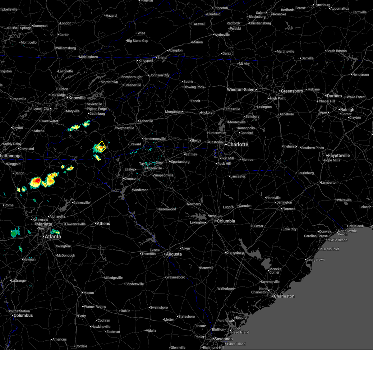
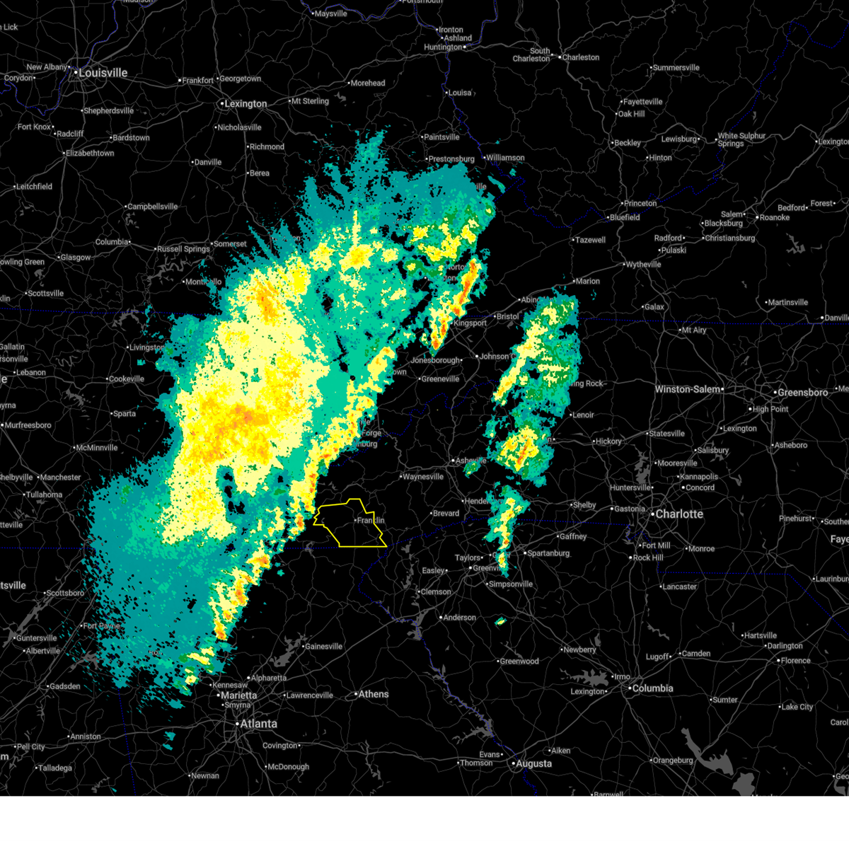
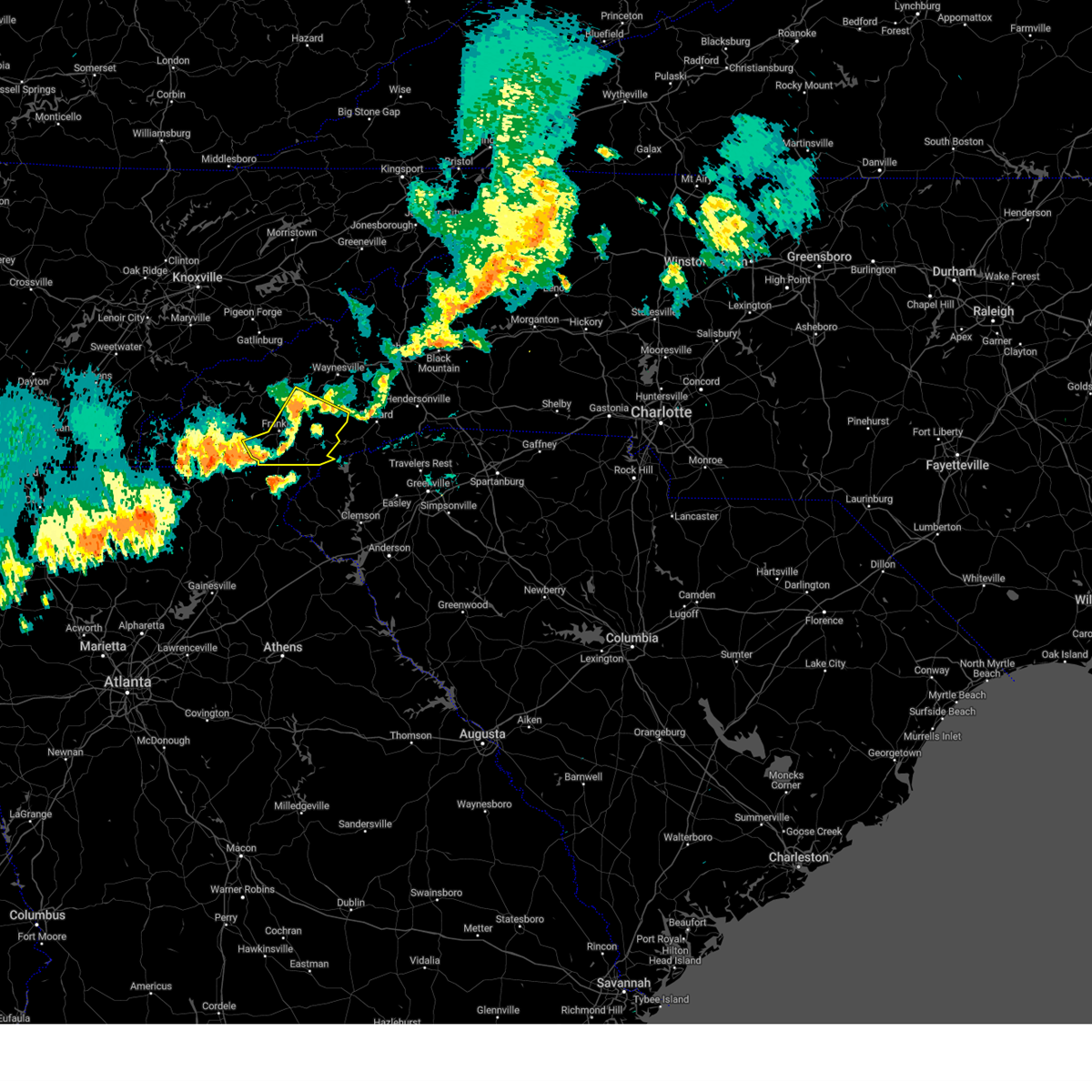
Hail Map for Franklin, NC
The Franklin, NC area has had 12 reports of on-the-ground hail by trained spotters, and has been under severe weather warnings 5 times during the past 12 months. Doppler radar has detected hail at or near Franklin, NC on 13 occasions.
| Name: | Franklin, NC |
| Where Located: | 50.5 miles WNW of Greenville, SC |
| Map: | Google Map for Franklin, NC |
| Population: | 3845 |
| Housing Units: | 2142 |
| More Info: | Search Google for Franklin, NC |
0
The Top Recent Hail Date for Franklin, NC is Thursday, April 10, 2025 (7th out of 13)

Hail and Wind Damage Spotted near Franklin, NC
| Date / Time | Report Details |
|---|---|
| 7/3/2026 3:15 PM EDT | Social media report of tree down at intersection of wide horizon dr and hwy 441. time estimate in macon county NC, 2 miles N of Franklin, NC |
| 7/3/2026 3:00 PM EDT | Social media report of trees down on lower burningtown r in macon county NC, 4.7 miles SE of Franklin, NC |
| 7/1/2026 3:05 PM EDT |
 Svrgsp the national weather service in greenville-spartanburg has issued a * severe thunderstorm warning for, east central macon county in western north carolina, west central jackson county in western north carolina, * until 345 pm edt. * at 304 pm edt, a severe thunderstorm was located 6 miles east of franklin, and is nearly stationary (radar indicated). Hazards include 60 mph wind gusts and penny size hail. expect damage to trees and power lines Svrgsp the national weather service in greenville-spartanburg has issued a * severe thunderstorm warning for, east central macon county in western north carolina, west central jackson county in western north carolina, * until 345 pm edt. * at 304 pm edt, a severe thunderstorm was located 6 miles east of franklin, and is nearly stationary (radar indicated). Hazards include 60 mph wind gusts and penny size hail. expect damage to trees and power lines
|
| 7/1/2026 2:51 PM EDT |
 At 251 pm edt, a severe thunderstorm was located 6 miles southeast of franklin, and is nearly stationary (radar indicated). Hazards include 60 mph wind gusts and penny size hail. Expect damage to trees and power lines. Locations impacted include, cullasaja. At 251 pm edt, a severe thunderstorm was located 6 miles southeast of franklin, and is nearly stationary (radar indicated). Hazards include 60 mph wind gusts and penny size hail. Expect damage to trees and power lines. Locations impacted include, cullasaja.
|
| 7/1/2026 2:22 PM EDT |
 Svrgsp the national weather service in greenville-spartanburg has issued a * severe thunderstorm warning for, southeastern macon county in western north carolina, * until 315 pm edt. * at 221 pm edt, a severe thunderstorm was located 7 miles southeast of franklin, or 6 miles northwest of highlands, and is nearly stationary (radar indicated). Hazards include 60 mph wind gusts and penny size hail. expect damage to trees and power lines Svrgsp the national weather service in greenville-spartanburg has issued a * severe thunderstorm warning for, southeastern macon county in western north carolina, * until 315 pm edt. * at 221 pm edt, a severe thunderstorm was located 7 miles southeast of franklin, or 6 miles northwest of highlands, and is nearly stationary (radar indicated). Hazards include 60 mph wind gusts and penny size hail. expect damage to trees and power lines
|
| 3/16/2026 6:17 AM EDT |
 Svrgsp the national weather service in greenville-spartanburg has issued a * severe thunderstorm warning for, eastern macon county in western north carolina, transylvania county in western north carolina, jackson county in western north carolina, southern haywood county in western north carolina, * until 730 am edt. * at 616 am edt, a severe thunderstorm was located near franklin, moving northeast at 55 mph (radar indicated). Hazards include 60 mph wind gusts. expect damage to trees and power lines Svrgsp the national weather service in greenville-spartanburg has issued a * severe thunderstorm warning for, eastern macon county in western north carolina, transylvania county in western north carolina, jackson county in western north carolina, southern haywood county in western north carolina, * until 730 am edt. * at 616 am edt, a severe thunderstorm was located near franklin, moving northeast at 55 mph (radar indicated). Hazards include 60 mph wind gusts. expect damage to trees and power lines
|
| 3/16/2026 6:00 AM EDT | Utility line damage along jacobs bridge r in macon county NC, 2.6 miles SSE of Franklin, NC |
| 3/16/2026 5:24 AM EDT |
 Svrgsp the national weather service in greenville-spartanburg has issued a * severe thunderstorm warning for, macon county in western north carolina, * until 630 am edt. * at 524 am edt, a severe thunderstorm was located near andrews, moving east at 40 mph (radar indicated). Hazards include 60 mph wind gusts. expect damage to trees and power lines Svrgsp the national weather service in greenville-spartanburg has issued a * severe thunderstorm warning for, macon county in western north carolina, * until 630 am edt. * at 524 am edt, a severe thunderstorm was located near andrews, moving east at 40 mph (radar indicated). Hazards include 60 mph wind gusts. expect damage to trees and power lines
|
| 5/2/2025 9:40 PM EDT |
 At 939 pm edt, a severe thunderstorm was located 7 miles northeast of franklin, moving east at 40 mph (radar indicated). Hazards include 60 mph wind gusts and penny size hail. Expect damage to trees and power lines. Locations impacted include, dillsboro, franklin, tuckasegee, wolf mountain, whiteside mountain, scaly mountain, sapphire, alarka, sylva, and cullowhee. At 939 pm edt, a severe thunderstorm was located 7 miles northeast of franklin, moving east at 40 mph (radar indicated). Hazards include 60 mph wind gusts and penny size hail. Expect damage to trees and power lines. Locations impacted include, dillsboro, franklin, tuckasegee, wolf mountain, whiteside mountain, scaly mountain, sapphire, alarka, sylva, and cullowhee.
|
| 5/2/2025 9:40 PM EDT |
 the severe thunderstorm warning has been cancelled and is no longer in effect the severe thunderstorm warning has been cancelled and is no longer in effect
|
| 5/2/2025 9:03 PM EDT |
 Svrgsp the national weather service in greenville-spartanburg has issued a * severe thunderstorm warning for, macon county in western north carolina, southwestern transylvania county in western north carolina, jackson county in western north carolina, south central swain county in western north carolina, southeastern graham county in western north carolina, * until 1000 pm edt. * at 902 pm edt, a severe thunderstorm was located 7 miles east of andrews, or near nantahala lake, moving east at 40 mph (radar indicated). Hazards include 60 mph wind gusts and quarter size hail. Minor hail damage to vehicles is expected. Expect wind damage to trees and power lines. Svrgsp the national weather service in greenville-spartanburg has issued a * severe thunderstorm warning for, macon county in western north carolina, southwestern transylvania county in western north carolina, jackson county in western north carolina, south central swain county in western north carolina, southeastern graham county in western north carolina, * until 1000 pm edt. * at 902 pm edt, a severe thunderstorm was located 7 miles east of andrews, or near nantahala lake, moving east at 40 mph (radar indicated). Hazards include 60 mph wind gusts and quarter size hail. Minor hail damage to vehicles is expected. Expect wind damage to trees and power lines.
|
| 4/10/2025 6:37 PM EDT |
 Svrgsp the national weather service in greenville-spartanburg has issued a * severe thunderstorm warning for, southern macon county in western north carolina, * until 730 pm edt. * at 637 pm edt, a severe thunderstorm was located 11 miles southwest of franklin, or 10 miles southeast of nantahala lake, moving east at 25 mph (radar indicated). Hazards include 60 mph wind gusts and quarter size hail. Minor hail damage to vehicles is expected. Expect wind damage to trees and power lines. Svrgsp the national weather service in greenville-spartanburg has issued a * severe thunderstorm warning for, southern macon county in western north carolina, * until 730 pm edt. * at 637 pm edt, a severe thunderstorm was located 11 miles southwest of franklin, or 10 miles southeast of nantahala lake, moving east at 25 mph (radar indicated). Hazards include 60 mph wind gusts and quarter size hail. Minor hail damage to vehicles is expected. Expect wind damage to trees and power lines.
|
| 8/16/2024 7:33 PM EDT |
 At 733 pm edt, severe thunderstorms were located along a line extending from 5 miles south of sylva to 4 miles south of franklin to 10 miles northeast of hiawassee, moving southeast at 25 mph (radar indicated). Hazards include 60 mph wind gusts and penny size hail. Expect damage to trees and power lines. Locations impacted include, franklin, sylva, cullowhee, highlands, webster, dillsboro, cashiers, lake glenville, ellijay, and savannah. At 733 pm edt, severe thunderstorms were located along a line extending from 5 miles south of sylva to 4 miles south of franklin to 10 miles northeast of hiawassee, moving southeast at 25 mph (radar indicated). Hazards include 60 mph wind gusts and penny size hail. Expect damage to trees and power lines. Locations impacted include, franklin, sylva, cullowhee, highlands, webster, dillsboro, cashiers, lake glenville, ellijay, and savannah.
|
| 8/16/2024 7:33 PM EDT |
 the severe thunderstorm warning has been cancelled and is no longer in effect the severe thunderstorm warning has been cancelled and is no longer in effect
|
| 8/16/2024 7:14 PM EDT |
 the severe thunderstorm warning has been cancelled and is no longer in effect the severe thunderstorm warning has been cancelled and is no longer in effect
|
| 8/16/2024 7:14 PM EDT |
 At 714 pm edt, severe thunderstorms were located along a line extending from 6 miles west of sylva to 5 miles west of franklin to 9 miles east of hayesville, moving southeast at 25 mph (radar indicated). Hazards include 60 mph wind gusts and penny size hail. Expect damage to trees and power lines. Locations impacted include, franklin, sylva, bryson city, cullowhee, highlands, webster, dillsboro, cashiers, nantahala lake, and lake glenville. At 714 pm edt, severe thunderstorms were located along a line extending from 6 miles west of sylva to 5 miles west of franklin to 9 miles east of hayesville, moving southeast at 25 mph (radar indicated). Hazards include 60 mph wind gusts and penny size hail. Expect damage to trees and power lines. Locations impacted include, franklin, sylva, bryson city, cullowhee, highlands, webster, dillsboro, cashiers, nantahala lake, and lake glenville.
|
| 8/16/2024 6:56 PM EDT |
 Svrgsp the national weather service in greenville-spartanburg has issued a * severe thunderstorm warning for, macon county in western north carolina, jackson county in western north carolina, south central swain county in western north carolina, eastern graham county in western north carolina, * until 745 pm edt. * at 656 pm edt, severe thunderstorms were located along a line extending from near bryson city to 11 miles northwest of franklin to 4 miles southeast of andrews, moving southeast at 25 mph (radar indicated). Hazards include 60 mph wind gusts and penny size hail. expect damage to trees and power lines Svrgsp the national weather service in greenville-spartanburg has issued a * severe thunderstorm warning for, macon county in western north carolina, jackson county in western north carolina, south central swain county in western north carolina, eastern graham county in western north carolina, * until 745 pm edt. * at 656 pm edt, severe thunderstorms were located along a line extending from near bryson city to 11 miles northwest of franklin to 4 miles southeast of andrews, moving southeast at 25 mph (radar indicated). Hazards include 60 mph wind gusts and penny size hail. expect damage to trees and power lines
|
| 7/5/2024 4:04 PM EDT | Tree down on tessentee rd. time estimate in macon county NC, 7.7 miles NNW of Franklin, NC |
| 5/27/2024 6:17 AM EDT |
 At 617 am edt, severe thunderstorms were located along a line extending from 3 miles northwest of franklin to 21 miles southwest of sylva to 5 miles southwest of clayton, moving east at 45 mph (radar indicated). Hazards include 60 mph wind gusts and penny size hail. Expect damage to trees and power lines. Locations impacted include, franklin, clayton, highlands, mountain city, tiger, dillard, sky valley, lake rabun, lake burton, and lakemont. At 617 am edt, severe thunderstorms were located along a line extending from 3 miles northwest of franklin to 21 miles southwest of sylva to 5 miles southwest of clayton, moving east at 45 mph (radar indicated). Hazards include 60 mph wind gusts and penny size hail. Expect damage to trees and power lines. Locations impacted include, franklin, clayton, highlands, mountain city, tiger, dillard, sky valley, lake rabun, lake burton, and lakemont.
|
| 5/27/2024 5:55 AM EDT |
 Svrgsp the national weather service in greenville-spartanburg has issued a * severe thunderstorm warning for, northwestern habersham county in northeastern georgia, rabun county in northeastern georgia, macon county in western north carolina, * until 645 am edt. * at 555 am edt, severe thunderstorms were located along a line extending from 5 miles east of andrews to 8 miles east of hayesville to 7 miles south of hiawassee, moving east at 40 mph (radar indicated). Hazards include 60 mph wind gusts and penny size hail. expect damage to trees and power lines Svrgsp the national weather service in greenville-spartanburg has issued a * severe thunderstorm warning for, northwestern habersham county in northeastern georgia, rabun county in northeastern georgia, macon county in western north carolina, * until 645 am edt. * at 555 am edt, severe thunderstorms were located along a line extending from 5 miles east of andrews to 8 miles east of hayesville to 7 miles south of hiawassee, moving east at 40 mph (radar indicated). Hazards include 60 mph wind gusts and penny size hail. expect damage to trees and power lines
|
| 5/26/2024 6:03 PM EDT |
 Svrgsp the national weather service in greenville-spartanburg has issued a * severe thunderstorm warning for, macon county in western north carolina, * until 700 pm edt. * at 602 pm edt, a severe thunderstorm was located near andrews, moving east at 40 mph (radar indicated). Hazards include ping pong ball size hail and 60 mph wind gusts. People and animals outdoors will be injured. expect hail damage to roofs, siding, windows, and vehicles. Expect wind damage to trees and power lines. Svrgsp the national weather service in greenville-spartanburg has issued a * severe thunderstorm warning for, macon county in western north carolina, * until 700 pm edt. * at 602 pm edt, a severe thunderstorm was located near andrews, moving east at 40 mph (radar indicated). Hazards include ping pong ball size hail and 60 mph wind gusts. People and animals outdoors will be injured. expect hail damage to roofs, siding, windows, and vehicles. Expect wind damage to trees and power lines.
|
| 5/9/2024 7:24 AM EDT |
 Svrgsp the national weather service in greenville-spartanburg has issued a * severe thunderstorm warning for, habersham county in northeastern georgia, rabun county in northeastern georgia, southern macon county in western north carolina, * until 815 am edt. * at 724 am edt, severe thunderstorms were located along a line extending from 6 miles southeast of andrews to 4 miles southeast of hiawassee to 4 miles northwest of cleveland, moving east at 50 mph (radar indicated). Hazards include 60 mph wind gusts. expect damage to trees and power lines Svrgsp the national weather service in greenville-spartanburg has issued a * severe thunderstorm warning for, habersham county in northeastern georgia, rabun county in northeastern georgia, southern macon county in western north carolina, * until 815 am edt. * at 724 am edt, severe thunderstorms were located along a line extending from 6 miles southeast of andrews to 4 miles southeast of hiawassee to 4 miles northwest of cleveland, moving east at 50 mph (radar indicated). Hazards include 60 mph wind gusts. expect damage to trees and power lines
|
| 5/9/2024 12:55 AM EDT |
 the severe thunderstorm warning has been cancelled and is no longer in effect the severe thunderstorm warning has been cancelled and is no longer in effect
|
| 5/9/2024 12:09 AM EDT |
 Svrgsp the national weather service in greenville-spartanburg has issued a * severe thunderstorm warning for, macon county in western north carolina, transylvania county in western north carolina, jackson county in western north carolina, southern haywood county in western north carolina, * until 115 am edt. * at 1209 am edt, severe thunderstorms were located along a line extending from 11 miles northwest of waynesville to 6 miles northeast of franklin to 16 miles northeast of hiawassee, moving east at 40 mph (radar indicated). Hazards include 60 mph wind gusts. expect damage to trees and power lines Svrgsp the national weather service in greenville-spartanburg has issued a * severe thunderstorm warning for, macon county in western north carolina, transylvania county in western north carolina, jackson county in western north carolina, southern haywood county in western north carolina, * until 115 am edt. * at 1209 am edt, severe thunderstorms were located along a line extending from 11 miles northwest of waynesville to 6 miles northeast of franklin to 16 miles northeast of hiawassee, moving east at 40 mph (radar indicated). Hazards include 60 mph wind gusts. expect damage to trees and power lines
|
| 5/8/2024 11:49 PM EDT |
 the severe thunderstorm warning has been cancelled and is no longer in effect the severe thunderstorm warning has been cancelled and is no longer in effect
|
| 5/8/2024 11:49 PM EDT |
 At 1147 pm edt, severe thunderstorms were located along a line extending from 10 miles east of marshall to near bryson city to 11 miles east of robbinsville to 6 miles southeast of andrews, moving southeast at 40 mph (radar indicated). Hazards include 60 mph wind gusts. Expect damage to trees and power lines. Locations impacted include, sylva, waynesville, bryson city, marshall, cherokee, woodfin, canton, lake junaluska, weaverville, and mars hill. At 1147 pm edt, severe thunderstorms were located along a line extending from 10 miles east of marshall to near bryson city to 11 miles east of robbinsville to 6 miles southeast of andrews, moving southeast at 40 mph (radar indicated). Hazards include 60 mph wind gusts. Expect damage to trees and power lines. Locations impacted include, sylva, waynesville, bryson city, marshall, cherokee, woodfin, canton, lake junaluska, weaverville, and mars hill.
|
| 5/8/2024 11:15 PM EDT |
 Svrgsp the national weather service in greenville-spartanburg has issued a * severe thunderstorm warning for, western macon county in western north carolina, northwestern jackson county in western north carolina, madison county in western north carolina, swain county in western north carolina, graham county in western north carolina, haywood county in western north carolina, northern buncombe county in western north carolina, * until 1215 am edt. * at 1114 pm edt, severe thunderstorms were located along a line extending from 13 miles south of greeneville to 17 miles southeast of maryville to 12 miles northwest of robbinsville to 11 miles north of murphy, moving southeast at 35 mph (radar indicated). Hazards include 60 mph wind gusts. expect damage to trees and power lines Svrgsp the national weather service in greenville-spartanburg has issued a * severe thunderstorm warning for, western macon county in western north carolina, northwestern jackson county in western north carolina, madison county in western north carolina, swain county in western north carolina, graham county in western north carolina, haywood county in western north carolina, northern buncombe county in western north carolina, * until 1215 am edt. * at 1114 pm edt, severe thunderstorms were located along a line extending from 13 miles south of greeneville to 17 miles southeast of maryville to 12 miles northwest of robbinsville to 11 miles north of murphy, moving southeast at 35 mph (radar indicated). Hazards include 60 mph wind gusts. expect damage to trees and power lines
|
| 5/8/2024 3:11 PM EDT |
 the severe thunderstorm warning has been cancelled and is no longer in effect the severe thunderstorm warning has been cancelled and is no longer in effect
|
| 5/8/2024 3:11 PM EDT |
 At 311 pm edt, severe thunderstorms were located along a line extending from 12 miles southeast of sylva to 8 miles west of franklin, moving southeast at 15 mph (radar indicated). Hazards include 60 mph wind gusts and quarter size hail. Minor hail damage to vehicles is expected. expect wind damage to trees and power lines. locations impacted include, franklin, cullowhee, ellijay, burningtown, savannah, tuckasegee, wolf mountain, cowee, and b. r. Parkway-balsam gap to black balsam area. At 311 pm edt, severe thunderstorms were located along a line extending from 12 miles southeast of sylva to 8 miles west of franklin, moving southeast at 15 mph (radar indicated). Hazards include 60 mph wind gusts and quarter size hail. Minor hail damage to vehicles is expected. expect wind damage to trees and power lines. locations impacted include, franklin, cullowhee, ellijay, burningtown, savannah, tuckasegee, wolf mountain, cowee, and b. r. Parkway-balsam gap to black balsam area.
|
| 5/8/2024 2:35 PM EDT |
 Svrgsp the national weather service in greenville-spartanburg has issued a * severe thunderstorm warning for, northeastern macon county in western north carolina, central transylvania county in western north carolina, central jackson county in western north carolina, south central swain county in western north carolina, south central haywood county in western north carolina, * until 330 pm edt. * at 234 pm edt, severe thunderstorms were located along a line extending from 10 miles east of sylva to 4 miles southwest of bryson city, moving east at 30 mph (radar indicated). Hazards include 60 mph wind gusts and quarter size hail. Minor hail damage to vehicles is expected. Expect wind damage to trees and power lines. Svrgsp the national weather service in greenville-spartanburg has issued a * severe thunderstorm warning for, northeastern macon county in western north carolina, central transylvania county in western north carolina, central jackson county in western north carolina, south central swain county in western north carolina, south central haywood county in western north carolina, * until 330 pm edt. * at 234 pm edt, severe thunderstorms were located along a line extending from 10 miles east of sylva to 4 miles southwest of bryson city, moving east at 30 mph (radar indicated). Hazards include 60 mph wind gusts and quarter size hail. Minor hail damage to vehicles is expected. Expect wind damage to trees and power lines.
|
| 9/7/2023 6:32 PM EDT | A few trees and power lines down in frankli in macon county NC, 0.3 miles WSW of Franklin, NC |
| 9/7/2023 6:31 PM EDT |
 At 630 pm edt, a severe thunderstorm was located near franklin, moving northeast at 10 mph (radar indicated). Hazards include 60 mph wind gusts and quarter size hail. Minor hail damage to vehicles is expected. Expect wind damage to trees and power lines. At 630 pm edt, a severe thunderstorm was located near franklin, moving northeast at 10 mph (radar indicated). Hazards include 60 mph wind gusts and quarter size hail. Minor hail damage to vehicles is expected. Expect wind damage to trees and power lines.
|
| 8/12/2023 5:19 PM EDT |
 At 519 pm edt, severe thunderstorms were located along a line extending from 5 miles north of franklin to 21 miles northeast of hiawassee to 7 miles west of clayton, moving east at 40 mph (radar indicated). Hazards include 60 mph wind gusts. Expect damage to trees and power lines. locations impacted include, franklin, highlands, cashiers, lake glenville, ellijay, burningtown, otto, rainbow springs, wolf mountain and wayah bald. hail threat, radar indicated max hail size, <. 75 in wind threat, radar indicated max wind gust, 60 mph. At 519 pm edt, severe thunderstorms were located along a line extending from 5 miles north of franklin to 21 miles northeast of hiawassee to 7 miles west of clayton, moving east at 40 mph (radar indicated). Hazards include 60 mph wind gusts. Expect damage to trees and power lines. locations impacted include, franklin, highlands, cashiers, lake glenville, ellijay, burningtown, otto, rainbow springs, wolf mountain and wayah bald. hail threat, radar indicated max hail size, <. 75 in wind threat, radar indicated max wind gust, 60 mph.
|
| 8/12/2023 4:49 PM EDT |
 At 449 pm edt, severe thunderstorms were located along a line extending from 5 miles southeast of robbinsville to 4 miles northeast of hayesville to 4 miles northeast of blairsville, moving east at 35 mph (radar indicated). Hazards include 60 mph wind gusts. expect damage to trees and power lines At 449 pm edt, severe thunderstorms were located along a line extending from 5 miles southeast of robbinsville to 4 miles northeast of hayesville to 4 miles northeast of blairsville, moving east at 35 mph (radar indicated). Hazards include 60 mph wind gusts. expect damage to trees and power lines
|
| 8/12/2023 3:58 PM EDT |
 The severe thunderstorm warning for northeastern macon and west central jackson counties will expire at 400 pm edt, the storm which prompted the warning has weakened below severe limits, and no longer poses an immediate threat to life or property. therefore, the warning will be allowed to expire. however gusty winds and heavy rain are still possible with this thunderstorm. a severe thunderstorm watch remains in effect until 800 pm edt for western north carolina. The severe thunderstorm warning for northeastern macon and west central jackson counties will expire at 400 pm edt, the storm which prompted the warning has weakened below severe limits, and no longer poses an immediate threat to life or property. therefore, the warning will be allowed to expire. however gusty winds and heavy rain are still possible with this thunderstorm. a severe thunderstorm watch remains in effect until 800 pm edt for western north carolina.
|
| 8/12/2023 3:49 PM EDT |
 At 349 pm edt, a severe thunderstorm was located 8 miles northeast of franklin, or 6 miles southwest of cullowhee, moving east at 20 mph (radar indicated). Hazards include 60 mph wind gusts. Expect damage to trees and power lines. locations impacted include, savannah, ellijay and cullasaja. hail threat, radar indicated max hail size, <. 75 in wind threat, radar indicated max wind gust, 60 mph. At 349 pm edt, a severe thunderstorm was located 8 miles northeast of franklin, or 6 miles southwest of cullowhee, moving east at 20 mph (radar indicated). Hazards include 60 mph wind gusts. Expect damage to trees and power lines. locations impacted include, savannah, ellijay and cullasaja. hail threat, radar indicated max hail size, <. 75 in wind threat, radar indicated max wind gust, 60 mph.
|
| 8/12/2023 3:33 PM EDT |
 At 333 pm edt, a severe thunderstorm was located 5 miles northeast of franklin, moving southeast at 20 mph (radar indicated). Hazards include 60 mph wind gusts and penny size hail. Expect damage to trees and power lines. locations impacted include, savannah, ellijay and cowee. hail threat, radar indicated max hail size, 0. 75 in wind threat, radar indicated max wind gust, 60 mph. At 333 pm edt, a severe thunderstorm was located 5 miles northeast of franklin, moving southeast at 20 mph (radar indicated). Hazards include 60 mph wind gusts and penny size hail. Expect damage to trees and power lines. locations impacted include, savannah, ellijay and cowee. hail threat, radar indicated max hail size, 0. 75 in wind threat, radar indicated max wind gust, 60 mph.
|
| 8/12/2023 3:23 PM EDT | Tree down along hwy 28 in the cowee are in macon county NC, 5.8 miles SSE of Franklin, NC |
| 8/12/2023 3:18 PM EDT |
 At 318 pm edt, a severe thunderstorm was located 6 miles north of franklin, moving southeast at 20 mph (radar indicated). Hazards include 60 mph wind gusts and quarter size hail. Minor hail damage to vehicles is expected. Expect wind damage to trees and power lines. At 318 pm edt, a severe thunderstorm was located 6 miles north of franklin, moving southeast at 20 mph (radar indicated). Hazards include 60 mph wind gusts and quarter size hail. Minor hail damage to vehicles is expected. Expect wind damage to trees and power lines.
|
| 8/7/2023 3:50 PM EDT |
 At 349 pm edt, severe thunderstorms were located along a line extending from 4 miles north of downtown asheville to 8 miles northwest of brevard to 15 miles southeast of sylva, moving east at 50 mph (radar indicated). Hazards include 70 mph wind gusts and penny size hail. Expect considerable tree damage. damage is likely to mobile homes, roofs, and outbuildings. locations impacted include, downtown asheville, brevard, sylva, waynesville, burnsville, east asheville, arden, west asheville, north asheville and black mountain. thunderstorm damage threat, considerable hail threat, radar indicated max hail size, 0. 75 in wind threat, radar indicated max wind gust, 70 mph. At 349 pm edt, severe thunderstorms were located along a line extending from 4 miles north of downtown asheville to 8 miles northwest of brevard to 15 miles southeast of sylva, moving east at 50 mph (radar indicated). Hazards include 70 mph wind gusts and penny size hail. Expect considerable tree damage. damage is likely to mobile homes, roofs, and outbuildings. locations impacted include, downtown asheville, brevard, sylva, waynesville, burnsville, east asheville, arden, west asheville, north asheville and black mountain. thunderstorm damage threat, considerable hail threat, radar indicated max hail size, 0. 75 in wind threat, radar indicated max wind gust, 70 mph.
|
| 8/7/2023 3:39 PM EDT |
 At 338 pm edt, severe thunderstorms were located along a line extending from 5 miles east of andrews to 3 miles northeast of hiawassee to 4 miles southwest of blairsville, moving east at 40 mph (radar indicated). Hazards include 70 mph wind gusts and quarter size hail. Minor hail damage to vehicles is expected. expect considerable tree damage. Wind damage is also likely to mobile homes, roofs, and outbuildings. At 338 pm edt, severe thunderstorms were located along a line extending from 5 miles east of andrews to 3 miles northeast of hiawassee to 4 miles southwest of blairsville, moving east at 40 mph (radar indicated). Hazards include 70 mph wind gusts and quarter size hail. Minor hail damage to vehicles is expected. expect considerable tree damage. Wind damage is also likely to mobile homes, roofs, and outbuildings.
|
| 8/7/2023 3:34 PM EDT |
 At 334 pm edt, severe thunderstorms were located along a line extending from 14 miles southwest of marshall to 7 miles south of waynesville to 9 miles south of sylva, moving east at 50 mph (radar indicated). Hazards include 70 mph wind gusts and quarter size hail. Minor hail damage to vehicles is expected. expect considerable tree damage. Wind damage is also likely to mobile homes, roofs, and outbuildings. At 334 pm edt, severe thunderstorms were located along a line extending from 14 miles southwest of marshall to 7 miles south of waynesville to 9 miles south of sylva, moving east at 50 mph (radar indicated). Hazards include 70 mph wind gusts and quarter size hail. Minor hail damage to vehicles is expected. expect considerable tree damage. Wind damage is also likely to mobile homes, roofs, and outbuildings.
|
| 8/7/2023 3:28 PM EDT |
 At 328 pm edt, severe thunderstorms were located along a line extending from 12 miles west of marshall to near sylva to 11 miles west of franklin, moving east at 60 mph (radar indicated). Hazards include 70 mph wind gusts and quarter size hail. Minor hail damage to vehicles is expected. expect considerable tree damage. wind damage is also likely to mobile homes, roofs, and outbuildings. locations impacted include, sylva, waynesville, bryson city, robbinsville, cherokee, cullowhee, lake junaluska, maggie valley, balsam and webster. thunderstorm damage threat, considerable hail threat, radar indicated max hail size, 1. 00 in wind threat, radar indicated max wind gust, 70 mph. At 328 pm edt, severe thunderstorms were located along a line extending from 12 miles west of marshall to near sylva to 11 miles west of franklin, moving east at 60 mph (radar indicated). Hazards include 70 mph wind gusts and quarter size hail. Minor hail damage to vehicles is expected. expect considerable tree damage. wind damage is also likely to mobile homes, roofs, and outbuildings. locations impacted include, sylva, waynesville, bryson city, robbinsville, cherokee, cullowhee, lake junaluska, maggie valley, balsam and webster. thunderstorm damage threat, considerable hail threat, radar indicated max hail size, 1. 00 in wind threat, radar indicated max wind gust, 70 mph.
|
| 8/7/2023 3:05 PM EDT |
 At 305 pm edt, severe thunderstorms were located along a line extending from 13 miles east of gatlinburg to 7 miles west of bryson city to 8 miles northwest of andrews, moving east at 60 mph (radar indicated). Hazards include 70 mph wind gusts and quarter size hail. Minor hail damage to vehicles is expected. expect considerable tree damage. Wind damage is also likely to mobile homes, roofs, and outbuildings. At 305 pm edt, severe thunderstorms were located along a line extending from 13 miles east of gatlinburg to 7 miles west of bryson city to 8 miles northwest of andrews, moving east at 60 mph (radar indicated). Hazards include 70 mph wind gusts and quarter size hail. Minor hail damage to vehicles is expected. expect considerable tree damage. Wind damage is also likely to mobile homes, roofs, and outbuildings.
|
| 7/19/2023 12:11 AM EDT |
 The severe thunderstorm warning for north central rabun and central macon counties will expire at 1215 am edt, the storm which prompted the warning has moved out of the area. therefore, the warning will be allowed to expire. The severe thunderstorm warning for north central rabun and central macon counties will expire at 1215 am edt, the storm which prompted the warning has moved out of the area. therefore, the warning will be allowed to expire.
|
| 7/19/2023 12:00 AM EDT |
 At 1200 am edt, a severe thunderstorm was located 9 miles southeast of franklin, or 5 miles west of highlands, moving east at 30 mph (radar indicated). Hazards include 60 mph wind gusts. Expect damage to trees and power lines. locations impacted include, franklin, mountain city, dillard, sky valley, scaly mountain, burningtown, otto, cullasaja and cowee. hail threat, radar indicated max hail size, <. 75 in wind threat, radar indicated max wind gust, 60 mph. At 1200 am edt, a severe thunderstorm was located 9 miles southeast of franklin, or 5 miles west of highlands, moving east at 30 mph (radar indicated). Hazards include 60 mph wind gusts. Expect damage to trees and power lines. locations impacted include, franklin, mountain city, dillard, sky valley, scaly mountain, burningtown, otto, cullasaja and cowee. hail threat, radar indicated max hail size, <. 75 in wind threat, radar indicated max wind gust, 60 mph.
|
| 7/18/2023 11:42 PM EDT |
 At 1141 pm edt, a severe thunderstorm was located 8 miles southwest of franklin, or 8 miles northwest of dillard, moving east at 30 mph (radar indicated). Hazards include 60 mph wind gusts and penny size hail. Expect damage to trees and power lines. locations impacted include, franklin, mountain city, dillard, sky valley, black rock mountain state park, burningtown, otto, rainbow springs, wayah bald and cowee. hail threat, radar indicated max hail size, 0. 75 in wind threat, radar indicated max wind gust, 60 mph. At 1141 pm edt, a severe thunderstorm was located 8 miles southwest of franklin, or 8 miles northwest of dillard, moving east at 30 mph (radar indicated). Hazards include 60 mph wind gusts and penny size hail. Expect damage to trees and power lines. locations impacted include, franklin, mountain city, dillard, sky valley, black rock mountain state park, burningtown, otto, rainbow springs, wayah bald and cowee. hail threat, radar indicated max hail size, 0. 75 in wind threat, radar indicated max wind gust, 60 mph.
|
| 1/1/0001 12:00 AM | Reports of a few trees down across the county from near franklin to highland in macon county NC, 4.7 miles N of Franklin, NC |
| 7/18/2023 11:15 PM EDT |
 At 1115 pm edt, a severe thunderstorm was located 6 miles east of hayesville, moving east at 30 mph (radar indicated). Hazards include 60 mph wind gusts and penny size hail. expect damage to trees and power lines At 1115 pm edt, a severe thunderstorm was located 6 miles east of hayesville, moving east at 30 mph (radar indicated). Hazards include 60 mph wind gusts and penny size hail. expect damage to trees and power lines
|
| 7/2/2023 7:50 PM EDT | Trees down on roadwa in macon county NC, 4.8 miles NNW of Franklin, NC |
| 7/2/2023 7:50 PM EDT | Corrects previous tstm wnd dmg report from 5 nne otto. trees down on roadwa in macon county NC, 5.1 miles NNW of Franklin, NC |
| 7/1/2023 5:20 PM EDT |
 The severe thunderstorm warning for central macon county will expire at 530 pm edt, the storm which prompted the warning has weakened below severe limits, and no longer poses an immediate threat to life or property. therefore, the warning will be allowed to expire. The severe thunderstorm warning for central macon county will expire at 530 pm edt, the storm which prompted the warning has weakened below severe limits, and no longer poses an immediate threat to life or property. therefore, the warning will be allowed to expire.
|
| 7/1/2023 5:13 PM EDT | Multiple trees down on utility equipment in frankli in macon county NC, 1.4 miles E of Franklin, NC |
| 7/1/2023 4:55 PM EDT |
 At 455 pm edt, a severe thunderstorm was located near franklin, moving southeast at 5 mph (radar indicated). Hazards include 60 mph wind gusts and quarter size hail. Minor hail damage to vehicles is expected. Expect wind damage to trees and power lines. At 455 pm edt, a severe thunderstorm was located near franklin, moving southeast at 5 mph (radar indicated). Hazards include 60 mph wind gusts and quarter size hail. Minor hail damage to vehicles is expected. Expect wind damage to trees and power lines.
|
| 6/4/2023 2:52 PM EDT |
 At 251 pm edt, a severe thunderstorm was located near franklin, moving southwest at 15 mph (radar indicated). Hazards include 60 mph wind gusts and quarter size hail. Minor hail damage to vehicles is expected. expect wind damage to trees and power lines. locations impacted include, franklin, scaly mountain, otto, rainbow springs, wayah bald, cullasaja, sky valley and nantahala lake. hail threat, radar indicated max hail size, 1. 00 in wind threat, radar indicated max wind gust, 60 mph. At 251 pm edt, a severe thunderstorm was located near franklin, moving southwest at 15 mph (radar indicated). Hazards include 60 mph wind gusts and quarter size hail. Minor hail damage to vehicles is expected. expect wind damage to trees and power lines. locations impacted include, franklin, scaly mountain, otto, rainbow springs, wayah bald, cullasaja, sky valley and nantahala lake. hail threat, radar indicated max hail size, 1. 00 in wind threat, radar indicated max wind gust, 60 mph.
|
| 6/4/2023 2:34 PM EDT |
 At 234 pm edt, a severe thunderstorm was located 4 miles south of franklin, moving southwest at 25 mph (radar indicated). Hazards include 60 mph wind gusts and quarter size hail. Minor hail damage to vehicles is expected. Expect wind damage to trees and power lines. At 234 pm edt, a severe thunderstorm was located 4 miles south of franklin, moving southwest at 25 mph (radar indicated). Hazards include 60 mph wind gusts and quarter size hail. Minor hail damage to vehicles is expected. Expect wind damage to trees and power lines.
|
| 5/16/2023 8:41 PM EDT |
 The severe thunderstorm warning for western macon county will expire at 845 pm edt, the storm which prompted the warning has weakened below severe limits, and no longer poses an immediate threat to life or property. therefore, the warning will be allowed to expire. The severe thunderstorm warning for western macon county will expire at 845 pm edt, the storm which prompted the warning has weakened below severe limits, and no longer poses an immediate threat to life or property. therefore, the warning will be allowed to expire.
|
| 5/16/2023 8:02 PM EDT |
 At 800 pm edt, a severe thunderstorm was located 8 miles east of andrews, or near nantahala lake, moving east at 30 mph (radar indicated). Hazards include 60 mph wind gusts and quarter size hail. Minor hail damage to vehicles is expected. Expect wind damage to trees and power lines. At 800 pm edt, a severe thunderstorm was located 8 miles east of andrews, or near nantahala lake, moving east at 30 mph (radar indicated). Hazards include 60 mph wind gusts and quarter size hail. Minor hail damage to vehicles is expected. Expect wind damage to trees and power lines.
|
| 3/3/2023 4:42 PM EST | Numerous trees down in franklin... n in macon county NC, 0.3 miles WSW of Franklin, NC |
| 3/3/2023 4:37 PM EST |
 At 436 pm est, a severe thunderstorm was located near franklin, moving northeast at 100 mph (radar indicated). Hazards include 60 mph wind gusts. expect damage to trees and power lines At 436 pm est, a severe thunderstorm was located near franklin, moving northeast at 100 mph (radar indicated). Hazards include 60 mph wind gusts. expect damage to trees and power lines
|
| 6/17/2022 4:30 PM EDT |
 At 430 pm edt, severe thunderstorms were located along a line extending from 12 miles southeast of sylva to 9 miles north of clayton, moving southeast at 30 mph (radar indicated). Hazards include 60 mph wind gusts and penny size hail. expect damage to trees and power lines At 430 pm edt, severe thunderstorms were located along a line extending from 12 miles southeast of sylva to 9 miles north of clayton, moving southeast at 30 mph (radar indicated). Hazards include 60 mph wind gusts and penny size hail. expect damage to trees and power lines
|
| 6/17/2022 4:17 PM EDT |
 At 417 pm edt, severe thunderstorms were located along a line extending from 6 miles south of waynesville to 5 miles northwest of franklin, moving east at 35 mph (radar indicated). Hazards include 60 mph wind gusts and nickel size hail. Expect damage to trees and power lines. locations impacted include, franklin, cullowhee, webster, lake glenville, nantahala lake, b. r. parkway-balsam gap to black balsam area, ellijay, burningtown, savannah and kyle. hail threat, radar indicated max hail size, 0. 88 in wind threat, radar indicated max wind gust, 60 mph. At 417 pm edt, severe thunderstorms were located along a line extending from 6 miles south of waynesville to 5 miles northwest of franklin, moving east at 35 mph (radar indicated). Hazards include 60 mph wind gusts and nickel size hail. Expect damage to trees and power lines. locations impacted include, franklin, cullowhee, webster, lake glenville, nantahala lake, b. r. parkway-balsam gap to black balsam area, ellijay, burningtown, savannah and kyle. hail threat, radar indicated max hail size, 0. 88 in wind threat, radar indicated max wind gust, 60 mph.
|
| 6/17/2022 4:13 PM EDT |
 At 413 pm edt, a severe thunderstorm was located 11 miles southwest of franklin, or 6 miles southeast of nantahala lake, moving east at 25 mph (radar indicated). Hazards include 60 mph wind gusts and nickel size hail. expect damage to trees and power lines At 413 pm edt, a severe thunderstorm was located 11 miles southwest of franklin, or 6 miles southeast of nantahala lake, moving east at 25 mph (radar indicated). Hazards include 60 mph wind gusts and nickel size hail. expect damage to trees and power lines
|
| 6/17/2022 4:05 PM EDT | Trees down in the nantahala national fores in macon county NC, 8.3 miles E of Franklin, NC |
| 6/17/2022 3:46 PM EDT |
 At 346 pm edt, severe thunderstorms were located along a line extending from 5 miles northwest of sylva to 3 miles northeast of andrews, moving east at 35 mph (radar indicated). Hazards include 60 mph wind gusts and nickel size hail. expect damage to trees and power lines At 346 pm edt, severe thunderstorms were located along a line extending from 5 miles northwest of sylva to 3 miles northeast of andrews, moving east at 35 mph (radar indicated). Hazards include 60 mph wind gusts and nickel size hail. expect damage to trees and power lines
|
| 6/14/2022 11:29 AM EDT |
 At 1128 am edt, a severe thunderstorm was located 10 miles northeast of clayton, or near sky valley, moving west at 10 mph (radar indicated). Hazards include 60 mph wind gusts and quarter size hail. Minor hail damage to vehicles is expected. Expect wind damage to trees and power lines. At 1128 am edt, a severe thunderstorm was located 10 miles northeast of clayton, or near sky valley, moving west at 10 mph (radar indicated). Hazards include 60 mph wind gusts and quarter size hail. Minor hail damage to vehicles is expected. Expect wind damage to trees and power lines.
|
| 8/17/2021 2:31 PM EDT |
 At 230 pm edt, a severe thunderstorm capable of producing a tornado was located 7 miles east of clayton, or 6 miles east of mountain city, moving north at 30 mph (radar indicated rotation). Hazards include tornado. Flying debris will be dangerous to those caught without shelter. mobile homes will be damaged or destroyed. damage to roofs, windows, and vehicles will occur. tree damage is likely. this dangerous storm will be near, dillard around 240 pm edt. sky valley around 250 pm edt. highlands around 300 pm edt. franklin around 310 pm edt. Other locations impacted by this dangerous thunderstorm include pine mountain, ellijay, scaly mountain, otto and cullasaja. At 230 pm edt, a severe thunderstorm capable of producing a tornado was located 7 miles east of clayton, or 6 miles east of mountain city, moving north at 30 mph (radar indicated rotation). Hazards include tornado. Flying debris will be dangerous to those caught without shelter. mobile homes will be damaged or destroyed. damage to roofs, windows, and vehicles will occur. tree damage is likely. this dangerous storm will be near, dillard around 240 pm edt. sky valley around 250 pm edt. highlands around 300 pm edt. franklin around 310 pm edt. Other locations impacted by this dangerous thunderstorm include pine mountain, ellijay, scaly mountain, otto and cullasaja.
|
| 5/5/2020 3:48 PM EDT |
 At 347 pm edt, a severe thunderstorm was located 11 miles southwest of bryson city, or 8 miles northeast of nantahala lake, moving east at 20 mph (radar indicated). Hazards include 60 mph wind gusts and quarter size hail. Minor hail damage to vehicles is expected. expect wind damage to trees and power lines. Locations impacted include, franklin, burningtown, cullasaja, cowee, ellijay and wayah bald. At 347 pm edt, a severe thunderstorm was located 11 miles southwest of bryson city, or 8 miles northeast of nantahala lake, moving east at 20 mph (radar indicated). Hazards include 60 mph wind gusts and quarter size hail. Minor hail damage to vehicles is expected. expect wind damage to trees and power lines. Locations impacted include, franklin, burningtown, cullasaja, cowee, ellijay and wayah bald.
|
| 5/5/2020 3:39 PM EDT |
 At 337 pm edt, a severe thunderstorm was located 11 miles east of robbinsville, or 6 miles north of nantahala lake, moving east at 20 mph (radar indicated). Hazards include 60 mph wind gusts and quarter size hail. Minor hail damage to vehicles is expected. expect wind damage to trees and power lines. Locations impacted include, franklin, nantahala lake, wesser, burningtown, kyle, nantahala, wayah bald, cowee, luada and almond. At 337 pm edt, a severe thunderstorm was located 11 miles east of robbinsville, or 6 miles north of nantahala lake, moving east at 20 mph (radar indicated). Hazards include 60 mph wind gusts and quarter size hail. Minor hail damage to vehicles is expected. expect wind damage to trees and power lines. Locations impacted include, franklin, nantahala lake, wesser, burningtown, kyle, nantahala, wayah bald, cowee, luada and almond.
|
| 5/5/2020 3:27 PM EDT |
 At 326 pm edt, a severe thunderstorm was located 7 miles southeast of robbinsville, or 6 miles north of nantahala lake, moving east at 20 mph (radar indicated). Hazards include 60 mph wind gusts and quarter size hail. Minor hail damage to vehicles is expected. Expect wind damage to trees and power lines. At 326 pm edt, a severe thunderstorm was located 7 miles southeast of robbinsville, or 6 miles north of nantahala lake, moving east at 20 mph (radar indicated). Hazards include 60 mph wind gusts and quarter size hail. Minor hail damage to vehicles is expected. Expect wind damage to trees and power lines.
|
| 1/11/2020 6:10 PM EST |
 At 610 pm est, severe thunderstorms were located along a line extending from 10 miles southeast of gatlinburg to 10 miles northwest of clayton, moving northeast at 25 mph (radar indicated). Hazards include 60 mph wind gusts. expect damage to trees and power lines At 610 pm est, severe thunderstorms were located along a line extending from 10 miles southeast of gatlinburg to 10 miles northwest of clayton, moving northeast at 25 mph (radar indicated). Hazards include 60 mph wind gusts. expect damage to trees and power lines
|
| 1/11/2020 6:05 PM EST | Trees down across macon county with one tree falling on a house in frankli in macon county NC, 0.3 miles WSW of Franklin, NC |
| 10/31/2019 2:14 PM EDT |
 At 214 pm edt, severe thunderstorms were located along a line extending from 8 miles east of clayton to 6 miles northeast of toccoa to 7 miles northwest of carnesville, moving northeast at 45 mph (radar indicated). Hazards include 60 mph wind gusts. Expect damage to trees and power lines. Locations impacted include, toccoa, seneca, walhalla, clayton, carnesville, cornelia, westminster, lavonia, gumlog and mount airy. At 214 pm edt, severe thunderstorms were located along a line extending from 8 miles east of clayton to 6 miles northeast of toccoa to 7 miles northwest of carnesville, moving northeast at 45 mph (radar indicated). Hazards include 60 mph wind gusts. Expect damage to trees and power lines. Locations impacted include, toccoa, seneca, walhalla, clayton, carnesville, cornelia, westminster, lavonia, gumlog and mount airy.
|
| 10/31/2019 1:56 PM EDT |
 At 155 pm edt, severe thunderstorms were located along a line extending from 7 miles southwest of clayton to near clarkesville to 6 miles west of homer, moving northeast at 50 mph (radar indicated). Hazards include 60 mph wind gusts. expect damage to trees and power lines At 155 pm edt, severe thunderstorms were located along a line extending from 7 miles southwest of clayton to near clarkesville to 6 miles west of homer, moving northeast at 50 mph (radar indicated). Hazards include 60 mph wind gusts. expect damage to trees and power lines
|
| 8/13/2019 9:34 PM EDT |
 At 933 pm edt, severe thunderstorms were located along a line extending from 11 miles east of hayesville to 4 miles southeast of hiawassee to 11 miles south of blairsville, moving east at 25 mph (radar indicated). Hazards include 60 mph wind gusts and penny size hail. expect damage to trees and power lines At 933 pm edt, severe thunderstorms were located along a line extending from 11 miles east of hayesville to 4 miles southeast of hiawassee to 11 miles south of blairsville, moving east at 25 mph (radar indicated). Hazards include 60 mph wind gusts and penny size hail. expect damage to trees and power lines
|
| 6/22/2019 1:09 AM EDT |
 At 108 am edt, a severe thunderstorm was located 5 miles northeast of sylva, or near balsam, moving east at 35 mph (radar indicated). Hazards include 60 mph wind gusts and nickel size hail. Expect damage to trees and power lines. Locations impacted include, brevard, franklin, sylva, waynesville, cullowhee, etowah, lake junaluska, clyde, highlands and maggie valley. At 108 am edt, a severe thunderstorm was located 5 miles northeast of sylva, or near balsam, moving east at 35 mph (radar indicated). Hazards include 60 mph wind gusts and nickel size hail. Expect damage to trees and power lines. Locations impacted include, brevard, franklin, sylva, waynesville, cullowhee, etowah, lake junaluska, clyde, highlands and maggie valley.
|
| 6/22/2019 12:55 AM EDT |
 The severe thunderstorm warning for western macon, northwestern jackson, swain, graham and northwestern haywood counties will expire at 100 am edt, the storm which prompted the warning has moved out of the area. therefore the warning will be allowed to expire. however gusty winds are still possible with this thunderstorm. a severe thunderstorm watch remains in effect until 500 am edt for western north carolina. The severe thunderstorm warning for western macon, northwestern jackson, swain, graham and northwestern haywood counties will expire at 100 am edt, the storm which prompted the warning has moved out of the area. therefore the warning will be allowed to expire. however gusty winds are still possible with this thunderstorm. a severe thunderstorm watch remains in effect until 500 am edt for western north carolina.
|
| 6/22/2019 12:38 AM EDT |
 The national weather service in greenville-spartanburg has issued a * severe thunderstorm warning for. eastern macon county in western north carolina. transylvania county in western north carolina. northwestern henderson county in western north carolina. Jackson county in western north carolina. The national weather service in greenville-spartanburg has issued a * severe thunderstorm warning for. eastern macon county in western north carolina. transylvania county in western north carolina. northwestern henderson county in western north carolina. Jackson county in western north carolina.
|
| 6/22/2019 12:29 AM EDT |
 At 1229 am edt, a severe thunderstorm was located 14 miles northwest of bryson city, or near smoky mountains-fontana area, moving east at 40 mph (radar indicated). Hazards include 60 mph wind gusts and nickel size hail. Expect damage to trees and power lines. Locations impacted include, franklin, bryson city, robbinsville, cherokee, town of santeetlah, smoky mountains-newfound gap, smoky mountains-fontana area, lake santeetlah, smoky mountains-balsam mountain and fontana lake. At 1229 am edt, a severe thunderstorm was located 14 miles northwest of bryson city, or near smoky mountains-fontana area, moving east at 40 mph (radar indicated). Hazards include 60 mph wind gusts and nickel size hail. Expect damage to trees and power lines. Locations impacted include, franklin, bryson city, robbinsville, cherokee, town of santeetlah, smoky mountains-newfound gap, smoky mountains-fontana area, lake santeetlah, smoky mountains-balsam mountain and fontana lake.
|
| 6/21/2019 11:57 PM EDT |
 At 1157 pm edt, a severe thunderstorm was located 16 miles south of maryville, or 9 miles west of smoky mountains-twentymile creek, moving east at 40 mph (radar indicated). Hazards include 60 mph wind gusts and nickel size hail. expect damage to trees and power lines At 1157 pm edt, a severe thunderstorm was located 16 miles south of maryville, or 9 miles west of smoky mountains-twentymile creek, moving east at 40 mph (radar indicated). Hazards include 60 mph wind gusts and nickel size hail. expect damage to trees and power lines
|
| 5/17/2019 4:26 PM EDT | There was a strong gust of wind and a tree was heard snapping and crashing in the wood in macon county NC, 6.8 miles N of Franklin, NC |
| 5/17/2019 4:22 PM EDT |
 At 422 pm edt, a severe thunderstorm was located 7 miles south of franklin, or 6 miles north of sky valley, moving southeast at 15 mph (radar indicated). Hazards include 60 mph wind gusts and quarter size hail. Minor hail damage to vehicles is expected. Expect wind damage to trees and power lines. At 422 pm edt, a severe thunderstorm was located 7 miles south of franklin, or 6 miles north of sky valley, moving southeast at 15 mph (radar indicated). Hazards include 60 mph wind gusts and quarter size hail. Minor hail damage to vehicles is expected. Expect wind damage to trees and power lines.
|
| 8/8/2018 5:36 PM EDT |
 At 536 pm edt, severe thunderstorms were located along a line extending from 4 miles south of franklin to 3 miles west of clayton to 11 miles northwest of clarkesville, moving east at 25 mph (radar indicated). Hazards include 60 mph wind gusts and penny size hail. expect damage to trees and power lines At 536 pm edt, severe thunderstorms were located along a line extending from 4 miles south of franklin to 3 miles west of clayton to 11 miles northwest of clarkesville, moving east at 25 mph (radar indicated). Hazards include 60 mph wind gusts and penny size hail. expect damage to trees and power lines
|
| 6/25/2018 4:44 PM EDT |
 At 444 pm edt, severe thunderstorms were located along a line extending from 4 miles northeast of waynesville to 10 miles northwest of clayton, moving east at 15 mph (radar indicated). Hazards include 60 mph wind gusts and quarter size hail. Minor hail damage to vehicles is expected. expect wind damage to trees and power lines. Locations impacted include, franklin, sylva, waynesville, canton, cullowhee, lake junaluska, clyde, highlands, maggie valley and balsam. At 444 pm edt, severe thunderstorms were located along a line extending from 4 miles northeast of waynesville to 10 miles northwest of clayton, moving east at 15 mph (radar indicated). Hazards include 60 mph wind gusts and quarter size hail. Minor hail damage to vehicles is expected. expect wind damage to trees and power lines. Locations impacted include, franklin, sylva, waynesville, canton, cullowhee, lake junaluska, clyde, highlands, maggie valley and balsam.
|
| 6/25/2018 4:42 PM EDT |
 The severe thunderstorm warning for macon, northwestern jackson and eastern swain counties will expire at 445 pm edt, the storms which prompted the warning have moved out of the area. therefore the warning will be allowed to expire. however gusty winds are still possible with these thunderstorms. a severe thunderstorm watch remains in effect until 1000 pm edt for northeastern georgia, and western north carolina. The severe thunderstorm warning for macon, northwestern jackson and eastern swain counties will expire at 445 pm edt, the storms which prompted the warning have moved out of the area. therefore the warning will be allowed to expire. however gusty winds are still possible with these thunderstorms. a severe thunderstorm watch remains in effect until 1000 pm edt for northeastern georgia, and western north carolina.
|
| 6/25/2018 4:28 PM EDT |
 At 427 pm edt, severe thunderstorms were located along a line extending from 3 miles southwest of sylva to 5 miles northeast of hiawassee, moving east at 15 mph (radar indicated). Hazards include 60 mph wind gusts and quarter size hail. Minor hail damage to vehicles is expected. expect wind damage to trees and power lines. Locations impacted include, franklin, bryson city, cherokee, smoky mountains-deep creek, smoky mountains-newfound gap, nantahala lake, smoky mountains-oconaluftee, wesser, burningtown and kyle. At 427 pm edt, severe thunderstorms were located along a line extending from 3 miles southwest of sylva to 5 miles northeast of hiawassee, moving east at 15 mph (radar indicated). Hazards include 60 mph wind gusts and quarter size hail. Minor hail damage to vehicles is expected. expect wind damage to trees and power lines. Locations impacted include, franklin, bryson city, cherokee, smoky mountains-deep creek, smoky mountains-newfound gap, nantahala lake, smoky mountains-oconaluftee, wesser, burningtown and kyle.
|
| 6/25/2018 4:19 PM EDT |
 At 419 pm edt, severe thunderstorms were located along a line extending from 4 miles northwest of waynesville to 6 miles east of hiawassee, moving east at 15 mph (radar indicated). Hazards include 60 mph wind gusts and quarter size hail. Minor hail damage to vehicles is expected. Expect wind damage to trees and power lines. At 419 pm edt, severe thunderstorms were located along a line extending from 4 miles northwest of waynesville to 6 miles east of hiawassee, moving east at 15 mph (radar indicated). Hazards include 60 mph wind gusts and quarter size hail. Minor hail damage to vehicles is expected. Expect wind damage to trees and power lines.
|
| 6/25/2018 4:04 PM EDT |
 At 403 pm edt, severe thunderstorms were located along a line extending from 6 miles southeast of bryson city to 3 miles southeast of hayesville, moving east at 15 mph (radar indicated). Hazards include 60 mph wind gusts and quarter size hail. Minor hail damage to vehicles is expected. expect wind damage to trees and power lines. Locations impacted include, franklin, bryson city, robbinsville, cherokee, town of santeetlah, smoky mountains-newfound gap, smoky mountains-fontana area, lake santeetlah, fontana lake and nantahala lake. At 403 pm edt, severe thunderstorms were located along a line extending from 6 miles southeast of bryson city to 3 miles southeast of hayesville, moving east at 15 mph (radar indicated). Hazards include 60 mph wind gusts and quarter size hail. Minor hail damage to vehicles is expected. expect wind damage to trees and power lines. Locations impacted include, franklin, bryson city, robbinsville, cherokee, town of santeetlah, smoky mountains-newfound gap, smoky mountains-fontana area, lake santeetlah, fontana lake and nantahala lake.
|
| 6/25/2018 3:45 PM EDT |
 At 345 pm edt, severe thunderstorms were located along a line extending from 5 miles south of bryson city to 4 miles southwest of hayesville, moving east at 15 mph (radar indicated). Hazards include 60 mph wind gusts and quarter size hail. Minor hail damage to vehicles is expected. Expect wind damage to trees and power lines. At 345 pm edt, severe thunderstorms were located along a line extending from 5 miles south of bryson city to 4 miles southwest of hayesville, moving east at 15 mph (radar indicated). Hazards include 60 mph wind gusts and quarter size hail. Minor hail damage to vehicles is expected. Expect wind damage to trees and power lines.
|
| 6/24/2018 4:11 PM EDT |
 At 410 pm edt, severe thunderstorms were located along a line extending from 7 miles south of bryson city to 4 miles northeast of franklin to 19 miles south of sylva to 6 miles east of clayton to 12 miles northeast of clarkesville, moving east at 35 mph (radar indicated). Hazards include 60 mph wind gusts. expect damage to trees and power lines At 410 pm edt, severe thunderstorms were located along a line extending from 7 miles south of bryson city to 4 miles northeast of franklin to 19 miles south of sylva to 6 miles east of clayton to 12 miles northeast of clarkesville, moving east at 35 mph (radar indicated). Hazards include 60 mph wind gusts. expect damage to trees and power lines
|
| 6/24/2018 3:52 PM EDT |
 At 352 pm edt, severe thunderstorms were located along a line extending from 9 miles southwest of bryson city to 6 miles west of franklin to 20 miles east of hayesville to 10 miles northwest of clayton to 10 miles southeast of hiawassee, moving east at 35 mph (radar indicated). Hazards include 60 mph wind gusts and penny size hail. Expect damage to trees and power lines. Locations impacted include, franklin, clayton, bryson city, highlands, mountain city, tiger, dillard, sky valley, tallulah falls and lake burton. At 352 pm edt, severe thunderstorms were located along a line extending from 9 miles southwest of bryson city to 6 miles west of franklin to 20 miles east of hayesville to 10 miles northwest of clayton to 10 miles southeast of hiawassee, moving east at 35 mph (radar indicated). Hazards include 60 mph wind gusts and penny size hail. Expect damage to trees and power lines. Locations impacted include, franklin, clayton, bryson city, highlands, mountain city, tiger, dillard, sky valley, tallulah falls and lake burton.
|
| 6/24/2018 3:48 PM EDT | Two trees blown dow in macon county NC, 6 miles E of Franklin, NC |
| 6/24/2018 3:33 PM EDT |
 At 333 pm edt, severe thunderstorms were located along a line extending from 4 miles north of robbinsville to 19 miles southwest of bryson city to 5 miles east of andrews to 3 miles east of hayesville to near blairsville, moving east at 30 mph (radar indicated). Hazards include 60 mph wind gusts and penny size hail. expect damage to trees and power lines At 333 pm edt, severe thunderstorms were located along a line extending from 4 miles north of robbinsville to 19 miles southwest of bryson city to 5 miles east of andrews to 3 miles east of hayesville to near blairsville, moving east at 30 mph (radar indicated). Hazards include 60 mph wind gusts and penny size hail. expect damage to trees and power lines
|
| 6/23/2018 4:22 PM EDT |
 The national weather service in greenville-spartanburg has issued a * severe thunderstorm warning for. stephens county in northeastern georgia. southeastern habersham county in northeastern georgia. eastern rabun county in northeastern georgia. Eastern macon county in western north carolina. The national weather service in greenville-spartanburg has issued a * severe thunderstorm warning for. stephens county in northeastern georgia. southeastern habersham county in northeastern georgia. eastern rabun county in northeastern georgia. Eastern macon county in western north carolina.
|
| 6/23/2018 4:22 PM EDT |
 At 420 pm edt, severe thunderstorms were located along a line extending from 6 miles north of franklin to 9 miles northeast of clayton to 4 miles west of toccoa, moving east at 50 mph (radar indicated). Hazards include 60 mph wind gusts. expect damage to trees and power lines At 420 pm edt, severe thunderstorms were located along a line extending from 6 miles north of franklin to 9 miles northeast of clayton to 4 miles west of toccoa, moving east at 50 mph (radar indicated). Hazards include 60 mph wind gusts. expect damage to trees and power lines
|
| 6/23/2018 4:15 PM EDT |
 At 414 pm edt, severe thunderstorms were located along a line extending from 3 miles south of franklin to near clayton to 4 miles northeast of clarkesville, moving east at 50 mph (radar indicated). Hazards include 60 mph wind gusts. Expect damage to trees and power lines. Locations impacted include, toccoa, franklin, clayton, clarkesville, cornelia, demorest, mount airy, highlands, mountain city and tiger. At 414 pm edt, severe thunderstorms were located along a line extending from 3 miles south of franklin to near clayton to 4 miles northeast of clarkesville, moving east at 50 mph (radar indicated). Hazards include 60 mph wind gusts. Expect damage to trees and power lines. Locations impacted include, toccoa, franklin, clayton, clarkesville, cornelia, demorest, mount airy, highlands, mountain city and tiger.
|
| 6/23/2018 3:46 PM EDT |
 At 346 pm edt, severe thunderstorms were located along a line extending from 17 miles south of maryville to near robbinsville to 4 miles north of hayesville, moving east at 40 mph (radar indicated). Hazards include 60 mph wind gusts. Expect damage to trees and power lines. Locations impacted include, franklin, bryson city, robbinsville, town of santeetlah, smoky mountains-newfound gap, smoky mountains-fontana area, lake santeetlah, fontana lake, nantahala lake and fontana village. At 346 pm edt, severe thunderstorms were located along a line extending from 17 miles south of maryville to near robbinsville to 4 miles north of hayesville, moving east at 40 mph (radar indicated). Hazards include 60 mph wind gusts. Expect damage to trees and power lines. Locations impacted include, franklin, bryson city, robbinsville, town of santeetlah, smoky mountains-newfound gap, smoky mountains-fontana area, lake santeetlah, fontana lake, nantahala lake and fontana village.
|
| 6/23/2018 3:43 PM EDT |
 At 342 pm edt, severe thunderstorms were located along a line extending from 4 miles south of andrews to 6 miles east of blairsville to 8 miles northeast of dahlonega, moving east at 50 mph (radar indicated). Hazards include 60 mph wind gusts. expect damage to trees and power lines At 342 pm edt, severe thunderstorms were located along a line extending from 4 miles south of andrews to 6 miles east of blairsville to 8 miles northeast of dahlonega, moving east at 50 mph (radar indicated). Hazards include 60 mph wind gusts. expect damage to trees and power lines
|
| 6/23/2018 3:14 PM EDT |
 At 313 pm edt, severe thunderstorms were located along a line extending from 8 miles south of madisonville to 17 miles northwest of murphy to 9 miles east of ducktown, moving northeast at 45 mph (radar indicated). Hazards include 60 mph wind gusts. expect damage to trees and power lines At 313 pm edt, severe thunderstorms were located along a line extending from 8 miles south of madisonville to 17 miles northwest of murphy to 9 miles east of ducktown, moving northeast at 45 mph (radar indicated). Hazards include 60 mph wind gusts. expect damage to trees and power lines
|
| 3/17/2018 8:52 PM EDT |
 At 851 pm edt, a severe thunderstorm was located 8 miles northeast of hayesville, or 5 miles southwest of nantahala lake, moving east at 35 mph (radar indicated). Hazards include 60 mph wind gusts and quarter size hail. Minor hail damage to vehicles is expected. Expect wind damage to trees and power lines. At 851 pm edt, a severe thunderstorm was located 8 miles northeast of hayesville, or 5 miles southwest of nantahala lake, moving east at 35 mph (radar indicated). Hazards include 60 mph wind gusts and quarter size hail. Minor hail damage to vehicles is expected. Expect wind damage to trees and power lines.
|
| 5/28/2017 12:28 AM EDT |
 The severe thunderstorm warning for rabun, macon, southern transylvania and southern jackson counties will expire at 1230 am edt, the storms which prompted the warning have moved out of the area. therefore the warning will be allowed to expire. however gusty winds and heavy rain are still possible with these thunderstorms. a severe thunderstorm watch remains in effect until 200 am edt for western north carolina. a severe thunderstorm watch also remains in effect until 600 am edt for northeastern georgia, and upstate south carolina. The severe thunderstorm warning for rabun, macon, southern transylvania and southern jackson counties will expire at 1230 am edt, the storms which prompted the warning have moved out of the area. therefore the warning will be allowed to expire. however gusty winds and heavy rain are still possible with these thunderstorms. a severe thunderstorm watch remains in effect until 200 am edt for western north carolina. a severe thunderstorm watch also remains in effect until 600 am edt for northeastern georgia, and upstate south carolina.
|
| 5/27/2017 11:55 PM EDT | County reports widespread trees down throughout the count in macon county NC, 0.3 miles WSW of Franklin, NC |
| 5/27/2017 11:43 PM EDT |
 At 1143 pm edt, severe thunderstorms were located along a line extending from 7 miles southeast of sylva to 12 miles east of hayesville, moving southeast at 45 mph (radar indicated). Hazards include 60 mph wind gusts and nickel size hail. expect damage to trees and power lines At 1143 pm edt, severe thunderstorms were located along a line extending from 7 miles southeast of sylva to 12 miles east of hayesville, moving southeast at 45 mph (radar indicated). Hazards include 60 mph wind gusts and nickel size hail. expect damage to trees and power lines
|
| 5/27/2017 11:30 PM EDT |
 At 1129 pm edt, severe thunderstorms were located along a line extending from 16 miles northwest of waynesville to 5 miles west of sylva to 4 miles south of andrews, moving southeast at 50 mph (radar indicated). Hazards include 60 mph wind gusts and nickel size hail. Expect damage to trees and power lines. Locations impacted include, franklin, sylva, bryson city, cherokee, cullowhee, maggie valley, webster, dillsboro, smoky mountains-newfound gap and smoky mountains-balsam mountain. At 1129 pm edt, severe thunderstorms were located along a line extending from 16 miles northwest of waynesville to 5 miles west of sylva to 4 miles south of andrews, moving southeast at 50 mph (radar indicated). Hazards include 60 mph wind gusts and nickel size hail. Expect damage to trees and power lines. Locations impacted include, franklin, sylva, bryson city, cherokee, cullowhee, maggie valley, webster, dillsboro, smoky mountains-newfound gap and smoky mountains-balsam mountain.
|
| 5/27/2017 10:55 PM EDT |
 At 1054 pm edt, severe thunderstorms were located along a line extending from 4 miles northwest of sevierville to 14 miles southeast of maryville to 10 miles south of madisonville, moving southeast at 50 mph (radar indicated). Hazards include 60 mph wind gusts and quarter size hail. Minor hail damage to vehicles is expected. Expect wind damage to trees and power lines. At 1054 pm edt, severe thunderstorms were located along a line extending from 4 miles northwest of sevierville to 14 miles southeast of maryville to 10 miles south of madisonville, moving southeast at 50 mph (radar indicated). Hazards include 60 mph wind gusts and quarter size hail. Minor hail damage to vehicles is expected. Expect wind damage to trees and power lines.
|
| 3/21/2017 8:16 PM EDT |
 At 815 pm edt, severe thunderstorms were located along a line extending from 5 miles northeast of hayesville to 11 miles southeast of hiawassee to near cleveland, moving east at 30 mph (radar indicated). Hazards include 60 mph wind gusts and penny size hail. Expect damage to roofs. Siding and trees. At 815 pm edt, severe thunderstorms were located along a line extending from 5 miles northeast of hayesville to 11 miles southeast of hiawassee to near cleveland, moving east at 30 mph (radar indicated). Hazards include 60 mph wind gusts and penny size hail. Expect damage to roofs. Siding and trees.
|
| 7/7/2016 8:37 PM EDT |
 The severe thunderstorm warning for jackson, southwestern transylvania and macon counties will expire at 845 pm edt, the storms which prompted the warning have weakened below severe limits, and have exited the warned area. therefore the warning will be allowed to expire. a severe thunderstorm watch remains in effect until 1100 pm edt for western north carolina. The severe thunderstorm warning for jackson, southwestern transylvania and macon counties will expire at 845 pm edt, the storms which prompted the warning have weakened below severe limits, and have exited the warned area. therefore the warning will be allowed to expire. a severe thunderstorm watch remains in effect until 1100 pm edt for western north carolina.
|
| 7/7/2016 8:07 PM EDT | A few trees down...including one on a residenc in macon county NC, 0.3 miles WSW of Franklin, NC |
| 7/7/2016 7:56 PM EDT |
 At 756 pm edt, severe thunderstorms were located along a line extending from 10 miles west of waynesville to 5 miles south of sylva to 8 miles west of franklin, moving southeast at 50 mph (radar indicated). Hazards include 60 mph wind gusts. Expect damage to roofs. Siding and trees. At 756 pm edt, severe thunderstorms were located along a line extending from 10 miles west of waynesville to 5 miles south of sylva to 8 miles west of franklin, moving southeast at 50 mph (radar indicated). Hazards include 60 mph wind gusts. Expect damage to roofs. Siding and trees.
|
| 7/7/2016 7:11 PM EDT |
 At 711 pm edt, severe thunderstorms were located along a line extending from 7 miles southwest of sevierville to 14 miles southeast of maryville to 13 miles east of madisonville, moving southeast at 55 mph (radar indicated). Hazards include 60 mph wind gusts and penny size hail. Expect damage to roofs. Siding and trees. At 711 pm edt, severe thunderstorms were located along a line extending from 7 miles southwest of sevierville to 14 miles southeast of maryville to 13 miles east of madisonville, moving southeast at 55 mph (radar indicated). Hazards include 60 mph wind gusts and penny size hail. Expect damage to roofs. Siding and trees.
|
| 7/14/2015 6:30 PM EDT |
 At 628 pm edt, doppler radar indicated a line of severe thunderstorms with a history of producing damaging winds in excess of 60 mph. these storms were located along a line extending from 19 miles southeast of franklin to 10 miles southeast of hiawassee to 8 miles southwest of blairsville, moving southeast at 40 mph. locations impacted include, clayton, lake burton, highlands, mountain city, tiger, dillard, sky valley, cashiers, tallulah falls and salem. At 628 pm edt, doppler radar indicated a line of severe thunderstorms with a history of producing damaging winds in excess of 60 mph. these storms were located along a line extending from 19 miles southeast of franklin to 10 miles southeast of hiawassee to 8 miles southwest of blairsville, moving southeast at 40 mph. locations impacted include, clayton, lake burton, highlands, mountain city, tiger, dillard, sky valley, cashiers, tallulah falls and salem.
|
| 7/14/2015 6:05 PM EDT | County comms reported multiple trees blown down across macon count in macon county NC, 0.3 miles WSW of Franklin, NC |
| 7/14/2015 5:58 PM EDT |
 At 556 pm edt, doppler radar indicated a line of severe thunderstorms with a history of producing damaging winds in excess of 60 mph. these storms were located along a line extending from 3 miles south of sylva to 3 miles north of hayesville to 10 miles southwest of murphy, and moving southeast at 30 mph. At 556 pm edt, doppler radar indicated a line of severe thunderstorms with a history of producing damaging winds in excess of 60 mph. these storms were located along a line extending from 3 miles south of sylva to 3 miles north of hayesville to 10 miles southwest of murphy, and moving southeast at 30 mph.
|
| 7/14/2015 5:31 PM EDT |
 At 529 pm edt, doppler radar indicated a line of severe thunderstorms capable of producing damaging winds in excess of 60 mph. these storms were located along a line extending from 9 miles north of bryson city to 6 miles west of robbinsville to 12 miles northeast of ducktown, moving southeast at 30 mph. penny size hail may also accompany the damaging winds. locations impacted include, franklin, sylva, bryson city, robbinsville, cherokee, fontana lake, cullowhee, maggie valley, balsam, webster and dillsboro. At 529 pm edt, doppler radar indicated a line of severe thunderstorms capable of producing damaging winds in excess of 60 mph. these storms were located along a line extending from 9 miles north of bryson city to 6 miles west of robbinsville to 12 miles northeast of ducktown, moving southeast at 30 mph. penny size hail may also accompany the damaging winds. locations impacted include, franklin, sylva, bryson city, robbinsville, cherokee, fontana lake, cullowhee, maggie valley, balsam, webster and dillsboro.
|
| 7/14/2015 5:17 PM EDT |
 At 515 pm edt, doppler radar indicated a line of severe thunderstorms capable of producing damaging winds in excess of 60 mph. these storms were located along a line extending from 11 miles northeast of bryson city to 13 miles north of robbinsville to 15 miles southeast of athens, moving southeast at 30 mph. penny size hail may also accompany the damaging winds. locations impacted include, franklin, sylva, bryson city, robbinsville, cherokee, fontana lake, cullowhee, maggie valley, balsam, webster and dillsboro. At 515 pm edt, doppler radar indicated a line of severe thunderstorms capable of producing damaging winds in excess of 60 mph. these storms were located along a line extending from 11 miles northeast of bryson city to 13 miles north of robbinsville to 15 miles southeast of athens, moving southeast at 30 mph. penny size hail may also accompany the damaging winds. locations impacted include, franklin, sylva, bryson city, robbinsville, cherokee, fontana lake, cullowhee, maggie valley, balsam, webster and dillsboro.
|
| 7/14/2015 4:45 PM EDT |
 At 444 pm edt, doppler radar indicated a line of severe thunderstorms capable of producing damaging winds in excess of 60 mph. these storms were located along a line extending from 15 miles southeast of sevierville to 5 miles southwest of sweetwater, and moving southeast at 40 mph. penny size hail may also accompany the damaging winds. At 444 pm edt, doppler radar indicated a line of severe thunderstorms capable of producing damaging winds in excess of 60 mph. these storms were located along a line extending from 15 miles southeast of sevierville to 5 miles southwest of sweetwater, and moving southeast at 40 mph. penny size hail may also accompany the damaging winds.
|
| 7/14/2015 11:16 AM EDT |
 At 1116 am edt, doppler radar indicated a severe thunderstorm capable of producing quarter size hail and damaging winds in excess of 60 mph. this storm was located 5 miles north of franklin, moving southeast at 30 mph. locations impacted include, franklin, highlands, cashiers, lake glenville, savannah, cowee, ellijay, burningtown, cullasaja and whiteside mountain. At 1116 am edt, doppler radar indicated a severe thunderstorm capable of producing quarter size hail and damaging winds in excess of 60 mph. this storm was located 5 miles north of franklin, moving southeast at 30 mph. locations impacted include, franklin, highlands, cashiers, lake glenville, savannah, cowee, ellijay, burningtown, cullasaja and whiteside mountain.
|
| 7/14/2015 10:58 AM EDT |
 At 1057 am edt, doppler radar indicated a severe thunderstorm capable of producing quarter size hail and damaging winds in excess of 60 mph. this storm was located 9 miles southwest of bryson city, moving southeast at 35 mph. locations impacted include, franklin, highlands, dillsboro, cashiers, nantahala lake, lake glenville, cowee, wayah bald, wesser and aquone. At 1057 am edt, doppler radar indicated a severe thunderstorm capable of producing quarter size hail and damaging winds in excess of 60 mph. this storm was located 9 miles southwest of bryson city, moving southeast at 35 mph. locations impacted include, franklin, highlands, dillsboro, cashiers, nantahala lake, lake glenville, cowee, wayah bald, wesser and aquone.
|
| 7/14/2015 10:45 AM EDT |
 At 1045 am edt, doppler radar indicated a severe thunderstorm capable of producing large damaging hail up to golf ball size and damaging winds in excess of 60 mph. this storm was located 9 miles southwest of bryson city, or 8 miles southeast of fontana lake, moving southeast at 30 mph. locations impacted include, franklin, bryson city, highlands, dillsboro, cashiers, nantahala lake, lake glenville, smoky mountains-deep creek, cowee and cheoah. At 1045 am edt, doppler radar indicated a severe thunderstorm capable of producing large damaging hail up to golf ball size and damaging winds in excess of 60 mph. this storm was located 9 miles southwest of bryson city, or 8 miles southeast of fontana lake, moving southeast at 30 mph. locations impacted include, franklin, bryson city, highlands, dillsboro, cashiers, nantahala lake, lake glenville, smoky mountains-deep creek, cowee and cheoah.
|
| 7/14/2015 10:34 AM EDT |
 The national weather service in greenville-spartanburg has issued a * severe thunderstorm warning for. central jackson county in western north carolina. southeastern swain county in western north carolina. eastern graham county in western north carolina. Macon county in western north carolina. The national weather service in greenville-spartanburg has issued a * severe thunderstorm warning for. central jackson county in western north carolina. southeastern swain county in western north carolina. eastern graham county in western north carolina. Macon county in western north carolina.
|
| 6/8/2015 9:34 PM EDT | At 934 pm edt, doppler radar indicated a severe thunderstorm capable of producing damaging winds in excess of 60 mph. this storm was located 11 miles southeast of franklin, or near highlands, and moving east at 30 mph. |
| 6/8/2015 9:34 PM EDT | At 934 pm edt, doppler radar indicated a severe thunderstorm capable of producing damaging winds in excess of 60 mph. this storm was located 11 miles southeast of franklin, or near highlands, and moving east at 30 mph. |
| 6/8/2015 9:34 PM EDT | At 934 pm edt, doppler radar indicated a severe thunderstorm capable of producing damaging winds in excess of 60 mph. this storm was located 11 miles southeast of franklin, or near highlands, and moving east at 30 mph. |
| 6/18/2014 1:01 PM EDT | Quarter sized hail reported 0.3 miles WSW of Franklin, NC, up to 1 inch hail reported in franklin... nc. |
| 6/26/2013 4:01 PM EDT | Trees blown down cullasaja gorge in macon county NC, 4.4 miles WNW of Franklin, NC |
| 5/20/2013 6:35 PM EDT | Half Dollar sized hail reported 7.1 miles WSW of Franklin, NC |
| 1/30/2013 5:30 PM EST | Multiple trees down on highway 64 westboun in macon county NC, 0.3 miles WSW of Franklin, NC |
| 1/30/2013 5:30 PM EST | Trees fell and hit homes in macon count in macon county NC, 0.3 miles WSW of Franklin, NC |
| 1/30/2013 1:42 PM EST | Tree and powerline down on oakfield driv in macon county NC, 0.3 miles WSW of Franklin, NC |
| 1/30/2013 1:30 PM EST | Trees and powerlines down across western franklin. ponding of water in low lying area in macon county NC, 0.3 miles WSW of Franklin, NC |
| 1/30/2013 1:30 PM EST | Trees and powerlines down on bradley creek road and wood chuck lan in macon county NC, 7.7 miles SSE of Franklin, NC |
| 7/5/2012 7:00 PM EDT | Trees down all over macon county starting north of franklin before 7 pm and reaching the georgia border at 735 p in macon county NC, 3.6 miles S of Franklin, NC |
| 7/1/2012 9:55 PM EDT | Many trees down in franklin and suspected large hail. several reports of multiple trees down across the count in macon county NC, 0.3 miles WSW of Franklin, NC |
| 4/26/2012 6:01 PM EDT | Quarter sized hail reported 7.7 miles W of Franklin, NC, dime to quarter sized hail at the same location where another storm dropped quarter sized hail at 543 pm. this report sent by cocorahs observer. |
| 4/26/2012 5:43 PM EDT | Quarter sized hail reported 7.7 miles W of Franklin, NC, hail up to quarter sized reported through cocorahs. |
| 4/26/2012 5:25 PM EDT | Quarter sized hail reported 4.5 miles SSE of Franklin, NC |
| 3/2/2012 8:58 PM EST | Hen Egg sized hail reported 5.2 miles WNW of Franklin, NC, fire department in cullasaja had hail larger than golf ball but likely a bit less than tennis ball. therefore...lime sized hail fell at their location. |
| 3/2/2012 8:50 PM EST | Golf Ball sized hail reported 1.5 miles S of Franklin, NC, golf ball sized hail fell in or near franklin as storm passed. got a report from a traveler passing through about a mile north of downtown franklin of very strong wind |
| 1/1/0001 12:00 AM | Golf Ball sized hail reported 5 miles S of Franklin, NC, golf ball hail and trees down |
| 1/1/0001 12:00 AM | Ping Pong Ball sized hail reported 3 miles SE of Franklin, NC, spotter under the storm reported hail one and a half inch diameter. does not know of any wind damage in his area. |
| 1/1/0001 12:00 AM | A few trees down near frankli in macon county NC, 2.1 miles SE of Franklin, NC |
| 1/1/0001 12:00 AM | Tree on powerlines at base of cowee mt in macon county NC, 5 miles S of Franklin, NC |
| 1/1/0001 12:00 AM | One tree down near the intersection of jones ridge road and hw-441 sout in macon county NC, 2.1 miles NNE of Franklin, NC |
| 1/1/0001 12:00 AM | 2 trees down along hw-28 nort in macon county NC, 2.2 miles S of Franklin, NC |
| 1/1/0001 12:00 AM | Multiple trees down in franklin in macon county NC, 0.3 miles WSW of Franklin, NC |
| 1/1/0001 12:00 AM | Public report trees down near macon county airport in xxx county XX, 4.4 miles SE of Franklin, NC |
| 1/1/0001 12:00 AM | Quarter sized hail reported 7.1 miles W of Franklin, NC, minor leaf damage |
| 1/1/0001 12:00 AM | Quarter sized hail reported 4.7 miles N of Franklin, NC |
| 1/1/0001 12:00 AM | One tree down near the intersection of hw-441 business and hw-2 in macon county NC, 0.3 miles WSW of Franklin, NC |
| 1/1/0001 12:00 AM | Ping Pong Ball sized hail reported 3.8 miles SSE of Franklin, NC |
Hail Maps for Franklin, NC


Connect with Interactive Hail Maps