

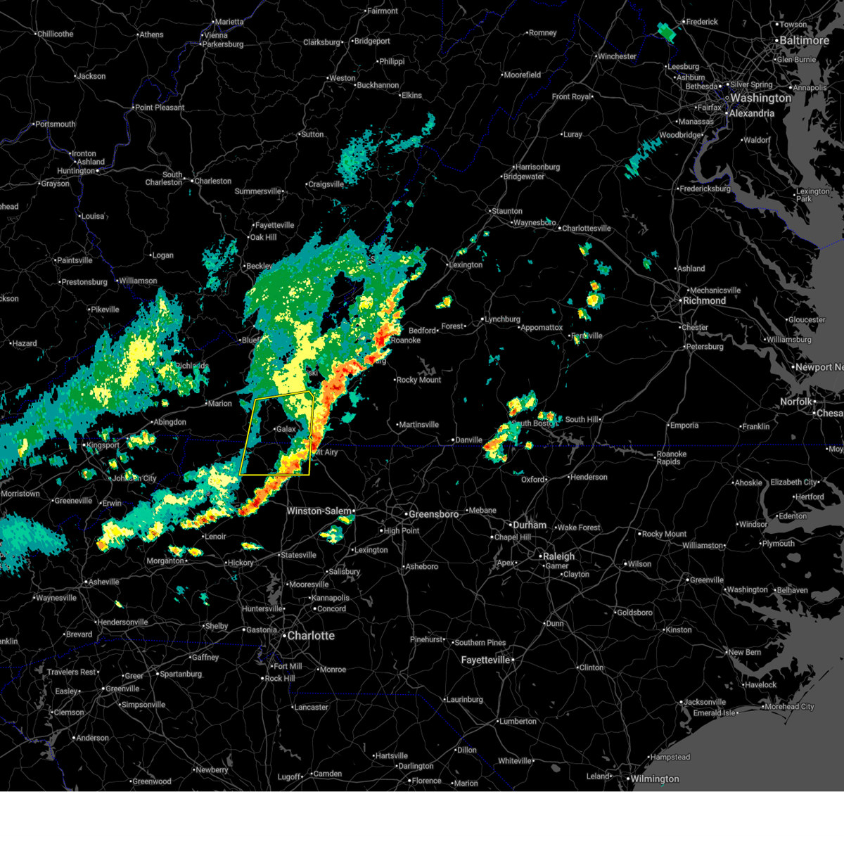
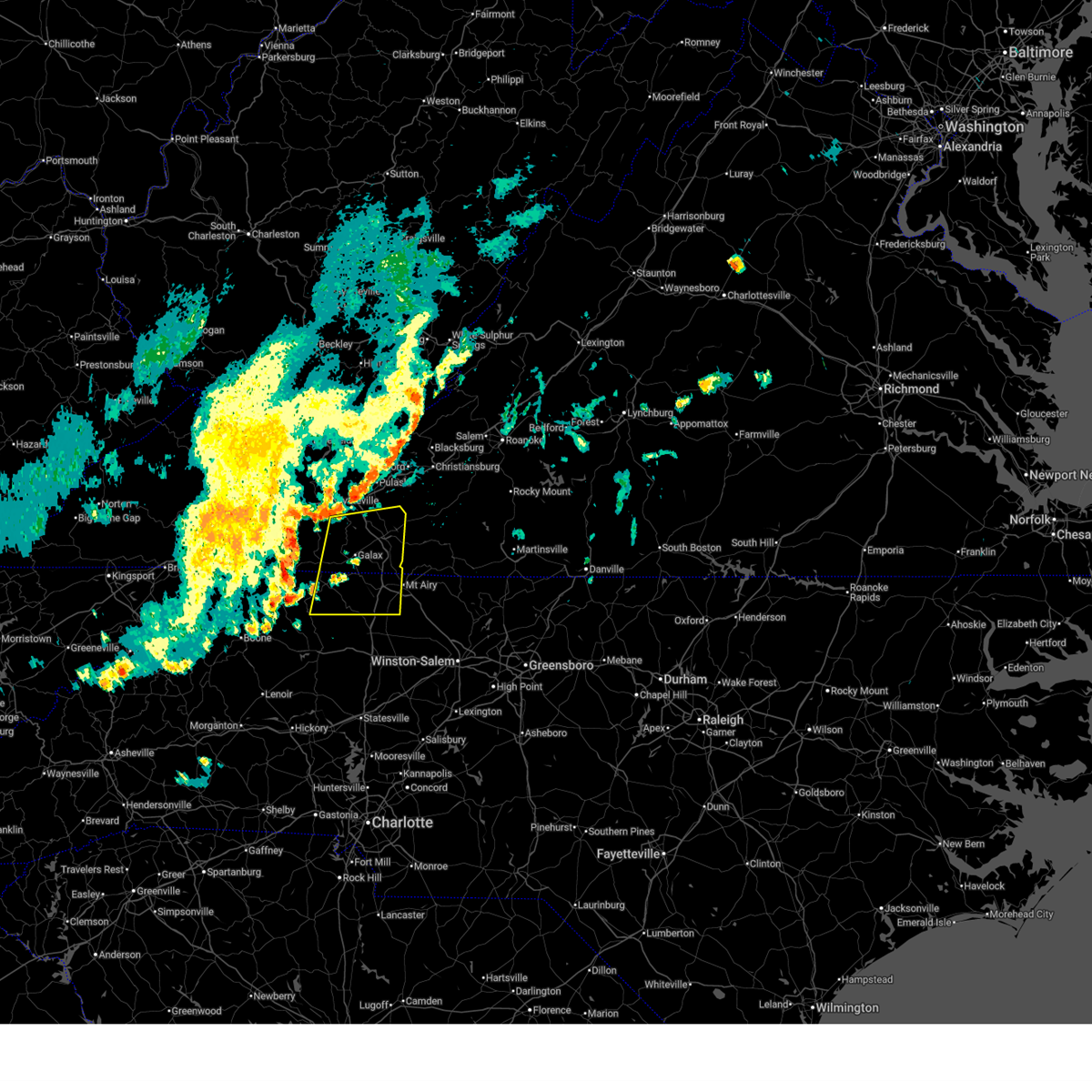
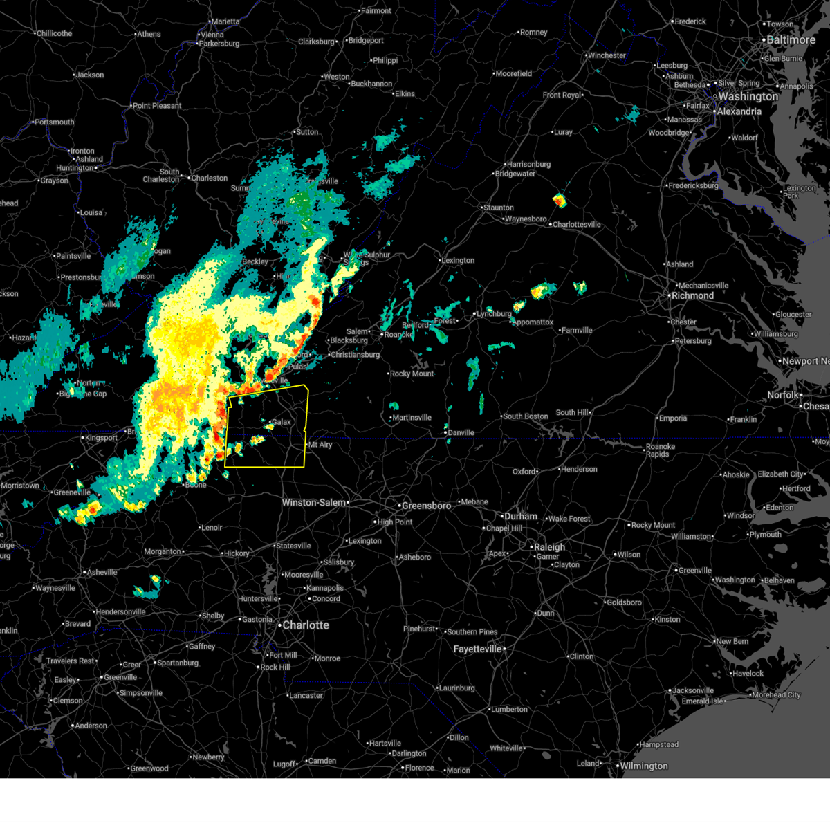
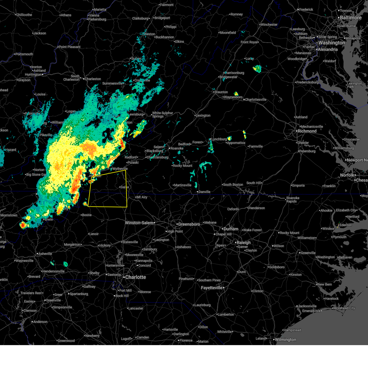
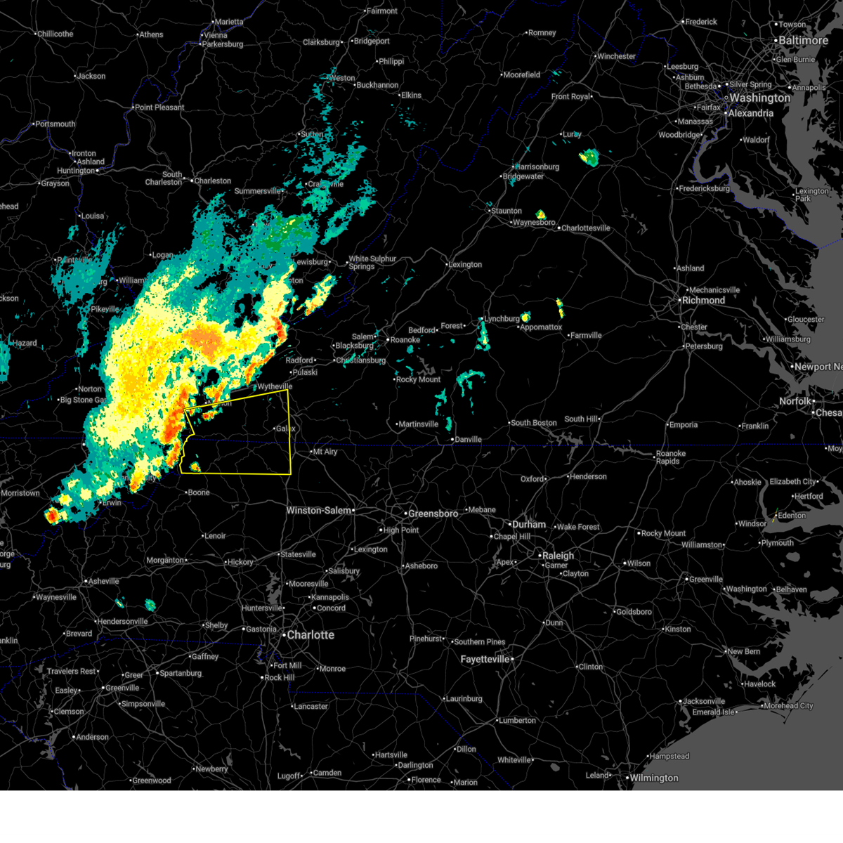
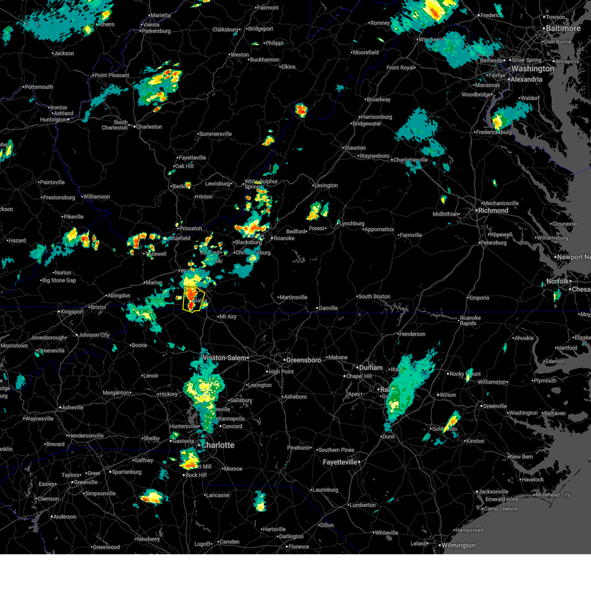
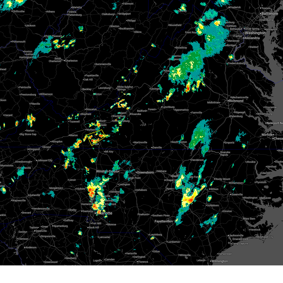
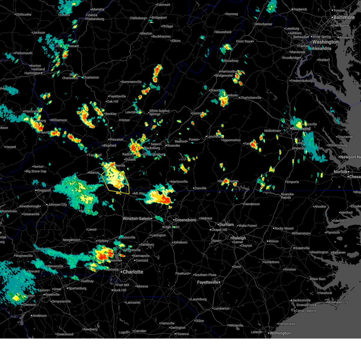
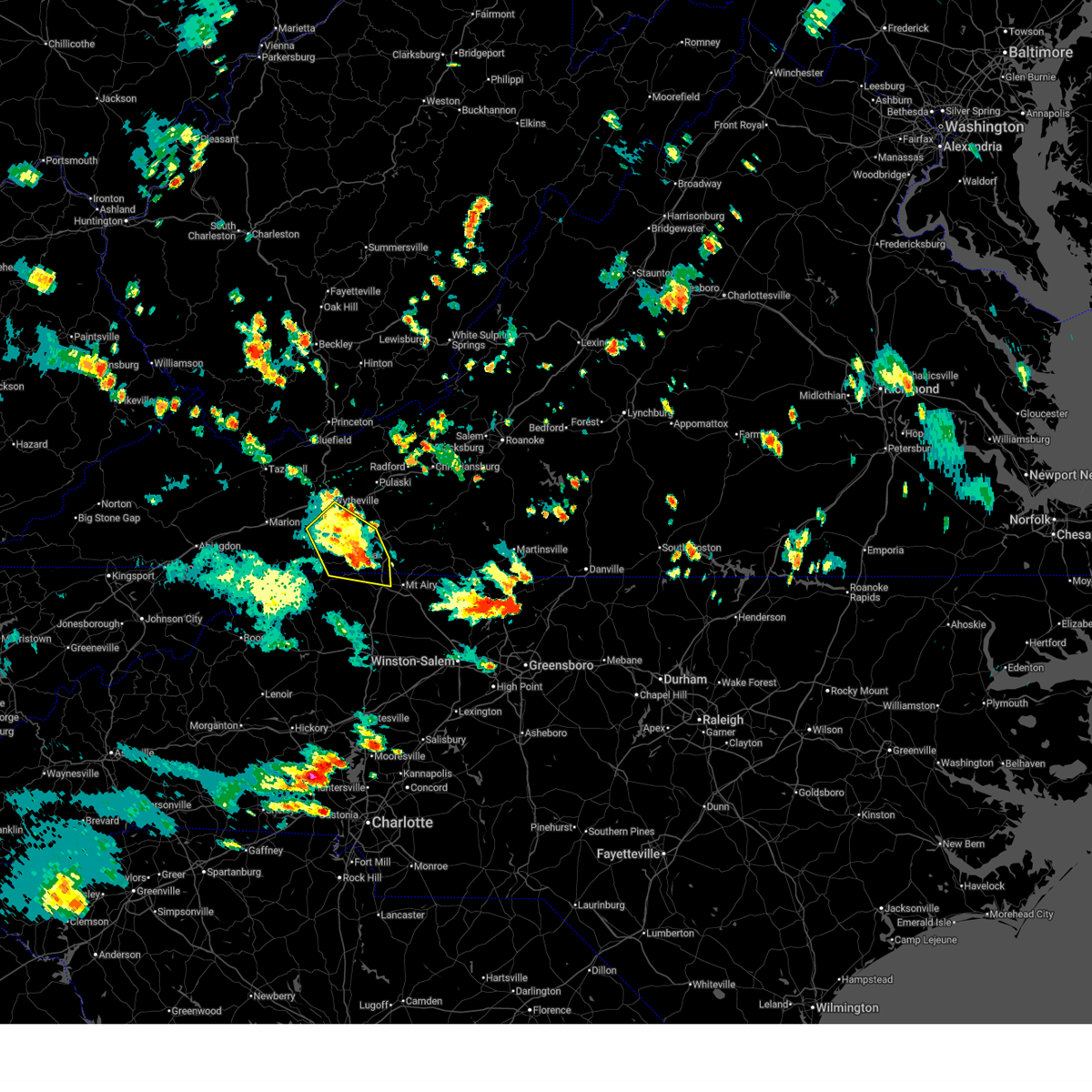
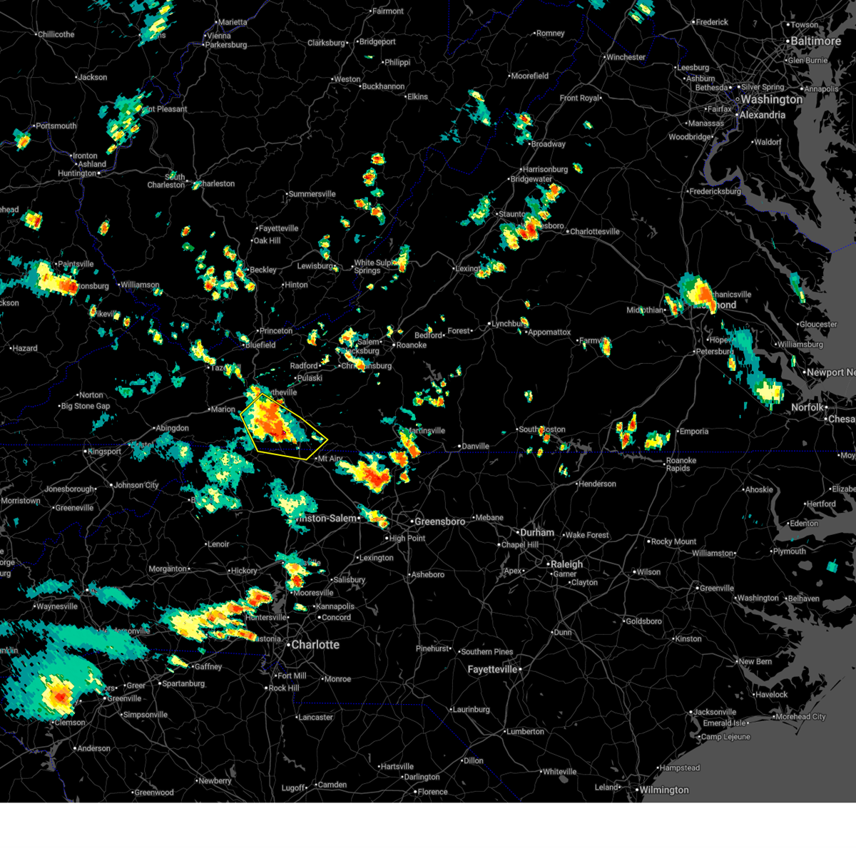
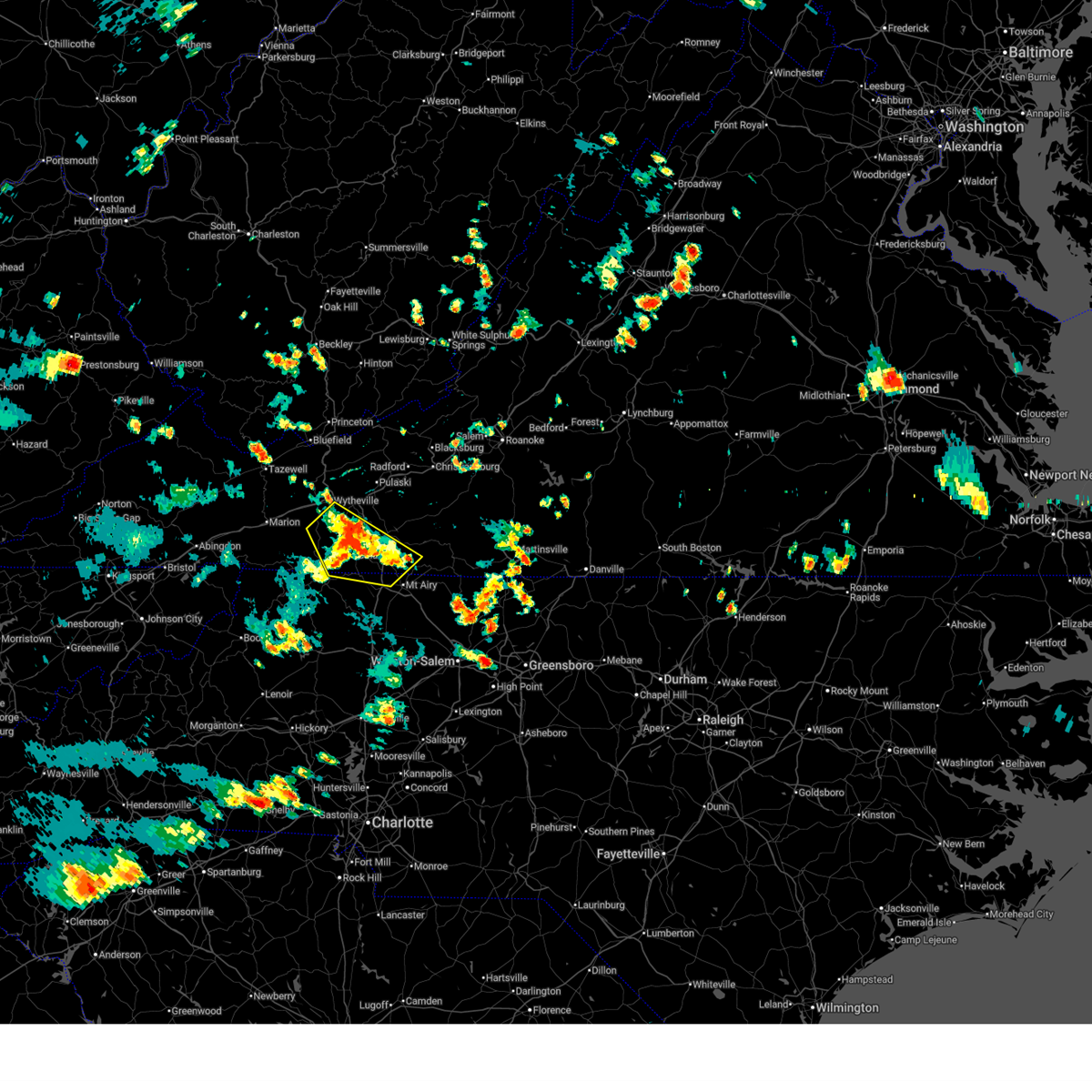
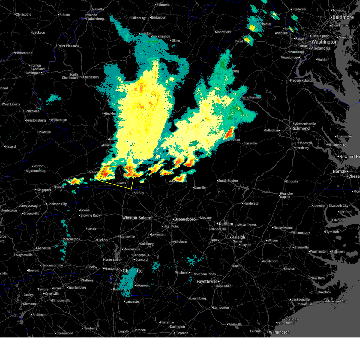
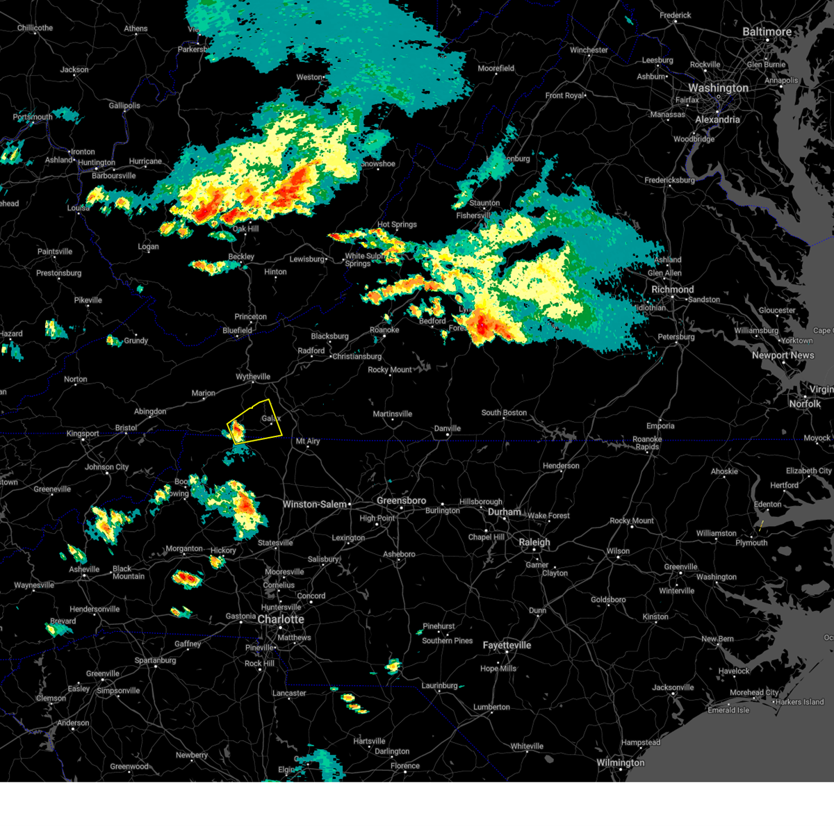
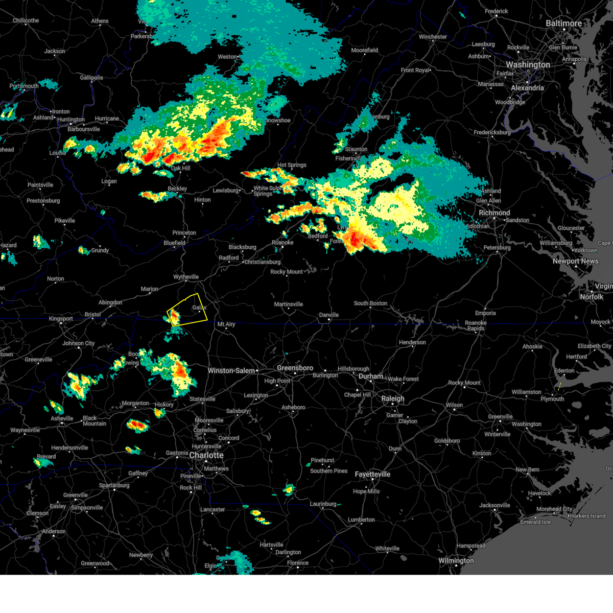
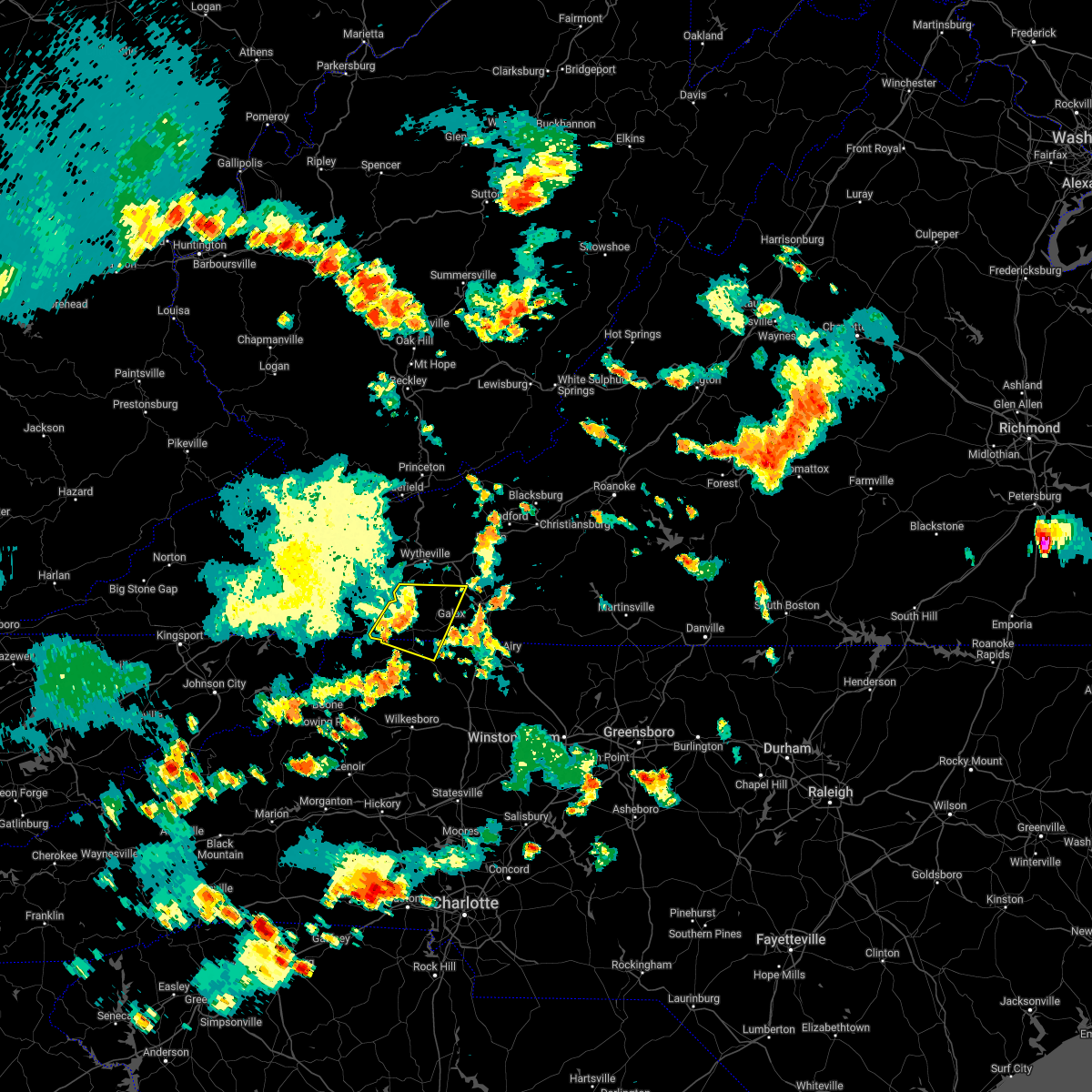
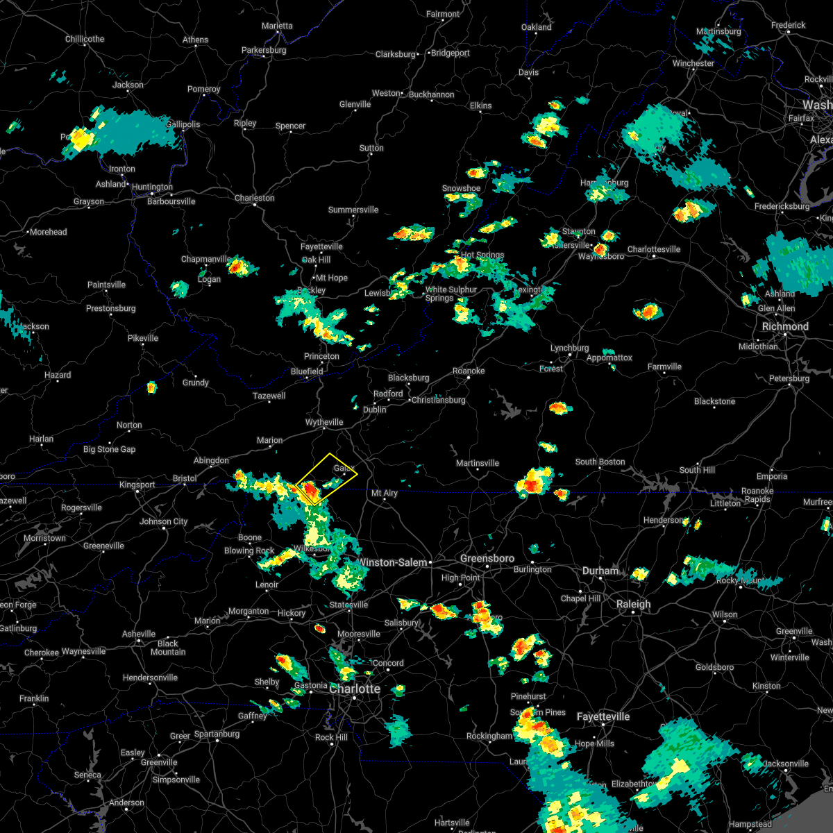
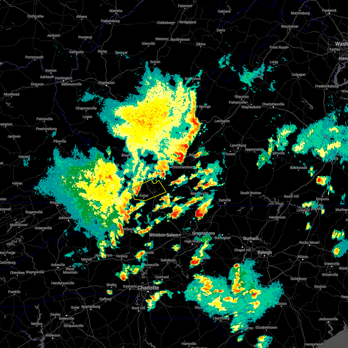
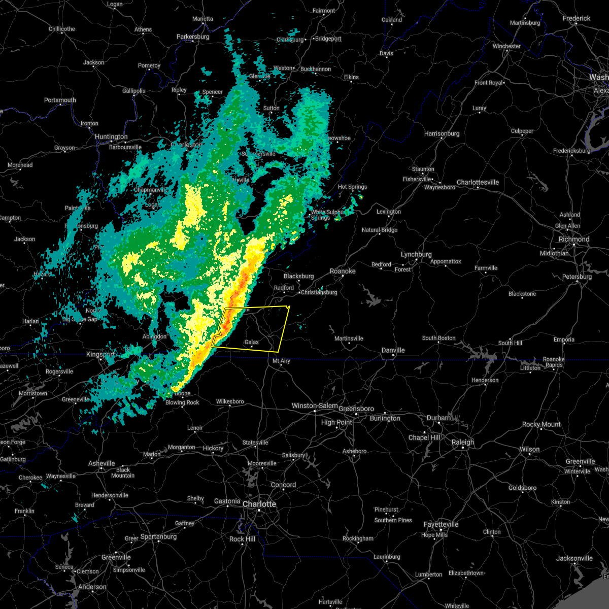
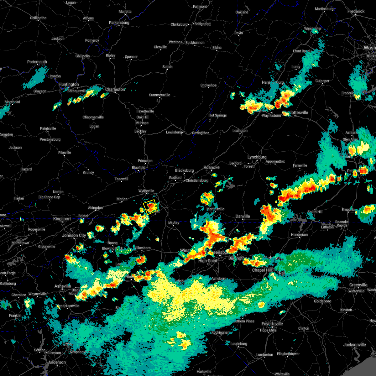
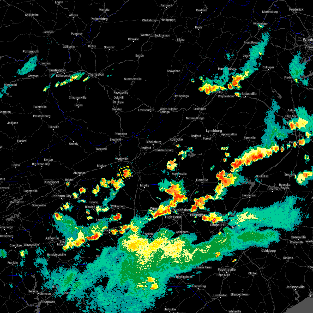
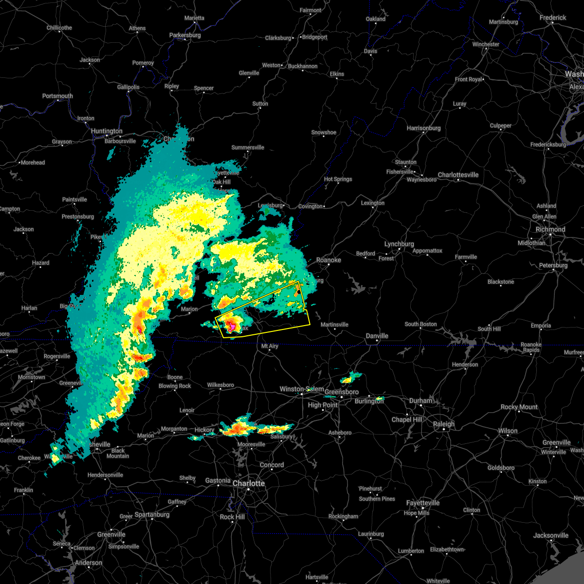
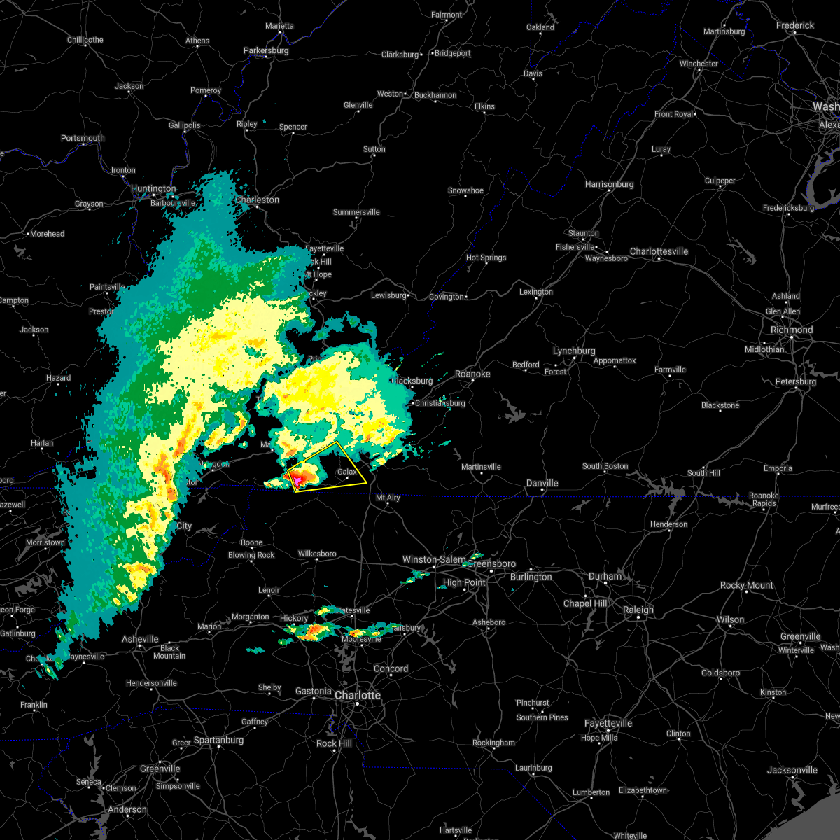
Hail Map for Fries, VA
The Fries, VA area has had 13 reports of on-the-ground hail by trained spotters, and has been under severe weather warnings 9 times during the past 12 months. Doppler radar has detected hail at or near Fries, VA on 29 occasions.
| Name: | Fries, VA |
| Where Located: | 69.1 miles SW of Roanoke, VA |
| Map: | Google Map for Fries, VA |
| Population: | 484 |
| Housing Units: | 340 |
| More Info: | Search Google for Fries, VA |
0
The Top Recent Hail Date for Fries, VA is Saturday, June 28, 2025 (28th out of 29)

Hail and Wind Damage Spotted near Fries, VA
| Date / Time | Report Details |
|---|---|
| 9/4/2025 2:55 PM EDT |
 The storm which prompted the warning has moved out of the area. therefore, the warning will be allowed to expire. there is still a severe thunderstorm warning for eastern carroll and surry county. The storm which prompted the warning has moved out of the area. therefore, the warning will be allowed to expire. there is still a severe thunderstorm warning for eastern carroll and surry county.
|
| 9/4/2025 2:11 PM EDT | *** 1 inj *** tree fell on camper resulting in one injur in grayson county VA, 2.2 miles N of Fries, VA |
| 9/4/2025 2:07 PM EDT |
 At 207 pm edt, a severe thunderstorm was located over baywood, or near ennice, moving east at 40 mph (radar indicated). Hazards include 60 mph wind gusts. Expect damage to roofs, siding, and trees. Locations impacted include, mount airy, galax, hillsville, sparta, dobson, independence, and fries. At 207 pm edt, a severe thunderstorm was located over baywood, or near ennice, moving east at 40 mph (radar indicated). Hazards include 60 mph wind gusts. Expect damage to roofs, siding, and trees. Locations impacted include, mount airy, galax, hillsville, sparta, dobson, independence, and fries.
|
| 9/4/2025 2:07 PM EDT |
 the severe thunderstorm warning has been cancelled and is no longer in effect the severe thunderstorm warning has been cancelled and is no longer in effect
|
| 9/4/2025 1:57 PM EDT |
 The storm which prompted the warning has moved out of the area. therefore, the warning will be allowed to expire. remember, a severe thunderstorm warning still remains in effect for alleghany, northern wilkes, northwestern surry counties, in northwestern north carolina, eastern grayson, carroll, southern wythe counties in virginia. The storm which prompted the warning has moved out of the area. therefore, the warning will be allowed to expire. remember, a severe thunderstorm warning still remains in effect for alleghany, northern wilkes, northwestern surry counties, in northwestern north carolina, eastern grayson, carroll, southern wythe counties in virginia.
|
| 9/4/2025 1:53 PM EDT |
 Svrrnk the national weather service in blacksburg has issued a * severe thunderstorm warning for, alleghany county in northwestern north carolina, northwestern surry county in northwestern north carolina, northeastern wilkes county in northwestern north carolina, east central ashe county in northwestern north carolina, south central pulaski county in southwestern virginia, southern wythe county in southwestern virginia, carroll county in southwestern virginia, the city of galax in southwestern virginia, grayson county in southwestern virginia, * until 300 pm edt. * at 153 pm edt, a severe thunderstorm was located near twin oaks, or near independence, moving east at 40 mph (radar indicated). Hazards include 60 mph wind gusts. expect damage to roofs, siding, and trees Svrrnk the national weather service in blacksburg has issued a * severe thunderstorm warning for, alleghany county in northwestern north carolina, northwestern surry county in northwestern north carolina, northeastern wilkes county in northwestern north carolina, east central ashe county in northwestern north carolina, south central pulaski county in southwestern virginia, southern wythe county in southwestern virginia, carroll county in southwestern virginia, the city of galax in southwestern virginia, grayson county in southwestern virginia, * until 300 pm edt. * at 153 pm edt, a severe thunderstorm was located near twin oaks, or near independence, moving east at 40 mph (radar indicated). Hazards include 60 mph wind gusts. expect damage to roofs, siding, and trees
|
| 9/4/2025 1:40 PM EDT |
 At 138 pm edt, a severe thunderstorm was located over flatridge, or 7 miles east of sugar grove, moving east at 55 mph (radar indicated). Hazards include 60 mph wind gusts. Expect damage to roofs, siding, and trees. Locations impacted include, galax, sparta, jefferson, west jefferson, independence, fries, and lansing. At 138 pm edt, a severe thunderstorm was located over flatridge, or 7 miles east of sugar grove, moving east at 55 mph (radar indicated). Hazards include 60 mph wind gusts. Expect damage to roofs, siding, and trees. Locations impacted include, galax, sparta, jefferson, west jefferson, independence, fries, and lansing.
|
| 9/4/2025 1:40 PM EDT |
 the severe thunderstorm warning has been cancelled and is no longer in effect the severe thunderstorm warning has been cancelled and is no longer in effect
|
| 9/4/2025 1:20 PM EDT |
 Svrrnk the national weather service in blacksburg has issued a * severe thunderstorm warning for, alleghany county in northwestern north carolina, northwestern surry county in northwestern north carolina, northeastern wilkes county in northwestern north carolina, north central watauga county in northwestern north carolina, ashe county in northwestern north carolina, southeastern smyth county in southwestern virginia, southern wythe county in southwestern virginia, western carroll county in southwestern virginia, the city of galax in southwestern virginia, grayson county in southwestern virginia, * until 200 pm edt. * at 120 pm edt, a severe thunderstorm was located over mount rogers summit, or 7 miles north of whitetop, moving east at 55 mph (radar indicated). Hazards include 60 mph wind gusts. expect damage to roofs, siding, and trees Svrrnk the national weather service in blacksburg has issued a * severe thunderstorm warning for, alleghany county in northwestern north carolina, northwestern surry county in northwestern north carolina, northeastern wilkes county in northwestern north carolina, north central watauga county in northwestern north carolina, ashe county in northwestern north carolina, southeastern smyth county in southwestern virginia, southern wythe county in southwestern virginia, western carroll county in southwestern virginia, the city of galax in southwestern virginia, grayson county in southwestern virginia, * until 200 pm edt. * at 120 pm edt, a severe thunderstorm was located over mount rogers summit, or 7 miles north of whitetop, moving east at 55 mph (radar indicated). Hazards include 60 mph wind gusts. expect damage to roofs, siding, and trees
|
| 7/29/2025 7:08 PM EDT |
 Svrrnk the national weather service in blacksburg has issued a * severe thunderstorm warning for, southeastern pulaski county in southwestern virginia, west central floyd county in southwestern virginia, southeastern wythe county in southwestern virginia, northern carroll county in southwestern virginia, northeastern grayson county in southwestern virginia, * until 815 pm edt. * at 707 pm edt, severe thunderstorms were located along a line extending from near copper valley to near spring valley, moving south at 5 mph (radar indicated). Hazards include 60 mph wind gusts. expect damage to roofs, siding, and trees Svrrnk the national weather service in blacksburg has issued a * severe thunderstorm warning for, southeastern pulaski county in southwestern virginia, west central floyd county in southwestern virginia, southeastern wythe county in southwestern virginia, northern carroll county in southwestern virginia, northeastern grayson county in southwestern virginia, * until 815 pm edt. * at 707 pm edt, severe thunderstorms were located along a line extending from near copper valley to near spring valley, moving south at 5 mph (radar indicated). Hazards include 60 mph wind gusts. expect damage to roofs, siding, and trees
|
| 6/28/2025 8:06 PM EDT |
 The storm which prompted the warning has weakened below severe limits, and no longer poses an immediate threat to life or property. therefore, the warning will be allowed to expire. The storm which prompted the warning has weakened below severe limits, and no longer poses an immediate threat to life or property. therefore, the warning will be allowed to expire.
|
| 6/28/2025 7:58 PM EDT |
 At 758 pm edt, a severe thunderstorm was located near galax, moving north at 15 mph (radar indicated). Hazards include 60 mph wind gusts. Expect damage to roofs, siding, and trees. Locations impacted include, galax, fries, byllesby, woodlawn, and pipers gap. At 758 pm edt, a severe thunderstorm was located near galax, moving north at 15 mph (radar indicated). Hazards include 60 mph wind gusts. Expect damage to roofs, siding, and trees. Locations impacted include, galax, fries, byllesby, woodlawn, and pipers gap.
|
| 6/28/2025 7:30 PM EDT |
 Svrrnk the national weather service in blacksburg has issued a * severe thunderstorm warning for, northeastern alleghany county in northwestern north carolina, southwestern carroll county in southwestern virginia, the city of galax in southwestern virginia, eastern grayson county in southwestern virginia, * until 815 pm edt. * at 729 pm edt, a severe thunderstorm was located near galax, moving north at 10 mph (radar indicated). Hazards include 60 mph wind gusts and quarter size hail. Hail damage to vehicles is expected. Expect wind damage to roofs, siding, and trees. Svrrnk the national weather service in blacksburg has issued a * severe thunderstorm warning for, northeastern alleghany county in northwestern north carolina, southwestern carroll county in southwestern virginia, the city of galax in southwestern virginia, eastern grayson county in southwestern virginia, * until 815 pm edt. * at 729 pm edt, a severe thunderstorm was located near galax, moving north at 10 mph (radar indicated). Hazards include 60 mph wind gusts and quarter size hail. Hail damage to vehicles is expected. Expect wind damage to roofs, siding, and trees.
|
| 6/28/2025 6:20 PM EDT |
 Svrrnk the national weather service in blacksburg has issued a * severe thunderstorm warning for, south central pulaski county in southwestern virginia, southeastern wythe county in southwestern virginia, central carroll county in southwestern virginia, the city of galax in southwestern virginia, northeastern grayson county in southwestern virginia, * until 700 pm edt. * at 620 pm edt, a severe thunderstorm was located over fries, moving northwest at 15 mph (radar indicated). Hazards include 60 mph wind gusts. expect damage to roofs, siding, and trees Svrrnk the national weather service in blacksburg has issued a * severe thunderstorm warning for, south central pulaski county in southwestern virginia, southeastern wythe county in southwestern virginia, central carroll county in southwestern virginia, the city of galax in southwestern virginia, northeastern grayson county in southwestern virginia, * until 700 pm edt. * at 620 pm edt, a severe thunderstorm was located over fries, moving northwest at 15 mph (radar indicated). Hazards include 60 mph wind gusts. expect damage to roofs, siding, and trees
|
| 6/26/2025 5:22 PM EDT |
 The storms which prompted the warning have weakened below severe limits, and no longer pose an immediate threat to life or property. therefore, the warning will be allowed to expire. however, gusty winds are still possible with these thunderstorms and additional thunderstorms could still develop later this evening. The storms which prompted the warning have weakened below severe limits, and no longer pose an immediate threat to life or property. therefore, the warning will be allowed to expire. however, gusty winds are still possible with these thunderstorms and additional thunderstorms could still develop later this evening.
|
| 6/26/2025 5:08 PM EDT |
 the severe thunderstorm warning has been cancelled and is no longer in effect the severe thunderstorm warning has been cancelled and is no longer in effect
|
| 6/26/2025 5:08 PM EDT |
 At 507 pm edt, severe thunderstorms were located along a line extending from comers rock to sparta to near mount airy, moving southwest at 30 mph (radar indicated). Hazards include 60 mph wind gusts. Expect damage to roofs, siding, and trees. Locations impacted include, galax, independence, fries, ennice, speedwell, baywood, and ivanhoe. At 507 pm edt, severe thunderstorms were located along a line extending from comers rock to sparta to near mount airy, moving southwest at 30 mph (radar indicated). Hazards include 60 mph wind gusts. Expect damage to roofs, siding, and trees. Locations impacted include, galax, independence, fries, ennice, speedwell, baywood, and ivanhoe.
|
| 6/26/2025 4:52 PM EDT |
 At 451 pm edt, severe thunderstorms were located along a line extending from speedwell to near ennice to ararat, moving southwest at 15 mph (radar indicated). Hazards include 60 mph wind gusts and quarter size hail. Hail damage to vehicles is expected. expect wind damage to roofs, siding, and trees. Locations impacted include, galax, hillsville, independence, fries, fancy gap, ennice, and cana. At 451 pm edt, severe thunderstorms were located along a line extending from speedwell to near ennice to ararat, moving southwest at 15 mph (radar indicated). Hazards include 60 mph wind gusts and quarter size hail. Hail damage to vehicles is expected. expect wind damage to roofs, siding, and trees. Locations impacted include, galax, hillsville, independence, fries, fancy gap, ennice, and cana.
|
| 6/26/2025 4:37 PM EDT |
 At 437 pm edt, severe thunderstorms were located along a line extending from near comers rock to near sparta to near ararat, moving southwest at 25 mph (radar indicated). Hazards include 60 mph wind gusts. Expect damage to roofs, siding, and trees. Locations impacted include, galax, hillsville, independence, fries, fancy gap, ennice, and cana. At 437 pm edt, severe thunderstorms were located along a line extending from near comers rock to near sparta to near ararat, moving southwest at 25 mph (radar indicated). Hazards include 60 mph wind gusts. Expect damage to roofs, siding, and trees. Locations impacted include, galax, hillsville, independence, fries, fancy gap, ennice, and cana.
|
| 6/26/2025 4:25 PM EDT |
 Svrrnk the national weather service in blacksburg has issued a * severe thunderstorm warning for, northeastern alleghany county in northwestern north carolina, northwestern surry county in northwestern north carolina, southeastern wythe county in southwestern virginia, carroll county in southwestern virginia, the city of galax in southwestern virginia, eastern grayson county in southwestern virginia, western patrick county in southwestern virginia, * until 530 pm edt. * at 424 pm edt, severe thunderstorms were located along a line extending from near speedwell to near cana, moving southwest at 20 mph (radar indicated). Hazards include 60 mph wind gusts. expect damage to roofs, siding, and trees Svrrnk the national weather service in blacksburg has issued a * severe thunderstorm warning for, northeastern alleghany county in northwestern north carolina, northwestern surry county in northwestern north carolina, southeastern wythe county in southwestern virginia, carroll county in southwestern virginia, the city of galax in southwestern virginia, eastern grayson county in southwestern virginia, western patrick county in southwestern virginia, * until 530 pm edt. * at 424 pm edt, severe thunderstorms were located along a line extending from near speedwell to near cana, moving southwest at 20 mph (radar indicated). Hazards include 60 mph wind gusts. expect damage to roofs, siding, and trees
|
| 5/16/2025 4:27 PM EDT |
 The storm which prompted the warning has weakened below severe limits, and no longer poses an immediate threat to life or property. therefore, the warning will be allowed to expire. however, heavy rain is still possible with this thunderstorm. a severe thunderstorm watch remains in effect until 600 pm edt for northwestern north carolina, southwestern virginia, and southeastern west virginia. a severe thunderstorm watch also remains in effect until 1100 pm edt for north central north carolina, and west central virginia. The storm which prompted the warning has weakened below severe limits, and no longer poses an immediate threat to life or property. therefore, the warning will be allowed to expire. however, heavy rain is still possible with this thunderstorm. a severe thunderstorm watch remains in effect until 600 pm edt for northwestern north carolina, southwestern virginia, and southeastern west virginia. a severe thunderstorm watch also remains in effect until 1100 pm edt for north central north carolina, and west central virginia.
|
| 5/16/2025 4:14 PM EDT |
 the severe thunderstorm warning has been cancelled and is no longer in effect the severe thunderstorm warning has been cancelled and is no longer in effect
|
| 5/16/2025 4:14 PM EDT |
 At 413 pm edt, a severe thunderstorm was located over cripple creek, or near speedwell, moving east at 60 mph (radar indicated). Hazards include 70 mph wind gusts and quarter size hail. Hail damage to vehicles is expected. expect considerable tree damage. wind damage is also likely to mobile homes, roofs, and outbuildings. Locations impacted include, wytheville, galax, hillsville, fries, fancy gap, patterson, and cana. At 413 pm edt, a severe thunderstorm was located over cripple creek, or near speedwell, moving east at 60 mph (radar indicated). Hazards include 70 mph wind gusts and quarter size hail. Hail damage to vehicles is expected. expect considerable tree damage. wind damage is also likely to mobile homes, roofs, and outbuildings. Locations impacted include, wytheville, galax, hillsville, fries, fancy gap, patterson, and cana.
|
| 5/16/2025 3:51 PM EDT |
 the severe thunderstorm warning has been cancelled and is no longer in effect the severe thunderstorm warning has been cancelled and is no longer in effect
|
| 5/16/2025 3:51 PM EDT |
 At 349 pm edt, a severe thunderstorm was located over marion, moving east at 60 mph (radar indicated). Hazards include 70 mph wind gusts and quarter size hail. Hail damage to vehicles is expected. expect considerable tree damage. wind damage is also likely to mobile homes, roofs, and outbuildings. Locations impacted include, wytheville, galax, marion, hillsville, chilhowie, rural retreat, and independence. At 349 pm edt, a severe thunderstorm was located over marion, moving east at 60 mph (radar indicated). Hazards include 70 mph wind gusts and quarter size hail. Hail damage to vehicles is expected. expect considerable tree damage. wind damage is also likely to mobile homes, roofs, and outbuildings. Locations impacted include, wytheville, galax, marion, hillsville, chilhowie, rural retreat, and independence.
|
| 5/16/2025 3:36 PM EDT |
 Svrrnk the national weather service in blacksburg has issued a * severe thunderstorm warning for, smyth county in southwestern virginia, south central tazewell county in southwestern virginia, southern wythe county in southwestern virginia, carroll county in southwestern virginia, the city of galax in southwestern virginia, grayson county in southwestern virginia, * until 430 pm edt. * at 336 pm edt, a severe thunderstorm was located over quarry, or over saltville, moving east at 60 mph (radar indicated). Hazards include 60 mph wind gusts and quarter size hail. Hail damage to vehicles is expected. Expect wind damage to roofs, siding, and trees. Svrrnk the national weather service in blacksburg has issued a * severe thunderstorm warning for, smyth county in southwestern virginia, south central tazewell county in southwestern virginia, southern wythe county in southwestern virginia, carroll county in southwestern virginia, the city of galax in southwestern virginia, grayson county in southwestern virginia, * until 430 pm edt. * at 336 pm edt, a severe thunderstorm was located over quarry, or over saltville, moving east at 60 mph (radar indicated). Hazards include 60 mph wind gusts and quarter size hail. Hail damage to vehicles is expected. Expect wind damage to roofs, siding, and trees.
|
| 7/16/2024 4:45 PM EDT | Thunderstorm wind damage blew a tree down on the intersection between falcon ridge road and ivanhoe roa in carroll county VA, 4.1 miles S of Fries, VA |
| 7/16/2024 4:43 PM EDT | Thunderstorm wind damage blew down a tree on mt. hope roa in carroll county VA, 4.1 miles S of Fries, VA |
| 5/26/2024 5:57 PM EDT |
 The storms which prompted the warning have moved out of the area. therefore, the warning will be allowed to expire. a severe thunderstorm watch remains in effect until 900 pm edt for northwestern north carolina, southwestern and west central virginia, and southeastern west virginia. The storms which prompted the warning have moved out of the area. therefore, the warning will be allowed to expire. a severe thunderstorm watch remains in effect until 900 pm edt for northwestern north carolina, southwestern and west central virginia, and southeastern west virginia.
|
| 5/26/2024 5:40 PM EDT |
 Svrrnk the national weather service in blacksburg has issued a * severe thunderstorm warning for, northern alleghany county in northwestern north carolina, northern surry county in northwestern north carolina, northwestern stokes county in north central north carolina, south central pulaski county in southwestern virginia, southern floyd county in southwestern virginia, east central wythe county in southwestern virginia, carroll county in southwestern virginia, the city of galax in southwestern virginia, southeastern grayson county in southwestern virginia, patrick county in southwestern virginia, southwestern franklin county in west central virginia, * until 645 pm edt. * at 540 pm edt, severe thunderstorms were located along a line extending from patterson to near baywood to twin oaks, moving east at 30 mph (radar indicated). Hazards include 60 mph wind gusts. expect damage to roofs, siding, and trees Svrrnk the national weather service in blacksburg has issued a * severe thunderstorm warning for, northern alleghany county in northwestern north carolina, northern surry county in northwestern north carolina, northwestern stokes county in north central north carolina, south central pulaski county in southwestern virginia, southern floyd county in southwestern virginia, east central wythe county in southwestern virginia, carroll county in southwestern virginia, the city of galax in southwestern virginia, southeastern grayson county in southwestern virginia, patrick county in southwestern virginia, southwestern franklin county in west central virginia, * until 645 pm edt. * at 540 pm edt, severe thunderstorms were located along a line extending from patterson to near baywood to twin oaks, moving east at 30 mph (radar indicated). Hazards include 60 mph wind gusts. expect damage to roofs, siding, and trees
|
| 5/26/2024 5:25 PM EDT |
 At 523 pm edt, severe thunderstorms were located along a line extending from near indian mills to thessalia to gunton park to near baywood, moving east at 55 mph (law enforcement. numerous trees have been blown down with this storm). Hazards include 70 mph wind gusts and quarter size hail. Hail damage to vehicles is expected. expect considerable tree damage. wind damage is also likely to mobile homes, roofs, and outbuildings. Locations impacted include, pulaski, wytheville, galax, bland, princeton, pearisburg, and hillsville. At 523 pm edt, severe thunderstorms were located along a line extending from near indian mills to thessalia to gunton park to near baywood, moving east at 55 mph (law enforcement. numerous trees have been blown down with this storm). Hazards include 70 mph wind gusts and quarter size hail. Hail damage to vehicles is expected. expect considerable tree damage. wind damage is also likely to mobile homes, roofs, and outbuildings. Locations impacted include, pulaski, wytheville, galax, bland, princeton, pearisburg, and hillsville.
|
| 5/26/2024 5:25 PM EDT |
 the severe thunderstorm warning has been cancelled and is no longer in effect the severe thunderstorm warning has been cancelled and is no longer in effect
|
| 5/26/2024 5:08 PM EDT |
 At 507 pm edt, severe thunderstorms were located along a line extending from near camp creek state park to rocky gap to near wytheville to independence, moving east at 55 mph (radar indicated). Hazards include 70 mph wind gusts and quarter size hail. Hail damage to vehicles is expected. expect considerable tree damage. wind damage is also likely to mobile homes, roofs, and outbuildings. locations impacted include, bluefield, pulaski, wytheville, galax, bland, princeton, and pearisburg. This includes the following location mercer county airport. At 507 pm edt, severe thunderstorms were located along a line extending from near camp creek state park to rocky gap to near wytheville to independence, moving east at 55 mph (radar indicated). Hazards include 70 mph wind gusts and quarter size hail. Hail damage to vehicles is expected. expect considerable tree damage. wind damage is also likely to mobile homes, roofs, and outbuildings. locations impacted include, bluefield, pulaski, wytheville, galax, bland, princeton, and pearisburg. This includes the following location mercer county airport.
|
| 5/26/2024 4:46 PM EDT |
 Svrrnk the national weather service in blacksburg has issued a * severe thunderstorm warning for, pulaski county in southwestern virginia, giles county in southwestern virginia, east central smyth county in southwestern virginia, northeastern tazewell county in southwestern virginia, bland county in southwestern virginia, wythe county in southwestern virginia, western carroll county in southwestern virginia, the city of galax in southwestern virginia, grayson county in southwestern virginia, summers county in southeastern west virginia, mercer county in southeastern west virginia, western monroe county in southeastern west virginia, * until 600 pm edt. * at 444 pm edt, severe thunderstorms were located along a line extending from near northfork to near tiptop to nebo to rugby, moving east at 55 mph (radar indicated). Hazards include 60 mph wind gusts and quarter size hail. Hail damage to vehicles is expected. Expect wind damage to roofs, siding, and trees. Svrrnk the national weather service in blacksburg has issued a * severe thunderstorm warning for, pulaski county in southwestern virginia, giles county in southwestern virginia, east central smyth county in southwestern virginia, northeastern tazewell county in southwestern virginia, bland county in southwestern virginia, wythe county in southwestern virginia, western carroll county in southwestern virginia, the city of galax in southwestern virginia, grayson county in southwestern virginia, summers county in southeastern west virginia, mercer county in southeastern west virginia, western monroe county in southeastern west virginia, * until 600 pm edt. * at 444 pm edt, severe thunderstorms were located along a line extending from near northfork to near tiptop to nebo to rugby, moving east at 55 mph (radar indicated). Hazards include 60 mph wind gusts and quarter size hail. Hail damage to vehicles is expected. Expect wind damage to roofs, siding, and trees.
|
| 8/26/2023 6:15 PM EDT |
 At 613 pm edt, severe thunderstorms were located along a line extending from hillsville to galax to southeast of sparta, moving east at 20 mph (public. trees have been reported down in the mouth of wilson area west of independence). Hazards include 60 mph wind gusts. expect damage to roofs, siding, and trees At 613 pm edt, severe thunderstorms were located along a line extending from hillsville to galax to southeast of sparta, moving east at 20 mph (public. trees have been reported down in the mouth of wilson area west of independence). Hazards include 60 mph wind gusts. expect damage to roofs, siding, and trees
|
| 7/29/2023 6:01 PM EDT |
 At 601 pm edt, severe thunderstorms were located along a line extending from spring valley to near ashland, moving southeast at 25 mph (radar indicated). Hazards include 60 mph wind gusts. Expect damage to roofs, siding, and trees. locations impacted include, galax, sparta, jefferson, west jefferson, independence, fries, and lansing. hail threat, radar indicated max hail size, <. 75 in wind threat, radar indicated max wind gust, 60 mph. At 601 pm edt, severe thunderstorms were located along a line extending from spring valley to near ashland, moving southeast at 25 mph (radar indicated). Hazards include 60 mph wind gusts. Expect damage to roofs, siding, and trees. locations impacted include, galax, sparta, jefferson, west jefferson, independence, fries, and lansing. hail threat, radar indicated max hail size, <. 75 in wind threat, radar indicated max wind gust, 60 mph.
|
| 7/29/2023 5:41 PM EDT |
 At 540 pm edt, severe thunderstorms were located along a line extending from speedwell to near mountain city, moving southeast at 25 mph (radar indicated). Hazards include 60 mph wind gusts. expect damage to roofs, siding, and trees At 540 pm edt, severe thunderstorms were located along a line extending from speedwell to near mountain city, moving southeast at 25 mph (radar indicated). Hazards include 60 mph wind gusts. expect damage to roofs, siding, and trees
|
| 7/28/2023 6:42 PM EDT |
 The severe thunderstorm warning for east central craig, floyd, northwestern bedford, carroll, northwestern henry, patrick and franklin counties and the city of galax will expire at 645 pm edt, the storms which prompted the warning have moved out of the area. therefore, the warning will be allowed to expire. a severe thunderstorm watch remains in effect until 1100 pm edt for southwestern and west central virginia, and southeastern west virginia. The severe thunderstorm warning for east central craig, floyd, northwestern bedford, carroll, northwestern henry, patrick and franklin counties and the city of galax will expire at 645 pm edt, the storms which prompted the warning have moved out of the area. therefore, the warning will be allowed to expire. a severe thunderstorm watch remains in effect until 1100 pm edt for southwestern and west central virginia, and southeastern west virginia.
|
| 7/28/2023 6:40 PM EDT |
 The severe thunderstorm warning for alleghany, northwestern surry and northern ashe counties in northwestern north carolina, southwestern carroll and grayson counties in southwestern virginia and the city of galax will expire at 645 pm edt, the storms which prompted the warning have weakened below severe limits, and no longer pose an immediate threat to life or property. therefore, the warning will be allowed to expire. a severe thunderstorm watch remains in effect until 1100 pm edt for southwestern virginia. The severe thunderstorm warning for alleghany, northwestern surry and northern ashe counties in northwestern north carolina, southwestern carroll and grayson counties in southwestern virginia and the city of galax will expire at 645 pm edt, the storms which prompted the warning have weakened below severe limits, and no longer pose an immediate threat to life or property. therefore, the warning will be allowed to expire. a severe thunderstorm watch remains in effect until 1100 pm edt for southwestern virginia.
|
| 7/28/2023 6:35 PM EDT |
 At 634 pm edt, severe thunderstorms were located along a line extending from near montvale to near ferrum to near charity to rocky knob recreation area, moving southwest at 10 mph (radar indicated). Hazards include 60 mph wind gusts. Expect damage to roofs, siding, and trees. locations impacted include, roanoke, salem, vinton, galax, bedford, rocky mount, and hillsville. this includes the following locations the salem fairgrounds, the national d-day memorial, and roanoke regional airport. hail threat, radar indicated max hail size, <. 75 in wind threat, radar indicated max wind gust, 60 mph. At 634 pm edt, severe thunderstorms were located along a line extending from near montvale to near ferrum to near charity to rocky knob recreation area, moving southwest at 10 mph (radar indicated). Hazards include 60 mph wind gusts. Expect damage to roofs, siding, and trees. locations impacted include, roanoke, salem, vinton, galax, bedford, rocky mount, and hillsville. this includes the following locations the salem fairgrounds, the national d-day memorial, and roanoke regional airport. hail threat, radar indicated max hail size, <. 75 in wind threat, radar indicated max wind gust, 60 mph.
|
| 7/28/2023 6:34 PM EDT |
 At 633 pm edt, severe thunderstorms were located along a line extending from near pipers gap to near baywood to near grassy creek, moving southeast at 20 mph (radar indicated). Hazards include 60 mph wind gusts. Expect damage to roofs, siding, and trees. locations impacted include, galax, sparta, independence, fries, lansing, mouth of wilson, and whitetop. hail threat, radar indicated max hail size, <. 75 in wind threat, radar indicated max wind gust, 60 mph. At 633 pm edt, severe thunderstorms were located along a line extending from near pipers gap to near baywood to near grassy creek, moving southeast at 20 mph (radar indicated). Hazards include 60 mph wind gusts. Expect damage to roofs, siding, and trees. locations impacted include, galax, sparta, independence, fries, lansing, mouth of wilson, and whitetop. hail threat, radar indicated max hail size, <. 75 in wind threat, radar indicated max wind gust, 60 mph.
|
| 7/28/2023 5:46 PM EDT |
 At 546 pm edt, severe thunderstorms were located along a line extending from near cripple creek to near flatridge to near whitetop, moving southeast at 20 mph (radar indicated). Hazards include 60 mph wind gusts. expect damage to roofs, siding, and trees At 546 pm edt, severe thunderstorms were located along a line extending from near cripple creek to near flatridge to near whitetop, moving southeast at 20 mph (radar indicated). Hazards include 60 mph wind gusts. expect damage to roofs, siding, and trees
|
| 7/28/2023 5:33 PM EDT |
 At 533 pm edt, severe thunderstorms were located along a line extending from new castle to near crockett springs to near claytor lake state park to allisonia, moving east at 50 mph (radar indicated). Hazards include 60 mph wind gusts. expect damage to roofs, siding, and trees At 533 pm edt, severe thunderstorms were located along a line extending from new castle to near crockett springs to near claytor lake state park to allisonia, moving east at 50 mph (radar indicated). Hazards include 60 mph wind gusts. expect damage to roofs, siding, and trees
|
| 7/13/2023 6:27 PM EDT |
 At 627 pm edt, a severe thunderstorm was located over independence, moving northeast at 35 mph (radar indicated). Hazards include 60 mph wind gusts and quarter size hail. Hail damage to vehicles is expected. Expect wind damage to roofs, siding, and trees. At 627 pm edt, a severe thunderstorm was located over independence, moving northeast at 35 mph (radar indicated). Hazards include 60 mph wind gusts and quarter size hail. Hail damage to vehicles is expected. Expect wind damage to roofs, siding, and trees.
|
| 5/16/2023 7:28 PM EDT |
 At 727 pm edt, severe thunderstorms were located along a line extending from near boones mill to near fancy gap, moving east at 55 mph (radar indicated). Hazards include 60 mph wind gusts. Expect damage to roofs, siding, and trees. locations impacted include, galax, rocky mount, hillsville, independence, fries, floyd, and copper hill. hail threat, radar indicated max hail size, <. 75 in wind threat, radar indicated max wind gust, 60 mph. At 727 pm edt, severe thunderstorms were located along a line extending from near boones mill to near fancy gap, moving east at 55 mph (radar indicated). Hazards include 60 mph wind gusts. Expect damage to roofs, siding, and trees. locations impacted include, galax, rocky mount, hillsville, independence, fries, floyd, and copper hill. hail threat, radar indicated max hail size, <. 75 in wind threat, radar indicated max wind gust, 60 mph.
|
| 5/16/2023 7:10 PM EDT |
 At 710 pm edt, severe thunderstorms were located along a line extending from near crockett springs to fries, moving east at 55 mph (radar indicated). Hazards include 60 mph wind gusts. expect damage to roofs, siding, and trees At 710 pm edt, severe thunderstorms were located along a line extending from near crockett springs to fries, moving east at 55 mph (radar indicated). Hazards include 60 mph wind gusts. expect damage to roofs, siding, and trees
|
| 7/6/2022 5:19 PM EDT |
 At 519 pm edt, severe thunderstorms were located along a line extending from cripple creek to near piney creek, moving southeast at 15 mph (radar indicated). Hazards include 60 mph wind gusts. Expect damage to roofs, siding, and trees. locations impacted include, galax, sparta, independence, fries, ennice, mouth of wilson, and speedwell. hail threat, radar indicated max hail size, <. 75 in wind threat, radar indicated max wind gust, 60 mph. At 519 pm edt, severe thunderstorms were located along a line extending from cripple creek to near piney creek, moving southeast at 15 mph (radar indicated). Hazards include 60 mph wind gusts. Expect damage to roofs, siding, and trees. locations impacted include, galax, sparta, independence, fries, ennice, mouth of wilson, and speedwell. hail threat, radar indicated max hail size, <. 75 in wind threat, radar indicated max wind gust, 60 mph.
|
| 7/6/2022 4:59 PM EDT |
 At 458 pm edt, severe thunderstorms were located along a line extending from near marion wytheville to near mount rogers summit, moving east at 25 mph (radar indicated). Hazards include 60 mph wind gusts and quarter size hail. Hail damage to vehicles is expected. Expect wind damage to roofs, siding, and trees. At 458 pm edt, severe thunderstorms were located along a line extending from near marion wytheville to near mount rogers summit, moving east at 25 mph (radar indicated). Hazards include 60 mph wind gusts and quarter size hail. Hail damage to vehicles is expected. Expect wind damage to roofs, siding, and trees.
|
| 6/17/2022 4:02 PM EDT |
 At 402 pm edt, severe thunderstorms were located along a line extending from near draper to near whitetop, moving southeast at 50 mph (radar indicated). Hazards include 60 mph wind gusts. expect damage to roofs, siding, and trees At 402 pm edt, severe thunderstorms were located along a line extending from near draper to near whitetop, moving southeast at 50 mph (radar indicated). Hazards include 60 mph wind gusts. expect damage to roofs, siding, and trees
|
| 6/14/2022 5:39 AM EDT |
 The severe thunderstorm warning for alleghany and ashe counties in northwestern north carolina, southern smyth, southern wythe, southwestern carroll and grayson counties in southwestern virginia and the city of galax will expire at 545 am edt, the storm which prompted the warning has weakened below severe limits, and no longer poses an immediate threat to life or property. therefore, the warning will be allowed to expire. however gusty winds and heavy rain are still possible with this thunderstorm. The severe thunderstorm warning for alleghany and ashe counties in northwestern north carolina, southern smyth, southern wythe, southwestern carroll and grayson counties in southwestern virginia and the city of galax will expire at 545 am edt, the storm which prompted the warning has weakened below severe limits, and no longer poses an immediate threat to life or property. therefore, the warning will be allowed to expire. however gusty winds and heavy rain are still possible with this thunderstorm.
|
| 6/14/2022 5:25 AM EDT |
 At 524 am edt, a severe thunderstorm was located over bridle creek, or near mouth of wilson, moving south at 40 mph (radar indicated). Hazards include 60 mph wind gusts and quarter size hail. Hail damage to vehicles is expected. expect wind damage to roofs, siding, and trees. locations impacted include, galax, marion, hillsville, chilhowie, sparta, jefferson, and west jefferson. hail threat, radar indicated max hail size, 1. 00 in wind threat, radar indicated max wind gust, 60 mph. At 524 am edt, a severe thunderstorm was located over bridle creek, or near mouth of wilson, moving south at 40 mph (radar indicated). Hazards include 60 mph wind gusts and quarter size hail. Hail damage to vehicles is expected. expect wind damage to roofs, siding, and trees. locations impacted include, galax, marion, hillsville, chilhowie, sparta, jefferson, and west jefferson. hail threat, radar indicated max hail size, 1. 00 in wind threat, radar indicated max wind gust, 60 mph.
|
| 6/14/2022 5:13 AM EDT |
 At 513 am edt, a severe thunderstorm was located near elk creek, or near speedwell, moving southeast at 55 mph (radar indicated). Hazards include 60 mph wind gusts. Expect damage to roofs, siding, and trees. locations impacted include, wytheville, galax, marion, hillsville, saltville, chilhowie, and sparta. hail threat, radar indicated max hail size, <. 75 in wind threat, radar indicated max wind gust, 60 mph. At 513 am edt, a severe thunderstorm was located near elk creek, or near speedwell, moving southeast at 55 mph (radar indicated). Hazards include 60 mph wind gusts. Expect damage to roofs, siding, and trees. locations impacted include, wytheville, galax, marion, hillsville, saltville, chilhowie, and sparta. hail threat, radar indicated max hail size, <. 75 in wind threat, radar indicated max wind gust, 60 mph.
|
| 6/14/2022 4:49 AM EDT |
 At 449 am edt, a severe thunderstorm was located over nebo, or 7 miles southwest of ceres, moving southeast at 55 mph (radar indicated). Hazards include 60 mph wind gusts and quarter size hail. Hail damage to vehicles is expected. Expect wind damage to roofs, siding, and trees. At 449 am edt, a severe thunderstorm was located over nebo, or 7 miles southwest of ceres, moving southeast at 55 mph (radar indicated). Hazards include 60 mph wind gusts and quarter size hail. Hail damage to vehicles is expected. Expect wind damage to roofs, siding, and trees.
|
| 6/8/2022 5:43 PM EDT |
 The severe thunderstorm warning for southwestern carroll and eastern grayson counties and the city of galax will expire at 545 pm edt, the storm which prompted the warning has moved out of the area. therefore, the warning will be allowed to expire. remember, a severe thunderstorm warning still remains in effect for carroll county until 630 pm edt!. The severe thunderstorm warning for southwestern carroll and eastern grayson counties and the city of galax will expire at 545 pm edt, the storm which prompted the warning has moved out of the area. therefore, the warning will be allowed to expire. remember, a severe thunderstorm warning still remains in effect for carroll county until 630 pm edt!.
|
| 6/8/2022 5:22 PM EDT |
 At 522 pm edt, a severe thunderstorm was located over baywood, or near independence, moving northeast at 30 mph (radar indicated). Hazards include 60 mph wind gusts and nickel size hail. Expect damage to roofs, siding, and trees. locations impacted include, galax, independence, fries, bridle creek, baywood, spring valley, and pipers gap. hail threat, radar indicated max hail size, 0. 88 in wind threat, radar indicated max wind gust, 60 mph. At 522 pm edt, a severe thunderstorm was located over baywood, or near independence, moving northeast at 30 mph (radar indicated). Hazards include 60 mph wind gusts and nickel size hail. Expect damage to roofs, siding, and trees. locations impacted include, galax, independence, fries, bridle creek, baywood, spring valley, and pipers gap. hail threat, radar indicated max hail size, 0. 88 in wind threat, radar indicated max wind gust, 60 mph.
|
| 6/8/2022 5:09 PM EDT |
 At 509 pm edt, a severe thunderstorm was located near twin oaks, or near independence, moving northeast at 20 mph (radar indicated). Hazards include 60 mph wind gusts and quarter size hail. Hail damage to vehicles is expected. Expect wind damage to roofs, siding, and trees. At 509 pm edt, a severe thunderstorm was located near twin oaks, or near independence, moving northeast at 20 mph (radar indicated). Hazards include 60 mph wind gusts and quarter size hail. Hail damage to vehicles is expected. Expect wind damage to roofs, siding, and trees.
|
| 5/6/2022 7:36 PM EDT |
 At 735 pm edt, a severe thunderstorm was located over spring valley, or just west of fries, moving east at 25 mph (radar indicated). Hazards include 60 mph wind gusts. expect damage to roofs, siding, and trees At 735 pm edt, a severe thunderstorm was located over spring valley, or just west of fries, moving east at 25 mph (radar indicated). Hazards include 60 mph wind gusts. expect damage to roofs, siding, and trees
|
| 12/11/2021 1:35 PM EST |
 The severe thunderstorm warning for southern pulaski, west central floyd, southeastern wythe, carroll and northeastern grayson counties and the city of galax will expire at 145 pm est, the storms which prompted the warning have weakened below severe limits, and no longer pose an immediate threat to life or property. therefore, the warning will be allowed to expire. The severe thunderstorm warning for southern pulaski, west central floyd, southeastern wythe, carroll and northeastern grayson counties and the city of galax will expire at 145 pm est, the storms which prompted the warning have weakened below severe limits, and no longer pose an immediate threat to life or property. therefore, the warning will be allowed to expire.
|
| 12/11/2021 1:15 PM EST |
 At 114 pm est, severe storms were located along a line extending from gunton park to ivanhoe, moving east at 45 mph (radar indicated). Hazards include 60 mph wind gusts. Expect damage to roofs, siding, and trees. locations impacted include, galax, hillsville, fries, indian valley, fancy gap, max meadows, and patterson. hail threat, radar indicated max hail size, <. 75 in wind threat, radar indicated max wind gust, 60 mph. At 114 pm est, severe storms were located along a line extending from gunton park to ivanhoe, moving east at 45 mph (radar indicated). Hazards include 60 mph wind gusts. Expect damage to roofs, siding, and trees. locations impacted include, galax, hillsville, fries, indian valley, fancy gap, max meadows, and patterson. hail threat, radar indicated max hail size, <. 75 in wind threat, radar indicated max wind gust, 60 mph.
|
| 12/11/2021 12:54 PM EST |
 At 1253 pm est, a severe storm was located over speedwell, moving east at 45 mph (radar indicated). Hazards include 60 mph wind gusts. expect damage to roofs, siding, and trees At 1253 pm est, a severe storm was located over speedwell, moving east at 45 mph (radar indicated). Hazards include 60 mph wind gusts. expect damage to roofs, siding, and trees
|
| 8/14/2021 5:57 PM EDT |
 At 557 pm edt, a severe thunderstorm was located near spring valley, or near fries, moving north at 5 mph (radar indicated). Hazards include 60 mph wind gusts. Expect damage to roofs, siding, and trees. locations impacted include, fries, byllesby, ivanhoe, cripple creek, and spring valley. hail threat, radar indicated max hail size, <. 75 in wind threat, radar indicated max wind gust, 60 mph. At 557 pm edt, a severe thunderstorm was located near spring valley, or near fries, moving north at 5 mph (radar indicated). Hazards include 60 mph wind gusts. Expect damage to roofs, siding, and trees. locations impacted include, fries, byllesby, ivanhoe, cripple creek, and spring valley. hail threat, radar indicated max hail size, <. 75 in wind threat, radar indicated max wind gust, 60 mph.
|
| 8/14/2021 5:45 PM EDT |
 At 545 pm edt, a severe thunderstorm was located near spring valley, or near fries, moving north at 5 mph (radar indicated). Hazards include 60 mph wind gusts. expect damage to roofs, siding, and trees At 545 pm edt, a severe thunderstorm was located near spring valley, or near fries, moving north at 5 mph (radar indicated). Hazards include 60 mph wind gusts. expect damage to roofs, siding, and trees
|
| 8/10/2021 2:49 PM EDT |
 At 249 pm edt, severe thunderstorms were located along a line extending from near charity to near fancy gap, moving east at 40 mph (radar indicated). Hazards include 60 mph wind gusts and quarter size hail. Hail damage to vehicles is expected. expect wind damage to roofs, siding, and trees. locations impacted include, mount airy, flat rock, hillsville, stuart, fries, fancy gap, and ararat. hail threat, radar indicated max hail size, 1. 00 in wind threat, radar indicated max wind gust, 60 mph. At 249 pm edt, severe thunderstorms were located along a line extending from near charity to near fancy gap, moving east at 40 mph (radar indicated). Hazards include 60 mph wind gusts and quarter size hail. Hail damage to vehicles is expected. expect wind damage to roofs, siding, and trees. locations impacted include, mount airy, flat rock, hillsville, stuart, fries, fancy gap, and ararat. hail threat, radar indicated max hail size, 1. 00 in wind threat, radar indicated max wind gust, 60 mph.
|
| 8/10/2021 2:28 PM EDT |
 At 228 pm edt, severe thunderstorms were located along a line extending from near willis to near galax, moving east at 20 mph (radar indicated). Hazards include 60 mph wind gusts and quarter size hail. Hail damage to vehicles is expected. Expect wind damage to roofs, siding, and trees. At 228 pm edt, severe thunderstorms were located along a line extending from near willis to near galax, moving east at 20 mph (radar indicated). Hazards include 60 mph wind gusts and quarter size hail. Hail damage to vehicles is expected. Expect wind damage to roofs, siding, and trees.
|
| 6/9/2021 1:37 PM EDT |
 At 136 pm edt, a severe thunderstorm was located over galax, moving northeast at 15 mph (radar indicated). Hazards include quarter size hail. damage to vehicles is expected At 136 pm edt, a severe thunderstorm was located over galax, moving northeast at 15 mph (radar indicated). Hazards include quarter size hail. damage to vehicles is expected
|
| 3/27/2021 2:30 PM EDT |
 At 230 pm edt, severe thunderstorms were located along a line extending from near kimberling to near baywood to near elkville, moving east at 45 mph (radar indicated). Hazards include 60 mph wind gusts. Expect damage to roofs, siding, and trees. Locations impacted include, pulaski, wytheville, galax, north wilkesboro, wilkesboro, hillsville, and dublin. At 230 pm edt, severe thunderstorms were located along a line extending from near kimberling to near baywood to near elkville, moving east at 45 mph (radar indicated). Hazards include 60 mph wind gusts. Expect damage to roofs, siding, and trees. Locations impacted include, pulaski, wytheville, galax, north wilkesboro, wilkesboro, hillsville, and dublin.
|
| 3/27/2021 2:21 PM EDT |
 At 220 pm edt, severe thunderstorms were located along a line extending from bland to independence to near elkville, moving east at 45 mph (radar indicated). Hazards include 60 mph wind gusts. Expect damage to roofs, siding, and trees. Locations impacted include, pulaski, wytheville, galax, bland, north wilkesboro, wilkesboro, and hillsville. At 220 pm edt, severe thunderstorms were located along a line extending from bland to independence to near elkville, moving east at 45 mph (radar indicated). Hazards include 60 mph wind gusts. Expect damage to roofs, siding, and trees. Locations impacted include, pulaski, wytheville, galax, bland, north wilkesboro, wilkesboro, and hillsville.
|
| 3/27/2021 2:06 PM EDT |
 At 205 pm edt, severe thunderstorms were located along a line extending from near ceres to mouth of wilson to 8 miles northwest of lenoir, moving east at 45 mph (radar indicated). Hazards include 60 mph wind gusts. expect damage to roofs, siding, and trees At 205 pm edt, severe thunderstorms were located along a line extending from near ceres to mouth of wilson to 8 miles northwest of lenoir, moving east at 45 mph (radar indicated). Hazards include 60 mph wind gusts. expect damage to roofs, siding, and trees
|
| 3/27/2021 1:20 PM EDT | Hen Egg sized hail reported 0.7 miles SSE of Fries, VA |
| 3/27/2021 1:15 PM EDT | Quarter sized hail reported 0.7 miles SSE of Fries, VA |
| 3/27/2021 1:11 PM EDT |
 At 111 pm edt, a severe thunderstorm was located over spring valley, or near fries, moving east at 50 mph (radar indicated). Hazards include quarter size hail. damage to vehicles is expected At 111 pm edt, a severe thunderstorm was located over spring valley, or near fries, moving east at 50 mph (radar indicated). Hazards include quarter size hail. damage to vehicles is expected
|
| 3/27/2021 12:58 PM EDT |
 At 1258 pm edt, a severe thunderstorm was located near bridle creek, or near independence, moving east at 50 mph (radar indicated). Hazards include 60 mph wind gusts and half dollar size hail. Hail damage to vehicles is expected. expect wind damage to roofs, siding, and trees. Locations impacted include, galax, independence, fries, mouth of wilson, speedwell, baywood, and flatridge. At 1258 pm edt, a severe thunderstorm was located near bridle creek, or near independence, moving east at 50 mph (radar indicated). Hazards include 60 mph wind gusts and half dollar size hail. Hail damage to vehicles is expected. expect wind damage to roofs, siding, and trees. Locations impacted include, galax, independence, fries, mouth of wilson, speedwell, baywood, and flatridge.
|
| 3/27/2021 12:42 PM EDT |
 At 1242 pm edt, a severe thunderstorm was located over rugby, or near mouth of wilson, moving northeast at 50 mph (radar indicated). Hazards include 60 mph wind gusts and half dollar size hail. Hail damage to vehicles is expected. expect wind damage to roofs, siding, and trees. Locations impacted include, galax, independence, fries, mouth of wilson, whitetop, speedwell, and sugar grove. At 1242 pm edt, a severe thunderstorm was located over rugby, or near mouth of wilson, moving northeast at 50 mph (radar indicated). Hazards include 60 mph wind gusts and half dollar size hail. Hail damage to vehicles is expected. expect wind damage to roofs, siding, and trees. Locations impacted include, galax, independence, fries, mouth of wilson, whitetop, speedwell, and sugar grove.
|
| 3/27/2021 12:22 PM EDT |
 At 1221 pm edt, a severe thunderstorm was located near flatwood, or near mountain city, moving northeast at 60 mph (radar indicated). Hazards include 60 mph wind gusts and half dollar size hail. Hail damage to vehicles is expected. Expect wind damage to roofs, siding, and trees. At 1221 pm edt, a severe thunderstorm was located near flatwood, or near mountain city, moving northeast at 60 mph (radar indicated). Hazards include 60 mph wind gusts and half dollar size hail. Hail damage to vehicles is expected. Expect wind damage to roofs, siding, and trees.
|
| 8/6/2020 4:38 PM EDT |
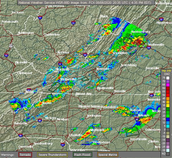 The severe thunderstorm warning for west central carroll and northeastern grayson counties will expire at 445 pm edt, the storm which prompted the warning has weakened below severe limits, and no longer poses an immediate threat to life or property. therefore, the warning will be allowed to expire. however gusty winds and heavy rain are still possible with this thunderstorm. when it is safe to do so, please send your reports of hail of any size, as well as reports of any wind damage, including downed trees or large limbs, to the national weather service by calling toll free at 1, 8 6 6, 2 1 5, 4 3 2 4. reports and pictures can also be shared on the national weather service blacksburg facebook page and on twitter. The severe thunderstorm warning for west central carroll and northeastern grayson counties will expire at 445 pm edt, the storm which prompted the warning has weakened below severe limits, and no longer poses an immediate threat to life or property. therefore, the warning will be allowed to expire. however gusty winds and heavy rain are still possible with this thunderstorm. when it is safe to do so, please send your reports of hail of any size, as well as reports of any wind damage, including downed trees or large limbs, to the national weather service by calling toll free at 1, 8 6 6, 2 1 5, 4 3 2 4. reports and pictures can also be shared on the national weather service blacksburg facebook page and on twitter.
|
| 8/6/2020 4:35 PM EDT | Received several pictures of limbs down in a persons back yard in fries. some of which were 6 inches in diamete in grayson county VA, 0.7 miles SSE of Fries, VA |
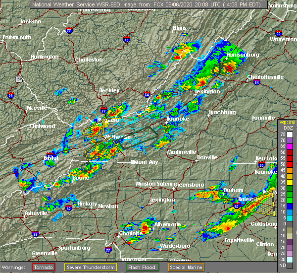
| 8/6/2020 4:30 PM EDT |
 At 430 pm edt, a severe thunderstorm was located near cripple creek, or near speedwell, moving east at 15 mph (radar indicated). Hazards include 60 mph wind gusts and quarter size hail. Hail damage to vehicles is expected. expect wind damage to roofs, siding, and trees. Locations impacted include, fries, byllesby, spring valley, and woodlawn. At 430 pm edt, a severe thunderstorm was located near cripple creek, or near speedwell, moving east at 15 mph (radar indicated). Hazards include 60 mph wind gusts and quarter size hail. Hail damage to vehicles is expected. expect wind damage to roofs, siding, and trees. Locations impacted include, fries, byllesby, spring valley, and woodlawn.
|
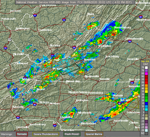
| 8/6/2020 4:20 PM EDT |
 At 420 pm edt, a severe thunderstorm was located near elk creek, or near speedwell, moving east at 15 mph (radar indicated). Hazards include 60 mph wind gusts and quarter size hail. Hail damage to vehicles is expected. expect wind damage to roofs, siding, and trees. Locations impacted include, fries, speedwell, byllesby, cripple creek, ivanhoe, comers rock, and coleman store. At 420 pm edt, a severe thunderstorm was located near elk creek, or near speedwell, moving east at 15 mph (radar indicated). Hazards include 60 mph wind gusts and quarter size hail. Hail damage to vehicles is expected. expect wind damage to roofs, siding, and trees. Locations impacted include, fries, speedwell, byllesby, cripple creek, ivanhoe, comers rock, and coleman store.
|
| 8/6/2020 4:12 PM EDT |
 At 412 pm edt, a severe thunderstorm was located over comers rock, or near speedwell, moving east at 15 mph (radar indicated). Hazards include 60 mph wind gusts and quarter size hail. Hail damage to vehicles is expected. expect wind damage to roofs, siding, and trees. Locations impacted include, wytheville, fries, max meadows, speedwell, fort chiswell, flatridge, and ivanhoe. At 412 pm edt, a severe thunderstorm was located over comers rock, or near speedwell, moving east at 15 mph (radar indicated). Hazards include 60 mph wind gusts and quarter size hail. Hail damage to vehicles is expected. expect wind damage to roofs, siding, and trees. Locations impacted include, wytheville, fries, max meadows, speedwell, fort chiswell, flatridge, and ivanhoe.
|
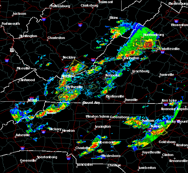
| 8/6/2020 4:01 PM EDT |
 At 401 pm edt, a severe thunderstorm was located over comers rock, or 7 miles southwest of speedwell, moving east at 15 mph (radar indicated). Hazards include 60 mph wind gusts and quarter size hail. Hail damage to vehicles is expected. expect wind damage to roofs, siding, and trees. Locations impacted include, wytheville, fries, max meadows, speedwell, sugar grove, volney, and fort chiswell. At 401 pm edt, a severe thunderstorm was located over comers rock, or 7 miles southwest of speedwell, moving east at 15 mph (radar indicated). Hazards include 60 mph wind gusts and quarter size hail. Hail damage to vehicles is expected. expect wind damage to roofs, siding, and trees. Locations impacted include, wytheville, fries, max meadows, speedwell, sugar grove, volney, and fort chiswell.
|
| 8/6/2020 3:50 PM EDT |
 At 349 pm edt, a severe thunderstorm was located over flatridge, or near sugar grove, moving east at 15 mph (radar indicated). Hazards include 60 mph wind gusts and quarter size hail. Hail damage to vehicles is expected. Expect wind damage to roofs, siding, and trees. At 349 pm edt, a severe thunderstorm was located over flatridge, or near sugar grove, moving east at 15 mph (radar indicated). Hazards include 60 mph wind gusts and quarter size hail. Hail damage to vehicles is expected. Expect wind damage to roofs, siding, and trees.
|
| 7/22/2020 5:27 PM EDT |
 At 527 pm edt, a severe thunderstorm was located near spring valley, or near fries, moving east at 15 mph (radar indicated). Hazards include 60 mph wind gusts and quarter size hail. Hail damage to vehicles is expected. expect wind damage to roofs, siding, and trees. Locations impacted include, fries, byllesby, woodlawn, and spring valley. At 527 pm edt, a severe thunderstorm was located near spring valley, or near fries, moving east at 15 mph (radar indicated). Hazards include 60 mph wind gusts and quarter size hail. Hail damage to vehicles is expected. expect wind damage to roofs, siding, and trees. Locations impacted include, fries, byllesby, woodlawn, and spring valley.
|
| 7/22/2020 5:11 PM EDT | Tree blown down on main street... partially blocking the road. time estimated from rada in grayson county VA, 0.7 miles SSW of Fries, VA |
| 7/22/2020 5:05 PM EDT | Tree blown down on eagle bottom road. time estimated from rada in grayson county VA, 1.5 miles SSE of Fries, VA |
| 7/22/2020 4:59 PM EDT |
 The national weather service in blacksburg has issued a * severe thunderstorm warning for. western carroll county in southwestern virginia. the city of galax in southwestern virginia. northeastern grayson county in southwestern virginia. Until 600 pm edt. The national weather service in blacksburg has issued a * severe thunderstorm warning for. western carroll county in southwestern virginia. the city of galax in southwestern virginia. northeastern grayson county in southwestern virginia. Until 600 pm edt.
|
| 7/22/2020 4:55 PM EDT | Quarter sized hail reported 0.7 miles SSW of Fries, VA, nickel to quarter size hail. |
| 4/8/2020 6:26 PM EDT |
 The severe thunderstorm warning for smyth, southwestern tazewell, southern wythe, northwestern carroll and northeastern grayson counties will expire at 630 pm edt, the storms which prompted the warning have weakened below severe limits, and have exited the warned area. therefore, the warning will be allowed to expire. a severe thunderstorm watch remains in effect until 800 pm edt for northwestern north carolina, and southwestern virginia. when it is safe to do so, please send your reports of hail of any size, as well as reports of any wind damage, including downed trees or large limbs, to the national weather service by calling toll free at 1, 8 6 6, 2 1 5, 4 3 2 4. reports and pictures can also be shared on the national weather service blacksburg facebook page and on twitter. The severe thunderstorm warning for smyth, southwestern tazewell, southern wythe, northwestern carroll and northeastern grayson counties will expire at 630 pm edt, the storms which prompted the warning have weakened below severe limits, and have exited the warned area. therefore, the warning will be allowed to expire. a severe thunderstorm watch remains in effect until 800 pm edt for northwestern north carolina, and southwestern virginia. when it is safe to do so, please send your reports of hail of any size, as well as reports of any wind damage, including downed trees or large limbs, to the national weather service by calling toll free at 1, 8 6 6, 2 1 5, 4 3 2 4. reports and pictures can also be shared on the national weather service blacksburg facebook page and on twitter.
|
| 4/8/2020 6:04 PM EDT |
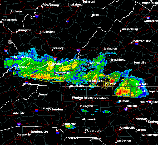 At 603 pm edt, severe thunderstorms were located along a line extending from near allison gap to near mount rogers national recreation area to near ivanhoe, moving southeast at 20 mph (radar indicated). Hazards include 60 mph wind gusts. Expect damage to roofs, siding, and trees. Locations impacted include, wytheville, marion, saltville, chilhowie, rural retreat, fries, and mount rogers national recreation area. At 603 pm edt, severe thunderstorms were located along a line extending from near allison gap to near mount rogers national recreation area to near ivanhoe, moving southeast at 20 mph (radar indicated). Hazards include 60 mph wind gusts. Expect damage to roofs, siding, and trees. Locations impacted include, wytheville, marion, saltville, chilhowie, rural retreat, fries, and mount rogers national recreation area.
|
| 4/8/2020 5:48 PM EDT |
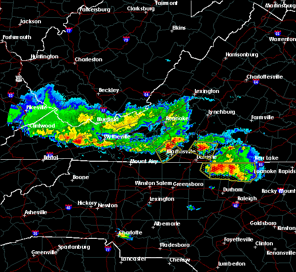 At 547 pm edt, severe thunderstorms were located along a line extending from near claypool hill to atkins to patterson, moving south at 25 mph (radar indicated). Hazards include 60 mph wind gusts. expect damage to roofs, siding, and trees At 547 pm edt, severe thunderstorms were located along a line extending from near claypool hill to atkins to patterson, moving south at 25 mph (radar indicated). Hazards include 60 mph wind gusts. expect damage to roofs, siding, and trees
|
| 1/11/2020 9:07 PM EST |
 At 907 pm est, severe thunderstorms were located along a line extending from max meadows to near stony point, moving northeast at 75 mph (radar indicated). Hazards include 70 mph wind gusts. Expect considerable tree damage. Damage is likely to mobile homes, roofs, and outbuildings. At 907 pm est, severe thunderstorms were located along a line extending from max meadows to near stony point, moving northeast at 75 mph (radar indicated). Hazards include 70 mph wind gusts. Expect considerable tree damage. Damage is likely to mobile homes, roofs, and outbuildings.
|
| 10/31/2019 5:28 PM EDT |
 At 527 pm edt, severe thunderstorms were located along a line extending from woodlawn to cricket, moving northeast at 25 mph (radar indicated). Hazards include 60 mph wind gusts. Expect damage to roofs, siding, and trees. locations impacted include, galax, fries, fancy gap, ennice, cana, bottom, and baywood. A tornado watch remains in effect until 1100 pm edt for north central and northwestern north carolina, and southwestern and west central virginia. At 527 pm edt, severe thunderstorms were located along a line extending from woodlawn to cricket, moving northeast at 25 mph (radar indicated). Hazards include 60 mph wind gusts. Expect damage to roofs, siding, and trees. locations impacted include, galax, fries, fancy gap, ennice, cana, bottom, and baywood. A tornado watch remains in effect until 1100 pm edt for north central and northwestern north carolina, and southwestern and west central virginia.
|
| 10/31/2019 4:51 PM EDT |
 At 451 pm edt, severe thunderstorms were located along a line extending from near baywood to near elkville, moving northeast at 25 mph (radar indicated). Hazards include 60 mph wind gusts. expect damage to roofs, siding, and trees At 451 pm edt, severe thunderstorms were located along a line extending from near baywood to near elkville, moving northeast at 25 mph (radar indicated). Hazards include 60 mph wind gusts. expect damage to roofs, siding, and trees
|
| 9/28/2019 1:52 PM EDT |
 The severe thunderstorm warning for northeastern alleghany and northwestern surry counties in northwestern north carolina, southwestern carroll and southeastern grayson counties in southwestern virginia and the city of galax will expire at 200 pm edt, the storm which prompted the warning has weakened below severe limits, and no longer poses an immediate threat to life or property. therefore, the warning will be allowed to expire. when it is safe to do so, please send your reports of hail of any size, as well as reports of any wind damage, including downed trees or large limbs, to the national weather service by calling toll free at 1, 8 6 6, 2 1 5, 4 3 2 4. reports and pictures can also be shared on the national weather service blacksburg facebook page and on twitter. The severe thunderstorm warning for northeastern alleghany and northwestern surry counties in northwestern north carolina, southwestern carroll and southeastern grayson counties in southwestern virginia and the city of galax will expire at 200 pm edt, the storm which prompted the warning has weakened below severe limits, and no longer poses an immediate threat to life or property. therefore, the warning will be allowed to expire. when it is safe to do so, please send your reports of hail of any size, as well as reports of any wind damage, including downed trees or large limbs, to the national weather service by calling toll free at 1, 8 6 6, 2 1 5, 4 3 2 4. reports and pictures can also be shared on the national weather service blacksburg facebook page and on twitter.
|
| 9/28/2019 1:43 PM EDT |
 At 142 pm edt, a severe thunderstorm was located near low gap, moving southeast at 25 mph (radar indicated). Hazards include 60 mph wind gusts and quarter size hail. Hail damage to vehicles is expected. expect wind damage to roofs, siding, and trees. Locations impacted include, galax, fries, ennice, cana, and baywood. At 142 pm edt, a severe thunderstorm was located near low gap, moving southeast at 25 mph (radar indicated). Hazards include 60 mph wind gusts and quarter size hail. Hail damage to vehicles is expected. expect wind damage to roofs, siding, and trees. Locations impacted include, galax, fries, ennice, cana, and baywood.
|
| 9/28/2019 1:18 PM EDT |
 At 118 pm edt, a severe thunderstorm was located over galax, moving southeast at 25 mph (radar indicated). Hazards include 60 mph wind gusts and quarter size hail. Hail damage to vehicles is expected. Expect wind damage to roofs, siding, and trees. At 118 pm edt, a severe thunderstorm was located over galax, moving southeast at 25 mph (radar indicated). Hazards include 60 mph wind gusts and quarter size hail. Hail damage to vehicles is expected. Expect wind damage to roofs, siding, and trees.
|
| 8/22/2019 3:14 PM EDT |
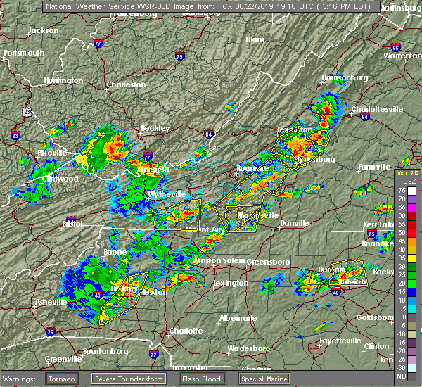 At 255 pm edt, severe thunderstorms were located along a line extending from fries to abshers, moving east at 25 mph (radar indicated). Hazards include 60 mph wind gusts. Expect damage to roofs, siding, and trees. Locations impacted include, mount airy, galax, elkin, fairview, and flat rock. At 255 pm edt, severe thunderstorms were located along a line extending from fries to abshers, moving east at 25 mph (radar indicated). Hazards include 60 mph wind gusts. Expect damage to roofs, siding, and trees. Locations impacted include, mount airy, galax, elkin, fairview, and flat rock.
|
| 8/22/2019 2:56 PM EDT |
 At 255 pm edt, severe thunderstorms were located along a line extending from fries to abshers, moving east at 25 mph (radar indicated). Hazards include 60 mph wind gusts. Expect damage to roofs, siding, and trees. Locations impacted include, mount airy, galax, elkin, fairview, and flat rock. At 255 pm edt, severe thunderstorms were located along a line extending from fries to abshers, moving east at 25 mph (radar indicated). Hazards include 60 mph wind gusts. Expect damage to roofs, siding, and trees. Locations impacted include, mount airy, galax, elkin, fairview, and flat rock.
|
| 8/22/2019 2:38 PM EDT |
 The national weather service in blacksburg has issued a * severe thunderstorm warning for. alleghany county in northwestern north carolina. surry county in northwestern north carolina. northeastern wilkes county in northwestern north carolina. East central ashe county in northwestern north carolina. The national weather service in blacksburg has issued a * severe thunderstorm warning for. alleghany county in northwestern north carolina. surry county in northwestern north carolina. northeastern wilkes county in northwestern north carolina. East central ashe county in northwestern north carolina.
|
| 8/13/2019 1:52 PM EDT |
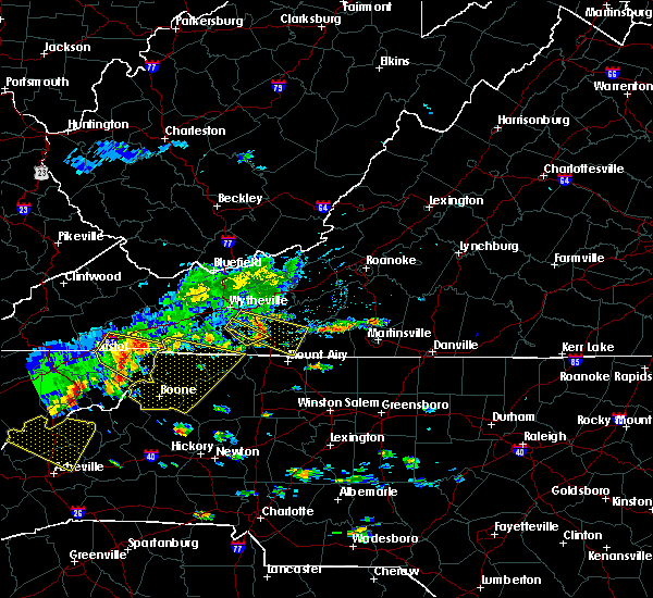 The severe thunderstorm warning for south central wythe. west central carroll and northeastern grayson counties and the city of galax will expire at 200 pm edt. the severe thunderstorm is still moving into northwestern carroll county and has been replaced by a new severe thunderstorm warning for carroll county. Elsewhere, the storm has moved away from the. The severe thunderstorm warning for south central wythe. west central carroll and northeastern grayson counties and the city of galax will expire at 200 pm edt. the severe thunderstorm is still moving into northwestern carroll county and has been replaced by a new severe thunderstorm warning for carroll county. Elsewhere, the storm has moved away from the.
|
| 8/13/2019 1:46 PM EDT |
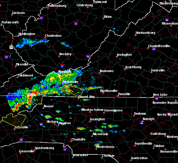 A severe thunderstorm warning remains in effect until 200 pm edt for south central wythe. west central carroll and northeastern grayson counties and the city of galax. At 145 pm edt, a severe thunderstorm was located near fries, moving southeast at 25 mph. A severe thunderstorm warning remains in effect until 200 pm edt for south central wythe. west central carroll and northeastern grayson counties and the city of galax. At 145 pm edt, a severe thunderstorm was located near fries, moving southeast at 25 mph.
|
| 8/13/2019 1:35 PM EDT |
 At 101 pm edt, a severe thunderstorm was located over marion wytheville, moving southeast at 25 mph (radar indicated). Hazards include 60 mph wind gusts and quarter size hail. Hail damage to vehicles is expected. Expect wind damage to roofs, siding, and trees. At 101 pm edt, a severe thunderstorm was located over marion wytheville, moving southeast at 25 mph (radar indicated). Hazards include 60 mph wind gusts and quarter size hail. Hail damage to vehicles is expected. Expect wind damage to roofs, siding, and trees.
|
| 8/13/2019 1:01 PM EDT |
 At 101 pm edt, a severe thunderstorm was located over marion wytheville, moving southeast at 25 mph (radar indicated). Hazards include 60 mph wind gusts and quarter size hail. Hail damage to vehicles is expected. Expect wind damage to roofs, siding, and trees. At 101 pm edt, a severe thunderstorm was located over marion wytheville, moving southeast at 25 mph (radar indicated). Hazards include 60 mph wind gusts and quarter size hail. Hail damage to vehicles is expected. Expect wind damage to roofs, siding, and trees.
|
| 6/24/2019 6:40 PM EDT |
 At 639 pm edt, severe thunderstorms were located along a line extending from near rocky gap to near crockett to near grassy creek, moving northeast at 40 mph (radar indicated). Hazards include 60 mph wind gusts and quarter size hail. Hail damage to vehicles is expected. Expect wind damage to roofs, siding, and trees. At 639 pm edt, severe thunderstorms were located along a line extending from near rocky gap to near crockett to near grassy creek, moving northeast at 40 mph (radar indicated). Hazards include 60 mph wind gusts and quarter size hail. Hail damage to vehicles is expected. Expect wind damage to roofs, siding, and trees.
|
| 5/29/2019 6:56 PM EDT |
 At 620 pm edt, severe thunderstorms were located along a line extending from near gretna to near woolwine to sparta, moving east at 60 mph (radar indicated). Hazards include 60 mph wind gusts and quarter size hail. Hail damage to vehicles is expected. expect wind damage to roofs, siding, and trees. locations impacted include, martinsville, mount airy, galax, flat rock, and hillsville. This includes the following locations the martinsville speedway and martinsville airport. At 620 pm edt, severe thunderstorms were located along a line extending from near gretna to near woolwine to sparta, moving east at 60 mph (radar indicated). Hazards include 60 mph wind gusts and quarter size hail. Hail damage to vehicles is expected. expect wind damage to roofs, siding, and trees. locations impacted include, martinsville, mount airy, galax, flat rock, and hillsville. This includes the following locations the martinsville speedway and martinsville airport.
|
| 5/29/2019 6:56 PM EDT |
 The severe thunderstorm warning for alleghany and northern surry counties in northwestern north carolina, southern floyd county in southwestern virginia, central pittsylvania county in south central virginia, carroll county in southwestern virginia, henry county in south central virginia, southeastern grayson county in southwestern virginia, southern franklin county in west central virginia and patrick counties in southwestern virginia, the city of martinsville and the city of galax will expire at 700 pm edt, the storms which prompted the warning have moved out of the area. therefore, the warning will be allowed to expire and a new warning has been issued further to the east. a severe thunderstorm watch remains in effect until 900 pm edt for north central north carolina, and south central, central, southwestern and west central virginia. when it is safe to do so, please send your reports of hail of any size, as well as reports of any wind damage, including downed trees or large limbs, to the national weather service by calling toll free at 1, 8 6 6, 2 1 5, 4 3 2 4. reports and pictures can also be shared on the national weather service blacksburg facebook page and on twitter. The severe thunderstorm warning for alleghany and northern surry counties in northwestern north carolina, southern floyd county in southwestern virginia, central pittsylvania county in south central virginia, carroll county in southwestern virginia, henry county in south central virginia, southeastern grayson county in southwestern virginia, southern franklin county in west central virginia and patrick counties in southwestern virginia, the city of martinsville and the city of galax will expire at 700 pm edt, the storms which prompted the warning have moved out of the area. therefore, the warning will be allowed to expire and a new warning has been issued further to the east. a severe thunderstorm watch remains in effect until 900 pm edt for north central north carolina, and south central, central, southwestern and west central virginia. when it is safe to do so, please send your reports of hail of any size, as well as reports of any wind damage, including downed trees or large limbs, to the national weather service by calling toll free at 1, 8 6 6, 2 1 5, 4 3 2 4. reports and pictures can also be shared on the national weather service blacksburg facebook page and on twitter.
|
| 5/29/2019 6:21 PM EDT |
 At 620 pm edt, severe thunderstorms were located along a line extending from near gretna to near woolwine to sparta, moving east at 60 mph (radar indicated). Hazards include 60 mph wind gusts and quarter size hail. Hail damage to vehicles is expected. expect wind damage to roofs, siding, and trees. locations impacted include, martinsville, mount airy, galax, flat rock, and hillsville. This includes the following locations the martinsville speedway and martinsville airport. At 620 pm edt, severe thunderstorms were located along a line extending from near gretna to near woolwine to sparta, moving east at 60 mph (radar indicated). Hazards include 60 mph wind gusts and quarter size hail. Hail damage to vehicles is expected. expect wind damage to roofs, siding, and trees. locations impacted include, martinsville, mount airy, galax, flat rock, and hillsville. This includes the following locations the martinsville speedway and martinsville airport.
|
| 5/29/2019 6:00 PM EDT |
 At 600 pm edt, severe thunderstorms were located along a line extending from near copper hill to volney, moving southeast at 55 mph (radar indicated). Hazards include 60 mph wind gusts and quarter size hail. Hail damage to vehicles is expected. Expect wind damage to roofs, siding, and trees. At 600 pm edt, severe thunderstorms were located along a line extending from near copper hill to volney, moving southeast at 55 mph (radar indicated). Hazards include 60 mph wind gusts and quarter size hail. Hail damage to vehicles is expected. Expect wind damage to roofs, siding, and trees.
|
| 5/29/2019 5:35 PM EDT |
 At 534 pm edt, severe thunderstorms were located along a line extending from near blacksburg to near ivanhoe to near bridle creek, moving east at 45 mph (radar indicated). Hazards include 60 mph wind gusts and quarter size hail. Hail damage to vehicles is expected. Expect wind damage to roofs, siding, and trees. At 534 pm edt, severe thunderstorms were located along a line extending from near blacksburg to near ivanhoe to near bridle creek, moving east at 45 mph (radar indicated). Hazards include 60 mph wind gusts and quarter size hail. Hail damage to vehicles is expected. Expect wind damage to roofs, siding, and trees.
|
| 5/3/2019 4:40 PM EDT |
 At 438 pm edt, a severe thunderstorm was located near spring valley, moving northeast at 25 mph (radar indicated). Hazards include 60 mph wind gusts and quarter size hail. Hail damage to vehicles is expected. expect wind damage to roofs, siding, and trees. Locations impacted include, wytheville, independence, fries, max meadows, and patterson. At 438 pm edt, a severe thunderstorm was located near spring valley, moving northeast at 25 mph (radar indicated). Hazards include 60 mph wind gusts and quarter size hail. Hail damage to vehicles is expected. expect wind damage to roofs, siding, and trees. Locations impacted include, wytheville, independence, fries, max meadows, and patterson.
|
| 5/3/2019 4:19 PM EDT |
 At 418 pm edt, a severe thunderstorm was located over elk creek, moving northeast at 25 mph (radar indicated). Hazards include 60 mph wind gusts and quarter size hail. Hail damage to vehicles is expected. Expect wind damage to roofs, siding, and trees. At 418 pm edt, a severe thunderstorm was located over elk creek, moving northeast at 25 mph (radar indicated). Hazards include 60 mph wind gusts and quarter size hail. Hail damage to vehicles is expected. Expect wind damage to roofs, siding, and trees.
|
| 4/19/2019 1:13 PM EDT |
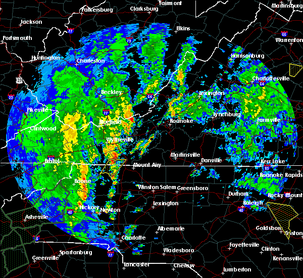 At 113 pm edt, a severe thunderstorm was located near galax, moving north at 45 mph (radar indicated). Hazards include 60 mph wind gusts and quarter size hail. Hail damage to vehicles is expected. Expect wind damage to roofs, siding, and trees. At 113 pm edt, a severe thunderstorm was located near galax, moving north at 45 mph (radar indicated). Hazards include 60 mph wind gusts and quarter size hail. Hail damage to vehicles is expected. Expect wind damage to roofs, siding, and trees.
|
| 4/14/2019 10:48 PM EDT |
 At 1047 pm edt, severe thunderstorms were located along a line extending from near allisonia to near moravian falls, moving east at 45 mph (radar indicated). Hazards include 60 mph wind gusts. Expect damage to roofs, siding, and trees. locations impacted include, mount airy, galax, north wilkesboro, elkin, and wilkesboro. A tornado watch remains in effect until 500 am edt for north central and northwestern north carolina, and south central, southwestern and west central virginia. At 1047 pm edt, severe thunderstorms were located along a line extending from near allisonia to near moravian falls, moving east at 45 mph (radar indicated). Hazards include 60 mph wind gusts. Expect damage to roofs, siding, and trees. locations impacted include, mount airy, galax, north wilkesboro, elkin, and wilkesboro. A tornado watch remains in effect until 500 am edt for north central and northwestern north carolina, and south central, southwestern and west central virginia.
|
| 4/14/2019 10:29 PM EDT |
 At 1029 pm edt, severe thunderstorms were located along a line extending from near patterson to near elkville, moving east at 30 mph (radar indicated). Hazards include 60 mph wind gusts. expect damage to roofs, siding, and trees At 1029 pm edt, severe thunderstorms were located along a line extending from near patterson to near elkville, moving east at 30 mph (radar indicated). Hazards include 60 mph wind gusts. expect damage to roofs, siding, and trees
|
| 8/31/2018 2:50 PM EDT |
 At 248 pm edt, severe thunderstorms were located along a line extending from wytheville to independence, moving southeast at 10 mph (radar indicated). Hazards include 60 mph wind gusts and quarter size hail. Hail damage to vehicles is expected. Expect wind damage to roofs, siding, and trees. At 248 pm edt, severe thunderstorms were located along a line extending from wytheville to independence, moving southeast at 10 mph (radar indicated). Hazards include 60 mph wind gusts and quarter size hail. Hail damage to vehicles is expected. Expect wind damage to roofs, siding, and trees.
|
| 8/12/2018 2:49 PM EDT |
 At 249 pm edt, a severe thunderstorm was located near baywood, moving east at 15 mph (radar indicated). Hazards include 60 mph wind gusts and quarter size hail. Hail damage to vehicles is expected. Expect wind damage to roofs, siding, and trees. At 249 pm edt, a severe thunderstorm was located near baywood, moving east at 15 mph (radar indicated). Hazards include 60 mph wind gusts and quarter size hail. Hail damage to vehicles is expected. Expect wind damage to roofs, siding, and trees.
|
| 8/8/2018 2:55 PM EDT |
 The severe thunderstorm warning for central pulaski, east central smyth, wythe, northwestern carroll and northeastern grayson counties will expire at 300 pm edt, the storms which prompted the warning will weaken below severe limits, and no longer pose an immediate threat to life or property by 3 pm. therefore, the warning will be allowed to expire. however gusty winds are still possible with these thunderstorms. when it is safe to do so, please send your reports of hail of any size, as well as reports of any wind damage, including downed trees or large limbs, to the national weather service by calling toll free at 1, 8 6 6, 2 1 5, 4 3 2 4. reports and pictures can also be shared on the national weather service blacksburg facebook page and on twitter. The severe thunderstorm warning for central pulaski, east central smyth, wythe, northwestern carroll and northeastern grayson counties will expire at 300 pm edt, the storms which prompted the warning will weaken below severe limits, and no longer pose an immediate threat to life or property by 3 pm. therefore, the warning will be allowed to expire. however gusty winds are still possible with these thunderstorms. when it is safe to do so, please send your reports of hail of any size, as well as reports of any wind damage, including downed trees or large limbs, to the national weather service by calling toll free at 1, 8 6 6, 2 1 5, 4 3 2 4. reports and pictures can also be shared on the national weather service blacksburg facebook page and on twitter.
|
| 8/8/2018 2:38 PM EDT |
 At 237 pm edt, severe thunderstorms were located along a line extending from near pulaski to wytheville to sugar grove moving east at 30 mph (radar indicated). Hazards include 60 mph wind gusts. Expect damage to roofs, siding, and trees. Locations impacted include, pulaski, wytheville, galax, marion, and dublin. At 237 pm edt, severe thunderstorms were located along a line extending from near pulaski to wytheville to sugar grove moving east at 30 mph (radar indicated). Hazards include 60 mph wind gusts. Expect damage to roofs, siding, and trees. Locations impacted include, pulaski, wytheville, galax, marion, and dublin.
|
| 8/8/2018 2:11 PM EDT |
 At 210 pm edt, severe thunderstorms were located along a line extending from near bland to near rural retreat to near mount rogers national recreation area, moving southeast at 30 mph (radar indicated). Hazards include 60 mph wind gusts and quarter size hail. Hail damage to vehicles is expected. expect wind damage to roofs, siding, and trees. Locations impacted include, pulaski, wytheville, galax, bland, and marion. At 210 pm edt, severe thunderstorms were located along a line extending from near bland to near rural retreat to near mount rogers national recreation area, moving southeast at 30 mph (radar indicated). Hazards include 60 mph wind gusts and quarter size hail. Hail damage to vehicles is expected. expect wind damage to roofs, siding, and trees. Locations impacted include, pulaski, wytheville, galax, bland, and marion.
|
| 8/8/2018 1:53 PM EDT |
 At 153 pm edt, a severe thunderstorm was located over nebo, moving east at 35 mph (radar indicated). Hazards include 60 mph wind gusts and quarter size hail. Hail damage to vehicles is expected. Expect wind damage to roofs, siding, and trees. At 153 pm edt, a severe thunderstorm was located over nebo, moving east at 35 mph (radar indicated). Hazards include 60 mph wind gusts and quarter size hail. Hail damage to vehicles is expected. Expect wind damage to roofs, siding, and trees.
|
| 6/10/2018 4:45 PM EDT |
 At 444 pm edt, severe thunderstorms extended from copper valley to baywood, moving east at 10 mph (radar indicated). Hazards include 60 mph wind gusts and quarter size hail. Hail damage to vehicles is expected. Expect wind damage to roofs, siding, and trees. At 444 pm edt, severe thunderstorms extended from copper valley to baywood, moving east at 10 mph (radar indicated). Hazards include 60 mph wind gusts and quarter size hail. Hail damage to vehicles is expected. Expect wind damage to roofs, siding, and trees.
|
| 4/15/2018 2:53 PM EDT |
 At 252 pm edt, a severe thunderstorm was located over ivanhoe, moving north at 55 mph (radar indicated). Hazards include 60 mph wind gusts and quarter size hail. Hail damage to vehicles is expected. expect wind damage to roofs, siding, and trees. locations impacted include, radford, pulaski, wytheville, galax, and bland. A tornado watch remains in effect until 700 pm edt for northwestern north carolina, and southwestern virginia. At 252 pm edt, a severe thunderstorm was located over ivanhoe, moving north at 55 mph (radar indicated). Hazards include 60 mph wind gusts and quarter size hail. Hail damage to vehicles is expected. expect wind damage to roofs, siding, and trees. locations impacted include, radford, pulaski, wytheville, galax, and bland. A tornado watch remains in effect until 700 pm edt for northwestern north carolina, and southwestern virginia.
|
| 4/15/2018 2:41 PM EDT |
 At 240 pm edt, a severe thunderstorm was located over fries, moving north at 55 mph (radar indicated). Hazards include 60 mph wind gusts and quarter size hail. Hail damage to vehicles is expected. Expect wind damage to roofs, siding, and trees. At 240 pm edt, a severe thunderstorm was located over fries, moving north at 55 mph (radar indicated). Hazards include 60 mph wind gusts and quarter size hail. Hail damage to vehicles is expected. Expect wind damage to roofs, siding, and trees.
|
| 4/15/2018 2:30 PM EDT | A large tree was blown down by thunderstorm winds along carsonville roa in grayson county VA, 6.4 miles E of Fries, VA |
| 10/23/2017 6:22 PM EDT |
 The tornado warning for northeastern alleghany and northwestern surry counties in northwestern north carolina, southern carroll and eastern grayson counties in southwestern virginia and the city of galax will expire at 630 pm edt, the storm which prompted the warning has weakened below severe limits, and has exited the warned area. therefore, the warning will be allowed to expire. however gusty winds are still possible with this thunderstorm. a tornado watch remains in effect until 900 pm edt for north central and northwestern north carolina. a tornado watch also remains in effect until 200 am edt for southwestern and west central virginia. when it is safe to do so, please send your reports of hail of any size, as well as reports of any wind damage, including downed trees or large limbs, to the national weather service by calling toll free at 1, 8 6 6, 2 1 5, 4 3 2 4. reports and pictures can also be shared on the national weather service blacksburg facebook page and on twitter. The tornado warning for northeastern alleghany and northwestern surry counties in northwestern north carolina, southern carroll and eastern grayson counties in southwestern virginia and the city of galax will expire at 630 pm edt, the storm which prompted the warning has weakened below severe limits, and has exited the warned area. therefore, the warning will be allowed to expire. however gusty winds are still possible with this thunderstorm. a tornado watch remains in effect until 900 pm edt for north central and northwestern north carolina. a tornado watch also remains in effect until 200 am edt for southwestern and west central virginia. when it is safe to do so, please send your reports of hail of any size, as well as reports of any wind damage, including downed trees or large limbs, to the national weather service by calling toll free at 1, 8 6 6, 2 1 5, 4 3 2 4. reports and pictures can also be shared on the national weather service blacksburg facebook page and on twitter.
|
| 10/23/2017 6:22 PM EDT |
 At 555 pm edt, a severe thunderstorm capable of producing a tornado was located near cumberland knob, moving northeast at 20 mph (radar indicated rotation). Hazards include tornado. Flying debris will be dangerous to those caught without shelter. mobile homes will be damaged or destroyed. damage to roofs, windows, and vehicles will occur. Tree damage is likely. At 555 pm edt, a severe thunderstorm capable of producing a tornado was located near cumberland knob, moving northeast at 20 mph (radar indicated rotation). Hazards include tornado. Flying debris will be dangerous to those caught without shelter. mobile homes will be damaged or destroyed. damage to roofs, windows, and vehicles will occur. Tree damage is likely.
|
| 10/23/2017 5:55 PM EDT |
 At 555 pm edt, a severe thunderstorm capable of producing a tornado was located near cumberland knob, moving northeast at 20 mph (radar indicated rotation). Hazards include tornado. Flying debris will be dangerous to those caught without shelter. mobile homes will be damaged or destroyed. damage to roofs, windows, and vehicles will occur. Tree damage is likely. At 555 pm edt, a severe thunderstorm capable of producing a tornado was located near cumberland knob, moving northeast at 20 mph (radar indicated rotation). Hazards include tornado. Flying debris will be dangerous to those caught without shelter. mobile homes will be damaged or destroyed. damage to roofs, windows, and vehicles will occur. Tree damage is likely.
|
| 7/17/2017 3:22 PM EDT |
 At 320 pm edt, a severe thunderstorm was located over elk creek, moving northeast at 10 mph. a second strong thunderstorm was near ivanhoe and moving north at 15 mph (radar indicated). Hazards include 60 mph wind gusts and quarter size hail. Hail damage to vehicles is expected. expect wind damage to roofs, siding, and trees. Locations impacted include, wytheville, independence, fries, speedwell, and flatridge. At 320 pm edt, a severe thunderstorm was located over elk creek, moving northeast at 10 mph. a second strong thunderstorm was near ivanhoe and moving north at 15 mph (radar indicated). Hazards include 60 mph wind gusts and quarter size hail. Hail damage to vehicles is expected. expect wind damage to roofs, siding, and trees. Locations impacted include, wytheville, independence, fries, speedwell, and flatridge.
|
| 7/17/2017 3:06 PM EDT |
 At 305 pm edt, a severe thunderstorm was located near elk creek, moving northeast at 10 mph (radar indicated). Hazards include 60 mph wind gusts and quarter size hail. Hail damage to vehicles is expected. Expect wind damage to roofs, siding, and trees. At 305 pm edt, a severe thunderstorm was located near elk creek, moving northeast at 10 mph (radar indicated). Hazards include 60 mph wind gusts and quarter size hail. Hail damage to vehicles is expected. Expect wind damage to roofs, siding, and trees.
|
| 7/12/2017 4:38 PM EDT |
 At 438 pm edt, a severe thunderstorm was located over fries, moving northeast at 5 mph (radar indicated). Hazards include 60 mph wind gusts. Expect damage to roofs, siding, and trees. Locations impacted include, galax, fries, byllesby, spring valley, and pipers gap. At 438 pm edt, a severe thunderstorm was located over fries, moving northeast at 5 mph (radar indicated). Hazards include 60 mph wind gusts. Expect damage to roofs, siding, and trees. Locations impacted include, galax, fries, byllesby, spring valley, and pipers gap.
|
| 7/12/2017 4:09 PM EDT |
 At 408 pm edt, a severe thunderstorm was located near baywood, moving northeast at 5 mph (radar indicated). Hazards include 60 mph wind gusts and quarter size hail. Hail damage to vehicles is expected. Expect wind damage to roofs, siding, and trees. At 408 pm edt, a severe thunderstorm was located near baywood, moving northeast at 5 mph (radar indicated). Hazards include 60 mph wind gusts and quarter size hail. Hail damage to vehicles is expected. Expect wind damage to roofs, siding, and trees.
|
| 5/9/2017 9:31 PM EDT |
 At 930 pm edt, severe thunderstorms were located along a line extending from near ivanhoe to near spring valley to near speedwell, moving southeast at 40 mph (radar indicated). Hazards include 60 mph wind gusts and quarter size hail. Minor damage to vehicles is possible. expect wind damage to trees and power lines. Locations impacted include, galax, hillsville, independence, fries, and fancy gap. At 930 pm edt, severe thunderstorms were located along a line extending from near ivanhoe to near spring valley to near speedwell, moving southeast at 40 mph (radar indicated). Hazards include 60 mph wind gusts and quarter size hail. Minor damage to vehicles is possible. expect wind damage to trees and power lines. Locations impacted include, galax, hillsville, independence, fries, and fancy gap.
|
| 5/9/2017 9:08 PM EDT |
 At 908 pm edt, severe thunderstorms were located along a line extending from near wytheville to favonia to near nebo, moving southeast at 40 mph (radar indicated). Hazards include 60 mph wind gusts and quarter size hail. Minor damage to vehicles is possible. Expect wind damage to trees and power lines. At 908 pm edt, severe thunderstorms were located along a line extending from near wytheville to favonia to near nebo, moving southeast at 40 mph (radar indicated). Hazards include 60 mph wind gusts and quarter size hail. Minor damage to vehicles is possible. Expect wind damage to trees and power lines.
|
| 7/27/2016 4:46 PM EDT |
 At 446 pm edt, severe thunderstorms were located along a line extending from near mabry mill to near baywood, moving east at 15 mph (radar indicated). Hazards include 60 mph wind gusts and quarter size hail. Hail damage to vehicles is expected. expect wind damage to roofs, siding, and trees. Locations impacted include, galax, hillsville, fries, cana, and ararat. At 446 pm edt, severe thunderstorms were located along a line extending from near mabry mill to near baywood, moving east at 15 mph (radar indicated). Hazards include 60 mph wind gusts and quarter size hail. Hail damage to vehicles is expected. expect wind damage to roofs, siding, and trees. Locations impacted include, galax, hillsville, fries, cana, and ararat.
|
| 7/27/2016 4:31 PM EDT |
 At 430 pm edt, severe thunderstorms were located along a line extending from near mabry mill to near independence, moving east at 15 mph (radar indicated). Hazards include 60 mph wind gusts and quarter size hail. Hail damage to vehicles is expected. Expect wind damage to roofs, siding, and trees. At 430 pm edt, severe thunderstorms were located along a line extending from near mabry mill to near independence, moving east at 15 mph (radar indicated). Hazards include 60 mph wind gusts and quarter size hail. Hail damage to vehicles is expected. Expect wind damage to roofs, siding, and trees.
|
| 7/8/2016 5:11 PM EDT |
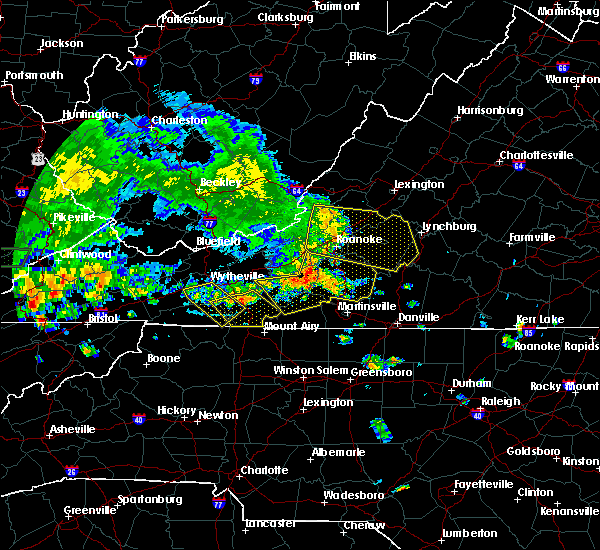 At 511 pm edt, a severe thunderstorm was located near hillsville, moving east at 25 mph (radar indicated). Hazards include 60 mph wind gusts and quarter size hail. Hail damage to vehicles is expected. expect wind damage to roofs, siding, and trees. Locations impacted include, galax, hillsville, fries, cana, and fancy gap. At 511 pm edt, a severe thunderstorm was located near hillsville, moving east at 25 mph (radar indicated). Hazards include 60 mph wind gusts and quarter size hail. Hail damage to vehicles is expected. expect wind damage to roofs, siding, and trees. Locations impacted include, galax, hillsville, fries, cana, and fancy gap.
|
| 7/8/2016 5:06 PM EDT |
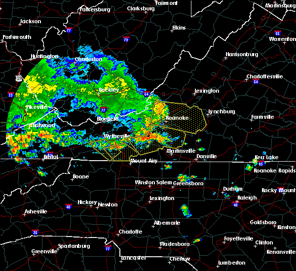 At 455 pm edt, a severe thunderstorm was located over byllesby, moving southeast at 20 mph (radar indicated). Hazards include 60 mph wind gusts and quarter size hail. Hail damage to vehicles is expected. expect wind damage to roofs, siding, and trees. Locations impacted include, wytheville, galax, rural retreat, fries, and speedwell. At 455 pm edt, a severe thunderstorm was located over byllesby, moving southeast at 20 mph (radar indicated). Hazards include 60 mph wind gusts and quarter size hail. Hail damage to vehicles is expected. expect wind damage to roofs, siding, and trees. Locations impacted include, wytheville, galax, rural retreat, fries, and speedwell.
|
| 7/8/2016 4:58 PM EDT |
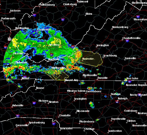 At 458 pm edt, a severe thunderstorm was located near ivanhoe, moving east at 25 mph (radar indicated). Hazards include 60 mph wind gusts and quarter size hail. Hail damage to vehicles is expected. Expect wind damage to roofs, siding, and trees. At 458 pm edt, a severe thunderstorm was located near ivanhoe, moving east at 25 mph (radar indicated). Hazards include 60 mph wind gusts and quarter size hail. Hail damage to vehicles is expected. Expect wind damage to roofs, siding, and trees.
|
| 7/8/2016 4:56 PM EDT |
 At 455 pm edt, a severe thunderstorm was located over byllesby, moving southeast at 20 mph (radar indicated). Hazards include 60 mph wind gusts and quarter size hail. Hail damage to vehicles is expected. expect wind damage to roofs, siding, and trees. Locations impacted include, wytheville, galax, rural retreat, fries, and speedwell. At 455 pm edt, a severe thunderstorm was located over byllesby, moving southeast at 20 mph (radar indicated). Hazards include 60 mph wind gusts and quarter size hail. Hail damage to vehicles is expected. expect wind damage to roofs, siding, and trees. Locations impacted include, wytheville, galax, rural retreat, fries, and speedwell.
|
| 7/8/2016 4:42 PM EDT |
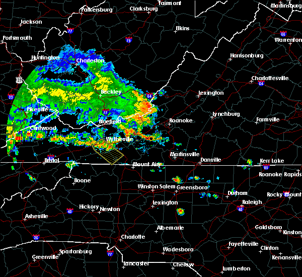 At 441 pm edt, a severe thunderstorm was located over coleman store, moving southeast at 20 mph (radar indicated). Hazards include 60 mph wind gusts and quarter size hail. Hail damage to vehicles is expected. expect wind damage to roofs, siding, and trees. Locations impacted include, wytheville, galax, rural retreat, fries, and speedwell. At 441 pm edt, a severe thunderstorm was located over coleman store, moving southeast at 20 mph (radar indicated). Hazards include 60 mph wind gusts and quarter size hail. Hail damage to vehicles is expected. expect wind damage to roofs, siding, and trees. Locations impacted include, wytheville, galax, rural retreat, fries, and speedwell.
|
| 7/8/2016 4:28 PM EDT |
 At 428 pm edt, a severe thunderstorm was located near wytheville, moving east at 35 mph (radar indicated). Hazards include 60 mph wind gusts and penny size hail. Expect damage to roofs. siding. and trees. Locations impacted include, wytheville, galax, rural retreat, fries, and speedwell. At 428 pm edt, a severe thunderstorm was located near wytheville, moving east at 35 mph (radar indicated). Hazards include 60 mph wind gusts and penny size hail. Expect damage to roofs. siding. and trees. Locations impacted include, wytheville, galax, rural retreat, fries, and speedwell.
|
| 7/8/2016 4:17 PM EDT |
 At 417 pm edt, a severe thunderstorm was located over crockett, moving southeast at 40 mph (radar indicated). Hazards include 60 mph wind gusts and quarter size hail. Hail damage to vehicles is expected. Expect wind damage to roofs, siding, and trees. At 417 pm edt, a severe thunderstorm was located over crockett, moving southeast at 40 mph (radar indicated). Hazards include 60 mph wind gusts and quarter size hail. Hail damage to vehicles is expected. Expect wind damage to roofs, siding, and trees.
|
| 6/23/2016 10:26 PM EDT |
 The severe thunderstorm warning for yadkin, surry, stokes, wilkes, watauga, alleghany, ashe, southwestern patrick, southeastern grayson and carroll counties and the city of galax will expire at 1030 pm edt, the storms which prompted the warning have weakened below severe limits, and no longer pose an immediate threat to life or property. therefore the warning will be allowed to expire. however gusty winds and heavy rain are still possible with these thunderstorms. a severe thunderstorm watch remains in effect until 1100 pm edt for north carolina and virginia. The severe thunderstorm warning for yadkin, surry, stokes, wilkes, watauga, alleghany, ashe, southwestern patrick, southeastern grayson and carroll counties and the city of galax will expire at 1030 pm edt, the storms which prompted the warning have weakened below severe limits, and no longer pose an immediate threat to life or property. therefore the warning will be allowed to expire. however gusty winds and heavy rain are still possible with these thunderstorms. a severe thunderstorm watch remains in effect until 1100 pm edt for north carolina and virginia.
|
| 6/23/2016 9:50 PM EDT |
 At 949 pm edt, severe thunderstorms were located along a line extending from near dugspur to stone mountain state park to 7 miles west of mountain city, moving southeast at 50 mph (radar indicated). Hazards include 60 mph wind gusts. Expect damage to roofs. siding. and trees. locations impacted include, boone, mount airy, galax, north wilkesboro, and elkin. This includes appalachian state university. At 949 pm edt, severe thunderstorms were located along a line extending from near dugspur to stone mountain state park to 7 miles west of mountain city, moving southeast at 50 mph (radar indicated). Hazards include 60 mph wind gusts. Expect damage to roofs. siding. and trees. locations impacted include, boone, mount airy, galax, north wilkesboro, and elkin. This includes appalachian state university.
|
| 6/23/2016 9:29 PM EDT |
 At 929 pm edt, severe thunderstorms were located along a line extending from gunton park to mouth of wilson to bristol va, moving southeast at 55 mph (radar indicated). Hazards include 60 mph wind gusts. Expect damage to roofs. siding. And trees. At 929 pm edt, severe thunderstorms were located along a line extending from gunton park to mouth of wilson to bristol va, moving southeast at 55 mph (radar indicated). Hazards include 60 mph wind gusts. Expect damage to roofs. siding. And trees.
|
| 6/16/2016 10:07 PM EDT |
 At 1007 pm edt, severe thunderstorms were located along a line extending from near burnt chimney to near alum ridge to near rural retreat, moving east at 50 mph (radar indicated). Hazards include 60 mph wind gusts and quarter size hail. Hail damage to vehicles is expected. Expect wind damage to roofs, siding, and trees. At 1007 pm edt, severe thunderstorms were located along a line extending from near burnt chimney to near alum ridge to near rural retreat, moving east at 50 mph (radar indicated). Hazards include 60 mph wind gusts and quarter size hail. Hail damage to vehicles is expected. Expect wind damage to roofs, siding, and trees.
|
| 5/2/2016 3:04 PM EDT |
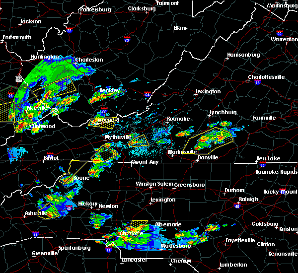 At 303 pm edt, a severe thunderstorm was located over bridle creek, moving northeast at 30 mph (radar indicated). Hazards include 60 mph wind gusts. Expect damage to roofs. siding. and trees. Locations impacted include, galax, independence, fries, speedwell, and baywood. At 303 pm edt, a severe thunderstorm was located over bridle creek, moving northeast at 30 mph (radar indicated). Hazards include 60 mph wind gusts. Expect damage to roofs. siding. and trees. Locations impacted include, galax, independence, fries, speedwell, and baywood.
|
| 5/2/2016 2:46 PM EDT |
 At 245 pm edt, a severe thunderstorm was located near piney creek, moving northeast at 30 mph (radar indicated). Hazards include 60 mph wind gusts and quarter size hail. Hail damage to vehicles is expected. Expect wind damage to roofs, siding, and trees. At 245 pm edt, a severe thunderstorm was located near piney creek, moving northeast at 30 mph (radar indicated). Hazards include 60 mph wind gusts and quarter size hail. Hail damage to vehicles is expected. Expect wind damage to roofs, siding, and trees.
|
| 5/2/2016 2:46 PM EDT |
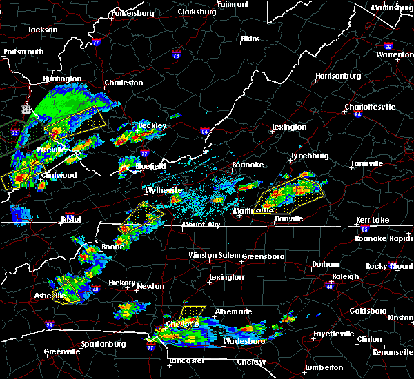 At 245 pm edt, a severe thunderstorm was located near piney creek, moving northeast at 30 mph (radar indicated). Hazards include 60 mph wind gusts and quarter size hail. Hail damage to vehicles is expected. Expect wind damage to roofs, siding, and trees. At 245 pm edt, a severe thunderstorm was located near piney creek, moving northeast at 30 mph (radar indicated). Hazards include 60 mph wind gusts and quarter size hail. Hail damage to vehicles is expected. Expect wind damage to roofs, siding, and trees.
|
| 7/14/2015 9:04 PM EDT |
 At 902 pm edt, a line of severe thunderstorms was located across parts of smyth, wythe and bland counties, moving southeast at 45 mph (radar indicated). Hazards include 60 mph wind gusts. Expect damage to roofs. siding and trees. Locations impacted include, wytheville, galax, bland, marion, and hillsville. At 902 pm edt, a line of severe thunderstorms was located across parts of smyth, wythe and bland counties, moving southeast at 45 mph (radar indicated). Hazards include 60 mph wind gusts. Expect damage to roofs. siding and trees. Locations impacted include, wytheville, galax, bland, marion, and hillsville.
|
| 7/14/2015 8:50 PM EDT |
 At 849 pm edt, a line of severe thunderstorms was located over tazewell and bland counties, moving southeast at 45 mph (radar indicated). Hazards include 60 mph wind gusts. Expect damage to roofs. Siding and trees. At 849 pm edt, a line of severe thunderstorms was located over tazewell and bland counties, moving southeast at 45 mph (radar indicated). Hazards include 60 mph wind gusts. Expect damage to roofs. Siding and trees.
|
| 7/13/2015 6:52 PM EDT |
 The national weather service in blacksburg has issued a * severe thunderstorm warning for. ashe county in northwestern north carolina. watauga county in northwestern north carolina. alleghany county in northwestern north carolina. Grayson county in southwestern virginia. The national weather service in blacksburg has issued a * severe thunderstorm warning for. ashe county in northwestern north carolina. watauga county in northwestern north carolina. alleghany county in northwestern north carolina. Grayson county in southwestern virginia.
|
| 6/26/2015 10:35 PM EDT | At 1035 pm edt, a severe thunderstorm was located over cripple creek, moving northeast at 20 mph (radar indicated). Hazards include 60 mph wind gusts and quarter size hail. Hail damage to vehicles is expected. expect wind damage to roofs, siding and trees. Locations impacted include, fries, speedwell, ivanhoe, crockett, and spring valley. |
| 6/26/2015 10:09 PM EDT | At 1008 pm edt, a severe thunderstorm was located over bridle creek, moving northeast at 15 mph. this storm has a history of producing quarter size hail and intense lightning (radar indicated). Hazards include 60 mph wind gusts and quarter size hail. Hail damage to vehicles is expected. Expect wind damage to roofs, siding and trees. |
| 6/16/2014 7:10 PM EDT | Quarter sized hail reported 0.7 miles SSW of Fries, VA, quarter size hail in fries. report via facebook. |
| 6/16/2014 7:00 PM EDT | Quarter sized hail reported 2.7 miles S of Fries, VA |
| 7/22/2012 4:30 PM EDT | Two trees down on spring valley road in grayson county VA, 7.4 miles ESE of Fries, VA |
| 7/1/2012 11:28 AM EDT | Storm damage reported in carroll county VA, 0.7 miles SSW of Fries, VA |
| 7/1/2012 11:28 AM EDT | Trees down blocking fries roa in carroll county VA, 0.7 miles SSW of Fries, VA |
| 7/1/2012 11:20 AM EDT | Storm damage reported in carroll county VA, 0.7 miles SSW of Fries, VA |
| 6/30/2012 7:40 PM EDT | Quarter sized hail reported 2 miles S of Fries, VA, route 94 north of fries |
| 6/29/2012 9:30 PM EDT | Multiple trees dow in carroll county VA, 0.7 miles SSW of Fries, VA |
| 1/1/0001 12:00 AM | Quarter sized hail reported 0.7 miles SSW of Fries, VA, hail observed in downtown fries...began at 140 pm and lasted until 145 pm |
| 1/1/0001 12:00 AM | Quarter sized hail reported 0.7 miles SSW of Fries, VA, in downtown fries |
| 1/1/0001 12:00 AM | Tree down on stevens creek road in grayson county VA, 1.9 miles SE of Fries, VA |
| 1/1/0001 12:00 AM | Tree down on winding road in grayson county VA, 1.5 miles SSE of Fries, VA |
| 1/1/0001 12:00 AM | Power lines down in carroll county VA, 0.7 miles SSW of Fries, VA |
| 1/1/0001 12:00 AM | Multiple trees have been blown down on carrol drive in the community of frie in carroll county VA, 0.7 miles SSW of Fries, VA |
| 1/1/0001 12:00 AM | Quarter sized hail reported 0.7 miles SSW of Fries, VA, multiple reports of quarter size hail piling up on the ground in the community of fries. |
| 1/1/0001 12:00 AM | Storm damage reported in carroll county VA, 0.3 miles WNW of Fries, VA |
| 1/1/0001 12:00 AM | Quarter sized hail reported 0.7 miles SSE of Fries, VA |
| 1/1/0001 12:00 AM | Quarter sized hail reported 0.7 miles SSW of Fries, VA |
| 1/1/0001 12:00 AM | Golf Ball sized hail reported 0.7 miles SSW of Fries, VA |
| 1/1/0001 12:00 AM | Quarter sized hail reported 0.7 miles SSW of Fries, VA |
Hail Maps for Fries, VA

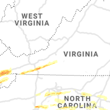


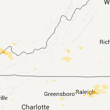
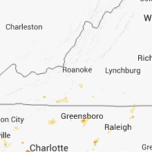


Connect with Interactive Hail Maps