

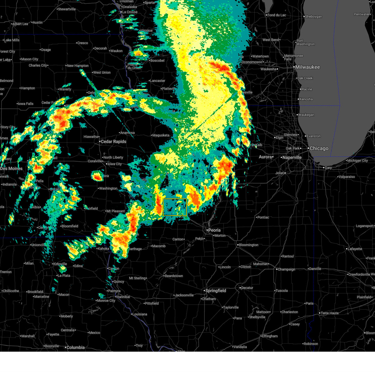
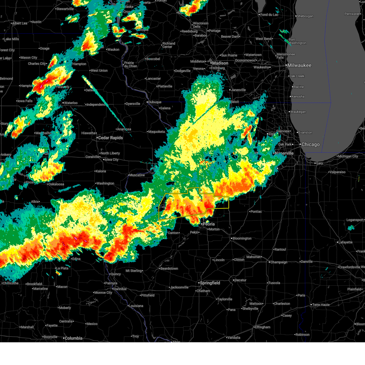
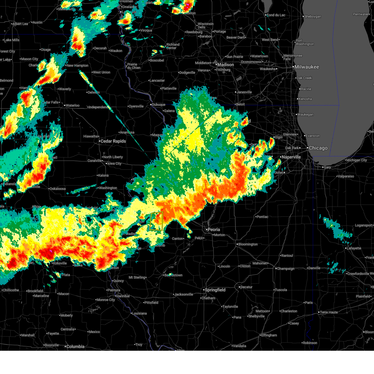
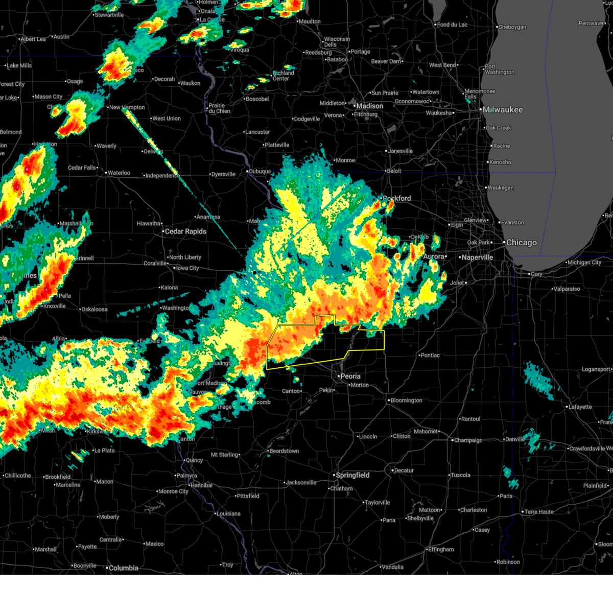
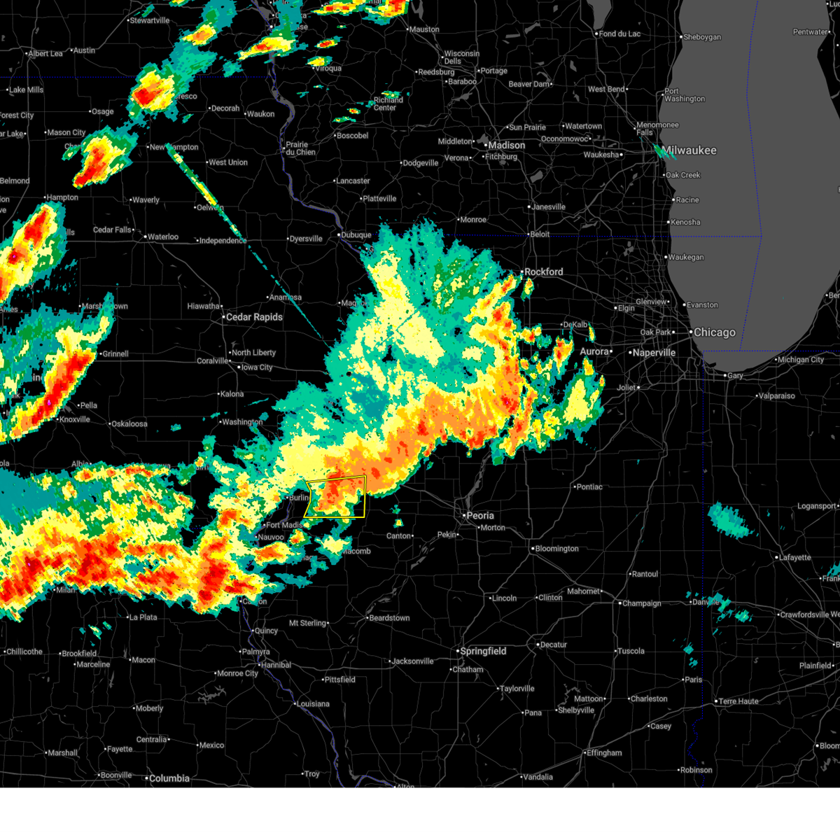
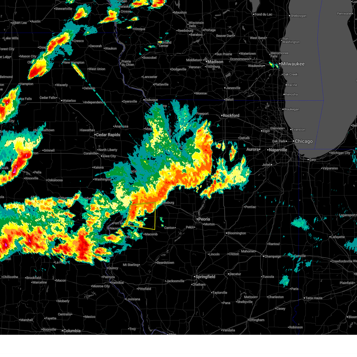
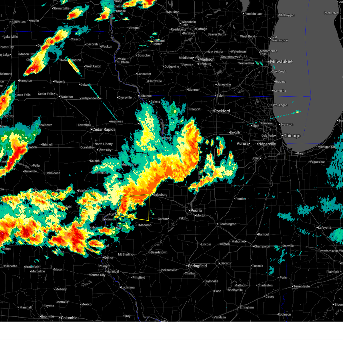
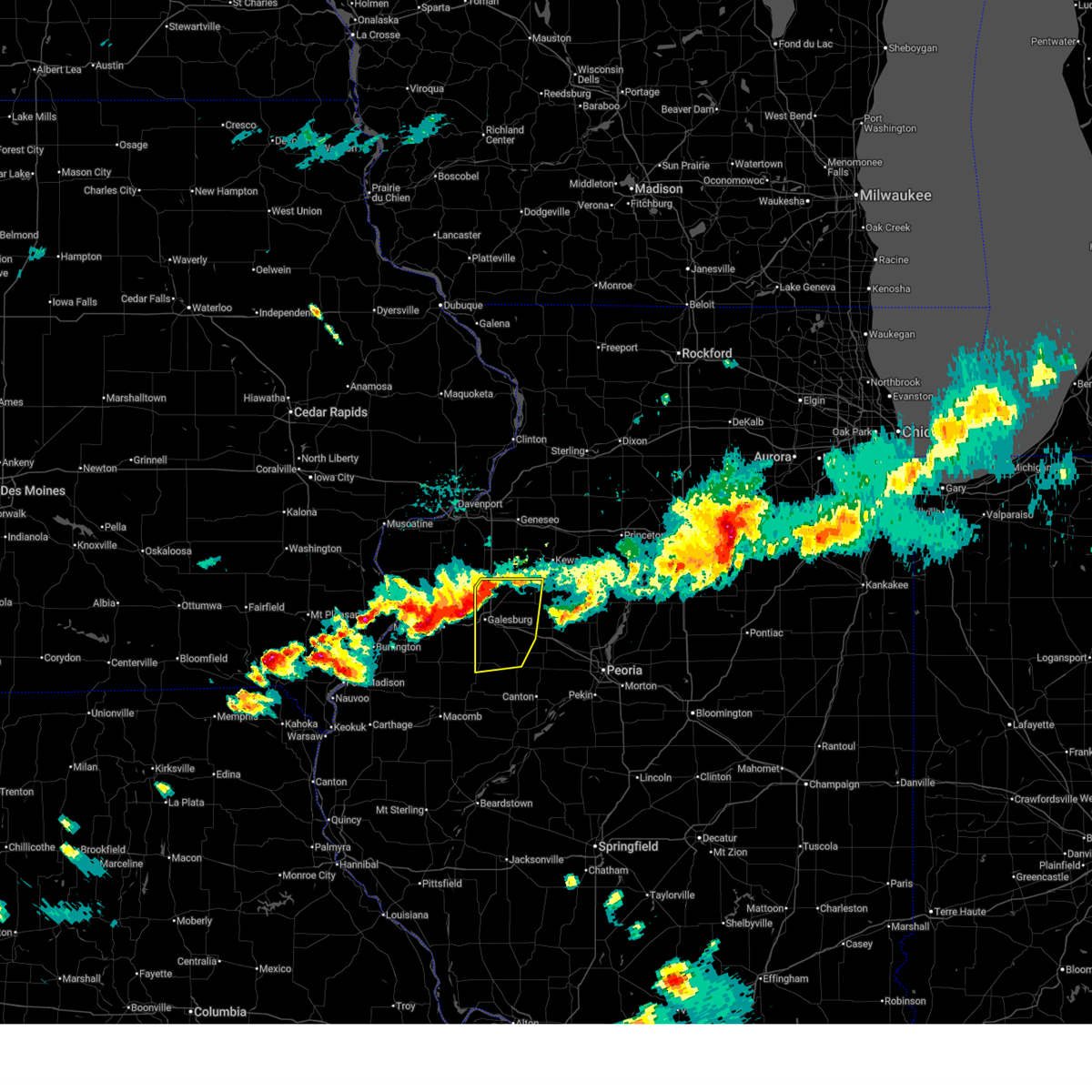
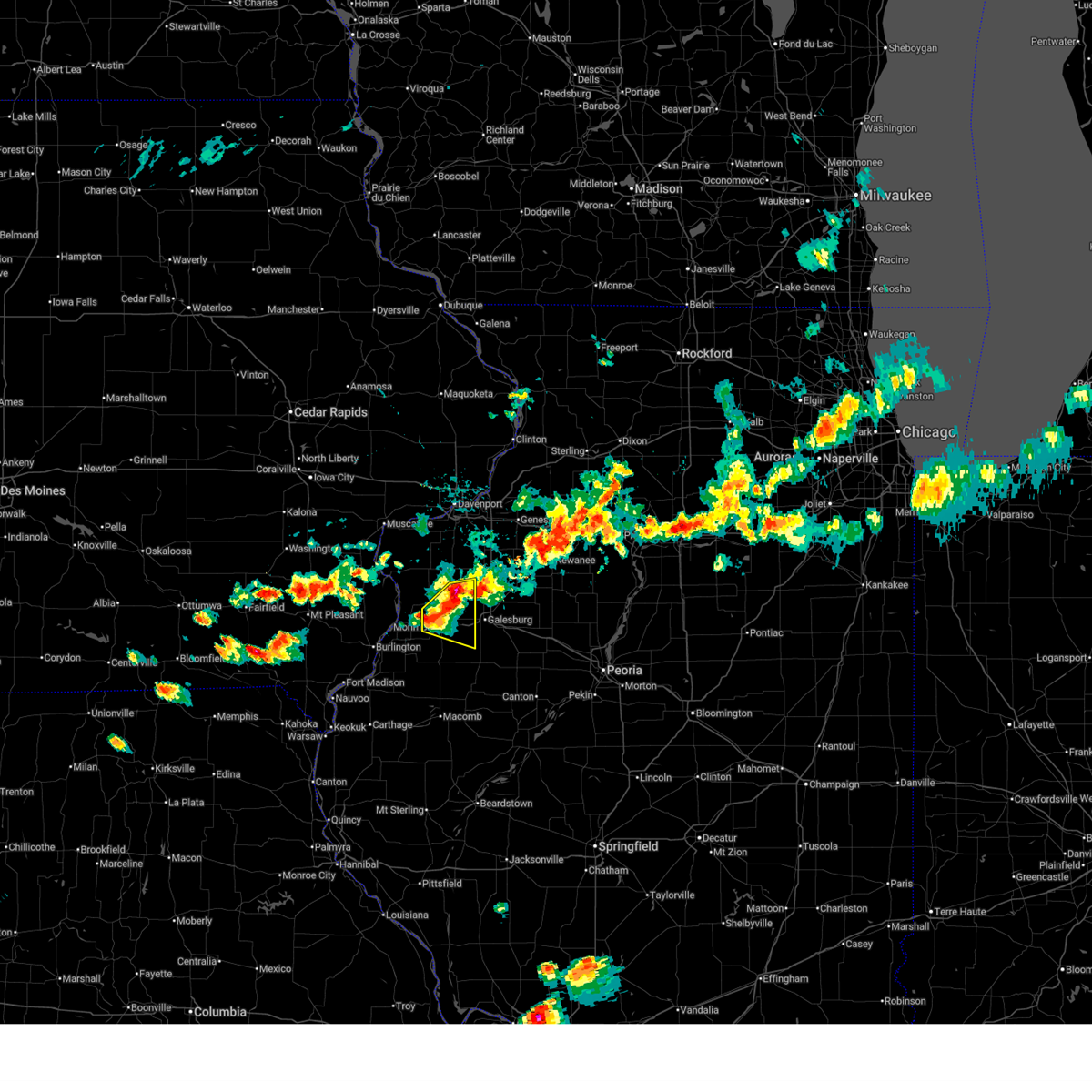
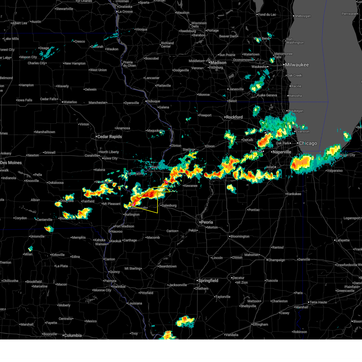
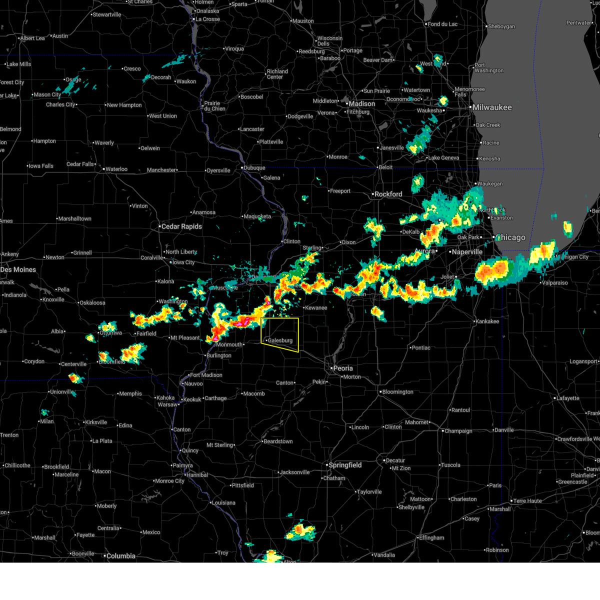
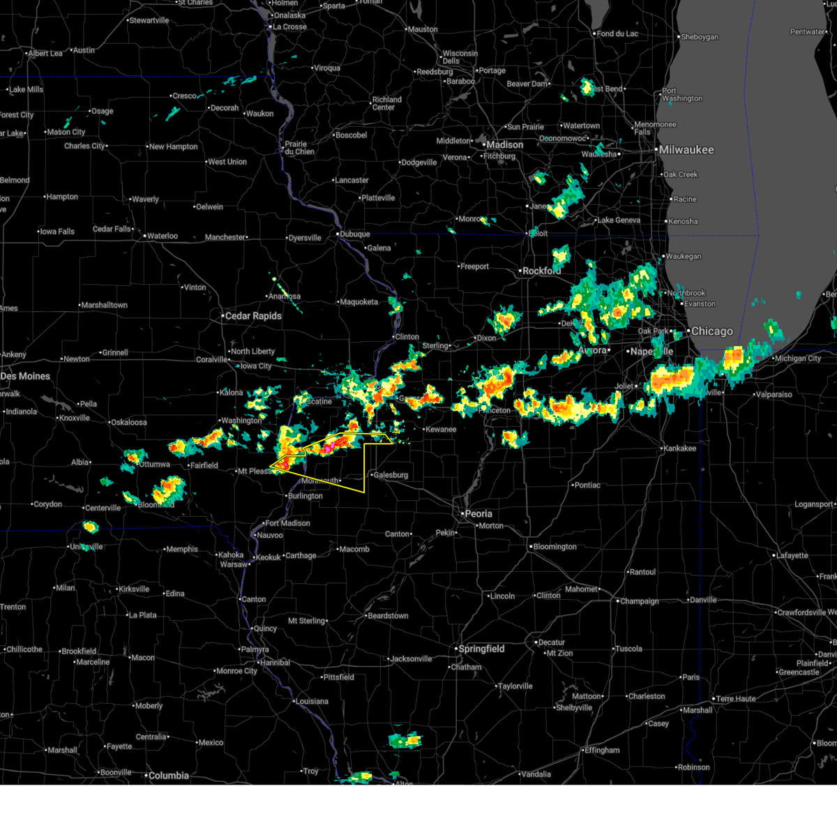
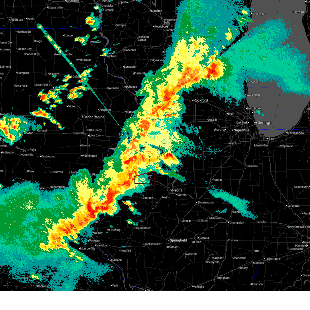
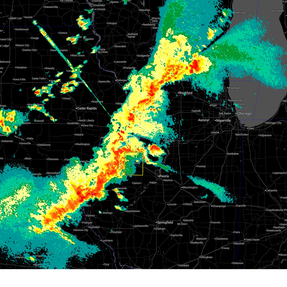
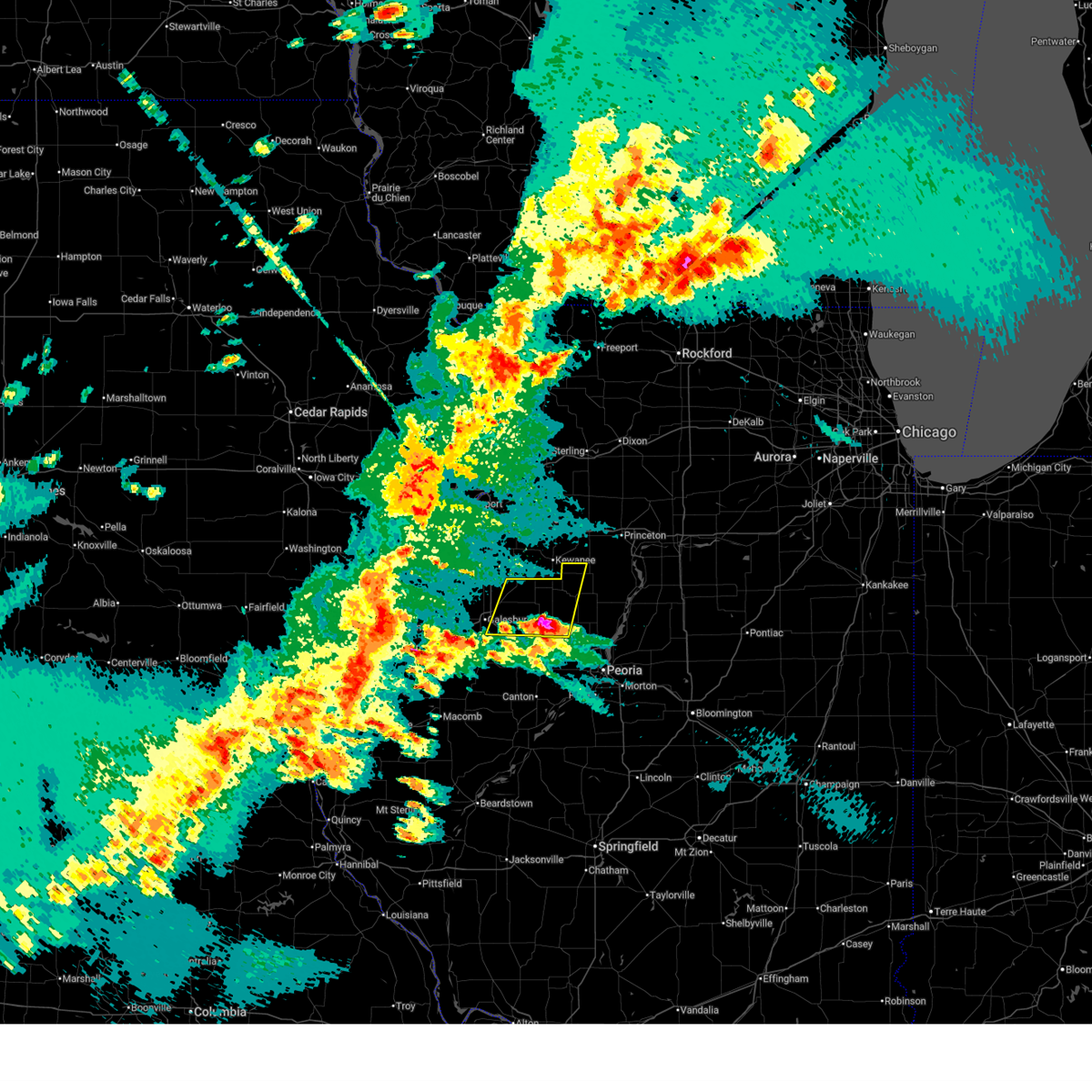
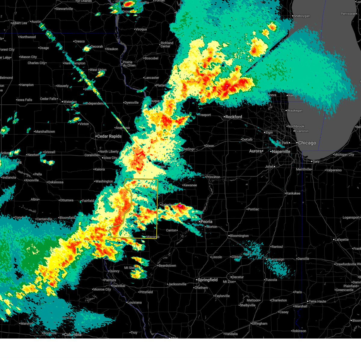
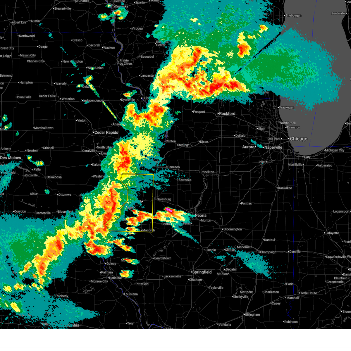
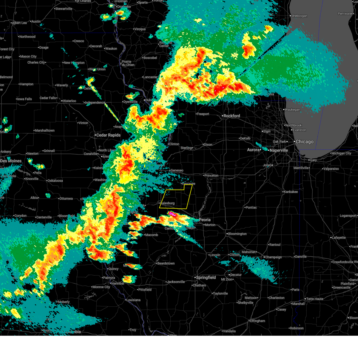
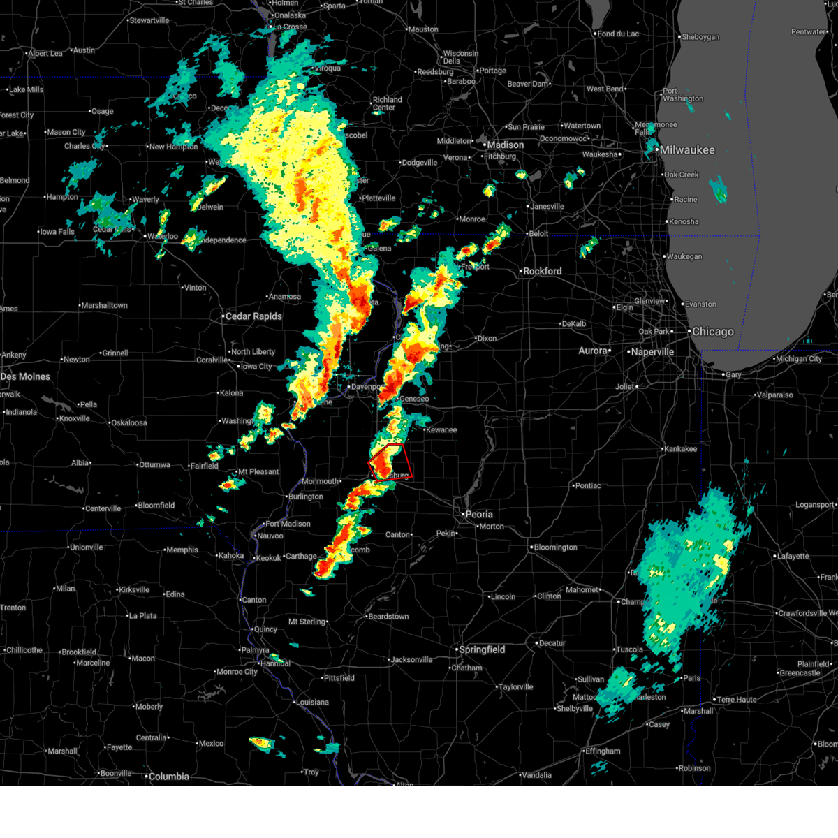
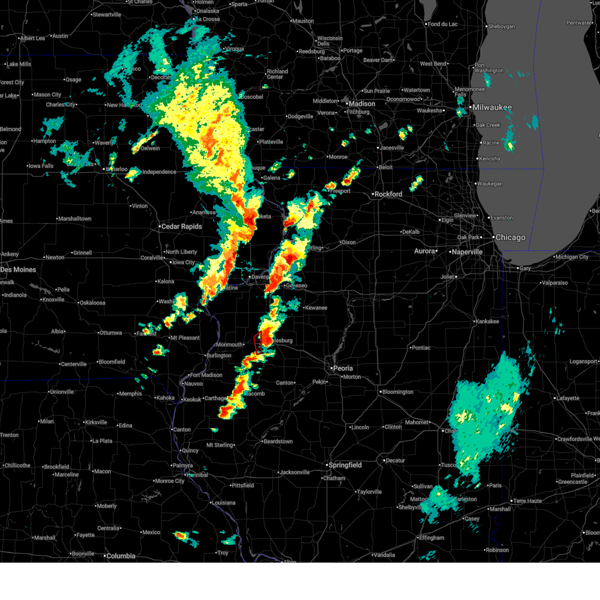
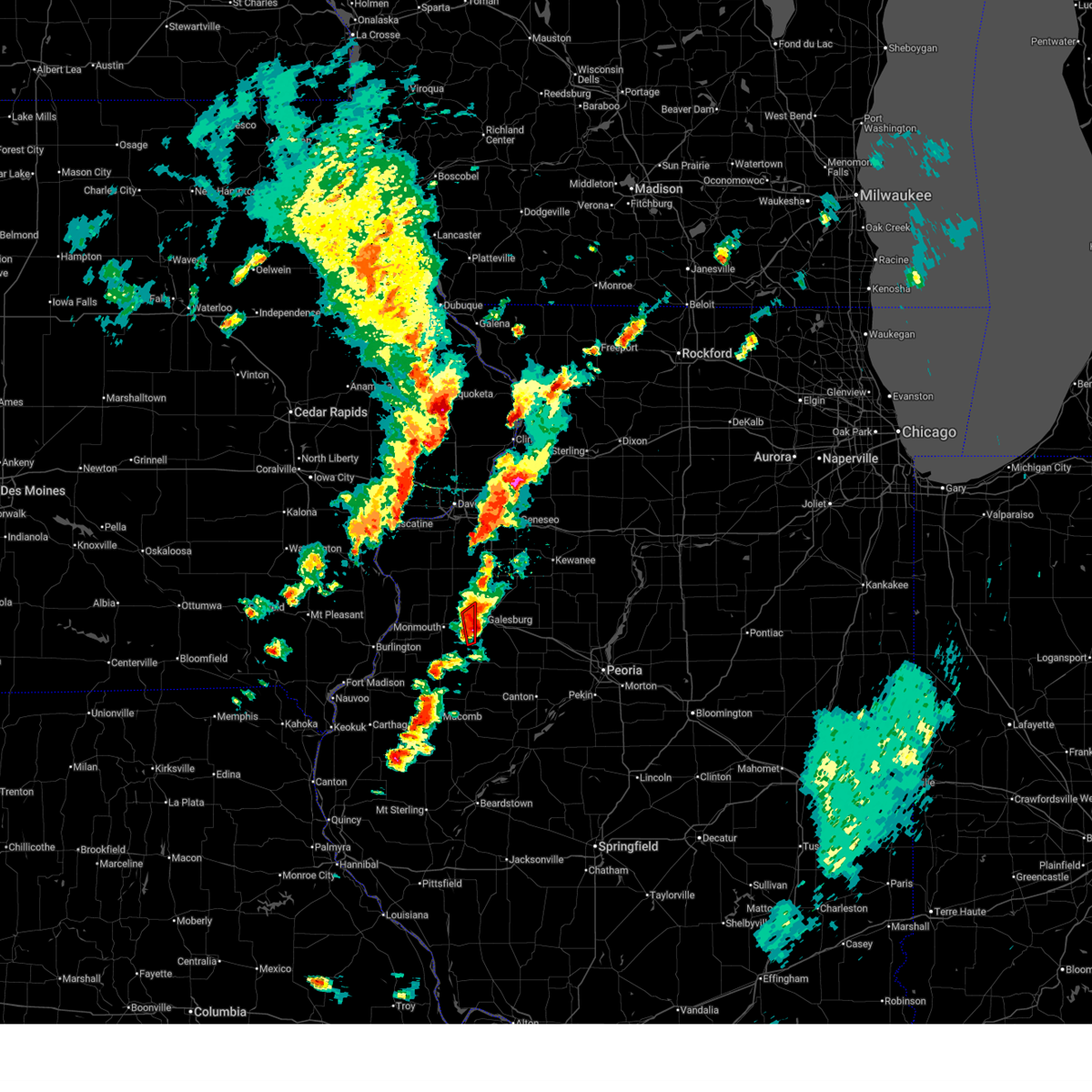
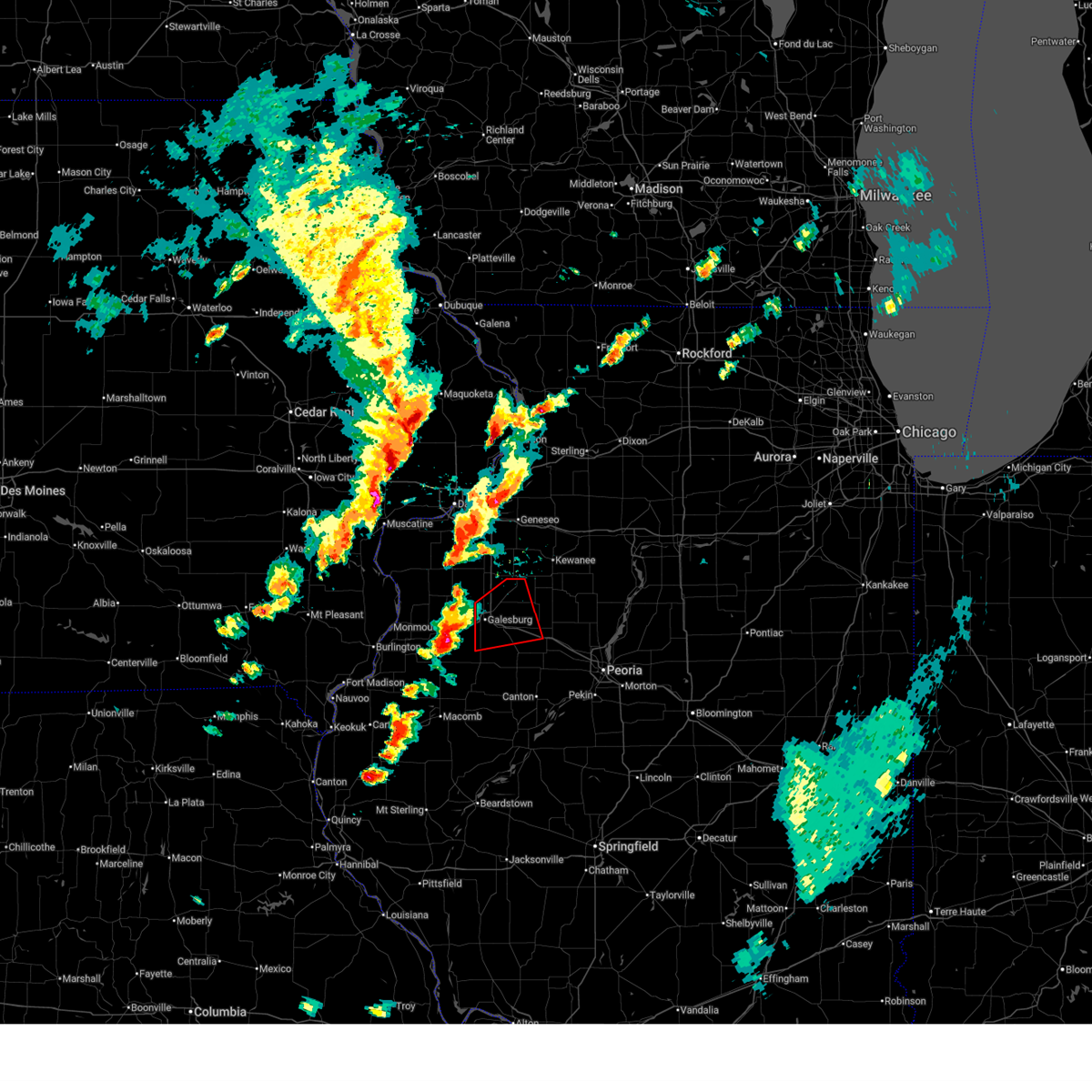
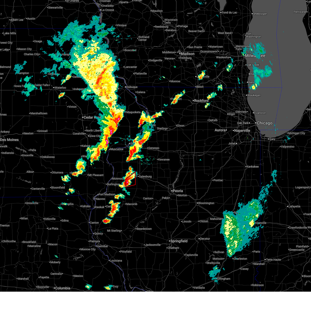
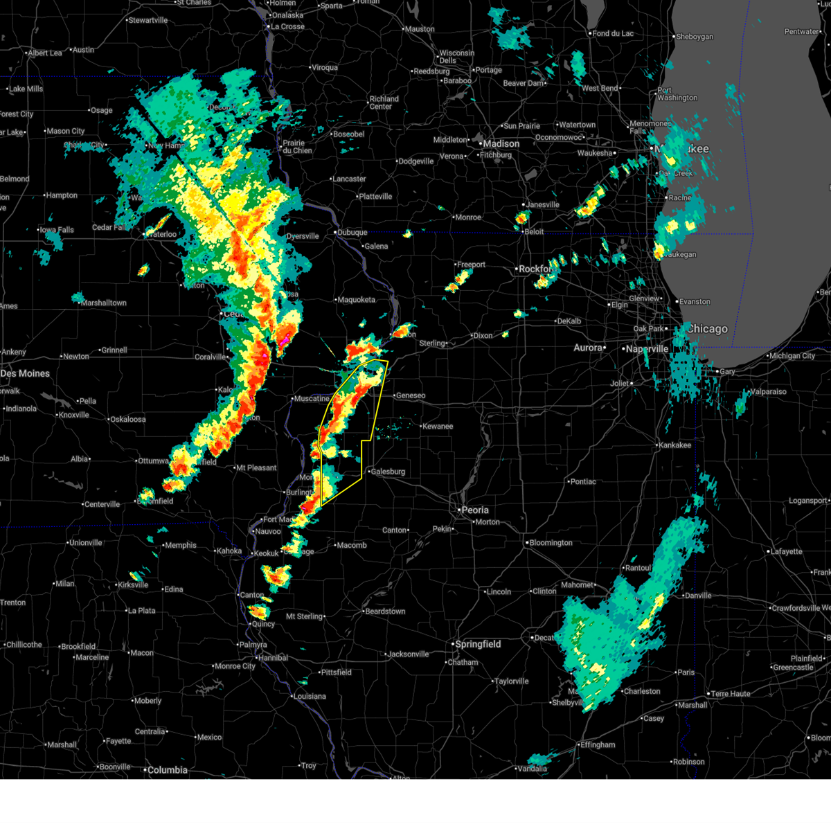
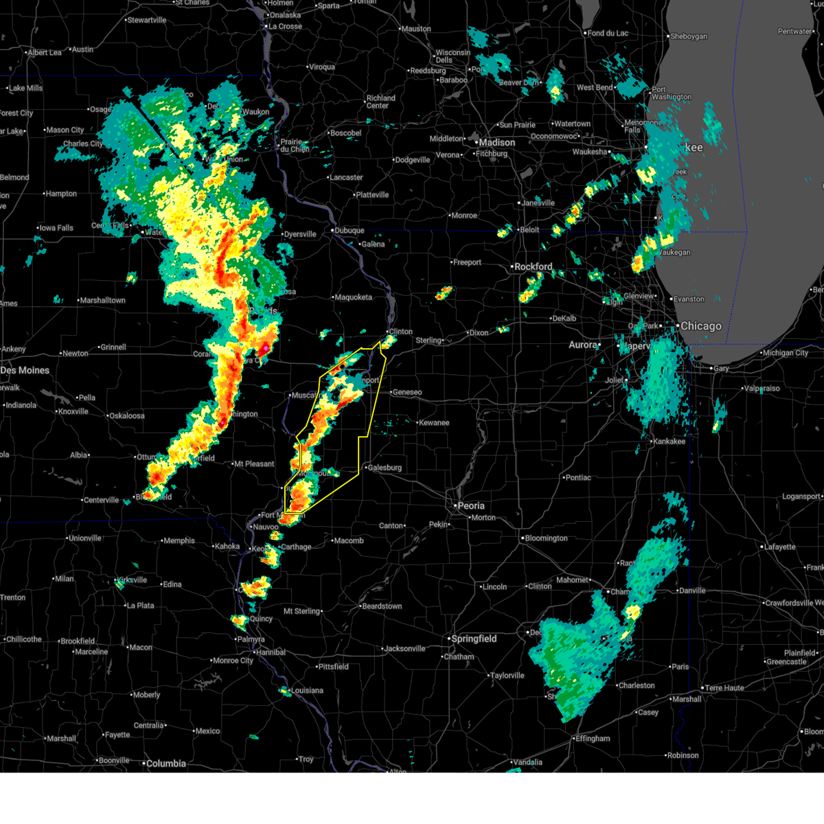
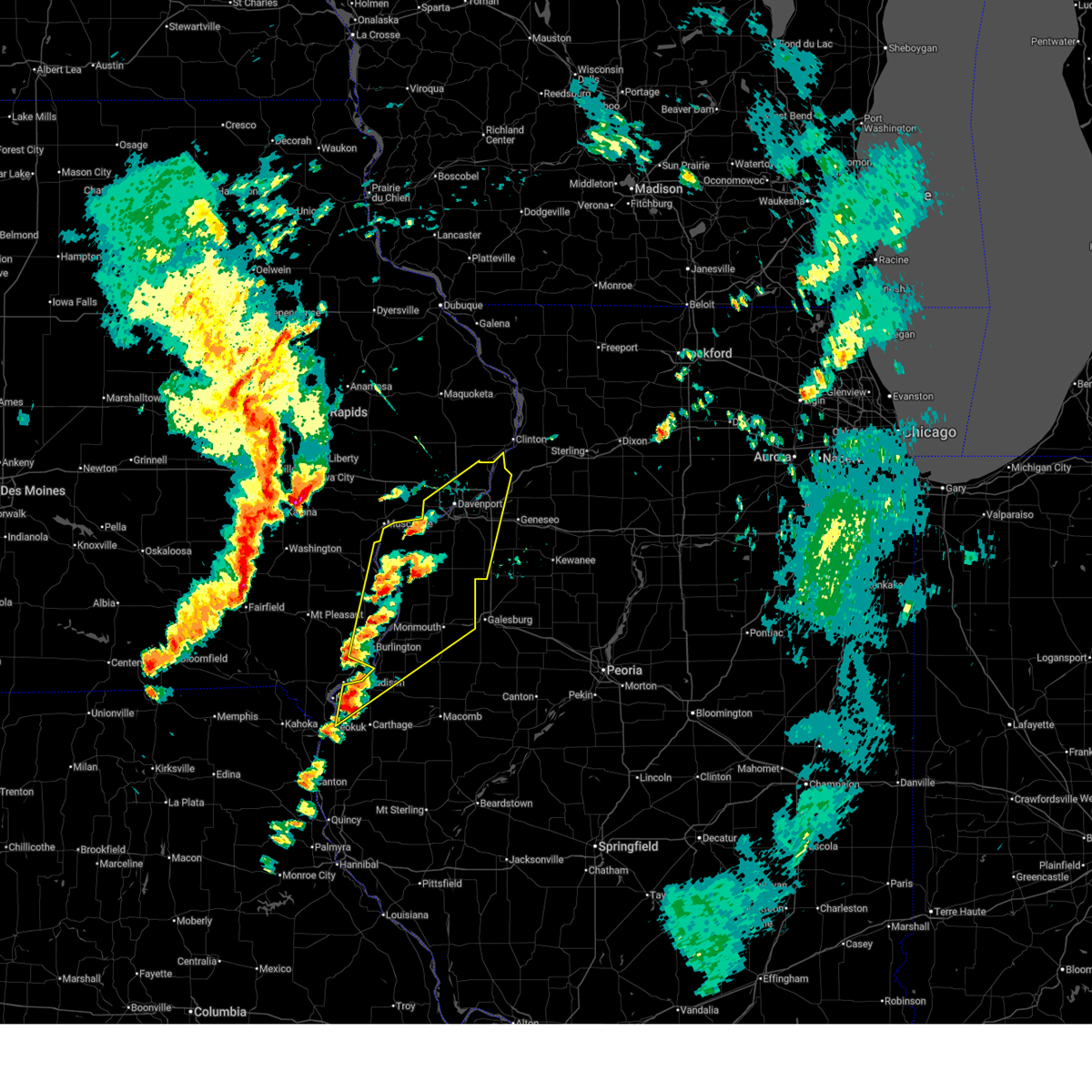
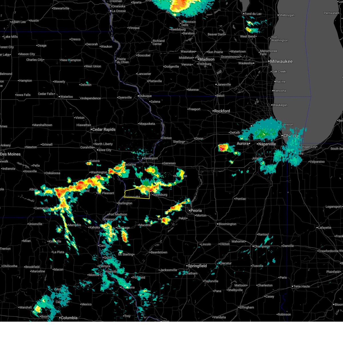
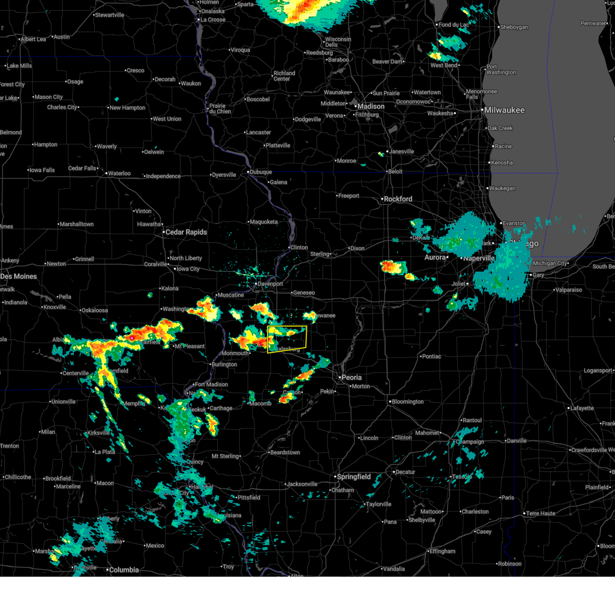
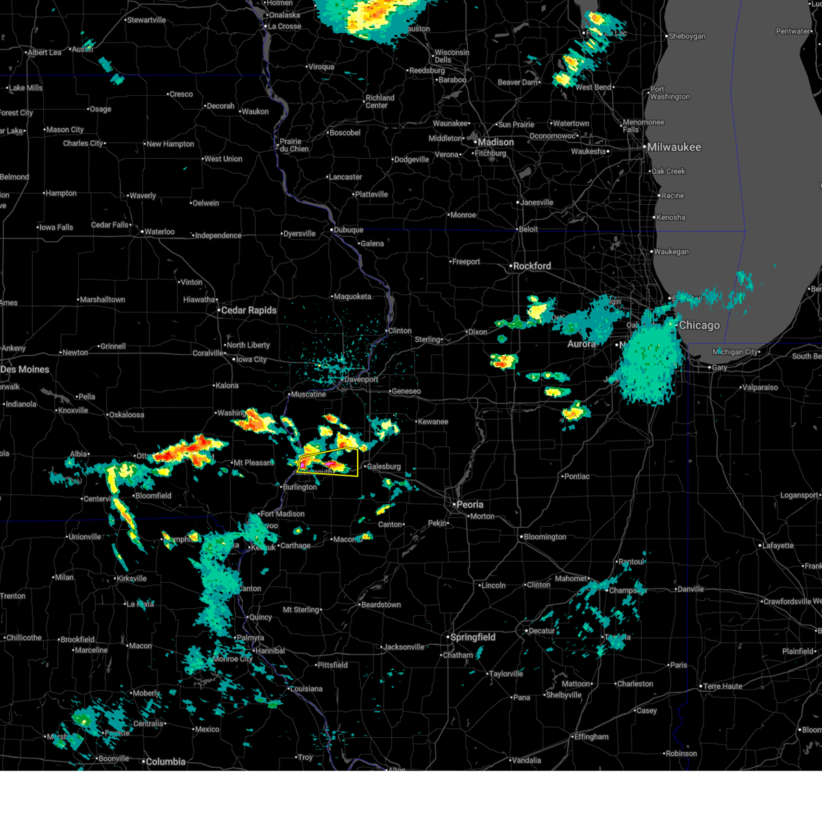
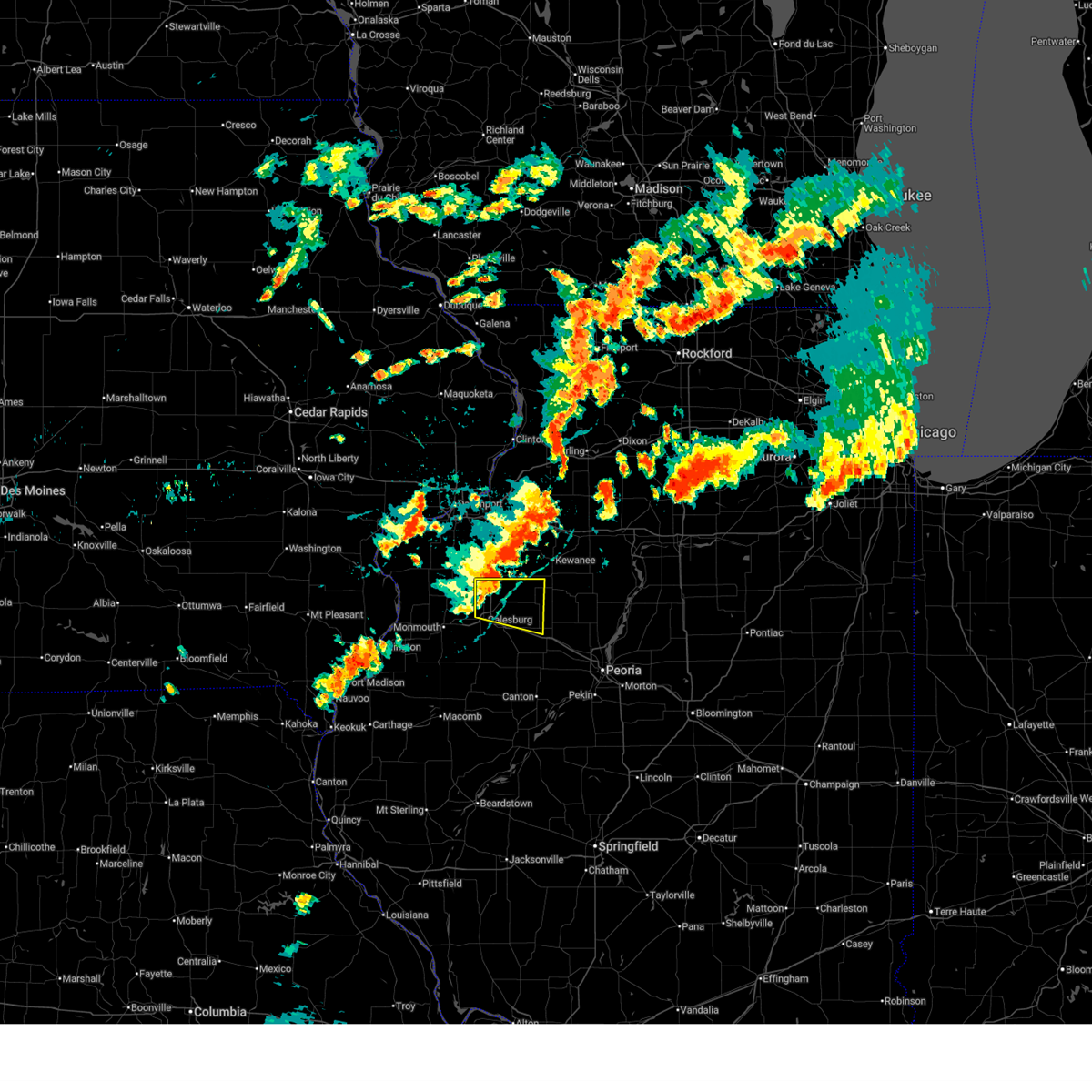
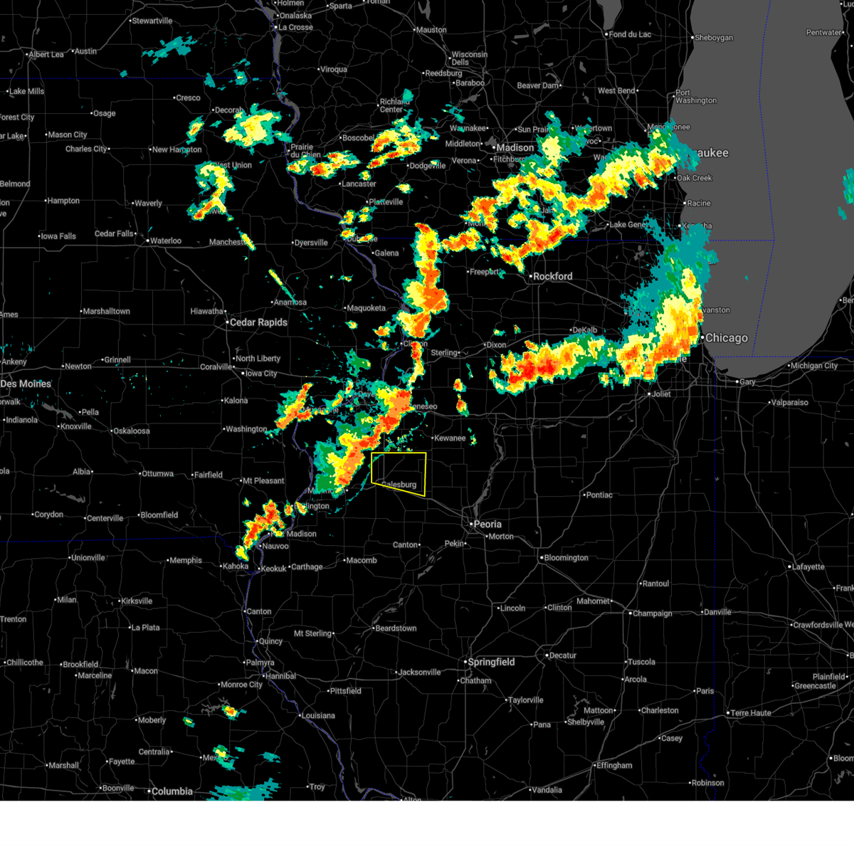
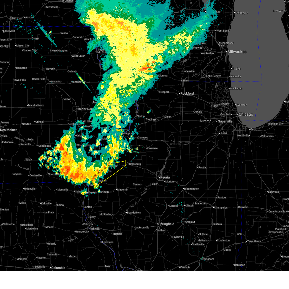
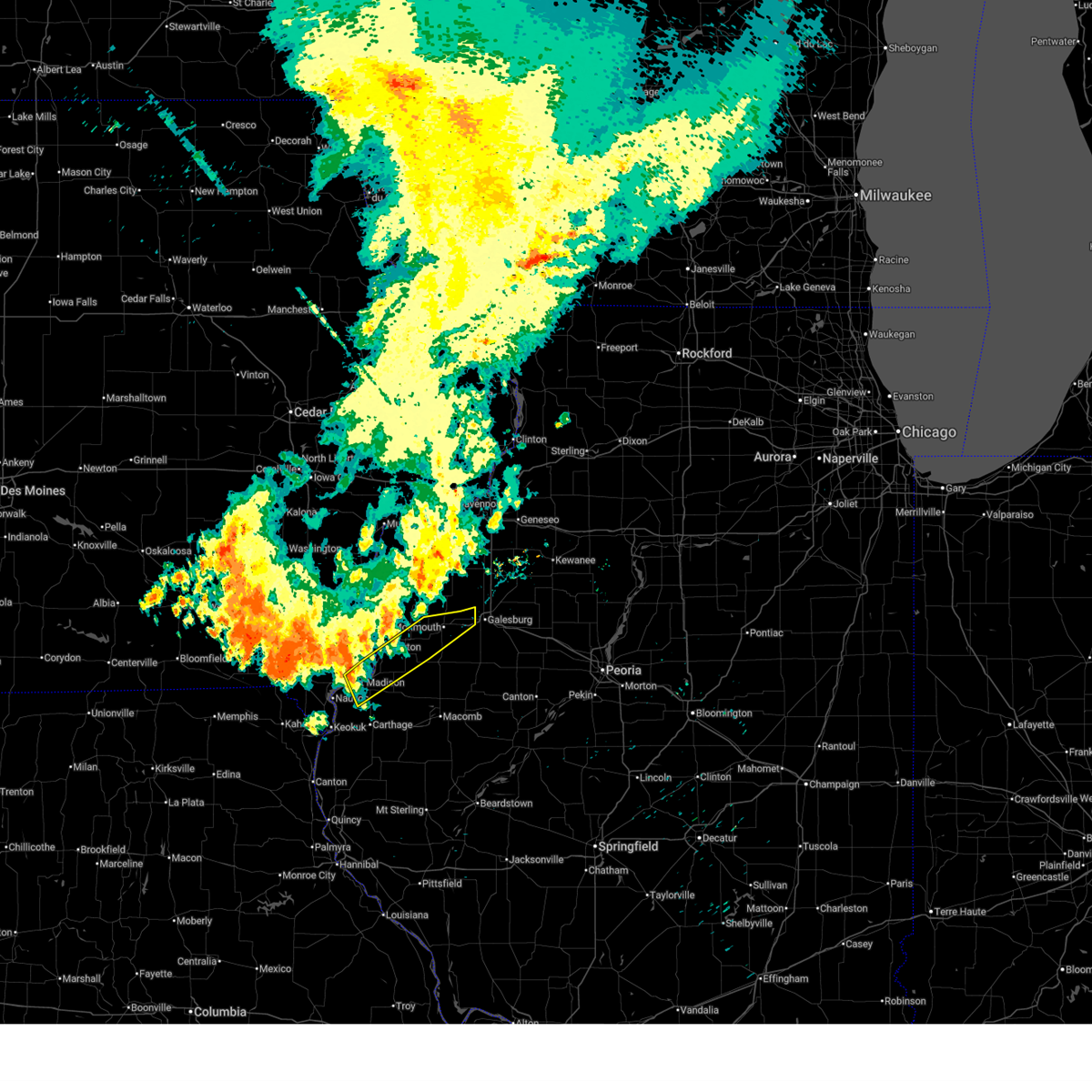
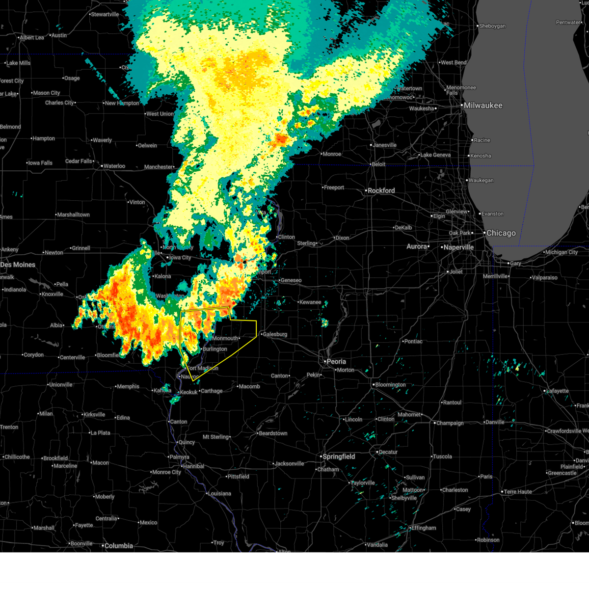
Hail Map for Galesburg, IL
The Galesburg, IL area has had 16 reports of on-the-ground hail by trained spotters, and has been under severe weather warnings 63 times during the past 12 months. Doppler radar has detected hail at or near Galesburg, IL on 78 occasions, including 7 occasions during the past year.
| Name: | Galesburg, IL |
| Where Located: | 44.4 miles WNW of Peoria, IL |
| Map: | Google Map for Galesburg, IL |
| Population: | 32195 |
| Housing Units: | 14280 |
| More Info: | Search Google for Galesburg, IL |
2
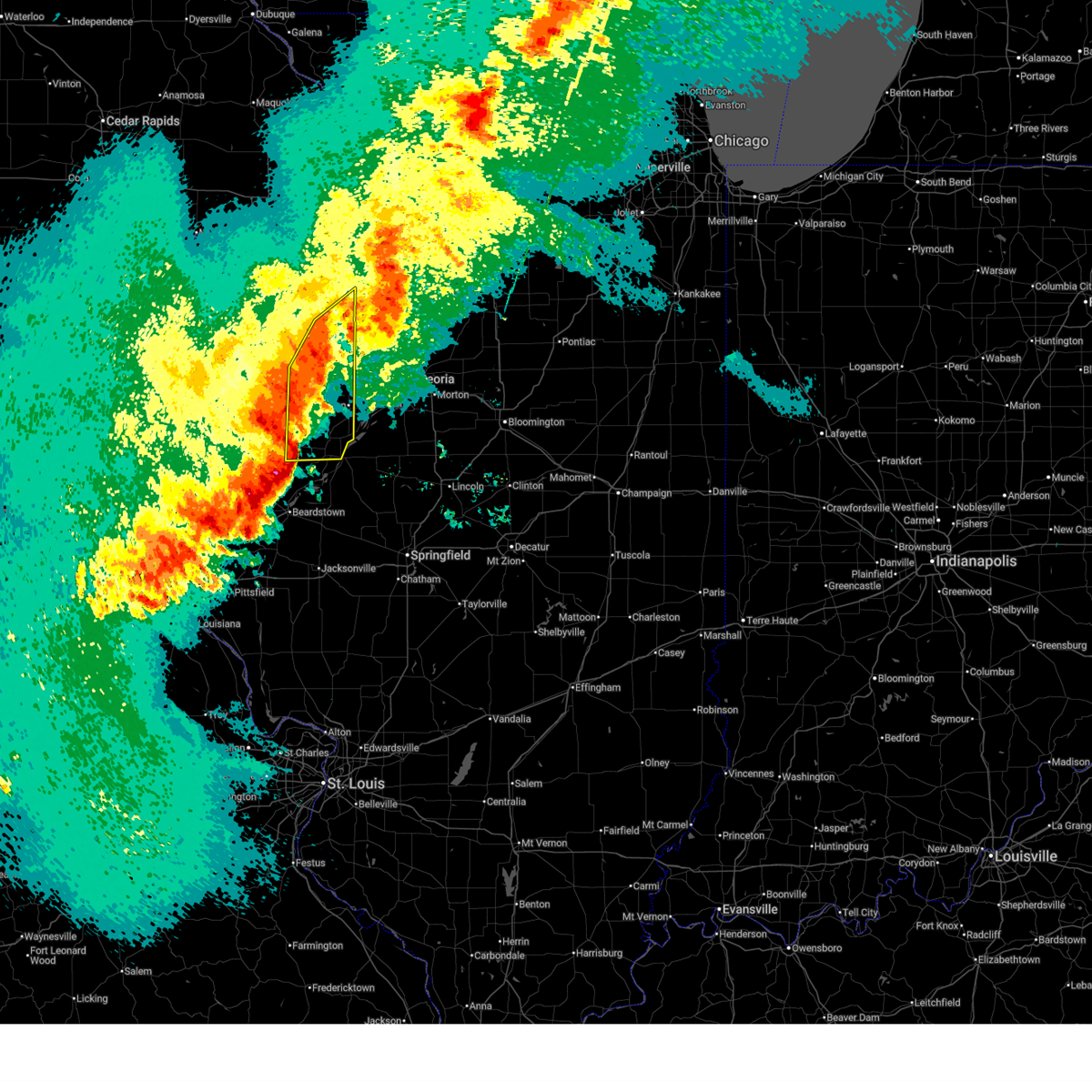
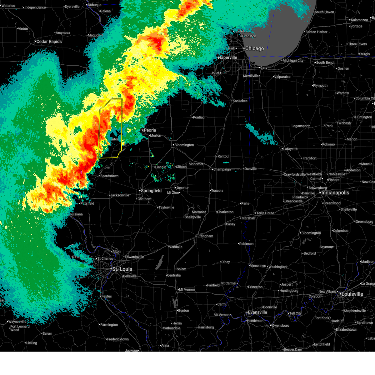
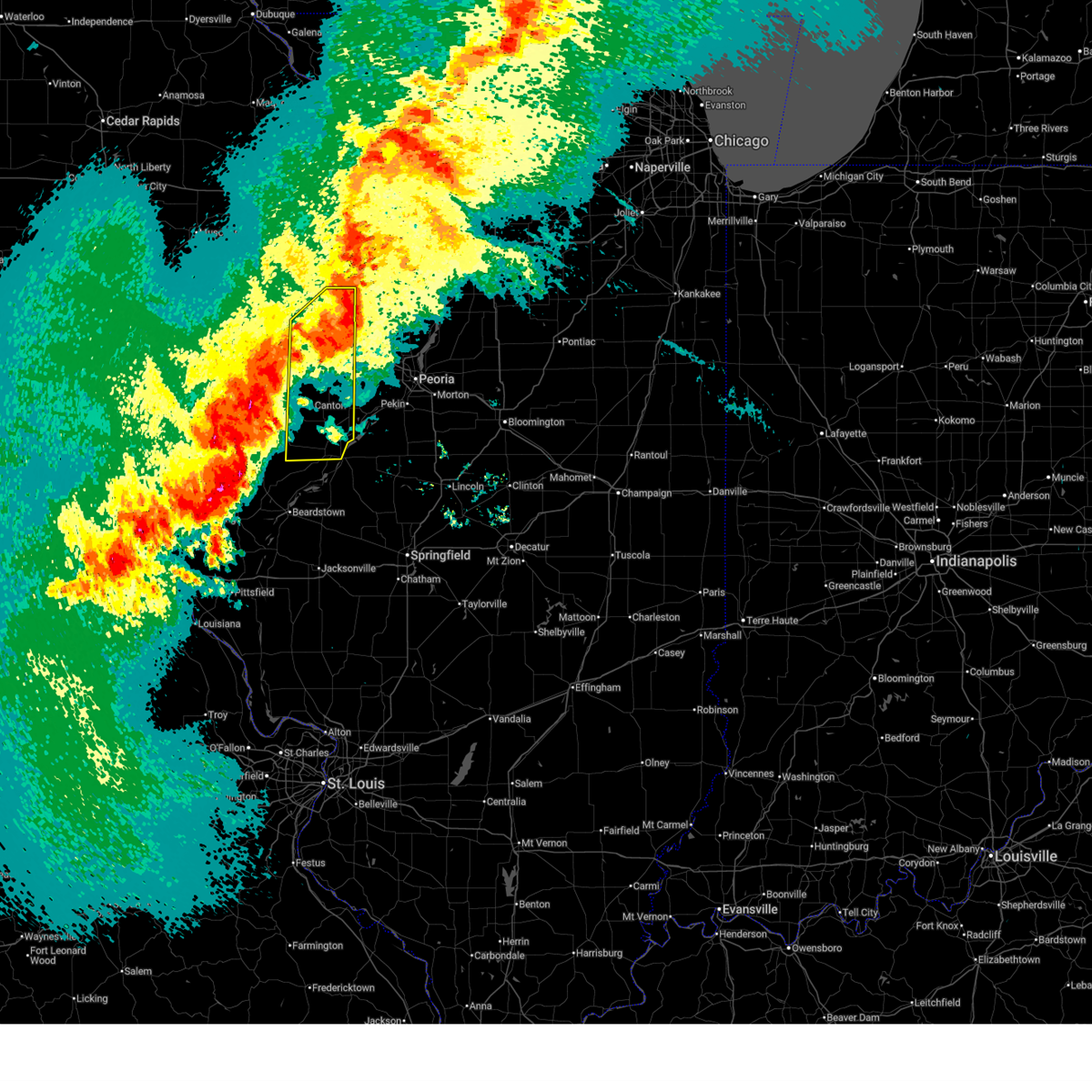
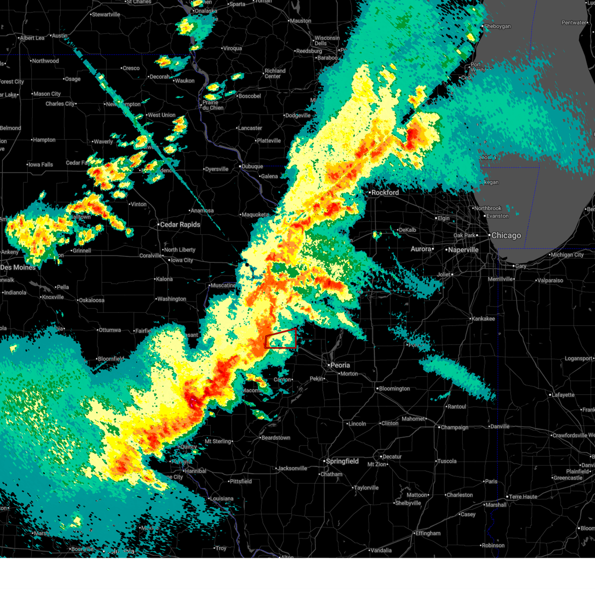
The Top Recent Hail Date for Galesburg, IL is Friday, July 11, 2025 (10th out of 78)
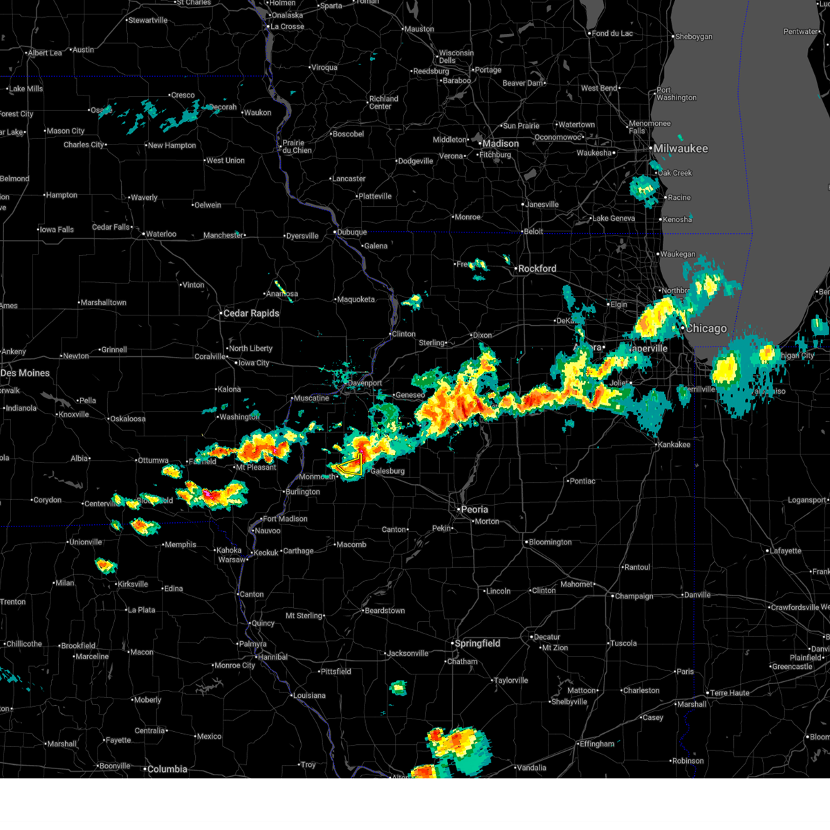
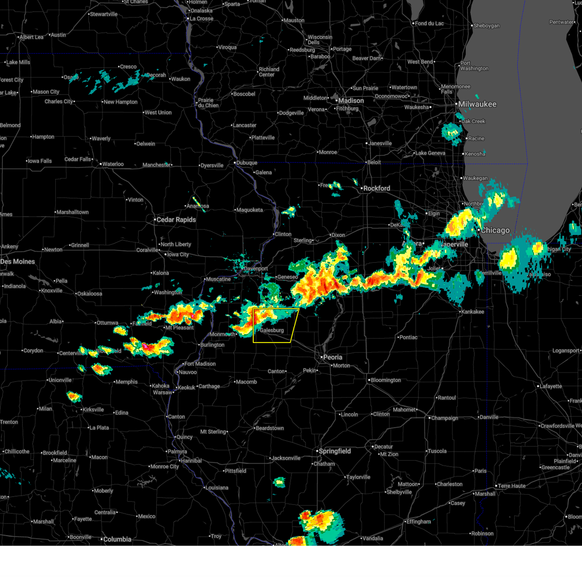
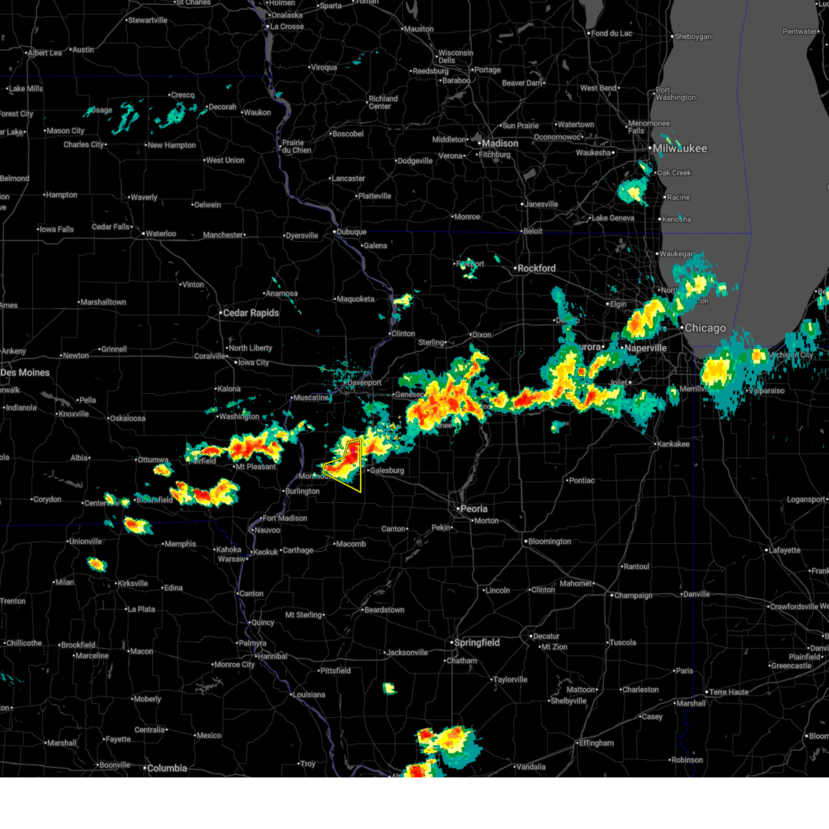
Hail and Wind Damage Spotted near Galesburg, IL
| Date / Time | Report Details |
|---|---|
| 6/17/2026 8:41 AM CDT |
 At 840 am cdt, severe thunderstorms were located along a line extending from oneida to near little swan lake, moving southeast at 55 mph. these are destructive storms for central and southern knox county and northern fulton county (radar indicated). Hazards include 80 mph wind gusts and quarter size hail. Flying debris will be dangerous to those caught without shelter. mobile homes will be heavily damaged. expect considerable damage to roofs, windows, and vehicles. extensive tree damage and power outages are likely. these severe storms will be near, abingdon, knoxville, avon, victoria, and st. augustine around 845 am cdt. williamsfield, london mills, and maquon around 850 am cdt. laura and elmore around 855 am cdt. farmington, elmwood, brimfield, yates city, and fairview around 900 am cdt. canton, princeville, and cuba around 905 am cdt. hanna city, trivoli, and st. david around 910 am cdt. other locations impacted by these severe thunderstorms include bryant, norris, jubilee college state park, ellisville, banner, smithville, west jersey, gilson, dunfermline, and monica. this also includes banner marsh state fish and wildlife area, jubilee college state park, rice lake state fish and wildlife area, and snakeden hollow state fish and wildlife area. This includes interstate 74 between mile markers 34 and 82. At 840 am cdt, severe thunderstorms were located along a line extending from oneida to near little swan lake, moving southeast at 55 mph. these are destructive storms for central and southern knox county and northern fulton county (radar indicated). Hazards include 80 mph wind gusts and quarter size hail. Flying debris will be dangerous to those caught without shelter. mobile homes will be heavily damaged. expect considerable damage to roofs, windows, and vehicles. extensive tree damage and power outages are likely. these severe storms will be near, abingdon, knoxville, avon, victoria, and st. augustine around 845 am cdt. williamsfield, london mills, and maquon around 850 am cdt. laura and elmore around 855 am cdt. farmington, elmwood, brimfield, yates city, and fairview around 900 am cdt. canton, princeville, and cuba around 905 am cdt. hanna city, trivoli, and st. david around 910 am cdt. other locations impacted by these severe thunderstorms include bryant, norris, jubilee college state park, ellisville, banner, smithville, west jersey, gilson, dunfermline, and monica. this also includes banner marsh state fish and wildlife area, jubilee college state park, rice lake state fish and wildlife area, and snakeden hollow state fish and wildlife area. This includes interstate 74 between mile markers 34 and 82.
|
| 6/17/2026 8:37 AM CDT | Tree on powerline at east knox rd. and day st. power outage reporte in knox county IL, 0.4 miles ENE of Galesburg, IL |
| 6/17/2026 8:27 AM CDT |
 At 826 am cdt, severe thunderstorms were located along a line extending from near cambridge to kirkwood, moving east at 55 mph (radar indicated). Hazards include 70 mph wind gusts and quarter size hail. Hail damage to vehicles is expected. expect considerable tree damage. wind damage is also likely to mobile homes, roofs, and outbuildings. these severe storms will be near, henderson and rio around 830 am cdt. galesburg, wataga, oneida, and altona around 835 am cdt. abingdon and knoxville around 840 am cdt. victoria, la fayette, and st. augustine around 845 am cdt. toulon, osceola, williamsfield, london mills, elmira, and maquon around 850 am cdt. wyoming, bradford, laura, and elmore around 855 am cdt. elmwood, yates city, and castleton around 900 am cdt. farmington, princeville, brimfield, and camp grove around 905 am cdt. other locations impacted by these severe thunderstorms include bryant, norris, jubilee college state park, ellisville, banner, smithville, west jersey, gilson, dunfermline, and monica. this also includes banner marsh state fish and wildlife area, jubilee college state park, rice lake state fish and wildlife area, and snakeden hollow state fish and wildlife area. This includes interstate 74 between mile markers 34 and 82. At 826 am cdt, severe thunderstorms were located along a line extending from near cambridge to kirkwood, moving east at 55 mph (radar indicated). Hazards include 70 mph wind gusts and quarter size hail. Hail damage to vehicles is expected. expect considerable tree damage. wind damage is also likely to mobile homes, roofs, and outbuildings. these severe storms will be near, henderson and rio around 830 am cdt. galesburg, wataga, oneida, and altona around 835 am cdt. abingdon and knoxville around 840 am cdt. victoria, la fayette, and st. augustine around 845 am cdt. toulon, osceola, williamsfield, london mills, elmira, and maquon around 850 am cdt. wyoming, bradford, laura, and elmore around 855 am cdt. elmwood, yates city, and castleton around 900 am cdt. farmington, princeville, brimfield, and camp grove around 905 am cdt. other locations impacted by these severe thunderstorms include bryant, norris, jubilee college state park, ellisville, banner, smithville, west jersey, gilson, dunfermline, and monica. this also includes banner marsh state fish and wildlife area, jubilee college state park, rice lake state fish and wildlife area, and snakeden hollow state fish and wildlife area. This includes interstate 74 between mile markers 34 and 82.
|
| 6/17/2026 8:14 AM CDT |
 Svrilx the national weather service in lincoln has issued a * severe thunderstorm warning for, fulton county in west central illinois, stark county in north central illinois, knox county in west central illinois, western peoria county in central illinois, * until 915 am cdt. * at 813 am cdt, severe thunderstorms were located along a line extending from warner to near gladstone, moving east at 60 mph (radar indicated). Hazards include 60 mph wind gusts and quarter size hail. Hail damage to vehicles is expected. expect wind damage to roofs, siding, and trees. severe thunderstorms will be near, rio around 820 am cdt. galesburg, wataga, oneida, altona, and henderson around 830 am cdt. other locations in the path of these severe thunderstorms include abingdon, knoxville, victoria, la fayette, st. augustine, toulon, osceola, elmira, wyoming, bradford, williamsfield, london mills, maquon, castleton, elmore, yates city, laura, camp grove, farmington, elmwood, princeville, brimfield and fairview. this includes interstate 74 between mile markers 34 and 82. This also includes banner marsh state fish and wildlife area, jubilee college state park, rice lake state fish and wildlife area, and snakeden hollow state fish and wildlife area. Svrilx the national weather service in lincoln has issued a * severe thunderstorm warning for, fulton county in west central illinois, stark county in north central illinois, knox county in west central illinois, western peoria county in central illinois, * until 915 am cdt. * at 813 am cdt, severe thunderstorms were located along a line extending from warner to near gladstone, moving east at 60 mph (radar indicated). Hazards include 60 mph wind gusts and quarter size hail. Hail damage to vehicles is expected. expect wind damage to roofs, siding, and trees. severe thunderstorms will be near, rio around 820 am cdt. galesburg, wataga, oneida, altona, and henderson around 830 am cdt. other locations in the path of these severe thunderstorms include abingdon, knoxville, victoria, la fayette, st. augustine, toulon, osceola, elmira, wyoming, bradford, williamsfield, london mills, maquon, castleton, elmore, yates city, laura, camp grove, farmington, elmwood, princeville, brimfield and fairview. this includes interstate 74 between mile markers 34 and 82. This also includes banner marsh state fish and wildlife area, jubilee college state park, rice lake state fish and wildlife area, and snakeden hollow state fish and wildlife area.
|
| 6/11/2026 11:47 AM CDT |
 Svrilx the national weather service in lincoln has issued a * severe thunderstorm warning for, northern knox county in west central illinois, * until 1230 pm cdt. * at 1147 am cdt, a severe thunderstorm was located near north henderson, or near galesburg, moving east at 40 mph (radar indicated). Hazards include 60 mph wind gusts and quarter size hail. Hail damage to vehicles is expected. expect wind damage to roofs, siding, and trees. this severe thunderstorm will be near, galesburg, wataga, and henderson around 1155 am cdt. oneida around 1200 pm cdt. other locations in the path of this severe thunderstorm include victoria. This includes interstate 74 between mile markers 35 and 54. Svrilx the national weather service in lincoln has issued a * severe thunderstorm warning for, northern knox county in west central illinois, * until 1230 pm cdt. * at 1147 am cdt, a severe thunderstorm was located near north henderson, or near galesburg, moving east at 40 mph (radar indicated). Hazards include 60 mph wind gusts and quarter size hail. Hail damage to vehicles is expected. expect wind damage to roofs, siding, and trees. this severe thunderstorm will be near, galesburg, wataga, and henderson around 1155 am cdt. oneida around 1200 pm cdt. other locations in the path of this severe thunderstorm include victoria. This includes interstate 74 between mile markers 35 and 54.
|
| 6/10/2026 8:24 PM CDT |
 The storms which prompted the warning have weakened below severe limits, and no longer pose an immediate threat to life or property. therefore, the warning will be allowed to expire. however, gusty winds and heavy rain are still possible with these thunderstorms. a tornado watch remains in effect until 1100 pm cdt for central, north central and west central illinois. The storms which prompted the warning have weakened below severe limits, and no longer pose an immediate threat to life or property. therefore, the warning will be allowed to expire. however, gusty winds and heavy rain are still possible with these thunderstorms. a tornado watch remains in effect until 1100 pm cdt for central, north central and west central illinois.
|
| 6/10/2026 8:01 PM CDT | Flooding reported on west carl sandberg drive in galesburg with one car flooded/disable in knox county IL, 0.4 miles ENE of Galesburg, IL |
| 6/10/2026 7:56 PM CDT |
 At 756 pm cdt, severe thunderstorms were located along a line extending from near abingdon to near bushnell, moving east at 45 mph (radar indicated). Hazards include 60 mph wind gusts. Expect damage to roofs, siding, and trees. Locations impacted include, monmouth, roseville, greenbush, berwick, warren county fairgrounds, ormonde, larchland, cameron, and monmouth municipal airport. At 756 pm cdt, severe thunderstorms were located along a line extending from near abingdon to near bushnell, moving east at 45 mph (radar indicated). Hazards include 60 mph wind gusts. Expect damage to roofs, siding, and trees. Locations impacted include, monmouth, roseville, greenbush, berwick, warren county fairgrounds, ormonde, larchland, cameron, and monmouth municipal airport.
|
| 6/10/2026 7:49 PM CDT |
 At 748 pm cdt, severe thunderstorms were located along a line extending from near bureau junction to near wyoming to 6 miles southeast of monmouth, moving east at 60 mph (radar indicated). Hazards include 60 mph wind gusts. Expect damage to roofs, siding, and trees. these severe storms will be near, wyoming, abingdon, knoxville, henry, williamsfield, laura, elmore, and camp grove around 755 pm cdt. princeville and sparland around 800 pm cdt. lacon, maquon, and edelstein around 805 pm cdt. brimfield around 810 pm cdt. chillicothe, dunlap, and varna around 815 pm cdt. rome, toluca, and wenona around 820 pm cdt. washburn around 825 pm cdt. other locations impacted by these severe thunderstorms include lake wildwood, hopewell, west jersey, gilson, monica, lawn ridge, la rose, dahinda, marshall-putnam county fairgrounds, and delong. this includes the following highways, interstate 39 between mile markers 29 and 40. Interstate 74 between mile markers 37 and 76. At 748 pm cdt, severe thunderstorms were located along a line extending from near bureau junction to near wyoming to 6 miles southeast of monmouth, moving east at 60 mph (radar indicated). Hazards include 60 mph wind gusts. Expect damage to roofs, siding, and trees. these severe storms will be near, wyoming, abingdon, knoxville, henry, williamsfield, laura, elmore, and camp grove around 755 pm cdt. princeville and sparland around 800 pm cdt. lacon, maquon, and edelstein around 805 pm cdt. brimfield around 810 pm cdt. chillicothe, dunlap, and varna around 815 pm cdt. rome, toluca, and wenona around 820 pm cdt. washburn around 825 pm cdt. other locations impacted by these severe thunderstorms include lake wildwood, hopewell, west jersey, gilson, monica, lawn ridge, la rose, dahinda, marshall-putnam county fairgrounds, and delong. this includes the following highways, interstate 39 between mile markers 29 and 40. Interstate 74 between mile markers 37 and 76.
|
| 6/10/2026 7:37 PM CDT |
 At 736 pm cdt, severe thunderstorms were located along a line extending from near ponemah to sciota, moving east at 45 mph (radar indicated). Hazards include 60 mph wind gusts. Expect damage to roofs, siding, and trees. Locations impacted include, monmouth, roseville, stronghurst, kirkwood, biggsville, raritan, greenbush, berwick, media, ormonde, ponemah, larchland, monmouth municipal airport, cameron, henderson county fairgrounds, warren county fairgrounds, and smithshire. At 736 pm cdt, severe thunderstorms were located along a line extending from near ponemah to sciota, moving east at 45 mph (radar indicated). Hazards include 60 mph wind gusts. Expect damage to roofs, siding, and trees. Locations impacted include, monmouth, roseville, stronghurst, kirkwood, biggsville, raritan, greenbush, berwick, media, ormonde, ponemah, larchland, monmouth municipal airport, cameron, henderson county fairgrounds, warren county fairgrounds, and smithshire.
|
| 6/10/2026 7:27 PM CDT |
 At 727 pm cdt, severe thunderstorms were located along a line extending from near kirkwood to near blandinsville, moving east at 45 mph (radar indicated). Hazards include 60 mph wind gusts. Expect damage to roofs, siding, and trees. Locations impacted include, monmouth, bushnell, la harpe, roseville, stronghurst, kirkwood, good hope, prairie city, biggsville, gladstone, terre haute, raritan, sciota, little swan lake, disco, walnut grove, greenbush, berwick, media, and larchland. At 727 pm cdt, severe thunderstorms were located along a line extending from near kirkwood to near blandinsville, moving east at 45 mph (radar indicated). Hazards include 60 mph wind gusts. Expect damage to roofs, siding, and trees. Locations impacted include, monmouth, bushnell, la harpe, roseville, stronghurst, kirkwood, good hope, prairie city, biggsville, gladstone, terre haute, raritan, sciota, little swan lake, disco, walnut grove, greenbush, berwick, media, and larchland.
|
| 6/10/2026 7:24 PM CDT |
 Svrilx the national weather service in lincoln has issued a * severe thunderstorm warning for, marshall county in central illinois, stark county in north central illinois, knox county in west central illinois, northern peoria county in central illinois, * until 830 pm cdt. * at 723 pm cdt, severe thunderstorms were located along a line extending from near kewanee to oneida to near abingdon, moving east at 60 mph (radar indicated). Hazards include 60 mph wind gusts. Expect damage to roofs, siding, and trees. severe thunderstorms will be near, abingdon, knoxville, victoria, and la fayette around 730 pm cdt. toulon, osceola, williamsfield, and elmira around 735 pm cdt. wyoming, maquon, and elmore around 740 pm cdt. other locations in the path of these severe thunderstorms include bradford, laura, castleton, princeville, brimfield, camp grove, dunlap, edelstein, lacon, henry, sparland, chillicothe and rome. this includes the following highways, interstate 39 between mile markers 29 and 40. Interstate 74 between mile markers 37 and 76. Svrilx the national weather service in lincoln has issued a * severe thunderstorm warning for, marshall county in central illinois, stark county in north central illinois, knox county in west central illinois, northern peoria county in central illinois, * until 830 pm cdt. * at 723 pm cdt, severe thunderstorms were located along a line extending from near kewanee to oneida to near abingdon, moving east at 60 mph (radar indicated). Hazards include 60 mph wind gusts. Expect damage to roofs, siding, and trees. severe thunderstorms will be near, abingdon, knoxville, victoria, and la fayette around 730 pm cdt. toulon, osceola, williamsfield, and elmira around 735 pm cdt. wyoming, maquon, and elmore around 740 pm cdt. other locations in the path of these severe thunderstorms include bradford, laura, castleton, princeville, brimfield, camp grove, dunlap, edelstein, lacon, henry, sparland, chillicothe and rome. this includes the following highways, interstate 39 between mile markers 29 and 40. Interstate 74 between mile markers 37 and 76.
|
| 6/10/2026 7:17 PM CDT |
 Svrdvn the national weather service in the quad cities has issued a * severe thunderstorm warning for, northeastern hancock county in west central illinois, henderson county in west central illinois, warren county in west central illinois, northern mcdonough county in west central illinois, * until 815 pm cdt. * at 717 pm cdt, severe thunderstorms were located along a line extending from gladstone to la harpe, moving east at 45 mph (radar indicated). Hazards include 60 mph wind gusts. expect damage to roofs, siding, and trees Svrdvn the national weather service in the quad cities has issued a * severe thunderstorm warning for, northeastern hancock county in west central illinois, henderson county in west central illinois, warren county in west central illinois, northern mcdonough county in west central illinois, * until 815 pm cdt. * at 717 pm cdt, severe thunderstorms were located along a line extending from gladstone to la harpe, moving east at 45 mph (radar indicated). Hazards include 60 mph wind gusts. expect damage to roofs, siding, and trees
|
| 5/4/2026 7:19 PM CDT |
 Svrilx the national weather service in lincoln has issued a * severe thunderstorm warning for, northwestern fulton county in west central illinois, knox county in west central illinois, * until 800 pm cdt. * at 719 pm cdt, severe thunderstorms were located along a line extending from near rio to 6 miles west of galesburg to kirkwood, moving east at 35 mph (radar indicated). Hazards include 60 mph wind gusts and quarter size hail. Hail damage to vehicles is expected. expect wind damage to roofs, siding, and trees. severe thunderstorms will be near, galesburg, wataga, oneida, and henderson around 725 pm cdt. knoxville around 730 pm cdt. victoria around 735 pm cdt. other locations in the path of these severe thunderstorms include abingdon. This includes interstate 74 between mile markers 34 and 65. Svrilx the national weather service in lincoln has issued a * severe thunderstorm warning for, northwestern fulton county in west central illinois, knox county in west central illinois, * until 800 pm cdt. * at 719 pm cdt, severe thunderstorms were located along a line extending from near rio to 6 miles west of galesburg to kirkwood, moving east at 35 mph (radar indicated). Hazards include 60 mph wind gusts and quarter size hail. Hail damage to vehicles is expected. expect wind damage to roofs, siding, and trees. severe thunderstorms will be near, galesburg, wataga, oneida, and henderson around 725 pm cdt. knoxville around 730 pm cdt. victoria around 735 pm cdt. other locations in the path of these severe thunderstorms include abingdon. This includes interstate 74 between mile markers 34 and 65.
|
| 5/4/2026 6:31 PM CDT |
 At 630 pm cdt, severe thunderstorms were located along a line extending from oneida to monmouth municipal airport, moving east at 30 mph (radar indicated). Hazards include 60 mph wind gusts and quarter size hail. Hail damage to vehicles is expected. expect wind damage to roofs, siding, and trees. Locations impacted include, coldbrook and gerlaw. At 630 pm cdt, severe thunderstorms were located along a line extending from oneida to monmouth municipal airport, moving east at 30 mph (radar indicated). Hazards include 60 mph wind gusts and quarter size hail. Hail damage to vehicles is expected. expect wind damage to roofs, siding, and trees. Locations impacted include, coldbrook and gerlaw.
|
| 5/4/2026 6:31 PM CDT |
 the severe thunderstorm warning has been cancelled and is no longer in effect the severe thunderstorm warning has been cancelled and is no longer in effect
|
| 5/4/2026 6:27 PM CDT |
 Svrilx the national weather service in lincoln has issued a * severe thunderstorm warning for, southwestern stark county in north central illinois, knox county in west central illinois, northwestern peoria county in central illinois, * until 715 pm cdt. * at 626 pm cdt, a severe thunderstorm was located over henderson, or near galesburg, moving east at 40 mph (radar indicated). Hazards include 60 mph wind gusts and quarter size hail. Hail damage to vehicles is expected. expect wind damage to roofs, siding, and trees. this severe thunderstorm will be near, galesburg, wataga, oneida, and henderson around 630 pm cdt. victoria around 640 pm cdt. other locations in the path of this severe thunderstorm include elmore. This includes interstate 74 between mile markers 34 and 68. Svrilx the national weather service in lincoln has issued a * severe thunderstorm warning for, southwestern stark county in north central illinois, knox county in west central illinois, northwestern peoria county in central illinois, * until 715 pm cdt. * at 626 pm cdt, a severe thunderstorm was located over henderson, or near galesburg, moving east at 40 mph (radar indicated). Hazards include 60 mph wind gusts and quarter size hail. Hail damage to vehicles is expected. expect wind damage to roofs, siding, and trees. this severe thunderstorm will be near, galesburg, wataga, oneida, and henderson around 630 pm cdt. victoria around 640 pm cdt. other locations in the path of this severe thunderstorm include elmore. This includes interstate 74 between mile markers 34 and 68.
|
| 5/4/2026 6:24 PM CDT |
 At 624 pm cdt, severe thunderstorms were located along a line extending from near oneida to near monmouth municipal airport, moving east at 30 mph (radar indicated). Hazards include 60 mph wind gusts and quarter size hail. Hail damage to vehicles is expected. expect wind damage to roofs, siding, and trees. Locations impacted include, monmouth, north henderson, lake warren, alexis, coldbrook, gerlaw, eleanor, monmouth municipal airport, and cameron. At 624 pm cdt, severe thunderstorms were located along a line extending from near oneida to near monmouth municipal airport, moving east at 30 mph (radar indicated). Hazards include 60 mph wind gusts and quarter size hail. Hail damage to vehicles is expected. expect wind damage to roofs, siding, and trees. Locations impacted include, monmouth, north henderson, lake warren, alexis, coldbrook, gerlaw, eleanor, monmouth municipal airport, and cameron.
|
| 5/4/2026 6:10 PM CDT |
 Svrdvn the national weather service in the quad cities has issued a * severe thunderstorm warning for, northern warren county in west central illinois, southeastern mercer county in northwestern illinois, * until 700 pm cdt. * at 610 pm cdt, severe thunderstorms were located along a line extending from rio to near rozetta, moving east at 25 mph (radar indicated). Hazards include 60 mph wind gusts and quarter size hail. Hail damage to vehicles is expected. Expect wind damage to roofs, siding, and trees. Svrdvn the national weather service in the quad cities has issued a * severe thunderstorm warning for, northern warren county in west central illinois, southeastern mercer county in northwestern illinois, * until 700 pm cdt. * at 610 pm cdt, severe thunderstorms were located along a line extending from rio to near rozetta, moving east at 25 mph (radar indicated). Hazards include 60 mph wind gusts and quarter size hail. Hail damage to vehicles is expected. Expect wind damage to roofs, siding, and trees.
|
| 5/4/2026 6:03 PM CDT |
 At 603 pm cdt, severe thunderstorms were located along a line extending from woodhull to bald bluff, moving east at 35 mph (radar indicated). Hazards include 60 mph wind gusts and half dollar size hail. Hail damage to vehicles is expected. expect wind damage to roofs, siding, and trees. locations impacted include, monmouth, oquawka, burgess, woodhull, alpha, little york, rozetta, seaton, north henderson, new windsor, lake warren, alexis, coldbrook, bald bluff, gerlaw, monmouth municipal airport, cameron, delabar state park, and eleanor. This includes interstate 74 in illinois between mile markers 30 and 33. At 603 pm cdt, severe thunderstorms were located along a line extending from woodhull to bald bluff, moving east at 35 mph (radar indicated). Hazards include 60 mph wind gusts and half dollar size hail. Hail damage to vehicles is expected. expect wind damage to roofs, siding, and trees. locations impacted include, monmouth, oquawka, burgess, woodhull, alpha, little york, rozetta, seaton, north henderson, new windsor, lake warren, alexis, coldbrook, bald bluff, gerlaw, monmouth municipal airport, cameron, delabar state park, and eleanor. This includes interstate 74 in illinois between mile markers 30 and 33.
|
| 5/4/2026 5:49 PM CDT |
 At 548 pm cdt, severe thunderstorms were located along a line extending from near new windsor to near 4th pumping station campground, moving east at 35 mph (radar indicated). Hazards include 60 mph wind gusts and half dollar size hail. Hail damage to vehicles is expected. expect wind damage to roofs, siding, and trees. locations impacted include, monmouth, oquawka, burgess, viola, woodhull, alpha, keithsburg, little york, rozetta, seaton, north henderson, new windsor, lake warren, shale city, ogle, alexis, coldbrook, bald bluff, gerlaw, and kingston. This includes interstate 74 in illinois between mile markers 30 and 33. At 548 pm cdt, severe thunderstorms were located along a line extending from near new windsor to near 4th pumping station campground, moving east at 35 mph (radar indicated). Hazards include 60 mph wind gusts and half dollar size hail. Hail damage to vehicles is expected. expect wind damage to roofs, siding, and trees. locations impacted include, monmouth, oquawka, burgess, viola, woodhull, alpha, keithsburg, little york, rozetta, seaton, north henderson, new windsor, lake warren, shale city, ogle, alexis, coldbrook, bald bluff, gerlaw, and kingston. This includes interstate 74 in illinois between mile markers 30 and 33.
|
| 5/4/2026 5:46 PM CDT |
 Svrilx the national weather service in lincoln has issued a * severe thunderstorm warning for, knox county in west central illinois, * until 630 pm cdt. * at 546 pm cdt, a severe thunderstorm was located near burgess, or 11 miles southeast of aledo, moving east at 40 mph (radar indicated). Hazards include 60 mph wind gusts and quarter size hail. Hail damage to vehicles is expected. expect wind damage to roofs, siding, and trees. this severe thunderstorm will be near, rio around 555 pm cdt. henderson around 600 pm cdt. wataga and oneida around 605 pm cdt. other locations in the path of this severe thunderstorm include victoria. This includes interstate 74 between mile markers 34 and 67. Svrilx the national weather service in lincoln has issued a * severe thunderstorm warning for, knox county in west central illinois, * until 630 pm cdt. * at 546 pm cdt, a severe thunderstorm was located near burgess, or 11 miles southeast of aledo, moving east at 40 mph (radar indicated). Hazards include 60 mph wind gusts and quarter size hail. Hail damage to vehicles is expected. expect wind damage to roofs, siding, and trees. this severe thunderstorm will be near, rio around 555 pm cdt. henderson around 600 pm cdt. wataga and oneida around 605 pm cdt. other locations in the path of this severe thunderstorm include victoria. This includes interstate 74 between mile markers 34 and 67.
|
| 5/4/2026 5:33 PM CDT |
 Svrdvn the national weather service in the quad cities has issued a * severe thunderstorm warning for, northeastern henderson county in west central illinois, northern warren county in west central illinois, southeastern mercer county in northwestern illinois, southwestern henry county in northwestern illinois, northeastern des moines county in southeastern iowa, * until 615 pm cdt. * at 533 pm cdt, severe thunderstorms were located along a line extending from gilchrist to kossuth, moving east at 35 mph (radar indicated). Hazards include 60 mph wind gusts and quarter size hail. Hail damage to vehicles is expected. Expect wind damage to roofs, siding, and trees. Svrdvn the national weather service in the quad cities has issued a * severe thunderstorm warning for, northeastern henderson county in west central illinois, northern warren county in west central illinois, southeastern mercer county in northwestern illinois, southwestern henry county in northwestern illinois, northeastern des moines county in southeastern iowa, * until 615 pm cdt. * at 533 pm cdt, severe thunderstorms were located along a line extending from gilchrist to kossuth, moving east at 35 mph (radar indicated). Hazards include 60 mph wind gusts and quarter size hail. Hail damage to vehicles is expected. Expect wind damage to roofs, siding, and trees.
|
| 4/27/2026 9:37 AM CDT |
 Svrilx the national weather service in lincoln has issued a * severe thunderstorm warning for, fulton county in west central illinois, knox county in west central illinois, north central mason county in central illinois, * until 1000 am cdt. * at 936 am cdt, severe thunderstorms were located along a line extending from near abingdon to near vermont, moving northeast at 60 mph (radar indicated). Hazards include 60 mph wind gusts. Expect damage to roofs, siding, and trees. severe thunderstorms will be near, abingdon, avon, ipava, and st. augustine around 940 am cdt. lewistown, knoxville, cuba, fairview, and london mills around 945 am cdt. canton, st. david, and maquon around 950 am cdt. farmington, yates city, and williamsfield around 955 am cdt. This includes interstate 74 between mile markers 44 and 67. Svrilx the national weather service in lincoln has issued a * severe thunderstorm warning for, fulton county in west central illinois, knox county in west central illinois, north central mason county in central illinois, * until 1000 am cdt. * at 936 am cdt, severe thunderstorms were located along a line extending from near abingdon to near vermont, moving northeast at 60 mph (radar indicated). Hazards include 60 mph wind gusts. Expect damage to roofs, siding, and trees. severe thunderstorms will be near, abingdon, avon, ipava, and st. augustine around 940 am cdt. lewistown, knoxville, cuba, fairview, and london mills around 945 am cdt. canton, st. david, and maquon around 950 am cdt. farmington, yates city, and williamsfield around 955 am cdt. This includes interstate 74 between mile markers 44 and 67.
|
| 4/17/2026 7:47 PM CDT |
 At 746 pm cdt, severe thunderstorms were located along a line extending from near williamsfield to near ipava, moving east at 35 mph. the greatest damage is most likely across southern fulton county from ipava to lewistown (radar indicated). Hazards include 70 mph wind gusts. Expect considerable tree damage. damage is likely to mobile homes, roofs, and outbuildings. these severe storms will be near, lewistown, farmington, cuba, yates city, williamsfield, and fairview around 750 pm cdt. canton and st. david around 755 pm cdt. other locations impacted by these severe thunderstorms include bryant, norris, liverpool, bernadotte, ellisville, gilson, dunfermline, duncan mills, smithfield, and marietta. This includes interstate 74 between mile markers 51 and 67. At 746 pm cdt, severe thunderstorms were located along a line extending from near williamsfield to near ipava, moving east at 35 mph. the greatest damage is most likely across southern fulton county from ipava to lewistown (radar indicated). Hazards include 70 mph wind gusts. Expect considerable tree damage. damage is likely to mobile homes, roofs, and outbuildings. these severe storms will be near, lewistown, farmington, cuba, yates city, williamsfield, and fairview around 750 pm cdt. canton and st. david around 755 pm cdt. other locations impacted by these severe thunderstorms include bryant, norris, liverpool, bernadotte, ellisville, gilson, dunfermline, duncan mills, smithfield, and marietta. This includes interstate 74 between mile markers 51 and 67.
|
| 4/17/2026 7:35 PM CDT |
 At 734 pm cdt, severe thunderstorms were located along a line extending from near elmira to near brimfield to near london mills to near industry, moving east at 45 mph. the strongest portion of the line of storms will be moving across southern fulton county (radar indicated). Hazards include 70 mph wind gusts. Expect considerable tree damage. damage is likely to mobile homes, roofs, and outbuildings. these severe storms will be near, farmington, yates city, vermont, fairview, and ipava around 740 pm cdt. cuba around 745 pm cdt. canton and lewistown around 750 pm cdt. st. david around 755 pm cdt. other locations impacted by these severe thunderstorms include bryant, norris, liverpool, bernadotte, ellisville, gilson, dunfermline, duncan mills, smithfield, and marietta. This includes interstate 74 between mile markers 42 and 67. At 734 pm cdt, severe thunderstorms were located along a line extending from near elmira to near brimfield to near london mills to near industry, moving east at 45 mph. the strongest portion of the line of storms will be moving across southern fulton county (radar indicated). Hazards include 70 mph wind gusts. Expect considerable tree damage. damage is likely to mobile homes, roofs, and outbuildings. these severe storms will be near, farmington, yates city, vermont, fairview, and ipava around 740 pm cdt. cuba around 745 pm cdt. canton and lewistown around 750 pm cdt. st. david around 755 pm cdt. other locations impacted by these severe thunderstorms include bryant, norris, liverpool, bernadotte, ellisville, gilson, dunfermline, duncan mills, smithfield, and marietta. This includes interstate 74 between mile markers 42 and 67.
|
| 4/17/2026 7:21 PM CDT |
 Svrilx the national weather service in lincoln has issued a * severe thunderstorm warning for, fulton county in west central illinois, knox county in west central illinois, * until 815 pm cdt. * at 721 pm cdt, severe thunderstorms were located along a line extending from near la fayette to near williamsfield to prairie city to near fandon, moving east at 45 mph (radar indicated). Hazards include 70 mph wind gusts. Expect considerable tree damage. damage is likely to mobile homes, roofs, and outbuildings. severe thunderstorms will be near, avon, yates city, london mills, and maquon around 725 pm cdt. farmington, vermont, and fairview around 735 pm cdt. cuba and ipava around 740 pm cdt. other locations in the path of these severe thunderstorms include canton, lewistown and st. david. This includes interstate 74 between mile markers 42 and 67. Svrilx the national weather service in lincoln has issued a * severe thunderstorm warning for, fulton county in west central illinois, knox county in west central illinois, * until 815 pm cdt. * at 721 pm cdt, severe thunderstorms were located along a line extending from near la fayette to near williamsfield to prairie city to near fandon, moving east at 45 mph (radar indicated). Hazards include 70 mph wind gusts. Expect considerable tree damage. damage is likely to mobile homes, roofs, and outbuildings. severe thunderstorms will be near, avon, yates city, london mills, and maquon around 725 pm cdt. farmington, vermont, and fairview around 735 pm cdt. cuba and ipava around 740 pm cdt. other locations in the path of these severe thunderstorms include canton, lewistown and st. david. This includes interstate 74 between mile markers 42 and 67.
|
| 4/17/2026 6:59 PM CDT |
 At 658 pm cdt, severe thunderstorms were located along a line extending from near woodhull to knoxville to abingdon, moving northeast at 35 mph (radar indicated). Hazards include 70 mph wind gusts and penny size hail. Expect considerable tree damage. damage is likely to mobile homes, roofs, and outbuildings. these severe storms will be near, knoxville, wataga, oneida, and altona around 705 pm cdt. victoria around 710 pm cdt. other locations impacted by these severe thunderstorms include gilson, dahinda, galesburg municipal airport, delong, and east galesburg. This includes interstate 74 between mile markers 34 and 68. At 658 pm cdt, severe thunderstorms were located along a line extending from near woodhull to knoxville to abingdon, moving northeast at 35 mph (radar indicated). Hazards include 70 mph wind gusts and penny size hail. Expect considerable tree damage. damage is likely to mobile homes, roofs, and outbuildings. these severe storms will be near, knoxville, wataga, oneida, and altona around 705 pm cdt. victoria around 710 pm cdt. other locations impacted by these severe thunderstorms include gilson, dahinda, galesburg municipal airport, delong, and east galesburg. This includes interstate 74 between mile markers 34 and 68.
|
| 4/17/2026 6:58 PM CDT |
 At 658 pm cdt, a severe squall line capable of producing both tornadoes and extensive straight line wind damage was located over knoxville, or near galesburg, moving east at 45 mph (radar indicated rotation). Hazards include tornado and quarter size hail. Flying debris will be dangerous to those caught without shelter. mobile homes will be damaged or destroyed. damage to roofs, windows, and vehicles will occur. tree damage is likely. these dangerous storms will be near, williamsfield around 715 pm cdt. other locations impacted by this tornadic thunderstorm include dahinda, gilson, and east galesburg. This includes interstate 74 between mile markers 47 and 67. At 658 pm cdt, a severe squall line capable of producing both tornadoes and extensive straight line wind damage was located over knoxville, or near galesburg, moving east at 45 mph (radar indicated rotation). Hazards include tornado and quarter size hail. Flying debris will be dangerous to those caught without shelter. mobile homes will be damaged or destroyed. damage to roofs, windows, and vehicles will occur. tree damage is likely. these dangerous storms will be near, williamsfield around 715 pm cdt. other locations impacted by this tornadic thunderstorm include dahinda, gilson, and east galesburg. This includes interstate 74 between mile markers 47 and 67.
|
| 4/17/2026 6:47 PM CDT |
 Torilx the national weather service in lincoln has issued a * tornado warning for, central knox county in west central illinois, * until 730 pm cdt. * at 646 pm cdt, severe thunderstorms capable of producing both tornadoes and extensive straight line wind damage were located near abingdon, or 7 miles southwest of galesburg, moving east at 40 mph (radar indicated rotation). Hazards include tornado and quarter size hail. Flying debris will be dangerous to those caught without shelter. mobile homes will be damaged or destroyed. damage to roofs, windows, and vehicles will occur. tree damage is likely. these dangerous storms will be near, galesburg around 650 pm cdt. knoxville around 655 pm cdt. other locations in the path of this tornadic thunderstorm include williamsfield. This includes interstate 74 between mile markers 48 and 67. Torilx the national weather service in lincoln has issued a * tornado warning for, central knox county in west central illinois, * until 730 pm cdt. * at 646 pm cdt, severe thunderstorms capable of producing both tornadoes and extensive straight line wind damage were located near abingdon, or 7 miles southwest of galesburg, moving east at 40 mph (radar indicated rotation). Hazards include tornado and quarter size hail. Flying debris will be dangerous to those caught without shelter. mobile homes will be damaged or destroyed. damage to roofs, windows, and vehicles will occur. tree damage is likely. these dangerous storms will be near, galesburg around 650 pm cdt. knoxville around 655 pm cdt. other locations in the path of this tornadic thunderstorm include williamsfield. This includes interstate 74 between mile markers 48 and 67.
|
| 4/17/2026 6:38 PM CDT |
 Svrilx the national weather service in lincoln has issued a * severe thunderstorm warning for, knox county in west central illinois, * until 715 pm cdt. * at 637 pm cdt, severe thunderstorms were located along a line extending from near alpha to near abingdon to near roseville, moving northeast at 40 mph (radar indicated). Hazards include 70 mph wind gusts and penny size hail. Expect considerable tree damage. damage is likely to mobile homes, roofs, and outbuildings. severe thunderstorms will be near, galesburg, henderson, and rio around 640 pm cdt. wataga around 650 pm cdt. other locations in the path of these severe thunderstorms include oneida and altona. This includes interstate 74 between mile markers 34 and 68. Svrilx the national weather service in lincoln has issued a * severe thunderstorm warning for, knox county in west central illinois, * until 715 pm cdt. * at 637 pm cdt, severe thunderstorms were located along a line extending from near alpha to near abingdon to near roseville, moving northeast at 40 mph (radar indicated). Hazards include 70 mph wind gusts and penny size hail. Expect considerable tree damage. damage is likely to mobile homes, roofs, and outbuildings. severe thunderstorms will be near, galesburg, henderson, and rio around 640 pm cdt. wataga around 650 pm cdt. other locations in the path of these severe thunderstorms include oneida and altona. This includes interstate 74 between mile markers 34 and 68.
|
| 4/17/2026 6:15 PM CDT |
 At 614 pm cdt, a severe thunderstorm was located over elmore, or 8 miles southwest of toulon, moving northeast at 50 mph (broadcast media. at 612 pm, a large tree branch was down at the junction of state highways 8 and 97 near maquon). Hazards include golf ball size hail and 60 mph wind gusts. People and animals outdoors will be injured. expect hail damage to roofs, siding, windows, and vehicles. expect wind damage to roofs, siding, and trees. this severe storm will be near, toulon around 620 pm cdt. wyoming around 625 pm cdt. osceola and elmira around 630 pm cdt. other locations impacted by this severe thunderstorm include west jersey, dahinda, duncan, east galesburg, and monica. This includes interstate 74 between mile markers 49 and 66. At 614 pm cdt, a severe thunderstorm was located over elmore, or 8 miles southwest of toulon, moving northeast at 50 mph (broadcast media. at 612 pm, a large tree branch was down at the junction of state highways 8 and 97 near maquon). Hazards include golf ball size hail and 60 mph wind gusts. People and animals outdoors will be injured. expect hail damage to roofs, siding, windows, and vehicles. expect wind damage to roofs, siding, and trees. this severe storm will be near, toulon around 620 pm cdt. wyoming around 625 pm cdt. osceola and elmira around 630 pm cdt. other locations impacted by this severe thunderstorm include west jersey, dahinda, duncan, east galesburg, and monica. This includes interstate 74 between mile markers 49 and 66.
|
| 4/17/2026 6:15 PM CDT |
 At 614 pm cdt, severe thunderstorms were located along a line extending from near joy to colusa, moving east at 30 mph (radar indicated). Hazards include 70 mph wind gusts and penny size hail. Expect considerable tree damage. damage is likely to mobile homes, roofs, and outbuildings. Locations impacted include, burlington, macomb, monmouth, aledo, oquawka, nauvoo, bushnell, burgess, la harpe, roseville, viola, dallas city, stronghurst, millersburg, matherville, kirkwood, new boston, blandinsville, sherrard, and keithsburg. At 614 pm cdt, severe thunderstorms were located along a line extending from near joy to colusa, moving east at 30 mph (radar indicated). Hazards include 70 mph wind gusts and penny size hail. Expect considerable tree damage. damage is likely to mobile homes, roofs, and outbuildings. Locations impacted include, burlington, macomb, monmouth, aledo, oquawka, nauvoo, bushnell, burgess, la harpe, roseville, viola, dallas city, stronghurst, millersburg, matherville, kirkwood, new boston, blandinsville, sherrard, and keithsburg.
|
| 4/17/2026 6:00 PM CDT |
 Svrdvn the national weather service in the quad cities has issued a * severe thunderstorm warning for, northern hancock county in west central illinois, henderson county in west central illinois, warren county in west central illinois, southwestern rock island county in northwestern illinois, northern mcdonough county in west central illinois, mercer county in northwestern illinois, * until 700 pm cdt. * at 559 pm cdt, severe thunderstorms were located along a line extending from snively access campground to near nauvoo, moving east at 30 mph (radar indicated). Hazards include 70 mph wind gusts and penny size hail. Expect considerable tree damage. Damage is likely to mobile homes, roofs, and outbuildings. Svrdvn the national weather service in the quad cities has issued a * severe thunderstorm warning for, northern hancock county in west central illinois, henderson county in west central illinois, warren county in west central illinois, southwestern rock island county in northwestern illinois, northern mcdonough county in west central illinois, mercer county in northwestern illinois, * until 700 pm cdt. * at 559 pm cdt, severe thunderstorms were located along a line extending from snively access campground to near nauvoo, moving east at 30 mph (radar indicated). Hazards include 70 mph wind gusts and penny size hail. Expect considerable tree damage. Damage is likely to mobile homes, roofs, and outbuildings.
|
| 4/17/2026 5:58 PM CDT |
 Svrilx the national weather service in lincoln has issued a * severe thunderstorm warning for, stark county in north central illinois, northern knox county in west central illinois, northwestern peoria county in central illinois, * until 645 pm cdt. * at 558 pm cdt, a severe thunderstorm was located near maquon, or 16 miles southeast of galesburg, moving north at 50 mph (radar indicated). Hazards include golf ball size hail and 60 mph wind gusts. People and animals outdoors will be injured. expect hail damage to roofs, siding, windows, and vehicles. expect wind damage to roofs, siding, and trees. this severe thunderstorm will be near, williamsfield around 605 pm cdt. elmore around 610 pm cdt. other locations in the path of this severe thunderstorm include la fayette. This includes interstate 74 between mile markers 49 and 66. Svrilx the national weather service in lincoln has issued a * severe thunderstorm warning for, stark county in north central illinois, northern knox county in west central illinois, northwestern peoria county in central illinois, * until 645 pm cdt. * at 558 pm cdt, a severe thunderstorm was located near maquon, or 16 miles southeast of galesburg, moving north at 50 mph (radar indicated). Hazards include golf ball size hail and 60 mph wind gusts. People and animals outdoors will be injured. expect hail damage to roofs, siding, windows, and vehicles. expect wind damage to roofs, siding, and trees. this severe thunderstorm will be near, williamsfield around 605 pm cdt. elmore around 610 pm cdt. other locations in the path of this severe thunderstorm include la fayette. This includes interstate 74 between mile markers 49 and 66.
|
| 4/2/2026 5:43 PM CDT |
 At 543 pm cdt, a severe thunderstorm capable of producing a tornado was located near oneida, or 11 miles northeast of galesburg, moving northeast at 50 mph (radar indicated rotation). Hazards include tornado and quarter size hail. Flying debris will be dangerous to those caught without shelter. mobile homes will be damaged or destroyed. damage to roofs, windows, and vehicles will occur. tree damage is likely. this dangerous storm will be near, victoria around 550 pm cdt. other locations impacted by this tornadic thunderstorm include east galesburg. This includes interstate 74 between mile markers 39 and 52. At 543 pm cdt, a severe thunderstorm capable of producing a tornado was located near oneida, or 11 miles northeast of galesburg, moving northeast at 50 mph (radar indicated rotation). Hazards include tornado and quarter size hail. Flying debris will be dangerous to those caught without shelter. mobile homes will be damaged or destroyed. damage to roofs, windows, and vehicles will occur. tree damage is likely. this dangerous storm will be near, victoria around 550 pm cdt. other locations impacted by this tornadic thunderstorm include east galesburg. This includes interstate 74 between mile markers 39 and 52.
|
| 4/2/2026 5:40 PM CDT |
 The storm which prompted the warning has moved out of the area. therefore, the warning will be allowed to expire. however, gusty winds are still possible. a tornado watch remains in effect until 800 pm cdt for west central illinois. to report severe weather, contact your nearest law enforcement agency. they will relay your report to the national weather service the quad cities. The storm which prompted the warning has moved out of the area. therefore, the warning will be allowed to expire. however, gusty winds are still possible. a tornado watch remains in effect until 800 pm cdt for west central illinois. to report severe weather, contact your nearest law enforcement agency. they will relay your report to the national weather service the quad cities.
|
| 4/2/2026 5:32 PM CDT |
 At 532 pm cdt, a severe thunderstorm capable of producing a tornado was located over knoxville, or near galesburg, moving northeast at 50 mph (radar indicated rotation). Hazards include tornado and quarter size hail. Flying debris will be dangerous to those caught without shelter. mobile homes will be damaged or destroyed. damage to roofs, windows, and vehicles will occur. tree damage is likely. this dangerous storm will be near, galesburg and knoxville around 535 pm cdt. victoria around 545 pm cdt. other locations impacted by this tornadic thunderstorm include gilson, dahinda, galesburg municipal airport, and east galesburg. This includes interstate 74 between mile markers 39 and 67. At 532 pm cdt, a severe thunderstorm capable of producing a tornado was located over knoxville, or near galesburg, moving northeast at 50 mph (radar indicated rotation). Hazards include tornado and quarter size hail. Flying debris will be dangerous to those caught without shelter. mobile homes will be damaged or destroyed. damage to roofs, windows, and vehicles will occur. tree damage is likely. this dangerous storm will be near, galesburg and knoxville around 535 pm cdt. victoria around 545 pm cdt. other locations impacted by this tornadic thunderstorm include gilson, dahinda, galesburg municipal airport, and east galesburg. This includes interstate 74 between mile markers 39 and 67.
|
| 4/2/2026 5:31 PM CDT |
 At 531 pm cdt, a severe thunderstorm capable of producing a tornado was located 5 miles west of galesburg, moving northeast at 45 mph (radar indicated rotation). Hazards include tornado and quarter size hail. Flying debris will be dangerous to those caught without shelter. mobile homes will be damaged or destroyed. damage to roofs, windows, and vehicles will occur. tree damage is likely. This tornadic thunderstorm will remain over mainly rural areas of northeastern warren county, including the following locations, coldbrook. At 531 pm cdt, a severe thunderstorm capable of producing a tornado was located 5 miles west of galesburg, moving northeast at 45 mph (radar indicated rotation). Hazards include tornado and quarter size hail. Flying debris will be dangerous to those caught without shelter. mobile homes will be damaged or destroyed. damage to roofs, windows, and vehicles will occur. tree damage is likely. This tornadic thunderstorm will remain over mainly rural areas of northeastern warren county, including the following locations, coldbrook.
|
| 4/2/2026 5:19 PM CDT |
 Torilx the national weather service in lincoln has issued a * tornado warning for, central knox county in west central illinois, * until 600 pm cdt. * at 518 pm cdt, a severe thunderstorm capable of producing a tornado was located 7 miles west of abingdon, or 8 miles southeast of monmouth, moving northeast at 50 mph (radar indicated rotation). Hazards include tornado and quarter size hail. Flying debris will be dangerous to those caught without shelter. mobile homes will be damaged or destroyed. damage to roofs, windows, and vehicles will occur. tree damage is likely. this dangerous storm will be near, galesburg around 525 pm cdt. knoxville around 530 pm cdt. other locations in the path of this tornadic thunderstorm include victoria. This includes interstate 74 between mile markers 39 and 67. Torilx the national weather service in lincoln has issued a * tornado warning for, central knox county in west central illinois, * until 600 pm cdt. * at 518 pm cdt, a severe thunderstorm capable of producing a tornado was located 7 miles west of abingdon, or 8 miles southeast of monmouth, moving northeast at 50 mph (radar indicated rotation). Hazards include tornado and quarter size hail. Flying debris will be dangerous to those caught without shelter. mobile homes will be damaged or destroyed. damage to roofs, windows, and vehicles will occur. tree damage is likely. this dangerous storm will be near, galesburg around 525 pm cdt. knoxville around 530 pm cdt. other locations in the path of this tornadic thunderstorm include victoria. This includes interstate 74 between mile markers 39 and 67.
|
| 4/2/2026 5:18 PM CDT |
 Tordvn the national weather service in the quad cities has issued a * tornado warning for, northeastern warren county in west central illinois, * until 545 pm cdt. * at 518 pm cdt, a severe thunderstorm capable of producing a tornado was located over berwick, or 7 miles southeast of monmouth, moving northeast at 45 mph (radar indicated rotation). Hazards include tornado and half dollar size hail. Flying debris will be dangerous to those caught without shelter. mobile homes will be damaged or destroyed. damage to roofs, windows, and vehicles will occur. tree damage is likely. This dangerous storm will be near, coldbrook and cameron around 525 pm cdt. Tordvn the national weather service in the quad cities has issued a * tornado warning for, northeastern warren county in west central illinois, * until 545 pm cdt. * at 518 pm cdt, a severe thunderstorm capable of producing a tornado was located over berwick, or 7 miles southeast of monmouth, moving northeast at 45 mph (radar indicated rotation). Hazards include tornado and half dollar size hail. Flying debris will be dangerous to those caught without shelter. mobile homes will be damaged or destroyed. damage to roofs, windows, and vehicles will occur. tree damage is likely. This dangerous storm will be near, coldbrook and cameron around 525 pm cdt.
|
| 4/2/2026 5:10 PM CDT |
 At 509 pm cdt, severe thunderstorms were located along a line extending from moline to smithshire, moving northeast at 50 mph (trained weather spotters. at 503 pm cdt, trained spotters reported hail the size of quarters in coal valley). Hazards include quarter size hail. Damage to vehicles is expected. locations impacted include, moline, bettendorf, east moline, monmouth, silvis, colona, le claire, coal valley, hampton, orion, port byron, cleveland, north henderson, dayton, coldbrook, cameron, green river, ophiem, alpha, osborn, lynn center and morristown. this includes the following highways, interstate 74 in iowa between mile markers 1 and 5. interstate 80 in iowa between mile markers 299 and 306. interstate 80 in illinois between mile markers 1 and 12. interstate 74 in illinois between mile markers 1 and 26. interstate 88 between mile markers 1 and 5. Interstate 280 between mile markers 10 and 18. At 509 pm cdt, severe thunderstorms were located along a line extending from moline to smithshire, moving northeast at 50 mph (trained weather spotters. at 503 pm cdt, trained spotters reported hail the size of quarters in coal valley). Hazards include quarter size hail. Damage to vehicles is expected. locations impacted include, moline, bettendorf, east moline, monmouth, silvis, colona, le claire, coal valley, hampton, orion, port byron, cleveland, north henderson, dayton, coldbrook, cameron, green river, ophiem, alpha, osborn, lynn center and morristown. this includes the following highways, interstate 74 in iowa between mile markers 1 and 5. interstate 80 in iowa between mile markers 299 and 306. interstate 80 in illinois between mile markers 1 and 12. interstate 74 in illinois between mile markers 1 and 26. interstate 88 between mile markers 1 and 5. Interstate 280 between mile markers 10 and 18.
|
| 4/2/2026 5:10 PM CDT |
 the severe thunderstorm warning has been cancelled and is no longer in effect the severe thunderstorm warning has been cancelled and is no longer in effect
|
| 4/2/2026 4:51 PM CDT |
 At 451 pm cdt, severe thunderstorms were located along a line extending from andalusia to decorra, moving northeast at 50 mph (radar indicated). Hazards include 60 mph wind gusts and quarter size hail. Hail damage to vehicles is expected. expect wind damage to roofs, siding, and trees. locations impacted include, davenport, rock island, aledo, oquawka, buffalo, andalusia, stronghurst, millersburg, reynolds, biggsville, milan, oak grove, little york, media, rock island arsenal, blackhawk state park, mississippi valley fairgrounds, moline, bettendorf, eldridge, matherville, kirkwood, shale city, preemption, wanlock, coyne center, davenport municipal airport, burgess, viola, riverdale, boden, eleanor, moline quad-city airport, fruitland, gilchrist, indian bluff golf course, east moline, coal valley, sherrard, lake warren, panorama park, silvis, le claire, hampton, princeton, cable, campbells island, silvis heights, illiniwek forest preserve, pleasant valley, fishermans corner, port byron, rapids city, cordova, carbon cliff, alexis, sunny hill estates, princeton wildlife area, griffin, colona, warner, sunny hill, swedona and barstow. this includes the following highways, interstate 74 in iowa between mile markers 1 and 5. interstate 80 in iowa between mile markers 291 and 306. interstate 80 in illinois between mile markers 1 and 13. interstate 74 in illinois between mile markers 1 and 27. interstate 88 between mile markers 1 and 6. Interstate 280 between mile markers 1 and 18. At 451 pm cdt, severe thunderstorms were located along a line extending from andalusia to decorra, moving northeast at 50 mph (radar indicated). Hazards include 60 mph wind gusts and quarter size hail. Hail damage to vehicles is expected. expect wind damage to roofs, siding, and trees. locations impacted include, davenport, rock island, aledo, oquawka, buffalo, andalusia, stronghurst, millersburg, reynolds, biggsville, milan, oak grove, little york, media, rock island arsenal, blackhawk state park, mississippi valley fairgrounds, moline, bettendorf, eldridge, matherville, kirkwood, shale city, preemption, wanlock, coyne center, davenport municipal airport, burgess, viola, riverdale, boden, eleanor, moline quad-city airport, fruitland, gilchrist, indian bluff golf course, east moline, coal valley, sherrard, lake warren, panorama park, silvis, le claire, hampton, princeton, cable, campbells island, silvis heights, illiniwek forest preserve, pleasant valley, fishermans corner, port byron, rapids city, cordova, carbon cliff, alexis, sunny hill estates, princeton wildlife area, griffin, colona, warner, sunny hill, swedona and barstow. this includes the following highways, interstate 74 in iowa between mile markers 1 and 5. interstate 80 in iowa between mile markers 291 and 306. interstate 80 in illinois between mile markers 1 and 13. interstate 74 in illinois between mile markers 1 and 27. interstate 88 between mile markers 1 and 6. Interstate 280 between mile markers 1 and 18.
|
| 4/2/2026 4:51 PM CDT |
 the severe thunderstorm warning has been cancelled and is no longer in effect the severe thunderstorm warning has been cancelled and is no longer in effect
|
| 4/2/2026 4:28 PM CDT |
 Svrdvn the national weather service in the quad cities has issued a * severe thunderstorm warning for, north central hancock county in west central illinois, henderson county in west central illinois, northern warren county in west central illinois, rock island county in northwestern illinois, mercer county in northwestern illinois, western henry county in northwestern illinois, des moines county in southeastern iowa, southeastern louisa county in southeastern iowa, central scott county in east central iowa, * until 530 pm cdt. * at 427 pm cdt, severe thunderstorms were located along a line extending from mannon to near colusa, moving northeast at 50 mph (radar indicated). Hazards include 60 mph wind gusts and quarter size hail. Hail damage to vehicles is expected. expect wind damage to roofs, siding, and trees. severe thunderstorms will be near, burlington, oquawka, dallas city, millersburg, new boston, keithsburg, joy, carman, gladstone, and gulf port around 435 pm cdt. terre haute, edgington, bald bluff, decorra, and loud thunder scout camp around 440 pm cdt. aledo, buffalo, andalusia, stronghurst, biggsville, rozetta, seaton, hamlet, olena, and gingle corners around 445 pm cdt. other locations in the path of these severe thunderstorms include davenport, rock island, reynolds, taylor ridge, sunbeam, milan, oak grove, little york, media, west lake park, rock island arsenal, credit island, blackhawk state park, mississippi valley fairgrounds, moline, bettendorf, matherville, kirkwood, shale city, preemption, smithshire, eleanor, wanlock, coyne center, east moline, eldridge, burgess, viola, riverdale, boden, panorama park, moline quad-city airport, fruitland, gilchrist, monmouth, silvis, le claire, coal valley, hampton, sherrard, lake warren, campbells island, illiniwek forest preserve and pleasant valley. this includes the following highways, interstate 74 in iowa between mile markers 1 and 5. interstate 80 in iowa between mile markers 291 and 306. interstate 80 in illinois between mile markers 1 and 13. interstate 74 in illinois between mile markers 1 and 27. interstate 88 between mile markers 1 and 6. Interstate 280 between mile markers 1 and 18. Svrdvn the national weather service in the quad cities has issued a * severe thunderstorm warning for, north central hancock county in west central illinois, henderson county in west central illinois, northern warren county in west central illinois, rock island county in northwestern illinois, mercer county in northwestern illinois, western henry county in northwestern illinois, des moines county in southeastern iowa, southeastern louisa county in southeastern iowa, central scott county in east central iowa, * until 530 pm cdt. * at 427 pm cdt, severe thunderstorms were located along a line extending from mannon to near colusa, moving northeast at 50 mph (radar indicated). Hazards include 60 mph wind gusts and quarter size hail. Hail damage to vehicles is expected. expect wind damage to roofs, siding, and trees. severe thunderstorms will be near, burlington, oquawka, dallas city, millersburg, new boston, keithsburg, joy, carman, gladstone, and gulf port around 435 pm cdt. terre haute, edgington, bald bluff, decorra, and loud thunder scout camp around 440 pm cdt. aledo, buffalo, andalusia, stronghurst, biggsville, rozetta, seaton, hamlet, olena, and gingle corners around 445 pm cdt. other locations in the path of these severe thunderstorms include davenport, rock island, reynolds, taylor ridge, sunbeam, milan, oak grove, little york, media, west lake park, rock island arsenal, credit island, blackhawk state park, mississippi valley fairgrounds, moline, bettendorf, matherville, kirkwood, shale city, preemption, smithshire, eleanor, wanlock, coyne center, east moline, eldridge, burgess, viola, riverdale, boden, panorama park, moline quad-city airport, fruitland, gilchrist, monmouth, silvis, le claire, coal valley, hampton, sherrard, lake warren, campbells island, illiniwek forest preserve and pleasant valley. this includes the following highways, interstate 74 in iowa between mile markers 1 and 5. interstate 80 in iowa between mile markers 291 and 306. interstate 80 in illinois between mile markers 1 and 13. interstate 74 in illinois between mile markers 1 and 27. interstate 88 between mile markers 1 and 6. Interstate 280 between mile markers 1 and 18.
|
| 3/31/2026 8:06 AM CDT |
 the severe thunderstorm warning has been cancelled and is no longer in effect the severe thunderstorm warning has been cancelled and is no longer in effect
|
| 3/31/2026 8:06 AM CDT |
 The storm which prompted the warning has moved out of the area. therefore, the warning will be allowed to expire. to report severe weather, contact your nearest law enforcement agency. they will relay your report to the national weather service the quad cities. The storm which prompted the warning has moved out of the area. therefore, the warning will be allowed to expire. to report severe weather, contact your nearest law enforcement agency. they will relay your report to the national weather service the quad cities.
|
| 3/31/2026 7:54 AM CDT |
 Svrilx the national weather service in lincoln has issued a * severe thunderstorm warning for, northern knox county in west central illinois, * until 845 am cdt. * at 753 am cdt, a severe thunderstorm was located near henderson, moving northeast at 40 mph (radar indicated). Hazards include 60 mph wind gusts and quarter size hail. Hail damage to vehicles is expected. expect wind damage to roofs, siding, and trees. this severe thunderstorm will be near, galesburg, wataga, and henderson around 800 am cdt. oneida around 805 am cdt. altona around 810 am cdt. This includes interstate 74 between mile markers 34 and 50. Svrilx the national weather service in lincoln has issued a * severe thunderstorm warning for, northern knox county in west central illinois, * until 845 am cdt. * at 753 am cdt, a severe thunderstorm was located near henderson, moving northeast at 40 mph (radar indicated). Hazards include 60 mph wind gusts and quarter size hail. Hail damage to vehicles is expected. expect wind damage to roofs, siding, and trees. this severe thunderstorm will be near, galesburg, wataga, and henderson around 800 am cdt. oneida around 805 am cdt. altona around 810 am cdt. This includes interstate 74 between mile markers 34 and 50.
|
| 3/31/2026 7:42 AM CDT |
 Svrdvn the national weather service in the quad cities has issued a * severe thunderstorm warning for, northeastern henderson county in west central illinois, northern warren county in west central illinois, * until 830 am cdt. * at 741 am cdt, a severe thunderstorm was located over rozetta, or near oquawka, moving east at 35 mph (radar indicated). Hazards include ping pong ball size hail and 60 mph wind gusts. People and animals outdoors will be injured. expect hail damage to roofs, siding, windows, and vehicles. Expect wind damage to roofs, siding, and trees. Svrdvn the national weather service in the quad cities has issued a * severe thunderstorm warning for, northeastern henderson county in west central illinois, northern warren county in west central illinois, * until 830 am cdt. * at 741 am cdt, a severe thunderstorm was located over rozetta, or near oquawka, moving east at 35 mph (radar indicated). Hazards include ping pong ball size hail and 60 mph wind gusts. People and animals outdoors will be injured. expect hail damage to roofs, siding, windows, and vehicles. Expect wind damage to roofs, siding, and trees.
|
| 3/31/2026 7:28 AM CDT |
 Svrdvn the national weather service in the quad cities has issued a * severe thunderstorm warning for, east central henderson county in west central illinois, northern warren county in west central illinois, * until 815 am cdt. * at 727 am cdt, a severe thunderstorm was located near kirkwood, or near monmouth, moving east at 45 mph (radar indicated). Hazards include 60 mph wind gusts and half dollar size hail. Hail damage to vehicles is expected. Expect wind damage to roofs, siding, and trees. Svrdvn the national weather service in the quad cities has issued a * severe thunderstorm warning for, east central henderson county in west central illinois, northern warren county in west central illinois, * until 815 am cdt. * at 727 am cdt, a severe thunderstorm was located near kirkwood, or near monmouth, moving east at 45 mph (radar indicated). Hazards include 60 mph wind gusts and half dollar size hail. Hail damage to vehicles is expected. Expect wind damage to roofs, siding, and trees.
|
| 3/10/2026 6:52 PM CDT |
 Svrilx the national weather service in lincoln has issued a * severe thunderstorm warning for, northern knox county in west central illinois, * until 715 pm cdt. * at 652 pm cdt, a severe thunderstorm was located over woodhull, or 12 miles southwest of cambridge, moving east at 40 mph (radar indicated). Hazards include 60 mph wind gusts and half dollar size hail. Hail damage to vehicles is expected. expect wind damage to roofs, siding, and trees. this severe thunderstorm will remain over mainly rural areas of northern knox county. This includes interstate 74 between mile markers 34 and 45. Svrilx the national weather service in lincoln has issued a * severe thunderstorm warning for, northern knox county in west central illinois, * until 715 pm cdt. * at 652 pm cdt, a severe thunderstorm was located over woodhull, or 12 miles southwest of cambridge, moving east at 40 mph (radar indicated). Hazards include 60 mph wind gusts and half dollar size hail. Hail damage to vehicles is expected. expect wind damage to roofs, siding, and trees. this severe thunderstorm will remain over mainly rural areas of northern knox county. This includes interstate 74 between mile markers 34 and 45.
|
| 8/18/2025 7:33 PM CDT |
 At 733 pm cdt, a severe thunderstorm was located over berwick, or 8 miles south of monmouth, moving east at 30 mph (radar indicated). Hazards include 60 mph wind gusts. Expect damage to roofs, siding, and trees. Locations impacted include, la harpe, roseville, stronghurst, kirkwood, prairie city, terre haute, raritan, little swan lake, walnut grove, greenbush, berwick, media, larchland, cameron, warren county fairgrounds, youngstown, prairie city airport, decorra, ormonde, and ponemah. At 733 pm cdt, a severe thunderstorm was located over berwick, or 8 miles south of monmouth, moving east at 30 mph (radar indicated). Hazards include 60 mph wind gusts. Expect damage to roofs, siding, and trees. Locations impacted include, la harpe, roseville, stronghurst, kirkwood, prairie city, terre haute, raritan, little swan lake, walnut grove, greenbush, berwick, media, larchland, cameron, warren county fairgrounds, youngstown, prairie city airport, decorra, ormonde, and ponemah.
|
| 8/18/2025 7:16 PM CDT |
 Svrdvn the national weather service in the quad cities has issued a * severe thunderstorm warning for, northeastern hancock county in west central illinois, southeastern henderson county in west central illinois, warren county in west central illinois, northern mcdonough county in west central illinois, * until 800 pm cdt. * at 715 pm cdt, a severe thunderstorm was located near smithshire, or 11 miles southwest of monmouth, moving east at 30 mph (public. a downed tree and branches were reported in stronghurst around 700 pm cdt). Hazards include 60 mph wind gusts. expect damage to roofs, siding, and trees Svrdvn the national weather service in the quad cities has issued a * severe thunderstorm warning for, northeastern hancock county in west central illinois, southeastern henderson county in west central illinois, warren county in west central illinois, northern mcdonough county in west central illinois, * until 800 pm cdt. * at 715 pm cdt, a severe thunderstorm was located near smithshire, or 11 miles southwest of monmouth, moving east at 30 mph (public. a downed tree and branches were reported in stronghurst around 700 pm cdt). Hazards include 60 mph wind gusts. expect damage to roofs, siding, and trees
|
| 8/18/2025 6:18 PM CDT |
 At 616 pm cdt, the leading edge of wind gusts ahead of severe thunderstorms was located along a line extending from near galva to knoxville, moving east at 35 mph (radar indicated). Hazards include 60 mph wind gusts. Expect damage to roofs, siding, and trees. these severe storms will be near, victoria around 620 pm cdt. williamsfield around 630 pm cdt. other locations impacted by these severe thunderstorms include dahinda and east galesburg. This includes interstate 74 between mile markers 34 and 48. At 616 pm cdt, the leading edge of wind gusts ahead of severe thunderstorms was located along a line extending from near galva to knoxville, moving east at 35 mph (radar indicated). Hazards include 60 mph wind gusts. Expect damage to roofs, siding, and trees. these severe storms will be near, victoria around 620 pm cdt. williamsfield around 630 pm cdt. other locations impacted by these severe thunderstorms include dahinda and east galesburg. This includes interstate 74 between mile markers 34 and 48.
|
| 8/18/2025 5:56 PM CDT |
 Svrilx the national weather service in lincoln has issued a * severe thunderstorm warning for, northern knox county in west central illinois, * until 645 pm cdt. * at 555 pm cdt, severe thunderstorms were located along a line extending from near woodhull to 7 miles southwest of galesburg, moving east at 35 mph (radar indicated). Hazards include 60 mph wind gusts. Expect damage to roofs, siding, and trees. severe thunderstorms will be near, galesburg, wataga, oneida, altona, and henderson around 600 pm cdt. victoria around 610 pm cdt. other locations in the path of these severe thunderstorms include williamsfield. This includes interstate 74 between mile markers 34 and 48. Svrilx the national weather service in lincoln has issued a * severe thunderstorm warning for, northern knox county in west central illinois, * until 645 pm cdt. * at 555 pm cdt, severe thunderstorms were located along a line extending from near woodhull to 7 miles southwest of galesburg, moving east at 35 mph (radar indicated). Hazards include 60 mph wind gusts. Expect damage to roofs, siding, and trees. severe thunderstorms will be near, galesburg, wataga, oneida, altona, and henderson around 600 pm cdt. victoria around 610 pm cdt. other locations in the path of these severe thunderstorms include williamsfield. This includes interstate 74 between mile markers 34 and 48.
|
| 7/29/2025 4:20 AM CDT |
 The storms which prompted the warning have weakened below severe limits, and no longer pose an immediate threat to life or property. therefore, the warning will be allowed to expire. however, gusty winds are still possible with these thunderstorms. The storms which prompted the warning have weakened below severe limits, and no longer pose an immediate threat to life or property. therefore, the warning will be allowed to expire. however, gusty winds are still possible with these thunderstorms.
|
| 7/29/2025 4:17 AM CDT |
 At 417 am cdt, severe thunderstorms were located along a line extending from gerlaw to near lomax, moving southeast at 35 mph (radar indicated). Hazards include 60 mph wind gusts. Expect damage to roofs, siding, and trees. Locations impacted include, burlington, fort madison, monmouth, dallas city, stronghurst, kirkwood, carman, biggsville, gladstone, terre haute, gulf port, colusa, disco, coldbrook, lomax, pontoosuc, media, shokokon, larchland, and spring grove. At 417 am cdt, severe thunderstorms were located along a line extending from gerlaw to near lomax, moving southeast at 35 mph (radar indicated). Hazards include 60 mph wind gusts. Expect damage to roofs, siding, and trees. Locations impacted include, burlington, fort madison, monmouth, dallas city, stronghurst, kirkwood, carman, biggsville, gladstone, terre haute, gulf port, colusa, disco, coldbrook, lomax, pontoosuc, media, shokokon, larchland, and spring grove.
|
| 7/29/2025 4:17 AM CDT |
 the severe thunderstorm warning has been cancelled and is no longer in effect the severe thunderstorm warning has been cancelled and is no longer in effect
|
| 7/29/2025 4:03 AM CDT |
 the severe thunderstorm warning has been cancelled and is no longer in effect the severe thunderstorm warning has been cancelled and is no longer in effect
|
| 7/29/2025 4:03 AM CDT |
 At 402 am cdt, severe thunderstorms were located along a line extending from near burgess to iowa army ammunition plant, moving southeast at 35 mph (radar indicated). Hazards include 60 mph wind gusts. at 345 am...a 52 mph wind gust was measured northwest of kingston. Expect damage to roofs, siding, and trees. Locations impacted include, burlington, fort madison, monmouth, wapello, oquawka, west burlington, mediapolis, dallas city, danville, stronghurst, morning sun, kirkwood, new boston, keithsburg, joy, little york, middletown, carman, biggsville, and gladstone. At 402 am cdt, severe thunderstorms were located along a line extending from near burgess to iowa army ammunition plant, moving southeast at 35 mph (radar indicated). Hazards include 60 mph wind gusts. at 345 am...a 52 mph wind gust was measured northwest of kingston. Expect damage to roofs, siding, and trees. Locations impacted include, burlington, fort madison, monmouth, wapello, oquawka, west burlington, mediapolis, dallas city, danville, stronghurst, morning sun, kirkwood, new boston, keithsburg, joy, little york, middletown, carman, biggsville, and gladstone.
|
| 7/29/2025 3:43 AM CDT |
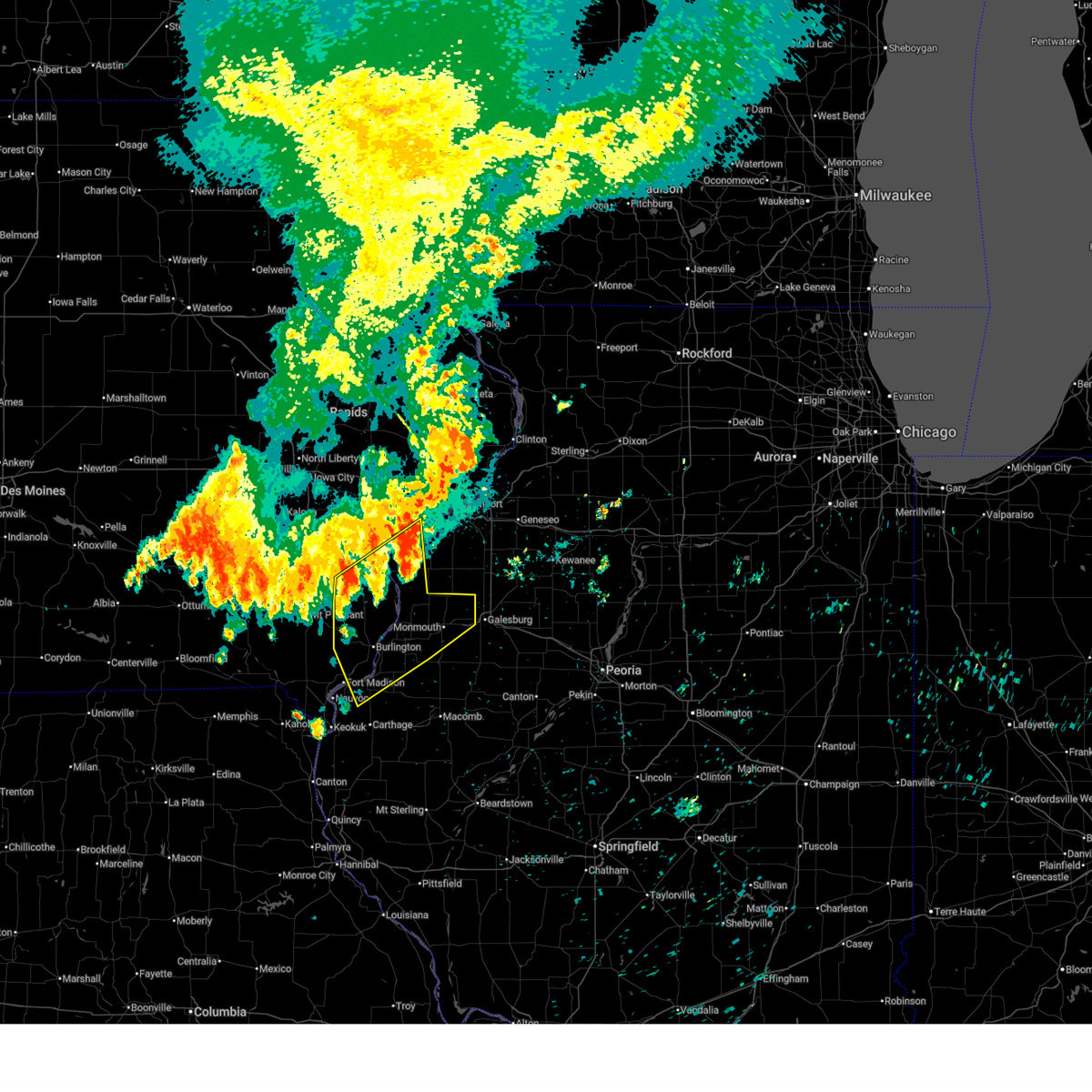 At 343 am cdt, severe thunderstorms were located along a line extending from millersburg to near pleasant grove, moving south at 45 mph (radar indicated). Hazards include 60 mph wind gusts. Expect damage to roofs, siding, and trees. Locations impacted include, burlington, fort madison, monmouth, wapello, oquawka, west burlington, mediapolis, dallas city, danville, stronghurst, morning sun, millersburg, kirkwood, new boston, keithsburg, eliza, joy, little york, middletown, and carman. At 343 am cdt, severe thunderstorms were located along a line extending from millersburg to near pleasant grove, moving south at 45 mph (radar indicated). Hazards include 60 mph wind gusts. Expect damage to roofs, siding, and trees. Locations impacted include, burlington, fort madison, monmouth, wapello, oquawka, west burlington, mediapolis, dallas city, danville, stronghurst, morning sun, millersburg, kirkwood, new boston, keithsburg, eliza, joy, little york, middletown, and carman.
|
| 7/29/2025 3:35 AM CDT |
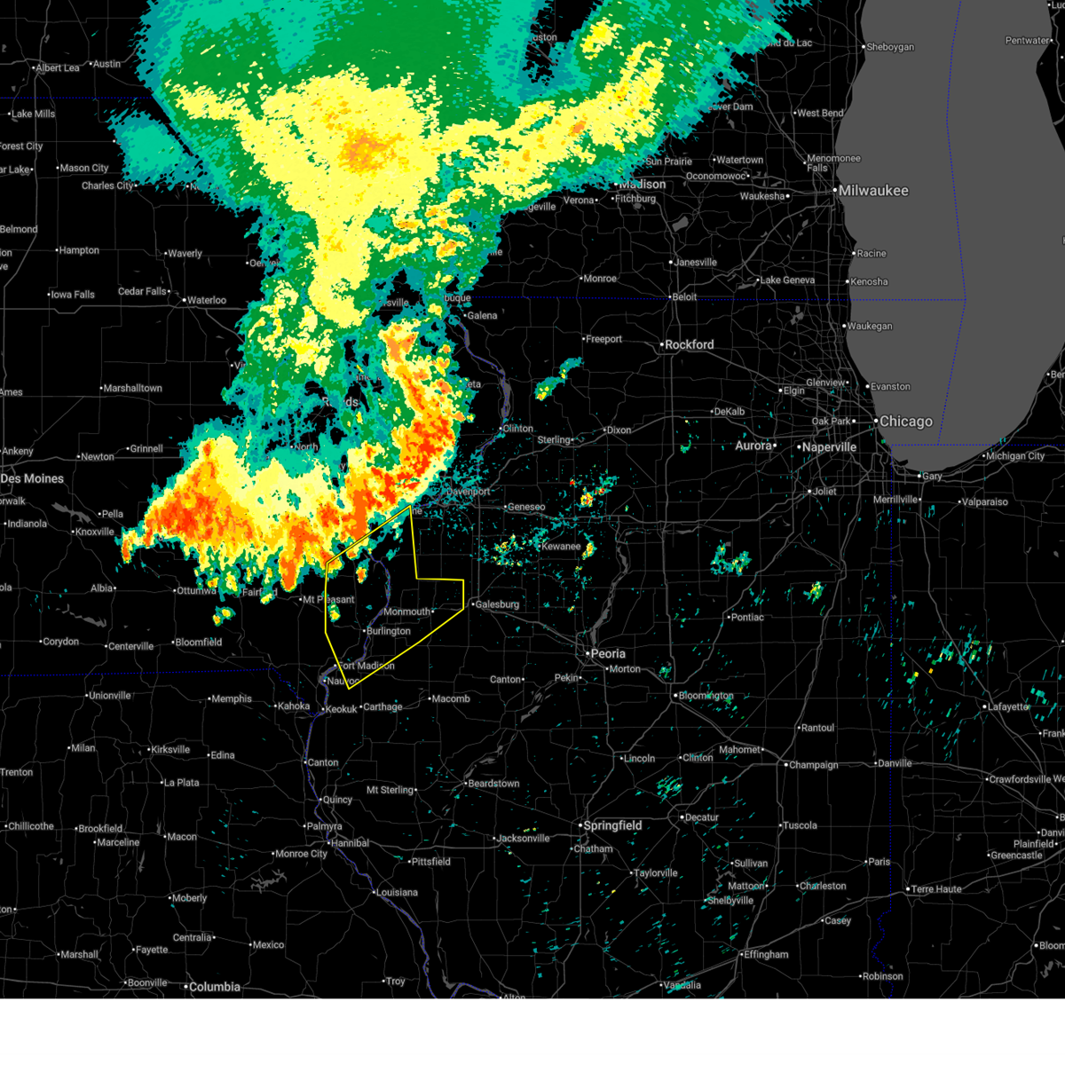 Svrdvn the national weather service in the quad cities has issued a * severe thunderstorm warning for, north central hancock county in west central illinois, henderson county in west central illinois, northern warren county in west central illinois, southern rock island county in northwestern illinois, mercer county in northwestern illinois, southeastern henry county in southeastern iowa, des moines county in southeastern iowa, southern louisa county in southeastern iowa, northeastern lee county in southeastern iowa, * until 430 am cdt. * at 334 am cdt, severe thunderstorms were located along a line extending from marston to yarmouth, moving southeast at 35 mph (radar indicated). Hazards include 60 mph wind gusts. expect damage to roofs, siding, and trees Svrdvn the national weather service in the quad cities has issued a * severe thunderstorm warning for, north central hancock county in west central illinois, henderson county in west central illinois, northern warren county in west central illinois, southern rock island county in northwestern illinois, mercer county in northwestern illinois, southeastern henry county in southeastern iowa, des moines county in southeastern iowa, southern louisa county in southeastern iowa, northeastern lee county in southeastern iowa, * until 430 am cdt. * at 334 am cdt, severe thunderstorms were located along a line extending from marston to yarmouth, moving southeast at 35 mph (radar indicated). Hazards include 60 mph wind gusts. expect damage to roofs, siding, and trees
|
| 7/28/2025 5:54 AM CDT |
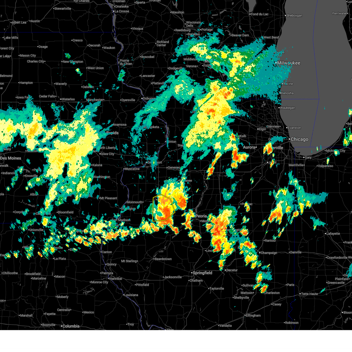 The storms which prompted the warning have weakened below severe limits, and no longer pose an immediate threat to life or property. therefore, the warning will be allowed to expire. however, gusty winds are still possible with these thunderstorms. The storms which prompted the warning have weakened below severe limits, and no longer pose an immediate threat to life or property. therefore, the warning will be allowed to expire. however, gusty winds are still possible with these thunderstorms.
|
| 7/28/2025 5:32 AM CDT |
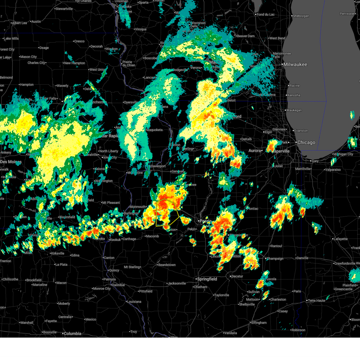 Svrilx the national weather service in lincoln has issued a * severe thunderstorm warning for, northwestern fulton county in west central illinois, southern knox county in west central illinois, * until 600 am cdt. * at 532 am cdt, severe thunderstorms were located along a line extending from near knoxville to near galesburg to near abingdon, moving southeast at 35 mph (radar indicated). Hazards include 60 mph wind gusts. Expect damage to roofs, siding, and trees. severe thunderstorms will be near, abingdon and knoxville around 540 am cdt. maquon and st. augustine around 545 am cdt. This includes interstate 74 between mile markers 44 and 64. Svrilx the national weather service in lincoln has issued a * severe thunderstorm warning for, northwestern fulton county in west central illinois, southern knox county in west central illinois, * until 600 am cdt. * at 532 am cdt, severe thunderstorms were located along a line extending from near knoxville to near galesburg to near abingdon, moving southeast at 35 mph (radar indicated). Hazards include 60 mph wind gusts. Expect damage to roofs, siding, and trees. severe thunderstorms will be near, abingdon and knoxville around 540 am cdt. maquon and st. augustine around 545 am cdt. This includes interstate 74 between mile markers 44 and 64.
|
| 6/3/2025 7:22 PM CDT |
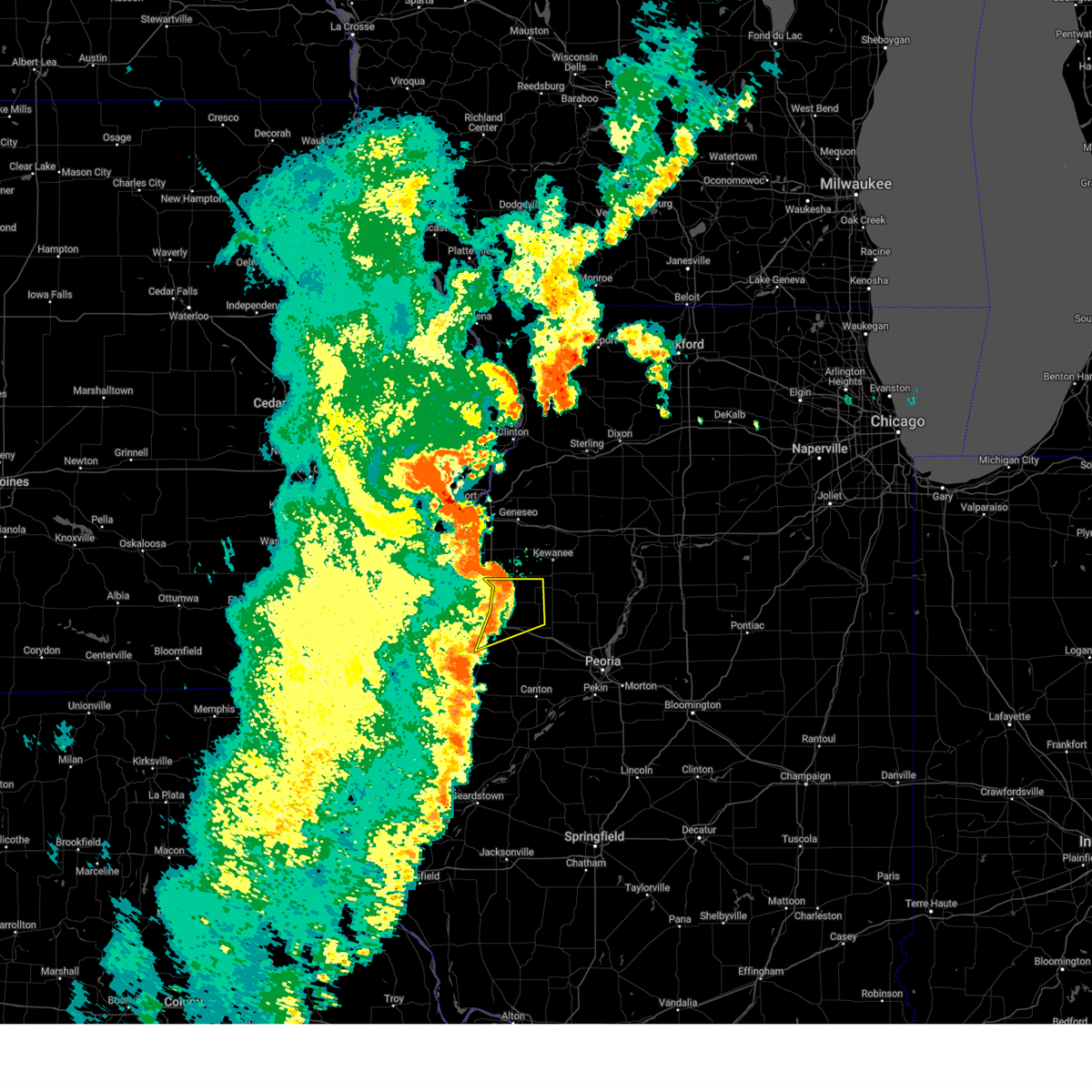 At 722 pm cdt, severe thunderstorms were located along a line extending from altona to near knoxville, moving northeast at 50 mph (radar indicated). Hazards include 60 mph wind gusts. Expect damage to roofs, siding, and trees. Locations impacted include, knoxville, wataga, dahinda, east galesburg, victoria, abingdon, gilson, altona, williamsfield, oneida, and galesburg. At 722 pm cdt, severe thunderstorms were located along a line extending from altona to near knoxville, moving northeast at 50 mph (radar indicated). Hazards include 60 mph wind gusts. Expect damage to roofs, siding, and trees. Locations impacted include, knoxville, wataga, dahinda, east galesburg, victoria, abingdon, gilson, altona, williamsfield, oneida, and galesburg.
|
| 6/3/2025 7:00 PM CDT |
 At 659 pm cdt, severe thunderstorms were located along a line extending from near burgess to 6 miles east of lake warren to 6 miles west of abingdon, moving northeast at 50 mph (radar indicated). Hazards include 70 mph wind gusts and penny size hail. Expect considerable tree damage. damage is likely to mobile homes, roofs, and outbuildings. Locations impacted include, galesburg, victoria, gilson, altona, oneida, knoxville, wataga, dahinda, east galesburg, abingdon, rio, williamsfield, galesburg municipal airport, and henderson. At 659 pm cdt, severe thunderstorms were located along a line extending from near burgess to 6 miles east of lake warren to 6 miles west of abingdon, moving northeast at 50 mph (radar indicated). Hazards include 70 mph wind gusts and penny size hail. Expect considerable tree damage. damage is likely to mobile homes, roofs, and outbuildings. Locations impacted include, galesburg, victoria, gilson, altona, oneida, knoxville, wataga, dahinda, east galesburg, abingdon, rio, williamsfield, galesburg municipal airport, and henderson.
|
| 6/3/2025 6:57 PM CDT |
 the tornado warning has been cancelled and is no longer in effect the tornado warning has been cancelled and is no longer in effect
|
| 6/3/2025 6:57 PM CDT |
 At 656 pm cdt, severe thunderstorms capable of producing tornadoes were located along a line extending from near sunbeam to cameron, moving northeast at 55 mph (radar indicated rotation). Hazards include tornado. Flying debris will be dangerous to those caught without shelter. mobile homes will be damaged or destroyed. damage to roofs, windows, and vehicles will occur. tree damage is likely. these dangerous storms will be near, burgess, viola, north henderson, alexis, coldbrook, and gilchrist around 700 pm cdt. new windsor, shale city, and wanlock around 705 pm cdt. other locations in the path of these tornadic storms include alpha, new windsor, cable, swedona and griffin. This includes interstate 74 in illinois near mile marker 33. At 656 pm cdt, severe thunderstorms capable of producing tornadoes were located along a line extending from near sunbeam to cameron, moving northeast at 55 mph (radar indicated rotation). Hazards include tornado. Flying debris will be dangerous to those caught without shelter. mobile homes will be damaged or destroyed. damage to roofs, windows, and vehicles will occur. tree damage is likely. these dangerous storms will be near, burgess, viola, north henderson, alexis, coldbrook, and gilchrist around 700 pm cdt. new windsor, shale city, and wanlock around 705 pm cdt. other locations in the path of these tornadic storms include alpha, new windsor, cable, swedona and griffin. This includes interstate 74 in illinois near mile marker 33.
|
| 6/3/2025 6:56 PM CDT |
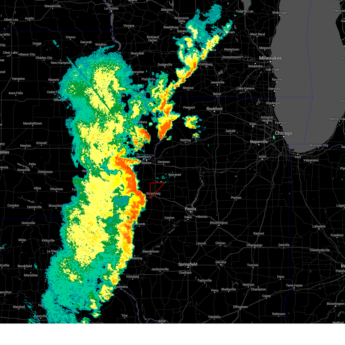 Torilx the national weather service in lincoln has issued a * tornado warning for, northwestern knox county in west central illinois, * until 730 pm cdt. * at 655 pm cdt, severe thunderstorms capable of producing both tornadoes and straight line wind damage were located along a line extending from near lake warren to near monmouth, moving northeast at 50 mph (radar indicated rotation). Hazards include tornado. Flying debris will be dangerous to those caught without shelter. mobile homes will be damaged or destroyed. damage to roofs, windows, and vehicles will occur. tree damage is likely. These dangerous storms will be near, rio and henderson around 710 pm cdt. Torilx the national weather service in lincoln has issued a * tornado warning for, northwestern knox county in west central illinois, * until 730 pm cdt. * at 655 pm cdt, severe thunderstorms capable of producing both tornadoes and straight line wind damage were located along a line extending from near lake warren to near monmouth, moving northeast at 50 mph (radar indicated rotation). Hazards include tornado. Flying debris will be dangerous to those caught without shelter. mobile homes will be damaged or destroyed. damage to roofs, windows, and vehicles will occur. tree damage is likely. These dangerous storms will be near, rio and henderson around 710 pm cdt.
|
| 6/3/2025 6:47 PM CDT |
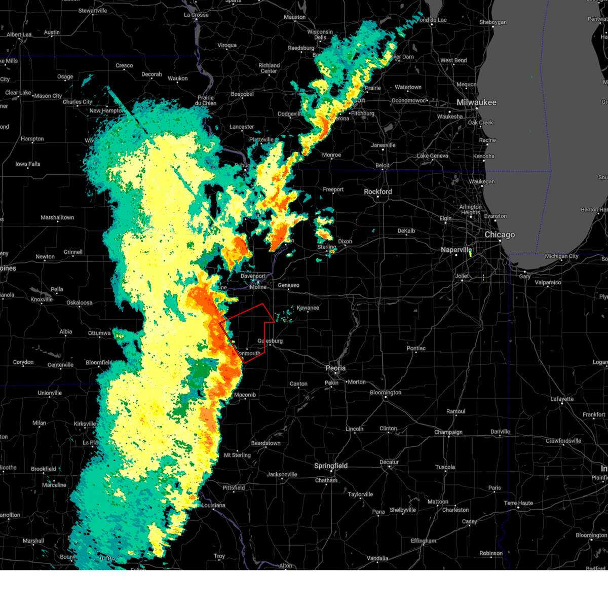 Tordvn the national weather service in the quad cities has issued a * tornado warning for, northeastern henderson county in west central illinois, northern warren county in west central illinois, southeastern mercer county in northwestern illinois, southwestern henry county in northwestern illinois, * until 715 pm cdt. * at 647 pm cdt, severe thunderstorms capable of producing a tornado were located along a line extending from little york to ormonde, moving northeast at 55 mph (radar indicated rotation). Hazards include tornado. Flying debris will be dangerous to those caught without shelter. mobile homes will be damaged or destroyed. damage to roofs, windows, and vehicles will occur. tree damage is likely. these dangerous storms will be near, monmouth, little york, lake warren, coldbrook, eleanor, monmouth municipal airport, ormonde, gerlaw, and cameron around 650 pm cdt. burgess, alexis, and sunbeam around 655 pm cdt. viola, north henderson, and gilchrist around 700 pm cdt. new windsor, alpha, new windsor, and griffin around 705 pm cdt. other locations in the path of these tornadic storms include cable and swedona. This includes interstate 74 in illinois near mile marker 33. Tordvn the national weather service in the quad cities has issued a * tornado warning for, northeastern henderson county in west central illinois, northern warren county in west central illinois, southeastern mercer county in northwestern illinois, southwestern henry county in northwestern illinois, * until 715 pm cdt. * at 647 pm cdt, severe thunderstorms capable of producing a tornado were located along a line extending from little york to ormonde, moving northeast at 55 mph (radar indicated rotation). Hazards include tornado. Flying debris will be dangerous to those caught without shelter. mobile homes will be damaged or destroyed. damage to roofs, windows, and vehicles will occur. tree damage is likely. these dangerous storms will be near, monmouth, little york, lake warren, coldbrook, eleanor, monmouth municipal airport, ormonde, gerlaw, and cameron around 650 pm cdt. burgess, alexis, and sunbeam around 655 pm cdt. viola, north henderson, and gilchrist around 700 pm cdt. new windsor, alpha, new windsor, and griffin around 705 pm cdt. other locations in the path of these tornadic storms include cable and swedona. This includes interstate 74 in illinois near mile marker 33.
|
| 6/3/2025 6:46 PM CDT |
 Svrilx the national weather service in lincoln has issued a * severe thunderstorm warning for, knox county in west central illinois, * until 745 pm cdt. * at 646 pm cdt, severe thunderstorms were located along a line extending from keithsburg to near kirkwood to near roseville, moving northeast at 50 mph (radar indicated). Hazards include 60 mph wind gusts and penny size hail. expect damage to roofs, siding, and trees Svrilx the national weather service in lincoln has issued a * severe thunderstorm warning for, knox county in west central illinois, * until 745 pm cdt. * at 646 pm cdt, severe thunderstorms were located along a line extending from keithsburg to near kirkwood to near roseville, moving northeast at 50 mph (radar indicated). Hazards include 60 mph wind gusts and penny size hail. expect damage to roofs, siding, and trees
|
| 4/20/2025 8:28 PM CDT |
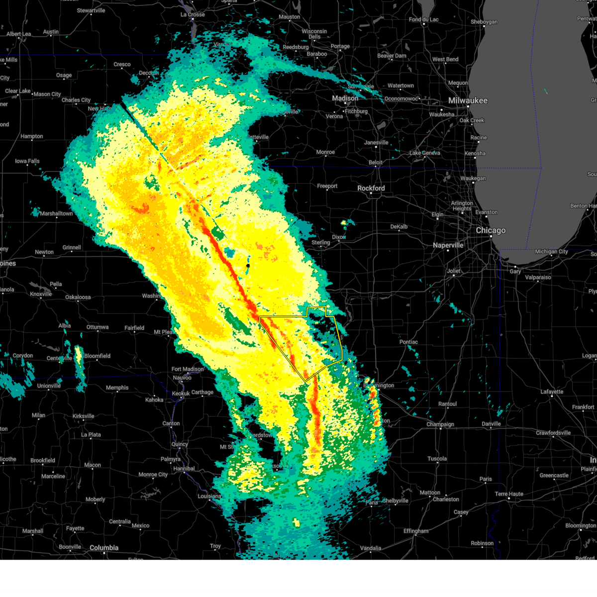 Svrilx the national weather service in lincoln has issued a * severe thunderstorm warning for, western marshall county in central illinois, northwestern woodford county in central illinois, northeastern fulton county in west central illinois, stark county in north central illinois, knox county in west central illinois, northern tazewell county in central illinois, peoria county in central illinois, * until 900 pm cdt. * at 828 pm cdt, severe thunderstorms were located along a line extending from near rio to near glasford, moving north at 75 mph (radar indicated). Hazards include 60 mph wind gusts. Expect damage to roofs, siding, and trees. severe thunderstorms will be near, victoria, laura, bellevue, elmwood, williamsfield, trivoli, elmore, brimfield, peoria international airport, and oneida around 835 pm cdt. west peoria, peoria, and la fayette around 840 pm cdt. dunlap, princeville, wyoming, and toulon around 845 pm cdt. other locations in the path of these severe thunderstorms include elmira and edelstein. this includes the following highways, interstate 474 between mile markers 0 and 5. Interstate 74 between mile markers 34 and 45, and between mile markers 53 and 92. Svrilx the national weather service in lincoln has issued a * severe thunderstorm warning for, western marshall county in central illinois, northwestern woodford county in central illinois, northeastern fulton county in west central illinois, stark county in north central illinois, knox county in west central illinois, northern tazewell county in central illinois, peoria county in central illinois, * until 900 pm cdt. * at 828 pm cdt, severe thunderstorms were located along a line extending from near rio to near glasford, moving north at 75 mph (radar indicated). Hazards include 60 mph wind gusts. Expect damage to roofs, siding, and trees. severe thunderstorms will be near, victoria, laura, bellevue, elmwood, williamsfield, trivoli, elmore, brimfield, peoria international airport, and oneida around 835 pm cdt. west peoria, peoria, and la fayette around 840 pm cdt. dunlap, princeville, wyoming, and toulon around 845 pm cdt. other locations in the path of these severe thunderstorms include elmira and edelstein. this includes the following highways, interstate 474 between mile markers 0 and 5. Interstate 74 between mile markers 34 and 45, and between mile markers 53 and 92.
|
| 4/20/2025 8:15 PM CDT |
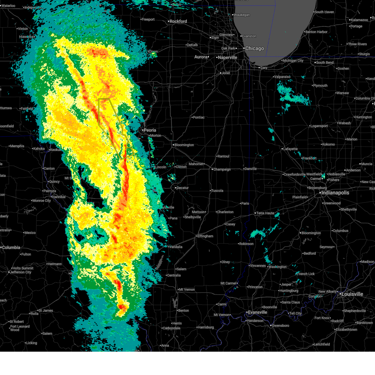 the severe thunderstorm warning has been cancelled and is no longer in effect the severe thunderstorm warning has been cancelled and is no longer in effect
|
| 4/20/2025 8:15 PM CDT |
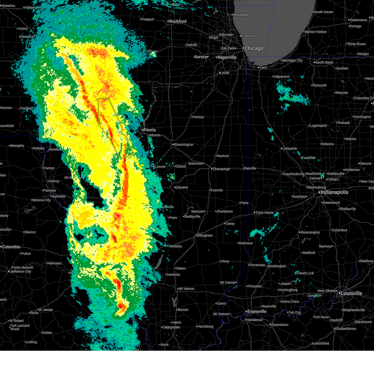 At 814 pm cdt, severe thunderstorms were located along a line extending from reynolds to near lewistown, moving northeast at 50 mph (emergency management). Hazards include 60 mph wind gusts. Expect damage to roofs, siding, and trees. these severe storms will be near, rio, fairview, knoxville, st. david, henderson, maquon, wataga, galesburg, and canton around 820 pm cdt. farmington and oneida around 825 pm cdt. yates city around 830 pm cdt. other locations impacted by these severe thunderstorms include bryant, norris, topeka, liverpool, banner, chatauqua park, gilson, dunfermline, goofy ridge, and little america. This includes interstate 74 between mile markers 34 and 63. At 814 pm cdt, severe thunderstorms were located along a line extending from reynolds to near lewistown, moving northeast at 50 mph (emergency management). Hazards include 60 mph wind gusts. Expect damage to roofs, siding, and trees. these severe storms will be near, rio, fairview, knoxville, st. david, henderson, maquon, wataga, galesburg, and canton around 820 pm cdt. farmington and oneida around 825 pm cdt. yates city around 830 pm cdt. other locations impacted by these severe thunderstorms include bryant, norris, topeka, liverpool, banner, chatauqua park, gilson, dunfermline, goofy ridge, and little america. This includes interstate 74 between mile markers 34 and 63.
|
| 4/20/2025 7:59 PM CDT |
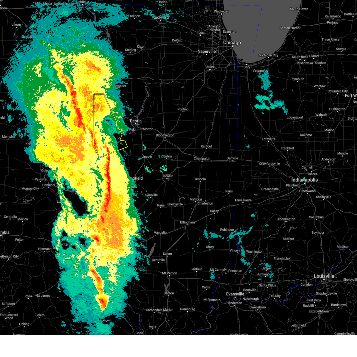 Svrilx the national weather service in lincoln has issued a * severe thunderstorm warning for, fulton county in west central illinois, knox county in west central illinois, eastern schuyler county in west central illinois, northeastern mason county in central illinois, * until 830 pm cdt. * at 758 pm cdt, severe thunderstorms were located along a line extending from joy to near astoria, moving northeast at 50 mph (radar indicated). Hazards include 60 mph wind gusts. Expect damage to roofs, siding, and trees. severe thunderstorms will be near, abingdon, lewistown, st. augustine, cuba, and avon around 805 pm cdt. london mills and galesburg around 810 pm cdt. rio, fairview, knoxville, st. david, and henderson around 815 pm cdt. other locations in the path of these severe thunderstorms include maquon, wataga and canton. This includes interstate 74 between mile markers 35 and 63. Svrilx the national weather service in lincoln has issued a * severe thunderstorm warning for, fulton county in west central illinois, knox county in west central illinois, eastern schuyler county in west central illinois, northeastern mason county in central illinois, * until 830 pm cdt. * at 758 pm cdt, severe thunderstorms were located along a line extending from joy to near astoria, moving northeast at 50 mph (radar indicated). Hazards include 60 mph wind gusts. Expect damage to roofs, siding, and trees. severe thunderstorms will be near, abingdon, lewistown, st. augustine, cuba, and avon around 805 pm cdt. london mills and galesburg around 810 pm cdt. rio, fairview, knoxville, st. david, and henderson around 815 pm cdt. other locations in the path of these severe thunderstorms include maquon, wataga and canton. This includes interstate 74 between mile markers 35 and 63.
|
| 4/20/2025 7:55 PM CDT |
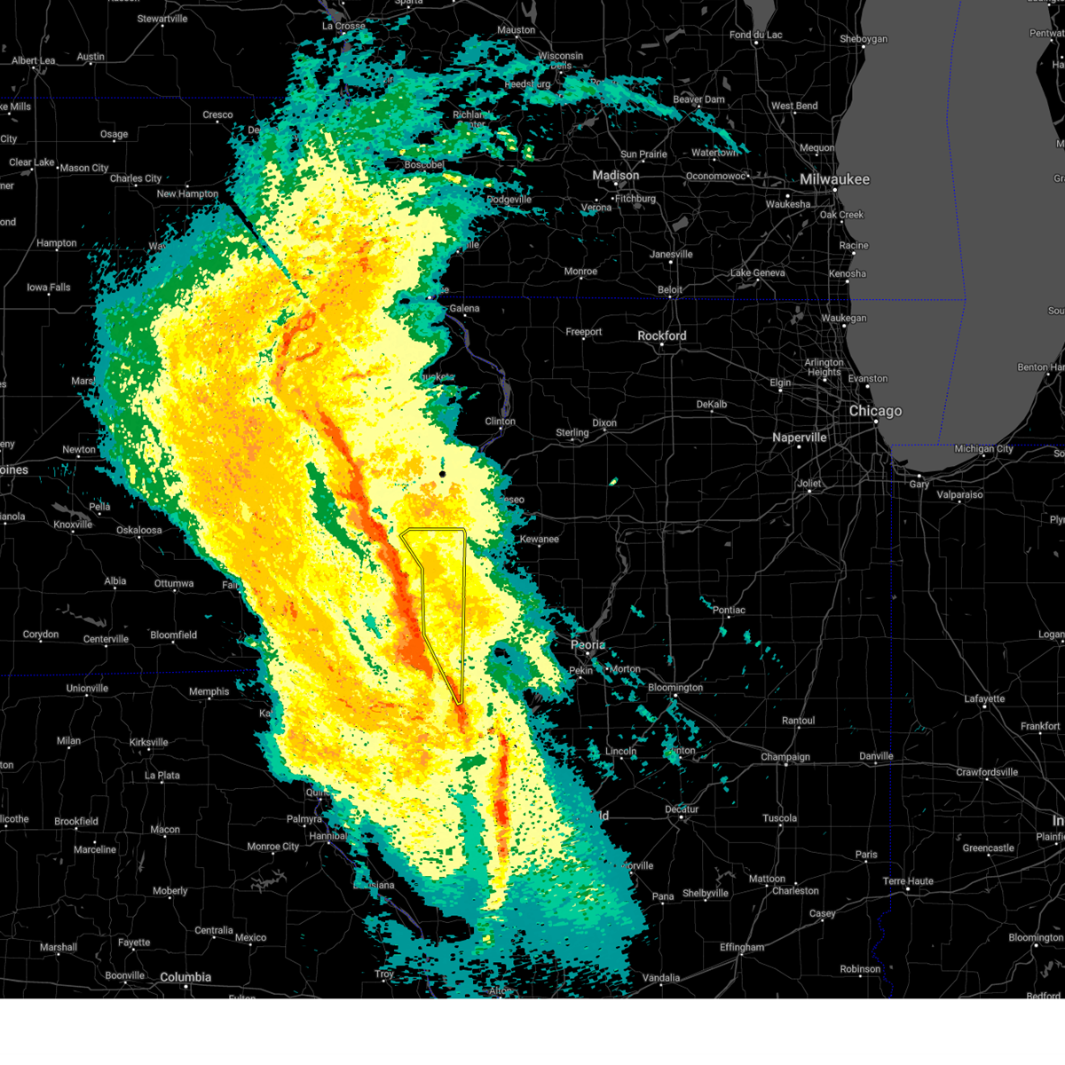 Svrdvn the national weather service in the quad cities has issued a * severe thunderstorm warning for, warren county in west central illinois, northeastern mcdonough county in west central illinois, eastern mercer county in northwestern illinois, * until 900 pm cdt. * at 755 pm cdt, severe thunderstorms were located along a line extending from near mannon to near seaton to larchland to new philadelphia, moving northeast at 30 mph (radar indicated). Hazards include 60 mph wind gusts. expect damage to roofs, siding, and trees Svrdvn the national weather service in the quad cities has issued a * severe thunderstorm warning for, warren county in west central illinois, northeastern mcdonough county in west central illinois, eastern mercer county in northwestern illinois, * until 900 pm cdt. * at 755 pm cdt, severe thunderstorms were located along a line extending from near mannon to near seaton to larchland to new philadelphia, moving northeast at 30 mph (radar indicated). Hazards include 60 mph wind gusts. expect damage to roofs, siding, and trees
|
| 3/19/2025 12:57 PM CDT |
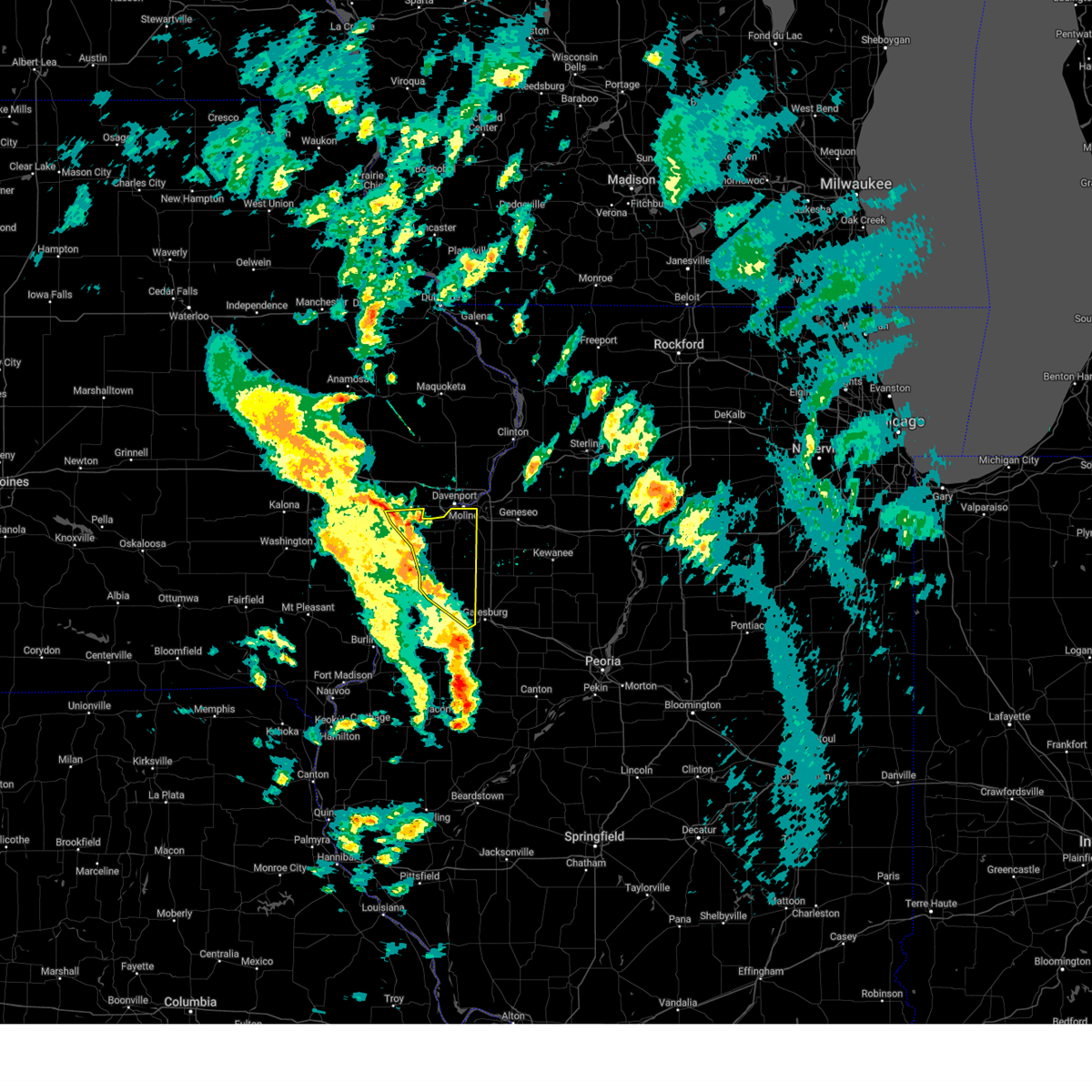 At 1257 pm cdt, severe thunderstorms were located along a line extending from sweetland center to taylor ridge to near burgess to henderson, moving northeast at 40 mph (radar indicated). Hazards include 60 mph wind gusts. Expect damage to roofs, siding, and trees. locations impacted include, preemption, moline, gerlaw, clark's ferry recreation area, new era, shale city, new windsor, taylor ridge, gingle corners, lake warren, seaton, viola, loud thunder scout camp, mercer county fairgrounds, blackhawk state park, fruitland, oak grove, swedona, gilchrist, and milan. this includes the following highways, interstate 74 in illinois between mile markers 2 and 7. Interstate 280 between mile markers 11 and 18. At 1257 pm cdt, severe thunderstorms were located along a line extending from sweetland center to taylor ridge to near burgess to henderson, moving northeast at 40 mph (radar indicated). Hazards include 60 mph wind gusts. Expect damage to roofs, siding, and trees. locations impacted include, preemption, moline, gerlaw, clark's ferry recreation area, new era, shale city, new windsor, taylor ridge, gingle corners, lake warren, seaton, viola, loud thunder scout camp, mercer county fairgrounds, blackhawk state park, fruitland, oak grove, swedona, gilchrist, and milan. this includes the following highways, interstate 74 in illinois between mile markers 2 and 7. Interstate 280 between mile markers 11 and 18.
|
| 3/19/2025 12:57 PM CDT |
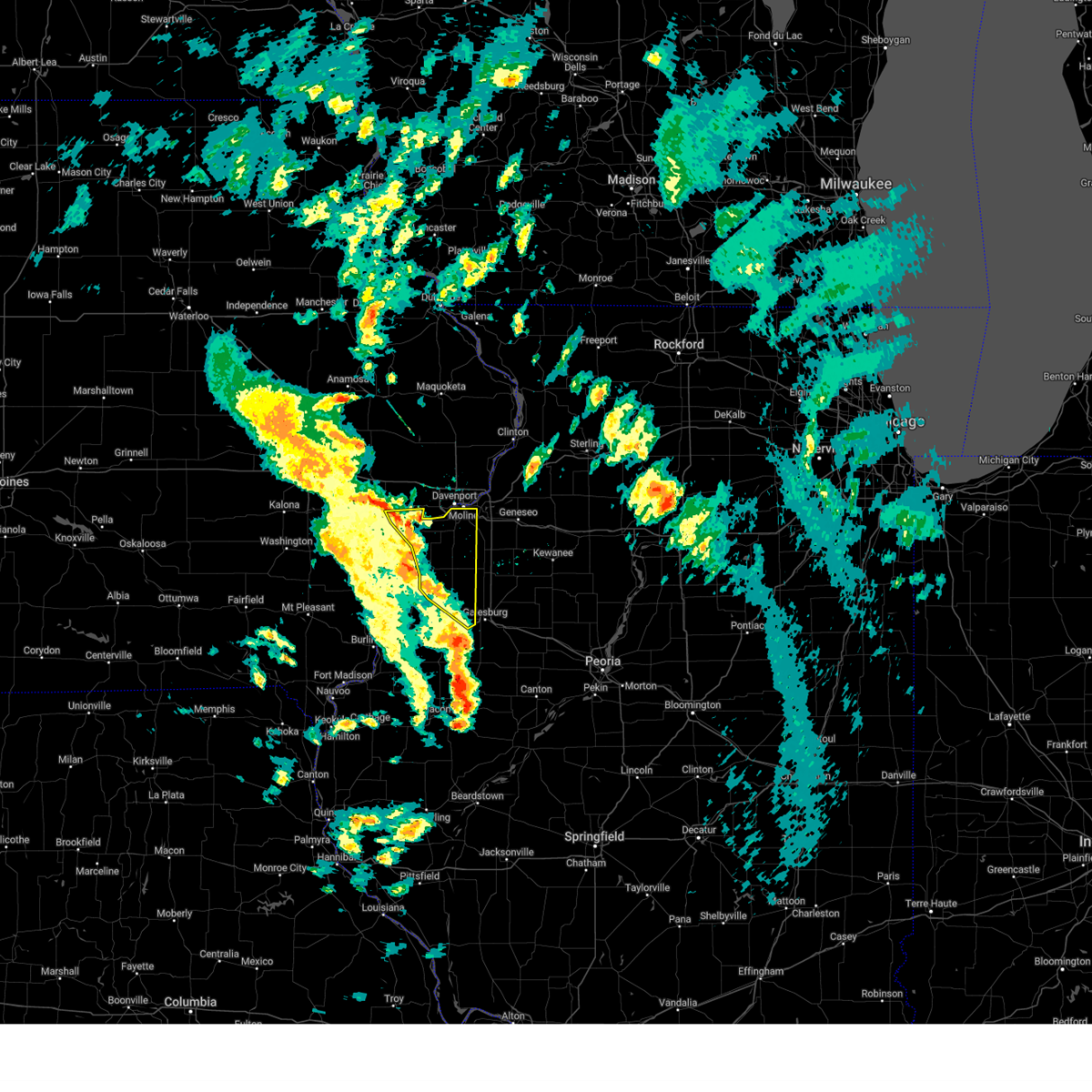 the severe thunderstorm warning has been cancelled and is no longer in effect the severe thunderstorm warning has been cancelled and is no longer in effect
|
| 3/19/2025 12:48 PM CDT |
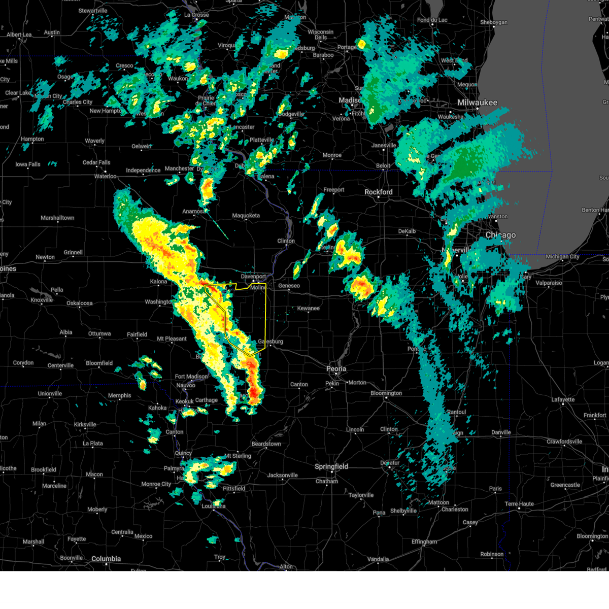 At 1248 pm cdt, severe thunderstorms were located along a line extending from near muscatine to marston to near seaton to near coldbrook, moving northeast at 40 mph (radar indicated). Hazards include 60 mph wind gusts. Expect damage to roofs, siding, and trees. locations impacted include, preemption, moline, gerlaw, clark's ferry recreation area, new era, shale city, monmouth municipal airport, new windsor, taylor ridge, gingle corners, petersville, lake warren, seaton, viola, loud thunder scout camp, mercer county fairgrounds, blackhawk state park, fruitland, oak grove, and swedona. this includes the following highways, interstate 74 in illinois between mile markers 2 and 7. Interstate 280 between mile markers 11 and 18. At 1248 pm cdt, severe thunderstorms were located along a line extending from near muscatine to marston to near seaton to near coldbrook, moving northeast at 40 mph (radar indicated). Hazards include 60 mph wind gusts. Expect damage to roofs, siding, and trees. locations impacted include, preemption, moline, gerlaw, clark's ferry recreation area, new era, shale city, monmouth municipal airport, new windsor, taylor ridge, gingle corners, petersville, lake warren, seaton, viola, loud thunder scout camp, mercer county fairgrounds, blackhawk state park, fruitland, oak grove, and swedona. this includes the following highways, interstate 74 in illinois between mile markers 2 and 7. Interstate 280 between mile markers 11 and 18.
|
| 3/19/2025 12:48 PM CDT |
 the severe thunderstorm warning has been cancelled and is no longer in effect the severe thunderstorm warning has been cancelled and is no longer in effect
|
| 3/19/2025 12:36 PM CDT |
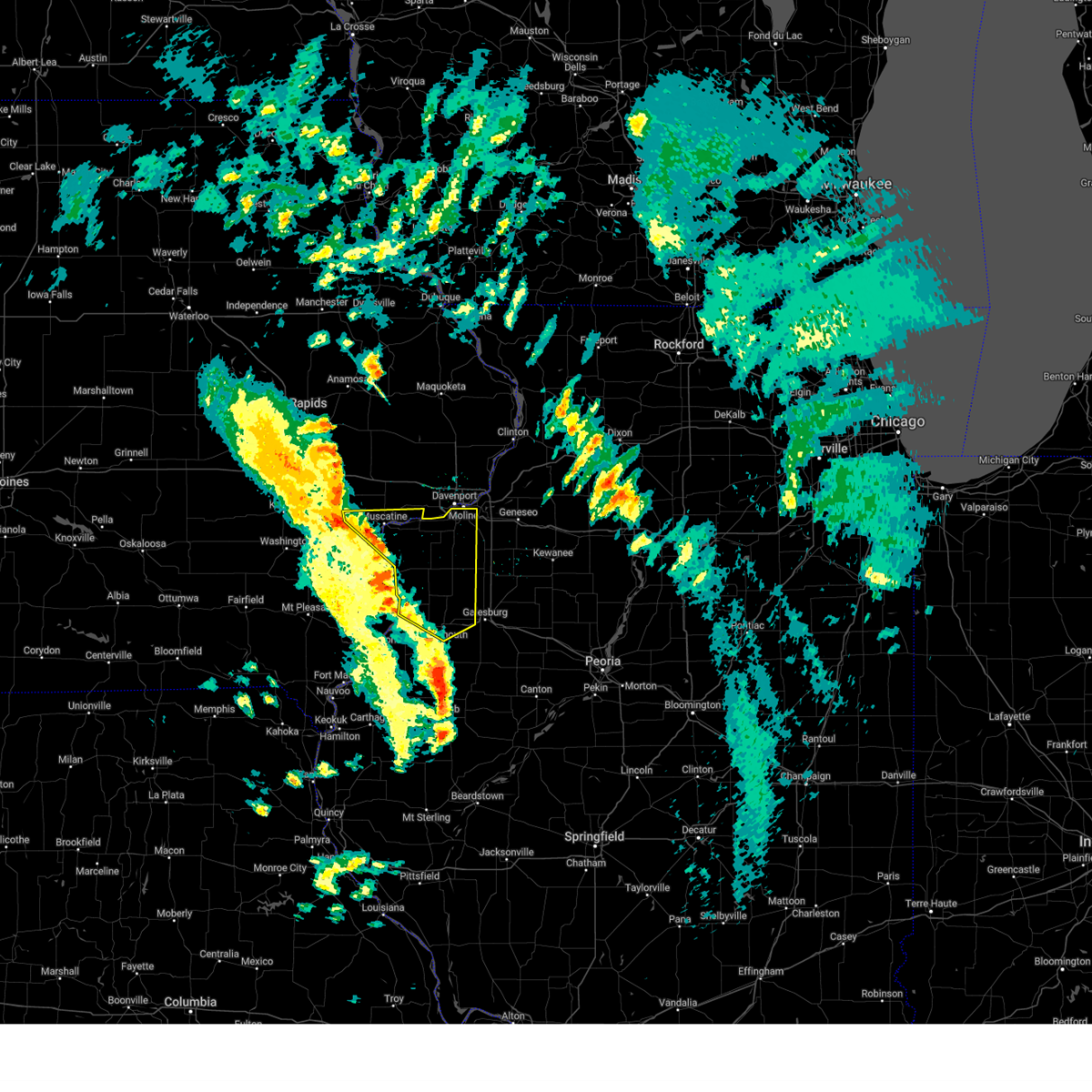 Svrdvn the national weather service in the quad cities has issued a * severe thunderstorm warning for, northeastern henderson county in west central illinois, northern warren county in west central illinois, rock island county in northwestern illinois, mercer county in northwestern illinois, southeastern louisa county in southeastern iowa, central muscatine county in east central iowa, * until 130 pm cdt. * at 1235 pm cdt, severe thunderstorms were located along a line extending from muscatine municipal airport to near petersville to bald bluff to near monmouth, moving northeast at 40 mph (radar indicated). Hazards include 60 mph wind gusts. expect damage to roofs, siding, and trees Svrdvn the national weather service in the quad cities has issued a * severe thunderstorm warning for, northeastern henderson county in west central illinois, northern warren county in west central illinois, rock island county in northwestern illinois, mercer county in northwestern illinois, southeastern louisa county in southeastern iowa, central muscatine county in east central iowa, * until 130 pm cdt. * at 1235 pm cdt, severe thunderstorms were located along a line extending from muscatine municipal airport to near petersville to bald bluff to near monmouth, moving northeast at 40 mph (radar indicated). Hazards include 60 mph wind gusts. expect damage to roofs, siding, and trees
|
| 3/14/2025 9:56 PM CDT |
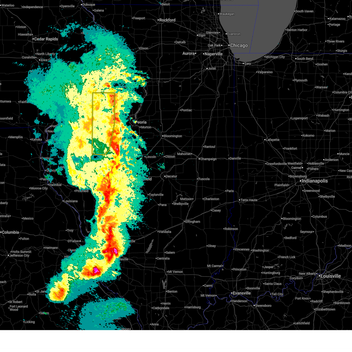 The storms which prompted the warning have moved out of the area. therefore, the warning will be allowed to expire. however, gusty winds are still possible with these thunderstorms. a severe thunderstorm warning remains in effect until 1045 pm cdt for far northeastern fulton county. a tornado watch remains in effect until 300 am cdt for central and west central illinois. The storms which prompted the warning have moved out of the area. therefore, the warning will be allowed to expire. however, gusty winds are still possible with these thunderstorms. a severe thunderstorm warning remains in effect until 1045 pm cdt for far northeastern fulton county. a tornado watch remains in effect until 300 am cdt for central and west central illinois.
|
| 3/14/2025 9:19 PM CDT |
 At 919 pm cdt, severe thunderstorms were located along a line extending from near temple hill to near nekoma, moving northeast at 50 mph (radar indicated). Hazards include 70 mph wind gusts. Expect considerable tree damage. damage is likely to mobile homes, roofs, and outbuildings. locations impacted include, ideal, west lake park, cambridge, manlius, kewanee municipal airport, jackson county fairgrounds, east clinton, port byron, davenport municipal airport, stone city, union grove, thomson causeway, osborn, elwood, albany, bryant, blackhawk state park, maquoketa, princeton, and fruitland. this includes the following highways, interstate 74 in iowa between mile markers 1 and 5. interstate 80 in iowa between mile markers 272 and 306. interstate 80 in illinois between mile markers 1 and 46. interstate 74 in illinois between mile markers 1 and 33. interstate 88 between mile markers 1 and 36. Interstate 280 between mile markers 1 and 18. At 919 pm cdt, severe thunderstorms were located along a line extending from near temple hill to near nekoma, moving northeast at 50 mph (radar indicated). Hazards include 70 mph wind gusts. Expect considerable tree damage. damage is likely to mobile homes, roofs, and outbuildings. locations impacted include, ideal, west lake park, cambridge, manlius, kewanee municipal airport, jackson county fairgrounds, east clinton, port byron, davenport municipal airport, stone city, union grove, thomson causeway, osborn, elwood, albany, bryant, blackhawk state park, maquoketa, princeton, and fruitland. this includes the following highways, interstate 74 in iowa between mile markers 1 and 5. interstate 80 in iowa between mile markers 272 and 306. interstate 80 in illinois between mile markers 1 and 46. interstate 74 in illinois between mile markers 1 and 33. interstate 88 between mile markers 1 and 36. Interstate 280 between mile markers 1 and 18.
|
| 3/14/2025 9:15 PM CDT | Reported at gb in knox county IL, 3.6 miles ENE of Galesburg, IL |
| 3/14/2025 9:08 PM CDT |
 Svrdvn the national weather service in the quad cities has issued a * severe thunderstorm warning for, rock island county in northwestern illinois, eastern mercer county in northwestern illinois, whiteside county in northwestern illinois, south central carroll county in northwestern illinois, northeastern warren county in west central illinois, henry county in northwestern illinois, northwestern bureau county in north central illinois, southern jackson county in east central iowa, eastern cedar county in east central iowa, northeastern muscatine county in east central iowa, scott county in east central iowa, southern jones county in east central iowa, clinton county in east central iowa, * until 1000 pm cdt. * at 906 pm cdt, severe thunderstorms were located along a line extending from near central park to near alpha, moving northeast at 50 mph (radar indicated). Hazards include 70 mph wind gusts. Expect considerable tree damage. Damage is likely to mobile homes, roofs, and outbuildings. Svrdvn the national weather service in the quad cities has issued a * severe thunderstorm warning for, rock island county in northwestern illinois, eastern mercer county in northwestern illinois, whiteside county in northwestern illinois, south central carroll county in northwestern illinois, northeastern warren county in west central illinois, henry county in northwestern illinois, northwestern bureau county in north central illinois, southern jackson county in east central iowa, eastern cedar county in east central iowa, northeastern muscatine county in east central iowa, scott county in east central iowa, southern jones county in east central iowa, clinton county in east central iowa, * until 1000 pm cdt. * at 906 pm cdt, severe thunderstorms were located along a line extending from near central park to near alpha, moving northeast at 50 mph (radar indicated). Hazards include 70 mph wind gusts. Expect considerable tree damage. Damage is likely to mobile homes, roofs, and outbuildings.
|
| 3/14/2025 8:57 PM CDT |
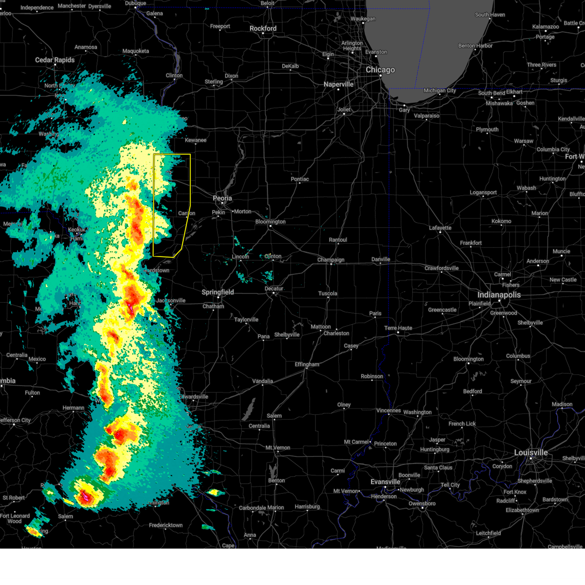 Svrilx the national weather service in lincoln has issued a * severe thunderstorm warning for, fulton county in west central illinois, knox county in west central illinois, * until 1000 pm cdt. * at 857 pm cdt, severe thunderstorms were located along a line extending from lake warren to near bushnell to near industry, moving northeast at 65 mph (radar indicated). Hazards include 70 mph wind gusts and quarter size hail. Hail damage to vehicles is expected. expect considerable tree damage. wind damage is also likely to mobile homes, roofs, and outbuildings. severe thunderstorms will be near, st. augustine and avon around 900 pm cdt. abingdon and galesburg around 905 pm cdt. rio and henderson around 910 pm cdt. knoxville, wataga, and london mills around 915 pm cdt. other locations in the path of these severe thunderstorms include oneida, maquon, altona, victoria and williamsfield. This includes interstate 74 between mile markers 34 and 67. Svrilx the national weather service in lincoln has issued a * severe thunderstorm warning for, fulton county in west central illinois, knox county in west central illinois, * until 1000 pm cdt. * at 857 pm cdt, severe thunderstorms were located along a line extending from lake warren to near bushnell to near industry, moving northeast at 65 mph (radar indicated). Hazards include 70 mph wind gusts and quarter size hail. Hail damage to vehicles is expected. expect considerable tree damage. wind damage is also likely to mobile homes, roofs, and outbuildings. severe thunderstorms will be near, st. augustine and avon around 900 pm cdt. abingdon and galesburg around 905 pm cdt. rio and henderson around 910 pm cdt. knoxville, wataga, and london mills around 915 pm cdt. other locations in the path of these severe thunderstorms include oneida, maquon, altona, victoria and williamsfield. This includes interstate 74 between mile markers 34 and 67.
|
| 8/27/2024 9:38 PM CDT |
 the severe thunderstorm warning has been cancelled and is no longer in effect the severe thunderstorm warning has been cancelled and is no longer in effect
|
| 8/27/2024 9:28 PM CDT |
 At 928 pm cdt, a severe thunderstorm was located near abingdon, or 10 miles southwest of galesburg, moving east at 25 mph (radar indicated). Hazards include 60 mph wind gusts and quarter size hail. Hail damage to vehicles is expected. expect wind damage to roofs, siding, and trees. Locations impacted include, monmouth, prairie city, little swan lake, greenbush, coldbrook, berwick, ormonde, prairie city airport, larchland, and cameron. At 928 pm cdt, a severe thunderstorm was located near abingdon, or 10 miles southwest of galesburg, moving east at 25 mph (radar indicated). Hazards include 60 mph wind gusts and quarter size hail. Hail damage to vehicles is expected. expect wind damage to roofs, siding, and trees. Locations impacted include, monmouth, prairie city, little swan lake, greenbush, coldbrook, berwick, ormonde, prairie city airport, larchland, and cameron.
|
| 8/27/2024 9:17 PM CDT |
 Svrdvn the national weather service in the quad cities has issued a * severe thunderstorm warning for, warren county in west central illinois, northeastern mcdonough county in west central illinois, * until 1000 pm cdt. * at 916 pm cdt, a severe thunderstorm was located near berwick, or 10 miles south of monmouth, moving east at 25 mph (radar indicated). Hazards include 60 mph wind gusts and quarter size hail. Hail damage to vehicles is expected. Expect wind damage to roofs, siding, and trees. Svrdvn the national weather service in the quad cities has issued a * severe thunderstorm warning for, warren county in west central illinois, northeastern mcdonough county in west central illinois, * until 1000 pm cdt. * at 916 pm cdt, a severe thunderstorm was located near berwick, or 10 miles south of monmouth, moving east at 25 mph (radar indicated). Hazards include 60 mph wind gusts and quarter size hail. Hail damage to vehicles is expected. Expect wind damage to roofs, siding, and trees.
|
| 8/27/2024 9:05 PM CDT |
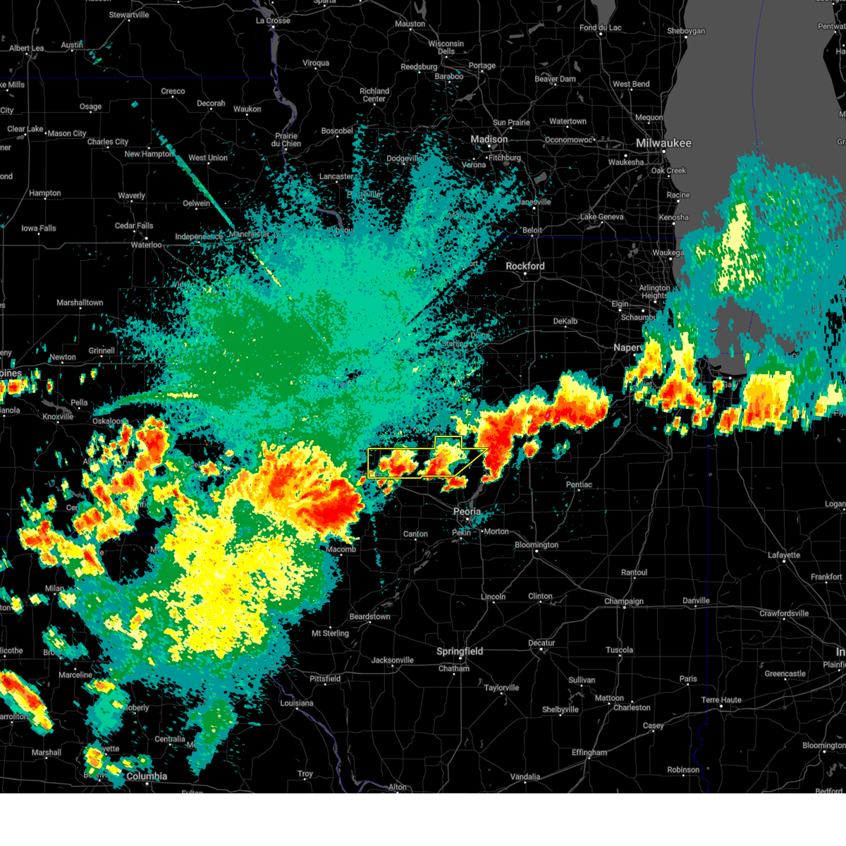 the severe thunderstorm warning has been cancelled and is no longer in effect the severe thunderstorm warning has been cancelled and is no longer in effect
|
| 8/27/2024 8:58 PM CDT |
 At 858 pm cdt, severe thunderstorms were located along a line extending from near elrick junction to near coldbrook, moving northeast at 40 mph (radar indicated). Hazards include 60 mph wind gusts. Expect damage to roofs, siding, and trees. Locations impacted include, monmouth, aledo, wapello, burgess, mediapolis, morning sun, millersburg, new boston, keithsburg, joy, little york, rozetta, seaton, north henderson, oakville, amber, toolesboro, lake warren, mannon, and ogle. At 858 pm cdt, severe thunderstorms were located along a line extending from near elrick junction to near coldbrook, moving northeast at 40 mph (radar indicated). Hazards include 60 mph wind gusts. Expect damage to roofs, siding, and trees. Locations impacted include, monmouth, aledo, wapello, burgess, mediapolis, morning sun, millersburg, new boston, keithsburg, joy, little york, rozetta, seaton, north henderson, oakville, amber, toolesboro, lake warren, mannon, and ogle.
|
| 8/27/2024 8:34 PM CDT |
 Svrdvn the national weather service in the quad cities has issued a * severe thunderstorm warning for, northeastern henderson county in west central illinois, northern warren county in west central illinois, southern mercer county in northwestern illinois, northeastern des moines county in southeastern iowa, southeastern louisa county in southeastern iowa, * until 915 pm cdt. * at 834 pm cdt, severe thunderstorms were located along a line extending from near big hollow recreation area to near raritan, moving northeast at 30 mph (radar indicated). Hazards include 60 mph wind gusts. expect damage to roofs, siding, and trees Svrdvn the national weather service in the quad cities has issued a * severe thunderstorm warning for, northeastern henderson county in west central illinois, northern warren county in west central illinois, southern mercer county in northwestern illinois, northeastern des moines county in southeastern iowa, southeastern louisa county in southeastern iowa, * until 915 pm cdt. * at 834 pm cdt, severe thunderstorms were located along a line extending from near big hollow recreation area to near raritan, moving northeast at 30 mph (radar indicated). Hazards include 60 mph wind gusts. expect damage to roofs, siding, and trees
|
| 8/27/2024 8:26 PM CDT |
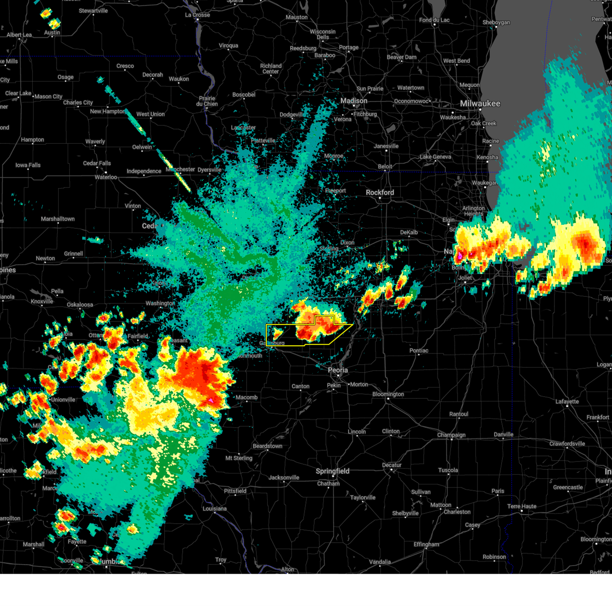 Svrilx the national weather service in lincoln has issued a * severe thunderstorm warning for, northwestern marshall county in central illinois, stark county in north central illinois, northern knox county in west central illinois, * until 930 pm cdt. * at 826 pm cdt, a severe thunderstorm was located near la fayette, or 7 miles west of toulon, moving east at 15 mph (radar indicated). Hazards include 60 mph wind gusts and quarter size hail. Hail damage to vehicles is expected. expect wind damage to roofs, siding, and trees. this severe thunderstorm will be near, la fayette around 830 pm cdt. toulon around 835 pm cdt. other locations in the path of this severe thunderstorm include wyoming. This includes interstate 74 between mile markers 34 and 47. Svrilx the national weather service in lincoln has issued a * severe thunderstorm warning for, northwestern marshall county in central illinois, stark county in north central illinois, northern knox county in west central illinois, * until 930 pm cdt. * at 826 pm cdt, a severe thunderstorm was located near la fayette, or 7 miles west of toulon, moving east at 15 mph (radar indicated). Hazards include 60 mph wind gusts and quarter size hail. Hail damage to vehicles is expected. expect wind damage to roofs, siding, and trees. this severe thunderstorm will be near, la fayette around 830 pm cdt. toulon around 835 pm cdt. other locations in the path of this severe thunderstorm include wyoming. This includes interstate 74 between mile markers 34 and 47.
|
| 8/15/2024 10:52 PM CDT |
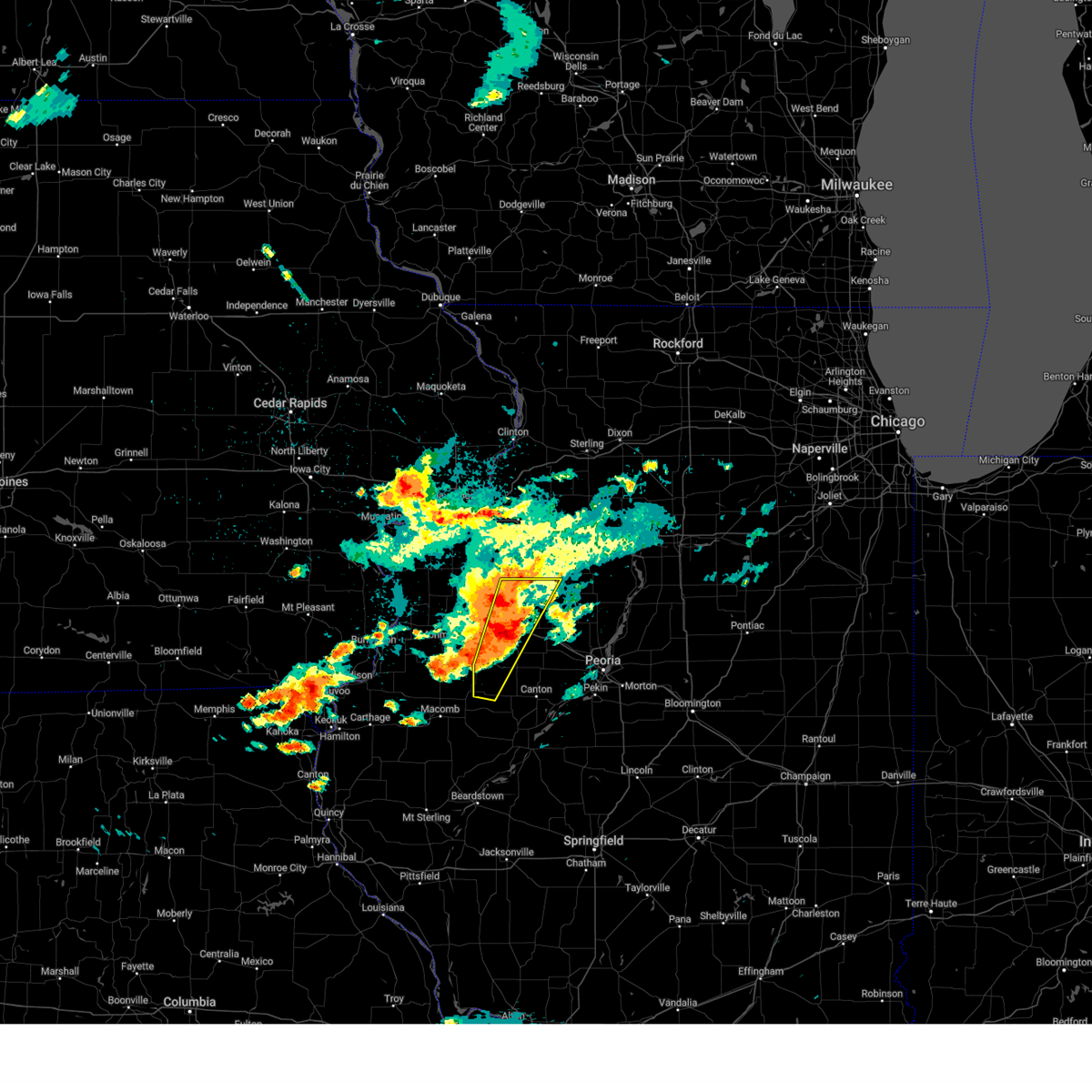 At 1052 pm cdt, severe thunderstorms were located along a line extending from near galva to near little swan lake, moving east at 35 mph (radar indicated). Hazards include ping pong ball size hail and 60 mph wind gusts. People and animals outdoors will be injured. expect hail damage to roofs, siding, windows, and vehicles. expect wind damage to roofs, siding, and trees. these severe storms will be near, abingdon, knoxville, victoria, la fayette, and st. augustine around 1100 pm cdt. london mills around 1105 pm cdt. maquon around 1110 pm cdt. other locations impacted by these severe thunderstorms include gilson, dahinda, ellisville, delong, and east galesburg. This includes interstate 74 between mile markers 45 and 63. At 1052 pm cdt, severe thunderstorms were located along a line extending from near galva to near little swan lake, moving east at 35 mph (radar indicated). Hazards include ping pong ball size hail and 60 mph wind gusts. People and animals outdoors will be injured. expect hail damage to roofs, siding, windows, and vehicles. expect wind damage to roofs, siding, and trees. these severe storms will be near, abingdon, knoxville, victoria, la fayette, and st. augustine around 1100 pm cdt. london mills around 1105 pm cdt. maquon around 1110 pm cdt. other locations impacted by these severe thunderstorms include gilson, dahinda, ellisville, delong, and east galesburg. This includes interstate 74 between mile markers 45 and 63.
|
| 8/15/2024 10:40 PM CDT |
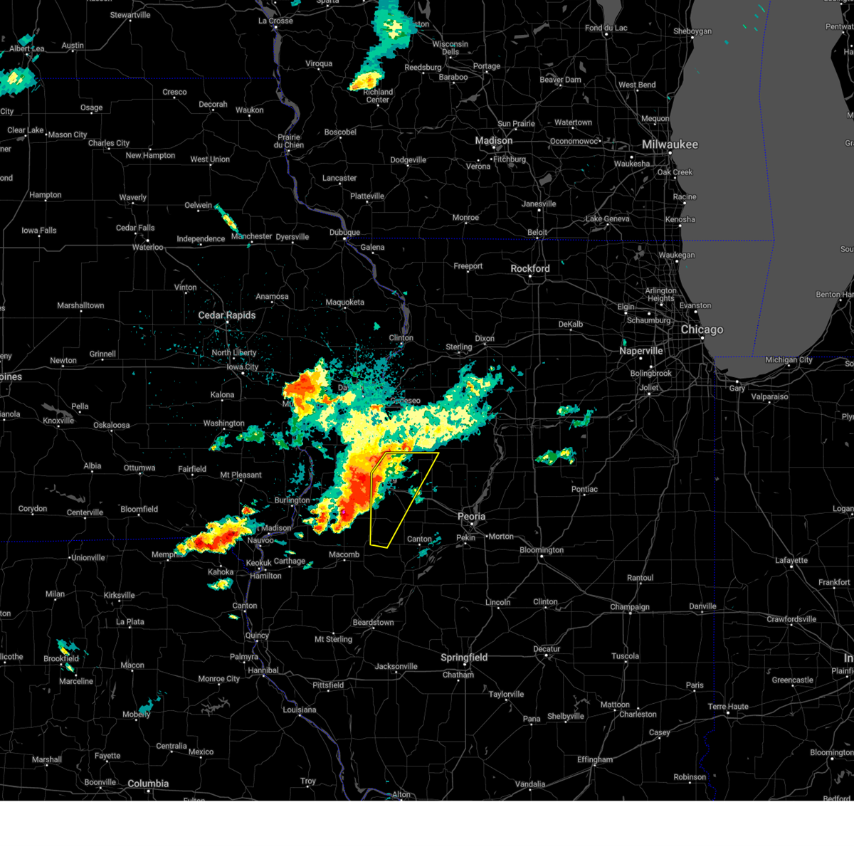 Svrilx the national weather service in lincoln has issued a * severe thunderstorm warning for, northwestern fulton county in west central illinois, west central stark county in north central illinois, knox county in west central illinois, * until 1130 pm cdt. * at 1039 pm cdt, severe thunderstorms were located along a line extending from near woodhull to near roseville, moving east at 35 mph (radar indicated). Hazards include 60 mph wind gusts and quarter size hail. Hail damage to vehicles is expected. expect wind damage to roofs, siding, and trees. severe thunderstorms will be near, galesburg, abingdon, knoxville, wataga, oneida, altona, and henderson around 1045 pm cdt. st. augustine around 1050 pm cdt. avon and victoria around 1055 pm cdt. other locations in the path of these severe thunderstorms include la fayette, london mills and maquon. This includes interstate 74 between mile markers 36 and 63. Svrilx the national weather service in lincoln has issued a * severe thunderstorm warning for, northwestern fulton county in west central illinois, west central stark county in north central illinois, knox county in west central illinois, * until 1130 pm cdt. * at 1039 pm cdt, severe thunderstorms were located along a line extending from near woodhull to near roseville, moving east at 35 mph (radar indicated). Hazards include 60 mph wind gusts and quarter size hail. Hail damage to vehicles is expected. expect wind damage to roofs, siding, and trees. severe thunderstorms will be near, galesburg, abingdon, knoxville, wataga, oneida, altona, and henderson around 1045 pm cdt. st. augustine around 1050 pm cdt. avon and victoria around 1055 pm cdt. other locations in the path of these severe thunderstorms include la fayette, london mills and maquon. This includes interstate 74 between mile markers 36 and 63.
|
| 7/15/2024 8:16 PM CDT |
 The storms which prompted the warning have moved out of the warned area. therefore, the warning has been allowed to expire. however, gusty winds and heavy rain are still possible with these thunderstorms. a tornado watch remains in effect until 100 am cdt for north central and west central illinois. The storms which prompted the warning have moved out of the warned area. therefore, the warning has been allowed to expire. however, gusty winds and heavy rain are still possible with these thunderstorms. a tornado watch remains in effect until 100 am cdt for north central and west central illinois.
|
| 7/15/2024 8:05 PM CDT | Report from mping: 3-inch tree limbs broken; power poles broke in knox county IL, 1.3 miles SSE of Galesburg, IL |
| 7/15/2024 8:00 PM CDT |
 At 759 pm cdt, severe thunderstorms were located along a line extending from near altona to near little swan lake, moving southeast at 70 mph (radar indicated). Hazards include 70 mph wind gusts and nickel size hail. Expect considerable tree damage. damage is likely to mobile homes, roofs, and outbuildings. these severe storms will be near, avon and victoria around 805 pm cdt. other locations impacted by these severe thunderstorms include gilson, galesburg municipal airport, delong, east galesburg, and dahinda. This includes interstate 74 between mile markers 34 and 59. At 759 pm cdt, severe thunderstorms were located along a line extending from near altona to near little swan lake, moving southeast at 70 mph (radar indicated). Hazards include 70 mph wind gusts and nickel size hail. Expect considerable tree damage. damage is likely to mobile homes, roofs, and outbuildings. these severe storms will be near, avon and victoria around 805 pm cdt. other locations impacted by these severe thunderstorms include gilson, galesburg municipal airport, delong, east galesburg, and dahinda. This includes interstate 74 between mile markers 34 and 59.
|
| 7/15/2024 7:55 PM CDT |
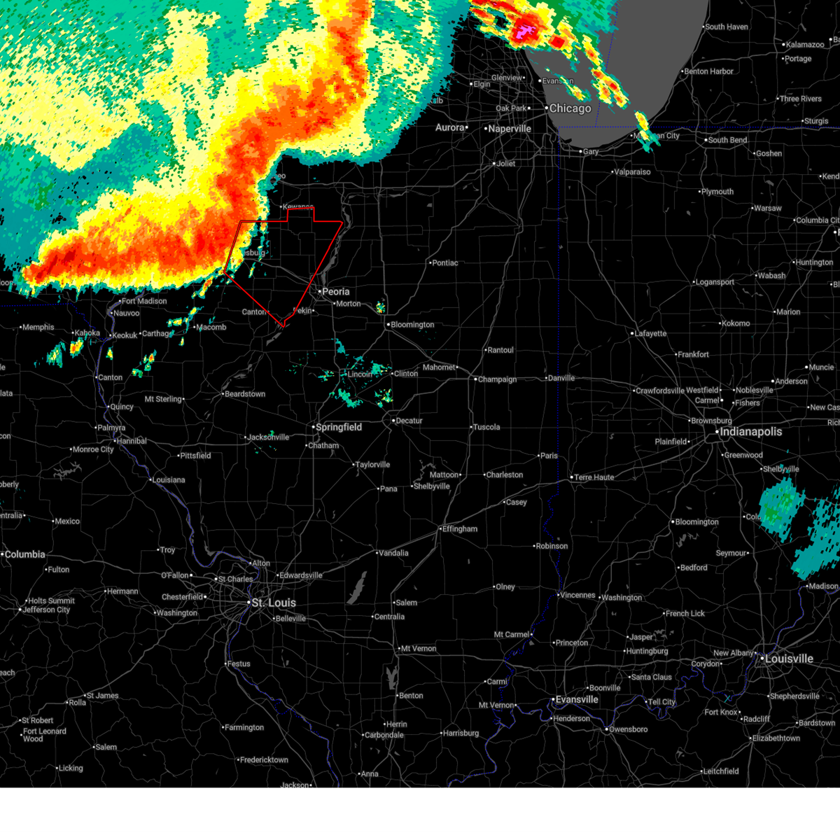 Torilx the national weather service in lincoln has issued a * tornado warning for, northwestern marshall county in central illinois, northeastern fulton county in west central illinois, stark county in north central illinois, knox county in west central illinois, peoria county in central illinois, * until 830 pm cdt. * at 754 pm cdt, severe thunderstorms capable of producing both tornadoes and extensive straight line wind damage were located along a line extending from near atkinson to near knoxville, moving southeast at 65 mph (radar indicated rotation). Hazards include tornado. Flying debris will be dangerous to those caught without shelter. mobile homes will be damaged or destroyed. damage to roofs, windows, and vehicles will occur. tree damage is likely. these dangerous storms will be near, williamsfield, victoria, maquon, and la fayette around 800 pm cdt. toulon, farmington, elmwood, yates city, elmira, laura, and elmore around 805 pm cdt. wyoming, osceola, and brimfield around 810 pm cdt. other locations in the path of these tornadic storms include princeville, trivoli, bradford, castleton, peoria, dunlap, hanna city, glasford, camp grove and edelstein. this includes the following highways, interstate 474 near mile marker 0. Interstate 74 between mile markers 45 and 86. Torilx the national weather service in lincoln has issued a * tornado warning for, northwestern marshall county in central illinois, northeastern fulton county in west central illinois, stark county in north central illinois, knox county in west central illinois, peoria county in central illinois, * until 830 pm cdt. * at 754 pm cdt, severe thunderstorms capable of producing both tornadoes and extensive straight line wind damage were located along a line extending from near atkinson to near knoxville, moving southeast at 65 mph (radar indicated rotation). Hazards include tornado. Flying debris will be dangerous to those caught without shelter. mobile homes will be damaged or destroyed. damage to roofs, windows, and vehicles will occur. tree damage is likely. these dangerous storms will be near, williamsfield, victoria, maquon, and la fayette around 800 pm cdt. toulon, farmington, elmwood, yates city, elmira, laura, and elmore around 805 pm cdt. wyoming, osceola, and brimfield around 810 pm cdt. other locations in the path of these tornadic storms include princeville, trivoli, bradford, castleton, peoria, dunlap, hanna city, glasford, camp grove and edelstein. this includes the following highways, interstate 474 near mile marker 0. Interstate 74 between mile markers 45 and 86.
|
| 7/15/2024 7:37 PM CDT |
 Svrilx the national weather service in lincoln has issued a * severe thunderstorm warning for, northwestern fulton county in west central illinois, west central stark county in north central illinois, knox county in west central illinois, * until 815 pm cdt. * at 735 pm cdt, severe thunderstorms were located along a line extending from near new windsor to near oquawka, moving southeast at 65 mph (radar indicated). Hazards include 70 mph wind gusts and nickel size hail. Expect considerable tree damage. damage is likely to mobile homes, roofs, and outbuildings. severe thunderstorms will be near, rio around 740 pm cdt. henderson around 745 pm cdt. galesburg, wataga, and oneida around 750 pm cdt. abingdon and knoxville around 755 pm cdt. other locations in the path of these severe thunderstorms include avon and st. augustine. This includes interstate 74 between mile markers 34 and 59. Svrilx the national weather service in lincoln has issued a * severe thunderstorm warning for, northwestern fulton county in west central illinois, west central stark county in north central illinois, knox county in west central illinois, * until 815 pm cdt. * at 735 pm cdt, severe thunderstorms were located along a line extending from near new windsor to near oquawka, moving southeast at 65 mph (radar indicated). Hazards include 70 mph wind gusts and nickel size hail. Expect considerable tree damage. damage is likely to mobile homes, roofs, and outbuildings. severe thunderstorms will be near, rio around 740 pm cdt. henderson around 745 pm cdt. galesburg, wataga, and oneida around 750 pm cdt. abingdon and knoxville around 755 pm cdt. other locations in the path of these severe thunderstorms include avon and st. augustine. This includes interstate 74 between mile markers 34 and 59.
|
| 7/15/2024 12:46 AM CDT |
 The severe thunderstorm which prompted the warning has weakened. therefore, the warning has been allowed to expire. a severe thunderstorm watch remains in effect until 100 am cdt for west central illinois. The severe thunderstorm which prompted the warning has weakened. therefore, the warning has been allowed to expire. a severe thunderstorm watch remains in effect until 100 am cdt for west central illinois.
|
| 7/15/2024 12:31 AM CDT |
 At 1231 am cdt, a severe thunderstorm was located near galesburg, moving southeast at 25 mph (radar indicated). Hazards include 60 mph wind gusts and quarter size hail. Hail damage to vehicles is expected. expect wind damage to roofs, siding, and trees. this severe storm will be near, galesburg around 1235 am cdt. knoxville around 1245 am cdt. other locations impacted by this severe thunderstorm include gilson, galesburg municipal airport, delong, and east galesburg. This includes interstate 74 between mile markers 42 and 61. At 1231 am cdt, a severe thunderstorm was located near galesburg, moving southeast at 25 mph (radar indicated). Hazards include 60 mph wind gusts and quarter size hail. Hail damage to vehicles is expected. expect wind damage to roofs, siding, and trees. this severe storm will be near, galesburg around 1235 am cdt. knoxville around 1245 am cdt. other locations impacted by this severe thunderstorm include gilson, galesburg municipal airport, delong, and east galesburg. This includes interstate 74 between mile markers 42 and 61.
|
| 7/15/2024 12:20 AM CDT |
 Svrilx the national weather service in lincoln has issued a * severe thunderstorm warning for, southwestern knox county in west central illinois, * until 1245 am cdt. * at 1220 am cdt, a severe thunderstorm was located over galesburg, moving southeast at 35 mph (radar indicated). Hazards include 60 mph wind gusts. Expect damage to roofs, siding, and trees. this severe thunderstorm will be near, galesburg and knoxville around 1225 am cdt. This includes interstate 74 between mile markers 40 and 60. Svrilx the national weather service in lincoln has issued a * severe thunderstorm warning for, southwestern knox county in west central illinois, * until 1245 am cdt. * at 1220 am cdt, a severe thunderstorm was located over galesburg, moving southeast at 35 mph (radar indicated). Hazards include 60 mph wind gusts. Expect damage to roofs, siding, and trees. this severe thunderstorm will be near, galesburg and knoxville around 1225 am cdt. This includes interstate 74 between mile markers 40 and 60.
|
| 6/25/2024 9:06 PM CDT |
 The storm which prompted the warning has moved out of the area. therefore, the warning will be allowed to expire. however, gusty winds and heavy rain are still possible with this thunderstorm. a severe thunderstorm watch remains in effect until midnight cdt for west central illinois. The storm which prompted the warning has moved out of the area. therefore, the warning will be allowed to expire. however, gusty winds and heavy rain are still possible with this thunderstorm. a severe thunderstorm watch remains in effect until midnight cdt for west central illinois.
|
| 6/25/2024 9:01 PM CDT |
 At 901 pm cdt, severe thunderstorms were located along a line extending from gerlaw to sperry, moving east at 35 mph (radar indicated). Hazards include 60 mph wind gusts. Expect damage to roofs, siding, and trees. Locations impacted include, monmouth, oquawka, mediapolis, kirkwood, little york, rozetta, lake warren, kossuth, alexis, coldbrook, bald bluff, berwick, gerlaw, larchland, kingston, monmouth municipal airport, cameron, sperry, pleasant grove, and eleanor. At 901 pm cdt, severe thunderstorms were located along a line extending from gerlaw to sperry, moving east at 35 mph (radar indicated). Hazards include 60 mph wind gusts. Expect damage to roofs, siding, and trees. Locations impacted include, monmouth, oquawka, mediapolis, kirkwood, little york, rozetta, lake warren, kossuth, alexis, coldbrook, bald bluff, berwick, gerlaw, larchland, kingston, monmouth municipal airport, cameron, sperry, pleasant grove, and eleanor.
|
| 6/25/2024 8:48 PM CDT |
 At 847 pm cdt, severe thunderstorms were located along a line extending from gerlaw to sperry, moving southeast at 40 mph (radar indicated). Hazards include 60 mph wind gusts. Expect damage to roofs, siding, and trees. Locations impacted include, monmouth, oquawka, mediapolis, kirkwood, keithsburg, little york, rozetta, seaton, north henderson, oakville, lake warren, ogle, kossuth, alexis, coldbrook, bald bluff, berwick, gerlaw, larchland, and kingston. At 847 pm cdt, severe thunderstorms were located along a line extending from gerlaw to sperry, moving southeast at 40 mph (radar indicated). Hazards include 60 mph wind gusts. Expect damage to roofs, siding, and trees. Locations impacted include, monmouth, oquawka, mediapolis, kirkwood, keithsburg, little york, rozetta, seaton, north henderson, oakville, lake warren, ogle, kossuth, alexis, coldbrook, bald bluff, berwick, gerlaw, larchland, and kingston.
|
| 6/25/2024 8:43 PM CDT |
 Svrilx the national weather service in lincoln has issued a * severe thunderstorm warning for, western knox county in west central illinois, * until 915 pm cdt. * at 842 pm cdt, a severe thunderstorm was located over knox, moving east at 35 mph (radar indicated). Hazards include 60 mph wind gusts. Expect damage to roofs, siding, and trees. this severe thunderstorm will remain over mainly rural areas of western knox county, including the following locations, gilson, galesburg municipal airport, delong, and east galesburg. This includes interstate 74 between mile markers 34 and 58. Svrilx the national weather service in lincoln has issued a * severe thunderstorm warning for, western knox county in west central illinois, * until 915 pm cdt. * at 842 pm cdt, a severe thunderstorm was located over knox, moving east at 35 mph (radar indicated). Hazards include 60 mph wind gusts. Expect damage to roofs, siding, and trees. this severe thunderstorm will remain over mainly rural areas of western knox county, including the following locations, gilson, galesburg municipal airport, delong, and east galesburg. This includes interstate 74 between mile markers 34 and 58.
|
| 6/25/2024 8:36 PM CDT |
 Svrdvn the national weather service in the quad cities has issued a * severe thunderstorm warning for, northeastern henderson county in west central illinois, warren county in west central illinois, southern mercer county in northwestern illinois, northern des moines county in southeastern iowa, southeastern louisa county in southeastern iowa, * until 915 pm cdt. * at 835 pm cdt, severe thunderstorms were located along a line extending from sunbeam to kossuth, moving east at 45 mph (radar indicated). Hazards include 60 mph wind gusts. expect damage to roofs, siding, and trees Svrdvn the national weather service in the quad cities has issued a * severe thunderstorm warning for, northeastern henderson county in west central illinois, warren county in west central illinois, southern mercer county in northwestern illinois, northern des moines county in southeastern iowa, southeastern louisa county in southeastern iowa, * until 915 pm cdt. * at 835 pm cdt, severe thunderstorms were located along a line extending from sunbeam to kossuth, moving east at 45 mph (radar indicated). Hazards include 60 mph wind gusts. expect damage to roofs, siding, and trees
|
| 6/25/2024 8:43 AM CDT |
 Svrilx the national weather service in lincoln has issued a * severe thunderstorm warning for, southwestern stark county in north central illinois, central knox county in west central illinois, northwestern peoria county in central illinois, * until 915 am cdt. * at 842 am cdt, a severe thunderstorm was located over wataga, or near galesburg, moving east at 45 mph (radar indicated). Hazards include 60 mph wind gusts and quarter size hail. Hail damage to vehicles is expected. expect wind damage to roofs, siding, and trees. this severe thunderstorm will be near, williamsfield around 855 am cdt. laura and elmore around 900 am cdt. This includes interstate 74 between mile markers 39 and 53, and near mile marker 58. Svrilx the national weather service in lincoln has issued a * severe thunderstorm warning for, southwestern stark county in north central illinois, central knox county in west central illinois, northwestern peoria county in central illinois, * until 915 am cdt. * at 842 am cdt, a severe thunderstorm was located over wataga, or near galesburg, moving east at 45 mph (radar indicated). Hazards include 60 mph wind gusts and quarter size hail. Hail damage to vehicles is expected. expect wind damage to roofs, siding, and trees. this severe thunderstorm will be near, williamsfield around 855 am cdt. laura and elmore around 900 am cdt. This includes interstate 74 between mile markers 39 and 53, and near mile marker 58.
|
| 5/27/2024 6:56 PM CDT |
 the severe thunderstorm warning has been cancelled and is no longer in effect the severe thunderstorm warning has been cancelled and is no longer in effect
|
| 5/27/2024 6:50 PM CDT |
 At 649 pm cdt, a severe thunderstorm was located near maquon, or 12 miles southeast of galesburg, moving southeast at 40 mph (radar indicated). Hazards include 60 mph wind gusts and penny size hail. Expect damage to roofs, siding, and trees. this severe storm will be near, maquon around 655 pm cdt. other locations impacted by this severe thunderstorm include delong and gilson. This includes interstate 74 between mile markers 51 and 57. At 649 pm cdt, a severe thunderstorm was located near maquon, or 12 miles southeast of galesburg, moving southeast at 40 mph (radar indicated). Hazards include 60 mph wind gusts and penny size hail. Expect damage to roofs, siding, and trees. this severe storm will be near, maquon around 655 pm cdt. other locations impacted by this severe thunderstorm include delong and gilson. This includes interstate 74 between mile markers 51 and 57.
|
| 5/27/2024 6:47 PM CDT |
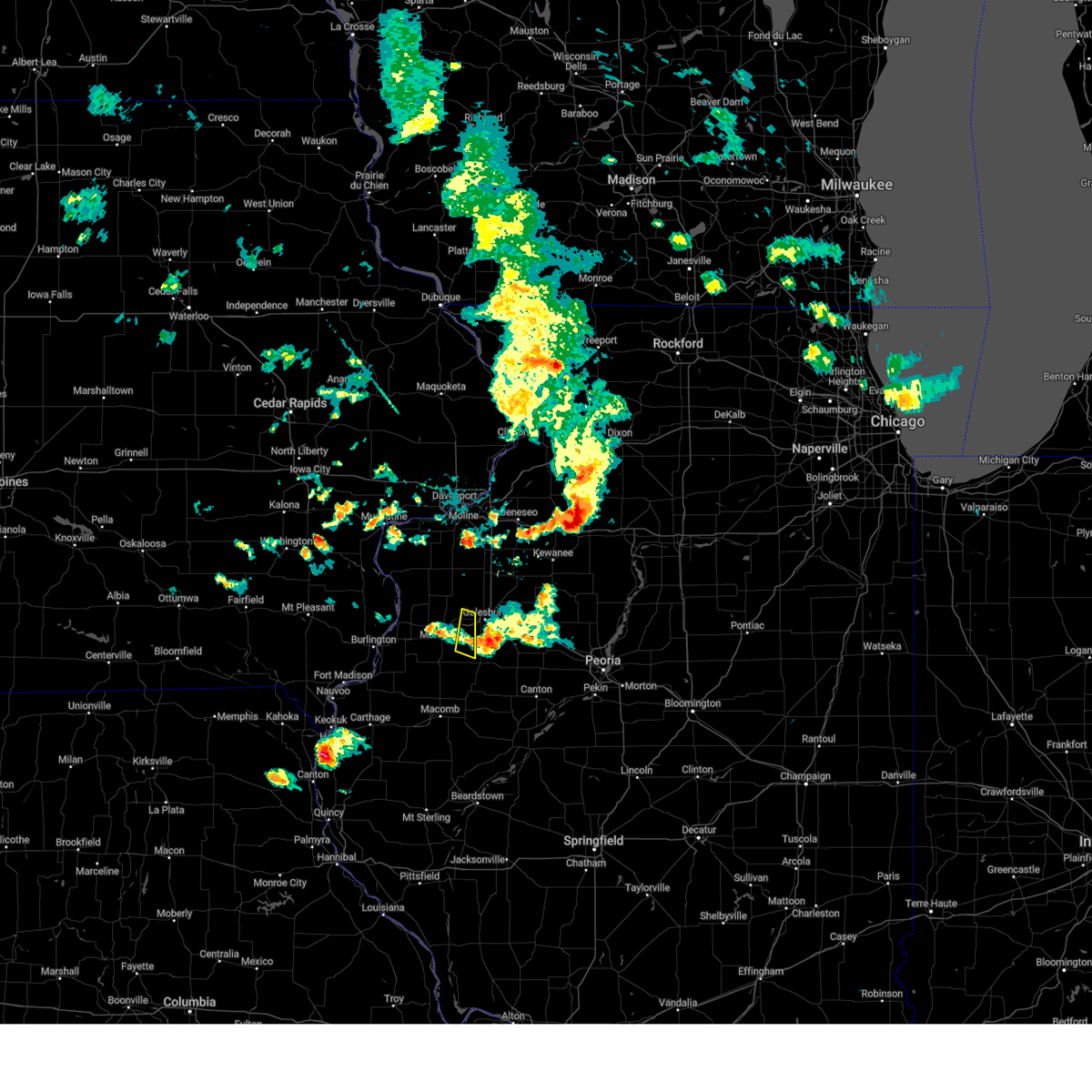 the severe thunderstorm warning has been cancelled and is no longer in effect the severe thunderstorm warning has been cancelled and is no longer in effect
|
| 5/27/2024 6:39 PM CDT |
 At 638 pm cdt, a severe thunderstorm was located over abingdon, or 7 miles south of galesburg, moving southeast at 40 mph (radar indicated). Hazards include 60 mph wind gusts and nickel size hail. Expect damage to roofs, siding, and trees. this severe storm will be near, maquon around 650 pm cdt. other locations impacted by this severe thunderstorm include gilson, galesburg municipal airport, delong, and east galesburg. This includes interstate 74 between mile markers 48 and 57. At 638 pm cdt, a severe thunderstorm was located over abingdon, or 7 miles south of galesburg, moving southeast at 40 mph (radar indicated). Hazards include 60 mph wind gusts and nickel size hail. Expect damage to roofs, siding, and trees. this severe storm will be near, maquon around 650 pm cdt. other locations impacted by this severe thunderstorm include gilson, galesburg municipal airport, delong, and east galesburg. This includes interstate 74 between mile markers 48 and 57.
|
| 5/27/2024 6:37 PM CDT |
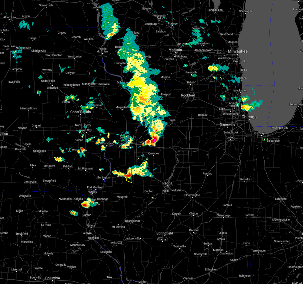 At 637 pm cdt, a severe thunderstorm was located near cameron, or near galesburg, moving east at 40 mph (radar indicated). Hazards include 60 mph wind gusts and penny size hail. Expect damage to roofs, siding, and trees. Locations impacted include, coldbrook, berwick, and cameron. At 637 pm cdt, a severe thunderstorm was located near cameron, or near galesburg, moving east at 40 mph (radar indicated). Hazards include 60 mph wind gusts and penny size hail. Expect damage to roofs, siding, and trees. Locations impacted include, coldbrook, berwick, and cameron.
|
| 5/27/2024 6:37 PM CDT |
 the severe thunderstorm warning has been cancelled and is no longer in effect the severe thunderstorm warning has been cancelled and is no longer in effect
|
| 5/27/2024 6:30 PM CDT |
 Svrilx the national weather service in lincoln has issued a * severe thunderstorm warning for, southwestern knox county in west central illinois, * until 715 pm cdt. * at 629 pm cdt, a severe thunderstorm was located near abingdon, or 8 miles southwest of galesburg, moving southeast at 45 mph (radar indicated). Hazards include 60 mph wind gusts and penny size hail. Expect damage to roofs, siding, and trees. this severe thunderstorm will be near, abingdon around 635 pm cdt. This includes interstate 74 between mile markers 48 and 57. Svrilx the national weather service in lincoln has issued a * severe thunderstorm warning for, southwestern knox county in west central illinois, * until 715 pm cdt. * at 629 pm cdt, a severe thunderstorm was located near abingdon, or 8 miles southwest of galesburg, moving southeast at 45 mph (radar indicated). Hazards include 60 mph wind gusts and penny size hail. Expect damage to roofs, siding, and trees. this severe thunderstorm will be near, abingdon around 635 pm cdt. This includes interstate 74 between mile markers 48 and 57.
|
| 5/27/2024 6:21 PM CDT |
 Svrdvn the national weather service in the quad cities has issued a * severe thunderstorm warning for, northeastern henderson county in west central illinois, central warren county in west central illinois, * until 700 pm cdt. * at 620 pm cdt, a severe thunderstorm was located over monmouth, moving east at 40 mph (radar indicated). Hazards include 60 mph wind gusts and quarter size hail. Hail damage to vehicles is expected. Expect wind damage to roofs, siding, and trees. Svrdvn the national weather service in the quad cities has issued a * severe thunderstorm warning for, northeastern henderson county in west central illinois, central warren county in west central illinois, * until 700 pm cdt. * at 620 pm cdt, a severe thunderstorm was located over monmouth, moving east at 40 mph (radar indicated). Hazards include 60 mph wind gusts and quarter size hail. Hail damage to vehicles is expected. Expect wind damage to roofs, siding, and trees.
|
| 5/24/2024 8:40 AM CDT |
 Svrilx the national weather service in lincoln has issued a * severe thunderstorm warning for, western marshall county in central illinois, stark county in north central illinois, northern knox county in west central illinois, northern peoria county in central illinois, * until 945 am cdt. * at 840 am cdt, a severe thunderstorm was located over oneida, or 13 miles northeast of galesburg, moving east at 45 mph (radar indicated). Hazards include 60 mph wind gusts and penny size hail. Expect damage to roofs, siding, and trees. this severe thunderstorm will be near, victoria around 845 am cdt. la fayette around 850 am cdt. toulon around 855 am cdt. other locations in the path of this severe thunderstorm include wyoming, castleton, camp grove, sparland and lacon. This includes interstate 74 between mile markers 49 and 67. Svrilx the national weather service in lincoln has issued a * severe thunderstorm warning for, western marshall county in central illinois, stark county in north central illinois, northern knox county in west central illinois, northern peoria county in central illinois, * until 945 am cdt. * at 840 am cdt, a severe thunderstorm was located over oneida, or 13 miles northeast of galesburg, moving east at 45 mph (radar indicated). Hazards include 60 mph wind gusts and penny size hail. Expect damage to roofs, siding, and trees. this severe thunderstorm will be near, victoria around 845 am cdt. la fayette around 850 am cdt. toulon around 855 am cdt. other locations in the path of this severe thunderstorm include wyoming, castleton, camp grove, sparland and lacon. This includes interstate 74 between mile markers 49 and 67.
|
| 5/24/2024 8:22 AM CDT |
 At 821 am cdt, severe thunderstorms were located along a line extending from near lynn center to near rio to monmouth, moving east at 40 mph (radar indicated). Hazards include 60 mph wind gusts and penny size hail. Expect damage to roofs, siding, and trees. locations impacted include, galesburg, knoxville, wataga, oneida, altona, victoria, henderson, rio, east galesburg, dahinda, galesburg municipal airport, and gilson. This includes interstate 74 between mile markers 34 and 60. At 821 am cdt, severe thunderstorms were located along a line extending from near lynn center to near rio to monmouth, moving east at 40 mph (radar indicated). Hazards include 60 mph wind gusts and penny size hail. Expect damage to roofs, siding, and trees. locations impacted include, galesburg, knoxville, wataga, oneida, altona, victoria, henderson, rio, east galesburg, dahinda, galesburg municipal airport, and gilson. This includes interstate 74 between mile markers 34 and 60.
|
| 5/24/2024 8:16 AM CDT |
 the severe thunderstorm warning has been cancelled and is no longer in effect the severe thunderstorm warning has been cancelled and is no longer in effect
|
| 5/24/2024 8:16 AM CDT |
 At 815 am cdt, severe thunderstorms were located along a line extending from near lyons to rapids city to monmouth municipal airport, moving east at 45 mph (radar indicated). Hazards include 60 mph wind gusts and penny size hail. Expect damage to roofs, siding, and trees. locations impacted include, davenport, moline, rock island, bettendorf, clinton, east moline, monmouth, aledo, oquawka, silvis, geneseo, eldridge, dewitt, milan, colona, camanche, le claire, coal valley, burgess, and hampton. this includes the following highways, interstate 74 in iowa between mile markers 1 and 5. interstate 80 in iowa between mile markers 286 and 306. interstate 80 in illinois between mile markers 1 and 19. interstate 74 in illinois between mile markers 1 and 33. interstate 88 between mile markers 1 and 14. Interstate 280 between mile markers 1 and 18. At 815 am cdt, severe thunderstorms were located along a line extending from near lyons to rapids city to monmouth municipal airport, moving east at 45 mph (radar indicated). Hazards include 60 mph wind gusts and penny size hail. Expect damage to roofs, siding, and trees. locations impacted include, davenport, moline, rock island, bettendorf, clinton, east moline, monmouth, aledo, oquawka, silvis, geneseo, eldridge, dewitt, milan, colona, camanche, le claire, coal valley, burgess, and hampton. this includes the following highways, interstate 74 in iowa between mile markers 1 and 5. interstate 80 in iowa between mile markers 286 and 306. interstate 80 in illinois between mile markers 1 and 19. interstate 74 in illinois between mile markers 1 and 33. interstate 88 between mile markers 1 and 14. Interstate 280 between mile markers 1 and 18.
|
| 5/24/2024 8:02 AM CDT |
 At 802 am cdt, severe thunderstorms were located along a line extending from near massillon park to near rock island arsenal to near rozetta, moving east at 45 mph (radar indicated). Hazards include 60 mph wind gusts and penny size hail. Expect damage to roofs, siding, and trees. locations impacted include, davenport, moline, rock island, bettendorf, clinton, east moline, monmouth, aledo, durant, oquawka, silvis, geneseo, eldridge, dewitt, milan, colona, camanche, le claire, coal valley, and burgess. this includes the following highways, interstate 74 in iowa between mile markers 1 and 5. interstate 80 in iowa between mile markers 275 and 306. interstate 80 in illinois between mile markers 1 and 19. interstate 74 in illinois between mile markers 1 and 33. interstate 88 between mile markers 1 and 14. Interstate 280 between mile markers 1 and 18. At 802 am cdt, severe thunderstorms were located along a line extending from near massillon park to near rock island arsenal to near rozetta, moving east at 45 mph (radar indicated). Hazards include 60 mph wind gusts and penny size hail. Expect damage to roofs, siding, and trees. locations impacted include, davenport, moline, rock island, bettendorf, clinton, east moline, monmouth, aledo, durant, oquawka, silvis, geneseo, eldridge, dewitt, milan, colona, camanche, le claire, coal valley, and burgess. this includes the following highways, interstate 74 in iowa between mile markers 1 and 5. interstate 80 in iowa between mile markers 275 and 306. interstate 80 in illinois between mile markers 1 and 19. interstate 74 in illinois between mile markers 1 and 33. interstate 88 between mile markers 1 and 14. Interstate 280 between mile markers 1 and 18.
|
| 5/24/2024 7:50 AM CDT |
 At 750 am cdt, severe thunderstorms were located along a line extending from stanwood to west lake park to oquawka, moving east at 45 mph (radar indicated). Hazards include 70 mph wind gusts and penny size hail. Expect considerable tree damage. damage is likely to mobile homes, roofs, and outbuildings. locations impacted include, davenport, moline, rock island, bettendorf, clinton, muscatine, east moline, monmouth, aledo, tipton, wapello, durant, oquawka, silvis, geneseo, eldridge, dewitt, milan, colona, and camanche. this includes the following highways, interstate 74 in iowa between mile markers 1 and 5. interstate 80 in iowa between mile markers 268 and 306. interstate 80 in illinois between mile markers 1 and 19. interstate 74 in illinois between mile markers 1 and 33. interstate 88 between mile markers 1 and 14. Interstate 280 between mile markers 1 and 18. At 750 am cdt, severe thunderstorms were located along a line extending from stanwood to west lake park to oquawka, moving east at 45 mph (radar indicated). Hazards include 70 mph wind gusts and penny size hail. Expect considerable tree damage. damage is likely to mobile homes, roofs, and outbuildings. locations impacted include, davenport, moline, rock island, bettendorf, clinton, muscatine, east moline, monmouth, aledo, tipton, wapello, durant, oquawka, silvis, geneseo, eldridge, dewitt, milan, colona, and camanche. this includes the following highways, interstate 74 in iowa between mile markers 1 and 5. interstate 80 in iowa between mile markers 268 and 306. interstate 80 in illinois between mile markers 1 and 19. interstate 74 in illinois between mile markers 1 and 33. interstate 88 between mile markers 1 and 14. Interstate 280 between mile markers 1 and 18.
|
| 5/24/2024 7:48 AM CDT |
 Svrilx the national weather service in lincoln has issued a * severe thunderstorm warning for, northern knox county in west central illinois, * until 845 am cdt. * at 748 am cdt, severe thunderstorms were located along a line extending from hamlet to near seaton to 6 miles north of gulf port, moving east at 40 mph (radar indicated). Hazards include 60 mph wind gusts and penny size hail. expect damage to roofs, siding, and trees Svrilx the national weather service in lincoln has issued a * severe thunderstorm warning for, northern knox county in west central illinois, * until 845 am cdt. * at 748 am cdt, severe thunderstorms were located along a line extending from hamlet to near seaton to 6 miles north of gulf port, moving east at 40 mph (radar indicated). Hazards include 60 mph wind gusts and penny size hail. expect damage to roofs, siding, and trees
|
| 5/24/2024 7:32 AM CDT |
 Svrdvn the national weather service in the quad cities has issued a * severe thunderstorm warning for, northeastern henderson county in west central illinois, northern warren county in west central illinois, rock island county in northwestern illinois, mercer county in northwestern illinois, southwestern whiteside county in northwestern illinois, western henry county in northwestern illinois, northern des moines county in southeastern iowa, southeastern louisa county in southeastern iowa, cedar county in east central iowa, scott county in east central iowa, eastern muscatine county in east central iowa, southern clinton county in east central iowa, * until 830 am cdt. * at 732 am cdt, severe thunderstorms were located along a line extending from near lisbon to near sweetland center to big hollow recreation area, moving east at 45 mph (radar indicated). Hazards include 70 mph wind gusts and penny size hail. Expect considerable tree damage. Damage is likely to mobile homes, roofs, and outbuildings. Svrdvn the national weather service in the quad cities has issued a * severe thunderstorm warning for, northeastern henderson county in west central illinois, northern warren county in west central illinois, rock island county in northwestern illinois, mercer county in northwestern illinois, southwestern whiteside county in northwestern illinois, western henry county in northwestern illinois, northern des moines county in southeastern iowa, southeastern louisa county in southeastern iowa, cedar county in east central iowa, scott county in east central iowa, eastern muscatine county in east central iowa, southern clinton county in east central iowa, * until 830 am cdt. * at 732 am cdt, severe thunderstorms were located along a line extending from near lisbon to near sweetland center to big hollow recreation area, moving east at 45 mph (radar indicated). Hazards include 70 mph wind gusts and penny size hail. Expect considerable tree damage. Damage is likely to mobile homes, roofs, and outbuildings.
|
| 5/2/2024 5:45 PM CDT |
 Svrilx the national weather service in lincoln has issued a * severe thunderstorm warning for, northern fulton county in west central illinois, southern knox county in west central illinois, southwestern peoria county in central illinois, * until 630 pm cdt. * at 543 pm cdt, a severe thunderstorm was located near fairview, or near canton, moving northeast at 35 mph. a line of storms behind that are located from roughly adair to smithfield, moving northeast at 50 mph (radar indicated. though spotter indicate the line of storms further southwest is producing intense straight line winds). Hazards include 60 mph wind gusts and half dollar size hail. Hail damage to vehicles is expected. expect wind damage to roofs, siding, and trees. the storms further southwest are producing strong winds, while the storm near fairview is producing mainly hail. this severe thunderstorm will be near, farmington around 550 pm cdt. elmwood and yates city around 600 pm cdt. other locations in the path of this severe thunderstorm include trivoli and brimfield. this includes the following highways, interstate 474 between mile markers 0 and 5. Interstate 74 between mile markers 42 and 91. Svrilx the national weather service in lincoln has issued a * severe thunderstorm warning for, northern fulton county in west central illinois, southern knox county in west central illinois, southwestern peoria county in central illinois, * until 630 pm cdt. * at 543 pm cdt, a severe thunderstorm was located near fairview, or near canton, moving northeast at 35 mph. a line of storms behind that are located from roughly adair to smithfield, moving northeast at 50 mph (radar indicated. though spotter indicate the line of storms further southwest is producing intense straight line winds). Hazards include 60 mph wind gusts and half dollar size hail. Hail damage to vehicles is expected. expect wind damage to roofs, siding, and trees. the storms further southwest are producing strong winds, while the storm near fairview is producing mainly hail. this severe thunderstorm will be near, farmington around 550 pm cdt. elmwood and yates city around 600 pm cdt. other locations in the path of this severe thunderstorm include trivoli and brimfield. this includes the following highways, interstate 474 between mile markers 0 and 5. Interstate 74 between mile markers 42 and 91.
|
| 3/14/2024 4:45 AM CDT |
 The storm which prompted the warning has moved out of the area. therefore, the warning has been allowed to expire. however, gusty winds are still possible with this thunderstorm. a severe thunderstorm watch remains in effect until 600 am cdt for west central illinois. The storm which prompted the warning has moved out of the area. therefore, the warning has been allowed to expire. however, gusty winds are still possible with this thunderstorm. a severe thunderstorm watch remains in effect until 600 am cdt for west central illinois.
|
| 3/14/2024 4:42 AM CDT |
 At 441 am cdt, a severe thunderstorm was located over st. augustine, or 17 miles south of galesburg, moving northeast at 35 mph (public). Hazards include 60 mph wind gusts. Expect damage to roofs, siding, and trees. this severe storm will be near, st. augustine around 445 am cdt. abingdon around 450 am cdt. maquon around 505 am cdt. other locations impacted by this severe thunderstorm include delong, gilson, and east galesburg. This includes interstate 74 between mile markers 49 and 59. At 441 am cdt, a severe thunderstorm was located over st. augustine, or 17 miles south of galesburg, moving northeast at 35 mph (public). Hazards include 60 mph wind gusts. Expect damage to roofs, siding, and trees. this severe storm will be near, st. augustine around 445 am cdt. abingdon around 450 am cdt. maquon around 505 am cdt. other locations impacted by this severe thunderstorm include delong, gilson, and east galesburg. This includes interstate 74 between mile markers 49 and 59.
|
| 3/14/2024 4:27 AM CDT |
 At 426 am cdt, a severe thunderstorm was located near marietta, or 15 miles northeast of macomb, moving northeast at 55 mph (public). Hazards include 60 mph wind gusts. Expect damage to roofs, siding, and trees. Locations impacted include, bushnell, roseville, prairie city, little swan lake, walnut grove, greenbush, berwick, ormonde, larchland, cameron, warren county fairgrounds, swan creek, youngstown, and prairie city airport. At 426 am cdt, a severe thunderstorm was located near marietta, or 15 miles northeast of macomb, moving northeast at 55 mph (public). Hazards include 60 mph wind gusts. Expect damage to roofs, siding, and trees. Locations impacted include, bushnell, roseville, prairie city, little swan lake, walnut grove, greenbush, berwick, ormonde, larchland, cameron, warren county fairgrounds, swan creek, youngstown, and prairie city airport.
|
| 3/14/2024 4:27 AM CDT |
 the severe thunderstorm warning has been cancelled and is no longer in effect the severe thunderstorm warning has been cancelled and is no longer in effect
|
| 3/14/2024 4:23 AM CDT |
 Svrilx the national weather service in lincoln has issued a * severe thunderstorm warning for, northwestern fulton county in west central illinois, southern knox county in west central illinois, * until 500 am cdt. * at 422 am cdt, a severe thunderstorm was located over little swan lake, or 12 miles northeast of macomb, moving northeast at 50 mph (radar indicated). Hazards include 60 mph wind gusts. Expect damage to roofs, siding, and trees. this severe thunderstorm will be near, avon and st. augustine around 430 am cdt. london mills around 440 am cdt. other locations in the path of this severe thunderstorm include maquon. This includes interstate 74 between mile markers 46 and 59. Svrilx the national weather service in lincoln has issued a * severe thunderstorm warning for, northwestern fulton county in west central illinois, southern knox county in west central illinois, * until 500 am cdt. * at 422 am cdt, a severe thunderstorm was located over little swan lake, or 12 miles northeast of macomb, moving northeast at 50 mph (radar indicated). Hazards include 60 mph wind gusts. Expect damage to roofs, siding, and trees. this severe thunderstorm will be near, avon and st. augustine around 430 am cdt. london mills around 440 am cdt. other locations in the path of this severe thunderstorm include maquon. This includes interstate 74 between mile markers 46 and 59.
|
| 3/14/2024 4:15 AM CDT |
 Svrdvn the national weather service in the quad cities has issued a * severe thunderstorm warning for, southeastern henderson county in west central illinois, southern warren county in west central illinois, northeastern mcdonough county in west central illinois, * until 445 am cdt. * at 415 am cdt, a severe thunderstorm was located over bardolph, or near macomb, moving northeast at 55 mph (radar indicated). Hazards include 60 mph wind gusts. expect damage to roofs, siding, and trees Svrdvn the national weather service in the quad cities has issued a * severe thunderstorm warning for, southeastern henderson county in west central illinois, southern warren county in west central illinois, northeastern mcdonough county in west central illinois, * until 445 am cdt. * at 415 am cdt, a severe thunderstorm was located over bardolph, or near macomb, moving northeast at 55 mph (radar indicated). Hazards include 60 mph wind gusts. expect damage to roofs, siding, and trees
|
| 3/14/2024 2:57 AM CDT |
 The storm which prompted the warning has weakened below severe limits, and no longer poses an immediate threat to life or property. therefore, the warning will be allowed to expire. however, small hail and gusty winds are still possible with this thunderstorm. to report severe weather, contact your nearest law enforcement agency. they will relay your report to the national weather service lincoln. The storm which prompted the warning has weakened below severe limits, and no longer poses an immediate threat to life or property. therefore, the warning will be allowed to expire. however, small hail and gusty winds are still possible with this thunderstorm. to report severe weather, contact your nearest law enforcement agency. they will relay your report to the national weather service lincoln.
|
| 3/14/2024 2:50 AM CDT |
 The storm which prompted the warning has weakened below severe limits, and has exited the warned area. therefore, the warning will be allowed to expire. a severe thunderstorm watch remains in effect until 600 am cdt for west central illinois. The storm which prompted the warning has weakened below severe limits, and has exited the warned area. therefore, the warning will be allowed to expire. a severe thunderstorm watch remains in effect until 600 am cdt for west central illinois.
|
| 3/14/2024 2:36 AM CDT |
 At 236 am cdt, a severe thunderstorm was located over henderson, or 5 miles north of galesburg, moving northeast at 30 mph (radar indicated). Hazards include 60 mph wind gusts and quarter size hail. Hail damage to vehicles is expected. expect wind damage to roofs, siding, and trees. this severe storm will be near, wataga and henderson around 240 am cdt. oneida around 245 am cdt. altona around 255 am cdt. other locations impacted by this severe thunderstorm include galesburg municipal airport and east galesburg. This includes interstate 74 between mile markers 34 and 47. At 236 am cdt, a severe thunderstorm was located over henderson, or 5 miles north of galesburg, moving northeast at 30 mph (radar indicated). Hazards include 60 mph wind gusts and quarter size hail. Hail damage to vehicles is expected. expect wind damage to roofs, siding, and trees. this severe storm will be near, wataga and henderson around 240 am cdt. oneida around 245 am cdt. altona around 255 am cdt. other locations impacted by this severe thunderstorm include galesburg municipal airport and east galesburg. This includes interstate 74 between mile markers 34 and 47.
|
| 3/14/2024 2:33 AM CDT |
 At 233 am cdt, a severe thunderstorm was located near alexis, or 9 miles northwest of galesburg, moving northeast at 25 mph (radar indicated). Hazards include 60 mph wind gusts and quarter size hail. Hail damage to vehicles is expected. expect wind damage to roofs, siding, and trees. Locations impacted include, north henderson, new windsor, griffin, and swedona. At 233 am cdt, a severe thunderstorm was located near alexis, or 9 miles northwest of galesburg, moving northeast at 25 mph (radar indicated). Hazards include 60 mph wind gusts and quarter size hail. Hail damage to vehicles is expected. expect wind damage to roofs, siding, and trees. Locations impacted include, north henderson, new windsor, griffin, and swedona.
|
| 3/14/2024 2:23 AM CDT |
 At 223 am cdt, a severe thunderstorm was located over gerlaw, or 8 miles northeast of monmouth, moving northeast at 25 mph (radar indicated). Hazards include 60 mph wind gusts and quarter size hail. Hail damage to vehicles is expected. expect wind damage to roofs, siding, and trees. Locations impacted include, burgess, north henderson, new windsor, alexis, coldbrook, gerlaw, griffin, and swedona. At 223 am cdt, a severe thunderstorm was located over gerlaw, or 8 miles northeast of monmouth, moving northeast at 25 mph (radar indicated). Hazards include 60 mph wind gusts and quarter size hail. Hail damage to vehicles is expected. expect wind damage to roofs, siding, and trees. Locations impacted include, burgess, north henderson, new windsor, alexis, coldbrook, gerlaw, griffin, and swedona.
|
| 3/14/2024 2:16 AM CDT |
 Svrilx the national weather service in lincoln has issued a * severe thunderstorm warning for, northern knox county in west central illinois, * until 300 am cdt. * at 216 am cdt, a severe thunderstorm was located near lake warren, or 7 miles northeast of monmouth, moving northeast at 35 mph (radar indicated). Hazards include 60 mph wind gusts and quarter size hail. Hail damage to vehicles is expected. expect wind damage to roofs, siding, and trees. this severe thunderstorm will be near, henderson around 225 am cdt. rio around 230 am cdt. other locations in the path of this severe thunderstorm include oneida and altona. This includes interstate 74 between mile markers 35 and 50. Svrilx the national weather service in lincoln has issued a * severe thunderstorm warning for, northern knox county in west central illinois, * until 300 am cdt. * at 216 am cdt, a severe thunderstorm was located near lake warren, or 7 miles northeast of monmouth, moving northeast at 35 mph (radar indicated). Hazards include 60 mph wind gusts and quarter size hail. Hail damage to vehicles is expected. expect wind damage to roofs, siding, and trees. this severe thunderstorm will be near, henderson around 225 am cdt. rio around 230 am cdt. other locations in the path of this severe thunderstorm include oneida and altona. This includes interstate 74 between mile markers 35 and 50.
|
| 3/14/2024 2:14 AM CDT |
 Svrdvn the national weather service in the quad cities has issued a * severe thunderstorm warning for, northeastern warren county in west central illinois, southeastern mercer county in northwestern illinois, southwestern henry county in northwestern illinois, * until 300 am cdt. * at 213 am cdt, a severe thunderstorm was located over lake warren, or near monmouth, moving northeast at 25 mph (radar indicated). Hazards include 60 mph wind gusts and quarter size hail. Hail damage to vehicles is expected. Expect wind damage to roofs, siding, and trees. Svrdvn the national weather service in the quad cities has issued a * severe thunderstorm warning for, northeastern warren county in west central illinois, southeastern mercer county in northwestern illinois, southwestern henry county in northwestern illinois, * until 300 am cdt. * at 213 am cdt, a severe thunderstorm was located over lake warren, or near monmouth, moving northeast at 25 mph (radar indicated). Hazards include 60 mph wind gusts and quarter size hail. Hail damage to vehicles is expected. Expect wind damage to roofs, siding, and trees.
|
| 3/14/2024 12:32 AM CDT |
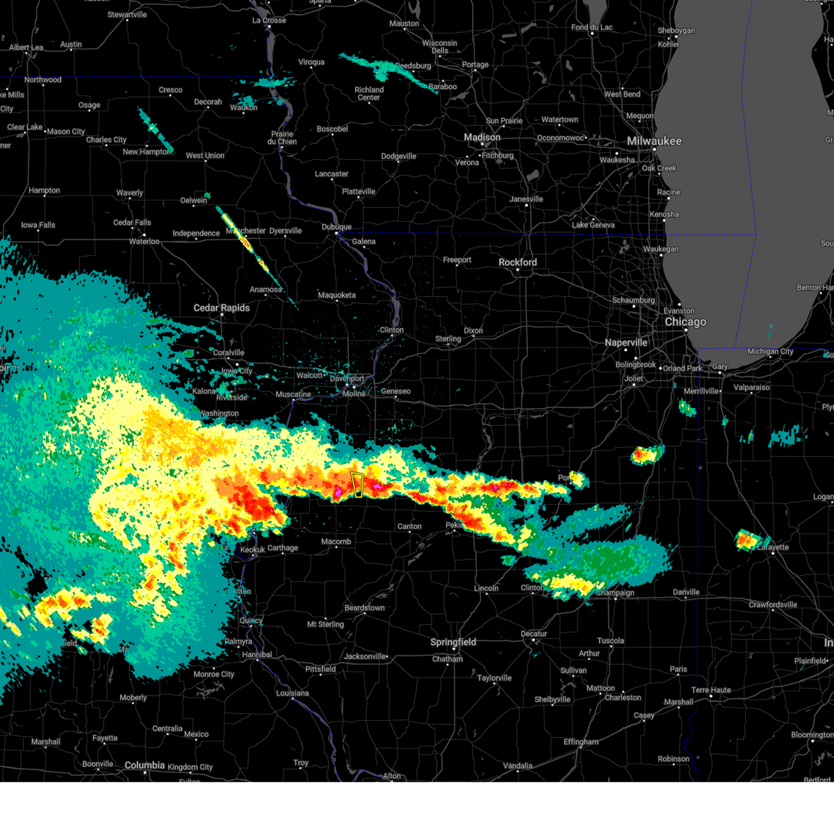 the severe thunderstorm warning has been cancelled and is no longer in effect the severe thunderstorm warning has been cancelled and is no longer in effect
|
| 3/14/2024 12:28 AM CDT |
 Svrilx the national weather service in lincoln has issued a * severe thunderstorm warning for, western knox county in west central illinois, * until 115 am cdt. * at 1228 am cdt, a severe thunderstorm was located near abingdon, or 7 miles south of galesburg, moving northeast at 20 mph (radar indicated). Hazards include quarter size hail. Damage to vehicles is expected. this severe thunderstorm will be near, galesburg and knoxville around 1235 am cdt. other locations in the path of this severe thunderstorm include wataga. This includes interstate 74 between mile markers 39 and 55. Svrilx the national weather service in lincoln has issued a * severe thunderstorm warning for, western knox county in west central illinois, * until 115 am cdt. * at 1228 am cdt, a severe thunderstorm was located near abingdon, or 7 miles south of galesburg, moving northeast at 20 mph (radar indicated). Hazards include quarter size hail. Damage to vehicles is expected. this severe thunderstorm will be near, galesburg and knoxville around 1235 am cdt. other locations in the path of this severe thunderstorm include wataga. This includes interstate 74 between mile markers 39 and 55.
|
| 3/14/2024 12:21 AM CDT |
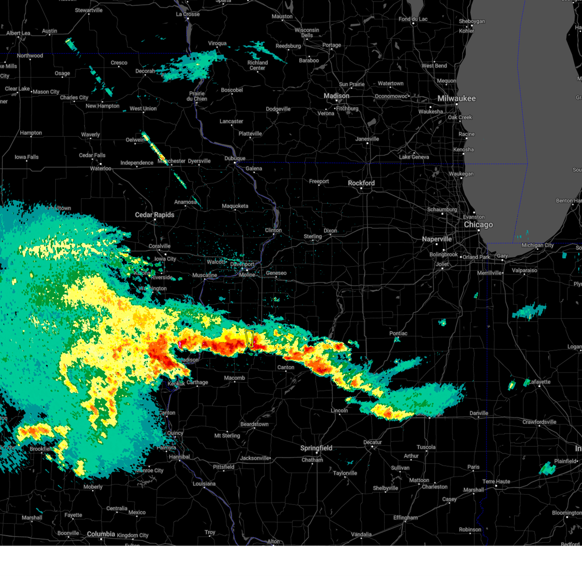 At 1221 am cdt, a severe thunderstorm was located near abingdon, or 7 miles south of galesburg, moving north at 20 mph (radar indicated). Hazards include quarter size hail. Damage to vehicles is expected. Locations impacted include, cameron. At 1221 am cdt, a severe thunderstorm was located near abingdon, or 7 miles south of galesburg, moving north at 20 mph (radar indicated). Hazards include quarter size hail. Damage to vehicles is expected. Locations impacted include, cameron.
|
| 3/14/2024 12:19 AM CDT |
 At 1218 am cdt, a severe thunderstorm was located over abingdon, or 7 miles south of galesburg, moving north at 25 mph (radar indicated). Hazards include quarter size hail. Damage to vehicles is expected. this severe storm will be near, galesburg around 1225 am cdt. Other locations impacted by this severe thunderstorm include galesburg municipal airport. At 1218 am cdt, a severe thunderstorm was located over abingdon, or 7 miles south of galesburg, moving north at 25 mph (radar indicated). Hazards include quarter size hail. Damage to vehicles is expected. this severe storm will be near, galesburg around 1225 am cdt. Other locations impacted by this severe thunderstorm include galesburg municipal airport.
|
| 3/14/2024 12:11 AM CDT |
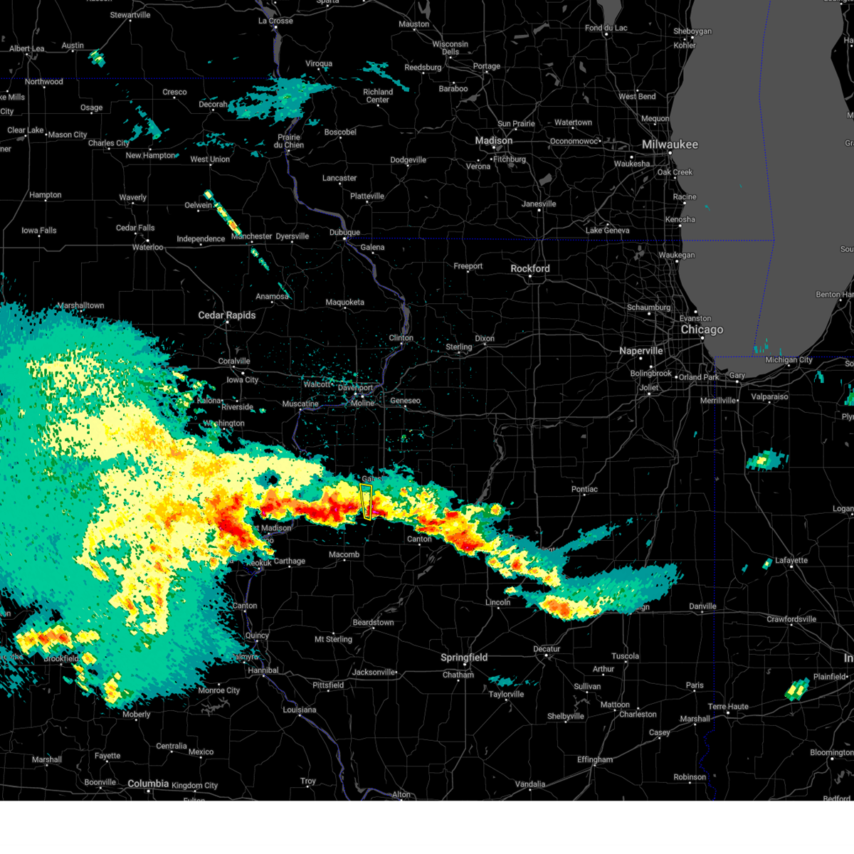 At 1211 am cdt, a severe thunderstorm was located over abingdon, or 10 miles south of galesburg, moving north at 20 mph (radar indicated). Hazards include quarter size hail. Damage to vehicles is expected. Locations impacted include, cameron. At 1211 am cdt, a severe thunderstorm was located over abingdon, or 10 miles south of galesburg, moving north at 20 mph (radar indicated). Hazards include quarter size hail. Damage to vehicles is expected. Locations impacted include, cameron.
|
| 3/14/2024 12:02 AM CDT |
 Svrilx the national weather service in lincoln has issued a * severe thunderstorm warning for, southwestern knox county in west central illinois, * until 1230 am cdt. * at 1202 am cdt, a severe thunderstorm was located near st. augustine, or 13 miles south of galesburg, moving north at 25 mph (radar indicated). Hazards include quarter size hail. Damage to vehicles is expected. This severe thunderstorm will be near, abingdon around 1210 am cdt. Svrilx the national weather service in lincoln has issued a * severe thunderstorm warning for, southwestern knox county in west central illinois, * until 1230 am cdt. * at 1202 am cdt, a severe thunderstorm was located near st. augustine, or 13 miles south of galesburg, moving north at 25 mph (radar indicated). Hazards include quarter size hail. Damage to vehicles is expected. This severe thunderstorm will be near, abingdon around 1210 am cdt.
|
| 3/14/2024 12:01 AM CDT |
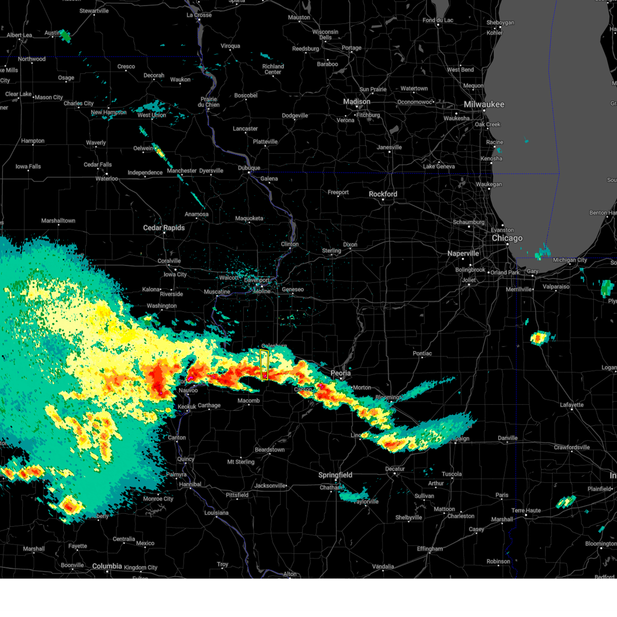 Svrdvn the national weather service in the quad cities has issued a * severe thunderstorm warning for, southeastern warren county in west central illinois, * until 1245 am cdt. * at 1201 am cdt, a severe thunderstorm was located near st. augustine, or 14 miles south of galesburg, moving north at 20 mph (radar indicated). Hazards include quarter size hail. damage to vehicles is expected Svrdvn the national weather service in the quad cities has issued a * severe thunderstorm warning for, southeastern warren county in west central illinois, * until 1245 am cdt. * at 1201 am cdt, a severe thunderstorm was located near st. augustine, or 14 miles south of galesburg, moving north at 20 mph (radar indicated). Hazards include quarter size hail. damage to vehicles is expected
|
| 3/13/2024 11:49 PM CDT |
 the severe thunderstorm warning has been cancelled and is no longer in effect the severe thunderstorm warning has been cancelled and is no longer in effect
|
| 3/13/2024 11:43 PM CDT |
 Svrilx the national weather service in lincoln has issued a * severe thunderstorm warning for, southeastern knox county in west central illinois, * until midnight cdt. * at 1142 pm cdt, a severe thunderstorm was located near london mills, or 13 miles northwest of canton, moving north at 25 mph (radar indicated). Hazards include quarter size hail. Damage to vehicles is expected. this severe thunderstorm will be near, maquon around 1150 pm cdt. This includes interstate 74 between mile markers 54 and 56, and between mile markers 60 and 67. Svrilx the national weather service in lincoln has issued a * severe thunderstorm warning for, southeastern knox county in west central illinois, * until midnight cdt. * at 1142 pm cdt, a severe thunderstorm was located near london mills, or 13 miles northwest of canton, moving north at 25 mph (radar indicated). Hazards include quarter size hail. Damage to vehicles is expected. this severe thunderstorm will be near, maquon around 1150 pm cdt. This includes interstate 74 between mile markers 54 and 56, and between mile markers 60 and 67.
|
| 8/11/2023 6:37 AM CDT |
 At 636 am cdt, severe thunderstorms were located along a line extending from near altona to near lake warren, moving southeast at 45 mph (radar indicated). Hazards include 60 mph wind gusts and penny size hail. Expect damage to roofs, siding, and trees. locations impacted include, altona, victoria, galesburg, la fayette, abingdon, knoxville, toulon, west jersey, gilson, london mills and maquon. This includes interstate 74 between mile markers 34 and 63. At 636 am cdt, severe thunderstorms were located along a line extending from near altona to near lake warren, moving southeast at 45 mph (radar indicated). Hazards include 60 mph wind gusts and penny size hail. Expect damage to roofs, siding, and trees. locations impacted include, altona, victoria, galesburg, la fayette, abingdon, knoxville, toulon, west jersey, gilson, london mills and maquon. This includes interstate 74 between mile markers 34 and 63.
|
| 8/11/2023 6:19 AM CDT |
 At 619 am cdt, severe thunderstorms were located along a line extending from near andover to near little york, moving southeast at 45 mph (radar indicated). Hazards include 60 mph wind gusts. Expect damage to roofs, siding, and trees. severe thunderstorms will be near, oneida and altona around 635 am cdt. other locations in the path of these severe thunderstorms include victoria, la fayette, galesburg, toulon, abingdon, knoxville, west jersey, london mills, maquon and gilson. This includes interstate 74 between mile markers 34 and 63. At 619 am cdt, severe thunderstorms were located along a line extending from near andover to near little york, moving southeast at 45 mph (radar indicated). Hazards include 60 mph wind gusts. Expect damage to roofs, siding, and trees. severe thunderstorms will be near, oneida and altona around 635 am cdt. other locations in the path of these severe thunderstorms include victoria, la fayette, galesburg, toulon, abingdon, knoxville, west jersey, london mills, maquon and gilson. This includes interstate 74 between mile markers 34 and 63.
|
| 6/29/2023 11:54 AM CDT | Wind gust measured on mobile anemometer between galesburg and wataga. some corn stalks bent ove in knox county IL, 3.1 miles SSW of Galesburg, IL |
| 6/29/2023 11:41 AM CDT |
 At 1139 am cdt, severe thunderstorms were located along a line extending from near maquon to near canton to lewistown, moving east at 65 mph. these are destructive storms for canton, st. david, and little america (emergency management). Hazards include 80 mph wind gusts and half dollar size hail. Flying debris will be dangerous to those caught without shelter. mobile homes will be heavily damaged. expect considerable damage to roofs, windows, and vehicles. extensive tree damage and power outages are likely. locations impacted include, farmington. This includes interstate 74 between mile markers 38 and 58. At 1139 am cdt, severe thunderstorms were located along a line extending from near maquon to near canton to lewistown, moving east at 65 mph. these are destructive storms for canton, st. david, and little america (emergency management). Hazards include 80 mph wind gusts and half dollar size hail. Flying debris will be dangerous to those caught without shelter. mobile homes will be heavily damaged. expect considerable damage to roofs, windows, and vehicles. extensive tree damage and power outages are likely. locations impacted include, farmington. This includes interstate 74 between mile markers 38 and 58.
|
| 6/29/2023 11:20 AM CDT |
 At 1119 am cdt, severe thunderstorms were located along a line extending from near roseville to bushnell to near adair, moving east at 70 mph. these are destructive storms for avon, marietta, and ellisville (emergency management). Hazards include 80 mph wind gusts and half dollar size hail. Flying debris will be dangerous to those caught without shelter. mobile homes will be heavily damaged. expect considerable damage to roofs, windows, and vehicles. extensive tree damage and power outages are likely. these severe storms will be near, abingdon around 1130 am cdt. other locations in the path of these severe thunderstorms include lewistown, cuba, fairview, london mills, canton, st. david, maquon and farmington. This includes interstate 74 between mile markers 38 and 58. At 1119 am cdt, severe thunderstorms were located along a line extending from near roseville to bushnell to near adair, moving east at 70 mph. these are destructive storms for avon, marietta, and ellisville (emergency management). Hazards include 80 mph wind gusts and half dollar size hail. Flying debris will be dangerous to those caught without shelter. mobile homes will be heavily damaged. expect considerable damage to roofs, windows, and vehicles. extensive tree damage and power outages are likely. these severe storms will be near, abingdon around 1130 am cdt. other locations in the path of these severe thunderstorms include lewistown, cuba, fairview, london mills, canton, st. david, maquon and farmington. This includes interstate 74 between mile markers 38 and 58.
|
| 6/29/2023 11:12 AM CDT |
 At 1112 am cdt, a severe squall line capable of producing both tornadoes and extensive straight line wind damage was located over warren county fairgrounds, or 11 miles south of monmouth, moving northeast at 75 mph (radar indicated rotation). Hazards include tornado and quarter size hail. Flying debris will be dangerous to those caught without shelter. mobile homes will be damaged or destroyed. damage to roofs, windows, and vehicles will occur. tree damage is likely. these dangerous storms will be near, greenbush, berwick and ormonde around 1115 am cdt. Cameron around 1120 am cdt. At 1112 am cdt, a severe squall line capable of producing both tornadoes and extensive straight line wind damage was located over warren county fairgrounds, or 11 miles south of monmouth, moving northeast at 75 mph (radar indicated rotation). Hazards include tornado and quarter size hail. Flying debris will be dangerous to those caught without shelter. mobile homes will be damaged or destroyed. damage to roofs, windows, and vehicles will occur. tree damage is likely. these dangerous storms will be near, greenbush, berwick and ormonde around 1115 am cdt. Cameron around 1120 am cdt.
|
| 6/29/2023 11:10 AM CDT |
 At 1107 am cdt, severe thunderstorms were located along a line extending from near stronghurst to near western illinois university to near fandon, moving east at 70 mph. these are destructive storms for avon, marietta, and ellisville (radar indicated). Hazards include 80 mph wind gusts and half dollar size hail. Flying debris will be dangerous to those caught without shelter. mobile homes will be heavily damaged. expect considerable damage to roofs, windows, and vehicles. extensive tree damage and power outages are likely. severe thunderstorms will be near, avon around 1125 am cdt. other locations in the path of these severe thunderstorms include abingdon, lewistown, knoxville, cuba, fairview, london mills, canton, farmington, st. david, maquon and gilson. This includes interstate 74 between mile markers 38 and 58. At 1107 am cdt, severe thunderstorms were located along a line extending from near stronghurst to near western illinois university to near fandon, moving east at 70 mph. these are destructive storms for avon, marietta, and ellisville (radar indicated). Hazards include 80 mph wind gusts and half dollar size hail. Flying debris will be dangerous to those caught without shelter. mobile homes will be heavily damaged. expect considerable damage to roofs, windows, and vehicles. extensive tree damage and power outages are likely. severe thunderstorms will be near, avon around 1125 am cdt. other locations in the path of these severe thunderstorms include abingdon, lewistown, knoxville, cuba, fairview, london mills, canton, farmington, st. david, maquon and gilson. This includes interstate 74 between mile markers 38 and 58.
|
| 6/29/2023 11:01 AM CDT |
 At 1101 am cdt, severe thunderstorms capable of producing both tornadoes and extensive straight line wind damage were located near raritan, or 14 miles northwest of macomb, moving northeast at 75 mph (radar indicated rotation). Hazards include tornado and quarter size hail. Flying debris will be dangerous to those caught without shelter. mobile homes will be damaged or destroyed. damage to roofs, windows, and vehicles will occur. tree damage is likely. these dangerous storms will be near, media around 1105 am cdt. roseville, warren county fairgrounds, swan creek, youngstown, ponemah and smithshire around 1110 am cdt. greenbush, larchland and ormonde around 1115 am cdt. Berwick and cameron around 1120 am cdt. At 1101 am cdt, severe thunderstorms capable of producing both tornadoes and extensive straight line wind damage were located near raritan, or 14 miles northwest of macomb, moving northeast at 75 mph (radar indicated rotation). Hazards include tornado and quarter size hail. Flying debris will be dangerous to those caught without shelter. mobile homes will be damaged or destroyed. damage to roofs, windows, and vehicles will occur. tree damage is likely. these dangerous storms will be near, media around 1105 am cdt. roseville, warren county fairgrounds, swan creek, youngstown, ponemah and smithshire around 1110 am cdt. greenbush, larchland and ormonde around 1115 am cdt. Berwick and cameron around 1120 am cdt.
|
| 5/7/2023 7:54 PM CDT |
 The severe thunderstorm warning for northeastern henderson, northern warren, mercer and southwestern henry counties will expire at 800 pm cdt, the storms which prompted the warning have moved out of the area. therefore, the warning will be allowed to expire. however gusty winds are still possible with these thunderstorms. a severe thunderstorm watch remains in effect until midnight cdt for northwestern and west central illinois. The severe thunderstorm warning for northeastern henderson, northern warren, mercer and southwestern henry counties will expire at 800 pm cdt, the storms which prompted the warning have moved out of the area. therefore, the warning will be allowed to expire. however gusty winds are still possible with these thunderstorms. a severe thunderstorm watch remains in effect until midnight cdt for northwestern and west central illinois.
|
| 5/7/2023 7:44 PM CDT |
 At 744 pm cdt, severe thunderstorms were located along a line extending from near delong to montrose, moving southeast at 40 mph (trained weather spotters). Hazards include 60 mph wind gusts and quarter size hail. Hail damage to vehicles is expected. expect wind damage to roofs, siding, and trees. locations impacted include, burlington, macomb, fort madison, keokuk, monmouth, carthage, oquawka, nauvoo, bushnell, west burlington, hamilton, colchester, la harpe, roseville, west point, dallas city, donnellson, montrose, stronghurst and kirkwood. hail threat, radar indicated max hail size, 1. 00 in wind threat, radar indicated max wind gust, 60 mph. At 744 pm cdt, severe thunderstorms were located along a line extending from near delong to montrose, moving southeast at 40 mph (trained weather spotters). Hazards include 60 mph wind gusts and quarter size hail. Hail damage to vehicles is expected. expect wind damage to roofs, siding, and trees. locations impacted include, burlington, macomb, fort madison, keokuk, monmouth, carthage, oquawka, nauvoo, bushnell, west burlington, hamilton, colchester, la harpe, roseville, west point, dallas city, donnellson, montrose, stronghurst and kirkwood. hail threat, radar indicated max hail size, 1. 00 in wind threat, radar indicated max wind gust, 60 mph.
|
| 5/7/2023 7:37 PM CDT |
 At 737 pm cdt, severe thunderstorms were located along a line extending from near gilson to near nauvoo state park, moving southeast at 45 mph (trained weather spotters). Hazards include 60 mph wind gusts and quarter size hail. Hail damage to vehicles is expected. expect wind damage to roofs, siding, and trees. locations impacted include, colusa, ferris, adrian, elvaston, carthage, burnside, bentley, webster and fountain green. hail threat, radar indicated max hail size, 1. 00 in wind threat, radar indicated max wind gust, 60 mph. At 737 pm cdt, severe thunderstorms were located along a line extending from near gilson to near nauvoo state park, moving southeast at 45 mph (trained weather spotters). Hazards include 60 mph wind gusts and quarter size hail. Hail damage to vehicles is expected. expect wind damage to roofs, siding, and trees. locations impacted include, colusa, ferris, adrian, elvaston, carthage, burnside, bentley, webster and fountain green. hail threat, radar indicated max hail size, 1. 00 in wind threat, radar indicated max wind gust, 60 mph.
|
| 5/7/2023 7:34 PM CDT |
 At 734 pm cdt, severe thunderstorms were located along a line extending from henry county fairgrounds to near new windsor to near lake warren, moving southeast at 30 mph (radar indicated). Hazards include 70 mph wind gusts and quarter size hail. Hail damage to vehicles is expected. expect considerable tree damage. wind damage is also likely to mobile homes, roofs, and outbuildings. locations impacted include, cambridge, ulah, henry county fairgrounds, woodhull, coldbrook, nekoma and bishop hill. thunderstorm damage threat, considerable hail threat, radar indicated max hail size, 1. 00 in wind threat, radar indicated max wind gust, 70 mph. At 734 pm cdt, severe thunderstorms were located along a line extending from henry county fairgrounds to near new windsor to near lake warren, moving southeast at 30 mph (radar indicated). Hazards include 70 mph wind gusts and quarter size hail. Hail damage to vehicles is expected. expect considerable tree damage. wind damage is also likely to mobile homes, roofs, and outbuildings. locations impacted include, cambridge, ulah, henry county fairgrounds, woodhull, coldbrook, nekoma and bishop hill. thunderstorm damage threat, considerable hail threat, radar indicated max hail size, 1. 00 in wind threat, radar indicated max wind gust, 70 mph.
|
| 5/7/2023 7:34 PM CDT |
 At 733 pm cdt, severe thunderstorms were located along a line extending from near osceola to near little york, moving southeast at 25 mph (radar indicated). Hazards include 60 mph wind gusts and quarter size hail. Hail damage to vehicles is expected. expect wind damage to roofs, siding, and trees. locations impacted include, galesburg, abingdon, knoxville, henry, wyoming, toulon, osceola, wataga, bradford, oneida, williamsfield, altona, sparland, elmira, victoria, west jersey, la fayette, rio, castleton and gilson. this includes interstate 74 between mile markers 34 and 64. hail threat, radar indicated max hail size, 1. 00 in wind threat, radar indicated max wind gust, 60 mph. At 733 pm cdt, severe thunderstorms were located along a line extending from near osceola to near little york, moving southeast at 25 mph (radar indicated). Hazards include 60 mph wind gusts and quarter size hail. Hail damage to vehicles is expected. expect wind damage to roofs, siding, and trees. locations impacted include, galesburg, abingdon, knoxville, henry, wyoming, toulon, osceola, wataga, bradford, oneida, williamsfield, altona, sparland, elmira, victoria, west jersey, la fayette, rio, castleton and gilson. this includes interstate 74 between mile markers 34 and 64. hail threat, radar indicated max hail size, 1. 00 in wind threat, radar indicated max wind gust, 60 mph.
|
| 5/7/2023 7:23 PM CDT |
 At 723 pm cdt, severe thunderstorms were located along a line extending from near coldbrook to near houghton, moving southeast at 35 mph (radar indicated). Hazards include 70 mph wind gusts and half dollar size hail. Hail damage to vehicles is expected. expect considerable tree damage. wind damage is also likely to mobile homes, roofs, and outbuildings. locations impacted include, burlington, monmouth, mount pleasant, oquawka, west burlington, new london, mediapolis, danville, morning sun, kirkwood, keithsburg, little york, middletown, biggsville, gladstone, rozetta, oakville, rome, westwood and mount union. thunderstorm damage threat, considerable hail threat, radar indicated max hail size, 1. 25 in wind threat, radar indicated max wind gust, 70 mph. At 723 pm cdt, severe thunderstorms were located along a line extending from near coldbrook to near houghton, moving southeast at 35 mph (radar indicated). Hazards include 70 mph wind gusts and half dollar size hail. Hail damage to vehicles is expected. expect considerable tree damage. wind damage is also likely to mobile homes, roofs, and outbuildings. locations impacted include, burlington, monmouth, mount pleasant, oquawka, west burlington, new london, mediapolis, danville, morning sun, kirkwood, keithsburg, little york, middletown, biggsville, gladstone, rozetta, oakville, rome, westwood and mount union. thunderstorm damage threat, considerable hail threat, radar indicated max hail size, 1. 25 in wind threat, radar indicated max wind gust, 70 mph.
|
| 5/7/2023 7:19 PM CDT |
 At 719 pm cdt, severe thunderstorms were located along a line extending from near galesburg airport to primrose, moving southeast at 45 mph (radar indicated). Hazards include 70 mph wind gusts and half dollar size hail. Hail damage to vehicles is expected. expect considerable tree damage. wind damage is also likely to mobile homes, roofs, and outbuildings. severe thunderstorms will be near, coldbrook and cameron around 725 pm cdt. other locations in the path of these severe thunderstorms include nauvoo, montrose, niota, nauvoo state park, bluff park, keokuk airport, summitville, keokuk, galland, camp eastman, sandusky, hamilton, colusa, ferris, adrian, elvaston, carthage, burnside, basco and bentley. thunderstorm damage threat, considerable hail threat, radar indicated max hail size, 1. 25 in wind threat, radar indicated max wind gust, 70 mph. At 719 pm cdt, severe thunderstorms were located along a line extending from near galesburg airport to primrose, moving southeast at 45 mph (radar indicated). Hazards include 70 mph wind gusts and half dollar size hail. Hail damage to vehicles is expected. expect considerable tree damage. wind damage is also likely to mobile homes, roofs, and outbuildings. severe thunderstorms will be near, coldbrook and cameron around 725 pm cdt. other locations in the path of these severe thunderstorms include nauvoo, montrose, niota, nauvoo state park, bluff park, keokuk airport, summitville, keokuk, galland, camp eastman, sandusky, hamilton, colusa, ferris, adrian, elvaston, carthage, burnside, basco and bentley. thunderstorm damage threat, considerable hail threat, radar indicated max hail size, 1. 25 in wind threat, radar indicated max wind gust, 70 mph.
|
| 5/7/2023 7:11 PM CDT |
 At 710 pm cdt, severe thunderstorms were located along a line extending from annawan to near seaton, moving southeast at 25 mph (radar indicated). Hazards include 60 mph wind gusts and quarter size hail. Hail damage to vehicles is expected. Expect wind damage to roofs, siding, and trees. At 710 pm cdt, severe thunderstorms were located along a line extending from annawan to near seaton, moving southeast at 25 mph (radar indicated). Hazards include 60 mph wind gusts and quarter size hail. Hail damage to vehicles is expected. Expect wind damage to roofs, siding, and trees.
|
| 5/7/2023 7:10 PM CDT |
 At 710 pm cdt, severe thunderstorms were located along a line extending from eleanor to hillsboro, moving southeast at 35 mph (radar indicated). Hazards include 70 mph wind gusts and half dollar size hail. Hail damage to vehicles is expected. expect considerable tree damage. wind damage is also likely to mobile homes, roofs, and outbuildings. locations impacted include, monmouth, little york, lake warren, monmouth municipal airport, gerlaw, eleanor, ormonde, coldbrook, cameron, lowell, stephenson park, geode state park, danville, middletown, iowa army ammunition plant, augusta, welter recreation area and camp l-kee-ta. thunderstorm damage threat, considerable hail threat, radar indicated max hail size, 1. 25 in wind threat, radar indicated max wind gust, 70 mph. At 710 pm cdt, severe thunderstorms were located along a line extending from eleanor to hillsboro, moving southeast at 35 mph (radar indicated). Hazards include 70 mph wind gusts and half dollar size hail. Hail damage to vehicles is expected. expect considerable tree damage. wind damage is also likely to mobile homes, roofs, and outbuildings. locations impacted include, monmouth, little york, lake warren, monmouth municipal airport, gerlaw, eleanor, ormonde, coldbrook, cameron, lowell, stephenson park, geode state park, danville, middletown, iowa army ammunition plant, augusta, welter recreation area and camp l-kee-ta. thunderstorm damage threat, considerable hail threat, radar indicated max hail size, 1. 25 in wind threat, radar indicated max wind gust, 70 mph.
|
| 5/7/2023 7:09 PM CDT |
 At 709 pm cdt, severe thunderstorms were located along a line extending from near sunny hill to old gilchrist to ogle, moving southeast at 45 mph (radar indicated). Hazards include 70 mph wind gusts and quarter size hail. Hail damage to vehicles is expected. expect considerable tree damage. wind damage is also likely to mobile homes, roofs, and outbuildings. severe thunderstorms will be near, coal valley, orion, sherrard, lynn center, warner, morristown, sunny hill and sunny hill estates around 715 pm cdt. cable and osco around 720 pm cdt. andover, griffin and swedona around 725 pm cdt. other locations in the path of these severe thunderstorms include cambridge, new windsor, new windsor, henry county fairgrounds, alpha, north henderson, eleanor, ophiem, lake warren, ulah, monmouth, woodhull, alexis, bishop hill, gerlaw, monmouth municipal airport and coldbrook. thunderstorm damage threat, considerable hail threat, radar indicated max hail size, 1. 00 in wind threat, radar indicated max wind gust, 70 mph. At 709 pm cdt, severe thunderstorms were located along a line extending from near sunny hill to old gilchrist to ogle, moving southeast at 45 mph (radar indicated). Hazards include 70 mph wind gusts and quarter size hail. Hail damage to vehicles is expected. expect considerable tree damage. wind damage is also likely to mobile homes, roofs, and outbuildings. severe thunderstorms will be near, coal valley, orion, sherrard, lynn center, warner, morristown, sunny hill and sunny hill estates around 715 pm cdt. cable and osco around 720 pm cdt. andover, griffin and swedona around 725 pm cdt. other locations in the path of these severe thunderstorms include cambridge, new windsor, new windsor, henry county fairgrounds, alpha, north henderson, eleanor, ophiem, lake warren, ulah, monmouth, woodhull, alexis, bishop hill, gerlaw, monmouth municipal airport and coldbrook. thunderstorm damage threat, considerable hail threat, radar indicated max hail size, 1. 00 in wind threat, radar indicated max wind gust, 70 mph.
|
| 5/7/2023 6:52 PM CDT |
 At 652 pm cdt, severe thunderstorms were located along a line extending from bald bluff to near round prairie park, moving southeast at 35 mph (radar indicated). Hazards include 70 mph wind gusts and half dollar size hail. Hail damage to vehicles is expected. expect considerable tree damage. wind damage is also likely to mobile homes, roofs, and outbuildings. severe thunderstorms will be near, rozetta, ogle, bald bluff, big river state forest and delabar state park around 655 pm cdt. little york around 700 pm cdt. eleanor around 705 pm cdt. lake warren, oakland mills, oakland mills park and water works park around 710 pm cdt. other locations in the path of these severe thunderstorms include monmouth, monmouth municipal airport, gerlaw, coldbrook, ormonde, cameron, lowell, stephenson park and geode state park. thunderstorm damage threat, considerable hail threat, radar indicated max hail size, 1. 25 in wind threat, radar indicated max wind gust, 70 mph. At 652 pm cdt, severe thunderstorms were located along a line extending from bald bluff to near round prairie park, moving southeast at 35 mph (radar indicated). Hazards include 70 mph wind gusts and half dollar size hail. Hail damage to vehicles is expected. expect considerable tree damage. wind damage is also likely to mobile homes, roofs, and outbuildings. severe thunderstorms will be near, rozetta, ogle, bald bluff, big river state forest and delabar state park around 655 pm cdt. little york around 700 pm cdt. eleanor around 705 pm cdt. lake warren, oakland mills, oakland mills park and water works park around 710 pm cdt. other locations in the path of these severe thunderstorms include monmouth, monmouth municipal airport, gerlaw, coldbrook, ormonde, cameron, lowell, stephenson park and geode state park. thunderstorm damage threat, considerable hail threat, radar indicated max hail size, 1. 25 in wind threat, radar indicated max wind gust, 70 mph.
|
| 4/20/2023 3:51 PM CDT |
 At 351 pm cdt, severe thunderstorms were located along a line extending from near oneida to near wataga, moving northeast at 40 mph (radar indicated). Hazards include 60 mph wind gusts and quarter size hail. Hail damage to vehicles is expected. expect wind damage to roofs, siding, and trees. locations impacted include, altona and oneida. this includes interstate 74 between mile markers 34 and 50. hail threat, radar indicated max hail size, 1. 00 in wind threat, radar indicated max wind gust, 60 mph. At 351 pm cdt, severe thunderstorms were located along a line extending from near oneida to near wataga, moving northeast at 40 mph (radar indicated). Hazards include 60 mph wind gusts and quarter size hail. Hail damage to vehicles is expected. expect wind damage to roofs, siding, and trees. locations impacted include, altona and oneida. this includes interstate 74 between mile markers 34 and 50. hail threat, radar indicated max hail size, 1. 00 in wind threat, radar indicated max wind gust, 60 mph.
|
| 4/20/2023 3:31 PM CDT |
 At 331 pm cdt, severe thunderstorms were located along a line extending from near orion to near monmouth, moving northeast at 40 mph (radar indicated). Hazards include 60 mph wind gusts and quarter size hail. Hail damage to vehicles is expected. expect wind damage to roofs, siding, and trees. severe thunderstorms will be near, galesburg around 350 pm cdt. other locations in the path of these severe thunderstorms include rio, wataga, oneida and altona. this includes interstate 74 between mile markers 34 and 50. hail threat, radar indicated max hail size, 1. 00 in wind threat, radar indicated max wind gust, 60 mph. At 331 pm cdt, severe thunderstorms were located along a line extending from near orion to near monmouth, moving northeast at 40 mph (radar indicated). Hazards include 60 mph wind gusts and quarter size hail. Hail damage to vehicles is expected. expect wind damage to roofs, siding, and trees. severe thunderstorms will be near, galesburg around 350 pm cdt. other locations in the path of these severe thunderstorms include rio, wataga, oneida and altona. this includes interstate 74 between mile markers 34 and 50. hail threat, radar indicated max hail size, 1. 00 in wind threat, radar indicated max wind gust, 60 mph.
|
| 4/15/2023 7:56 PM CDT |
 At 756 pm cdt, a severe thunderstorm was located over fairview, or 10 miles northwest of canton, moving northeast at 30 mph (emergency management). Hazards include 70 mph wind gusts and nickel size hail. Expect considerable tree damage. damage is likely to mobile homes, roofs, and outbuildings. this severe thunderstorm will be near, farmington and maquon around 810 pm cdt. yates city and gilson around 815 pm cdt. other locations in the path of this severe thunderstorm include elmwood, brimfield, williamsfield, elmore, laura and west jersey. this includes interstate 74 between mile markers 34 and 78. thunderstorm damage threat, considerable hail threat, radar indicated max hail size, 0. 88 in wind threat, observed max wind gust, 70 mph. At 756 pm cdt, a severe thunderstorm was located over fairview, or 10 miles northwest of canton, moving northeast at 30 mph (emergency management). Hazards include 70 mph wind gusts and nickel size hail. Expect considerable tree damage. damage is likely to mobile homes, roofs, and outbuildings. this severe thunderstorm will be near, farmington and maquon around 810 pm cdt. yates city and gilson around 815 pm cdt. other locations in the path of this severe thunderstorm include elmwood, brimfield, williamsfield, elmore, laura and west jersey. this includes interstate 74 between mile markers 34 and 78. thunderstorm damage threat, considerable hail threat, radar indicated max hail size, 0. 88 in wind threat, observed max wind gust, 70 mph.
|
| 4/5/2023 4:58 AM CDT |
 The severe thunderstorm warning for central warren and southeastern mercer counties will expire at 500 am cdt. the storm which prompted the warning has moved out of the area. therefore, the warning will be allowed to expire. A severe thunderstorm watch remains in effect until 1100 am cdt for northwestern and west central illinois. The severe thunderstorm warning for central warren and southeastern mercer counties will expire at 500 am cdt. the storm which prompted the warning has moved out of the area. therefore, the warning will be allowed to expire. A severe thunderstorm watch remains in effect until 1100 am cdt for northwestern and west central illinois.
|
| 4/5/2023 4:47 AM CDT |
 At 447 am cdt, a severe thunderstorm was located over rio, or 11 miles north of galesburg, moving northeast at 55 mph (radar indicated). Hazards include 60 mph wind gusts and quarter size hail. Hail damage to vehicles is expected. expect wind damage to roofs, siding, and trees. Locations impacted include, monmouth, roseville, north henderson, new windsor, lake warren, alexis, coldbrook, berwick, ormonde, gerlaw, ponemah, larchland, monmouth municipal airport, cameron and warren county fairgrounds. At 447 am cdt, a severe thunderstorm was located over rio, or 11 miles north of galesburg, moving northeast at 55 mph (radar indicated). Hazards include 60 mph wind gusts and quarter size hail. Hail damage to vehicles is expected. expect wind damage to roofs, siding, and trees. Locations impacted include, monmouth, roseville, north henderson, new windsor, lake warren, alexis, coldbrook, berwick, ormonde, gerlaw, ponemah, larchland, monmouth municipal airport, cameron and warren county fairgrounds.
|
| 4/5/2023 4:36 AM CDT |
 At 436 am cdt, a severe thunderstorm was located over gerlaw, or 8 miles northeast of monmouth, moving northeast at 55 mph (radar indicated). Hazards include 60 mph wind gusts and quarter size hail. Hail damage to vehicles is expected. expect wind damage to roofs, siding, and trees. Locations impacted include, monmouth, roseville, kirkwood, little york, north henderson, raritan, new windsor, lake warren, alexis, coldbrook, berwick, media, ormonde, gerlaw, ponemah, larchland, monmouth municipal airport, cameron, warren county fairgrounds and eleanor. At 436 am cdt, a severe thunderstorm was located over gerlaw, or 8 miles northeast of monmouth, moving northeast at 55 mph (radar indicated). Hazards include 60 mph wind gusts and quarter size hail. Hail damage to vehicles is expected. expect wind damage to roofs, siding, and trees. Locations impacted include, monmouth, roseville, kirkwood, little york, north henderson, raritan, new windsor, lake warren, alexis, coldbrook, berwick, media, ormonde, gerlaw, ponemah, larchland, monmouth municipal airport, cameron, warren county fairgrounds and eleanor.
|
| 4/5/2023 4:27 AM CDT |
 At 427 am cdt, a severe thunderstorm was located over eleanor, or near monmouth, moving northeast at 55 mph (radar indicated). Hazards include 60 mph wind gusts and quarter size hail. Hail damage to vehicles is expected. expect wind damage to roofs, siding, and trees. Locations impacted include, monmouth, roseville, stronghurst, kirkwood, little york, biggsville, north henderson, raritan, new windsor, lake warren, alexis, coldbrook, berwick, media, gerlaw, larchland, monmouth municipal airport, cameron, warren county fairgrounds and eleanor. At 427 am cdt, a severe thunderstorm was located over eleanor, or near monmouth, moving northeast at 55 mph (radar indicated). Hazards include 60 mph wind gusts and quarter size hail. Hail damage to vehicles is expected. expect wind damage to roofs, siding, and trees. Locations impacted include, monmouth, roseville, stronghurst, kirkwood, little york, biggsville, north henderson, raritan, new windsor, lake warren, alexis, coldbrook, berwick, media, gerlaw, larchland, monmouth municipal airport, cameron, warren county fairgrounds and eleanor.
|
| 4/5/2023 4:21 AM CDT |
 At 420 am cdt, a severe thunderstorm was located over kirkwood, or 8 miles west of monmouth, moving northeast at 55 mph. additional thunderstorms to the south were also moving into the warned area, and are cabaple of producing large hail (radar indicated). Hazards include 60 mph wind gusts and quarter size hail. Hail damage to vehicles is expected. expect wind damage to roofs, siding, and trees. Locations impacted include, monmouth, little york, monmouth municipal airport, eleanor, ormonde, lake warren, coldbrook, gerlaw, alexis, north henderson, new windsor and new windsor. At 420 am cdt, a severe thunderstorm was located over kirkwood, or 8 miles west of monmouth, moving northeast at 55 mph. additional thunderstorms to the south were also moving into the warned area, and are cabaple of producing large hail (radar indicated). Hazards include 60 mph wind gusts and quarter size hail. Hail damage to vehicles is expected. expect wind damage to roofs, siding, and trees. Locations impacted include, monmouth, little york, monmouth municipal airport, eleanor, ormonde, lake warren, coldbrook, gerlaw, alexis, north henderson, new windsor and new windsor.
|
| 4/5/2023 4:09 AM CDT |
 At 408 am cdt, a severe thunderstorm was located over hopper, or 7 miles east of burlington, moving northeast at 55 mph (radar indicated). Hazards include 60 mph wind gusts and quarter size hail. Hail damage to vehicles is expected. expect wind damage to roofs, siding, and trees. this severe thunderstorm will be near, media around 415 am cdt. biggsville, rozetta and smithshire around 420 am cdt. kirkwood and ponemah around 425 am cdt. Other locations in the path of this severe thunderstorm include monmouth, little york, monmouth municipal airport, eleanor, ormonde, lake warren, gerlaw, alexis, coldbrook, north henderson and new windsor. At 408 am cdt, a severe thunderstorm was located over hopper, or 7 miles east of burlington, moving northeast at 55 mph (radar indicated). Hazards include 60 mph wind gusts and quarter size hail. Hail damage to vehicles is expected. expect wind damage to roofs, siding, and trees. this severe thunderstorm will be near, media around 415 am cdt. biggsville, rozetta and smithshire around 420 am cdt. kirkwood and ponemah around 425 am cdt. Other locations in the path of this severe thunderstorm include monmouth, little york, monmouth municipal airport, eleanor, ormonde, lake warren, gerlaw, alexis, coldbrook, north henderson and new windsor.
|
| 8/1/2022 2:34 AM CDT |
 At 233 am cdt, a severe thunderstorm was located near new windsor, or 14 miles north of galesburg, moving southeast at 40 mph (radar indicated). Hazards include 60 mph wind gusts. expect damage to roofs, siding, and trees At 233 am cdt, a severe thunderstorm was located near new windsor, or 14 miles north of galesburg, moving southeast at 40 mph (radar indicated). Hazards include 60 mph wind gusts. expect damage to roofs, siding, and trees
|
| 7/5/2022 11:35 PM CDT | Report from mping: 3-inch tree limbs broke in knox county IL, 1.3 miles SSE of Galesburg, IL |
| 7/5/2022 11:26 PM CDT |
 At 1125 pm cdt, severe thunderstorms were located along a line extending from altona to colchester, moving southeast at 45 mph (radar indicated). Hazards include 60 mph wind gusts. Expect damage to roofs, siding, and trees. locations impacted include, williamsfield. this includes interstate 74 between mile markers 34 and 67. hail threat, radar indicated max hail size, <. 75 in wind threat, radar indicated max wind gust, 60 mph. At 1125 pm cdt, severe thunderstorms were located along a line extending from altona to colchester, moving southeast at 45 mph (radar indicated). Hazards include 60 mph wind gusts. Expect damage to roofs, siding, and trees. locations impacted include, williamsfield. this includes interstate 74 between mile markers 34 and 67. hail threat, radar indicated max hail size, <. 75 in wind threat, radar indicated max wind gust, 60 mph.
|
| 7/5/2022 11:00 PM CDT |
 At 1100 pm cdt, severe thunderstorms were located along a line extending from lynn center to near disco, moving southeast at 50 mph (radar indicated). Hazards include 60 mph wind gusts. Expect damage to roofs, siding, and trees. severe thunderstorms will be near, oneida and altona around 1120 pm cdt. other locations in the path of these severe thunderstorms include victoria and williamsfield. this includes interstate 74 between mile markers 34 and 67. hail threat, radar indicated max hail size, <. 75 in wind threat, radar indicated max wind gust, 60 mph. At 1100 pm cdt, severe thunderstorms were located along a line extending from lynn center to near disco, moving southeast at 50 mph (radar indicated). Hazards include 60 mph wind gusts. Expect damage to roofs, siding, and trees. severe thunderstorms will be near, oneida and altona around 1120 pm cdt. other locations in the path of these severe thunderstorms include victoria and williamsfield. this includes interstate 74 between mile markers 34 and 67. hail threat, radar indicated max hail size, <. 75 in wind threat, radar indicated max wind gust, 60 mph.
|
| 5/13/2022 5:47 PM CDT |
 At 546 pm cdt, a severe thunderstorm was located over abingdon, or 9 miles south of galesburg, moving northeast at 25 mph (trained weather spotters). Hazards include 60 mph wind gusts and quarter size hail. Hail damage to vehicles is expected. expect wind damage to roofs, siding, and trees. landspout tornadoes could also occur with these storms. this severe storm will be near, galesburg around 600 pm cdt. knoxville around 605 pm cdt. maquon and gilson around 610 pm cdt. williamsfield and victoria around 630 pm cdt. other locations impacted by this severe thunderstorm include snake den hollow, dahinda, galesburg airport, ellisville, delong, east galesburg, st. augustine, middle grove and henderson. This includes interstate 74 between mile markers 40 and 65. At 546 pm cdt, a severe thunderstorm was located over abingdon, or 9 miles south of galesburg, moving northeast at 25 mph (trained weather spotters). Hazards include 60 mph wind gusts and quarter size hail. Hail damage to vehicles is expected. expect wind damage to roofs, siding, and trees. landspout tornadoes could also occur with these storms. this severe storm will be near, galesburg around 600 pm cdt. knoxville around 605 pm cdt. maquon and gilson around 610 pm cdt. williamsfield and victoria around 630 pm cdt. other locations impacted by this severe thunderstorm include snake den hollow, dahinda, galesburg airport, ellisville, delong, east galesburg, st. augustine, middle grove and henderson. This includes interstate 74 between mile markers 40 and 65.
|
| 5/13/2022 5:38 PM CDT |
 At 537 pm cdt, a severe thunderstorm was located over abingdon, or 12 miles south of galesburg, moving northeast at 25 mph (trained weather spotters). Hazards include 60 mph wind gusts and quarter size hail. Hail damage to vehicles is expected. expect wind damage to roofs, siding, and trees. this severe thunderstorm will be near, abingdon around 545 pm cdt. other locations in the path of this severe thunderstorm include galesburg, knoxville, maquon and gilson. This includes interstate 74 between mile markers 40 and 65. At 537 pm cdt, a severe thunderstorm was located over abingdon, or 12 miles south of galesburg, moving northeast at 25 mph (trained weather spotters). Hazards include 60 mph wind gusts and quarter size hail. Hail damage to vehicles is expected. expect wind damage to roofs, siding, and trees. this severe thunderstorm will be near, abingdon around 545 pm cdt. other locations in the path of this severe thunderstorm include galesburg, knoxville, maquon and gilson. This includes interstate 74 between mile markers 40 and 65.
|
| 5/13/2022 5:25 PM CDT |
 At 524 pm cdt, a severe thunderstorm capable of producing a tornado was located over monmouth, and is nearly stationary (radar indicated rotation. at 520 pm, a sheriff deputy reported a brief tornado southwest of monmouth). Hazards include tornado. Flying debris will be dangerous to those caught without shelter. mobile homes will be damaged or destroyed. damage to roofs, windows, and vehicles will occur. tree damage is likely. Locations impacted include, monmouth municipal airport, gerlaw, coldbrook and cameron. At 524 pm cdt, a severe thunderstorm capable of producing a tornado was located over monmouth, and is nearly stationary (radar indicated rotation. at 520 pm, a sheriff deputy reported a brief tornado southwest of monmouth). Hazards include tornado. Flying debris will be dangerous to those caught without shelter. mobile homes will be damaged or destroyed. damage to roofs, windows, and vehicles will occur. tree damage is likely. Locations impacted include, monmouth municipal airport, gerlaw, coldbrook and cameron.
|
| 5/13/2022 5:09 PM CDT |
 At 509 pm cdt, a confirmed tornado was located over monmouth, moving east at 15 mph (emergency management confirmed tornado). Hazards include damaging tornado. Flying debris will be dangerous to those caught without shelter. mobile homes will be damaged or destroyed. damage to roofs, windows, and vehicles will occur. tree damage is likely. the tornado will be near, gerlaw around 520 pm cdt. cameron around 525 pm cdt. Other locations in the path of this tornadic thunderstorm include coldbrook. At 509 pm cdt, a confirmed tornado was located over monmouth, moving east at 15 mph (emergency management confirmed tornado). Hazards include damaging tornado. Flying debris will be dangerous to those caught without shelter. mobile homes will be damaged or destroyed. damage to roofs, windows, and vehicles will occur. tree damage is likely. the tornado will be near, gerlaw around 520 pm cdt. cameron around 525 pm cdt. Other locations in the path of this tornadic thunderstorm include coldbrook.
|
| 3/5/2022 9:33 PM CST |
 At 933 pm cst, a severe thunderstorm was located near wataga, or 9 miles east of galesburg, moving northeast at 60 mph (radar indicated). Hazards include 60 mph wind gusts. Expect damage to roofs, siding, and trees. locations impacted include, williamsfield. this includes interstate 74 between mile markers 49 and 68. hail threat, radar indicated max hail size, <. 75 in wind threat, radar indicated max wind gust, 60 mph. At 933 pm cst, a severe thunderstorm was located near wataga, or 9 miles east of galesburg, moving northeast at 60 mph (radar indicated). Hazards include 60 mph wind gusts. Expect damage to roofs, siding, and trees. locations impacted include, williamsfield. this includes interstate 74 between mile markers 49 and 68. hail threat, radar indicated max hail size, <. 75 in wind threat, radar indicated max wind gust, 60 mph.
|
| 3/5/2022 9:18 PM CST |
 At 917 pm cst, a severe thunderstorm was located 7 miles northwest of abingdon, or 7 miles southeast of monmouth, moving northeast at 55 mph (radar indicated). Hazards include 60 mph wind gusts. Expect damage to roofs, siding, and trees. this severe thunderstorm will be near, galesburg and knoxville around 930 pm cst. wataga around 935 pm cst. other locations in the path of this severe thunderstorm include oneida, altona and victoria. this includes interstate 74 between mile markers 34 and 68. hail threat, radar indicated max hail size, <. 75 in wind threat, radar indicated max wind gust, 60 mph. At 917 pm cst, a severe thunderstorm was located 7 miles northwest of abingdon, or 7 miles southeast of monmouth, moving northeast at 55 mph (radar indicated). Hazards include 60 mph wind gusts. Expect damage to roofs, siding, and trees. this severe thunderstorm will be near, galesburg and knoxville around 930 pm cst. wataga around 935 pm cst. other locations in the path of this severe thunderstorm include oneida, altona and victoria. this includes interstate 74 between mile markers 34 and 68. hail threat, radar indicated max hail size, <. 75 in wind threat, radar indicated max wind gust, 60 mph.
|
| 6/18/2021 11:50 PM CDT | Downed power lines and trees snapped on route 4 in knox county IL, 6 miles NNE of Galesburg, IL |
| 6/18/2021 11:47 PM CDT |
 At 1147 pm cdt, a severe thunderstorm was located near london mills, or 13 miles south of galesburg, moving southeast at 30 mph (radar indicated). Hazards include 70 mph wind gusts and quarter size hail. Hail damage to vehicles is expected. expect considerable tree damage. wind damage is also likely to mobile homes, roofs, and outbuildings. this severe thunderstorm will be near, london mills and maquon around 1155 pm cdt. other locations in the path of this severe thunderstorm include fairview, farmington and canton. This includes interstate 74 between mile markers 50 and 84. At 1147 pm cdt, a severe thunderstorm was located near london mills, or 13 miles south of galesburg, moving southeast at 30 mph (radar indicated). Hazards include 70 mph wind gusts and quarter size hail. Hail damage to vehicles is expected. expect considerable tree damage. wind damage is also likely to mobile homes, roofs, and outbuildings. this severe thunderstorm will be near, london mills and maquon around 1155 pm cdt. other locations in the path of this severe thunderstorm include fairview, farmington and canton. This includes interstate 74 between mile markers 50 and 84.
|
| 6/18/2021 11:29 PM CDT | Storm damage reported in knox county IL, 3.6 miles ENE of Galesburg, IL |
| 6/18/2021 11:28 PM CDT |
 At 1128 pm cdt, a severe thunderstorm was located 7 miles northeast of roseville, or 8 miles southeast of monmouth, moving southeast at 25 mph (radar indicated). Hazards include 70 mph wind gusts and half dollar size hail. Hail damage to vehicles is expected. expect considerable tree damage. wind damage is also likely to mobile homes, roofs, and outbuildings. This severe thunderstorm will remain over mainly rural areas of northeastern henderson and central warren counties, including the following locations, lone tree, ormonde, ponemah, delabar state park, larchland, smithshire, monmouth municipal airport, berwick, coldbrook and cameron. At 1128 pm cdt, a severe thunderstorm was located 7 miles northeast of roseville, or 8 miles southeast of monmouth, moving southeast at 25 mph (radar indicated). Hazards include 70 mph wind gusts and half dollar size hail. Hail damage to vehicles is expected. expect considerable tree damage. wind damage is also likely to mobile homes, roofs, and outbuildings. This severe thunderstorm will remain over mainly rural areas of northeastern henderson and central warren counties, including the following locations, lone tree, ormonde, ponemah, delabar state park, larchland, smithshire, monmouth municipal airport, berwick, coldbrook and cameron.
|
| 6/18/2021 11:23 PM CDT |
 At 1122 pm cdt, a severe thunderstorm was located near galesburg, moving southeast at 35 mph (radar indicated). Hazards include 70 mph wind gusts and quarter size hail. Hail damage to vehicles is expected. expect considerable tree damage. wind damage is also likely to mobile homes, roofs, and outbuildings. locations impacted include, knoxville, gilson, maquon and yates city. This includes interstate 74 between mile markers 34 and 68. At 1122 pm cdt, a severe thunderstorm was located near galesburg, moving southeast at 35 mph (radar indicated). Hazards include 70 mph wind gusts and quarter size hail. Hail damage to vehicles is expected. expect considerable tree damage. wind damage is also likely to mobile homes, roofs, and outbuildings. locations impacted include, knoxville, gilson, maquon and yates city. This includes interstate 74 between mile markers 34 and 68.
|
| 6/18/2021 11:22 PM CDT |
 At 1122 pm cdt, a severe thunderstorm was located near abingdon, or 7 miles southwest of galesburg, moving east at 35 mph (radar indicated). Hazards include 70 mph wind gusts and half dollar size hail. Hail damage to vehicles is expected. expect considerable tree damage. wind damage is also likely to mobile homes, roofs, and outbuildings. This severe thunderstorm will remain over mainly rural areas of northeastern henderson and central warren counties, including the following locations, lone tree, ormonde, ponemah, delabar state park, eleanor, larchland, smithshire, monmouth municipal airport, berwick and coldbrook. At 1122 pm cdt, a severe thunderstorm was located near abingdon, or 7 miles southwest of galesburg, moving east at 35 mph (radar indicated). Hazards include 70 mph wind gusts and half dollar size hail. Hail damage to vehicles is expected. expect considerable tree damage. wind damage is also likely to mobile homes, roofs, and outbuildings. This severe thunderstorm will remain over mainly rural areas of northeastern henderson and central warren counties, including the following locations, lone tree, ormonde, ponemah, delabar state park, eleanor, larchland, smithshire, monmouth municipal airport, berwick and coldbrook.
|
| 6/18/2021 11:09 PM CDT |
 At 1109 pm cdt, a severe thunderstorm was located over monmouth, moving east at 25 mph (radar indicated). Hazards include 70 mph wind gusts and quarter size hail. Hail damage to vehicles is expected. expect considerable tree damage. wind damage is also likely to mobile homes, roofs, and outbuildings. This severe storm will be near, monmouth around 1115 pm cdt. At 1109 pm cdt, a severe thunderstorm was located over monmouth, moving east at 25 mph (radar indicated). Hazards include 70 mph wind gusts and quarter size hail. Hail damage to vehicles is expected. expect considerable tree damage. wind damage is also likely to mobile homes, roofs, and outbuildings. This severe storm will be near, monmouth around 1115 pm cdt.
|
| 6/18/2021 11:06 PM CDT |
 At 1106 pm cdt, a severe thunderstorm was located near monmouth, moving southeast at 45 mph (radar indicated). Hazards include 60 mph wind gusts and quarter size hail. Hail damage to vehicles is expected. expect wind damage to roofs, siding, and trees. this severe thunderstorm will be near, galesburg, abingdon and knoxville around 1125 pm cdt. other locations in the path of this severe thunderstorm include gilson, maquon and yates city. This includes interstate 74 between mile markers 34 and 68. At 1106 pm cdt, a severe thunderstorm was located near monmouth, moving southeast at 45 mph (radar indicated). Hazards include 60 mph wind gusts and quarter size hail. Hail damage to vehicles is expected. expect wind damage to roofs, siding, and trees. this severe thunderstorm will be near, galesburg, abingdon and knoxville around 1125 pm cdt. other locations in the path of this severe thunderstorm include gilson, maquon and yates city. This includes interstate 74 between mile markers 34 and 68.
|
| 6/18/2021 11:02 PM CDT |
 At 1102 pm cdt, a severe thunderstorm was located over rozetta, or near oquawka, moving east at 25 mph (radar indicated). Hazards include 60 mph wind gusts and quarter size hail. Hail damage to vehicles is expected. expect wind damage to roofs, siding, and trees. this severe thunderstorm will be near, kirkwood around 1115 pm cdt. Other locations in the path of this severe thunderstorm include monmouth. At 1102 pm cdt, a severe thunderstorm was located over rozetta, or near oquawka, moving east at 25 mph (radar indicated). Hazards include 60 mph wind gusts and quarter size hail. Hail damage to vehicles is expected. expect wind damage to roofs, siding, and trees. this severe thunderstorm will be near, kirkwood around 1115 pm cdt. Other locations in the path of this severe thunderstorm include monmouth.
|
| 11/10/2020 2:41 PM CST |
 At 241 pm cst, severe thunderstorms were located along a line extending from 7 miles northwest of kewanee to near rushville, moving east at 45 mph (radar indicated). Hazards include 60 mph wind gusts and penny size hail. expect damage to roofs, siding, and trees At 241 pm cst, severe thunderstorms were located along a line extending from 7 miles northwest of kewanee to near rushville, moving east at 45 mph (radar indicated). Hazards include 60 mph wind gusts and penny size hail. expect damage to roofs, siding, and trees
|
| 11/10/2020 2:35 PM CST | Quarter sized hail reported 1.5 miles SE of Galesburg, IL, report from mping: quarter (1.00 in.) time estimated by radar. |
| 11/10/2020 2:24 PM CST |
 At 223 pm cst, severe thunderstorms were located along a line extending from near woodhull to near adair, moving east at 40 mph (radar indicated). Hazards include 60 mph wind gusts and penny size hail. Expect damage to roofs, siding, and trees. locations impacted include, galesburg, canton, lewistown, abingdon, knoxville, cuba, wataga, avon, oneida, altona, fairview, london mills, victoria, maquon, rio, gilson, east galesburg, table grove, bernadotte and henderson. This includes interstate 74 between mile markers 34 and 65. At 223 pm cst, severe thunderstorms were located along a line extending from near woodhull to near adair, moving east at 40 mph (radar indicated). Hazards include 60 mph wind gusts and penny size hail. Expect damage to roofs, siding, and trees. locations impacted include, galesburg, canton, lewistown, abingdon, knoxville, cuba, wataga, avon, oneida, altona, fairview, london mills, victoria, maquon, rio, gilson, east galesburg, table grove, bernadotte and henderson. This includes interstate 74 between mile markers 34 and 65.
|
| 11/10/2020 2:01 PM CST |
 At 201 pm cst, severe thunderstorms were located along a line extending from near shale city to near fandon, moving east at 55 mph (radar indicated). Hazards include 60 mph wind gusts and nickel size hail. expect damage to roofs, siding, and trees At 201 pm cst, severe thunderstorms were located along a line extending from near shale city to near fandon, moving east at 55 mph (radar indicated). Hazards include 60 mph wind gusts and nickel size hail. expect damage to roofs, siding, and trees
|
| 8/10/2020 2:05 PM CDT |
 At 202 pm cdt, severe thunderstorms were located along a line extending from 6 miles northeast of kewanee to near victoria to bushnell, moving east at 70 mph (radar indicated. at 155 pm gusts to 54 mph was reported at galesburg airport). Hazards include 70 mph wind gusts. Expect considerable tree damage. damage is likely to mobile homes, roofs, and outbuildings. strong winds will continue for an extended period behind the initial gusts. these severe storms will be near, osceola, williamsfield, west jersey, la fayette and elmore around 205 pm cdt. toulon and laura around 210 pm cdt. wyoming around 215 pm cdt. other locations impacted by these severe thunderstorms include snake den hollow, galesburg airport, ellisville, monica, smithfield, marietta, fiatt, dahinda, delong and east galesburg. This includes interstate 74 between mile markers 34 and 75. At 202 pm cdt, severe thunderstorms were located along a line extending from 6 miles northeast of kewanee to near victoria to bushnell, moving east at 70 mph (radar indicated. at 155 pm gusts to 54 mph was reported at galesburg airport). Hazards include 70 mph wind gusts. Expect considerable tree damage. damage is likely to mobile homes, roofs, and outbuildings. strong winds will continue for an extended period behind the initial gusts. these severe storms will be near, osceola, williamsfield, west jersey, la fayette and elmore around 205 pm cdt. toulon and laura around 210 pm cdt. wyoming around 215 pm cdt. other locations impacted by these severe thunderstorms include snake den hollow, galesburg airport, ellisville, monica, smithfield, marietta, fiatt, dahinda, delong and east galesburg. This includes interstate 74 between mile markers 34 and 75.
|
| 8/10/2020 2:00 PM CDT | Several power lines and tree branches dow in knox county IL, 0.9 miles E of Galesburg, IL |
| 8/10/2020 1:33 PM CDT |
 At 131 pm cdt, severe thunderstorms were located along a line extending from near coal valley to near burgess to dallas city, moving east at 70 mph (radar indicated). Hazards include 70 mph wind gusts. Expect considerable tree damage. damage is likely to mobile homes, roofs, and outbuildings. severe thunderstorms will be near, rio and galesburg around 145 pm cdt. wataga and oneida around 150 pm cdt. altona around 155 pm cdt. victoria around 200 pm cdt. toulon, osceola, williamsfield, west jersey, la fayette, elmore and laura around 205 pm cdt. wyoming around 210 pm cdt. other locations impacted by these severe thunderstorms include snake den hollow, galesburg airport, ellisville, monica, smithfield, marietta, fiatt, dahinda, delong and east galesburg. This includes interstate 74 between mile markers 34 and 75. At 131 pm cdt, severe thunderstorms were located along a line extending from near coal valley to near burgess to dallas city, moving east at 70 mph (radar indicated). Hazards include 70 mph wind gusts. Expect considerable tree damage. damage is likely to mobile homes, roofs, and outbuildings. severe thunderstorms will be near, rio and galesburg around 145 pm cdt. wataga and oneida around 150 pm cdt. altona around 155 pm cdt. victoria around 200 pm cdt. toulon, osceola, williamsfield, west jersey, la fayette, elmore and laura around 205 pm cdt. wyoming around 210 pm cdt. other locations impacted by these severe thunderstorms include snake den hollow, galesburg airport, ellisville, monica, smithfield, marietta, fiatt, dahinda, delong and east galesburg. This includes interstate 74 between mile markers 34 and 75.
|
| 7/11/2020 8:12 PM CDT |
 The severe thunderstorm warning for stark, knox and northwestern peoria counties will expire at 815 pm cdt, the storms which prompted the warning have moved out of the area. therefore, the warning will be allowed to expire. however gusty winds are still likely. a severe thunderstorm watch remains in effect until midnight cdt for central, north central and west central illinois. The severe thunderstorm warning for stark, knox and northwestern peoria counties will expire at 815 pm cdt, the storms which prompted the warning have moved out of the area. therefore, the warning will be allowed to expire. however gusty winds are still likely. a severe thunderstorm watch remains in effect until midnight cdt for central, north central and west central illinois.
|
| 7/11/2020 7:38 PM CDT |
 At 737 pm cdt, severe thunderstorms were located along a line extending from near atkinson to near rio to near little york, moving southeast at 55 mph. these are very dangerous storms (radar indicated). Hazards include 80 mph wind gusts. Flying debris will be dangerous to those caught without shelter. mobile homes will be heavily damaged. expect considerable damage to roofs, windows, and vehicles. Extensive tree damage and power outages are likely. At 737 pm cdt, severe thunderstorms were located along a line extending from near atkinson to near rio to near little york, moving southeast at 55 mph. these are very dangerous storms (radar indicated). Hazards include 80 mph wind gusts. Flying debris will be dangerous to those caught without shelter. mobile homes will be heavily damaged. expect considerable damage to roofs, windows, and vehicles. Extensive tree damage and power outages are likely.
|
| 7/9/2020 7:38 PM CDT |
 At 738 pm cdt, severe thunderstorms were located along a line extending from altona to near prairie city, moving northeast at 40 mph (radar indicated). Hazards include 60 mph wind gusts. expect damage to roofs, siding, and trees At 738 pm cdt, severe thunderstorms were located along a line extending from altona to near prairie city, moving northeast at 40 mph (radar indicated). Hazards include 60 mph wind gusts. expect damage to roofs, siding, and trees
|
| 7/9/2020 7:14 PM CDT |
 At 713 pm cdt, a severe thunderstorm was located near monmouth, moving northeast at 35 mph (radar indicated). Hazards include 60 mph wind gusts and quarter size hail. Hail damage to vehicles is expected. Expect wind damage to roofs, siding, and trees. At 713 pm cdt, a severe thunderstorm was located near monmouth, moving northeast at 35 mph (radar indicated). Hazards include 60 mph wind gusts and quarter size hail. Hail damage to vehicles is expected. Expect wind damage to roofs, siding, and trees.
|
| 7/9/2020 7:04 PM CDT |
 At 704 pm cdt, a severe thunderstorm was located near monmouth, moving east at 25 mph (radar indicated). Hazards include 60 mph wind gusts and quarter size hail. Hail damage to vehicles is expected. Expect wind damage to roofs, siding, and trees. At 704 pm cdt, a severe thunderstorm was located near monmouth, moving east at 25 mph (radar indicated). Hazards include 60 mph wind gusts and quarter size hail. Hail damage to vehicles is expected. Expect wind damage to roofs, siding, and trees.
|
| 7/9/2020 7:01 PM CDT |
 The national weather service in lincoln has issued a * severe thunderstorm warning for. knox county in west central illinois. until 745 pm cdt. At 701 pm cdt, severe thunderstorms were located along a line extending from near alpha to roseville, moving east at 30 mph. The national weather service in lincoln has issued a * severe thunderstorm warning for. knox county in west central illinois. until 745 pm cdt. At 701 pm cdt, severe thunderstorms were located along a line extending from near alpha to roseville, moving east at 30 mph.
|
| 7/9/2020 6:57 PM CDT |
 The tornado warning for east central henderson and northern warren counties will expire at 700 pm cdt, the storm which prompted the warning has weakened below severe limits, and no longer appears capable of producing a tornado. therefore, the warning will be allowed to expire. a severe thunderstorm watch remains in effect until 700 pm cdt for northwestern and west central illinois. The tornado warning for east central henderson and northern warren counties will expire at 700 pm cdt, the storm which prompted the warning has weakened below severe limits, and no longer appears capable of producing a tornado. therefore, the warning will be allowed to expire. a severe thunderstorm watch remains in effect until 700 pm cdt for northwestern and west central illinois.
|
| 7/9/2020 6:46 PM CDT |
 At 646 pm cdt, a severe thunderstorm capable of producing a tornado was located over monmouth, moving east at 25 mph (radar indicated rotation). Hazards include tornado and quarter size hail. Flying debris will be dangerous to those caught without shelter. mobile homes will be damaged or destroyed. damage to roofs, windows, and vehicles will occur. tree damage is likely. this dangerous storm will be near, lake warren around 650 pm cdt. Other locations impacted by this tornadic thunderstorm include eleanor, gerlaw, monmouth municipal airport, coldbrook, cameron and alexis. At 646 pm cdt, a severe thunderstorm capable of producing a tornado was located over monmouth, moving east at 25 mph (radar indicated rotation). Hazards include tornado and quarter size hail. Flying debris will be dangerous to those caught without shelter. mobile homes will be damaged or destroyed. damage to roofs, windows, and vehicles will occur. tree damage is likely. this dangerous storm will be near, lake warren around 650 pm cdt. Other locations impacted by this tornadic thunderstorm include eleanor, gerlaw, monmouth municipal airport, coldbrook, cameron and alexis.
|
| 7/9/2020 6:32 PM CDT |
 At 632 pm cdt, a severe thunderstorm capable of producing a tornado was located over monmouth, moving east at 35 mph (radar indicated rotation). Hazards include tornado and quarter size hail. Flying debris will be dangerous to those caught without shelter. mobile homes will be damaged or destroyed. damage to roofs, windows, and vehicles will occur. tree damage is likely. this dangerous storm will be near, lake warren around 640 pm cdt. Other locations impacted by this tornadic thunderstorm include eleanor, gerlaw, monmouth municipal airport, coldbrook, cameron and alexis. At 632 pm cdt, a severe thunderstorm capable of producing a tornado was located over monmouth, moving east at 35 mph (radar indicated rotation). Hazards include tornado and quarter size hail. Flying debris will be dangerous to those caught without shelter. mobile homes will be damaged or destroyed. damage to roofs, windows, and vehicles will occur. tree damage is likely. this dangerous storm will be near, lake warren around 640 pm cdt. Other locations impacted by this tornadic thunderstorm include eleanor, gerlaw, monmouth municipal airport, coldbrook, cameron and alexis.
|
| 7/9/2020 6:24 PM CDT |
 At 623 pm cdt, a severe thunderstorm capable of producing a tornado was located near kirkwood, or near monmouth, moving east at 35 mph (radar indicated rotation). Hazards include tornado and quarter size hail. Flying debris will be dangerous to those caught without shelter. mobile homes will be damaged or destroyed. damage to roofs, windows, and vehicles will occur. tree damage is likely. this dangerous storm will be near, monmouth and lake warren around 635 pm cdt. Other locations impacted by this tornadic thunderstorm include eleanor, gerlaw, monmouth municipal airport, coldbrook, cameron and alexis. At 623 pm cdt, a severe thunderstorm capable of producing a tornado was located near kirkwood, or near monmouth, moving east at 35 mph (radar indicated rotation). Hazards include tornado and quarter size hail. Flying debris will be dangerous to those caught without shelter. mobile homes will be damaged or destroyed. damage to roofs, windows, and vehicles will occur. tree damage is likely. this dangerous storm will be near, monmouth and lake warren around 635 pm cdt. Other locations impacted by this tornadic thunderstorm include eleanor, gerlaw, monmouth municipal airport, coldbrook, cameron and alexis.
|
| 7/9/2020 6:22 PM CDT |
 At 622 pm cdt, a severe thunderstorm capable of producing a tornado was located near rozetta, or 8 miles east of oquawka, moving east at 35 mph (radar indicated rotation). Hazards include tornado. Flying debris will be dangerous to those caught without shelter. mobile homes will be damaged or destroyed. damage to roofs, windows, and vehicles will occur. tree damage is likely. this dangerous storm will be near, kirkwood around 625 pm cdt. little york around 630 pm cdt. monmouth and lake warren around 635 pm cdt. Other locations impacted by this tornadic thunderstorm include eleanor, gerlaw, monmouth municipal airport, coldbrook, cameron and alexis. At 622 pm cdt, a severe thunderstorm capable of producing a tornado was located near rozetta, or 8 miles east of oquawka, moving east at 35 mph (radar indicated rotation). Hazards include tornado. Flying debris will be dangerous to those caught without shelter. mobile homes will be damaged or destroyed. damage to roofs, windows, and vehicles will occur. tree damage is likely. this dangerous storm will be near, kirkwood around 625 pm cdt. little york around 630 pm cdt. monmouth and lake warren around 635 pm cdt. Other locations impacted by this tornadic thunderstorm include eleanor, gerlaw, monmouth municipal airport, coldbrook, cameron and alexis.
|
| 6/22/2020 5:21 PM CDT |
 The severe thunderstorm warning for central knox county will expire at 530 pm cdt, the storm which prompted the warning has weakened below severe limits, and no longer poses an immediate threat to life or property. therefore, the warning will be allowed to expire. however heavy rain is still possible with this thunderstorm. The severe thunderstorm warning for central knox county will expire at 530 pm cdt, the storm which prompted the warning has weakened below severe limits, and no longer poses an immediate threat to life or property. therefore, the warning will be allowed to expire. however heavy rain is still possible with this thunderstorm.
|
| 6/22/2020 5:01 PM CDT |
 At 501 pm cdt, a severe thunderstorm was located near knoxville, or 8 miles east of galesburg, moving east at 25 mph (radar indicated). Hazards include 60 mph wind gusts and penny size hail. Expect damage to roofs, siding, and trees. locations impacted include, galesburg, knoxville, wataga, oneida, williamsfield, altona, victoria, east galesburg, henderson, snake den hollow and dahinda. This includes interstate 74 between mile markers 42 and 60. At 501 pm cdt, a severe thunderstorm was located near knoxville, or 8 miles east of galesburg, moving east at 25 mph (radar indicated). Hazards include 60 mph wind gusts and penny size hail. Expect damage to roofs, siding, and trees. locations impacted include, galesburg, knoxville, wataga, oneida, williamsfield, altona, victoria, east galesburg, henderson, snake den hollow and dahinda. This includes interstate 74 between mile markers 42 and 60.
|
| 6/22/2020 4:50 PM CDT | Trees blown dow in knox county IL, 2.7 miles W of Galesburg, IL |
| 6/22/2020 4:45 PM CDT | Trees blown down in knox county IL, 0.9 miles E of Galesburg, IL |
| 6/22/2020 4:40 PM CDT |
 At 440 pm cdt, a severe thunderstorm was located over galesburg, moving northeast at 20 mph (radar indicated). Hazards include 60 mph wind gusts and quarter size hail. Hail damage to vehicles is expected. Expect wind damage to roofs, siding, and trees. At 440 pm cdt, a severe thunderstorm was located over galesburg, moving northeast at 20 mph (radar indicated). Hazards include 60 mph wind gusts and quarter size hail. Hail damage to vehicles is expected. Expect wind damage to roofs, siding, and trees.
|
| 6/3/2020 10:14 AM CDT |
 At 1013 am cdt, a severe thunderstorm was located near abingdon, or 9 miles south of galesburg, moving east at 30 mph (radar indicated). Hazards include 60 mph wind gusts. Expect damage to roofs, siding, and trees. locations impacted include, galesburg, abingdon, knoxville, yates city, williamsfield, maquon, gilson and delong. This includes interstate 74 between mile markers 50 and 67. At 1013 am cdt, a severe thunderstorm was located near abingdon, or 9 miles south of galesburg, moving east at 30 mph (radar indicated). Hazards include 60 mph wind gusts. Expect damage to roofs, siding, and trees. locations impacted include, galesburg, abingdon, knoxville, yates city, williamsfield, maquon, gilson and delong. This includes interstate 74 between mile markers 50 and 67.
|
| 6/3/2020 10:01 AM CDT |
 At 1001 am cdt, a severe thunderstorm was located near abingdon, or near galesburg, moving east at 40 mph (radar indicated). Hazards include 60 mph wind gusts. expect damage to roofs, siding, and trees At 1001 am cdt, a severe thunderstorm was located near abingdon, or near galesburg, moving east at 40 mph (radar indicated). Hazards include 60 mph wind gusts. expect damage to roofs, siding, and trees
|
| 6/3/2020 9:50 AM CDT | 911 operator reported powerlines down in cameron due to thunderstorm wind in warren county IL, 9.3 miles ENE of Galesburg, IL |
| 6/3/2020 9:24 AM CDT |
 At 924 am cdt, a severe thunderstorm was located near little york, or near monmouth, moving southeast at 35 mph (radar indicated). Hazards include 60 mph wind gusts and quarter size hail. Hail damage to vehicles is expected. Expect wind damage to roofs, siding, and trees. At 924 am cdt, a severe thunderstorm was located near little york, or near monmouth, moving southeast at 35 mph (radar indicated). Hazards include 60 mph wind gusts and quarter size hail. Hail damage to vehicles is expected. Expect wind damage to roofs, siding, and trees.
|
| 5/14/2020 10:23 PM CDT | Several power poles down. time estimate in knox county IL, 0.9 miles E of Galesburg, IL |
| 5/14/2020 10:20 PM CDT |
 The national weather service in lincoln has issued a * severe thunderstorm warning for. northern fulton county in west central illinois. southern stark county in north central illinois. knox county in west central illinois. Peoria county in central illinois. The national weather service in lincoln has issued a * severe thunderstorm warning for. northern fulton county in west central illinois. southern stark county in north central illinois. knox county in west central illinois. Peoria county in central illinois.
|
| 4/8/2020 4:37 PM CDT |
 The severe thunderstorm warning for central knox and west central peoria counties will expire at 445 pm cdt, the storm which prompted the warning has weakened below severe limits, and no longer poses an immediate threat to life or property. therefore, the warning will be allowed to expire. a severe thunderstorm watch remains in effect until 900 pm cdt for central and west central illinois. The severe thunderstorm warning for central knox and west central peoria counties will expire at 445 pm cdt, the storm which prompted the warning has weakened below severe limits, and no longer poses an immediate threat to life or property. therefore, the warning will be allowed to expire. a severe thunderstorm watch remains in effect until 900 pm cdt for central and west central illinois.
|
| 4/8/2020 4:12 PM CDT |
 At 411 pm cdt, a severe thunderstorm was located over gilson, or 9 miles southeast of galesburg, moving southeast at 45 mph (radar indicated). Hazards include 60 mph wind gusts and half dollar size hail. Hail damage to vehicles is expected. expect wind damage to roofs, siding, and trees. locations impacted include, peoria, knoxville, brimfield, gilson, kickapoo and east galesburg. This includes interstate 74 between mile markers 50 and 81. At 411 pm cdt, a severe thunderstorm was located over gilson, or 9 miles southeast of galesburg, moving southeast at 45 mph (radar indicated). Hazards include 60 mph wind gusts and half dollar size hail. Hail damage to vehicles is expected. expect wind damage to roofs, siding, and trees. locations impacted include, peoria, knoxville, brimfield, gilson, kickapoo and east galesburg. This includes interstate 74 between mile markers 50 and 81.
|
| 4/8/2020 4:08 PM CDT |
 At 408 pm cdt, a severe thunderstorm was located near knoxville, or 7 miles southeast of galesburg, moving east at 40 mph (radar indicated). Hazards include 60 mph wind gusts and half dollar size hail. Hail damage to vehicles is expected. Expect wind damage to roofs, siding, and trees. At 408 pm cdt, a severe thunderstorm was located near knoxville, or 7 miles southeast of galesburg, moving east at 40 mph (radar indicated). Hazards include 60 mph wind gusts and half dollar size hail. Hail damage to vehicles is expected. Expect wind damage to roofs, siding, and trees.
|
| 4/8/2020 4:08 PM CDT |
 The severe thunderstorm warning for northeastern warren county will expire at 415 pm cdt, the storm which prompted the warning has moved out of the area. therefore, the warning will be allowed to expire. a severe thunderstorm watch remains in effect until 900 pm cdt for northwestern and west central illinois. The severe thunderstorm warning for northeastern warren county will expire at 415 pm cdt, the storm which prompted the warning has moved out of the area. therefore, the warning will be allowed to expire. a severe thunderstorm watch remains in effect until 900 pm cdt for northwestern and west central illinois.
|
| 4/8/2020 3:59 PM CDT | Quarter sized hail reported 0.9 miles E of Galesburg, IL |
| 4/8/2020 3:54 PM CDT |
 At 354 pm cdt, a severe thunderstorm was located 7 miles west of galesburg, moving east at 45 mph (radar indicated). Hazards include ping pong ball size hail and 60 mph wind gusts. People and animals outdoors will be injured. expect hail damage to roofs, siding, windows, and vehicles. expect wind damage to roofs, siding, and trees. Locations impacted include, alexis and coldbrook. At 354 pm cdt, a severe thunderstorm was located 7 miles west of galesburg, moving east at 45 mph (radar indicated). Hazards include ping pong ball size hail and 60 mph wind gusts. People and animals outdoors will be injured. expect hail damage to roofs, siding, windows, and vehicles. expect wind damage to roofs, siding, and trees. Locations impacted include, alexis and coldbrook.
|
| 4/8/2020 3:53 PM CDT |
 At 353 pm cdt, a severe thunderstorm was located near galesburg, moving east at 50 mph (radar indicated). Hazards include 60 mph wind gusts and quarter size hail. Hail damage to vehicles is expected. Expect wind damage to roofs, siding, and trees. At 353 pm cdt, a severe thunderstorm was located near galesburg, moving east at 50 mph (radar indicated). Hazards include 60 mph wind gusts and quarter size hail. Hail damage to vehicles is expected. Expect wind damage to roofs, siding, and trees.
|
| 4/8/2020 3:49 PM CDT |
 At 349 pm cdt, a severe thunderstorm was located near monmouth, moving east at 45 mph (radar indicated). Hazards include 60 mph wind gusts and quarter size hail. Hail damage to vehicles is expected. Expect wind damage to roofs, siding, and trees. At 349 pm cdt, a severe thunderstorm was located near monmouth, moving east at 45 mph (radar indicated). Hazards include 60 mph wind gusts and quarter size hail. Hail damage to vehicles is expected. Expect wind damage to roofs, siding, and trees.
|
| 4/7/2020 11:02 PM CDT |
 At 1102 pm cdt, a severe thunderstorm was located near galesburg, moving southeast at 40 mph (radar indicated). Hazards include quarter size hail. Damage to vehicles is expected. locations impacted include, galesburg, knoxville, yates city, williamsfield, gilson, east galesburg and dahinda. This includes interstate 74 between mile markers 44 and 68. At 1102 pm cdt, a severe thunderstorm was located near galesburg, moving southeast at 40 mph (radar indicated). Hazards include quarter size hail. Damage to vehicles is expected. locations impacted include, galesburg, knoxville, yates city, williamsfield, gilson, east galesburg and dahinda. This includes interstate 74 between mile markers 44 and 68.
|
| 4/7/2020 11:01 PM CDT | Ping Pong Ball sized hail reported 2.1 miles SSE of Galesburg, IL, several reports on social media of 1 to 1.5 inch diameter hail between galesburg and henderson. |
| 4/7/2020 10:48 PM CDT |
 At 1048 pm cdt, a severe thunderstorm was located near north henderson, or 7 miles northwest of galesburg, moving southeast at 40 mph (radar indicated). Hazards include half dollar size hail. damage to vehicles is expected At 1048 pm cdt, a severe thunderstorm was located near north henderson, or 7 miles northwest of galesburg, moving southeast at 40 mph (radar indicated). Hazards include half dollar size hail. damage to vehicles is expected
|
| 3/28/2020 6:56 PM CDT |
 At 656 pm cdt, a severe thunderstorm capable of producing a tornado was located over kirkwood, or near monmouth, moving northeast at 45 mph (radar indicated rotation). Hazards include tornado. Flying debris will be dangerous to those caught without shelter. mobile homes will be damaged or destroyed. damage to roofs, windows, and vehicles will occur. tree damage is likely. this dangerous storm will be near, monmouth and little york around 705 pm cdt. lake warren around 710 pm cdt. Other locations impacted by this tornadic thunderstorm include eleanor, gerlaw, monmouth municipal airport, coldbrook and alexis. At 656 pm cdt, a severe thunderstorm capable of producing a tornado was located over kirkwood, or near monmouth, moving northeast at 45 mph (radar indicated rotation). Hazards include tornado. Flying debris will be dangerous to those caught without shelter. mobile homes will be damaged or destroyed. damage to roofs, windows, and vehicles will occur. tree damage is likely. this dangerous storm will be near, monmouth and little york around 705 pm cdt. lake warren around 710 pm cdt. Other locations impacted by this tornadic thunderstorm include eleanor, gerlaw, monmouth municipal airport, coldbrook and alexis.
|
| 3/28/2020 6:53 PM CDT |
 At 652 pm cdt, a severe thunderstorm capable of producing a tornado was located over kirkwood, or 8 miles west of monmouth, moving northeast at 45 mph (radar indicated rotation). Hazards include tornado. Flying debris will be dangerous to those caught without shelter. mobile homes will be damaged or destroyed. damage to roofs, windows, and vehicles will occur. tree damage is likely. this dangerous storm will be near, monmouth and little york around 705 pm cdt. lake warren around 710 pm cdt. Other locations impacted by this tornadic thunderstorm include eleanor, gerlaw, monmouth municipal airport, coldbrook and alexis. At 652 pm cdt, a severe thunderstorm capable of producing a tornado was located over kirkwood, or 8 miles west of monmouth, moving northeast at 45 mph (radar indicated rotation). Hazards include tornado. Flying debris will be dangerous to those caught without shelter. mobile homes will be damaged or destroyed. damage to roofs, windows, and vehicles will occur. tree damage is likely. this dangerous storm will be near, monmouth and little york around 705 pm cdt. lake warren around 710 pm cdt. Other locations impacted by this tornadic thunderstorm include eleanor, gerlaw, monmouth municipal airport, coldbrook and alexis.
|
| 3/28/2020 6:49 PM CDT |
 At 648 pm cdt, a severe thunderstorm capable of producing a tornado was located over biggsville, or 9 miles southeast of oquawka, moving northeast at 45 mph. weather spotters have also reported a rotating wall cloud with this storm (radar indicated rotation). Hazards include tornado. Flying debris will be dangerous to those caught without shelter. mobile homes will be damaged or destroyed. damage to roofs, windows, and vehicles will occur. tree damage is likely. this dangerous storm will be near, kirkwood around 655 pm cdt. monmouth and little york around 705 pm cdt. lake warren around 710 pm cdt. Other locations impacted by this tornadic thunderstorm include ormonde, gerlaw, ponemah, eleanor, media, larchland, smithshire, monmouth municipal airport, coldbrook and cameron. At 648 pm cdt, a severe thunderstorm capable of producing a tornado was located over biggsville, or 9 miles southeast of oquawka, moving northeast at 45 mph. weather spotters have also reported a rotating wall cloud with this storm (radar indicated rotation). Hazards include tornado. Flying debris will be dangerous to those caught without shelter. mobile homes will be damaged or destroyed. damage to roofs, windows, and vehicles will occur. tree damage is likely. this dangerous storm will be near, kirkwood around 655 pm cdt. monmouth and little york around 705 pm cdt. lake warren around 710 pm cdt. Other locations impacted by this tornadic thunderstorm include ormonde, gerlaw, ponemah, eleanor, media, larchland, smithshire, monmouth municipal airport, coldbrook and cameron.
|
| 3/28/2020 6:42 PM CDT |
 At 641 pm cdt, a severe thunderstorm capable of producing a tornado was located over stronghurst, or 11 miles south of oquawka, moving northeast at 45 mph (radar indicated rotation). Hazards include tornado. Flying debris will be dangerous to those caught without shelter. mobile homes will be damaged or destroyed. damage to roofs, windows, and vehicles will occur. tree damage is likely. this dangerous storm will be near, biggsville around 650 pm cdt. kirkwood around 655 pm cdt. monmouth and little york around 705 pm cdt. lake warren around 710 pm cdt. Other locations impacted by this tornadic thunderstorm include ormonde, gerlaw, ponemah, media, larchland, monmouth municipal airport, cameron, henderson county fairgrounds, olena and eleanor. At 641 pm cdt, a severe thunderstorm capable of producing a tornado was located over stronghurst, or 11 miles south of oquawka, moving northeast at 45 mph (radar indicated rotation). Hazards include tornado. Flying debris will be dangerous to those caught without shelter. mobile homes will be damaged or destroyed. damage to roofs, windows, and vehicles will occur. tree damage is likely. this dangerous storm will be near, biggsville around 650 pm cdt. kirkwood around 655 pm cdt. monmouth and little york around 705 pm cdt. lake warren around 710 pm cdt. Other locations impacted by this tornadic thunderstorm include ormonde, gerlaw, ponemah, media, larchland, monmouth municipal airport, cameron, henderson county fairgrounds, olena and eleanor.
|
| 3/28/2020 6:33 PM CDT |
 At 633 pm cdt, a severe thunderstorm capable of producing a tornado was located over terre haute, or 11 miles southeast of burlington, moving northeast at 50 mph (radar indicated rotation). Hazards include tornado. Flying debris will be dangerous to those caught without shelter. mobile homes will be damaged or destroyed. damage to roofs, windows, and vehicles will occur. tree damage is likely. this dangerous storm will be near, biggsville around 645 pm cdt. kirkwood around 655 pm cdt. monmouth and little york around 700 pm cdt. lake warren around 705 pm cdt. Other locations impacted by this tornadic thunderstorm include ormonde, lomax, gerlaw, ponemah, media, larchland, monmouth municipal airport, cameron, henderson county fairgrounds and olena. At 633 pm cdt, a severe thunderstorm capable of producing a tornado was located over terre haute, or 11 miles southeast of burlington, moving northeast at 50 mph (radar indicated rotation). Hazards include tornado. Flying debris will be dangerous to those caught without shelter. mobile homes will be damaged or destroyed. damage to roofs, windows, and vehicles will occur. tree damage is likely. this dangerous storm will be near, biggsville around 645 pm cdt. kirkwood around 655 pm cdt. monmouth and little york around 700 pm cdt. lake warren around 705 pm cdt. Other locations impacted by this tornadic thunderstorm include ormonde, lomax, gerlaw, ponemah, media, larchland, monmouth municipal airport, cameron, henderson county fairgrounds and olena.
|
| 3/28/2020 5:28 PM CDT |
 At 527 pm cdt, a severe thunderstorm capable of producing a tornado was located over wataga, or near galesburg, moving northeast at 45 mph (radar indicated rotation). Hazards include tornado and quarter size hail. Flying debris will be dangerous to those caught without shelter. mobile homes will be damaged or destroyed. damage to roofs, windows, and vehicles will occur. tree damage is likely. this dangerous storm will be near, oneida around 535 pm cdt. altona and victoria around 540 pm cdt. other locations impacted by this tornadic thunderstorm include henderson. This includes interstate 74 between mile markers 38 and 47. At 527 pm cdt, a severe thunderstorm capable of producing a tornado was located over wataga, or near galesburg, moving northeast at 45 mph (radar indicated rotation). Hazards include tornado and quarter size hail. Flying debris will be dangerous to those caught without shelter. mobile homes will be damaged or destroyed. damage to roofs, windows, and vehicles will occur. tree damage is likely. this dangerous storm will be near, oneida around 535 pm cdt. altona and victoria around 540 pm cdt. other locations impacted by this tornadic thunderstorm include henderson. This includes interstate 74 between mile markers 38 and 47.
|
| 3/28/2020 5:21 PM CDT |
 The tornado warning for northeastern warren county will expire at 530 pm cdt, the storm which prompted the warning has moved out of the area. therefore, the warning will be allowed to expire. a tornado watch remains in effect until 900 pm cdt for west central illinois. to report severe weather, contact your nearest law enforcement agency. they will relay your report to the national weather service the quad cities. The tornado warning for northeastern warren county will expire at 530 pm cdt, the storm which prompted the warning has moved out of the area. therefore, the warning will be allowed to expire. a tornado watch remains in effect until 900 pm cdt for west central illinois. to report severe weather, contact your nearest law enforcement agency. they will relay your report to the national weather service the quad cities.
|
| 3/28/2020 5:18 PM CDT |
 At 517 pm cdt, a severe thunderstorm capable of producing a tornado was located over galesburg, moving northeast at 55 mph (radar indicated rotation). Hazards include tornado and quarter size hail. Flying debris will be dangerous to those caught without shelter. mobile homes will be damaged or destroyed. damage to roofs, windows, and vehicles will occur. tree damage is likely. this dangerous storm will be near, wataga and rio around 525 pm cdt. oneida around 530 pm cdt. altona around 535 pm cdt. other locations impacted by this tornadic thunderstorm include galesburg airport, henderson and east galesburg. This includes interstate 74 between mile markers 35 and 49. At 517 pm cdt, a severe thunderstorm capable of producing a tornado was located over galesburg, moving northeast at 55 mph (radar indicated rotation). Hazards include tornado and quarter size hail. Flying debris will be dangerous to those caught without shelter. mobile homes will be damaged or destroyed. damage to roofs, windows, and vehicles will occur. tree damage is likely. this dangerous storm will be near, wataga and rio around 525 pm cdt. oneida around 530 pm cdt. altona around 535 pm cdt. other locations impacted by this tornadic thunderstorm include galesburg airport, henderson and east galesburg. This includes interstate 74 between mile markers 35 and 49.
|
| 3/28/2020 5:14 PM CDT |
 At 514 pm cdt, a severe thunderstorm capable of producing a tornado was located near galesburg, moving northeast at 50 mph (radar indicated rotation). Hazards include tornado and quarter size hail. Flying debris will be dangerous to those caught without shelter. mobile homes will be damaged or destroyed. damage to roofs, windows, and vehicles will occur. tree damage is likely. This tornadic thunderstorm will remain over mainly rural areas of northeastern warren county, including the following locations, coldbrook and cameron. At 514 pm cdt, a severe thunderstorm capable of producing a tornado was located near galesburg, moving northeast at 50 mph (radar indicated rotation). Hazards include tornado and quarter size hail. Flying debris will be dangerous to those caught without shelter. mobile homes will be damaged or destroyed. damage to roofs, windows, and vehicles will occur. tree damage is likely. This tornadic thunderstorm will remain over mainly rural areas of northeastern warren county, including the following locations, coldbrook and cameron.
|
| 3/28/2020 5:08 PM CDT |
 At 508 pm cdt, a severe thunderstorm capable of producing a tornado was located 7 miles east of monmouth, moving northeast at 50 mph (radar indicated rotation). Hazards include tornado and quarter size hail. Flying debris will be dangerous to those caught without shelter. mobile homes will be damaged or destroyed. damage to roofs, windows, and vehicles will occur. tree damage is likely. this dangerous storm will be near, galesburg and knoxville around 520 pm cdt. wataga and rio around 530 pm cdt. oneida around 535 pm cdt. altona around 540 pm cdt. other locations impacted by this tornadic thunderstorm include snake den hollow, galesburg airport, henderson and east galesburg. This includes interstate 74 between mile markers 35 and 52. At 508 pm cdt, a severe thunderstorm capable of producing a tornado was located 7 miles east of monmouth, moving northeast at 50 mph (radar indicated rotation). Hazards include tornado and quarter size hail. Flying debris will be dangerous to those caught without shelter. mobile homes will be damaged or destroyed. damage to roofs, windows, and vehicles will occur. tree damage is likely. this dangerous storm will be near, galesburg and knoxville around 520 pm cdt. wataga and rio around 530 pm cdt. oneida around 535 pm cdt. altona around 540 pm cdt. other locations impacted by this tornadic thunderstorm include snake den hollow, galesburg airport, henderson and east galesburg. This includes interstate 74 between mile markers 35 and 52.
|
| 3/28/2020 5:06 PM CDT |
 At 505 pm cdt, a severe thunderstorm capable of producing a tornado was located near monmouth, moving northeast at 60 mph (radar indicated rotation). Hazards include tornado and quarter size hail. Flying debris will be dangerous to those caught without shelter. mobile homes will be damaged or destroyed. damage to roofs, windows, and vehicles will occur. tree damage is likely. This tornadic thunderstorm will remain over mainly rural areas of northeastern warren county, including the following locations, ormonde, gerlaw, monmouth municipal airport, coldbrook and cameron. At 505 pm cdt, a severe thunderstorm capable of producing a tornado was located near monmouth, moving northeast at 60 mph (radar indicated rotation). Hazards include tornado and quarter size hail. Flying debris will be dangerous to those caught without shelter. mobile homes will be damaged or destroyed. damage to roofs, windows, and vehicles will occur. tree damage is likely. This tornadic thunderstorm will remain over mainly rural areas of northeastern warren county, including the following locations, ormonde, gerlaw, monmouth municipal airport, coldbrook and cameron.
|
| 3/28/2020 5:02 PM CDT |
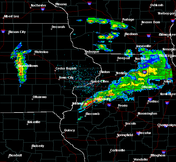 At 502 pm cdt, a severe thunderstorm capable of producing a tornado was located near monmouth, moving northeast at 60 mph (radar indicated rotation). Hazards include tornado and quarter size hail. Flying debris will be dangerous to those caught without shelter. mobile homes will be damaged or destroyed. damage to roofs, windows, and vehicles will occur. tree damage is likely. This tornadic thunderstorm will remain over mainly rural areas of central warren county, including the following locations, ormonde, gerlaw, ponemah, larchland, monmouth municipal airport, berwick, coldbrook and cameron. At 502 pm cdt, a severe thunderstorm capable of producing a tornado was located near monmouth, moving northeast at 60 mph (radar indicated rotation). Hazards include tornado and quarter size hail. Flying debris will be dangerous to those caught without shelter. mobile homes will be damaged or destroyed. damage to roofs, windows, and vehicles will occur. tree damage is likely. This tornadic thunderstorm will remain over mainly rural areas of central warren county, including the following locations, ormonde, gerlaw, ponemah, larchland, monmouth municipal airport, berwick, coldbrook and cameron.
|
| 3/28/2020 4:58 PM CDT |
 At 458 pm cdt, a severe thunderstorm capable of producing a tornado was located near monmouth, moving northeast at 60 mph (radar indicated rotation). Hazards include tornado and quarter size hail. Flying debris will be dangerous to those caught without shelter. mobile homes will be damaged or destroyed. damage to roofs, windows, and vehicles will occur. tree damage is likely. this dangerous storm will be near, lake warren around 510 pm cdt. Other locations impacted by this tornadic thunderstorm include warren county fairgrounds, ormonde, gerlaw, ponemah, larchland, monmouth municipal airport, berwick, coldbrook and cameron. At 458 pm cdt, a severe thunderstorm capable of producing a tornado was located near monmouth, moving northeast at 60 mph (radar indicated rotation). Hazards include tornado and quarter size hail. Flying debris will be dangerous to those caught without shelter. mobile homes will be damaged or destroyed. damage to roofs, windows, and vehicles will occur. tree damage is likely. this dangerous storm will be near, lake warren around 510 pm cdt. Other locations impacted by this tornadic thunderstorm include warren county fairgrounds, ormonde, gerlaw, ponemah, larchland, monmouth municipal airport, berwick, coldbrook and cameron.
|
| 3/28/2020 4:55 PM CDT |
 At 455 pm cdt, a severe thunderstorm capable of producing a tornado was located near roseville, or 8 miles south of monmouth, moving northeast at 60 mph (radar indicated rotation). Hazards include tornado and quarter size hail. Flying debris will be dangerous to those caught without shelter. mobile homes will be damaged or destroyed. damage to roofs, windows, and vehicles will occur. tree damage is likely. this dangerous storm will be near, monmouth around 505 pm cdt. lake warren around 510 pm cdt. Other locations impacted by this tornadic thunderstorm include warren county fairgrounds, ormonde, gerlaw, ponemah, larchland, monmouth municipal airport, berwick, coldbrook and cameron. At 455 pm cdt, a severe thunderstorm capable of producing a tornado was located near roseville, or 8 miles south of monmouth, moving northeast at 60 mph (radar indicated rotation). Hazards include tornado and quarter size hail. Flying debris will be dangerous to those caught without shelter. mobile homes will be damaged or destroyed. damage to roofs, windows, and vehicles will occur. tree damage is likely. this dangerous storm will be near, monmouth around 505 pm cdt. lake warren around 510 pm cdt. Other locations impacted by this tornadic thunderstorm include warren county fairgrounds, ormonde, gerlaw, ponemah, larchland, monmouth municipal airport, berwick, coldbrook and cameron.
|
| 3/28/2020 4:48 PM CDT |
 At 448 pm cdt, a severe thunderstorm capable of producing a tornado was located near roseville, or 14 miles south of monmouth, moving northeast at 35 mph (radar indicated rotation). Hazards include tornado. Flying debris will be dangerous to those caught without shelter. mobile homes will be damaged or destroyed. damage to roofs, windows, and vehicles will occur. tree damage is likely. this dangerous storm will be near, monmouth around 515 pm cdt. lake warren around 520 pm cdt. Other locations impacted by this tornadic thunderstorm include warren county fairgrounds, ormonde, gerlaw, ponemah, larchland, monmouth municipal airport, berwick, coldbrook and cameron. At 448 pm cdt, a severe thunderstorm capable of producing a tornado was located near roseville, or 14 miles south of monmouth, moving northeast at 35 mph (radar indicated rotation). Hazards include tornado. Flying debris will be dangerous to those caught without shelter. mobile homes will be damaged or destroyed. damage to roofs, windows, and vehicles will occur. tree damage is likely. this dangerous storm will be near, monmouth around 515 pm cdt. lake warren around 520 pm cdt. Other locations impacted by this tornadic thunderstorm include warren county fairgrounds, ormonde, gerlaw, ponemah, larchland, monmouth municipal airport, berwick, coldbrook and cameron.
|
| 9/27/2019 7:21 PM CDT |
 At 720 pm cdt, a severe thunderstorm was located over wataga, or 9 miles northeast of galesburg, moving east at 45 mph (radar indicated). Hazards include 60 mph wind gusts and quarter size hail. Hail damage to vehicles is expected. expect wind damage to roofs, siding, and trees. locations impacted include, galesburg, toulon, wataga, oneida, altona, victoria, west jersey, la fayette, east galesburg, henderson and snake den hollow. This includes interstate 74 between mile markers 37 and 48. At 720 pm cdt, a severe thunderstorm was located over wataga, or 9 miles northeast of galesburg, moving east at 45 mph (radar indicated). Hazards include 60 mph wind gusts and quarter size hail. Hail damage to vehicles is expected. expect wind damage to roofs, siding, and trees. locations impacted include, galesburg, toulon, wataga, oneida, altona, victoria, west jersey, la fayette, east galesburg, henderson and snake den hollow. This includes interstate 74 between mile markers 37 and 48.
|
| 9/27/2019 7:09 PM CDT |
 At 709 pm cdt, a severe thunderstorm was located near wataga, or near galesburg, moving east at 45 mph (radar indicated). Hazards include 60 mph wind gusts and quarter size hail. Hail damage to vehicles is expected. Expect wind damage to roofs, siding, and trees. At 709 pm cdt, a severe thunderstorm was located near wataga, or near galesburg, moving east at 45 mph (radar indicated). Hazards include 60 mph wind gusts and quarter size hail. Hail damage to vehicles is expected. Expect wind damage to roofs, siding, and trees.
|
| 9/27/2019 6:46 PM CDT |
 At 645 pm cdt, a severe thunderstorm was located over abingdon, or 10 miles south of galesburg, moving northeast at 45 mph. another strong to severe thunderstorm was located about 5 miles northeast of maquon, also moving northeast at 45 mph (radar indicated). Hazards include 60 mph wind gusts and half dollar size hail. Hail damage to vehicles is expected. expect wind damage to roofs, siding, and trees. locations impacted include, galesburg, abingdon, knoxville, yates city, williamsfield, maquon, gilson, st. augustine, dahinda and delong. This includes interstate 74 between mile markers 51 and 67. At 645 pm cdt, a severe thunderstorm was located over abingdon, or 10 miles south of galesburg, moving northeast at 45 mph. another strong to severe thunderstorm was located about 5 miles northeast of maquon, also moving northeast at 45 mph (radar indicated). Hazards include 60 mph wind gusts and half dollar size hail. Hail damage to vehicles is expected. expect wind damage to roofs, siding, and trees. locations impacted include, galesburg, abingdon, knoxville, yates city, williamsfield, maquon, gilson, st. augustine, dahinda and delong. This includes interstate 74 between mile markers 51 and 67.
|
| 9/27/2019 6:38 PM CDT |
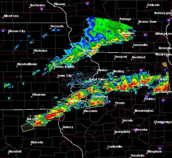 The severe thunderstorm warning for southeastern warren county will expire at 645 pm cdt, the storm which prompted the warning has moved out of the area. therefore, the warning will be allowed to expire. a tornado watch remains in effect until 1100 pm cdt for west central illinois. The severe thunderstorm warning for southeastern warren county will expire at 645 pm cdt, the storm which prompted the warning has moved out of the area. therefore, the warning will be allowed to expire. a tornado watch remains in effect until 1100 pm cdt for west central illinois.
|
| 9/27/2019 6:30 PM CDT |
 At 629 pm cdt, a severe thunderstorm was located 5 miles east of abingdon, near maquon, or 11 miles southeast of galesburg, moving northeast at 40 mph. another severe storm was entering the southwest corner of knox county between avon and abingdon, also moving northeast at 40 mph (radar indicated). Hazards include 60 mph wind gusts and half dollar size hail. Hail damage to vehicles is expected. expect wind damage to roofs, siding, and trees. locations impacted include, galesburg, abingdon, knoxville, avon, yates city, williamsfield, london mills, maquon, gilson, east galesburg, st. augustine, dahinda, delong and middle grove. This includes interstate 74 between mile markers 49 and 67. At 629 pm cdt, a severe thunderstorm was located 5 miles east of abingdon, near maquon, or 11 miles southeast of galesburg, moving northeast at 40 mph. another severe storm was entering the southwest corner of knox county between avon and abingdon, also moving northeast at 40 mph (radar indicated). Hazards include 60 mph wind gusts and half dollar size hail. Hail damage to vehicles is expected. expect wind damage to roofs, siding, and trees. locations impacted include, galesburg, abingdon, knoxville, avon, yates city, williamsfield, london mills, maquon, gilson, east galesburg, st. augustine, dahinda, delong and middle grove. This includes interstate 74 between mile markers 49 and 67.
|
| 9/27/2019 6:29 PM CDT |
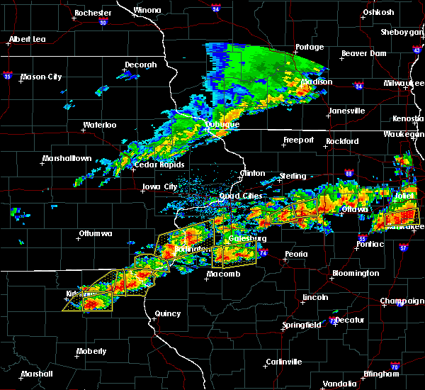 At 629 pm cdt, a severe thunderstorm was located over abingdon, or 12 miles south of galesburg, moving northeast at 40 mph (radar indicated). Hazards include 60 mph wind gusts and half dollar size hail. Hail damage to vehicles is expected. expect wind damage to roofs, siding, and trees. Locations impacted include, little swan lake, greenbush, berwick and cameron. At 629 pm cdt, a severe thunderstorm was located over abingdon, or 12 miles south of galesburg, moving northeast at 40 mph (radar indicated). Hazards include 60 mph wind gusts and half dollar size hail. Hail damage to vehicles is expected. expect wind damage to roofs, siding, and trees. Locations impacted include, little swan lake, greenbush, berwick and cameron.
|
| 9/27/2019 6:19 PM CDT |
 At 618 pm cdt, a severe thunderstorm was located near abingdon, or 13 miles south of galesburg, moving northeast at 40 mph. additional strong to severe thunderstorms were in southeast warren county near greenbush and berwick, and will be moving into the warned area shortly (radar indicated). Hazards include 60 mph wind gusts and quarter size hail. Hail damage to vehicles is expected. Expect wind damage to roofs, siding, and trees. At 618 pm cdt, a severe thunderstorm was located near abingdon, or 13 miles south of galesburg, moving northeast at 40 mph. additional strong to severe thunderstorms were in southeast warren county near greenbush and berwick, and will be moving into the warned area shortly (radar indicated). Hazards include 60 mph wind gusts and quarter size hail. Hail damage to vehicles is expected. Expect wind damage to roofs, siding, and trees.
|
| 9/27/2019 6:18 PM CDT |
 At 617 pm cdt, a severe thunderstorm was located near abingdon, or 8 miles southeast of monmouth, moving east at 50 mph (radar indicated). Hazards include 60 mph wind gusts and quarter size hail. Hail damage to vehicles is expected. expect wind damage to roofs, siding, and trees. Locations impacted include, monmouth, roseville, kirkwood, little swan lake, greenbush, berwick, ormonde, ponemah, larchland, cameron, warren county fairgrounds, swan creek and youngstown. At 617 pm cdt, a severe thunderstorm was located near abingdon, or 8 miles southeast of monmouth, moving east at 50 mph (radar indicated). Hazards include 60 mph wind gusts and quarter size hail. Hail damage to vehicles is expected. expect wind damage to roofs, siding, and trees. Locations impacted include, monmouth, roseville, kirkwood, little swan lake, greenbush, berwick, ormonde, ponemah, larchland, cameron, warren county fairgrounds, swan creek and youngstown.
|
| 9/27/2019 6:12 PM CDT |
 At 611 pm cdt, a severe thunderstorm was located near roseville, or 7 miles south of monmouth, moving east at 50 mph (radar indicated). Hazards include 60 mph wind gusts and half dollar size hail. Hail damage to vehicles is expected. Expect wind damage to roofs, siding, and trees. At 611 pm cdt, a severe thunderstorm was located near roseville, or 7 miles south of monmouth, moving east at 50 mph (radar indicated). Hazards include 60 mph wind gusts and half dollar size hail. Hail damage to vehicles is expected. Expect wind damage to roofs, siding, and trees.
|
| 8/20/2019 9:25 AM CDT | Tree fell on a house in sunnylan in knox county IL, 2.7 miles W of Galesburg, IL |
| 8/20/2019 8:48 AM CDT |
 A severe thunderstorm warning remains in effect until 900 am cdt for northeastern warren. south central rock island. eastern mercer and southwestern henry counties. At 847 am cdt, severe thunderstorms were located along a line extending from near warner to 6 miles south of cambridge to near knoxville, moving east at 55 mph. A severe thunderstorm warning remains in effect until 900 am cdt for northeastern warren. south central rock island. eastern mercer and southwestern henry counties. At 847 am cdt, severe thunderstorms were located along a line extending from near warner to 6 miles south of cambridge to near knoxville, moving east at 55 mph.
|
| 8/20/2019 8:46 AM CDT |
 A severe thunderstorm warning remains in effect until 930 am cdt for fulton. stark. knox. schuyler and peoria counties. at 846 am cdt, severe thunderstorms were located along a line extending from andover to near abingdon to near bowen, moving east at 55 mph. hazard. 60 mph wind gusts and quarter size hail. A severe thunderstorm warning remains in effect until 930 am cdt for fulton. stark. knox. schuyler and peoria counties. at 846 am cdt, severe thunderstorms were located along a line extending from andover to near abingdon to near bowen, moving east at 55 mph. hazard. 60 mph wind gusts and quarter size hail.
|
| 8/20/2019 8:45 AM CDT | Numerous trees blown down across galesburg taking power lines down in knox county IL, 0.9 miles E of Galesburg, IL |
| 8/20/2019 8:28 AM CDT |
 At 752 am cdt, severe thunderstorms were located along a line extending from letts to near mediapolis, moving east at 55 mph (radar indicated). Hazards include 70 mph wind gusts. Expect considerable tree damage. Damage is likely to mobile homes, roofs, and outbuildings. At 752 am cdt, severe thunderstorms were located along a line extending from letts to near mediapolis, moving east at 55 mph (radar indicated). Hazards include 70 mph wind gusts. Expect considerable tree damage. Damage is likely to mobile homes, roofs, and outbuildings.
|
| 8/20/2019 8:20 AM CDT |
 At 819 am cdt, severe thunderstorms were located along a line extending from andalusia to kirkwood to near warsaw, moving east at 55 mph (radar indicated). Hazards include 60 mph wind gusts and quarter size hail. Hail damage to vehicles is expected. Expect wind damage to roofs, siding, and trees. At 819 am cdt, severe thunderstorms were located along a line extending from andalusia to kirkwood to near warsaw, moving east at 55 mph (radar indicated). Hazards include 60 mph wind gusts and quarter size hail. Hail damage to vehicles is expected. Expect wind damage to roofs, siding, and trees.
|
| 8/20/2019 8:15 AM CDT |
 At 815 am cdt, severe thunderstorms were located along a line extending from near illinois city to near aledo to near kirkwood, moving east at 55 mph (radar indicated). Hazards include 70 mph wind gusts. Expect considerable tree damage. damage is likely to mobile homes, roofs, and outbuildings. locations impacted include, muscatine, monmouth, aledo, oquawka, milan, burgess, orion, fruitland, viola, woodhull, millersburg, matherville, new boston, alpha, sherrard, keithsburg, reynolds, eliza, joy and oak grove. This includes interstate 74 in illinois between mile markers 31 and 33. At 815 am cdt, severe thunderstorms were located along a line extending from near illinois city to near aledo to near kirkwood, moving east at 55 mph (radar indicated). Hazards include 70 mph wind gusts. Expect considerable tree damage. damage is likely to mobile homes, roofs, and outbuildings. locations impacted include, muscatine, monmouth, aledo, oquawka, milan, burgess, orion, fruitland, viola, woodhull, millersburg, matherville, new boston, alpha, sherrard, keithsburg, reynolds, eliza, joy and oak grove. This includes interstate 74 in illinois between mile markers 31 and 33.
|
| 8/20/2019 8:07 AM CDT |
 At 807 am cdt, severe thunderstorms were located along a line extending from near illinois city to near joy to near rozetta, moving east at 55 mph (radar indicated). Hazards include 70 mph wind gusts. Expect considerable tree damage. damage is likely to mobile homes, roofs, and outbuildings. locations impacted include, muscatine, monmouth, aledo, wapello, oquawka, milan, burgess, orion, mediapolis, fruitland, viola, morning sun, woodhull, millersburg, matherville, new boston, alpha, sherrard, keithsburg and grandview. This includes interstate 74 in illinois between mile markers 31 and 33. At 807 am cdt, severe thunderstorms were located along a line extending from near illinois city to near joy to near rozetta, moving east at 55 mph (radar indicated). Hazards include 70 mph wind gusts. Expect considerable tree damage. damage is likely to mobile homes, roofs, and outbuildings. locations impacted include, muscatine, monmouth, aledo, wapello, oquawka, milan, burgess, orion, mediapolis, fruitland, viola, morning sun, woodhull, millersburg, matherville, new boston, alpha, sherrard, keithsburg and grandview. This includes interstate 74 in illinois between mile markers 31 and 33.
|
| 8/20/2019 7:53 AM CDT |
 At 752 am cdt, severe thunderstorms were located along a line extending from letts to near mediapolis, moving east at 55 mph (radar indicated). Hazards include 70 mph wind gusts. Expect considerable tree damage. Damage is likely to mobile homes, roofs, and outbuildings. At 752 am cdt, severe thunderstorms were located along a line extending from letts to near mediapolis, moving east at 55 mph (radar indicated). Hazards include 70 mph wind gusts. Expect considerable tree damage. Damage is likely to mobile homes, roofs, and outbuildings.
|
| 6/30/2019 8:03 PM CDT |
 At 803 pm cdt, severe thunderstorms were located along a line extending from near henry to avon, moving southeast at 50 mph (trained weather spotters). Hazards include 60 mph wind gusts. Expect damage to roofs, siding, and trees. locations impacted include, peoria, galesburg, canton, lacon, chillicothe, abingdon, knoxville, henry, farmington, elmwood, princeville, rome, wyoming, dunlap, cuba, trivoli, brimfield, avon, yates city and williamsfield. This includes interstate 74 between mile markers 49 and 83. At 803 pm cdt, severe thunderstorms were located along a line extending from near henry to avon, moving southeast at 50 mph (trained weather spotters). Hazards include 60 mph wind gusts. Expect damage to roofs, siding, and trees. locations impacted include, peoria, galesburg, canton, lacon, chillicothe, abingdon, knoxville, henry, farmington, elmwood, princeville, rome, wyoming, dunlap, cuba, trivoli, brimfield, avon, yates city and williamsfield. This includes interstate 74 between mile markers 49 and 83.
|
| 6/30/2019 7:44 PM CDT | Several 3 inch diameter tree limbs downed from outflow ahead of main storm in knox county IL, 9.4 miles NNE of Galesburg, IL |
| 6/30/2019 7:40 PM CDT | Small shed overturne in knox county IL, 0.9 miles E of Galesburg, IL |
| 6/30/2019 7:35 PM CDT |
 At 735 pm cdt, severe thunderstorms were located along a line extending from near buda to 7 miles south of north henderson, moving southeast at 55 mph (radar indicated). Hazards include 60 mph wind gusts. expect damage to roofs, siding, and trees At 735 pm cdt, severe thunderstorms were located along a line extending from near buda to 7 miles south of north henderson, moving southeast at 55 mph (radar indicated). Hazards include 60 mph wind gusts. expect damage to roofs, siding, and trees
|
| 6/15/2019 9:25 PM CDT |
 At 925 pm cdt, a severe thunderstorm was located over knoxville, or near galesburg, moving east at 40 mph (radar indicated). Hazards include 60 mph wind gusts and quarter size hail. Hail damage to vehicles is expected. expect wind damage to roofs, siding, and trees. locations impacted include, galesburg, abingdon, knoxville, elmwood, wataga, oneida, yates city, williamsfield, altona, london mills, victoria, maquon, rio, gilson, east galesburg, henderson, st. augustine, snake den hollow, galesburg airport and dahinda. This includes interstate 74 between mile markers 34 and 68. At 925 pm cdt, a severe thunderstorm was located over knoxville, or near galesburg, moving east at 40 mph (radar indicated). Hazards include 60 mph wind gusts and quarter size hail. Hail damage to vehicles is expected. expect wind damage to roofs, siding, and trees. locations impacted include, galesburg, abingdon, knoxville, elmwood, wataga, oneida, yates city, williamsfield, altona, london mills, victoria, maquon, rio, gilson, east galesburg, henderson, st. augustine, snake den hollow, galesburg airport and dahinda. This includes interstate 74 between mile markers 34 and 68.
|
| 6/15/2019 9:10 PM CDT |
 At 909 pm cdt, a severe thunderstorm was located near galesburg, moving east at 45 mph (radar indicated). Hazards include 60 mph wind gusts and nickel size hail. expect damage to roofs, siding, and trees At 909 pm cdt, a severe thunderstorm was located near galesburg, moving east at 45 mph (radar indicated). Hazards include 60 mph wind gusts and nickel size hail. expect damage to roofs, siding, and trees
|
| 6/1/2019 4:54 PM CDT |
 The severe thunderstorm warning for central knox county will expire at 500 pm cdt, the storm which prompted the warning has weakened below severe limits, and has exited the warned area. therefore, the warning will be allowed to expire. however gusty winds are still possible with this thunderstorm. The severe thunderstorm warning for central knox county will expire at 500 pm cdt, the storm which prompted the warning has weakened below severe limits, and has exited the warned area. therefore, the warning will be allowed to expire. however gusty winds are still possible with this thunderstorm.
|
| 6/1/2019 4:39 PM CDT |
 At 438 pm cdt, a severe thunderstorm was located over wataga, or near galesburg, moving east at 40 mph (radar indicated). Hazards include 60 mph wind gusts and quarter size hail. Hail damage to vehicles is expected. Expect wind damage to roofs, siding, and trees. At 438 pm cdt, a severe thunderstorm was located over wataga, or near galesburg, moving east at 40 mph (radar indicated). Hazards include 60 mph wind gusts and quarter size hail. Hail damage to vehicles is expected. Expect wind damage to roofs, siding, and trees.
|
| 5/28/2019 8:16 PM CDT |
 At 815 pm cdt, severe thunderstorms were located along a line extending from near altona to near lewistown, moving east at 50 mph. a spotter reported 70 mph wind gust 2 miles north of abingdon at 806 pm with this storm (trained weather spotters). Hazards include 70 mph wind gusts and quarter size hail. Hail damage to vehicles is expected. expect considerable tree damage. wind damage is also likely to mobile homes, roofs, and outbuildings. locations impacted include, galesburg, canton, lewistown, abingdon, knoxville, farmington, cuba, wataga, avon, oneida, yates city, vermont, st. david, williamsfield, altona, fairview, ipava, london mills, victoria and maquon. This includes interstate 74 between mile markers 34 and 68. At 815 pm cdt, severe thunderstorms were located along a line extending from near altona to near lewistown, moving east at 50 mph. a spotter reported 70 mph wind gust 2 miles north of abingdon at 806 pm with this storm (trained weather spotters). Hazards include 70 mph wind gusts and quarter size hail. Hail damage to vehicles is expected. expect considerable tree damage. wind damage is also likely to mobile homes, roofs, and outbuildings. locations impacted include, galesburg, canton, lewistown, abingdon, knoxville, farmington, cuba, wataga, avon, oneida, yates city, vermont, st. david, williamsfield, altona, fairview, ipava, london mills, victoria and maquon. This includes interstate 74 between mile markers 34 and 68.
|
| 5/28/2019 8:06 PM CDT | Storm damage reported in knox county IL, 9.4 miles NNE of Galesburg, IL |
| 5/28/2019 8:01 PM CDT |
 At 800 pm cdt, severe thunderstorms were located along a line extending from near alpha to near vermont, moving east at 50 mph (radar indicated). Hazards include 70 mph wind gusts and quarter size hail. Hail damage to vehicles is expected. expect considerable tree damage. wind damage is also likely to mobile homes, roofs, and outbuildings. locations impacted include, galesburg, canton, lewistown, abingdon, knoxville, farmington, cuba, wataga, avon, oneida, yates city, vermont, st. david, williamsfield, altona, fairview, ipava, london mills, victoria and maquon. This includes interstate 74 between mile markers 34 and 68. At 800 pm cdt, severe thunderstorms were located along a line extending from near alpha to near vermont, moving east at 50 mph (radar indicated). Hazards include 70 mph wind gusts and quarter size hail. Hail damage to vehicles is expected. expect considerable tree damage. wind damage is also likely to mobile homes, roofs, and outbuildings. locations impacted include, galesburg, canton, lewistown, abingdon, knoxville, farmington, cuba, wataga, avon, oneida, yates city, vermont, st. david, williamsfield, altona, fairview, ipava, london mills, victoria and maquon. This includes interstate 74 between mile markers 34 and 68.
|
| 5/28/2019 7:41 PM CDT |
 At 740 pm cdt, severe thunderstorms were located along a line extending from shale city to near littleton, moving east at 60 mph (radar indicated). Hazards include 70 mph wind gusts and quarter size hail. Hail damage to vehicles is expected. expect considerable tree damage. Wind damage is also likely to mobile homes, roofs, and outbuildings. At 740 pm cdt, severe thunderstorms were located along a line extending from shale city to near littleton, moving east at 60 mph (radar indicated). Hazards include 70 mph wind gusts and quarter size hail. Hail damage to vehicles is expected. expect considerable tree damage. Wind damage is also likely to mobile homes, roofs, and outbuildings.
|
| 5/27/2019 2:51 PM CDT |
 The tornado warning for east central warren county will expire at 300 pm cdt, the storm which prompted the warning has moved out of the area. therefore, the warning will be allowed to expire. however gusty winds and heavy rain are still possible with this thunderstorm. a tornado watch remains in effect until 900 pm cdt for west central illinois. The tornado warning for east central warren county will expire at 300 pm cdt, the storm which prompted the warning has moved out of the area. therefore, the warning will be allowed to expire. however gusty winds and heavy rain are still possible with this thunderstorm. a tornado watch remains in effect until 900 pm cdt for west central illinois.
|
| 5/27/2019 2:41 PM CDT |
 At 241 pm cdt, a severe thunderstorm capable of producing a tornado was located near cameron, moving east at 30 mph (radar indicated rotation). Hazards include tornado. Flying debris will be dangerous to those caught without shelter. mobile homes will be damaged or destroyed. damage to roofs, windows, and vehicles will occur. tree damage is likely. Locations impacted include, monmouth, berwick, ormonde and cameron. At 241 pm cdt, a severe thunderstorm capable of producing a tornado was located near cameron, moving east at 30 mph (radar indicated rotation). Hazards include tornado. Flying debris will be dangerous to those caught without shelter. mobile homes will be damaged or destroyed. damage to roofs, windows, and vehicles will occur. tree damage is likely. Locations impacted include, monmouth, berwick, ormonde and cameron.
|
| 5/27/2019 2:22 PM CDT |
 At 222 pm cdt, a severe thunderstorm capable of producing a tornado was located over kirkwood, or 7 miles southwest of monmouth, moving east at 30 mph (radar indicated rotation). Hazards include tornado. Flying debris will be dangerous to those caught without shelter. mobile homes will be damaged or destroyed. damage to roofs, windows, and vehicles will occur. Tree damage is likely. At 222 pm cdt, a severe thunderstorm capable of producing a tornado was located over kirkwood, or 7 miles southwest of monmouth, moving east at 30 mph (radar indicated rotation). Hazards include tornado. Flying debris will be dangerous to those caught without shelter. mobile homes will be damaged or destroyed. damage to roofs, windows, and vehicles will occur. Tree damage is likely.
|
| 5/24/2019 8:39 PM CDT |
 At 836 pm cdt, severe thunderstorms were located along a line extending from near galesburg to near west jersey, moving northeast at 35 mph (radar indicated. at 815 pm cdt, broadcast media reported nickel size hail in east galesburg). Hazards include 60 mph wind gusts and quarter size hail. Hail damage to vehicles is expected. expect wind damage to roofs, siding, and trees. locations impacted include, galesburg, wataga, oneida, altona, victoria, east galesburg, henderson, snake den hollow and galesburg airport. This includes interstate 74 between mile markers 38 and 47. At 836 pm cdt, severe thunderstorms were located along a line extending from near galesburg to near west jersey, moving northeast at 35 mph (radar indicated. at 815 pm cdt, broadcast media reported nickel size hail in east galesburg). Hazards include 60 mph wind gusts and quarter size hail. Hail damage to vehicles is expected. expect wind damage to roofs, siding, and trees. locations impacted include, galesburg, wataga, oneida, altona, victoria, east galesburg, henderson, snake den hollow and galesburg airport. This includes interstate 74 between mile markers 38 and 47.
|
| 5/24/2019 8:23 PM CDT |
 At 822 pm cdt, a severe thunderstorm was located over wataga, or 7 miles northeast of galesburg, moving northeast at 35 mph (radar indicated). Hazards include 60 mph wind gusts and quarter size hail. Hail damage to vehicles is expected. expect wind damage to roofs, siding, and trees. locations impacted include, galesburg, knoxville, wataga, oneida, williamsfield, altona, victoria, east galesburg, henderson, snake den hollow, galesburg airport and dahinda. This includes interstate 74 between mile markers 38 and 60. At 822 pm cdt, a severe thunderstorm was located over wataga, or 7 miles northeast of galesburg, moving northeast at 35 mph (radar indicated). Hazards include 60 mph wind gusts and quarter size hail. Hail damage to vehicles is expected. expect wind damage to roofs, siding, and trees. locations impacted include, galesburg, knoxville, wataga, oneida, williamsfield, altona, victoria, east galesburg, henderson, snake den hollow, galesburg airport and dahinda. This includes interstate 74 between mile markers 38 and 60.
|
| 5/24/2019 8:08 PM CDT |
 At 807 pm cdt, a severe thunderstorm was located near galesburg, moving northeast at 35 mph (radar indicated). Hazards include 60 mph wind gusts and quarter size hail. Hail damage to vehicles is expected. Expect wind damage to roofs, siding, and trees. At 807 pm cdt, a severe thunderstorm was located near galesburg, moving northeast at 35 mph (radar indicated). Hazards include 60 mph wind gusts and quarter size hail. Hail damage to vehicles is expected. Expect wind damage to roofs, siding, and trees.
|
| 5/17/2019 8:29 AM CDT |
 At 823 am cdt, a severe thunderstorm was located near burgess, or 9 miles southeast of aledo, moving east at 40 mph (radar indicated). Hazards include 60 mph wind gusts. Expect damage to roofs, siding, and trees. Locations impacted include, monmouth, aledo, burgess, viola, kirkwood, joy, little york, biggsville, rozetta, seaton, north henderson, shale city, new windsor, ogle, alexis, coldbrook, bald bluff, berwick, gerlaw and larchland. At 823 am cdt, a severe thunderstorm was located near burgess, or 9 miles southeast of aledo, moving east at 40 mph (radar indicated). Hazards include 60 mph wind gusts. Expect damage to roofs, siding, and trees. Locations impacted include, monmouth, aledo, burgess, viola, kirkwood, joy, little york, biggsville, rozetta, seaton, north henderson, shale city, new windsor, ogle, alexis, coldbrook, bald bluff, berwick, gerlaw and larchland.
|
| 5/17/2019 8:23 AM CDT |
 At 812 am cdt, a severe thunderstorm was located over seaton, or 9 miles southwest of aledo, moving east at 35 mph (radar indicated). Hazards include 60 mph wind gusts. expect damage to roofs, siding, and trees At 812 am cdt, a severe thunderstorm was located over seaton, or 9 miles southwest of aledo, moving east at 35 mph (radar indicated). Hazards include 60 mph wind gusts. expect damage to roofs, siding, and trees
|
| 5/17/2019 8:12 AM CDT |
 The national weather service in the quad cities has issued a * severe thunderstorm warning for. northeastern henderson county in west central illinois. warren county in west central illinois. southern mercer county in northwestern illinois. Until 900 am cdt. The national weather service in the quad cities has issued a * severe thunderstorm warning for. northeastern henderson county in west central illinois. warren county in west central illinois. southern mercer county in northwestern illinois. Until 900 am cdt.
|
| 5/16/2019 10:49 PM CDT |
 At 1048 pm cdt, a severe thunderstorm was located over andover, or near cambridge, moving southeast at 45 mph (radar indicated). Hazards include 60 mph wind gusts and quarter size hail. Hail damage to vehicles is expected. Expect wind damage to roofs, siding, and trees. At 1048 pm cdt, a severe thunderstorm was located over andover, or near cambridge, moving southeast at 45 mph (radar indicated). Hazards include 60 mph wind gusts and quarter size hail. Hail damage to vehicles is expected. Expect wind damage to roofs, siding, and trees.
|
| 8/28/2018 9:46 PM CDT |
 At 945 pm cdt, severe thunderstorms were located along a line extending from oneida to near london mills to near adair, moving east at 50 mph (radar indicated). Hazards include 60 mph wind gusts and penny size hail. Expect damage to roofs, siding, and trees. locations impacted include, galesburg, canton, lewistown, abingdon, knoxville, farmington, elmwood, cuba, toulon, brimfield, wataga, avon, oneida, yates city, vermont, st. david, williamsfield, altona, fairview and ipava. This includes interstate 74 between mile markers 34 and 75. At 945 pm cdt, severe thunderstorms were located along a line extending from oneida to near london mills to near adair, moving east at 50 mph (radar indicated). Hazards include 60 mph wind gusts and penny size hail. Expect damage to roofs, siding, and trees. locations impacted include, galesburg, canton, lewistown, abingdon, knoxville, farmington, elmwood, cuba, toulon, brimfield, wataga, avon, oneida, yates city, vermont, st. david, williamsfield, altona, fairview and ipava. This includes interstate 74 between mile markers 34 and 75.
|
| 8/28/2018 9:20 PM CDT |
 At 919 pm cdt, severe thunderstorms were located along a line extending from 6 miles east of little york to roseville to near tennessee, moving east at 50 mph (radar indicated). Hazards include 60 mph wind gusts and penny size hail. expect damage to roofs, siding, and trees At 919 pm cdt, severe thunderstorms were located along a line extending from 6 miles east of little york to roseville to near tennessee, moving east at 50 mph (radar indicated). Hazards include 60 mph wind gusts and penny size hail. expect damage to roofs, siding, and trees
|
| 6/21/2018 1:15 PM CDT |
 At 115 pm cdt, tornado producing storms were located along a line extending from oneida to near trivoli, moving northeast at 25 mph (law enforcement confirmed tornado). Hazards include tornado. Expect damage to mobile homes, roofs, and vehicles. these tornadic storms will be near, hanna city around 120 pm cdt. brimfield around 125 pm cdt. dunlap, altona and victoria around 130 pm cdt. other locations impacted by these tornadic storms include snake den hollow, norris, banner, smithville, monica, kickapoo, dahinda, east galesburg, middle grove and henderson. This includes interstate 74 between mile markers 34 and 83. At 115 pm cdt, tornado producing storms were located along a line extending from oneida to near trivoli, moving northeast at 25 mph (law enforcement confirmed tornado). Hazards include tornado. Expect damage to mobile homes, roofs, and vehicles. these tornadic storms will be near, hanna city around 120 pm cdt. brimfield around 125 pm cdt. dunlap, altona and victoria around 130 pm cdt. other locations impacted by these tornadic storms include snake den hollow, norris, banner, smithville, monica, kickapoo, dahinda, east galesburg, middle grove and henderson. This includes interstate 74 between mile markers 34 and 83.
|
| 6/21/2018 1:00 PM CDT |
 At 1259 pm cdt, tornado producing storms were located along a line extending from near wataga to near trivoli, moving northeast at 25 mph (law enforcement confirmed tornado). Hazards include tornado. Expect damage to mobile homes, roofs, and vehicles. these tornadic storms will be near, elmwood and trivoli around 105 pm cdt. hanna city and oneida around 115 pm cdt. brimfield around 120 pm cdt. altona and victoria around 125 pm cdt. dunlap around 130 pm cdt. other locations impacted by these tornadic storms include snake den hollow, norris, banner, smithville, monica, kickapoo, dahinda, east galesburg, middle grove and henderson. This includes interstate 74 between mile markers 34 and 83. At 1259 pm cdt, tornado producing storms were located along a line extending from near wataga to near trivoli, moving northeast at 25 mph (law enforcement confirmed tornado). Hazards include tornado. Expect damage to mobile homes, roofs, and vehicles. these tornadic storms will be near, elmwood and trivoli around 105 pm cdt. hanna city and oneida around 115 pm cdt. brimfield around 120 pm cdt. altona and victoria around 125 pm cdt. dunlap around 130 pm cdt. other locations impacted by these tornadic storms include snake den hollow, norris, banner, smithville, monica, kickapoo, dahinda, east galesburg, middle grove and henderson. This includes interstate 74 between mile markers 34 and 83.
|
| 6/20/2018 5:55 PM CDT | Few trees reported down... with one on a house. power lines also reported down. estimated 50 mph wind in knox county IL, 0.9 miles E of Galesburg, IL |
| 6/19/2018 3:30 PM CDT | Power line down in galesburg in knox county IL, 0.9 miles E of Galesburg, IL |
| 6/10/2018 2:06 AM CDT |
 At 204 am cdt, severe thunderstorms were located along a line extending from near castleton to elmore to near knoxville, moving southeast at 25 mph (radar indicated). Hazards include 60 mph wind gusts. expect damage to roofs, siding, and trees At 204 am cdt, severe thunderstorms were located along a line extending from near castleton to elmore to near knoxville, moving southeast at 25 mph (radar indicated). Hazards include 60 mph wind gusts. expect damage to roofs, siding, and trees
|
| 5/26/2018 6:01 PM CDT |
 At 600 pm cdt, a severe thunderstorm was located near abingdon, or 11 miles southeast of galesburg, moving south at 10 mph (trained weather spotters. quarter size hail was reported in knoxville at 5:40 pm cdt). Hazards include 60 mph wind gusts and quarter size hail. Hail damage to vehicles is expected. expect wind damage to roofs, siding, and trees. locations impacted include, yates city, maquon, gilson and delong. This includes interstate 74 between mile markers 51 and 61. At 600 pm cdt, a severe thunderstorm was located near abingdon, or 11 miles southeast of galesburg, moving south at 10 mph (trained weather spotters. quarter size hail was reported in knoxville at 5:40 pm cdt). Hazards include 60 mph wind gusts and quarter size hail. Hail damage to vehicles is expected. expect wind damage to roofs, siding, and trees. locations impacted include, yates city, maquon, gilson and delong. This includes interstate 74 between mile markers 51 and 61.
|
| 5/26/2018 5:43 PM CDT |
 At 533 pm cdt, a severe thunderstorm was located over gilson, or 10 miles southeast of galesburg, moving southeast at 10 mph (radar indicated). Hazards include 60 mph wind gusts and quarter size hail. Hail damage to vehicles is expected. Expect wind damage to roofs, siding, and trees. At 533 pm cdt, a severe thunderstorm was located over gilson, or 10 miles southeast of galesburg, moving southeast at 10 mph (radar indicated). Hazards include 60 mph wind gusts and quarter size hail. Hail damage to vehicles is expected. Expect wind damage to roofs, siding, and trees.
|
| 5/26/2018 5:33 PM CDT |
 At 533 pm cdt, a severe thunderstorm was located over gilson, or 10 miles southeast of galesburg, moving southeast at 10 mph (radar indicated). Hazards include 60 mph wind gusts and quarter size hail. Hail damage to vehicles is expected. Expect wind damage to roofs, siding, and trees. At 533 pm cdt, a severe thunderstorm was located over gilson, or 10 miles southeast of galesburg, moving southeast at 10 mph (radar indicated). Hazards include 60 mph wind gusts and quarter size hail. Hail damage to vehicles is expected. Expect wind damage to roofs, siding, and trees.
|
| 12/4/2017 6:50 PM CST |
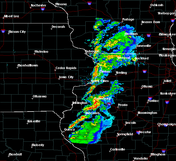 At 650 pm cst, severe thunderstorms were located along a line extending from galesburg to near london mills to near bushnell, moving east at 55 mph (radar indicated). Hazards include 60 mph wind gusts. Expect damage to roofs, siding, and trees. Locations impacted include, little swan lake, greenbush, berwick, swan creek and youngstown. At 650 pm cst, severe thunderstorms were located along a line extending from galesburg to near london mills to near bushnell, moving east at 55 mph (radar indicated). Hazards include 60 mph wind gusts. Expect damage to roofs, siding, and trees. Locations impacted include, little swan lake, greenbush, berwick, swan creek and youngstown.
|
| 12/4/2017 6:33 PM CST |
 At 633 pm cst, severe thunderstorms were located along a line extending from near monmouth to near little swan lake to near blandinsville, moving east at 55 mph (radar indicated). Hazards include 60 mph wind gusts. expect damage to roofs, siding, and trees At 633 pm cst, severe thunderstorms were located along a line extending from near monmouth to near little swan lake to near blandinsville, moving east at 55 mph (radar indicated). Hazards include 60 mph wind gusts. expect damage to roofs, siding, and trees
|
| 10/14/2017 6:38 PM CDT |
 The severe thunderstorm warning for southern warren county will expire at 645 pm cdt, the storms which prompted the warning have moved out of the area. therefore, the warning will be allowed to expire. a tornado watch remains in effect until 100 am cdt for west central illinois. The severe thunderstorm warning for southern warren county will expire at 645 pm cdt, the storms which prompted the warning have moved out of the area. therefore, the warning will be allowed to expire. a tornado watch remains in effect until 100 am cdt for west central illinois.
|
| 10/14/2017 6:28 PM CDT |
 At 627 pm cdt, a severe thunderstorm was located over williamsfield, or 18 miles east of galesburg, moving east at 55 mph (radar indicated). Hazards include 60 mph wind gusts and quarter size hail. Hail damage to vehicles is expected. Expect wind damage to roofs, siding, and trees. At 627 pm cdt, a severe thunderstorm was located over williamsfield, or 18 miles east of galesburg, moving east at 55 mph (radar indicated). Hazards include 60 mph wind gusts and quarter size hail. Hail damage to vehicles is expected. Expect wind damage to roofs, siding, and trees.
|
| 10/14/2017 6:22 PM CDT |
 At 622 pm cdt, severe thunderstorms were located along a line extending from near abingdon to near good hope, moving east at 40 mph (radar indicated). Hazards include 60 mph wind gusts and quarter size hail. Hail damage to vehicles is expected. expect wind damage to roofs, siding, and trees. locations impacted include, monmouth, roseville, little swan lake, greenbush, berwick, warren county fairgrounds, ormonde, swan creek, ponemah, youngstown, larchland and cameron. A tornado watch remains in effect until 100 am cdt for west central illinois. At 622 pm cdt, severe thunderstorms were located along a line extending from near abingdon to near good hope, moving east at 40 mph (radar indicated). Hazards include 60 mph wind gusts and quarter size hail. Hail damage to vehicles is expected. expect wind damage to roofs, siding, and trees. locations impacted include, monmouth, roseville, little swan lake, greenbush, berwick, warren county fairgrounds, ormonde, swan creek, ponemah, youngstown, larchland and cameron. A tornado watch remains in effect until 100 am cdt for west central illinois.
|
| 10/14/2017 6:13 PM CDT |
 At 612 pm cdt, a severe thunderstorm was located near gilson, or 10 miles east of galesburg, moving east at 55 mph (radar indicated). Hazards include 70 mph wind gusts and ping pong ball size hail. People and animals outdoors will be injured. expect hail damage to roofs, siding, windows, and vehicles. expect considerable tree damage. wind damage is also likely to mobile homes, roofs, and outbuildings. locations impacted include, galesburg, abingdon, knoxville, wataga, oneida, yates city, williamsfield, altona, victoria, maquon, rio, gilson, east galesburg, henderson, st. augustine, dahinda, delong, snake den hollow and galesburg airport. this includes interstate 74 between mile markers 35 and 67. A tornado watch remains in effect until 100 am cdt for west central illinois. At 612 pm cdt, a severe thunderstorm was located near gilson, or 10 miles east of galesburg, moving east at 55 mph (radar indicated). Hazards include 70 mph wind gusts and ping pong ball size hail. People and animals outdoors will be injured. expect hail damage to roofs, siding, windows, and vehicles. expect considerable tree damage. wind damage is also likely to mobile homes, roofs, and outbuildings. locations impacted include, galesburg, abingdon, knoxville, wataga, oneida, yates city, williamsfield, altona, victoria, maquon, rio, gilson, east galesburg, henderson, st. augustine, dahinda, delong, snake den hollow and galesburg airport. this includes interstate 74 between mile markers 35 and 67. A tornado watch remains in effect until 100 am cdt for west central illinois.
|
| 10/14/2017 6:09 PM CDT | Several large trees and tree branches blown down around town...time estimated by radar in knox county IL, 0.9 miles E of Galesburg, IL |
| 10/14/2017 6:08 PM CDT |
 At 608 pm cdt, severe thunderstorms were located along a line extending from near kirkwood to near sciota, moving east at 40 mph (radar indicated). Hazards include 60 mph wind gusts and quarter size hail. Hail damage to vehicles is expected. expect wind damage to roofs, siding, and trees. locations impacted include, monmouth, roseville, kirkwood, raritan, little swan lake, greenbush, berwick, media, ormonde, ponemah, larchland, monmouth municipal airport, cameron, warren county fairgrounds, swan creek, youngstown and smithshire. A tornado watch remains in effect until 100 am cdt for west central illinois. At 608 pm cdt, severe thunderstorms were located along a line extending from near kirkwood to near sciota, moving east at 40 mph (radar indicated). Hazards include 60 mph wind gusts and quarter size hail. Hail damage to vehicles is expected. expect wind damage to roofs, siding, and trees. locations impacted include, monmouth, roseville, kirkwood, raritan, little swan lake, greenbush, berwick, media, ormonde, ponemah, larchland, monmouth municipal airport, cameron, warren county fairgrounds, swan creek, youngstown and smithshire. A tornado watch remains in effect until 100 am cdt for west central illinois.
|
| 10/14/2017 5:54 PM CDT |
 At 553 pm cdt, a severe thunderstorm was located near the west side of galesburg, moving east at 60 mph (radar indicated). Hazards include 70 mph wind gusts and ping pong ball size hail. People and animals outdoors will be injured. expect hail damage to roofs, siding, windows, and vehicles. expect considerable tree damage. wind damage is also likely to mobile homes, roofs, and outbuildings. locations impacted include, galesburg, abingdon, knoxville, wataga, oneida, yates city, williamsfield, altona, victoria, maquon, rio, gilson, east galesburg, henderson, st. augustine, dahinda, delong, snake den hollow and galesburg airport. this includes interstate 74 between mile markers 35 and 67. A tornado watch remains in effect until 100 am cdt for west central illinois. At 553 pm cdt, a severe thunderstorm was located near the west side of galesburg, moving east at 60 mph (radar indicated). Hazards include 70 mph wind gusts and ping pong ball size hail. People and animals outdoors will be injured. expect hail damage to roofs, siding, windows, and vehicles. expect considerable tree damage. wind damage is also likely to mobile homes, roofs, and outbuildings. locations impacted include, galesburg, abingdon, knoxville, wataga, oneida, yates city, williamsfield, altona, victoria, maquon, rio, gilson, east galesburg, henderson, st. augustine, dahinda, delong, snake den hollow and galesburg airport. this includes interstate 74 between mile markers 35 and 67. A tornado watch remains in effect until 100 am cdt for west central illinois.
|
| 10/14/2017 5:45 PM CDT |
 At 545 pm cdt, a severe thunderstorm was located near monmouth, moving east at 60 mph (radar indicated). Hazards include 70 mph wind gusts and quarter size hail. Hail damage to vehicles is expected. expect considerable tree damage. Wind damage is also likely to mobile homes, roofs, and outbuildings. At 545 pm cdt, a severe thunderstorm was located near monmouth, moving east at 60 mph (radar indicated). Hazards include 70 mph wind gusts and quarter size hail. Hail damage to vehicles is expected. expect considerable tree damage. Wind damage is also likely to mobile homes, roofs, and outbuildings.
|
| 8/10/2017 6:21 PM CDT |
 At 621 pm cdt, a severe thunderstorm was located near roseville, or 8 miles south of monmouth, moving east at 35 mph (radar indicated). Hazards include 60 mph wind gusts and penny size hail. Expect damage to roofs, siding, and trees. Locations impacted include, monmouth, roseville, kirkwood, biggsville, greenbush, coldbrook, berwick, media, ormonde, ponemah, larchland, monmouth municipal airport, cameron, olena, warren county fairgrounds and smithshire. At 621 pm cdt, a severe thunderstorm was located near roseville, or 8 miles south of monmouth, moving east at 35 mph (radar indicated). Hazards include 60 mph wind gusts and penny size hail. Expect damage to roofs, siding, and trees. Locations impacted include, monmouth, roseville, kirkwood, biggsville, greenbush, coldbrook, berwick, media, ormonde, ponemah, larchland, monmouth municipal airport, cameron, olena, warren county fairgrounds and smithshire.
|
| 8/10/2017 5:14 PM CDT |
 At 514 pm cdt, a severe thunderstorm was located near rozetta, or near oquawka, moving east at 25 mph (radar indicated). Hazards include 60 mph wind gusts and quarter size hail. Hail damage to vehicles is expected. Expect wind damage to roofs, siding, and trees. At 514 pm cdt, a severe thunderstorm was located near rozetta, or near oquawka, moving east at 25 mph (radar indicated). Hazards include 60 mph wind gusts and quarter size hail. Hail damage to vehicles is expected. Expect wind damage to roofs, siding, and trees.
|
| 8/3/2017 5:18 PM CDT |
 At 518 pm cdt, severe thunderstorms were located along a line extending from near rio to near monmouth, moving east at 30 mph (trained weather spotters). Hazards include 60 mph wind gusts and quarter size hail. Hail damage to vehicles is expected. expect wind damage to roofs, siding, and trees. Locations impacted include, monmouth, coldbrook, gerlaw, monmouth municipal airport and cameron. At 518 pm cdt, severe thunderstorms were located along a line extending from near rio to near monmouth, moving east at 30 mph (trained weather spotters). Hazards include 60 mph wind gusts and quarter size hail. Hail damage to vehicles is expected. expect wind damage to roofs, siding, and trees. Locations impacted include, monmouth, coldbrook, gerlaw, monmouth municipal airport and cameron.
|
| 8/3/2017 5:08 PM CDT |
 At 507 pm cdt, severe thunderstorms were located along a line extending from rio to near kirkwood, moving east at 30 mph (radar indicated). Hazards include 60 mph wind gusts and quarter size hail. Hail damage to vehicles is expected. Expect wind damage to roofs, siding, and trees. At 507 pm cdt, severe thunderstorms were located along a line extending from rio to near kirkwood, moving east at 30 mph (radar indicated). Hazards include 60 mph wind gusts and quarter size hail. Hail damage to vehicles is expected. Expect wind damage to roofs, siding, and trees.
|
| 7/10/2017 4:48 AM CDT |
 At 448 am cdt, severe thunderstorms were located along a line extending from near boden to near morning sun, moving southeast at 50 mph (radar indicated). Hazards include 60 mph wind gusts. expect damage to roofs, siding, and trees At 448 am cdt, severe thunderstorms were located along a line extending from near boden to near morning sun, moving southeast at 50 mph (radar indicated). Hazards include 60 mph wind gusts. expect damage to roofs, siding, and trees
|
| 5/17/2017 9:30 PM CDT |
 At 929 pm cdt, a severe thunderstorm was located 8 miles northeast of galesburg, moving northeast at 50 mph (radar indicated). Hazards include 60 mph wind gusts and quarter size hail. Hail damage to vehicles is expected. expect wind damage to roofs, siding, and trees. locations impacted include, galesburg, wataga, oneida, altona, victoria, east galesburg and henderson. this includes interstate 74 between mile markers 37 and 50. A tornado watch remains in effect until 1100 pm cdt for north central and west central illinois. At 929 pm cdt, a severe thunderstorm was located 8 miles northeast of galesburg, moving northeast at 50 mph (radar indicated). Hazards include 60 mph wind gusts and quarter size hail. Hail damage to vehicles is expected. expect wind damage to roofs, siding, and trees. locations impacted include, galesburg, wataga, oneida, altona, victoria, east galesburg and henderson. this includes interstate 74 between mile markers 37 and 50. A tornado watch remains in effect until 1100 pm cdt for north central and west central illinois.
|
| 5/17/2017 9:08 PM CDT |
 At 907 pm cdt, a severe thunderstorm was located over wataga, or 8 miles northeast of galesburg, moving northeast at 50 mph (radar indicated). Hazards include 60 mph wind gusts and quarter size hail. Hail damage to vehicles is expected. Expect wind damage to roofs, siding, and trees. At 907 pm cdt, a severe thunderstorm was located over wataga, or 8 miles northeast of galesburg, moving northeast at 50 mph (radar indicated). Hazards include 60 mph wind gusts and quarter size hail. Hail damage to vehicles is expected. Expect wind damage to roofs, siding, and trees.
|
| 3/20/2017 1:15 AM CDT | Quarter sized hail reported 0.9 miles E of Galesburg, IL, quarter size hail at 400 n galeburg rd from 1 to 115 am. |
| 3/20/2017 1:11 AM CDT |
 At 110 am cdt, a severe thunderstorm was located over knoxville, or 7 miles east of galesburg, moving east at 30 mph (trained weather spotter on the south end of galesburg reported 1.5 inch hail at 105 am). Hazards include ping pong ball size hail. People and animals outdoors will be injured. expect damage to roofs, siding, windows, and vehicles. locations impacted include, galesburg, knoxville, yates city, williamsfield, maquon, gilson, east galesburg and dahinda. This includes interstate 74 between mile markers 44 and 67. At 110 am cdt, a severe thunderstorm was located over knoxville, or 7 miles east of galesburg, moving east at 30 mph (trained weather spotter on the south end of galesburg reported 1.5 inch hail at 105 am). Hazards include ping pong ball size hail. People and animals outdoors will be injured. expect damage to roofs, siding, windows, and vehicles. locations impacted include, galesburg, knoxville, yates city, williamsfield, maquon, gilson, east galesburg and dahinda. This includes interstate 74 between mile markers 44 and 67.
|
| 3/20/2017 1:05 AM CDT | Ping Pong Ball sized hail reported 1.3 miles NE of Galesburg, IL |
| 3/20/2017 1:00 AM CDT | Golf Ball sized hail reported 0.9 miles E of Galesburg, IL, ping pong to golf ball size hail in galesburg |
| 3/20/2017 1:00 AM CDT | Half Dollar sized hail reported 0.9 miles E of Galesburg, IL |
| 3/20/2017 1:00 AM CDT | Quarter sized hail reported 0.9 miles E of Galesburg, IL |
| 3/20/2017 12:55 AM CDT | Quarter sized hail reported 0.9 miles E of Galesburg, IL, quarter size hail at 407 west 1st street in galesburg from 1255 to 1 am |
| 3/20/2017 12:42 AM CDT |
 At 1241 am cdt, a severe thunderstorm was located near north henderson, or near galesburg, moving east at 30 mph (radar indicated). Hazards include quarter size hail. damage to vehicles is expected At 1241 am cdt, a severe thunderstorm was located near north henderson, or near galesburg, moving east at 30 mph (radar indicated). Hazards include quarter size hail. damage to vehicles is expected
|
| 3/6/2017 11:25 PM CST |
 A severe thunderstorm warning remains in effect until midnight cst for fulton, stark, knox, schuyler and western peoria counties, , a tornado warning remains in effect for portions of knox and northern fulton county. at 1124 pm cst, severe thunderstorms were located along a line extending from near galva to near meredosia, moving northeast at 70 mph (radar indicated). Hazards include 70 mph wind gusts and quarter size hail. Hail damage to vehicles is expected. expect considerable tree damage. wind damage is also likely to mobile homes, roofs, and outbuildings. locations impacted include, galesburg, canton, beardstown, rushville, lewistown, abingdon, knoxville, farmington, elmwood, princeville, wyoming, cuba, toulon, hanna city, astoria, trivoli, osceola, brimfield, wataga and avon. this includes interstate 74 between mile markers 35 and 82. A tornado watch remains in effect until 400 am cst for central, north central and west central illinois. A severe thunderstorm warning remains in effect until midnight cst for fulton, stark, knox, schuyler and western peoria counties, , a tornado warning remains in effect for portions of knox and northern fulton county. at 1124 pm cst, severe thunderstorms were located along a line extending from near galva to near meredosia, moving northeast at 70 mph (radar indicated). Hazards include 70 mph wind gusts and quarter size hail. Hail damage to vehicles is expected. expect considerable tree damage. wind damage is also likely to mobile homes, roofs, and outbuildings. locations impacted include, galesburg, canton, beardstown, rushville, lewistown, abingdon, knoxville, farmington, elmwood, princeville, wyoming, cuba, toulon, hanna city, astoria, trivoli, osceola, brimfield, wataga and avon. this includes interstate 74 between mile markers 35 and 82. A tornado watch remains in effect until 400 am cst for central, north central and west central illinois.
|
| 3/6/2017 11:16 PM CST |
 At 1116 pm cst, a severe squall line capable of producing both tornadoes and extensive straight line wind damage was located near avon, or 15 miles south of galesburg, moving east at 60 mph (radar indicated rotation). Hazards include tornado and quarter size hail. Flying debris will be dangerous to those caught without shelter. mobile homes will be damaged or destroyed. damage to roofs, windows, and vehicles will occur. tree damage is likely. these dangerous storms will be near, london mills around 1125 pm cst. maquon and gilson around 1130 pm cst. yates city around 1135 pm cst. williamsfield around 1140 pm cst. other locations impacted by this tornadic thunderstorm include snake den hollow, galesburg airport, dahinda, delong, east galesburg, st. augustine and middle grove. This includes interstate 74 between mile markers 46 and 67. At 1116 pm cst, a severe squall line capable of producing both tornadoes and extensive straight line wind damage was located near avon, or 15 miles south of galesburg, moving east at 60 mph (radar indicated rotation). Hazards include tornado and quarter size hail. Flying debris will be dangerous to those caught without shelter. mobile homes will be damaged or destroyed. damage to roofs, windows, and vehicles will occur. tree damage is likely. these dangerous storms will be near, london mills around 1125 pm cst. maquon and gilson around 1130 pm cst. yates city around 1135 pm cst. williamsfield around 1140 pm cst. other locations impacted by this tornadic thunderstorm include snake den hollow, galesburg airport, dahinda, delong, east galesburg, st. augustine and middle grove. This includes interstate 74 between mile markers 46 and 67.
|
| 3/6/2017 11:14 PM CST |
 At 1114 pm cst, a severe thunderstorm capable of producing a tornado was located over wataga, or near galesburg, moving northeast at 55 mph (radar indicated rotation). Hazards include tornado and quarter size hail. Flying debris will be dangerous to those caught without shelter. mobile homes will be damaged or destroyed. damage to roofs, windows, and vehicles will occur. tree damage is likely. this dangerous storm will be near, altona around 1125 pm cst. other locations impacted by this tornadic thunderstorm include henderson. This includes interstate 74 between mile markers 37 and 45. At 1114 pm cst, a severe thunderstorm capable of producing a tornado was located over wataga, or near galesburg, moving northeast at 55 mph (radar indicated rotation). Hazards include tornado and quarter size hail. Flying debris will be dangerous to those caught without shelter. mobile homes will be damaged or destroyed. damage to roofs, windows, and vehicles will occur. tree damage is likely. this dangerous storm will be near, altona around 1125 pm cst. other locations impacted by this tornadic thunderstorm include henderson. This includes interstate 74 between mile markers 37 and 45.
|
| 3/6/2017 11:12 PM CST |
 At 1109 pm cst, severe thunderstorms were located along a line extending from abingdon to 7 miles west of griggsville, moving east at 60 mph (radar indicated). Hazards include 70 mph wind gusts and quarter size hail. Hail damage to vehicles is expected. expect considerable tree damage. wind damage is also likely to mobile homes, roofs, and outbuildings. locations impacted include, galesburg, canton, beardstown, rushville, lewistown, abingdon, knoxville, farmington, elmwood, princeville, wyoming, cuba, toulon, hanna city, astoria, trivoli, osceola, brimfield, wataga and avon. this includes interstate 74 between mile markers 35 and 82. A tornado watch remains in effect until 400 am cst for central, north central and west central illinois. At 1109 pm cst, severe thunderstorms were located along a line extending from abingdon to 7 miles west of griggsville, moving east at 60 mph (radar indicated). Hazards include 70 mph wind gusts and quarter size hail. Hail damage to vehicles is expected. expect considerable tree damage. wind damage is also likely to mobile homes, roofs, and outbuildings. locations impacted include, galesburg, canton, beardstown, rushville, lewistown, abingdon, knoxville, farmington, elmwood, princeville, wyoming, cuba, toulon, hanna city, astoria, trivoli, osceola, brimfield, wataga and avon. this includes interstate 74 between mile markers 35 and 82. A tornado watch remains in effect until 400 am cst for central, north central and west central illinois.
|
| 3/6/2017 11:08 PM CST |
 At 1107 pm cst, severe thunderstorms capable of producing both tornadoes and extensive straight line wind damage were located over little swan lake, or 15 miles northeast of macomb, moving east at 65 mph (radar indicated rotation). Hazards include tornado and quarter size hail. Flying debris will be dangerous to those caught without shelter. mobile homes will be damaged or destroyed. damage to roofs, windows, and vehicles will occur. tree damage is likely. these dangerous storms will be near, abingdon around 1120 pm cst. london mills around 1125 pm cst. maquon and gilson around 1130 pm cst. yates city around 1135 pm cst. williamsfield around 1140 pm cst. other locations impacted by this tornadic thunderstorm include snake den hollow, galesburg airport, dahinda, delong, east galesburg, st. augustine and middle grove. This includes interstate 74 between mile markers 46 and 67. At 1107 pm cst, severe thunderstorms capable of producing both tornadoes and extensive straight line wind damage were located over little swan lake, or 15 miles northeast of macomb, moving east at 65 mph (radar indicated rotation). Hazards include tornado and quarter size hail. Flying debris will be dangerous to those caught without shelter. mobile homes will be damaged or destroyed. damage to roofs, windows, and vehicles will occur. tree damage is likely. these dangerous storms will be near, abingdon around 1120 pm cst. london mills around 1125 pm cst. maquon and gilson around 1130 pm cst. yates city around 1135 pm cst. williamsfield around 1140 pm cst. other locations impacted by this tornadic thunderstorm include snake den hollow, galesburg airport, dahinda, delong, east galesburg, st. augustine and middle grove. This includes interstate 74 between mile markers 46 and 67.
|
| 3/6/2017 11:03 PM CST |
 At 1102 pm cst, a severe thunderstorm capable of producing a tornado was located near galesburg, moving northeast at 50 mph (radar indicated rotation). Hazards include tornado and quarter size hail. Flying debris will be dangerous to those caught without shelter. mobile homes will be damaged or destroyed. damage to roofs, windows, and vehicles will occur. tree damage is likely. this dangerous storm will be near, wataga around 1115 pm cst. oneida around 1120 pm cst. altona around 1125 pm cst. other locations impacted by this tornadic thunderstorm include henderson. This includes interstate 74 between mile markers 37 and 45. At 1102 pm cst, a severe thunderstorm capable of producing a tornado was located near galesburg, moving northeast at 50 mph (radar indicated rotation). Hazards include tornado and quarter size hail. Flying debris will be dangerous to those caught without shelter. mobile homes will be damaged or destroyed. damage to roofs, windows, and vehicles will occur. tree damage is likely. this dangerous storm will be near, wataga around 1115 pm cst. oneida around 1120 pm cst. altona around 1125 pm cst. other locations impacted by this tornadic thunderstorm include henderson. This includes interstate 74 between mile markers 37 and 45.
|
| 3/6/2017 10:58 PM CST |
 At 1058 pm cst, severe thunderstorms were located along a line extending from north henderson to near clayton, moving northeast at 60 mph (radar indicated). Hazards include 70 mph wind gusts and quarter size hail. Hail damage to vehicles is expected. expect considerable tree damage. Wind damage is also likely to mobile homes, roofs, and outbuildings. At 1058 pm cst, severe thunderstorms were located along a line extending from north henderson to near clayton, moving northeast at 60 mph (radar indicated). Hazards include 70 mph wind gusts and quarter size hail. Hail damage to vehicles is expected. expect considerable tree damage. Wind damage is also likely to mobile homes, roofs, and outbuildings.
|
| 3/6/2017 10:49 PM CST |
 At 1049 pm cst, severe thunderstorms were located along a line extending from near kirkwood to near beverly, moving northeast at 60 mph (radar indicated). Hazards include 70 mph wind gusts and quarter size hail. Hail damage to vehicles is expected. expect considerable tree damage. wind damage is also likely to mobile homes, roofs, and outbuildings. locations impacted include, galesburg, canton, rushville, lewistown, abingdon, knoxville, farmington, elmwood, princeville, wyoming, cuba, toulon, hanna city, astoria, trivoli, osceola, brimfield, wataga, avon and bradford. this includes interstate 74 between mile markers 34 and 82. A tornado watch remains in effect until 400 am cst for central, north central and west central illinois. At 1049 pm cst, severe thunderstorms were located along a line extending from near kirkwood to near beverly, moving northeast at 60 mph (radar indicated). Hazards include 70 mph wind gusts and quarter size hail. Hail damage to vehicles is expected. expect considerable tree damage. wind damage is also likely to mobile homes, roofs, and outbuildings. locations impacted include, galesburg, canton, rushville, lewistown, abingdon, knoxville, farmington, elmwood, princeville, wyoming, cuba, toulon, hanna city, astoria, trivoli, osceola, brimfield, wataga, avon and bradford. this includes interstate 74 between mile markers 34 and 82. A tornado watch remains in effect until 400 am cst for central, north central and west central illinois.
|
| 3/6/2017 10:32 PM CST |
 At 1031 pm cst, severe thunderstorms were located along a line extending from near rock island to near stronghurst to near palmyra, moving northeast at 65 mph (radar indicated). Hazards include 70 mph wind gusts and quarter size hail. Hail damage to vehicles is expected. expect considerable tree damage. Wind damage is also likely to mobile homes, roofs, and outbuildings. At 1031 pm cst, severe thunderstorms were located along a line extending from near rock island to near stronghurst to near palmyra, moving northeast at 65 mph (radar indicated). Hazards include 70 mph wind gusts and quarter size hail. Hail damage to vehicles is expected. expect considerable tree damage. Wind damage is also likely to mobile homes, roofs, and outbuildings.
|
| 2/28/2017 4:29 PM CST |
 At 428 pm cst, a severe thunderstorm was located near maquon, or 13 miles southeast of galesburg, moving east at 50 mph (radar indicated). Hazards include 60 mph wind gusts and quarter size hail. Hail damage to vehicles is expected. expect wind damage to roofs, siding, and trees. locations impacted include, galesburg, abingdon, knoxville, yates city, williamsfield, maquon, gilson, east galesburg, dahinda and delong. this includes interstate 74 between mile markers 49 and 67. A tornado watch remains in effect until 1000 pm cst for west central illinois. At 428 pm cst, a severe thunderstorm was located near maquon, or 13 miles southeast of galesburg, moving east at 50 mph (radar indicated). Hazards include 60 mph wind gusts and quarter size hail. Hail damage to vehicles is expected. expect wind damage to roofs, siding, and trees. locations impacted include, galesburg, abingdon, knoxville, yates city, williamsfield, maquon, gilson, east galesburg, dahinda and delong. this includes interstate 74 between mile markers 49 and 67. A tornado watch remains in effect until 1000 pm cst for west central illinois.
|
| 2/28/2017 4:11 PM CST |
 At 411 pm cst, a severe thunderstorm was located near little swan lake, or 13 miles southeast of monmouth, moving east at 55 mph (radar indicated). Hazards include 60 mph wind gusts and quarter size hail. Hail damage to vehicles is expected. Expect wind damage to roofs, siding, and trees. At 411 pm cst, a severe thunderstorm was located near little swan lake, or 13 miles southeast of monmouth, moving east at 55 mph (radar indicated). Hazards include 60 mph wind gusts and quarter size hail. Hail damage to vehicles is expected. Expect wind damage to roofs, siding, and trees.
|
| 11/2/2016 3:11 PM CDT |
 At 310 pm cdt, a severe thunderstorm was located near gilson, or 9 miles southeast of galesburg, moving east at 25 mph (radar indicated). Hazards include quarter size hail. damage to vehicles is expected At 310 pm cdt, a severe thunderstorm was located near gilson, or 9 miles southeast of galesburg, moving east at 25 mph (radar indicated). Hazards include quarter size hail. damage to vehicles is expected
|
| 7/13/2016 3:55 PM CDT |
 At 354 pm cdt, severe thunderstorms were located along a line extending from near woodhull to wataga to near galesburg, moving east at 55 mph (radar indicated). Hazards include 60 mph wind gusts. Expect damage to roofs. siding. and trees. locations impacted include, galesburg, knoxville, wataga, oneida, altona, victoria, east galesburg, henderson, dahinda and snake den hollow. This includes interstate 74 between mile markers 35 and 58. At 354 pm cdt, severe thunderstorms were located along a line extending from near woodhull to wataga to near galesburg, moving east at 55 mph (radar indicated). Hazards include 60 mph wind gusts. Expect damage to roofs. siding. and trees. locations impacted include, galesburg, knoxville, wataga, oneida, altona, victoria, east galesburg, henderson, dahinda and snake den hollow. This includes interstate 74 between mile markers 35 and 58.
|
| 7/13/2016 3:39 PM CDT |
 At 339 pm cdt, severe thunderstorms were located along a line extending from near new windsor to near monmouth, moving east at 35 mph (radar indicated). Hazards include 60 mph wind gusts. Expect damage to roofs. siding. And trees. At 339 pm cdt, severe thunderstorms were located along a line extending from near new windsor to near monmouth, moving east at 35 mph (radar indicated). Hazards include 60 mph wind gusts. Expect damage to roofs. siding. And trees.
|
| 7/10/2016 4:06 PM CDT | On the north side of town in knox county IL, 0.9 miles E of Galesburg, IL |
| 7/10/2016 3:44 PM CDT |
 At 344 pm cdt, a severe thunderstorm was located near galesburg, moving southeast at 20 mph (radar indicated). Hazards include 60 mph wind gusts. Expect damage to roofs. siding. and trees. Locations impacted include, monmouth, alexis, coldbrook, monmouth municipal airport, gerlaw and cameron. At 344 pm cdt, a severe thunderstorm was located near galesburg, moving southeast at 20 mph (radar indicated). Hazards include 60 mph wind gusts. Expect damage to roofs. siding. and trees. Locations impacted include, monmouth, alexis, coldbrook, monmouth municipal airport, gerlaw and cameron.
|
| 7/10/2016 3:38 PM CDT |
 At 337 pm cdt, a severe thunderstorm was located near galesburg, moving southeast at 25 mph (trained weather spotters). Hazards include 60 mph wind gusts. Expect damage to roofs. siding. And trees. At 337 pm cdt, a severe thunderstorm was located near galesburg, moving southeast at 25 mph (trained weather spotters). Hazards include 60 mph wind gusts. Expect damage to roofs. siding. And trees.
|
| 7/10/2016 3:31 PM CDT |
 At 329 pm cdt, a severe thunderstorm was located near monmouth, moving southeast at 20 mph. this storm has a history of producing wind damage. at 312 pm cdt, a swath of corn was flattened west of little york (radar indicated). Hazards include 70 mph wind gusts. Expect considerable tree damage. damage is likely to mobile homes, roofs, and outbuildings. Locations impacted include, monmouth, little york, alexis, coldbrook, eleanor, monmouth municipal airport, gerlaw and cameron. At 329 pm cdt, a severe thunderstorm was located near monmouth, moving southeast at 20 mph. this storm has a history of producing wind damage. at 312 pm cdt, a swath of corn was flattened west of little york (radar indicated). Hazards include 70 mph wind gusts. Expect considerable tree damage. damage is likely to mobile homes, roofs, and outbuildings. Locations impacted include, monmouth, little york, alexis, coldbrook, eleanor, monmouth municipal airport, gerlaw and cameron.
|
| 7/10/2016 3:18 PM CDT |
 At 318 pm cdt, a severe thunderstorm was located near little york, or 7 miles north of monmouth, moving southeast at 20 mph (radar indicated). Hazards include 60 mph wind gusts. Expect damage to roofs. siding. And trees. At 318 pm cdt, a severe thunderstorm was located near little york, or 7 miles north of monmouth, moving southeast at 20 mph (radar indicated). Hazards include 60 mph wind gusts. Expect damage to roofs. siding. And trees.
|
| 7/6/2016 4:30 AM CDT |
 At 430 am cdt, a severe thunderstorm was located over victoria, or 15 miles east of galesburg, moving southeast at 50 mph (radar indicated). Hazards include 60 mph wind gusts. Expect damage to roofs. siding. and trees. locations impacted include, galesburg, knoxville, toulon, osceola, wataga, bradford, oneida, williamsfield, altona, elmira, victoria, west jersey, la fayette, rio, gilson, elmore, east galesburg, henderson, dahinda and snake den hollow. This includes interstate 74 between mile markers 34 and 63. At 430 am cdt, a severe thunderstorm was located over victoria, or 15 miles east of galesburg, moving southeast at 50 mph (radar indicated). Hazards include 60 mph wind gusts. Expect damage to roofs. siding. and trees. locations impacted include, galesburg, knoxville, toulon, osceola, wataga, bradford, oneida, williamsfield, altona, elmira, victoria, west jersey, la fayette, rio, gilson, elmore, east galesburg, henderson, dahinda and snake den hollow. This includes interstate 74 between mile markers 34 and 63.
|
| 7/6/2016 4:12 AM CDT |
 At 412 am cdt, a severe thunderstorm was located over woodhull, or 8 miles southwest of cambridge, moving southeast at 30 mph (radar indicated). Hazards include 60 mph wind gusts. Expect damage to roofs. siding. And trees. At 412 am cdt, a severe thunderstorm was located over woodhull, or 8 miles southwest of cambridge, moving southeast at 30 mph (radar indicated). Hazards include 60 mph wind gusts. Expect damage to roofs. siding. And trees.
|
| 6/22/2016 3:58 AM CDT |
 At 358 am cdt, severe thunderstorms were located along a line extending from near galesburg to 6 miles south of monmouth, moving southeast at 35 mph (trained weather spotters). Hazards include 60 mph wind gusts and quarter size hail. Hail damage to vehicles is expected. Expect wind damage to roofs, siding, and trees. At 358 am cdt, severe thunderstorms were located along a line extending from near galesburg to 6 miles south of monmouth, moving southeast at 35 mph (trained weather spotters). Hazards include 60 mph wind gusts and quarter size hail. Hail damage to vehicles is expected. Expect wind damage to roofs, siding, and trees.
|
| 5/28/2016 5:10 PM CDT | Power pole snapped and numerous trees blown down on the west side of town. same report received from public via faceboo in knox county IL, 0.9 miles E of Galesburg, IL |
| 3/15/2016 7:28 PM CDT |
 At 728 pm cdt, a severe thunderstorm was located over oneida, or 13 miles northeast of galesburg, moving northeast at 60 mph (radar indicated). Hazards include 70 mph wind gusts and quarter size hail. Hail damage to vehicles is expected. expect considerable tree damage. Wind damage is also likely to mobile homes, roofs and outbuildings. At 728 pm cdt, a severe thunderstorm was located over oneida, or 13 miles northeast of galesburg, moving northeast at 60 mph (radar indicated). Hazards include 70 mph wind gusts and quarter size hail. Hail damage to vehicles is expected. expect considerable tree damage. Wind damage is also likely to mobile homes, roofs and outbuildings.
|
| 3/15/2016 7:22 PM CDT |
 At 715 pm cdt, a confirmed tornado was located in southwestern knox county, moving northeast at 35 mph. tornado has since lifted but the storm is still displaying rotation. the tornado warning continues (weather spotters confirmed tornado). Hazards include damaging tornado and two inch hail. Flying debris will be dangerous to those caught without shelter. mobile homes will be damaged or destroyed. damage to roofs, windows and vehicles will occur. tree damage is likely. this tornadic thunderstorm will remain over mainly rural areas of southern knox and northwestern fulton counties, including the following locations, delong, st. augustine, middle grove and east galesburg. This includes interstate 74 between mile markers 50 and 58. At 715 pm cdt, a confirmed tornado was located in southwestern knox county, moving northeast at 35 mph. tornado has since lifted but the storm is still displaying rotation. the tornado warning continues (weather spotters confirmed tornado). Hazards include damaging tornado and two inch hail. Flying debris will be dangerous to those caught without shelter. mobile homes will be damaged or destroyed. damage to roofs, windows and vehicles will occur. tree damage is likely. this tornadic thunderstorm will remain over mainly rural areas of southern knox and northwestern fulton counties, including the following locations, delong, st. augustine, middle grove and east galesburg. This includes interstate 74 between mile markers 50 and 58.
|
| 3/15/2016 7:00 PM CDT |
 At 700 pm cdt, a confirmed tornado was located over avon, or 17 miles south of galesburg, moving northeast at 30 mph (weather spotters confirmed tornado). Hazards include damaging tornado and hail up to two inches in diameter. Flying debris will be dangerous to those caught without shelter. mobile homes will be damaged or destroyed. damage to roofs, windows and vehicles will occur. tree damage is likely. the tornado will be near, abingdon and london mills around 715 pm cdt. knoxville, maquon and gilson around 730 pm cdt. other locations impacted by this tornadic thunderstorm include delong, st. augustine, middle grove and east galesburg. This includes interstate 74 between mile markers 50 and 58. At 700 pm cdt, a confirmed tornado was located over avon, or 17 miles south of galesburg, moving northeast at 30 mph (weather spotters confirmed tornado). Hazards include damaging tornado and hail up to two inches in diameter. Flying debris will be dangerous to those caught without shelter. mobile homes will be damaged or destroyed. damage to roofs, windows and vehicles will occur. tree damage is likely. the tornado will be near, abingdon and london mills around 715 pm cdt. knoxville, maquon and gilson around 730 pm cdt. other locations impacted by this tornadic thunderstorm include delong, st. augustine, middle grove and east galesburg. This includes interstate 74 between mile markers 50 and 58.
|
| 12/23/2015 5:08 PM CST | At 508 pm cst, a severe thunderstorm capable of producing a tornado was located near wataga, or 5 miles east of galesburg, moving northeast at 40 mph (radar indicated rotation). Hazards include tornado. Flying debris will be dangerous to those caught without shelter. mobile homes will be damaged or destroyed. damage to roofs, windows and vehicles will occur. tree damage is likely. this dangerous storm will be near, oneida around 520 pm cst. altona and victoria around 525 pm cst. other locations impacted by this tornadic thunderstorm include henderson, east galesburg and snake den hollow. This includes interstate 74 between mile markers 42 and 57. |
| 11/11/2015 6:35 PM CST | Semi blown over on i-74 at mile marker 49 in knox county IL, 1.7 miles NNW of Galesburg, IL |
| 11/11/2015 6:30 PM CST | Numerous trees blown down in town in knox county IL, 0.9 miles E of Galesburg, IL |
| 11/11/2015 6:25 PM CST |
 At 624 pm cst, severe thunderstorms were located along a line extending from near warner to prairie city, moving northeast at 55 mph (radar indicated). Hazards include 70 mph wind gusts. Expect considerable tree damage. damage is likely to mobile homes, roofs and outbuildings. locations impacted include, peoria, galesburg, canton, bartonville, abingdon, knoxville, farmington, elmwood, bellevue, princeville, wyoming, dunlap, cuba, toulon, hanna city, glasford, trivoli, osceola, brimfield and wataga. this includes the following highways, interstate 474 between mile markers 0 and 6. interstate 74 between mile markers 34 and 87. A tornado watch remains in effect until 900 pm cst for northwestern illinois. At 624 pm cst, severe thunderstorms were located along a line extending from near warner to prairie city, moving northeast at 55 mph (radar indicated). Hazards include 70 mph wind gusts. Expect considerable tree damage. damage is likely to mobile homes, roofs and outbuildings. locations impacted include, peoria, galesburg, canton, bartonville, abingdon, knoxville, farmington, elmwood, bellevue, princeville, wyoming, dunlap, cuba, toulon, hanna city, glasford, trivoli, osceola, brimfield and wataga. this includes the following highways, interstate 474 between mile markers 0 and 6. interstate 74 between mile markers 34 and 87. A tornado watch remains in effect until 900 pm cst for northwestern illinois.
|
| 11/11/2015 6:01 PM CST |
 At 600 pm cst, severe thunderstorms were located along a line extending from near shale city to fandon, moving northeast at 70 mph (radar indicated). Hazards include 70 mph wind gusts. Expect considerable tree damage. Damage is likely to mobile homes, roofs and outbuildings. At 600 pm cst, severe thunderstorms were located along a line extending from near shale city to fandon, moving northeast at 70 mph (radar indicated). Hazards include 70 mph wind gusts. Expect considerable tree damage. Damage is likely to mobile homes, roofs and outbuildings.
|
| 8/18/2015 3:51 PM CDT |
 At 351 pm cdt, a severe thunderstorm was located over gilson, or 9 miles southeast of galesburg, moving northeast at 30 mph (radar indicated). Hazards include 60 mph wind gusts. Expect damage to roofs. siding and trees. locations impacted include, knoxville, maquon, gilson and east galesburg. this includes interstate 74 between mile markers 51 and 60. A tornado watch remains in effect until 1000 pm cdt for west central illinois. At 351 pm cdt, a severe thunderstorm was located over gilson, or 9 miles southeast of galesburg, moving northeast at 30 mph (radar indicated). Hazards include 60 mph wind gusts. Expect damage to roofs. siding and trees. locations impacted include, knoxville, maquon, gilson and east galesburg. this includes interstate 74 between mile markers 51 and 60. A tornado watch remains in effect until 1000 pm cdt for west central illinois.
|
| 8/18/2015 3:22 PM CDT |
 At 321 pm cdt, a severe thunderstorm was located near abingdon, or 13 miles southeast of monmouth, moving northeast at 20 mph (radar indicated). Hazards include 60 mph wind gusts and quarter size hail. Hail damage to vehicles is expected. expect wind damage to roofs, siding and trees. locations impacted include, little swan lake and greenbush. A tornado watch remains in effect until 1000 pm cdt for west central illinois. At 321 pm cdt, a severe thunderstorm was located near abingdon, or 13 miles southeast of monmouth, moving northeast at 20 mph (radar indicated). Hazards include 60 mph wind gusts and quarter size hail. Hail damage to vehicles is expected. expect wind damage to roofs, siding and trees. locations impacted include, little swan lake and greenbush. A tornado watch remains in effect until 1000 pm cdt for west central illinois.
|
| 8/18/2015 3:14 PM CDT |
 At 313 pm cdt, a severe thunderstorm was located 5 miles northwest of avon, or 16 miles southwest of galesburg, moving northeast at 20 mph (radar indicated). Hazards include 60 mph wind gusts. Expect damage to roofs. Siding and trees. At 313 pm cdt, a severe thunderstorm was located 5 miles northwest of avon, or 16 miles southwest of galesburg, moving northeast at 20 mph (radar indicated). Hazards include 60 mph wind gusts. Expect damage to roofs. Siding and trees.
|
| 8/18/2015 3:13 PM CDT |
 The national weather service in the quad cities has issued a * severe thunderstorm warning for. warren county in west central illinois. until 400 pm cdt * at 312 pm cdt. a severe thunderstorm was located near little swan lake. or 14 miles southeast of monmouth. Moving northeast at 20. The national weather service in the quad cities has issued a * severe thunderstorm warning for. warren county in west central illinois. until 400 pm cdt * at 312 pm cdt. a severe thunderstorm was located near little swan lake. or 14 miles southeast of monmouth. Moving northeast at 20.
|
| 7/16/2015 8:05 PM CDT |
 At 805 pm cdt, a severe thunderstorm capable of producing a tornado was located over gilson, or 8 miles southeast of galesburg, moving east at 25 mph (radar indicated rotation). Hazards include tornado. Flying debris will be dangerous to those caught without shelter. mobile homes will be damaged or destroyed. damage to roofs, windows and vehicles will occur. tree damage is likely. this dangerous storm will be near, maquon around 815 pm cdt. other locations impacted by this tornadic thunderstorm include delong and east galesburg. This includes interstate 74 between mile markers 50 and 60. At 805 pm cdt, a severe thunderstorm capable of producing a tornado was located over gilson, or 8 miles southeast of galesburg, moving east at 25 mph (radar indicated rotation). Hazards include tornado. Flying debris will be dangerous to those caught without shelter. mobile homes will be damaged or destroyed. damage to roofs, windows and vehicles will occur. tree damage is likely. this dangerous storm will be near, maquon around 815 pm cdt. other locations impacted by this tornadic thunderstorm include delong and east galesburg. This includes interstate 74 between mile markers 50 and 60.
|
| 7/16/2015 7:51 PM CDT |
 At 750 pm cdt, a severe thunderstorm capable of producing a tornado was located near knoxville, or near galesburg, moving east at 25 mph (radar indicated rotation). Hazards include tornado and quarter size hail. Flying debris will be dangerous to those caught without shelter. mobile homes will be damaged or destroyed. damage to roofs, windows and vehicles will occur. tree damage is likely. this dangerous storm will be near, knoxville around 800 pm cdt. gilson around 810 pm cdt. maquon around 815 pm cdt. other locations impacted by this tornadic thunderstorm include delong, east galesburg and galesburg airport. This includes interstate 74 between mile markers 46 and 60. At 750 pm cdt, a severe thunderstorm capable of producing a tornado was located near knoxville, or near galesburg, moving east at 25 mph (radar indicated rotation). Hazards include tornado and quarter size hail. Flying debris will be dangerous to those caught without shelter. mobile homes will be damaged or destroyed. damage to roofs, windows and vehicles will occur. tree damage is likely. this dangerous storm will be near, knoxville around 800 pm cdt. gilson around 810 pm cdt. maquon around 815 pm cdt. other locations impacted by this tornadic thunderstorm include delong, east galesburg and galesburg airport. This includes interstate 74 between mile markers 46 and 60.
|
| 7/16/2015 7:44 PM CDT |
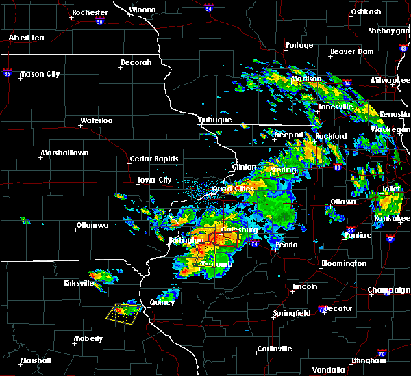 At 743 pm cdt, a severe thunderstorm capable of producing a tornado was located near roseville, or 7 miles south of monmouth, moving east at 35 mph (radar indicated rotation). Hazards include tornado. Flying debris will be dangerous to those caught without shelter. mobile homes will be damaged or destroyed. damage to roofs, windows and vehicles will occur. tree damage is likely. This tornadic thunderstorm will remain over mainly rural areas of east central warren county, including the following locations, larchland, berwick, cameron and ormonde. At 743 pm cdt, a severe thunderstorm capable of producing a tornado was located near roseville, or 7 miles south of monmouth, moving east at 35 mph (radar indicated rotation). Hazards include tornado. Flying debris will be dangerous to those caught without shelter. mobile homes will be damaged or destroyed. damage to roofs, windows and vehicles will occur. tree damage is likely. This tornadic thunderstorm will remain over mainly rural areas of east central warren county, including the following locations, larchland, berwick, cameron and ormonde.
|
| 7/16/2015 7:36 PM CDT |
 At 736 pm cdt, a confirmed tornado was located near galesburg, moving east at 15 mph (radar confirmed tornado). Hazards include damaging tornado. Flying debris will be dangerous to those caught without shelter. mobile homes will be damaged or destroyed. damage to roofs, windows and vehicles will occur. tree damage is likely. Locations impacted include, coldbrook and cameron. At 736 pm cdt, a confirmed tornado was located near galesburg, moving east at 15 mph (radar confirmed tornado). Hazards include damaging tornado. Flying debris will be dangerous to those caught without shelter. mobile homes will be damaged or destroyed. damage to roofs, windows and vehicles will occur. tree damage is likely. Locations impacted include, coldbrook and cameron.
|
| 7/16/2015 7:31 PM CDT |
 At 731 pm cdt, a confirmed tornado was located near galesburg, moving east at 30 mph (radar confirmed tornado). Hazards include damaging tornado. Flying debris will be dangerous to those caught without shelter. mobile homes will be damaged or destroyed. damage to roofs, windows and vehicles will occur. tree damage is likely. Locations impacted include, coldbrook and cameron. At 731 pm cdt, a confirmed tornado was located near galesburg, moving east at 30 mph (radar confirmed tornado). Hazards include damaging tornado. Flying debris will be dangerous to those caught without shelter. mobile homes will be damaged or destroyed. damage to roofs, windows and vehicles will occur. tree damage is likely. Locations impacted include, coldbrook and cameron.
|
| 7/16/2015 7:28 PM CDT |
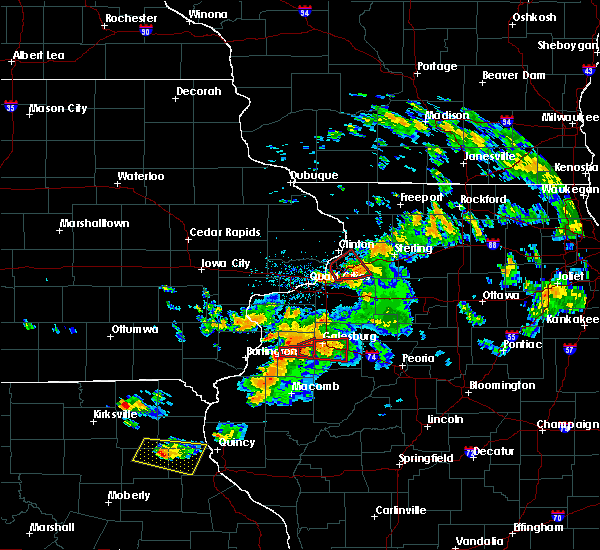 At 727 pm cdt, a severe thunderstorm capable of producing a tornado was located near monmouth, moving east at 20 mph (radar indicated rotation). Hazards include tornado. Flying debris will be dangerous to those caught without shelter. mobile homes will be damaged or destroyed. damage to roofs, windows and vehicles will occur. tree damage is likely. Locations impacted include, coldbrook and cameron. At 727 pm cdt, a severe thunderstorm capable of producing a tornado was located near monmouth, moving east at 20 mph (radar indicated rotation). Hazards include tornado. Flying debris will be dangerous to those caught without shelter. mobile homes will be damaged or destroyed. damage to roofs, windows and vehicles will occur. tree damage is likely. Locations impacted include, coldbrook and cameron.
|
| 7/16/2015 7:25 PM CDT |
 At 725 pm cdt, a confirmed tornado was located 9 miles northwest of abingdon, or 10 miles southwest of galesburg, moving east at 25 mph (weather spotters confirmed tornado). Hazards include damaging tornado and quarter size hail. Flying debris will be dangerous to those caught without shelter. mobile homes will be damaged or destroyed. damage to roofs, windows and vehicles will occur. tree damage is likely. the tornado will be near, abingdon around 745 pm cdt. galesburg around 750 pm cdt. knoxville around 800 pm cdt. gilson around 810 pm cdt. maquon around 815 pm cdt. other locations impacted by this tornadic thunderstorm include delong, east galesburg and galesburg airport. This includes interstate 74 between mile markers 46 and 60. At 725 pm cdt, a confirmed tornado was located 9 miles northwest of abingdon, or 10 miles southwest of galesburg, moving east at 25 mph (weather spotters confirmed tornado). Hazards include damaging tornado and quarter size hail. Flying debris will be dangerous to those caught without shelter. mobile homes will be damaged or destroyed. damage to roofs, windows and vehicles will occur. tree damage is likely. the tornado will be near, abingdon around 745 pm cdt. galesburg around 750 pm cdt. knoxville around 800 pm cdt. gilson around 810 pm cdt. maquon around 815 pm cdt. other locations impacted by this tornadic thunderstorm include delong, east galesburg and galesburg airport. This includes interstate 74 between mile markers 46 and 60.
|
| 7/16/2015 7:18 PM CDT |
 At 717 pm cdt, a severe thunderstorm capable of producing a tornado was located over monmouth, moving east at 20 mph (radar indicated rotation). Hazards include tornado. Flying debris will be dangerous to those caught without shelter. mobile homes will be damaged or destroyed. damage to roofs, windows and vehicles will occur. tree damage is likely. Locations impacted include, monmouth, kirkwood, coldbrook, monmouth municipal airport, ormonde, gerlaw and cameron. At 717 pm cdt, a severe thunderstorm capable of producing a tornado was located over monmouth, moving east at 20 mph (radar indicated rotation). Hazards include tornado. Flying debris will be dangerous to those caught without shelter. mobile homes will be damaged or destroyed. damage to roofs, windows and vehicles will occur. tree damage is likely. Locations impacted include, monmouth, kirkwood, coldbrook, monmouth municipal airport, ormonde, gerlaw and cameron.
|
| 7/16/2015 7:10 PM CDT |
 At 709 pm cdt, a confirmed large and extremely dangerous tornado was located over monmouth, moving east at 20 mph. this is a particularly dangerous situation (radar confirmed tornado). Hazards include damaging tornado. You are in a life threatening situation. flying debris may be deadly to those caught without shelter. mobile homes will be destroyed. considerable damage to homes, businesses and vehicles is likely and complete destruction is possible. Locations impacted include, monmouth, kirkwood, coldbrook, monmouth municipal airport, ormonde, gerlaw and cameron. At 709 pm cdt, a confirmed large and extremely dangerous tornado was located over monmouth, moving east at 20 mph. this is a particularly dangerous situation (radar confirmed tornado). Hazards include damaging tornado. You are in a life threatening situation. flying debris may be deadly to those caught without shelter. mobile homes will be destroyed. considerable damage to homes, businesses and vehicles is likely and complete destruction is possible. Locations impacted include, monmouth, kirkwood, coldbrook, monmouth municipal airport, ormonde, gerlaw and cameron.
|
| 7/16/2015 7:05 PM CDT |
 At 705 pm cdt, a tornado producing storm was located over monmouth, moving east at 30 mph (radar confirmed tornado and law enforcement reported). Hazards include damaging tornado. Flying debris will be dangerous to those caught without shelter. mobile homes will be damaged or destroyed. damage to roofs, windows and vehicles will occur. tree damage is likely. This tornadic thunderstorm will remain over mainly rural areas of northern warren county, including the following locations, coldbrook, gerlaw, cameron, monmouth municipal airport and ormonde. At 705 pm cdt, a tornado producing storm was located over monmouth, moving east at 30 mph (radar confirmed tornado and law enforcement reported). Hazards include damaging tornado. Flying debris will be dangerous to those caught without shelter. mobile homes will be damaged or destroyed. damage to roofs, windows and vehicles will occur. tree damage is likely. This tornadic thunderstorm will remain over mainly rural areas of northern warren county, including the following locations, coldbrook, gerlaw, cameron, monmouth municipal airport and ormonde.
|
| 7/16/2015 7:01 PM CDT |
 At 701 pm cdt, a confirmed tornado was located near monmouth, moving east at 25 mph (weather spotters confirmed tornado). Hazards include damaging tornado. Flying debris will be dangerous to those caught without shelter. mobile homes will be damaged or destroyed. damage to roofs, windows and vehicles will occur. tree damage is likely. this tornado will be near, monmouth around 710 pm cdt. Other locations impacted by this tornadic thunderstorm include cameron and ormonde. At 701 pm cdt, a confirmed tornado was located near monmouth, moving east at 25 mph (weather spotters confirmed tornado). Hazards include damaging tornado. Flying debris will be dangerous to those caught without shelter. mobile homes will be damaged or destroyed. damage to roofs, windows and vehicles will occur. tree damage is likely. this tornado will be near, monmouth around 710 pm cdt. Other locations impacted by this tornadic thunderstorm include cameron and ormonde.
|
| 7/16/2015 6:50 PM CDT |
 At 650 pm cdt, a severe thunderstorm capable of producing a tornado was located over kirkwood, or 7 miles southwest of monmouth, moving east at 30 mph (radar indicated rotation). Hazards include tornado. Flying debris will be dangerous to those caught without shelter. mobile homes will be damaged or destroyed. damage to roofs, windows and vehicles will occur. tree damage is likely. this dangerous storm will be near, monmouth around 705 pm cdt. Other locations impacted by this tornadic thunderstorm include ponemah, larchland, berwick, smithshire, cameron and ormonde. At 650 pm cdt, a severe thunderstorm capable of producing a tornado was located over kirkwood, or 7 miles southwest of monmouth, moving east at 30 mph (radar indicated rotation). Hazards include tornado. Flying debris will be dangerous to those caught without shelter. mobile homes will be damaged or destroyed. damage to roofs, windows and vehicles will occur. tree damage is likely. this dangerous storm will be near, monmouth around 705 pm cdt. Other locations impacted by this tornadic thunderstorm include ponemah, larchland, berwick, smithshire, cameron and ormonde.
|
| 7/16/2015 6:40 PM CDT |
 At 640 pm cdt, a confirmed tornado was located over biggsville, or 9 miles southeast of oquawka, moving east at 30 mph (law enforcement confirmed tornado). Hazards include damaging tornado and quarter size hail. Flying debris will be dangerous to those caught without shelter. mobile homes will be damaged or destroyed. damage to roofs, windows and vehicles will occur. tree damage is likely. this tornado will be near, kirkwood around 650 pm cdt. monmouth and roseville around 700 pm cdt. Other locations impacted by this tornadic thunderstorm include berwick, media, ormonde, ponemah, larchland, olena, cameron, smithshire and greenbush. At 640 pm cdt, a confirmed tornado was located over biggsville, or 9 miles southeast of oquawka, moving east at 30 mph (law enforcement confirmed tornado). Hazards include damaging tornado and quarter size hail. Flying debris will be dangerous to those caught without shelter. mobile homes will be damaged or destroyed. damage to roofs, windows and vehicles will occur. tree damage is likely. this tornado will be near, kirkwood around 650 pm cdt. monmouth and roseville around 700 pm cdt. Other locations impacted by this tornadic thunderstorm include berwick, media, ormonde, ponemah, larchland, olena, cameron, smithshire and greenbush.
|
| 7/16/2015 6:35 PM CDT |
 At 635 pm cdt, a severe thunderstorm capable of producing a tornado was located over biggsville, or 8 miles southeast of oquawka, moving east at 30 mph (radar indicated rotation). Hazards include tornado and quarter size hail. Flying debris will be dangerous to those caught without shelter. mobile homes will be damaged or destroyed. damage to roofs, windows and vehicles will occur. tree damage is likely. this dangerous storm will be near, kirkwood around 650 pm cdt. roseville around 655 pm cdt. Other locations impacted by this tornadic thunderstorm include berwick, media, ormonde, ponemah, larchland, olena, cameron, smithshire and greenbush. At 635 pm cdt, a severe thunderstorm capable of producing a tornado was located over biggsville, or 8 miles southeast of oquawka, moving east at 30 mph (radar indicated rotation). Hazards include tornado and quarter size hail. Flying debris will be dangerous to those caught without shelter. mobile homes will be damaged or destroyed. damage to roofs, windows and vehicles will occur. tree damage is likely. this dangerous storm will be near, kirkwood around 650 pm cdt. roseville around 655 pm cdt. Other locations impacted by this tornadic thunderstorm include berwick, media, ormonde, ponemah, larchland, olena, cameron, smithshire and greenbush.
|
| 6/20/2015 8:55 PM CDT |
 At 855 pm cdt, severe thunderstorms were located along a line extending from victoria to 4 miles northeast of cuba to near astoria, moving east at 50 mph (radar indicated). Hazards include 60 mph wind gusts. Expect damage to roofs. siding and trees. locations impacted include, canton, havana, rushville, knoxville, farmington, lewistown, cuba, astoria, wataga, brooklyn, oneida, yates city, vermont, st. david, williamsfield, altona, fairview, ipava, london mills and victoria. this includes interstate 74 between mile markers 51 and 68. A tornado watch remains in effect until 1100 pm cdt for northwestern illinois. At 855 pm cdt, severe thunderstorms were located along a line extending from victoria to 4 miles northeast of cuba to near astoria, moving east at 50 mph (radar indicated). Hazards include 60 mph wind gusts. Expect damage to roofs. siding and trees. locations impacted include, canton, havana, rushville, knoxville, farmington, lewistown, cuba, astoria, wataga, brooklyn, oneida, yates city, vermont, st. david, williamsfield, altona, fairview, ipava, london mills and victoria. this includes interstate 74 between mile markers 51 and 68. A tornado watch remains in effect until 1100 pm cdt for northwestern illinois.
|
| 6/20/2015 8:39 PM CDT |
 At 839 pm cdt, severe thunderstorms were located along a line extending from wataga to 7 miles northwest of cuba to 7 miles north of rushville, moving east at 50 mph (radar indicated). Hazards include 60 mph wind gusts and penny size hail. Expect damage to roofs. siding and trees. locations impacted include, galesburg, canton, havana, rushville, abingdon, knoxville, farmington, lewistown, cuba, astoria, wataga, avon, brooklyn, oneida, yates city, vermont, st. david, williamsfield, altona and fairview. this includes interstate 74 between mile markers 34 and 68. A tornado watch remains in effect until 1100 pm cdt for northwestern illinois. At 839 pm cdt, severe thunderstorms were located along a line extending from wataga to 7 miles northwest of cuba to 7 miles north of rushville, moving east at 50 mph (radar indicated). Hazards include 60 mph wind gusts and penny size hail. Expect damage to roofs. siding and trees. locations impacted include, galesburg, canton, havana, rushville, abingdon, knoxville, farmington, lewistown, cuba, astoria, wataga, avon, brooklyn, oneida, yates city, vermont, st. david, williamsfield, altona and fairview. this includes interstate 74 between mile markers 34 and 68. A tornado watch remains in effect until 1100 pm cdt for northwestern illinois.
|
| 6/20/2015 8:36 PM CDT | Several trees and power lines down in town in knox county IL, 0.9 miles E of Galesburg, IL |
| 6/20/2015 8:14 PM CDT |
 At 813 pm cdt, severe thunderstorms were located along a line extending from 10 miles northwest of abingdon to 11 miles west of avon to 11 miles north of brooklyn, moving east at 55 mph (trained weather spotters). Hazards include 60 mph wind gusts and penny size hail. Expect damage to roofs. Siding and trees. At 813 pm cdt, severe thunderstorms were located along a line extending from 10 miles northwest of abingdon to 11 miles west of avon to 11 miles north of brooklyn, moving east at 55 mph (trained weather spotters). Hazards include 60 mph wind gusts and penny size hail. Expect damage to roofs. Siding and trees.
|
| 6/10/2015 11:11 PM CDT |
 At 1111 pm cdt, severe thunderstorms were located along a line extending from near knoxville to 4 miles southeast of cuba to 5 miles northeast of brooklyn, moving east at 55 mph (radar indicated). Hazards include 70 mph wind gusts. Expect considerable tree damage. Damage is likely to mobile homes, roofs and outbuildings. At 1111 pm cdt, severe thunderstorms were located along a line extending from near knoxville to 4 miles southeast of cuba to 5 miles northeast of brooklyn, moving east at 55 mph (radar indicated). Hazards include 70 mph wind gusts. Expect considerable tree damage. Damage is likely to mobile homes, roofs and outbuildings.
|
| 6/10/2015 10:51 PM CDT |
 At 1050 pm cdt, severe thunderstorms were located along a line extending from 10 miles southwest of rio to 6 miles southwest of avon to 9 miles northwest of brooklyn, moving east at 30 mph (radar indicated). Hazards include 70 mph wind gusts. Expect considerable tree damage. Damage is likely to mobile homes, roofs and outbuildings. At 1050 pm cdt, severe thunderstorms were located along a line extending from 10 miles southwest of rio to 6 miles southwest of avon to 9 miles northwest of brooklyn, moving east at 30 mph (radar indicated). Hazards include 70 mph wind gusts. Expect considerable tree damage. Damage is likely to mobile homes, roofs and outbuildings.
|
| 6/10/2015 9:40 PM CDT | Golf Ball sized hail reported 6.7 miles NNE of Galesburg, IL |
| 6/10/2015 9:40 PM CDT | Storm damage reported in knox county IL, 6.7 miles NNE of Galesburg, IL |
| 6/10/2015 9:24 PM CDT |
 At 924 pm cdt, a severe thunderstorm was located near knoxville, or 8 miles southeast of galesburg, moving east at 20 mph (radar indicated). Hazards include 70 mph wind gusts and quarter size hail. Hail damage to vehicles is expected. expect considerable tree damage. Wind damage is also likely to mobile homes, roofs and outbuildings. At 924 pm cdt, a severe thunderstorm was located near knoxville, or 8 miles southeast of galesburg, moving east at 20 mph (radar indicated). Hazards include 70 mph wind gusts and quarter size hail. Hail damage to vehicles is expected. expect considerable tree damage. Wind damage is also likely to mobile homes, roofs and outbuildings.
|
| 6/10/2015 9:03 PM CDT |
 At 903 pm cdt, a severe thunderstorm was located over gilson, or 11 miles southeast of galesburg, moving east at 20 mph (radar indicated). Hazards include 60 mph wind gusts and quarter size hail. Hail damage to vehicles is expected. Expect wind damage to roofs, siding and trees. At 903 pm cdt, a severe thunderstorm was located over gilson, or 11 miles southeast of galesburg, moving east at 20 mph (radar indicated). Hazards include 60 mph wind gusts and quarter size hail. Hail damage to vehicles is expected. Expect wind damage to roofs, siding and trees.
|
| 6/7/2015 6:58 PM CDT | The severe thunderstorm warning for warren, eastern hancock, mcdonough and henderson counties will expire at 700 pm cdt, the storm which prompted the warning has weakened below severe limits and exited the warned area. therefore the warning will be allowed to expire. however heavy rain is still possible with this thunderstorm. a severe thunderstorm watch remains in effect until 800 pm cdt for west central illinois. a severe thunderstorm watch also remains in effect until 900 pm cdt for west central illinois and southeastern iowa. remember, a severe thunderstorm warning still remains in effect for southern mcdonough county through 745 pm. |
| 6/7/2015 6:45 PM CDT | At 645 pm cdt, a severe thunderstorm was located near roseville, or 13 miles south of monmouth, moving east at 45 mph (trained weather spotters). Hazards include 60 mph wind gusts. Expect damage to roofs. siding and trees. this severe storm will be near, prairie city around 655 pm cdt. other locations impacted by this severe thunderstorm include coldbrook, lone tree, prairie city airport, doddsville, olena, fountain green, greenbush, walnut grove, argyle lake state park and media. People attending sodbuster days should seek safe shelter immediately!. |
| 6/7/2015 6:38 PM CDT | At 638 pm cdt, a severe thunderstorm was located near roseville, or 13 miles south of monmouth, moving east at 40 mph (trained weather spotters). Hazards include 60 mph wind gusts. Expect damage to roofs. siding and trees. this severe storm will be near, little swan lake around 655 pm cdt. prairie city around 700 pm cdt. other locations impacted by this severe thunderstorm include coldbrook, lone tree, prairie city airport, doddsville, olena, fountain green, greenbush, walnut grove, argyle lake state park and media. People attending sodbuster days should seek safe shelter immediately!. |
| 6/7/2015 6:25 PM CDT | At 625 pm cdt, a severe thunderstorm was located over stronghurst, or 13 miles southeast of burlington, moving east at 40 mph (trained weather spotters). Hazards include 60 mph wind gusts. Expect damage to roofs. Siding and trees. |
| 4/3/2014 2:26 AM CDT | Quarter sized hail reported 0.9 miles E of Galesburg, IL |
| 11/17/2013 11:35 AM CST | Storm damage reported in knox county IL, 4.1 miles E of Galesburg, IL |
| 11/17/2013 11:35 AM CST | Idot station on i-74 at railroad crossing south of us-34 exit in knox county IL, 1.3 miles WSW of Galesburg, IL |
| 9/8/2013 1:35 AM CDT | Large tree limbs down and power ou in knox county IL, 0.9 miles E of Galesburg, IL |
| 6/24/2013 4:00 PM CDT | Power lines dow in knox county IL, 0.9 miles E of Galesburg, IL |
| 6/16/2012 6:43 PM CDT | Ping Pong Ball sized hail reported 2.4 miles NNE of Galesburg, IL |
| 6/16/2012 6:40 PM CDT | Multiple trees and power lines dow in knox county IL, 0.9 miles E of Galesburg, IL |
| 9/3/2011 3:56 PM CDT | Golf Ball sized hail reported 8.7 miles NNE of Galesburg, IL, time based on radar |
| 9/3/2011 3:50 PM CDT | Quarter sized hail reported 9.7 miles ENE of Galesburg, IL, time estimated |
| 1/1/0001 12:00 AM | Small tree brancehs down. corn stalks snapped near the groun in warren county IL, 8.8 miles ENE of Galesburg, IL |
| 1/1/0001 12:00 AM | Quarter sized hail reported 1.1 miles ESE of Galesburg, IL, delayed report |
| 1/1/0001 12:00 AM | Outbuildings damaged at lowes. shed blown over at the catholic school. time estimate in knox county IL, 0.9 miles E of Galesburg, IL |
| 1/1/0001 12:00 AM | Outbuildings damaged at lowes. large vent torn off roof at a s in knox county IL, 0.9 miles E of Galesburg, IL |
| 1/1/0001 12:00 AM | Golf Ball sized hail reported 8.9 miles NE of Galesburg, IL |
| 1/1/0001 12:00 AM | Large tree limbs blown down and some siding blown off of a few house in knox county IL, 0.9 miles E of Galesburg, IL |
Hail Maps for Galesburg, IL


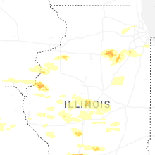
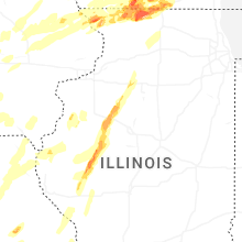
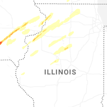
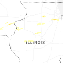
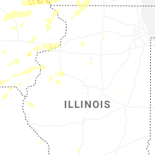


Connect with Interactive Hail Maps