

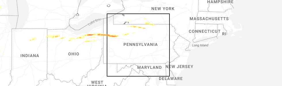
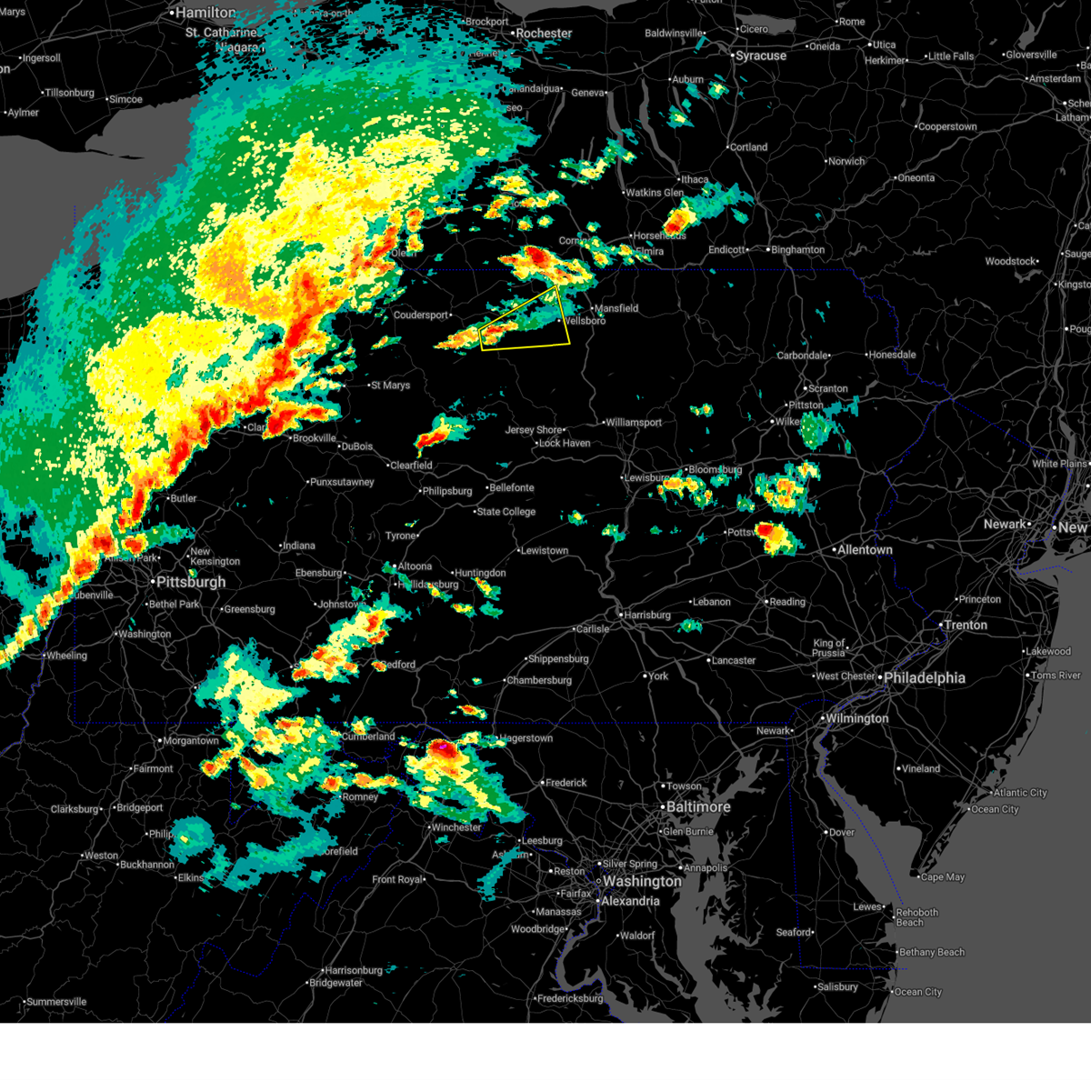
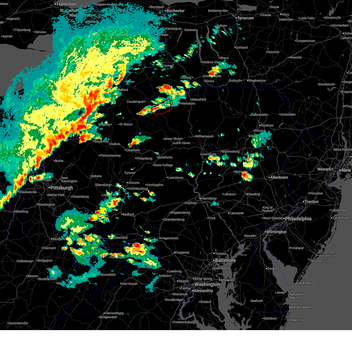
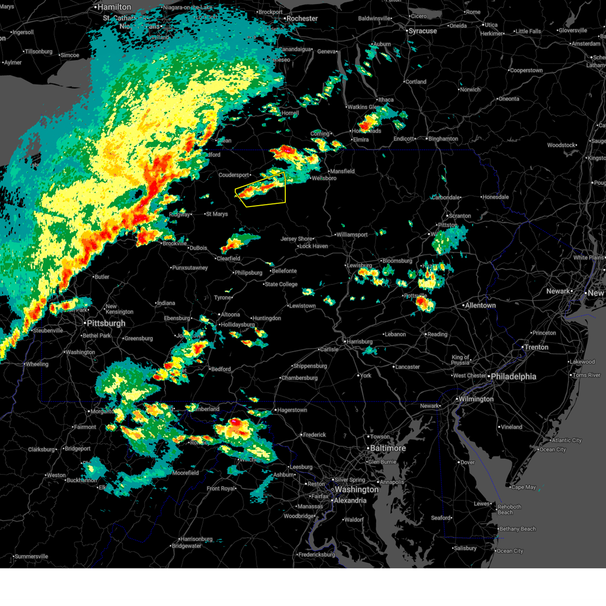
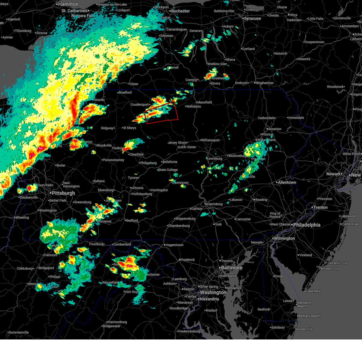
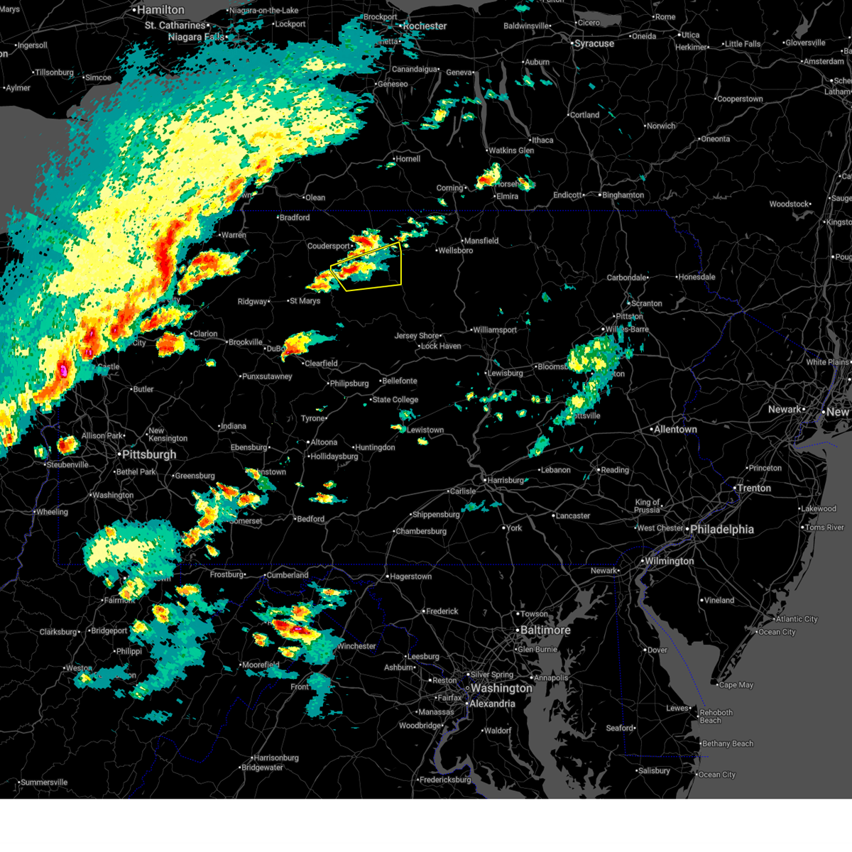
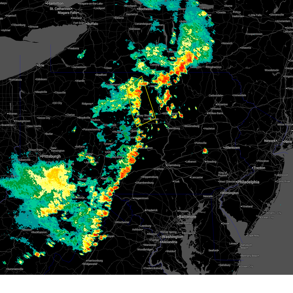
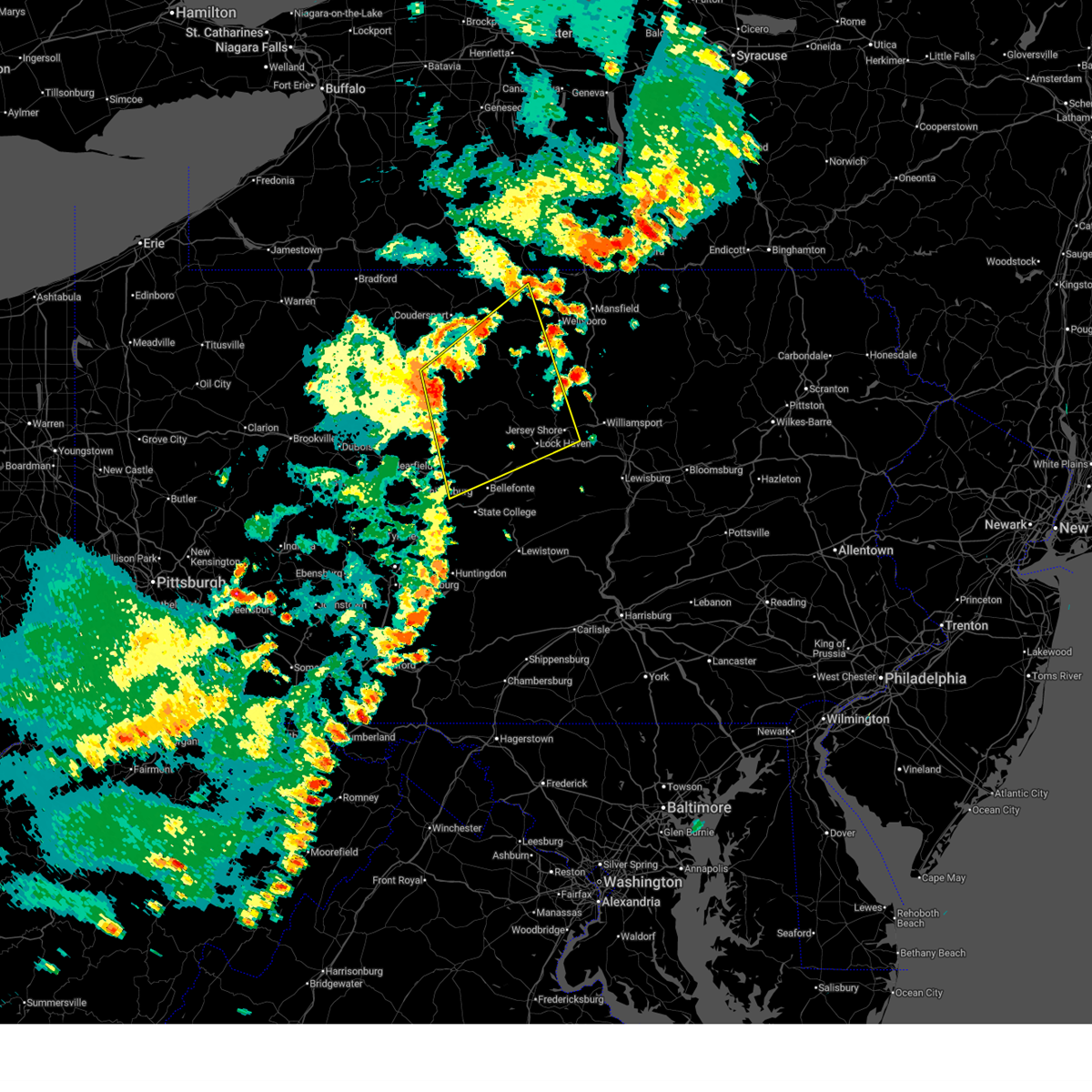
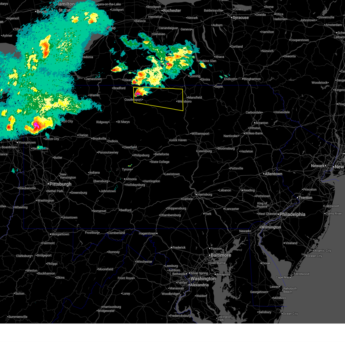
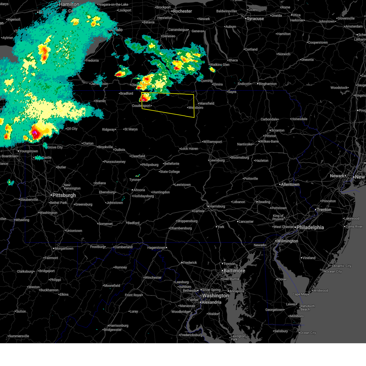
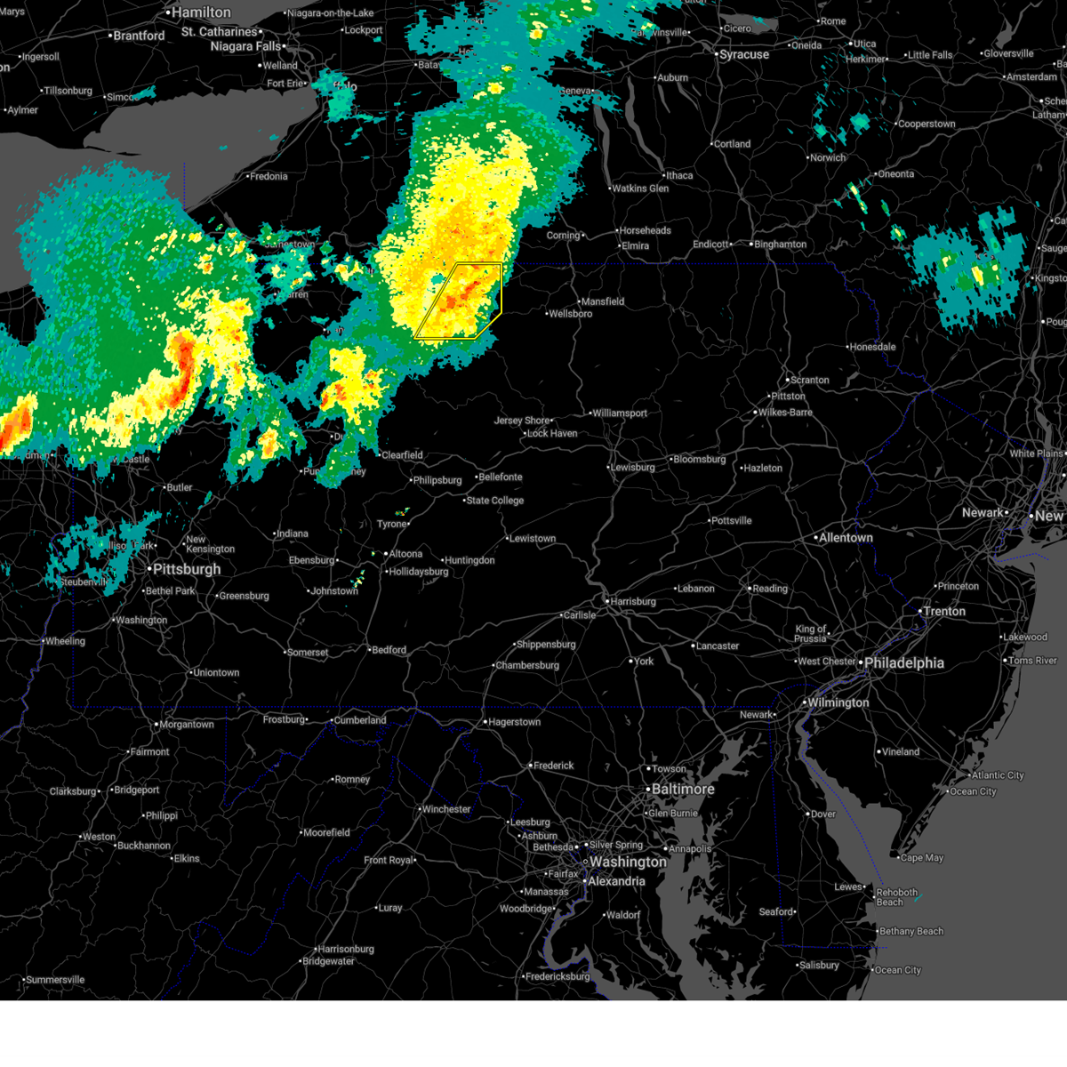
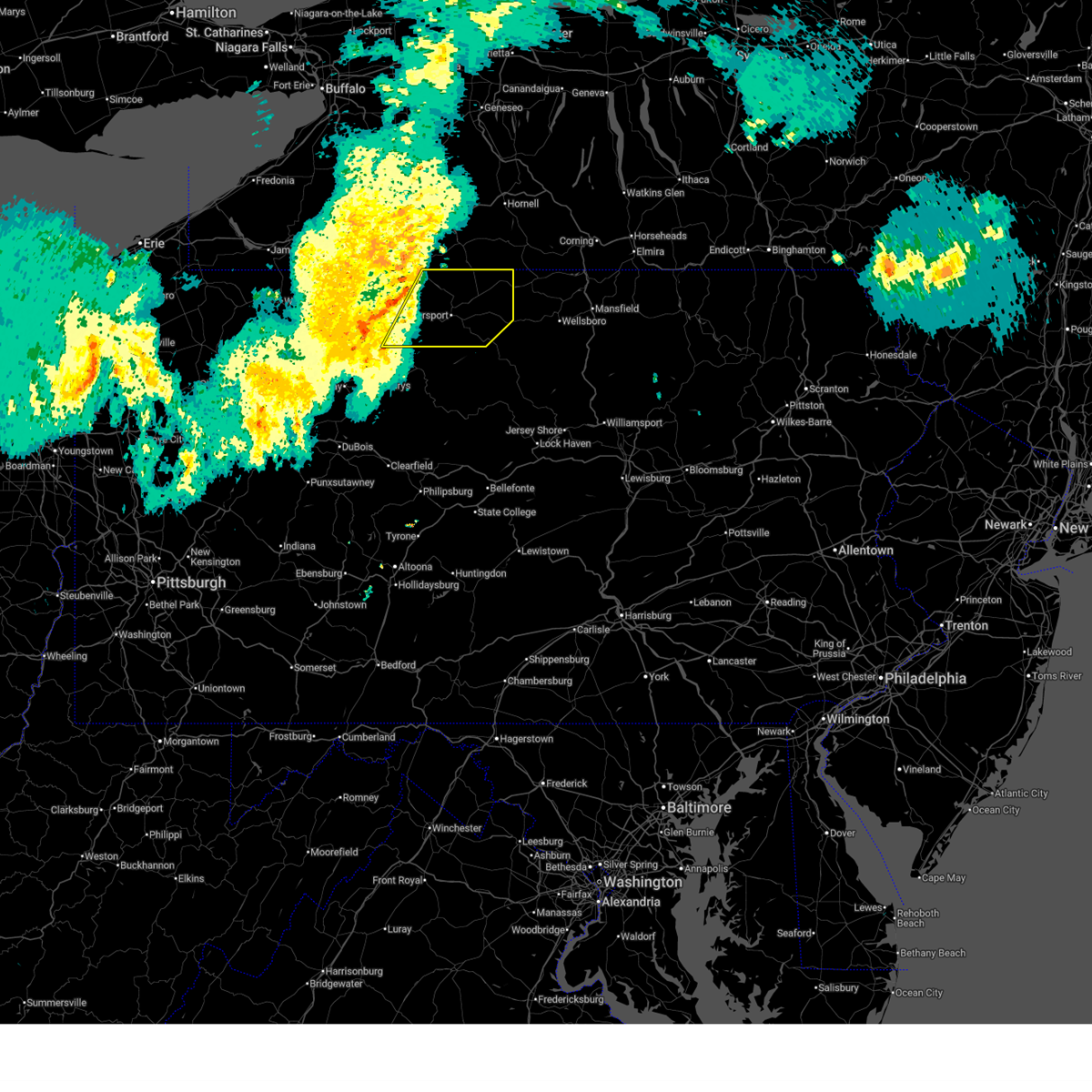
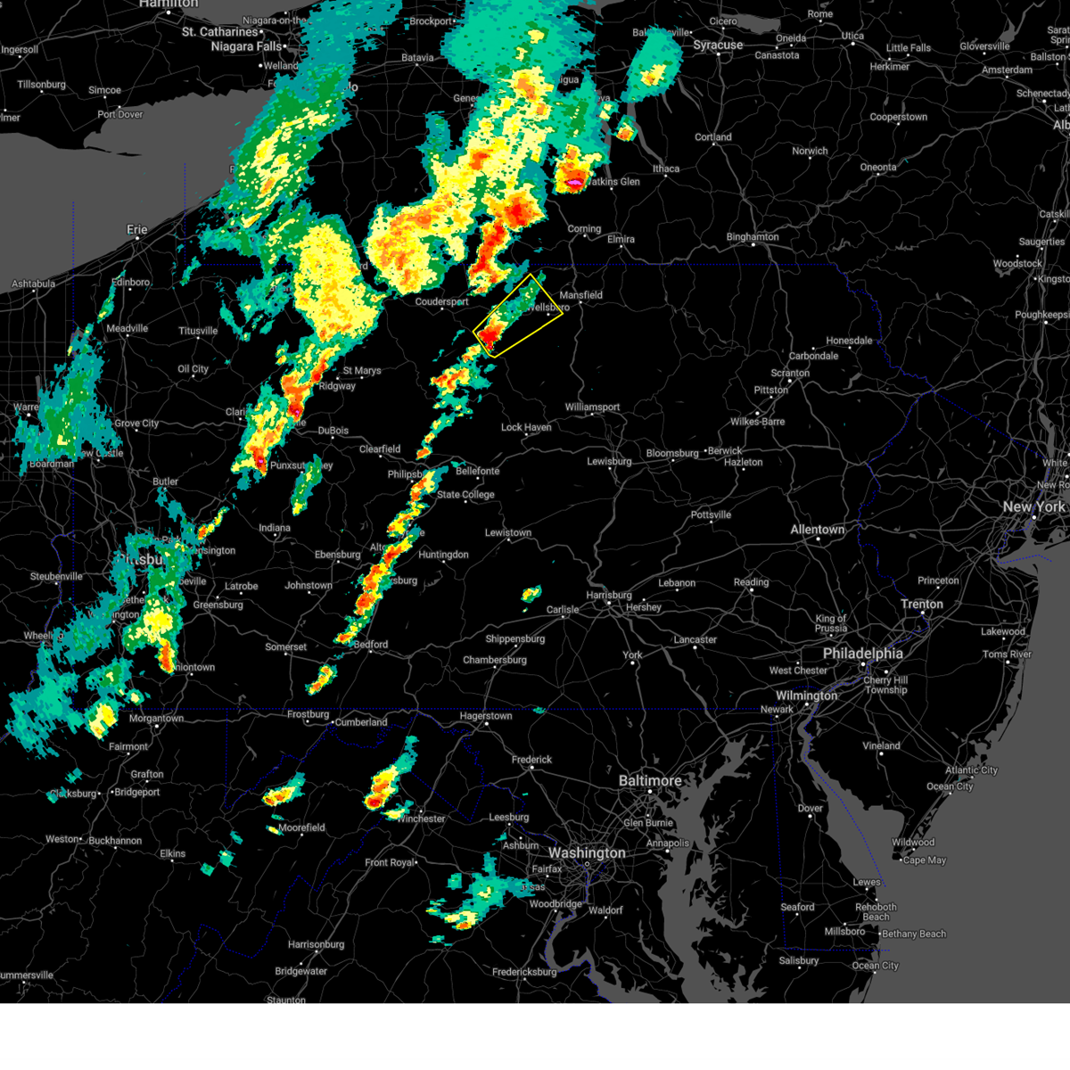
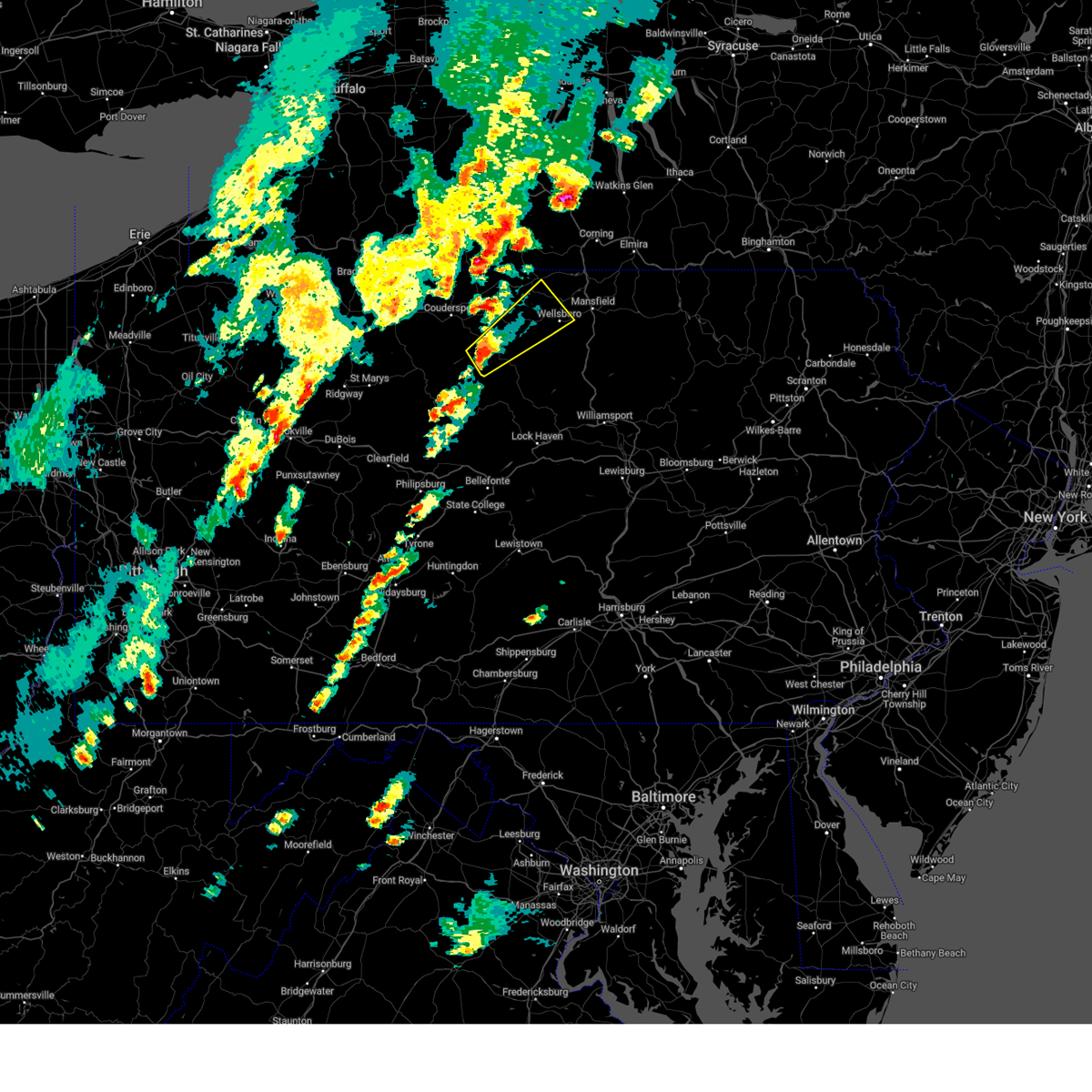
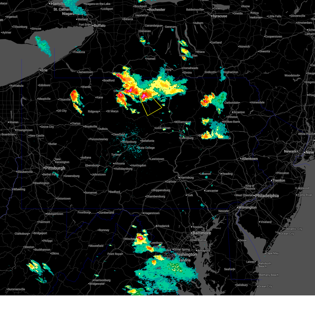
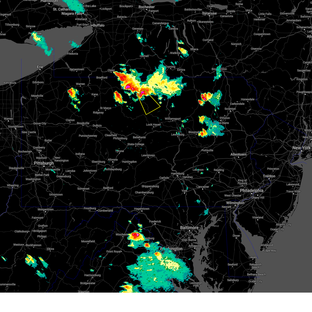
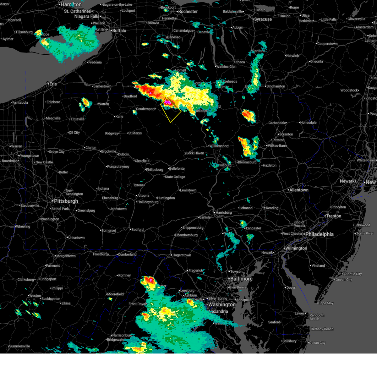
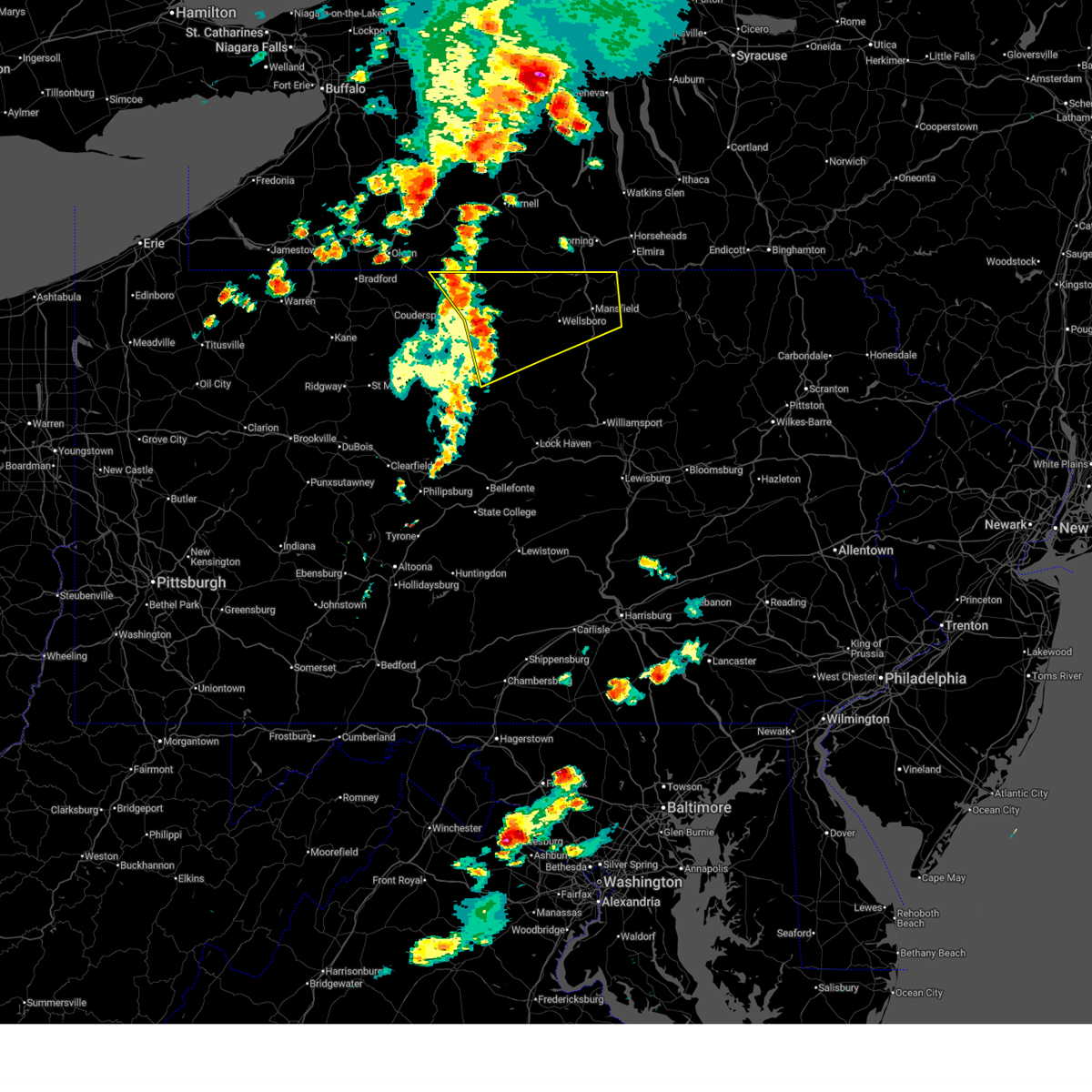
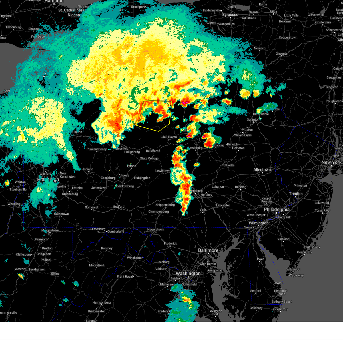
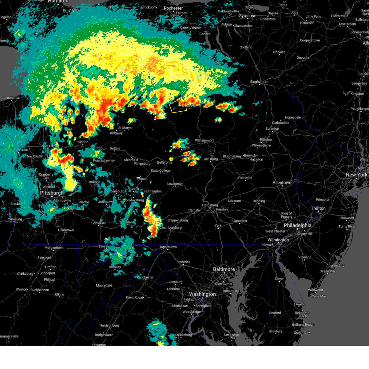
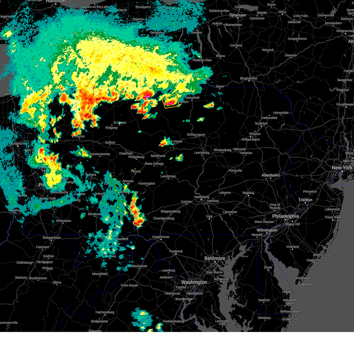
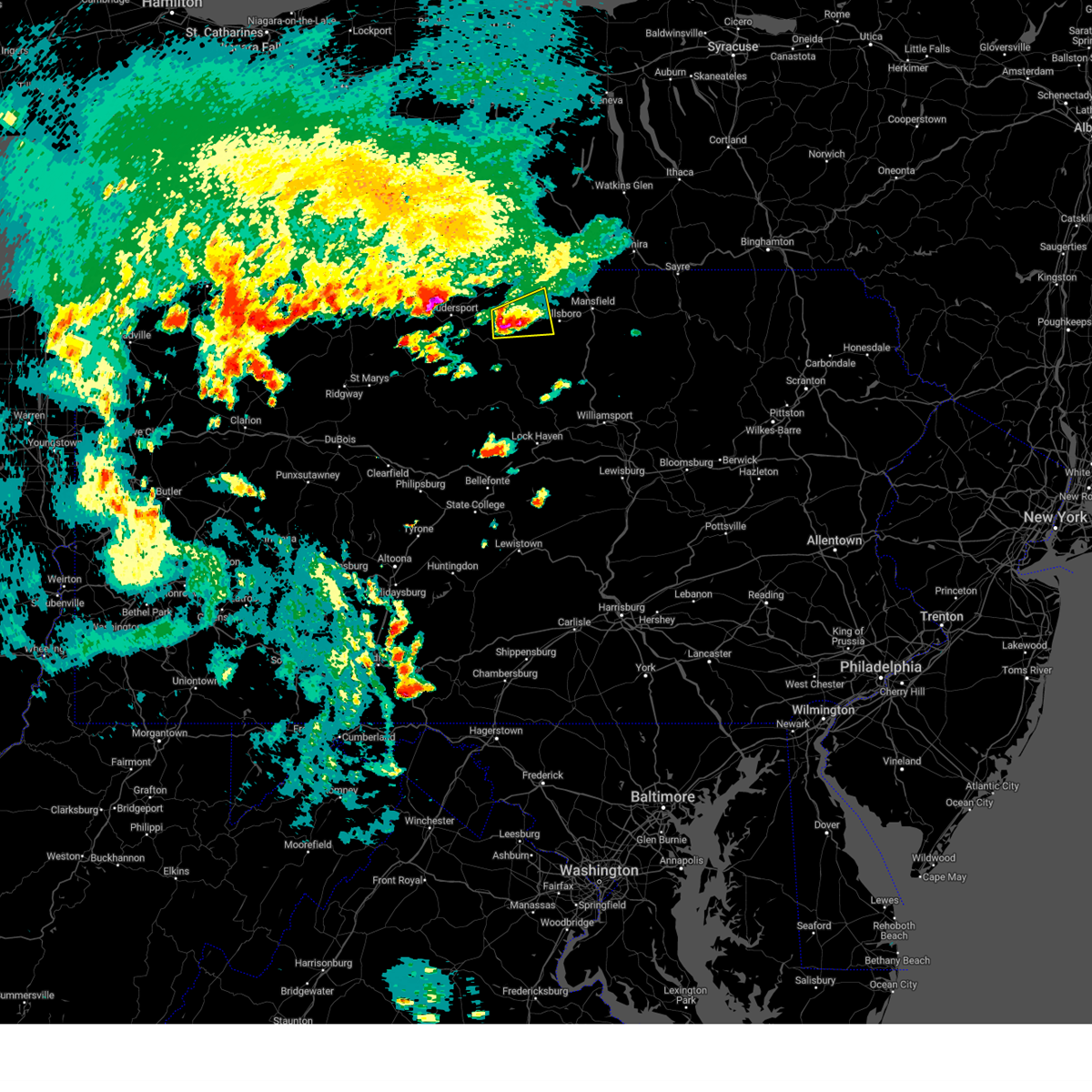
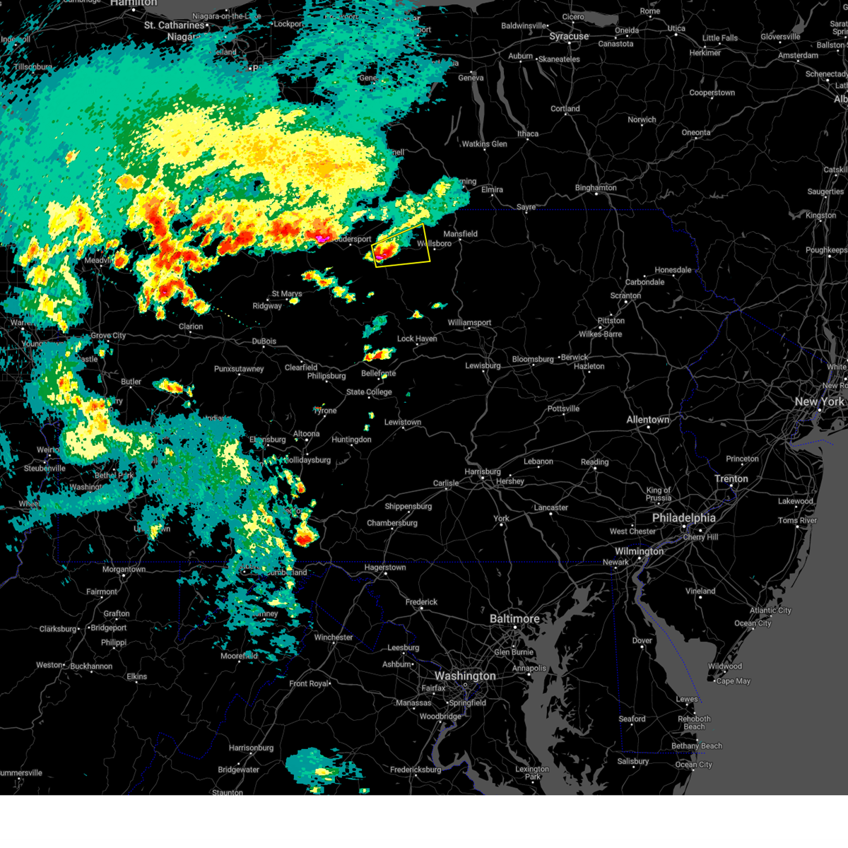
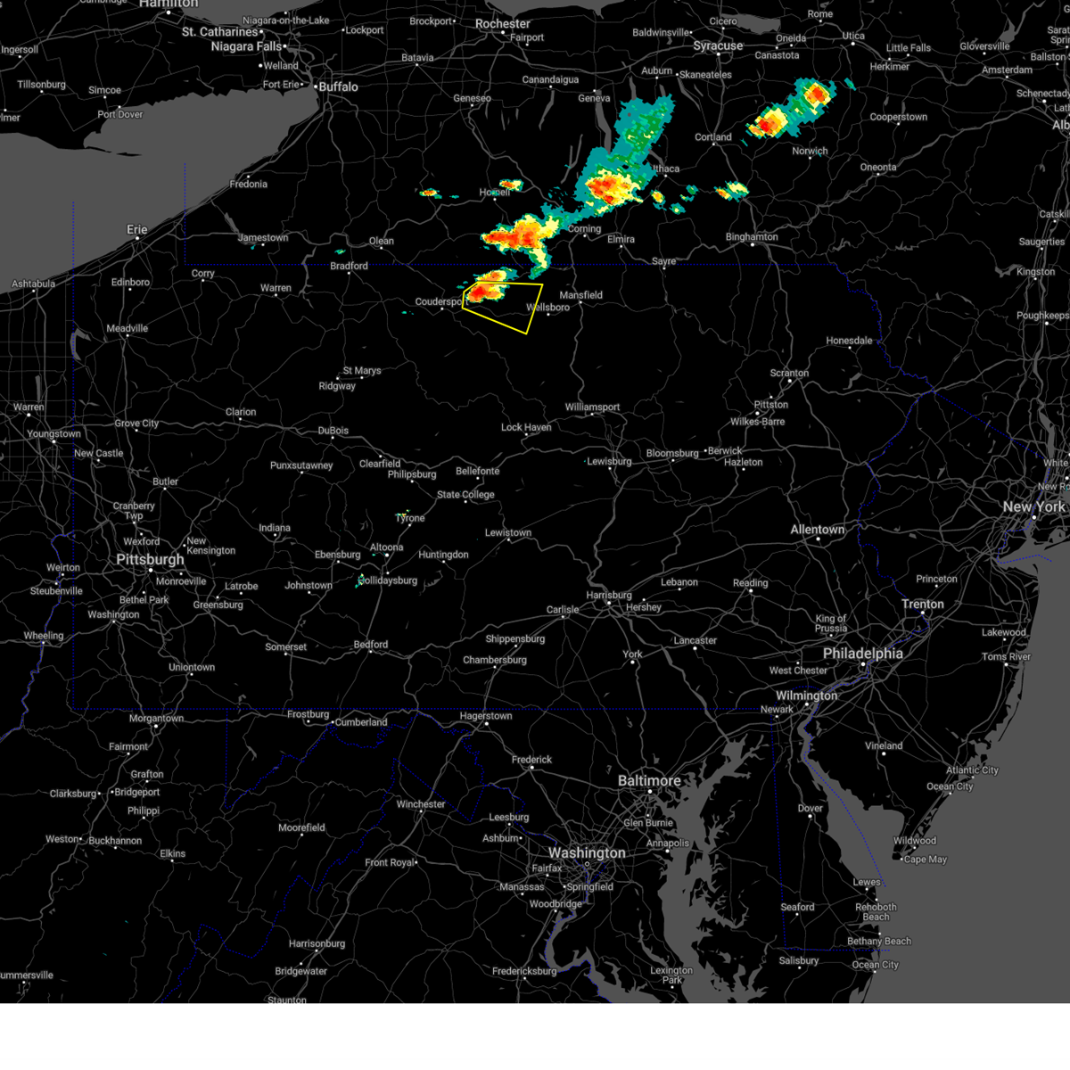
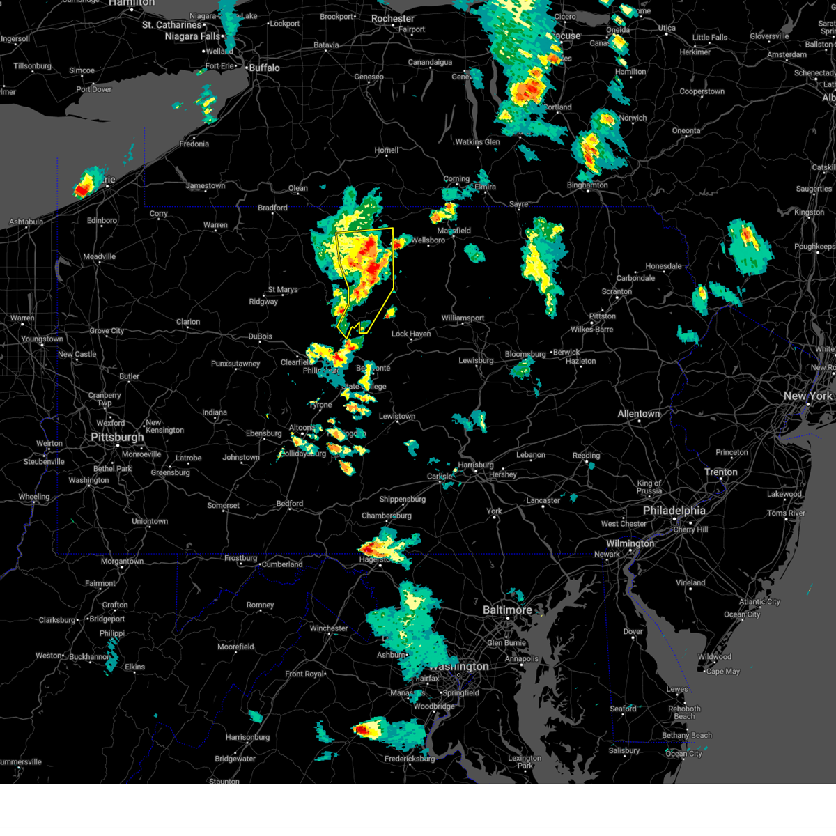
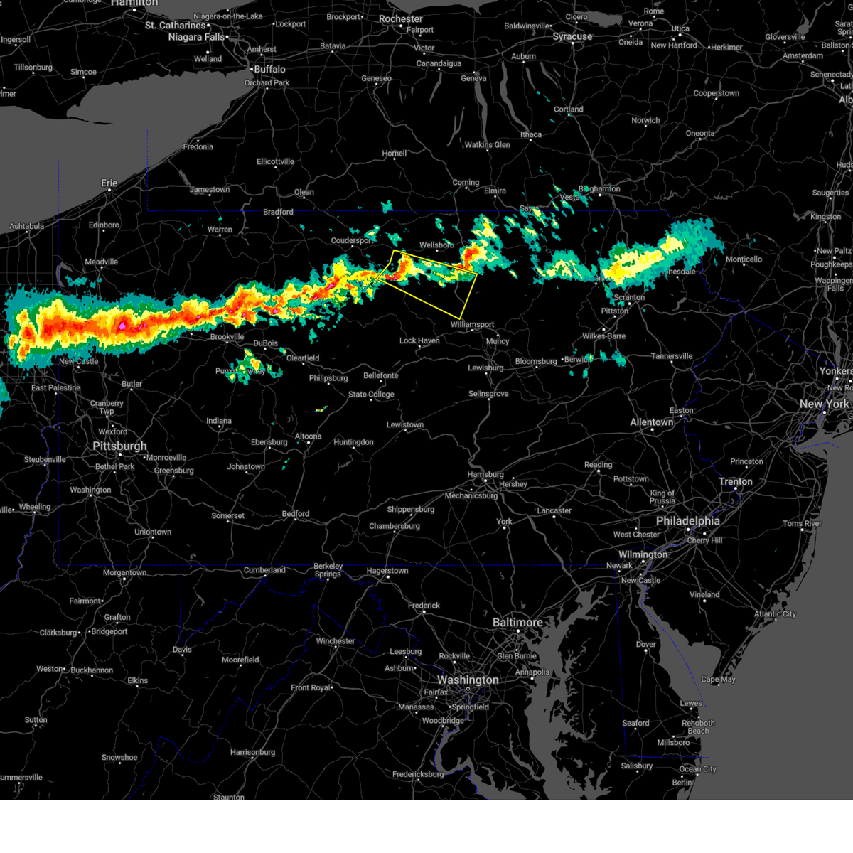
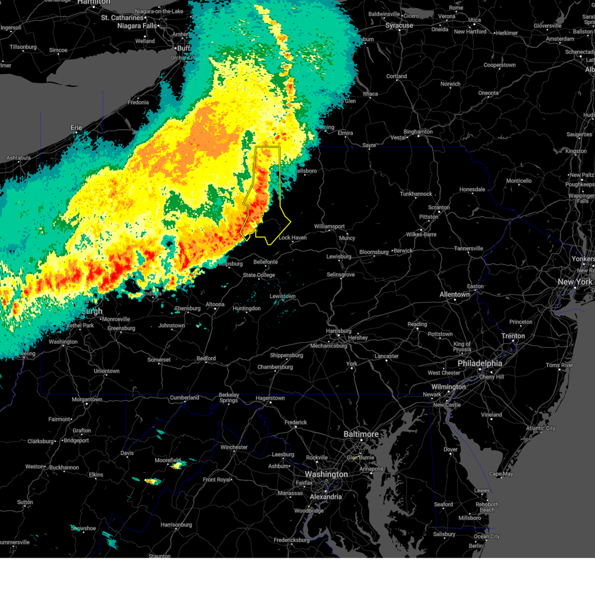
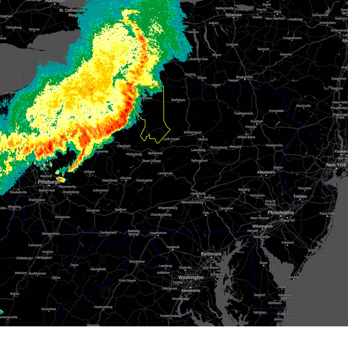
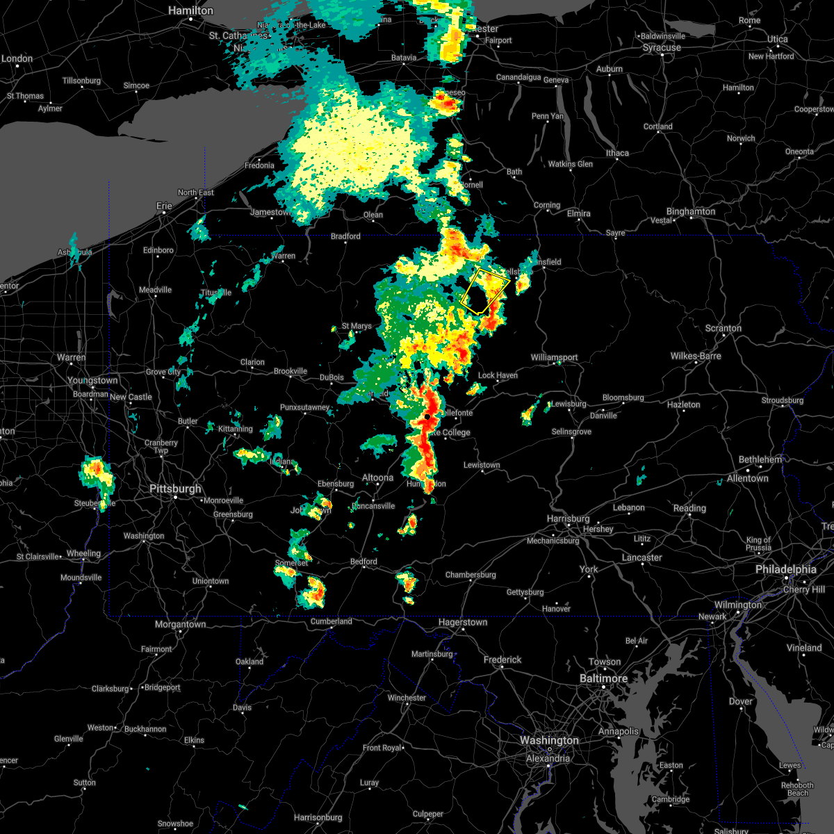
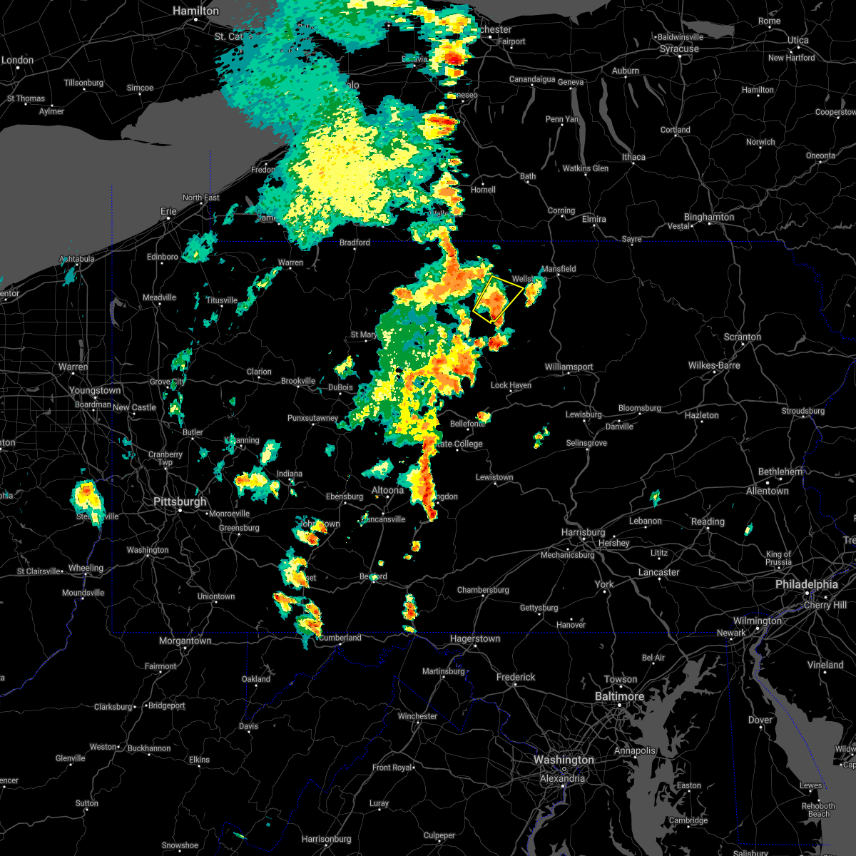
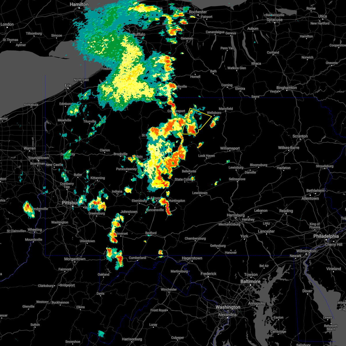
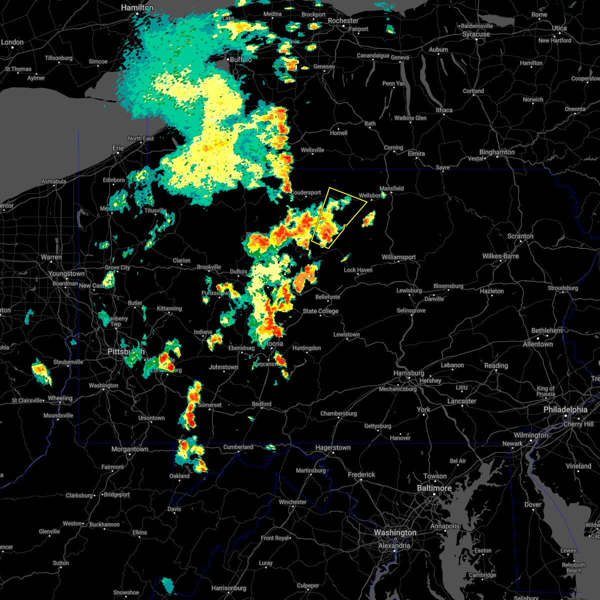
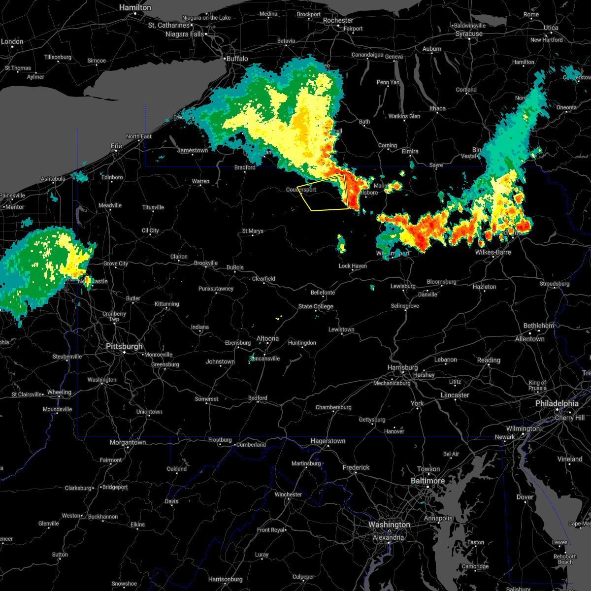
Hail Map for Galeton, PA
The Galeton, PA area has had 3 reports of on-the-ground hail by trained spotters, and has been under severe weather warnings 15 times during the past 12 months. Doppler radar has detected hail at or near Galeton, PA on 20 occasions, including 1 occasion during the past year.
| Name: | Galeton, PA |
| Where Located: | 65.7 miles N of State College, PA |
| Map: | Google Map for Galeton, PA |
| Population: | 1149 |
| Housing Units: | 613 |
| More Info: | Search Google for Galeton, PA |
0
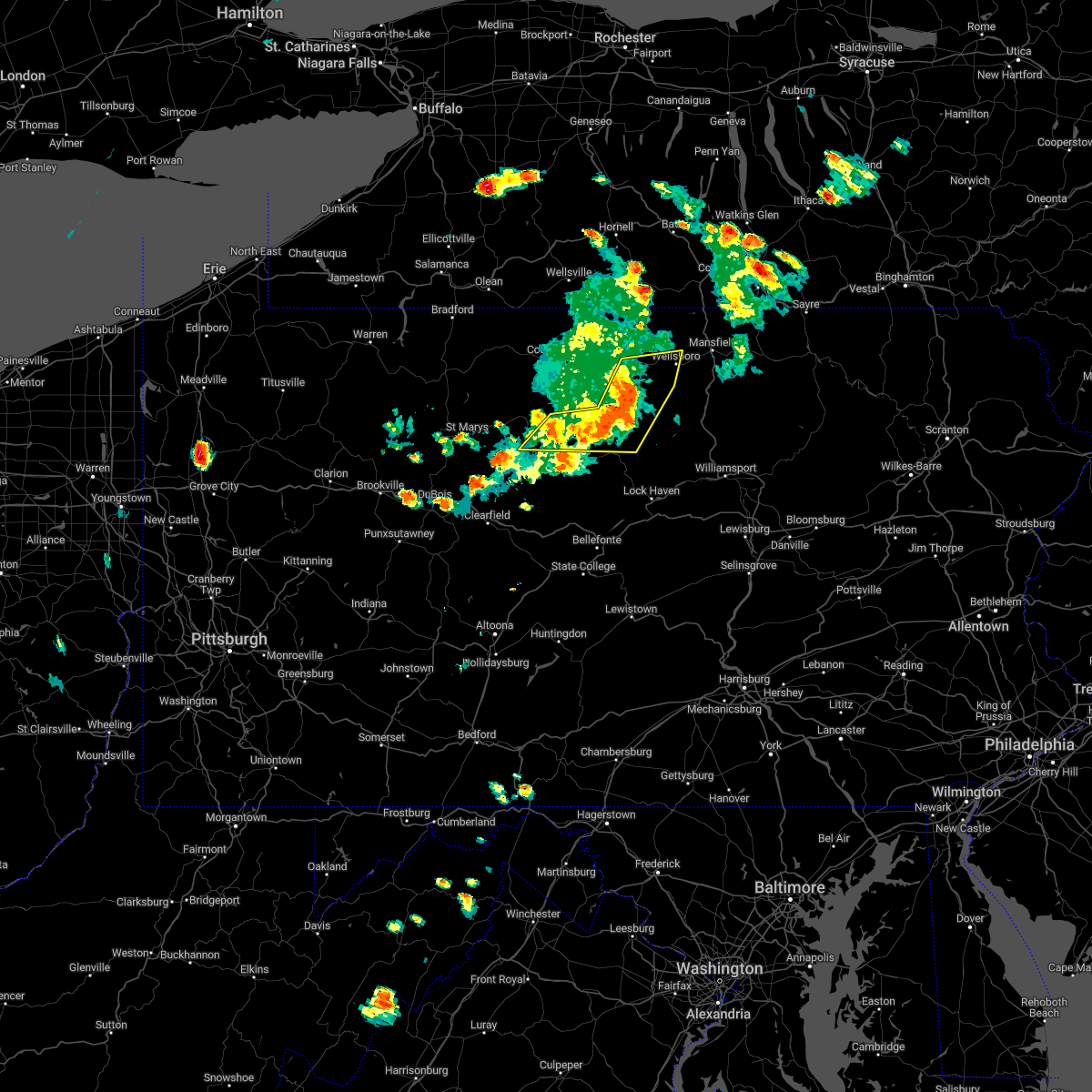
The Top Recent Hail Date for Galeton, PA is Wednesday, April 15, 2026 (14th out of 20)
Hail and Wind Damage Spotted near Galeton, PA
| Date / Time | Report Details |
|---|---|
| 6/14/2026 7:39 PM EDT |
 Svrctp the national weather service in state college pa has issued a * severe thunderstorm warning for, southeastern potter county in north central pennsylvania, tioga county in north central pennsylvania, * until 845 pm edt. * at 738 pm edt, severe thunderstorms were located along a line extending from gaines to galeton to cross fork, moving northeast at 45 mph (radar indicated). Hazards include 70 mph wind gusts and penny size hail. Expect considerable tree damage. Damage is likely to mobile homes, roofs, and outbuildings. Svrctp the national weather service in state college pa has issued a * severe thunderstorm warning for, southeastern potter county in north central pennsylvania, tioga county in north central pennsylvania, * until 845 pm edt. * at 738 pm edt, severe thunderstorms were located along a line extending from gaines to galeton to cross fork, moving northeast at 45 mph (radar indicated). Hazards include 70 mph wind gusts and penny size hail. Expect considerable tree damage. Damage is likely to mobile homes, roofs, and outbuildings.
|
| 6/14/2026 7:14 PM EDT |
 Torctp the national weather service in state college pa has issued a * tornado warning for, northeastern potter county in north central pennsylvania, * until 745 pm edt. * at 714 pm edt, severe thunderstorms capable of producing both tornadoes and extensive straight line wind damage were located over coudersport, moving northeast at 45 mph (radar indicated rotation). Hazards include tornado. Flying debris will be dangerous to those caught without shelter. mobile homes will be damaged or destroyed. damage to roofs, windows, and vehicles will occur. tree damage is likely. these dangerous storms will be near, denton hill state park around 720 pm edt. Other locations impacted by this tornadic thunderstorm include sweden valley, ski denton ski area, and ulysses. Torctp the national weather service in state college pa has issued a * tornado warning for, northeastern potter county in north central pennsylvania, * until 745 pm edt. * at 714 pm edt, severe thunderstorms capable of producing both tornadoes and extensive straight line wind damage were located over coudersport, moving northeast at 45 mph (radar indicated rotation). Hazards include tornado. Flying debris will be dangerous to those caught without shelter. mobile homes will be damaged or destroyed. damage to roofs, windows, and vehicles will occur. tree damage is likely. these dangerous storms will be near, denton hill state park around 720 pm edt. Other locations impacted by this tornadic thunderstorm include sweden valley, ski denton ski area, and ulysses.
|
| 6/14/2026 6:41 PM EDT |
 Svrctp the national weather service in state college pa has issued a * severe thunderstorm warning for, cameron county in north central pennsylvania, eastern elk county in north central pennsylvania, eastern mckean county in north central pennsylvania, potter county in north central pennsylvania, * until 730 pm edt. * at 641 pm edt, severe thunderstorms were located along a line extending from near genesee to port allegany to near betula to benezette, moving east at 55 mph (radar indicated). Hazards include 60 mph wind gusts and penny size hail. expect damage to roofs, siding, and trees Svrctp the national weather service in state college pa has issued a * severe thunderstorm warning for, cameron county in north central pennsylvania, eastern elk county in north central pennsylvania, eastern mckean county in north central pennsylvania, potter county in north central pennsylvania, * until 730 pm edt. * at 641 pm edt, severe thunderstorms were located along a line extending from near genesee to port allegany to near betula to benezette, moving east at 55 mph (radar indicated). Hazards include 60 mph wind gusts and penny size hail. expect damage to roofs, siding, and trees
|
| 6/14/2026 5:59 PM EDT |
 Svrctp the national weather service in state college pa has issued a * severe thunderstorm warning for, east central potter county in north central pennsylvania, western tioga county in north central pennsylvania, * until 645 pm edt. * at 559 pm edt, a severe thunderstorm was located over lyman run state park, moving east at 30 mph (radar indicated). Hazards include 60 mph wind gusts and half dollar size hail. Hail damage to vehicles is expected. Expect wind damage to roofs, siding, and trees. Svrctp the national weather service in state college pa has issued a * severe thunderstorm warning for, east central potter county in north central pennsylvania, western tioga county in north central pennsylvania, * until 645 pm edt. * at 559 pm edt, a severe thunderstorm was located over lyman run state park, moving east at 30 mph (radar indicated). Hazards include 60 mph wind gusts and half dollar size hail. Hail damage to vehicles is expected. Expect wind damage to roofs, siding, and trees.
|
| 6/14/2026 5:50 PM EDT |
 At 550 pm edt, a severe thunderstorm capable of producing a tornado was located over cherry springs state park, moving east at 30 mph (radar indicated rotation). Hazards include tornado and quarter size hail. Flying debris will be dangerous to those caught without shelter. mobile homes will be damaged or destroyed. damage to roofs, windows, and vehicles will occur. tree damage is likely. this tornadic thunderstorm will remain over mainly rural areas of southeastern potter and west central tioga counties. This includes route 6 from galeton to near gaines. At 550 pm edt, a severe thunderstorm capable of producing a tornado was located over cherry springs state park, moving east at 30 mph (radar indicated rotation). Hazards include tornado and quarter size hail. Flying debris will be dangerous to those caught without shelter. mobile homes will be damaged or destroyed. damage to roofs, windows, and vehicles will occur. tree damage is likely. this tornadic thunderstorm will remain over mainly rural areas of southeastern potter and west central tioga counties. This includes route 6 from galeton to near gaines.
|
| 6/14/2026 5:48 PM EDT |
 At 547 pm edt, a severe thunderstorm was located near wharton, moving east at 30 mph. this storm is to the west of the storm with a possible tornado. however, this storm will follow much the same path as the first storm (radar indicated). Hazards include 60 mph wind gusts and quarter size hail. Hail damage to vehicles is expected. expect wind damage to roofs, siding, and trees. Locations impacted include, wharton, galeton, ole bull state park, lyman run state park, cherry springs state park, and austin. At 547 pm edt, a severe thunderstorm was located near wharton, moving east at 30 mph. this storm is to the west of the storm with a possible tornado. however, this storm will follow much the same path as the first storm (radar indicated). Hazards include 60 mph wind gusts and quarter size hail. Hail damage to vehicles is expected. expect wind damage to roofs, siding, and trees. Locations impacted include, wharton, galeton, ole bull state park, lyman run state park, cherry springs state park, and austin.
|
| 6/14/2026 5:29 PM EDT |
 Torctp the national weather service in state college pa has issued a * tornado warning for, southern potter county in north central pennsylvania, southwestern tioga county in north central pennsylvania, * until 600 pm edt. * at 529 pm edt, a severe thunderstorm capable of producing a tornado was located over wharton, moving east at 30 mph (radar indicated rotation). Hazards include tornado and quarter size hail. Flying debris will be dangerous to those caught without shelter. mobile homes will be damaged or destroyed. damage to roofs, windows, and vehicles will occur. tree damage is likely. this dangerous storm will be near, wharton around 530 pm edt. cherry springs state park around 540 pm edt. other locations impacted by this tornadic thunderstorm include austin. This includes route 6 from west of galeton to near gaines. Torctp the national weather service in state college pa has issued a * tornado warning for, southern potter county in north central pennsylvania, southwestern tioga county in north central pennsylvania, * until 600 pm edt. * at 529 pm edt, a severe thunderstorm capable of producing a tornado was located over wharton, moving east at 30 mph (radar indicated rotation). Hazards include tornado and quarter size hail. Flying debris will be dangerous to those caught without shelter. mobile homes will be damaged or destroyed. damage to roofs, windows, and vehicles will occur. tree damage is likely. this dangerous storm will be near, wharton around 530 pm edt. cherry springs state park around 540 pm edt. other locations impacted by this tornadic thunderstorm include austin. This includes route 6 from west of galeton to near gaines.
|
| 6/14/2026 5:22 PM EDT |
 Svrctp the national weather service in state college pa has issued a * severe thunderstorm warning for, southern potter county in north central pennsylvania, * until 600 pm edt. * at 522 pm edt, a severe thunderstorm was located over wharton, moving east at 30 mph (radar indicated). Hazards include 60 mph wind gusts and quarter size hail. Hail damage to vehicles is expected. Expect wind damage to roofs, siding, and trees. Svrctp the national weather service in state college pa has issued a * severe thunderstorm warning for, southern potter county in north central pennsylvania, * until 600 pm edt. * at 522 pm edt, a severe thunderstorm was located over wharton, moving east at 30 mph (radar indicated). Hazards include 60 mph wind gusts and quarter size hail. Hail damage to vehicles is expected. Expect wind damage to roofs, siding, and trees.
|
| 6/11/2026 6:22 PM EDT |
 At 622 pm edt, severe thunderstorms were located along a line extending from near galeton to blanchard, moving east at 45 mph (radar indicated). Hazards include 60 mph wind gusts. Expect damage to roofs, siding, and trees. locations impacted include, lock haven, jersey shore, mill hall, avis, dunnstown, flemington, renovo, castanea, galeton, westfield, blanchard, and mcelhattan. For those driving on interstate 80, this includes areas between the bellefonte and loganton exits, specifically between mile markers 168 and 174, and from mile markers 178 to 180. At 622 pm edt, severe thunderstorms were located along a line extending from near galeton to blanchard, moving east at 45 mph (radar indicated). Hazards include 60 mph wind gusts. Expect damage to roofs, siding, and trees. locations impacted include, lock haven, jersey shore, mill hall, avis, dunnstown, flemington, renovo, castanea, galeton, westfield, blanchard, and mcelhattan. For those driving on interstate 80, this includes areas between the bellefonte and loganton exits, specifically between mile markers 168 and 174, and from mile markers 178 to 180.
|
| 6/11/2026 5:50 PM EDT |
 Svrctp the national weather service in state college pa has issued a * severe thunderstorm warning for, eastern cameron county in north central pennsylvania, central centre county in central pennsylvania, northeastern clearfield county in central pennsylvania, clinton county in north central pennsylvania, western lycoming county in north central pennsylvania, southern potter county in north central pennsylvania, southwestern tioga county in north central pennsylvania, * until 645 pm edt. * at 550 pm edt, severe thunderstorms were located along a line extending from wharton to snow shoe, moving northeast at 45 mph (radar indicated). Hazards include 60 mph wind gusts. expect damage to roofs, siding, and trees Svrctp the national weather service in state college pa has issued a * severe thunderstorm warning for, eastern cameron county in north central pennsylvania, central centre county in central pennsylvania, northeastern clearfield county in central pennsylvania, clinton county in north central pennsylvania, western lycoming county in north central pennsylvania, southern potter county in north central pennsylvania, southwestern tioga county in north central pennsylvania, * until 645 pm edt. * at 550 pm edt, severe thunderstorms were located along a line extending from wharton to snow shoe, moving northeast at 45 mph (radar indicated). Hazards include 60 mph wind gusts. expect damage to roofs, siding, and trees
|
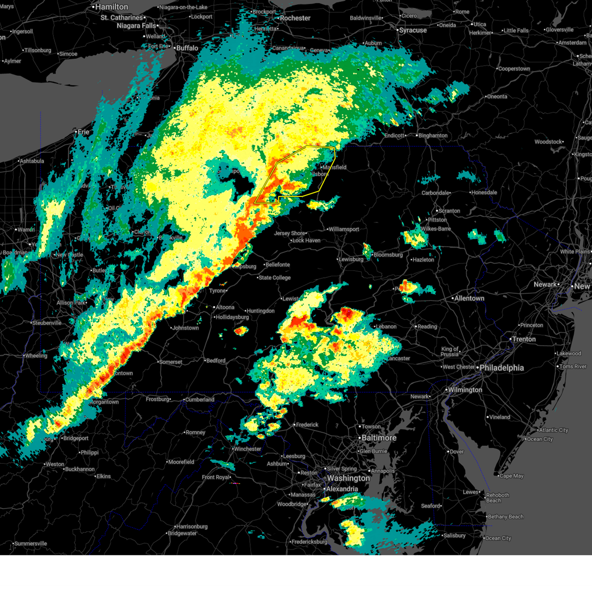
| 4/15/2026 6:56 PM EDT |
 At 656 pm edt, a severe thunderstorm was located over denton hill state park, moving east at 45 mph (radar indicated). Hazards include 60 mph wind gusts and quarter size hail. Hail damage to vehicles is expected. expect wind damage to roofs, siding, and trees. Locations impacted include, wellsboro, morris, coudersport, roulette, galeton, shinglehouse, westfield, gaines, keeneyville, harrison valley, leonard harrison state park, and denton hill state park. At 656 pm edt, a severe thunderstorm was located over denton hill state park, moving east at 45 mph (radar indicated). Hazards include 60 mph wind gusts and quarter size hail. Hail damage to vehicles is expected. expect wind damage to roofs, siding, and trees. Locations impacted include, wellsboro, morris, coudersport, roulette, galeton, shinglehouse, westfield, gaines, keeneyville, harrison valley, leonard harrison state park, and denton hill state park.
|
| 4/15/2026 6:28 PM EDT |
 Svrctp the national weather service in state college pa has issued a * severe thunderstorm warning for, northern potter county in north central pennsylvania, western tioga county in north central pennsylvania, * until 730 pm edt. * at 628 pm edt, a severe thunderstorm was located over roulette, moving east at 45 mph (radar indicated). Hazards include 60 mph wind gusts and quarter size hail. Hail damage to vehicles is expected. Expect wind damage to roofs, siding, and trees. Svrctp the national weather service in state college pa has issued a * severe thunderstorm warning for, northern potter county in north central pennsylvania, western tioga county in north central pennsylvania, * until 730 pm edt. * at 628 pm edt, a severe thunderstorm was located over roulette, moving east at 45 mph (radar indicated). Hazards include 60 mph wind gusts and quarter size hail. Hail damage to vehicles is expected. Expect wind damage to roofs, siding, and trees.
|
| 3/31/2026 8:56 PM EDT |
 At 856 pm edt, severe thunderstorms were located along a line extending from harrison valley to near coudersport, moving east at 60 mph (radar indicated). Hazards include 60 mph wind gusts. Expect damage to roofs, siding, and trees. these severe storms will be near, harrison valley, lyman run state park, and cherry springs state park around 900 pm edt. galeton around 910 pm edt. other locations impacted by these severe thunderstorms include austin, ulysses, sweden valley, and ski denton ski area. This includes route 6 from west of coudersport to galeton. At 856 pm edt, severe thunderstorms were located along a line extending from harrison valley to near coudersport, moving east at 60 mph (radar indicated). Hazards include 60 mph wind gusts. Expect damage to roofs, siding, and trees. these severe storms will be near, harrison valley, lyman run state park, and cherry springs state park around 900 pm edt. galeton around 910 pm edt. other locations impacted by these severe thunderstorms include austin, ulysses, sweden valley, and ski denton ski area. This includes route 6 from west of coudersport to galeton.
|
| 3/31/2026 8:56 PM EDT |
 the severe thunderstorm warning has been cancelled and is no longer in effect the severe thunderstorm warning has been cancelled and is no longer in effect
|
| 3/31/2026 8:28 PM EDT |
 Svrctp the national weather service in state college pa has issued a * severe thunderstorm warning for, southeastern mckean county in north central pennsylvania, potter county in north central pennsylvania, * until 915 pm edt. * at 827 pm edt, severe thunderstorms were located along a line extending from shinglehouse to near east branch dam, moving east at 60 mph (radar indicated). Hazards include 60 mph wind gusts. Expect damage to roofs, siding, and trees. severe thunderstorms will be near, betula, roulette, and port allegany around 830 pm edt. keating summit, coudersport, and genesee around 840 pm edt. denton hill state park and harrison valley around 850 pm edt. lyman run state park and cherry springs state park around 900 pm edt. galeton around 910 pm edt. other locations impacted by these severe thunderstorms include austin, ulysses, oswayo, sweden valley, and ski denton ski area. This includes route 6 from west of port allegany to galeton. Svrctp the national weather service in state college pa has issued a * severe thunderstorm warning for, southeastern mckean county in north central pennsylvania, potter county in north central pennsylvania, * until 915 pm edt. * at 827 pm edt, severe thunderstorms were located along a line extending from shinglehouse to near east branch dam, moving east at 60 mph (radar indicated). Hazards include 60 mph wind gusts. Expect damage to roofs, siding, and trees. severe thunderstorms will be near, betula, roulette, and port allegany around 830 pm edt. keating summit, coudersport, and genesee around 840 pm edt. denton hill state park and harrison valley around 850 pm edt. lyman run state park and cherry springs state park around 900 pm edt. galeton around 910 pm edt. other locations impacted by these severe thunderstorms include austin, ulysses, oswayo, sweden valley, and ski denton ski area. This includes route 6 from west of port allegany to galeton.
|
| 6/9/2025 7:11 PM EDT |
 At 711 pm edt, a severe thunderstorm was located over galeton, moving northeast at 40 mph (radar indicated). Hazards include golf ball size hail and 60 mph wind gusts. People and animals outdoors will be injured. expect hail damage to roofs, siding, windows, and vehicles. expect wind damage to roofs, siding, and trees. Locations impacted include, wellsboro, galeton, gaines, leonard harrison state park, and ole bull state park. At 711 pm edt, a severe thunderstorm was located over galeton, moving northeast at 40 mph (radar indicated). Hazards include golf ball size hail and 60 mph wind gusts. People and animals outdoors will be injured. expect hail damage to roofs, siding, windows, and vehicles. expect wind damage to roofs, siding, and trees. Locations impacted include, wellsboro, galeton, gaines, leonard harrison state park, and ole bull state park.
|
| 6/9/2025 6:56 PM EDT |
 Svrctp the national weather service in state college pa has issued a * severe thunderstorm warning for, southeastern potter county in north central pennsylvania, western tioga county in north central pennsylvania, * until 745 pm edt. * at 655 pm edt, a severe thunderstorm was located over cross fork, moving northeast at 40 mph (radar indicated). Hazards include 60 mph wind gusts and quarter size hail. Hail damage to vehicles is expected. Expect wind damage to roofs, siding, and trees. Svrctp the national weather service in state college pa has issued a * severe thunderstorm warning for, southeastern potter county in north central pennsylvania, western tioga county in north central pennsylvania, * until 745 pm edt. * at 655 pm edt, a severe thunderstorm was located over cross fork, moving northeast at 40 mph (radar indicated). Hazards include 60 mph wind gusts and quarter size hail. Hail damage to vehicles is expected. Expect wind damage to roofs, siding, and trees.
|
| 3/16/2025 3:21 PM EDT | Half dozen trees down in strong thunderstorm wind in potter county PA, 0.5 miles WNW of Galeton, PA |
| 3/16/2025 3:13 PM EDT |
 the severe thunderstorm warning has been cancelled and is no longer in effect the severe thunderstorm warning has been cancelled and is no longer in effect
|
| 3/16/2025 3:13 PM EDT |
 At 312 pm edt, severe thunderstorms were located along a line extending from whitesville to cherry springs state park to near hyner to zion to whipple dam state park, moving northeast at 55 mph (trained weather spotters). Hazards include 70 mph wind gusts and quarter size hail. Hail damage to vehicles is expected. expect considerable tree damage. wind damage is also likely to mobile homes, roofs, and outbuildings. locations impacted include, tussey mountain ski area, monument, glen union, flemington, galeton, harrison valley, coburn, zion, madisonburg, rebersburg, bald eagle state park, and millheim. for those driving on interstate 80, this includes areas between the snow shoe and loganton exits, specifically from mile markers 157 to 182. This includes interstate 99 from mile markers 81 to 85. At 312 pm edt, severe thunderstorms were located along a line extending from whitesville to cherry springs state park to near hyner to zion to whipple dam state park, moving northeast at 55 mph (trained weather spotters). Hazards include 70 mph wind gusts and quarter size hail. Hail damage to vehicles is expected. expect considerable tree damage. wind damage is also likely to mobile homes, roofs, and outbuildings. locations impacted include, tussey mountain ski area, monument, glen union, flemington, galeton, harrison valley, coburn, zion, madisonburg, rebersburg, bald eagle state park, and millheim. for those driving on interstate 80, this includes areas between the snow shoe and loganton exits, specifically from mile markers 157 to 182. This includes interstate 99 from mile markers 81 to 85.
|
| 3/16/2025 2:27 PM EDT |
 Svrctp the national weather service in state college pa has issued a * severe thunderstorm warning for, cameron county in north central pennsylvania, centre county in central pennsylvania, eastern clearfield county in central pennsylvania, clinton county in north central pennsylvania, eastern elk county in north central pennsylvania, eastern mckean county in north central pennsylvania, potter county in north central pennsylvania, * until 345 pm edt. * at 226 pm edt, severe thunderstorms were located along a line extending from rew to betula to benezette to medix run to jeffries to sinking valley, moving east at 35 mph (trained weather spotters). Hazards include 70 mph wind gusts and quarter size hail. Hail damage to vehicles is expected. expect considerable tree damage. Wind damage is also likely to mobile homes, roofs, and outbuildings. Svrctp the national weather service in state college pa has issued a * severe thunderstorm warning for, cameron county in north central pennsylvania, centre county in central pennsylvania, eastern clearfield county in central pennsylvania, clinton county in north central pennsylvania, eastern elk county in north central pennsylvania, eastern mckean county in north central pennsylvania, potter county in north central pennsylvania, * until 345 pm edt. * at 226 pm edt, severe thunderstorms were located along a line extending from rew to betula to benezette to medix run to jeffries to sinking valley, moving east at 35 mph (trained weather spotters). Hazards include 70 mph wind gusts and quarter size hail. Hail damage to vehicles is expected. expect considerable tree damage. Wind damage is also likely to mobile homes, roofs, and outbuildings.
|
| 9/21/2024 8:46 PM EDT | Wires down across the road and multiple trees knocked down alongside the roadway blocking one lane of traffi in potter county PA, 6.6 miles NNE of Galeton, PA |
| 9/21/2024 8:20 PM EDT | Tress and wires down on the roadway across the intersection. police on scene conducting traffic contro in potter county PA, 5.9 miles NNE of Galeton, PA |
| 9/21/2024 8:05 PM EDT |
 At 805 pm edt, a severe thunderstorm was located over ole bull state park, moving southeast at 25 mph (radar indicated). Hazards include 60 mph wind gusts and half dollar size hail. Hail damage to vehicles is expected. expect wind damage to roofs, siding, and trees. Locations impacted include, galeton, ole bull state park, slate run, leetonia, and cedar run. At 805 pm edt, a severe thunderstorm was located over ole bull state park, moving southeast at 25 mph (radar indicated). Hazards include 60 mph wind gusts and half dollar size hail. Hail damage to vehicles is expected. expect wind damage to roofs, siding, and trees. Locations impacted include, galeton, ole bull state park, slate run, leetonia, and cedar run.
|
| 9/21/2024 7:55 PM EDT | Trees down blocking roadway and wires down on the roadwa in potter county PA, 5 miles ENE of Galeton, PA |
| 9/21/2024 7:55 PM EDT |
 Svrctp the national weather service in state college pa has issued a * severe thunderstorm warning for, north central clinton county in north central pennsylvania, northwestern lycoming county in north central pennsylvania, southeastern potter county in north central pennsylvania, southwestern tioga county in north central pennsylvania, * until 845 pm edt. * at 755 pm edt, a severe thunderstorm was located over galeton, moving southeast at 25 mph (radar indicated). Hazards include 60 mph wind gusts and half dollar size hail. Hail damage to vehicles is expected. Expect wind damage to roofs, siding, and trees. Svrctp the national weather service in state college pa has issued a * severe thunderstorm warning for, north central clinton county in north central pennsylvania, northwestern lycoming county in north central pennsylvania, southeastern potter county in north central pennsylvania, southwestern tioga county in north central pennsylvania, * until 845 pm edt. * at 755 pm edt, a severe thunderstorm was located over galeton, moving southeast at 25 mph (radar indicated). Hazards include 60 mph wind gusts and half dollar size hail. Hail damage to vehicles is expected. Expect wind damage to roofs, siding, and trees.
|
| 9/21/2024 7:15 PM EDT |
 Svrctp the national weather service in state college pa has issued a * severe thunderstorm warning for, eastern potter county in north central pennsylvania, western tioga county in north central pennsylvania, * until 800 pm edt. * at 715 pm edt, a severe thunderstorm was located near denton hill state park, moving southeast at 20 mph (radar indicated). Hazards include golf ball size hail and 60 mph wind gusts. People and animals outdoors will be injured. expect hail damage to roofs, siding, windows, and vehicles. Expect wind damage to roofs, siding, and trees. Svrctp the national weather service in state college pa has issued a * severe thunderstorm warning for, eastern potter county in north central pennsylvania, western tioga county in north central pennsylvania, * until 800 pm edt. * at 715 pm edt, a severe thunderstorm was located near denton hill state park, moving southeast at 20 mph (radar indicated). Hazards include golf ball size hail and 60 mph wind gusts. People and animals outdoors will be injured. expect hail damage to roofs, siding, windows, and vehicles. Expect wind damage to roofs, siding, and trees.
|
| 7/15/2024 4:50 PM EDT | Tree down near intersection of phoenix and hoppe road in potter county PA, 5.5 miles SSW of Galeton, PA |
| 7/15/2024 4:40 PM EDT |
 Svrctp the national weather service in state college pa has issued a * severe thunderstorm warning for, north central clinton county in north central pennsylvania, northwestern lycoming county in north central pennsylvania, potter county in north central pennsylvania, tioga county in north central pennsylvania, * until 545 pm edt. * at 440 pm edt, severe thunderstorms were located along a line extending from near genesee to denton hill state park to ole bull state park, moving northeast at 50 mph (radar indicated). Hazards include 60 mph wind gusts. expect damage to roofs, siding, and trees Svrctp the national weather service in state college pa has issued a * severe thunderstorm warning for, north central clinton county in north central pennsylvania, northwestern lycoming county in north central pennsylvania, potter county in north central pennsylvania, tioga county in north central pennsylvania, * until 545 pm edt. * at 440 pm edt, severe thunderstorms were located along a line extending from near genesee to denton hill state park to ole bull state park, moving northeast at 50 mph (radar indicated). Hazards include 60 mph wind gusts. expect damage to roofs, siding, and trees
|
| 6/26/2024 5:14 PM EDT |
 Svrctp the national weather service in state college pa has issued a * severe thunderstorm warning for, east central cameron county in north central pennsylvania, northwestern clinton county in north central pennsylvania, northwestern lycoming county in north central pennsylvania, southeastern potter county in north central pennsylvania, southwestern tioga county in north central pennsylvania, * until 600 pm edt. * at 513 pm edt, severe thunderstorms were located along a line extending from near cherry springs state park to stevenson dam to near cameron, moving east at 25 mph (radar indicated). Hazards include 60 mph wind gusts. expect damage to roofs, siding, and trees Svrctp the national weather service in state college pa has issued a * severe thunderstorm warning for, east central cameron county in north central pennsylvania, northwestern clinton county in north central pennsylvania, northwestern lycoming county in north central pennsylvania, southeastern potter county in north central pennsylvania, southwestern tioga county in north central pennsylvania, * until 600 pm edt. * at 513 pm edt, severe thunderstorms were located along a line extending from near cherry springs state park to stevenson dam to near cameron, moving east at 25 mph (radar indicated). Hazards include 60 mph wind gusts. expect damage to roofs, siding, and trees
|
| 6/26/2024 4:44 PM EDT |
 The storm which prompted the warning has weakened below severe limits, and no longer poses an immediate threat to life or property. therefore, the warning will be allowed to expire. however, gusty winds and heavy rain are still possible with this thunderstorm. a severe thunderstorm watch remains in effect until 900 pm edt for north central pennsylvania. The storm which prompted the warning has weakened below severe limits, and no longer poses an immediate threat to life or property. therefore, the warning will be allowed to expire. however, gusty winds and heavy rain are still possible with this thunderstorm. a severe thunderstorm watch remains in effect until 900 pm edt for north central pennsylvania.
|
| 6/26/2024 4:26 PM EDT |
 At 425 pm edt, a severe thunderstorm was located over galeton, moving northeast at 30 mph (radar indicated). Hazards include 60 mph wind gusts and half dollar size hail. Hail damage to vehicles is expected. expect wind damage to roofs, siding, and trees. Locations impacted include, galeton, gaines, and lyman run state park. At 425 pm edt, a severe thunderstorm was located over galeton, moving northeast at 30 mph (radar indicated). Hazards include 60 mph wind gusts and half dollar size hail. Hail damage to vehicles is expected. expect wind damage to roofs, siding, and trees. Locations impacted include, galeton, gaines, and lyman run state park.
|
| 6/26/2024 4:16 PM EDT |
 Svrctp the national weather service in state college pa has issued a * severe thunderstorm warning for, east central potter county in north central pennsylvania, west central tioga county in north central pennsylvania, * until 445 pm edt. * at 416 pm edt, a severe thunderstorm was located over lyman run state park, moving northeast at 30 mph (radar indicated). Hazards include 60 mph wind gusts and quarter size hail. Hail damage to vehicles is expected. Expect wind damage to roofs, siding, and trees. Svrctp the national weather service in state college pa has issued a * severe thunderstorm warning for, east central potter county in north central pennsylvania, west central tioga county in north central pennsylvania, * until 445 pm edt. * at 416 pm edt, a severe thunderstorm was located over lyman run state park, moving northeast at 30 mph (radar indicated). Hazards include 60 mph wind gusts and quarter size hail. Hail damage to vehicles is expected. Expect wind damage to roofs, siding, and trees.
|
| 6/26/2024 3:55 PM EDT |
 The storm which prompted the warning has weakened below severe limits, and has exited the warned area. therefore, the warning will be allowed to expire. a severe thunderstorm watch remains in effect until 900 pm edt for north central pennsylvania. The storm which prompted the warning has weakened below severe limits, and has exited the warned area. therefore, the warning will be allowed to expire. a severe thunderstorm watch remains in effect until 900 pm edt for north central pennsylvania.
|
| 6/26/2024 3:36 PM EDT |
 At 335 pm edt, a severe thunderstorm was located over gaines, moving east at 25 mph (radar indicated). Hazards include 60 mph wind gusts and quarter size hail. Hail damage to vehicles is expected. expect wind damage to roofs, siding, and trees. Locations impacted include, galeton and gaines. At 335 pm edt, a severe thunderstorm was located over gaines, moving east at 25 mph (radar indicated). Hazards include 60 mph wind gusts and quarter size hail. Hail damage to vehicles is expected. expect wind damage to roofs, siding, and trees. Locations impacted include, galeton and gaines.
|
| 6/26/2024 3:25 PM EDT |
 At 325 pm edt, a severe thunderstorm was located over galeton, moving east at 25 mph (radar indicated). Hazards include ping pong ball size hail and 60 mph wind gusts. People and animals outdoors will be injured. expect hail damage to roofs, siding, windows, and vehicles. expect wind damage to roofs, siding, and trees. Locations impacted include, galeton, gaines, and leonard harrison state park. At 325 pm edt, a severe thunderstorm was located over galeton, moving east at 25 mph (radar indicated). Hazards include ping pong ball size hail and 60 mph wind gusts. People and animals outdoors will be injured. expect hail damage to roofs, siding, windows, and vehicles. expect wind damage to roofs, siding, and trees. Locations impacted include, galeton, gaines, and leonard harrison state park.
|
| 6/26/2024 3:13 PM EDT |
 Svrctp the national weather service in state college pa has issued a * severe thunderstorm warning for, east central potter county in north central pennsylvania, northwestern tioga county in north central pennsylvania, * until 400 pm edt. * at 313 pm edt, a severe thunderstorm was located over lyman run state park, moving east at 25 mph (radar indicated). Hazards include 60 mph wind gusts and quarter size hail. Hail damage to vehicles is expected. Expect wind damage to roofs, siding, and trees. Svrctp the national weather service in state college pa has issued a * severe thunderstorm warning for, east central potter county in north central pennsylvania, northwestern tioga county in north central pennsylvania, * until 400 pm edt. * at 313 pm edt, a severe thunderstorm was located over lyman run state park, moving east at 25 mph (radar indicated). Hazards include 60 mph wind gusts and quarter size hail. Hail damage to vehicles is expected. Expect wind damage to roofs, siding, and trees.
|
| 6/20/2024 2:15 PM EDT |
 Svrctp the national weather service in state college pa has issued a * severe thunderstorm warning for, northeastern potter county in north central pennsylvania, west central tioga county in north central pennsylvania, * until 315 pm edt. * at 213 pm edt, a severe thunderstorm was located near denton hill state park, moving east southeast at 15 mph (radar indicated). Hazards include 60 mph wind gusts and nickel size hail. expect damage to roofs, siding, and trees Svrctp the national weather service in state college pa has issued a * severe thunderstorm warning for, northeastern potter county in north central pennsylvania, west central tioga county in north central pennsylvania, * until 315 pm edt. * at 213 pm edt, a severe thunderstorm was located near denton hill state park, moving east southeast at 15 mph (radar indicated). Hazards include 60 mph wind gusts and nickel size hail. expect damage to roofs, siding, and trees
|
| 5/22/2024 5:03 PM EDT |
 the severe thunderstorm warning has been cancelled and is no longer in effect the severe thunderstorm warning has been cancelled and is no longer in effect
|
| 5/22/2024 5:03 PM EDT |
 At 502 pm edt, severe thunderstorms were located along a line extending from near coudersport to ole bull state park to kettle creek state park, moving northeast at 40 mph (radar indicated). Hazards include 60 mph wind gusts. Expect damage to roofs, siding, and trees. Locations impacted include, wharton, keating, coudersport, renovo, galeton, south renovo, cross fork, westport, cherry springs state park, denton hill state park, tamarack, and kettle creek state park. At 502 pm edt, severe thunderstorms were located along a line extending from near coudersport to ole bull state park to kettle creek state park, moving northeast at 40 mph (radar indicated). Hazards include 60 mph wind gusts. Expect damage to roofs, siding, and trees. Locations impacted include, wharton, keating, coudersport, renovo, galeton, south renovo, cross fork, westport, cherry springs state park, denton hill state park, tamarack, and kettle creek state park.
|
| 5/22/2024 4:15 PM EDT |
 Svrctp the national weather service in state college pa has issued a * severe thunderstorm warning for, cameron county in north central pennsylvania, northwestern clinton county in north central pennsylvania, southeastern mckean county in north central pennsylvania, potter county in north central pennsylvania, * until 530 pm edt. * at 414 pm edt, severe thunderstorms were located along a line extending from kinzua bridge state park to cameron to parker dam state park, moving northeast at 40 mph (radar indicated). Hazards include 60 mph wind gusts. expect damage to roofs, siding, and trees Svrctp the national weather service in state college pa has issued a * severe thunderstorm warning for, cameron county in north central pennsylvania, northwestern clinton county in north central pennsylvania, southeastern mckean county in north central pennsylvania, potter county in north central pennsylvania, * until 530 pm edt. * at 414 pm edt, severe thunderstorms were located along a line extending from kinzua bridge state park to cameron to parker dam state park, moving northeast at 40 mph (radar indicated). Hazards include 60 mph wind gusts. expect damage to roofs, siding, and trees
|
| 4/14/2024 5:38 PM EDT |
 Svrctp the national weather service in state college pa has issued a * severe thunderstorm warning for, northwestern lycoming county in north central pennsylvania, southeastern potter county in north central pennsylvania, southern tioga county in north central pennsylvania, * until 630 pm edt. * at 538 pm edt, a severe thunderstorm was located over ole bull state park, moving east at 60 mph (radar indicated). Hazards include 60 mph wind gusts and quarter size hail. Hail damage to vehicles is expected. Expect wind damage to roofs, siding, and trees. Svrctp the national weather service in state college pa has issued a * severe thunderstorm warning for, northwestern lycoming county in north central pennsylvania, southeastern potter county in north central pennsylvania, southern tioga county in north central pennsylvania, * until 630 pm edt. * at 538 pm edt, a severe thunderstorm was located over ole bull state park, moving east at 60 mph (radar indicated). Hazards include 60 mph wind gusts and quarter size hail. Hail damage to vehicles is expected. Expect wind damage to roofs, siding, and trees.
|
| 7/20/2023 9:44 PM EDT |
 At 944 pm edt, a severe thunderstorm was located over ole bull state park, moving east at 30 mph (radar indicated). Hazards include 60 mph wind gusts. Expect damage to roofs, siding, and trees. this severe thunderstorm will be near, leetonia, cedar run and slate run around 1000 pm edt. morris around 1020 pm edt. arnot around 1030 pm edt. other locations impacted by this severe thunderstorm include ski sawmill ski area and mansfield university. hail threat, radar indicated max hail size, <. 75 in wind threat, radar indicated max wind gust, 60 mph. At 944 pm edt, a severe thunderstorm was located over ole bull state park, moving east at 30 mph (radar indicated). Hazards include 60 mph wind gusts. Expect damage to roofs, siding, and trees. this severe thunderstorm will be near, leetonia, cedar run and slate run around 1000 pm edt. morris around 1020 pm edt. arnot around 1030 pm edt. other locations impacted by this severe thunderstorm include ski sawmill ski area and mansfield university. hail threat, radar indicated max hail size, <. 75 in wind threat, radar indicated max wind gust, 60 mph.
|
| 7/20/2023 9:37 PM EDT |
 At 936 pm edt, severe thunderstorms were located along a line extending from harrison valley to ole bull state park to keating, moving east at 35 mph (radar indicated). Hazards include 60 mph wind gusts. Expect damage to roofs, siding, and trees. locations impacted include, keating, renovo, galeton, genesee, south renovo, cross fork, westport, glen union, harrison valley, cherry springs state park, hyner and denton hill state park. hail threat, radar indicated max hail size, <. 75 in wind threat, radar indicated max wind gust, 60 mph. At 936 pm edt, severe thunderstorms were located along a line extending from harrison valley to ole bull state park to keating, moving east at 35 mph (radar indicated). Hazards include 60 mph wind gusts. Expect damage to roofs, siding, and trees. locations impacted include, keating, renovo, galeton, genesee, south renovo, cross fork, westport, glen union, harrison valley, cherry springs state park, hyner and denton hill state park. hail threat, radar indicated max hail size, <. 75 in wind threat, radar indicated max wind gust, 60 mph.
|
| 7/20/2023 8:53 PM EDT |
 At 853 pm edt, severe thunderstorms were located along a line extending from shinglehouse to sizerville, moving east at 50 mph (radar indicated). Hazards include 60 mph wind gusts. expect damage to roofs, siding, and trees At 853 pm edt, severe thunderstorms were located along a line extending from shinglehouse to sizerville, moving east at 50 mph (radar indicated). Hazards include 60 mph wind gusts. expect damage to roofs, siding, and trees
|
| 4/1/2023 3:43 PM EDT |
 At 342 pm edt, severe thunderstorms were located along a line extending from troupsburg to cammal to seven mountains, moving east at 45 mph (radar indicated). Hazards include 60 mph wind gusts. Expect damage to roofs, siding, and trees. locations impacted include, state college, lock haven, bellefonte, park forest village, carroll, woodward, boalsburg, pleasant gap, philipsburg, lamar, stormstown and lemont. for those driving on interstate 80, this includes areas between the kylertown and mile run exits, specifically from mile markers 140 to 193. this includes interstate 99 from mile markers 56 to 85. hail threat, radar indicated max hail size, <. 75 in wind threat, radar indicated max wind gust, 60 mph. At 342 pm edt, severe thunderstorms were located along a line extending from troupsburg to cammal to seven mountains, moving east at 45 mph (radar indicated). Hazards include 60 mph wind gusts. Expect damage to roofs, siding, and trees. locations impacted include, state college, lock haven, bellefonte, park forest village, carroll, woodward, boalsburg, pleasant gap, philipsburg, lamar, stormstown and lemont. for those driving on interstate 80, this includes areas between the kylertown and mile run exits, specifically from mile markers 140 to 193. this includes interstate 99 from mile markers 56 to 85. hail threat, radar indicated max hail size, <. 75 in wind threat, radar indicated max wind gust, 60 mph.
|
| 4/1/2023 3:35 PM EDT | Trees down along route in tioga county PA, 4.2 miles WSW of Galeton, PA |
| 4/1/2023 3:07 PM EDT |
 At 307 pm edt, severe thunderstorms were located along a line extending from near shinglehouse to cameron to woodland, moving northeast at 40 mph (radar indicated). Hazards include 70 mph wind gusts. Expect considerable tree damage. Damage is likely to mobile homes, roofs, and outbuildings. At 307 pm edt, severe thunderstorms were located along a line extending from near shinglehouse to cameron to woodland, moving northeast at 40 mph (radar indicated). Hazards include 70 mph wind gusts. Expect considerable tree damage. Damage is likely to mobile homes, roofs, and outbuildings.
|
| 7/24/2022 3:49 PM EDT |
 At 347 pm edt, severe thunderstorms were located along a line extending from near galeton to slate run to cross fork, moving east at 35 mph (radar indicated). Hazards include 60 mph wind gusts and penny size hail. Expect damage to roofs, siding, and trees. locations impacted include, wellsboro, galeton, cross fork, leetonia, tamarack, stevenson dam, kettle creek state park, cedar run, ole bull state park, slate run, leonard harrison state park and hicks run. this includes the following highways, route 6 from galeton to wellsboro. state road 120 near north of driftwood. hail threat, radar indicated max hail size, 0. 75 in wind threat, radar indicated max wind gust, 60 mph. At 347 pm edt, severe thunderstorms were located along a line extending from near galeton to slate run to cross fork, moving east at 35 mph (radar indicated). Hazards include 60 mph wind gusts and penny size hail. Expect damage to roofs, siding, and trees. locations impacted include, wellsboro, galeton, cross fork, leetonia, tamarack, stevenson dam, kettle creek state park, cedar run, ole bull state park, slate run, leonard harrison state park and hicks run. this includes the following highways, route 6 from galeton to wellsboro. state road 120 near north of driftwood. hail threat, radar indicated max hail size, 0. 75 in wind threat, radar indicated max wind gust, 60 mph.
|
| 7/24/2022 3:36 PM EDT |
 At 336 pm edt, severe thunderstorms were located along a line extending from galeton to near cherry springs state park to tamarack, moving east at 35 mph (radar indicated). Hazards include 60 mph wind gusts and penny size hail. Expect damage to roofs, siding, and trees. locations impacted include, wellsboro, cameron, wharton, emporium, galeton, gaines, cross fork, keeneyville, leetonia, stevenson dam, cherry springs state park and hicks run. this includes the following highways, route 6 from east of coudersport to wellsboro. state road 120 from near truman to north of driftwood. hail threat, radar indicated max hail size, 0. 75 in wind threat, radar indicated max wind gust, 60 mph. At 336 pm edt, severe thunderstorms were located along a line extending from galeton to near cherry springs state park to tamarack, moving east at 35 mph (radar indicated). Hazards include 60 mph wind gusts and penny size hail. Expect damage to roofs, siding, and trees. locations impacted include, wellsboro, cameron, wharton, emporium, galeton, gaines, cross fork, keeneyville, leetonia, stevenson dam, cherry springs state park and hicks run. this includes the following highways, route 6 from east of coudersport to wellsboro. state road 120 from near truman to north of driftwood. hail threat, radar indicated max hail size, 0. 75 in wind threat, radar indicated max wind gust, 60 mph.
|
| 7/24/2022 2:59 PM EDT |
 At 258 pm edt, severe thunderstorms were located along a line extending from keating summit to sizerville to truman, moving east at 35 mph (radar indicated). Hazards include 60 mph wind gusts and penny size hail. expect damage to roofs, siding, and trees At 258 pm edt, severe thunderstorms were located along a line extending from keating summit to sizerville to truman, moving east at 35 mph (radar indicated). Hazards include 60 mph wind gusts and penny size hail. expect damage to roofs, siding, and trees
|
| 7/24/2022 2:23 PM EDT |
 At 222 pm edt, a severe thunderstorm was located over denton hill state park, moving east at 40 mph. additional storms were just to the west of this storm (radar indicated). Hazards include 60 mph wind gusts and quarter size hail. Hail damage to vehicles is expected. expect wind damage to roofs, siding, and trees. locations impacted include, coudersport, roulette, galeton, denton hill state park, cherry springs state park, lyman run state park, ulysses, austin, sweden valley and ski denton ski area. hail threat, radar indicated max hail size, 1. 00 in wind threat, radar indicated max wind gust, 60 mph. At 222 pm edt, a severe thunderstorm was located over denton hill state park, moving east at 40 mph. additional storms were just to the west of this storm (radar indicated). Hazards include 60 mph wind gusts and quarter size hail. Hail damage to vehicles is expected. expect wind damage to roofs, siding, and trees. locations impacted include, coudersport, roulette, galeton, denton hill state park, cherry springs state park, lyman run state park, ulysses, austin, sweden valley and ski denton ski area. hail threat, radar indicated max hail size, 1. 00 in wind threat, radar indicated max wind gust, 60 mph.
|
| 7/24/2022 2:09 PM EDT |
 At 208 pm edt, a severe thunderstorm was located over keating summit, moving east at 40 mph (radar indicated). Hazards include 60 mph wind gusts and quarter size hail. Hail damage to vehicles is expected. Expect wind damage to roofs, siding, and trees. At 208 pm edt, a severe thunderstorm was located over keating summit, moving east at 40 mph (radar indicated). Hazards include 60 mph wind gusts and quarter size hail. Hail damage to vehicles is expected. Expect wind damage to roofs, siding, and trees.
|
| 3/7/2022 5:39 PM EST |
 At 538 pm est, severe thunderstorms were located along a line extending from bath to near keating to ogletown, moving northeast at 75 mph (radar indicated). Hazards include 60 mph wind gusts. Expect damage to roofs, siding, and trees. locations impacted include, state college, lock haven, bellefonte, mansfield, wellsboro, philipsburg, renovo, park forest village, boalsburg, wharton, keating, morris, pleasant gap, lamar, stormstown, lemont, zion, elkland, houserville and mill hall. for those driving on interstate 80, this includes areas between the kylertown and lock haven exits, specifically from mile markers 139 to 176. this includes interstate 99 from mile markers 56 to 85. hail threat, radar indicated max hail size, <. 75 in wind threat, radar indicated max wind gust, 60 mph. At 538 pm est, severe thunderstorms were located along a line extending from bath to near keating to ogletown, moving northeast at 75 mph (radar indicated). Hazards include 60 mph wind gusts. Expect damage to roofs, siding, and trees. locations impacted include, state college, lock haven, bellefonte, mansfield, wellsboro, philipsburg, renovo, park forest village, boalsburg, wharton, keating, morris, pleasant gap, lamar, stormstown, lemont, zion, elkland, houserville and mill hall. for those driving on interstate 80, this includes areas between the kylertown and lock haven exits, specifically from mile markers 139 to 176. this includes interstate 99 from mile markers 56 to 85. hail threat, radar indicated max hail size, <. 75 in wind threat, radar indicated max wind gust, 60 mph.
|
| 3/7/2022 5:35 PM EST | Trees down on wires on phoenix roa in potter county PA, 4.9 miles SSW of Galeton, PA |
| 3/7/2022 5:22 PM EST |
 At 522 pm est, severe thunderstorms were located along a line extending from canisteo to near karthaus to near boswell, moving northeast at 60 mph (radar indicated). Hazards include 60 mph wind gusts. expect damage to roofs, siding, and trees At 522 pm est, severe thunderstorms were located along a line extending from canisteo to near karthaus to near boswell, moving northeast at 60 mph (radar indicated). Hazards include 60 mph wind gusts. expect damage to roofs, siding, and trees
|
| 7/13/2021 7:27 PM EDT |
 The severe thunderstorm warning for east central potter and southwestern tioga counties will expire at 730 pm edt, the storm which prompted the warning has moved out of the area. therefore, the warning will be allowed to expire. a severe thunderstorm watch remains in effect until 1100 pm edt for north central pennsylvania. remember, a severe thunderstorm warning still remains in effect for portions of tioga county until 830 pm. The severe thunderstorm warning for east central potter and southwestern tioga counties will expire at 730 pm edt, the storm which prompted the warning has moved out of the area. therefore, the warning will be allowed to expire. a severe thunderstorm watch remains in effect until 1100 pm edt for north central pennsylvania. remember, a severe thunderstorm warning still remains in effect for portions of tioga county until 830 pm.
|
| 7/13/2021 7:16 PM EDT |
 At 716 pm edt, a severe thunderstorm was located near leetonia, moving northeast at 30 mph (radar indicated). Hazards include 60 mph wind gusts and penny size hail. Expect damage to roofs, siding, and trees. Locations impacted include, galeton and leonard harrison state park. At 716 pm edt, a severe thunderstorm was located near leetonia, moving northeast at 30 mph (radar indicated). Hazards include 60 mph wind gusts and penny size hail. Expect damage to roofs, siding, and trees. Locations impacted include, galeton and leonard harrison state park.
|
| 7/13/2021 6:59 PM EDT |
 The national weather service in state college pa has issued a * severe thunderstorm warning for. potter county in north central pennsylvania. until 800 pm edt. At 659 pm edt, severe thunderstorms were located along a line extending from near shinglehouse to near keating summit to near. The national weather service in state college pa has issued a * severe thunderstorm warning for. potter county in north central pennsylvania. until 800 pm edt. At 659 pm edt, severe thunderstorms were located along a line extending from near shinglehouse to near keating summit to near.
|
| 7/13/2021 6:57 PM EDT |
 At 656 pm edt, a severe thunderstorm was located over ole bull state park, moving northeast at 35 mph (radar indicated). Hazards include 60 mph wind gusts and penny size hail. Expect damage to roofs, siding, and trees. Locations impacted include, galeton, ole bull state park, cross fork, lyman run state park, cherry springs state park and leonard harrison state park. At 656 pm edt, a severe thunderstorm was located over ole bull state park, moving northeast at 35 mph (radar indicated). Hazards include 60 mph wind gusts and penny size hail. Expect damage to roofs, siding, and trees. Locations impacted include, galeton, ole bull state park, cross fork, lyman run state park, cherry springs state park and leonard harrison state park.
|
| 7/13/2021 6:43 PM EDT |
 At 643 pm edt, a severe thunderstorm was located over tamarack, moving northeast at 35 mph (radar indicated). Hazards include 60 mph wind gusts and penny size hail. expect damage to roofs, siding, and trees At 643 pm edt, a severe thunderstorm was located over tamarack, moving northeast at 35 mph (radar indicated). Hazards include 60 mph wind gusts and penny size hail. expect damage to roofs, siding, and trees
|
| 6/29/2021 11:38 PM EDT |
 The severe thunderstorm warning for northeastern potter and west central tioga counties will expire at 1145 pm edt, the storm which prompted the warning has moved out of the area. therefore, the warning will be allowed to expire. The severe thunderstorm warning for northeastern potter and west central tioga counties will expire at 1145 pm edt, the storm which prompted the warning has moved out of the area. therefore, the warning will be allowed to expire.
|
| 6/29/2021 11:05 PM EDT |
 At 1104 pm edt, a severe thunderstorm was approaching denton hill state park, moving east at 30 mph (radar indicated). Hazards include 60 mph wind gusts and penny size hail. Expect damage to roofs, siding, and trees. Locations impacted include, coudersport, galeton, westfield, denton hill state park, cherry springs state park, lyman run state park, sweden valley and ski denton ski area. At 1104 pm edt, a severe thunderstorm was approaching denton hill state park, moving east at 30 mph (radar indicated). Hazards include 60 mph wind gusts and penny size hail. Expect damage to roofs, siding, and trees. Locations impacted include, coudersport, galeton, westfield, denton hill state park, cherry springs state park, lyman run state park, sweden valley and ski denton ski area.
|
| 6/29/2021 10:42 PM EDT |
 At 1041 pm edt, a severe thunderstorm was located near keating summit, moving east at 25 mph (radar indicated). Hazards include 60 mph wind gusts and quarter size hail. Hail damage to vehicles is expected. Expect wind damage to roofs, siding, and trees. At 1041 pm edt, a severe thunderstorm was located near keating summit, moving east at 25 mph (radar indicated). Hazards include 60 mph wind gusts and quarter size hail. Hail damage to vehicles is expected. Expect wind damage to roofs, siding, and trees.
|
| 8/27/2020 6:10 PM EDT | Multiple trees dow in potter county PA, 0.5 miles WNW of Galeton, PA |
| 8/27/2020 5:57 PM EDT |
 At 556 pm edt, severe thunderstorms were located along a line extending from near harrison valley to near coudersport, moving east at 60 mph. these are very dangerous storms (radar indicated). Hazards include 75 mph wind gusts. Extensive tree damage and power outages are likely. expect considerable damage to roofs, windows, and vehicles. flying debris will be dangerous to those caught without shelter. mobile homes will be heavily damaged. Locations impacted include, wharton, coudersport, galeton, cross fork, harrison valley, cherry springs state park, denton hill state park, ole bull state park, lyman run state park, ulysses, austin, sweden valley and ski denton ski area. At 556 pm edt, severe thunderstorms were located along a line extending from near harrison valley to near coudersport, moving east at 60 mph. these are very dangerous storms (radar indicated). Hazards include 75 mph wind gusts. Extensive tree damage and power outages are likely. expect considerable damage to roofs, windows, and vehicles. flying debris will be dangerous to those caught without shelter. mobile homes will be heavily damaged. Locations impacted include, wharton, coudersport, galeton, cross fork, harrison valley, cherry springs state park, denton hill state park, ole bull state park, lyman run state park, ulysses, austin, sweden valley and ski denton ski area.
|
| 8/27/2020 5:45 PM EDT |
 At 544 pm edt, severe thunderstorms were located along a line extending from genesee to near keating summit, moving east at 60 mph. these are very dangerous storms (radar indicated). Hazards include 75 mph wind gusts. Extensive tree damage and power outages are likely. expect considerable damage to roofs, windows, and vehicles. flying debris will be dangerous to those caught without shelter. mobile homes will be heavily damaged. Locations impacted include, wharton, coudersport, port allegany, roulette, galeton, shinglehouse, genesee, cross fork, harrison valley, coryville, cherry springs state park, keating summit, denton hill state park, ole bull state park, lyman run state park, sizerville, eldred, ulysses, austin and sweden valley. At 544 pm edt, severe thunderstorms were located along a line extending from genesee to near keating summit, moving east at 60 mph. these are very dangerous storms (radar indicated). Hazards include 75 mph wind gusts. Extensive tree damage and power outages are likely. expect considerable damage to roofs, windows, and vehicles. flying debris will be dangerous to those caught without shelter. mobile homes will be heavily damaged. Locations impacted include, wharton, coudersport, port allegany, roulette, galeton, shinglehouse, genesee, cross fork, harrison valley, coryville, cherry springs state park, keating summit, denton hill state park, ole bull state park, lyman run state park, sizerville, eldred, ulysses, austin and sweden valley.
|
| 8/27/2020 5:35 PM EDT |
 At 534 pm edt, severe thunderstorms were located along a line extending from 8 miles northeast of shinglehouse to crosby, moving east at 60 mph (radar indicated). Hazards include 60 mph wind gusts. expect damage to trees, roofs, and siding At 534 pm edt, severe thunderstorms were located along a line extending from 8 miles northeast of shinglehouse to crosby, moving east at 60 mph (radar indicated). Hazards include 60 mph wind gusts. expect damage to trees, roofs, and siding
|
| 7/19/2020 5:11 PM EDT |
 At 510 pm edt, severe thunderstorms were located along a line extending from near lyman run state park to 7 miles southeast of hicks run, moving east at 30 mph (radar indicated). Hazards include 60 mph wind gusts and quarter size hail. Hail damage to vehicles is expected. expect wind damage to trees, roofs, and siding. Locations impacted include, wellsboro, cameron, wharton, keating, renovo, galeton, gaines, south renovo, cross fork, westport, leetonia, stevenson dam, cherry springs state park, hyner, leonard harrison state park, tamarack, kettle creek state park, ole bull state park, lyman run state park and hicks run. At 510 pm edt, severe thunderstorms were located along a line extending from near lyman run state park to 7 miles southeast of hicks run, moving east at 30 mph (radar indicated). Hazards include 60 mph wind gusts and quarter size hail. Hail damage to vehicles is expected. expect wind damage to trees, roofs, and siding. Locations impacted include, wellsboro, cameron, wharton, keating, renovo, galeton, gaines, south renovo, cross fork, westport, leetonia, stevenson dam, cherry springs state park, hyner, leonard harrison state park, tamarack, kettle creek state park, ole bull state park, lyman run state park and hicks run.
|
| 7/19/2020 4:49 PM EDT |
 At 449 pm edt, severe thunderstorms were located along a line extending from near denton hill state park to near benezette, moving east at 30 mph (radar indicated). Hazards include 60 mph wind gusts and quarter size hail. Hail damage to vehicles is expected. Expect wind damage to trees, roofs, and siding. At 449 pm edt, severe thunderstorms were located along a line extending from near denton hill state park to near benezette, moving east at 30 mph (radar indicated). Hazards include 60 mph wind gusts and quarter size hail. Hail damage to vehicles is expected. Expect wind damage to trees, roofs, and siding.
|
| 6/3/2020 12:39 AM EDT |
 At 1239 am edt, severe thunderstorms were located along a line extending from 7 miles east of belfast to 6 miles west of cuba to 11 miles northwest of salamanca, moving southeast at 45 mph (radar indicated). Hazards include 70 mph wind gusts and half dollar size hail. Hail damage to vehicles is expected. expect considerable tree damage. Wind damage is also likely to mobile homes, roofs, and outbuildings. At 1239 am edt, severe thunderstorms were located along a line extending from 7 miles east of belfast to 6 miles west of cuba to 11 miles northwest of salamanca, moving southeast at 45 mph (radar indicated). Hazards include 70 mph wind gusts and half dollar size hail. Hail damage to vehicles is expected. expect considerable tree damage. Wind damage is also likely to mobile homes, roofs, and outbuildings.
|
| 5/15/2020 7:28 PM EDT |
 At 728 pm edt, severe thunderstorms were located along a line extending from near genesee to near coudersport, moving east at 45 mph (radar indicated). Hazards include 60 mph wind gusts. Expect damage to trees, roofs, and siding. these severe storms will be near, genesee around 730 pm edt. denton hill state park around 740 pm edt. harrison valley and lyman run state park around 750 pm edt. galeton around 800 pm edt. Other locations impacted by these severe thunderstorms include ulysses, oswayo, sweden valley and ski denton ski area. At 728 pm edt, severe thunderstorms were located along a line extending from near genesee to near coudersport, moving east at 45 mph (radar indicated). Hazards include 60 mph wind gusts. Expect damage to trees, roofs, and siding. these severe storms will be near, genesee around 730 pm edt. denton hill state park around 740 pm edt. harrison valley and lyman run state park around 750 pm edt. galeton around 800 pm edt. Other locations impacted by these severe thunderstorms include ulysses, oswayo, sweden valley and ski denton ski area.
|
| 5/15/2020 7:11 PM EDT |
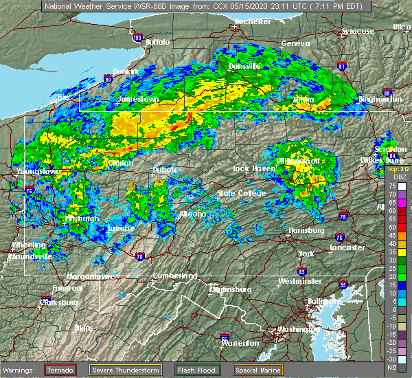 At 711 pm edt, severe thunderstorms were located along a line extending from shinglehouse to port allegany, moving east at 45 mph (radar indicated). Hazards include 60 mph wind gusts. Expect damage to trees, roofs, and siding. severe thunderstorms will be near, coudersport and genesee around 730 pm edt. denton hill state park around 740 pm edt. harrison valley and lyman run state park around 750 pm edt. galeton around 800 pm edt. Other locations impacted by these severe thunderstorms include ulysses, oswayo, sweden valley and ski denton ski area. At 711 pm edt, severe thunderstorms were located along a line extending from shinglehouse to port allegany, moving east at 45 mph (radar indicated). Hazards include 60 mph wind gusts. Expect damage to trees, roofs, and siding. severe thunderstorms will be near, coudersport and genesee around 730 pm edt. denton hill state park around 740 pm edt. harrison valley and lyman run state park around 750 pm edt. galeton around 800 pm edt. Other locations impacted by these severe thunderstorms include ulysses, oswayo, sweden valley and ski denton ski area.
|
| 8/18/2019 1:36 PM EDT |
 At 135 pm edt, severe thunderstorms were located along a line extending from near gaines to near stevenson dam, moving east at 45 mph (radar indicated). Hazards include 60 mph wind gusts and nickel size hail. expect damage to trees, roofs, and siding At 135 pm edt, severe thunderstorms were located along a line extending from near gaines to near stevenson dam, moving east at 45 mph (radar indicated). Hazards include 60 mph wind gusts and nickel size hail. expect damage to trees, roofs, and siding
|
| 8/17/2019 4:42 PM EDT |
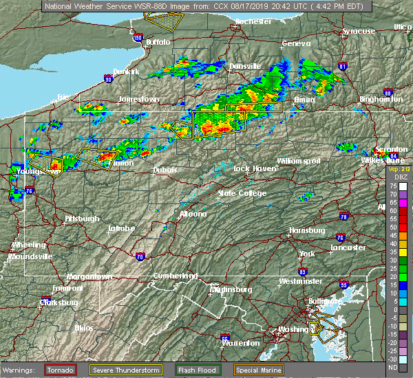 At 359 pm edt, a severe thunderstorm was located over roulette, moving east at 25 mph (radar indicated). Hazards include 60 mph wind gusts and quarter size hail. Hail damage to vehicles is expected. Expect wind damage to trees, roofs, and siding. At 359 pm edt, a severe thunderstorm was located over roulette, moving east at 25 mph (radar indicated). Hazards include 60 mph wind gusts and quarter size hail. Hail damage to vehicles is expected. Expect wind damage to trees, roofs, and siding.
|
| 8/17/2019 4:28 PM EDT |
 At 427 pm edt, a severe thunderstorm was located near denton hill state park, moving east at 30 mph. other severe storms were just to the west of this storm, and northeast along the new york border (radar indicated). Hazards include 60 mph wind gusts and quarter size hail. Hail damage to vehicles is expected. expect wind damage to trees, roofs, and siding. Locations impacted include, coudersport, roulette, galeton, shinglehouse, westfield, genesee, gaines, harrison valley, keating summit, denton hill state park, lyman run state park, ulysses, austin, sweden valley, oswayo and ski denton ski area. At 427 pm edt, a severe thunderstorm was located near denton hill state park, moving east at 30 mph. other severe storms were just to the west of this storm, and northeast along the new york border (radar indicated). Hazards include 60 mph wind gusts and quarter size hail. Hail damage to vehicles is expected. expect wind damage to trees, roofs, and siding. Locations impacted include, coudersport, roulette, galeton, shinglehouse, westfield, genesee, gaines, harrison valley, keating summit, denton hill state park, lyman run state park, ulysses, austin, sweden valley, oswayo and ski denton ski area.
|
| 8/17/2019 3:59 PM EDT |
 At 359 pm edt, a severe thunderstorm was located over roulette, moving east at 25 mph (radar indicated). Hazards include 60 mph wind gusts and quarter size hail. Hail damage to vehicles is expected. Expect wind damage to trees, roofs, and siding. At 359 pm edt, a severe thunderstorm was located over roulette, moving east at 25 mph (radar indicated). Hazards include 60 mph wind gusts and quarter size hail. Hail damage to vehicles is expected. Expect wind damage to trees, roofs, and siding.
|
| 8/15/2019 8:25 PM EDT |
 The severe thunderstorm warning for potter county will expire at 830 pm edt, the storm which prompted the warning has weakened below severe limits, and has exited the warned area. therefore, the warning will be allowed to expire. The severe thunderstorm warning for potter county will expire at 830 pm edt, the storm which prompted the warning has weakened below severe limits, and has exited the warned area. therefore, the warning will be allowed to expire.
|
| 8/15/2019 7:33 PM EDT |
 At 733 pm edt, a severe thunderstorm was located near coudersport, moving east at 40 mph (radar indicated). Hazards include 60 mph wind gusts and half dollar size hail. Hail damage to vehicles is expected. Expect wind damage to trees, roofs, and siding. At 733 pm edt, a severe thunderstorm was located near coudersport, moving east at 40 mph (radar indicated). Hazards include 60 mph wind gusts and half dollar size hail. Hail damage to vehicles is expected. Expect wind damage to trees, roofs, and siding.
|
| 7/28/2019 6:24 PM EDT |
 At 623 pm edt, a severe thunderstorm was located over lyman run state park, moving east at 30 mph (radar indicated). Hazards include 60 mph wind gusts and quarter size hail. Hail damage to vehicles is expected. Expect wind damage to trees, roofs, and siding. At 623 pm edt, a severe thunderstorm was located over lyman run state park, moving east at 30 mph (radar indicated). Hazards include 60 mph wind gusts and quarter size hail. Hail damage to vehicles is expected. Expect wind damage to trees, roofs, and siding.
|
| 7/28/2019 5:14 PM EDT |
 At 514 pm edt, a severe thunderstorm was located near denton hill state park, moving east at 35 mph (radar indicated). Hazards include 60 mph wind gusts and quarter size hail. Hail damage to vehicles is expected. Expect wind damage to trees, roofs, and siding. At 514 pm edt, a severe thunderstorm was located near denton hill state park, moving east at 35 mph (radar indicated). Hazards include 60 mph wind gusts and quarter size hail. Hail damage to vehicles is expected. Expect wind damage to trees, roofs, and siding.
|
| 5/29/2019 2:22 PM EDT |
 At 221 pm edt, a severe thunderstorm was located near galeton, moving east at 40 mph (radar indicated). Hazards include 60 mph wind gusts and penny size hail. Expect damage to trees, roofs, and siding. Locations impacted include, morris, galeton, ole bull state park, slate run, leetonia and cedar run. At 221 pm edt, a severe thunderstorm was located near galeton, moving east at 40 mph (radar indicated). Hazards include 60 mph wind gusts and penny size hail. Expect damage to trees, roofs, and siding. Locations impacted include, morris, galeton, ole bull state park, slate run, leetonia and cedar run.
|
| 5/29/2019 2:00 PM EDT |
 At 200 pm edt, a severe thunderstorm was located near cherry springs state park, moving east at 40 mph (radar indicated). Hazards include 60 mph wind gusts and penny size hail. expect damage to trees, roofs, and siding At 200 pm edt, a severe thunderstorm was located near cherry springs state park, moving east at 40 mph (radar indicated). Hazards include 60 mph wind gusts and penny size hail. expect damage to trees, roofs, and siding
|
| 4/14/2019 10:50 PM EDT |
 At 1049 pm edt, a severe thunderstorm was located near denton hill state park, moving east at 35 mph (radar indicated). Hazards include 60 mph wind gusts and penny size hail. expect damage to roofs, siding, and trees At 1049 pm edt, a severe thunderstorm was located near denton hill state park, moving east at 35 mph (radar indicated). Hazards include 60 mph wind gusts and penny size hail. expect damage to roofs, siding, and trees
|
| 10/2/2018 4:00 PM EDT |
 At 400 pm edt, a severe thunderstorm was located near gaines, moving east at 35 mph (radar indicated). Hazards include 60 mph wind gusts and quarter size hail. Hail damage to vehicles is expected. expect wind damage to roofs, siding, and trees. this severe storm will be near, leonard harrison state park around 410 pm edt. wellsboro and morris around 420 pm edt. arnot around 430 pm edt. mansfield, blossburg and covington around 440 pm edt. other locations impacted by this severe thunderstorm include mansfield university. A tornado watch remains in effect until 1100 pm edt for north central pennsylvania. At 400 pm edt, a severe thunderstorm was located near gaines, moving east at 35 mph (radar indicated). Hazards include 60 mph wind gusts and quarter size hail. Hail damage to vehicles is expected. expect wind damage to roofs, siding, and trees. this severe storm will be near, leonard harrison state park around 410 pm edt. wellsboro and morris around 420 pm edt. arnot around 430 pm edt. mansfield, blossburg and covington around 440 pm edt. other locations impacted by this severe thunderstorm include mansfield university. A tornado watch remains in effect until 1100 pm edt for north central pennsylvania.
|
| 10/2/2018 3:24 PM EDT |
 At 324 pm edt, a severe thunderstorm was located near coudersport, moving east at 35 mph (radar indicated). Hazards include 60 mph wind gusts and quarter size hail. Hail damage to vehicles is expected. expect wind damage to roofs, siding, and trees. this severe thunderstorm will be near, lyman run state park, denton hill state park and cherry springs state park around 340 pm edt. galeton around 350 pm edt. gaines around 400 pm edt. leonard harrison state park around 410 pm edt. other locations impacted by this severe thunderstorm include sweden valley, mansfield university and ski denton ski area. A tornado watch remains in effect until 1100 pm edt for north central pennsylvania. At 324 pm edt, a severe thunderstorm was located near coudersport, moving east at 35 mph (radar indicated). Hazards include 60 mph wind gusts and quarter size hail. Hail damage to vehicles is expected. expect wind damage to roofs, siding, and trees. this severe thunderstorm will be near, lyman run state park, denton hill state park and cherry springs state park around 340 pm edt. galeton around 350 pm edt. gaines around 400 pm edt. leonard harrison state park around 410 pm edt. other locations impacted by this severe thunderstorm include sweden valley, mansfield university and ski denton ski area. A tornado watch remains in effect until 1100 pm edt for north central pennsylvania.
|
| 9/21/2018 8:58 PM EDT |
 At 856 pm edt, severe thunderstorms were located along a line extending from elkland to near westfield to near cherry springs state park to near wharton, moving east at 40 mph (radar indicated). Hazards include 60 mph wind gusts. expect damage to roofs, siding, and trees At 856 pm edt, severe thunderstorms were located along a line extending from elkland to near westfield to near cherry springs state park to near wharton, moving east at 40 mph (radar indicated). Hazards include 60 mph wind gusts. expect damage to roofs, siding, and trees
|
| 9/21/2018 8:30 PM EDT |
 A severe thunderstorm warning remains in effect until 900 pm edt for potter and northern cameron counties. at 829 pm edt, severe thunderstorms were located along a line extending from whitesville to 7 miles south of genesee to near coudersport to near elk river, moving east at 35 mph. hazard. 60 mph wind gusts and brief downpours. A severe thunderstorm warning remains in effect until 900 pm edt for potter and northern cameron counties. at 829 pm edt, severe thunderstorms were located along a line extending from whitesville to 7 miles south of genesee to near coudersport to near elk river, moving east at 35 mph. hazard. 60 mph wind gusts and brief downpours.
|
| 9/21/2018 8:06 PM EDT |
 A severe thunderstorm warning remains in effect until 900 pm edt for northern elk. eastern mckean. potter and northern cameron counties. At 805 pm edt, severe thunderstorms were located along a line extending from 7 miles west of genesee to 6 miles south of shinglehouse to near crosby to wilcox, moving east at 45 mph. A severe thunderstorm warning remains in effect until 900 pm edt for northern elk. eastern mckean. potter and northern cameron counties. At 805 pm edt, severe thunderstorms were located along a line extending from 7 miles west of genesee to 6 miles south of shinglehouse to near crosby to wilcox, moving east at 45 mph.
|
| 9/21/2018 7:37 PM EDT |
 The national weather service in state college pa has issued a * severe thunderstorm warning for. northern elk county in north central pennsylvania. mckean county in north central pennsylvania. potter county in north central pennsylvania. Northern cameron county in north central pennsylvania. The national weather service in state college pa has issued a * severe thunderstorm warning for. northern elk county in north central pennsylvania. mckean county in north central pennsylvania. potter county in north central pennsylvania. Northern cameron county in north central pennsylvania.
|
| 6/13/2018 7:31 PM EDT |
 At 731 pm edt, severe thunderstorms were located along a line extending from near millerton to near galeton, moving east at 45 mph (radar indicated). Hazards include 60 mph wind gusts and quarter size hail. Hail damage to vehicles is expected. Expect wind damage to roofs, siding, and trees. At 731 pm edt, severe thunderstorms were located along a line extending from near millerton to near galeton, moving east at 45 mph (radar indicated). Hazards include 60 mph wind gusts and quarter size hail. Hail damage to vehicles is expected. Expect wind damage to roofs, siding, and trees.
|
| 5/4/2018 5:09 PM EDT |
 At 507 pm edt, severe thunderstorms were located along a line extending from 8 miles southwest of wellsville to near port allegany to near wilcox, moving east at 40 mph (radar indicated). Hazards include 70 mph wind gusts. Expect considerable tree damage. Damage is likely to mobile homes, roofs, and outbuildings. At 507 pm edt, severe thunderstorms were located along a line extending from 8 miles southwest of wellsville to near port allegany to near wilcox, moving east at 40 mph (radar indicated). Hazards include 70 mph wind gusts. Expect considerable tree damage. Damage is likely to mobile homes, roofs, and outbuildings.
|
| 10/15/2017 6:43 PM EDT |
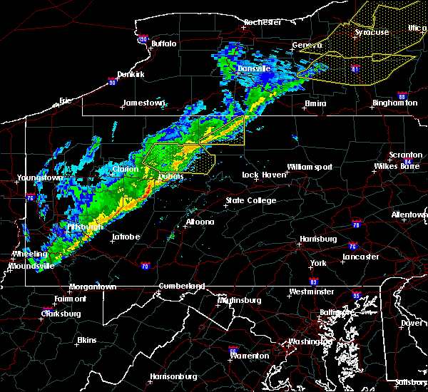 At 642 pm edt, severe thunderstorms were located along a line extending from troupsburg to near coudersport, moving east at 40 mph (radar indicated). Hazards include 60 mph wind gusts. Expect damage to trees and power lines. Locations impacted include, keating summit, denton hill state park, galeton, harrison valley, cherry springs state park, lyman run state park, coudersport, austin, ulysses and sweden valley. At 642 pm edt, severe thunderstorms were located along a line extending from troupsburg to near coudersport, moving east at 40 mph (radar indicated). Hazards include 60 mph wind gusts. Expect damage to trees and power lines. Locations impacted include, keating summit, denton hill state park, galeton, harrison valley, cherry springs state park, lyman run state park, coudersport, austin, ulysses and sweden valley.
|
| 10/15/2017 6:07 PM EDT |
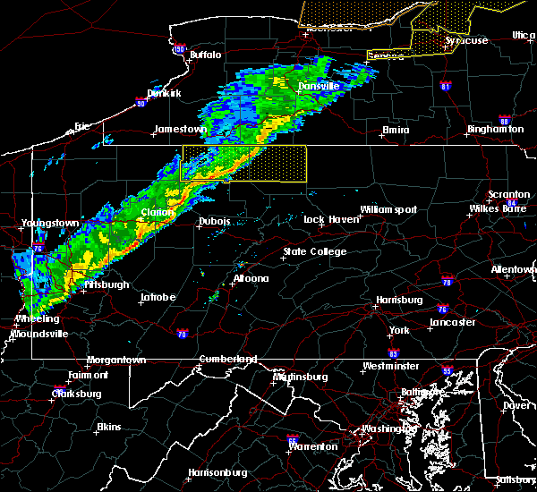 At 606 pm edt, severe thunderstorms were located along a line extending from 7 miles southwest of wellsville to near betula, moving east at 45 mph (radar indicated). Hazards include 60 mph wind gusts. Expect damage to trees and power lines. Locations impacted include, galeton, harrison valley, cherry springs state park, crosby, roulette, genesee, keating summit, denton hill state park, shinglehouse and port allegany. At 606 pm edt, severe thunderstorms were located along a line extending from 7 miles southwest of wellsville to near betula, moving east at 45 mph (radar indicated). Hazards include 60 mph wind gusts. Expect damage to trees and power lines. Locations impacted include, galeton, harrison valley, cherry springs state park, crosby, roulette, genesee, keating summit, denton hill state park, shinglehouse and port allegany.
|
| 10/15/2017 5:55 PM EDT |
 At 554 pm edt, severe thunderstorms were located along a line extending from near shinglehouse to near wilcox, moving east at 40 mph (radar indicated). Hazards include 60 mph wind gusts. expect damage to trees and power lines At 554 pm edt, severe thunderstorms were located along a line extending from near shinglehouse to near wilcox, moving east at 40 mph (radar indicated). Hazards include 60 mph wind gusts. expect damage to trees and power lines
|
| 8/22/2017 6:13 PM EDT |
 At 612 pm edt, severe thunderstorms were located along a line extending from near harrison valley to near galeton to near ole bull state park, moving east at 25 mph (radar indicated). Hazards include 60 mph wind gusts. expect damage to trees and power lines At 612 pm edt, severe thunderstorms were located along a line extending from near harrison valley to near galeton to near ole bull state park, moving east at 25 mph (radar indicated). Hazards include 60 mph wind gusts. expect damage to trees and power lines
|
| 8/22/2017 5:38 PM EDT |
 At 537 pm edt, a severe thunderstorm was located near sizerville, moving east at 40 mph (radar indicated). Hazards include 70 mph wind gusts. Expect considerable tree damage. Damage is likely to mobile homes, roofs, and outbuildings. At 537 pm edt, a severe thunderstorm was located near sizerville, moving east at 40 mph (radar indicated). Hazards include 70 mph wind gusts. Expect considerable tree damage. Damage is likely to mobile homes, roofs, and outbuildings.
|
| 8/22/2017 4:00 PM EDT |
 At 359 pm edt, severe thunderstorms were located along a line extending from near westfield to near gaines to near leonard harrison state park to near ole bull state park to near kettle creek state park, moving east at 55 mph (radar indicated). Hazards include 60 mph wind gusts. Expect damage to trees and power lines. locations impacted include, mansfield, wellsboro, cross fork, galeton, leonard harrison state park, covington, tamarack, cedar run, ole bull state park and blossburg. A tornado watch remains in effect until 900 pm edt for north central pennsylvania. At 359 pm edt, severe thunderstorms were located along a line extending from near westfield to near gaines to near leonard harrison state park to near ole bull state park to near kettle creek state park, moving east at 55 mph (radar indicated). Hazards include 60 mph wind gusts. Expect damage to trees and power lines. locations impacted include, mansfield, wellsboro, cross fork, galeton, leonard harrison state park, covington, tamarack, cedar run, ole bull state park and blossburg. A tornado watch remains in effect until 900 pm edt for north central pennsylvania.
|
| 8/22/2017 3:14 PM EDT |
 At 313 pm edt, severe thunderstorms were located along a line extending from near keating summit to near roulette to near coudersport to 8 miles east of sizerville to near wharton to near cameron to near benezette, moving east at 55 mph (radar indicated). Hazards include 70 mph wind gusts. Expect considerable tree damage. Damage is likely to mobile homes, roofs, and outbuildings. At 313 pm edt, severe thunderstorms were located along a line extending from near keating summit to near roulette to near coudersport to 8 miles east of sizerville to near wharton to near cameron to near benezette, moving east at 55 mph (radar indicated). Hazards include 70 mph wind gusts. Expect considerable tree damage. Damage is likely to mobile homes, roofs, and outbuildings.
|
| 8/4/2017 5:59 PM EDT |
 At 558 pm edt, a severe thunderstorm was located near cross fork, moving north at 40 mph (radar indicated). Hazards include 60 mph wind gusts and quarter size hail. Hail damage to vehicles is possible. Expect wind damage to trees and power lines. At 558 pm edt, a severe thunderstorm was located near cross fork, moving north at 40 mph (radar indicated). Hazards include 60 mph wind gusts and quarter size hail. Hail damage to vehicles is possible. Expect wind damage to trees and power lines.
|
| 7/20/2017 3:31 PM EDT |
 At 330 pm edt, a severe thunderstorm was located near genesee, moving southeast at 40 mph (radar indicated). Hazards include 70 mph wind gusts and quarter size hail. Hail damage to vehicles is possible. Expect wind damage to trees and power lines. At 330 pm edt, a severe thunderstorm was located near genesee, moving southeast at 40 mph (radar indicated). Hazards include 70 mph wind gusts and quarter size hail. Hail damage to vehicles is possible. Expect wind damage to trees and power lines.
|
| 6/18/2017 5:47 PM EDT |
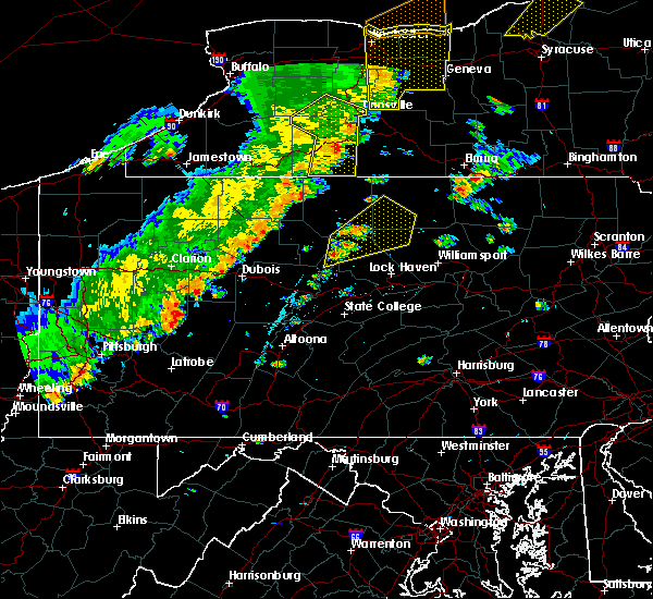 At 547 pm edt, a severe thunderstorm was located near kettle creek state park, moving northeast at 40 mph (radar indicated). Hazards include 70 mph wind gusts and half dollar size hail. Hail damage to vehicles is possible. expect considerable tree damage. Wind damage is also likely to mobile homes, roofs, and outbuildings. At 547 pm edt, a severe thunderstorm was located near kettle creek state park, moving northeast at 40 mph (radar indicated). Hazards include 70 mph wind gusts and half dollar size hail. Hail damage to vehicles is possible. expect considerable tree damage. Wind damage is also likely to mobile homes, roofs, and outbuildings.
|
| 6/15/2017 7:14 PM EDT |
 At 713 pm edt, a severe thunderstorm was located near lyman run state park, moving east at 35 mph (radar indicated). Hazards include 60 mph wind gusts. Expect damage to trees and power lines. Locations impacted include, cross fork, galeton, cherry springs state park, roulette, keating summit, denton hill state park, wharton, ole bull state park, lyman run state park and coudersport. At 713 pm edt, a severe thunderstorm was located near lyman run state park, moving east at 35 mph (radar indicated). Hazards include 60 mph wind gusts. Expect damage to trees and power lines. Locations impacted include, cross fork, galeton, cherry springs state park, roulette, keating summit, denton hill state park, wharton, ole bull state park, lyman run state park and coudersport.
|
| 6/15/2017 6:23 PM EDT |
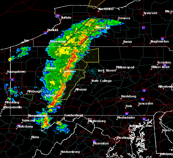 At 622 pm edt, a severe thunderstorm was located over betula, moving east at 35 mph (radar indicated). Hazards include 60 mph wind gusts. expect damage to trees and power lines At 622 pm edt, a severe thunderstorm was located over betula, moving east at 35 mph (radar indicated). Hazards include 60 mph wind gusts. expect damage to trees and power lines
|
| 5/1/2017 5:25 PM EDT |
 At 525 pm edt, severe thunderstorms were located along a line extending from near jasper to near tamarack, moving east at 40 mph (radar indicated). Hazards include 60 mph wind gusts. expect damage to roofs, siding, and trees At 525 pm edt, severe thunderstorms were located along a line extending from near jasper to near tamarack, moving east at 40 mph (radar indicated). Hazards include 60 mph wind gusts. expect damage to roofs, siding, and trees
|
| 5/1/2017 4:22 PM EDT |
 At 421 pm edt, severe thunderstorms were located along a line extending from st. bonaventure to near penfield, moving east at 50 mph (radar indicated). Hazards include 70 mph wind gusts. Expect considerable tree damage. Damage is likely to mobile homes, roofs, and outbuildings. At 421 pm edt, severe thunderstorms were located along a line extending from st. bonaventure to near penfield, moving east at 50 mph (radar indicated). Hazards include 70 mph wind gusts. Expect considerable tree damage. Damage is likely to mobile homes, roofs, and outbuildings.
|
| 8/13/2016 8:11 PM EDT |
 At 810 pm edt, severe thunderstorms with gusty winds were located along a line extending from shinglehouse to near betula to near portland mills, moving east at 50 mph (radar indicated). Hazards include 60 mph wind gusts. Expect damage to roofs. siding. And trees. At 810 pm edt, severe thunderstorms with gusty winds were located along a line extending from shinglehouse to near betula to near portland mills, moving east at 50 mph (radar indicated). Hazards include 60 mph wind gusts. Expect damage to roofs. siding. And trees.
|
| 7/25/2016 2:05 PM EDT |
 At 204 pm edt, a severe thunderstorm was located near coudersport, moving east at 40 mph (radar indicated). Hazards include 60 mph wind gusts and quarter size hail. Hail damage to vehicles is expected. expect wind damage to roofs, siding, and trees. Locations impacted include, harrison valley, coudersport, denton hill state park, galeton, genesee, oswayo, ulysses and ski denton ski area. At 204 pm edt, a severe thunderstorm was located near coudersport, moving east at 40 mph (radar indicated). Hazards include 60 mph wind gusts and quarter size hail. Hail damage to vehicles is expected. expect wind damage to roofs, siding, and trees. Locations impacted include, harrison valley, coudersport, denton hill state park, galeton, genesee, oswayo, ulysses and ski denton ski area.
|
| 7/25/2016 1:38 PM EDT |
 At 137 pm edt, a severe thunderstorm was located near port allegany, moving east at 40 mph (radar indicated). Hazards include 60 mph wind gusts and quarter size hail. Hail damage to vehicles is expected. Expect wind damage to roofs, siding, and trees. At 137 pm edt, a severe thunderstorm was located near port allegany, moving east at 40 mph (radar indicated). Hazards include 60 mph wind gusts and quarter size hail. Hail damage to vehicles is expected. Expect wind damage to roofs, siding, and trees.
|
| 7/14/2015 5:30 PM EDT |
 At 530 pm edt, doppler radar indicated a line of severe thunderstorms capable of producing damaging winds around 60 mph. these storms were located along a line extending from near troupsburg to near leetonia to near slate run, and moving east at 25 mph. nickel size hail may also accompany the damaging winds. At 530 pm edt, doppler radar indicated a line of severe thunderstorms capable of producing damaging winds around 60 mph. these storms were located along a line extending from near troupsburg to near leetonia to near slate run, and moving east at 25 mph. nickel size hail may also accompany the damaging winds.
|
| 6/23/2015 6:36 AM EDT |
 At 635 am edt, doppler radar indicated a line of severe thunderstorms capable of producing damaging winds of 60 to 70 mph. these storms were located along a line extending from near genesee to near coudersport to near truman, and moving east at 60 mph. At 635 am edt, doppler radar indicated a line of severe thunderstorms capable of producing damaging winds of 60 to 70 mph. these storms were located along a line extending from near genesee to near coudersport to near truman, and moving east at 60 mph.
|
| 6/23/2015 6:13 AM EDT |
 At 611 am edt, doppler radar indicated a line of severe thunderstorms capable of producing destructive winds in excess of 70 mph. these storms were located along a line extending from near weston mills to near smethport to near james city, moving east at 60 mph. these severe storms will be near, port allegany, roulette and shinglehouse around 620 am edt. coudersport around 630 am edt. denton hill state park, elk river, emporium, genesee, lyman run state park, sizerville and truman around 640 am edt. other locations impacted by these severe thunderstorms include austin, eldred, lewis run, mount jewett, oswayo, sweden valley, ulysses, bradford airport, ski denton ski area and university of pittsburgh - bradford. At 611 am edt, doppler radar indicated a line of severe thunderstorms capable of producing destructive winds in excess of 70 mph. these storms were located along a line extending from near weston mills to near smethport to near james city, moving east at 60 mph. these severe storms will be near, port allegany, roulette and shinglehouse around 620 am edt. coudersport around 630 am edt. denton hill state park, elk river, emporium, genesee, lyman run state park, sizerville and truman around 640 am edt. other locations impacted by these severe thunderstorms include austin, eldred, lewis run, mount jewett, oswayo, sweden valley, ulysses, bradford airport, ski denton ski area and university of pittsburgh - bradford.
|
| 6/23/2015 5:50 AM EDT |
 At 549 am edt, doppler radar indicated a line of severe thunderstorms capable of producing damaging winds of 60 to 70 mph. these storms were located along a line extending from near allegany park to near marshburg to near kellettville, and moving east at 60 mph. * severe thunderstorms will be near, marshburg and westline around 550 am edt. bradford, cyclone, kinzua bridge state park and rew around 600 am edt. kane, coryville, crosby, james city and smethport around 610 am edt. johnsonburg, east branch dam, port allegany, roulette, shinglehouse and wilcox around 620 am edt. other locations impacted by these severe thunderstorms include austin, clarendon, eldred, lewis run, mount jewett, oswayo, starbrick, sugar grove, sweden valley and tidioute. At 549 am edt, doppler radar indicated a line of severe thunderstorms capable of producing damaging winds of 60 to 70 mph. these storms were located along a line extending from near allegany park to near marshburg to near kellettville, and moving east at 60 mph. * severe thunderstorms will be near, marshburg and westline around 550 am edt. bradford, cyclone, kinzua bridge state park and rew around 600 am edt. kane, coryville, crosby, james city and smethport around 610 am edt. johnsonburg, east branch dam, port allegany, roulette, shinglehouse and wilcox around 620 am edt. other locations impacted by these severe thunderstorms include austin, clarendon, eldred, lewis run, mount jewett, oswayo, starbrick, sugar grove, sweden valley and tidioute.
|
| 6/12/2015 7:12 PM EDT | Trees dow in potter county PA, 8.5 miles N of Galeton, PA |
| 6/12/2015 7:05 PM EDT | Trees dow in tioga county PA, 4.7 miles WSW of Galeton, PA |
| 6/12/2015 6:40 PM EDT |
 At 638 pm edt, doppler radar indicated a line of severe thunderstorms capable of producing destructive winds greater than 70 mph. these storms were located along a line extending from near genesee to near cherry springs state park to near wharton to near hicks run, and moving east at 50 mph. penny size hail may also accompany the damaging winds. At 638 pm edt, doppler radar indicated a line of severe thunderstorms capable of producing destructive winds greater than 70 mph. these storms were located along a line extending from near genesee to near cherry springs state park to near wharton to near hicks run, and moving east at 50 mph. penny size hail may also accompany the damaging winds.
|
| 5/11/2015 11:36 PM EDT | At 1133 pm edt, doppler radar indicated a line of severe thunderstorms capable of producing damaging winds in excess of 60 mph. these storms were located along a line extending from near greenwood to near galeton to near cherry springs state park, moving east at 40 mph. in addition, at 945 pm wires were reported down just south of austin. locations impacted include, wellsboro, wharton, morris, coudersport, elkland, galeton, westfield, genesee, gaines, leonard harrison state park, keeneyville, leetonia, denton hill state park, cherry springs state park, ole bull state park, lyman run state park, harrison valley, cedar run, knoxville and ulysses. |
| 5/11/2015 10:59 PM EDT | At 1059 pm edt, doppler radar indicated a line of severe thunderstorms capable of producing damaging winds around 60 mph. these storms were located along a line extending from near wellsville to near coudersport to near sizerville, and moving east at 40 mph. |
| 8/21/2014 4:57 PM EDT | Half Dollar sized hail reported 0.5 miles WNW of Galeton, PA |
| 8/21/2014 4:52 PM EDT | Trees down in potter county PA, 0.5 miles WNW of Galeton, PA |
| 8/21/2014 4:29 PM EDT | Quarter sized hail reported 0.5 miles WNW of Galeton, PA |
| 9/12/2013 3:17 PM EDT | Trees down on route 144 in potter county PA, 5.8 miles N of Galeton, PA |
| 5/2/2012 9:05 PM EDT | Quarter sized hail reported 0.5 miles WNW of Galeton, PA, quarter-sized hail. |
Hail Maps for Galeton, PA
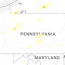
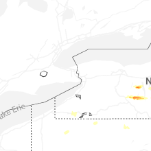


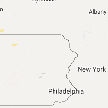


Connect with Interactive Hail Maps