

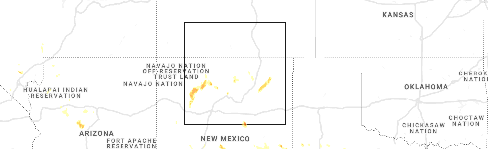
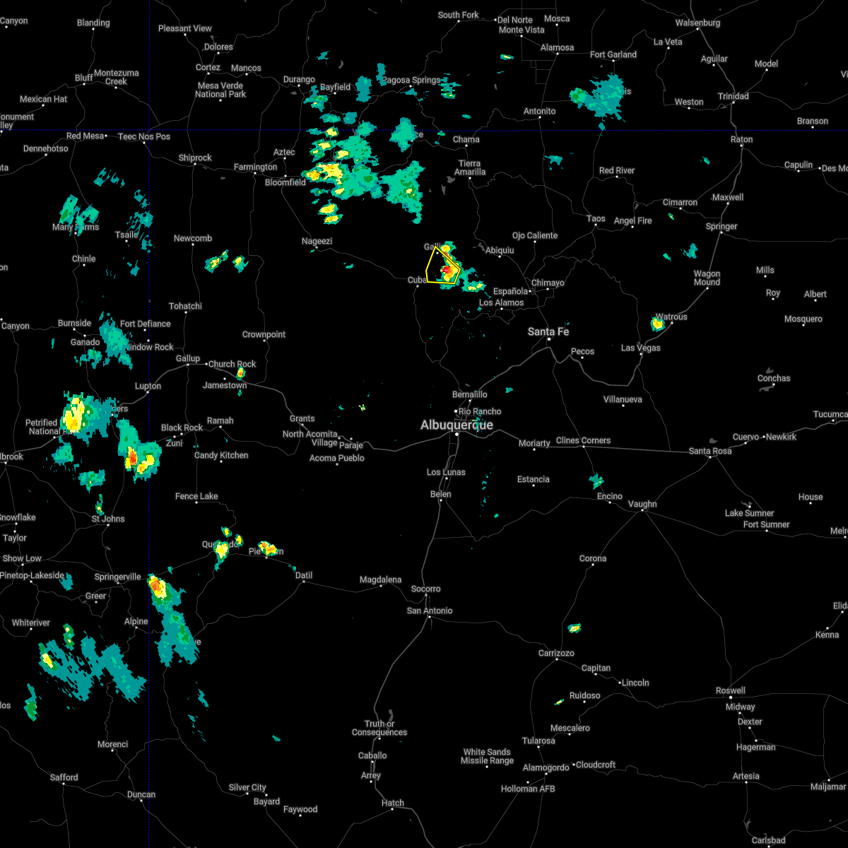
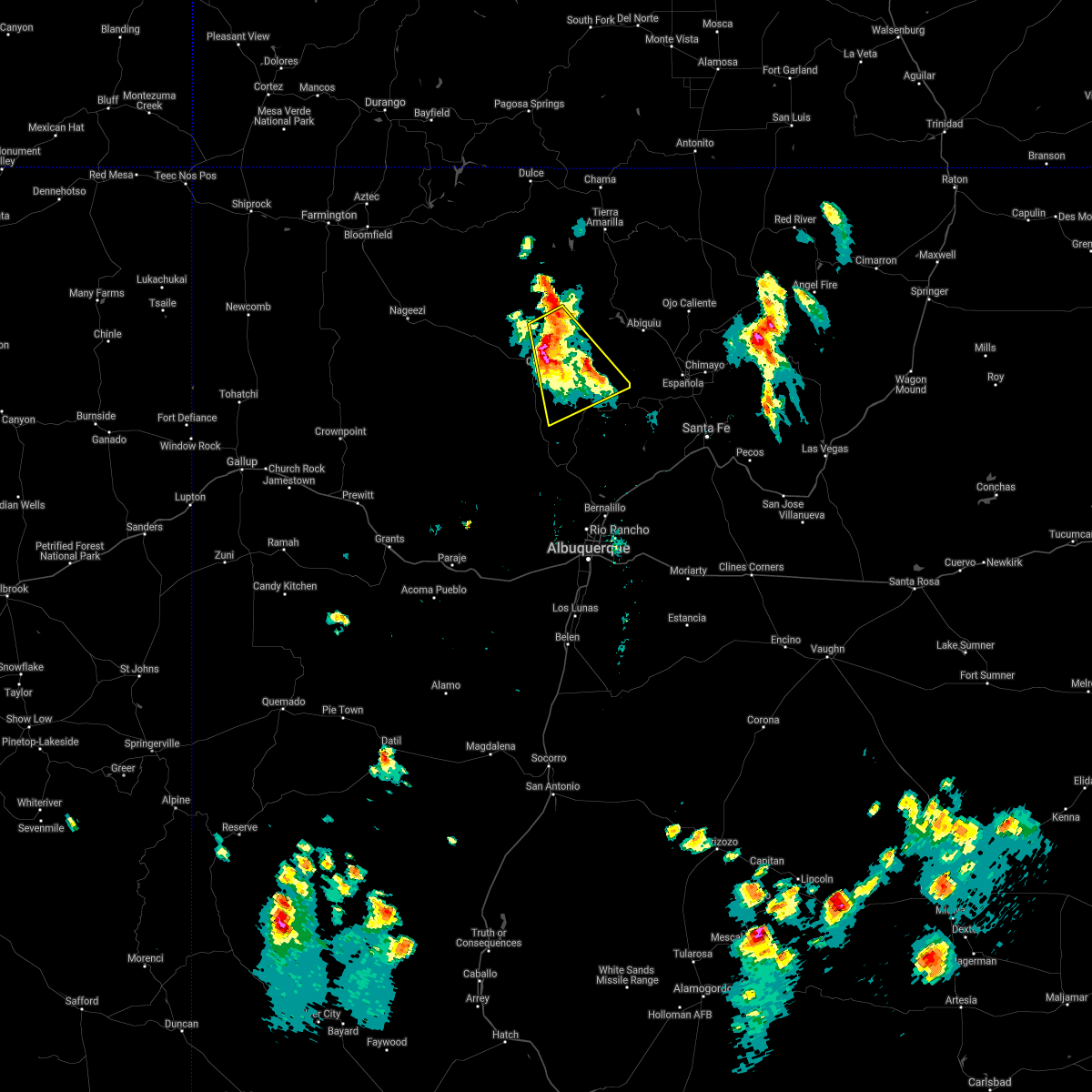
Hail Map for Gallina, NM
The Gallina, NM area has had 0 reports of on-the-ground hail by trained spotters, and has been under severe weather warnings 0 times during the past 12 months. Doppler radar has detected hail at or near Gallina, NM on 3 occasions.
| Name: | Gallina, NM |
| Where Located: | 70 miles W of Taos, NM |
| Map: | Google Map for Gallina, NM |
| Population: | 286 |
| Housing Units: | 156 |
| More Info: | Search Google for Gallina, NM |
5
The Top Recent Hail Date for Gallina, NM is Sunday, July 11, 2021 (1st out of 3)
Hail and Wind Damage Spotted near Gallina, NM
| Date / Time | Report Details |
|---|---|
| 9/17/2024 1:54 PM MDT |
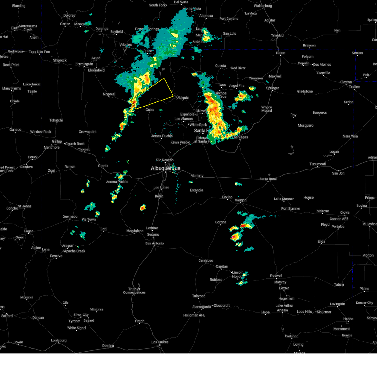
 The storm which prompted the warning has weakened below severe limits, and no longer poses an immediate threat to life or property. therefore, the warning will be allowed to expire. however, gusty winds are still possible with this thunderstorm. The storm which prompted the warning has weakened below severe limits, and no longer poses an immediate threat to life or property. therefore, the warning will be allowed to expire. however, gusty winds are still possible with this thunderstorm.
|
| 9/17/2024 1:31 PM MDT |
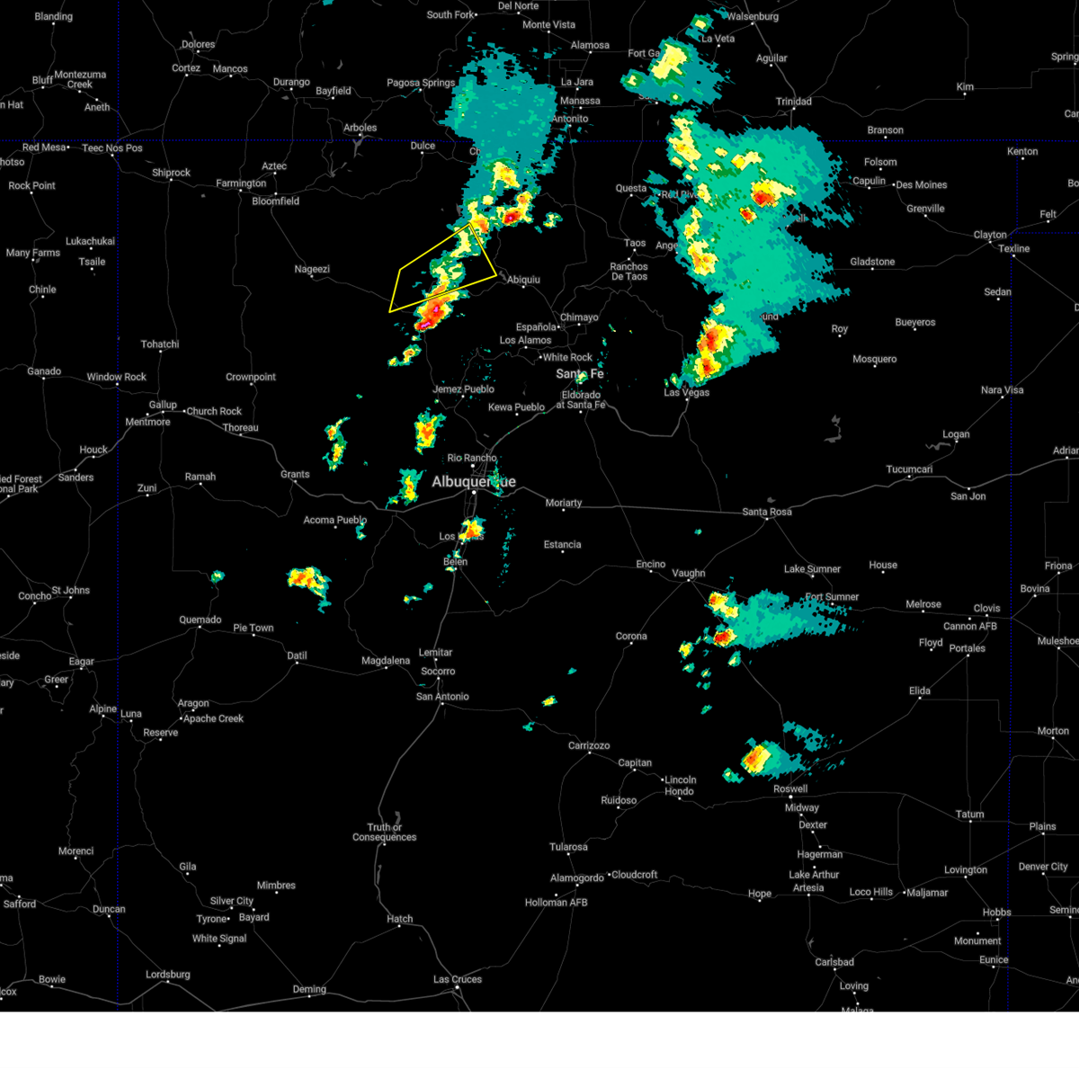
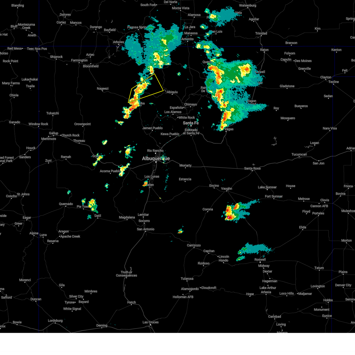 At 130 pm mdt, a severe thunderstorm was located 9 miles north of gallina, or 24 miles north of cuba, moving northeast at 45 mph (radar indicated). Hazards include 60 mph wind gusts. Expect damage to roofs, siding, and trees. locations impacted include, lindrith, regina, and gallina. This includes highway 550 between mile markers 79 and 82. At 130 pm mdt, a severe thunderstorm was located 9 miles north of gallina, or 24 miles north of cuba, moving northeast at 45 mph (radar indicated). Hazards include 60 mph wind gusts. Expect damage to roofs, siding, and trees. locations impacted include, lindrith, regina, and gallina. This includes highway 550 between mile markers 79 and 82.
|
| 9/17/2024 12:58 PM MDT |
 Svrabq the national weather service in albuquerque has issued a * severe thunderstorm warning for, southwestern rio arriba county in north central new mexico, north central sandoval county in north central new mexico, * until 200 pm mdt. * at 1258 pm mdt, a severe thunderstorm was located 11 miles southwest of lindrith, or 18 miles northwest of cuba, moving northeast at 45 mph (radar indicated). Hazards include 60 mph wind gusts. expect damage to roofs, siding, and trees Svrabq the national weather service in albuquerque has issued a * severe thunderstorm warning for, southwestern rio arriba county in north central new mexico, north central sandoval county in north central new mexico, * until 200 pm mdt. * at 1258 pm mdt, a severe thunderstorm was located 11 miles southwest of lindrith, or 18 miles northwest of cuba, moving northeast at 45 mph (radar indicated). Hazards include 60 mph wind gusts. expect damage to roofs, siding, and trees
|
| 7/14/2022 5:57 PM MDT |
 The severe thunderstorm warning for south central rio arriba county will expire at 600 pm mdt, the storm which prompted the warning has weakened below severe limits, and no longer poses an immediate threat to life or property. therefore, the warning will be allowed to expire. however small hail is still possible with this thunderstorm. The severe thunderstorm warning for south central rio arriba county will expire at 600 pm mdt, the storm which prompted the warning has weakened below severe limits, and no longer poses an immediate threat to life or property. therefore, the warning will be allowed to expire. however small hail is still possible with this thunderstorm.
|
| 7/14/2022 5:37 PM MDT |
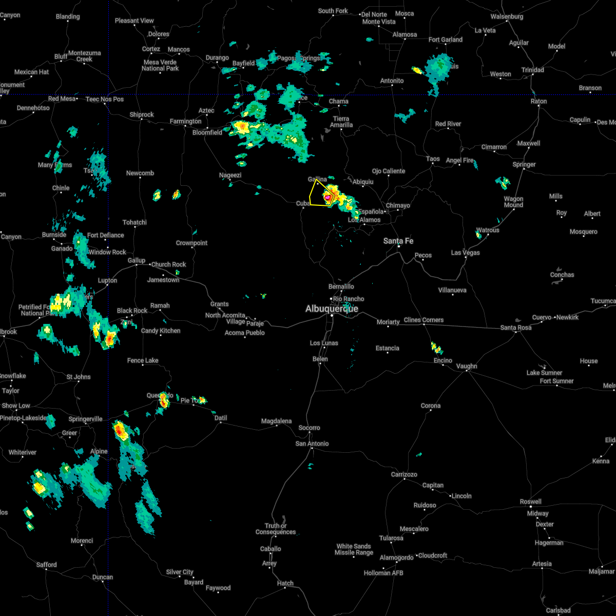 At 537 pm mdt, a severe thunderstorm was located 9 miles southwest of youngsville, or 15 miles northeast of cuba, moving west at 10 mph (radar indicated). Hazards include quarter size hail. damage to vehicles is expected At 537 pm mdt, a severe thunderstorm was located 9 miles southwest of youngsville, or 15 miles northeast of cuba, moving west at 10 mph (radar indicated). Hazards include quarter size hail. damage to vehicles is expected
|
| 7/11/2021 3:21 PM MDT |
 At 320 pm mdt, a severe thunderstorm was located near cuba, moving south at 40 mph (radar indicated). Hazards include 60 mph wind gusts and quarter size hail. Hail damage to vehicles is expected. expect wind damage to roofs, siding, and trees. locations impacted include, cuba, regina, fenton lake state park, gallina and la jara. This includes highway 550 near mile marker 66. At 320 pm mdt, a severe thunderstorm was located near cuba, moving south at 40 mph (radar indicated). Hazards include 60 mph wind gusts and quarter size hail. Hail damage to vehicles is expected. expect wind damage to roofs, siding, and trees. locations impacted include, cuba, regina, fenton lake state park, gallina and la jara. This includes highway 550 near mile marker 66.
|
| 7/11/2021 3:03 PM MDT |
 At 302 pm mdt, a severe thunderstorm was located 9 miles southwest of youngsville, or 17 miles east of cuba, moving southeast at 15 mph (radar indicated). Hazards include 60 mph wind gusts and quarter size hail. Hail damage to vehicles is expected. Expect wind damage to roofs, siding, and trees. At 302 pm mdt, a severe thunderstorm was located 9 miles southwest of youngsville, or 17 miles east of cuba, moving southeast at 15 mph (radar indicated). Hazards include 60 mph wind gusts and quarter size hail. Hail damage to vehicles is expected. Expect wind damage to roofs, siding, and trees.
|
Hail Maps for Gallina, NM


Connect with Interactive Hail Maps