

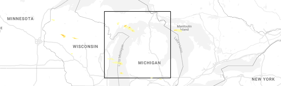
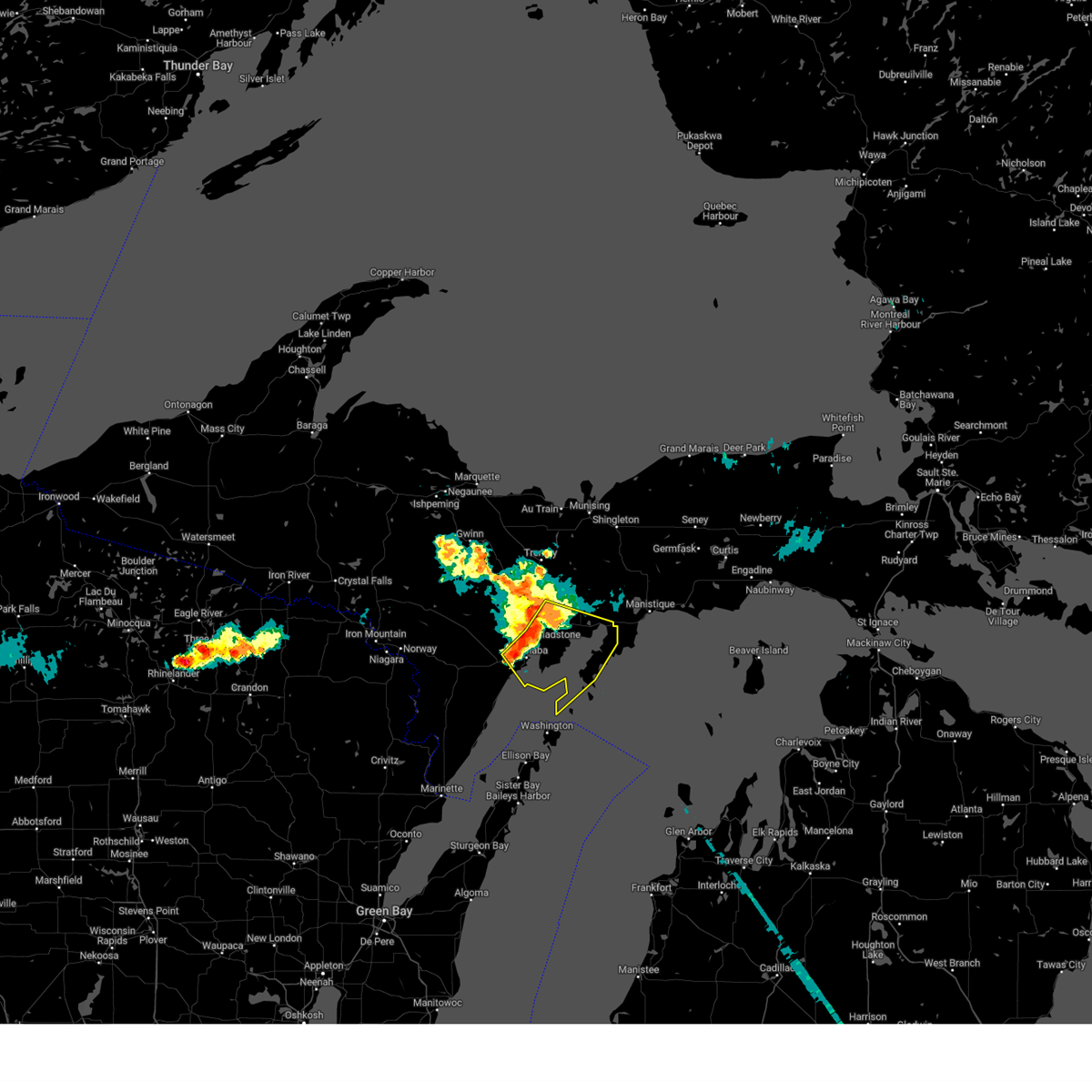
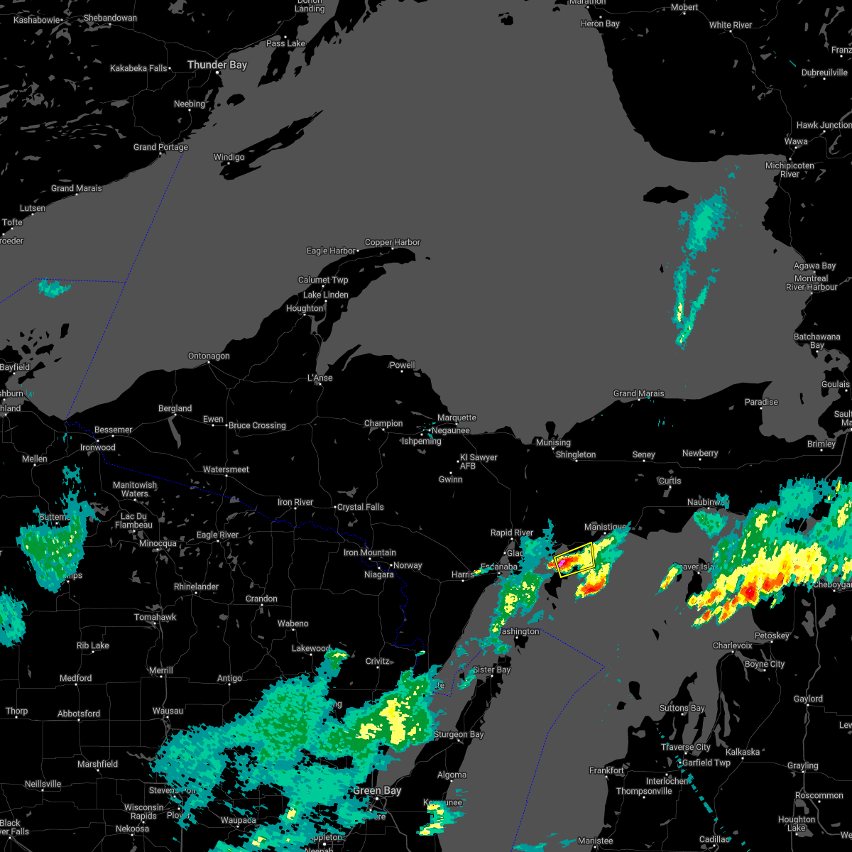
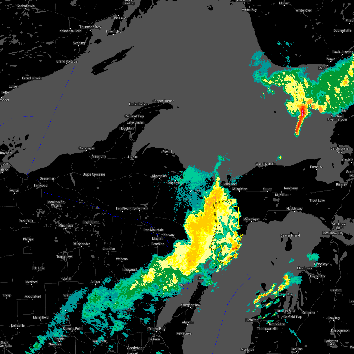
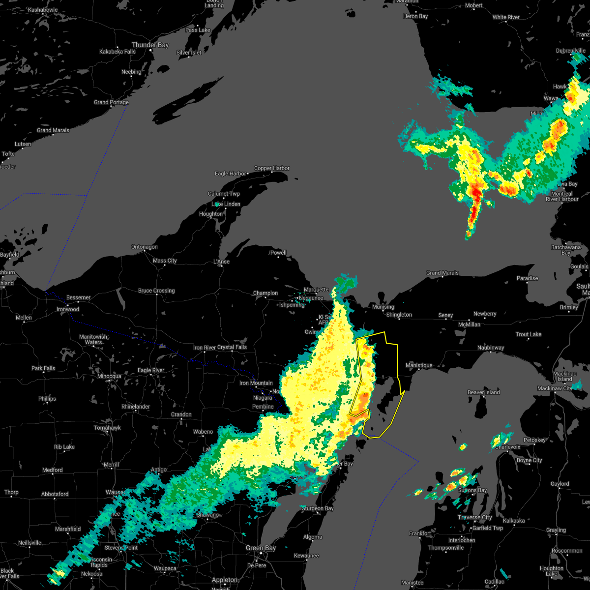
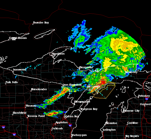
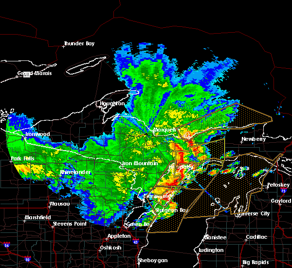
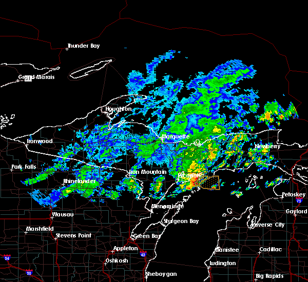
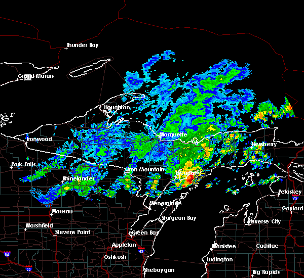
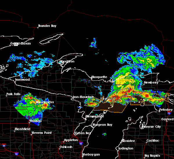
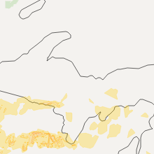
Hail Map for Garden, MI
The Garden, MI area has had 1 report of on-the-ground hail by trained spotters, and has been under severe weather warnings 0 times during the past 12 months. Doppler radar has detected hail at or near Garden, MI on 12 occasions.
| Name: | Garden, MI |
| Where Located: | 67.5 miles SE of Marquette, MI |
| Map: | Google Map for Garden, MI |
| Population: | 221 |
| Housing Units: | 134 |
| More Info: | Search Google for Garden, MI |
5
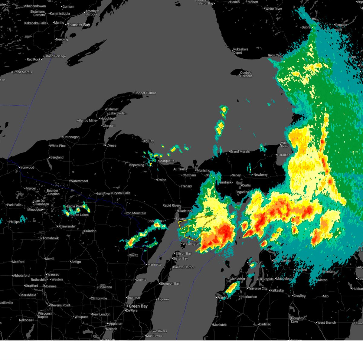
The Top Recent Hail Date for Garden, MI is Monday, July 11, 2022 (1st out of 12)
Hail and Wind Damage Spotted near Garden, MI
| Date / Time | Report Details |
|---|---|
| 6/21/2025 10:29 AM EDT |
 the severe thunderstorm warning has been cancelled and is no longer in effect the severe thunderstorm warning has been cancelled and is no longer in effect
|
| 6/21/2025 10:02 AM EDT | Report of downed trees between sac bay and fayette. most of garden peninsula lost power for around 2 hour in delta county MI, 8.4 miles NE of Garden, MI |
| 6/21/2025 9:54 AM EDT |
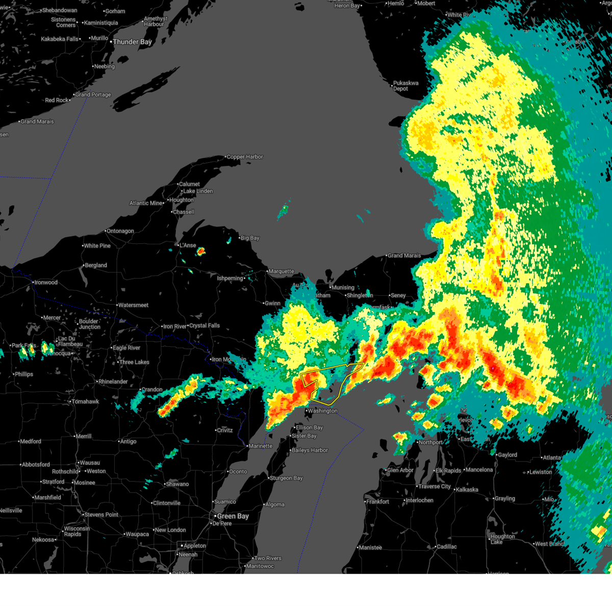 Svrmqt the national weather service in marquette has issued a * severe thunderstorm warning for, southeastern delta county in south central upper michigan, * until 1045 am edt. * at 954 am edt, a severe thunderstorm was located 8 miles west of point detour, or 17 miles southeast of escanaba, moving east at 60 mph (radar indicated). Hazards include 60 mph wind gusts and quarter size hail. Hail damage to vehicles is expected. Expect wind damage to roofs, siding, and trees. Svrmqt the national weather service in marquette has issued a * severe thunderstorm warning for, southeastern delta county in south central upper michigan, * until 1045 am edt. * at 954 am edt, a severe thunderstorm was located 8 miles west of point detour, or 17 miles southeast of escanaba, moving east at 60 mph (radar indicated). Hazards include 60 mph wind gusts and quarter size hail. Hail damage to vehicles is expected. Expect wind damage to roofs, siding, and trees.
|
| 7/14/2024 9:28 PM EDT |
 At 928 pm edt, severe thunderstorms were located along a line extending from 6 miles northwest of nahma to 9 miles southeast of gladstone to 7 miles south of escanaba, moving southeast at 30 mph (radar indicated). Hazards include 60 mph wind gusts and quarter size hail. Hail damage to vehicles is expected. expect wind damage to roofs, siding, and trees. Locations impacted include, escanaba, rapid river, nahma, garden, garden corners, isabella, fayette, ensign, stonington, and nahma junction. At 928 pm edt, severe thunderstorms were located along a line extending from 6 miles northwest of nahma to 9 miles southeast of gladstone to 7 miles south of escanaba, moving southeast at 30 mph (radar indicated). Hazards include 60 mph wind gusts and quarter size hail. Hail damage to vehicles is expected. expect wind damage to roofs, siding, and trees. Locations impacted include, escanaba, rapid river, nahma, garden, garden corners, isabella, fayette, ensign, stonington, and nahma junction.
|
| 7/14/2024 9:13 PM EDT |
 Svrmqt the national weather service in marquette has issued a * severe thunderstorm warning for, central delta county in south central upper michigan, * until 945 pm edt. * at 912 pm edt, severe thunderstorms were located along a line extending from near rapid river to near gladstone to near escanaba, moving southeast at 30 mph (radar indicated). Hazards include 60 mph wind gusts and quarter size hail. Hail damage to vehicles is expected. Expect wind damage to roofs, siding, and trees. Svrmqt the national weather service in marquette has issued a * severe thunderstorm warning for, central delta county in south central upper michigan, * until 945 pm edt. * at 912 pm edt, severe thunderstorms were located along a line extending from near rapid river to near gladstone to near escanaba, moving southeast at 30 mph (radar indicated). Hazards include 60 mph wind gusts and quarter size hail. Hail damage to vehicles is expected. Expect wind damage to roofs, siding, and trees.
|
| 7/11/2022 6:38 PM EDT |
 At 637 pm edt, a severe thunderstorm was located over garden, or 18 miles southwest of manistique, moving northeast at 15 mph (radar indicated). Hazards include quarter size hail. Damage to vehicles is expected. this severe thunderstorm will remain over mainly rural areas of east central delta and southwestern schoolcraft counties, including the following locations, point aux barques. hail threat, radar indicated max hail size, 1. 00 in wind threat, radar indicated max wind gust, <50 mph. At 637 pm edt, a severe thunderstorm was located over garden, or 18 miles southwest of manistique, moving northeast at 15 mph (radar indicated). Hazards include quarter size hail. Damage to vehicles is expected. this severe thunderstorm will remain over mainly rural areas of east central delta and southwestern schoolcraft counties, including the following locations, point aux barques. hail threat, radar indicated max hail size, 1. 00 in wind threat, radar indicated max wind gust, <50 mph.
|
| 6/15/2022 9:08 PM EDT | Tree down and large swing blown down. report via social medi in delta county MI, 1.7 miles E of Garden, MI |
| 5/25/2021 10:11 PM EDT |
 The severe thunderstorm warning for eastern delta and south central alger counties will expire at 1015 pm edt, the storms which prompted the warning have moved out of the area. therefore, the warning will be allowed to expire. a severe thunderstorm watch remains in effect until 1100 pm edt for south central upper michigan. to report severe weather, contact your nearest law enforcement agency. they will relay your report to the national weather service marquette. The severe thunderstorm warning for eastern delta and south central alger counties will expire at 1015 pm edt, the storms which prompted the warning have moved out of the area. therefore, the warning will be allowed to expire. a severe thunderstorm watch remains in effect until 1100 pm edt for south central upper michigan. to report severe weather, contact your nearest law enforcement agency. they will relay your report to the national weather service marquette.
|
| 5/25/2021 9:55 PM EDT |
 At 954 pm edt, severe thunderstorms were located along a line extending from 7 miles east of u.s. 41 between trenary and rapid river to 13 miles southeast of escanaba to 12 miles west of ephraim, moving east at 45 mph. trained weather spotters have reported wind gusts to near 60 mph with this line of thunderstorms, and there have been numerous reports of downed trees between bark river and escanaba (trained weather spotters). Hazards include 60 mph wind gusts. Expect damage to roofs, siding, and trees. Locations impacted include, point detour. At 954 pm edt, severe thunderstorms were located along a line extending from 7 miles east of u.s. 41 between trenary and rapid river to 13 miles southeast of escanaba to 12 miles west of ephraim, moving east at 45 mph. trained weather spotters have reported wind gusts to near 60 mph with this line of thunderstorms, and there have been numerous reports of downed trees between bark river and escanaba (trained weather spotters). Hazards include 60 mph wind gusts. Expect damage to roofs, siding, and trees. Locations impacted include, point detour.
|
| 5/25/2021 9:30 PM EDT |
 At 928 pm edt/828 pm cdt/, severe thunderstorms were located along a line extending from rock to 9 miles north of cedar river to 6 miles northwest of menominee, moving east at 40 mph. trained weather spotters reported wind gusts to near 60 mph with this line of storms (trained weather spotters). Hazards include 60 mph wind gusts. Expect damage to roofs, siding, and trees. severe thunderstorms will be near, rock around 935 pm edt. u. s. 41 between trenary and rapid river around 940 pm edt. Other locations in the path of these severe thunderstorms include ford river, escanaba, gladstone, and point detour. At 928 pm edt/828 pm cdt/, severe thunderstorms were located along a line extending from rock to 9 miles north of cedar river to 6 miles northwest of menominee, moving east at 40 mph. trained weather spotters reported wind gusts to near 60 mph with this line of storms (trained weather spotters). Hazards include 60 mph wind gusts. Expect damage to roofs, siding, and trees. severe thunderstorms will be near, rock around 935 pm edt. u. s. 41 between trenary and rapid river around 940 pm edt. Other locations in the path of these severe thunderstorms include ford river, escanaba, gladstone, and point detour.
|
| 7/19/2020 4:23 AM EDT |
 The severe thunderstorm warning for central delta, central menominee and central schoolcraft counties will expire at 430 am edt/330 am cdt/, the storms which prompted the warning have moved out of the area. therefore, the warning will be allowed to expire. a severe thunderstorm watch remains in effect until 600 am edt/500 am cdt/ for east central upper and south central upper michigan. to report severe weather, contact your nearest law enforcement agency. they will relay your report to the national weather service marquette. remember, a severe thunderstorm warning still remains in effect for southern menominee county until 445 am edt. The severe thunderstorm warning for central delta, central menominee and central schoolcraft counties will expire at 430 am edt/330 am cdt/, the storms which prompted the warning have moved out of the area. therefore, the warning will be allowed to expire. a severe thunderstorm watch remains in effect until 600 am edt/500 am cdt/ for east central upper and south central upper michigan. to report severe weather, contact your nearest law enforcement agency. they will relay your report to the national weather service marquette. remember, a severe thunderstorm warning still remains in effect for southern menominee county until 445 am edt.
|
| 7/19/2020 3:42 AM EDT |
 At 342 am edt/242 am cdt/, severe thunderstorms were located along a line extending from 10 miles southwest of steuben to near escanaba to 9 miles south of pembine, moving east at 55 mph (radar indicated). Hazards include 60 mph wind gusts and nickel size hail. expect damage to roofs, siding, and trees At 342 am edt/242 am cdt/, severe thunderstorms were located along a line extending from 10 miles southwest of steuben to near escanaba to 9 miles south of pembine, moving east at 55 mph (radar indicated). Hazards include 60 mph wind gusts and nickel size hail. expect damage to roofs, siding, and trees
|
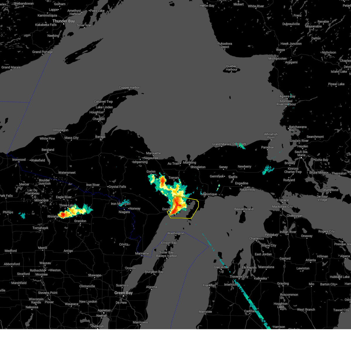
| 5/22/2019 9:51 PM EDT | Quarter sized hail reported 11.3 miles SSE of Garden, MI, public report of 1 inch diameter hail 2 nw of isabella at 9:51 pm. |
| 7/18/2017 6:24 PM EDT |
 At 624 pm edt, severe thunderstorms were located along a line extending from near manistique to near nahma to 7 miles southeast of gladstone, moving southeast at 30 mph (radar indicated). Hazards include 60 mph wind gusts. Expect damage to roofs, siding, and trees. Locations impacted include, manistique, nahma, garden, garden corners, point detour, isabella, fayette, thompson, indian lake state park, cooks, fairport and gulliver. At 624 pm edt, severe thunderstorms were located along a line extending from near manistique to near nahma to 7 miles southeast of gladstone, moving southeast at 30 mph (radar indicated). Hazards include 60 mph wind gusts. Expect damage to roofs, siding, and trees. Locations impacted include, manistique, nahma, garden, garden corners, point detour, isabella, fayette, thompson, indian lake state park, cooks, fairport and gulliver.
|
| 7/18/2017 6:09 PM EDT |
 The national weather service in marquette has issued a * severe thunderstorm warning for. delta county in south central upper michigan. southern schoolcraft county in east central upper michigan. Until 700 pm edt * at 609 pm edt, severe thunderstorms were located along a line. The national weather service in marquette has issued a * severe thunderstorm warning for. delta county in south central upper michigan. southern schoolcraft county in east central upper michigan. Until 700 pm edt * at 609 pm edt, severe thunderstorms were located along a line.
|
| 6/11/2017 11:33 PM EDT |
 At 1133 pm edt, severe thunderstorms were located along a line extending from 10 miles east of u.s. 41 between trenary and rapid river to near nahma to 10 miles west of garden to 11 miles southeast of escanaba to 12 miles northeast of cedar river, moving east at 55 mph (radar indicated). Hazards include 60 mph wind gusts and penny size hail. Expect damage to roofs, siding, and trees. Locations impacted include, escanaba, nahma, garden, garden corners, point detour, isabella, fayette, ensign, fairport, chicago lake, stonington and nahma junction. At 1133 pm edt, severe thunderstorms were located along a line extending from 10 miles east of u.s. 41 between trenary and rapid river to near nahma to 10 miles west of garden to 11 miles southeast of escanaba to 12 miles northeast of cedar river, moving east at 55 mph (radar indicated). Hazards include 60 mph wind gusts and penny size hail. Expect damage to roofs, siding, and trees. Locations impacted include, escanaba, nahma, garden, garden corners, point detour, isabella, fayette, ensign, fairport, chicago lake, stonington and nahma junction.
|
| 6/11/2017 11:17 PM EDT |
 At 1116 pm edt, severe thunderstorms were located along a line extending from near rock to near rapid river to near escanaba to 11 miles east of powers to 9 miles northwest of cedar river, moving east at 45 mph (radar indicated). Hazards include 60 mph wind gusts and penny size hail. expect damage to roofs, siding, and trees At 1116 pm edt, severe thunderstorms were located along a line extending from near rock to near rapid river to near escanaba to 11 miles east of powers to 9 miles northwest of cedar river, moving east at 45 mph (radar indicated). Hazards include 60 mph wind gusts and penny size hail. expect damage to roofs, siding, and trees
|
| 6/11/2017 10:50 PM EDT |
 At 1050 pm edt, severe thunderstorms were located along a line extending from 10 miles north of garden corners to 6 miles north of rapid river to 7 miles northwest of escanaba, moving east at 30 mph (radar indicated). Hazards include 60 mph wind gusts and penny size hail. Expect damage to roofs, siding, and trees. locations impacted include, escanaba, gladstone, rapid river, nahma, garden, garden corners, point detour, u. s. 41 between trenary and rapid river, isabella, fayette, brampton, ensign, chicago lake, perkins, hyde, maplewood, fairport, schaeffer, stonington and nahma junction. At 1050 pm edt, severe thunderstorms were located along a line extending from 10 miles north of garden corners to 6 miles north of rapid river to 7 miles northwest of escanaba, moving east at 30 mph (radar indicated). Hazards include 60 mph wind gusts and penny size hail. Expect damage to roofs, siding, and trees. locations impacted include, escanaba, gladstone, rapid river, nahma, garden, garden corners, point detour, u. s. 41 between trenary and rapid river, isabella, fayette, brampton, ensign, chicago lake, perkins, hyde, maplewood, fairport, schaeffer, stonington and nahma junction.
|
| 6/11/2017 10:29 PM EDT |
 At 1028 pm edt, severe thunderstorms were located along a line extending from near u.s. 41 between trenary and rapid river to near watson to 6 miles southeast of la branche, moving east at 40 mph (radar indicated). Hazards include 60 mph wind gusts and penny size hail. expect damage to roofs, siding, and trees At 1028 pm edt, severe thunderstorms were located along a line extending from near u.s. 41 between trenary and rapid river to near watson to 6 miles southeast of la branche, moving east at 40 mph (radar indicated). Hazards include 60 mph wind gusts and penny size hail. expect damage to roofs, siding, and trees
|
| 6/11/2017 3:17 PM EDT | Large tree limbs down in and around the campground at fayette historic state par in delta county MI, 6.2 miles NE of Garden, MI |
| 6/11/2017 3:12 PM EDT |
 At 312 pm edt, severe thunderstorms were located along a line extending from 10 miles east of trenary to 8 miles west of nahma, moving east at 65 mph (radar indicated). Hazards include 60 mph wind gusts and penny size hail. expect damage to roofs, siding, and trees At 312 pm edt, severe thunderstorms were located along a line extending from 10 miles east of trenary to 8 miles west of nahma, moving east at 65 mph (radar indicated). Hazards include 60 mph wind gusts and penny size hail. expect damage to roofs, siding, and trees
|
| 8/17/2015 4:49 AM EDT |
 At 448 am edt, a severe thunderstorm was located near fayette, or 18 miles east of escanaba, moving east at 30 mph (radar indicated). Hazards include golf ball size hail and 60 mph wind gusts. People and animals outdoors will be injured. expect hail damage to roofs, siding, windows and vehicles. expect wind damage to roofs, siding and trees. Locations impacted include, fayette, garden. At 448 am edt, a severe thunderstorm was located near fayette, or 18 miles east of escanaba, moving east at 30 mph (radar indicated). Hazards include golf ball size hail and 60 mph wind gusts. People and animals outdoors will be injured. expect hail damage to roofs, siding, windows and vehicles. expect wind damage to roofs, siding and trees. Locations impacted include, fayette, garden.
|
| 8/17/2015 4:43 AM EDT |
 At 443 am edt, a severe thunderstorm was located near fayette, or 15 miles east of escanaba, moving east at 30 mph (radar indicated). Hazards include quarter size hail and 60 mph wind gusts. Hail damage to vehicles is expected. Expect wind damage to roofs, siding and trees. At 443 am edt, a severe thunderstorm was located near fayette, or 15 miles east of escanaba, moving east at 30 mph (radar indicated). Hazards include quarter size hail and 60 mph wind gusts. Hail damage to vehicles is expected. Expect wind damage to roofs, siding and trees.
|
| 8/2/2015 8:50 AM EDT |
 At 849 am edt, severe thunderstorms were located along a line extending from 8 miles southwest of germfask to near garden corners, moving east at 45 mph (radar indicated). Hazards include 60 mph wind gusts and quarter size hail. Hail damage to vehicles is expected. expect wind damage to roofs, siding and trees. these severe storms will be near, manistique around 900 am edt. Other locations impacted by these severe thunderstorms include indian lake state park, isabella, cooks and nahma junction. At 849 am edt, severe thunderstorms were located along a line extending from 8 miles southwest of germfask to near garden corners, moving east at 45 mph (radar indicated). Hazards include 60 mph wind gusts and quarter size hail. Hail damage to vehicles is expected. expect wind damage to roofs, siding and trees. these severe storms will be near, manistique around 900 am edt. Other locations impacted by these severe thunderstorms include indian lake state park, isabella, cooks and nahma junction.
|
| 8/2/2015 8:41 AM EDT |
 At 839 am edt, severe thunderstorms were located along a line extending from near steuben to near nahma, moving east at 45 mph (radar indicated. at 817 am edt...1 inch hail was reported by a spotter in perkins). Hazards include 60 mph wind gusts and quarter size hail. Hail damage to vehicles is expected. expect wind damage to roofs, siding and trees. these severe storms will be near, m-94 between steuben and manistique around 845 am edt. Other locations impacted by these severe thunderstorms include indian lake state park, isabella, cooks, ensign, nahma junction and chicago lake. At 839 am edt, severe thunderstorms were located along a line extending from near steuben to near nahma, moving east at 45 mph (radar indicated. at 817 am edt...1 inch hail was reported by a spotter in perkins). Hazards include 60 mph wind gusts and quarter size hail. Hail damage to vehicles is expected. expect wind damage to roofs, siding and trees. these severe storms will be near, m-94 between steuben and manistique around 845 am edt. Other locations impacted by these severe thunderstorms include indian lake state park, isabella, cooks, ensign, nahma junction and chicago lake.
|
| 8/2/2015 8:30 AM EDT |
 At 828 am edt, severe thunderstorms were located along a line extending from near steuben to 6 miles east of rapid river, moving east at 45 mph (radar indicated. at 817 am edt...1 inch hail was reported in perkins). Hazards include 60 mph wind gusts and quarter size hail. Hail damage to vehicles is expected. expect wind damage to roofs, siding and trees. these severe storms will be near, steuben around 835 am edt. m-94 between steuben and manistique around 840 am edt. garden around 845 am edt. garden corners around 850 am edt. Other locations impacted by these severe thunderstorms include indian lake state park, fish lake, perkins, chicago lake, maplewood, cooks, brampton, nahma junction, isabella and wetmore. At 828 am edt, severe thunderstorms were located along a line extending from near steuben to 6 miles east of rapid river, moving east at 45 mph (radar indicated. at 817 am edt...1 inch hail was reported in perkins). Hazards include 60 mph wind gusts and quarter size hail. Hail damage to vehicles is expected. expect wind damage to roofs, siding and trees. these severe storms will be near, steuben around 835 am edt. m-94 between steuben and manistique around 840 am edt. garden around 845 am edt. garden corners around 850 am edt. Other locations impacted by these severe thunderstorms include indian lake state park, fish lake, perkins, chicago lake, maplewood, cooks, brampton, nahma junction, isabella and wetmore.
|
| 8/2/2015 8:23 AM EDT |
 At 822 am edt, severe thunderstorms were located along a line extending from near steuben to near rapid river, moving east at 50 mph (radar indicated). Hazards include 60 mph wind gusts and quarter size hail. Hail damage to vehicles is expected. expect wind damage to roofs, siding and trees. these severe storms will be near, steuben around 830 am edt. m-94 between steuben and manistique around 840 am edt. garden and garden corners around 845 am edt. manistique around 900 am edt. Other locations impacted by these severe thunderstorms include indian lake state park, fish lake, perkins, chicago lake, maplewood, cooks, brampton, nahma junction, isabella and wetmore. At 822 am edt, severe thunderstorms were located along a line extending from near steuben to near rapid river, moving east at 50 mph (radar indicated). Hazards include 60 mph wind gusts and quarter size hail. Hail damage to vehicles is expected. expect wind damage to roofs, siding and trees. these severe storms will be near, steuben around 830 am edt. m-94 between steuben and manistique around 840 am edt. garden and garden corners around 845 am edt. manistique around 900 am edt. Other locations impacted by these severe thunderstorms include indian lake state park, fish lake, perkins, chicago lake, maplewood, cooks, brampton, nahma junction, isabella and wetmore.
|
| 8/2/2015 8:13 AM EDT |
 At 812 am edt, severe thunderstorms were located along a line extending from 9 miles east of trenary to 7 miles northwest of gladstone, moving east at 45 mph (radar indicated). Hazards include quarter size hail and 60 mph wind gusts. Hail damage to vehicles is expected. expect wind damage to roofs, siding and trees. severe thunderstorms will be near, steuben around 835 am edt. m-94 between steuben and manistique around 845 am edt. garden around 850 am edt. garden corners around 855 am edt. Other locations impacted by these severe thunderstorms include indian lake state park, fish lake, perkins, chicago lake, maplewood, cooks, brampton, nahma junction, isabella and wetmore. At 812 am edt, severe thunderstorms were located along a line extending from 9 miles east of trenary to 7 miles northwest of gladstone, moving east at 45 mph (radar indicated). Hazards include quarter size hail and 60 mph wind gusts. Hail damage to vehicles is expected. expect wind damage to roofs, siding and trees. severe thunderstorms will be near, steuben around 835 am edt. m-94 between steuben and manistique around 845 am edt. garden around 850 am edt. garden corners around 855 am edt. Other locations impacted by these severe thunderstorms include indian lake state park, fish lake, perkins, chicago lake, maplewood, cooks, brampton, nahma junction, isabella and wetmore.
|
| 5/3/2015 8:45 PM EDT | At 845 pm edt, severe thunderstorms were located along a line extending from near garden corners to 7 miles east of gladstone, moving southeast at 15 mph (radar indicated). Hazards include quarter size hail. damage to vehicles is expected |
| 1/1/0001 12:00 AM | Trees down across roa in delta county MI, 17.5 miles SSE of Garden, MI |
| 1/1/0001 12:00 AM | Delayed report. 8 inch top of tree snapped. time was estimated by rada in delta county MI, 18 miles SSE of Garden, MI |
| 1/1/0001 12:00 AM | Delayed report. 8 inch diameter branch down. numerous 2 to 3 inch diameter limbs dow in delta county MI, 17.7 miles SSE of Garden, MI |
| 1/1/0001 12:00 AM | Delayed report. additional tree damage found in the area. various 3 to 6 inch branches dow in delta county MI, 19.3 miles SSE of Garden, MI |
Hail Maps for Garden, MI


Connect with Interactive Hail Maps