

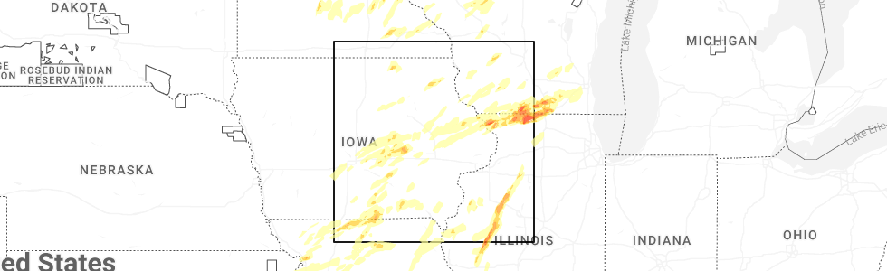
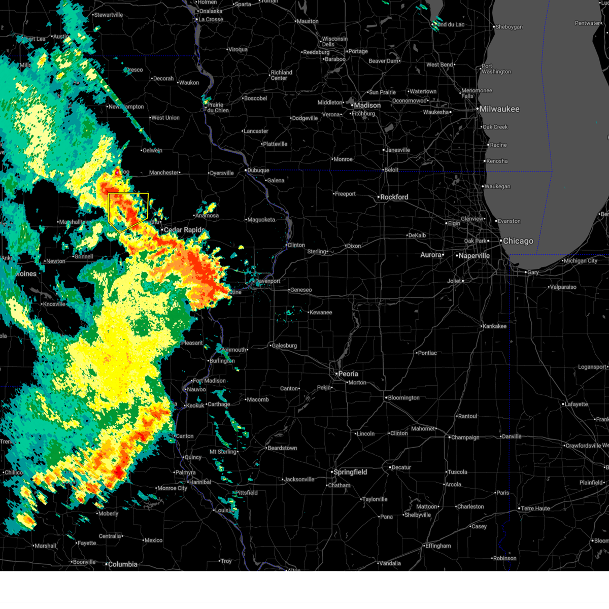
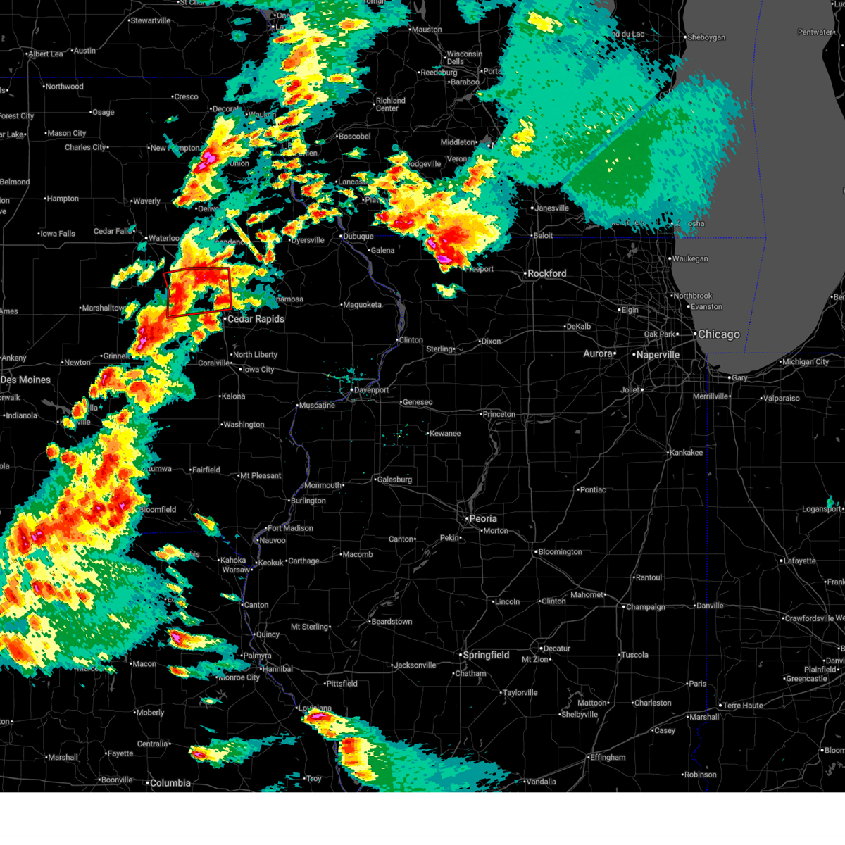
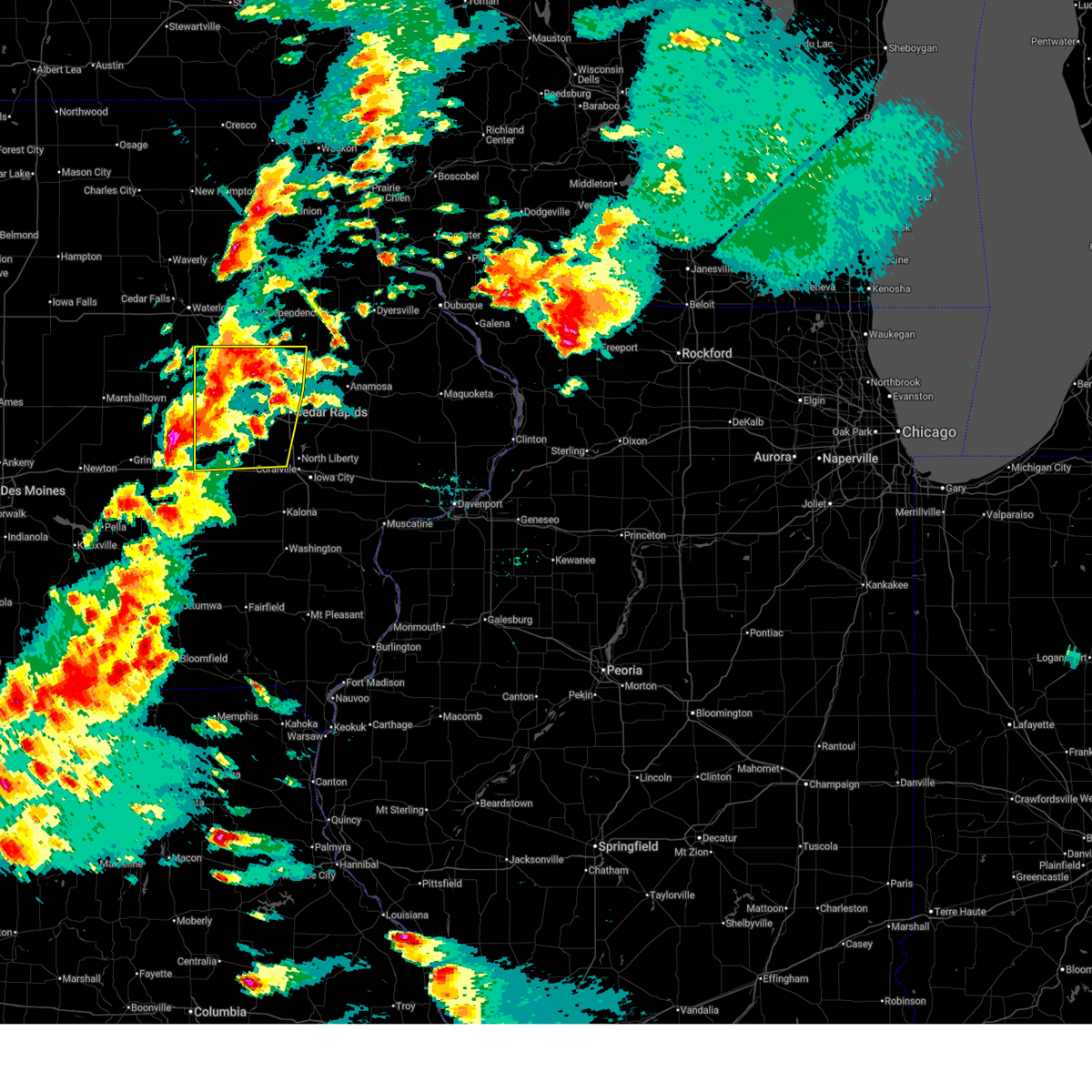
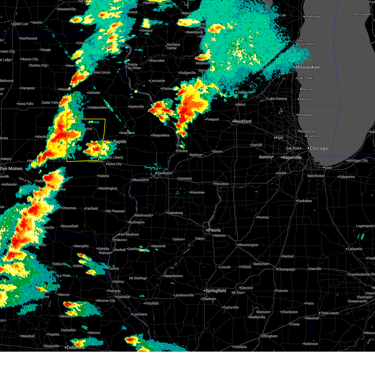
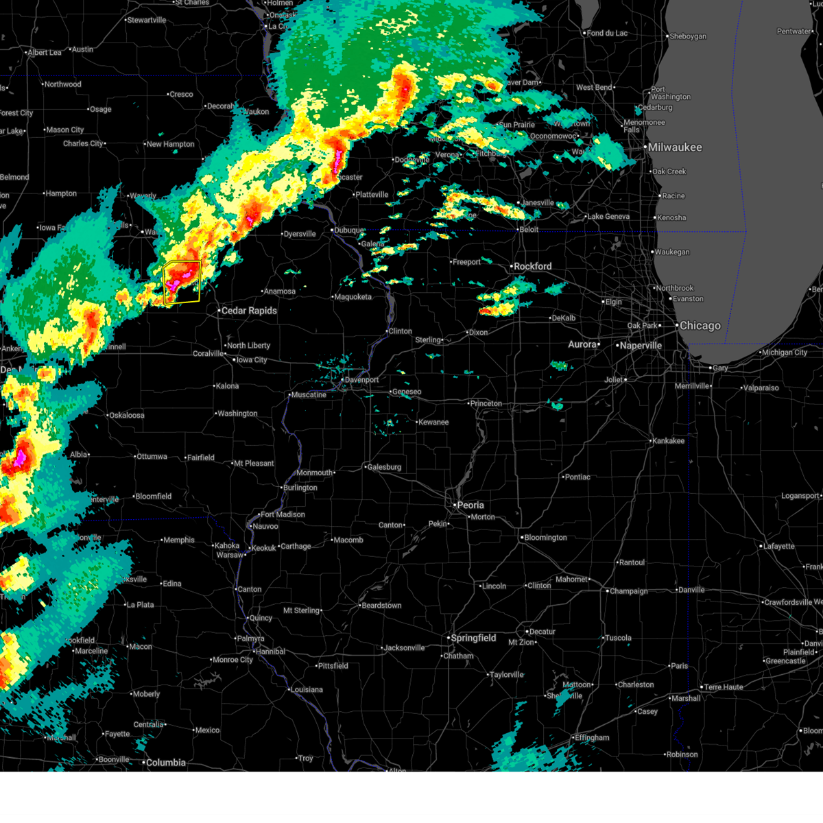
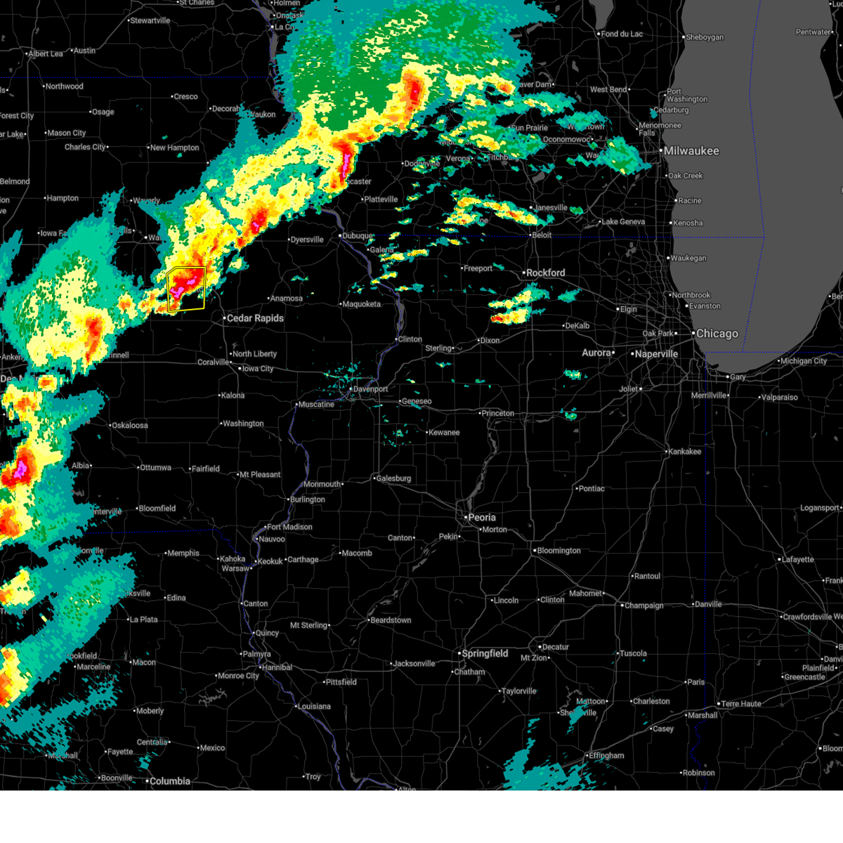
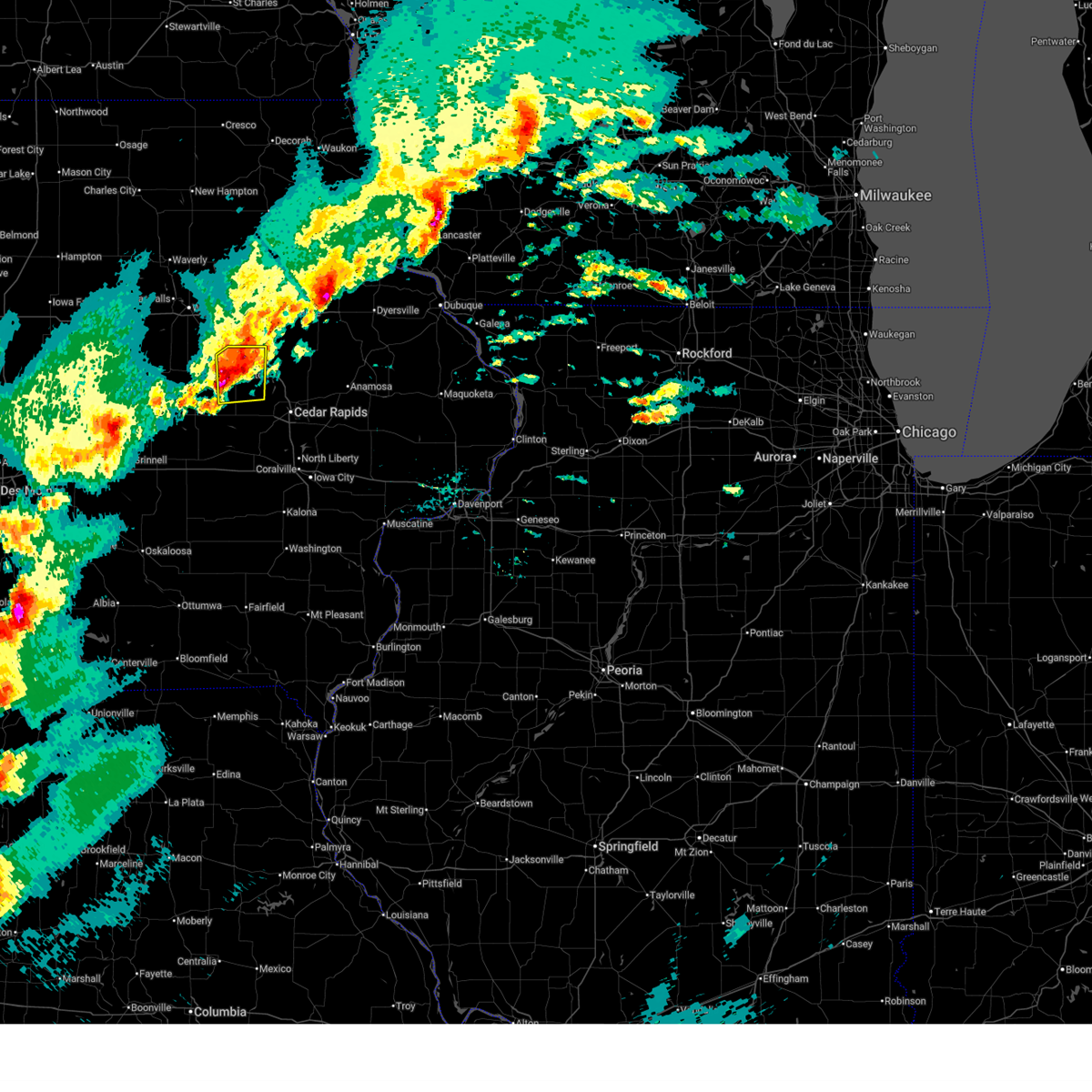
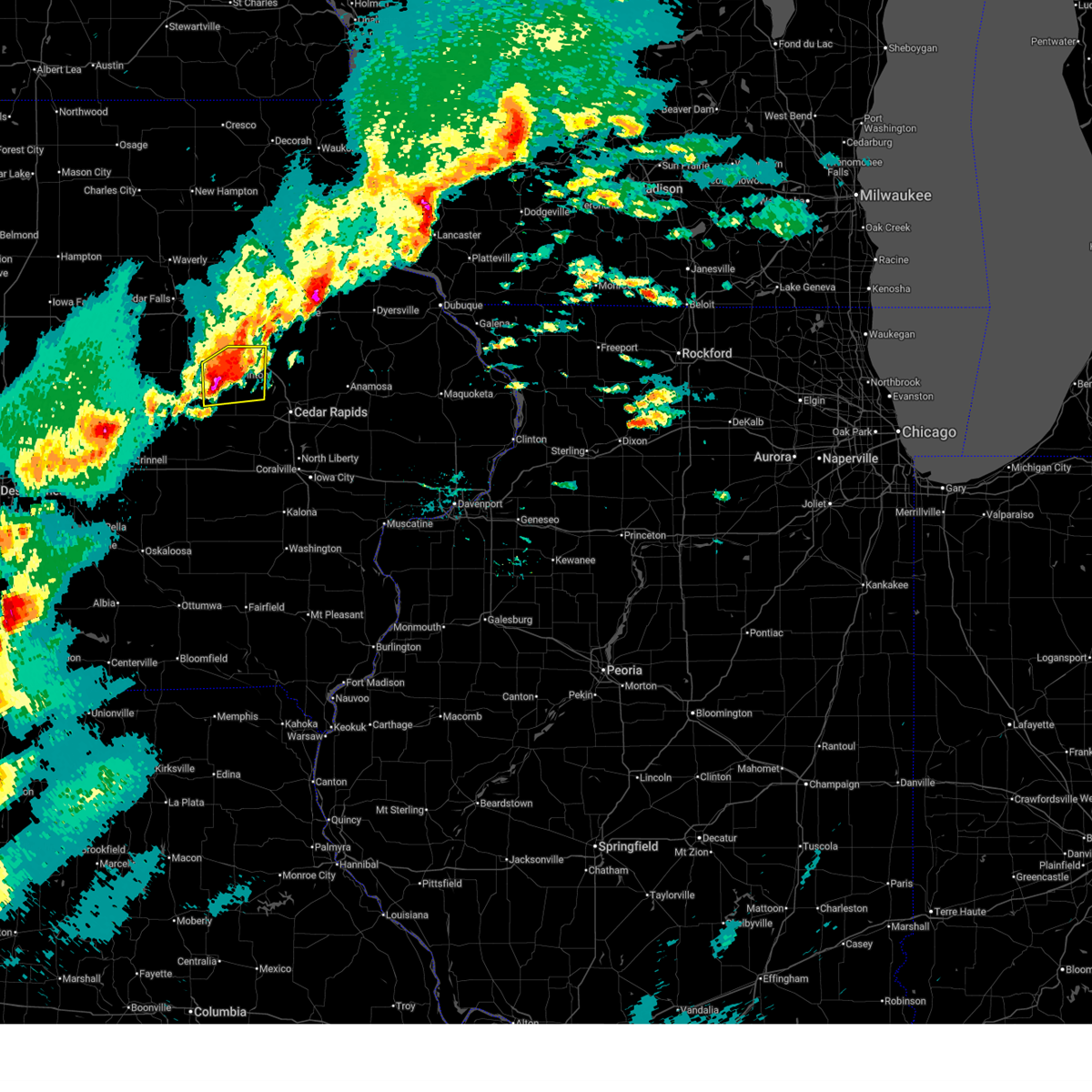
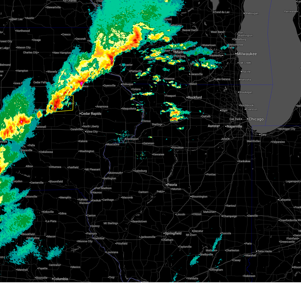
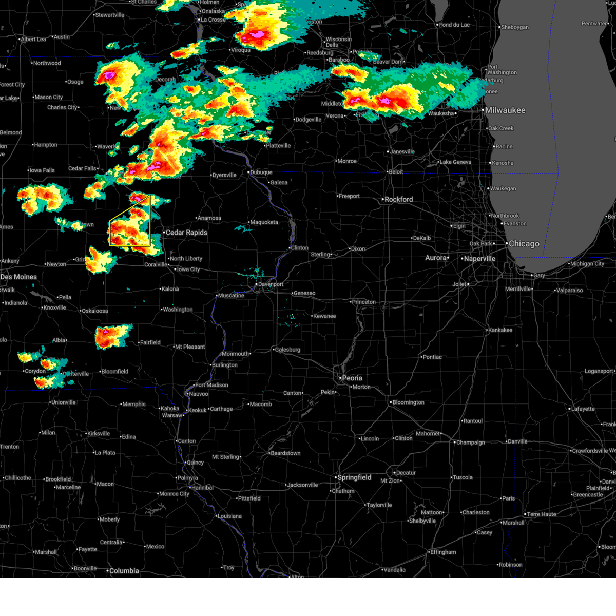
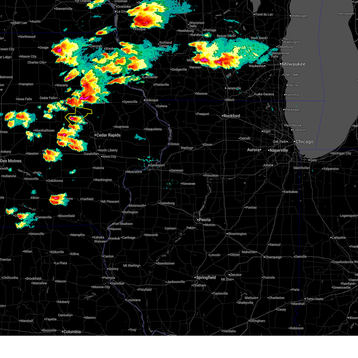
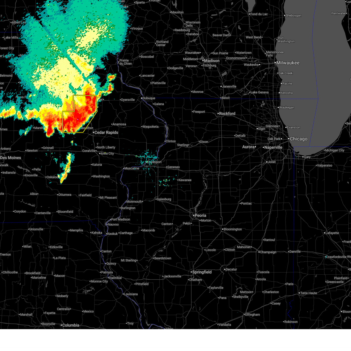
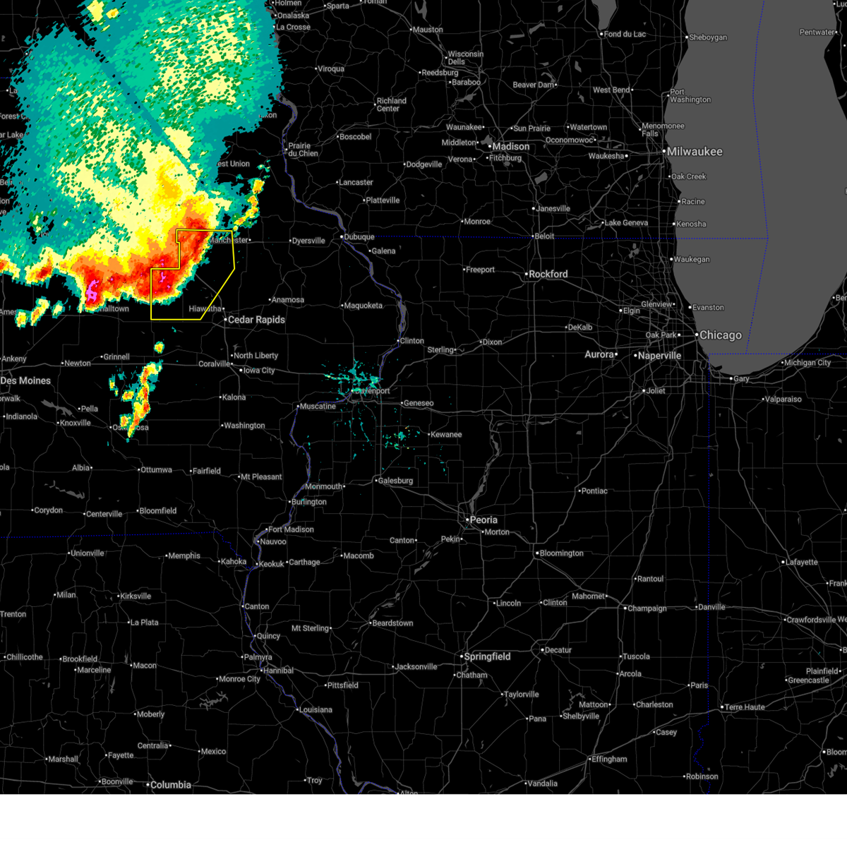
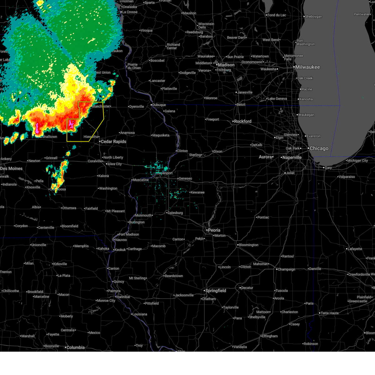
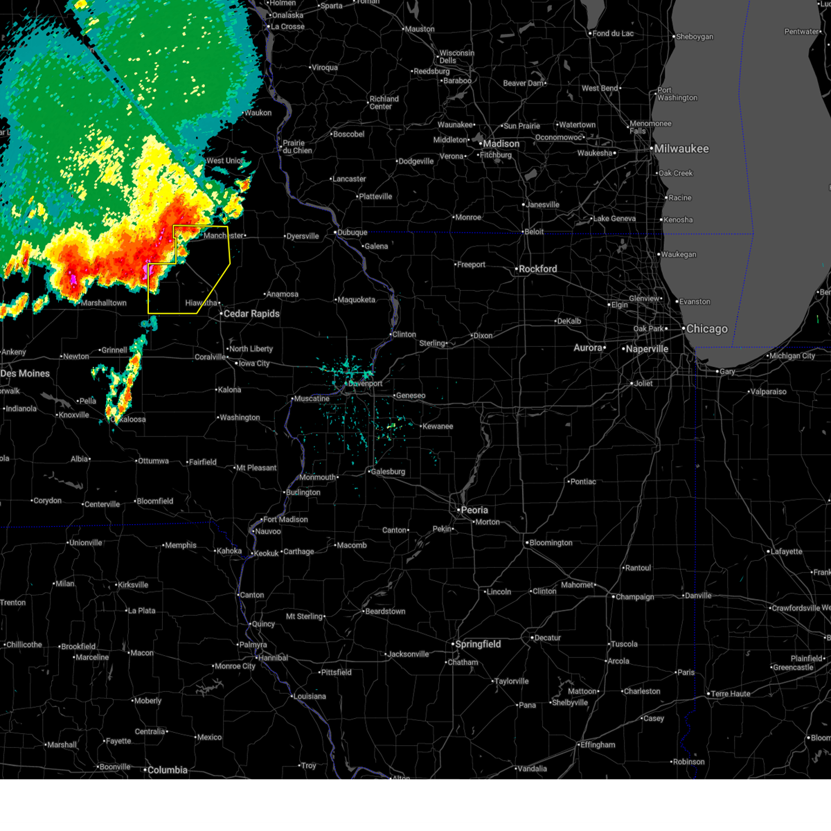
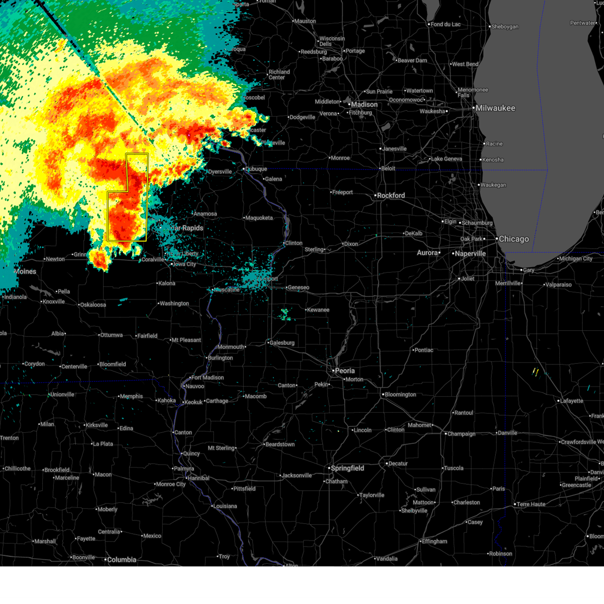
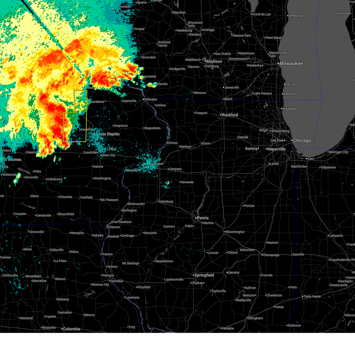
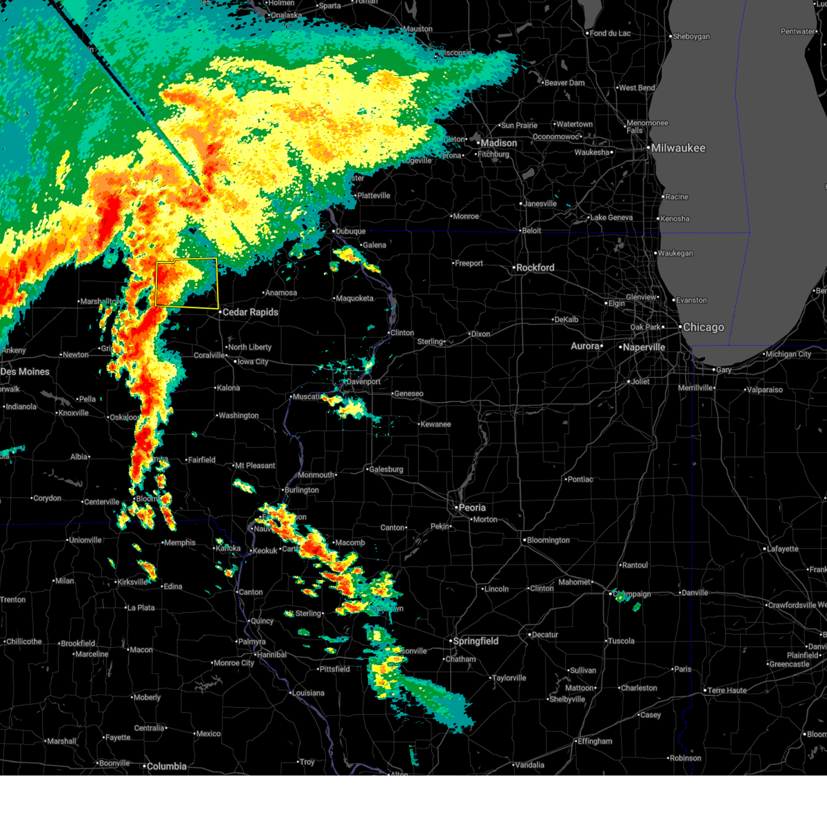
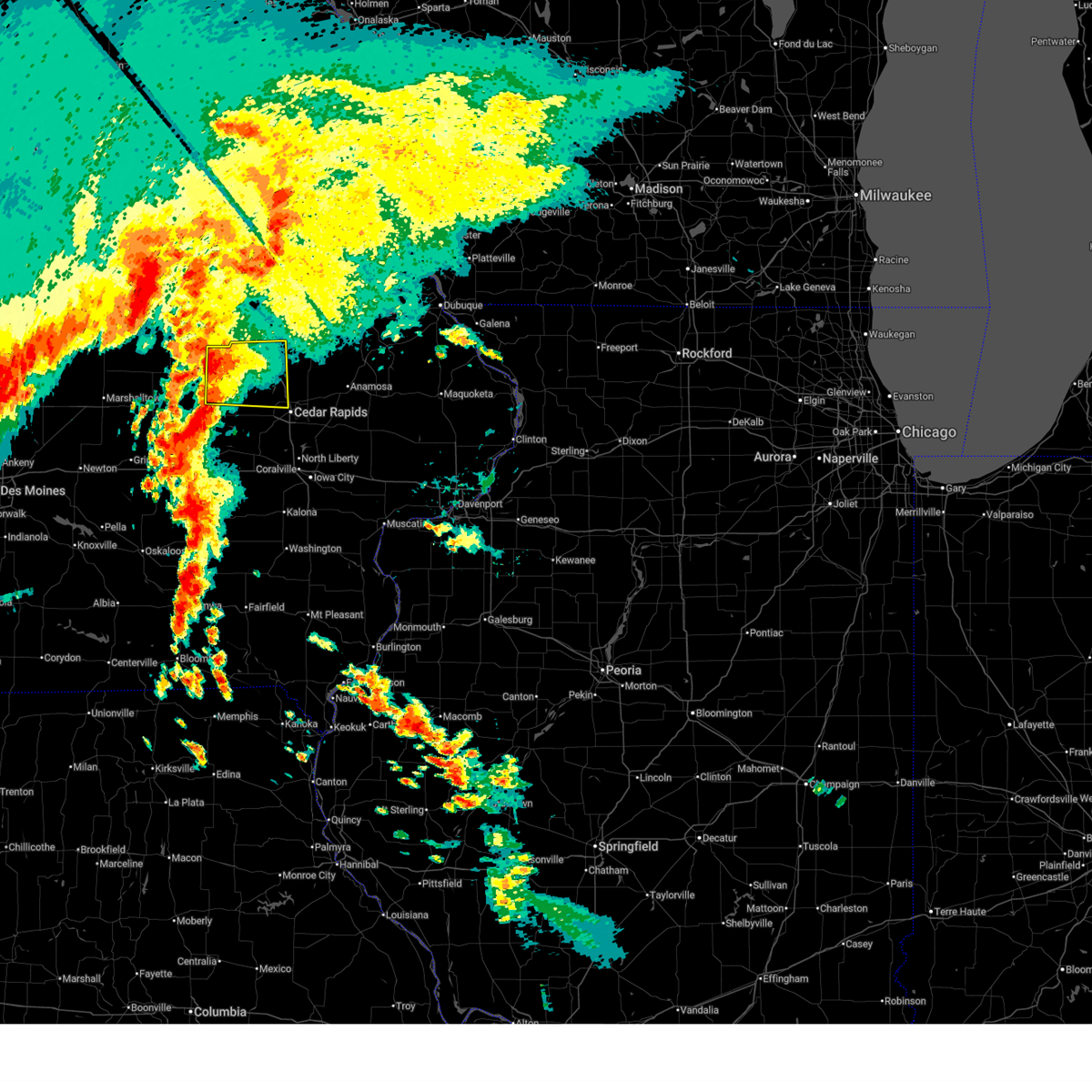
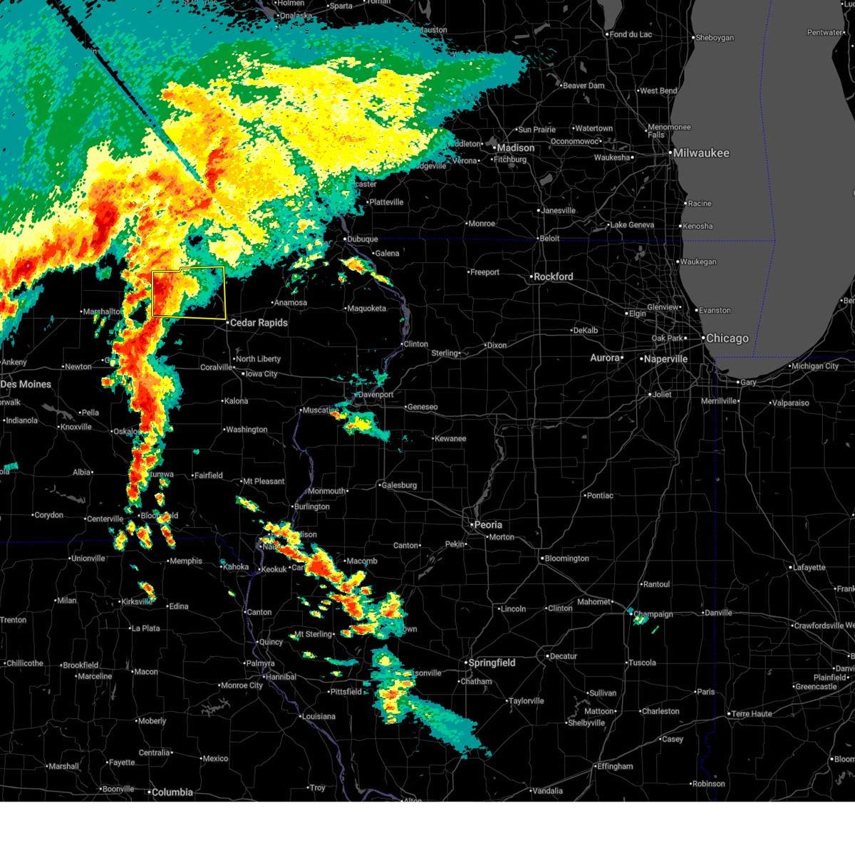
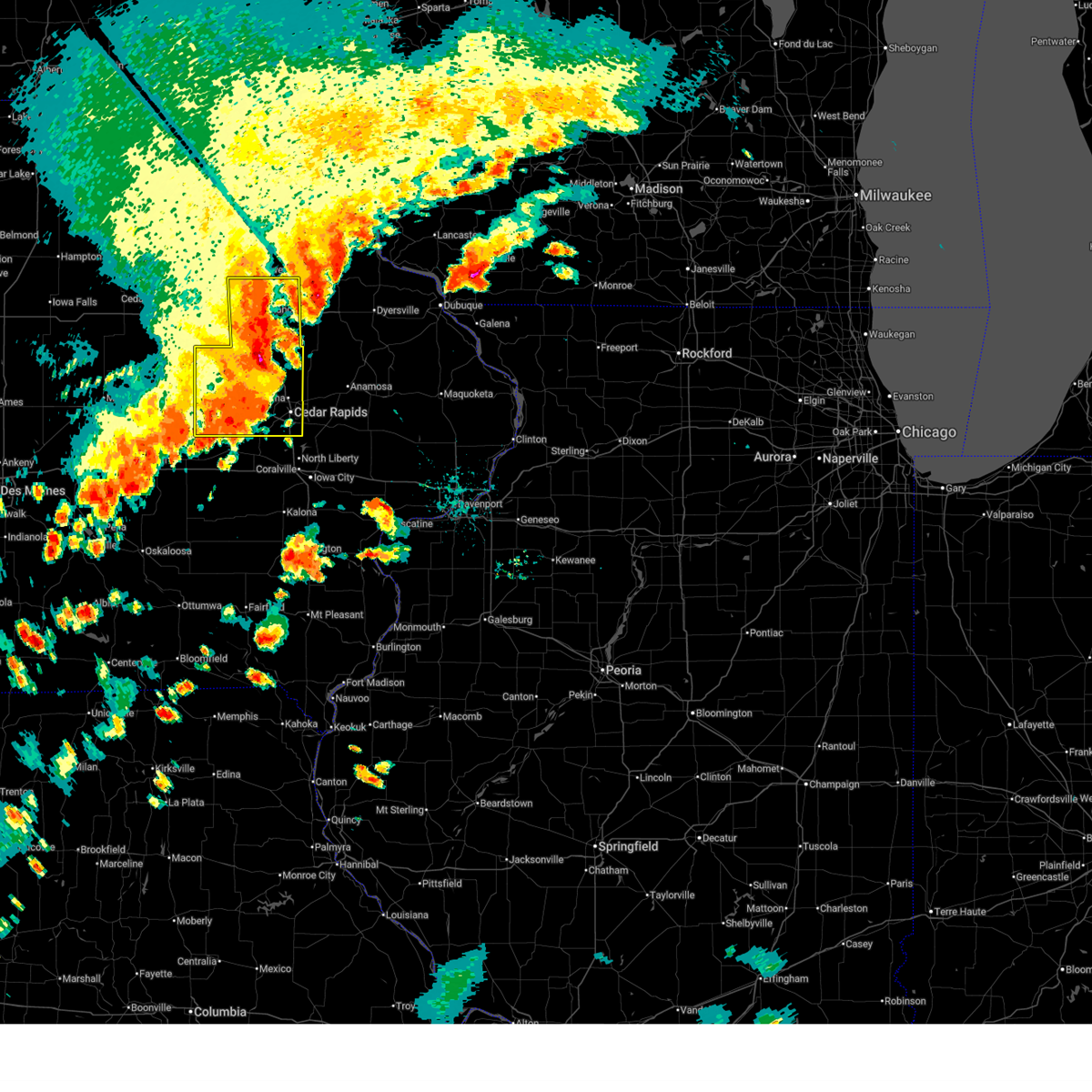
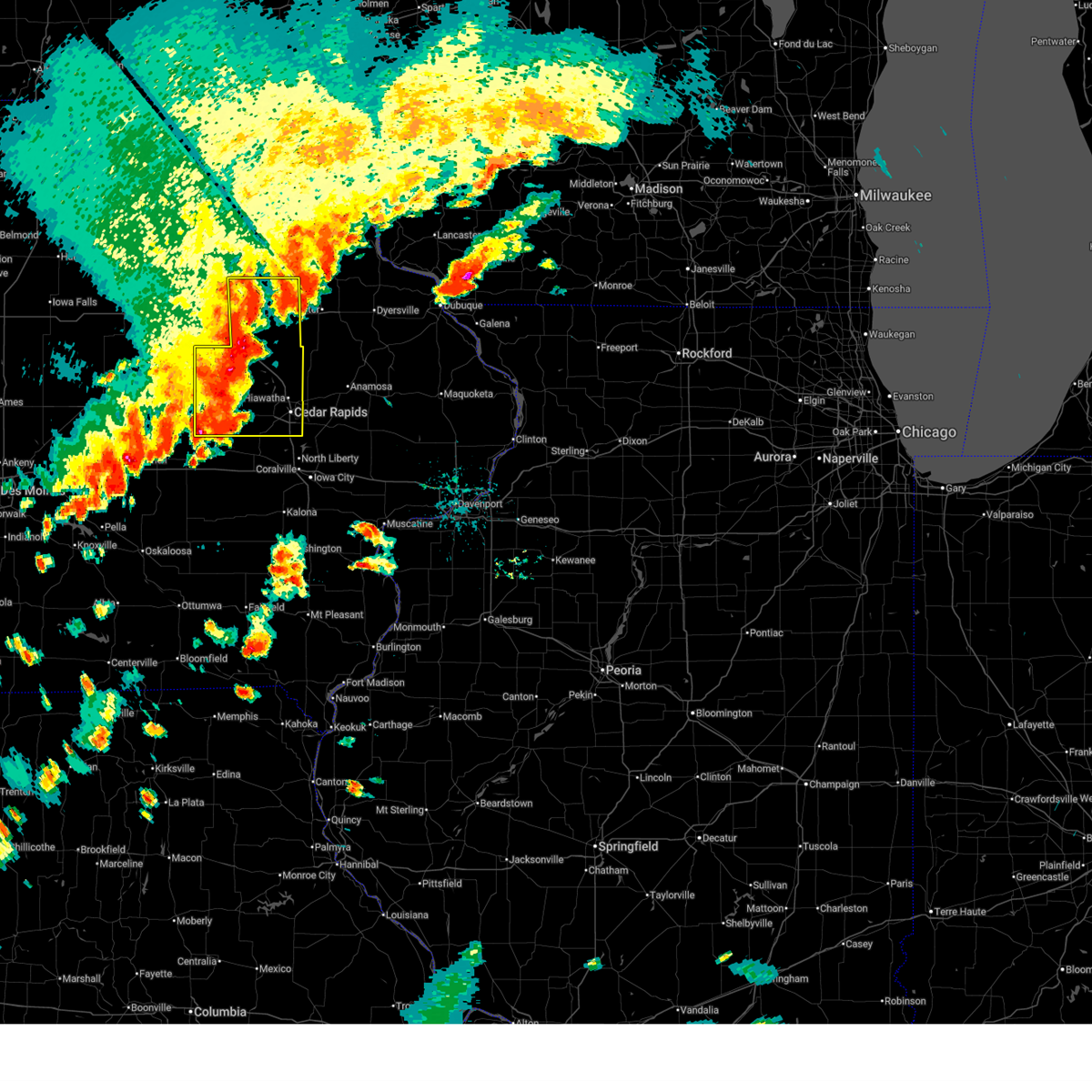
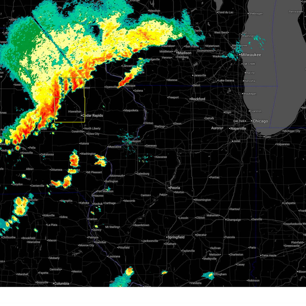
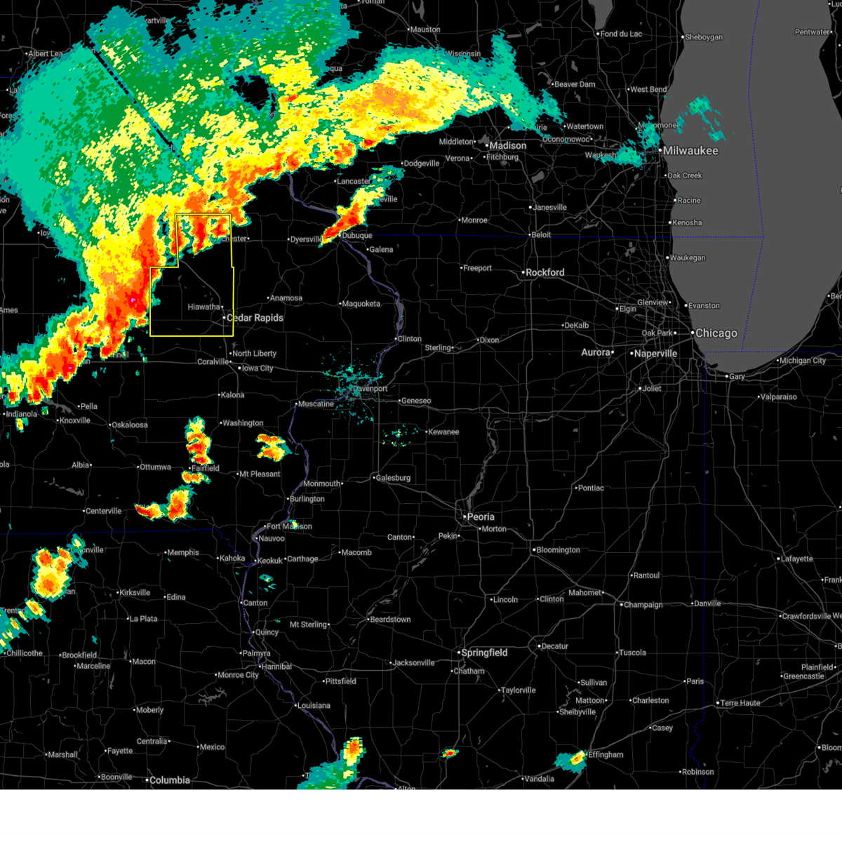
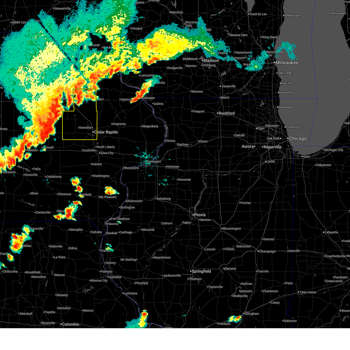
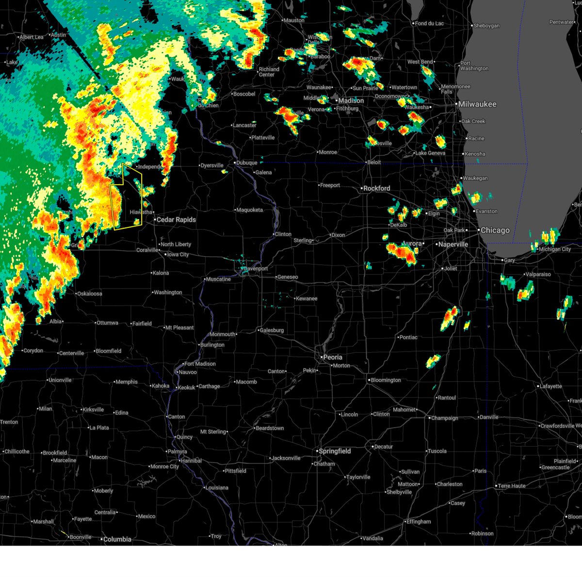
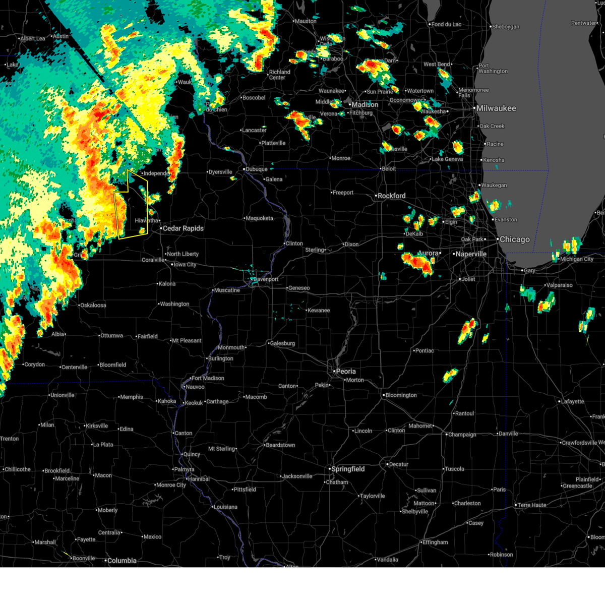
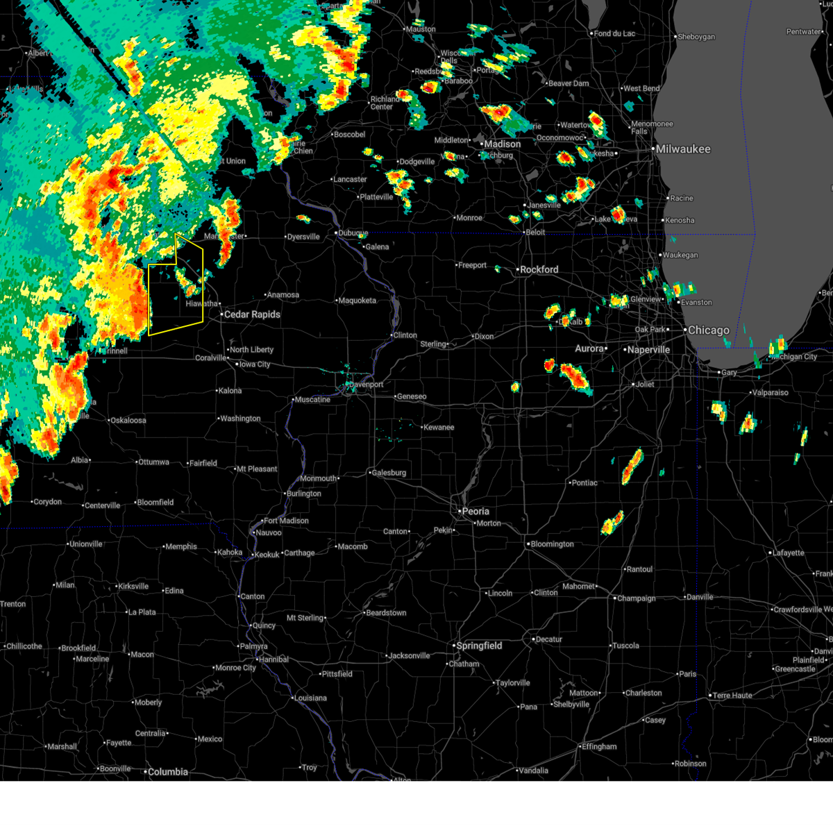
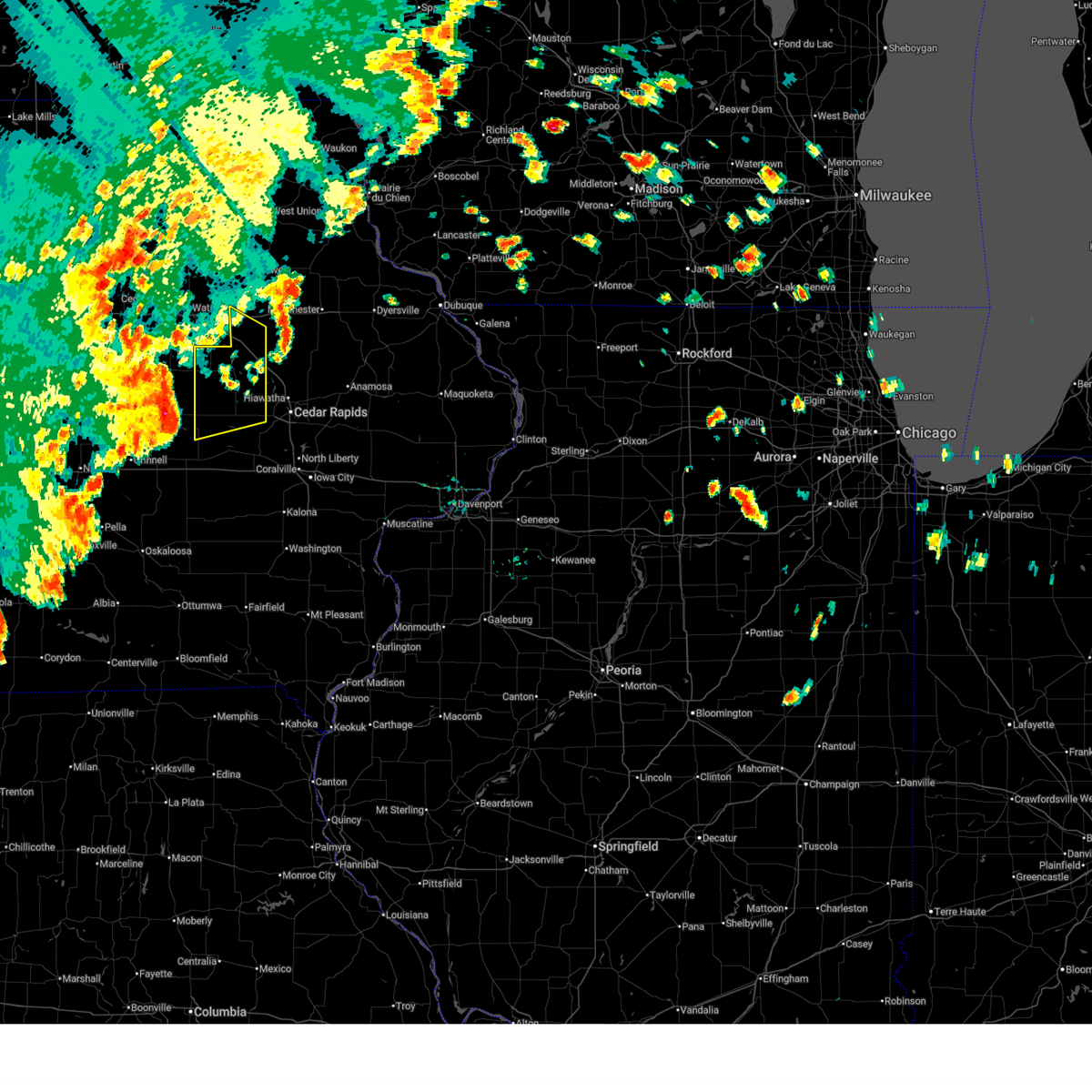
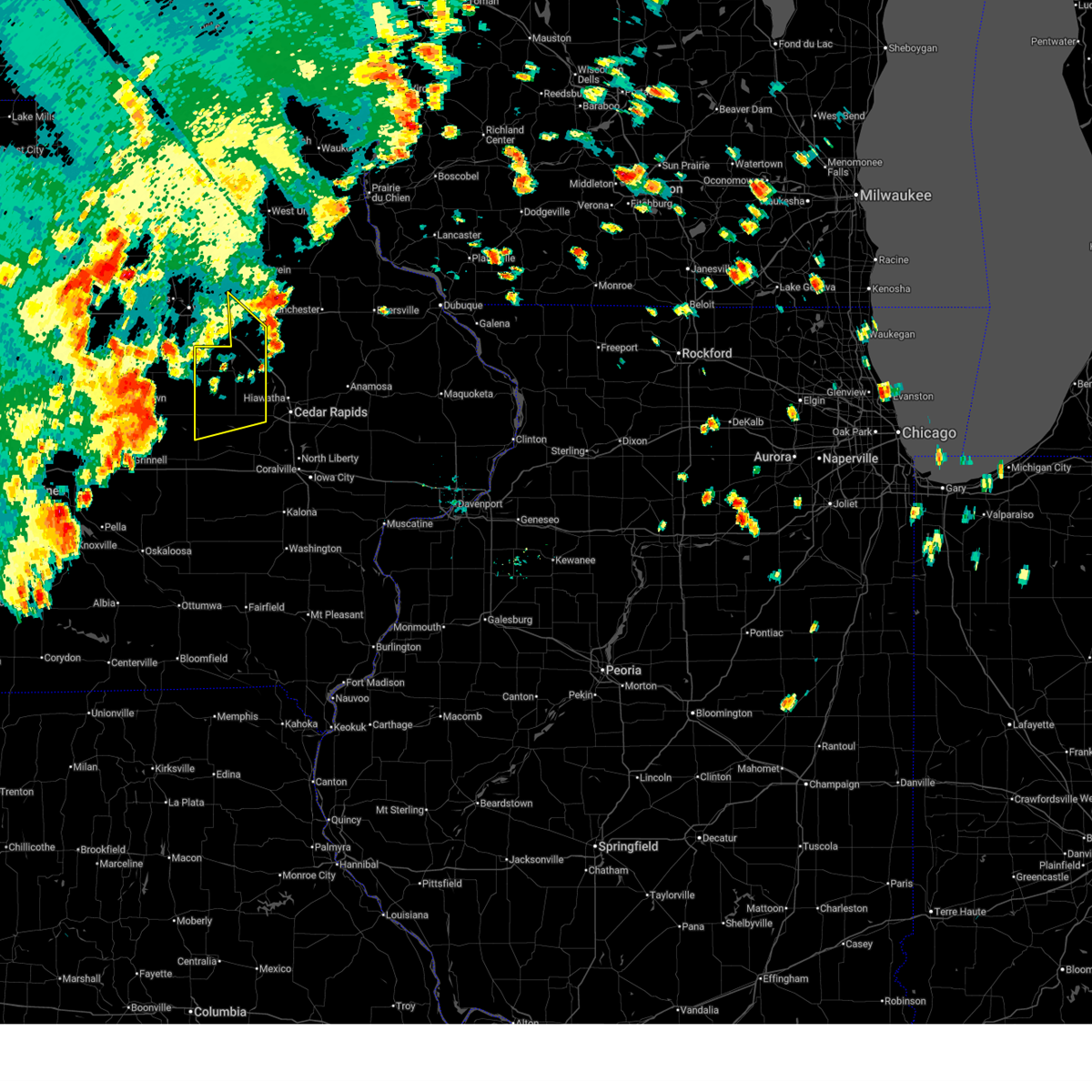
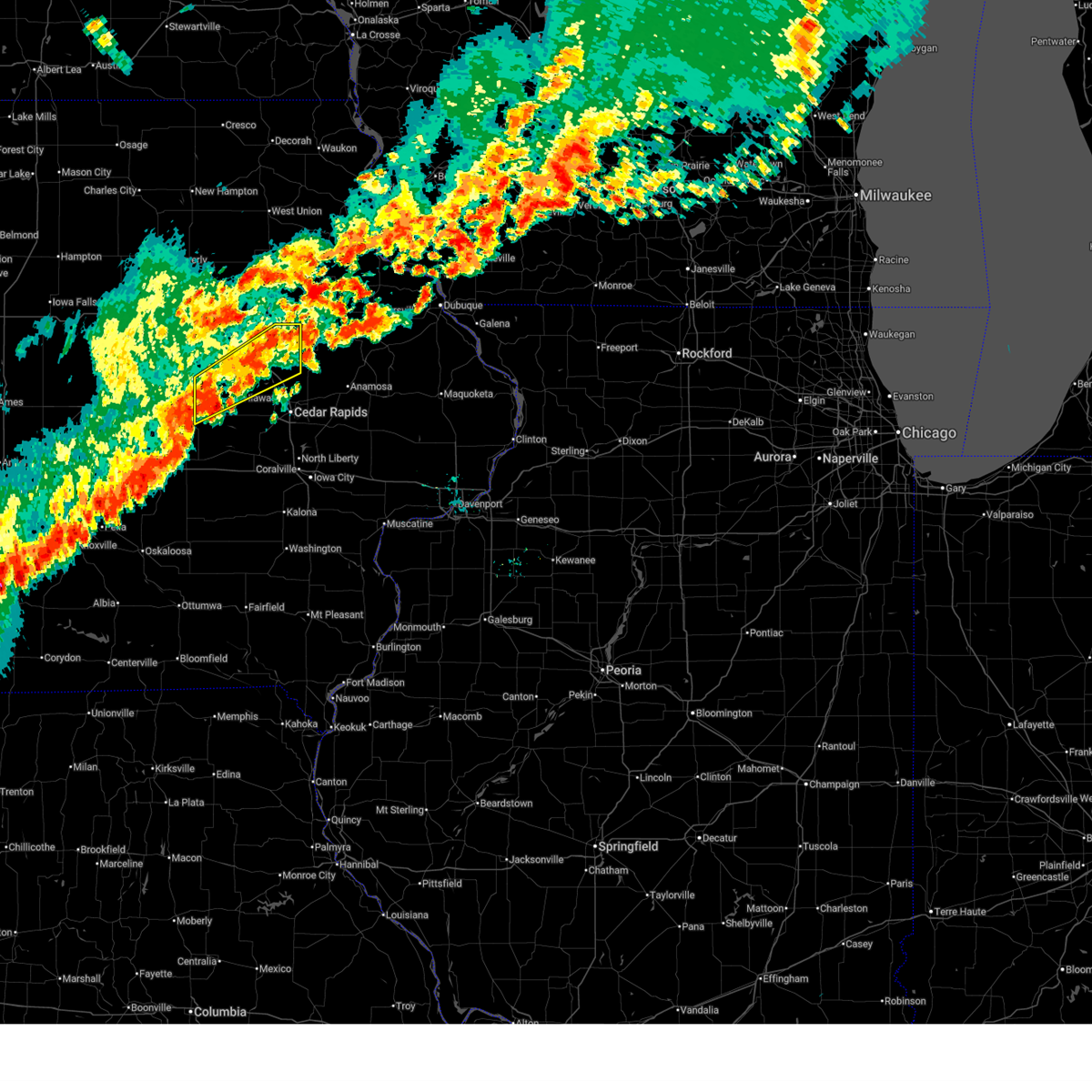
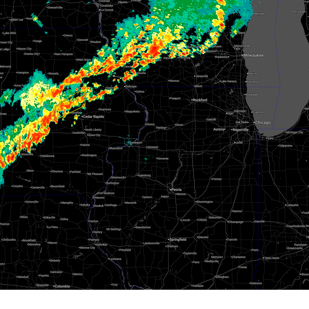
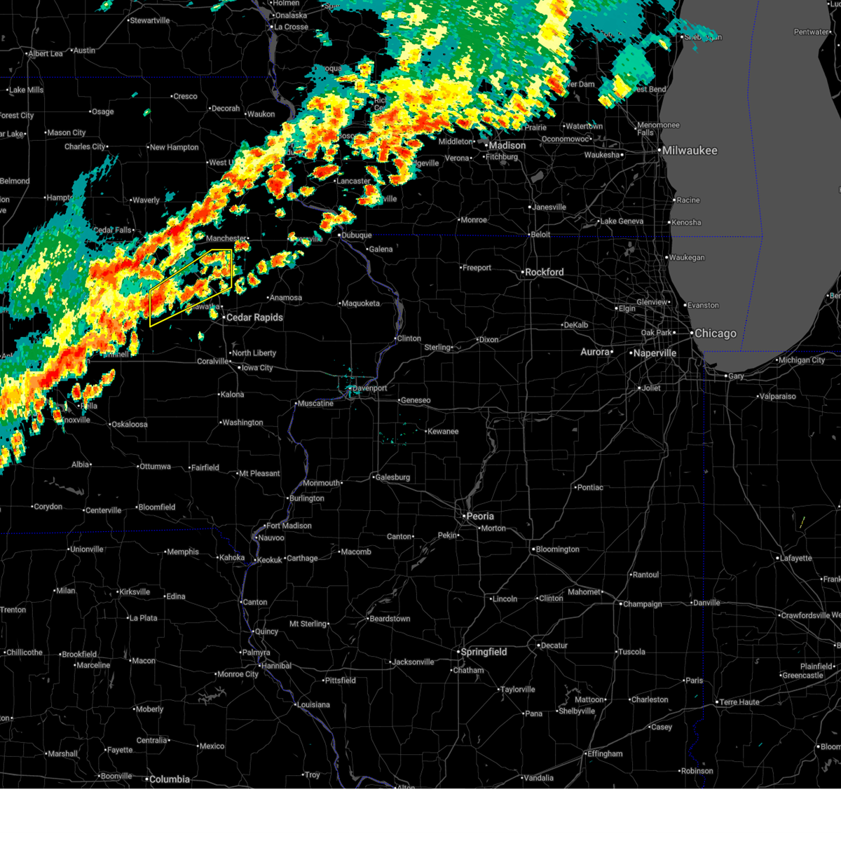
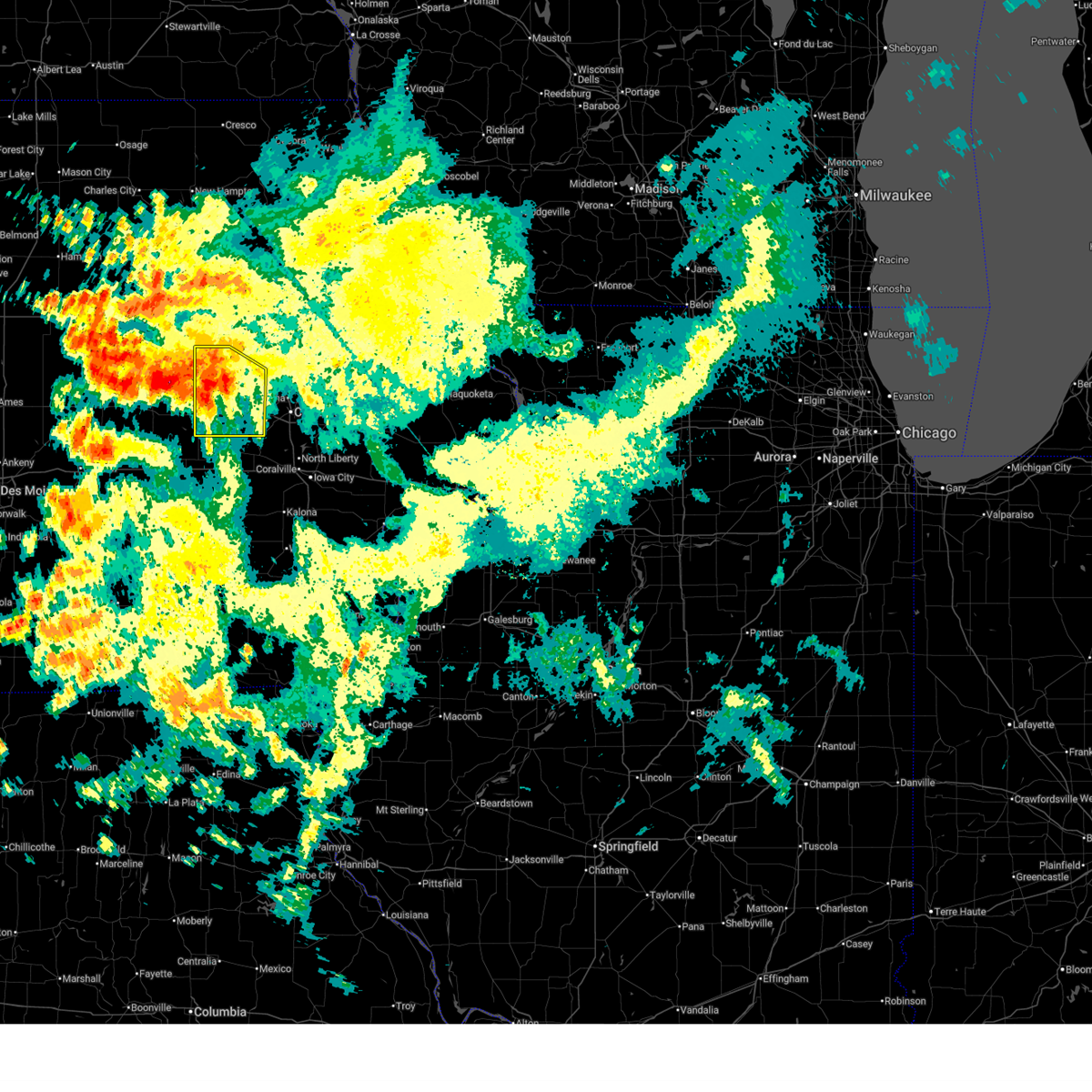
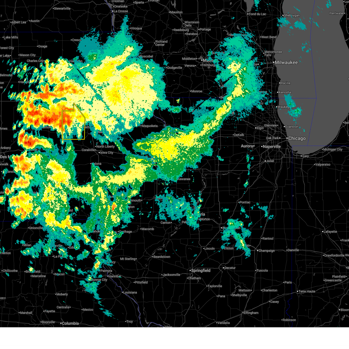
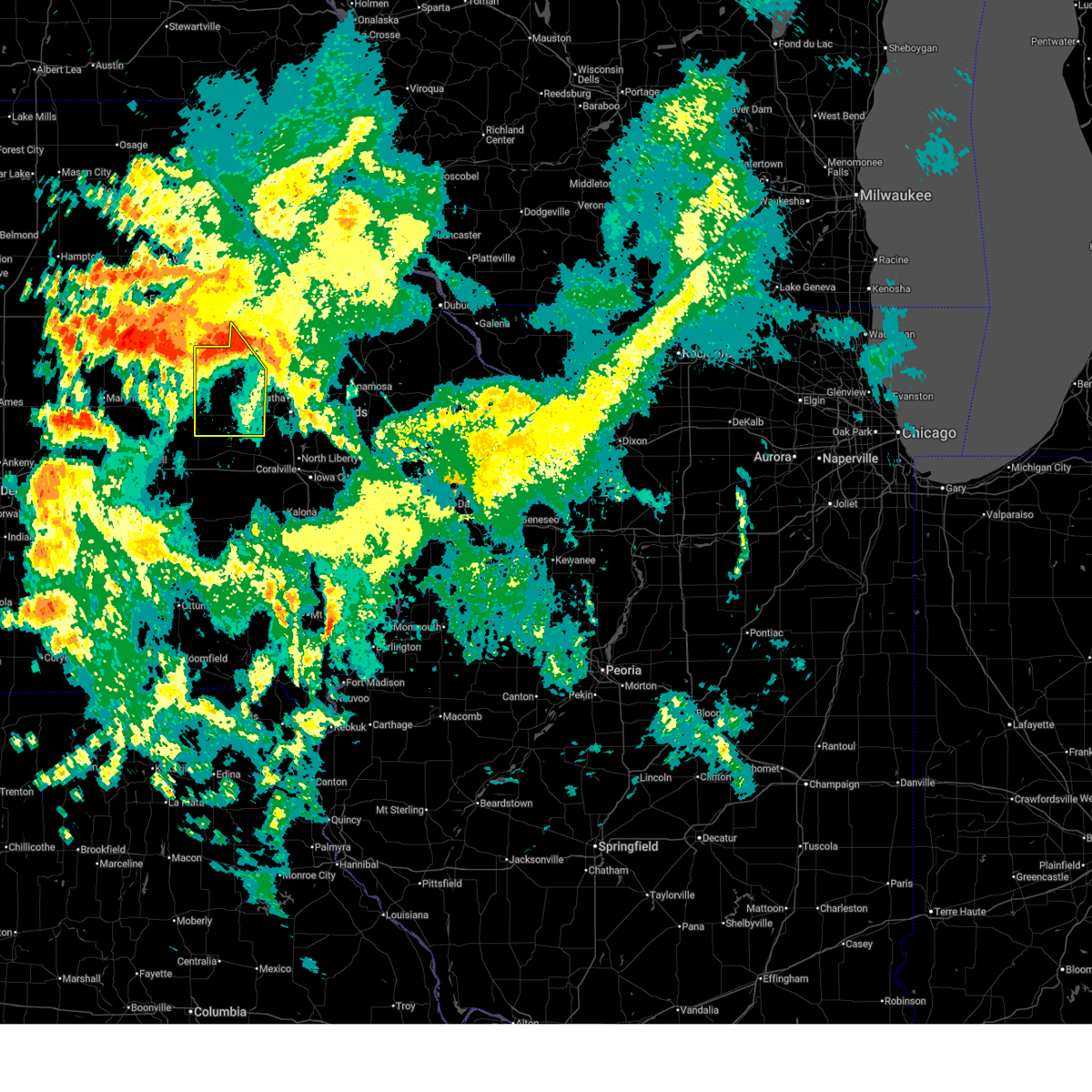
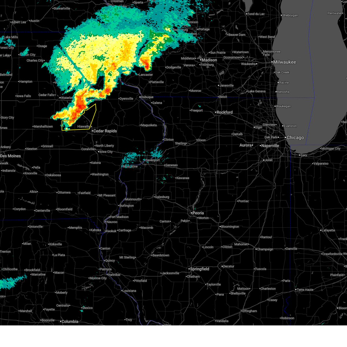
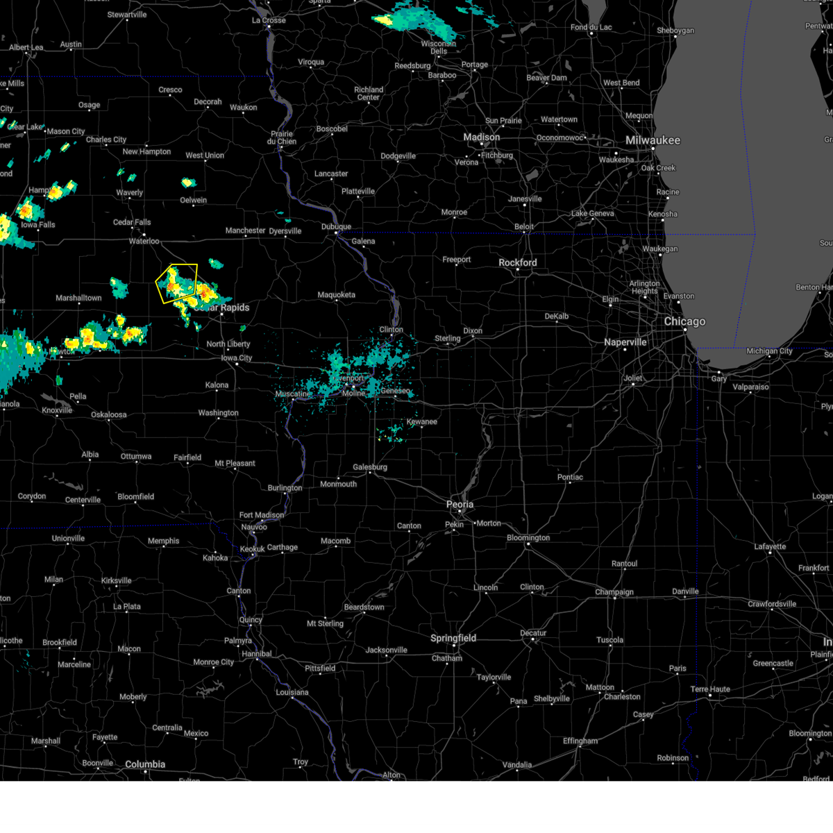
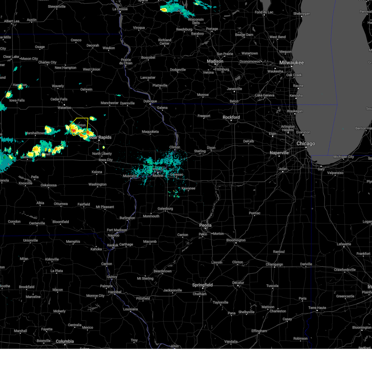
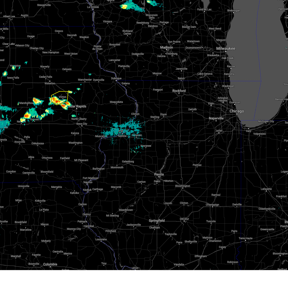
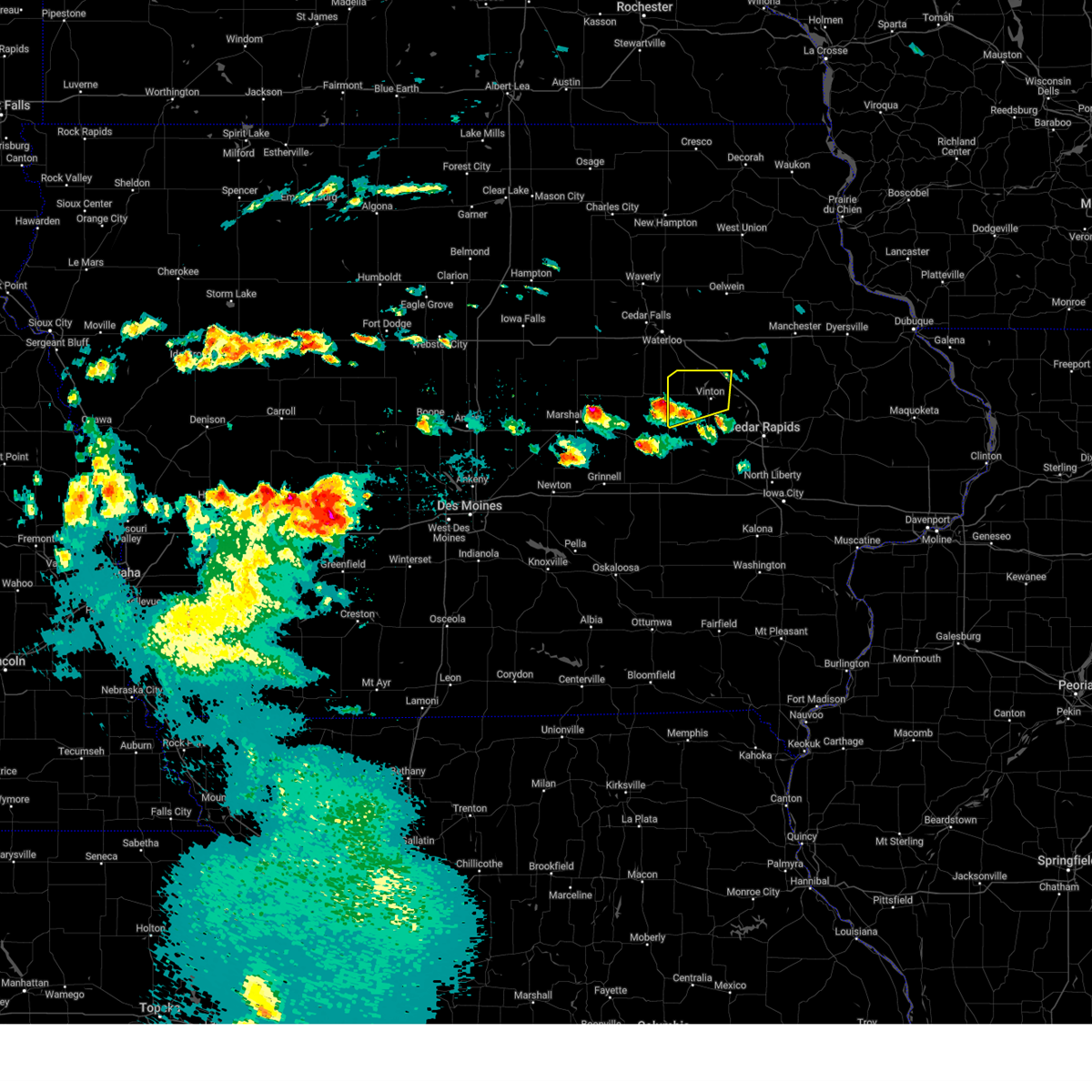
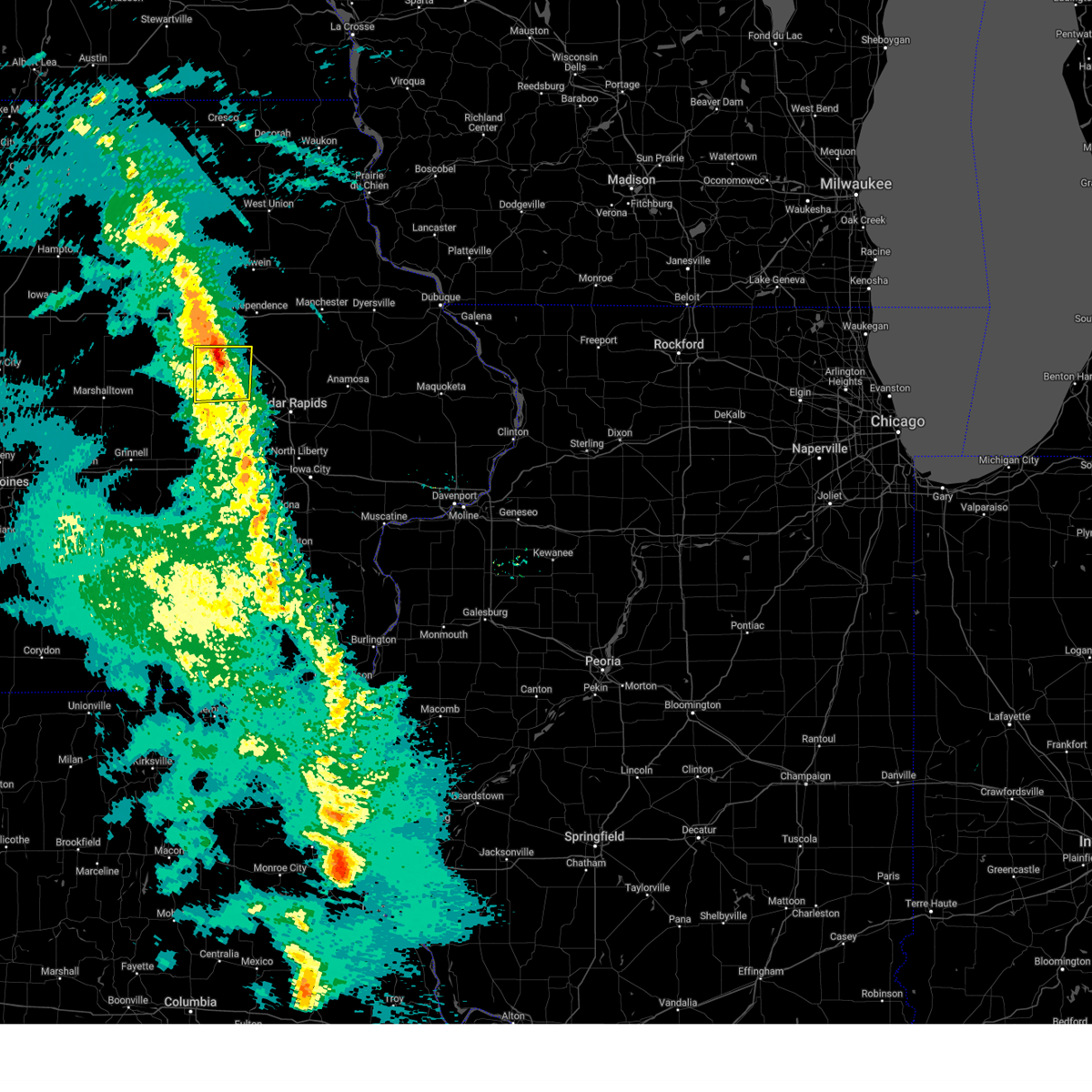
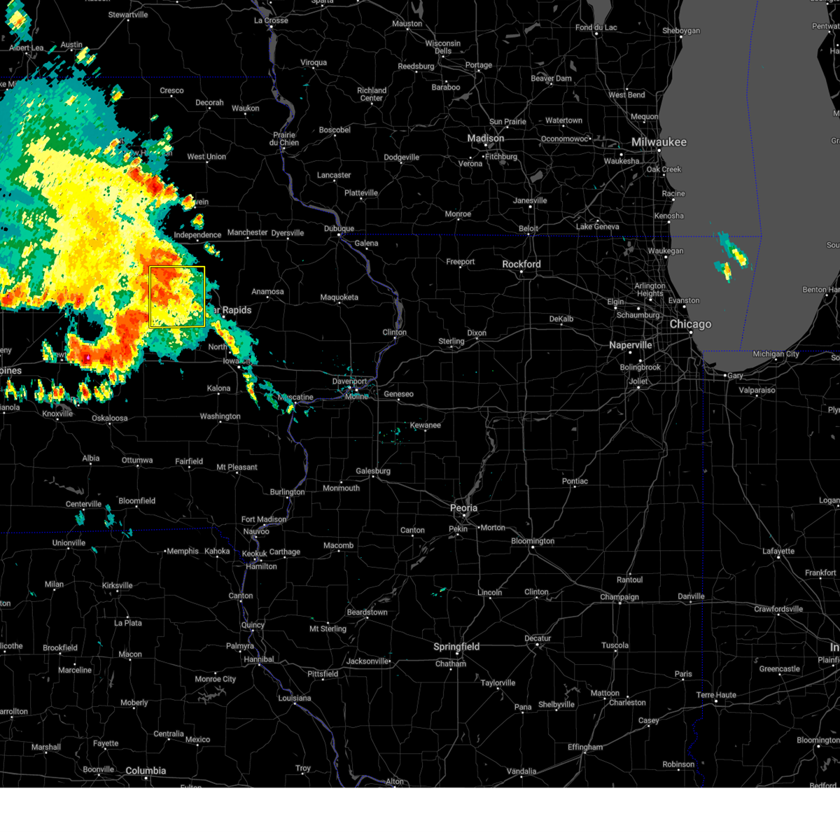
Hail Map for Garrison, IA
The Garrison, IA area has had 1 report of on-the-ground hail by trained spotters, and has been under severe weather warnings 53 times during the past 12 months. Doppler radar has detected hail at or near Garrison, IA on 54 occasions, including 6 occasions during the past year.
| Name: | Garrison, IA |
| Where Located: | 26.7 miles WNW of Cedar Rapids, IA |
| Map: | Google Map for Garrison, IA |
| Population: | 371 |
| Housing Units: | 166 |
| More Info: | Search Google for Garrison, IA |
3
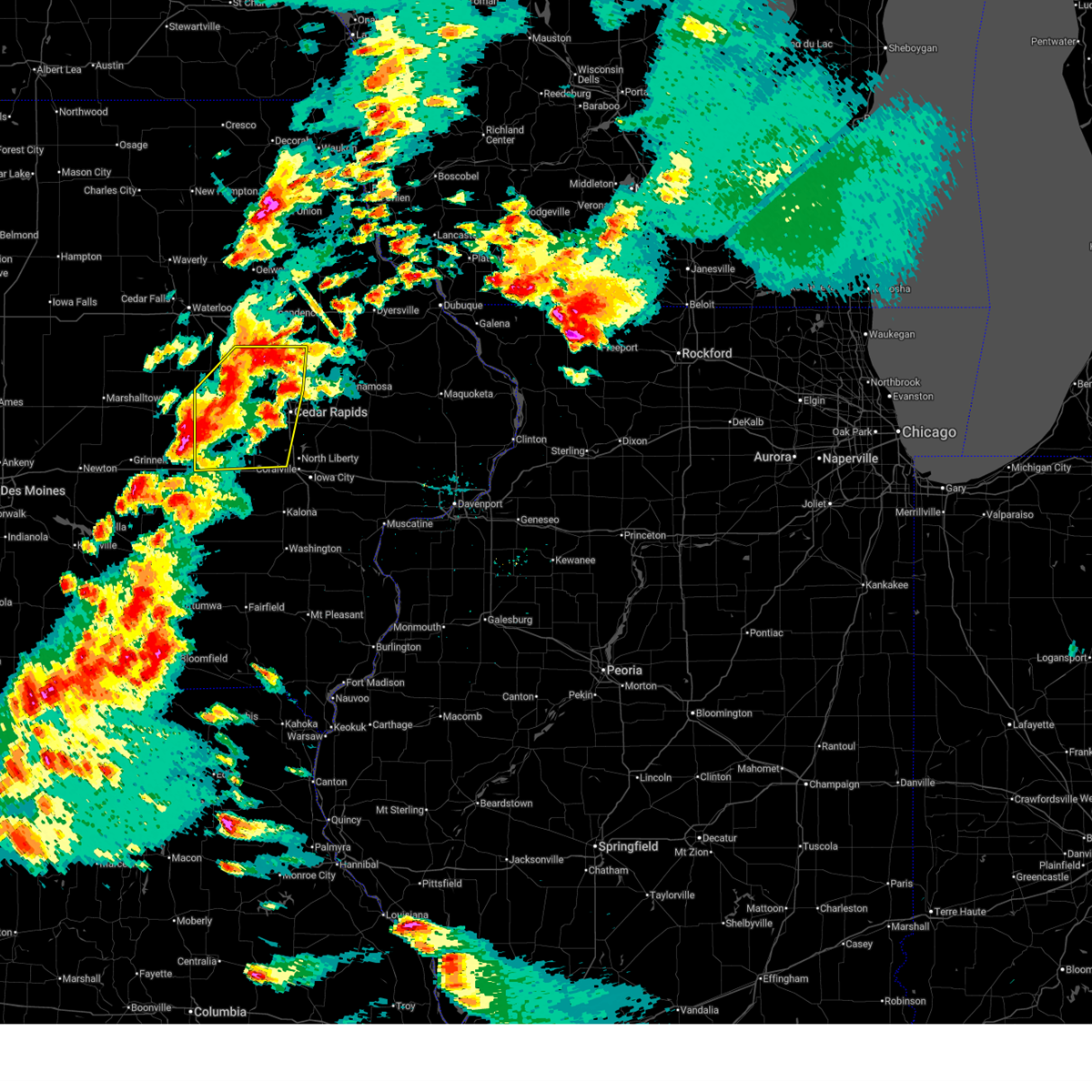
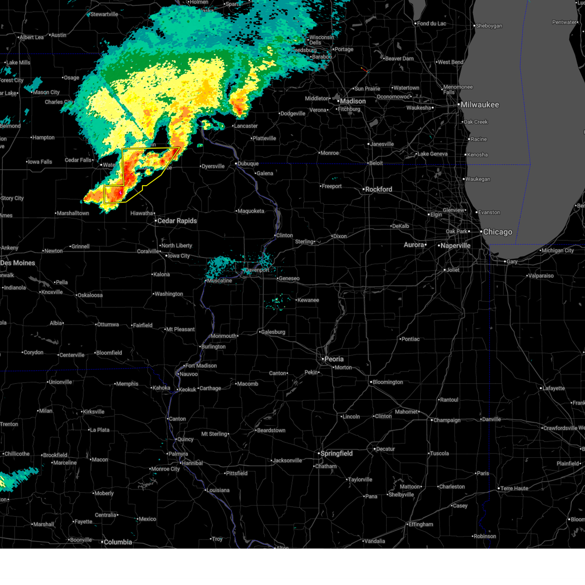
The Top Recent Hail Date for Garrison, IA is Friday, April 17, 2026 (10th out of 54)
Hail and Wind Damage Spotted near Garrison, IA
| Date / Time | Report Details |
|---|---|
| 6/11/2026 9:03 AM CDT |
 At 903 am cdt, severe thunderstorms were located along a line extending from waterloo to near mount auburn to near van horne, moving northeast at 55 mph (radar indicated). Hazards include 70 mph wind gusts. Expect considerable tree damage. damage is likely to mobile homes, roofs, and outbuildings. locations impacted include, cedar rapids, independence, vinton, manchester, marengo, marion, coralville, north liberty, hiawatha, mount vernon, robins, belle plaine, center point, lisbon, fairfax, solon, tiffin, ely, atkins, and walford. this includes the following highways, interstate 80 in iowa between mile markers 234 and 241. Interstate 380 between mile markers 1 and 55. At 903 am cdt, severe thunderstorms were located along a line extending from waterloo to near mount auburn to near van horne, moving northeast at 55 mph (radar indicated). Hazards include 70 mph wind gusts. Expect considerable tree damage. damage is likely to mobile homes, roofs, and outbuildings. locations impacted include, cedar rapids, independence, vinton, manchester, marengo, marion, coralville, north liberty, hiawatha, mount vernon, robins, belle plaine, center point, lisbon, fairfax, solon, tiffin, ely, atkins, and walford. this includes the following highways, interstate 80 in iowa between mile markers 234 and 241. Interstate 380 between mile markers 1 and 55.
|
| 6/11/2026 8:50 AM CDT | Snapped trees took out a power line. time estimated from rada in benton county IA, 0.3 miles NW of Garrison, IA |
| 6/11/2026 8:44 AM CDT |
 At 844 am cdt, severe thunderstorms were located along a line extending from morrison to near dysart to chelsea, moving east at 55 mph (radar indicated). Hazards include 70 mph wind gusts. Expect considerable tree damage. damage is likely to mobile homes, roofs, and outbuildings. locations impacted include, cedar rapids, independence, vinton, manchester, marengo, marion, coralville, north liberty, hiawatha, mount vernon, robins, belle plaine, center point, lisbon, fairfax, solon, tiffin, ely, atkins, and walford. this includes the following highways, interstate 80 in iowa between mile markers 234 and 241. Interstate 380 between mile markers 1 and 55. At 844 am cdt, severe thunderstorms were located along a line extending from morrison to near dysart to chelsea, moving east at 55 mph (radar indicated). Hazards include 70 mph wind gusts. Expect considerable tree damage. damage is likely to mobile homes, roofs, and outbuildings. locations impacted include, cedar rapids, independence, vinton, manchester, marengo, marion, coralville, north liberty, hiawatha, mount vernon, robins, belle plaine, center point, lisbon, fairfax, solon, tiffin, ely, atkins, and walford. this includes the following highways, interstate 80 in iowa between mile markers 234 and 241. Interstate 380 between mile markers 1 and 55.
|
| 6/11/2026 8:31 AM CDT |
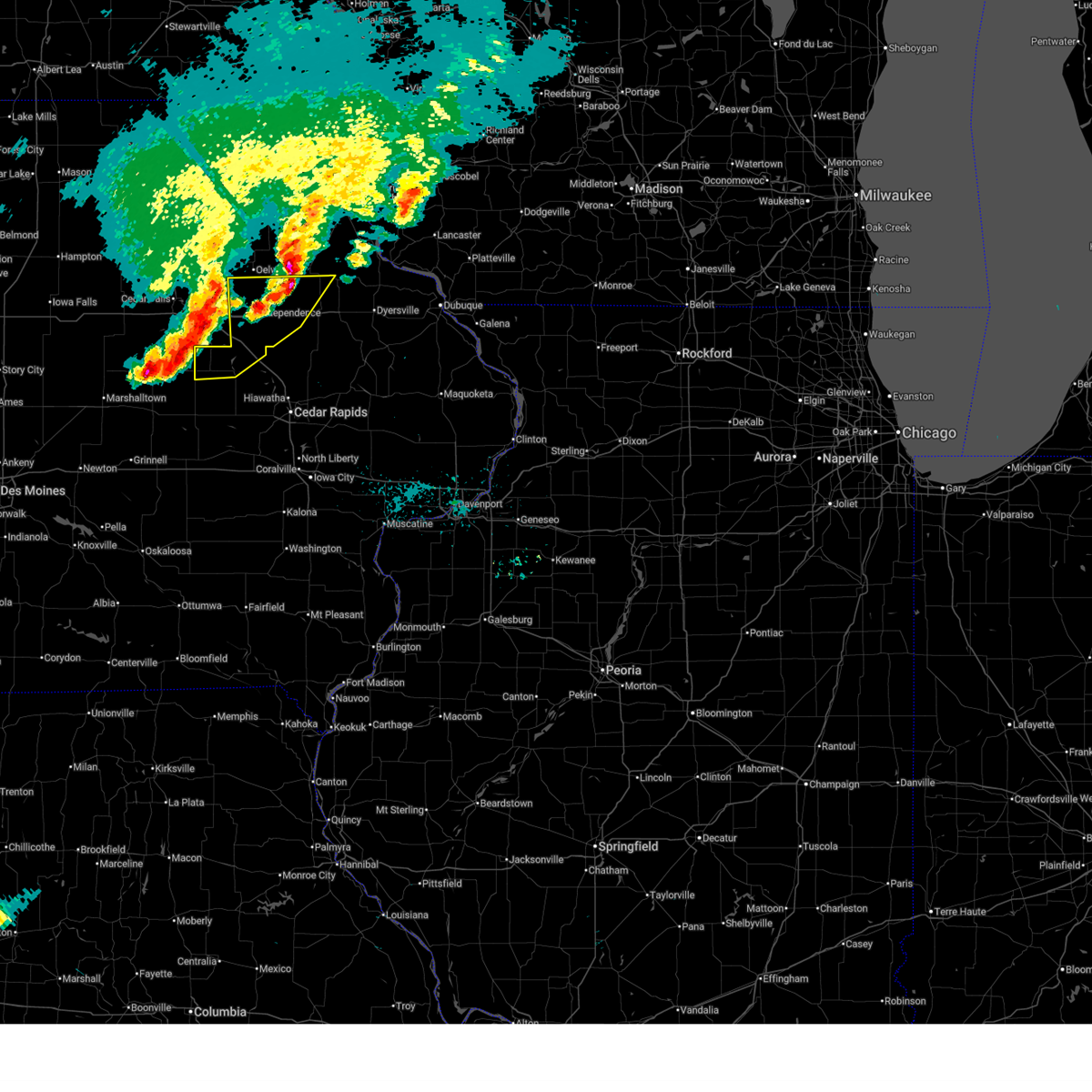
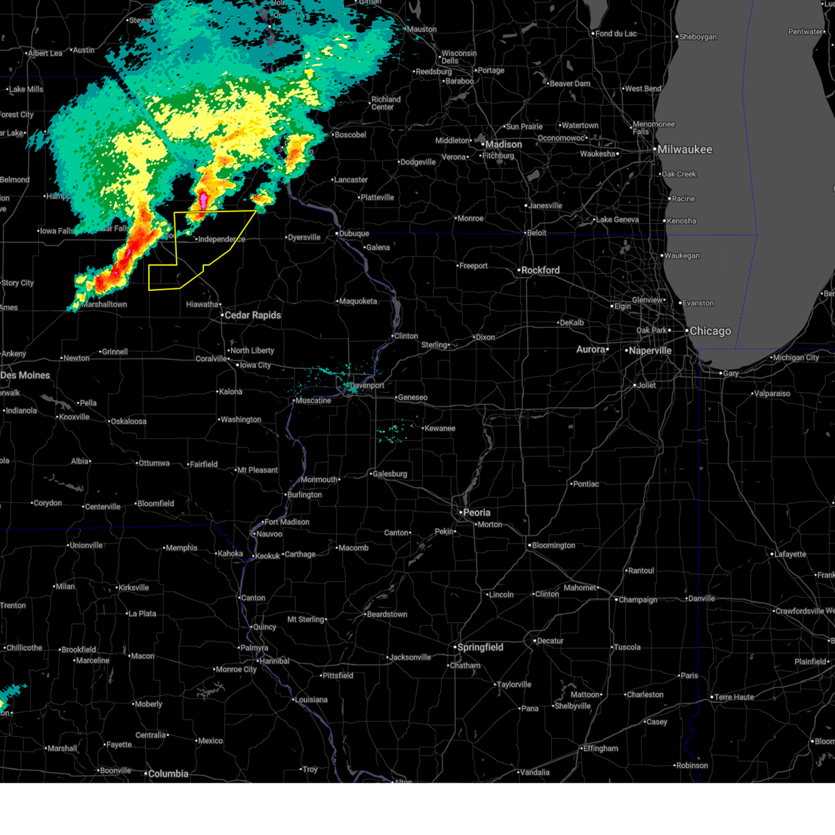
 Svrdvn the national weather service in the quad cities has issued a * severe thunderstorm warning for, southern buchanan county in northeastern iowa, northern johnson county in east central iowa, benton county in east central iowa, western delaware county in northeastern iowa, linn county in east central iowa, northern iowa county in east central iowa, * until 945 am cdt. * at 830 am cdt, severe thunderstorms were located along a line extending from near conrad to near garwin to 6 miles south of tama, moving east at 55 mph (radar indicated). Hazards include 70 mph wind gusts. Expect considerable tree damage. Damage is likely to mobile homes, roofs, and outbuildings. Svrdvn the national weather service in the quad cities has issued a * severe thunderstorm warning for, southern buchanan county in northeastern iowa, northern johnson county in east central iowa, benton county in east central iowa, western delaware county in northeastern iowa, linn county in east central iowa, northern iowa county in east central iowa, * until 945 am cdt. * at 830 am cdt, severe thunderstorms were located along a line extending from near conrad to near garwin to 6 miles south of tama, moving east at 55 mph (radar indicated). Hazards include 70 mph wind gusts. Expect considerable tree damage. Damage is likely to mobile homes, roofs, and outbuildings.
|
| 6/10/2026 11:44 AM CDT |
 At 1144 am cdt, severe thunderstorms were located along a line extending from near washburn to near newhall, moving northeast at 45 mph (radar indicated). Hazards include 60 mph wind gusts. Expect damage to roofs, siding, and trees. locations impacted include, vinton, urbana, dysart, shellsburg, van horne, keystone, garrison, mount auburn, vinton memorial airport, rodgers park, benton city park, hoefle-dulin park, spencers grove, minne estema park, benton county fairgrounds, wildcat bluff park, and cheney. This includes interstate 380 between mile markers 40 and 48. At 1144 am cdt, severe thunderstorms were located along a line extending from near washburn to near newhall, moving northeast at 45 mph (radar indicated). Hazards include 60 mph wind gusts. Expect damage to roofs, siding, and trees. locations impacted include, vinton, urbana, dysart, shellsburg, van horne, keystone, garrison, mount auburn, vinton memorial airport, rodgers park, benton city park, hoefle-dulin park, spencers grove, minne estema park, benton county fairgrounds, wildcat bluff park, and cheney. This includes interstate 380 between mile markers 40 and 48.
|
| 6/10/2026 11:34 AM CDT |
 At 1134 am cdt, severe thunderstorms were located along a line extending from near hudson to van horne, moving northeast at 45 mph (radar indicated). Hazards include 60 mph wind gusts. Expect damage to roofs, siding, and trees. locations impacted include, vinton, belle plaine, urbana, dysart, shellsburg, van horne, keystone, garrison, mount auburn, vinton memorial airport, rodgers park, benton city park, hoefle-dulin park, spencers grove, minne estema park, benton county fairgrounds, wildcat bluff park, and cheney. This includes interstate 380 between mile markers 40 and 48. At 1134 am cdt, severe thunderstorms were located along a line extending from near hudson to van horne, moving northeast at 45 mph (radar indicated). Hazards include 60 mph wind gusts. Expect damage to roofs, siding, and trees. locations impacted include, vinton, belle plaine, urbana, dysart, shellsburg, van horne, keystone, garrison, mount auburn, vinton memorial airport, rodgers park, benton city park, hoefle-dulin park, spencers grove, minne estema park, benton county fairgrounds, wildcat bluff park, and cheney. This includes interstate 380 between mile markers 40 and 48.
|
| 6/10/2026 11:15 AM CDT |
 Svrdvn the national weather service in the quad cities has issued a * severe thunderstorm warning for, benton county in east central iowa, * until 1215 pm cdt. * at 1115 am cdt, severe thunderstorms were located along a line extending from near gladbrook to blairstown, moving northeast at 45 mph (radar indicated). Hazards include 60 mph wind gusts. expect damage to roofs, siding, and trees Svrdvn the national weather service in the quad cities has issued a * severe thunderstorm warning for, benton county in east central iowa, * until 1215 pm cdt. * at 1115 am cdt, severe thunderstorms were located along a line extending from near gladbrook to blairstown, moving northeast at 45 mph (radar indicated). Hazards include 60 mph wind gusts. expect damage to roofs, siding, and trees
|
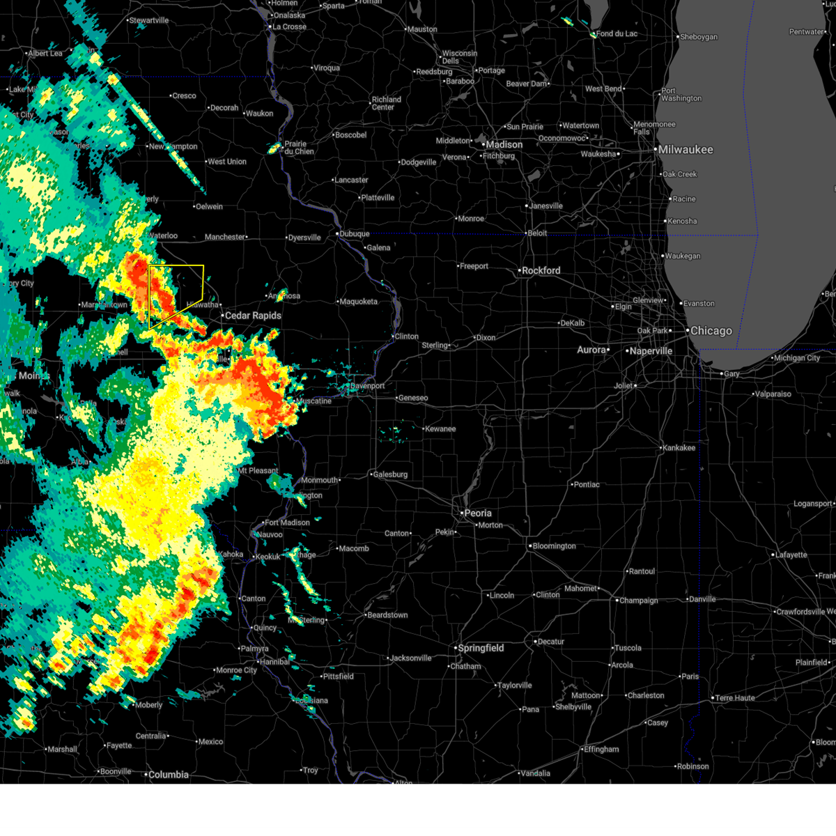
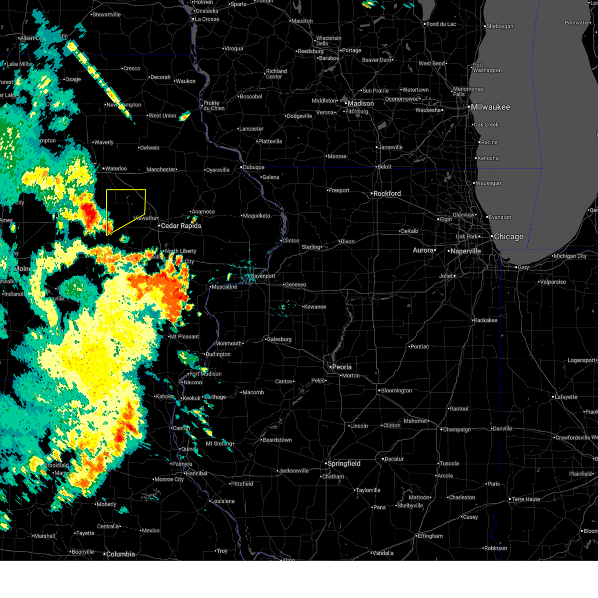
| 4/17/2026 4:06 PM CDT |
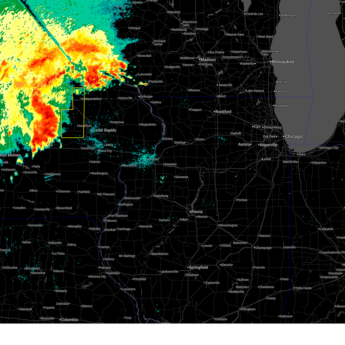
 At 405 pm cdt, severe thunderstorms were located along a line extending from rowley to shellsburg to ladora, moving east at 40 mph (radar indicated). Hazards include 60 mph wind gusts and quarter size hail. Hail damage to vehicles is expected. expect wind damage to roofs, siding, and trees. locations impacted include, cedar rapids, vinton, marengo, marion, hiawatha, robins, belle plaine, center point, fairfax, atkins, walford, urbana, palo, shellsburg, victor, swisher, newhall, oxford, walker, and blairstown. this includes the following highways, interstate 80 in iowa between mile markers 205 and 212. Interstate 380 between mile markers 10 and 48. At 405 pm cdt, severe thunderstorms were located along a line extending from rowley to shellsburg to ladora, moving east at 40 mph (radar indicated). Hazards include 60 mph wind gusts and quarter size hail. Hail damage to vehicles is expected. expect wind damage to roofs, siding, and trees. locations impacted include, cedar rapids, vinton, marengo, marion, hiawatha, robins, belle plaine, center point, fairfax, atkins, walford, urbana, palo, shellsburg, victor, swisher, newhall, oxford, walker, and blairstown. this includes the following highways, interstate 80 in iowa between mile markers 205 and 212. Interstate 380 between mile markers 10 and 48.
|
| 4/17/2026 3:57 PM CDT |
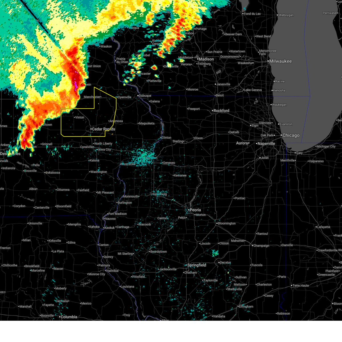
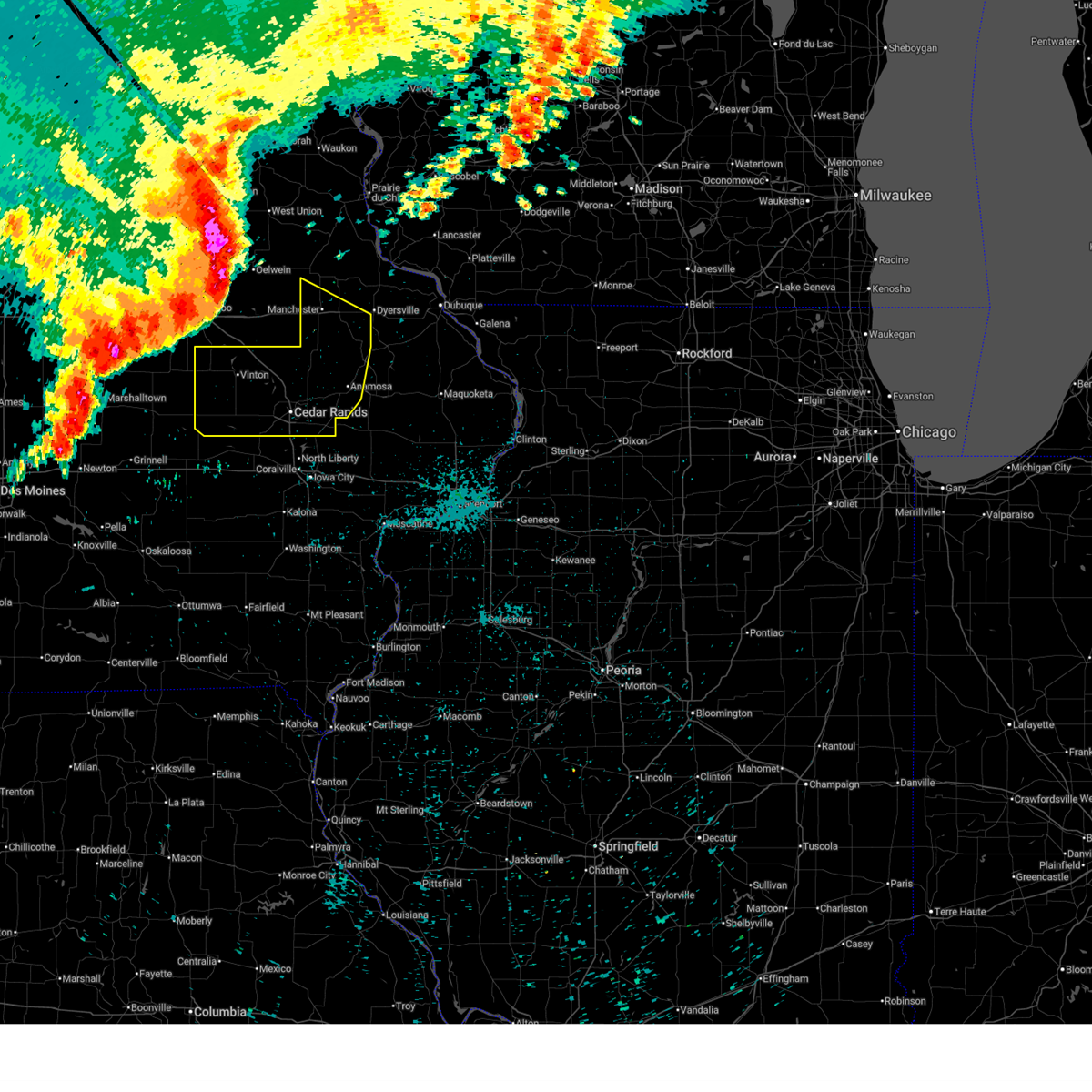
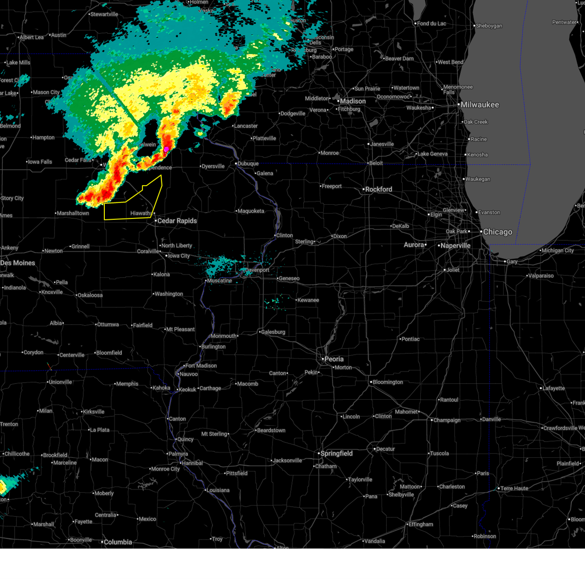
 At 357 pm cdt, a severe squall line capable of producing both tornadoes and extensive straight line wind damage was located along a line extending from mount auburn to hoefle-dulin park to van horne, moving east at 50 mph (radar indicated rotation). Hazards include tornado. Flying debris will be dangerous to those caught without shelter. mobile homes will be damaged or destroyed. damage to roofs, windows, and vehicles will occur. tree damage is likely. these dangerous storms will be near, vinton, urbana, shellsburg, cheney, benton city park, hoefle-dulin park, wildcat bluff park, and minne estema park around 400 pm cdt. center point, palo, spencers grove, and pleasant creek state recreation area around 405 pm cdt. other locations in the path of these tornadic storms include walker, toddville, lafayette, cedar rapids, hiawatha, robins, alburnett, troy mills and marion. This includes interstate 380 between mile markers 25 and 48. At 357 pm cdt, a severe squall line capable of producing both tornadoes and extensive straight line wind damage was located along a line extending from mount auburn to hoefle-dulin park to van horne, moving east at 50 mph (radar indicated rotation). Hazards include tornado. Flying debris will be dangerous to those caught without shelter. mobile homes will be damaged or destroyed. damage to roofs, windows, and vehicles will occur. tree damage is likely. these dangerous storms will be near, vinton, urbana, shellsburg, cheney, benton city park, hoefle-dulin park, wildcat bluff park, and minne estema park around 400 pm cdt. center point, palo, spencers grove, and pleasant creek state recreation area around 405 pm cdt. other locations in the path of these tornadic storms include walker, toddville, lafayette, cedar rapids, hiawatha, robins, alburnett, troy mills and marion. This includes interstate 380 between mile markers 25 and 48.
|
| 4/17/2026 3:51 PM CDT |
 At 351 pm cdt, severe thunderstorms were located along a line extending from brandon to near van horne to near hartwick, moving east at 40 mph (radar indicated). Hazards include 60 mph wind gusts and quarter size hail. Hail damage to vehicles is expected. expect wind damage to roofs, siding, and trees. locations impacted include, cedar rapids, vinton, marengo, marion, hiawatha, robins, belle plaine, center point, fairfax, atkins, walford, urbana, dysart, palo, shellsburg, victor, swisher, newhall, oxford, and walker. this includes the following highways, interstate 80 in iowa between mile markers 205 and 212. Interstate 380 between mile markers 10 and 48. At 351 pm cdt, severe thunderstorms were located along a line extending from brandon to near van horne to near hartwick, moving east at 40 mph (radar indicated). Hazards include 60 mph wind gusts and quarter size hail. Hail damage to vehicles is expected. expect wind damage to roofs, siding, and trees. locations impacted include, cedar rapids, vinton, marengo, marion, hiawatha, robins, belle plaine, center point, fairfax, atkins, walford, urbana, dysart, palo, shellsburg, victor, swisher, newhall, oxford, and walker. this includes the following highways, interstate 80 in iowa between mile markers 205 and 212. Interstate 380 between mile markers 10 and 48.
|
| 4/17/2026 3:47 PM CDT |
 Tordvn the national weather service in the quad cities has issued a * tornado warning for, northern benton county in east central iowa, northwestern linn county in east central iowa, * until 430 pm cdt. * at 347 pm cdt, a severe thunderstorm capable of producing a tornado was located over garrison, or near vinton, moving east at 45 mph (radar indicated rotation). Hazards include tornado. Flying debris will be dangerous to those caught without shelter. mobile homes will be damaged or destroyed. damage to roofs, windows, and vehicles will occur. tree damage is likely. this dangerous storm will be near, vinton, van horne, garrison, vinton memorial airport, rodgers park, benton county fairgrounds, and hoefle-dulin park around 350 pm cdt. urbana, shellsburg, benton city park, wildcat bluff park, and minne estema park around 355 pm cdt. center point, cheney, and pleasant creek state recreation area around 400 pm cdt. palo and spencers grove around 405 pm cdt. other locations in the path of this tornadic thunderstorm include walker, toddville, lafayette, robins, alburnett and troy mills. This includes interstate 380 between mile markers 25 and 48. Tordvn the national weather service in the quad cities has issued a * tornado warning for, northern benton county in east central iowa, northwestern linn county in east central iowa, * until 430 pm cdt. * at 347 pm cdt, a severe thunderstorm capable of producing a tornado was located over garrison, or near vinton, moving east at 45 mph (radar indicated rotation). Hazards include tornado. Flying debris will be dangerous to those caught without shelter. mobile homes will be damaged or destroyed. damage to roofs, windows, and vehicles will occur. tree damage is likely. this dangerous storm will be near, vinton, van horne, garrison, vinton memorial airport, rodgers park, benton county fairgrounds, and hoefle-dulin park around 350 pm cdt. urbana, shellsburg, benton city park, wildcat bluff park, and minne estema park around 355 pm cdt. center point, cheney, and pleasant creek state recreation area around 400 pm cdt. palo and spencers grove around 405 pm cdt. other locations in the path of this tornadic thunderstorm include walker, toddville, lafayette, robins, alburnett and troy mills. This includes interstate 380 between mile markers 25 and 48.
|
| 4/17/2026 3:29 PM CDT |
 Svrdvn the national weather service in the quad cities has issued a * severe thunderstorm warning for, southeastern buchanan county in northeastern iowa, northwestern johnson county in east central iowa, benton county in east central iowa, western linn county in east central iowa, northern iowa county in east central iowa, * until 445 pm cdt. * at 328 pm cdt, severe thunderstorms were located along a line extending from 6 miles west of la porte city to elberon to near grinnell, moving east at 40 mph (radar indicated). Hazards include 60 mph wind gusts and quarter size hail. Hail damage to vehicles is expected. Expect wind damage to roofs, siding, and trees. Svrdvn the national weather service in the quad cities has issued a * severe thunderstorm warning for, southeastern buchanan county in northeastern iowa, northwestern johnson county in east central iowa, benton county in east central iowa, western linn county in east central iowa, northern iowa county in east central iowa, * until 445 pm cdt. * at 328 pm cdt, severe thunderstorms were located along a line extending from 6 miles west of la porte city to elberon to near grinnell, moving east at 40 mph (radar indicated). Hazards include 60 mph wind gusts and quarter size hail. Hail damage to vehicles is expected. Expect wind damage to roofs, siding, and trees.
|
| 4/15/2026 5:51 PM CDT |
 The storm which prompted the warning has weakened below severe limits, and no longer poses an immediate threat to life or property. therefore, the warning will be allowed to expire. however, small hail and gusty winds are still possible with this thunderstorm. a tornado watch remains in effect until 900 pm cdt for northeastern and east central iowa. The storm which prompted the warning has weakened below severe limits, and no longer poses an immediate threat to life or property. therefore, the warning will be allowed to expire. however, small hail and gusty winds are still possible with this thunderstorm. a tornado watch remains in effect until 900 pm cdt for northeastern and east central iowa.
|
| 4/15/2026 5:36 PM CDT |
 At 536 pm cdt, a severe thunderstorm was located over vinton, moving east at 30 mph (emergency management reported quarter sized hail near the 6300 block of 24th avenue). Hazards include 60 mph wind gusts and quarter size hail. Hail damage to vehicles is expected. expect wind damage to roofs, siding, and trees. locations impacted include, vinton, urbana, shellsburg, garrison, mount auburn, vinton memorial airport, rodgers park, benton city park, hoefle-dulin park, spencers grove, benton county fairgrounds, minne estema park, wildcat bluff park, and cheney. This includes interstate 380 between mile markers 40 and 48. At 536 pm cdt, a severe thunderstorm was located over vinton, moving east at 30 mph (emergency management reported quarter sized hail near the 6300 block of 24th avenue). Hazards include 60 mph wind gusts and quarter size hail. Hail damage to vehicles is expected. expect wind damage to roofs, siding, and trees. locations impacted include, vinton, urbana, shellsburg, garrison, mount auburn, vinton memorial airport, rodgers park, benton city park, hoefle-dulin park, spencers grove, benton county fairgrounds, minne estema park, wildcat bluff park, and cheney. This includes interstate 380 between mile markers 40 and 48.
|
| 4/15/2026 5:32 PM CDT |
 At 532 pm cdt, a severe thunderstorm was located over vinton, moving east at 30 mph (radar indicated). Hazards include quarter size hail. Damage to vehicles is expected. locations impacted include, vinton, urbana, shellsburg, garrison, mount auburn, vinton memorial airport, rodgers park, benton city park, hoefle-dulin park, spencers grove, benton county fairgrounds, minne estema park, wildcat bluff park, and cheney. This includes interstate 380 between mile markers 40 and 48. At 532 pm cdt, a severe thunderstorm was located over vinton, moving east at 30 mph (radar indicated). Hazards include quarter size hail. Damage to vehicles is expected. locations impacted include, vinton, urbana, shellsburg, garrison, mount auburn, vinton memorial airport, rodgers park, benton city park, hoefle-dulin park, spencers grove, benton county fairgrounds, minne estema park, wildcat bluff park, and cheney. This includes interstate 380 between mile markers 40 and 48.
|
| 4/15/2026 5:22 PM CDT |
 At 522 pm cdt, a severe thunderstorm was located over garrison, or near vinton, moving east at 30 mph (radar indicated). Hazards include 60 mph wind gusts and quarter size hail. Hail damage to vehicles is expected. expect wind damage to roofs, siding, and trees. locations impacted include, vinton, urbana, shellsburg, garrison, mount auburn, vinton memorial airport, rodgers park, benton city park, hoefle-dulin park, spencers grove, benton county fairgrounds, minne estema park, wildcat bluff park, and cheney. This includes interstate 380 between mile markers 40 and 48. At 522 pm cdt, a severe thunderstorm was located over garrison, or near vinton, moving east at 30 mph (radar indicated). Hazards include 60 mph wind gusts and quarter size hail. Hail damage to vehicles is expected. expect wind damage to roofs, siding, and trees. locations impacted include, vinton, urbana, shellsburg, garrison, mount auburn, vinton memorial airport, rodgers park, benton city park, hoefle-dulin park, spencers grove, benton county fairgrounds, minne estema park, wildcat bluff park, and cheney. This includes interstate 380 between mile markers 40 and 48.
|
| 4/15/2026 5:12 PM CDT |
 At 511 pm cdt, a severe thunderstorm was located near dysart, or 11 miles west of vinton, moving east at 30 mph (radar indicated). Hazards include 60 mph wind gusts and quarter size hail. Hail damage to vehicles is expected. expect wind damage to roofs, siding, and trees. locations impacted include, vinton, urbana, dysart, shellsburg, garrison, mount auburn, vinton memorial airport, rodgers park, benton city park, hoefle-dulin park, spencers grove, benton county fairgrounds, minne estema park, wildcat bluff park, and cheney. This includes interstate 380 between mile markers 40 and 48. At 511 pm cdt, a severe thunderstorm was located near dysart, or 11 miles west of vinton, moving east at 30 mph (radar indicated). Hazards include 60 mph wind gusts and quarter size hail. Hail damage to vehicles is expected. expect wind damage to roofs, siding, and trees. locations impacted include, vinton, urbana, dysart, shellsburg, garrison, mount auburn, vinton memorial airport, rodgers park, benton city park, hoefle-dulin park, spencers grove, benton county fairgrounds, minne estema park, wildcat bluff park, and cheney. This includes interstate 380 between mile markers 40 and 48.
|
| 4/14/2026 5:14 PM CDT |
 At 513 pm cdt, a severe thunderstorm was located near van horne, or 9 miles southwest of vinton, moving northeast at 40 mph (fire department. at 509 pm cdt, fire department officials reported hail the size of quarters in vinton). Hazards include quarter size hail. Damage to vehicles is expected. this severe storm will be near, vinton, shellsburg, newhall, garrison, vinton memorial airport, benton city park, benton county fairgrounds, and hoefle-dulin park around 520 pm cdt. urbana and wildcat bluff park around 525 pm cdt. other locations in the path of this severe thunderstorm include cheney. This includes interstate 380 between mile markers 40 and 45. At 513 pm cdt, a severe thunderstorm was located near van horne, or 9 miles southwest of vinton, moving northeast at 40 mph (fire department. at 509 pm cdt, fire department officials reported hail the size of quarters in vinton). Hazards include quarter size hail. Damage to vehicles is expected. this severe storm will be near, vinton, shellsburg, newhall, garrison, vinton memorial airport, benton city park, benton county fairgrounds, and hoefle-dulin park around 520 pm cdt. urbana and wildcat bluff park around 525 pm cdt. other locations in the path of this severe thunderstorm include cheney. This includes interstate 380 between mile markers 40 and 45.
|
| 4/14/2026 5:06 PM CDT |
 Svrdvn the national weather service in the quad cities has issued a * severe thunderstorm warning for, benton county in east central iowa, * until 545 pm cdt. * at 505 pm cdt, a severe thunderstorm was located over keystone, or 14 miles southwest of vinton, moving northeast at 40 mph (radar indicated). Hazards include quarter size hail. Damage to vehicles is expected. this severe thunderstorm will be near, van horne and garrison around 510 pm cdt. vinton and benton county fairgrounds around 515 pm cdt. newhall, vinton memorial airport, benton city park, and hoefle-dulin park around 520 pm cdt. urbana, shellsburg, and wildcat bluff park around 525 pm cdt. other locations in the path of this severe thunderstorm include cheney and spencers grove. This includes interstate 380 between mile markers 40 and 45. Svrdvn the national weather service in the quad cities has issued a * severe thunderstorm warning for, benton county in east central iowa, * until 545 pm cdt. * at 505 pm cdt, a severe thunderstorm was located over keystone, or 14 miles southwest of vinton, moving northeast at 40 mph (radar indicated). Hazards include quarter size hail. Damage to vehicles is expected. this severe thunderstorm will be near, van horne and garrison around 510 pm cdt. vinton and benton county fairgrounds around 515 pm cdt. newhall, vinton memorial airport, benton city park, and hoefle-dulin park around 520 pm cdt. urbana, shellsburg, and wildcat bluff park around 525 pm cdt. other locations in the path of this severe thunderstorm include cheney and spencers grove. This includes interstate 380 between mile markers 40 and 45.
|
| 4/14/2026 5:01 PM CDT |
 Svrdvn the national weather service in the quad cities has issued a * severe thunderstorm warning for, southwestern buchanan county in northeastern iowa, northern benton county in east central iowa, * until 530 pm cdt. * at 500 pm cdt, a severe thunderstorm was located over mount auburn, or 7 miles northwest of vinton, moving northeast at 40 mph (radar indicated). Hazards include half dollar size hail. Damage to vehicles is expected. this severe thunderstorm will be near, brandon, mount auburn, lime creek county park, cheney, and minne estema park around 505 pm cdt. rowley and spencers grove around 510 pm cdt. This includes interstate 380 between mile markers 44 and 55. Svrdvn the national weather service in the quad cities has issued a * severe thunderstorm warning for, southwestern buchanan county in northeastern iowa, northern benton county in east central iowa, * until 530 pm cdt. * at 500 pm cdt, a severe thunderstorm was located over mount auburn, or 7 miles northwest of vinton, moving northeast at 40 mph (radar indicated). Hazards include half dollar size hail. Damage to vehicles is expected. this severe thunderstorm will be near, brandon, mount auburn, lime creek county park, cheney, and minne estema park around 505 pm cdt. rowley and spencers grove around 510 pm cdt. This includes interstate 380 between mile markers 44 and 55.
|
| 8/15/2025 5:30 PM CDT |
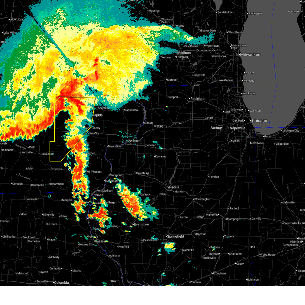
 At 530 pm cdt, severe thunderstorms were located along a line extending from near monti to near center point to near palo to near keystone, moving southeast at 30 mph (trained weather spotters). Hazards include 60 mph wind gusts and penny size hail. several personal weather stations have measured winds from 58 mph to 64 mph from near independence to vinton and newhall. Expect damage to roofs, siding, and trees. locations impacted include, independence, vinton, jesup, center point, atkins, urbana, dysart, palo, shellsburg, newhall, winthrop, walker, van horne, keystone, quasqueton, garrison, brandon, rowley, mount auburn, and troy mills. This includes interstate 380 between mile markers 33 and 55. At 530 pm cdt, severe thunderstorms were located along a line extending from near monti to near center point to near palo to near keystone, moving southeast at 30 mph (trained weather spotters). Hazards include 60 mph wind gusts and penny size hail. several personal weather stations have measured winds from 58 mph to 64 mph from near independence to vinton and newhall. Expect damage to roofs, siding, and trees. locations impacted include, independence, vinton, jesup, center point, atkins, urbana, dysart, palo, shellsburg, newhall, winthrop, walker, van horne, keystone, quasqueton, garrison, brandon, rowley, mount auburn, and troy mills. This includes interstate 380 between mile markers 33 and 55.
|
| 8/15/2025 5:15 PM CDT |
 At 515 pm cdt, severe thunderstorms were located along a line extending from near winthrop to near urbana to near shellsburg to near keystone, moving southeast at 30 mph (radar indicated). Hazards include 60 mph wind gusts and penny size hail. Expect damage to roofs, siding, and trees. locations impacted include, independence, vinton, jesup, center point, atkins, urbana, dysart, palo, shellsburg, newhall, winthrop, walker, van horne, keystone, quasqueton, garrison, brandon, rowley, mount auburn, and troy mills. This includes interstate 380 between mile markers 33 and 55. At 515 pm cdt, severe thunderstorms were located along a line extending from near winthrop to near urbana to near shellsburg to near keystone, moving southeast at 30 mph (radar indicated). Hazards include 60 mph wind gusts and penny size hail. Expect damage to roofs, siding, and trees. locations impacted include, independence, vinton, jesup, center point, atkins, urbana, dysart, palo, shellsburg, newhall, winthrop, walker, van horne, keystone, quasqueton, garrison, brandon, rowley, mount auburn, and troy mills. This includes interstate 380 between mile markers 33 and 55.
|
| 8/15/2025 5:10 PM CDT | Report of 60+ mph winds. time estimated by rada in benton county IA, 0.5 miles SSW of Garrison, IA |
| 8/15/2025 5:01 PM CDT |
 At 500 pm cdt, severe thunderstorms were located along a line extending from near winthrop to near spencers grove to benton county fairgrounds to near clutier, moving southeast at 35 mph (radar indicated). Hazards include 60 mph wind gusts and quarter size hail. Hail damage to vehicles is expected. expect wind damage to roofs, siding, and trees. locations impacted include, independence, vinton, jesup, center point, atkins, urbana, dysart, palo, shellsburg, newhall, winthrop, walker, van horne, keystone, quasqueton, garrison, brandon, rowley, mount auburn, and troy mills. This includes interstate 380 between mile markers 33 and 55. At 500 pm cdt, severe thunderstorms were located along a line extending from near winthrop to near spencers grove to benton county fairgrounds to near clutier, moving southeast at 35 mph (radar indicated). Hazards include 60 mph wind gusts and quarter size hail. Hail damage to vehicles is expected. expect wind damage to roofs, siding, and trees. locations impacted include, independence, vinton, jesup, center point, atkins, urbana, dysart, palo, shellsburg, newhall, winthrop, walker, van horne, keystone, quasqueton, garrison, brandon, rowley, mount auburn, and troy mills. This includes interstate 380 between mile markers 33 and 55.
|
| 8/15/2025 4:54 PM CDT |
 At 454 pm cdt, severe thunderstorms were located along a line extending from littleton to near la porte city, moving southeast at 30 mph (radar indicated). Hazards include 60 mph wind gusts and quarter size hail. Hail damage to vehicles is expected. expect wind damage to roofs, siding, and trees. locations impacted include, independence, vinton, jesup, center point, atkins, urbana, dysart, palo, shellsburg, newhall, winthrop, walker, van horne, keystone, quasqueton, garrison, brandon, rowley, mount auburn, and troy mills. This includes interstate 380 between mile markers 33 and 55. At 454 pm cdt, severe thunderstorms were located along a line extending from littleton to near la porte city, moving southeast at 30 mph (radar indicated). Hazards include 60 mph wind gusts and quarter size hail. Hail damage to vehicles is expected. expect wind damage to roofs, siding, and trees. locations impacted include, independence, vinton, jesup, center point, atkins, urbana, dysart, palo, shellsburg, newhall, winthrop, walker, van horne, keystone, quasqueton, garrison, brandon, rowley, mount auburn, and troy mills. This includes interstate 380 between mile markers 33 and 55.
|
| 8/15/2025 4:45 PM CDT |
 Svrdvn the national weather service in the quad cities has issued a * severe thunderstorm warning for, buchanan county in northeastern iowa, benton county in east central iowa, northwestern linn county in east central iowa, * until 545 pm cdt. * at 445 pm cdt, severe thunderstorms were located along a line extending from near fairbank to 6 miles northeast of tf clark state park, moving southeast at 30 mph (radar indicated). Hazards include 60 mph wind gusts and quarter size hail. Hail damage to vehicles is expected. Expect wind damage to roofs, siding, and trees. Svrdvn the national weather service in the quad cities has issued a * severe thunderstorm warning for, buchanan county in northeastern iowa, benton county in east central iowa, northwestern linn county in east central iowa, * until 545 pm cdt. * at 445 pm cdt, severe thunderstorms were located along a line extending from near fairbank to 6 miles northeast of tf clark state park, moving southeast at 30 mph (radar indicated). Hazards include 60 mph wind gusts and quarter size hail. Hail damage to vehicles is expected. Expect wind damage to roofs, siding, and trees.
|
| 7/30/2025 2:01 AM CDT |
 At 201 am cdt, severe thunderstorms were located along a line extending from fontana county park to rowley to near norway, moving east at 40 mph (radar indicated). Hazards include 60 mph wind gusts. Expect damage to roofs, siding, and trees. locations impacted include, independence, vinton, belle plaine, jesup, atkins, walford, urbana, dysart, fairbank, shellsburg, newhall, hazleton, blairstown, van horne, keystone, norway, garrison, brandon, rowley, and mount auburn. This includes interstate 380 between mile markers 40 and 55. At 201 am cdt, severe thunderstorms were located along a line extending from fontana county park to rowley to near norway, moving east at 40 mph (radar indicated). Hazards include 60 mph wind gusts. Expect damage to roofs, siding, and trees. locations impacted include, independence, vinton, belle plaine, jesup, atkins, walford, urbana, dysart, fairbank, shellsburg, newhall, hazleton, blairstown, van horne, keystone, norway, garrison, brandon, rowley, and mount auburn. This includes interstate 380 between mile markers 40 and 55.
|
| 7/30/2025 1:34 AM CDT |
 At 134 am cdt, severe thunderstorms were located along a line extending from evansdale to near la porte city to luzerne, moving east at 45 mph (radar indicated). Hazards include 60 mph wind gusts. Expect damage to roofs, siding, and trees. locations impacted include, independence, vinton, belle plaine, jesup, atkins, walford, urbana, dysart, fairbank, shellsburg, newhall, hazleton, blairstown, van horne, keystone, norway, garrison, brandon, rowley, and mount auburn. This includes interstate 380 between mile markers 40 and 55. At 134 am cdt, severe thunderstorms were located along a line extending from evansdale to near la porte city to luzerne, moving east at 45 mph (radar indicated). Hazards include 60 mph wind gusts. Expect damage to roofs, siding, and trees. locations impacted include, independence, vinton, belle plaine, jesup, atkins, walford, urbana, dysart, fairbank, shellsburg, newhall, hazleton, blairstown, van horne, keystone, norway, garrison, brandon, rowley, and mount auburn. This includes interstate 380 between mile markers 40 and 55.
|
| 7/30/2025 1:15 AM CDT |
 Svrdvn the national weather service in the quad cities has issued a * severe thunderstorm warning for, western buchanan county in northeastern iowa, benton county in east central iowa, * until 215 am cdt. * at 114 am cdt, severe thunderstorms were located along a line extending from near reinbeck to near traer to near holiday lake, moving east at 30 mph (trained weather spotters. a 58 mph wind gust was measured at marshalltown at 1242 am). Hazards include 60 mph wind gusts. expect damage to roofs, siding, and trees Svrdvn the national weather service in the quad cities has issued a * severe thunderstorm warning for, western buchanan county in northeastern iowa, benton county in east central iowa, * until 215 am cdt. * at 114 am cdt, severe thunderstorms were located along a line extending from near reinbeck to near traer to near holiday lake, moving east at 30 mph (trained weather spotters. a 58 mph wind gust was measured at marshalltown at 1242 am). Hazards include 60 mph wind gusts. expect damage to roofs, siding, and trees
|
| 7/29/2025 1:50 AM CDT |
 At 149 am cdt, severe thunderstorms were located along a line extending from aurora to urbana to near elberon, moving southeast at 55 mph (radar and emergency manager). Hazards include 70 mph wind gusts. Expect considerable tree damage. damage is likely to mobile homes, roofs, and outbuildings. locations impacted include, cedar rapids, anamosa, vinton, manchester, marion, hiawatha, mount vernon, monticello, robins, belle plaine, center point, lisbon, fairfax, ely, atkins, walford, urbana, dysart, central city, and springville. This includes interstate 380 between mile markers 12 and 48. At 149 am cdt, severe thunderstorms were located along a line extending from aurora to urbana to near elberon, moving southeast at 55 mph (radar and emergency manager). Hazards include 70 mph wind gusts. Expect considerable tree damage. damage is likely to mobile homes, roofs, and outbuildings. locations impacted include, cedar rapids, anamosa, vinton, manchester, marion, hiawatha, mount vernon, monticello, robins, belle plaine, center point, lisbon, fairfax, ely, atkins, walford, urbana, dysart, central city, and springville. This includes interstate 380 between mile markers 12 and 48.
|
| 7/29/2025 1:38 AM CDT |
 At 138 am cdt, severe thunderstorms were located along a line extending from near fontana county park to near lime creek county park to near traer, moving southeast at 55 mph (radar indicated). Hazards include 70 mph wind gusts. Expect considerable tree damage. damage is likely to mobile homes, roofs, and outbuildings. locations impacted include, cedar rapids, anamosa, vinton, manchester, marion, hiawatha, mount vernon, monticello, robins, belle plaine, center point, lisbon, fairfax, ely, atkins, walford, urbana, dysart, central city, and springville. This includes interstate 380 between mile markers 12 and 48. At 138 am cdt, severe thunderstorms were located along a line extending from near fontana county park to near lime creek county park to near traer, moving southeast at 55 mph (radar indicated). Hazards include 70 mph wind gusts. Expect considerable tree damage. damage is likely to mobile homes, roofs, and outbuildings. locations impacted include, cedar rapids, anamosa, vinton, manchester, marion, hiawatha, mount vernon, monticello, robins, belle plaine, center point, lisbon, fairfax, ely, atkins, walford, urbana, dysart, central city, and springville. This includes interstate 380 between mile markers 12 and 48.
|
| 7/29/2025 1:27 AM CDT |
 Svrdvn the national weather service in the quad cities has issued a * severe thunderstorm warning for, benton county in east central iowa, western jones county in east central iowa, delaware county in northeastern iowa, linn county in east central iowa, * until 245 am cdt. * at 127 am cdt, severe thunderstorms were located along a line extending from near fairbank to near jesup to near gladbrook, moving southeast at 55 mph (radar indicated). Hazards include 70 mph wind gusts. Expect considerable tree damage. Damage is likely to mobile homes, roofs, and outbuildings. Svrdvn the national weather service in the quad cities has issued a * severe thunderstorm warning for, benton county in east central iowa, western jones county in east central iowa, delaware county in northeastern iowa, linn county in east central iowa, * until 245 am cdt. * at 127 am cdt, severe thunderstorms were located along a line extending from near fairbank to near jesup to near gladbrook, moving southeast at 55 mph (radar indicated). Hazards include 70 mph wind gusts. Expect considerable tree damage. Damage is likely to mobile homes, roofs, and outbuildings.
|
| 7/19/2025 7:03 AM CDT |
 At 702 am cdt, severe thunderstorms were located along a line extending from urbana to near barnes city, moving east at 40 mph (radar indicated). Hazards include 60 mph wind gusts and penny size hail. Expect damage to roofs, siding, and trees. locations impacted include, cedar rapids, iowa city, vinton, marengo, sigourney, marion, coralville, north liberty, hiawatha, mount vernon, robins, williamsburg, belle plaine, center point, lisbon, fairfax, solon, tiffin, ely, and atkins. this includes the following highways, interstate 80 in iowa between mile markers 205 and 244. Interstate 380 between mile markers 1 and 48. At 702 am cdt, severe thunderstorms were located along a line extending from urbana to near barnes city, moving east at 40 mph (radar indicated). Hazards include 60 mph wind gusts and penny size hail. Expect damage to roofs, siding, and trees. locations impacted include, cedar rapids, iowa city, vinton, marengo, sigourney, marion, coralville, north liberty, hiawatha, mount vernon, robins, williamsburg, belle plaine, center point, lisbon, fairfax, solon, tiffin, ely, and atkins. this includes the following highways, interstate 80 in iowa between mile markers 205 and 244. Interstate 380 between mile markers 1 and 48.
|
| 7/19/2025 6:52 AM CDT |
 Svrdvn the national weather service in the quad cities has issued a * severe thunderstorm warning for, keokuk county in southeastern iowa, northern johnson county in east central iowa, benton county in east central iowa, northwestern washington county in southeastern iowa, northwestern jones county in east central iowa, linn county in east central iowa, iowa county in east central iowa, * until 745 am cdt. * at 652 am cdt, severe thunderstorms were located along a line extending from near keystone to near searsboro, moving southeast at 45 mph (radar indicated). Hazards include 60 mph wind gusts and penny size hail. expect damage to roofs, siding, and trees Svrdvn the national weather service in the quad cities has issued a * severe thunderstorm warning for, keokuk county in southeastern iowa, northern johnson county in east central iowa, benton county in east central iowa, northwestern washington county in southeastern iowa, northwestern jones county in east central iowa, linn county in east central iowa, iowa county in east central iowa, * until 745 am cdt. * at 652 am cdt, severe thunderstorms were located along a line extending from near keystone to near searsboro, moving southeast at 45 mph (radar indicated). Hazards include 60 mph wind gusts and penny size hail. expect damage to roofs, siding, and trees
|
| 7/19/2025 6:07 AM CDT |
 the severe thunderstorm warning has been cancelled and is no longer in effect the severe thunderstorm warning has been cancelled and is no longer in effect
|
| 7/19/2025 6:02 AM CDT |
 At 602 am cdt, a severe thunderstorm was located over rodgers park, or over vinton, moving east at 25 mph (radar indicated). Hazards include 60 mph wind gusts and quarter size hail. Hail damage to vehicles is expected. expect wind damage to roofs, siding, and trees. locations impacted include, cedar rapids, vinton, hiawatha, robins, center point, urbana, palo, shellsburg, walker, garrison, brandon, mount auburn, toddville, vinton memorial airport, rodgers park, benton city park, pleasant creek state recreation area, hoefle-dulin park, spencers grove, and minne estema park. This includes interstate 380 between mile markers 26 and 50. At 602 am cdt, a severe thunderstorm was located over rodgers park, or over vinton, moving east at 25 mph (radar indicated). Hazards include 60 mph wind gusts and quarter size hail. Hail damage to vehicles is expected. expect wind damage to roofs, siding, and trees. locations impacted include, cedar rapids, vinton, hiawatha, robins, center point, urbana, palo, shellsburg, walker, garrison, brandon, mount auburn, toddville, vinton memorial airport, rodgers park, benton city park, pleasant creek state recreation area, hoefle-dulin park, spencers grove, and minne estema park. This includes interstate 380 between mile markers 26 and 50.
|
| 7/19/2025 5:51 AM CDT |
 At 551 am cdt, a severe thunderstorm was located near garrison, or 7 miles west of vinton, moving east at 25 mph (radar indicated). Hazards include 60 mph wind gusts and quarter size hail. Hail damage to vehicles is expected. expect wind damage to roofs, siding, and trees. locations impacted include, cedar rapids, vinton, hiawatha, robins, center point, urbana, dysart, palo, shellsburg, walker, van horne, garrison, brandon, mount auburn, toddville, vinton memorial airport, minne estema park, benton county fairgrounds, wildcat bluff park, and cheney. This includes interstate 380 between mile markers 26 and 50. At 551 am cdt, a severe thunderstorm was located near garrison, or 7 miles west of vinton, moving east at 25 mph (radar indicated). Hazards include 60 mph wind gusts and quarter size hail. Hail damage to vehicles is expected. expect wind damage to roofs, siding, and trees. locations impacted include, cedar rapids, vinton, hiawatha, robins, center point, urbana, dysart, palo, shellsburg, walker, van horne, garrison, brandon, mount auburn, toddville, vinton memorial airport, minne estema park, benton county fairgrounds, wildcat bluff park, and cheney. This includes interstate 380 between mile markers 26 and 50.
|
| 7/19/2025 5:42 AM CDT |
 Svrdvn the national weather service in the quad cities has issued a * severe thunderstorm warning for, southwestern buchanan county in northeastern iowa, benton county in east central iowa, northwestern linn county in east central iowa, * until 645 am cdt. * at 542 am cdt, a severe thunderstorm was located near dysart, or 11 miles west of vinton, moving east at 25 mph (radar indicated). Hazards include 60 mph wind gusts and quarter size hail. Hail damage to vehicles is expected. Expect wind damage to roofs, siding, and trees. Svrdvn the national weather service in the quad cities has issued a * severe thunderstorm warning for, southwestern buchanan county in northeastern iowa, benton county in east central iowa, northwestern linn county in east central iowa, * until 645 am cdt. * at 542 am cdt, a severe thunderstorm was located near dysart, or 11 miles west of vinton, moving east at 25 mph (radar indicated). Hazards include 60 mph wind gusts and quarter size hail. Hail damage to vehicles is expected. Expect wind damage to roofs, siding, and trees.
|
| 7/11/2025 3:46 PM CDT |
 At 346 pm cdt, severe thunderstorms were located along a line extending from near winthrop to near benton city park to near iowa county fairgrounds, moving east at 35 mph (trained weather spotters). Hazards include 60 mph wind gusts and nickel size hail. Expect damage to roofs, siding, and trees. locations impacted include, cedar rapids, independence, vinton, marion, hiawatha, robins, belle plaine, jesup, center point, fairfax, ely, atkins, walford, urbana, dysart, fairbank, palo, shellsburg, newhall, and winthrop. This includes interstate 380 between mile markers 12 and 55. At 346 pm cdt, severe thunderstorms were located along a line extending from near winthrop to near benton city park to near iowa county fairgrounds, moving east at 35 mph (trained weather spotters). Hazards include 60 mph wind gusts and nickel size hail. Expect damage to roofs, siding, and trees. locations impacted include, cedar rapids, independence, vinton, marion, hiawatha, robins, belle plaine, jesup, center point, fairfax, ely, atkins, walford, urbana, dysart, fairbank, palo, shellsburg, newhall, and winthrop. This includes interstate 380 between mile markers 12 and 55.
|
| 7/11/2025 3:34 PM CDT |
 At 334 pm cdt, severe thunderstorms were located along a line extending from independence to near benton county fairgrounds to near koszta, moving east at 35 mph (radar indicated). Hazards include 60 mph wind gusts. Expect damage to roofs, siding, and trees. locations impacted include, cedar rapids, independence, vinton, marion, hiawatha, robins, belle plaine, jesup, center point, fairfax, ely, atkins, walford, urbana, dysart, fairbank, palo, shellsburg, newhall, and winthrop. This includes interstate 380 between mile markers 12 and 55. At 334 pm cdt, severe thunderstorms were located along a line extending from independence to near benton county fairgrounds to near koszta, moving east at 35 mph (radar indicated). Hazards include 60 mph wind gusts. Expect damage to roofs, siding, and trees. locations impacted include, cedar rapids, independence, vinton, marion, hiawatha, robins, belle plaine, jesup, center point, fairfax, ely, atkins, walford, urbana, dysart, fairbank, palo, shellsburg, newhall, and winthrop. This includes interstate 380 between mile markers 12 and 55.
|
| 7/11/2025 3:20 PM CDT |
 At 319 pm cdt, severe thunderstorms were located along a line extending from jesup to near garrison to near hartwick, moving east at 35 mph (radar indicated). Hazards include 60 mph wind gusts. Expect damage to roofs, siding, and trees. locations impacted include, cedar rapids, independence, vinton, marion, hiawatha, robins, belle plaine, jesup, center point, fairfax, ely, atkins, walford, urbana, dysart, fairbank, palo, shellsburg, newhall, and winthrop. This includes interstate 380 between mile markers 12 and 55. At 319 pm cdt, severe thunderstorms were located along a line extending from jesup to near garrison to near hartwick, moving east at 35 mph (radar indicated). Hazards include 60 mph wind gusts. Expect damage to roofs, siding, and trees. locations impacted include, cedar rapids, independence, vinton, marion, hiawatha, robins, belle plaine, jesup, center point, fairfax, ely, atkins, walford, urbana, dysart, fairbank, palo, shellsburg, newhall, and winthrop. This includes interstate 380 between mile markers 12 and 55.
|
| 7/11/2025 3:12 PM CDT |
 At 311 pm cdt, severe thunderstorms were located along a line extending from near raymond to near dysart to near holiday lake, moving east at 35 mph (radar indicated). Hazards include 60 mph wind gusts. Expect damage to roofs, siding, and trees. locations impacted include, cedar rapids, independence, vinton, marion, hiawatha, robins, belle plaine, jesup, center point, fairfax, ely, atkins, walford, urbana, dysart, fairbank, palo, shellsburg, newhall, and winthrop. This includes interstate 380 between mile markers 12 and 55. At 311 pm cdt, severe thunderstorms were located along a line extending from near raymond to near dysart to near holiday lake, moving east at 35 mph (radar indicated). Hazards include 60 mph wind gusts. Expect damage to roofs, siding, and trees. locations impacted include, cedar rapids, independence, vinton, marion, hiawatha, robins, belle plaine, jesup, center point, fairfax, ely, atkins, walford, urbana, dysart, fairbank, palo, shellsburg, newhall, and winthrop. This includes interstate 380 between mile markers 12 and 55.
|
| 7/11/2025 3:03 PM CDT |
 Svrdvn the national weather service in the quad cities has issued a * severe thunderstorm warning for, buchanan county in northeastern iowa, benton county in east central iowa, western linn county in east central iowa, * until 400 pm cdt. * at 303 pm cdt, severe thunderstorms were located along a line extending from elk run heights to near clutier to near holiday lake, moving east at 35 mph (radar indicated). Hazards include 60 mph wind gusts. expect damage to roofs, siding, and trees Svrdvn the national weather service in the quad cities has issued a * severe thunderstorm warning for, buchanan county in northeastern iowa, benton county in east central iowa, western linn county in east central iowa, * until 400 pm cdt. * at 303 pm cdt, severe thunderstorms were located along a line extending from elk run heights to near clutier to near holiday lake, moving east at 35 mph (radar indicated). Hazards include 60 mph wind gusts. expect damage to roofs, siding, and trees
|
| 6/26/2025 6:31 PM CDT |
 the severe thunderstorm warning has been cancelled and is no longer in effect the severe thunderstorm warning has been cancelled and is no longer in effect
|
| 6/26/2025 6:31 PM CDT |
 At 631 pm cdt, severe thunderstorms were located along a line extending from near la porte city to minne estema park to near benton county fairgrounds to blairstown, moving east at 45 mph (radar indicated). Hazards include 60 mph wind gusts. Expect damage to roofs, siding, and trees. locations impacted include, vinton, jesup, atkins, urbana, shellsburg, newhall, blairstown, van horne, garrison, brandon, rowley, mount auburn, lime creek county park, vinton memorial airport, rodgers park, benton city park, hoefle-dulin park, spencers grove, minne estema park, and benton county fairgrounds. This includes interstate 380 between mile markers 40 and 55. At 631 pm cdt, severe thunderstorms were located along a line extending from near la porte city to minne estema park to near benton county fairgrounds to blairstown, moving east at 45 mph (radar indicated). Hazards include 60 mph wind gusts. Expect damage to roofs, siding, and trees. locations impacted include, vinton, jesup, atkins, urbana, shellsburg, newhall, blairstown, van horne, garrison, brandon, rowley, mount auburn, lime creek county park, vinton memorial airport, rodgers park, benton city park, hoefle-dulin park, spencers grove, minne estema park, and benton county fairgrounds. This includes interstate 380 between mile markers 40 and 55.
|
| 6/26/2025 6:22 PM CDT |
 At 621 pm cdt, severe thunderstorms were located along a line extending from near la porte city to near rodgers park to near van horne to luzerne, moving east at 55 mph (radar indicated). Hazards include 60 mph wind gusts. Expect damage to roofs, siding, and trees. locations impacted include, vinton, belle plaine, jesup, atkins, urbana, dysart, shellsburg, newhall, blairstown, van horne, keystone, garrison, brandon, rowley, mount auburn, luzerne, vinton memorial airport, minne estema park, benton county fairgrounds, and wildcat bluff park. This includes interstate 380 between mile markers 40 and 55. At 621 pm cdt, severe thunderstorms were located along a line extending from near la porte city to near rodgers park to near van horne to luzerne, moving east at 55 mph (radar indicated). Hazards include 60 mph wind gusts. Expect damage to roofs, siding, and trees. locations impacted include, vinton, belle plaine, jesup, atkins, urbana, dysart, shellsburg, newhall, blairstown, van horne, keystone, garrison, brandon, rowley, mount auburn, luzerne, vinton memorial airport, minne estema park, benton county fairgrounds, and wildcat bluff park. This includes interstate 380 between mile markers 40 and 55.
|
| 6/26/2025 6:09 PM CDT |
 At 608 pm cdt, severe thunderstorms were located along a line extending from near tf clark state park to near dysart to elberon to near hartwick, moving east at 35 mph (radar indicated). Hazards include 60 mph wind gusts. Expect damage to roofs, siding, and trees. locations impacted include, vinton, belle plaine, jesup, atkins, urbana, dysart, shellsburg, newhall, blairstown, van horne, keystone, garrison, brandon, rowley, mount auburn, luzerne, vinton memorial airport, minne estema park, benton county fairgrounds, and wildcat bluff park. This includes interstate 380 between mile markers 40 and 55. At 608 pm cdt, severe thunderstorms were located along a line extending from near tf clark state park to near dysart to elberon to near hartwick, moving east at 35 mph (radar indicated). Hazards include 60 mph wind gusts. Expect damage to roofs, siding, and trees. locations impacted include, vinton, belle plaine, jesup, atkins, urbana, dysart, shellsburg, newhall, blairstown, van horne, keystone, garrison, brandon, rowley, mount auburn, luzerne, vinton memorial airport, minne estema park, benton county fairgrounds, and wildcat bluff park. This includes interstate 380 between mile markers 40 and 55.
|
| 6/26/2025 5:53 PM CDT |
 Svrdvn the national weather service in the quad cities has issued a * severe thunderstorm warning for, southwestern buchanan county in northeastern iowa, benton county in east central iowa, northwestern iowa county in east central iowa, * until 700 pm cdt. * at 553 pm cdt, severe thunderstorms were located along a line extending from near lincoln to near clutier to near malcom, moving east at 45 mph (radar indicated). Hazards include 60 mph wind gusts. expect damage to roofs, siding, and trees Svrdvn the national weather service in the quad cities has issued a * severe thunderstorm warning for, southwestern buchanan county in northeastern iowa, benton county in east central iowa, northwestern iowa county in east central iowa, * until 700 pm cdt. * at 553 pm cdt, severe thunderstorms were located along a line extending from near lincoln to near clutier to near malcom, moving east at 45 mph (radar indicated). Hazards include 60 mph wind gusts. expect damage to roofs, siding, and trees
|
| 6/23/2025 7:10 PM CDT |
 At 710 pm cdt, a severe thunderstorm was located over spencers grove, or 10 miles northeast of vinton, moving northeast at 35 mph (radar indicated). Hazards include 60 mph wind gusts. Expect damage to roofs, siding, and trees. locations impacted include, vinton, center point, urbana, shellsburg, walker, van horne, keystone, quasqueton, garrison, rowley, troy mills, vinton memorial airport, rodgers park, benton city park, pleasant creek state recreation area, hoefle-dulin park, monti, lafayette, spencers grove, and minne estema park. This includes interstate 380 between mile markers 32 and 49. At 710 pm cdt, a severe thunderstorm was located over spencers grove, or 10 miles northeast of vinton, moving northeast at 35 mph (radar indicated). Hazards include 60 mph wind gusts. Expect damage to roofs, siding, and trees. locations impacted include, vinton, center point, urbana, shellsburg, walker, van horne, keystone, quasqueton, garrison, rowley, troy mills, vinton memorial airport, rodgers park, benton city park, pleasant creek state recreation area, hoefle-dulin park, monti, lafayette, spencers grove, and minne estema park. This includes interstate 380 between mile markers 32 and 49.
|
| 6/23/2025 6:53 PM CDT |
 At 653 pm cdt, a severe thunderstorm was located over hoefle-dulin park, or over vinton, moving northeast at 30 mph (radar indicated). Hazards include 60 mph wind gusts. Expect damage to roofs, siding, and trees. locations impacted include, vinton, center point, urbana, shellsburg, walker, van horne, keystone, quasqueton, garrison, rowley, troy mills, vinton memorial airport, rodgers park, benton city park, pleasant creek state recreation area, hoefle-dulin park, monti, lafayette, spencers grove, and minne estema park. This includes interstate 380 between mile markers 32 and 49. At 653 pm cdt, a severe thunderstorm was located over hoefle-dulin park, or over vinton, moving northeast at 30 mph (radar indicated). Hazards include 60 mph wind gusts. Expect damage to roofs, siding, and trees. locations impacted include, vinton, center point, urbana, shellsburg, walker, van horne, keystone, quasqueton, garrison, rowley, troy mills, vinton memorial airport, rodgers park, benton city park, pleasant creek state recreation area, hoefle-dulin park, monti, lafayette, spencers grove, and minne estema park. This includes interstate 380 between mile markers 32 and 49.
|
| 6/23/2025 6:33 PM CDT |
 Svrdvn the national weather service in the quad cities has issued a * severe thunderstorm warning for, southeastern buchanan county in northeastern iowa, central benton county in east central iowa, northwestern linn county in east central iowa, * until 730 pm cdt. * at 633 pm cdt, a severe thunderstorm was located over garrison, or 7 miles southwest of vinton, moving northeast at 30 mph (radar indicated). Hazards include 60 mph wind gusts. expect damage to roofs, siding, and trees Svrdvn the national weather service in the quad cities has issued a * severe thunderstorm warning for, southeastern buchanan county in northeastern iowa, central benton county in east central iowa, northwestern linn county in east central iowa, * until 730 pm cdt. * at 633 pm cdt, a severe thunderstorm was located over garrison, or 7 miles southwest of vinton, moving northeast at 30 mph (radar indicated). Hazards include 60 mph wind gusts. expect damage to roofs, siding, and trees
|
| 6/20/2025 8:50 AM CDT |
 the severe thunderstorm warning has been cancelled and is no longer in effect the severe thunderstorm warning has been cancelled and is no longer in effect
|
| 6/20/2025 8:50 AM CDT |
 At 849 am cdt, severe thunderstorms were located along a line extending from toddville to near van horne to near garwin, moving east at 40 mph (radar indicated). Hazards include 60 mph wind gusts. Expect damage to roofs, siding, and trees. Locations impacted include, vinton, belle plaine, atkins, walford, urbana, dysart, shellsburg, newhall, blairstown, van horne, keystone, norway, garrison, mount auburn, luzerne, vinton memorial airport, rodgers park, benton city park, hoefle-dulin park, and hannen lake park. At 849 am cdt, severe thunderstorms were located along a line extending from toddville to near van horne to near garwin, moving east at 40 mph (radar indicated). Hazards include 60 mph wind gusts. Expect damage to roofs, siding, and trees. Locations impacted include, vinton, belle plaine, atkins, walford, urbana, dysart, shellsburg, newhall, blairstown, van horne, keystone, norway, garrison, mount auburn, luzerne, vinton memorial airport, rodgers park, benton city park, hoefle-dulin park, and hannen lake park.
|
| 6/20/2025 8:39 AM CDT |
 At 839 am cdt, severe thunderstorms were located along a line extending from center point to near keystone to union grove state park, moving southeast at 40 mph (radar indicated). Hazards include 60 mph wind gusts and penny size hail. Expect damage to roofs, siding, and trees. locations impacted include, vinton, belle plaine, atkins, walford, urbana, dysart, shellsburg, newhall, blairstown, van horne, keystone, norway, garrison, brandon, mount auburn, luzerne, vinton memorial airport, hannen lake park, minne estema park, and benton county fairgrounds. This includes interstate 380 between mile markers 43 and 55. At 839 am cdt, severe thunderstorms were located along a line extending from center point to near keystone to union grove state park, moving southeast at 40 mph (radar indicated). Hazards include 60 mph wind gusts and penny size hail. Expect damage to roofs, siding, and trees. locations impacted include, vinton, belle plaine, atkins, walford, urbana, dysart, shellsburg, newhall, blairstown, van horne, keystone, norway, garrison, brandon, mount auburn, luzerne, vinton memorial airport, hannen lake park, minne estema park, and benton county fairgrounds. This includes interstate 380 between mile markers 43 and 55.
|
| 6/20/2025 8:22 AM CDT |
 Svrdvn the national weather service in the quad cities has issued a * severe thunderstorm warning for, southwestern buchanan county in northeastern iowa, benton county in east central iowa, * until 915 am cdt. * at 822 am cdt, severe thunderstorms were located along a line extending from near spencers grove to dysart to near beaman, moving southeast at 40 mph (radar indicated). Hazards include 60 mph wind gusts and penny size hail. expect damage to roofs, siding, and trees Svrdvn the national weather service in the quad cities has issued a * severe thunderstorm warning for, southwestern buchanan county in northeastern iowa, benton county in east central iowa, * until 915 am cdt. * at 822 am cdt, severe thunderstorms were located along a line extending from near spencers grove to dysart to near beaman, moving southeast at 40 mph (radar indicated). Hazards include 60 mph wind gusts and penny size hail. expect damage to roofs, siding, and trees
|
| 6/11/2025 8:29 PM CDT |
 At 829 pm cdt, severe thunderstorms were located along a line extending from near quasqueton to near van horne, moving east at 40 mph (trained weather spotters). Hazards include 60 mph wind gusts and quarter size hail. Hail damage to vehicles is expected. expect wind damage to roofs, siding, and trees. locations impacted include, vinton, robins, center point, urbana, palo, shellsburg, walker, van horne, keystone, garrison, toddville, troy mills, benton city park, pleasant creek state recreation area, hoefle-dulin park, lafayette, benton county fairgrounds, and wildcat bluff park. This includes interstate 380 between mile markers 28 and 42. At 829 pm cdt, severe thunderstorms were located along a line extending from near quasqueton to near van horne, moving east at 40 mph (trained weather spotters). Hazards include 60 mph wind gusts and quarter size hail. Hail damage to vehicles is expected. expect wind damage to roofs, siding, and trees. locations impacted include, vinton, robins, center point, urbana, palo, shellsburg, walker, van horne, keystone, garrison, toddville, troy mills, benton city park, pleasant creek state recreation area, hoefle-dulin park, lafayette, benton county fairgrounds, and wildcat bluff park. This includes interstate 380 between mile markers 28 and 42.
|
| 6/11/2025 8:24 PM CDT |
 At 822 pm cdt, severe thunderstorms were located along a line extending from camp c.s. klaus to vinton, moving east at 40 mph (radar indicated. a 66 mph wind gust was measured at the vinton airport around 815 pm). Hazards include 70 mph wind gusts and quarter size hail. Hail damage to vehicles is expected. expect considerable tree damage. wind damage is also likely to mobile homes, roofs, and outbuildings. locations impacted include, independence, vinton, jesup, urbana, dysart, fairbank, edgewood, winthrop, hazleton, quasqueton, lamont, garrison, brandon, rowley, aurora, dundee, mount auburn, masonville, stanley, and wapsipinicon golf course. This includes interstate 380 between mile markers 43 and 55. At 822 pm cdt, severe thunderstorms were located along a line extending from camp c.s. klaus to vinton, moving east at 40 mph (radar indicated. a 66 mph wind gust was measured at the vinton airport around 815 pm). Hazards include 70 mph wind gusts and quarter size hail. Hail damage to vehicles is expected. expect considerable tree damage. wind damage is also likely to mobile homes, roofs, and outbuildings. locations impacted include, independence, vinton, jesup, urbana, dysart, fairbank, edgewood, winthrop, hazleton, quasqueton, lamont, garrison, brandon, rowley, aurora, dundee, mount auburn, masonville, stanley, and wapsipinicon golf course. This includes interstate 380 between mile markers 43 and 55.
|
| 6/11/2025 8:06 PM CDT |
 Svrdvn the national weather service in the quad cities has issued a * severe thunderstorm warning for, southeastern buchanan county in northeastern iowa, central benton county in east central iowa, northwestern linn county in east central iowa, * until 900 pm cdt. * at 806 pm cdt, severe thunderstorms were located along a line extending from quasqueton to near elberon, moving east at 40 mph (trained weather spotters). Hazards include 60 mph wind gusts and quarter size hail. Hail damage to vehicles is expected. Expect wind damage to roofs, siding, and trees. Svrdvn the national weather service in the quad cities has issued a * severe thunderstorm warning for, southeastern buchanan county in northeastern iowa, central benton county in east central iowa, northwestern linn county in east central iowa, * until 900 pm cdt. * at 806 pm cdt, severe thunderstorms were located along a line extending from quasqueton to near elberon, moving east at 40 mph (trained weather spotters). Hazards include 60 mph wind gusts and quarter size hail. Hail damage to vehicles is expected. Expect wind damage to roofs, siding, and trees.
|
| 6/11/2025 7:54 PM CDT |
 At 753 pm cdt, severe thunderstorms were located along a line extending from joy springs county park to near dysart, moving east at 50 mph (trained weather spotters). Hazards include 60 mph wind gusts and quarter size hail. Hail damage to vehicles is expected. expect wind damage to roofs, siding, and trees. locations impacted include, independence, vinton, jesup, urbana, dysart, fairbank, edgewood, winthrop, hazleton, quasqueton, lamont, garrison, brandon, rowley, aurora, dundee, mount auburn, masonville, stanley, and wapsipinicon golf course. This includes interstate 380 between mile markers 43 and 55. At 753 pm cdt, severe thunderstorms were located along a line extending from joy springs county park to near dysart, moving east at 50 mph (trained weather spotters). Hazards include 60 mph wind gusts and quarter size hail. Hail damage to vehicles is expected. expect wind damage to roofs, siding, and trees. locations impacted include, independence, vinton, jesup, urbana, dysart, fairbank, edgewood, winthrop, hazleton, quasqueton, lamont, garrison, brandon, rowley, aurora, dundee, mount auburn, masonville, stanley, and wapsipinicon golf course. This includes interstate 380 between mile markers 43 and 55.
|
| 6/11/2025 7:39 PM CDT |
 Svrdvn the national weather service in the quad cities has issued a * severe thunderstorm warning for, buchanan county in northeastern iowa, northern benton county in east central iowa, northwestern delaware county in northeastern iowa, * until 900 pm cdt. * at 739 pm cdt, severe thunderstorms were located along a line extending from near fairbank to near traer, moving east at 40 mph (radar indicated). Hazards include 60 mph wind gusts and quarter size hail. Hail damage to vehicles is expected. Expect wind damage to roofs, siding, and trees. Svrdvn the national weather service in the quad cities has issued a * severe thunderstorm warning for, buchanan county in northeastern iowa, northern benton county in east central iowa, northwestern delaware county in northeastern iowa, * until 900 pm cdt. * at 739 pm cdt, severe thunderstorms were located along a line extending from near fairbank to near traer, moving east at 40 mph (radar indicated). Hazards include 60 mph wind gusts and quarter size hail. Hail damage to vehicles is expected. Expect wind damage to roofs, siding, and trees.
|
| 4/23/2025 7:32 PM CDT |
 the severe thunderstorm warning has been cancelled and is no longer in effect the severe thunderstorm warning has been cancelled and is no longer in effect
|
| 4/23/2025 7:20 PM CDT |
 At 720 pm cdt, a severe thunderstorm was located over garrison, or near vinton, moving northeast at 10 mph (radar indicated). Hazards include quarter size hail. Damage to vehicles is expected. locations impacted include, mount auburn, garrison, vinton, vinton memorial airport, minne estema park, benton county fairgrounds, rodgers park, benton city park, cheney, urbana, and hoefle-dulin park. This includes interstate 380 between mile markers 44 and 48. At 720 pm cdt, a severe thunderstorm was located over garrison, or near vinton, moving northeast at 10 mph (radar indicated). Hazards include quarter size hail. Damage to vehicles is expected. locations impacted include, mount auburn, garrison, vinton, vinton memorial airport, minne estema park, benton county fairgrounds, rodgers park, benton city park, cheney, urbana, and hoefle-dulin park. This includes interstate 380 between mile markers 44 and 48.
|
| 4/23/2025 7:13 PM CDT |
 At 713 pm cdt, a severe thunderstorm was located over garrison, or near vinton, moving northeast at 10 mph (radar indicated). Hazards include 60 mph wind gusts and quarter size hail. Hail damage to vehicles is expected. expect wind damage to roofs, siding, and trees. locations impacted include, mount auburn, garrison, vinton, vinton memorial airport, minne estema park, benton county fairgrounds, rodgers park, benton city park, cheney, urbana, hoefle-dulin park, and dysart. This includes interstate 380 between mile markers 44 and 48. At 713 pm cdt, a severe thunderstorm was located over garrison, or near vinton, moving northeast at 10 mph (radar indicated). Hazards include 60 mph wind gusts and quarter size hail. Hail damage to vehicles is expected. expect wind damage to roofs, siding, and trees. locations impacted include, mount auburn, garrison, vinton, vinton memorial airport, minne estema park, benton county fairgrounds, rodgers park, benton city park, cheney, urbana, hoefle-dulin park, and dysart. This includes interstate 380 between mile markers 44 and 48.
|
| 4/23/2025 7:01 PM CDT |
 Svrdvn the national weather service in the quad cities has issued a * severe thunderstorm warning for, northern benton county in east central iowa, * until 800 pm cdt. * at 701 pm cdt, a severe thunderstorm was located over dysart, or 15 miles west of vinton, moving northeast at 15 mph (radar indicated). Hazards include 60 mph wind gusts and quarter size hail. Hail damage to vehicles is expected. Expect wind damage to roofs, siding, and trees. Svrdvn the national weather service in the quad cities has issued a * severe thunderstorm warning for, northern benton county in east central iowa, * until 800 pm cdt. * at 701 pm cdt, a severe thunderstorm was located over dysart, or 15 miles west of vinton, moving northeast at 15 mph (radar indicated). Hazards include 60 mph wind gusts and quarter size hail. Hail damage to vehicles is expected. Expect wind damage to roofs, siding, and trees.
|
| 3/14/2025 7:47 PM CDT |
 At 747 pm cdt, severe thunderstorms were located along a line extending from near la porte city to benton county fairgrounds, moving north at 60 mph (radar indicated). Hazards include 70 mph wind gusts. Expect considerable tree damage. damage is likely to mobile homes, roofs, and outbuildings. locations impacted include, mount auburn, garrison, vinton, vinton memorial airport, minne estema park, benton county fairgrounds, rodgers park, cheney, hoefle-dulin park, and dysart. This includes interstate 380 between mile markers 46 and 48. At 747 pm cdt, severe thunderstorms were located along a line extending from near la porte city to benton county fairgrounds, moving north at 60 mph (radar indicated). Hazards include 70 mph wind gusts. Expect considerable tree damage. damage is likely to mobile homes, roofs, and outbuildings. locations impacted include, mount auburn, garrison, vinton, vinton memorial airport, minne estema park, benton county fairgrounds, rodgers park, cheney, hoefle-dulin park, and dysart. This includes interstate 380 between mile markers 46 and 48.
|
| 3/14/2025 7:35 PM CDT |
 At 735 pm cdt, severe thunderstorms were located along a line extending from washburn to near benton county fairgrounds, moving north at 60 mph (radar indicated). Hazards include 70 mph wind gusts. Expect considerable tree damage. damage is likely to mobile homes, roofs, and outbuildings. locations impacted include, mount auburn, garrison, vinton, vinton memorial airport, minne estema park, benton county fairgrounds, rodgers park, cheney, hoefle-dulin park, and dysart. This includes interstate 380 between mile markers 46 and 48. At 735 pm cdt, severe thunderstorms were located along a line extending from washburn to near benton county fairgrounds, moving north at 60 mph (radar indicated). Hazards include 70 mph wind gusts. Expect considerable tree damage. damage is likely to mobile homes, roofs, and outbuildings. locations impacted include, mount auburn, garrison, vinton, vinton memorial airport, minne estema park, benton county fairgrounds, rodgers park, cheney, hoefle-dulin park, and dysart. This includes interstate 380 between mile markers 46 and 48.
|
| 3/14/2025 7:20 PM CDT |
 Svrdvn the national weather service in the quad cities has issued a * severe thunderstorm warning for, northern benton county in east central iowa, * until 800 pm cdt. * at 719 pm cdt, severe thunderstorms were located along a line extending from 6 miles southwest of washburn to keystone, moving northeast at 60 mph (radar indicated). Hazards include 70 mph wind gusts. Expect considerable tree damage. Damage is likely to mobile homes, roofs, and outbuildings. Svrdvn the national weather service in the quad cities has issued a * severe thunderstorm warning for, northern benton county in east central iowa, * until 800 pm cdt. * at 719 pm cdt, severe thunderstorms were located along a line extending from 6 miles southwest of washburn to keystone, moving northeast at 60 mph (radar indicated). Hazards include 70 mph wind gusts. Expect considerable tree damage. Damage is likely to mobile homes, roofs, and outbuildings.
|
| 7/28/2024 10:57 PM CDT |
 The storms which prompted the warning have weakened below severe limits, and no longer pose an immediate threat to life or property. therefore, the warning will be allowed to expire. however, gusty winds are still possible with these thunderstorms. The storms which prompted the warning have weakened below severe limits, and no longer pose an immediate threat to life or property. therefore, the warning will be allowed to expire. however, gusty winds are still possible with these thunderstorms.
|
| 7/28/2024 10:36 PM CDT |
 At 1036 pm cdt, severe thunderstorms were located along a line extending from near mount auburn to keystone, moving east at 40 mph (radar indicated). Hazards include 60 mph wind gusts. Expect damage to roofs, siding, and trees. locations impacted include, vinton, atkins, urbana, dysart, shellsburg, newhall, van horne, keystone, garrison, mount auburn, vinton memorial airport, rodgers park, benton city park, hoefle-dulin park, spencers grove, minne estema park, benton county fairgrounds, wildcat bluff park, and cheney. This includes interstate 380 between mile markers 40 and 48. At 1036 pm cdt, severe thunderstorms were located along a line extending from near mount auburn to keystone, moving east at 40 mph (radar indicated). Hazards include 60 mph wind gusts. Expect damage to roofs, siding, and trees. locations impacted include, vinton, atkins, urbana, dysart, shellsburg, newhall, van horne, keystone, garrison, mount auburn, vinton memorial airport, rodgers park, benton city park, hoefle-dulin park, spencers grove, minne estema park, benton county fairgrounds, wildcat bluff park, and cheney. This includes interstate 380 between mile markers 40 and 48.
|
| 7/28/2024 10:29 PM CDT |
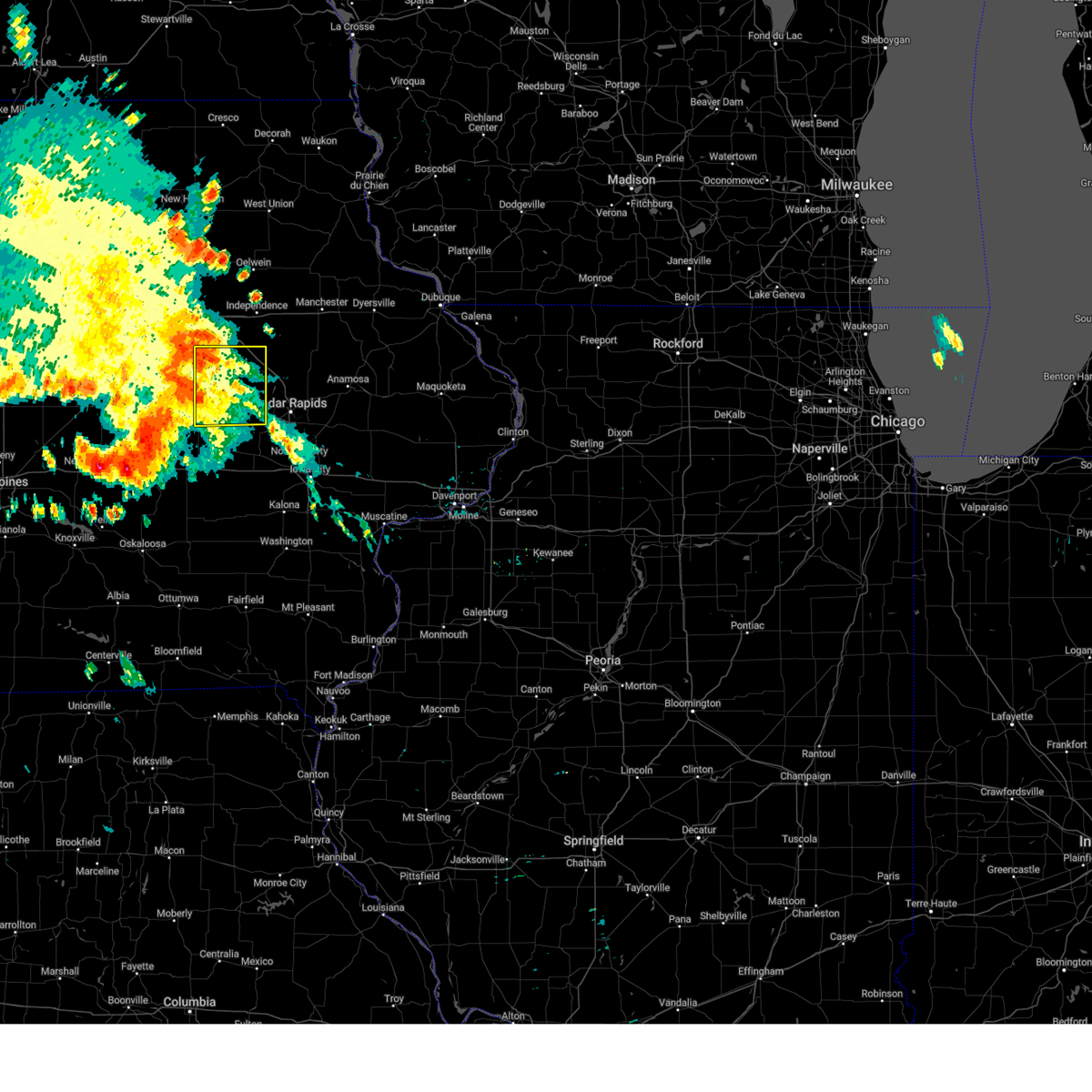 At 1029 pm cdt, severe thunderstorms were located along a line extending from la porte city to near keystone, moving east at 35 mph (radar indicated). Hazards include 60 mph wind gusts. Expect damage to roofs, siding, and trees. locations impacted include, vinton, atkins, urbana, dysart, shellsburg, newhall, van horne, keystone, garrison, mount auburn, vinton memorial airport, rodgers park, benton city park, hoefle-dulin park, spencers grove, minne estema park, benton county fairgrounds, wildcat bluff park, and cheney. This includes interstate 380 between mile markers 40 and 48. At 1029 pm cdt, severe thunderstorms were located along a line extending from la porte city to near keystone, moving east at 35 mph (radar indicated). Hazards include 60 mph wind gusts. Expect damage to roofs, siding, and trees. locations impacted include, vinton, atkins, urbana, dysart, shellsburg, newhall, van horne, keystone, garrison, mount auburn, vinton memorial airport, rodgers park, benton city park, hoefle-dulin park, spencers grove, minne estema park, benton county fairgrounds, wildcat bluff park, and cheney. This includes interstate 380 between mile markers 40 and 48.
|
| 7/28/2024 10:18 PM CDT |
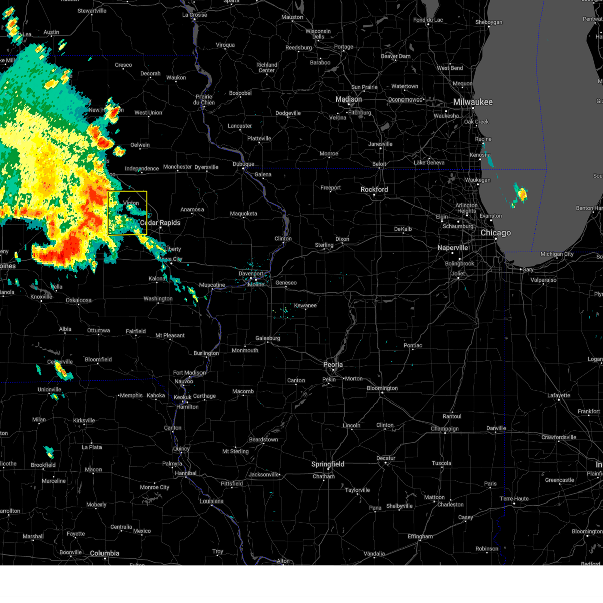 Svrdvn the national weather service in the quad cities has issued a * severe thunderstorm warning for, benton county in east central iowa, * until 1100 pm cdt. * at 1018 pm cdt, severe thunderstorms were located along a line extending from 6 miles southwest of la porte city to near vining, moving east at 35 mph (radar indicated). Hazards include 60 mph wind gusts. expect damage to roofs, siding, and trees Svrdvn the national weather service in the quad cities has issued a * severe thunderstorm warning for, benton county in east central iowa, * until 1100 pm cdt. * at 1018 pm cdt, severe thunderstorms were located along a line extending from 6 miles southwest of la porte city to near vining, moving east at 35 mph (radar indicated). Hazards include 60 mph wind gusts. expect damage to roofs, siding, and trees
|
| 7/15/2024 5:59 PM CDT |
 At 559 pm cdt, severe thunderstorms were located along a line extending from near luxemburg to near cedar rapids municipal airport, moving east at 25 mph (radar indicated). Hazards include 70 mph wind gusts and penny size hail. Expect considerable tree damage. damage is likely to mobile homes, roofs, and outbuildings. locations impacted include, cedar rapids, anamosa, vinton, manchester, mechanicsville, marion, hiawatha, mount vernon, dyersville, monticello, robins, belle plaine, center point, cascade, lisbon, fairfax, solon, epworth, ely, and atkins. This includes interstate 380 between mile markers 8 and 45. At 559 pm cdt, severe thunderstorms were located along a line extending from near luxemburg to near cedar rapids municipal airport, moving east at 25 mph (radar indicated). Hazards include 70 mph wind gusts and penny size hail. Expect considerable tree damage. damage is likely to mobile homes, roofs, and outbuildings. locations impacted include, cedar rapids, anamosa, vinton, manchester, mechanicsville, marion, hiawatha, mount vernon, dyersville, monticello, robins, belle plaine, center point, cascade, lisbon, fairfax, solon, epworth, ely, and atkins. This includes interstate 380 between mile markers 8 and 45.
|
| 7/15/2024 5:40 PM CDT |
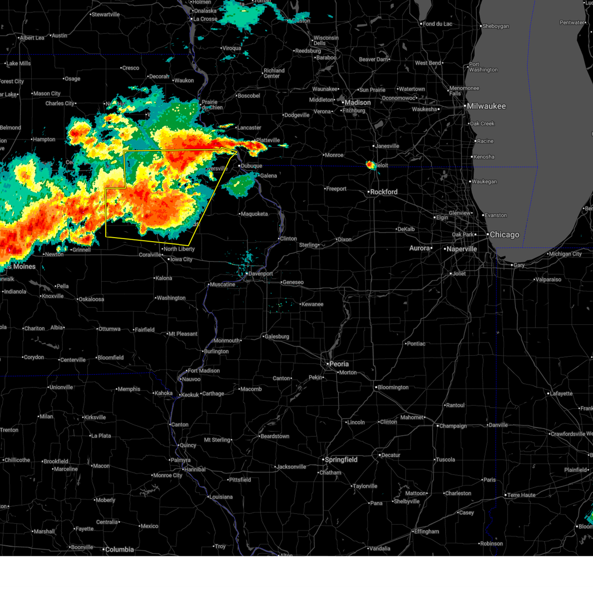 At 539 pm cdt, severe thunderstorms were located along a line extending from near twin bridges park to near fairfax, moving east at 25 mph (radar indicated). Hazards include 70 mph wind gusts and penny size hail. Expect considerable tree damage. damage is likely to mobile homes, roofs, and outbuildings. locations impacted include, cedar rapids, independence, anamosa, vinton, manchester, mechanicsville, marion, hiawatha, mount vernon, dyersville, monticello, robins, belle plaine, jesup, center point, cascade, lisbon, fairfax, solon, and epworth. This includes interstate 380 between mile markers 8 and 55. At 539 pm cdt, severe thunderstorms were located along a line extending from near twin bridges park to near fairfax, moving east at 25 mph (radar indicated). Hazards include 70 mph wind gusts and penny size hail. Expect considerable tree damage. damage is likely to mobile homes, roofs, and outbuildings. locations impacted include, cedar rapids, independence, anamosa, vinton, manchester, mechanicsville, marion, hiawatha, mount vernon, dyersville, monticello, robins, belle plaine, jesup, center point, cascade, lisbon, fairfax, solon, and epworth. This includes interstate 380 between mile markers 8 and 55.
|
| 7/15/2024 5:20 PM CDT | Svrdvn the national weather service in the quad cities has issued a * severe thunderstorm warning for, buchanan county in northeastern iowa, northwestern cedar county in east central iowa, western dubuque county in northeastern iowa, northern johnson county in east central iowa, benton county in east central iowa, jones county in east central iowa, delaware county in northeastern iowa, linn county in east central iowa, northeastern iowa county in east central iowa, * until 630 pm cdt. * at 520 pm cdt, severe thunderstorms were located along a line extending from edgewood to near norway, moving east at 25 mph (radar indicated). Hazards include 70 mph wind gusts and quarter size hail. Hail damage to vehicles is expected. expect considerable tree damage. Wind damage is also likely to mobile homes, roofs, and outbuildings. |
| 7/15/2024 5:08 PM CDT |
 At 508 pm cdt, severe thunderstorms were located along a line extending from wapsipinicon golf course to hoefle-dulin park, moving east at 20 mph (radar indicated). Hazards include 70 mph wind gusts and quarter size hail. Hail damage to vehicles is expected. expect considerable tree damage. wind damage is also likely to mobile homes, roofs, and outbuildings. locations impacted include, independence, vinton, robins, jesup, center point, urbana, dysart, fairbank, palo, shellsburg, winthrop, hazleton, walker, alburnett, quasqueton, lamont, garrison, brandon, rowley, and aurora. This includes interstate 380 between mile markers 28 and 55. At 508 pm cdt, severe thunderstorms were located along a line extending from wapsipinicon golf course to hoefle-dulin park, moving east at 20 mph (radar indicated). Hazards include 70 mph wind gusts and quarter size hail. Hail damage to vehicles is expected. expect considerable tree damage. wind damage is also likely to mobile homes, roofs, and outbuildings. locations impacted include, independence, vinton, robins, jesup, center point, urbana, dysart, fairbank, palo, shellsburg, winthrop, hazleton, walker, alburnett, quasqueton, lamont, garrison, brandon, rowley, and aurora. This includes interstate 380 between mile markers 28 and 55.
|
| 7/15/2024 4:48 PM CDT |
 At 446 pm cdt, severe thunderstorms were located along a line extending from jesup to near garrison, moving east at 20 mph (radar indicated). Hazards include 70 mph wind gusts and quarter size hail. Hail damage to vehicles is expected. expect considerable tree damage. wind damage is also likely to mobile homes, roofs, and outbuildings. locations impacted include, independence, vinton, robins, jesup, center point, urbana, dysart, fairbank, palo, shellsburg, winthrop, hazleton, walker, alburnett, quasqueton, lamont, garrison, brandon, rowley, and aurora. This includes interstate 380 between mile markers 28 and 55. At 446 pm cdt, severe thunderstorms were located along a line extending from jesup to near garrison, moving east at 20 mph (radar indicated). Hazards include 70 mph wind gusts and quarter size hail. Hail damage to vehicles is expected. expect considerable tree damage. wind damage is also likely to mobile homes, roofs, and outbuildings. locations impacted include, independence, vinton, robins, jesup, center point, urbana, dysart, fairbank, palo, shellsburg, winthrop, hazleton, walker, alburnett, quasqueton, lamont, garrison, brandon, rowley, and aurora. This includes interstate 380 between mile markers 28 and 55.
|
| 7/15/2024 4:36 PM CDT |
 Svrdvn the national weather service in the quad cities has issued a * severe thunderstorm warning for, buchanan county in northeastern iowa, northern benton county in east central iowa, western delaware county in northeastern iowa, northwestern linn county in east central iowa, * until 530 pm cdt. * at 435 pm cdt, severe thunderstorms were located along a line extending from near jesup to garrison, moving east at 20 mph (radar indicated). Hazards include 70 mph wind gusts and quarter size hail. Hail damage to vehicles is expected. expect considerable tree damage. Wind damage is also likely to mobile homes, roofs, and outbuildings. Svrdvn the national weather service in the quad cities has issued a * severe thunderstorm warning for, buchanan county in northeastern iowa, northern benton county in east central iowa, western delaware county in northeastern iowa, northwestern linn county in east central iowa, * until 530 pm cdt. * at 435 pm cdt, severe thunderstorms were located along a line extending from near jesup to garrison, moving east at 20 mph (radar indicated). Hazards include 70 mph wind gusts and quarter size hail. Hail damage to vehicles is expected. expect considerable tree damage. Wind damage is also likely to mobile homes, roofs, and outbuildings.
|
| 7/15/2024 4:33 PM CDT |
 At 432 pm cdt, a severe thunderstorm was located over minne estema park, or 7 miles north of vinton, moving east at 30 mph (radar indicated). Hazards include golf ball size hail and 70 mph wind gusts. People and animals outdoors will be injured. expect hail damage to roofs, siding, windows, and vehicles. expect considerable tree damage. wind damage is also likely to mobile homes, roofs, and outbuildings. locations impacted include, vinton, urbana, dysart, garrison, brandon, rowley, mount auburn, lime creek county park, vinton memorial airport, rodgers park, benton city park, hoefle-dulin park, spencers grove, minne estema park, benton county fairgrounds, wildcat bluff park, and cheney. This includes interstate 380 between mile markers 40 and 55. At 432 pm cdt, a severe thunderstorm was located over minne estema park, or 7 miles north of vinton, moving east at 30 mph (radar indicated). Hazards include golf ball size hail and 70 mph wind gusts. People and animals outdoors will be injured. expect hail damage to roofs, siding, windows, and vehicles. expect considerable tree damage. wind damage is also likely to mobile homes, roofs, and outbuildings. locations impacted include, vinton, urbana, dysart, garrison, brandon, rowley, mount auburn, lime creek county park, vinton memorial airport, rodgers park, benton city park, hoefle-dulin park, spencers grove, minne estema park, benton county fairgrounds, wildcat bluff park, and cheney. This includes interstate 380 between mile markers 40 and 55.
|
| 7/15/2024 4:17 PM CDT |
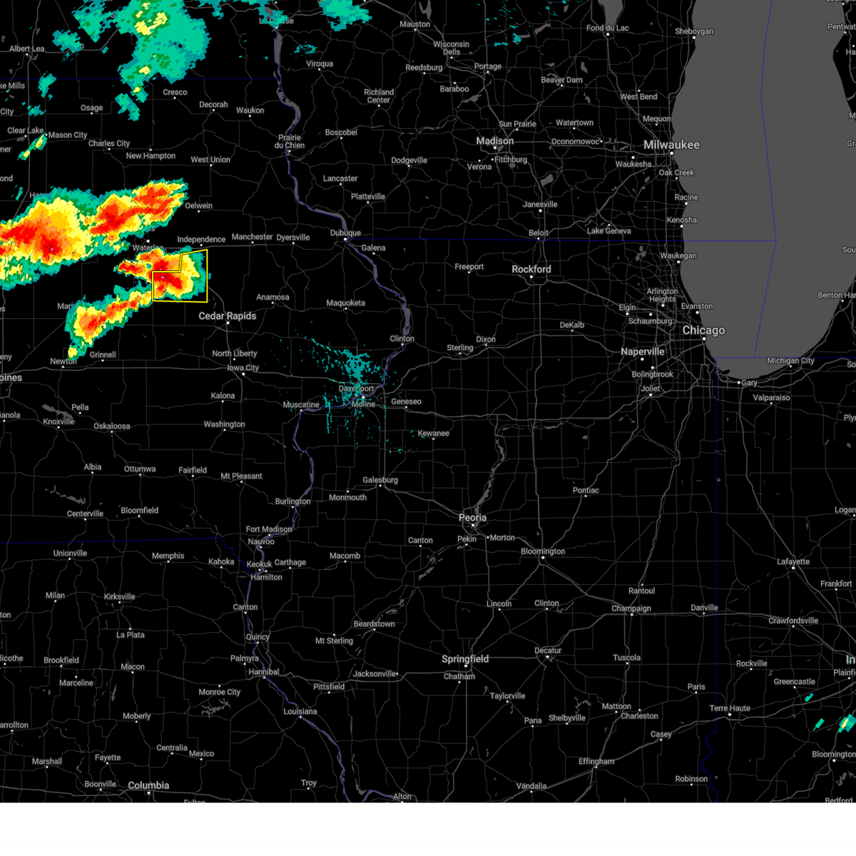 At 417 pm cdt, a severe thunderstorm was located over mount auburn, or 7 miles north of vinton, moving east at 30 mph (radar indicated). Hazards include golf ball size hail and 70 mph wind gusts. People and animals outdoors will be injured. expect hail damage to roofs, siding, windows, and vehicles. expect considerable tree damage. wind damage is also likely to mobile homes, roofs, and outbuildings. locations impacted include, vinton, urbana, dysart, garrison, brandon, rowley, mount auburn, lime creek county park, vinton memorial airport, rodgers park, benton city park, hoefle-dulin park, spencers grove, minne estema park, benton county fairgrounds, wildcat bluff park, and cheney. This includes interstate 380 between mile markers 40 and 55. At 417 pm cdt, a severe thunderstorm was located over mount auburn, or 7 miles north of vinton, moving east at 30 mph (radar indicated). Hazards include golf ball size hail and 70 mph wind gusts. People and animals outdoors will be injured. expect hail damage to roofs, siding, windows, and vehicles. expect considerable tree damage. wind damage is also likely to mobile homes, roofs, and outbuildings. locations impacted include, vinton, urbana, dysart, garrison, brandon, rowley, mount auburn, lime creek county park, vinton memorial airport, rodgers park, benton city park, hoefle-dulin park, spencers grove, minne estema park, benton county fairgrounds, wildcat bluff park, and cheney. This includes interstate 380 between mile markers 40 and 55.
|
| 7/15/2024 3:58 PM CDT |
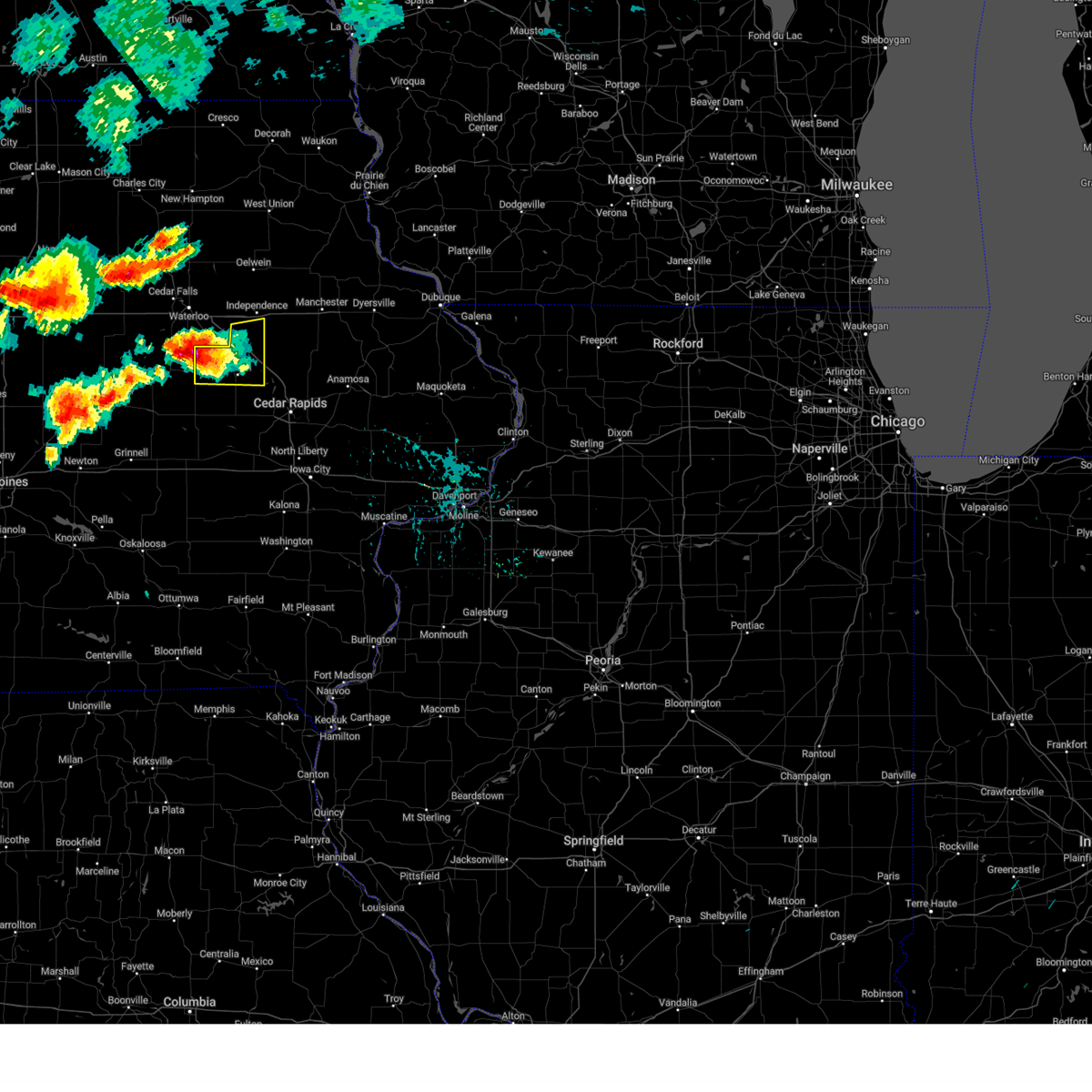 At 358 pm cdt, a severe thunderstorm was located near la porte city, or 11 miles northwest of vinton, moving east at 30 mph (radar indicated). Hazards include golf ball size hail and 60 mph wind gusts. People and animals outdoors will be injured. expect hail damage to roofs, siding, windows, and vehicles. expect wind damage to roofs, siding, and trees. locations impacted include, vinton, urbana, dysart, garrison, brandon, rowley, mount auburn, lime creek county park, vinton memorial airport, rodgers park, benton city park, hoefle-dulin park, spencers grove, minne estema park, benton county fairgrounds, wildcat bluff park, and cheney. This includes interstate 380 between mile markers 40 and 55. At 358 pm cdt, a severe thunderstorm was located near la porte city, or 11 miles northwest of vinton, moving east at 30 mph (radar indicated). Hazards include golf ball size hail and 60 mph wind gusts. People and animals outdoors will be injured. expect hail damage to roofs, siding, windows, and vehicles. expect wind damage to roofs, siding, and trees. locations impacted include, vinton, urbana, dysart, garrison, brandon, rowley, mount auburn, lime creek county park, vinton memorial airport, rodgers park, benton city park, hoefle-dulin park, spencers grove, minne estema park, benton county fairgrounds, wildcat bluff park, and cheney. This includes interstate 380 between mile markers 40 and 55.
|
| 7/15/2024 3:48 PM CDT |
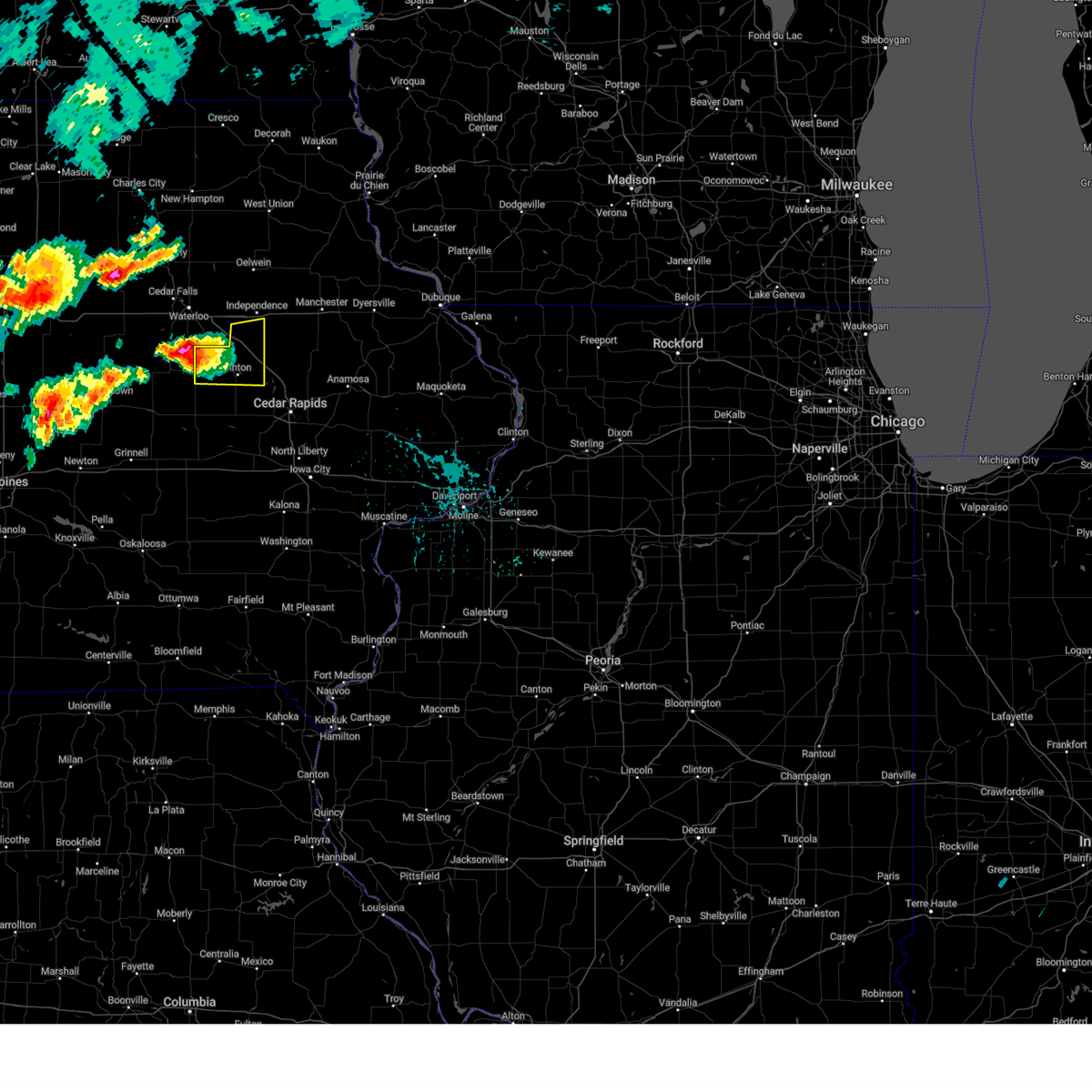 At 348 pm cdt, a severe thunderstorm was located near dysart, or 13 miles west of vinton, moving east at 30 mph (radar indicated). Hazards include 60 mph wind gusts and half dollar size hail. Hail damage to vehicles is expected. expect wind damage to roofs, siding, and trees. locations impacted include, vinton, urbana, dysart, garrison, brandon, rowley, mount auburn, lime creek county park, vinton memorial airport, rodgers park, benton city park, hoefle-dulin park, spencers grove, minne estema park, benton county fairgrounds, wildcat bluff park, and cheney. This includes interstate 380 between mile markers 40 and 55. At 348 pm cdt, a severe thunderstorm was located near dysart, or 13 miles west of vinton, moving east at 30 mph (radar indicated). Hazards include 60 mph wind gusts and half dollar size hail. Hail damage to vehicles is expected. expect wind damage to roofs, siding, and trees. locations impacted include, vinton, urbana, dysart, garrison, brandon, rowley, mount auburn, lime creek county park, vinton memorial airport, rodgers park, benton city park, hoefle-dulin park, spencers grove, minne estema park, benton county fairgrounds, wildcat bluff park, and cheney. This includes interstate 380 between mile markers 40 and 55.
|
| 7/15/2024 3:38 PM CDT |
 Svrdvn the national weather service in the quad cities has issued a * severe thunderstorm warning for, southwestern buchanan county in northeastern iowa, northern benton county in east central iowa, * until 445 pm cdt. * at 337 pm cdt, a severe thunderstorm was located over tf clark state park, or 17 miles south of waterloo, moving east at 30 mph (radar indicated). Hazards include 60 mph wind gusts and half dollar size hail. Hail damage to vehicles is expected. Expect wind damage to roofs, siding, and trees. Svrdvn the national weather service in the quad cities has issued a * severe thunderstorm warning for, southwestern buchanan county in northeastern iowa, northern benton county in east central iowa, * until 445 pm cdt. * at 337 pm cdt, a severe thunderstorm was located over tf clark state park, or 17 miles south of waterloo, moving east at 30 mph (radar indicated). Hazards include 60 mph wind gusts and half dollar size hail. Hail damage to vehicles is expected. Expect wind damage to roofs, siding, and trees.
|
| 6/18/2024 10:55 PM CDT |
 The storms which prompted the warning have weakened below severe limits, and no longer pose an immediate threat to life or property. therefore, the warning will be allowed to expire. however, gusty winds are still possible with these thunderstorms. The storms which prompted the warning have weakened below severe limits, and no longer pose an immediate threat to life or property. therefore, the warning will be allowed to expire. however, gusty winds are still possible with these thunderstorms.
|
| 6/18/2024 10:51 PM CDT |
 At 1051 pm cdt, severe thunderstorms were located along a line extending from county road w 33 and 187 to near rowley to near benton county fairgrounds, moving east at 45 mph (radar indicated). Hazards include 60 mph wind gusts. Expect damage to roofs, siding, and trees. locations impacted include, cedar rapids, independence, vinton, manchester, hiawatha, robins, center point, urbana, palo, shellsburg, newhall, edgewood, winthrop, hazleton, walker, van horne, alburnett, coggon, keystone, and quasqueton. This includes interstate 380 between mile markers 25 and 54. At 1051 pm cdt, severe thunderstorms were located along a line extending from county road w 33 and 187 to near rowley to near benton county fairgrounds, moving east at 45 mph (radar indicated). Hazards include 60 mph wind gusts. Expect damage to roofs, siding, and trees. locations impacted include, cedar rapids, independence, vinton, manchester, hiawatha, robins, center point, urbana, palo, shellsburg, newhall, edgewood, winthrop, hazleton, walker, van horne, alburnett, coggon, keystone, and quasqueton. This includes interstate 380 between mile markers 25 and 54.
|
| 6/18/2024 10:45 PM CDT |
 At 1045 pm cdt, severe thunderstorms were located along a line extending from maynard to near independence airport to near garrison, moving east at 45 mph (radar indicated). Hazards include 60 mph wind gusts. Expect damage to roofs, siding, and trees. locations impacted include, cedar rapids, independence, vinton, manchester, hiawatha, robins, jesup, center point, urbana, dysart, fairbank, palo, shellsburg, newhall, edgewood, winthrop, hazleton, walker, van horne, and alburnett. This includes interstate 380 between mile markers 25 and 55. At 1045 pm cdt, severe thunderstorms were located along a line extending from maynard to near independence airport to near garrison, moving east at 45 mph (radar indicated). Hazards include 60 mph wind gusts. Expect damage to roofs, siding, and trees. locations impacted include, cedar rapids, independence, vinton, manchester, hiawatha, robins, jesup, center point, urbana, dysart, fairbank, palo, shellsburg, newhall, edgewood, winthrop, hazleton, walker, van horne, and alburnett. This includes interstate 380 between mile markers 25 and 55.
|
| 6/18/2024 10:32 PM CDT |
 At 1031 pm cdt, severe thunderstorms were located along a line extending from near fairbank to near elberon, moving east at 60 mph (observed winds at marshalltown and waterloo airports). Hazards include 60 mph wind gusts. Expect damage to roofs, siding, and trees. locations impacted include, cedar rapids, independence, vinton, manchester, hiawatha, robins, belle plaine, jesup, center point, atkins, urbana, dysart, fairbank, palo, shellsburg, newhall, edgewood, winthrop, hazleton, and walker. This includes interstate 380 between mile markers 25 and 55. At 1031 pm cdt, severe thunderstorms were located along a line extending from near fairbank to near elberon, moving east at 60 mph (observed winds at marshalltown and waterloo airports). Hazards include 60 mph wind gusts. Expect damage to roofs, siding, and trees. locations impacted include, cedar rapids, independence, vinton, manchester, hiawatha, robins, belle plaine, jesup, center point, atkins, urbana, dysart, fairbank, palo, shellsburg, newhall, edgewood, winthrop, hazleton, and walker. This includes interstate 380 between mile markers 25 and 55.
|
| 6/18/2024 10:19 PM CDT |
 Svrdvn the national weather service in the quad cities has issued a * severe thunderstorm warning for, buchanan county in northeastern iowa, benton county in east central iowa, western delaware county in northeastern iowa, northwestern linn county in east central iowa, * until 1100 pm cdt. * at 1018 pm cdt, severe thunderstorms were located along a line extending from near denver to tama, moving east at 50 mph (observed winds at marshalltown and waterloo airports). Hazards include 60 mph wind gusts. expect damage to roofs, siding, and trees Svrdvn the national weather service in the quad cities has issued a * severe thunderstorm warning for, buchanan county in northeastern iowa, benton county in east central iowa, western delaware county in northeastern iowa, northwestern linn county in east central iowa, * until 1100 pm cdt. * at 1018 pm cdt, severe thunderstorms were located along a line extending from near denver to tama, moving east at 50 mph (observed winds at marshalltown and waterloo airports). Hazards include 60 mph wind gusts. expect damage to roofs, siding, and trees
|
| 5/24/2024 6:40 AM CDT |
 At 640 am cdt, severe thunderstorms were located along a line extending from near brandon to near shellsburg to homestead, moving east at 55 mph (radar indicated). Hazards include 60 mph wind gusts and nickel size hail. Expect damage to roofs, siding, and trees. locations impacted include, cedar rapids, independence, vinton, hiawatha, robins, belle plaine, jesup, center point, fairfax, atkins, walford, urbana, dysart, fairbank, palo, shellsburg, newhall, walker, blairstown, and van horne. This includes interstate 380 between mile markers 12 and 55. At 640 am cdt, severe thunderstorms were located along a line extending from near brandon to near shellsburg to homestead, moving east at 55 mph (radar indicated). Hazards include 60 mph wind gusts and nickel size hail. Expect damage to roofs, siding, and trees. locations impacted include, cedar rapids, independence, vinton, hiawatha, robins, belle plaine, jesup, center point, fairfax, atkins, walford, urbana, dysart, fairbank, palo, shellsburg, newhall, walker, blairstown, and van horne. This includes interstate 380 between mile markers 12 and 55.
|
| 5/24/2024 6:23 AM CDT |
 At 623 am cdt, severe thunderstorms were located along a line extending from near washburn to near van horne to near ladora, moving east at 55 mph (radar indicated). Hazards include 60 mph wind gusts and penny size hail. Expect damage to roofs, siding, and trees. locations impacted include, cedar rapids, independence, vinton, hiawatha, robins, belle plaine, jesup, center point, fairfax, atkins, walford, urbana, dysart, fairbank, palo, shellsburg, newhall, walker, blairstown, and van horne. This includes interstate 380 between mile markers 12 and 55. At 623 am cdt, severe thunderstorms were located along a line extending from near washburn to near van horne to near ladora, moving east at 55 mph (radar indicated). Hazards include 60 mph wind gusts and penny size hail. Expect damage to roofs, siding, and trees. locations impacted include, cedar rapids, independence, vinton, hiawatha, robins, belle plaine, jesup, center point, fairfax, atkins, walford, urbana, dysart, fairbank, palo, shellsburg, newhall, walker, blairstown, and van horne. This includes interstate 380 between mile markers 12 and 55.
|
| 5/24/2024 6:13 AM CDT |
 Svrdvn the national weather service in the quad cities has issued a * severe thunderstorm warning for, western buchanan county in northeastern iowa, benton county in east central iowa, western linn county in east central iowa, * until 700 am cdt. * at 613 am cdt, severe thunderstorms were located along a line extending from near reinbeck to near elberon to hartwick, moving east at 55 mph (radar indicated). Hazards include 60 mph wind gusts and penny size hail. expect damage to roofs, siding, and trees Svrdvn the national weather service in the quad cities has issued a * severe thunderstorm warning for, western buchanan county in northeastern iowa, benton county in east central iowa, western linn county in east central iowa, * until 700 am cdt. * at 613 am cdt, severe thunderstorms were located along a line extending from near reinbeck to near elberon to hartwick, moving east at 55 mph (radar indicated). Hazards include 60 mph wind gusts and penny size hail. expect damage to roofs, siding, and trees
|
| 5/21/2024 6:57 PM CDT |
 At 656 pm cdt, severe thunderstorms were located along a line extending from near county road w 45 and 187 to shellsburg, moving northeast at 45 mph. these are destructive storms for buchanan county (emergency management). Hazards include 80 mph wind gusts and quarter size hail. Flying debris will be dangerous to those caught without shelter. mobile homes will be heavily damaged. expect considerable damage to roofs, windows, and vehicles. extensive tree damage and power outages are likely. locations impacted include, independence, vinton, manchester, belle plaine, jesup, center point, urbana, dysart, fairbank, shellsburg, edgewood, winthrop, hazleton, walker, van horne, coggon, keystone, quasqueton, lamont, and garrison. This includes interstate 380 between mile markers 34 and 55. At 656 pm cdt, severe thunderstorms were located along a line extending from near county road w 45 and 187 to shellsburg, moving northeast at 45 mph. these are destructive storms for buchanan county (emergency management). Hazards include 80 mph wind gusts and quarter size hail. Flying debris will be dangerous to those caught without shelter. mobile homes will be heavily damaged. expect considerable damage to roofs, windows, and vehicles. extensive tree damage and power outages are likely. locations impacted include, independence, vinton, manchester, belle plaine, jesup, center point, urbana, dysart, fairbank, shellsburg, edgewood, winthrop, hazleton, walker, van horne, coggon, keystone, quasqueton, lamont, and garrison. This includes interstate 380 between mile markers 34 and 55.
|
| 5/21/2024 6:40 PM CDT |
 At 639 pm cdt, severe thunderstorms were located along a line extending from near county road w 45 and 187 to van horne, moving northeast at 65 mph. these are destructive storms for buchanan and benton counties! (emergency management). Hazards include 80 mph wind gusts and quarter size hail. Flying debris will be dangerous to those caught without shelter. mobile homes will be heavily damaged. expect considerable damage to roofs, windows, and vehicles. extensive tree damage and power outages are likely. locations impacted include, independence, vinton, manchester, belle plaine, jesup, center point, urbana, dysart, fairbank, shellsburg, edgewood, winthrop, hazleton, walker, van horne, coggon, keystone, quasqueton, lamont, and garrison. This includes interstate 380 between mile markers 34 and 55. At 639 pm cdt, severe thunderstorms were located along a line extending from near county road w 45 and 187 to van horne, moving northeast at 65 mph. these are destructive storms for buchanan and benton counties! (emergency management). Hazards include 80 mph wind gusts and quarter size hail. Flying debris will be dangerous to those caught without shelter. mobile homes will be heavily damaged. expect considerable damage to roofs, windows, and vehicles. extensive tree damage and power outages are likely. locations impacted include, independence, vinton, manchester, belle plaine, jesup, center point, urbana, dysart, fairbank, shellsburg, edgewood, winthrop, hazleton, walker, van horne, coggon, keystone, quasqueton, lamont, and garrison. This includes interstate 380 between mile markers 34 and 55.
|
| 5/21/2024 6:36 PM CDT | Storm damage reported in benton county IA, 2.4 miles E of Garrison, IA |
| 5/21/2024 6:32 PM CDT |
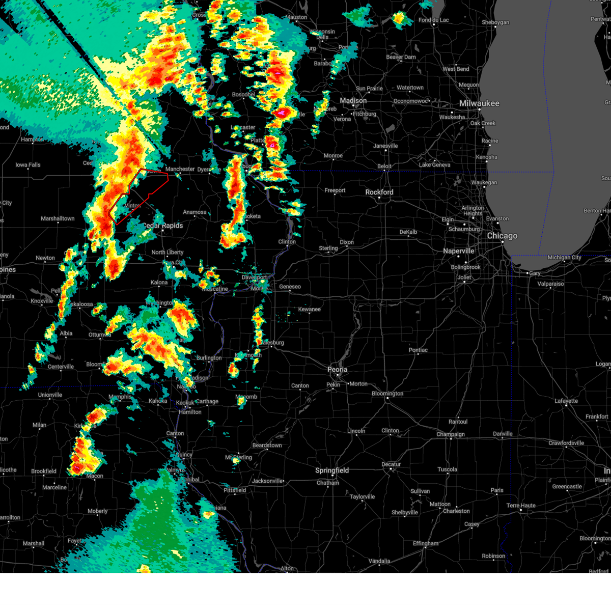 Tordvn the national weather service in the quad cities has issued a * tornado warning for, southern buchanan county in northeastern iowa, northern benton county in east central iowa, * until 700 pm cdt. * at 632 pm cdt, a severe thunderstorm capable of producing a tornado was located near garrison, or 9 miles west of vinton, moving northeast at 65 mph (radar indicated rotation). Hazards include tornado and quarter size hail. Flying debris will be dangerous to those caught without shelter. mobile homes will be damaged or destroyed. damage to roofs, windows, and vehicles will occur. tree damage is likely. this dangerous storm will be near, vinton, garrison, mount auburn, vinton memorial airport, rodgers park, minne estema park, and benton county fairgrounds around 635 pm cdt. urbana, brandon, lime creek county park, and cheney around 640 pm cdt. rowley and spencers grove around 645 pm cdt. independence, quasqueton, wapsipinicon golf course, independence airport, and buchanan county fairgrounds around 650 pm cdt. other locations in the path of this tornadic thunderstorm include winthrop. This includes interstate 380 between mile markers 43 and 55. Tordvn the national weather service in the quad cities has issued a * tornado warning for, southern buchanan county in northeastern iowa, northern benton county in east central iowa, * until 700 pm cdt. * at 632 pm cdt, a severe thunderstorm capable of producing a tornado was located near garrison, or 9 miles west of vinton, moving northeast at 65 mph (radar indicated rotation). Hazards include tornado and quarter size hail. Flying debris will be dangerous to those caught without shelter. mobile homes will be damaged or destroyed. damage to roofs, windows, and vehicles will occur. tree damage is likely. this dangerous storm will be near, vinton, garrison, mount auburn, vinton memorial airport, rodgers park, minne estema park, and benton county fairgrounds around 635 pm cdt. urbana, brandon, lime creek county park, and cheney around 640 pm cdt. rowley and spencers grove around 645 pm cdt. independence, quasqueton, wapsipinicon golf course, independence airport, and buchanan county fairgrounds around 650 pm cdt. other locations in the path of this tornadic thunderstorm include winthrop. This includes interstate 380 between mile markers 43 and 55.
|
| 5/21/2024 6:24 PM CDT |
 Svrdvn the national weather service in the quad cities has issued a * severe thunderstorm warning for, buchanan county in northeastern iowa, benton county in east central iowa, western delaware county in northeastern iowa, northwestern linn county in east central iowa, * until 715 pm cdt. * at 624 pm cdt, severe thunderstorms were located along a line extending from near fairbank to near belle plaine, moving northeast at 60 mph (radar indicated). Hazards include 70 mph wind gusts and quarter size hail. Hail damage to vehicles is expected. expect considerable tree damage. Wind damage is also likely to mobile homes, roofs, and outbuildings. Svrdvn the national weather service in the quad cities has issued a * severe thunderstorm warning for, buchanan county in northeastern iowa, benton county in east central iowa, western delaware county in northeastern iowa, northwestern linn county in east central iowa, * until 715 pm cdt. * at 624 pm cdt, severe thunderstorms were located along a line extending from near fairbank to near belle plaine, moving northeast at 60 mph (radar indicated). Hazards include 70 mph wind gusts and quarter size hail. Hail damage to vehicles is expected. expect considerable tree damage. Wind damage is also likely to mobile homes, roofs, and outbuildings.
|
| 5/21/2024 6:10 PM CDT |
 At 610 pm cdt, severe thunderstorms were located along a line extending from near dunkerton to near elberon, moving northeast at 65 mph (radar indicated). Hazards include 70 mph wind gusts and quarter size hail. Hail damage to vehicles is expected. expect considerable tree damage. wind damage is also likely to mobile homes, roofs, and outbuildings. locations impacted include, independence, vinton, jesup, urbana, dysart, fairbank, winthrop, hazleton, keystone, quasqueton, lamont, garrison, brandon, rowley, aurora, mount auburn, stanley, wapsipinicon golf course, vinton memorial airport, and fontana county park. This includes interstate 380 between mile markers 41 and 55. At 610 pm cdt, severe thunderstorms were located along a line extending from near dunkerton to near elberon, moving northeast at 65 mph (radar indicated). Hazards include 70 mph wind gusts and quarter size hail. Hail damage to vehicles is expected. expect considerable tree damage. wind damage is also likely to mobile homes, roofs, and outbuildings. locations impacted include, independence, vinton, jesup, urbana, dysart, fairbank, winthrop, hazleton, keystone, quasqueton, lamont, garrison, brandon, rowley, aurora, mount auburn, stanley, wapsipinicon golf course, vinton memorial airport, and fontana county park. This includes interstate 380 between mile markers 41 and 55.
|
| 5/21/2024 5:52 PM CDT |
 At 552 pm cdt, severe thunderstorms were located along a line extending from near uni-dome and mcleod center to near elberon, moving northeast at 60 mph (radar indicated). Hazards include 70 mph wind gusts and quarter size hail. Hail damage to vehicles is expected. expect considerable tree damage. wind damage is also likely to mobile homes, roofs, and outbuildings. locations impacted include, independence, vinton, jesup, urbana, dysart, fairbank, winthrop, hazleton, keystone, quasqueton, lamont, garrison, brandon, rowley, aurora, mount auburn, stanley, wapsipinicon golf course, vinton memorial airport, and fontana county park. This includes interstate 380 between mile markers 41 and 55. At 552 pm cdt, severe thunderstorms were located along a line extending from near uni-dome and mcleod center to near elberon, moving northeast at 60 mph (radar indicated). Hazards include 70 mph wind gusts and quarter size hail. Hail damage to vehicles is expected. expect considerable tree damage. wind damage is also likely to mobile homes, roofs, and outbuildings. locations impacted include, independence, vinton, jesup, urbana, dysart, fairbank, winthrop, hazleton, keystone, quasqueton, lamont, garrison, brandon, rowley, aurora, mount auburn, stanley, wapsipinicon golf course, vinton memorial airport, and fontana county park. This includes interstate 380 between mile markers 41 and 55.
|
| 5/21/2024 5:43 PM CDT |
 Svrdvn the national weather service in the quad cities has issued a * severe thunderstorm warning for, buchanan county in northeastern iowa, northern benton county in east central iowa, * until 630 pm cdt. * at 542 pm cdt, severe thunderstorms were located along a line extending from near morrison to near chelsea, moving northeast at 60 mph (radar indicated). Hazards include 70 mph wind gusts and quarter size hail. Hail damage to vehicles is expected. expect considerable tree damage. Wind damage is also likely to mobile homes, roofs, and outbuildings. Svrdvn the national weather service in the quad cities has issued a * severe thunderstorm warning for, buchanan county in northeastern iowa, northern benton county in east central iowa, * until 630 pm cdt. * at 542 pm cdt, severe thunderstorms were located along a line extending from near morrison to near chelsea, moving northeast at 60 mph (radar indicated). Hazards include 70 mph wind gusts and quarter size hail. Hail damage to vehicles is expected. expect considerable tree damage. Wind damage is also likely to mobile homes, roofs, and outbuildings.
|
| 5/21/2024 7:19 AM CDT |
 the severe thunderstorm warning has been cancelled and is no longer in effect the severe thunderstorm warning has been cancelled and is no longer in effect
|
| 5/21/2024 7:09 AM CDT |
 At 709 am cdt, severe thunderstorms were located along a line extending from near garrison to near blairstown to near ladora, moving east at 30 mph (radar indicated). Hazards include 60 mph wind gusts and penny size hail. Expect damage to roofs, siding, and trees. these severe storms will be near, vinton, marengo, newhall, blairstown, norway, ladora, genoa bluff, watkins, hoefle-dulin park, and hannen lake park around 715 am cdt. atkins and west amana around 720 am cdt. walford, shellsburg, conroy, upper south amana, high amana, south amana, and benton city park around 725 am cdt. fairfax, palo, and middle amana around 730 am cdt. other locations impacted by these severe thunderstorms include middle amana, south amana, vinton memorial airport, west amana, rodgers park, upper south amana, benton city park, pleasant creek state recreation area, hoefle-dulin park, and genoa bluff. This includes interstate 380 between mile markers 33 and 48. At 709 am cdt, severe thunderstorms were located along a line extending from near garrison to near blairstown to near ladora, moving east at 30 mph (radar indicated). Hazards include 60 mph wind gusts and penny size hail. Expect damage to roofs, siding, and trees. these severe storms will be near, vinton, marengo, newhall, blairstown, norway, ladora, genoa bluff, watkins, hoefle-dulin park, and hannen lake park around 715 am cdt. atkins and west amana around 720 am cdt. walford, shellsburg, conroy, upper south amana, high amana, south amana, and benton city park around 725 am cdt. fairfax, palo, and middle amana around 730 am cdt. other locations impacted by these severe thunderstorms include middle amana, south amana, vinton memorial airport, west amana, rodgers park, upper south amana, benton city park, pleasant creek state recreation area, hoefle-dulin park, and genoa bluff. This includes interstate 380 between mile markers 33 and 48.
|
| 5/21/2024 6:51 AM CDT |
 Svrdvn the national weather service in the quad cities has issued a * severe thunderstorm warning for, benton county in east central iowa, northwestern linn county in east central iowa, northern iowa county in east central iowa, * until 730 am cdt. * at 650 am cdt, severe thunderstorms were located along a line extending from near keystone to luzerne to near guernsey, moving northeast at 30 mph (radar indicated). Hazards include 60 mph wind gusts and quarter size hail. Hail damage to vehicles is expected. expect wind damage to roofs, siding, and trees. severe thunderstorms will be near, victor, blairstown, van horne, keystone, ladora, luzerne, victor, koszta, and hannen lake park around 655 am cdt. garrison around 700 am cdt. vinton, marengo, newhall, and genoa bluff around 705 am cdt. watkins, benton county fairgrounds, and iowa county fairgrounds around 710 am cdt. norway, vinton memorial airport, and hoefle-dulin park around 715 am cdt. other locations impacted by these severe thunderstorms include middle amana, south amana, vinton memorial airport, west amana, rodgers park, upper south amana, benton city park, pleasant creek state recreation area, hoefle-dulin park, and genoa bluff. This includes interstate 380 between mile markers 33 and 48. Svrdvn the national weather service in the quad cities has issued a * severe thunderstorm warning for, benton county in east central iowa, northwestern linn county in east central iowa, northern iowa county in east central iowa, * until 730 am cdt. * at 650 am cdt, severe thunderstorms were located along a line extending from near keystone to luzerne to near guernsey, moving northeast at 30 mph (radar indicated). Hazards include 60 mph wind gusts and quarter size hail. Hail damage to vehicles is expected. expect wind damage to roofs, siding, and trees. severe thunderstorms will be near, victor, blairstown, van horne, keystone, ladora, luzerne, victor, koszta, and hannen lake park around 655 am cdt. garrison around 700 am cdt. vinton, marengo, newhall, and genoa bluff around 705 am cdt. watkins, benton county fairgrounds, and iowa county fairgrounds around 710 am cdt. norway, vinton memorial airport, and hoefle-dulin park around 715 am cdt. other locations impacted by these severe thunderstorms include middle amana, south amana, vinton memorial airport, west amana, rodgers park, upper south amana, benton city park, pleasant creek state recreation area, hoefle-dulin park, and genoa bluff. This includes interstate 380 between mile markers 33 and 48.
|
| 5/21/2024 6:21 AM CDT |
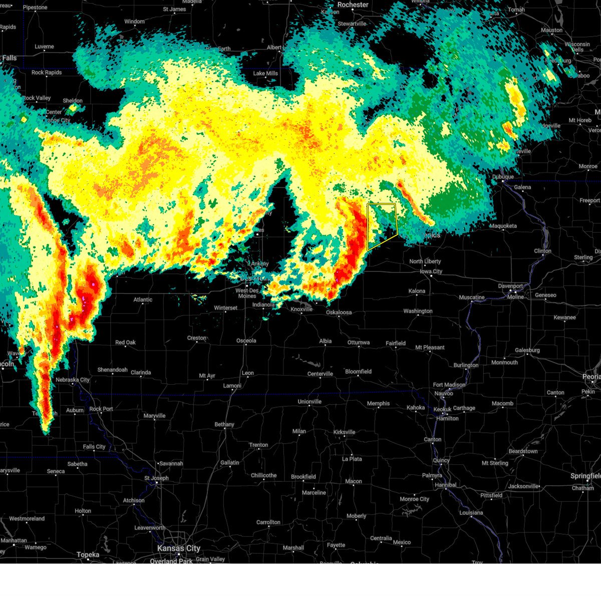 Svrdvn the national weather service in the quad cities has issued a * severe thunderstorm warning for, western benton county in east central iowa, * until 700 am cdt. * at 620 am cdt, severe thunderstorms were located along a line extending from near tf clark state park to chelsea, moving northeast at 25 mph (radar indicated). Hazards include 60 mph wind gusts and penny size hail. Expect damage to roofs, siding, and trees. severe thunderstorms will be near, dysart around 625 am cdt. keystone around 635 am cdt. garrison around 645 am cdt. Other locations impacted by these severe thunderstorms include rodgers park, vinton memorial airport, hoefle-dulin park, minne estema park, and benton county fairgrounds. Svrdvn the national weather service in the quad cities has issued a * severe thunderstorm warning for, western benton county in east central iowa, * until 700 am cdt. * at 620 am cdt, severe thunderstorms were located along a line extending from near tf clark state park to chelsea, moving northeast at 25 mph (radar indicated). Hazards include 60 mph wind gusts and penny size hail. Expect damage to roofs, siding, and trees. severe thunderstorms will be near, dysart around 625 am cdt. keystone around 635 am cdt. garrison around 645 am cdt. Other locations impacted by these severe thunderstorms include rodgers park, vinton memorial airport, hoefle-dulin park, minne estema park, and benton county fairgrounds.
|
| 5/8/2024 10:12 PM CDT |
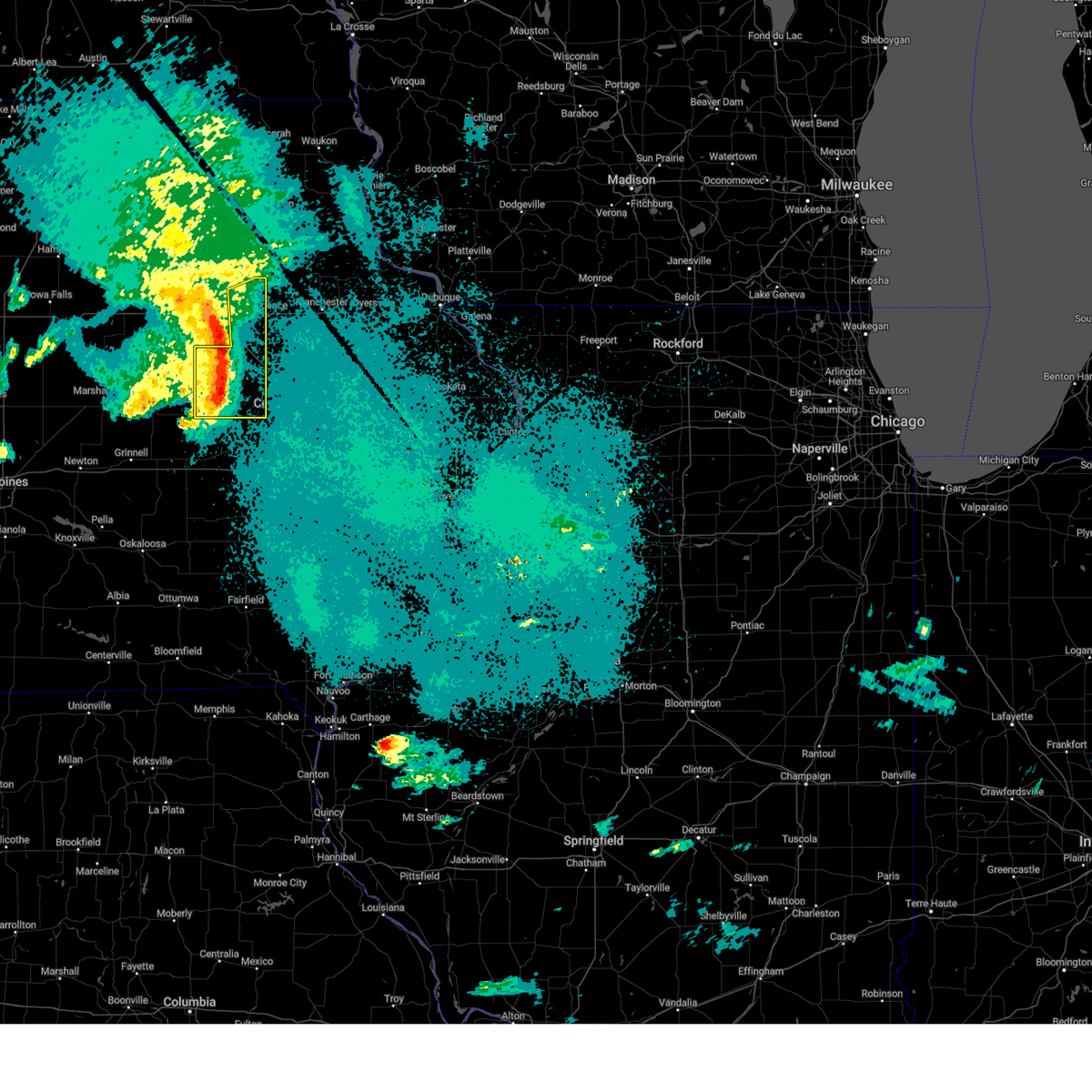 At 1012 pm cdt, severe thunderstorms were located along a line extending from near jesup to near mount auburn to near van horne, moving east at 30 mph (radar indicated). Hazards include 60 mph wind gusts and penny size hail. Expect damage to roofs, siding, and trees. locations impacted include, independence, vinton, jesup, atkins, urbana, dysart, shellsburg, newhall, hazleton, van horne, keystone, garrison, brandon, rowley, mount auburn, wapsipinicon golf course, vinton memorial airport, fontana county park, otterville, and minne estema park. This includes interstate 380 between mile markers 40 and 55. At 1012 pm cdt, severe thunderstorms were located along a line extending from near jesup to near mount auburn to near van horne, moving east at 30 mph (radar indicated). Hazards include 60 mph wind gusts and penny size hail. Expect damage to roofs, siding, and trees. locations impacted include, independence, vinton, jesup, atkins, urbana, dysart, shellsburg, newhall, hazleton, van horne, keystone, garrison, brandon, rowley, mount auburn, wapsipinicon golf course, vinton memorial airport, fontana county park, otterville, and minne estema park. This includes interstate 380 between mile markers 40 and 55.
|
| 5/8/2024 9:57 PM CDT |
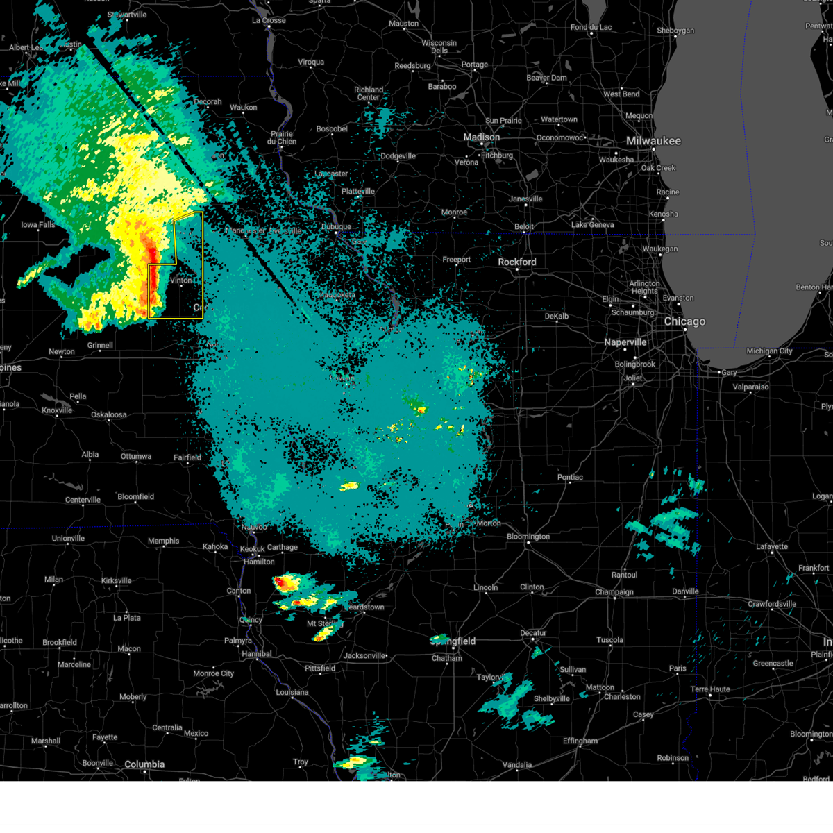 At 957 pm cdt, severe thunderstorms were located along a line extending from elk run heights to near la porte city to near keystone, moving east at 30 mph (radar indicated). Hazards include 60 mph wind gusts and penny size hail. Expect damage to roofs, siding, and trees. locations impacted include, independence, vinton, jesup, atkins, urbana, dysart, shellsburg, newhall, hazleton, van horne, keystone, garrison, brandon, rowley, mount auburn, wapsipinicon golf course, vinton memorial airport, fontana county park, otterville, and minne estema park. This includes interstate 380 between mile markers 40 and 55. At 957 pm cdt, severe thunderstorms were located along a line extending from elk run heights to near la porte city to near keystone, moving east at 30 mph (radar indicated). Hazards include 60 mph wind gusts and penny size hail. Expect damage to roofs, siding, and trees. locations impacted include, independence, vinton, jesup, atkins, urbana, dysart, shellsburg, newhall, hazleton, van horne, keystone, garrison, brandon, rowley, mount auburn, wapsipinicon golf course, vinton memorial airport, fontana county park, otterville, and minne estema park. This includes interstate 380 between mile markers 40 and 55.
|
| 5/8/2024 9:44 PM CDT |
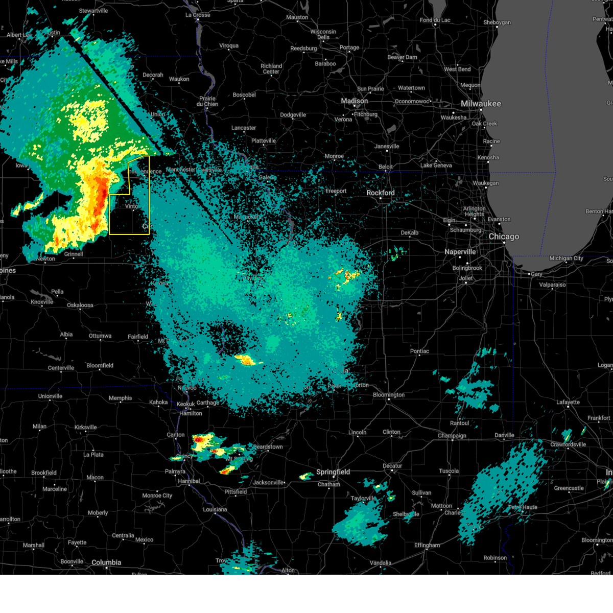 Svrdvn the national weather service in the quad cities has issued a * severe thunderstorm warning for, western buchanan county in northeastern iowa, benton county in east central iowa, * until 1045 pm cdt. * at 943 pm cdt, severe thunderstorms were located along a line extending from washburn to near vining, moving east at 30 mph (radar indicated). Hazards include 60 mph wind gusts and quarter size hail. Hail damage to vehicles is expected. Expect wind damage to roofs, siding, and trees. Svrdvn the national weather service in the quad cities has issued a * severe thunderstorm warning for, western buchanan county in northeastern iowa, benton county in east central iowa, * until 1045 pm cdt. * at 943 pm cdt, severe thunderstorms were located along a line extending from washburn to near vining, moving east at 30 mph (radar indicated). Hazards include 60 mph wind gusts and quarter size hail. Hail damage to vehicles is expected. Expect wind damage to roofs, siding, and trees.
|
| 5/7/2024 3:39 AM CDT |
 The storms which prompted the warning have weakened below severe limits, and no longer pose an immediate threat to life or property. therefore, the warning will be allowed to expire. however, gusty winds are still possible with these thunderstorms. The storms which prompted the warning have weakened below severe limits, and no longer pose an immediate threat to life or property. therefore, the warning will be allowed to expire. however, gusty winds are still possible with these thunderstorms.
|
| 5/7/2024 3:25 AM CDT |
 At 325 am cdt, severe thunderstorms were located along a line extending from 6 miles southwest of washburn to garrison to near williamsburg, moving northeast at 50 mph (radar indicated). Hazards include 60 mph wind gusts and penny size hail. Expect damage to roofs, siding, and trees. locations impacted include, vinton, marengo, williamsburg, belle plaine, atkins, walford, urbana, north english, shellsburg, victor, newhall, blairstown, van horne, keystone, norway, garrison, ladora, parnell, millersburg, and mount auburn. this includes the following highways, interstate 80 in iowa between mile markers 206 and 228. Interstate 380 between mile markers 40 and 48. At 325 am cdt, severe thunderstorms were located along a line extending from 6 miles southwest of washburn to garrison to near williamsburg, moving northeast at 50 mph (radar indicated). Hazards include 60 mph wind gusts and penny size hail. Expect damage to roofs, siding, and trees. locations impacted include, vinton, marengo, williamsburg, belle plaine, atkins, walford, urbana, north english, shellsburg, victor, newhall, blairstown, van horne, keystone, norway, garrison, ladora, parnell, millersburg, and mount auburn. this includes the following highways, interstate 80 in iowa between mile markers 206 and 228. Interstate 380 between mile markers 40 and 48.
|
| 5/7/2024 3:16 AM CDT |
 At 316 am cdt, severe thunderstorms were located along a line extending from near washburn to near keystone to williamsburg, moving north at 45 mph (radar indicated). Hazards include 60 mph wind gusts and penny size hail. Expect damage to roofs, siding, and trees. locations impacted include, vinton, marengo, williamsburg, belle plaine, atkins, walford, urbana, north english, shellsburg, victor, newhall, blairstown, van horne, keystone, norway, garrison, ladora, parnell, millersburg, and mount auburn. this includes the following highways, interstate 80 in iowa between mile markers 206 and 228. Interstate 380 between mile markers 40 and 48. At 316 am cdt, severe thunderstorms were located along a line extending from near washburn to near keystone to williamsburg, moving north at 45 mph (radar indicated). Hazards include 60 mph wind gusts and penny size hail. Expect damage to roofs, siding, and trees. locations impacted include, vinton, marengo, williamsburg, belle plaine, atkins, walford, urbana, north english, shellsburg, victor, newhall, blairstown, van horne, keystone, norway, garrison, ladora, parnell, millersburg, and mount auburn. this includes the following highways, interstate 80 in iowa between mile markers 206 and 228. Interstate 380 between mile markers 40 and 48.
|
| 5/7/2024 3:02 AM CDT |
 At 301 am cdt, severe thunderstorms were located along a line extending from near reinbeck to vining to lake iowa park, moving north at 50 mph (radar indicated). Hazards include 60 mph wind gusts and penny size hail. Expect damage to roofs, siding, and trees. locations impacted include, vinton, marengo, williamsburg, belle plaine, atkins, walford, urbana, north english, shellsburg, victor, newhall, blairstown, van horne, keystone, norway, garrison, ladora, parnell, millersburg, and mount auburn. this includes the following highways, interstate 80 in iowa between mile markers 206 and 228. Interstate 380 between mile markers 40 and 48. At 301 am cdt, severe thunderstorms were located along a line extending from near reinbeck to vining to lake iowa park, moving north at 50 mph (radar indicated). Hazards include 60 mph wind gusts and penny size hail. Expect damage to roofs, siding, and trees. locations impacted include, vinton, marengo, williamsburg, belle plaine, atkins, walford, urbana, north english, shellsburg, victor, newhall, blairstown, van horne, keystone, norway, garrison, ladora, parnell, millersburg, and mount auburn. this includes the following highways, interstate 80 in iowa between mile markers 206 and 228. Interstate 380 between mile markers 40 and 48.
|
| 5/7/2024 2:56 AM CDT |
 Svrdvn the national weather service in the quad cities has issued a * severe thunderstorm warning for, benton county in east central iowa, iowa county in east central iowa, * until 345 am cdt. * at 256 am cdt, severe thunderstorms were located along a line extending from near traer to chelsea to near lake iowa park, moving north at 50 mph (radar indicated). Hazards include 60 mph wind gusts and penny size hail. expect damage to roofs, siding, and trees Svrdvn the national weather service in the quad cities has issued a * severe thunderstorm warning for, benton county in east central iowa, iowa county in east central iowa, * until 345 am cdt. * at 256 am cdt, severe thunderstorms were located along a line extending from near traer to chelsea to near lake iowa park, moving north at 50 mph (radar indicated). Hazards include 60 mph wind gusts and penny size hail. expect damage to roofs, siding, and trees
|
| 4/16/2024 2:34 PM CDT |
 Svrdvn the national weather service in the quad cities has issued a * severe thunderstorm warning for, buchanan county in northeastern iowa, northwestern johnson county in east central iowa, eastern benton county in east central iowa, southwestern delaware county in northeastern iowa, linn county in east central iowa, eastern iowa county in east central iowa, * until 315 pm cdt. * at 234 pm cdt, severe thunderstorms were located along a line extending from rodgers park to near windham, moving northeast at 55 mph (radar indicated). Hazards include 60 mph wind gusts. expect damage to roofs, siding, and trees Svrdvn the national weather service in the quad cities has issued a * severe thunderstorm warning for, buchanan county in northeastern iowa, northwestern johnson county in east central iowa, eastern benton county in east central iowa, southwestern delaware county in northeastern iowa, linn county in east central iowa, eastern iowa county in east central iowa, * until 315 pm cdt. * at 234 pm cdt, severe thunderstorms were located along a line extending from rodgers park to near windham, moving northeast at 55 mph (radar indicated). Hazards include 60 mph wind gusts. expect damage to roofs, siding, and trees
|
| 7/28/2023 7:27 PM CDT |
 At 727 pm cdt, severe thunderstorms were located along a line extending from near washburn to near la porte city to near union grove state park, moving east at 40 mph (radar indicated). Hazards include 70 mph wind gusts and quarter size hail. Hail damage to vehicles is expected. expect considerable tree damage. Wind damage is also likely to mobile homes, roofs, and outbuildings. At 727 pm cdt, severe thunderstorms were located along a line extending from near washburn to near la porte city to near union grove state park, moving east at 40 mph (radar indicated). Hazards include 70 mph wind gusts and quarter size hail. Hail damage to vehicles is expected. expect considerable tree damage. Wind damage is also likely to mobile homes, roofs, and outbuildings.
|
| 7/13/2023 6:14 PM CDT |
 At 614 pm cdt, a severe thunderstorm was located near garrison, or 8 miles southwest of vinton, moving southeast at 35 mph (radar indicated). Hazards include 60 mph wind gusts and quarter size hail. Hail damage to vehicles is expected. Expect wind damage to roofs, siding, and trees. At 614 pm cdt, a severe thunderstorm was located near garrison, or 8 miles southwest of vinton, moving southeast at 35 mph (radar indicated). Hazards include 60 mph wind gusts and quarter size hail. Hail damage to vehicles is expected. Expect wind damage to roofs, siding, and trees.
|
| 5/7/2023 4:05 PM CDT |
 At 405 pm cdt, a severe thunderstorm was located over belle plaine, or 14 miles northwest of marengo, moving east at 35 mph (trained weather spotters). Hazards include golf ball size hail and 60 mph wind gusts. People and animals outdoors will be injured. expect hail damage to roofs, siding, windows, and vehicles. expect wind damage to roofs, siding, and trees. locations impacted include, vinton, belle plaine, dysart, blairstown, van horne, keystone, garrison, luzerne, benton county fairgrounds and hannen lake park. thunderstorm damage threat, considerable hail threat, observed max hail size, 1. 75 in wind threat, radar indicated max wind gust, 60 mph. At 405 pm cdt, a severe thunderstorm was located over belle plaine, or 14 miles northwest of marengo, moving east at 35 mph (trained weather spotters). Hazards include golf ball size hail and 60 mph wind gusts. People and animals outdoors will be injured. expect hail damage to roofs, siding, windows, and vehicles. expect wind damage to roofs, siding, and trees. locations impacted include, vinton, belle plaine, dysart, blairstown, van horne, keystone, garrison, luzerne, benton county fairgrounds and hannen lake park. thunderstorm damage threat, considerable hail threat, observed max hail size, 1. 75 in wind threat, radar indicated max wind gust, 60 mph.
|
| 5/7/2023 3:58 PM CDT |
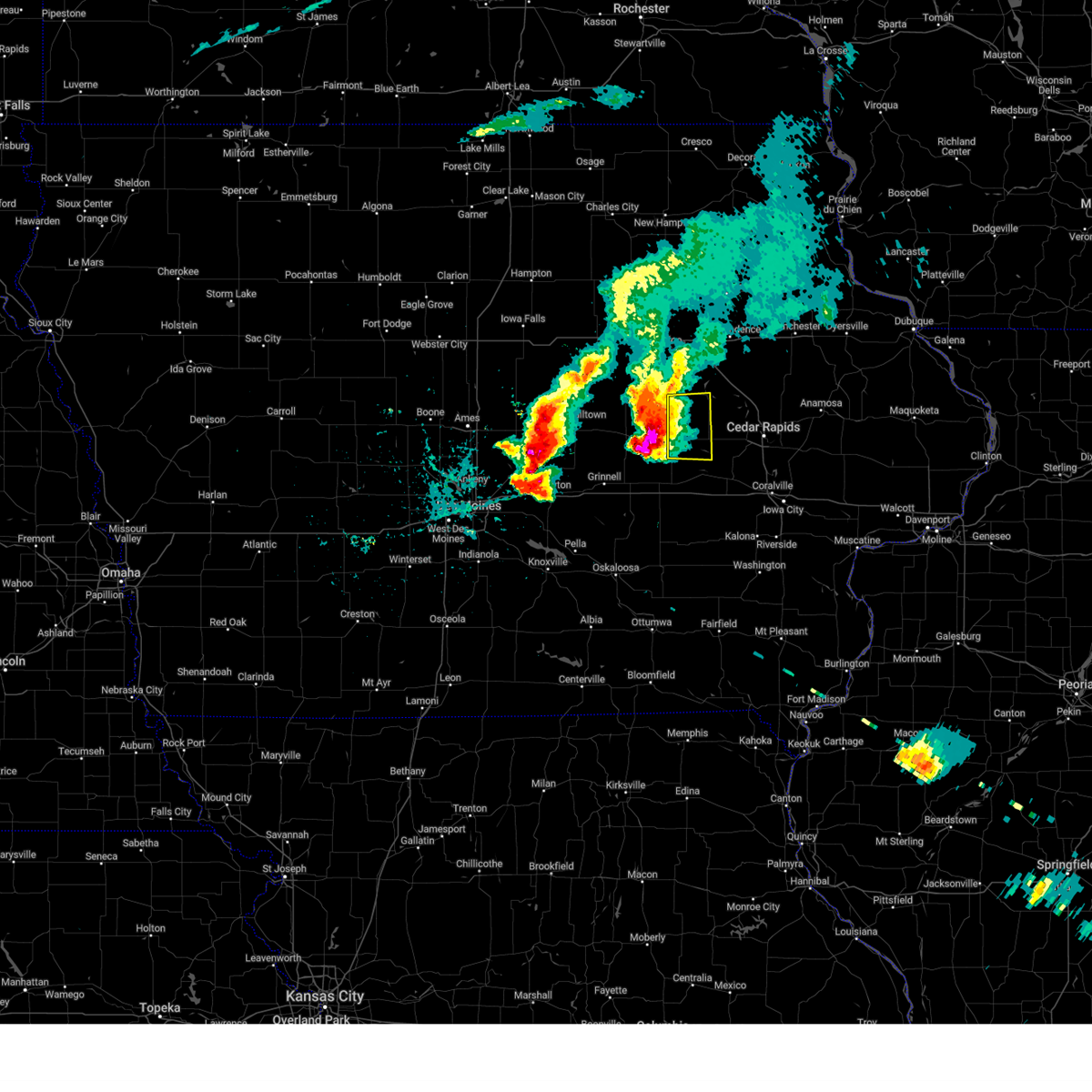 At 358 pm cdt, a severe thunderstorm was located near vining, or 12 miles east of toledo, moving east at 25 mph (radar indicated). Hazards include golf ball size hail and 60 mph wind gusts. People and animals outdoors will be injured. expect hail damage to roofs, siding, windows, and vehicles. expect wind damage to roofs, siding, and trees. locations impacted include, vinton, belle plaine, dysart, blairstown, van horne, keystone, garrison, luzerne, benton county fairgrounds and hannen lake park. thunderstorm damage threat, considerable hail threat, observed max hail size, 1. 75 in wind threat, radar indicated max wind gust, 60 mph. At 358 pm cdt, a severe thunderstorm was located near vining, or 12 miles east of toledo, moving east at 25 mph (radar indicated). Hazards include golf ball size hail and 60 mph wind gusts. People and animals outdoors will be injured. expect hail damage to roofs, siding, windows, and vehicles. expect wind damage to roofs, siding, and trees. locations impacted include, vinton, belle plaine, dysart, blairstown, van horne, keystone, garrison, luzerne, benton county fairgrounds and hannen lake park. thunderstorm damage threat, considerable hail threat, observed max hail size, 1. 75 in wind threat, radar indicated max wind gust, 60 mph.
|
| 5/7/2023 3:51 PM CDT |
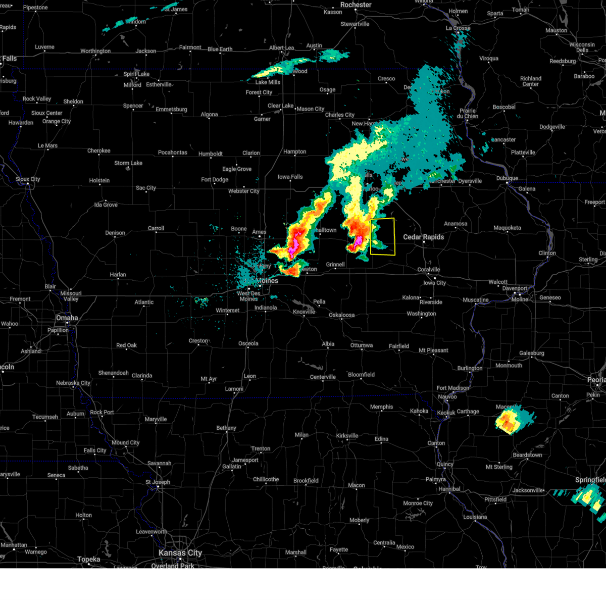 At 350 pm cdt, a severe thunderstorm was located near vining, or near toledo, moving east at 20 mph (storm spotters). Hazards include golf ball size hail and 60 mph wind gusts. People and animals outdoors will be injured. expect hail damage to roofs, siding, windows, and vehicles. Expect wind damage to roofs, siding, and trees. At 350 pm cdt, a severe thunderstorm was located near vining, or near toledo, moving east at 20 mph (storm spotters). Hazards include golf ball size hail and 60 mph wind gusts. People and animals outdoors will be injured. expect hail damage to roofs, siding, windows, and vehicles. Expect wind damage to roofs, siding, and trees.
|
| 4/4/2023 10:56 PM CDT |
 At 1055 pm cdt, severe thunderstorms were located along a line extending from wapsipinicon golf course to minne estema park to near garrison, moving northeast at 20 mph. at 1055 pm cdt, law enforcement reported golf ball size hail west of independence (law enforcement). Hazards include golf ball size hail and 60 mph wind gusts. People and animals outdoors will be injured. expect hail damage to roofs, siding, windows, and vehicles. expect wind damage to roofs, siding, and trees. these severe storms will be near, jesup, wapsipinicon golf course, otterville, independence airport and littleton around 1100 pm cdt. independence, brandon and buchanan county fairgrounds around 1105 pm cdt. lime creek county park around 1110 pm cdt. fontana county park around 1115 pm cdt. spencers grove around 1120 pm cdt. rowley and hoefle-dulin park around 1130 pm cdt. walker, jakway park and benton city park around 1135 pm cdt. winthrop golf course around 1140 pm cdt. Other locations impacted by these severe thunderstorms include lime creek county park, winthrop golf course, wapsipinicon golf course, vinton memorial airport, rodgers park, benton city park, fontana county park, pleasant creek state recreation area, littleton and hoefle-dulin park. At 1055 pm cdt, severe thunderstorms were located along a line extending from wapsipinicon golf course to minne estema park to near garrison, moving northeast at 20 mph. at 1055 pm cdt, law enforcement reported golf ball size hail west of independence (law enforcement). Hazards include golf ball size hail and 60 mph wind gusts. People and animals outdoors will be injured. expect hail damage to roofs, siding, windows, and vehicles. expect wind damage to roofs, siding, and trees. these severe storms will be near, jesup, wapsipinicon golf course, otterville, independence airport and littleton around 1100 pm cdt. independence, brandon and buchanan county fairgrounds around 1105 pm cdt. lime creek county park around 1110 pm cdt. fontana county park around 1115 pm cdt. spencers grove around 1120 pm cdt. rowley and hoefle-dulin park around 1130 pm cdt. walker, jakway park and benton city park around 1135 pm cdt. winthrop golf course around 1140 pm cdt. Other locations impacted by these severe thunderstorms include lime creek county park, winthrop golf course, wapsipinicon golf course, vinton memorial airport, rodgers park, benton city park, fontana county park, pleasant creek state recreation area, littleton and hoefle-dulin park.
|
| 4/4/2023 10:29 PM CDT |
 At 1028 pm cdt, severe thunderstorms were located along a line extending from near jesup to near rodgers park to near elberon, moving northeast at 35 mph (radar indicated). Hazards include 60 mph wind gusts. Expect damage to roofs, siding, and trees. severe thunderstorms will be near, jesup and mount auburn around 1035 pm cdt. minne estema park, independence airport and littleton around 1040 pm cdt. independence, brandon, wapsipinicon golf course, buchanan county fairgrounds and otterville around 1045 pm cdt. lime creek county park and fontana county park around 1050 pm cdt. vinton and benton county fairgrounds around 1055 pm cdt. rowley, hoefle-dulin park and vinton memorial airport around 1100 pm cdt. jakway park and benton city park around 1105 pm cdt. quasqueton, lamont, aurora, cheney and wildcat bluff park around 1110 pm cdt. Other locations impacted by these severe thunderstorms include lime creek county park, winthrop golf course, wapsipinicon golf course, vinton memorial airport, rodgers park, benton city park, fontana county park, pleasant creek state recreation area, littleton and hoefle-dulin park. At 1028 pm cdt, severe thunderstorms were located along a line extending from near jesup to near rodgers park to near elberon, moving northeast at 35 mph (radar indicated). Hazards include 60 mph wind gusts. Expect damage to roofs, siding, and trees. severe thunderstorms will be near, jesup and mount auburn around 1035 pm cdt. minne estema park, independence airport and littleton around 1040 pm cdt. independence, brandon, wapsipinicon golf course, buchanan county fairgrounds and otterville around 1045 pm cdt. lime creek county park and fontana county park around 1050 pm cdt. vinton and benton county fairgrounds around 1055 pm cdt. rowley, hoefle-dulin park and vinton memorial airport around 1100 pm cdt. jakway park and benton city park around 1105 pm cdt. quasqueton, lamont, aurora, cheney and wildcat bluff park around 1110 pm cdt. Other locations impacted by these severe thunderstorms include lime creek county park, winthrop golf course, wapsipinicon golf course, vinton memorial airport, rodgers park, benton city park, fontana county park, pleasant creek state recreation area, littleton and hoefle-dulin park.
|
| 4/4/2023 8:49 PM CDT |
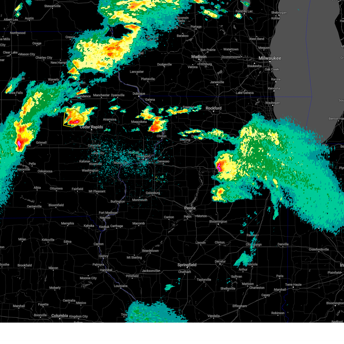 At 849 pm cdt, a severe thunderstorm was located over benton county fairgrounds, or near vinton, moving northeast at 40 mph (radar indicated). Hazards include 60 mph wind gusts and quarter size hail. Hail damage to vehicles is expected. expect wind damage to roofs, siding, and trees. this severe storm will be near, shellsburg and hoefle-dulin park around 855 pm cdt. benton city park and minne estema park around 900 pm cdt. urbana and wildcat bluff park around 905 pm cdt. other locations impacted by this severe thunderstorm include vinton memorial airport, minne estema park, benton county fairgrounds, rodgers park, wildcat bluff park, benton city park and hoefle-dulin park. hail threat, radar indicated max hail size, 1. 00 in wind threat, radar indicated max wind gust, 60 mph. At 849 pm cdt, a severe thunderstorm was located over benton county fairgrounds, or near vinton, moving northeast at 40 mph (radar indicated). Hazards include 60 mph wind gusts and quarter size hail. Hail damage to vehicles is expected. expect wind damage to roofs, siding, and trees. this severe storm will be near, shellsburg and hoefle-dulin park around 855 pm cdt. benton city park and minne estema park around 900 pm cdt. urbana and wildcat bluff park around 905 pm cdt. other locations impacted by this severe thunderstorm include vinton memorial airport, minne estema park, benton county fairgrounds, rodgers park, wildcat bluff park, benton city park and hoefle-dulin park. hail threat, radar indicated max hail size, 1. 00 in wind threat, radar indicated max wind gust, 60 mph.
|
| 4/4/2023 8:40 PM CDT |
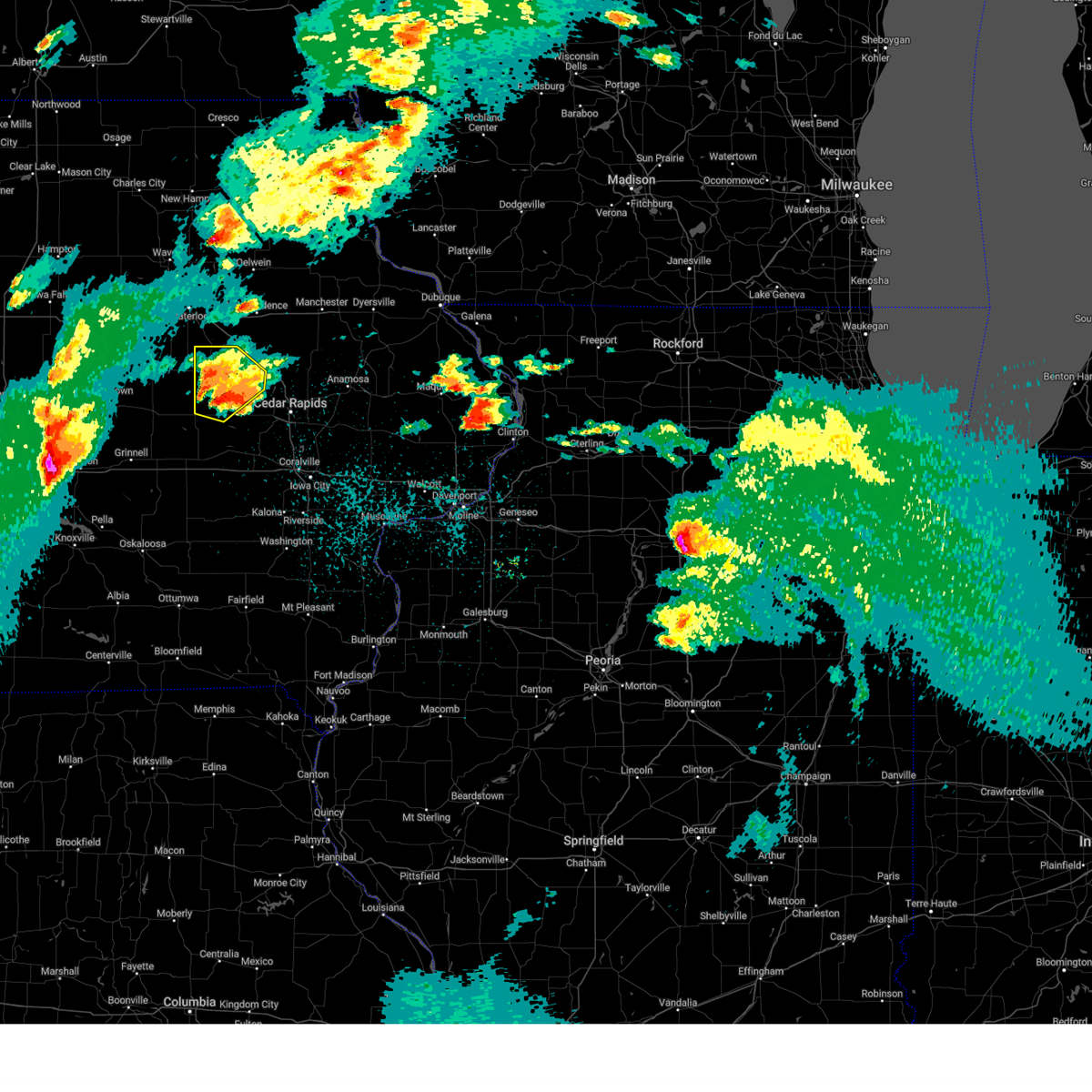 At 840 pm cdt, a severe thunderstorm was located near van horne, or 8 miles southwest of vinton, moving northeast at 40 mph (radar indicated). Hazards include 60 mph wind gusts and quarter size hail. Hail damage to vehicles is expected. expect wind damage to roofs, siding, and trees. this severe storm will be near, benton county fairgrounds and rodgers park around 850 pm cdt. vinton, shellsburg, hoefle-dulin park and vinton memorial airport around 855 pm cdt. benton city park and minne estema park around 900 pm cdt. urbana and wildcat bluff park around 905 pm cdt. other locations impacted by this severe thunderstorm include vinton memorial airport, minne estema park, benton county fairgrounds, rodgers park, wildcat bluff park, benton city park and hoefle-dulin park. hail threat, radar indicated max hail size, 1. 00 in wind threat, radar indicated max wind gust, 60 mph. At 840 pm cdt, a severe thunderstorm was located near van horne, or 8 miles southwest of vinton, moving northeast at 40 mph (radar indicated). Hazards include 60 mph wind gusts and quarter size hail. Hail damage to vehicles is expected. expect wind damage to roofs, siding, and trees. this severe storm will be near, benton county fairgrounds and rodgers park around 850 pm cdt. vinton, shellsburg, hoefle-dulin park and vinton memorial airport around 855 pm cdt. benton city park and minne estema park around 900 pm cdt. urbana and wildcat bluff park around 905 pm cdt. other locations impacted by this severe thunderstorm include vinton memorial airport, minne estema park, benton county fairgrounds, rodgers park, wildcat bluff park, benton city park and hoefle-dulin park. hail threat, radar indicated max hail size, 1. 00 in wind threat, radar indicated max wind gust, 60 mph.
|
| 4/4/2023 8:21 PM CDT |
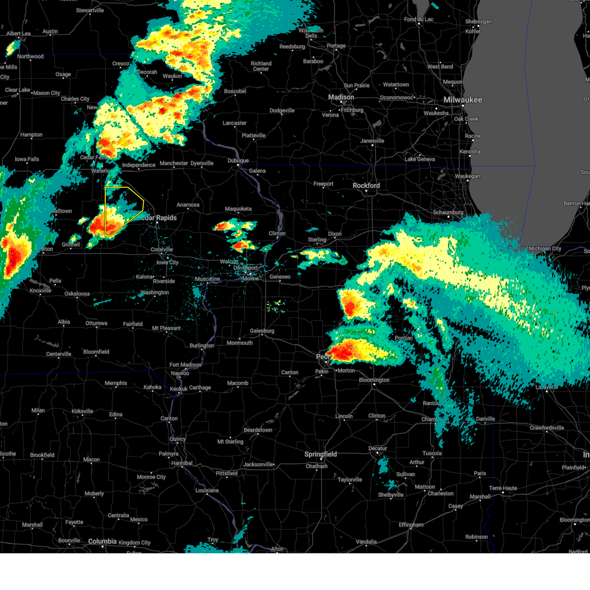 At 820 pm cdt, a severe thunderstorm was located over chelsea, or 11 miles southeast of toledo, moving northeast at 40 mph (radar indicated). Hazards include 60 mph wind gusts and half dollar size hail. Hail damage to vehicles is expected. expect wind damage to roofs, siding, and trees. this severe thunderstorm will be near, belle plaine around 830 pm cdt. luzerne around 835 pm cdt. keystone around 840 pm cdt. van horne around 845 pm cdt. garrison around 855 pm cdt. vinton, shellsburg, benton county fairgrounds, hoefle-dulin park, vinton memorial airport, rodgers park, benton city park, wildcat bluff park and minne estema park around 900 pm cdt. Other locations impacted by this severe thunderstorm include vinton memorial airport, minne estema park, benton county fairgrounds, rodgers park, wildcat bluff park, benton city park and hoefle-dulin park. At 820 pm cdt, a severe thunderstorm was located over chelsea, or 11 miles southeast of toledo, moving northeast at 40 mph (radar indicated). Hazards include 60 mph wind gusts and half dollar size hail. Hail damage to vehicles is expected. expect wind damage to roofs, siding, and trees. this severe thunderstorm will be near, belle plaine around 830 pm cdt. luzerne around 835 pm cdt. keystone around 840 pm cdt. van horne around 845 pm cdt. garrison around 855 pm cdt. vinton, shellsburg, benton county fairgrounds, hoefle-dulin park, vinton memorial airport, rodgers park, benton city park, wildcat bluff park and minne estema park around 900 pm cdt. Other locations impacted by this severe thunderstorm include vinton memorial airport, minne estema park, benton county fairgrounds, rodgers park, wildcat bluff park, benton city park and hoefle-dulin park.
|
| 3/31/2023 4:45 PM CDT | Estimated near 70 mph winds. large barn was damaged... trailer damaged... tree branches down... and an outbuilding with damage. possible tornad in benton county IA, 0.3 miles NW of Garrison, IA |
| 3/31/2023 4:30 PM CDT | Quarter sized hail reported 0.3 miles NW of Garrison, IA |
| 3/31/2023 4:30 PM CDT | Storm damage reported in benton county IA, 0.5 miles SSW of Garrison, IA |
| 8/19/2022 4:57 PM CDT |
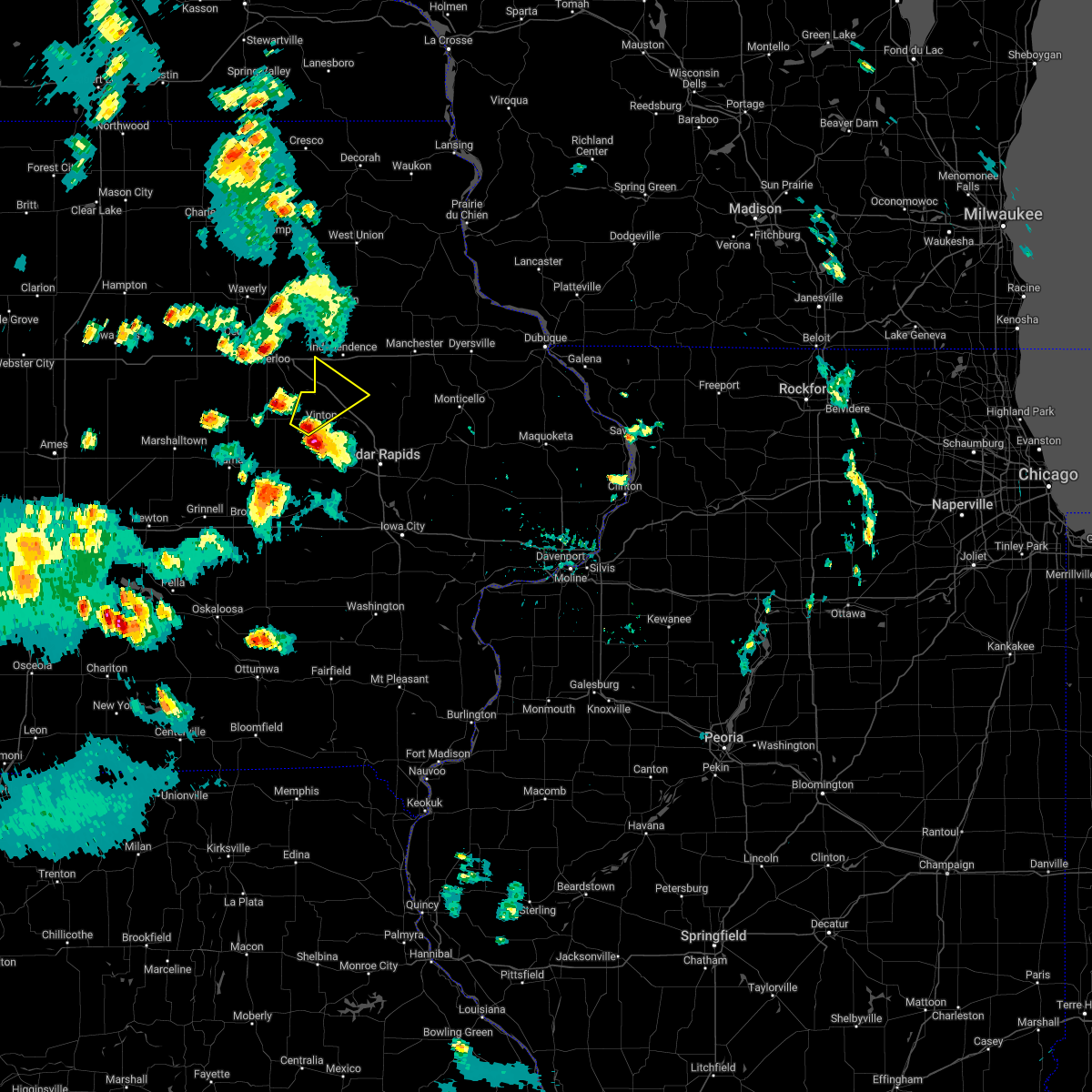 At 457 pm cdt, a severe thunderstorm was located over rodgers park, or near vinton, moving northeast at 25 mph (radar indicated). Hazards include 60 mph wind gusts and half dollar size hail. Hail damage to vehicles is expected. expect wind damage to roofs, siding, and trees. this severe thunderstorm will be near, rodgers park and benton county fairgrounds around 500 pm cdt. vinton and vinton memorial airport around 505 pm cdt. mount auburn around 510 pm cdt. minne estema park around 515 pm cdt. other locations in the path of this severe thunderstorm include urbana, cheney, brandon, lime creek county park and spencers grove. hail threat, radar indicated max hail size, 1. 25 in wind threat, radar indicated max wind gust, 60 mph. At 457 pm cdt, a severe thunderstorm was located over rodgers park, or near vinton, moving northeast at 25 mph (radar indicated). Hazards include 60 mph wind gusts and half dollar size hail. Hail damage to vehicles is expected. expect wind damage to roofs, siding, and trees. this severe thunderstorm will be near, rodgers park and benton county fairgrounds around 500 pm cdt. vinton and vinton memorial airport around 505 pm cdt. mount auburn around 510 pm cdt. minne estema park around 515 pm cdt. other locations in the path of this severe thunderstorm include urbana, cheney, brandon, lime creek county park and spencers grove. hail threat, radar indicated max hail size, 1. 25 in wind threat, radar indicated max wind gust, 60 mph.
|
| 7/23/2022 11:47 PM CDT |
 At 1147 pm cdt, severe thunderstorms were located along a line extending from near county roads 3 and w 45 to near van horne, moving east at 50 mph (radar indicated). Hazards include 60 mph wind gusts. Expect damage to roofs, siding, and trees. locations impacted include, independence, vinton, robins, jesup, center point, urbana, dysart, fairbank, palo, shellsburg, winthrop, hazleton, walker, van horne, alburnett, keystone, quasqueton, lamont, garrison and brandon. hail threat, radar indicated max hail size, <. 75 in wind threat, radar indicated max wind gust, 60 mph. At 1147 pm cdt, severe thunderstorms were located along a line extending from near county roads 3 and w 45 to near van horne, moving east at 50 mph (radar indicated). Hazards include 60 mph wind gusts. Expect damage to roofs, siding, and trees. locations impacted include, independence, vinton, robins, jesup, center point, urbana, dysart, fairbank, palo, shellsburg, winthrop, hazleton, walker, van horne, alburnett, keystone, quasqueton, lamont, garrison and brandon. hail threat, radar indicated max hail size, <. 75 in wind threat, radar indicated max wind gust, 60 mph.
|
| 7/23/2022 11:40 PM CDT |
 At 1140 pm cdt, severe thunderstorms were located along a line extending from near oelwein to near keystone, moving east at 50 mph (radar indicated). Hazards include 60 mph wind gusts. Expect damage to roofs, siding, and trees. locations impacted include, independence, vinton, robins, jesup, center point, urbana, dysart, fairbank, palo, shellsburg, winthrop, hazleton, walker, van horne, alburnett, keystone, quasqueton, lamont, garrison and brandon. hail threat, radar indicated max hail size, <. 75 in wind threat, radar indicated max wind gust, 60 mph. At 1140 pm cdt, severe thunderstorms were located along a line extending from near oelwein to near keystone, moving east at 50 mph (radar indicated). Hazards include 60 mph wind gusts. Expect damage to roofs, siding, and trees. locations impacted include, independence, vinton, robins, jesup, center point, urbana, dysart, fairbank, palo, shellsburg, winthrop, hazleton, walker, van horne, alburnett, keystone, quasqueton, lamont, garrison and brandon. hail threat, radar indicated max hail size, <. 75 in wind threat, radar indicated max wind gust, 60 mph.
|
| 7/23/2022 11:32 PM CDT |
 At 1131 pm cdt, severe thunderstorms were located along a line extending from near fairbank to near belle plaine, moving east at 50 mph (radar indicated). Hazards include 60 mph wind gusts. expect damage to roofs, siding, and trees At 1131 pm cdt, severe thunderstorms were located along a line extending from near fairbank to near belle plaine, moving east at 50 mph (radar indicated). Hazards include 60 mph wind gusts. expect damage to roofs, siding, and trees
|
| 7/11/2022 6:10 AM CDT |
 At 610 am cdt, severe thunderstorms were located along a line extending from near benton county fairgrounds to near riverside, moving east at 40 mph (radar indicated). Hazards include 60 mph wind gusts. Expect damage to roofs, siding, and trees. locations impacted include, cedar rapids, iowa city, vinton, marengo, marion, coralville, north liberty, hiawatha, robins, williamsburg, belle plaine, center point, kalona, fairfax, solon, tiffin, ely, atkins, walford and urbana. hail threat, radar indicated max hail size, <. 75 in wind threat, radar indicated max wind gust, 60 mph. At 610 am cdt, severe thunderstorms were located along a line extending from near benton county fairgrounds to near riverside, moving east at 40 mph (radar indicated). Hazards include 60 mph wind gusts. Expect damage to roofs, siding, and trees. locations impacted include, cedar rapids, iowa city, vinton, marengo, marion, coralville, north liberty, hiawatha, robins, williamsburg, belle plaine, center point, kalona, fairfax, solon, tiffin, ely, atkins, walford and urbana. hail threat, radar indicated max hail size, <. 75 in wind threat, radar indicated max wind gust, 60 mph.
|
| 7/11/2022 6:03 AM CDT |
 At 603 am cdt, severe thunderstorms were located along a line extending from garrison to near riverside, moving east at 45 mph (radar indicated). Hazards include 60 mph wind gusts and quarter size hail. Hail damage to vehicles is expected. expect wind damage to roofs, siding, and trees. locations impacted include, cedar rapids, iowa city, vinton, marengo, marion, coralville, north liberty, hiawatha, robins, williamsburg, belle plaine, center point, kalona, fairfax, solon, tiffin, ely, atkins, walford and urbana. hail threat, radar indicated max hail size, 1. 00 in wind threat, radar indicated max wind gust, 60 mph. At 603 am cdt, severe thunderstorms were located along a line extending from garrison to near riverside, moving east at 45 mph (radar indicated). Hazards include 60 mph wind gusts and quarter size hail. Hail damage to vehicles is expected. expect wind damage to roofs, siding, and trees. locations impacted include, cedar rapids, iowa city, vinton, marengo, marion, coralville, north liberty, hiawatha, robins, williamsburg, belle plaine, center point, kalona, fairfax, solon, tiffin, ely, atkins, walford and urbana. hail threat, radar indicated max hail size, 1. 00 in wind threat, radar indicated max wind gust, 60 mph.
|
| 7/11/2022 5:51 AM CDT |
 At 551 am cdt, severe thunderstorms were located along a line extending from near dysart to amish, moving east at 45 mph (radar indicated). Hazards include 60 mph wind gusts and quarter size hail. Hail damage to vehicles is expected. expect wind damage to roofs, siding, and trees. locations impacted include, cedar rapids, iowa city, vinton, marengo, marion, coralville, north liberty, hiawatha, robins, williamsburg, belle plaine, center point, kalona, fairfax, solon, tiffin, ely, atkins, walford and urbana. hail threat, radar indicated max hail size, 1. 00 in wind threat, radar indicated max wind gust, 60 mph. At 551 am cdt, severe thunderstorms were located along a line extending from near dysart to amish, moving east at 45 mph (radar indicated). Hazards include 60 mph wind gusts and quarter size hail. Hail damage to vehicles is expected. expect wind damage to roofs, siding, and trees. locations impacted include, cedar rapids, iowa city, vinton, marengo, marion, coralville, north liberty, hiawatha, robins, williamsburg, belle plaine, center point, kalona, fairfax, solon, tiffin, ely, atkins, walford and urbana. hail threat, radar indicated max hail size, 1. 00 in wind threat, radar indicated max wind gust, 60 mph.
|
| 7/11/2022 5:43 AM CDT |
 At 543 am cdt, severe thunderstorms were located along a line extending from near clutier to near holbrook, moving east at 45 mph (radar indicated). Hazards include 60 mph wind gusts and quarter size hail. Hail damage to vehicles is expected. Expect wind damage to roofs, siding, and trees. At 543 am cdt, severe thunderstorms were located along a line extending from near clutier to near holbrook, moving east at 45 mph (radar indicated). Hazards include 60 mph wind gusts and quarter size hail. Hail damage to vehicles is expected. Expect wind damage to roofs, siding, and trees.
|
| 3/5/2022 7:06 PM CST |
 At 706 pm cst, a severe thunderstorm capable of producing a tornado was located near garrison, or 9 miles west of vinton, moving northeast at 45 mph (radar indicated rotation). Hazards include tornado and quarter size hail. Flying debris will be dangerous to those caught without shelter. mobile homes will be damaged or destroyed. damage to roofs, windows, and vehicles will occur. tree damage is likely. this dangerous storm will be near, garrison around 710 pm cst. Other locations in the path of this tornadic thunderstorm include vinton. At 706 pm cst, a severe thunderstorm capable of producing a tornado was located near garrison, or 9 miles west of vinton, moving northeast at 45 mph (radar indicated rotation). Hazards include tornado and quarter size hail. Flying debris will be dangerous to those caught without shelter. mobile homes will be damaged or destroyed. damage to roofs, windows, and vehicles will occur. tree damage is likely. this dangerous storm will be near, garrison around 710 pm cst. Other locations in the path of this tornadic thunderstorm include vinton.
|
| 3/5/2022 6:56 PM CST |
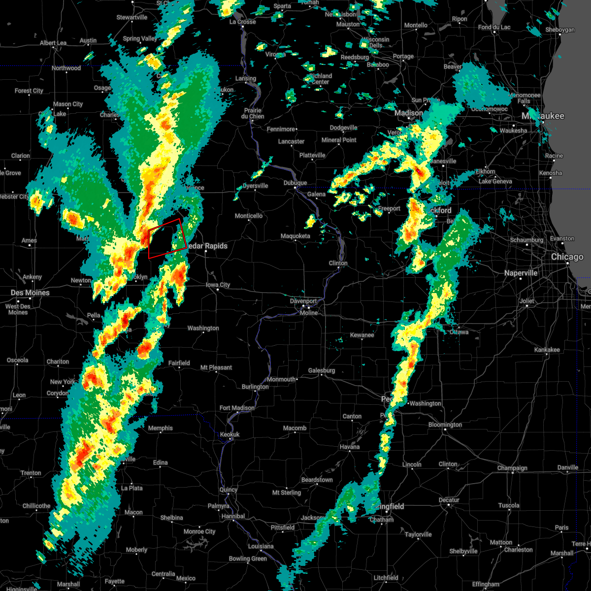 At 656 pm cst, a severe thunderstorm capable of producing a tornado was located 7 miles northwest of keystone, or 13 miles east of toledo, moving northeast at 45 mph (radar indicated rotation). Hazards include tornado and quarter size hail. Flying debris will be dangerous to those caught without shelter. mobile homes will be damaged or destroyed. damage to roofs, windows, and vehicles will occur. tree damage is likely. this dangerous storm will be near, keystone around 705 pm cst. Other locations in the path of this tornadic thunderstorm include van horne, garrison and vinton. At 656 pm cst, a severe thunderstorm capable of producing a tornado was located 7 miles northwest of keystone, or 13 miles east of toledo, moving northeast at 45 mph (radar indicated rotation). Hazards include tornado and quarter size hail. Flying debris will be dangerous to those caught without shelter. mobile homes will be damaged or destroyed. damage to roofs, windows, and vehicles will occur. tree damage is likely. this dangerous storm will be near, keystone around 705 pm cst. Other locations in the path of this tornadic thunderstorm include van horne, garrison and vinton.
|
| 3/5/2022 6:48 PM CST |
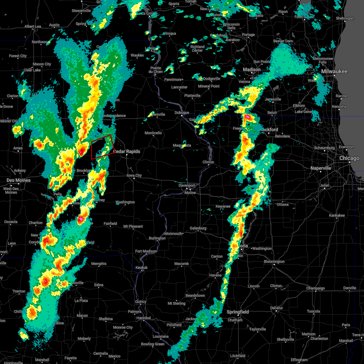 At 648 pm cst, a confirmed tornado was located 7 miles east of toledo, moving northeast at 45 mph (weather spotters confirmed tornado). Hazards include damaging tornado and quarter size hail. Flying debris will be dangerous to those caught without shelter. mobile homes will be damaged or destroyed. damage to roofs, windows, and vehicles will occur. tree damage is likely. the tornado will be near, keystone around 705 pm cst. Other locations in the path of this tornadic thunderstorm include van horne, garrison and vinton. At 648 pm cst, a confirmed tornado was located 7 miles east of toledo, moving northeast at 45 mph (weather spotters confirmed tornado). Hazards include damaging tornado and quarter size hail. Flying debris will be dangerous to those caught without shelter. mobile homes will be damaged or destroyed. damage to roofs, windows, and vehicles will occur. tree damage is likely. the tornado will be near, keystone around 705 pm cst. Other locations in the path of this tornadic thunderstorm include van horne, garrison and vinton.
|
| 12/15/2021 8:02 PM CST |
 At 802 pm cst, severe thunderstorms were located along a line extending from mount auburn to near marengo, moving east at 60 mph (trained weather spotters. a 60 mph wind gust was measured in blairstown). Hazards include 70 mph wind gusts and penny size hail. Expect considerable tree damage. damage is likely to mobile homes, roofs, and outbuildings. Locations impacted include, vinton, marengo, williamsburg, belle plaine, atkins, walford, urbana, dysart, north english, shellsburg, victor, newhall, blairstown, van horne, keystone, norway, garrison, ladora, parnell and millersburg. At 802 pm cst, severe thunderstorms were located along a line extending from mount auburn to near marengo, moving east at 60 mph (trained weather spotters. a 60 mph wind gust was measured in blairstown). Hazards include 70 mph wind gusts and penny size hail. Expect considerable tree damage. damage is likely to mobile homes, roofs, and outbuildings. Locations impacted include, vinton, marengo, williamsburg, belle plaine, atkins, walford, urbana, dysart, north english, shellsburg, victor, newhall, blairstown, van horne, keystone, norway, garrison, ladora, parnell and millersburg.
|
| 12/15/2021 7:50 PM CST |
 At 749 pm cst, severe thunderstorms were located along a line extending from dysart to near victor, moving northeast at 65 mph. these are destructive storms for portions of eastern iowa (radar indicated). Hazards include 80 mph wind gusts and penny size hail. Flying debris will be dangerous to those caught without shelter. mobile homes will be heavily damaged. expect considerable damage to roofs, windows, and vehicles. extensive tree damage and power outages are likely. Locations impacted include, vinton, marengo, williamsburg, belle plaine, atkins, walford, urbana, dysart, north english, shellsburg, victor, newhall, blairstown, van horne, keystone, norway, garrison, ladora, parnell and millersburg. At 749 pm cst, severe thunderstorms were located along a line extending from dysart to near victor, moving northeast at 65 mph. these are destructive storms for portions of eastern iowa (radar indicated). Hazards include 80 mph wind gusts and penny size hail. Flying debris will be dangerous to those caught without shelter. mobile homes will be heavily damaged. expect considerable damage to roofs, windows, and vehicles. extensive tree damage and power outages are likely. Locations impacted include, vinton, marengo, williamsburg, belle plaine, atkins, walford, urbana, dysart, north english, shellsburg, victor, newhall, blairstown, van horne, keystone, norway, garrison, ladora, parnell and millersburg.
|
| 12/15/2021 7:27 PM CST |
 At 726 pm cst, severe thunderstorms were located along a line extending from 6 miles northeast of grinnell to near new sharon, moving northeast at 70 mph. these are destructive storms for portions of eastern iowa (radar indicated). Hazards include 80 mph wind gusts and penny size hail. Flying debris will be dangerous to those caught without shelter. mobile homes will be heavily damaged. expect considerable damage to roofs, windows, and vehicles. extensive tree damage and power outages are likely. Locations impacted include, vinton, marengo, williamsburg, belle plaine, atkins, walford, urbana, dysart, north english, shellsburg, victor, newhall, blairstown, van horne, keystone, norway, garrison, ladora, parnell and millersburg. At 726 pm cst, severe thunderstorms were located along a line extending from 6 miles northeast of grinnell to near new sharon, moving northeast at 70 mph. these are destructive storms for portions of eastern iowa (radar indicated). Hazards include 80 mph wind gusts and penny size hail. Flying debris will be dangerous to those caught without shelter. mobile homes will be heavily damaged. expect considerable damage to roofs, windows, and vehicles. extensive tree damage and power outages are likely. Locations impacted include, vinton, marengo, williamsburg, belle plaine, atkins, walford, urbana, dysart, north english, shellsburg, victor, newhall, blairstown, van horne, keystone, norway, garrison, ladora, parnell and millersburg.
|
| 12/15/2021 7:17 PM CST |
 At 716 pm cst, severe thunderstorms were located along a line extending from 6 miles southeast of marshalltown to 9 miles south of grinnell to near new sharon, moving northeast at 60 mph. these are destructive storms for portions of eastern iowa (radar indicated). Hazards include 80 mph wind gusts and penny size hail. Flying debris will be dangerous to those caught without shelter. mobile homes will be heavily damaged. expect considerable damage to roofs, windows, and vehicles. Extensive tree damage and power outages are likely. At 716 pm cst, severe thunderstorms were located along a line extending from 6 miles southeast of marshalltown to 9 miles south of grinnell to near new sharon, moving northeast at 60 mph. these are destructive storms for portions of eastern iowa (radar indicated). Hazards include 80 mph wind gusts and penny size hail. Flying debris will be dangerous to those caught without shelter. mobile homes will be heavily damaged. expect considerable damage to roofs, windows, and vehicles. Extensive tree damage and power outages are likely.
|
| 8/24/2021 5:42 PM CDT |
 The severe thunderstorm warning for benton and northern iowa counties will expire at 545 pm cdt, the storms which prompted the warning have moved out of the area. therefore, the warning will be allowed to expire. however gusty winds and heavy rain are still possible with these thunderstorms. a severe thunderstorm watch remains in effect until 700 pm cdt for east central iowa. to report severe weather, contact your nearest law enforcement agency. they will relay your report to the national weather service the quad cities. The severe thunderstorm warning for benton and northern iowa counties will expire at 545 pm cdt, the storms which prompted the warning have moved out of the area. therefore, the warning will be allowed to expire. however gusty winds and heavy rain are still possible with these thunderstorms. a severe thunderstorm watch remains in effect until 700 pm cdt for east central iowa. to report severe weather, contact your nearest law enforcement agency. they will relay your report to the national weather service the quad cities.
|
| 8/24/2021 5:31 PM CDT |
 At 531 pm cdt, severe thunderstorms were located along a line extending from near vinton to walford to near williamsburg, moving southeast at 45 mph (radar indicated). Hazards include 60 mph wind gusts. Expect damage to roofs, siding, and trees. these severe storms will be near, amana around 535 pm cdt. other locations in the path of these severe thunderstorms include atkins. hail threat, radar indicated max hail size, <. 75 in wind threat, radar indicated max wind gust, 60 mph. At 531 pm cdt, severe thunderstorms were located along a line extending from near vinton to walford to near williamsburg, moving southeast at 45 mph (radar indicated). Hazards include 60 mph wind gusts. Expect damage to roofs, siding, and trees. these severe storms will be near, amana around 535 pm cdt. other locations in the path of these severe thunderstorms include atkins. hail threat, radar indicated max hail size, <. 75 in wind threat, radar indicated max wind gust, 60 mph.
|
| 8/24/2021 5:15 PM CDT |
 At 514 pm cdt, severe thunderstorms were located along a line extending from mount auburn to near newhall to near marengo, moving east at 50 mph (radar indicated). Hazards include 60 mph wind gusts. Expect damage to roofs, siding, and trees. these severe storms will be near, shellsburg, newhall and norway around 520 pm cdt. atkins and walford around 525 pm cdt. other locations in the path of these severe thunderstorms include urbana and amana. hail threat, radar indicated max hail size, <. 75 in wind threat, radar indicated max wind gust, 60 mph. At 514 pm cdt, severe thunderstorms were located along a line extending from mount auburn to near newhall to near marengo, moving east at 50 mph (radar indicated). Hazards include 60 mph wind gusts. Expect damage to roofs, siding, and trees. these severe storms will be near, shellsburg, newhall and norway around 520 pm cdt. atkins and walford around 525 pm cdt. other locations in the path of these severe thunderstorms include urbana and amana. hail threat, radar indicated max hail size, <. 75 in wind threat, radar indicated max wind gust, 60 mph.
|
| 8/24/2021 5:05 PM CDT |
 At 504 pm cdt, severe thunderstorms were located along a line extending from near la porte city to near van horne to near belle plaine, moving east at 50 mph (radar indicated). Hazards include 60 mph wind gusts. Expect damage to roofs, siding, and trees. severe thunderstorms will be near, van horne around 510 pm cdt. newhall and garrison around 515 pm cdt. vinton, marengo, shellsburg and norway around 520 pm cdt. other locations in the path of these severe thunderstorms include atkins, walford, urbana and amana. hail threat, radar indicated max hail size, <. 75 in wind threat, radar indicated max wind gust, 60 mph. At 504 pm cdt, severe thunderstorms were located along a line extending from near la porte city to near van horne to near belle plaine, moving east at 50 mph (radar indicated). Hazards include 60 mph wind gusts. Expect damage to roofs, siding, and trees. severe thunderstorms will be near, van horne around 510 pm cdt. newhall and garrison around 515 pm cdt. vinton, marengo, shellsburg and norway around 520 pm cdt. other locations in the path of these severe thunderstorms include atkins, walford, urbana and amana. hail threat, radar indicated max hail size, <. 75 in wind threat, radar indicated max wind gust, 60 mph.
|
| 8/10/2021 4:17 PM CDT |
 At 416 pm cdt, severe thunderstorms were located along a line extending from near coggon to 7 miles west of belle plaine, moving east at 25 mph (radar indicated). Hazards include 60 mph wind gusts and quarter size hail. Hail damage to vehicles is expected. expect wind damage to roofs, siding, and trees. locations impacted include, vinton, marengo, belle plaine, atkins, walford, urbana, dysart, shellsburg, newhall, blairstown, van horne, keystone, norway, garrison, brandon, rowley, mount auburn, luzerne, amana and middle amana. hail threat, radar indicated max hail size, 1. 00 in wind threat, radar indicated max wind gust, 60 mph. At 416 pm cdt, severe thunderstorms were located along a line extending from near coggon to 7 miles west of belle plaine, moving east at 25 mph (radar indicated). Hazards include 60 mph wind gusts and quarter size hail. Hail damage to vehicles is expected. expect wind damage to roofs, siding, and trees. locations impacted include, vinton, marengo, belle plaine, atkins, walford, urbana, dysart, shellsburg, newhall, blairstown, van horne, keystone, norway, garrison, brandon, rowley, mount auburn, luzerne, amana and middle amana. hail threat, radar indicated max hail size, 1. 00 in wind threat, radar indicated max wind gust, 60 mph.
|
| 8/10/2021 4:00 PM CDT |
 At 400 pm cdt, severe thunderstorms were located along a line extending from near troy mills to near tama, moving east at 25 mph (radar indicated). Hazards include 60 mph wind gusts and quarter size hail. Hail damage to vehicles is expected. expect wind damage to roofs, siding, and trees. locations impacted include, belle plaine, luzerne, marengo, blairstown and norway. hail threat, radar indicated max hail size, 1. 00 in wind threat, radar indicated max wind gust, 60 mph. At 400 pm cdt, severe thunderstorms were located along a line extending from near troy mills to near tama, moving east at 25 mph (radar indicated). Hazards include 60 mph wind gusts and quarter size hail. Hail damage to vehicles is expected. expect wind damage to roofs, siding, and trees. locations impacted include, belle plaine, luzerne, marengo, blairstown and norway. hail threat, radar indicated max hail size, 1. 00 in wind threat, radar indicated max wind gust, 60 mph.
|
| 8/10/2021 3:49 PM CDT |
 At 349 pm cdt, severe thunderstorms were located along a line extending from walker to 7 miles southwest of tama, moving east at 25 mph (radar indicated). Hazards include 60 mph wind gusts and quarter size hail. Hail damage to vehicles is expected. expect wind damage to roofs, siding, and trees. severe thunderstorms will be near, urbana and rowley around 355 pm cdt. other locations in the path of these severe thunderstorms include belle plaine, luzerne, blairstown, van horne and keystone. hail threat, radar indicated max hail size, 1. 00 in wind threat, radar indicated max wind gust, 60 mph. At 349 pm cdt, severe thunderstorms were located along a line extending from walker to 7 miles southwest of tama, moving east at 25 mph (radar indicated). Hazards include 60 mph wind gusts and quarter size hail. Hail damage to vehicles is expected. expect wind damage to roofs, siding, and trees. severe thunderstorms will be near, urbana and rowley around 355 pm cdt. other locations in the path of these severe thunderstorms include belle plaine, luzerne, blairstown, van horne and keystone. hail threat, radar indicated max hail size, 1. 00 in wind threat, radar indicated max wind gust, 60 mph.
|
| 7/14/2021 7:49 PM CDT |
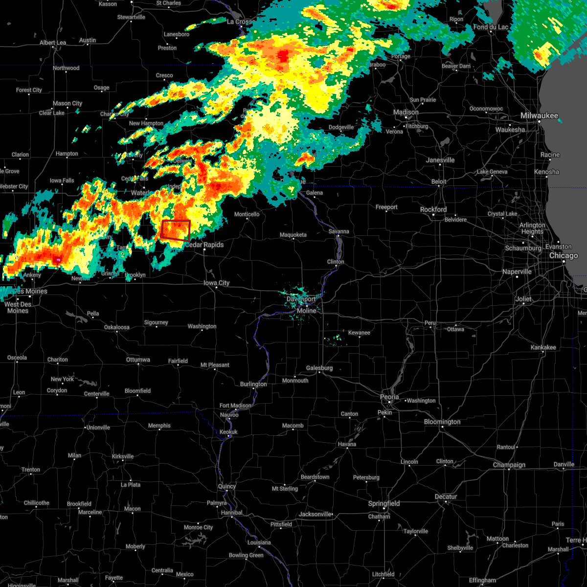 At 748 pm cdt, a severe thunderstorm capable of producing a tornado was located over vinton, moving east at 30 mph (weather spotters reported a funnel cloud south of vinton). Hazards include tornado. Flying debris will be dangerous to those caught without shelter. mobile homes will be damaged or destroyed. damage to roofs, windows, and vehicles will occur. tree damage is likely. Locations impacted include, vinton, urbana, shellsburg, garrison, vinton memorial airport, benton county fairgrounds, rodgers park, wildcat bluff park, benton city park and hoefle-dulin park. At 748 pm cdt, a severe thunderstorm capable of producing a tornado was located over vinton, moving east at 30 mph (weather spotters reported a funnel cloud south of vinton). Hazards include tornado. Flying debris will be dangerous to those caught without shelter. mobile homes will be damaged or destroyed. damage to roofs, windows, and vehicles will occur. tree damage is likely. Locations impacted include, vinton, urbana, shellsburg, garrison, vinton memorial airport, benton county fairgrounds, rodgers park, wildcat bluff park, benton city park and hoefle-dulin park.
|
| 7/14/2021 7:43 PM CDT |
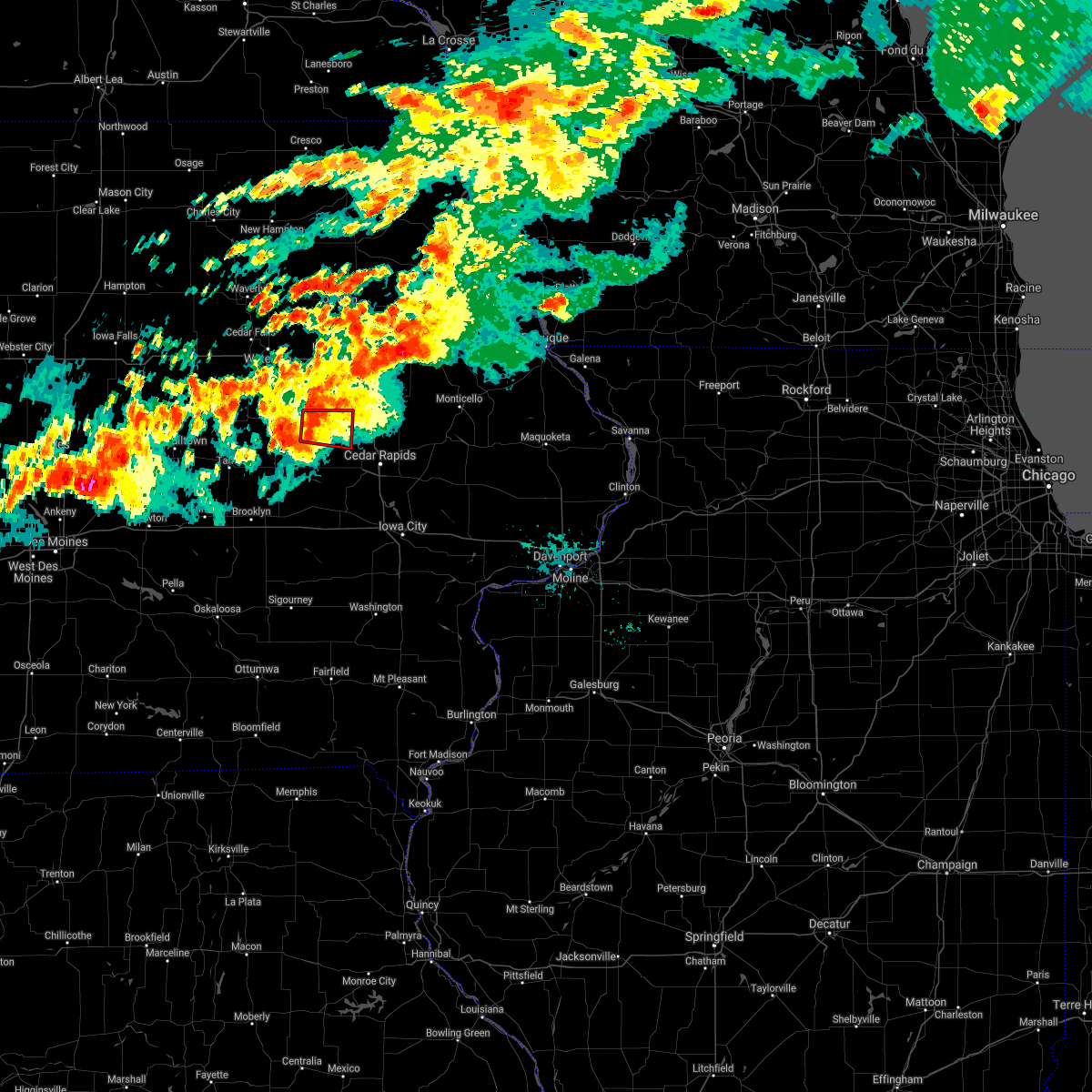 At 743 pm cdt, a severe thunderstorm capable of producing a tornado was located near vinton, moving east at 30 mph (radar indicated rotation). Hazards include tornado. Flying debris will be dangerous to those caught without shelter. mobile homes will be damaged or destroyed. damage to roofs, windows, and vehicles will occur. Tree damage is likely. At 743 pm cdt, a severe thunderstorm capable of producing a tornado was located near vinton, moving east at 30 mph (radar indicated rotation). Hazards include tornado. Flying debris will be dangerous to those caught without shelter. mobile homes will be damaged or destroyed. damage to roofs, windows, and vehicles will occur. Tree damage is likely.
|
| 7/14/2021 7:37 PM CDT |
 At 737 pm cdt, severe thunderstorms were located along a line extending from near brandon to keystone, moving east at 35 mph (radar indicated). Hazards include 60 mph wind gusts. Expect damage to roofs, siding, and trees. severe thunderstorms will be near, vinton around 740 pm cdt. urbana and van horne around 750 pm cdt. center point around 755 pm cdt. Other locations in the path of these severe thunderstorms include newhall, atkins, shellsburg and palo. At 737 pm cdt, severe thunderstorms were located along a line extending from near brandon to keystone, moving east at 35 mph (radar indicated). Hazards include 60 mph wind gusts. Expect damage to roofs, siding, and trees. severe thunderstorms will be near, vinton around 740 pm cdt. urbana and van horne around 750 pm cdt. center point around 755 pm cdt. Other locations in the path of these severe thunderstorms include newhall, atkins, shellsburg and palo.
|
| 7/14/2021 7:32 PM CDT |
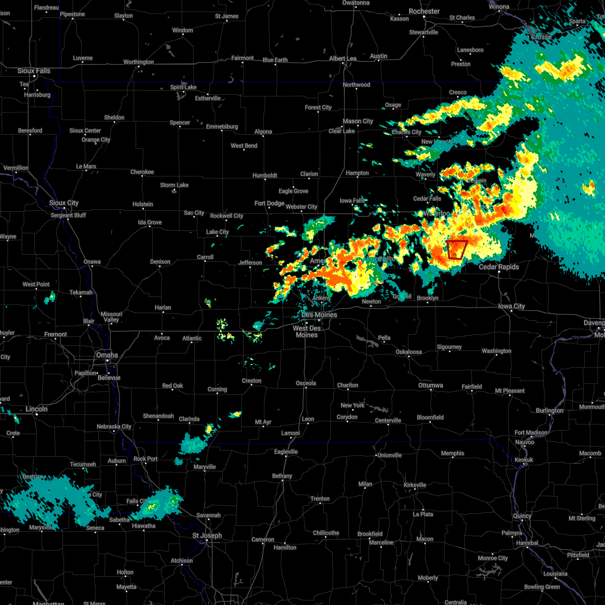 At 732 pm cdt, a severe thunderstorm capable of producing a tornado was located over garrison, or near vinton, moving east at 25 mph (radar indicated rotation). Hazards include tornado. Flying debris will be dangerous to those caught without shelter. mobile homes will be damaged or destroyed. damage to roofs, windows, and vehicles will occur. tree damage is likely. Locations impacted include, vinton. At 732 pm cdt, a severe thunderstorm capable of producing a tornado was located over garrison, or near vinton, moving east at 25 mph (radar indicated rotation). Hazards include tornado. Flying debris will be dangerous to those caught without shelter. mobile homes will be damaged or destroyed. damage to roofs, windows, and vehicles will occur. tree damage is likely. Locations impacted include, vinton.
|
| 7/14/2021 7:24 PM CDT |
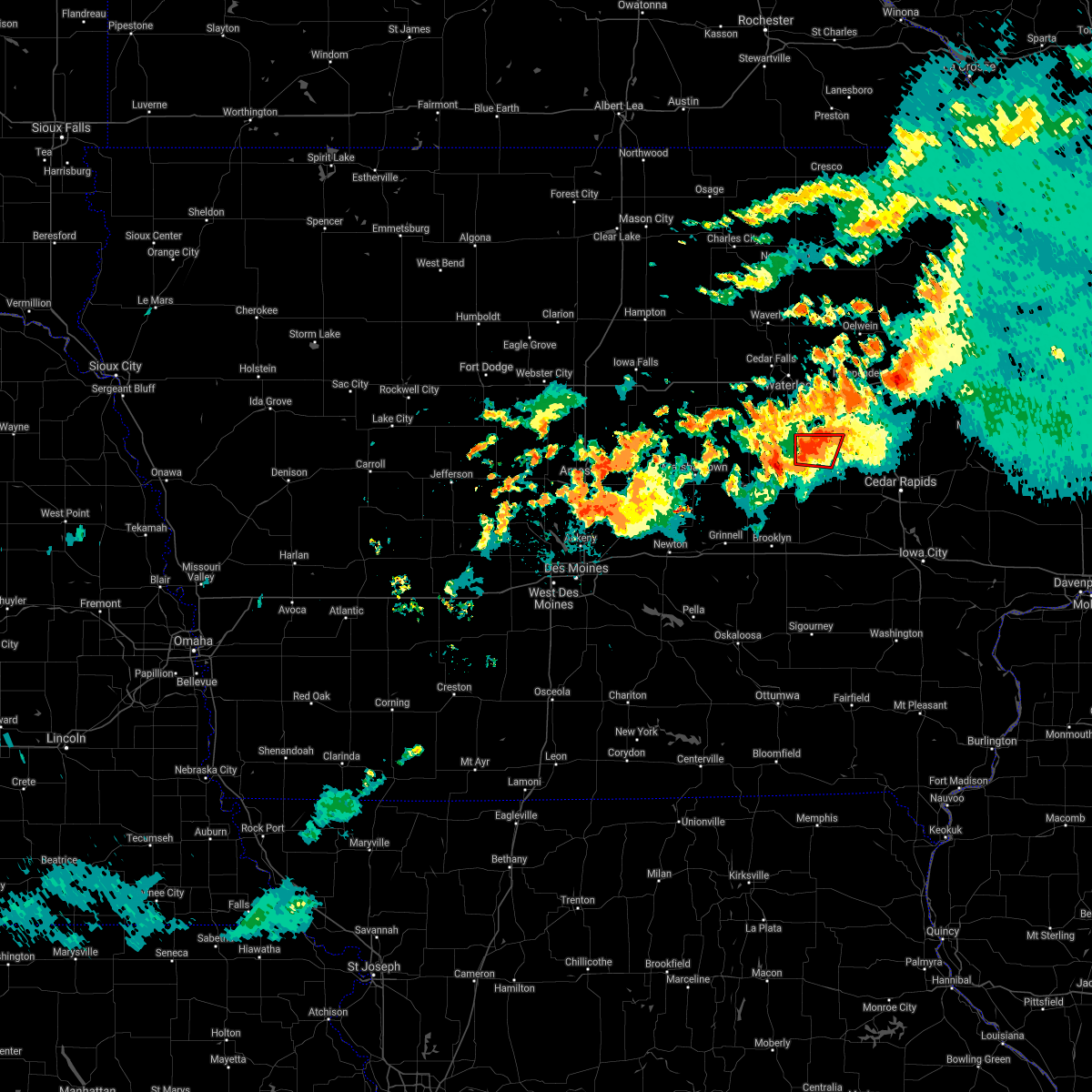 At 723 pm cdt, a confirmed tornado was located 1 mile north of garrison, or 7 miles west of vinton, moving east at 25 mph (weather spotters confirmed tornado). Hazards include damaging tornado. Flying debris will be dangerous to those caught without shelter. mobile homes will be damaged or destroyed. damage to roofs, windows, and vehicles will occur. tree damage is likely. Locations impacted include, vinton. At 723 pm cdt, a confirmed tornado was located 1 mile north of garrison, or 7 miles west of vinton, moving east at 25 mph (weather spotters confirmed tornado). Hazards include damaging tornado. Flying debris will be dangerous to those caught without shelter. mobile homes will be damaged or destroyed. damage to roofs, windows, and vehicles will occur. tree damage is likely. Locations impacted include, vinton.
|
| 7/14/2021 7:14 PM CDT |
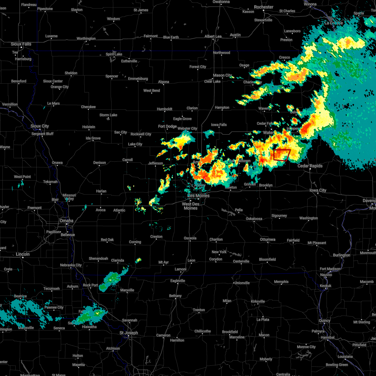 At 714 pm cdt, a confirmed tornado was located near dysart, or 11 miles west of vinton, moving east at 25 mph (weather spotters confirmed tornado). Hazards include damaging tornado. Flying debris will be dangerous to those caught without shelter. mobile homes will be damaged or destroyed. damage to roofs, windows, and vehicles will occur. tree damage is likely. this tornado will be near, garrison around 730 pm cdt. Other locations in the path of this tornadic thunderstorm include vinton. At 714 pm cdt, a confirmed tornado was located near dysart, or 11 miles west of vinton, moving east at 25 mph (weather spotters confirmed tornado). Hazards include damaging tornado. Flying debris will be dangerous to those caught without shelter. mobile homes will be damaged or destroyed. damage to roofs, windows, and vehicles will occur. tree damage is likely. this tornado will be near, garrison around 730 pm cdt. Other locations in the path of this tornadic thunderstorm include vinton.
|
| 7/14/2021 7:10 PM CDT |
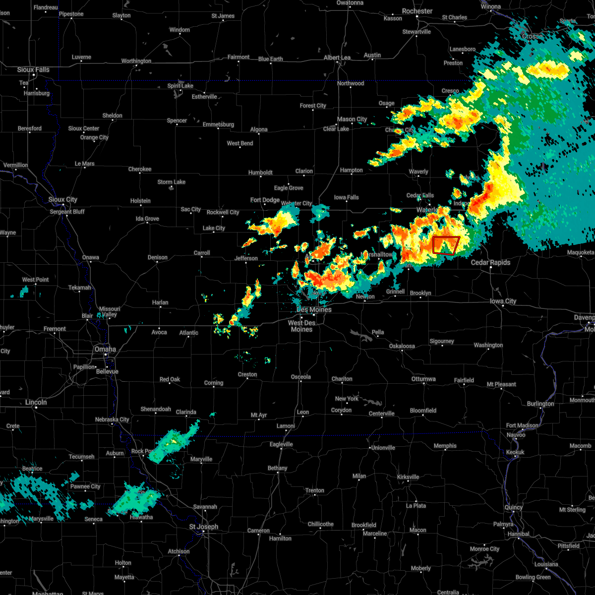 At 710 pm cdt, a severe thunderstorm capable of producing a tornado was located over dysart, or 12 miles west of vinton, moving east at 25 mph (radar indicated rotation). Hazards include tornado. Flying debris will be dangerous to those caught without shelter. mobile homes will be damaged or destroyed. damage to roofs, windows, and vehicles will occur. tree damage is likely. Locations impacted include, garrison and vinton. At 710 pm cdt, a severe thunderstorm capable of producing a tornado was located over dysart, or 12 miles west of vinton, moving east at 25 mph (radar indicated rotation). Hazards include tornado. Flying debris will be dangerous to those caught without shelter. mobile homes will be damaged or destroyed. damage to roofs, windows, and vehicles will occur. tree damage is likely. Locations impacted include, garrison and vinton.
|
| 7/14/2021 7:03 PM CDT |
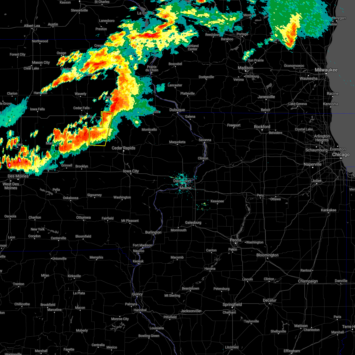 At 703 pm cdt, severe thunderstorms were located along a line extending from independence to garrison, moving east at 35 mph (radar indicated). Hazards include 60 mph wind gusts and quarter size hail. Hail damage to vehicles is expected. expect wind damage to roofs, siding, and trees. Locations impacted include, independence. At 703 pm cdt, severe thunderstorms were located along a line extending from independence to garrison, moving east at 35 mph (radar indicated). Hazards include 60 mph wind gusts and quarter size hail. Hail damage to vehicles is expected. expect wind damage to roofs, siding, and trees. Locations impacted include, independence.
|
| 7/14/2021 6:58 PM CDT |
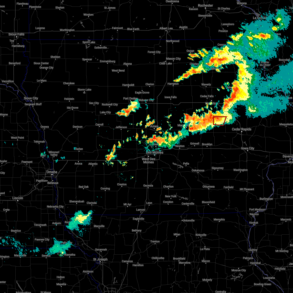 The national weather service in the quad cities has issued a * tornado warning for. northwestern benton county in east central iowa. until 745 pm cdt. At 658 pm cdt, a severe thunderstorm capable of producing a tornado was located over dysart, or 16 miles west of vinton, moving east at. The national weather service in the quad cities has issued a * tornado warning for. northwestern benton county in east central iowa. until 745 pm cdt. At 658 pm cdt, a severe thunderstorm capable of producing a tornado was located over dysart, or 16 miles west of vinton, moving east at.
|
| 7/14/2021 6:47 PM CDT |
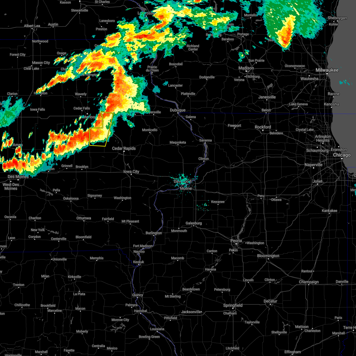 At 647 pm cdt, severe thunderstorms were located along a line extending from near jesup to near dysart, moving east at 40 mph (radar indicated). Hazards include 60 mph wind gusts. Expect damage to roofs, siding, and trees. these severe storms will be near, jesup around 650 pm cdt. Other locations in the path of these severe thunderstorms include independence, vinton and mount auburn. At 647 pm cdt, severe thunderstorms were located along a line extending from near jesup to near dysart, moving east at 40 mph (radar indicated). Hazards include 60 mph wind gusts. Expect damage to roofs, siding, and trees. these severe storms will be near, jesup around 650 pm cdt. Other locations in the path of these severe thunderstorms include independence, vinton and mount auburn.
|
| 7/14/2021 6:32 PM CDT |
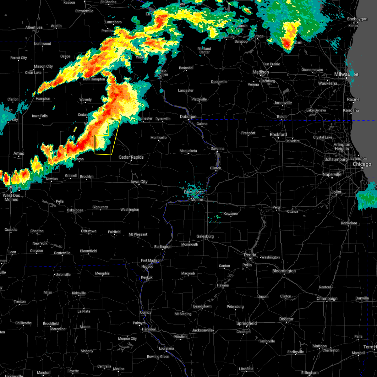 At 632 pm cdt, severe thunderstorms were located along a line extending from near jesup to near traer, moving east at 35 mph (radar indicated). Hazards include 60 mph wind gusts. Expect damage to roofs, siding, and trees. severe thunderstorms will be near, jesup around 635 pm cdt. independence around 650 pm cdt. Other locations in the path of these severe thunderstorms include garrison and vinton. At 632 pm cdt, severe thunderstorms were located along a line extending from near jesup to near traer, moving east at 35 mph (radar indicated). Hazards include 60 mph wind gusts. Expect damage to roofs, siding, and trees. severe thunderstorms will be near, jesup around 635 pm cdt. independence around 650 pm cdt. Other locations in the path of these severe thunderstorms include garrison and vinton.
|
| 6/20/2021 8:06 PM CDT |
 At 806 pm cdt, severe thunderstorms were located along a line extending from near masonville to near garrison, moving east at 35 mph (radar indicated). Hazards include 60 mph wind gusts. Expect damage to roofs, siding, and trees. These severe thunderstorms will remain over mainly rural areas of southern buchanan, northern benton and northwestern linn counties, including the following locations, lime creek county park, monti, spencers grove, vinton memorial airport, benton county fairgrounds, minne estema park, rodgers park, wildcat bluff park, benton city park and cheney. At 806 pm cdt, severe thunderstorms were located along a line extending from near masonville to near garrison, moving east at 35 mph (radar indicated). Hazards include 60 mph wind gusts. Expect damage to roofs, siding, and trees. These severe thunderstorms will remain over mainly rural areas of southern buchanan, northern benton and northwestern linn counties, including the following locations, lime creek county park, monti, spencers grove, vinton memorial airport, benton county fairgrounds, minne estema park, rodgers park, wildcat bluff park, benton city park and cheney.
|
| 6/20/2021 7:52 PM CDT |
 At 752 pm cdt, severe thunderstorms were located along a line extending from winthrop to near dysart, moving east at 35 mph (radar indicated). Hazards include 60 mph wind gusts. Expect damage to roofs, siding, and trees. these severe storms will be near, winthrop and quasqueton around 755 pm cdt. mount auburn around 800 pm cdt. vinton around 810 pm cdt. Other locations impacted by these severe thunderstorms include lime creek county park, wapsipinicon golf course, vinton memorial airport, rodgers park, benton city park, hoefle-dulin park, monti, buchanan county fairgrounds, spencers grove and benton county fairgrounds. At 752 pm cdt, severe thunderstorms were located along a line extending from winthrop to near dysart, moving east at 35 mph (radar indicated). Hazards include 60 mph wind gusts. Expect damage to roofs, siding, and trees. these severe storms will be near, winthrop and quasqueton around 755 pm cdt. mount auburn around 800 pm cdt. vinton around 810 pm cdt. Other locations impacted by these severe thunderstorms include lime creek county park, wapsipinicon golf course, vinton memorial airport, rodgers park, benton city park, hoefle-dulin park, monti, buchanan county fairgrounds, spencers grove and benton county fairgrounds.
|
| 6/20/2021 7:37 PM CDT |
 At 736 pm cdt, severe thunderstorms were located along a line extending from near independence to near dysart, moving southeast at 35 mph (radar indicated). Hazards include 60 mph wind gusts and penny size hail. Expect damage to roofs, siding, and trees. severe thunderstorms will be near, independence around 740 pm cdt. winthrop and quasqueton around 750 pm cdt. garrison and mount auburn around 800 pm cdt. vinton around 805 pm cdt. Other locations impacted by these severe thunderstorms include lime creek county park, wapsipinicon golf course, vinton memorial airport, rodgers park, benton city park, littleton, hoefle-dulin park, monti, buchanan county fairgrounds and otterville. At 736 pm cdt, severe thunderstorms were located along a line extending from near independence to near dysart, moving southeast at 35 mph (radar indicated). Hazards include 60 mph wind gusts and penny size hail. Expect damage to roofs, siding, and trees. severe thunderstorms will be near, independence around 740 pm cdt. winthrop and quasqueton around 750 pm cdt. garrison and mount auburn around 800 pm cdt. vinton around 805 pm cdt. Other locations impacted by these severe thunderstorms include lime creek county park, wapsipinicon golf course, vinton memorial airport, rodgers park, benton city park, littleton, hoefle-dulin park, monti, buchanan county fairgrounds and otterville.
|
| 8/28/2020 4:22 PM CDT |
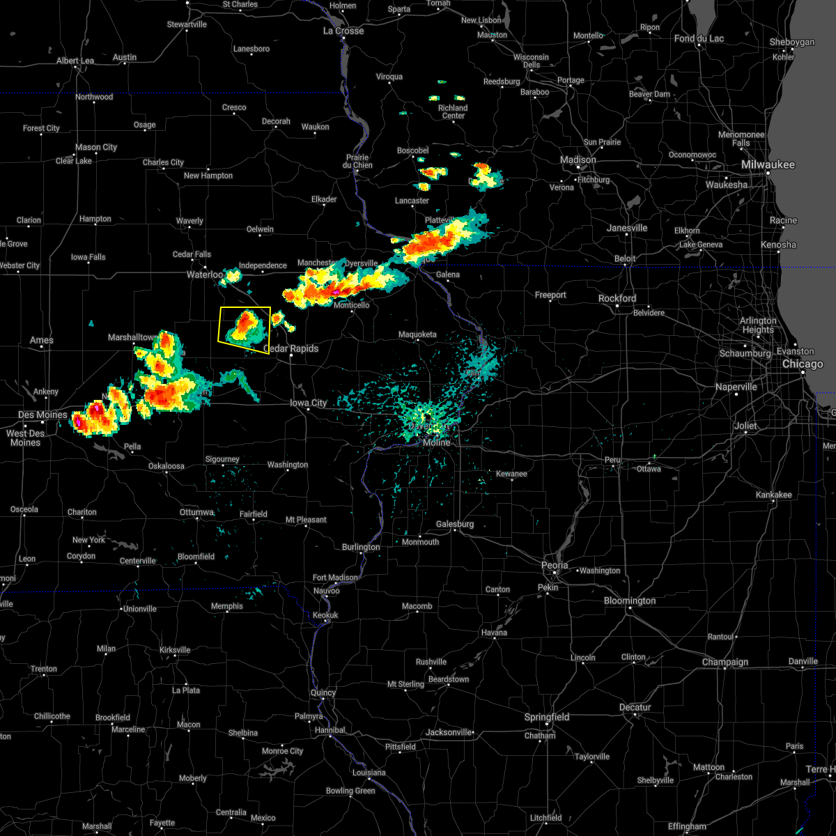 At 422 pm cdt, a severe thunderstorm was located over vinton, moving east at 45 mph (radar indicated). Hazards include 60 mph wind gusts and quarter size hail. Hail damage to vehicles is expected. expect wind damage to roofs, siding, and trees. locations impacted include, vinton, atkins, urbana, shellsburg, garrison, mount auburn, vinton memorial airport, rodgers park, benton city park, hoefle-dulin park, benton county fairgrounds, minne estema park, wildcat bluff park and cheney. This includes interstate 380 between mile markers 40 and 44. At 422 pm cdt, a severe thunderstorm was located over vinton, moving east at 45 mph (radar indicated). Hazards include 60 mph wind gusts and quarter size hail. Hail damage to vehicles is expected. expect wind damage to roofs, siding, and trees. locations impacted include, vinton, atkins, urbana, shellsburg, garrison, mount auburn, vinton memorial airport, rodgers park, benton city park, hoefle-dulin park, benton county fairgrounds, minne estema park, wildcat bluff park and cheney. This includes interstate 380 between mile markers 40 and 44.
|
| 8/28/2020 4:11 PM CDT |
 At 411 pm cdt, a severe thunderstorm was located near garrison, or 9 miles west of vinton, moving east at 45 mph (radar indicated). Hazards include 60 mph wind gusts and half dollar size hail. Hail damage to vehicles is expected. expect wind damage to roofs, siding, and trees. locations impacted include, vinton, atkins, urbana, dysart, shellsburg, newhall, van horne, keystone, garrison, mount auburn, vinton memorial airport, rodgers park, benton city park, hoefle-dulin park, spencers grove, benton county fairgrounds, minne estema park, wildcat bluff park and cheney. This includes interstate 380 between mile markers 40 and 48. At 411 pm cdt, a severe thunderstorm was located near garrison, or 9 miles west of vinton, moving east at 45 mph (radar indicated). Hazards include 60 mph wind gusts and half dollar size hail. Hail damage to vehicles is expected. expect wind damage to roofs, siding, and trees. locations impacted include, vinton, atkins, urbana, dysart, shellsburg, newhall, van horne, keystone, garrison, mount auburn, vinton memorial airport, rodgers park, benton city park, hoefle-dulin park, spencers grove, benton county fairgrounds, minne estema park, wildcat bluff park and cheney. This includes interstate 380 between mile markers 40 and 48.
|
| 8/28/2020 3:59 PM CDT |
 At 359 pm cdt, a severe thunderstorm was located over dysart, or 14 miles west of vinton, moving east at 40 mph (radar indicated). Hazards include 60 mph wind gusts and quarter size hail. Hail damage to vehicles is expected. Expect wind damage to roofs, siding, and trees. At 359 pm cdt, a severe thunderstorm was located over dysart, or 14 miles west of vinton, moving east at 40 mph (radar indicated). Hazards include 60 mph wind gusts and quarter size hail. Hail damage to vehicles is expected. Expect wind damage to roofs, siding, and trees.
|
| 8/10/2020 12:47 PM CDT |
 At 1246 pm cdt, severe thunderstorms were located along a line extending from near mount auburn to near amana, moving east at 50 mph (trained weather spotters). Hazards include 70 mph wind gusts. Expect considerable tree damage. Damage is likely to mobile homes, roofs, and outbuildings. At 1246 pm cdt, severe thunderstorms were located along a line extending from near mount auburn to near amana, moving east at 50 mph (trained weather spotters). Hazards include 70 mph wind gusts. Expect considerable tree damage. Damage is likely to mobile homes, roofs, and outbuildings.
|
| 8/10/2020 12:09 PM CDT |
 At 1208 pm cdt, severe thunderstorms were located along a line extending from near dysart to 6 miles south of ladora to near what cheer, moving east at 70 mph. these are very dangerous storms (trained weather spotters. this line of storms has a history of producing 80 to 90 mph winds and significant tree damage over parts of central iowa). Hazards include 90 mph wind gusts. You are in a life-threatening situation. flying debris may be deadly to those caught without shelter. mobile homes will be heavily damaged or destroyed. homes and businesses will have substantial roof and window damage. expect extensive tree damage and power outages. locations impacted include, cedar rapids, iowa city, vinton, marengo, west branch, sigourney, marion, coralville, north liberty, hiawatha, mount vernon, robins, williamsburg, belle plaine, center point, kalona, lisbon, fairfax, solon and tiffin. this includes the following highways, interstate 80 in iowa between mile markers 205 and 253. Interstate 380 between mile markers 1 and 40. At 1208 pm cdt, severe thunderstorms were located along a line extending from near dysart to 6 miles south of ladora to near what cheer, moving east at 70 mph. these are very dangerous storms (trained weather spotters. this line of storms has a history of producing 80 to 90 mph winds and significant tree damage over parts of central iowa). Hazards include 90 mph wind gusts. You are in a life-threatening situation. flying debris may be deadly to those caught without shelter. mobile homes will be heavily damaged or destroyed. homes and businesses will have substantial roof and window damage. expect extensive tree damage and power outages. locations impacted include, cedar rapids, iowa city, vinton, marengo, west branch, sigourney, marion, coralville, north liberty, hiawatha, mount vernon, robins, williamsburg, belle plaine, center point, kalona, lisbon, fairfax, solon and tiffin. this includes the following highways, interstate 80 in iowa between mile markers 205 and 253. Interstate 380 between mile markers 1 and 40.
|
| 8/10/2020 11:48 AM CDT |
 At 1148 am cdt, severe thunderstorms were located along a line extending from 7 miles east of conrad to near montezuma to near pella, moving east at 70 mph. these are very dangerous storms! (radar indicated). Hazards include 80 mph wind gusts. Flying debris will be dangerous to those caught without shelter. mobile homes will be heavily damaged. expect considerable damage to roofs, windows, and vehicles. Extensive tree damage and power outages are likely. At 1148 am cdt, severe thunderstorms were located along a line extending from 7 miles east of conrad to near montezuma to near pella, moving east at 70 mph. these are very dangerous storms! (radar indicated). Hazards include 80 mph wind gusts. Flying debris will be dangerous to those caught without shelter. mobile homes will be heavily damaged. expect considerable damage to roofs, windows, and vehicles. Extensive tree damage and power outages are likely.
|
| 7/11/2020 5:28 PM CDT |
 At 528 pm cdt, severe thunderstorms were located along a line extending from walker to near urbana to near garrison, moving east at 40 mph (radar indicated). Hazards include 60 mph wind gusts and nickel size hail. expect damage to roofs, siding, and trees At 528 pm cdt, severe thunderstorms were located along a line extending from walker to near urbana to near garrison, moving east at 40 mph (radar indicated). Hazards include 60 mph wind gusts and nickel size hail. expect damage to roofs, siding, and trees
|
| 7/11/2020 5:22 PM CDT |
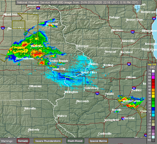 At 522 pm cdt, a severe thunderstorm was located near vinton, moving southeast at 30 mph (radar indicated). Hazards include 60 mph wind gusts and quarter size hail. Hail damage to vehicles is expected. expect wind damage to roofs, siding, and trees. locations impacted include, vinton, urbana, garrison, brandon, mount auburn, lime creek county park, vinton memorial airport, rodgers park, benton city park, hoefle-dulin park, spencers grove, benton county fairgrounds, minne estema park and cheney. This includes interstate 380 between mile markers 42 and 55. At 522 pm cdt, a severe thunderstorm was located near vinton, moving southeast at 30 mph (radar indicated). Hazards include 60 mph wind gusts and quarter size hail. Hail damage to vehicles is expected. expect wind damage to roofs, siding, and trees. locations impacted include, vinton, urbana, garrison, brandon, mount auburn, lime creek county park, vinton memorial airport, rodgers park, benton city park, hoefle-dulin park, spencers grove, benton county fairgrounds, minne estema park and cheney. This includes interstate 380 between mile markers 42 and 55.
|
| 7/11/2020 5:11 PM CDT |
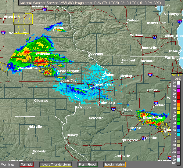 At 511 pm cdt, a severe thunderstorm was located over mount auburn, or 7 miles northwest of vinton, moving southeast at 25 mph (radar indicated). Hazards include 60 mph wind gusts and quarter size hail. Hail damage to vehicles is expected. expect wind damage to roofs, siding, and trees. locations impacted include, vinton, urbana, garrison, brandon, mount auburn, lime creek county park, vinton memorial airport, rodgers park, benton city park, hoefle-dulin park, spencers grove, benton county fairgrounds, minne estema park and cheney. This includes interstate 380 between mile markers 42 and 55. At 511 pm cdt, a severe thunderstorm was located over mount auburn, or 7 miles northwest of vinton, moving southeast at 25 mph (radar indicated). Hazards include 60 mph wind gusts and quarter size hail. Hail damage to vehicles is expected. expect wind damage to roofs, siding, and trees. locations impacted include, vinton, urbana, garrison, brandon, mount auburn, lime creek county park, vinton memorial airport, rodgers park, benton city park, hoefle-dulin park, spencers grove, benton county fairgrounds, minne estema park and cheney. This includes interstate 380 between mile markers 42 and 55.
|
| 7/11/2020 4:58 PM CDT |
 At 458 pm cdt, a severe thunderstorm was located over la porte city, or 12 miles northwest of vinton, moving southeast at 25 mph (radar indicated). Hazards include 60 mph wind gusts and quarter size hail. Hail damage to vehicles is expected. expect wind damage to roofs, siding, and trees. locations impacted include, vinton, urbana, garrison, brandon, mount auburn, lime creek county park, vinton memorial airport, rodgers park, benton city park, hoefle-dulin park, spencers grove, benton county fairgrounds, minne estema park and cheney. This includes interstate 380 between mile markers 42 and 55. At 458 pm cdt, a severe thunderstorm was located over la porte city, or 12 miles northwest of vinton, moving southeast at 25 mph (radar indicated). Hazards include 60 mph wind gusts and quarter size hail. Hail damage to vehicles is expected. expect wind damage to roofs, siding, and trees. locations impacted include, vinton, urbana, garrison, brandon, mount auburn, lime creek county park, vinton memorial airport, rodgers park, benton city park, hoefle-dulin park, spencers grove, benton county fairgrounds, minne estema park and cheney. This includes interstate 380 between mile markers 42 and 55.
|
| 7/11/2020 4:50 PM CDT |
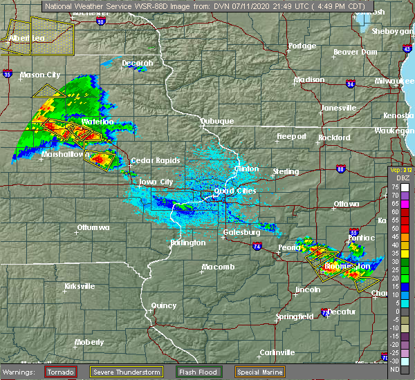 At 450 pm cdt, a severe thunderstorm was located over la porte city, or 13 miles southeast of waterloo, moving southeast at 30 mph (radar indicated). Hazards include 60 mph wind gusts and quarter size hail. Hail damage to vehicles is expected. Expect wind damage to roofs, siding, and trees. At 450 pm cdt, a severe thunderstorm was located over la porte city, or 13 miles southeast of waterloo, moving southeast at 30 mph (radar indicated). Hazards include 60 mph wind gusts and quarter size hail. Hail damage to vehicles is expected. Expect wind damage to roofs, siding, and trees.
|
| 7/11/2020 4:39 PM CDT |
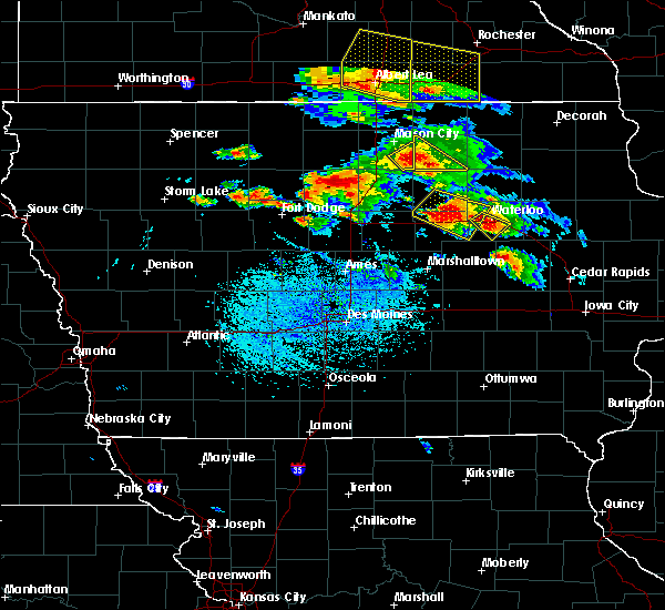 At 439 pm cdt, a severe thunderstorm was located over garrison, or 7 miles southwest of vinton, moving southeast at 25 mph (radar indicated). Hazards include 60 mph wind gusts and quarter size hail. Hail damage to vehicles is expected. Expect wind damage to roofs, siding, and trees. At 439 pm cdt, a severe thunderstorm was located over garrison, or 7 miles southwest of vinton, moving southeast at 25 mph (radar indicated). Hazards include 60 mph wind gusts and quarter size hail. Hail damage to vehicles is expected. Expect wind damage to roofs, siding, and trees.
|
| 7/9/2020 2:42 PM CDT |
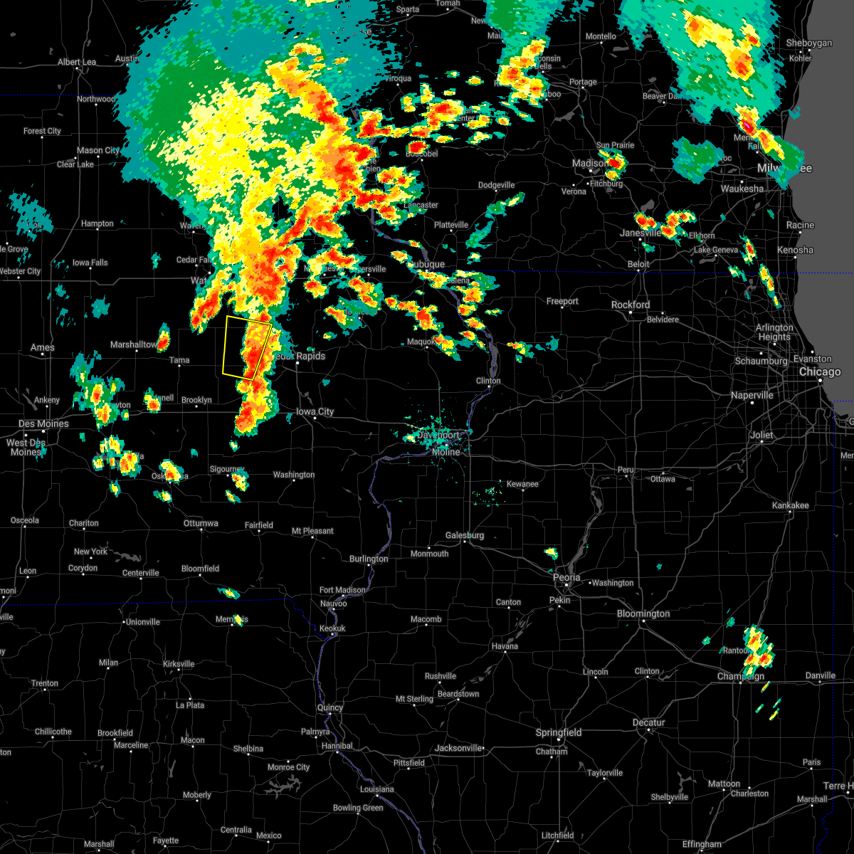 The severe thunderstorm warning for central benton county will expire at 245 pm cdt, the storm which prompted the warning has weakened below severe limits, and no longer poses an immediate threat to life or property. therefore, the warning will be allowed to expire. however gusty winds are still possible with this thunderstorm. a severe thunderstorm watch remains in effect until 700 pm cdt for east central iowa. The severe thunderstorm warning for central benton county will expire at 245 pm cdt, the storm which prompted the warning has weakened below severe limits, and no longer poses an immediate threat to life or property. therefore, the warning will be allowed to expire. however gusty winds are still possible with this thunderstorm. a severe thunderstorm watch remains in effect until 700 pm cdt for east central iowa.
|
| 7/9/2020 2:30 PM CDT |
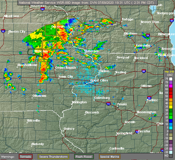 At 229 pm cdt, a severe thunderstorm was located over van horne, or 10 miles south of vinton, moving northeast at 25 mph (radar indicated). Hazards include 60 mph wind gusts and quarter size hail. Hail damage to vehicles is expected. expect wind damage to roofs, siding, and trees. Locations impacted include, vinton, newhall, blairstown, van horne, keystone, garrison, vinton memorial airport, benton county fairgrounds, rodgers park, wildcat bluff park, benton city park and hoefle-dulin park. At 229 pm cdt, a severe thunderstorm was located over van horne, or 10 miles south of vinton, moving northeast at 25 mph (radar indicated). Hazards include 60 mph wind gusts and quarter size hail. Hail damage to vehicles is expected. expect wind damage to roofs, siding, and trees. Locations impacted include, vinton, newhall, blairstown, van horne, keystone, garrison, vinton memorial airport, benton county fairgrounds, rodgers park, wildcat bluff park, benton city park and hoefle-dulin park.
|
| 7/9/2020 2:19 PM CDT |
 At 218 pm cdt, a severe thunderstorm was located near van horne, or 11 miles north of marengo, moving northeast at 25 mph (radar indicated). Hazards include 60 mph wind gusts and quarter size hail. Hail damage to vehicles is expected. Expect wind damage to roofs, siding, and trees. At 218 pm cdt, a severe thunderstorm was located near van horne, or 11 miles north of marengo, moving northeast at 25 mph (radar indicated). Hazards include 60 mph wind gusts and quarter size hail. Hail damage to vehicles is expected. Expect wind damage to roofs, siding, and trees.
|
| 6/4/2020 6:51 PM CDT |
 At 651 pm cdt, severe thunderstorms were located along a line extending from near brandon to near vinton, moving east at 30 mph (radar indicated). Hazards include 60 mph wind gusts and quarter size hail. Hail damage to vehicles is expected. expect wind damage to roofs, siding, and trees. locations impacted include, vinton, urbana, shellsburg, garrison, mount auburn, vinton memorial airport, rodgers park, benton city park, hoefle-dulin park, spencers grove, benton county fairgrounds, minne estema park, wildcat bluff park and cheney. This includes interstate 380 between mile markers 40 and 48. At 651 pm cdt, severe thunderstorms were located along a line extending from near brandon to near vinton, moving east at 30 mph (radar indicated). Hazards include 60 mph wind gusts and quarter size hail. Hail damage to vehicles is expected. expect wind damage to roofs, siding, and trees. locations impacted include, vinton, urbana, shellsburg, garrison, mount auburn, vinton memorial airport, rodgers park, benton city park, hoefle-dulin park, spencers grove, benton county fairgrounds, minne estema park, wildcat bluff park and cheney. This includes interstate 380 between mile markers 40 and 48.
|
| 6/4/2020 6:42 PM CDT |
 At 642 pm cdt, severe thunderstorms were located along a line extending from near mount auburn to garrison, moving east at 25 mph (radar indicated). Hazards include 60 mph wind gusts and penny size hail. Expect damage to roofs, siding, and trees. locations impacted include, vinton, urbana, dysart, shellsburg, garrison, mount auburn, vinton memorial airport, rodgers park, benton city park, hoefle-dulin park, spencers grove, benton county fairgrounds, minne estema park, wildcat bluff park and cheney. This includes interstate 380 between mile markers 40 and 48. At 642 pm cdt, severe thunderstorms were located along a line extending from near mount auburn to garrison, moving east at 25 mph (radar indicated). Hazards include 60 mph wind gusts and penny size hail. Expect damage to roofs, siding, and trees. locations impacted include, vinton, urbana, dysart, shellsburg, garrison, mount auburn, vinton memorial airport, rodgers park, benton city park, hoefle-dulin park, spencers grove, benton county fairgrounds, minne estema park, wildcat bluff park and cheney. This includes interstate 380 between mile markers 40 and 48.
|
| 6/4/2020 6:35 PM CDT |
 At 634 pm cdt, severe thunderstorms were located along a line extending from near mount auburn to near garrison, moving east at 25 mph (radar indicated). Hazards include 60 mph wind gusts and quarter size hail. Hail damage to vehicles is expected. Expect wind damage to roofs, siding, and trees. At 634 pm cdt, severe thunderstorms were located along a line extending from near mount auburn to near garrison, moving east at 25 mph (radar indicated). Hazards include 60 mph wind gusts and quarter size hail. Hail damage to vehicles is expected. Expect wind damage to roofs, siding, and trees.
|
| 3/28/2020 6:38 PM CDT |
 The severe thunderstorm warning for buchanan and central benton counties will expire at 645 pm cdt, the storms which prompted the warning have moved out of the area. therefore, the warning will be allowed to expire. a tornado watch remains in effect until 900 pm cdt for northeastern and east central iowa. to report severe weather, contact your nearest law enforcement agency. they will relay your report to the national weather service the quad cities. remember, a tornado warning still remains in effect for buchanan and northern benton counties. The severe thunderstorm warning for buchanan and central benton counties will expire at 645 pm cdt, the storms which prompted the warning have moved out of the area. therefore, the warning will be allowed to expire. a tornado watch remains in effect until 900 pm cdt for northeastern and east central iowa. to report severe weather, contact your nearest law enforcement agency. they will relay your report to the national weather service the quad cities. remember, a tornado warning still remains in effect for buchanan and northern benton counties.
|
| 3/28/2020 6:25 PM CDT |
 At 623 pm cdt, severe thunderstorms were located along a line extending from near oelwein to near keystone, moving northeast at 55 mph (trained weather spotters reported a tornado near fairbank, and additional rotating wall clouds over central benton county). Hazards include 60 mph wind gusts. Expect damage to roofs, siding, and trees. locations impacted include, independence, vinton, jesup, urbana, fairbank, hazleton, blairstown, van horne, keystone, garrison, brandon, rowley, aurora, mount auburn, stanley, luzerne, wapsipinicon golf course, vinton memorial airport, fontana county park and otterville. This includes interstate 380 between mile markers 44 and 55. At 623 pm cdt, severe thunderstorms were located along a line extending from near oelwein to near keystone, moving northeast at 55 mph (trained weather spotters reported a tornado near fairbank, and additional rotating wall clouds over central benton county). Hazards include 60 mph wind gusts. Expect damage to roofs, siding, and trees. locations impacted include, independence, vinton, jesup, urbana, fairbank, hazleton, blairstown, van horne, keystone, garrison, brandon, rowley, aurora, mount auburn, stanley, luzerne, wapsipinicon golf course, vinton memorial airport, fontana county park and otterville. This includes interstate 380 between mile markers 44 and 55.
|
| 3/28/2020 6:09 PM CDT |
 At 609 pm cdt, severe thunderstorms were located along a line extending from near fairbank to belle plaine, moving northeast at 50 mph (radar indicated). Hazards include 60 mph wind gusts. Expect damage to roofs, siding, and trees. locations impacted include, independence, vinton, belle plaine, jesup, urbana, fairbank, hazleton, blairstown, van horne, keystone, garrison, brandon, rowley, aurora, mount auburn, stanley, luzerne, wapsipinicon golf course, vinton memorial airport and fontana county park. This includes interstate 380 between mile markers 44 and 55. At 609 pm cdt, severe thunderstorms were located along a line extending from near fairbank to belle plaine, moving northeast at 50 mph (radar indicated). Hazards include 60 mph wind gusts. Expect damage to roofs, siding, and trees. locations impacted include, independence, vinton, belle plaine, jesup, urbana, fairbank, hazleton, blairstown, van horne, keystone, garrison, brandon, rowley, aurora, mount auburn, stanley, luzerne, wapsipinicon golf course, vinton memorial airport and fontana county park. This includes interstate 380 between mile markers 44 and 55.
|
| 3/28/2020 6:03 PM CDT |
 At 602 pm cdt, severe thunderstorms were located along a line extending from 6 miles southwest of fairbank to luzerne, moving northeast at 55 mph (radar indicated). Hazards include 60 mph wind gusts. expect damage to roofs, siding, and trees At 602 pm cdt, severe thunderstorms were located along a line extending from 6 miles southwest of fairbank to luzerne, moving northeast at 55 mph (radar indicated). Hazards include 60 mph wind gusts. expect damage to roofs, siding, and trees
|
| 9/18/2019 2:40 PM CDT |
 At 239 pm cdt, a severe thunderstorm was located over la porte city, or 11 miles northwest of vinton, moving east at 30 mph (radar indicated). Hazards include 60 mph wind gusts and quarter size hail. tree damage has been reported from this storm in dysart. Hail damage to vehicles is expected. Expect wind damage to roofs, siding, and trees. At 239 pm cdt, a severe thunderstorm was located over la porte city, or 11 miles northwest of vinton, moving east at 30 mph (radar indicated). Hazards include 60 mph wind gusts and quarter size hail. tree damage has been reported from this storm in dysart. Hail damage to vehicles is expected. Expect wind damage to roofs, siding, and trees.
|
| 6/15/2019 6:48 PM CDT |
 At 648 pm cdt, severe thunderstorms were located along a line extending from near garrison to near atkins to near walford, moving east at 40 mph (radar indicated). Hazards include 60 mph wind gusts. Expect damage to roofs, siding, and trees. Locations impacted include, vinton, belle plaine, atkins, walford, shellsburg, newhall, blairstown, van horne, keystone, norway, garrison, luzerne, benton city park, hoefle-dulin park, hannen lake park, watkins, benton county fairgrounds and wildcat bluff park. At 648 pm cdt, severe thunderstorms were located along a line extending from near garrison to near atkins to near walford, moving east at 40 mph (radar indicated). Hazards include 60 mph wind gusts. Expect damage to roofs, siding, and trees. Locations impacted include, vinton, belle plaine, atkins, walford, shellsburg, newhall, blairstown, van horne, keystone, norway, garrison, luzerne, benton city park, hoefle-dulin park, hannen lake park, watkins, benton county fairgrounds and wildcat bluff park.
|
| 6/15/2019 6:39 PM CDT |
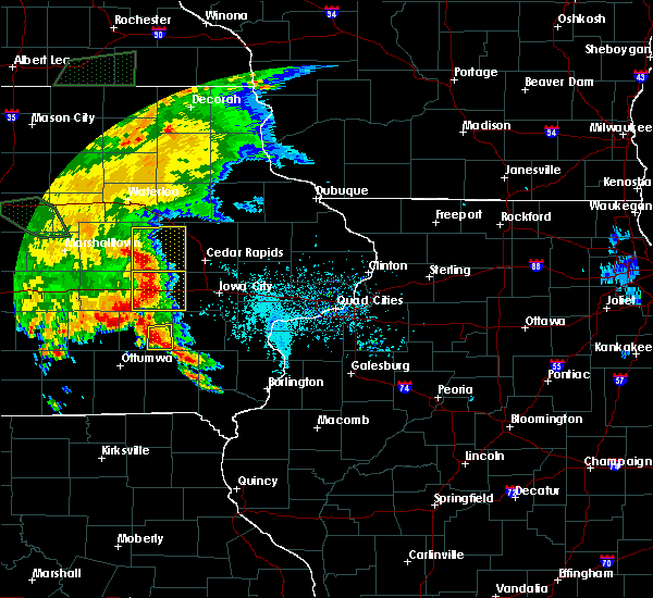 At 637 pm cdt, severe thunderstorms were located along a line extending from near dysart to near van horne to near blairstown, moving east at 40 mph (radar indicated. at 631 pm cdt measured 60 mph winds were reported near keystone). Hazards include 70 mph wind gusts. Expect considerable tree damage. damage is likely to mobile homes, roofs, and outbuildings. Locations impacted include, vinton, belle plaine, atkins, walford, shellsburg, newhall, blairstown, van horne, keystone, norway, garrison, luzerne, benton city park, hoefle-dulin park, hannen lake park, watkins, benton county fairgrounds and wildcat bluff park. At 637 pm cdt, severe thunderstorms were located along a line extending from near dysart to near van horne to near blairstown, moving east at 40 mph (radar indicated. at 631 pm cdt measured 60 mph winds were reported near keystone). Hazards include 70 mph wind gusts. Expect considerable tree damage. damage is likely to mobile homes, roofs, and outbuildings. Locations impacted include, vinton, belle plaine, atkins, walford, shellsburg, newhall, blairstown, van horne, keystone, norway, garrison, luzerne, benton city park, hoefle-dulin park, hannen lake park, watkins, benton county fairgrounds and wildcat bluff park.
|
| 6/15/2019 6:28 PM CDT |
 At 628 pm cdt, severe thunderstorms were located along a line extending from near dysart to keystone to near luzerne, moving east at 30 mph (radar indicated). Hazards include 70 mph wind gusts. Expect considerable tree damage. damage is likely to mobile homes, roofs, and outbuildings. locations impacted include, vinton, belle plaine, atkins, walford, urbana, dysart, shellsburg, newhall, blairstown, van horne, keystone, norway, garrison, luzerne, vinton memorial airport, rodgers park, benton city park, hoefle-dulin park, hannen lake park and watkins. This includes interstate 380 between mile markers 40 and 43. At 628 pm cdt, severe thunderstorms were located along a line extending from near dysart to keystone to near luzerne, moving east at 30 mph (radar indicated). Hazards include 70 mph wind gusts. Expect considerable tree damage. damage is likely to mobile homes, roofs, and outbuildings. locations impacted include, vinton, belle plaine, atkins, walford, urbana, dysart, shellsburg, newhall, blairstown, van horne, keystone, norway, garrison, luzerne, vinton memorial airport, rodgers park, benton city park, hoefle-dulin park, hannen lake park and watkins. This includes interstate 380 between mile markers 40 and 43.
|
| 6/15/2019 6:12 PM CDT |
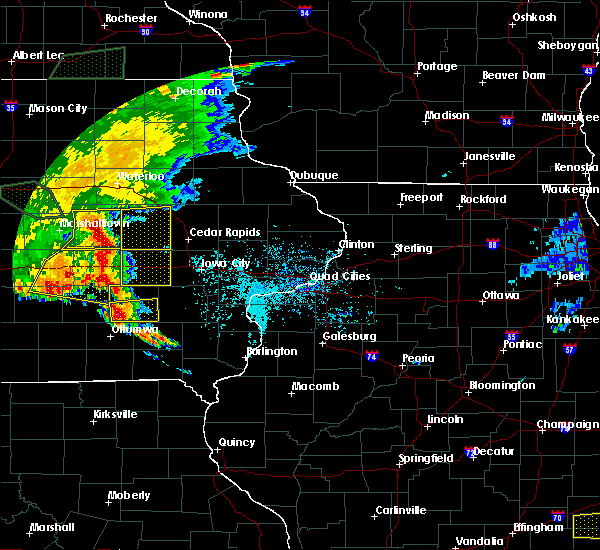 At 612 pm cdt, severe thunderstorms were located along a line extending from near dysart to near keystone to near belle plaine, moving east at 45 mph (radar indicated). Hazards include 70 mph wind gusts. Expect considerable tree damage. damage is likely to mobile homes, roofs, and outbuildings. locations impacted include, vinton, belle plaine, atkins, walford, urbana, dysart, shellsburg, newhall, blairstown, van horne, keystone, norway, garrison, luzerne, vinton memorial airport, rodgers park, benton city park, hoefle-dulin park, hannen lake park and watkins. This includes interstate 380 between mile markers 40 and 43. At 612 pm cdt, severe thunderstorms were located along a line extending from near dysart to near keystone to near belle plaine, moving east at 45 mph (radar indicated). Hazards include 70 mph wind gusts. Expect considerable tree damage. damage is likely to mobile homes, roofs, and outbuildings. locations impacted include, vinton, belle plaine, atkins, walford, urbana, dysart, shellsburg, newhall, blairstown, van horne, keystone, norway, garrison, luzerne, vinton memorial airport, rodgers park, benton city park, hoefle-dulin park, hannen lake park and watkins. This includes interstate 380 between mile markers 40 and 43.
|
| 6/15/2019 6:09 PM CDT |
 At 600 pm cdt, severe thunderstorms were located along a line extending from near traer to near toledo to near tama, moving east at 40 mph (radar indicated). Hazards include 70 mph wind gusts. Expect considerable tree damage. Damage is likely to mobile homes, roofs, and outbuildings. At 600 pm cdt, severe thunderstorms were located along a line extending from near traer to near toledo to near tama, moving east at 40 mph (radar indicated). Hazards include 70 mph wind gusts. Expect considerable tree damage. Damage is likely to mobile homes, roofs, and outbuildings.
|
| 6/15/2019 6:02 PM CDT |
 At 600 pm cdt, severe thunderstorms were located along a line extending from near traer to near toledo to near tama, moving east at 40 mph (radar indicated). Hazards include 70 mph wind gusts. Expect considerable tree damage. Damage is likely to mobile homes, roofs, and outbuildings. At 600 pm cdt, severe thunderstorms were located along a line extending from near traer to near toledo to near tama, moving east at 40 mph (radar indicated). Hazards include 70 mph wind gusts. Expect considerable tree damage. Damage is likely to mobile homes, roofs, and outbuildings.
|
| 5/24/2019 8:21 AM CDT |
 At 820 am cdt, a severe thunderstorm was located over mount auburn, or near vinton, moving northeast at 50 mph (radar indicated). Hazards include 60 mph wind gusts. Expect damage to roofs, siding, and trees. locations impacted include, vinton, center point, urbana, winthrop, walker, quasqueton, garrison, brandon, rowley, mount auburn, troy mills, lime creek county park, vinton memorial airport, rodgers park, benton city park, hoefle-dulin park, spencers grove, minne estema park, benton county fairgrounds and wildcat bluff park. This includes interstate 380 between mile markers 37 and 55. At 820 am cdt, a severe thunderstorm was located over mount auburn, or near vinton, moving northeast at 50 mph (radar indicated). Hazards include 60 mph wind gusts. Expect damage to roofs, siding, and trees. locations impacted include, vinton, center point, urbana, winthrop, walker, quasqueton, garrison, brandon, rowley, mount auburn, troy mills, lime creek county park, vinton memorial airport, rodgers park, benton city park, hoefle-dulin park, spencers grove, minne estema park, benton county fairgrounds and wildcat bluff park. This includes interstate 380 between mile markers 37 and 55.
|
| 5/24/2019 8:07 AM CDT |
 At 806 am cdt, a severe thunderstorm was located over dysart, or 16 miles west of vinton, moving northeast at 50 mph (radar indicated). Hazards include 60 mph wind gusts. expect damage to roofs, siding, and trees At 806 am cdt, a severe thunderstorm was located over dysart, or 16 miles west of vinton, moving northeast at 50 mph (radar indicated). Hazards include 60 mph wind gusts. expect damage to roofs, siding, and trees
|
| 4/22/2019 3:26 PM CDT |
 At 325 pm cdt, a severe thunderstorm was located near van horne, or near vinton, moving northeast at 40 mph. a second severe thunderstorm was located southwest of monti moving northeast (radar indicated). Hazards include quarter size hail. damage to vehicles is expected At 325 pm cdt, a severe thunderstorm was located near van horne, or near vinton, moving northeast at 40 mph. a second severe thunderstorm was located southwest of monti moving northeast (radar indicated). Hazards include quarter size hail. damage to vehicles is expected
|
| 10/9/2018 3:53 PM CDT |
 At 353 pm cdt, a severe thunderstorm capable of producing a tornado was located near blairstown, or 10 miles north of marengo, moving north at 25 mph (weather spotters reported a funnel cloud). Hazards include tornado and quarter size hail. Flying debris will be dangerous to those caught without shelter. mobile homes will be damaged or destroyed. damage to roofs, windows, and vehicles will occur. tree damage is likely. this dangerous storm will be near, van horne around 400 pm cdt. newhall around 405 pm cdt. shellsburg and garrison around 420 pm cdt. vinton around 430 pm cdt. Other locations impacted by this tornadic thunderstorm include hannen lake park, hoefle-dulin park and benton county fairgrounds. At 353 pm cdt, a severe thunderstorm capable of producing a tornado was located near blairstown, or 10 miles north of marengo, moving north at 25 mph (weather spotters reported a funnel cloud). Hazards include tornado and quarter size hail. Flying debris will be dangerous to those caught without shelter. mobile homes will be damaged or destroyed. damage to roofs, windows, and vehicles will occur. tree damage is likely. this dangerous storm will be near, van horne around 400 pm cdt. newhall around 405 pm cdt. shellsburg and garrison around 420 pm cdt. vinton around 430 pm cdt. Other locations impacted by this tornadic thunderstorm include hannen lake park, hoefle-dulin park and benton county fairgrounds.
|
| 10/9/2018 3:44 PM CDT |
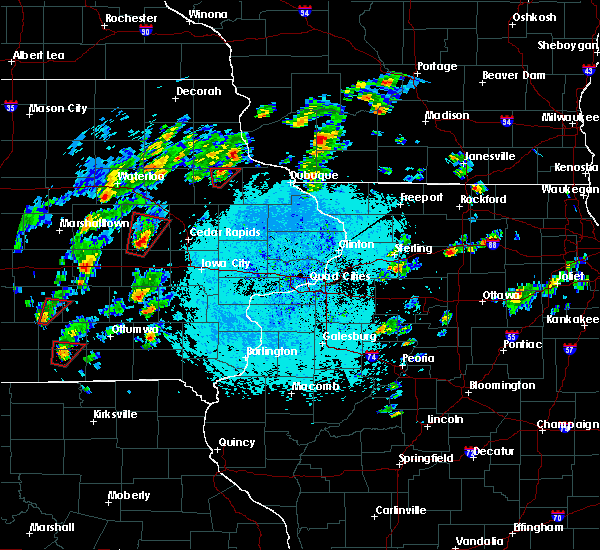 At 344 pm cdt, a severe thunderstorm capable of producing a tornado was located over blairstown, or near marengo, moving north at 20 mph (weather spotters reported a funnel cloud). Hazards include tornado and quarter size hail. Flying debris will be dangerous to those caught without shelter. mobile homes will be damaged or destroyed. damage to roofs, windows, and vehicles will occur. tree damage is likely. this dangerous storm will be near, keystone around 405 pm cdt. newhall and van horne around 410 pm cdt. vinton, shellsburg and garrison around 430 pm cdt. Other locations impacted by this tornadic thunderstorm include hannen lake park, koszta, hoefle-dulin park and benton county fairgrounds. At 344 pm cdt, a severe thunderstorm capable of producing a tornado was located over blairstown, or near marengo, moving north at 20 mph (weather spotters reported a funnel cloud). Hazards include tornado and quarter size hail. Flying debris will be dangerous to those caught without shelter. mobile homes will be damaged or destroyed. damage to roofs, windows, and vehicles will occur. tree damage is likely. this dangerous storm will be near, keystone around 405 pm cdt. newhall and van horne around 410 pm cdt. vinton, shellsburg and garrison around 430 pm cdt. Other locations impacted by this tornadic thunderstorm include hannen lake park, koszta, hoefle-dulin park and benton county fairgrounds.
|
| 10/9/2018 3:38 PM CDT |
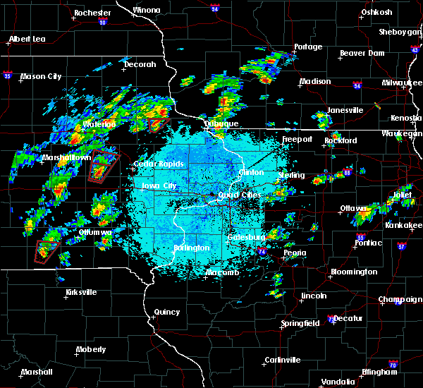 At 337 pm cdt, a severe thunderstorm capable of producing a tornado was located near luzerne, or near marengo, moving north at 25 mph (radar indicated rotation). Hazards include tornado. Flying debris will be dangerous to those caught without shelter. mobile homes will be damaged or destroyed. damage to roofs, windows, and vehicles will occur. tree damage is likely. this dangerous storm will be near, blairstown around 350 pm cdt. keystone around 400 pm cdt. newhall and van horne around 405 pm cdt. garrison around 420 pm cdt. shellsburg around 425 pm cdt. vinton around 430 pm cdt. Other locations impacted by this tornadic thunderstorm include hannen lake park, koszta, hoefle-dulin park and benton county fairgrounds. At 337 pm cdt, a severe thunderstorm capable of producing a tornado was located near luzerne, or near marengo, moving north at 25 mph (radar indicated rotation). Hazards include tornado. Flying debris will be dangerous to those caught without shelter. mobile homes will be damaged or destroyed. damage to roofs, windows, and vehicles will occur. tree damage is likely. this dangerous storm will be near, blairstown around 350 pm cdt. keystone around 400 pm cdt. newhall and van horne around 405 pm cdt. garrison around 420 pm cdt. shellsburg around 425 pm cdt. vinton around 430 pm cdt. Other locations impacted by this tornadic thunderstorm include hannen lake park, koszta, hoefle-dulin park and benton county fairgrounds.
|
| 10/8/2018 11:08 PM CDT |
 The severe thunderstorm warning for central benton county will expire at 1115 pm cdt, the storm which prompted the warning has weakened below severe limits, and no longer poses an immediate threat to life or property. therefore, the warning will be allowed to expire. however heavy rain is still possible with this thunderstorm. to report severe weather, contact your nearest law enforcement agency. they will relay your report to the national weather service the quad cities. The severe thunderstorm warning for central benton county will expire at 1115 pm cdt, the storm which prompted the warning has weakened below severe limits, and no longer poses an immediate threat to life or property. therefore, the warning will be allowed to expire. however heavy rain is still possible with this thunderstorm. to report severe weather, contact your nearest law enforcement agency. they will relay your report to the national weather service the quad cities.
|
| 10/8/2018 11:00 PM CDT |
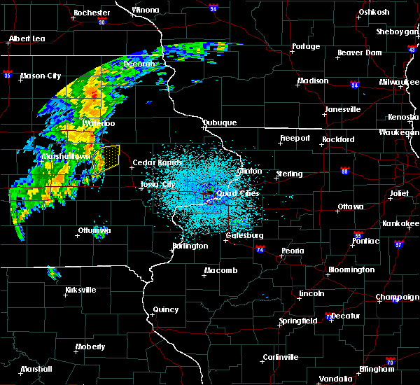 At 1100 pm cdt, a severe thunderstorm was located near van horne, or 10 miles south of vinton, moving northeast at 40 mph (radar indicated). Hazards include 60 mph wind gusts. Expect damage to roofs, siding, and trees. locations impacted include, vinton, atkins, urbana, shellsburg, newhall, blairstown, van horne, garrison, vinton memorial airport, rodgers park, benton city park, hoefle-dulin park, benton county fairgrounds and wildcat bluff park. This includes interstate 380 between mile markers 40 and 44. At 1100 pm cdt, a severe thunderstorm was located near van horne, or 10 miles south of vinton, moving northeast at 40 mph (radar indicated). Hazards include 60 mph wind gusts. Expect damage to roofs, siding, and trees. locations impacted include, vinton, atkins, urbana, shellsburg, newhall, blairstown, van horne, garrison, vinton memorial airport, rodgers park, benton city park, hoefle-dulin park, benton county fairgrounds and wildcat bluff park. This includes interstate 380 between mile markers 40 and 44.
|
| 10/8/2018 10:46 PM CDT |
 At 1045 pm cdt, a severe thunderstorm was located over luzerne, or 10 miles northwest of marengo, moving northeast at 40 mph. at 1044 pm cdt a trained spotter reported winds of 55 mph in belle plaine (radar indicated). Hazards include 60 mph wind gusts. Expect damage to roofs, siding, and trees. locations impacted include, vinton, marengo, belle plaine, atkins, walford, urbana, shellsburg, victor, newhall, blairstown, van horne, keystone, norway, garrison, ladora, luzerne, amana, middle amana, vinton memorial airport and upper south amana. This includes interstate 380 between mile markers 40 and 44. At 1045 pm cdt, a severe thunderstorm was located over luzerne, or 10 miles northwest of marengo, moving northeast at 40 mph. at 1044 pm cdt a trained spotter reported winds of 55 mph in belle plaine (radar indicated). Hazards include 60 mph wind gusts. Expect damage to roofs, siding, and trees. locations impacted include, vinton, marengo, belle plaine, atkins, walford, urbana, shellsburg, victor, newhall, blairstown, van horne, keystone, norway, garrison, ladora, luzerne, amana, middle amana, vinton memorial airport and upper south amana. This includes interstate 380 between mile markers 40 and 44.
|
| 10/8/2018 10:29 PM CDT |
 At 1029 pm cdt, a severe thunderstorm was located near belle plaine, or 14 miles west of marengo, moving northeast at 40 mph (radar indicated). Hazards include 60 mph wind gusts. expect damage to roofs, siding, and trees At 1029 pm cdt, a severe thunderstorm was located near belle plaine, or 14 miles west of marengo, moving northeast at 40 mph (radar indicated). Hazards include 60 mph wind gusts. expect damage to roofs, siding, and trees
|
| 9/25/2018 1:03 PM CDT |
 At 103 pm cdt, severe thunderstorms were located along a line extending from near shellsburg to norway to near ladora, moving east at 50 mph (radar indicated). Hazards include 60 mph wind gusts. Expect damage to roofs, siding, and trees. locations impacted include, cedar rapids, iowa city, vinton, marengo, marion, coralville, north liberty, hiawatha, mount vernon, robins, williamsburg, belle plaine, center point, lisbon, fairfax, solon, tiffin, ely, atkins and walford. this includes the following highways, interstate 80 in iowa between mile markers 205 and 248. Interstate 380 between mile markers 1 and 40. At 103 pm cdt, severe thunderstorms were located along a line extending from near shellsburg to norway to near ladora, moving east at 50 mph (radar indicated). Hazards include 60 mph wind gusts. Expect damage to roofs, siding, and trees. locations impacted include, cedar rapids, iowa city, vinton, marengo, marion, coralville, north liberty, hiawatha, mount vernon, robins, williamsburg, belle plaine, center point, lisbon, fairfax, solon, tiffin, ely, atkins and walford. this includes the following highways, interstate 80 in iowa between mile markers 205 and 248. Interstate 380 between mile markers 1 and 40.
|
| 9/25/2018 12:54 PM CDT |
 At 1254 pm cdt, severe thunderstorms were located along a line extending from near vinton to blairstown to near ladora, moving east at 50 mph (radar indicated). Hazards include 60 mph wind gusts. Expect damage to roofs, siding, and trees. locations impacted include, cedar rapids, iowa city, vinton, marengo, marion, coralville, north liberty, hiawatha, mount vernon, robins, williamsburg, belle plaine, center point, lisbon, fairfax, solon, tiffin, ely, atkins and walford. this includes the following highways, interstate 80 in iowa between mile markers 205 and 248. Interstate 380 between mile markers 1 and 40. At 1254 pm cdt, severe thunderstorms were located along a line extending from near vinton to blairstown to near ladora, moving east at 50 mph (radar indicated). Hazards include 60 mph wind gusts. Expect damage to roofs, siding, and trees. locations impacted include, cedar rapids, iowa city, vinton, marengo, marion, coralville, north liberty, hiawatha, mount vernon, robins, williamsburg, belle plaine, center point, lisbon, fairfax, solon, tiffin, ely, atkins and walford. this includes the following highways, interstate 80 in iowa between mile markers 205 and 248. Interstate 380 between mile markers 1 and 40.
|
| 9/25/2018 12:48 PM CDT |
 At 1248 pm cdt, severe thunderstorms were located along a line extending from near garrison to near luzerne to near victor, moving east at 50 mph (radar indicated). Hazards include 60 mph wind gusts. expect damage to roofs, siding, and trees At 1248 pm cdt, severe thunderstorms were located along a line extending from near garrison to near luzerne to near victor, moving east at 50 mph (radar indicated). Hazards include 60 mph wind gusts. expect damage to roofs, siding, and trees
|
| 9/3/2018 4:58 PM CDT |
 At 458 pm cdt, a severe thunderstorm capable of producing a tornado was located near shellsburg, or near vinton, moving northeast at 25 mph (radar indicated rotation). Hazards include tornado. Flying debris will be dangerous to those caught without shelter. mobile homes will be damaged or destroyed. damage to roofs, windows, and vehicles will occur. tree damage is likely. this dangerous storm will be near, urbana around 510 pm cdt. center point, walker and troy mills around 515 pm cdt. other locations impacted by this tornadic thunderstorm include spencers grove, vinton memorial airport, minne estema park, benton county fairgrounds, rodgers park, wildcat bluff park, benton city park, pleasant creek state recreation area, cheney and hoefle-dulin park. This includes interstate 380 between mile markers 34 and 49. At 458 pm cdt, a severe thunderstorm capable of producing a tornado was located near shellsburg, or near vinton, moving northeast at 25 mph (radar indicated rotation). Hazards include tornado. Flying debris will be dangerous to those caught without shelter. mobile homes will be damaged or destroyed. damage to roofs, windows, and vehicles will occur. tree damage is likely. this dangerous storm will be near, urbana around 510 pm cdt. center point, walker and troy mills around 515 pm cdt. other locations impacted by this tornadic thunderstorm include spencers grove, vinton memorial airport, minne estema park, benton county fairgrounds, rodgers park, wildcat bluff park, benton city park, pleasant creek state recreation area, cheney and hoefle-dulin park. This includes interstate 380 between mile markers 34 and 49.
|
| 9/3/2018 4:46 PM CDT |
 At 446 pm cdt, a confirmed tornado was located near vinton, moving northeast at 25 mph (law enforcement confirmed tornado). Hazards include damaging tornado. Flying debris will be dangerous to those caught without shelter. mobile homes will be damaged or destroyed. damage to roofs, windows, and vehicles will occur. tree damage is likely. this tornado will be near, shellsburg around 455 pm cdt. urbana around 505 pm cdt. center point around 510 pm cdt. walker and troy mills around 515 pm cdt. other locations impacted by this tornadic thunderstorm include spencers grove, vinton memorial airport, minne estema park, benton county fairgrounds, rodgers park, wildcat bluff park, benton city park, pleasant creek state recreation area, cheney and hoefle-dulin park. This includes interstate 380 between mile markers 34 and 49. At 446 pm cdt, a confirmed tornado was located near vinton, moving northeast at 25 mph (law enforcement confirmed tornado). Hazards include damaging tornado. Flying debris will be dangerous to those caught without shelter. mobile homes will be damaged or destroyed. damage to roofs, windows, and vehicles will occur. tree damage is likely. this tornado will be near, shellsburg around 455 pm cdt. urbana around 505 pm cdt. center point around 510 pm cdt. walker and troy mills around 515 pm cdt. other locations impacted by this tornadic thunderstorm include spencers grove, vinton memorial airport, minne estema park, benton county fairgrounds, rodgers park, wildcat bluff park, benton city park, pleasant creek state recreation area, cheney and hoefle-dulin park. This includes interstate 380 between mile markers 34 and 49.
|
| 9/3/2018 4:41 PM CDT |
 At 441 pm cdt, a severe thunderstorm capable of producing a tornado was located over vinton, moving northeast at 30 mph (radar indicated rotation). Hazards include tornado. Flying debris will be dangerous to those caught without shelter. mobile homes will be damaged or destroyed. damage to roofs, windows, and vehicles will occur. tree damage is likely. this dangerous storm will be near, shellsburg around 450 pm cdt. center point and urbana around 505 pm cdt. walker, rowley and troy mills around 515 pm cdt. other locations impacted by this tornadic thunderstorm include spencers grove, vinton memorial airport, minne estema park, benton county fairgrounds, rodgers park, wildcat bluff park, benton city park, pleasant creek state recreation area, cheney and hoefle-dulin park. This includes interstate 380 between mile markers 34 and 49. At 441 pm cdt, a severe thunderstorm capable of producing a tornado was located over vinton, moving northeast at 30 mph (radar indicated rotation). Hazards include tornado. Flying debris will be dangerous to those caught without shelter. mobile homes will be damaged or destroyed. damage to roofs, windows, and vehicles will occur. tree damage is likely. this dangerous storm will be near, shellsburg around 450 pm cdt. center point and urbana around 505 pm cdt. walker, rowley and troy mills around 515 pm cdt. other locations impacted by this tornadic thunderstorm include spencers grove, vinton memorial airport, minne estema park, benton county fairgrounds, rodgers park, wildcat bluff park, benton city park, pleasant creek state recreation area, cheney and hoefle-dulin park. This includes interstate 380 between mile markers 34 and 49.
|
| 6/9/2018 8:35 PM CDT |
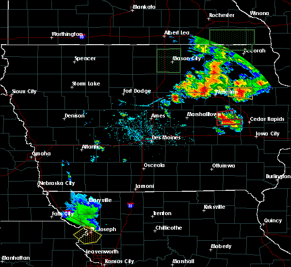 At 835 pm cdt, a severe thunderstorm capable of producing a tornado was located near keystone, or 15 miles southwest of vinton, moving east at 15 mph (radar indicated rotation). Hazards include tornado and half dollar size hail. Flying debris will be dangerous to those caught without shelter. mobile homes will be damaged or destroyed. damage to roofs, windows, and vehicles will occur. tree damage is likely. this dangerous storm will be near, garrison around 905 pm cdt. van horne around 910 pm cdt. vinton around 920 pm cdt. Other locations impacted by this tornadic thunderstorm include hoefle-dulin park and benton county fairgrounds. At 835 pm cdt, a severe thunderstorm capable of producing a tornado was located near keystone, or 15 miles southwest of vinton, moving east at 15 mph (radar indicated rotation). Hazards include tornado and half dollar size hail. Flying debris will be dangerous to those caught without shelter. mobile homes will be damaged or destroyed. damage to roofs, windows, and vehicles will occur. tree damage is likely. this dangerous storm will be near, garrison around 905 pm cdt. van horne around 910 pm cdt. vinton around 920 pm cdt. Other locations impacted by this tornadic thunderstorm include hoefle-dulin park and benton county fairgrounds.
|
| 6/9/2018 8:25 PM CDT |
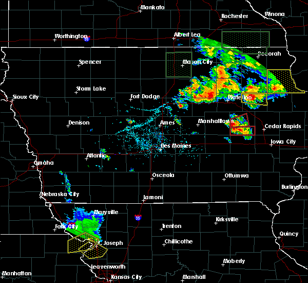 At 824 pm cdt, a severe thunderstorm capable of producing a tornado was located near dysart, or 13 miles northeast of toledo, moving east at 20 mph (radar indicated rotation). Hazards include tornado and half dollar size hail. Flying debris will be dangerous to those caught without shelter. mobile homes will be damaged or destroyed. damage to roofs, windows, and vehicles will occur. tree damage is likely. this dangerous storm will be near, garrison around 900 pm cdt. vinton around 920 pm cdt. Other locations impacted by this tornadic thunderstorm include rodgers park, vinton memorial airport, hoefle-dulin park and benton county fairgrounds. At 824 pm cdt, a severe thunderstorm capable of producing a tornado was located near dysart, or 13 miles northeast of toledo, moving east at 20 mph (radar indicated rotation). Hazards include tornado and half dollar size hail. Flying debris will be dangerous to those caught without shelter. mobile homes will be damaged or destroyed. damage to roofs, windows, and vehicles will occur. tree damage is likely. this dangerous storm will be near, garrison around 900 pm cdt. vinton around 920 pm cdt. Other locations impacted by this tornadic thunderstorm include rodgers park, vinton memorial airport, hoefle-dulin park and benton county fairgrounds.
|
| 6/29/2017 5:15 PM CDT |
 At 1013 pm cdt, severe thunderstorms were located along a line extending from near hazleton to near independence to near vinton to near belle plaine, moving east at 50 mph (trained spotters have reported up to 60 mph winds with this line of storms). Hazards include 60 mph wind gusts and penny size hail. Expect damage to roofs, siding, and trees. locations impacted include, independence, vinton, belle plaine, jesup, center point, atkins, urbana, fairbank, palo, shellsburg, newhall, winthrop, hazleton, walker, blairstown, van horne, keystone, quasqueton, norway and lamont. This includes interstate 380 between mile markers 48 and 55. At 1013 pm cdt, severe thunderstorms were located along a line extending from near hazleton to near independence to near vinton to near belle plaine, moving east at 50 mph (trained spotters have reported up to 60 mph winds with this line of storms). Hazards include 60 mph wind gusts and penny size hail. Expect damage to roofs, siding, and trees. locations impacted include, independence, vinton, belle plaine, jesup, center point, atkins, urbana, fairbank, palo, shellsburg, newhall, winthrop, hazleton, walker, blairstown, van horne, keystone, quasqueton, norway and lamont. This includes interstate 380 between mile markers 48 and 55.
|
| 6/29/2017 5:03 PM CDT |
 At 1002 pm cdt, severe thunderstorms were located along a line extending from fairbank to near jesup to dysart to toledo, moving east at 45 mph (radar indicated). Hazards include 60 mph wind gusts and penny size hail. Expect damage to roofs, siding, and trees. locations impacted include, independence, vinton, belle plaine, jesup, center point, atkins, urbana, fairbank, palo, shellsburg, newhall, winthrop, hazleton, walker, blairstown, van horne, keystone, quasqueton, norway and lamont. This includes interstate 380 between mile markers 48 and 55. At 1002 pm cdt, severe thunderstorms were located along a line extending from fairbank to near jesup to dysart to toledo, moving east at 45 mph (radar indicated). Hazards include 60 mph wind gusts and penny size hail. Expect damage to roofs, siding, and trees. locations impacted include, independence, vinton, belle plaine, jesup, center point, atkins, urbana, fairbank, palo, shellsburg, newhall, winthrop, hazleton, walker, blairstown, van horne, keystone, quasqueton, norway and lamont. This includes interstate 380 between mile markers 48 and 55.
|
| 6/29/2017 4:53 PM CDT |
 At 952 pm cdt, severe thunderstorms were located along a line extending from near denver to 6 miles northeast of traer to 10 miles southwest of meskwaki casino, moving east at 45 mph (radar indicated). Hazards include 60 mph wind gusts and penny size hail. expect damage to roofs, siding, and trees At 952 pm cdt, severe thunderstorms were located along a line extending from near denver to 6 miles northeast of traer to 10 miles southwest of meskwaki casino, moving east at 45 mph (radar indicated). Hazards include 60 mph wind gusts and penny size hail. expect damage to roofs, siding, and trees
|
| 6/28/2017 4:12 PM CDT |
 At 912 pm cdt, a severe thunderstorm was located near vinton, moving east at 50 mph (radar indicated). Hazards include 60 mph wind gusts and quarter size hail. Hail damage to vehicles is expected. Expect wind damage to roofs, siding, and trees. At 912 pm cdt, a severe thunderstorm was located near vinton, moving east at 50 mph (radar indicated). Hazards include 60 mph wind gusts and quarter size hail. Hail damage to vehicles is expected. Expect wind damage to roofs, siding, and trees.
|
| 6/28/2017 2:26 PM CDT |
 At 726 pm cdt, a severe thunderstorm was located over center point, or 13 miles east of vinton, moving east at 45 mph (trained weather spotters). Hazards include 60 mph wind gusts and quarter size hail. Hail damage to vehicles is expected. expect wind damage to roofs, siding, and trees. locations impacted include, vinton, center point, urbana, shellsburg, walker, van horne, alburnett, quasqueton, garrison, brandon, rowley, mount auburn, troy mills, vinton memorial airport, minne estema park, benton county fairgrounds, wildcat bluff park, cheney, lime creek county park and rodgers park. this includes interstate 380 between mile markers 48 and 53. A tornado watch remains in effect until 1000 pm cdt for northeastern and east central iowa. At 726 pm cdt, a severe thunderstorm was located over center point, or 13 miles east of vinton, moving east at 45 mph (trained weather spotters). Hazards include 60 mph wind gusts and quarter size hail. Hail damage to vehicles is expected. expect wind damage to roofs, siding, and trees. locations impacted include, vinton, center point, urbana, shellsburg, walker, van horne, alburnett, quasqueton, garrison, brandon, rowley, mount auburn, troy mills, vinton memorial airport, minne estema park, benton county fairgrounds, wildcat bluff park, cheney, lime creek county park and rodgers park. this includes interstate 380 between mile markers 48 and 53. A tornado watch remains in effect until 1000 pm cdt for northeastern and east central iowa.
|
| 6/28/2017 2:06 PM CDT |
 At 705 pm cdt, a severe thunderstorm was located over vinton, moving northeast at 45 mph (trained weather spotters). Hazards include 60 mph wind gusts and quarter size hail. Hail damage to vehicles is expected. expect wind damage to roofs, siding, and trees. locations impacted include, vinton, center point, urbana, palo, shellsburg, walker, van horne, alburnett, keystone, quasqueton, garrison, brandon, rowley, mount auburn, troy mills, vinton memorial airport, minne estema park, benton county fairgrounds, wildcat bluff park and cheney. this includes interstate 380 between mile markers 48 and 53. A tornado watch remains in effect until 1000 pm cdt for northeastern and east central iowa. At 705 pm cdt, a severe thunderstorm was located over vinton, moving northeast at 45 mph (trained weather spotters). Hazards include 60 mph wind gusts and quarter size hail. Hail damage to vehicles is expected. expect wind damage to roofs, siding, and trees. locations impacted include, vinton, center point, urbana, palo, shellsburg, walker, van horne, alburnett, keystone, quasqueton, garrison, brandon, rowley, mount auburn, troy mills, vinton memorial airport, minne estema park, benton county fairgrounds, wildcat bluff park and cheney. this includes interstate 380 between mile markers 48 and 53. A tornado watch remains in effect until 1000 pm cdt for northeastern and east central iowa.
|
| 6/16/2017 11:29 PM CDT |
 At 1129 pm cdt, a severe thunderstorm was located over van horne, or 10 miles southwest of vinton, moving east at 30 mph (radar indicated). Hazards include 60 mph wind gusts and quarter size hail. Hail damage to vehicles is expected. expect wind damage to roofs, siding, and trees. locations impacted include, cedar rapids, vinton, belle plaine, fairfax, atkins, walford, palo, shellsburg, newhall, blairstown, van horne, keystone, norway, garrison, luzerne, toddville, pleasant creek state recreation area, hannen lake park, watkins and benton county fairgrounds. This includes interstate 380 between mile markers 31 and 34. At 1129 pm cdt, a severe thunderstorm was located over van horne, or 10 miles southwest of vinton, moving east at 30 mph (radar indicated). Hazards include 60 mph wind gusts and quarter size hail. Hail damage to vehicles is expected. expect wind damage to roofs, siding, and trees. locations impacted include, cedar rapids, vinton, belle plaine, fairfax, atkins, walford, palo, shellsburg, newhall, blairstown, van horne, keystone, norway, garrison, luzerne, toddville, pleasant creek state recreation area, hannen lake park, watkins and benton county fairgrounds. This includes interstate 380 between mile markers 31 and 34.
|
| 6/16/2017 11:23 PM CDT |
 At 1122 pm cdt, a severe thunderstorm was located over keystone, or 12 miles southwest of vinton, moving east at 30 mph (radar indicated). Hazards include 60 mph wind gusts and quarter size hail. Hail damage to vehicles is expected. Expect wind damage to roofs, siding, and trees. At 1122 pm cdt, a severe thunderstorm was located over keystone, or 12 miles southwest of vinton, moving east at 30 mph (radar indicated). Hazards include 60 mph wind gusts and quarter size hail. Hail damage to vehicles is expected. Expect wind damage to roofs, siding, and trees.
|
| 5/17/2017 6:10 PM CDT |
 At 610 pm cdt, severe thunderstorms were located along a line extending from near mount auburn to near shellsburg to near hiawatha to near kinross, moving northeast at 55 mph (trained weather spotters). Hazards include 70 mph wind gusts and quarter size hail. Hail damage to vehicles is expected. expect considerable tree damage. wind damage is also likely to mobile homes, roofs, and outbuildings. locations impacted include, cedar rapids, iowa city, independence, vinton, manchester, west branch, marion, coralville, north liberty, hiawatha, mount vernon, robins, jesup, center point, kalona, lisbon, fairfax, solon, tiffin and ely. this includes the following highways, interstate 80 in iowa between mile markers 224 and 253. interstate 380 between mile markers 1 and 55. A tornado watch remains in effect until 1100 pm cdt for southeastern, northeastern and east central iowa. At 610 pm cdt, severe thunderstorms were located along a line extending from near mount auburn to near shellsburg to near hiawatha to near kinross, moving northeast at 55 mph (trained weather spotters). Hazards include 70 mph wind gusts and quarter size hail. Hail damage to vehicles is expected. expect considerable tree damage. wind damage is also likely to mobile homes, roofs, and outbuildings. locations impacted include, cedar rapids, iowa city, independence, vinton, manchester, west branch, marion, coralville, north liberty, hiawatha, mount vernon, robins, jesup, center point, kalona, lisbon, fairfax, solon, tiffin and ely. this includes the following highways, interstate 80 in iowa between mile markers 224 and 253. interstate 380 between mile markers 1 and 55. A tornado watch remains in effect until 1100 pm cdt for southeastern, northeastern and east central iowa.
|
| 5/17/2017 6:04 PM CDT |
 At 604 pm cdt, severe thunderstorms were located along a line extending from near la porte city to near palo to near kinross, moving northeast at 45 mph (trained weather spotters). Hazards include 70 mph wind gusts and quarter size hail. Hail damage to vehicles is expected. expect considerable tree damage. wind damage is also likely to mobile homes, roofs, and outbuildings. locations impacted include, cedar rapids, iowa city, independence, vinton, manchester, west branch, marion, coralville, north liberty, hiawatha, mount vernon, robins, jesup, center point, kalona, lisbon, fairfax, solon, tiffin and ely. this includes the following highways, interstate 80 in iowa between mile markers 224 and 253. interstate 380 between mile markers 1 and 55. A tornado watch remains in effect until 1100 pm cdt for southeastern, northeastern and east central iowa. At 604 pm cdt, severe thunderstorms were located along a line extending from near la porte city to near palo to near kinross, moving northeast at 45 mph (trained weather spotters). Hazards include 70 mph wind gusts and quarter size hail. Hail damage to vehicles is expected. expect considerable tree damage. wind damage is also likely to mobile homes, roofs, and outbuildings. locations impacted include, cedar rapids, iowa city, independence, vinton, manchester, west branch, marion, coralville, north liberty, hiawatha, mount vernon, robins, jesup, center point, kalona, lisbon, fairfax, solon, tiffin and ely. this includes the following highways, interstate 80 in iowa between mile markers 224 and 253. interstate 380 between mile markers 1 and 55. A tornado watch remains in effect until 1100 pm cdt for southeastern, northeastern and east central iowa.
|
| 5/17/2017 5:58 PM CDT |
 The severe thunderstorm warning for central keokuk, benton and iowa counties will expire at 600 pm cdt, the storms which prompted the warning have moved out of the area. therefore, the warning will be allowed to expire. however heavy rain is still possible with these thunderstorms. a tornado watch remains in effect until 1100 pm cdt for southeastern, northeastern and east central iowa. remember, a severe thunderstorm warning still remains in effect for eastern benton and eastern iowa county. The severe thunderstorm warning for central keokuk, benton and iowa counties will expire at 600 pm cdt, the storms which prompted the warning have moved out of the area. therefore, the warning will be allowed to expire. however heavy rain is still possible with these thunderstorms. a tornado watch remains in effect until 1100 pm cdt for southeastern, northeastern and east central iowa. remember, a severe thunderstorm warning still remains in effect for eastern benton and eastern iowa county.
|
| 5/17/2017 5:56 PM CDT |
 At 555 pm cdt, severe thunderstorms were located along a line extending from near dysart to newhall to kinross, moving northeast at 45 mph (trained weather spotters). Hazards include 70 mph wind gusts and quarter size hail. Hail damage to vehicles is expected. expect considerable tree damage. wind damage is also likely to mobile homes, roofs, and outbuildings. locations impacted include, cedar rapids, iowa city, independence, vinton, manchester, west branch, marion, coralville, north liberty, hiawatha, mount vernon, robins, jesup, center point, kalona, lisbon, fairfax, solon, tiffin and ely. this includes the following highways, interstate 80 in iowa between mile markers 224 and 253. interstate 380 between mile markers 1 and 55. A tornado watch remains in effect until 1100 pm cdt for southeastern, northeastern and east central iowa. At 555 pm cdt, severe thunderstorms were located along a line extending from near dysart to newhall to kinross, moving northeast at 45 mph (trained weather spotters). Hazards include 70 mph wind gusts and quarter size hail. Hail damage to vehicles is expected. expect considerable tree damage. wind damage is also likely to mobile homes, roofs, and outbuildings. locations impacted include, cedar rapids, iowa city, independence, vinton, manchester, west branch, marion, coralville, north liberty, hiawatha, mount vernon, robins, jesup, center point, kalona, lisbon, fairfax, solon, tiffin and ely. this includes the following highways, interstate 80 in iowa between mile markers 224 and 253. interstate 380 between mile markers 1 and 55. A tornado watch remains in effect until 1100 pm cdt for southeastern, northeastern and east central iowa.
|
| 5/17/2017 5:51 PM CDT |
 At 551 pm cdt, severe thunderstorms were located along a line extending from near dysart to near norway to near south english, moving northeast at 45 mph (trained weather spotters). Hazards include 70 mph wind gusts and quarter size hail. Hail damage to vehicles is expected. expect considerable tree damage. wind damage is also likely to mobile homes, roofs, and outbuildings. locations impacted include, vinton, marengo, sigourney, williamsburg, belle plaine, atkins, urbana, north english, shellsburg, newhall, hedrick, blairstown, van horne, keystone, norway, garrison, ladora, keswick, south english and parnell. this includes the following highways, interstate 80 in iowa between mile markers 208 and 227. interstate 380 between mile markers 42 and 48. A tornado watch remains in effect until 1100 pm cdt for southeastern, northeastern and east central iowa. At 551 pm cdt, severe thunderstorms were located along a line extending from near dysart to near norway to near south english, moving northeast at 45 mph (trained weather spotters). Hazards include 70 mph wind gusts and quarter size hail. Hail damage to vehicles is expected. expect considerable tree damage. wind damage is also likely to mobile homes, roofs, and outbuildings. locations impacted include, vinton, marengo, sigourney, williamsburg, belle plaine, atkins, urbana, north english, shellsburg, newhall, hedrick, blairstown, van horne, keystone, norway, garrison, ladora, keswick, south english and parnell. this includes the following highways, interstate 80 in iowa between mile markers 208 and 227. interstate 380 between mile markers 42 and 48. A tornado watch remains in effect until 1100 pm cdt for southeastern, northeastern and east central iowa.
|
| 5/17/2017 5:50 PM CDT |
 At 550 pm cdt, severe thunderstorms were located along a line extending from near dysart to near norway to near kinross, moving northeast at 40 mph (radar indicated). Hazards include 70 mph wind gusts and quarter size hail. Hail damage to vehicles is expected. expect considerable tree damage. Wind damage is also likely to mobile homes, roofs, and outbuildings. At 550 pm cdt, severe thunderstorms were located along a line extending from near dysart to near norway to near kinross, moving northeast at 40 mph (radar indicated). Hazards include 70 mph wind gusts and quarter size hail. Hail damage to vehicles is expected. expect considerable tree damage. Wind damage is also likely to mobile homes, roofs, and outbuildings.
|
| 5/17/2017 5:43 PM CDT |
 At 543 pm cdt, severe thunderstorms were located along a line extending from near traer to near marengo to near harper, moving northeast at 40 mph (trained weather spotters). Hazards include 70 mph wind gusts and quarter size hail. Hail damage to vehicles is expected. expect considerable tree damage. wind damage is also likely to mobile homes, roofs, and outbuildings. locations impacted include, vinton, marengo, sigourney, williamsburg, belle plaine, atkins, urbana, dysart, north english, shellsburg, victor, newhall, hedrick, blairstown, van horne, what cheer, keystone, norway, garrison and delta. this includes the following highways, interstate 80 in iowa between mile markers 205 and 227. interstate 380 between mile markers 42 and 48. A tornado watch remains in effect until 1100 pm cdt for southeastern, northeastern and east central iowa. At 543 pm cdt, severe thunderstorms were located along a line extending from near traer to near marengo to near harper, moving northeast at 40 mph (trained weather spotters). Hazards include 70 mph wind gusts and quarter size hail. Hail damage to vehicles is expected. expect considerable tree damage. wind damage is also likely to mobile homes, roofs, and outbuildings. locations impacted include, vinton, marengo, sigourney, williamsburg, belle plaine, atkins, urbana, dysart, north english, shellsburg, victor, newhall, hedrick, blairstown, van horne, what cheer, keystone, norway, garrison and delta. this includes the following highways, interstate 80 in iowa between mile markers 205 and 227. interstate 380 between mile markers 42 and 48. A tornado watch remains in effect until 1100 pm cdt for southeastern, northeastern and east central iowa.
|
| 5/17/2017 5:31 PM CDT |
 At 531 pm cdt, severe thunderstorms were located along a line extending from near traer to near ladora to hayesville, moving northeast at 45 mph (radar indicated). Hazards include 70 mph wind gusts and quarter size hail. Hail damage to vehicles is expected. expect considerable tree damage. wind damage is also likely to mobile homes, roofs, and outbuildings. locations impacted include, vinton, marengo, sigourney, williamsburg, belle plaine, atkins, urbana, dysart, north english, shellsburg, victor, newhall, hedrick, blairstown, van horne, what cheer, keystone, norway, garrison and delta. this includes the following highways, interstate 80 in iowa between mile markers 205 and 227. interstate 380 between mile markers 42 and 48. A tornado watch remains in effect until 1100 pm cdt for southeastern, northeastern and east central iowa. At 531 pm cdt, severe thunderstorms were located along a line extending from near traer to near ladora to hayesville, moving northeast at 45 mph (radar indicated). Hazards include 70 mph wind gusts and quarter size hail. Hail damage to vehicles is expected. expect considerable tree damage. wind damage is also likely to mobile homes, roofs, and outbuildings. locations impacted include, vinton, marengo, sigourney, williamsburg, belle plaine, atkins, urbana, dysart, north english, shellsburg, victor, newhall, hedrick, blairstown, van horne, what cheer, keystone, norway, garrison and delta. this includes the following highways, interstate 80 in iowa between mile markers 205 and 227. interstate 380 between mile markers 42 and 48. A tornado watch remains in effect until 1100 pm cdt for southeastern, northeastern and east central iowa.
|
| 5/17/2017 5:26 PM CDT |
 At 526 pm cdt, severe thunderstorms were located along a line extending from 6 miles south of traer to near ladora to near hayesville, moving northeast at 50 mph (radar indicated). Hazards include 70 mph wind gusts and quarter size hail. Hail damage to vehicles is expected. expect considerable tree damage. wind damage is also likely to mobile homes, roofs, and outbuildings. locations impacted include, vinton, marengo, sigourney, williamsburg, belle plaine, atkins, urbana, dysart, north english, shellsburg, victor, newhall, hedrick, blairstown, van horne, what cheer, keystone, norway, garrison and delta. this includes the following highways, interstate 80 in iowa between mile markers 205 and 227. interstate 380 between mile markers 42 and 48. A tornado watch remains in effect until 1100 pm cdt for southeastern, northeastern and east central iowa. At 526 pm cdt, severe thunderstorms were located along a line extending from 6 miles south of traer to near ladora to near hayesville, moving northeast at 50 mph (radar indicated). Hazards include 70 mph wind gusts and quarter size hail. Hail damage to vehicles is expected. expect considerable tree damage. wind damage is also likely to mobile homes, roofs, and outbuildings. locations impacted include, vinton, marengo, sigourney, williamsburg, belle plaine, atkins, urbana, dysart, north english, shellsburg, victor, newhall, hedrick, blairstown, van horne, what cheer, keystone, norway, garrison and delta. this includes the following highways, interstate 80 in iowa between mile markers 205 and 227. interstate 380 between mile markers 42 and 48. A tornado watch remains in effect until 1100 pm cdt for southeastern, northeastern and east central iowa.
|
| 5/17/2017 5:20 PM CDT |
 At 520 pm cdt, severe thunderstorms were located along a line extending from 6 miles southeast of tama to 6 miles southeast of victor to delta, moving northeast at 50 mph (radar indicated). Hazards include 70 mph wind gusts and quarter size hail. Hail damage to vehicles is expected. expect considerable tree damage. wind damage is also likely to mobile homes, roofs, and outbuildings. locations impacted include, vinton, marengo, sigourney, williamsburg, belle plaine, atkins, urbana, dysart, north english, shellsburg, victor, newhall, hedrick, blairstown, van horne, what cheer, keystone, norway, garrison and delta. this includes the following highways, interstate 80 in iowa between mile markers 205 and 227. interstate 380 between mile markers 42 and 48. A tornado watch remains in effect until 1100 pm cdt for southeastern, northeastern and east central iowa. At 520 pm cdt, severe thunderstorms were located along a line extending from 6 miles southeast of tama to 6 miles southeast of victor to delta, moving northeast at 50 mph (radar indicated). Hazards include 70 mph wind gusts and quarter size hail. Hail damage to vehicles is expected. expect considerable tree damage. wind damage is also likely to mobile homes, roofs, and outbuildings. locations impacted include, vinton, marengo, sigourney, williamsburg, belle plaine, atkins, urbana, dysart, north english, shellsburg, victor, newhall, hedrick, blairstown, van horne, what cheer, keystone, norway, garrison and delta. this includes the following highways, interstate 80 in iowa between mile markers 205 and 227. interstate 380 between mile markers 42 and 48. A tornado watch remains in effect until 1100 pm cdt for southeastern, northeastern and east central iowa.
|
| 5/17/2017 5:12 PM CDT |
 At 512 pm cdt, severe thunderstorms were located along a line extending from near brooklyn to 7 miles west of millersburg to near hedrick, moving northeast at 50 mph (radar indicated). Hazards include 60 mph wind gusts and quarter size hail. Hail damage to vehicles is expected. expect wind damage to roofs, siding, and trees. locations impacted include, vinton, marengo, sigourney, williamsburg, belle plaine, atkins, urbana, dysart, north english, shellsburg, victor, newhall, hedrick, blairstown, van horne, what cheer, keystone, norway, garrison and delta. this includes the following highways, interstate 80 in iowa between mile markers 205 and 227. interstate 380 between mile markers 42 and 48. A tornado watch remains in effect until 1100 pm cdt for southeastern, northeastern and east central iowa. At 512 pm cdt, severe thunderstorms were located along a line extending from near brooklyn to 7 miles west of millersburg to near hedrick, moving northeast at 50 mph (radar indicated). Hazards include 60 mph wind gusts and quarter size hail. Hail damage to vehicles is expected. expect wind damage to roofs, siding, and trees. locations impacted include, vinton, marengo, sigourney, williamsburg, belle plaine, atkins, urbana, dysart, north english, shellsburg, victor, newhall, hedrick, blairstown, van horne, what cheer, keystone, norway, garrison and delta. this includes the following highways, interstate 80 in iowa between mile markers 205 and 227. interstate 380 between mile markers 42 and 48. A tornado watch remains in effect until 1100 pm cdt for southeastern, northeastern and east central iowa.
|
| 5/17/2017 5:03 PM CDT |
 At 503 pm cdt, severe thunderstorms were located along a line extending from near montezuma to near what cheer to near hedrick, moving northeast at 45 mph (radar indicated). Hazards include 60 mph wind gusts and quarter size hail. Hail damage to vehicles is expected. Expect wind damage to roofs, siding, and trees. At 503 pm cdt, severe thunderstorms were located along a line extending from near montezuma to near what cheer to near hedrick, moving northeast at 45 mph (radar indicated). Hazards include 60 mph wind gusts and quarter size hail. Hail damage to vehicles is expected. Expect wind damage to roofs, siding, and trees.
|
| 4/15/2017 8:52 PM CDT |
 At 851 pm cdt, a severe thunderstorm was located over keystone, or 13 miles north of marengo, moving east at 45 mph (radar indicated). Hazards include quarter size hail. Damage to vehicles is expected. locations impacted include, cedar rapids, vinton, marion, hiawatha, robins, belle plaine, center point, fairfax, atkins, central city, springville, palo, shellsburg, newhall, blairstown, van horne, alburnett, keystone, norway and garrison. This includes interstate 380 between mile markers 16 and 38. At 851 pm cdt, a severe thunderstorm was located over keystone, or 13 miles north of marengo, moving east at 45 mph (radar indicated). Hazards include quarter size hail. Damage to vehicles is expected. locations impacted include, cedar rapids, vinton, marion, hiawatha, robins, belle plaine, center point, fairfax, atkins, central city, springville, palo, shellsburg, newhall, blairstown, van horne, alburnett, keystone, norway and garrison. This includes interstate 380 between mile markers 16 and 38.
|
| 4/15/2017 8:47 PM CDT |
 At 847 pm cdt, a severe thunderstorm was located over keystone, or 14 miles northwest of marengo, moving east at 45 mph (radar indicated). Hazards include 60 mph wind gusts and quarter size hail. Hail damage to vehicles is expected. expect wind damage to roofs, siding, and trees. locations impacted include, cedar rapids, vinton, marion, hiawatha, robins, belle plaine, center point, fairfax, atkins, central city, springville, palo, shellsburg, newhall, blairstown, van horne, alburnett, keystone, norway and garrison. This includes interstate 380 between mile markers 16 and 38. At 847 pm cdt, a severe thunderstorm was located over keystone, or 14 miles northwest of marengo, moving east at 45 mph (radar indicated). Hazards include 60 mph wind gusts and quarter size hail. Hail damage to vehicles is expected. expect wind damage to roofs, siding, and trees. locations impacted include, cedar rapids, vinton, marion, hiawatha, robins, belle plaine, center point, fairfax, atkins, central city, springville, palo, shellsburg, newhall, blairstown, van horne, alburnett, keystone, norway and garrison. This includes interstate 380 between mile markers 16 and 38.
|
| 4/15/2017 8:41 PM CDT |
 At 840 pm cdt, a severe thunderstorm was located near belle plaine, or 13 miles east of toledo, moving east at 45 mph (radar indicated). Hazards include 60 mph wind gusts and quarter size hail. Hail damage to vehicles is expected. expect wind damage to roofs, siding, and trees. locations impacted include, cedar rapids, vinton, marion, hiawatha, robins, belle plaine, center point, fairfax, atkins, central city, springville, palo, shellsburg, newhall, blairstown, van horne, alburnett, keystone, norway and garrison. This includes interstate 380 between mile markers 16 and 38. At 840 pm cdt, a severe thunderstorm was located near belle plaine, or 13 miles east of toledo, moving east at 45 mph (radar indicated). Hazards include 60 mph wind gusts and quarter size hail. Hail damage to vehicles is expected. expect wind damage to roofs, siding, and trees. locations impacted include, cedar rapids, vinton, marion, hiawatha, robins, belle plaine, center point, fairfax, atkins, central city, springville, palo, shellsburg, newhall, blairstown, van horne, alburnett, keystone, norway and garrison. This includes interstate 380 between mile markers 16 and 38.
|
| 4/15/2017 8:37 PM CDT |
 At 836 pm cdt, a severe thunderstorm was located over luzerne, or 10 miles northwest of marengo, moving northeast at 35 mph. other severe thunderstorms are located over portions of linn county, near alburnett through marion (trained weather spotters). Hazards include 60 mph wind gusts and quarter size hail. Hail damage to vehicles is expected. expect wind damage to roofs, siding, and trees. locations impacted include, cedar rapids, vinton, marion, hiawatha, robins, belle plaine, center point, fairfax, atkins, central city, springville, palo, shellsburg, newhall, blairstown, van horne, alburnett, keystone, norway and garrison. This includes interstate 380 between mile markers 16 and 38. At 836 pm cdt, a severe thunderstorm was located over luzerne, or 10 miles northwest of marengo, moving northeast at 35 mph. other severe thunderstorms are located over portions of linn county, near alburnett through marion (trained weather spotters). Hazards include 60 mph wind gusts and quarter size hail. Hail damage to vehicles is expected. expect wind damage to roofs, siding, and trees. locations impacted include, cedar rapids, vinton, marion, hiawatha, robins, belle plaine, center point, fairfax, atkins, central city, springville, palo, shellsburg, newhall, blairstown, van horne, alburnett, keystone, norway and garrison. This includes interstate 380 between mile markers 16 and 38.
|
| 4/15/2017 8:30 PM CDT |
 At 830 pm cdt, a severe thunderstorm was located over luzerne, or 10 miles northwest of marengo, moving northeast at 35 mph (trained weather spotters). Hazards include 60 mph wind gusts and quarter size hail. Hail damage to vehicles is expected. expect wind damage to roofs, siding, and trees. locations impacted include, cedar rapids, vinton, marion, hiawatha, robins, belle plaine, center point, fairfax, atkins, central city, springville, palo, shellsburg, newhall, blairstown, van horne, alburnett, keystone, norway and garrison. This includes interstate 380 between mile markers 16 and 38. At 830 pm cdt, a severe thunderstorm was located over luzerne, or 10 miles northwest of marengo, moving northeast at 35 mph (trained weather spotters). Hazards include 60 mph wind gusts and quarter size hail. Hail damage to vehicles is expected. expect wind damage to roofs, siding, and trees. locations impacted include, cedar rapids, vinton, marion, hiawatha, robins, belle plaine, center point, fairfax, atkins, central city, springville, palo, shellsburg, newhall, blairstown, van horne, alburnett, keystone, norway and garrison. This includes interstate 380 between mile markers 16 and 38.
|
| 4/15/2017 8:25 PM CDT |
 At 824 pm cdt, a severe thunderstorm was located over toddville, or 7 miles northwest of cedar rapids, moving east at 30 mph (radar indicated). Hazards include 60 mph wind gusts and quarter size hail. Hail damage to vehicles is expected. expect wind damage to roofs, siding, and trees. locations impacted include, cedar rapids, vinton, marion, hiawatha, robins, belle plaine, center point, fairfax, atkins, central city, springville, palo, shellsburg, newhall, blairstown, van horne, alburnett, keystone, norway and garrison. This includes interstate 380 between mile markers 16 and 38. At 824 pm cdt, a severe thunderstorm was located over toddville, or 7 miles northwest of cedar rapids, moving east at 30 mph (radar indicated). Hazards include 60 mph wind gusts and quarter size hail. Hail damage to vehicles is expected. expect wind damage to roofs, siding, and trees. locations impacted include, cedar rapids, vinton, marion, hiawatha, robins, belle plaine, center point, fairfax, atkins, central city, springville, palo, shellsburg, newhall, blairstown, van horne, alburnett, keystone, norway and garrison. This includes interstate 380 between mile markers 16 and 38.
|
| 4/15/2017 8:18 PM CDT |
 At 818 pm cdt, a severe thunderstorm was located over palo, or 10 miles northwest of cedar rapids, moving east at 30 mph (radar indicated). Hazards include 60 mph wind gusts and quarter size hail. Hail damage to vehicles is expected. expect wind damage to roofs, siding, and trees. locations impacted include, cedar rapids, vinton, marion, hiawatha, robins, belle plaine, center point, fairfax, atkins, central city, springville, palo, shellsburg, newhall, blairstown, van horne, alburnett, keystone, norway and garrison. This includes interstate 380 between mile markers 16 and 38. At 818 pm cdt, a severe thunderstorm was located over palo, or 10 miles northwest of cedar rapids, moving east at 30 mph (radar indicated). Hazards include 60 mph wind gusts and quarter size hail. Hail damage to vehicles is expected. expect wind damage to roofs, siding, and trees. locations impacted include, cedar rapids, vinton, marion, hiawatha, robins, belle plaine, center point, fairfax, atkins, central city, springville, palo, shellsburg, newhall, blairstown, van horne, alburnett, keystone, norway and garrison. This includes interstate 380 between mile markers 16 and 38.
|
| 4/15/2017 8:14 PM CDT |
 At 814 pm cdt, a severe thunderstorm was located over shellsburg, or 8 miles southeast of vinton, moving east at 30 mph (radar indicated). Hazards include 60 mph wind gusts and quarter size hail. Hail damage to vehicles is expected. expect wind damage to roofs, siding, and trees. locations impacted include, cedar rapids, vinton, marion, hiawatha, robins, belle plaine, center point, fairfax, atkins, central city, springville, palo, shellsburg, newhall, blairstown, van horne, alburnett, keystone, norway and garrison. This includes interstate 380 between mile markers 16 and 38. At 814 pm cdt, a severe thunderstorm was located over shellsburg, or 8 miles southeast of vinton, moving east at 30 mph (radar indicated). Hazards include 60 mph wind gusts and quarter size hail. Hail damage to vehicles is expected. expect wind damage to roofs, siding, and trees. locations impacted include, cedar rapids, vinton, marion, hiawatha, robins, belle plaine, center point, fairfax, atkins, central city, springville, palo, shellsburg, newhall, blairstown, van horne, alburnett, keystone, norway and garrison. This includes interstate 380 between mile markers 16 and 38.
|
| 4/15/2017 8:08 PM CDT |
 At 808 pm cdt, a severe thunderstorm was located near newhall, or 7 miles southeast of vinton, moving east at 30 mph (radar indicated). Hazards include 60 mph wind gusts and quarter size hail. Hail damage to vehicles is expected. expect wind damage to roofs, siding, and trees. locations impacted include, cedar rapids, vinton, marion, hiawatha, robins, belle plaine, center point, fairfax, atkins, central city, springville, palo, shellsburg, newhall, blairstown, van horne, alburnett, keystone, norway and garrison. This includes interstate 380 between mile markers 16 and 38. At 808 pm cdt, a severe thunderstorm was located near newhall, or 7 miles southeast of vinton, moving east at 30 mph (radar indicated). Hazards include 60 mph wind gusts and quarter size hail. Hail damage to vehicles is expected. expect wind damage to roofs, siding, and trees. locations impacted include, cedar rapids, vinton, marion, hiawatha, robins, belle plaine, center point, fairfax, atkins, central city, springville, palo, shellsburg, newhall, blairstown, van horne, alburnett, keystone, norway and garrison. This includes interstate 380 between mile markers 16 and 38.
|
| 4/15/2017 8:00 PM CDT |
 At 759 pm cdt, a severe thunderstorm was located near newhall, or 8 miles south of vinton, moving east at 30 mph (radar indicated). Hazards include 60 mph wind gusts and quarter size hail. Hail damage to vehicles is expected. Expect wind damage to roofs, siding, and trees. At 759 pm cdt, a severe thunderstorm was located near newhall, or 8 miles south of vinton, moving east at 30 mph (radar indicated). Hazards include 60 mph wind gusts and quarter size hail. Hail damage to vehicles is expected. Expect wind damage to roofs, siding, and trees.
|
| 4/15/2017 7:14 PM CDT |
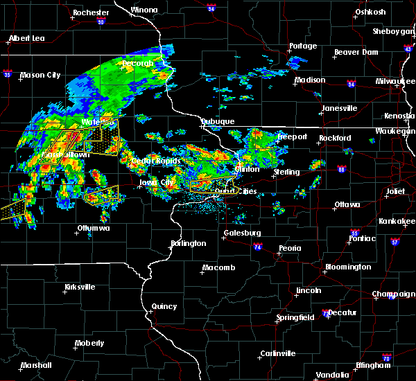 At 714 pm cdt, severe thunderstorms were located along a line extending from near waterloo to 9 miles northwest of dysart to traer, moving east at 35 mph (radar indicated). Hazards include 60 mph wind gusts and quarter size hail. Hail damage to vehicles is expected. Expect wind damage to roofs, siding, and trees. At 714 pm cdt, severe thunderstorms were located along a line extending from near waterloo to 9 miles northwest of dysart to traer, moving east at 35 mph (radar indicated). Hazards include 60 mph wind gusts and quarter size hail. Hail damage to vehicles is expected. Expect wind damage to roofs, siding, and trees.
|
| 3/6/2017 8:51 PM CST |
 At 850 pm cst, severe thunderstorms were located along a line extending from near strawberry point to near lamont to quasqueton to near shellsburg to near hiawatha to near williamsburg to near north english, moving northeast at 80 mph (trained weather spotters). Hazards include 70 mph wind gusts. Expect considerable tree damage. damage is likely to mobile homes, roofs, and outbuildings. locations impacted include, independence, vinton, marengo, williamsburg, jesup, atkins, walford, urbana, north english, shellsburg, newhall, winthrop, hazleton, blairstown, van horne, quasqueton, norway, lamont, garrison and brandon. this includes the following highways, interstate 80 in iowa between mile markers 217 and 229. interstate 380 between mile markers 40 and 54. A tornado watch remains in effect until 1000 pm cst for southeastern, northeastern and east central iowa. At 850 pm cst, severe thunderstorms were located along a line extending from near strawberry point to near lamont to quasqueton to near shellsburg to near hiawatha to near williamsburg to near north english, moving northeast at 80 mph (trained weather spotters). Hazards include 70 mph wind gusts. Expect considerable tree damage. damage is likely to mobile homes, roofs, and outbuildings. locations impacted include, independence, vinton, marengo, williamsburg, jesup, atkins, walford, urbana, north english, shellsburg, newhall, winthrop, hazleton, blairstown, van horne, quasqueton, norway, lamont, garrison and brandon. this includes the following highways, interstate 80 in iowa between mile markers 217 and 229. interstate 380 between mile markers 40 and 54. A tornado watch remains in effect until 1000 pm cst for southeastern, northeastern and east central iowa.
|
| 3/6/2017 8:31 PM CST |
 At 831 pm cst, severe thunderstorms were located along a line extending from near maynard to near independence to near mount auburn to near belle plaine to near ladora to near keswick to 6 miles east of oskaloosa, moving east at 50 mph. these are very dangerous storms! (trained weather spotters). Hazards include 90 mph wind gusts. You are in a life-threatening situation. flying debris may be deadly to those caught without shelter. mobile homes will be heavily damaged or destroyed. homes and businesses will have substantial roof and window damage. expect extensive tree damage and power outages. locations impacted include, independence, vinton, marengo, williamsburg, belle plaine, jesup, atkins, walford, urbana, dysart, fairbank, north english, shellsburg, victor, newhall, winthrop, hazleton, blairstown, van horne and keystone. this includes the following highways, interstate 80 in iowa between mile markers 205 and 229. interstate 380 between mile markers 40 and 55. A tornado watch remains in effect until 1000 pm cst for southeastern, northeastern and east central iowa. At 831 pm cst, severe thunderstorms were located along a line extending from near maynard to near independence to near mount auburn to near belle plaine to near ladora to near keswick to 6 miles east of oskaloosa, moving east at 50 mph. these are very dangerous storms! (trained weather spotters). Hazards include 90 mph wind gusts. You are in a life-threatening situation. flying debris may be deadly to those caught without shelter. mobile homes will be heavily damaged or destroyed. homes and businesses will have substantial roof and window damage. expect extensive tree damage and power outages. locations impacted include, independence, vinton, marengo, williamsburg, belle plaine, jesup, atkins, walford, urbana, dysart, fairbank, north english, shellsburg, victor, newhall, winthrop, hazleton, blairstown, van horne and keystone. this includes the following highways, interstate 80 in iowa between mile markers 205 and 229. interstate 380 between mile markers 40 and 55. A tornado watch remains in effect until 1000 pm cst for southeastern, northeastern and east central iowa.
|
| 3/6/2017 8:15 PM CST |
 At 814 pm cst, severe thunderstorms were located along a line extending from near fairbank to near jesup to dysart to 8 miles southeast of tama to near brooklyn to near new sharon to 8 miles northwest of eddyville, moving east at 60 mph (radar indicated). Hazards include 70 mph wind gusts. Expect considerable tree damage. damage is likely to mobile homes, roofs, and outbuildings. locations impacted include, independence, vinton, marengo, williamsburg, belle plaine, jesup, atkins, walford, urbana, dysart, fairbank, north english, shellsburg, victor, newhall, winthrop, hazleton, blairstown, van horne and keystone. this includes the following highways, interstate 80 in iowa between mile markers 205 and 229. interstate 380 between mile markers 40 and 55. A tornado watch remains in effect until 1000 pm cst for southeastern, northeastern and east central iowa. At 814 pm cst, severe thunderstorms were located along a line extending from near fairbank to near jesup to dysart to 8 miles southeast of tama to near brooklyn to near new sharon to 8 miles northwest of eddyville, moving east at 60 mph (radar indicated). Hazards include 70 mph wind gusts. Expect considerable tree damage. damage is likely to mobile homes, roofs, and outbuildings. locations impacted include, independence, vinton, marengo, williamsburg, belle plaine, jesup, atkins, walford, urbana, dysart, fairbank, north english, shellsburg, victor, newhall, winthrop, hazleton, blairstown, van horne and keystone. this includes the following highways, interstate 80 in iowa between mile markers 205 and 229. interstate 380 between mile markers 40 and 55. A tornado watch remains in effect until 1000 pm cst for southeastern, northeastern and east central iowa.
|
| 3/6/2017 8:02 PM CST |
 At 802 pm cst, severe thunderstorms were located along a line extending from 6 miles east of denver to near traer to near tama to near grinnell to 6 miles southwest of new sharon to 12 miles southeast of knoxville, moving east at 50 mph (radar indicated). Hazards include 70 mph wind gusts. Expect considerable tree damage. Damage is likely to mobile homes, roofs, and outbuildings. At 802 pm cst, severe thunderstorms were located along a line extending from 6 miles east of denver to near traer to near tama to near grinnell to 6 miles southwest of new sharon to 12 miles southeast of knoxville, moving east at 50 mph (radar indicated). Hazards include 70 mph wind gusts. Expect considerable tree damage. Damage is likely to mobile homes, roofs, and outbuildings.
|
| 8/4/2016 7:52 PM CDT |
 At 752 pm cdt, severe thunderstorms were located along a line extending from paris to near alburnett to near norway, moving east at 55 mph (radar indicated). Hazards include 70 mph wind gusts. Expect considerable tree damage. damage is likely to mobile homes, roofs, and outbuildings. Locations impacted include, cedar rapids, vinton, marion, hiawatha, mount vernon, robins, belle plaine, center point, lisbon, fairfax, ely, atkins, walford, urbana, central city, springville, palo, shellsburg, newhall and walker. At 752 pm cdt, severe thunderstorms were located along a line extending from paris to near alburnett to near norway, moving east at 55 mph (radar indicated). Hazards include 70 mph wind gusts. Expect considerable tree damage. damage is likely to mobile homes, roofs, and outbuildings. Locations impacted include, cedar rapids, vinton, marion, hiawatha, mount vernon, robins, belle plaine, center point, lisbon, fairfax, ely, atkins, walford, urbana, central city, springville, palo, shellsburg, newhall and walker.
|
| 8/4/2016 7:15 PM CDT |
 At 715 pm cdt, severe thunderstorms were located along a line extending from near la porte city to 9 miles northeast of toledo, moving east at 45 mph (radar indicated). Hazards include 60 mph wind gusts. Expect damage to roofs. siding. And trees. At 715 pm cdt, severe thunderstorms were located along a line extending from near la porte city to 9 miles northeast of toledo, moving east at 45 mph (radar indicated). Hazards include 60 mph wind gusts. Expect damage to roofs. siding. And trees.
|
| 7/17/2016 5:03 AM CDT |
 At 502 am cdt, severe thunderstorms were located along a line extending from near quasqueton to near van horne to near iowa speedway, moving southeast at 50 mph (radar indicated). Hazards include 60 mph wind gusts. Expect damage to roofs. siding. and trees. Locations impacted include, cedar rapids, iowa city, independence, vinton, marengo, marion, coralville, north liberty, hiawatha, mount vernon, robins, williamsburg, belle plaine, jesup, center point, lisbon, fairfax, solon, tiffin and ely. At 502 am cdt, severe thunderstorms were located along a line extending from near quasqueton to near van horne to near iowa speedway, moving southeast at 50 mph (radar indicated). Hazards include 60 mph wind gusts. Expect damage to roofs. siding. and trees. Locations impacted include, cedar rapids, iowa city, independence, vinton, marengo, marion, coralville, north liberty, hiawatha, mount vernon, robins, williamsburg, belle plaine, jesup, center point, lisbon, fairfax, solon, tiffin and ely.
|
| 7/17/2016 4:37 AM CDT |
 At 436 am cdt, severe thunderstorms were located along a line extending from near waterloo to near toledo to near bondurant, moving southeast at 60 mph (radar indicated). Hazards include 60 mph wind gusts. Expect damage to roofs. siding. And trees. At 436 am cdt, severe thunderstorms were located along a line extending from near waterloo to near toledo to near bondurant, moving southeast at 60 mph (radar indicated). Hazards include 60 mph wind gusts. Expect damage to roofs. siding. And trees.
|
| 5/26/2016 4:34 AM CDT |
 At 433 am cdt, severe thunderstorms were located along a line extending from 7 miles northeast of elk run heights to near garrison, moving northeast at 60 mph (radar indicated). Hazards include 70 mph wind gusts. Expect considerable tree damage. damage is likely to mobile homes, roofs, and outbuildings. these severe storms will be near, fairbank around 440 am cdt. urbana and hazleton around 445 am cdt. center point, walker and stanley around 450 am cdt. lamont, aurora and troy mills around 455 am cdt. other locations impacted by these severe thunderstorms include vinton memorial airport, benton county fairgrounds, cheney, fontana park, lafayette, hoefle-dulin park, littleton, independence airport, monti and minne estema park. This includes interstate 380 between mile markers 29 and 55. At 433 am cdt, severe thunderstorms were located along a line extending from 7 miles northeast of elk run heights to near garrison, moving northeast at 60 mph (radar indicated). Hazards include 70 mph wind gusts. Expect considerable tree damage. damage is likely to mobile homes, roofs, and outbuildings. these severe storms will be near, fairbank around 440 am cdt. urbana and hazleton around 445 am cdt. center point, walker and stanley around 450 am cdt. lamont, aurora and troy mills around 455 am cdt. other locations impacted by these severe thunderstorms include vinton memorial airport, benton county fairgrounds, cheney, fontana park, lafayette, hoefle-dulin park, littleton, independence airport, monti and minne estema park. This includes interstate 380 between mile markers 29 and 55.
|
| 5/26/2016 4:24 AM CDT |
 At 423 am cdt, severe thunderstorms were located along a line extending from crossroads mall to 6 miles south of dysart, moving east at 70 mph (radar indicated). Hazards include 70 mph wind gusts. Expect considerable tree damage. damage is likely to mobile homes, roofs, and outbuildings. severe thunderstorms will be near, garrison around 430 am cdt. vinton and jesup around 435 am cdt. shellsburg around 440 am cdt. independence, center point, urbana, palo and hazleton around 445 am cdt. robins, winthrop, stanley and toddville around 450 am cdt. alburnett, lamont and aurora around 455 am cdt. other locations impacted by these severe thunderstorms include vinton memorial airport, benton county fairgrounds, cheney, fontana park, lafayette, hoefle-dulin park, littleton, independence airport, monti and minne estema park. This includes interstate 380 between mile markers 29 and 55. At 423 am cdt, severe thunderstorms were located along a line extending from crossroads mall to 6 miles south of dysart, moving east at 70 mph (radar indicated). Hazards include 70 mph wind gusts. Expect considerable tree damage. damage is likely to mobile homes, roofs, and outbuildings. severe thunderstorms will be near, garrison around 430 am cdt. vinton and jesup around 435 am cdt. shellsburg around 440 am cdt. independence, center point, urbana, palo and hazleton around 445 am cdt. robins, winthrop, stanley and toddville around 450 am cdt. alburnett, lamont and aurora around 455 am cdt. other locations impacted by these severe thunderstorms include vinton memorial airport, benton county fairgrounds, cheney, fontana park, lafayette, hoefle-dulin park, littleton, independence airport, monti and minne estema park. This includes interstate 380 between mile markers 29 and 55.
|
| 11/11/2015 5:00 PM CST |
 At 459 pm cst, severe thunderstorms were located along a line extending from 7 miles west of la porte city to near garrison to marengo, moving northeast at 70 mph (radar indicated). Hazards include 60 mph wind gusts and nickel size hail. Expect damage to roofs. siding and trees. locations impacted include, vinton, marengo, williamsburg, belle plaine, atkins, walford, urbana, dysart, shellsburg, newhall, blairstown, van horne, keystone, norway, garrison, ladora, mount auburn, luzerne, conroy and amana. this includes the following highways, interstate 80 in iowa between mile markers 217 and 229. interstate 380 between mile markers 40 and 48. A tornado watch remains in effect until 900 pm cst for northeastern iowa. At 459 pm cst, severe thunderstorms were located along a line extending from 7 miles west of la porte city to near garrison to marengo, moving northeast at 70 mph (radar indicated). Hazards include 60 mph wind gusts and nickel size hail. Expect damage to roofs. siding and trees. locations impacted include, vinton, marengo, williamsburg, belle plaine, atkins, walford, urbana, dysart, shellsburg, newhall, blairstown, van horne, keystone, norway, garrison, ladora, mount auburn, luzerne, conroy and amana. this includes the following highways, interstate 80 in iowa between mile markers 217 and 229. interstate 380 between mile markers 40 and 48. A tornado watch remains in effect until 900 pm cst for northeastern iowa.
|
| 11/11/2015 4:28 PM CST |
 At 426 pm cst, severe thunderstorms were located along a line extending from near meskwaki casino to 7 miles west of brooklyn to 7 miles northeast of oskaloosa, moving northeast at 55 mph (radar indicated). Hazards include 60 mph wind gusts and nickel size hail. Expect damage to roofs. siding and trees. locations impacted include, vinton, marengo, williamsburg, belle plaine, atkins, walford, urbana, dysart, north english, shellsburg, victor, newhall, blairstown, van horne, keystone, norway, garrison, ladora, parnell and millersburg. this includes the following highways, interstate 80 in iowa between mile markers 205 and 229. interstate 380 between mile markers 40 and 48. A tornado watch remains in effect until 900 pm cst for northeastern iowa. At 426 pm cst, severe thunderstorms were located along a line extending from near meskwaki casino to 7 miles west of brooklyn to 7 miles northeast of oskaloosa, moving northeast at 55 mph (radar indicated). Hazards include 60 mph wind gusts and nickel size hail. Expect damage to roofs. siding and trees. locations impacted include, vinton, marengo, williamsburg, belle plaine, atkins, walford, urbana, dysart, north english, shellsburg, victor, newhall, blairstown, van horne, keystone, norway, garrison, ladora, parnell and millersburg. this includes the following highways, interstate 80 in iowa between mile markers 205 and 229. interstate 380 between mile markers 40 and 48. A tornado watch remains in effect until 900 pm cst for northeastern iowa.
|
| 11/11/2015 4:16 PM CST |
 At 415 pm cst, severe thunderstorms were located along a line extending from near marshalltown to near grinnell to near oskaloosa, moving northeast at 50 mph (radar indicated). Hazards include 60 mph wind gusts and nickel size hail. Expect damage to roofs. Siding and trees. At 415 pm cst, severe thunderstorms were located along a line extending from near marshalltown to near grinnell to near oskaloosa, moving northeast at 50 mph (radar indicated). Hazards include 60 mph wind gusts and nickel size hail. Expect damage to roofs. Siding and trees.
|
| 6/22/2015 9:06 AM CDT |
 At 904 am cdt, severe thunderstorms were located along a line extending from near prairieburg to near keystone, moving east at 65 mph (radar indicated). Hazards include 60 to 70 mph wind gusts and penny size hail. Expect considerable tree damage. damage is likely to mobile homes, roofs and outbuildings. locations impacted include, cedar rapids, vinton, marion, hiawatha, center point, lisbon, fairfax, central city, and springville. This includes interstate 380 between mile markers 12 and 48. At 904 am cdt, severe thunderstorms were located along a line extending from near prairieburg to near keystone, moving east at 65 mph (radar indicated). Hazards include 60 to 70 mph wind gusts and penny size hail. Expect considerable tree damage. damage is likely to mobile homes, roofs and outbuildings. locations impacted include, cedar rapids, vinton, marion, hiawatha, center point, lisbon, fairfax, central city, and springville. This includes interstate 380 between mile markers 12 and 48.
|
| 6/22/2015 8:58 AM CDT |
 At 854 am cdt, a line of severe thunderstorms were located along a line extending from ryan to 6 miles south of traer, moving east at 65 mph (radar indicated). Hazards include 60 to 70 mph wind gusts and penny size hail. Expect considerable tree damage. damage is likely to mobile homes, roofs and outbuildings. locations impacted include, cedar rapids, vinton, marion, hiawatha, center point, fairfax, atkins, walford, urbana, dysart, central city, and springville. This includes interstate 380 between mile markers 12 and 48. At 854 am cdt, a line of severe thunderstorms were located along a line extending from ryan to 6 miles south of traer, moving east at 65 mph (radar indicated). Hazards include 60 to 70 mph wind gusts and penny size hail. Expect considerable tree damage. damage is likely to mobile homes, roofs and outbuildings. locations impacted include, cedar rapids, vinton, marion, hiawatha, center point, fairfax, atkins, walford, urbana, dysart, central city, and springville. This includes interstate 380 between mile markers 12 and 48.
|
| 6/22/2015 8:44 AM CDT |
 At 843 am cdt, severe thunderstorms were located along a line extending from near masonville to 7 miles west of traer, moving east at 65 mph (radar indicated). Hazards include 70 mph wind gusts and penny size hail. Expect considerable tree damage. Damage is likely to mobile homes, roofs and outbuildings. At 843 am cdt, severe thunderstorms were located along a line extending from near masonville to 7 miles west of traer, moving east at 65 mph (radar indicated). Hazards include 70 mph wind gusts and penny size hail. Expect considerable tree damage. Damage is likely to mobile homes, roofs and outbuildings.
|
| 6/30/2014 2:23 PM CDT | Widespread damage in benton county IA, 0.3 miles NW of Garrison, IA |
| 6/30/2014 2:23 PM CDT | Widespread wind damage across western benton county in benton county IA, 4.1 miles ESE of Garrison, IA |
| 6/30/2014 2:23 PM CDT | Widespread wind damage across western benton county in benton county IA, 4.1 miles ESE of Garrison, IA |
Hail Maps for Garrison, IA
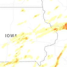

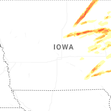
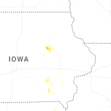
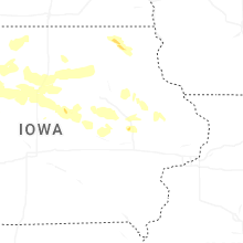


Connect with Interactive Hail Maps