

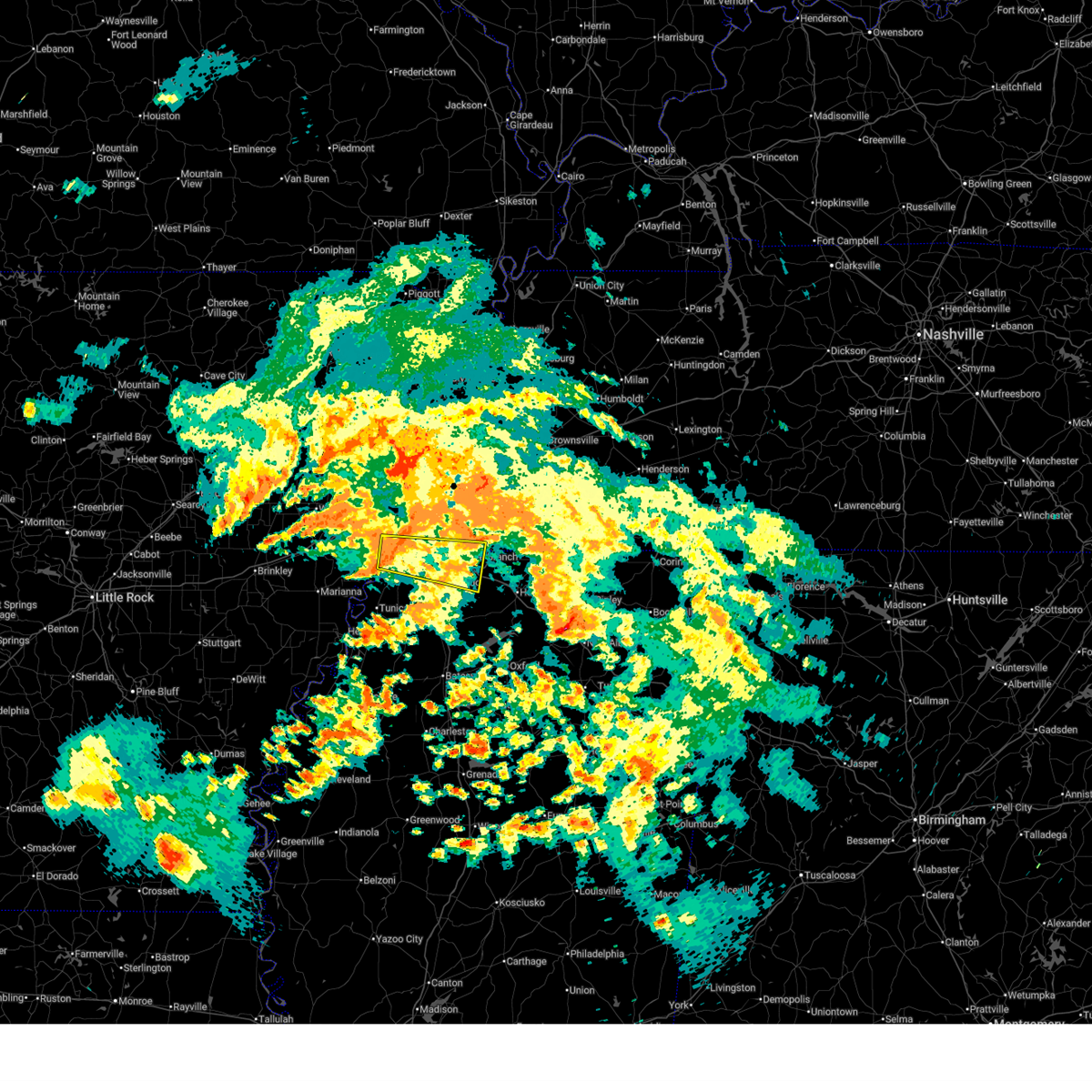
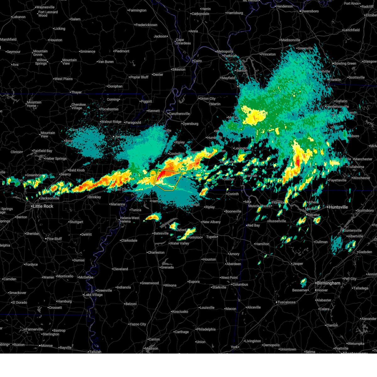
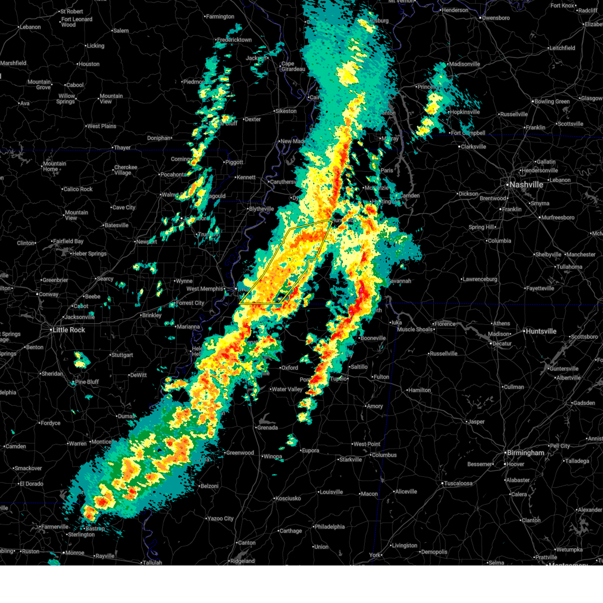
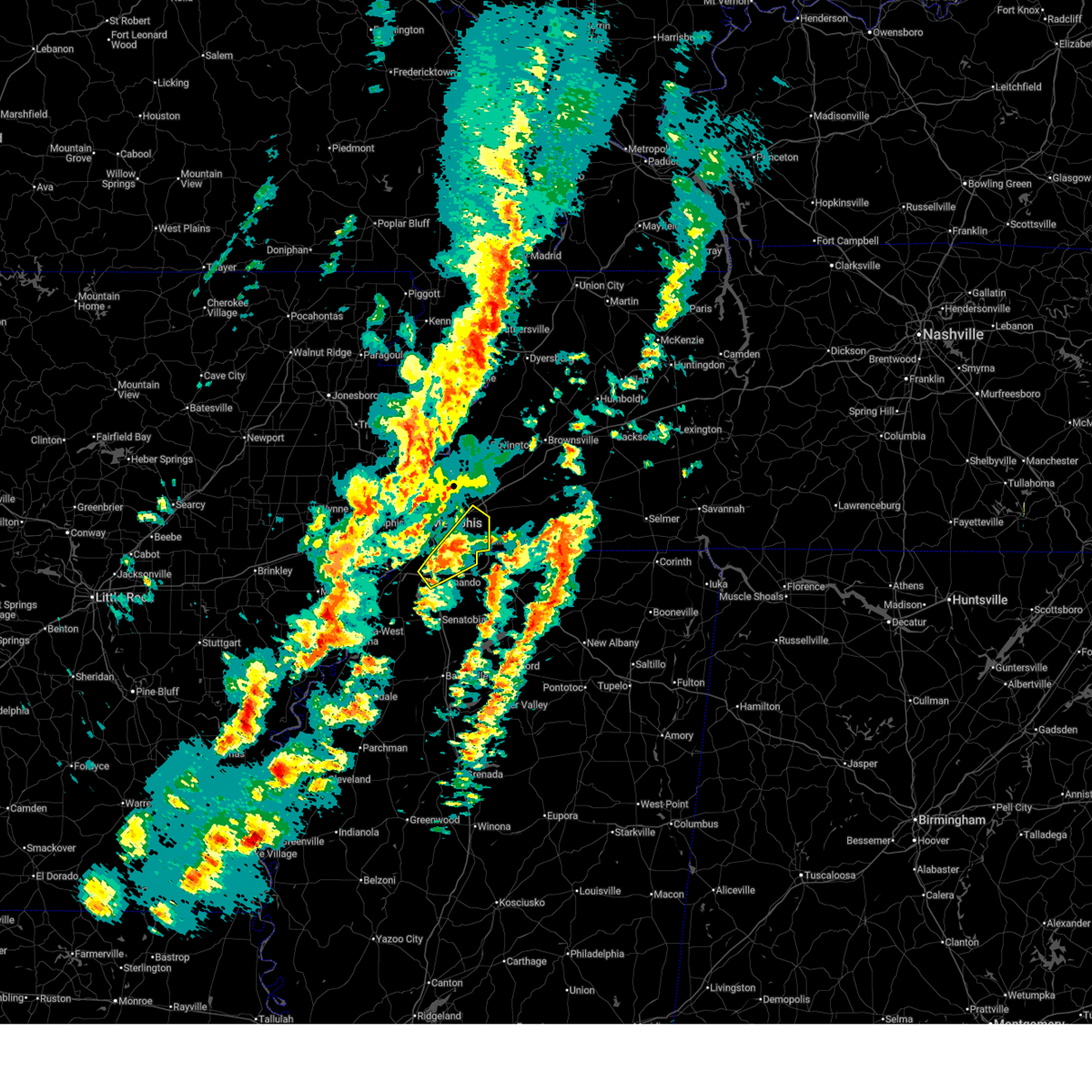
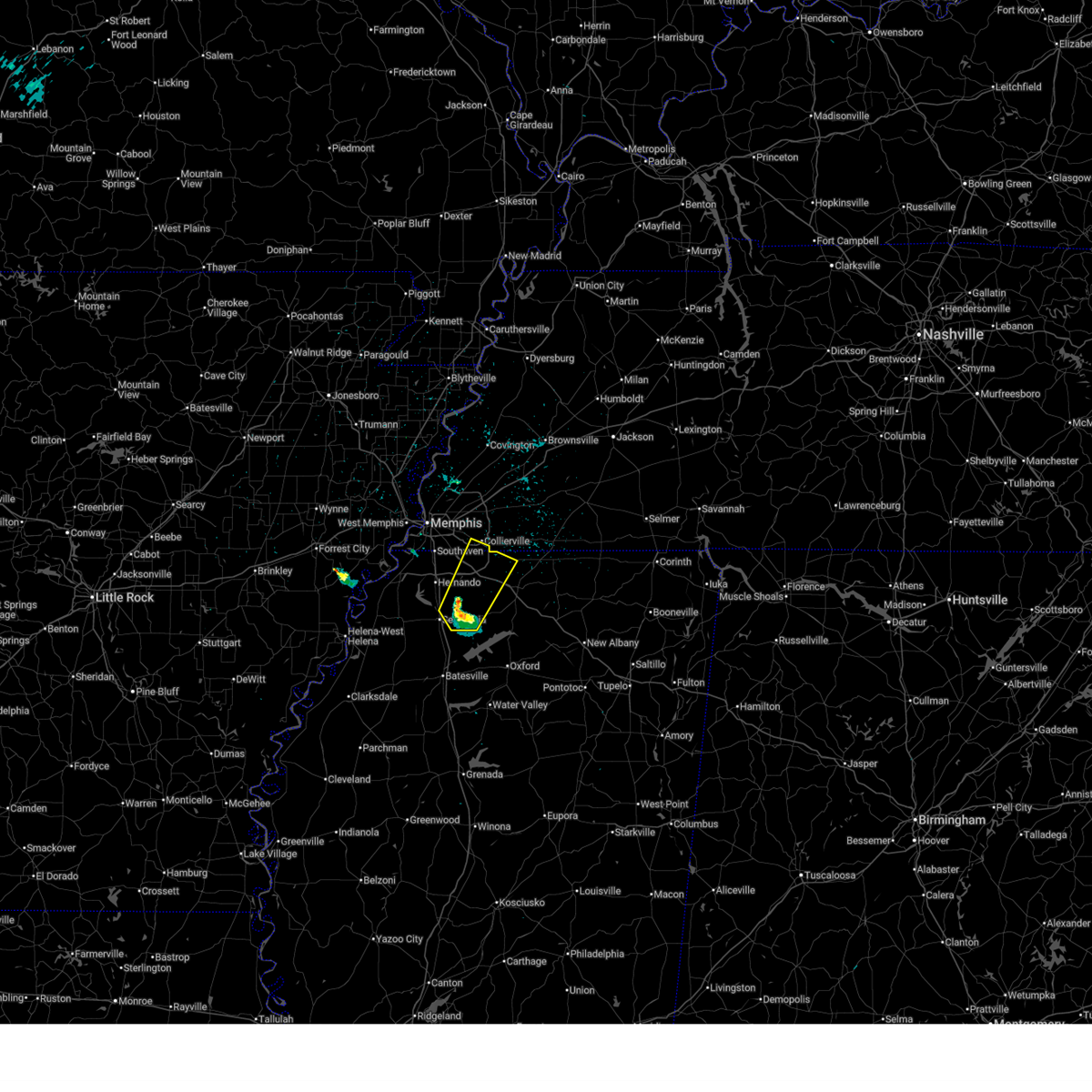
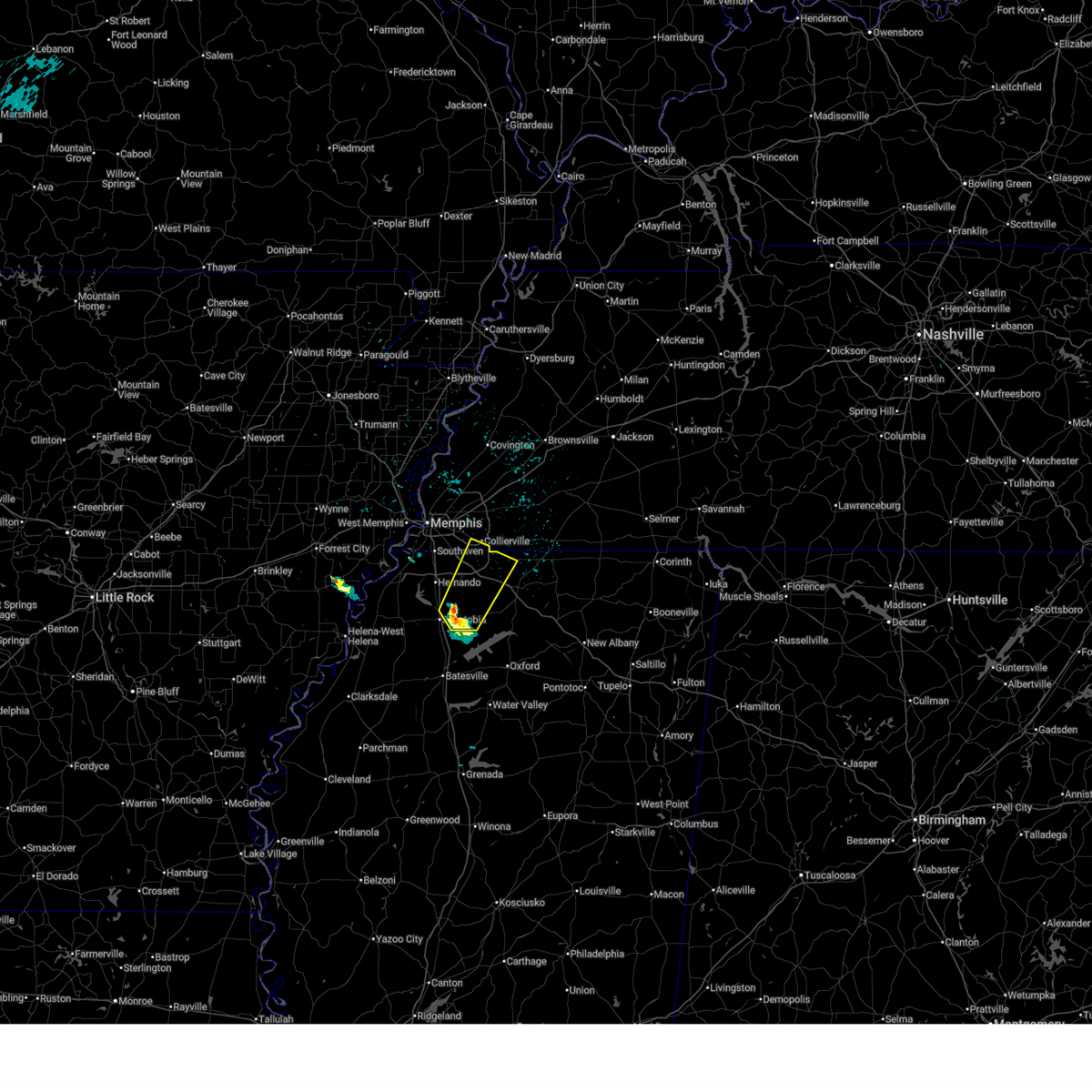
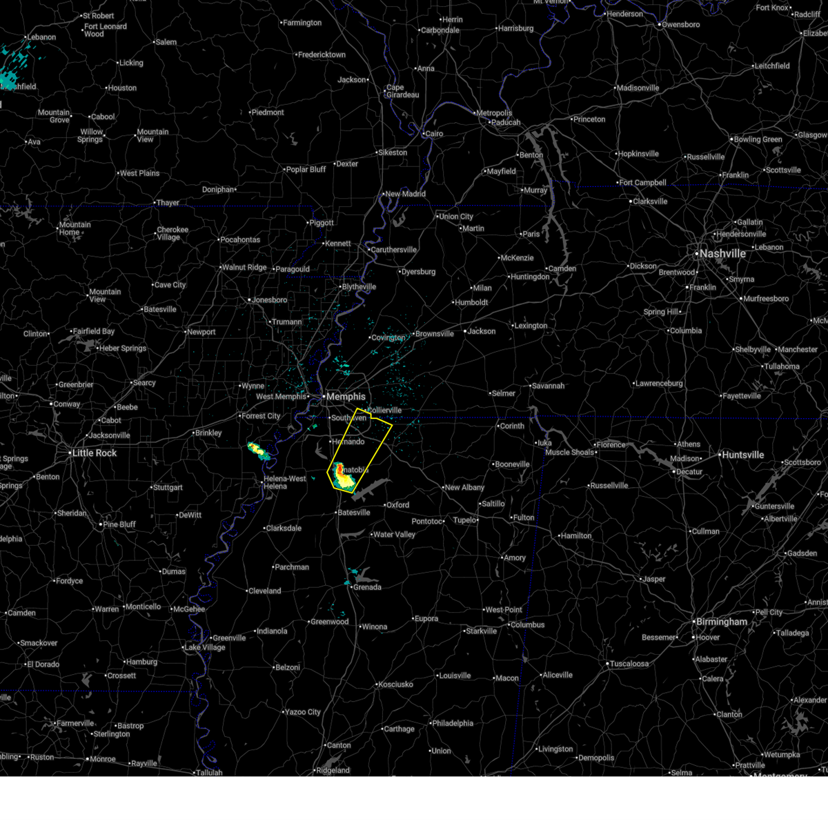
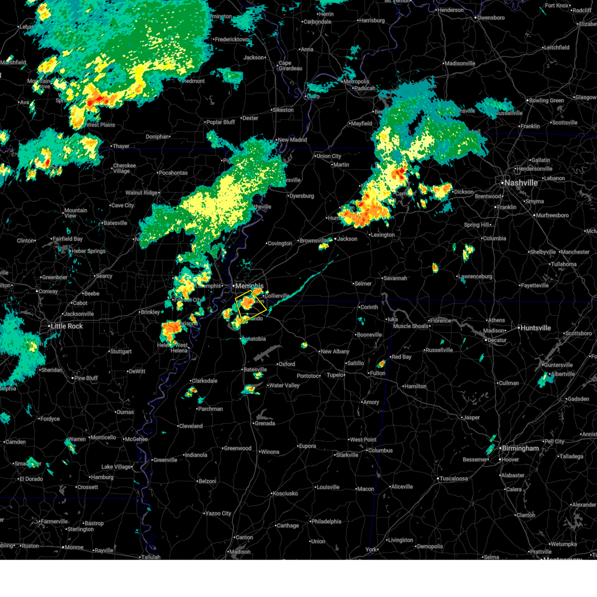
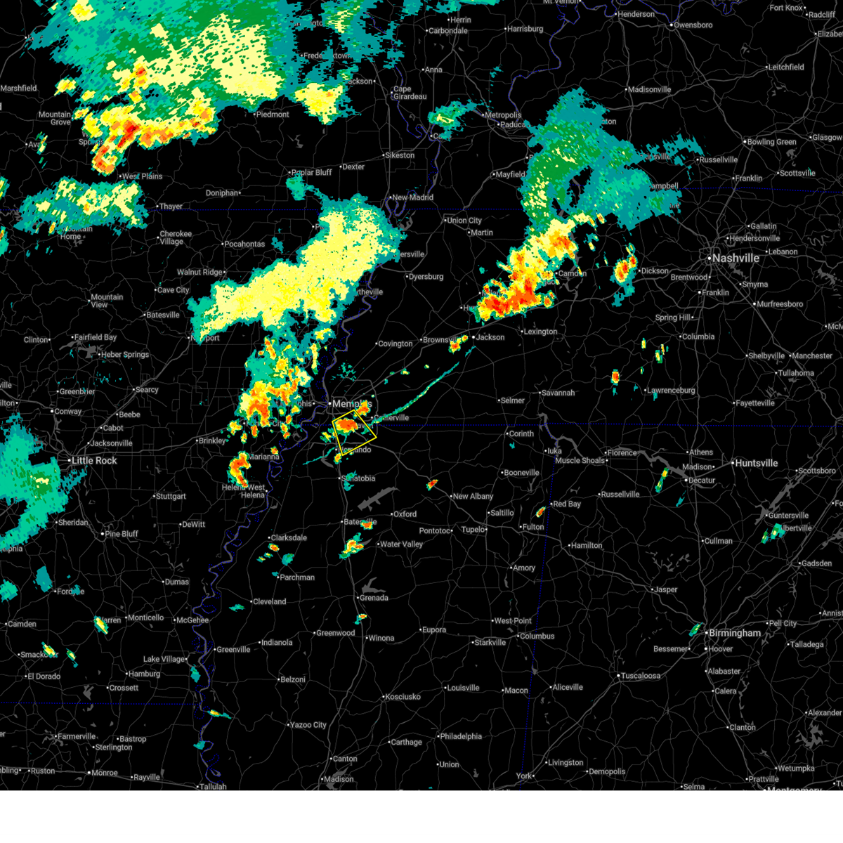
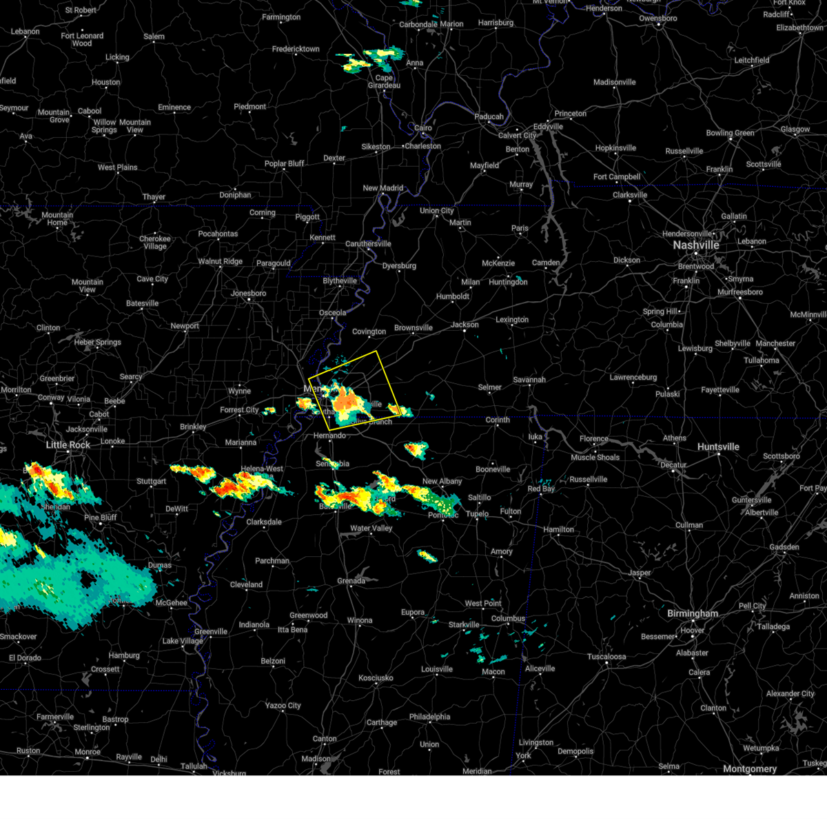
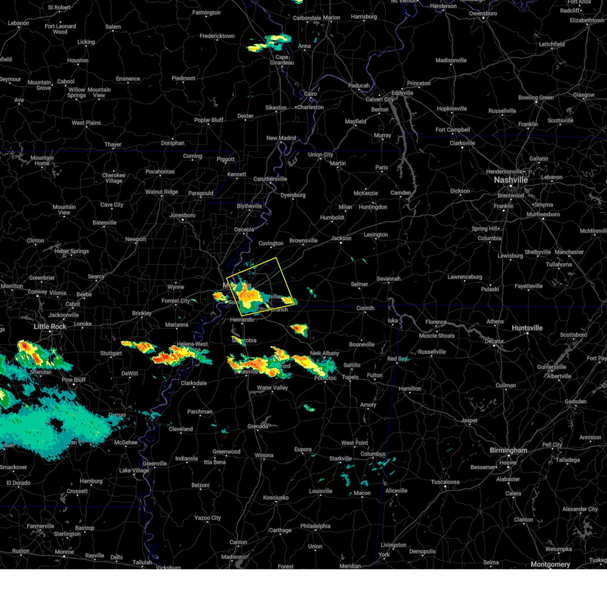
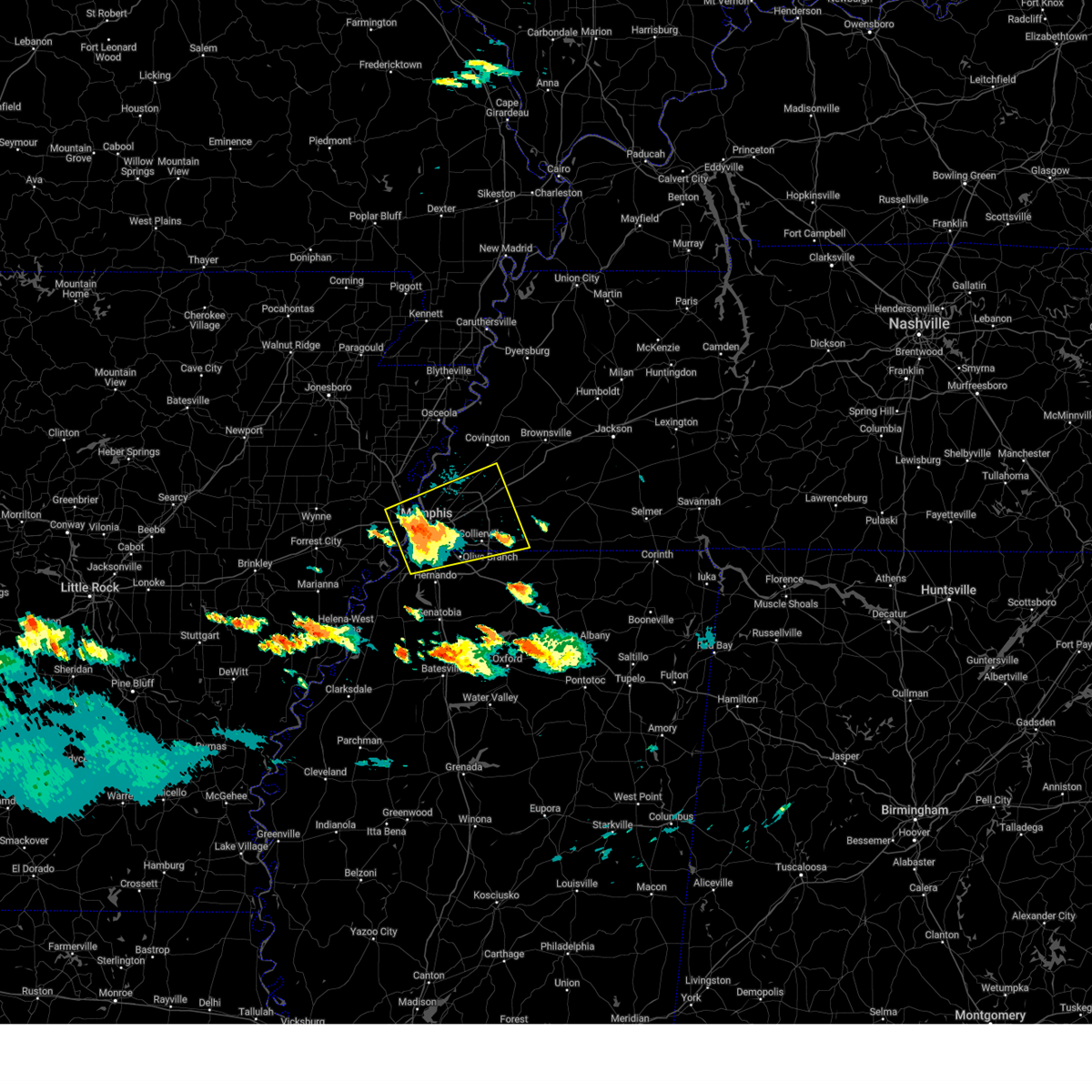
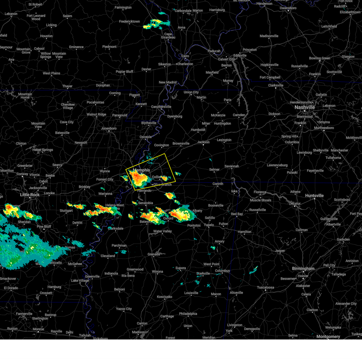
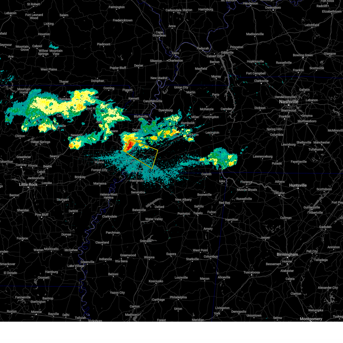
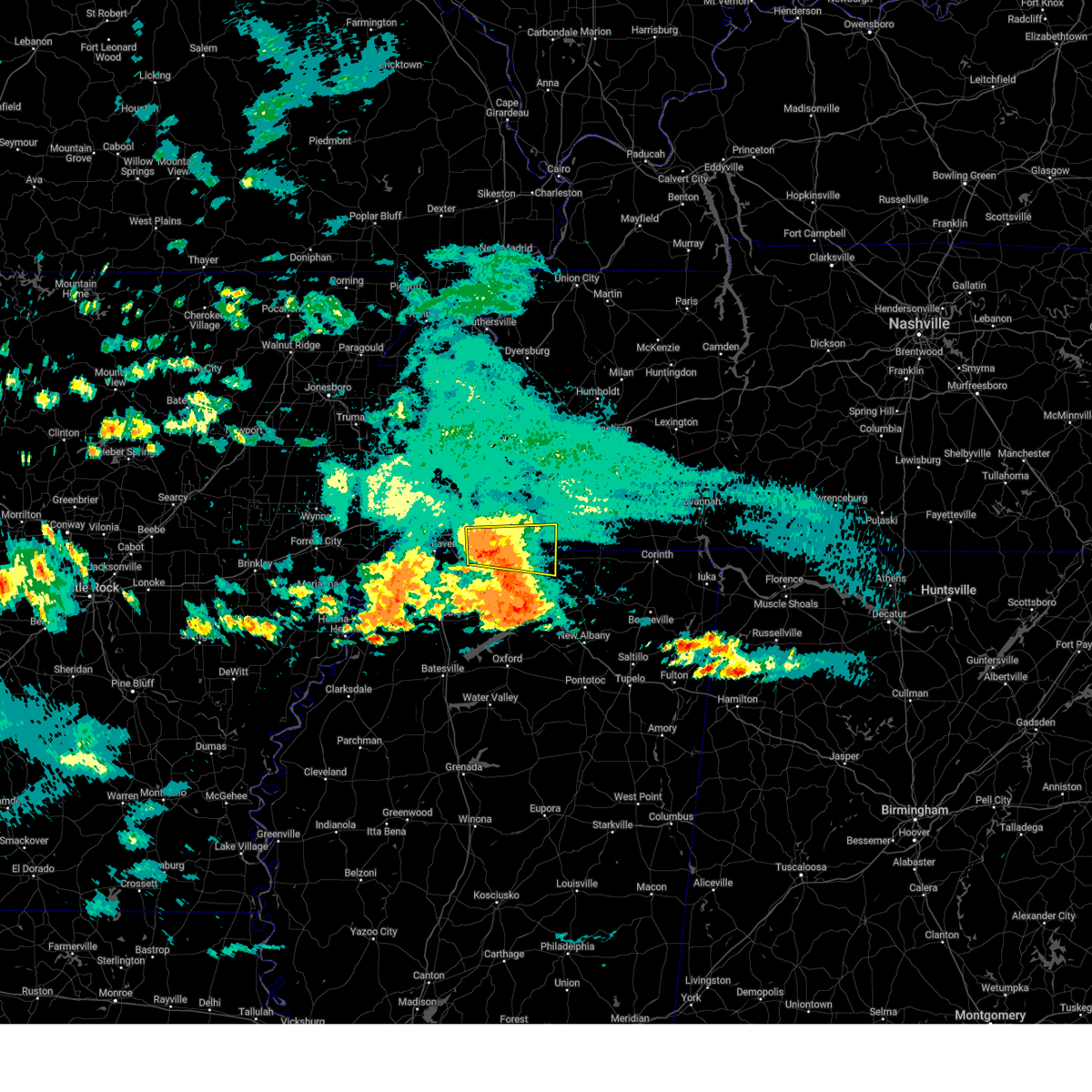
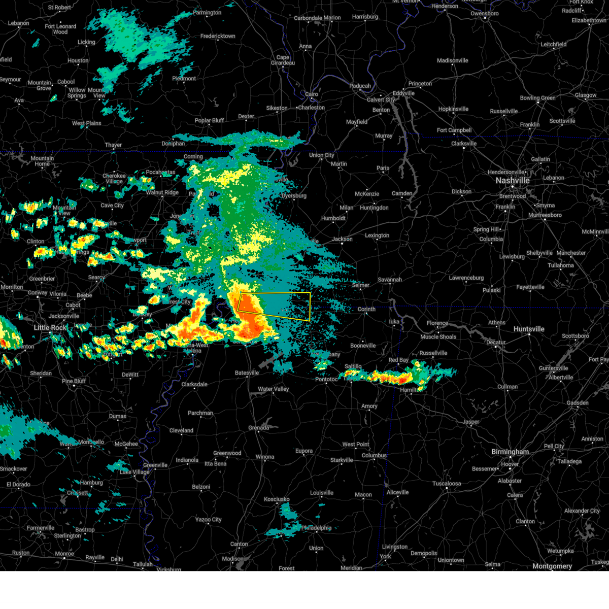
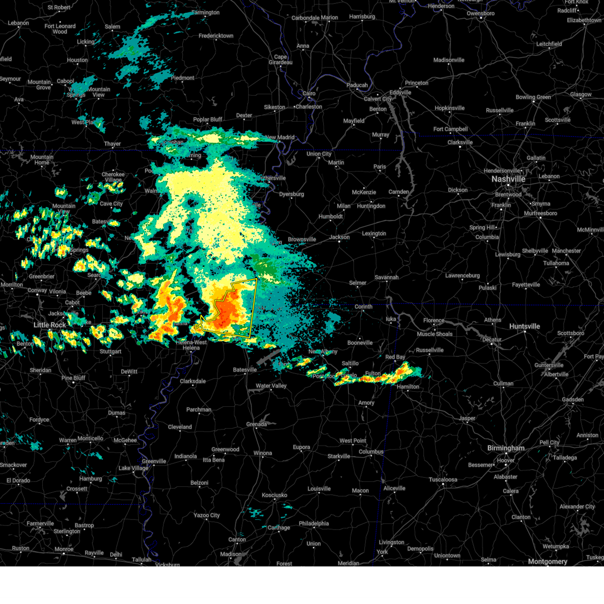
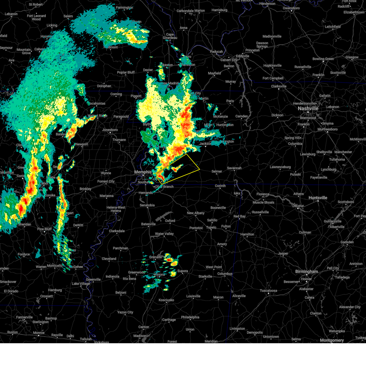
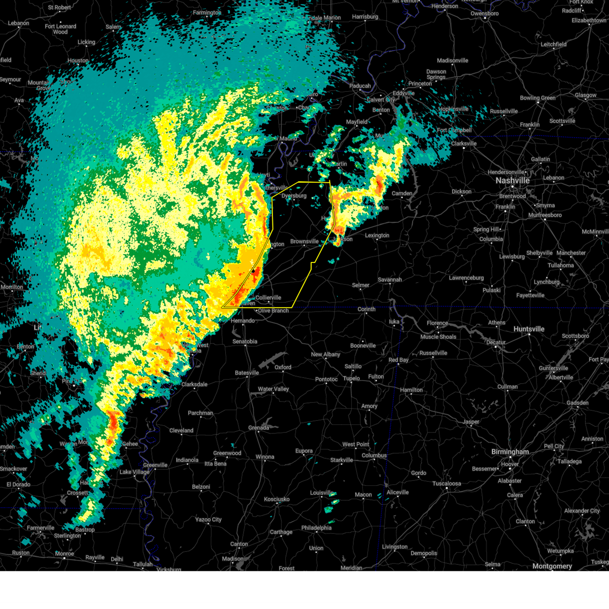
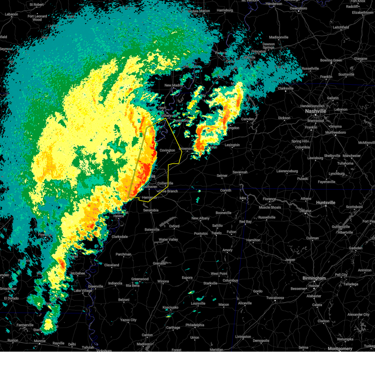
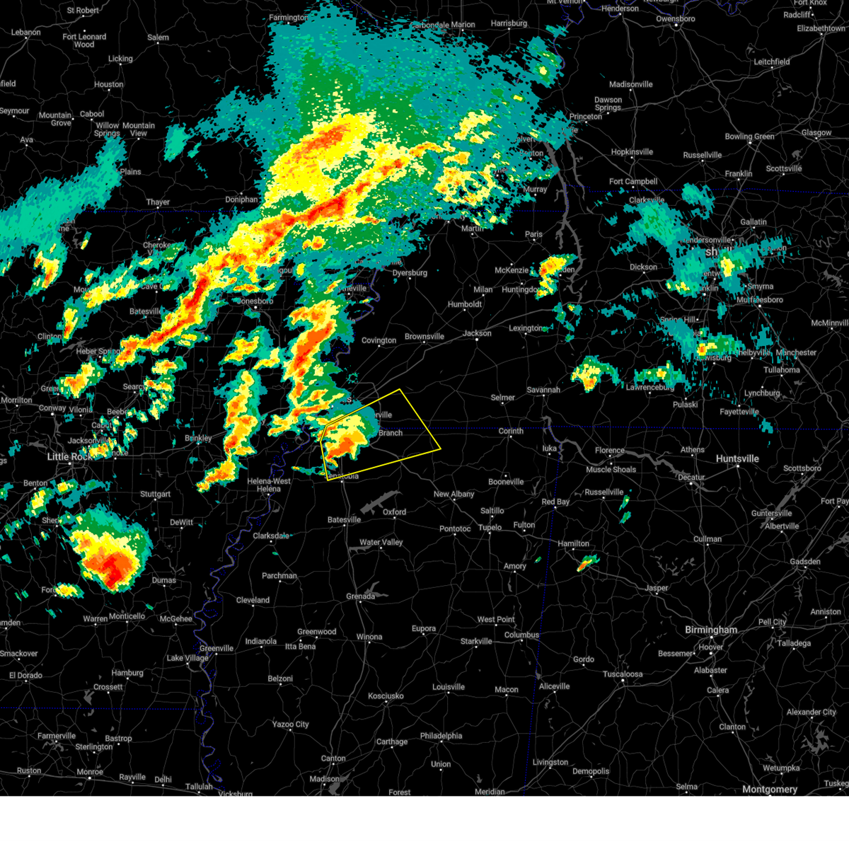
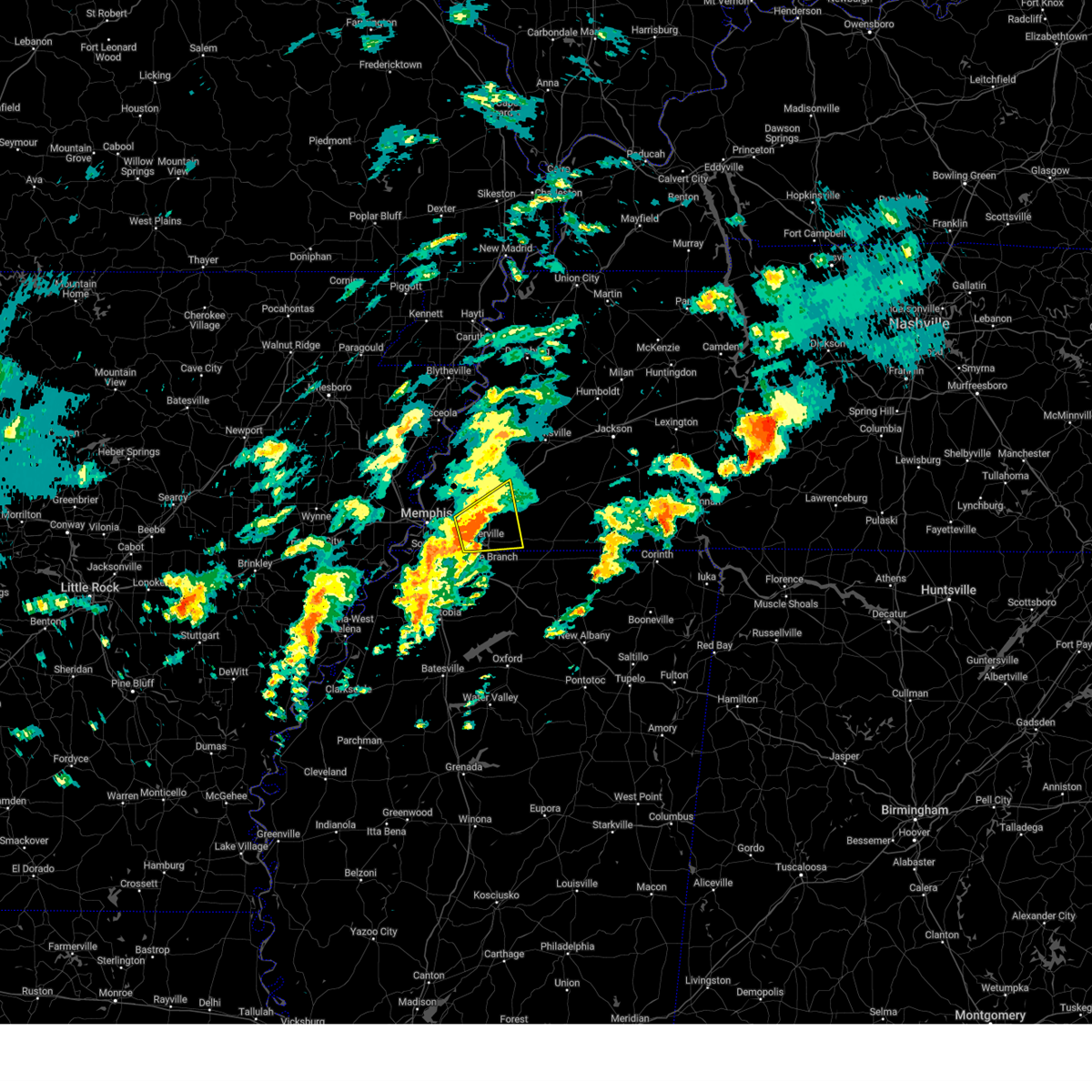
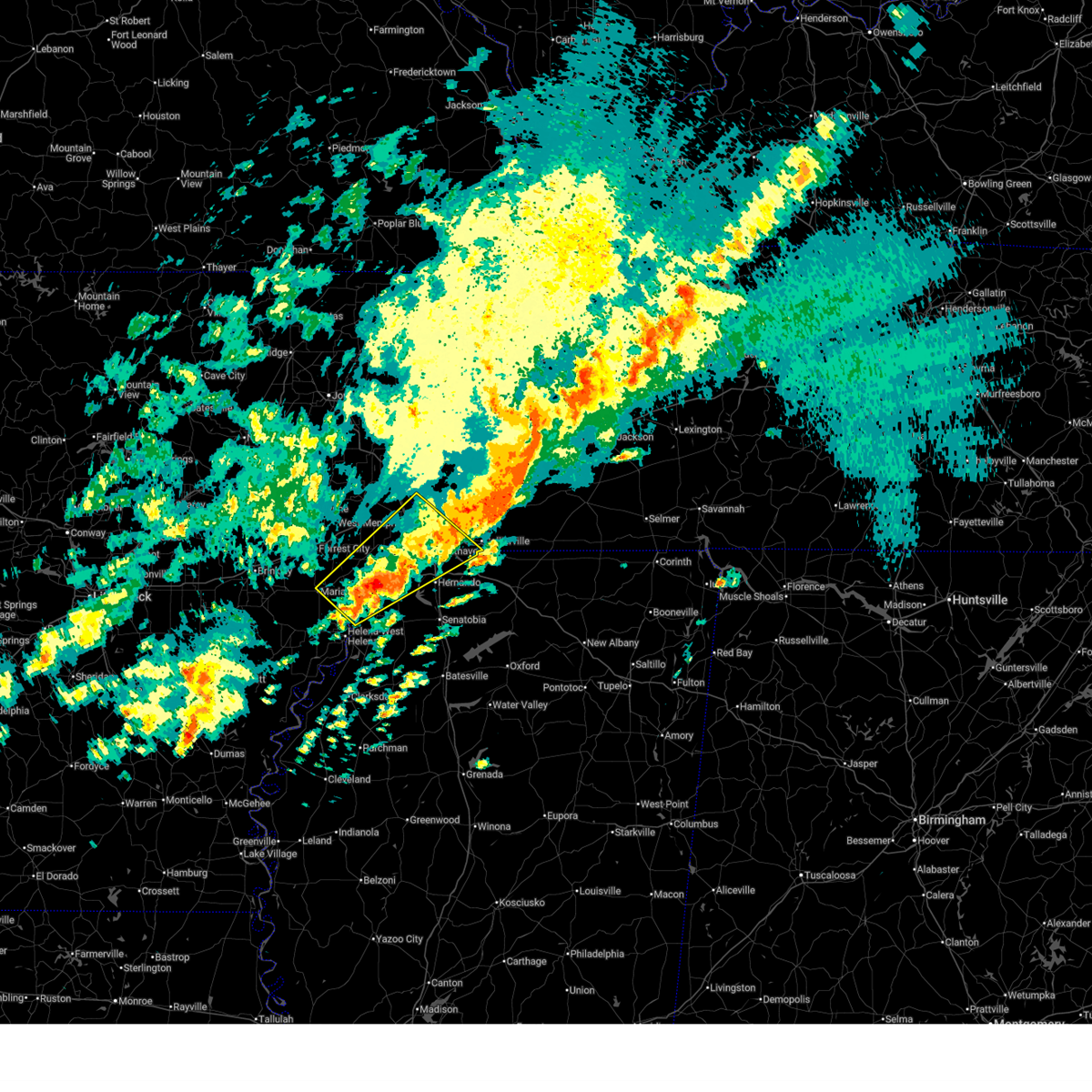
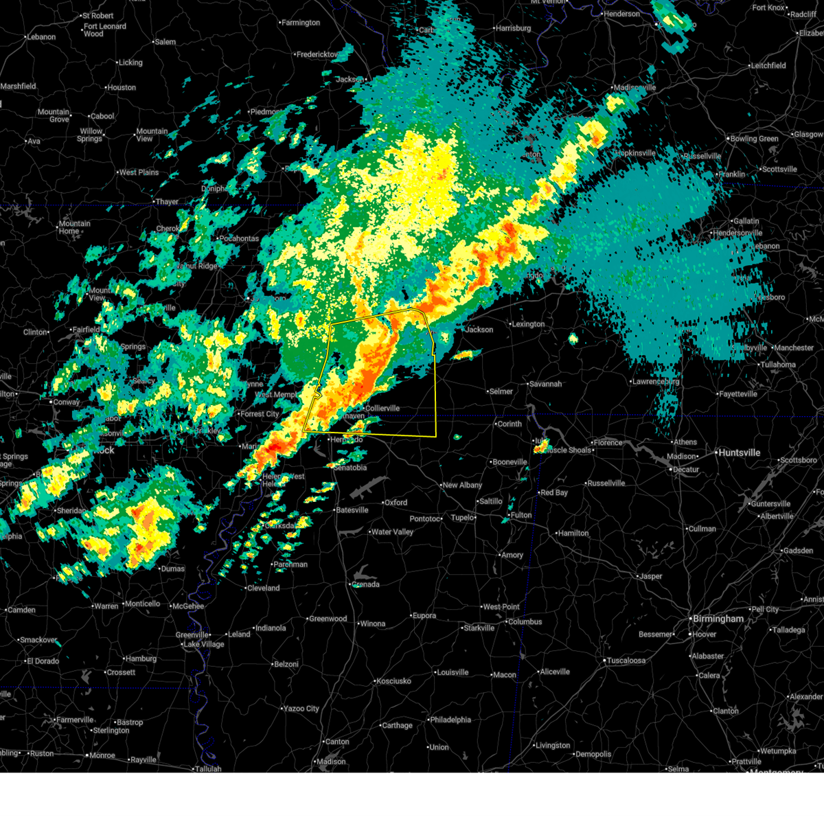
Hail Map for Germantown, TN
The Germantown, TN area has had 10 reports of on-the-ground hail by trained spotters, and has been under severe weather warnings 31 times during the past 12 months. Doppler radar has detected hail at or near Germantown, TN on 102 occasions, including 4 occasions during the past year.
| Name: | Germantown, TN |
| Where Located: | 15.1 miles ESE of Memphis, TN |
| Map: | Google Map for Germantown, TN |
| Population: | 38844 |
| Housing Units: | 15536 |
| More Info: | Search Google for Germantown, TN |
1
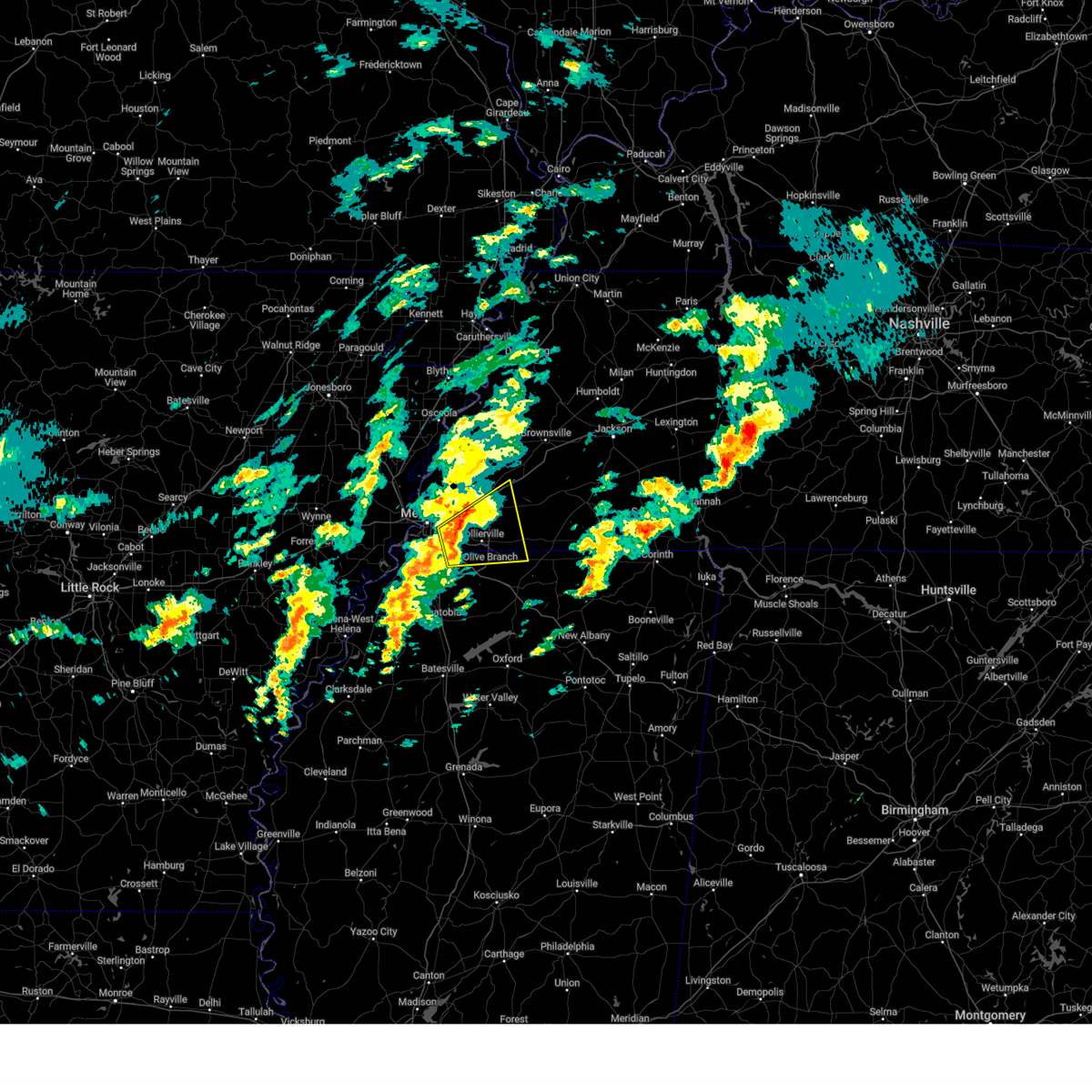
The Top Recent Hail Date for Germantown, TN is Thursday, August 14, 2025 (22nd out of 102)
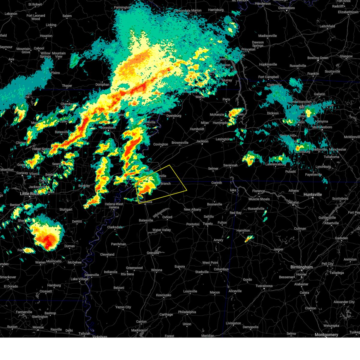
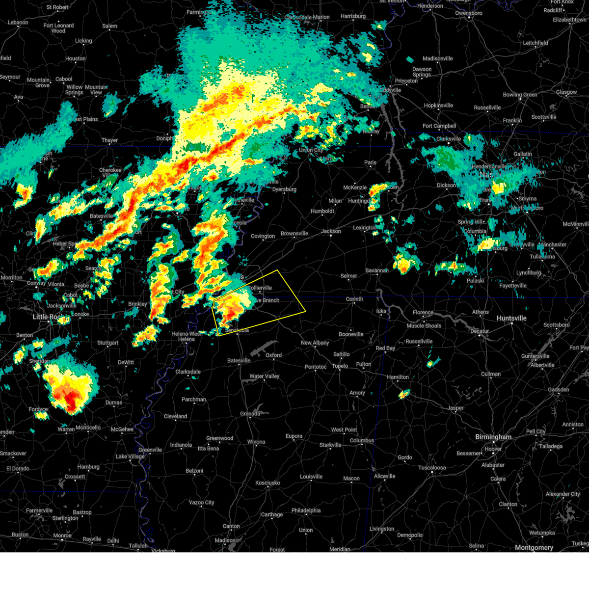
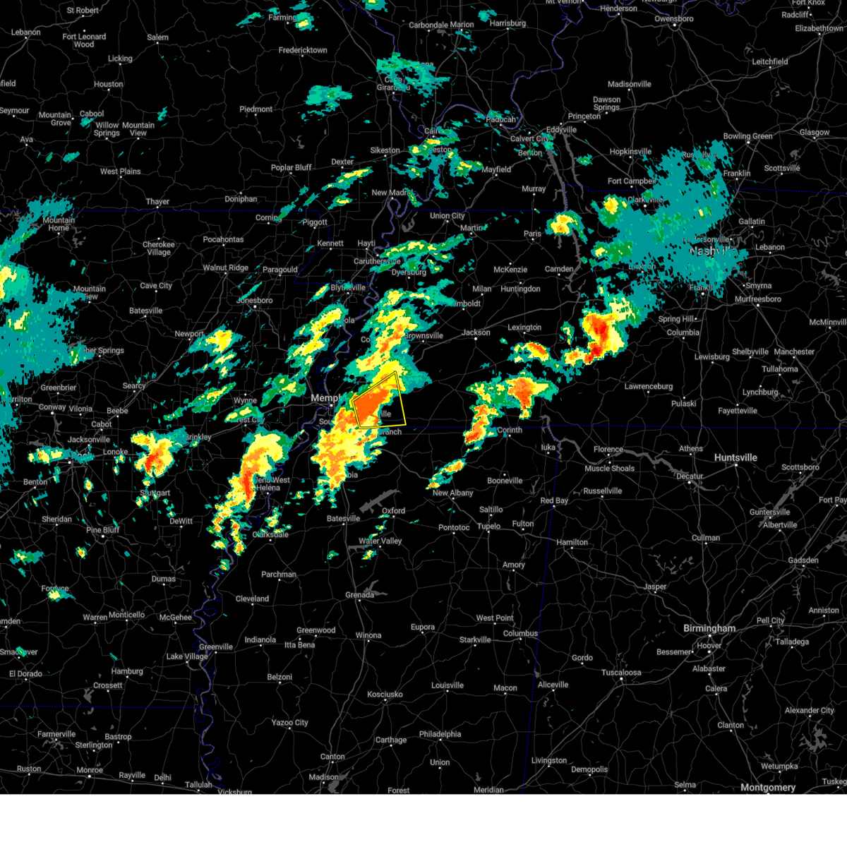
Hail and Wind Damage Spotted near Germantown, TN
| Date / Time | Report Details |
|---|---|
| 6/1/2026 6:23 PM CDT |
 At 623 pm cdt, a severe thunderstorm was located over olive branch, moving southeast at 5 mph (radar indicated). Hazards include 60 mph wind gusts and nickel size hail. Expect damage to roofs, siding, and trees. locations impacted include, southaven, collierville, germantown, olive branch, memphis, byhalia, mt pleasant, lewisburg, red banks, slayden, piperton, coal oil corner, cayce, fairhaven, victoria, cedarview, handy corner, taska, capleville, and miller. This includes interstate 22 in mississipppi between mile markers 1 and 23. At 623 pm cdt, a severe thunderstorm was located over olive branch, moving southeast at 5 mph (radar indicated). Hazards include 60 mph wind gusts and nickel size hail. Expect damage to roofs, siding, and trees. locations impacted include, southaven, collierville, germantown, olive branch, memphis, byhalia, mt pleasant, lewisburg, red banks, slayden, piperton, coal oil corner, cayce, fairhaven, victoria, cedarview, handy corner, taska, capleville, and miller. This includes interstate 22 in mississipppi between mile markers 1 and 23.
|
| 6/1/2026 6:05 PM CDT |
 Svrmeg the national weather service in memphis has issued a * severe thunderstorm warning for, northeastern desoto county in northwestern mississippi, northwestern marshall county in northwestern mississippi, southwestern fayette county in west tennessee, southeastern shelby county in west tennessee, * until 645 pm cdt. * at 605 pm cdt, a severe thunderstorm was located near olive branch, moving southeast at 15 mph (radar indicated). Hazards include 60 mph wind gusts and quarter size hail. Hail damage to vehicles is expected. Expect wind damage to roofs, siding, and trees. Svrmeg the national weather service in memphis has issued a * severe thunderstorm warning for, northeastern desoto county in northwestern mississippi, northwestern marshall county in northwestern mississippi, southwestern fayette county in west tennessee, southeastern shelby county in west tennessee, * until 645 pm cdt. * at 605 pm cdt, a severe thunderstorm was located near olive branch, moving southeast at 15 mph (radar indicated). Hazards include 60 mph wind gusts and quarter size hail. Hail damage to vehicles is expected. Expect wind damage to roofs, siding, and trees.
|
| 4/28/2026 9:16 PM CDT |
 At 915 pm cdt, a severe thunderstorm was located over southaven, moving east at 35 mph (radar indicated). Hazards include 60 mph wind gusts. Expect damage to roofs, siding, and trees. locations impacted include, southaven, collierville, olive branch, horn lake, hernando, memphis, byhalia, walls, lake cormorant, lynchburg, whitehaven, lewisburg, newport, cockrum, cedarview, bright, nesbit, handy corner, capleville, and glover. this includes the following highways, interstate 22 in mississipppi between mile markers 1 and 14. interstate 55 in tennessee between mile markers 1 and 4. Interstate 55 in mississippi between mile markers 280 and 292. At 915 pm cdt, a severe thunderstorm was located over southaven, moving east at 35 mph (radar indicated). Hazards include 60 mph wind gusts. Expect damage to roofs, siding, and trees. locations impacted include, southaven, collierville, olive branch, horn lake, hernando, memphis, byhalia, walls, lake cormorant, lynchburg, whitehaven, lewisburg, newport, cockrum, cedarview, bright, nesbit, handy corner, capleville, and glover. this includes the following highways, interstate 22 in mississipppi between mile markers 1 and 14. interstate 55 in tennessee between mile markers 1 and 4. Interstate 55 in mississippi between mile markers 280 and 292.
|
| 4/28/2026 9:16 PM CDT |
 the severe thunderstorm warning has been cancelled and is no longer in effect the severe thunderstorm warning has been cancelled and is no longer in effect
|
| 4/28/2026 8:49 PM CDT |
 Svrmeg the national weather service in memphis has issued a * severe thunderstorm warning for, south central crittenden county in eastern arkansas, desoto county in northwestern mississippi, northwestern marshall county in northwestern mississippi, southern shelby county in west tennessee, * until 930 pm cdt. * at 849 pm cdt, a severe thunderstorm was located over pinckney, or 10 miles southwest of t o fuller state park, moving east at 35 mph (radar indicated). Hazards include 60 mph wind gusts. expect damage to roofs, siding, and trees Svrmeg the national weather service in memphis has issued a * severe thunderstorm warning for, south central crittenden county in eastern arkansas, desoto county in northwestern mississippi, northwestern marshall county in northwestern mississippi, southern shelby county in west tennessee, * until 930 pm cdt. * at 849 pm cdt, a severe thunderstorm was located over pinckney, or 10 miles southwest of t o fuller state park, moving east at 35 mph (radar indicated). Hazards include 60 mph wind gusts. expect damage to roofs, siding, and trees
|
| 4/28/2026 4:38 PM CDT |
 Svrmeg the national weather service in memphis has issued a * severe thunderstorm warning for, northeastern desoto county in northwestern mississippi, northern marshall county in northwestern mississippi, tippah county in northeastern mississippi, benton county in northeastern mississippi, western alcorn county in northeastern mississippi, fayette county in west tennessee, hardeman county in west tennessee, southwestern mcnairy county in west tennessee, southeastern shelby county in west tennessee, southwestern chester county in west tennessee, * until 530 pm cdt. * at 438 pm cdt, a severe thunderstorm was located over lamar, or 11 miles northeast of holly springs, moving east at 45 mph (radar indicated). Hazards include 60 mph wind gusts and quarter size hail. Hail damage to vehicles is expected. Expect wind damage to roofs, siding, and trees. Svrmeg the national weather service in memphis has issued a * severe thunderstorm warning for, northeastern desoto county in northwestern mississippi, northern marshall county in northwestern mississippi, tippah county in northeastern mississippi, benton county in northeastern mississippi, western alcorn county in northeastern mississippi, fayette county in west tennessee, hardeman county in west tennessee, southwestern mcnairy county in west tennessee, southeastern shelby county in west tennessee, southwestern chester county in west tennessee, * until 530 pm cdt. * at 438 pm cdt, a severe thunderstorm was located over lamar, or 11 miles northeast of holly springs, moving east at 45 mph (radar indicated). Hazards include 60 mph wind gusts and quarter size hail. Hail damage to vehicles is expected. Expect wind damage to roofs, siding, and trees.
|
| 4/28/2026 3:59 PM CDT |
 Svrmeg the national weather service in memphis has issued a * severe thunderstorm warning for, northeastern desoto county in northwestern mississippi, marshall county in northwestern mississippi, northwestern tippah county in northeastern mississippi, benton county in northeastern mississippi, fayette county in west tennessee, western hardeman county in west tennessee, southeastern shelby county in west tennessee, * until 445 pm cdt. * at 359 pm cdt, severe thunderstorms were located along a line extending from near bartlett to 6 miles west of mt pleasant to near wall doxey state park, moving northeast at 45 mph (radar indicated). Hazards include 60 mph wind gusts and quarter size hail. Hail damage to vehicles is expected. Expect wind damage to roofs, siding, and trees. Svrmeg the national weather service in memphis has issued a * severe thunderstorm warning for, northeastern desoto county in northwestern mississippi, marshall county in northwestern mississippi, northwestern tippah county in northeastern mississippi, benton county in northeastern mississippi, fayette county in west tennessee, western hardeman county in west tennessee, southeastern shelby county in west tennessee, * until 445 pm cdt. * at 359 pm cdt, severe thunderstorms were located along a line extending from near bartlett to 6 miles west of mt pleasant to near wall doxey state park, moving northeast at 45 mph (radar indicated). Hazards include 60 mph wind gusts and quarter size hail. Hail damage to vehicles is expected. Expect wind damage to roofs, siding, and trees.
|
| 4/28/2026 3:38 AM CDT |
 At 338 am cdt, a severe thunderstorm was located over cordova, moving southeast at 25 mph (radar indicated). Hazards include 60 mph wind gusts and half dollar size hail. Hail damage to vehicles is expected. expect wind damage to roofs, siding, and trees. locations impacted include, collierville, germantown, cordova, memphis, lakeland, arlington, somerville, eads, warren, macon, oakland, piperton, rossville, lenow, fisherville, elba, canadaville, white station, kirk, and hickory withe. this includes the following highways, interstate 40 in tennessee between mile markers 24 and 29. Interstate 240 between mile markers 14 and 17. At 338 am cdt, a severe thunderstorm was located over cordova, moving southeast at 25 mph (radar indicated). Hazards include 60 mph wind gusts and half dollar size hail. Hail damage to vehicles is expected. expect wind damage to roofs, siding, and trees. locations impacted include, collierville, germantown, cordova, memphis, lakeland, arlington, somerville, eads, warren, macon, oakland, piperton, rossville, lenow, fisherville, elba, canadaville, white station, kirk, and hickory withe. this includes the following highways, interstate 40 in tennessee between mile markers 24 and 29. Interstate 240 between mile markers 14 and 17.
|
| 4/28/2026 3:27 AM CDT |
 Svrmeg the national weather service in memphis has issued a * severe thunderstorm warning for, southwestern fayette county in west tennessee, eastern shelby county in west tennessee, * until 415 am cdt. * at 327 am cdt, a severe thunderstorm was located over bartlett, moving southeast at 25 mph (radar indicated). Hazards include ping pong ball size hail and 60 mph wind gusts. People and animals outdoors will be injured. expect hail damage to roofs, siding, windows, and vehicles. Expect wind damage to roofs, siding, and trees. Svrmeg the national weather service in memphis has issued a * severe thunderstorm warning for, southwestern fayette county in west tennessee, eastern shelby county in west tennessee, * until 415 am cdt. * at 327 am cdt, a severe thunderstorm was located over bartlett, moving southeast at 25 mph (radar indicated). Hazards include ping pong ball size hail and 60 mph wind gusts. People and animals outdoors will be injured. expect hail damage to roofs, siding, windows, and vehicles. Expect wind damage to roofs, siding, and trees.
|
| 4/28/2026 3:18 AM CDT |
 At 317 am cdt, a severe thunderstorm was located near lakeland, or near cordova, moving southeast at 20 mph (radar indicated). Hazards include 60 mph wind gusts and half dollar size hail. Hail damage to vehicles is expected. expect wind damage to roofs, siding, and trees. locations impacted include, bartlett, collierville, germantown, cordova, memphis, lakeland, arlington, ellendale, eads, frayser, midtown memphis, oakland, gallaway, lenow, hickory withe, elmore park, brunswick, fisherville, raleigh, and canadaville. this includes the following highways, interstate 40 in tennessee between mile markers 1 and 31. Interstate 240 between mile markers 12 and 18. At 317 am cdt, a severe thunderstorm was located near lakeland, or near cordova, moving southeast at 20 mph (radar indicated). Hazards include 60 mph wind gusts and half dollar size hail. Hail damage to vehicles is expected. expect wind damage to roofs, siding, and trees. locations impacted include, bartlett, collierville, germantown, cordova, memphis, lakeland, arlington, ellendale, eads, frayser, midtown memphis, oakland, gallaway, lenow, hickory withe, elmore park, brunswick, fisherville, raleigh, and canadaville. this includes the following highways, interstate 40 in tennessee between mile markers 1 and 31. Interstate 240 between mile markers 12 and 18.
|
| 4/28/2026 2:58 AM CDT |
 At 258 am cdt, a severe thunderstorm was located over ellendale, or near bartlett, moving southeast at 20 mph (radar indicated). Hazards include 60 mph wind gusts and half dollar size hail. Hail damage to vehicles is expected. expect wind damage to roofs, siding, and trees. locations impacted include, bartlett, collierville, germantown, millington, cordova, memphis, lakeland, arlington, ellendale, eads, frayser, midtown memphis, oakland, gallaway, lenow, barretville, woodstock, rosemark, hickory withe, and elmore park. this includes the following highways, interstate 40 in tennessee between mile markers 1 and 33. Interstate 240 between mile markers 12 and 18. At 258 am cdt, a severe thunderstorm was located over ellendale, or near bartlett, moving southeast at 20 mph (radar indicated). Hazards include 60 mph wind gusts and half dollar size hail. Hail damage to vehicles is expected. expect wind damage to roofs, siding, and trees. locations impacted include, bartlett, collierville, germantown, millington, cordova, memphis, lakeland, arlington, ellendale, eads, frayser, midtown memphis, oakland, gallaway, lenow, barretville, woodstock, rosemark, hickory withe, and elmore park. this includes the following highways, interstate 40 in tennessee between mile markers 1 and 33. Interstate 240 between mile markers 12 and 18.
|
| 4/28/2026 2:42 AM CDT |
 Svrmeg the national weather service in memphis has issued a * severe thunderstorm warning for, south central tipton county in west tennessee, northwestern fayette county in west tennessee, shelby county in west tennessee, * until 330 am cdt. * at 242 am cdt, a severe thunderstorm was located near millington, moving southeast at 20 mph (radar indicated). Hazards include 60 mph wind gusts and half dollar size hail. Hail damage to vehicles is expected. Expect wind damage to roofs, siding, and trees. Svrmeg the national weather service in memphis has issued a * severe thunderstorm warning for, south central tipton county in west tennessee, northwestern fayette county in west tennessee, shelby county in west tennessee, * until 330 am cdt. * at 242 am cdt, a severe thunderstorm was located near millington, moving southeast at 20 mph (radar indicated). Hazards include 60 mph wind gusts and half dollar size hail. Hail damage to vehicles is expected. Expect wind damage to roofs, siding, and trees.
|
| 3/15/2026 8:19 PM CDT |
 At 818 pm cdt, severe thunderstorms were located along a line extending from near parkers crossroads to near jacks creek to 7 miles southeast of bolivar, moving east at 105 mph (radar indicated). Hazards include 60 mph wind gusts and penny size hail. Expect damage to roofs, siding, and trees. locations impacted include, bartlett, collierville, germantown, brownsville, humboldt, cordova, memphis, lakeland, arlington, somerville, alamo, bells, nutbush, hillville, belle eagle, holly grove, southeast memphis, adair, eads, and dancyville. this includes the following highways, interstate 40 in tennessee between mile markers 15 and 71. Interstate 240 between mile markers 14 and 19. At 818 pm cdt, severe thunderstorms were located along a line extending from near parkers crossroads to near jacks creek to 7 miles southeast of bolivar, moving east at 105 mph (radar indicated). Hazards include 60 mph wind gusts and penny size hail. Expect damage to roofs, siding, and trees. locations impacted include, bartlett, collierville, germantown, brownsville, humboldt, cordova, memphis, lakeland, arlington, somerville, alamo, bells, nutbush, hillville, belle eagle, holly grove, southeast memphis, adair, eads, and dancyville. this includes the following highways, interstate 40 in tennessee between mile markers 15 and 71. Interstate 240 between mile markers 14 and 19.
|
| 3/15/2026 8:19 PM CDT |
 the severe thunderstorm warning has been cancelled and is no longer in effect the severe thunderstorm warning has been cancelled and is no longer in effect
|
| 3/15/2026 7:36 PM CDT |
 At 736 pm cdt, severe thunderstorms were located along a line extending from near ft pillow to near millington to near walls, moving east at 60 mph (radar indicated). Hazards include 70 mph wind gusts and nickel size hail. Expect considerable tree damage. damage is likely to mobile homes, roofs, and outbuildings. locations impacted include, bartlett, collierville, germantown, brownsville, millington, covington, humboldt, t o fuller state park, cordova, memphis, lakeland, arlington, munford, somerville, brighton, alamo, bells, southwest memphis, hillville, and whitehaven. this includes the following highways, interstate 40 in tennessee near mile marker 1, and between mile markers 4 and 71. interstate 240 between mile markers 12 and 30. Interstate 55 in tennessee between mile markers 1 and 12. At 736 pm cdt, severe thunderstorms were located along a line extending from near ft pillow to near millington to near walls, moving east at 60 mph (radar indicated). Hazards include 70 mph wind gusts and nickel size hail. Expect considerable tree damage. damage is likely to mobile homes, roofs, and outbuildings. locations impacted include, bartlett, collierville, germantown, brownsville, millington, covington, humboldt, t o fuller state park, cordova, memphis, lakeland, arlington, munford, somerville, brighton, alamo, bells, southwest memphis, hillville, and whitehaven. this includes the following highways, interstate 40 in tennessee near mile marker 1, and between mile markers 4 and 71. interstate 240 between mile markers 12 and 30. Interstate 55 in tennessee between mile markers 1 and 12.
|
| 3/15/2026 7:35 PM CDT |
 At 735 pm cdt, a severe thunderstorm was located over olive branch, moving northeast at 50 mph (radar indicated). Hazards include 60 mph wind gusts and quarter size hail. Hail damage to vehicles is expected. expect wind damage to roofs, siding, and trees. locations impacted include, southaven, collierville, germantown, olive branch, memphis, lakeland, piperton, lenow, fisherville, fairhaven, cedarview, handy corner, and miller. This includes interstate 22 in mississipppi between mile markers 1 and 9. At 735 pm cdt, a severe thunderstorm was located over olive branch, moving northeast at 50 mph (radar indicated). Hazards include 60 mph wind gusts and quarter size hail. Hail damage to vehicles is expected. expect wind damage to roofs, siding, and trees. locations impacted include, southaven, collierville, germantown, olive branch, memphis, lakeland, piperton, lenow, fisherville, fairhaven, cedarview, handy corner, and miller. This includes interstate 22 in mississipppi between mile markers 1 and 9.
|
| 3/15/2026 7:30 PM CDT |
 Svrmeg the national weather service in memphis has issued a * severe thunderstorm warning for, southern crockett county in west tennessee, eastern tipton county in west tennessee, fayette county in west tennessee, southeastern lauderdale county in west tennessee, haywood county in west tennessee, northwestern madison county in west tennessee, shelby county in west tennessee, * until 830 pm cdt. * at 730 pm cdt, severe thunderstorms were located along a line extending from near ft pillow to near millington to anthonyville, moving east at 105 mph (radar indicated). Hazards include 70 mph wind gusts and nickel size hail. Expect considerable tree damage. Damage is likely to mobile homes, roofs, and outbuildings. Svrmeg the national weather service in memphis has issued a * severe thunderstorm warning for, southern crockett county in west tennessee, eastern tipton county in west tennessee, fayette county in west tennessee, southeastern lauderdale county in west tennessee, haywood county in west tennessee, northwestern madison county in west tennessee, shelby county in west tennessee, * until 830 pm cdt. * at 730 pm cdt, severe thunderstorms were located along a line extending from near ft pillow to near millington to anthonyville, moving east at 105 mph (radar indicated). Hazards include 70 mph wind gusts and nickel size hail. Expect considerable tree damage. Damage is likely to mobile homes, roofs, and outbuildings.
|
| 3/15/2026 7:22 PM CDT |
 the severe thunderstorm warning has been cancelled and is no longer in effect the severe thunderstorm warning has been cancelled and is no longer in effect
|
| 3/15/2026 7:22 PM CDT |
 At 722 pm cdt, a severe thunderstorm was located near southaven, moving northeast at 50 mph (radar indicated). Hazards include 60 mph wind gusts and quarter size hail. Hail damage to vehicles is expected. expect wind damage to roofs, siding, and trees. locations impacted include, bartlett, southaven, collierville, germantown, olive branch, horn lake, hernando, cordova, memphis, lakeland, southeast memphis, piperton, lenow, cedarview, bright, nesbit, handy corner, capleville, jago, and fisherville. this includes the following highways, interstate 40 in tennessee between mile markers 17 and 20. interstate 22 in mississipppi between mile markers 1 and 9. interstate 240 between mile markers 14 and 19. Interstate 55 in mississippi between mile markers 280 and 292. At 722 pm cdt, a severe thunderstorm was located near southaven, moving northeast at 50 mph (radar indicated). Hazards include 60 mph wind gusts and quarter size hail. Hail damage to vehicles is expected. expect wind damage to roofs, siding, and trees. locations impacted include, bartlett, southaven, collierville, germantown, olive branch, horn lake, hernando, cordova, memphis, lakeland, southeast memphis, piperton, lenow, cedarview, bright, nesbit, handy corner, capleville, jago, and fisherville. this includes the following highways, interstate 40 in tennessee between mile markers 17 and 20. interstate 22 in mississipppi between mile markers 1 and 9. interstate 240 between mile markers 14 and 19. Interstate 55 in mississippi between mile markers 280 and 292.
|
| 3/15/2026 7:03 PM CDT |
 Svrmeg the national weather service in memphis has issued a * severe thunderstorm warning for, desoto county in northwestern mississippi, northeastern tunica county in northwestern mississippi, southeastern shelby county in west tennessee, * until 745 pm cdt. * at 703 pm cdt, a severe thunderstorm was located near phillipp, or 12 miles west of hernando, moving northeast at 55 mph (radar indicated). Hazards include 60 mph wind gusts and quarter size hail. Hail damage to vehicles is expected. Expect wind damage to roofs, siding, and trees. Svrmeg the national weather service in memphis has issued a * severe thunderstorm warning for, desoto county in northwestern mississippi, northeastern tunica county in northwestern mississippi, southeastern shelby county in west tennessee, * until 745 pm cdt. * at 703 pm cdt, a severe thunderstorm was located near phillipp, or 12 miles west of hernando, moving northeast at 55 mph (radar indicated). Hazards include 60 mph wind gusts and quarter size hail. Hail damage to vehicles is expected. Expect wind damage to roofs, siding, and trees.
|
| 3/7/2026 10:54 AM CST |
 the severe thunderstorm warning has been cancelled and is no longer in effect the severe thunderstorm warning has been cancelled and is no longer in effect
|
| 3/7/2026 10:44 AM CST |
 At 1043 am cst, a severe thunderstorm was located near southaven, moving east at 40 mph (radar indicated). Hazards include 60 mph wind gusts. Expect damage to roofs, siding, and trees. locations impacted include, southaven, collierville, germantown, olive branch, horn lake, cordova, memphis, lakeland, arlington, somerville, byhalia, mt pleasant, southeast memphis, eads, lynchburg, warren, macon, oakland, piperton, and rossville. this includes the following highways, interstate 40 in tennessee between mile markers 19 and 43. interstate 22 in mississipppi between mile markers 1 and 13. interstate 240 between mile markers 14 and 20. interstate 55 in tennessee between mile markers 1 and 2. Interstate 55 in mississippi between mile markers 287 and 292. At 1043 am cst, a severe thunderstorm was located near southaven, moving east at 40 mph (radar indicated). Hazards include 60 mph wind gusts. Expect damage to roofs, siding, and trees. locations impacted include, southaven, collierville, germantown, olive branch, horn lake, cordova, memphis, lakeland, arlington, somerville, byhalia, mt pleasant, southeast memphis, eads, lynchburg, warren, macon, oakland, piperton, and rossville. this includes the following highways, interstate 40 in tennessee between mile markers 19 and 43. interstate 22 in mississipppi between mile markers 1 and 13. interstate 240 between mile markers 14 and 20. interstate 55 in tennessee between mile markers 1 and 2. Interstate 55 in mississippi between mile markers 287 and 292.
|
| 3/7/2026 10:44 AM CST |
 the severe thunderstorm warning has been cancelled and is no longer in effect the severe thunderstorm warning has been cancelled and is no longer in effect
|
| 3/7/2026 10:32 AM CST |
 Svrmeg the national weather service in memphis has issued a * severe thunderstorm warning for, northeastern desoto county in northwestern mississippi, northwestern marshall county in northwestern mississippi, southeastern tipton county in west tennessee, fayette county in west tennessee, shelby county in west tennessee, * until 1115 am cst. * at 1032 am cst, a severe thunderstorm was located over horn lake, moving east at 40 mph (radar indicated). Hazards include 60 mph wind gusts. expect damage to roofs, siding, and trees Svrmeg the national weather service in memphis has issued a * severe thunderstorm warning for, northeastern desoto county in northwestern mississippi, northwestern marshall county in northwestern mississippi, southeastern tipton county in west tennessee, fayette county in west tennessee, shelby county in west tennessee, * until 1115 am cst. * at 1032 am cst, a severe thunderstorm was located over horn lake, moving east at 40 mph (radar indicated). Hazards include 60 mph wind gusts. expect damage to roofs, siding, and trees
|
| 3/7/2026 9:58 AM CST |
 Svrmeg the national weather service in memphis has issued a * severe thunderstorm warning for, northeastern crittenden county in eastern arkansas, central shelby county in west tennessee, * until 1045 am cst. * at 958 am cst, a severe thunderstorm was located near sunset, or near marion, moving east at 25 mph (radar indicated). Hazards include 60 mph wind gusts. expect damage to roofs, siding, and trees Svrmeg the national weather service in memphis has issued a * severe thunderstorm warning for, northeastern crittenden county in eastern arkansas, central shelby county in west tennessee, * until 1045 am cst. * at 958 am cst, a severe thunderstorm was located near sunset, or near marion, moving east at 25 mph (radar indicated). Hazards include 60 mph wind gusts. expect damage to roofs, siding, and trees
|
| 3/6/2026 11:00 PM CST |
 the severe thunderstorm warning has been cancelled and is no longer in effect the severe thunderstorm warning has been cancelled and is no longer in effect
|
| 3/6/2026 10:54 PM CST |
 the severe thunderstorm warning has been cancelled and is no longer in effect the severe thunderstorm warning has been cancelled and is no longer in effect
|
| 3/6/2026 10:54 PM CST |
 At 1054 pm cst, a severe thunderstorm was located over independence, or 12 miles northeast of senatobia, moving northeast at 50 mph (radar indicated). Hazards include quarter size hail. Damage to vehicles is expected. locations impacted include, collierville, olive branch, coldwater, byhalia, barr, mt pleasant, independence, lewisburg, red banks, piperton, coal oil corner, wakefield, cayce, cockrum, aiken, cedarview, crossroad, tyro, watson, and handy corner. this includes the following highways, interstate 22 in mississipppi between mile markers 5 and 23. Interstate 55 in mississippi near mile marker 269. At 1054 pm cst, a severe thunderstorm was located over independence, or 12 miles northeast of senatobia, moving northeast at 50 mph (radar indicated). Hazards include quarter size hail. Damage to vehicles is expected. locations impacted include, collierville, olive branch, coldwater, byhalia, barr, mt pleasant, independence, lewisburg, red banks, piperton, coal oil corner, wakefield, cayce, cockrum, aiken, cedarview, crossroad, tyro, watson, and handy corner. this includes the following highways, interstate 22 in mississipppi between mile markers 5 and 23. Interstate 55 in mississippi near mile marker 269.
|
| 3/6/2026 10:44 PM CST |
 Svrmeg the national weather service in memphis has issued a * severe thunderstorm warning for, eastern desoto county in northwestern mississippi, northwestern marshall county in northwestern mississippi, eastern tate county in northwestern mississippi, northeastern panola county in northwestern mississippi, southeastern shelby county in west tennessee, * until 1130 pm cst. * at 1044 pm cst, a severe thunderstorm was located over senatobia, moving northeast at 45 mph (radar indicated). Hazards include half dollar size hail. damage to vehicles is expected Svrmeg the national weather service in memphis has issued a * severe thunderstorm warning for, eastern desoto county in northwestern mississippi, northwestern marshall county in northwestern mississippi, eastern tate county in northwestern mississippi, northeastern panola county in northwestern mississippi, southeastern shelby county in west tennessee, * until 1130 pm cst. * at 1044 pm cst, a severe thunderstorm was located over senatobia, moving northeast at 45 mph (radar indicated). Hazards include half dollar size hail. damage to vehicles is expected
|
| 8/19/2025 7:11 PM CDT |
 the severe thunderstorm warning has been cancelled and is no longer in effect the severe thunderstorm warning has been cancelled and is no longer in effect
|
| 8/19/2025 6:51 PM CDT |
 Svrmeg the national weather service in memphis has issued a * severe thunderstorm warning for, northeastern desoto county in northwestern mississippi, western marshall county in northwestern mississippi, south central shelby county in west tennessee, * until 730 pm cdt. * at 651 pm cdt, a severe thunderstorm was located near olive branch, moving southeast at 5 mph (radar indicated). Hazards include 60 mph wind gusts and quarter size hail. Hail damage to vehicles is expected. Expect wind damage to roofs, siding, and trees. Svrmeg the national weather service in memphis has issued a * severe thunderstorm warning for, northeastern desoto county in northwestern mississippi, western marshall county in northwestern mississippi, south central shelby county in west tennessee, * until 730 pm cdt. * at 651 pm cdt, a severe thunderstorm was located near olive branch, moving southeast at 5 mph (radar indicated). Hazards include 60 mph wind gusts and quarter size hail. Hail damage to vehicles is expected. Expect wind damage to roofs, siding, and trees.
|
| 6/7/2025 9:59 PM CDT |
 the severe thunderstorm warning has been cancelled and is no longer in effect the severe thunderstorm warning has been cancelled and is no longer in effect
|
| 6/7/2025 9:54 PM CDT |
 At 954 pm cdt, a severe thunderstorm was located near southeast memphis, or near cordova, moving east at 45 mph (radar indicated). Hazards include 60 mph wind gusts and quarter size hail. Hail damage to vehicles is expected. expect wind damage to roofs, siding, and trees. Locations impacted include, bartlett, southaven, collierville, germantown, olive branch, west memphis, horn lake, millington, cordova, memphis, lakeland, arlington, southwest memphis, ellendale, whitehaven, frayser, midtown memphis, southeast memphis, downtown memphis, and eads. At 954 pm cdt, a severe thunderstorm was located near southeast memphis, or near cordova, moving east at 45 mph (radar indicated). Hazards include 60 mph wind gusts and quarter size hail. Hail damage to vehicles is expected. expect wind damage to roofs, siding, and trees. Locations impacted include, bartlett, southaven, collierville, germantown, olive branch, west memphis, horn lake, millington, cordova, memphis, lakeland, arlington, southwest memphis, ellendale, whitehaven, frayser, midtown memphis, southeast memphis, downtown memphis, and eads.
|
| 6/7/2025 9:43 PM CDT |
 At 943 pm cdt, a severe thunderstorm was located over downtown memphis, or near t o fuller state park, moving east at 45 mph (radar indicated). Hazards include 60 mph wind gusts and quarter size hail. Hail damage to vehicles is expected. expect wind damage to roofs, siding, and trees. Locations impacted include, bartlett, southaven, collierville, germantown, olive branch, west memphis, horn lake, marion, millington, t o fuller state park, cordova, memphis, lakeland, arlington, walls, crawfordsville, sunset, southwest memphis, ellendale, and whitehaven. At 943 pm cdt, a severe thunderstorm was located over downtown memphis, or near t o fuller state park, moving east at 45 mph (radar indicated). Hazards include 60 mph wind gusts and quarter size hail. Hail damage to vehicles is expected. expect wind damage to roofs, siding, and trees. Locations impacted include, bartlett, southaven, collierville, germantown, olive branch, west memphis, horn lake, marion, millington, t o fuller state park, cordova, memphis, lakeland, arlington, walls, crawfordsville, sunset, southwest memphis, ellendale, and whitehaven.
|
| 6/7/2025 9:36 PM CDT |
 Svrmeg the national weather service in memphis has issued a * severe thunderstorm warning for, east central crittenden county in eastern arkansas, northern desoto county in northwestern mississippi, northwestern marshall county in northwestern mississippi, southeastern tipton county in west tennessee, western fayette county in west tennessee, shelby county in west tennessee, * until 1015 pm cdt. * at 936 pm cdt, a severe thunderstorm was located over t o fuller state park, moving east at 45 mph (radar indicated). Hazards include 60 mph wind gusts and half dollar size hail. Hail damage to vehicles is expected. Expect wind damage to roofs, siding, and trees. Svrmeg the national weather service in memphis has issued a * severe thunderstorm warning for, east central crittenden county in eastern arkansas, northern desoto county in northwestern mississippi, northwestern marshall county in northwestern mississippi, southeastern tipton county in west tennessee, western fayette county in west tennessee, shelby county in west tennessee, * until 1015 pm cdt. * at 936 pm cdt, a severe thunderstorm was located over t o fuller state park, moving east at 45 mph (radar indicated). Hazards include 60 mph wind gusts and half dollar size hail. Hail damage to vehicles is expected. Expect wind damage to roofs, siding, and trees.
|
| 5/22/2025 1:09 AM CDT |
 Svrmeg the national weather service in memphis has issued a * severe thunderstorm warning for, southwestern mississippi county in eastern arkansas, northeastern crittenden county in eastern arkansas, southwestern tipton county in west tennessee, northwestern fayette county in west tennessee, northeastern shelby county in west tennessee, * until 200 am cdt. * at 109 am cdt, a severe thunderstorm was located near joiner, or 8 miles northwest of meeman shelby forest state park, moving southeast at 45 mph (radar indicated). Hazards include 60 mph wind gusts and penny size hail. expect damage to roofs, siding, and trees Svrmeg the national weather service in memphis has issued a * severe thunderstorm warning for, southwestern mississippi county in eastern arkansas, northeastern crittenden county in eastern arkansas, southwestern tipton county in west tennessee, northwestern fayette county in west tennessee, northeastern shelby county in west tennessee, * until 200 am cdt. * at 109 am cdt, a severe thunderstorm was located near joiner, or 8 miles northwest of meeman shelby forest state park, moving southeast at 45 mph (radar indicated). Hazards include 60 mph wind gusts and penny size hail. expect damage to roofs, siding, and trees
|
| 5/18/2025 11:14 PM CDT |
 At 1113 pm cdt, a severe thunderstorm was located over mt pleasant, or 10 miles southeast of collierville, moving east at 35 mph (radar indicated). Hazards include 60 mph wind gusts and penny size hail. Expect damage to roofs, siding, and trees. Locations impacted include, piperton, ghost river state natural area, mt pleasant, cayce, collierville, elba, lagrange, la grange, moscow, germantown, early grove, handy corner, taska, michigan city, kirk, lamar, hays crossing, slayden, forty five, and rossville. At 1113 pm cdt, a severe thunderstorm was located over mt pleasant, or 10 miles southeast of collierville, moving east at 35 mph (radar indicated). Hazards include 60 mph wind gusts and penny size hail. Expect damage to roofs, siding, and trees. Locations impacted include, piperton, ghost river state natural area, mt pleasant, cayce, collierville, elba, lagrange, la grange, moscow, germantown, early grove, handy corner, taska, michigan city, kirk, lamar, hays crossing, slayden, forty five, and rossville.
|
| 5/18/2025 10:57 PM CDT |
 At 1057 pm cdt, a severe thunderstorm was located over collierville, moving east at 30 mph (radar indicated). Hazards include 60 mph wind gusts and nickel size hail. Expect damage to roofs, siding, and trees. Locations impacted include, piperton, ghost river state natural area, mt pleasant, cayce, lagrange, la grange, moscow, germantown, handy corner, taska, capleville, kirk, rossville, collierville, southeast memphis, fairhaven, elba, parkway village, olive branch, and early grove. At 1057 pm cdt, a severe thunderstorm was located over collierville, moving east at 30 mph (radar indicated). Hazards include 60 mph wind gusts and nickel size hail. Expect damage to roofs, siding, and trees. Locations impacted include, piperton, ghost river state natural area, mt pleasant, cayce, lagrange, la grange, moscow, germantown, handy corner, taska, capleville, kirk, rossville, collierville, southeast memphis, fairhaven, elba, parkway village, olive branch, and early grove.
|
| 5/18/2025 10:39 PM CDT |
 Svrmeg the national weather service in memphis has issued a * severe thunderstorm warning for, northeastern desoto county in northwestern mississippi, northern marshall county in northwestern mississippi, northwestern benton county in northeastern mississippi, southern fayette county in west tennessee, southeastern shelby county in west tennessee, * until 1145 pm cdt. * at 1039 pm cdt, a severe thunderstorm was located over southeast memphis, or near olive branch, moving east at 30 mph (radar indicated). Hazards include 60 mph wind gusts and nickel size hail. expect damage to roofs, siding, and trees Svrmeg the national weather service in memphis has issued a * severe thunderstorm warning for, northeastern desoto county in northwestern mississippi, northern marshall county in northwestern mississippi, northwestern benton county in northeastern mississippi, southern fayette county in west tennessee, southeastern shelby county in west tennessee, * until 1145 pm cdt. * at 1039 pm cdt, a severe thunderstorm was located over southeast memphis, or near olive branch, moving east at 30 mph (radar indicated). Hazards include 60 mph wind gusts and nickel size hail. expect damage to roofs, siding, and trees
|
| 5/18/2025 10:11 PM CDT |
 the severe thunderstorm warning has been cancelled and is no longer in effect the severe thunderstorm warning has been cancelled and is no longer in effect
|
| 5/18/2025 10:11 PM CDT |
 At 1011 pm cdt, a severe thunderstorm was located over eudora, or 7 miles west of hernando, moving east at 35 mph (radar indicated). Hazards include 70 mph wind gusts and half dollar size hail. Hail damage to vehicles is expected. expect considerable tree damage. wind damage is also likely to mobile homes, roofs, and outbuildings. Locations impacted include, clack, trinity, lake cormorant, southwest memphis, horn lake, commerce, ellendale, bright, presidents island, eudora, t o fuller state park, glover, coldwater, memphis, robinson gin, elmore park, alden, twin lakes, whitehaven, and southaven. At 1011 pm cdt, a severe thunderstorm was located over eudora, or 7 miles west of hernando, moving east at 35 mph (radar indicated). Hazards include 70 mph wind gusts and half dollar size hail. Hail damage to vehicles is expected. expect considerable tree damage. wind damage is also likely to mobile homes, roofs, and outbuildings. Locations impacted include, clack, trinity, lake cormorant, southwest memphis, horn lake, commerce, ellendale, bright, presidents island, eudora, t o fuller state park, glover, coldwater, memphis, robinson gin, elmore park, alden, twin lakes, whitehaven, and southaven.
|
| 5/18/2025 10:02 PM CDT |
 At 1001 pm cdt, a severe thunderstorm was located over walls, or 7 miles west of horn lake, moving east at 50 mph (radar indicated). Hazards include ping pong ball size hail and 60 mph wind gusts. People and animals outdoors will be injured. expect hail damage to roofs, siding, windows, and vehicles. expect wind damage to roofs, siding, and trees. Locations impacted include, cody, lake cormorant, southwest memphis, browns, horn lake, commerce, louise, bright, edmondson, round pond, presidents island, beck, simsboro, glover, brickeys, ball point, whitehall, tongin, elmore park, and alden. At 1001 pm cdt, a severe thunderstorm was located over walls, or 7 miles west of horn lake, moving east at 50 mph (radar indicated). Hazards include ping pong ball size hail and 60 mph wind gusts. People and animals outdoors will be injured. expect hail damage to roofs, siding, windows, and vehicles. expect wind damage to roofs, siding, and trees. Locations impacted include, cody, lake cormorant, southwest memphis, browns, horn lake, commerce, louise, bright, edmondson, round pond, presidents island, beck, simsboro, glover, brickeys, ball point, whitehall, tongin, elmore park, and alden.
|
| 5/18/2025 9:36 PM CDT |
 Svrmeg the national weather service in memphis has issued a * severe thunderstorm warning for, northeastern lee county in eastern arkansas, eastern st. francis county in eastern arkansas, southern crittenden county in eastern arkansas, desoto county in northwestern mississippi, northern tunica county in northwestern mississippi, northwestern tate county in northwestern mississippi, southwestern shelby county in west tennessee, * until 1030 pm cdt. * at 936 pm cdt, a severe thunderstorm was located over simsboro, or 8 miles northeast of hughes, moving east at 30 mph (radar indicated). Hazards include golf ball size hail and 60 mph wind gusts. People and animals outdoors will be injured. expect hail damage to roofs, siding, windows, and vehicles. Expect wind damage to roofs, siding, and trees. Svrmeg the national weather service in memphis has issued a * severe thunderstorm warning for, northeastern lee county in eastern arkansas, eastern st. francis county in eastern arkansas, southern crittenden county in eastern arkansas, desoto county in northwestern mississippi, northern tunica county in northwestern mississippi, northwestern tate county in northwestern mississippi, southwestern shelby county in west tennessee, * until 1030 pm cdt. * at 936 pm cdt, a severe thunderstorm was located over simsboro, or 8 miles northeast of hughes, moving east at 30 mph (radar indicated). Hazards include golf ball size hail and 60 mph wind gusts. People and animals outdoors will be injured. expect hail damage to roofs, siding, windows, and vehicles. Expect wind damage to roofs, siding, and trees.
|
| 5/2/2025 11:53 AM CDT |
 At 1153 am cdt, severe thunderstorms were located along a line extending from near joiner to hernando to near crowder, moving east at 45 mph (radar indicated). Hazards include 60 mph wind gusts and quarter size hail. Hail damage to vehicles is expected. expect wind damage to roofs, siding, and trees. Locations impacted include, three forks, charleston, horn lake, louise, austin, bright, falcon, edmondson, strayhorn, prichard, presidents island, beck, dubbs, glover, locke, arlington, elmore park, alden, dooley, and north tunica. At 1153 am cdt, severe thunderstorms were located along a line extending from near joiner to hernando to near crowder, moving east at 45 mph (radar indicated). Hazards include 60 mph wind gusts and quarter size hail. Hail damage to vehicles is expected. expect wind damage to roofs, siding, and trees. Locations impacted include, three forks, charleston, horn lake, louise, austin, bright, falcon, edmondson, strayhorn, prichard, presidents island, beck, dubbs, glover, locke, arlington, elmore park, alden, dooley, and north tunica.
|
| 5/2/2025 11:53 AM CDT |
 the severe thunderstorm warning has been cancelled and is no longer in effect the severe thunderstorm warning has been cancelled and is no longer in effect
|
| 5/2/2025 11:26 AM CDT |
 Svrmeg the national weather service in memphis has issued a * severe thunderstorm warning for, northeastern st. francis county in eastern arkansas, crittenden county in eastern arkansas, northeastern cross county in eastern arkansas, desoto county in northwestern mississippi, northwestern yalobusha county in northwestern mississippi, eastern coahoma county in northwestern mississippi, tunica county in northwestern mississippi, tate county in northwestern mississippi, northern tallahatchie county in northwestern mississippi, quitman county in northwestern mississippi, panola county in northwestern mississippi, shelby county in west tennessee, * until 1230 pm cdt. * at 1126 am cdt, severe thunderstorms were located along a line extending from near tyronza to robinsonville to dublin, moving east at 45 mph (radar indicated). Hazards include 60 mph wind gusts and quarter size hail. Hail damage to vehicles is expected. Expect wind damage to roofs, siding, and trees. Svrmeg the national weather service in memphis has issued a * severe thunderstorm warning for, northeastern st. francis county in eastern arkansas, crittenden county in eastern arkansas, northeastern cross county in eastern arkansas, desoto county in northwestern mississippi, northwestern yalobusha county in northwestern mississippi, eastern coahoma county in northwestern mississippi, tunica county in northwestern mississippi, tate county in northwestern mississippi, northern tallahatchie county in northwestern mississippi, quitman county in northwestern mississippi, panola county in northwestern mississippi, shelby county in west tennessee, * until 1230 pm cdt. * at 1126 am cdt, severe thunderstorms were located along a line extending from near tyronza to robinsonville to dublin, moving east at 45 mph (radar indicated). Hazards include 60 mph wind gusts and quarter size hail. Hail damage to vehicles is expected. Expect wind damage to roofs, siding, and trees.
|
| 5/2/2025 9:43 AM CDT |
 At 943 am cdt, a severe thunderstorm was located near eads, or 9 miles northeast of collierville, moving northeast at 50 mph (radar indicated). Hazards include 60 mph wind gusts and half dollar size hail. Hail damage to vehicles is expected. expect wind damage to roofs, siding, and trees. Locations impacted include, piperton, lenow, yum yum, oakland, taylor chapel, warren, whiteville, kirk, bolivar, hickory withe, pattersonville, rossville, somerville, fayette corners, fisherville, laconia, collierville, macon, elba, and hillville. At 943 am cdt, a severe thunderstorm was located near eads, or 9 miles northeast of collierville, moving northeast at 50 mph (radar indicated). Hazards include 60 mph wind gusts and half dollar size hail. Hail damage to vehicles is expected. expect wind damage to roofs, siding, and trees. Locations impacted include, piperton, lenow, yum yum, oakland, taylor chapel, warren, whiteville, kirk, bolivar, hickory withe, pattersonville, rossville, somerville, fayette corners, fisherville, laconia, collierville, macon, elba, and hillville.
|
| 5/2/2025 9:39 AM CDT |
 Svrmeg the national weather service in memphis has issued a * severe thunderstorm warning for, fayette county in west tennessee, northwestern hardeman county in west tennessee, south central haywood county in west tennessee, southeastern shelby county in west tennessee, * until 1030 am cdt. * at 939 am cdt, a severe thunderstorm was located near collierville, moving northeast at 50 mph (radar indicated). Hazards include 60 mph wind gusts and quarter size hail. Hail damage to vehicles is expected. Expect wind damage to roofs, siding, and trees. Svrmeg the national weather service in memphis has issued a * severe thunderstorm warning for, fayette county in west tennessee, northwestern hardeman county in west tennessee, south central haywood county in west tennessee, southeastern shelby county in west tennessee, * until 1030 am cdt. * at 939 am cdt, a severe thunderstorm was located near collierville, moving northeast at 50 mph (radar indicated). Hazards include 60 mph wind gusts and quarter size hail. Hail damage to vehicles is expected. Expect wind damage to roofs, siding, and trees.
|
| 4/29/2025 5:21 PM CDT |
 the severe thunderstorm warning has been cancelled and is no longer in effect the severe thunderstorm warning has been cancelled and is no longer in effect
|
| 4/29/2025 5:02 PM CDT |
 Svrmeg the national weather service in memphis has issued a * severe thunderstorm warning for, northeastern desoto county in northwestern mississippi, northwestern marshall county in northwestern mississippi, southeastern shelby county in west tennessee, * until 545 pm cdt. * at 502 pm cdt, a severe thunderstorm was located near southaven, moving east at 20 mph (radar indicated). Hazards include 60 mph wind gusts and quarter size hail. Hail damage to vehicles is expected. Expect wind damage to roofs, siding, and trees. Svrmeg the national weather service in memphis has issued a * severe thunderstorm warning for, northeastern desoto county in northwestern mississippi, northwestern marshall county in northwestern mississippi, southeastern shelby county in west tennessee, * until 545 pm cdt. * at 502 pm cdt, a severe thunderstorm was located near southaven, moving east at 20 mph (radar indicated). Hazards include 60 mph wind gusts and quarter size hail. Hail damage to vehicles is expected. Expect wind damage to roofs, siding, and trees.
|
| 4/5/2025 4:59 PM CDT |
 Svrmeg the national weather service in memphis has issued a * severe thunderstorm warning for, northwestern lafayette county in northwestern mississippi, eastern desoto county in northwestern mississippi, marshall county in northwestern mississippi, tate county in northwestern mississippi, northwestern benton county in northeastern mississippi, northeastern panola county in northwestern mississippi, southern fayette county in west tennessee, southwestern hardeman county in west tennessee, southeastern shelby county in west tennessee, * until 600 pm cdt. * at 459 pm cdt, a severe thunderstorm was located near barr, or 8 miles north of john w kyle state park, moving northeast at 30 mph (radar indicated). Hazards include 60 mph wind gusts and quarter size hail. Hail damage to vehicles is expected. Expect wind damage to roofs, siding, and trees. Svrmeg the national weather service in memphis has issued a * severe thunderstorm warning for, northwestern lafayette county in northwestern mississippi, eastern desoto county in northwestern mississippi, marshall county in northwestern mississippi, tate county in northwestern mississippi, northwestern benton county in northeastern mississippi, northeastern panola county in northwestern mississippi, southern fayette county in west tennessee, southwestern hardeman county in west tennessee, southeastern shelby county in west tennessee, * until 600 pm cdt. * at 459 pm cdt, a severe thunderstorm was located near barr, or 8 miles north of john w kyle state park, moving northeast at 30 mph (radar indicated). Hazards include 60 mph wind gusts and quarter size hail. Hail damage to vehicles is expected. Expect wind damage to roofs, siding, and trees.
|
| 4/5/2025 2:16 PM CDT |
 At 215 pm cdt, severe thunderstorms were located along a line extending from near bradleytown to 10 miles south of nutbush to near collierville, moving east at 55 mph (radar indicated). Hazards include 60 mph wind gusts and nickel size hail. Expect damage to roofs, siding, and trees. Locations impacted include, dyer, newbern, stanton, lapata, covington, rohoboth, currie, kirk, arlington, elmore park, poplar grove, laconia, parker, fruitland, lane, brims corner, sunnyhill, durhamville, nauvoo, and clopton. At 215 pm cdt, severe thunderstorms were located along a line extending from near bradleytown to 10 miles south of nutbush to near collierville, moving east at 55 mph (radar indicated). Hazards include 60 mph wind gusts and nickel size hail. Expect damage to roofs, siding, and trees. Locations impacted include, dyer, newbern, stanton, lapata, covington, rohoboth, currie, kirk, arlington, elmore park, poplar grove, laconia, parker, fruitland, lane, brims corner, sunnyhill, durhamville, nauvoo, and clopton.
|
| 4/5/2025 2:16 PM CDT |
 the severe thunderstorm warning has been cancelled and is no longer in effect the severe thunderstorm warning has been cancelled and is no longer in effect
|
| 4/5/2025 2:08 PM CDT |
 The severe thunderstorm warning has been replaced by a new warning. a tornado watch remains in effect until 700 pm cdt for eastern arkansas, northwestern mississippi, and west tennessee. remember, a severe thunderstorm warning still remains in effect. The severe thunderstorm warning has been replaced by a new warning. a tornado watch remains in effect until 700 pm cdt for eastern arkansas, northwestern mississippi, and west tennessee. remember, a severe thunderstorm warning still remains in effect.
|
| 4/5/2025 2:06 PM CDT |
 At 206 pm cdt, severe thunderstorms were located along a line extending from near heloise to near covington to near southeast memphis, moving northeast at 60 mph (radar indicated). Hazards include 60 mph wind gusts and quarter size hail. Hail damage to vehicles is expected. expect wind damage to roofs, siding, and trees. Locations impacted include, dyer, burlison, newbern, stanton, lapata, covington, rohoboth, currie, kirk, arlington, elmore park, poplar grove, laconia, parker, fruitland, lane, brims corner, sunnyhill, durhamville, and nauvoo. At 206 pm cdt, severe thunderstorms were located along a line extending from near heloise to near covington to near southeast memphis, moving northeast at 60 mph (radar indicated). Hazards include 60 mph wind gusts and quarter size hail. Hail damage to vehicles is expected. expect wind damage to roofs, siding, and trees. Locations impacted include, dyer, burlison, newbern, stanton, lapata, covington, rohoboth, currie, kirk, arlington, elmore park, poplar grove, laconia, parker, fruitland, lane, brims corner, sunnyhill, durhamville, and nauvoo.
|
| 4/5/2025 2:01 PM CDT |
 At 201 pm cdt, severe thunderstorms were located along a line extending from near cooter to covington to horn lake, moving east at 55 mph (radar indicated). Hazards include 70 mph wind gusts and quarter size hail. Hail damage to vehicles is expected. expect considerable tree damage. wind damage is also likely to mobile homes, roofs, and outbuildings. Locations impacted include, burlison, southwest memphis, horn lake, covington, presidents island, atoka, arlington, elmore park, brunswick, alden, orysa, whitehaven, southaven, durhamville, keeling, gainesville, tabernacle, mason, clopton, and armorel. At 201 pm cdt, severe thunderstorms were located along a line extending from near cooter to covington to horn lake, moving east at 55 mph (radar indicated). Hazards include 70 mph wind gusts and quarter size hail. Hail damage to vehicles is expected. expect considerable tree damage. wind damage is also likely to mobile homes, roofs, and outbuildings. Locations impacted include, burlison, southwest memphis, horn lake, covington, presidents island, atoka, arlington, elmore park, brunswick, alden, orysa, whitehaven, southaven, durhamville, keeling, gainesville, tabernacle, mason, clopton, and armorel.
|
| 4/5/2025 2:01 PM CDT |
 the severe thunderstorm warning has been cancelled and is no longer in effect the severe thunderstorm warning has been cancelled and is no longer in effect
|
| 4/5/2025 1:59 PM CDT |
 Svrmeg the national weather service in memphis has issued a * severe thunderstorm warning for, eastern mississippi county in eastern arkansas, crockett county in west tennessee, tipton county in west tennessee, dyer county in west tennessee, western gibson county in west tennessee, fayette county in west tennessee, lauderdale county in west tennessee, haywood county in west tennessee, northwestern madison county in west tennessee, shelby county in west tennessee, * until 245 pm cdt. * at 158 pm cdt, severe thunderstorms were located along a line extending from 7 miles southeast of cooter to near covington to whitehaven, moving northeast at 60 mph (radar indicated). Hazards include 70 mph wind gusts and quarter size hail. Hail damage to vehicles is expected. expect considerable tree damage. Wind damage is also likely to mobile homes, roofs, and outbuildings. Svrmeg the national weather service in memphis has issued a * severe thunderstorm warning for, eastern mississippi county in eastern arkansas, crockett county in west tennessee, tipton county in west tennessee, dyer county in west tennessee, western gibson county in west tennessee, fayette county in west tennessee, lauderdale county in west tennessee, haywood county in west tennessee, northwestern madison county in west tennessee, shelby county in west tennessee, * until 245 pm cdt. * at 158 pm cdt, severe thunderstorms were located along a line extending from 7 miles southeast of cooter to near covington to whitehaven, moving northeast at 60 mph (radar indicated). Hazards include 70 mph wind gusts and quarter size hail. Hail damage to vehicles is expected. expect considerable tree damage. Wind damage is also likely to mobile homes, roofs, and outbuildings.
|
| 4/5/2025 1:51 PM CDT |
 At 151 pm cdt, severe thunderstorms were located along a line extending from near blytheville to near fort pillow state park to near eudora, moving east at 50 mph (radar indicated). Hazards include 70 mph wind gusts and quarter size hail. Hail damage to vehicles is expected. expect considerable tree damage. wind damage is also likely to mobile homes, roofs, and outbuildings. Locations impacted include, burlison, calumet, horn lake, louise, covington, edmondson, osceola, presidents island, glover, locke, arlington, elmore park, alden, durhamville, gilestown, clopton, lightfoot, arp, norfolk, and wapanocca national wildlife refuge. At 151 pm cdt, severe thunderstorms were located along a line extending from near blytheville to near fort pillow state park to near eudora, moving east at 50 mph (radar indicated). Hazards include 70 mph wind gusts and quarter size hail. Hail damage to vehicles is expected. expect considerable tree damage. wind damage is also likely to mobile homes, roofs, and outbuildings. Locations impacted include, burlison, calumet, horn lake, louise, covington, edmondson, osceola, presidents island, glover, locke, arlington, elmore park, alden, durhamville, gilestown, clopton, lightfoot, arp, norfolk, and wapanocca national wildlife refuge.
|
| 4/5/2025 1:51 PM CDT |
 the severe thunderstorm warning has been cancelled and is no longer in effect the severe thunderstorm warning has been cancelled and is no longer in effect
|
| 4/5/2025 1:38 PM CDT |
 the severe thunderstorm warning has been cancelled and is no longer in effect the severe thunderstorm warning has been cancelled and is no longer in effect
|
| 4/5/2025 1:38 PM CDT |
 At 138 pm cdt, severe thunderstorms were located along a line extending from near hornersville to near wilson to near horseshoe lake, moving east at 50 mph (radar indicated). Hazards include 70 mph wind gusts and quarter size hail. Hail damage to vehicles is expected. expect considerable tree damage. wind damage is also likely to mobile homes, roofs, and outbuildings. Locations impacted include, burlison, calumet, new survey, horn lake, louise, gobler, covington, edmondson, osceola, presidents island, beck, glover, locke, arlington, elmore park, alden, milligan ridge, roseland, julius, and steele. At 138 pm cdt, severe thunderstorms were located along a line extending from near hornersville to near wilson to near horseshoe lake, moving east at 50 mph (radar indicated). Hazards include 70 mph wind gusts and quarter size hail. Hail damage to vehicles is expected. expect considerable tree damage. wind damage is also likely to mobile homes, roofs, and outbuildings. Locations impacted include, burlison, calumet, new survey, horn lake, louise, gobler, covington, edmondson, osceola, presidents island, beck, glover, locke, arlington, elmore park, alden, milligan ridge, roseland, julius, and steele.
|
| 4/5/2025 1:29 PM CDT |
 At 129 pm cdt, severe thunderstorms were located along a line extending from leachville to marie to near hughes, moving east at 50 mph. these are destructive storms for the memphis metro area (radar indicated). Hazards include 80 mph wind gusts and quarter size hail. Flying debris will be dangerous to those caught without shelter. mobile homes will be heavily damaged. expect considerable damage to roofs, windows, and vehicles. extensive tree damage and power outages are likely. Locations impacted include, cody, burlison, paulding, scobeville, calumet, new survey, horn lake, haleside, louise, gobler, covington, edmondson, osceola, presidents island, beck, glover, locke, ball point, arlington, and tongin. At 129 pm cdt, severe thunderstorms were located along a line extending from leachville to marie to near hughes, moving east at 50 mph. these are destructive storms for the memphis metro area (radar indicated). Hazards include 80 mph wind gusts and quarter size hail. Flying debris will be dangerous to those caught without shelter. mobile homes will be heavily damaged. expect considerable damage to roofs, windows, and vehicles. extensive tree damage and power outages are likely. Locations impacted include, cody, burlison, paulding, scobeville, calumet, new survey, horn lake, haleside, louise, gobler, covington, edmondson, osceola, presidents island, beck, glover, locke, ball point, arlington, and tongin.
|
| 4/5/2025 1:29 PM CDT |
 the severe thunderstorm warning has been cancelled and is no longer in effect the severe thunderstorm warning has been cancelled and is no longer in effect
|
| 4/5/2025 1:21 PM CDT |
 Svrmeg the national weather service in memphis has issued a * severe thunderstorm warning for, eastern craighead county in eastern arkansas, eastern st. francis county in eastern arkansas, mississippi county in eastern arkansas, crittenden county in eastern arkansas, southeastern clay county in eastern arkansas, greene county in eastern arkansas, eastern lee county in eastern arkansas, eastern poinsett county in eastern arkansas, northern phillips county in eastern arkansas, desoto county in northwestern mississippi, northwestern tate county in northwestern mississippi, northern tunica county in northwestern mississippi, dunklin county in southeastern missouri, pemiscot county in southeastern missouri, lauderdale county in west tennessee, southwestern haywood county in west tennessee, shelby county in west tennessee, tipton county in west tennessee, southwestern dyer county in west tennessee, * until 215 pm cdt. * at 120 pm cdt, severe thunderstorms were located along a line extending from evening star to joiner to near hughes to near marvell, moving east at 55 mph. this storm system is moving over areas already impacted earlier in the week. these are destructive storms for shelby, mississippi, and desoto (radar indicated). Hazards include 80 mph wind gusts and quarter size hail. Flying debris will be dangerous to those caught without shelter. mobile homes will be heavily damaged. expect considerable damage to roofs, windows, and vehicles. Extensive tree damage and power outages are likely. Svrmeg the national weather service in memphis has issued a * severe thunderstorm warning for, eastern craighead county in eastern arkansas, eastern st. francis county in eastern arkansas, mississippi county in eastern arkansas, crittenden county in eastern arkansas, southeastern clay county in eastern arkansas, greene county in eastern arkansas, eastern lee county in eastern arkansas, eastern poinsett county in eastern arkansas, northern phillips county in eastern arkansas, desoto county in northwestern mississippi, northwestern tate county in northwestern mississippi, northern tunica county in northwestern mississippi, dunklin county in southeastern missouri, pemiscot county in southeastern missouri, lauderdale county in west tennessee, southwestern haywood county in west tennessee, shelby county in west tennessee, tipton county in west tennessee, southwestern dyer county in west tennessee, * until 215 pm cdt. * at 120 pm cdt, severe thunderstorms were located along a line extending from evening star to joiner to near hughes to near marvell, moving east at 55 mph. this storm system is moving over areas already impacted earlier in the week. these are destructive storms for shelby, mississippi, and desoto (radar indicated). Hazards include 80 mph wind gusts and quarter size hail. Flying debris will be dangerous to those caught without shelter. mobile homes will be heavily damaged. expect considerable damage to roofs, windows, and vehicles. Extensive tree damage and power outages are likely.
|
| 4/3/2025 7:11 PM CDT |
 the severe thunderstorm warning has been cancelled and is no longer in effect the severe thunderstorm warning has been cancelled and is no longer in effect
|
| 4/3/2025 7:11 PM CDT |
 At 710 pm cdt, a severe thunderstorm was located over olive branch, moving northeast at 55 mph (radar indicated). Hazards include 60 mph wind gusts and quarter size hail. Hail damage to vehicles is expected. expect wind damage to roofs, siding, and trees. Locations impacted include, piperton, coal oil corner, ghost river state natural area, mt pleasant, cayce, cockrum, horn lake, cedarview, oakland, moscow, germantown, bright, nesbit, handy corner, warren, taska, capleville, kirk, jago, and rossville. At 710 pm cdt, a severe thunderstorm was located over olive branch, moving northeast at 55 mph (radar indicated). Hazards include 60 mph wind gusts and quarter size hail. Hail damage to vehicles is expected. expect wind damage to roofs, siding, and trees. Locations impacted include, piperton, coal oil corner, ghost river state natural area, mt pleasant, cayce, cockrum, horn lake, cedarview, oakland, moscow, germantown, bright, nesbit, handy corner, warren, taska, capleville, kirk, jago, and rossville.
|
| 4/3/2025 6:56 PM CDT |
 the severe thunderstorm warning has been cancelled and is no longer in effect the severe thunderstorm warning has been cancelled and is no longer in effect
|
| 4/3/2025 6:56 PM CDT |
 At 656 pm cdt, a severe thunderstorm was located over hernando, moving northeast at 55 mph (radar indicated). Hazards include 60 mph wind gusts and quarter size hail. Hail damage to vehicles is expected. expect wind damage to roofs, siding, and trees. Locations impacted include, ghost river state natural area, snow lake shores, mt pleasant, cayce, horn lake, watson, oakland, bright, taska, kirk, coldwater, rossville, robinson gin, fisherville, collierville, alden, macon, lurline, fairhaven, and twin lakes. At 656 pm cdt, a severe thunderstorm was located over hernando, moving northeast at 55 mph (radar indicated). Hazards include 60 mph wind gusts and quarter size hail. Hail damage to vehicles is expected. expect wind damage to roofs, siding, and trees. Locations impacted include, ghost river state natural area, snow lake shores, mt pleasant, cayce, horn lake, watson, oakland, bright, taska, kirk, coldwater, rossville, robinson gin, fisherville, collierville, alden, macon, lurline, fairhaven, and twin lakes.
|
| 4/3/2025 6:52 PM CDT |
 Svrmeg the national weather service in memphis has issued a * severe thunderstorm warning for, desoto county in northwestern mississippi, northern marshall county in northwestern mississippi, northeastern tunica county in northwestern mississippi, northern tate county in northwestern mississippi, northwestern benton county in northeastern mississippi, southwestern fayette county in west tennessee, southeastern shelby county in west tennessee, * until 730 pm cdt. * at 651 pm cdt, a severe thunderstorm was located over hernando, moving northeast at 55 mph (radar indicated). Hazards include 60 mph wind gusts and quarter size hail. Hail damage to vehicles is expected. Expect wind damage to roofs, siding, and trees. Svrmeg the national weather service in memphis has issued a * severe thunderstorm warning for, desoto county in northwestern mississippi, northern marshall county in northwestern mississippi, northeastern tunica county in northwestern mississippi, northern tate county in northwestern mississippi, northwestern benton county in northeastern mississippi, southwestern fayette county in west tennessee, southeastern shelby county in west tennessee, * until 730 pm cdt. * at 651 pm cdt, a severe thunderstorm was located over hernando, moving northeast at 55 mph (radar indicated). Hazards include 60 mph wind gusts and quarter size hail. Hail damage to vehicles is expected. Expect wind damage to roofs, siding, and trees.
|
| 4/3/2025 2:42 PM CDT |
 The severe thunderstorm which prompted the warning has weakened. therefore, the warning will be allowed to expire. however, gusty winds and heavy rain are still possible with this thunderstorm. a tornado watch remains in effect until 1000 pm cdt for northwestern mississippi, and west tennessee. The severe thunderstorm which prompted the warning has weakened. therefore, the warning will be allowed to expire. however, gusty winds and heavy rain are still possible with this thunderstorm. a tornado watch remains in effect until 1000 pm cdt for northwestern mississippi, and west tennessee.
|
| 4/3/2025 2:36 PM CDT |
 the severe thunderstorm warning has been cancelled and is no longer in effect the severe thunderstorm warning has been cancelled and is no longer in effect
|
| 4/3/2025 2:36 PM CDT |
 At 235 pm cdt, a severe thunderstorm was located near collierville, moving northeast at 55 mph (radar indicated). Hazards include 60 mph wind gusts and quarter size hail. Hail damage to vehicles is expected. expect wind damage to roofs, siding, and trees. Locations impacted include, piperton, lenow, oakland, germantown, kirk, hickory withe, rossville, arlington, fisherville, collierville, macon, elba, canadaville, eads, longtown, lambert, lakeland, hays crossing, griffen, and cordova. At 235 pm cdt, a severe thunderstorm was located near collierville, moving northeast at 55 mph (radar indicated). Hazards include 60 mph wind gusts and quarter size hail. Hail damage to vehicles is expected. expect wind damage to roofs, siding, and trees. Locations impacted include, piperton, lenow, oakland, germantown, kirk, hickory withe, rossville, arlington, fisherville, collierville, macon, elba, canadaville, eads, longtown, lambert, lakeland, hays crossing, griffen, and cordova.
|
| 4/3/2025 2:23 PM CDT |
 At 223 pm cdt, a severe thunderstorm was located near olive branch, moving northeast at 40 mph (radar indicated). Hazards include 60 mph wind gusts and quarter size hail. Hail damage to vehicles is expected. expect wind damage to roofs, siding, and trees. Locations impacted include, piperton, mt pleasant, lenow, cayce, oakland, germantown, handy corner, capleville, kirk, hickory withe, rossville, arlington, fisherville, collierville, macon, southeast memphis, fairhaven, elba, canadaville, and eads. At 223 pm cdt, a severe thunderstorm was located near olive branch, moving northeast at 40 mph (radar indicated). Hazards include 60 mph wind gusts and quarter size hail. Hail damage to vehicles is expected. expect wind damage to roofs, siding, and trees. Locations impacted include, piperton, mt pleasant, lenow, cayce, oakland, germantown, handy corner, capleville, kirk, hickory withe, rossville, arlington, fisherville, collierville, macon, southeast memphis, fairhaven, elba, canadaville, and eads.
|
| 4/3/2025 2:05 PM CDT |
 Svrmeg the national weather service in memphis has issued a * severe thunderstorm warning for, northeastern desoto county in northwestern mississippi, northwestern marshall county in northwestern mississippi, western fayette county in west tennessee, southeastern shelby county in west tennessee, * until 245 pm cdt. * at 205 pm cdt, a severe thunderstorm was located over horn lake, moving northeast at 55 mph (radar indicated). Hazards include 60 mph wind gusts and quarter size hail. Hail damage to vehicles is expected. Expect wind damage to roofs, siding, and trees. Svrmeg the national weather service in memphis has issued a * severe thunderstorm warning for, northeastern desoto county in northwestern mississippi, northwestern marshall county in northwestern mississippi, western fayette county in west tennessee, southeastern shelby county in west tennessee, * until 245 pm cdt. * at 205 pm cdt, a severe thunderstorm was located over horn lake, moving northeast at 55 mph (radar indicated). Hazards include 60 mph wind gusts and quarter size hail. Hail damage to vehicles is expected. Expect wind damage to roofs, siding, and trees.
|
| 4/2/2025 10:33 PM CDT |
 At 1033 pm cdt, a severe thunderstorm was located over walls, or 7 miles southwest of t o fuller state park, moving northeast at 65 mph (radar indicated). Hazards include 60 mph wind gusts and quarter size hail. Hail damage to vehicles is expected. expect wind damage to roofs, siding, and trees. Locations impacted include, tunica, hughes, clack, trinity, lake cormorant, southwest memphis, browns, horn lake, commerce, louise, west memphis, austin, edmondson, st clair, presidents island, beck, eudora, simsboro, democrat, and t o fuller state park. At 1033 pm cdt, a severe thunderstorm was located over walls, or 7 miles southwest of t o fuller state park, moving northeast at 65 mph (radar indicated). Hazards include 60 mph wind gusts and quarter size hail. Hail damage to vehicles is expected. expect wind damage to roofs, siding, and trees. Locations impacted include, tunica, hughes, clack, trinity, lake cormorant, southwest memphis, browns, horn lake, commerce, louise, west memphis, austin, edmondson, st clair, presidents island, beck, eudora, simsboro, democrat, and t o fuller state park.
|
| 4/2/2025 10:17 PM CDT |
 At 1017 pm cdt, a severe thunderstorm was located near robinsonville, or 9 miles south of hughes, moving northeast at 65 mph (radar indicated). Hazards include ping pong ball size hail and 60 mph wind gusts. People and animals outdoors will be injured. expect hail damage to roofs, siding, windows, and vehicles. expect wind damage to roofs, siding, and trees. Locations impacted include, cody, lake cormorant, southwest memphis, browns, horn lake, haleside, commerce, louise, austin, edmondson, st clair, presidents island, beck, simsboro, glover, brickeys, ball point, whitehall, tongin, and alden. At 1017 pm cdt, a severe thunderstorm was located near robinsonville, or 9 miles south of hughes, moving northeast at 65 mph (radar indicated). Hazards include ping pong ball size hail and 60 mph wind gusts. People and animals outdoors will be injured. expect hail damage to roofs, siding, windows, and vehicles. expect wind damage to roofs, siding, and trees. Locations impacted include, cody, lake cormorant, southwest memphis, browns, horn lake, haleside, commerce, louise, austin, edmondson, st clair, presidents island, beck, simsboro, glover, brickeys, ball point, whitehall, tongin, and alden.
|
| 4/2/2025 10:13 PM CDT |
 the severe thunderstorm warning has been cancelled and is no longer in effect the severe thunderstorm warning has been cancelled and is no longer in effect
|
| 4/2/2025 10:13 PM CDT |
 At 1013 pm cdt, a severe thunderstorm was located 10 miles northwest of somerville, or 17 miles southeast of covington, moving east at 65 mph (radar indicated). Hazards include 70 mph wind gusts and half dollar size hail. Hail damage to vehicles is expected. expect considerable tree damage. wind damage is also likely to mobile homes, roofs, and outbuildings. Locations impacted include, ghost river state natural area, brody, yum yum, burlison, southwest memphis, stanton, horn lake, belmont, christmasville, covington, kirk, glover, atoka, locke, rossville, arlington, elmore park, brunswick, laconia, and alden. At 1013 pm cdt, a severe thunderstorm was located 10 miles northwest of somerville, or 17 miles southeast of covington, moving east at 65 mph (radar indicated). Hazards include 70 mph wind gusts and half dollar size hail. Hail damage to vehicles is expected. expect considerable tree damage. wind damage is also likely to mobile homes, roofs, and outbuildings. Locations impacted include, ghost river state natural area, brody, yum yum, burlison, southwest memphis, stanton, horn lake, belmont, christmasville, covington, kirk, glover, atoka, locke, rossville, arlington, elmore park, brunswick, laconia, and alden.
|
| 4/2/2025 10:09 PM CDT |
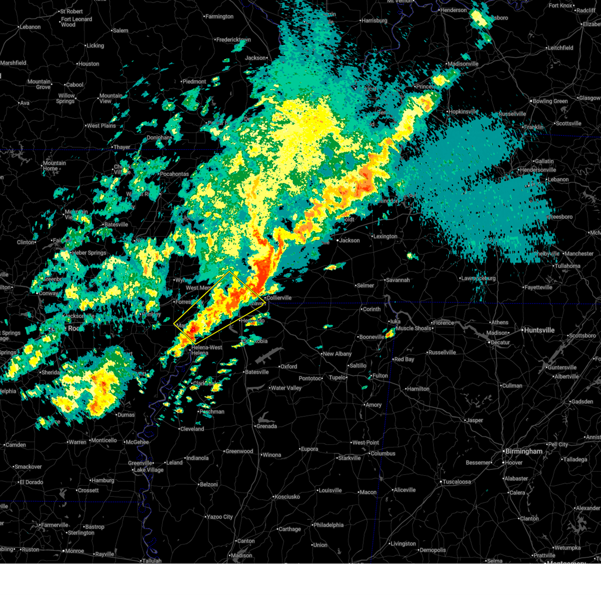 Svrmeg the national weather service in memphis has issued a * severe thunderstorm warning for, eastern lee county in eastern arkansas, southeastern st. francis county in eastern arkansas, central crittenden county in eastern arkansas, northwestern desoto county in northwestern mississippi, northern tunica county in northwestern mississippi, southwestern shelby county in west tennessee, * until 1100 pm cdt. * at 1009 pm cdt, a severe thunderstorm was located 7 miles south of brickeys, or 12 miles north of st francis national park, moving northeast at 65 mph (radar indicated). Hazards include ping pong ball size hail and 60 mph wind gusts. People and animals outdoors will be injured. expect hail damage to roofs, siding, windows, and vehicles. Expect wind damage to roofs, siding, and trees. Svrmeg the national weather service in memphis has issued a * severe thunderstorm warning for, eastern lee county in eastern arkansas, southeastern st. francis county in eastern arkansas, central crittenden county in eastern arkansas, northwestern desoto county in northwestern mississippi, northern tunica county in northwestern mississippi, southwestern shelby county in west tennessee, * until 1100 pm cdt. * at 1009 pm cdt, a severe thunderstorm was located 7 miles south of brickeys, or 12 miles north of st francis national park, moving northeast at 65 mph (radar indicated). Hazards include ping pong ball size hail and 60 mph wind gusts. People and animals outdoors will be injured. expect hail damage to roofs, siding, windows, and vehicles. Expect wind damage to roofs, siding, and trees.
|
| 4/2/2025 9:56 PM CDT |
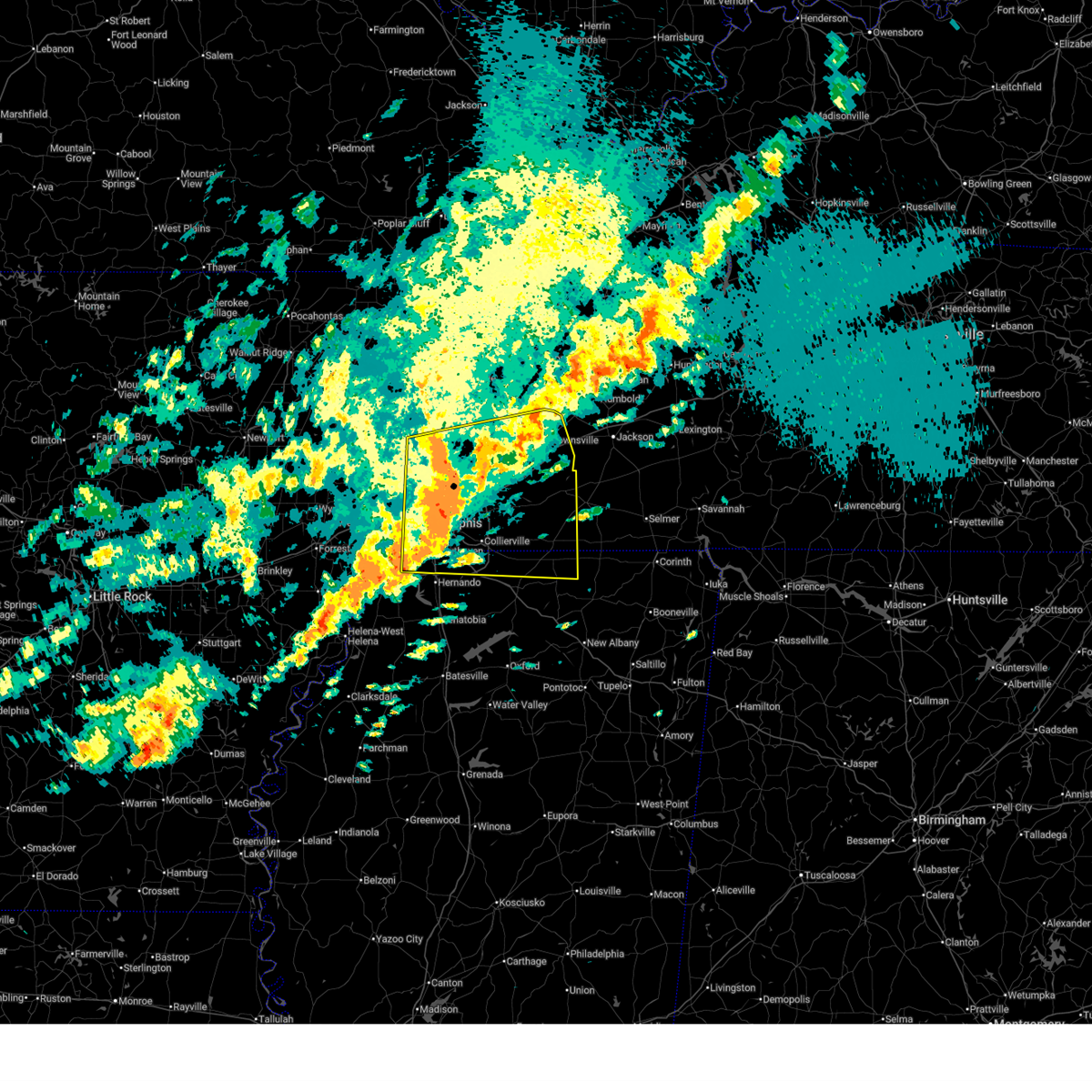 At 956 pm cdt, a severe thunderstorm was located near ellendale, or near millington, moving east at 65 mph (radar indicated). Hazards include 60 mph wind gusts and half dollar size hail. Hail damage to vehicles is expected. expect wind damage to roofs, siding, and trees. Locations impacted include, ghost river state natural area, burlison, stanton, horn lake, covington, presidents island, kirk, glover, locke, arlington, elmore park, laconia, alden, hudsonville, sunnyhill, durhamville, gilestown, clopton, asbury, and mound city. At 956 pm cdt, a severe thunderstorm was located near ellendale, or near millington, moving east at 65 mph (radar indicated). Hazards include 60 mph wind gusts and half dollar size hail. Hail damage to vehicles is expected. expect wind damage to roofs, siding, and trees. Locations impacted include, ghost river state natural area, burlison, stanton, horn lake, covington, presidents island, kirk, glover, locke, arlington, elmore park, laconia, alden, hudsonville, sunnyhill, durhamville, gilestown, clopton, asbury, and mound city.
|
| 4/2/2025 9:54 PM CDT |
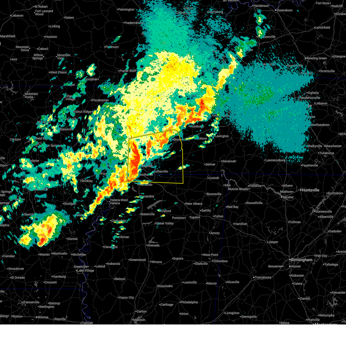 Svrmeg the national weather service in memphis has issued a * severe thunderstorm warning for, southwestern mississippi county in eastern arkansas, northeastern crittenden county in eastern arkansas, northern desoto county in northwestern mississippi, northern marshall county in northwestern mississippi, northern benton county in northeastern mississippi, tipton county in west tennessee, fayette county in west tennessee, western hardeman county in west tennessee, southern lauderdale county in west tennessee, haywood county in west tennessee, shelby county in west tennessee, * until 1045 pm cdt. * at 954 pm cdt, a severe thunderstorm was located near millington, moving east at 65 mph (radar indicated). Hazards include 60 mph wind gusts and quarter size hail. Hail damage to vehicles is expected. Expect wind damage to roofs, siding, and trees. Svrmeg the national weather service in memphis has issued a * severe thunderstorm warning for, southwestern mississippi county in eastern arkansas, northeastern crittenden county in eastern arkansas, northern desoto county in northwestern mississippi, northern marshall county in northwestern mississippi, northern benton county in northeastern mississippi, tipton county in west tennessee, fayette county in west tennessee, western hardeman county in west tennessee, southern lauderdale county in west tennessee, haywood county in west tennessee, shelby county in west tennessee, * until 1045 pm cdt. * at 954 pm cdt, a severe thunderstorm was located near millington, moving east at 65 mph (radar indicated). Hazards include 60 mph wind gusts and quarter size hail. Hail damage to vehicles is expected. Expect wind damage to roofs, siding, and trees.
|
| 4/2/2025 9:47 PM CDT |
 the severe thunderstorm warning has been cancelled and is no longer in effect the severe thunderstorm warning has been cancelled and is no longer in effect
|
| 4/2/2025 9:47 PM CDT |
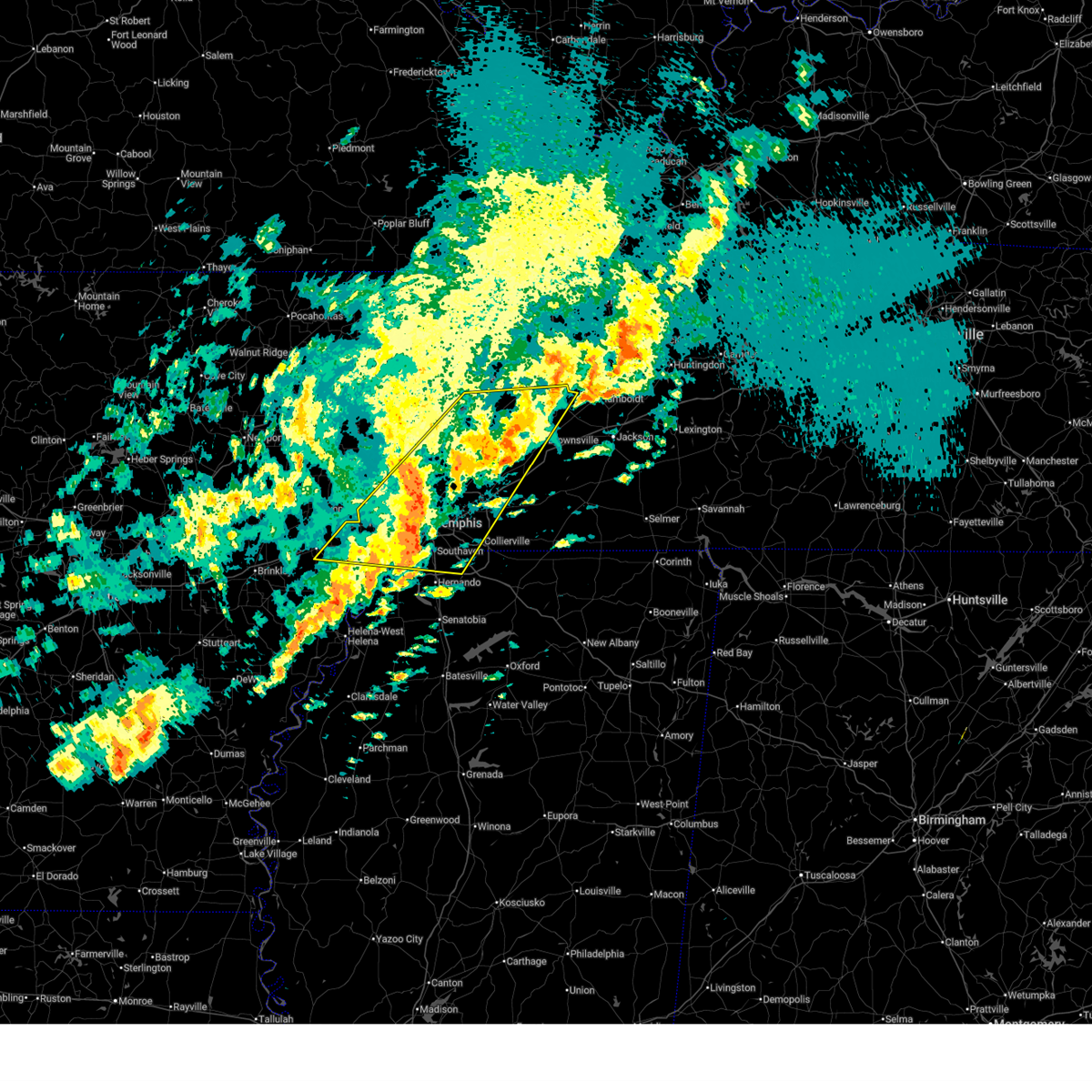 At 947 pm cdt, a severe thunderstorm was located near chestnut bluff, or 8 miles south of dyersburg, moving northeast at 65 mph (radar indicated). Hazards include ping pong ball size hail and 60 mph wind gusts. People and animals outdoors will be injured. expect hail damage to roofs, siding, windows, and vehicles. expect wind damage to roofs, siding, and trees. Locations impacted include, burlison, stanton, horn lake, louise, covington, edmondson, presidents island, beck, glover, locke, arlington, elmore park, alden, julius, brims corner, durhamville, gilestown, clopton, clarks corner, and lightfoot. At 947 pm cdt, a severe thunderstorm was located near chestnut bluff, or 8 miles south of dyersburg, moving northeast at 65 mph (radar indicated). Hazards include ping pong ball size hail and 60 mph wind gusts. People and animals outdoors will be injured. expect hail damage to roofs, siding, windows, and vehicles. expect wind damage to roofs, siding, and trees. Locations impacted include, burlison, stanton, horn lake, louise, covington, edmondson, presidents island, beck, glover, locke, arlington, elmore park, alden, julius, brims corner, durhamville, gilestown, clopton, clarks corner, and lightfoot.
|
| 4/2/2025 9:28 PM CDT |
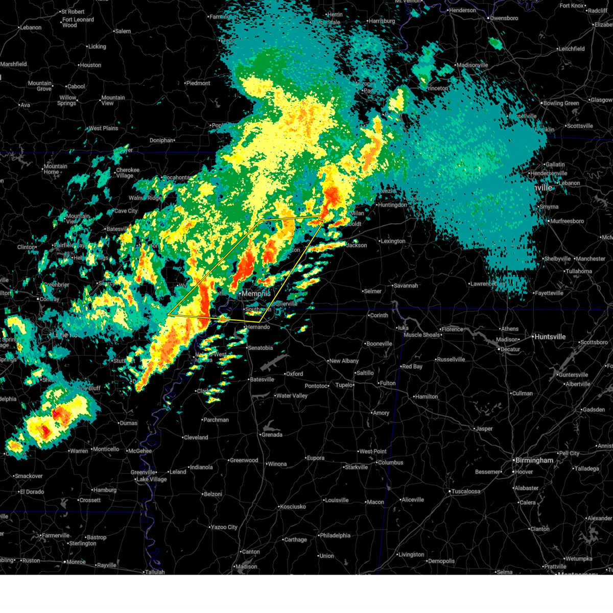 At 928 pm cdt, a severe thunderstorm was located near ripley, moving northeast at 65 mph (radar indicated). Hazards include ping pong ball size hail and 60 mph wind gusts. People and animals outdoors will be injured. expect hail damage to roofs, siding, windows, and vehicles. expect wind damage to roofs, siding, and trees. Locations impacted include, burlison, stanton, horn lake, louise, new castle, covington, edmondson, presidents island, beck, glover, locke, arlington, elmore park, alden, julius, brims corner, durhamville, gilestown, clopton, and clarks corner. At 928 pm cdt, a severe thunderstorm was located near ripley, moving northeast at 65 mph (radar indicated). Hazards include ping pong ball size hail and 60 mph wind gusts. People and animals outdoors will be injured. expect hail damage to roofs, siding, windows, and vehicles. expect wind damage to roofs, siding, and trees. Locations impacted include, burlison, stanton, horn lake, louise, new castle, covington, edmondson, presidents island, beck, glover, locke, arlington, elmore park, alden, julius, brims corner, durhamville, gilestown, clopton, and clarks corner.
|
| 4/2/2025 9:10 PM CDT |
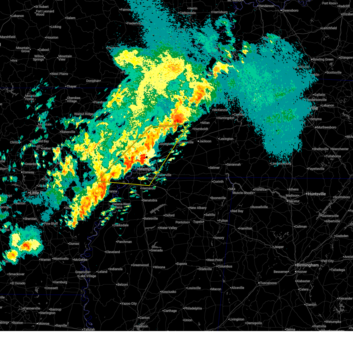 Svrmeg the national weather service in memphis has issued a * severe thunderstorm warning for, eastern st. francis county in eastern arkansas, southern mississippi county in eastern arkansas, crittenden county in eastern arkansas, southeastern cross county in eastern arkansas, northern desoto county in northwestern mississippi, southwestern crockett county in west tennessee, tipton county in west tennessee, northwestern fayette county in west tennessee, lauderdale county in west tennessee, northwestern haywood county in west tennessee, shelby county in west tennessee, * until 1000 pm cdt. * at 910 pm cdt, a severe thunderstorm was located over munford, or 10 miles north of millington, moving northeast at 65 mph (radar indicated). Hazards include 60 mph wind gusts and quarter size hail. Hail damage to vehicles is expected. Expect wind damage to roofs, siding, and trees. Svrmeg the national weather service in memphis has issued a * severe thunderstorm warning for, eastern st. francis county in eastern arkansas, southern mississippi county in eastern arkansas, crittenden county in eastern arkansas, southeastern cross county in eastern arkansas, northern desoto county in northwestern mississippi, southwestern crockett county in west tennessee, tipton county in west tennessee, northwestern fayette county in west tennessee, lauderdale county in west tennessee, northwestern haywood county in west tennessee, shelby county in west tennessee, * until 1000 pm cdt. * at 910 pm cdt, a severe thunderstorm was located over munford, or 10 miles north of millington, moving northeast at 65 mph (radar indicated). Hazards include 60 mph wind gusts and quarter size hail. Hail damage to vehicles is expected. Expect wind damage to roofs, siding, and trees.
|
| 4/2/2025 8:58 PM CDT |
 At 857 pm cdt, severe thunderstorms were located along a line extending from near forked deer to near frayser to near haynes, moving south at 25 mph (radar indicated). Hazards include 60 mph wind gusts and quarter size hail. Hail damage to vehicles is expected. expect wind damage to roofs, siding, and trees. Locations impacted include, three forks, burlison, horn lake, louise, new castle, covington, edmondson, osceola, presidents island, beck, glover, locke, arlington, elmore park, alden, village creek state park, julius, durhamville, gilestown, and clopton. At 857 pm cdt, severe thunderstorms were located along a line extending from near forked deer to near frayser to near haynes, moving south at 25 mph (radar indicated). Hazards include 60 mph wind gusts and quarter size hail. Hail damage to vehicles is expected. expect wind damage to roofs, siding, and trees. Locations impacted include, three forks, burlison, horn lake, louise, new castle, covington, edmondson, osceola, presidents island, beck, glover, locke, arlington, elmore park, alden, village creek state park, julius, durhamville, gilestown, and clopton.
|
| 4/2/2025 8:58 PM CDT |
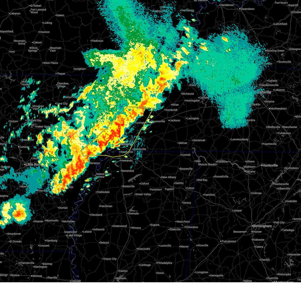 the severe thunderstorm warning has been cancelled and is no longer in effect the severe thunderstorm warning has been cancelled and is no longer in effect
|
| 4/2/2025 8:40 PM CDT |
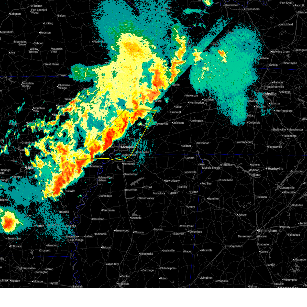 At 839 pm cdt, severe thunderstorms were located along a line extending from near chestnut bluff to near haynes, moving northeast at 65 mph (radar indicated). Hazards include 60 mph wind gusts and quarter size hail. Hail damage to vehicles is expected. expect wind damage to roofs, siding, and trees. Locations impacted include, three forks, burlison, horn lake, louise, new castle, covington, edmondson, osceola, presidents island, beck, glover, locke, arlington, elmore park, alden, village creek state park, julius, durhamville, gilestown, and clopton. At 839 pm cdt, severe thunderstorms were located along a line extending from near chestnut bluff to near haynes, moving northeast at 65 mph (radar indicated). Hazards include 60 mph wind gusts and quarter size hail. Hail damage to vehicles is expected. expect wind damage to roofs, siding, and trees. Locations impacted include, three forks, burlison, horn lake, louise, new castle, covington, edmondson, osceola, presidents island, beck, glover, locke, arlington, elmore park, alden, village creek state park, julius, durhamville, gilestown, and clopton.
|
| 4/2/2025 8:31 PM CDT |
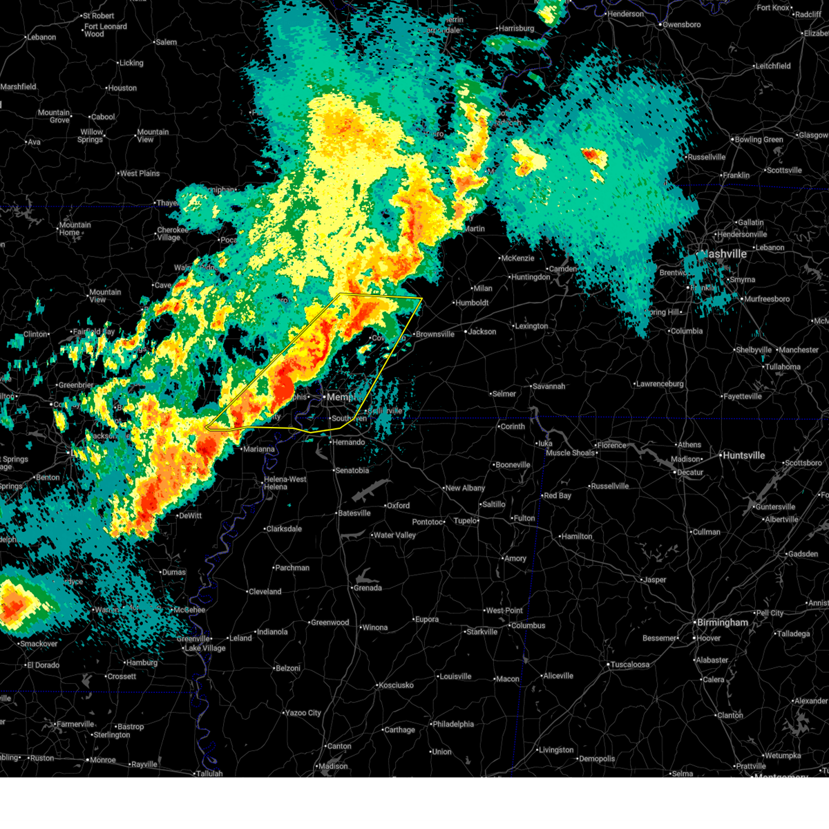 Svrmeg the national weather service in memphis has issued a * severe thunderstorm warning for, st. francis county in eastern arkansas, southeastern poinsett county in eastern arkansas, central mississippi county in eastern arkansas, crittenden county in eastern arkansas, southeastern cross county in eastern arkansas, northwestern desoto county in northwestern mississippi, west central crockett county in west tennessee, tipton county in west tennessee, northwestern fayette county in west tennessee, lauderdale county in west tennessee, northwestern haywood county in west tennessee, shelby county in west tennessee, * until 915 pm cdt. * at 831 pm cdt, severe thunderstorms were located along a line extending from near ft pillow to marianna, moving east at 75 mph (radar indicated). Hazards include 60 mph wind gusts and quarter size hail. Hail damage to vehicles is expected. Expect wind damage to roofs, siding, and trees. Svrmeg the national weather service in memphis has issued a * severe thunderstorm warning for, st. francis county in eastern arkansas, southeastern poinsett county in eastern arkansas, central mississippi county in eastern arkansas, crittenden county in eastern arkansas, southeastern cross county in eastern arkansas, northwestern desoto county in northwestern mississippi, west central crockett county in west tennessee, tipton county in west tennessee, northwestern fayette county in west tennessee, lauderdale county in west tennessee, northwestern haywood county in west tennessee, shelby county in west tennessee, * until 915 pm cdt. * at 831 pm cdt, severe thunderstorms were located along a line extending from near ft pillow to marianna, moving east at 75 mph (radar indicated). Hazards include 60 mph wind gusts and quarter size hail. Hail damage to vehicles is expected. Expect wind damage to roofs, siding, and trees.
|
| 4/2/2025 5:30 PM CDT |
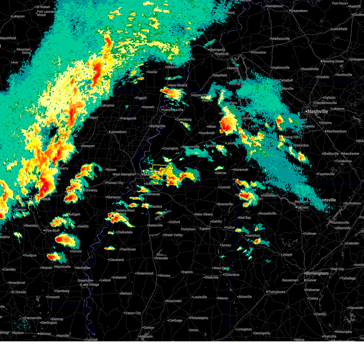 At 530 pm cdt, a severe thunderstorm was located over cordova, moving northeast at 45 mph (radar indicated. at 528 pm cdt, quarter sized hail was reported in east memphis). Hazards include 60 mph wind gusts and quarter size hail. Hail damage to vehicles is expected. expect wind damage to roofs, siding, and trees. Locations impacted include, brunswick, lenow, fisherville, eads, ellendale, germantown, lakeland, hickory withe, cordova, bartlett, arlington, collierville, and memphis. At 530 pm cdt, a severe thunderstorm was located over cordova, moving northeast at 45 mph (radar indicated. at 528 pm cdt, quarter sized hail was reported in east memphis). Hazards include 60 mph wind gusts and quarter size hail. Hail damage to vehicles is expected. expect wind damage to roofs, siding, and trees. Locations impacted include, brunswick, lenow, fisherville, eads, ellendale, germantown, lakeland, hickory withe, cordova, bartlett, arlington, collierville, and memphis.
|
| 4/2/2025 5:28 PM CDT | Quarter sized hail reported 1.9 miles SSE of Germantown, TN, report from mping: quarter (1.00 in.). |
| 4/2/2025 5:26 PM CDT |
 the severe thunderstorm warning has been cancelled and is no longer in effect the severe thunderstorm warning has been cancelled and is no longer in effect
|
| 4/2/2025 5:26 PM CDT |
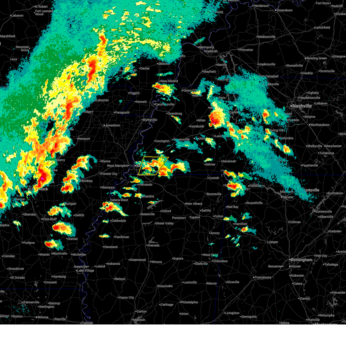 At 525 pm cdt, a severe thunderstorm was located over germantown, moving northeast at 30 mph (radar indicated). Hazards include 60 mph wind gusts and quarter size hail. Hail damage to vehicles is expected. expect wind damage to roofs, siding, and trees. Locations impacted include, piperton, lenow, ellendale, oakland, germantown, warren, capleville, kirk, hickory withe, arlington, elmore park, brunswick, fisherville, collierville, macon, southeast memphis, elba, canadaville, eads, and parkway village. At 525 pm cdt, a severe thunderstorm was located over germantown, moving northeast at 30 mph (radar indicated). Hazards include 60 mph wind gusts and quarter size hail. Hail damage to vehicles is expected. expect wind damage to roofs, siding, and trees. Locations impacted include, piperton, lenow, ellendale, oakland, germantown, warren, capleville, kirk, hickory withe, arlington, elmore park, brunswick, fisherville, collierville, macon, southeast memphis, elba, canadaville, eads, and parkway village.
|
| 4/2/2025 5:06 PM CDT |
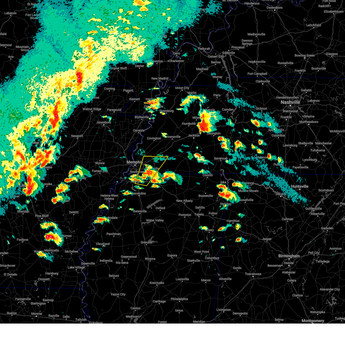 At 506 pm cdt, a severe thunderstorm was located over olive branch, moving northeast at 50 mph (radar indicated. at 503 pm cdt, golf ball sized hail was reported near nesbit along interstate 269). Hazards include ping pong ball size hail and 60 mph wind gusts. People and animals outdoors will be injured. expect hail damage to roofs, siding, windows, and vehicles. expect wind damage to roofs, siding, and trees. Locations impacted include, piperton, lenow, cockrum, cedarview, ellendale, oakland, germantown, bright, nesbit, handy corner, warren, capleville, kirk, hickory withe, jago, arlington, elmore park, brunswick, fisherville, and collierville. At 506 pm cdt, a severe thunderstorm was located over olive branch, moving northeast at 50 mph (radar indicated. at 503 pm cdt, golf ball sized hail was reported near nesbit along interstate 269). Hazards include ping pong ball size hail and 60 mph wind gusts. People and animals outdoors will be injured. expect hail damage to roofs, siding, windows, and vehicles. expect wind damage to roofs, siding, and trees. Locations impacted include, piperton, lenow, cockrum, cedarview, ellendale, oakland, germantown, bright, nesbit, handy corner, warren, capleville, kirk, hickory withe, jago, arlington, elmore park, brunswick, fisherville, and collierville.
|
| 4/2/2025 4:53 PM CDT |
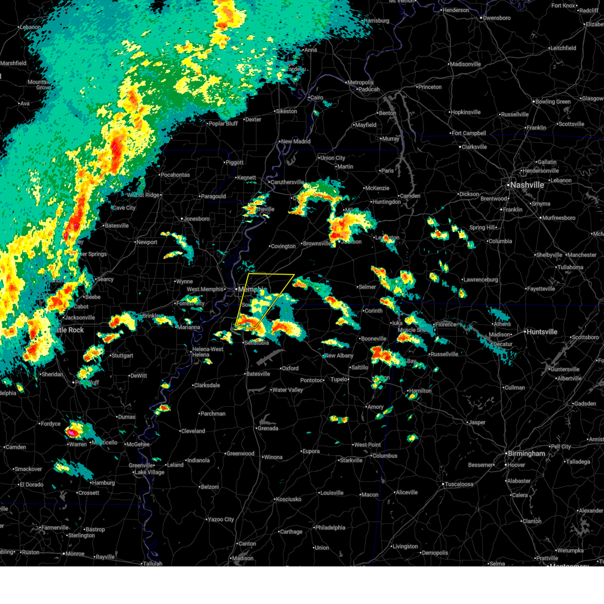 the severe thunderstorm warning has been cancelled and is no longer in effect the severe thunderstorm warning has been cancelled and is no longer in effect
|
| 4/2/2025 4:53 PM CDT |
 At 452 pm cdt, a severe thunderstorm was located over hernando, moving northeast at 50 mph (radar indicated). Hazards include 60 mph wind gusts and quarter size hail. Hail damage to vehicles is expected. expect wind damage to roofs, siding, and trees. Locations impacted include, piperton, lenow, cockrum, cedarview, ellendale, oakland, germantown, bright, nesbit, handy corner, warren, capleville, kirk, hickory withe, jago, arlington, robinson gin, elmore park, brunswick, and fisherville. At 452 pm cdt, a severe thunderstorm was located over hernando, moving northeast at 50 mph (radar indicated). Hazards include 60 mph wind gusts and quarter size hail. Hail damage to vehicles is expected. expect wind damage to roofs, siding, and trees. Locations impacted include, piperton, lenow, cockrum, cedarview, ellendale, oakland, germantown, bright, nesbit, handy corner, warren, capleville, kirk, hickory withe, jago, arlington, robinson gin, elmore park, brunswick, and fisherville.
|
| 4/2/2025 4:38 PM CDT |
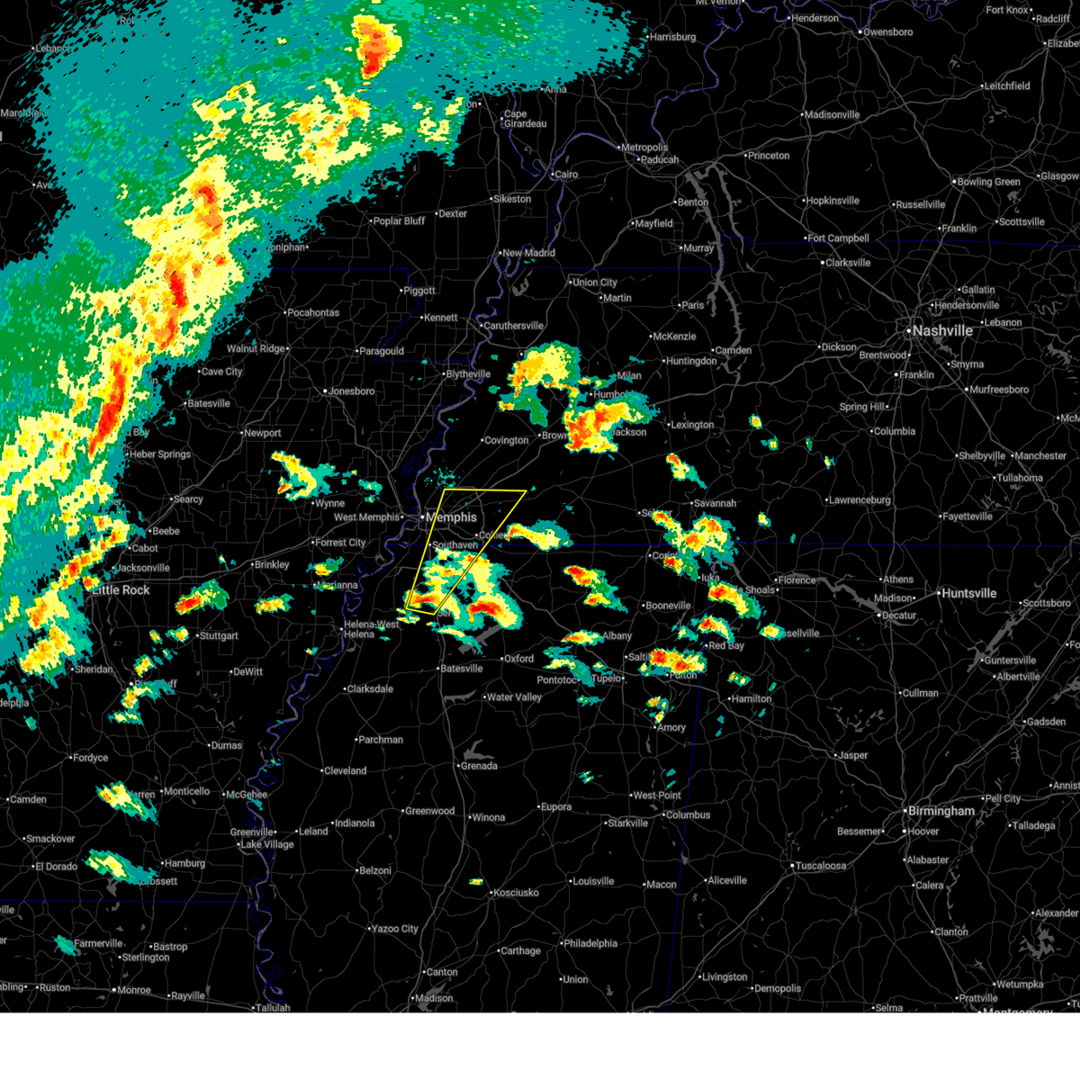 Svrmeg the national weather service in memphis has issued a * severe thunderstorm warning for, desoto county in northwestern mississippi, northwestern marshall county in northwestern mississippi, central tate county in northwestern mississippi, southwestern fayette county in west tennessee, southeastern shelby county in west tennessee, * until 545 pm cdt. * at 438 pm cdt, a severe thunderstorm was located near arkabutla, or near senatobia, moving northeast at 50 mph (radar indicated). Hazards include 60 mph wind gusts and quarter size hail. Hail damage to vehicles is expected. Expect wind damage to roofs, siding, and trees. Svrmeg the national weather service in memphis has issued a * severe thunderstorm warning for, desoto county in northwestern mississippi, northwestern marshall county in northwestern mississippi, central tate county in northwestern mississippi, southwestern fayette county in west tennessee, southeastern shelby county in west tennessee, * until 545 pm cdt. * at 438 pm cdt, a severe thunderstorm was located near arkabutla, or near senatobia, moving northeast at 50 mph (radar indicated). Hazards include 60 mph wind gusts and quarter size hail. Hail damage to vehicles is expected. Expect wind damage to roofs, siding, and trees.
|
| 4/2/2025 3:49 PM CDT |
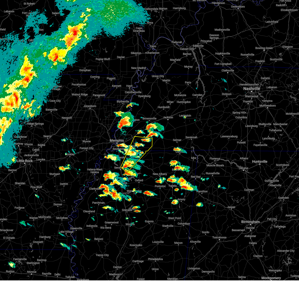 Svrmeg the national weather service in memphis has issued a * severe thunderstorm warning for, northeastern desoto county in northwestern mississippi, northwestern marshall county in northwestern mississippi, eastern tate county in northwestern mississippi, fayette county in west tennessee, southeastern shelby county in west tennessee, * until 445 pm cdt. * at 349 pm cdt, a severe thunderstorm was located near independence, or 8 miles northeast of senatobia, moving northeast at 45 mph (radar indicated). Hazards include 60 mph wind gusts and quarter size hail. Hail damage to vehicles is expected. Expect wind damage to roofs, siding, and trees. Svrmeg the national weather service in memphis has issued a * severe thunderstorm warning for, northeastern desoto county in northwestern mississippi, northwestern marshall county in northwestern mississippi, eastern tate county in northwestern mississippi, fayette county in west tennessee, southeastern shelby county in west tennessee, * until 445 pm cdt. * at 349 pm cdt, a severe thunderstorm was located near independence, or 8 miles northeast of senatobia, moving northeast at 45 mph (radar indicated). Hazards include 60 mph wind gusts and quarter size hail. Hail damage to vehicles is expected. Expect wind damage to roofs, siding, and trees.
|
| 4/2/2025 2:55 PM CDT |
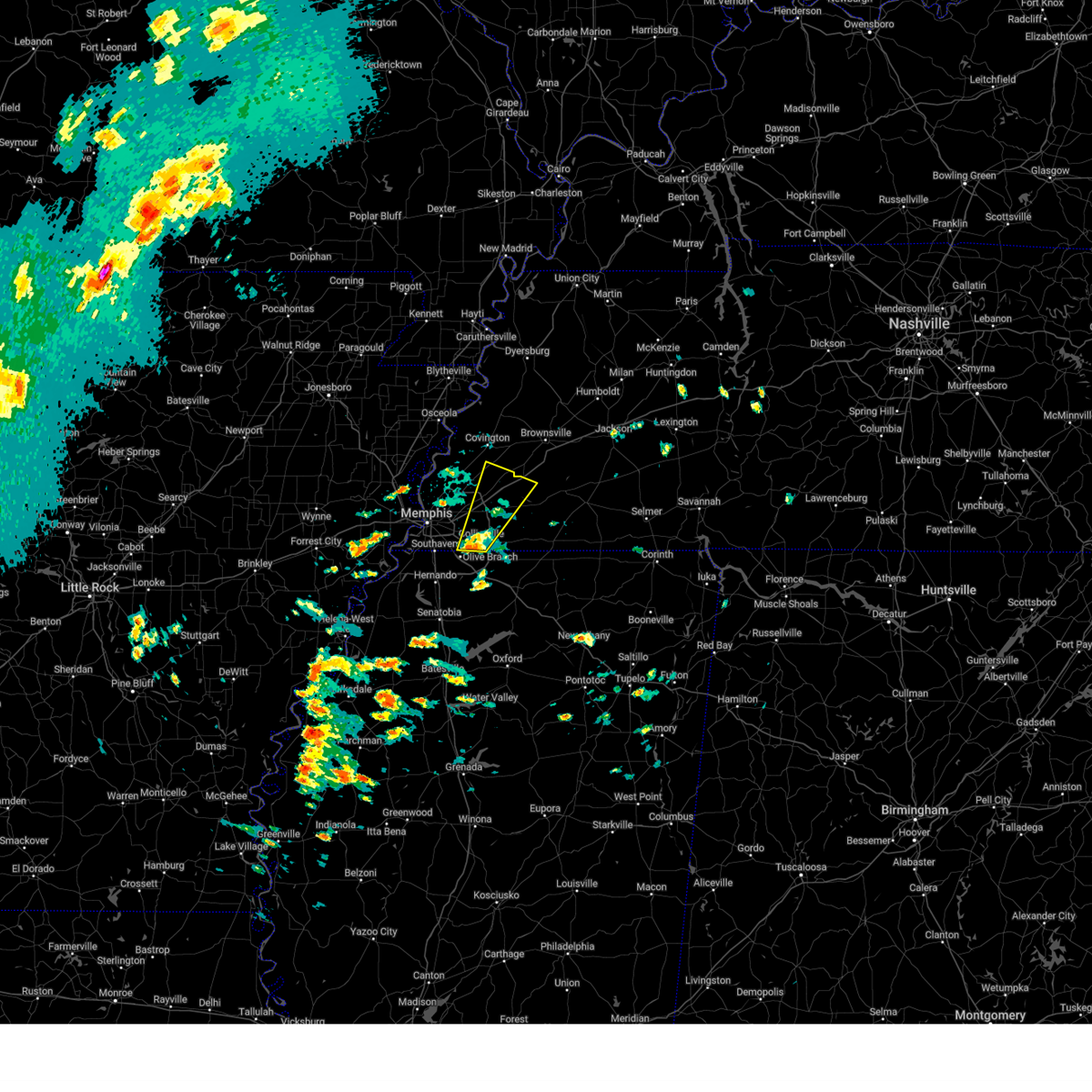 At 255 pm cdt, a severe thunderstorm was located over germantown, moving northeast at 55 mph (radar indicated). Hazards include 60 mph wind gusts and quarter size hail. Hail damage to vehicles is expected. expect wind damage to roofs, siding, and trees. Locations impacted include, piperton, lenow, yum yum, belmont, oakland, germantown, warren, kirk, hickory withe, arlington, fisherville, collierville, elba, canadaville, canaan grove, eads, longtown, moorman, braden, and lambert. At 255 pm cdt, a severe thunderstorm was located over germantown, moving northeast at 55 mph (radar indicated). Hazards include 60 mph wind gusts and quarter size hail. Hail damage to vehicles is expected. expect wind damage to roofs, siding, and trees. Locations impacted include, piperton, lenow, yum yum, belmont, oakland, germantown, warren, kirk, hickory withe, arlington, fisherville, collierville, elba, canadaville, canaan grove, eads, longtown, moorman, braden, and lambert.
|
| 4/2/2025 2:55 PM CDT |
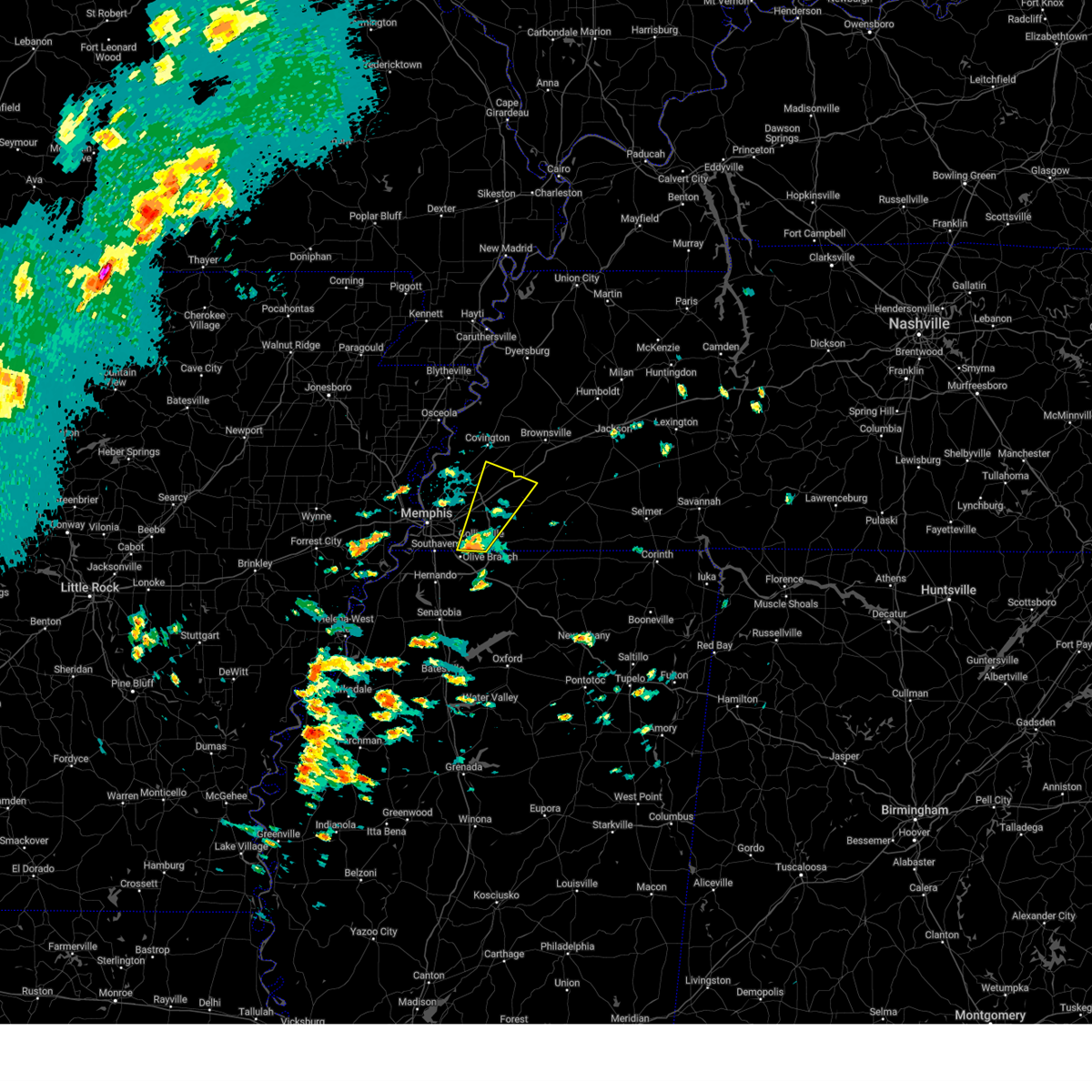 the severe thunderstorm warning has been cancelled and is no longer in effect the severe thunderstorm warning has been cancelled and is no longer in effect
|
| 4/2/2025 2:45 PM CDT |
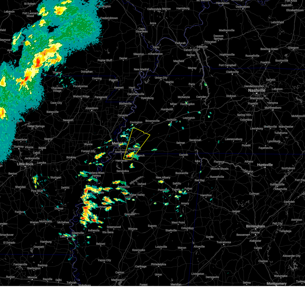 Svrmeg the national weather service in memphis has issued a * severe thunderstorm warning for, northeastern desoto county in northwestern mississippi, southeastern tipton county in west tennessee, northwestern fayette county in west tennessee, eastern shelby county in west tennessee, * until 330 pm cdt. * at 245 pm cdt, a severe thunderstorm was located over olive branch, moving northeast at 55 mph (radar indicated). Hazards include 60 mph wind gusts and quarter size hail. Hail damage to vehicles is expected. Expect wind damage to roofs, siding, and trees. Svrmeg the national weather service in memphis has issued a * severe thunderstorm warning for, northeastern desoto county in northwestern mississippi, southeastern tipton county in west tennessee, northwestern fayette county in west tennessee, eastern shelby county in west tennessee, * until 330 pm cdt. * at 245 pm cdt, a severe thunderstorm was located over olive branch, moving northeast at 55 mph (radar indicated). Hazards include 60 mph wind gusts and quarter size hail. Hail damage to vehicles is expected. Expect wind damage to roofs, siding, and trees.
|
| 3/30/2025 10:22 PM CDT |
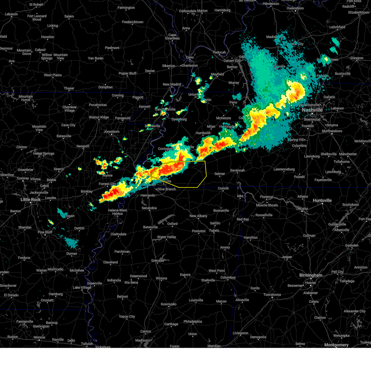 At 1022 pm cdt, a severe thunderstorm was located near eads, or 11 miles northeast of cordova, moving east at 40 mph (radar indicated). Hazards include 60 mph wind gusts and half dollar size hail. Hail damage to vehicles is expected. expect wind damage to roofs, siding, and trees. Locations impacted include, ghost river state natural area, yum yum, belmont, ellendale, oakland, whiteville, kirk, rossville, arlington, rogers springs, elmore park, brunswick, fisherville, laconia, macon, cedar chapel, canadaville, vildo, williston, and lambert. At 1022 pm cdt, a severe thunderstorm was located near eads, or 11 miles northeast of cordova, moving east at 40 mph (radar indicated). Hazards include 60 mph wind gusts and half dollar size hail. Hail damage to vehicles is expected. expect wind damage to roofs, siding, and trees. Locations impacted include, ghost river state natural area, yum yum, belmont, ellendale, oakland, whiteville, kirk, rossville, arlington, rogers springs, elmore park, brunswick, fisherville, laconia, macon, cedar chapel, canadaville, vildo, williston, and lambert.
|
| 3/30/2025 10:08 PM CDT |
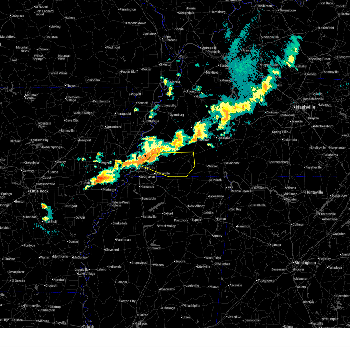 At 1007 pm cdt, a severe thunderstorm was located near arlington, or 13 miles northeast of cordova, moving east at 50 mph (radar indicated. at 1006 pm cdt, ping pong ball sized hail was observed in bartlett). Hazards include ping pong ball size hail and 60 mph wind gusts. People and animals outdoors will be injured. expect hail damage to roofs, siding, windows, and vehicles. expect wind damage to roofs, siding, and trees. Locations impacted include, ghost river state natural area, yum yum, belmont, ellendale, oakland, whiteville, kirk, rossville, arlington, rogers springs, elmore park, brunswick, fisherville, laconia, macon, cedar chapel, canadaville, vildo, williston, and lambert. At 1007 pm cdt, a severe thunderstorm was located near arlington, or 13 miles northeast of cordova, moving east at 50 mph (radar indicated. at 1006 pm cdt, ping pong ball sized hail was observed in bartlett). Hazards include ping pong ball size hail and 60 mph wind gusts. People and animals outdoors will be injured. expect hail damage to roofs, siding, windows, and vehicles. expect wind damage to roofs, siding, and trees. Locations impacted include, ghost river state natural area, yum yum, belmont, ellendale, oakland, whiteville, kirk, rossville, arlington, rogers springs, elmore park, brunswick, fisherville, laconia, macon, cedar chapel, canadaville, vildo, williston, and lambert.
|
| 3/30/2025 10:03 PM CDT |
 Svrmeg the national weather service in memphis has issued a * severe thunderstorm warning for, fayette county in west tennessee, hardeman county in west tennessee, east central shelby county in west tennessee, * until 1045 pm cdt. * at 1003 pm cdt, a severe thunderstorm was located over arlington, or 11 miles northeast of bartlett, moving east at 50 mph (radar indicated). Hazards include 60 mph wind gusts and quarter size hail. Hail damage to vehicles is expected. Expect wind damage to roofs, siding, and trees. Svrmeg the national weather service in memphis has issued a * severe thunderstorm warning for, fayette county in west tennessee, hardeman county in west tennessee, east central shelby county in west tennessee, * until 1045 pm cdt. * at 1003 pm cdt, a severe thunderstorm was located over arlington, or 11 miles northeast of bartlett, moving east at 50 mph (radar indicated). Hazards include 60 mph wind gusts and quarter size hail. Hail damage to vehicles is expected. Expect wind damage to roofs, siding, and trees.
|
| 3/15/2025 9:20 AM CDT |
 The storm which prompted the warning has weakened below severe limits, and has exited the warned area. therefore, the warning will be allowed to expire. however, small hail and gusty winds are still possible with this thunderstorm. a tornado watch remains in effect until 100 pm cdt for northeastern and northwestern mississippi, and west tennessee. The storm which prompted the warning has weakened below severe limits, and has exited the warned area. therefore, the warning will be allowed to expire. however, small hail and gusty winds are still possible with this thunderstorm. a tornado watch remains in effect until 100 pm cdt for northeastern and northwestern mississippi, and west tennessee.
|
| 3/15/2025 9:02 AM CDT |
 At 902 am cdt, a severe thunderstorm was located near arlington, or 10 miles northeast of bartlett, moving north at 50 mph (radar indicated). Hazards include 60 mph wind gusts and quarter size hail. Hail damage to vehicles is expected. expect wind damage to roofs, siding, and trees. Locations impacted include, ghost river state natural area, burlison, stanton, huntersville, masseyville, westover, covington, silerton, kirk, arlington, elmore park, laconia, lisbon, hudsonville, brims corner, sunnyhill, durhamville, montezuma, clopton, and lightfoot. At 902 am cdt, a severe thunderstorm was located near arlington, or 10 miles northeast of bartlett, moving north at 50 mph (radar indicated). Hazards include 60 mph wind gusts and quarter size hail. Hail damage to vehicles is expected. expect wind damage to roofs, siding, and trees. Locations impacted include, ghost river state natural area, burlison, stanton, huntersville, masseyville, westover, covington, silerton, kirk, arlington, elmore park, laconia, lisbon, hudsonville, brims corner, sunnyhill, durhamville, montezuma, clopton, and lightfoot.
|
| 3/15/2025 8:39 AM CDT |
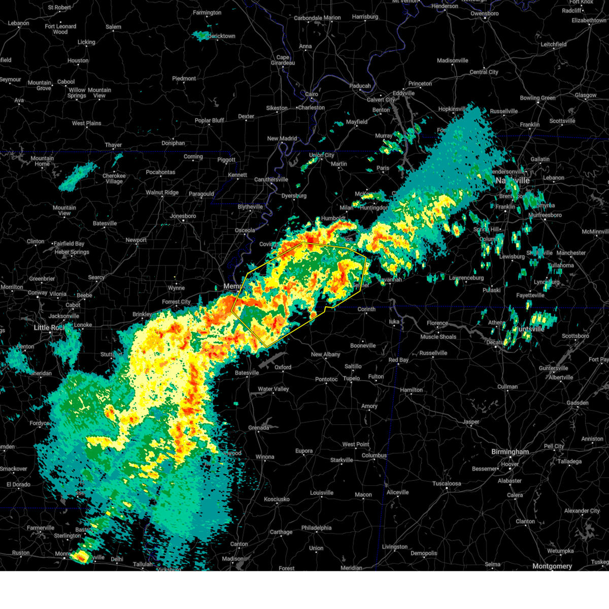 The severe thunderstorm which prompted the warning has moved out of the warned area. therefore, the warning will be allowed to expire. a tornado watch remains in effect until 100 pm cdt for northeastern and northwestern mississippi, and west tennessee. The severe thunderstorm which prompted the warning has moved out of the warned area. therefore, the warning will be allowed to expire. a tornado watch remains in effect until 100 pm cdt for northeastern and northwestern mississippi, and west tennessee.
|
| 3/15/2025 8:38 AM CDT |
 Svrmeg the national weather service in memphis has issued a * severe thunderstorm warning for, northeastern desoto county in northwestern mississippi, northern marshall county in northwestern mississippi, northern benton county in northeastern mississippi, fayette county in west tennessee, hardeman county in west tennessee, eastern lauderdale county in west tennessee, haywood county in west tennessee, madison county in west tennessee, shelby county in west tennessee, chester county in west tennessee, southern crockett county in west tennessee, tipton county in west tennessee, northwestern mcnairy county in west tennessee, * until 930 am cdt. * at 838 am cdt, a severe thunderstorm was located over germantown, moving northeast at 40 mph (radar indicated). Hazards include 60 mph wind gusts and quarter size hail. Hail damage to vehicles is expected. Expect wind damage to roofs, siding, and trees. Svrmeg the national weather service in memphis has issued a * severe thunderstorm warning for, northeastern desoto county in northwestern mississippi, northern marshall county in northwestern mississippi, northern benton county in northeastern mississippi, fayette county in west tennessee, hardeman county in west tennessee, eastern lauderdale county in west tennessee, haywood county in west tennessee, madison county in west tennessee, shelby county in west tennessee, chester county in west tennessee, southern crockett county in west tennessee, tipton county in west tennessee, northwestern mcnairy county in west tennessee, * until 930 am cdt. * at 838 am cdt, a severe thunderstorm was located over germantown, moving northeast at 40 mph (radar indicated). Hazards include 60 mph wind gusts and quarter size hail. Hail damage to vehicles is expected. Expect wind damage to roofs, siding, and trees.
|
| 3/15/2025 8:13 AM CDT |
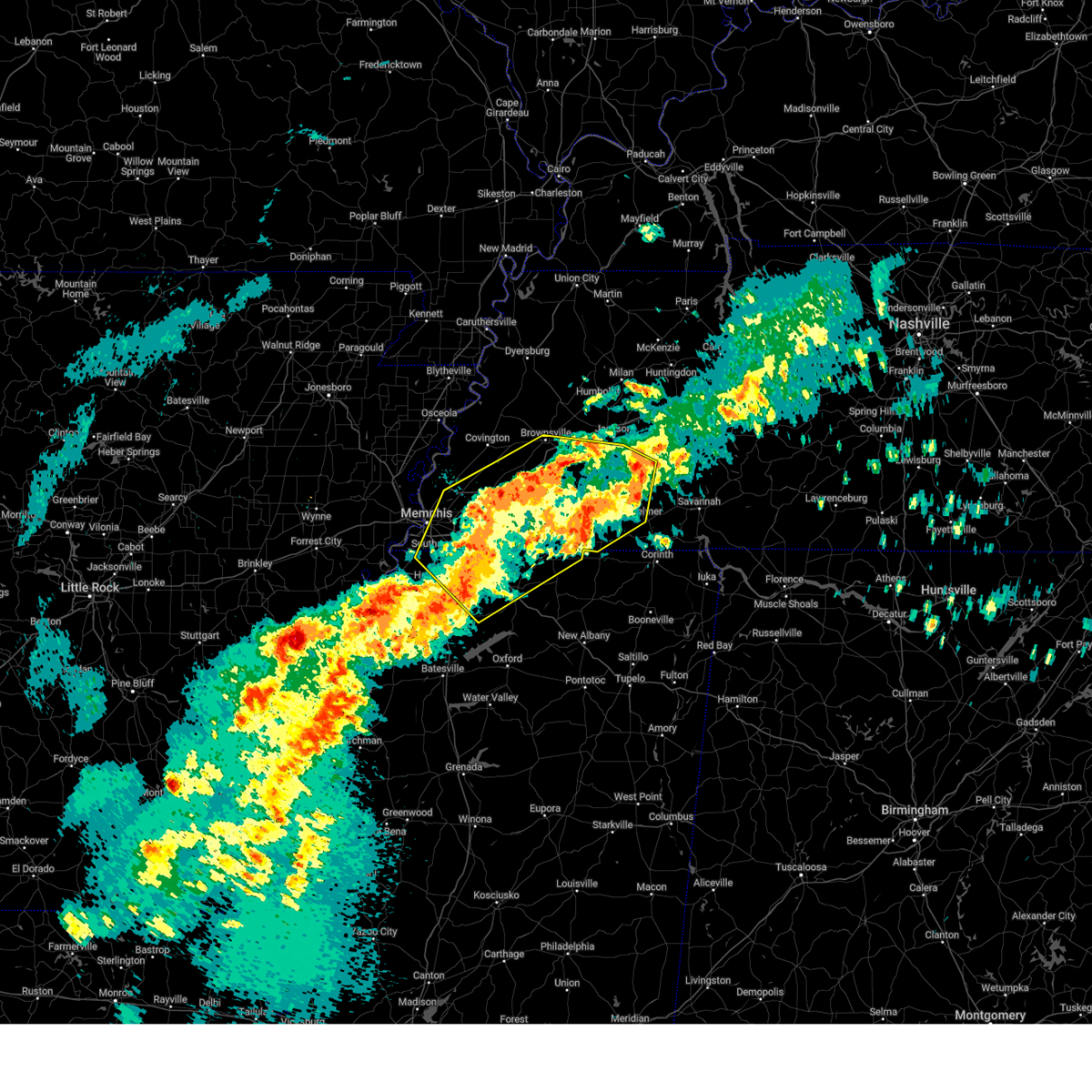 At 813 am cdt, a severe thunderstorm was located near dancyville, or 15 miles south of brownsville, moving northeast at 75 mph (radar indicated). Hazards include 60 mph wind gusts and quarter size hail. Hail damage to vehicles is expected. expect wind damage to roofs, siding, and trees. Locations impacted include, ghost river state natural area, neely, brody, yum yum, selmer, southwest memphis, stanton, horn lake, masseyville, belmont, madison hall, bright, uptonville, chulahoma, silerton, kirk, rossville, arlington, pinson mounds state archaeological park, and rogers springs. At 813 am cdt, a severe thunderstorm was located near dancyville, or 15 miles south of brownsville, moving northeast at 75 mph (radar indicated). Hazards include 60 mph wind gusts and quarter size hail. Hail damage to vehicles is expected. expect wind damage to roofs, siding, and trees. Locations impacted include, ghost river state natural area, neely, brody, yum yum, selmer, southwest memphis, stanton, horn lake, masseyville, belmont, madison hall, bright, uptonville, chulahoma, silerton, kirk, rossville, arlington, pinson mounds state archaeological park, and rogers springs.
|
| 3/15/2025 7:53 AM CDT |
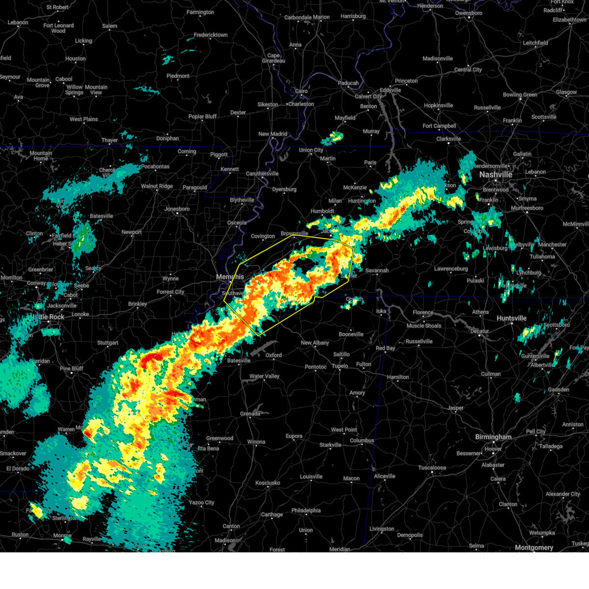 Svrmeg the national weather service in memphis has issued a * severe thunderstorm warning for, northeastern desoto county in northwestern mississippi, marshall county in northwestern mississippi, northeastern tate county in northwestern mississippi, northern benton county in northeastern mississippi, southeastern tipton county in west tennessee, fayette county in west tennessee, hardeman county in west tennessee, northwestern mcnairy county in west tennessee, southern haywood county in west tennessee, southern madison county in west tennessee, shelby county in west tennessee, chester county in west tennessee, * until 845 am cdt. * at 753 am cdt, a severe thunderstorm was located 9 miles west of lagrange, or 17 miles east of collierville, moving northeast at 50 mph (radar indicated). Hazards include 60 mph wind gusts and quarter size hail. Hail damage to vehicles is expected. Expect wind damage to roofs, siding, and trees. Svrmeg the national weather service in memphis has issued a * severe thunderstorm warning for, northeastern desoto county in northwestern mississippi, marshall county in northwestern mississippi, northeastern tate county in northwestern mississippi, northern benton county in northeastern mississippi, southeastern tipton county in west tennessee, fayette county in west tennessee, hardeman county in west tennessee, northwestern mcnairy county in west tennessee, southern haywood county in west tennessee, southern madison county in west tennessee, shelby county in west tennessee, chester county in west tennessee, * until 845 am cdt. * at 753 am cdt, a severe thunderstorm was located 9 miles west of lagrange, or 17 miles east of collierville, moving northeast at 50 mph (radar indicated). Hazards include 60 mph wind gusts and quarter size hail. Hail damage to vehicles is expected. Expect wind damage to roofs, siding, and trees.
|
| 2/15/2025 7:10 PM CST |
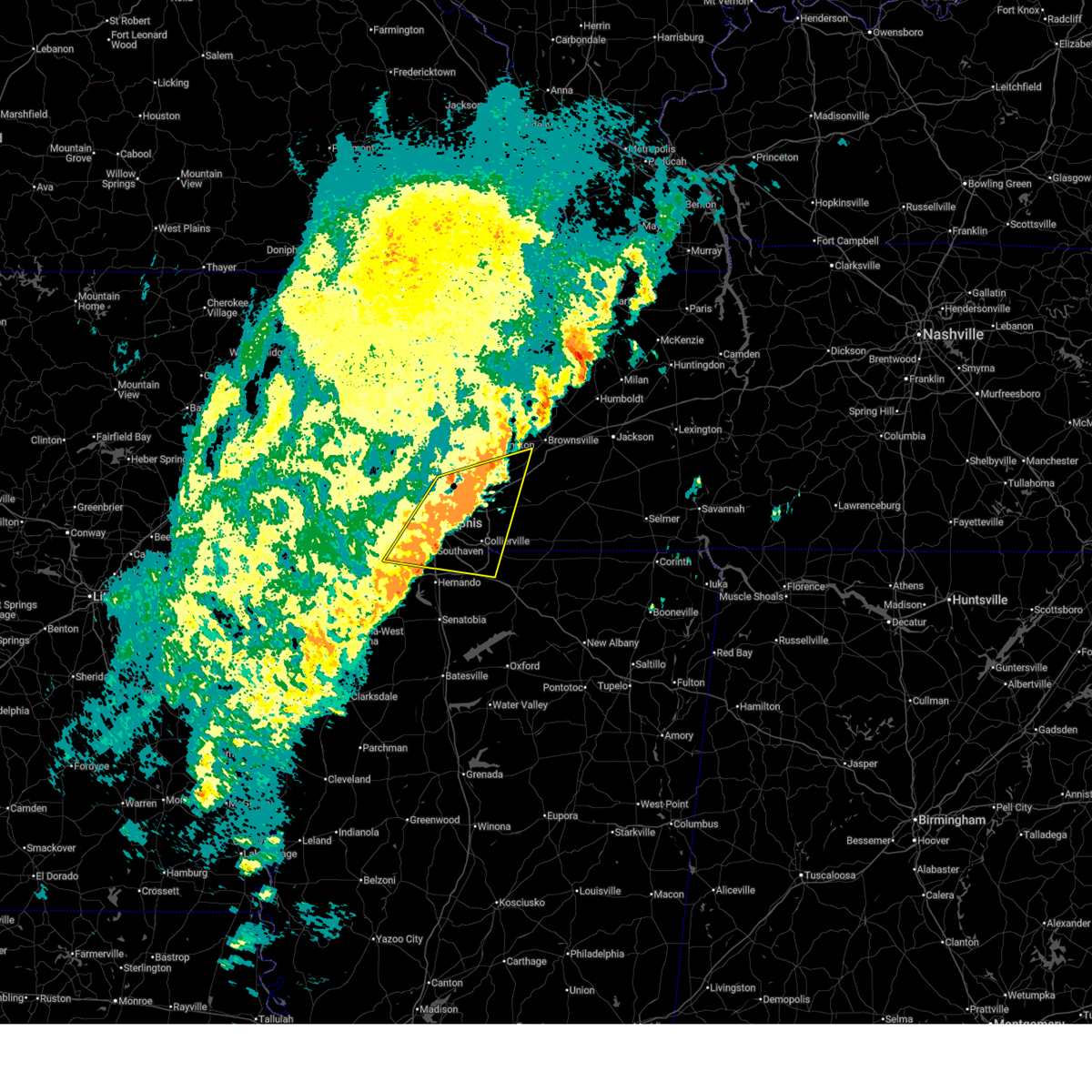 The storm which prompted the warning has weakened below severe limits, and no longer poses an immediate threat to life or property. therefore, the warning will be allowed to expire. however, small hail and gusty winds are still possible with this thunderstorm. a tornado watch remains in effect until 1000 pm cst for northwestern mississippi, and west tennessee. to report severe weather, contact your nearest law enforcement agency. they will relay your report to the national weather service memphis. The storm which prompted the warning has weakened below severe limits, and no longer poses an immediate threat to life or property. therefore, the warning will be allowed to expire. however, small hail and gusty winds are still possible with this thunderstorm. a tornado watch remains in effect until 1000 pm cst for northwestern mississippi, and west tennessee. to report severe weather, contact your nearest law enforcement agency. they will relay your report to the national weather service memphis.
|
| 2/15/2025 6:55 PM CST |
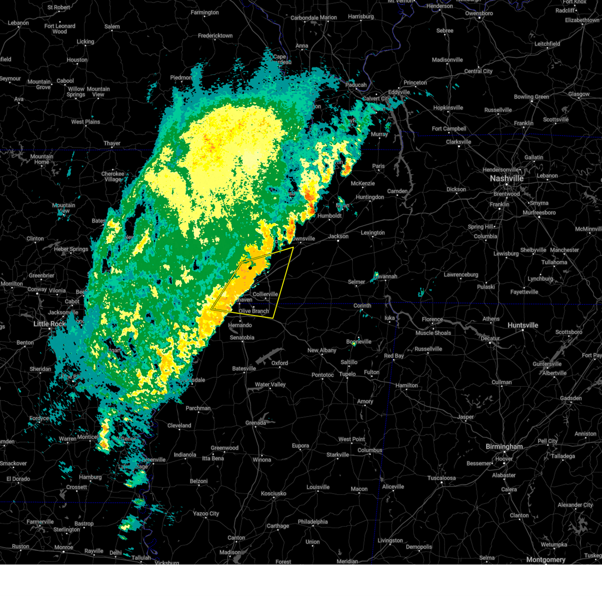 At 655 pm cst, a severe thunderstorm was located near olive branch, moving east at 55 mph (radar indicated). Hazards include 60 mph wind gusts and quarter size hail. Hail damage to vehicles is expected. expect wind damage to roofs, siding, and trees. Locations impacted include, bartlett, southaven, collierville, germantown, olive branch, west memphis, horn lake, millington, t o fuller state park, cordova, memphis, lakeland, arlington, munford, byhalia, walls, southwest memphis, ellendale, whitehaven, and frayser. At 655 pm cst, a severe thunderstorm was located near olive branch, moving east at 55 mph (radar indicated). Hazards include 60 mph wind gusts and quarter size hail. Hail damage to vehicles is expected. expect wind damage to roofs, siding, and trees. Locations impacted include, bartlett, southaven, collierville, germantown, olive branch, west memphis, horn lake, millington, t o fuller state park, cordova, memphis, lakeland, arlington, munford, byhalia, walls, southwest memphis, ellendale, whitehaven, and frayser.
|
| 2/15/2025 6:41 PM CST |
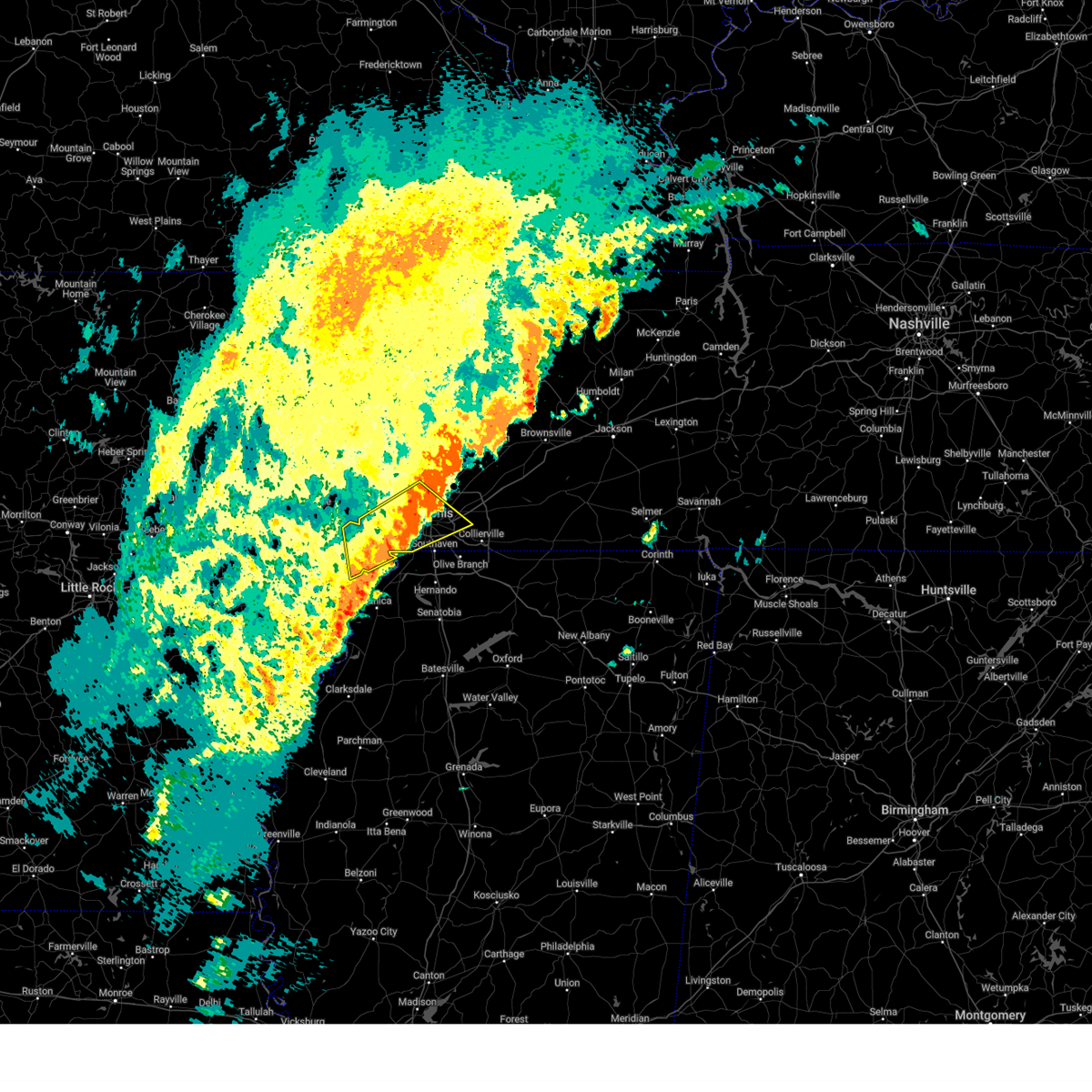 the severe thunderstorm warning has been cancelled and is no longer in effect the severe thunderstorm warning has been cancelled and is no longer in effect
|
| 2/15/2025 6:33 PM CST |
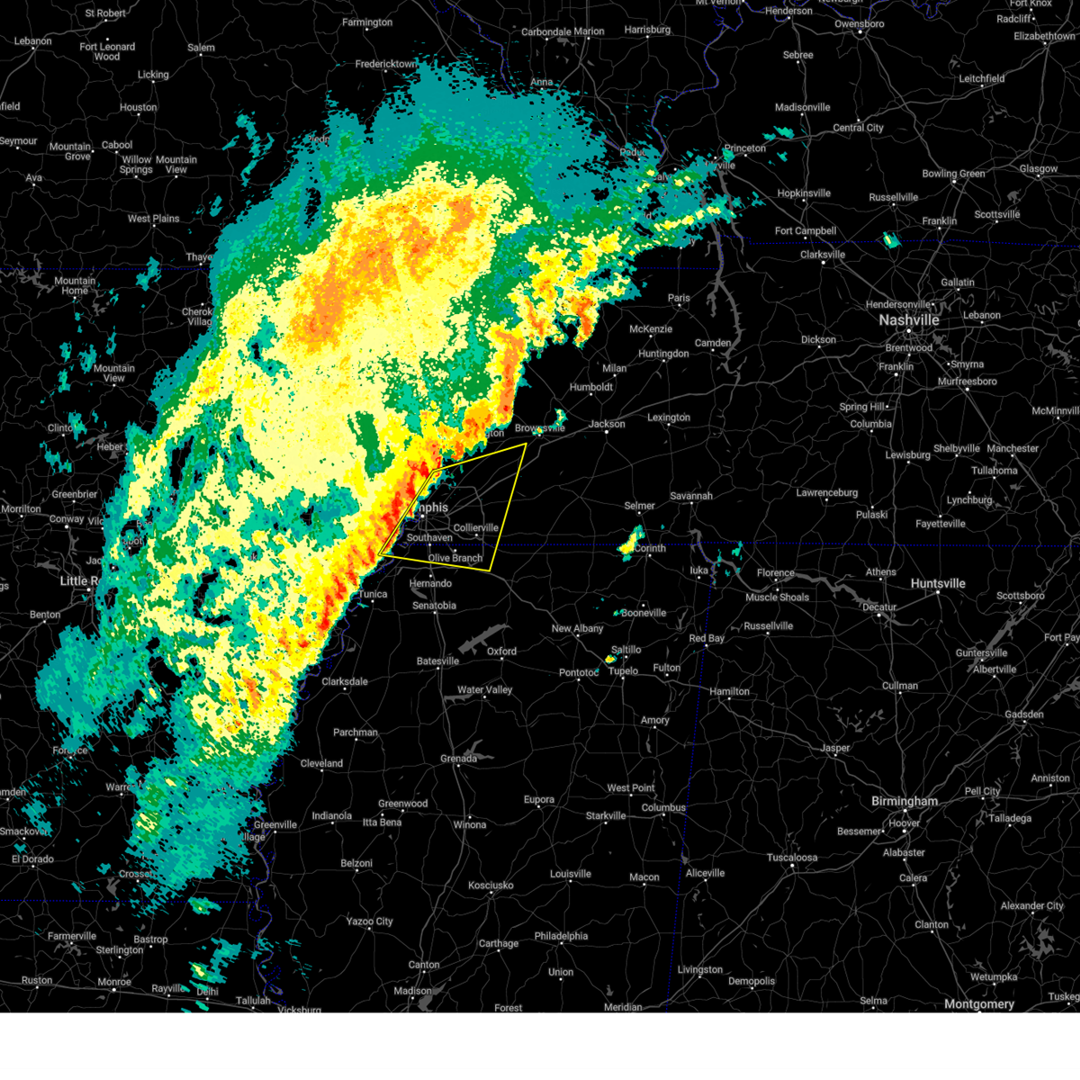 Svrmeg the national weather service in memphis has issued a * severe thunderstorm warning for, southeastern crittenden county in eastern arkansas, northern desoto county in northwestern mississippi, northwestern marshall county in northwestern mississippi, southeastern tipton county in west tennessee, western fayette county in west tennessee, southwestern haywood county in west tennessee, shelby county in west tennessee, * until 715 pm cst. * at 633 pm cst, a severe thunderstorm was located near t o fuller state park, moving east at 55 mph (radar indicated). Hazards include 60 mph wind gusts and quarter size hail. Hail damage to vehicles is expected. Expect wind damage to roofs, siding, and trees. Svrmeg the national weather service in memphis has issued a * severe thunderstorm warning for, southeastern crittenden county in eastern arkansas, northern desoto county in northwestern mississippi, northwestern marshall county in northwestern mississippi, southeastern tipton county in west tennessee, western fayette county in west tennessee, southwestern haywood county in west tennessee, shelby county in west tennessee, * until 715 pm cst. * at 633 pm cst, a severe thunderstorm was located near t o fuller state park, moving east at 55 mph (radar indicated). Hazards include 60 mph wind gusts and quarter size hail. Hail damage to vehicles is expected. Expect wind damage to roofs, siding, and trees.
|
| 2/15/2025 6:15 PM CST |
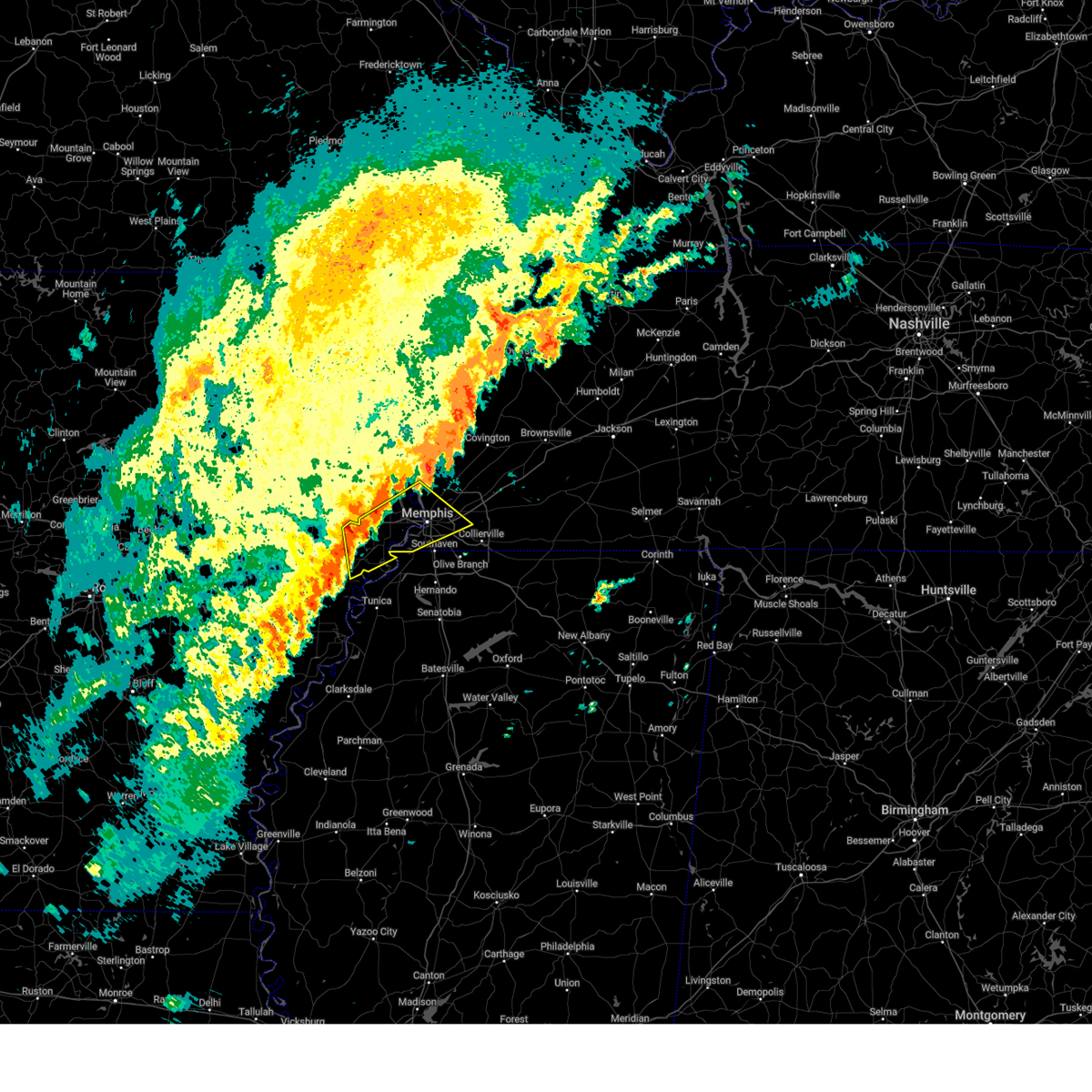 Svrmeg the national weather service in memphis has issued a * severe thunderstorm warning for, northeastern lee county in eastern arkansas, eastern st. francis county in eastern arkansas, central crittenden county in eastern arkansas, central shelby county in west tennessee, * until 700 pm cst. * at 614 pm cst, a severe thunderstorm was located near new home, or near hughes, moving northeast at 55 mph (radar indicated). Hazards include 60 mph wind gusts and quarter size hail. Hail damage to vehicles is expected. Expect wind damage to roofs, siding, and trees. Svrmeg the national weather service in memphis has issued a * severe thunderstorm warning for, northeastern lee county in eastern arkansas, eastern st. francis county in eastern arkansas, central crittenden county in eastern arkansas, central shelby county in west tennessee, * until 700 pm cst. * at 614 pm cst, a severe thunderstorm was located near new home, or near hughes, moving northeast at 55 mph (radar indicated). Hazards include 60 mph wind gusts and quarter size hail. Hail damage to vehicles is expected. Expect wind damage to roofs, siding, and trees.
|
| 8/30/2024 6:38 PM CDT |
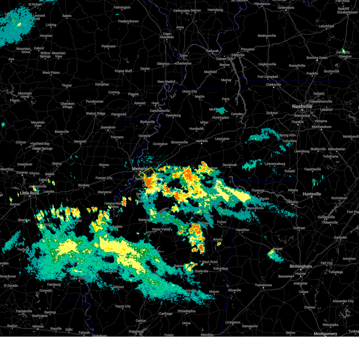 The storm which prompted the warning has weakened below severe limits, and no longer poses an immediate threat to life or property. therefore, the warning will be allowed to expire. however, small hail, gusty winds and heavy rain are still possible with this thunderstorm. The storm which prompted the warning has weakened below severe limits, and no longer poses an immediate threat to life or property. therefore, the warning will be allowed to expire. however, small hail, gusty winds and heavy rain are still possible with this thunderstorm.
|
| 8/30/2024 6:22 PM CDT |
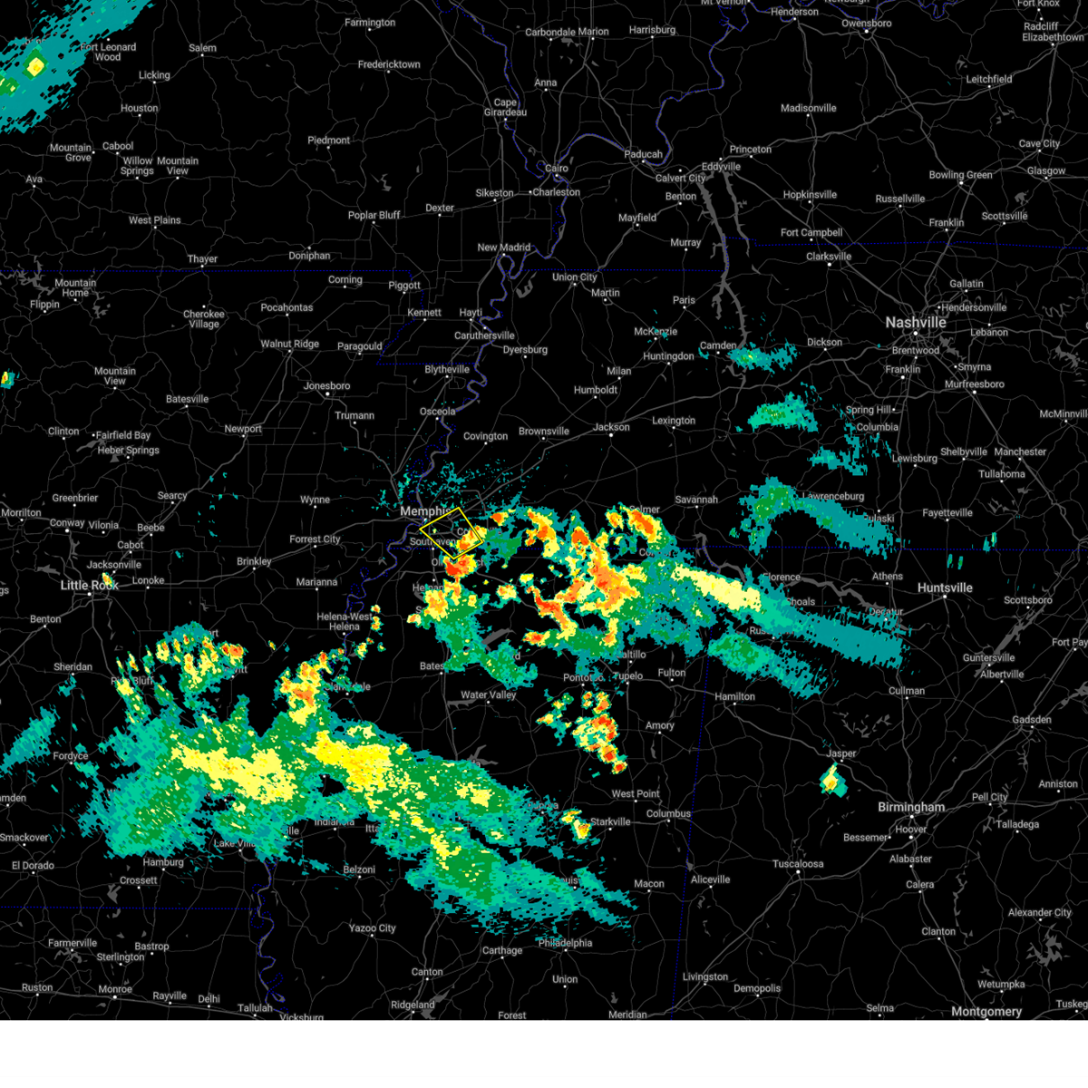 At 621 pm cdt, a severe thunderstorm was located near olive branch, moving northwest at 5 mph (radar indicated). Hazards include 60 mph wind gusts and quarter size hail. Hail damage to vehicles is expected. expect wind damage to roofs, siding, and trees. Locations impacted include, bartlett, collierville, germantown, olive branch, cordova, memphis, southeast memphis, midtown memphis, elmore park, capleville, parkway village, and white station. At 621 pm cdt, a severe thunderstorm was located near olive branch, moving northwest at 5 mph (radar indicated). Hazards include 60 mph wind gusts and quarter size hail. Hail damage to vehicles is expected. expect wind damage to roofs, siding, and trees. Locations impacted include, bartlett, collierville, germantown, olive branch, cordova, memphis, southeast memphis, midtown memphis, elmore park, capleville, parkway village, and white station.
|
| 8/30/2024 5:59 PM CDT |
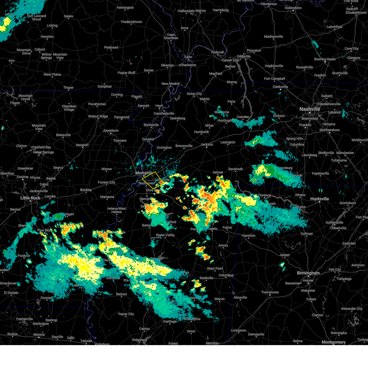 Svrmeg the national weather service in memphis has issued a * severe thunderstorm warning for, northern desoto county in northwestern mississippi, southeastern shelby county in west tennessee, * until 645 pm cdt. * at 559 pm cdt, a severe thunderstorm was located near olive branch, moving northwest at 5 mph (radar indicated). Hazards include 60 mph wind gusts and quarter size hail. Hail damage to vehicles is expected. Expect wind damage to roofs, siding, and trees. Svrmeg the national weather service in memphis has issued a * severe thunderstorm warning for, northern desoto county in northwestern mississippi, southeastern shelby county in west tennessee, * until 645 pm cdt. * at 559 pm cdt, a severe thunderstorm was located near olive branch, moving northwest at 5 mph (radar indicated). Hazards include 60 mph wind gusts and quarter size hail. Hail damage to vehicles is expected. Expect wind damage to roofs, siding, and trees.
|
| 8/17/2024 3:16 AM CDT |
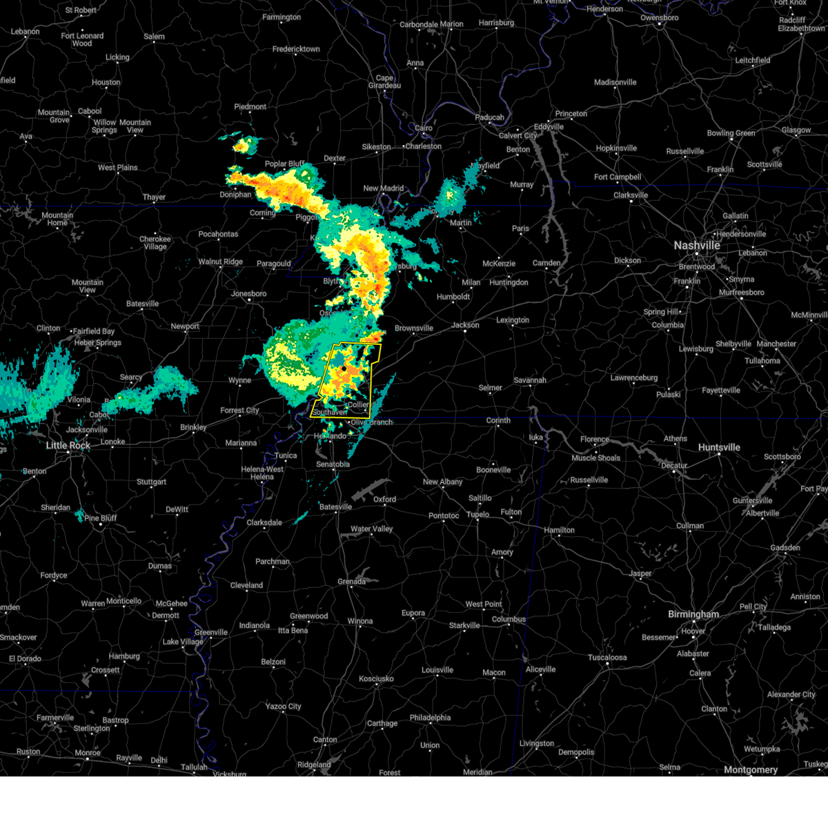 the severe thunderstorm warning has been cancelled and is no longer in effect the severe thunderstorm warning has been cancelled and is no longer in effect
|
| 8/17/2024 3:06 AM CDT |
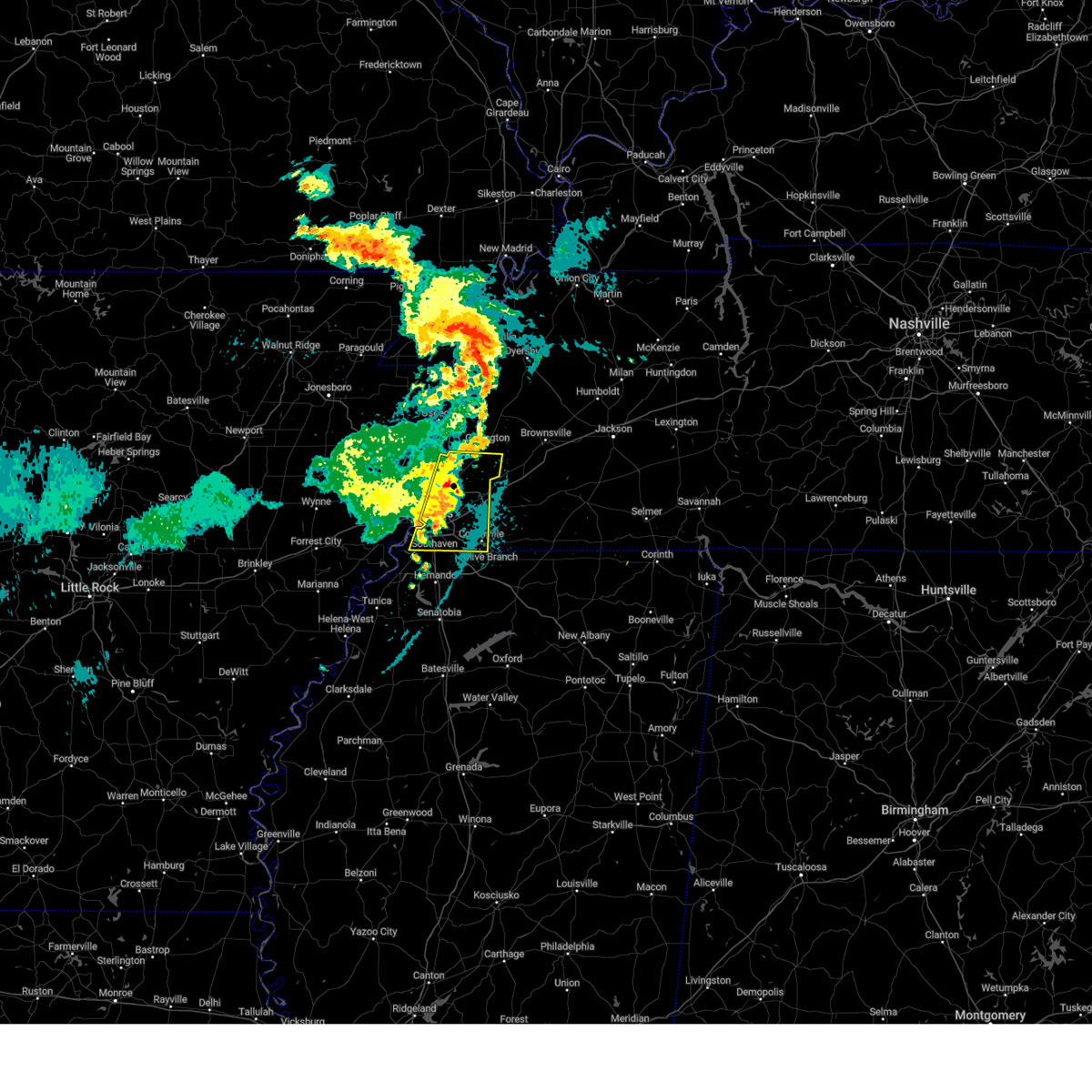 the severe thunderstorm warning has been cancelled and is no longer in effect the severe thunderstorm warning has been cancelled and is no longer in effect
|
| 8/17/2024 3:06 AM CDT |
 At 305 am cdt, a severe thunderstorm was located over millington, moving east at 30 mph (radar indicated). Hazards include 60 mph wind gusts and quarter size hail. Hail damage to vehicles is expected. expect wind damage to roofs, siding, and trees. Locations impacted include, bartlett, collierville, germantown, olive branch, millington, t o fuller state park, cordova, memphis, lakeland, arlington, munford, brighton, southwest memphis, ellendale, whitehaven, frayser, midtown memphis, dixonville, southeast memphis, and downtown memphis. At 305 am cdt, a severe thunderstorm was located over millington, moving east at 30 mph (radar indicated). Hazards include 60 mph wind gusts and quarter size hail. Hail damage to vehicles is expected. expect wind damage to roofs, siding, and trees. Locations impacted include, bartlett, collierville, germantown, olive branch, millington, t o fuller state park, cordova, memphis, lakeland, arlington, munford, brighton, southwest memphis, ellendale, whitehaven, frayser, midtown memphis, dixonville, southeast memphis, and downtown memphis.
|
| 8/17/2024 2:40 AM CDT |
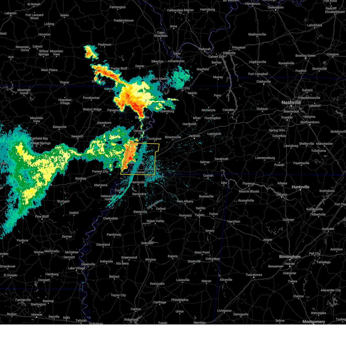 Svrmeg the national weather service in memphis has issued a * severe thunderstorm warning for, southwestern mississippi county in eastern arkansas, northeastern crittenden county in eastern arkansas, southern tipton county in west tennessee, shelby county in west tennessee, * until 330 am cdt. * at 240 am cdt, a severe thunderstorm was located over meeman shelby forest state park, moving east at 30 mph (radar indicated). Hazards include 60 mph wind gusts and quarter size hail. Hail damage to vehicles is expected. Expect wind damage to roofs, siding, and trees. Svrmeg the national weather service in memphis has issued a * severe thunderstorm warning for, southwestern mississippi county in eastern arkansas, northeastern crittenden county in eastern arkansas, southern tipton county in west tennessee, shelby county in west tennessee, * until 330 am cdt. * at 240 am cdt, a severe thunderstorm was located over meeman shelby forest state park, moving east at 30 mph (radar indicated). Hazards include 60 mph wind gusts and quarter size hail. Hail damage to vehicles is expected. Expect wind damage to roofs, siding, and trees.
|
| 5/27/2024 12:05 AM CDT |
 Svrmeg the national weather service in memphis has issued a * severe thunderstorm warning for, northeastern st. francis county in eastern arkansas, central crittenden county in eastern arkansas, northern desoto county in northwestern mississippi, west central fayette county in west tennessee, southern shelby county in west tennessee, * until 1245 am cdt. * at 1205 am cdt, a severe thunderstorm was located near west memphis, moving east at 45 mph (radar indicated). Hazards include 60 mph wind gusts and nickel size hail. expect damage to roofs, siding, and trees Svrmeg the national weather service in memphis has issued a * severe thunderstorm warning for, northeastern st. francis county in eastern arkansas, central crittenden county in eastern arkansas, northern desoto county in northwestern mississippi, west central fayette county in west tennessee, southern shelby county in west tennessee, * until 1245 am cdt. * at 1205 am cdt, a severe thunderstorm was located near west memphis, moving east at 45 mph (radar indicated). Hazards include 60 mph wind gusts and nickel size hail. expect damage to roofs, siding, and trees
|
| 5/22/2024 2:53 PM CDT |
 The storm which prompted the warning has moved out of the area. therefore, the warning will be allowed to expire. a severe thunderstorm watch remains in effect until 700 pm cdt for west tennessee. The storm which prompted the warning has moved out of the area. therefore, the warning will be allowed to expire. a severe thunderstorm watch remains in effect until 700 pm cdt for west tennessee.
|
| 5/22/2024 2:35 PM CDT |
 At 234 pm cdt, a severe thunderstorm was located over cordova, moving east at 35 mph (trained weather spotters. at 224 pm cdt, quarter-sized hail was reported in midtown memphis). Hazards include 60 mph wind gusts and quarter size hail. Hail damage to vehicles is expected. expect wind damage to roofs, siding, and trees. Locations impacted include, bartlett, collierville, germantown, millington, cordova, memphis, lakeland, arlington, ellendale, southeast memphis, eads, frayser, midtown memphis, piperton, lenow, woodstock, rosemark, elmore park, brunswick, and fisherville. At 234 pm cdt, a severe thunderstorm was located over cordova, moving east at 35 mph (trained weather spotters. at 224 pm cdt, quarter-sized hail was reported in midtown memphis). Hazards include 60 mph wind gusts and quarter size hail. Hail damage to vehicles is expected. expect wind damage to roofs, siding, and trees. Locations impacted include, bartlett, collierville, germantown, millington, cordova, memphis, lakeland, arlington, ellendale, southeast memphis, eads, frayser, midtown memphis, piperton, lenow, woodstock, rosemark, elmore park, brunswick, and fisherville.
|
| 5/22/2024 2:29 PM CDT |
 the severe thunderstorm warning has been cancelled and is no longer in effect the severe thunderstorm warning has been cancelled and is no longer in effect
|
| 5/22/2024 2:29 PM CDT |
 At 229 pm cdt, a severe thunderstorm was located over cordova, moving east at 40 mph (radar indicated). Hazards include 60 mph wind gusts and quarter size hail. Hail damage to vehicles is expected. expect wind damage to roofs, siding, and trees. Locations impacted include, bartlett, collierville, germantown, millington, cordova, memphis, lakeland, arlington, ellendale, southeast memphis, eads, frayser, midtown memphis, piperton, lenow, woodstock, rosemark, elmore park, brunswick, and fisherville. At 229 pm cdt, a severe thunderstorm was located over cordova, moving east at 40 mph (radar indicated). Hazards include 60 mph wind gusts and quarter size hail. Hail damage to vehicles is expected. expect wind damage to roofs, siding, and trees. Locations impacted include, bartlett, collierville, germantown, millington, cordova, memphis, lakeland, arlington, ellendale, southeast memphis, eads, frayser, midtown memphis, piperton, lenow, woodstock, rosemark, elmore park, brunswick, and fisherville.
|
| 5/22/2024 2:14 PM CDT |
 Svrmeg the national weather service in memphis has issued a * severe thunderstorm warning for, east central crittenden county in eastern arkansas, shelby county in west tennessee, * until 300 pm cdt. * at 214 pm cdt, a severe thunderstorm was located near midtown memphis, or 9 miles northeast of t o fuller state park, moving east at 30 mph (radar indicated). Hazards include 60 mph wind gusts and quarter size hail. Hail damage to vehicles is expected. Expect wind damage to roofs, siding, and trees. Svrmeg the national weather service in memphis has issued a * severe thunderstorm warning for, east central crittenden county in eastern arkansas, shelby county in west tennessee, * until 300 pm cdt. * at 214 pm cdt, a severe thunderstorm was located near midtown memphis, or 9 miles northeast of t o fuller state park, moving east at 30 mph (radar indicated). Hazards include 60 mph wind gusts and quarter size hail. Hail damage to vehicles is expected. Expect wind damage to roofs, siding, and trees.
|
| 5/9/2024 4:40 AM CDT |
 Svrmeg the national weather service in memphis has issued a * severe thunderstorm warning for, northwestern marshall county in northwestern mississippi, northwestern benton county in northeastern mississippi, southern fayette county in west tennessee, southeastern shelby county in west tennessee, * until 530 am cdt. * at 440 am cdt, a severe thunderstorm was located over collierville, moving east at 40 mph (radar indicated). Hazards include 60 mph wind gusts and quarter size hail. Hail damage to vehicles is expected. Expect wind damage to roofs, siding, and trees. Svrmeg the national weather service in memphis has issued a * severe thunderstorm warning for, northwestern marshall county in northwestern mississippi, northwestern benton county in northeastern mississippi, southern fayette county in west tennessee, southeastern shelby county in west tennessee, * until 530 am cdt. * at 440 am cdt, a severe thunderstorm was located over collierville, moving east at 40 mph (radar indicated). Hazards include 60 mph wind gusts and quarter size hail. Hail damage to vehicles is expected. Expect wind damage to roofs, siding, and trees.
|
| 5/9/2024 4:25 AM CDT |
 The storm which prompted the warning has weakened below severe limits, and no longer poses an immediate threat to life or property. therefore, the warning will be allowed to expire. however, small hail and gusty winds are still possible with this thunderstorm. The storm which prompted the warning has weakened below severe limits, and no longer poses an immediate threat to life or property. therefore, the warning will be allowed to expire. however, small hail and gusty winds are still possible with this thunderstorm.
|
| 5/9/2024 4:14 AM CDT |
 At 414 am cdt, a severe thunderstorm was located over whitehaven, or near horn lake, moving east at 45 mph (radar indicated). Hazards include 60 mph wind gusts and quarter size hail. Hail damage to vehicles is expected. expect wind damage to roofs, siding, and trees. Locations impacted include, southaven, germantown, olive branch, horn lake, hernando, cordova, memphis, southwest memphis, lynchburg, southeast memphis, downtown memphis, lewisburg, whitehaven, midtown memphis, cedarview, nesbit, handy corner, capleville, jago, and alden. At 414 am cdt, a severe thunderstorm was located over whitehaven, or near horn lake, moving east at 45 mph (radar indicated). Hazards include 60 mph wind gusts and quarter size hail. Hail damage to vehicles is expected. expect wind damage to roofs, siding, and trees. Locations impacted include, southaven, germantown, olive branch, horn lake, hernando, cordova, memphis, southwest memphis, lynchburg, southeast memphis, downtown memphis, lewisburg, whitehaven, midtown memphis, cedarview, nesbit, handy corner, capleville, jago, and alden.
|
| 5/9/2024 4:14 AM CDT |
 the severe thunderstorm warning has been cancelled and is no longer in effect the severe thunderstorm warning has been cancelled and is no longer in effect
|
| 5/9/2024 4:00 AM CDT |
 At 359 am cdt, a severe thunderstorm was located near pinckney, or near t o fuller state park, moving east at 45 mph (radar indicated). Hazards include 60 mph wind gusts and quarter size hail. Hail damage to vehicles is expected. expect wind damage to roofs, siding, and trees. Locations impacted include, southaven, germantown, olive branch, west memphis, horn lake, hernando, hughes, t o fuller state park, cordova, memphis, walls, edmondson, horseshoe lake, anthonyville, lake cormorant, southwest memphis, simsboro, lewisburg, whitehaven, and midtown memphis. At 359 am cdt, a severe thunderstorm was located near pinckney, or near t o fuller state park, moving east at 45 mph (radar indicated). Hazards include 60 mph wind gusts and quarter size hail. Hail damage to vehicles is expected. expect wind damage to roofs, siding, and trees. Locations impacted include, southaven, germantown, olive branch, west memphis, horn lake, hernando, hughes, t o fuller state park, cordova, memphis, walls, edmondson, horseshoe lake, anthonyville, lake cormorant, southwest memphis, simsboro, lewisburg, whitehaven, and midtown memphis.
|
| 5/9/2024 3:44 AM CDT |
 Svrmeg the national weather service in memphis has issued a * severe thunderstorm warning for, eastern st. francis county in eastern arkansas, southern crittenden county in eastern arkansas, northern desoto county in northwestern mississippi, southern shelby county in west tennessee, * until 430 am cdt. * at 344 am cdt, a severe thunderstorm was located over simsboro, or near hughes, moving east at 45 mph (radar indicated). Hazards include 60 mph wind gusts and quarter size hail. Hail damage to vehicles is expected. Expect wind damage to roofs, siding, and trees. Svrmeg the national weather service in memphis has issued a * severe thunderstorm warning for, eastern st. francis county in eastern arkansas, southern crittenden county in eastern arkansas, northern desoto county in northwestern mississippi, southern shelby county in west tennessee, * until 430 am cdt. * at 344 am cdt, a severe thunderstorm was located over simsboro, or near hughes, moving east at 45 mph (radar indicated). Hazards include 60 mph wind gusts and quarter size hail. Hail damage to vehicles is expected. Expect wind damage to roofs, siding, and trees.
|
| 5/9/2024 1:48 AM CDT |
 The storms which prompted the warning have weakened below severe limits, and no longer pose an immediate threat to life or property. therefore, the warning has been allowed to expire. a tornado watch remains in effect until 300 am cdt for northeastern mississippi, and west tennessee. The storms which prompted the warning have weakened below severe limits, and no longer pose an immediate threat to life or property. therefore, the warning has been allowed to expire. a tornado watch remains in effect until 300 am cdt for northeastern mississippi, and west tennessee.
|
| 5/9/2024 1:31 AM CDT |
 At 131 am cdt, severe thunderstorms were located along a line extending from near belle eagle to 6 miles northeast of somerville to near mt pleasant, moving east at 50 mph (radar indicated). Hazards include 70 mph wind gusts. Expect considerable tree damage. damage is likely to mobile homes, roofs, and outbuildings. Locations impacted include, bartlett, collierville, germantown, brownsville, millington, cordova, memphis, lakeland, arlington, whiteville, somerville, bells, ellendale, hillville, lagrange, belle eagle, holly grove, southeast memphis, eads, and dancyville. At 131 am cdt, severe thunderstorms were located along a line extending from near belle eagle to 6 miles northeast of somerville to near mt pleasant, moving east at 50 mph (radar indicated). Hazards include 70 mph wind gusts. Expect considerable tree damage. damage is likely to mobile homes, roofs, and outbuildings. Locations impacted include, bartlett, collierville, germantown, brownsville, millington, cordova, memphis, lakeland, arlington, whiteville, somerville, bells, ellendale, hillville, lagrange, belle eagle, holly grove, southeast memphis, eads, and dancyville.
|
| 5/9/2024 1:31 AM CDT |
 the severe thunderstorm warning has been cancelled and is no longer in effect the severe thunderstorm warning has been cancelled and is no longer in effect
|
| 5/9/2024 1:09 AM CDT |
 At 109 am cdt, a severe thunderstorm was located over frayser, or 7 miles southwest of bartlett, moving east at 55 mph (radar indicated). Hazards include 60 mph wind gusts. Expect damage to roofs, siding, and trees. Locations impacted include, bartlett, collierville, germantown, west memphis, marion, millington, covington, wilson, t o fuller state park, meeman shelby forest state park, cordova, memphis, lakeland, arlington, munford, brighton, joiner, edmondson, sunset, and gilmore. At 109 am cdt, a severe thunderstorm was located over frayser, or 7 miles southwest of bartlett, moving east at 55 mph (radar indicated). Hazards include 60 mph wind gusts. Expect damage to roofs, siding, and trees. Locations impacted include, bartlett, collierville, germantown, west memphis, marion, millington, covington, wilson, t o fuller state park, meeman shelby forest state park, cordova, memphis, lakeland, arlington, munford, brighton, joiner, edmondson, sunset, and gilmore.
|
| 5/9/2024 1:06 AM CDT |
 Svrmeg the national weather service in memphis has issued a * severe thunderstorm warning for, southwestern crockett county in west tennessee, tipton county in west tennessee, fayette county in west tennessee, western hardeman county in west tennessee, southern lauderdale county in west tennessee, haywood county in west tennessee, eastern shelby county in west tennessee, * until 145 am cdt. * at 105 am cdt, severe thunderstorms were located along a line extending from near ft pillow to arlington to near southaven, moving east at 50 mph (radar indicated). Hazards include 70 mph wind gusts. Expect considerable tree damage. Damage is likely to mobile homes, roofs, and outbuildings. Svrmeg the national weather service in memphis has issued a * severe thunderstorm warning for, southwestern crockett county in west tennessee, tipton county in west tennessee, fayette county in west tennessee, western hardeman county in west tennessee, southern lauderdale county in west tennessee, haywood county in west tennessee, eastern shelby county in west tennessee, * until 145 am cdt. * at 105 am cdt, severe thunderstorms were located along a line extending from near ft pillow to arlington to near southaven, moving east at 50 mph (radar indicated). Hazards include 70 mph wind gusts. Expect considerable tree damage. Damage is likely to mobile homes, roofs, and outbuildings.
|
| 5/9/2024 12:46 AM CDT |
 Svrmeg the national weather service in memphis has issued a * severe thunderstorm warning for, southwestern mississippi county in eastern arkansas, northeastern crittenden county in eastern arkansas, tipton county in west tennessee, western fayette county in west tennessee, shelby county in west tennessee, * until 130 am cdt. * at 1246 am cdt, a severe thunderstorm was located near millington, moving east at 55 mph (radar indicated). Hazards include 60 mph wind gusts. expect damage to roofs, siding, and trees Svrmeg the national weather service in memphis has issued a * severe thunderstorm warning for, southwestern mississippi county in eastern arkansas, northeastern crittenden county in eastern arkansas, tipton county in west tennessee, western fayette county in west tennessee, shelby county in west tennessee, * until 130 am cdt. * at 1246 am cdt, a severe thunderstorm was located near millington, moving east at 55 mph (radar indicated). Hazards include 60 mph wind gusts. expect damage to roofs, siding, and trees
|
| 5/9/2024 12:35 AM CDT |
 At 1234 am cdt, a severe thunderstorm was located near meeman shelby forest state park, moving east at 65 mph (radar indicated). Hazards include 70 mph wind gusts. Expect considerable tree damage. damage is likely to mobile homes, roofs, and outbuildings. Locations impacted include, bartlett, germantown, west memphis, marion, millington, earle, parkin, t o fuller state park, meeman shelby forest state park, memphis, munford, crawfordsville, edmondson, sunset, gilmore, jericho, jennette, dixonville, southeast memphis, and ellendale. At 1234 am cdt, a severe thunderstorm was located near meeman shelby forest state park, moving east at 65 mph (radar indicated). Hazards include 70 mph wind gusts. Expect considerable tree damage. damage is likely to mobile homes, roofs, and outbuildings. Locations impacted include, bartlett, germantown, west memphis, marion, millington, earle, parkin, t o fuller state park, meeman shelby forest state park, memphis, munford, crawfordsville, edmondson, sunset, gilmore, jericho, jennette, dixonville, southeast memphis, and ellendale.
|
| 5/9/2024 12:15 AM CDT |
 Svrmeg the national weather service in memphis has issued a * severe thunderstorm warning for, northeastern st. francis county in eastern arkansas, southeastern poinsett county in eastern arkansas, southwestern mississippi county in eastern arkansas, crittenden county in eastern arkansas, eastern cross county in eastern arkansas, southwestern tipton county in west tennessee, central shelby county in west tennessee, * until 100 am cdt. * at 1214 am cdt, a severe thunderstorm was located near earle, moving east at 55 mph (radar indicated). Hazards include 70 mph wind gusts. Expect considerable tree damage. Damage is likely to mobile homes, roofs, and outbuildings. Svrmeg the national weather service in memphis has issued a * severe thunderstorm warning for, northeastern st. francis county in eastern arkansas, southeastern poinsett county in eastern arkansas, southwestern mississippi county in eastern arkansas, crittenden county in eastern arkansas, eastern cross county in eastern arkansas, southwestern tipton county in west tennessee, central shelby county in west tennessee, * until 100 am cdt. * at 1214 am cdt, a severe thunderstorm was located near earle, moving east at 55 mph (radar indicated). Hazards include 70 mph wind gusts. Expect considerable tree damage. Damage is likely to mobile homes, roofs, and outbuildings.
|
| 4/7/2024 7:50 PM CDT |
 At 750 pm cdt, a severe thunderstorm was located over southeast memphis, or near germantown, moving east at 30 mph (radar indicated). Hazards include 60 mph wind gusts and quarter size hail. Hail damage to vehicles is expected. expect wind damage to roofs, siding, and trees. Locations impacted include, germantown, memphis, southeast memphis, parkway village, and white station. At 750 pm cdt, a severe thunderstorm was located over southeast memphis, or near germantown, moving east at 30 mph (radar indicated). Hazards include 60 mph wind gusts and quarter size hail. Hail damage to vehicles is expected. expect wind damage to roofs, siding, and trees. Locations impacted include, germantown, memphis, southeast memphis, parkway village, and white station.
|
| 4/7/2024 7:38 PM CDT |
 the severe thunderstorm warning has been cancelled and is no longer in effect the severe thunderstorm warning has been cancelled and is no longer in effect
|
| 4/7/2024 7:38 PM CDT |
 At 737 pm cdt, a severe thunderstorm was located over memphis, or near t o fuller state park, moving east at 30 mph (radar indicated). Hazards include 60 mph wind gusts and quarter size hail. Hail damage to vehicles is expected. expect wind damage to roofs, siding, and trees. Locations impacted include, germantown, memphis, southeast memphis, downtown memphis, southwest memphis, midtown memphis, parkway village, and white station. At 737 pm cdt, a severe thunderstorm was located over memphis, or near t o fuller state park, moving east at 30 mph (radar indicated). Hazards include 60 mph wind gusts and quarter size hail. Hail damage to vehicles is expected. expect wind damage to roofs, siding, and trees. Locations impacted include, germantown, memphis, southeast memphis, downtown memphis, southwest memphis, midtown memphis, parkway village, and white station.
|
| 4/7/2024 7:22 PM CDT |
 Svrmeg the national weather service in memphis has issued a * severe thunderstorm warning for, east central crittenden county in eastern arkansas, southwestern shelby county in west tennessee, * until 800 pm cdt. * at 722 pm cdt, a severe thunderstorm was located near t o fuller state park, moving east at 30 mph (radar indicated). Hazards include 60 mph wind gusts and quarter size hail. Hail damage to vehicles is expected. Expect wind damage to roofs, siding, and trees. Svrmeg the national weather service in memphis has issued a * severe thunderstorm warning for, east central crittenden county in eastern arkansas, southwestern shelby county in west tennessee, * until 800 pm cdt. * at 722 pm cdt, a severe thunderstorm was located near t o fuller state park, moving east at 30 mph (radar indicated). Hazards include 60 mph wind gusts and quarter size hail. Hail damage to vehicles is expected. Expect wind damage to roofs, siding, and trees.
|
| 4/2/2024 7:58 AM CDT |
 At 758 am cdt, a severe thunderstorm was located near midtown memphis, or near bartlett, moving northeast at 70 mph (radar indicated). Hazards include 60 mph wind gusts and quarter size hail. Hail damage to vehicles is expected. expect wind damage to roofs, siding, and trees. Locations impacted include, bartlett, southaven, collierville, germantown, olive branch, west memphis, marion, millington, t o fuller state park, meeman shelby forest state park, cordova, memphis, lakeland, arlington, edmondson, sunset, southwest memphis, ellendale, whitehaven, and frayser. At 758 am cdt, a severe thunderstorm was located near midtown memphis, or near bartlett, moving northeast at 70 mph (radar indicated). Hazards include 60 mph wind gusts and quarter size hail. Hail damage to vehicles is expected. expect wind damage to roofs, siding, and trees. Locations impacted include, bartlett, southaven, collierville, germantown, olive branch, west memphis, marion, millington, t o fuller state park, meeman shelby forest state park, cordova, memphis, lakeland, arlington, edmondson, sunset, southwest memphis, ellendale, whitehaven, and frayser.
|
| 4/2/2024 7:58 AM CDT |
 the severe thunderstorm warning has been cancelled and is no longer in effect the severe thunderstorm warning has been cancelled and is no longer in effect
|
| 4/2/2024 7:46 AM CDT |
 At 746 am cdt, a severe thunderstorm was located over southwest memphis, or over t o fuller state park, moving northeast at 55 mph (radar indicated). Hazards include 60 mph wind gusts and quarter size hail. Hail damage to vehicles is expected. expect wind damage to roofs, siding, and trees. Locations impacted include, bartlett, southaven, collierville, germantown, olive branch, west memphis, horn lake, hernando, marion, millington, t o fuller state park, meeman shelby forest state park, cordova, memphis, lakeland, arlington, walls, edmondson, horseshoe lake, and sunset. At 746 am cdt, a severe thunderstorm was located over southwest memphis, or over t o fuller state park, moving northeast at 55 mph (radar indicated). Hazards include 60 mph wind gusts and quarter size hail. Hail damage to vehicles is expected. expect wind damage to roofs, siding, and trees. Locations impacted include, bartlett, southaven, collierville, germantown, olive branch, west memphis, horn lake, hernando, marion, millington, t o fuller state park, meeman shelby forest state park, cordova, memphis, lakeland, arlington, walls, edmondson, horseshoe lake, and sunset.
|
| 4/2/2024 7:46 AM CDT |
 the severe thunderstorm warning has been cancelled and is no longer in effect the severe thunderstorm warning has been cancelled and is no longer in effect
|
| 4/2/2024 7:29 AM CDT |
 Svrmeg the national weather service in memphis has issued a * severe thunderstorm warning for, northeastern lee county in eastern arkansas, southeastern st. francis county in eastern arkansas, southern crittenden county in eastern arkansas, northern desoto county in northwestern mississippi, northern tunica county in northwestern mississippi, shelby county in west tennessee, * until 815 am cdt. * at 729 am cdt, a severe thunderstorm was located over horseshoe lake, or 9 miles east of hughes, moving northeast at 70 mph (radar indicated). Hazards include 60 mph wind gusts and half dollar size hail. Hail damage to vehicles is expected. Expect wind damage to roofs, siding, and trees. Svrmeg the national weather service in memphis has issued a * severe thunderstorm warning for, northeastern lee county in eastern arkansas, southeastern st. francis county in eastern arkansas, southern crittenden county in eastern arkansas, northern desoto county in northwestern mississippi, northern tunica county in northwestern mississippi, shelby county in west tennessee, * until 815 am cdt. * at 729 am cdt, a severe thunderstorm was located over horseshoe lake, or 9 miles east of hughes, moving northeast at 70 mph (radar indicated). Hazards include 60 mph wind gusts and half dollar size hail. Hail damage to vehicles is expected. Expect wind damage to roofs, siding, and trees.
|
| 1/12/2024 7:39 AM CST |
 The severe thunderstorm warning for desoto, northeastern tunica, northwestern tate and eastern shelby counties will expire at 745 am cst, the storms which prompted the warning have weakened below severe limits, and no longer pose an immediate threat to life or property. therefore, the warning will be allowed to expire. however, gusty winds and heavy rain are still possible with these thunderstorms. a tornado watch remains in effect until 1100 am cst for northwestern mississippi, and west tennessee. The severe thunderstorm warning for desoto, northeastern tunica, northwestern tate and eastern shelby counties will expire at 745 am cst, the storms which prompted the warning have weakened below severe limits, and no longer pose an immediate threat to life or property. therefore, the warning will be allowed to expire. however, gusty winds and heavy rain are still possible with these thunderstorms. a tornado watch remains in effect until 1100 am cst for northwestern mississippi, and west tennessee.
|
| 1/12/2024 7:19 AM CST |
 At 718 am cst, severe thunderstorms were located along a line extending from near meeman shelby forest state park to near little texas, moving northeast at 65 mph (radar indicated). Hazards include 60 mph wind gusts. Expect damage to roofs, siding, and trees. locations impacted include, bartlett, southaven, germantown, olive branch, horn lake, hernando, millington, cordova, memphis, lakeland, arlington, coldwater, walls, lake cormorant, ellendale, eudora, lewisburg, arkabutla, lynchburg, and phillipp. hail threat, radar indicated max hail size, <. 75 in wind threat, radar indicated max wind gust, 60 mph. At 718 am cst, severe thunderstorms were located along a line extending from near meeman shelby forest state park to near little texas, moving northeast at 65 mph (radar indicated). Hazards include 60 mph wind gusts. Expect damage to roofs, siding, and trees. locations impacted include, bartlett, southaven, germantown, olive branch, horn lake, hernando, millington, cordova, memphis, lakeland, arlington, coldwater, walls, lake cormorant, ellendale, eudora, lewisburg, arkabutla, lynchburg, and phillipp. hail threat, radar indicated max hail size, <. 75 in wind threat, radar indicated max wind gust, 60 mph.
|
| 1/12/2024 6:56 AM CST |
 At 656 am cst, severe thunderstorms were located along a line extending from near jennette to near helena-west helena, moving northeast at 60 mph (radar indicated). Hazards include 60 mph wind gusts. expect damage to roofs, siding, and trees At 656 am cst, severe thunderstorms were located along a line extending from near jennette to near helena-west helena, moving northeast at 60 mph (radar indicated). Hazards include 60 mph wind gusts. expect damage to roofs, siding, and trees
|
| 8/9/2023 11:40 AM CDT |
 At 1140 am cdt, a severe thunderstorm was located over cordova, moving northeast at 45 mph (radar indicated). Hazards include 60 mph wind gusts and quarter size hail. Hail damage to vehicles is expected. Expect wind damage to roofs, siding, and trees. At 1140 am cdt, a severe thunderstorm was located over cordova, moving northeast at 45 mph (radar indicated). Hazards include 60 mph wind gusts and quarter size hail. Hail damage to vehicles is expected. Expect wind damage to roofs, siding, and trees.
|
| 8/9/2023 11:36 AM CDT |
 At 1136 am cdt, a severe thunderstorm was located near cordova, moving northeast at 45 mph (radar indicated). Hazards include 60 mph wind gusts and quarter size hail. Hail damage to vehicles is expected. Expect wind damage to roofs, siding, and trees. At 1136 am cdt, a severe thunderstorm was located near cordova, moving northeast at 45 mph (radar indicated). Hazards include 60 mph wind gusts and quarter size hail. Hail damage to vehicles is expected. Expect wind damage to roofs, siding, and trees.
|
| 8/9/2023 11:36 AM CDT |
 The severe thunderstorm warning for northeastern desoto, southwestern fayette and southeastern shelby counties will expire at 1145 am cdt, the storm which prompted the warning has moved out of the area. therefore, the warning will be allowed to expire. The severe thunderstorm warning for northeastern desoto, southwestern fayette and southeastern shelby counties will expire at 1145 am cdt, the storm which prompted the warning has moved out of the area. therefore, the warning will be allowed to expire.
|
| 8/9/2023 11:30 AM CDT |
 At 1130 am cdt, a severe thunderstorm was located over germantown, moving east at 45 mph (radar indicated). Hazards include 60 mph wind gusts and quarter size hail. Hail damage to vehicles is expected. expect wind damage to roofs, siding, and trees. locations impacted include, bartlett, southaven, collierville, germantown, olive branch, cordova, memphis, lakeland, arlington, ellendale, southeast memphis, downtown memphis, eads, midtown memphis, piperton, gallaway, rossville, lenow, capleville and kirk. hail threat, radar indicated max hail size, 1. 00 in wind threat, radar indicated max wind gust, 60 mph. At 1130 am cdt, a severe thunderstorm was located over germantown, moving east at 45 mph (radar indicated). Hazards include 60 mph wind gusts and quarter size hail. Hail damage to vehicles is expected. expect wind damage to roofs, siding, and trees. locations impacted include, bartlett, southaven, collierville, germantown, olive branch, cordova, memphis, lakeland, arlington, ellendale, southeast memphis, downtown memphis, eads, midtown memphis, piperton, gallaway, rossville, lenow, capleville and kirk. hail threat, radar indicated max hail size, 1. 00 in wind threat, radar indicated max wind gust, 60 mph.
|
| 8/9/2023 11:07 AM CDT |
 At 1106 am cdt, a severe thunderstorm was located over southwest memphis, or near t o fuller state park, moving east at 45 mph (radar indicated). Hazards include 60 mph wind gusts and quarter size hail. Hail damage to vehicles is expected. Expect wind damage to roofs, siding, and trees. At 1106 am cdt, a severe thunderstorm was located over southwest memphis, or near t o fuller state park, moving east at 45 mph (radar indicated). Hazards include 60 mph wind gusts and quarter size hail. Hail damage to vehicles is expected. Expect wind damage to roofs, siding, and trees.
|
| 8/5/2023 4:41 PM CDT |
 The severe thunderstorm warning for eastern shelby county will expire at 445 pm cdt, the storm which prompted the warning has moved out of the area. therefore, the warning will be allowed to expire. a severe thunderstorm watch remains in effect until 900 pm cdt for eastern arkansas, and west tennessee. remember, a severe thunderstorm warning still remains in effect and a new warning has been issued. The severe thunderstorm warning for eastern shelby county will expire at 445 pm cdt, the storm which prompted the warning has moved out of the area. therefore, the warning will be allowed to expire. a severe thunderstorm watch remains in effect until 900 pm cdt for eastern arkansas, and west tennessee. remember, a severe thunderstorm warning still remains in effect and a new warning has been issued.
|
| 8/5/2023 4:34 PM CDT |
 At 433 pm cdt, a severe thunderstorm was located over cordova, moving east at 30 mph (radar indicated). Hazards include 60 mph wind gusts and quarter size hail. Hail damage to vehicles is expected. expect wind damage to roofs, siding, and trees. locations impacted include, bartlett, collierville, germantown, millington, cordova, memphis, lakeland, arlington, ellendale, southeast memphis, downtown memphis, eads, frayser, midtown memphis, lenow, woodstock, elmore park, brunswick, fisherville and raleigh. hail threat, radar indicated max hail size, 1. 00 in wind threat, radar indicated max wind gust, 60 mph. At 433 pm cdt, a severe thunderstorm was located over cordova, moving east at 30 mph (radar indicated). Hazards include 60 mph wind gusts and quarter size hail. Hail damage to vehicles is expected. expect wind damage to roofs, siding, and trees. locations impacted include, bartlett, collierville, germantown, millington, cordova, memphis, lakeland, arlington, ellendale, southeast memphis, downtown memphis, eads, frayser, midtown memphis, lenow, woodstock, elmore park, brunswick, fisherville and raleigh. hail threat, radar indicated max hail size, 1. 00 in wind threat, radar indicated max wind gust, 60 mph.
|
| 8/5/2023 3:58 PM CDT |
 At 358 pm cdt, a severe thunderstorm was located near sunset, or near marion, moving east at 30 mph (radar indicated). Hazards include 60 mph wind gusts and quarter size hail. Hail damage to vehicles is expected. Expect wind damage to roofs, siding, and trees. At 358 pm cdt, a severe thunderstorm was located near sunset, or near marion, moving east at 30 mph (radar indicated). Hazards include 60 mph wind gusts and quarter size hail. Hail damage to vehicles is expected. Expect wind damage to roofs, siding, and trees.
|
| 7/21/2023 2:24 PM CDT | Tree on house in germantow in shelby county TN, 2.3 miles ESE of Germantown, TN |
| 7/21/2023 1:54 PM CDT | Corrects previous tstm wnd dmg report from 2 wnw germantown. tree on house in germantow in shelby county TN, 2.3 miles ESE of Germantown, TN |
| 7/21/2023 1:50 PM CDT |
 At 149 pm cdt, severe thunderstorms were located along a line extending from near dell to near millington to near lewisburg, moving east at 50 mph (radar indicated). Hazards include 60 mph wind gusts. Expect damage to roofs, siding, and trees. locations impacted include, bartlett, southaven, collierville, germantown, olive branch, millington, covington, ripley, fort pillow state park, cordova, memphis, lakeland, arlington, munford, somerville, brighton, mt pleasant, ellendale, fulton and southeast memphis. hail threat, radar indicated max hail size, <. 75 in wind threat, radar indicated max wind gust, 60 mph. At 149 pm cdt, severe thunderstorms were located along a line extending from near dell to near millington to near lewisburg, moving east at 50 mph (radar indicated). Hazards include 60 mph wind gusts. Expect damage to roofs, siding, and trees. locations impacted include, bartlett, southaven, collierville, germantown, olive branch, millington, covington, ripley, fort pillow state park, cordova, memphis, lakeland, arlington, munford, somerville, brighton, mt pleasant, ellendale, fulton and southeast memphis. hail threat, radar indicated max hail size, <. 75 in wind threat, radar indicated max wind gust, 60 mph.
|
| 7/21/2023 1:38 PM CDT |
 At 138 pm cdt, severe thunderstorms were located along a line extending from near manila to millington to hernando, moving east at 50 mph. these are destructive storms for extreme northern shelby county and southern tipton county (radar indicated). Hazards include 80 mph wind gusts. Flying debris will be dangerous to those caught without shelter. mobile homes will be heavily damaged. expect considerable damage to roofs, windows, and vehicles. extensive tree damage and power outages are likely. locations impacted include, jonesboro, bartlett, southaven, collierville, germantown, olive branch, west memphis, horn lake, blytheville, hernando, marion, millington, covington, ripley, osceola, holly springs, trumann, manila, marked tree and lake city. thunderstorm damage threat, destructive hail threat, radar indicated max hail size, <. 75 in wind threat, radar indicated max wind gust, 80 mph. At 138 pm cdt, severe thunderstorms were located along a line extending from near manila to millington to hernando, moving east at 50 mph. these are destructive storms for extreme northern shelby county and southern tipton county (radar indicated). Hazards include 80 mph wind gusts. Flying debris will be dangerous to those caught without shelter. mobile homes will be heavily damaged. expect considerable damage to roofs, windows, and vehicles. extensive tree damage and power outages are likely. locations impacted include, jonesboro, bartlett, southaven, collierville, germantown, olive branch, west memphis, horn lake, blytheville, hernando, marion, millington, covington, ripley, osceola, holly springs, trumann, manila, marked tree and lake city. thunderstorm damage threat, destructive hail threat, radar indicated max hail size, <. 75 in wind threat, radar indicated max wind gust, 80 mph.
|
| 7/21/2023 1:16 PM CDT |
 At 115 pm cdt, severe thunderstorms were located along a line extending from near lake city to near jericho to near horseshoe lake, moving east at 50 mph (radar indicated). Hazards include 60 mph wind gusts and penny size hail. expect damage to roofs, siding, and trees At 115 pm cdt, severe thunderstorms were located along a line extending from near lake city to near jericho to near horseshoe lake, moving east at 50 mph (radar indicated). Hazards include 60 mph wind gusts and penny size hail. expect damage to roofs, siding, and trees
|
| 7/18/2023 6:38 PM CDT |
 The severe thunderstorm warning for northeastern desoto, northwestern marshall, southwestern fayette and southeastern shelby counties will expire at 645 pm cdt, the storm which prompted the warning has moved out of the area. therefore, the warning will be allowed to expire. a severe thunderstorm watch remains in effect until midnight cdt for northwestern mississippi, and west tennessee. The severe thunderstorm warning for northeastern desoto, northwestern marshall, southwestern fayette and southeastern shelby counties will expire at 645 pm cdt, the storm which prompted the warning has moved out of the area. therefore, the warning will be allowed to expire. a severe thunderstorm watch remains in effect until midnight cdt for northwestern mississippi, and west tennessee.
|
| 7/18/2023 6:17 PM CDT |
 At 617 pm cdt, a severe thunderstorm was located near collierville, moving southeast at 50 mph (radar indicated). Hazards include 60 mph wind gusts. Expect damage to roofs, siding, and trees. locations impacted include, collierville, germantown, olive branch, holly springs, cordova, memphis, byhalia, mt pleasant, southeast memphis, red banks, slayden, marianna, piperton, rossville, coal oil corner, lenow, cayce, handy corner, taska and capleville. hail threat, radar indicated max hail size, <. 75 in wind threat, radar indicated max wind gust, 60 mph. At 617 pm cdt, a severe thunderstorm was located near collierville, moving southeast at 50 mph (radar indicated). Hazards include 60 mph wind gusts. Expect damage to roofs, siding, and trees. locations impacted include, collierville, germantown, olive branch, holly springs, cordova, memphis, byhalia, mt pleasant, southeast memphis, red banks, slayden, marianna, piperton, rossville, coal oil corner, lenow, cayce, handy corner, taska and capleville. hail threat, radar indicated max hail size, <. 75 in wind threat, radar indicated max wind gust, 60 mph.
|
| 7/18/2023 6:10 PM CDT | Multiple trees have large limbs fallen/broken of in shelby county TN, 0.6 miles NE of Germantown, TN |
| 7/18/2023 5:56 PM CDT |
 At 556 pm cdt, a severe thunderstorm was located near bartlett, moving southeast at 50 mph (radar indicated). Hazards include 60 mph wind gusts and penny size hail. expect damage to roofs, siding, and trees At 556 pm cdt, a severe thunderstorm was located near bartlett, moving southeast at 50 mph (radar indicated). Hazards include 60 mph wind gusts and penny size hail. expect damage to roofs, siding, and trees
|
| 7/8/2023 12:25 PM CDT |
 At 1225 pm cdt, a severe thunderstorm was located near t o fuller state park, moving east at 30 mph (radar indicated). Hazards include 60 mph wind gusts and nickel size hail. expect damage to roofs, siding, and trees At 1225 pm cdt, a severe thunderstorm was located near t o fuller state park, moving east at 30 mph (radar indicated). Hazards include 60 mph wind gusts and nickel size hail. expect damage to roofs, siding, and trees
|
| 7/2/2023 11:31 PM CDT | Powerlines down on houston levee road just south of wolf river blv in shelby county TN, 3.6 miles W of Germantown, TN |
| 7/2/2023 11:23 PM CDT |
 At 1123 pm cdt, a severe thunderstorm was located over germantown, moving east at 20 mph (radar indicated). Hazards include 60 mph wind gusts. expect damage to roofs, siding, and trees At 1123 pm cdt, a severe thunderstorm was located over germantown, moving east at 20 mph (radar indicated). Hazards include 60 mph wind gusts. expect damage to roofs, siding, and trees
|
| 7/2/2023 8:33 PM CDT |
 At 833 pm cdt, a severe thunderstorm was located near arlington, or 13 miles northeast of bartlett, moving east at 45 mph (radar indicated). Hazards include 60 mph wind gusts and quarter size hail. Hail damage to vehicles is expected. expect wind damage to roofs, siding, and trees. locations impacted include, bartlett, collierville, germantown, millington, cordova, memphis, lakeland, arlington, somerville, ellendale, eads, frayser, warren, macon, oakland, piperton, gallaway, braden, lenow and yum yum. hail threat, radar indicated max hail size, 1. 00 in wind threat, radar indicated max wind gust, 60 mph. At 833 pm cdt, a severe thunderstorm was located near arlington, or 13 miles northeast of bartlett, moving east at 45 mph (radar indicated). Hazards include 60 mph wind gusts and quarter size hail. Hail damage to vehicles is expected. expect wind damage to roofs, siding, and trees. locations impacted include, bartlett, collierville, germantown, millington, cordova, memphis, lakeland, arlington, somerville, ellendale, eads, frayser, warren, macon, oakland, piperton, gallaway, braden, lenow and yum yum. hail threat, radar indicated max hail size, 1. 00 in wind threat, radar indicated max wind gust, 60 mph.
|
| 7/2/2023 8:18 PM CDT |
 At 818 pm cdt, a severe thunderstorm was located near millington, moving east at 40 mph (radar indicated). Hazards include 60 mph wind gusts and quarter size hail. Hail damage to vehicles is expected. Expect wind damage to roofs, siding, and trees. At 818 pm cdt, a severe thunderstorm was located near millington, moving east at 40 mph (radar indicated). Hazards include 60 mph wind gusts and quarter size hail. Hail damage to vehicles is expected. Expect wind damage to roofs, siding, and trees.
|
| 7/2/2023 2:23 PM CDT | Large tree dow in shelby county TN, 2.2 miles WNW of Germantown, TN |
| 7/2/2023 2:22 PM CDT |
 At 222 pm cdt, a severe thunderstorm was located over germantown, moving northeast at 20 mph (radar indicated). Hazards include 60 mph wind gusts and quarter size hail. Hail damage to vehicles is expected. expect wind damage to roofs, siding, and trees. locations impacted include, collierville, germantown, olive branch, cordova, memphis, lakeland, arlington, eads, lenow and fisherville. hail threat, radar indicated max hail size, 1. 00 in wind threat, radar indicated max wind gust, 60 mph. At 222 pm cdt, a severe thunderstorm was located over germantown, moving northeast at 20 mph (radar indicated). Hazards include 60 mph wind gusts and quarter size hail. Hail damage to vehicles is expected. expect wind damage to roofs, siding, and trees. locations impacted include, collierville, germantown, olive branch, cordova, memphis, lakeland, arlington, eads, lenow and fisherville. hail threat, radar indicated max hail size, 1. 00 in wind threat, radar indicated max wind gust, 60 mph.
|
| 7/2/2023 2:09 PM CDT |
 At 209 pm cdt, a severe thunderstorm was located over southeast memphis, or near germantown, moving northeast at 20 mph (radar indicated). Hazards include 60 mph wind gusts and quarter size hail. Hail damage to vehicles is expected. Expect wind damage to roofs, siding, and trees. At 209 pm cdt, a severe thunderstorm was located over southeast memphis, or near germantown, moving northeast at 20 mph (radar indicated). Hazards include 60 mph wind gusts and quarter size hail. Hail damage to vehicles is expected. Expect wind damage to roofs, siding, and trees.
|
| 6/25/2023 6:48 PM CDT |
 At 648 pm cdt, a severe thunderstorm was located over millington, moving southeast at 55 mph (radar indicated). Hazards include 70 mph wind gusts. Expect considerable tree damage. Damage is likely to mobile homes, roofs, and outbuildings. At 648 pm cdt, a severe thunderstorm was located over millington, moving southeast at 55 mph (radar indicated). Hazards include 70 mph wind gusts. Expect considerable tree damage. Damage is likely to mobile homes, roofs, and outbuildings.
|
| 6/25/2023 6:37 PM CDT |
 At 636 pm cdt, a severe thunderstorm was located over dixonville, or 8 miles northwest of millington, moving east at 60 mph (radar indicated). Hazards include 70 mph wind gusts and quarter size hail. Hail damage to vehicles is expected. expect considerable tree damage. wind damage is also likely to mobile homes, roofs, and outbuildings. locations impacted include, bartlett, germantown, millington, covington, osceola, marked tree, lepanto, caraway, wilson, tyronza, keiser, meeman shelby forest state park, fort pillow state park, cordova, memphis, lakeland, arlington, munford, brighton and joiner. thunderstorm damage threat, considerable hail threat, radar indicated max hail size, 1. 00 in wind threat, radar indicated max wind gust, 70 mph. At 636 pm cdt, a severe thunderstorm was located over dixonville, or 8 miles northwest of millington, moving east at 60 mph (radar indicated). Hazards include 70 mph wind gusts and quarter size hail. Hail damage to vehicles is expected. expect considerable tree damage. wind damage is also likely to mobile homes, roofs, and outbuildings. locations impacted include, bartlett, germantown, millington, covington, osceola, marked tree, lepanto, caraway, wilson, tyronza, keiser, meeman shelby forest state park, fort pillow state park, cordova, memphis, lakeland, arlington, munford, brighton and joiner. thunderstorm damage threat, considerable hail threat, radar indicated max hail size, 1. 00 in wind threat, radar indicated max wind gust, 70 mph.
|
| 6/25/2023 6:10 PM CDT |
 At 610 pm cdt, a severe thunderstorm was located over marked tree, moving east at 60 mph (radar indicated). Hazards include 70 mph wind gusts and quarter size hail. Hail damage to vehicles is expected. expect considerable tree damage. Wind damage is also likely to mobile homes, roofs, and outbuildings. At 610 pm cdt, a severe thunderstorm was located over marked tree, moving east at 60 mph (radar indicated). Hazards include 70 mph wind gusts and quarter size hail. Hail damage to vehicles is expected. expect considerable tree damage. Wind damage is also likely to mobile homes, roofs, and outbuildings.
|
| 6/18/2023 8:36 PM CDT |
 At 836 pm cdt, severe thunderstorms were located along a line extending from 6 miles east of eads to near collierville, moving east at 30 mph (radar indicated). Hazards include 60 mph wind gusts and penny size hail. expect damage to roofs, siding, and trees At 836 pm cdt, severe thunderstorms were located along a line extending from 6 miles east of eads to near collierville, moving east at 30 mph (radar indicated). Hazards include 60 mph wind gusts and penny size hail. expect damage to roofs, siding, and trees
|
| 6/18/2023 5:19 AM CDT |
 At 519 am cdt, severe thunderstorms were located along a line extending from near dixonville to near bartlett to near olive branch, moving east at 50 mph (radar indicated). Hazards include 60 mph wind gusts and penny size hail. expect damage to roofs, siding, and trees At 519 am cdt, severe thunderstorms were located along a line extending from near dixonville to near bartlett to near olive branch, moving east at 50 mph (radar indicated). Hazards include 60 mph wind gusts and penny size hail. expect damage to roofs, siding, and trees
|
| 6/16/2023 3:09 PM CDT |
 The severe thunderstorm warning for northwestern marshall, southern fayette and southeastern shelby counties will expire at 315 pm cdt, the storm which prompted the warning has weakened below severe limits, and no longer poses an immediate threat to life or property. therefore, the warning will be allowed to expire. The severe thunderstorm warning for northwestern marshall, southern fayette and southeastern shelby counties will expire at 315 pm cdt, the storm which prompted the warning has weakened below severe limits, and no longer poses an immediate threat to life or property. therefore, the warning will be allowed to expire.
|
| 6/16/2023 2:46 PM CDT |
 At 245 pm cdt, a severe thunderstorm was located over collierville, moving east at 10 mph (radar indicated). Hazards include 60 mph wind gusts and quarter size hail. Hail damage to vehicles is expected. Expect wind damage to roofs, siding, and trees. At 245 pm cdt, a severe thunderstorm was located over collierville, moving east at 10 mph (radar indicated). Hazards include 60 mph wind gusts and quarter size hail. Hail damage to vehicles is expected. Expect wind damage to roofs, siding, and trees.
|
| 6/16/2023 2:20 PM CDT |
 At 219 pm cdt, a severe thunderstorm was located near eads, or near cordova, moving northeast at 10 mph (radar indicated). Hazards include 60 mph wind gusts and half dollar size hail. Hail damage to vehicles is expected. expect wind damage to roofs, siding, and trees. locations impacted include, bartlett, collierville, germantown, cordova, lakeland, arlington, eads, ellendale, macon, oakland, piperton, gallaway, rossville, braden, brunswick, lenow, fisherville, elba, canadaville and kirk. hail threat, radar indicated max hail size, 1. 25 in wind threat, radar indicated max wind gust, 60 mph. At 219 pm cdt, a severe thunderstorm was located near eads, or near cordova, moving northeast at 10 mph (radar indicated). Hazards include 60 mph wind gusts and half dollar size hail. Hail damage to vehicles is expected. expect wind damage to roofs, siding, and trees. locations impacted include, bartlett, collierville, germantown, cordova, lakeland, arlington, eads, ellendale, macon, oakland, piperton, gallaway, rossville, braden, brunswick, lenow, fisherville, elba, canadaville and kirk. hail threat, radar indicated max hail size, 1. 25 in wind threat, radar indicated max wind gust, 60 mph.
|
| 6/16/2023 2:09 PM CDT |
 At 209 pm cdt, a severe thunderstorm was located over cordova, moving northeast at 10 mph (radar indicated). Hazards include 60 mph wind gusts and half dollar size hail. Hail damage to vehicles is expected. Expect wind damage to roofs, siding, and trees. At 209 pm cdt, a severe thunderstorm was located over cordova, moving northeast at 10 mph (radar indicated). Hazards include 60 mph wind gusts and half dollar size hail. Hail damage to vehicles is expected. Expect wind damage to roofs, siding, and trees.
|
| 6/16/2023 1:58 PM CDT |
 At 158 pm cdt, a severe thunderstorm was located over meeman shelby forest state park, moving northeast at 5 mph (radar indicated). Hazards include 60 mph wind gusts and quarter size hail. Hail damage to vehicles is expected. expect wind damage to roofs, siding, and trees. locations impacted include, bartlett, collierville, germantown, olive branch, millington, meeman shelby forest state park, cordova, memphis, lakeland, arlington, munford, ellendale, dixonville, southeast memphis, eads, frayser, tipton, atoka, piperton and lenow. hail threat, radar indicated max hail size, 1. 00 in wind threat, radar indicated max wind gust, 60 mph. At 158 pm cdt, a severe thunderstorm was located over meeman shelby forest state park, moving northeast at 5 mph (radar indicated). Hazards include 60 mph wind gusts and quarter size hail. Hail damage to vehicles is expected. expect wind damage to roofs, siding, and trees. locations impacted include, bartlett, collierville, germantown, olive branch, millington, meeman shelby forest state park, cordova, memphis, lakeland, arlington, munford, ellendale, dixonville, southeast memphis, eads, frayser, tipton, atoka, piperton and lenow. hail threat, radar indicated max hail size, 1. 00 in wind threat, radar indicated max wind gust, 60 mph.
|
| 6/16/2023 1:42 PM CDT |
 At 142 pm cdt, a severe thunderstorm was located over meeman shelby forest state park, moving northeast at 5 mph (radar indicated). Hazards include 60 mph wind gusts and quarter size hail. Hail damage to vehicles is expected. Expect wind damage to roofs, siding, and trees. At 142 pm cdt, a severe thunderstorm was located over meeman shelby forest state park, moving northeast at 5 mph (radar indicated). Hazards include 60 mph wind gusts and quarter size hail. Hail damage to vehicles is expected. Expect wind damage to roofs, siding, and trees.
|
| 6/11/2023 7:12 PM CDT |
 The severe thunderstorm warning for north central marshall, southwestern fayette and southeastern shelby counties will expire at 715 pm cdt, the storm which prompted the warning has weakened below severe limits, and no longer poses an immediate threat to life or property. therefore, the warning will be allowed to expire. a severe thunderstorm watch remains in effect until 1000 pm cdt for northwestern mississippi, and west tennessee. The severe thunderstorm warning for north central marshall, southwestern fayette and southeastern shelby counties will expire at 715 pm cdt, the storm which prompted the warning has weakened below severe limits, and no longer poses an immediate threat to life or property. therefore, the warning will be allowed to expire. a severe thunderstorm watch remains in effect until 1000 pm cdt for northwestern mississippi, and west tennessee.
|
| 6/11/2023 7:05 PM CDT |
 At 705 pm cdt, a severe thunderstorm was located near collierville, moving southeast at 30 mph (radar indicated). Hazards include 60 mph wind gusts and quarter size hail. Hail damage to vehicles is expected. expect wind damage to roofs, siding, and trees. locations impacted include, collierville, germantown, mt pleasant, slayden, piperton, rossville, moscow, cayce, fisherville, elba, canadaville, taska, kirk, hays crossing and hickory withe. hail threat, radar indicated max hail size, 1. 00 in wind threat, radar indicated max wind gust, 60 mph. At 705 pm cdt, a severe thunderstorm was located near collierville, moving southeast at 30 mph (radar indicated). Hazards include 60 mph wind gusts and quarter size hail. Hail damage to vehicles is expected. expect wind damage to roofs, siding, and trees. locations impacted include, collierville, germantown, mt pleasant, slayden, piperton, rossville, moscow, cayce, fisherville, elba, canadaville, taska, kirk, hays crossing and hickory withe. hail threat, radar indicated max hail size, 1. 00 in wind threat, radar indicated max wind gust, 60 mph.
|
| 6/11/2023 6:49 PM CDT |
 At 649 pm cdt, a severe thunderstorm was located over collierville, moving southeast at 35 mph (radar indicated). Hazards include 60 mph wind gusts and quarter size hail. Hail damage to vehicles is expected. expect wind damage to roofs, siding, and trees. locations impacted include, bartlett, collierville, germantown, olive branch, cordova, memphis, lakeland, mt pleasant, eads, slayden, macon, piperton, rossville, moscow, lenow, cayce, fisherville, elba, canadaville and taska. hail threat, radar indicated max hail size, 1. 00 in wind threat, radar indicated max wind gust, 60 mph. At 649 pm cdt, a severe thunderstorm was located over collierville, moving southeast at 35 mph (radar indicated). Hazards include 60 mph wind gusts and quarter size hail. Hail damage to vehicles is expected. expect wind damage to roofs, siding, and trees. locations impacted include, bartlett, collierville, germantown, olive branch, cordova, memphis, lakeland, mt pleasant, eads, slayden, macon, piperton, rossville, moscow, lenow, cayce, fisherville, elba, canadaville and taska. hail threat, radar indicated max hail size, 1. 00 in wind threat, radar indicated max wind gust, 60 mph.
|
| 6/11/2023 6:35 PM CDT |
 At 635 pm cdt, a severe thunderstorm was located over cordova, moving southeast at 35 mph (radar indicated). Hazards include 60 mph wind gusts and quarter size hail. Hail damage to vehicles is expected. Expect wind damage to roofs, siding, and trees. At 635 pm cdt, a severe thunderstorm was located over cordova, moving southeast at 35 mph (radar indicated). Hazards include 60 mph wind gusts and quarter size hail. Hail damage to vehicles is expected. Expect wind damage to roofs, siding, and trees.
|
| 6/6/2023 3:53 PM CDT |
 The severe thunderstorm warning for northeastern desoto and southeastern shelby counties will expire at 400 pm cdt, the storm which prompted the warning has moved out of the area. therefore, the warning will be allowed to expire. however small hail is still possible with this thunderstorm. The severe thunderstorm warning for northeastern desoto and southeastern shelby counties will expire at 400 pm cdt, the storm which prompted the warning has moved out of the area. therefore, the warning will be allowed to expire. however small hail is still possible with this thunderstorm.
|
| 6/6/2023 3:44 PM CDT |
 At 344 pm cdt, a severe thunderstorm was located near olive branch, moving east at 5 mph (radar indicated). Hazards include 60 mph wind gusts and quarter size hail. Hail damage to vehicles is expected. expect wind damage to roofs, siding, and trees. locations impacted include, southaven, collierville, germantown, olive branch, horn lake, hernando, memphis, southeast memphis, lewisburg, whitehaven, alden, fairhaven, cedarview, parkway village, nesbit, handy corner, capleville, miller, jago and plum point. hail threat, radar indicated max hail size, 1. 00 in wind threat, radar indicated max wind gust, 60 mph. At 344 pm cdt, a severe thunderstorm was located near olive branch, moving east at 5 mph (radar indicated). Hazards include 60 mph wind gusts and quarter size hail. Hail damage to vehicles is expected. expect wind damage to roofs, siding, and trees. locations impacted include, southaven, collierville, germantown, olive branch, horn lake, hernando, memphis, southeast memphis, lewisburg, whitehaven, alden, fairhaven, cedarview, parkway village, nesbit, handy corner, capleville, miller, jago and plum point. hail threat, radar indicated max hail size, 1. 00 in wind threat, radar indicated max wind gust, 60 mph.
|
| 6/6/2023 3:27 PM CDT |
 At 327 pm cdt, a severe thunderstorm was located over olive branch, moving east at 5 mph (radar indicated). Hazards include 60 mph wind gusts and quarter size hail. Hail damage to vehicles is expected. Expect wind damage to roofs, siding, and trees. At 327 pm cdt, a severe thunderstorm was located over olive branch, moving east at 5 mph (radar indicated). Hazards include 60 mph wind gusts and quarter size hail. Hail damage to vehicles is expected. Expect wind damage to roofs, siding, and trees.
|
| 4/27/2023 6:37 PM CDT |
 The severe thunderstorm warning for west central fayette and southeastern shelby counties will expire at 645 pm cdt, the storm which prompted the warning has moved out of the area. therefore, the warning will be allowed to expire. a severe thunderstorm watch remains in effect until 1100 pm cdt for west tennessee. remember, a severe thunderstorm warning still remains in effect for portions shelby county. The severe thunderstorm warning for west central fayette and southeastern shelby counties will expire at 645 pm cdt, the storm which prompted the warning has moved out of the area. therefore, the warning will be allowed to expire. a severe thunderstorm watch remains in effect until 1100 pm cdt for west tennessee. remember, a severe thunderstorm warning still remains in effect for portions shelby county.
|
| 4/27/2023 6:18 PM CDT |
 At 618 pm cdt, a severe thunderstorm was located over collierville, moving northeast at 20 mph (radar indicated). Hazards include quarter size hail. Damage to vehicles is expected. locations impacted include, collierville, germantown, piperton, kirk, elba, canadaville and hickory withe. hail threat, radar indicated max hail size, 1. 00 in wind threat, radar indicated max wind gust, <50 mph. At 618 pm cdt, a severe thunderstorm was located over collierville, moving northeast at 20 mph (radar indicated). Hazards include quarter size hail. Damage to vehicles is expected. locations impacted include, collierville, germantown, piperton, kirk, elba, canadaville and hickory withe. hail threat, radar indicated max hail size, 1. 00 in wind threat, radar indicated max wind gust, <50 mph.
|
| 4/27/2023 6:03 PM CDT |
 At 603 pm cdt, a severe thunderstorm was located over collierville, moving northeast at 25 mph (radar indicated). Hazards include quarter size hail. damage to vehicles is expected At 603 pm cdt, a severe thunderstorm was located over collierville, moving northeast at 25 mph (radar indicated). Hazards include quarter size hail. damage to vehicles is expected
|
| 4/15/2023 9:31 PM CDT |
 At 931 pm cdt, severe thunderstorms were located along a line extending from dancyville to 6 miles east of collierville to near phillipp, moving east at 40 mph. strong outflow winds will precede this line of thunderstorms (radar indicated). Hazards include 60 mph wind gusts. Expect damage to roofs, siding, and trees. locations impacted include, bartlett, southaven, collierville, germantown, olive branch, horn lake, hernando, senatobia, holly springs, bolivar, chickasaw state forest, cordova, memphis, lamar, lakeland, arlington, whiteville, somerville, coldwater and byhalia. hail threat, radar indicated max hail size, <. 75 in wind threat, radar indicated max wind gust, 60 mph. At 931 pm cdt, severe thunderstorms were located along a line extending from dancyville to 6 miles east of collierville to near phillipp, moving east at 40 mph. strong outflow winds will precede this line of thunderstorms (radar indicated). Hazards include 60 mph wind gusts. Expect damage to roofs, siding, and trees. locations impacted include, bartlett, southaven, collierville, germantown, olive branch, horn lake, hernando, senatobia, holly springs, bolivar, chickasaw state forest, cordova, memphis, lamar, lakeland, arlington, whiteville, somerville, coldwater and byhalia. hail threat, radar indicated max hail size, <. 75 in wind threat, radar indicated max wind gust, 60 mph.
|
| 4/15/2023 9:10 PM CDT |
 At 908 pm cdt, severe thunderstorms were located along a line extending from 9 miles southeast of covington to germantown to robinsonville, moving east at 50 mph. strong outflow winds will precede this line of thunderstorms (radar indicated). Hazards include 60 mph wind gusts and penny size hail. expect damage to roofs, siding, and trees At 908 pm cdt, severe thunderstorms were located along a line extending from 9 miles southeast of covington to germantown to robinsonville, moving east at 50 mph. strong outflow winds will precede this line of thunderstorms (radar indicated). Hazards include 60 mph wind gusts and penny size hail. expect damage to roofs, siding, and trees
|
| 4/15/2023 8:57 PM CDT |
 At 856 pm cdt, severe thunderstorms were located along a line extending from near frayser to near brickeys, moving east at 45 mph (radar indicated). Hazards include 60 mph wind gusts and quarter size hail. Hail damage to vehicles is expected. expect wind damage to roofs, siding, and trees. locations impacted include, bartlett, southaven, collierville, germantown, olive branch, west memphis, horn lake, hernando, marion, hughes, t o fuller state park, cordova, memphis, lakeland, arlington, walls, crawfordsville, edmondson, horseshoe lake and widener. hail threat, radar indicated max hail size, 1. 00 in wind threat, radar indicated max wind gust, 60 mph. At 856 pm cdt, severe thunderstorms were located along a line extending from near frayser to near brickeys, moving east at 45 mph (radar indicated). Hazards include 60 mph wind gusts and quarter size hail. Hail damage to vehicles is expected. expect wind damage to roofs, siding, and trees. locations impacted include, bartlett, southaven, collierville, germantown, olive branch, west memphis, horn lake, hernando, marion, hughes, t o fuller state park, cordova, memphis, lakeland, arlington, walls, crawfordsville, edmondson, horseshoe lake and widener. hail threat, radar indicated max hail size, 1. 00 in wind threat, radar indicated max wind gust, 60 mph.
|
| 4/15/2023 8:45 PM CDT |
 At 845 pm cdt, severe thunderstorms were located along a line extending from near sunset to near brickeys, moving east at 50 mph. strong outflow winds will precede this line of storms (radar indicated). Hazards include 60 mph wind gusts and quarter size hail. Hail damage to vehicles is expected. expect wind damage to roofs, siding, and trees. locations impacted include, bartlett, southaven, collierville, germantown, olive branch, west memphis, horn lake, forrest city, hernando, marion, marianna, earle, hughes, parkin, madison, t o fuller state park, cordova, memphis, lakeland and arlington. hail threat, radar indicated max hail size, 1. 00 in wind threat, radar indicated max wind gust, 60 mph. At 845 pm cdt, severe thunderstorms were located along a line extending from near sunset to near brickeys, moving east at 50 mph. strong outflow winds will precede this line of storms (radar indicated). Hazards include 60 mph wind gusts and quarter size hail. Hail damage to vehicles is expected. expect wind damage to roofs, siding, and trees. locations impacted include, bartlett, southaven, collierville, germantown, olive branch, west memphis, horn lake, forrest city, hernando, marion, marianna, earle, hughes, parkin, madison, t o fuller state park, cordova, memphis, lakeland and arlington. hail threat, radar indicated max hail size, 1. 00 in wind threat, radar indicated max wind gust, 60 mph.
|
| 4/15/2023 8:29 PM CDT |
 At 828 pm cdt, a line of severe thunderstorm was located near widener, or near village creek state park, moving east at 45 mph (radar indicated). Hazards include 60 mph wind gusts and quarter size hail. Hail damage to vehicles is expected. Expect wind damage to roofs, siding, and trees. At 828 pm cdt, a line of severe thunderstorm was located near widener, or near village creek state park, moving east at 45 mph (radar indicated). Hazards include 60 mph wind gusts and quarter size hail. Hail damage to vehicles is expected. Expect wind damage to roofs, siding, and trees.
|
| 3/24/2023 8:04 PM CDT |
 At 804 pm cdt, severe thunderstorms were located along a line extending from 11 miles northeast of arlington to near lewisburg, moving east at 45 mph (radar indicated). Hazards include 70 mph wind gusts. Expect considerable tree damage. damage is likely to mobile homes, roofs, and outbuildings. locations impacted include, collierville, germantown, olive branch, holly springs, lamar, lakeland, arlington, whiteville, somerville, byhalia, snow lake shores, mt pleasant, hillville, lewisburg, michigan city, red banks, canaan, lagrange, eads and dancyville. thunderstorm damage threat, considerable hail threat, radar indicated max hail size, <. 75 in wind threat, radar indicated max wind gust, 70 mph. At 804 pm cdt, severe thunderstorms were located along a line extending from 11 miles northeast of arlington to near lewisburg, moving east at 45 mph (radar indicated). Hazards include 70 mph wind gusts. Expect considerable tree damage. damage is likely to mobile homes, roofs, and outbuildings. locations impacted include, collierville, germantown, olive branch, holly springs, lamar, lakeland, arlington, whiteville, somerville, byhalia, snow lake shores, mt pleasant, hillville, lewisburg, michigan city, red banks, canaan, lagrange, eads and dancyville. thunderstorm damage threat, considerable hail threat, radar indicated max hail size, <. 75 in wind threat, radar indicated max wind gust, 70 mph.
|
| 3/24/2023 7:57 PM CDT |
 At 757 pm cdt, severe thunderstorms were located along a line extending from 8 miles northeast of arlington to lewisburg, moving east at 50 mph (radar indicated). Hazards include 60 mph wind gusts. expect damage to roofs, siding, and trees At 757 pm cdt, severe thunderstorms were located along a line extending from 8 miles northeast of arlington to lewisburg, moving east at 50 mph (radar indicated). Hazards include 60 mph wind gusts. expect damage to roofs, siding, and trees
|
| 2/15/2023 9:40 PM CST |
 At 940 pm cst, a severe thunderstorm was located over germantown, moving northeast at 45 mph (radar indicated). Hazards include 60 mph wind gusts and quarter size hail. Hail damage to vehicles is expected. Expect wind damage to roofs, siding, and trees. At 940 pm cst, a severe thunderstorm was located over germantown, moving northeast at 45 mph (radar indicated). Hazards include 60 mph wind gusts and quarter size hail. Hail damage to vehicles is expected. Expect wind damage to roofs, siding, and trees.
|
| 1/3/2023 5:32 AM CST |
 At 532 am cst, a severe thunderstorm was located over walls, or 7 miles west of horn lake, moving northeast at 30 mph (radar indicated). Hazards include 60 mph wind gusts. expect damage to roofs, siding, and trees At 532 am cst, a severe thunderstorm was located over walls, or 7 miles west of horn lake, moving northeast at 30 mph (radar indicated). Hazards include 60 mph wind gusts. expect damage to roofs, siding, and trees
|
| 11/29/2022 7:21 PM CST |
 At 720 pm cst, a cluster of severe thunderstorms were located over southeast memphis, or 7 miles northeast of southaven, moving northeast at 60 mph (radar indicated). Hazards include 60 mph wind gusts and quarter size hail. Hail damage to vehicles is expected. expect wind damage to roofs, siding, and trees. locations impacted include, bartlett, southaven, collierville, germantown, olive branch, horn lake, hernando, t o fuller state park, cordova, memphis, lakeland, arlington, walls, horseshoe lake, lake cormorant, southwest memphis, ellendale, eudora, lewisburg and whitehaven. hail threat, radar indicated max hail size, 1. 00 in wind threat, radar indicated max wind gust, 60 mph. At 720 pm cst, a cluster of severe thunderstorms were located over southeast memphis, or 7 miles northeast of southaven, moving northeast at 60 mph (radar indicated). Hazards include 60 mph wind gusts and quarter size hail. Hail damage to vehicles is expected. expect wind damage to roofs, siding, and trees. locations impacted include, bartlett, southaven, collierville, germantown, olive branch, horn lake, hernando, t o fuller state park, cordova, memphis, lakeland, arlington, walls, horseshoe lake, lake cormorant, southwest memphis, ellendale, eudora, lewisburg and whitehaven. hail threat, radar indicated max hail size, 1. 00 in wind threat, radar indicated max wind gust, 60 mph.
|
| 11/29/2022 7:06 PM CST |
 At 706 pm cst, a cluster of severe thunderstorms were located over walls, or near horn lake, moving northeast at 60 mph (radar indicated). Hazards include quarter size hail. damage to vehicles is expected At 706 pm cst, a cluster of severe thunderstorms were located over walls, or near horn lake, moving northeast at 60 mph (radar indicated). Hazards include quarter size hail. damage to vehicles is expected
|
| 5/21/2022 8:21 PM CDT |
 At 821 pm cdt, a severe thunderstorm was located near meeman shelby forest state park, moving southeast at 45 mph (radar indicated). Hazards include ping pong ball size hail and 60 mph wind gusts. People and animals outdoors will be injured. expect hail damage to roofs, siding, windows, and vehicles. Expect wind damage to roofs, siding, and trees. At 821 pm cdt, a severe thunderstorm was located near meeman shelby forest state park, moving southeast at 45 mph (radar indicated). Hazards include ping pong ball size hail and 60 mph wind gusts. People and animals outdoors will be injured. expect hail damage to roofs, siding, windows, and vehicles. Expect wind damage to roofs, siding, and trees.
|
| 5/13/2022 2:25 PM CDT |
 The severe thunderstorm warning for northeastern desoto, northwestern marshall, southwestern fayette and southeastern shelby counties will expire at 230 pm cdt, the storm which prompted the warning has weakened below severe limits, and no longer poses an immediate threat to life or property. therefore, the warning will be allowed to expire. The severe thunderstorm warning for northeastern desoto, northwestern marshall, southwestern fayette and southeastern shelby counties will expire at 230 pm cdt, the storm which prompted the warning has weakened below severe limits, and no longer poses an immediate threat to life or property. therefore, the warning will be allowed to expire.
|
| 5/13/2022 2:25 PM CDT |
 The severe thunderstorm warning for east central crittenden and southern shelby counties will expire at 230 pm cdt, the storm which prompted the warning has weakened below severe limits, and no longer poses an immediate threat to life or property. therefore, the warning will be allowed to expire. The severe thunderstorm warning for east central crittenden and southern shelby counties will expire at 230 pm cdt, the storm which prompted the warning has weakened below severe limits, and no longer poses an immediate threat to life or property. therefore, the warning will be allowed to expire.
|
| 5/13/2022 2:06 PM CDT |
 At 206 pm cdt, a severe thunderstorm was located near collierville, moving southwest at 15 mph (radar indicated). Hazards include 60 mph wind gusts and quarter size hail. Hail damage to vehicles is expected. Expect wind damage to roofs, siding, and trees. At 206 pm cdt, a severe thunderstorm was located near collierville, moving southwest at 15 mph (radar indicated). Hazards include 60 mph wind gusts and quarter size hail. Hail damage to vehicles is expected. Expect wind damage to roofs, siding, and trees.
|
| 5/13/2022 2:03 PM CDT |
 At 203 pm cdt, a severe thunderstorm was located over downtown memphis, or 7 miles northeast of t o fuller state park, moving east at 15 mph (radar indicated). Hazards include 60 mph wind gusts and quarter size hail. Hail damage to vehicles is expected. Expect wind damage to roofs, siding, and trees. At 203 pm cdt, a severe thunderstorm was located over downtown memphis, or 7 miles northeast of t o fuller state park, moving east at 15 mph (radar indicated). Hazards include 60 mph wind gusts and quarter size hail. Hail damage to vehicles is expected. Expect wind damage to roofs, siding, and trees.
|
| 4/13/2022 5:23 PM CDT |
 At 523 pm cdt, a severe thunderstorm was located near eads, or 7 miles northeast of collierville, moving east at 45 mph (radar indicated). Hazards include 60 mph wind gusts and penny size hail. expect damage to roofs, siding, and trees At 523 pm cdt, a severe thunderstorm was located near eads, or 7 miles northeast of collierville, moving east at 45 mph (radar indicated). Hazards include 60 mph wind gusts and penny size hail. expect damage to roofs, siding, and trees
|
| 4/13/2022 4:35 PM CDT |
 At 435 pm cdt, severe thunderstorms were located along a line extending from near covington to 6 miles southeast of brighton to near cordova, moving northeast at 45 mph (radar indicated). Hazards include 60 mph wind gusts. Expect damage to roofs, siding, and trees. locations impacted include, bartlett, germantown, millington, cordova, memphis, lakeland, arlington, munford, ellendale, eads, tipton, atoka, gallaway, lenow, barretville, redwood, rosemark, hickory withe, elmore park and brunswick. hail threat, radar indicated max hail size, <. 75 in wind threat, radar indicated max wind gust, 60 mph. At 435 pm cdt, severe thunderstorms were located along a line extending from near covington to 6 miles southeast of brighton to near cordova, moving northeast at 45 mph (radar indicated). Hazards include 60 mph wind gusts. Expect damage to roofs, siding, and trees. locations impacted include, bartlett, germantown, millington, cordova, memphis, lakeland, arlington, munford, ellendale, eads, tipton, atoka, gallaway, lenow, barretville, redwood, rosemark, hickory withe, elmore park and brunswick. hail threat, radar indicated max hail size, <. 75 in wind threat, radar indicated max wind gust, 60 mph.
|
| 4/13/2022 4:09 PM CDT |
 At 408 pm cdt, severe thunderstorms were located along a line extending from near dixonville to near frayser to southwest memphis, moving northeast at 40 mph (radar indicated). Hazards include 60 mph wind gusts. expect damage to roofs, siding, and trees At 408 pm cdt, severe thunderstorms were located along a line extending from near dixonville to near frayser to southwest memphis, moving northeast at 40 mph (radar indicated). Hazards include 60 mph wind gusts. expect damage to roofs, siding, and trees
|
| 4/13/2022 3:37 PM CDT |
 At 337 pm cdt, severe thunderstorms were located along a line extending from near gilmore to near west memphis to near robinsonville, moving east at 65 mph (radar indicated). Hazards include 70 mph wind gusts. Expect considerable tree damage. damage is likely to mobile homes, roofs, and outbuildings. locations impacted include, bartlett, southaven, collierville, germantown, olive branch, west memphis, horn lake, hernando, marion, millington, t o fuller state park, meeman shelby forest state park, cordova, memphis, lakeland, arlington, munford, brighton, walls and crawfordsville. thunderstorm damage threat, considerable hail threat, radar indicated max hail size, <. 75 in wind threat, radar indicated max wind gust, 70 mph. At 337 pm cdt, severe thunderstorms were located along a line extending from near gilmore to near west memphis to near robinsonville, moving east at 65 mph (radar indicated). Hazards include 70 mph wind gusts. Expect considerable tree damage. damage is likely to mobile homes, roofs, and outbuildings. locations impacted include, bartlett, southaven, collierville, germantown, olive branch, west memphis, horn lake, hernando, marion, millington, t o fuller state park, meeman shelby forest state park, cordova, memphis, lakeland, arlington, munford, brighton, walls and crawfordsville. thunderstorm damage threat, considerable hail threat, radar indicated max hail size, <. 75 in wind threat, radar indicated max wind gust, 70 mph.
|
| 4/13/2022 3:20 PM CDT |
 At 320 pm cdt, severe thunderstorms were located along a line extending from 7 miles north of earle to near simsboro to near brickeys, moving east at 65 mph (radar indicated). Hazards include 70 mph wind gusts. Expect considerable tree damage. Damage is likely to mobile homes, roofs, and outbuildings. At 320 pm cdt, severe thunderstorms were located along a line extending from 7 miles north of earle to near simsboro to near brickeys, moving east at 65 mph (radar indicated). Hazards include 70 mph wind gusts. Expect considerable tree damage. Damage is likely to mobile homes, roofs, and outbuildings.
|
| 3/30/2022 5:23 PM CDT |
 The tornado warning for northeastern desoto and southeastern shelby counties will expire at 530 pm cdt, the storm which prompted the warning has exited the warned area. therefore, the warning will be allowed to expire. a tornado watch remains in effect until 800 pm cdt for northwestern mississippi, and western tennessee. The tornado warning for northeastern desoto and southeastern shelby counties will expire at 530 pm cdt, the storm which prompted the warning has exited the warned area. therefore, the warning will be allowed to expire. a tornado watch remains in effect until 800 pm cdt for northwestern mississippi, and western tennessee.
|
| 3/30/2022 5:12 PM CDT |
 At 512 pm cdt, severe thunderstorms were located along a line extending from 7 miles south of munford to near byhalia to wall doxey state park, moving east at 55 mph (radar indicated). Hazards include 70 mph wind gusts. Expect considerable tree damage. Damage is likely to mobile homes, roofs, and outbuildings. At 512 pm cdt, severe thunderstorms were located along a line extending from 7 miles south of munford to near byhalia to wall doxey state park, moving east at 55 mph (radar indicated). Hazards include 70 mph wind gusts. Expect considerable tree damage. Damage is likely to mobile homes, roofs, and outbuildings.
|
| 3/30/2022 5:11 PM CDT |
 At 511 pm cdt, a severe thunderstorm producing a tornado was located near germantown, moving east at 30 mph (radar indicated rotation). Hazards include tornado. Flying debris will be dangerous to those caught without shelter. mobile homes will be damaged or destroyed. damage to roofs, windows, and vehicles will occur. tree damage is likely. Locations impacted include, collierville, germantown, olive branch and memphis. At 511 pm cdt, a severe thunderstorm producing a tornado was located near germantown, moving east at 30 mph (radar indicated rotation). Hazards include tornado. Flying debris will be dangerous to those caught without shelter. mobile homes will be damaged or destroyed. damage to roofs, windows, and vehicles will occur. tree damage is likely. Locations impacted include, collierville, germantown, olive branch and memphis.
|
| 3/30/2022 4:58 PM CDT |
 At 457 pm cdt, severe thunderstorms were located along a line extending from midtown memphis to near hernando to near barr, moving northeast at 45 mph (radar indicated). Hazards include 70 mph wind gusts. Expect considerable tree damage. damage is likely to mobile homes, roofs, and outbuildings. Locations impacted include, bartlett, southaven, collierville, germantown, olive branch, horn lake, hernando, millington, senatobia, t o fuller state park, cordova, memphis, lakeland, arlington, coldwater, byhalia, walls, southwest memphis, ellendale and eudora. At 457 pm cdt, severe thunderstorms were located along a line extending from midtown memphis to near hernando to near barr, moving northeast at 45 mph (radar indicated). Hazards include 70 mph wind gusts. Expect considerable tree damage. damage is likely to mobile homes, roofs, and outbuildings. Locations impacted include, bartlett, southaven, collierville, germantown, olive branch, horn lake, hernando, millington, senatobia, t o fuller state park, cordova, memphis, lakeland, arlington, coldwater, byhalia, walls, southwest memphis, ellendale and eudora.
|
| 3/30/2022 4:53 PM CDT |
 At 453 pm cdt, a severe thunderstorm producing a tornado was located near southaven, moving east at 45 mph (radar indicated rotation). Hazards include tornado. Flying debris will be dangerous to those caught without shelter. mobile homes will be damaged or destroyed. damage to roofs, windows, and vehicles will occur. Tree damage is likely. At 453 pm cdt, a severe thunderstorm producing a tornado was located near southaven, moving east at 45 mph (radar indicated rotation). Hazards include tornado. Flying debris will be dangerous to those caught without shelter. mobile homes will be damaged or destroyed. damage to roofs, windows, and vehicles will occur. Tree damage is likely.
|
| 3/30/2022 4:42 PM CDT |
 At 442 pm cdt, severe thunderstorms were located along a line extending from near t o fuller state park to near eudora to near senatobia, moving northeast at 45 mph (radar indicated). Hazards include 60 mph wind gusts. expect damage to roofs, siding, and trees At 442 pm cdt, severe thunderstorms were located along a line extending from near t o fuller state park to near eudora to near senatobia, moving northeast at 45 mph (radar indicated). Hazards include 60 mph wind gusts. expect damage to roofs, siding, and trees
|
| 3/30/2022 4:26 PM CDT |
 At 426 pm cdt, severe thunderstorms were located along a line extending from near pinckney to near phillipp to near crenshaw, moving northeast at 50 mph (radar indicated). Hazards include 70 mph wind gusts. Expect considerable tree damage. damage is likely to mobile homes, roofs, and outbuildings. locations impacted include, bartlett, southaven, collierville, germantown, olive branch, west memphis, horn lake, hernando, marion, millington, senatobia, t o fuller state park, cordova, memphis, lakeland, coldwater, como, walls, tunica and crenshaw. thunderstorm damage threat, considerable hail threat, radar indicated max hail size, <. 75 in wind threat, radar indicated max wind gust, 70 mph. At 426 pm cdt, severe thunderstorms were located along a line extending from near pinckney to near phillipp to near crenshaw, moving northeast at 50 mph (radar indicated). Hazards include 70 mph wind gusts. Expect considerable tree damage. damage is likely to mobile homes, roofs, and outbuildings. locations impacted include, bartlett, southaven, collierville, germantown, olive branch, west memphis, horn lake, hernando, marion, millington, senatobia, t o fuller state park, cordova, memphis, lakeland, coldwater, como, walls, tunica and crenshaw. thunderstorm damage threat, considerable hail threat, radar indicated max hail size, <. 75 in wind threat, radar indicated max wind gust, 70 mph.
|
| 3/30/2022 4:04 PM CDT |
 At 404 pm cdt, a severe thunderstorm was located over tunica, or 13 miles northeast of st francis national park, moving northeast at 60 mph (radar indicated). Hazards include 70 mph wind gusts. Expect considerable tree damage. Damage is likely to mobile homes, roofs, and outbuildings. At 404 pm cdt, a severe thunderstorm was located over tunica, or 13 miles northeast of st francis national park, moving northeast at 60 mph (radar indicated). Hazards include 70 mph wind gusts. Expect considerable tree damage. Damage is likely to mobile homes, roofs, and outbuildings.
|
| 2/17/2022 1:51 PM CST |
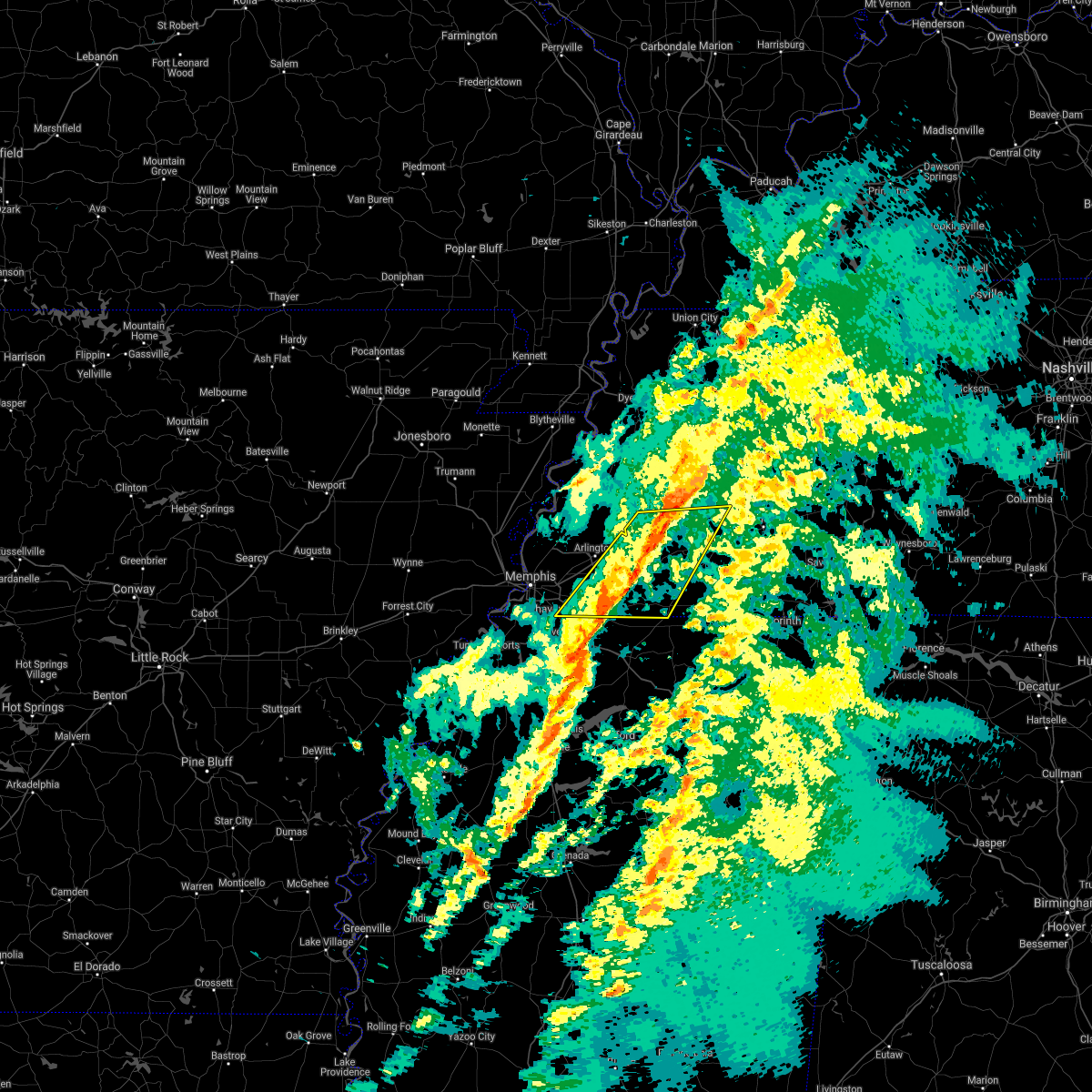 The severe thunderstorm warning for fayette, northwestern hardeman, southern haywood, southwestern madison and southeastern shelby counties will expire at 200 pm cst, the storms which prompted the warning have moved out of the area. therefore, the warning will be allowed to expire. a tornado watch remains in effect until 600 pm cst for northeastern and northwestern mississippi, and western tennessee. The severe thunderstorm warning for fayette, northwestern hardeman, southern haywood, southwestern madison and southeastern shelby counties will expire at 200 pm cst, the storms which prompted the warning have moved out of the area. therefore, the warning will be allowed to expire. a tornado watch remains in effect until 600 pm cst for northeastern and northwestern mississippi, and western tennessee.
|
| 2/17/2022 1:41 PM CST |
 At 141 pm cst, severe thunderstorms were located along a line extending from near dancyville to 6 miles east of collierville, moving east at 40 mph (radar indicated). Hazards include 60 mph wind gusts. Expect damage to roofs, siding, and trees. locations impacted include, collierville, germantown, bolivar, memphis, arlington, whiteville, somerville, hillville, lagrange, eads, dancyville, cloverport, mercer, warren, macon, oakland, piperton, rossville, moscow and stanton. hail threat, radar indicated max hail size, <. 75 in wind threat, radar indicated max wind gust, 60 mph. At 141 pm cst, severe thunderstorms were located along a line extending from near dancyville to 6 miles east of collierville, moving east at 40 mph (radar indicated). Hazards include 60 mph wind gusts. Expect damage to roofs, siding, and trees. locations impacted include, collierville, germantown, bolivar, memphis, arlington, whiteville, somerville, hillville, lagrange, eads, dancyville, cloverport, mercer, warren, macon, oakland, piperton, rossville, moscow and stanton. hail threat, radar indicated max hail size, <. 75 in wind threat, radar indicated max wind gust, 60 mph.
|
| 2/17/2022 1:17 PM CST |
 At 117 pm cst, severe thunderstorms were located along a line extending from 8 miles southeast of covington to southeast memphis, moving east at 55 mph (radar indicated). Hazards include 60 mph wind gusts. expect damage to roofs, siding, and trees At 117 pm cst, severe thunderstorms were located along a line extending from 8 miles southeast of covington to southeast memphis, moving east at 55 mph (radar indicated). Hazards include 60 mph wind gusts. expect damage to roofs, siding, and trees
|
| 12/11/2021 12:30 AM CST |
 At 1230 am cst, a severe thunderstorm was located near arlington, or 15 miles northeast of cordova, moving northeast at 65 mph (radar indicated). Hazards include 60 mph wind gusts and quarter size hail. Hail damage to vehicles is expected. Expect wind damage to roofs, siding, and trees. At 1230 am cst, a severe thunderstorm was located near arlington, or 15 miles northeast of cordova, moving northeast at 65 mph (radar indicated). Hazards include 60 mph wind gusts and quarter size hail. Hail damage to vehicles is expected. Expect wind damage to roofs, siding, and trees.
|
| 12/10/2021 11:59 PM CST |
 At 1158 pm cst, a severe thunderstorm was located over midtown memphis, or 9 miles southwest of bartlett, moving northeast at 65 mph (radar indicated). Hazards include 60 mph wind gusts. Expect damage to roofs, siding, and trees. Locations impacted include, bartlett, southaven, collierville, germantown, olive branch, west memphis, horn lake, marion, millington, t o fuller state park, cordova, memphis, lakeland, arlington, somerville, walls, edmondson, horseshoe lake, anthonyville and southwest memphis. At 1158 pm cst, a severe thunderstorm was located over midtown memphis, or 9 miles southwest of bartlett, moving northeast at 65 mph (radar indicated). Hazards include 60 mph wind gusts. Expect damage to roofs, siding, and trees. Locations impacted include, bartlett, southaven, collierville, germantown, olive branch, west memphis, horn lake, marion, millington, t o fuller state park, cordova, memphis, lakeland, arlington, somerville, walls, edmondson, horseshoe lake, anthonyville and southwest memphis.
|
| 12/10/2021 11:48 PM CST |
 At 1148 pm cst, a severe thunderstorm was located near west memphis, moving northeast at 65 mph (radar indicated). Hazards include 60 mph wind gusts and penny size hail. expect damage to roofs, siding, and trees At 1148 pm cst, a severe thunderstorm was located near west memphis, moving northeast at 65 mph (radar indicated). Hazards include 60 mph wind gusts and penny size hail. expect damage to roofs, siding, and trees
|
| 12/10/2021 11:25 PM CST |
 At 1124 pm cst, a severe thunderstorm was located near new home, or 7 miles west of hughes, moving northeast at 60 mph (radar indicated). Hazards include 60 mph wind gusts and quarter size hail. Hail damage to vehicles is expected. Expect wind damage to roofs, siding, and trees. At 1124 pm cst, a severe thunderstorm was located near new home, or 7 miles west of hughes, moving northeast at 60 mph (radar indicated). Hazards include 60 mph wind gusts and quarter size hail. Hail damage to vehicles is expected. Expect wind damage to roofs, siding, and trees.
|
| 7/11/2021 12:57 AM CDT |
 At 1257 am cdt, severe thunderstorms were located along a line extending from near belle eagle to 6 miles northeast of arlington to near sunset, moving southeast at 40 mph (radar indicated). Hazards include 60 mph wind gusts. Expect damage to roofs, siding, and trees. Locations impacted include, bartlett, southaven, collierville, germantown, west memphis, marion, brownsville, millington, covington, ripley, t o fuller state park, meeman shelby forest state park, cordova, memphis, lakeland, arlington, munford, somerville, brighton and alamo. At 1257 am cdt, severe thunderstorms were located along a line extending from near belle eagle to 6 miles northeast of arlington to near sunset, moving southeast at 40 mph (radar indicated). Hazards include 60 mph wind gusts. Expect damage to roofs, siding, and trees. Locations impacted include, bartlett, southaven, collierville, germantown, west memphis, marion, brownsville, millington, covington, ripley, t o fuller state park, meeman shelby forest state park, cordova, memphis, lakeland, arlington, munford, somerville, brighton and alamo.
|
| 7/11/2021 12:24 AM CDT |
 At 1224 am cdt, severe thunderstorms were located along a line extending from 9 miles southwest of unionville to near fulton to near gilmore, moving southeast at 40 mph (radar indicated). Hazards include 60 mph wind gusts. expect damage to roofs, siding, and trees At 1224 am cdt, severe thunderstorms were located along a line extending from 9 miles southwest of unionville to near fulton to near gilmore, moving southeast at 40 mph (radar indicated). Hazards include 60 mph wind gusts. expect damage to roofs, siding, and trees
|
| 6/7/2021 8:09 PM CDT |
 At 809 pm cdt, a severe thunderstorm was located over olive branch, moving northeast at 45 mph (radar indicated). Hazards include 60 mph wind gusts. Expect damage to roofs, siding, and trees. Locations impacted include, southaven, collierville, olive branch, horn lake, hernando, t o fuller state park, memphis, coldwater, byhalia, walls, lake cormorant, southwest memphis, eudora, lewisburg, whitehaven, red banks, barr, lynchburg, southeast memphis and independence. At 809 pm cdt, a severe thunderstorm was located over olive branch, moving northeast at 45 mph (radar indicated). Hazards include 60 mph wind gusts. Expect damage to roofs, siding, and trees. Locations impacted include, southaven, collierville, olive branch, horn lake, hernando, t o fuller state park, memphis, coldwater, byhalia, walls, lake cormorant, southwest memphis, eudora, lewisburg, whitehaven, red banks, barr, lynchburg, southeast memphis and independence.
|
| 6/7/2021 7:40 PM CDT |
 At 740 pm cdt, a severe thunderstorm was located near arkabutla, or near senatobia, moving northeast at 45 mph (radar indicated). Hazards include 60 mph wind gusts. expect damage to roofs, siding, and trees At 740 pm cdt, a severe thunderstorm was located near arkabutla, or near senatobia, moving northeast at 45 mph (radar indicated). Hazards include 60 mph wind gusts. expect damage to roofs, siding, and trees
|
| 5/4/2021 7:09 PM CDT |
 At 708 pm cdt, a severe thunderstorm was located near jericho, or near meeman shelby forest state park, moving east at 40 mph (radar indicated). Hazards include 60 mph wind gusts and quarter size hail. Hail damage to vehicles is expected. Expect wind damage to roofs, siding, and trees. At 708 pm cdt, a severe thunderstorm was located near jericho, or near meeman shelby forest state park, moving east at 40 mph (radar indicated). Hazards include 60 mph wind gusts and quarter size hail. Hail damage to vehicles is expected. Expect wind damage to roofs, siding, and trees.
|
| 4/7/2021 7:09 PM CDT |
 At 709 pm cdt, a severe thunderstorm was located over germantown, moving northeast at 35 mph (radar indicated). Hazards include 60 mph wind gusts. Expect damage to roofs, siding, and trees. Locations impacted include, bartlett, collierville, germantown, cordova, memphis, lakeland, arlington, eads, macon, oakland, piperton, gallaway, lenow, fisherville, elba, canadaville, kirk and hickory withe. At 709 pm cdt, a severe thunderstorm was located over germantown, moving northeast at 35 mph (radar indicated). Hazards include 60 mph wind gusts. Expect damage to roofs, siding, and trees. Locations impacted include, bartlett, collierville, germantown, cordova, memphis, lakeland, arlington, eads, macon, oakland, piperton, gallaway, lenow, fisherville, elba, canadaville, kirk and hickory withe.
|
| 4/7/2021 6:54 PM CDT |
 At 654 pm cdt, a severe thunderstorm was located over southeast memphis, or near olive branch, moving northeast at 35 mph (radar indicated). Hazards include 60 mph wind gusts. expect damage to roofs, siding, and trees At 654 pm cdt, a severe thunderstorm was located over southeast memphis, or near olive branch, moving northeast at 35 mph (radar indicated). Hazards include 60 mph wind gusts. expect damage to roofs, siding, and trees
|
| 3/27/2021 10:39 PM CDT |
 At 1039 pm cdt, severe thunderstorms were located along a line extending from near brighton to near independence, moving east at 50 mph (radar indicated). Hazards include 60 mph wind gusts. expect damage to roofs, siding, and trees At 1039 pm cdt, severe thunderstorms were located along a line extending from near brighton to near independence, moving east at 50 mph (radar indicated). Hazards include 60 mph wind gusts. expect damage to roofs, siding, and trees
|
| 3/27/2021 10:20 PM CDT |
 At 1020 pm cdt, severe thunderstorms were located along a line extending from near dixonville to southeast memphis, moving northeast at 65 mph (radar indicated). Hazards include 60 mph wind gusts. Expect damage to roofs, siding, and trees. Locations impacted include, bartlett, southaven, collierville, germantown, olive branch, horn lake, hernando, millington, t o fuller state park, meeman shelby forest state park, cordova, memphis, lakeland, arlington, munford, brighton, walls, lake cormorant, southwest memphis and ellendale. At 1020 pm cdt, severe thunderstorms were located along a line extending from near dixonville to southeast memphis, moving northeast at 65 mph (radar indicated). Hazards include 60 mph wind gusts. Expect damage to roofs, siding, and trees. Locations impacted include, bartlett, southaven, collierville, germantown, olive branch, horn lake, hernando, millington, t o fuller state park, meeman shelby forest state park, cordova, memphis, lakeland, arlington, munford, brighton, walls, lake cormorant, southwest memphis and ellendale.
|
| 3/27/2021 9:53 PM CDT |
 At 953 pm cdt, severe thunderstorms were located along a line extending from near jennette to near robinsonville, moving northeast at 65 mph (radar indicated). Hazards include 60 mph wind gusts. expect damage to roofs, siding, and trees At 953 pm cdt, severe thunderstorms were located along a line extending from near jennette to near robinsonville, moving northeast at 65 mph (radar indicated). Hazards include 60 mph wind gusts. expect damage to roofs, siding, and trees
|
| 3/27/2021 9:32 PM CDT |
 At 931 pm cdt, severe thunderstorms were located along a line extending from 7 miles northwest of dancyville to near olive branch, moving northeast at 40 mph (radar indicated). Hazards include 60 mph wind gusts. expect damage to roofs, siding, and trees At 931 pm cdt, severe thunderstorms were located along a line extending from 7 miles northwest of dancyville to near olive branch, moving northeast at 40 mph (radar indicated). Hazards include 60 mph wind gusts. expect damage to roofs, siding, and trees
|
| 3/27/2021 6:05 AM CDT |
 The severe thunderstorm warning for northeastern desoto and southeastern shelby counties will expire at 615 am cdt, the storm which prompted the warning has moved out of the area. therefore, the warning will be allowed to expire. however heavy rain is still possible with this thunderstorm. The severe thunderstorm warning for northeastern desoto and southeastern shelby counties will expire at 615 am cdt, the storm which prompted the warning has moved out of the area. therefore, the warning will be allowed to expire. however heavy rain is still possible with this thunderstorm.
|
| 3/27/2021 5:34 AM CDT |
 At 533 am cdt, a severe thunderstorm was located over whitehaven, or near southaven, moving northeast at 30 mph (radar indicated). Hazards include 60 mph wind gusts and quarter size hail. Hail damage to vehicles is expected. Expect wind damage to roofs, siding, and trees. At 533 am cdt, a severe thunderstorm was located over whitehaven, or near southaven, moving northeast at 30 mph (radar indicated). Hazards include 60 mph wind gusts and quarter size hail. Hail damage to vehicles is expected. Expect wind damage to roofs, siding, and trees.
|
| 1/25/2021 3:45 PM CST | Quarter sized hail reported 0.9 miles WNW of Germantown, TN, near the intersection of dogwood and cordese. |
| 9/2/2020 8:36 PM CDT |
 The severe thunderstorm warning for northern marshall, southwestern fayette and eastern shelby counties will expire at 845 pm cdt, the storm which prompted the warning has weakened below severe limits, and no longer poses an immediate threat to life or property. therefore, the warning will be allowed to expire. The severe thunderstorm warning for northern marshall, southwestern fayette and eastern shelby counties will expire at 845 pm cdt, the storm which prompted the warning has weakened below severe limits, and no longer poses an immediate threat to life or property. therefore, the warning will be allowed to expire.
|
| 9/2/2020 8:31 PM CDT |
 At 831 pm cdt, a severe thunderstorm was located near eads, or 7 miles northeast of collierville, moving northeast at 55 mph (radar indicated). Hazards include 60 mph wind gusts. Expect damage to roofs, siding, and trees. Locations impacted include, bartlett, collierville, germantown, cordova, memphis, lakeland, arlington, eads, ellendale, piperton, rossville, elmore park, brunswick, lenow, cayce, fisherville, raleigh, elba, canadaville and spring lake. At 831 pm cdt, a severe thunderstorm was located near eads, or 7 miles northeast of collierville, moving northeast at 55 mph (radar indicated). Hazards include 60 mph wind gusts. Expect damage to roofs, siding, and trees. Locations impacted include, bartlett, collierville, germantown, cordova, memphis, lakeland, arlington, eads, ellendale, piperton, rossville, elmore park, brunswick, lenow, cayce, fisherville, raleigh, elba, canadaville and spring lake.
|
| 9/2/2020 8:22 PM CDT |
 At 822 pm cdt, a severe thunderstorm was located over collierville, moving northeast at 45 mph (radar indicated). Hazards include 60 mph wind gusts. Expect damage to roofs, siding, and trees. Locations impacted include, bartlett, collierville, germantown, olive branch, cordova, memphis, lakeland, arlington, ellendale, southeast memphis, eads, midtown memphis, piperton, rossville, lenow, cayce, handy corner, capleville, kirk and elmore park. At 822 pm cdt, a severe thunderstorm was located over collierville, moving northeast at 45 mph (radar indicated). Hazards include 60 mph wind gusts. Expect damage to roofs, siding, and trees. Locations impacted include, bartlett, collierville, germantown, olive branch, cordova, memphis, lakeland, arlington, ellendale, southeast memphis, eads, midtown memphis, piperton, rossville, lenow, cayce, handy corner, capleville, kirk and elmore park.
|
| 9/2/2020 8:15 PM CDT |
 At 815 pm cdt, a severe thunderstorm was located near germantown, moving northeast at 40 mph (radar indicated). Hazards include 60 mph wind gusts. Expect damage to roofs, siding, and trees. Locations impacted include, bartlett, southaven, collierville, germantown, olive branch, horn lake, cordova, memphis, lakeland, arlington, southwest memphis, ellendale, southeast memphis, eads, lewisburg, whitehaven, midtown memphis, piperton, rossville and lenow. At 815 pm cdt, a severe thunderstorm was located near germantown, moving northeast at 40 mph (radar indicated). Hazards include 60 mph wind gusts. Expect damage to roofs, siding, and trees. Locations impacted include, bartlett, southaven, collierville, germantown, olive branch, horn lake, cordova, memphis, lakeland, arlington, southwest memphis, ellendale, southeast memphis, eads, lewisburg, whitehaven, midtown memphis, piperton, rossville and lenow.
|
| 9/2/2020 7:54 PM CDT |
 At 753 pm cdt, a severe thunderstorm was located near hernando, moving northeast at 55 mph (radar indicated). Hazards include 60 mph wind gusts. expect damage to roofs, siding, and trees At 753 pm cdt, a severe thunderstorm was located near hernando, moving northeast at 55 mph (radar indicated). Hazards include 60 mph wind gusts. expect damage to roofs, siding, and trees
|
| 6/5/2020 2:12 PM CDT |
 The severe thunderstorm warning for crittenden, desoto, northern marshall, northeastern tunica, northwestern benton, southern fayette and shelby counties will expire at 215 pm cdt, the storms which prompted the warning have moved out of the area. therefore, the warning will be allowed to expire. however gusty winds are still possible with these thunderstorms. a severe thunderstorm watch remains in effect until 600 pm cdt for eastern arkansas, northeastern and northwestern mississippi, and western tennessee. The severe thunderstorm warning for crittenden, desoto, northern marshall, northeastern tunica, northwestern benton, southern fayette and shelby counties will expire at 215 pm cdt, the storms which prompted the warning have moved out of the area. therefore, the warning will be allowed to expire. however gusty winds are still possible with these thunderstorms. a severe thunderstorm watch remains in effect until 600 pm cdt for eastern arkansas, northeastern and northwestern mississippi, and western tennessee.
|
| 6/5/2020 1:41 PM CDT |
 At 141 pm cdt, severe thunderstorms were located along a line extending from near pinckney to near olive branch to 9 miles south of somerville, moving southeast at 40 mph (radar indicated). Hazards include 60 mph wind gusts and penny size hail. Expect damage to roofs, siding, and trees. Locations impacted include, bartlett, southaven, collierville, germantown, olive branch, west memphis, horn lake, hernando, marion, millington, t o fuller state park, cordova, memphis, lamar, lakeland, arlington, somerville, byhalia, walls and crawfordsville. At 141 pm cdt, severe thunderstorms were located along a line extending from near pinckney to near olive branch to 9 miles south of somerville, moving southeast at 40 mph (radar indicated). Hazards include 60 mph wind gusts and penny size hail. Expect damage to roofs, siding, and trees. Locations impacted include, bartlett, southaven, collierville, germantown, olive branch, west memphis, horn lake, hernando, marion, millington, t o fuller state park, cordova, memphis, lamar, lakeland, arlington, somerville, byhalia, walls and crawfordsville.
|
| 6/5/2020 1:27 PM CDT |
 At 127 pm cdt, severe thunderstorms were located along a line extending from near simsboro to near midtown memphis to 7 miles east of eads, moving southeast at 35 mph (radar indicated). Hazards include 60 mph wind gusts. expect damage to roofs, siding, and trees At 127 pm cdt, severe thunderstorms were located along a line extending from near simsboro to near midtown memphis to 7 miles east of eads, moving southeast at 35 mph (radar indicated). Hazards include 60 mph wind gusts. expect damage to roofs, siding, and trees
|
| 6/4/2020 5:53 PM CDT |
 At 553 pm cdt, a severe thunderstorm was located near collierville, moving southeast at 15 mph (radar indicated). Hazards include 60 mph wind gusts and quarter size hail. Hail damage to vehicles is expected. Expect wind damage to roofs, siding, and trees. At 553 pm cdt, a severe thunderstorm was located near collierville, moving southeast at 15 mph (radar indicated). Hazards include 60 mph wind gusts and quarter size hail. Hail damage to vehicles is expected. Expect wind damage to roofs, siding, and trees.
|
| 5/22/2020 4:20 PM CDT |
 At 419 pm cdt, a severe thunderstorm was located near sunset, or near meeman shelby forest state park, moving east at 55 mph (radar indicated). Hazards include 70 mph wind gusts. Expect considerable tree damage. damage is likely to mobile homes, roofs, and outbuildings. Locations impacted include, bartlett, collierville, germantown, west memphis, marion, millington, earle, parkin, t o fuller state park, meeman shelby forest state park, cordova, memphis, lakeland, arlington, munford, brighton, crawfordsville, edmondson, sunset and gilmore. At 419 pm cdt, a severe thunderstorm was located near sunset, or near meeman shelby forest state park, moving east at 55 mph (radar indicated). Hazards include 70 mph wind gusts. Expect considerable tree damage. damage is likely to mobile homes, roofs, and outbuildings. Locations impacted include, bartlett, collierville, germantown, west memphis, marion, millington, earle, parkin, t o fuller state park, meeman shelby forest state park, cordova, memphis, lakeland, arlington, munford, brighton, crawfordsville, edmondson, sunset and gilmore.
|
| 5/22/2020 3:55 PM CDT |
 At 355 pm cdt, a severe thunderstorm was located near jennette, or near earle, moving east at 60 mph (radar indicated). Hazards include 70 mph wind gusts. Expect considerable tree damage. Damage is likely to mobile homes, roofs, and outbuildings. At 355 pm cdt, a severe thunderstorm was located near jennette, or near earle, moving east at 60 mph (radar indicated). Hazards include 70 mph wind gusts. Expect considerable tree damage. Damage is likely to mobile homes, roofs, and outbuildings.
|
| 4/29/2020 12:57 AM CDT |
 The severe thunderstorm warning for southeastern crittenden, desoto, northeastern tunica, northwestern tate and southern shelby counties will expire at 100 am cdt, the storms which prompted the warning have weakened below severe limits, and have exited the warned area. therefore, the warning will be allowed to expire. however gusty winds are still possible with these thunderstorms. a severe thunderstorm watch remains in effect until 300 am cdt for eastern arkansas, northwestern mississippi, and western tennessee. The severe thunderstorm warning for southeastern crittenden, desoto, northeastern tunica, northwestern tate and southern shelby counties will expire at 100 am cdt, the storms which prompted the warning have weakened below severe limits, and have exited the warned area. therefore, the warning will be allowed to expire. however gusty winds are still possible with these thunderstorms. a severe thunderstorm watch remains in effect until 300 am cdt for eastern arkansas, northwestern mississippi, and western tennessee.
|
| 4/29/2020 12:36 AM CDT |
 At 1236 am cdt, severe thunderstorms were located along a line extending from near southeast memphis to near north tunica, moving east at 55 mph (radar indicated). Hazards include 70 mph wind gusts. Expect considerable tree damage. damage is likely to mobile homes, roofs, and outbuildings. Locations impacted include, southaven, collierville, germantown, olive branch, west memphis, horn lake, hernando, t o fuller state park, memphis, coldwater, walls, horseshoe lake, lake cormorant, southwest memphis, eudora, lewisburg, whitehaven, arkabutla, pinckney and lynchburg. At 1236 am cdt, severe thunderstorms were located along a line extending from near southeast memphis to near north tunica, moving east at 55 mph (radar indicated). Hazards include 70 mph wind gusts. Expect considerable tree damage. damage is likely to mobile homes, roofs, and outbuildings. Locations impacted include, southaven, collierville, germantown, olive branch, west memphis, horn lake, hernando, t o fuller state park, memphis, coldwater, walls, horseshoe lake, lake cormorant, southwest memphis, eudora, lewisburg, whitehaven, arkabutla, pinckney and lynchburg.
|
| 4/29/2020 12:22 AM CDT |
 At 1222 am cdt, severe thunderstorms were located along a line extending from near downtown memphis to 7 miles west of north tunica, moving east at 55 mph (radar indicated). Hazards include 70 mph wind gusts. Expect considerable tree damage. damage is likely to mobile homes, roofs, and outbuildings. Locations impacted include, bartlett, southaven, collierville, germantown, olive branch, west memphis, horn lake, hernando, marion, hughes, t o fuller state park, cordova, memphis, coldwater, walls, edmondson, horseshoe lake, sunset, anthonyville and lake cormorant. At 1222 am cdt, severe thunderstorms were located along a line extending from near downtown memphis to 7 miles west of north tunica, moving east at 55 mph (radar indicated). Hazards include 70 mph wind gusts. Expect considerable tree damage. damage is likely to mobile homes, roofs, and outbuildings. Locations impacted include, bartlett, southaven, collierville, germantown, olive branch, west memphis, horn lake, hernando, marion, hughes, t o fuller state park, cordova, memphis, coldwater, walls, edmondson, horseshoe lake, sunset, anthonyville and lake cormorant.
|
| 4/29/2020 12:11 AM CDT |
 At 1210 am cdt, severe thunderstorms were located along a line extending from near edmondson to near marianna, moving east at 55 mph (radar indicated). Hazards include 60 mph wind gusts. expect damage to roofs, siding, and trees At 1210 am cdt, severe thunderstorms were located along a line extending from near edmondson to near marianna, moving east at 55 mph (radar indicated). Hazards include 60 mph wind gusts. expect damage to roofs, siding, and trees
|
| 4/12/2020 10:50 PM CDT |
 At 1050 pm cdt, severe thunderstorms were located along a line extending from near manila to 8 miles east of eads, moving northeast at 65 mph (radar indicated). Hazards include 60 mph wind gusts. Expect damage to roofs, siding, and trees. Locations impacted include, bartlett, southaven, collierville, germantown, olive branch, west memphis, blytheville, marion, millington, covington, osceola, gosnell, marked tree, lepanto, luxora, wilson, tyronza, keiser, meeman shelby forest state park and fort pillow state park. At 1050 pm cdt, severe thunderstorms were located along a line extending from near manila to 8 miles east of eads, moving northeast at 65 mph (radar indicated). Hazards include 60 mph wind gusts. Expect damage to roofs, siding, and trees. Locations impacted include, bartlett, southaven, collierville, germantown, olive branch, west memphis, blytheville, marion, millington, covington, osceola, gosnell, marked tree, lepanto, luxora, wilson, tyronza, keiser, meeman shelby forest state park and fort pillow state park.
|
| 4/12/2020 10:34 PM CDT |
 At 1034 pm cdt, severe thunderstorms were located along a line extending from near lepanto to near collierville, moving northeast at 65 mph (radar indicated). Hazards include 60 mph wind gusts. Expect damage to roofs, siding, and trees. Locations impacted include, bartlett, southaven, collierville, germantown, olive branch, west memphis, blytheville, marion, millington, covington, osceola, gosnell, marked tree, lepanto, luxora, wilson, tyronza, keiser, cordova and t o fuller state park. At 1034 pm cdt, severe thunderstorms were located along a line extending from near lepanto to near collierville, moving northeast at 65 mph (radar indicated). Hazards include 60 mph wind gusts. Expect damage to roofs, siding, and trees. Locations impacted include, bartlett, southaven, collierville, germantown, olive branch, west memphis, blytheville, marion, millington, covington, osceola, gosnell, marked tree, lepanto, luxora, wilson, tyronza, keiser, cordova and t o fuller state park.
|
| 4/12/2020 10:16 PM CDT |
 At 1016 pm cdt, severe thunderstorms were located along a line extending from near marked tree to near hernando, moving northeast at 65 mph (radar indicated). Hazards include 60 mph wind gusts. expect damage to roofs, siding, and trees At 1016 pm cdt, severe thunderstorms were located along a line extending from near marked tree to near hernando, moving northeast at 65 mph (radar indicated). Hazards include 60 mph wind gusts. expect damage to roofs, siding, and trees
|
| 4/8/2020 10:30 PM CDT |
 At 1030 pm cdt, a severe thunderstorm was located 10 miles north of slayden, or 12 miles east of collierville, moving southeast at 40 mph (radar indicated). Hazards include 60 mph wind gusts. Expect damage to roofs, siding, and trees. Locations impacted include, collierville, germantown, cordova, somerville, macon, oakland, piperton, rossville, moscow, williston, la grange, fisherville, elba, canadaville, kirk, hays crossing, pattersonville, forty five, hickory withe and ghost river state natural area. At 1030 pm cdt, a severe thunderstorm was located 10 miles north of slayden, or 12 miles east of collierville, moving southeast at 40 mph (radar indicated). Hazards include 60 mph wind gusts. Expect damage to roofs, siding, and trees. Locations impacted include, collierville, germantown, cordova, somerville, macon, oakland, piperton, rossville, moscow, williston, la grange, fisherville, elba, canadaville, kirk, hays crossing, pattersonville, forty five, hickory withe and ghost river state natural area.
|
| 4/8/2020 10:17 PM CDT |
 At 1017 pm cdt, a severe thunderstorm was located near eads, or 10 miles northeast of collierville, moving southeast at 45 mph (radar indicated). Hazards include 60 mph wind gusts. expect damage to roofs, siding, and trees At 1017 pm cdt, a severe thunderstorm was located near eads, or 10 miles northeast of collierville, moving southeast at 45 mph (radar indicated). Hazards include 60 mph wind gusts. expect damage to roofs, siding, and trees
|
| 4/8/2020 9:59 PM CDT |
 At 959 pm cdt, a severe thunderstorm was located near frayser, or near bartlett, moving southeast at 30 mph (radar indicated). Hazards include 60 mph wind gusts. Expect damage to roofs, siding, and trees. Locations impacted include, bartlett, collierville, germantown, west memphis, marion, millington, t o fuller state park, cordova, memphis, lakeland, arlington, southwest memphis, ellendale, southeast memphis, downtown memphis, eads, whitehaven, frayser, midtown memphis and piperton. At 959 pm cdt, a severe thunderstorm was located near frayser, or near bartlett, moving southeast at 30 mph (radar indicated). Hazards include 60 mph wind gusts. Expect damage to roofs, siding, and trees. Locations impacted include, bartlett, collierville, germantown, west memphis, marion, millington, t o fuller state park, cordova, memphis, lakeland, arlington, southwest memphis, ellendale, southeast memphis, downtown memphis, eads, whitehaven, frayser, midtown memphis and piperton.
|
| 4/8/2020 9:36 PM CDT |
 At 936 pm cdt, a severe thunderstorm was located near meeman shelby forest state park, moving southeast at 40 mph (radar indicated). Hazards include 60 mph wind gusts and quarter size hail. Hail damage to vehicles is expected. Expect wind damage to roofs, siding, and trees. At 936 pm cdt, a severe thunderstorm was located near meeman shelby forest state park, moving southeast at 40 mph (radar indicated). Hazards include 60 mph wind gusts and quarter size hail. Hail damage to vehicles is expected. Expect wind damage to roofs, siding, and trees.
|
| 3/28/2020 8:21 PM CDT |
 At 820 pm cdt, severe thunderstorms were located along a line extending from near arlington to near mt pleasant to near harmontown, moving east at 50 mph (radar indicated. at 815 pm cdt, 60 mph were observed in byhalia). Hazards include 60 mph wind gusts. Expect damage to roofs, siding, and trees. Locations impacted include, collierville, germantown, olive branch, holly springs, wall doxey state park, lamar, lakeland, arlington, whiteville, somerville, byhalia, snow lake shores, bethlehem, red banks, laws hill, canaan, lagrange, independence, eads and slayden. At 820 pm cdt, severe thunderstorms were located along a line extending from near arlington to near mt pleasant to near harmontown, moving east at 50 mph (radar indicated. at 815 pm cdt, 60 mph were observed in byhalia). Hazards include 60 mph wind gusts. Expect damage to roofs, siding, and trees. Locations impacted include, collierville, germantown, olive branch, holly springs, wall doxey state park, lamar, lakeland, arlington, whiteville, somerville, byhalia, snow lake shores, bethlehem, red banks, laws hill, canaan, lagrange, independence, eads and slayden.
|
| 3/28/2020 8:11 PM CDT |
 At 810 pm cdt, severe thunderstorms were located along a line extending from near dixonville to barr, moving east at 45 mph (radar indicated). Hazards include 60 mph wind gusts. expect damage to roofs, siding, and trees At 810 pm cdt, severe thunderstorms were located along a line extending from near dixonville to barr, moving east at 45 mph (radar indicated). Hazards include 60 mph wind gusts. expect damage to roofs, siding, and trees
|
| 3/28/2020 8:06 PM CDT |
 At 806 pm cdt, severe thunderstorms were located along a line extending from 6 miles north of arlington to near senatobia, moving east at 45 mph (radar indicated). Hazards include 70 mph wind gusts. Expect considerable tree damage. damage is likely to mobile homes, roofs, and outbuildings. Locations impacted include, bartlett, southaven, collierville, germantown, olive branch, hernando, millington, senatobia, cordova, memphis, lakeland, arlington, coldwater, byhalia, ellendale, lewisburg, barr, southeast memphis, independence and eads. At 806 pm cdt, severe thunderstorms were located along a line extending from 6 miles north of arlington to near senatobia, moving east at 45 mph (radar indicated). Hazards include 70 mph wind gusts. Expect considerable tree damage. damage is likely to mobile homes, roofs, and outbuildings. Locations impacted include, bartlett, southaven, collierville, germantown, olive branch, hernando, millington, senatobia, cordova, memphis, lakeland, arlington, coldwater, byhalia, ellendale, lewisburg, barr, southeast memphis, independence and eads.
|
| 3/28/2020 7:58 PM CDT |
 At 758 pm cdt, severe thunderstorms were located along a line extending from near dixonville to senatobia, moving east at 25 mph (radar indicated). Hazards include 70 mph wind gusts. Expect considerable tree damage. damage is likely to mobile homes, roofs, and outbuildings. Locations impacted include, bartlett, southaven, collierville, germantown, olive branch, horn lake, hernando, millington, senatobia, cordova, memphis, lakeland, arlington, coldwater, byhalia, ellendale, strayhorn, lewisburg, whitehaven and arkabutla. At 758 pm cdt, severe thunderstorms were located along a line extending from near dixonville to senatobia, moving east at 25 mph (radar indicated). Hazards include 70 mph wind gusts. Expect considerable tree damage. damage is likely to mobile homes, roofs, and outbuildings. Locations impacted include, bartlett, southaven, collierville, germantown, olive branch, horn lake, hernando, millington, senatobia, cordova, memphis, lakeland, arlington, coldwater, byhalia, ellendale, strayhorn, lewisburg, whitehaven and arkabutla.
|
| 3/28/2020 7:26 PM CDT |
 At 725 pm cdt, severe thunderstorms were located along a line extending from near meeman shelby forest state park to little texas, moving east at 40 mph (radar indicated). Hazards include 60 mph wind gusts. expect damage to roofs, siding, and trees At 725 pm cdt, severe thunderstorms were located along a line extending from near meeman shelby forest state park to little texas, moving east at 40 mph (radar indicated). Hazards include 60 mph wind gusts. expect damage to roofs, siding, and trees
|
| 1/11/2020 5:13 AM CST |
 At 512 am cst, doppler radar indicated a severe thunderstorm producing a tornado was located over collierville, moving northeast at 55 mph (radar indicated rotation). Hazards include tornado. Flying debris will be dangerous to those caught without shelter. mobile homes will be damaged or destroyed. damage to roofs, windows, and vehicles will occur. tree damage is likely. Locations impacted include, collierville, germantown, piperton, rossville, fisherville, kirk, elba, canadaville and hickory withe. At 512 am cst, doppler radar indicated a severe thunderstorm producing a tornado was located over collierville, moving northeast at 55 mph (radar indicated rotation). Hazards include tornado. Flying debris will be dangerous to those caught without shelter. mobile homes will be damaged or destroyed. damage to roofs, windows, and vehicles will occur. tree damage is likely. Locations impacted include, collierville, germantown, piperton, rossville, fisherville, kirk, elba, canadaville and hickory withe.
|
| 1/11/2020 5:11 AM CST |
 At 511 am cst, a severe thunderstorm was located over lakeland, or near bartlett, moving northeast at 60 mph (radar indicated). Hazards include 60 mph wind gusts. Expect damage to roofs, siding, and trees. Locations impacted include, bartlett, collierville, germantown, olive branch, millington, cordova, memphis, lakeland, arlington, munford, brighton, ellendale, frayser, southeast memphis, eads, tipton, atoka, oakland, mason and piperton. At 511 am cst, a severe thunderstorm was located over lakeland, or near bartlett, moving northeast at 60 mph (radar indicated). Hazards include 60 mph wind gusts. Expect damage to roofs, siding, and trees. Locations impacted include, bartlett, collierville, germantown, olive branch, millington, cordova, memphis, lakeland, arlington, munford, brighton, ellendale, frayser, southeast memphis, eads, tipton, atoka, oakland, mason and piperton.
|
| 1/11/2020 5:01 AM CST |
 At 501 am cst, doppler radar indicated a severe thunderstorm producing a tornado was located near olive branch, moving northeast at 45 mph (radar indicated rotation). Hazards include tornado. Flying debris will be dangerous to those caught without shelter. mobile homes will be damaged or destroyed. damage to roofs, windows, and vehicles will occur. Tree damage is likely. At 501 am cst, doppler radar indicated a severe thunderstorm producing a tornado was located near olive branch, moving northeast at 45 mph (radar indicated rotation). Hazards include tornado. Flying debris will be dangerous to those caught without shelter. mobile homes will be damaged or destroyed. damage to roofs, windows, and vehicles will occur. Tree damage is likely.
|
| 1/11/2020 4:55 AM CST |
 At 454 am cst, a severe thunderstorm was located over midtown memphis, or 7 miles northeast of t o fuller state park, moving northeast at 45 mph (radar indicated). Hazards include 60 mph wind gusts. expect damage to roofs, siding, and trees At 454 am cst, a severe thunderstorm was located over midtown memphis, or 7 miles northeast of t o fuller state park, moving northeast at 45 mph (radar indicated). Hazards include 60 mph wind gusts. expect damage to roofs, siding, and trees
|
| 1/11/2020 4:32 AM CST |
 At 431 am cst, a severe thunderstorm was located over frayser, or 9 miles west of bartlett, moving northeast at 50 mph. a second severe thunderstorms is located near lake cormorant, also moving northeast at 50 mph (radar indicated). Hazards include 60 mph wind gusts. Expect damage to roofs, siding, and trees. Locations impacted include, bartlett, southaven, collierville, germantown, olive branch, west memphis, horn lake, marion, millington, t o fuller state park, meeman shelby forest state park, cordova, memphis, lakeland, arlington, walls, crawfordsville, edmondson, horseshoe lake and sunset. At 431 am cst, a severe thunderstorm was located over frayser, or 9 miles west of bartlett, moving northeast at 50 mph. a second severe thunderstorms is located near lake cormorant, also moving northeast at 50 mph (radar indicated). Hazards include 60 mph wind gusts. Expect damage to roofs, siding, and trees. Locations impacted include, bartlett, southaven, collierville, germantown, olive branch, west memphis, horn lake, marion, millington, t o fuller state park, meeman shelby forest state park, cordova, memphis, lakeland, arlington, walls, crawfordsville, edmondson, horseshoe lake and sunset.
|
| 1/11/2020 4:09 AM CST |
 At 408 am cst, a severe thunderstorm was located over anthonyville, or 9 miles southwest of west memphis, moving northeast at 55 mph (radar indicated). Hazards include 60 mph wind gusts. expect damage to roofs, siding, and trees At 408 am cst, a severe thunderstorm was located over anthonyville, or 9 miles southwest of west memphis, moving northeast at 55 mph (radar indicated). Hazards include 60 mph wind gusts. expect damage to roofs, siding, and trees
|
| 10/21/2019 7:01 AM CDT |
 At 701 am cdt, severe thunderstorms were located along a line extending from 9 miles northeast of arlington to near lewisburg, moving east at 45 mph (radar indicated). Hazards include 60 mph wind gusts. expect damage to roofs, siding, and trees At 701 am cdt, severe thunderstorms were located along a line extending from 9 miles northeast of arlington to near lewisburg, moving east at 45 mph (radar indicated). Hazards include 60 mph wind gusts. expect damage to roofs, siding, and trees
|
| 10/21/2019 7:01 AM CDT |
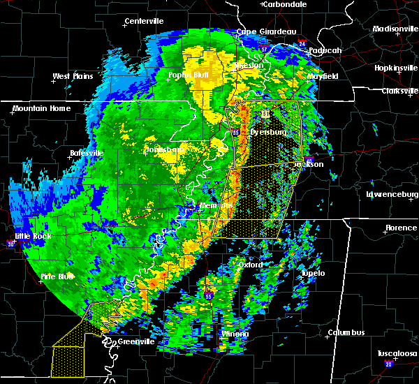 At 701 am cdt, severe thunderstorms were located along a line extending from 9 miles northeast of arlington to near lewisburg, moving east at 45 mph (radar indicated). Hazards include 60 mph wind gusts. expect damage to roofs, siding, and trees At 701 am cdt, severe thunderstorms were located along a line extending from 9 miles northeast of arlington to near lewisburg, moving east at 45 mph (radar indicated). Hazards include 60 mph wind gusts. expect damage to roofs, siding, and trees
|
| 10/21/2019 6:47 AM CDT |
 At 646 am cdt, doppler radar indicated a severe thunderstorm producing a tornado was located over germantown, moving east at 50 mph (radar indicated rotation). Hazards include tornado. Flying debris will be dangerous to those caught without shelter. mobile homes will be damaged or destroyed. damage to roofs, windows, and vehicles will occur. tree damage is likely. Locations impacted include, collierville, germantown, cordova, memphis, eads, lenow and fisherville. At 646 am cdt, doppler radar indicated a severe thunderstorm producing a tornado was located over germantown, moving east at 50 mph (radar indicated rotation). Hazards include tornado. Flying debris will be dangerous to those caught without shelter. mobile homes will be damaged or destroyed. damage to roofs, windows, and vehicles will occur. tree damage is likely. Locations impacted include, collierville, germantown, cordova, memphis, eads, lenow and fisherville.
|
| 10/21/2019 6:40 AM CDT |
 At 639 am cdt, doppler radar indicated a severe thunderstorm producing a tornado was located over southeast memphis, or 7 miles west of germantown, moving east at 50 mph (radar indicated rotation). Hazards include tornado. Flying debris will be dangerous to those caught without shelter. mobile homes will be damaged or destroyed. damage to roofs, windows, and vehicles will occur. Tree damage is likely. At 639 am cdt, doppler radar indicated a severe thunderstorm producing a tornado was located over southeast memphis, or 7 miles west of germantown, moving east at 50 mph (radar indicated rotation). Hazards include tornado. Flying debris will be dangerous to those caught without shelter. mobile homes will be damaged or destroyed. damage to roofs, windows, and vehicles will occur. Tree damage is likely.
|
| 10/21/2019 6:20 AM CDT |
 At 619 am cdt, severe thunderstorms were located along a line extending from near meeman shelby forest state park to near horseshoe lake, moving east at 35 mph (radar indicated). Hazards include 60 mph wind gusts. expect damage to roofs, siding, and trees At 619 am cdt, severe thunderstorms were located along a line extending from near meeman shelby forest state park to near horseshoe lake, moving east at 35 mph (radar indicated). Hazards include 60 mph wind gusts. expect damage to roofs, siding, and trees
|
| 8/13/2019 8:07 PM CDT |
 At 807 pm cdt, a severe thunderstorm was located near olive branch, moving east at 30 mph (radar indicated). Hazards include 60 mph wind gusts and quarter size hail. Hail damage to vehicles is expected. expect wind damage to roofs, siding, and trees. Locations impacted include, collierville, germantown, olive branch, memphis, byhalia, mt pleasant, southeast memphis, red banks, slayden, piperton, coal oil corner, cayce, fairhaven, victoria, parkway village, white station, handy corner, taska, capleville and miller. At 807 pm cdt, a severe thunderstorm was located near olive branch, moving east at 30 mph (radar indicated). Hazards include 60 mph wind gusts and quarter size hail. Hail damage to vehicles is expected. expect wind damage to roofs, siding, and trees. Locations impacted include, collierville, germantown, olive branch, memphis, byhalia, mt pleasant, southeast memphis, red banks, slayden, piperton, coal oil corner, cayce, fairhaven, victoria, parkway village, white station, handy corner, taska, capleville and miller.
|
| 8/13/2019 7:49 PM CDT |
 The national weather service in memphis has issued a * severe thunderstorm warning for. northeastern desoto county in northwestern mississippi. northwestern marshall county in northwestern mississippi. southeastern shelby county in western tennessee. Until 830 pm cdt. The national weather service in memphis has issued a * severe thunderstorm warning for. northeastern desoto county in northwestern mississippi. northwestern marshall county in northwestern mississippi. southeastern shelby county in western tennessee. Until 830 pm cdt.
|
| 8/13/2019 7:49 PM CDT |
 At 749 pm cdt, a severe thunderstorm was located over southeast memphis, or near southaven, moving east at 30 mph (radar indicated). Hazards include 60 mph wind gusts and quarter size hail. Hail damage to vehicles is expected. Expect wind damage to roofs, siding, and trees. At 749 pm cdt, a severe thunderstorm was located over southeast memphis, or near southaven, moving east at 30 mph (radar indicated). Hazards include 60 mph wind gusts and quarter size hail. Hail damage to vehicles is expected. Expect wind damage to roofs, siding, and trees.
|
| 8/7/2019 5:41 PM CDT |
 The severe thunderstorm warning for west central fayette and eastern shelby counties will expire at 545 pm cdt, the storm which prompted the warning has weakened below severe limits, and has exited the warned area. therefore, the warning will be allowed to expire. a severe thunderstorm watch remains in effect until 800 pm cdt for northwestern mississippi, and western tennessee. The severe thunderstorm warning for west central fayette and eastern shelby counties will expire at 545 pm cdt, the storm which prompted the warning has weakened below severe limits, and has exited the warned area. therefore, the warning will be allowed to expire. a severe thunderstorm watch remains in effect until 800 pm cdt for northwestern mississippi, and western tennessee.
|
| 8/7/2019 4:55 PM CDT |
 At 455 pm cdt, a severe thunderstorm was located over bartlett, moving southeast at 20 mph (radar indicated). Hazards include 60 mph wind gusts. expect damage to roofs, siding, and trees At 455 pm cdt, a severe thunderstorm was located over bartlett, moving southeast at 20 mph (radar indicated). Hazards include 60 mph wind gusts. expect damage to roofs, siding, and trees
|
| 7/15/2019 9:35 PM CDT |
 At 935 pm cdt, a severe thunderstorm was located over ellendale, or over bartlett, moving northeast at 45 mph (radar indicated). Hazards include 60 mph wind gusts. expect damage to roofs, siding, and trees At 935 pm cdt, a severe thunderstorm was located over ellendale, or over bartlett, moving northeast at 45 mph (radar indicated). Hazards include 60 mph wind gusts. expect damage to roofs, siding, and trees
|
| 6/23/2019 5:05 PM CDT |
 At 505 pm cdt, a severe thunderstorm was located over lakeland, or near cordova, moving southeast at 30 mph (radar indicated). Hazards include 60 mph wind gusts. expect damage to roofs, siding, and trees At 505 pm cdt, a severe thunderstorm was located over lakeland, or near cordova, moving southeast at 30 mph (radar indicated). Hazards include 60 mph wind gusts. expect damage to roofs, siding, and trees
|
| 6/23/2019 5:05 PM CDT |
 The national weather service in memphis has issued a * severe thunderstorm warning for. north central marshall county in northwestern mississippi. southern fayette county in western tennessee. east central shelby county in western tennessee. Until 545 pm cdt. The national weather service in memphis has issued a * severe thunderstorm warning for. north central marshall county in northwestern mississippi. southern fayette county in western tennessee. east central shelby county in western tennessee. Until 545 pm cdt.
|
| 6/22/2019 6:45 PM CDT |
 At 644 pm cdt, a severe thunderstorm was located over southeast memphis, or near olive branch, moving northeast at 15 mph (radar indicated). Hazards include 60 mph wind gusts and dime size hail. Hail damage to vehicles is expected. Expect wind damage to roofs, siding, and trees. At 644 pm cdt, a severe thunderstorm was located over southeast memphis, or near olive branch, moving northeast at 15 mph (radar indicated). Hazards include 60 mph wind gusts and dime size hail. Hail damage to vehicles is expected. Expect wind damage to roofs, siding, and trees.
|
| 6/20/2019 12:06 AM CDT |
 At 1205 am cdt, severe thunderstorms were located along a line extending from near ashport to near lewisburg, moving east at 50 mph (airport weather observation). Hazards include 70 mph wind gusts. Expect considerable tree damage. damage is likely to mobile homes, roofs, and outbuildings. Locations impacted include, bartlett, southaven, collierville, germantown, olive branch, horn lake, brownsville, millington, covington, ripley, osceola, luxora, wilson, keiser, cordova, meeman shelby forest state park, fort pillow state park, memphis, lakeland and arlington. At 1205 am cdt, severe thunderstorms were located along a line extending from near ashport to near lewisburg, moving east at 50 mph (airport weather observation). Hazards include 70 mph wind gusts. Expect considerable tree damage. damage is likely to mobile homes, roofs, and outbuildings. Locations impacted include, bartlett, southaven, collierville, germantown, olive branch, horn lake, brownsville, millington, covington, ripley, osceola, luxora, wilson, keiser, cordova, meeman shelby forest state park, fort pillow state park, memphis, lakeland and arlington.
|
| 6/19/2019 11:58 PM CDT |
 At 1158 pm cdt, severe thunderstorms were located along a line extending from near luxora to near hernando, moving east at 50 mph (radar indicated). Hazards include 60 mph wind gusts. expect damage to roofs, siding, and trees At 1158 pm cdt, severe thunderstorms were located along a line extending from near luxora to near hernando, moving east at 50 mph (radar indicated). Hazards include 60 mph wind gusts. expect damage to roofs, siding, and trees
|
| 6/19/2019 11:35 PM CDT |
 At 1134 pm cdt, severe thunderstorms were located along a line extending from near gilmore to phillipp, moving east at 60 mph (radar indicated). Hazards include 70 mph wind gusts. Expect considerable tree damage. damage is likely to mobile homes, roofs, and outbuildings. Locations impacted include, bartlett, southaven, collierville, germantown, olive branch, west memphis, horn lake, hernando, marion, millington, covington, marked tree, earle, hughes, parkin, tyronza, t o fuller state park, meeman shelby forest state park, cordova and memphis. At 1134 pm cdt, severe thunderstorms were located along a line extending from near gilmore to phillipp, moving east at 60 mph (radar indicated). Hazards include 70 mph wind gusts. Expect considerable tree damage. damage is likely to mobile homes, roofs, and outbuildings. Locations impacted include, bartlett, southaven, collierville, germantown, olive branch, west memphis, horn lake, hernando, marion, millington, covington, marked tree, earle, hughes, parkin, tyronza, t o fuller state park, meeman shelby forest state park, cordova and memphis.
|
| 6/19/2019 11:15 PM CDT |
 At 1115 pm cdt, severe thunderstorms were located along a line extending from 7 miles southwest of marked tree to 7 miles northwest of north tunica, moving east at 60 mph (radar indicated). Hazards include 70 mph wind gusts. Expect considerable tree damage. Damage is likely to mobile homes, roofs, and outbuildings. At 1115 pm cdt, severe thunderstorms were located along a line extending from 7 miles southwest of marked tree to 7 miles northwest of north tunica, moving east at 60 mph (radar indicated). Hazards include 70 mph wind gusts. Expect considerable tree damage. Damage is likely to mobile homes, roofs, and outbuildings.
|
| 5/18/2019 8:37 PM CDT |
 The severe thunderstorm warning for eastern crittenden, northern desoto and central shelby counties will expire at 845 pm cdt, the storms which prompted the warning have weakened below severe limits, and no longer pose an immediate threat to life or property. therefore, the warning will be allowed to expire. however gusty winds and heavy rain are still possible with these thunderstorms. a severe thunderstorm watch remains in effect until midnight cdt for eastern arkansas, northwestern mississippi, and western tennessee. The severe thunderstorm warning for eastern crittenden, northern desoto and central shelby counties will expire at 845 pm cdt, the storms which prompted the warning have weakened below severe limits, and no longer pose an immediate threat to life or property. therefore, the warning will be allowed to expire. however gusty winds and heavy rain are still possible with these thunderstorms. a severe thunderstorm watch remains in effect until midnight cdt for eastern arkansas, northwestern mississippi, and western tennessee.
|
| 5/18/2019 8:30 PM CDT |
 At 830 pm cdt, severe thunderstorms were located along a line extending from meeman shelby forest state park to near frayser to near southaven, moving northeast at 40 mph (radar indicated). Hazards include 60 mph wind gusts. Expect damage to roofs, siding, and trees. Locations impacted include, bartlett, southaven, olive branch, west memphis, horn lake, hernando, marion, millington, t o fuller state park, meeman shelby forest state park, memphis, walls, edmondson, sunset, jericho, southwest memphis, whitehaven, frayser, midtown memphis and lynchburg. At 830 pm cdt, severe thunderstorms were located along a line extending from meeman shelby forest state park to near frayser to near southaven, moving northeast at 40 mph (radar indicated). Hazards include 60 mph wind gusts. Expect damage to roofs, siding, and trees. Locations impacted include, bartlett, southaven, olive branch, west memphis, horn lake, hernando, marion, millington, t o fuller state park, meeman shelby forest state park, memphis, walls, edmondson, sunset, jericho, southwest memphis, whitehaven, frayser, midtown memphis and lynchburg.
|
| 5/18/2019 8:23 PM CDT |
 At 822 pm cdt, severe thunderstorms were located along a line extending from near meeman shelby forest state park to memphis to horn lake, moving northeast at 50 mph (radar indicated). Hazards include 60 mph wind gusts. Expect damage to roofs, siding, and trees. Locations impacted include, bartlett, southaven, olive branch, west memphis, horn lake, hernando, marion, millington, t o fuller state park, meeman shelby forest state park, memphis, walls, crawfordsville, edmondson, sunset, jericho, lake cormorant, southwest memphis, eudora and whitehaven. At 822 pm cdt, severe thunderstorms were located along a line extending from near meeman shelby forest state park to memphis to horn lake, moving northeast at 50 mph (radar indicated). Hazards include 60 mph wind gusts. Expect damage to roofs, siding, and trees. Locations impacted include, bartlett, southaven, olive branch, west memphis, horn lake, hernando, marion, millington, t o fuller state park, meeman shelby forest state park, memphis, walls, crawfordsville, edmondson, sunset, jericho, lake cormorant, southwest memphis, eudora and whitehaven.
|
| 5/18/2019 7:59 PM CDT |
 At 759 pm cdt, severe thunderstorms were located along a line extending from near jennette to near phillipp, moving northeast at 40 mph (radar indicated). Hazards include 60 mph wind gusts. expect damage to roofs, siding, and trees At 759 pm cdt, severe thunderstorms were located along a line extending from near jennette to near phillipp, moving northeast at 40 mph (radar indicated). Hazards include 60 mph wind gusts. expect damage to roofs, siding, and trees
|
| 5/18/2019 7:59 PM CDT |
 The national weather service in memphis has issued a * severe thunderstorm warning for. central crittenden county in eastern arkansas. desoto county in northwestern mississippi. northeastern tunica county in northwestern mississippi. Central shelby county in western tennessee. The national weather service in memphis has issued a * severe thunderstorm warning for. central crittenden county in eastern arkansas. desoto county in northwestern mississippi. northeastern tunica county in northwestern mississippi. Central shelby county in western tennessee.
|
| 5/15/2019 7:24 PM CDT |
 The severe thunderstorm warning for southwestern fayette and southeastern shelby counties will expire at 730 pm cdt, the storm which prompted the warning has weakened below severe limits, and no longer poses an immediate threat to life or property. therefore, the warning will be allowed to expire. The severe thunderstorm warning for southwestern fayette and southeastern shelby counties will expire at 730 pm cdt, the storm which prompted the warning has weakened below severe limits, and no longer poses an immediate threat to life or property. therefore, the warning will be allowed to expire.
|
| 5/15/2019 6:51 PM CDT |
 The national weather service in memphis has issued a * severe thunderstorm warning for. southwestern fayette county in western tennessee. southeastern shelby county in western tennessee. until 730 pm cdt. At 651 pm cdt, a severe thunderstorm was located over lakeland, or. The national weather service in memphis has issued a * severe thunderstorm warning for. southwestern fayette county in western tennessee. southeastern shelby county in western tennessee. until 730 pm cdt. At 651 pm cdt, a severe thunderstorm was located over lakeland, or.
|
| 5/15/2019 6:37 PM CDT |
 At 636 pm cdt, a severe thunderstorm was located over arlington, or 10 miles northeast of bartlett, moving south at 15 mph. dime size hail was reported with this storm in lakeland (radar indicated). Hazards include quarter size hail. Damage to vehicles is expected. Locations impacted include, bartlett, collierville, germantown, cordova, lakeland, arlington, eads, macon, oakland, gallaway, braden, brunswick, lenow, fisherville, canadaville, hickory withe and bolton. At 636 pm cdt, a severe thunderstorm was located over arlington, or 10 miles northeast of bartlett, moving south at 15 mph. dime size hail was reported with this storm in lakeland (radar indicated). Hazards include quarter size hail. Damage to vehicles is expected. Locations impacted include, bartlett, collierville, germantown, cordova, lakeland, arlington, eads, macon, oakland, gallaway, braden, brunswick, lenow, fisherville, canadaville, hickory withe and bolton.
|
| 5/15/2019 6:21 PM CDT |
 At 621 pm cdt, a severe thunderstorm was located near arlington, or 10 miles east of millington, moving south at 15 mph (radar indicated). Hazards include quarter size hail. damage to vehicles is expected At 621 pm cdt, a severe thunderstorm was located near arlington, or 10 miles east of millington, moving south at 15 mph (radar indicated). Hazards include quarter size hail. damage to vehicles is expected
|
| 4/6/2019 9:34 PM CDT |
 At 934 pm cdt, a severe thunderstorm was located over eads, or near cordova, moving northeast at 50 mph (radar indicated). Hazards include 60 mph wind gusts. Expect damage to roofs, siding, and trees. Locations impacted include, collierville, germantown, cordova, memphis, eads, lenow and fisherville. At 934 pm cdt, a severe thunderstorm was located over eads, or near cordova, moving northeast at 50 mph (radar indicated). Hazards include 60 mph wind gusts. Expect damage to roofs, siding, and trees. Locations impacted include, collierville, germantown, cordova, memphis, eads, lenow and fisherville.
|
| 4/6/2019 9:19 PM CDT |
 At 918 pm cdt, a severe thunderstorm was located over southeast memphis, or near germantown, moving northeast at 50 mph (radar indicated). Hazards include 60 mph wind gusts. Expect damage to roofs, siding, and trees. Locations impacted include, southaven, collierville, germantown, olive branch, horn lake, t o fuller state park, cordova, memphis, southwest memphis, southeast memphis, eads, whitehaven, lynchburg, lenow, cedarview, handy corner, capleville, jago, fisherville and alden. At 918 pm cdt, a severe thunderstorm was located over southeast memphis, or near germantown, moving northeast at 50 mph (radar indicated). Hazards include 60 mph wind gusts. Expect damage to roofs, siding, and trees. Locations impacted include, southaven, collierville, germantown, olive branch, horn lake, t o fuller state park, cordova, memphis, southwest memphis, southeast memphis, eads, whitehaven, lynchburg, lenow, cedarview, handy corner, capleville, jago, fisherville and alden.
|
| 4/6/2019 9:09 PM CDT |
 At 909 pm cdt, a severe thunderstorm was located over whitehaven, or over southaven, moving northeast at 50 mph (radar indicated). Hazards include 60 mph wind gusts. Expect damage to roofs, siding, and trees. Locations impacted include, southaven, collierville, germantown, olive branch, horn lake, hernando, t o fuller state park, cordova, memphis, walls, southwest memphis, lynchburg, southeast memphis, eads, whitehaven, lenow, cedarview, nesbit, handy corner and capleville. At 909 pm cdt, a severe thunderstorm was located over whitehaven, or over southaven, moving northeast at 50 mph (radar indicated). Hazards include 60 mph wind gusts. Expect damage to roofs, siding, and trees. Locations impacted include, southaven, collierville, germantown, olive branch, horn lake, hernando, t o fuller state park, cordova, memphis, walls, southwest memphis, lynchburg, southeast memphis, eads, whitehaven, lenow, cedarview, nesbit, handy corner and capleville.
|
| 4/6/2019 8:57 PM CDT |
 At 857 pm cdt, a severe thunderstorm was located over walls, or near horn lake, moving northeast at 50 mph (radar indicated). Hazards include 60 mph wind gusts. expect damage to roofs, siding, and trees At 857 pm cdt, a severe thunderstorm was located over walls, or near horn lake, moving northeast at 50 mph (radar indicated). Hazards include 60 mph wind gusts. expect damage to roofs, siding, and trees
|
| 8/20/2018 6:30 PM CDT |
 At 629 pm cdt, a severe thunderstorm was located over collierville, moving east at 35 mph (radar indicated). Hazards include 60 mph wind gusts. expect damage to roofs, siding, and trees At 629 pm cdt, a severe thunderstorm was located over collierville, moving east at 35 mph (radar indicated). Hazards include 60 mph wind gusts. expect damage to roofs, siding, and trees
|
| 8/20/2018 6:26 PM CDT |
 The severe thunderstorm warning for northeastern lee, eastern st. francis, southern crittenden, northern desoto, northeastern tunica and southwestern shelby counties will expire at 630 pm cdt, the storms which prompted the warning have moved out of the area. therefore, the warning will be allowed to expire. however gusty winds are still possible with these thunderstorms. a severe thunderstorm watch remains in effect until 800 pm cdt for eastern arkansas, and northwestern mississippi. a severe thunderstorm watch also remains in effect until midnight cdt for northwestern mississippi, and southwestern tennessee. The severe thunderstorm warning for northeastern lee, eastern st. francis, southern crittenden, northern desoto, northeastern tunica and southwestern shelby counties will expire at 630 pm cdt, the storms which prompted the warning have moved out of the area. therefore, the warning will be allowed to expire. however gusty winds are still possible with these thunderstorms. a severe thunderstorm watch remains in effect until 800 pm cdt for eastern arkansas, and northwestern mississippi. a severe thunderstorm watch also remains in effect until midnight cdt for northwestern mississippi, and southwestern tennessee.
|
| 8/20/2018 5:41 PM CDT |
 At 541 pm cdt, severe thunderstorms were located along a line extending from near jennette to simsboro to 6 miles southeast of hughes, moving east at 40 mph (radar indicated). Hazards include 60 mph wind gusts. expect damage to roofs, siding, and trees At 541 pm cdt, severe thunderstorms were located along a line extending from near jennette to simsboro to 6 miles southeast of hughes, moving east at 40 mph (radar indicated). Hazards include 60 mph wind gusts. expect damage to roofs, siding, and trees
|
| 7/19/2018 8:35 PM CDT |
 At 835 pm cdt, a severe thunderstorm was located near germantown, moving southeast at 5 mph (radar indicated). Hazards include 60 mph wind gusts and half dollar size hail. Hail damage to vehicles is expected. Expect wind damage to roofs, siding, and trees. At 835 pm cdt, a severe thunderstorm was located near germantown, moving southeast at 5 mph (radar indicated). Hazards include 60 mph wind gusts and half dollar size hail. Hail damage to vehicles is expected. Expect wind damage to roofs, siding, and trees.
|
| 7/19/2018 8:22 PM CDT | Quarter sized hail reported 0.3 miles SW of Germantown, TN, quarter sized hail around houston levee road and wolf river. |
| 7/19/2018 8:22 PM CDT |
 At 822 pm cdt, a severe thunderstorm was located near collierville, moving east at 5 mph (radar indicated). Hazards include 60 mph wind gusts and half dollar size hail. Hail damage to vehicles is expected. expect wind damage to roofs, siding, and trees. Locations impacted include, collierville, germantown, olive branch, holly springs, byhalia, mt pleasant, red banks, slayden, piperton, rossville, moscow, coal oil corner, cayce, fairhaven, victoria, hudsonville, early grove, handy corner, taska and miller. At 822 pm cdt, a severe thunderstorm was located near collierville, moving east at 5 mph (radar indicated). Hazards include 60 mph wind gusts and half dollar size hail. Hail damage to vehicles is expected. expect wind damage to roofs, siding, and trees. Locations impacted include, collierville, germantown, olive branch, holly springs, byhalia, mt pleasant, red banks, slayden, piperton, rossville, moscow, coal oil corner, cayce, fairhaven, victoria, hudsonville, early grove, handy corner, taska and miller.
|
| 7/19/2018 7:59 PM CDT |
 At 759 pm cdt, a severe thunderstorm was located near collierville, moving east at 5 mph (radar indicated). Hazards include ping pong ball size hail and 60 mph wind gusts. People and animals outdoors will be injured. expect hail damage to roofs, siding, windows, and vehicles. expect wind damage to roofs, siding, and trees. Locations impacted include, collierville, germantown, olive branch, holly springs, byhalia, mt pleasant, red banks, slayden, piperton, rossville, moscow, coal oil corner, cayce, fairhaven, victoria, hudsonville, early grove, handy corner, taska and miller. At 759 pm cdt, a severe thunderstorm was located near collierville, moving east at 5 mph (radar indicated). Hazards include ping pong ball size hail and 60 mph wind gusts. People and animals outdoors will be injured. expect hail damage to roofs, siding, windows, and vehicles. expect wind damage to roofs, siding, and trees. Locations impacted include, collierville, germantown, olive branch, holly springs, byhalia, mt pleasant, red banks, slayden, piperton, rossville, moscow, coal oil corner, cayce, fairhaven, victoria, hudsonville, early grove, handy corner, taska and miller.
|
| 7/19/2018 7:55 PM CDT |
 At 755 pm cdt, a severe thunderstorm was located near collierville, moving east at 5 mph (radar indicated). Hazards include 60 mph wind gusts and quarter size hail. Hail damage to vehicles is expected. Expect wind damage to roofs, siding, and trees. At 755 pm cdt, a severe thunderstorm was located near collierville, moving east at 5 mph (radar indicated). Hazards include 60 mph wind gusts and quarter size hail. Hail damage to vehicles is expected. Expect wind damage to roofs, siding, and trees.
|
| 7/15/2018 7:57 PM CDT |
 The severe thunderstorm warning for north central desoto and south central shelby counties will expire at 800 pm cdt, the storm which prompted the warning has weakened below severe limits, and no longer poses an immediate threat to life or property. therefore, the warning will be allowed to expire. The severe thunderstorm warning for north central desoto and south central shelby counties will expire at 800 pm cdt, the storm which prompted the warning has weakened below severe limits, and no longer poses an immediate threat to life or property. therefore, the warning will be allowed to expire.
|
| 7/15/2018 7:51 PM CDT |
 At 751 pm cdt, a severe thunderstorm was located near southaven, moving southeast at 25 mph (radar indicated). Hazards include 60 mph wind gusts. Expect damage to roofs, siding, and trees. Locations impacted include, southaven, germantown, olive branch, horn lake, hernando, memphis, southeast memphis, southwest memphis, whitehaven, midtown memphis, lynchburg, alden, parkway village, nesbit, capleville, jago and plum point. At 751 pm cdt, a severe thunderstorm was located near southaven, moving southeast at 25 mph (radar indicated). Hazards include 60 mph wind gusts. Expect damage to roofs, siding, and trees. Locations impacted include, southaven, germantown, olive branch, horn lake, hernando, memphis, southeast memphis, southwest memphis, whitehaven, midtown memphis, lynchburg, alden, parkway village, nesbit, capleville, jago and plum point.
|
| 7/15/2018 7:43 PM CDT |
 At 743 pm cdt, a severe thunderstorm was located near whitehaven, or near southaven, moving southeast at 25 mph (radar indicated). Hazards include 60 mph wind gusts. Expect damage to roofs, siding, and trees. Locations impacted include, southaven, germantown, olive branch, horn lake, hernando, t o fuller state park, memphis, southeast memphis, downtown memphis, southwest memphis, lynchburg, whitehaven, midtown memphis, alden, twin lakes, parkway village, nesbit, capleville, presidents island and lake view. At 743 pm cdt, a severe thunderstorm was located near whitehaven, or near southaven, moving southeast at 25 mph (radar indicated). Hazards include 60 mph wind gusts. Expect damage to roofs, siding, and trees. Locations impacted include, southaven, germantown, olive branch, horn lake, hernando, t o fuller state park, memphis, southeast memphis, downtown memphis, southwest memphis, lynchburg, whitehaven, midtown memphis, alden, twin lakes, parkway village, nesbit, capleville, presidents island and lake view.
|
| 7/15/2018 7:32 PM CDT |
 At 732 pm cdt, a severe thunderstorm was located over southwest memphis, or over t o fuller state park, moving southeast at 20 mph (radar indicated). Hazards include 60 mph wind gusts. expect damage to roofs, siding, and trees At 732 pm cdt, a severe thunderstorm was located over southwest memphis, or over t o fuller state park, moving southeast at 20 mph (radar indicated). Hazards include 60 mph wind gusts. expect damage to roofs, siding, and trees
|
| 7/5/2018 9:15 PM CDT |
 At 915 pm cdt, a severe thunderstorm was located near midtown memphis, or near bartlett, moving west at 25 mph (radar indicated). Hazards include 60 mph wind gusts. expect damage to roofs, siding, and trees At 915 pm cdt, a severe thunderstorm was located near midtown memphis, or near bartlett, moving west at 25 mph (radar indicated). Hazards include 60 mph wind gusts. expect damage to roofs, siding, and trees
|
| 6/24/2018 7:36 AM CDT |
 The severe thunderstorm warning for west central fayette and eastern shelby counties will expire at 745 am cdt, the storm which prompted the warning has weakened below severe limits, and no longer poses an immediate threat to life or property. therefore, the warning will be allowed to expire. however gusty winds and heavy rain are still possible with this thunderstorm. The severe thunderstorm warning for west central fayette and eastern shelby counties will expire at 745 am cdt, the storm which prompted the warning has weakened below severe limits, and no longer poses an immediate threat to life or property. therefore, the warning will be allowed to expire. however gusty winds and heavy rain are still possible with this thunderstorm.
|
| 6/23/2018 8:25 AM CDT |
 At 825 am cdt, a severe thunderstorm was located near collierville, moving east at 55 mph (radar indicated). Hazards include 70 mph wind gusts. Expect considerable tree damage. damage is likely to mobile homes, roofs, and outbuildings. Locations impacted include, bartlett, collierville, germantown, olive branch, cordova, memphis, lakeland, arlington, mt pleasant, ellendale, southeast memphis, eads, macon, oakland, piperton, rossville, moscow, lenow, cayce and cedarview. At 825 am cdt, a severe thunderstorm was located near collierville, moving east at 55 mph (radar indicated). Hazards include 70 mph wind gusts. Expect considerable tree damage. damage is likely to mobile homes, roofs, and outbuildings. Locations impacted include, bartlett, collierville, germantown, olive branch, cordova, memphis, lakeland, arlington, mt pleasant, ellendale, southeast memphis, eads, macon, oakland, piperton, rossville, moscow, lenow, cayce and cedarview.
|
| 6/23/2018 8:15 AM CDT | Multiple fallen trees reported by law enforcement in germantown. time of event is radar estimate in shelby county TN, 0.3 miles SW of Germantown, TN |
| 6/23/2018 8:15 AM CDT |
 At 814 am cdt, a severe thunderstorm was located over germantown, moving east at 55 mph (radar indicated). Hazards include 70 mph wind gusts. Expect considerable tree damage. damage is likely to mobile homes, roofs, and outbuildings. Locations impacted include, bartlett, southaven, collierville, germantown, olive branch, horn lake, hernando, t o fuller state park, cordova, memphis, lakeland, arlington, mt pleasant, southwest memphis, ellendale, lewisburg, whitehaven, midtown memphis, southeast memphis and downtown memphis. At 814 am cdt, a severe thunderstorm was located over germantown, moving east at 55 mph (radar indicated). Hazards include 70 mph wind gusts. Expect considerable tree damage. damage is likely to mobile homes, roofs, and outbuildings. Locations impacted include, bartlett, southaven, collierville, germantown, olive branch, horn lake, hernando, t o fuller state park, cordova, memphis, lakeland, arlington, mt pleasant, southwest memphis, ellendale, lewisburg, whitehaven, midtown memphis, southeast memphis and downtown memphis.
|
| 6/23/2018 8:00 AM CDT |
 At 800 am cdt, a severe thunderstorm was located over whitehaven, or near southaven, moving east at 55 mph (radar indicated). Hazards include 70 mph wind gusts. Expect considerable tree damage. damage is likely to mobile homes, roofs, and outbuildings. Locations impacted include, bartlett, southaven, collierville, germantown, olive branch, west memphis, horn lake, hernando, t o fuller state park, cordova, lakeland, arlington, walls, edmondson, mt pleasant, southwest memphis, ellendale, lewisburg, whitehaven and midtown memphis. At 800 am cdt, a severe thunderstorm was located over whitehaven, or near southaven, moving east at 55 mph (radar indicated). Hazards include 70 mph wind gusts. Expect considerable tree damage. damage is likely to mobile homes, roofs, and outbuildings. Locations impacted include, bartlett, southaven, collierville, germantown, olive branch, west memphis, horn lake, hernando, t o fuller state park, cordova, lakeland, arlington, walls, edmondson, mt pleasant, southwest memphis, ellendale, lewisburg, whitehaven and midtown memphis.
|
| 6/23/2018 7:54 AM CDT |
 At 754 am cdt, a severe thunderstorm was located over walls, or near t o fuller state park, moving east at 55 mph (radar indicated). Hazards include 60 mph wind gusts. expect damage to roofs, siding, and trees At 754 am cdt, a severe thunderstorm was located over walls, or near t o fuller state park, moving east at 55 mph (radar indicated). Hazards include 60 mph wind gusts. expect damage to roofs, siding, and trees
|
| 6/21/2018 5:12 PM CDT |
 At 512 pm cdt, a severe thunderstorm was located over ellendale, or near bartlett, moving east at 45 mph (radar indicated). Hazards include 60 mph wind gusts and penny size hail. Hail damage to vehicles is expected. Expect wind damage to roofs, siding, and trees. At 512 pm cdt, a severe thunderstorm was located over ellendale, or near bartlett, moving east at 45 mph (radar indicated). Hazards include 60 mph wind gusts and penny size hail. Hail damage to vehicles is expected. Expect wind damage to roofs, siding, and trees.
|
| 6/12/2018 9:23 PM CDT |
 The severe thunderstorm warning for northwestern fayette and southeastern shelby counties will expire at 930 pm cdt, the storm which prompted the warning has weakened below severe limits, and no longer poses an immediate threat to life or property. therefore, the warning will be allowed to expire. The severe thunderstorm warning for northwestern fayette and southeastern shelby counties will expire at 930 pm cdt, the storm which prompted the warning has weakened below severe limits, and no longer poses an immediate threat to life or property. therefore, the warning will be allowed to expire.
|
| 6/12/2018 9:16 PM CDT |
 At 916 pm cdt, a severe thunderstorm was located near cordova, moving southeast at 15 mph (radar indicated). Hazards include 60 mph wind gusts. Expect damage to roofs, siding, and trees. Locations impacted include, bartlett, collierville, germantown, cordova, memphis, lakeland, arlington, southeast memphis, eads, ellendale, midtown memphis, piperton, gallaway, elmore park, brunswick, lenow, fisherville, raleigh, white station and spring lake. At 916 pm cdt, a severe thunderstorm was located near cordova, moving southeast at 15 mph (radar indicated). Hazards include 60 mph wind gusts. Expect damage to roofs, siding, and trees. Locations impacted include, bartlett, collierville, germantown, cordova, memphis, lakeland, arlington, southeast memphis, eads, ellendale, midtown memphis, piperton, gallaway, elmore park, brunswick, lenow, fisherville, raleigh, white station and spring lake.
|
| 6/12/2018 9:06 PM CDT |
 At 847 pm cdt, a severe thunderstorm was located near millington, moving southeast at 15 mph (radar indicated). Hazards include 60 mph wind gusts. expect damage to roofs, siding, and trees At 847 pm cdt, a severe thunderstorm was located near millington, moving southeast at 15 mph (radar indicated). Hazards include 60 mph wind gusts. expect damage to roofs, siding, and trees
|
| 6/12/2018 8:47 PM CDT |
 At 847 pm cdt, a severe thunderstorm was located near millington, moving southeast at 15 mph (radar indicated). Hazards include 60 mph wind gusts. expect damage to roofs, siding, and trees At 847 pm cdt, a severe thunderstorm was located near millington, moving southeast at 15 mph (radar indicated). Hazards include 60 mph wind gusts. expect damage to roofs, siding, and trees
|
| 5/19/2018 1:07 PM CDT |
 At 107 pm cdt, a severe thunderstorm was located over lakeland, or near cordova, moving east at 20 mph (radar indicated). Hazards include ping pong ball size hail and 60 mph wind gusts. People and animals outdoors will be injured. expect hail damage to roofs, siding, windows, and vehicles. Expect wind damage to roofs, siding, and trees. At 107 pm cdt, a severe thunderstorm was located over lakeland, or near cordova, moving east at 20 mph (radar indicated). Hazards include ping pong ball size hail and 60 mph wind gusts. People and animals outdoors will be injured. expect hail damage to roofs, siding, windows, and vehicles. Expect wind damage to roofs, siding, and trees.
|
| 2/24/2018 7:26 PM CST |
 At 726 pm cst, severe thunderstorms were located along a line extending from near covington to near bartlett, moving east at 65 mph (radar indicated). Hazards include 60 mph wind gusts. expect damage to roofs, siding, and trees At 726 pm cst, severe thunderstorms were located along a line extending from near covington to near bartlett, moving east at 65 mph (radar indicated). Hazards include 60 mph wind gusts. expect damage to roofs, siding, and trees
|
| 8/11/2017 1:54 PM CDT |
 The severe thunderstorm warning for south central mississippi, northeastern crittenden, southern tipton and shelby counties will expire at 200 pm cdt, the storm which prompted the warning has weakened below severe limits, and no longer pose an immediate threat to life or property. therefore, the warning will be allowed to expire. The severe thunderstorm warning for south central mississippi, northeastern crittenden, southern tipton and shelby counties will expire at 200 pm cdt, the storm which prompted the warning has weakened below severe limits, and no longer pose an immediate threat to life or property. therefore, the warning will be allowed to expire.
|
| 8/11/2017 1:42 PM CDT |
 At 141 pm cdt, a severe thunderstorm was located over midtown memphis, or 7 miles northeast of t o fuller state park, moving east at 40 mph (radar indicated). Hazards include 60 mph wind gusts. Expect damage to roofs, siding, and trees. Locations impacted include, bartlett, collierville, germantown, olive branch, west memphis, marion, millington, t o fuller state park, meeman shelby forest state park, cordova, memphis, lakeland, arlington, munford, brighton, southwest memphis, ellendale, whitehaven, frayser and midtown memphis. At 141 pm cdt, a severe thunderstorm was located over midtown memphis, or 7 miles northeast of t o fuller state park, moving east at 40 mph (radar indicated). Hazards include 60 mph wind gusts. Expect damage to roofs, siding, and trees. Locations impacted include, bartlett, collierville, germantown, olive branch, west memphis, marion, millington, t o fuller state park, meeman shelby forest state park, cordova, memphis, lakeland, arlington, munford, brighton, southwest memphis, ellendale, whitehaven, frayser and midtown memphis.
|
| 8/11/2017 1:30 PM CDT |
 At 129 pm cdt, a severe thunderstorm was located over west memphis, moving east at 40 mph (radar indicated). Hazards include 60 mph wind gusts. expect damage to roofs, siding, and trees At 129 pm cdt, a severe thunderstorm was located over west memphis, moving east at 40 mph (radar indicated). Hazards include 60 mph wind gusts. expect damage to roofs, siding, and trees
|
| 7/8/2017 2:05 AM CDT |
 The severe thunderstorm warning for south central tipton and shelby counties will expire at 215 am cdt, the storm which prompted the warning has weakened below severe limits, and no longer pose an immediate threat to life or property. therefore, the warning will be allowed to expire. The severe thunderstorm warning for south central tipton and shelby counties will expire at 215 am cdt, the storm which prompted the warning has weakened below severe limits, and no longer pose an immediate threat to life or property. therefore, the warning will be allowed to expire.
|
| 7/8/2017 1:54 AM CDT |
 At 154 am cdt, a severe thunderstorm was located over ellendale, or near bartlett, moving southeast at 20 mph (radar indicated). Hazards include 60 mph wind gusts and quarter size hail. Hail damage to vehicles is expected. expect wind damage to roofs, siding, and trees. Locations impacted include, bartlett, collierville, germantown, millington, cordova, memphis, lakeland, arlington, munford, ellendale, dixonville, eads, frayser, southeast memphis, tipton, atoka, lenow, barretville, griffin corner and quito. At 154 am cdt, a severe thunderstorm was located over ellendale, or near bartlett, moving southeast at 20 mph (radar indicated). Hazards include 60 mph wind gusts and quarter size hail. Hail damage to vehicles is expected. expect wind damage to roofs, siding, and trees. Locations impacted include, bartlett, collierville, germantown, millington, cordova, memphis, lakeland, arlington, munford, ellendale, dixonville, eads, frayser, southeast memphis, tipton, atoka, lenow, barretville, griffin corner and quito.
|
| 7/8/2017 1:25 AM CDT |
 At 125 am cdt, a severe thunderstorm was located near meeman shelby forest state park, moving southeast at 20 mph (radar indicated). Hazards include 60 mph wind gusts and quarter size hail. Hail damage to vehicles is expected. Expect wind damage to roofs, siding, and trees. At 125 am cdt, a severe thunderstorm was located near meeman shelby forest state park, moving southeast at 20 mph (radar indicated). Hazards include 60 mph wind gusts and quarter size hail. Hail damage to vehicles is expected. Expect wind damage to roofs, siding, and trees.
|
| 6/18/2017 2:58 PM CDT | A large tree and power lines were downed near the intersection of riverdale road and oak run driv in shelby county TN, 2.2 miles SE of Germantown, TN |
| 5/27/2017 10:51 PM CDT |
 At 1051 pm cdt, a severe thunderstorm was located near meeman shelby forest state park, moving southeast at 60 mph. this is a very dangerous storm (radar indicated). Hazards include 80 mph wind gusts and quarter size hail. Flying debris will be dangerous to those caught without shelter. mobile homes will be heavily damaged. expect considerable damage to roofs, windows, and vehicles. Extensive tree damage and power outages are likely. At 1051 pm cdt, a severe thunderstorm was located near meeman shelby forest state park, moving southeast at 60 mph. this is a very dangerous storm (radar indicated). Hazards include 80 mph wind gusts and quarter size hail. Flying debris will be dangerous to those caught without shelter. mobile homes will be heavily damaged. expect considerable damage to roofs, windows, and vehicles. Extensive tree damage and power outages are likely.
|
| 4/30/2017 11:38 AM CDT |
 At 1137 am cdt, a severe thunderstorm was located over ellendale and bartlett, moving north at 50 mph (radar indicated). Hazards include 60 mph wind gusts. Expect damage to roofs, siding, and trees. Locations impacted include, bartlett, collierville, germantown, millington, cordova, memphis, lakeland, arlington, munford, ellendale, dixonville, southeast memphis, eads, tipton, atoka, mason, gallaway, braden, lenow and barretville. At 1137 am cdt, a severe thunderstorm was located over ellendale and bartlett, moving north at 50 mph (radar indicated). Hazards include 60 mph wind gusts. Expect damage to roofs, siding, and trees. Locations impacted include, bartlett, collierville, germantown, millington, cordova, memphis, lakeland, arlington, munford, ellendale, dixonville, southeast memphis, eads, tipton, atoka, mason, gallaway, braden, lenow and barretville.
|
| 4/30/2017 11:33 AM CDT | Large tree down on house on sweetbrier road near shady grove road. time is radar estimate in shelby county TN, 2.8 miles ESE of Germantown, TN |
| 4/30/2017 11:32 AM CDT |
 At 1131 am cdt, a severe thunderstorm was located over germantown, moving north at 55 mph (radar indicated). Hazards include 60 mph wind gusts. expect damage to roofs, siding, and trees At 1131 am cdt, a severe thunderstorm was located over germantown, moving north at 55 mph (radar indicated). Hazards include 60 mph wind gusts. expect damage to roofs, siding, and trees
|
| 4/29/2017 9:34 PM CDT |
 At 934 pm cdt, a severe thunderstorm was located near collierville, moving northeast at 40 mph (radar indicated). Hazards include 60 mph wind gusts and quarter size hail. Hail damage to vehicles is expected. expect wind damage to roofs, siding, and trees. Locations impacted include, bartlett, collierville, germantown, cordova, memphis, lakeland, arlington, somerville, ellendale, southeast memphis, eads, warren, macon, oakland, piperton, gallaway, rossville, lenow, redwood and capleville. At 934 pm cdt, a severe thunderstorm was located near collierville, moving northeast at 40 mph (radar indicated). Hazards include 60 mph wind gusts and quarter size hail. Hail damage to vehicles is expected. expect wind damage to roofs, siding, and trees. Locations impacted include, bartlett, collierville, germantown, cordova, memphis, lakeland, arlington, somerville, ellendale, southeast memphis, eads, warren, macon, oakland, piperton, gallaway, rossville, lenow, redwood and capleville.
|
| 4/29/2017 9:12 PM CDT |
 At 912 pm cdt, a severe thunderstorm was located near olive branch, moving northeast at 40 mph (radar indicated). Hazards include 60 mph wind gusts and quarter size hail. Hail damage to vehicles is expected. Expect wind damage to roofs, siding, and trees. At 912 pm cdt, a severe thunderstorm was located near olive branch, moving northeast at 40 mph (radar indicated). Hazards include 60 mph wind gusts and quarter size hail. Hail damage to vehicles is expected. Expect wind damage to roofs, siding, and trees.
|
| 4/29/2017 8:25 PM CDT |
 At 824 pm cdt, severe thunderstorms were located along a line extending from near wilson to t o fuller state park, moving northeast at 45 mph (radar indicated). Hazards include 60 mph wind gusts and quarter size hail. Hail damage to vehicles is expected. expect wind damage to roofs, siding, and trees. Locations impacted include, bartlett, collierville, germantown, millington, covington, osceola, wilson, t o fuller state park, meeman shelby forest state park, fort pillow state park, cordova, memphis, lakeland, arlington, munford, brighton, joiner, dyess, bassett and marie. At 824 pm cdt, severe thunderstorms were located along a line extending from near wilson to t o fuller state park, moving northeast at 45 mph (radar indicated). Hazards include 60 mph wind gusts and quarter size hail. Hail damage to vehicles is expected. expect wind damage to roofs, siding, and trees. Locations impacted include, bartlett, collierville, germantown, millington, covington, osceola, wilson, t o fuller state park, meeman shelby forest state park, fort pillow state park, cordova, memphis, lakeland, arlington, munford, brighton, joiner, dyess, bassett and marie.
|
| 4/29/2017 8:00 PM CDT |
 At 800 pm cdt, severe thunderstorms were located along a line extending from near marked tree to near pinckney, moving northeast at 60 mph (radar indicated). Hazards include 60 mph wind gusts and quarter size hail. Hail damage to vehicles is expected. Expect wind damage to roofs, siding, and trees. At 800 pm cdt, severe thunderstorms were located along a line extending from near marked tree to near pinckney, moving northeast at 60 mph (radar indicated). Hazards include 60 mph wind gusts and quarter size hail. Hail damage to vehicles is expected. Expect wind damage to roofs, siding, and trees.
|
| 3/27/2017 11:39 AM CDT |
 At 1139 am cdt, a severe thunderstorm was located near cordova, moving northeast at 35 mph (radar indicated). Hazards include quarter size hail. damage to vehicles is expected At 1139 am cdt, a severe thunderstorm was located near cordova, moving northeast at 35 mph (radar indicated). Hazards include quarter size hail. damage to vehicles is expected
|
| 3/9/2017 11:46 PM CST |
 At 1146 pm cst, severe thunderstorms were located along a line extending from eads to near germantown to near southeast memphis, moving southeast at 55 mph (radar indicated). Hazards include 60 mph wind gusts. expect damage to roofs, siding, and trees At 1146 pm cst, severe thunderstorms were located along a line extending from eads to near germantown to near southeast memphis, moving southeast at 55 mph (radar indicated). Hazards include 60 mph wind gusts. expect damage to roofs, siding, and trees
|
| 3/9/2017 11:42 PM CST |
 At 1141 pm cst, a severe thunderstorm was located near cordova, moving southeast at 55 mph (radar indicated). Hazards include 60 mph wind gusts. Expect damage to roofs, siding, and trees. Locations impacted include, bartlett, collierville, germantown, cordova, memphis, lakeland, lenow and fisherville. At 1141 pm cst, a severe thunderstorm was located near cordova, moving southeast at 55 mph (radar indicated). Hazards include 60 mph wind gusts. Expect damage to roofs, siding, and trees. Locations impacted include, bartlett, collierville, germantown, cordova, memphis, lakeland, lenow and fisherville.
|
| 3/9/2017 11:26 PM CST |
 At 1126 pm cst, a severe thunderstorm was located over frayser, or near bartlett, moving southeast at 55 mph (radar indicated). Hazards include 60 mph wind gusts. a brief tornado is also possible. expect damage to roofs, siding, and trees At 1126 pm cst, a severe thunderstorm was located over frayser, or near bartlett, moving southeast at 55 mph (radar indicated). Hazards include 60 mph wind gusts. a brief tornado is also possible. expect damage to roofs, siding, and trees
|
| 2/7/2017 7:18 AM CST |
 At 717 am cst, severe thunderstorms were located along a line extending from near munford to millington to downtown memphis, moving east at 50 mph (radar indicated). Hazards include 60 mph wind gusts. Expect damage to roofs, siding, and trees. Locations impacted include, bartlett, collierville, germantown, millington, cordova, memphis, lakeland, arlington, ellendale, downtown memphis, eads, frayser, midtown memphis, lenow, barretville, griffin corner, woodstock, redwood, rosemark and sloanville. At 717 am cst, severe thunderstorms were located along a line extending from near munford to millington to downtown memphis, moving east at 50 mph (radar indicated). Hazards include 60 mph wind gusts. Expect damage to roofs, siding, and trees. Locations impacted include, bartlett, collierville, germantown, millington, cordova, memphis, lakeland, arlington, ellendale, downtown memphis, eads, frayser, midtown memphis, lenow, barretville, griffin corner, woodstock, redwood, rosemark and sloanville.
|
| 2/7/2017 6:49 AM CST |
 At 649 am cst, severe thunderstorms were located along a line extending from near gilmore to near jericho to near jennette, moving east at 60 mph (radar indicated). Hazards include 60 mph wind gusts and dime size hail. Hail damage to vehicles is expected. Expect wind damage to roofs, siding, and trees. At 649 am cst, severe thunderstorms were located along a line extending from near gilmore to near jericho to near jennette, moving east at 60 mph (radar indicated). Hazards include 60 mph wind gusts and dime size hail. Hail damage to vehicles is expected. Expect wind damage to roofs, siding, and trees.
|
| 12/28/2016 2:15 PM CST |
 At 214 pm cst, a severe thunderstorm was located over lakeland, or near bartlett, moving northeast at 55 mph (radar indicated). Hazards include quarter size hail. Damage to vehicles is expected. Locations impacted include, bartlett, collierville, germantown, millington, cordova, memphis, lakeland, arlington, eads, ellendale, raleigh, fisherville, spring lake, brunswick, elmore park, bolton, lenow and lucy. At 214 pm cst, a severe thunderstorm was located over lakeland, or near bartlett, moving northeast at 55 mph (radar indicated). Hazards include quarter size hail. Damage to vehicles is expected. Locations impacted include, bartlett, collierville, germantown, millington, cordova, memphis, lakeland, arlington, eads, ellendale, raleigh, fisherville, spring lake, brunswick, elmore park, bolton, lenow and lucy.
|
| 12/28/2016 1:59 PM CST |
 At 158 pm cst, a severe thunderstorm was located over memphis, or 7 miles northeast of t o fuller state park, moving northeast at 55 mph (radar indicated). Hazards include quarter size hail. damage to vehicles is expected At 158 pm cst, a severe thunderstorm was located over memphis, or 7 miles northeast of t o fuller state park, moving northeast at 55 mph (radar indicated). Hazards include quarter size hail. damage to vehicles is expected
|
| 12/17/2016 8:54 PM CST |
 At 854 pm cst, a severe thunderstorm was located over olive branch, moving northeast at 85 mph (radar indicated). Hazards include 60 mph wind gusts. expect damage to roofs, siding, and trees At 854 pm cst, a severe thunderstorm was located over olive branch, moving northeast at 85 mph (radar indicated). Hazards include 60 mph wind gusts. expect damage to roofs, siding, and trees
|
| 7/29/2016 5:53 PM CDT |
 The severe thunderstorm warning for northeastern desoto and southeastern shelby counties will expire at 600 pm cdt, the storm which prompted the warning has weakened below severe limits, and no longer pose an immediate threat to life or property. therefore, the warning will be allowed to expire. however gusty winds and heavy rain are still possible with this thunderstorm. to report severe weather, contact your nearest law enforcement agency. they will relay your report to the national weather service memphis. The severe thunderstorm warning for northeastern desoto and southeastern shelby counties will expire at 600 pm cdt, the storm which prompted the warning has weakened below severe limits, and no longer pose an immediate threat to life or property. therefore, the warning will be allowed to expire. however gusty winds and heavy rain are still possible with this thunderstorm. to report severe weather, contact your nearest law enforcement agency. they will relay your report to the national weather service memphis.
|
| 7/29/2016 5:44 PM CDT |
 At 543 pm cdt, a severe thunderstorm was located near southeast memphis, or near southaven, moving southeast at 5 mph (radar indicated). Hazards include 60 mph wind gusts. Expect damage to roofs. siding. and trees. Locations impacted include, southaven, collierville, germantown, olive branch, horn lake, hernando, memphis, southeast memphis, whitehaven, lewisburg, fairhaven, handy corner, cedarview, capleville, plum point, alden, jago, white station, miller and parkway village. At 543 pm cdt, a severe thunderstorm was located near southeast memphis, or near southaven, moving southeast at 5 mph (radar indicated). Hazards include 60 mph wind gusts. Expect damage to roofs. siding. and trees. Locations impacted include, southaven, collierville, germantown, olive branch, horn lake, hernando, memphis, southeast memphis, whitehaven, lewisburg, fairhaven, handy corner, cedarview, capleville, plum point, alden, jago, white station, miller and parkway village.
|
| 7/29/2016 5:31 PM CDT |
 At 531 pm cdt, a severe thunderstorm was located over t o fuller state park, moving east at 20 mph (radar indicated). Hazards include 60 mph wind gusts. Expect damage to roofs. siding. And trees. At 531 pm cdt, a severe thunderstorm was located over t o fuller state park, moving east at 20 mph (radar indicated). Hazards include 60 mph wind gusts. Expect damage to roofs. siding. And trees.
|
| 7/20/2016 2:37 PM CDT |
 At 236 pm cdt, a severe thunderstorm was located near whitehaven, or near southaven, and is nearly stationary (measured wind gust. a wind gust of 66 mph was measured at memphis international airport at 225 pm). Hazards include 60 mph wind gusts. Expect damage to roofs. siding. and trees. Locations impacted include, germantown, olive branch, cordova, memphis, downtown memphis, southeast memphis, midtown memphis, southwest memphis, whitehaven, white station, capleville and parkway village. At 236 pm cdt, a severe thunderstorm was located near whitehaven, or near southaven, and is nearly stationary (measured wind gust. a wind gust of 66 mph was measured at memphis international airport at 225 pm). Hazards include 60 mph wind gusts. Expect damage to roofs. siding. and trees. Locations impacted include, germantown, olive branch, cordova, memphis, downtown memphis, southeast memphis, midtown memphis, southwest memphis, whitehaven, white station, capleville and parkway village.
|
| 7/20/2016 2:27 PM CDT |
 At 227 pm cdt, a severe thunderstorm was located near southeast memphis, or near southaven, and is nearly stationary (radar indicated). Hazards include 60 mph wind gusts. Expect damage to roofs. siding. And trees. At 227 pm cdt, a severe thunderstorm was located near southeast memphis, or near southaven, and is nearly stationary (radar indicated). Hazards include 60 mph wind gusts. Expect damage to roofs. siding. And trees.
|
| 7/15/2016 5:16 PM CDT |
 At 515 pm cdt, a severe thunderstorm was located over germantown, moving east at 15 mph (radar indicated). Hazards include 60 mph wind gusts and quarter size hail. Hail damage to vehicles is expected. expect wind damage to roofs, siding, and trees. Locations impacted include, collierville, germantown, memphis, southeast memphis, piperton, white station, capleville and parkway village. At 515 pm cdt, a severe thunderstorm was located over germantown, moving east at 15 mph (radar indicated). Hazards include 60 mph wind gusts and quarter size hail. Hail damage to vehicles is expected. expect wind damage to roofs, siding, and trees. Locations impacted include, collierville, germantown, memphis, southeast memphis, piperton, white station, capleville and parkway village.
|
| 7/15/2016 5:11 PM CDT |
 At 508 pm cdt, a severe thunderstorm was located over germantown, moving east at 15 mph (radar indicated). Hazards include 60 mph wind gusts and quarter size hail. Hail damage to vehicles is expected. expect wind damage to roofs, siding, and trees. quarter size hail was reported near mt. moriah and 385. wind damage has occured on lamar avenue and the winchester and perkins area in southeast memphis. Locations impacted include, southaven, collierville, germantown, olive branch, memphis, southeast memphis, piperton, rossville, handy corner, elba, capleville, kirk, cayce, white station, taska and parkway village. At 508 pm cdt, a severe thunderstorm was located over germantown, moving east at 15 mph (radar indicated). Hazards include 60 mph wind gusts and quarter size hail. Hail damage to vehicles is expected. expect wind damage to roofs, siding, and trees. quarter size hail was reported near mt. moriah and 385. wind damage has occured on lamar avenue and the winchester and perkins area in southeast memphis. Locations impacted include, southaven, collierville, germantown, olive branch, memphis, southeast memphis, piperton, rossville, handy corner, elba, capleville, kirk, cayce, white station, taska and parkway village.
|
| 7/15/2016 4:39 PM CDT |
 At 439 pm cdt, a severe thunderstorm was located over southeast memphis, or near germantown, moving east at 25 mph (radar indicated). Hazards include 60 mph wind gusts and quarter size hail. Hail damage to vehicles is expected. Expect wind damage to roofs, siding, and trees. At 439 pm cdt, a severe thunderstorm was located over southeast memphis, or near germantown, moving east at 25 mph (radar indicated). Hazards include 60 mph wind gusts and quarter size hail. Hail damage to vehicles is expected. Expect wind damage to roofs, siding, and trees.
|
| 6/15/2016 8:15 PM CDT | Trees down in shelby county TN, 0.3 miles SW of Germantown, TN |
| 6/15/2016 8:07 PM CDT |
 At 807 pm cdt, a severe thunderstorm was located near collierville, moving southeast at 25 mph (radar indicated). Hazards include 60 mph wind gusts and penny size hail. Expect damage to roofs. siding. And trees. At 807 pm cdt, a severe thunderstorm was located near collierville, moving southeast at 25 mph (radar indicated). Hazards include 60 mph wind gusts and penny size hail. Expect damage to roofs. siding. And trees.
|
| 5/25/2016 3:41 PM CDT |
 At 341 pm cdt, a severe thunderstorm was located near collierville, moving northeast at 30 mph (radar indicated). Hazards include 60 mph wind gusts and quarter size hail. Hail damage to vehicles is expected. expect wind damage to roofs, siding, and trees. Locations impacted include, collierville, olive branch, byhalia, lewisburg, slayden, mt pleasant, piperton, rossville, fairhaven, handy corner, elba, cedarview, cayce, taska and miller. At 341 pm cdt, a severe thunderstorm was located near collierville, moving northeast at 30 mph (radar indicated). Hazards include 60 mph wind gusts and quarter size hail. Hail damage to vehicles is expected. expect wind damage to roofs, siding, and trees. Locations impacted include, collierville, olive branch, byhalia, lewisburg, slayden, mt pleasant, piperton, rossville, fairhaven, handy corner, elba, cedarview, cayce, taska and miller.
|
| 5/25/2016 3:29 PM CDT |
 At 329 pm cdt, a severe thunderstorm was located over olive branch, moving northeast at 30 mph (radar indicated). Hazards include 60 mph wind gusts and quarter size hail. Hail damage to vehicles is expected. Expect wind damage to roofs, siding, and trees. At 329 pm cdt, a severe thunderstorm was located over olive branch, moving northeast at 30 mph (radar indicated). Hazards include 60 mph wind gusts and quarter size hail. Hail damage to vehicles is expected. Expect wind damage to roofs, siding, and trees.
|
| 3/31/2016 5:36 PM CDT |
 At 536 pm cdt, a severe thunderstorm was located near lewisburg, or 11 miles south of olive branch, moving east at 50 mph (radar indicated). Hazards include 70 mph wind gusts and quarter size hail. Hail damage to vehicles is expected. expect considerable tree damage. Wind damage is also likely to mobile homes, roofs, and outbuildings. At 536 pm cdt, a severe thunderstorm was located near lewisburg, or 11 miles south of olive branch, moving east at 50 mph (radar indicated). Hazards include 70 mph wind gusts and quarter size hail. Hail damage to vehicles is expected. expect considerable tree damage. Wind damage is also likely to mobile homes, roofs, and outbuildings.
|
| 3/31/2016 5:14 PM CDT |
 At 513 pm cdt, a severe thunderstorm was located near eudora, or near hernando, moving east at 60 mph (radar indicated). Hazards include 60 mph wind gusts and quarter size hail. Hail damage to vehicles is expected. Expect wind damage to roofs, siding, and trees. At 513 pm cdt, a severe thunderstorm was located near eudora, or near hernando, moving east at 60 mph (radar indicated). Hazards include 60 mph wind gusts and quarter size hail. Hail damage to vehicles is expected. Expect wind damage to roofs, siding, and trees.
|
| 3/31/2016 4:53 PM CDT |
 At 453 pm cdt, a severe thunderstorm was located over downtown memphis, or near t o fuller state park, moving northeast at 55 mph (radar indicated). Hazards include 60 mph wind gusts and half dollar size hail. Hail damage to vehicles is expected. expect wind damage to roofs, siding, and trees. locations impacted include, bartlett, southaven, germantown, west memphis, millington, t o fuller state park, memphis, downtown memphis, pinckney, midtown memphis, whitehaven, southeast memphis, frayser, southwest memphis, galet, cuba, riceville, bridge junction, griffin corner and briark. A tornado watch remains in effect until 1000 pm cdt for northwestern mississippi. At 453 pm cdt, a severe thunderstorm was located over downtown memphis, or near t o fuller state park, moving northeast at 55 mph (radar indicated). Hazards include 60 mph wind gusts and half dollar size hail. Hail damage to vehicles is expected. expect wind damage to roofs, siding, and trees. locations impacted include, bartlett, southaven, germantown, west memphis, millington, t o fuller state park, memphis, downtown memphis, pinckney, midtown memphis, whitehaven, southeast memphis, frayser, southwest memphis, galet, cuba, riceville, bridge junction, griffin corner and briark. A tornado watch remains in effect until 1000 pm cdt for northwestern mississippi.
|
| 3/31/2016 4:42 PM CDT |
 At 441 pm cdt, a severe thunderstorm was located near pinckney, or 7 miles west of t o fuller state park, moving northeast at 55 mph (radar indicated). Hazards include 60 mph wind gusts and half dollar size hail. Hail damage to vehicles is expected. expect wind damage to roofs, siding, and trees. locations impacted include, bartlett, southaven, germantown, olive branch, west memphis, horn lake, marion, millington, hughes, meeman shelby forest state park, t o fuller state park, walls, edmondson, horseshoe lake, sunset, anthonyville, jennette, pinckney, whitehaven and lynchburg. A tornado watch remains in effect until 1000 pm cdt for eastern arkansas and northwestern mississippi. At 441 pm cdt, a severe thunderstorm was located near pinckney, or 7 miles west of t o fuller state park, moving northeast at 55 mph (radar indicated). Hazards include 60 mph wind gusts and half dollar size hail. Hail damage to vehicles is expected. expect wind damage to roofs, siding, and trees. locations impacted include, bartlett, southaven, germantown, olive branch, west memphis, horn lake, marion, millington, hughes, meeman shelby forest state park, t o fuller state park, walls, edmondson, horseshoe lake, sunset, anthonyville, jennette, pinckney, whitehaven and lynchburg. A tornado watch remains in effect until 1000 pm cdt for eastern arkansas and northwestern mississippi.
|
| 3/31/2016 4:29 PM CDT |
 At 428 pm cdt, a severe thunderstorm was located over hughes, moving northeast at 55 mph (radar indicated). Hazards include 60 mph wind gusts and half dollar size hail. Hail damage to vehicles is expected. Expect wind damage to roofs, siding, and trees. At 428 pm cdt, a severe thunderstorm was located over hughes, moving northeast at 55 mph (radar indicated). Hazards include 60 mph wind gusts and half dollar size hail. Hail damage to vehicles is expected. Expect wind damage to roofs, siding, and trees.
|
| 3/31/2016 1:53 PM CDT |
 At 153 pm cdt, a severe thunderstorm was located over lakeland, or near cordova, moving northeast at 55 mph (radar indicated). Hazards include 60 mph wind gusts and quarter size hail. Hail damage to vehicles is expected. Expect wind damage to roofs, siding, and trees. At 153 pm cdt, a severe thunderstorm was located over lakeland, or near cordova, moving northeast at 55 mph (radar indicated). Hazards include 60 mph wind gusts and quarter size hail. Hail damage to vehicles is expected. Expect wind damage to roofs, siding, and trees.
|
| 3/13/2016 11:11 PM CDT |
 At 1110 pm cdt, a severe thunderstorm was located over germantown, moving northeast at 35 mph (radar indicated). Hazards include 60 mph wind gusts. Expect damage to roofs. siding. and trees. locations impacted include, collierville, germantown, cordova, memphis, lakeland, arlington, eads, fisherville and lenow. A tornado watch remains in effect until 200 am cdt for western tennessee. At 1110 pm cdt, a severe thunderstorm was located over germantown, moving northeast at 35 mph (radar indicated). Hazards include 60 mph wind gusts. Expect damage to roofs. siding. and trees. locations impacted include, collierville, germantown, cordova, memphis, lakeland, arlington, eads, fisherville and lenow. A tornado watch remains in effect until 200 am cdt for western tennessee.
|
| 3/13/2016 11:03 PM CDT |
 At 1103 pm cdt, a severe thunderstorm was located over southeast memphis, or near germantown, moving northeast at 35 mph (radar indicated). Hazards include 60 mph wind gusts. Expect damage to roofs. siding. and trees. locations impacted include, collierville, germantown, cordova, memphis, lakeland, arlington, southeast memphis, eads, fisherville, lenow, capleville and parkway village. A tornado watch remains in effect until 200 am cdt for western tennessee. At 1103 pm cdt, a severe thunderstorm was located over southeast memphis, or near germantown, moving northeast at 35 mph (radar indicated). Hazards include 60 mph wind gusts. Expect damage to roofs. siding. and trees. locations impacted include, collierville, germantown, cordova, memphis, lakeland, arlington, southeast memphis, eads, fisherville, lenow, capleville and parkway village. A tornado watch remains in effect until 200 am cdt for western tennessee.
|
| 3/13/2016 10:57 PM CDT |
 At 1057 pm cdt, a severe thunderstorm was located near southeast memphis, or near southaven, moving northeast at 35 mph (radar indicated). Hazards include 60 mph wind gusts. Expect damage to roofs. siding. And trees. At 1057 pm cdt, a severe thunderstorm was located near southeast memphis, or near southaven, moving northeast at 35 mph (radar indicated). Hazards include 60 mph wind gusts. Expect damage to roofs. siding. And trees.
|
| 3/13/2016 10:33 PM CDT |
 At 1033 pm cdt, a severe thunderstorm was located near midtown memphis, or near bartlett, moving northeast at 35 mph (radar indicated). Hazards include 60 mph wind gusts and quarter size hail. Hail damage to vehicles is expected. expect wind damage to roofs, siding, and trees. locations impacted include, bartlett, collierville, germantown, cordova, memphis, lakeland, arlington, southeast memphis, ellendale, raleigh, fisherville, spring lake, brunswick, elmore park, white station, lenow and parkway village. A tornado watch remains in effect until 200 am cdt for northwestern mississippi and western tennessee. At 1033 pm cdt, a severe thunderstorm was located near midtown memphis, or near bartlett, moving northeast at 35 mph (radar indicated). Hazards include 60 mph wind gusts and quarter size hail. Hail damage to vehicles is expected. expect wind damage to roofs, siding, and trees. locations impacted include, bartlett, collierville, germantown, cordova, memphis, lakeland, arlington, southeast memphis, ellendale, raleigh, fisherville, spring lake, brunswick, elmore park, white station, lenow and parkway village. A tornado watch remains in effect until 200 am cdt for northwestern mississippi and western tennessee.
|
| 3/13/2016 10:17 PM CDT |
 At 1017 pm cdt, a severe thunderstorm was located over southwest memphis, or near t o fuller state park, moving northeast at 35 mph (radar indicated). Hazards include 60 mph wind gusts and quarter size hail. Hail damage to vehicles is expected. expect wind damage to roofs, siding, and trees. locations impacted include, bartlett, southaven, collierville, germantown, olive branch, cordova, memphis, lakeland, arlington, downtown memphis, southeast memphis, frayser, midtown memphis, southwest memphis, whitehaven, ellendale, raleigh, fisherville, spring lake and capleville. A tornado watch remains in effect until 200 am cdt for eastern arkansas, northwestern mississippi and western tennessee. At 1017 pm cdt, a severe thunderstorm was located over southwest memphis, or near t o fuller state park, moving northeast at 35 mph (radar indicated). Hazards include 60 mph wind gusts and quarter size hail. Hail damage to vehicles is expected. expect wind damage to roofs, siding, and trees. locations impacted include, bartlett, southaven, collierville, germantown, olive branch, cordova, memphis, lakeland, arlington, downtown memphis, southeast memphis, frayser, midtown memphis, southwest memphis, whitehaven, ellendale, raleigh, fisherville, spring lake and capleville. A tornado watch remains in effect until 200 am cdt for eastern arkansas, northwestern mississippi and western tennessee.
|
| 3/13/2016 10:00 PM CDT |
 The national weather service in memphis has issued a * severe thunderstorm warning for. southeastern crittenden county in eastern arkansas. northwestern desoto county in northwestern mississippi. southeastern shelby county in west tennessee. Until 1045 pm cdt. The national weather service in memphis has issued a * severe thunderstorm warning for. southeastern crittenden county in eastern arkansas. northwestern desoto county in northwestern mississippi. southeastern shelby county in west tennessee. Until 1045 pm cdt.
|
| 3/13/2016 10:00 PM CDT |
 At 1000 pm cdt, a severe thunderstorm was located near walls, or near t o fuller state park, moving northeast at 35 mph (radar indicated). Hazards include 60 mph wind gusts and quarter size hail. Hail damage to vehicles is expected. Expect wind damage to roofs, siding, and trees. At 1000 pm cdt, a severe thunderstorm was located near walls, or near t o fuller state park, moving northeast at 35 mph (radar indicated). Hazards include 60 mph wind gusts and quarter size hail. Hail damage to vehicles is expected. Expect wind damage to roofs, siding, and trees.
|
| 3/13/2016 10:00 PM CDT |
 The national weather service in memphis has issued a * severe thunderstorm warning for. southeastern crittenden county in eastern arkansas. northwestern desoto county in northwestern mississippi. southeastern shelby county in west tennessee. Until 1045 pm cdt. The national weather service in memphis has issued a * severe thunderstorm warning for. southeastern crittenden county in eastern arkansas. northwestern desoto county in northwestern mississippi. southeastern shelby county in west tennessee. Until 1045 pm cdt.
|
| 3/13/2016 9:36 PM CDT |
 At 935 pm cdt, a severe thunderstorm producing a tornado was located near lake cormorant, or 9 miles southwest of t o fuller state park, moving northeast at 30 mph (radar indicated rotation). Hazards include tornado and quarter size hail. Flying debris will be dangerous to those caught without shelter. mobile homes will be damaged or destroyed. damage to roofs, windows, and vehicles will occur. tree damage is likely. this dangerous storm will be near, walls around 940 pm cdt. horn lake and lynchburg around 950 pm cdt. t o fuller state park, southwest memphis and whitehaven around 955 pm cdt. southaven and downtown memphis around 1005 pm cdt. midtown memphis around 1010 pm cdt. germantown, southeast memphis and frayser around 1015 pm cdt. Other locations impacted by this tornadic thunderstorm include raleigh, lake view, white station, fisherville, presidents island, lenow, spring lake, brunswick, elmore park and parkway village. At 935 pm cdt, a severe thunderstorm producing a tornado was located near lake cormorant, or 9 miles southwest of t o fuller state park, moving northeast at 30 mph (radar indicated rotation). Hazards include tornado and quarter size hail. Flying debris will be dangerous to those caught without shelter. mobile homes will be damaged or destroyed. damage to roofs, windows, and vehicles will occur. tree damage is likely. this dangerous storm will be near, walls around 940 pm cdt. horn lake and lynchburg around 950 pm cdt. t o fuller state park, southwest memphis and whitehaven around 955 pm cdt. southaven and downtown memphis around 1005 pm cdt. midtown memphis around 1010 pm cdt. germantown, southeast memphis and frayser around 1015 pm cdt. Other locations impacted by this tornadic thunderstorm include raleigh, lake view, white station, fisherville, presidents island, lenow, spring lake, brunswick, elmore park and parkway village.
|
| 3/13/2016 9:19 PM CDT |
 At 918 pm cdt, a severe thunderstorm was located over pinckney, or 11 miles southwest of t o fuller state park, moving northeast at 35 mph (radar indicated). Hazards include 60 mph wind gusts and quarter size hail. Hail damage to vehicles is expected. Expect wind damage to roofs, siding, and trees. At 918 pm cdt, a severe thunderstorm was located over pinckney, or 11 miles southwest of t o fuller state park, moving northeast at 35 mph (radar indicated). Hazards include 60 mph wind gusts and quarter size hail. Hail damage to vehicles is expected. Expect wind damage to roofs, siding, and trees.
|
| 12/28/2015 7:23 AM CST |
 The severe thunderstorm warning for mississippi, southeastern craighead, northeastern crittenden, desoto, tate, northwestern panola, western lauderdale, central tipton and shelby counties will expire at 730 am cst, the storms which prompted the warning have weakened below severe limits, and no longer pose an immediate threat to life or property. therefore the warning will be allowed to expire. however gusty winds and heavy rain are still possible with these thunderstorms. The severe thunderstorm warning for mississippi, southeastern craighead, northeastern crittenden, desoto, tate, northwestern panola, western lauderdale, central tipton and shelby counties will expire at 730 am cst, the storms which prompted the warning have weakened below severe limits, and no longer pose an immediate threat to life or property. therefore the warning will be allowed to expire. however gusty winds and heavy rain are still possible with these thunderstorms.
|
| 12/28/2015 7:10 AM CST |
 At 709 am cst, severe thunderstorms were located along a line extending from 7 miles southeast of wilson to near olive branch, moving northeast at 55 mph (radar indicated). Hazards include 60 mph wind gusts and penny size hail. Expect damage to roofs. siding and trees. locations impacted include, bartlett, southaven, germantown, olive branch, west memphis, horn lake, blytheville, hernando, marion, millington, senatobia, osceola, gosnell, manila, leachville, monette, caraway, luxora, wilson and keiser. A tornado watch remains in effect until 800 am cst for northwestern mississippi. At 709 am cst, severe thunderstorms were located along a line extending from 7 miles southeast of wilson to near olive branch, moving northeast at 55 mph (radar indicated). Hazards include 60 mph wind gusts and penny size hail. Expect damage to roofs. siding and trees. locations impacted include, bartlett, southaven, germantown, olive branch, west memphis, horn lake, blytheville, hernando, marion, millington, senatobia, osceola, gosnell, manila, leachville, monette, caraway, luxora, wilson and keiser. A tornado watch remains in effect until 800 am cst for northwestern mississippi.
|
| 12/28/2015 6:23 AM CST |
 At 623 am cst, severe thunderstorms were located along a line extending from near horseshoe lake to sledge, moving northeast at 55 mph (radar indicated). Hazards include 60 mph wind gusts and penny size hail. Expect damage to roofs. Siding and trees. At 623 am cst, severe thunderstorms were located along a line extending from near horseshoe lake to sledge, moving northeast at 55 mph (radar indicated). Hazards include 60 mph wind gusts and penny size hail. Expect damage to roofs. Siding and trees.
|
| 8/15/2015 4:25 PM CDT |
 The severe thunderstorm warning for east central crittenden, northwestern desoto and southwestern shelby counties will expire at 430 pm cdt, the storm which prompted the warning has weakened below severe limits, and no longer poses an immediate threat to life or property. therefore the warning will be allowed to expire. The severe thunderstorm warning for east central crittenden, northwestern desoto and southwestern shelby counties will expire at 430 pm cdt, the storm which prompted the warning has weakened below severe limits, and no longer poses an immediate threat to life or property. therefore the warning will be allowed to expire.
|
| 8/15/2015 4:14 PM CDT |
 At 413 pm cdt, a severe thunderstorm was located over downtown memphis, or near t o fuller state park, moving west at 25 mph (radar indicated). Hazards include 60 mph wind gusts and penny size hail. Expect damage to roofs. siding and trees. Locations impacted include, bartlett, southaven, germantown, west memphis, marion, t o fuller state park, memphis, sunset, downtown memphis, midtown memphis, whitehaven, southeast memphis, frayser, southwest memphis, ellendale, lynchburg, galet, riceville, bridge junction and gammon. At 413 pm cdt, a severe thunderstorm was located over downtown memphis, or near t o fuller state park, moving west at 25 mph (radar indicated). Hazards include 60 mph wind gusts and penny size hail. Expect damage to roofs. siding and trees. Locations impacted include, bartlett, southaven, germantown, west memphis, marion, t o fuller state park, memphis, sunset, downtown memphis, midtown memphis, whitehaven, southeast memphis, frayser, southwest memphis, ellendale, lynchburg, galet, riceville, bridge junction and gammon.
|
| 8/15/2015 3:52 PM CDT |
 At 351 pm cdt, a severe thunderstorm was located near midtown memphis, or near bartlett, moving west at 25 mph (radar indicated). Hazards include 60 mph wind gusts and penny size hail. Expect damage to roofs. Siding and trees. At 351 pm cdt, a severe thunderstorm was located near midtown memphis, or near bartlett, moving west at 25 mph (radar indicated). Hazards include 60 mph wind gusts and penny size hail. Expect damage to roofs. Siding and trees.
|
| 8/7/2015 8:28 AM CDT |
 At 827 am cdt, severe thunderstorms were located along a line extending from near arlington to lakeland to near germantown, moving southeast at 50 mph (radar indicated). Hazards include 60 mph wind gusts. Expect damage to roofs. siding and trees. Locations impacted include, bartlett, collierville, germantown, millington, cordova, memphis, lakeland, arlington, eads, ellendale, gallaway, kerrville, raleigh, fisherville, rosemark, spring lake, brunswick, woodstock, elmore park and barretville. At 827 am cdt, severe thunderstorms were located along a line extending from near arlington to lakeland to near germantown, moving southeast at 50 mph (radar indicated). Hazards include 60 mph wind gusts. Expect damage to roofs. siding and trees. Locations impacted include, bartlett, collierville, germantown, millington, cordova, memphis, lakeland, arlington, eads, ellendale, gallaway, kerrville, raleigh, fisherville, rosemark, spring lake, brunswick, woodstock, elmore park and barretville.
|
| 8/7/2015 8:22 AM CDT |
 At 822 am cdt, a severe thunderstorm was located near midtown memphis, or 7 miles east of t o fuller state park, moving southeast at 35 mph (radar indicated). Hazards include 60 mph wind gusts. Expect damage to roofs. Siding and trees. At 822 am cdt, a severe thunderstorm was located near midtown memphis, or 7 miles east of t o fuller state park, moving southeast at 35 mph (radar indicated). Hazards include 60 mph wind gusts. Expect damage to roofs. Siding and trees.
|
| 8/7/2015 7:59 AM CDT |
 At 759 am cdt, severe thunderstorms were located along a line extending from near fulton to 7 miles west of munford to 6 miles north of meeman shelby forest state park, moving southeast at 80 mph (radar indicated). Hazards include 60 mph wind gusts. Expect damage to roofs. Siding and trees. At 759 am cdt, severe thunderstorms were located along a line extending from near fulton to 7 miles west of munford to 6 miles north of meeman shelby forest state park, moving southeast at 80 mph (radar indicated). Hazards include 60 mph wind gusts. Expect damage to roofs. Siding and trees.
|
| 8/5/2015 11:41 PM CDT |
 At 1140 pm cdt, a severe thunderstorm was located over germantown, moving southeast at 55 mph (radar indicated). Hazards include 60 mph wind gusts. Expect damage to roofs. Siding and trees. At 1140 pm cdt, a severe thunderstorm was located over germantown, moving southeast at 55 mph (radar indicated). Hazards include 60 mph wind gusts. Expect damage to roofs. Siding and trees.
|
| 8/5/2015 11:08 PM CDT |
 At 1107 pm cdt, severe thunderstorms were located along a line extending from near fulton to near meeman shelby forest state park to parkin, moving southeast at 30 mph (radar indicated). Hazards include 60 mph wind gusts. Expect damage to roofs. Siding and trees. At 1107 pm cdt, severe thunderstorms were located along a line extending from near fulton to near meeman shelby forest state park to parkin, moving southeast at 30 mph (radar indicated). Hazards include 60 mph wind gusts. Expect damage to roofs. Siding and trees.
|
| 8/5/2015 5:25 PM CDT |
 The severe thunderstorm warning for fayette and eastern shelby counties will expire at 530 pm cdt, the storm which prompted the warning has weakened below severe limits and exited the warned area. therefore the warning will be allowed to expire. a severe thunderstorm watch remains in effect until 700 pm cdt for northwestern mississippi and western tennessee. The severe thunderstorm warning for fayette and eastern shelby counties will expire at 530 pm cdt, the storm which prompted the warning has weakened below severe limits and exited the warned area. therefore the warning will be allowed to expire. a severe thunderstorm watch remains in effect until 700 pm cdt for northwestern mississippi and western tennessee.
|
| 8/5/2015 4:57 PM CDT |
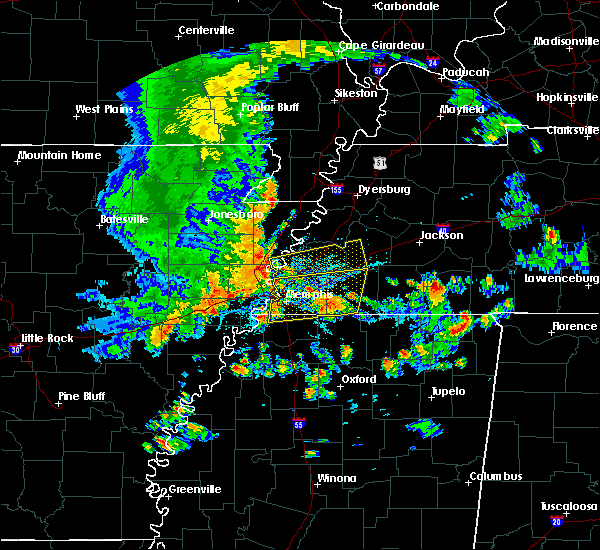 At 456 pm cdt, a severe thunderstorm was located near eads, or 11 miles northeast of collierville, moving east at 40 mph (radar indicated). Hazards include 70 mph wind gusts. Expect considerable tree damage. damage is likely to mobile homes, roofs and outbuildings. Locations impacted include, bartlett, collierville, germantown, cordova, lakeland, arlington, somerville, eads, warren, macon, oakland, piperton, gallaway, rossville, moscow, williston, braden, hays crossing, brunswick and kirk. At 456 pm cdt, a severe thunderstorm was located near eads, or 11 miles northeast of collierville, moving east at 40 mph (radar indicated). Hazards include 70 mph wind gusts. Expect considerable tree damage. damage is likely to mobile homes, roofs and outbuildings. Locations impacted include, bartlett, collierville, germantown, cordova, lakeland, arlington, somerville, eads, warren, macon, oakland, piperton, gallaway, rossville, moscow, williston, braden, hays crossing, brunswick and kirk.
|
| 8/5/2015 4:42 PM CDT | Trees down near walnut grove roa in shelby county TN, 0.3 miles SW of Germantown, TN |
| 8/5/2015 4:41 PM CDT |
 At 440 pm cdt, a severe thunderstorm was located over southwest memphis, or near t o fuller state park, moving east at 40 mph (radar indicated). Hazards include 70 mph wind gusts. Expect considerable tree damage. Damage is likely to mobile homes, roofs and outbuildings. At 440 pm cdt, a severe thunderstorm was located over southwest memphis, or near t o fuller state park, moving east at 40 mph (radar indicated). Hazards include 70 mph wind gusts. Expect considerable tree damage. Damage is likely to mobile homes, roofs and outbuildings.
|
| 7/14/2015 4:16 PM CDT |
 At 414 pm cdt, a severe thunderstorm was located over eads, or near cordova, moving southeast at 50 mph (trained weather spotters). Hazards include 70 mph wind gusts. Expect considerable tree damage. damage is likely to mobile homes, roofs and outbuildings. Locations impacted include, bartlett, southaven, collierville, germantown, olive branch, west memphis, horn lake, marion, millington, covington, wilson, meeman shelby forest state park, fort pillow state park, t o fuller state park, cordova, lakeland, arlington, munford, somerville and brighton. At 414 pm cdt, a severe thunderstorm was located over eads, or near cordova, moving southeast at 50 mph (trained weather spotters). Hazards include 70 mph wind gusts. Expect considerable tree damage. damage is likely to mobile homes, roofs and outbuildings. Locations impacted include, bartlett, southaven, collierville, germantown, olive branch, west memphis, horn lake, marion, millington, covington, wilson, meeman shelby forest state park, fort pillow state park, t o fuller state park, cordova, lakeland, arlington, munford, somerville and brighton.
|
| 7/14/2015 4:15 PM CDT | Tree down near neshoba roa in shelby county TN, 0.3 miles SW of Germantown, TN |
| 7/14/2015 4:15 PM CDT | Tree down on dogwoo in shelby county TN, 0.3 miles SW of Germantown, TN |
| 7/14/2015 4:08 PM CDT |
 At 407 pm cdt, a severe thunderstorm was located near cordova, moving southeast at 50 mph (radar indicated). Hazards include 60 mph wind gusts. Expect damage to roofs. Siding and trees. At 407 pm cdt, a severe thunderstorm was located near cordova, moving southeast at 50 mph (radar indicated). Hazards include 60 mph wind gusts. Expect damage to roofs. Siding and trees.
|
| 7/14/2015 3:52 PM CDT |
 At 351 pm cdt, a severe thunderstorm was located near millington, moving southeast at 50 mph (trained weather spotters). Hazards include 70 mph wind gusts. Expect considerable tree damage. Damage is likely to mobile homes, roofs and outbuildings. At 351 pm cdt, a severe thunderstorm was located near millington, moving southeast at 50 mph (trained weather spotters). Hazards include 70 mph wind gusts. Expect considerable tree damage. Damage is likely to mobile homes, roofs and outbuildings.
|
| 6/29/2015 11:52 PM CDT |
 At 1151 pm cdt, a severe thunderstorm was located over whitehaven, or near memphis international airport, moving east at 15 mph (radar indicated). Hazards include quarter size hail. Damage to vehicles is expected. Locations impacted include, southaven, collierville, germantown, olive branch, horn lake, memphis, byhalia, lynchburg, southeast memphis, southwest memphis, whitehaven, fairhaven, handy corner, cedarview, capleville, plum point, coal oil corner, alden, jago and miller. At 1151 pm cdt, a severe thunderstorm was located over whitehaven, or near memphis international airport, moving east at 15 mph (radar indicated). Hazards include quarter size hail. Damage to vehicles is expected. Locations impacted include, southaven, collierville, germantown, olive branch, horn lake, memphis, byhalia, lynchburg, southeast memphis, southwest memphis, whitehaven, fairhaven, handy corner, cedarview, capleville, plum point, coal oil corner, alden, jago and miller.
|
| 6/29/2015 11:30 PM CDT |
 At 1130 pm cdt, a severe thunderstorm was located over whitehaven, or near southaven, moving east at 20 mph (radar indicated). Hazards include quarter size hail. damage to vehicles is expected At 1130 pm cdt, a severe thunderstorm was located over whitehaven, or near southaven, moving east at 20 mph (radar indicated). Hazards include quarter size hail. damage to vehicles is expected
|
| 6/29/2015 11:22 PM CDT |
 At 1121 pm cdt, a severe thunderstorm was located over far south memphis, or near southaven, moving east at 20 mph (radar indicated). Hazards include 60 mph wind gusts and quarter size hail. Hail damage to vehicles is expected. expect wind damage to roofs, siding and trees. Locations impacted include, southaven, collierville, germantown, olive branch, west memphis, horn lake, cordova, t o fuller state park, memphis, downtown memphis, midtown memphis, whitehaven, lynchburg, southeast memphis, southwest memphis, galet, bridge junction, plum point, briark and lake view. At 1121 pm cdt, a severe thunderstorm was located over far south memphis, or near southaven, moving east at 20 mph (radar indicated). Hazards include 60 mph wind gusts and quarter size hail. Hail damage to vehicles is expected. expect wind damage to roofs, siding and trees. Locations impacted include, southaven, collierville, germantown, olive branch, west memphis, horn lake, cordova, t o fuller state park, memphis, downtown memphis, midtown memphis, whitehaven, lynchburg, southeast memphis, southwest memphis, galet, bridge junction, plum point, briark and lake view.
|
| 6/29/2015 11:11 PM CDT |
 At 1108 pm cdt, a severe thunderstorm was located over southwest memphis, or 5 miles north of southaven, moving east at 25 mph (radar indicated). Hazards include 60 mph wind gusts and quarter size hail. Hail damage to vehicles is expected. expect wind damage to roofs, siding and trees. Locations impacted include, southaven, collierville, germantown, olive branch, west memphis, horn lake, cordova, t o fuller state park, memphis, downtown memphis, midtown memphis, whitehaven, lynchburg, southeast memphis, southwest memphis, galet, bridge junction, plum point, briark and lake view. At 1108 pm cdt, a severe thunderstorm was located over southwest memphis, or 5 miles north of southaven, moving east at 25 mph (radar indicated). Hazards include 60 mph wind gusts and quarter size hail. Hail damage to vehicles is expected. expect wind damage to roofs, siding and trees. Locations impacted include, southaven, collierville, germantown, olive branch, west memphis, horn lake, cordova, t o fuller state park, memphis, downtown memphis, midtown memphis, whitehaven, lynchburg, southeast memphis, southwest memphis, galet, bridge junction, plum point, briark and lake view.
|
| 6/29/2015 10:47 PM CDT |
 At 1047 pm cdt, a severe thunderstorm was located over downtown memphis, or near t o fuller state park, moving east at 30 mph (radar indicated). Hazards include 60 mph wind gusts and quarter size hail. Hail damage to vehicles is expected. Expect wind damage to roofs, siding and trees. At 1047 pm cdt, a severe thunderstorm was located over downtown memphis, or near t o fuller state park, moving east at 30 mph (radar indicated). Hazards include 60 mph wind gusts and quarter size hail. Hail damage to vehicles is expected. Expect wind damage to roofs, siding and trees.
|
| 6/29/2015 9:56 PM CDT |
 The severe thunderstorm warning for southwestern fayette and southeastern shelby counties will expire at 1000 pm cdt, the storm which prompted the warning has weakened below severe limits, and no longer poses an immediate threat to life or property. therefore the warning will be allowed to expire. however small hail is still possible with this thunderstorm. The severe thunderstorm warning for southwestern fayette and southeastern shelby counties will expire at 1000 pm cdt, the storm which prompted the warning has weakened below severe limits, and no longer poses an immediate threat to life or property. therefore the warning will be allowed to expire. however small hail is still possible with this thunderstorm.
|
| 6/29/2015 9:41 PM CDT |
 At 940 pm cdt, a severe thunderstorm was located over collierville, moving southeast at 15 mph (radar indicated). Hazards include quarter size hail. Damage to vehicles is expected. Locations impacted include, collierville, germantown, cordova, lakeland, piperton, rossville, elba, fisherville, hays crossing, kirk, lenow, canadaville and hickory withe. At 940 pm cdt, a severe thunderstorm was located over collierville, moving southeast at 15 mph (radar indicated). Hazards include quarter size hail. Damage to vehicles is expected. Locations impacted include, collierville, germantown, cordova, lakeland, piperton, rossville, elba, fisherville, hays crossing, kirk, lenow, canadaville and hickory withe.
|
| 6/29/2015 9:18 PM CDT |
 At 918 pm cdt, a severe thunderstorm was located near germantown, moving southeast at 15 mph (radar indicated). Hazards include quarter size hail. damage to vehicles is expected At 918 pm cdt, a severe thunderstorm was located near germantown, moving southeast at 15 mph (radar indicated). Hazards include quarter size hail. damage to vehicles is expected
|
| 6/8/2015 10:04 PM CDT | At 1004 pm cdt, a severe thunderstorm was located near collierville, moving east at 30 mph (radar indicated). Hazards include 60 mph wind gusts and half dollar size hail. Hail damage to vehicles is expected. Expect wind damage to roofs, siding and trees. |
| 6/8/2015 10:04 PM CDT | At 1004 pm cdt, a severe thunderstorm was located near collierville, moving east at 30 mph (radar indicated). Hazards include 60 mph wind gusts and half dollar size hail. Hail damage to vehicles is expected. Expect wind damage to roofs, siding and trees. |
| 3/31/2015 11:53 PM CDT | The national weather service in memphis has issued a * severe thunderstorm warning for. northeastern desoto county in northwestern mississippi. northern marshall county in northwestern mississippi. southern fayette county in southwestern tennessee. Southeastern shelby county in southwestern tennessee. |
| 3/31/2015 11:53 PM CDT | The national weather service in memphis has issued a * severe thunderstorm warning for. northeastern desoto county in northwestern mississippi. northern marshall county in northwestern mississippi. southern fayette county in southwestern tennessee. Southeastern shelby county in southwestern tennessee. |
| 3/31/2015 11:18 PM CDT | The national weather service in memphis has issued a * severe thunderstorm warning for. northern marshall county in northwestern mississippi. southwestern fayette county in southwestern tennessee. southeastern shelby county in southwestern tennessee. Until midnight cdt. |
| 3/31/2015 11:18 PM CDT | The national weather service in memphis has issued a * severe thunderstorm warning for. northern marshall county in northwestern mississippi. southwestern fayette county in southwestern tennessee. southeastern shelby county in southwestern tennessee. Until midnight cdt. |
| 3/31/2015 10:28 PM CDT | The national weather service in memphis has issued a * severe thunderstorm warning for. northern crittenden county in eastern arkansas. shelby county in southwestern tennessee. until 1130 pm cdt * at 1028 pm cdt. Doppler radar indicated a severe thunderstorm. |
| 3/31/2015 10:28 PM CDT | The national weather service in memphis has issued a * severe thunderstorm warning for. northern crittenden county in eastern arkansas. shelby county in southwestern tennessee. until 1130 pm cdt * at 1028 pm cdt. Doppler radar indicated a severe thunderstorm. |
| 7/14/2014 4:30 PM CDT | Trees snapped and some uprooted across railroad tracks at poplar and poplar pike near germantown and collierville borde in shelby county TN, 0.3 miles SW of Germantown, TN |
| 6/5/2014 2:50 PM CDT | Huge tree and powerlines down near houston middle school on johnson r in shelby county TN, 0.3 miles SW of Germantown, TN |
| 12/21/2013 6:25 PM CST | Germantown pkwy and popler estimated 65mph wind along with dime size hai in shelby county TN, 0.3 miles SW of Germantown, TN |
| 12/20/2012 4:30 AM CST | Several trees and a power pole down in the vicinity of forrest hill iren in shelby county TN, 0.3 miles SW of Germantown, TN |
| 6/11/2012 4:49 PM CDT | Large tree down in fox meadows golf course near clark rd in shelby county TN, 0.3 miles SW of Germantown, TN |
| 6/11/2012 4:38 PM CDT | A storm spotter has reported a tree down along farm road on shelby farms in east memphis with another tree down along shady grove road near south of walnut grove roa in shelby county TN, 2.1 miles E of Germantown, TN |
| 6/11/2012 3:50 PM CDT | Powerlines down on poplar and miller farm in shelby county TN, 1 miles SSE of Germantown, TN |
| 6/11/2012 3:49 PM CDT | Large tree down in fox meadows golf course near clark rd in shelby county TN, 0.3 miles SW of Germantown, TN |
| 6/11/2012 3:48 PM CDT | A storm spotter has reported a tree down along farm road on shelby farms in east memphis with another tree down along shady grove road near south of walnut grove roa in shelby county TN, 2.1 miles E of Germantown, TN |
| 1/1/0001 12:00 AM | Storm damage reported in shelby county TN, 0.3 miles SW of Germantown, TN |
| 1/1/0001 12:00 AM | Estimated 65 mph wind gust at national weather service forecast offic in shelby county TN, 0.3 miles SW of Germantown, TN |
| 6/16/2011 7:15 PM CDT | Quarter sized hail reported 0.3 miles SW of Germantown, TN |
| 1/1/0001 12:00 AM | Quarter sized hail reported 2.5 miles SSE of Germantown, TN |
| 6/16/2011 7:12 PM CDT | Hen Egg sized hail reported 1.2 miles SW of Germantown, TN, 2.25 inch hail in germantown. |
| 6/16/2011 7:11 PM CDT | Hen Egg sized hail reported 0.3 miles SW of Germantown, TN |
| 1/1/0001 12:00 AM | Quarter sized hail reported 1.4 miles W of Germantown, TN |
| 6/16/2011 7:05 PM CDT | Ping Pong Ball sized hail reported 0.3 miles SW of Germantown, TN, quarter to ping pong ball size hail. started at about 705 pm and lasted for about 5 minutes. |
| 1/1/0001 12:00 AM | Large tree down in yar in shelby county TN, 0.3 miles SW of Germantown, TN |
| 1/1/0001 12:00 AM | Quarter sized hail reported 0.3 miles SW of Germantown, TN, kimbrough and poplar |
| 1/1/0001 12:00 AM | A tree was down greater than 12 inches in diamete in shelby county TN, 0.3 miles SW of Germantown, TN |
| 1/1/0001 12:00 AM | Trees down on house...trapping occupan in shelby county TN, 1.2 miles SW of Germantown, TN |
| 1/1/0001 12:00 AM | Stoplight damaged at poplar avenue and germantown roa in shelby county TN, 0.3 miles SW of Germantown, TN |
Hail Maps for Germantown, TN
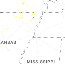


Connect with Interactive Hail Maps