

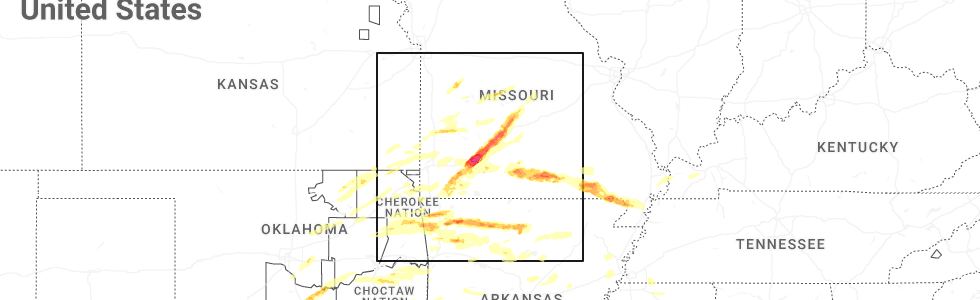
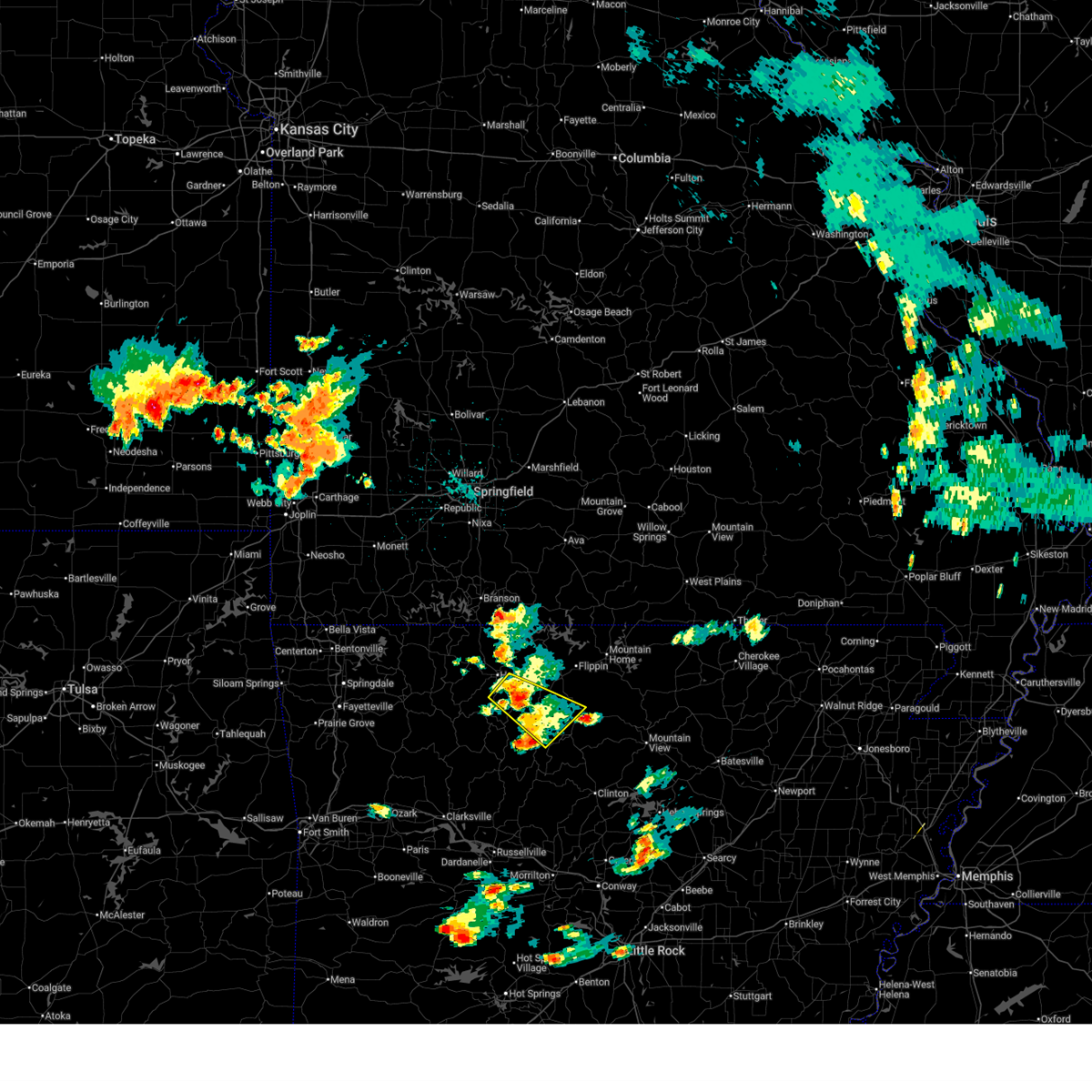
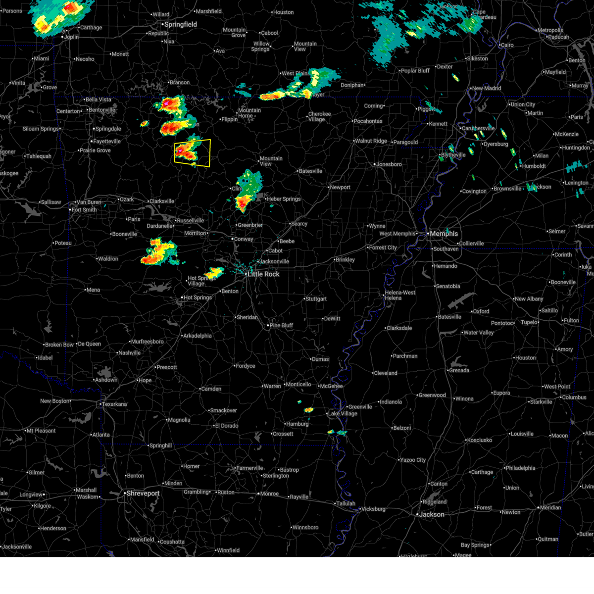
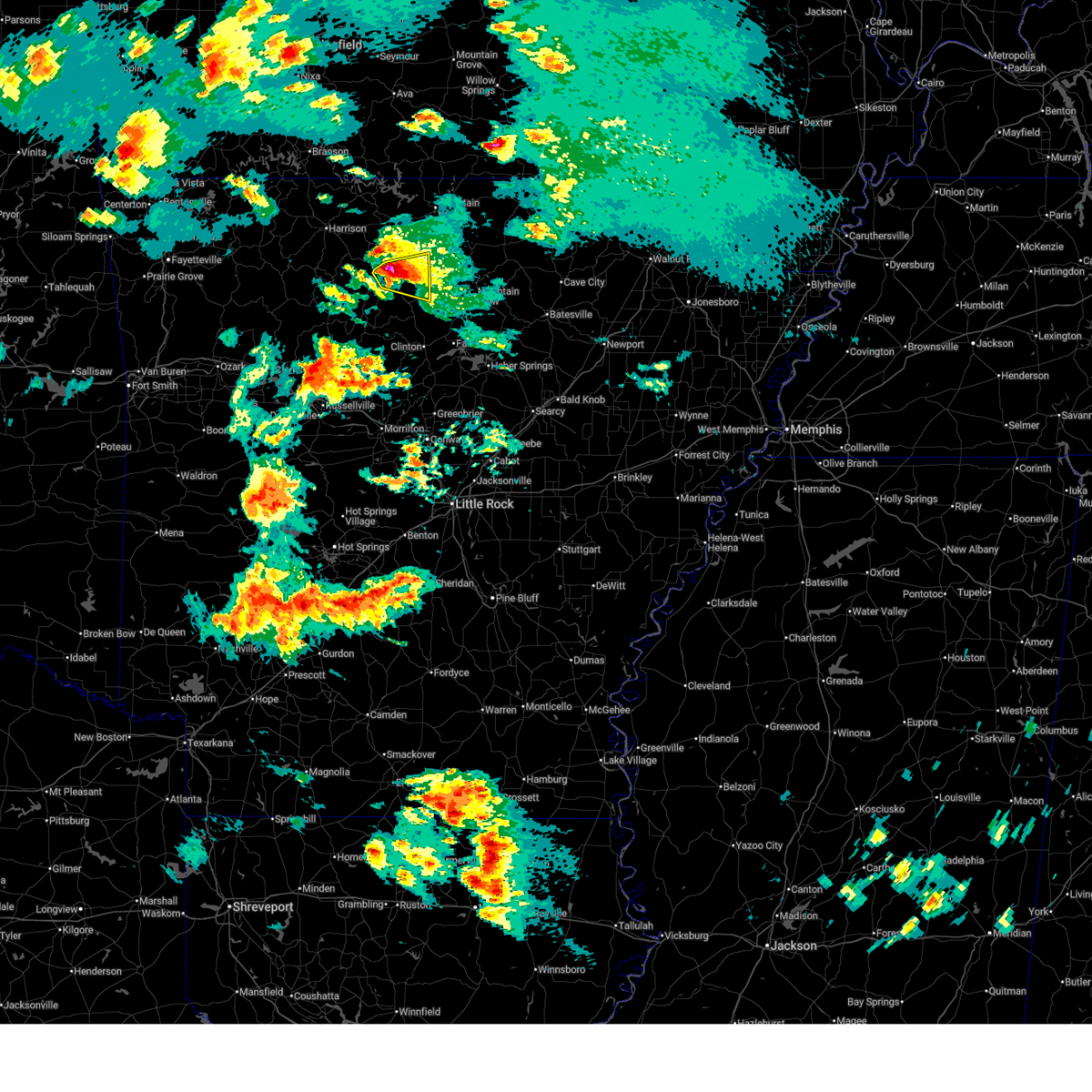
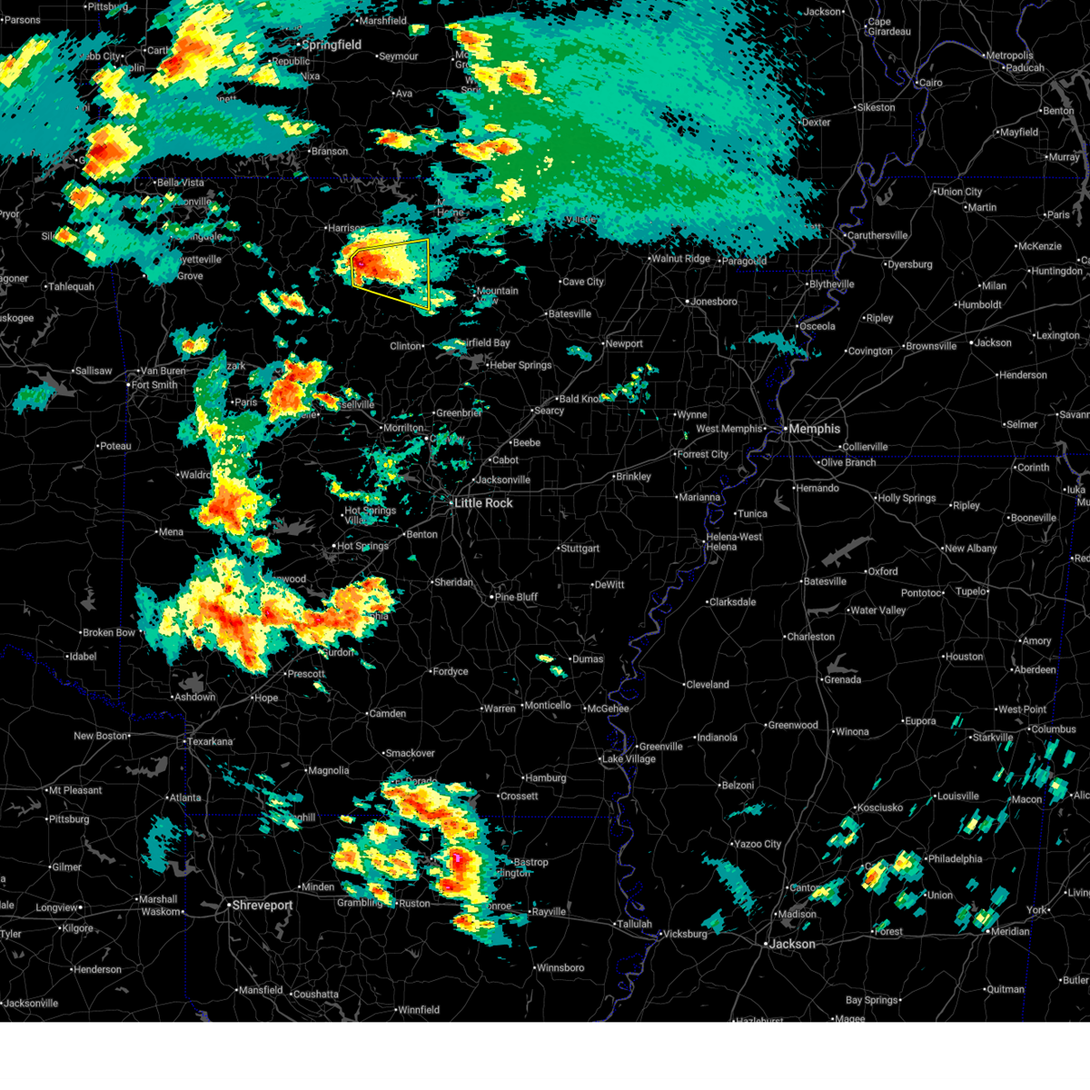
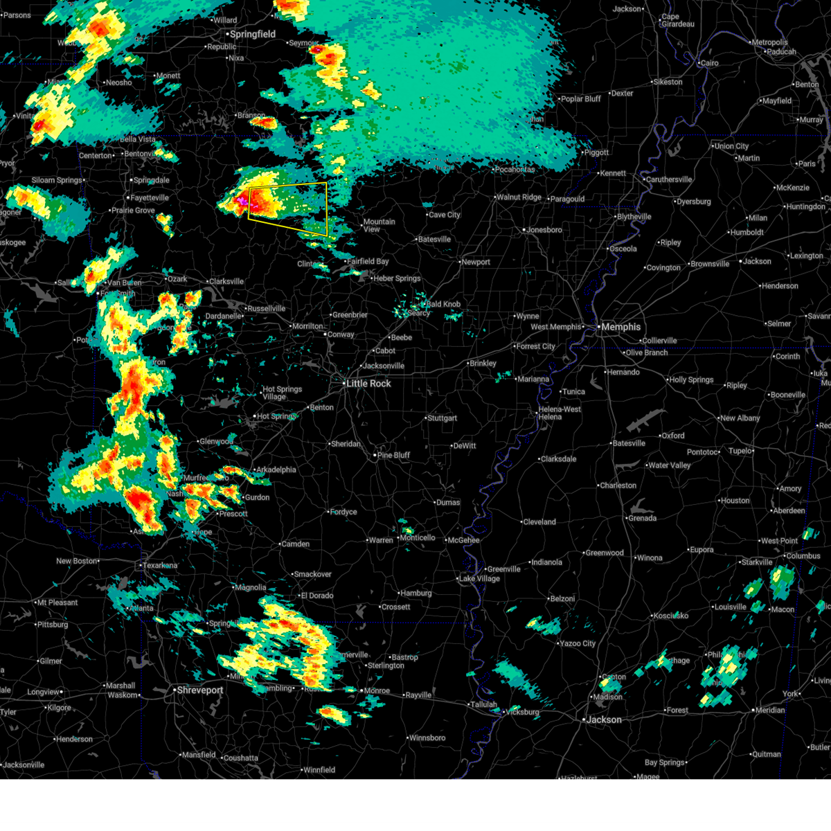
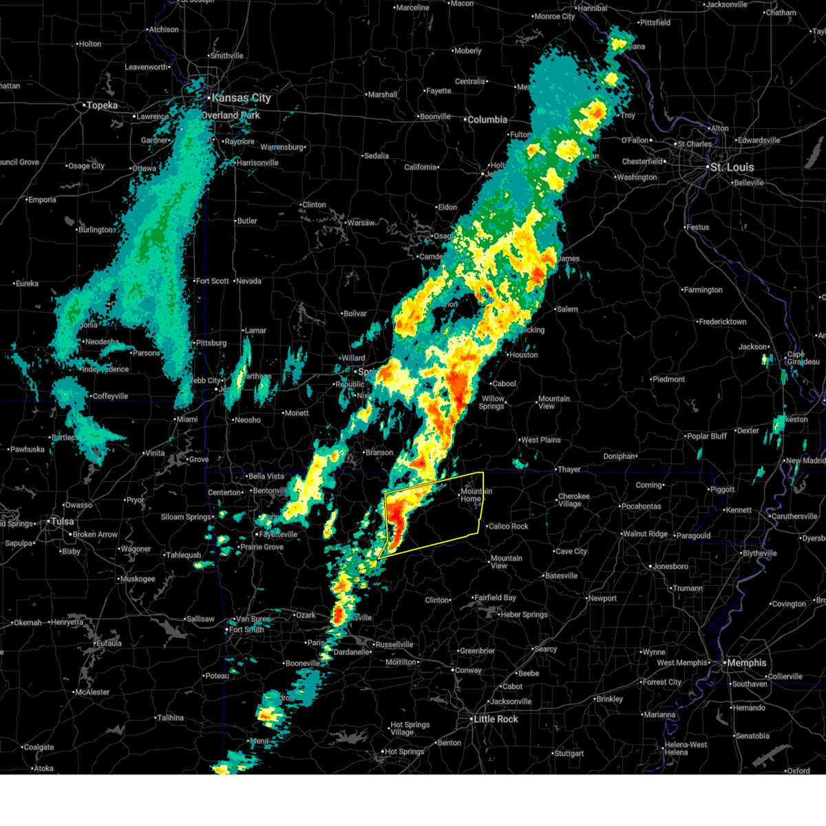
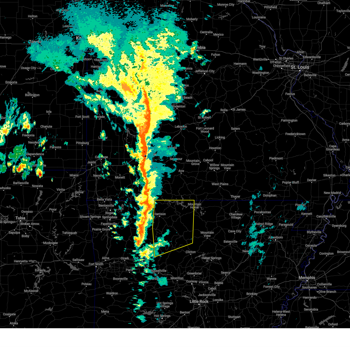
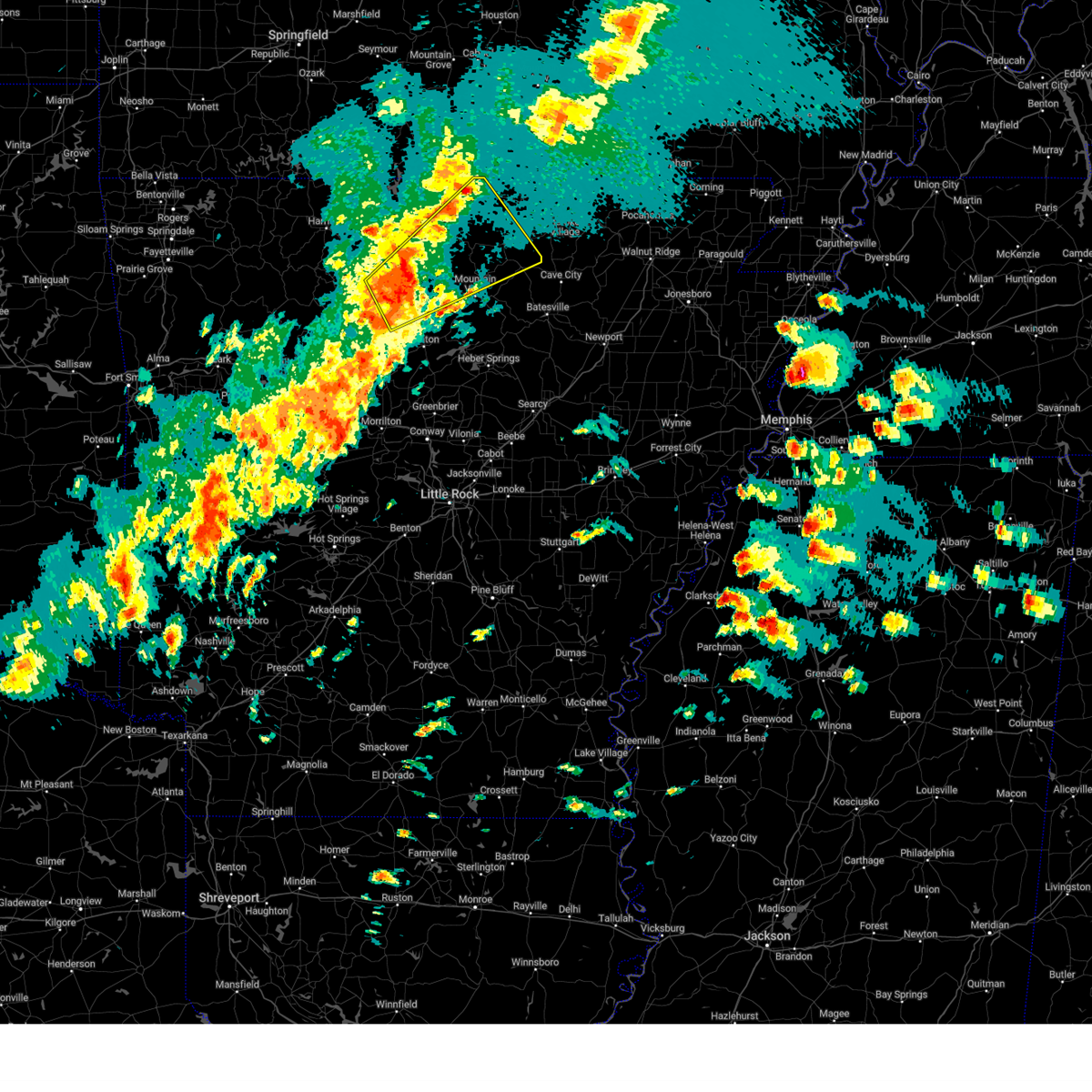
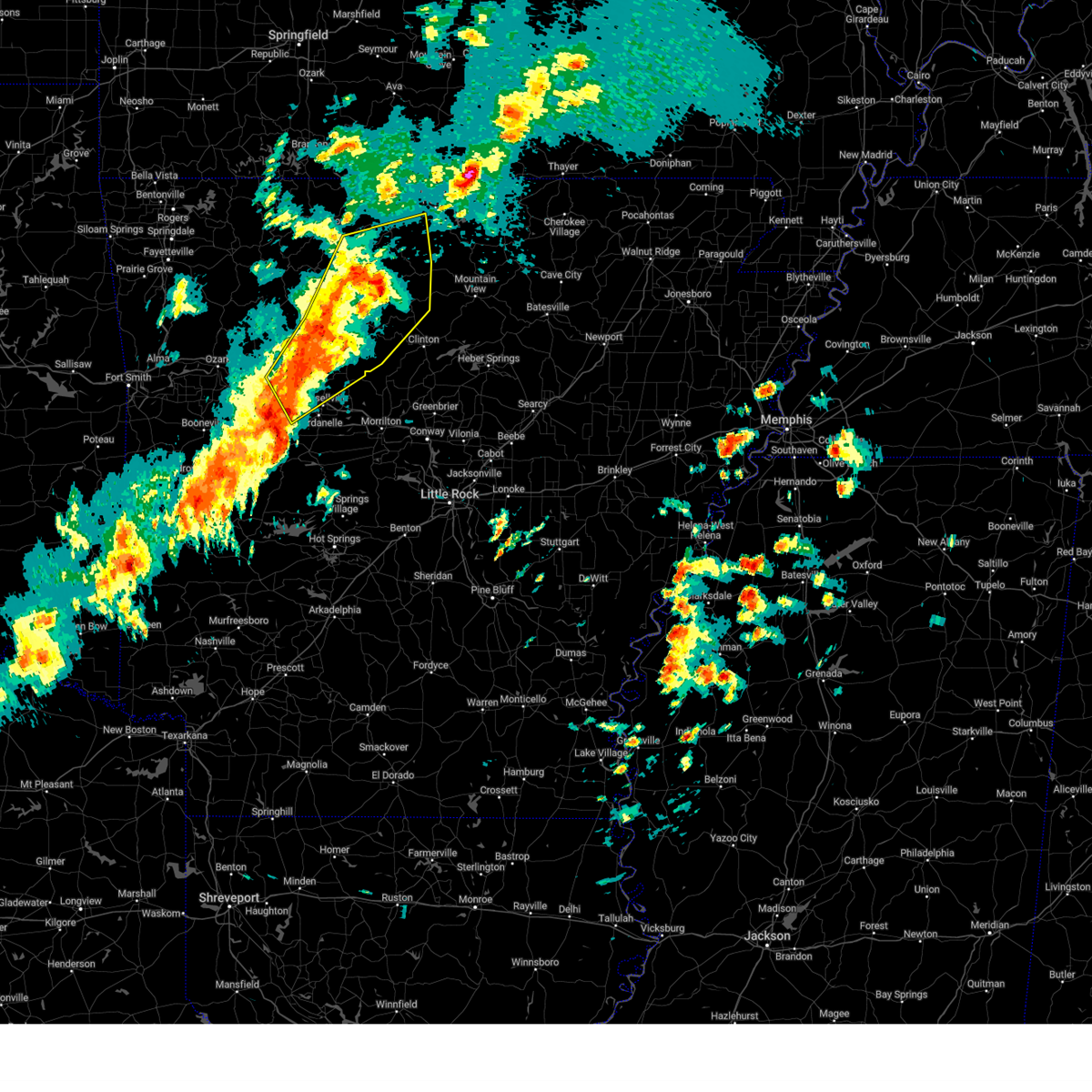
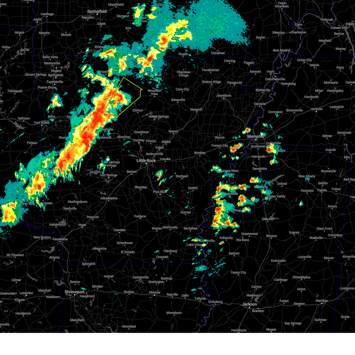
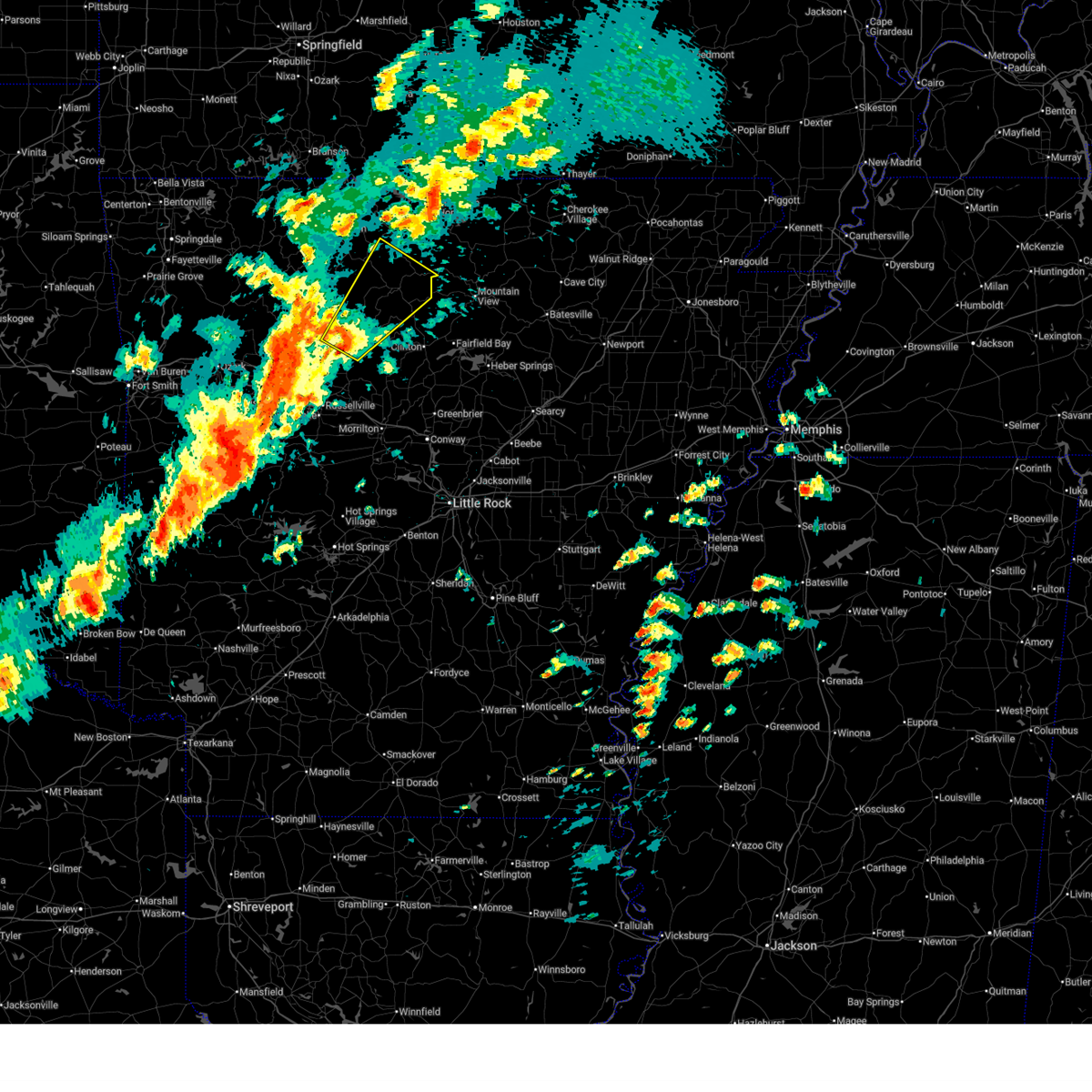
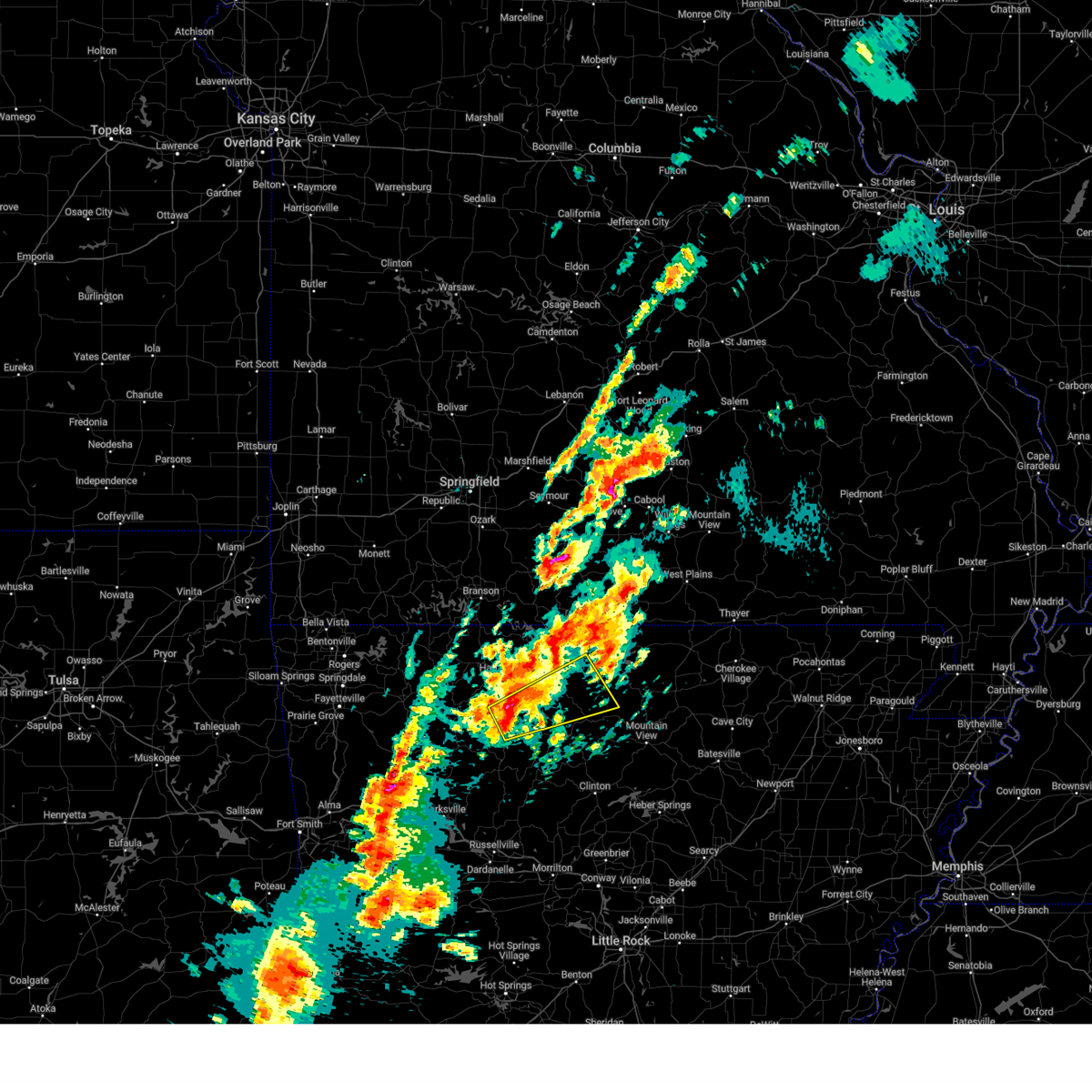
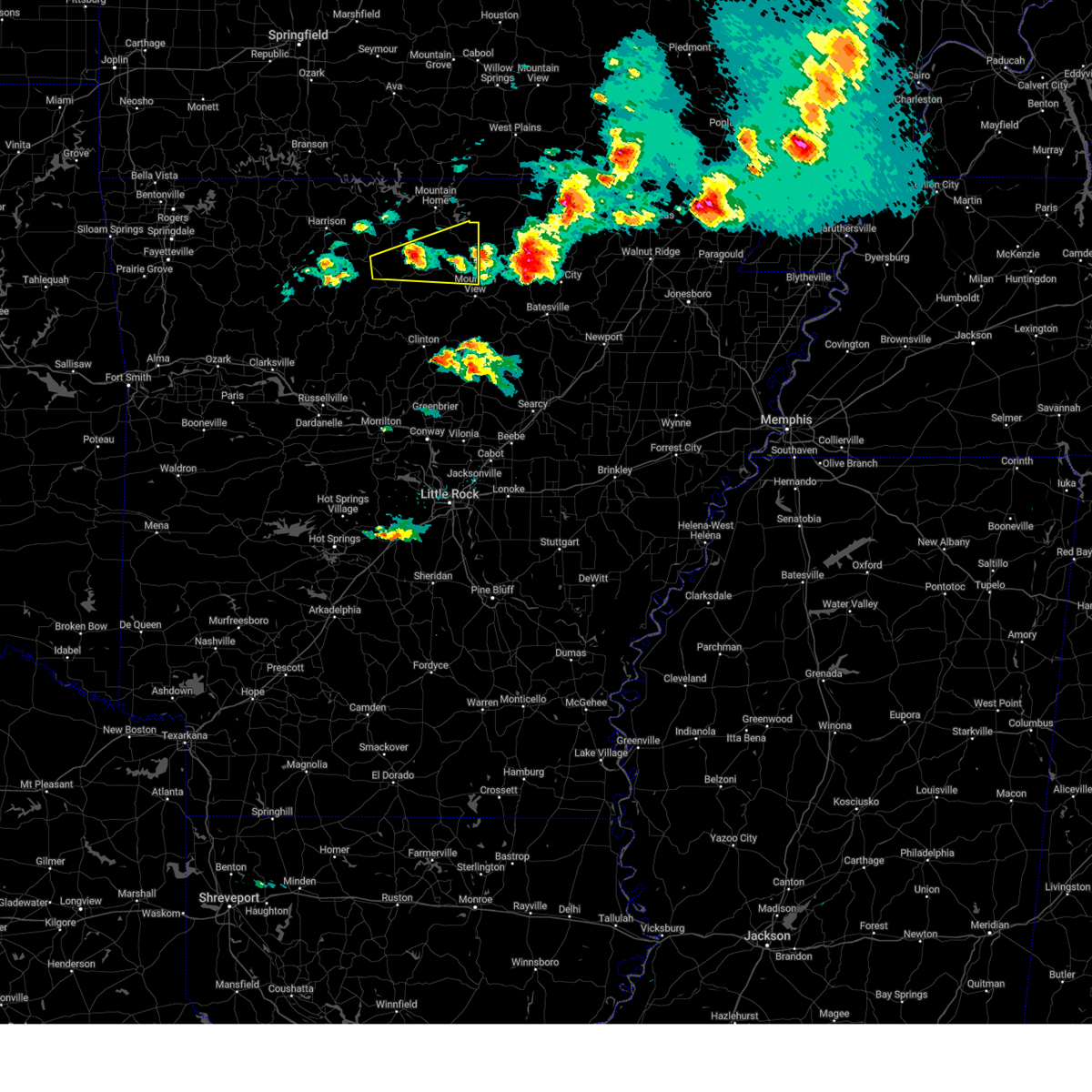
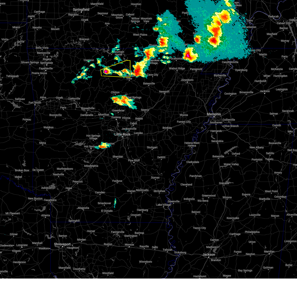
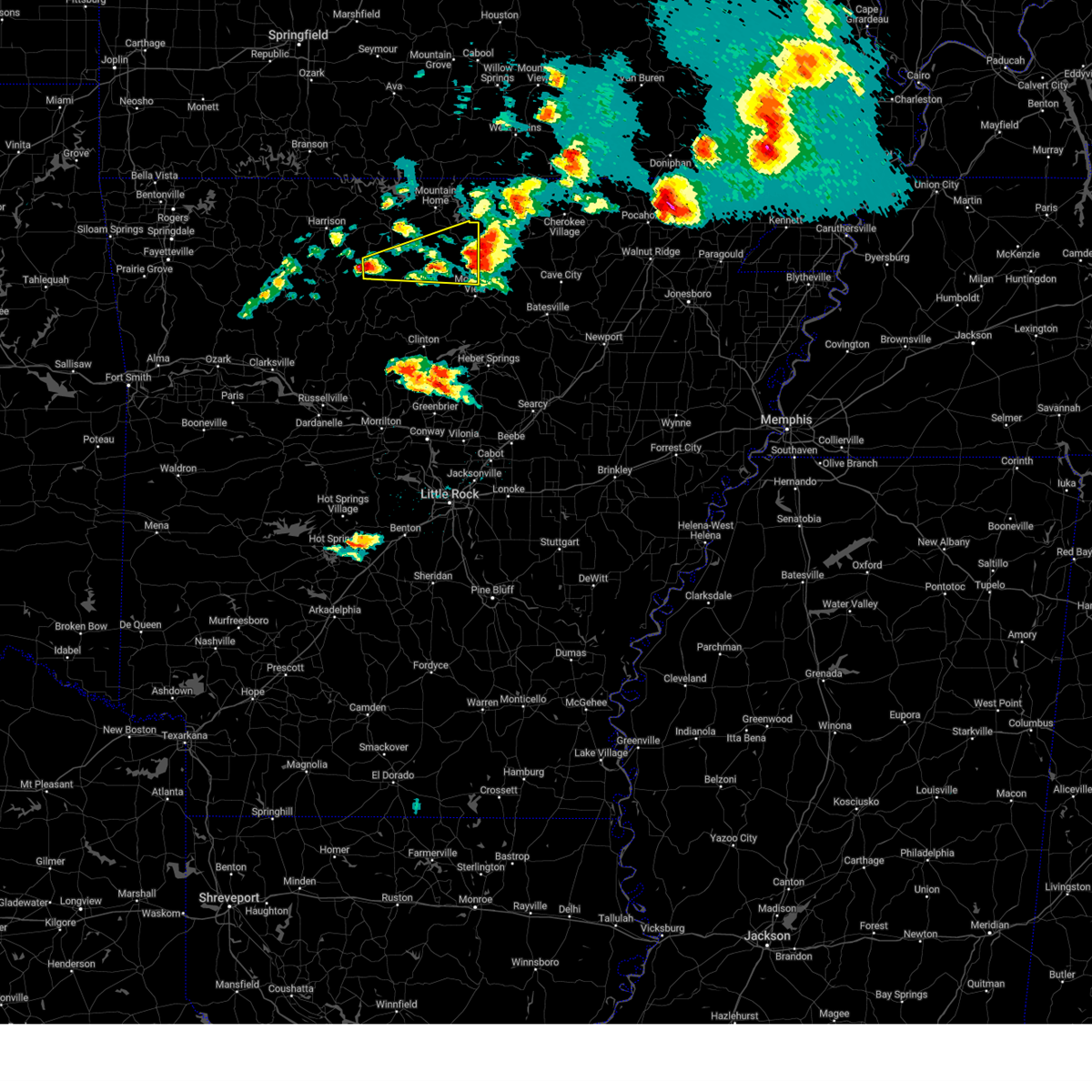
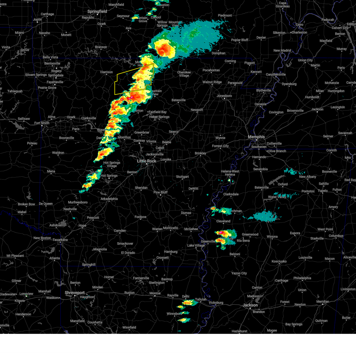
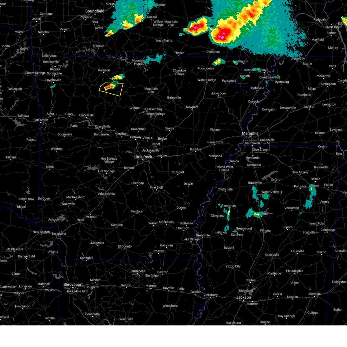
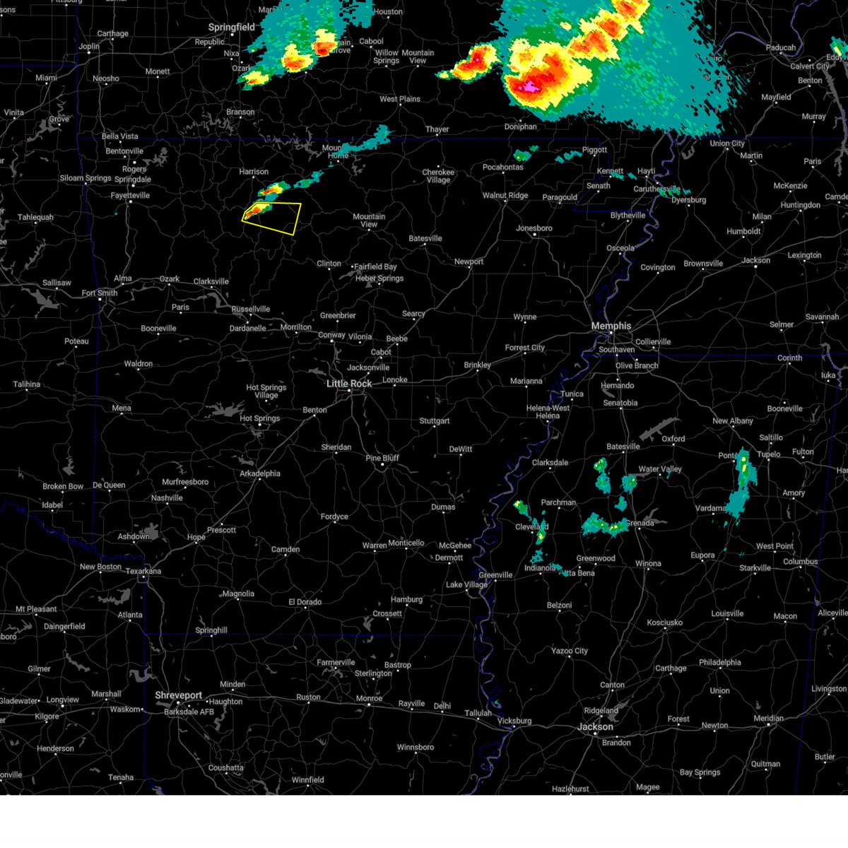
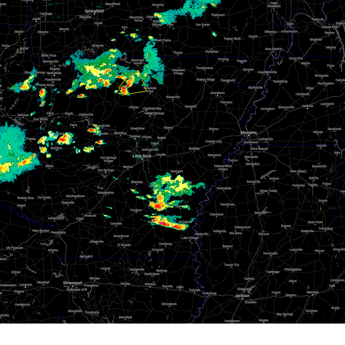
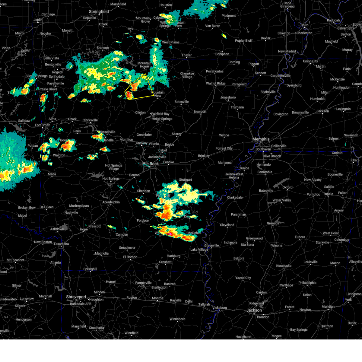
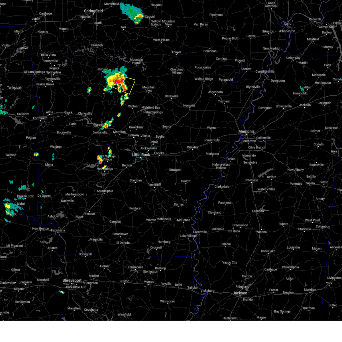
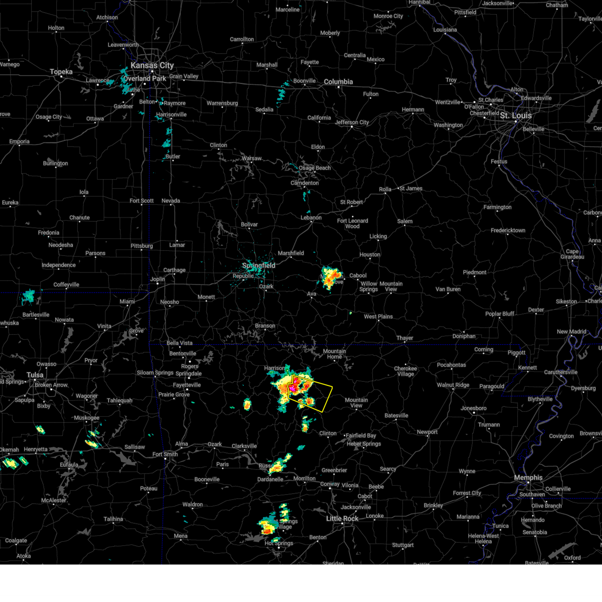
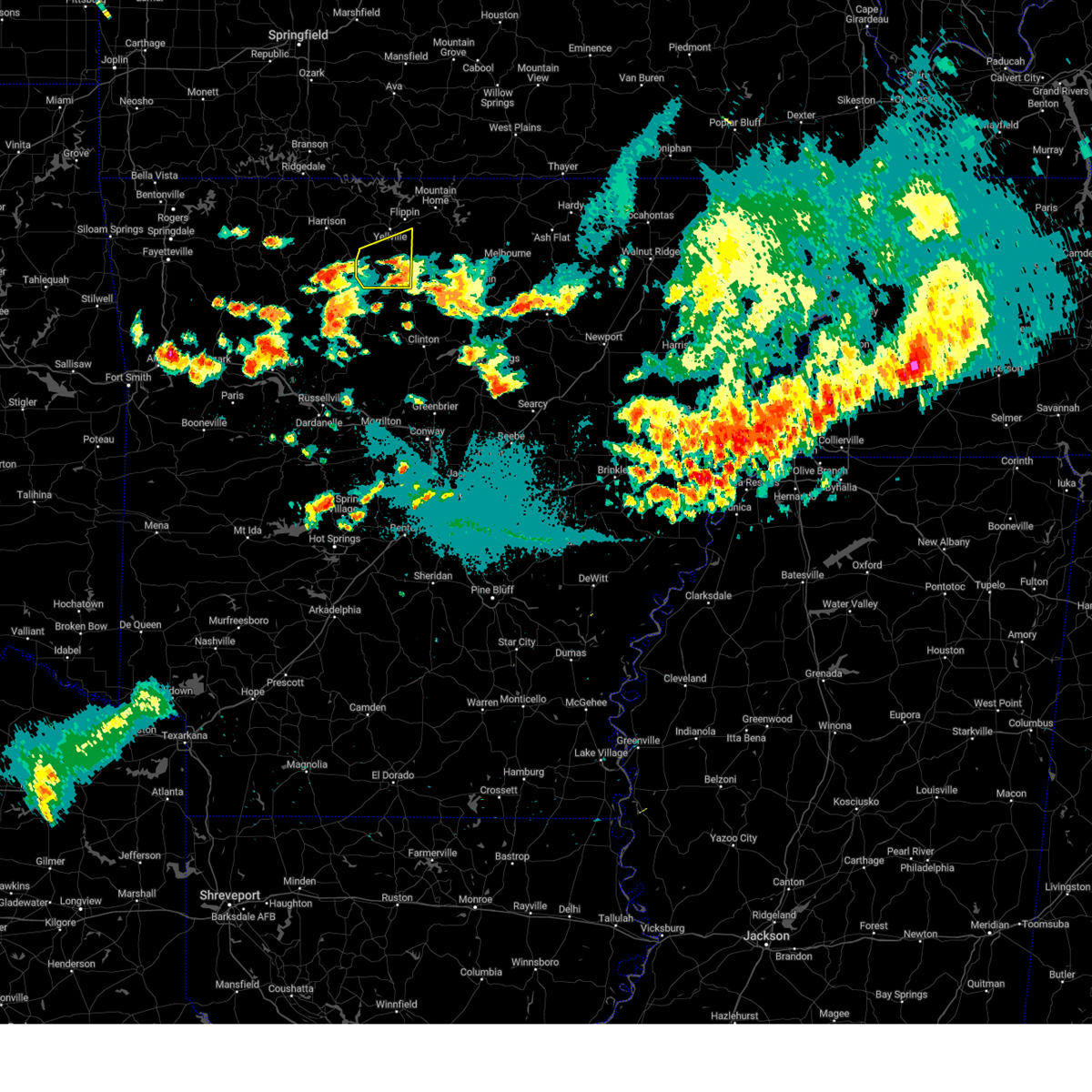
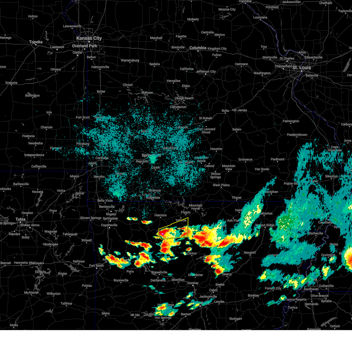
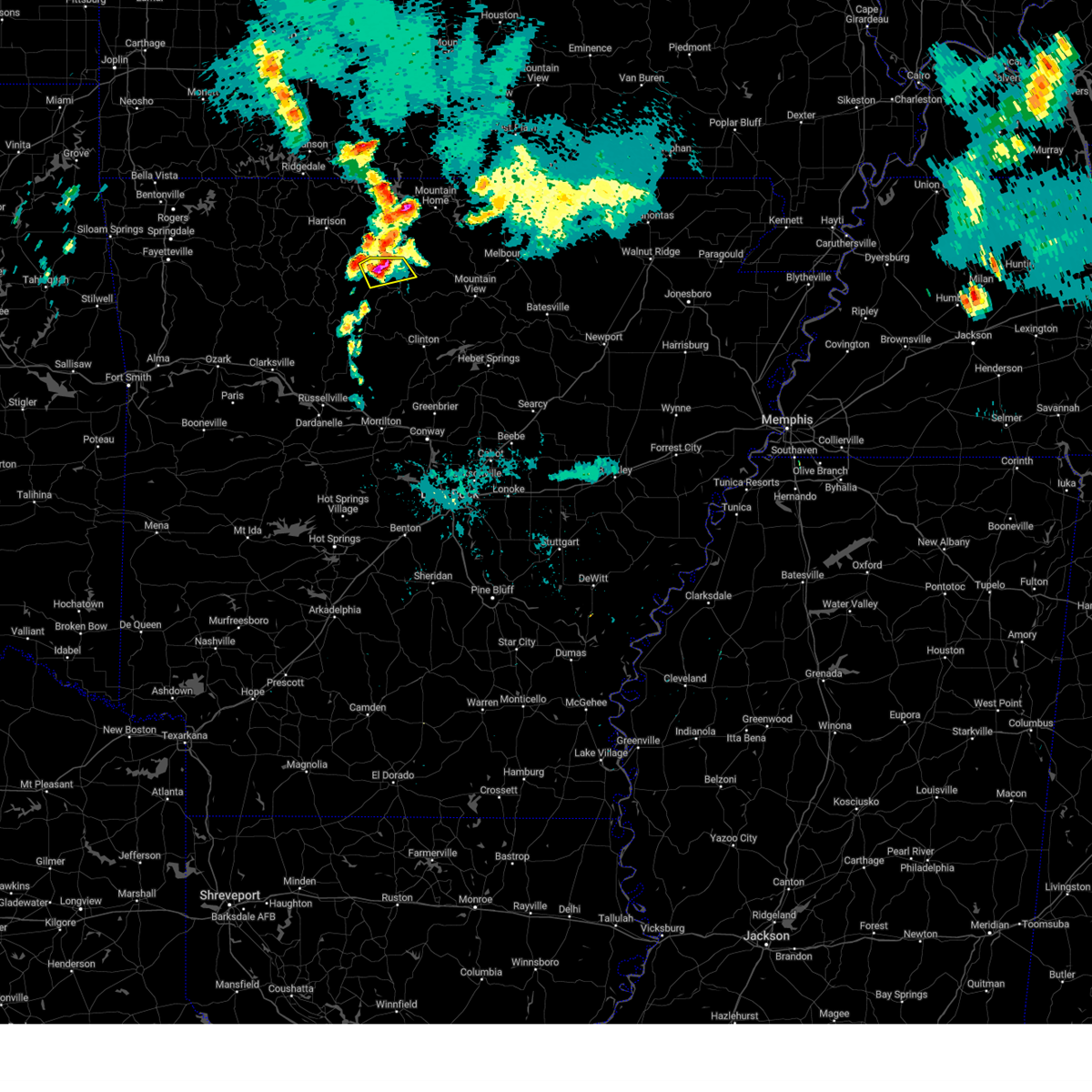
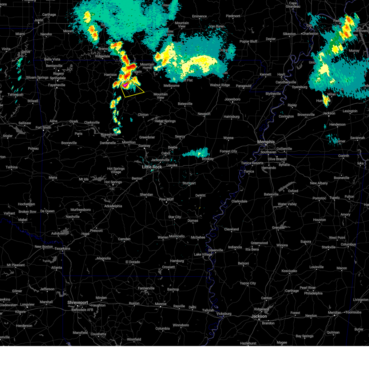
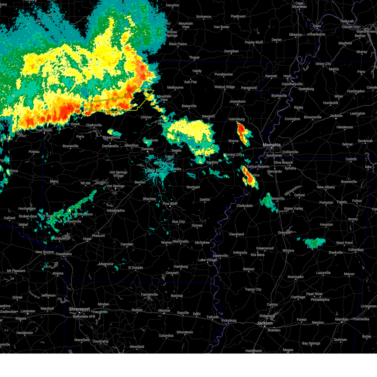
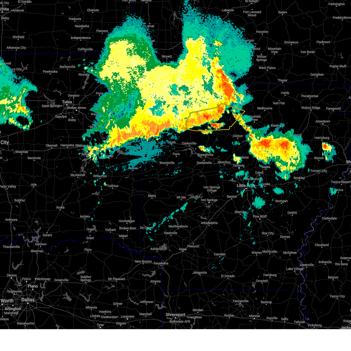
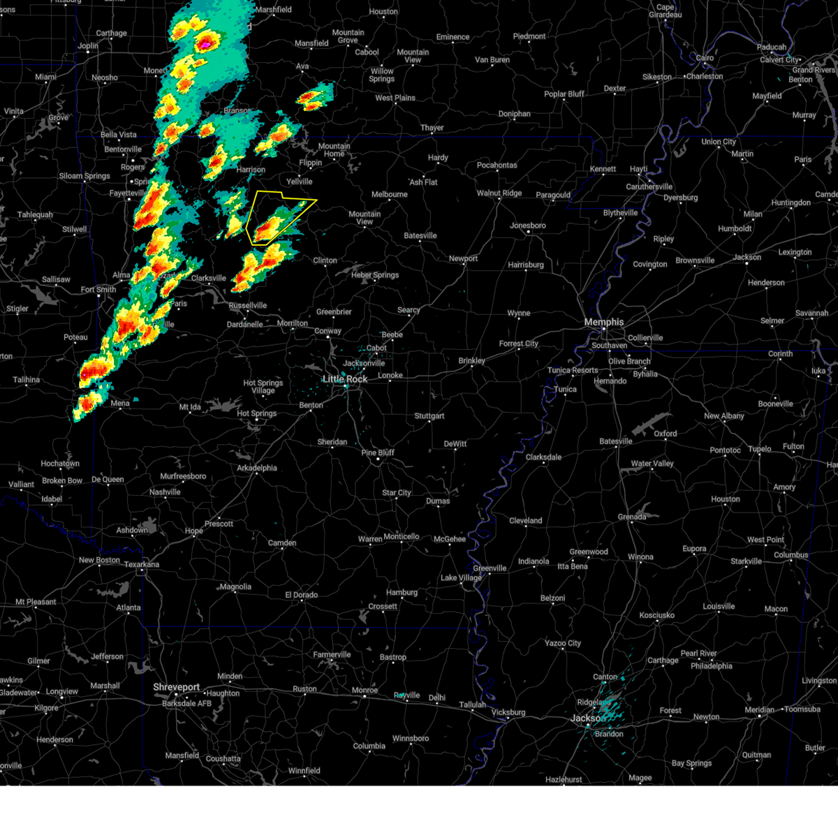
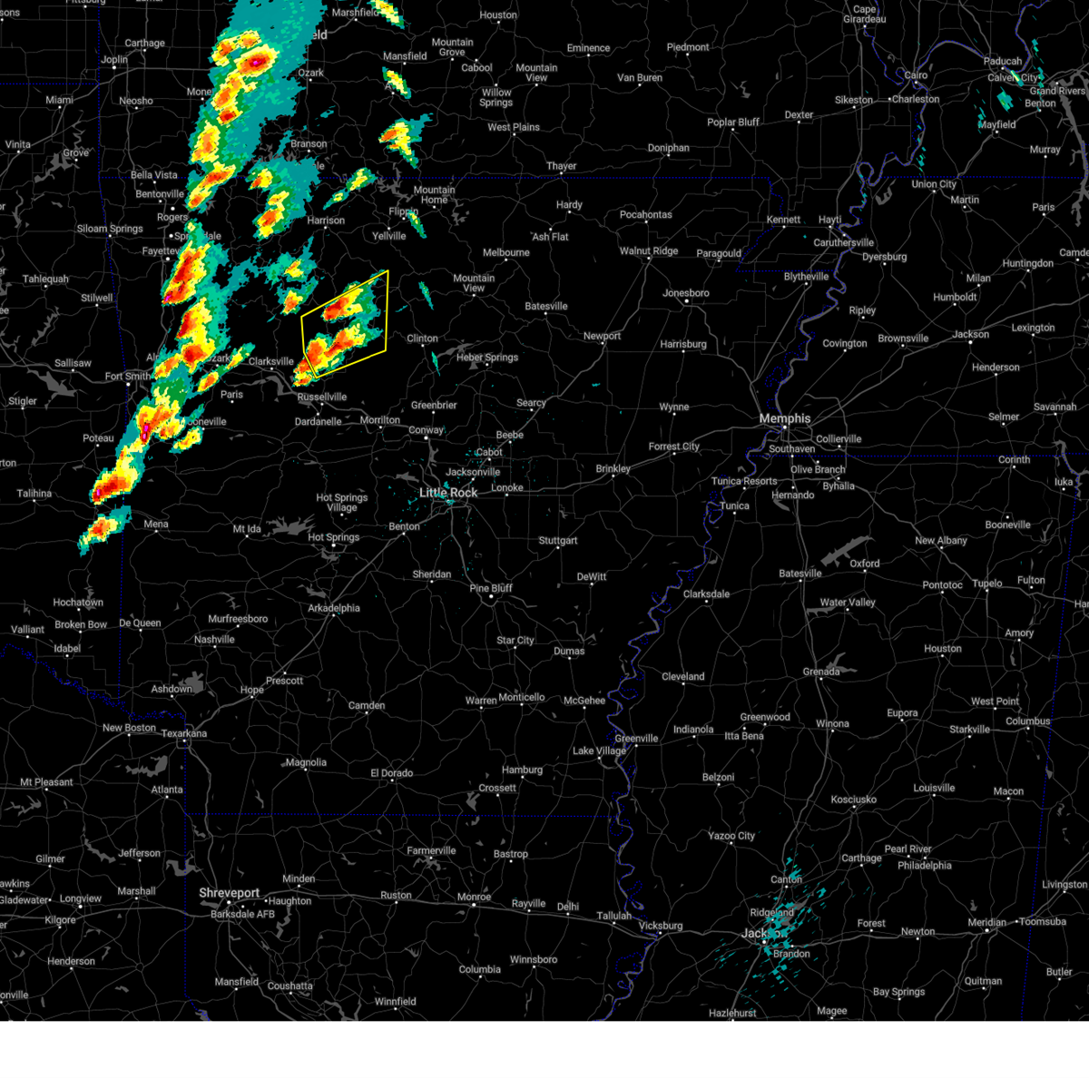
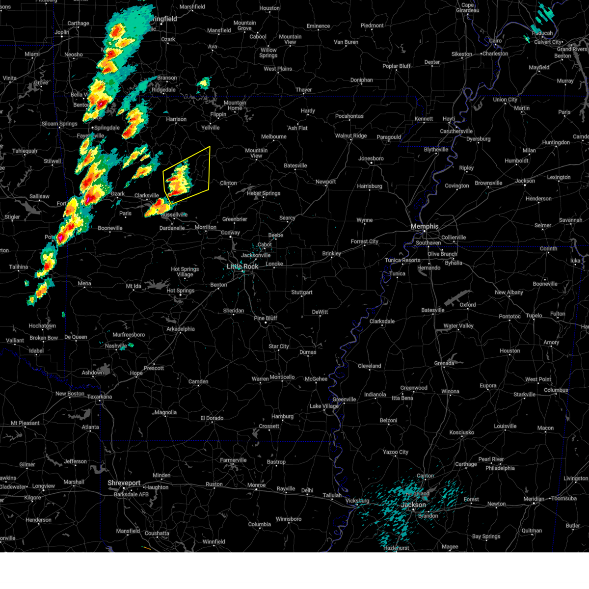
Hail Map for Gilbert, AR
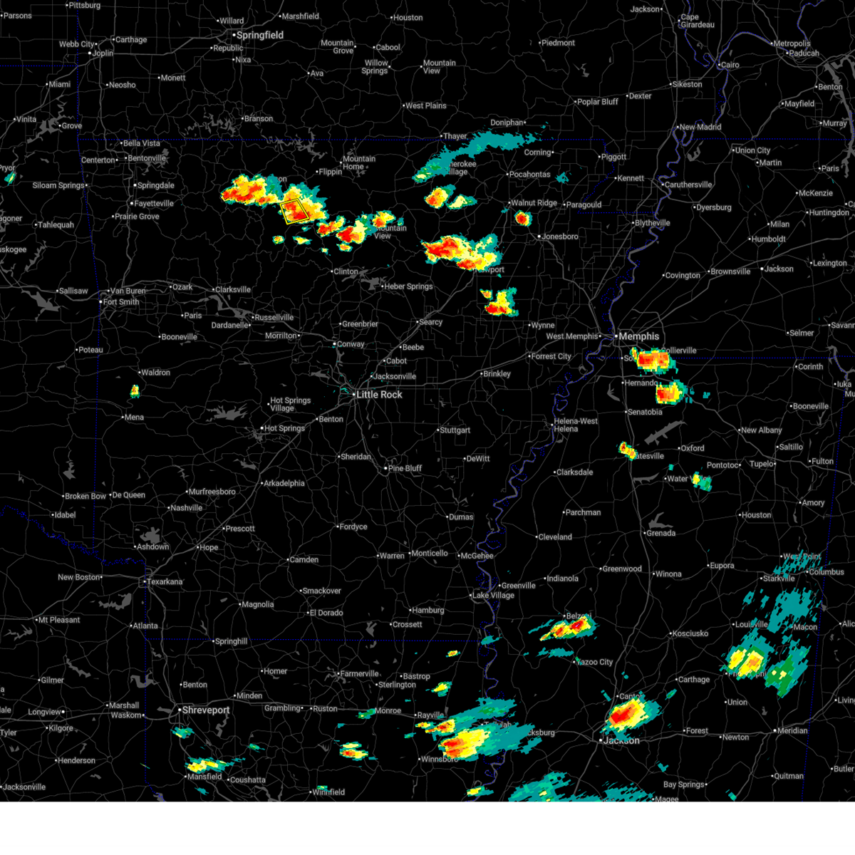
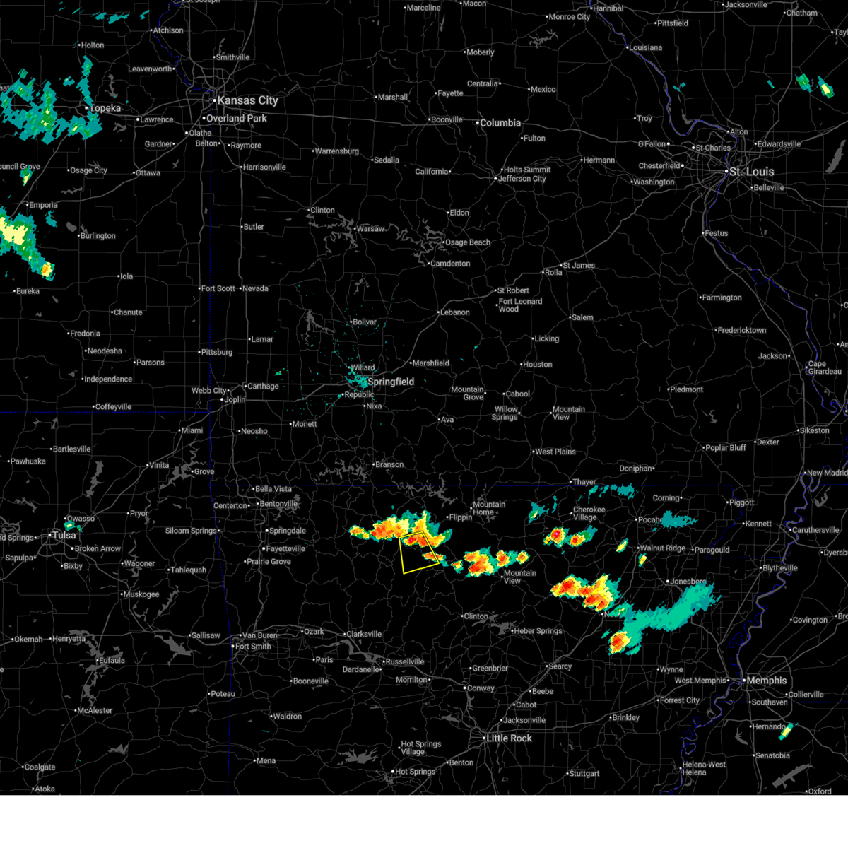
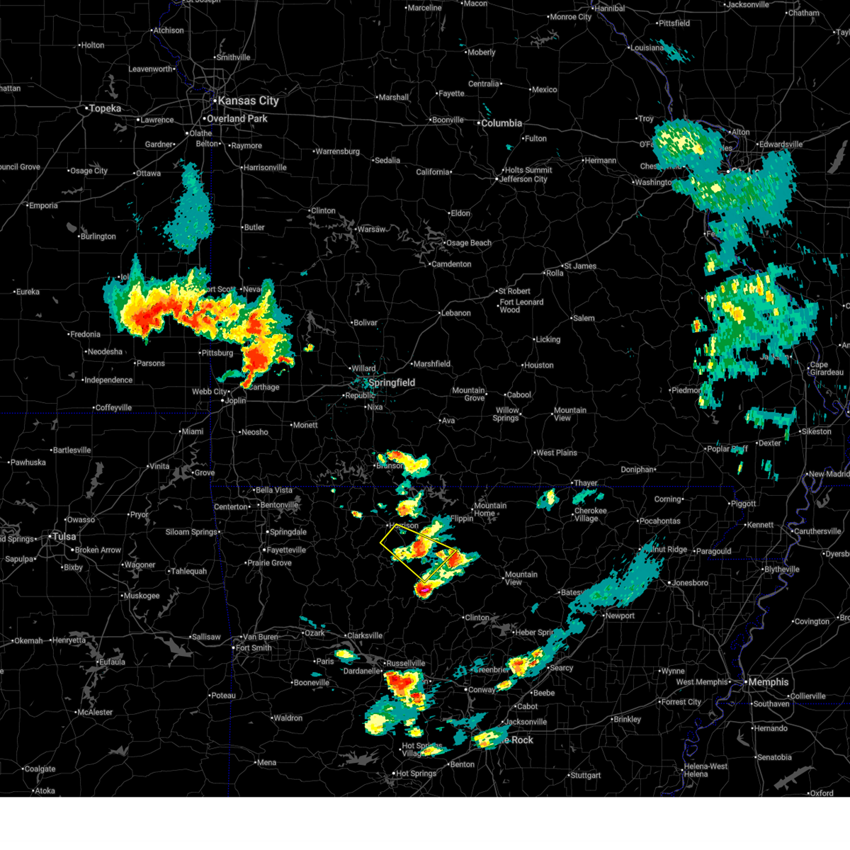
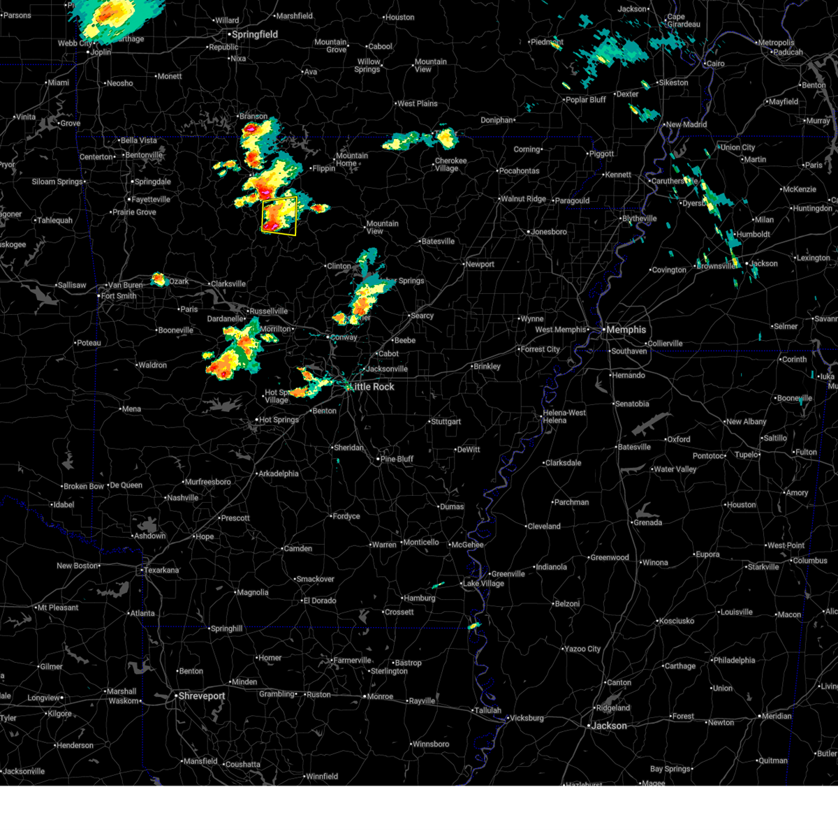
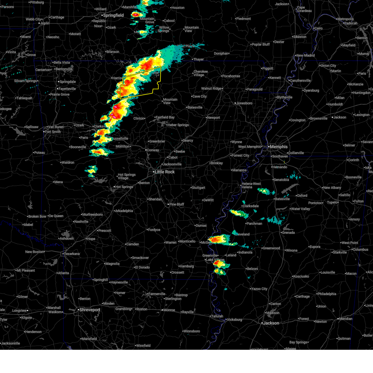
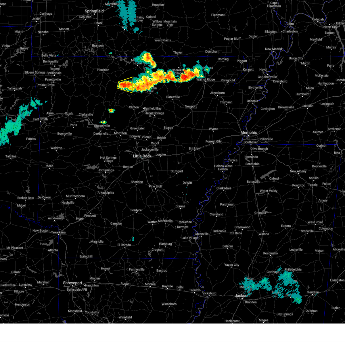
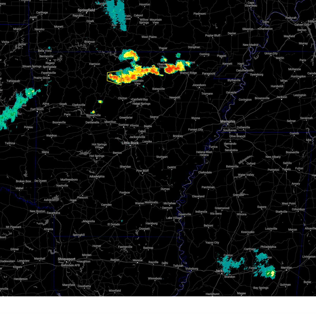
The Gilbert, AR area has had 0 reports of on-the-ground hail by trained spotters, and has been under severe weather warnings 24 times during the past 12 months. Doppler radar has detected hail at or near Gilbert, AR on 65 occasions, including 5 occasions during the past year.
| Name: | Gilbert, AR |
| Where Located: | 89.1 miles NNW of Little Rock, AR |
| Map: | Google Map for Gilbert, AR |
| Population: | 28 |
| Housing Units: | 34 |
| More Info: | Search Google for Gilbert, AR |
5
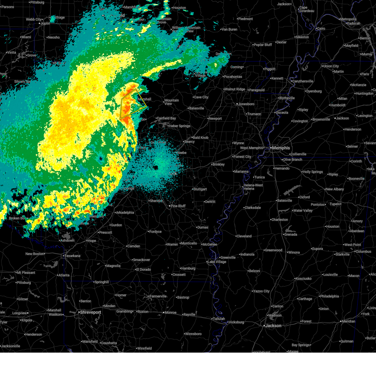
The Top Recent Hail Date for Gilbert, AR is Tuesday, April 28, 2026 (1st out of 65)
Hail and Wind Damage Spotted near Gilbert, AR
| Date / Time | Report Details |
|---|---|
| 6/13/2026 4:34 PM CDT |
 the severe thunderstorm warning has been cancelled and is no longer in effect the severe thunderstorm warning has been cancelled and is no longer in effect
|
| 6/13/2026 4:24 PM CDT |
 At 424 pm cdt, a severe thunderstorm was located over marsena, or 10 miles west of marshall, moving east at 20 mph (radar indicated). Hazards include 60 mph wind gusts and quarter size hail. Hail damage to vehicles is expected. expect wind damage to roofs, siding, and trees. Locations impacted include, marshall, marsena, bohannon, elberta, watts, leslie, gilbert, zach, canaan, morning star, silver hill, maumee crossing, snowball, lone pine,. At 424 pm cdt, a severe thunderstorm was located over marsena, or 10 miles west of marshall, moving east at 20 mph (radar indicated). Hazards include 60 mph wind gusts and quarter size hail. Hail damage to vehicles is expected. expect wind damage to roofs, siding, and trees. Locations impacted include, marshall, marsena, bohannon, elberta, watts, leslie, gilbert, zach, canaan, morning star, silver hill, maumee crossing, snowball, lone pine,.
|
| 6/13/2026 3:45 PM CDT |
 Svrlzk the national weather service in little rock has issued a * severe thunderstorm warning for, stone county in north central arkansas, northeastern searcy county in north central arkansas, southwestern izard county in north central arkansas, southeastern marion county in north central arkansas, northeastern van buren county in north central arkansas, southeastern baxter county in north central arkansas, * until 430 pm cdt. * at 345 pm cdt, a severe thunderstorm was located 9 miles north of thola, or 13 miles northeast of marshall, moving east at 30 mph (radar indicated). Hazards include 60 mph wind gusts and quarter size hail. Hail damage to vehicles is expected. Expect wind damage to roofs, siding, and trees. Svrlzk the national weather service in little rock has issued a * severe thunderstorm warning for, stone county in north central arkansas, northeastern searcy county in north central arkansas, southwestern izard county in north central arkansas, southeastern marion county in north central arkansas, northeastern van buren county in north central arkansas, southeastern baxter county in north central arkansas, * until 430 pm cdt. * at 345 pm cdt, a severe thunderstorm was located 9 miles north of thola, or 13 miles northeast of marshall, moving east at 30 mph (radar indicated). Hazards include 60 mph wind gusts and quarter size hail. Hail damage to vehicles is expected. Expect wind damage to roofs, siding, and trees.
|
| 6/1/2026 5:48 PM CDT |
 At 548 pm cdt, a severe thunderstorm was located near duff, or near marshall, moving southeast at 30 mph (radar indicated). Hazards include 60 mph wind gusts and quarter size hail. Hail damage to vehicles is expected. expect wind damage to roofs, siding, and trees. locations impacted include, duff, st. Joe, pindall, gilbert, zach, silver hill, baker ford,. At 548 pm cdt, a severe thunderstorm was located near duff, or near marshall, moving southeast at 30 mph (radar indicated). Hazards include 60 mph wind gusts and quarter size hail. Hail damage to vehicles is expected. expect wind damage to roofs, siding, and trees. locations impacted include, duff, st. Joe, pindall, gilbert, zach, silver hill, baker ford,.
|
| 6/1/2026 5:25 PM CDT |
 Svrlzk the national weather service in little rock has issued a * severe thunderstorm warning for, northwestern searcy county in north central arkansas, northeastern newton county in north central arkansas, southwestern marion county in north central arkansas, southeastern boone county in north central arkansas, * until 600 pm cdt. * at 525 pm cdt, a severe thunderstorm was located over dugger, or 14 miles southwest of yellville, moving south at 25 mph (radar indicated). Hazards include 60 mph wind gusts and quarter size hail. Hail damage to vehicles is expected. Expect wind damage to roofs, siding, and trees. Svrlzk the national weather service in little rock has issued a * severe thunderstorm warning for, northwestern searcy county in north central arkansas, northeastern newton county in north central arkansas, southwestern marion county in north central arkansas, southeastern boone county in north central arkansas, * until 600 pm cdt. * at 525 pm cdt, a severe thunderstorm was located over dugger, or 14 miles southwest of yellville, moving south at 25 mph (radar indicated). Hazards include 60 mph wind gusts and quarter size hail. Hail damage to vehicles is expected. Expect wind damage to roofs, siding, and trees.
|
| 5/30/2026 4:28 PM CDT |
 The storm which prompted the warning has weakened below severe limits, and no longer poses an immediate threat to life or property. therefore, the warning will be allowed to expire. The storm which prompted the warning has weakened below severe limits, and no longer poses an immediate threat to life or property. therefore, the warning will be allowed to expire.
|
| 5/30/2026 4:05 PM CDT |
 At 405 pm cdt, a severe thunderstorm was located over point peter, or 13 miles west of marshall, moving east at 15 mph (radar indicated). Hazards include ping pong ball size hail and 60 mph wind gusts. People and animals outdoors will be injured. expect hail damage to roofs, siding, windows, and vehicles. expect wind damage to roofs, siding, and trees. locations impacted include, marsena, duff, eula, point peter, st. Joe, pindall, gilbert, bass, snowball, silver hill, woolum recreation area, baker ford,. At 405 pm cdt, a severe thunderstorm was located over point peter, or 13 miles west of marshall, moving east at 15 mph (radar indicated). Hazards include ping pong ball size hail and 60 mph wind gusts. People and animals outdoors will be injured. expect hail damage to roofs, siding, windows, and vehicles. expect wind damage to roofs, siding, and trees. locations impacted include, marsena, duff, eula, point peter, st. Joe, pindall, gilbert, bass, snowball, silver hill, woolum recreation area, baker ford,.
|
| 5/30/2026 4:01 PM CDT |
 Svrlzk the national weather service in little rock has issued a * severe thunderstorm warning for, northwestern searcy county in north central arkansas, northeastern newton county in north central arkansas, southwestern marion county in north central arkansas, southeastern boone county in north central arkansas, * until 430 pm cdt. * at 400 pm cdt, a severe thunderstorm was located over valley springs, or 10 miles southeast of harrison, moving southeast at 25 mph (radar indicated). Hazards include 60 mph wind gusts and quarter size hail. Hail damage to vehicles is expected. Expect wind damage to roofs, siding, and trees. Svrlzk the national weather service in little rock has issued a * severe thunderstorm warning for, northwestern searcy county in north central arkansas, northeastern newton county in north central arkansas, southwestern marion county in north central arkansas, southeastern boone county in north central arkansas, * until 430 pm cdt. * at 400 pm cdt, a severe thunderstorm was located over valley springs, or 10 miles southeast of harrison, moving southeast at 25 mph (radar indicated). Hazards include 60 mph wind gusts and quarter size hail. Hail damage to vehicles is expected. Expect wind damage to roofs, siding, and trees.
|
| 5/30/2026 3:27 PM CDT |
 Svrlzk the national weather service in little rock has issued a * severe thunderstorm warning for, northwestern searcy county in north central arkansas, northeastern newton county in north central arkansas, southern marion county in north central arkansas, * until 415 pm cdt. * at 326 pm cdt, a severe thunderstorm was located over piercetown, or 7 miles southeast of jasper, moving east at 15 mph (radar indicated). Hazards include ping pong ball size hail and 60 mph wind gusts. People and animals outdoors will be injured. expect hail damage to roofs, siding, windows, and vehicles. Expect wind damage to roofs, siding, and trees. Svrlzk the national weather service in little rock has issued a * severe thunderstorm warning for, northwestern searcy county in north central arkansas, northeastern newton county in north central arkansas, southern marion county in north central arkansas, * until 415 pm cdt. * at 326 pm cdt, a severe thunderstorm was located over piercetown, or 7 miles southeast of jasper, moving east at 15 mph (radar indicated). Hazards include ping pong ball size hail and 60 mph wind gusts. People and animals outdoors will be injured. expect hail damage to roofs, siding, windows, and vehicles. Expect wind damage to roofs, siding, and trees.
|
| 4/28/2026 1:09 PM CDT |
 At 109 pm cdt, a severe thunderstorm was located near marshall, moving east at 35 mph (radar indicated). Hazards include golf ball size hail and 60 mph wind gusts. People and animals outdoors will be injured. expect hail damage to roofs, siding, windows, and vehicles. expect wind damage to roofs, siding, and trees. Locations impacted include, marshall, thola, duff, maumee, gilbert, zach, morning star, silver hill, cozahome, landis, maumee crossing, lone pine, harriet,. At 109 pm cdt, a severe thunderstorm was located near marshall, moving east at 35 mph (radar indicated). Hazards include golf ball size hail and 60 mph wind gusts. People and animals outdoors will be injured. expect hail damage to roofs, siding, windows, and vehicles. expect wind damage to roofs, siding, and trees. Locations impacted include, marshall, thola, duff, maumee, gilbert, zach, morning star, silver hill, cozahome, landis, maumee crossing, lone pine, harriet,.
|
| 4/28/2026 12:51 PM CDT |
 At 1251 pm cdt, a severe thunderstorm was located near point peter, or 11 miles west of marshall, moving east at 40 mph (radar indicated). Hazards include 60 mph wind gusts and half dollar size hail. Hail damage to vehicles is expected. expect wind damage to roofs, siding, and trees. locations impacted include, marshall, thola, duff, point peter, maumee, rush, elberta, leslie, st. Joe, pindall, gilbert, zach, canaan, morning star, silver hill, landis, maumee crossing, woolum recreation area, harriet, oxley,. At 1251 pm cdt, a severe thunderstorm was located near point peter, or 11 miles west of marshall, moving east at 40 mph (radar indicated). Hazards include 60 mph wind gusts and half dollar size hail. Hail damage to vehicles is expected. expect wind damage to roofs, siding, and trees. locations impacted include, marshall, thola, duff, point peter, maumee, rush, elberta, leslie, st. Joe, pindall, gilbert, zach, canaan, morning star, silver hill, landis, maumee crossing, woolum recreation area, harriet, oxley,.
|
| 4/28/2026 12:31 PM CDT |
 Svrlzk the national weather service in little rock has issued a * severe thunderstorm warning for, searcy county in north central arkansas, northeastern newton county in north central arkansas, southern marion county in north central arkansas, south central boone county in north central arkansas, * until 130 pm cdt. * at 1230 pm cdt, a severe thunderstorm was located over piercetown, or near jasper, moving east at 40 mph (radar indicated). Hazards include golf ball size hail and 60 mph wind gusts. People and animals outdoors will be injured. expect hail damage to roofs, siding, windows, and vehicles. Expect wind damage to roofs, siding, and trees. Svrlzk the national weather service in little rock has issued a * severe thunderstorm warning for, searcy county in north central arkansas, northeastern newton county in north central arkansas, southern marion county in north central arkansas, south central boone county in north central arkansas, * until 130 pm cdt. * at 1230 pm cdt, a severe thunderstorm was located over piercetown, or near jasper, moving east at 40 mph (radar indicated). Hazards include golf ball size hail and 60 mph wind gusts. People and animals outdoors will be injured. expect hail damage to roofs, siding, windows, and vehicles. Expect wind damage to roofs, siding, and trees.
|
| 4/15/2026 11:44 PM CDT |
 the severe thunderstorm warning has been cancelled and is no longer in effect the severe thunderstorm warning has been cancelled and is no longer in effect
|
| 4/15/2026 11:44 PM CDT |
 At 1143 pm cdt, a severe thunderstorm was located over kay, or 8 miles south of marshall, moving northeast at 45 mph (radar indicated). Hazards include 60 mph wind gusts. Expect damage to roofs, siding, and trees. Locations impacted include, marshall, marsena, kay, witts spring, duff, point peter, smyrna, maumee, eula, bohannon, imo, elberta, watts, leslie, gilbert, zach, canaan, morning star, silver hill, tilly,. At 1143 pm cdt, a severe thunderstorm was located over kay, or 8 miles south of marshall, moving northeast at 45 mph (radar indicated). Hazards include 60 mph wind gusts. Expect damage to roofs, siding, and trees. Locations impacted include, marshall, marsena, kay, witts spring, duff, point peter, smyrna, maumee, eula, bohannon, imo, elberta, watts, leslie, gilbert, zach, canaan, morning star, silver hill, tilly,.
|
| 4/15/2026 11:31 PM CDT |
 At 1131 pm cdt, a severe thunderstorm was located near witts spring, or 17 miles southwest of marshall, moving northeast at 45 mph (radar indicated). Hazards include 60 mph wind gusts. Expect damage to roofs, siding, and trees. Locations impacted include, marshall, marsena, kay, witts spring, moore, duff, point peter, smyrna, maumee, eula, bohannon, imo, elberta, watts, leslie, gilbert, ben hur, zach, canaan, morning star,. At 1131 pm cdt, a severe thunderstorm was located near witts spring, or 17 miles southwest of marshall, moving northeast at 45 mph (radar indicated). Hazards include 60 mph wind gusts. Expect damage to roofs, siding, and trees. Locations impacted include, marshall, marsena, kay, witts spring, moore, duff, point peter, smyrna, maumee, eula, bohannon, imo, elberta, watts, leslie, gilbert, ben hur, zach, canaan, morning star,.
|
| 4/15/2026 11:16 PM CDT |
 Svrlzk the national weather service in little rock has issued a * severe thunderstorm warning for, searcy county in north central arkansas, southeastern newton county in north central arkansas, northeastern johnson county in western arkansas, northwestern van buren county in north central arkansas, northern pope county in central arkansas, * until midnight cdt. * at 1116 pm cdt, a severe thunderstorm was located near bertha, or 23 miles south of jasper, moving northeast at 45 mph (radar indicated). Hazards include 60 mph wind gusts and penny size hail. expect damage to roofs, siding, and trees Svrlzk the national weather service in little rock has issued a * severe thunderstorm warning for, searcy county in north central arkansas, southeastern newton county in north central arkansas, northeastern johnson county in western arkansas, northwestern van buren county in north central arkansas, northern pope county in central arkansas, * until midnight cdt. * at 1116 pm cdt, a severe thunderstorm was located near bertha, or 23 miles south of jasper, moving northeast at 45 mph (radar indicated). Hazards include 60 mph wind gusts and penny size hail. expect damage to roofs, siding, and trees
|
| 3/15/2026 3:24 PM CDT |
 Svrlzk the national weather service in little rock has issued a * severe thunderstorm warning for, northern searcy county in north central arkansas, northeastern newton county in north central arkansas, marion county in north central arkansas, southeastern boone county in north central arkansas, baxter county in north central arkansas, * until 415 pm cdt. * at 322 pm cdt, severe thunderstorms were located along a line extending from near pyatt to near dugger to near eula, moving northeast at 50 mph (radar indicated). Hazards include 60 mph wind gusts and penny size hail. expect damage to roofs, siding, and trees Svrlzk the national weather service in little rock has issued a * severe thunderstorm warning for, northern searcy county in north central arkansas, northeastern newton county in north central arkansas, marion county in north central arkansas, southeastern boone county in north central arkansas, baxter county in north central arkansas, * until 415 pm cdt. * at 322 pm cdt, severe thunderstorms were located along a line extending from near pyatt to near dugger to near eula, moving northeast at 50 mph (radar indicated). Hazards include 60 mph wind gusts and penny size hail. expect damage to roofs, siding, and trees
|
| 9/23/2025 2:47 PM CDT | the severe thunderstorm warning has been cancelled and is no longer in effect |
| 9/23/2025 2:47 PM CDT | At 246 pm cdt, a severe thunderstorm was located over marshall, moving east at 30 mph (radar indicated). Hazards include 60 mph wind gusts and quarter size hail. Hail damage to vehicles is expected. expect wind damage to roofs, siding, and trees. locations impacted include, marshall, thola, duff, elberta, maumee, leslie, st. Joe, big flat, gilbert, zach, canaan, morning star, silver hill, oxley, cozahome, maumee crossing, landis, snowball, lone pine, harriet,. |
| 9/23/2025 2:27 PM CDT | Svrlzk the national weather service in little rock has issued a * severe thunderstorm warning for, searcy county in north central arkansas, north central van buren county in north central arkansas, * until 315 pm cdt. * at 227 pm cdt, a severe thunderstorm was located near point peter, or 10 miles northwest of marshall, moving east at 35 mph (radar indicated). Hazards include 60 mph wind gusts and quarter size hail. Hail damage to vehicles is expected. Expect wind damage to roofs, siding, and trees. |
| 9/23/2025 2:20 PM CDT | At 219 pm cdt, a severe thunderstorm was located near eula, or 13 miles southeast of jasper, moving southeast at 20 mph (radar indicated). Hazards include 60 mph wind gusts and quarter size hail. Hail damage to vehicles is expected. expect wind damage to roofs, siding, and trees. Locations impacted include, marshall, marsena, kay, eula, bohannon, imo, duff, point peter, watts, gilbert, zach, bass, canaan, silver hill, snowball, woolum recreation area, baker ford, morning star,. |
| 9/23/2025 2:00 PM CDT | the severe thunderstorm warning has been cancelled and is no longer in effect |
| 9/23/2025 2:00 PM CDT | At 159 pm cdt, a severe thunderstorm was located over jasper, moving east at 30 mph (radar indicated). Hazards include 60 mph wind gusts and quarter size hail. Hail damage to vehicles is expected. expect wind damage to roofs, siding, and trees. locations impacted include, marshall, jasper, marsena, kay, carver, duff, point peter, eula, bohannon, imo, piercetown, pruitt, watts, st. Joe, pindall, gilbert, zach, bass, canaan, morning star,. |
| 9/23/2025 1:39 PM CDT | Svrlzk the national weather service in little rock has issued a * severe thunderstorm warning for, searcy county in north central arkansas, northeastern newton county in north central arkansas, south central marion county in north central arkansas, * until 230 pm cdt. * at 139 pm cdt, a severe thunderstorm was located near lost valley state park, or 7 miles west of jasper, moving east at 30 mph (radar indicated). Hazards include ping pong ball size hail and 60 mph wind gusts. People and animals outdoors will be injured. expect hail damage to roofs, siding, windows, and vehicles. Expect wind damage to roofs, siding, and trees. |
| 6/7/2025 7:30 AM CDT |
 Svrlzk the national weather service in little rock has issued a * severe thunderstorm warning for, searcy county in north central arkansas, southwestern izard county in north central arkansas, southeastern johnson county in western arkansas, van buren county in north central arkansas, southeastern baxter county in north central arkansas, eastern scott county in western arkansas, northern polk county in western arkansas, yell county in central arkansas, pope county in central arkansas, western stone county in north central arkansas, eastern logan county in western arkansas, southeastern newton county in north central arkansas, perry county in central arkansas, southeastern marion county in north central arkansas, conway county in central arkansas, garland county in central arkansas, northwestern saline county in central arkansas, west central hot spring county in southwestern arkansas, montgomery county in western arkansas, * until 815 am cdt. * at 729 am cdt, severe thunderstorms were located along a line extending from near rush to near hatfield, moving southeast at 30 mph (radar indicated). Hazards include 60 mph wind gusts and penny size hail. expect damage to roofs, siding, and trees Svrlzk the national weather service in little rock has issued a * severe thunderstorm warning for, searcy county in north central arkansas, southwestern izard county in north central arkansas, southeastern johnson county in western arkansas, van buren county in north central arkansas, southeastern baxter county in north central arkansas, eastern scott county in western arkansas, northern polk county in western arkansas, yell county in central arkansas, pope county in central arkansas, western stone county in north central arkansas, eastern logan county in western arkansas, southeastern newton county in north central arkansas, perry county in central arkansas, southeastern marion county in north central arkansas, conway county in central arkansas, garland county in central arkansas, northwestern saline county in central arkansas, west central hot spring county in southwestern arkansas, montgomery county in western arkansas, * until 815 am cdt. * at 729 am cdt, severe thunderstorms were located along a line extending from near rush to near hatfield, moving southeast at 30 mph (radar indicated). Hazards include 60 mph wind gusts and penny size hail. expect damage to roofs, siding, and trees
|
| 5/19/2025 9:56 PM CDT |
 At 954 pm cdt, a severe thunderstorm was located near holman, or 11 miles east of clarksville, moving east at 60 mph (trained weather spotters). Hazards include 60 mph wind gusts. Expect damage to roofs, siding, and trees. Locations impacted include, clarksville, fort douglas, long pool campground, witts spring, haw creek falls campground, pleasant valley in pope county, duff, crabtree, maumee, bohannon, hector, deer, treat, snowball, knoxville, elberta, leslie, watts, holman, baker ford,. At 954 pm cdt, a severe thunderstorm was located near holman, or 11 miles east of clarksville, moving east at 60 mph (trained weather spotters). Hazards include 60 mph wind gusts. Expect damage to roofs, siding, and trees. Locations impacted include, clarksville, fort douglas, long pool campground, witts spring, haw creek falls campground, pleasant valley in pope county, duff, crabtree, maumee, bohannon, hector, deer, treat, snowball, knoxville, elberta, leslie, watts, holman, baker ford,.
|
| 5/19/2025 9:25 PM CDT |
 Svrlzk the national weather service in little rock has issued a * severe thunderstorm warning for, northeastern logan county in western arkansas, searcy county in north central arkansas, southeastern newton county in north central arkansas, eastern johnson county in western arkansas, southeastern marion county in north central arkansas, northwestern van buren county in north central arkansas, southwestern baxter county in north central arkansas, pope county in central arkansas, * until 1015 pm cdt. * at 925 pm cdt, severe thunderstorms were located along a line extending from near piercetown to holman, moving northeast at 60 mph (radar indicated). Hazards include 60 mph wind gusts. expect damage to roofs, siding, and trees Svrlzk the national weather service in little rock has issued a * severe thunderstorm warning for, northeastern logan county in western arkansas, searcy county in north central arkansas, southeastern newton county in north central arkansas, eastern johnson county in western arkansas, southeastern marion county in north central arkansas, northwestern van buren county in north central arkansas, southwestern baxter county in north central arkansas, pope county in central arkansas, * until 1015 pm cdt. * at 925 pm cdt, severe thunderstorms were located along a line extending from near piercetown to holman, moving northeast at 60 mph (radar indicated). Hazards include 60 mph wind gusts. expect damage to roofs, siding, and trees
|
| 4/20/2025 4:53 PM CDT |
 Svrlzk the national weather service in little rock has issued a * severe thunderstorm warning for, northwestern stone county in north central arkansas, searcy county in north central arkansas, northwestern izard county in north central arkansas, marion county in north central arkansas, northwestern van buren county in north central arkansas, baxter county in north central arkansas, western fulton county in north central arkansas, northeastern pope county in central arkansas, * until 545 pm cdt. * at 453 pm cdt, severe thunderstorms were located along a line extending from near price place to near maumee to near dabney, moving northeast at 50 mph (radar indicated). Hazards include 60 mph wind gusts and penny size hail. expect damage to roofs, siding, and trees Svrlzk the national weather service in little rock has issued a * severe thunderstorm warning for, northwestern stone county in north central arkansas, searcy county in north central arkansas, northwestern izard county in north central arkansas, marion county in north central arkansas, northwestern van buren county in north central arkansas, baxter county in north central arkansas, western fulton county in north central arkansas, northeastern pope county in central arkansas, * until 545 pm cdt. * at 453 pm cdt, severe thunderstorms were located along a line extending from near price place to near maumee to near dabney, moving northeast at 50 mph (radar indicated). Hazards include 60 mph wind gusts and penny size hail. expect damage to roofs, siding, and trees
|
| 4/20/2025 4:10 PM CDT |
 Svrlzk the national weather service in little rock has issued a * severe thunderstorm warning for, searcy county in north central arkansas, eastern newton county in north central arkansas, northeastern johnson county in western arkansas, marion county in north central arkansas, northwestern van buren county in north central arkansas, boone county in north central arkansas, western baxter county in north central arkansas, northern pope county in central arkansas, * until 500 pm cdt. * at 410 pm cdt, severe thunderstorms were located along a line extending from 9 miles northeast of omaha to near pruitt to near bertha, moving northeast at 85 mph (radar indicated). Hazards include 60 mph wind gusts and penny size hail. expect damage to roofs, siding, and trees Svrlzk the national weather service in little rock has issued a * severe thunderstorm warning for, searcy county in north central arkansas, eastern newton county in north central arkansas, northeastern johnson county in western arkansas, marion county in north central arkansas, northwestern van buren county in north central arkansas, boone county in north central arkansas, western baxter county in north central arkansas, northern pope county in central arkansas, * until 500 pm cdt. * at 410 pm cdt, severe thunderstorms were located along a line extending from 9 miles northeast of omaha to near pruitt to near bertha, moving northeast at 85 mph (radar indicated). Hazards include 60 mph wind gusts and penny size hail. expect damage to roofs, siding, and trees
|
| 4/4/2025 6:27 PM CDT |
 Svrlzk the national weather service in little rock has issued a * severe thunderstorm warning for, southwestern stone county in north central arkansas, searcy county in north central arkansas, southeastern newton county in north central arkansas, northern van buren county in north central arkansas, northeastern pope county in central arkansas, * until 715 pm cdt. * at 627 pm cdt, severe thunderstorms were located along a line extending from near moore to 6 miles northeast of hector, moving northeast at 45 mph (radar indicated). Hazards include 60 mph wind gusts and quarter size hail. Hail damage to vehicles is expected. Expect wind damage to roofs, siding, and trees. Svrlzk the national weather service in little rock has issued a * severe thunderstorm warning for, southwestern stone county in north central arkansas, searcy county in north central arkansas, southeastern newton county in north central arkansas, northern van buren county in north central arkansas, northeastern pope county in central arkansas, * until 715 pm cdt. * at 627 pm cdt, severe thunderstorms were located along a line extending from near moore to 6 miles northeast of hector, moving northeast at 45 mph (radar indicated). Hazards include 60 mph wind gusts and quarter size hail. Hail damage to vehicles is expected. Expect wind damage to roofs, siding, and trees.
|
| 4/4/2025 4:47 PM CDT |
 At 447 pm cdt, a severe thunderstorm was located over bohannon, or 12 miles southwest of marshall, moving northeast at 55 mph (radar indicated). Hazards include ping pong ball size hail and 60 mph wind gusts. People and animals outdoors will be injured. expect hail damage to roofs, siding, windows, and vehicles. expect wind damage to roofs, siding, and trees. locations impacted include, thola, marsena, canaan, kay, morning star, silver hill, zach, gilbert, witts spring, landis, maumee crossing, bruno, duff, timbo, tilly, point peter, woolum recreation area, harriet, maumee, st. Joe,. At 447 pm cdt, a severe thunderstorm was located over bohannon, or 12 miles southwest of marshall, moving northeast at 55 mph (radar indicated). Hazards include ping pong ball size hail and 60 mph wind gusts. People and animals outdoors will be injured. expect hail damage to roofs, siding, windows, and vehicles. expect wind damage to roofs, siding, and trees. locations impacted include, thola, marsena, canaan, kay, morning star, silver hill, zach, gilbert, witts spring, landis, maumee crossing, bruno, duff, timbo, tilly, point peter, woolum recreation area, harriet, maumee, st. Joe,.
|
| 4/4/2025 4:34 PM CDT |
 Svrlzk the national weather service in little rock has issued a * severe thunderstorm warning for, west central stone county in north central arkansas, searcy county in north central arkansas, southeastern newton county in north central arkansas, southwestern marion county in north central arkansas, northwestern van buren county in north central arkansas, northeastern pope county in central arkansas, * until 515 pm cdt. * at 433 pm cdt, a severe thunderstorm was located over smyrna, or 25 miles southwest of marshall, moving northeast at 55 mph (radar indicated). Hazards include 60 mph wind gusts and quarter size hail. Hail damage to vehicles is expected. Expect wind damage to roofs, siding, and trees. Svrlzk the national weather service in little rock has issued a * severe thunderstorm warning for, west central stone county in north central arkansas, searcy county in north central arkansas, southeastern newton county in north central arkansas, southwestern marion county in north central arkansas, northwestern van buren county in north central arkansas, northeastern pope county in central arkansas, * until 515 pm cdt. * at 433 pm cdt, a severe thunderstorm was located over smyrna, or 25 miles southwest of marshall, moving northeast at 55 mph (radar indicated). Hazards include 60 mph wind gusts and quarter size hail. Hail damage to vehicles is expected. Expect wind damage to roofs, siding, and trees.
|
| 4/2/2025 3:44 PM CDT |
 Svrlzk the national weather service in little rock has issued a * severe thunderstorm warning for, northwestern stone county in north central arkansas, searcy county in north central arkansas, izard county in north central arkansas, southeastern marion county in north central arkansas, north central van buren county in north central arkansas, baxter county in north central arkansas, western fulton county in north central arkansas, * until 430 pm cdt. * at 344 pm cdt, a severe thunderstorm was located near marshall, moving northeast at 65 mph (radar indicated). Hazards include 60 mph wind gusts and quarter size hail. Hail damage to vehicles is expected. Expect wind damage to roofs, siding, and trees. Svrlzk the national weather service in little rock has issued a * severe thunderstorm warning for, northwestern stone county in north central arkansas, searcy county in north central arkansas, izard county in north central arkansas, southeastern marion county in north central arkansas, north central van buren county in north central arkansas, baxter county in north central arkansas, western fulton county in north central arkansas, * until 430 pm cdt. * at 344 pm cdt, a severe thunderstorm was located near marshall, moving northeast at 65 mph (radar indicated). Hazards include 60 mph wind gusts and quarter size hail. Hail damage to vehicles is expected. Expect wind damage to roofs, siding, and trees.
|
| 4/2/2025 2:56 PM CDT |
 Svrlzk the national weather service in little rock has issued a * severe thunderstorm warning for, northeastern logan county in western arkansas, searcy county in north central arkansas, eastern newton county in north central arkansas, eastern johnson county in western arkansas, southern marion county in north central arkansas, northwestern van buren county in north central arkansas, southeastern boone county in north central arkansas, southwestern baxter county in north central arkansas, north central yell county in central arkansas, pope county in central arkansas, * until 345 pm cdt. * at 256 pm cdt, severe thunderstorms were located along a line extending from near carver to near moore to broomfield to near mt nebo state park, moving northeast at 40 mph (radar indicated). Hazards include 60 mph wind gusts and half dollar size hail. Hail damage to vehicles is expected. Expect wind damage to roofs, siding, and trees. Svrlzk the national weather service in little rock has issued a * severe thunderstorm warning for, northeastern logan county in western arkansas, searcy county in north central arkansas, eastern newton county in north central arkansas, eastern johnson county in western arkansas, southern marion county in north central arkansas, northwestern van buren county in north central arkansas, southeastern boone county in north central arkansas, southwestern baxter county in north central arkansas, north central yell county in central arkansas, pope county in central arkansas, * until 345 pm cdt. * at 256 pm cdt, severe thunderstorms were located along a line extending from near carver to near moore to broomfield to near mt nebo state park, moving northeast at 40 mph (radar indicated). Hazards include 60 mph wind gusts and half dollar size hail. Hail damage to vehicles is expected. Expect wind damage to roofs, siding, and trees.
|
| 4/2/2025 2:50 PM CDT |
 The storm which prompted the warning has weakened below severe limits, and no longer poses an immediate threat to life or property. therefore, the warning will be allowed to expire. however small hail, gusty winds and heavy rain are still possible with this thunderstorm. a tornado watch remains in effect until 400 pm cdt for central and north central arkansas. The storm which prompted the warning has weakened below severe limits, and no longer poses an immediate threat to life or property. therefore, the warning will be allowed to expire. however small hail, gusty winds and heavy rain are still possible with this thunderstorm. a tornado watch remains in effect until 400 pm cdt for central and north central arkansas.
|
| 4/2/2025 2:37 PM CDT |
 Svrlzk the national weather service in little rock has issued a * severe thunderstorm warning for, searcy county in north central arkansas, southeastern newton county in north central arkansas, south central marion county in north central arkansas, northwestern van buren county in north central arkansas, southern baxter county in north central arkansas, northeastern pope county in central arkansas, * until 300 pm cdt. * at 237 pm cdt, a severe thunderstorm was located over smyrna, or 25 miles southwest of marshall, moving northeast at 65 mph (radar indicated). Hazards include 60 mph wind gusts and quarter size hail. Hail damage to vehicles is expected. Expect wind damage to roofs, siding, and trees. Svrlzk the national weather service in little rock has issued a * severe thunderstorm warning for, searcy county in north central arkansas, southeastern newton county in north central arkansas, south central marion county in north central arkansas, northwestern van buren county in north central arkansas, southern baxter county in north central arkansas, northeastern pope county in central arkansas, * until 300 pm cdt. * at 237 pm cdt, a severe thunderstorm was located over smyrna, or 25 miles southwest of marshall, moving northeast at 65 mph (radar indicated). Hazards include 60 mph wind gusts and quarter size hail. Hail damage to vehicles is expected. Expect wind damage to roofs, siding, and trees.
|
| 4/2/2025 1:45 PM CDT |
 Svrlzk the national weather service in little rock has issued a * severe thunderstorm warning for, northern searcy county in north central arkansas, northeastern newton county in north central arkansas, southern marion county in north central arkansas, southeastern boone county in north central arkansas, southwestern baxter county in north central arkansas, * until 230 pm cdt. * at 145 pm cdt, a severe thunderstorm was located near carver, or 10 miles east of jasper, moving northeast at 50 mph (radar indicated). Hazards include golf ball size hail and 60 mph wind gusts. People and animals outdoors will be injured. expect hail damage to roofs, siding, windows, and vehicles. Expect wind damage to roofs, siding, and trees. Svrlzk the national weather service in little rock has issued a * severe thunderstorm warning for, northern searcy county in north central arkansas, northeastern newton county in north central arkansas, southern marion county in north central arkansas, southeastern boone county in north central arkansas, southwestern baxter county in north central arkansas, * until 230 pm cdt. * at 145 pm cdt, a severe thunderstorm was located near carver, or 10 miles east of jasper, moving northeast at 50 mph (radar indicated). Hazards include golf ball size hail and 60 mph wind gusts. People and animals outdoors will be injured. expect hail damage to roofs, siding, windows, and vehicles. Expect wind damage to roofs, siding, and trees.
|
| 3/30/2025 6:00 PM CDT |
 the severe thunderstorm warning has been cancelled and is no longer in effect the severe thunderstorm warning has been cancelled and is no longer in effect
|
| 3/30/2025 5:47 PM CDT |
 At 547 pm cdt, a severe thunderstorm was located over maumee, or 9 miles north of marshall, moving east at 50 mph (radar indicated). Hazards include golf ball size hail and 60 mph wind gusts. People and animals outdoors will be injured. expect hail damage to roofs, siding, windows, and vehicles. expect wind damage to roofs, siding, and trees. Locations impacted include, morning star, silver hill, zach, gilbert, maumee crossing, duff, shipp, gunner pool campground, barkshed campground, calico rock, jordan, herron, harriet, maumee, push mountian, rush, buffalo city, rodney, fifty-six, advance,. At 547 pm cdt, a severe thunderstorm was located over maumee, or 9 miles north of marshall, moving east at 50 mph (radar indicated). Hazards include golf ball size hail and 60 mph wind gusts. People and animals outdoors will be injured. expect hail damage to roofs, siding, windows, and vehicles. expect wind damage to roofs, siding, and trees. Locations impacted include, morning star, silver hill, zach, gilbert, maumee crossing, duff, shipp, gunner pool campground, barkshed campground, calico rock, jordan, herron, harriet, maumee, push mountian, rush, buffalo city, rodney, fifty-six, advance,.
|
| 3/30/2025 5:41 PM CDT |
 Svrlzk the national weather service in little rock has issued a * severe thunderstorm warning for, northwestern stone county in north central arkansas, northern searcy county in north central arkansas, western izard county in north central arkansas, southeastern marion county in north central arkansas, southeastern baxter county in north central arkansas, * until 630 pm cdt. * at 541 pm cdt, a severe thunderstorm was located over duff, or 10 miles northwest of marshall, moving east at 50 mph (radar indicated). Hazards include 60 mph wind gusts and quarter size hail. Hail damage to vehicles is expected. Expect wind damage to roofs, siding, and trees. Svrlzk the national weather service in little rock has issued a * severe thunderstorm warning for, northwestern stone county in north central arkansas, northern searcy county in north central arkansas, western izard county in north central arkansas, southeastern marion county in north central arkansas, southeastern baxter county in north central arkansas, * until 630 pm cdt. * at 541 pm cdt, a severe thunderstorm was located over duff, or 10 miles northwest of marshall, moving east at 50 mph (radar indicated). Hazards include 60 mph wind gusts and quarter size hail. Hail damage to vehicles is expected. Expect wind damage to roofs, siding, and trees.
|
| 3/14/2025 8:53 PM CDT |
 the severe thunderstorm warning has been cancelled and is no longer in effect the severe thunderstorm warning has been cancelled and is no longer in effect
|
| 3/14/2025 8:26 PM CDT |
 Svrlzk the national weather service in little rock has issued a * severe thunderstorm warning for, northern searcy county in north central arkansas, southern marion county in north central arkansas, baxter county in north central arkansas, * until 915 pm cdt. * at 826 pm cdt, a severe thunderstorm was located near duff, or 11 miles northwest of marshall, moving northeast at 65 mph (radar indicated). Hazards include 60 mph wind gusts and quarter size hail. Hail damage to vehicles is expected. Expect wind damage to roofs, siding, and trees. Svrlzk the national weather service in little rock has issued a * severe thunderstorm warning for, northern searcy county in north central arkansas, southern marion county in north central arkansas, baxter county in north central arkansas, * until 915 pm cdt. * at 826 pm cdt, a severe thunderstorm was located near duff, or 11 miles northwest of marshall, moving northeast at 65 mph (radar indicated). Hazards include 60 mph wind gusts and quarter size hail. Hail damage to vehicles is expected. Expect wind damage to roofs, siding, and trees.
|
| 7/16/2024 7:16 PM CDT |
 At 716 pm cdt, a severe thunderstorm was located over maumee, or 7 miles north of marshall, moving east at 10 mph (radar indicated). Hazards include 60 mph wind gusts and quarter size hail. Hail damage to vehicles is expected. expect wind damage to roofs, siding, and trees. Locations impacted include, marshall, duff, maumee, gilbert, zach, morning star, silver hill, cozahome, mull, maumee crossing, lone pine, harriet, baker ford,. At 716 pm cdt, a severe thunderstorm was located over maumee, or 7 miles north of marshall, moving east at 10 mph (radar indicated). Hazards include 60 mph wind gusts and quarter size hail. Hail damage to vehicles is expected. expect wind damage to roofs, siding, and trees. Locations impacted include, marshall, duff, maumee, gilbert, zach, morning star, silver hill, cozahome, mull, maumee crossing, lone pine, harriet, baker ford,.
|
| 7/16/2024 7:05 PM CDT |
 Svrlzk the national weather service in little rock has issued a * severe thunderstorm warning for, northeastern searcy county in north central arkansas, southeastern marion county in north central arkansas, * until 745 pm cdt. * at 704 pm cdt, a severe thunderstorm was located near maumee, or 8 miles northwest of marshall, moving east at 10 mph (radar indicated). Hazards include 60 mph wind gusts and quarter size hail. Hail damage to vehicles is expected. Expect wind damage to roofs, siding, and trees. Svrlzk the national weather service in little rock has issued a * severe thunderstorm warning for, northeastern searcy county in north central arkansas, southeastern marion county in north central arkansas, * until 745 pm cdt. * at 704 pm cdt, a severe thunderstorm was located near maumee, or 8 miles northwest of marshall, moving east at 10 mph (radar indicated). Hazards include 60 mph wind gusts and quarter size hail. Hail damage to vehicles is expected. Expect wind damage to roofs, siding, and trees.
|
| 5/26/2024 8:04 PM CDT |
 the severe thunderstorm warning has been cancelled and is no longer in effect the severe thunderstorm warning has been cancelled and is no longer in effect
|
| 5/26/2024 7:49 PM CDT |
 Svrlzk the national weather service in little rock has issued a * severe thunderstorm warning for, northwestern searcy county in north central arkansas, northeastern newton county in north central arkansas, * until 815 pm cdt. * at 749 pm cdt, a severe thunderstorm was located near piercetown, or near jasper, moving east at 45 mph (radar indicated). Hazards include 60 mph wind gusts and quarter size hail. Hail damage to vehicles is expected. Expect wind damage to roofs, siding, and trees. Svrlzk the national weather service in little rock has issued a * severe thunderstorm warning for, northwestern searcy county in north central arkansas, northeastern newton county in north central arkansas, * until 815 pm cdt. * at 749 pm cdt, a severe thunderstorm was located near piercetown, or near jasper, moving east at 45 mph (radar indicated). Hazards include 60 mph wind gusts and quarter size hail. Hail damage to vehicles is expected. Expect wind damage to roofs, siding, and trees.
|
| 5/26/2024 3:15 AM CDT |
 Svrlzk the national weather service in little rock has issued a * severe thunderstorm warning for, northwestern searcy county in north central arkansas, northern newton county in north central arkansas, southwestern marion county in north central arkansas, southern boone county in north central arkansas, * until 400 am cdt. * at 314 am cdt, severe thunderstorms were located along a line extending from red bank to near osage to near kingston, moving east at 40 mph (radar indicated). Hazards include 60 mph wind gusts and quarter size hail. Hail damage to vehicles is expected. Expect wind damage to roofs, siding, and trees. Svrlzk the national weather service in little rock has issued a * severe thunderstorm warning for, northwestern searcy county in north central arkansas, northern newton county in north central arkansas, southwestern marion county in north central arkansas, southern boone county in north central arkansas, * until 400 am cdt. * at 314 am cdt, severe thunderstorms were located along a line extending from red bank to near osage to near kingston, moving east at 40 mph (radar indicated). Hazards include 60 mph wind gusts and quarter size hail. Hail damage to vehicles is expected. Expect wind damage to roofs, siding, and trees.
|
| 5/4/2024 5:42 PM CDT |
 At 542 pm cdt, a severe thunderstorm was located near marshall, moving east at 20 mph (radar indicated). Hazards include ping pong ball size hail and 60 mph wind gusts. People and animals outdoors will be injured. expect hail damage to roofs, siding, windows, and vehicles. expect wind damage to roofs, siding, and trees. Locations impacted include, marshall, thola, shipp, maumee, rush, lion hill, advance, cartney, big flat, gilbert, zach, alco, canaan, morning star, silver hill, landis, maumee crossing, barkshed campground, harriet, push mountian,. At 542 pm cdt, a severe thunderstorm was located near marshall, moving east at 20 mph (radar indicated). Hazards include ping pong ball size hail and 60 mph wind gusts. People and animals outdoors will be injured. expect hail damage to roofs, siding, windows, and vehicles. expect wind damage to roofs, siding, and trees. Locations impacted include, marshall, thola, shipp, maumee, rush, lion hill, advance, cartney, big flat, gilbert, zach, alco, canaan, morning star, silver hill, landis, maumee crossing, barkshed campground, harriet, push mountian,.
|
| 5/4/2024 5:37 PM CDT |
 Svrlzk the national weather service in little rock has issued a * severe thunderstorm warning for, northwestern stone county in north central arkansas, northeastern searcy county in north central arkansas, southeastern marion county in north central arkansas, south central baxter county in north central arkansas, * until 615 pm cdt. * at 537 pm cdt, a severe thunderstorm was located near marshall, moving east at 20 mph (radar indicated). Hazards include 60 mph wind gusts and quarter size hail. Hail damage to vehicles is expected. Expect wind damage to roofs, siding, and trees. Svrlzk the national weather service in little rock has issued a * severe thunderstorm warning for, northwestern stone county in north central arkansas, northeastern searcy county in north central arkansas, southeastern marion county in north central arkansas, south central baxter county in north central arkansas, * until 615 pm cdt. * at 537 pm cdt, a severe thunderstorm was located near marshall, moving east at 20 mph (radar indicated). Hazards include 60 mph wind gusts and quarter size hail. Hail damage to vehicles is expected. Expect wind damage to roofs, siding, and trees.
|
| 5/4/2024 10:33 AM CDT |
 At 1032 am cdt, a severe thunderstorm was located near gilbert, or 8 miles northwest of marshall, moving east at 30 mph (radar indicated). Hazards include 60 mph wind gusts and nickel size hail. Expect damage to roofs, siding, and trees. locations impacted include, marshall, duff, maumee, st. Joe, pindall, gilbert, zach, morning star, silver hill, cozahome, mull, maumee crossing, lone pine, harriet, baker ford,. At 1032 am cdt, a severe thunderstorm was located near gilbert, or 8 miles northwest of marshall, moving east at 30 mph (radar indicated). Hazards include 60 mph wind gusts and nickel size hail. Expect damage to roofs, siding, and trees. locations impacted include, marshall, duff, maumee, st. Joe, pindall, gilbert, zach, morning star, silver hill, cozahome, mull, maumee crossing, lone pine, harriet, baker ford,.
|
| 5/4/2024 10:21 AM CDT |
 the severe thunderstorm warning has been cancelled and is no longer in effect the severe thunderstorm warning has been cancelled and is no longer in effect
|
| 5/4/2024 10:21 AM CDT |
 At 1021 am cdt, a severe thunderstorm was located near duff, or 13 miles northwest of marshall, moving east at 30 mph (radar indicated). Hazards include 60 mph wind gusts and quarter size hail. Hail damage to vehicles is expected. expect wind damage to roofs, siding, and trees. locations impacted include, marshall, western grove, duff, maumee, st. Joe, pindall, gilbert, zach, morning star, silver hill, cozahome, mull, maumee crossing, eros, bruno, lone pine, woolum recreation area, harriet, baker ford,. At 1021 am cdt, a severe thunderstorm was located near duff, or 13 miles northwest of marshall, moving east at 30 mph (radar indicated). Hazards include 60 mph wind gusts and quarter size hail. Hail damage to vehicles is expected. expect wind damage to roofs, siding, and trees. locations impacted include, marshall, western grove, duff, maumee, st. Joe, pindall, gilbert, zach, morning star, silver hill, cozahome, mull, maumee crossing, eros, bruno, lone pine, woolum recreation area, harriet, baker ford,.
|
| 5/4/2024 10:13 AM CDT |
 Svrlzk the national weather service in little rock has issued a * severe thunderstorm warning for, northern searcy county in north central arkansas, southern marion county in north central arkansas, southeastern boone county in north central arkansas, * until 1100 am cdt. * at 1013 am cdt, a severe thunderstorm was located near dugger, or 15 miles southwest of yellville, moving east at 30 mph (radar indicated). Hazards include 60 mph wind gusts and quarter size hail. Hail damage to vehicles is expected. Expect wind damage to roofs, siding, and trees. Svrlzk the national weather service in little rock has issued a * severe thunderstorm warning for, northern searcy county in north central arkansas, southern marion county in north central arkansas, southeastern boone county in north central arkansas, * until 1100 am cdt. * at 1013 am cdt, a severe thunderstorm was located near dugger, or 15 miles southwest of yellville, moving east at 30 mph (radar indicated). Hazards include 60 mph wind gusts and quarter size hail. Hail damage to vehicles is expected. Expect wind damage to roofs, siding, and trees.
|
| 3/14/2024 5:22 PM CDT |
 At 520 pm cdt, severe thunderstorms were located along a line extending from mountain home to 7 miles northwest of big flat to 5 miles west of marshall, moving east at 35 mph (radar indicated). Hazards include 60 mph wind gusts and quarter size hail. Hail damage to vehicles is expected. expect wind damage to roofs, siding, and trees. Locations impacted include, mountain home, marshall, gassville, norfork, salesville, briarcliff, arkawana, marsena, duff, point peter, herron, colfax, maumee, advance, bohannon, cartney, elberta, watts, thola, norfork dam,. At 520 pm cdt, severe thunderstorms were located along a line extending from mountain home to 7 miles northwest of big flat to 5 miles west of marshall, moving east at 35 mph (radar indicated). Hazards include 60 mph wind gusts and quarter size hail. Hail damage to vehicles is expected. expect wind damage to roofs, siding, and trees. Locations impacted include, mountain home, marshall, gassville, norfork, salesville, briarcliff, arkawana, marsena, duff, point peter, herron, colfax, maumee, advance, bohannon, cartney, elberta, watts, thola, norfork dam,.
|
| 3/14/2024 5:04 PM CDT |
 At 504 pm cdt, severe thunderstorms were located along a line extending from lakeview in baxter county to near rush to near eula, moving east at 40 mph (radar indicated). Hazards include 60 mph wind gusts and quarter size hail. Hail damage to vehicles is expected. expect wind damage to roofs, siding, and trees. Locations impacted include, mountain home, bull shoals, marshall, yellville, gassville, flippin, lakeview in baxter county, norfork, salesville, briarcliff, arkawana, marsena, duff, bull shoals state park, point peter, herron, colfax, maumee, advance, bohannon,. At 504 pm cdt, severe thunderstorms were located along a line extending from lakeview in baxter county to near rush to near eula, moving east at 40 mph (radar indicated). Hazards include 60 mph wind gusts and quarter size hail. Hail damage to vehicles is expected. expect wind damage to roofs, siding, and trees. Locations impacted include, mountain home, bull shoals, marshall, yellville, gassville, flippin, lakeview in baxter county, norfork, salesville, briarcliff, arkawana, marsena, duff, bull shoals state park, point peter, herron, colfax, maumee, advance, bohannon,.
|
| 3/14/2024 4:48 PM CDT |
 Svrlzk the national weather service in little rock has issued a * severe thunderstorm warning for, searcy county in north central arkansas, southeastern newton county in north central arkansas, marion county in north central arkansas, baxter county in north central arkansas, * until 545 pm cdt. * at 447 pm cdt, severe thunderstorms were located along a line extending from near lakeway to 6 miles east of dugger to 7 miles northwest of moore, moving east at 40 mph (radar indicated). Hazards include 60 mph wind gusts and quarter size hail. Hail damage to vehicles is expected. Expect wind damage to roofs, siding, and trees. Svrlzk the national weather service in little rock has issued a * severe thunderstorm warning for, searcy county in north central arkansas, southeastern newton county in north central arkansas, marion county in north central arkansas, baxter county in north central arkansas, * until 545 pm cdt. * at 447 pm cdt, severe thunderstorms were located along a line extending from near lakeway to 6 miles east of dugger to 7 miles northwest of moore, moving east at 40 mph (radar indicated). Hazards include 60 mph wind gusts and quarter size hail. Hail damage to vehicles is expected. Expect wind damage to roofs, siding, and trees.
|
| 8/10/2023 12:04 AM CDT |
 At 1204 am cdt, a severe thunderstorm was located over duff, or 10 miles northwest of marshall, moving east at 40 mph (radar indicated). Hazards include quarter size hail. Damage to vehicles is expected. locations impacted include, marshall, duff, point peter, maumee, rush, st. joe, pindall, gilbert, zach, morning star, ralph, silver hill, mull, maumee crossing, bruno, lone pine, woolum recreation area, baker ford, rea valley, snowball, hail threat, radar indicated max hail size, 1. 00 in wind threat, radar indicated max wind gust, <50 mph. At 1204 am cdt, a severe thunderstorm was located over duff, or 10 miles northwest of marshall, moving east at 40 mph (radar indicated). Hazards include quarter size hail. Damage to vehicles is expected. locations impacted include, marshall, duff, point peter, maumee, rush, st. joe, pindall, gilbert, zach, morning star, ralph, silver hill, mull, maumee crossing, bruno, lone pine, woolum recreation area, baker ford, rea valley, snowball, hail threat, radar indicated max hail size, 1. 00 in wind threat, radar indicated max wind gust, <50 mph.
|
| 8/9/2023 11:49 PM CDT |
 At 1149 pm cdt, a severe thunderstorm was located over carver, or 9 miles east of jasper, moving east at 40 mph (radar indicated). Hazards include 60 mph wind gusts and quarter size hail. Hail damage to vehicles is expected. Expect wind damage to roofs, siding, and trees. At 1149 pm cdt, a severe thunderstorm was located over carver, or 9 miles east of jasper, moving east at 40 mph (radar indicated). Hazards include 60 mph wind gusts and quarter size hail. Hail damage to vehicles is expected. Expect wind damage to roofs, siding, and trees.
|
| 7/31/2023 12:26 AM CDT |
 At 1226 am cdt, severe thunderstorms were located along a line extending from near pyatt to 7 miles east of upper buffalo wilderness area, moving southeast at 55 mph (radar indicated). Hazards include 70 mph wind gusts. Expect considerable tree damage. damage is likely to mobile homes, roofs, and outbuildings. locations impacted include, harrison, mountain home, bull shoals, marshall, yellville, jasper, gassville, flippin, lakeview in baxter county, diamond city, norfork, salesville, bergman, western grove, lead hill, briarcliff, pyatt, valley springs, arkawana, dugger, thunderstorm damage threat, considerable hail threat, radar indicated max hail size, <. 75 in wind threat, radar indicated max wind gust, 70 mph. At 1226 am cdt, severe thunderstorms were located along a line extending from near pyatt to 7 miles east of upper buffalo wilderness area, moving southeast at 55 mph (radar indicated). Hazards include 70 mph wind gusts. Expect considerable tree damage. damage is likely to mobile homes, roofs, and outbuildings. locations impacted include, harrison, mountain home, bull shoals, marshall, yellville, jasper, gassville, flippin, lakeview in baxter county, diamond city, norfork, salesville, bergman, western grove, lead hill, briarcliff, pyatt, valley springs, arkawana, dugger, thunderstorm damage threat, considerable hail threat, radar indicated max hail size, <. 75 in wind threat, radar indicated max wind gust, 70 mph.
|
| 7/31/2023 12:08 AM CDT |
 At 1206 am cdt, severe thunderstorms were located along a line extending from near diamond city to near kingston, moving southeast at 55 mph. these are destructive storms for harrison in boone county and jasper in newton county (radar indicated). Hazards include 80 mph wind gusts. Flying debris will be dangerous to those caught without shelter. mobile homes will be heavily damaged. expect considerable damage to roofs, windows, and vehicles. Extensive tree damage and power outages are likely. At 1206 am cdt, severe thunderstorms were located along a line extending from near diamond city to near kingston, moving southeast at 55 mph. these are destructive storms for harrison in boone county and jasper in newton county (radar indicated). Hazards include 80 mph wind gusts. Flying debris will be dangerous to those caught without shelter. mobile homes will be heavily damaged. expect considerable damage to roofs, windows, and vehicles. Extensive tree damage and power outages are likely.
|
| 7/17/2023 8:50 PM CDT |
 At 850 pm cdt, a severe thunderstorm was located near marshall, moving southeast at 45 mph (radar indicated). Hazards include ping pong ball size hail and 60 mph wind gusts. People and animals outdoors will be injured. expect hail damage to roofs, siding, windows, and vehicles. expect wind damage to roofs, siding, and trees. locations impacted include, duff, maumee, st. joe, pindall, gilbert, zach, morning star, lone pine, silver hill, baker ford, maumee crossing, hail threat, radar indicated max hail size, 1. 50 in wind threat, radar indicated max wind gust, 60 mph. At 850 pm cdt, a severe thunderstorm was located near marshall, moving southeast at 45 mph (radar indicated). Hazards include ping pong ball size hail and 60 mph wind gusts. People and animals outdoors will be injured. expect hail damage to roofs, siding, windows, and vehicles. expect wind damage to roofs, siding, and trees. locations impacted include, duff, maumee, st. joe, pindall, gilbert, zach, morning star, lone pine, silver hill, baker ford, maumee crossing, hail threat, radar indicated max hail size, 1. 50 in wind threat, radar indicated max wind gust, 60 mph.
|
| 7/17/2023 8:47 PM CDT |
 At 846 pm cdt, a severe thunderstorm was located near duff, or 7 miles northwest of marshall, moving southeast at 45 mph (radar indicated). Hazards include ping pong ball size hail and 60 mph wind gusts. People and animals outdoors will be injured. expect hail damage to roofs, siding, windows, and vehicles. expect wind damage to roofs, siding, and trees. locations impacted include, duff, maumee, st. joe, pindall, gilbert, zach, morning star, lone pine, silver hill, mull, baker ford, maumee crossing, hail threat, radar indicated max hail size, 1. 50 in wind threat, radar indicated max wind gust, 60 mph. At 846 pm cdt, a severe thunderstorm was located near duff, or 7 miles northwest of marshall, moving southeast at 45 mph (radar indicated). Hazards include ping pong ball size hail and 60 mph wind gusts. People and animals outdoors will be injured. expect hail damage to roofs, siding, windows, and vehicles. expect wind damage to roofs, siding, and trees. locations impacted include, duff, maumee, st. joe, pindall, gilbert, zach, morning star, lone pine, silver hill, mull, baker ford, maumee crossing, hail threat, radar indicated max hail size, 1. 50 in wind threat, radar indicated max wind gust, 60 mph.
|
| 7/17/2023 8:39 PM CDT |
 At 839 pm cdt, a severe thunderstorm was located near duff, or 11 miles south of yellville, moving southeast at 45 mph (radar indicated). Hazards include ping pong ball size hail and 60 mph wind gusts. People and animals outdoors will be injured. expect hail damage to roofs, siding, windows, and vehicles. expect wind damage to roofs, siding, and trees. locations impacted include, duff, maumee, st. joe, pindall, gilbert, zach, morning star, silver hill, mull, maumee crossing, bruno, lone pine, harriet, baker ford, hail threat, radar indicated max hail size, 1. 50 in wind threat, radar indicated max wind gust, 60 mph. At 839 pm cdt, a severe thunderstorm was located near duff, or 11 miles south of yellville, moving southeast at 45 mph (radar indicated). Hazards include ping pong ball size hail and 60 mph wind gusts. People and animals outdoors will be injured. expect hail damage to roofs, siding, windows, and vehicles. expect wind damage to roofs, siding, and trees. locations impacted include, duff, maumee, st. joe, pindall, gilbert, zach, morning star, silver hill, mull, maumee crossing, bruno, lone pine, harriet, baker ford, hail threat, radar indicated max hail size, 1. 50 in wind threat, radar indicated max wind gust, 60 mph.
|
| 7/17/2023 8:25 PM CDT |
 At 825 pm cdt, a severe thunderstorm was located over crawford, or 10 miles west of yellville, moving southeast at 45 mph (radar indicated). Hazards include 60 mph wind gusts and half dollar size hail. Hail damage to vehicles is expected. Expect wind damage to roofs, siding, and trees. At 825 pm cdt, a severe thunderstorm was located over crawford, or 10 miles west of yellville, moving southeast at 45 mph (radar indicated). Hazards include 60 mph wind gusts and half dollar size hail. Hail damage to vehicles is expected. Expect wind damage to roofs, siding, and trees.
|
| 7/17/2023 5:55 PM CDT |
 At 555 pm cdt, severe thunderstorms were located along a line extending from yellville to cartney to near fawn park, moving southeast at 45 mph (radar indicated). Hazards include 70 mph wind gusts and half dollar size hail. Hail damage to vehicles is expected. expect considerable tree damage. Wind damage is also likely to mobile homes, roofs, and outbuildings. At 555 pm cdt, severe thunderstorms were located along a line extending from yellville to cartney to near fawn park, moving southeast at 45 mph (radar indicated). Hazards include 70 mph wind gusts and half dollar size hail. Hail damage to vehicles is expected. expect considerable tree damage. Wind damage is also likely to mobile homes, roofs, and outbuildings.
|
| 7/14/2023 9:40 PM CDT |
 At 939 pm cdt, severe thunderstorms were located along a line extending from near rush to near imo to rosetta, moving southeast at 45 mph (radar indicated). Hazards include 60 mph wind gusts and penny size hail. Expect damage to roofs, siding, and trees. locations impacted include, marshall, marsena, kay, witts spring, moore, duff, point peter, maumee, eula, bohannon, imo, walnut, watts, leslie, big flat, gilbert, ben hur, zach, bass, canaan, hail threat, radar indicated max hail size, 0. 75 in wind threat, radar indicated max wind gust, 60 mph. At 939 pm cdt, severe thunderstorms were located along a line extending from near rush to near imo to rosetta, moving southeast at 45 mph (radar indicated). Hazards include 60 mph wind gusts and penny size hail. Expect damage to roofs, siding, and trees. locations impacted include, marshall, marsena, kay, witts spring, moore, duff, point peter, maumee, eula, bohannon, imo, walnut, watts, leslie, big flat, gilbert, ben hur, zach, bass, canaan, hail threat, radar indicated max hail size, 0. 75 in wind threat, radar indicated max wind gust, 60 mph.
|
| 7/14/2023 9:30 PM CDT |
 At 930 pm cdt, severe thunderstorms were located along a line extending from near maumee to near witts spring to near devils knob, moving southeast at 45 mph (radar indicated). Hazards include 60 mph wind gusts and penny size hail. Expect damage to roofs, siding, and trees. locations impacted include, marshall, jasper, western grove, marsena, witts spring, carver, moore, duff, upper buffalo wilderness area, point peter, maumee, bohannon, lost valley state park, imo, pruitt, watts, kay, eula, piercetown, walnut, hail threat, radar indicated max hail size, 0. 75 in wind threat, radar indicated max wind gust, 60 mph. At 930 pm cdt, severe thunderstorms were located along a line extending from near maumee to near witts spring to near devils knob, moving southeast at 45 mph (radar indicated). Hazards include 60 mph wind gusts and penny size hail. Expect damage to roofs, siding, and trees. locations impacted include, marshall, jasper, western grove, marsena, witts spring, carver, moore, duff, upper buffalo wilderness area, point peter, maumee, bohannon, lost valley state park, imo, pruitt, watts, kay, eula, piercetown, walnut, hail threat, radar indicated max hail size, 0. 75 in wind threat, radar indicated max wind gust, 60 mph.
|
| 7/14/2023 9:11 PM CDT |
 At 911 pm cdt, severe thunderstorms were located along a line extending from 6 miles southwest of yellville to near piercetown to near st. paul, moving southeast at 45 mph (radar indicated). Hazards include 60 mph wind gusts and penny size hail. expect damage to roofs, siding, and trees At 911 pm cdt, severe thunderstorms were located along a line extending from 6 miles southwest of yellville to near piercetown to near st. paul, moving southeast at 45 mph (radar indicated). Hazards include 60 mph wind gusts and penny size hail. expect damage to roofs, siding, and trees
|
| 7/1/2023 5:01 PM CDT |
 At 500 pm cdt, a severe thunderstorm was located near eula, or 16 miles southeast of jasper, moving northeast at 40 mph (radar indicated). Hazards include 60 mph wind gusts and quarter size hail. Hail damage to vehicles is expected. Expect wind damage to roofs, siding, and trees. At 500 pm cdt, a severe thunderstorm was located near eula, or 16 miles southeast of jasper, moving northeast at 40 mph (radar indicated). Hazards include 60 mph wind gusts and quarter size hail. Hail damage to vehicles is expected. Expect wind damage to roofs, siding, and trees.
|
| 4/15/2023 5:02 PM CDT |
 At 502 pm cdt, severe thunderstorms were located along a line extending from near marshall to imo to near dabney, moving east at 35 mph (radar indicated). Hazards include 60 mph wind gusts and quarter size hail. Hail damage to vehicles is expected. expect wind damage to roofs, siding, and trees. locations impacted include, marshall, marsena, kay, witts spring, rocky hill, duff, dabney, solo, point peter, smyrna, eula, bohannon, woolum, imo, watts, leslie, gilbert, ben hur, zach, alread, hail threat, radar indicated max hail size, 1. 00 in wind threat, radar indicated max wind gust, 60 mph. At 502 pm cdt, severe thunderstorms were located along a line extending from near marshall to imo to near dabney, moving east at 35 mph (radar indicated). Hazards include 60 mph wind gusts and quarter size hail. Hail damage to vehicles is expected. expect wind damage to roofs, siding, and trees. locations impacted include, marshall, marsena, kay, witts spring, rocky hill, duff, dabney, solo, point peter, smyrna, eula, bohannon, woolum, imo, watts, leslie, gilbert, ben hur, zach, alread, hail threat, radar indicated max hail size, 1. 00 in wind threat, radar indicated max wind gust, 60 mph.
|
| 4/15/2023 4:46 PM CDT |
 At 445 pm cdt, a severe thunderstorm was located near smyrna, or 26 miles southwest of marshall, moving east at 45 mph (radar indicated). Hazards include 60 mph wind gusts and quarter size hail. Hail damage to vehicles is expected. Expect wind damage to roofs, siding, and trees. At 445 pm cdt, a severe thunderstorm was located near smyrna, or 26 miles southwest of marshall, moving east at 45 mph (radar indicated). Hazards include 60 mph wind gusts and quarter size hail. Hail damage to vehicles is expected. Expect wind damage to roofs, siding, and trees.
|
| 4/15/2023 3:42 PM CDT |
 At 342 pm cdt, a severe thunderstorm was located near eula, or 14 miles southeast of jasper, moving northeast at 40 mph (radar indicated). Hazards include 60 mph wind gusts and quarter size hail. Hail damage to vehicles is expected. Expect wind damage to roofs, siding, and trees. At 342 pm cdt, a severe thunderstorm was located near eula, or 14 miles southeast of jasper, moving northeast at 40 mph (radar indicated). Hazards include 60 mph wind gusts and quarter size hail. Hail damage to vehicles is expected. Expect wind damage to roofs, siding, and trees.
|
| 4/15/2023 3:35 PM CDT |
 At 334 pm cdt, severe thunderstorms were located along a line extending from near moore to near solo, moving northeast at 30 mph. this storm has a history of producing up to ping pong ball sized hail, most recently around 9 miles northwest of hector, in pope county (radar indicated). Hazards include ping pong ball size hail and 60 mph wind gusts. People and animals outdoors will be injured. expect hail damage to roofs, siding, windows, and vehicles. expect wind damage to roofs, siding, and trees. locations impacted include, marsena, witts spring, dillen, broomfield, moore, dabney, solo, smyrna, eula, bohannon, imo, bertha, gilbert, ben hur, canaan, silver hill, fort douglas, long pool campground, haw creek falls campground, pleasant valley in pope county, hail threat, observed max hail size, 1. 50 in wind threat, radar indicated max wind gust, 60 mph. At 334 pm cdt, severe thunderstorms were located along a line extending from near moore to near solo, moving northeast at 30 mph. this storm has a history of producing up to ping pong ball sized hail, most recently around 9 miles northwest of hector, in pope county (radar indicated). Hazards include ping pong ball size hail and 60 mph wind gusts. People and animals outdoors will be injured. expect hail damage to roofs, siding, windows, and vehicles. expect wind damage to roofs, siding, and trees. locations impacted include, marsena, witts spring, dillen, broomfield, moore, dabney, solo, smyrna, eula, bohannon, imo, bertha, gilbert, ben hur, canaan, silver hill, fort douglas, long pool campground, haw creek falls campground, pleasant valley in pope county, hail threat, observed max hail size, 1. 50 in wind threat, radar indicated max wind gust, 60 mph.
|
| 4/15/2023 3:17 PM CDT |
 At 316 pm cdt, a complex of severe thunderstorms were located along a line extending from near bertha to near broomfield, moving northeast at 25 mph. an additional severe thunderstorm was located in southeastern johnson county, and will be moving into the warning area within the next 30 minutes as well (radar indicated). Hazards include 60 mph wind gusts and quarter size hail. Hail damage to vehicles is expected. Expect wind damage to roofs, siding, and trees. At 316 pm cdt, a complex of severe thunderstorms were located along a line extending from near bertha to near broomfield, moving northeast at 25 mph. an additional severe thunderstorm was located in southeastern johnson county, and will be moving into the warning area within the next 30 minutes as well (radar indicated). Hazards include 60 mph wind gusts and quarter size hail. Hail damage to vehicles is expected. Expect wind damage to roofs, siding, and trees.
|
| 4/5/2023 8:14 AM CDT |
 At 814 am cdt, severe thunderstorms were located along a line extending from 7 miles northeast of walnut to 6 miles south of rosetta to hoyt, moving east at 40 mph (radar indicated). Hazards include 60 mph wind gusts and quarter size hail. Hail damage to vehicles is expected. Expect wind damage to roofs, siding, and trees. At 814 am cdt, severe thunderstorms were located along a line extending from 7 miles northeast of walnut to 6 miles south of rosetta to hoyt, moving east at 40 mph (radar indicated). Hazards include 60 mph wind gusts and quarter size hail. Hail damage to vehicles is expected. Expect wind damage to roofs, siding, and trees.
|
| 11/4/2022 9:08 PM CDT |
 At 907 pm cdt, severe thunderstorms were located along a line extending from 9 miles southwest of piercetown to moore to near broomfield, moving northeast at 60 mph (radar indicated). Hazards include 60 mph wind gusts. expect damage to roofs, siding, and trees At 907 pm cdt, severe thunderstorms were located along a line extending from 9 miles southwest of piercetown to moore to near broomfield, moving northeast at 60 mph (radar indicated). Hazards include 60 mph wind gusts. expect damage to roofs, siding, and trees
|
| 11/4/2022 8:55 PM CDT |
 At 854 pm cdt, severe thunderstorms were located along a line extending from near point peter to near marsena to near witts spring, moving northeast at 65 mph (radar indicated). Hazards include 60 mph wind gusts. Expect damage to roofs, siding, and trees. locations impacted include, marshall, hector, marsena, kay, witts spring, rocky hill, broomfield, moore, duff, dabney, solo, point peter, smyrna, eula, bohannon, woolum, imo, elberta, watts, leslie, hail threat, radar indicated max hail size, <. 75 in wind threat, radar indicated max wind gust, 60 mph. At 854 pm cdt, severe thunderstorms were located along a line extending from near point peter to near marsena to near witts spring, moving northeast at 65 mph (radar indicated). Hazards include 60 mph wind gusts. Expect damage to roofs, siding, and trees. locations impacted include, marshall, hector, marsena, kay, witts spring, rocky hill, broomfield, moore, duff, dabney, solo, point peter, smyrna, eula, bohannon, woolum, imo, elberta, watts, leslie, hail threat, radar indicated max hail size, <. 75 in wind threat, radar indicated max wind gust, 60 mph.
|
| 11/4/2022 8:41 PM CDT |
 At 840 pm cdt, severe thunderstorms were located along a line extending from near bertha to 7 miles southeast of dillen to 6 miles northwest of broomfield, moving northeast at 50 mph (radar indicated). Hazards include 60 mph wind gusts. Expect damage to roofs, siding, and trees. locations impacted include, marshall, dover, hector, marsena, witts spring, rocky hill, moore, duff, dabney, point peter, bohannon, imo, elberta, watts, kay, dillen, broomfield, solo, smyrna, eula, hail threat, radar indicated max hail size, <. 75 in wind threat, radar indicated max wind gust, 60 mph. At 840 pm cdt, severe thunderstorms were located along a line extending from near bertha to 7 miles southeast of dillen to 6 miles northwest of broomfield, moving northeast at 50 mph (radar indicated). Hazards include 60 mph wind gusts. Expect damage to roofs, siding, and trees. locations impacted include, marshall, dover, hector, marsena, witts spring, rocky hill, moore, duff, dabney, point peter, bohannon, imo, elberta, watts, kay, dillen, broomfield, solo, smyrna, eula, hail threat, radar indicated max hail size, <. 75 in wind threat, radar indicated max wind gust, 60 mph.
|
| 11/4/2022 8:27 PM CDT |
 At 826 pm cdt, severe thunderstorms were located along a line extending from near rosetta to 9 miles northwest of broomfield to near holman, moving northeast at 50 mph (radar indicated). Hazards include 60 mph wind gusts. expect damage to roofs, siding, and trees At 826 pm cdt, severe thunderstorms were located along a line extending from near rosetta to 9 miles northwest of broomfield to near holman, moving northeast at 50 mph (radar indicated). Hazards include 60 mph wind gusts. expect damage to roofs, siding, and trees
|
| 5/21/2022 4:29 PM CDT |
 At 429 pm cdt, a severe thunderstorm was located over duff, or 9 miles northwest of marshall, moving northeast at 50 mph (radar indicated). Hazards include 60 mph wind gusts and quarter size hail. Hail damage to vehicles is expected. Expect wind damage to roofs, siding, and trees. At 429 pm cdt, a severe thunderstorm was located over duff, or 9 miles northwest of marshall, moving northeast at 50 mph (radar indicated). Hazards include 60 mph wind gusts and quarter size hail. Hail damage to vehicles is expected. Expect wind damage to roofs, siding, and trees.
|
| 5/21/2022 4:24 PM CDT |
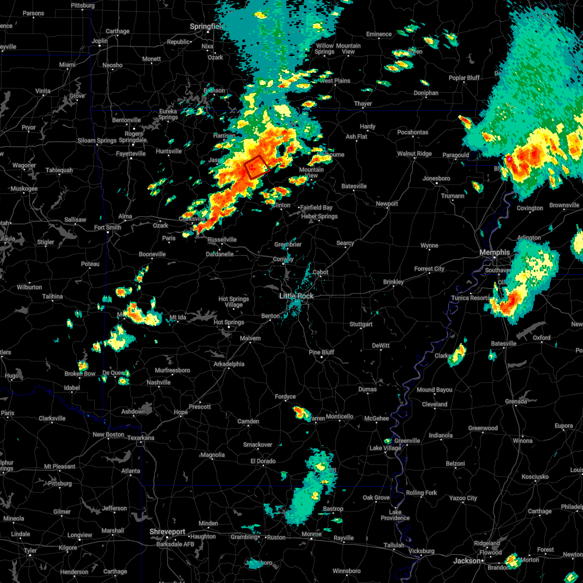 At 424 pm cdt, a severe thunderstorm capable of producing a tornado was located near duff, or near marshall, moving east at 30 mph (radar indicated rotation). Hazards include tornado and quarter size hail. Flying debris will be dangerous to those caught without shelter. mobile homes will be damaged or destroyed. damage to roofs, windows, and vehicles will occur. tree damage is likely. locations impacted include, duff, marsena, st. Joe, gilbert, zach, snowball, silver hill, baker ford,. At 424 pm cdt, a severe thunderstorm capable of producing a tornado was located near duff, or near marshall, moving east at 30 mph (radar indicated rotation). Hazards include tornado and quarter size hail. Flying debris will be dangerous to those caught without shelter. mobile homes will be damaged or destroyed. damage to roofs, windows, and vehicles will occur. tree damage is likely. locations impacted include, duff, marsena, st. Joe, gilbert, zach, snowball, silver hill, baker ford,.
|
| 5/21/2022 4:10 PM CDT |
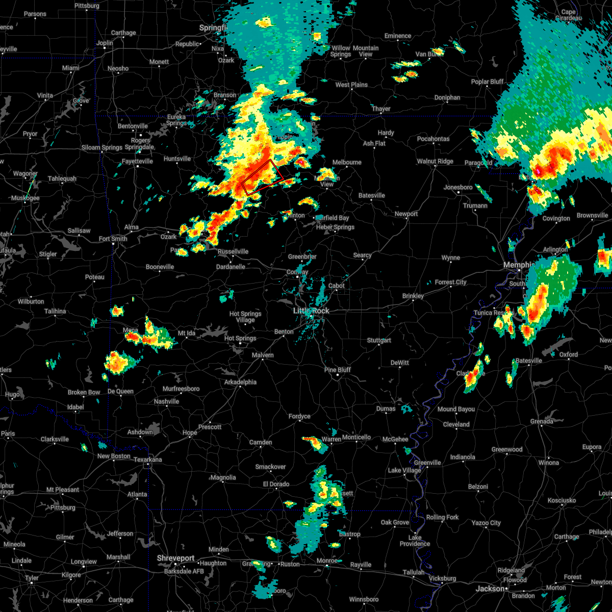 At 410 pm cdt, a severe thunderstorm capable of producing a tornado was located over eula, or 14 miles west of marshall, moving northeast at 30 mph (radar indicated rotation). Hazards include tornado and quarter size hail. Flying debris will be dangerous to those caught without shelter. mobile homes will be damaged or destroyed. damage to roofs, windows, and vehicles will occur. tree damage is likely. locations impacted include, duff, marsena, eula, point peter, st. Joe, gilbert, zach, bass, snowball, silver hill, woolum recreation area, baker ford,. At 410 pm cdt, a severe thunderstorm capable of producing a tornado was located over eula, or 14 miles west of marshall, moving northeast at 30 mph (radar indicated rotation). Hazards include tornado and quarter size hail. Flying debris will be dangerous to those caught without shelter. mobile homes will be damaged or destroyed. damage to roofs, windows, and vehicles will occur. tree damage is likely. locations impacted include, duff, marsena, eula, point peter, st. Joe, gilbert, zach, bass, snowball, silver hill, woolum recreation area, baker ford,.
|
| 5/21/2022 4:02 PM CDT |
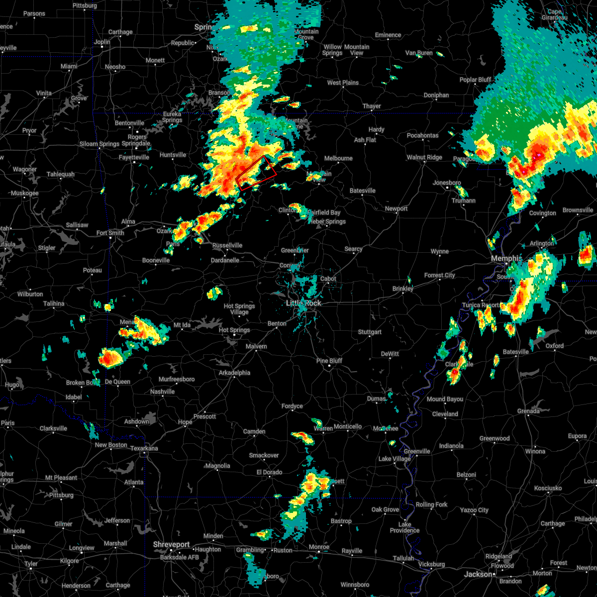 At 402 pm cdt, a severe thunderstorm capable of producing a tornado was located near eula, or 15 miles southeast of jasper, moving northeast at 30 mph (radar indicated rotation). Hazards include tornado. Flying debris will be dangerous to those caught without shelter. mobile homes will be damaged or destroyed. damage to roofs, windows, and vehicles will occur. Tree damage is likely. At 402 pm cdt, a severe thunderstorm capable of producing a tornado was located near eula, or 15 miles southeast of jasper, moving northeast at 30 mph (radar indicated rotation). Hazards include tornado. Flying debris will be dangerous to those caught without shelter. mobile homes will be damaged or destroyed. damage to roofs, windows, and vehicles will occur. Tree damage is likely.
|
| 5/15/2022 2:06 PM CDT |
 At 206 pm cdt, a severe thunderstorm was located near maumee, or 8 miles northeast of marshall, moving east at 35 mph (radar indicated). Hazards include ping pong ball size hail and 60 mph wind gusts. People and animals outdoors will be injured. expect hail damage to roofs, siding, windows, and vehicles. expect wind damage to roofs, siding, and trees. locations impacted include, marshall, thola, duff, elberta, maumee, watts, rush, leslie, big flat, gilbert, zach, canaan, ralph, morning star, silver hill, oxley, cozahome, mull, maumee crossing, landis, hail threat, radar indicated max hail size, 1. 50 in wind threat, radar indicated max wind gust, 60 mph. At 206 pm cdt, a severe thunderstorm was located near maumee, or 8 miles northeast of marshall, moving east at 35 mph (radar indicated). Hazards include ping pong ball size hail and 60 mph wind gusts. People and animals outdoors will be injured. expect hail damage to roofs, siding, windows, and vehicles. expect wind damage to roofs, siding, and trees. locations impacted include, marshall, thola, duff, elberta, maumee, watts, rush, leslie, big flat, gilbert, zach, canaan, ralph, morning star, silver hill, oxley, cozahome, mull, maumee crossing, landis, hail threat, radar indicated max hail size, 1. 50 in wind threat, radar indicated max wind gust, 60 mph.
|
| 5/15/2022 1:51 PM CDT |
 At 150 pm cdt, severe thunderstorms were located along a line extending from near rush to moore, moving southeast at 30 mph (radar indicated). Hazards include 60 mph wind gusts and quarter size hail. Hail damage to vehicles is expected. Expect wind damage to roofs, siding, and trees. At 150 pm cdt, severe thunderstorms were located along a line extending from near rush to moore, moving southeast at 30 mph (radar indicated). Hazards include 60 mph wind gusts and quarter size hail. Hail damage to vehicles is expected. Expect wind damage to roofs, siding, and trees.
|
| 5/3/2022 12:08 AM CDT |
 At 1207 am cdt, severe thunderstorms were located along a line extending from near pyatt to near maumee to near woolum, moving east at 55 mph (radar indicated). Hazards include 60 mph wind gusts. Expect damage to roofs, siding, and trees. locations impacted include, bull shoals, marshall, yellville, flippin, bergman, western grove, pyatt, valley springs, dugger, olvey, marsena, witts spring, rocky hill, duff, moore, lakeway, dabney, clark hill, point peter, maumee, hail threat, radar indicated max hail size, <. 75 in wind threat, radar indicated max wind gust, 60 mph. At 1207 am cdt, severe thunderstorms were located along a line extending from near pyatt to near maumee to near woolum, moving east at 55 mph (radar indicated). Hazards include 60 mph wind gusts. Expect damage to roofs, siding, and trees. locations impacted include, bull shoals, marshall, yellville, flippin, bergman, western grove, pyatt, valley springs, dugger, olvey, marsena, witts spring, rocky hill, duff, moore, lakeway, dabney, clark hill, point peter, maumee, hail threat, radar indicated max hail size, <. 75 in wind threat, radar indicated max wind gust, 60 mph.
|
| 5/2/2022 11:59 PM CDT |
 At 1159 pm cdt, severe thunderstorms were located along a line extending from pyatt to near maumee to near witts spring, moving east at 50 mph (radar indicated). Hazards include 60 mph wind gusts. Expect damage to roofs, siding, and trees. locations impacted include, harrison, bull shoals, marshall, yellville, flippin, bergman, western grove, pyatt, valley springs, dugger, olvey, marsena, witts spring, rocky hill, carver, duff, moore, lakeway, dabney, clark hill, hail threat, radar indicated max hail size, <. 75 in wind threat, radar indicated max wind gust, 60 mph. At 1159 pm cdt, severe thunderstorms were located along a line extending from pyatt to near maumee to near witts spring, moving east at 50 mph (radar indicated). Hazards include 60 mph wind gusts. Expect damage to roofs, siding, and trees. locations impacted include, harrison, bull shoals, marshall, yellville, flippin, bergman, western grove, pyatt, valley springs, dugger, olvey, marsena, witts spring, rocky hill, carver, duff, moore, lakeway, dabney, clark hill, hail threat, radar indicated max hail size, <. 75 in wind threat, radar indicated max wind gust, 60 mph.
|
| 5/2/2022 11:43 PM CDT |
 At 1142 pm cdt, severe thunderstorms were located along a line extending from near harrison to near carver to near bertha, moving east at 45 mph (radar indicated). Hazards include 60 mph wind gusts. expect damage to roofs, siding, and trees At 1142 pm cdt, severe thunderstorms were located along a line extending from near harrison to near carver to near bertha, moving east at 45 mph (radar indicated). Hazards include 60 mph wind gusts. expect damage to roofs, siding, and trees
|
| 4/6/2022 1:23 AM CDT |
 At 123 am cdt, a severe thunderstorm was located over marsena, or 7 miles west of marshall, moving east at 50 mph (trained weather spotters). Hazards include 60 mph wind gusts and half dollar size hail. Hail damage to vehicles is expected. expect wind damage to roofs, siding, and trees. locations impacted include, fairfield bay, marshall, shirley, thola, marsena, kay, rocky hill, duff, point peter, maumee, elba, bohannon, imo, old lexington, elberta, watts, blanchard springs campground, leslie, st. Joe, big flat,. At 123 am cdt, a severe thunderstorm was located over marsena, or 7 miles west of marshall, moving east at 50 mph (trained weather spotters). Hazards include 60 mph wind gusts and half dollar size hail. Hail damage to vehicles is expected. expect wind damage to roofs, siding, and trees. locations impacted include, fairfield bay, marshall, shirley, thola, marsena, kay, rocky hill, duff, point peter, maumee, elba, bohannon, imo, old lexington, elberta, watts, blanchard springs campground, leslie, st. Joe, big flat,.
|
| 4/6/2022 1:12 AM CDT |
 At 112 am cdt, a severe thunderstorm was located near point peter, or 14 miles east of jasper, moving east at 50 mph (trained weather spotters). Hazards include 60 mph wind gusts and quarter size hail. Hail damage to vehicles is expected. Expect wind damage to roofs, siding, and trees. At 112 am cdt, a severe thunderstorm was located near point peter, or 14 miles east of jasper, moving east at 50 mph (trained weather spotters). Hazards include 60 mph wind gusts and quarter size hail. Hail damage to vehicles is expected. Expect wind damage to roofs, siding, and trees.
|
| 3/30/2022 9:45 AM CDT |
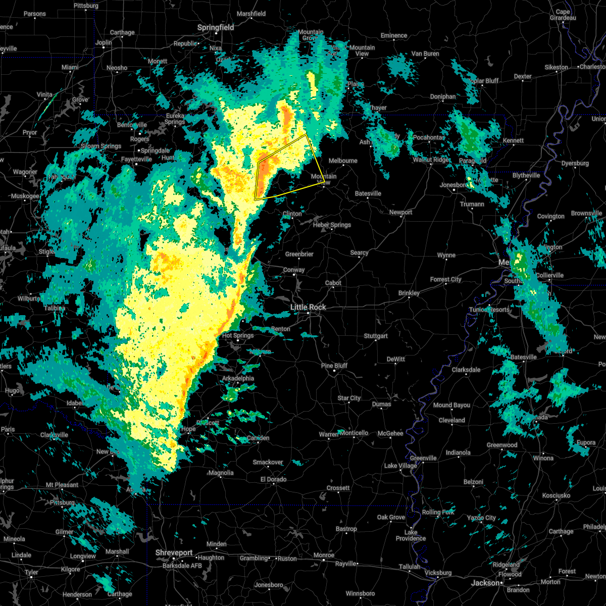 At 945 am cdt, severe thunderstorms were located along a line extending from near yellville to near marshall to near imo, moving northeast at 60 mph (radar indicated). Hazards include 60 mph wind gusts. Expect damage to roofs, siding, and trees. locations impacted include, marshall, norfork, salesville, briarcliff, marsena, witts spring, duff, herron, maumee, advance, cartney, bohannon, imo, culp, elberta, watts, blanchard springs campground, thola, kay, shipp, hail threat, radar indicated max hail size, <. 75 in wind threat, radar indicated max wind gust, 60 mph. At 945 am cdt, severe thunderstorms were located along a line extending from near yellville to near marshall to near imo, moving northeast at 60 mph (radar indicated). Hazards include 60 mph wind gusts. Expect damage to roofs, siding, and trees. locations impacted include, marshall, norfork, salesville, briarcliff, marsena, witts spring, duff, herron, maumee, advance, cartney, bohannon, imo, culp, elberta, watts, blanchard springs campground, thola, kay, shipp, hail threat, radar indicated max hail size, <. 75 in wind threat, radar indicated max wind gust, 60 mph.
|
| 3/30/2022 9:28 AM CDT |
 At 927 am cdt, severe thunderstorms were located along a line extending from near point peter to witts spring to near solo, moving northeast at 60 mph (radar indicated). Hazards include 60 mph wind gusts. expect damage to roofs, siding, and trees At 927 am cdt, severe thunderstorms were located along a line extending from near point peter to witts spring to near solo, moving northeast at 60 mph (radar indicated). Hazards include 60 mph wind gusts. expect damage to roofs, siding, and trees
|
| 3/30/2022 8:39 AM CDT |
 At 838 am cdt, severe thunderstorms were located along a line extending from near walnut to near dillen to holman, moving northeast at 55 mph (radar indicated). Hazards include 60 mph wind gusts. expect damage to roofs, siding, and trees At 838 am cdt, severe thunderstorms were located along a line extending from near walnut to near dillen to holman, moving northeast at 55 mph (radar indicated). Hazards include 60 mph wind gusts. expect damage to roofs, siding, and trees
|
| 8/13/2021 7:27 PM CDT |
 At 726 pm cdt, severe thunderstorms were located along a line extending from near ozark isle to near maumee to marsena, moving southeast at 15 mph (radar indicated). Hazards include 60 mph wind gusts and quarter size hail. Hail damage to vehicles is expected. expect wind damage to roofs, siding, and trees. locations impacted include, mountain home, bull shoals, marshall, yellville, gassville, flippin, lakeview in baxter county, pyatt, arkawana, marsena, duff, lakeway, bull shoals state park, clark hill, point peter, maumee, colfax, advance, cartney, bohannon, hail threat, radar indicated max hail size, 1. 00 in wind threat, radar indicated max wind gust, 60 mph. At 726 pm cdt, severe thunderstorms were located along a line extending from near ozark isle to near maumee to marsena, moving southeast at 15 mph (radar indicated). Hazards include 60 mph wind gusts and quarter size hail. Hail damage to vehicles is expected. expect wind damage to roofs, siding, and trees. locations impacted include, mountain home, bull shoals, marshall, yellville, gassville, flippin, lakeview in baxter county, pyatt, arkawana, marsena, duff, lakeway, bull shoals state park, clark hill, point peter, maumee, colfax, advance, cartney, bohannon, hail threat, radar indicated max hail size, 1. 00 in wind threat, radar indicated max wind gust, 60 mph.
|
| 8/13/2021 7:05 PM CDT |
 At 704 pm cdt, severe thunderstorms were located along a line extending from near lakeway to near maumee to 6 miles west of duff, moving east at 10 mph (radar indicated). Hazards include 60 mph wind gusts and quarter size hail. Hail damage to vehicles is expected. Expect wind damage to roofs, siding, and trees. At 704 pm cdt, severe thunderstorms were located along a line extending from near lakeway to near maumee to 6 miles west of duff, moving east at 10 mph (radar indicated). Hazards include 60 mph wind gusts and quarter size hail. Hail damage to vehicles is expected. Expect wind damage to roofs, siding, and trees.
|
| 5/9/2021 11:50 AM CDT |
 At 1149 am cdt, a severe thunderstorm was located near marshall, moving east at 40 mph (radar indicated). Hazards include 60 mph wind gusts and quarter size hail. Hail damage to vehicles is expected. Expect wind damage to roofs, siding, and trees. At 1149 am cdt, a severe thunderstorm was located near marshall, moving east at 40 mph (radar indicated). Hazards include 60 mph wind gusts and quarter size hail. Hail damage to vehicles is expected. Expect wind damage to roofs, siding, and trees.
|
| 5/3/2021 11:48 PM CDT |
 At 1123 pm cdt, severe thunderstorms were located along a line extending from near osage to near pruitt to piercetown to near moore to near smyrna, moving northeast at 50 mph (radar indicated). Hazards include 60 mph wind gusts and penny size hail. expect damage to roofs, siding, and trees At 1123 pm cdt, severe thunderstorms were located along a line extending from near osage to near pruitt to piercetown to near moore to near smyrna, moving northeast at 50 mph (radar indicated). Hazards include 60 mph wind gusts and penny size hail. expect damage to roofs, siding, and trees
|
| 5/3/2021 11:24 PM CDT |
 The national weather service in little rock has issued a * severe thunderstorm warning for. stone county in north central arkansas. searcy county in north central arkansas. eastern newton county in north central arkansas. Marion county in north central arkansas. The national weather service in little rock has issued a * severe thunderstorm warning for. stone county in north central arkansas. searcy county in north central arkansas. eastern newton county in north central arkansas. Marion county in north central arkansas.
|
| 11/14/2020 10:44 PM CST |
 At 1044 pm cst, a severe thunderstorm was located near marsena, or 7 miles southwest of marshall, moving east at 50 mph (radar indicated). Hazards include 60 mph wind gusts and penny size hail. expect damage to roofs, siding, and trees At 1044 pm cst, a severe thunderstorm was located near marsena, or 7 miles southwest of marshall, moving east at 50 mph (radar indicated). Hazards include 60 mph wind gusts and penny size hail. expect damage to roofs, siding, and trees
|
| 11/14/2020 10:37 PM CST |
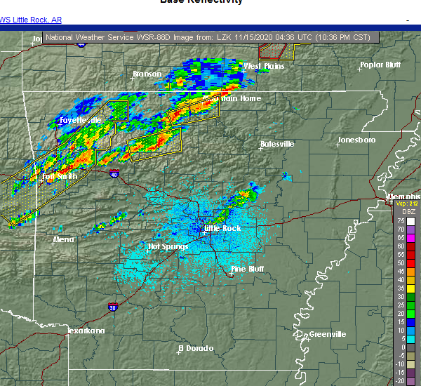 At 1036 pm cst, severe thunderstorms were located along a line extending from near eula to near dillen, moving east at 50 mph (radar indicated). Hazards include 60 mph wind gusts and penny size hail. Expect damage to roofs, siding, and trees. Locations impacted include, marshall, marsena, kay, witts spring, dillen, duff, moore, point peter, eula, bohannon, imo, bertha, watts, gilbert, ben hur, zach, bass, canaan, silver hill, fort douglas,. At 1036 pm cst, severe thunderstorms were located along a line extending from near eula to near dillen, moving east at 50 mph (radar indicated). Hazards include 60 mph wind gusts and penny size hail. Expect damage to roofs, siding, and trees. Locations impacted include, marshall, marsena, kay, witts spring, dillen, duff, moore, point peter, eula, bohannon, imo, bertha, watts, gilbert, ben hur, zach, bass, canaan, silver hill, fort douglas,.
|
| 11/14/2020 10:11 PM CST |
 At 1010 pm cst, severe thunderstorms were located along a line extending from near walnut to 7 miles southeast of cass, moving east at 45 mph (radar indicated). Hazards include 60 mph wind gusts and quarter size hail. Hail damage to vehicles is expected. Expect wind damage to roofs, siding, and trees. At 1010 pm cst, severe thunderstorms were located along a line extending from near walnut to 7 miles southeast of cass, moving east at 45 mph (radar indicated). Hazards include 60 mph wind gusts and quarter size hail. Hail damage to vehicles is expected. Expect wind damage to roofs, siding, and trees.
|
| 7/1/2020 12:28 PM CDT |
 At 1228 pm cdt, severe thunderstorms were located along a line extending from bexar to near harrison, moving south at 35 mph (radar indicated). Hazards include 60 mph wind gusts and quarter size hail. Hail damage to vehicles is expected. Expect wind damage to roofs, siding, and trees. At 1228 pm cdt, severe thunderstorms were located along a line extending from bexar to near harrison, moving south at 35 mph (radar indicated). Hazards include 60 mph wind gusts and quarter size hail. Hail damage to vehicles is expected. Expect wind damage to roofs, siding, and trees.
|
| 6/4/2020 7:07 AM CDT |
 The severe thunderstorm warning for searcy, newton and southeastern marion counties will expire at 715 am cdt, the storms which prompted the warning have weakened below severe limits, and no longer pose an immediate threat to life or property. therefore, the warning will be allowed to expire. however gusty winds are still possible with these thunderstorms. The severe thunderstorm warning for searcy, newton and southeastern marion counties will expire at 715 am cdt, the storms which prompted the warning have weakened below severe limits, and no longer pose an immediate threat to life or property. therefore, the warning will be allowed to expire. however gusty winds are still possible with these thunderstorms.
|
| 6/4/2020 7:01 AM CDT |
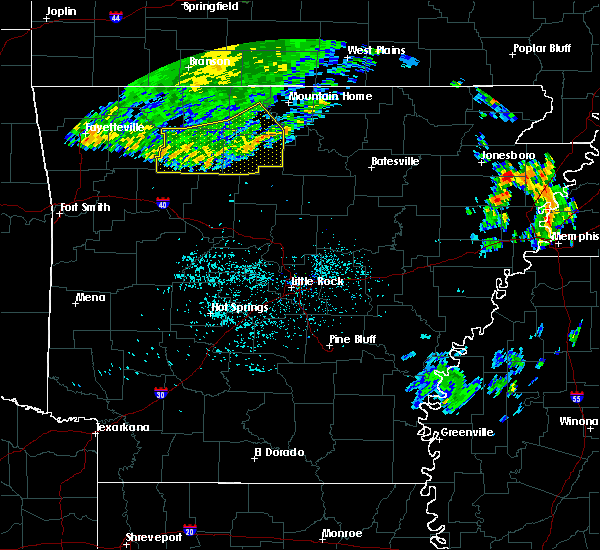 At 659 am cdt, severe thunderstorms were located along a line extending from 8 miles southeast of rush to near moore, moving southeast at 45 mph (radar indicated). Hazards include 60 mph wind gusts. Expect damage to roofs, siding, and trees. Locations impacted include, marshall, marsena, witts spring, carver, duff, moore, upper buffalo wilderness area, point peter, maumee, bohannon, imo, elberta, watts, thola, kay, rush, lion hill, eula, piercetown, walnut,. At 659 am cdt, severe thunderstorms were located along a line extending from 8 miles southeast of rush to near moore, moving southeast at 45 mph (radar indicated). Hazards include 60 mph wind gusts. Expect damage to roofs, siding, and trees. Locations impacted include, marshall, marsena, witts spring, carver, duff, moore, upper buffalo wilderness area, point peter, maumee, bohannon, imo, elberta, watts, thola, kay, rush, lion hill, eula, piercetown, walnut,.
|
| 6/4/2020 6:49 AM CDT |
 At 648 am cdt, severe thunderstorms were located along a line extending from rush to near piercetown, moving southeast at 45 mph (radar indicated). Hazards include 60 mph wind gusts. Expect damage to roofs, siding, and trees. Locations impacted include, marshall, yellville, jasper, flippin, western grove, valley springs, dugger, marsena, witts spring, carver, erbie, duff, moore, upper buffalo wilderness area, point peter, maumee, bohannon, lost valley state park, imo, pruitt,. At 648 am cdt, severe thunderstorms were located along a line extending from rush to near piercetown, moving southeast at 45 mph (radar indicated). Hazards include 60 mph wind gusts. Expect damage to roofs, siding, and trees. Locations impacted include, marshall, yellville, jasper, flippin, western grove, valley springs, dugger, marsena, witts spring, carver, erbie, duff, moore, upper buffalo wilderness area, point peter, maumee, bohannon, lost valley state park, imo, pruitt,.
|
| 6/4/2020 6:28 AM CDT |
 At 628 am cdt, severe thunderstorms were located along a line extending from near yellville to erbie, moving southeast at 45 mph (radar indicated). Hazards include 60 mph wind gusts. expect damage to roofs, siding, and trees At 628 am cdt, severe thunderstorms were located along a line extending from near yellville to erbie, moving southeast at 45 mph (radar indicated). Hazards include 60 mph wind gusts. expect damage to roofs, siding, and trees
|
| 5/22/2020 12:06 PM CDT |
 At 1205 pm cdt, severe thunderstorms were located along a line extending from near duff to dabney, moving east at 40 mph (radar indicated). Hazards include 60 mph wind gusts and penny size hail. expect damage to roofs, siding, and trees At 1205 pm cdt, severe thunderstorms were located along a line extending from near duff to dabney, moving east at 40 mph (radar indicated). Hazards include 60 mph wind gusts and penny size hail. expect damage to roofs, siding, and trees
|
| 5/22/2020 11:56 AM CDT |
 At 1155 am cdt, severe thunderstorms were located along a line extending from near ozark isle to imo, moving east at 50 mph (radar indicated). Hazards include 60 mph wind gusts and penny size hail. Expect damage to roofs, siding, and trees. Locations impacted include, bull shoals, marshall, yellville, flippin, pyatt, marsena, witts spring, duff, lakeway, bull shoals state park, clark hill, point peter, maumee, bohannon, imo, elberta, watts, kay, ozark isle, rush,. At 1155 am cdt, severe thunderstorms were located along a line extending from near ozark isle to imo, moving east at 50 mph (radar indicated). Hazards include 60 mph wind gusts and penny size hail. Expect damage to roofs, siding, and trees. Locations impacted include, bull shoals, marshall, yellville, flippin, pyatt, marsena, witts spring, duff, lakeway, bull shoals state park, clark hill, point peter, maumee, bohannon, imo, elberta, watts, kay, ozark isle, rush,.
|
| 5/22/2020 11:29 AM CDT |
 At 1128 am cdt, severe thunderstorms were located along a line extending from near harrison to near moore, moving east at 45 mph (radar indicated). Hazards include 60 mph wind gusts and penny size hail. expect damage to roofs, siding, and trees At 1128 am cdt, severe thunderstorms were located along a line extending from near harrison to near moore, moving east at 45 mph (radar indicated). Hazards include 60 mph wind gusts and penny size hail. expect damage to roofs, siding, and trees
|
| 5/4/2020 12:40 PM CDT |
 At 1240 pm cdt, a severe thunderstorm was located over point peter, or 13 miles west of marshall, moving east at 35 mph (radar indicated). Hazards include 60 mph wind gusts and half dollar size hail. Hail damage to vehicles is expected. expect wind damage to roofs, siding, and trees. locations impacted include, duff, marsena, eula, point peter, st. Joe, pindall, gilbert, canaan, snowball, silver hill, woolum recreation area, baker ford,. At 1240 pm cdt, a severe thunderstorm was located over point peter, or 13 miles west of marshall, moving east at 35 mph (radar indicated). Hazards include 60 mph wind gusts and half dollar size hail. Hail damage to vehicles is expected. expect wind damage to roofs, siding, and trees. locations impacted include, duff, marsena, eula, point peter, st. Joe, pindall, gilbert, canaan, snowball, silver hill, woolum recreation area, baker ford,.
|
| 5/4/2020 12:20 PM CDT |
 At 1220 pm cdt, a severe thunderstorm was located over piercetown, or near jasper, moving southeast at 30 mph (radar indicated). Hazards include two inch hail and 60 mph wind gusts. People and animals outdoors will be injured. expect hail damage to roofs, siding, windows, and vehicles. Expect wind damage to roofs, siding, and trees. At 1220 pm cdt, a severe thunderstorm was located over piercetown, or near jasper, moving southeast at 30 mph (radar indicated). Hazards include two inch hail and 60 mph wind gusts. People and animals outdoors will be injured. expect hail damage to roofs, siding, windows, and vehicles. Expect wind damage to roofs, siding, and trees.
|
| 4/28/2020 9:27 PM CDT |
 The severe thunderstorm warning for northern searcy, northeastern newton, southeastern marion, baxter and western fulton counties will expire at 930 pm cdt, the storms which prompted the warning have moved out of the area. therefore, the warning will be allowed to expire. however gusty winds and heavy rain are still possible with these thunderstorms. a severe thunderstorm watch remains in effect until 300 am cdt for north central arkansas. The severe thunderstorm warning for northern searcy, northeastern newton, southeastern marion, baxter and western fulton counties will expire at 930 pm cdt, the storms which prompted the warning have moved out of the area. therefore, the warning will be allowed to expire. however gusty winds and heavy rain are still possible with these thunderstorms. a severe thunderstorm watch remains in effect until 300 am cdt for north central arkansas.
|
| 4/28/2020 9:18 PM CDT |
 At 917 pm cdt, severe thunderstorms were located along a line extending from 7 miles northeast of marshall to moore to near holman, moving southeast at 50 mph (radar indicated). Hazards include 60 mph wind gusts and quarter size hail. Hail damage to vehicles is expected. Expect wind damage to roofs, siding, and trees. At 917 pm cdt, severe thunderstorms were located along a line extending from 7 miles northeast of marshall to moore to near holman, moving southeast at 50 mph (radar indicated). Hazards include 60 mph wind gusts and quarter size hail. Hail damage to vehicles is expected. Expect wind damage to roofs, siding, and trees.
|
| 4/28/2020 9:10 PM CDT |
 At 909 pm cdt, severe thunderstorms were located along a line extending from shipp to near rush to duff, moving east at 55 mph (radar indicated). Hazards include 60 mph wind gusts and quarter size hail. Hail damage to vehicles is expected. expect wind damage to roofs, siding, and trees. Locations impacted include, mountain home, bull shoals, yellville, jasper, gassville, flippin, lakeview in baxter county, norfork, salesville, western grove, viola, briarcliff, valley springs, arkawana, dugger, ott, carver, duff, bull shoals state park, herron,. At 909 pm cdt, severe thunderstorms were located along a line extending from shipp to near rush to duff, moving east at 55 mph (radar indicated). Hazards include 60 mph wind gusts and quarter size hail. Hail damage to vehicles is expected. expect wind damage to roofs, siding, and trees. Locations impacted include, mountain home, bull shoals, yellville, jasper, gassville, flippin, lakeview in baxter county, norfork, salesville, western grove, viola, briarcliff, valley springs, arkawana, dugger, ott, carver, duff, bull shoals state park, herron,.
|
| 4/28/2020 8:42 PM CDT |
 At 841 pm cdt, severe thunderstorms were located along a line extending from near clark hill to crawford to jasper, moving east at 50 mph (radar indicated). Hazards include 60 mph wind gusts and quarter size hail. Hail damage to vehicles is expected. Expect wind damage to roofs, siding, and trees. At 841 pm cdt, severe thunderstorms were located along a line extending from near clark hill to crawford to jasper, moving east at 50 mph (radar indicated). Hazards include 60 mph wind gusts and quarter size hail. Hail damage to vehicles is expected. Expect wind damage to roofs, siding, and trees.
|
| 1/10/2020 9:40 PM CST |
 At 938 pm cst, severe thunderstorms were located along a line extending from near flippin to near marshall to near watts to near cleveland, moving east at 35 mph (radar indicated). Hazards include 70 mph wind gusts and quarter size hail. Hail damage to vehicles is expected. expect considerable tree damage. wind damage is also likely to mobile homes, roofs, and outbuildings. Locations impacted include, mountain home, clinton, bull shoals, marshall, yellville, gassville, flippin, lakeview in baxter county, norfork, salesville, shirley, briarcliff, arkawana, rocky hill, bull shoals state park, maumee, colfax, advance, cartney, imo,. At 938 pm cst, severe thunderstorms were located along a line extending from near flippin to near marshall to near watts to near cleveland, moving east at 35 mph (radar indicated). Hazards include 70 mph wind gusts and quarter size hail. Hail damage to vehicles is expected. expect considerable tree damage. wind damage is also likely to mobile homes, roofs, and outbuildings. Locations impacted include, mountain home, clinton, bull shoals, marshall, yellville, gassville, flippin, lakeview in baxter county, norfork, salesville, shirley, briarcliff, arkawana, rocky hill, bull shoals state park, maumee, colfax, advance, cartney, imo,.
|
| 1/10/2020 8:46 PM CST |
 At 846 pm cst, severe thunderstorms were located along a line extending from near pruitt to near piercetown to near bertha to near broomfield to near dover, moving northeast at 45 mph (radar indicated). Hazards include 60 mph wind gusts and quarter size hail. Hail damage to vehicles is expected. Expect wind damage to roofs, siding, and trees. At 846 pm cst, severe thunderstorms were located along a line extending from near pruitt to near piercetown to near bertha to near broomfield to near dover, moving northeast at 45 mph (radar indicated). Hazards include 60 mph wind gusts and quarter size hail. Hail damage to vehicles is expected. Expect wind damage to roofs, siding, and trees.
|
| 10/21/2019 1:47 AM CDT |
 At 147 am cdt, severe thunderstorms were located along a line extending from 8 miles west of price place to near woodland, moving east at 55 mph (radar indicated). Hazards include 60 mph wind gusts and quarter size hail. Hail damage to vehicles is expected. Expect wind damage to roofs, siding, and trees. At 147 am cdt, severe thunderstorms were located along a line extending from 8 miles west of price place to near woodland, moving east at 55 mph (radar indicated). Hazards include 60 mph wind gusts and quarter size hail. Hail damage to vehicles is expected. Expect wind damage to roofs, siding, and trees.
|
| 8/27/2019 12:52 AM CDT |
 At 1252 am cdt, severe thunderstorms were located along a line extending from near witts spring to near solo to near holman, moving southeast at 40 mph (radar indicated). Hazards include 60 mph wind gusts. Expect damage to roofs, siding, and trees. Locations impacted include, russellville, clinton, marshall, atkins, pottsville, lamar, dover, hector, witts spring, duff, maumee, bohannon, blick, elberta, watts, holman, broomfield, eula, elba, old lexington, this includes interstate 40 between mile markers 81 and 97. At 1252 am cdt, severe thunderstorms were located along a line extending from near witts spring to near solo to near holman, moving southeast at 40 mph (radar indicated). Hazards include 60 mph wind gusts. Expect damage to roofs, siding, and trees. Locations impacted include, russellville, clinton, marshall, atkins, pottsville, lamar, dover, hector, witts spring, duff, maumee, bohannon, blick, elberta, watts, holman, broomfield, eula, elba, old lexington, this includes interstate 40 between mile markers 81 and 97.
|
| 8/27/2019 12:29 AM CDT |
 At 1229 am cdt, severe thunderstorms were located along a line extending from near jasper to 9 miles southwest of piercetown to near dillen to 6 miles north of woodland, moving southeast at 45 mph (radar indicated). Hazards include 60 mph wind gusts. expect damage to roofs, siding, and trees At 1229 am cdt, severe thunderstorms were located along a line extending from near jasper to 9 miles southwest of piercetown to near dillen to 6 miles north of woodland, moving southeast at 45 mph (radar indicated). Hazards include 60 mph wind gusts. expect damage to roofs, siding, and trees
|
| 8/27/2019 12:14 AM CDT |
 At 1213 am cdt, severe thunderstorms were located along a line extending from near red bank to near jasper to 7 miles east of upper buffalo wilderness area to 8 miles southeast of pettigrew, moving east at 55 mph (radar indicated). Hazards include 60 mph wind gusts. Expect damage to roofs, siding, and trees. Locations impacted include, jasper, western grove, valley springs, dugger, olvey, marsena, carver, erbie, duff, upper buffalo wilderness area, point peter, devils knob, lost valley state park, pruitt, rosetta, dillen, red bank, eula, piercetown, walnut,. At 1213 am cdt, severe thunderstorms were located along a line extending from near red bank to near jasper to 7 miles east of upper buffalo wilderness area to 8 miles southeast of pettigrew, moving east at 55 mph (radar indicated). Hazards include 60 mph wind gusts. Expect damage to roofs, siding, and trees. Locations impacted include, jasper, western grove, valley springs, dugger, olvey, marsena, carver, erbie, duff, upper buffalo wilderness area, point peter, devils knob, lost valley state park, pruitt, rosetta, dillen, red bank, eula, piercetown, walnut,.
|
| 8/26/2019 11:59 PM CDT |
 At 1144 pm cdt, severe thunderstorms were located along a line extending from near berryville to marble to near aurora to 7 miles west of saint paul, moving east at 55 mph (radar indicated). Hazards include 60 mph wind gusts. expect damage to roofs, siding, and trees At 1144 pm cdt, severe thunderstorms were located along a line extending from near berryville to marble to near aurora to 7 miles west of saint paul, moving east at 55 mph (radar indicated). Hazards include 60 mph wind gusts. expect damage to roofs, siding, and trees
|
| 8/26/2019 11:45 PM CDT |
 At 1144 pm cdt, severe thunderstorms were located along a line extending from near berryville to marble to near aurora to 7 miles west of saint paul, moving east at 55 mph (radar indicated). Hazards include 60 mph wind gusts. expect damage to roofs, siding, and trees At 1144 pm cdt, severe thunderstorms were located along a line extending from near berryville to marble to near aurora to 7 miles west of saint paul, moving east at 55 mph (radar indicated). Hazards include 60 mph wind gusts. expect damage to roofs, siding, and trees
|
| 8/26/2019 5:46 PM CDT |
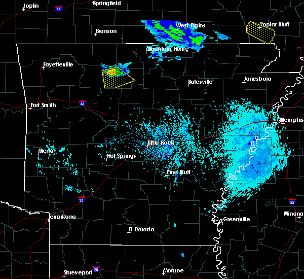 At 545 pm cdt, a severe thunderstorm was located near point peter, or 14 miles east of jasper, moving southeast at 25 mph (radar indicated). Hazards include 60 mph wind gusts and quarter size hail. Hail damage to vehicles is expected. expect wind damage to roofs, siding, and trees. locations impacted include, marshall, marsena, eula, bohannon, witts spring, piercetown, carver, duff, moore, point peter, st. Joe, pindall, ben hur, bass, canaan, silver hill, vendor, mt judea, snowball, hasty,. At 545 pm cdt, a severe thunderstorm was located near point peter, or 14 miles east of jasper, moving southeast at 25 mph (radar indicated). Hazards include 60 mph wind gusts and quarter size hail. Hail damage to vehicles is expected. expect wind damage to roofs, siding, and trees. locations impacted include, marshall, marsena, eula, bohannon, witts spring, piercetown, carver, duff, moore, point peter, st. Joe, pindall, ben hur, bass, canaan, silver hill, vendor, mt judea, snowball, hasty,.
|
| 8/26/2019 5:25 PM CDT |
 At 524 pm cdt, a severe thunderstorm was located near western grove, or 11 miles northeast of jasper, moving southeast at 25 mph (radar indicated). Hazards include 60 mph wind gusts and quarter size hail. Hail damage to vehicles is expected. Expect wind damage to roofs, siding, and trees. At 524 pm cdt, a severe thunderstorm was located near western grove, or 11 miles northeast of jasper, moving southeast at 25 mph (radar indicated). Hazards include 60 mph wind gusts and quarter size hail. Hail damage to vehicles is expected. Expect wind damage to roofs, siding, and trees.
|
| 5/29/2019 3:25 PM CDT |
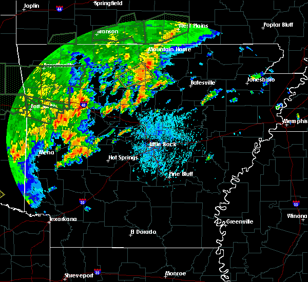 The severe thunderstorm warning for west central stone, central searcy, southeastern marion and south central baxter counties will expire at 330 pm cdt, the severe thunderstorm which prompted the warning has weakened. therefore, the warning will be allowed to expire. a tornado watch remains in effect until 800 pm cdt for north central arkansas. &&. The severe thunderstorm warning for west central stone, central searcy, southeastern marion and south central baxter counties will expire at 330 pm cdt, the severe thunderstorm which prompted the warning has weakened. therefore, the warning will be allowed to expire. a tornado watch remains in effect until 800 pm cdt for north central arkansas. &&.
|
| 5/29/2019 2:42 PM CDT |
 At 242 pm cdt, a severe thunderstorm was located 3 miles west of marshall, moving northeast at 30 mph (radar indicated). Hazards include ping pong ball size hail and 60 mph wind gusts. People and animals outdoors will be injured. expect hail damage to roofs, siding, windows, and vehicles. Expect wind damage to roofs, siding, and trees. At 242 pm cdt, a severe thunderstorm was located 3 miles west of marshall, moving northeast at 30 mph (radar indicated). Hazards include ping pong ball size hail and 60 mph wind gusts. People and animals outdoors will be injured. expect hail damage to roofs, siding, windows, and vehicles. Expect wind damage to roofs, siding, and trees.
|
| 5/29/2019 2:35 PM CDT |
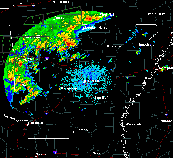 At 234 pm cdt, a severe thunderstorm was located 5 miles west of marshall, moving northeast at 30 mph (radar indicated). Hazards include ping pong ball size hail and 60 mph wind gusts. People and animals outdoors will be injured. expect hail damage to roofs, siding, windows, and vehicles. expect wind damage to roofs, siding, and trees. Locations impacted include, marshall, duff, marsena, eula, bohannon, point peter, gilbert, zach, canaan, snowball, silver hill, baker ford, a tornado watch remains in effect until 800 pm cdt for north central arkansas. At 234 pm cdt, a severe thunderstorm was located 5 miles west of marshall, moving northeast at 30 mph (radar indicated). Hazards include ping pong ball size hail and 60 mph wind gusts. People and animals outdoors will be injured. expect hail damage to roofs, siding, windows, and vehicles. expect wind damage to roofs, siding, and trees. Locations impacted include, marshall, duff, marsena, eula, bohannon, point peter, gilbert, zach, canaan, snowball, silver hill, baker ford, a tornado watch remains in effect until 800 pm cdt for north central arkansas.
|
| 5/29/2019 2:23 PM CDT |
 At 222 pm cdt, a severe thunderstorm was located over bohannon, or 12 miles southwest of marshall, moving northeast at 25 mph (radar indicated). Hazards include 60 mph wind gusts and quarter size hail. Hail damage to vehicles is expected. expect wind damage to roofs, siding, and trees. locations impacted include, marshall, marsena, eula, bohannon, witts spring, duff, moore, point peter, st. Joe, pindall, gilbert, ben hur, zach, bass, canaan, silver hill, mt judea, snowball, woolum recreation area, baker ford, a tornado watch remains in effect until 800 pm cdt for north central arkansas. At 222 pm cdt, a severe thunderstorm was located over bohannon, or 12 miles southwest of marshall, moving northeast at 25 mph (radar indicated). Hazards include 60 mph wind gusts and quarter size hail. Hail damage to vehicles is expected. expect wind damage to roofs, siding, and trees. locations impacted include, marshall, marsena, eula, bohannon, witts spring, duff, moore, point peter, st. Joe, pindall, gilbert, ben hur, zach, bass, canaan, silver hill, mt judea, snowball, woolum recreation area, baker ford, a tornado watch remains in effect until 800 pm cdt for north central arkansas.
|
| 5/29/2019 2:05 PM CDT |
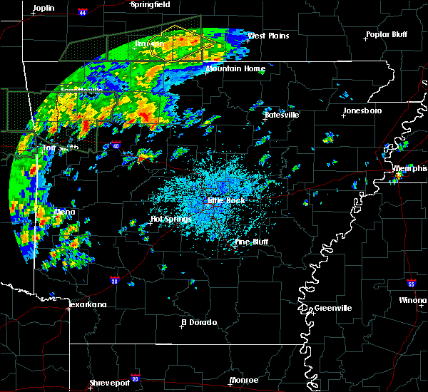 At 205 pm cdt, a severe thunderstorm was located near moore, or 18 miles southeast of jasper, moving northeast at 30 mph (radar indicated). Hazards include 60 mph wind gusts and quarter size hail. Hail damage to vehicles is expected. Expect wind damage to roofs, siding, and trees. At 205 pm cdt, a severe thunderstorm was located near moore, or 18 miles southeast of jasper, moving northeast at 30 mph (radar indicated). Hazards include 60 mph wind gusts and quarter size hail. Hail damage to vehicles is expected. Expect wind damage to roofs, siding, and trees.
|
| 5/21/2019 3:06 PM CDT |
 At 306 pm cdt, severe thunderstorms were located along a line extending from 7 miles east of diamond city to near yellville to near maumee, moving northeast at 55 mph (radar indicated). Hazards include 60 mph wind gusts and quarter size hail. Hail damage to vehicles is expected. expect wind damage to roofs, siding, and trees. Locations impacted include, mountain home, bull shoals, marshall, yellville, gassville, flippin, lakeview in baxter county, diamond city, norfork, salesville, lead hill, briarcliff, pyatt, arkawana, marsena, duff, lakeway, bull shoals state park, clark hill, herron, a tornado watch remains in effect until 700 pm cdt for north central arkansas. At 306 pm cdt, severe thunderstorms were located along a line extending from 7 miles east of diamond city to near yellville to near maumee, moving northeast at 55 mph (radar indicated). Hazards include 60 mph wind gusts and quarter size hail. Hail damage to vehicles is expected. expect wind damage to roofs, siding, and trees. Locations impacted include, mountain home, bull shoals, marshall, yellville, gassville, flippin, lakeview in baxter county, diamond city, norfork, salesville, lead hill, briarcliff, pyatt, arkawana, marsena, duff, lakeway, bull shoals state park, clark hill, herron, a tornado watch remains in effect until 700 pm cdt for north central arkansas.
|
| 5/21/2019 2:40 PM CDT |
 At 240 pm cdt, severe thunderstorms were located along a line extending from bergman to point peter to near smyrna, moving northeast at 60 mph (radar indicated). Hazards include 60 mph wind gusts and quarter size hail. Hail damage to vehicles is expected. Expect wind damage to roofs, siding, and trees. At 240 pm cdt, severe thunderstorms were located along a line extending from bergman to point peter to near smyrna, moving northeast at 60 mph (radar indicated). Hazards include 60 mph wind gusts and quarter size hail. Hail damage to vehicles is expected. Expect wind damage to roofs, siding, and trees.
|
| 5/21/2019 2:26 PM CDT |
 At 225 pm cdt, a severe thunderstorm capable of producing a tornado was located near jasper, moving northeast at 55 mph (radar indicated rotation). Hazards include tornado and quarter size hail. Flying debris will be dangerous to those caught without shelter. mobile homes will be damaged or destroyed. damage to roofs, windows, and vehicles will occur. tree damage is likely. locations impacted include, jasper, western grove, dillen, carver, erbie, duff, red bank, point peter, eula, piercetown, walnut, pruitt, capps, upper buffalo wilderness area, st. Joe, pindall, bass, marble falls, yardelle, fort douglas,. At 225 pm cdt, a severe thunderstorm capable of producing a tornado was located near jasper, moving northeast at 55 mph (radar indicated rotation). Hazards include tornado and quarter size hail. Flying debris will be dangerous to those caught without shelter. mobile homes will be damaged or destroyed. damage to roofs, windows, and vehicles will occur. tree damage is likely. locations impacted include, jasper, western grove, dillen, carver, erbie, duff, red bank, point peter, eula, piercetown, walnut, pruitt, capps, upper buffalo wilderness area, st. Joe, pindall, bass, marble falls, yardelle, fort douglas,.
|
| 5/21/2019 2:06 PM CDT |
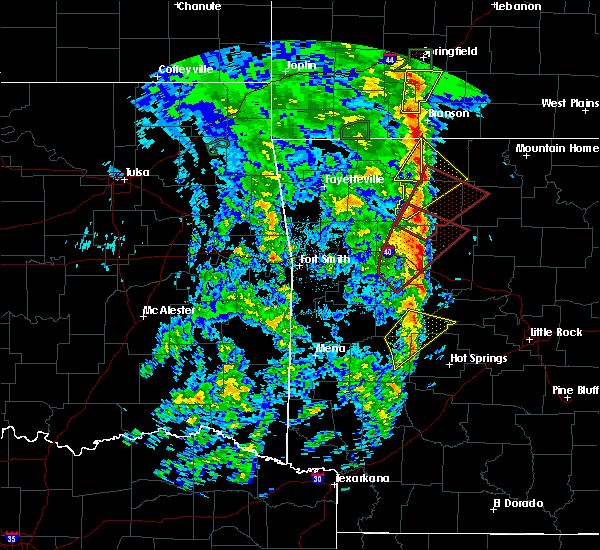 At 206 pm cdt, a severe thunderstorm capable of producing a tornado was located over rosetta, or 20 miles northeast of clarksville, moving northeast at 45 mph (radar indicated rotation). Hazards include tornado and quarter size hail. Flying debris will be dangerous to those caught without shelter. mobile homes will be damaged or destroyed. damage to roofs, windows, and vehicles will occur. Tree damage is likely. At 206 pm cdt, a severe thunderstorm capable of producing a tornado was located over rosetta, or 20 miles northeast of clarksville, moving northeast at 45 mph (radar indicated rotation). Hazards include tornado and quarter size hail. Flying debris will be dangerous to those caught without shelter. mobile homes will be damaged or destroyed. damage to roofs, windows, and vehicles will occur. Tree damage is likely.
|
| 5/18/2019 4:08 PM CDT |
 At 407 pm cdt, severe thunderstorms were located along a line extending from lead hill to 7 miles southwest of yellville to near marshall, moving east at 45 mph (radar indicated). Hazards include 60 mph wind gusts and quarter size hail. Hail damage to vehicles is expected. expect wind damage to roofs, siding, and trees. Locations impacted include, bull shoals, marshall, yellville, flippin, diamond city, lead hill, pyatt, dugger, marsena, duff, lakeway, winington, clark hill, point peter, maumee, imo, watts, kay, ozark isle, rush, a tornado watch remains in effect until 800 pm cdt for north central arkansas. At 407 pm cdt, severe thunderstorms were located along a line extending from lead hill to 7 miles southwest of yellville to near marshall, moving east at 45 mph (radar indicated). Hazards include 60 mph wind gusts and quarter size hail. Hail damage to vehicles is expected. expect wind damage to roofs, siding, and trees. Locations impacted include, bull shoals, marshall, yellville, flippin, diamond city, lead hill, pyatt, dugger, marsena, duff, lakeway, winington, clark hill, point peter, maumee, imo, watts, kay, ozark isle, rush, a tornado watch remains in effect until 800 pm cdt for north central arkansas.
|
| 5/18/2019 3:36 PM CDT |
 At 335 pm cdt, severe thunderstorms were located along a line extending from omaha to near bergman to near piercetown, moving east at 50 mph (radar indicated). Hazards include 60 mph wind gusts and quarter size hail. Hail damage to vehicles is expected. Expect wind damage to roofs, siding, and trees. At 335 pm cdt, severe thunderstorms were located along a line extending from omaha to near bergman to near piercetown, moving east at 50 mph (radar indicated). Hazards include 60 mph wind gusts and quarter size hail. Hail damage to vehicles is expected. Expect wind damage to roofs, siding, and trees.
|
| 12/1/2018 12:52 AM CST |
 At 1251 am cst, severe thunderstorms were located along a line extending from near lead hill to near yellville to maumee to near marshall, moving northeast at 70 mph (radar indicated). Hazards include 70 mph wind gusts. Expect considerable tree damage. Damage is likely to mobile homes, roofs, and outbuildings. At 1251 am cst, severe thunderstorms were located along a line extending from near lead hill to near yellville to maumee to near marshall, moving northeast at 70 mph (radar indicated). Hazards include 70 mph wind gusts. Expect considerable tree damage. Damage is likely to mobile homes, roofs, and outbuildings.
|
| 12/1/2018 12:46 AM CST |
 At 1245 am cst, severe thunderstorms were located along a line extending from near dugger to near marshall to near woolum to jerusalem to near plainview in yell county, moving east at 70 mph (radar indicated). Hazards include 70 mph wind gusts and quarter size hail. Hail damage to vehicles is expected. expect considerable tree damage. wind damage is also likely to mobile homes, roofs, and outbuildings. locations impacted include, russellville, danville, marshall, jasper, dardanelle, atkins, pottsville, dover, ola, london, hector, western grove, adona, witts spring, duff, maumee, bohannon, blick, pruitt, elberta, this includes interstate 40 between mile markers 73 and 104. A tornado watch remains in effect until 200 am cst for central, western and north central arkansas. At 1245 am cst, severe thunderstorms were located along a line extending from near dugger to near marshall to near woolum to jerusalem to near plainview in yell county, moving east at 70 mph (radar indicated). Hazards include 70 mph wind gusts and quarter size hail. Hail damage to vehicles is expected. expect considerable tree damage. wind damage is also likely to mobile homes, roofs, and outbuildings. locations impacted include, russellville, danville, marshall, jasper, dardanelle, atkins, pottsville, dover, ola, london, hector, western grove, adona, witts spring, duff, maumee, bohannon, blick, pruitt, elberta, this includes interstate 40 between mile markers 73 and 104. A tornado watch remains in effect until 200 am cst for central, western and north central arkansas.
|
| 12/1/2018 12:27 AM CST |
 At 1227 am cst, severe thunderstorms were located along a line extending from jasper to near moore to near solo to near lake dardanelle to 6 miles east of fourche valley, moving east at 70 mph (radar indicated). Hazards include 70 mph wind gusts and quarter size hail. Hail damage to vehicles is expected. expect considerable tree damage. wind damage is also likely to mobile homes, roofs, and outbuildings. locations impacted include, russellville, danville, marshall, jasper, dardanelle, atkins, pottsville, lamar, dover, ola, london, knoxville, hector, western grove, adona, witts spring, duff, upper buffalo wilderness area, maumee, bohannon, this includes interstate 40 between mile markers 62 and 104. A tornado watch remains in effect until 200 am cst for central, western and north central arkansas. At 1227 am cst, severe thunderstorms were located along a line extending from jasper to near moore to near solo to near lake dardanelle to 6 miles east of fourche valley, moving east at 70 mph (radar indicated). Hazards include 70 mph wind gusts and quarter size hail. Hail damage to vehicles is expected. expect considerable tree damage. wind damage is also likely to mobile homes, roofs, and outbuildings. locations impacted include, russellville, danville, marshall, jasper, dardanelle, atkins, pottsville, lamar, dover, ola, london, knoxville, hector, western grove, adona, witts spring, duff, upper buffalo wilderness area, maumee, bohannon, this includes interstate 40 between mile markers 62 and 104. A tornado watch remains in effect until 200 am cst for central, western and north central arkansas.
|
| 12/1/2018 12:08 AM CST |
 At 1208 am cst, severe thunderstorms were located along a line extending from near devils knob to 7 miles north of holman to near mount magazine to 6 miles west of muddy creek wma, moving northeast at 65 mph (radar indicated). Hazards include 60 mph wind gusts and quarter size hail. Hail damage to vehicles is expected. Expect wind damage to roofs, siding, and trees. At 1208 am cst, severe thunderstorms were located along a line extending from near devils knob to 7 miles north of holman to near mount magazine to 6 miles west of muddy creek wma, moving northeast at 65 mph (radar indicated). Hazards include 60 mph wind gusts and quarter size hail. Hail damage to vehicles is expected. Expect wind damage to roofs, siding, and trees.
|
| 11/30/2018 7:16 PM CST |
 At 715 pm cst, a severe thunderstorm was located near duff, or 9 miles northwest of marshall, moving north at 40 mph (radar indicated). Hazards include ping pong ball size hail and 60 mph wind gusts. People and animals outdoors will be injured. expect hail damage to roofs, siding, windows, and vehicles. Expect wind damage to roofs, siding, and trees. At 715 pm cst, a severe thunderstorm was located near duff, or 9 miles northwest of marshall, moving north at 40 mph (radar indicated). Hazards include ping pong ball size hail and 60 mph wind gusts. People and animals outdoors will be injured. expect hail damage to roofs, siding, windows, and vehicles. Expect wind damage to roofs, siding, and trees.
|
| 11/30/2018 6:55 PM CST |
 At 655 pm cst, a severe thunderstorm was located over bohannon, or 8 miles southwest of marshall, moving north at 35 mph (radar indicated). Hazards include golf ball size hail and 60 mph wind gusts. People and animals outdoors will be injured. expect hail damage to roofs, siding, windows, and vehicles. expect wind damage to roofs, siding, and trees. locations impacted include, marshall, marsena, kay, bohannon, imo, duff, point peter, maumee, watts, st. Joe, pindall, gilbert, zach, canaan, morning star, silver hill, maumee crossing, snowball, lone pine, woolum recreation area, a tornado watch remains in effect until 200 am cst for north central arkansas. At 655 pm cst, a severe thunderstorm was located over bohannon, or 8 miles southwest of marshall, moving north at 35 mph (radar indicated). Hazards include golf ball size hail and 60 mph wind gusts. People and animals outdoors will be injured. expect hail damage to roofs, siding, windows, and vehicles. expect wind damage to roofs, siding, and trees. locations impacted include, marshall, marsena, kay, bohannon, imo, duff, point peter, maumee, watts, st. Joe, pindall, gilbert, zach, canaan, morning star, silver hill, maumee crossing, snowball, lone pine, woolum recreation area, a tornado watch remains in effect until 200 am cst for north central arkansas.
|
| 11/30/2018 6:39 PM CST |
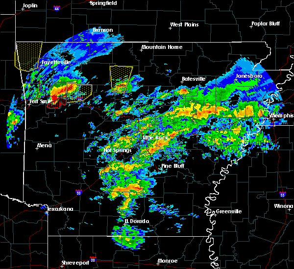 At 638 pm cst, a severe thunderstorm was located near dabney, or 17 miles southwest of marshall, moving north at 35 mph (radar indicated). Hazards include golf ball size hail and 60 mph wind gusts. People and animals outdoors will be injured. expect hail damage to roofs, siding, windows, and vehicles. Expect wind damage to roofs, siding, and trees. At 638 pm cst, a severe thunderstorm was located near dabney, or 17 miles southwest of marshall, moving north at 35 mph (radar indicated). Hazards include golf ball size hail and 60 mph wind gusts. People and animals outdoors will be injured. expect hail damage to roofs, siding, windows, and vehicles. Expect wind damage to roofs, siding, and trees.
|
| 8/29/2018 2:00 PM CDT |
 At 159 pm cdt, a severe thunderstorm was located over eula, or 15 miles east of jasper, moving southeast at 15 mph (radar indicated). Hazards include 60 mph wind gusts. Expect damage to roofs, siding, and trees. locations impacted include, marsena, eula, witts spring, moore, duff, point peter, st. Joe, gilbert, ben hur, zach, bass, silver hill, mt judea, snowball, woolum recreation area, baker ford,. At 159 pm cdt, a severe thunderstorm was located over eula, or 15 miles east of jasper, moving southeast at 15 mph (radar indicated). Hazards include 60 mph wind gusts. Expect damage to roofs, siding, and trees. locations impacted include, marsena, eula, witts spring, moore, duff, point peter, st. Joe, gilbert, ben hur, zach, bass, silver hill, mt judea, snowball, woolum recreation area, baker ford,.
|
| 8/29/2018 1:40 PM CDT |
 At 140 pm cdt, a severe thunderstorm was located over carver, or 11 miles east of jasper, moving southeast at 15 mph (radar indicated). Hazards include 60 mph wind gusts. expect damage to roofs, siding, and trees At 140 pm cdt, a severe thunderstorm was located over carver, or 11 miles east of jasper, moving southeast at 15 mph (radar indicated). Hazards include 60 mph wind gusts. expect damage to roofs, siding, and trees
|
| 7/21/2018 1:18 AM CDT |
 At 117 am cdt, severe thunderstorms were located along a line extending from 9 miles north of thola to near eula, moving southeast at 45 mph (radar indicated). Hazards include 60 mph wind gusts and quarter size hail. Hail damage to vehicles is expected. expect wind damage to roofs, siding, and trees. Locations impacted include, marshall, thola, marsena, kay, witts spring, rocky hill, moore, point peter, eula, bohannon, elba, imo, old lexington, elberta, watts, leslie, gilbert, zach, bass, alco,. At 117 am cdt, severe thunderstorms were located along a line extending from 9 miles north of thola to near eula, moving southeast at 45 mph (radar indicated). Hazards include 60 mph wind gusts and quarter size hail. Hail damage to vehicles is expected. expect wind damage to roofs, siding, and trees. Locations impacted include, marshall, thola, marsena, kay, witts spring, rocky hill, moore, point peter, eula, bohannon, elba, imo, old lexington, elberta, watts, leslie, gilbert, zach, bass, alco,.
|
| 7/21/2018 1:03 AM CDT |
 At 102 am cdt, severe thunderstorms were located along a line extending from near rush to near piercetown, moving southeast at 45 mph (radar indicated). Hazards include 60 mph wind gusts and quarter size hail. Hail damage to vehicles is expected. Expect wind damage to roofs, siding, and trees. At 102 am cdt, severe thunderstorms were located along a line extending from near rush to near piercetown, moving southeast at 45 mph (radar indicated). Hazards include 60 mph wind gusts and quarter size hail. Hail damage to vehicles is expected. Expect wind damage to roofs, siding, and trees.
|
| 7/19/2018 8:15 PM CDT |
 At 815 pm cdt, severe thunderstorms were located along a line extending from near rush to near duff to piercetown to near lost valley state park, moving southeast at 45 mph (radar indicated). Hazards include 60 mph wind gusts. Expect damage to roofs, siding, and trees. Locations impacted include, marshall, yellville, jasper, western grove, valley springs, dugger, marsena, witts spring, carver, erbie, moore, duff, point peter, maumee, bohannon, lost valley state park, imo, pruitt, watts, kay,. At 815 pm cdt, severe thunderstorms were located along a line extending from near rush to near duff to piercetown to near lost valley state park, moving southeast at 45 mph (radar indicated). Hazards include 60 mph wind gusts. Expect damage to roofs, siding, and trees. Locations impacted include, marshall, yellville, jasper, western grove, valley springs, dugger, marsena, witts spring, carver, erbie, moore, duff, point peter, maumee, bohannon, lost valley state park, imo, pruitt, watts, kay,.
|
| 7/19/2018 7:58 PM CDT |
 At 757 pm cdt, severe thunderstorms were located along a line extending from near lakeway to crawford to near pruitt to near osage, moving southeast at 45 mph (radar indicated). Hazards include 60 mph wind gusts. expect damage to roofs, siding, and trees At 757 pm cdt, severe thunderstorms were located along a line extending from near lakeway to crawford to near pruitt to near osage, moving southeast at 45 mph (radar indicated). Hazards include 60 mph wind gusts. expect damage to roofs, siding, and trees
|
| 6/24/2018 8:50 AM CDT |
 At 850 am cdt, a line of severe thunderstorms were located over kay, or 7 miles southwest of marshall, moving northeast at 50 mph (radar indicated). Hazards include 60 mph wind gusts. expect damage to roofs, siding, and trees At 850 am cdt, a line of severe thunderstorms were located over kay, or 7 miles southwest of marshall, moving northeast at 50 mph (radar indicated). Hazards include 60 mph wind gusts. expect damage to roofs, siding, and trees
|
| 6/24/2018 8:12 AM CDT |
 The severe thunderstorm warning for northeastern johnson, newton, western searcy, southwestern marion, southern boone and north central pope counties will expire at 815 am cdt, the storms which prompted the warning have weakened. therefore, the warning will be allowed to expire. a severe thunderstorm watch remains in effect until 1100 am cdt for western and central arkansas. The severe thunderstorm warning for northeastern johnson, newton, western searcy, southwestern marion, southern boone and north central pope counties will expire at 815 am cdt, the storms which prompted the warning have weakened. therefore, the warning will be allowed to expire. a severe thunderstorm watch remains in effect until 1100 am cdt for western and central arkansas.
|
| 6/24/2018 7:29 AM CDT |
 At 729 am cdt, severe thunderstorms were located along a line extending from near upper buffalo wilderness area to walnut to 7 miles south of rosetta, moving northeast at 45 mph (radar indicated). Hazards include 60 mph wind gusts. expect damage to roofs, siding, and trees At 729 am cdt, severe thunderstorms were located along a line extending from near upper buffalo wilderness area to walnut to 7 miles south of rosetta, moving northeast at 45 mph (radar indicated). Hazards include 60 mph wind gusts. expect damage to roofs, siding, and trees
|
| 6/2/2018 8:20 PM CDT |
 At 819 pm cdt, a severe thunderstorm was located over marshall, moving southeast at 35 mph (radar indicated). Hazards include 60 mph wind gusts and quarter size hail. Hail damage to vehicles is expected. expect wind damage to roofs, siding, and trees. Locations impacted include, marshall, marsena, imo, watts, duff, gilbert, zach, canaan, morning star, silver hill, landis, maumee crossing, lone pine, harriet,. At 819 pm cdt, a severe thunderstorm was located over marshall, moving southeast at 35 mph (radar indicated). Hazards include 60 mph wind gusts and quarter size hail. Hail damage to vehicles is expected. expect wind damage to roofs, siding, and trees. Locations impacted include, marshall, marsena, imo, watts, duff, gilbert, zach, canaan, morning star, silver hill, landis, maumee crossing, lone pine, harriet,.
|
| 6/2/2018 8:11 PM CDT |
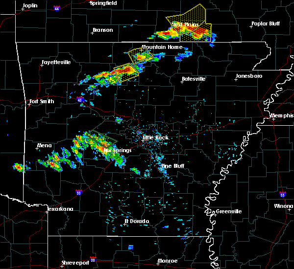 At 811 pm cdt, a severe thunderstorm was located near duff, or near marshall, moving southeast at 25 mph (radar indicated). Hazards include 60 mph wind gusts and half dollar size hail. Hail damage to vehicles is expected. expect wind damage to roofs, siding, and trees. locations impacted include, marshall, marsena, imo, duff, maumee, watts, st. Joe, gilbert, zach, canaan, morning star, silver hill, mull, landis, maumee crossing, lone pine, harriet, baker ford,. At 811 pm cdt, a severe thunderstorm was located near duff, or near marshall, moving southeast at 25 mph (radar indicated). Hazards include 60 mph wind gusts and half dollar size hail. Hail damage to vehicles is expected. expect wind damage to roofs, siding, and trees. locations impacted include, marshall, marsena, imo, duff, maumee, watts, st. Joe, gilbert, zach, canaan, morning star, silver hill, mull, landis, maumee crossing, lone pine, harriet, baker ford,.
|
| 6/2/2018 8:00 PM CDT | A tree was blown down across a power line on highway 14 in the southern part of marion count in marion county AR, 6 miles SSW of Gilbert, AR |
| 6/2/2018 7:58 PM CDT |
 At 758 pm cdt, a severe thunderstorm was located near maumee, or 11 miles south of yellville, moving southeast at 25 mph (radar indicated). Hazards include 60 mph wind gusts and quarter size hail. Hail damage to vehicles is expected. Expect wind damage to roofs, siding, and trees. At 758 pm cdt, a severe thunderstorm was located near maumee, or 11 miles south of yellville, moving southeast at 25 mph (radar indicated). Hazards include 60 mph wind gusts and quarter size hail. Hail damage to vehicles is expected. Expect wind damage to roofs, siding, and trees.
|
| 4/13/2018 8:37 PM CDT |
 At 837 pm cdt, severe thunderstorms were located along a line extending from fawn park to briarcliff to 7 miles north of thola to near kay to 6 miles southeast of dabney, moving northeast at 40 mph (radar indicated). Hazards include 60 mph wind gusts and nickel size hail. Expect damage to roofs, siding, and trees. Locations impacted include, russellville, mountain home, clinton, bull shoals, marshall, yellville, gassville, calico rock, dover, flippin, london, lakeview in baxter county, norfork, hector, salesville, viola, pineville, briarcliff, arkawana, witts spring, a tornado watch remains in effect until 1000 pm cdt for central, western and north central arkansas. At 837 pm cdt, severe thunderstorms were located along a line extending from fawn park to briarcliff to 7 miles north of thola to near kay to 6 miles southeast of dabney, moving northeast at 40 mph (radar indicated). Hazards include 60 mph wind gusts and nickel size hail. Expect damage to roofs, siding, and trees. Locations impacted include, russellville, mountain home, clinton, bull shoals, marshall, yellville, gassville, calico rock, dover, flippin, london, lakeview in baxter county, norfork, hector, salesville, viola, pineville, briarcliff, arkawana, witts spring, a tornado watch remains in effect until 1000 pm cdt for central, western and north central arkansas.
|
| 4/13/2018 8:05 PM CDT |
 At 805 pm cdt, severe thunderstorms were located along a line extending from yellville to near rush to bohannon to near solo to near dover, moving northeast at 40 mph (radar indicated). Hazards include 60 mph wind gusts and penny size hail. expect damage to roofs, siding, and trees At 805 pm cdt, severe thunderstorms were located along a line extending from yellville to near rush to bohannon to near solo to near dover, moving northeast at 40 mph (radar indicated). Hazards include 60 mph wind gusts and penny size hail. expect damage to roofs, siding, and trees
|
| 4/13/2018 7:50 PM CDT |
 At 750 pm cdt, severe thunderstorms were located along a line extending from near crawford to near duff to near eula to 7 miles northwest of broomfield, moving northeast at 40 mph (radar indicated). Hazards include 60 mph wind gusts and penny size hail. Expect damage to roofs, siding, and trees. Locations impacted include, mountain home, bull shoals, marshall, yellville, gassville, flippin, lakeview in baxter county, western grove, pyatt, valley springs, arkawana, dugger, marsena, olvey, witts spring, moore, duff, lakeway, dabney, bull shoals state park, a tornado watch remains in effect until 1000 pm cdt for western, central and north central arkansas. At 750 pm cdt, severe thunderstorms were located along a line extending from near crawford to near duff to near eula to 7 miles northwest of broomfield, moving northeast at 40 mph (radar indicated). Hazards include 60 mph wind gusts and penny size hail. Expect damage to roofs, siding, and trees. Locations impacted include, mountain home, bull shoals, marshall, yellville, gassville, flippin, lakeview in baxter county, western grove, pyatt, valley springs, arkawana, dugger, marsena, olvey, witts spring, moore, duff, lakeway, dabney, bull shoals state park, a tornado watch remains in effect until 1000 pm cdt for western, central and north central arkansas.
|
| 4/13/2018 7:26 PM CDT |
 At 726 pm cdt, severe thunderstorms were located along a line extending from near western grove to near carver to near moore to holman, moving northeast at 50 mph (radar indicated). Hazards include 60 mph wind gusts and nickel size hail. expect damage to roofs, siding, and trees At 726 pm cdt, severe thunderstorms were located along a line extending from near western grove to near carver to near moore to holman, moving northeast at 50 mph (radar indicated). Hazards include 60 mph wind gusts and nickel size hail. expect damage to roofs, siding, and trees
|
| 4/13/2018 7:06 PM CDT |
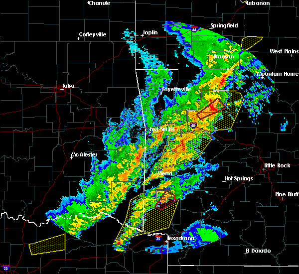 At 706 pm cdt, severe thunderstorms were located along a line extending from 8 miles north of dillen to near bertha to 6 miles north of holman, moving east at 45 mph (radar indicated). Hazards include 70 mph wind gusts and nickel size hail. Expect considerable tree damage. damage is likely to mobile homes, roofs, and outbuildings. Locations impacted include, clarksville, jasper, lamar, knoxville, hartman, hector, western grove, marsena, witts spring, carver, erbie, moore, duff, point peter, devils knob, hoyt, bohannon, pruitt, holman, rosetta, a tornado watch remains in effect until 1000 pm cdt for western, central and north central arkansas. At 706 pm cdt, severe thunderstorms were located along a line extending from 8 miles north of dillen to near bertha to 6 miles north of holman, moving east at 45 mph (radar indicated). Hazards include 70 mph wind gusts and nickel size hail. Expect considerable tree damage. damage is likely to mobile homes, roofs, and outbuildings. Locations impacted include, clarksville, jasper, lamar, knoxville, hartman, hector, western grove, marsena, witts spring, carver, erbie, moore, duff, point peter, devils knob, hoyt, bohannon, pruitt, holman, rosetta, a tornado watch remains in effect until 1000 pm cdt for western, central and north central arkansas.
|
| 4/13/2018 6:41 PM CDT |
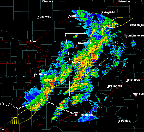 The national weather service in little rock has issued a * severe thunderstorm warning for. johnson county in western arkansas. newton county in north central arkansas. western searcy county in north central arkansas. Northwestern van buren county in north central arkansas. The national weather service in little rock has issued a * severe thunderstorm warning for. johnson county in western arkansas. newton county in north central arkansas. western searcy county in north central arkansas. Northwestern van buren county in north central arkansas.
|
| 4/3/2018 2:52 PM CDT |
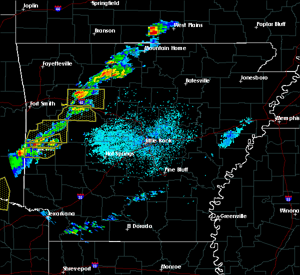 At 252 pm cdt, a severe thunderstorm was located near piercetown, or 10 miles southeast of jasper, moving east at 55 mph (radar indicated). Hazards include quarter size hail. damage to vehicles is expected At 252 pm cdt, a severe thunderstorm was located near piercetown, or 10 miles southeast of jasper, moving east at 55 mph (radar indicated). Hazards include quarter size hail. damage to vehicles is expected
|
| 2/24/2018 2:28 PM CST |
 At 228 pm cst, severe thunderstorms were located along a line extending from near lion hill to near rush to near evening star to near marshall, moving east at 65 mph (radar indicated). Hazards include 60 mph wind gusts. Expect damage to roofs, siding, and trees. Locations impacted include, mountain view, melbourne, marshall, horseshoe bend, calico rock, oxford, norfork, salesville, pineville, briarcliff, franklin, bexar, marsena, evening star, lone star, wideman, herron, maumee, byron, rodney, a tornado watch remains in effect until 600 pm cst for north central arkansas. At 228 pm cst, severe thunderstorms were located along a line extending from near lion hill to near rush to near evening star to near marshall, moving east at 65 mph (radar indicated). Hazards include 60 mph wind gusts. Expect damage to roofs, siding, and trees. Locations impacted include, mountain view, melbourne, marshall, horseshoe bend, calico rock, oxford, norfork, salesville, pineville, briarcliff, franklin, bexar, marsena, evening star, lone star, wideman, herron, maumee, byron, rodney, a tornado watch remains in effect until 600 pm cst for north central arkansas.
|
| 2/24/2018 2:16 PM CST |
 At 216 pm cst, severe thunderstorms were located along a line extending from near crawford to near maumee to near duff to near eula, moving east at 65 mph (radar indicated). Hazards include 60 mph wind gusts. expect damage to roofs, siding, and trees At 216 pm cst, severe thunderstorms were located along a line extending from near crawford to near maumee to near duff to near eula, moving east at 65 mph (radar indicated). Hazards include 60 mph wind gusts. expect damage to roofs, siding, and trees
|
| 8/18/2017 7:23 PM CDT |
 At 723 pm cdt, a severe thunderstorm was located over carver, or 7 miles east of jasper, moving southeast at 30 mph (radar indicated). Hazards include 60 mph wind gusts and quarter size hail. Hail damage to vehicles is expected. Expect wind damage to roofs, siding, and trees. At 723 pm cdt, a severe thunderstorm was located over carver, or 7 miles east of jasper, moving southeast at 30 mph (radar indicated). Hazards include 60 mph wind gusts and quarter size hail. Hail damage to vehicles is expected. Expect wind damage to roofs, siding, and trees.
|
| 6/23/2017 2:24 PM CDT |
 At 223 pm cdt, a severe thunderstorm was located over maumee, or 9 miles north of marshall, moving southeast at 45 mph (radar indicated). Hazards include 60 mph wind gusts. expect damage to roofs, siding, and trees At 223 pm cdt, a severe thunderstorm was located over maumee, or 9 miles north of marshall, moving southeast at 45 mph (radar indicated). Hazards include 60 mph wind gusts. expect damage to roofs, siding, and trees
|
| 5/27/2017 11:36 PM CDT |
 At 1136 pm cdt, a severe thunderstorm was located over duff, or 10 miles northwest of marshall, moving east at 40 mph (radar indicated). Hazards include 60 mph wind gusts and nickel size hail. Expect damage to roofs, siding, and trees. Locations impacted include, marshall, thola, marsena, kay, evening star, rocky hill, carver, duff, point peter, maumee, rush, eula, elba, bohannon, imo, piercetown, old lexington, elberta, watts, leslie, a tornado watch remains in effect until 200 am cdt for north central arkansas. At 1136 pm cdt, a severe thunderstorm was located over duff, or 10 miles northwest of marshall, moving east at 40 mph (radar indicated). Hazards include 60 mph wind gusts and nickel size hail. Expect damage to roofs, siding, and trees. Locations impacted include, marshall, thola, marsena, kay, evening star, rocky hill, carver, duff, point peter, maumee, rush, eula, elba, bohannon, imo, piercetown, old lexington, elberta, watts, leslie, a tornado watch remains in effect until 200 am cdt for north central arkansas.
|
| 5/27/2017 11:21 PM CDT |
 At 1120 pm cdt, a severe thunderstorm was located near carver, or 11 miles east of jasper, moving east at 35 mph (radar indicated). Hazards include 60 mph wind gusts and quarter size hail. Hail damage to vehicles is expected. Expect wind damage to roofs, siding, and trees. At 1120 pm cdt, a severe thunderstorm was located near carver, or 11 miles east of jasper, moving east at 35 mph (radar indicated). Hazards include 60 mph wind gusts and quarter size hail. Hail damage to vehicles is expected. Expect wind damage to roofs, siding, and trees.
|
| 5/19/2017 2:14 AM CDT |
 At 213 am cdt, severe thunderstorms were located along a line extending from near ozark isle to near rush to near woolum, moving east at 40 mph (radar indicated). Hazards include 60 mph wind gusts and nickel size hail. Expect damage to roofs, siding, and trees. Locations impacted include, bull shoals, marshall, yellville, flippin, kay, evening star, ozark isle, maumee, rush, lion hill, bohannon, imo, price place, watts, bull shoals state park, cotter, summit, fairview in marion county, gilbert, zach, a tornado watch remains in effect until 600 am cdt for north central arkansas. At 213 am cdt, severe thunderstorms were located along a line extending from near ozark isle to near rush to near woolum, moving east at 40 mph (radar indicated). Hazards include 60 mph wind gusts and nickel size hail. Expect damage to roofs, siding, and trees. Locations impacted include, bull shoals, marshall, yellville, flippin, kay, evening star, ozark isle, maumee, rush, lion hill, bohannon, imo, price place, watts, bull shoals state park, cotter, summit, fairview in marion county, gilbert, zach, a tornado watch remains in effect until 600 am cdt for north central arkansas.
|
| 5/19/2017 1:56 AM CDT |
 At 156 am cdt, severe thunderstorms were located along a line extending from near diamond city to near pyatt to near witts spring, moving east at 40 mph (radar indicated). Hazards include 60 mph wind gusts and nickel size hail. Expect damage to roofs, siding, and trees. Locations impacted include, bull shoals, marshall, yellville, flippin, diamond city, bergman, western grove, lead hill, pyatt, valley springs, dugger, olvey, marsena, evening star, witts spring, carver, duff, moore, lakeway, winington, a tornado watch remains in effect until 600 am cdt for north central arkansas. At 156 am cdt, severe thunderstorms were located along a line extending from near diamond city to near pyatt to near witts spring, moving east at 40 mph (radar indicated). Hazards include 60 mph wind gusts and nickel size hail. Expect damage to roofs, siding, and trees. Locations impacted include, bull shoals, marshall, yellville, flippin, diamond city, bergman, western grove, lead hill, pyatt, valley springs, dugger, olvey, marsena, evening star, witts spring, carver, duff, moore, lakeway, winington, a tornado watch remains in effect until 600 am cdt for north central arkansas.
|
| 5/19/2017 1:28 AM CDT |
 At 127 am cdt, severe thunderstorms were located along a line extending from near omaha to near harrison to near bertha, moving east at 45 mph (radar indicated). Hazards include 60 mph wind gusts and nickel size hail. expect damage to roofs, siding, and trees At 127 am cdt, severe thunderstorms were located along a line extending from near omaha to near harrison to near bertha, moving east at 45 mph (radar indicated). Hazards include 60 mph wind gusts and nickel size hail. expect damage to roofs, siding, and trees
|
| 4/29/2017 5:37 PM CDT |
 At 537 pm cdt, severe thunderstorms were located along a line extending from western grove to point peter to near moore, moving northeast at 50 mph (radar indicated). Hazards include 60 mph wind gusts. Expect damage to roofs, siding, and trees. locations impacted include, marsena, eula, witts spring, piercetown, carver, duff, moore, bertha, point peter, st. Joe, pindall, gilbert, ben hur, bass, yardelle, silver hill, vendor, mt judea, snowball, sand gap,. At 537 pm cdt, severe thunderstorms were located along a line extending from western grove to point peter to near moore, moving northeast at 50 mph (radar indicated). Hazards include 60 mph wind gusts. Expect damage to roofs, siding, and trees. locations impacted include, marsena, eula, witts spring, piercetown, carver, duff, moore, bertha, point peter, st. Joe, pindall, gilbert, ben hur, bass, yardelle, silver hill, vendor, mt judea, snowball, sand gap,.
|
| 4/29/2017 5:20 PM CDT |
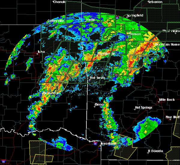 At 520 pm cdt, severe thunderstorms were located along a line extending from near piercetown to 8 miles northwest of moore to near bertha, moving northeast at 40 mph (radar indicated). Hazards include 60 mph wind gusts. expect damage to roofs, siding, and trees At 520 pm cdt, severe thunderstorms were located along a line extending from near piercetown to 8 miles northwest of moore to near bertha, moving northeast at 40 mph (radar indicated). Hazards include 60 mph wind gusts. expect damage to roofs, siding, and trees
|
| 4/4/2017 10:44 PM CDT |
 At 1044 pm cdt, severe thunderstorms were located along a line extending from near yellville to 6 miles west of rush to near maumee to near duff, moving northeast at 45 mph (radar indicated). Hazards include 60 mph wind gusts and quarter size hail. Hail damage to vehicles is expected. Expect wind damage to roofs, siding, and trees. At 1044 pm cdt, severe thunderstorms were located along a line extending from near yellville to 6 miles west of rush to near maumee to near duff, moving northeast at 45 mph (radar indicated). Hazards include 60 mph wind gusts and quarter size hail. Hail damage to vehicles is expected. Expect wind damage to roofs, siding, and trees.
|
| 4/4/2017 10:28 PM CDT |
 At 1026 pm cdt, a severe thunderstorm capable of producing a tornado was located near western grove, or 16 miles east of jasper, moving northeast at 50 mph (radar indicated rotation. damage has been reported in the deer community from this storm. additionally, ping pong ball size hail has been reported with this storm). Hazards include tornado and ping pong ball size hail. Flying debris will be dangerous to those caught without shelter. mobile homes will be damaged or destroyed. damage to roofs, windows, and vehicles will occur. tree damage is likely. locations impacted include, yellville, western grove, pyatt, dugger, evening star, duff, crawford, clark hill, point peter, maumee, everton, st. Joe, pindall, gilbert, zach, ralph, silver hill, cozahome, mull, maumee crossing,. At 1026 pm cdt, a severe thunderstorm capable of producing a tornado was located near western grove, or 16 miles east of jasper, moving northeast at 50 mph (radar indicated rotation. damage has been reported in the deer community from this storm. additionally, ping pong ball size hail has been reported with this storm). Hazards include tornado and ping pong ball size hail. Flying debris will be dangerous to those caught without shelter. mobile homes will be damaged or destroyed. damage to roofs, windows, and vehicles will occur. tree damage is likely. locations impacted include, yellville, western grove, pyatt, dugger, evening star, duff, crawford, clark hill, point peter, maumee, everton, st. Joe, pindall, gilbert, zach, ralph, silver hill, cozahome, mull, maumee crossing,.
|
| 4/4/2017 10:11 PM CDT |
 At 1010 pm cdt, a severe thunderstorm capable of producing a tornado was located near piercetown, or 11 miles southeast of jasper, moving northeast at 40 mph (radar indicated rotation). Hazards include tornado and quarter size hail. Flying debris will be dangerous to those caught without shelter. mobile homes will be damaged or destroyed. damage to roofs, windows, and vehicles will occur. Tree damage is likely. At 1010 pm cdt, a severe thunderstorm capable of producing a tornado was located near piercetown, or 11 miles southeast of jasper, moving northeast at 40 mph (radar indicated rotation). Hazards include tornado and quarter size hail. Flying debris will be dangerous to those caught without shelter. mobile homes will be damaged or destroyed. damage to roofs, windows, and vehicles will occur. Tree damage is likely.
|
| 3/29/2017 7:55 PM CDT |
 The tornado warning for southwestern searcy county will expire at 800 pm cdt, the storm which prompted the warning has weakened, and no longer appears capable of producing a tornado. therefore, the warning will be allowed to expire. a tornado watch remains in effect until midnight cdt for north central arkansas. The tornado warning for southwestern searcy county will expire at 800 pm cdt, the storm which prompted the warning has weakened, and no longer appears capable of producing a tornado. therefore, the warning will be allowed to expire. a tornado watch remains in effect until midnight cdt for north central arkansas.
|
| 3/29/2017 7:46 PM CDT |
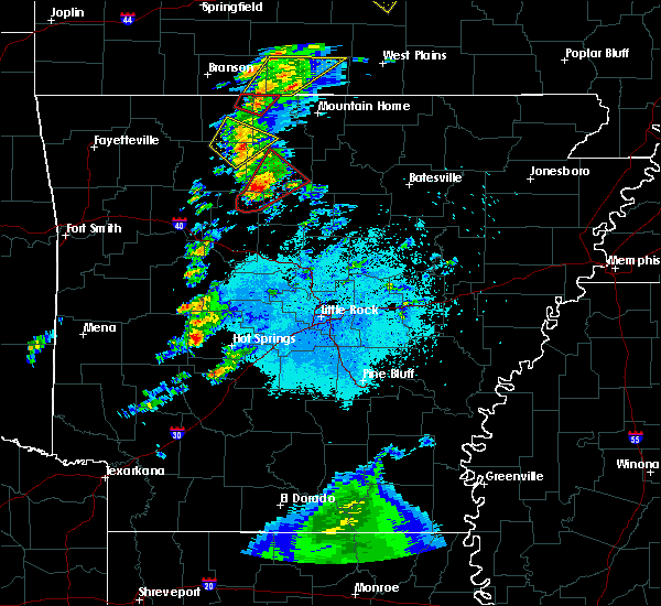 At 746 pm cdt, a severe thunderstorm capable of producing a tornado was located over bohannon, or 11 miles southwest of marshall, moving northeast at 45 mph (radar indicated rotation). Hazards include tornado and quarter size hail. Flying debris will be dangerous to those caught without shelter. mobile homes will be damaged or destroyed. damage to roofs, windows, and vehicles will occur. tree damage is likely. Locations impacted include, marshall, marsena, kay, bohannon, imo, witts spring, duff, watts, gilbert, zach, canaan, silver hill, snowball,. At 746 pm cdt, a severe thunderstorm capable of producing a tornado was located over bohannon, or 11 miles southwest of marshall, moving northeast at 45 mph (radar indicated rotation). Hazards include tornado and quarter size hail. Flying debris will be dangerous to those caught without shelter. mobile homes will be damaged or destroyed. damage to roofs, windows, and vehicles will occur. tree damage is likely. Locations impacted include, marshall, marsena, kay, bohannon, imo, witts spring, duff, watts, gilbert, zach, canaan, silver hill, snowball,.
|
| 3/29/2017 7:27 PM CDT |
 At 726 pm cdt, a confirmed tornado was located over smyrna, or 25 miles southwest of marshall, moving northeast at 40 mph (weather spotters confirmed tornado). Hazards include damaging tornado and quarter size hail. Flying debris will be dangerous to those caught without shelter. mobile homes will be damaged or destroyed. damage to roofs, windows, and vehicles will occur. Tree damage is likely. At 726 pm cdt, a confirmed tornado was located over smyrna, or 25 miles southwest of marshall, moving northeast at 40 mph (weather spotters confirmed tornado). Hazards include damaging tornado and quarter size hail. Flying debris will be dangerous to those caught without shelter. mobile homes will be damaged or destroyed. damage to roofs, windows, and vehicles will occur. Tree damage is likely.
|
| 3/7/2017 1:01 AM CST |
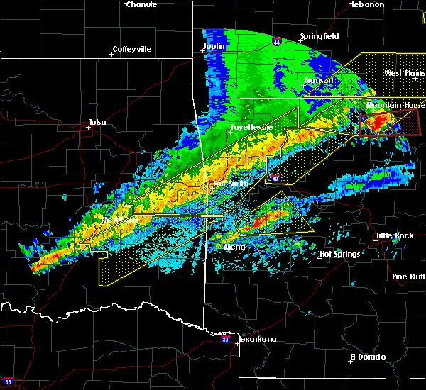 At 101 am cst, severe thunderstorms were located along a line extending from near western grove to 8 miles northeast of walnut to 9 miles southeast of pettigrew to near ozark, moving east at 35 mph (radar indicated). Hazards include 60 mph wind gusts and penny size hail. Expect damage to roofs, siding, and trees. locations impacted include, clarksville, jasper, lamar, hartman, carver, erbie, duff, moore, upper buffalo wilderness area, point peter, devils knob, lost valley state park, pruitt, holman, rosetta, dillen, woodland, eula, piercetown, walnut, this includes interstate 40 between mile markers 44 and 63. A tornado watch remains in effect until 500 am cst for western, central and north central arkansas. At 101 am cst, severe thunderstorms were located along a line extending from near western grove to 8 miles northeast of walnut to 9 miles southeast of pettigrew to near ozark, moving east at 35 mph (radar indicated). Hazards include 60 mph wind gusts and penny size hail. Expect damage to roofs, siding, and trees. locations impacted include, clarksville, jasper, lamar, hartman, carver, erbie, duff, moore, upper buffalo wilderness area, point peter, devils knob, lost valley state park, pruitt, holman, rosetta, dillen, woodland, eula, piercetown, walnut, this includes interstate 40 between mile markers 44 and 63. A tornado watch remains in effect until 500 am cst for western, central and north central arkansas.
|
| 3/7/2017 12:33 AM CST |
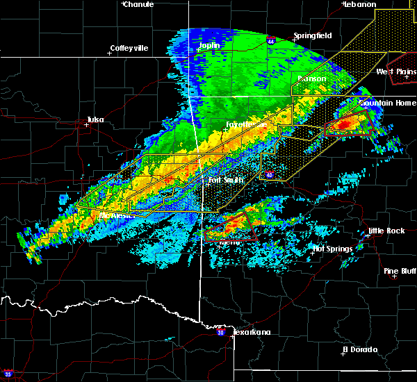 At 1232 am cst, severe thunderstorms were located along a line extending from near erbie to near witter to 6 miles northwest of cass to rudy, moving east at 65 mph (radar indicated). Hazards include 60 mph wind gusts and penny size hail. expect damage to roofs, siding, and trees At 1232 am cst, severe thunderstorms were located along a line extending from near erbie to near witter to 6 miles northwest of cass to rudy, moving east at 65 mph (radar indicated). Hazards include 60 mph wind gusts and penny size hail. expect damage to roofs, siding, and trees
|
| 3/7/2017 12:25 AM CST |
 At 1224 am cst, a severe thunderstorm capable of producing a tornado was located near duff, or 13 miles northwest of marshall, moving east at 45 mph (radar indicated rotation). Hazards include tornado and ping pong ball size hail. Flying debris will be dangerous to those caught without shelter. mobile homes will be damaged or destroyed. damage to roofs, windows, and vehicles will occur. Tree damage is likely. At 1224 am cst, a severe thunderstorm capable of producing a tornado was located near duff, or 13 miles northwest of marshall, moving east at 45 mph (radar indicated rotation). Hazards include tornado and ping pong ball size hail. Flying debris will be dangerous to those caught without shelter. mobile homes will be damaged or destroyed. damage to roofs, windows, and vehicles will occur. Tree damage is likely.
|
| 3/7/2017 12:23 AM CST |
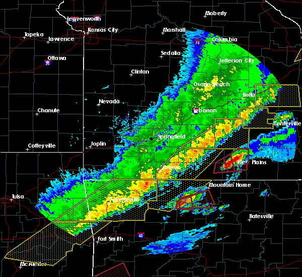 At 1222 am cst, a severe thunderstorm capable of producing a tornado was located near duff, or 13 miles northwest of marshall, moving east at 40 mph (radar indicated rotation). Hazards include tornado and ping pong ball size hail. Flying debris will be dangerous to those caught without shelter. mobile homes will be damaged or destroyed. damage to roofs, windows, and vehicles will occur. tree damage is likely. locations impacted include, yellville, duff, st. Joe, pindall, gilbert, bruno, baker ford, silver hill, eros, ralph,. At 1222 am cst, a severe thunderstorm capable of producing a tornado was located near duff, or 13 miles northwest of marshall, moving east at 40 mph (radar indicated rotation). Hazards include tornado and ping pong ball size hail. Flying debris will be dangerous to those caught without shelter. mobile homes will be damaged or destroyed. damage to roofs, windows, and vehicles will occur. tree damage is likely. locations impacted include, yellville, duff, st. Joe, pindall, gilbert, bruno, baker ford, silver hill, eros, ralph,.
|
| 3/7/2017 12:16 AM CST |
 At 1216 am cst, a severe thunderstorm capable of producing a tornado was located near western grove, or 16 miles east of jasper, moving east at 40 mph (radar indicated rotation). Hazards include tornado and golf ball size hail. Flying debris will be dangerous to those caught without shelter. mobile homes will be damaged or destroyed. damage to roofs, windows, and vehicles will occur. tree damage is likely. locations impacted include, marshall, yellville, western grove, valley springs, dugger, duff, point peter, everton, st. Joe, pindall, gilbert, zach, yardelle, silver hill, bruno, woolum recreation area, baker ford, eros, ralph,. At 1216 am cst, a severe thunderstorm capable of producing a tornado was located near western grove, or 16 miles east of jasper, moving east at 40 mph (radar indicated rotation). Hazards include tornado and golf ball size hail. Flying debris will be dangerous to those caught without shelter. mobile homes will be damaged or destroyed. damage to roofs, windows, and vehicles will occur. tree damage is likely. locations impacted include, marshall, yellville, western grove, valley springs, dugger, duff, point peter, everton, st. Joe, pindall, gilbert, zach, yardelle, silver hill, bruno, woolum recreation area, baker ford, eros, ralph,.
|
| 3/7/2017 12:09 AM CST |
 At 1208 am cst, a severe thunderstorm capable of producing a tornado was located over carver, or 10 miles east of jasper, moving east at 40 mph (radar indicated rotation). Hazards include tornado and golf ball size hail. Flying debris will be dangerous to those caught without shelter. mobile homes will be damaged or destroyed. damage to roofs, windows, and vehicles will occur. tree damage is likely. locations impacted include, marshall, yellville, western grove, valley springs, dugger, carver, duff, point peter, piercetown, pruitt, crawford, everton, st. Joe, pindall, gilbert, zach, marble falls, yardelle, silver hill, eros,. At 1208 am cst, a severe thunderstorm capable of producing a tornado was located over carver, or 10 miles east of jasper, moving east at 40 mph (radar indicated rotation). Hazards include tornado and golf ball size hail. Flying debris will be dangerous to those caught without shelter. mobile homes will be damaged or destroyed. damage to roofs, windows, and vehicles will occur. tree damage is likely. locations impacted include, marshall, yellville, western grove, valley springs, dugger, carver, duff, point peter, piercetown, pruitt, crawford, everton, st. Joe, pindall, gilbert, zach, marble falls, yardelle, silver hill, eros,.
|
| 3/7/2017 12:02 AM CST |
 At 1201 am cst, a severe thunderstorm capable of producing a tornado was located over piercetown, or near jasper, moving east at 40 mph (radar indicated rotation). Hazards include tornado and golf ball size hail. Flying debris will be dangerous to those caught without shelter. mobile homes will be damaged or destroyed. damage to roofs, windows, and vehicles will occur. tree damage is likely. locations impacted include, marshall, yellville, jasper, western grove, valley springs, dugger, carver, erbie, duff, point peter, piercetown, pruitt, crawford, everton, st. Joe, pindall, gilbert, zach, marble falls, yardelle,. At 1201 am cst, a severe thunderstorm capable of producing a tornado was located over piercetown, or near jasper, moving east at 40 mph (radar indicated rotation). Hazards include tornado and golf ball size hail. Flying debris will be dangerous to those caught without shelter. mobile homes will be damaged or destroyed. damage to roofs, windows, and vehicles will occur. tree damage is likely. locations impacted include, marshall, yellville, jasper, western grove, valley springs, dugger, carver, erbie, duff, point peter, piercetown, pruitt, crawford, everton, st. Joe, pindall, gilbert, zach, marble falls, yardelle,.
|
| 3/6/2017 11:51 PM CST |
 At 1150 pm cst, a severe thunderstorm capable of producing a tornado was located near jasper, moving east at 40 mph (radar indicated rotation). Hazards include tornado and golf ball size hail. Flying debris will be dangerous to those caught without shelter. mobile homes will be damaged or destroyed. damage to roofs, windows, and vehicles will occur. Tree damage is likely. At 1150 pm cst, a severe thunderstorm capable of producing a tornado was located near jasper, moving east at 40 mph (radar indicated rotation). Hazards include tornado and golf ball size hail. Flying debris will be dangerous to those caught without shelter. mobile homes will be damaged or destroyed. damage to roofs, windows, and vehicles will occur. Tree damage is likely.
|
| 3/1/2017 2:10 AM CST |
 At 209 am cst, severe thunderstorms were located along a line extending from near marsena to near woolum to 6 miles south of dabney to near jerusalem, moving east at 70 mph (radar indicated). Hazards include 70 mph wind gusts and nickel size hail. Expect considerable tree damage. damage is likely to mobile homes, roofs, and outbuildings. Locations impacted include, clinton, marshall, shirley, marsena, evening star, witts spring, rocky hill, duff, dabney, point peter, maumee, bohannon, jerusalem, imo, blick, elberta, watts, thola, kay, claude, a tornado watch remains in effect until 600 am cst for central and north central arkansas. At 209 am cst, severe thunderstorms were located along a line extending from near marsena to near woolum to 6 miles south of dabney to near jerusalem, moving east at 70 mph (radar indicated). Hazards include 70 mph wind gusts and nickel size hail. Expect considerable tree damage. damage is likely to mobile homes, roofs, and outbuildings. Locations impacted include, clinton, marshall, shirley, marsena, evening star, witts spring, rocky hill, duff, dabney, point peter, maumee, bohannon, jerusalem, imo, blick, elberta, watts, thola, kay, claude, a tornado watch remains in effect until 600 am cst for central and north central arkansas.
|
| 3/1/2017 1:55 AM CST |
 At 155 am cst, severe thunderstorms were located along a line extending from near eula to smyrna to near solo to near broomfield, moving east at 75 mph (radar indicated). Hazards include 70 mph wind gusts and nickel size hail. Expect considerable tree damage. damage is likely to mobile homes, roofs, and outbuildings. Locations impacted include, clinton, marshall, jasper, dover, hector, shirley, witts spring, duff, maumee, bohannon, blick, pruitt, elberta, watts, dillen, broomfield, eula, elba, old lexington, marsena, a tornado watch remains in effect until 600 am cst for central, western and north central arkansas. At 155 am cst, severe thunderstorms were located along a line extending from near eula to smyrna to near solo to near broomfield, moving east at 75 mph (radar indicated). Hazards include 70 mph wind gusts and nickel size hail. Expect considerable tree damage. damage is likely to mobile homes, roofs, and outbuildings. Locations impacted include, clinton, marshall, jasper, dover, hector, shirley, witts spring, duff, maumee, bohannon, blick, pruitt, elberta, watts, dillen, broomfield, eula, elba, old lexington, marsena, a tornado watch remains in effect until 600 am cst for central, western and north central arkansas.
|
| 3/1/2017 1:39 AM CST |
 At 138 am cst, severe thunderstorms were located along a line extending from near walnut to rosetta to near lamar to scranton, moving east at 70 mph (radar indicated). Hazards include 70 mph wind gusts and nickel size hail. Expect considerable tree damage. Damage is likely to mobile homes, roofs, and outbuildings. At 138 am cst, severe thunderstorms were located along a line extending from near walnut to rosetta to near lamar to scranton, moving east at 70 mph (radar indicated). Hazards include 70 mph wind gusts and nickel size hail. Expect considerable tree damage. Damage is likely to mobile homes, roofs, and outbuildings.
|
| 10/12/2016 5:29 PM CDT |
 At 528 pm cdt, a severe thunderstorm was located over point peter, or 11 miles west of marshall, moving east at 25 mph (radar indicated). Hazards include tennis ball size hail and 60 mph wind gusts. People and animals outdoors will be injured. expect hail damage to roofs, siding, windows, and vehicles. Expect wind damage to roofs, siding, and trees. At 528 pm cdt, a severe thunderstorm was located over point peter, or 11 miles west of marshall, moving east at 25 mph (radar indicated). Hazards include tennis ball size hail and 60 mph wind gusts. People and animals outdoors will be injured. expect hail damage to roofs, siding, windows, and vehicles. Expect wind damage to roofs, siding, and trees.
|
| 7/29/2016 2:50 PM CDT |
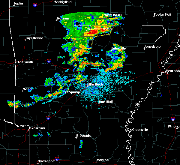 The severe thunderstorm warning for southeastern marion, northeastern searcy, southeastern baxter and northwestern stone counties will expire at 300 pm cdt, the storm which prompted the warning has weakened below severe limits, and no longer pose an immediate threat to life or property. therefore the warning will be allowed to expire. however gusty winds are still possible with this thunderstorm. The severe thunderstorm warning for southeastern marion, northeastern searcy, southeastern baxter and northwestern stone counties will expire at 300 pm cdt, the storm which prompted the warning has weakened below severe limits, and no longer pose an immediate threat to life or property. therefore the warning will be allowed to expire. however gusty winds are still possible with this thunderstorm.
|
| 7/29/2016 2:28 PM CDT |
 At 227 pm cdt, a severe thunderstorm was located over evening star, or 9 miles northeast of marshall, moving east at 20 mph (radar indicated). Hazards include 60 mph wind gusts and penny size hail. Expect damage to roofs. siding. and trees. Locations impacted include, marshall, evening star, rush, elberta, culp, advance, herron, thola, maumee, big flat, gilbert, zach, alco, canaan, newnata, timbo, landis, barkshed campground, ralph, fifty-six,. At 227 pm cdt, a severe thunderstorm was located over evening star, or 9 miles northeast of marshall, moving east at 20 mph (radar indicated). Hazards include 60 mph wind gusts and penny size hail. Expect damage to roofs. siding. and trees. Locations impacted include, marshall, evening star, rush, elberta, culp, advance, herron, thola, maumee, big flat, gilbert, zach, alco, canaan, newnata, timbo, landis, barkshed campground, ralph, fifty-six,.
|
| 7/29/2016 2:10 PM CDT |
 At 209 pm cdt, a severe thunderstorm was located near maumee, or near marshall, moving east at 20 mph (radar indicated). Hazards include 60 mph wind gusts and penny size hail. Expect damage to roofs. siding. And trees. At 209 pm cdt, a severe thunderstorm was located near maumee, or near marshall, moving east at 20 mph (radar indicated). Hazards include 60 mph wind gusts and penny size hail. Expect damage to roofs. siding. And trees.
|
| 5/24/2016 3:55 PM CDT |
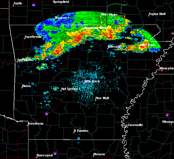 At 354 pm cdt, severe thunderstorms were located along a line extending from 6 miles east of dugger to 6 miles west of maumee to duff to near point peter, moving east at 25 mph (radar indicated). Hazards include 60 mph wind gusts and quarter size hail. Hail damage to vehicles is expected. expect wind damage to roofs, siding, and trees. locations impacted include, duff, maumee, st. Joe, pindall, gilbert, zach, baker ford, silver hill, maumee crossing, woolum recreation ar,. At 354 pm cdt, severe thunderstorms were located along a line extending from 6 miles east of dugger to 6 miles west of maumee to duff to near point peter, moving east at 25 mph (radar indicated). Hazards include 60 mph wind gusts and quarter size hail. Hail damage to vehicles is expected. expect wind damage to roofs, siding, and trees. locations impacted include, duff, maumee, st. Joe, pindall, gilbert, zach, baker ford, silver hill, maumee crossing, woolum recreation ar,.
|
| 4/30/2016 7:38 PM CDT |
 At 738 pm cdt, a severe thunderstorm was located over point peter, or 11 miles west of marshall, moving northeast at 30 mph (radar indicated). Hazards include half dollar size hail. damage to vehicles is expected At 738 pm cdt, a severe thunderstorm was located over point peter, or 11 miles west of marshall, moving northeast at 30 mph (radar indicated). Hazards include half dollar size hail. damage to vehicles is expected
|
| 4/30/2016 7:23 PM CDT |
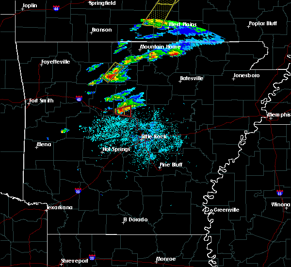 At 722 pm cdt, a severe thunderstorm was located near eula, or 16 miles west of marshall, moving northeast at 30 mph (radar indicated). Hazards include quarter size hail. Damage to vehicles is expected. locations impacted include, eula, duff, point peter, st. Joe, pindall, gilbert, snowball, woolum recreation ar, baker ford, silver hill,. At 722 pm cdt, a severe thunderstorm was located near eula, or 16 miles west of marshall, moving northeast at 30 mph (radar indicated). Hazards include quarter size hail. Damage to vehicles is expected. locations impacted include, eula, duff, point peter, st. Joe, pindall, gilbert, snowball, woolum recreation ar, baker ford, silver hill,.
|
| 4/30/2016 7:10 PM CDT |
 At 709 pm cdt, a severe thunderstorm was located near moore, or 16 miles southeast of jasper, moving northeast at 25 mph (radar indicated). Hazards include quarter size hail. damage to vehicles is expected At 709 pm cdt, a severe thunderstorm was located near moore, or 16 miles southeast of jasper, moving northeast at 25 mph (radar indicated). Hazards include quarter size hail. damage to vehicles is expected
|
| 12/23/2015 5:20 AM CST |
 At 519 am cst, severe thunderstorms were located along a line extending from near moore to near solo to near broomfield to russellville, moving northeast at 55 mph (radar indicated). Hazards include 60 mph wind gusts and penny size hail. Expect damage to roofs. siding. and trees. locations impacted include, russellville, marshall, atkins, pottsville, dover, hector, st. Vincent, bohannon, hattieville, eula, duff, happy bend, blick, woolum, jerusalem, maumee, lanty, smyrna, cleveland and kay. At 519 am cst, severe thunderstorms were located along a line extending from near moore to near solo to near broomfield to russellville, moving northeast at 55 mph (radar indicated). Hazards include 60 mph wind gusts and penny size hail. Expect damage to roofs. siding. and trees. locations impacted include, russellville, marshall, atkins, pottsville, dover, hector, st. Vincent, bohannon, hattieville, eula, duff, happy bend, blick, woolum, jerusalem, maumee, lanty, smyrna, cleveland and kay.
|
| 12/23/2015 4:56 AM CST |
 At 455 am cst, severe thunderstorms were located along a line extending from near holman to near knoxville to near lake dardanelle to near danville, moving northeast at 55 mph (radar indicated). Hazards include 60 mph wind gusts and penny size hail. Expect damage to roofs. siding. And trees. At 455 am cst, severe thunderstorms were located along a line extending from near holman to near knoxville to near lake dardanelle to near danville, moving northeast at 55 mph (radar indicated). Hazards include 60 mph wind gusts and penny size hail. Expect damage to roofs. siding. And trees.
|
| 7/1/2015 3:25 PM CDT |
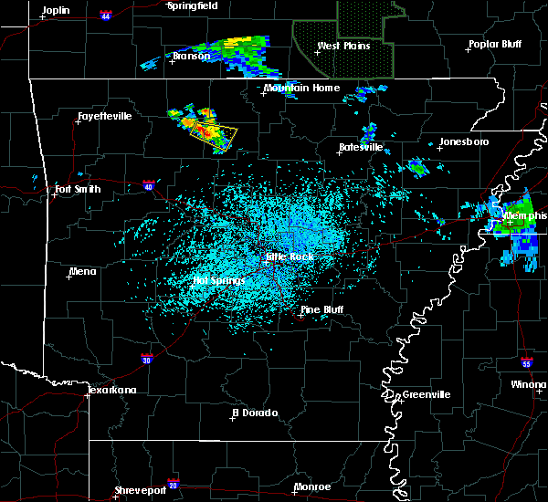 At 323 pm cdt, a severe thunderstorm was located 5 miles northwest of point peter, and moving southeast at 10 mph (radar indicated). Hazards include 60 mph wind gusts and quarter size hail. Hail damage to vehicles is expected. Expect wind damage to roofs, siding and trees. At 323 pm cdt, a severe thunderstorm was located 5 miles northwest of point peter, and moving southeast at 10 mph (radar indicated). Hazards include 60 mph wind gusts and quarter size hail. Hail damage to vehicles is expected. Expect wind damage to roofs, siding and trees.
|
| 7/1/2015 3:07 PM CDT |
 At 305 pm cdt, a severe thunderstorm was located near carver, and moving southeast at 15 mph (radar indicated). Hazards include 60 mph wind gusts and quarter size hail. Hail damage to vehicles is expected. Expect wind damage to roofs, siding and trees. At 305 pm cdt, a severe thunderstorm was located near carver, and moving southeast at 15 mph (radar indicated). Hazards include 60 mph wind gusts and quarter size hail. Hail damage to vehicles is expected. Expect wind damage to roofs, siding and trees.
|
| 6/5/2015 7:05 PM CDT | At 702 pm cdt, a severe thunderstorm was located near zack, or 5 miles northwest of marshall, and moving southeast at 15 mph (radar indicated). Hazards include 60 mph wind gusts and quarter size hail. Hail damage to vehicles is expected. Expect wind damage to roofs, siding and trees. |
| 6/5/2015 6:53 PM CDT | At 650 pm cdt, severe thunderstorms were located along a line extending from lunenburg to marshall, and moving southeast at 15 mph (radar indicated). Hazards include 60 mph wind gusts and quarter size hail. Hail damage to vehicles is expected. Expect wind damage to roofs, siding and trees. |
| 6/5/2015 6:37 PM CDT | At 633 pm cdt, severe thunderstorms were located along a line extending from melbourne to marshall, and moving southeast at 15 mph (radar indicated). Hazards include 60 mph wind gusts and quarter size hail. Hail damage to vehicles is expected. Expect wind damage to roofs, siding and trees. |
| 6/5/2015 6:11 PM CDT | At 608 pm cdt, a severe thunderstorm was located near rush, and moving southeast at 15 mph (radar indicated). Hazards include 60 mph wind gusts and quarter size hail. Hail damage to vehicles is expected. Expect wind damage to roofs, siding and trees. |
| 5/25/2015 9:01 PM CDT | At 900 pm cdt, severe thunderstorms were located along a line extending from duff to marshall to elberta, and moving northeast at 40 mph (radar indicated). Hazards include 60 mph wind gusts. Expect damage to roofs. Siding and trees. |
| 5/25/2015 8:42 PM CDT | At 839 pm cdt, severe thunderstorms were located along a line extending from moore to bohannon to woolum, and moving northeast at 40 mph (radar indicated). Hazards include 60 mph wind gusts and penny size hail. Expect damage to roofs. Siding and trees. |
| 5/25/2015 8:31 PM CDT | At 828 pm cdt, severe thunderstorms were located along a line extending from 5 miles north of moore to dabney, and moving northeast at 45 mph (radar indicated). Hazards include 60 mph wind gusts and nickel size hail. Expect damage to roofs. Siding and trees. |
| 5/25/2015 8:06 PM CDT | At 804 pm cdt, severe thunderstorms were located along a line extending from mineral spgs rec area to hector, and moving northeast at 45 mph (radar indicated). Hazards include 60 mph wind gusts and quarter size hail. Hail damage to vehicles is expected. Expect wind damage to roofs, siding and trees. |
| 5/10/2015 12:50 PM CDT | At 1248 pm cdt, severe thunderstorms were located along a line extending from omaha to harrison to 7 miles south of jasper, and moving northeast at 50 mph (radar indicated). Hazards include 60 mph wind gusts. Expect damage to roofs. Siding and trees. |
| 5/10/2015 12:30 PM CDT | At 1228 pm cdt, severe thunderstorms were located along a line extending from 8 miles northwest of oak grove to 7 miles west of red bank to walnut, and moving northeast at 50 mph (radar indicated). Hazards include 60 mph wind gusts and penny size hail. Expect damage to roofs. Siding and trees. |
| 4/9/2015 5:34 PM CDT | The national weather service in little rock has issued a * severe thunderstorm warning for. southeastern newton county in north central arkansas. northeastern pope county in central arkansas. searcy county in north central arkansas. West central stone county in north central arkansas. |
| 3/24/2015 7:56 PM CDT | The severe thunderstorm warning for southeastern boone. northwestern searcy. northeastern newton and southwestern marion counties will expire at 800 pm cdt. the storm which prompted the warning has weakened and moved out of the warned area. additional strong thunderstorms are still possible. And a severe. |
| 3/24/2015 7:34 PM CDT | The national weather service in little rock has issued a * severe thunderstorm warning for. southeastern boone county in north central arkansas. southwestern marion county in north central arkansas. northeastern newton county in north central arkansas. Northwestern searcy county in north central arkansas. |
Hail Maps for Gilbert, AR
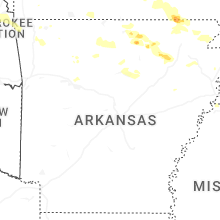
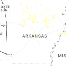

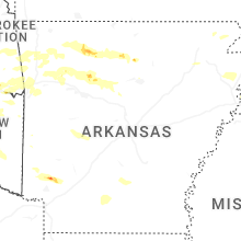
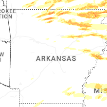


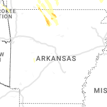


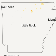


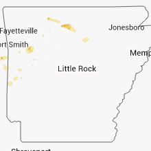


Connect with Interactive Hail Maps