

Hail Map for Gilmore, AR
The Gilmore, AR area has had 0 reports of on-the-ground hail by trained spotters, and has been under severe weather warnings 18 times during the past 12 months. Doppler radar has detected hail at or near Gilmore, AR on 66 occasions, including 2 occasions during the past year.
| Name: | Gilmore, AR |
| Where Located: | 22.3 miles NW of Memphis, TN |
| Map: | Google Map for Gilmore, AR |
| Population: | 188 |
| Housing Units: | 83 |
| More Info: | Search Google for Gilmore, AR |
5
The Top Recent Hail Date for Gilmore, AR is Monday, September 15, 2025 (14th out of 66)
Hail and Wind Damage Spotted near Gilmore, AR
| Date / Time | Report Details |
|---|---|
| 6/22/2026 9:50 AM CDT |
 The storm which prompted the warning has weakened below severe limits, and has exited the warned area. therefore, the warning will be allowed to expire. however, gusty winds and heavy rain are still possible with this thunderstorm. The storm which prompted the warning has weakened below severe limits, and has exited the warned area. therefore, the warning will be allowed to expire. however, gusty winds and heavy rain are still possible with this thunderstorm.
|
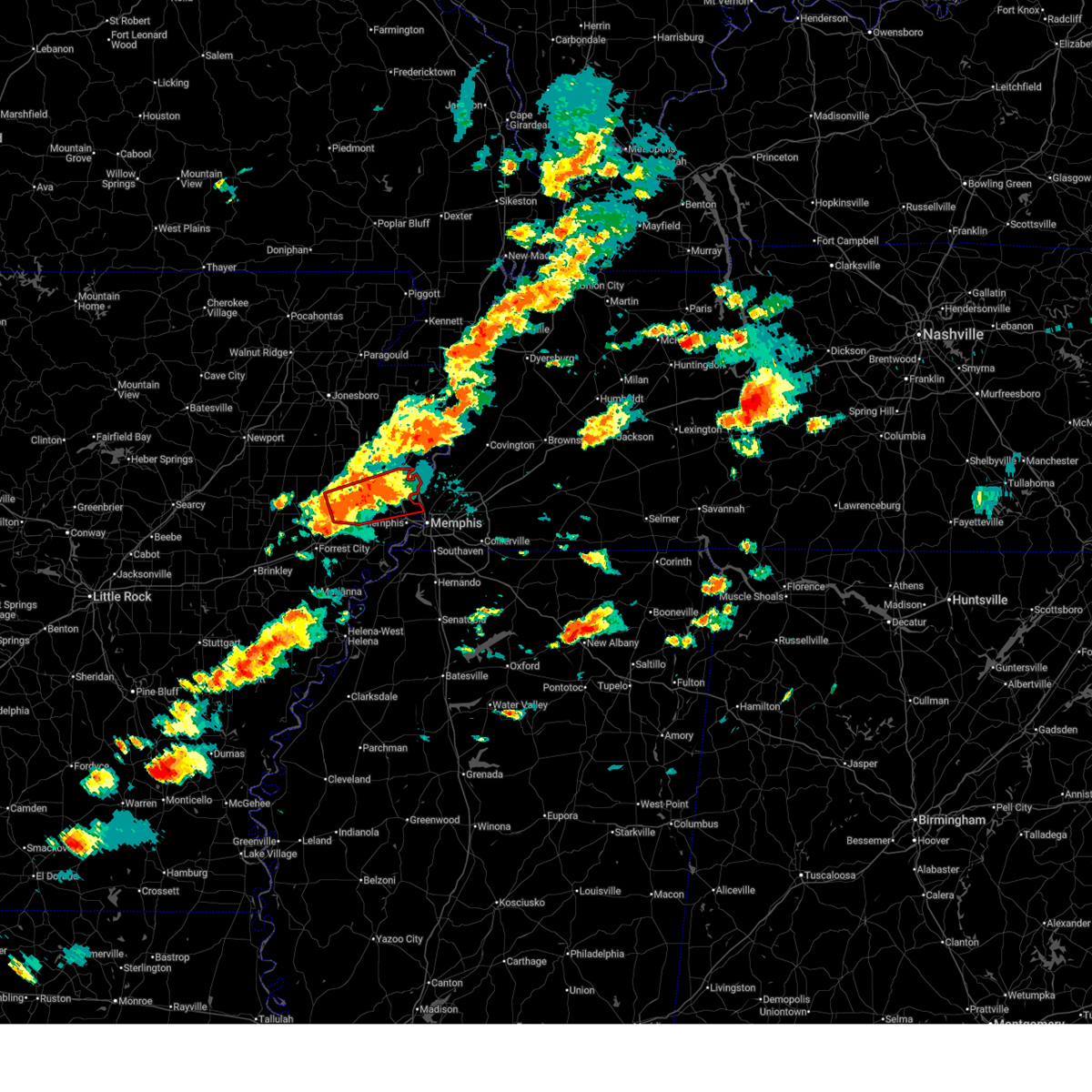
| 6/22/2026 9:32 AM CDT |
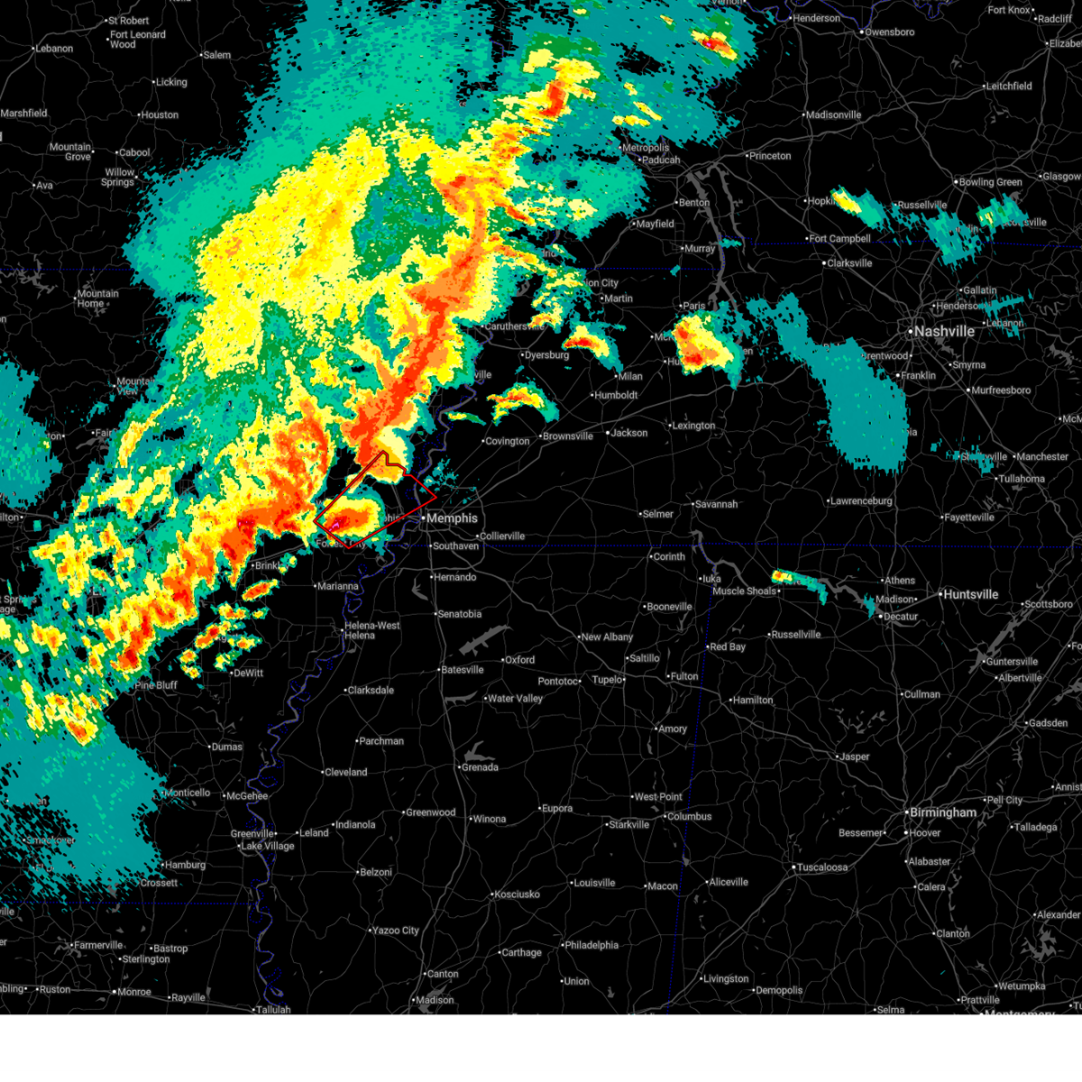
 At 932 am cdt, a severe thunderstorm was located over downtown memphis, or 8 miles northeast of t o fuller state park, moving northeast at 50 mph (radar indicated). Hazards include 60 mph wind gusts. Expect damage to roofs, siding, and trees. locations impacted include, bartlett, southaven, collierville, germantown, olive branch, west memphis, marion, millington, t o fuller state park, meeman shelby forest state park, cordova, memphis, lakeland, arlington, crawfordsville, edmondson, sunset, gilmore, anthonyville, and jericho. this includes the following highways, interstate 40 in arkansas between mile markers 265 and 284. interstate 40 in tennessee between mile markers 1 and 26. interstate 240 between mile markers 12 and 30. interstate 55 in arkansas between mile markers 1 and 28. interstate 55 in tennessee between mile markers 1 and 12. Interstate 55 in mississippi near mile marker 292. At 932 am cdt, a severe thunderstorm was located over downtown memphis, or 8 miles northeast of t o fuller state park, moving northeast at 50 mph (radar indicated). Hazards include 60 mph wind gusts. Expect damage to roofs, siding, and trees. locations impacted include, bartlett, southaven, collierville, germantown, olive branch, west memphis, marion, millington, t o fuller state park, meeman shelby forest state park, cordova, memphis, lakeland, arlington, crawfordsville, edmondson, sunset, gilmore, anthonyville, and jericho. this includes the following highways, interstate 40 in arkansas between mile markers 265 and 284. interstate 40 in tennessee between mile markers 1 and 26. interstate 240 between mile markers 12 and 30. interstate 55 in arkansas between mile markers 1 and 28. interstate 55 in tennessee between mile markers 1 and 12. Interstate 55 in mississippi near mile marker 292.
|
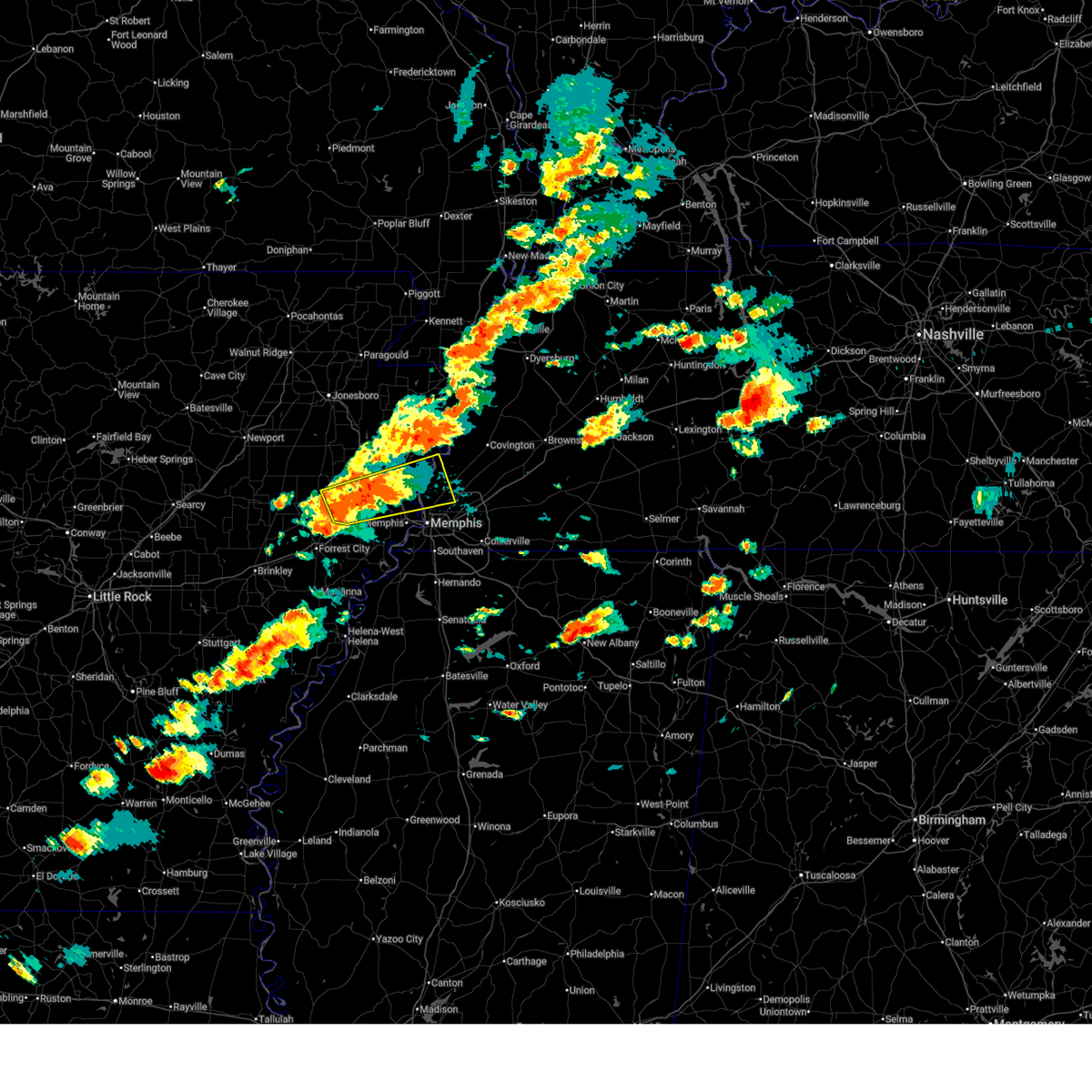
| 6/22/2026 9:12 AM CDT |
 Svrmeg the national weather service in memphis has issued a * severe thunderstorm warning for, eastern st. francis county in eastern arkansas, crittenden county in eastern arkansas, desoto county in northwestern mississippi, shelby county in west tennessee, * until 1000 am cdt. * at 912 am cdt, a severe thunderstorm was located near pinckney, or 9 miles southwest of t o fuller state park, moving northeast at 50 mph (radar indicated). Hazards include 60 mph wind gusts. expect damage to roofs, siding, and trees Svrmeg the national weather service in memphis has issued a * severe thunderstorm warning for, eastern st. francis county in eastern arkansas, crittenden county in eastern arkansas, desoto county in northwestern mississippi, shelby county in west tennessee, * until 1000 am cdt. * at 912 am cdt, a severe thunderstorm was located near pinckney, or 9 miles southwest of t o fuller state park, moving northeast at 50 mph (radar indicated). Hazards include 60 mph wind gusts. expect damage to roofs, siding, and trees
|
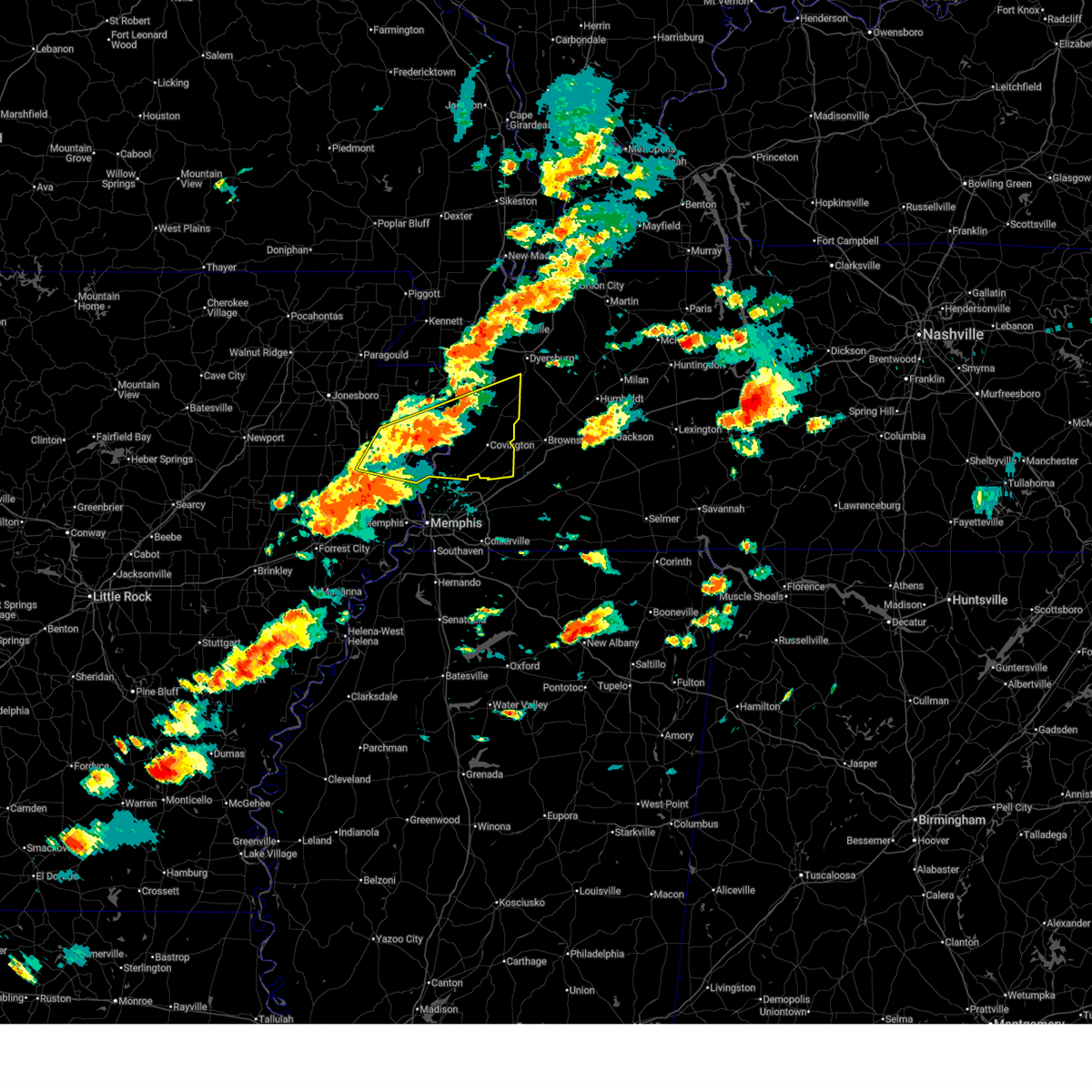
| 4/28/2026 3:59 PM CDT |
 At 359 pm cdt, a severe thunderstorm was located over jericho, or near marion, moving east at 40 mph (radar indicated). Hazards include 60 mph wind gusts and quarter size hail. Hail damage to vehicles is expected. expect wind damage to roofs, siding, and trees. locations impacted include, west memphis, marion, tyronza, meeman shelby forest state park, memphis, joiner, crawfordsville, sunset, gilmore, bassett, jericho, frayser, crittenden, turrell, clarkedale, birdsong, dimple, booker, deckerville, and menesha. this includes the following highways, interstate 40 in arkansas between mile markers 270 and 284. interstate 40 in tennessee between mile markers 1 and 5. Interstate 55 in arkansas between mile markers 3 and 34. At 359 pm cdt, a severe thunderstorm was located over jericho, or near marion, moving east at 40 mph (radar indicated). Hazards include 60 mph wind gusts and quarter size hail. Hail damage to vehicles is expected. expect wind damage to roofs, siding, and trees. locations impacted include, west memphis, marion, tyronza, meeman shelby forest state park, memphis, joiner, crawfordsville, sunset, gilmore, bassett, jericho, frayser, crittenden, turrell, clarkedale, birdsong, dimple, booker, deckerville, and menesha. this includes the following highways, interstate 40 in arkansas between mile markers 270 and 284. interstate 40 in tennessee between mile markers 1 and 5. Interstate 55 in arkansas between mile markers 3 and 34.
|
| 4/28/2026 3:50 PM CDT |
 the severe thunderstorm warning has been cancelled and is no longer in effect the severe thunderstorm warning has been cancelled and is no longer in effect
|
| 4/28/2026 3:50 PM CDT |
 At 349 pm cdt, a severe thunderstorm was located over crawfordsville, or near earle, moving east at 40 mph (radar indicated). Hazards include 60 mph wind gusts and quarter size hail. Hail damage to vehicles is expected. expect wind damage to roofs, siding, and trees. locations impacted include, west memphis, marion, earle, meeman shelby forest state park, memphis, joiner, crawfordsville, sunset, gilmore, jericho, jennette, frayser, crittenden, turrell, clarkedale, birdsong, three forks, dimple, booker, and deckerville. this includes the following highways, interstate 40 in arkansas between mile markers 265 and 284. interstate 40 in tennessee between mile markers 1 and 5. Interstate 55 in arkansas between mile markers 3 and 34. At 349 pm cdt, a severe thunderstorm was located over crawfordsville, or near earle, moving east at 40 mph (radar indicated). Hazards include 60 mph wind gusts and quarter size hail. Hail damage to vehicles is expected. expect wind damage to roofs, siding, and trees. locations impacted include, west memphis, marion, earle, meeman shelby forest state park, memphis, joiner, crawfordsville, sunset, gilmore, jericho, jennette, frayser, crittenden, turrell, clarkedale, birdsong, three forks, dimple, booker, and deckerville. this includes the following highways, interstate 40 in arkansas between mile markers 265 and 284. interstate 40 in tennessee between mile markers 1 and 5. Interstate 55 in arkansas between mile markers 3 and 34.
|
| 4/28/2026 3:29 PM CDT |
 Svrmeg the national weather service in memphis has issued a * severe thunderstorm warning for, northeastern st. francis county in eastern arkansas, southeastern poinsett county in eastern arkansas, southwestern mississippi county in eastern arkansas, crittenden county in eastern arkansas, eastern cross county in eastern arkansas, southwestern tipton county in west tennessee, northwestern shelby county in west tennessee, * until 415 pm cdt. * at 328 pm cdt, a severe thunderstorm was located near parkin, moving east at 40 mph (radar indicated). Hazards include 60 mph wind gusts and quarter size hail. Hail damage to vehicles is expected. Expect wind damage to roofs, siding, and trees. Svrmeg the national weather service in memphis has issued a * severe thunderstorm warning for, northeastern st. francis county in eastern arkansas, southeastern poinsett county in eastern arkansas, southwestern mississippi county in eastern arkansas, crittenden county in eastern arkansas, eastern cross county in eastern arkansas, southwestern tipton county in west tennessee, northwestern shelby county in west tennessee, * until 415 pm cdt. * at 328 pm cdt, a severe thunderstorm was located near parkin, moving east at 40 mph (radar indicated). Hazards include 60 mph wind gusts and quarter size hail. Hail damage to vehicles is expected. Expect wind damage to roofs, siding, and trees.
|
| 4/28/2026 2:25 AM CDT |
 Svrmeg the national weather service in memphis has issued a * severe thunderstorm warning for, northeastern st. francis county in eastern arkansas, crittenden county in eastern arkansas, cross county in eastern arkansas, southwestern tipton county in west tennessee, central shelby county in west tennessee, * until 330 am cdt. * at 225 am cdt, a severe thunderstorm was located near wynne, moving east at 45 mph (radar indicated). Hazards include 60 mph wind gusts and quarter size hail. Hail damage to vehicles is expected. Expect wind damage to roofs, siding, and trees. Svrmeg the national weather service in memphis has issued a * severe thunderstorm warning for, northeastern st. francis county in eastern arkansas, crittenden county in eastern arkansas, cross county in eastern arkansas, southwestern tipton county in west tennessee, central shelby county in west tennessee, * until 330 am cdt. * at 225 am cdt, a severe thunderstorm was located near wynne, moving east at 45 mph (radar indicated). Hazards include 60 mph wind gusts and quarter size hail. Hail damage to vehicles is expected. Expect wind damage to roofs, siding, and trees.
|
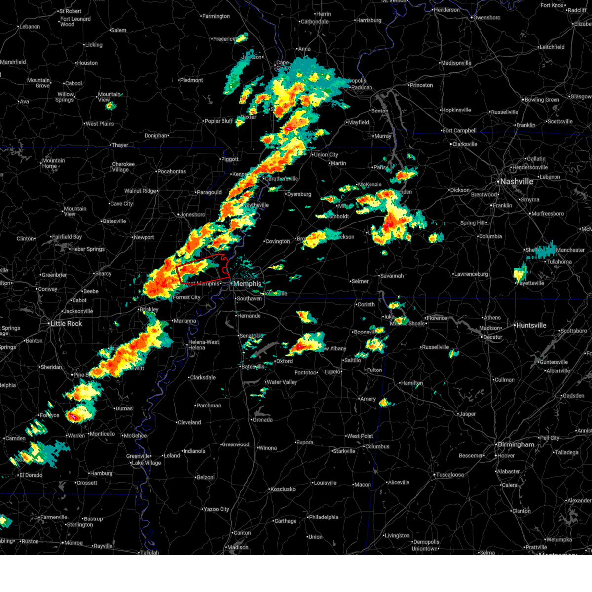
| 3/15/2026 7:12 PM CDT |
 Svrmeg the national weather service in memphis has issued a * severe thunderstorm warning for, eastern st. francis county in eastern arkansas, southeastern poinsett county in eastern arkansas, southwestern mississippi county in eastern arkansas, crittenden county in eastern arkansas, southeastern cross county in eastern arkansas, central tipton county in west tennessee, southwestern lauderdale county in west tennessee, central shelby county in west tennessee, * until 815 pm cdt. * at 712 pm cdt, severe thunderstorms were located along a line extending from near marie to near haynes, moving east at 45 mph (radar indicated). Hazards include 70 mph wind gusts and quarter size hail. Hail damage to vehicles is expected. expect considerable tree damage. Wind damage is also likely to mobile homes, roofs, and outbuildings. Svrmeg the national weather service in memphis has issued a * severe thunderstorm warning for, eastern st. francis county in eastern arkansas, southeastern poinsett county in eastern arkansas, southwestern mississippi county in eastern arkansas, crittenden county in eastern arkansas, southeastern cross county in eastern arkansas, central tipton county in west tennessee, southwestern lauderdale county in west tennessee, central shelby county in west tennessee, * until 815 pm cdt. * at 712 pm cdt, severe thunderstorms were located along a line extending from near marie to near haynes, moving east at 45 mph (radar indicated). Hazards include 70 mph wind gusts and quarter size hail. Hail damage to vehicles is expected. expect considerable tree damage. Wind damage is also likely to mobile homes, roofs, and outbuildings.
|
| 3/15/2026 7:03 PM CDT |
 At 702 pm cdt, severe thunderstorms were located along a line extending from near trumann to near forrest city, moving east at 55 mph (radar indicated). Hazards include 70 mph wind gusts and quarter size hail. Hail damage to vehicles is expected. expect considerable tree damage. wind damage is also likely to mobile homes, roofs, and outbuildings. locations impacted include, forrest city, wynne, marked tree, earle, lepanto, hughes, parkin, madison, tyronza, palestine, village creek state park, caldwell, crawfordsville, dyess, colt, widener, gilmore, jennette, simsboro, and vanndale. this includes the following highways, interstate 40 in arkansas between mile markers 228 and 269. Interstate 55 in arkansas between mile markers 19 and 29. At 702 pm cdt, severe thunderstorms were located along a line extending from near trumann to near forrest city, moving east at 55 mph (radar indicated). Hazards include 70 mph wind gusts and quarter size hail. Hail damage to vehicles is expected. expect considerable tree damage. wind damage is also likely to mobile homes, roofs, and outbuildings. locations impacted include, forrest city, wynne, marked tree, earle, lepanto, hughes, parkin, madison, tyronza, palestine, village creek state park, caldwell, crawfordsville, dyess, colt, widener, gilmore, jennette, simsboro, and vanndale. this includes the following highways, interstate 40 in arkansas between mile markers 228 and 269. Interstate 55 in arkansas between mile markers 19 and 29.
|
| 3/15/2026 6:42 PM CDT |
 At 642 pm cdt, severe thunderstorms were located along a line extending from near harrisburg to wheatley, moving east at 50 mph (radar indicated). Hazards include 70 mph wind gusts and quarter size hail. Hail damage to vehicles is expected. expect considerable tree damage. wind damage is also likely to mobile homes, roofs, and outbuildings. locations impacted include, forrest city, wynne, marked tree, earle, harrisburg, lepanto, hughes, parkin, madison, tyronza, palestine, village creek state park, cherry valley, caldwell, crawfordsville, dyess, colt, wheatley, widener, and hickory ridge. this includes the following highways, interstate 40 in arkansas between mile markers 219 and 269. Interstate 55 in arkansas between mile markers 19 and 29. At 642 pm cdt, severe thunderstorms were located along a line extending from near harrisburg to wheatley, moving east at 50 mph (radar indicated). Hazards include 70 mph wind gusts and quarter size hail. Hail damage to vehicles is expected. expect considerable tree damage. wind damage is also likely to mobile homes, roofs, and outbuildings. locations impacted include, forrest city, wynne, marked tree, earle, harrisburg, lepanto, hughes, parkin, madison, tyronza, palestine, village creek state park, cherry valley, caldwell, crawfordsville, dyess, colt, wheatley, widener, and hickory ridge. this includes the following highways, interstate 40 in arkansas between mile markers 219 and 269. Interstate 55 in arkansas between mile markers 19 and 29.
|
| 3/15/2026 6:21 PM CDT |
 Svrmeg the national weather service in memphis has issued a * severe thunderstorm warning for, st. francis county in eastern arkansas, poinsett county in eastern arkansas, southwestern mississippi county in eastern arkansas, western crittenden county in eastern arkansas, cross county in eastern arkansas, * until 715 pm cdt. * at 620 pm cdt, severe thunderstorms were located along a line extending from near waldenburg to near fredonia, moving east at 70 mph (radar indicated). Hazards include 60 mph wind gusts and quarter size hail. Hail damage to vehicles is expected. Expect wind damage to roofs, siding, and trees. Svrmeg the national weather service in memphis has issued a * severe thunderstorm warning for, st. francis county in eastern arkansas, poinsett county in eastern arkansas, southwestern mississippi county in eastern arkansas, western crittenden county in eastern arkansas, cross county in eastern arkansas, * until 715 pm cdt. * at 620 pm cdt, severe thunderstorms were located along a line extending from near waldenburg to near fredonia, moving east at 70 mph (radar indicated). Hazards include 60 mph wind gusts and quarter size hail. Hail damage to vehicles is expected. Expect wind damage to roofs, siding, and trees.
|
| 3/9/2026 1:24 PM CDT |
 Svrmeg the national weather service in memphis has issued a * severe thunderstorm warning for, southwestern mississippi county in eastern arkansas, northeastern crittenden county in eastern arkansas, tipton county in west tennessee, northwestern fayette county in west tennessee, southern lauderdale county in west tennessee, southwestern haywood county in west tennessee, northern shelby county in west tennessee, * until 215 pm cdt. * at 124 pm cdt, a severe thunderstorm was located near jericho, or 7 miles west of meeman shelby forest state park, moving northeast at 50 mph (radar indicated). Hazards include 60 mph wind gusts and nickel size hail. expect damage to roofs, siding, and trees Svrmeg the national weather service in memphis has issued a * severe thunderstorm warning for, southwestern mississippi county in eastern arkansas, northeastern crittenden county in eastern arkansas, tipton county in west tennessee, northwestern fayette county in west tennessee, southern lauderdale county in west tennessee, southwestern haywood county in west tennessee, northern shelby county in west tennessee, * until 215 pm cdt. * at 124 pm cdt, a severe thunderstorm was located near jericho, or 7 miles west of meeman shelby forest state park, moving northeast at 50 mph (radar indicated). Hazards include 60 mph wind gusts and nickel size hail. expect damage to roofs, siding, and trees
|
| 3/7/2026 9:45 AM CST |
 the severe thunderstorm warning has been cancelled and is no longer in effect the severe thunderstorm warning has been cancelled and is no longer in effect
|
| 3/7/2026 9:45 AM CST |
 At 944 am cst, a severe thunderstorm was located near dixonville, or near meeman shelby forest state park, moving east at 45 mph (radar indicated). Hazards include 60 mph wind gusts. Expect damage to roofs, siding, and trees. locations impacted include, wilson, tyronza, munford, brighton, joiner, dyess, gilmore, bassett, dixonville, tipton, atoka, turrell, gilt edge, birdsong, whitton, dimple, deckerville, egypt, evadale, and menesha. This includes interstate 55 in arkansas between mile markers 22 and 40. At 944 am cst, a severe thunderstorm was located near dixonville, or near meeman shelby forest state park, moving east at 45 mph (radar indicated). Hazards include 60 mph wind gusts. Expect damage to roofs, siding, and trees. locations impacted include, wilson, tyronza, munford, brighton, joiner, dyess, gilmore, bassett, dixonville, tipton, atoka, turrell, gilt edge, birdsong, whitton, dimple, deckerville, egypt, evadale, and menesha. This includes interstate 55 in arkansas between mile markers 22 and 40.
|
| 3/7/2026 9:25 AM CST |
 Svrmeg the national weather service in memphis has issued a * severe thunderstorm warning for, southeastern poinsett county in eastern arkansas, southwestern mississippi county in eastern arkansas, northeastern crittenden county in eastern arkansas, southwestern tipton county in west tennessee, north central shelby county in west tennessee, * until 1000 am cst. * at 925 am cst, a severe thunderstorm was located near tyronza, moving east at 45 mph (radar indicated). Hazards include 60 mph wind gusts. expect damage to roofs, siding, and trees Svrmeg the national weather service in memphis has issued a * severe thunderstorm warning for, southeastern poinsett county in eastern arkansas, southwestern mississippi county in eastern arkansas, northeastern crittenden county in eastern arkansas, southwestern tipton county in west tennessee, north central shelby county in west tennessee, * until 1000 am cst. * at 925 am cst, a severe thunderstorm was located near tyronza, moving east at 45 mph (radar indicated). Hazards include 60 mph wind gusts. expect damage to roofs, siding, and trees
|
| 9/23/2025 7:20 PM CDT | the severe thunderstorm warning has been cancelled and is no longer in effect |
| 9/23/2025 6:58 PM CDT | Svrmeg the national weather service in memphis has issued a * severe thunderstorm warning for, south central craighead county in eastern arkansas, poinsett county in eastern arkansas, southwestern mississippi county in eastern arkansas, northwestern crittenden county in eastern arkansas, * until 745 pm cdt. * at 657 pm cdt, a severe thunderstorm was located near greenfield, or 7 miles northeast of harrisburg, moving southeast at 35 mph (radar indicated). Hazards include 60 mph wind gusts. expect damage to roofs, siding, and trees |
| 6/7/2025 8:52 AM CDT |
 The storm which prompted the warning has weakened below severe limits, and no longer poses an immediate threat to life or property. therefore, the warning will be allowed to expire. however, gusty winds and heavy rain are still possible with this thunderstorm. The storm which prompted the warning has weakened below severe limits, and no longer poses an immediate threat to life or property. therefore, the warning will be allowed to expire. however, gusty winds and heavy rain are still possible with this thunderstorm.
|
| 6/7/2025 8:38 AM CDT |
 At 837 am cdt, a severe thunderstorm was located 9 miles north of parkin, moving east at 35 mph (radar indicated). Hazards include 60 mph wind gusts and quarter size hail. Hail damage to vehicles is expected. expect wind damage to roofs, siding, and trees. Locations impacted include, west memphis, marion, marked tree, earle, lepanto, parkin, tyronza, village creek state park, cherry valley, crawfordsville, sunset, gilmore, jericho, jennette, turrell, clarkedale, birdsong, three forks, payneway, and dimple. At 837 am cdt, a severe thunderstorm was located 9 miles north of parkin, moving east at 35 mph (radar indicated). Hazards include 60 mph wind gusts and quarter size hail. Hail damage to vehicles is expected. expect wind damage to roofs, siding, and trees. Locations impacted include, west memphis, marion, marked tree, earle, lepanto, parkin, tyronza, village creek state park, cherry valley, crawfordsville, sunset, gilmore, jericho, jennette, turrell, clarkedale, birdsong, three forks, payneway, and dimple.
|
| 6/7/2025 8:38 AM CDT |
 the severe thunderstorm warning has been cancelled and is no longer in effect the severe thunderstorm warning has been cancelled and is no longer in effect
|
| 6/7/2025 8:19 AM CDT |
 Svrmeg the national weather service in memphis has issued a * severe thunderstorm warning for, north central st. francis county in eastern arkansas, southeastern poinsett county in eastern arkansas, southwestern mississippi county in eastern arkansas, northern crittenden county in eastern arkansas, cross county in eastern arkansas, * until 900 am cdt. * at 819 am cdt, a severe thunderstorm was located over vanndale, or near wynne, moving northeast at 40 mph (radar indicated). Hazards include 60 mph wind gusts and quarter size hail. Hail damage to vehicles is expected. Expect wind damage to roofs, siding, and trees. Svrmeg the national weather service in memphis has issued a * severe thunderstorm warning for, north central st. francis county in eastern arkansas, southeastern poinsett county in eastern arkansas, southwestern mississippi county in eastern arkansas, northern crittenden county in eastern arkansas, cross county in eastern arkansas, * until 900 am cdt. * at 819 am cdt, a severe thunderstorm was located over vanndale, or near wynne, moving northeast at 40 mph (radar indicated). Hazards include 60 mph wind gusts and quarter size hail. Hail damage to vehicles is expected. Expect wind damage to roofs, siding, and trees.
|
| 5/20/2025 3:55 PM CDT |
 Large hail and damaging winds are still possible with this thunderstorm. a severe thunderstorm warning still remains in effect for northern shelby and tipton counties. a tornado watch remains in effect until 800 pm cdt for eastern arkansas, and west tennessee. Large hail and damaging winds are still possible with this thunderstorm. a severe thunderstorm warning still remains in effect for northern shelby and tipton counties. a tornado watch remains in effect until 800 pm cdt for eastern arkansas, and west tennessee.
|
| 5/20/2025 3:32 PM CDT |
 the severe thunderstorm warning has been cancelled and is no longer in effect the severe thunderstorm warning has been cancelled and is no longer in effect
|
| 5/20/2025 3:32 PM CDT |
 At 332 pm cdt, a severe thunderstorm was located near jericho, or near meeman shelby forest state park, moving east at 50 mph (radar indicated). Hazards include 70 mph wind gusts and half dollar size hail. Hail damage to vehicles is expected. expect considerable tree damage. wind damage is also likely to mobile homes, roofs, and outbuildings. Locations impacted include, wapanocca national wildlife refuge, jericho, booker, griffin corner, turrell, menesha, gammon, quito, cunningham corner, clarkedale, woodstock, st clair, harvard, gilmore, cloar, earle, locke, dixonville, sloanville, and frenchmans bayou. At 332 pm cdt, a severe thunderstorm was located near jericho, or near meeman shelby forest state park, moving east at 50 mph (radar indicated). Hazards include 70 mph wind gusts and half dollar size hail. Hail damage to vehicles is expected. expect considerable tree damage. wind damage is also likely to mobile homes, roofs, and outbuildings. Locations impacted include, wapanocca national wildlife refuge, jericho, booker, griffin corner, turrell, menesha, gammon, quito, cunningham corner, clarkedale, woodstock, st clair, harvard, gilmore, cloar, earle, locke, dixonville, sloanville, and frenchmans bayou.
|
| 5/20/2025 3:14 PM CDT |
 the tornado warning has been cancelled and is no longer in effect the tornado warning has been cancelled and is no longer in effect
|
| 5/20/2025 3:13 PM CDT |
 Svrmeg the national weather service in memphis has issued a * severe thunderstorm warning for, southwestern mississippi county in eastern arkansas, northern crittenden county in eastern arkansas, southeastern cross county in eastern arkansas, southwestern tipton county in west tennessee, northwestern shelby county in west tennessee, * until 400 pm cdt. * at 313 pm cdt, a severe thunderstorm was located over parkin, moving east at 45 mph (radar indicated). Hazards include 60 mph wind gusts and half dollar size hail. Hail damage to vehicles is expected. Expect wind damage to roofs, siding, and trees. Svrmeg the national weather service in memphis has issued a * severe thunderstorm warning for, southwestern mississippi county in eastern arkansas, northern crittenden county in eastern arkansas, southeastern cross county in eastern arkansas, southwestern tipton county in west tennessee, northwestern shelby county in west tennessee, * until 400 pm cdt. * at 313 pm cdt, a severe thunderstorm was located over parkin, moving east at 45 mph (radar indicated). Hazards include 60 mph wind gusts and half dollar size hail. Hail damage to vehicles is expected. Expect wind damage to roofs, siding, and trees.
|
| 5/20/2025 3:11 PM CDT |
 Svrmeg the national weather service in memphis has issued a * severe thunderstorm warning for, southeastern poinsett county in eastern arkansas, southern mississippi county in eastern arkansas, northern crittenden county in eastern arkansas, tipton county in west tennessee, lauderdale county in west tennessee, * until 400 pm cdt. * at 311 pm cdt, a severe thunderstorm was located over joiner, or 8 miles southwest of wilson, moving east at 55 mph (radar indicated). Hazards include 60 mph wind gusts and half dollar size hail. Hail damage to vehicles is expected. Expect wind damage to roofs, siding, and trees. Svrmeg the national weather service in memphis has issued a * severe thunderstorm warning for, southeastern poinsett county in eastern arkansas, southern mississippi county in eastern arkansas, northern crittenden county in eastern arkansas, tipton county in west tennessee, lauderdale county in west tennessee, * until 400 pm cdt. * at 311 pm cdt, a severe thunderstorm was located over joiner, or 8 miles southwest of wilson, moving east at 55 mph (radar indicated). Hazards include 60 mph wind gusts and half dollar size hail. Hail damage to vehicles is expected. Expect wind damage to roofs, siding, and trees.
|
| 5/20/2025 2:59 PM CDT |
 the tornado warning has been cancelled and is no longer in effect the tornado warning has been cancelled and is no longer in effect
|
| 5/20/2025 2:59 PM CDT |
 At 258 pm cdt, a severe thunderstorm capable of producing a tornado was located over parkin, moving east at 40 mph (radar indicated rotation). Hazards include tornado and golf ball size hail. Flying debris will be dangerous to those caught without shelter. mobile homes will be damaged or destroyed. damage to roofs, windows, and vehicles will occur. tree damage is likely. Locations impacted include, smithdale, three forks, wapanocca national wildlife refuge, jericho, booker, turrell, menesha, gammon, cunningham corner, clarkedale, st clair, mcdonald, harvard, gilmore, cloar, earle, vincent, togo, jennette, and river front. At 258 pm cdt, a severe thunderstorm capable of producing a tornado was located over parkin, moving east at 40 mph (radar indicated rotation). Hazards include tornado and golf ball size hail. Flying debris will be dangerous to those caught without shelter. mobile homes will be damaged or destroyed. damage to roofs, windows, and vehicles will occur. tree damage is likely. Locations impacted include, smithdale, three forks, wapanocca national wildlife refuge, jericho, booker, turrell, menesha, gammon, cunningham corner, clarkedale, st clair, mcdonald, harvard, gilmore, cloar, earle, vincent, togo, jennette, and river front.
|
| 5/20/2025 2:47 PM CDT |
 Tormeg the national weather service in memphis has issued a * tornado warning for, north central st. francis county in eastern arkansas, southwestern mississippi county in eastern arkansas, crittenden county in eastern arkansas, southeastern cross county in eastern arkansas, * until 330 pm cdt. * at 247 pm cdt, a severe thunderstorm capable of producing a tornado was located near village creek state park, moving east at 45 mph (radar indicated rotation). Hazards include tornado and golf ball size hail. Flying debris will be dangerous to those caught without shelter. mobile homes will be damaged or destroyed. damage to roofs, windows, and vehicles will occur. Tree damage is likely. Tormeg the national weather service in memphis has issued a * tornado warning for, north central st. francis county in eastern arkansas, southwestern mississippi county in eastern arkansas, crittenden county in eastern arkansas, southeastern cross county in eastern arkansas, * until 330 pm cdt. * at 247 pm cdt, a severe thunderstorm capable of producing a tornado was located near village creek state park, moving east at 45 mph (radar indicated rotation). Hazards include tornado and golf ball size hail. Flying debris will be dangerous to those caught without shelter. mobile homes will be damaged or destroyed. damage to roofs, windows, and vehicles will occur. Tree damage is likely.
|
| 5/20/2025 2:43 PM CDT |
 At 243 pm cdt, a severe thunderstorm was located near parkin, moving east at 45 mph (radar indicated). Hazards include golf ball size hail and 60 mph wind gusts. People and animals outdoors will be injured. expect hail damage to roofs, siding, windows, and vehicles. expect wind damage to roofs, siding, and trees. Locations impacted include, three forks, booker, deckerville, fitzgerald crossing, cunningham corner, st clair, mcelroy, coldwater, river front, lansing, village creek state park, julius, duvall, stacy, clarks corner, colt, galilee, heafer, levesque, and james mill. At 243 pm cdt, a severe thunderstorm was located near parkin, moving east at 45 mph (radar indicated). Hazards include golf ball size hail and 60 mph wind gusts. People and animals outdoors will be injured. expect hail damage to roofs, siding, windows, and vehicles. expect wind damage to roofs, siding, and trees. Locations impacted include, three forks, booker, deckerville, fitzgerald crossing, cunningham corner, st clair, mcelroy, coldwater, river front, lansing, village creek state park, julius, duvall, stacy, clarks corner, colt, galilee, heafer, levesque, and james mill.
|
| 5/20/2025 2:31 PM CDT |
 Svrmeg the national weather service in memphis has issued a * severe thunderstorm warning for, northeastern st. francis county in eastern arkansas, southeastern poinsett county in eastern arkansas, northern crittenden county in eastern arkansas, southern cross county in eastern arkansas, * until 315 pm cdt. * at 231 pm cdt, a severe thunderstorm was located over wynne, moving east at 45 mph (radar indicated). Hazards include 60 mph wind gusts and quarter size hail. Hail damage to vehicles is expected. Expect wind damage to roofs, siding, and trees. Svrmeg the national weather service in memphis has issued a * severe thunderstorm warning for, northeastern st. francis county in eastern arkansas, southeastern poinsett county in eastern arkansas, northern crittenden county in eastern arkansas, southern cross county in eastern arkansas, * until 315 pm cdt. * at 231 pm cdt, a severe thunderstorm was located over wynne, moving east at 45 mph (radar indicated). Hazards include 60 mph wind gusts and quarter size hail. Hail damage to vehicles is expected. Expect wind damage to roofs, siding, and trees.
|
| 5/2/2025 11:53 AM CDT |
 At 1153 am cdt, severe thunderstorms were located along a line extending from near joiner to hernando to near crowder, moving east at 45 mph (radar indicated). Hazards include 60 mph wind gusts and quarter size hail. Hail damage to vehicles is expected. expect wind damage to roofs, siding, and trees. Locations impacted include, three forks, charleston, horn lake, louise, austin, bright, falcon, edmondson, strayhorn, prichard, presidents island, beck, dubbs, glover, locke, arlington, elmore park, alden, dooley, and north tunica. At 1153 am cdt, severe thunderstorms were located along a line extending from near joiner to hernando to near crowder, moving east at 45 mph (radar indicated). Hazards include 60 mph wind gusts and quarter size hail. Hail damage to vehicles is expected. expect wind damage to roofs, siding, and trees. Locations impacted include, three forks, charleston, horn lake, louise, austin, bright, falcon, edmondson, strayhorn, prichard, presidents island, beck, dubbs, glover, locke, arlington, elmore park, alden, dooley, and north tunica.
|
| 5/2/2025 11:53 AM CDT |
 the severe thunderstorm warning has been cancelled and is no longer in effect the severe thunderstorm warning has been cancelled and is no longer in effect
|
| 5/2/2025 11:26 AM CDT |
 Svrmeg the national weather service in memphis has issued a * severe thunderstorm warning for, northeastern st. francis county in eastern arkansas, crittenden county in eastern arkansas, northeastern cross county in eastern arkansas, desoto county in northwestern mississippi, northwestern yalobusha county in northwestern mississippi, eastern coahoma county in northwestern mississippi, tunica county in northwestern mississippi, tate county in northwestern mississippi, northern tallahatchie county in northwestern mississippi, quitman county in northwestern mississippi, panola county in northwestern mississippi, shelby county in west tennessee, * until 1230 pm cdt. * at 1126 am cdt, severe thunderstorms were located along a line extending from near tyronza to robinsonville to dublin, moving east at 45 mph (radar indicated). Hazards include 60 mph wind gusts and quarter size hail. Hail damage to vehicles is expected. Expect wind damage to roofs, siding, and trees. Svrmeg the national weather service in memphis has issued a * severe thunderstorm warning for, northeastern st. francis county in eastern arkansas, crittenden county in eastern arkansas, northeastern cross county in eastern arkansas, desoto county in northwestern mississippi, northwestern yalobusha county in northwestern mississippi, eastern coahoma county in northwestern mississippi, tunica county in northwestern mississippi, tate county in northwestern mississippi, northern tallahatchie county in northwestern mississippi, quitman county in northwestern mississippi, panola county in northwestern mississippi, shelby county in west tennessee, * until 1230 pm cdt. * at 1126 am cdt, severe thunderstorms were located along a line extending from near tyronza to robinsonville to dublin, moving east at 45 mph (radar indicated). Hazards include 60 mph wind gusts and quarter size hail. Hail damage to vehicles is expected. Expect wind damage to roofs, siding, and trees.
|
| 4/30/2025 9:09 PM CDT |
 The storms which prompted the warning have moved out of the warned area. therefore, the warning will be allowed to expire. a severe thunderstorm watch remains in effect until 1100 pm cdt for eastern arkansas, northwestern mississippi, and west tennessee. The storms which prompted the warning have moved out of the warned area. therefore, the warning will be allowed to expire. a severe thunderstorm watch remains in effect until 1100 pm cdt for eastern arkansas, northwestern mississippi, and west tennessee.
|
| 4/30/2025 8:56 PM CDT |
 At 855 pm cdt, severe thunderstorms were located along a line extending from near bay to near earle to near hughes, moving east at 30 mph (public). Hazards include 60 mph wind gusts and penny size hail. Expect damage to roofs, siding, and trees. Locations impacted include, three forks, payneway, browns, commerce, louise, menesha, gum point, edmondson, st clair, beck, simsboro, promised land, alto, judd hill, bunney, julius, lost lake, galilee, mccormick, and wilbeth. At 855 pm cdt, severe thunderstorms were located along a line extending from near bay to near earle to near hughes, moving east at 30 mph (public). Hazards include 60 mph wind gusts and penny size hail. Expect damage to roofs, siding, and trees. Locations impacted include, three forks, payneway, browns, commerce, louise, menesha, gum point, edmondson, st clair, beck, simsboro, promised land, alto, judd hill, bunney, julius, lost lake, galilee, mccormick, and wilbeth.
|
| 4/30/2025 8:33 PM CDT |
 Svrmeg the national weather service in memphis has issued a * severe thunderstorm warning for, northeastern lee county in eastern arkansas, southern craighead county in eastern arkansas, eastern st. francis county in eastern arkansas, poinsett county in eastern arkansas, crittenden county in eastern arkansas, eastern cross county in eastern arkansas, northern tunica county in northwestern mississippi, * until 915 pm cdt. * at 833 pm cdt, severe thunderstorms were located along a line extending from near weiner to near vanndale to near haynes, moving east at 40 mph (public). Hazards include 60 mph wind gusts and penny size hail. expect damage to roofs, siding, and trees Svrmeg the national weather service in memphis has issued a * severe thunderstorm warning for, northeastern lee county in eastern arkansas, southern craighead county in eastern arkansas, eastern st. francis county in eastern arkansas, poinsett county in eastern arkansas, crittenden county in eastern arkansas, eastern cross county in eastern arkansas, northern tunica county in northwestern mississippi, * until 915 pm cdt. * at 833 pm cdt, severe thunderstorms were located along a line extending from near weiner to near vanndale to near haynes, moving east at 40 mph (public). Hazards include 60 mph wind gusts and penny size hail. expect damage to roofs, siding, and trees
|
| 4/5/2025 1:38 PM CDT |
 At 138 pm cdt, severe thunderstorms were located along a line extending from near hornersville to near wilson to near horseshoe lake, moving east at 50 mph (radar indicated). Hazards include 70 mph wind gusts and quarter size hail. Hail damage to vehicles is expected. expect considerable tree damage. wind damage is also likely to mobile homes, roofs, and outbuildings. Locations impacted include, burlison, calumet, new survey, horn lake, louise, gobler, covington, edmondson, osceola, presidents island, beck, glover, locke, arlington, elmore park, alden, milligan ridge, roseland, julius, and steele. At 138 pm cdt, severe thunderstorms were located along a line extending from near hornersville to near wilson to near horseshoe lake, moving east at 50 mph (radar indicated). Hazards include 70 mph wind gusts and quarter size hail. Hail damage to vehicles is expected. expect considerable tree damage. wind damage is also likely to mobile homes, roofs, and outbuildings. Locations impacted include, burlison, calumet, new survey, horn lake, louise, gobler, covington, edmondson, osceola, presidents island, beck, glover, locke, arlington, elmore park, alden, milligan ridge, roseland, julius, and steele.
|
| 4/5/2025 1:38 PM CDT |
 the severe thunderstorm warning has been cancelled and is no longer in effect the severe thunderstorm warning has been cancelled and is no longer in effect
|
| 4/5/2025 1:29 PM CDT |
 At 129 pm cdt, severe thunderstorms were located along a line extending from leachville to marie to near hughes, moving east at 50 mph. these are destructive storms for the memphis metro area (radar indicated). Hazards include 80 mph wind gusts and quarter size hail. Flying debris will be dangerous to those caught without shelter. mobile homes will be heavily damaged. expect considerable damage to roofs, windows, and vehicles. extensive tree damage and power outages are likely. Locations impacted include, cody, burlison, paulding, scobeville, calumet, new survey, horn lake, haleside, louise, gobler, covington, edmondson, osceola, presidents island, beck, glover, locke, ball point, arlington, and tongin. At 129 pm cdt, severe thunderstorms were located along a line extending from leachville to marie to near hughes, moving east at 50 mph. these are destructive storms for the memphis metro area (radar indicated). Hazards include 80 mph wind gusts and quarter size hail. Flying debris will be dangerous to those caught without shelter. mobile homes will be heavily damaged. expect considerable damage to roofs, windows, and vehicles. extensive tree damage and power outages are likely. Locations impacted include, cody, burlison, paulding, scobeville, calumet, new survey, horn lake, haleside, louise, gobler, covington, edmondson, osceola, presidents island, beck, glover, locke, ball point, arlington, and tongin.
|
| 4/5/2025 1:29 PM CDT |
 the severe thunderstorm warning has been cancelled and is no longer in effect the severe thunderstorm warning has been cancelled and is no longer in effect
|
| 4/5/2025 1:21 PM CDT |
 Svrmeg the national weather service in memphis has issued a * severe thunderstorm warning for, eastern craighead county in eastern arkansas, eastern st. francis county in eastern arkansas, mississippi county in eastern arkansas, crittenden county in eastern arkansas, southeastern clay county in eastern arkansas, greene county in eastern arkansas, eastern lee county in eastern arkansas, eastern poinsett county in eastern arkansas, northern phillips county in eastern arkansas, desoto county in northwestern mississippi, northwestern tate county in northwestern mississippi, northern tunica county in northwestern mississippi, dunklin county in southeastern missouri, pemiscot county in southeastern missouri, lauderdale county in west tennessee, southwestern haywood county in west tennessee, shelby county in west tennessee, tipton county in west tennessee, southwestern dyer county in west tennessee, * until 215 pm cdt. * at 120 pm cdt, severe thunderstorms were located along a line extending from evening star to joiner to near hughes to near marvell, moving east at 55 mph. this storm system is moving over areas already impacted earlier in the week. these are destructive storms for shelby, mississippi, and desoto (radar indicated). Hazards include 80 mph wind gusts and quarter size hail. Flying debris will be dangerous to those caught without shelter. mobile homes will be heavily damaged. expect considerable damage to roofs, windows, and vehicles. Extensive tree damage and power outages are likely. Svrmeg the national weather service in memphis has issued a * severe thunderstorm warning for, eastern craighead county in eastern arkansas, eastern st. francis county in eastern arkansas, mississippi county in eastern arkansas, crittenden county in eastern arkansas, southeastern clay county in eastern arkansas, greene county in eastern arkansas, eastern lee county in eastern arkansas, eastern poinsett county in eastern arkansas, northern phillips county in eastern arkansas, desoto county in northwestern mississippi, northwestern tate county in northwestern mississippi, northern tunica county in northwestern mississippi, dunklin county in southeastern missouri, pemiscot county in southeastern missouri, lauderdale county in west tennessee, southwestern haywood county in west tennessee, shelby county in west tennessee, tipton county in west tennessee, southwestern dyer county in west tennessee, * until 215 pm cdt. * at 120 pm cdt, severe thunderstorms were located along a line extending from evening star to joiner to near hughes to near marvell, moving east at 55 mph. this storm system is moving over areas already impacted earlier in the week. these are destructive storms for shelby, mississippi, and desoto (radar indicated). Hazards include 80 mph wind gusts and quarter size hail. Flying debris will be dangerous to those caught without shelter. mobile homes will be heavily damaged. expect considerable damage to roofs, windows, and vehicles. Extensive tree damage and power outages are likely.
|
| 4/5/2025 1:09 PM CDT |
 At 109 pm cdt, severe thunderstorms were located along a line extending from o'kean to near caraway to near new home, moving northeast at 80 mph. these are destructive storms for truman (radar indicated). Hazards include 90 mph wind gusts and half dollar size hail. You are in a life-threatening situation. flying debris may be deadly to those caught without shelter. mobile homes will be heavily damaged or destroyed. homes and businesses will have substantial roof and window damage. expect extensive tree damage and power outages. Locations impacted include, three forks, payneway, paulding, apt, stonewall, new castle, success, mounds, alto, judd hill, beech grove, gill, needham, bunney, lake poinsett state park, hawkins, milligan ridge, buck donic, village creek state park, and julius. At 109 pm cdt, severe thunderstorms were located along a line extending from o'kean to near caraway to near new home, moving northeast at 80 mph. these are destructive storms for truman (radar indicated). Hazards include 90 mph wind gusts and half dollar size hail. You are in a life-threatening situation. flying debris may be deadly to those caught without shelter. mobile homes will be heavily damaged or destroyed. homes and businesses will have substantial roof and window damage. expect extensive tree damage and power outages. Locations impacted include, three forks, payneway, paulding, apt, stonewall, new castle, success, mounds, alto, judd hill, beech grove, gill, needham, bunney, lake poinsett state park, hawkins, milligan ridge, buck donic, village creek state park, and julius.
|
| 4/5/2025 1:04 PM CDT |
 At 104 pm cdt, severe thunderstorms were located along a line extending from near o'kean to near lepanto to near new home, moving northeast at 65 mph. this storm system is moving over areas already impacted earlier in the week (radar indicated). Hazards include 70 mph wind gusts and quarter size hail. Hail damage to vehicles is expected. expect considerable tree damage. wind damage is also likely to mobile homes, roofs, and outbuildings. Locations impacted include, three forks, payneway, paulding, apt, stonewall, new castle, success, mounds, alto, judd hill, beech grove, gill, needham, bunney, lake poinsett state park, hawkins, milligan ridge, buck donic, dryden, and village creek state park. At 104 pm cdt, severe thunderstorms were located along a line extending from near o'kean to near lepanto to near new home, moving northeast at 65 mph. this storm system is moving over areas already impacted earlier in the week (radar indicated). Hazards include 70 mph wind gusts and quarter size hail. Hail damage to vehicles is expected. expect considerable tree damage. wind damage is also likely to mobile homes, roofs, and outbuildings. Locations impacted include, three forks, payneway, paulding, apt, stonewall, new castle, success, mounds, alto, judd hill, beech grove, gill, needham, bunney, lake poinsett state park, hawkins, milligan ridge, buck donic, dryden, and village creek state park.
|
| 4/5/2025 12:46 PM CDT |
 At 1246 pm cdt, a severe thunderstorm capable of producing a tornado was located near vanndale, or near wynne, moving east at 70 mph. this storm system is moving over areas already impacted earlier in the week (radar indicated rotation). Hazards include tornado and quarter size hail. Flying debris will be dangerous to those caught without shelter. mobile homes will be damaged or destroyed. damage to roofs, windows, and vehicles will occur. tree damage is likely. Locations impacted include, three forks, booker, deckerville, marked tree, weona junction, mcelroy, bay village, coldwater, cherry valley, alto, river front, lansing, duvall, stacy, tyronza, galilee, heafer, levesque, james mill, and wilbeth. At 1246 pm cdt, a severe thunderstorm capable of producing a tornado was located near vanndale, or near wynne, moving east at 70 mph. this storm system is moving over areas already impacted earlier in the week (radar indicated rotation). Hazards include tornado and quarter size hail. Flying debris will be dangerous to those caught without shelter. mobile homes will be damaged or destroyed. damage to roofs, windows, and vehicles will occur. tree damage is likely. Locations impacted include, three forks, booker, deckerville, marked tree, weona junction, mcelroy, bay village, coldwater, cherry valley, alto, river front, lansing, duvall, stacy, tyronza, galilee, heafer, levesque, james mill, and wilbeth.
|
| 4/5/2025 12:39 PM CDT |
 At 1239 pm cdt, severe thunderstorms were located along a line extending from near strawberry to near cherry valley to near new salem, moving northeast at 70 mph. this storm system is moving over areas already impacted earlier in the week (radar indicated). Hazards include 70 mph wind gusts and quarter size hail. Hail damage to vehicles is expected. expect considerable tree damage. wind damage is also likely to mobile homes, roofs, and outbuildings. Locations impacted include, three forks, payneway, paulding, apt, stonewall, new castle, success, mounds, alto, judd hill, beech grove, gill, needham, bunney, lake poinsett state park, hawkins, milligan ridge, buck donic, dryden, and village creek state park. At 1239 pm cdt, severe thunderstorms were located along a line extending from near strawberry to near cherry valley to near new salem, moving northeast at 70 mph. this storm system is moving over areas already impacted earlier in the week (radar indicated). Hazards include 70 mph wind gusts and quarter size hail. Hail damage to vehicles is expected. expect considerable tree damage. wind damage is also likely to mobile homes, roofs, and outbuildings. Locations impacted include, three forks, payneway, paulding, apt, stonewall, new castle, success, mounds, alto, judd hill, beech grove, gill, needham, bunney, lake poinsett state park, hawkins, milligan ridge, buck donic, dryden, and village creek state park.
|
| 4/5/2025 12:31 PM CDT |
 Svrmeg the national weather service in memphis has issued a * severe thunderstorm warning for, greene county in eastern arkansas, northwestern lee county in eastern arkansas, craighead county in eastern arkansas, st. francis county in eastern arkansas, poinsett county in eastern arkansas, western mississippi county in eastern arkansas, crittenden county in eastern arkansas, western clay county in eastern arkansas, cross county in eastern arkansas, southwestern dunklin county in southeastern missouri, * until 130 pm cdt. * at 1230 pm cdt, severe thunderstorms were located along a line extending from 7 miles south of strawberry to near hickory ridge to near alfrey, moving northeast at 65 mph. this storm system is moving over areas already impacted earlier in the week (radar indicated). Hazards include 70 mph wind gusts and quarter size hail. Hail damage to vehicles is expected. expect considerable tree damage. Wind damage is also likely to mobile homes, roofs, and outbuildings. Svrmeg the national weather service in memphis has issued a * severe thunderstorm warning for, greene county in eastern arkansas, northwestern lee county in eastern arkansas, craighead county in eastern arkansas, st. francis county in eastern arkansas, poinsett county in eastern arkansas, western mississippi county in eastern arkansas, crittenden county in eastern arkansas, western clay county in eastern arkansas, cross county in eastern arkansas, southwestern dunklin county in southeastern missouri, * until 130 pm cdt. * at 1230 pm cdt, severe thunderstorms were located along a line extending from 7 miles south of strawberry to near hickory ridge to near alfrey, moving northeast at 65 mph. this storm system is moving over areas already impacted earlier in the week (radar indicated). Hazards include 70 mph wind gusts and quarter size hail. Hail damage to vehicles is expected. expect considerable tree damage. Wind damage is also likely to mobile homes, roofs, and outbuildings.
|
| 4/5/2025 12:21 PM CDT |
 Tormeg the national weather service in memphis has issued a * tornado warning for, southeastern poinsett county in eastern arkansas, northwestern crittenden county in eastern arkansas, cross county in eastern arkansas, * until 100 pm cdt. * at 1220 pm cdt, a severe thunderstorm capable of producing a tornado was located near fair oaks, or 15 miles east of augusta, moving east at 65 mph. this storm system is moving through areas impacted by tornadoes earlier in the weeks (radar indicated rotation). Hazards include tornado. Flying debris will be dangerous to those caught without shelter. mobile homes will be damaged or destroyed. damage to roofs, windows, and vehicles will occur. Tree damage is likely. Tormeg the national weather service in memphis has issued a * tornado warning for, southeastern poinsett county in eastern arkansas, northwestern crittenden county in eastern arkansas, cross county in eastern arkansas, * until 100 pm cdt. * at 1220 pm cdt, a severe thunderstorm capable of producing a tornado was located near fair oaks, or 15 miles east of augusta, moving east at 65 mph. this storm system is moving through areas impacted by tornadoes earlier in the weeks (radar indicated rotation). Hazards include tornado. Flying debris will be dangerous to those caught without shelter. mobile homes will be damaged or destroyed. damage to roofs, windows, and vehicles will occur. Tree damage is likely.
|
| 4/5/2025 2:56 AM CDT |
 The storms which prompted the warning have weakened below severe limits, and no longer pose an immediate threat to life or property. therefore, the warning will be allowed to expire. a tornado watch remains in effect until 400 am cdt for eastern arkansas, and west tennessee. The storms which prompted the warning have weakened below severe limits, and no longer pose an immediate threat to life or property. therefore, the warning will be allowed to expire. a tornado watch remains in effect until 400 am cdt for eastern arkansas, and west tennessee.
|
| 4/5/2025 2:48 AM CDT |
 At 248 am cdt, severe thunderstorms were located along a line extending from near osceola to dixonville to marion, moving northeast at 50 mph (radar indicated). Hazards include 60 mph wind gusts and nickel size hail. Expect damage to roofs, siding, and trees. Locations impacted include, burlison, menesha, etowah, grider, hampson archaeological museum state park, st clair, osceola, atoka, locke, shippen, victoria, delpro, julius, bassett, gilestown, whistleville, three way, wapanocca national wildlife refuge, whitton, and mound city. At 248 am cdt, severe thunderstorms were located along a line extending from near osceola to dixonville to marion, moving northeast at 50 mph (radar indicated). Hazards include 60 mph wind gusts and nickel size hail. Expect damage to roofs, siding, and trees. Locations impacted include, burlison, menesha, etowah, grider, hampson archaeological museum state park, st clair, osceola, atoka, locke, shippen, victoria, delpro, julius, bassett, gilestown, whistleville, three way, wapanocca national wildlife refuge, whitton, and mound city.
|
| 4/5/2025 2:48 AM CDT |
 the severe thunderstorm warning has been cancelled and is no longer in effect the severe thunderstorm warning has been cancelled and is no longer in effect
|
| 4/5/2025 2:35 AM CDT |
 At 234 am cdt, severe thunderstorms were located along a line extending from near keiser to near meeman shelby forest state park to near jennette, moving northeast at 50 mph (radar indicated). Hazards include 60 mph wind gusts and nickel size hail. Expect damage to roofs, siding, and trees. Locations impacted include, burlison, browns, menesha, etowah, grider, edmondson, hampson archaeological museum state park, st clair, osceola, atoka, locke, alto, shippen, victoria, delpro, julius, bassett, gilestown, galilee, and whistleville. At 234 am cdt, severe thunderstorms were located along a line extending from near keiser to near meeman shelby forest state park to near jennette, moving northeast at 50 mph (radar indicated). Hazards include 60 mph wind gusts and nickel size hail. Expect damage to roofs, siding, and trees. Locations impacted include, burlison, browns, menesha, etowah, grider, edmondson, hampson archaeological museum state park, st clair, osceola, atoka, locke, alto, shippen, victoria, delpro, julius, bassett, gilestown, galilee, and whistleville.
|
| 4/5/2025 2:35 AM CDT |
 the severe thunderstorm warning has been cancelled and is no longer in effect the severe thunderstorm warning has been cancelled and is no longer in effect
|
| 4/5/2025 2:20 AM CDT |
 Svrmeg the national weather service in memphis has issued a * severe thunderstorm warning for, northeastern st. francis county in eastern arkansas, eastern poinsett county in eastern arkansas, mississippi county in eastern arkansas, crittenden county in eastern arkansas, central tipton county in west tennessee, southwestern lauderdale county in west tennessee, northwestern shelby county in west tennessee, * until 300 am cdt. * at 220 am cdt, severe thunderstorms were located along a line extending from lepanto to near jericho to new home, moving northeast at 50 mph (radar indicated). Hazards include 60 mph wind gusts and nickel size hail. expect damage to roofs, siding, and trees Svrmeg the national weather service in memphis has issued a * severe thunderstorm warning for, northeastern st. francis county in eastern arkansas, eastern poinsett county in eastern arkansas, mississippi county in eastern arkansas, crittenden county in eastern arkansas, central tipton county in west tennessee, southwestern lauderdale county in west tennessee, northwestern shelby county in west tennessee, * until 300 am cdt. * at 220 am cdt, severe thunderstorms were located along a line extending from lepanto to near jericho to new home, moving northeast at 50 mph (radar indicated). Hazards include 60 mph wind gusts and nickel size hail. expect damage to roofs, siding, and trees
|
| 4/2/2025 9:47 PM CDT |
 the severe thunderstorm warning has been cancelled and is no longer in effect the severe thunderstorm warning has been cancelled and is no longer in effect
|
| 4/2/2025 9:47 PM CDT |
 At 947 pm cdt, a severe thunderstorm was located near chestnut bluff, or 8 miles south of dyersburg, moving northeast at 65 mph (radar indicated). Hazards include ping pong ball size hail and 60 mph wind gusts. People and animals outdoors will be injured. expect hail damage to roofs, siding, windows, and vehicles. expect wind damage to roofs, siding, and trees. Locations impacted include, burlison, stanton, horn lake, louise, covington, edmondson, presidents island, beck, glover, locke, arlington, elmore park, alden, julius, brims corner, durhamville, gilestown, clopton, clarks corner, and lightfoot. At 947 pm cdt, a severe thunderstorm was located near chestnut bluff, or 8 miles south of dyersburg, moving northeast at 65 mph (radar indicated). Hazards include ping pong ball size hail and 60 mph wind gusts. People and animals outdoors will be injured. expect hail damage to roofs, siding, windows, and vehicles. expect wind damage to roofs, siding, and trees. Locations impacted include, burlison, stanton, horn lake, louise, covington, edmondson, presidents island, beck, glover, locke, arlington, elmore park, alden, julius, brims corner, durhamville, gilestown, clopton, clarks corner, and lightfoot.
|
| 4/2/2025 9:28 PM CDT |
 At 928 pm cdt, a severe thunderstorm was located near ripley, moving northeast at 65 mph (radar indicated). Hazards include ping pong ball size hail and 60 mph wind gusts. People and animals outdoors will be injured. expect hail damage to roofs, siding, windows, and vehicles. expect wind damage to roofs, siding, and trees. Locations impacted include, burlison, stanton, horn lake, louise, new castle, covington, edmondson, presidents island, beck, glover, locke, arlington, elmore park, alden, julius, brims corner, durhamville, gilestown, clopton, and clarks corner. At 928 pm cdt, a severe thunderstorm was located near ripley, moving northeast at 65 mph (radar indicated). Hazards include ping pong ball size hail and 60 mph wind gusts. People and animals outdoors will be injured. expect hail damage to roofs, siding, windows, and vehicles. expect wind damage to roofs, siding, and trees. Locations impacted include, burlison, stanton, horn lake, louise, new castle, covington, edmondson, presidents island, beck, glover, locke, arlington, elmore park, alden, julius, brims corner, durhamville, gilestown, clopton, and clarks corner.
|
| 4/2/2025 9:10 PM CDT |
 Svrmeg the national weather service in memphis has issued a * severe thunderstorm warning for, eastern st. francis county in eastern arkansas, southern mississippi county in eastern arkansas, crittenden county in eastern arkansas, southeastern cross county in eastern arkansas, northern desoto county in northwestern mississippi, southwestern crockett county in west tennessee, tipton county in west tennessee, northwestern fayette county in west tennessee, lauderdale county in west tennessee, northwestern haywood county in west tennessee, shelby county in west tennessee, * until 1000 pm cdt. * at 910 pm cdt, a severe thunderstorm was located over munford, or 10 miles north of millington, moving northeast at 65 mph (radar indicated). Hazards include 60 mph wind gusts and quarter size hail. Hail damage to vehicles is expected. Expect wind damage to roofs, siding, and trees. Svrmeg the national weather service in memphis has issued a * severe thunderstorm warning for, eastern st. francis county in eastern arkansas, southern mississippi county in eastern arkansas, crittenden county in eastern arkansas, southeastern cross county in eastern arkansas, northern desoto county in northwestern mississippi, southwestern crockett county in west tennessee, tipton county in west tennessee, northwestern fayette county in west tennessee, lauderdale county in west tennessee, northwestern haywood county in west tennessee, shelby county in west tennessee, * until 1000 pm cdt. * at 910 pm cdt, a severe thunderstorm was located over munford, or 10 miles north of millington, moving northeast at 65 mph (radar indicated). Hazards include 60 mph wind gusts and quarter size hail. Hail damage to vehicles is expected. Expect wind damage to roofs, siding, and trees.
|
| 4/2/2025 8:58 PM CDT |
 the severe thunderstorm warning has been cancelled and is no longer in effect the severe thunderstorm warning has been cancelled and is no longer in effect
|
| 4/2/2025 8:58 PM CDT |
 At 857 pm cdt, severe thunderstorms were located along a line extending from near forked deer to near frayser to near haynes, moving south at 25 mph (radar indicated). Hazards include 60 mph wind gusts and quarter size hail. Hail damage to vehicles is expected. expect wind damage to roofs, siding, and trees. Locations impacted include, three forks, burlison, horn lake, louise, new castle, covington, edmondson, osceola, presidents island, beck, glover, locke, arlington, elmore park, alden, village creek state park, julius, durhamville, gilestown, and clopton. At 857 pm cdt, severe thunderstorms were located along a line extending from near forked deer to near frayser to near haynes, moving south at 25 mph (radar indicated). Hazards include 60 mph wind gusts and quarter size hail. Hail damage to vehicles is expected. expect wind damage to roofs, siding, and trees. Locations impacted include, three forks, burlison, horn lake, louise, new castle, covington, edmondson, osceola, presidents island, beck, glover, locke, arlington, elmore park, alden, village creek state park, julius, durhamville, gilestown, and clopton.
|
| 4/2/2025 8:40 PM CDT |
 At 839 pm cdt, severe thunderstorms were located along a line extending from near chestnut bluff to near haynes, moving northeast at 65 mph (radar indicated). Hazards include 60 mph wind gusts and quarter size hail. Hail damage to vehicles is expected. expect wind damage to roofs, siding, and trees. Locations impacted include, three forks, burlison, horn lake, louise, new castle, covington, edmondson, osceola, presidents island, beck, glover, locke, arlington, elmore park, alden, village creek state park, julius, durhamville, gilestown, and clopton. At 839 pm cdt, severe thunderstorms were located along a line extending from near chestnut bluff to near haynes, moving northeast at 65 mph (radar indicated). Hazards include 60 mph wind gusts and quarter size hail. Hail damage to vehicles is expected. expect wind damage to roofs, siding, and trees. Locations impacted include, three forks, burlison, horn lake, louise, new castle, covington, edmondson, osceola, presidents island, beck, glover, locke, arlington, elmore park, alden, village creek state park, julius, durhamville, gilestown, and clopton.
|
| 4/2/2025 8:31 PM CDT |
 Svrmeg the national weather service in memphis has issued a * severe thunderstorm warning for, st. francis county in eastern arkansas, southeastern poinsett county in eastern arkansas, central mississippi county in eastern arkansas, crittenden county in eastern arkansas, southeastern cross county in eastern arkansas, northwestern desoto county in northwestern mississippi, west central crockett county in west tennessee, tipton county in west tennessee, northwestern fayette county in west tennessee, lauderdale county in west tennessee, northwestern haywood county in west tennessee, shelby county in west tennessee, * until 915 pm cdt. * at 831 pm cdt, severe thunderstorms were located along a line extending from near ft pillow to marianna, moving east at 75 mph (radar indicated). Hazards include 60 mph wind gusts and quarter size hail. Hail damage to vehicles is expected. Expect wind damage to roofs, siding, and trees. Svrmeg the national weather service in memphis has issued a * severe thunderstorm warning for, st. francis county in eastern arkansas, southeastern poinsett county in eastern arkansas, central mississippi county in eastern arkansas, crittenden county in eastern arkansas, southeastern cross county in eastern arkansas, northwestern desoto county in northwestern mississippi, west central crockett county in west tennessee, tipton county in west tennessee, northwestern fayette county in west tennessee, lauderdale county in west tennessee, northwestern haywood county in west tennessee, shelby county in west tennessee, * until 915 pm cdt. * at 831 pm cdt, severe thunderstorms were located along a line extending from near ft pillow to marianna, moving east at 75 mph (radar indicated). Hazards include 60 mph wind gusts and quarter size hail. Hail damage to vehicles is expected. Expect wind damage to roofs, siding, and trees.
|
| 4/2/2025 8:09 PM CDT |
 the tornado warning has been cancelled and is no longer in effect the tornado warning has been cancelled and is no longer in effect
|
| 4/2/2025 8:07 PM CDT |
 At 807 pm cdt, severe thunderstorms were located along a line extending from dyess to near meeman shelby forest state park to near anthonyville, moving east at 50 mph (radar indicated). Hazards include 60 mph wind gusts and penny size hail. Expect damage to roofs, siding, and trees. Locations impacted include, three forks, burlison, louise, edmondson, osceola, presidents island, locke, alto, bunney, milligan ridge, roseland, village creek state park, julius, gilestown, clarks corner, whistleville, lightfoot, arp, smithdale, and wapanocca national wildlife refuge. At 807 pm cdt, severe thunderstorms were located along a line extending from dyess to near meeman shelby forest state park to near anthonyville, moving east at 50 mph (radar indicated). Hazards include 60 mph wind gusts and penny size hail. Expect damage to roofs, siding, and trees. Locations impacted include, three forks, burlison, louise, edmondson, osceola, presidents island, locke, alto, bunney, milligan ridge, roseland, village creek state park, julius, gilestown, clarks corner, whistleville, lightfoot, arp, smithdale, and wapanocca national wildlife refuge.
|
| 4/2/2025 8:05 PM CDT |
 At 804 pm cdt, a severe thunderstorm capable of producing a tornado was located near meeman shelby forest state park, moving east at 60 mph (radar indicated rotation). Hazards include tornado and baseball size hail. Flying debris will be dangerous to those caught without shelter. mobile homes will be damaged or destroyed. damage to roofs, windows, and vehicles will occur. tree damage is likely. Locations impacted include, burlison, dimple, stanton, evadale, menesha, grider, covington, hampson archaeological museum state park, carson lake, rotan, atoka, randolph, sloanville, delpro, meeman shelby forest state park, tipton, bassett, stacy, tabernacle, and clopton. At 804 pm cdt, a severe thunderstorm capable of producing a tornado was located near meeman shelby forest state park, moving east at 60 mph (radar indicated rotation). Hazards include tornado and baseball size hail. Flying debris will be dangerous to those caught without shelter. mobile homes will be damaged or destroyed. damage to roofs, windows, and vehicles will occur. tree damage is likely. Locations impacted include, burlison, dimple, stanton, evadale, menesha, grider, covington, hampson archaeological museum state park, carson lake, rotan, atoka, randolph, sloanville, delpro, meeman shelby forest state park, tipton, bassett, stacy, tabernacle, and clopton.
|
| 4/2/2025 8:01 PM CDT |
 the tornado warning has been cancelled and is no longer in effect the tornado warning has been cancelled and is no longer in effect
|
| 4/2/2025 7:58 PM CDT |
 Tormeg the national weather service in memphis has issued a * tornado warning for, southwestern mississippi county in eastern arkansas, northeastern crittenden county in eastern arkansas, tipton county in west tennessee, southwestern lauderdale county in west tennessee, southwestern haywood county in west tennessee, north central shelby county in west tennessee, * until 845 pm cdt. * at 758 pm cdt, a severe thunderstorm capable of producing a tornado was located near jericho, or 7 miles west of meeman shelby forest state park, moving east at 55 mph (radar indicated rotation). Hazards include tornado and golf ball size hail. Flying debris will be dangerous to those caught without shelter. mobile homes will be damaged or destroyed. damage to roofs, windows, and vehicles will occur. Tree damage is likely. Tormeg the national weather service in memphis has issued a * tornado warning for, southwestern mississippi county in eastern arkansas, northeastern crittenden county in eastern arkansas, tipton county in west tennessee, southwestern lauderdale county in west tennessee, southwestern haywood county in west tennessee, north central shelby county in west tennessee, * until 845 pm cdt. * at 758 pm cdt, a severe thunderstorm capable of producing a tornado was located near jericho, or 7 miles west of meeman shelby forest state park, moving east at 55 mph (radar indicated rotation). Hazards include tornado and golf ball size hail. Flying debris will be dangerous to those caught without shelter. mobile homes will be damaged or destroyed. damage to roofs, windows, and vehicles will occur. Tree damage is likely.
|
| 4/2/2025 7:43 PM CDT |
 the tornado warning has been cancelled and is no longer in effect the tornado warning has been cancelled and is no longer in effect
|
| 4/2/2025 7:43 PM CDT |
 At 743 pm cdt, a severe thunderstorm capable of producing a tornado was located over jennette, or 8 miles south of earle, moving northeast at 50 mph (radar indicated rotation). Hazards include tornado and two inch hail. Flying debris will be dangerous to those caught without shelter. mobile homes will be damaged or destroyed. damage to roofs, windows, and vehicles will occur. tree damage is likely. Locations impacted include, smithdale, three forks, wapanocca national wildlife refuge, jericho, booker, deckerville, turrell, gammon, cunningham corner, clarkedale, woodstock, st clair, harvard, gilmore, cloar, earle, crittenden, vincent, jennette, and ebony. At 743 pm cdt, a severe thunderstorm capable of producing a tornado was located over jennette, or 8 miles south of earle, moving northeast at 50 mph (radar indicated rotation). Hazards include tornado and two inch hail. Flying debris will be dangerous to those caught without shelter. mobile homes will be damaged or destroyed. damage to roofs, windows, and vehicles will occur. tree damage is likely. Locations impacted include, smithdale, three forks, wapanocca national wildlife refuge, jericho, booker, deckerville, turrell, gammon, cunningham corner, clarkedale, woodstock, st clair, harvard, gilmore, cloar, earle, crittenden, vincent, jennette, and ebony.
|
| 4/2/2025 7:38 PM CDT |
 Tormeg the national weather service in memphis has issued a * tornado warning for, northwestern st. francis county in eastern arkansas, eastern poinsett county in eastern arkansas, northwestern crittenden county in eastern arkansas, cross county in eastern arkansas, * until 845 pm cdt. * at 738 pm cdt, a severe thunderstorm capable of producing a tornado was located near fair oaks, or 14 miles west of wynne, moving northeast at 45 mph (radar indicated rotation). Hazards include tornado and quarter size hail. Flying debris will be dangerous to those caught without shelter. mobile homes will be damaged or destroyed. damage to roofs, windows, and vehicles will occur. Tree damage is likely. Tormeg the national weather service in memphis has issued a * tornado warning for, northwestern st. francis county in eastern arkansas, eastern poinsett county in eastern arkansas, northwestern crittenden county in eastern arkansas, cross county in eastern arkansas, * until 845 pm cdt. * at 738 pm cdt, a severe thunderstorm capable of producing a tornado was located near fair oaks, or 14 miles west of wynne, moving northeast at 45 mph (radar indicated rotation). Hazards include tornado and quarter size hail. Flying debris will be dangerous to those caught without shelter. mobile homes will be damaged or destroyed. damage to roofs, windows, and vehicles will occur. Tree damage is likely.
|
| 4/2/2025 7:33 PM CDT |
 At 732 pm cdt, a severe thunderstorm capable of producing a tornado was located over tyronza, moving northeast at 60 mph (radar indicated rotation). Hazards include tornado and quarter size hail. Flying debris will be dangerous to those caught without shelter. mobile homes will be damaged or destroyed. damage to roofs, windows, and vehicles will occur. tree damage is likely. Locations impacted include, three forks, dimple, eastview, deckerville, evadale, menesha, marked tree, grider, hampson archaeological museum state park, carson lake, osceola, rotan, chilson, alto, shippen, victoria, delpro, bassett, marie, and wardell. At 732 pm cdt, a severe thunderstorm capable of producing a tornado was located over tyronza, moving northeast at 60 mph (radar indicated rotation). Hazards include tornado and quarter size hail. Flying debris will be dangerous to those caught without shelter. mobile homes will be damaged or destroyed. damage to roofs, windows, and vehicles will occur. tree damage is likely. Locations impacted include, three forks, dimple, eastview, deckerville, evadale, menesha, marked tree, grider, hampson archaeological museum state park, carson lake, osceola, rotan, chilson, alto, shippen, victoria, delpro, bassett, marie, and wardell.
|
| 4/2/2025 7:33 PM CDT |
 the tornado warning has been cancelled and is no longer in effect the tornado warning has been cancelled and is no longer in effect
|
| 4/2/2025 7:31 PM CDT |
 At 731 pm cdt, a severe thunderstorm capable of producing a tornado was located near new home, or 7 miles southeast of village creek state park, moving northeast at 50 mph (radar indicated rotation). Hazards include tornado and half dollar size hail. Flying debris will be dangerous to those caught without shelter. mobile homes will be damaged or destroyed. damage to roofs, windows, and vehicles will occur. tree damage is likely. Locations impacted include, three forks, cottonwood corner, booker, browns, deckerville, west memphis, cunningham corner, edmondson, woodstock, st clair, round pond, lansing, village creek state park, julius, duvall, stacy, redman point, clarks corner, galilee, and benjestown. At 731 pm cdt, a severe thunderstorm capable of producing a tornado was located near new home, or 7 miles southeast of village creek state park, moving northeast at 50 mph (radar indicated rotation). Hazards include tornado and half dollar size hail. Flying debris will be dangerous to those caught without shelter. mobile homes will be damaged or destroyed. damage to roofs, windows, and vehicles will occur. tree damage is likely. Locations impacted include, three forks, cottonwood corner, booker, browns, deckerville, west memphis, cunningham corner, edmondson, woodstock, st clair, round pond, lansing, village creek state park, julius, duvall, stacy, redman point, clarks corner, galilee, and benjestown.
|
| 4/2/2025 7:29 PM CDT |
 Svrmeg the national weather service in memphis has issued a * severe thunderstorm warning for, southeastern craighead county in eastern arkansas, northern st. francis county in eastern arkansas, poinsett county in eastern arkansas, mississippi county in eastern arkansas, crittenden county in eastern arkansas, cross county in eastern arkansas, central tipton county in west tennessee, southwestern dyer county in west tennessee, western lauderdale county in west tennessee, central shelby county in west tennessee, * until 830 pm cdt. * at 728 pm cdt, severe thunderstorms were located along a line extending from greenfield to near cherry valley to near colt, moving northeast at 50 mph (radar indicated). Hazards include 60 mph wind gusts and quarter size hail. Hail damage to vehicles is expected. Expect wind damage to roofs, siding, and trees. Svrmeg the national weather service in memphis has issued a * severe thunderstorm warning for, southeastern craighead county in eastern arkansas, northern st. francis county in eastern arkansas, poinsett county in eastern arkansas, mississippi county in eastern arkansas, crittenden county in eastern arkansas, cross county in eastern arkansas, central tipton county in west tennessee, southwestern dyer county in west tennessee, western lauderdale county in west tennessee, central shelby county in west tennessee, * until 830 pm cdt. * at 728 pm cdt, severe thunderstorms were located along a line extending from greenfield to near cherry valley to near colt, moving northeast at 50 mph (radar indicated). Hazards include 60 mph wind gusts and quarter size hail. Hail damage to vehicles is expected. Expect wind damage to roofs, siding, and trees.
|
| 4/2/2025 7:21 PM CDT |
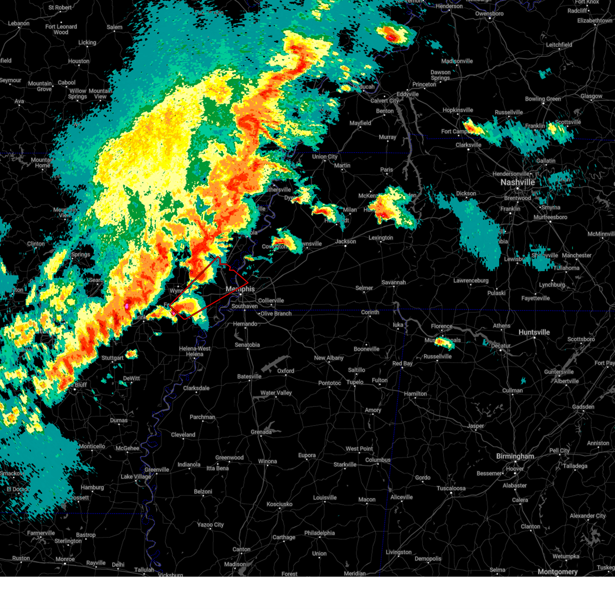 Tormeg the national weather service in memphis has issued a * tornado warning for, eastern st. francis county in eastern arkansas, southeastern poinsett county in eastern arkansas, crittenden county in eastern arkansas, southeastern cross county in eastern arkansas, northwestern shelby county in west tennessee, * until 815 pm cdt. * at 721 pm cdt, a severe thunderstorm capable of producing a tornado was located over madison, moving northeast at 50 mph (radar indicated rotation). Hazards include tornado and baseball size hail. Flying debris will be dangerous to those caught without shelter. mobile homes will be damaged or destroyed. damage to roofs, windows, and vehicles will occur. Tree damage is likely. Tormeg the national weather service in memphis has issued a * tornado warning for, eastern st. francis county in eastern arkansas, southeastern poinsett county in eastern arkansas, crittenden county in eastern arkansas, southeastern cross county in eastern arkansas, northwestern shelby county in west tennessee, * until 815 pm cdt. * at 721 pm cdt, a severe thunderstorm capable of producing a tornado was located over madison, moving northeast at 50 mph (radar indicated rotation). Hazards include tornado and baseball size hail. Flying debris will be dangerous to those caught without shelter. mobile homes will be damaged or destroyed. damage to roofs, windows, and vehicles will occur. Tree damage is likely.
|
| 4/2/2025 7:13 PM CDT |
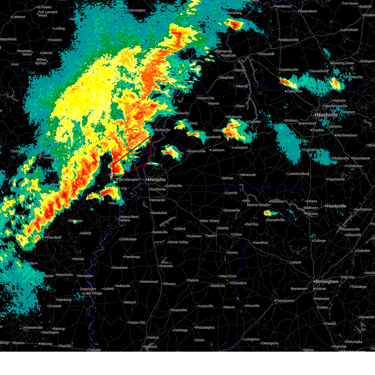 Tormeg the national weather service in memphis has issued a * tornado warning for, southeastern poinsett county in eastern arkansas, southwestern mississippi county in eastern arkansas, northern crittenden county in eastern arkansas, eastern cross county in eastern arkansas, southwestern tipton county in west tennessee, * until 800 pm cdt. * at 713 pm cdt, a severe thunderstorm capable of producing a tornado was located near parkin, moving northeast at 60 mph (radar indicated rotation). Hazards include tornado and ping pong ball size hail. Flying debris will be dangerous to those caught without shelter. mobile homes will be damaged or destroyed. damage to roofs, windows, and vehicles will occur. Tree damage is likely. Tormeg the national weather service in memphis has issued a * tornado warning for, southeastern poinsett county in eastern arkansas, southwestern mississippi county in eastern arkansas, northern crittenden county in eastern arkansas, eastern cross county in eastern arkansas, southwestern tipton county in west tennessee, * until 800 pm cdt. * at 713 pm cdt, a severe thunderstorm capable of producing a tornado was located near parkin, moving northeast at 60 mph (radar indicated rotation). Hazards include tornado and ping pong ball size hail. Flying debris will be dangerous to those caught without shelter. mobile homes will be damaged or destroyed. damage to roofs, windows, and vehicles will occur. Tree damage is likely.
|
| 4/2/2025 3:19 PM CDT |
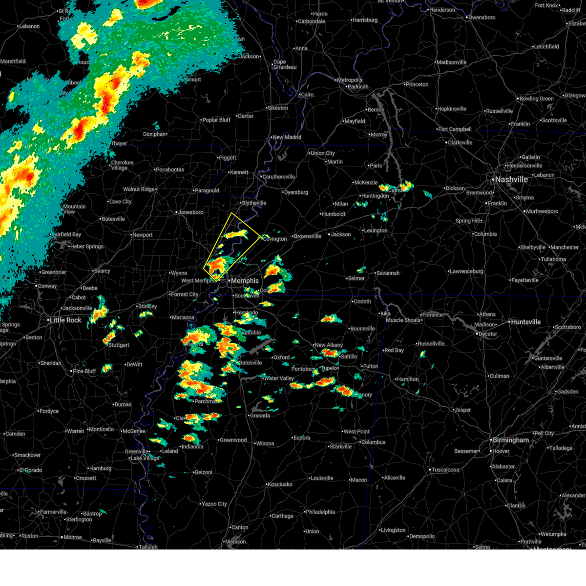 At 319 pm cdt, a severe thunderstorm was located over jericho, or 7 miles west of meeman shelby forest state park, moving northeast at 60 mph (radar indicated). Hazards include 60 mph wind gusts and half dollar size hail. Hail damage to vehicles is expected. expect wind damage to roofs, siding, and trees. Locations impacted include, burlison, booker, evadale, menesha, west memphis, grider, hampson archaeological museum state park, carson lake, osceola, rotan, locke, chilson, randolph, sloanville, shippen, victoria, delpro, meeman shelby forest state park, bassett, and marie. At 319 pm cdt, a severe thunderstorm was located over jericho, or 7 miles west of meeman shelby forest state park, moving northeast at 60 mph (radar indicated). Hazards include 60 mph wind gusts and half dollar size hail. Hail damage to vehicles is expected. expect wind damage to roofs, siding, and trees. Locations impacted include, burlison, booker, evadale, menesha, west memphis, grider, hampson archaeological museum state park, carson lake, osceola, rotan, locke, chilson, randolph, sloanville, shippen, victoria, delpro, meeman shelby forest state park, bassett, and marie.
|
| 4/2/2025 3:14 PM CDT |
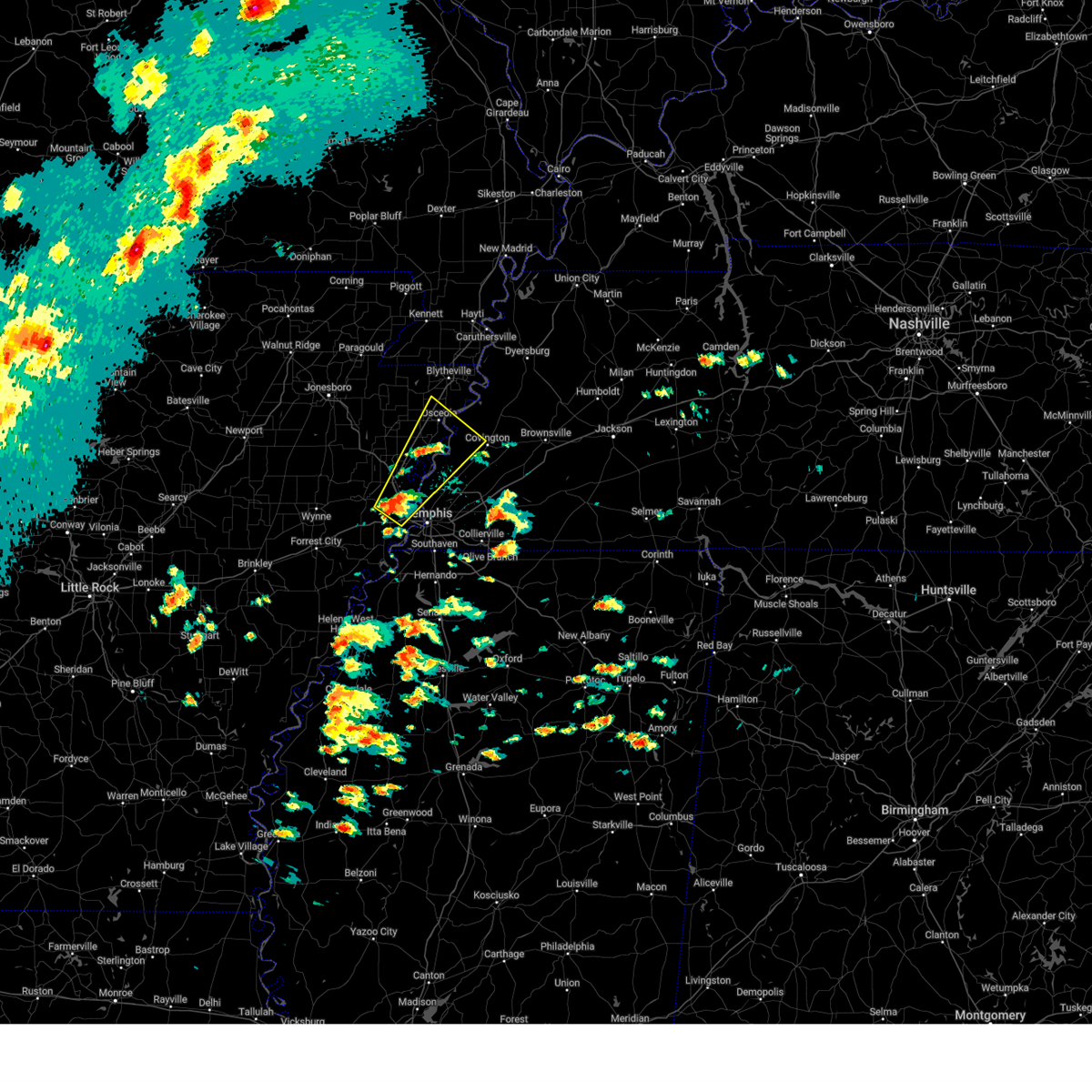 Svrmeg the national weather service in memphis has issued a * severe thunderstorm warning for, southwestern mississippi county in eastern arkansas, northeastern crittenden county in eastern arkansas, central tipton county in west tennessee, southwestern lauderdale county in west tennessee, northwestern shelby county in west tennessee, * until 400 pm cdt. * at 314 pm cdt, a severe thunderstorm was located over jericho, or near marion, moving northeast at 60 mph (radar indicated). Hazards include 60 mph wind gusts and quarter size hail. Hail damage to vehicles is expected. Expect wind damage to roofs, siding, and trees. Svrmeg the national weather service in memphis has issued a * severe thunderstorm warning for, southwestern mississippi county in eastern arkansas, northeastern crittenden county in eastern arkansas, central tipton county in west tennessee, southwestern lauderdale county in west tennessee, northwestern shelby county in west tennessee, * until 400 pm cdt. * at 314 pm cdt, a severe thunderstorm was located over jericho, or near marion, moving northeast at 60 mph (radar indicated). Hazards include 60 mph wind gusts and quarter size hail. Hail damage to vehicles is expected. Expect wind damage to roofs, siding, and trees.
|
| 3/30/2025 9:04 PM CDT |
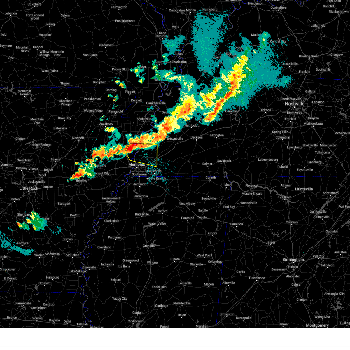 the severe thunderstorm warning has been cancelled and is no longer in effect the severe thunderstorm warning has been cancelled and is no longer in effect
|
| 3/30/2025 9:04 PM CDT |
 At 903 pm cdt, a severe thunderstorm was located near joiner, or 7 miles north of meeman shelby forest state park, moving east at 30 mph (radar indicated. at 853 pm cdt, golf ball sized hail was reported near bassett, mississippi). Hazards include golf ball size hail and 60 mph wind gusts. People and animals outdoors will be injured. expect hail damage to roofs, siding, windows, and vehicles. expect wind damage to roofs, siding, and trees. Locations impacted include, dimple, evadale, menesha, ellendale, woodstock, atoka, locke, randolph, sloanville, arlington, brunswick, delpro, meeman shelby forest state park, tipton, bassett, wardell, gilestown, stacy, clopton, and benjestown. At 903 pm cdt, a severe thunderstorm was located near joiner, or 7 miles north of meeman shelby forest state park, moving east at 30 mph (radar indicated. at 853 pm cdt, golf ball sized hail was reported near bassett, mississippi). Hazards include golf ball size hail and 60 mph wind gusts. People and animals outdoors will be injured. expect hail damage to roofs, siding, windows, and vehicles. expect wind damage to roofs, siding, and trees. Locations impacted include, dimple, evadale, menesha, ellendale, woodstock, atoka, locke, randolph, sloanville, arlington, brunswick, delpro, meeman shelby forest state park, tipton, bassett, wardell, gilestown, stacy, clopton, and benjestown.
|
| 3/30/2025 8:51 PM CDT |
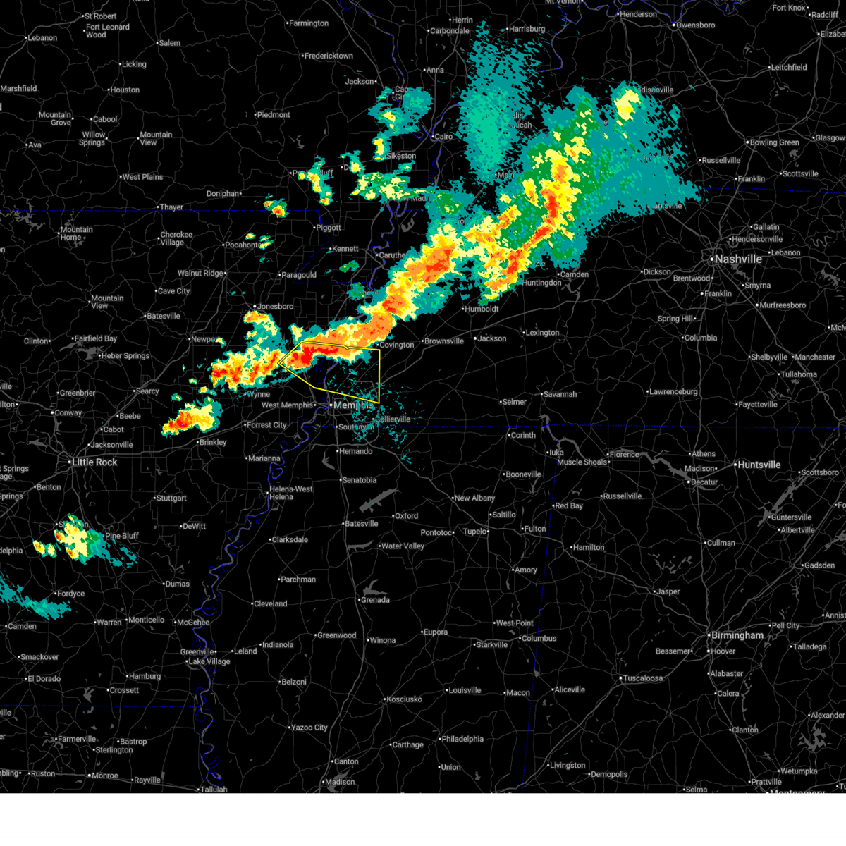 Svrmeg the national weather service in memphis has issued a * severe thunderstorm warning for, southeastern poinsett county in eastern arkansas, southwestern mississippi county in eastern arkansas, northeastern crittenden county in eastern arkansas, southern tipton county in west tennessee, northern shelby county in west tennessee, * until 930 pm cdt. * at 851 pm cdt, a severe thunderstorm was located near gilmore, or 9 miles southeast of tyronza, moving east at 25 mph (radar indicated). Hazards include golf ball size hail and 60 mph wind gusts. People and animals outdoors will be injured. expect hail damage to roofs, siding, windows, and vehicles. Expect wind damage to roofs, siding, and trees. Svrmeg the national weather service in memphis has issued a * severe thunderstorm warning for, southeastern poinsett county in eastern arkansas, southwestern mississippi county in eastern arkansas, northeastern crittenden county in eastern arkansas, southern tipton county in west tennessee, northern shelby county in west tennessee, * until 930 pm cdt. * at 851 pm cdt, a severe thunderstorm was located near gilmore, or 9 miles southeast of tyronza, moving east at 25 mph (radar indicated). Hazards include golf ball size hail and 60 mph wind gusts. People and animals outdoors will be injured. expect hail damage to roofs, siding, windows, and vehicles. Expect wind damage to roofs, siding, and trees.
|
| 3/23/2025 5:28 PM CDT |
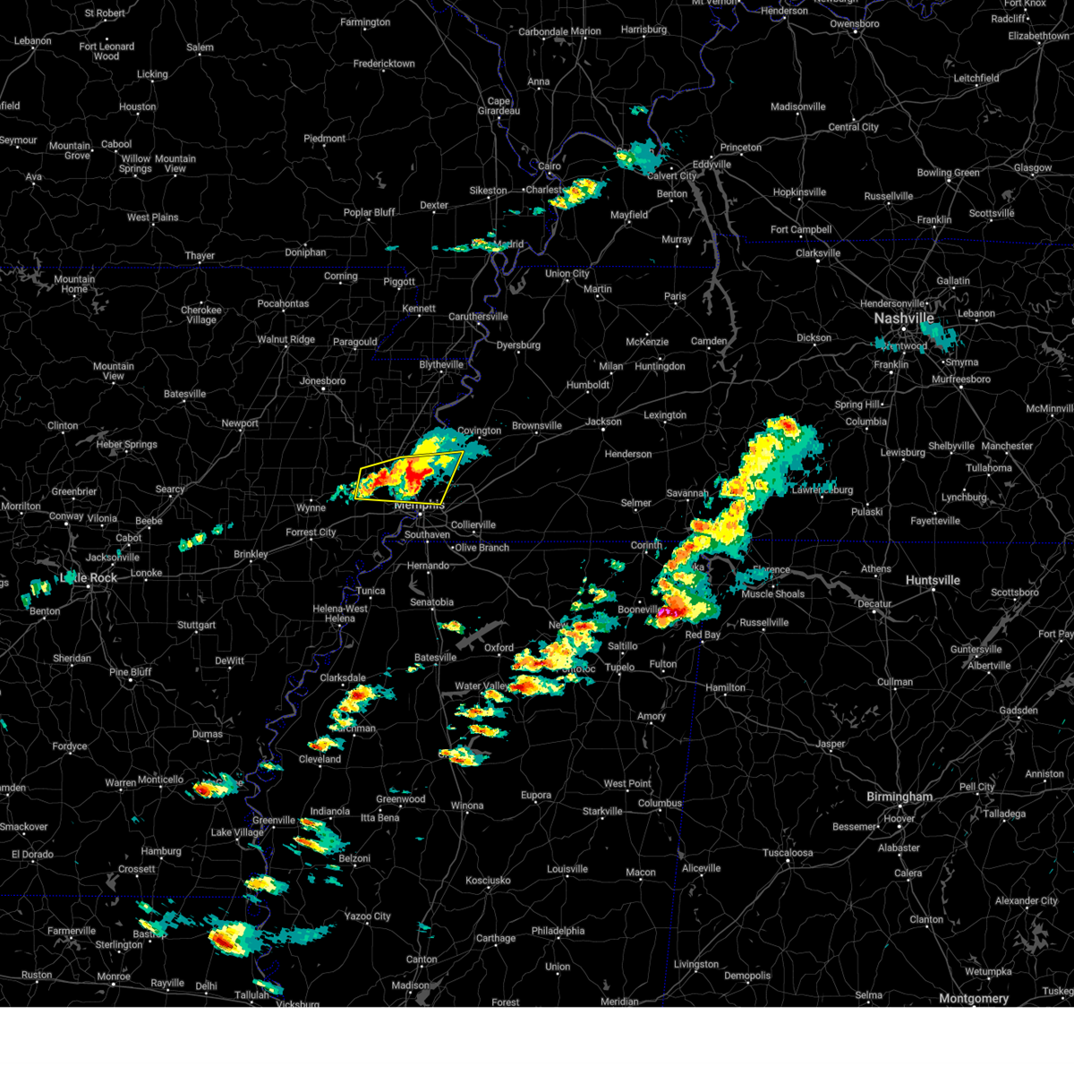 At 528 pm cdt, a severe thunderstorm was located over meeman shelby forest state park, moving east at 40 mph (radar indicated). Hazards include 60 mph wind gusts and quarter size hail. Hail damage to vehicles is expected. expect wind damage to roofs, siding, and trees. Locations impacted include, three forks, wapanocca national wildlife refuge, munford, jericho, booker, griffin corner, turrell, menesha, gammon, quito, clarkedale, woodstock, st clair, harvard, gilmore, cloar, earle, locke, dixonville, and millington. At 528 pm cdt, a severe thunderstorm was located over meeman shelby forest state park, moving east at 40 mph (radar indicated). Hazards include 60 mph wind gusts and quarter size hail. Hail damage to vehicles is expected. expect wind damage to roofs, siding, and trees. Locations impacted include, three forks, wapanocca national wildlife refuge, munford, jericho, booker, griffin corner, turrell, menesha, gammon, quito, clarkedale, woodstock, st clair, harvard, gilmore, cloar, earle, locke, dixonville, and millington.
|
| 3/23/2025 5:09 PM CDT |
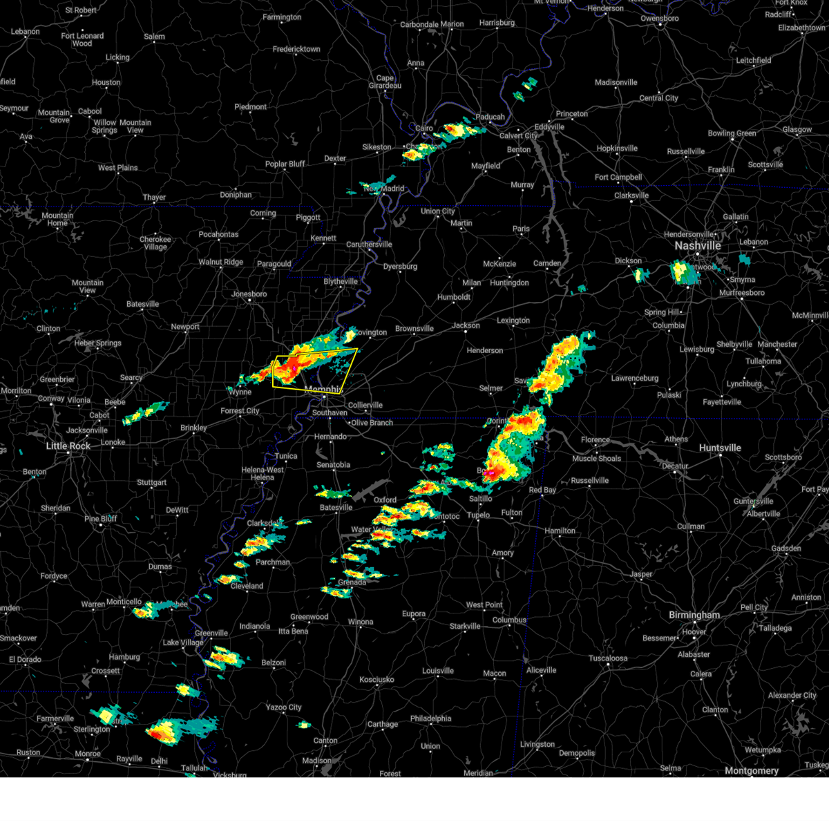 At 509 pm cdt, a severe thunderstorm was located near jericho, or 8 miles north of marion, moving east at 40 mph (radar indicated). Hazards include 60 mph wind gusts and quarter size hail. Hail damage to vehicles is expected. expect wind damage to roofs, siding, and trees. Locations impacted include, three forks, wapanocca national wildlife refuge, munford, jericho, booker, griffin corner, turrell, menesha, gammon, quito, clarkedale, woodstock, st clair, harvard, gilmore, cloar, earle, locke, dixonville, and millington. At 509 pm cdt, a severe thunderstorm was located near jericho, or 8 miles north of marion, moving east at 40 mph (radar indicated). Hazards include 60 mph wind gusts and quarter size hail. Hail damage to vehicles is expected. expect wind damage to roofs, siding, and trees. Locations impacted include, three forks, wapanocca national wildlife refuge, munford, jericho, booker, griffin corner, turrell, menesha, gammon, quito, clarkedale, woodstock, st clair, harvard, gilmore, cloar, earle, locke, dixonville, and millington.
|
| 3/23/2025 5:00 PM CDT |
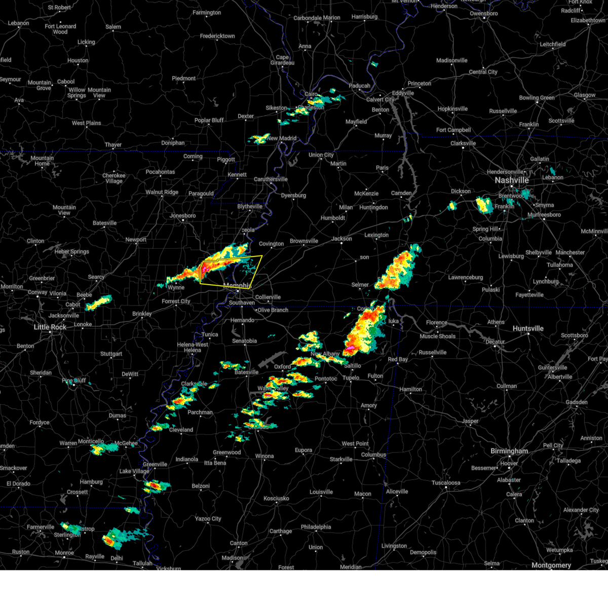 Svrmeg the national weather service in memphis has issued a * severe thunderstorm warning for, southwestern mississippi county in eastern arkansas, northern crittenden county in eastern arkansas, southwestern tipton county in west tennessee, northwestern shelby county in west tennessee, * until 545 pm cdt. * at 500 pm cdt, a severe thunderstorm was located near earle, moving east at 40 mph (radar indicated). Hazards include 60 mph wind gusts and quarter size hail. Hail damage to vehicles is expected. Expect wind damage to roofs, siding, and trees. Svrmeg the national weather service in memphis has issued a * severe thunderstorm warning for, southwestern mississippi county in eastern arkansas, northern crittenden county in eastern arkansas, southwestern tipton county in west tennessee, northwestern shelby county in west tennessee, * until 545 pm cdt. * at 500 pm cdt, a severe thunderstorm was located near earle, moving east at 40 mph (radar indicated). Hazards include 60 mph wind gusts and quarter size hail. Hail damage to vehicles is expected. Expect wind damage to roofs, siding, and trees.
|
| 2/15/2025 5:59 PM CST |
 At 559 pm cst, a severe thunderstorm capable of producing a tornado was located near jericho, or near meeman shelby forest state park, moving northeast at 60 mph (radar indicated rotation). Hazards include tornado. Flying debris will be dangerous to those caught without shelter. mobile homes will be damaged or destroyed. damage to roofs, windows, and vehicles will occur. tree damage is likely. Locations impacted include, marion, millington, meeman shelby forest state park, memphis, arlington, munford, sunset, gilmore, jericho, dixonville, tipton, atoka, turrell, gilt edge, clarkedale, barretville, booker, griffin corner, menesha, and gammon. At 559 pm cst, a severe thunderstorm capable of producing a tornado was located near jericho, or near meeman shelby forest state park, moving northeast at 60 mph (radar indicated rotation). Hazards include tornado. Flying debris will be dangerous to those caught without shelter. mobile homes will be damaged or destroyed. damage to roofs, windows, and vehicles will occur. tree damage is likely. Locations impacted include, marion, millington, meeman shelby forest state park, memphis, arlington, munford, sunset, gilmore, jericho, dixonville, tipton, atoka, turrell, gilt edge, clarkedale, barretville, booker, griffin corner, menesha, and gammon.
|
| 2/15/2025 5:59 PM CST |
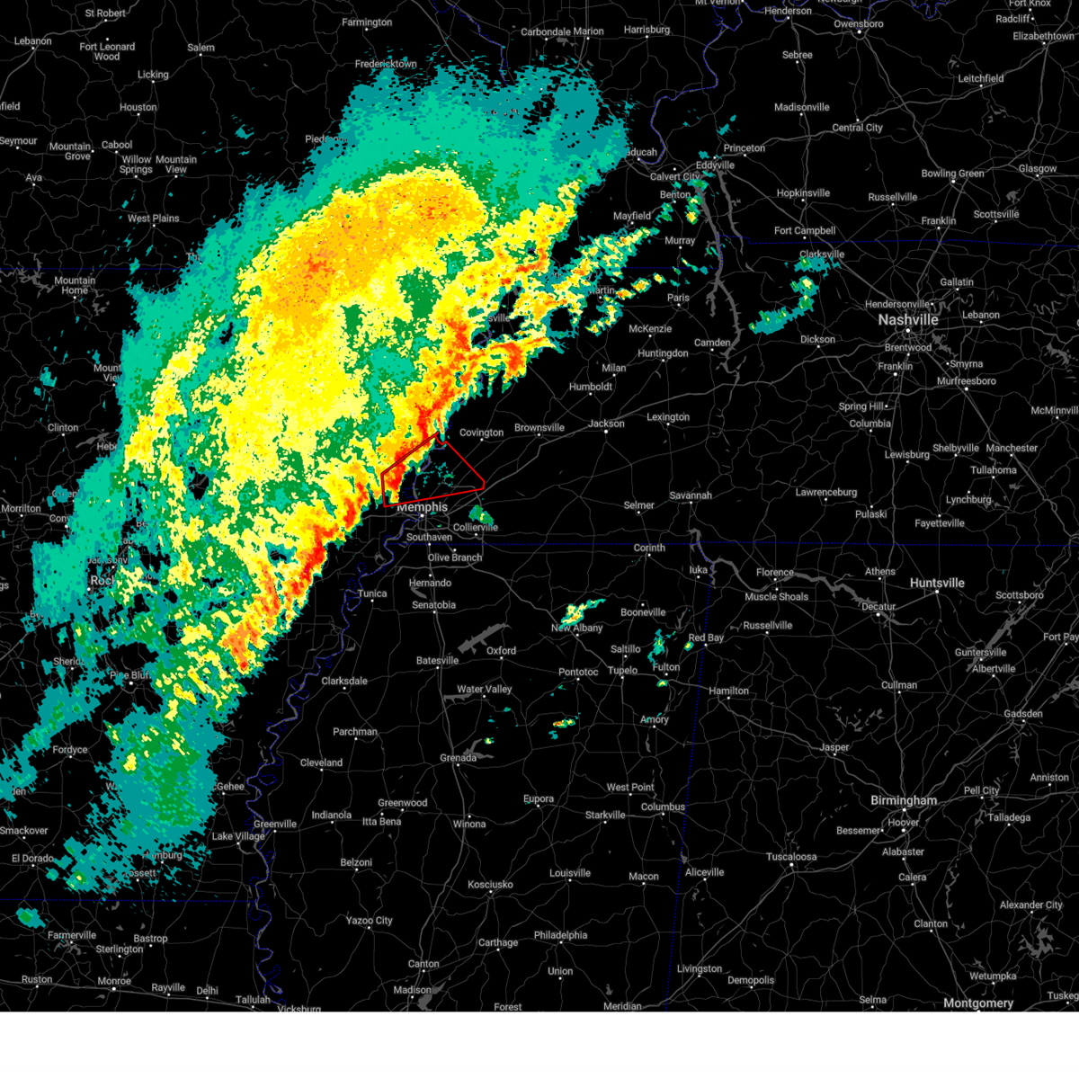 the tornado warning has been cancelled and is no longer in effect the tornado warning has been cancelled and is no longer in effect
|
| 2/15/2025 5:51 PM CST |
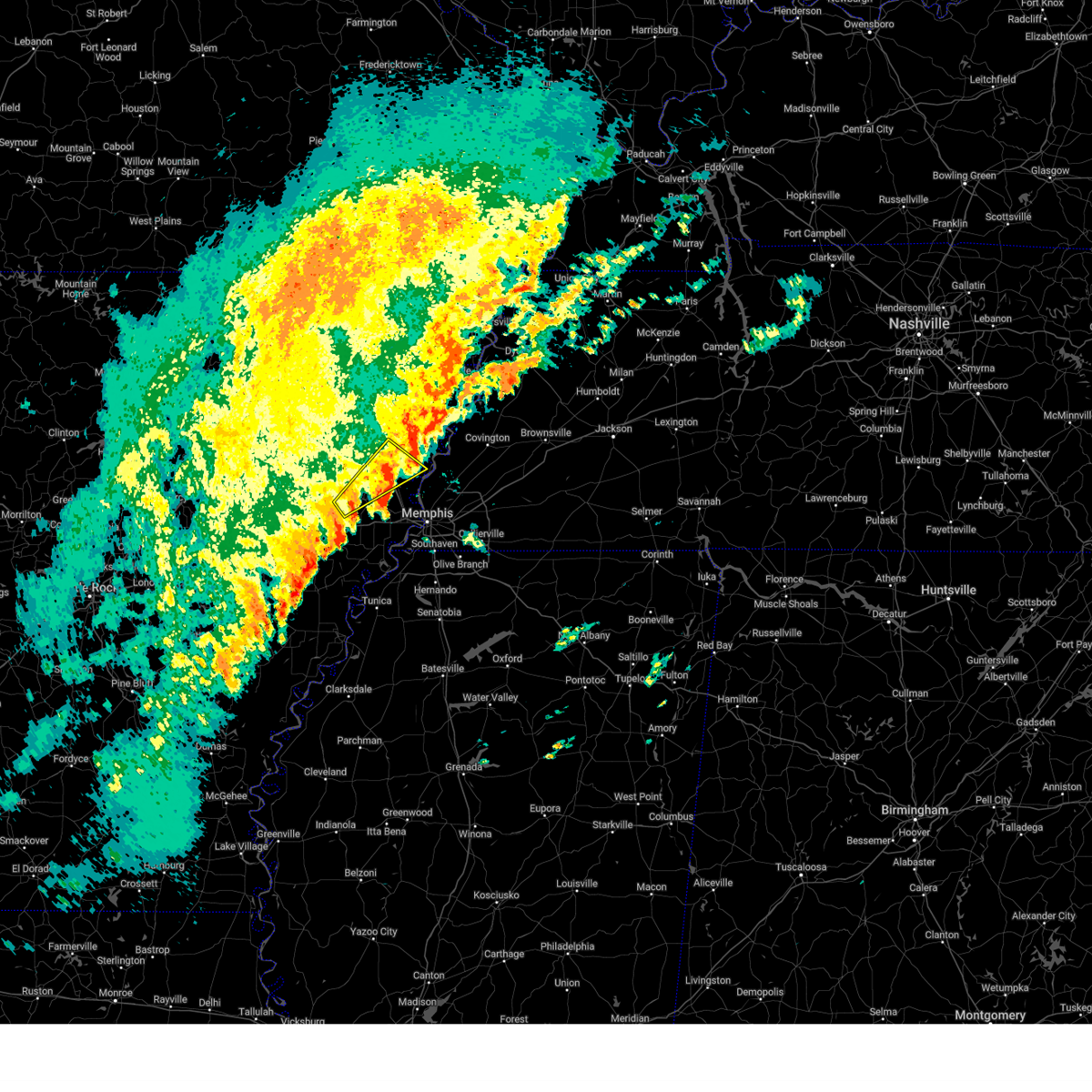 the severe thunderstorm warning has been cancelled and is no longer in effect the severe thunderstorm warning has been cancelled and is no longer in effect
|
| 2/15/2025 5:51 PM CST |
 At 551 pm cst, a severe thunderstorm was located over gilmore, or near tyronza, moving northeast at 65 mph (radar indicated). Hazards include 60 mph wind gusts and penny size hail. Expect damage to roofs, siding, and trees. Locations impacted include, earle, parkin, tyronza, joiner, gilmore, turrell, birdsong, smithdale, three forks, whitton, dimple, deckerville, menesha, dub, twist, mcdonald, cloar, chelford, alto, and denwood. At 551 pm cst, a severe thunderstorm was located over gilmore, or near tyronza, moving northeast at 65 mph (radar indicated). Hazards include 60 mph wind gusts and penny size hail. Expect damage to roofs, siding, and trees. Locations impacted include, earle, parkin, tyronza, joiner, gilmore, turrell, birdsong, smithdale, three forks, whitton, dimple, deckerville, menesha, dub, twist, mcdonald, cloar, chelford, alto, and denwood.
|
| 2/15/2025 5:39 PM CST |
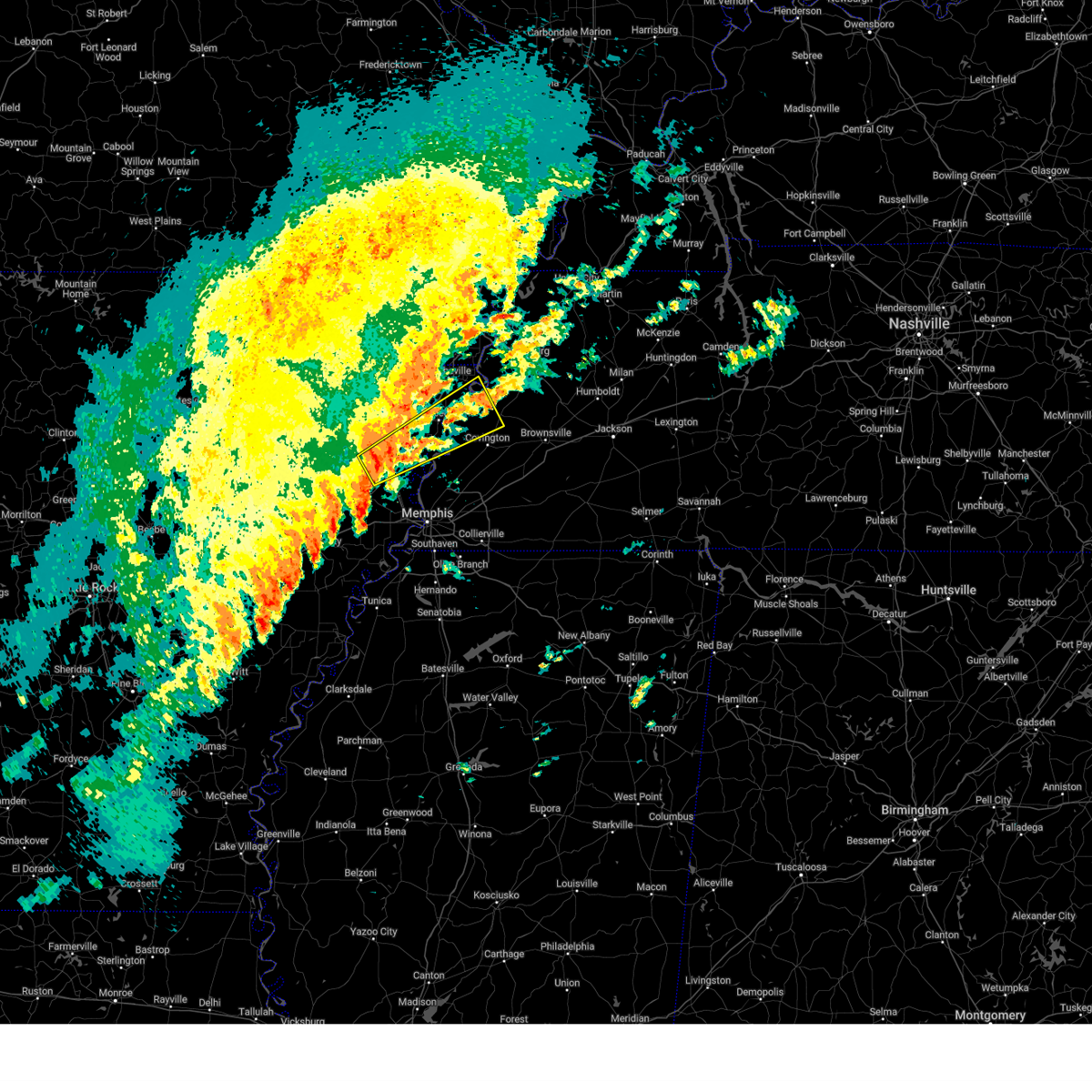 Svrmeg the national weather service in memphis has issued a * severe thunderstorm warning for, southeastern poinsett county in eastern arkansas, mississippi county in eastern arkansas, north central crittenden county in eastern arkansas, northwestern tipton county in west tennessee, western lauderdale county in west tennessee, * until 630 pm cst. * at 538 pm cst, a severe thunderstorm was located over tyronza, moving northeast at 55 mph (radar indicated). Hazards include 60 mph wind gusts and quarter size hail. Hail damage to vehicles is expected. Expect wind damage to roofs, siding, and trees. Svrmeg the national weather service in memphis has issued a * severe thunderstorm warning for, southeastern poinsett county in eastern arkansas, mississippi county in eastern arkansas, north central crittenden county in eastern arkansas, northwestern tipton county in west tennessee, western lauderdale county in west tennessee, * until 630 pm cst. * at 538 pm cst, a severe thunderstorm was located over tyronza, moving northeast at 55 mph (radar indicated). Hazards include 60 mph wind gusts and quarter size hail. Hail damage to vehicles is expected. Expect wind damage to roofs, siding, and trees.
|
| 2/15/2025 5:27 PM CST |
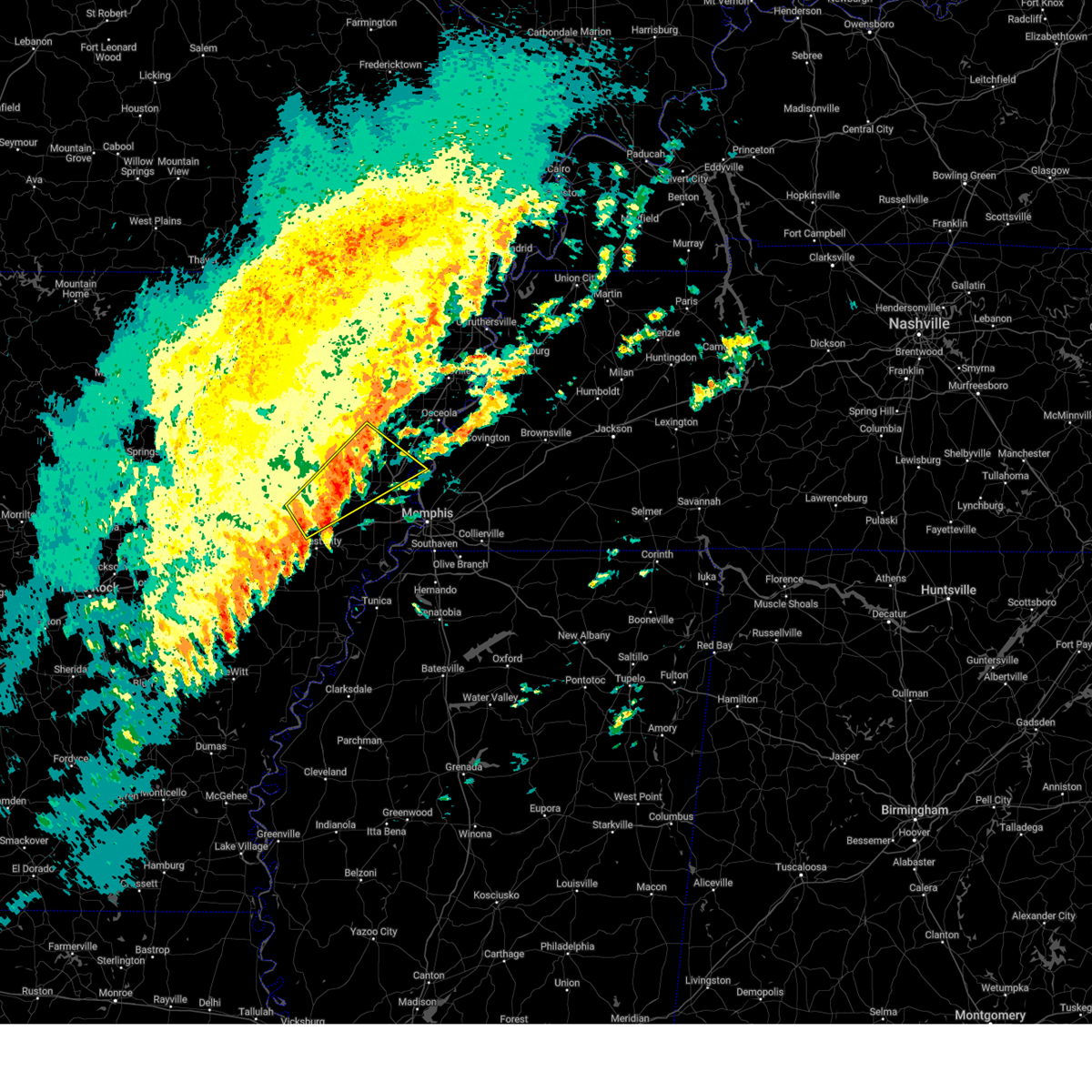 At 527 pm cst, a severe thunderstorm was located 8 miles southwest of marked tree, moving northeast at 50 mph (radar indicated). Hazards include 60 mph wind gusts and nickel size hail. Expect damage to roofs, siding, and trees. Locations impacted include, wynne, marked tree, earle, lepanto, parkin, tyronza, village creek state park, cherry valley, joiner, caldwell, colt, gilmore, vanndale, turrell, birdsong, three forks, payneway, dimple, deckerville, and fitzgerald crossing. At 527 pm cst, a severe thunderstorm was located 8 miles southwest of marked tree, moving northeast at 50 mph (radar indicated). Hazards include 60 mph wind gusts and nickel size hail. Expect damage to roofs, siding, and trees. Locations impacted include, wynne, marked tree, earle, lepanto, parkin, tyronza, village creek state park, cherry valley, joiner, caldwell, colt, gilmore, vanndale, turrell, birdsong, three forks, payneway, dimple, deckerville, and fitzgerald crossing.
|
| 2/15/2025 5:10 PM CST |
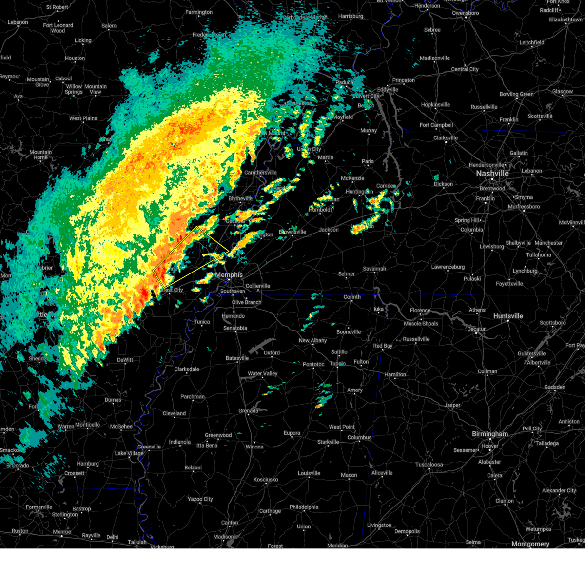 Svrmeg the national weather service in memphis has issued a * severe thunderstorm warning for, north central st. francis county in eastern arkansas, eastern poinsett county in eastern arkansas, southwestern mississippi county in eastern arkansas, northwestern crittenden county in eastern arkansas, cross county in eastern arkansas, western tipton county in west tennessee, * until 600 pm cst. * at 510 pm cst, a severe thunderstorm was located over wynne, moving northeast at 50 mph (radar indicated). Hazards include 60 mph wind gusts and nickel size hail. expect damage to roofs, siding, and trees Svrmeg the national weather service in memphis has issued a * severe thunderstorm warning for, north central st. francis county in eastern arkansas, eastern poinsett county in eastern arkansas, southwestern mississippi county in eastern arkansas, northwestern crittenden county in eastern arkansas, cross county in eastern arkansas, western tipton county in west tennessee, * until 600 pm cst. * at 510 pm cst, a severe thunderstorm was located over wynne, moving northeast at 50 mph (radar indicated). Hazards include 60 mph wind gusts and nickel size hail. expect damage to roofs, siding, and trees
|
| 8/17/2024 2:43 AM CDT |
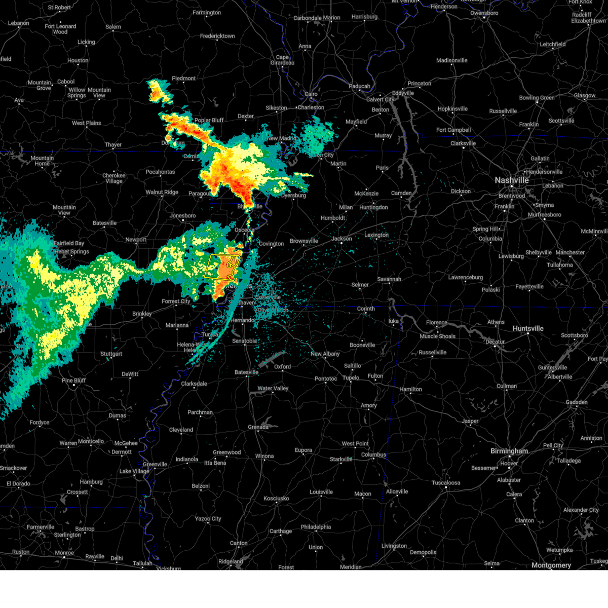 The storm which prompted the warning has moved out of the area. therefore, the warning will be allowed to expire. to report severe weather, contact your nearest law enforcement agency. they will relay your report to the national weather service memphis. remember, a severe thunderstorm warning still remains in effect for the majority of mississippi county and crittenden county arkansas until 330 am cdt. The storm which prompted the warning has moved out of the area. therefore, the warning will be allowed to expire. to report severe weather, contact your nearest law enforcement agency. they will relay your report to the national weather service memphis. remember, a severe thunderstorm warning still remains in effect for the majority of mississippi county and crittenden county arkansas until 330 am cdt.
|
| 8/17/2024 2:19 AM CDT |
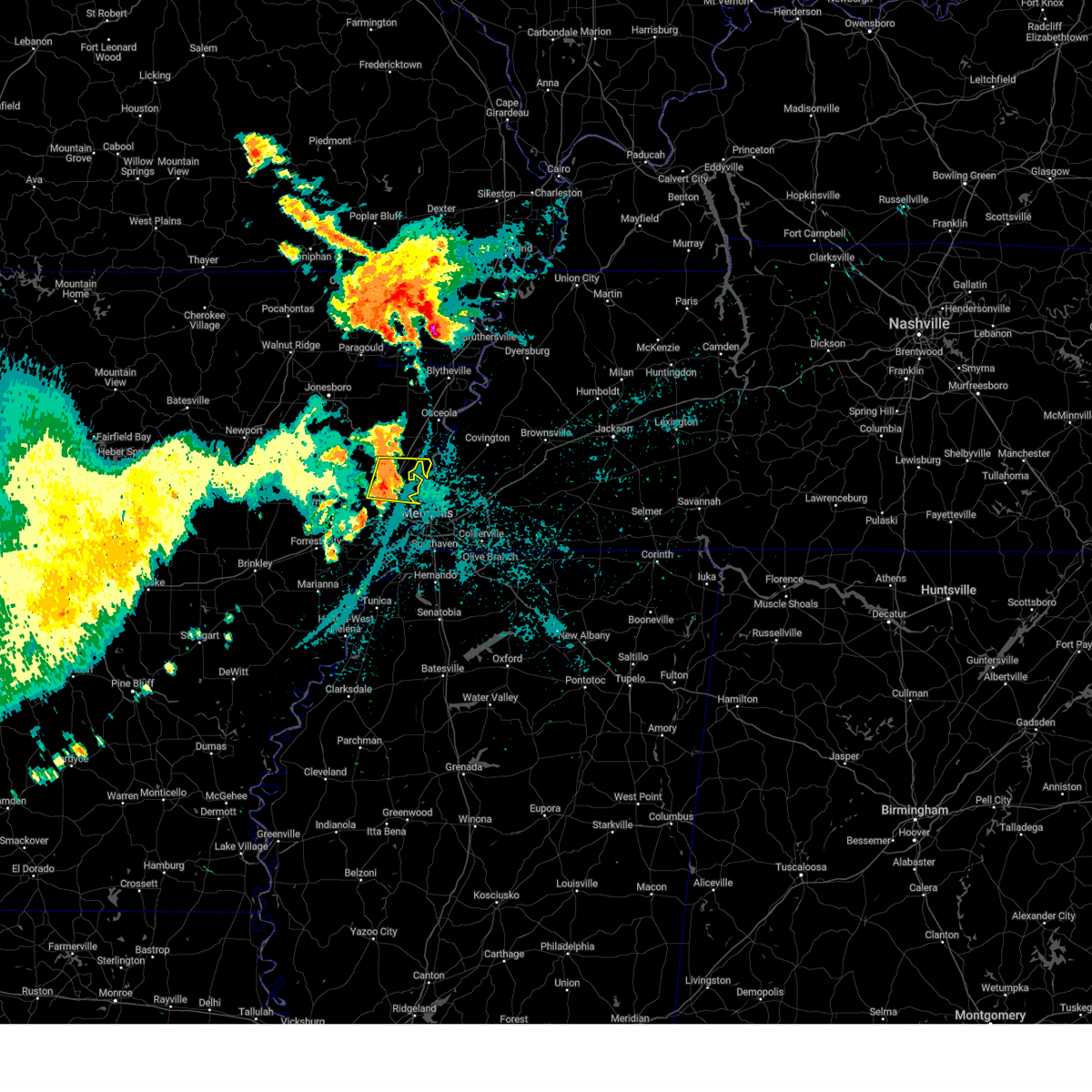 At 219 am cdt, a severe thunderstorm was located over gilmore, or 8 miles southeast of tyronza, moving east at 20 mph (radar indicated). Hazards include 60 mph wind gusts and quarter size hail. Hail damage to vehicles is expected. expect wind damage to roofs, siding, and trees. Locations impacted include, earle, tyronza, gilmore, jericho, turrell, clarkedale, birdsong, dimple, booker, deckerville, menesha, beasley, lambethville, stacy, pecan point, galilee, heafer, james mill, denwood, and frenchmans bayou. At 219 am cdt, a severe thunderstorm was located over gilmore, or 8 miles southeast of tyronza, moving east at 20 mph (radar indicated). Hazards include 60 mph wind gusts and quarter size hail. Hail damage to vehicles is expected. expect wind damage to roofs, siding, and trees. Locations impacted include, earle, tyronza, gilmore, jericho, turrell, clarkedale, birdsong, dimple, booker, deckerville, menesha, beasley, lambethville, stacy, pecan point, galilee, heafer, james mill, denwood, and frenchmans bayou.
|
| 8/17/2024 1:58 AM CDT |
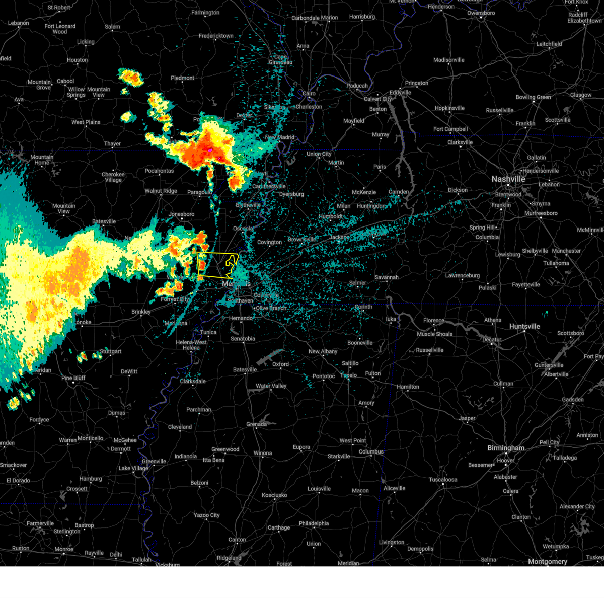 Svrmeg the national weather service in memphis has issued a * severe thunderstorm warning for, southeastern poinsett county in eastern arkansas, southwestern mississippi county in eastern arkansas, northern crittenden county in eastern arkansas, * until 245 am cdt. * at 158 am cdt, a severe thunderstorm was located 7 miles north of earle, moving east at 20 mph (radar indicated). Hazards include 60 mph wind gusts and quarter size hail. Hail damage to vehicles is expected. Expect wind damage to roofs, siding, and trees. Svrmeg the national weather service in memphis has issued a * severe thunderstorm warning for, southeastern poinsett county in eastern arkansas, southwestern mississippi county in eastern arkansas, northern crittenden county in eastern arkansas, * until 245 am cdt. * at 158 am cdt, a severe thunderstorm was located 7 miles north of earle, moving east at 20 mph (radar indicated). Hazards include 60 mph wind gusts and quarter size hail. Hail damage to vehicles is expected. Expect wind damage to roofs, siding, and trees.
|
| 5/27/2024 12:14 AM CDT |
 At 1213 am cdt, a severe thunderstorm was located near millington, moving east at 45 mph (radar indicated). Hazards include 60 mph wind gusts and quarter size hail. Hail damage to vehicles is expected. expect wind damage to roofs, siding, and trees. Locations impacted include, bartlett, marion, millington, meeman shelby forest state park, memphis, lakeland, arlington, munford, crawfordsville, sunset, gilmore, jericho, ellendale, frayser, dixonville, eads, tipton, atoka, turrell, and clarkedale. At 1213 am cdt, a severe thunderstorm was located near millington, moving east at 45 mph (radar indicated). Hazards include 60 mph wind gusts and quarter size hail. Hail damage to vehicles is expected. expect wind damage to roofs, siding, and trees. Locations impacted include, bartlett, marion, millington, meeman shelby forest state park, memphis, lakeland, arlington, munford, crawfordsville, sunset, gilmore, jericho, ellendale, frayser, dixonville, eads, tipton, atoka, turrell, and clarkedale.
|
| 5/26/2024 11:40 PM CDT |
 Svrmeg the national weather service in memphis has issued a * severe thunderstorm warning for, northeastern crittenden county in eastern arkansas, southwestern tipton county in west tennessee, northern shelby county in west tennessee, * until 1230 am cdt. * at 1140 pm cdt, a severe thunderstorm was located near jericho, or 8 miles west of meeman shelby forest state park, moving east at 40 mph (radar indicated). Hazards include ping pong ball size hail and 60 mph wind gusts. People and animals outdoors will be injured. expect hail damage to roofs, siding, windows, and vehicles. Expect wind damage to roofs, siding, and trees. Svrmeg the national weather service in memphis has issued a * severe thunderstorm warning for, northeastern crittenden county in eastern arkansas, southwestern tipton county in west tennessee, northern shelby county in west tennessee, * until 1230 am cdt. * at 1140 pm cdt, a severe thunderstorm was located near jericho, or 8 miles west of meeman shelby forest state park, moving east at 40 mph (radar indicated). Hazards include ping pong ball size hail and 60 mph wind gusts. People and animals outdoors will be injured. expect hail damage to roofs, siding, windows, and vehicles. Expect wind damage to roofs, siding, and trees.
|
| 5/26/2024 11:36 PM CDT |
 At 1136 pm cdt, severe thunderstorms were located along a line extending from gilmore to 8 miles east of hunter, moving east at 40 mph (radar indicated). Hazards include ping pong ball size hail and 60 mph wind gusts. People and animals outdoors will be injured. expect hail damage to roofs, siding, windows, and vehicles. expect wind damage to roofs, siding, and trees. Locations impacted include, forrest city, wynne, earle, parkin, madison, palestine, village creek state park, caldwell, crawfordsville, colt, wheatley, widener, gilmore, jericho, jennette, fair oaks, vanndale, turrell, clarkedale, and three forks. At 1136 pm cdt, severe thunderstorms were located along a line extending from gilmore to 8 miles east of hunter, moving east at 40 mph (radar indicated). Hazards include ping pong ball size hail and 60 mph wind gusts. People and animals outdoors will be injured. expect hail damage to roofs, siding, windows, and vehicles. expect wind damage to roofs, siding, and trees. Locations impacted include, forrest city, wynne, earle, parkin, madison, palestine, village creek state park, caldwell, crawfordsville, colt, wheatley, widener, gilmore, jericho, jennette, fair oaks, vanndale, turrell, clarkedale, and three forks.
|
| 5/26/2024 11:20 PM CDT |
 Svrmeg the national weather service in memphis has issued a * severe thunderstorm warning for, st. francis county in eastern arkansas, northern crittenden county in eastern arkansas, cross county in eastern arkansas, * until midnight cdt. * at 1119 pm cdt, severe thunderstorms were located along a line extending from 8 miles north of earle to near hunter, moving east at 40 mph (radar indicated). Hazards include 60 mph wind gusts and quarter size hail. Hail damage to vehicles is expected. Expect wind damage to roofs, siding, and trees. Svrmeg the national weather service in memphis has issued a * severe thunderstorm warning for, st. francis county in eastern arkansas, northern crittenden county in eastern arkansas, cross county in eastern arkansas, * until midnight cdt. * at 1119 pm cdt, severe thunderstorms were located along a line extending from 8 miles north of earle to near hunter, moving east at 40 mph (radar indicated). Hazards include 60 mph wind gusts and quarter size hail. Hail damage to vehicles is expected. Expect wind damage to roofs, siding, and trees.
|
| 5/22/2024 1:34 PM CDT |
 At 133 pm cdt, a severe thunderstorm was located over meeman shelby forest state park, moving east at 35 mph (radar indicated). Hazards include 70 mph wind gusts and quarter size hail. Hail damage to vehicles is expected. expect considerable tree damage. wind damage is also likely to mobile homes, roofs, and outbuildings. Locations impacted include, west memphis, marion, wilson, tyronza, meeman shelby forest state park, memphis, joiner, sunset, gilmore, bassett, jericho, frayser, turrell, clarkedale, birdsong, dimple, booker, deckerville, evadale, and menesha. At 133 pm cdt, a severe thunderstorm was located over meeman shelby forest state park, moving east at 35 mph (radar indicated). Hazards include 70 mph wind gusts and quarter size hail. Hail damage to vehicles is expected. expect considerable tree damage. wind damage is also likely to mobile homes, roofs, and outbuildings. Locations impacted include, west memphis, marion, wilson, tyronza, meeman shelby forest state park, memphis, joiner, sunset, gilmore, bassett, jericho, frayser, turrell, clarkedale, birdsong, dimple, booker, deckerville, evadale, and menesha.
|
| 5/22/2024 1:34 PM CDT |
 the severe thunderstorm warning has been cancelled and is no longer in effect the severe thunderstorm warning has been cancelled and is no longer in effect
|
| 5/22/2024 1:09 PM CDT |
 At 109 pm cdt, a severe thunderstorm was located near gilmore, or 10 miles northeast of earle, moving east at 40 mph (radar indicated). Hazards include 70 mph wind gusts and quarter size hail. Hail damage to vehicles is expected. expect considerable tree damage. wind damage is also likely to mobile homes, roofs, and outbuildings. Locations impacted include, west memphis, marion, earle, parkin, wilson, tyronza, meeman shelby forest state park, memphis, joiner, crawfordsville, sunset, gilmore, bassett, jericho, jennette, frayser, turrell, clarkedale, birdsong, and three forks. At 109 pm cdt, a severe thunderstorm was located near gilmore, or 10 miles northeast of earle, moving east at 40 mph (radar indicated). Hazards include 70 mph wind gusts and quarter size hail. Hail damage to vehicles is expected. expect considerable tree damage. wind damage is also likely to mobile homes, roofs, and outbuildings. Locations impacted include, west memphis, marion, earle, parkin, wilson, tyronza, meeman shelby forest state park, memphis, joiner, crawfordsville, sunset, gilmore, bassett, jericho, jennette, frayser, turrell, clarkedale, birdsong, and three forks.
|
| 5/22/2024 12:53 PM CDT |
 Svrmeg the national weather service in memphis has issued a * severe thunderstorm warning for, southeastern poinsett county in eastern arkansas, southwestern mississippi county in eastern arkansas, crittenden county in eastern arkansas, eastern cross county in eastern arkansas, southwestern tipton county in west tennessee, northwestern shelby county in west tennessee, * until 145 pm cdt. * at 1253 pm cdt, a severe thunderstorm was located over parkin, moving east at 35 mph (radar indicated). Hazards include 60 mph wind gusts and quarter size hail. Hail damage to vehicles is expected. Expect wind damage to roofs, siding, and trees. Svrmeg the national weather service in memphis has issued a * severe thunderstorm warning for, southeastern poinsett county in eastern arkansas, southwestern mississippi county in eastern arkansas, crittenden county in eastern arkansas, eastern cross county in eastern arkansas, southwestern tipton county in west tennessee, northwestern shelby county in west tennessee, * until 145 pm cdt. * at 1253 pm cdt, a severe thunderstorm was located over parkin, moving east at 35 mph (radar indicated). Hazards include 60 mph wind gusts and quarter size hail. Hail damage to vehicles is expected. Expect wind damage to roofs, siding, and trees.
|
| 5/9/2024 1:09 AM CDT |
 At 109 am cdt, a severe thunderstorm was located over frayser, or 7 miles southwest of bartlett, moving east at 55 mph (radar indicated). Hazards include 60 mph wind gusts. Expect damage to roofs, siding, and trees. Locations impacted include, bartlett, collierville, germantown, west memphis, marion, millington, covington, wilson, t o fuller state park, meeman shelby forest state park, cordova, memphis, lakeland, arlington, munford, brighton, joiner, edmondson, sunset, and gilmore. At 109 am cdt, a severe thunderstorm was located over frayser, or 7 miles southwest of bartlett, moving east at 55 mph (radar indicated). Hazards include 60 mph wind gusts. Expect damage to roofs, siding, and trees. Locations impacted include, bartlett, collierville, germantown, west memphis, marion, millington, covington, wilson, t o fuller state park, meeman shelby forest state park, cordova, memphis, lakeland, arlington, munford, brighton, joiner, edmondson, sunset, and gilmore.
|
| 5/9/2024 12:46 AM CDT |
 Svrmeg the national weather service in memphis has issued a * severe thunderstorm warning for, southwestern mississippi county in eastern arkansas, northeastern crittenden county in eastern arkansas, tipton county in west tennessee, western fayette county in west tennessee, shelby county in west tennessee, * until 130 am cdt. * at 1246 am cdt, a severe thunderstorm was located near millington, moving east at 55 mph (radar indicated). Hazards include 60 mph wind gusts. expect damage to roofs, siding, and trees Svrmeg the national weather service in memphis has issued a * severe thunderstorm warning for, southwestern mississippi county in eastern arkansas, northeastern crittenden county in eastern arkansas, tipton county in west tennessee, western fayette county in west tennessee, shelby county in west tennessee, * until 130 am cdt. * at 1246 am cdt, a severe thunderstorm was located near millington, moving east at 55 mph (radar indicated). Hazards include 60 mph wind gusts. expect damage to roofs, siding, and trees
|
| 5/9/2024 12:35 AM CDT |
 At 1234 am cdt, a severe thunderstorm was located near meeman shelby forest state park, moving east at 65 mph (radar indicated). Hazards include 70 mph wind gusts. Expect considerable tree damage. damage is likely to mobile homes, roofs, and outbuildings. Locations impacted include, bartlett, germantown, west memphis, marion, millington, earle, parkin, t o fuller state park, meeman shelby forest state park, memphis, munford, crawfordsville, edmondson, sunset, gilmore, jericho, jennette, dixonville, southeast memphis, and ellendale. At 1234 am cdt, a severe thunderstorm was located near meeman shelby forest state park, moving east at 65 mph (radar indicated). Hazards include 70 mph wind gusts. Expect considerable tree damage. damage is likely to mobile homes, roofs, and outbuildings. Locations impacted include, bartlett, germantown, west memphis, marion, millington, earle, parkin, t o fuller state park, meeman shelby forest state park, memphis, munford, crawfordsville, edmondson, sunset, gilmore, jericho, jennette, dixonville, southeast memphis, and ellendale.
|
| 5/9/2024 12:15 AM CDT |
 Svrmeg the national weather service in memphis has issued a * severe thunderstorm warning for, northeastern st. francis county in eastern arkansas, southeastern poinsett county in eastern arkansas, southwestern mississippi county in eastern arkansas, crittenden county in eastern arkansas, eastern cross county in eastern arkansas, southwestern tipton county in west tennessee, central shelby county in west tennessee, * until 100 am cdt. * at 1214 am cdt, a severe thunderstorm was located near earle, moving east at 55 mph (radar indicated). Hazards include 70 mph wind gusts. Expect considerable tree damage. Damage is likely to mobile homes, roofs, and outbuildings. Svrmeg the national weather service in memphis has issued a * severe thunderstorm warning for, northeastern st. francis county in eastern arkansas, southeastern poinsett county in eastern arkansas, southwestern mississippi county in eastern arkansas, crittenden county in eastern arkansas, eastern cross county in eastern arkansas, southwestern tipton county in west tennessee, central shelby county in west tennessee, * until 100 am cdt. * at 1214 am cdt, a severe thunderstorm was located near earle, moving east at 55 mph (radar indicated). Hazards include 70 mph wind gusts. Expect considerable tree damage. Damage is likely to mobile homes, roofs, and outbuildings.
|
| 1/12/2024 6:50 AM CST |
 At 650 am cst, a severe thunderstorm capable of producing a tornado was located near gilmore, or 7 miles northeast of earle, moving east at 40 mph (radar indicated rotation). Hazards include tornado. Flying debris will be dangerous to those caught without shelter. mobile homes will be damaged or destroyed. damage to roofs, windows, and vehicles will occur. Tree damage is likely. At 650 am cst, a severe thunderstorm capable of producing a tornado was located near gilmore, or 7 miles northeast of earle, moving east at 40 mph (radar indicated rotation). Hazards include tornado. Flying debris will be dangerous to those caught without shelter. mobile homes will be damaged or destroyed. damage to roofs, windows, and vehicles will occur. Tree damage is likely.
|
| 1/12/2024 6:45 AM CST |
 At 644 am cst, a severe thunderstorm was located over new home, or 7 miles east of madison, moving northeast at 55 mph (radar indicated). Hazards include 70 mph wind gusts. Expect considerable tree damage. Damage is likely to mobile homes, roofs, and outbuildings. At 644 am cst, a severe thunderstorm was located over new home, or 7 miles east of madison, moving northeast at 55 mph (radar indicated). Hazards include 70 mph wind gusts. Expect considerable tree damage. Damage is likely to mobile homes, roofs, and outbuildings.
|
| 8/9/2023 10:58 PM CDT |
 The severe thunderstorm warning for southeastern poinsett, mississippi, northern crittenden, southeastern dunklin, western tipton and southwestern lauderdale counties will expire at 1100 pm cdt, the storms which prompted the warning have moved out of the area. therefore, the warning will be allowed to expire. a tornado watch remains in effect until 400 am cdt for eastern arkansas, southeastern missouri, and west tennessee. The severe thunderstorm warning for southeastern poinsett, mississippi, northern crittenden, southeastern dunklin, western tipton and southwestern lauderdale counties will expire at 1100 pm cdt, the storms which prompted the warning have moved out of the area. therefore, the warning will be allowed to expire. a tornado watch remains in effect until 400 am cdt for eastern arkansas, southeastern missouri, and west tennessee.
|
| 8/9/2023 10:51 PM CDT |
 At 1051 pm cdt, a severe thunderstorm was located near ashport, or near luxora, moving east at 50 mph (radar indicated). Hazards include 60 mph wind gusts. Expect damage to roofs, siding, and trees. Locations impacted include, bartlett, dyersburg, blytheville, brownsville, millington, covington, ripley, osceola, gosnell, luxora, wilson, keiser, meeman shelby forest state park, fort pillow state park, memphis, lakeland, arlington, munford, brighton and halls. At 1051 pm cdt, a severe thunderstorm was located near ashport, or near luxora, moving east at 50 mph (radar indicated). Hazards include 60 mph wind gusts. Expect damage to roofs, siding, and trees. Locations impacted include, bartlett, dyersburg, blytheville, brownsville, millington, covington, ripley, osceola, gosnell, luxora, wilson, keiser, meeman shelby forest state park, fort pillow state park, memphis, lakeland, arlington, munford, brighton and halls.
|
| 8/9/2023 10:45 PM CDT |
 At 1045 pm cdt, severe thunderstorms were located along a line extending from near cooter to near osceola to near dyess, moving east at 45 mph (radar indicated). Hazards include 60 mph wind gusts. expect damage to roofs, siding, and trees At 1045 pm cdt, severe thunderstorms were located along a line extending from near cooter to near osceola to near dyess, moving east at 45 mph (radar indicated). Hazards include 60 mph wind gusts. expect damage to roofs, siding, and trees
|
| 8/9/2023 10:37 PM CDT |
 At 1036 pm cdt, severe thunderstorms were located along a line extending from near gosnell to near keiser to marked tree, moving southeast at 60 mph (radar indicated). Hazards include 60 mph wind gusts. Expect damage to roofs, siding, and trees. locations impacted include, blytheville, osceola, gosnell, manila, marked tree, lepanto, luxora, wilson, tyronza, keiser, fort pillow state park, hornersville, joiner, dyess, dell, burdette, gilmore, bassett, jericho and marie. hail threat, radar indicated max hail size, <. 75 in wind threat, radar indicated max wind gust, 60 mph. At 1036 pm cdt, severe thunderstorms were located along a line extending from near gosnell to near keiser to marked tree, moving southeast at 60 mph (radar indicated). Hazards include 60 mph wind gusts. Expect damage to roofs, siding, and trees. locations impacted include, blytheville, osceola, gosnell, manila, marked tree, lepanto, luxora, wilson, tyronza, keiser, fort pillow state park, hornersville, joiner, dyess, dell, burdette, gilmore, bassett, jericho and marie. hail threat, radar indicated max hail size, <. 75 in wind threat, radar indicated max wind gust, 60 mph.
|
| 8/9/2023 10:28 PM CDT |
 At 1028 pm cdt, severe thunderstorms were located along a line extending from near hornersville to near caraway to 6 miles northwest of marked tree, moving east at 55 mph (radar indicated). Hazards include 60 mph wind gusts. Expect damage to roofs, siding, and trees. locations impacted include, blytheville, osceola, trumann, gosnell, manila, marked tree, harrisburg, lake city, leachville, lepanto, bay, monette, caraway, luxora, wilson, tyronza, keiser, fort pillow state park, cardwell and hornersville. hail threat, radar indicated max hail size, <. 75 in wind threat, radar indicated max wind gust, 60 mph. At 1028 pm cdt, severe thunderstorms were located along a line extending from near hornersville to near caraway to 6 miles northwest of marked tree, moving east at 55 mph (radar indicated). Hazards include 60 mph wind gusts. Expect damage to roofs, siding, and trees. locations impacted include, blytheville, osceola, trumann, gosnell, manila, marked tree, harrisburg, lake city, leachville, lepanto, bay, monette, caraway, luxora, wilson, tyronza, keiser, fort pillow state park, cardwell and hornersville. hail threat, radar indicated max hail size, <. 75 in wind threat, radar indicated max wind gust, 60 mph.
|
| 8/9/2023 10:15 PM CDT |
 At 1015 pm cdt, a severe thunderstorm was located over lake city, moving southeast at 60 mph (radar indicated). Hazards include 60 mph wind gusts and quarter size hail. Hail damage to vehicles is expected. Expect wind damage to roofs, siding, and trees. At 1015 pm cdt, a severe thunderstorm was located over lake city, moving southeast at 60 mph (radar indicated). Hazards include 60 mph wind gusts and quarter size hail. Hail damage to vehicles is expected. Expect wind damage to roofs, siding, and trees.
|
| 8/7/2023 8:36 AM CDT |
 At 836 am cdt, a severe thunderstorm was located near gilmore, or near meeman shelby forest state park, moving east at 55 mph (radar indicated). Hazards include 60 mph wind gusts. expect damage to roofs, siding, and trees At 836 am cdt, a severe thunderstorm was located near gilmore, or near meeman shelby forest state park, moving east at 55 mph (radar indicated). Hazards include 60 mph wind gusts. expect damage to roofs, siding, and trees
|
| 7/21/2023 1:38 PM CDT |
 At 138 pm cdt, severe thunderstorms were located along a line extending from near manila to millington to hernando, moving east at 50 mph. these are destructive storms for extreme northern shelby county and southern tipton county (radar indicated). Hazards include 80 mph wind gusts. Flying debris will be dangerous to those caught without shelter. mobile homes will be heavily damaged. expect considerable damage to roofs, windows, and vehicles. extensive tree damage and power outages are likely. locations impacted include, jonesboro, bartlett, southaven, collierville, germantown, olive branch, west memphis, horn lake, blytheville, hernando, marion, millington, covington, ripley, osceola, holly springs, trumann, manila, marked tree and lake city. thunderstorm damage threat, destructive hail threat, radar indicated max hail size, <. 75 in wind threat, radar indicated max wind gust, 80 mph. At 138 pm cdt, severe thunderstorms were located along a line extending from near manila to millington to hernando, moving east at 50 mph. these are destructive storms for extreme northern shelby county and southern tipton county (radar indicated). Hazards include 80 mph wind gusts. Flying debris will be dangerous to those caught without shelter. mobile homes will be heavily damaged. expect considerable damage to roofs, windows, and vehicles. extensive tree damage and power outages are likely. locations impacted include, jonesboro, bartlett, southaven, collierville, germantown, olive branch, west memphis, horn lake, blytheville, hernando, marion, millington, covington, ripley, osceola, holly springs, trumann, manila, marked tree and lake city. thunderstorm damage threat, destructive hail threat, radar indicated max hail size, <. 75 in wind threat, radar indicated max wind gust, 80 mph.
|
| 7/21/2023 1:16 PM CDT |
 At 115 pm cdt, severe thunderstorms were located along a line extending from near lake city to near jericho to near horseshoe lake, moving east at 50 mph (radar indicated). Hazards include 60 mph wind gusts and penny size hail. expect damage to roofs, siding, and trees At 115 pm cdt, severe thunderstorms were located along a line extending from near lake city to near jericho to near horseshoe lake, moving east at 50 mph (radar indicated). Hazards include 60 mph wind gusts and penny size hail. expect damage to roofs, siding, and trees
|
| 7/21/2023 1:00 PM CDT |
 At 1259 pm cdt, severe thunderstorms were located along a line extending from near jonesboro to 6 miles north of parkin to near hughes, moving east at 55 mph (radar indicated). Hazards include 60 mph wind gusts. Expect damage to roofs, siding, and trees. locations impacted include, jonesboro, west memphis, marion, trumann, marked tree, earle, lake city, lepanto, bay, hughes, caraway, parkin, tyronza, keiser, joiner, crawfordsville, edmondson, dyess, horseshoe lake and sunset. hail threat, radar indicated max hail size, <. 75 in wind threat, radar indicated max wind gust, 60 mph. At 1259 pm cdt, severe thunderstorms were located along a line extending from near jonesboro to 6 miles north of parkin to near hughes, moving east at 55 mph (radar indicated). Hazards include 60 mph wind gusts. Expect damage to roofs, siding, and trees. locations impacted include, jonesboro, west memphis, marion, trumann, marked tree, earle, lake city, lepanto, bay, hughes, caraway, parkin, tyronza, keiser, joiner, crawfordsville, edmondson, dyess, horseshoe lake and sunset. hail threat, radar indicated max hail size, <. 75 in wind threat, radar indicated max wind gust, 60 mph.
|
| 7/21/2023 12:42 PM CDT |
 At 1241 pm cdt, severe thunderstorms were located along a line extending from egypt to near cherry valley to near haynes, moving east at 50 mph (radar indicated). Hazards include 60 mph wind gusts and penny size hail. expect damage to roofs, siding, and trees At 1241 pm cdt, severe thunderstorms were located along a line extending from egypt to near cherry valley to near haynes, moving east at 50 mph (radar indicated). Hazards include 60 mph wind gusts and penny size hail. expect damage to roofs, siding, and trees
|
| 7/18/2023 5:35 PM CDT |
 The severe thunderstorm warning for eastern poinsett, southwestern mississippi, northeastern crittenden and southwestern tipton counties will expire at 545 pm cdt, the storm which prompted the warning has moved out of the area. therefore, the warning will be allowed to expire. a severe thunderstorm watch remains in effect until midnight cdt for eastern arkansas, and west tennessee. The severe thunderstorm warning for eastern poinsett, southwestern mississippi, northeastern crittenden and southwestern tipton counties will expire at 545 pm cdt, the storm which prompted the warning has moved out of the area. therefore, the warning will be allowed to expire. a severe thunderstorm watch remains in effect until midnight cdt for eastern arkansas, and west tennessee.
|
| 7/18/2023 5:25 PM CDT |
 At 524 pm cdt, a severe thunderstorm was located over lepanto, moving southeast at 50 mph (radar indicated). Hazards include 60 mph wind gusts. Expect damage to roofs, siding, and trees. locations impacted include, marked tree, lepanto, caraway, wilson, tyronza, keiser, joiner, dyess, gilmore, bassett, jericho, marie, turrell, clarkedale, etowah, birdsong, payneway, dimple, booker and deckerville. hail threat, radar indicated max hail size, <. 75 in wind threat, radar indicated max wind gust, 60 mph. At 524 pm cdt, a severe thunderstorm was located over lepanto, moving southeast at 50 mph (radar indicated). Hazards include 60 mph wind gusts. Expect damage to roofs, siding, and trees. locations impacted include, marked tree, lepanto, caraway, wilson, tyronza, keiser, joiner, dyess, gilmore, bassett, jericho, marie, turrell, clarkedale, etowah, birdsong, payneway, dimple, booker and deckerville. hail threat, radar indicated max hail size, <. 75 in wind threat, radar indicated max wind gust, 60 mph.
|
| 7/18/2023 5:07 PM CDT |
 At 507 pm cdt, a severe thunderstorm was located over bay, moving southeast at 50 mph (radar indicated). Hazards include 60 mph wind gusts and penny size hail. expect damage to roofs, siding, and trees At 507 pm cdt, a severe thunderstorm was located over bay, moving southeast at 50 mph (radar indicated). Hazards include 60 mph wind gusts and penny size hail. expect damage to roofs, siding, and trees
|
| 6/25/2023 6:37 PM CDT |
 At 636 pm cdt, a severe thunderstorm was located over dixonville, or 8 miles northwest of millington, moving east at 60 mph (radar indicated). Hazards include 70 mph wind gusts and quarter size hail. Hail damage to vehicles is expected. expect considerable tree damage. wind damage is also likely to mobile homes, roofs, and outbuildings. locations impacted include, bartlett, germantown, millington, covington, osceola, marked tree, lepanto, caraway, wilson, tyronza, keiser, meeman shelby forest state park, fort pillow state park, cordova, memphis, lakeland, arlington, munford, brighton and joiner. thunderstorm damage threat, considerable hail threat, radar indicated max hail size, 1. 00 in wind threat, radar indicated max wind gust, 70 mph. At 636 pm cdt, a severe thunderstorm was located over dixonville, or 8 miles northwest of millington, moving east at 60 mph (radar indicated). Hazards include 70 mph wind gusts and quarter size hail. Hail damage to vehicles is expected. expect considerable tree damage. wind damage is also likely to mobile homes, roofs, and outbuildings. locations impacted include, bartlett, germantown, millington, covington, osceola, marked tree, lepanto, caraway, wilson, tyronza, keiser, meeman shelby forest state park, fort pillow state park, cordova, memphis, lakeland, arlington, munford, brighton and joiner. thunderstorm damage threat, considerable hail threat, radar indicated max hail size, 1. 00 in wind threat, radar indicated max wind gust, 70 mph.
|
| 6/25/2023 6:10 PM CDT |
 At 610 pm cdt, a severe thunderstorm was located over marked tree, moving east at 60 mph (radar indicated). Hazards include 70 mph wind gusts and quarter size hail. Hail damage to vehicles is expected. expect considerable tree damage. Wind damage is also likely to mobile homes, roofs, and outbuildings. At 610 pm cdt, a severe thunderstorm was located over marked tree, moving east at 60 mph (radar indicated). Hazards include 70 mph wind gusts and quarter size hail. Hail damage to vehicles is expected. expect considerable tree damage. Wind damage is also likely to mobile homes, roofs, and outbuildings.
|
| 6/18/2023 5:10 AM CDT |
 The severe thunderstorm warning for northeastern st. francis, southeastern poinsett, southwestern mississippi, crittenden, southwestern tipton and western shelby counties will expire at 515 am cdt, the storms which prompted the warning have weakened below severe limits, and no longer pose an immediate threat to life or property. therefore, the warning will be allowed to expire. however gusty winds are still possible with these thunderstorms. a severe thunderstorm watch remains in effect until 1000 am cdt for eastern arkansas, northwestern mississippi, and west tennessee. The severe thunderstorm warning for northeastern st. francis, southeastern poinsett, southwestern mississippi, crittenden, southwestern tipton and western shelby counties will expire at 515 am cdt, the storms which prompted the warning have weakened below severe limits, and no longer pose an immediate threat to life or property. therefore, the warning will be allowed to expire. however gusty winds are still possible with these thunderstorms. a severe thunderstorm watch remains in effect until 1000 am cdt for eastern arkansas, northwestern mississippi, and west tennessee.
|
| 6/18/2023 5:01 AM CDT |
 At 501 am cdt, severe thunderstorms were located along a line extending from lepanto to near jericho to near walls, moving east at 45 mph (radar indicated). Hazards include 60 mph wind gusts. Expect damage to roofs, siding, and trees. locations impacted include, west memphis, marion, marked tree, earle, wilson, tyronza, t o fuller state park, meeman shelby forest state park, memphis, joiner, crawfordsville, edmondson, dyess, sunset, gilmore, bassett, anthonyville, jericho, jennette and marie. hail threat, radar indicated max hail size, <. 75 in wind threat, radar indicated max wind gust, 60 mph. At 501 am cdt, severe thunderstorms were located along a line extending from lepanto to near jericho to near walls, moving east at 45 mph (radar indicated). Hazards include 60 mph wind gusts. Expect damage to roofs, siding, and trees. locations impacted include, west memphis, marion, marked tree, earle, wilson, tyronza, t o fuller state park, meeman shelby forest state park, memphis, joiner, crawfordsville, edmondson, dyess, sunset, gilmore, bassett, anthonyville, jericho, jennette and marie. hail threat, radar indicated max hail size, <. 75 in wind threat, radar indicated max wind gust, 60 mph.
|
| 6/18/2023 4:42 AM CDT |
 At 442 am cdt, severe thunderstorms were located along a line extending from near trumann to near earle to simsboro, moving east at 40 mph (radar indicated). Hazards include 60 mph wind gusts. Expect damage to roofs, siding, and trees. locations impacted include, west memphis, marion, trumann, marked tree, earle, harrisburg, lepanto, hughes, parkin, wilson, tyronza, keiser, t o fuller state park, meeman shelby forest state park, memphis, joiner, crawfordsville, edmondson, dyess and sunset. hail threat, radar indicated max hail size, <. 75 in wind threat, radar indicated max wind gust, 60 mph. At 442 am cdt, severe thunderstorms were located along a line extending from near trumann to near earle to simsboro, moving east at 40 mph (radar indicated). Hazards include 60 mph wind gusts. Expect damage to roofs, siding, and trees. locations impacted include, west memphis, marion, trumann, marked tree, earle, harrisburg, lepanto, hughes, parkin, wilson, tyronza, keiser, t o fuller state park, meeman shelby forest state park, memphis, joiner, crawfordsville, edmondson, dyess and sunset. hail threat, radar indicated max hail size, <. 75 in wind threat, radar indicated max wind gust, 60 mph.
|
| 6/18/2023 4:30 AM CDT |
 At 430 am cdt, severe thunderstorms were located along a line extending from near greenfield to 6 miles north of parkin to new home, moving east at 40 mph (radar indicated). Hazards include 60 mph wind gusts and penny size hail. expect damage to roofs, siding, and trees At 430 am cdt, severe thunderstorms were located along a line extending from near greenfield to 6 miles north of parkin to new home, moving east at 40 mph (radar indicated). Hazards include 60 mph wind gusts and penny size hail. expect damage to roofs, siding, and trees
|
| 6/18/2023 3:51 AM CDT |
 At 350 am cdt, severe thunderstorms were located along a line extending from near jacksonport to near algoa to near fair oaks, moving east at 50 mph (radar indicated). Hazards include 60 mph wind gusts and penny size hail. expect damage to roofs, siding, and trees At 350 am cdt, severe thunderstorms were located along a line extending from near jacksonport to near algoa to near fair oaks, moving east at 50 mph (radar indicated). Hazards include 60 mph wind gusts and penny size hail. expect damage to roofs, siding, and trees
|
| 6/11/2023 6:27 PM CDT |
 The severe thunderstorm warning for southeastern poinsett, southwestern mississippi, northeastern crittenden, southwestern tipton and north central shelby counties will expire at 630 pm cdt, the storm which prompted the warning has weakened below severe limits, and no longer poses an immediate threat to life or property. therefore, the warning will be allowed to expire. however small hail is still possible with this thunderstorm. a severe thunderstorm watch remains in effect until 1000 pm cdt for eastern arkansas, and west tennessee. The severe thunderstorm warning for southeastern poinsett, southwestern mississippi, northeastern crittenden, southwestern tipton and north central shelby counties will expire at 630 pm cdt, the storm which prompted the warning has weakened below severe limits, and no longer poses an immediate threat to life or property. therefore, the warning will be allowed to expire. however small hail is still possible with this thunderstorm. a severe thunderstorm watch remains in effect until 1000 pm cdt for eastern arkansas, and west tennessee.
|
| 6/11/2023 6:26 PM CDT |
 The severe thunderstorm warning for southeastern poinsett, southwestern mississippi, northeastern crittenden, southwestern tipton and northwestern shelby counties will expire at 630 pm cdt, the storm which prompted the warning has weakened below severe limits, and no longer poses an immediate threat to life or property. therefore, the warning will be allowed to expire. a severe thunderstorm watch remains in effect until 1000 pm cdt for eastern arkansas, and west tennessee. The severe thunderstorm warning for southeastern poinsett, southwestern mississippi, northeastern crittenden, southwestern tipton and northwestern shelby counties will expire at 630 pm cdt, the storm which prompted the warning has weakened below severe limits, and no longer poses an immediate threat to life or property. therefore, the warning will be allowed to expire. a severe thunderstorm watch remains in effect until 1000 pm cdt for eastern arkansas, and west tennessee.
|
| 6/11/2023 6:05 PM CDT |
 At 605 pm cdt, a severe thunderstorm was located near tyronza, moving east at 35 mph (radar indicated). Hazards include ping pong ball size hail and 60 mph wind gusts. People and animals outdoors will be injured. expect hail damage to roofs, siding, windows, and vehicles. Expect wind damage to roofs, siding, and trees. At 605 pm cdt, a severe thunderstorm was located near tyronza, moving east at 35 mph (radar indicated). Hazards include ping pong ball size hail and 60 mph wind gusts. People and animals outdoors will be injured. expect hail damage to roofs, siding, windows, and vehicles. Expect wind damage to roofs, siding, and trees.
|
| 6/11/2023 5:59 PM CDT |
 At 559 pm cdt, a severe thunderstorm was located over tyronza, moving east at 35 mph (radar indicated). Hazards include ping pong ball size hail and 60 mph wind gusts. People and animals outdoors will be injured. expect hail damage to roofs, siding, windows, and vehicles. expect wind damage to roofs, siding, and trees. locations impacted include, millington, marked tree, tyronza, meeman shelby forest state park, gilmore, jericho, turrell, clarkedale, birdsong, payneway, whitton, dimple, deckerville, griffin corner, menesha, gammon, dub, st clair, locke and sloanville. hail threat, radar indicated max hail size, 1. 50 in wind threat, radar indicated max wind gust, 60 mph. At 559 pm cdt, a severe thunderstorm was located over tyronza, moving east at 35 mph (radar indicated). Hazards include ping pong ball size hail and 60 mph wind gusts. People and animals outdoors will be injured. expect hail damage to roofs, siding, windows, and vehicles. expect wind damage to roofs, siding, and trees. locations impacted include, millington, marked tree, tyronza, meeman shelby forest state park, gilmore, jericho, turrell, clarkedale, birdsong, payneway, whitton, dimple, deckerville, griffin corner, menesha, gammon, dub, st clair, locke and sloanville. hail threat, radar indicated max hail size, 1. 50 in wind threat, radar indicated max wind gust, 60 mph.
|
| 6/11/2023 5:47 PM CDT |
 At 546 pm cdt, a severe thunderstorm was located near marked tree, moving southeast at 35 mph (radar indicated). Hazards include 60 mph wind gusts and quarter size hail. Hail damage to vehicles is expected. Expect wind damage to roofs, siding, and trees. At 546 pm cdt, a severe thunderstorm was located near marked tree, moving southeast at 35 mph (radar indicated). Hazards include 60 mph wind gusts and quarter size hail. Hail damage to vehicles is expected. Expect wind damage to roofs, siding, and trees.
|
| 6/5/2023 5:36 PM CDT |
 The severe thunderstorm warning for southeastern poinsett, southwestern mississippi, northeastern crittenden and southwestern tipton counties will expire at 545 pm cdt, the storm which prompted the warning has weakened below severe limits, and has exited the warned area. therefore, the warning will be allowed to expire. The severe thunderstorm warning for southeastern poinsett, southwestern mississippi, northeastern crittenden and southwestern tipton counties will expire at 545 pm cdt, the storm which prompted the warning has weakened below severe limits, and has exited the warned area. therefore, the warning will be allowed to expire.
|
| 6/5/2023 5:21 PM CDT |
 At 520 pm cdt, a severe thunderstorm was located over gilmore, or 7 miles southeast of tyronza, moving southwest at 10 mph (radar indicated). Hazards include 60 mph wind gusts and quarter size hail. Hail damage to vehicles is expected. expect wind damage to roofs, siding, and trees. locations impacted include, marked tree, tyronza, joiner, gilmore, turrell, clarkedale, birdsong, whitton, dimple, deckerville, st thomas, menesha, beasley, lambethville, dub, stacy, mcclendons corner, spear lake, chelford and galilee. hail threat, radar indicated max hail size, 1. 00 in wind threat, radar indicated max wind gust, 60 mph. At 520 pm cdt, a severe thunderstorm was located over gilmore, or 7 miles southeast of tyronza, moving southwest at 10 mph (radar indicated). Hazards include 60 mph wind gusts and quarter size hail. Hail damage to vehicles is expected. expect wind damage to roofs, siding, and trees. locations impacted include, marked tree, tyronza, joiner, gilmore, turrell, clarkedale, birdsong, whitton, dimple, deckerville, st thomas, menesha, beasley, lambethville, dub, stacy, mcclendons corner, spear lake, chelford and galilee. hail threat, radar indicated max hail size, 1. 00 in wind threat, radar indicated max wind gust, 60 mph.
|
| 6/5/2023 5:11 PM CDT |
 At 511 pm cdt, a severe thunderstorm was located over gilmore, or 7 miles southeast of tyronza, moving southwest at 45 mph (radar indicated). Hazards include 60 mph wind gusts and half dollar size hail. Hail damage to vehicles is expected. expect wind damage to roofs, siding, and trees. locations impacted include, marked tree, wilson, tyronza, joiner, dyess, gilmore, bassett, marie, turrell, clarkedale, birdsong, whitton, dimple, deckerville, evadale, driver, menesha, golden lake, carson lake and dub. hail threat, radar indicated max hail size, 1. 25 in wind threat, radar indicated max wind gust, 60 mph. At 511 pm cdt, a severe thunderstorm was located over gilmore, or 7 miles southeast of tyronza, moving southwest at 45 mph (radar indicated). Hazards include 60 mph wind gusts and half dollar size hail. Hail damage to vehicles is expected. expect wind damage to roofs, siding, and trees. locations impacted include, marked tree, wilson, tyronza, joiner, dyess, gilmore, bassett, marie, turrell, clarkedale, birdsong, whitton, dimple, deckerville, evadale, driver, menesha, golden lake, carson lake and dub. hail threat, radar indicated max hail size, 1. 25 in wind threat, radar indicated max wind gust, 60 mph.
|
| 6/5/2023 4:54 PM CDT |
 At 453 pm cdt, a severe thunderstorm was located over wilson, moving southwest at 20 mph (radar indicated). Hazards include 60 mph wind gusts and quarter size hail. Hail damage to vehicles is expected. Expect wind damage to roofs, siding, and trees. At 453 pm cdt, a severe thunderstorm was located over wilson, moving southwest at 20 mph (radar indicated). Hazards include 60 mph wind gusts and quarter size hail. Hail damage to vehicles is expected. Expect wind damage to roofs, siding, and trees.
|
| 5/9/2023 1:42 AM CDT |
 The severe thunderstorm warning for southeastern poinsett, southwestern mississippi, northeastern crittenden and southwestern tipton counties will expire at 145 am cdt, the storm which prompted the warning has weakened below severe limits, and no longer poses an immediate threat to life or property. therefore, the warning will be allowed to expire. however small hail is still possible with this thunderstorm. The severe thunderstorm warning for southeastern poinsett, southwestern mississippi, northeastern crittenden and southwestern tipton counties will expire at 145 am cdt, the storm which prompted the warning has weakened below severe limits, and no longer poses an immediate threat to life or property. therefore, the warning will be allowed to expire. however small hail is still possible with this thunderstorm.
|
| 5/9/2023 1:20 AM CDT |
 At 119 am cdt, a severe thunderstorm was located near tyronza, moving east at 30 mph (radar indicated). Hazards include 60 mph wind gusts and quarter size hail. Hail damage to vehicles is expected. Expect wind damage to roofs, siding, and trees. At 119 am cdt, a severe thunderstorm was located near tyronza, moving east at 30 mph (radar indicated). Hazards include 60 mph wind gusts and quarter size hail. Hail damage to vehicles is expected. Expect wind damage to roofs, siding, and trees.
|
| 4/15/2023 8:52 PM CDT |
 At 852 pm cdt, severe thunderstorms were located along a line extending from near ripley to near covington to near meeman shelby forest state park, moving east at 55 mph (radar indicated). Hazards include 60 mph wind gusts. Expect damage to roofs, siding, and trees. locations impacted include, bartlett, brownsville, millington, covington, ripley, osceola, luxora, wilson, keiser, meeman shelby forest state park, fort pillow state park, lakeland, arlington, munford, brighton, joiner, gilmore, bassett, jericho and marie. hail threat, radar indicated max hail size, <. 75 in wind threat, radar indicated max wind gust, 60 mph. At 852 pm cdt, severe thunderstorms were located along a line extending from near ripley to near covington to near meeman shelby forest state park, moving east at 55 mph (radar indicated). Hazards include 60 mph wind gusts. Expect damage to roofs, siding, and trees. locations impacted include, bartlett, brownsville, millington, covington, ripley, osceola, luxora, wilson, keiser, meeman shelby forest state park, fort pillow state park, lakeland, arlington, munford, brighton, joiner, gilmore, bassett, jericho and marie. hail threat, radar indicated max hail size, <. 75 in wind threat, radar indicated max wind gust, 60 mph.
|
| 4/15/2023 8:26 PM CDT |
 At 826 pm cdt, severe thunderstorms were located along a line extending from near burdette to near wilson to near earle, moving east at 55 mph (radar indicated). Hazards include 60 mph wind gusts. expect damage to roofs, siding, and trees At 826 pm cdt, severe thunderstorms were located along a line extending from near burdette to near wilson to near earle, moving east at 55 mph (radar indicated). Hazards include 60 mph wind gusts. expect damage to roofs, siding, and trees
|
| 4/15/2023 7:47 PM CDT |
 At 747 pm cdt, severe thunderstorms were located along a line extending from mcfadden to 9 miles northeast of des arc to near stuttgart municipal airport, moving east at 60 mph (radar indicated). Hazards include 60 mph wind gusts and quarter size hail. Hail damage to vehicles is expected. Expect wind damage to roofs, siding, and trees. At 747 pm cdt, severe thunderstorms were located along a line extending from mcfadden to 9 miles northeast of des arc to near stuttgart municipal airport, moving east at 60 mph (radar indicated). Hazards include 60 mph wind gusts and quarter size hail. Hail damage to vehicles is expected. Expect wind damage to roofs, siding, and trees.
|
| 4/15/2023 7:44 PM CDT |
 At 743 pm cdt, severe thunderstorms were located along a line extending from mcfadden to 11 miles northeast of des arc to stuttgart municipal airport, moving east at 75 mph (radar indicated). Hazards include 60 mph wind gusts and quarter size hail. Hail damage to vehicles is expected. Expect wind damage to roofs, siding, and trees. At 743 pm cdt, severe thunderstorms were located along a line extending from mcfadden to 11 miles northeast of des arc to stuttgart municipal airport, moving east at 75 mph (radar indicated). Hazards include 60 mph wind gusts and quarter size hail. Hail damage to vehicles is expected. Expect wind damage to roofs, siding, and trees.
|
| 4/5/2023 1:11 PM CDT |
 At 111 pm cdt, severe thunderstorms were located along a line extending from near marie to near joiner to near meeman shelby forest state park, moving northeast at 60 mph (radar indicated). Hazards include 60 mph wind gusts and half dollar size hail. Hail damage to vehicles is expected. expect wind damage to roofs, siding, and trees. locations impacted include, marion, millington, covington, ripley, osceola, caraway, luxora, wilson, keiser, meeman shelby forest state park, fort pillow state park, munford, brighton, joiner, dyess, dell, sunset, burdette, gilmore and bassett. hail threat, radar indicated max hail size, 1. 25 in wind threat, radar indicated max wind gust, 60 mph. At 111 pm cdt, severe thunderstorms were located along a line extending from near marie to near joiner to near meeman shelby forest state park, moving northeast at 60 mph (radar indicated). Hazards include 60 mph wind gusts and half dollar size hail. Hail damage to vehicles is expected. expect wind damage to roofs, siding, and trees. locations impacted include, marion, millington, covington, ripley, osceola, caraway, luxora, wilson, keiser, meeman shelby forest state park, fort pillow state park, munford, brighton, joiner, dyess, dell, sunset, burdette, gilmore and bassett. hail threat, radar indicated max hail size, 1. 25 in wind threat, radar indicated max wind gust, 60 mph.
|
| 4/5/2023 1:10 PM CDT |
 The severe thunderstorm warning for northeastern st. francis, southeastern poinsett, southwestern mississippi, crittenden, eastern cross and northwestern shelby counties will expire at 115 pm cdt, the storms which prompted the warning have moved out of the area. therefore, the warning will be allowed to expire. however large hail and gusty winds are still possible with these thunderstorms. a tornado watch remains in effect until 400 pm cdt for eastern arkansas, and west tennessee. The severe thunderstorm warning for northeastern st. francis, southeastern poinsett, southwestern mississippi, crittenden, eastern cross and northwestern shelby counties will expire at 115 pm cdt, the storms which prompted the warning have moved out of the area. therefore, the warning will be allowed to expire. however large hail and gusty winds are still possible with these thunderstorms. a tornado watch remains in effect until 400 pm cdt for eastern arkansas, and west tennessee.
|
| 4/5/2023 12:52 PM CDT |
 At 1252 pm cdt, severe thunderstorms were located along a line extending from near lepanto to gilmore to near crawfordsville, moving northeast at 65 mph (radar indicated). Hazards include 60 mph wind gusts and half dollar size hail. Hail damage to vehicles is expected. Expect wind damage to roofs, siding, and trees. At 1252 pm cdt, severe thunderstorms were located along a line extending from near lepanto to gilmore to near crawfordsville, moving northeast at 65 mph (radar indicated). Hazards include 60 mph wind gusts and half dollar size hail. Hail damage to vehicles is expected. Expect wind damage to roofs, siding, and trees.
|
| 4/5/2023 12:45 PM CDT |
 At 1245 pm cdt, severe thunderstorms were located along a line extending from near marked tree to near earle to near jennette, moving east at 50 mph (radar indicated). Hazards include ping pong ball size hail and 60 mph wind gusts. People and animals outdoors will be injured. expect hail damage to roofs, siding, windows, and vehicles. expect wind damage to roofs, siding, and trees. locations impacted include, west memphis, marion, earle, parkin, tyronza, joiner, crawfordsville, sunset, gilmore, jericho, jennette, crittenden, turrell, clarkedale, birdsong, three forks, dimple, booker, deckerville and menesha. hail threat, radar indicated max hail size, 1. 50 in wind threat, radar indicated max wind gust, 60 mph. At 1245 pm cdt, severe thunderstorms were located along a line extending from near marked tree to near earle to near jennette, moving east at 50 mph (radar indicated). Hazards include ping pong ball size hail and 60 mph wind gusts. People and animals outdoors will be injured. expect hail damage to roofs, siding, windows, and vehicles. expect wind damage to roofs, siding, and trees. locations impacted include, west memphis, marion, earle, parkin, tyronza, joiner, crawfordsville, sunset, gilmore, jericho, jennette, crittenden, turrell, clarkedale, birdsong, three forks, dimple, booker, deckerville and menesha. hail threat, radar indicated max hail size, 1. 50 in wind threat, radar indicated max wind gust, 60 mph.
|
| 4/5/2023 12:22 PM CDT |
 At 1222 pm cdt, severe thunderstorms were located along a line extending from near cherry valley to near village creek state park to near widener, moving east at 50 mph (radar indicated). Hazards include 60 mph wind gusts and quarter size hail. Hail damage to vehicles is expected. Expect wind damage to roofs, siding, and trees. At 1222 pm cdt, severe thunderstorms were located along a line extending from near cherry valley to near village creek state park to near widener, moving east at 50 mph (radar indicated). Hazards include 60 mph wind gusts and quarter size hail. Hail damage to vehicles is expected. Expect wind damage to roofs, siding, and trees.
|
| 3/24/2023 7:11 PM CDT |
 At 711 pm cdt, a severe thunderstorm was located over wilson, moving east at 40 mph (radar indicated). Hazards include 60 mph wind gusts. expect damage to roofs, siding, and trees At 711 pm cdt, a severe thunderstorm was located over wilson, moving east at 40 mph (radar indicated). Hazards include 60 mph wind gusts. expect damage to roofs, siding, and trees
|
| 3/24/2023 6:54 PM CDT |
 At 654 pm cdt, a severe thunderstorm was located near caraway, moving east at 40 mph (radar indicated). Hazards include 60 mph wind gusts. Expect damage to roofs, siding, and trees. locations impacted include, marked tree, lepanto, caraway, tyronza, keiser, joiner, dyess, gilmore, bassett, marie, little river, turrell, etowah, birdsong, three forks, dimple, eastview, lennie, vail and deckerville. hail threat, radar indicated max hail size, <. 75 in wind threat, radar indicated max wind gust, 60 mph. At 654 pm cdt, a severe thunderstorm was located near caraway, moving east at 40 mph (radar indicated). Hazards include 60 mph wind gusts. Expect damage to roofs, siding, and trees. locations impacted include, marked tree, lepanto, caraway, tyronza, keiser, joiner, dyess, gilmore, bassett, marie, little river, turrell, etowah, birdsong, three forks, dimple, eastview, lennie, vail and deckerville. hail threat, radar indicated max hail size, <. 75 in wind threat, radar indicated max wind gust, 60 mph.
|
| 3/24/2023 6:46 PM CDT |
 At 645 pm cdt, a severe thunderstorm was located near trumann, moving east at 40 mph (radar indicated). Hazards include 60 mph wind gusts. Expect damage to roofs, siding, and trees. locations impacted include, trumann, marked tree, lepanto, bay, caraway, tyronza, keiser, joiner, dyess, gilmore, bassett, marie, little river, turrell, etowah, birdsong, three forks, payneway, dimple and eastview. hail threat, radar indicated max hail size, <. 75 in wind threat, radar indicated max wind gust, 60 mph. At 645 pm cdt, a severe thunderstorm was located near trumann, moving east at 40 mph (radar indicated). Hazards include 60 mph wind gusts. Expect damage to roofs, siding, and trees. locations impacted include, trumann, marked tree, lepanto, bay, caraway, tyronza, keiser, joiner, dyess, gilmore, bassett, marie, little river, turrell, etowah, birdsong, three forks, payneway, dimple and eastview. hail threat, radar indicated max hail size, <. 75 in wind threat, radar indicated max wind gust, 60 mph.
|
| 3/24/2023 6:32 PM CDT |
 At 632 pm cdt, a severe thunderstorm was located near greenfield, or near trumann, moving east at 40 mph (radar indicated). Hazards include 60 mph wind gusts. Expect damage to roofs, siding, and trees. Locations impacted include, jonesboro, trumann, manila, marked tree, harrisburg, lake city, lepanto, bay, caraway, tyronza, keiser, cherry valley, joiner, dyess, gilmore, bassett, marie, little river, turrell and etowah. At 632 pm cdt, a severe thunderstorm was located near greenfield, or near trumann, moving east at 40 mph (radar indicated). Hazards include 60 mph wind gusts. Expect damage to roofs, siding, and trees. Locations impacted include, jonesboro, trumann, manila, marked tree, harrisburg, lake city, lepanto, bay, caraway, tyronza, keiser, cherry valley, joiner, dyess, gilmore, bassett, marie, little river, turrell and etowah.
|
| 3/24/2023 6:29 PM CDT |
 At 629 pm cdt, a severe thunderstorm was located near greenfield, or near harrisburg, moving east at 40 mph (radar indicated). Hazards include 60 mph wind gusts and penny size hail. expect damage to roofs, siding, and trees At 629 pm cdt, a severe thunderstorm was located near greenfield, or near harrisburg, moving east at 40 mph (radar indicated). Hazards include 60 mph wind gusts and penny size hail. expect damage to roofs, siding, and trees
|
| 2/22/2023 2:26 PM CST |
 The severe thunderstorm warning for southwestern mississippi and north central crittenden counties will expire at 230 pm cst, the storm which prompted the warning has weakened below severe limits, and no longer poses an immediate threat to life or property. therefore, the warning will be allowed to expire. however gusty winds to 50 mph are still possible with this thunderstorm. The severe thunderstorm warning for southwestern mississippi and north central crittenden counties will expire at 230 pm cst, the storm which prompted the warning has weakened below severe limits, and no longer poses an immediate threat to life or property. therefore, the warning will be allowed to expire. however gusty winds to 50 mph are still possible with this thunderstorm.
|
| 2/22/2023 2:20 PM CST |
 At 219 pm cst, a severe thunderstorm was located over dyess, or 7 miles east of lepanto, moving northeast at 55 mph (radar indicated). Hazards include 60 mph wind gusts. Expect damage to roofs, siding, and trees. locations impacted include, keiser, joiner, dyess, gilmore, bassett, birdsong, whitton, dimple, creamery package, shawnee, evadale, menesha, wardell, stacy, mcclendons corner, chelford, norden, bardstown, denwood and frenchmans bayou. hail threat, radar indicated max hail size, <. 75 in wind threat, radar indicated max wind gust, 60 mph. At 219 pm cst, a severe thunderstorm was located over dyess, or 7 miles east of lepanto, moving northeast at 55 mph (radar indicated). Hazards include 60 mph wind gusts. Expect damage to roofs, siding, and trees. locations impacted include, keiser, joiner, dyess, gilmore, bassett, birdsong, whitton, dimple, creamery package, shawnee, evadale, menesha, wardell, stacy, mcclendons corner, chelford, norden, bardstown, denwood and frenchmans bayou. hail threat, radar indicated max hail size, <. 75 in wind threat, radar indicated max wind gust, 60 mph.
|
| 2/22/2023 1:56 PM CST |
 At 156 pm cst, a severe thunderstorm was located near marked tree, moving east at 50 mph (radar indicated). Hazards include 60 mph wind gusts. expect damage to roofs, siding, and trees At 156 pm cst, a severe thunderstorm was located near marked tree, moving east at 50 mph (radar indicated). Hazards include 60 mph wind gusts. expect damage to roofs, siding, and trees
|
| 5/21/2022 8:06 PM CDT |
 At 805 pm cdt, severe thunderstorms were located along a line extending from near ashport to 6 miles northwest of meeman shelby forest state park to near parkin, moving southeast at 30 mph (radar indicated). Hazards include 60 mph wind gusts and quarter size hail. Hail damage to vehicles is expected. expect wind damage to roofs, siding, and trees. locations impacted include, wynne, osceola, marked tree, earle, lepanto, luxora, parkin, wilson, tyronza, keiser, village creek state park, fort pillow state park, cherry valley, joiner, dyess, gilmore, bassett, marie, fulton and vanndale. hail threat, radar indicated max hail size, 1. 00 in wind threat, radar indicated max wind gust, 60 mph. At 805 pm cdt, severe thunderstorms were located along a line extending from near ashport to 6 miles northwest of meeman shelby forest state park to near parkin, moving southeast at 30 mph (radar indicated). Hazards include 60 mph wind gusts and quarter size hail. Hail damage to vehicles is expected. expect wind damage to roofs, siding, and trees. locations impacted include, wynne, osceola, marked tree, earle, lepanto, luxora, parkin, wilson, tyronza, keiser, village creek state park, fort pillow state park, cherry valley, joiner, dyess, gilmore, bassett, marie, fulton and vanndale. hail threat, radar indicated max hail size, 1. 00 in wind threat, radar indicated max wind gust, 60 mph.
|
| 5/21/2022 7:22 PM CDT |
 At 722 pm cdt, severe thunderstorms were located along a line extending from near manila to near marked tree to hickory ridge, moving east at 45 mph (radar indicated). Hazards include 60 mph wind gusts and quarter size hail. Hail damage to vehicles is expected. Expect wind damage to roofs, siding, and trees. At 722 pm cdt, severe thunderstorms were located along a line extending from near manila to near marked tree to hickory ridge, moving east at 45 mph (radar indicated). Hazards include 60 mph wind gusts and quarter size hail. Hail damage to vehicles is expected. Expect wind damage to roofs, siding, and trees.
|
| 4/13/2022 3:37 PM CDT |
 At 337 pm cdt, severe thunderstorms were located along a line extending from near gilmore to near west memphis to near robinsonville, moving east at 65 mph (radar indicated). Hazards include 70 mph wind gusts. Expect considerable tree damage. damage is likely to mobile homes, roofs, and outbuildings. locations impacted include, bartlett, southaven, collierville, germantown, olive branch, west memphis, horn lake, hernando, marion, millington, t o fuller state park, meeman shelby forest state park, cordova, memphis, lakeland, arlington, munford, brighton, walls and crawfordsville. thunderstorm damage threat, considerable hail threat, radar indicated max hail size, <. 75 in wind threat, radar indicated max wind gust, 70 mph. At 337 pm cdt, severe thunderstorms were located along a line extending from near gilmore to near west memphis to near robinsonville, moving east at 65 mph (radar indicated). Hazards include 70 mph wind gusts. Expect considerable tree damage. damage is likely to mobile homes, roofs, and outbuildings. locations impacted include, bartlett, southaven, collierville, germantown, olive branch, west memphis, horn lake, hernando, marion, millington, t o fuller state park, meeman shelby forest state park, cordova, memphis, lakeland, arlington, munford, brighton, walls and crawfordsville. thunderstorm damage threat, considerable hail threat, radar indicated max hail size, <. 75 in wind threat, radar indicated max wind gust, 70 mph.
|
| 4/13/2022 3:20 PM CDT |
 At 320 pm cdt, severe thunderstorms were located along a line extending from 7 miles north of earle to near simsboro to near brickeys, moving east at 65 mph (radar indicated). Hazards include 70 mph wind gusts. Expect considerable tree damage. Damage is likely to mobile homes, roofs, and outbuildings. At 320 pm cdt, severe thunderstorms were located along a line extending from 7 miles north of earle to near simsboro to near brickeys, moving east at 65 mph (radar indicated). Hazards include 70 mph wind gusts. Expect considerable tree damage. Damage is likely to mobile homes, roofs, and outbuildings.
|
| 4/13/2022 2:54 PM CDT |
 At 254 pm cdt, severe thunderstorms were located along a line extending from near rector to near caraway to 6 miles southwest of tyronza, moving northeast at 70 mph (radar indicated). Hazards include 70 mph wind gusts and quarter size hail. Hail damage to vehicles is expected. expect considerable tree damage. wind damage is also likely to mobile homes, roofs, and outbuildings. locations impacted include, kennett, osceola, trumann, gosnell, manila, marked tree, earle, lake city, leachville, lepanto, senath, monette, caraway, parkin, tyronza, keiser, cardwell, hornersville, joiner and arbyrd. thunderstorm damage threat, considerable hail threat, radar indicated max hail size, 1. 00 in wind threat, radar indicated max wind gust, 70 mph. At 254 pm cdt, severe thunderstorms were located along a line extending from near rector to near caraway to 6 miles southwest of tyronza, moving northeast at 70 mph (radar indicated). Hazards include 70 mph wind gusts and quarter size hail. Hail damage to vehicles is expected. expect considerable tree damage. wind damage is also likely to mobile homes, roofs, and outbuildings. locations impacted include, kennett, osceola, trumann, gosnell, manila, marked tree, earle, lake city, leachville, lepanto, senath, monette, caraway, parkin, tyronza, keiser, cardwell, hornersville, joiner and arbyrd. thunderstorm damage threat, considerable hail threat, radar indicated max hail size, 1. 00 in wind threat, radar indicated max wind gust, 70 mph.
|
| 4/13/2022 2:39 PM CDT |
 At 239 pm cdt, severe thunderstorms were located along a line extending from oak grove heights to near trumann to near vanndale, moving northeast at 70 mph (radar indicated). Hazards include 70 mph wind gusts and quarter size hail. Hail damage to vehicles is expected. expect considerable tree damage. Wind damage is also likely to mobile homes, roofs, and outbuildings. At 239 pm cdt, severe thunderstorms were located along a line extending from oak grove heights to near trumann to near vanndale, moving northeast at 70 mph (radar indicated). Hazards include 70 mph wind gusts and quarter size hail. Hail damage to vehicles is expected. expect considerable tree damage. Wind damage is also likely to mobile homes, roofs, and outbuildings.
|
| 3/30/2022 3:22 PM CDT |
 At 322 pm cdt, severe thunderstorms were located along a line extending from 9 miles southwest of marked tree to earle, moving east at 50 mph (radar indicated). Hazards include 60 mph wind gusts. expect damage to roofs, siding, and trees At 322 pm cdt, severe thunderstorms were located along a line extending from 9 miles southwest of marked tree to earle, moving east at 50 mph (radar indicated). Hazards include 60 mph wind gusts. expect damage to roofs, siding, and trees
|
| 3/30/2022 2:53 PM CDT |
 At 253 pm cdt, a severe thunderstorm producing a tornado was located over gilmore, or near tyronza, moving northeast at 45 mph (radar indicated rotation). Hazards include tornado. Flying debris will be dangerous to those caught without shelter. mobile homes will be damaged or destroyed. damage to roofs, windows, and vehicles will occur. Tree damage is likely. At 253 pm cdt, a severe thunderstorm producing a tornado was located over gilmore, or near tyronza, moving northeast at 45 mph (radar indicated rotation). Hazards include tornado. Flying debris will be dangerous to those caught without shelter. mobile homes will be damaged or destroyed. damage to roofs, windows, and vehicles will occur. Tree damage is likely.
|
| 3/30/2022 2:39 PM CDT |
 At 238 pm cdt, a severe thunderstorm was located near earle, moving northeast at 70 mph (radar indicated). Hazards include 60 mph wind gusts. expect damage to roofs, siding, and trees At 238 pm cdt, a severe thunderstorm was located near earle, moving northeast at 70 mph (radar indicated). Hazards include 60 mph wind gusts. expect damage to roofs, siding, and trees
|
| 12/10/2021 10:10 PM CST |
 The severe thunderstorm warning for southern poinsett, southwestern mississippi, northwestern crittenden and cross counties will expire at 1015 pm cst, the storm which prompted the warning has weakened below severe limits, and no longer poses an immediate threat to life or property. therefore, the warning will be allowed to expire. however heavy rain is still possible with this thunderstorm. a tornado watch remains in effect until 1100 pm cst for eastern arkansas, and western tennessee. The severe thunderstorm warning for southern poinsett, southwestern mississippi, northwestern crittenden and cross counties will expire at 1015 pm cst, the storm which prompted the warning has weakened below severe limits, and no longer poses an immediate threat to life or property. therefore, the warning will be allowed to expire. however heavy rain is still possible with this thunderstorm. a tornado watch remains in effect until 1100 pm cst for eastern arkansas, and western tennessee.
|
| 7/11/2021 12:37 AM CDT |
 At 1237 am cdt, severe thunderstorms were located along a line extending from near halls to covington to near meeman shelby forest state park, moving east at 40 mph (radar indicated). Hazards include 60 mph wind gusts. Expect damage to roofs, siding, and trees. Locations impacted include, covington, ripley, osceola, marked tree, luxora, wilson, tyronza, fort pillow state park, halls, joiner, dyess, gilmore, bassett, jericho, marie, fulton, dixonville, ashport, ft pillow and henning. At 1237 am cdt, severe thunderstorms were located along a line extending from near halls to covington to near meeman shelby forest state park, moving east at 40 mph (radar indicated). Hazards include 60 mph wind gusts. Expect damage to roofs, siding, and trees. Locations impacted include, covington, ripley, osceola, marked tree, luxora, wilson, tyronza, fort pillow state park, halls, joiner, dyess, gilmore, bassett, jericho, marie, fulton, dixonville, ashport, ft pillow and henning.
|
| 7/11/2021 12:08 AM CDT |
 At 1207 am cdt, severe thunderstorms were located along a line extending from 7 miles southeast of cooter to near osceola to 6 miles southwest of marked tree, moving east at 40 mph (radar indicated). Hazards include 60 mph wind gusts. Expect damage to roofs, siding, and trees. Locations impacted include, blytheville, covington, ripley, osceola, gosnell, marked tree, lepanto, luxora, wilson, tyronza, keiser, fort pillow state park, halls, joiner, dyess, dell, burdette, gilmore, bassett and jericho. At 1207 am cdt, severe thunderstorms were located along a line extending from 7 miles southeast of cooter to near osceola to 6 miles southwest of marked tree, moving east at 40 mph (radar indicated). Hazards include 60 mph wind gusts. Expect damage to roofs, siding, and trees. Locations impacted include, blytheville, covington, ripley, osceola, gosnell, marked tree, lepanto, luxora, wilson, tyronza, keiser, fort pillow state park, halls, joiner, dyess, dell, burdette, gilmore, bassett and jericho.
|
| 7/10/2021 11:55 PM CDT |
 At 1155 pm cdt, severe thunderstorms were located along a line extending from near gosnell to near keiser to lepanto, moving east at 40 mph (radar indicated). Hazards include 60 mph wind gusts. expect damage to roofs, siding, and trees At 1155 pm cdt, severe thunderstorms were located along a line extending from near gosnell to near keiser to lepanto, moving east at 40 mph (radar indicated). Hazards include 60 mph wind gusts. expect damage to roofs, siding, and trees
|
| 5/6/2021 3:20 PM CDT |
 At 319 pm cdt, a severe thunderstorm was located near joiner, or 8 miles south of wilson, moving southeast at 45 mph (radar indicated). Hazards include 60 mph wind gusts and nickel size hail. Expect damage to roofs, siding, and trees. Locations impacted include, millington, covington, wilson, meeman shelby forest state park, munford, brighton, joiner, dyess, gilmore, bassett, marie, dixonville, tipton, atoka, turrell, gilt edge, burlison, garland, birdsong and dimple. At 319 pm cdt, a severe thunderstorm was located near joiner, or 8 miles south of wilson, moving southeast at 45 mph (radar indicated). Hazards include 60 mph wind gusts and nickel size hail. Expect damage to roofs, siding, and trees. Locations impacted include, millington, covington, wilson, meeman shelby forest state park, munford, brighton, joiner, dyess, gilmore, bassett, marie, dixonville, tipton, atoka, turrell, gilt edge, burlison, garland, birdsong and dimple.
|
| 5/6/2021 3:03 PM CDT |
 At 303 pm cdt, a severe thunderstorm was located near dyess, or near lepanto, moving southeast at 40 mph (radar indicated). Hazards include 60 mph wind gusts and quarter size hail. Hail damage to vehicles is expected. Expect wind damage to roofs, siding, and trees. At 303 pm cdt, a severe thunderstorm was located near dyess, or near lepanto, moving southeast at 40 mph (radar indicated). Hazards include 60 mph wind gusts and quarter size hail. Hail damage to vehicles is expected. Expect wind damage to roofs, siding, and trees.
|
| 5/4/2021 6:46 PM CDT |
 At 645 pm cdt, a severe thunderstorm was located near gilmore, or 9 miles south of tyronza, moving east at 40 mph (radar indicated). Hazards include 60 mph wind gusts and quarter size hail. Hail damage to vehicles is expected. expect wind damage to roofs, siding, and trees. Locations impacted include, west memphis, marion, marked tree, earle, tyronza, meeman shelby forest state park, memphis, joiner, crawfordsville, sunset, gilmore, jericho, dixonville, turrell, clarkedale, birdsong, three forks, dimple, booker and deckerville. At 645 pm cdt, a severe thunderstorm was located near gilmore, or 9 miles south of tyronza, moving east at 40 mph (radar indicated). Hazards include 60 mph wind gusts and quarter size hail. Hail damage to vehicles is expected. expect wind damage to roofs, siding, and trees. Locations impacted include, west memphis, marion, marked tree, earle, tyronza, meeman shelby forest state park, memphis, joiner, crawfordsville, sunset, gilmore, jericho, dixonville, turrell, clarkedale, birdsong, three forks, dimple, booker and deckerville.
|
| 5/4/2021 6:29 PM CDT |
 At 629 pm cdt, a severe thunderstorm was located 8 miles north of earle, moving east at 40 mph (radar indicated). Hazards include 60 mph wind gusts and quarter size hail. Hail damage to vehicles is expected. Expect wind damage to roofs, siding, and trees. At 629 pm cdt, a severe thunderstorm was located 8 miles north of earle, moving east at 40 mph (radar indicated). Hazards include 60 mph wind gusts and quarter size hail. Hail damage to vehicles is expected. Expect wind damage to roofs, siding, and trees.
|
| 5/4/2021 6:29 PM CDT |
 The national weather service in memphis has issued a * severe thunderstorm warning for. southeastern poinsett county in eastern arkansas. southwestern mississippi county in eastern arkansas. northern crittenden county in eastern arkansas. Northeastern cross county in eastern arkansas. The national weather service in memphis has issued a * severe thunderstorm warning for. southeastern poinsett county in eastern arkansas. southwestern mississippi county in eastern arkansas. northern crittenden county in eastern arkansas. Northeastern cross county in eastern arkansas.
|
| 5/4/2021 3:11 AM CDT |
 The severe thunderstorm warning for eastern poinsett, southwestern mississippi, northern crittenden, northeastern cross and southwestern tipton counties will expire at 315 am cdt, the storms which prompted the warning have weakened below severe limits, and have exited the warned area. therefore, the warning will be allowed to expire. however gusty winds are still possible with these thunderstorms. a severe thunderstorm watch remains in effect until 800 am cdt for eastern arkansas, and western tennessee. to report severe weather, contact your nearest law enforcement agency. they will relay your report to the national weather service memphis. The severe thunderstorm warning for eastern poinsett, southwestern mississippi, northern crittenden, northeastern cross and southwestern tipton counties will expire at 315 am cdt, the storms which prompted the warning have weakened below severe limits, and have exited the warned area. therefore, the warning will be allowed to expire. however gusty winds are still possible with these thunderstorms. a severe thunderstorm watch remains in effect until 800 am cdt for eastern arkansas, and western tennessee. to report severe weather, contact your nearest law enforcement agency. they will relay your report to the national weather service memphis.
|
| 5/4/2021 2:58 AM CDT |
 At 258 am cdt, severe thunderstorms were located along a line extending from osceola to near jericho, moving east at 45 mph (radar indicated). Hazards include 60 mph wind gusts. Expect damage to roofs, siding, and trees. Locations impacted include, osceola, marked tree, lepanto, wilson, tyronza, keiser, joiner, dyess, gilmore, bassett, marie, turrell, etowah, birdsong, three forks, dimple, deckerville, evadale, menesha and grider. At 258 am cdt, severe thunderstorms were located along a line extending from osceola to near jericho, moving east at 45 mph (radar indicated). Hazards include 60 mph wind gusts. Expect damage to roofs, siding, and trees. Locations impacted include, osceola, marked tree, lepanto, wilson, tyronza, keiser, joiner, dyess, gilmore, bassett, marie, turrell, etowah, birdsong, three forks, dimple, deckerville, evadale, menesha and grider.
|
| 5/4/2021 2:34 AM CDT |
 At 234 am cdt, severe thunderstorms were located along a line extending from near caraway to near parkin, moving east at 65 mph (radar indicated). Hazards include 60 mph wind gusts. expect damage to roofs, siding, and trees At 234 am cdt, severe thunderstorms were located along a line extending from near caraway to near parkin, moving east at 65 mph (radar indicated). Hazards include 60 mph wind gusts. expect damage to roofs, siding, and trees
|
| 3/27/2021 8:21 PM CDT |
 The tornado warning for southeastern poinsett, northwestern crittenden and northeastern cross counties will expire at 830 pm cdt, the storm which prompted the warning has moved out of the area. therefore, the warning will be allowed to expire. a tornado watch remains in effect until 900 pm cdt for eastern arkansas. The tornado warning for southeastern poinsett, northwestern crittenden and northeastern cross counties will expire at 830 pm cdt, the storm which prompted the warning has moved out of the area. therefore, the warning will be allowed to expire. a tornado watch remains in effect until 900 pm cdt for eastern arkansas.
|
| 3/27/2021 8:19 PM CDT |
 At 819 pm cdt, doppler radar indicated a severe thunderstorm producing a tornado was located over gilmore, or 8 miles southeast of tyronza, moving east at 35 mph (radar indicated rotation). Hazards include tornado and quarter size hail. Flying debris will be dangerous to those caught without shelter. mobile homes will be damaged or destroyed. damage to roofs, windows, and vehicles will occur. tree damage is likely. Locations impacted include, wilson, tyronza, joiner, gilmore, bassett, dixonville, turrell, clarkedale, birdsong, dimple, booker, deckerville, evadale, menesha, quito, golden lake, chelford, norden, denwood and frenchmans bayou. At 819 pm cdt, doppler radar indicated a severe thunderstorm producing a tornado was located over gilmore, or 8 miles southeast of tyronza, moving east at 35 mph (radar indicated rotation). Hazards include tornado and quarter size hail. Flying debris will be dangerous to those caught without shelter. mobile homes will be damaged or destroyed. damage to roofs, windows, and vehicles will occur. tree damage is likely. Locations impacted include, wilson, tyronza, joiner, gilmore, bassett, dixonville, turrell, clarkedale, birdsong, dimple, booker, deckerville, evadale, menesha, quito, golden lake, chelford, norden, denwood and frenchmans bayou.
|
| 3/27/2021 8:07 PM CDT |
 At 807 pm cdt, doppler radar indicated a severe thunderstorm producing a tornado was located near gilmore, or 8 miles south of tyronza, moving east at 35 mph (radar indicated rotation). Hazards include tornado and quarter size hail. Flying debris will be dangerous to those caught without shelter. mobile homes will be damaged or destroyed. damage to roofs, windows, and vehicles will occur. Tree damage is likely. At 807 pm cdt, doppler radar indicated a severe thunderstorm producing a tornado was located near gilmore, or 8 miles south of tyronza, moving east at 35 mph (radar indicated rotation). Hazards include tornado and quarter size hail. Flying debris will be dangerous to those caught without shelter. mobile homes will be damaged or destroyed. damage to roofs, windows, and vehicles will occur. Tree damage is likely.
|
| 3/27/2021 7:57 PM CDT |
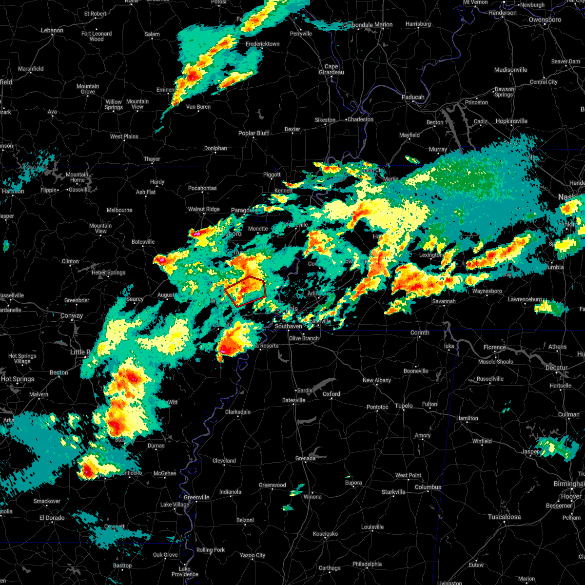 At 757 pm cdt, doppler radar indicated a severe thunderstorm producing a tornado was located near earle, moving east at 35 mph (radar indicated rotation). Hazards include tornado and quarter size hail. Flying debris will be dangerous to those caught without shelter. mobile homes will be damaged or destroyed. damage to roofs, windows, and vehicles will occur. tree damage is likely. Locations impacted include, earle, parkin, gilmore, turrell, smithdale, three forks, togo, birdeye, booker, deckerville, duvall, colton, twist, mcdonald, cloar, galilee, heafer, coldwater and monterey. At 757 pm cdt, doppler radar indicated a severe thunderstorm producing a tornado was located near earle, moving east at 35 mph (radar indicated rotation). Hazards include tornado and quarter size hail. Flying debris will be dangerous to those caught without shelter. mobile homes will be damaged or destroyed. damage to roofs, windows, and vehicles will occur. tree damage is likely. Locations impacted include, earle, parkin, gilmore, turrell, smithdale, three forks, togo, birdeye, booker, deckerville, duvall, colton, twist, mcdonald, cloar, galilee, heafer, coldwater and monterey.
|
| 3/27/2021 7:39 PM CDT |
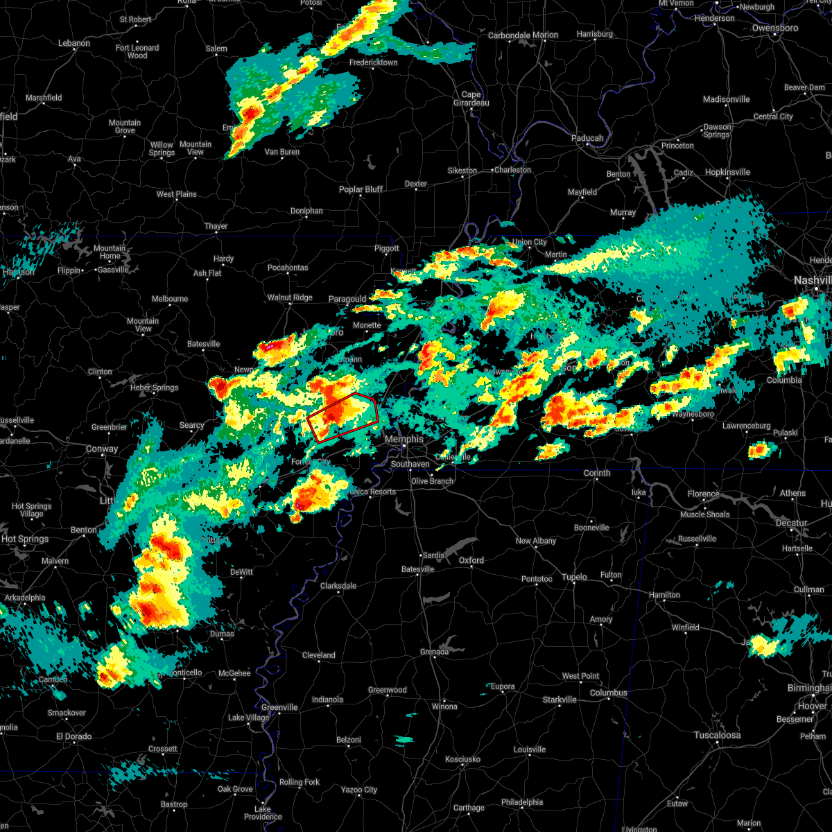 At 739 pm cdt, doppler radar indicated a severe thunderstorm producing a tornado was located near vanndale, or near wynne, moving northeast at 30 mph (radar indicated rotation). Hazards include tornado and golf ball size hail. Flying debris will be dangerous to those caught without shelter. mobile homes will be damaged or destroyed. damage to roofs, windows, and vehicles will occur. Tree damage is likely. At 739 pm cdt, doppler radar indicated a severe thunderstorm producing a tornado was located near vanndale, or near wynne, moving northeast at 30 mph (radar indicated rotation). Hazards include tornado and golf ball size hail. Flying debris will be dangerous to those caught without shelter. mobile homes will be damaged or destroyed. damage to roofs, windows, and vehicles will occur. Tree damage is likely.
|
| 3/27/2021 7:03 PM CDT |
 At 703 pm cdt, doppler radar indicated a severe thunderstorm producing a tornado was located near gilmore, or near tyronza, moving northeast at 35 mph (radar indicated rotation). Hazards include tornado and quarter size hail. Flying debris will be dangerous to those caught without shelter. mobile homes will be damaged or destroyed. damage to roofs, windows, and vehicles will occur. Tree damage is likely. At 703 pm cdt, doppler radar indicated a severe thunderstorm producing a tornado was located near gilmore, or near tyronza, moving northeast at 35 mph (radar indicated rotation). Hazards include tornado and quarter size hail. Flying debris will be dangerous to those caught without shelter. mobile homes will be damaged or destroyed. damage to roofs, windows, and vehicles will occur. Tree damage is likely.
|
| 2/28/2021 5:34 PM CST |
 At 534 pm cst, a severe thunderstorm was located near gilmore, or near tyronza, moving east at 40 mph (radar indicated). Hazards include 60 mph wind gusts and quarter size hail. Hail damage to vehicles is expected. Expect wind damage to roofs, siding, and trees. At 534 pm cst, a severe thunderstorm was located near gilmore, or near tyronza, moving east at 40 mph (radar indicated). Hazards include 60 mph wind gusts and quarter size hail. Hail damage to vehicles is expected. Expect wind damage to roofs, siding, and trees.
|
| 7/16/2020 2:41 PM CDT |
 At 240 pm cdt, a severe thunderstorm was located near tyronza, moving south at 10 mph (radar indicated). Hazards include 60 mph wind gusts. expect damage to roofs, siding, and trees At 240 pm cdt, a severe thunderstorm was located near tyronza, moving south at 10 mph (radar indicated). Hazards include 60 mph wind gusts. expect damage to roofs, siding, and trees
|
| 7/1/2020 3:41 PM CDT |
 At 340 pm cdt, a severe thunderstorm was located over gilmore, or near tyronza, moving southeast at 35 mph (radar indicated). Hazards include 60 mph wind gusts. Expect damage to roofs, siding, and trees. Locations impacted include, marked tree, lepanto, tyronza, joiner, crawfordsville, dyess, gilmore, bassett, marie, turrell, birdsong, three forks, payneway, whitton, dimple, booker, deckerville, evadale, menesha and dub. At 340 pm cdt, a severe thunderstorm was located over gilmore, or near tyronza, moving southeast at 35 mph (radar indicated). Hazards include 60 mph wind gusts. Expect damage to roofs, siding, and trees. Locations impacted include, marked tree, lepanto, tyronza, joiner, crawfordsville, dyess, gilmore, bassett, marie, turrell, birdsong, three forks, payneway, whitton, dimple, booker, deckerville, evadale, menesha and dub.
|
| 7/1/2020 3:22 PM CDT |
 At 322 pm cdt, a severe thunderstorm was located near marked tree, moving southeast at 35 mph (radar indicated). Hazards include 60 mph wind gusts. expect damage to roofs, siding, and trees At 322 pm cdt, a severe thunderstorm was located near marked tree, moving southeast at 35 mph (radar indicated). Hazards include 60 mph wind gusts. expect damage to roofs, siding, and trees
|
| 5/22/2020 4:20 PM CDT |
 At 419 pm cdt, a severe thunderstorm was located near sunset, or near meeman shelby forest state park, moving east at 55 mph (radar indicated). Hazards include 70 mph wind gusts. Expect considerable tree damage. damage is likely to mobile homes, roofs, and outbuildings. Locations impacted include, bartlett, collierville, germantown, west memphis, marion, millington, earle, parkin, t o fuller state park, meeman shelby forest state park, cordova, memphis, lakeland, arlington, munford, brighton, crawfordsville, edmondson, sunset and gilmore. At 419 pm cdt, a severe thunderstorm was located near sunset, or near meeman shelby forest state park, moving east at 55 mph (radar indicated). Hazards include 70 mph wind gusts. Expect considerable tree damage. damage is likely to mobile homes, roofs, and outbuildings. Locations impacted include, bartlett, collierville, germantown, west memphis, marion, millington, earle, parkin, t o fuller state park, meeman shelby forest state park, cordova, memphis, lakeland, arlington, munford, brighton, crawfordsville, edmondson, sunset and gilmore.
|
| 5/22/2020 3:55 PM CDT |
 At 355 pm cdt, a severe thunderstorm was located near jennette, or near earle, moving east at 60 mph (radar indicated). Hazards include 70 mph wind gusts. Expect considerable tree damage. Damage is likely to mobile homes, roofs, and outbuildings. At 355 pm cdt, a severe thunderstorm was located near jennette, or near earle, moving east at 60 mph (radar indicated). Hazards include 70 mph wind gusts. Expect considerable tree damage. Damage is likely to mobile homes, roofs, and outbuildings.
|
| 5/4/2020 3:36 PM CDT |
 At 336 pm cdt, a severe thunderstorm was located over dyess, or 8 miles west of wilson, moving east at 50 mph (radar indicated). Hazards include 60 mph wind gusts and quarter size hail. Hail damage to vehicles is expected. Expect wind damage to roofs, siding, and trees. At 336 pm cdt, a severe thunderstorm was located over dyess, or 8 miles west of wilson, moving east at 50 mph (radar indicated). Hazards include 60 mph wind gusts and quarter size hail. Hail damage to vehicles is expected. Expect wind damage to roofs, siding, and trees.
|
| 4/29/2020 12:02 AM CDT |
 At 1202 am cdt, a severe thunderstorm was located 8 miles northwest of millington, moving east at 60 mph (radar indicated). Hazards include 60 mph wind gusts. expect damage to roofs, siding, and trees At 1202 am cdt, a severe thunderstorm was located 8 miles northwest of millington, moving east at 60 mph (radar indicated). Hazards include 60 mph wind gusts. expect damage to roofs, siding, and trees
|
| 4/28/2020 11:56 PM CDT |
 At 1156 pm cdt, severe thunderstorms were located along a line extending from near fort pillow state park to 7 miles south of wilson to near village creek state park, moving east at 50 mph (radar indicated). Hazards include 60 mph wind gusts. Expect damage to roofs, siding, and trees. Locations impacted include, wynne, osceola, marked tree, earle, lepanto, parkin, wilson, tyronza, keiser, village creek state park, fort pillow state park, cherry valley, joiner, crawfordsville, dyess, gilmore, bassett, jericho, marie and fulton. At 1156 pm cdt, severe thunderstorms were located along a line extending from near fort pillow state park to 7 miles south of wilson to near village creek state park, moving east at 50 mph (radar indicated). Hazards include 60 mph wind gusts. Expect damage to roofs, siding, and trees. Locations impacted include, wynne, osceola, marked tree, earle, lepanto, parkin, wilson, tyronza, keiser, village creek state park, fort pillow state park, cherry valley, joiner, crawfordsville, dyess, gilmore, bassett, jericho, marie and fulton.
|
| 4/28/2020 11:47 PM CDT |
 At 1146 pm cdt, severe thunderstorms were located along a line extending from near osceola to near joiner to colt, moving southeast at 50 mph (radar indicated). Hazards include 60 mph wind gusts. Expect damage to roofs, siding, and trees. Locations impacted include, wynne, osceola, trumann, marked tree, earle, harrisburg, lepanto, parkin, wilson, tyronza, keiser, village creek state park, fort pillow state park, cherry valley, joiner, crawfordsville, dyess, hickory ridge, gilmore and bassett. At 1146 pm cdt, severe thunderstorms were located along a line extending from near osceola to near joiner to colt, moving southeast at 50 mph (radar indicated). Hazards include 60 mph wind gusts. Expect damage to roofs, siding, and trees. Locations impacted include, wynne, osceola, trumann, marked tree, earle, harrisburg, lepanto, parkin, wilson, tyronza, keiser, village creek state park, fort pillow state park, cherry valley, joiner, crawfordsville, dyess, hickory ridge, gilmore and bassett.
|
| 4/28/2020 11:35 PM CDT |
 At 1135 pm cdt, severe thunderstorms were located along a line extending from near keiser to near lepanto to fair oaks, moving southeast at 40 mph (radar indicated). Hazards include 60 mph wind gusts. Expect damage to roofs, siding, and trees. Locations impacted include, wynne, osceola, trumann, marked tree, earle, harrisburg, lepanto, parkin, wilson, tyronza, keiser, village creek state park, fort pillow state park, cherry valley, joiner, crawfordsville, dyess, hickory ridge, gilmore and bassett. At 1135 pm cdt, severe thunderstorms were located along a line extending from near keiser to near lepanto to fair oaks, moving southeast at 40 mph (radar indicated). Hazards include 60 mph wind gusts. Expect damage to roofs, siding, and trees. Locations impacted include, wynne, osceola, trumann, marked tree, earle, harrisburg, lepanto, parkin, wilson, tyronza, keiser, village creek state park, fort pillow state park, cherry valley, joiner, crawfordsville, dyess, hickory ridge, gilmore and bassett.
|
| 4/28/2020 11:25 PM CDT |
 At 1124 pm cdt, severe thunderstorms were located along a line extending from near leachville to near lepanto to near cherry valley, moving east at 50 mph (radar indicated). Hazards include 70 mph wind gusts. Expect considerable tree damage. Damage is likely to mobile homes, roofs, and outbuildings. At 1124 pm cdt, severe thunderstorms were located along a line extending from near leachville to near lepanto to near cherry valley, moving east at 50 mph (radar indicated). Hazards include 70 mph wind gusts. Expect considerable tree damage. Damage is likely to mobile homes, roofs, and outbuildings.
|
| 4/12/2020 10:50 PM CDT |
 At 1050 pm cdt, severe thunderstorms were located along a line extending from near manila to 8 miles east of eads, moving northeast at 65 mph (radar indicated). Hazards include 60 mph wind gusts. Expect damage to roofs, siding, and trees. Locations impacted include, bartlett, southaven, collierville, germantown, olive branch, west memphis, blytheville, marion, millington, covington, osceola, gosnell, marked tree, lepanto, luxora, wilson, tyronza, keiser, meeman shelby forest state park and fort pillow state park. At 1050 pm cdt, severe thunderstorms were located along a line extending from near manila to 8 miles east of eads, moving northeast at 65 mph (radar indicated). Hazards include 60 mph wind gusts. Expect damage to roofs, siding, and trees. Locations impacted include, bartlett, southaven, collierville, germantown, olive branch, west memphis, blytheville, marion, millington, covington, osceola, gosnell, marked tree, lepanto, luxora, wilson, tyronza, keiser, meeman shelby forest state park and fort pillow state park.
|
| 4/12/2020 10:34 PM CDT |
 At 1034 pm cdt, severe thunderstorms were located along a line extending from near lepanto to near collierville, moving northeast at 65 mph (radar indicated). Hazards include 60 mph wind gusts. Expect damage to roofs, siding, and trees. Locations impacted include, bartlett, southaven, collierville, germantown, olive branch, west memphis, blytheville, marion, millington, covington, osceola, gosnell, marked tree, lepanto, luxora, wilson, tyronza, keiser, cordova and t o fuller state park. At 1034 pm cdt, severe thunderstorms were located along a line extending from near lepanto to near collierville, moving northeast at 65 mph (radar indicated). Hazards include 60 mph wind gusts. Expect damage to roofs, siding, and trees. Locations impacted include, bartlett, southaven, collierville, germantown, olive branch, west memphis, blytheville, marion, millington, covington, osceola, gosnell, marked tree, lepanto, luxora, wilson, tyronza, keiser, cordova and t o fuller state park.
|
| 4/12/2020 10:26 PM CDT |
 The severe thunderstorm warning for northeastern st. francis, eastern poinsett, crittenden, eastern cross and southwestern shelby counties will expire at 1030 pm cdt, the warning will be allowed to expire, but a severe thunderstorm warning continues for portions of crittenden, shelby, and poinsett counties. a severe thunderstorm watch remains in effect until 100 am cdt for eastern arkansas, northwestern mississippi, and western tennessee. The severe thunderstorm warning for northeastern st. francis, eastern poinsett, crittenden, eastern cross and southwestern shelby counties will expire at 1030 pm cdt, the warning will be allowed to expire, but a severe thunderstorm warning continues for portions of crittenden, shelby, and poinsett counties. a severe thunderstorm watch remains in effect until 100 am cdt for eastern arkansas, northwestern mississippi, and western tennessee.
|
| 4/12/2020 10:16 PM CDT |
 At 1016 pm cdt, severe thunderstorms were located along a line extending from near marked tree to near hernando, moving northeast at 65 mph (radar indicated). Hazards include 60 mph wind gusts. expect damage to roofs, siding, and trees At 1016 pm cdt, severe thunderstorms were located along a line extending from near marked tree to near hernando, moving northeast at 65 mph (radar indicated). Hazards include 60 mph wind gusts. expect damage to roofs, siding, and trees
|
| 4/12/2020 10:11 PM CDT |
 At 1011 pm cdt, severe thunderstorms were located along a line extending from 8 miles west of marked tree to near pinckney, moving northeast at 60 mph (radar indicated). Hazards include 60 mph wind gusts. Expect damage to roofs, siding, and trees. Locations impacted include, southaven, west memphis, marion, trumann, marked tree, earle, lepanto, hughes, parkin, tyronza, t o fuller state park, memphis, cherry valley, crawfordsville, edmondson, horseshoe lake, sunset, gilmore, anthonyville and jericho. At 1011 pm cdt, severe thunderstorms were located along a line extending from 8 miles west of marked tree to near pinckney, moving northeast at 60 mph (radar indicated). Hazards include 60 mph wind gusts. Expect damage to roofs, siding, and trees. Locations impacted include, southaven, west memphis, marion, trumann, marked tree, earle, lepanto, hughes, parkin, tyronza, t o fuller state park, memphis, cherry valley, crawfordsville, edmondson, horseshoe lake, sunset, gilmore, anthonyville and jericho.
|
| 4/12/2020 9:50 PM CDT |
 At 949 pm cdt, severe thunderstorms were located along a line extending from near vanndale to near brickeys, moving east at 45 mph (radar indicated). Hazards include 60 mph wind gusts. expect damage to roofs, siding, and trees At 949 pm cdt, severe thunderstorms were located along a line extending from near vanndale to near brickeys, moving east at 45 mph (radar indicated). Hazards include 60 mph wind gusts. expect damage to roofs, siding, and trees
|
| 4/8/2020 9:32 PM CDT |
 At 932 pm cdt, a severe thunderstorm was located near jericho, or near meeman shelby forest state park, moving southeast at 35 mph (radar indicated). Hazards include 60 mph wind gusts and quarter size hail. Hail damage to vehicles is expected. expect wind damage to roofs, siding, and trees. Locations impacted include, west memphis, marion, millington, meeman shelby forest state park, munford, joiner, crawfordsville, sunset, gilmore, jericho, dixonville, crittenden, turrell, gilt edge, clarkedale, booker, egypt, griffin corner, menesha and gammon. At 932 pm cdt, a severe thunderstorm was located near jericho, or near meeman shelby forest state park, moving southeast at 35 mph (radar indicated). Hazards include 60 mph wind gusts and quarter size hail. Hail damage to vehicles is expected. expect wind damage to roofs, siding, and trees. Locations impacted include, west memphis, marion, millington, meeman shelby forest state park, munford, joiner, crawfordsville, sunset, gilmore, jericho, dixonville, crittenden, turrell, gilt edge, clarkedale, booker, egypt, griffin corner, menesha and gammon.
|
| 4/8/2020 9:19 PM CDT |
 At 918 pm cdt, a severe thunderstorm was located over gilmore, or 9 miles southeast of tyronza, moving southeast at 30 mph (radar indicated). Hazards include 60 mph wind gusts and half dollar size hail. Hail damage to vehicles is expected. expect wind damage to roofs, siding, and trees. Locations impacted include, west memphis, marion, millington, tyronza, meeman shelby forest state park, munford, joiner, crawfordsville, sunset, gilmore, jericho, dixonville, crittenden, turrell, gilt edge, clarkedale, birdsong, dimple, booker and deckerville. At 918 pm cdt, a severe thunderstorm was located over gilmore, or 9 miles southeast of tyronza, moving southeast at 30 mph (radar indicated). Hazards include 60 mph wind gusts and half dollar size hail. Hail damage to vehicles is expected. expect wind damage to roofs, siding, and trees. Locations impacted include, west memphis, marion, millington, tyronza, meeman shelby forest state park, munford, joiner, crawfordsville, sunset, gilmore, jericho, dixonville, crittenden, turrell, gilt edge, clarkedale, birdsong, dimple, booker and deckerville.
|
| 4/8/2020 9:19 PM CDT |
 At 859 pm cdt, a severe thunderstorm was located over tyronza, moving southeast at 35 mph (radar indicated). Hazards include 60 mph wind gusts and quarter size hail. Hail damage to vehicles is expected. Expect wind damage to roofs, siding, and trees. At 859 pm cdt, a severe thunderstorm was located over tyronza, moving southeast at 35 mph (radar indicated). Hazards include 60 mph wind gusts and quarter size hail. Hail damage to vehicles is expected. Expect wind damage to roofs, siding, and trees.
|
| 4/8/2020 9:00 PM CDT |
 At 859 pm cdt, a severe thunderstorm was located over tyronza, moving southeast at 35 mph (radar indicated). Hazards include 60 mph wind gusts and quarter size hail. Hail damage to vehicles is expected. Expect wind damage to roofs, siding, and trees. At 859 pm cdt, a severe thunderstorm was located over tyronza, moving southeast at 35 mph (radar indicated). Hazards include 60 mph wind gusts and quarter size hail. Hail damage to vehicles is expected. Expect wind damage to roofs, siding, and trees.
|
| 3/28/2020 7:08 PM CDT |
 The severe thunderstorm warning for eastern poinsett, southwestern mississippi, northwestern crittenden and eastern cross counties will expire at 715 pm cdt, the storm which prompted the warning has moved out of the area. therefore, the warning will be allowed to expire. however gusty winds are still possible with this thunderstorm. a tornado watch remains in effect until 200 am cdt for eastern arkansas, and western tennessee. The severe thunderstorm warning for eastern poinsett, southwestern mississippi, northwestern crittenden and eastern cross counties will expire at 715 pm cdt, the storm which prompted the warning has moved out of the area. therefore, the warning will be allowed to expire. however gusty winds are still possible with this thunderstorm. a tornado watch remains in effect until 200 am cdt for eastern arkansas, and western tennessee.
|
| 3/28/2020 7:08 PM CDT |
 At 707 pm cdt, a severe thunderstorm was located over joiner, or 7 miles west of wilson, moving northeast at 40 mph (radar indicated). Hazards include 60 mph wind gusts and quarter size hail. Hail damage to vehicles is expected. Expect wind damage to roofs, siding, and trees. At 707 pm cdt, a severe thunderstorm was located over joiner, or 7 miles west of wilson, moving northeast at 40 mph (radar indicated). Hazards include 60 mph wind gusts and quarter size hail. Hail damage to vehicles is expected. Expect wind damage to roofs, siding, and trees.
|
| 3/28/2020 6:29 PM CDT |
 At 629 pm cdt, a severe thunderstorm was located near village creek state park, moving northeast at 40 mph (radar indicated). Hazards include 60 mph wind gusts and quarter size hail. Hail damage to vehicles is expected. Expect wind damage to roofs, siding, and trees. At 629 pm cdt, a severe thunderstorm was located near village creek state park, moving northeast at 40 mph (radar indicated). Hazards include 60 mph wind gusts and quarter size hail. Hail damage to vehicles is expected. Expect wind damage to roofs, siding, and trees.
|
| 3/3/2020 1:50 AM CST |
 At 150 am cst, a severe thunderstorm was located near gilmore, or 9 miles west of meeman shelby forest state park, moving east at 45 mph (radar indicated). Hazards include 60 mph wind gusts. expect damage to roofs, siding, and trees At 150 am cst, a severe thunderstorm was located near gilmore, or 9 miles west of meeman shelby forest state park, moving east at 45 mph (radar indicated). Hazards include 60 mph wind gusts. expect damage to roofs, siding, and trees
|
| 1/11/2020 2:50 AM CST |
 At 249 am cst, severe thunderstorms were located along a line extending from keiser to earle to near aubrey, moving east at 45 mph (radar indicated). Hazards include 70 mph wind gusts. Expect considerable tree damage. damage is likely to mobile homes, roofs, and outbuildings. Locations impacted include, west memphis, forrest city, marion, wynne, marianna, marked tree, earle, lepanto, hughes, parkin, wilson, madison, tyronza, palestine, village creek state park, fort pillow state park, joiner, caldwell, crawfordsville and edmondson. At 249 am cst, severe thunderstorms were located along a line extending from keiser to earle to near aubrey, moving east at 45 mph (radar indicated). Hazards include 70 mph wind gusts. Expect considerable tree damage. damage is likely to mobile homes, roofs, and outbuildings. Locations impacted include, west memphis, forrest city, marion, wynne, marianna, marked tree, earle, lepanto, hughes, parkin, wilson, madison, tyronza, palestine, village creek state park, fort pillow state park, joiner, caldwell, crawfordsville and edmondson.
|
| 1/11/2020 2:23 AM CST |
 At 222 am cst, severe thunderstorms were located along a line extending from lepanto to wynne to garret grove, moving northeast at 45 mph (radar indicated). Hazards include 70 mph wind gusts. Expect considerable tree damage. Damage is likely to mobile homes, roofs, and outbuildings. At 222 am cst, severe thunderstorms were located along a line extending from lepanto to wynne to garret grove, moving northeast at 45 mph (radar indicated). Hazards include 70 mph wind gusts. Expect considerable tree damage. Damage is likely to mobile homes, roofs, and outbuildings.
|
| 1/11/2020 2:08 AM CST |
 At 208 am cst, severe thunderstorms were located along a line extending from near harrisburg to near garret grove, moving northeast at 45 mph (radar indicated). Hazards include 70 mph wind gusts. Expect considerable tree damage. damage is likely to mobile homes, roofs, and outbuildings. Locations impacted include, forrest city, wynne, marianna, marked tree, earle, harrisburg, hughes, parkin, madison, tyronza, palestine, village creek state park, cherry valley, caldwell, crawfordsville, dyess, colt, wheatley, widener and hickory ridge. At 208 am cst, severe thunderstorms were located along a line extending from near harrisburg to near garret grove, moving northeast at 45 mph (radar indicated). Hazards include 70 mph wind gusts. Expect considerable tree damage. damage is likely to mobile homes, roofs, and outbuildings. Locations impacted include, forrest city, wynne, marianna, marked tree, earle, harrisburg, hughes, parkin, madison, tyronza, palestine, village creek state park, cherry valley, caldwell, crawfordsville, dyess, colt, wheatley, widener and hickory ridge.
|
| 1/11/2020 1:47 AM CST |
 At 147 am cst, severe thunderstorms were located along a line extending from near hickory ridge to near dobbs landing, moving east at 45 mph (radar indicated). Hazards include 70 mph wind gusts. Expect considerable tree damage. Damage is likely to mobile homes, roofs, and outbuildings. At 147 am cst, severe thunderstorms were located along a line extending from near hickory ridge to near dobbs landing, moving east at 45 mph (radar indicated). Hazards include 70 mph wind gusts. Expect considerable tree damage. Damage is likely to mobile homes, roofs, and outbuildings.
|
| 10/21/2019 5:44 AM CDT |
 At 544 am cdt, severe thunderstorms were located along a line extending from near trumann to near parkin, moving northeast at 45 mph (radar indicated). Hazards include 60 mph wind gusts and quarter size hail. Hail damage to vehicles is expected. Expect wind damage to roofs, siding, and trees. At 544 am cdt, severe thunderstorms were located along a line extending from near trumann to near parkin, moving northeast at 45 mph (radar indicated). Hazards include 60 mph wind gusts and quarter size hail. Hail damage to vehicles is expected. Expect wind damage to roofs, siding, and trees.
|
| 10/21/2019 4:26 AM CDT |
 At 425 am cdt, severe thunderstorms were located along a line extending from 6 miles south of paragould to near marked tree to parkin, moving northeast at 60 mph (radar indicated). Hazards include 60 mph wind gusts. expect damage to roofs, siding, and trees At 425 am cdt, severe thunderstorms were located along a line extending from 6 miles south of paragould to near marked tree to parkin, moving northeast at 60 mph (radar indicated). Hazards include 60 mph wind gusts. expect damage to roofs, siding, and trees
|
| 8/7/2019 5:03 PM CDT |
 At 502 pm cdt, a severe thunderstorm was located near crawfordsville, or 7 miles east of earle, moving east at 45 mph (radar indicated). Hazards include 60 mph wind gusts. Expect damage to roofs, siding, and trees. Locations impacted include, west memphis, marion, earle, parkin, crawfordsville, sunset, gilmore, jericho, jennette, crittenden, turrell, clarkedale, smithdale, three forks, booker, cunningham corner, amanea, twist, mcdonald and harvard. At 502 pm cdt, a severe thunderstorm was located near crawfordsville, or 7 miles east of earle, moving east at 45 mph (radar indicated). Hazards include 60 mph wind gusts. Expect damage to roofs, siding, and trees. Locations impacted include, west memphis, marion, earle, parkin, crawfordsville, sunset, gilmore, jericho, jennette, crittenden, turrell, clarkedale, smithdale, three forks, booker, cunningham corner, amanea, twist, mcdonald and harvard.
|
| 8/7/2019 4:48 PM CDT |
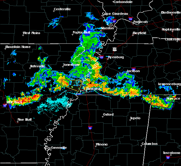 At 448 pm cdt, a severe thunderstorm was located near parkin, moving east at 45 mph (radar indicated). Hazards include 60 mph wind gusts. expect damage to roofs, siding, and trees At 448 pm cdt, a severe thunderstorm was located near parkin, moving east at 45 mph (radar indicated). Hazards include 60 mph wind gusts. expect damage to roofs, siding, and trees
|
| 6/19/2019 11:35 PM CDT |
 At 1134 pm cdt, severe thunderstorms were located along a line extending from near gilmore to phillipp, moving east at 60 mph (radar indicated). Hazards include 70 mph wind gusts. Expect considerable tree damage. damage is likely to mobile homes, roofs, and outbuildings. Locations impacted include, bartlett, southaven, collierville, germantown, olive branch, west memphis, horn lake, hernando, marion, millington, covington, marked tree, earle, hughes, parkin, tyronza, t o fuller state park, meeman shelby forest state park, cordova and memphis. At 1134 pm cdt, severe thunderstorms were located along a line extending from near gilmore to phillipp, moving east at 60 mph (radar indicated). Hazards include 70 mph wind gusts. Expect considerable tree damage. damage is likely to mobile homes, roofs, and outbuildings. Locations impacted include, bartlett, southaven, collierville, germantown, olive branch, west memphis, horn lake, hernando, marion, millington, covington, marked tree, earle, hughes, parkin, tyronza, t o fuller state park, meeman shelby forest state park, cordova and memphis.
|
| 6/19/2019 11:15 PM CDT |
 At 1115 pm cdt, severe thunderstorms were located along a line extending from 7 miles southwest of marked tree to 7 miles northwest of north tunica, moving east at 60 mph (radar indicated). Hazards include 70 mph wind gusts. Expect considerable tree damage. Damage is likely to mobile homes, roofs, and outbuildings. At 1115 pm cdt, severe thunderstorms were located along a line extending from 7 miles southwest of marked tree to 7 miles northwest of north tunica, moving east at 60 mph (radar indicated). Hazards include 70 mph wind gusts. Expect considerable tree damage. Damage is likely to mobile homes, roofs, and outbuildings.
|
| 6/19/2019 11:02 PM CDT |
 At 1101 pm cdt, severe thunderstorms were located along a line extending from 6 miles south of tyronza to near little texas, moving east at 75 mph (radar indicated). Hazards include 70 mph wind gusts. Expect considerable tree damage. damage is likely to mobile homes, roofs, and outbuildings. Locations impacted include, west memphis, forrest city, marion, wynne, marianna, marked tree, earle, hughes, parkin, madison, tyronza, palestine, village creek state park, tunica, cherry valley, caldwell, crawfordsville, edmondson, colt and horseshoe lake. At 1101 pm cdt, severe thunderstorms were located along a line extending from 6 miles south of tyronza to near little texas, moving east at 75 mph (radar indicated). Hazards include 70 mph wind gusts. Expect considerable tree damage. damage is likely to mobile homes, roofs, and outbuildings. Locations impacted include, west memphis, forrest city, marion, wynne, marianna, marked tree, earle, hughes, parkin, madison, tyronza, palestine, village creek state park, tunica, cherry valley, caldwell, crawfordsville, edmondson, colt and horseshoe lake.
|
| 6/19/2019 10:32 PM CDT |
 The national weather service in memphis has issued a * severe thunderstorm warning for. lee county in eastern arkansas. st. francis county in eastern arkansas. southeastern poinsett county in eastern arkansas. Northern phillips county in eastern arkansas. The national weather service in memphis has issued a * severe thunderstorm warning for. lee county in eastern arkansas. st. francis county in eastern arkansas. southeastern poinsett county in eastern arkansas. Northern phillips county in eastern arkansas.
|
| 6/19/2019 10:32 PM CDT |
 At 1031 pm cdt, severe thunderstorms were located along a line extending from near fair oaks to near palmer, moving east at 75 mph (radar indicated). Hazards include 70 mph wind gusts. Expect considerable tree damage. Damage is likely to mobile homes, roofs, and outbuildings. At 1031 pm cdt, severe thunderstorms were located along a line extending from near fair oaks to near palmer, moving east at 75 mph (radar indicated). Hazards include 70 mph wind gusts. Expect considerable tree damage. Damage is likely to mobile homes, roofs, and outbuildings.
|
| 2/23/2019 12:44 PM CST |
 At 1244 pm cst, a severe thunderstorm was located near jennette, or near earle, moving northeast at 60 mph (law enforcement). Hazards include 60 mph wind gusts. Expect damage to roofs, siding, and trees. locations impacted include, west memphis, forrest city, marion, earle, hughes, madison, crawfordsville, edmondson, widener, sunset, gilmore, anthonyville, jericho, jennette, simsboro, new home, crittenden, turrell, clarkedale and birdsong. A tornado watch remains in effect until 800 pm cst for eastern arkansas, and western tennessee. At 1244 pm cst, a severe thunderstorm was located near jennette, or near earle, moving northeast at 60 mph (law enforcement). Hazards include 60 mph wind gusts. Expect damage to roofs, siding, and trees. locations impacted include, west memphis, forrest city, marion, earle, hughes, madison, crawfordsville, edmondson, widener, sunset, gilmore, anthonyville, jericho, jennette, simsboro, new home, crittenden, turrell, clarkedale and birdsong. A tornado watch remains in effect until 800 pm cst for eastern arkansas, and western tennessee.
|
| 2/23/2019 12:28 PM CST |
 At 1227 pm cst, a severe thunderstorm was located over madison, moving northeast at 65 mph (radar indicated). Hazards include 60 mph wind gusts. expect damage to roofs, siding, and trees At 1227 pm cst, a severe thunderstorm was located over madison, moving northeast at 65 mph (radar indicated). Hazards include 60 mph wind gusts. expect damage to roofs, siding, and trees
|
| 2/23/2019 12:13 PM CST |
 At 1213 pm cst, a severe thunderstorm was located near crawfordsville, or near earle, moving northeast at 85 mph (radar indicated). Hazards include 60 mph wind gusts. Expect damage to roofs, siding, and trees. Locations impacted include, forrest city, wynne, earle, parkin, madison, palestine, village creek state park, caldwell, crawfordsville, colt, widener, gilmore, jennette, simsboro, new home, turrell, three forks, cottonwood corner, booker and browns. At 1213 pm cst, a severe thunderstorm was located near crawfordsville, or near earle, moving northeast at 85 mph (radar indicated). Hazards include 60 mph wind gusts. Expect damage to roofs, siding, and trees. Locations impacted include, forrest city, wynne, earle, parkin, madison, palestine, village creek state park, caldwell, crawfordsville, colt, widener, gilmore, jennette, simsboro, new home, turrell, three forks, cottonwood corner, booker and browns.
|
| 2/23/2019 11:52 AM CST |
 At 1152 am cst, a severe thunderstorm was located over caldwell, or over forrest city, moving northeast at 60 mph (radar indicated). Hazards include 60 mph wind gusts. expect damage to roofs, siding, and trees At 1152 am cst, a severe thunderstorm was located over caldwell, or over forrest city, moving northeast at 60 mph (radar indicated). Hazards include 60 mph wind gusts. expect damage to roofs, siding, and trees
|
| 6/24/2018 5:22 AM CDT |
 The severe thunderstorm warning for northeastern st. francis, northwestern crittenden and southeastern cross counties will expire at 530 am cdt, the storm which prompted the warning has weakened below severe limits, and no longer poses an immediate threat to life or property. therefore, the warning will be allowed to expire. however small hail, gusty winds and heavy rain are still possible with this thunderstorm. The severe thunderstorm warning for northeastern st. francis, northwestern crittenden and southeastern cross counties will expire at 530 am cdt, the storm which prompted the warning has weakened below severe limits, and no longer poses an immediate threat to life or property. therefore, the warning will be allowed to expire. however small hail, gusty winds and heavy rain are still possible with this thunderstorm.
|
| 6/24/2018 5:02 AM CDT |
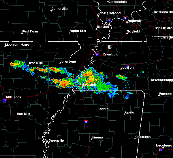 At 502 am cdt, a severe thunderstorm was located near parkin, moving northeast at 20 mph (radar indicated). Hazards include 60 mph wind gusts and quarter size hail. Hail damage to vehicles is expected. expect wind damage to roofs, siding, and trees. Locations impacted include, west memphis, marion, earle, parkin, crawfordsville, gilmore, jericho, jennette, turrell, smithdale, three forks, cottonwood corner, booker, cunningham corner, mcdonald, cloar, kinton, shearerville, hicks station and vincent. At 502 am cdt, a severe thunderstorm was located near parkin, moving northeast at 20 mph (radar indicated). Hazards include 60 mph wind gusts and quarter size hail. Hail damage to vehicles is expected. expect wind damage to roofs, siding, and trees. Locations impacted include, west memphis, marion, earle, parkin, crawfordsville, gilmore, jericho, jennette, turrell, smithdale, three forks, cottonwood corner, booker, cunningham corner, mcdonald, cloar, kinton, shearerville, hicks station and vincent.
|
| 6/24/2018 4:42 AM CDT |
 At 442 am cdt, a severe thunderstorm was located near village creek state park, moving northeast at 25 mph (radar indicated). Hazards include 60 mph wind gusts and quarter size hail. Hail damage to vehicles is expected. Expect wind damage to roofs, siding, and trees. At 442 am cdt, a severe thunderstorm was located near village creek state park, moving northeast at 25 mph (radar indicated). Hazards include 60 mph wind gusts and quarter size hail. Hail damage to vehicles is expected. Expect wind damage to roofs, siding, and trees.
|
| 5/20/2018 4:20 PM CDT |
 At 420 pm cdt, a severe thunderstorm was located near gilmore, or 9 miles southeast of tyronza, moving northeast at 20 mph (radar indicated). Hazards include 60 mph wind gusts and half dollar size hail. Hail damage to vehicles is expected. expect wind damage to roofs, siding, and trees. Locations impacted include, west memphis, marion, earle, crawfordsville, sunset, gilmore, jericho, jennette, turrell, clarkedale, three forks, booker, menesha, gammon, cunningham corner, harvard, cloar, shearerville, vincent and ebony. At 420 pm cdt, a severe thunderstorm was located near gilmore, or 9 miles southeast of tyronza, moving northeast at 20 mph (radar indicated). Hazards include 60 mph wind gusts and half dollar size hail. Hail damage to vehicles is expected. expect wind damage to roofs, siding, and trees. Locations impacted include, west memphis, marion, earle, crawfordsville, sunset, gilmore, jericho, jennette, turrell, clarkedale, three forks, booker, menesha, gammon, cunningham corner, harvard, cloar, shearerville, vincent and ebony.
|
| 5/20/2018 3:58 PM CDT |
 At 358 pm cdt, a severe thunderstorm was located near crawfordsville, or near earle, moving northeast at 20 mph (radar indicated). Hazards include 60 mph wind gusts and half dollar size hail. Hail damage to vehicles is expected. Expect wind damage to roofs, siding, and trees. At 358 pm cdt, a severe thunderstorm was located near crawfordsville, or near earle, moving northeast at 20 mph (radar indicated). Hazards include 60 mph wind gusts and half dollar size hail. Hail damage to vehicles is expected. Expect wind damage to roofs, siding, and trees.
|
| 2/24/2018 6:55 PM CST |
 At 655 pm cst, severe thunderstorms were located along a line extending from near brighton to marion, moving east at 35 mph (radar indicated). Hazards include 60 mph wind gusts. expect damage to roofs, siding, and trees At 655 pm cst, severe thunderstorms were located along a line extending from near brighton to marion, moving east at 35 mph (radar indicated). Hazards include 60 mph wind gusts. expect damage to roofs, siding, and trees
|
| 2/24/2018 6:15 PM CST |
 At 614 pm cst, severe thunderstorms were located along a line extending from near joiner to near widener, moving east at 40 mph (radar indicated). Hazards include 60 mph wind gusts. expect damage to roofs, siding, and trees At 614 pm cst, severe thunderstorms were located along a line extending from near joiner to near widener, moving east at 40 mph (radar indicated). Hazards include 60 mph wind gusts. expect damage to roofs, siding, and trees
|
| 2/24/2018 6:04 PM CST |
 At 603 pm cst, severe thunderstorms were located along a line extending from kennett to bassett, moving northeast at 60 mph (radar indicated). Hazards include 60 mph wind gusts. Expect damage to roofs, siding, and trees. locations impacted include, blytheville, kennett, osceola, gosnell, manila, portageville, hayti, marked tree, steele, leachville, lepanto, senath, caraway, luxora, wilson, tyronza, keiser, fort pillow state park, hornersville and hayti heights. A tornado watch remains in effect until 900 pm cst for eastern arkansas, southeastern missouri, and southwestern and northwestern tennessee. At 603 pm cst, severe thunderstorms were located along a line extending from kennett to bassett, moving northeast at 60 mph (radar indicated). Hazards include 60 mph wind gusts. Expect damage to roofs, siding, and trees. locations impacted include, blytheville, kennett, osceola, gosnell, manila, portageville, hayti, marked tree, steele, leachville, lepanto, senath, caraway, luxora, wilson, tyronza, keiser, fort pillow state park, hornersville and hayti heights. A tornado watch remains in effect until 900 pm cst for eastern arkansas, southeastern missouri, and southwestern and northwestern tennessee.
|
| 2/24/2018 5:42 PM CST |
 At 542 pm cst, severe thunderstorms were located along a line extending from near cardwell to near tyronza, moving northeast at 55 mph (radar indicated). Hazards include 60 mph wind gusts. expect damage to roofs, siding, and trees At 542 pm cst, severe thunderstorms were located along a line extending from near cardwell to near tyronza, moving northeast at 55 mph (radar indicated). Hazards include 60 mph wind gusts. expect damage to roofs, siding, and trees
|
| 8/11/2017 1:30 PM CDT |
 At 129 pm cdt, a severe thunderstorm was located over west memphis, moving east at 40 mph (radar indicated). Hazards include 60 mph wind gusts. expect damage to roofs, siding, and trees At 129 pm cdt, a severe thunderstorm was located over west memphis, moving east at 40 mph (radar indicated). Hazards include 60 mph wind gusts. expect damage to roofs, siding, and trees
|
| 8/11/2017 1:13 PM CDT |
 At 113 pm cdt, a severe thunderstorm was located over parkin, moving southeast at 30 mph (radar indicated). Hazards include 60 mph wind gusts and quarter size hail. Hail damage to vehicles is expected. Expect wind damage to roofs, siding, and trees. At 113 pm cdt, a severe thunderstorm was located over parkin, moving southeast at 30 mph (radar indicated). Hazards include 60 mph wind gusts and quarter size hail. Hail damage to vehicles is expected. Expect wind damage to roofs, siding, and trees.
|
| 8/11/2017 12:48 PM CDT |
 At 1248 pm cdt, a severe thunderstorm was located near cherry valley, or 11 miles northwest of parkin, moving east at 45 mph (radar indicated). Hazards include 60 mph wind gusts. expect damage to roofs, siding, and trees At 1248 pm cdt, a severe thunderstorm was located near cherry valley, or 11 miles northwest of parkin, moving east at 45 mph (radar indicated). Hazards include 60 mph wind gusts. expect damage to roofs, siding, and trees
|
| 6/23/2017 5:40 PM CDT |
 At 540 pm cdt, severe thunderstorms were located along a line extending from near dell to 7 miles north of meeman shelby forest state park to near edmondson, moving east at 40 mph (radar indicated). Hazards include 60 mph wind gusts. Expect damage to roofs, siding, and trees. Locations impacted include, bartlett, southaven, west memphis, blytheville, marion, millington, covington, osceola, gosnell, manila, luxora, wilson, keiser, t o fuller state park, meeman shelby forest state park, fort pillow state park, memphis, lakeland, arlington and munford. At 540 pm cdt, severe thunderstorms were located along a line extending from near dell to 7 miles north of meeman shelby forest state park to near edmondson, moving east at 40 mph (radar indicated). Hazards include 60 mph wind gusts. Expect damage to roofs, siding, and trees. Locations impacted include, bartlett, southaven, west memphis, blytheville, marion, millington, covington, osceola, gosnell, manila, luxora, wilson, keiser, t o fuller state park, meeman shelby forest state park, fort pillow state park, memphis, lakeland, arlington and munford.
|
| 6/23/2017 5:21 PM CDT |
 At 521 pm cdt, severe thunderstorms were located along a line extending from manila to near gilmore to near earle, moving east at 35 mph (radar indicated). Hazards include 60 mph wind gusts. expect damage to roofs, siding, and trees At 521 pm cdt, severe thunderstorms were located along a line extending from manila to near gilmore to near earle, moving east at 35 mph (radar indicated). Hazards include 60 mph wind gusts. expect damage to roofs, siding, and trees
|
| 6/23/2017 5:03 PM CDT |
 At 503 pm cdt, severe thunderstorms were located along a line extending from near lake city to near trumann to near cherry valley, moving southeast at 45 mph (radar indicated). Hazards include 60 mph wind gusts. Expect damage to roofs, siding, and trees. Locations impacted include, trumann, manila, marked tree, earle, harrisburg, lake city, leachville, lepanto, bay, monette, caraway, parkin, tyronza, cherry valley, dyess, gilmore, turrell, etowah, black oak and birdsong. At 503 pm cdt, severe thunderstorms were located along a line extending from near lake city to near trumann to near cherry valley, moving southeast at 45 mph (radar indicated). Hazards include 60 mph wind gusts. Expect damage to roofs, siding, and trees. Locations impacted include, trumann, manila, marked tree, earle, harrisburg, lake city, leachville, lepanto, bay, monette, caraway, parkin, tyronza, cherry valley, dyess, gilmore, turrell, etowah, black oak and birdsong.
|
| 6/23/2017 4:51 PM CDT |
 At 451 pm cdt, severe thunderstorms were located along a line extending from near brookland to near greenfield to 6 miles east of hickory ridge, moving southeast at 35 mph (radar indicated). Hazards include 60 mph wind gusts. expect damage to roofs, siding, and trees At 451 pm cdt, severe thunderstorms were located along a line extending from near brookland to near greenfield to 6 miles east of hickory ridge, moving southeast at 35 mph (radar indicated). Hazards include 60 mph wind gusts. expect damage to roofs, siding, and trees
|
| 6/16/2017 12:44 PM CDT |
 At 1244 pm cdt, a severe thunderstorm was located near tyronza, moving east at 10 mph (radar indicated). Hazards include 60 mph wind gusts and quarter size hail. Hail damage to vehicles is expected. expect wind damage to roofs, siding, and trees. Locations impacted include, marked tree, earle, tyronza, dyess, gilmore, turrell, clarkedale, birdsong, three forks, whitton, dimple, booker, deckerville, menesha, dub, cloar, chelford, mc clendons corner, denwood and frenchmans bayou. At 1244 pm cdt, a severe thunderstorm was located near tyronza, moving east at 10 mph (radar indicated). Hazards include 60 mph wind gusts and quarter size hail. Hail damage to vehicles is expected. expect wind damage to roofs, siding, and trees. Locations impacted include, marked tree, earle, tyronza, dyess, gilmore, turrell, clarkedale, birdsong, three forks, whitton, dimple, booker, deckerville, menesha, dub, cloar, chelford, mc clendons corner, denwood and frenchmans bayou.
|
| 6/16/2017 12:30 PM CDT |
 At 1230 pm cdt, a severe thunderstorm was located 8 miles southwest of tyronza, moving east at 10 mph (radar indicated). Hazards include 60 mph wind gusts and quarter size hail. Hail damage to vehicles is expected. Expect wind damage to roofs, siding, and trees. At 1230 pm cdt, a severe thunderstorm was located 8 miles southwest of tyronza, moving east at 10 mph (radar indicated). Hazards include 60 mph wind gusts and quarter size hail. Hail damage to vehicles is expected. Expect wind damage to roofs, siding, and trees.
|
| 5/27/2017 10:43 PM CDT |
 At 1042 pm cdt, a severe thunderstorm was located near ft pillow, or near covington, moving southeast at 65 mph. this is a very dangerous storm (radar indicated). Hazards include 80 mph wind gusts and quarter size hail. Flying debris will be dangerous to those caught without shelter. mobile homes will be heavily damaged. expect considerable damage to roofs, windows, and vehicles. extensive tree damage and power outages are likely. locations impacted include, bartlett, west memphis, marion, millington, covington, ripley, osceola, marked tree, earle, luxora, parkin, wilson, tyronza, keiser, meeman shelby forest state park, fort pillow state park, memphis, lakeland, arlington and munford. a tornado watch remains in effect until 200 am cdt for eastern arkansas. A tornado watch also remains in effect until 500 am cdt for eastern arkansas, and western and west tennessee. At 1042 pm cdt, a severe thunderstorm was located near ft pillow, or near covington, moving southeast at 65 mph. this is a very dangerous storm (radar indicated). Hazards include 80 mph wind gusts and quarter size hail. Flying debris will be dangerous to those caught without shelter. mobile homes will be heavily damaged. expect considerable damage to roofs, windows, and vehicles. extensive tree damage and power outages are likely. locations impacted include, bartlett, west memphis, marion, millington, covington, ripley, osceola, marked tree, earle, luxora, parkin, wilson, tyronza, keiser, meeman shelby forest state park, fort pillow state park, memphis, lakeland, arlington and munford. a tornado watch remains in effect until 200 am cdt for eastern arkansas. A tornado watch also remains in effect until 500 am cdt for eastern arkansas, and western and west tennessee.
|
| 5/27/2017 10:29 PM CDT |
 At 1029 pm cdt, a severe thunderstorm was located over luxora, moving southeast at 65 mph (radar indicated). Hazards include 70 mph wind gusts and quarter size hail. Hail damage to vehicles is expected. expect considerable tree damage. Wind damage is also likely to mobile homes, roofs, and outbuildings. At 1029 pm cdt, a severe thunderstorm was located over luxora, moving southeast at 65 mph (radar indicated). Hazards include 70 mph wind gusts and quarter size hail. Hail damage to vehicles is expected. expect considerable tree damage. Wind damage is also likely to mobile homes, roofs, and outbuildings.
|
| 4/30/2017 4:40 AM CDT |
 At 440 am cdt, a severe thunderstorm was located near parkin, moving northeast at 35 mph (radar indicated). Hazards include 60 mph wind gusts. expect damage to roofs, siding, and trees At 440 am cdt, a severe thunderstorm was located near parkin, moving northeast at 35 mph (radar indicated). Hazards include 60 mph wind gusts. expect damage to roofs, siding, and trees
|
| 4/30/2017 1:54 AM CDT |
 At 153 am cdt, a severe thunderstorm was located near lepanto, moving east at 65 mph (radar indicated). Hazards include 60 mph wind gusts. expect damage to roofs, siding, and trees At 153 am cdt, a severe thunderstorm was located near lepanto, moving east at 65 mph (radar indicated). Hazards include 60 mph wind gusts. expect damage to roofs, siding, and trees
|
| 4/30/2017 1:15 AM CDT |
 At 115 am cdt, severe thunderstorms were located along a line extending from near cash to near brinkley, moving east at 85 mph (radar indicated). Hazards include 60 mph wind gusts. expect damage to roofs, siding, and trees At 115 am cdt, severe thunderstorms were located along a line extending from near cash to near brinkley, moving east at 85 mph (radar indicated). Hazards include 60 mph wind gusts. expect damage to roofs, siding, and trees
|
| 4/29/2017 8:00 PM CDT |
 At 800 pm cdt, severe thunderstorms were located along a line extending from near marked tree to near pinckney, moving northeast at 60 mph (radar indicated). Hazards include 60 mph wind gusts and quarter size hail. Hail damage to vehicles is expected. Expect wind damage to roofs, siding, and trees. At 800 pm cdt, severe thunderstorms were located along a line extending from near marked tree to near pinckney, moving northeast at 60 mph (radar indicated). Hazards include 60 mph wind gusts and quarter size hail. Hail damage to vehicles is expected. Expect wind damage to roofs, siding, and trees.
|
| 4/26/2017 5:43 PM CDT |
 At 543 pm cdt, severe thunderstorms were located along a line extending from near cardwell to near lepanto to near crawfordsville, moving east at 65 mph (radar indicated). Hazards include ping pong ball size hail and 60 mph wind gusts. People and animals outdoors will be injured. expect hail damage to roofs, siding, windows, and vehicles. Expect wind damage to roofs, siding, and trees. At 543 pm cdt, severe thunderstorms were located along a line extending from near cardwell to near lepanto to near crawfordsville, moving east at 65 mph (radar indicated). Hazards include ping pong ball size hail and 60 mph wind gusts. People and animals outdoors will be injured. expect hail damage to roofs, siding, windows, and vehicles. Expect wind damage to roofs, siding, and trees.
|
| 3/1/2017 4:49 AM CST |
 At 448 am cst, severe thunderstorms were located along a line extending from near anthonyville to frayser to near munford, moving east at 55 mph (radar indicated). Hazards include 60 mph wind gusts. Expect damage to roofs, siding, and trees. locations impacted include, west memphis, marion, earle, parkin, village creek state park, crawfordsville, edmondson, sunset, gilmore, jericho, jennette, crittenden, turrell, clarkedale, smithdale, three forks, mound city, booker, menesha and gammon. A tornado watch remains in effect until 800 am cst for eastern arkansas, and western and west tennessee. At 448 am cst, severe thunderstorms were located along a line extending from near anthonyville to frayser to near munford, moving east at 55 mph (radar indicated). Hazards include 60 mph wind gusts. Expect damage to roofs, siding, and trees. locations impacted include, west memphis, marion, earle, parkin, village creek state park, crawfordsville, edmondson, sunset, gilmore, jericho, jennette, crittenden, turrell, clarkedale, smithdale, three forks, mound city, booker, menesha and gammon. A tornado watch remains in effect until 800 am cst for eastern arkansas, and western and west tennessee.
|
| 3/1/2017 4:30 AM CST |
 At 430 am cst, severe thunderstorms were located along a line extending from near jennette to near jericho to bassett, moving east at 55 mph (radar indicated). Hazards include 70 mph wind gusts. Expect considerable tree damage. damage is likely to mobile homes, roofs, and outbuildings. locations impacted include, west memphis, marion, wynne, marked tree, earle, lepanto, parkin, tyronza, village creek state park, crawfordsville, edmondson, sunset, gilmore, jericho, jennette, crittenden, turrell, clarkedale, three forks and booker. A tornado watch remains in effect until 800 am cst for eastern arkansas, and western and west tennessee. At 430 am cst, severe thunderstorms were located along a line extending from near jennette to near jericho to bassett, moving east at 55 mph (radar indicated). Hazards include 70 mph wind gusts. Expect considerable tree damage. damage is likely to mobile homes, roofs, and outbuildings. locations impacted include, west memphis, marion, wynne, marked tree, earle, lepanto, parkin, tyronza, village creek state park, crawfordsville, edmondson, sunset, gilmore, jericho, jennette, crittenden, turrell, clarkedale, three forks and booker. A tornado watch remains in effect until 800 am cst for eastern arkansas, and western and west tennessee.
|
| 3/1/2017 4:16 AM CST |
 At 415 am cst, severe thunderstorms were located along a line extending from near village creek state park to 7 miles southwest of tyronza to lepanto, moving east at 55 mph (radar indicated). Hazards include 70 mph wind gusts. Expect considerable tree damage. damage is likely to mobile homes, roofs, and outbuildings. A 68 mph gust was reported at the jonesboro airport at 350 am cst. At 415 am cst, severe thunderstorms were located along a line extending from near village creek state park to 7 miles southwest of tyronza to lepanto, moving east at 55 mph (radar indicated). Hazards include 70 mph wind gusts. Expect considerable tree damage. damage is likely to mobile homes, roofs, and outbuildings. A 68 mph gust was reported at the jonesboro airport at 350 am cst.
|
| 2/7/2017 5:24 AM CST |
 At 524 am cst, a severe thunderstorm was located near marked tree, moving east at 50 mph (radar indicated). Hazards include 60 mph wind gusts and quarter size hail. Hail damage to vehicles is expected. Expect wind damage to roofs, siding, and trees. At 524 am cst, a severe thunderstorm was located near marked tree, moving east at 50 mph (radar indicated). Hazards include 60 mph wind gusts and quarter size hail. Hail damage to vehicles is expected. Expect wind damage to roofs, siding, and trees.
|
| 6/15/2016 7:30 PM CDT |
 At 728 pm cdt, severe thunderstorms were located along a line extending from near burdette to 6 miles east of gilmore, moving east at 35 mph (radar indicated. a trained spotter measured a 64 mph gust 4 miles west of joiner). Hazards include 60 mph wind gusts and penny size hail. Expect damage to roofs. siding. and trees. Locations impacted include, wilson, keiser, joiner, dyess, gilmore, bassett, marie, turrell, etowah, birdsong, dimple, rotan, west ridge, deckerville, driver, frenchmans bayou, delpro, norden, hilton and bondsville. At 728 pm cdt, severe thunderstorms were located along a line extending from near burdette to 6 miles east of gilmore, moving east at 35 mph (radar indicated. a trained spotter measured a 64 mph gust 4 miles west of joiner). Hazards include 60 mph wind gusts and penny size hail. Expect damage to roofs. siding. and trees. Locations impacted include, wilson, keiser, joiner, dyess, gilmore, bassett, marie, turrell, etowah, birdsong, dimple, rotan, west ridge, deckerville, driver, frenchmans bayou, delpro, norden, hilton and bondsville.
|
| 6/15/2016 7:03 PM CDT |
 At 703 pm cdt, severe thunderstorms were located along a line extending from near leachville to near tyronza, moving east at 25 mph (radar indicated). Hazards include 60 mph wind gusts and penny size hail. Expect damage to roofs. siding. And trees. At 703 pm cdt, severe thunderstorms were located along a line extending from near leachville to near tyronza, moving east at 25 mph (radar indicated). Hazards include 60 mph wind gusts and penny size hail. Expect damage to roofs. siding. And trees.
|
| 5/26/2016 5:51 PM CDT |
 The severe thunderstorm warning for crittenden, southwestern mississippi, northwestern desoto, southwestern tipton and western shelby counties will expire at 600 pm cdt, the storm which prompted the warning has weakened below severe limits, and no longer poses an immediate threat to life or property. therefore the warning will be allowed to expire. however heavy rain is still possible with this thunderstorm. The severe thunderstorm warning for crittenden, southwestern mississippi, northwestern desoto, southwestern tipton and western shelby counties will expire at 600 pm cdt, the storm which prompted the warning has weakened below severe limits, and no longer poses an immediate threat to life or property. therefore the warning will be allowed to expire. however heavy rain is still possible with this thunderstorm.
|
| 5/26/2016 5:10 PM CDT |
 At 510 pm cdt, a severe thunderstorm was located near pinckney, or 9 miles southwest of t o fuller state park, moving north at 20 mph (radar indicated). Hazards include 60 mph wind gusts and quarter size hail. Hail damage to vehicles is expected. Expect wind damage to roofs, siding, and trees. At 510 pm cdt, a severe thunderstorm was located near pinckney, or 9 miles southwest of t o fuller state park, moving north at 20 mph (radar indicated). Hazards include 60 mph wind gusts and quarter size hail. Hail damage to vehicles is expected. Expect wind damage to roofs, siding, and trees.
|
| 5/26/2016 4:52 PM CDT |
 At 452 pm cdt, a severe thunderstorm was located over west memphis, moving north at 25 mph (radar indicated). Hazards include 60 mph wind gusts and quarter size hail. Hail damage to vehicles is expected. Expect wind damage to roofs, siding, and trees. At 452 pm cdt, a severe thunderstorm was located over west memphis, moving north at 25 mph (radar indicated). Hazards include 60 mph wind gusts and quarter size hail. Hail damage to vehicles is expected. Expect wind damage to roofs, siding, and trees.
|
| 5/12/2016 9:19 AM CDT |
 At 919 am cdt, severe thunderstorms were located along a line extending from near bay to near tyronza to 6 miles northeast of earle, moving east at 50 mph (radar indicated). Hazards include 60 mph wind gusts and nickel size hail. Expect damage to roofs. siding. and trees. Locations impacted include, osceola, trumann, marked tree, earle, lepanto, bay, caraway, luxora, wilson, tyronza, keiser, joiner, dyess, dell, burdette, gilmore, bassett, marie, little river and turrell. At 919 am cdt, severe thunderstorms were located along a line extending from near bay to near tyronza to 6 miles northeast of earle, moving east at 50 mph (radar indicated). Hazards include 60 mph wind gusts and nickel size hail. Expect damage to roofs. siding. and trees. Locations impacted include, osceola, trumann, marked tree, earle, lepanto, bay, caraway, luxora, wilson, tyronza, keiser, joiner, dyess, dell, burdette, gilmore, bassett, marie, little river and turrell.
|
| 5/12/2016 8:59 AM CDT |
 At 859 am cdt, severe thunderstorms were located along a line extending from near greenfield to 8 miles northeast of cherry valley to 6 miles west of parkin, moving east at 50 mph (radar indicated). Hazards include 60 mph wind gusts and nickel size hail. Expect damage to roofs. siding. And trees. At 859 am cdt, severe thunderstorms were located along a line extending from near greenfield to 8 miles northeast of cherry valley to 6 miles west of parkin, moving east at 50 mph (radar indicated). Hazards include 60 mph wind gusts and nickel size hail. Expect damage to roofs. siding. And trees.
|
| 3/31/2016 12:38 PM CDT |
 At 1238 pm cdt, a severe thunderstorm was located over gilmore, or near tyronza, moving east at 45 mph (radar indicated). Hazards include 70 mph wind gusts and quarter size hail. Hail damage to vehicles is expected. expect considerable tree damage. wind damage is also likely to mobile homes, roofs, and outbuildings. Locations impacted include, marion, marked tree, earle, tyronza, joiner, crawfordsville, dyess, gilmore, bassett, jericho, turrell, clarkedale, birdsong, lansing, dub, dimple, alto, wilbeth, gammon and deckerville. At 1238 pm cdt, a severe thunderstorm was located over gilmore, or near tyronza, moving east at 45 mph (radar indicated). Hazards include 70 mph wind gusts and quarter size hail. Hail damage to vehicles is expected. expect considerable tree damage. wind damage is also likely to mobile homes, roofs, and outbuildings. Locations impacted include, marion, marked tree, earle, tyronza, joiner, crawfordsville, dyess, gilmore, bassett, jericho, turrell, clarkedale, birdsong, lansing, dub, dimple, alto, wilbeth, gammon and deckerville.
|
| 3/31/2016 12:31 PM CDT |
 At 1231 pm cdt, a severe thunderstorm was located near gilmore, or near tyronza, moving east at 55 mph (radar indicated). Hazards include 70 mph wind gusts and quarter size hail. Hail damage to vehicles is expected. expect considerable tree damage. wind damage is also likely to mobile homes, roofs, and outbuildings. Locations impacted include, marion, marked tree, earle, tyronza, joiner, crawfordsville, dyess, gilmore, bassett, jericho, turrell, clarkedale, birdsong, lansing, dub, dimple, alto, wilbeth, gammon and deckerville. At 1231 pm cdt, a severe thunderstorm was located near gilmore, or near tyronza, moving east at 55 mph (radar indicated). Hazards include 70 mph wind gusts and quarter size hail. Hail damage to vehicles is expected. expect considerable tree damage. wind damage is also likely to mobile homes, roofs, and outbuildings. Locations impacted include, marion, marked tree, earle, tyronza, joiner, crawfordsville, dyess, gilmore, bassett, jericho, turrell, clarkedale, birdsong, lansing, dub, dimple, alto, wilbeth, gammon and deckerville.
|
| 3/31/2016 12:24 PM CDT |
 At 1224 pm cdt, a severe thunderstorm was located near earle, moving east at 55 mph (radar indicated). Hazards include 70 mph wind gusts and half dollar size hail. Hail damage to vehicles is expected. expect considerable tree damage. wind damage is also likely to mobile homes, roofs, and outbuildings. Locations impacted include, marion, wynne, marked tree, earle, parkin, tyronza, cherry valley, joiner, crawfordsville, dyess, gilmore, bassett, jericho, vanndale, turrell, clarkedale, birdsong, river front, lansing and dub. At 1224 pm cdt, a severe thunderstorm was located near earle, moving east at 55 mph (radar indicated). Hazards include 70 mph wind gusts and half dollar size hail. Hail damage to vehicles is expected. expect considerable tree damage. wind damage is also likely to mobile homes, roofs, and outbuildings. Locations impacted include, marion, wynne, marked tree, earle, parkin, tyronza, cherry valley, joiner, crawfordsville, dyess, gilmore, bassett, jericho, vanndale, turrell, clarkedale, birdsong, river front, lansing and dub.
|
| 3/31/2016 12:12 PM CDT |
 At 1212 pm cdt, a severe thunderstorm was located near vanndale, or near parkin, moving east at 55 mph (radar indicated). Hazards include 70 mph wind gusts and half dollar size hail. Hail damage to vehicles is expected. expect considerable tree damage. Wind damage is also likely to mobile homes, roofs, and outbuildings. At 1212 pm cdt, a severe thunderstorm was located near vanndale, or near parkin, moving east at 55 mph (radar indicated). Hazards include 70 mph wind gusts and half dollar size hail. Hail damage to vehicles is expected. expect considerable tree damage. Wind damage is also likely to mobile homes, roofs, and outbuildings.
|
| 3/13/2016 9:46 PM CDT |
 At 946 pm cdt, a severe thunderstorm was located near gilmore, or near tyronza, moving northeast at 25 mph (radar indicated). Hazards include 60 mph wind gusts and quarter size hail. Hail damage to vehicles is expected. Expect wind damage to roofs, siding, and trees. At 946 pm cdt, a severe thunderstorm was located near gilmore, or near tyronza, moving northeast at 25 mph (radar indicated). Hazards include 60 mph wind gusts and quarter size hail. Hail damage to vehicles is expected. Expect wind damage to roofs, siding, and trees.
|
| 3/13/2016 9:29 PM CDT |
 At 929 pm cdt, a severe thunderstorm was located near tyronza, moving northeast at 30 mph (radar indicated). Hazards include 60 mph wind gusts and quarter size hail. Hail damage to vehicles is expected. expect wind damage to roofs, siding, and trees. locations impacted include, marked tree, earle, tyronza, gilmore, turrell, galilee, three forks, dub, alto, menesha, wilbeth, boat run, twist, beasley, heafer, deckerville, northern ohio, cloar, spear lake and stacy. A tornado watch remains in effect until 200 am cdt for eastern arkansas and western tennessee. At 929 pm cdt, a severe thunderstorm was located near tyronza, moving northeast at 30 mph (radar indicated). Hazards include 60 mph wind gusts and quarter size hail. Hail damage to vehicles is expected. expect wind damage to roofs, siding, and trees. locations impacted include, marked tree, earle, tyronza, gilmore, turrell, galilee, three forks, dub, alto, menesha, wilbeth, boat run, twist, beasley, heafer, deckerville, northern ohio, cloar, spear lake and stacy. A tornado watch remains in effect until 200 am cdt for eastern arkansas and western tennessee.
|
| 3/13/2016 9:10 PM CDT |
 At 910 pm cdt, a severe thunderstorm producing a tornado was located near parkin, moving northeast at 30 mph (radar indicated rotation). Hazards include tornado and quarter size hail. Flying debris will be dangerous to those caught without shelter. mobile homes will be damaged or destroyed. damage to roofs, windows, and vehicles will occur. tree damage is likely. this dangerous storm will be near, marked tree around 935 pm cdt. tyronza and gilmore around 940 pm cdt. joiner, dyess and bassett around 1000 pm cdt. Other locations impacted by this tornadic thunderstorm include dub, dimple, alto, wilbeth, colton, twist, deckerville, northern ohio, frenchmans bayou and cloar. At 910 pm cdt, a severe thunderstorm producing a tornado was located near parkin, moving northeast at 30 mph (radar indicated rotation). Hazards include tornado and quarter size hail. Flying debris will be dangerous to those caught without shelter. mobile homes will be damaged or destroyed. damage to roofs, windows, and vehicles will occur. tree damage is likely. this dangerous storm will be near, marked tree around 935 pm cdt. tyronza and gilmore around 940 pm cdt. joiner, dyess and bassett around 1000 pm cdt. Other locations impacted by this tornadic thunderstorm include dub, dimple, alto, wilbeth, colton, twist, deckerville, northern ohio, frenchmans bayou and cloar.
|
| 3/13/2016 8:56 PM CDT |
 At 856 pm cdt, a severe thunderstorm was located near vanndale, or 7 miles west of parkin, moving northeast at 30 mph (radar indicated). Hazards include 60 mph wind gusts and quarter size hail. Hail damage to vehicles is expected. Expect wind damage to roofs, siding, and trees. At 856 pm cdt, a severe thunderstorm was located near vanndale, or 7 miles west of parkin, moving northeast at 30 mph (radar indicated). Hazards include 60 mph wind gusts and quarter size hail. Hail damage to vehicles is expected. Expect wind damage to roofs, siding, and trees.
|
| 12/28/2015 6:23 AM CST |
 At 623 am cst, severe thunderstorms were located along a line extending from near horseshoe lake to sledge, moving northeast at 55 mph (radar indicated). Hazards include 60 mph wind gusts and penny size hail. Expect damage to roofs. Siding and trees. At 623 am cst, severe thunderstorms were located along a line extending from near horseshoe lake to sledge, moving northeast at 55 mph (radar indicated). Hazards include 60 mph wind gusts and penny size hail. Expect damage to roofs. Siding and trees.
|
| 8/5/2015 10:57 PM CDT |
 At 1056 pm cdt, severe thunderstorms were located along a line extending from near wilson to gilmore to near parkin, and are moving southeast at 20 mph (radar indicated). Hazards include 60 mph wind gusts. Expect damage to roofs. siding and trees. Locations impacted include, millington, covington, earle, parkin, wilson, keiser, meeman shelby forest state park, munford, brighton, joiner, gilmore, bassett, jericho, marie, dixonville, tipton, atoka, turrell, gilt edge and burlison. At 1056 pm cdt, severe thunderstorms were located along a line extending from near wilson to gilmore to near parkin, and are moving southeast at 20 mph (radar indicated). Hazards include 60 mph wind gusts. Expect damage to roofs. siding and trees. Locations impacted include, millington, covington, earle, parkin, wilson, keiser, meeman shelby forest state park, munford, brighton, joiner, gilmore, bassett, jericho, marie, dixonville, tipton, atoka, turrell, gilt edge and burlison.
|
| 8/5/2015 10:25 PM CDT |
 At 1024 pm cdt, severe thunderstorms were located along a line extending from keiser to near marked tree to near hickory ridge, moving east at 35 mph (radar indicated). Hazards include 60 mph wind gusts. Expect damage to roofs. Siding and trees. At 1024 pm cdt, severe thunderstorms were located along a line extending from keiser to near marked tree to near hickory ridge, moving east at 35 mph (radar indicated). Hazards include 60 mph wind gusts. Expect damage to roofs. Siding and trees.
|
| 8/5/2015 4:05 PM CDT |
 At 404 pm cdt, a severe thunderstorm was located near jericho, or near meeman shelby forest state park, moving east at 50 mph (radar indicated). Hazards include 60 mph wind gusts. Expect damage to roofs. Siding and trees. At 404 pm cdt, a severe thunderstorm was located near jericho, or near meeman shelby forest state park, moving east at 50 mph (radar indicated). Hazards include 60 mph wind gusts. Expect damage to roofs. Siding and trees.
|
| 8/5/2015 3:52 PM CDT |
 At 352 pm cdt, a severe thunderstorm was located 7 miles east of cherry valley, or 8 miles northwest of parkin, moving east at 50 mph (radar indicated). Hazards include 60 mph wind gusts and penny size hail. Expect damage to roofs. siding and trees. Locations impacted include, wynne, marked tree, earle, harrisburg, parkin, tyronza, cherry valley, crawfordsville, edmondson, gilmore, jennette, vanndale, turrell, mc cormick, supply, river front, old weona, lansing, dub and princedale. At 352 pm cdt, a severe thunderstorm was located 7 miles east of cherry valley, or 8 miles northwest of parkin, moving east at 50 mph (radar indicated). Hazards include 60 mph wind gusts and penny size hail. Expect damage to roofs. siding and trees. Locations impacted include, wynne, marked tree, earle, harrisburg, parkin, tyronza, cherry valley, crawfordsville, edmondson, gilmore, jennette, vanndale, turrell, mc cormick, supply, river front, old weona, lansing, dub and princedale.
|
| 8/5/2015 3:36 PM CDT |
 At 335 pm cdt, a severe thunderstorm was located near hickory ridge, or 12 miles northwest of wynne, moving east at 50 mph (radar indicated). Hazards include 60 mph wind gusts and penny size hail. Expect damage to roofs. Siding and trees. At 335 pm cdt, a severe thunderstorm was located near hickory ridge, or 12 miles northwest of wynne, moving east at 50 mph (radar indicated). Hazards include 60 mph wind gusts and penny size hail. Expect damage to roofs. Siding and trees.
|
| 7/22/2015 8:37 PM CDT |
 At 836 pm cdt, a severe thunderstorm was located over gilmore, or 9 miles southeast of tyronza, and is nearly stationary (radar indicated). Hazards include 60 mph wind gusts. Expect damage to roofs. siding and trees. Locations impacted include, marion, millington, earle, wilson, tyronza, meeman shelby forest state park, munford, joiner, crawfordsville, gilmore, bassett, jericho, jennette, marie, fulton, dixonville, tipton, atoka, turrell and gilt edge. At 836 pm cdt, a severe thunderstorm was located over gilmore, or 9 miles southeast of tyronza, and is nearly stationary (radar indicated). Hazards include 60 mph wind gusts. Expect damage to roofs. siding and trees. Locations impacted include, marion, millington, earle, wilson, tyronza, meeman shelby forest state park, munford, joiner, crawfordsville, gilmore, bassett, jericho, jennette, marie, fulton, dixonville, tipton, atoka, turrell and gilt edge.
|
| 7/22/2015 8:30 PM CDT |
 At 830 pm cdt, a severe thunderstorm was located near gilmore, or 7 miles northeast of earle, moving northeast at 55 mph (radar indicated). Hazards include 60 mph wind gusts. Expect damage to roofs. Siding and trees. At 830 pm cdt, a severe thunderstorm was located near gilmore, or 7 miles northeast of earle, moving northeast at 55 mph (radar indicated). Hazards include 60 mph wind gusts. Expect damage to roofs. Siding and trees.
|
| 7/14/2015 3:52 PM CDT |
 At 351 pm cdt, a severe thunderstorm was located near millington, moving southeast at 50 mph (trained weather spotters). Hazards include 70 mph wind gusts. Expect considerable tree damage. Damage is likely to mobile homes, roofs and outbuildings. At 351 pm cdt, a severe thunderstorm was located near millington, moving southeast at 50 mph (trained weather spotters). Hazards include 70 mph wind gusts. Expect considerable tree damage. Damage is likely to mobile homes, roofs and outbuildings.
|
| 7/14/2015 3:37 PM CDT |
 At 335 pm cdt, a severe thunderstorm was located near joiner, or 8 miles north of meeman shelby forest state park, moving southeast at 60 mph (radar indicated). Hazards include 70 mph wind gusts. Expect considerable tree damage. damage is likely to mobile homes, roofs and outbuildings. Locations impacted include, jonesboro, bartlett, west memphis, blytheville, marion, millington, covington, ripley, osceola, trumann, gosnell, manila, marked tree, lake city, leachville, lepanto, bay, senath, monette and caraway. At 335 pm cdt, a severe thunderstorm was located near joiner, or 8 miles north of meeman shelby forest state park, moving southeast at 60 mph (radar indicated). Hazards include 70 mph wind gusts. Expect considerable tree damage. damage is likely to mobile homes, roofs and outbuildings. Locations impacted include, jonesboro, bartlett, west memphis, blytheville, marion, millington, covington, ripley, osceola, trumann, gosnell, manila, marked tree, lake city, leachville, lepanto, bay, senath, monette and caraway.
|
| 7/14/2015 3:21 PM CDT |
 At 320 pm cdt, a severe thunderstorm was located over lepanto, moving southeast at 60 mph. this is a very dangerous storm (radar indicated). Hazards include 80 mph wind gusts. Flying debris will be dangerous to those caught without shelter. mobile homes will be heavily damaged. expect considerable damage to roofs, windows and vehicles. Extensive tree damage and power outages are likely. At 320 pm cdt, a severe thunderstorm was located over lepanto, moving southeast at 60 mph. this is a very dangerous storm (radar indicated). Hazards include 80 mph wind gusts. Flying debris will be dangerous to those caught without shelter. mobile homes will be heavily damaged. expect considerable damage to roofs, windows and vehicles. Extensive tree damage and power outages are likely.
|
| 7/14/2015 3:04 PM CDT |
 At 302 pm cdt, a severe thunderstorm was located near trumann, moving southeast at 65 mph. this is a very dangerous storm (trained weather spotters. report from amateur radio operator of 80 miles a hour). Hazards include 80 mph wind gusts. Flying debris will be dangerous to those caught without shelter. mobile homes will be heavily damaged. expect considerable damage to roofs, windows and vehicles. extensive tree damage and power outages are likely. Locations impacted include, jonesboro, paragould, wynne, osceola, trumann, manila, marked tree, earle, harrisburg, bono, lake city, leachville, lepanto, bay, brookland, monette, caraway, parkin, wilson and tyronza. At 302 pm cdt, a severe thunderstorm was located near trumann, moving southeast at 65 mph. this is a very dangerous storm (trained weather spotters. report from amateur radio operator of 80 miles a hour). Hazards include 80 mph wind gusts. Flying debris will be dangerous to those caught without shelter. mobile homes will be heavily damaged. expect considerable damage to roofs, windows and vehicles. extensive tree damage and power outages are likely. Locations impacted include, jonesboro, paragould, wynne, osceola, trumann, manila, marked tree, earle, harrisburg, bono, lake city, leachville, lepanto, bay, brookland, monette, caraway, parkin, wilson and tyronza.
|
| 7/14/2015 2:45 PM CDT |
 At 243 pm cdt, a severe thunderstorm was located near lake frierson state park, moving southeast at 65 mph (trained weather spotters. winds measured near 70 mph). Hazards include 70 mph wind gusts. Expect considerable tree damage. Damage is likely to mobile homes, roofs and outbuildings. At 243 pm cdt, a severe thunderstorm was located near lake frierson state park, moving southeast at 65 mph (trained weather spotters. winds measured near 70 mph). Hazards include 70 mph wind gusts. Expect considerable tree damage. Damage is likely to mobile homes, roofs and outbuildings.
|
| 3/31/2015 11:27 PM CDT | The national weather service in memphis has issued a * severe thunderstorm warning for. cross county in eastern arkansas. northwestern crittenden county in eastern arkansas. southwestern poinsett county in eastern arkansas. Until midnight cdt. |
| 3/31/2015 10:28 PM CDT | The national weather service in memphis has issued a * severe thunderstorm warning for. northern crittenden county in eastern arkansas. shelby county in southwestern tennessee. until 1130 pm cdt * at 1028 pm cdt. Doppler radar indicated a severe thunderstorm. |
| 3/31/2015 10:28 PM CDT | The national weather service in memphis has issued a * severe thunderstorm warning for. northern crittenden county in eastern arkansas. shelby county in southwestern tennessee. until 1130 pm cdt * at 1028 pm cdt. Doppler radar indicated a severe thunderstorm. |
| 3/31/2015 9:58 PM CDT | The national weather service in memphis has issued a * severe thunderstorm warning for. eastern cross county in eastern arkansas. crittenden county in eastern arkansas. southeastern poinsett county in eastern arkansas. Until 1045 pm cdt. |
Hail Maps for Gilmore, AR
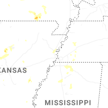
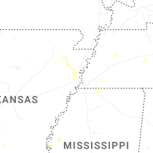
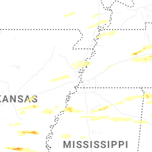

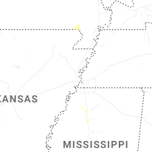
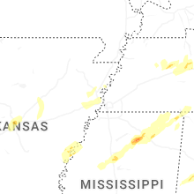


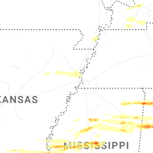


Connect with Interactive Hail Maps