

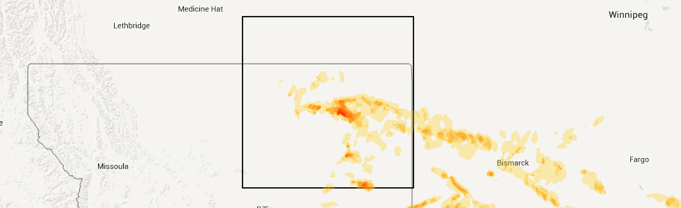
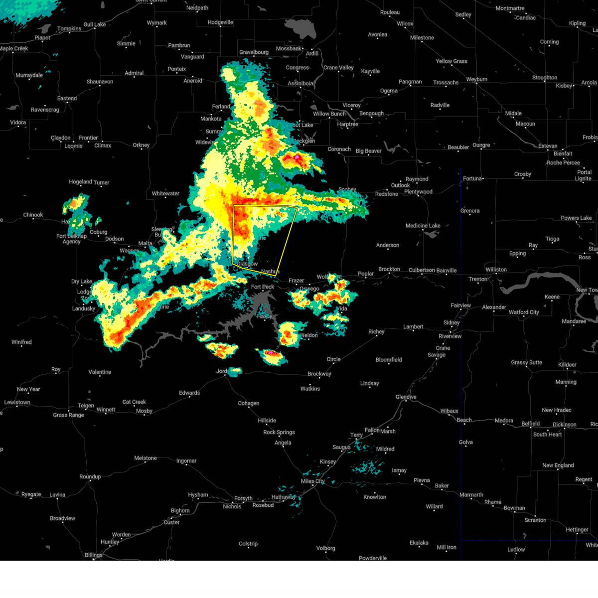
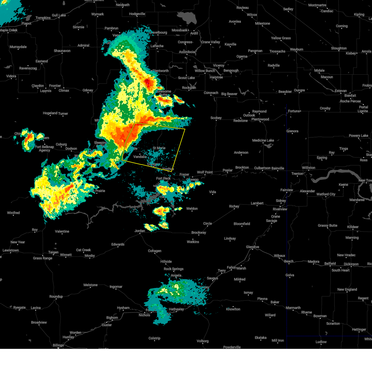
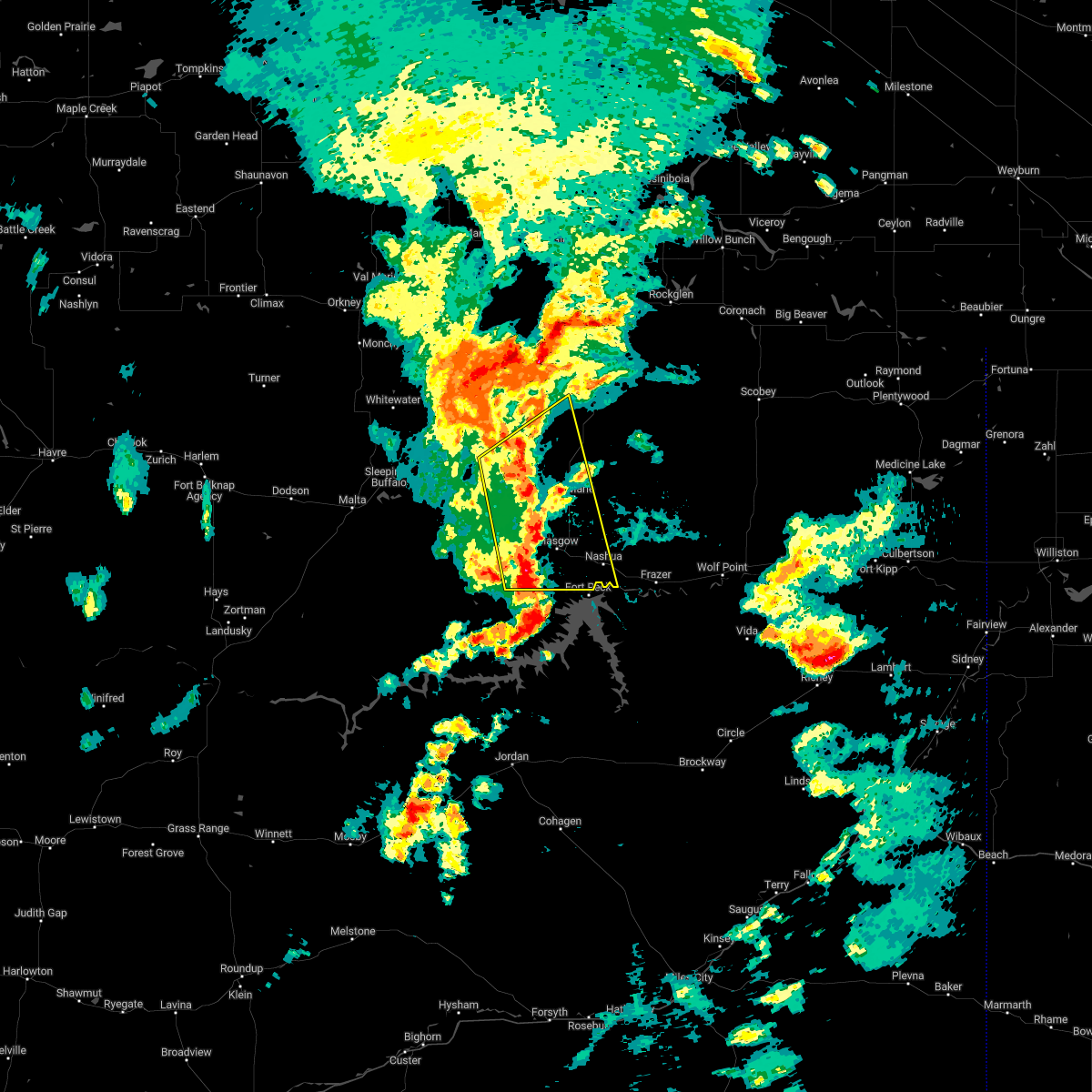
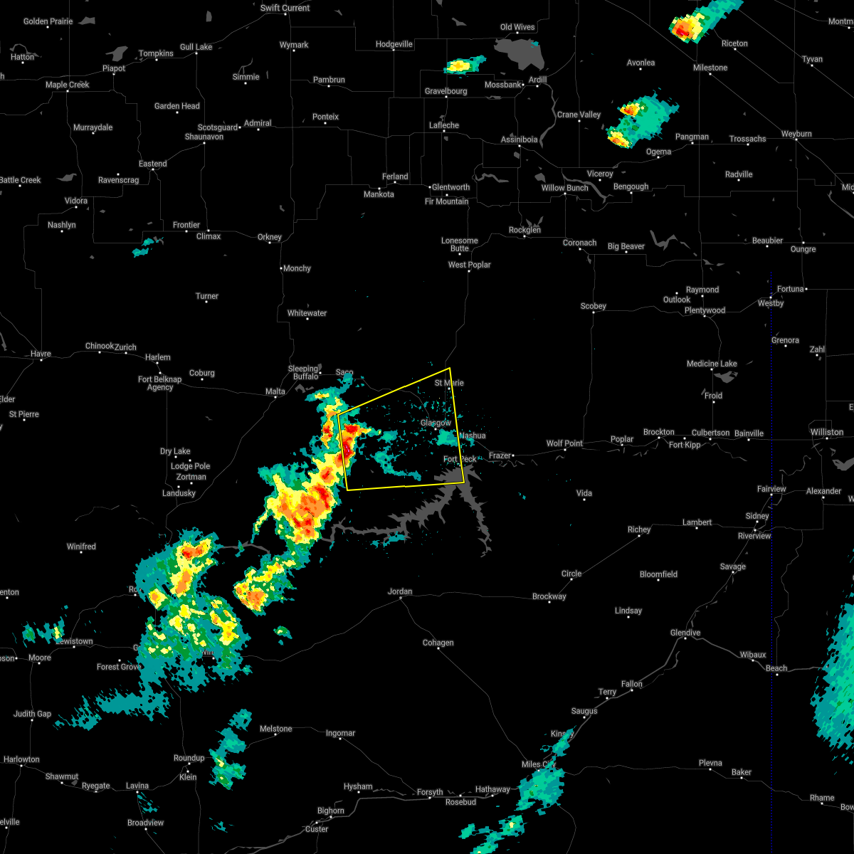
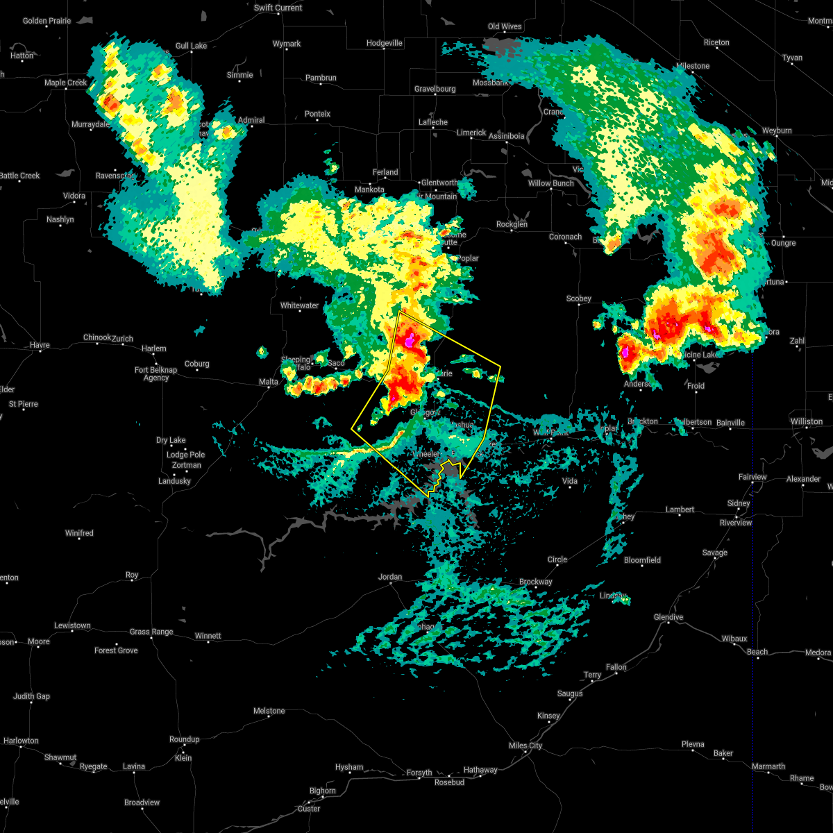
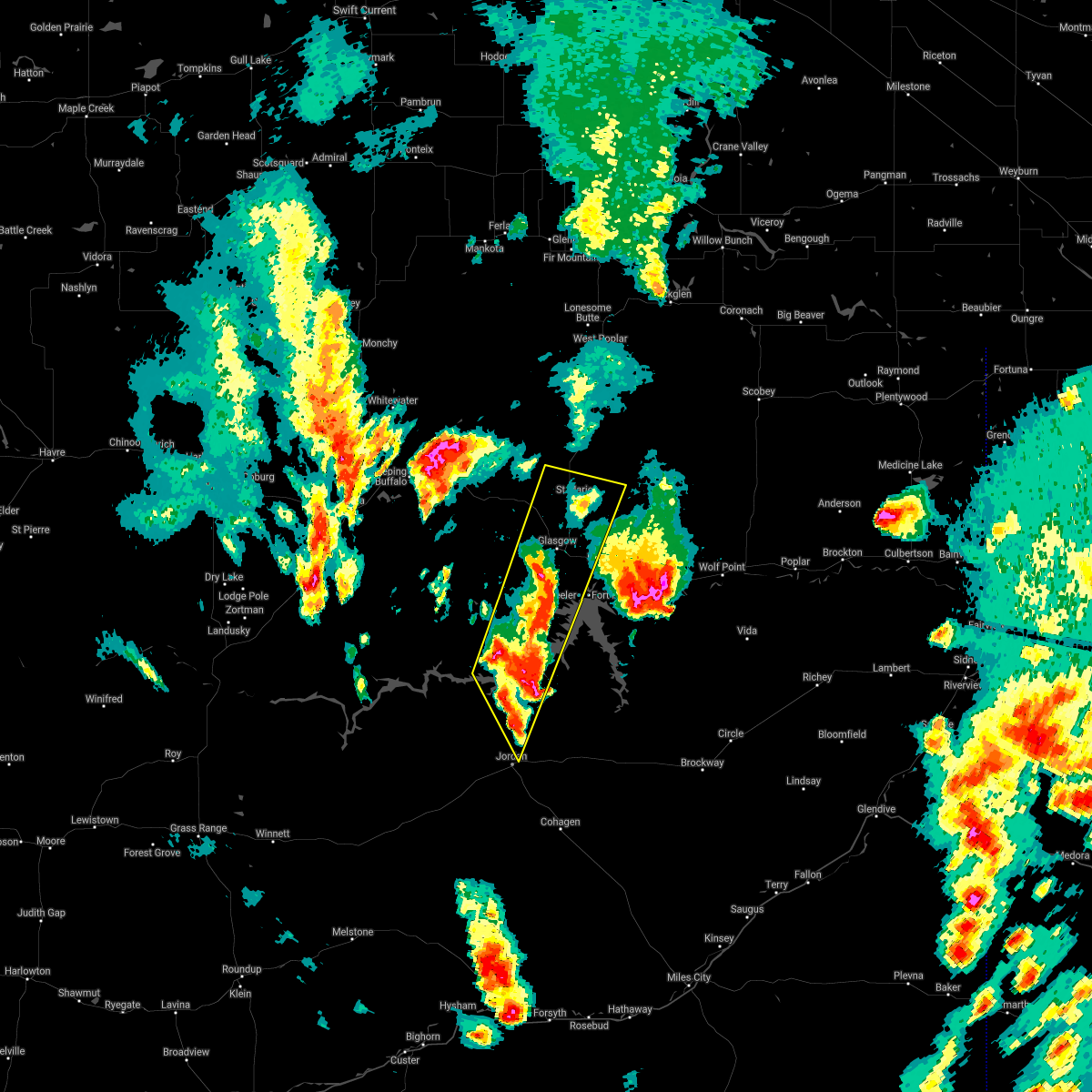
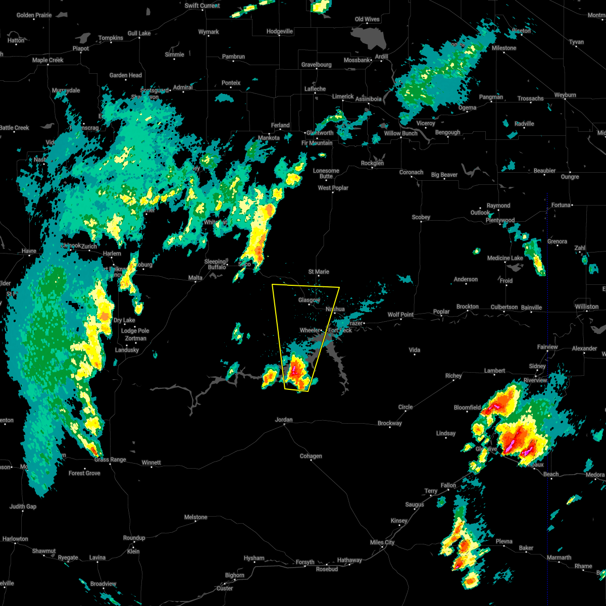
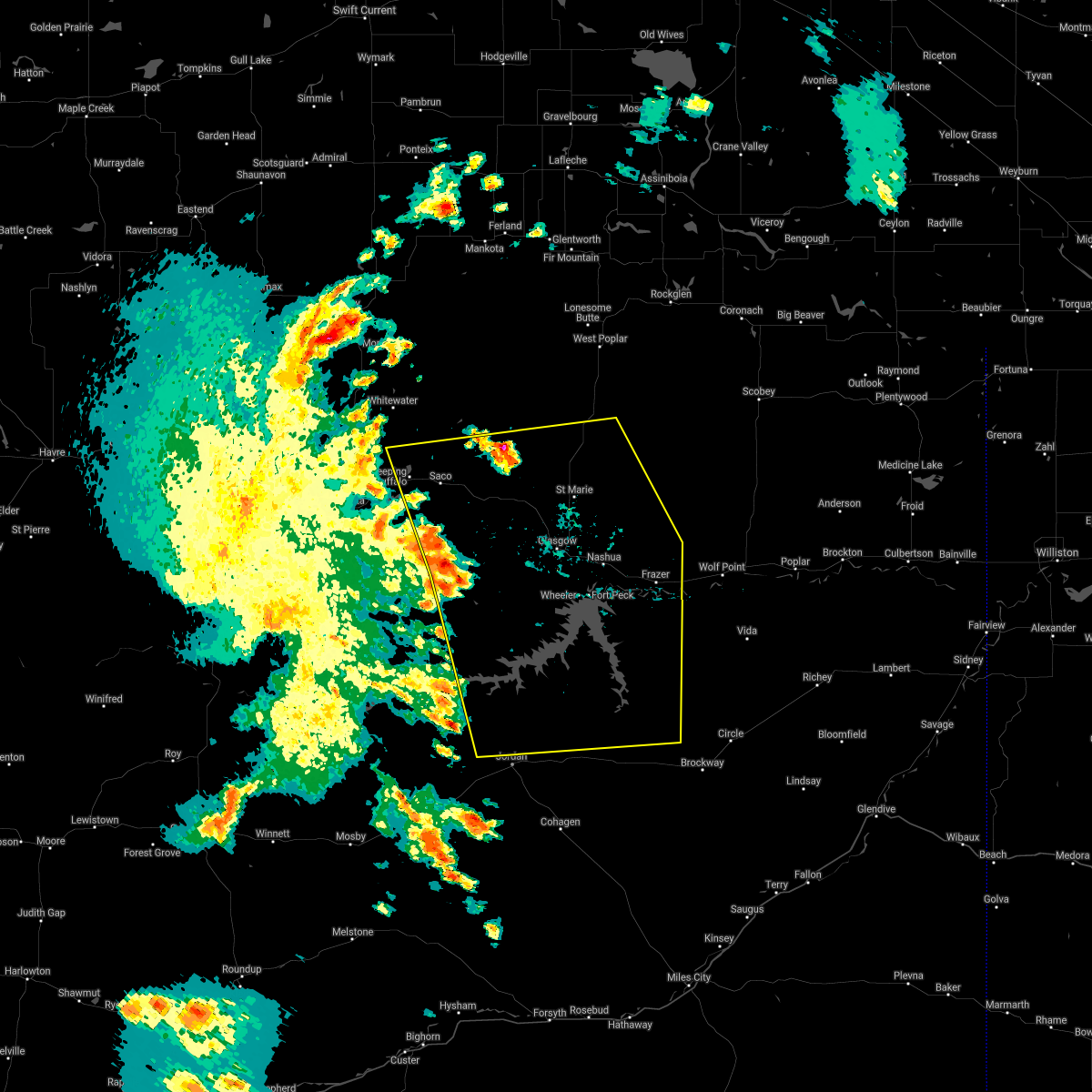
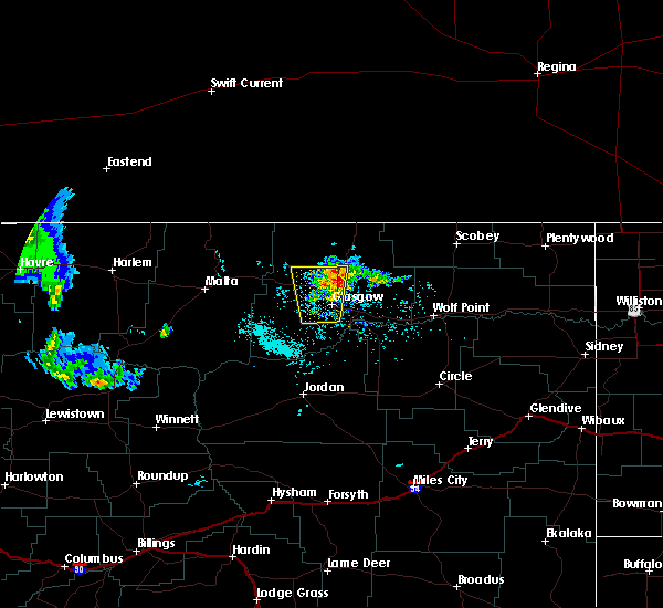
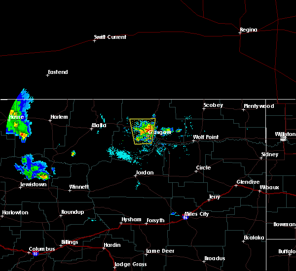
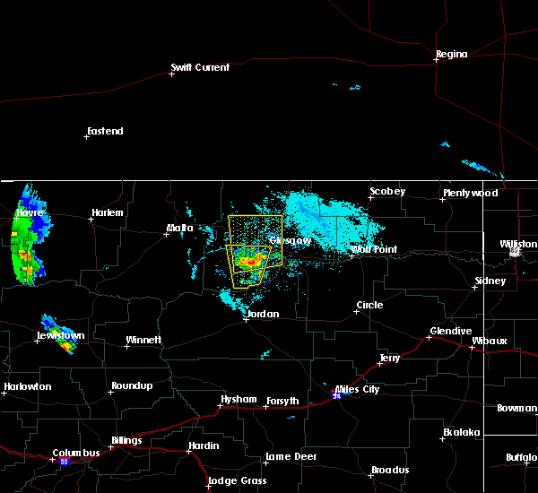
Hail Map for Glasgow, MT
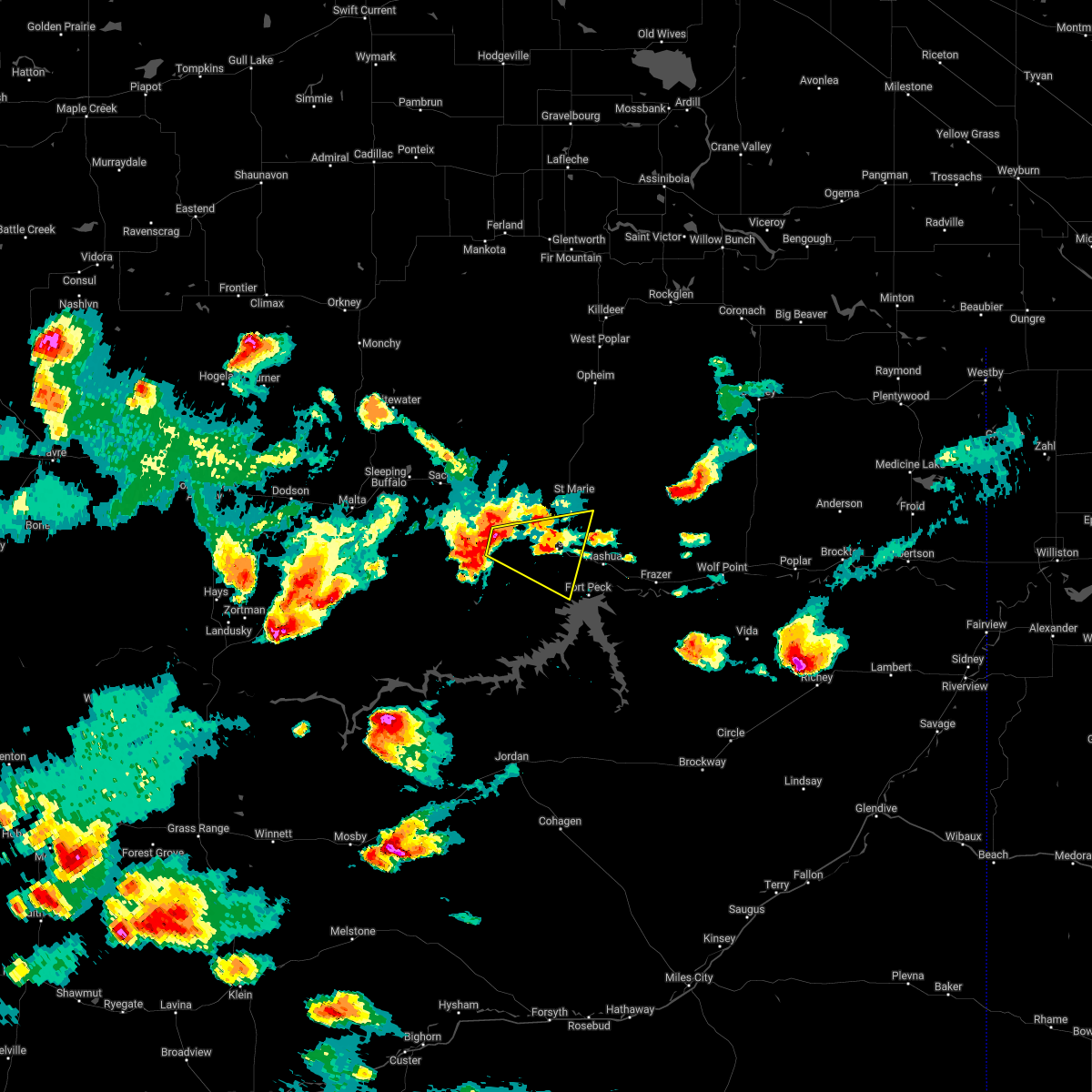
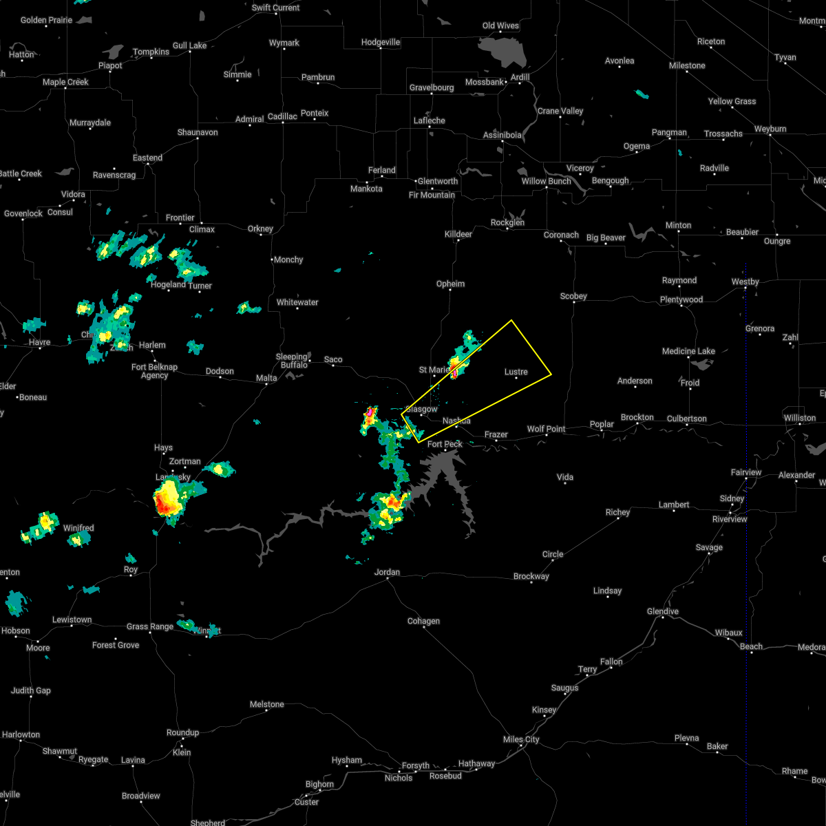
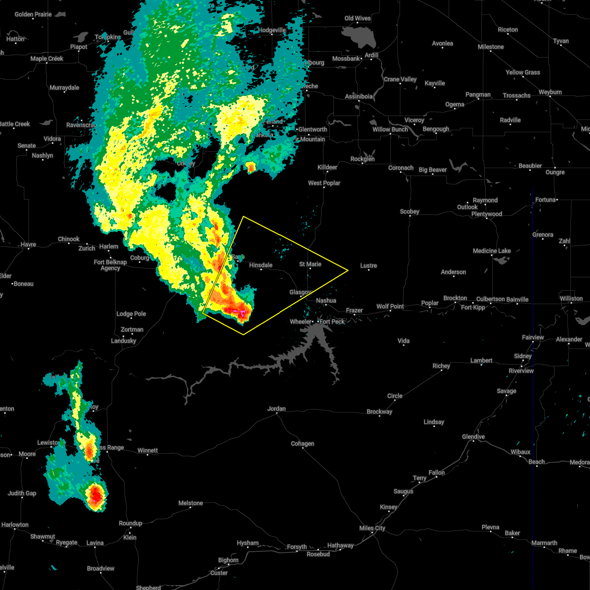
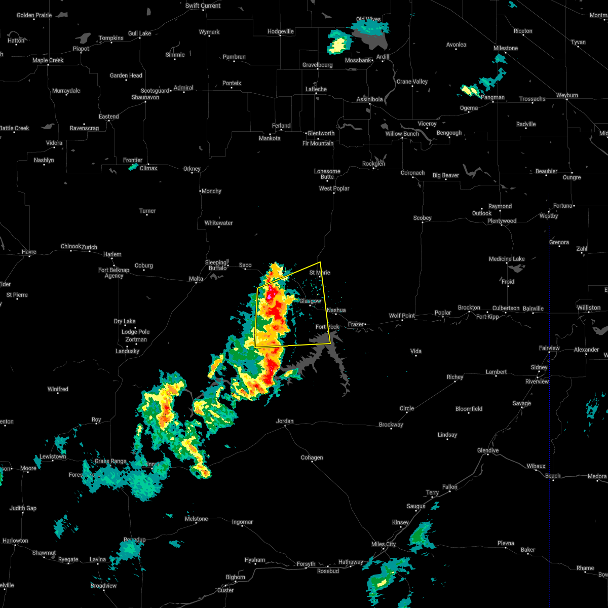
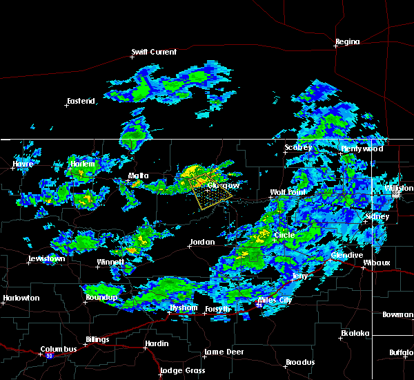
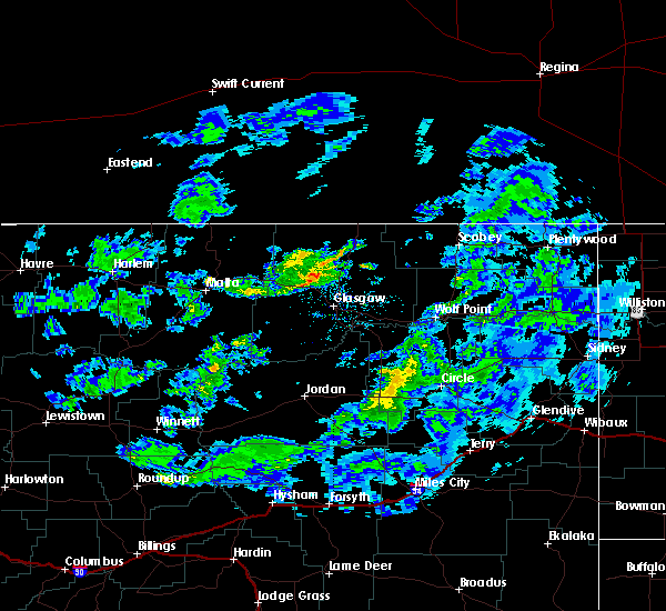
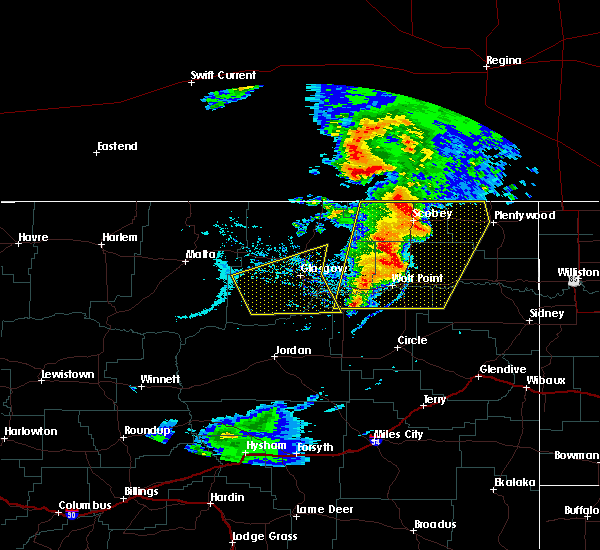
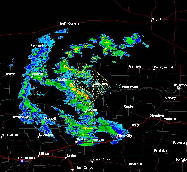
The Glasgow, MT area has had 32 reports of on-the-ground hail by trained spotters, and has been under severe weather warnings 6 times during the past 12 months. Doppler radar has detected hail at or near Glasgow, MT on 6 occasions.
| Name: | Glasgow, MT |
| Where Located: | 0.3 miles NNE of Glasgow, MT |
| Map: | Google Map for Glasgow, MT |
| Population: | 3250 |
| Housing Units: | 1653 |
| More Info: | Search Google for Glasgow, MT |
5
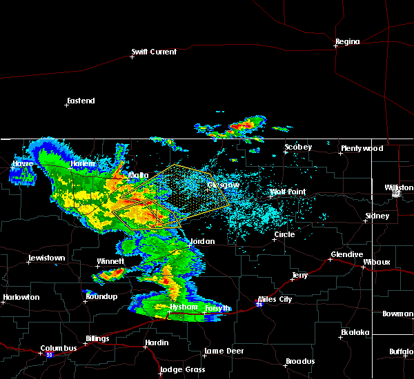
The Top Recent Hail Date for Glasgow, MT is Friday, July 22, 2011 (1st out of 6)
Hail and Wind Damage Spotted near Glasgow, MT
| Date / Time | Report Details |
|---|---|
| 4/22/2024 5:47 PM MDT |
 The storm which prompted the warning has weakened below severe limits, and no longer poses an immediate threat to life or property. therefore, the warning has been allowed to expire. The storm which prompted the warning has weakened below severe limits, and no longer poses an immediate threat to life or property. therefore, the warning has been allowed to expire.
|
| 4/22/2024 4:46 PM MDT |
 Svrggw the national weather service in glasgow has issued a * severe thunderstorm warning for, northeastern garfield county in northeastern montana, southeastern valley county in northeastern montana, mccone county in northeastern montana, northwestern prairie county in northeastern montana, northwestern dawson county in northeastern montana, * until 545 pm mdt. * at 445 pm mdt, showers with damaging wind gusts were located near glasgow, moving southeast at 60 mph (glasgow airport asos observation). Hazards include 60 mph wind gusts. expect damage to roofs, siding, and trees Svrggw the national weather service in glasgow has issued a * severe thunderstorm warning for, northeastern garfield county in northeastern montana, southeastern valley county in northeastern montana, mccone county in northeastern montana, northwestern prairie county in northeastern montana, northwestern dawson county in northeastern montana, * until 545 pm mdt. * at 445 pm mdt, showers with damaging wind gusts were located near glasgow, moving southeast at 60 mph (glasgow airport asos observation). Hazards include 60 mph wind gusts. expect damage to roofs, siding, and trees
|
| 4/22/2024 4:00 PM MDT |
 The storm which prompted the warning has weakened below severe limits, and has exited the warned area. therefore, the warning has been allowed to expire. however, gusty winds are still possible with this thunderstorm. The storm which prompted the warning has weakened below severe limits, and has exited the warned area. therefore, the warning has been allowed to expire. however, gusty winds are still possible with this thunderstorm.
|
| 4/22/2024 3:02 PM MDT |
 Svrggw the national weather service in glasgow has issued a * severe thunderstorm warning for, northeastern garfield county in northeastern montana, southern valley county in northeastern montana, northwestern mccone county in northeastern montana, * until 400 pm mdt. * at 301 pm mdt, a shower with damaging gusts was located near glasgow, moving southeast at 35 mph (radar indicated). Hazards include 60 mph wind gusts. expect damage to roofs, siding, and trees Svrggw the national weather service in glasgow has issued a * severe thunderstorm warning for, northeastern garfield county in northeastern montana, southern valley county in northeastern montana, northwestern mccone county in northeastern montana, * until 400 pm mdt. * at 301 pm mdt, a shower with damaging gusts was located near glasgow, moving southeast at 35 mph (radar indicated). Hazards include 60 mph wind gusts. expect damage to roofs, siding, and trees
|
| 8/30/2023 6:44 PM MDT | Mesonet station kigm8 king coule in valley county MT, 32.9 miles NNE of Glasgow, MT |
| 7/30/2023 11:33 PM MDT | Asos station kggw glasgow airport (asos in valley county MT, 1.6 miles SSW of Glasgow, MT |
| 7/30/2023 11:30 PM MDT | Storm damage reported in valley county MT, 15.5 miles SSW of Glasgow, MT |
| 7/30/2023 11:24 PM MDT |
 At 1123 pm mdt, severe thunderstorms were located along a line extending from 14 miles south of opheim to glasgow, moving east at 45 mph (radar indicated). Hazards include 60 mph wind gusts and penny size hail. Expect damage to roofs, siding, and trees. locations impacted include, glasgow, st. marie, baylor and larslan. hail threat, radar indicated max hail size, 0. 75 in wind threat, radar indicated max wind gust, 60 mph. At 1123 pm mdt, severe thunderstorms were located along a line extending from 14 miles south of opheim to glasgow, moving east at 45 mph (radar indicated). Hazards include 60 mph wind gusts and penny size hail. Expect damage to roofs, siding, and trees. locations impacted include, glasgow, st. marie, baylor and larslan. hail threat, radar indicated max hail size, 0. 75 in wind threat, radar indicated max wind gust, 60 mph.
|
| 7/30/2023 10:54 PM MDT |
 At 1052 pm mdt, severe thunderstorms were located along a line extending from 21 miles southwest of opheim to near hinsdale, moving east at 35 mph (radar indicated). Hazards include 60 mph wind gusts and penny size hail. expect damage to roofs, siding, and trees At 1052 pm mdt, severe thunderstorms were located along a line extending from 21 miles southwest of opheim to near hinsdale, moving east at 35 mph (radar indicated). Hazards include 60 mph wind gusts and penny size hail. expect damage to roofs, siding, and trees
|
| 7/30/2023 4:10 PM MDT | Mesonet observatio in valley county MT, 15.5 miles SSW of Glasgow, MT |
| 7/30/2023 2:45 AM MDT | 0.9 e saint marie marco site - 07m in valley county MT, 15.7 miles SSW of Glasgow, MT |
| 7/29/2023 11:44 PM MDT | Mesonet station kigm8 king coule in valley county MT, 32.9 miles NNE of Glasgow, MT |
| 6/2/2023 5:44 PM MDT | Mesonet station kigm8 king coule in valley county MT, 32.9 miles NNE of Glasgow, MT |
| 8/4/2022 6:40 PM MDT | Storm damage reported in valley county MT, 15.5 miles SSW of Glasgow, MT |
| 8/4/2022 6:20 PM MDT | Storm damage reported in valley county MT, 15.5 miles SSW of Glasgow, MT |
| 8/4/2022 5:51 PM MDT | The severe thunderstorm warning for southern phillips, central petroleum, garfield and southwestern valley counties will expire at 600 pm mdt, the storms which prompted the warning have weakened below severe limits and have exited the warned area. therefore, the warning will be allowed to expire. |
| 8/4/2022 5:44 PM MDT | Storm damage reported in valley county MT, 32.9 miles NNE of Glasgow, MT |
| 8/4/2022 4:55 PM MDT | At 454 pm mdt, severe thunderstorms were located along a line extending from 8 miles north of fourchette to 12 miles northwest of sand springs, moving east at 55 mph (public surface observations). Hazards include 60 mph wind gusts. expect damage to roofs, siding, and trees |
| 7/18/2022 5:24 PM MDT | Observed at glasgow aso in valley county MT, 1 miles SW of Glasgow, MT |
| 7/18/2022 5:15 PM MDT |
 At 515 pm mdt, a severe thunderstorm was located near glasgow, moving east at 50 mph (radar indicated). Hazards include 60 mph wind gusts and penny size hail. Expect damage to roofs, siding, and trees. locations impacted include, glasgow, nashua, tampico, st. marie, vandalia, park grove and whatley. hail threat, radar indicated max hail size, 0. 75 in wind threat, radar indicated max wind gust, 60 mph. At 515 pm mdt, a severe thunderstorm was located near glasgow, moving east at 50 mph (radar indicated). Hazards include 60 mph wind gusts and penny size hail. Expect damage to roofs, siding, and trees. locations impacted include, glasgow, nashua, tampico, st. marie, vandalia, park grove and whatley. hail threat, radar indicated max hail size, 0. 75 in wind threat, radar indicated max wind gust, 60 mph.
|
| 7/18/2022 4:29 PM MDT |
 At 429 pm mdt, a severe thunderstorm was located 18 miles southeast of malta, moving east at 60 mph (radar indicated). Hazards include 70 mph wind gusts and nickel size hail. Expect considerable tree damage. Damage is likely to mobile homes, roofs, and outbuildings. At 429 pm mdt, a severe thunderstorm was located 18 miles southeast of malta, moving east at 60 mph (radar indicated). Hazards include 70 mph wind gusts and nickel size hail. Expect considerable tree damage. Damage is likely to mobile homes, roofs, and outbuildings.
|
| 7/13/2022 9:56 PM MDT |
 The severe thunderstorm warning for eastern garfield, southwestern roosevelt, southeastern valley, mccone, northwestern prairie, northwestern dawson and northwestern richland counties will expire at 1000 pm mdt, the storms which prompted the warning have weakened below severe limits, and no longer pose an immediate threat to life or property. therefore, the warning will be allowed to expire. however gusty winds are still possible with these thunderstorms. a severe thunderstorm watch remains in effect until 1100 pm mdt for northeastern montana. The severe thunderstorm warning for eastern garfield, southwestern roosevelt, southeastern valley, mccone, northwestern prairie, northwestern dawson and northwestern richland counties will expire at 1000 pm mdt, the storms which prompted the warning have weakened below severe limits, and no longer pose an immediate threat to life or property. therefore, the warning will be allowed to expire. however gusty winds are still possible with these thunderstorms. a severe thunderstorm watch remains in effect until 1100 pm mdt for northeastern montana.
|
| 7/13/2022 9:42 PM MDT |
 At 941 pm mdt, severe thunderstorms were located along a line extending from near nashua to 10 miles northwest of vida to 15 miles south of brockway, moving northeast at 45 mph (trained weather spotters). Hazards include 70 mph wind gusts and penny size hail. Expect considerable tree damage. damage is likely to mobile homes, roofs, and outbuildings. locations impacted include, glasgow, wolf point, poplar, circle, nashua, brockton, fort peck, richey, duck creek rec area, brockway, flowing wells rest area, lustre, fort peck marina, frazer, vida, nelson creek rec area, lindsay, rock creek rec area, park grove and volt. thunderstorm damage threat, considerable hail threat, radar indicated max hail size, 0. 75 in wind threat, radar indicated max wind gust, 70 mph. At 941 pm mdt, severe thunderstorms were located along a line extending from near nashua to 10 miles northwest of vida to 15 miles south of brockway, moving northeast at 45 mph (trained weather spotters). Hazards include 70 mph wind gusts and penny size hail. Expect considerable tree damage. damage is likely to mobile homes, roofs, and outbuildings. locations impacted include, glasgow, wolf point, poplar, circle, nashua, brockton, fort peck, richey, duck creek rec area, brockway, flowing wells rest area, lustre, fort peck marina, frazer, vida, nelson creek rec area, lindsay, rock creek rec area, park grove and volt. thunderstorm damage threat, considerable hail threat, radar indicated max hail size, 0. 75 in wind threat, radar indicated max wind gust, 70 mph.
|
| 7/13/2022 9:07 PM MDT |
 At 905 pm mdt, severe thunderstorms were located along a line extending from 13 miles west of duck creek rec area to 8 miles east of rock creek rec area to 11 miles east of hillside, moving northeast at 40 mph (trained weather spotters). Hazards include 70 mph wind gusts and penny size hail. Expect considerable tree damage. Damage is likely to mobile homes, roofs, and outbuildings. At 905 pm mdt, severe thunderstorms were located along a line extending from 13 miles west of duck creek rec area to 8 miles east of rock creek rec area to 11 miles east of hillside, moving northeast at 40 mph (trained weather spotters). Hazards include 70 mph wind gusts and penny size hail. Expect considerable tree damage. Damage is likely to mobile homes, roofs, and outbuildings.
|
| 7/13/2022 9:03 PM MDT | Storm damage reported in valley county MT, 24.8 miles N of Glasgow, MT |
| 7/9/2022 10:10 PM MDT | Via the saint marie marco sit in valley county MT, 15.5 miles SSW of Glasgow, MT |
| 7/9/2022 10:04 PM MDT | Corrects previous report from 1 nne glasgow. highest gust from the glasgow asos statio in valley county MT, 1 miles SW of Glasgow, MT |
| 7/9/2022 9:45 PM MDT |
 At 945 pm mdt, severe thunderstorms were located along a line extending from 22 miles west of opheim to 11 miles west of the pines rec area, moving east at 55 mph (radar indicated). Hazards include 70 mph wind gusts and penny size hail. Expect considerable tree damage. Damage is likely to mobile homes, roofs, and outbuildings. At 945 pm mdt, severe thunderstorms were located along a line extending from 22 miles west of opheim to 11 miles west of the pines rec area, moving east at 55 mph (radar indicated). Hazards include 70 mph wind gusts and penny size hail. Expect considerable tree damage. Damage is likely to mobile homes, roofs, and outbuildings.
|
| 7/9/2022 9:44 PM MDT | Via king coulee raws sit in valley county MT, 32.9 miles NNE of Glasgow, MT |
| 7/8/2022 10:48 PM MDT | At 1047 pm mdt, severe thunderstorms were located along a line extending from near opheim to 10 miles northwest of rock creek rec area, moving east at 40 mph (radar indicated). Hazards include 70 mph wind gusts and penny size hail. expect damage to roofs, siding, and trees |
| 7/8/2022 10:36 PM MDT |
 At 1034 pm mdt, severe thunderstorms were located along a line extending from 12 miles north of st. marie to 6 miles east of fort peck, moving east at 65 mph (radar indicated). Hazards include 70 mph wind gusts and penny size hail. Expect considerable tree damage. damage is likely to mobile homes, roofs, and outbuildings. locations impacted include, glasgow, wolf point, richland, nashua, fort peck, duck creek rec area, st. marie, peerless, the pines rec area, tampico, hinsdale, lustre, fort peck marina, frazer, vida, rock creek rec area, vandalia, park grove, west fork and the bentonite plant. thunderstorm damage threat, considerable hail threat, radar indicated max hail size, 0. 75 in wind threat, observed max wind gust, 70 mph. At 1034 pm mdt, severe thunderstorms were located along a line extending from 12 miles north of st. marie to 6 miles east of fort peck, moving east at 65 mph (radar indicated). Hazards include 70 mph wind gusts and penny size hail. Expect considerable tree damage. damage is likely to mobile homes, roofs, and outbuildings. locations impacted include, glasgow, wolf point, richland, nashua, fort peck, duck creek rec area, st. marie, peerless, the pines rec area, tampico, hinsdale, lustre, fort peck marina, frazer, vida, rock creek rec area, vandalia, park grove, west fork and the bentonite plant. thunderstorm damage threat, considerable hail threat, radar indicated max hail size, 0. 75 in wind threat, observed max wind gust, 70 mph.
|
| 7/8/2022 10:31 PM MDT | Observed at asos statio in valley county MT, 1 miles SW of Glasgow, MT |
| 7/8/2022 10:07 PM MDT |
 At 1004 pm mdt, severe thunderstorms were located along a line extending from near hinsdale to 12 miles west of the pines rec area, moving east at 65 mph. these are destructive storms for central valley county including the city of glasgow and hinsdale (radar indicated). Hazards include 80 mph wind gusts and penny size hail. Flying debris will be dangerous to those caught without shelter. mobile homes will be heavily damaged. expect considerable damage to roofs, windows, and vehicles. Extensive tree damage and power outages are likely. At 1004 pm mdt, severe thunderstorms were located along a line extending from near hinsdale to 12 miles west of the pines rec area, moving east at 65 mph. these are destructive storms for central valley county including the city of glasgow and hinsdale (radar indicated). Hazards include 80 mph wind gusts and penny size hail. Flying debris will be dangerous to those caught without shelter. mobile homes will be heavily damaged. expect considerable damage to roofs, windows, and vehicles. Extensive tree damage and power outages are likely.
|
| 7/6/2022 7:30 PM MDT | Observed via raws sit in valley county MT, 32.9 miles NNE of Glasgow, MT |
| 7/6/2022 6:17 PM MDT |
 At 617 pm mdt, a severe thunderstorm was located 9 miles southwest of tampico, or 16 miles west of glasgow, moving east at 20 mph (radar indicated). Hazards include ping pong ball size hail and 60 mph wind gusts. People and animals outdoors will be injured. expect hail damage to roofs, siding, windows, and vehicles. Expect wind damage to roofs, siding, and trees. At 617 pm mdt, a severe thunderstorm was located 9 miles southwest of tampico, or 16 miles west of glasgow, moving east at 20 mph (radar indicated). Hazards include ping pong ball size hail and 60 mph wind gusts. People and animals outdoors will be injured. expect hail damage to roofs, siding, windows, and vehicles. Expect wind damage to roofs, siding, and trees.
|
| 6/23/2022 5:12 PM MDT |
 At 512 pm mdt, a severe thunderstorm was located 12 miles southeast of malta, moving northeast at 55 mph (radar indicated). Hazards include 60 mph wind gusts and quarter size hail. Hail damage to vehicles is expected. Expect wind damage to roofs, siding, and trees. At 512 pm mdt, a severe thunderstorm was located 12 miles southeast of malta, moving northeast at 55 mph (radar indicated). Hazards include 60 mph wind gusts and quarter size hail. Hail damage to vehicles is expected. Expect wind damage to roofs, siding, and trees.
|
| 6/23/2022 3:56 PM MDT |
 At 356 pm mdt, a severe thunderstorm was located over glasgow, moving northeast at 45 mph (radar indicated). Hazards include 60 mph wind gusts. expect damage to roofs, siding, and trees At 356 pm mdt, a severe thunderstorm was located over glasgow, moving northeast at 45 mph (radar indicated). Hazards include 60 mph wind gusts. expect damage to roofs, siding, and trees
|
| 6/23/2022 3:50 PM MDT | Mesonet station 07mt 1.0 ne saint marie (ggwwfo in valley county MT, 15.5 miles SSW of Glasgow, MT |
| 6/19/2022 12:07 AM MDT |
 At 1206 am mdt, a severe thunderstorm was located 12 miles southwest of hinsdale, or 26 miles west of glasgow, moving northeast at 35 mph (radar indicated). Hazards include 70 mph wind gusts and half dollar size hail. Hail damage to vehicles is expected. expect considerable tree damage. Wind damage is also likely to mobile homes, roofs, and outbuildings. At 1206 am mdt, a severe thunderstorm was located 12 miles southwest of hinsdale, or 26 miles west of glasgow, moving northeast at 35 mph (radar indicated). Hazards include 70 mph wind gusts and half dollar size hail. Hail damage to vehicles is expected. expect considerable tree damage. Wind damage is also likely to mobile homes, roofs, and outbuildings.
|
| 5/19/2022 2:53 PM MDT | Asos station kggw glasgow airport (asos in valley county MT, 1.6 miles SSW of Glasgow, MT |
| 5/19/2022 1:40 PM MDT | Mesonet station 07mt 1.0 ne saint marie (ggwwfo in valley county MT, 15.5 miles SSW of Glasgow, MT |
| 2/19/2022 10:56 PM MST |
 At 1055 pm mst, intense rainshowers with damaging winds were located along a line extending from 11 miles west of lustre to 22 miles southwest of tampico, moving southeast at 30 mph (radar indicated). Hazards include 60 mph wind gusts. expect damage to roofs, siding, and trees At 1055 pm mst, intense rainshowers with damaging winds were located along a line extending from 11 miles west of lustre to 22 miles southwest of tampico, moving southeast at 30 mph (radar indicated). Hazards include 60 mph wind gusts. expect damage to roofs, siding, and trees
|
| 2/19/2022 8:53 PM MST | Gust to 58 mp in valley county MT, 1 miles SW of Glasgow, MT |
| 8/27/2021 4:40 PM MDT | Quarter sized hail reported 32.6 miles SSW of Glasgow, MT |
| 8/18/2021 1:08 AM MDT |
 The severe thunderstorm warning for northeastern garfield, central valley and western mccone counties will expire at 115 am mdt, the winds which prompted the warning have weakened below severe limits, and no longer pose an immediate threat to life or property. therefore, the warning will be allowed to expire. however gusty winds over 50 mph are still possible with these thunderstorm outflow winds. to report severe weather, contact your nearest law enforcement agency. they will relay your report to the national weather service glasgow. The severe thunderstorm warning for northeastern garfield, central valley and western mccone counties will expire at 115 am mdt, the winds which prompted the warning have weakened below severe limits, and no longer pose an immediate threat to life or property. therefore, the warning will be allowed to expire. however gusty winds over 50 mph are still possible with these thunderstorm outflow winds. to report severe weather, contact your nearest law enforcement agency. they will relay your report to the national weather service glasgow.
|
| 8/18/2021 12:48 AM MDT |
 At 1244 am mdt, severe thunderstorm outflow winds were located across the warned area (radar indicated. at 1222 am mdt, a wind gust of 61 mph was recorded at the glasgow airport). Hazards include 60 mph wind gusts. Expect damage to roofs, siding, and trees. locations impacted include, glasgow, jordan, nashua, fort peck, the pines rec area, tampico, duck creek rec area, fort peck marina, hell creek rec area, frazer, flowing wells rest area, nelson creek rec area, st. marie, rock creek rec area, oswego, vandalia, park grove, van norman, haxby and weldon. hail threat, radar indicated max hail size, <. 75 in wind threat, observed max wind gust, 60 mph. At 1244 am mdt, severe thunderstorm outflow winds were located across the warned area (radar indicated. at 1222 am mdt, a wind gust of 61 mph was recorded at the glasgow airport). Hazards include 60 mph wind gusts. Expect damage to roofs, siding, and trees. locations impacted include, glasgow, jordan, nashua, fort peck, the pines rec area, tampico, duck creek rec area, fort peck marina, hell creek rec area, frazer, flowing wells rest area, nelson creek rec area, st. marie, rock creek rec area, oswego, vandalia, park grove, van norman, haxby and weldon. hail threat, radar indicated max hail size, <. 75 in wind threat, observed max wind gust, 60 mph.
|
| 8/18/2021 12:29 AM MDT | Asos station kggw glasgow airport (asos in valley county MT, 1.6 miles SSW of Glasgow, MT |
| 8/18/2021 12:14 AM MDT |
 At 1212 am mdt, severe thunderstorm outflow wind gusts were located along a line extending from 11 miles north of hinsdale to 7 miles west of tampico to 19 miles southwest of glasgow to 9 miles northwest of hell creek rec area to 8 miles east of brusett, moving east at 50 mph (radar indicated). Hazards include 60 mph wind gusts. expect damage to roofs, siding, and trees At 1212 am mdt, severe thunderstorm outflow wind gusts were located along a line extending from 11 miles north of hinsdale to 7 miles west of tampico to 19 miles southwest of glasgow to 9 miles northwest of hell creek rec area to 8 miles east of brusett, moving east at 50 mph (radar indicated). Hazards include 60 mph wind gusts. expect damage to roofs, siding, and trees
|
| 7/22/2021 6:45 PM MDT | Tree damage reported by nws employee. time estimate in valley county MT, 0.2 miles WSW of Glasgow, MT |
| 7/22/2021 6:45 PM MDT | Twenty year old pine tree down. reported via social media. time estimate in valley county MT, 2.3 miles SSE of Glasgow, MT |
| 7/22/2021 6:41 PM MDT | Asos station kggw glasgow airport (asos in valley county MT, 1.6 miles SSW of Glasgow, MT |
| 7/22/2021 6:40 PM MDT | Report through social media. sustained shingles off the roo in valley county MT, 4 miles NW of Glasgow, MT |
| 7/22/2021 6:37 PM MDT |
 At 636 pm mdt, severe thunderstorms were located along a line extending from near st. marie to 7 miles east of the pines rec area, moving northeast at 55 mph (radar indicated). Hazards include 70 mph wind gusts and penny size hail. Expect considerable tree damage. Damage is likely to mobile homes, roofs, and outbuildings. At 636 pm mdt, severe thunderstorms were located along a line extending from near st. marie to 7 miles east of the pines rec area, moving northeast at 55 mph (radar indicated). Hazards include 70 mph wind gusts and penny size hail. Expect considerable tree damage. Damage is likely to mobile homes, roofs, and outbuildings.
|
| 7/22/2021 6:11 PM MDT |
 At 610 pm mdt, a severe thunderstorm was located 16 miles southwest of tampico, or 18 miles southwest of glasgow, moving east at 30 mph. this is a very dangerous storm (radar indicated). Hazards include 80 mph wind gusts and penny size hail. Flying debris will be dangerous to those caught without shelter. mobile homes will be heavily damaged. expect considerable damage to roofs, windows, and vehicles. extensive tree damage and power outages are likely. locations impacted include, glasgow, fort peck, fort peck marina, tampico, duck creek rec area, st. Marie, vandalia, park grove, the bentonite plant and whatley. At 610 pm mdt, a severe thunderstorm was located 16 miles southwest of tampico, or 18 miles southwest of glasgow, moving east at 30 mph. this is a very dangerous storm (radar indicated). Hazards include 80 mph wind gusts and penny size hail. Flying debris will be dangerous to those caught without shelter. mobile homes will be heavily damaged. expect considerable damage to roofs, windows, and vehicles. extensive tree damage and power outages are likely. locations impacted include, glasgow, fort peck, fort peck marina, tampico, duck creek rec area, st. Marie, vandalia, park grove, the bentonite plant and whatley.
|
| 7/22/2021 5:51 PM MDT |
 At 550 pm mdt, a severe thunderstorm was located 22 miles south of hinsdale, or 28 miles west of glasgow, moving east at 30 mph (radar indicated). Hazards include 70 mph wind gusts and penny size hail. Expect considerable tree damage. Damage is likely to mobile homes, roofs, and outbuildings. At 550 pm mdt, a severe thunderstorm was located 22 miles south of hinsdale, or 28 miles west of glasgow, moving east at 30 mph (radar indicated). Hazards include 70 mph wind gusts and penny size hail. Expect considerable tree damage. Damage is likely to mobile homes, roofs, and outbuildings.
|
| 7/8/2021 3:14 PM MDT | Corrects previous tstm wnd gst report from 4 n glasgo in valley county MT, 3.5 miles S of Glasgow, MT |
| 7/8/2021 3:14 PM MDT | Ambient weather statio in valley county MT, 1.6 miles SSE of Glasgow, MT |
| 7/8/2021 3:10 PM MDT | Shed was toppled and rolle in valley county MT, 5.9 miles SSW of Glasgow, MT |
| 7/8/2021 3:06 PM MDT |
 At 305 pm mdt, severe thunderstorms were located along a line extending from 11 miles north of st. marie to near glasgow to 18 miles west of duck creek rec area, moving southeast at 70 mph. these are very dangerous storms (radar indicated). Hazards include 90 mph wind gusts and nickel size hail. You are in a life-threatening situation. flying debris may be deadly to those caught without shelter. mobile homes will be heavily damaged or destroyed. homes and businesses will have substantial roof and window damage. expect extensive tree damage and power outages. locations impacted include, glasgow, nashua, fort peck, the pines rec area, fort peck marina, tampico, duck creek rec area, st. Marie, vandalia, park grove, the bentonite plant and whatley. At 305 pm mdt, severe thunderstorms were located along a line extending from 11 miles north of st. marie to near glasgow to 18 miles west of duck creek rec area, moving southeast at 70 mph. these are very dangerous storms (radar indicated). Hazards include 90 mph wind gusts and nickel size hail. You are in a life-threatening situation. flying debris may be deadly to those caught without shelter. mobile homes will be heavily damaged or destroyed. homes and businesses will have substantial roof and window damage. expect extensive tree damage and power outages. locations impacted include, glasgow, nashua, fort peck, the pines rec area, fort peck marina, tampico, duck creek rec area, st. Marie, vandalia, park grove, the bentonite plant and whatley.
|
| 7/8/2021 3:04 PM MDT | Storm damage reported in valley county MT, 5.6 miles S of Glasgow, MT |
| 7/8/2021 2:50 PM MDT |
 At 249 pm mdt, severe thunderstorms were located along a line extending from 20 miles northwest of st. marie to 7 miles north of tampico to 16 miles south of hinsdale, moving southeast at 30 mph (radar indicated). Hazards include 70 mph wind gusts and nickel size hail. Expect considerable tree damage. Damage is likely to mobile homes, roofs, and outbuildings. At 249 pm mdt, severe thunderstorms were located along a line extending from 20 miles northwest of st. marie to 7 miles north of tampico to 16 miles south of hinsdale, moving southeast at 30 mph (radar indicated). Hazards include 70 mph wind gusts and nickel size hail. Expect considerable tree damage. Damage is likely to mobile homes, roofs, and outbuildings.
|
| 6/8/2021 6:50 PM MDT |
 At 650 pm mdt, severe thunderstorms were located along a line extending from 9 miles northwest of duck creek rec area to near hell creek rec area, moving northeast at 45 mph (radar indicated). Hazards include 60 mph wind gusts and quarter size hail. Hail damage to vehicles is expected. Expect wind damage to roofs, siding, and trees. At 650 pm mdt, severe thunderstorms were located along a line extending from 9 miles northwest of duck creek rec area to near hell creek rec area, moving northeast at 45 mph (radar indicated). Hazards include 60 mph wind gusts and quarter size hail. Hail damage to vehicles is expected. Expect wind damage to roofs, siding, and trees.
|
| 6/8/2021 5:39 PM MDT |
 At 538 pm mdt, a severe thunderstorm was located 12 miles west of duck creek rec area, or 13 miles southwest of glasgow, moving north at 40 mph (radar indicated). Hazards include 60 mph wind gusts and quarter size hail. Hail damage to vehicles is expected. expect wind damage to roofs, siding, and trees. Locations impacted include, glasgow, fort peck, the pines rec area, fort peck marina, tampico, duck creek rec area, park grove and whatley. At 538 pm mdt, a severe thunderstorm was located 12 miles west of duck creek rec area, or 13 miles southwest of glasgow, moving north at 40 mph (radar indicated). Hazards include 60 mph wind gusts and quarter size hail. Hail damage to vehicles is expected. expect wind damage to roofs, siding, and trees. Locations impacted include, glasgow, fort peck, the pines rec area, fort peck marina, tampico, duck creek rec area, park grove and whatley.
|
| 6/8/2021 5:11 PM MDT |
 At 511 pm mdt, a severe thunderstorm was located 8 miles southwest of the pines rec area, or 30 miles north of jordan, moving north at 40 mph (radar indicated). Hazards include 60 mph wind gusts and quarter size hail. Hail damage to vehicles is expected. Expect wind damage to roofs, siding, and trees. At 511 pm mdt, a severe thunderstorm was located 8 miles southwest of the pines rec area, or 30 miles north of jordan, moving north at 40 mph (radar indicated). Hazards include 60 mph wind gusts and quarter size hail. Hail damage to vehicles is expected. Expect wind damage to roofs, siding, and trees.
|
| 10/30/2020 7:13 PM MDT |
 At 712 pm mdt, showers were located along a line extending from 11 miles north of richland to 7 miles northeast of glasgow to 17 miles northwest of hell creek rec area, moving east at 55 mph (glasgow asos measured a 75 mph wind gust). Hazards include 70 mph wind gusts. Expect considerable tree damage. Damage is likely to mobile homes, roofs, and outbuildings. At 712 pm mdt, showers were located along a line extending from 11 miles north of richland to 7 miles northeast of glasgow to 17 miles northwest of hell creek rec area, moving east at 55 mph (glasgow asos measured a 75 mph wind gust). Hazards include 70 mph wind gusts. Expect considerable tree damage. Damage is likely to mobile homes, roofs, and outbuildings.
|
| 10/30/2020 7:08 PM MDT |
 At 706 pm mdt, a line of showers producing strong winds were located along a line extending from 11 miles east of port of opheim to near glasgow to 19 miles northwest of hell creek rec area, moving east at 55 mph (radar indicated). Hazards include 60 mph wind gusts. expect damage to roofs, siding, and trees At 706 pm mdt, a line of showers producing strong winds were located along a line extending from 11 miles east of port of opheim to near glasgow to 19 miles northwest of hell creek rec area, moving east at 55 mph (radar indicated). Hazards include 60 mph wind gusts. expect damage to roofs, siding, and trees
|
| 8/20/2020 10:04 PM MDT | Storm damage reported in valley county MT, 15.7 miles SSW of Glasgow, MT |
| 8/20/2020 10:00 PM MDT | Mesonet station 07mt 1.0 ne saint marie (ggwwfo in valley county MT, 15.5 miles SSW of Glasgow, MT |
| 8/20/2020 9:44 PM MDT | Storm damage reported in valley county MT, 32.9 miles NNE of Glasgow, MT |
| 8/20/2020 9:43 PM MDT |
 At 942 pm mdt, severe thunderstorms were located along a line extending from 14 miles north of st. marie to 13 miles northeast of nashua to 8 miles east of nelson creek rec area to 13 miles south of hillside, moving east at 50 mph (radar indicated). Hazards include 70 mph wind gusts. Expect considerable tree damage. Damage is likely to mobile homes, roofs, and outbuildings. At 942 pm mdt, severe thunderstorms were located along a line extending from 14 miles north of st. marie to 13 miles northeast of nashua to 8 miles east of nelson creek rec area to 13 miles south of hillside, moving east at 50 mph (radar indicated). Hazards include 70 mph wind gusts. Expect considerable tree damage. Damage is likely to mobile homes, roofs, and outbuildings.
|
| 8/20/2020 9:25 PM MDT | Storm damage reported in valley county MT, 1 miles SW of Glasgow, MT |
| 8/20/2020 9:23 PM MDT | Asos station kggw glasgow airport (asos in valley county MT, 1.6 miles SSW of Glasgow, MT |
| 8/20/2020 9:21 PM MDT |
 At 921 pm mdt, severe thunderstorms were located along a line extending from 17 miles north of hinsdale to near glasgow to 13 miles northwest of flowing wells rest area, moving east at 40 mph (radar indicated). Hazards include 70 mph wind gusts. Expect considerable tree damage. damage is likely to mobile homes, roofs, and outbuildings. locations impacted include, glasgow, nashua, fort peck, saco, the pines rec area, tampico, hinsdale, duck creek rec area, fort peck marina, hell creek rec area, frazer, nelson creek rec area, st. Marie, rock creek rec area, vandalia, sleeping buffalo, park grove, the bentonite plant, haxby and weldon. At 921 pm mdt, severe thunderstorms were located along a line extending from 17 miles north of hinsdale to near glasgow to 13 miles northwest of flowing wells rest area, moving east at 40 mph (radar indicated). Hazards include 70 mph wind gusts. Expect considerable tree damage. damage is likely to mobile homes, roofs, and outbuildings. locations impacted include, glasgow, nashua, fort peck, saco, the pines rec area, tampico, hinsdale, duck creek rec area, fort peck marina, hell creek rec area, frazer, nelson creek rec area, st. Marie, rock creek rec area, vandalia, sleeping buffalo, park grove, the bentonite plant, haxby and weldon.
|
| 8/20/2020 8:49 PM MDT |
 At 847 pm mdt, severe thunderstorms were located along a line extending from 7 miles northwest of saco to 14 miles southwest of tampico to 9 miles northwest of jordan, moving east at 50 mph (radar indicated). Hazards include 60 mph wind gusts and penny size hail. expect damage to roofs, siding, and trees At 847 pm mdt, severe thunderstorms were located along a line extending from 7 miles northwest of saco to 14 miles southwest of tampico to 9 miles northwest of jordan, moving east at 50 mph (radar indicated). Hazards include 60 mph wind gusts and penny size hail. expect damage to roofs, siding, and trees
|
| 8/6/2020 8:24 PM MDT | Time estimated from rada in valley county MT, 8.2 miles N of Glasgow, MT |
| 7/7/2020 6:13 PM MDT |
 At 612 pm mdt, severe thunderstorms were located along a line extending from near port of opheim to 7 miles southwest of richland to near lustre, moving east at 55 mph. these are very dangerous storms (mesonet reported wind gust). Hazards include 83 mph wind gusts and quarter size hail. Flying debris will be dangerous to those caught without shelter. mobile homes will be heavily damaged. expect considerable damage to roofs, windows, and vehicles. Extensive tree damage and power outages are likely. At 612 pm mdt, severe thunderstorms were located along a line extending from near port of opheim to 7 miles southwest of richland to near lustre, moving east at 55 mph. these are very dangerous storms (mesonet reported wind gust). Hazards include 83 mph wind gusts and quarter size hail. Flying debris will be dangerous to those caught without shelter. mobile homes will be heavily damaged. expect considerable damage to roofs, windows, and vehicles. Extensive tree damage and power outages are likely.
|
| 7/7/2020 6:05 PM MDT |
 At 604 pm mdt, severe thunderstorms were located along a line extending from 7 miles northeast of nashua to 11 miles southeast of fort peck to 11 miles southwest of cohagen, moving east at 70 mph (radar indicated). Hazards include 70 mph wind gusts and quarter size hail. Hail damage to vehicles is expected. expect considerable tree damage. wind damage is also likely to mobile homes, roofs, and outbuildings. Locations impacted include, glasgow, wolf point, circle, jordan, nashua, fort peck, duck creek rec area, brockway, hillside, hell creek rec area, flowing wells rest area, the pines rec area, fort peck marina, frazer, vida, cohagen, nelson creek rec area, rock creek rec area, park grove and van norman. At 604 pm mdt, severe thunderstorms were located along a line extending from 7 miles northeast of nashua to 11 miles southeast of fort peck to 11 miles southwest of cohagen, moving east at 70 mph (radar indicated). Hazards include 70 mph wind gusts and quarter size hail. Hail damage to vehicles is expected. expect considerable tree damage. wind damage is also likely to mobile homes, roofs, and outbuildings. Locations impacted include, glasgow, wolf point, circle, jordan, nashua, fort peck, duck creek rec area, brockway, hillside, hell creek rec area, flowing wells rest area, the pines rec area, fort peck marina, frazer, vida, cohagen, nelson creek rec area, rock creek rec area, park grove and van norman.
|
| 7/7/2020 6:00 PM MDT | Storm damage reported in valley county MT, 15.7 miles SSW of Glasgow, MT |
| 7/7/2020 5:53 PM MDT | Mesonet station 07mt 1.0 ne saint marie (ggwwfo in valley county MT, 15.5 miles SSW of Glasgow, MT |
| 7/7/2020 5:50 PM MDT |
 At 550 pm mdt, severe thunderstorms were located along a line extending from 28 miles northeast of port of morgan to 14 miles southwest of opheim to 6 miles east of st. marie, moving east at 60 mph (radar indicated). Hazards include 70 mph wind gusts and quarter size hail. Hail damage to vehicles is expected. expect considerable tree damage. wind damage is also likely to mobile homes, roofs, and outbuildings. locations impacted include, glasgow, opheim, richland, tampico, hinsdale, lustre, st. Marie, port of opheim, vandalia, west fork, volt, frenchman reservoir, thoeny, baylor, glentana and larslan. At 550 pm mdt, severe thunderstorms were located along a line extending from 28 miles northeast of port of morgan to 14 miles southwest of opheim to 6 miles east of st. marie, moving east at 60 mph (radar indicated). Hazards include 70 mph wind gusts and quarter size hail. Hail damage to vehicles is expected. expect considerable tree damage. wind damage is also likely to mobile homes, roofs, and outbuildings. locations impacted include, glasgow, opheim, richland, tampico, hinsdale, lustre, st. Marie, port of opheim, vandalia, west fork, volt, frenchman reservoir, thoeny, baylor, glentana and larslan.
|
| 7/7/2020 5:39 PM MDT | Personal weather statio in valley county MT, 3.5 miles S of Glasgow, MT |
| 7/7/2020 5:37 PM MDT | Personal weather statio in valley county MT, 1.6 miles SSE of Glasgow, MT |
| 7/7/2020 5:25 PM MDT |
 At 524 pm mdt, severe thunderstorms were located along a line extending from 23 miles south of hinsdale to 17 miles northwest of hell creek rec area to 14 miles northeast of melstone, moving east at 60 mph. these are very dangerous storms (mesonet reported wind gust). Hazards include 85 mph wind gusts and quarter size hail. Flying debris will be dangerous to those caught without shelter. mobile homes will be heavily damaged. expect considerable damage to roofs, windows, and vehicles. Extensive tree damage and power outages are likely. At 524 pm mdt, severe thunderstorms were located along a line extending from 23 miles south of hinsdale to 17 miles northwest of hell creek rec area to 14 miles northeast of melstone, moving east at 60 mph. these are very dangerous storms (mesonet reported wind gust). Hazards include 85 mph wind gusts and quarter size hail. Flying debris will be dangerous to those caught without shelter. mobile homes will be heavily damaged. expect considerable damage to roofs, windows, and vehicles. Extensive tree damage and power outages are likely.
|
| 7/7/2020 5:19 PM MDT |
 At 518 pm mdt, severe thunderstorms were located along a line extending from 17 miles south of hinsdale to 9 miles north of brusett to near sand springs, moving east at 45 mph. these are very dangerous storms (mesonet reported wind gust). Hazards include 85 mph wind gusts and half dollar size hail. Flying debris will be dangerous to those caught without shelter. mobile homes will be heavily damaged. expect considerable damage to roofs, windows, and vehicles. extensive tree damage and power outages are likely. Locations impacted include, glasgow, jordan, the pines rec area, sand springs, tampico, devils creek rec area, hell creek rec area, edwards, brusett, the bentonite plant, steve fork, content and sun prairie. At 518 pm mdt, severe thunderstorms were located along a line extending from 17 miles south of hinsdale to 9 miles north of brusett to near sand springs, moving east at 45 mph. these are very dangerous storms (mesonet reported wind gust). Hazards include 85 mph wind gusts and half dollar size hail. Flying debris will be dangerous to those caught without shelter. mobile homes will be heavily damaged. expect considerable damage to roofs, windows, and vehicles. extensive tree damage and power outages are likely. Locations impacted include, glasgow, jordan, the pines rec area, sand springs, tampico, devils creek rec area, hell creek rec area, edwards, brusett, the bentonite plant, steve fork, content and sun prairie.
|
| 7/7/2020 5:12 PM MDT |
 At 511 pm mdt, severe thunderstorms were located along a line extending from 14 miles west of port of morgan to 11 miles northwest of saco to 12 miles southwest of hinsdale, moving east at 60 mph. these are very dangerous storms (awos mesonet). Hazards include 90 mph wind gusts and half dollar size hail. You are in a life-threatening situation. flying debris may be deadly to those caught without shelter. mobile homes will be heavily damaged or destroyed. homes and businesses will have substantial roof and window damage. Expect extensive tree damage and power outages. At 511 pm mdt, severe thunderstorms were located along a line extending from 14 miles west of port of morgan to 11 miles northwest of saco to 12 miles southwest of hinsdale, moving east at 60 mph. these are very dangerous storms (awos mesonet). Hazards include 90 mph wind gusts and half dollar size hail. You are in a life-threatening situation. flying debris may be deadly to those caught without shelter. mobile homes will be heavily damaged or destroyed. homes and businesses will have substantial roof and window damage. Expect extensive tree damage and power outages.
|
| 7/7/2020 4:46 PM MDT |
 At 446 pm mdt, severe thunderstorms were located along a line extending from 22 miles southeast of malta to 6 miles east of u l bend rec area to 6 miles northwest of mosby, moving east at 45 mph (radar indicated). Hazards include 70 mph wind gusts and half dollar size hail. Hail damage to vehicles is expected. expect considerable tree damage. Wind damage is also likely to mobile homes, roofs, and outbuildings. At 446 pm mdt, severe thunderstorms were located along a line extending from 22 miles southeast of malta to 6 miles east of u l bend rec area to 6 miles northwest of mosby, moving east at 45 mph (radar indicated). Hazards include 70 mph wind gusts and half dollar size hail. Hail damage to vehicles is expected. expect considerable tree damage. Wind damage is also likely to mobile homes, roofs, and outbuildings.
|
| 7/6/2020 4:40 PM MDT | Quarter sized hail reported 14.5 miles SSW of Glasgow, MT |
| 7/4/2020 8:20 PM MDT | Mesonet station kigm8 king coulee. time estimated by rada in valley county MT, 32.9 miles NNE of Glasgow, MT |
| 6/13/2020 7:55 PM MDT |
 The severe thunderstorm warning for central valley county will expire at 800 pm mdt, the storm which prompted the warning has weakened below severe limits, and no longer poses an immediate threat to life or property. therefore, the warning will be allowed to expire. however gusty winds to 50 mph and heavy rain are still possible with this thunderstorm. The severe thunderstorm warning for central valley county will expire at 800 pm mdt, the storm which prompted the warning has weakened below severe limits, and no longer poses an immediate threat to life or property. therefore, the warning will be allowed to expire. however gusty winds to 50 mph and heavy rain are still possible with this thunderstorm.
|
| 6/13/2020 7:33 PM MDT |
 At 732 pm mdt, a severe thunderstorm was located 5 miles north of glasgow, moving north at 35 mph (radar indicated). Hazards include 60 mph wind gusts and quarter size hail. Hail damage to vehicles is expected. expect wind damage to roofs, siding, and trees. locations impacted include, glasgow, tampico, st. Marie and vandalia. At 732 pm mdt, a severe thunderstorm was located 5 miles north of glasgow, moving north at 35 mph (radar indicated). Hazards include 60 mph wind gusts and quarter size hail. Hail damage to vehicles is expected. expect wind damage to roofs, siding, and trees. locations impacted include, glasgow, tampico, st. Marie and vandalia.
|
| 6/13/2020 6:58 PM MDT |
 At 657 pm mdt, a severe thunderstorm was located 15 miles west of duck creek rec area, or 15 miles southwest of glasgow, moving north at 40 mph (radar indicated). Hazards include 60 mph wind gusts and quarter size hail. Hail damage to vehicles is expected. Expect wind damage to roofs, siding, and trees. At 657 pm mdt, a severe thunderstorm was located 15 miles west of duck creek rec area, or 15 miles southwest of glasgow, moving north at 40 mph (radar indicated). Hazards include 60 mph wind gusts and quarter size hail. Hail damage to vehicles is expected. Expect wind damage to roofs, siding, and trees.
|
| 6/13/2020 6:30 PM MDT | Mesonet station kigm8 king coulee. time estimated by rada in valley county MT, 32.9 miles NNE of Glasgow, MT |
| 6/13/2020 6:27 PM MDT |
 At 626 pm mdt, a severe thunderstorm was located 13 miles west of the pines rec area, or 28 miles southwest of glasgow, moving north at 35 mph (radar indicated). Hazards include 60 mph wind gusts and quarter size hail. Hail damage to vehicles is expected. expect wind damage to roofs, siding, and trees. Locations impacted include, glasgow and the bentonite plant. At 626 pm mdt, a severe thunderstorm was located 13 miles west of the pines rec area, or 28 miles southwest of glasgow, moving north at 35 mph (radar indicated). Hazards include 60 mph wind gusts and quarter size hail. Hail damage to vehicles is expected. expect wind damage to roofs, siding, and trees. Locations impacted include, glasgow and the bentonite plant.
|
| 6/13/2020 5:53 PM MDT |
 The national weather service in glasgow has issued a * severe thunderstorm warning for. central garfield county in northeastern montana. southwestern valley county in northeastern montana. until 700 pm mdt. At 552 pm mdt, a severe thunderstorm was located near hell creek. The national weather service in glasgow has issued a * severe thunderstorm warning for. central garfield county in northeastern montana. southwestern valley county in northeastern montana. until 700 pm mdt. At 552 pm mdt, a severe thunderstorm was located near hell creek.
|
| 5/20/2020 9:42 PM MDT |
 At 941 pm mdt, severe thunderstorms were located along a line extending from 24 miles southwest of tampico to 7 miles south of hinsdale to 15 miles south of opheim, moving northwest at 60 mph (trained weather spotters). Hazards include 70 mph wind gusts. Expect considerable tree damage. damage is likely to mobile homes, roofs, and outbuildings. locations impacted include, glasgow, saco, tampico, hinsdale, st. Marie, vandalia, the bentonite plant, baylor and larslan. At 941 pm mdt, severe thunderstorms were located along a line extending from 24 miles southwest of tampico to 7 miles south of hinsdale to 15 miles south of opheim, moving northwest at 60 mph (trained weather spotters). Hazards include 70 mph wind gusts. Expect considerable tree damage. damage is likely to mobile homes, roofs, and outbuildings. locations impacted include, glasgow, saco, tampico, hinsdale, st. Marie, vandalia, the bentonite plant, baylor and larslan.
|
| 5/20/2020 9:29 PM MDT |
 At 929 pm mdt, severe thunderstorms were located along a line extending from 17 miles west of the pines rec area to 15 miles west of glasgow to 9 miles northeast of tampico to 14 miles northeast of st. marie, moving northwest at 60 mph (trained weather spotters). Hazards include 70 mph wind gusts. Expect considerable tree damage. damage is likely to mobile homes, roofs, and outbuildings. locations impacted include, glasgow, malta, nashua, fort peck, saco, the pines rec area, tampico, hinsdale, duck creek rec area, fort peck marina, st. Marie, vandalia, sleeping buffalo, park grove, the bentonite plant, content, baylor, bowdoin, larslan and whatley. At 929 pm mdt, severe thunderstorms were located along a line extending from 17 miles west of the pines rec area to 15 miles west of glasgow to 9 miles northeast of tampico to 14 miles northeast of st. marie, moving northwest at 60 mph (trained weather spotters). Hazards include 70 mph wind gusts. Expect considerable tree damage. damage is likely to mobile homes, roofs, and outbuildings. locations impacted include, glasgow, malta, nashua, fort peck, saco, the pines rec area, tampico, hinsdale, duck creek rec area, fort peck marina, st. Marie, vandalia, sleeping buffalo, park grove, the bentonite plant, content, baylor, bowdoin, larslan and whatley.
|
| 5/20/2020 9:15 PM MDT | Quarter sized hail reported 0.2 miles WSW of Glasgow, MT |
| 5/20/2020 9:14 PM MDT | Time radar estimated. mesonet station kigm8 king coule in valley county MT, 32.9 miles NNE of Glasgow, MT |
| 5/20/2020 9:13 PM MDT |
 At 912 pm mdt, severe thunderstorms were located along a line extending from 19 miles northeast of devils creek rec area to 16 miles southwest of glasgow to near nashua to 6 miles northeast of frazer, moving northwest at 60 mph. these are very dangerous storms (trained weather spotters). Hazards include 80 mph wind gusts. Flying debris will be dangerous to those caught without shelter. mobile homes will be heavily damaged. expect considerable damage to roofs, windows, and vehicles. extensive tree damage and power outages are likely. locations impacted include, glasgow, wolf point, malta, nashua, fort peck, saco, duck creek rec area, hell creek rec area, st. Marie, the pines rec area, tampico, hinsdale, fort peck marina, frazer, vandalia, park grove, the bentonite plant, bowdoin, larslan and oswego. At 912 pm mdt, severe thunderstorms were located along a line extending from 19 miles northeast of devils creek rec area to 16 miles southwest of glasgow to near nashua to 6 miles northeast of frazer, moving northwest at 60 mph. these are very dangerous storms (trained weather spotters). Hazards include 80 mph wind gusts. Flying debris will be dangerous to those caught without shelter. mobile homes will be heavily damaged. expect considerable damage to roofs, windows, and vehicles. extensive tree damage and power outages are likely. locations impacted include, glasgow, wolf point, malta, nashua, fort peck, saco, duck creek rec area, hell creek rec area, st. Marie, the pines rec area, tampico, hinsdale, fort peck marina, frazer, vandalia, park grove, the bentonite plant, bowdoin, larslan and oswego.
|
| 5/20/2020 9:05 PM MDT | Quarter sized hail reported 0.2 miles WSW of Glasgow, MT, lasted for 3 minutes. |
| 5/20/2020 8:44 PM MDT |
 At 844 pm mdt, severe thunderstorms were located along a line extending from 10 miles southwest of hell creek rec area to 6 miles south of the pines rec area to 8 miles east of rock creek rec area to near vida, moving northwest at 60 mph. these are very dangerous storms (trained weather spotters). Hazards include 80 mph wind gusts. Flying debris will be dangerous to those caught without shelter. mobile homes will be heavily damaged. expect considerable damage to roofs, windows, and vehicles. Extensive tree damage and power outages are likely. At 844 pm mdt, severe thunderstorms were located along a line extending from 10 miles southwest of hell creek rec area to 6 miles south of the pines rec area to 8 miles east of rock creek rec area to near vida, moving northwest at 60 mph. these are very dangerous storms (trained weather spotters). Hazards include 80 mph wind gusts. Flying debris will be dangerous to those caught without shelter. mobile homes will be heavily damaged. expect considerable damage to roofs, windows, and vehicles. Extensive tree damage and power outages are likely.
|
| 11/24/2019 2:44 PM MST | Storm damage reported in valley county MT, 32.9 miles NNE of Glasgow, MT |
| 7/30/2019 6:00 PM MDT | Quarter sized hail reported 7 miles S of Glasgow, MT, 1 inch hail fell about 5 minutes duration. |
| 7/30/2019 6:00 PM MDT | Golf Ball sized hail reported 9 miles S of Glasgow, MT, golf ball sized hail reported. rainfall caused a car to hydroplane and roll over. |
| 7/30/2019 5:57 PM MDT |
 At 557 pm mdt, a severe thunderstorm was located 7 miles north of glasgow, moving east at 10 mph (radar indicated). Hazards include quarter size hail. damage to vehicles is expected At 557 pm mdt, a severe thunderstorm was located 7 miles north of glasgow, moving east at 10 mph (radar indicated). Hazards include quarter size hail. damage to vehicles is expected
|
| 7/30/2019 5:56 PM MDT | Ping Pong Ball sized hail reported 4.9 miles S of Glasgow, MT, quarter-size hail. possible cracked windsheild. |
| 7/30/2019 5:55 PM MDT | Quarter sized hail reported 12.5 miles NNW of Glasgow, MT |
| 7/14/2019 9:20 PM MDT | Measured at st marie marco site 07mt in valley county MT, 14.7 miles SSW of Glasgow, MT |
| 7/14/2019 8:40 PM MDT | Measured at king coulee raws site kigm8 in valley county MT, 32.9 miles NNE of Glasgow, MT |
| 7/13/2019 8:00 PM MDT | Saint marie marco sit in valley county MT, 15.5 miles SSW of Glasgow, MT |
| 7/13/2019 7:54 PM MDT | Davis weather statio in valley county MT, 1.6 miles SSE of Glasgow, MT |
| 7/13/2019 7:30 PM MDT |
 At 730 pm mdt, severe thunderstorms were located along a line extending from 10 miles south of saco to 11 miles south of hinsdale to 16 miles northwest of the pines rec area, moving northeast at 50 mph (radar indicated). Hazards include 70 mph wind gusts. Expect considerable tree damage. damage is likely to mobile homes, roofs, and outbuildings. locations impacted include, glasgow, fort peck, fort peck marina, tampico, hinsdale, duck creek rec area, st. Marie, vandalia, park grove, the bentonite plant and whatley. At 730 pm mdt, severe thunderstorms were located along a line extending from 10 miles south of saco to 11 miles south of hinsdale to 16 miles northwest of the pines rec area, moving northeast at 50 mph (radar indicated). Hazards include 70 mph wind gusts. Expect considerable tree damage. damage is likely to mobile homes, roofs, and outbuildings. locations impacted include, glasgow, fort peck, fort peck marina, tampico, hinsdale, duck creek rec area, st. Marie, vandalia, park grove, the bentonite plant and whatley.
|
| 7/13/2019 7:18 PM MDT | King coulee raws site. time estimated from rada in valley county MT, 32.9 miles NNE of Glasgow, MT |
| 7/13/2019 7:11 PM MDT |
 At 711 pm mdt, severe thunderstorms were located along a line extending from 17 miles southeast of malta to 19 miles northwest of hell creek rec area, moving northeast at 50 mph (radar indicated). Hazards include 70 mph wind gusts. Expect considerable tree damage. damage is likely to mobile homes, roofs, and outbuildings. locations impacted include, glasgow, fort peck, saco, fort peck marina, tampico, hinsdale, duck creek rec area, st. Marie, vandalia, park grove, the bentonite plant and whatley. At 711 pm mdt, severe thunderstorms were located along a line extending from 17 miles southeast of malta to 19 miles northwest of hell creek rec area, moving northeast at 50 mph (radar indicated). Hazards include 70 mph wind gusts. Expect considerable tree damage. damage is likely to mobile homes, roofs, and outbuildings. locations impacted include, glasgow, fort peck, saco, fort peck marina, tampico, hinsdale, duck creek rec area, st. Marie, vandalia, park grove, the bentonite plant and whatley.
|
| 7/13/2019 6:56 PM MDT |
 At 656 pm mdt, severe thunderstorms were located along a line extending from 18 miles south of malta to 29 miles northeast of fourchette to 17 miles northeast of devils creek rec area, moving northeast at 50 mph (radar indicated). Hazards include 60 mph wind gusts. expect damage to roofs, siding, and trees At 656 pm mdt, severe thunderstorms were located along a line extending from 18 miles south of malta to 29 miles northeast of fourchette to 17 miles northeast of devils creek rec area, moving northeast at 50 mph (radar indicated). Hazards include 60 mph wind gusts. expect damage to roofs, siding, and trees
|
| 7/1/2019 6:39 PM MDT | Measured on a davis weather statio in valley county MT, 2.4 miles SSE of Glasgow, MT |
| 7/1/2019 6:23 PM MDT |
 At 622 pm mdt, severe thunderstorms were located along a line extending from 7 miles west of st. marie to 15 miles south of hinsdale, moving east at 55 mph (radar indicated). Hazards include 60 mph wind gusts and quarter size hail. Hail damage to vehicles is expected. Expect wind damage to roofs, siding, and trees. At 622 pm mdt, severe thunderstorms were located along a line extending from 7 miles west of st. marie to 15 miles south of hinsdale, moving east at 55 mph (radar indicated). Hazards include 60 mph wind gusts and quarter size hail. Hail damage to vehicles is expected. Expect wind damage to roofs, siding, and trees.
|
| 6/28/2019 10:35 PM MDT |
 The severe thunderstorm warning for northeastern garfield, southeastern valley and northwestern mccone counties will expire at 1045 pm mdt, the storms which prompted the warning have moved out of the area. therefore, the warning will be allowed to expire. a tornado watch remains in effect until midnight mdt for northeastern montana. a severe thunderstorm watch remains in effect until 500 am mdt for northeastern montana. The severe thunderstorm warning for northeastern garfield, southeastern valley and northwestern mccone counties will expire at 1045 pm mdt, the storms which prompted the warning have moved out of the area. therefore, the warning will be allowed to expire. a tornado watch remains in effect until midnight mdt for northeastern montana. a severe thunderstorm watch remains in effect until 500 am mdt for northeastern montana.
|
| 6/28/2019 10:10 PM MDT | Storm damage reported in valley county MT, 1.6 miles SSE of Glasgow, MT |
| 6/28/2019 10:09 PM MDT | Storm damage reported in valley county MT, 2.2 miles SE of Glasgow, MT |
| 6/28/2019 10:04 PM MDT |
 At 1004 pm mdt, severe thunderstorms were located along a line extending from glasgow to 9 miles north of fort peck marina to 6 miles southeast of hell creek rec area, moving east at 45 mph (radar indicated). Hazards include 70 mph wind gusts and penny size hail. Expect considerable tree damage. damage is likely to mobile homes, roofs, and outbuildings. locations impacted include, glasgow, nashua, fort peck, the pines rec area, fort peck marina, duck creek rec area, st. Marie, rock creek rec area, haxby, park grove and whatley. At 1004 pm mdt, severe thunderstorms were located along a line extending from glasgow to 9 miles north of fort peck marina to 6 miles southeast of hell creek rec area, moving east at 45 mph (radar indicated). Hazards include 70 mph wind gusts and penny size hail. Expect considerable tree damage. damage is likely to mobile homes, roofs, and outbuildings. locations impacted include, glasgow, nashua, fort peck, the pines rec area, fort peck marina, duck creek rec area, st. Marie, rock creek rec area, haxby, park grove and whatley.
|
| 6/28/2019 9:33 PM MDT |
 At 932 pm mdt, severe thunderstorms were located along a line extending from 16 miles south of hinsdale to 22 miles northwest of the pines rec area to 8 miles north of brusett, moving east at 35 mph (radar indicated). Hazards include 70 mph wind gusts and penny size hail. Expect considerable tree damage. Damage is likely to mobile homes, roofs, and outbuildings. At 932 pm mdt, severe thunderstorms were located along a line extending from 16 miles south of hinsdale to 22 miles northwest of the pines rec area to 8 miles north of brusett, moving east at 35 mph (radar indicated). Hazards include 70 mph wind gusts and penny size hail. Expect considerable tree damage. Damage is likely to mobile homes, roofs, and outbuildings.
|
| 6/27/2019 9:33 PM MDT |
 At 933 pm mdt, severe thunderstorms were located along a line extending from 6 miles west of opheim to near fort peck, moving east at 30 mph (trained weather spotters). Hazards include 60 mph wind gusts. expect damage to roofs, siding, and trees At 933 pm mdt, severe thunderstorms were located along a line extending from 6 miles west of opheim to near fort peck, moving east at 30 mph (trained weather spotters). Hazards include 60 mph wind gusts. expect damage to roofs, siding, and trees
|
| 6/27/2019 9:29 PM MDT | Storm damage reported in valley county MT, 2.2 miles SE of Glasgow, MT |
| 6/27/2019 9:11 PM MDT |
 The severe thunderstorm warning for northeastern phillips, northeastern garfield and valley counties will expire at 915 pm mdt, the storms which prompted the warning have weakened below severe limits, and no longer pose an immediate threat to life or property. therefore, the warning will be allowed to expire. however gusty winds and heavy rain are still possible with these thunderstorms. a severe thunderstorm watch remains in effect until 100 am mdt for northeastern montana. The severe thunderstorm warning for northeastern phillips, northeastern garfield and valley counties will expire at 915 pm mdt, the storms which prompted the warning have weakened below severe limits, and no longer pose an immediate threat to life or property. therefore, the warning will be allowed to expire. however gusty winds and heavy rain are still possible with these thunderstorms. a severe thunderstorm watch remains in effect until 100 am mdt for northeastern montana.
|
| 6/27/2019 8:56 PM MDT |
 At 856 pm mdt, severe thunderstorms were located along a line extending from 17 miles northeast of hinsdale to 6 miles southwest of the pines rec area, moving east at 45 mph (radar indicated). Hazards include 60 mph wind gusts. Expect damage to roofs, siding, and trees. locations impacted include, glasgow, nashua, fort peck, the pines rec area, tampico, hinsdale, duck creek rec area, fort peck marina, st. Marie, rock creek rec area, vandalia, park grove, the bentonite plant, thoeny, haxby, baylor and whatley. At 856 pm mdt, severe thunderstorms were located along a line extending from 17 miles northeast of hinsdale to 6 miles southwest of the pines rec area, moving east at 45 mph (radar indicated). Hazards include 60 mph wind gusts. Expect damage to roofs, siding, and trees. locations impacted include, glasgow, nashua, fort peck, the pines rec area, tampico, hinsdale, duck creek rec area, fort peck marina, st. Marie, rock creek rec area, vandalia, park grove, the bentonite plant, thoeny, haxby, baylor and whatley.
|
| 6/27/2019 8:19 PM MDT |
 At 819 pm mdt, severe thunderstorms were located along a line extending from 11 miles southeast of whitewater to 20 miles northeast of devils creek rec area, moving east at 45 mph (radar indicated). Hazards include 60 mph wind gusts. expect damage to roofs, siding, and trees At 819 pm mdt, severe thunderstorms were located along a line extending from 11 miles southeast of whitewater to 20 miles northeast of devils creek rec area, moving east at 45 mph (radar indicated). Hazards include 60 mph wind gusts. expect damage to roofs, siding, and trees
|
| 6/19/2019 8:44 PM MDT | Measured at king coulee raws site kigm8 in valley county MT, 32.9 miles NNE of Glasgow, MT |
| 6/6/2019 9:09 PM MDT |
 The severe thunderstorm warning for northeastern garfield, valley and northwestern mccone counties will expire at 915 pm mdt, the storms which prompted the warning have weakened below severe limits, and no longer pose an immediate threat to life or property. therefore, the warning will be allowed to expire. however gusty winds are still possible with these thunderstorms. a severe thunderstorm watch remains in effect until 1000 pm mdt for northeastern montana. The severe thunderstorm warning for northeastern garfield, valley and northwestern mccone counties will expire at 915 pm mdt, the storms which prompted the warning have weakened below severe limits, and no longer pose an immediate threat to life or property. therefore, the warning will be allowed to expire. however gusty winds are still possible with these thunderstorms. a severe thunderstorm watch remains in effect until 1000 pm mdt for northeastern montana.
|
| 6/6/2019 8:46 PM MDT |
 At 843 pm mdt, severe thunderstorms were located along a line extending from near opheim to 13 miles east of st. marie to 8 miles southeast of fort peck, moving east at 60 mph (trained spotter reported. at 830 pm, a 60 mph wind gust was reported 3 miles north of vandalia). Hazards include 60 mph wind gusts. Expect damage to roofs, siding, and trees. locations impacted include, glasgow, opheim, nashua, fort peck, the pines rec area, tampico, duck creek rec area, fort peck marina, frazer, st. Marie, rock creek rec area, vandalia, park grove, the bentonite plant, thoeny, haxby, baylor, glentana, larslan and whatley. At 843 pm mdt, severe thunderstorms were located along a line extending from near opheim to 13 miles east of st. marie to 8 miles southeast of fort peck, moving east at 60 mph (trained spotter reported. at 830 pm, a 60 mph wind gust was reported 3 miles north of vandalia). Hazards include 60 mph wind gusts. Expect damage to roofs, siding, and trees. locations impacted include, glasgow, opheim, nashua, fort peck, the pines rec area, tampico, duck creek rec area, fort peck marina, frazer, st. Marie, rock creek rec area, vandalia, park grove, the bentonite plant, thoeny, haxby, baylor, glentana, larslan and whatley.
|
| 6/6/2019 8:08 PM MDT |
 At 807 pm mdt, severe thunderstorms were located along a line extending from 13 miles northeast of saco to near tampico to 11 miles northwest of hell creek rec area, moving east at 60 mph (radar indicated). Hazards include 60 mph wind gusts. expect damage to roofs, siding, and trees At 807 pm mdt, severe thunderstorms were located along a line extending from 13 miles northeast of saco to near tampico to 11 miles northwest of hell creek rec area, moving east at 60 mph (radar indicated). Hazards include 60 mph wind gusts. expect damage to roofs, siding, and trees
|
| 5/10/2019 6:39 PM MDT |
 At 628 pm mdt, a severe thunderstorm was located over glasgow, moving southeast at 35 mph (radar indicated. at 625 pm mdt, bb sized hail and 50 mph wind gusts were reported at the glasgow airport). Hazards include 60 mph wind gusts and penny size hail. Expect damage to roofs, siding, and trees. Locations impacted include, glasgow, nashua, fort peck, fort peck marina, duck creek rec area, park grove and whatley. At 628 pm mdt, a severe thunderstorm was located over glasgow, moving southeast at 35 mph (radar indicated. at 625 pm mdt, bb sized hail and 50 mph wind gusts were reported at the glasgow airport). Hazards include 60 mph wind gusts and penny size hail. Expect damage to roofs, siding, and trees. Locations impacted include, glasgow, nashua, fort peck, fort peck marina, duck creek rec area, park grove and whatley.
|
| 5/10/2019 6:30 PM MDT |
 At 628 pm mdt, a severe thunderstorm was located over glasgow, moving southeast at 35 mph (radar indicated. at 625 pm mdt, bb sized hail and 50 mph wind gusts were reported at the glasgow airport). Hazards include 60 mph wind gusts and penny size hail. Expect damage to roofs, siding, and trees. Locations impacted include, glasgow, nashua, fort peck, fort peck marina, duck creek rec area, park grove and whatley. At 628 pm mdt, a severe thunderstorm was located over glasgow, moving southeast at 35 mph (radar indicated. at 625 pm mdt, bb sized hail and 50 mph wind gusts were reported at the glasgow airport). Hazards include 60 mph wind gusts and penny size hail. Expect damage to roofs, siding, and trees. Locations impacted include, glasgow, nashua, fort peck, fort peck marina, duck creek rec area, park grove and whatley.
|
| 5/10/2019 6:27 PM MDT | Pea sized hail and heavy rai in valley county MT, 0.3 miles ESE of Glasgow, MT |
| 5/10/2019 6:12 PM MDT |
 At 611 pm mdt, a severe thunderstorm was located 7 miles east of tampico, or 9 miles north of glasgow, moving southeast at 45 mph (radar indicated). Hazards include 60 mph wind gusts and penny size hail. Expect damage to roofs, siding, and trees. Locations impacted include, glasgow, nashua, fort peck, fort peck marina, tampico, duck creek rec area, park grove and whatley. At 611 pm mdt, a severe thunderstorm was located 7 miles east of tampico, or 9 miles north of glasgow, moving southeast at 45 mph (radar indicated). Hazards include 60 mph wind gusts and penny size hail. Expect damage to roofs, siding, and trees. Locations impacted include, glasgow, nashua, fort peck, fort peck marina, tampico, duck creek rec area, park grove and whatley.
|
| 5/10/2019 5:59 PM MDT |
 At 558 pm mdt, a severe thunderstorm was located 9 miles north of tampico, or 17 miles north of glasgow, moving southeast at 50 mph (radar indicated). Hazards include 60 mph wind gusts and penny size hail. expect damage to roofs, siding, and trees At 558 pm mdt, a severe thunderstorm was located 9 miles north of tampico, or 17 miles north of glasgow, moving southeast at 50 mph (radar indicated). Hazards include 60 mph wind gusts and penny size hail. expect damage to roofs, siding, and trees
|
| 4/17/2019 7:23 PM MDT | Agrimet weather statio in valley county MT, 4.2 miles NNW of Glasgow, MT |
| 7/10/2018 7:20 PM MDT |
 The severe thunderstorm warning for northeastern garfield, southwestern valley and northwestern mccone counties will expire at 730 pm mdt, the storm which prompted the warning has moved out of the area. therefore, the warning will be allowed to expire. a severe thunderstorm watch remains in effect until 900 pm mdt for northeastern montana. The severe thunderstorm warning for northeastern garfield, southwestern valley and northwestern mccone counties will expire at 730 pm mdt, the storm which prompted the warning has moved out of the area. therefore, the warning will be allowed to expire. a severe thunderstorm watch remains in effect until 900 pm mdt for northeastern montana.
|
| 7/10/2018 6:49 PM MDT |
 At 649 pm mdt, a severe thunderstorm was located 7 miles southwest of glasgow, moving northeast at 50 mph (radar indicated). Hazards include 70 mph wind gusts. Expect considerable tree damage. Damage is likely to mobile homes, roofs, and outbuildings. At 649 pm mdt, a severe thunderstorm was located 7 miles southwest of glasgow, moving northeast at 50 mph (radar indicated). Hazards include 70 mph wind gusts. Expect considerable tree damage. Damage is likely to mobile homes, roofs, and outbuildings.
|
| 7/10/2018 6:25 PM MDT | Storm damage reported in valley county MT, 3 miles E of Glasgow, MT |
| 7/10/2018 6:05 PM MDT | Large tree branches blown down. wind gust estimate of 60 mp in valley county MT, 2.1 miles E of Glasgow, MT |
| 7/10/2018 5:34 PM MDT |
 At 534 pm mdt, severe thunderstorms were located along a line extending from 7 miles northeast of saco to 15 miles southwest of hinsdale, moving east at 50 mph. these are very dangerous storms (radar indicated). Hazards include 80 mph wind gusts and quarter size hail. Flying debris will be dangerous to those caught without shelter. mobile homes will be heavily damaged. expect considerable damage to roofs, windows, and vehicles. Extensive tree damage and power outages are likely. At 534 pm mdt, severe thunderstorms were located along a line extending from 7 miles northeast of saco to 15 miles southwest of hinsdale, moving east at 50 mph. these are very dangerous storms (radar indicated). Hazards include 80 mph wind gusts and quarter size hail. Flying debris will be dangerous to those caught without shelter. mobile homes will be heavily damaged. expect considerable damage to roofs, windows, and vehicles. Extensive tree damage and power outages are likely.
|
| 7/3/2018 8:02 PM MDT | Storm damage reported in valley county MT, 2.2 miles SE of Glasgow, MT |
| 6/28/2018 5:44 PM MDT | Mesonet station kigm8... king coule in valley county MT, 32.9 miles NNE of Glasgow, MT |
| 5/30/2018 10:11 PM MDT | Ggw asos in valley county MT, 0.3 miles ESE of Glasgow, MT |
| 5/30/2018 10:10 PM MDT | Storm damage reported in valley county MT, 0.3 miles ESE of Glasgow, MT |
| 5/30/2018 10:08 PM MDT |
 At 1008 pm mdt, a severe thunderstorm was located near glasgow, moving northeast at 15 mph (radar indicated). Hazards include 60 mph wind gusts. expect damage to roofs, siding, and trees At 1008 pm mdt, a severe thunderstorm was located near glasgow, moving northeast at 15 mph (radar indicated). Hazards include 60 mph wind gusts. expect damage to roofs, siding, and trees
|
| 8/24/2017 9:30 PM MDT | Time estimate in valley county MT, 14.7 miles SSW of Glasgow, MT |
| 8/24/2017 9:24 PM MDT | Glasgow airport asos measured a 63 mph wind gust as a squall pushed throug in valley county MT, 1 miles SW of Glasgow, MT |
| 8/24/2017 8:52 PM MDT |
 At 851 pm mdt, severe thunderstorms were located along a line extending from 10 miles southwest of hinsdale to 15 miles southwest of glasgow to near the pines rec area, moving north at 40 mph (radar indicated). Hazards include 60 mph wind gusts. expect damage to roofs, siding, and trees At 851 pm mdt, severe thunderstorms were located along a line extending from 10 miles southwest of hinsdale to 15 miles southwest of glasgow to near the pines rec area, moving north at 40 mph (radar indicated). Hazards include 60 mph wind gusts. expect damage to roofs, siding, and trees
|
| 7/11/2017 6:17 PM MDT | Wind measured 62mph at 617p in valley county MT, 0.3 miles ESE of Glasgow, MT |
| 7/11/2017 6:12 PM MDT |
 At 610 pm mdt, severe thunderstorms were located along a line extending from st. marie to near glasgow, moving southeast at 45 mph. winds should hit glasgow at about 615 pm (radar indicated). Hazards include 60 to 70 mph wind gusts. Expect damage to roofs, siding, and trees. locations impacted include, glasgow, tampico, st. Marie and vandalia. At 610 pm mdt, severe thunderstorms were located along a line extending from st. marie to near glasgow, moving southeast at 45 mph. winds should hit glasgow at about 615 pm (radar indicated). Hazards include 60 to 70 mph wind gusts. Expect damage to roofs, siding, and trees. locations impacted include, glasgow, tampico, st. Marie and vandalia.
|
| 7/11/2017 5:38 PM MDT |
 At 537 pm mdt, severe thunderstorms were located along a line extending from 19 miles north of tampico to 6 miles southwest of hinsdale, moving east at 45 mph (radar indicated). Hazards include 60 mph wind gusts. expect damage to roofs, siding, and trees At 537 pm mdt, severe thunderstorms were located along a line extending from 19 miles north of tampico to 6 miles southwest of hinsdale, moving east at 45 mph (radar indicated). Hazards include 60 mph wind gusts. expect damage to roofs, siding, and trees
|
| 7/10/2017 5:44 PM MDT | Wind gust measured at 65mph. king coulee raw in valley county MT, 32.9 miles NNE of Glasgow, MT |
| 7/10/2017 5:27 PM MDT | West glasgow mesonet station reported 56 mph sustained wind with a gust to 70 mp in valley county MT, 2.1 miles E of Glasgow, MT |
| 7/10/2017 5:22 PM MDT | Glasgow international airport asos reported a 59 mph wind gus in valley county MT, 0.8 miles SSE of Glasgow, MT |
| 7/10/2017 5:12 PM MDT |
 At 511 pm mdt, severe thunderstorms were located along a line extending from 20 miles north of tampico to 8 miles southeast of st. marie to 8 miles southeast of nashua to 11 miles east of rock creek rec area to 11 miles northwest of brockway, moving northeast at 60 mph (radar indicated). Hazards include 60 mph wind gusts. Expect damage to roofs, siding, and trees. locations impacted include, glasgow, wolf point, circle, opheim, nashua, fort peck, duck creek rec area, flowing wells rest area, st. Marie, the pines rec area, tampico, hinsdale, lustre, fort peck marina, frazer, nelson creek rec area, rock creek rec area, vandalia, park grove and larslan. At 511 pm mdt, severe thunderstorms were located along a line extending from 20 miles north of tampico to 8 miles southeast of st. marie to 8 miles southeast of nashua to 11 miles east of rock creek rec area to 11 miles northwest of brockway, moving northeast at 60 mph (radar indicated). Hazards include 60 mph wind gusts. Expect damage to roofs, siding, and trees. locations impacted include, glasgow, wolf point, circle, opheim, nashua, fort peck, duck creek rec area, flowing wells rest area, st. Marie, the pines rec area, tampico, hinsdale, lustre, fort peck marina, frazer, nelson creek rec area, rock creek rec area, vandalia, park grove and larslan.
|
| 7/10/2017 5:10 PM MDT | 3/4 inch diameter tree branches dow in valley county MT, 2.1 miles E of Glasgow, MT |
| 7/10/2017 4:44 PM MDT | King coulee blm raws station reported a 66 mph wind gus in valley county MT, 32.9 miles NNE of Glasgow, MT |
| 7/10/2017 4:43 PM MDT |
 At 441 pm mdt, strong winds associated with a thunderstorm gust front were located along a line extending from 6 miles south of saco to 16 miles south of tampico to 7 miles west of the pines rec area to 12 miles east of hell creek rec area to 11 miles northeast of cohagen, moving northeast at 60 mph (radar indicated). Hazards include 70 mph wind gusts. Expect considerable tree damage. Damage is likely to mobile homes, roofs, and outbuildings. At 441 pm mdt, strong winds associated with a thunderstorm gust front were located along a line extending from 6 miles south of saco to 16 miles south of tampico to 7 miles west of the pines rec area to 12 miles east of hell creek rec area to 11 miles northeast of cohagen, moving northeast at 60 mph (radar indicated). Hazards include 70 mph wind gusts. Expect considerable tree damage. Damage is likely to mobile homes, roofs, and outbuildings.
|
| 6/26/2017 9:46 PM MDT | King coulee raws site measured a 64 mph wind gust. gust appears to have been at the leading edge of an approaching gust front. time estimated by rada in valley county MT, 32.9 miles NNE of Glasgow, MT |
| 8/9/2016 11:41 PM MDT |
 The severe thunderstorm warning for southern valley, northwestern mccone, northern garfield and east central phillips counties will expire at 1145 pm mdt, the storm which prompted the warning has weakened below severe limits, and no longer pose an immediate threat to life or property. therefore, the warning will be allowed to expire. however small hail and gusty winds are still possible with this thunderstorm. a severe thunderstorm watch remains in effect until midnight mdt for northeastern montana. The severe thunderstorm warning for southern valley, northwestern mccone, northern garfield and east central phillips counties will expire at 1145 pm mdt, the storm which prompted the warning has weakened below severe limits, and no longer pose an immediate threat to life or property. therefore, the warning will be allowed to expire. however small hail and gusty winds are still possible with this thunderstorm. a severe thunderstorm watch remains in effect until midnight mdt for northeastern montana.
|
| 8/9/2016 11:13 PM MDT |
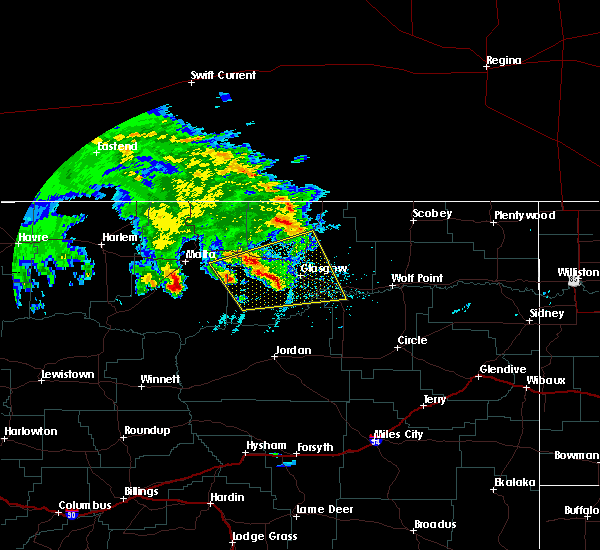 At 1112 pm mdt, a severe thunderstorm was located 11 miles south of tampico, or 12 miles west of glasgow, moving northeast at 30 mph (radar indicated). Hazards include 60 mph wind gusts and quarter size hail. Hail damage to vehicles is expected. expect wind damage to roofs, siding, and trees. locations impacted include, glasgow, nashua, fort peck, st. Marie, fort peck marina, tampico, duck creek rec area, hinsdale, park grove, baylor, whatley, vandalia and the bentonite plant. At 1112 pm mdt, a severe thunderstorm was located 11 miles south of tampico, or 12 miles west of glasgow, moving northeast at 30 mph (radar indicated). Hazards include 60 mph wind gusts and quarter size hail. Hail damage to vehicles is expected. expect wind damage to roofs, siding, and trees. locations impacted include, glasgow, nashua, fort peck, st. Marie, fort peck marina, tampico, duck creek rec area, hinsdale, park grove, baylor, whatley, vandalia and the bentonite plant.
|
| 8/9/2016 10:46 PM MDT |
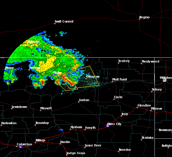 At 1045 pm mdt, a severe thunderstorm was located 24 miles southwest of tampico, or 27 miles west of glasgow, moving northeast at 40 mph (radar indicated). Hazards include 60 mph wind gusts and quarter size hail. Hail damage to vehicles is expected. Expect wind damage to roofs, siding, and trees. At 1045 pm mdt, a severe thunderstorm was located 24 miles southwest of tampico, or 27 miles west of glasgow, moving northeast at 40 mph (radar indicated). Hazards include 60 mph wind gusts and quarter size hail. Hail damage to vehicles is expected. Expect wind damage to roofs, siding, and trees.
|
| 7/30/2016 10:05 PM MDT | Quarter sized hail reported 12.5 miles NNW of Glasgow, MT, most of the hail is nickel sized... some is quarter sized. |
| 7/30/2016 9:10 PM MDT | Golf Ball sized hail reported 25.5 miles N of Glasgow, MT |
| 7/30/2016 8:01 PM MDT |
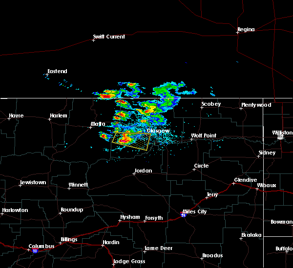 At 800 pm mdt, a severe thunderstorm was located 16 miles southwest of tampico, or 16 miles southwest of glasgow, moving east at 25 mph (radar indicated). Hazards include 60 mph wind gusts and half dollar size hail. Hail damage to vehicles is expected. expect wind damage to roofs, siding, and trees. Locations impacted include, glasgow and the bentonite plant. At 800 pm mdt, a severe thunderstorm was located 16 miles southwest of tampico, or 16 miles southwest of glasgow, moving east at 25 mph (radar indicated). Hazards include 60 mph wind gusts and half dollar size hail. Hail damage to vehicles is expected. expect wind damage to roofs, siding, and trees. Locations impacted include, glasgow and the bentonite plant.
|
| 7/30/2016 7:41 PM MDT |
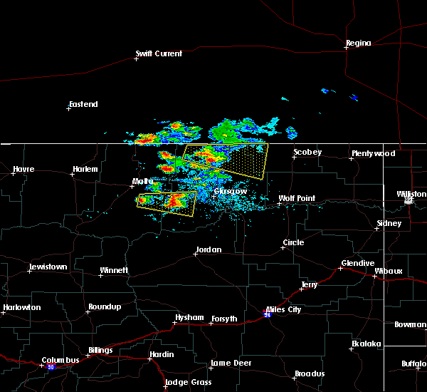 At 741 pm mdt, a severe thunderstorm was located 20 miles southwest of tampico, or 24 miles west of glasgow, moving east at 25 mph (radar indicated). Hazards include 60 mph wind gusts and quarter size hail. Hail damage to vehicles is expected. Expect wind damage to roofs, siding, and trees. At 741 pm mdt, a severe thunderstorm was located 20 miles southwest of tampico, or 24 miles west of glasgow, moving east at 25 mph (radar indicated). Hazards include 60 mph wind gusts and quarter size hail. Hail damage to vehicles is expected. Expect wind damage to roofs, siding, and trees.
|
| 7/19/2016 6:58 PM MDT |
 At 657 pm mdt, severe thunderstorms were located along a line extending from 22 miles southwest of hinsdale to 11 miles west of fort peck marina to rock creek rec area, moving northeast at 60 mph (radar indicated). Hazards include 60 mph wind gusts. Expect damage to roofs. siding. And trees. At 657 pm mdt, severe thunderstorms were located along a line extending from 22 miles southwest of hinsdale to 11 miles west of fort peck marina to rock creek rec area, moving northeast at 60 mph (radar indicated). Hazards include 60 mph wind gusts. Expect damage to roofs. siding. And trees.
|
| 7/19/2016 6:44 PM MDT | Mesonet station king coulee /kigm8 in valley county MT, 32.9 miles NNE of Glasgow, MT |
| 7/19/2016 12:32 AM MDT |
 At 1230 am mdt, a severe thunderstorm was located 12 miles west of the pines rec area, or 29 miles southwest of glasgow, moving northeast at 30 mph (radar indicated). Hazards include quarter size hail. Damage to vehicles is expected. locations impacted include, glasgow, nashua, fort peck, st. Marie, fort peck marina, duck creek rec area, tampico, the pines rec area, oswego, vandalia, haxby and the bentonite plant. At 1230 am mdt, a severe thunderstorm was located 12 miles west of the pines rec area, or 29 miles southwest of glasgow, moving northeast at 30 mph (radar indicated). Hazards include quarter size hail. Damage to vehicles is expected. locations impacted include, glasgow, nashua, fort peck, st. Marie, fort peck marina, duck creek rec area, tampico, the pines rec area, oswego, vandalia, haxby and the bentonite plant.
|
| 7/18/2016 11:54 PM MDT |
 At 1153 pm mdt, severe thunderstorms were located along a line extending from 13 miles north of st. marie to 10 miles west of rock creek rec area, moving east at 40 mph (radar indicated). Hazards include 70 mph wind gusts and quarter size hail. Hail damage to vehicles is expected. expect considerable tree damage. Wind damage is also likely to mobile homes, roofs, and outbuildings. At 1153 pm mdt, severe thunderstorms were located along a line extending from 13 miles north of st. marie to 10 miles west of rock creek rec area, moving east at 40 mph (radar indicated). Hazards include 70 mph wind gusts and quarter size hail. Hail damage to vehicles is expected. expect considerable tree damage. Wind damage is also likely to mobile homes, roofs, and outbuildings.
|
| 7/18/2016 11:51 PM MDT | Asos station glasgow airport (asos) /ggw in valley county MT, 1 miles SW of Glasgow, MT |
| 7/18/2016 11:44 PM MDT | Mesonet station king coulee /kigm8 in valley county MT, 32.9 miles NNE of Glasgow, MT |
| 7/18/2016 11:28 PM MDT |
 At 1127 pm mdt, a severe thunderstorm was located 11 miles south of tampico, or 12 miles west of glasgow, moving east at 50 mph (radar indicated). Hazards include 60 mph wind gusts and quarter size hail. Hail damage to vehicles is expected. expect wind damage to roofs, siding, and trees. locations impacted include, glasgow, nashua, fort peck, st. Marie, fort peck marina, duck creek rec area, tampico, hinsdale, the pines rec area, rock creek rec area, park grove, whatley, vandalia, haxby, the bentonite plant and content. At 1127 pm mdt, a severe thunderstorm was located 11 miles south of tampico, or 12 miles west of glasgow, moving east at 50 mph (radar indicated). Hazards include 60 mph wind gusts and quarter size hail. Hail damage to vehicles is expected. expect wind damage to roofs, siding, and trees. locations impacted include, glasgow, nashua, fort peck, st. Marie, fort peck marina, duck creek rec area, tampico, hinsdale, the pines rec area, rock creek rec area, park grove, whatley, vandalia, haxby, the bentonite plant and content.
|
| 7/18/2016 10:56 PM MDT |
 At 1055 pm mdt, a severe thunderstorm was located 24 miles north of devils creek rec area, or 34 miles southeast of malta, moving east at 55 mph (radar indicated). Hazards include 60 mph wind gusts and quarter size hail. Hail damage to vehicles is expected. Expect wind damage to roofs, siding, and trees. At 1055 pm mdt, a severe thunderstorm was located 24 miles north of devils creek rec area, or 34 miles southeast of malta, moving east at 55 mph (radar indicated). Hazards include 60 mph wind gusts and quarter size hail. Hail damage to vehicles is expected. Expect wind damage to roofs, siding, and trees.
|
| 7/9/2016 7:51 PM MDT |
 At 751 pm mdt, severe thunderstorms were located along a line extending from 25 miles northeast of saco to near the pines rec area, moving east at 45 mph (radar indicated). Hazards include 70 mph wind gusts. Expect considerable tree damage. Damage is likely to mobile homes, roofs, and outbuildings. At 751 pm mdt, severe thunderstorms were located along a line extending from 25 miles northeast of saco to near the pines rec area, moving east at 45 mph (radar indicated). Hazards include 70 mph wind gusts. Expect considerable tree damage. Damage is likely to mobile homes, roofs, and outbuildings.
|
| 7/9/2016 7:31 PM MDT |
 At 730 pm mdt, severe thunderstorms were located along a line extending from 6 miles north of saco to 13 miles northwest of the pines rec area, moving northeast at 60 mph (radar indicated). Hazards include 70 mph wind gusts. Expect considerable tree damage. damage is likely to mobile homes, roofs, and outbuildings. Locations impacted include, glasgow, malta, saco, tampico, hinsdale, frenchman reservoir, whatley, vandalia, sleeping buffalo, bowdoin, and the bentonite plant. At 730 pm mdt, severe thunderstorms were located along a line extending from 6 miles north of saco to 13 miles northwest of the pines rec area, moving northeast at 60 mph (radar indicated). Hazards include 70 mph wind gusts. Expect considerable tree damage. damage is likely to mobile homes, roofs, and outbuildings. Locations impacted include, glasgow, malta, saco, tampico, hinsdale, frenchman reservoir, whatley, vandalia, sleeping buffalo, bowdoin, and the bentonite plant.
|
| 7/9/2016 7:04 PM MDT |
 At 702 pm mdt, severe thunderstorms were located along a line extending from 6 miles northwest of malta to 21 miles northeast of devils creek rec area, moving northeast at 50 mph (radar indicated). Hazards include 60 mph wind gusts. Expect damage to roofs. siding. And trees. At 702 pm mdt, severe thunderstorms were located along a line extending from 6 miles northwest of malta to 21 miles northeast of devils creek rec area, moving northeast at 50 mph (radar indicated). Hazards include 60 mph wind gusts. Expect damage to roofs. siding. And trees.
|
| 7/3/2016 3:10 AM MDT |
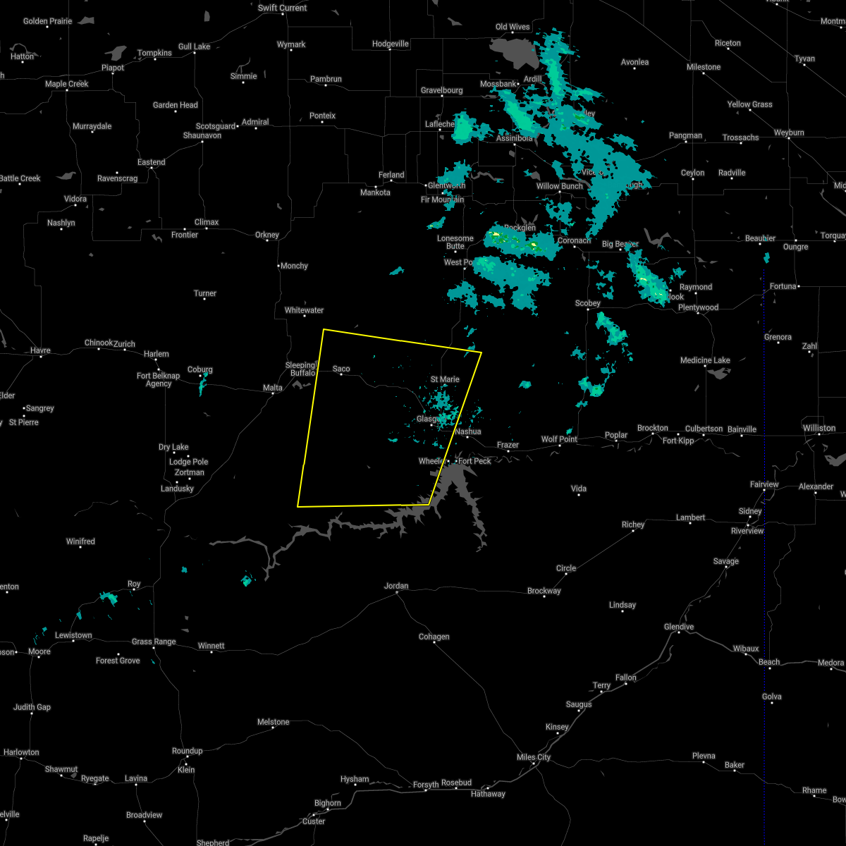 The severe thunderstorm warning for western valley and eastern phillips counties will expire at 315 am mdt, the storm which prompted the warning has weakened below severe limits, and no longer pose an immediate threat to life or property. therefore, the warning will be allowed to expire. however gusty winds are still possible with this thunderstorm. The severe thunderstorm warning for western valley and eastern phillips counties will expire at 315 am mdt, the storm which prompted the warning has weakened below severe limits, and no longer pose an immediate threat to life or property. therefore, the warning will be allowed to expire. however gusty winds are still possible with this thunderstorm.
|
| 7/3/2016 2:56 AM MDT |
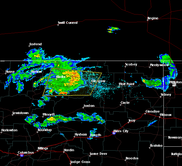 At 255 am mdt, a severe thunderstorm was located near tampico, or 8 miles west of glasgow, moving east at 45 mph (radar indicated). Hazards include 60 mph wind gusts. Expect damage to roofs. siding. and trees. locations impacted include, glasgow, saco, st. Marie, hinsdale, tampico, the pines rec area, whatley, the bentonite plant, vandalia and content. At 255 am mdt, a severe thunderstorm was located near tampico, or 8 miles west of glasgow, moving east at 45 mph (radar indicated). Hazards include 60 mph wind gusts. Expect damage to roofs. siding. and trees. locations impacted include, glasgow, saco, st. Marie, hinsdale, tampico, the pines rec area, whatley, the bentonite plant, vandalia and content.
|
| 7/3/2016 2:17 AM MDT |
 At 216 am mdt, a severe thunderstorm was located 13 miles southwest of saco, or 17 miles east of malta, moving east at 45 mph (radar indicated). Hazards include 60 mph wind gusts. Expect damage to roofs. siding. And trees. At 216 am mdt, a severe thunderstorm was located 13 miles southwest of saco, or 17 miles east of malta, moving east at 45 mph (radar indicated). Hazards include 60 mph wind gusts. Expect damage to roofs. siding. And trees.
|
| 7/2/2016 9:38 PM MDT | Glasgow airport asos measured 58 mph wind gusts from 938 to 945 pm local time along with heavy rain and pea sized hai in valley county MT, 1 miles SE of Glasgow, MT |
| 6/24/2016 6:07 PM MDT | King coulee raws in valley county MT, 32.9 miles NNE of Glasgow, MT |
| 6/21/2016 5:20 PM MDT | King coulee raws site / kigm8 in valley county MT, 34.6 miles NNE of Glasgow, MT |
| 6/18/2016 8:50 PM MDT |
 At 849 pm mdt, severe thunderstorms were located along a line extending from 10 miles northeast of richland to 6 miles southwest of peerless to near frazer, moving east at 60 mph (trained weather spotters). Hazards include two inch hail and 70 mph wind gusts. People and animals outdoors will be injured. expect hail damage to roofs, siding, windows, and vehicles. expect considerable tree damage. wind damage is also likely to mobile homes, roofs, and outbuildings. locations impacted include, glasgow, wolf point, scobey, opheim, richland, nashua, st. Marie, frazer, peerless, port of whitetail, madoc, tampico, lustre, hinsdale, baylor, whatley, glentana, thoeny, larslan and oswego. At 849 pm mdt, severe thunderstorms were located along a line extending from 10 miles northeast of richland to 6 miles southwest of peerless to near frazer, moving east at 60 mph (trained weather spotters). Hazards include two inch hail and 70 mph wind gusts. People and animals outdoors will be injured. expect hail damage to roofs, siding, windows, and vehicles. expect considerable tree damage. wind damage is also likely to mobile homes, roofs, and outbuildings. locations impacted include, glasgow, wolf point, scobey, opheim, richland, nashua, st. Marie, frazer, peerless, port of whitetail, madoc, tampico, lustre, hinsdale, baylor, whatley, glentana, thoeny, larslan and oswego.
|
| 6/18/2016 8:27 PM MDT |
 At 826 pm mdt, severe thunderstorms were located along a line extending from 14 miles north of richland to 7 miles south of opheim to 6 miles southeast of glasgow, moving east at 50 mph (trained weather spotters). Hazards include golf ball size hail and 70 mph wind gusts. People and animals outdoors will be injured. expect hail damage to roofs, siding, windows, and vehicles. expect considerable tree damage. wind damage is also likely to mobile homes, roofs, and outbuildings. locations impacted include, glasgow, wolf point, scobey, opheim, richland, nashua, st. Marie, frazer, peerless, port of whitetail, madoc, tampico, lustre, hinsdale, baylor, whatley, glentana, thoeny, larslan and oswego. At 826 pm mdt, severe thunderstorms were located along a line extending from 14 miles north of richland to 7 miles south of opheim to 6 miles southeast of glasgow, moving east at 50 mph (trained weather spotters). Hazards include golf ball size hail and 70 mph wind gusts. People and animals outdoors will be injured. expect hail damage to roofs, siding, windows, and vehicles. expect considerable tree damage. wind damage is also likely to mobile homes, roofs, and outbuildings. locations impacted include, glasgow, wolf point, scobey, opheim, richland, nashua, st. Marie, frazer, peerless, port of whitetail, madoc, tampico, lustre, hinsdale, baylor, whatley, glentana, thoeny, larslan and oswego.
|
| 6/18/2016 8:25 PM MDT | Half Dollar sized hail reported 0.3 miles ESE of Glasgow, MT |
| 6/18/2016 8:25 PM MDT | Golf Ball sized hail reported 0.3 miles ESE of Glasgow, MT, golf ball sized hail fell at the glasgow weather office for up to 5 minutes. |
| 6/18/2016 8:25 PM MDT | Hen Egg sized hail reported 2.2 miles SE of Glasgow, MT |
| 6/18/2016 8:22 PM MDT | Storm damage reported in valley county MT, 0.3 miles ESE of Glasgow, MT |
| 6/18/2016 8:17 PM MDT | Half Dollar sized hail reported 2.2 miles SE of Glasgow, MT |
| 6/18/2016 8:17 PM MDT | Storm damage reported in valley county MT, 2.2 miles SE of Glasgow, MT |
| 6/18/2016 8:15 PM MDT | Hen Egg sized hail reported 14.1 miles SE of Glasgow, MT, 2 inch hail reported |
| 6/18/2016 8:11 PM MDT |
 At 810 pm mdt, severe thunderstorms were located along a line extending from 7 miles east of port of opheim to 11 miles southwest of opheim to 6 miles southwest of glasgow, moving east at 70 mph. these are very dangerous storms (trained weather spotters). Hazards include 80 mph wind gusts and ping pong ball size hail. Flying debris will be dangerous to those caught without shelter. mobile homes will be heavily damaged. expect considerable damage to roofs, windows, and vehicles. Extensive tree damage and power outages are likely. At 810 pm mdt, severe thunderstorms were located along a line extending from 7 miles east of port of opheim to 11 miles southwest of opheim to 6 miles southwest of glasgow, moving east at 70 mph. these are very dangerous storms (trained weather spotters). Hazards include 80 mph wind gusts and ping pong ball size hail. Flying debris will be dangerous to those caught without shelter. mobile homes will be heavily damaged. expect considerable damage to roofs, windows, and vehicles. Extensive tree damage and power outages are likely.
|
| 6/18/2016 7:44 PM MDT |
 At 744 pm mdt, severe thunderstorms were located along a line extending from 11 miles northwest of opheim to 15 miles northeast of hinsdale to 25 miles south of saco, moving east at 85 mph (trained weather spotters). Hazards include 70 mph wind gusts and ping pong ball size hail. People and animals outdoors will be injured. expect hail damage to roofs, siding, windows, and vehicles. expect considerable tree damage. wind damage is also likely to mobile homes, roofs, and outbuildings. locations impacted include, glasgow, opheim, whitewater, saco, st. Marie, port of opheim, tampico, hinsdale, frenchman reservoir, baylor, vandalia, glentana, sleeping buffalo, bowdoin, thoeny and the bentonite plant. At 744 pm mdt, severe thunderstorms were located along a line extending from 11 miles northwest of opheim to 15 miles northeast of hinsdale to 25 miles south of saco, moving east at 85 mph (trained weather spotters). Hazards include 70 mph wind gusts and ping pong ball size hail. People and animals outdoors will be injured. expect hail damage to roofs, siding, windows, and vehicles. expect considerable tree damage. wind damage is also likely to mobile homes, roofs, and outbuildings. locations impacted include, glasgow, opheim, whitewater, saco, st. Marie, port of opheim, tampico, hinsdale, frenchman reservoir, baylor, vandalia, glentana, sleeping buffalo, bowdoin, thoeny and the bentonite plant.
|
| 6/18/2016 7:22 PM MDT |
 At 721 pm mdt, severe thunderstorms were located along a line extending from 17 miles east of whitewater to 7 miles west of saco to 18 miles south of malta, moving east at 75 mph (trained weather spotters). Hazards include 70 mph wind gusts and quarter size hail. Hail damage to vehicles is expected. expect considerable tree damage. Wind damage is also likely to mobile homes, roofs, and outbuildings. At 721 pm mdt, severe thunderstorms were located along a line extending from 17 miles east of whitewater to 7 miles west of saco to 18 miles south of malta, moving east at 75 mph (trained weather spotters). Hazards include 70 mph wind gusts and quarter size hail. Hail damage to vehicles is expected. expect considerable tree damage. Wind damage is also likely to mobile homes, roofs, and outbuildings.
|
| 6/16/2016 12:09 AM MDT |
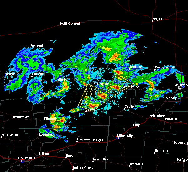 At 1208 am mdt, a severe thunderstorm was located 7 miles southwest of the pines rec area, or 30 miles north of jordan, moving northeast at 65 mph (radar indicated). Hazards include ping pong ball size hail and 60 mph wind gusts. People and animals outdoors will be injured. expect hail damage to roofs, siding, windows, and vehicles. expect wind damage to roofs, siding, and trees. Locations impacted include, glasgow, fort peck, fort peck marina, the pines rec area, duck creek rec area, hell creek rec area, rock creek rec area, park grove, whatley and haxby. At 1208 am mdt, a severe thunderstorm was located 7 miles southwest of the pines rec area, or 30 miles north of jordan, moving northeast at 65 mph (radar indicated). Hazards include ping pong ball size hail and 60 mph wind gusts. People and animals outdoors will be injured. expect hail damage to roofs, siding, windows, and vehicles. expect wind damage to roofs, siding, and trees. Locations impacted include, glasgow, fort peck, fort peck marina, the pines rec area, duck creek rec area, hell creek rec area, rock creek rec area, park grove, whatley and haxby.
|
| 6/15/2016 11:44 PM MDT |
 At 1144 pm mdt, a severe thunderstorm was located near jordan, moving northeast at 65 mph (radar indicated). Hazards include 60 mph wind gusts and quarter size hail. Hail damage to vehicles is expected. Expect wind damage to roofs, siding, and trees. At 1144 pm mdt, a severe thunderstorm was located near jordan, moving northeast at 65 mph (radar indicated). Hazards include 60 mph wind gusts and quarter size hail. Hail damage to vehicles is expected. Expect wind damage to roofs, siding, and trees.
|
| 6/14/2016 6:55 PM MDT |
 At 653 pm mdt, severe thunderstorms were located along a line extending from 15 miles northwest of st. marie to 7 miles south of glasgow to 11 miles east of jordan, moving northeast at 40 mph (radar indicated). Hazards include 60 mph wind gusts and quarter size hail. Hail damage to vehicles is expected. Expect wind damage to roofs, siding, and trees. At 653 pm mdt, severe thunderstorms were located along a line extending from 15 miles northwest of st. marie to 7 miles south of glasgow to 11 miles east of jordan, moving northeast at 40 mph (radar indicated). Hazards include 60 mph wind gusts and quarter size hail. Hail damage to vehicles is expected. Expect wind damage to roofs, siding, and trees.
|
| 6/14/2016 6:28 PM MDT |
 At 627 pm mdt, severe thunderstorms were located along a line extending from 34 miles north of port of morgan to 18 miles east of whitewater to 13 miles south of hinsdale, moving northeast at 35 mph (radar indicated). Hazards include 70 mph wind gusts and quarter size hail. Hail damage to vehicles is expected. expect considerable tree damage. wind damage is also likely to mobile homes, roofs, and outbuildings. locations impacted include, glasgow, opheim, whitewater, nashua, fort peck, saco, st. Marie, fort peck marina, duck creek rec area, tampico, port of morgan, hinsdale, the pines rec area, frenchman reservoir, park grove, whatley, baylor, vandalia, glentana and sleeping buffalo. At 627 pm mdt, severe thunderstorms were located along a line extending from 34 miles north of port of morgan to 18 miles east of whitewater to 13 miles south of hinsdale, moving northeast at 35 mph (radar indicated). Hazards include 70 mph wind gusts and quarter size hail. Hail damage to vehicles is expected. expect considerable tree damage. wind damage is also likely to mobile homes, roofs, and outbuildings. locations impacted include, glasgow, opheim, whitewater, nashua, fort peck, saco, st. Marie, fort peck marina, duck creek rec area, tampico, port of morgan, hinsdale, the pines rec area, frenchman reservoir, park grove, whatley, baylor, vandalia, glentana and sleeping buffalo.
|
| 6/14/2016 5:56 PM MDT |
 At 555 pm mdt, severe thunderstorms were located along a line extending from 25 miles northwest of port of morgan to 12 miles northwest of saco to 28 miles northeast of devils creek rec area, moving northeast at 35 mph (radar indicated). Hazards include 70 mph wind gusts and quarter size hail. Hail damage to vehicles is expected. expect considerable tree damage. Wind damage is also likely to mobile homes, roofs, and outbuildings. At 555 pm mdt, severe thunderstorms were located along a line extending from 25 miles northwest of port of morgan to 12 miles northwest of saco to 28 miles northeast of devils creek rec area, moving northeast at 35 mph (radar indicated). Hazards include 70 mph wind gusts and quarter size hail. Hail damage to vehicles is expected. expect considerable tree damage. Wind damage is also likely to mobile homes, roofs, and outbuildings.
|
| 6/11/2016 1:35 AM MDT | Quarter sized hail reported 0.3 miles ESE of Glasgow, MT |
| 6/11/2016 1:33 AM MDT | Quarter sized hail reported 2.1 miles E of Glasgow, MT |
| 5/21/2016 6:38 PM MDT | Glasgow asos reports 58 mph wind gus in valley county MT, 0.3 miles ESE of Glasgow, MT |
| 5/21/2016 6:30 PM MDT | Cedar swing set picked up and tipped ove in valley county MT, 5.6 miles S of Glasgow, MT |
| 7/5/2015 1:43 AM MDT | The severe thunderstorm warning for southeastern valley, northwestern mccone and north central garfield counties will expire at 145 am mdt, the storm which prompted the warning has weakened below severe limits, and no longer poses an immediate threat to life or property. however, small hail and gusty winds are still possible with this thunderstorm. in addition, strong thunderstorms may redevelop, and a severe thunderstorm watch remains in effect until 5 am. |
| 7/5/2015 1:13 AM MDT |
 At 110 am mdt, a severe thunderstorm was located 5 miles southeast of the pines rec area, and moving east at 45 mph (radar indicated). Hazards include 60 mph wind gusts and quarter size hail. Hail damage to crops and plants is expected. some damage to vehicles is possible. expect wind damage to roofs, siding and trees. The severe thunderstorm will be near, rock creek rec area around 125 am mdt. At 110 am mdt, a severe thunderstorm was located 5 miles southeast of the pines rec area, and moving east at 45 mph (radar indicated). Hazards include 60 mph wind gusts and quarter size hail. Hail damage to crops and plants is expected. some damage to vehicles is possible. expect wind damage to roofs, siding and trees. The severe thunderstorm will be near, rock creek rec area around 125 am mdt.
|
| 7/5/2015 12:51 AM MDT |
 At 1246 am mdt, a severe thunderstorm was located 12 miles west of the pines recreation area, and moving east at 45 mph (radar indicated). Hazards include 70 mph wind gusts and quarter size hail. Hail damage to crops and plants is expected. some damage to vehicles is possible. expect considerable tree damage. wind damage is also likely to mobile homes, roofs and outbuildings. the severe thunderstorm will be near, the pines recreation area and the pines rec area around 105 am mdt. rock creek rec area around 125 am mdt. Other locations in the warning include haxby. At 1246 am mdt, a severe thunderstorm was located 12 miles west of the pines recreation area, and moving east at 45 mph (radar indicated). Hazards include 70 mph wind gusts and quarter size hail. Hail damage to crops and plants is expected. some damage to vehicles is possible. expect considerable tree damage. wind damage is also likely to mobile homes, roofs and outbuildings. the severe thunderstorm will be near, the pines recreation area and the pines rec area around 105 am mdt. rock creek rec area around 125 am mdt. Other locations in the warning include haxby.
|
| 7/5/2015 12:24 AM MDT |
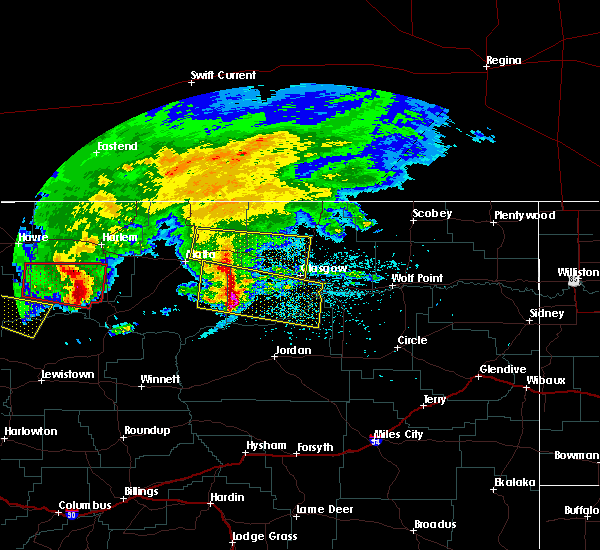 At 1219 am mdt, a severe thunderstorm was located near saco, and moving east at 40 mph (radar indicated). Hazards include 60 mph wind gusts and nickel size hail. Expect damage to roofs. siding and trees. the severe thunderstorm will be near, hinsdale around 1235 am mdt. Other locations in the warning include vandalia. At 1219 am mdt, a severe thunderstorm was located near saco, and moving east at 40 mph (radar indicated). Hazards include 60 mph wind gusts and nickel size hail. Expect damage to roofs. siding and trees. the severe thunderstorm will be near, hinsdale around 1235 am mdt. Other locations in the warning include vandalia.
|
| 7/4/2015 11:57 PM MDT |
 At 1156 pm mdt, a severe thunderstorm was located 12 miles northeast of malta, and moving east at 40 mph (radar indicated). Hazards include 60 mph wind gusts and nickel size hail. Expect damage to roofs. siding and trees. the severe thunderstorm will be near, saco around 1220 am mdt. hinsdale around 1235 am mdt. Other locations in the warning include sleeping buffalo and vandalia. At 1156 pm mdt, a severe thunderstorm was located 12 miles northeast of malta, and moving east at 40 mph (radar indicated). Hazards include 60 mph wind gusts and nickel size hail. Expect damage to roofs. siding and trees. the severe thunderstorm will be near, saco around 1220 am mdt. hinsdale around 1235 am mdt. Other locations in the warning include sleeping buffalo and vandalia.
|
| 6/19/2015 6:17 PM MDT |
 At 609 pm mdt, a severe thunderstorm was located 13 miles northeast of hinsdale, and moving southeast at 50 mph (radar indicated). Hazards include 60 mph wind gusts and half dollar size hail. Hail damage to vehicles is expected. expect wind damage to roofs, siding and trees. The severe thunderstorm will be near, saint marie around 630 pm mdt. At 609 pm mdt, a severe thunderstorm was located 13 miles northeast of hinsdale, and moving southeast at 50 mph (radar indicated). Hazards include 60 mph wind gusts and half dollar size hail. Hail damage to vehicles is expected. expect wind damage to roofs, siding and trees. The severe thunderstorm will be near, saint marie around 630 pm mdt.
|
| 6/19/2015 5:50 PM MDT |
 At 547 pm mdt, a severe thunderstorm was located 18 miles north of saco, and moving southeast at 50 mph (radar indicated). Hazards include 60 mph wind gusts and half dollar size hail. Hail damage to vehicles is expected. expect wind damage to roofs, siding and trees. The severe thunderstorm will be near, saint marie around 630 pm mdt. At 547 pm mdt, a severe thunderstorm was located 18 miles north of saco, and moving southeast at 50 mph (radar indicated). Hazards include 60 mph wind gusts and half dollar size hail. Hail damage to vehicles is expected. expect wind damage to roofs, siding and trees. The severe thunderstorm will be near, saint marie around 630 pm mdt.
|
| 6/17/2015 4:35 PM MDT | Lasted 5 minutes until 440 p in valley county MT, 1.3 miles SW of Glasgow, MT |
| 7/24/2014 5:53 PM MDT | Airport asos measured wind gus in valley county MT, 0.3 miles ESE of Glasgow, MT |
| 7/24/2014 5:53 PM MDT | Storm damage reported in valley county MT, 1 miles SW of Glasgow, MT |
| 7/24/2014 5:10 PM MDT | Power pole bent over with wires on groun in valley county MT, 0.3 miles ESE of Glasgow, MT |
| 4/18/2014 6:55 PM MDT | Public report of 60 mph wind gust in valley county MT, 6.2 miles N of Glasgow, MT |
| 4/18/2014 6:55 PM MDT | Public report of 60 mph wind gust in valley county MT, 6.2 miles N of Glasgow, MT |
| 7/24/2013 5:40 PM MDT | Half Dollar sized hail reported 10 miles E of Glasgow, MT, half dollar sized hail covering ground. hail duration 5 minutes |
| 6/19/2013 11:45 PM MDT | A couple of large trees blown over. large limbs broken off other tree in valley county MT, 0.3 miles ESE of Glasgow, MT |
| 6/19/2013 11:30 PM MDT | Storm damage reported in valley county MT, 1.6 miles SSE of Glasgow, MT |
| 5/26/2013 8:40 PM MDT | Quarter sized hail reported 25.5 miles N of Glasgow, MT, also had wind gusts to 60 mph |
| 5/25/2013 7:00 PM MDT | Quarter sized hail reported 15.8 miles SSW of Glasgow, MT |
| 5/25/2013 5:55 PM MDT | Ping Pong Ball sized hail reported 4.8 miles W of Glasgow, MT |
| 7/23/2012 9:00 PM MDT | Storm damage reported in valley county MT, 8.2 miles N of Glasgow, MT |
| 7/1/2012 11:26 PM MDT | Measured at the glasgow airpor in valley county MT, 0.3 miles ESE of Glasgow, MT |
| 7/1/2012 11:22 PM MDT | Storm damage reported in valley county MT, 0.3 miles ESE of Glasgow, MT |
| 7/1/2012 11:22 PM MDT | Two sections of a wooden fence was blown over by strong thunderstorm wind gust in valley county MT, 0.3 miles ESE of Glasgow, MT |
| 7/1/2012 11:20 PM MDT | Strong wind gusts observed with a line of thunderstorms in valley county MT, 0.3 miles ESE of Glasgow, MT |
| 6/8/2012 10:50 PM MDT | Quarter sized hail reported 11.6 miles WNW of Glasgow, MT, dime to quarter size hail. lasted 7 minutes. |
| 1/1/0001 12:00 AM | Sustained 45 mph with 61 mph gust in valley county MT, 0.3 miles ESE of Glasgow, MT |
| 1/1/0001 12:00 AM | Storm damage reported in valley county MT, 0.3 miles ESE of Glasgow, MT |
| 1/1/0001 12:00 AM | Half Dollar sized hail reported 8.3 miles WNW of Glasgow, MT |
| 1/1/0001 12:00 AM | Quarter sized hail reported 0.3 miles ESE of Glasgow, MT |
| 1/1/0001 12:00 AM | Half Dollar sized hail reported 0.3 miles ESE of Glasgow, MT, mainly dime and quarter size hail with some half dollar size. |
| 1/1/0001 12:00 AM | Trees and powerlines are down near tampico. winds ripped the roof off of a lean-to she in valley county MT, 11.1 miles SE of Glasgow, MT |
| 1/1/0001 12:00 AM | Strong winds tipped over a piece of farm machiner in valley county MT, 4 miles E of Glasgow, MT |
| 1/1/0001 12:00 AM | Golf Ball sized hail reported 0.3 miles ESE of Glasgow, MT, estimated 1 3/4 inch hail and 65 mph wind. |
| 1/1/0001 12:00 AM | Hen Egg sized hail reported 0.3 miles ESE of Glasgow, MT, measured 2 1/4 inch hail at the office. |
| 1/1/0001 12:00 AM | Hen Egg sized hail reported 0.3 miles ESE of Glasgow, MT, measured 2 inch hail. |
| 1/1/0001 12:00 AM | Ping Pong Ball sized hail reported 0.3 miles ESE of Glasgow, MT, estimated 1 1/2 inch hail. |
| 1/1/0001 12:00 AM | Golf Ball sized hail reported 0.3 miles ESE of Glasgow, MT, 1.75 inch hail reported with 65 mph winds. |
| 1/1/0001 12:00 AM | Golf Ball sized hail reported 0.7 miles NNE of Glasgow, MT, golf ball size hail. small tree limbs down est 50-60 mph winds. |
| 1/1/0001 12:00 AM | Hen Egg sized hail reported 0.2 miles WSW of Glasgow, MT, 2 inch hail reported by a trained spotter. |
Hail Maps for Glasgow, MT


Connect with Interactive Hail Maps