

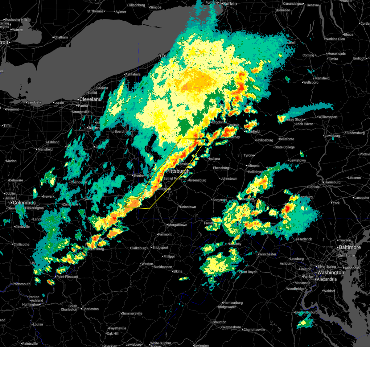
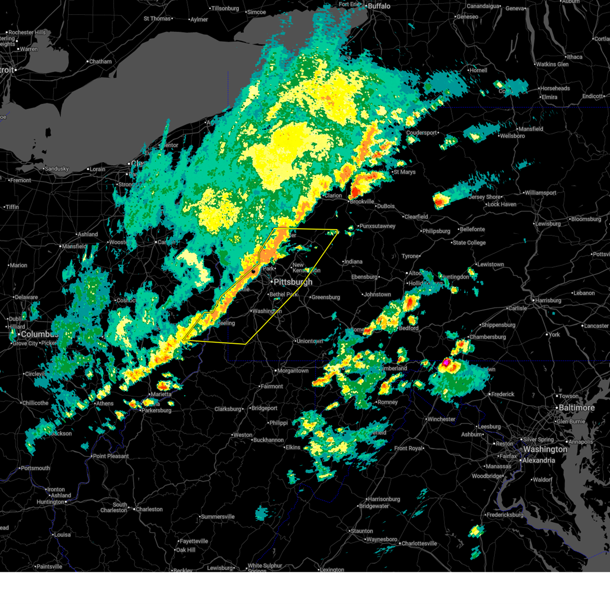
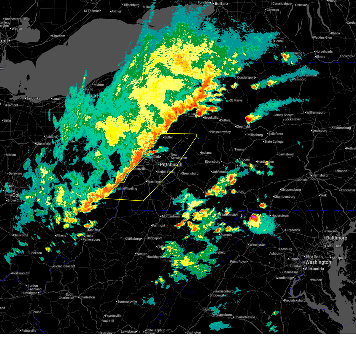
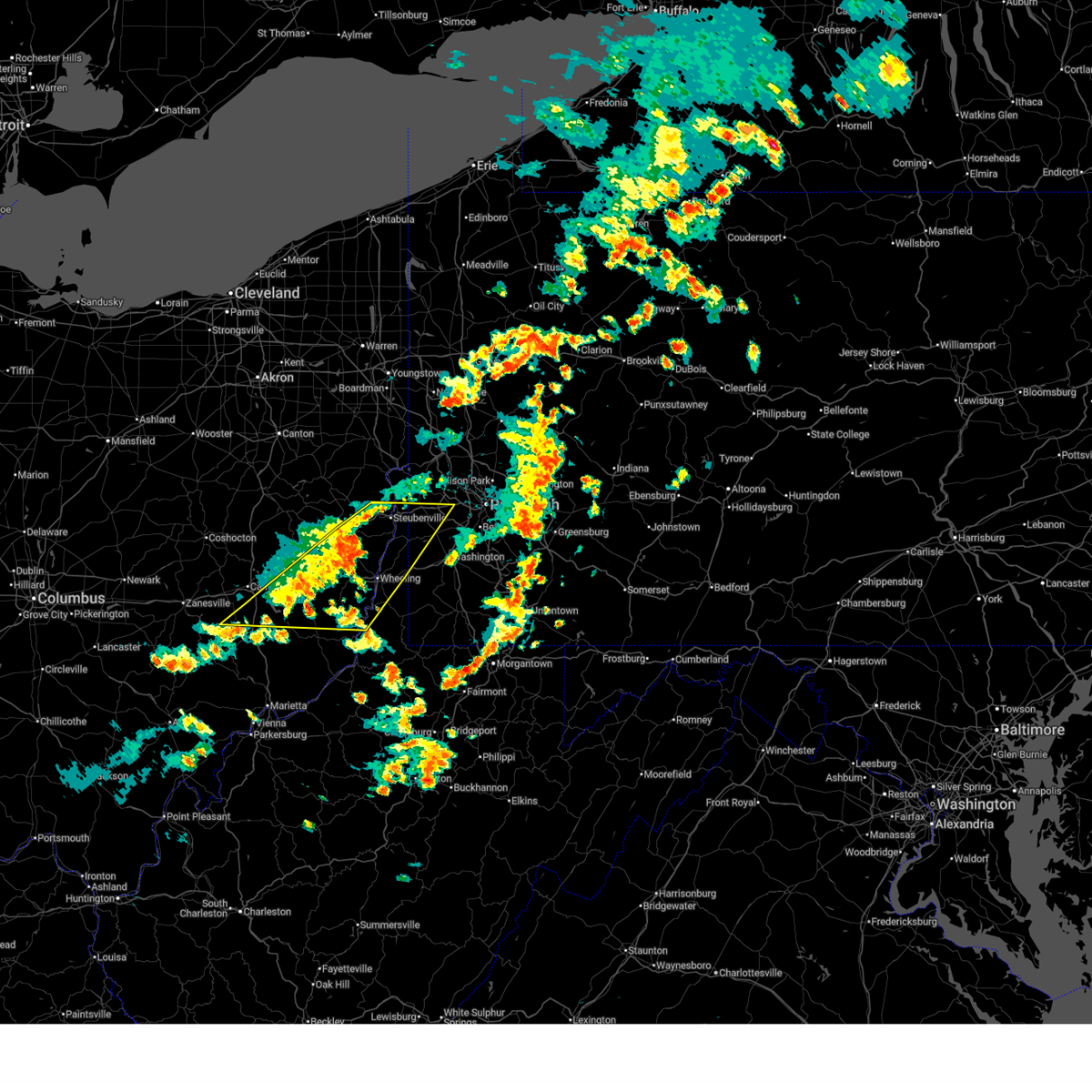
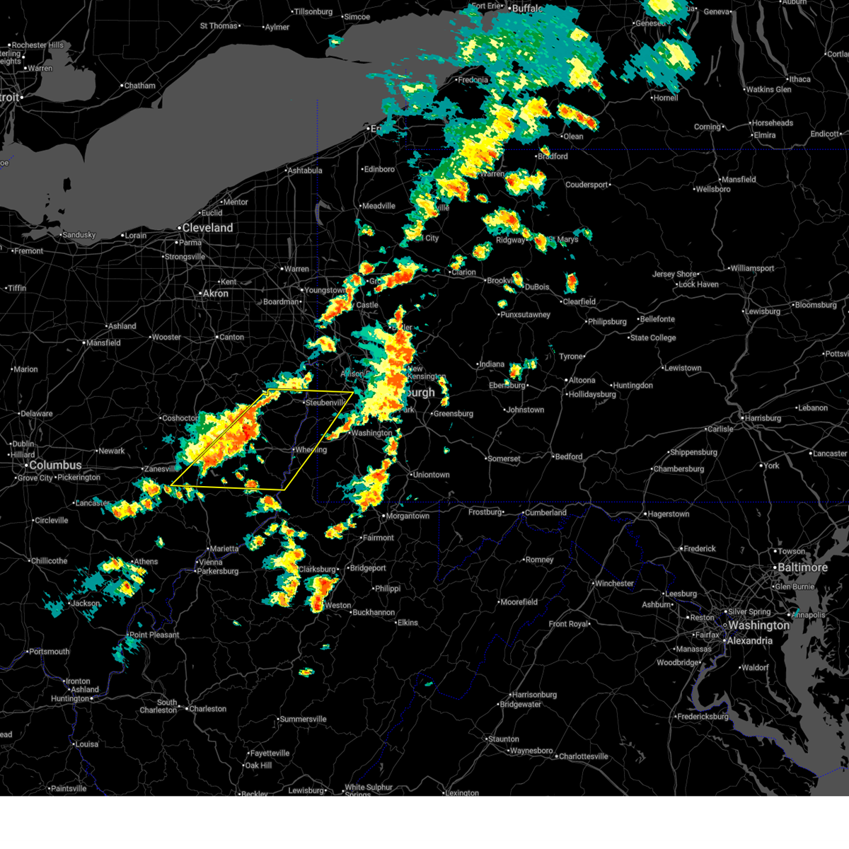
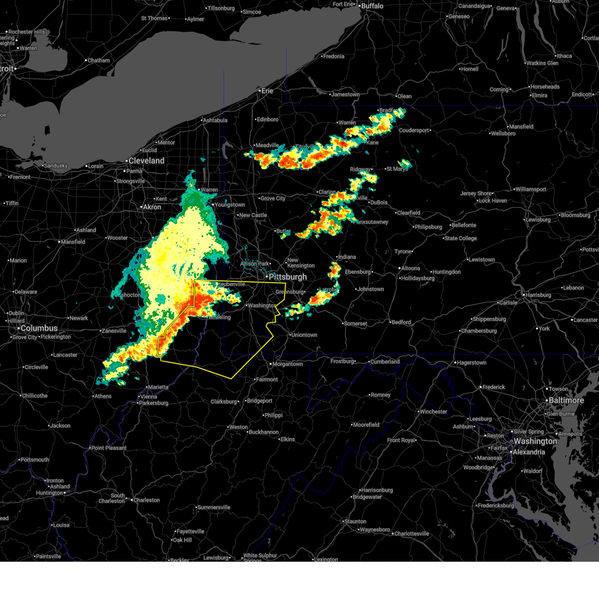
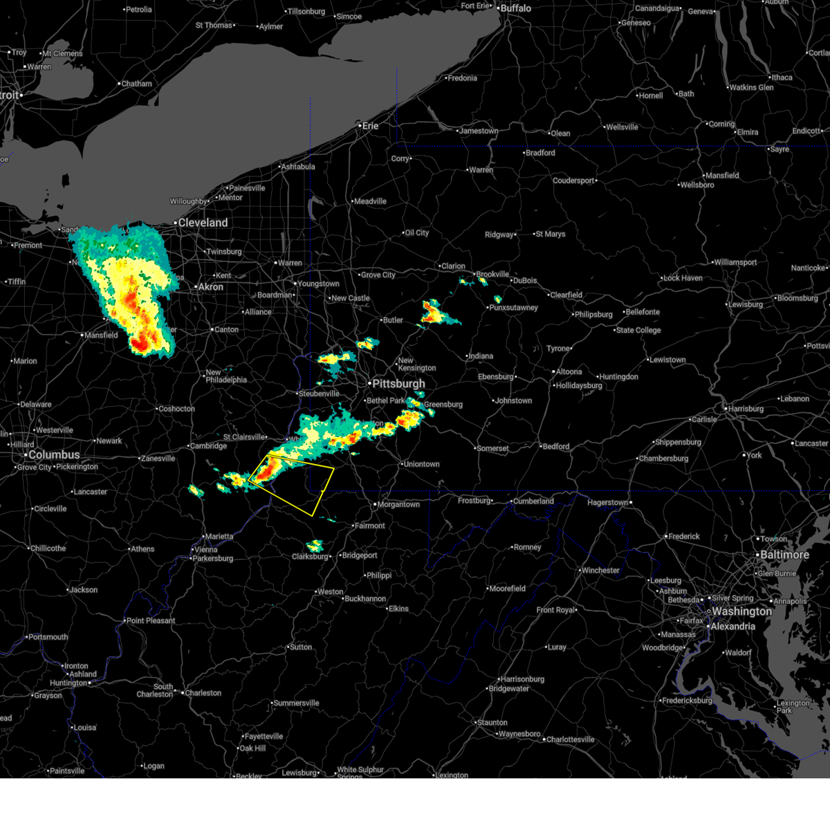
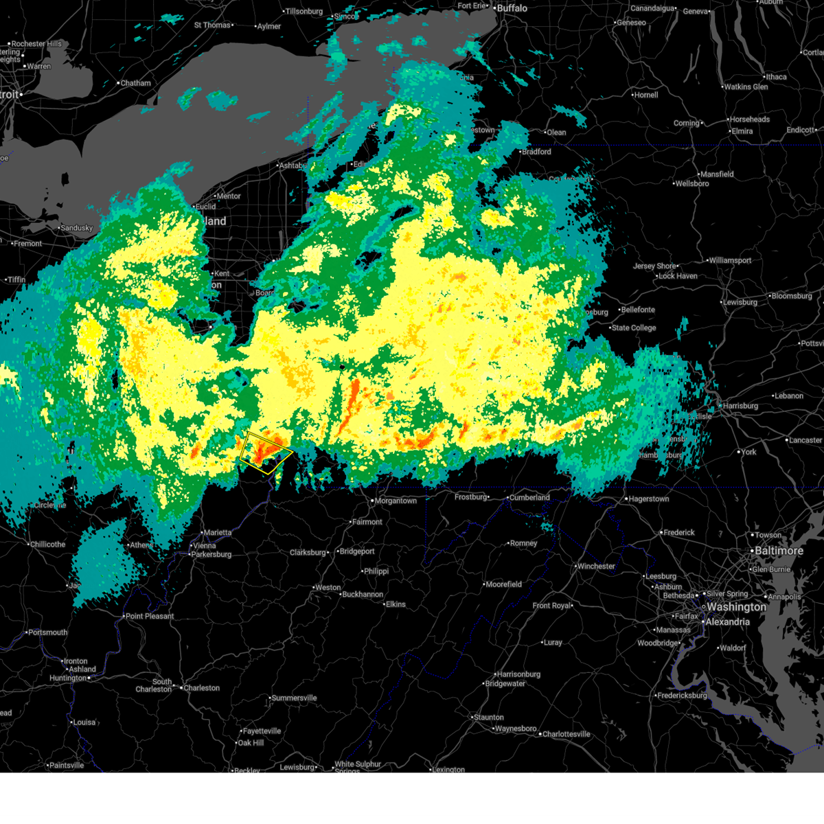
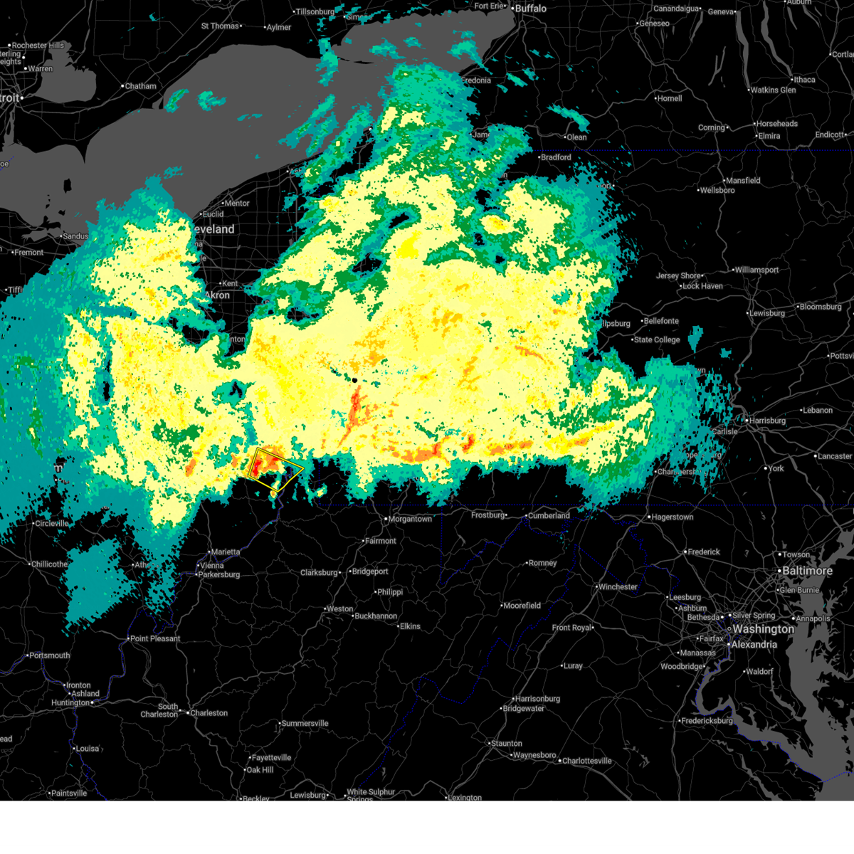
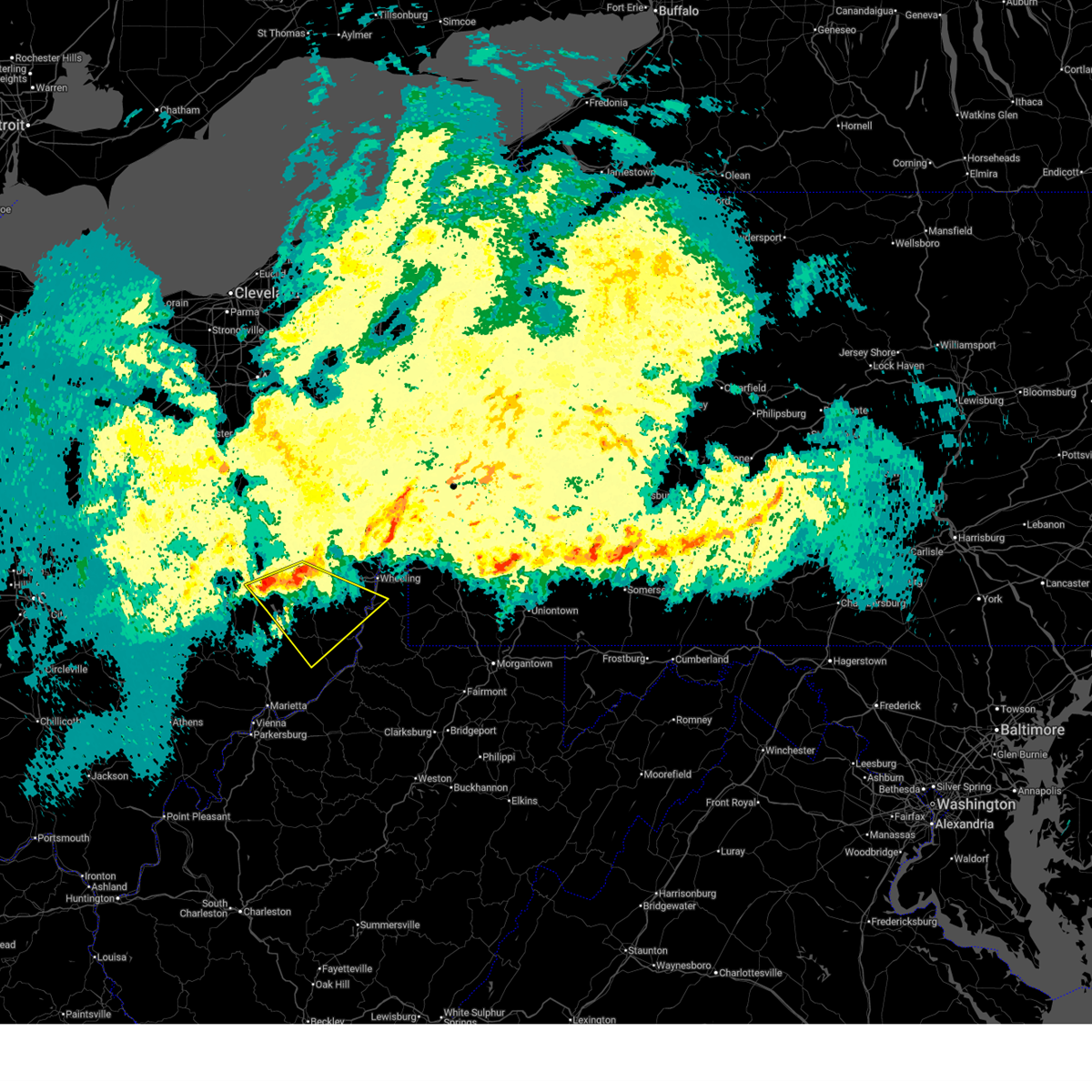
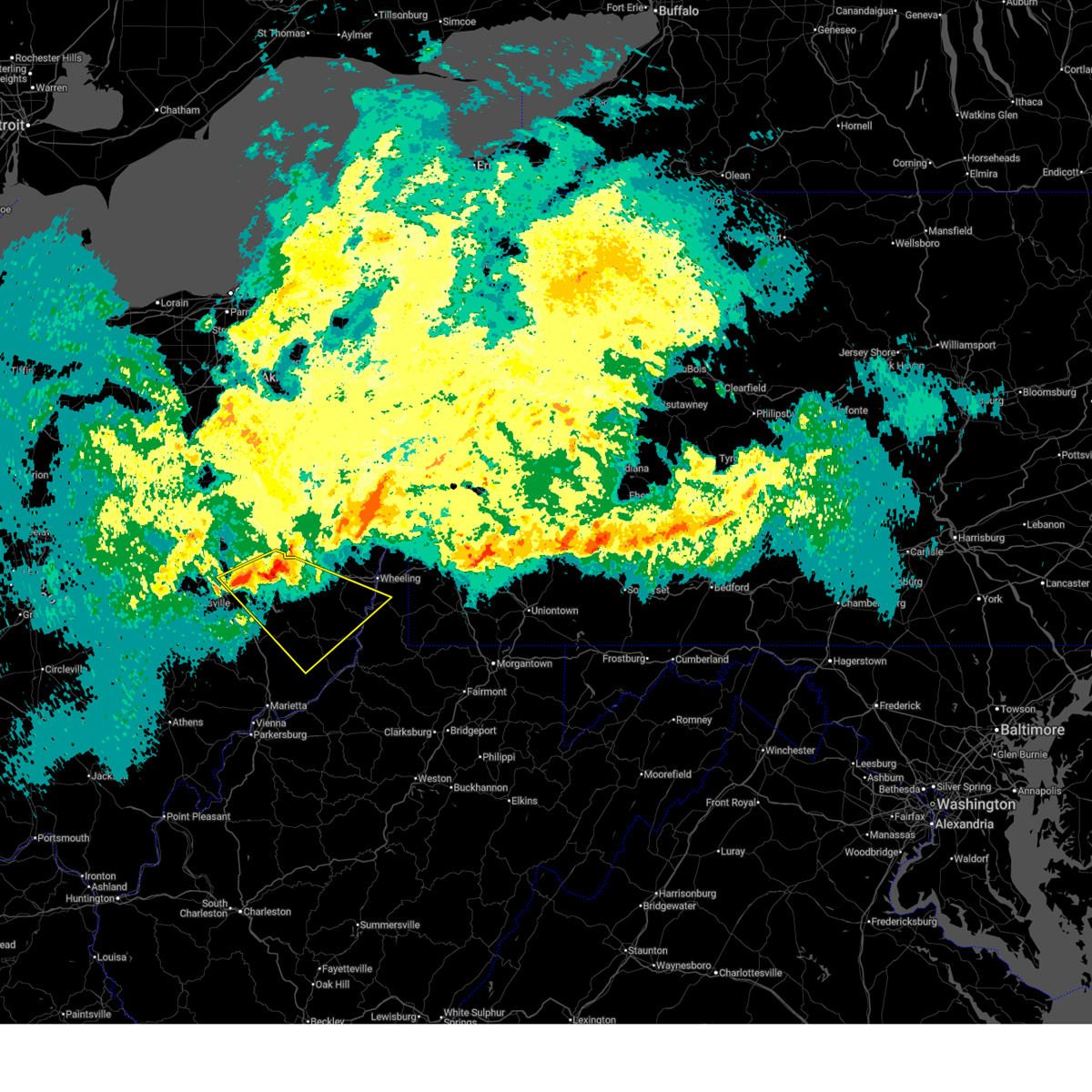
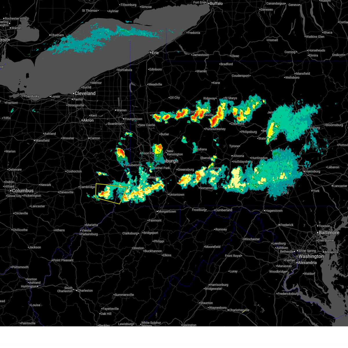
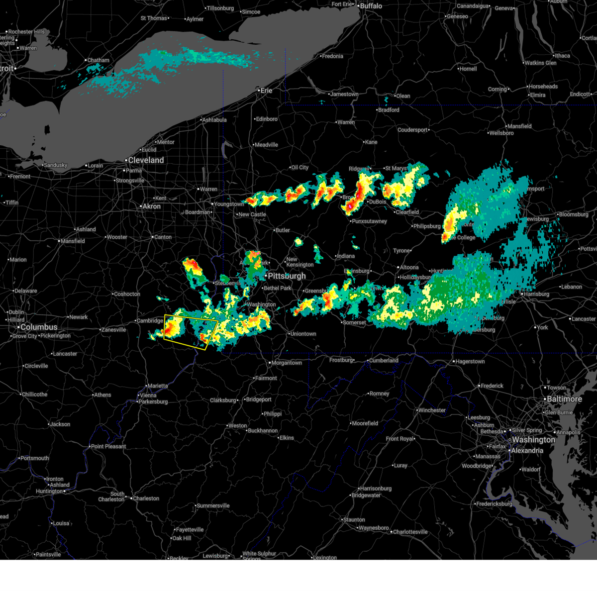
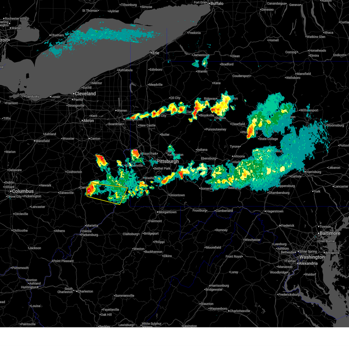
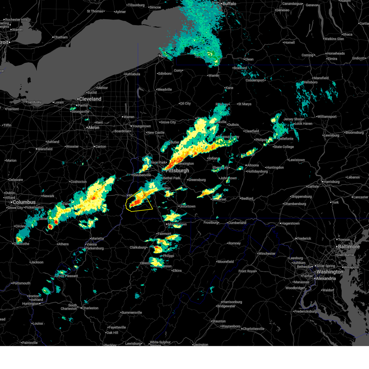
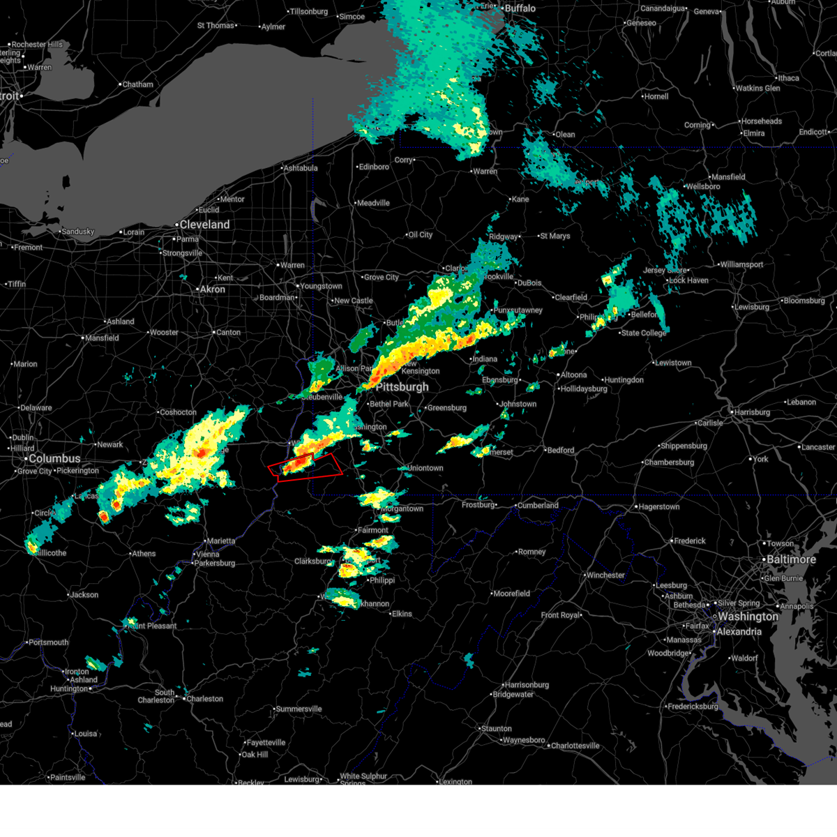
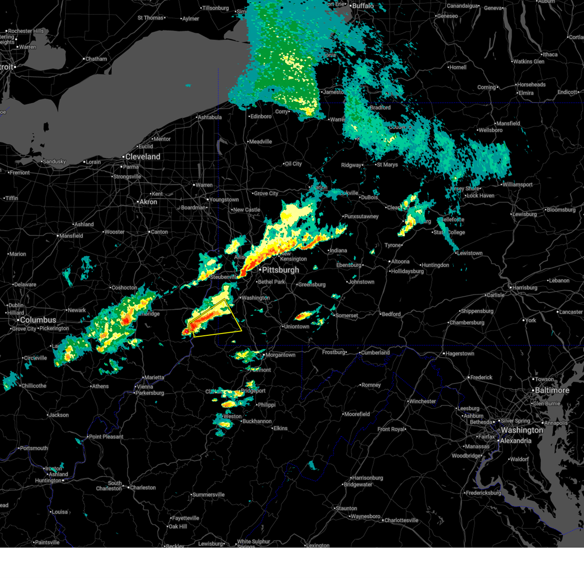
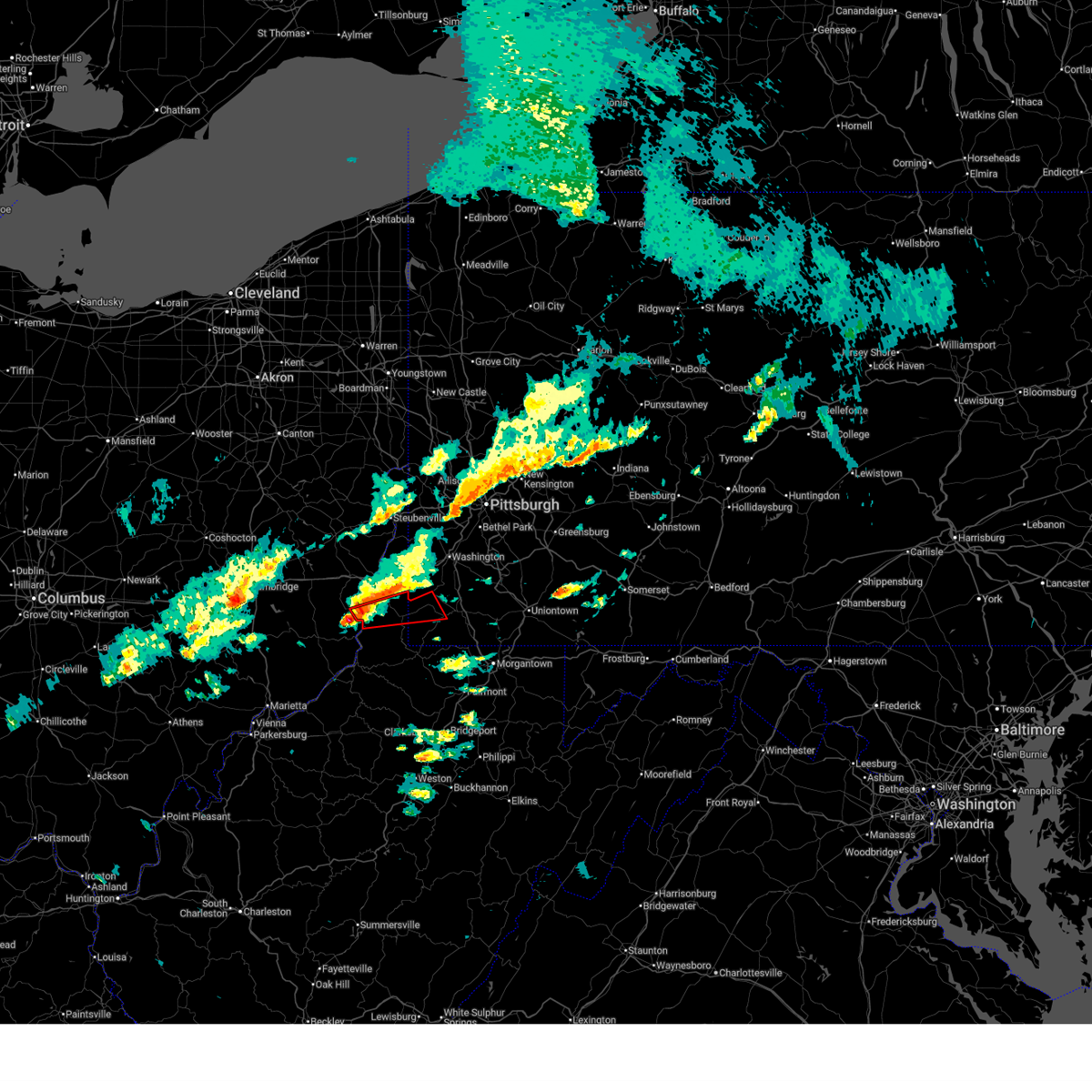
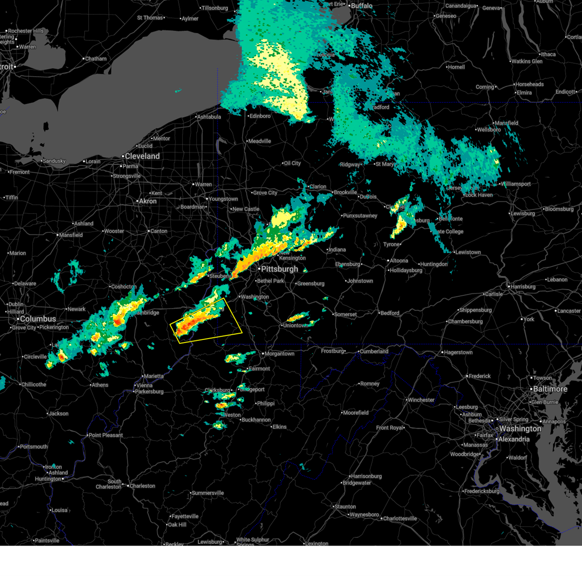
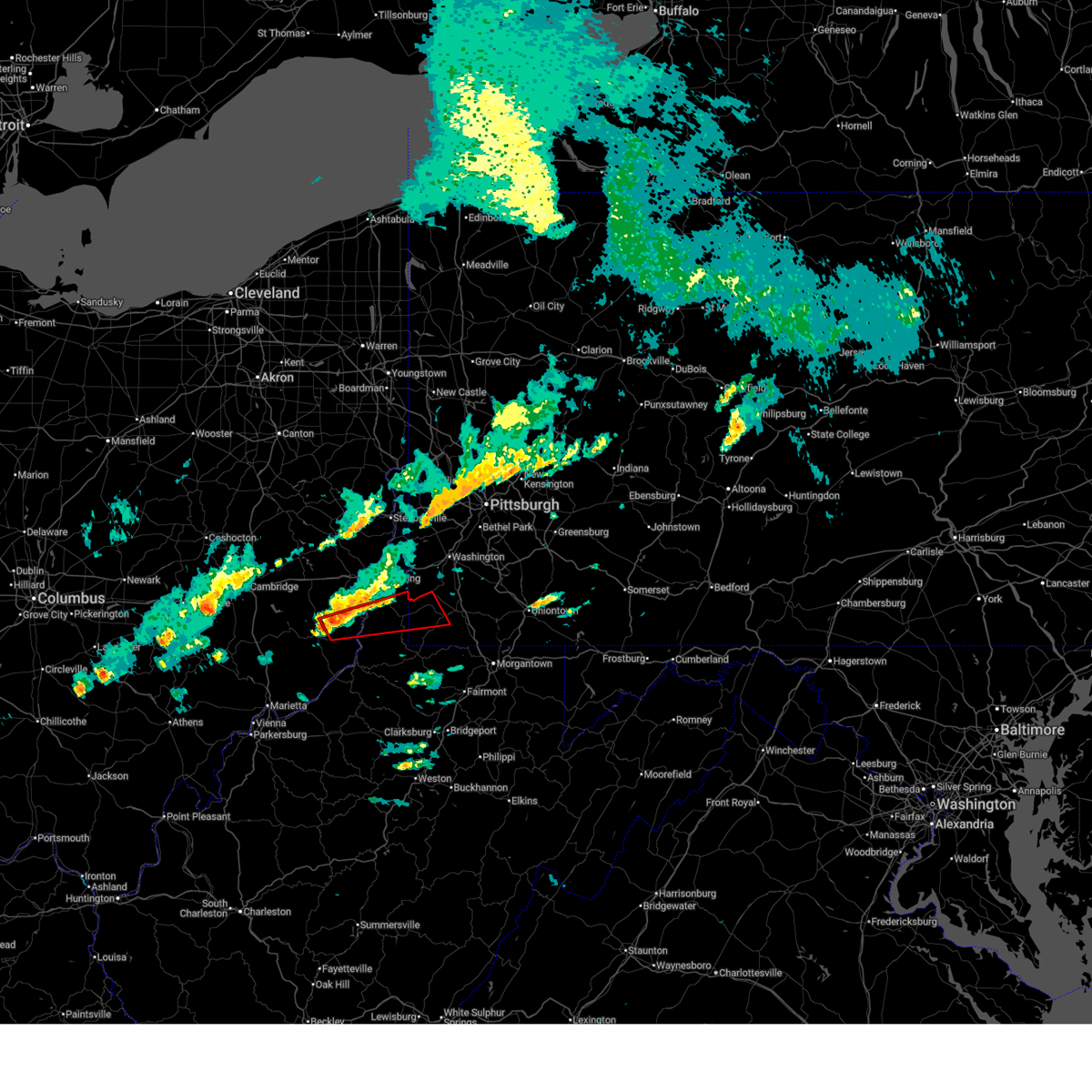
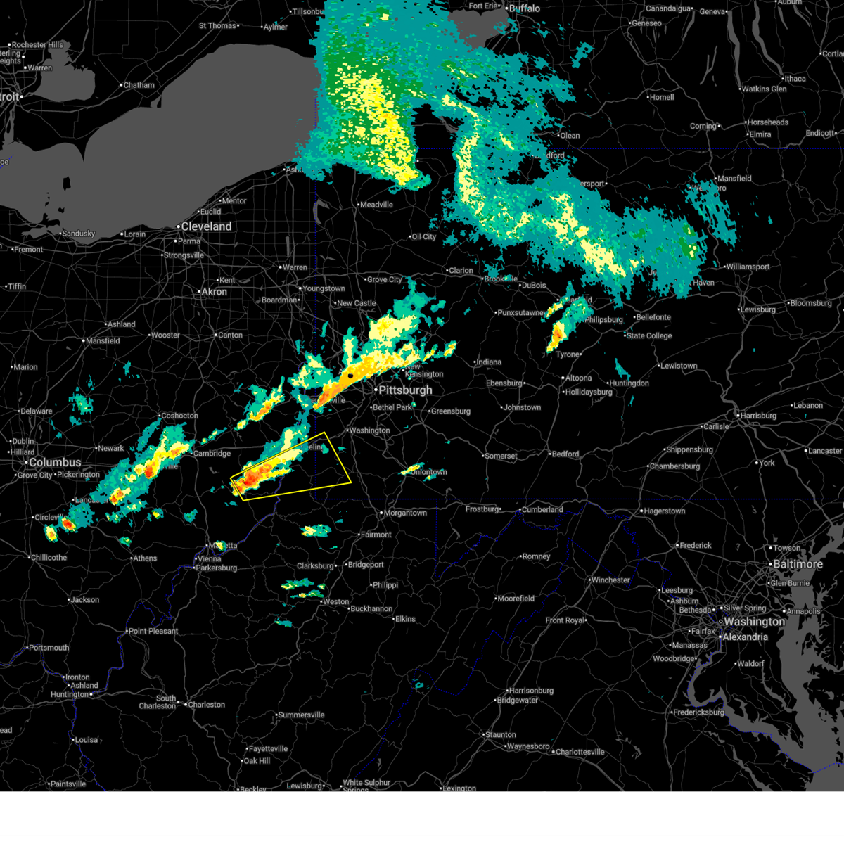
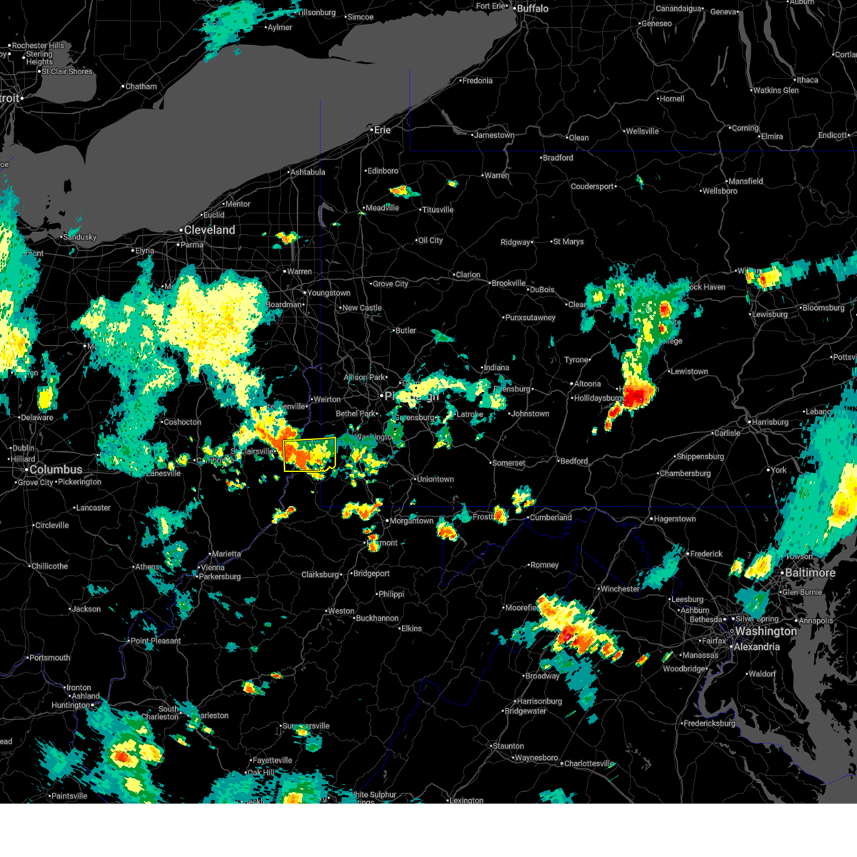
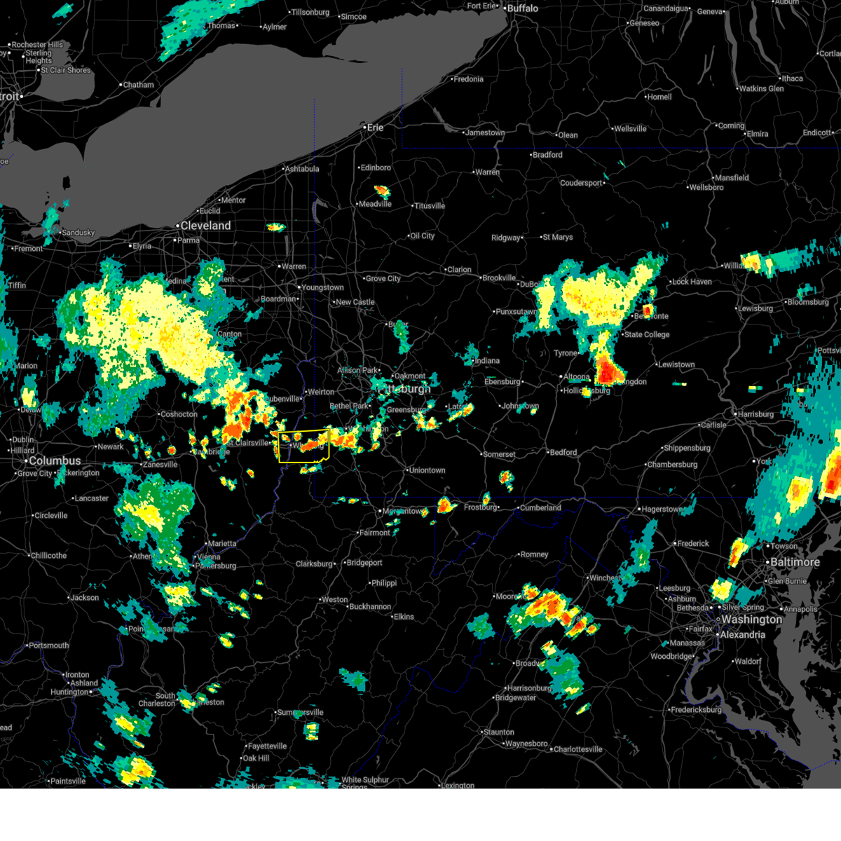
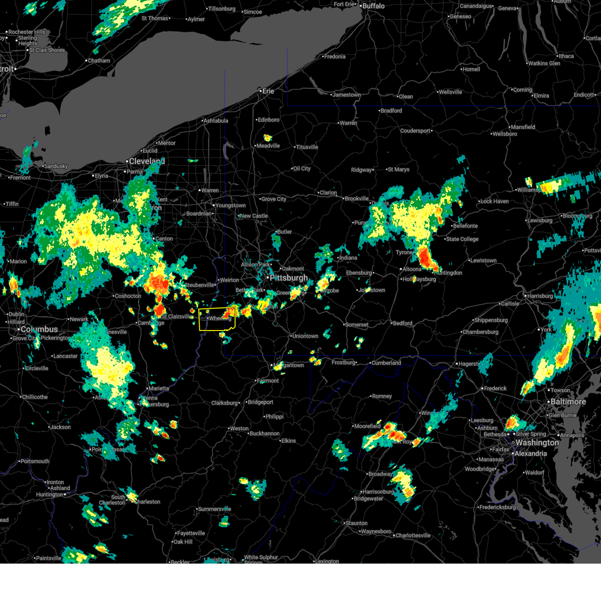
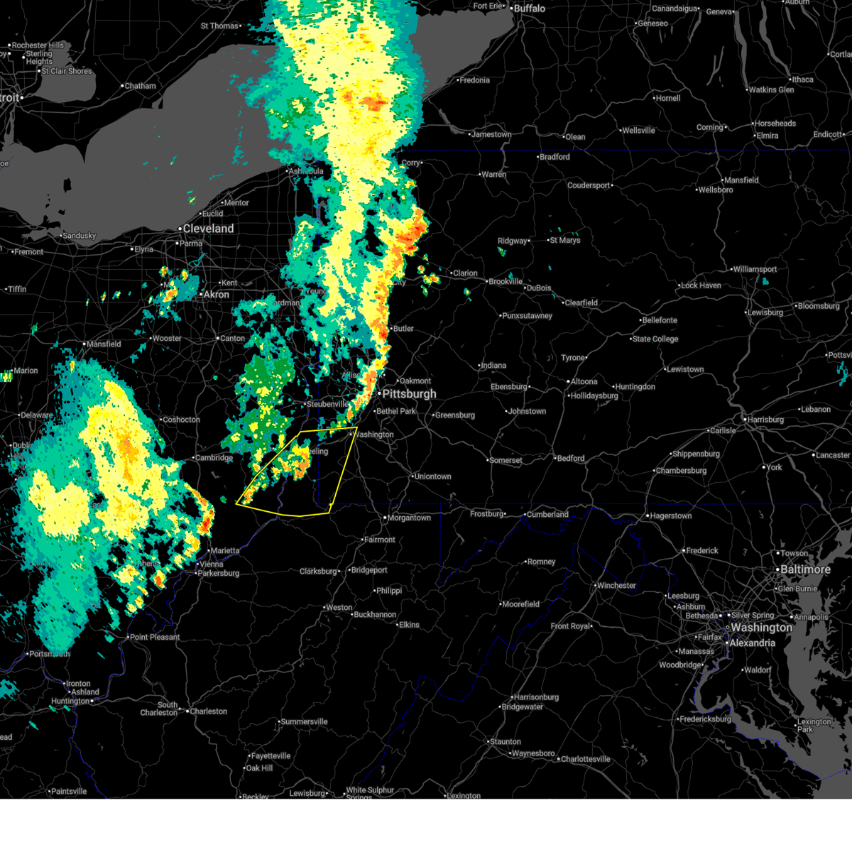
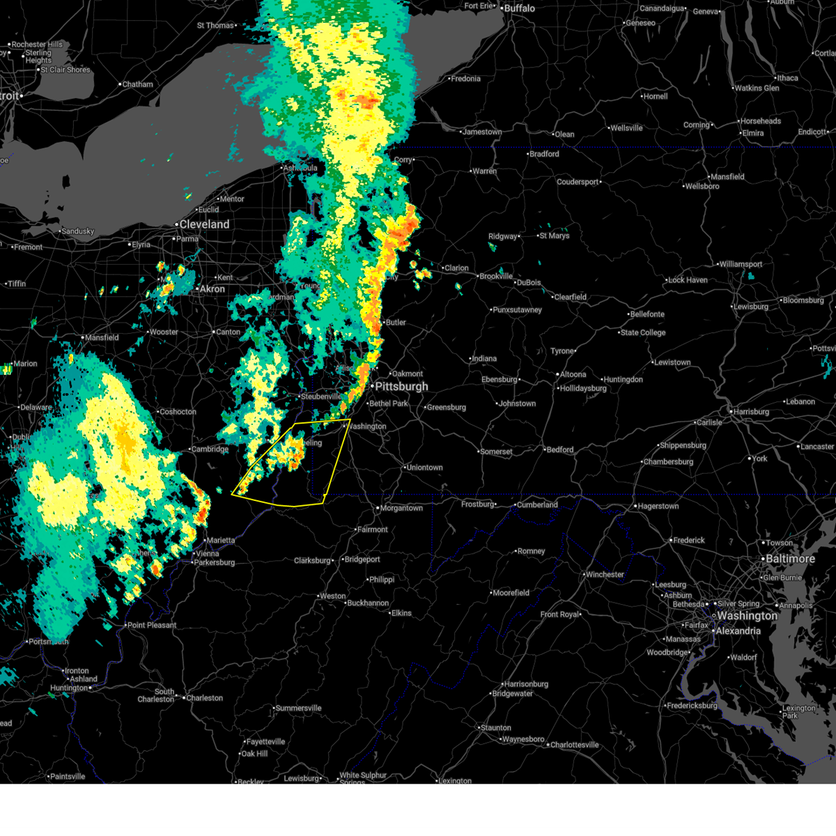
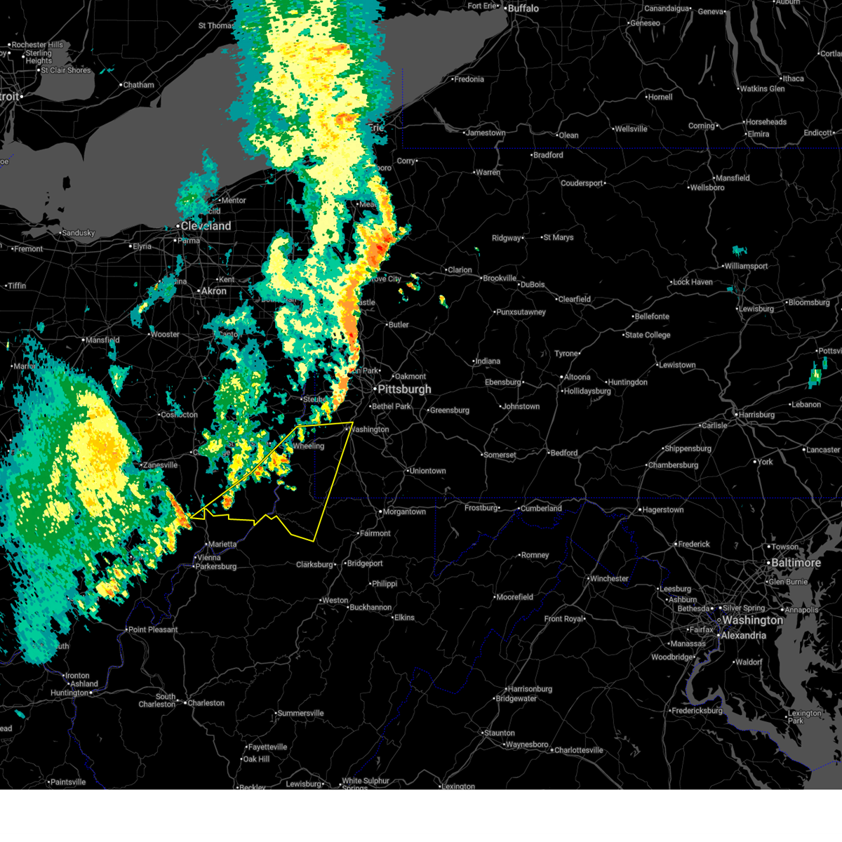
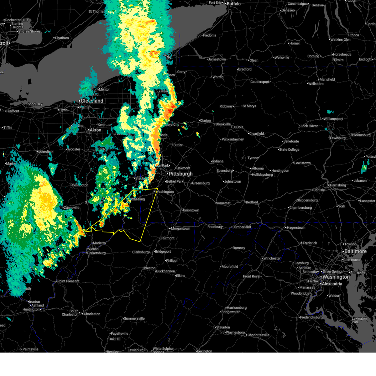
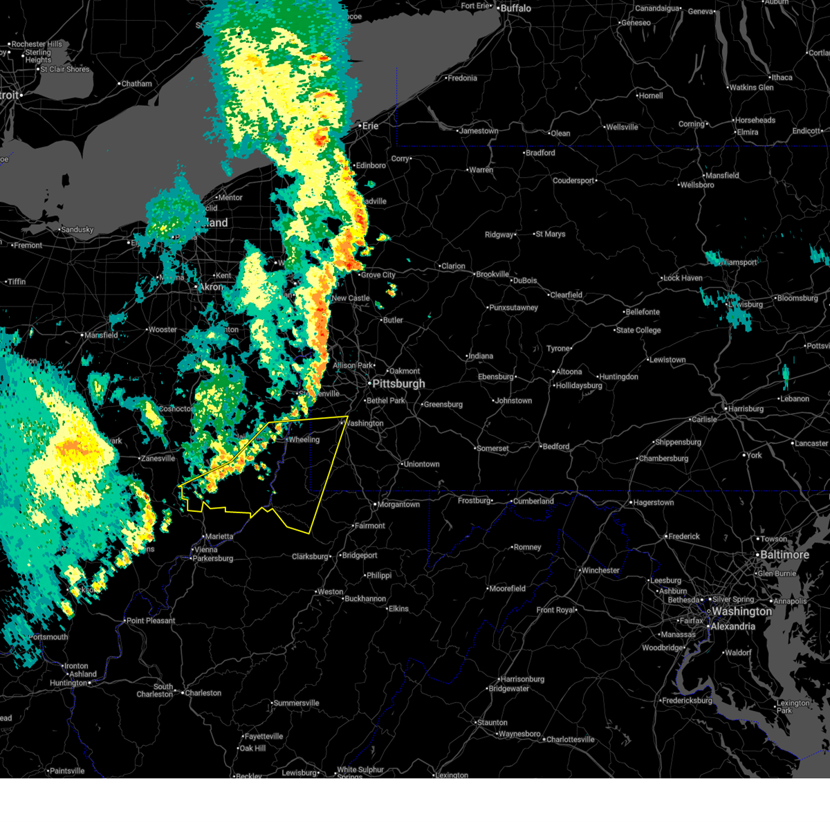
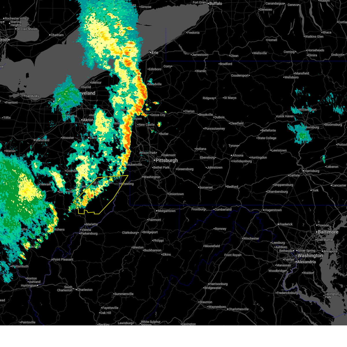
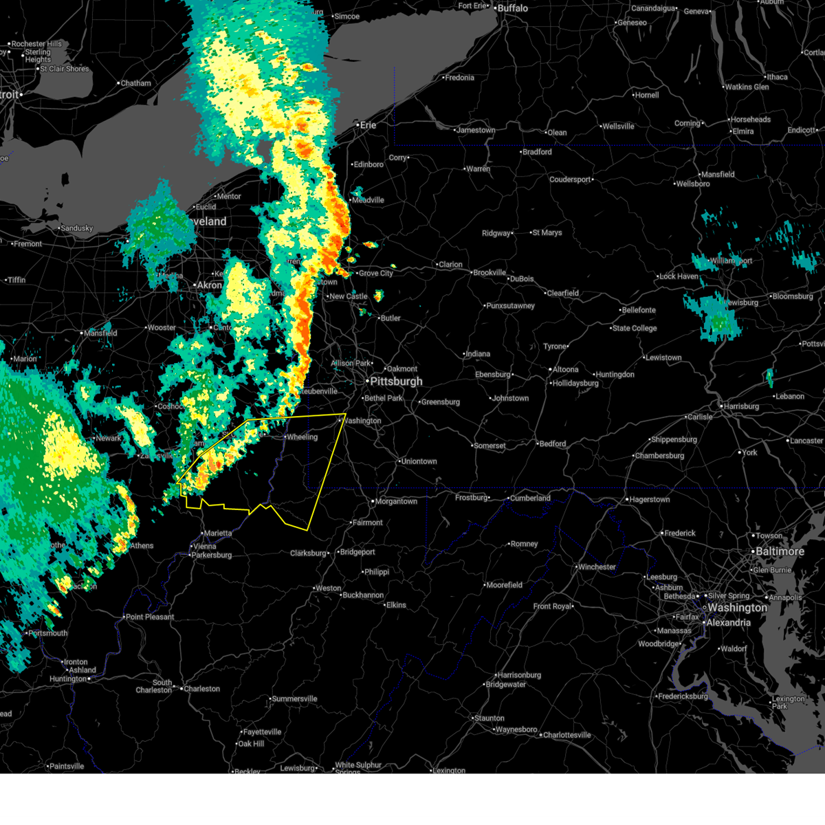
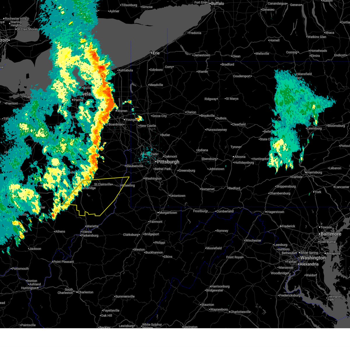
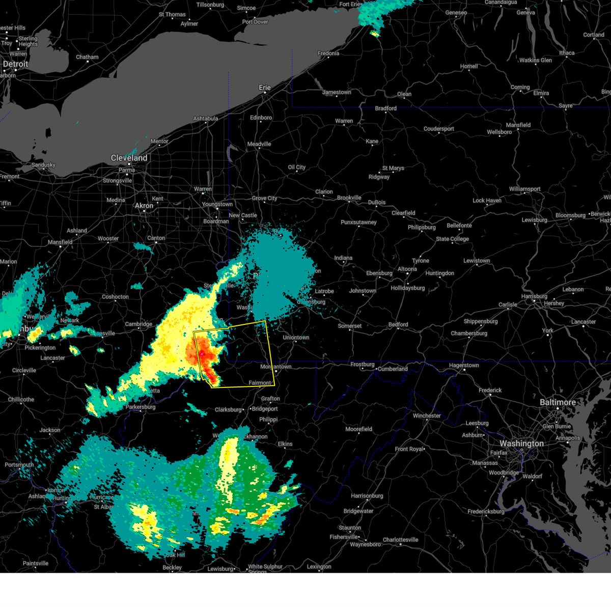
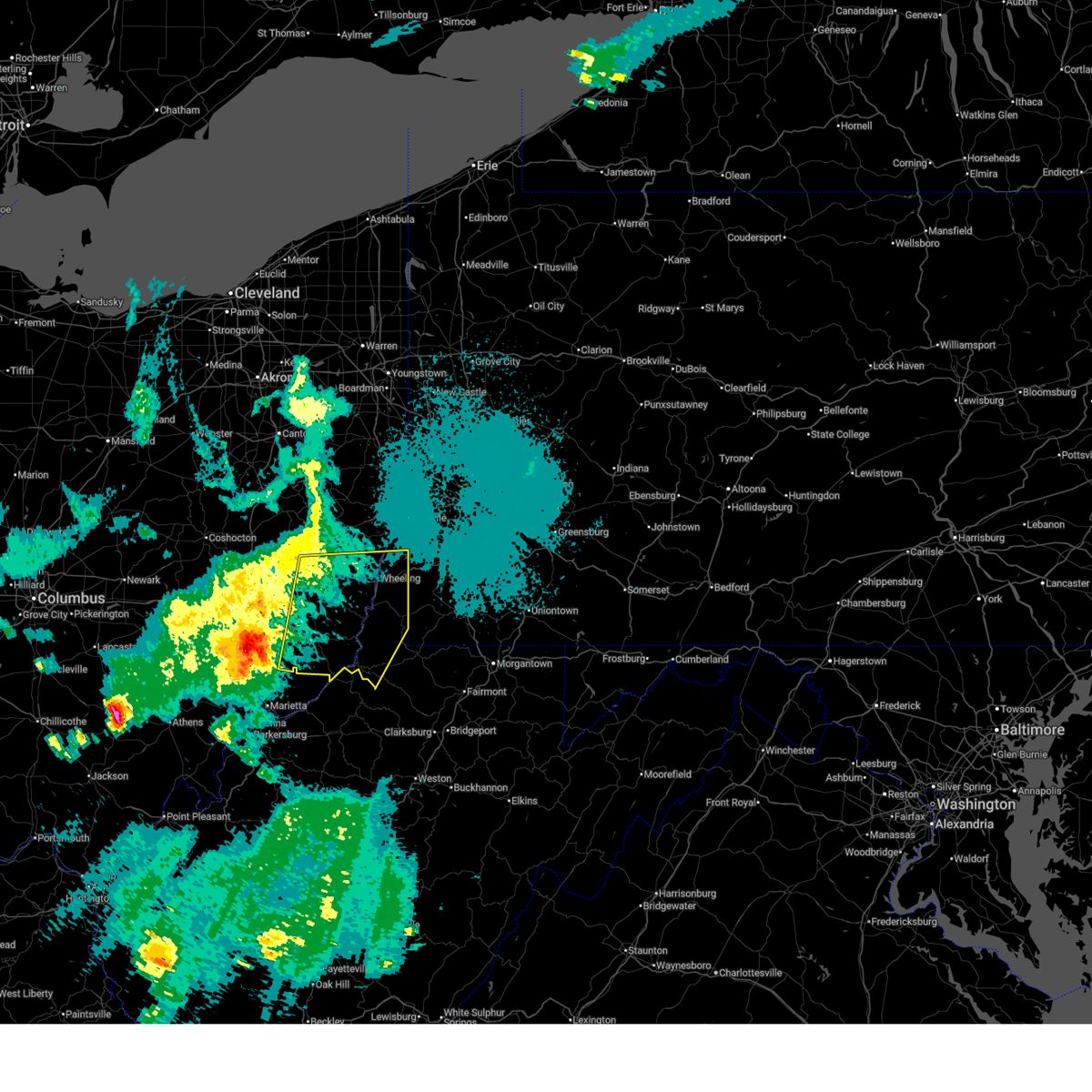
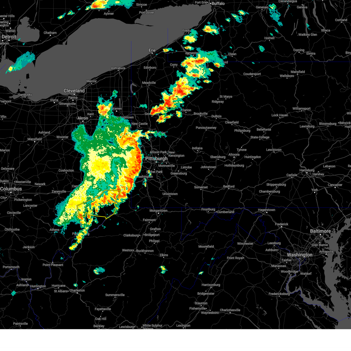
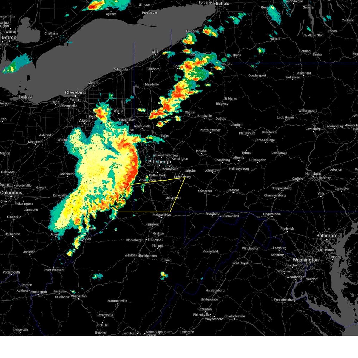
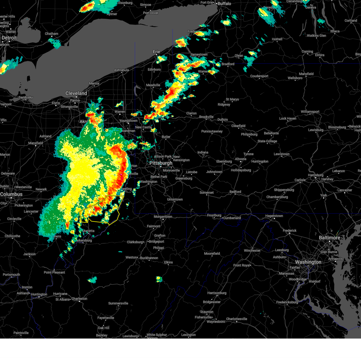
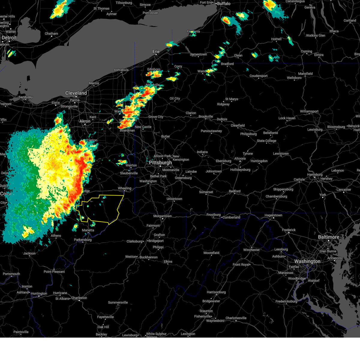
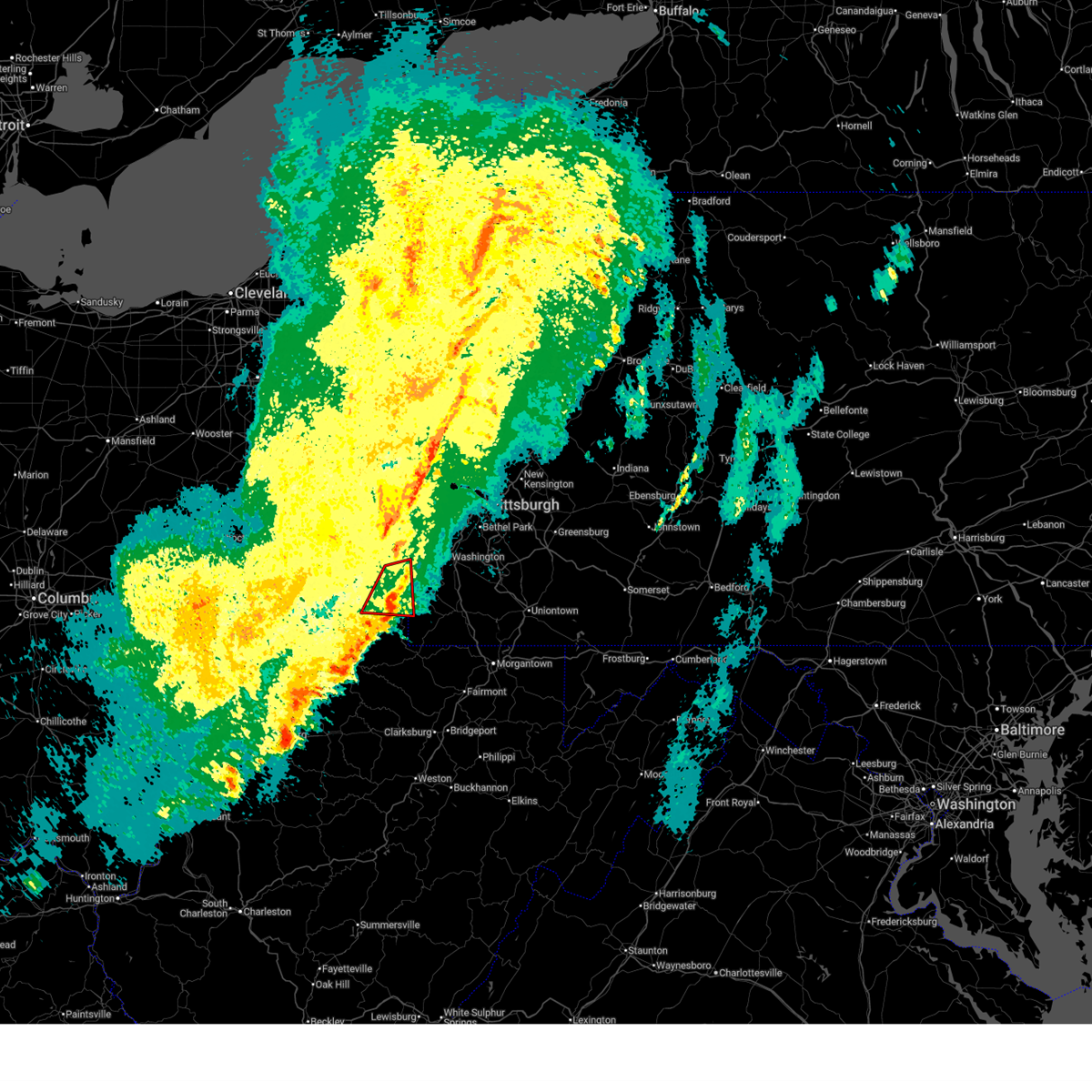
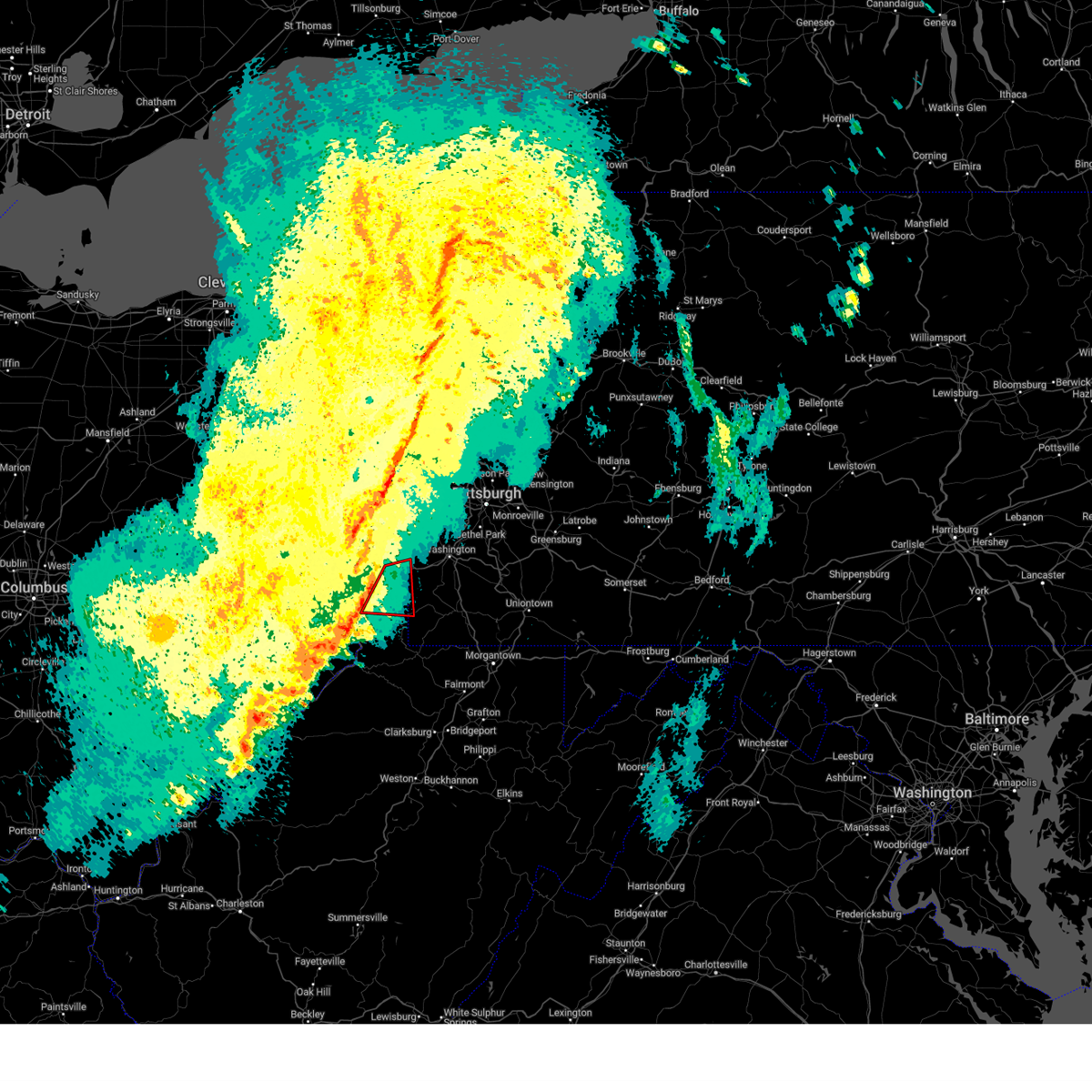
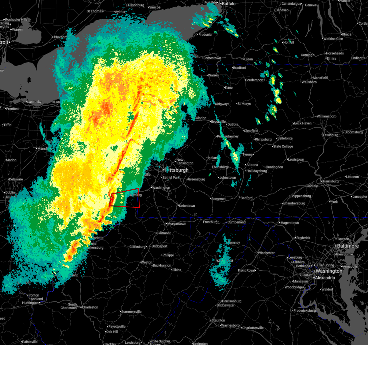
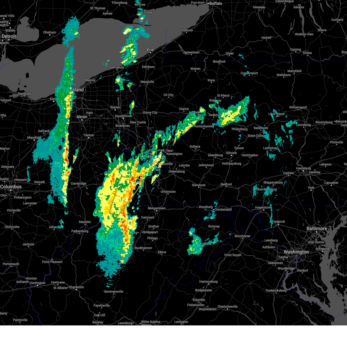
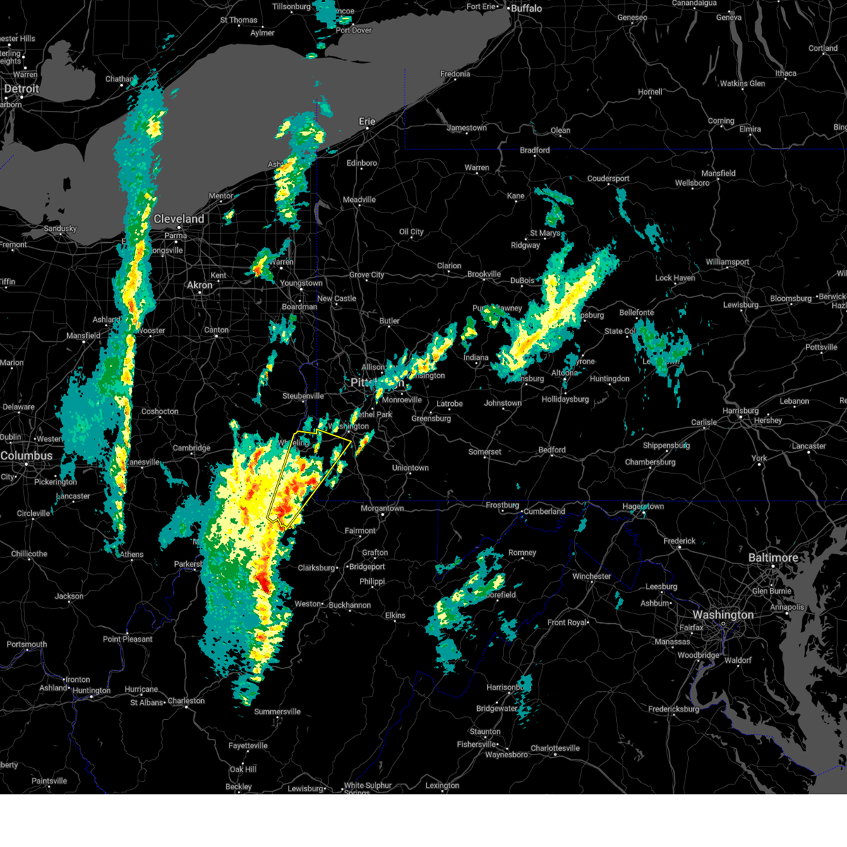
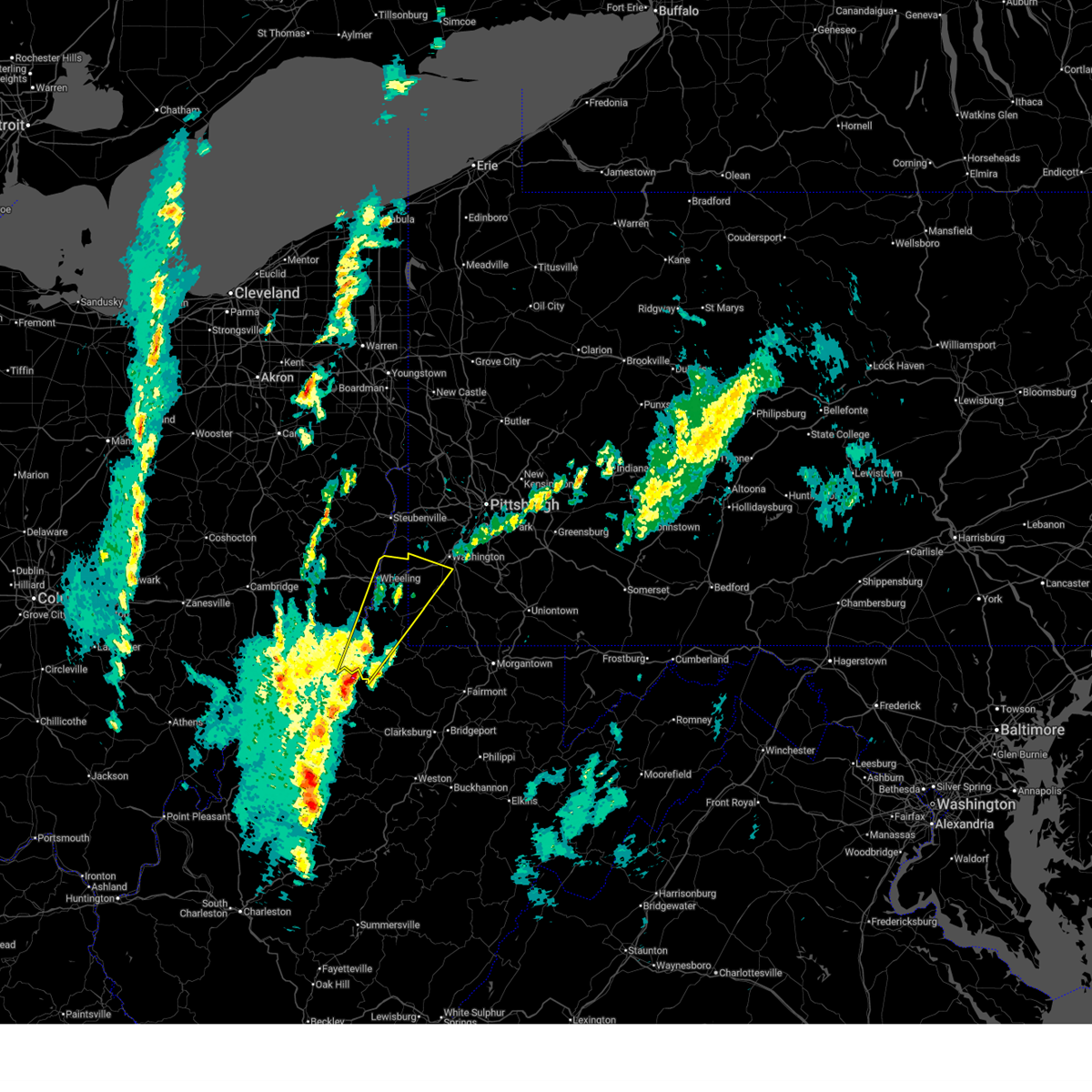
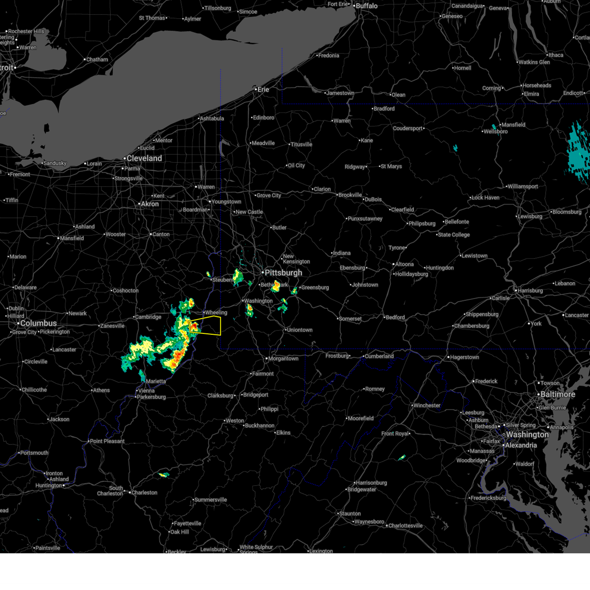
Hail Map for Glen Dale, WV
The Glen Dale, WV area has had 0 reports of on-the-ground hail by trained spotters, and has been under severe weather warnings 35 times during the past 12 months. Doppler radar has detected hail at or near Glen Dale, WV on 29 occasions, including 1 occasion during the past year.
| Name: | Glen Dale, WV |
| Where Located: | 52.5 miles SW of Pittsburgh, PA |
| Map: | Google Map for Glen Dale, WV |
| Population: | 1526 |
| Housing Units: | 745 |
| More Info: | Search Google for Glen Dale, WV |
0
The Top Recent Hail Date for Glen Dale, WV is Saturday, March 7, 2026 (19th out of 29)

Hail and Wind Damage Spotted near Glen Dale, WV
| Date / Time | Report Details |
|---|---|
| 6/14/2026 6:33 PM EDT |
 At 633 pm edt, severe thunderstorms were located along a line from near west kittanning to 7 miles north of cameron, or along a line from near kittanning to 7 miles east of moundsville, moving east at 35 mph (radar indicated). Hazards include 60 mph wind gusts and small hail. Expect damage to roofs, siding, and trees. Locations impacted include, pittsburgh, penn hills, mount lebanon, bethel park, ross township, monroeville, mcmurray, mckeesport, washington, moundsville, canonsburg, vandergrift, kittanning, apollo, gastonville, shaler township, plum, west mifflin and north side pittsburgh. At 633 pm edt, severe thunderstorms were located along a line from near west kittanning to 7 miles north of cameron, or along a line from near kittanning to 7 miles east of moundsville, moving east at 35 mph (radar indicated). Hazards include 60 mph wind gusts and small hail. Expect damage to roofs, siding, and trees. Locations impacted include, pittsburgh, penn hills, mount lebanon, bethel park, ross township, monroeville, mcmurray, mckeesport, washington, moundsville, canonsburg, vandergrift, kittanning, apollo, gastonville, shaler township, plum, west mifflin and north side pittsburgh.
|
| 6/14/2026 6:17 PM EDT |
 At 617 pm edt, severe thunderstorms were located along a line from 6 miles east of meadowood to over glen dale, or along a line from 6 miles east of butler to over moundsville, moving east at 35 mph (radar indicated). Hazards include 60 mph wind gusts and small hail. Expect damage to roofs, siding, and trees. Locations impacted include, pittsburgh, penn hills, mount lebanon, bethel park, ross township, wheeling, mccandless township, monroeville, cranberry, moon township, mcmurray, mckeesport, butler, washington, franklin park, moundsville, canonsburg, martins ferry and vandergrift. At 617 pm edt, severe thunderstorms were located along a line from 6 miles east of meadowood to over glen dale, or along a line from 6 miles east of butler to over moundsville, moving east at 35 mph (radar indicated). Hazards include 60 mph wind gusts and small hail. Expect damage to roofs, siding, and trees. Locations impacted include, pittsburgh, penn hills, mount lebanon, bethel park, ross township, wheeling, mccandless township, monroeville, cranberry, moon township, mcmurray, mckeesport, butler, washington, franklin park, moundsville, canonsburg, martins ferry and vandergrift.
|
| 6/14/2026 6:17 PM EDT |
 the severe thunderstorm warning has been cancelled and is no longer in effect the severe thunderstorm warning has been cancelled and is no longer in effect
|
| 6/14/2026 6:01 PM EDT |
 Svrpbz the national weather service in pittsburgh has issued a * severe thunderstorm warning for, eastern belmont county in east central ohio, allegheny county in southwestern pennsylvania, northwestern greene county in southwestern pennsylvania, washington county in southwestern pennsylvania, northwestern westmoreland county in southwestern pennsylvania, armstrong county in west central pennsylvania, southern butler county in west central pennsylvania, southeastern beaver county in western pennsylvania, brooke county in northern west virginia, marshall county in northern west virginia, ohio county in northern west virginia, * until 700 pm edt. * at 601 pm edt, severe thunderstorms were located along a line from over meridian to 9 miles southwest of st. clairsville, or along a line from near butler to 9 miles southwest of st. clairsville, moving east at 35 mph (radar indicated). Hazards include 60 mph wind gusts and small hail. expect damage to roofs, siding, and trees Svrpbz the national weather service in pittsburgh has issued a * severe thunderstorm warning for, eastern belmont county in east central ohio, allegheny county in southwestern pennsylvania, northwestern greene county in southwestern pennsylvania, washington county in southwestern pennsylvania, northwestern westmoreland county in southwestern pennsylvania, armstrong county in west central pennsylvania, southern butler county in west central pennsylvania, southeastern beaver county in western pennsylvania, brooke county in northern west virginia, marshall county in northern west virginia, ohio county in northern west virginia, * until 700 pm edt. * at 601 pm edt, severe thunderstorms were located along a line from over meridian to 9 miles southwest of st. clairsville, or along a line from near butler to 9 miles southwest of st. clairsville, moving east at 35 mph (radar indicated). Hazards include 60 mph wind gusts and small hail. expect damage to roofs, siding, and trees
|
| 6/11/2026 3:52 PM EDT |
 At 352 pm edt, severe thunderstorms were located along a line from over follansbee to 7 miles southwest of barnesville, or along a line from over steubenville to 7 miles southwest of barnesville, moving east at 50 mph (radar indicated). Hazards include 60 mph wind gusts. Expect damage to roofs, siding, and trees. locations impacted include, wheeling, weirton, steubenville, moundsville, martins ferry, st. Clairsville, bellaire, barnesville, cadiz, warwood, wellsburg, bethlehem, west liberty, triadelphia, avella, clearview, valley grove, toronto, wintersville and shadyside. At 352 pm edt, severe thunderstorms were located along a line from over follansbee to 7 miles southwest of barnesville, or along a line from over steubenville to 7 miles southwest of barnesville, moving east at 50 mph (radar indicated). Hazards include 60 mph wind gusts. Expect damage to roofs, siding, and trees. locations impacted include, wheeling, weirton, steubenville, moundsville, martins ferry, st. Clairsville, bellaire, barnesville, cadiz, warwood, wellsburg, bethlehem, west liberty, triadelphia, avella, clearview, valley grove, toronto, wintersville and shadyside.
|
| 6/11/2026 3:36 PM EDT |
 Svrpbz the national weather service in pittsburgh has issued a * severe thunderstorm warning for, belmont county in east central ohio, central guernsey county in east central ohio, harrison county in east central ohio, jefferson oh county in east central ohio, northern monroe county in east central ohio, eastern muskingum county in east central ohio, northern noble county in east central ohio, southwestern allegheny county in southwestern pennsylvania, northwestern washington county in southwestern pennsylvania, brooke county in northern west virginia, hancock county in northern west virginia, marshall county in northern west virginia, ohio county in northern west virginia, * until 415 pm edt. * at 336 pm edt, severe thunderstorms were located along a line from 9 miles west of wintersville to 5 miles southeast of byesville, or along a line from 10 miles northeast of cadiz to 10 miles southeast of cambridge, moving east at 50 mph (radar indicated). Hazards include 60 mph wind gusts. expect damage to roofs, siding, and trees Svrpbz the national weather service in pittsburgh has issued a * severe thunderstorm warning for, belmont county in east central ohio, central guernsey county in east central ohio, harrison county in east central ohio, jefferson oh county in east central ohio, northern monroe county in east central ohio, eastern muskingum county in east central ohio, northern noble county in east central ohio, southwestern allegheny county in southwestern pennsylvania, northwestern washington county in southwestern pennsylvania, brooke county in northern west virginia, hancock county in northern west virginia, marshall county in northern west virginia, ohio county in northern west virginia, * until 415 pm edt. * at 336 pm edt, severe thunderstorms were located along a line from 9 miles west of wintersville to 5 miles southeast of byesville, or along a line from 10 miles northeast of cadiz to 10 miles southeast of cambridge, moving east at 50 mph (radar indicated). Hazards include 60 mph wind gusts. expect damage to roofs, siding, and trees
|
| 6/6/2026 7:45 PM EDT |
 At 745 pm edt, a severe thunderstorm was located 11 miles northeast of woodsfield, moving southeast at 30 mph (radar indicated). Hazards include 60 mph wind gusts and quarter size hail. Hail damage to vehicles is expected. expect wind damage to roofs, siding, and trees. Locations impacted include, moundsville, powhatan point, glen dale, beallsville, clarington, jerusalem, wilson, alledonia, cameron, woodlands, glendale and grand vue park. At 745 pm edt, a severe thunderstorm was located 11 miles northeast of woodsfield, moving southeast at 30 mph (radar indicated). Hazards include 60 mph wind gusts and quarter size hail. Hail damage to vehicles is expected. expect wind damage to roofs, siding, and trees. Locations impacted include, moundsville, powhatan point, glen dale, beallsville, clarington, jerusalem, wilson, alledonia, cameron, woodlands, glendale and grand vue park.
|
| 6/6/2026 7:33 PM EDT |
 At 733 pm edt, a severe thunderstorm was located near glen dale, or near moundsville, moving east at 40 mph (radar indicated). Hazards include 60 mph wind gusts and quarter size hail. Hail damage to vehicles is expected. expect wind damage to roofs, siding, and trees. Locations impacted include, moundsville, barnesville, powhatan point, glen dale, beallsville, clarington, jerusalem, wilson, alledonia, cameron, somerton, miltonsburg, woodlands, glendale and grand vue park. At 733 pm edt, a severe thunderstorm was located near glen dale, or near moundsville, moving east at 40 mph (radar indicated). Hazards include 60 mph wind gusts and quarter size hail. Hail damage to vehicles is expected. expect wind damage to roofs, siding, and trees. Locations impacted include, moundsville, barnesville, powhatan point, glen dale, beallsville, clarington, jerusalem, wilson, alledonia, cameron, somerton, miltonsburg, woodlands, glendale and grand vue park.
|
| 6/6/2026 7:17 PM EDT |
 Svrpbz the national weather service in pittsburgh has issued a * severe thunderstorm warning for, southern belmont county in east central ohio, northeastern monroe county in east central ohio, marshall county in northern west virginia, * until 800 pm edt. * at 717 pm edt, a severe thunderstorm was located 8 miles southeast of barnesville, moving east at 40 mph (radar indicated). Hazards include 60 mph wind gusts and quarter size hail. Hail damage to vehicles is expected. Expect wind damage to roofs, siding, and trees. Svrpbz the national weather service in pittsburgh has issued a * severe thunderstorm warning for, southern belmont county in east central ohio, northeastern monroe county in east central ohio, marshall county in northern west virginia, * until 800 pm edt. * at 717 pm edt, a severe thunderstorm was located 8 miles southeast of barnesville, moving east at 40 mph (radar indicated). Hazards include 60 mph wind gusts and quarter size hail. Hail damage to vehicles is expected. Expect wind damage to roofs, siding, and trees.
|
| 6/6/2026 2:18 PM EDT |
 At 218 pm edt, severe thunderstorms were located along a line from 8 miles north of wolfdale to 17 miles south of woodsfield, or along a line from 7 miles east of avella to 15 miles southwest of new martinsville, moving east at 55 mph (law enforcement reported tree and power line damage across the warned area). Hazards include 60 mph wind gusts and small hail. Expect damage to roofs, siding, and trees. Locations impacted include, mount lebanon, bethel park, wheeling, mcmurray, weirton, mckeesport, washington, moundsville, canonsburg, martins ferry, new martinsville, bellaire, waynesburg, warwood, wellsburg, bethlehem, west liberty and triadelphia. At 218 pm edt, severe thunderstorms were located along a line from 8 miles north of wolfdale to 17 miles south of woodsfield, or along a line from 7 miles east of avella to 15 miles southwest of new martinsville, moving east at 55 mph (law enforcement reported tree and power line damage across the warned area). Hazards include 60 mph wind gusts and small hail. Expect damage to roofs, siding, and trees. Locations impacted include, mount lebanon, bethel park, wheeling, mcmurray, weirton, mckeesport, washington, moundsville, canonsburg, martins ferry, new martinsville, bellaire, waynesburg, warwood, wellsburg, bethlehem, west liberty and triadelphia.
|
| 6/6/2026 1:55 PM EDT |
 Svrpbz the national weather service in pittsburgh has issued a * severe thunderstorm warning for, belmont county in east central ohio, southern jefferson oh county in east central ohio, monroe county in east central ohio, southern allegheny county in southwestern pennsylvania, greene county in southwestern pennsylvania, washington county in southwestern pennsylvania, brooke county in northern west virginia, northwestern marion county in northern west virginia, marshall county in northern west virginia, northwestern monongalia county in northern west virginia, ohio county in northern west virginia, wetzel county in northern west virginia, * until 300 pm edt. * at 155 pm edt, severe thunderstorms were located along a line from over wintersville to 13 miles south of caldwell, or along a line from near steubenville to 13 miles south of caldwell, moving east at 55 mph (law enforcement reported tree and power line damage across the warned area). Hazards include 60 mph wind gusts and small hail. expect damage to roofs, siding, and trees Svrpbz the national weather service in pittsburgh has issued a * severe thunderstorm warning for, belmont county in east central ohio, southern jefferson oh county in east central ohio, monroe county in east central ohio, southern allegheny county in southwestern pennsylvania, greene county in southwestern pennsylvania, washington county in southwestern pennsylvania, brooke county in northern west virginia, northwestern marion county in northern west virginia, marshall county in northern west virginia, northwestern monongalia county in northern west virginia, ohio county in northern west virginia, wetzel county in northern west virginia, * until 300 pm edt. * at 155 pm edt, severe thunderstorms were located along a line from over wintersville to 13 miles south of caldwell, or along a line from near steubenville to 13 miles south of caldwell, moving east at 55 mph (law enforcement reported tree and power line damage across the warned area). Hazards include 60 mph wind gusts and small hail. expect damage to roofs, siding, and trees
|
| 4/14/2026 2:32 PM EDT |
 Svrpbz the national weather service in pittsburgh has issued a * severe thunderstorm warning for, southeastern belmont county in east central ohio, northeastern monroe county in east central ohio, southwestern greene county in southwestern pennsylvania, marshall county in northern west virginia, northeastern wetzel county in northern west virginia, * until 315 pm edt. * at 232 pm edt, a severe thunderstorm was located near powhatan point, or 9 miles southwest of moundsville, moving east at 30 mph (radar indicated). Hazards include 60 mph wind gusts and small hail. expect damage to roofs, siding, and trees Svrpbz the national weather service in pittsburgh has issued a * severe thunderstorm warning for, southeastern belmont county in east central ohio, northeastern monroe county in east central ohio, southwestern greene county in southwestern pennsylvania, marshall county in northern west virginia, northeastern wetzel county in northern west virginia, * until 315 pm edt. * at 232 pm edt, a severe thunderstorm was located near powhatan point, or 9 miles southwest of moundsville, moving east at 30 mph (radar indicated). Hazards include 60 mph wind gusts and small hail. expect damage to roofs, siding, and trees
|
| 3/26/2026 10:50 PM EDT |
 The storm which prompted the warning has weakened below severe limits, and no longer poses an immediate threat to life or property. therefore, the warning will be allowed to expire. however, small hail, gusty winds, and heavy rain are still possible with this thunderstorm. a tornado watch remains in effect until 1100 pm edt for portions of east central ohio and the northern panhandle of west virginia. The storm which prompted the warning has weakened below severe limits, and no longer poses an immediate threat to life or property. therefore, the warning will be allowed to expire. however, small hail, gusty winds, and heavy rain are still possible with this thunderstorm. a tornado watch remains in effect until 1100 pm edt for portions of east central ohio and the northern panhandle of west virginia.
|
| 3/26/2026 10:45 PM EDT |
 At 1045 pm edt, a severe thunderstorm was located 8 miles east of barnesville, moving southeast at 45 mph (radar indicated). Hazards include 60 mph wind gusts and quarter size hail. Hail damage to vehicles is expected. expect wind damage to roofs, siding, and trees. Locations impacted include, moundsville, shadyside, mcmechen, powhatan point, glen dale, bethesda, belmont, alledonia, barkcamp state park, glendale and grand vue park. At 1045 pm edt, a severe thunderstorm was located 8 miles east of barnesville, moving southeast at 45 mph (radar indicated). Hazards include 60 mph wind gusts and quarter size hail. Hail damage to vehicles is expected. expect wind damage to roofs, siding, and trees. Locations impacted include, moundsville, shadyside, mcmechen, powhatan point, glen dale, bethesda, belmont, alledonia, barkcamp state park, glendale and grand vue park.
|
| 3/26/2026 10:45 PM EDT |
 the severe thunderstorm warning has been cancelled and is no longer in effect the severe thunderstorm warning has been cancelled and is no longer in effect
|
| 3/26/2026 10:25 PM EDT |
 At 1025 pm edt, a severe thunderstorm was located 7 miles west of barnesville, moving southeast at 40 mph (radar indicated). Hazards include 60 mph wind gusts and quarter size hail. Hail damage to vehicles is expected. expect wind damage to roofs, siding, and trees. Locations impacted include, cambridge, moundsville, barnesville, woodsfield, shadyside, byesville, mcmechen, powhatan point, glen dale, bethesda, quaker city, senecaville, belmont, beallsville, lore city, morristown, old washington, summerfield and lewisville. At 1025 pm edt, a severe thunderstorm was located 7 miles west of barnesville, moving southeast at 40 mph (radar indicated). Hazards include 60 mph wind gusts and quarter size hail. Hail damage to vehicles is expected. expect wind damage to roofs, siding, and trees. Locations impacted include, cambridge, moundsville, barnesville, woodsfield, shadyside, byesville, mcmechen, powhatan point, glen dale, bethesda, quaker city, senecaville, belmont, beallsville, lore city, morristown, old washington, summerfield and lewisville.
|
| 3/26/2026 10:25 PM EDT |
 the severe thunderstorm warning has been cancelled and is no longer in effect the severe thunderstorm warning has been cancelled and is no longer in effect
|
| 3/26/2026 10:13 PM EDT |
 Svrpbz the national weather service in pittsburgh has issued a * severe thunderstorm warning for, belmont county in east central ohio, guernsey county in east central ohio, monroe county in east central ohio, east central muskingum county in east central ohio, northeastern noble county in east central ohio, marshall county in northern west virginia, * until 1100 pm edt. * at 1013 pm edt, a severe thunderstorm was located 10 miles northeast of byesville, or 10 miles northeast of cambridge, moving southeast at 40 mph (radar indicated). Hazards include 60 mph wind gusts and quarter size hail. Hail damage to vehicles is expected. Expect wind damage to roofs, siding, and trees. Svrpbz the national weather service in pittsburgh has issued a * severe thunderstorm warning for, belmont county in east central ohio, guernsey county in east central ohio, monroe county in east central ohio, east central muskingum county in east central ohio, northeastern noble county in east central ohio, marshall county in northern west virginia, * until 1100 pm edt. * at 1013 pm edt, a severe thunderstorm was located 10 miles northeast of byesville, or 10 miles northeast of cambridge, moving southeast at 40 mph (radar indicated). Hazards include 60 mph wind gusts and quarter size hail. Hail damage to vehicles is expected. Expect wind damage to roofs, siding, and trees.
|
| 3/22/2026 7:18 PM EDT |
 the severe thunderstorm warning has been cancelled and is no longer in effect the severe thunderstorm warning has been cancelled and is no longer in effect
|
| 3/22/2026 7:07 PM EDT |
 At 707 pm edt, a severe thunderstorm was located 7 miles east of barnesville, moving east at 55 mph (public reported quarter size hail in quaker city). Hazards include half dollar size hail. Damage to vehicles is expected. Locations impacted include, moundsville, bellaire, barnesville, shadyside, mcmechen, powhatan point, glen dale, benwood, bethesda, belmont, beallsville, clarington, morristown, neffs, jerusalem, wilson, alledonia, somerton, fairview and barkcamp state park. At 707 pm edt, a severe thunderstorm was located 7 miles east of barnesville, moving east at 55 mph (public reported quarter size hail in quaker city). Hazards include half dollar size hail. Damage to vehicles is expected. Locations impacted include, moundsville, bellaire, barnesville, shadyside, mcmechen, powhatan point, glen dale, benwood, bethesda, belmont, beallsville, clarington, morristown, neffs, jerusalem, wilson, alledonia, somerton, fairview and barkcamp state park.
|
| 3/22/2026 7:07 PM EDT |
 the severe thunderstorm warning has been cancelled and is no longer in effect the severe thunderstorm warning has been cancelled and is no longer in effect
|
| 3/22/2026 6:53 PM EDT |
 Svrpbz the national weather service in pittsburgh has issued a * severe thunderstorm warning for, belmont county in east central ohio, southeastern guernsey county in east central ohio, northern monroe county in east central ohio, northeastern noble county in east central ohio, marshall county in northern west virginia, * until 745 pm edt. * at 653 pm edt, a severe thunderstorm was located near barnesville, moving east at 55 mph (radar indicated). Hazards include half dollar size hail. damage to vehicles is expected Svrpbz the national weather service in pittsburgh has issued a * severe thunderstorm warning for, belmont county in east central ohio, southeastern guernsey county in east central ohio, northern monroe county in east central ohio, northeastern noble county in east central ohio, marshall county in northern west virginia, * until 745 pm edt. * at 653 pm edt, a severe thunderstorm was located near barnesville, moving east at 55 mph (radar indicated). Hazards include half dollar size hail. damage to vehicles is expected
|
| 3/11/2026 3:30 PM EDT |
 The storm has weakened and a tornado is not expected. a tornado watch remains in effect until 500 pm edt for portions of east central ohio and the northern panhandle of west virginia. The storm has weakened and a tornado is not expected. a tornado watch remains in effect until 500 pm edt for portions of east central ohio and the northern panhandle of west virginia.
|
| 3/11/2026 3:20 PM EDT |
 At 320 pm edt, a severe thunderstorm capable of producing a tornado was located 9 miles west of powhatan point, or 11 miles northeast of woodsfield, moving east at 65 mph (radar indicated rotation). Hazards include tornado. Flying debris will be dangerous to those caught without shelter. mobile homes will be damaged or destroyed. damage to roofs, windows and vehicles will occur. tree damage is likely. Locations impacted include, moundsville, shadyside, mcmechen, powhatan point, glen dale, benwood, beallsville, wilson, alledonia, woodlands, glendale, grand vue park and grove oak. At 320 pm edt, a severe thunderstorm capable of producing a tornado was located 9 miles west of powhatan point, or 11 miles northeast of woodsfield, moving east at 65 mph (radar indicated rotation). Hazards include tornado. Flying debris will be dangerous to those caught without shelter. mobile homes will be damaged or destroyed. damage to roofs, windows and vehicles will occur. tree damage is likely. Locations impacted include, moundsville, shadyside, mcmechen, powhatan point, glen dale, benwood, beallsville, wilson, alledonia, woodlands, glendale, grand vue park and grove oak.
|
| 3/11/2026 3:15 PM EDT |
 Torpbz the national weather service in pittsburgh has issued a * tornado warning for, southern belmont county in east central ohio, northeastern monroe county in east central ohio, marshall county in northern west virginia, * until 330 pm edt. * at 315 pm edt, a severe thunderstorm capable of producing a tornado was located 8 miles north of woodsfield, moving east at 65 mph (radar indicated rotation). Hazards include tornado. Flying debris will be dangerous to those caught without shelter. mobile homes will be damaged or destroyed. damage to roofs, windows and vehicles will occur. Tree damage is likely. Torpbz the national weather service in pittsburgh has issued a * tornado warning for, southern belmont county in east central ohio, northeastern monroe county in east central ohio, marshall county in northern west virginia, * until 330 pm edt. * at 315 pm edt, a severe thunderstorm capable of producing a tornado was located 8 miles north of woodsfield, moving east at 65 mph (radar indicated rotation). Hazards include tornado. Flying debris will be dangerous to those caught without shelter. mobile homes will be damaged or destroyed. damage to roofs, windows and vehicles will occur. Tree damage is likely.
|
| 3/11/2026 2:13 PM EDT |
 the severe thunderstorm warning has been cancelled and is no longer in effect the severe thunderstorm warning has been cancelled and is no longer in effect
|
| 3/11/2026 2:13 PM EDT |
 At 213 pm edt, a severe thunderstorm was located 7 miles northwest of cameron, or 6 miles east of moundsville, moving east at 45 mph (radar indicated). Hazards include 60 mph wind gusts and small hail. Expect damage to roofs, siding, and trees. Locations impacted include, moundsville, triadelphia, valley grove, mcmechen, glen dale, cameron, benwood, rogersville, west finley, claysville, west alexander, nineveh, dallas, rocklick, lone oak, beelers station and sherrard. At 213 pm edt, a severe thunderstorm was located 7 miles northwest of cameron, or 6 miles east of moundsville, moving east at 45 mph (radar indicated). Hazards include 60 mph wind gusts and small hail. Expect damage to roofs, siding, and trees. Locations impacted include, moundsville, triadelphia, valley grove, mcmechen, glen dale, cameron, benwood, rogersville, west finley, claysville, west alexander, nineveh, dallas, rocklick, lone oak, beelers station and sherrard.
|
| 3/11/2026 2:08 PM EDT |
 the tornado warning has been cancelled and is no longer in effect the tornado warning has been cancelled and is no longer in effect
|
| 3/11/2026 2:03 PM EDT |
 the severe thunderstorm warning has been cancelled and is no longer in effect the severe thunderstorm warning has been cancelled and is no longer in effect
|
| 3/11/2026 2:03 PM EDT |
 At 203 pm edt, a severe thunderstorm was located over moundsville, moving east at 60 mph (radar indicated). Hazards include 60 mph wind gusts and small hail. Expect damage to roofs, siding, and trees. Locations impacted include, moundsville, bethlehem, triadelphia, valley grove, shadyside, mcmechen, powhatan point, glen dale, cameron, benwood, rogersville, west finley, claysville, west alexander, nineveh, lone oak, beelers station and dallas. At 203 pm edt, a severe thunderstorm was located over moundsville, moving east at 60 mph (radar indicated). Hazards include 60 mph wind gusts and small hail. Expect damage to roofs, siding, and trees. Locations impacted include, moundsville, bethlehem, triadelphia, valley grove, shadyside, mcmechen, powhatan point, glen dale, cameron, benwood, rogersville, west finley, claysville, west alexander, nineveh, lone oak, beelers station and dallas.
|
| 3/11/2026 2:02 PM EDT |
 the tornado warning has been cancelled and is no longer in effect the tornado warning has been cancelled and is no longer in effect
|
| 3/11/2026 2:02 PM EDT |
 At 202 pm edt, a severe thunderstorm capable of producing a tornado was located over powhatan point, or 6 miles southwest of moundsville, moving east at 55 mph (radar indicated rotation). Hazards include tornado. Flying debris will be dangerous to those caught without shelter. mobile homes will be damaged or destroyed. damage to roofs, windows and vehicles will occur. tree damage is likely. Locations impacted include, moundsville, powhatan point, glen dale, rogersville, lone oak, beelers station, rocklick, glen easton, grove oak, grand vue park and woodlands. At 202 pm edt, a severe thunderstorm capable of producing a tornado was located over powhatan point, or 6 miles southwest of moundsville, moving east at 55 mph (radar indicated rotation). Hazards include tornado. Flying debris will be dangerous to those caught without shelter. mobile homes will be damaged or destroyed. damage to roofs, windows and vehicles will occur. tree damage is likely. Locations impacted include, moundsville, powhatan point, glen dale, rogersville, lone oak, beelers station, rocklick, glen easton, grove oak, grand vue park and woodlands.
|
| 3/11/2026 1:53 PM EDT |
 At 153 pm edt, a severe thunderstorm was located 7 miles west of powhatan point, or 11 miles northeast of woodsfield, moving east at 60 mph (radar indicated). Hazards include 60 mph wind gusts and small hail. Expect damage to roofs, siding, and trees. Locations impacted include, wheeling, moundsville, bellaire, bethlehem, triadelphia, valley grove, shadyside, mcmechen, powhatan point, glen dale, cameron, benwood, rogersville, west finley, claysville, beallsville, clarington, west alexander, neffs and aleppo. At 153 pm edt, a severe thunderstorm was located 7 miles west of powhatan point, or 11 miles northeast of woodsfield, moving east at 60 mph (radar indicated). Hazards include 60 mph wind gusts and small hail. Expect damage to roofs, siding, and trees. Locations impacted include, wheeling, moundsville, bellaire, bethlehem, triadelphia, valley grove, shadyside, mcmechen, powhatan point, glen dale, cameron, benwood, rogersville, west finley, claysville, beallsville, clarington, west alexander, neffs and aleppo.
|
| 3/11/2026 1:50 PM EDT |
 Torpbz the national weather service in pittsburgh has issued a * tornado warning for, southeastern belmont county in east central ohio, northeastern monroe county in east central ohio, northwestern greene county in southwestern pennsylvania, marshall county in northern west virginia, * until 215 pm edt. * at 150 pm edt, a severe thunderstorm capable of producing a tornado was located 5 miles northeast of woodsfield, moving east at 55 mph (radar indicated rotation). Hazards include tornado. Flying debris will be dangerous to those caught without shelter. mobile homes will be damaged or destroyed. damage to roofs, windows and vehicles will occur. Tree damage is likely. Torpbz the national weather service in pittsburgh has issued a * tornado warning for, southeastern belmont county in east central ohio, northeastern monroe county in east central ohio, northwestern greene county in southwestern pennsylvania, marshall county in northern west virginia, * until 215 pm edt. * at 150 pm edt, a severe thunderstorm capable of producing a tornado was located 5 miles northeast of woodsfield, moving east at 55 mph (radar indicated rotation). Hazards include tornado. Flying debris will be dangerous to those caught without shelter. mobile homes will be damaged or destroyed. damage to roofs, windows and vehicles will occur. Tree damage is likely.
|
| 3/11/2026 1:46 PM EDT |
 Svrpbz the national weather service in pittsburgh has issued a * severe thunderstorm warning for, southern belmont county in east central ohio, northeastern monroe county in east central ohio, northwestern greene county in southwestern pennsylvania, southwestern washington county in southwestern pennsylvania, marshall county in northern west virginia, ohio county in northern west virginia, * until 230 pm edt. * at 146 pm edt, a severe thunderstorm was located near woodsfield, moving east at 60 mph (radar indicated). Hazards include 60 mph wind gusts and small hail. expect damage to roofs, siding, and trees Svrpbz the national weather service in pittsburgh has issued a * severe thunderstorm warning for, southern belmont county in east central ohio, northeastern monroe county in east central ohio, northwestern greene county in southwestern pennsylvania, southwestern washington county in southwestern pennsylvania, marshall county in northern west virginia, ohio county in northern west virginia, * until 230 pm edt. * at 146 pm edt, a severe thunderstorm was located near woodsfield, moving east at 60 mph (radar indicated). Hazards include 60 mph wind gusts and small hail. expect damage to roofs, siding, and trees
|
| 6/26/2025 7:46 PM EDT |
 The storm which prompted the warning has weakened below severe limits, and no longer poses an immediate threat to life or property. therefore, the warning has been allowed to expire. however, heavy rain is still possible with this thunderstorm. The storm which prompted the warning has weakened below severe limits, and no longer poses an immediate threat to life or property. therefore, the warning has been allowed to expire. however, heavy rain is still possible with this thunderstorm.
|
| 6/26/2025 7:13 PM EDT |
 At 713 pm edt, a severe thunderstorm was located over valley grove, moving east at 5 mph (radar indicated). Hazards include 60 mph wind gusts and small hail. Expect damage to roofs, siding, and trees. Locations impacted include, wheeling, martins ferry, bellaire, warwood, bethlehem, triadelphia, clearview, valley grove, shadyside, mcmechen, glen dale, bridgeport, benwood, yorkville, west finley, claysville, brookside, west alexander, neffs and taylorstown. At 713 pm edt, a severe thunderstorm was located over valley grove, moving east at 5 mph (radar indicated). Hazards include 60 mph wind gusts and small hail. Expect damage to roofs, siding, and trees. Locations impacted include, wheeling, martins ferry, bellaire, warwood, bethlehem, triadelphia, clearview, valley grove, shadyside, mcmechen, glen dale, bridgeport, benwood, yorkville, west finley, claysville, brookside, west alexander, neffs and taylorstown.
|
| 6/26/2025 6:59 PM EDT |
 Svrpbz the national weather service in pittsburgh has issued a * severe thunderstorm warning for, northeastern belmont county in east central ohio, southwestern washington county in southwestern pennsylvania, marshall county in northern west virginia, ohio county in northern west virginia, * until 745 pm edt. * at 659 pm edt, a severe thunderstorm was located over valley grove, moving east at 5 mph (radar indicated). Hazards include 60 mph wind gusts. expect damage to roofs, siding, and trees Svrpbz the national weather service in pittsburgh has issued a * severe thunderstorm warning for, northeastern belmont county in east central ohio, southwestern washington county in southwestern pennsylvania, marshall county in northern west virginia, ohio county in northern west virginia, * until 745 pm edt. * at 659 pm edt, a severe thunderstorm was located over valley grove, moving east at 5 mph (radar indicated). Hazards include 60 mph wind gusts. expect damage to roofs, siding, and trees
|
| 6/18/2025 11:58 PM EDT |
 The storms which prompted the warning have weakened below severe limits, and no longer pose an immediate threat to life or property. therefore, the warning will be allowed to expire. The storms which prompted the warning have weakened below severe limits, and no longer pose an immediate threat to life or property. therefore, the warning will be allowed to expire.
|
| 6/18/2025 11:51 PM EDT |
 At 1151 pm edt, severe thunderstorms were located along a line from near mcgovern to 7 miles east of woodsfield, or along a line from near canonsburg to 7 miles east of woodsfield, moving east at 35 mph (law enforcement reported trees down with this line). Hazards include 60 mph wind gusts. Expect damage to roofs, siding, and trees. Locations impacted include, wheeling, washington, moundsville, new martinsville, bellaire, bethlehem, west liberty, triadelphia, clearview, valley grove, shadyside, wolfdale, east washington, mcmechen, powhatan point, glen dale, cameron, hundred, benwood and west finley. At 1151 pm edt, severe thunderstorms were located along a line from near mcgovern to 7 miles east of woodsfield, or along a line from near canonsburg to 7 miles east of woodsfield, moving east at 35 mph (law enforcement reported trees down with this line). Hazards include 60 mph wind gusts. Expect damage to roofs, siding, and trees. Locations impacted include, wheeling, washington, moundsville, new martinsville, bellaire, bethlehem, west liberty, triadelphia, clearview, valley grove, shadyside, wolfdale, east washington, mcmechen, powhatan point, glen dale, cameron, hundred, benwood and west finley.
|
| 6/18/2025 11:41 PM EDT |
 At 1141 pm edt, severe thunderstorms were located along a line from near avella to over woodsfield, moving east at 35 mph (law enforcement reported trees down with this line). Hazards include 60 mph wind gusts. Expect damage to roofs, siding, and trees. Locations impacted include, wheeling, washington, moundsville, martins ferry, new martinsville, bellaire, warwood, bethlehem, woodsfield, west liberty, triadelphia, clearview, valley grove, shadyside, wolfdale, east washington, mcmechen, powhatan point, glen dale and cameron. At 1141 pm edt, severe thunderstorms were located along a line from near avella to over woodsfield, moving east at 35 mph (law enforcement reported trees down with this line). Hazards include 60 mph wind gusts. Expect damage to roofs, siding, and trees. Locations impacted include, wheeling, washington, moundsville, martins ferry, new martinsville, bellaire, warwood, bethlehem, woodsfield, west liberty, triadelphia, clearview, valley grove, shadyside, wolfdale, east washington, mcmechen, powhatan point, glen dale and cameron.
|
| 6/18/2025 11:41 PM EDT |
 the severe thunderstorm warning has been cancelled and is no longer in effect the severe thunderstorm warning has been cancelled and is no longer in effect
|
| 6/18/2025 11:23 PM EDT |
 At 1123 pm edt, severe thunderstorms were located along a line from near west liberty to 9 miles west of woodsfield, moving east at 35 mph (law enforcement reported trees down with this line). Hazards include 60 mph wind gusts. Expect damage to roofs, siding, and trees. Locations impacted include, wheeling, washington, moundsville, martins ferry, new martinsville, bellaire, warwood, bethlehem, woodsfield, west liberty, triadelphia, clearview, valley grove, shadyside, wolfdale, east washington, mcmechen, powhatan point, glen dale and tiltonsville. At 1123 pm edt, severe thunderstorms were located along a line from near west liberty to 9 miles west of woodsfield, moving east at 35 mph (law enforcement reported trees down with this line). Hazards include 60 mph wind gusts. Expect damage to roofs, siding, and trees. Locations impacted include, wheeling, washington, moundsville, martins ferry, new martinsville, bellaire, warwood, bethlehem, woodsfield, west liberty, triadelphia, clearview, valley grove, shadyside, wolfdale, east washington, mcmechen, powhatan point, glen dale and tiltonsville.
|
| 6/18/2025 11:23 PM EDT |
 the severe thunderstorm warning has been cancelled and is no longer in effect the severe thunderstorm warning has been cancelled and is no longer in effect
|
| 6/18/2025 11:08 PM EDT |
 the severe thunderstorm warning has been cancelled and is no longer in effect the severe thunderstorm warning has been cancelled and is no longer in effect
|
| 6/18/2025 11:08 PM EDT |
 At 1108 pm edt, severe thunderstorms were located along a line from over tiltonsville to 5 miles southeast of caldwell, or along a line from near clearview to 5 miles southeast of caldwell, moving east at 35 mph (law enforcement reported trees down with this line). Hazards include 60 mph wind gusts. Expect damage to roofs, siding, and trees. locations impacted include, wheeling, washington, moundsville, martins ferry, new martinsville, st. Clairsville, bellaire, warwood, bethlehem, woodsfield, caldwell, west liberty, triadelphia, clearview, valley grove, shadyside, wolfdale, east washington, mcmechen and powhatan point. At 1108 pm edt, severe thunderstorms were located along a line from over tiltonsville to 5 miles southeast of caldwell, or along a line from near clearview to 5 miles southeast of caldwell, moving east at 35 mph (law enforcement reported trees down with this line). Hazards include 60 mph wind gusts. Expect damage to roofs, siding, and trees. locations impacted include, wheeling, washington, moundsville, martins ferry, new martinsville, st. Clairsville, bellaire, warwood, bethlehem, woodsfield, caldwell, west liberty, triadelphia, clearview, valley grove, shadyside, wolfdale, east washington, mcmechen and powhatan point.
|
| 6/18/2025 11:01 PM EDT |
 The storms which prompted the warning have moved out of the area. a new severe thunderstorm warning has been issued for a portion of the area to the east. a severe thunderstorm watch remains in effect until 300 am edt for portions of east central ohio and the northern panhandle of west virginia. The storms which prompted the warning have moved out of the area. a new severe thunderstorm warning has been issued for a portion of the area to the east. a severe thunderstorm watch remains in effect until 300 am edt for portions of east central ohio and the northern panhandle of west virginia.
|
| 6/18/2025 10:57 PM EDT |
 Svrpbz the national weather service in pittsburgh has issued a * severe thunderstorm warning for, belmont county in east central ohio, southeastern guernsey county in east central ohio, southeastern harrison county in east central ohio, south central jefferson oh county in east central ohio, monroe county in east central ohio, noble county in east central ohio, western greene county in southwestern pennsylvania, southwestern washington county in southwestern pennsylvania, brooke county in northern west virginia, west central marion county in northern west virginia, marshall county in northern west virginia, ohio county in northern west virginia, wetzel county in northern west virginia, * until midnight edt. * at 1057 pm edt, severe thunderstorms were located along a line from 9 miles northeast of st. clairsville to near caldwell, moving east at 35 mph (law enforcement reported trees were reported down with this line). Hazards include 60 mph wind gusts. expect damage to roofs, siding, and trees Svrpbz the national weather service in pittsburgh has issued a * severe thunderstorm warning for, belmont county in east central ohio, southeastern guernsey county in east central ohio, southeastern harrison county in east central ohio, south central jefferson oh county in east central ohio, monroe county in east central ohio, noble county in east central ohio, western greene county in southwestern pennsylvania, southwestern washington county in southwestern pennsylvania, brooke county in northern west virginia, west central marion county in northern west virginia, marshall county in northern west virginia, ohio county in northern west virginia, wetzel county in northern west virginia, * until midnight edt. * at 1057 pm edt, severe thunderstorms were located along a line from 9 miles northeast of st. clairsville to near caldwell, moving east at 35 mph (law enforcement reported trees were reported down with this line). Hazards include 60 mph wind gusts. expect damage to roofs, siding, and trees
|
| 6/18/2025 10:43 PM EDT |
 At 1043 pm edt, severe thunderstorms were located along a line from 7 miles southeast of cadiz to 18 miles southwest of caldwell, moving east at 35 mph (law enforcement reported and radar indicated). Hazards include 60 mph wind gusts. Expect damage to roofs, siding, and trees. locations impacted include, wheeling, martins ferry, st. clairsville, bellaire, barnesville, warwood, bethlehem, woodsfield, caldwell, west liberty, clearview, shadyside, mcmechen, glen dale, tiltonsville, bridgeport, dudley, benwood, bethesda and yorkville. Trees have been reported down with these storms. At 1043 pm edt, severe thunderstorms were located along a line from 7 miles southeast of cadiz to 18 miles southwest of caldwell, moving east at 35 mph (law enforcement reported and radar indicated). Hazards include 60 mph wind gusts. Expect damage to roofs, siding, and trees. locations impacted include, wheeling, martins ferry, st. clairsville, bellaire, barnesville, warwood, bethlehem, woodsfield, caldwell, west liberty, clearview, shadyside, mcmechen, glen dale, tiltonsville, bridgeport, dudley, benwood, bethesda and yorkville. Trees have been reported down with these storms.
|
| 6/18/2025 10:30 PM EDT |
 At 1030 pm edt, severe thunderstorms were located along a line from near cadiz to 22 miles southwest of caldwell, moving east at 35 mph (radar indicated). Hazards include 60 mph wind gusts. Expect damage to roofs, siding, and trees. locations impacted include, wheeling, martins ferry, st. Clairsville, bellaire, barnesville, warwood, bethlehem, woodsfield, caldwell, west liberty, clearview, shadyside, mcmechen, glen dale, tiltonsville, bridgeport, dudley, benwood, bethesda and antrim. At 1030 pm edt, severe thunderstorms were located along a line from near cadiz to 22 miles southwest of caldwell, moving east at 35 mph (radar indicated). Hazards include 60 mph wind gusts. Expect damage to roofs, siding, and trees. locations impacted include, wheeling, martins ferry, st. Clairsville, bellaire, barnesville, warwood, bethlehem, woodsfield, caldwell, west liberty, clearview, shadyside, mcmechen, glen dale, tiltonsville, bridgeport, dudley, benwood, bethesda and antrim.
|
| 6/18/2025 10:30 PM EDT |
 the severe thunderstorm warning has been cancelled and is no longer in effect the severe thunderstorm warning has been cancelled and is no longer in effect
|
| 6/18/2025 10:18 PM EDT |
 At 1018 pm edt, severe thunderstorms were located along a line from near freeport to 25 miles south of south zanesville, or along a line from near freeport to 27 miles southwest of caldwell, moving east at 35 mph (radar indicated). Hazards include 60 mph wind gusts. Expect damage to roofs, siding, and trees. locations impacted include, wheeling, cambridge, martins ferry, st. Clairsville, bellaire, barnesville, warwood, bethlehem, woodsfield, caldwell, west liberty, clearview, shadyside, byesville, mcmechen, glen dale, tiltonsville, bridgeport, dudley and benwood. At 1018 pm edt, severe thunderstorms were located along a line from near freeport to 25 miles south of south zanesville, or along a line from near freeport to 27 miles southwest of caldwell, moving east at 35 mph (radar indicated). Hazards include 60 mph wind gusts. Expect damage to roofs, siding, and trees. locations impacted include, wheeling, cambridge, martins ferry, st. Clairsville, bellaire, barnesville, warwood, bethlehem, woodsfield, caldwell, west liberty, clearview, shadyside, byesville, mcmechen, glen dale, tiltonsville, bridgeport, dudley and benwood.
|
| 6/18/2025 10:06 PM EDT |
 Svrpbz the national weather service in pittsburgh has issued a * severe thunderstorm warning for, belmont county in east central ohio, guernsey county in east central ohio, southeastern harrison county in east central ohio, south central jefferson oh county in east central ohio, monroe county in east central ohio, southeastern muskingum county in east central ohio, noble county in east central ohio, brooke county in northern west virginia, marshall county in northern west virginia, ohio county in northern west virginia, * until 1100 pm edt. * at 1006 pm edt, severe thunderstorms were located along a line from over freeport to 24 miles south of south zanesville, or along a line from over freeport to 28 miles south of zanesville, moving east at 35 mph (radar indicated). Hazards include 60 mph wind gusts. expect damage to roofs, siding, and trees Svrpbz the national weather service in pittsburgh has issued a * severe thunderstorm warning for, belmont county in east central ohio, guernsey county in east central ohio, southeastern harrison county in east central ohio, south central jefferson oh county in east central ohio, monroe county in east central ohio, southeastern muskingum county in east central ohio, noble county in east central ohio, brooke county in northern west virginia, marshall county in northern west virginia, ohio county in northern west virginia, * until 1100 pm edt. * at 1006 pm edt, severe thunderstorms were located along a line from over freeport to 24 miles south of south zanesville, or along a line from over freeport to 28 miles south of zanesville, moving east at 35 mph (radar indicated). Hazards include 60 mph wind gusts. expect damage to roofs, siding, and trees
|
| 5/17/2025 1:07 AM EDT |
 The severe thunderstorm warning that was previously in effect has been reissued for greene and monongalia counties and is in effect until 200 am edt. please refer to that bulletin for the latest severe weather information. to report severe weather, contact your nearest law enforcement agency. they will send your report to the national weather service office. a severe thunderstorm watch remains in effect until 400 am edt saturday for portions of southwest pennsylvania and west virginia. The severe thunderstorm warning that was previously in effect has been reissued for greene and monongalia counties and is in effect until 200 am edt. please refer to that bulletin for the latest severe weather information. to report severe weather, contact your nearest law enforcement agency. they will send your report to the national weather service office. a severe thunderstorm watch remains in effect until 400 am edt saturday for portions of southwest pennsylvania and west virginia.
|
| 5/17/2025 12:50 AM EDT |
 the severe thunderstorm warning has been cancelled and is no longer in effect the severe thunderstorm warning has been cancelled and is no longer in effect
|
| 5/17/2025 12:50 AM EDT |
 At 1250 am edt, a severe thunderstorm was located 5 miles north of hundred, or 17 miles north of mannington, moving east at 50 mph (radar indicated). Hazards include 70 mph wind gusts and quarter size hail. Hail damage to vehicles is expected. expect considerable tree damage. wind damage is also likely to mobile homes, roofs, and outbuildings. Locations impacted include, moundsville, bellaire, waynesburg, shadyside, mcmechen, powhatan point, glen dale, jefferson boro, cameron, granville, fairview, hundred, cassville, benwood, rogersville, west finley, grant town, marianna, aleppo and blacksville. At 1250 am edt, a severe thunderstorm was located 5 miles north of hundred, or 17 miles north of mannington, moving east at 50 mph (radar indicated). Hazards include 70 mph wind gusts and quarter size hail. Hail damage to vehicles is expected. expect considerable tree damage. wind damage is also likely to mobile homes, roofs, and outbuildings. Locations impacted include, moundsville, bellaire, waynesburg, shadyside, mcmechen, powhatan point, glen dale, jefferson boro, cameron, granville, fairview, hundred, cassville, benwood, rogersville, west finley, grant town, marianna, aleppo and blacksville.
|
| 5/17/2025 12:44 AM EDT |
 The severe thunderstorm warning that was previously in effect has been reissued for ohio, jefferson oh, monroe, belmont, brooke, marshall, and wetzel counties. please refer to those bulletins for the latest severe weather information. a severe thunderstorm watch remains in effect until 400 am edt saturday for portions of east central ohio and west virginia. The severe thunderstorm warning that was previously in effect has been reissued for ohio, jefferson oh, monroe, belmont, brooke, marshall, and wetzel counties. please refer to those bulletins for the latest severe weather information. a severe thunderstorm watch remains in effect until 400 am edt saturday for portions of east central ohio and west virginia.
|
| 5/17/2025 12:32 AM EDT |
 Svrpbz the national weather service in pittsburgh has issued a * severe thunderstorm warning for, southeastern belmont county in east central ohio, northeastern monroe county in east central ohio, greene county in southwestern pennsylvania, southwestern washington county in southwestern pennsylvania, northern marion county in northern west virginia, marshall county in northern west virginia, western monongalia county in northern west virginia, wetzel county in northern west virginia, * until 115 am edt. * at 1232 am edt, a severe thunderstorm was located 9 miles southeast of powhatan point, or 9 miles northeast of new martinsville, moving east at 50 mph (radar indicated). Hazards include 60 mph wind gusts and quarter size hail. Hail damage to vehicles is expected. Expect wind damage to roofs, siding, and trees. Svrpbz the national weather service in pittsburgh has issued a * severe thunderstorm warning for, southeastern belmont county in east central ohio, northeastern monroe county in east central ohio, greene county in southwestern pennsylvania, southwestern washington county in southwestern pennsylvania, northern marion county in northern west virginia, marshall county in northern west virginia, western monongalia county in northern west virginia, wetzel county in northern west virginia, * until 115 am edt. * at 1232 am edt, a severe thunderstorm was located 9 miles southeast of powhatan point, or 9 miles northeast of new martinsville, moving east at 50 mph (radar indicated). Hazards include 60 mph wind gusts and quarter size hail. Hail damage to vehicles is expected. Expect wind damage to roofs, siding, and trees.
|
| 5/16/2025 11:52 PM EDT |
 Svrpbz the national weather service in pittsburgh has issued a * severe thunderstorm warning for, belmont county in east central ohio, east central guernsey county in east central ohio, southeastern harrison county in east central ohio, south central jefferson oh county in east central ohio, monroe county in east central ohio, eastern noble county in east central ohio, brooke county in northern west virginia, marshall county in northern west virginia, ohio county in northern west virginia, northwestern wetzel county in northern west virginia, * until 1245 am edt. * at 1152 pm edt, severe thunderstorms were located along a line from 6 miles southeast of freeport to 17 miles south of caldwell, moving east at 45 mph (radar indicated). Hazards include 60 mph wind gusts and small hail. expect damage to roofs, siding, and trees Svrpbz the national weather service in pittsburgh has issued a * severe thunderstorm warning for, belmont county in east central ohio, east central guernsey county in east central ohio, southeastern harrison county in east central ohio, south central jefferson oh county in east central ohio, monroe county in east central ohio, eastern noble county in east central ohio, brooke county in northern west virginia, marshall county in northern west virginia, ohio county in northern west virginia, northwestern wetzel county in northern west virginia, * until 1245 am edt. * at 1152 pm edt, severe thunderstorms were located along a line from 6 miles southeast of freeport to 17 miles south of caldwell, moving east at 45 mph (radar indicated). Hazards include 60 mph wind gusts and small hail. expect damage to roofs, siding, and trees
|
| 4/29/2025 4:56 PM EDT | Tree down in glen dal in marshall county WV, 0.3 miles SW of Glen Dale, WV |
| 4/29/2025 4:51 PM EDT |
 The storms which prompted the warning have weakened below severe limits, and have exited the warned area. therefore, the warning will be allowed to expire. however, gusty winds are still possible with these thunderstorms. a severe thunderstorm watch remains in effect until 700 pm edt for east central ohio, and northern west virginia. The storms which prompted the warning have weakened below severe limits, and have exited the warned area. therefore, the warning will be allowed to expire. however, gusty winds are still possible with these thunderstorms. a severe thunderstorm watch remains in effect until 700 pm edt for east central ohio, and northern west virginia.
|
| 4/29/2025 4:50 PM EDT |
 Svrpbz the national weather service in pittsburgh has issued a * severe thunderstorm warning for, southern washington county in southwestern pennsylvania, southwestern westmoreland county in southwestern pennsylvania, greene county in southwestern pennsylvania, western fayette county in southwestern pennsylvania, ohio county in northern west virginia, marshall county in northern west virginia, * until 530 pm edt. * at 450 pm edt, severe thunderstorms were located along a line extending from near west liberty to 6 miles south of powhatan point, moving east at 55 mph (radar indicated). Hazards include 70 mph wind gusts. Trees snapped and uprooted. Power outages can be expected. Svrpbz the national weather service in pittsburgh has issued a * severe thunderstorm warning for, southern washington county in southwestern pennsylvania, southwestern westmoreland county in southwestern pennsylvania, greene county in southwestern pennsylvania, western fayette county in southwestern pennsylvania, ohio county in northern west virginia, marshall county in northern west virginia, * until 530 pm edt. * at 450 pm edt, severe thunderstorms were located along a line extending from near west liberty to 6 miles south of powhatan point, moving east at 55 mph (radar indicated). Hazards include 70 mph wind gusts. Trees snapped and uprooted. Power outages can be expected.
|
| 4/29/2025 4:39 PM EDT |
 At 439 pm edt, severe thunderstorms were located along a line extending from 9 miles southeast of barnesville to 7 miles southwest of woodsfield, moving east at 50 mph (radar indicated). Hazards include 60 mph wind gusts. Expect damage to trees and power lines, resulting in some power outages. Locations impacted include, new martinsville, woodsfield, caldwell, shadyside, paden city, powhatan point, glen dale, sistersville, dudley, sardis, beallsville, clarington, summerfield, macksburg, lewisville, sarahsville, jerusalem, dexter city, wilson, and cameron. At 439 pm edt, severe thunderstorms were located along a line extending from 9 miles southeast of barnesville to 7 miles southwest of woodsfield, moving east at 50 mph (radar indicated). Hazards include 60 mph wind gusts. Expect damage to trees and power lines, resulting in some power outages. Locations impacted include, new martinsville, woodsfield, caldwell, shadyside, paden city, powhatan point, glen dale, sistersville, dudley, sardis, beallsville, clarington, summerfield, macksburg, lewisville, sarahsville, jerusalem, dexter city, wilson, and cameron.
|
| 4/29/2025 4:02 PM EDT |
 Svrpbz the national weather service in pittsburgh has issued a * severe thunderstorm warning for, monroe county in east central ohio, southern belmont county in east central ohio, noble county in east central ohio, * until 500 pm edt. * at 401 pm edt, severe thunderstorms were located along a line extending from near byesville to near mcconnelsville, moving east at 50 mph (radar indicated). Hazards include 60 mph wind gusts. expect damage to trees and power lines, resulting in some power outages Svrpbz the national weather service in pittsburgh has issued a * severe thunderstorm warning for, monroe county in east central ohio, southern belmont county in east central ohio, noble county in east central ohio, * until 500 pm edt. * at 401 pm edt, severe thunderstorms were located along a line extending from near byesville to near mcconnelsville, moving east at 50 mph (radar indicated). Hazards include 60 mph wind gusts. expect damage to trees and power lines, resulting in some power outages
|
| 4/3/2025 4:13 AM EDT |
 At 413 am edt, severe thunderstorms were located along a line from over industry to near new martinsville, or along a line from 7 miles west of monaca to near new martinsville, moving east at 55 mph (radar indicated). Hazards include 60 mph wind gusts. Expect damage to roofs, siding, and trees. Locations impacted include, wheeling, cranberry, moon township, weirton, steubenville, washington, franklin park, aliquippa, moundsville, canonsburg, beaver falls, martins ferry, monaca, new martinsville, bellaire, warwood, wellsburg, bethlehem, west liberty and triadelphia. At 413 am edt, severe thunderstorms were located along a line from over industry to near new martinsville, or along a line from 7 miles west of monaca to near new martinsville, moving east at 55 mph (radar indicated). Hazards include 60 mph wind gusts. Expect damage to roofs, siding, and trees. Locations impacted include, wheeling, cranberry, moon township, weirton, steubenville, washington, franklin park, aliquippa, moundsville, canonsburg, beaver falls, martins ferry, monaca, new martinsville, bellaire, warwood, wellsburg, bethlehem, west liberty and triadelphia.
|
| 4/3/2025 4:13 AM EDT |
 the severe thunderstorm warning has been cancelled and is no longer in effect the severe thunderstorm warning has been cancelled and is no longer in effect
|
| 4/3/2025 4:12 AM EDT |
 The tornado threat has diminished and the tornado warning will expire. however, damaging winds remain likely and a severe thunderstorm warning remains in effect for the area. a severe thunderstorm watch remains in effect until 700 am edt for portions of east central ohio, southwest pennsylvania, and the northern panhandle of west virginia. The tornado threat has diminished and the tornado warning will expire. however, damaging winds remain likely and a severe thunderstorm warning remains in effect for the area. a severe thunderstorm watch remains in effect until 700 am edt for portions of east central ohio, southwest pennsylvania, and the northern panhandle of west virginia.
|
| 4/3/2025 4:04 AM EDT |
 At 404 am edt, a severe thunderstorm capable of producing a tornado was located over mcmechen, or over bellaire, moving east at 50 mph (radar indicated rotation). Hazards include tornado. Flying debris will be dangerous to those caught without shelter. mobile homes will be damaged or destroyed. damage to roofs, windows and vehicles will occur. tree damage is likely. Locations impacted include, wheeling, moundsville, bellaire, bethlehem, triadelphia, valley grove, shadyside, mcmechen, glen dale, benwood, west alexander, sherrard, elm grove, dallas, lone oak, beelers station, clinton, grand vue park, glendale and grove oak. At 404 am edt, a severe thunderstorm capable of producing a tornado was located over mcmechen, or over bellaire, moving east at 50 mph (radar indicated rotation). Hazards include tornado. Flying debris will be dangerous to those caught without shelter. mobile homes will be damaged or destroyed. damage to roofs, windows and vehicles will occur. tree damage is likely. Locations impacted include, wheeling, moundsville, bellaire, bethlehem, triadelphia, valley grove, shadyside, mcmechen, glen dale, benwood, west alexander, sherrard, elm grove, dallas, lone oak, beelers station, clinton, grand vue park, glendale and grove oak.
|
| 4/3/2025 4:03 AM EDT |
 the severe thunderstorm warning has been cancelled and is no longer in effect the severe thunderstorm warning has been cancelled and is no longer in effect
|
| 4/3/2025 4:03 AM EDT |
 At 403 am edt, severe thunderstorms were located along a line from over east liverpool to 12 miles south of woodsfield, moving east at 55 mph (radar indicated). Hazards include 60 mph wind gusts. Expect damage to roofs, siding, and trees. Locations impacted include, wheeling, cranberry, moon township, weirton, steubenville, washington, franklin park, east liverpool, aliquippa, moundsville, canonsburg, beaver falls, martins ferry, monaca, new martinsville, bellaire, warwood, wellsburg, bethlehem and west liberty. At 403 am edt, severe thunderstorms were located along a line from over east liverpool to 12 miles south of woodsfield, moving east at 55 mph (radar indicated). Hazards include 60 mph wind gusts. Expect damage to roofs, siding, and trees. Locations impacted include, wheeling, cranberry, moon township, weirton, steubenville, washington, franklin park, east liverpool, aliquippa, moundsville, canonsburg, beaver falls, martins ferry, monaca, new martinsville, bellaire, warwood, wellsburg, bethlehem and west liberty.
|
| 4/3/2025 3:56 AM EDT |
 At 356 am edt, a severe thunderstorm capable of producing a tornado was located near shadyside, or 5 miles southwest of bellaire, moving east at 50 mph (radar indicated rotation). Hazards include tornado. Flying debris will be dangerous to those caught without shelter. mobile homes will be damaged or destroyed. damage to roofs, windows and vehicles will occur. tree damage is likely. Locations impacted include, wheeling, moundsville, martins ferry, bellaire, warwood, bethlehem, triadelphia, valley grove, shadyside, mcmechen, glen dale, bridgeport, benwood, brookside, west alexander, neffs, sherrard, elm grove, grand vue park and glendale. At 356 am edt, a severe thunderstorm capable of producing a tornado was located near shadyside, or 5 miles southwest of bellaire, moving east at 50 mph (radar indicated rotation). Hazards include tornado. Flying debris will be dangerous to those caught without shelter. mobile homes will be damaged or destroyed. damage to roofs, windows and vehicles will occur. tree damage is likely. Locations impacted include, wheeling, moundsville, martins ferry, bellaire, warwood, bethlehem, triadelphia, valley grove, shadyside, mcmechen, glen dale, bridgeport, benwood, brookside, west alexander, neffs, sherrard, elm grove, grand vue park and glendale.
|
| 4/3/2025 3:50 AM EDT |
 Svrpbz the national weather service in pittsburgh has issued a * severe thunderstorm warning for, belmont county in east central ohio, southeastern carroll county in east central ohio, southeastern columbiana county in east central ohio, eastern harrison county in east central ohio, jefferson oh county in east central ohio, monroe county in east central ohio, southeastern noble county in east central ohio, northwestern allegheny county in southwestern pennsylvania, western greene county in southwestern pennsylvania, washington county in southwestern pennsylvania, southwestern butler county in west central pennsylvania, beaver county in western pennsylvania, brooke county in northern west virginia, hancock county in northern west virginia, west central marion county in northern west virginia, marshall county in northern west virginia, ohio county in northern west virginia, wetzel county in northern west virginia, * until 430 am edt. * at 350 am edt, severe thunderstorms were located along a line from 9 miles south of lisbon to 16 miles southwest of woodsfield, or along a line from 8 miles west of wellsville to 16 miles southwest of woodsfield, moving east at 55 mph (radar indicated). Hazards include 60 mph wind gusts. expect damage to roofs, siding, and trees Svrpbz the national weather service in pittsburgh has issued a * severe thunderstorm warning for, belmont county in east central ohio, southeastern carroll county in east central ohio, southeastern columbiana county in east central ohio, eastern harrison county in east central ohio, jefferson oh county in east central ohio, monroe county in east central ohio, southeastern noble county in east central ohio, northwestern allegheny county in southwestern pennsylvania, western greene county in southwestern pennsylvania, washington county in southwestern pennsylvania, southwestern butler county in west central pennsylvania, beaver county in western pennsylvania, brooke county in northern west virginia, hancock county in northern west virginia, west central marion county in northern west virginia, marshall county in northern west virginia, ohio county in northern west virginia, wetzel county in northern west virginia, * until 430 am edt. * at 350 am edt, severe thunderstorms were located along a line from 9 miles south of lisbon to 16 miles southwest of woodsfield, or along a line from 8 miles west of wellsville to 16 miles southwest of woodsfield, moving east at 55 mph (radar indicated). Hazards include 60 mph wind gusts. expect damage to roofs, siding, and trees
|
| 4/3/2025 3:47 AM EDT |
 Torpbz the national weather service in pittsburgh has issued a * tornado warning for, eastern belmont county in east central ohio, northwestern greene county in southwestern pennsylvania, southwestern washington county in southwestern pennsylvania, marshall county in northern west virginia, ohio county in northern west virginia, * until 415 am edt. * at 347 am edt, a severe thunderstorm capable of producing a tornado was located 8 miles southwest of st. clairsville, moving east at 50 mph (radar indicated rotation). Hazards include tornado. Flying debris will be dangerous to those caught without shelter. mobile homes will be damaged or destroyed. damage to roofs, windows and vehicles will occur. Tree damage is likely. Torpbz the national weather service in pittsburgh has issued a * tornado warning for, eastern belmont county in east central ohio, northwestern greene county in southwestern pennsylvania, southwestern washington county in southwestern pennsylvania, marshall county in northern west virginia, ohio county in northern west virginia, * until 415 am edt. * at 347 am edt, a severe thunderstorm capable of producing a tornado was located 8 miles southwest of st. clairsville, moving east at 50 mph (radar indicated rotation). Hazards include tornado. Flying debris will be dangerous to those caught without shelter. mobile homes will be damaged or destroyed. damage to roofs, windows and vehicles will occur. Tree damage is likely.
|
| 3/16/2025 11:57 AM EDT |
 The severe thunderstorm warning that was previously in effect has been reissued for washington, belmont, and ohio counties and is in effect until 1245 pm edt. please refer to that bulletin for the latest severe weather information. however, gusty winds and heavy rain are still possible with this thunderstorm. to report severe weather, contact your nearest law enforcement agency. they will send your report to the national weather service office. a tornado watch remains in effect until 400 pm edt for portions of east central ohio, southwest pennsylvania, and west virginia. The severe thunderstorm warning that was previously in effect has been reissued for washington, belmont, and ohio counties and is in effect until 1245 pm edt. please refer to that bulletin for the latest severe weather information. however, gusty winds and heavy rain are still possible with this thunderstorm. to report severe weather, contact your nearest law enforcement agency. they will send your report to the national weather service office. a tornado watch remains in effect until 400 pm edt for portions of east central ohio, southwest pennsylvania, and west virginia.
|
| 3/16/2025 11:31 AM EDT |
 At 1131 am edt, a severe thunderstorm was located 5 miles west of cameron, or 9 miles southeast of moundsville, moving northeast at 60 mph (radar indicated). Hazards include 60 mph wind gusts and small hail. Expect damage to roofs, siding, and trees. Locations impacted include, wheeling, moundsville, martins ferry, new martinsville, bellaire, warwood, bethlehem, west liberty, triadelphia, clearview, valley grove, shadyside, mcmechen, powhatan point, glen dale, cameron, bridgeport, benwood, yorkville and west finley. At 1131 am edt, a severe thunderstorm was located 5 miles west of cameron, or 9 miles southeast of moundsville, moving northeast at 60 mph (radar indicated). Hazards include 60 mph wind gusts and small hail. Expect damage to roofs, siding, and trees. Locations impacted include, wheeling, moundsville, martins ferry, new martinsville, bellaire, warwood, bethlehem, west liberty, triadelphia, clearview, valley grove, shadyside, mcmechen, powhatan point, glen dale, cameron, bridgeport, benwood, yorkville and west finley.
|
| 3/16/2025 11:17 AM EDT |
 Svrpbz the national weather service in pittsburgh has issued a * severe thunderstorm warning for, southeastern belmont county in east central ohio, eastern monroe county in east central ohio, northwestern greene county in southwestern pennsylvania, southwestern washington county in southwestern pennsylvania, marshall county in northern west virginia, ohio county in northern west virginia, northwestern wetzel county in northern west virginia, * until noon edt. * at 1117 am edt, a severe thunderstorm was located near new martinsville, moving northeast at 70 mph (radar indicated). Hazards include 60 mph wind gusts and small hail. expect damage to roofs, siding, and trees Svrpbz the national weather service in pittsburgh has issued a * severe thunderstorm warning for, southeastern belmont county in east central ohio, eastern monroe county in east central ohio, northwestern greene county in southwestern pennsylvania, southwestern washington county in southwestern pennsylvania, marshall county in northern west virginia, ohio county in northern west virginia, northwestern wetzel county in northern west virginia, * until noon edt. * at 1117 am edt, a severe thunderstorm was located near new martinsville, moving northeast at 70 mph (radar indicated). Hazards include 60 mph wind gusts and small hail. expect damage to roofs, siding, and trees
|
| 7/15/2024 8:00 PM EDT |
 At 800 pm edt, a severe thunderstorm was located over glen dale, or over moundsville, moving east at 35 mph (radar indicated). Hazards include 60 mph wind gusts and quarter size hail. Minor hail damage to vehicles is possible. expect wind damage to trees and power lines, resulting in some power outages. Locations impacted include, moundsville, shadyside, mcmechen, glen dale, rocklick, lone oak, grand vue park, dallas, beelers station, sherrard, glendale, and grove oak. At 800 pm edt, a severe thunderstorm was located over glen dale, or over moundsville, moving east at 35 mph (radar indicated). Hazards include 60 mph wind gusts and quarter size hail. Minor hail damage to vehicles is possible. expect wind damage to trees and power lines, resulting in some power outages. Locations impacted include, moundsville, shadyside, mcmechen, glen dale, rocklick, lone oak, grand vue park, dallas, beelers station, sherrard, glendale, and grove oak.
|
| 7/15/2024 7:51 PM EDT |
 At 751 pm edt, a severe thunderstorm was located over glen dale, or near moundsville, moving east at 35 mph (radar indicated). Hazards include 60 mph wind gusts and quarter size hail. Minor hail damage to vehicles is possible. expect wind damage to trees and power lines, resulting in some power outages. Locations impacted include, moundsville, bellaire, shadyside, mcmechen, powhatan point, glen dale, benwood, grove oak, glendale, rocklick, lone oak, grand vue park, dallas, beelers station, and sherrard. At 751 pm edt, a severe thunderstorm was located over glen dale, or near moundsville, moving east at 35 mph (radar indicated). Hazards include 60 mph wind gusts and quarter size hail. Minor hail damage to vehicles is possible. expect wind damage to trees and power lines, resulting in some power outages. Locations impacted include, moundsville, bellaire, shadyside, mcmechen, powhatan point, glen dale, benwood, grove oak, glendale, rocklick, lone oak, grand vue park, dallas, beelers station, and sherrard.
|
| 7/15/2024 7:51 PM EDT |
 the severe thunderstorm warning has been cancelled and is no longer in effect the severe thunderstorm warning has been cancelled and is no longer in effect
|
| 7/15/2024 7:47 PM EDT |
 Svrpbz the national weather service in pittsburgh has issued a * severe thunderstorm warning for, northeastern monroe county in east central ohio, southeastern belmont county in east central ohio, marshall county in northern west virginia, * until 830 pm edt. * at 746 pm edt, a severe thunderstorm was located near powhatan point, or near moundsville, moving east at 35 mph (radar indicated). Hazards include 60 mph wind gusts and quarter size hail. Minor hail damage to vehicles is possible. Expect wind damage to trees and power lines, resulting in some power outages. Svrpbz the national weather service in pittsburgh has issued a * severe thunderstorm warning for, northeastern monroe county in east central ohio, southeastern belmont county in east central ohio, marshall county in northern west virginia, * until 830 pm edt. * at 746 pm edt, a severe thunderstorm was located near powhatan point, or near moundsville, moving east at 35 mph (radar indicated). Hazards include 60 mph wind gusts and quarter size hail. Minor hail damage to vehicles is possible. Expect wind damage to trees and power lines, resulting in some power outages.
|
| 6/23/2024 3:31 PM EDT |
 Torpbz the national weather service in pittsburgh has issued a * tornado warning for, east central belmont county in east central ohio, southwestern washington county in southwestern pennsylvania, northwestern greene county in southwestern pennsylvania, ohio county in northern west virginia, marshall county in northern west virginia, * until 400 pm edt. * at 331 pm edt, a severe thunderstorm capable of producing a tornado was located over shadyside, or over bellaire, moving east at 30 mph (radar indicated rotation). Hazards include tornado. Flying debris will be dangerous to those caught without shelter. mobile homes will be damaged or destroyed. damage to roofs, windows, and vehicles will occur. tree damage is likely. this dangerous storm will be near, wheeling, moundsville, bellaire, bethlehem, shadyside, mcmechen, and glen dale around 335 pm edt. triadelphia around 345 pm edt. Other locations impacted by this tornadic thunderstorm include benwood, neffs, grand vue park, elm grove, dallas, sherrard, and glendale. Torpbz the national weather service in pittsburgh has issued a * tornado warning for, east central belmont county in east central ohio, southwestern washington county in southwestern pennsylvania, northwestern greene county in southwestern pennsylvania, ohio county in northern west virginia, marshall county in northern west virginia, * until 400 pm edt. * at 331 pm edt, a severe thunderstorm capable of producing a tornado was located over shadyside, or over bellaire, moving east at 30 mph (radar indicated rotation). Hazards include tornado. Flying debris will be dangerous to those caught without shelter. mobile homes will be damaged or destroyed. damage to roofs, windows, and vehicles will occur. tree damage is likely. this dangerous storm will be near, wheeling, moundsville, bellaire, bethlehem, shadyside, mcmechen, and glen dale around 335 pm edt. triadelphia around 345 pm edt. Other locations impacted by this tornadic thunderstorm include benwood, neffs, grand vue park, elm grove, dallas, sherrard, and glendale.
|
| 5/26/2024 6:44 PM EDT |
 The tornado threat has diminished and the tornado warning has been cancelled. however, damaging winds remain likely and a severe thunderstorm warning remains in effect for the area. a severe thunderstorm watch remains in effect until 1100 pm edt for east central ohio, and northern west virginia. The tornado threat has diminished and the tornado warning has been cancelled. however, damaging winds remain likely and a severe thunderstorm warning remains in effect for the area. a severe thunderstorm watch remains in effect until 1100 pm edt for east central ohio, and northern west virginia.
|
| 5/26/2024 6:40 PM EDT |
 At 639 pm edt, severe thunderstorms were located along a line extending from near st. clairsville to 7 miles west of hundred, moving northeast at 45 mph (radar indicated). Hazards include 70 mph wind gusts. Trees snapped and uprooted. power outages can be expected. locations impacted include, wheeling, fairmont, moundsville, martins ferry, st. Clairsville, bellaire, warwood, bethlehem, mannington, west liberty, triadelphia, clearview, valley grove, shadyside, pleasant valley, mcmechen, powhatan point, glen dale, tiltonsville, and barrackville. At 639 pm edt, severe thunderstorms were located along a line extending from near st. clairsville to 7 miles west of hundred, moving northeast at 45 mph (radar indicated). Hazards include 70 mph wind gusts. Trees snapped and uprooted. power outages can be expected. locations impacted include, wheeling, fairmont, moundsville, martins ferry, st. Clairsville, bellaire, warwood, bethlehem, mannington, west liberty, triadelphia, clearview, valley grove, shadyside, pleasant valley, mcmechen, powhatan point, glen dale, tiltonsville, and barrackville.
|
| 5/26/2024 6:40 PM EDT |
 the severe thunderstorm warning has been cancelled and is no longer in effect the severe thunderstorm warning has been cancelled and is no longer in effect
|
| 5/26/2024 6:37 PM EDT |
 the tornado warning has been cancelled and is no longer in effect the tornado warning has been cancelled and is no longer in effect
|
| 5/26/2024 6:37 PM EDT |
 At 637 pm edt, a severe thunderstorm capable of producing a tornado was located over moundsville, moving northeast at 55 mph (radar indicated rotation). Hazards include tornado. Flying debris will be dangerous to those caught without shelter. mobile homes will be damaged or destroyed. damage to roofs, windows, and vehicles will occur. tree damage is likely. This tornadic thunderstorm will remain over mainly rural areas of southeastern belmont and marshall counties, including the following locations, benwood, lone oak, grove oak, grand vue park, dallas, sherrard, and glendale. At 637 pm edt, a severe thunderstorm capable of producing a tornado was located over moundsville, moving northeast at 55 mph (radar indicated rotation). Hazards include tornado. Flying debris will be dangerous to those caught without shelter. mobile homes will be damaged or destroyed. damage to roofs, windows, and vehicles will occur. tree damage is likely. This tornadic thunderstorm will remain over mainly rural areas of southeastern belmont and marshall counties, including the following locations, benwood, lone oak, grove oak, grand vue park, dallas, sherrard, and glendale.
|
| 5/26/2024 6:34 PM EDT |
 the tornado warning has been cancelled and is no longer in effect the tornado warning has been cancelled and is no longer in effect
|
| 5/26/2024 6:34 PM EDT |
 At 634 pm edt, a severe thunderstorm capable of producing a tornado was located over powhatan point, or over moundsville, moving northeast at 55 mph (radar indicated rotation). Hazards include tornado. Flying debris will be dangerous to those caught without shelter. mobile homes will be damaged or destroyed. damage to roofs, windows, and vehicles will occur. tree damage is likely. this dangerous storm will be near, moundsville, shadyside, mcmechen, and glen dale around 640 pm edt. Other locations impacted by this tornadic thunderstorm include benwood, lone oak, grove oak, grand vue park, woodlands, dallas, sherrard, glendale, and beelers station. At 634 pm edt, a severe thunderstorm capable of producing a tornado was located over powhatan point, or over moundsville, moving northeast at 55 mph (radar indicated rotation). Hazards include tornado. Flying debris will be dangerous to those caught without shelter. mobile homes will be damaged or destroyed. damage to roofs, windows, and vehicles will occur. tree damage is likely. this dangerous storm will be near, moundsville, shadyside, mcmechen, and glen dale around 640 pm edt. Other locations impacted by this tornadic thunderstorm include benwood, lone oak, grove oak, grand vue park, woodlands, dallas, sherrard, glendale, and beelers station.
|
| 5/26/2024 6:32 PM EDT |
 Torpbz the national weather service in pittsburgh has issued a * tornado warning for, northeastern monroe county in east central ohio, southeastern belmont county in east central ohio, marshall county in northern west virginia, brooke county in northern west virginia, * until 645 pm edt. * at 632 pm edt, a severe thunderstorm capable of producing a tornado was located over powhatan point, or near moundsville, moving northeast at 55 mph (radar indicated rotation). Hazards include tornado. Flying debris will be dangerous to those caught without shelter. mobile homes will be damaged or destroyed. damage to roofs, windows, and vehicles will occur. tree damage is likely. this dangerous storm will be near, moundsville, shadyside, and glen dale around 635 pm edt. mcmechen around 640 pm edt. Other locations impacted by this tornadic thunderstorm include benwood, lone oak, grove oak, grand vue park, woodlands, dallas, sherrard, glendale, and beelers station. Torpbz the national weather service in pittsburgh has issued a * tornado warning for, northeastern monroe county in east central ohio, southeastern belmont county in east central ohio, marshall county in northern west virginia, brooke county in northern west virginia, * until 645 pm edt. * at 632 pm edt, a severe thunderstorm capable of producing a tornado was located over powhatan point, or near moundsville, moving northeast at 55 mph (radar indicated rotation). Hazards include tornado. Flying debris will be dangerous to those caught without shelter. mobile homes will be damaged or destroyed. damage to roofs, windows, and vehicles will occur. tree damage is likely. this dangerous storm will be near, moundsville, shadyside, and glen dale around 635 pm edt. mcmechen around 640 pm edt. Other locations impacted by this tornadic thunderstorm include benwood, lone oak, grove oak, grand vue park, woodlands, dallas, sherrard, glendale, and beelers station.
|
| 5/26/2024 6:30 PM EDT |
 At 630 pm edt, severe thunderstorms were located along a line extending from near st. clairsville to near pine grove, moving northeast at 45 mph (radar indicated). Hazards include 70 mph wind gusts. highest winds likey near powhatan point. Trees snapped and uprooted. power outages can be expected. locations impacted include, wheeling, fairmont, moundsville, martins ferry, new martinsville, st. Clairsville, bellaire, warwood, bethlehem, mannington, west liberty, triadelphia, clearview, valley grove, shadyside, pleasant valley, mcmechen, powhatan point, glen dale, and tiltonsville. At 630 pm edt, severe thunderstorms were located along a line extending from near st. clairsville to near pine grove, moving northeast at 45 mph (radar indicated). Hazards include 70 mph wind gusts. highest winds likey near powhatan point. Trees snapped and uprooted. power outages can be expected. locations impacted include, wheeling, fairmont, moundsville, martins ferry, new martinsville, st. Clairsville, bellaire, warwood, bethlehem, mannington, west liberty, triadelphia, clearview, valley grove, shadyside, pleasant valley, mcmechen, powhatan point, glen dale, and tiltonsville.
|
| 5/26/2024 6:12 PM EDT |
 Svrpbz the national weather service in pittsburgh has issued a * severe thunderstorm warning for, southeastern jefferson county in east central ohio, eastern monroe county in east central ohio, belmont county in east central ohio, southwestern washington county in southwestern pennsylvania, southwestern greene county in southwestern pennsylvania, northwestern monongalia county in northern west virginia, ohio county in northern west virginia, wetzel county in northern west virginia, marshall county in northern west virginia, marion county in northern west virginia, brooke county in northern west virginia, * until 700 pm edt. * at 612 pm edt, severe thunderstorms were located along a line extending from barnesville to near middlebourne, moving northeast at 45 mph (radar indicated). Hazards include 60 mph wind gusts. expect damage to trees and power lines, resulting in some power outages Svrpbz the national weather service in pittsburgh has issued a * severe thunderstorm warning for, southeastern jefferson county in east central ohio, eastern monroe county in east central ohio, belmont county in east central ohio, southwestern washington county in southwestern pennsylvania, southwestern greene county in southwestern pennsylvania, northwestern monongalia county in northern west virginia, ohio county in northern west virginia, wetzel county in northern west virginia, marshall county in northern west virginia, marion county in northern west virginia, brooke county in northern west virginia, * until 700 pm edt. * at 612 pm edt, severe thunderstorms were located along a line extending from barnesville to near middlebourne, moving northeast at 45 mph (radar indicated). Hazards include 60 mph wind gusts. expect damage to trees and power lines, resulting in some power outages
|
| 5/11/2024 4:17 PM EDT |
 the severe thunderstorm warning has been cancelled and is no longer in effect the severe thunderstorm warning has been cancelled and is no longer in effect
|
| 5/11/2024 4:17 PM EDT |
 At 416 pm edt, a severe thunderstorm was located near powhatan point, or near moundsville, moving east at 35 mph (radar indicated). Hazards include 60 mph wind gusts and quarter size hail. Minor hail damage to vehicles is possible. expect wind damage to trees and power lines, resulting in some power outages. Locations impacted include, moundsville, powhatan point, glen dale, cameron, clarington, grove oak, woodlands, rocklick, lynn camp, lone oak, glen easton, beelers station, grand vue park, and knob fork. At 416 pm edt, a severe thunderstorm was located near powhatan point, or near moundsville, moving east at 35 mph (radar indicated). Hazards include 60 mph wind gusts and quarter size hail. Minor hail damage to vehicles is possible. expect wind damage to trees and power lines, resulting in some power outages. Locations impacted include, moundsville, powhatan point, glen dale, cameron, clarington, grove oak, woodlands, rocklick, lynn camp, lone oak, glen easton, beelers station, grand vue park, and knob fork.
|
| 5/11/2024 3:57 PM EDT |
 Svrpbz the national weather service in pittsburgh has issued a * severe thunderstorm warning for, northeastern monroe county in east central ohio, southeastern belmont county in east central ohio, west central greene county in southwestern pennsylvania, north central wetzel county in northern west virginia, marshall county in northern west virginia, * until 445 pm edt. * at 357 pm edt, a severe thunderstorm was located 9 miles west of powhatan point, or 10 miles northeast of woodsfield, moving east at 35 mph (radar indicated). Hazards include 60 mph wind gusts and quarter size hail. Minor hail damage to vehicles is possible. Expect wind damage to trees and power lines, resulting in some power outages. Svrpbz the national weather service in pittsburgh has issued a * severe thunderstorm warning for, northeastern monroe county in east central ohio, southeastern belmont county in east central ohio, west central greene county in southwestern pennsylvania, north central wetzel county in northern west virginia, marshall county in northern west virginia, * until 445 pm edt. * at 357 pm edt, a severe thunderstorm was located 9 miles west of powhatan point, or 10 miles northeast of woodsfield, moving east at 35 mph (radar indicated). Hazards include 60 mph wind gusts and quarter size hail. Minor hail damage to vehicles is possible. Expect wind damage to trees and power lines, resulting in some power outages.
|
| 5/9/2024 5:35 PM EDT |
 The storm which prompted the warning has weakened below severe limits, and no longer appears capable of producing a tornado. therefore, the warning will be allowed to expire. The storm which prompted the warning has weakened below severe limits, and no longer appears capable of producing a tornado. therefore, the warning will be allowed to expire.
|
| 5/9/2024 5:33 PM EDT |
 At 533 pm edt, a severe thunderstorm capable of producing a tornado was located over glen dale, or over moundsville, moving east at 25 mph (radar indicated rotation). Hazards include tornado. Flying debris will be dangerous to those caught without shelter. mobile homes will be damaged or destroyed. damage to roofs, windows, and vehicles will occur. tree damage is likely. This tornadic thunderstorm will remain over mainly rural areas of marshall county, including the following locations, rocklick, lone oak, beelers station, sherrard, grand vue park, and glendale. At 533 pm edt, a severe thunderstorm capable of producing a tornado was located over glen dale, or over moundsville, moving east at 25 mph (radar indicated rotation). Hazards include tornado. Flying debris will be dangerous to those caught without shelter. mobile homes will be damaged or destroyed. damage to roofs, windows, and vehicles will occur. tree damage is likely. This tornadic thunderstorm will remain over mainly rural areas of marshall county, including the following locations, rocklick, lone oak, beelers station, sherrard, grand vue park, and glendale.
|
| 5/9/2024 5:33 PM EDT |
 the tornado warning has been cancelled and is no longer in effect the tornado warning has been cancelled and is no longer in effect
|
| 5/9/2024 5:27 PM EDT |
 the tornado warning has been cancelled and is no longer in effect the tornado warning has been cancelled and is no longer in effect
|
| 5/9/2024 5:27 PM EDT |
 At 527 pm edt, a severe thunderstorm capable of producing a tornado was located over glen dale, or over moundsville, moving east at 25 mph (radar indicated rotation). Hazards include tornado. Flying debris will be dangerous to those caught without shelter. mobile homes will be damaged or destroyed. damage to roofs, windows, and vehicles will occur. tree damage is likely. this dangerous storm will be near, moundsville, bellaire, shadyside, mcmechen, and glen dale around 530 pm edt. Other locations impacted by this tornadic thunderstorm include rocklick, lone oak, grand vue park, dallas, beelers station, sherrard, glendale, and benwood. At 527 pm edt, a severe thunderstorm capable of producing a tornado was located over glen dale, or over moundsville, moving east at 25 mph (radar indicated rotation). Hazards include tornado. Flying debris will be dangerous to those caught without shelter. mobile homes will be damaged or destroyed. damage to roofs, windows, and vehicles will occur. tree damage is likely. this dangerous storm will be near, moundsville, bellaire, shadyside, mcmechen, and glen dale around 530 pm edt. Other locations impacted by this tornadic thunderstorm include rocklick, lone oak, grand vue park, dallas, beelers station, sherrard, glendale, and benwood.
|
| 5/9/2024 5:15 PM EDT |
 Torpbz the national weather service in pittsburgh has issued a * tornado warning for, southeastern belmont county in east central ohio, ohio county in northern west virginia, marshall county in northern west virginia, * until 545 pm edt. * at 515 pm edt, a severe thunderstorm capable of producing a tornado was located near glen dale, or near moundsville, moving east at 25 mph (radar indicated rotation). Hazards include tornado. Flying debris will be dangerous to those caught without shelter. mobile homes will be damaged or destroyed. damage to roofs, windows, and vehicles will occur. tree damage is likely. this dangerous storm will be near, moundsville, shadyside, and glen dale around 520 pm edt. bellaire and mcmechen around 525 pm edt. Other locations impacted by this tornadic thunderstorm include rocklick, benwood, lone oak, grand vue park, dallas, beelers station, sherrard, and glendale. Torpbz the national weather service in pittsburgh has issued a * tornado warning for, southeastern belmont county in east central ohio, ohio county in northern west virginia, marshall county in northern west virginia, * until 545 pm edt. * at 515 pm edt, a severe thunderstorm capable of producing a tornado was located near glen dale, or near moundsville, moving east at 25 mph (radar indicated rotation). Hazards include tornado. Flying debris will be dangerous to those caught without shelter. mobile homes will be damaged or destroyed. damage to roofs, windows, and vehicles will occur. tree damage is likely. this dangerous storm will be near, moundsville, shadyside, and glen dale around 520 pm edt. bellaire and mcmechen around 525 pm edt. Other locations impacted by this tornadic thunderstorm include rocklick, benwood, lone oak, grand vue park, dallas, beelers station, sherrard, and glendale.
|
| 4/17/2024 8:00 PM EDT |
 Svrpbz the national weather service in pittsburgh has issued a * severe thunderstorm warning for, eastern monroe county in east central ohio, southeastern belmont county in east central ohio, southwestern washington county in southwestern pennsylvania, western greene county in southwestern pennsylvania, ohio county in northern west virginia, marshall county in northern west virginia, * until 845 pm edt. * at 800 pm edt, severe thunderstorms were located along a line extending from bellaire to near powhatan point, moving east at 50 mph (radar indicated). Hazards include 60 mph wind gusts. expect damage to trees and power lines, resulting in some power outages Svrpbz the national weather service in pittsburgh has issued a * severe thunderstorm warning for, eastern monroe county in east central ohio, southeastern belmont county in east central ohio, southwestern washington county in southwestern pennsylvania, western greene county in southwestern pennsylvania, ohio county in northern west virginia, marshall county in northern west virginia, * until 845 pm edt. * at 800 pm edt, severe thunderstorms were located along a line extending from bellaire to near powhatan point, moving east at 50 mph (radar indicated). Hazards include 60 mph wind gusts. expect damage to trees and power lines, resulting in some power outages
|
| 4/17/2024 7:52 PM EDT |
 At 752 pm edt, severe thunderstorms were located along a line extending from near st. clairsville to near woodsfield, moving east at 55 mph (radar indicated). Hazards include 60 mph wind gusts. Expect damage to trees and power lines, resulting in some power outages. locations impacted include, wheeling, moundsville, st. Clairsville, bellaire, bethlehem, triadelphia, valley grove, shadyside, mcmechen, powhatan point, glen dale, bridgeport, benwood, brookside, clarington, west alexander, neffs, cameron, alledonia, and grove oak. At 752 pm edt, severe thunderstorms were located along a line extending from near st. clairsville to near woodsfield, moving east at 55 mph (radar indicated). Hazards include 60 mph wind gusts. Expect damage to trees and power lines, resulting in some power outages. locations impacted include, wheeling, moundsville, st. Clairsville, bellaire, bethlehem, triadelphia, valley grove, shadyside, mcmechen, powhatan point, glen dale, bridgeport, benwood, brookside, clarington, west alexander, neffs, cameron, alledonia, and grove oak.
|
| 4/17/2024 7:46 PM EDT |
 At 746 pm edt, severe thunderstorms were located along a line extending from st. clairsville to woodsfield, moving east at 55 mph (radar indicated). Hazards include 60 mph wind gusts. Expect damage to trees and power lines, resulting in some power outages. locations impacted include, wheeling, moundsville, st. Clairsville, bellaire, bethlehem, woodsfield, triadelphia, valley grove, shadyside, mcmechen, powhatan point, glen dale, bridgeport, benwood, bethesda, brookside, belmont, beallsville, clarington, and west alexander. At 746 pm edt, severe thunderstorms were located along a line extending from st. clairsville to woodsfield, moving east at 55 mph (radar indicated). Hazards include 60 mph wind gusts. Expect damage to trees and power lines, resulting in some power outages. locations impacted include, wheeling, moundsville, st. Clairsville, bellaire, bethlehem, woodsfield, triadelphia, valley grove, shadyside, mcmechen, powhatan point, glen dale, bridgeport, benwood, bethesda, brookside, belmont, beallsville, clarington, and west alexander.
|
| 4/17/2024 7:40 PM EDT |
 At 740 pm edt, severe thunderstorms were located along a line extending from near st. clairsville to near woodsfield, moving east at 55 mph (radar indicated). Hazards include 60 mph wind gusts. Expect damage to trees and power lines, resulting in some power outages. locations impacted include, wheeling, moundsville, martins ferry, st. Clairsville, bellaire, barnesville, bethlehem, woodsfield, triadelphia, valley grove, shadyside, mcmechen, powhatan point, glen dale, bridgeport, benwood, bethesda, brookside, belmont, and beallsville. At 740 pm edt, severe thunderstorms were located along a line extending from near st. clairsville to near woodsfield, moving east at 55 mph (radar indicated). Hazards include 60 mph wind gusts. Expect damage to trees and power lines, resulting in some power outages. locations impacted include, wheeling, moundsville, martins ferry, st. Clairsville, bellaire, barnesville, bethlehem, woodsfield, triadelphia, valley grove, shadyside, mcmechen, powhatan point, glen dale, bridgeport, benwood, bethesda, brookside, belmont, and beallsville.
|
| 4/17/2024 7:40 PM EDT |
 the severe thunderstorm warning has been cancelled and is no longer in effect the severe thunderstorm warning has been cancelled and is no longer in effect
|
| 4/17/2024 7:37 PM EDT |
 At 737 pm edt, severe thunderstorms were located along a line extending from near st. clairsville to near woodsfield, moving east at 60 mph (radar indicated). Hazards include 60 mph wind gusts. Expect damage to trees and power lines, resulting in some power outages. locations impacted include, wheeling, moundsville, martins ferry, st. Clairsville, bellaire, barnesville, bethlehem, woodsfield, triadelphia, valley grove, shadyside, mcmechen, powhatan point, glen dale, bridgeport, benwood, bethesda, brookside, belmont, and beallsville. At 737 pm edt, severe thunderstorms were located along a line extending from near st. clairsville to near woodsfield, moving east at 60 mph (radar indicated). Hazards include 60 mph wind gusts. Expect damage to trees and power lines, resulting in some power outages. locations impacted include, wheeling, moundsville, martins ferry, st. Clairsville, bellaire, barnesville, bethlehem, woodsfield, triadelphia, valley grove, shadyside, mcmechen, powhatan point, glen dale, bridgeport, benwood, bethesda, brookside, belmont, and beallsville.
|
| 4/17/2024 7:32 PM EDT |
 At 731 pm edt, severe thunderstorms were located along a line extending from near st. clairsville to near caldwell, moving east at 55 mph (radar indicated). Hazards include 60 mph wind gusts. Expect damage to trees and power lines, resulting in some power outages. locations impacted include, wheeling, moundsville, martins ferry, st. Clairsville, bellaire, barnesville, bethlehem, woodsfield, triadelphia, valley grove, shadyside, mcmechen, powhatan point, glen dale, bridgeport, benwood, bethesda, brookside, belmont, and beallsville. At 731 pm edt, severe thunderstorms were located along a line extending from near st. clairsville to near caldwell, moving east at 55 mph (radar indicated). Hazards include 60 mph wind gusts. Expect damage to trees and power lines, resulting in some power outages. locations impacted include, wheeling, moundsville, martins ferry, st. Clairsville, bellaire, barnesville, bethlehem, woodsfield, triadelphia, valley grove, shadyside, mcmechen, powhatan point, glen dale, bridgeport, benwood, bethesda, brookside, belmont, and beallsville.
|
| 4/17/2024 7:20 PM EDT |
 the severe thunderstorm warning has been cancelled and is no longer in effect the severe thunderstorm warning has been cancelled and is no longer in effect
|
| 4/17/2024 7:20 PM EDT |
 At 719 pm edt, severe thunderstorms were located along a line extending from near barnesville to near caldwell, moving east at 55 mph (radar indicated). Hazards include 60 mph wind gusts. Expect damage to trees and power lines, resulting in some power outages. locations impacted include, wheeling, moundsville, martins ferry, st. Clairsville, bellaire, barnesville, bethlehem, woodsfield, caldwell, triadelphia, valley grove, shadyside, mcmechen, powhatan point, glen dale, bridgeport, dudley, benwood, bethesda, and brookside. At 719 pm edt, severe thunderstorms were located along a line extending from near barnesville to near caldwell, moving east at 55 mph (radar indicated). Hazards include 60 mph wind gusts. Expect damage to trees and power lines, resulting in some power outages. locations impacted include, wheeling, moundsville, martins ferry, st. Clairsville, bellaire, barnesville, bethlehem, woodsfield, caldwell, triadelphia, valley grove, shadyside, mcmechen, powhatan point, glen dale, bridgeport, dudley, benwood, bethesda, and brookside.
|
| 4/17/2024 7:11 PM EDT |
 At 711 pm edt, severe thunderstorms were located along a line extending from 7 miles northwest of barnesville to 9 miles northwest of mcconnelsville, moving east at 55 mph (radar indicated). Hazards include 60 mph wind gusts and penny size hail. Expect damage to trees and power lines, resulting in some power outages. locations impacted include, wheeling, cambridge, moundsville, martins ferry, st. Clairsville, bellaire, barnesville, bethlehem, woodsfield, caldwell, triadelphia, valley grove, shadyside, new concord, byesville, mcmechen, powhatan point, glen dale, bridgeport, and dudley. At 711 pm edt, severe thunderstorms were located along a line extending from 7 miles northwest of barnesville to 9 miles northwest of mcconnelsville, moving east at 55 mph (radar indicated). Hazards include 60 mph wind gusts and penny size hail. Expect damage to trees and power lines, resulting in some power outages. locations impacted include, wheeling, cambridge, moundsville, martins ferry, st. Clairsville, bellaire, barnesville, bethlehem, woodsfield, caldwell, triadelphia, valley grove, shadyside, new concord, byesville, mcmechen, powhatan point, glen dale, bridgeport, and dudley.
|
| 4/17/2024 6:55 PM EDT |
 Svrpbz the national weather service in pittsburgh has issued a * severe thunderstorm warning for, guernsey county in east central ohio, monroe county in east central ohio, southeastern muskingum county in east central ohio, belmont county in east central ohio, noble county in east central ohio, western washington county in southwestern pennsylvania, ohio county in northern west virginia, marshall county in northern west virginia, * until 800 pm edt. * at 655 pm edt, severe thunderstorms were located along a line extending from near cambridge to near perry state forest, moving east at 55 mph (radar indicated). Hazards include 60 mph wind gusts and penny size hail. expect damage to trees and power lines, resulting in some power outages Svrpbz the national weather service in pittsburgh has issued a * severe thunderstorm warning for, guernsey county in east central ohio, monroe county in east central ohio, southeastern muskingum county in east central ohio, belmont county in east central ohio, noble county in east central ohio, western washington county in southwestern pennsylvania, ohio county in northern west virginia, marshall county in northern west virginia, * until 800 pm edt. * at 655 pm edt, severe thunderstorms were located along a line extending from near cambridge to near perry state forest, moving east at 55 mph (radar indicated). Hazards include 60 mph wind gusts and penny size hail. expect damage to trees and power lines, resulting in some power outages
|
| 2/28/2024 7:45 AM EST |
 At 745 am est, a severe thunderstorm was located near moundsville, moving east at 60 mph (radar indicated). Hazards include 60 mph wind gusts and quarter size hail. Minor hail damage to vehicles is possible. expect wind damage to trees and power lines, resulting in some power outages. Locations impacted include, moundsville, new martinsville, bellaire, woodsfield, shadyside, mcmechen, powhatan point, glen dale, benwood, clarington, cameron, graysville, grove oak, woodlands, glendale, rocklick, glen easton, hannibal, dallas, and sherrard. At 745 am est, a severe thunderstorm was located near moundsville, moving east at 60 mph (radar indicated). Hazards include 60 mph wind gusts and quarter size hail. Minor hail damage to vehicles is possible. expect wind damage to trees and power lines, resulting in some power outages. Locations impacted include, moundsville, new martinsville, bellaire, woodsfield, shadyside, mcmechen, powhatan point, glen dale, benwood, clarington, cameron, graysville, grove oak, woodlands, glendale, rocklick, glen easton, hannibal, dallas, and sherrard.
|
| 2/28/2024 7:30 AM EST |
 At 730 am est, a severe thunderstorm was located near powhatan point, or 9 miles west of moundsville, moving east at 60 mph (radar indicated). Hazards include 60 mph wind gusts and quarter size hail. Minor hail damage to vehicles is possible. expect wind damage to trees and power lines, resulting in some power outages. Locations impacted include, moundsville, new martinsville, bellaire, woodsfield, shadyside, mcmechen, powhatan point, glen dale, dudley, benwood, beallsville, clarington, summerfield, lewisville, jerusalem, wilson, cameron, alledonia, somerton, and stafford. At 730 am est, a severe thunderstorm was located near powhatan point, or 9 miles west of moundsville, moving east at 60 mph (radar indicated). Hazards include 60 mph wind gusts and quarter size hail. Minor hail damage to vehicles is possible. expect wind damage to trees and power lines, resulting in some power outages. Locations impacted include, moundsville, new martinsville, bellaire, woodsfield, shadyside, mcmechen, powhatan point, glen dale, dudley, benwood, beallsville, clarington, summerfield, lewisville, jerusalem, wilson, cameron, alledonia, somerton, and stafford.
|
| 2/28/2024 7:09 AM EST |
 Svrpbz the national weather service in pittsburgh has issued a * severe thunderstorm warning for, southeastern guernsey county in east central ohio, monroe county in east central ohio, southern belmont county in east central ohio, noble county in east central ohio, ohio county in northern west virginia, marshall county in northern west virginia, * until 800 am est. * at 709 am est, a severe thunderstorm was located 11 miles northeast of caldwell, moving east at 60 mph (radar indicated). Hazards include 60 mph wind gusts and quarter size hail. Minor hail damage to vehicles is possible. Expect wind damage to trees and power lines, resulting in some power outages. Svrpbz the national weather service in pittsburgh has issued a * severe thunderstorm warning for, southeastern guernsey county in east central ohio, monroe county in east central ohio, southern belmont county in east central ohio, noble county in east central ohio, ohio county in northern west virginia, marshall county in northern west virginia, * until 800 am est. * at 709 am est, a severe thunderstorm was located 11 miles northeast of caldwell, moving east at 60 mph (radar indicated). Hazards include 60 mph wind gusts and quarter size hail. Minor hail damage to vehicles is possible. Expect wind damage to trees and power lines, resulting in some power outages.
|
| 7/13/2023 7:41 PM EDT |
 The severe thunderstorm warning for south central jefferson, eastern belmont, ohio and marshall counties will expire at 745 pm edt, the storm which prompted the warning has moved out of the area. therefore, the warning will be allowed to expire. a severe thunderstorm watch remains in effect until 900 pm edt for northern west virginia. The severe thunderstorm warning for south central jefferson, eastern belmont, ohio and marshall counties will expire at 745 pm edt, the storm which prompted the warning has moved out of the area. therefore, the warning will be allowed to expire. a severe thunderstorm watch remains in effect until 900 pm edt for northern west virginia.
|
| 7/13/2023 7:25 PM EDT |
 At 724 pm edt, a severe thunderstorm was located near shadyside, or near bellaire, moving northeast at 25 mph (radar indicated). Hazards include 60 mph wind gusts. Expect damage to trees and power lines, resulting in some power outages. locations impacted include, wheeling, moundsville, martins ferry, st. clairsville, bellaire, warwood, bethlehem, triadelphia, clearview, shadyside, mcmechen, powhatan point, glen dale, bridgeport, benwood, yorkville, brookside, mount pleasant, neffs, and elm grove. hail threat, radar indicated max hail size, <. 75 in wind threat, radar indicated max wind gust, 60 mph. At 724 pm edt, a severe thunderstorm was located near shadyside, or near bellaire, moving northeast at 25 mph (radar indicated). Hazards include 60 mph wind gusts. Expect damage to trees and power lines, resulting in some power outages. locations impacted include, wheeling, moundsville, martins ferry, st. clairsville, bellaire, warwood, bethlehem, triadelphia, clearview, shadyside, mcmechen, powhatan point, glen dale, bridgeport, benwood, yorkville, brookside, mount pleasant, neffs, and elm grove. hail threat, radar indicated max hail size, <. 75 in wind threat, radar indicated max wind gust, 60 mph.
|
| 7/13/2023 7:14 PM EDT |
 At 714 pm edt, a severe thunderstorm was located 8 miles south of st. clairsville, moving northeast at 25 mph (radar indicated). Hazards include 60 mph wind gusts. expect damage to trees and power lines, resulting in some power outages At 714 pm edt, a severe thunderstorm was located 8 miles south of st. clairsville, moving northeast at 25 mph (radar indicated). Hazards include 60 mph wind gusts. expect damage to trees and power lines, resulting in some power outages
|
| 4/5/2023 7:46 PM EDT |
 At 745 pm edt, severe thunderstorms were located along a line extending from near mingo junction to near glen dale, moving east at 45 mph (radar indicated). Hazards include 60 mph wind gusts. Expect damage to trees and power lines, resulting in some power outages. locations impacted include, wheeling, weirton, steubenville, moundsville, martins ferry, bellaire, warwood, wellsburg, bethlehem, west liberty, triadelphia, and avella. hail threat, radar indicated max hail size, <. 75 in wind threat, radar indicated max wind gust, 60 mph. At 745 pm edt, severe thunderstorms were located along a line extending from near mingo junction to near glen dale, moving east at 45 mph (radar indicated). Hazards include 60 mph wind gusts. Expect damage to trees and power lines, resulting in some power outages. locations impacted include, wheeling, weirton, steubenville, moundsville, martins ferry, bellaire, warwood, wellsburg, bethlehem, west liberty, triadelphia, and avella. hail threat, radar indicated max hail size, <. 75 in wind threat, radar indicated max wind gust, 60 mph.
|
| 4/5/2023 7:36 PM EDT |
 At 736 pm edt, severe thunderstorms were located along a line extending from 8 miles southwest of wintersville to 9 miles northwest of powhatan point, moving east at 45 mph (radar indicated). Hazards include 60 mph wind gusts. Expect damage to trees and power lines, resulting in some power outages. locations impacted include, wheeling, weirton, steubenville, moundsville, martins ferry, st. clairsville, bellaire, warwood, wellsburg, bethlehem, west liberty, and triadelphia. hail threat, radar indicated max hail size, <. 75 in wind threat, radar indicated max wind gust, 60 mph. At 736 pm edt, severe thunderstorms were located along a line extending from 8 miles southwest of wintersville to 9 miles northwest of powhatan point, moving east at 45 mph (radar indicated). Hazards include 60 mph wind gusts. Expect damage to trees and power lines, resulting in some power outages. locations impacted include, wheeling, weirton, steubenville, moundsville, martins ferry, st. clairsville, bellaire, warwood, wellsburg, bethlehem, west liberty, and triadelphia. hail threat, radar indicated max hail size, <. 75 in wind threat, radar indicated max wind gust, 60 mph.
|
| 4/5/2023 7:28 PM EDT |
 At 728 pm edt, severe thunderstorms were located along a line extending from 6 miles east of cadiz to 9 miles southeast of barnesville, moving east at 45 mph (radar indicated). Hazards include 60 mph wind gusts. Expect damage to trees and power lines, resulting in some power outages. locations impacted include, wheeling, weirton, steubenville, moundsville, martins ferry, st. clairsville, bellaire, barnesville, cadiz, warwood, wellsburg, and bethlehem. hail threat, radar indicated max hail size, <. 75 in wind threat, radar indicated max wind gust, 60 mph. At 728 pm edt, severe thunderstorms were located along a line extending from 6 miles east of cadiz to 9 miles southeast of barnesville, moving east at 45 mph (radar indicated). Hazards include 60 mph wind gusts. Expect damage to trees and power lines, resulting in some power outages. locations impacted include, wheeling, weirton, steubenville, moundsville, martins ferry, st. clairsville, bellaire, barnesville, cadiz, warwood, wellsburg, and bethlehem. hail threat, radar indicated max hail size, <. 75 in wind threat, radar indicated max wind gust, 60 mph.
|
| 4/5/2023 7:19 PM EDT |
 At 719 pm edt, severe thunderstorms were located along a line extending from cadiz to 6 miles south of barnesville, moving east at 45 mph (radar indicated). Hazards include 60 mph wind gusts. Expect damage to trees and power lines, resulting in some power outages. locations impacted include, wheeling, weirton, steubenville, moundsville, martins ferry, st. clairsville, bellaire, barnesville, cadiz, warwood, wellsburg, and bethlehem. hail threat, radar indicated max hail size, <. 75 in wind threat, radar indicated max wind gust, 60 mph. At 719 pm edt, severe thunderstorms were located along a line extending from cadiz to 6 miles south of barnesville, moving east at 45 mph (radar indicated). Hazards include 60 mph wind gusts. Expect damage to trees and power lines, resulting in some power outages. locations impacted include, wheeling, weirton, steubenville, moundsville, martins ferry, st. clairsville, bellaire, barnesville, cadiz, warwood, wellsburg, and bethlehem. hail threat, radar indicated max hail size, <. 75 in wind threat, radar indicated max wind gust, 60 mph.
|
| 4/5/2023 7:10 PM EDT |
 At 709 pm edt, severe thunderstorms were located along a line extending from near cadiz to 8 miles southwest of barnesville, moving east at 45 mph (radar indicated). Hazards include 60 mph wind gusts. Expect damage to trees and power lines, resulting in some power outages. locations impacted include, wheeling, weirton, steubenville, moundsville, martins ferry, st. clairsville, bellaire, barnesville, cadiz, warwood, wellsburg, and bethlehem. hail threat, radar indicated max hail size, <. 75 in wind threat, radar indicated max wind gust, 60 mph. At 709 pm edt, severe thunderstorms were located along a line extending from near cadiz to 8 miles southwest of barnesville, moving east at 45 mph (radar indicated). Hazards include 60 mph wind gusts. Expect damage to trees and power lines, resulting in some power outages. locations impacted include, wheeling, weirton, steubenville, moundsville, martins ferry, st. clairsville, bellaire, barnesville, cadiz, warwood, wellsburg, and bethlehem. hail threat, radar indicated max hail size, <. 75 in wind threat, radar indicated max wind gust, 60 mph.
|
| 4/5/2023 6:57 PM EDT |
 At 656 pm edt, severe thunderstorms were located along a line extending from freeport to 9 miles northeast of caldwell, moving east at 45 mph (radar indicated). Hazards include 60 mph wind gusts. expect damage to trees and power lines, resulting in some power outages At 656 pm edt, severe thunderstorms were located along a line extending from freeport to 9 miles northeast of caldwell, moving east at 45 mph (radar indicated). Hazards include 60 mph wind gusts. expect damage to trees and power lines, resulting in some power outages
|
| 11/27/2022 1:45 PM EST |
 At 144 pm est, severe thunderstorms were located along a line extending from near moundsville to near paden city, moving northeast at 50 mph (radar indicated). Hazards include 60 mph wind gusts. expect damage to trees and power lines, resulting in some power outages At 144 pm est, severe thunderstorms were located along a line extending from near moundsville to near paden city, moving northeast at 50 mph (radar indicated). Hazards include 60 mph wind gusts. expect damage to trees and power lines, resulting in some power outages
|
| 11/27/2022 1:32 PM EST |
 At 132 pm est, a severe thunderstorm was located 7 miles northwest of new martinsville, moving northeast at 60 mph (radar indicated). Hazards include 60 mph wind gusts. Expect damage to trees and power lines, resulting in some power outages. locations impacted include, wheeling, moundsville, new martinsville, bellaire, shadyside, mcmechen, powhatan point, glen dale, bridgeport, benwood, brookside, and clarington. hail threat, radar indicated max hail size, <. 75 in wind threat, radar indicated max wind gust, 60 mph. At 132 pm est, a severe thunderstorm was located 7 miles northwest of new martinsville, moving northeast at 60 mph (radar indicated). Hazards include 60 mph wind gusts. Expect damage to trees and power lines, resulting in some power outages. locations impacted include, wheeling, moundsville, new martinsville, bellaire, shadyside, mcmechen, powhatan point, glen dale, bridgeport, benwood, brookside, and clarington. hail threat, radar indicated max hail size, <. 75 in wind threat, radar indicated max wind gust, 60 mph.
|
| 11/27/2022 1:21 PM EST |
 At 120 pm est, a severe thunderstorm was located 8 miles northwest of sistersville, or 9 miles south of woodsfield, moving northeast at 60 mph (radar indicated). Hazards include 60 mph wind gusts. expect damage to trees and power lines, resulting in some power outages At 120 pm est, a severe thunderstorm was located 8 miles northwest of sistersville, or 9 miles south of woodsfield, moving northeast at 60 mph (radar indicated). Hazards include 60 mph wind gusts. expect damage to trees and power lines, resulting in some power outages
|
| 8/20/2022 10:09 PM EDT |
 The severe thunderstorm warning for harrison, jefferson, northeastern monroe, southeastern carroll and belmont counties will expire at 1015 pm edt, the storms which prompted the warning have weakened below severe limits, and no longer pose an immediate threat to life or property. therefore, the warning will be allowed to expire. however gusty winds are still possible with these thunderstorms. The severe thunderstorm warning for harrison, jefferson, northeastern monroe, southeastern carroll and belmont counties will expire at 1015 pm edt, the storms which prompted the warning have weakened below severe limits, and no longer pose an immediate threat to life or property. therefore, the warning will be allowed to expire. however gusty winds are still possible with these thunderstorms.
|
| 8/20/2022 9:50 PM EDT |
 At 950 pm edt, severe thunderstorms were located along a line extending from 8 miles northwest of cadiz to near st. clairsville to 7 miles southeast of barnesville, moving east at 50 mph (radar indicated). Hazards include 60 mph wind gusts. Expect damage to trees and power lines, resulting in some power outages. locations impacted include, steubenville, moundsville, martins ferry, st. clairsville, bellaire, barnesville, cadiz, wintersville, shadyside, powhatan point, glen dale, and tiltonsville. hail threat, radar indicated max hail size, <. 75 in wind threat, radar indicated max wind gust, 60 mph. At 950 pm edt, severe thunderstorms were located along a line extending from 8 miles northwest of cadiz to near st. clairsville to 7 miles southeast of barnesville, moving east at 50 mph (radar indicated). Hazards include 60 mph wind gusts. Expect damage to trees and power lines, resulting in some power outages. locations impacted include, steubenville, moundsville, martins ferry, st. clairsville, bellaire, barnesville, cadiz, wintersville, shadyside, powhatan point, glen dale, and tiltonsville. hail threat, radar indicated max hail size, <. 75 in wind threat, radar indicated max wind gust, 60 mph.
|
| 8/20/2022 9:38 PM EDT |
 At 938 pm edt, severe thunderstorms were located along a line extending from 6 miles southeast of dennison to 10 miles west of st. clairsville to 7 miles south of barnesville, moving east at 50 mph (radar indicated). Hazards include 60 mph wind gusts. Expect damage to trees and power lines, resulting in some power outages. locations impacted include, steubenville, moundsville, martins ferry, st. clairsville, bellaire, barnesville, cadiz, freeport, wintersville, shadyside, powhatan point, and glen dale. hail threat, radar indicated max hail size, <. 75 in wind threat, radar indicated max wind gust, 60 mph. At 938 pm edt, severe thunderstorms were located along a line extending from 6 miles southeast of dennison to 10 miles west of st. clairsville to 7 miles south of barnesville, moving east at 50 mph (radar indicated). Hazards include 60 mph wind gusts. Expect damage to trees and power lines, resulting in some power outages. locations impacted include, steubenville, moundsville, martins ferry, st. clairsville, bellaire, barnesville, cadiz, freeport, wintersville, shadyside, powhatan point, and glen dale. hail threat, radar indicated max hail size, <. 75 in wind threat, radar indicated max wind gust, 60 mph.
|
| 8/20/2022 9:26 PM EDT |
 At 926 pm edt, severe thunderstorms were located along a line extending from 6 miles south of dennison to near barnesville to 11 miles northeast of caldwell, moving east at 50 mph (radar indicated). Hazards include 60 mph wind gusts and quarter size hail. Minor hail damage to vehicles is possible. Expect wind damage to trees and power lines, resulting in some power outages. At 926 pm edt, severe thunderstorms were located along a line extending from 6 miles south of dennison to near barnesville to 11 miles northeast of caldwell, moving east at 50 mph (radar indicated). Hazards include 60 mph wind gusts and quarter size hail. Minor hail damage to vehicles is possible. Expect wind damage to trees and power lines, resulting in some power outages.
|
| 7/23/2022 2:33 PM EDT |
 At 232 pm edt, a severe thunderstorm was located over mcdonald, or 8 miles northwest of canonsburg, moving east at 40 mph (radar indicated). Hazards include 70 mph wind gusts and quarter size hail. Minor hail damage to vehicles is possible. trees snapped and uprooted. power outages can be expected. locations impacted include, pittsburgh, penn hills, mount lebanon, bethel park, ross township, wheeling, mccandless township, monroeville, cranberry, moon township, mcmurray, and weirton. thunderstorm damage threat, considerable hail threat, radar indicated max hail size, 1. 00 in wind threat, observed max wind gust, 70 mph. At 232 pm edt, a severe thunderstorm was located over mcdonald, or 8 miles northwest of canonsburg, moving east at 40 mph (radar indicated). Hazards include 70 mph wind gusts and quarter size hail. Minor hail damage to vehicles is possible. trees snapped and uprooted. power outages can be expected. locations impacted include, pittsburgh, penn hills, mount lebanon, bethel park, ross township, wheeling, mccandless township, monroeville, cranberry, moon township, mcmurray, and weirton. thunderstorm damage threat, considerable hail threat, radar indicated max hail size, 1. 00 in wind threat, observed max wind gust, 70 mph.
|
| 7/23/2022 2:28 PM EDT |
 At 227 pm edt, severe thunderstorms were located along a line extending from 7 miles southeast of triadelphia to near sistersville, moving east at 50 mph (radar indicated). Hazards include 60 mph wind gusts. Expect damage to trees and power lines, resulting in some power outages. locations impacted include, moundsville, new martinsville, woodsfield, paden city, powhatan point, glen dale, sardis, beallsville, clarington, cameron, fly, and alledonia. hail threat, radar indicated max hail size, <. 75 in wind threat, radar indicated max wind gust, 60 mph. At 227 pm edt, severe thunderstorms were located along a line extending from 7 miles southeast of triadelphia to near sistersville, moving east at 50 mph (radar indicated). Hazards include 60 mph wind gusts. Expect damage to trees and power lines, resulting in some power outages. locations impacted include, moundsville, new martinsville, woodsfield, paden city, powhatan point, glen dale, sardis, beallsville, clarington, cameron, fly, and alledonia. hail threat, radar indicated max hail size, <. 75 in wind threat, radar indicated max wind gust, 60 mph.
|
| 7/23/2022 2:26 PM EDT |
 At 225 pm edt, a severe thunderstorm was located near mcdonald, or 8 miles northeast of avella, moving east at 40 mph (radar indicated). Hazards include 60 mph wind gusts and quarter size hail. Minor hail damage to vehicles is possible. Expect wind damage to trees and power lines, resulting in some power outages. At 225 pm edt, a severe thunderstorm was located near mcdonald, or 8 miles northeast of avella, moving east at 40 mph (radar indicated). Hazards include 60 mph wind gusts and quarter size hail. Minor hail damage to vehicles is possible. Expect wind damage to trees and power lines, resulting in some power outages.
|
| 7/23/2022 2:13 PM EDT |
 At 212 pm edt, severe thunderstorms were located along a line extending from shadyside to 13 miles southwest of woodsfield, moving east at 50 mph (radar indicated). Hazards include 60 mph wind gusts. expect damage to trees and power lines, resulting in some power outages At 212 pm edt, severe thunderstorms were located along a line extending from shadyside to 13 miles southwest of woodsfield, moving east at 50 mph (radar indicated). Hazards include 60 mph wind gusts. expect damage to trees and power lines, resulting in some power outages
|
| 7/23/2022 2:11 PM EDT |
 At 211 pm edt, a severe thunderstorm was located near wellsburg, moving east at 45 mph (radar indicated). Hazards include 60 mph wind gusts and quarter size hail. Minor hail damage to vehicles is possible. expect wind damage to trees and power lines, resulting in some power outages. locations impacted include, wheeling, moon township, weirton, steubenville, washington, east liverpool, martins ferry, st. clairsville, bellaire, wellsville, warwood, and wellsburg. hail threat, radar indicated max hail size, 1. 00 in wind threat, observed max wind gust, 60 mph. At 211 pm edt, a severe thunderstorm was located near wellsburg, moving east at 45 mph (radar indicated). Hazards include 60 mph wind gusts and quarter size hail. Minor hail damage to vehicles is possible. expect wind damage to trees and power lines, resulting in some power outages. locations impacted include, wheeling, moon township, weirton, steubenville, washington, east liverpool, martins ferry, st. clairsville, bellaire, wellsville, warwood, and wellsburg. hail threat, radar indicated max hail size, 1. 00 in wind threat, observed max wind gust, 60 mph.
|
| 7/23/2022 1:50 PM EDT |
 At 150 pm edt, a severe thunderstorm was located 7 miles east of cadiz, moving east at 45 mph (radar indicated). Hazards include 60 mph wind gusts and quarter size hail. Minor hail damage to vehicles is possible. Expect wind damage to trees and power lines, resulting in some power outages. At 150 pm edt, a severe thunderstorm was located 7 miles east of cadiz, moving east at 45 mph (radar indicated). Hazards include 60 mph wind gusts and quarter size hail. Minor hail damage to vehicles is possible. Expect wind damage to trees and power lines, resulting in some power outages.
|
| 6/22/2022 6:23 PM EDT |
 At 623 pm edt, a cluster of severe thunderstorms was centered near powhatan point, or 9 miles south of moundsville, moving southeast at 30 mph (radar indicated). Hazards include 60 mph wind gusts. expect damage to trees and power lines, resulting in some power outages At 623 pm edt, a cluster of severe thunderstorms was centered near powhatan point, or 9 miles south of moundsville, moving southeast at 30 mph (radar indicated). Hazards include 60 mph wind gusts. expect damage to trees and power lines, resulting in some power outages
|
| 6/16/2022 6:08 PM EDT |
 At 606 pm edt, a severe thunderstorm was located near glen dale, or near moundsville, moving southeast at 35 mph (radar indicated). Hazards include 60 mph wind gusts and quarter size hail. Minor hail damage to vehicles is possible. expect wind damage to trees and power lines, resulting in some power outages. locations impacted include, wheeling, moundsville, martins ferry, bellaire, bethlehem, triadelphia, shadyside, mcmechen, powhatan point, glen dale, bridgeport, and benwood. hail threat, radar indicated max hail size, 1. 00 in wind threat, radar indicated max wind gust, 60 mph. At 606 pm edt, a severe thunderstorm was located near glen dale, or near moundsville, moving southeast at 35 mph (radar indicated). Hazards include 60 mph wind gusts and quarter size hail. Minor hail damage to vehicles is possible. expect wind damage to trees and power lines, resulting in some power outages. locations impacted include, wheeling, moundsville, martins ferry, bellaire, bethlehem, triadelphia, shadyside, mcmechen, powhatan point, glen dale, bridgeport, and benwood. hail threat, radar indicated max hail size, 1. 00 in wind threat, radar indicated max wind gust, 60 mph.
|
| 6/16/2022 5:45 PM EDT |
 At 545 pm edt, a severe thunderstorm was located near barnesville, moving southeast at 35 mph (radar indicated). Hazards include 60 mph wind gusts and half dollar size hail. Minor hail damage to vehicles is possible. Expect wind damage to trees and power lines, resulting in some power outages. At 545 pm edt, a severe thunderstorm was located near barnesville, moving southeast at 35 mph (radar indicated). Hazards include 60 mph wind gusts and half dollar size hail. Minor hail damage to vehicles is possible. Expect wind damage to trees and power lines, resulting in some power outages.
|
| 6/14/2022 8:51 AM EDT |
 The severe thunderstorm warning for northeastern monroe, southeastern belmont and marshall counties will expire at 900 am edt, the storm which prompted the warning has moved out of the area and weakened. therefore, the warning will be allowed to expire. however heavy rain is still possible with this thunderstorm. The severe thunderstorm warning for northeastern monroe, southeastern belmont and marshall counties will expire at 900 am edt, the storm which prompted the warning has moved out of the area and weakened. therefore, the warning will be allowed to expire. however heavy rain is still possible with this thunderstorm.
|
| 6/14/2022 8:46 AM EDT |
 At 846 am edt, a severe thunderstorm was located 7 miles southwest of freeport, moving southeast at 40 mph (radar indicated). Hazards include 60 mph wind gusts. Expect damage to trees and power lines, resulting in some power outages. locations impacted include, moundsville, shadyside, mcmechen, powhatan point, glen dale, belmont, beallsville, clarington, neffs, jerusalem, wilson, and cameron. hail threat, radar indicated max hail size, <. 75 in wind threat, radar indicated max wind gust, 60 mph. At 846 am edt, a severe thunderstorm was located 7 miles southwest of freeport, moving southeast at 40 mph (radar indicated). Hazards include 60 mph wind gusts. Expect damage to trees and power lines, resulting in some power outages. locations impacted include, moundsville, shadyside, mcmechen, powhatan point, glen dale, belmont, beallsville, clarington, neffs, jerusalem, wilson, and cameron. hail threat, radar indicated max hail size, <. 75 in wind threat, radar indicated max wind gust, 60 mph.
|
| 6/14/2022 8:11 AM EDT |
 At 810 am edt, a severe thunderstorm was located 7 miles south of freeport, moving southeast at 40 mph (radar indicated). Hazards include 60 mph wind gusts and quarter size hail. Minor hail damage to vehicles is possible. Expect wind damage to trees and power lines, resulting in some power outages. At 810 am edt, a severe thunderstorm was located 7 miles south of freeport, moving southeast at 40 mph (radar indicated). Hazards include 60 mph wind gusts and quarter size hail. Minor hail damage to vehicles is possible. Expect wind damage to trees and power lines, resulting in some power outages.
|
| 6/14/2022 1:17 AM EDT |
 At 116 am edt, severe thunderstorms were located along a line extending from 8 miles southeast of carrollton to near wintersville to wellsburg to cameron, moving east at 55 mph (radar indicated). Hazards include 70 mph wind gusts and quarter size hail. Minor hail damage to vehicles is possible. trees snapped and uprooted. power outages can be expected. locations impacted include, wheeling, weirton, steubenville, moundsville, martins ferry, st. clairsville, bellaire, warwood, wellsburg, bethlehem, west liberty, and triadelphia. thunderstorm damage threat, considerable hail threat, radar indicated max hail size, 1. 00 in wind threat, radar indicated max wind gust, 70 mph. At 116 am edt, severe thunderstorms were located along a line extending from 8 miles southeast of carrollton to near wintersville to wellsburg to cameron, moving east at 55 mph (radar indicated). Hazards include 70 mph wind gusts and quarter size hail. Minor hail damage to vehicles is possible. trees snapped and uprooted. power outages can be expected. locations impacted include, wheeling, weirton, steubenville, moundsville, martins ferry, st. clairsville, bellaire, warwood, wellsburg, bethlehem, west liberty, and triadelphia. thunderstorm damage threat, considerable hail threat, radar indicated max hail size, 1. 00 in wind threat, radar indicated max wind gust, 70 mph.
|
| 6/14/2022 1:02 AM EDT |
 At 101 am edt, severe thunderstorms were located along a line extending from 9 miles southeast of carrollton to 6 miles southwest of wintersville to st. clairsville, moving east at 70 mph (radar indicated). Hazards include 70 mph wind gusts and quarter size hail. Minor hail damage to vehicles is possible. trees snapped and uprooted. Power outages can be expected. At 101 am edt, severe thunderstorms were located along a line extending from 9 miles southeast of carrollton to 6 miles southwest of wintersville to st. clairsville, moving east at 70 mph (radar indicated). Hazards include 70 mph wind gusts and quarter size hail. Minor hail damage to vehicles is possible. trees snapped and uprooted. Power outages can be expected.
|
| 6/8/2022 9:10 PM EDT |
 At 910 pm edt, a severe thunderstorm was located over moundsville, moving east at 30 mph (radar indicated). Hazards include ping pong ball size hail and 60 mph wind gusts. People and animals outdoors will be injured. expect hail damage to roofs, siding, windows, and vehicles. Expect wind damage to trees and power lines, resulting in some power outages. At 910 pm edt, a severe thunderstorm was located over moundsville, moving east at 30 mph (radar indicated). Hazards include ping pong ball size hail and 60 mph wind gusts. People and animals outdoors will be injured. expect hail damage to roofs, siding, windows, and vehicles. Expect wind damage to trees and power lines, resulting in some power outages.
|
| 6/8/2022 9:08 PM EDT |
 At 908 pm edt, a severe thunderstorm capable of producing a tornado was located over glen dale, or over moundsville, moving east at 30 mph (radar indicated rotation). Hazards include tornado. Flying debris will be dangerous to those caught without shelter. mobile homes will be damaged or destroyed. damage to roofs, windows, and vehicles will occur. tree damage is likely. this dangerous storm will be near, bethlehem around 915 pm edt. triadelphia around 925 pm edt. Other locations impacted by this tornadic thunderstorm include benwood, lone oak, grove oak, grand vue park, beelers station, sherrard, glendale and elm grove. At 908 pm edt, a severe thunderstorm capable of producing a tornado was located over glen dale, or over moundsville, moving east at 30 mph (radar indicated rotation). Hazards include tornado. Flying debris will be dangerous to those caught without shelter. mobile homes will be damaged or destroyed. damage to roofs, windows, and vehicles will occur. tree damage is likely. this dangerous storm will be near, bethlehem around 915 pm edt. triadelphia around 925 pm edt. Other locations impacted by this tornadic thunderstorm include benwood, lone oak, grove oak, grand vue park, beelers station, sherrard, glendale and elm grove.
|
| 6/8/2022 8:56 PM EDT |
 At 856 pm edt, a severe thunderstorm capable of producing a tornado was located near powhatan point, or near moundsville, moving east at 30 mph (radar indicated rotation). Hazards include tornado. Flying debris will be dangerous to those caught without shelter. mobile homes will be damaged or destroyed. damage to roofs, windows, and vehicles will occur. tree damage is likely. this dangerous storm will be near, moundsville, shadyside, mcmechen and glen dale around 910 pm edt. bellaire around 915 pm edt. bethlehem around 920 pm edt. triadelphia around 925 pm edt. Other locations impacted by this tornadic thunderstorm include benwood, lone oak, grove oak, grand vue park, elm grove, beelers station, sherrard and glendale. At 856 pm edt, a severe thunderstorm capable of producing a tornado was located near powhatan point, or near moundsville, moving east at 30 mph (radar indicated rotation). Hazards include tornado. Flying debris will be dangerous to those caught without shelter. mobile homes will be damaged or destroyed. damage to roofs, windows, and vehicles will occur. tree damage is likely. this dangerous storm will be near, moundsville, shadyside, mcmechen and glen dale around 910 pm edt. bellaire around 915 pm edt. bethlehem around 920 pm edt. triadelphia around 925 pm edt. Other locations impacted by this tornadic thunderstorm include benwood, lone oak, grove oak, grand vue park, elm grove, beelers station, sherrard and glendale.
|
| 6/8/2022 8:50 PM EDT |
 At 850 pm edt, a severe thunderstorm was located near powhatan point, or 9 miles west of moundsville, moving east at 30 mph (radar indicated). Hazards include 60 mph wind gusts and quarter size hail. Minor hail damage to vehicles is possible. expect wind damage to trees and power lines, resulting in some power outages. Locations impacted include, wheeling, moundsville, bellaire, bethlehem, triadelphia, shadyside, mcmechen, powhatan point, glen dale, benwood, beallsville, and neffs. At 850 pm edt, a severe thunderstorm was located near powhatan point, or 9 miles west of moundsville, moving east at 30 mph (radar indicated). Hazards include 60 mph wind gusts and quarter size hail. Minor hail damage to vehicles is possible. expect wind damage to trees and power lines, resulting in some power outages. Locations impacted include, wheeling, moundsville, bellaire, bethlehem, triadelphia, shadyside, mcmechen, powhatan point, glen dale, benwood, beallsville, and neffs.
|
| 6/8/2022 8:38 PM EDT |
 At 838 pm edt, a severe thunderstorm was located 9 miles southeast of barnesville, moving east at 35 mph (radar indicated). Hazards include 60 mph wind gusts and quarter size hail. Minor hail damage to vehicles is possible. Expect wind damage to trees and power lines, resulting in some power outages. At 838 pm edt, a severe thunderstorm was located 9 miles southeast of barnesville, moving east at 35 mph (radar indicated). Hazards include 60 mph wind gusts and quarter size hail. Minor hail damage to vehicles is possible. Expect wind damage to trees and power lines, resulting in some power outages.
|
| 5/3/2022 7:04 PM EDT |
 At 703 pm edt, severe thunderstorms were located along a line extending from 7 miles southwest of carrollton to near woodsfield, moving northeast at 65 mph (radar indicated). Hazards include 60 mph wind gusts. Expect damage to trees and power lines, resulting in some power outages. locations impacted include, wheeling, weirton, steubenville, moundsville, martins ferry, uhrichsville, st. clairsville, bellaire, barnesville, wellsville, cadiz, and carrollton. hail threat, radar indicated max hail size, <. 75 in wind threat, radar indicated max wind gust, 60 mph. At 703 pm edt, severe thunderstorms were located along a line extending from 7 miles southwest of carrollton to near woodsfield, moving northeast at 65 mph (radar indicated). Hazards include 60 mph wind gusts. Expect damage to trees and power lines, resulting in some power outages. locations impacted include, wheeling, weirton, steubenville, moundsville, martins ferry, uhrichsville, st. clairsville, bellaire, barnesville, wellsville, cadiz, and carrollton. hail threat, radar indicated max hail size, <. 75 in wind threat, radar indicated max wind gust, 60 mph.
|
| 5/3/2022 6:48 PM EDT |
 At 647 pm edt, severe thunderstorms were located along a line extending from near uhrichsville to 6 miles east of caldwell, moving northeast at 55 mph (radar indicated). Hazards include 60 mph wind gusts. Expect damage to trees and power lines, resulting in some power outages. locations impacted include, wheeling, weirton, steubenville, new philadelphia, moundsville, martins ferry, uhrichsville, st. clairsville, bellaire, barnesville, wellsville, and cadiz. hail threat, radar indicated max hail size, <. 75 in wind threat, radar indicated max wind gust, 60 mph. At 647 pm edt, severe thunderstorms were located along a line extending from near uhrichsville to 6 miles east of caldwell, moving northeast at 55 mph (radar indicated). Hazards include 60 mph wind gusts. Expect damage to trees and power lines, resulting in some power outages. locations impacted include, wheeling, weirton, steubenville, new philadelphia, moundsville, martins ferry, uhrichsville, st. clairsville, bellaire, barnesville, wellsville, and cadiz. hail threat, radar indicated max hail size, <. 75 in wind threat, radar indicated max wind gust, 60 mph.
|
| 5/3/2022 6:36 PM EDT |
 At 635 pm edt, severe thunderstorms were located along a line extending from near west lafayette to near caldwell, moving northeast at 65 mph (radar indicated). Hazards include 60 mph wind gusts and quarter size hail. Minor hail damage to vehicles is possible. Expect wind damage to trees and power lines, resulting in some power outages. At 635 pm edt, severe thunderstorms were located along a line extending from near west lafayette to near caldwell, moving northeast at 65 mph (radar indicated). Hazards include 60 mph wind gusts and quarter size hail. Minor hail damage to vehicles is possible. Expect wind damage to trees and power lines, resulting in some power outages.
|
| 5/3/2022 5:23 PM EDT |
 At 522 pm edt, a severe thunderstorm was located near glen dale, or near moundsville, moving northeast at 45 mph (radar indicated). Hazards include 60 mph wind gusts and quarter size hail. Minor hail damage to vehicles is possible. expect wind damage to trees and power lines, resulting in some power outages. locations impacted include, wheeling, moundsville, martins ferry, st. clairsville, bellaire, bethlehem, triadelphia, shadyside, mcmechen, glen dale, bridgeport, and benwood. hail threat, radar indicated max hail size, 1. 00 in wind threat, radar indicated max wind gust, 60 mph. At 522 pm edt, a severe thunderstorm was located near glen dale, or near moundsville, moving northeast at 45 mph (radar indicated). Hazards include 60 mph wind gusts and quarter size hail. Minor hail damage to vehicles is possible. expect wind damage to trees and power lines, resulting in some power outages. locations impacted include, wheeling, moundsville, martins ferry, st. clairsville, bellaire, bethlehem, triadelphia, shadyside, mcmechen, glen dale, bridgeport, and benwood. hail threat, radar indicated max hail size, 1. 00 in wind threat, radar indicated max wind gust, 60 mph.
|
| 5/3/2022 5:12 PM EDT |
 At 512 pm edt, a severe thunderstorm was located 7 miles west of powhatan point, or 11 miles west of moundsville, moving northeast at 45 mph (radar indicated). Hazards include 60 mph wind gusts and quarter size hail. Minor hail damage to vehicles is possible. Expect wind damage to trees and power lines, resulting in some power outages. At 512 pm edt, a severe thunderstorm was located 7 miles west of powhatan point, or 11 miles west of moundsville, moving northeast at 45 mph (radar indicated). Hazards include 60 mph wind gusts and quarter size hail. Minor hail damage to vehicles is possible. Expect wind damage to trees and power lines, resulting in some power outages.
|
| 10/21/2021 7:21 PM EDT |
 At 720 pm edt, a severe thunderstorm capable of producing a tornado was located over bellaire, moving east at 40 mph (radar indicated rotation). Hazards include tornado. Flying debris will be dangerous to those caught without shelter. mobile homes will be damaged or destroyed. damage to roofs, windows, and vehicles will occur. tree damage is likely. this dangerous storm will be near, wheeling and bethlehem around 725 pm edt. triadelphia around 730 pm edt. valley grove around 735 pm edt. Other locations impacted by this tornadic thunderstorm include bridgeport, benwood, brookside, neffs, west finley, elm grove, dallas and sherrard. At 720 pm edt, a severe thunderstorm capable of producing a tornado was located over bellaire, moving east at 40 mph (radar indicated rotation). Hazards include tornado. Flying debris will be dangerous to those caught without shelter. mobile homes will be damaged or destroyed. damage to roofs, windows, and vehicles will occur. tree damage is likely. this dangerous storm will be near, wheeling and bethlehem around 725 pm edt. triadelphia around 730 pm edt. valley grove around 735 pm edt. Other locations impacted by this tornadic thunderstorm include bridgeport, benwood, brookside, neffs, west finley, elm grove, dallas and sherrard.
|
| 10/21/2021 7:13 PM EDT |
 At 713 pm edt, a severe thunderstorm capable of producing a tornado was located over st. clairsville, moving east at 40 mph (radar indicated rotation). Hazards include tornado. Flying debris will be dangerous to those caught without shelter. mobile homes will be damaged or destroyed. damage to roofs, windows, and vehicles will occur. tree damage is likely. this dangerous storm will be near, glen dale around 720 pm edt. wheeling, martins ferry, bellaire, bethlehem, shadyside and mcmechen around 725 pm edt. triadelphia and valley grove around 735 pm edt. Other locations impacted by this tornadic thunderstorm include bridgeport, benwood, brookside, neffs, west finley, elm grove, dallas, sherrard, glendale and grand vue park. At 713 pm edt, a severe thunderstorm capable of producing a tornado was located over st. clairsville, moving east at 40 mph (radar indicated rotation). Hazards include tornado. Flying debris will be dangerous to those caught without shelter. mobile homes will be damaged or destroyed. damage to roofs, windows, and vehicles will occur. tree damage is likely. this dangerous storm will be near, glen dale around 720 pm edt. wheeling, martins ferry, bellaire, bethlehem, shadyside and mcmechen around 725 pm edt. triadelphia and valley grove around 735 pm edt. Other locations impacted by this tornadic thunderstorm include bridgeport, benwood, brookside, neffs, west finley, elm grove, dallas, sherrard, glendale and grand vue park.
|
| 9/22/2021 3:43 PM EDT |
 At 343 pm edt, a severe thunderstorm was located over bethlehem, moving northeast at 45 mph (radar indicated). Hazards include 60 mph wind gusts. expect damage to trees and power lines, resulting in some power outages At 343 pm edt, a severe thunderstorm was located over bethlehem, moving northeast at 45 mph (radar indicated). Hazards include 60 mph wind gusts. expect damage to trees and power lines, resulting in some power outages
|
| 9/22/2021 3:33 PM EDT |
 At 333 pm edt, a severe thunderstorm was located over shadyside, or near bellaire, moving northeast at 45 mph (radar indicated). Hazards include 60 mph wind gusts. Expect damage to trees and power lines, resulting in some power outages. Locations impacted include, moundsville, bellaire, shadyside, mcmechen, powhatan point, glen dale, benwood, beallsville, clarington, neffs, jerusalem, and wilson. At 333 pm edt, a severe thunderstorm was located over shadyside, or near bellaire, moving northeast at 45 mph (radar indicated). Hazards include 60 mph wind gusts. Expect damage to trees and power lines, resulting in some power outages. Locations impacted include, moundsville, bellaire, shadyside, mcmechen, powhatan point, glen dale, benwood, beallsville, clarington, neffs, jerusalem, and wilson.
|
| 9/22/2021 3:12 PM EDT |
 At 312 pm edt, a severe thunderstorm was located 7 miles north of new martinsville, moving northeast at 45 mph (radar indicated). Hazards include 60 mph wind gusts. expect damage to trees and power lines, resulting in some power outages At 312 pm edt, a severe thunderstorm was located 7 miles north of new martinsville, moving northeast at 45 mph (radar indicated). Hazards include 60 mph wind gusts. expect damage to trees and power lines, resulting in some power outages
|
| 8/10/2021 3:03 PM EDT |
 At 303 pm edt, a severe thunderstorm was located near cameron, or near moundsville, moving east at 40 mph (radar indicated). Hazards include 60 mph wind gusts and quarter size hail. Minor hail damage to vehicles is possible. expect wind damage to trees and power lines, resulting in some power outages. locations impacted include, moundsville, shadyside, mcmechen, powhatan point, glen dale, cameron, rogersville, aleppo, new freeport, nineveh, grove oak, and woodlands. hail threat, radar indicated max hail size, 1. 00 in wind threat, radar indicated max wind gust, 60 mph. At 303 pm edt, a severe thunderstorm was located near cameron, or near moundsville, moving east at 40 mph (radar indicated). Hazards include 60 mph wind gusts and quarter size hail. Minor hail damage to vehicles is possible. expect wind damage to trees and power lines, resulting in some power outages. locations impacted include, moundsville, shadyside, mcmechen, powhatan point, glen dale, cameron, rogersville, aleppo, new freeport, nineveh, grove oak, and woodlands. hail threat, radar indicated max hail size, 1. 00 in wind threat, radar indicated max wind gust, 60 mph.
|
| 8/10/2021 2:52 PM EDT |
 At 252 pm edt, a severe thunderstorm was located near powhatan point, or near moundsville, moving east at 40 mph (radar indicated). Hazards include 60 mph wind gusts and quarter size hail. Minor hail damage to vehicles is possible. Expect wind damage to trees and power lines, resulting in some power outages. At 252 pm edt, a severe thunderstorm was located near powhatan point, or near moundsville, moving east at 40 mph (radar indicated). Hazards include 60 mph wind gusts and quarter size hail. Minor hail damage to vehicles is possible. Expect wind damage to trees and power lines, resulting in some power outages.
|
| 6/21/2021 4:39 PM EDT |
 At 438 pm edt, a severe thunderstorm was located 9 miles west of waynesburg, moving east at 55 mph (radar). Hazards include wind gusts to 60 mph. Expect damage to trees and power lines, resulting in some power outages. Locations impacted include, moundsville, waynesburg, powhatan point, glen dale, rogersville, west finley, clarington, aleppo, blacksville, cameron, new freeport, nineveh, this includes interstate 79 in pennsylvania between mile markers 7 and 17. At 438 pm edt, a severe thunderstorm was located 9 miles west of waynesburg, moving east at 55 mph (radar). Hazards include wind gusts to 60 mph. Expect damage to trees and power lines, resulting in some power outages. Locations impacted include, moundsville, waynesburg, powhatan point, glen dale, rogersville, west finley, clarington, aleppo, blacksville, cameron, new freeport, nineveh, this includes interstate 79 in pennsylvania between mile markers 7 and 17.
|
| 6/21/2021 4:19 PM EDT |
 At 419 pm edt, a severe thunderstorm was located near moundsville, moving east at 45 mph (radar). Hazards include wind gusts to 60 mph. expect damage to trees and power lines, resulting in some power outages At 419 pm edt, a severe thunderstorm was located near moundsville, moving east at 45 mph (radar). Hazards include wind gusts to 60 mph. expect damage to trees and power lines, resulting in some power outages
|
| 6/13/2021 6:21 PM EDT |
 At 621 pm edt, a severe thunderstorm was located over warwood, moving southeast at 20 mph (radar). Hazards include wind gusts to 60 mph and quarter-size hail. Minor hail damage to vehicles is possible. Expect wind damage to trees and power lines, resulting in some power outages. At 621 pm edt, a severe thunderstorm was located over warwood, moving southeast at 20 mph (radar). Hazards include wind gusts to 60 mph and quarter-size hail. Minor hail damage to vehicles is possible. Expect wind damage to trees and power lines, resulting in some power outages.
|
| 11/15/2020 2:43 PM EST |
 The severe thunderstorm warning for northeastern monroe, eastern jefferson, southeastern columbiana, eastern belmont, beaver, southwestern butler, northwestern allegheny, western greene, washington, ohio, northern wetzel, marshall, brooke, northwestern monongalia and hancock counties will expire at 245 pm est, the storms which prompted the warning have moved out of the area. therefore, the warning will be allowed to expire. however gusty winds are still possible with these thunderstorms. a severe thunderstorm watch remains in effect until 400 pm est for east central ohio, western and west central pennsylvania, and northern west virginia. a severe thunderstorm watch also remains in effect until 600 pm est for southwestern pennsylvania, and northern west virginia. remember, a severe thunderstorm warning still remains in effect for allegheny, greene, washington counties until 330 pm est. The severe thunderstorm warning for northeastern monroe, eastern jefferson, southeastern columbiana, eastern belmont, beaver, southwestern butler, northwestern allegheny, western greene, washington, ohio, northern wetzel, marshall, brooke, northwestern monongalia and hancock counties will expire at 245 pm est, the storms which prompted the warning have moved out of the area. therefore, the warning will be allowed to expire. however gusty winds are still possible with these thunderstorms. a severe thunderstorm watch remains in effect until 400 pm est for east central ohio, western and west central pennsylvania, and northern west virginia. a severe thunderstorm watch also remains in effect until 600 pm est for southwestern pennsylvania, and northern west virginia. remember, a severe thunderstorm warning still remains in effect for allegheny, greene, washington counties until 330 pm est.
|
| 11/15/2020 2:30 PM EST |
 At 230 pm est, severe thunderstorms were located along a line extending from rochester to near hundred, moving east at 45 mph (radar). Hazards include wind gusts to 60 mph. Expect damage to trees and power lines, resulting in some power outages. locations impacted include, pittsburgh, ross township, wheeling, mccandless township, cranberry, moon township, weirton, steubenville, washington, franklin park, east liverpool, aliquippa, this includes the following highways, interstate 70 in ohio between mile markers 219 and 225. interstate 70 in west virginia between mile markers 0 and 14. interstate 70 in pennsylvania between mile markers 0 and 24. pennsylvania turnpike between mile markers 20 and 33. interstate 79 in pennsylvania between mile markers 21 and 84. Interstate 376 in pennsylvania between mile markers 32 and 64. At 230 pm est, severe thunderstorms were located along a line extending from rochester to near hundred, moving east at 45 mph (radar). Hazards include wind gusts to 60 mph. Expect damage to trees and power lines, resulting in some power outages. locations impacted include, pittsburgh, ross township, wheeling, mccandless township, cranberry, moon township, weirton, steubenville, washington, franklin park, east liverpool, aliquippa, this includes the following highways, interstate 70 in ohio between mile markers 219 and 225. interstate 70 in west virginia between mile markers 0 and 14. interstate 70 in pennsylvania between mile markers 0 and 24. pennsylvania turnpike between mile markers 20 and 33. interstate 79 in pennsylvania between mile markers 21 and 84. Interstate 376 in pennsylvania between mile markers 32 and 64.
|
| 11/15/2020 2:06 PM EST |
 At 205 pm est, severe thunderstorms were located along a line extending from near calcutta to near new martinsville, moving east at 45 mph (trained weather spotters). Hazards include wind gusts to 70 mph. Trees snapped and uprooted. Power outages can be expected. At 205 pm est, severe thunderstorms were located along a line extending from near calcutta to near new martinsville, moving east at 45 mph (trained weather spotters). Hazards include wind gusts to 70 mph. Trees snapped and uprooted. Power outages can be expected.
|
| 8/25/2020 4:12 PM EDT |
 At 412 pm edt, a severe thunderstorm was located near cameron, or 11 miles southeast of moundsville, moving southeast at 25 mph (radar). Hazards include wind gusts to 60 mph and quarter-size hail. Minor hail damage to vehicles is possible. expect wind damage to trees and power lines, resulting in some power outages. locations impacted include, wheeling, moundsville, martins ferry, new martinsville, st. clairsville, bellaire, waynesburg, bethlehem, woodsfield, mannington, triadelphia, shadyside, this includes the following highways, interstate 70 in ohio between mile markers 217 and 225. interstate 70 in west virginia between mile markers 0 and 10. Interstate 79 in pennsylvania between mile markers 3 and 18. At 412 pm edt, a severe thunderstorm was located near cameron, or 11 miles southeast of moundsville, moving southeast at 25 mph (radar). Hazards include wind gusts to 60 mph and quarter-size hail. Minor hail damage to vehicles is possible. expect wind damage to trees and power lines, resulting in some power outages. locations impacted include, wheeling, moundsville, martins ferry, new martinsville, st. clairsville, bellaire, waynesburg, bethlehem, woodsfield, mannington, triadelphia, shadyside, this includes the following highways, interstate 70 in ohio between mile markers 217 and 225. interstate 70 in west virginia between mile markers 0 and 10. Interstate 79 in pennsylvania between mile markers 3 and 18.
|
| 8/25/2020 4:12 PM EDT |
 At 338 pm edt, a severe thunderstorm was located near powhatan point, or near moundsville, moving southeast at 25 mph (radar). Hazards include wind gusts to 60 mph and quarter-size hail. Minor hail damage to vehicles is possible. Expect wind damage to trees and power lines, resulting in some power outages. At 338 pm edt, a severe thunderstorm was located near powhatan point, or near moundsville, moving southeast at 25 mph (radar). Hazards include wind gusts to 60 mph and quarter-size hail. Minor hail damage to vehicles is possible. Expect wind damage to trees and power lines, resulting in some power outages.
|
| 8/25/2020 3:41 PM EDT |
 At 320 pm edt, a severe thunderstorm was located over st. clairsville, moving east at 25 mph (radar). Hazards include wind gusts to 60 mph and quarter-size hail. Minor hail damage to vehicles is possible. expect wind damage to trees and power lines, resulting in some power outages. locations impacted include, wheeling, moundsville, martins ferry, st. clairsville, bellaire, barnesville, warwood, bethlehem, west liberty, triadelphia, clearview, valley grove, this includes the following highways, interstate 70 in ohio between mile markers 191 and 225. interstate 70 in west virginia between mile markers 0 and 14. interstate 70 in pennsylvania between mile markers 0 and 9. Interstate 79 in pennsylvania between mile markers 28 and 29. At 320 pm edt, a severe thunderstorm was located over st. clairsville, moving east at 25 mph (radar). Hazards include wind gusts to 60 mph and quarter-size hail. Minor hail damage to vehicles is possible. expect wind damage to trees and power lines, resulting in some power outages. locations impacted include, wheeling, moundsville, martins ferry, st. clairsville, bellaire, barnesville, warwood, bethlehem, west liberty, triadelphia, clearview, valley grove, this includes the following highways, interstate 70 in ohio between mile markers 191 and 225. interstate 70 in west virginia between mile markers 0 and 14. interstate 70 in pennsylvania between mile markers 0 and 9. Interstate 79 in pennsylvania between mile markers 28 and 29.
|
| 8/25/2020 3:41 PM EDT |
 The severe thunderstorm warning for southeastern harrison, south central jefferson, east central guernsey, belmont, northeastern noble, southwestern washington, northwestern greene, ohio, northeastern wetzel and marshall counties will expire at 345 pm edt, the storm which prompted the warning has moved out of the area. therefore, the warning will be allowed to expire. it has been replaced by a new warning. hail and gusty winds are still possible with this thunderstorm. a severe thunderstorm watch remains in effect until 900 pm edt for east central ohio, southwestern pennsylvania, and northern west virginia. remember, a severe thunderstorm warning still remains in effect for belmont and marshall counties. The severe thunderstorm warning for southeastern harrison, south central jefferson, east central guernsey, belmont, northeastern noble, southwestern washington, northwestern greene, ohio, northeastern wetzel and marshall counties will expire at 345 pm edt, the storm which prompted the warning has moved out of the area. therefore, the warning will be allowed to expire. it has been replaced by a new warning. hail and gusty winds are still possible with this thunderstorm. a severe thunderstorm watch remains in effect until 900 pm edt for east central ohio, southwestern pennsylvania, and northern west virginia. remember, a severe thunderstorm warning still remains in effect for belmont and marshall counties.
|
| 8/25/2020 3:39 PM EDT |
 At 338 pm edt, a severe thunderstorm was located near powhatan point, or near moundsville, moving southeast at 25 mph (radar). Hazards include wind gusts to 60 mph and quarter-size hail. Minor hail damage to vehicles is possible. Expect wind damage to trees and power lines, resulting in some power outages. At 338 pm edt, a severe thunderstorm was located near powhatan point, or near moundsville, moving southeast at 25 mph (radar). Hazards include wind gusts to 60 mph and quarter-size hail. Minor hail damage to vehicles is possible. Expect wind damage to trees and power lines, resulting in some power outages.
|
| 8/25/2020 3:20 PM EDT |
 At 320 pm edt, a severe thunderstorm was located over st. clairsville, moving east at 25 mph (radar). Hazards include wind gusts to 60 mph and quarter-size hail. Minor hail damage to vehicles is possible. expect wind damage to trees and power lines, resulting in some power outages. locations impacted include, wheeling, moundsville, martins ferry, st. clairsville, bellaire, barnesville, warwood, bethlehem, west liberty, triadelphia, clearview, valley grove, this includes the following highways, interstate 70 in ohio between mile markers 191 and 225. interstate 70 in west virginia between mile markers 0 and 14. interstate 70 in pennsylvania between mile markers 0 and 9. Interstate 79 in pennsylvania between mile markers 28 and 29. At 320 pm edt, a severe thunderstorm was located over st. clairsville, moving east at 25 mph (radar). Hazards include wind gusts to 60 mph and quarter-size hail. Minor hail damage to vehicles is possible. expect wind damage to trees and power lines, resulting in some power outages. locations impacted include, wheeling, moundsville, martins ferry, st. clairsville, bellaire, barnesville, warwood, bethlehem, west liberty, triadelphia, clearview, valley grove, this includes the following highways, interstate 70 in ohio between mile markers 191 and 225. interstate 70 in west virginia between mile markers 0 and 14. interstate 70 in pennsylvania between mile markers 0 and 9. Interstate 79 in pennsylvania between mile markers 28 and 29.
|
| 8/25/2020 3:07 PM EDT |
 At 306 pm edt, a severe thunderstorm was located near st. clairsville, moving east at 25 mph (radar). Hazards include wind gusts to 60 mph and quarter-size hail. Minor hail damage to vehicles is possible. Expect wind damage to trees and power lines, resulting in some power outages. At 306 pm edt, a severe thunderstorm was located near st. clairsville, moving east at 25 mph (radar). Hazards include wind gusts to 60 mph and quarter-size hail. Minor hail damage to vehicles is possible. Expect wind damage to trees and power lines, resulting in some power outages.
|
| 7/10/2020 5:08 PM EDT |
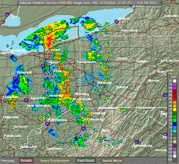 The severe thunderstorm warning for northeastern monroe, belmont, southern ohio and northwestern marshall counties will expire at 515 pm edt, the storm which prompted the warning has moved out of the area. therefore, the warning will be allowed to expire. however heavy rain is still possible with this thunderstorm. The severe thunderstorm warning for northeastern monroe, belmont, southern ohio and northwestern marshall counties will expire at 515 pm edt, the storm which prompted the warning has moved out of the area. therefore, the warning will be allowed to expire. however heavy rain is still possible with this thunderstorm.
|
| 7/10/2020 4:41 PM EDT |
 At 441 pm edt, a severe thunderstorm was located 7 miles west of powhatan point, or 11 miles west of moundsville, moving northeast at 20 mph (radar). Hazards include wind gusts to 60 mph. Expect damage to trees and power lines, resulting in some power outages. locations impacted include, wheeling, moundsville, martins ferry, st. clairsville, bellaire, warwood, bethlehem, triadelphia, valley grove, shadyside, mcmechen, powhatan point, this includes the following highways, interstate 70 in ohio between mile markers 209 and 225. Interstate 70 in west virginia between mile markers 0 and 12. At 441 pm edt, a severe thunderstorm was located 7 miles west of powhatan point, or 11 miles west of moundsville, moving northeast at 20 mph (radar). Hazards include wind gusts to 60 mph. Expect damage to trees and power lines, resulting in some power outages. locations impacted include, wheeling, moundsville, martins ferry, st. clairsville, bellaire, warwood, bethlehem, triadelphia, valley grove, shadyside, mcmechen, powhatan point, this includes the following highways, interstate 70 in ohio between mile markers 209 and 225. Interstate 70 in west virginia between mile markers 0 and 12.
|
| 7/10/2020 4:27 PM EDT |
 At 427 pm edt, a severe thunderstorm was located 8 miles northeast of woodsfield, moving northeast at 20 mph (radar). Hazards include wind gusts to 60 mph and quarter-size hail. Minor hail damage to vehicles is possible. Expect wind damage to trees and power lines, resulting in some power outages. At 427 pm edt, a severe thunderstorm was located 8 miles northeast of woodsfield, moving northeast at 20 mph (radar). Hazards include wind gusts to 60 mph and quarter-size hail. Minor hail damage to vehicles is possible. Expect wind damage to trees and power lines, resulting in some power outages.
|
| 3/28/2020 10:58 PM EDT |
 At 1058 pm edt, a severe thunderstorm was located 9 miles southeast of freeport, moving east at 50 mph (radar). Hazards include wind gusts to 60 mph and quarter-size hail. Minor hail damage to vehicles is possible. Expect wind damage to trees and power lines, resulting in some power outages. At 1058 pm edt, a severe thunderstorm was located 9 miles southeast of freeport, moving east at 50 mph (radar). Hazards include wind gusts to 60 mph and quarter-size hail. Minor hail damage to vehicles is possible. Expect wind damage to trees and power lines, resulting in some power outages.
|
| 9/28/2019 5:44 PM EDT |
 At 544 pm edt, a severe thunderstorm was located near cambridge, moving east at 30 mph (radar). Hazards include golf ball size-hail and wind gusts to 60 mph. People and animals outdoors will be injured. expect hail damage to roofs, siding, windows, and vehicles. expect wind damage to trees and power lines, resulting in some power outages. locations impacted include, cambridge, moundsville, st. clairsville, bellaire, barnesville, shadyside, byesville, mcmechen, powhatan point, glen dale, bridgeport, benwood, this includes the following highways, interstate 70 in ohio between mile markers 176 and 224. Interstate 77 in ohio between mile markers 41 and 53. At 544 pm edt, a severe thunderstorm was located near cambridge, moving east at 30 mph (radar). Hazards include golf ball size-hail and wind gusts to 60 mph. People and animals outdoors will be injured. expect hail damage to roofs, siding, windows, and vehicles. expect wind damage to trees and power lines, resulting in some power outages. locations impacted include, cambridge, moundsville, st. clairsville, bellaire, barnesville, shadyside, byesville, mcmechen, powhatan point, glen dale, bridgeport, benwood, this includes the following highways, interstate 70 in ohio between mile markers 176 and 224. Interstate 77 in ohio between mile markers 41 and 53.
|
| 9/28/2019 5:34 PM EDT |
 At 534 pm edt, a severe thunderstorm was located over cambridge, moving east at 30 mph (radar). Hazards include golf ball size-hail and wind gusts to 60 mph. People and animals outdoors will be injured. expect hail damage to roofs, siding, windows, and vehicles. expect wind damage to trees and power lines, resulting in some power outages. locations impacted include, cambridge, moundsville, st. clairsville, bellaire, barnesville, shadyside, new concord, byesville, mcmechen, powhatan point, glen dale, bridgeport, this includes the following highways, interstate 70 in ohio between mile markers 171 and 225. Interstate 77 in ohio between mile markers 41 and 56. At 534 pm edt, a severe thunderstorm was located over cambridge, moving east at 30 mph (radar). Hazards include golf ball size-hail and wind gusts to 60 mph. People and animals outdoors will be injured. expect hail damage to roofs, siding, windows, and vehicles. expect wind damage to trees and power lines, resulting in some power outages. locations impacted include, cambridge, moundsville, st. clairsville, bellaire, barnesville, shadyside, new concord, byesville, mcmechen, powhatan point, glen dale, bridgeport, this includes the following highways, interstate 70 in ohio between mile markers 171 and 225. Interstate 77 in ohio between mile markers 41 and 56.
|
| 9/28/2019 5:25 PM EDT |
 At 525 pm edt, a severe thunderstorm was located near cambridge, moving east at 30 mph (radar). Hazards include wind gusts to 60 mph and quarter-size hail. Minor hail damage to vehicles is possible. Expect wind damage to trees and power lines, resulting in some power outages. At 525 pm edt, a severe thunderstorm was located near cambridge, moving east at 30 mph (radar). Hazards include wind gusts to 60 mph and quarter-size hail. Minor hail damage to vehicles is possible. Expect wind damage to trees and power lines, resulting in some power outages.
|
| 9/2/2019 12:05 AM EDT |
 The severe thunderstorm warning for eastern belmont, southwestern washington, northwestern greene, ohio and northern marshall counties will expire at 1215 am edt, the storm that prompted the warning has weakened below severe limits and no longer pose an immediate threat to life and property. therefore, the warning will be allowed to expire. however gusty winds and heavy rain are still possible with this thunderstorm. The severe thunderstorm warning for eastern belmont, southwestern washington, northwestern greene, ohio and northern marshall counties will expire at 1215 am edt, the storm that prompted the warning has weakened below severe limits and no longer pose an immediate threat to life and property. therefore, the warning will be allowed to expire. however gusty winds and heavy rain are still possible with this thunderstorm.
|
| 9/1/2019 11:53 PM EDT |
 At 1137 pm edt, a severe thunderstorm was located near st. clairsville, moving east at 40 mph (radar). Hazards include wind gusts to 60 mph. expect damage to trees and power lines, resulting in some power outages At 1137 pm edt, a severe thunderstorm was located near st. clairsville, moving east at 40 mph (radar). Hazards include wind gusts to 60 mph. expect damage to trees and power lines, resulting in some power outages
|
| 9/1/2019 11:37 PM EDT |
 The national weather service in pittsburgh has issued a * severe thunderstorm warning for. eastern belmont county in east central ohio. southwestern washington county in southwestern pennsylvania. northwestern greene county in southwestern pennsylvania. Ohio county in northern west virginia. The national weather service in pittsburgh has issued a * severe thunderstorm warning for. eastern belmont county in east central ohio. southwestern washington county in southwestern pennsylvania. northwestern greene county in southwestern pennsylvania. Ohio county in northern west virginia.
|
| 9/1/2019 11:37 PM EDT |
 At 1137 pm edt, a severe thunderstorm was located near st. clairsville, moving east at 40 mph (radar). Hazards include wind gusts to 60 mph. expect damage to trees and power lines, resulting in some power outages At 1137 pm edt, a severe thunderstorm was located near st. clairsville, moving east at 40 mph (radar). Hazards include wind gusts to 60 mph. expect damage to trees and power lines, resulting in some power outages
|
| 9/1/2019 11:37 PM EDT |
 At 1137 pm edt, a severe thunderstorm was located near st. clairsville, moving east at 40 mph (radar). Hazards include wind gusts to 60 mph. expect damage to trees and power lines, resulting in some power outages At 1137 pm edt, a severe thunderstorm was located near st. clairsville, moving east at 40 mph (radar). Hazards include wind gusts to 60 mph. expect damage to trees and power lines, resulting in some power outages
|
| 7/6/2019 5:18 PM EDT |
 At 517 pm edt, a severe thunderstorm was located near valley grove, moving southeast at 45 mph (radar). Hazards include wind gusts to 60 mph. expect damage to trees and power lines, resulting in some power outages At 517 pm edt, a severe thunderstorm was located near valley grove, moving southeast at 45 mph (radar). Hazards include wind gusts to 60 mph. expect damage to trees and power lines, resulting in some power outages
|
| 6/29/2019 9:42 PM EDT |
 At 942 pm edt, a severe thunderstorm was located near triadelphia, moving southeast at 25 mph (radar). Hazards include wind gusts to 60 mph and quarter-size hail. Minor hail damage to vehicles is possible. Expect wind damage to trees and power lines, resulting in some power outages. At 942 pm edt, a severe thunderstorm was located near triadelphia, moving southeast at 25 mph (radar). Hazards include wind gusts to 60 mph and quarter-size hail. Minor hail damage to vehicles is possible. Expect wind damage to trees and power lines, resulting in some power outages.
|
| 6/24/2019 5:41 PM EDT |
 At 541 pm edt, severe thunderstorms were located along a line extending from 6 miles northwest of sistersville to near new martinsville, moving north at 25 mph (radar). Hazards include wind gusts to 60 mph. damage to trees and power lines At 541 pm edt, severe thunderstorms were located along a line extending from 6 miles northwest of sistersville to near new martinsville, moving north at 25 mph (radar). Hazards include wind gusts to 60 mph. damage to trees and power lines
|
| 5/25/2019 5:44 PM EDT |
 At 544 pm edt, a severe thunderstorm capable of producing a tornado was located 8 miles northwest of powhatan point, or 9 miles south of st. clairsville, moving east at 25 mph (radar indicated rotation). Hazards include tornado and quarter-size hail. Flying debris will be dangerous to those caught without shelter. mobile homes will be damaged or destroyed. damage to roofs, windows, and vehicles will occur. tree damage is likely. this dangerous storm will be near, moundsville, shadyside, mcmechen, powhatan point and glen dale around 600 pm edt. Other locations impacted by this tornadic thunderstorm include glendale, grand vue park, benwood and neffs. At 544 pm edt, a severe thunderstorm capable of producing a tornado was located 8 miles northwest of powhatan point, or 9 miles south of st. clairsville, moving east at 25 mph (radar indicated rotation). Hazards include tornado and quarter-size hail. Flying debris will be dangerous to those caught without shelter. mobile homes will be damaged or destroyed. damage to roofs, windows, and vehicles will occur. tree damage is likely. this dangerous storm will be near, moundsville, shadyside, mcmechen, powhatan point and glen dale around 600 pm edt. Other locations impacted by this tornadic thunderstorm include glendale, grand vue park, benwood and neffs.
|
| 5/25/2019 5:35 PM EDT |
 At 534 pm edt, a severe thunderstorm was located near st. clairsville, moving east at 35 mph. tornado warning is in effect for this storm (radar). Hazards include wind gusts to 60 mph and quarter-size hail. Minor hail damage to vehicles is possible. expect wind damage to trees and power lines, resulting in some power outages. locations impacted include, moundsville, bellaire, shadyside, mcmechen, powhatan point, glen dale, cameron, benwood, belmont, neffs, alledonia, grove oak, tornadoes can develop unexpectedly from severe thunderstorms. if a tornado is reported, move to a basement or small, central room in a sturdy structure. please report severe weather by calling 412-262-1988, posting to the nws pittsburgh facebook page, or using twitter @nwspittsburgh. At 534 pm edt, a severe thunderstorm was located near st. clairsville, moving east at 35 mph. tornado warning is in effect for this storm (radar). Hazards include wind gusts to 60 mph and quarter-size hail. Minor hail damage to vehicles is possible. expect wind damage to trees and power lines, resulting in some power outages. locations impacted include, moundsville, bellaire, shadyside, mcmechen, powhatan point, glen dale, cameron, benwood, belmont, neffs, alledonia, grove oak, tornadoes can develop unexpectedly from severe thunderstorms. if a tornado is reported, move to a basement or small, central room in a sturdy structure. please report severe weather by calling 412-262-1988, posting to the nws pittsburgh facebook page, or using twitter @nwspittsburgh.
|
| 5/25/2019 5:33 PM EDT |
 At 533 pm edt, a severe thunderstorm capable of producing a tornado was located 8 miles east of barnesville, moving east at 30 mph (radar indicated rotation). Hazards include tornado and quarter-size hail. Flying debris will be dangerous to those caught without shelter. mobile homes will be damaged or destroyed. damage to roofs, windows, and vehicles will occur. tree damage is likely. this dangerous storm will be near, moundsville, bellaire, shadyside, mcmechen, powhatan point and glen dale around 600 pm edt. Other locations impacted by this tornadic thunderstorm include barkcamp state park, grand vue park, alledonia, glendale, belmont, neffs and benwood. At 533 pm edt, a severe thunderstorm capable of producing a tornado was located 8 miles east of barnesville, moving east at 30 mph (radar indicated rotation). Hazards include tornado and quarter-size hail. Flying debris will be dangerous to those caught without shelter. mobile homes will be damaged or destroyed. damage to roofs, windows, and vehicles will occur. tree damage is likely. this dangerous storm will be near, moundsville, bellaire, shadyside, mcmechen, powhatan point and glen dale around 600 pm edt. Other locations impacted by this tornadic thunderstorm include barkcamp state park, grand vue park, alledonia, glendale, belmont, neffs and benwood.
|
| 5/25/2019 5:24 PM EDT |
 At 524 pm edt, a severe thunderstorm capable of producing a tornado was located near barnesville, moving east at 25 mph (radar indicated rotation). Hazards include tornado and quarter size hail. Flying debris will be dangerous to those caught without shelter. mobile homes will be damaged or destroyed. damage to roofs, windows, and vehicles will occur. tree damage is likely. this dangerous storm will be near, moundsville, shadyside, powhatan point and glen dale around 600 pm edt. other locations impacted by this tornadic thunderstorm include barkcamp state park, grand vue park, belmont, alledonia, bethesda, glendale, neffs and benwood. this includes interstate 70 in ohio near mile marker 205. Please report severe weather by calling 412-262-1988, posting to the nws pittsburgh facebook page, or using twitter @nwspittsburgh. At 524 pm edt, a severe thunderstorm capable of producing a tornado was located near barnesville, moving east at 25 mph (radar indicated rotation). Hazards include tornado and quarter size hail. Flying debris will be dangerous to those caught without shelter. mobile homes will be damaged or destroyed. damage to roofs, windows, and vehicles will occur. tree damage is likely. this dangerous storm will be near, moundsville, shadyside, powhatan point and glen dale around 600 pm edt. other locations impacted by this tornadic thunderstorm include barkcamp state park, grand vue park, belmont, alledonia, bethesda, glendale, neffs and benwood. this includes interstate 70 in ohio near mile marker 205. Please report severe weather by calling 412-262-1988, posting to the nws pittsburgh facebook page, or using twitter @nwspittsburgh.
|
| 5/25/2019 5:19 PM EDT |
 At 519 pm edt, a severe thunderstorm was located near barnesville, moving east at 35 mph (radar). Hazards include wind gusts to 60 mph and quarter-size hail. Minor hail damage to vehicles is possible. Expect wind damage to trees and power lines, resulting in some power outages. At 519 pm edt, a severe thunderstorm was located near barnesville, moving east at 35 mph (radar). Hazards include wind gusts to 60 mph and quarter-size hail. Minor hail damage to vehicles is possible. Expect wind damage to trees and power lines, resulting in some power outages.
|
| 7/5/2018 6:36 PM EDT |
 At 636 pm edt, severe thunderstorms were located along a line extending from 6 miles east of fairview to near cameron, moving east at 30 mph (radar). Hazards include wind gusts to 60 mph. Expect damage to trees and power lines, resulting in some power outages. Locations impacted include, moundsville, powhatan point, glen dale, cameron, clarington, aleppo, grove oak, woodlands, glendale, rocklick, lynn camp, lone oak,. At 636 pm edt, severe thunderstorms were located along a line extending from 6 miles east of fairview to near cameron, moving east at 30 mph (radar). Hazards include wind gusts to 60 mph. Expect damage to trees and power lines, resulting in some power outages. Locations impacted include, moundsville, powhatan point, glen dale, cameron, clarington, aleppo, grove oak, woodlands, glendale, rocklick, lynn camp, lone oak,.
|
| 7/5/2018 6:15 PM EDT |
 At 615 pm edt, severe thunderstorms were located along a line extending from 9 miles southeast of valley grove to near triadelphia to moundsville, moving southeast at 20 mph (radar). Hazards include wind gusts to 60 mph. Expect damage to trees and power lines, resulting in some power outages. locations impacted include, wheeling, moundsville, martins ferry, st. clairsville, bellaire, warwood, bethlehem, west liberty, triadelphia, clearview, valley grove, shadyside, this includes the following highways, interstate 70 in ohio between mile markers 213 and 225. interstate 70 in west virginia between mile markers 0 and 14. Interstate 70 in pennsylvania between mile markers 0 and 9. At 615 pm edt, severe thunderstorms were located along a line extending from 9 miles southeast of valley grove to near triadelphia to moundsville, moving southeast at 20 mph (radar). Hazards include wind gusts to 60 mph. Expect damage to trees and power lines, resulting in some power outages. locations impacted include, wheeling, moundsville, martins ferry, st. clairsville, bellaire, warwood, bethlehem, west liberty, triadelphia, clearview, valley grove, shadyside, this includes the following highways, interstate 70 in ohio between mile markers 213 and 225. interstate 70 in west virginia between mile markers 0 and 14. Interstate 70 in pennsylvania between mile markers 0 and 9.
|
| 7/5/2018 6:09 PM EDT |
 At 609 pm edt, severe thunderstorms were located along a line extending from near powhatan point to near shadyside to bellaire to near triadelphia, moving southeast at 20 mph (radar). Hazards include wind gusts to 60 mph. expect damage to trees and power lines, resulting in some power outages At 609 pm edt, severe thunderstorms were located along a line extending from near powhatan point to near shadyside to bellaire to near triadelphia, moving southeast at 20 mph (radar). Hazards include wind gusts to 60 mph. expect damage to trees and power lines, resulting in some power outages
|
| 7/5/2018 5:34 PM EDT |
 At 533 pm edt, severe thunderstorms were located along a line extending from near west liberty to tiltonsville to near st. clairsville, moving southeast at 20 mph (radar). Hazards include wind gusts to 60 mph. Expect damage to trees and power lines, resulting in some power outages. locations impacted include, wheeling, moundsville, martins ferry, st. clairsville, bellaire, warwood, wellsburg, bethlehem, west liberty, triadelphia, avella, clearview, this includes the following highways, interstate 70 in ohio between mile markers 213 and 225. interstate 70 in west virginia between mile markers 0 and 14. Interstate 70 in pennsylvania between mile markers 0 and 9. At 533 pm edt, severe thunderstorms were located along a line extending from near west liberty to tiltonsville to near st. clairsville, moving southeast at 20 mph (radar). Hazards include wind gusts to 60 mph. Expect damage to trees and power lines, resulting in some power outages. locations impacted include, wheeling, moundsville, martins ferry, st. clairsville, bellaire, warwood, wellsburg, bethlehem, west liberty, triadelphia, avella, clearview, this includes the following highways, interstate 70 in ohio between mile markers 213 and 225. interstate 70 in west virginia between mile markers 0 and 14. Interstate 70 in pennsylvania between mile markers 0 and 9.
|
| 7/5/2018 5:32 PM EDT |
 At 532 pm edt, severe thunderstorms were located along a line extending from near west liberty to clearview to near st. clairsville, moving southeast at 20 mph (radar). Hazards include wind gusts to 60 mph. expect damage to trees and power lines, resulting in some power outages At 532 pm edt, severe thunderstorms were located along a line extending from near west liberty to clearview to near st. clairsville, moving southeast at 20 mph (radar). Hazards include wind gusts to 60 mph. expect damage to trees and power lines, resulting in some power outages
|
| 7/5/2018 5:04 PM EDT |
 At 503 pm edt, severe thunderstorms were located along a line extending from mingo junction to 8 miles southwest of wintersville to near cadiz, moving southeast at 20 mph (radar). Hazards include wind gusts to 60 mph. expect damage to trees and power lines, resulting in some power outages At 503 pm edt, severe thunderstorms were located along a line extending from mingo junction to 8 miles southwest of wintersville to near cadiz, moving southeast at 20 mph (radar). Hazards include wind gusts to 60 mph. expect damage to trees and power lines, resulting in some power outages
|
| 5/13/2018 8:32 PM EDT |
 At 832 pm edt, a severe thunderstorm was located over bellaire, moving southeast at 30 mph (radar). Hazards include wind gusts to 60 mph and quarter-size hail. Minor hail damage to vehicles is possible. expect wind damage to trees and power lines, resulting in some power outages. locations impacted include, wheeling, moundsville, martins ferry, st. clairsville, bellaire, warwood, bethlehem, triadelphia, valley grove, shadyside, mcmechen, glen dale, this includes the following highways, interstate 70 in ohio between mile markers 215 and 225. Interstate 70 in west virginia between mile markers 0 and 12. At 832 pm edt, a severe thunderstorm was located over bellaire, moving southeast at 30 mph (radar). Hazards include wind gusts to 60 mph and quarter-size hail. Minor hail damage to vehicles is possible. expect wind damage to trees and power lines, resulting in some power outages. locations impacted include, wheeling, moundsville, martins ferry, st. clairsville, bellaire, warwood, bethlehem, triadelphia, valley grove, shadyside, mcmechen, glen dale, this includes the following highways, interstate 70 in ohio between mile markers 215 and 225. Interstate 70 in west virginia between mile markers 0 and 12.
|
| 5/13/2018 8:22 PM EDT |
 At 821 pm edt, a severe thunderstorm was located over st. clairsville, moving southeast at 30 mph (radar). Hazards include wind gusts to 60 mph and quarter-size hail. Minor hail damage to vehicles is possible. Expect wind damage to trees and power lines, resulting in some power outages. At 821 pm edt, a severe thunderstorm was located over st. clairsville, moving southeast at 30 mph (radar). Hazards include wind gusts to 60 mph and quarter-size hail. Minor hail damage to vehicles is possible. Expect wind damage to trees and power lines, resulting in some power outages.
|
| 5/13/2018 8:22 PM EDT |
 The national weather service in pittsburgh has issued a * severe thunderstorm warning for. southeastern harrison county in east central ohio. northeastern belmont county in east central ohio. southern ohio county in northern west virginia. North central marshall county in northern west virginia. The national weather service in pittsburgh has issued a * severe thunderstorm warning for. southeastern harrison county in east central ohio. northeastern belmont county in east central ohio. southern ohio county in northern west virginia. North central marshall county in northern west virginia.
|
| 5/13/2018 7:59 PM EDT |
 At 759 pm edt, a severe thunderstorm was located over shadyside, or near moundsville, moving east at 40 mph (radar). Hazards include wind gusts to 60 mph. expect damage to trees and power lines, resulting in some power outages At 759 pm edt, a severe thunderstorm was located over shadyside, or near moundsville, moving east at 40 mph (radar). Hazards include wind gusts to 60 mph. expect damage to trees and power lines, resulting in some power outages
|
| 11/5/2017 8:57 PM EST |
 At 856 pm est, severe thunderstorms were located along a line extending from near carrollton to near cadiz to near barnesville, moving east at 45 mph (radar). Hazards include 60 mph wind gusts. Expect damage to trees and power lines, resulting in some power outages. locations impacted include, wheeling, weirton, steubenville, martins ferry, st. clairsville, bellaire, barnesville, cadiz, carrollton, wellsburg, freeport, toronto, this includes the following highways, interstate 70 in ohio between mile markers 186 and 225. Interstate 70 in west virginia near mile marker 0. At 856 pm est, severe thunderstorms were located along a line extending from near carrollton to near cadiz to near barnesville, moving east at 45 mph (radar). Hazards include 60 mph wind gusts. Expect damage to trees and power lines, resulting in some power outages. locations impacted include, wheeling, weirton, steubenville, martins ferry, st. clairsville, bellaire, barnesville, cadiz, carrollton, wellsburg, freeport, toronto, this includes the following highways, interstate 70 in ohio between mile markers 186 and 225. Interstate 70 in west virginia near mile marker 0.
|
| 11/5/2017 8:30 PM EST |
 At 829 pm est, severe thunderstorms were located along a line extending from near new concord to 14 miles west of caldwell to mcconnelsville, moving east at 40 mph (radar). Hazards include 60 mph wind gusts. expect damage to trees and power lines, resulting in some power outages At 829 pm est, severe thunderstorms were located along a line extending from near new concord to 14 miles west of caldwell to mcconnelsville, moving east at 40 mph (radar). Hazards include 60 mph wind gusts. expect damage to trees and power lines, resulting in some power outages
|
| 11/5/2017 8:28 PM EST |
 At 828 pm est, severe thunderstorms were located along a line extending from near strasburg to 7 miles west of uhrichsville to near cambridge, moving east at 45 mph (radar). Hazards include 60 mph wind gusts. expect damage to trees and power lines, resulting in some power outages At 828 pm est, severe thunderstorms were located along a line extending from near strasburg to 7 miles west of uhrichsville to near cambridge, moving east at 45 mph (radar). Hazards include 60 mph wind gusts. expect damage to trees and power lines, resulting in some power outages
|
| 8/4/2017 1:09 PM EDT |
 At 109 pm edt, a severe thunderstorm was located near powhatan point, or near moundsville, moving northeast at 40 mph (radar). Hazards include 60 mph wind gusts. damage to trees and power lines At 109 pm edt, a severe thunderstorm was located near powhatan point, or near moundsville, moving northeast at 40 mph (radar). Hazards include 60 mph wind gusts. damage to trees and power lines
|
| 5/1/2017 2:06 PM EDT |
 At 206 pm edt, severe thunderstorms were located along a line extending from near east palestine to near shippingport to near avella, moving northeast at 60 mph (radar). Hazards include 70 mph wind gusts. Trees snapped and uprooted. power outages can be expected. locations impacted include, wheeling, weirton, moundsville, martins ferry, bellaire, warwood, wellsburg, bethlehem, west liberty, triadelphia, avella, clearview, this includes the following highways, interstate 70 in ohio between mile markers 224 and 225. interstate 70 in west virginia between mile markers 0 and 14. interstate 70 in pennsylvania between mile markers 0 and 10. A tornado watch remains in effect until 700 pm edt for east central ohio, western and southwestern pennsylvania, and northern west virginia. At 206 pm edt, severe thunderstorms were located along a line extending from near east palestine to near shippingport to near avella, moving northeast at 60 mph (radar). Hazards include 70 mph wind gusts. Trees snapped and uprooted. power outages can be expected. locations impacted include, wheeling, weirton, moundsville, martins ferry, bellaire, warwood, wellsburg, bethlehem, west liberty, triadelphia, avella, clearview, this includes the following highways, interstate 70 in ohio between mile markers 224 and 225. interstate 70 in west virginia between mile markers 0 and 14. interstate 70 in pennsylvania between mile markers 0 and 10. A tornado watch remains in effect until 700 pm edt for east central ohio, western and southwestern pennsylvania, and northern west virginia.
|
| 5/1/2017 1:44 PM EDT |
 At 143 pm edt, severe thunderstorms were located along a line extending from 8 miles south of lisbon to wintersville to near martins ferry, moving northeast at 60 mph (radar). Hazards include 70 mph wind gusts. Trees snapped and uprooted. power outages can be expected. locations impacted include, wheeling, weirton, steubenville, moundsville, martins ferry, st. clairsville, bellaire, wellsville, warwood, wellsburg, bethlehem, west liberty, this includes the following highways, interstate 70 in ohio between mile markers 217 and 225. interstate 70 in west virginia between mile markers 0 and 14. interstate 70 in pennsylvania between mile markers 0 and 10. A tornado watch remains in effect until 700 pm edt for east central ohio, western and southwestern pennsylvania, and northern west virginia. At 143 pm edt, severe thunderstorms were located along a line extending from 8 miles south of lisbon to wintersville to near martins ferry, moving northeast at 60 mph (radar). Hazards include 70 mph wind gusts. Trees snapped and uprooted. power outages can be expected. locations impacted include, wheeling, weirton, steubenville, moundsville, martins ferry, st. clairsville, bellaire, wellsville, warwood, wellsburg, bethlehem, west liberty, this includes the following highways, interstate 70 in ohio between mile markers 217 and 225. interstate 70 in west virginia between mile markers 0 and 14. interstate 70 in pennsylvania between mile markers 0 and 10. A tornado watch remains in effect until 700 pm edt for east central ohio, western and southwestern pennsylvania, and northern west virginia.
|
| 5/1/2017 1:22 PM EDT |
 At 121 pm edt, severe thunderstorms were located along a line extending from 7 miles south of carrollton to 7 miles south of cadiz to 8 miles southeast of barnesville, moving northeast at 60 mph (radar). Hazards include 70 mph wind gusts. Trees snapped and uprooted. Power outages can be expected. At 121 pm edt, severe thunderstorms were located along a line extending from 7 miles south of carrollton to 7 miles south of cadiz to 8 miles southeast of barnesville, moving northeast at 60 mph (radar). Hazards include 70 mph wind gusts. Trees snapped and uprooted. Power outages can be expected.
|
| 4/16/2017 6:50 PM EDT |
 The severe thunderstorm warning for southwestern washington, western greene and northeastern marshall counties will expire at 700 pm edt, the storm that prompted the warning has weakened below severe limits and no longer pose an immediate threat to life and property. therefore, the warning will be allowed to expire. however gusty winds are still possible with this thunderstorm. The severe thunderstorm warning for southwestern washington, western greene and northeastern marshall counties will expire at 700 pm edt, the storm that prompted the warning has weakened below severe limits and no longer pose an immediate threat to life and property. therefore, the warning will be allowed to expire. however gusty winds are still possible with this thunderstorm.
|
| 4/16/2017 6:27 PM EDT |
 At 626 pm edt, a severe thunderstorm was located near mcmechen, or near moundsville, moving east at 40 mph (radar). Hazards include 60 mph wind gusts. Expect damage to trees and power lines, resulting in some power outages. Locations impacted include, moundsville, bellaire, mcmechen, glen dale, cameron, benwood, west finley, aleppo, nineveh, glendale, rocklick, lone oak,. At 626 pm edt, a severe thunderstorm was located near mcmechen, or near moundsville, moving east at 40 mph (radar). Hazards include 60 mph wind gusts. Expect damage to trees and power lines, resulting in some power outages. Locations impacted include, moundsville, bellaire, mcmechen, glen dale, cameron, benwood, west finley, aleppo, nineveh, glendale, rocklick, lone oak,.
|
| 4/16/2017 6:15 PM EDT |
 At 615 pm edt, a severe thunderstorm was located near st. clairsville, moving east at 30 mph (radar). Hazards include 60 mph wind gusts and quarter-size hail. Hail damage to vehicles is expected. Expect wind damage to trees and power lines, resulting in some power outages. At 615 pm edt, a severe thunderstorm was located near st. clairsville, moving east at 30 mph (radar). Hazards include 60 mph wind gusts and quarter-size hail. Hail damage to vehicles is expected. Expect wind damage to trees and power lines, resulting in some power outages.
|
| 4/16/2017 6:02 PM EDT |
 At 602 pm edt, a severe thunderstorm was located over st. clairsville, moving east at 30 mph (radar). Hazards include 60 mph wind gusts and quarter-size hail. Hail damage to vehicles is expected. expect wind damage to trees and power lines, resulting in some power outages. locations impacted include, wheeling, moundsville, martins ferry, st. clairsville, bellaire, warwood, bethlehem, triadelphia, shadyside, mcmechen, glen dale, bridgeport, this includes the following highways, interstate 70 in ohio between mile markers 210 and 225. Interstate 70 in west virginia between mile markers 0 and 7. At 602 pm edt, a severe thunderstorm was located over st. clairsville, moving east at 30 mph (radar). Hazards include 60 mph wind gusts and quarter-size hail. Hail damage to vehicles is expected. expect wind damage to trees and power lines, resulting in some power outages. locations impacted include, wheeling, moundsville, martins ferry, st. clairsville, bellaire, warwood, bethlehem, triadelphia, shadyside, mcmechen, glen dale, bridgeport, this includes the following highways, interstate 70 in ohio between mile markers 210 and 225. Interstate 70 in west virginia between mile markers 0 and 7.
|
| 4/16/2017 5:44 PM EDT |
 At 544 pm edt, a severe thunderstorm was located 8 miles northeast of barnesville, moving east at 30 mph (radar). Hazards include 60 mph wind gusts and quarter-size hail. Hail damage to vehicles is expected. expect wind damage to trees and power lines, resulting in some power outages. locations impacted include, wheeling, moundsville, martins ferry, st. clairsville, bellaire, warwood, bethlehem, triadelphia, clearview, shadyside, mcmechen, glen dale, this includes the following highways, interstate 70 in ohio between mile markers 203 and 225. Interstate 70 in west virginia between mile markers 0 and 7. At 544 pm edt, a severe thunderstorm was located 8 miles northeast of barnesville, moving east at 30 mph (radar). Hazards include 60 mph wind gusts and quarter-size hail. Hail damage to vehicles is expected. expect wind damage to trees and power lines, resulting in some power outages. locations impacted include, wheeling, moundsville, martins ferry, st. clairsville, bellaire, warwood, bethlehem, triadelphia, clearview, shadyside, mcmechen, glen dale, this includes the following highways, interstate 70 in ohio between mile markers 203 and 225. Interstate 70 in west virginia between mile markers 0 and 7.
|
| 4/16/2017 5:33 PM EDT |
 At 533 pm edt, a severe thunderstorm was located 7 miles north of barnesville, moving east at 30 mph (radar). Hazards include 60 mph wind gusts and quarter-size hail. Hail damage to vehicles is expected. Expect wind damage to trees and power lines, resulting in some power outages. At 533 pm edt, a severe thunderstorm was located 7 miles north of barnesville, moving east at 30 mph (radar). Hazards include 60 mph wind gusts and quarter-size hail. Hail damage to vehicles is expected. Expect wind damage to trees and power lines, resulting in some power outages.
|
| 3/1/2017 9:26 AM EST |
 At 926 am est, severe thunderstorms were located along a line extending from 8 miles northwest of powhatan point to near woodsfield, moving east at 60 mph (radar). Hazards include 60 mph wind gusts. Expect damage to trees and power lines, resulting in some power outages. Locations impacted include, wheeling, moundsville, new martinsville, bellaire, bethlehem, woodsfield, triadelphia, valley grove, shadyside, mcmechen, powhatan point, glen dale, this includes interstate 70 in west virginia between mile markers 3 and 14. At 926 am est, severe thunderstorms were located along a line extending from 8 miles northwest of powhatan point to near woodsfield, moving east at 60 mph (radar). Hazards include 60 mph wind gusts. Expect damage to trees and power lines, resulting in some power outages. Locations impacted include, wheeling, moundsville, new martinsville, bellaire, bethlehem, woodsfield, triadelphia, valley grove, shadyside, mcmechen, powhatan point, glen dale, this includes interstate 70 in west virginia between mile markers 3 and 14.
|
| 3/1/2017 9:00 AM EST |
 At 859 am est, severe thunderstorms were located along a line extending from 10 miles southeast of byesville to near caldwell to near beverly, moving east at 65 mph (radar). Hazards include 60 mph wind gusts. expect damage to trees and power lines, resulting in some power outages At 859 am est, severe thunderstorms were located along a line extending from 10 miles southeast of byesville to near caldwell to near beverly, moving east at 65 mph (radar). Hazards include 60 mph wind gusts. expect damage to trees and power lines, resulting in some power outages
|
| 3/1/2017 8:32 AM EST |
 At 832 am est, a severe thunderstorm was located over bethlehem, moving east at 45 mph (radar). Hazards include 60 mph wind gusts. Expect damage to trees and power lines, resulting in some power outages. locations impacted include, bethel park, wheeling, mcmurray, washington, moundsville, canonsburg, martins ferry, st. clairsville, bellaire, warwood, bethlehem, west liberty, this includes the following highways, interstate 70 in ohio between mile markers 217 and 225. interstate 70 in west virginia between mile markers 0 and 14. interstate 70 in pennsylvania between mile markers 0 and 42. Interstate 79 in pennsylvania between mile markers 16 and 21. At 832 am est, a severe thunderstorm was located over bethlehem, moving east at 45 mph (radar). Hazards include 60 mph wind gusts. Expect damage to trees and power lines, resulting in some power outages. locations impacted include, bethel park, wheeling, mcmurray, washington, moundsville, canonsburg, martins ferry, st. clairsville, bellaire, warwood, bethlehem, west liberty, this includes the following highways, interstate 70 in ohio between mile markers 217 and 225. interstate 70 in west virginia between mile markers 0 and 14. interstate 70 in pennsylvania between mile markers 0 and 42. Interstate 79 in pennsylvania between mile markers 16 and 21.
|
| 3/1/2017 8:15 AM EST |
 At 814 am est, a severe thunderstorm was located over wheeling, moving east at 85 mph (radar). Hazards include 60 mph wind gusts. expect damage to trees and power lines, resulting in some power outages At 814 am est, a severe thunderstorm was located over wheeling, moving east at 85 mph (radar). Hazards include 60 mph wind gusts. expect damage to trees and power lines, resulting in some power outages
|
| 9/29/2016 2:57 PM EDT |
 At 257 pm edt, a severe thunderstorm capable of producing a tornado was located near cameron, or 10 miles southeast of moundsville, moving north at 30 mph (radar indicated rotation). Hazards include tornado. Flying debris will be dangerous to those caught without shelter. mobile homes will be damaged or destroyed. damage to roofs, windows, and vehicles will occur. tree damage is likely. this dangerous storm will be near, moundsville and glen dale around 315 pm edt. other locations impacted by this tornadic thunderstorm include grove oak, lone oak, beelers station, glendale, grand vue park, glen easton and rocklick. Please report severe weather by calling 4 1 2, 2 6 2, 1 9 8 8, posting to the nws pittsburgh facebook page, or using twitter @nwspittsburgh. At 257 pm edt, a severe thunderstorm capable of producing a tornado was located near cameron, or 10 miles southeast of moundsville, moving north at 30 mph (radar indicated rotation). Hazards include tornado. Flying debris will be dangerous to those caught without shelter. mobile homes will be damaged or destroyed. damage to roofs, windows, and vehicles will occur. tree damage is likely. this dangerous storm will be near, moundsville and glen dale around 315 pm edt. other locations impacted by this tornadic thunderstorm include grove oak, lone oak, beelers station, glendale, grand vue park, glen easton and rocklick. Please report severe weather by calling 4 1 2, 2 6 2, 1 9 8 8, posting to the nws pittsburgh facebook page, or using twitter @nwspittsburgh.
|
| 9/29/2016 2:50 PM EDT |
 At 250 pm edt, a severe thunderstorm capable of producing a tornado was located 7 miles southwest of cameron, or 14 miles northeast of new martinsville, moving north at 20 mph (radar indicated rotation). Hazards include tornado. Flying debris will be dangerous to those caught without shelter. mobile homes will be damaged or destroyed. damage to roofs, windows, and vehicles will occur. tree damage is likely. this dangerous storm will be near, cameron around 310 pm edt. moundsville around 315 pm edt. other locations impacted by this tornadic thunderstorm include grove oak, lone oak, beelers station, glendale, grand vue park, glen easton, littleton and rocklick. Please report severe weather by calling 4 1 2, 2 6 2, 1 9 8 8, posting to the nws pittsburgh facebook page, or using twitter @nwspittsburgh. At 250 pm edt, a severe thunderstorm capable of producing a tornado was located 7 miles southwest of cameron, or 14 miles northeast of new martinsville, moving north at 20 mph (radar indicated rotation). Hazards include tornado. Flying debris will be dangerous to those caught without shelter. mobile homes will be damaged or destroyed. damage to roofs, windows, and vehicles will occur. tree damage is likely. this dangerous storm will be near, cameron around 310 pm edt. moundsville around 315 pm edt. other locations impacted by this tornadic thunderstorm include grove oak, lone oak, beelers station, glendale, grand vue park, glen easton, littleton and rocklick. Please report severe weather by calling 4 1 2, 2 6 2, 1 9 8 8, posting to the nws pittsburgh facebook page, or using twitter @nwspittsburgh.
|
| 6/16/2016 11:13 AM EDT | The severe thunderstorm warning for northwestern greene, southwestern washington and northeastern marshall counties will expire at 1115 am edt, the storm which prompted the warning has weakened. therefore, the warning will be allowed to expire. however small hail and gusty winds are still possible with this thunderstorm. |
| 6/16/2016 11:13 AM EDT | The severe thunderstorm warning for northwestern greene, southwestern washington and northeastern marshall counties will expire at 1115 am edt, the storm which prompted the warning has weakened. therefore, the warning will be allowed to expire. however small hail and gusty winds are still possible with this thunderstorm. |
| 6/16/2016 10:53 AM EDT |
 At 1053 am edt, a severe thunderstorm was located 7 miles southeast of triadelphia, moving southeast at 30 mph (radar indicated). Hazards include half dollar size hail. Damage to vehicles is expected. locations impacted include, moundsville, glen dale, cameron, west finley, aleppo, nineveh, lone oak, rocklick, beelers station and grand vue park. Please report severe weather by calling 4 1 2, 2 6 2, 1 9 8 8, posting to the nws pittsburgh facebook page, or using twitter @nwspittsburgh. At 1053 am edt, a severe thunderstorm was located 7 miles southeast of triadelphia, moving southeast at 30 mph (radar indicated). Hazards include half dollar size hail. Damage to vehicles is expected. locations impacted include, moundsville, glen dale, cameron, west finley, aleppo, nineveh, lone oak, rocklick, beelers station and grand vue park. Please report severe weather by calling 4 1 2, 2 6 2, 1 9 8 8, posting to the nws pittsburgh facebook page, or using twitter @nwspittsburgh.
|
| 6/16/2016 10:33 AM EDT |
 At 1032 am edt, a severe thunderstorm was located over bethlehem, moving southeast at 30 mph (radar indicated). Hazards include half dollar size hail. Damage to vehicles is expected. locations impacted include, wheeling, moundsville, martins ferry, bellaire, warwood, bethlehem, triadelphia, clearview, valley grove, shadyside, mcmechen, glen dale, cameron, bridgeport, benwood, west finley, brookside, west alexander, aleppo and neffs. this includes the following highways, interstate 70 in ohio between mile markers 221 and 225. interstate 70 in west virginia between mile markers 0 and 14. interstate 70 in pennsylvania near mile marker 0. Please report severe weather by calling 4 1 2, 2 6 2, 1 9 8 8, posting to the nws pittsburgh facebook page, or using twitter @nwspittsburgh. At 1032 am edt, a severe thunderstorm was located over bethlehem, moving southeast at 30 mph (radar indicated). Hazards include half dollar size hail. Damage to vehicles is expected. locations impacted include, wheeling, moundsville, martins ferry, bellaire, warwood, bethlehem, triadelphia, clearview, valley grove, shadyside, mcmechen, glen dale, cameron, bridgeport, benwood, west finley, brookside, west alexander, aleppo and neffs. this includes the following highways, interstate 70 in ohio between mile markers 221 and 225. interstate 70 in west virginia between mile markers 0 and 14. interstate 70 in pennsylvania near mile marker 0. Please report severe weather by calling 4 1 2, 2 6 2, 1 9 8 8, posting to the nws pittsburgh facebook page, or using twitter @nwspittsburgh.
|
| 6/16/2016 10:13 AM EDT |
 At 1012 am edt, a severe thunderstorm was located near tiltonsville, or 7 miles northwest of martins ferry, moving southeast at 30 mph (radar indicated). Hazards include quarter size hail. damage to vehicles is expected At 1012 am edt, a severe thunderstorm was located near tiltonsville, or 7 miles northwest of martins ferry, moving southeast at 30 mph (radar indicated). Hazards include quarter size hail. damage to vehicles is expected
|
| 5/1/2016 7:43 PM EDT | The severe thunderstorm warning for southeastern belmont and northern marshall counties will expire at 745 pm edt. the storm which prompted the warning has weakened below severe limits. and no longer pose an immediate threat to life or property. therefore. the warning will be allowed to expire. However small hail is still possible with this thunderstorm. |
| 5/1/2016 7:43 PM EDT | The severe thunderstorm warning for southeastern belmont and northern marshall counties will expire at 745 pm edt. the storm which prompted the warning has weakened below severe limits. and no longer pose an immediate threat to life or property. therefore. the warning will be allowed to expire. However small hail is still possible with this thunderstorm. |
| 5/1/2016 7:19 PM EDT |
 At 718 pm edt, a severe thunderstorm was located over shadyside, or near bellaire, moving east at 35 mph (quarter sized hail was reported at jacobsburg at 7:11 pm). Hazards include 60 mph wind gusts and quarter size hail. Hail damage to vehicles is expected. expect wind damage to trees and power lines, resulting in some power outages. locations impacted include, moundsville, bellaire, shadyside, mcmechen, glen dale, benwood, neffs, grove oak, lone oak, beelers station, grand vue park, sherrard and glendale. Please report severe weather by calling 4 1 2, 2 6 2, 1 9 8 8, posting to the nws pittsburgh facebook page, or using twitter @nwspittsburgh. At 718 pm edt, a severe thunderstorm was located over shadyside, or near bellaire, moving east at 35 mph (quarter sized hail was reported at jacobsburg at 7:11 pm). Hazards include 60 mph wind gusts and quarter size hail. Hail damage to vehicles is expected. expect wind damage to trees and power lines, resulting in some power outages. locations impacted include, moundsville, bellaire, shadyside, mcmechen, glen dale, benwood, neffs, grove oak, lone oak, beelers station, grand vue park, sherrard and glendale. Please report severe weather by calling 4 1 2, 2 6 2, 1 9 8 8, posting to the nws pittsburgh facebook page, or using twitter @nwspittsburgh.
|
| 5/1/2016 7:01 PM EDT |
 At 700 pm edt, a severe thunderstorm was located near st. clairsville, moving east at 35 mph (radar indicated). Hazards include 60 mph wind gusts and quarter size hail. Hail damage to vehicles is expected. Expect wind damage to trees and power lines, resulting in some power outages. At 700 pm edt, a severe thunderstorm was located near st. clairsville, moving east at 35 mph (radar indicated). Hazards include 60 mph wind gusts and quarter size hail. Hail damage to vehicles is expected. Expect wind damage to trees and power lines, resulting in some power outages.
|
| 7/7/2015 6:37 PM EDT |
 At 636 pm edt, a severe thunderstorm was located near moundsville, moving northeast at 45 mph (radar indicated). Hazards include 60 mph wind gusts. expect damage to trees and some power outages locations impacted include, wheeling, moundsville, bellaire, bethlehem, west liberty, triadelphia, valley grove, shadyside, mcmechen, powhatan point, glen dale, cameron, bridgeport, benwood, bethany, west finley, west alexander, neffs, nineveh and rocklick At 636 pm edt, a severe thunderstorm was located near moundsville, moving northeast at 45 mph (radar indicated). Hazards include 60 mph wind gusts. expect damage to trees and some power outages locations impacted include, wheeling, moundsville, bellaire, bethlehem, west liberty, triadelphia, valley grove, shadyside, mcmechen, powhatan point, glen dale, cameron, bridgeport, benwood, bethany, west finley, west alexander, neffs, nineveh and rocklick
|
| 7/7/2015 6:15 PM EDT |
 At 614 pm edt, a severe thunderstorm was located near powhatan point, or 10 miles north of new martinsville, moving northeast at 40 mph (radar indicated). Hazards include 60 mph wind gusts. expect damage to trees and some power outages At 614 pm edt, a severe thunderstorm was located near powhatan point, or 10 miles north of new martinsville, moving northeast at 40 mph (radar indicated). Hazards include 60 mph wind gusts. expect damage to trees and some power outages
|
| 6/23/2015 2:58 PM EDT | The severe thunderstorm warning for northeastern monroe, southern belmont and western marshall counties will expire at 300 pm edt, the severe thunderstorm which prompted the warning has weakened. therefore the warning will be allowed to expire. however gusty winds and heavy rain are still possible with this thunderstorm. a severe thunderstorm watch remains in effect until 1000 pm edt for east central ohio and northern west virginia. |
| 6/23/2015 2:58 PM EDT | The severe thunderstorm warning for northeastern monroe, southern belmont and western marshall counties will expire at 300 pm edt, the severe thunderstorm which prompted the warning has weakened. therefore the warning will be allowed to expire. however gusty winds and heavy rain are still possible with this thunderstorm. a severe thunderstorm watch remains in effect until 1000 pm edt for east central ohio and northern west virginia. |
| 6/23/2015 2:50 PM EDT |
 At 250 pm edt, a severe thunderstorm was located 9 miles southeast of barnesville, moving east at 30 mph (radar indicated). Hazards include 60 mph wind gusts and quarter size hail. Hail damage to vehicles is expected. expect wind damage to roofs, siding and trees. Locations impacted include, moundsville, shadyside, mcmechen, powhatan point, glen dale, beallsville, clarington, jerusalem, wilson, somerton, alledonia, miltonsburg, grove oak, woodlands, grand vue park and glendale. At 250 pm edt, a severe thunderstorm was located 9 miles southeast of barnesville, moving east at 30 mph (radar indicated). Hazards include 60 mph wind gusts and quarter size hail. Hail damage to vehicles is expected. expect wind damage to roofs, siding and trees. Locations impacted include, moundsville, shadyside, mcmechen, powhatan point, glen dale, beallsville, clarington, jerusalem, wilson, somerton, alledonia, miltonsburg, grove oak, woodlands, grand vue park and glendale.
|
| 6/23/2015 2:12 PM EDT |
 At 212 pm edt, a severe thunderstorm was located near barnesville, moving east at 35 mph (radar indicated). Hazards include 60 mph wind gusts and quarter size hail. Hail damage to vehicles is expected. Expect wind damage to roofs, siding and trees. At 212 pm edt, a severe thunderstorm was located near barnesville, moving east at 35 mph (radar indicated). Hazards include 60 mph wind gusts and quarter size hail. Hail damage to vehicles is expected. Expect wind damage to roofs, siding and trees.
|
| 4/9/2015 5:50 PM EDT | A severe thunderstorm warning remains in effect until 600 pm edt for northwestern greene. beaver. washington. western allegheny. hancock. ohio. northeastern marshall and brooke counties. at 549 pm edt. severe thunderstorms were located along a line extending from blackhawk to near avella to near sherrard. Moving northeast at 70 mph. |
| 4/9/2015 5:50 PM EDT | A severe thunderstorm warning remains in effect until 600 pm edt for northwestern greene. beaver. washington. western allegheny. hancock. ohio. northeastern marshall and brooke counties. at 549 pm edt. severe thunderstorms were located along a line extending from blackhawk to near avella to near sherrard. Moving northeast at 70 mph. |
| 4/9/2015 5:38 PM EDT | The national weather service in pittsburgh has issued a * severe thunderstorm warning for. central monroe county in east central ohio. southeastern belmont county in east central ohio. western greene county in southwestern pennsylvania. Wetzel county in northern west virginia. |
| 4/9/2015 5:38 PM EDT | The national weather service in pittsburgh has issued a * severe thunderstorm warning for. central monroe county in east central ohio. southeastern belmont county in east central ohio. western greene county in southwestern pennsylvania. Wetzel county in northern west virginia. |
| 4/9/2015 5:38 PM EDT | The national weather service in pittsburgh has issued a * severe thunderstorm warning for. central monroe county in east central ohio. southeastern belmont county in east central ohio. western greene county in southwestern pennsylvania. Wetzel county in northern west virginia. |
| 4/9/2015 5:29 PM EDT | The national weather service in pittsburgh has issued a * severe thunderstorm warning for. jefferson county in east central ohio. eastern belmont county in east central ohio. northwestern greene county in southwestern pennsylvania. Beaver county in western pennsylvania. |
| 4/9/2015 5:29 PM EDT | The national weather service in pittsburgh has issued a * severe thunderstorm warning for. jefferson county in east central ohio. eastern belmont county in east central ohio. northwestern greene county in southwestern pennsylvania. Beaver county in western pennsylvania. |
| 4/9/2015 5:29 PM EDT | The national weather service in pittsburgh has issued a * severe thunderstorm warning for. jefferson county in east central ohio. eastern belmont county in east central ohio. northwestern greene county in southwestern pennsylvania. Beaver county in western pennsylvania. |
Hail Maps for Glen Dale, WV
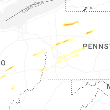


Connect with Interactive Hail Maps