

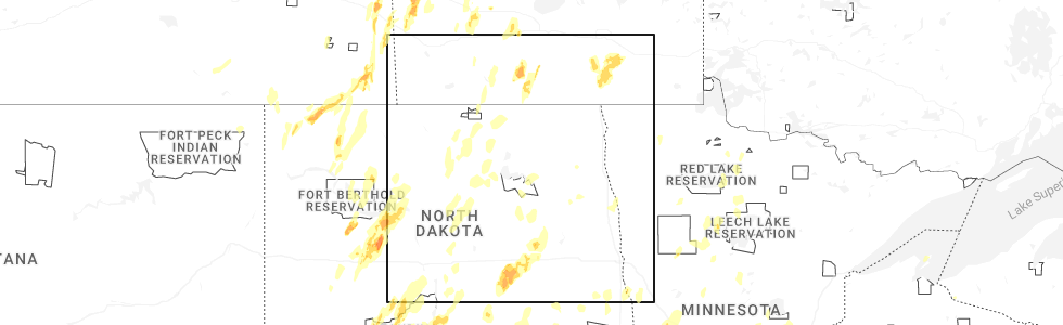
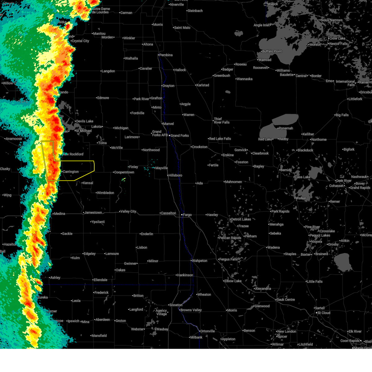
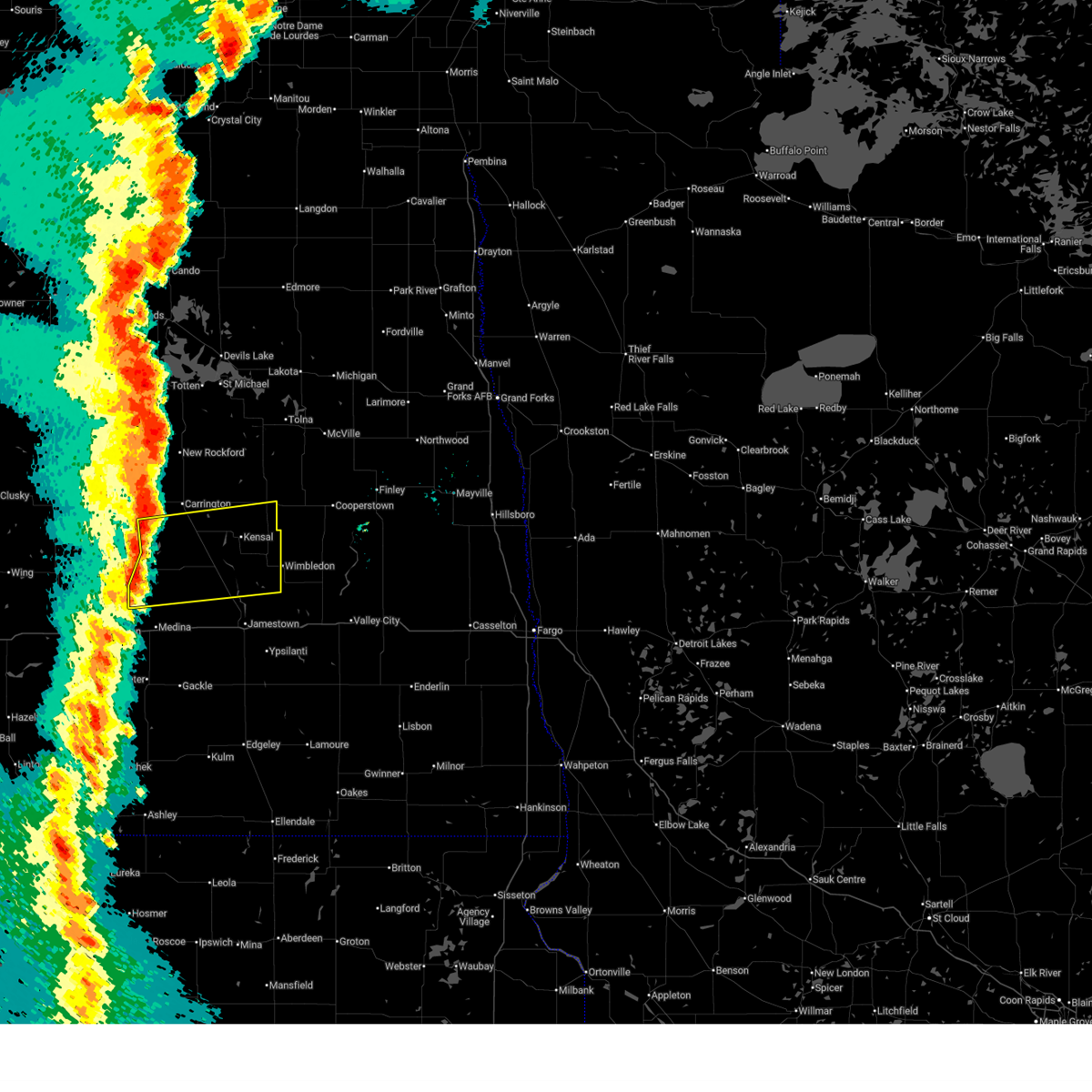
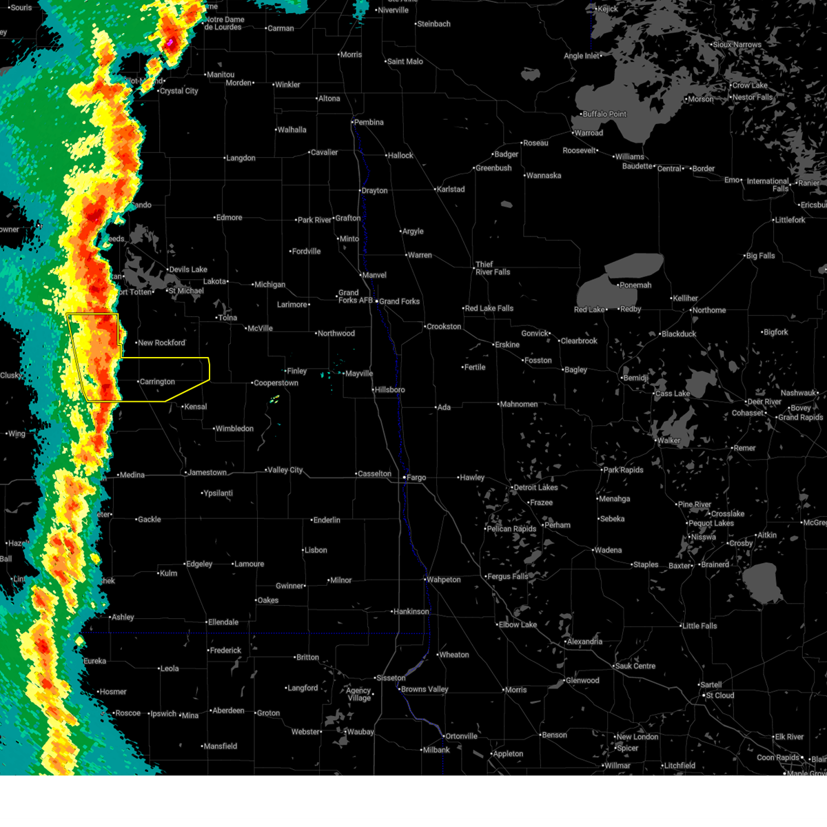
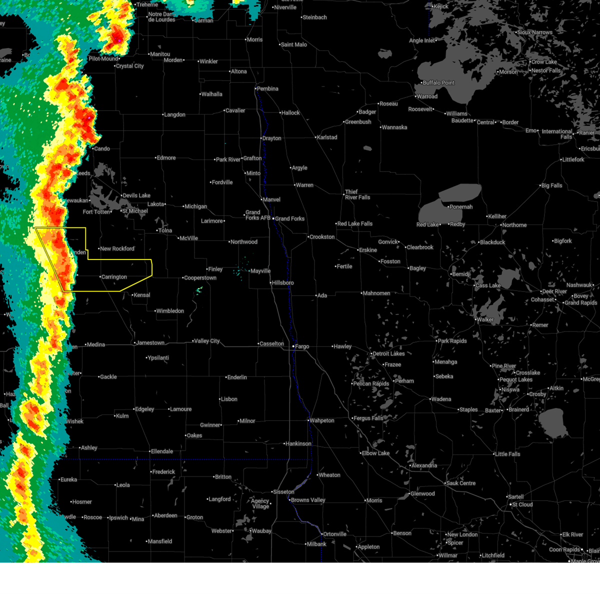
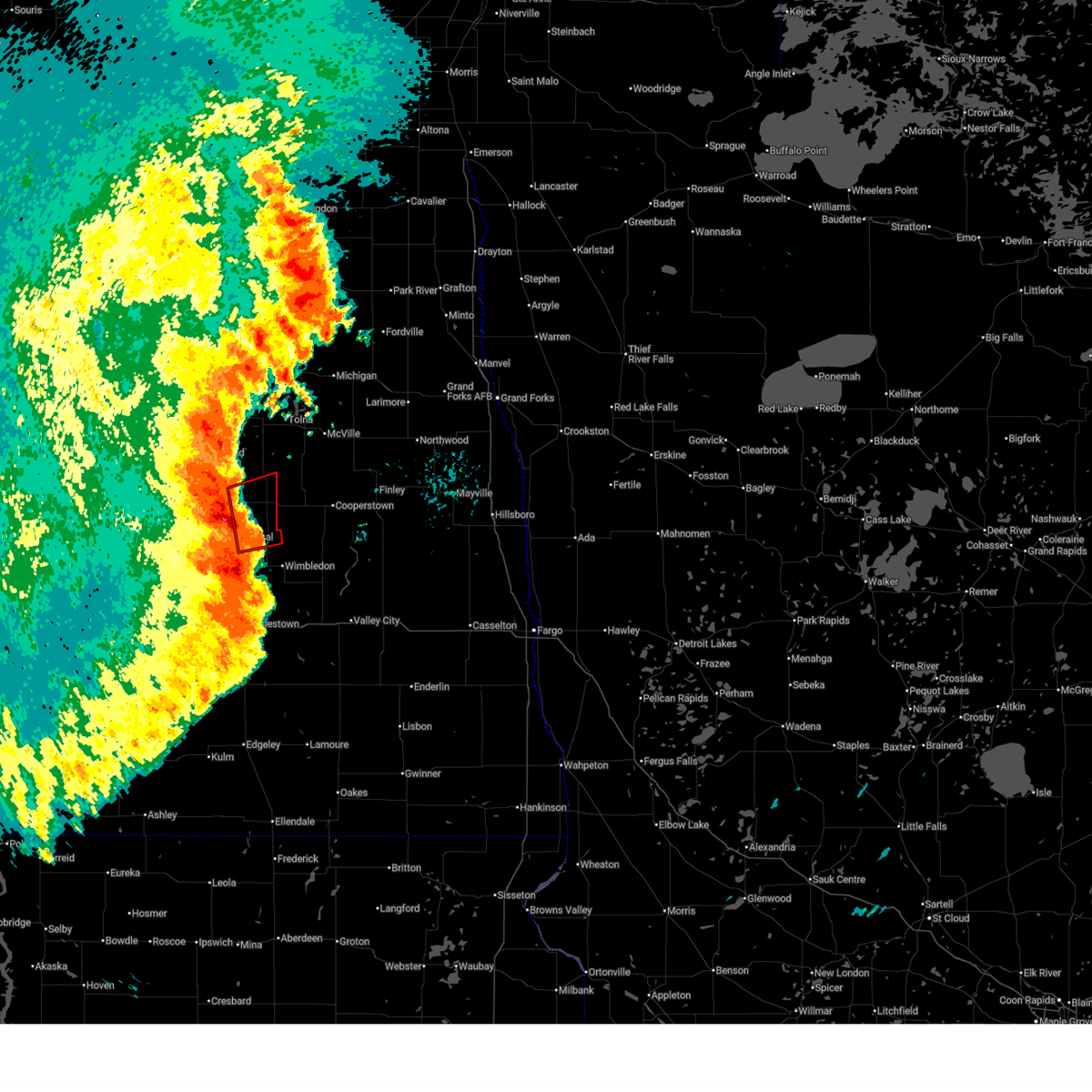
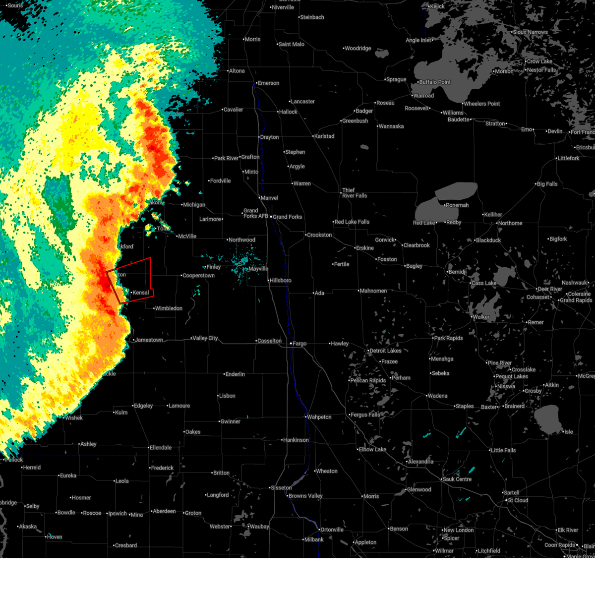
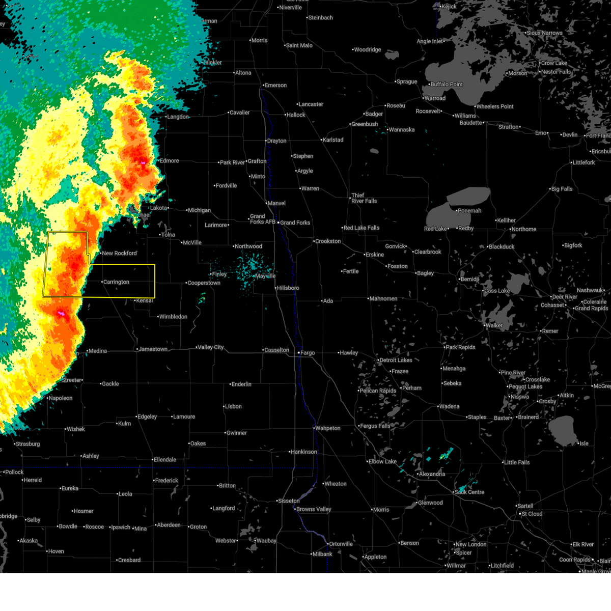
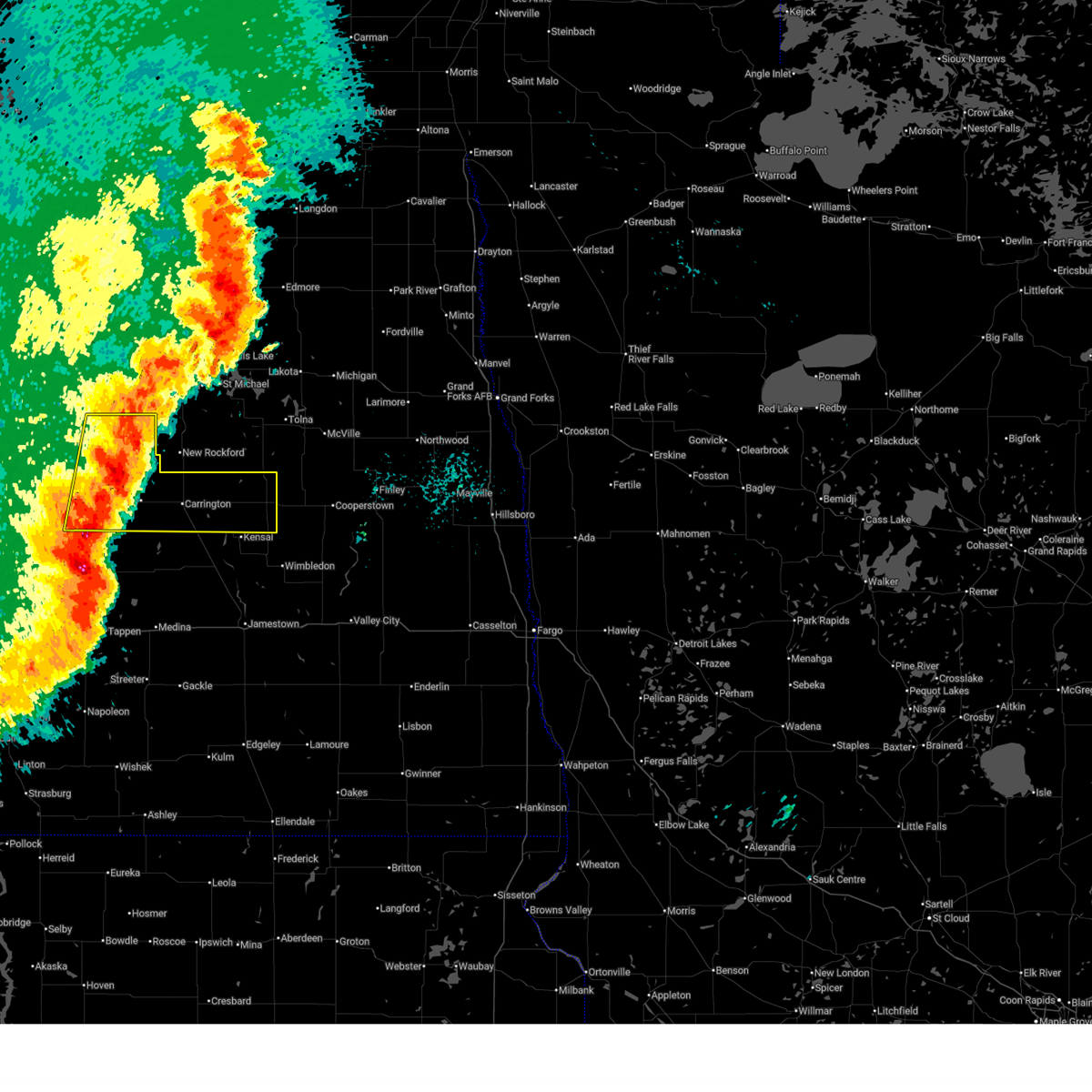
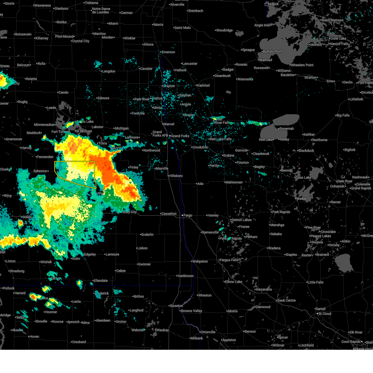
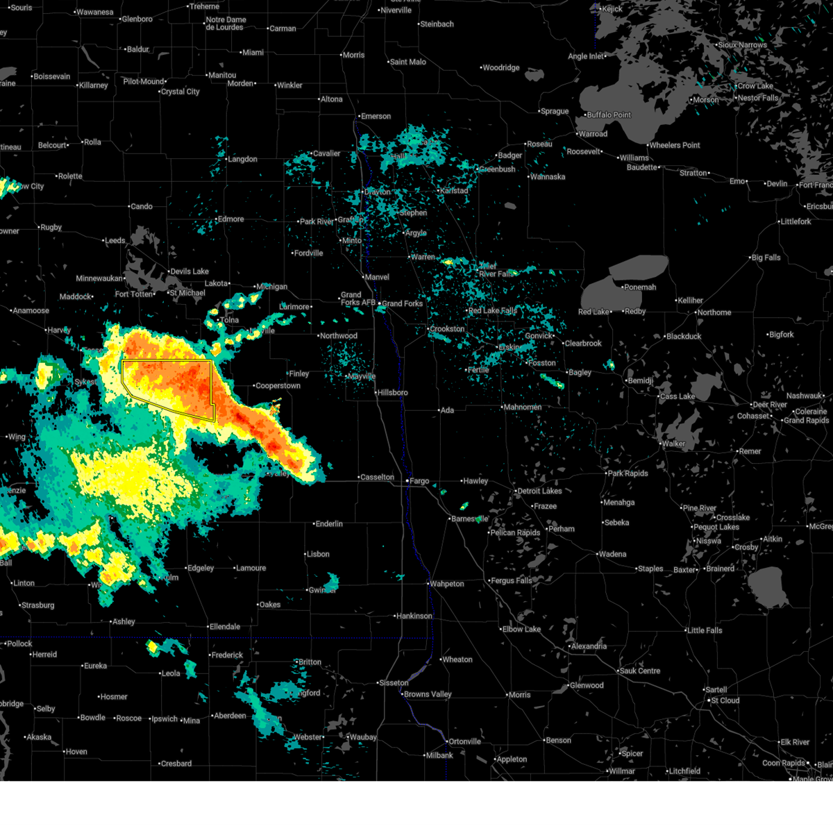
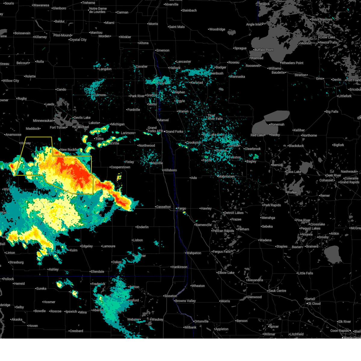
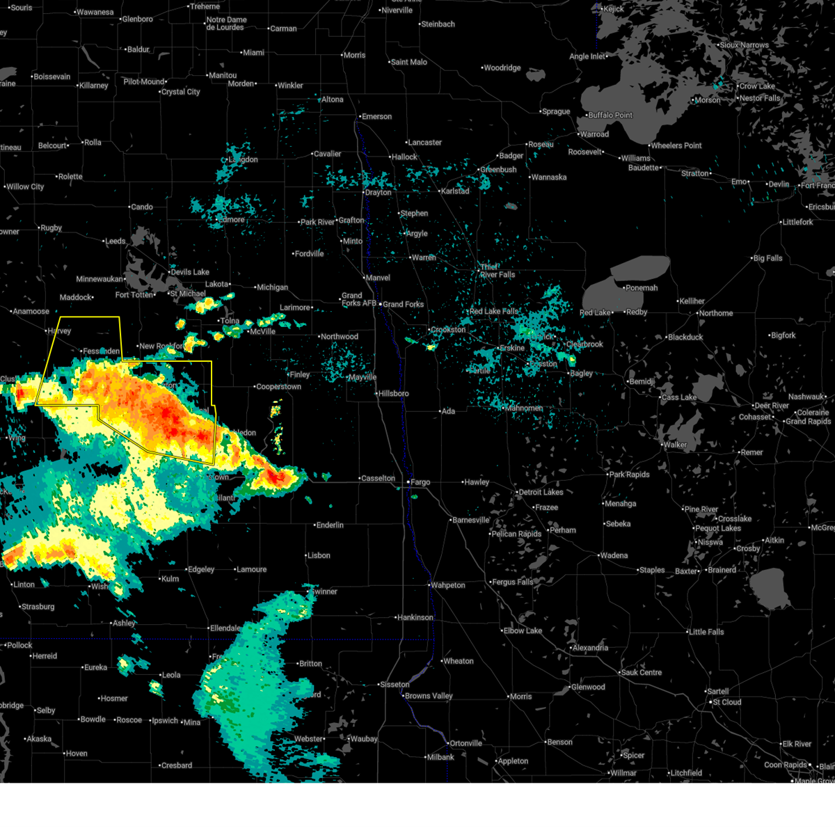
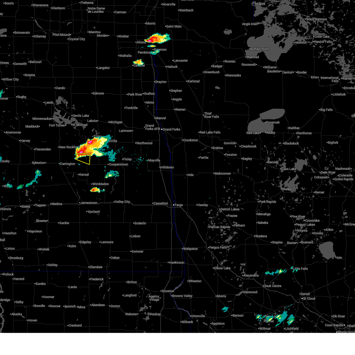
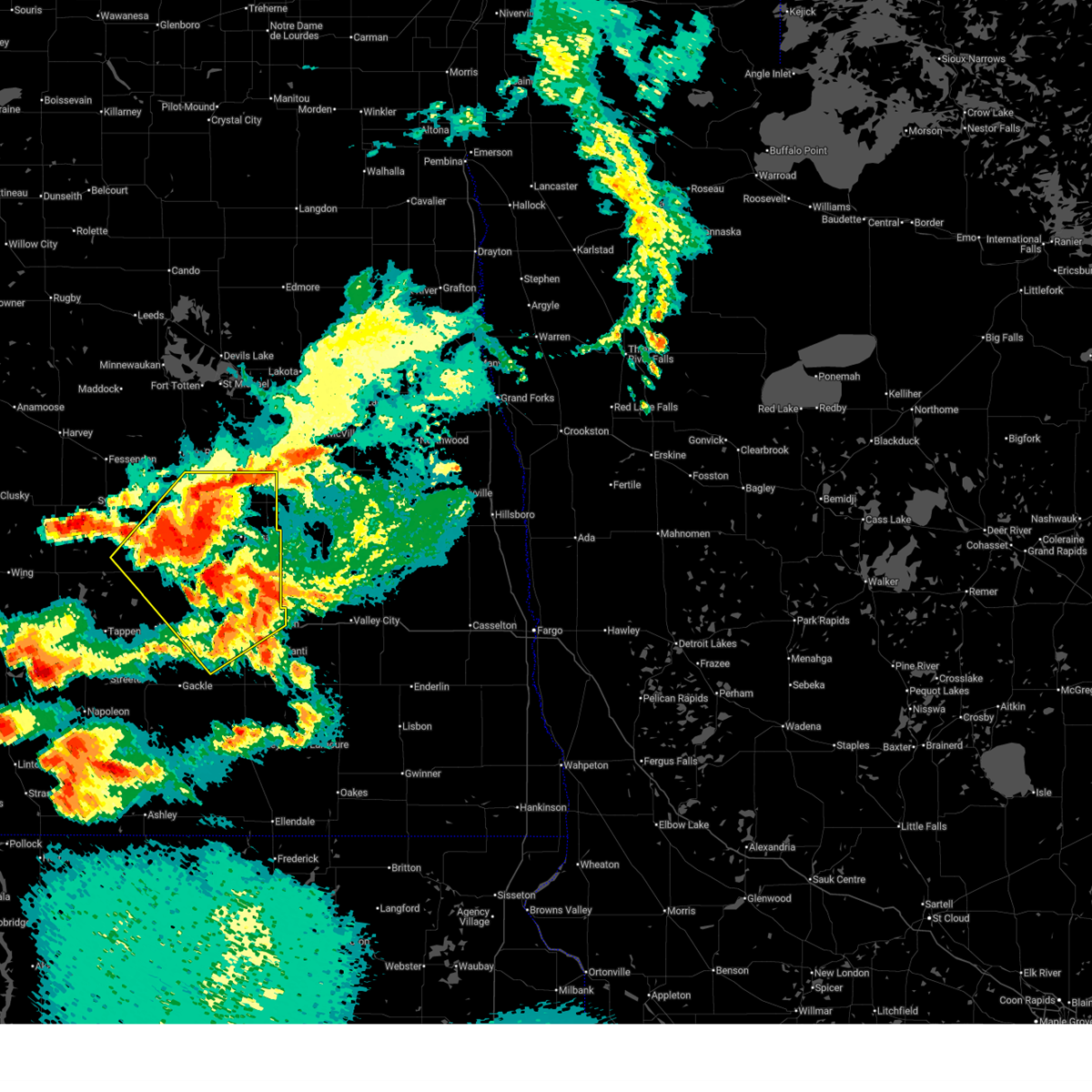
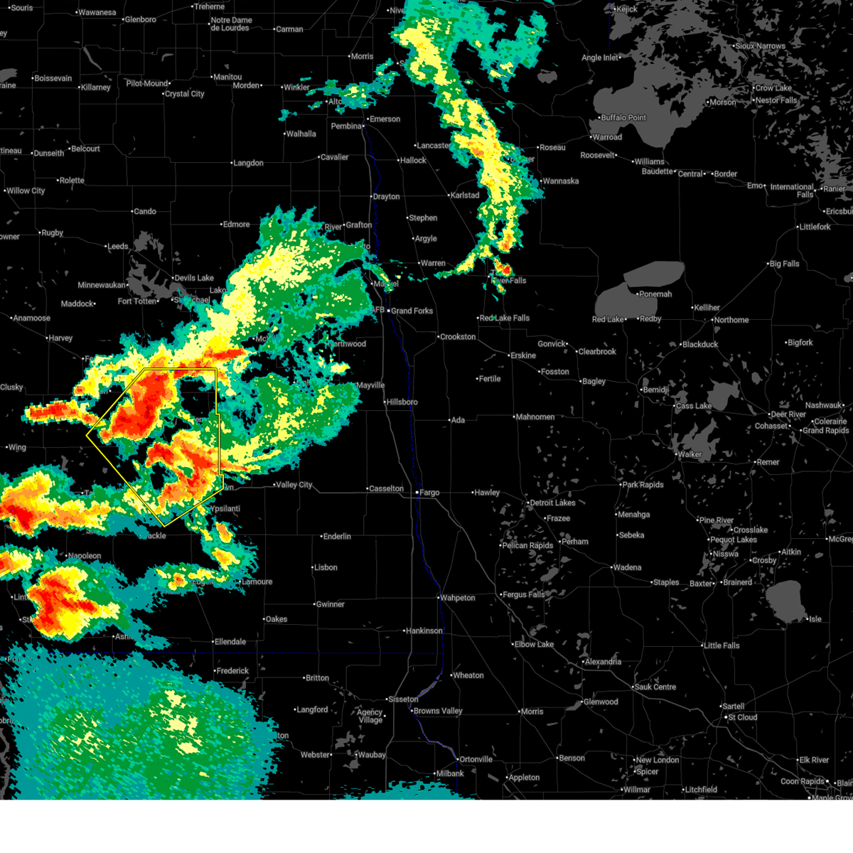
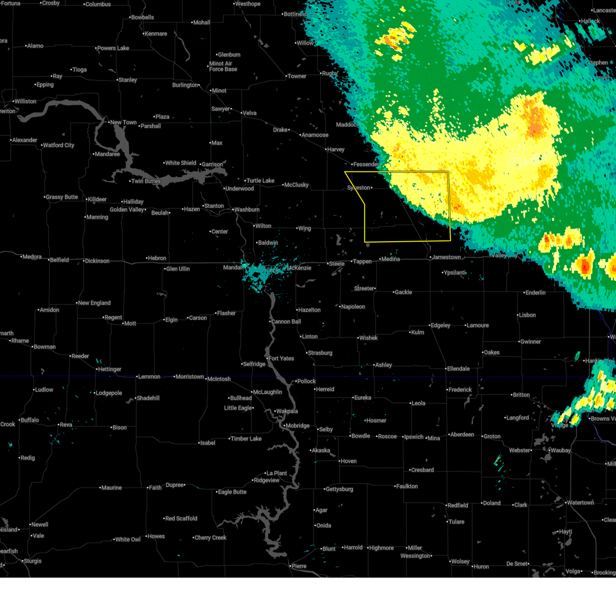
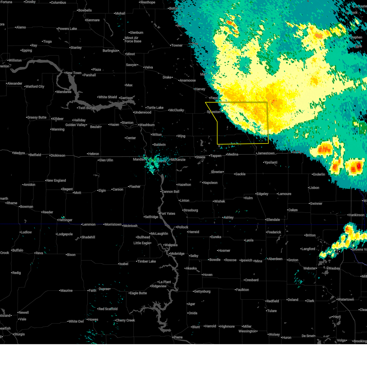
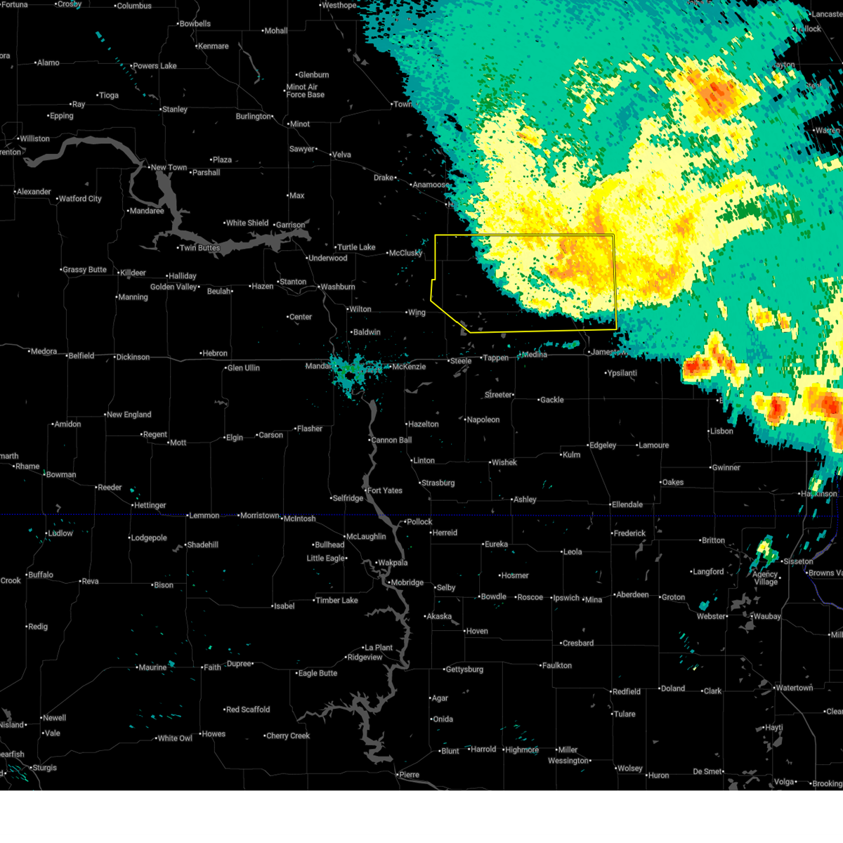
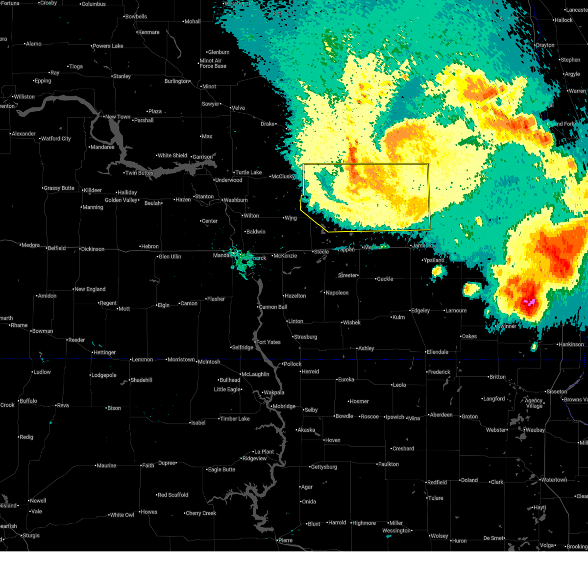
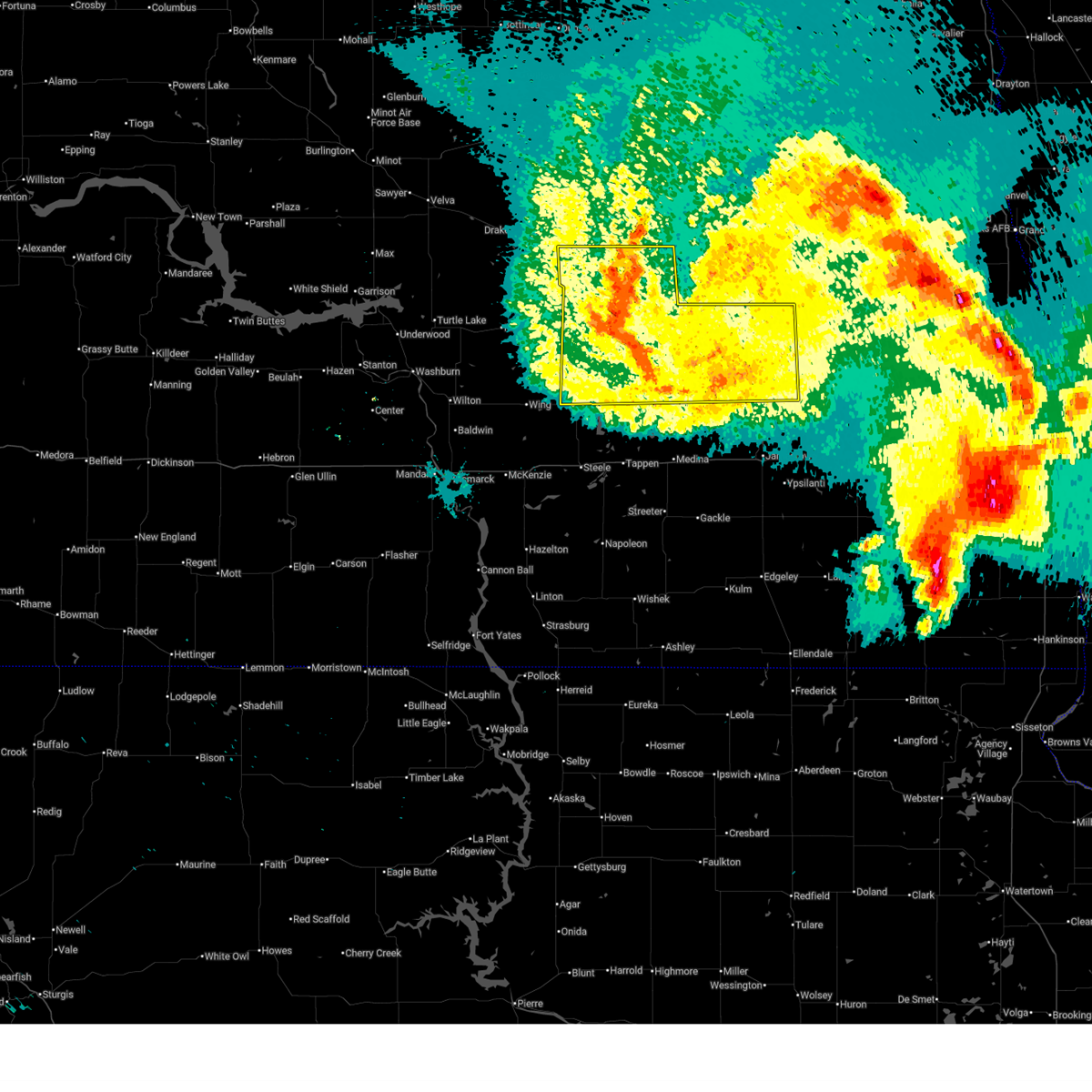
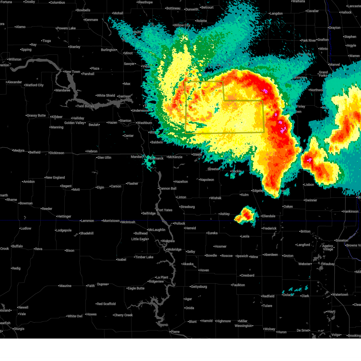
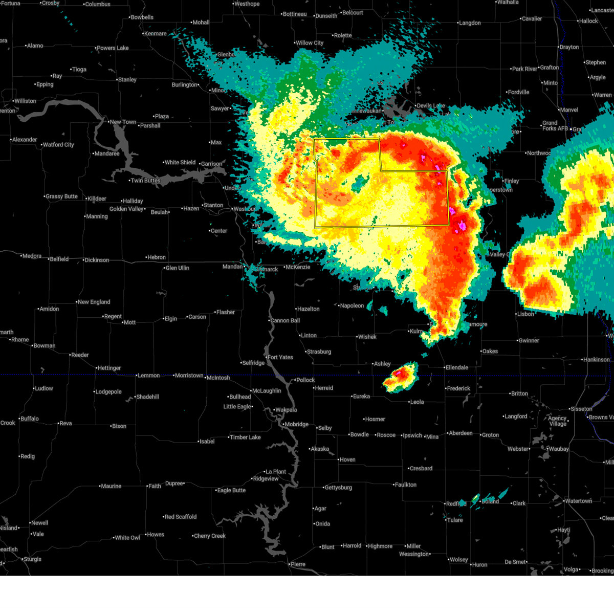
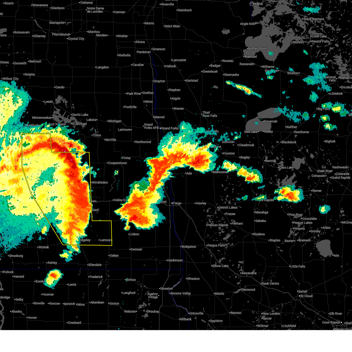
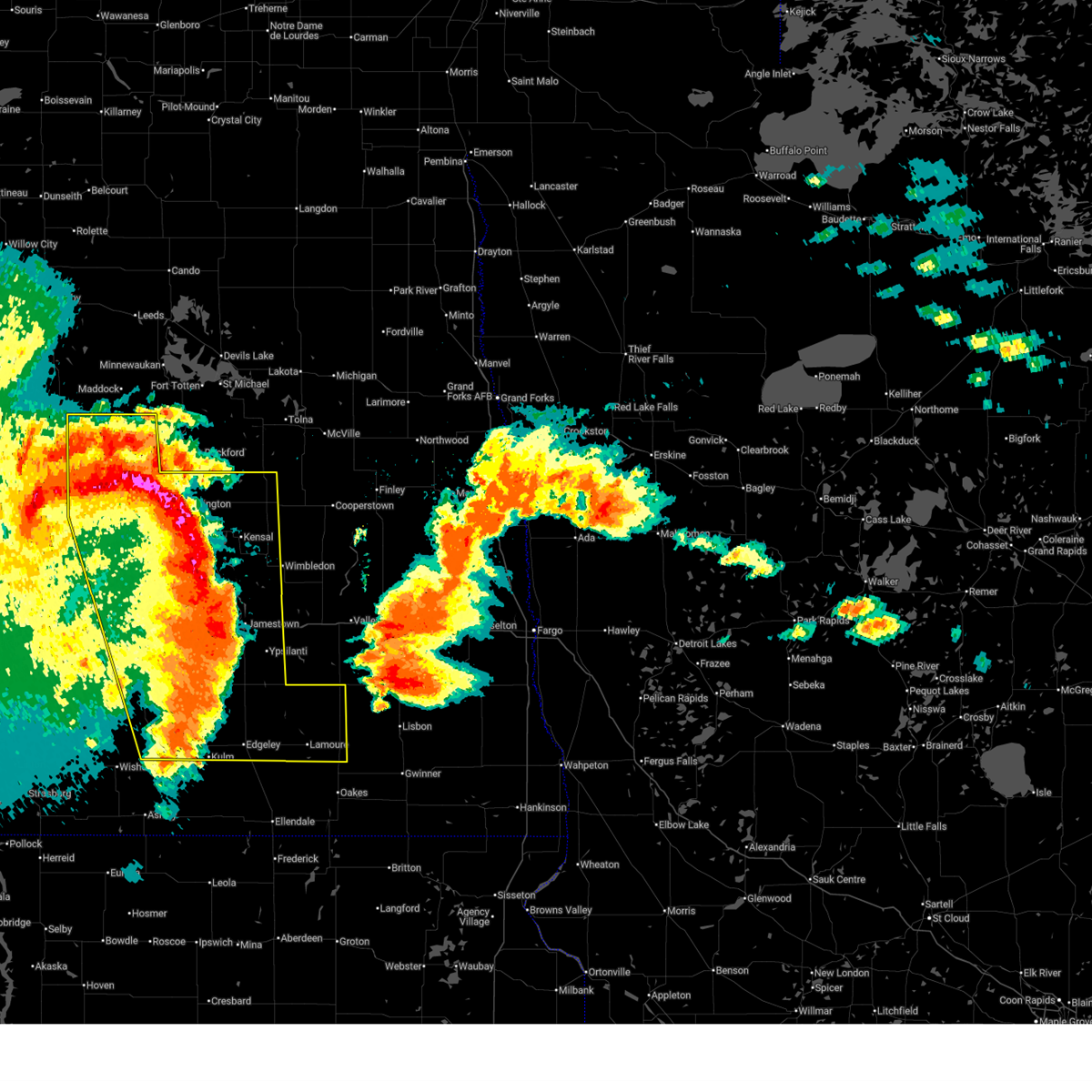
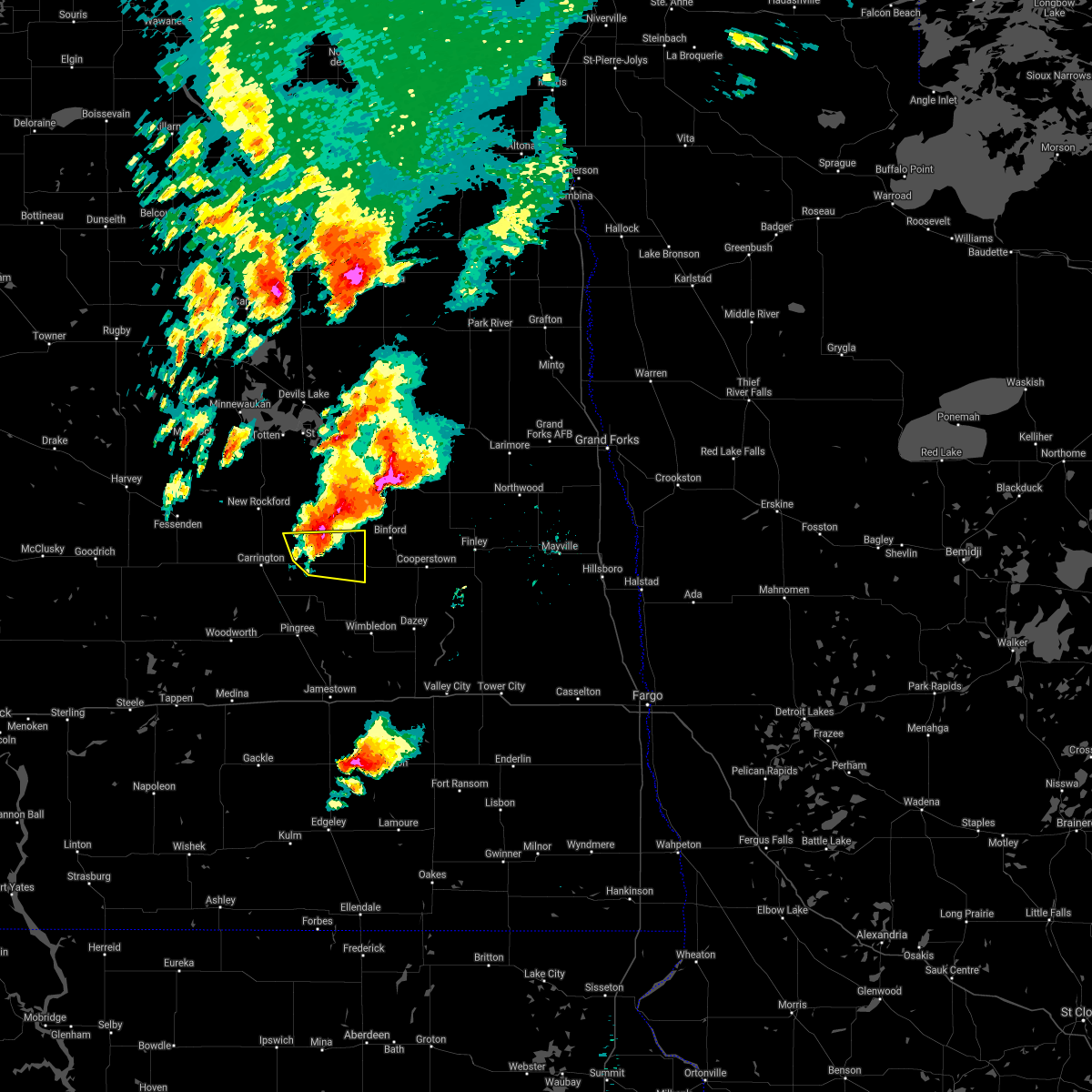
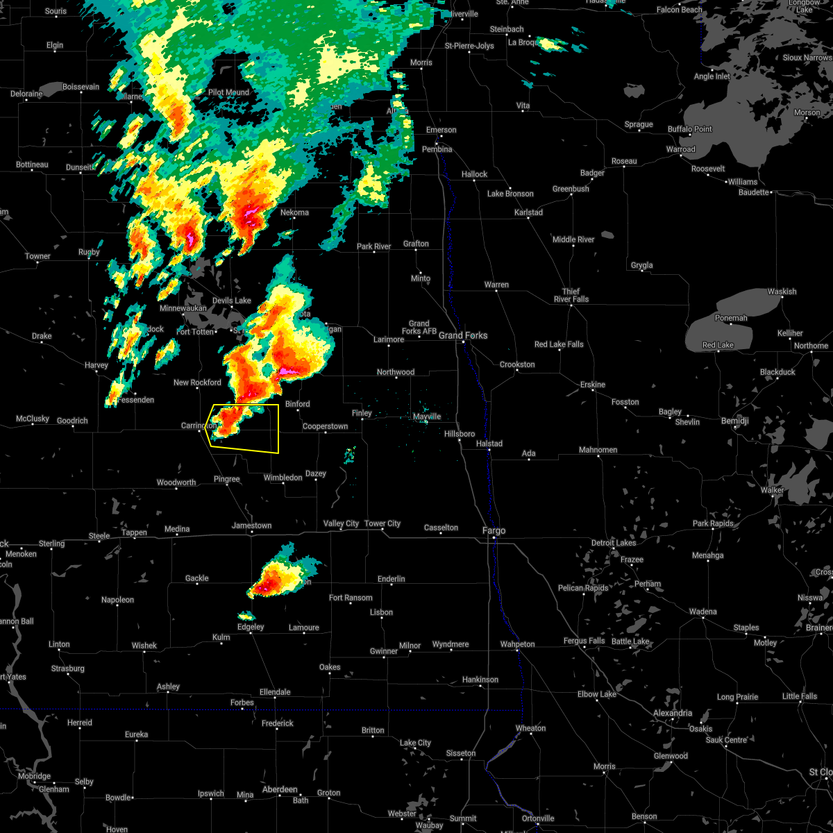
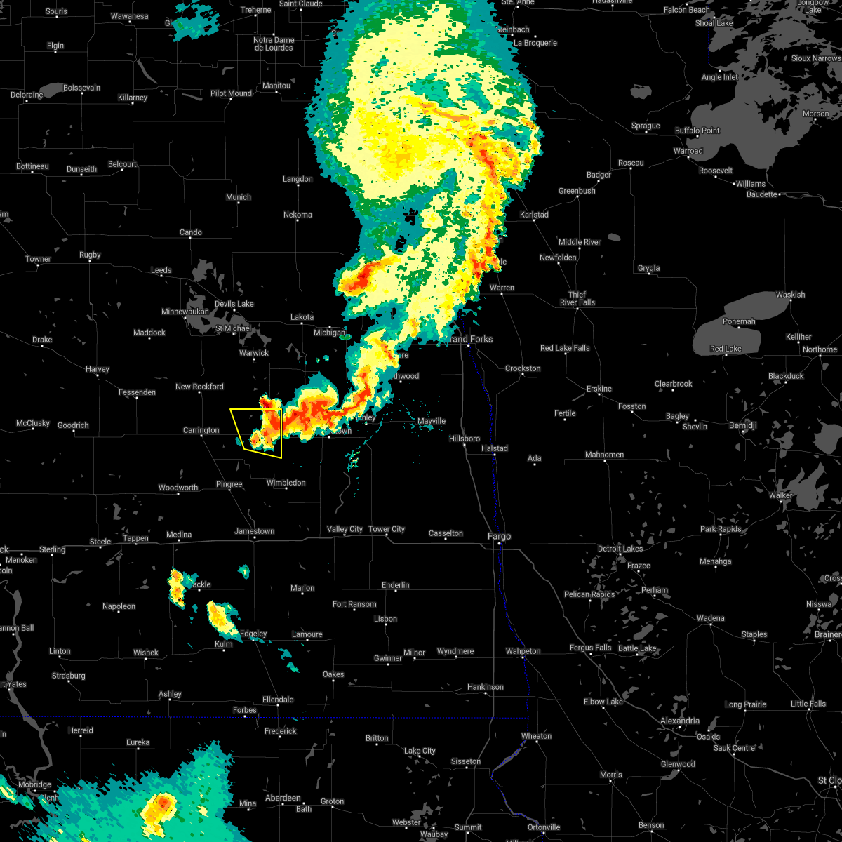
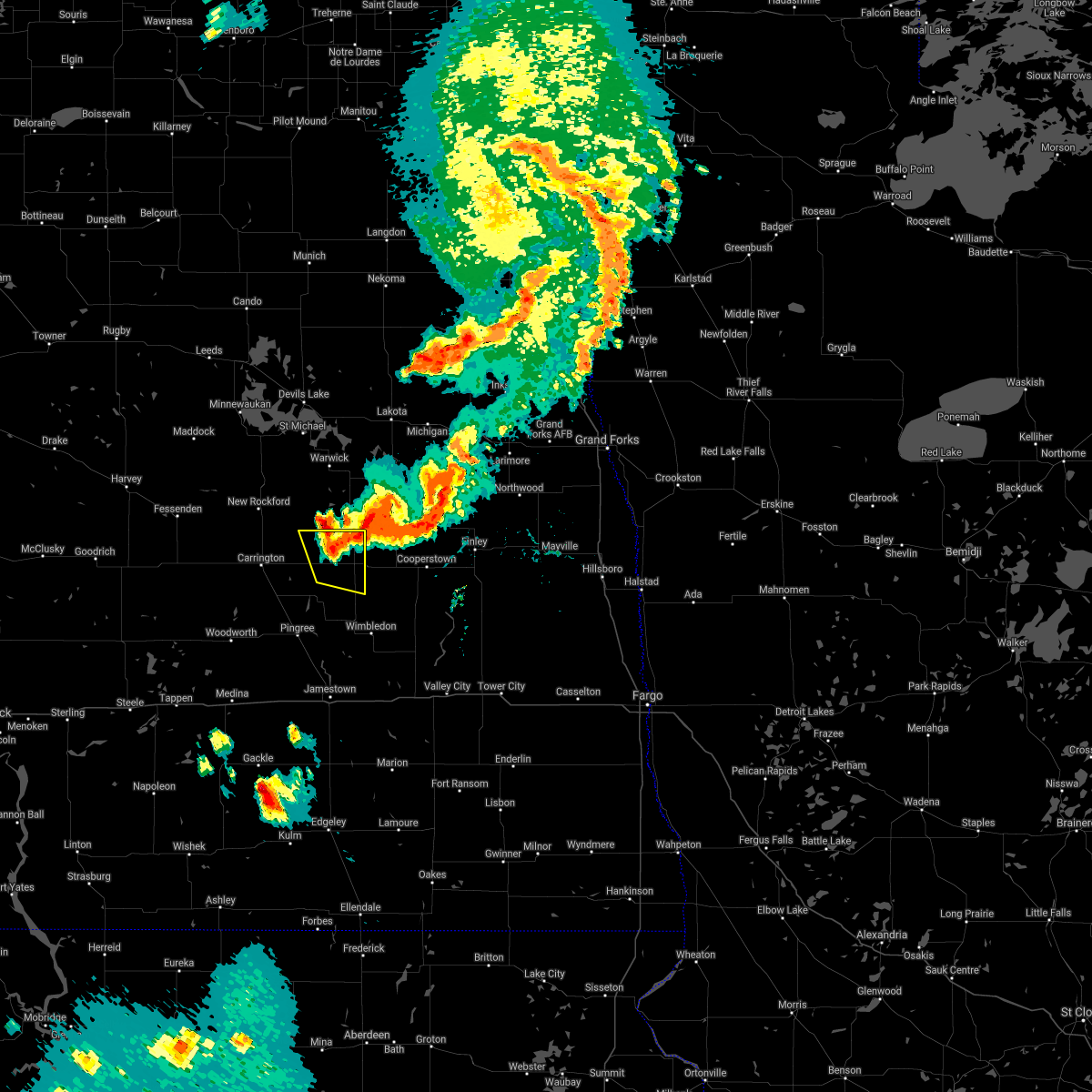
Hail Map for Glenfield, ND
The Glenfield, ND area has had 1 report of on-the-ground hail by trained spotters, and has been under severe weather warnings 26 times during the past 12 months. Doppler radar has detected hail at or near Glenfield, ND on 42 occasions, including 2 occasions during the past year.
| Name: | Glenfield, ND |
| Where Located: | 47.4 miles SSE of Devils Lake, ND |
| Map: | Google Map for Glenfield, ND |
| Population: | 91 |
| Housing Units: | 57 |
| More Info: | Search Google for Glenfield, ND |
1
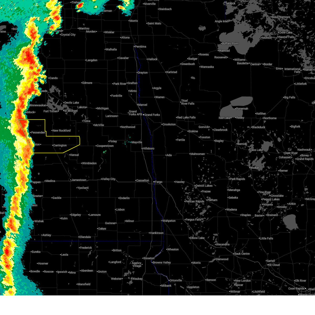
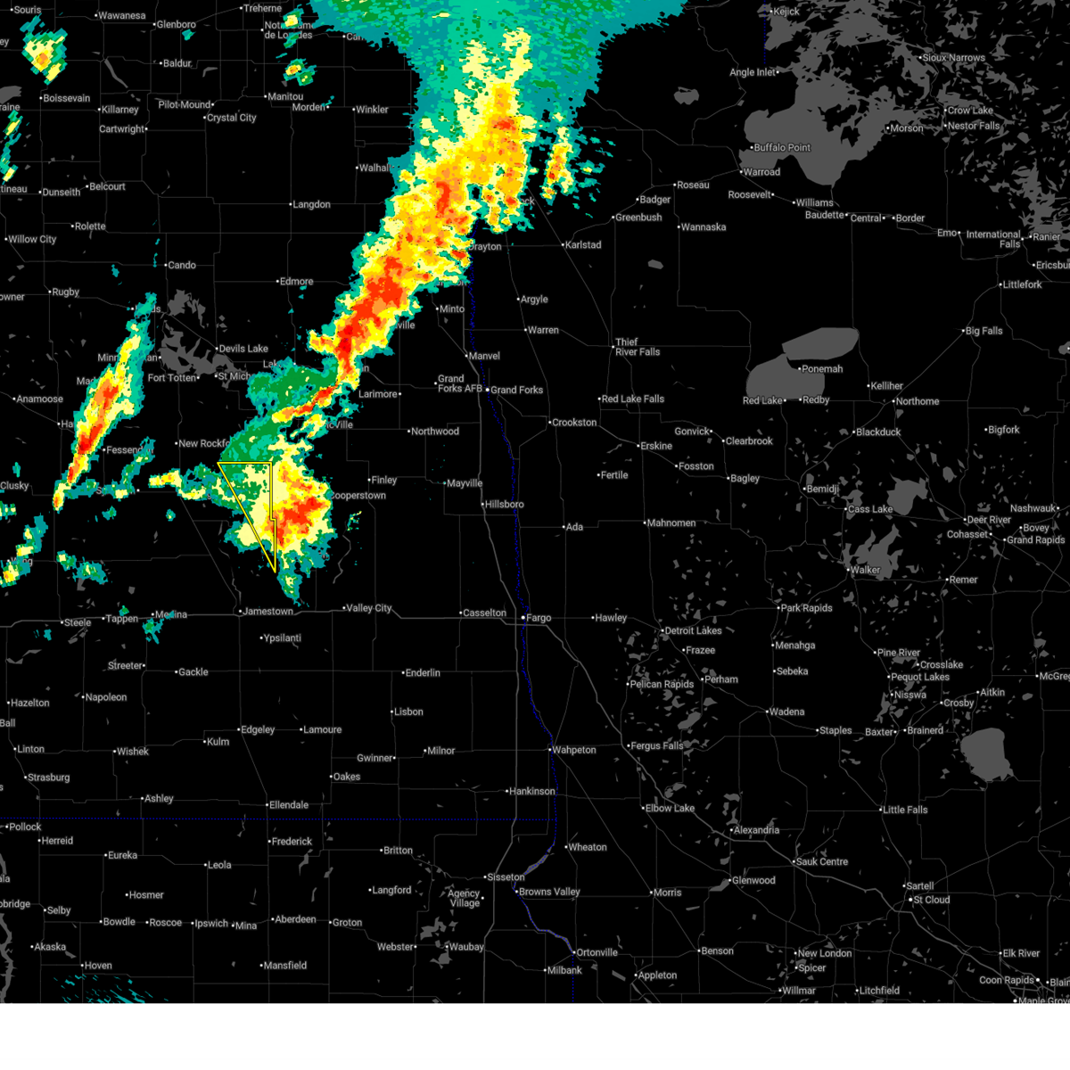
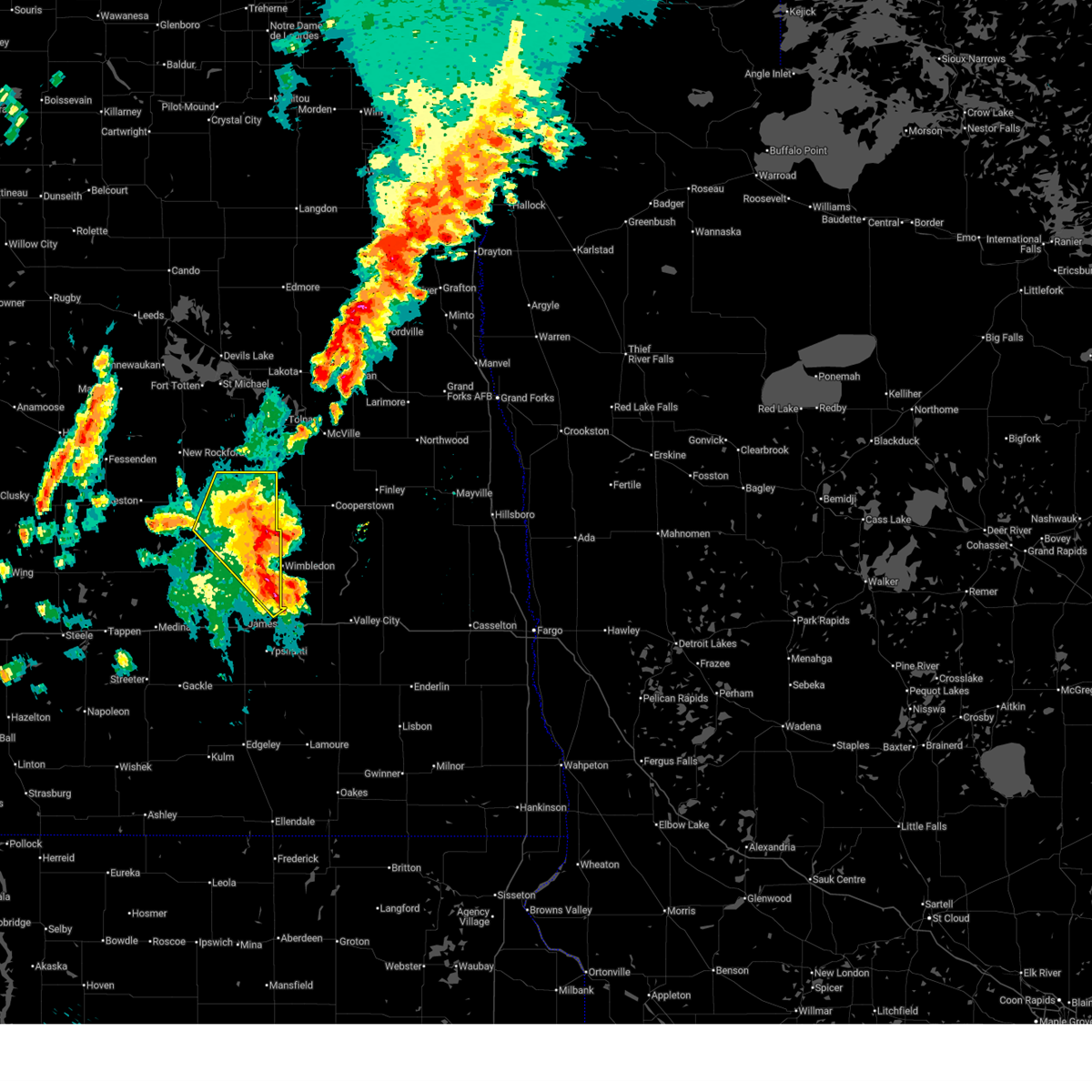
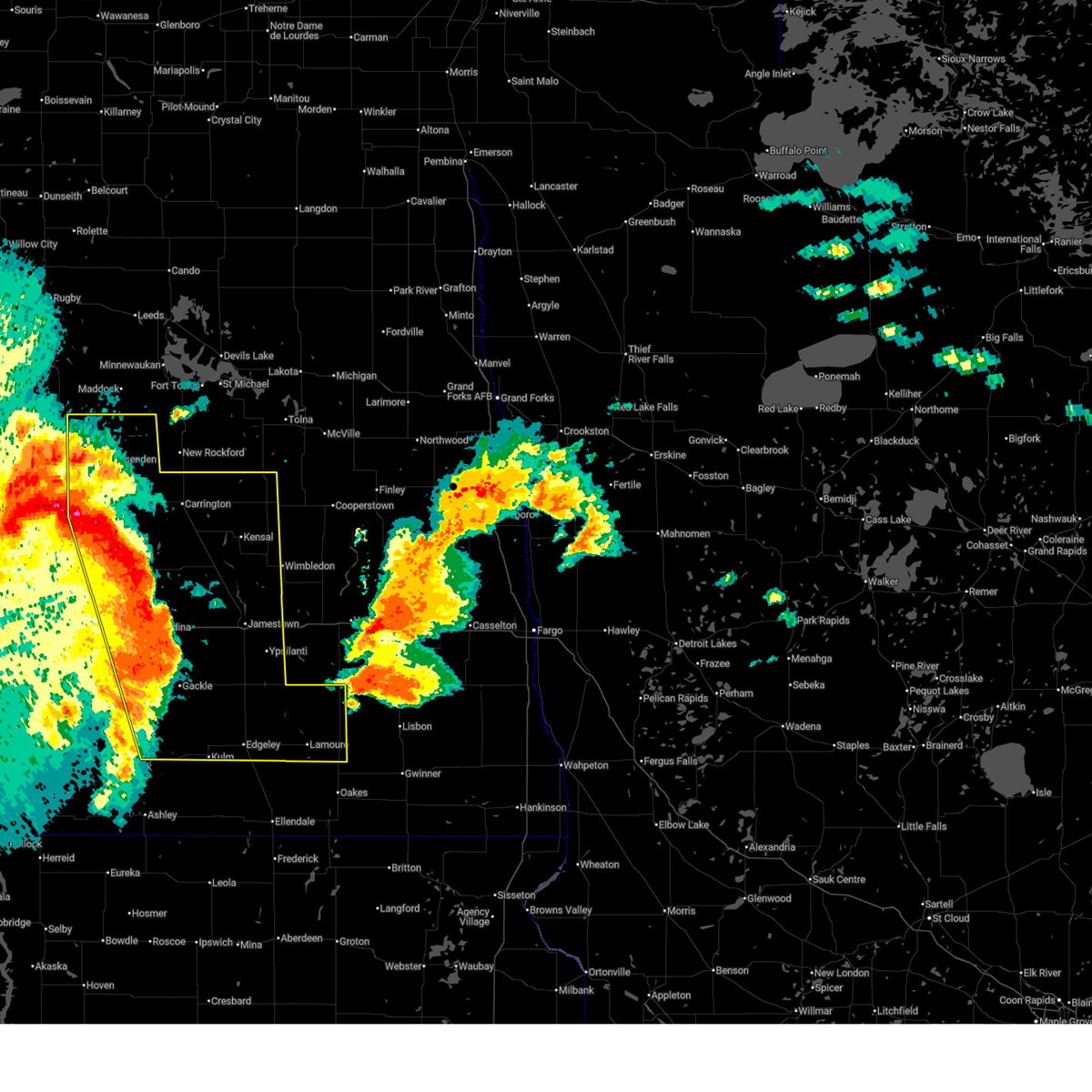
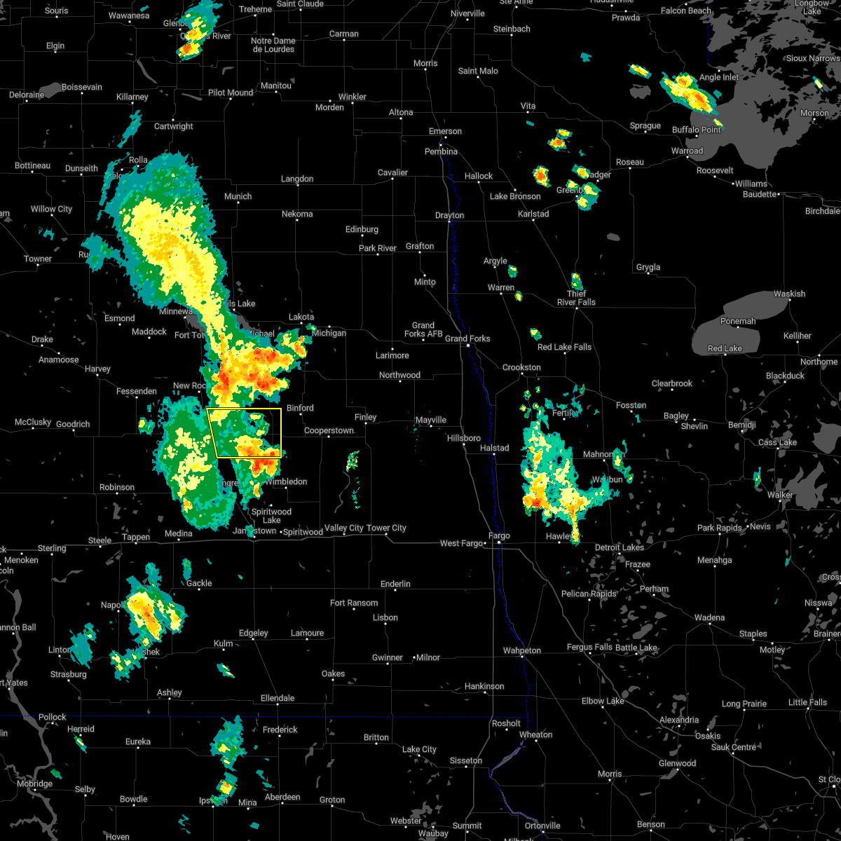
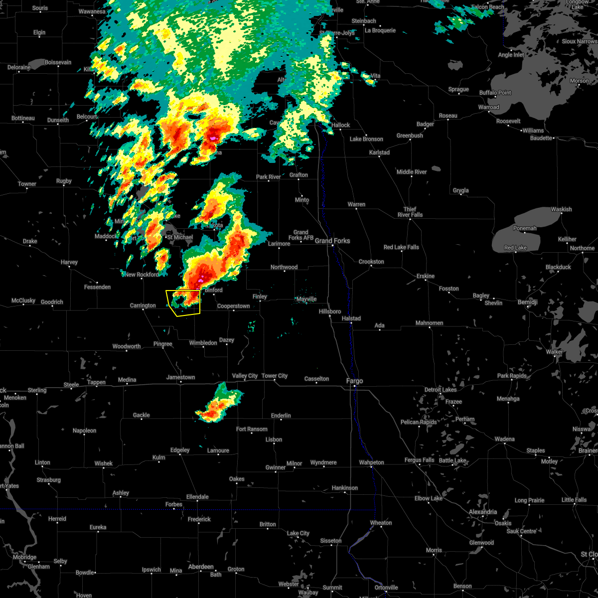
The Top Recent Hail Date for Glenfield, ND is Tuesday, June 9, 2026 (13th out of 42)
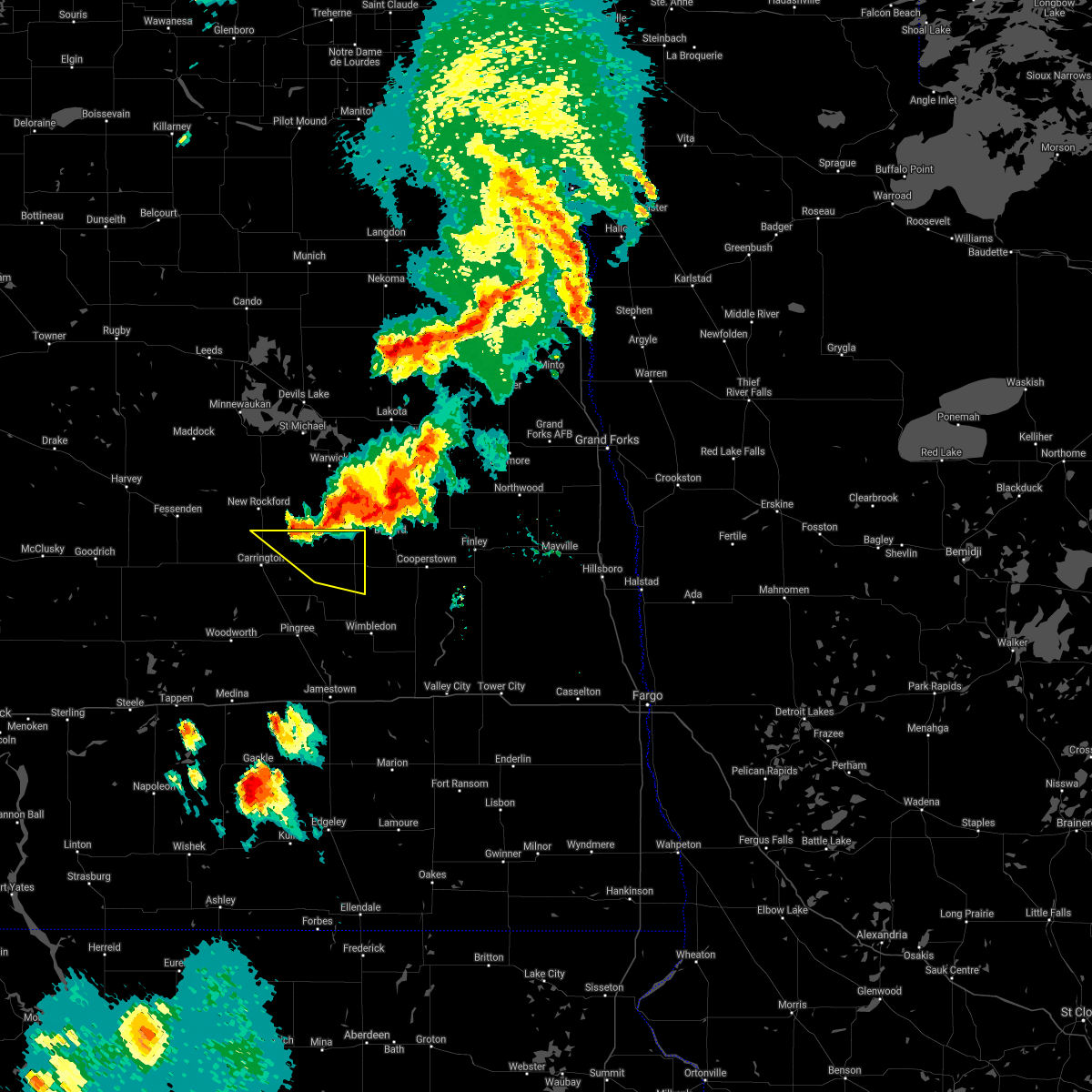
Hail and Wind Damage Spotted near Glenfield, ND
| Date / Time | Report Details |
|---|---|
| 6/10/2026 12:16 AM CDT |
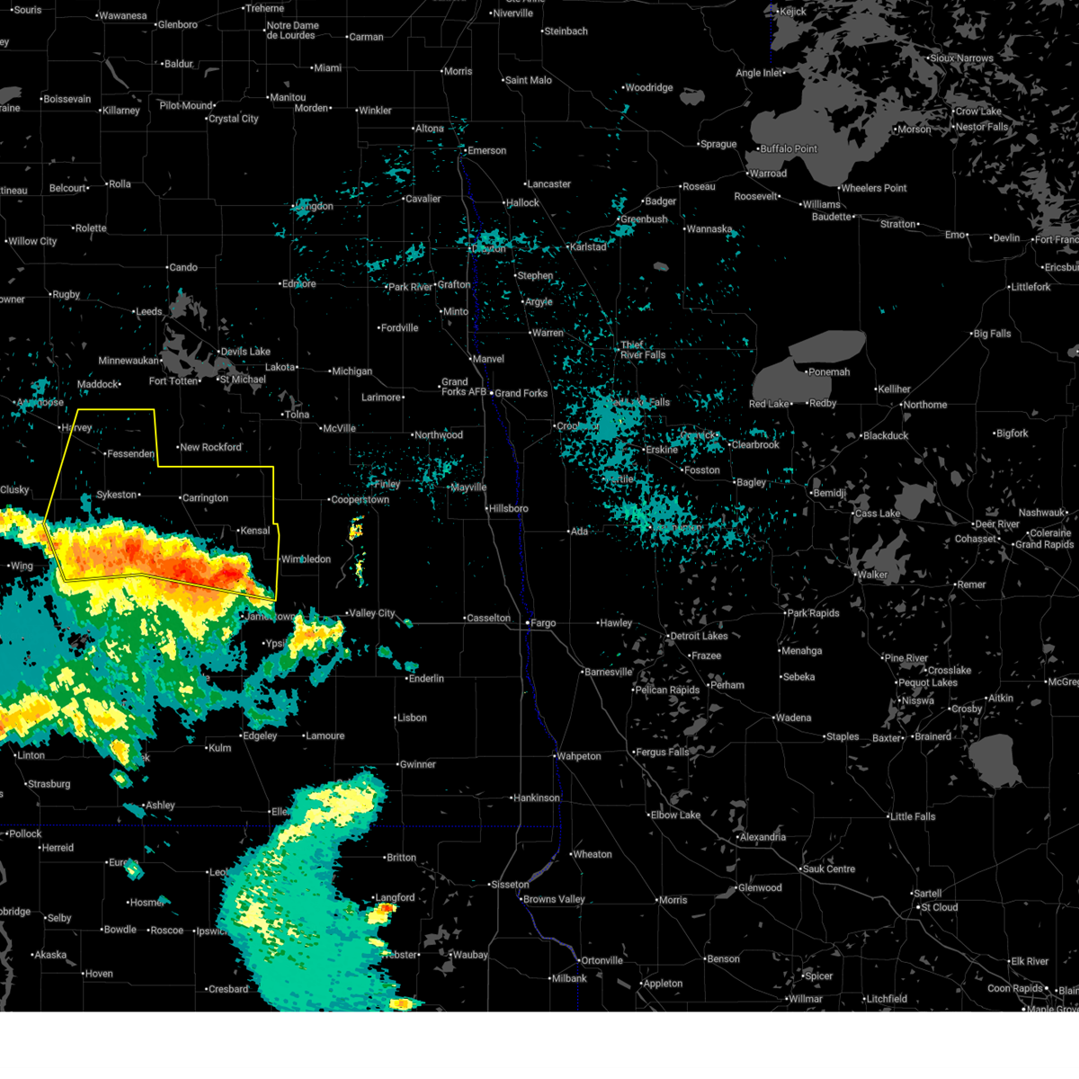
 At 1216 am cdt, severe thunderstorms were located along a line from over glenfield to near spiritwood, or along a line from 27 miles east of carrington to 10 miles east of jamestown, moving northeast at 40 mph (radar indicated). Hazards include 70 mph wind gusts and small hail. Expect considerable tree damage. damage is likely to mobile homes, roofs, and outbuildings. Locations impacted include, jamestown, kensal, glenfield, spiritwood lake, spiritwood, mchenry, courtenay and juanita. At 1216 am cdt, severe thunderstorms were located along a line from over glenfield to near spiritwood, or along a line from 27 miles east of carrington to 10 miles east of jamestown, moving northeast at 40 mph (radar indicated). Hazards include 70 mph wind gusts and small hail. Expect considerable tree damage. damage is likely to mobile homes, roofs, and outbuildings. Locations impacted include, jamestown, kensal, glenfield, spiritwood lake, spiritwood, mchenry, courtenay and juanita.
|
| 6/9/2026 11:54 PM CDT |
 At 1154 pm cdt, severe thunderstorms were located along a line from 6 miles north of kensal to near jamestown, or along a line from 21 miles east of carrington to near jamestown, moving northeast at 50 mph (radar indicated). Hazards include 70 mph wind gusts and quarter size hail. Hail damage to vehicles is expected. expect considerable tree damage. wind damage is also likely to mobile homes, roofs, and outbuildings. Locations impacted include, jamestown, kensal, glenfield, buchanan, spiritwood lake, bordulac, spiritwood, pingree, mchenry, courtenay, eldridge, edmunds, melville and juanita. At 1154 pm cdt, severe thunderstorms were located along a line from 6 miles north of kensal to near jamestown, or along a line from 21 miles east of carrington to near jamestown, moving northeast at 50 mph (radar indicated). Hazards include 70 mph wind gusts and quarter size hail. Hail damage to vehicles is expected. expect considerable tree damage. wind damage is also likely to mobile homes, roofs, and outbuildings. Locations impacted include, jamestown, kensal, glenfield, buchanan, spiritwood lake, bordulac, spiritwood, pingree, mchenry, courtenay, eldridge, edmunds, melville and juanita.
|
| 6/9/2026 10:31 PM CDT |
 The storms which prompted the warning have weakened below severe limits. therefore, the warning has been allowed to expire. however, gusty winds and heavy rain are still possible with these thunderstorms. The storms which prompted the warning have weakened below severe limits. therefore, the warning has been allowed to expire. however, gusty winds and heavy rain are still possible with these thunderstorms.
|
| 6/9/2026 10:06 PM CDT |
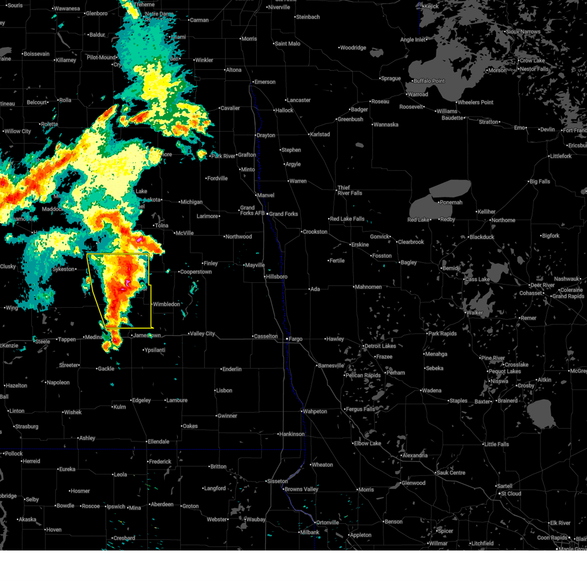
 At 1006 pm cdt, severe thunderstorms were located along a line from 22 miles north of cathay to 8 miles south of carrington, or along a line from 29 miles north of carrington to 8 miles south of carrington, moving east at 35 mph (radar indicated). Hazards include 60 mph wind gusts. Expect damage to roofs, siding, and trees. Locations impacted include, carrington, glenfield, bordulac, grace city, mchenry, cathay, sykeston, bremen, melville, barlow and juanita. At 1006 pm cdt, severe thunderstorms were located along a line from 22 miles north of cathay to 8 miles south of carrington, or along a line from 29 miles north of carrington to 8 miles south of carrington, moving east at 35 mph (radar indicated). Hazards include 60 mph wind gusts. Expect damage to roofs, siding, and trees. Locations impacted include, carrington, glenfield, bordulac, grace city, mchenry, cathay, sykeston, bremen, melville, barlow and juanita.
|
| 6/9/2026 9:57 PM CDT |
 Svrbis the national weather service in bismarck has issued a * severe thunderstorm warning for, southeastern wells county in south central north dakota, southern foster county in southeastern north dakota, northern stutsman county in southeastern north dakota, * until 1100 pm cdt. * at 957 pm cdt, severe thunderstorms were located along a line from 10 miles southwest of carrington to 9 miles north of medina, or along a line from 10 miles southwest of carrington to 32 miles west of jamestown, moving east at 40 mph (radar indicated). Hazards include 60 mph wind gusts. expect damage to roofs, siding, and trees Svrbis the national weather service in bismarck has issued a * severe thunderstorm warning for, southeastern wells county in south central north dakota, southern foster county in southeastern north dakota, northern stutsman county in southeastern north dakota, * until 1100 pm cdt. * at 957 pm cdt, severe thunderstorms were located along a line from 10 miles southwest of carrington to 9 miles north of medina, or along a line from 10 miles southwest of carrington to 32 miles west of jamestown, moving east at 40 mph (radar indicated). Hazards include 60 mph wind gusts. expect damage to roofs, siding, and trees
|
| 6/9/2026 9:54 PM CDT |
 At 954 pm cdt, severe thunderstorms were located along a line from 21 miles north of cathay to 10 miles southwest of carrington, or along a line from 27 miles east of harvey to 10 miles southwest of carrington, moving east at 45 mph (radar indicated). Hazards include 60 mph wind gusts. Expect damage to roofs, siding, and trees. Locations impacted include, carrington, fessenden, glenfield, bordulac, grace city, mchenry, cathay, sykeston, heimdal, bremen, melville, hamberg, barlow, emrick, heaton and juanita. At 954 pm cdt, severe thunderstorms were located along a line from 21 miles north of cathay to 10 miles southwest of carrington, or along a line from 27 miles east of harvey to 10 miles southwest of carrington, moving east at 45 mph (radar indicated). Hazards include 60 mph wind gusts. Expect damage to roofs, siding, and trees. Locations impacted include, carrington, fessenden, glenfield, bordulac, grace city, mchenry, cathay, sykeston, heimdal, bremen, melville, hamberg, barlow, emrick, heaton and juanita.
|
| 6/9/2026 9:38 PM CDT |
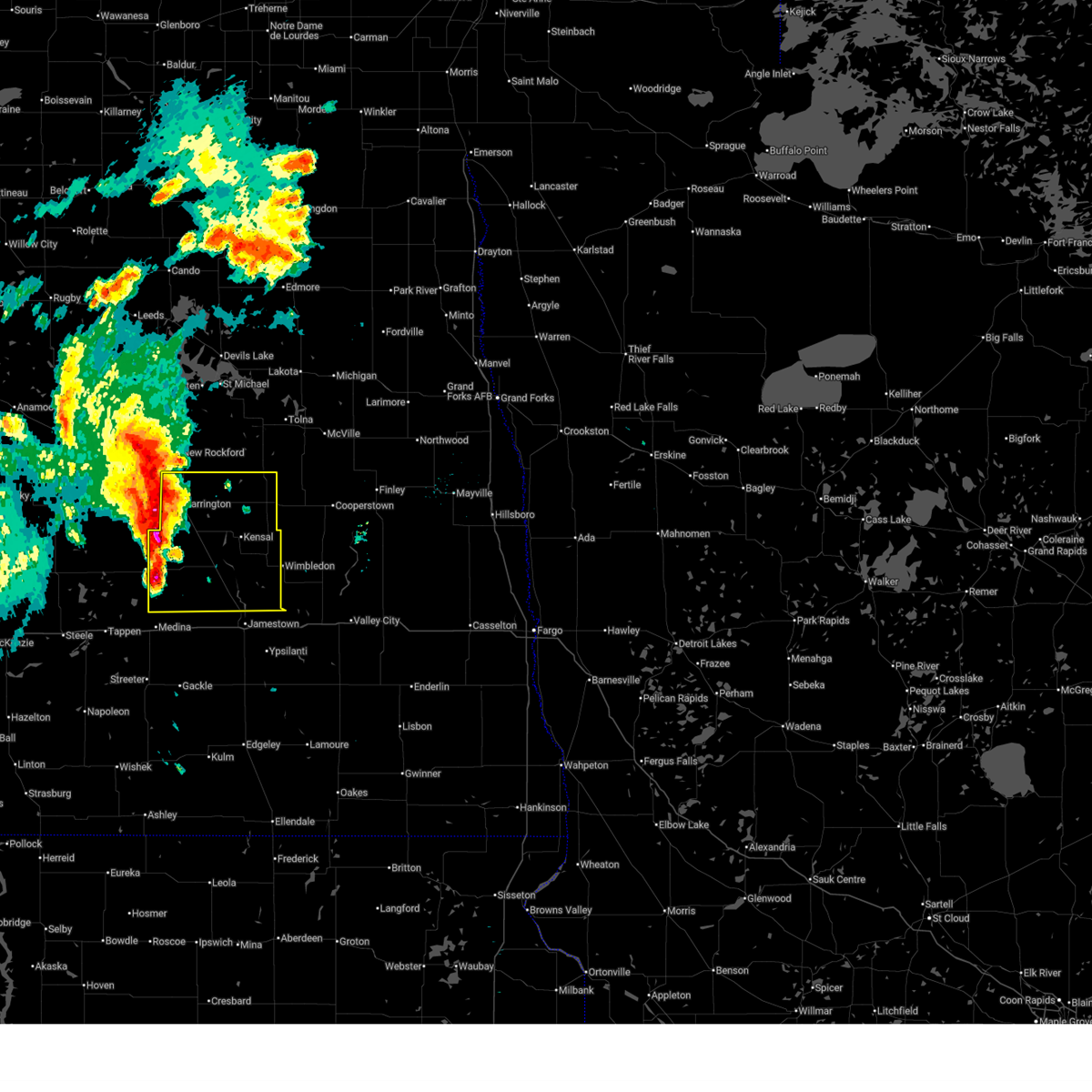
 At 938 pm cdt, severe thunderstorms were located along a line from 13 miles north of fessenden to 16 miles south of cathay, or along a line from 15 miles east of harvey to 16 miles southwest of carrington, moving east at 45 mph (radar indicated). Hazards include 60 mph wind gusts. Expect damage to roofs, siding, and trees. Locations impacted include, carrington, fessenden, glenfield, bordulac, grace city, mchenry, cathay, sykeston, heimdal, bremen, manfred, melville, hamberg, barlow, emrick, heaton, wellsburg and juanita. At 938 pm cdt, severe thunderstorms were located along a line from 13 miles north of fessenden to 16 miles south of cathay, or along a line from 15 miles east of harvey to 16 miles southwest of carrington, moving east at 45 mph (radar indicated). Hazards include 60 mph wind gusts. Expect damage to roofs, siding, and trees. Locations impacted include, carrington, fessenden, glenfield, bordulac, grace city, mchenry, cathay, sykeston, heimdal, bremen, manfred, melville, hamberg, barlow, emrick, heaton, wellsburg and juanita.
|
| 6/9/2026 9:27 PM CDT |
 Svrbis the national weather service in bismarck has issued a * severe thunderstorm warning for, eastern wells county in south central north dakota, foster county in southeastern north dakota, * until 1030 pm cdt. * at 927 pm cdt, severe thunderstorms were located along a line from 9 miles northeast of harvey to 15 miles south of cathay, or along a line from 9 miles northeast of harvey to 17 miles southwest of carrington, moving east at 45 mph (radar indicated). Hazards include 60 mph wind gusts. expect damage to roofs, siding, and trees Svrbis the national weather service in bismarck has issued a * severe thunderstorm warning for, eastern wells county in south central north dakota, foster county in southeastern north dakota, * until 1030 pm cdt. * at 927 pm cdt, severe thunderstorms were located along a line from 9 miles northeast of harvey to 15 miles south of cathay, or along a line from 9 miles northeast of harvey to 17 miles southwest of carrington, moving east at 45 mph (radar indicated). Hazards include 60 mph wind gusts. expect damage to roofs, siding, and trees
|
| 6/2/2026 9:15 PM CDT |
 At 915 pm cdt, severe thunderstorms were located along a line from over mchenry to 19 miles east of courtenay, or along a line from 29 miles east of carrington to 33 miles northeast of jamestown, moving northeast at 35 mph (radar indicated). Hazards include 60 mph wind gusts. Expect damage to roofs, siding, and trees. Locations impacted include, glenfield, grace city, mchenry, courtenay and juanita. At 915 pm cdt, severe thunderstorms were located along a line from over mchenry to 19 miles east of courtenay, or along a line from 29 miles east of carrington to 33 miles northeast of jamestown, moving northeast at 35 mph (radar indicated). Hazards include 60 mph wind gusts. Expect damage to roofs, siding, and trees. Locations impacted include, glenfield, grace city, mchenry, courtenay and juanita.
|
| 6/2/2026 8:46 PM CDT |
 Svrbis the national weather service in bismarck has issued a * severe thunderstorm warning for, foster county in southeastern north dakota, northeastern stutsman county in southeastern north dakota, * until 930 pm cdt. * at 846 pm cdt, severe thunderstorms were located along a line from 6 miles east of bordulac to 6 miles north of spiritwood, or along a line from 14 miles east of carrington to 13 miles northeast of jamestown, moving northeast at 25 mph (radar indicated). Hazards include 60 mph wind gusts and small hail. expect damage to roofs, siding, and trees Svrbis the national weather service in bismarck has issued a * severe thunderstorm warning for, foster county in southeastern north dakota, northeastern stutsman county in southeastern north dakota, * until 930 pm cdt. * at 846 pm cdt, severe thunderstorms were located along a line from 6 miles east of bordulac to 6 miles north of spiritwood, or along a line from 14 miles east of carrington to 13 miles northeast of jamestown, moving northeast at 25 mph (radar indicated). Hazards include 60 mph wind gusts and small hail. expect damage to roofs, siding, and trees
|
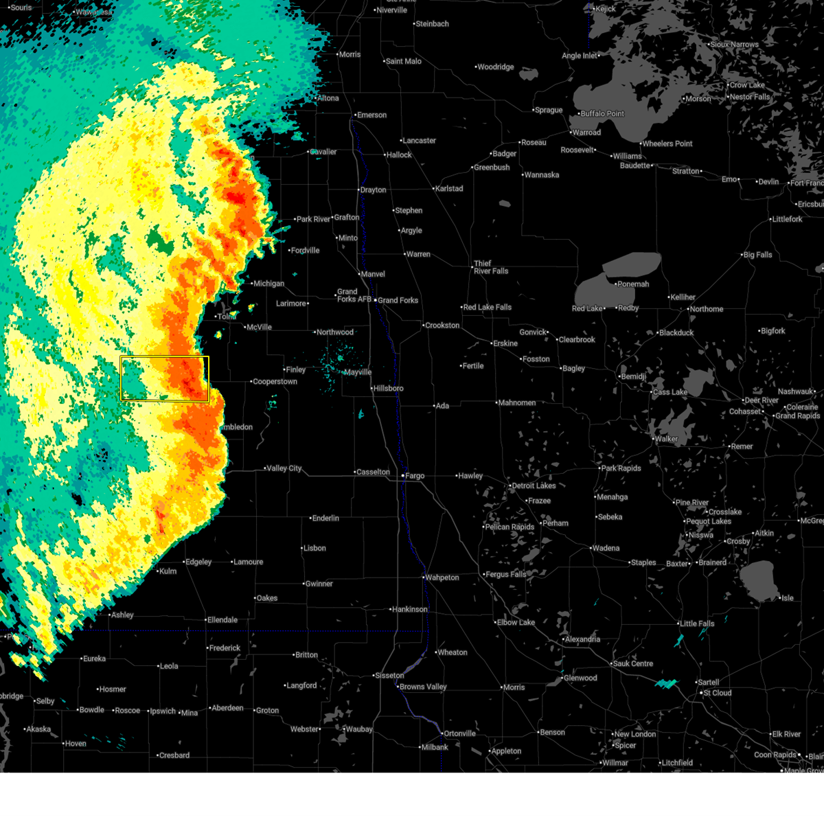
| 8/18/2025 4:40 PM CDT | Nddot sensor. time estimated from rada in foster county ND, 0.8 miles WSW of Glenfield, ND |
| 8/8/2025 2:56 AM CDT |
 The storms which prompted the warning will move out of the area. therefore, the warning will be allowed to expire. however, gusty winds to 55 mph are still possible with these thunderstorms. a severe thunderstorm watch remains in effect until 700 am cdt for southeastern north dakota. The storms which prompted the warning will move out of the area. therefore, the warning will be allowed to expire. however, gusty winds to 55 mph are still possible with these thunderstorms. a severe thunderstorm watch remains in effect until 700 am cdt for southeastern north dakota.
|
| 8/8/2025 2:42 AM CDT |
 the severe thunderstorm warning has been cancelled and is no longer in effect the severe thunderstorm warning has been cancelled and is no longer in effect
|
| 8/8/2025 2:42 AM CDT |
 At 242 am cdt, a severe thunderstorm capable of producing a tornado was located 5 miles southwest of glenfield, or 23 miles east of carrington, moving east at 60 mph (radar indicated rotation). Hazards include tornado. Flying debris will be dangerous to those caught without shelter. mobile homes will be damaged or destroyed. damage to roofs, windows, and vehicles will occur. tree damage is likely. This tornadic thunderstorm will remain over mainly rural areas of eastern foster and northeastern stutsman counties, including the following locations, juanita. At 242 am cdt, a severe thunderstorm capable of producing a tornado was located 5 miles southwest of glenfield, or 23 miles east of carrington, moving east at 60 mph (radar indicated rotation). Hazards include tornado. Flying debris will be dangerous to those caught without shelter. mobile homes will be damaged or destroyed. damage to roofs, windows, and vehicles will occur. tree damage is likely. This tornadic thunderstorm will remain over mainly rural areas of eastern foster and northeastern stutsman counties, including the following locations, juanita.
|
| 8/8/2025 2:42 AM CDT |
 At 242 am cdt, severe thunderstorms were located along a line extending from 9 miles south of crary to 7 miles north of grace city to 5 miles northwest of kensal, moving east at 40 mph (radar indicated). Hazards include 70 mph wind gusts and quarter size hail. Hail damage to vehicles is expected. expect considerable tree damage. wind damage is also likely to mobile homes, roofs, and outbuildings. Locations impacted include, carrington, glenfield, bordulac, grace city, mchenry, melville, juanita, and barlow. At 242 am cdt, severe thunderstorms were located along a line extending from 9 miles south of crary to 7 miles north of grace city to 5 miles northwest of kensal, moving east at 40 mph (radar indicated). Hazards include 70 mph wind gusts and quarter size hail. Hail damage to vehicles is expected. expect considerable tree damage. wind damage is also likely to mobile homes, roofs, and outbuildings. Locations impacted include, carrington, glenfield, bordulac, grace city, mchenry, melville, juanita, and barlow.
|
| 8/8/2025 2:35 AM CDT |
 Torbis the national weather service in bismarck has issued a * tornado warning for, eastern foster county in southeastern north dakota, northeastern stutsman county in southeastern north dakota, * until 300 am cdt. * at 233 am cdt, a severe thunderstorm capable of producing a tornado was located 6 miles northwest of kensal, or 15 miles southeast of carrington, moving east at 60 mph (radar indicated rotation). Hazards include tornado. Flying debris will be dangerous to those caught without shelter. mobile homes will be damaged or destroyed. damage to roofs, windows, and vehicles will occur. tree damage is likely. this dangerous storm will be near, glenfield around 245 am cdt. Other locations impacted by this tornadic thunderstorm include juanita. Torbis the national weather service in bismarck has issued a * tornado warning for, eastern foster county in southeastern north dakota, northeastern stutsman county in southeastern north dakota, * until 300 am cdt. * at 233 am cdt, a severe thunderstorm capable of producing a tornado was located 6 miles northwest of kensal, or 15 miles southeast of carrington, moving east at 60 mph (radar indicated rotation). Hazards include tornado. Flying debris will be dangerous to those caught without shelter. mobile homes will be damaged or destroyed. damage to roofs, windows, and vehicles will occur. tree damage is likely. this dangerous storm will be near, glenfield around 245 am cdt. Other locations impacted by this tornadic thunderstorm include juanita.
|
| 8/8/2025 2:18 AM CDT |
 At 218 am cdt, severe thunderstorms were located along a line extending from 5 miles southeast of fort totten to 8 miles east of new rockford to 5 miles southwest of carrington, moving east at 55 mph (radar indicated). Hazards include 70 mph wind gusts and quarter size hail. Hail damage to vehicles is expected. expect considerable tree damage. wind damage is also likely to mobile homes, roofs, and outbuildings. Locations impacted include, carrington, fessenden, glenfield, bordulac, grace city, mchenry, cathay, bowdon, sykeston, heimdal, bremen, manfred, melville, hamberg, juanita, wellsburg, barlow, emrick, and heaton. At 218 am cdt, severe thunderstorms were located along a line extending from 5 miles southeast of fort totten to 8 miles east of new rockford to 5 miles southwest of carrington, moving east at 55 mph (radar indicated). Hazards include 70 mph wind gusts and quarter size hail. Hail damage to vehicles is expected. expect considerable tree damage. wind damage is also likely to mobile homes, roofs, and outbuildings. Locations impacted include, carrington, fessenden, glenfield, bordulac, grace city, mchenry, cathay, bowdon, sykeston, heimdal, bremen, manfred, melville, hamberg, juanita, wellsburg, barlow, emrick, and heaton.
|
| 8/8/2025 2:02 AM CDT |
 Svrbis the national weather service in bismarck has issued a * severe thunderstorm warning for, wells county in south central north dakota, foster county in southeastern north dakota, * until 300 am cdt. * at 201 am cdt, severe thunderstorms were located along a line extending from 4 miles south of oberon to 6 miles east of cathay to 14 miles north of pettibone, moving east at 55 mph (radar indicated). Hazards include 60 mph wind gusts and quarter size hail. Hail damage to vehicles is expected. Expect wind damage to roofs, siding, and trees. Svrbis the national weather service in bismarck has issued a * severe thunderstorm warning for, wells county in south central north dakota, foster county in southeastern north dakota, * until 300 am cdt. * at 201 am cdt, severe thunderstorms were located along a line extending from 4 miles south of oberon to 6 miles east of cathay to 14 miles north of pettibone, moving east at 55 mph (radar indicated). Hazards include 60 mph wind gusts and quarter size hail. Hail damage to vehicles is expected. Expect wind damage to roofs, siding, and trees.
|
| 7/27/2025 1:16 AM CDT |
 The storms which prompted the warning have moved out of the area. therefore, the warning has been allowed to expire. a severe thunderstorm watch remains in effect until 700 am cdt for south central and southeastern north dakota. The storms which prompted the warning have moved out of the area. therefore, the warning has been allowed to expire. a severe thunderstorm watch remains in effect until 700 am cdt for south central and southeastern north dakota.
|
| 7/27/2025 1:01 AM CDT |
 the severe thunderstorm warning has been cancelled and is no longer in effect the severe thunderstorm warning has been cancelled and is no longer in effect
|
| 7/27/2025 1:01 AM CDT |
 At 100 am cdt, severe thunderstorms were located along a line extending from near new rockford to 5 miles northwest of mchenry to 4 miles northwest of hannaford, moving northeast at 40 mph (trained weather spotters). Hazards include 70 mph wind gusts and quarter size hail. Hail damage to vehicles is expected. expect considerable tree damage. wind damage is also likely to mobile homes, roofs, and outbuildings. Locations impacted include, carrington, kensal, glenfield, bordulac, grace city, mchenry, juanita, and barlow. At 100 am cdt, severe thunderstorms were located along a line extending from near new rockford to 5 miles northwest of mchenry to 4 miles northwest of hannaford, moving northeast at 40 mph (trained weather spotters). Hazards include 70 mph wind gusts and quarter size hail. Hail damage to vehicles is expected. expect considerable tree damage. wind damage is also likely to mobile homes, roofs, and outbuildings. Locations impacted include, carrington, kensal, glenfield, bordulac, grace city, mchenry, juanita, and barlow.
|
| 7/27/2025 12:46 AM CDT |
 At 1244 am cdt, severe thunderstorms were located along a line extending from near new rockford to near grace city to 8 miles west of hannaford, moving northeast at 65 mph (trained weather spotters. at 1238 am cdt, a 65 mph wind gust was reported 5 miles west of courtenay). Hazards include 70 mph wind gusts and quarter size hail. Hail damage to vehicles is expected. expect considerable tree damage. wind damage is also likely to mobile homes, roofs, and outbuildings. Locations impacted include, carrington, fessenden, wimbledon, kensal, glenfield, spiritwood lake, hurdsfield, bordulac, grace city, pingree, mchenry, courtenay, cathay, bowdon, sykeston, heimdal, bremen, manfred, chaseley, and melville. At 1244 am cdt, severe thunderstorms were located along a line extending from near new rockford to near grace city to 8 miles west of hannaford, moving northeast at 65 mph (trained weather spotters. at 1238 am cdt, a 65 mph wind gust was reported 5 miles west of courtenay). Hazards include 70 mph wind gusts and quarter size hail. Hail damage to vehicles is expected. expect considerable tree damage. wind damage is also likely to mobile homes, roofs, and outbuildings. Locations impacted include, carrington, fessenden, wimbledon, kensal, glenfield, spiritwood lake, hurdsfield, bordulac, grace city, pingree, mchenry, courtenay, cathay, bowdon, sykeston, heimdal, bremen, manfred, chaseley, and melville.
|
| 7/27/2025 12:36 AM CDT |
 At 1236 am cdt, severe thunderstorms were located along a line extending from 5 miles west of cathay to 6 miles northeast of carrington to 5 miles north of wimbledon, moving northeast at 45 mph (public). Hazards include 70 mph wind gusts and quarter size hail. Hail damage to vehicles is expected. expect considerable tree damage. wind damage is also likely to mobile homes, roofs, and outbuildings. Locations impacted include, carrington, fessenden, kensal, glenfield, buchanan, spiritwood lake, hurdsfield, bordulac, grace city, pingree, mchenry, courtenay, cathay, bowdon, sykeston, heimdal, bremen, manfred, chaseley, and melville. At 1236 am cdt, severe thunderstorms were located along a line extending from 5 miles west of cathay to 6 miles northeast of carrington to 5 miles north of wimbledon, moving northeast at 45 mph (public). Hazards include 70 mph wind gusts and quarter size hail. Hail damage to vehicles is expected. expect considerable tree damage. wind damage is also likely to mobile homes, roofs, and outbuildings. Locations impacted include, carrington, fessenden, kensal, glenfield, buchanan, spiritwood lake, hurdsfield, bordulac, grace city, pingree, mchenry, courtenay, cathay, bowdon, sykeston, heimdal, bremen, manfred, chaseley, and melville.
|
| 7/27/2025 12:36 AM CDT |
 the severe thunderstorm warning has been cancelled and is no longer in effect the severe thunderstorm warning has been cancelled and is no longer in effect
|
| 7/27/2025 12:19 AM CDT |
 Svrbis the national weather service in bismarck has issued a * severe thunderstorm warning for, wells county in south central north dakota, northeastern kidder county in south central north dakota, foster county in southeastern north dakota, northern stutsman county in southeastern north dakota, * until 115 am cdt. * at 1218 am cdt, severe thunderstorms were located along a line extending from 8 miles south of hurdsfield to 9 miles southwest of carrington to near courtenay, moving northeast at 50 mph (public). Hazards include 70 mph wind gusts and quarter size hail. Hail damage to vehicles is expected. expect considerable tree damage. Wind damage is also likely to mobile homes, roofs, and outbuildings. Svrbis the national weather service in bismarck has issued a * severe thunderstorm warning for, wells county in south central north dakota, northeastern kidder county in south central north dakota, foster county in southeastern north dakota, northern stutsman county in southeastern north dakota, * until 115 am cdt. * at 1218 am cdt, severe thunderstorms were located along a line extending from 8 miles south of hurdsfield to 9 miles southwest of carrington to near courtenay, moving northeast at 50 mph (public). Hazards include 70 mph wind gusts and quarter size hail. Hail damage to vehicles is expected. expect considerable tree damage. Wind damage is also likely to mobile homes, roofs, and outbuildings.
|
| 1/1/0001 12:00 AM | Glenfield nddot mesonet. radar estimated tim in foster county ND, 0.8 miles WSW of Glenfield, ND |
| 7/26/2025 2:16 AM CDT |
 At 215 am cdt, severe thunderstorms were located along a line extending from 9 miles east of new rockford to near buchanan, moving east at 30 mph (radar indicated). Hazards include 60 mph wind gusts and quarter size hail. Hail damage to vehicles is expected. expect wind damage to roofs, siding, and trees. Locations impacted include, carrington, kensal, glenfield, buchanan, spiritwood lake, bordulac, grace city, pingree, mchenry, courtenay, melville, edmunds, juanita, and barlow. At 215 am cdt, severe thunderstorms were located along a line extending from 9 miles east of new rockford to near buchanan, moving east at 30 mph (radar indicated). Hazards include 60 mph wind gusts and quarter size hail. Hail damage to vehicles is expected. expect wind damage to roofs, siding, and trees. Locations impacted include, carrington, kensal, glenfield, buchanan, spiritwood lake, bordulac, grace city, pingree, mchenry, courtenay, melville, edmunds, juanita, and barlow.
|
| 7/26/2025 1:34 AM CDT |
 Svrbis the national weather service in bismarck has issued a * severe thunderstorm warning for, foster county in southeastern north dakota, northern stutsman county in southeastern north dakota, * until 230 am cdt. * at 133 am cdt, severe thunderstorms were located along a line extending from 10 miles north of cathay to 7 miles south of woodworth, moving east at 30 mph (radar indicated). Hazards include ping pong ball size hail and 60 mph wind gusts. People and animals outdoors will be injured. expect hail damage to roofs, siding, windows, and vehicles. Expect wind damage to roofs, siding, and trees. Svrbis the national weather service in bismarck has issued a * severe thunderstorm warning for, foster county in southeastern north dakota, northern stutsman county in southeastern north dakota, * until 230 am cdt. * at 133 am cdt, severe thunderstorms were located along a line extending from 10 miles north of cathay to 7 miles south of woodworth, moving east at 30 mph (radar indicated). Hazards include ping pong ball size hail and 60 mph wind gusts. People and animals outdoors will be injured. expect hail damage to roofs, siding, windows, and vehicles. Expect wind damage to roofs, siding, and trees.
|
| 6/28/2025 3:24 PM CDT |
 At 323 pm cdt, a severe thunderstorm was located over mchenry, or 25 miles east of carrington, moving east at 25 mph (radar indicated). Hazards include ping pong ball size hail. People and animals outdoors will be injured. expect damage to roofs, siding, windows, and vehicles. Locations impacted include, glenfield, mchenry, and juanita. At 323 pm cdt, a severe thunderstorm was located over mchenry, or 25 miles east of carrington, moving east at 25 mph (radar indicated). Hazards include ping pong ball size hail. People and animals outdoors will be injured. expect damage to roofs, siding, windows, and vehicles. Locations impacted include, glenfield, mchenry, and juanita.
|
| 6/28/2025 3:19 PM CDT |
 Svrbis the national weather service in bismarck has issued a * severe thunderstorm warning for, northeastern foster county in southeastern north dakota, * until 345 pm cdt. * at 319 pm cdt, a severe thunderstorm was located near mchenry, or 23 miles east of carrington, moving east at 25 mph (radar indicated). Hazards include quarter size hail. damage to vehicles is expected Svrbis the national weather service in bismarck has issued a * severe thunderstorm warning for, northeastern foster county in southeastern north dakota, * until 345 pm cdt. * at 319 pm cdt, a severe thunderstorm was located near mchenry, or 23 miles east of carrington, moving east at 25 mph (radar indicated). Hazards include quarter size hail. damage to vehicles is expected
|
| 6/27/2025 11:43 PM CDT |
 At 1142 pm cdt, a cluster of severe thunderstorms was located 5 miles northeast of pingree, or 19 miles southeast of carrington, moving east at 40 mph (radar indicated). Hazards include 60 mph wind gusts and quarter size hail. Hail damage to vehicles is expected. expect wind damage to roofs, siding, and trees. Locations impacted include, jamestown, carrington, kensal, glenfield, buchanan, spiritwood lake, cleveland, bordulac, spiritwood, grace city, pingree, mchenry, woodworth, courtenay, eldridge, windsor, melville, edmunds, juanita, and barlow. At 1142 pm cdt, a cluster of severe thunderstorms was located 5 miles northeast of pingree, or 19 miles southeast of carrington, moving east at 40 mph (radar indicated). Hazards include 60 mph wind gusts and quarter size hail. Hail damage to vehicles is expected. expect wind damage to roofs, siding, and trees. Locations impacted include, jamestown, carrington, kensal, glenfield, buchanan, spiritwood lake, cleveland, bordulac, spiritwood, grace city, pingree, mchenry, woodworth, courtenay, eldridge, windsor, melville, edmunds, juanita, and barlow.
|
| 6/27/2025 11:29 PM CDT |
 Svrbis the national weather service in bismarck has issued a * severe thunderstorm warning for, southeastern wells county in south central north dakota, northeastern kidder county in south central north dakota, foster county in southeastern north dakota, stutsman county in southeastern north dakota, * until 1230 am cdt. * at 1128 pm cdt, a severe thunderstorm was located 8 miles northwest of pingree, or 13 miles south of carrington, moving east at 40 mph (radar indicated). Hazards include 70 mph wind gusts and ping pong ball size hail. People and animals outdoors will be injured. expect hail damage to roofs, siding, windows, and vehicles. expect considerable tree damage. Wind damage is also likely to mobile homes, roofs, and outbuildings. Svrbis the national weather service in bismarck has issued a * severe thunderstorm warning for, southeastern wells county in south central north dakota, northeastern kidder county in south central north dakota, foster county in southeastern north dakota, stutsman county in southeastern north dakota, * until 1230 am cdt. * at 1128 pm cdt, a severe thunderstorm was located 8 miles northwest of pingree, or 13 miles south of carrington, moving east at 40 mph (radar indicated). Hazards include 70 mph wind gusts and ping pong ball size hail. People and animals outdoors will be injured. expect hail damage to roofs, siding, windows, and vehicles. expect considerable tree damage. Wind damage is also likely to mobile homes, roofs, and outbuildings.
|
| 6/21/2025 1:08 AM CDT |
 The storm which prompted the warning has moved out of the area. therefore, the warning will be allowed to expire. however, gusty winds up to 55 mph are still possible with this thunderstorm. a tornado watch remains in effect until 300 am cdt for south central and southeastern north dakota. The storm which prompted the warning has moved out of the area. therefore, the warning will be allowed to expire. however, gusty winds up to 55 mph are still possible with this thunderstorm. a tornado watch remains in effect until 300 am cdt for south central and southeastern north dakota.
|
| 6/21/2025 12:55 AM CDT |
 At 1253 am cdt, a severe thunderstorm was located over southeastern wells, foster, and stutsman counties. this is a destructive storm (radar indicated). Hazards include 80 mph wind gusts. Flying debris will be dangerous to those caught without shelter. mobile homes will be heavily damaged. expect considerable damage to roofs, windows, and vehicles. extensive tree damage and power outages are likely. Locations impacted include, carrington, kensal, glenfield, buchanan, spiritwood lake, bordulac, grace city, pingree, mchenry, woodworth, courtenay, cathay, sykeston, melville, edmunds, juanita, barlow, and heaton. At 1253 am cdt, a severe thunderstorm was located over southeastern wells, foster, and stutsman counties. this is a destructive storm (radar indicated). Hazards include 80 mph wind gusts. Flying debris will be dangerous to those caught without shelter. mobile homes will be heavily damaged. expect considerable damage to roofs, windows, and vehicles. extensive tree damage and power outages are likely. Locations impacted include, carrington, kensal, glenfield, buchanan, spiritwood lake, bordulac, grace city, pingree, mchenry, woodworth, courtenay, cathay, sykeston, melville, edmunds, juanita, barlow, and heaton.
|
| 6/21/2025 12:55 AM CDT |
 the severe thunderstorm warning has been cancelled and is no longer in effect the severe thunderstorm warning has been cancelled and is no longer in effect
|
| 6/21/2025 12:39 AM CDT |
 At 1236 am cdt, a severe thunderstorm was located over southern wells, foster, northern kidder, and northern stutsman counties. this is a destructive storm (radar indicated). Hazards include 80 mph wind gusts. Flying debris will be dangerous to those caught without shelter. mobile homes will be heavily damaged. expect considerable damage to roofs, windows, and vehicles. extensive tree damage and power outages are likely. Locations impacted include, carrington, kensal, glenfield, buchanan, spiritwood lake, hurdsfield, bordulac, pettibone, grace city, pingree, mchenry, woodworth, courtenay, cathay, robinson, bowdon, sykeston, chaseley, melville, and edmunds. At 1236 am cdt, a severe thunderstorm was located over southern wells, foster, northern kidder, and northern stutsman counties. this is a destructive storm (radar indicated). Hazards include 80 mph wind gusts. Flying debris will be dangerous to those caught without shelter. mobile homes will be heavily damaged. expect considerable damage to roofs, windows, and vehicles. extensive tree damage and power outages are likely. Locations impacted include, carrington, kensal, glenfield, buchanan, spiritwood lake, hurdsfield, bordulac, pettibone, grace city, pingree, mchenry, woodworth, courtenay, cathay, robinson, bowdon, sykeston, chaseley, melville, and edmunds.
|
| 6/21/2025 12:09 AM CDT |
 Svrbis the national weather service in bismarck has issued a * severe thunderstorm warning for, southern wells county in south central north dakota, northern kidder county in south central north dakota, foster county in southeastern north dakota, northern stutsman county in southeastern north dakota, * until 115 am cdt. * at 1205 am cdt, a severe thunderstorm was located over southern wells, foster, northern kidder, and northern stutsman counties. this is a destructive storm (radar indicated). Hazards include 80 mph wind gusts. Flying debris will be dangerous to those caught without shelter. mobile homes will be heavily damaged. expect considerable damage to roofs, windows, and vehicles. Extensive tree damage and power outages are likely. Svrbis the national weather service in bismarck has issued a * severe thunderstorm warning for, southern wells county in south central north dakota, northern kidder county in south central north dakota, foster county in southeastern north dakota, northern stutsman county in southeastern north dakota, * until 115 am cdt. * at 1205 am cdt, a severe thunderstorm was located over southern wells, foster, northern kidder, and northern stutsman counties. this is a destructive storm (radar indicated). Hazards include 80 mph wind gusts. Flying debris will be dangerous to those caught without shelter. mobile homes will be heavily damaged. expect considerable damage to roofs, windows, and vehicles. Extensive tree damage and power outages are likely.
|
| 6/20/2025 11:52 PM CDT |
 At 1152 pm cdt, severe thunderstorms were located along a line extending from 7 miles east of new rockford to 4 miles northwest of pingree, moving east at 50 mph. these are destructive storms (radar indicated). Hazards include 90 mph wind gusts. You are in a life-threatening situation. flying debris may be deadly to those caught without shelter. mobile homes will be heavily damaged or destroyed. homes and businesses will have substantial roof and window damage. expect extensive tree damage and power outages. Locations impacted include, carrington, harvey, fessenden, kensal, glenfield, hurdsfield, tuttle, bordulac, grace city, pingree, mchenry, courtenay, cathay, robinson, bowdon, sykeston, heimdal, bremen, manfred, and chaseley. At 1152 pm cdt, severe thunderstorms were located along a line extending from 7 miles east of new rockford to 4 miles northwest of pingree, moving east at 50 mph. these are destructive storms (radar indicated). Hazards include 90 mph wind gusts. You are in a life-threatening situation. flying debris may be deadly to those caught without shelter. mobile homes will be heavily damaged or destroyed. homes and businesses will have substantial roof and window damage. expect extensive tree damage and power outages. Locations impacted include, carrington, harvey, fessenden, kensal, glenfield, hurdsfield, tuttle, bordulac, grace city, pingree, mchenry, courtenay, cathay, robinson, bowdon, sykeston, heimdal, bremen, manfred, and chaseley.
|
| 6/20/2025 11:19 PM CDT |
 At 1119 pm cdt, severe thunderstorms were located along a line extending from 6 miles northeast of fessenden to 9 miles north of pettibone, moving east at 50 mph. these are destructive storms (trained weather spotters). Hazards include 90 mph wind gusts. You are in a life-threatening situation. flying debris may be deadly to those caught without shelter. mobile homes will be heavily damaged or destroyed. homes and businesses will have substantial roof and window damage. expect extensive tree damage and power outages. Locations impacted include, carrington, harvey, fessenden, kensal, glenfield, hurdsfield, tuttle, bordulac, grace city, pingree, mchenry, courtenay, cathay, robinson, bowdon, sykeston, heimdal, bremen, manfred, and chaseley. At 1119 pm cdt, severe thunderstorms were located along a line extending from 6 miles northeast of fessenden to 9 miles north of pettibone, moving east at 50 mph. these are destructive storms (trained weather spotters). Hazards include 90 mph wind gusts. You are in a life-threatening situation. flying debris may be deadly to those caught without shelter. mobile homes will be heavily damaged or destroyed. homes and businesses will have substantial roof and window damage. expect extensive tree damage and power outages. Locations impacted include, carrington, harvey, fessenden, kensal, glenfield, hurdsfield, tuttle, bordulac, grace city, pingree, mchenry, courtenay, cathay, robinson, bowdon, sykeston, heimdal, bremen, manfred, and chaseley.
|
| 6/20/2025 11:10 PM CDT | Nd dot sensor observatio in foster county ND, 0.8 miles WSW of Glenfield, ND |
| 6/20/2025 11:10 PM CDT |
 Svrbis the national weather service in bismarck has issued a * severe thunderstorm warning for, wells county in south central north dakota, northern kidder county in south central north dakota, foster county in southeastern north dakota, northern stutsman county in southeastern north dakota, * until 1215 am cdt. * at 1109 pm cdt, severe thunderstorms were located along a line extending from 6 miles northwest of fessenden to 9 miles northeast of robinson, moving east at 50 mph. these are destructive storms (trained weather spotters). Hazards include 90 mph wind gusts. You are in a life-threatening situation. flying debris may be deadly to those caught without shelter. mobile homes will be heavily damaged or destroyed. homes and businesses will have substantial roof and window damage. Expect extensive tree damage and power outages. Svrbis the national weather service in bismarck has issued a * severe thunderstorm warning for, wells county in south central north dakota, northern kidder county in south central north dakota, foster county in southeastern north dakota, northern stutsman county in southeastern north dakota, * until 1215 am cdt. * at 1109 pm cdt, severe thunderstorms were located along a line extending from 6 miles northwest of fessenden to 9 miles northeast of robinson, moving east at 50 mph. these are destructive storms (trained weather spotters). Hazards include 90 mph wind gusts. You are in a life-threatening situation. flying debris may be deadly to those caught without shelter. mobile homes will be heavily damaged or destroyed. homes and businesses will have substantial roof and window damage. Expect extensive tree damage and power outages.
|
| 6/20/2025 10:55 PM CDT |
 At 1055 pm cdt, severe thunderstorms were located along a line extending from 9 miles west of carrington to 5 miles southwest of pingree to 7 miles northeast of gackle, moving northeast at 40 mph. these are destructive storms! (radar indicated). Hazards include 100 mph wind gusts and quarter size hail. You are in a life-threatening situation. flying debris may be deadly to those caught without shelter. mobile homes will be destroyed. expect considerable damage to homes and businesses. expect extensive tree damage and power outages. Locations impacted include, jamestown, carrington, lamoure, edgeley, fessenden, kulm, gackle, medina, streeter, kensal, marion, ypsilanti, la moure, adrian, glenfield, buchanan, spiritwood lake, montpelier, verona, and cleveland. At 1055 pm cdt, severe thunderstorms were located along a line extending from 9 miles west of carrington to 5 miles southwest of pingree to 7 miles northeast of gackle, moving northeast at 40 mph. these are destructive storms! (radar indicated). Hazards include 100 mph wind gusts and quarter size hail. You are in a life-threatening situation. flying debris may be deadly to those caught without shelter. mobile homes will be destroyed. expect considerable damage to homes and businesses. expect extensive tree damage and power outages. Locations impacted include, jamestown, carrington, lamoure, edgeley, fessenden, kulm, gackle, medina, streeter, kensal, marion, ypsilanti, la moure, adrian, glenfield, buchanan, spiritwood lake, montpelier, verona, and cleveland.
|
| 6/20/2025 10:43 PM CDT |
 At 1042 pm cdt, severe thunderstorms were located along a line extending from 11 miles south of cathay to 8 miles southeast of woodworth to near gackle, moving northeast at 40 mph. these are destructive storms (radar indicated). Hazards include 100 mph wind gusts and quarter size hail. You are in a life-threatening situation. flying debris may be deadly to those caught without shelter. mobile homes will be destroyed. expect considerable damage to homes and businesses. expect extensive tree damage and power outages. Locations impacted include, jamestown, carrington, lamoure, edgeley, fessenden, kulm, gackle, medina, tappen, streeter, kensal, marion, ypsilanti, la moure, adrian, glenfield, buchanan, spiritwood lake, montpelier, and verona. At 1042 pm cdt, severe thunderstorms were located along a line extending from 11 miles south of cathay to 8 miles southeast of woodworth to near gackle, moving northeast at 40 mph. these are destructive storms (radar indicated). Hazards include 100 mph wind gusts and quarter size hail. You are in a life-threatening situation. flying debris may be deadly to those caught without shelter. mobile homes will be destroyed. expect considerable damage to homes and businesses. expect extensive tree damage and power outages. Locations impacted include, jamestown, carrington, lamoure, edgeley, fessenden, kulm, gackle, medina, tappen, streeter, kensal, marion, ypsilanti, la moure, adrian, glenfield, buchanan, spiritwood lake, montpelier, and verona.
|
| 6/20/2025 10:21 PM CDT |
 Svrbis the national weather service in bismarck has issued a * severe thunderstorm warning for, lamoure county in southeastern north dakota, wells county in south central north dakota, eastern kidder county in south central north dakota, eastern logan county in southeastern north dakota, foster county in southeastern north dakota, stutsman county in southeastern north dakota, * until 1115 pm cdt. * at 1021 pm cdt, severe thunderstorms were located along a line extending from 13 miles north of robinson to 8 miles south of woodworth to 4 miles south of streeter, moving northeast at 40 mph. these are destructive storms! (radar indicated). Hazards include 90 mph wind gusts and quarter size hail. You are in a life-threatening situation. flying debris may be deadly to those caught without shelter. mobile homes will be heavily damaged or destroyed. homes and businesses will have substantial roof and window damage. Expect extensive tree damage and power outages. Svrbis the national weather service in bismarck has issued a * severe thunderstorm warning for, lamoure county in southeastern north dakota, wells county in south central north dakota, eastern kidder county in south central north dakota, eastern logan county in southeastern north dakota, foster county in southeastern north dakota, stutsman county in southeastern north dakota, * until 1115 pm cdt. * at 1021 pm cdt, severe thunderstorms were located along a line extending from 13 miles north of robinson to 8 miles south of woodworth to 4 miles south of streeter, moving northeast at 40 mph. these are destructive storms! (radar indicated). Hazards include 90 mph wind gusts and quarter size hail. You are in a life-threatening situation. flying debris may be deadly to those caught without shelter. mobile homes will be heavily damaged or destroyed. homes and businesses will have substantial roof and window damage. Expect extensive tree damage and power outages.
|
| 9/4/2023 10:56 PM CDT |
 The severe thunderstorm warning for wells, northeastern kidder, foster and northern stutsman counties will expire at 1100 pm cdt, the storms which prompted the warning have moved out of the area. therefore, the warning will be allowed to expire. The severe thunderstorm warning for wells, northeastern kidder, foster and northern stutsman counties will expire at 1100 pm cdt, the storms which prompted the warning have moved out of the area. therefore, the warning will be allowed to expire.
|
| 9/4/2023 10:42 PM CDT |
 At 1042 pm cdt, severe thunderstorms were located along a line extending from 6 miles southwest of maddock to 5 miles west of fort totten to 11 miles north of grace city to near kensal, moving northeast at 50 mph (radar indicated). Hazards include 60 mph wind gusts and penny size hail. Expect damage to roofs, siding, and trees. these severe storms will be near, mchenry around 1045 pm cdt. glenfield around 1050 pm cdt. other locations impacted by these severe thunderstorms include juanita, manfred, bowdon, wellsburg, barlow, sykeston, chaseley, emrick, bremen and melville. hail threat, radar indicated max hail size, 0. 75 in wind threat, radar indicated max wind gust, 60 mph. At 1042 pm cdt, severe thunderstorms were located along a line extending from 6 miles southwest of maddock to 5 miles west of fort totten to 11 miles north of grace city to near kensal, moving northeast at 50 mph (radar indicated). Hazards include 60 mph wind gusts and penny size hail. Expect damage to roofs, siding, and trees. these severe storms will be near, mchenry around 1045 pm cdt. glenfield around 1050 pm cdt. other locations impacted by these severe thunderstorms include juanita, manfred, bowdon, wellsburg, barlow, sykeston, chaseley, emrick, bremen and melville. hail threat, radar indicated max hail size, 0. 75 in wind threat, radar indicated max wind gust, 60 mph.
|
| 9/4/2023 10:26 PM CDT |
 At 1026 pm cdt, severe thunderstorms were located along a line extending from near harvey to 7 miles southwest of oberon to 5 miles west of grace city to near pingree, moving northeast at 50 mph (radar indicated). Hazards include 60 mph wind gusts and nickel size hail. Expect damage to roofs, siding, and trees. these severe storms will be near, kensal, grace city and pingree around 1030 pm cdt. mchenry around 1040 pm cdt. glenfield and courtenay around 1045 pm cdt. other locations impacted by these severe thunderstorms include juanita, manfred, chase lake, bowdon, wellsburg, barlow, sykeston, chaseley, emrick and bremen. hail threat, radar indicated max hail size, 0. 88 in wind threat, radar indicated max wind gust, 60 mph. At 1026 pm cdt, severe thunderstorms were located along a line extending from near harvey to 7 miles southwest of oberon to 5 miles west of grace city to near pingree, moving northeast at 50 mph (radar indicated). Hazards include 60 mph wind gusts and nickel size hail. Expect damage to roofs, siding, and trees. these severe storms will be near, kensal, grace city and pingree around 1030 pm cdt. mchenry around 1040 pm cdt. glenfield and courtenay around 1045 pm cdt. other locations impacted by these severe thunderstorms include juanita, manfred, chase lake, bowdon, wellsburg, barlow, sykeston, chaseley, emrick and bremen. hail threat, radar indicated max hail size, 0. 88 in wind threat, radar indicated max wind gust, 60 mph.
|
| 9/4/2023 10:09 PM CDT |
 At 1008 pm cdt, severe thunderstorms were located along a line extending from 5 miles northeast of goodrich to 5 miles east of fessenden to 6 miles south of carrington to 5 miles northwest of cleveland, moving northeast at 45 mph (radar indicated). Hazards include 60 mph wind gusts and penny size hail. Expect damage to roofs, siding, and trees. these severe storms will be near, carrington, fessenden and bordulac around 1015 pm cdt. pingree around 1025 pm cdt. grace city around 1035 pm cdt. kensal around 1045 pm cdt. mchenry around 1105 pm cdt. other locations impacted by these severe thunderstorms include eldridge, juanita, manfred, driscoll, chase lake, windsor, bowdon, wellsburg, barlow and arena. hail threat, radar indicated max hail size, 0. 75 in wind threat, radar indicated max wind gust, 60 mph. At 1008 pm cdt, severe thunderstorms were located along a line extending from 5 miles northeast of goodrich to 5 miles east of fessenden to 6 miles south of carrington to 5 miles northwest of cleveland, moving northeast at 45 mph (radar indicated). Hazards include 60 mph wind gusts and penny size hail. Expect damage to roofs, siding, and trees. these severe storms will be near, carrington, fessenden and bordulac around 1015 pm cdt. pingree around 1025 pm cdt. grace city around 1035 pm cdt. kensal around 1045 pm cdt. mchenry around 1105 pm cdt. other locations impacted by these severe thunderstorms include eldridge, juanita, manfred, driscoll, chase lake, windsor, bowdon, wellsburg, barlow and arena. hail threat, radar indicated max hail size, 0. 75 in wind threat, radar indicated max wind gust, 60 mph.
|
| 9/4/2023 9:53 PM CDT |
 At 952 pm cdt, severe thunderstorms were located along a line extending from near goodrich to 11 miles southwest of cathay to near woodworth to 5 miles southwest of medina, moving northeast at 50 mph (radar indicated). Hazards include 60 mph wind gusts and penny size hail. Expect damage to roofs, siding, and trees. these severe storms will be near, medina and cathay around 1000 pm cdt. carrington and fessenden around 1005 pm cdt. bordulac around 1010 pm cdt. grace city and pingree around 1025 pm cdt. kensal and mchenry around 1045 pm cdt. glenfield around 1100 pm cdt. other locations impacted by these severe thunderstorms include juanita, driscoll, chase lake, windsor, wellsburg, sykeston, chaseley, emrick, bremen and melville. hail threat, radar indicated max hail size, 0. 75 in wind threat, radar indicated max wind gust, 60 mph. At 952 pm cdt, severe thunderstorms were located along a line extending from near goodrich to 11 miles southwest of cathay to near woodworth to 5 miles southwest of medina, moving northeast at 50 mph (radar indicated). Hazards include 60 mph wind gusts and penny size hail. Expect damage to roofs, siding, and trees. these severe storms will be near, medina and cathay around 1000 pm cdt. carrington and fessenden around 1005 pm cdt. bordulac around 1010 pm cdt. grace city and pingree around 1025 pm cdt. kensal and mchenry around 1045 pm cdt. glenfield around 1100 pm cdt. other locations impacted by these severe thunderstorms include juanita, driscoll, chase lake, windsor, wellsburg, sykeston, chaseley, emrick, bremen and melville. hail threat, radar indicated max hail size, 0. 75 in wind threat, radar indicated max wind gust, 60 mph.
|
| 9/4/2023 9:27 PM CDT |
 At 926 pm cdt, severe thunderstorms were located along a line extending from 10 miles north of regan to near tuttle to near tappen to 4 miles north of napoleon, moving northeast at 40 mph (radar indicated). Hazards include 60 mph wind gusts and penny size hail. Expect damage to roofs, siding, and trees. severe thunderstorms will be near, tappen and robinson around 930 pm cdt. pettibone around 940 pm cdt. goodrich and hurdsfield around 945 pm cdt. medina and woodworth around 950 pm cdt. cathay around 1010 pm cdt. fessenden and cleveland around 1015 pm cdt. carrington and pingree around 1020 pm cdt. bordulac around 1025 pm cdt. other locations impacted by these severe thunderstorms include juanita, driscoll, chase lake, windsor, wellsburg, sykeston, chaseley, emrick, bremen and melville. hail threat, radar indicated max hail size, 0. 75 in wind threat, radar indicated max wind gust, 60 mph. At 926 pm cdt, severe thunderstorms were located along a line extending from 10 miles north of regan to near tuttle to near tappen to 4 miles north of napoleon, moving northeast at 40 mph (radar indicated). Hazards include 60 mph wind gusts and penny size hail. Expect damage to roofs, siding, and trees. severe thunderstorms will be near, tappen and robinson around 930 pm cdt. pettibone around 940 pm cdt. goodrich and hurdsfield around 945 pm cdt. medina and woodworth around 950 pm cdt. cathay around 1010 pm cdt. fessenden and cleveland around 1015 pm cdt. carrington and pingree around 1020 pm cdt. bordulac around 1025 pm cdt. other locations impacted by these severe thunderstorms include juanita, driscoll, chase lake, windsor, wellsburg, sykeston, chaseley, emrick, bremen and melville. hail threat, radar indicated max hail size, 0. 75 in wind threat, radar indicated max wind gust, 60 mph.
|
| 7/31/2022 1:44 AM CDT |
 At 144 am cdt, a severe thunderstorm was located 7 miles north of kensal, or 16 miles east of carrington, moving east at 30 mph (radar indicated). Hazards include 60 mph wind gusts. Expect damage to roofs, siding, and trees. this severe storm will be near, glenfield around 155 am cdt. other locations impacted by this severe thunderstorm include juanita. hail threat, radar indicated max hail size, <. 75 in wind threat, observed max wind gust, 60 mph. At 144 am cdt, a severe thunderstorm was located 7 miles north of kensal, or 16 miles east of carrington, moving east at 30 mph (radar indicated). Hazards include 60 mph wind gusts. Expect damage to roofs, siding, and trees. this severe storm will be near, glenfield around 155 am cdt. other locations impacted by this severe thunderstorm include juanita. hail threat, radar indicated max hail size, <. 75 in wind threat, observed max wind gust, 60 mph.
|
| 7/31/2022 1:28 AM CDT |
 At 124 am cdt, a severe thunderstorm was located near grace city, or 15 miles east of carrington, moving east at 45 mph (radar indicated). Hazards include 60 mph wind gusts. Expect damage to roofs, siding, and trees. this severe storm will be near, glenfield, juanita and mchenry around 140 am cdt. other locations impacted by this severe thunderstorm include bordulac. hail threat, radar indicated max hail size, <. 75 in wind threat, observed max wind gust, 60 mph. At 124 am cdt, a severe thunderstorm was located near grace city, or 15 miles east of carrington, moving east at 45 mph (radar indicated). Hazards include 60 mph wind gusts. Expect damage to roofs, siding, and trees. this severe storm will be near, glenfield, juanita and mchenry around 140 am cdt. other locations impacted by this severe thunderstorm include bordulac. hail threat, radar indicated max hail size, <. 75 in wind threat, observed max wind gust, 60 mph.
|
| 7/31/2022 1:04 AM CDT |
 At 102 am cdt, a severe thunderstorm was located near carrington, moving east at 45 mph (radar indicated). Hazards include 60 mph wind gusts and penny size hail. Expect damage to roofs, siding, and trees. this severe thunderstorm will be near, carrington around 105 am cdt bordulac around 115 am cdt. grace city around 125 am cdt. glenfield and mchenry around 140 am cdt. other locations impacted by this severe thunderstorm include juanita, melville and barlow. hail threat, radar indicated max hail size, 0. 75 in wind threat, observed max wind gust, 60 mph. At 102 am cdt, a severe thunderstorm was located near carrington, moving east at 45 mph (radar indicated). Hazards include 60 mph wind gusts and penny size hail. Expect damage to roofs, siding, and trees. this severe thunderstorm will be near, carrington around 105 am cdt bordulac around 115 am cdt. grace city around 125 am cdt. glenfield and mchenry around 140 am cdt. other locations impacted by this severe thunderstorm include juanita, melville and barlow. hail threat, radar indicated max hail size, 0. 75 in wind threat, observed max wind gust, 60 mph.
|
| 6/24/2022 7:17 PM CDT |
 At 716 pm cdt, a severe thunderstorm was located 7 miles southeast of glenfield, or 31 miles east of carrington, moving northeast at 35 mph (radar indicated). Hazards include 60 mph wind gusts and quarter size hail. Hail damage to vehicles is expected. expect wind damage to roofs, siding, and trees. locations impacted include, kensal, glenfield and courtenay. hail threat, radar indicated max hail size, 1. 00 in wind threat, radar indicated max wind gust, 60 mph. At 716 pm cdt, a severe thunderstorm was located 7 miles southeast of glenfield, or 31 miles east of carrington, moving northeast at 35 mph (radar indicated). Hazards include 60 mph wind gusts and quarter size hail. Hail damage to vehicles is expected. expect wind damage to roofs, siding, and trees. locations impacted include, kensal, glenfield and courtenay. hail threat, radar indicated max hail size, 1. 00 in wind threat, radar indicated max wind gust, 60 mph.
|
| 6/24/2022 7:02 PM CDT |
 At 702 pm cdt, a severe thunderstorm was located 5 miles east of kensal, or 25 miles southeast of carrington, moving northeast at 35 mph (radar indicated). Hazards include 60 mph wind gusts and quarter size hail. Hail damage to vehicles is expected. expect wind damage to roofs, siding, and trees. this severe thunderstorm will remain over mainly rural areas of southeastern foster and northeastern stutsman counties. hail threat, radar indicated max hail size, 1. 00 in wind threat, radar indicated max wind gust, 60 mph. At 702 pm cdt, a severe thunderstorm was located 5 miles east of kensal, or 25 miles southeast of carrington, moving northeast at 35 mph (radar indicated). Hazards include 60 mph wind gusts and quarter size hail. Hail damage to vehicles is expected. expect wind damage to roofs, siding, and trees. this severe thunderstorm will remain over mainly rural areas of southeastern foster and northeastern stutsman counties. hail threat, radar indicated max hail size, 1. 00 in wind threat, radar indicated max wind gust, 60 mph.
|
| 6/19/2022 10:57 PM CDT |
 The severe thunderstorm warning for southeastern wells and foster counties will expire at 1100 pm cdt, the storms which prompted the warning have moved out of the area. therefore, the warning will be allowed to expire. The severe thunderstorm warning for southeastern wells and foster counties will expire at 1100 pm cdt, the storms which prompted the warning have moved out of the area. therefore, the warning will be allowed to expire.
|
| 6/19/2022 10:45 PM CDT |
 At 1044 pm cdt, severe thunderstorms were located along a line extending from glenfield to 15 miles southeast of hurdsfield, moving north at 55 mph (radar indicated). Hazards include 60 mph wind gusts and quarter size hail. Hail damage to vehicles is expected. expect wind damage to roofs, siding, and trees. locations impacted include, carrington, fessenden, glenfield, bordulac, grace city, mchenry, cathay, sykeston, melville, juanita, barlow, emrick and heaton. hail threat, radar indicated max hail size, 1. 00 in wind threat, radar indicated max wind gust, 60 mph. At 1044 pm cdt, severe thunderstorms were located along a line extending from glenfield to 15 miles southeast of hurdsfield, moving north at 55 mph (radar indicated). Hazards include 60 mph wind gusts and quarter size hail. Hail damage to vehicles is expected. expect wind damage to roofs, siding, and trees. locations impacted include, carrington, fessenden, glenfield, bordulac, grace city, mchenry, cathay, sykeston, melville, juanita, barlow, emrick and heaton. hail threat, radar indicated max hail size, 1. 00 in wind threat, radar indicated max wind gust, 60 mph.
|
| 6/19/2022 10:33 PM CDT |
 At 1032 pm cdt, severe thunderstorms were located along a line extending from 5 miles east of kensal to 5 miles east of robinson, moving north at 45 mph (radar indicated). Hazards include 60 mph wind gusts and quarter size hail. Hail damage to vehicles is expected. expect wind damage to roofs, siding, and trees. locations impacted include, glenfield, mchenry, cathay and fessenden. hail threat, radar indicated max hail size, 1. 00 in wind threat, radar indicated max wind gust, 60 mph. At 1032 pm cdt, severe thunderstorms were located along a line extending from 5 miles east of kensal to 5 miles east of robinson, moving north at 45 mph (radar indicated). Hazards include 60 mph wind gusts and quarter size hail. Hail damage to vehicles is expected. expect wind damage to roofs, siding, and trees. locations impacted include, glenfield, mchenry, cathay and fessenden. hail threat, radar indicated max hail size, 1. 00 in wind threat, radar indicated max wind gust, 60 mph.
|
| 6/19/2022 10:12 PM CDT |
 At 1011 pm cdt, severe thunderstorms were located along a line extending from 6 miles north of pingree to near steele, moving north at 50 mph (radar indicated). Hazards include 60 mph wind gusts and quarter size hail. Hail damage to vehicles is expected. expect wind damage to roofs, siding, and trees. severe thunderstorms will be near, bordulac around 1025 pm cdt. tuttle and robinson around 1030 pm cdt. other locations in the path of these severe thunderstorms include grace city and hurdsfield. hail threat, radar indicated max hail size, 1. 00 in wind threat, radar indicated max wind gust, 60 mph. At 1011 pm cdt, severe thunderstorms were located along a line extending from 6 miles north of pingree to near steele, moving north at 50 mph (radar indicated). Hazards include 60 mph wind gusts and quarter size hail. Hail damage to vehicles is expected. expect wind damage to roofs, siding, and trees. severe thunderstorms will be near, bordulac around 1025 pm cdt. tuttle and robinson around 1030 pm cdt. other locations in the path of these severe thunderstorms include grace city and hurdsfield. hail threat, radar indicated max hail size, 1. 00 in wind threat, radar indicated max wind gust, 60 mph.
|
| 8/22/2021 4:46 PM CDT |
 At 446 pm cdt, severe thunderstorms were located along a line extending from 10 miles south of leeds to near fessenden, moving northeast at 50 mph (radar indicated). Hazards include 60 mph wind gusts and quarter size hail. Hail damage to vehicles is expected. expect wind damage to roofs, siding, and trees. Locations impacted include, carrington, fessenden, glenfield, bordulac, grace city, mchenry, cathay, bowdon, sykeston, heimdal, bremen, manfred, melville, hamberg, juanita, barlow, emrick and heaton. At 446 pm cdt, severe thunderstorms were located along a line extending from 10 miles south of leeds to near fessenden, moving northeast at 50 mph (radar indicated). Hazards include 60 mph wind gusts and quarter size hail. Hail damage to vehicles is expected. expect wind damage to roofs, siding, and trees. Locations impacted include, carrington, fessenden, glenfield, bordulac, grace city, mchenry, cathay, bowdon, sykeston, heimdal, bremen, manfred, melville, hamberg, juanita, barlow, emrick and heaton.
|
| 8/22/2021 4:34 PM CDT |
 At 433 pm cdt, severe thunderstorms were located along a line extending from 5 miles east of esmond to 9 miles northeast of hurdsfield, moving northeast at 50 mph (radar indicated). Hazards include 60 mph wind gusts and quarter size hail. Hail damage to vehicles is expected. expect wind damage to roofs, siding, and trees. Locations impacted include, carrington, fessenden, glenfield, bordulac, grace city, mchenry, cathay, bowdon, sykeston, heimdal, bremen, manfred, chaseley, melville, hamberg, juanita, wellsburg, barlow, emrick and heaton. At 433 pm cdt, severe thunderstorms were located along a line extending from 5 miles east of esmond to 9 miles northeast of hurdsfield, moving northeast at 50 mph (radar indicated). Hazards include 60 mph wind gusts and quarter size hail. Hail damage to vehicles is expected. expect wind damage to roofs, siding, and trees. Locations impacted include, carrington, fessenden, glenfield, bordulac, grace city, mchenry, cathay, bowdon, sykeston, heimdal, bremen, manfred, chaseley, melville, hamberg, juanita, wellsburg, barlow, emrick and heaton.
|
| 8/22/2021 4:15 PM CDT |
 At 415 pm cdt, severe thunderstorms were located along a line extending from 8 miles southwest of esmond to near hurdsfield, moving northeast at 50 mph (radar indicated). Hazards include ping pong ball size hail and 60 mph wind gusts. People and animals outdoors will be injured. expect hail damage to roofs, siding, windows, and vehicles. Expect wind damage to roofs, siding, and trees. At 415 pm cdt, severe thunderstorms were located along a line extending from 8 miles southwest of esmond to near hurdsfield, moving northeast at 50 mph (radar indicated). Hazards include ping pong ball size hail and 60 mph wind gusts. People and animals outdoors will be injured. expect hail damage to roofs, siding, windows, and vehicles. Expect wind damage to roofs, siding, and trees.
|
| 8/9/2021 8:40 PM CDT |
 The severe thunderstorm warning for northeastern foster county will expire at 845 pm cdt, the storm which prompted the warning has moved out of the area. therefore, the warning will be allowed to expire. a severe thunderstorm watch remains in effect until 1100 pm cdt for southeastern north dakota. The severe thunderstorm warning for northeastern foster county will expire at 845 pm cdt, the storm which prompted the warning has moved out of the area. therefore, the warning will be allowed to expire. a severe thunderstorm watch remains in effect until 1100 pm cdt for southeastern north dakota.
|
| 8/9/2021 8:32 PM CDT |
 At 832 pm cdt, a severe thunderstorm was located over red willow lake, or 36 miles east of carrington, moving northeast at 30 mph (radar indicated). Hazards include 60 mph wind gusts and quarter size hail. Hail damage to vehicles is expected. expect wind damage to roofs, siding, and trees. locations impacted include, glenfield, mchenry and juanita. hail threat, radar indicated max hail size, 1. 00 in wind threat, radar indicated max wind gust, 60 mph. At 832 pm cdt, a severe thunderstorm was located over red willow lake, or 36 miles east of carrington, moving northeast at 30 mph (radar indicated). Hazards include 60 mph wind gusts and quarter size hail. Hail damage to vehicles is expected. expect wind damage to roofs, siding, and trees. locations impacted include, glenfield, mchenry and juanita. hail threat, radar indicated max hail size, 1. 00 in wind threat, radar indicated max wind gust, 60 mph.
|
| 8/9/2021 8:14 PM CDT |
 At 813 pm cdt, a severe thunderstorm was located over mchenry, or 27 miles east of carrington, moving northeast at 25 mph (trained weather spotters reported half dollar sized hail 3 west of mchenry). Hazards include ping pong ball size hail and 60 mph wind gusts. People and animals outdoors will be injured. expect hail damage to roofs, siding, windows, and vehicles. expect wind damage to roofs, siding, and trees. this severe thunderstorm will remain over mainly rural areas of northeastern foster county, including the following locations, juanita. hail threat, radar indicated max hail size, 1. 50 in wind threat, radar indicated max wind gust, 60 mph. At 813 pm cdt, a severe thunderstorm was located over mchenry, or 27 miles east of carrington, moving northeast at 25 mph (trained weather spotters reported half dollar sized hail 3 west of mchenry). Hazards include ping pong ball size hail and 60 mph wind gusts. People and animals outdoors will be injured. expect hail damage to roofs, siding, windows, and vehicles. expect wind damage to roofs, siding, and trees. this severe thunderstorm will remain over mainly rural areas of northeastern foster county, including the following locations, juanita. hail threat, radar indicated max hail size, 1. 50 in wind threat, radar indicated max wind gust, 60 mph.
|
| 8/9/2021 7:51 PM CDT |
 At 750 pm cdt, a severe thunderstorm was located near mchenry, or 30 miles east of carrington, moving east at 50 mph (radar indicated). Hazards include two inch hail and 60 mph wind gusts. People and animals outdoors will be injured. expect hail damage to roofs, siding, windows, and vehicles. expect wind damage to roofs, siding, and trees. this severe thunderstorm will remain over mainly rural areas of northeastern foster county, including the following locations, juanita. thunderstorm damage threat, considerable hail threat, radar indicated max hail size, 2. 00 in wind threat, radar indicated max wind gust, 60 mph. At 750 pm cdt, a severe thunderstorm was located near mchenry, or 30 miles east of carrington, moving east at 50 mph (radar indicated). Hazards include two inch hail and 60 mph wind gusts. People and animals outdoors will be injured. expect hail damage to roofs, siding, windows, and vehicles. expect wind damage to roofs, siding, and trees. this severe thunderstorm will remain over mainly rural areas of northeastern foster county, including the following locations, juanita. thunderstorm damage threat, considerable hail threat, radar indicated max hail size, 2. 00 in wind threat, radar indicated max wind gust, 60 mph.
|
| 8/9/2021 7:40 PM CDT |
 At 739 pm cdt, a severe thunderstorm was located 5 miles east of grace city, or 20 miles east of carrington, moving east at 50 mph (radar indicated). Hazards include ping pong ball size hail and 60 mph wind gusts. People and animals outdoors will be injured. expect hail damage to roofs, siding, windows, and vehicles. expect wind damage to roofs, siding, and trees. this severe storm will be near, glenfield and mchenry around 745 pm cdt. hail threat, radar indicated max hail size, 1. 50 in wind threat, radar indicated max wind gust, 60 mph. At 739 pm cdt, a severe thunderstorm was located 5 miles east of grace city, or 20 miles east of carrington, moving east at 50 mph (radar indicated). Hazards include ping pong ball size hail and 60 mph wind gusts. People and animals outdoors will be injured. expect hail damage to roofs, siding, windows, and vehicles. expect wind damage to roofs, siding, and trees. this severe storm will be near, glenfield and mchenry around 745 pm cdt. hail threat, radar indicated max hail size, 1. 50 in wind threat, radar indicated max wind gust, 60 mph.
|
| 8/9/2021 7:27 PM CDT |
 At 726 pm cdt, a severe thunderstorm was located 5 miles northeast of bordulac, or 9 miles east of carrington, moving east at 50 mph (radar indicated). Hazards include ping pong ball size hail and 60 mph wind gusts. People and animals outdoors will be injured. expect hail damage to roofs, siding, windows, and vehicles. expect wind damage to roofs, siding, and trees. this severe thunderstorm will be near, grace city around 735 pm cdt. glenfield around 745 pm cdt. other locations in the path of this severe thunderstorm include mchenry. hail threat, radar indicated max hail size, 1. 50 in wind threat, radar indicated max wind gust, 60 mph. At 726 pm cdt, a severe thunderstorm was located 5 miles northeast of bordulac, or 9 miles east of carrington, moving east at 50 mph (radar indicated). Hazards include ping pong ball size hail and 60 mph wind gusts. People and animals outdoors will be injured. expect hail damage to roofs, siding, windows, and vehicles. expect wind damage to roofs, siding, and trees. this severe thunderstorm will be near, grace city around 735 pm cdt. glenfield around 745 pm cdt. other locations in the path of this severe thunderstorm include mchenry. hail threat, radar indicated max hail size, 1. 50 in wind threat, radar indicated max wind gust, 60 mph.
|
| 7/3/2021 8:26 PM CDT |
 The severe thunderstorm warning for eastern foster county will expire at 830 pm cdt, the storms which prompted the warning have weakened below severe limits, and no longer pose an immediate threat to life or property. therefore, the warning will be allowed to expire. however gusty winds are still possible with these thunderstorms. The severe thunderstorm warning for eastern foster county will expire at 830 pm cdt, the storms which prompted the warning have weakened below severe limits, and no longer pose an immediate threat to life or property. therefore, the warning will be allowed to expire. however gusty winds are still possible with these thunderstorms.
|
| 7/3/2021 8:05 PM CDT |
 At 804 pm cdt, severe thunderstorms were located along a line extending from near grace city to 10 miles west of larimore, moving east at 30 mph (radar indicated). Hazards include 60 mph wind gusts and quarter size hail. Hail damage to vehicles is expected. expect wind damage to roofs, siding, and trees. Locations impacted include, glenfield, grace city, mchenry and juanita. At 804 pm cdt, severe thunderstorms were located along a line extending from near grace city to 10 miles west of larimore, moving east at 30 mph (radar indicated). Hazards include 60 mph wind gusts and quarter size hail. Hail damage to vehicles is expected. expect wind damage to roofs, siding, and trees. Locations impacted include, glenfield, grace city, mchenry and juanita.
|
| 7/3/2021 7:44 PM CDT |
 At 743 pm cdt, severe thunderstorms were located along a line extending from 8 miles west of grace city to 7 miles south of petersburg, moving east at 30 mph (radar indicated). Hazards include 60 mph wind gusts and quarter size hail. Hail damage to vehicles is expected. Expect wind damage to roofs, siding, and trees. At 743 pm cdt, severe thunderstorms were located along a line extending from 8 miles west of grace city to 7 miles south of petersburg, moving east at 30 mph (radar indicated). Hazards include 60 mph wind gusts and quarter size hail. Hail damage to vehicles is expected. Expect wind damage to roofs, siding, and trees.
|
| 6/11/2021 4:26 AM CDT |
 The severe thunderstorm warning for lamoure, dickey, foster and stutsman counties will expire at 430 am cdt, the storms which prompted the warning have weakened below severe limits, and have exited the warned area. therefore, the warning will be allowed to expire. however gusty winds are still possible behind these thunderstorms. a severe thunderstorm watch remains in effect until 700 am cdt for southeastern north dakota. The severe thunderstorm warning for lamoure, dickey, foster and stutsman counties will expire at 430 am cdt, the storms which prompted the warning have weakened below severe limits, and have exited the warned area. therefore, the warning will be allowed to expire. however gusty winds are still possible behind these thunderstorms. a severe thunderstorm watch remains in effect until 700 am cdt for southeastern north dakota.
|
| 6/11/2021 4:01 AM CDT |
 At 401 am cdt, severe thunderstorms were located along a line extending from 7 miles northwest of grace city to 7 miles southeast of new rockford to jud to near forbes to 8 miles northeast of frederick, moving east at 30 mph (radar indicated). Hazards include 60 mph wind gusts and penny size hail. Expect damage to roofs, siding, and trees. Locations impacted include, grace city, ludden, ellendale, adrian, montpelier, marion, mchenry and dickey. At 401 am cdt, severe thunderstorms were located along a line extending from 7 miles northwest of grace city to 7 miles southeast of new rockford to jud to near forbes to 8 miles northeast of frederick, moving east at 30 mph (radar indicated). Hazards include 60 mph wind gusts and penny size hail. Expect damage to roofs, siding, and trees. Locations impacted include, grace city, ludden, ellendale, adrian, montpelier, marion, mchenry and dickey.
|
| 6/11/2021 3:53 AM CDT | Nddot site glenfiel in foster county ND, 0.8 miles WSW of Glenfield, ND |
| 6/11/2021 3:43 AM CDT |
 At 343 am cdt, severe thunderstorms were located along a line extending from 5 miles southeast of new rockford to 8 miles east of cathay to 7 miles south of gackle to 5 miles west of spring creek colony to near frederick, moving east at 30 mph (radar indicated). Hazards include 60 mph wind gusts and penny size hail. Expect damage to roofs, siding, and trees. severe thunderstorms will be near, carrington around 350 am cdt. jud around 400 am cdt. Other locations in the path of these severe thunderstorms include forbes, grace city, mchenry, ludden, ellendale, adrian and montpelier. At 343 am cdt, severe thunderstorms were located along a line extending from 5 miles southeast of new rockford to 8 miles east of cathay to 7 miles south of gackle to 5 miles west of spring creek colony to near frederick, moving east at 30 mph (radar indicated). Hazards include 60 mph wind gusts and penny size hail. Expect damage to roofs, siding, and trees. severe thunderstorms will be near, carrington around 350 am cdt. jud around 400 am cdt. Other locations in the path of these severe thunderstorms include forbes, grace city, mchenry, ludden, ellendale, adrian and montpelier.
|
| 9/2/2020 8:11 PM CDT |
 The severe thunderstorm warning for northern foster county will expire at 815 pm cdt, the storms which prompted the warning have moved out of the area. therefore, the warning will be allowed to expire. however gusty winds are still possible with these thunderstorms. a high wind warning remains in effect. The severe thunderstorm warning for northern foster county will expire at 815 pm cdt, the storms which prompted the warning have moved out of the area. therefore, the warning will be allowed to expire. however gusty winds are still possible with these thunderstorms. a high wind warning remains in effect.
|
| 9/2/2020 7:56 PM CDT |
 At 756 pm cdt, severe thunderstorms were located along a line extending from tolna to near mchenry to 9 miles northeast of woodworth, moving east at 70 mph (radar indicated). Hazards include 70 mph wind gusts. Expect considerable tree damage. damage is likely to mobile homes, roofs, and outbuildings. these severe storms will be near, mchenry around 800 pm cdt. Other locations impacted by these severe thunderstorms include juanita and barlow. At 756 pm cdt, severe thunderstorms were located along a line extending from tolna to near mchenry to 9 miles northeast of woodworth, moving east at 70 mph (radar indicated). Hazards include 70 mph wind gusts. Expect considerable tree damage. damage is likely to mobile homes, roofs, and outbuildings. these severe storms will be near, mchenry around 800 pm cdt. Other locations impacted by these severe thunderstorms include juanita and barlow.
|
| 9/2/2020 7:27 PM CDT |
 At 726 pm cdt, severe thunderstorms were located along a line extending from near oberon to 6 miles north of cathay to 9 miles north of robinson, moving east at 70 mph (radar indicated). Hazards include 70 mph wind gusts. Expect considerable tree damage. damage is likely to mobile homes, roofs, and outbuildings. these severe storms will be near, grace city around 750 pm cdt. mchenry around 755 pm cdt. Other locations impacted by these severe thunderstorms include juanita, chaseley, emrick, bremen, heaton, hamberg, bowdon, barlow and sykeston. At 726 pm cdt, severe thunderstorms were located along a line extending from near oberon to 6 miles north of cathay to 9 miles north of robinson, moving east at 70 mph (radar indicated). Hazards include 70 mph wind gusts. Expect considerable tree damage. damage is likely to mobile homes, roofs, and outbuildings. these severe storms will be near, grace city around 750 pm cdt. mchenry around 755 pm cdt. Other locations impacted by these severe thunderstorms include juanita, chaseley, emrick, bremen, heaton, hamberg, bowdon, barlow and sykeston.
|
| 9/2/2020 7:13 PM CDT |
 At 712 pm cdt, severe thunderstorms were located along a line extending from 4 miles east of maddock to 4 miles east of harvey to 9 miles southwest of goodrich, moving east at 65 mph (radar indicated). Hazards include 70 mph wind gusts. Expect considerable tree damage. damage is likely to mobile homes, roofs, and outbuildings. severe thunderstorms will be near, fessenden around 720 pm cdt. hurdsfield around 725 pm cdt. carrington around 800 pm cdt. Other locations impacted by these severe thunderstorms include juanita, manfred, selz, bowdon, wellsburg, barlow, sykeston, chaseley, emrick and denhoff. At 712 pm cdt, severe thunderstorms were located along a line extending from 4 miles east of maddock to 4 miles east of harvey to 9 miles southwest of goodrich, moving east at 65 mph (radar indicated). Hazards include 70 mph wind gusts. Expect considerable tree damage. damage is likely to mobile homes, roofs, and outbuildings. severe thunderstorms will be near, fessenden around 720 pm cdt. hurdsfield around 725 pm cdt. carrington around 800 pm cdt. Other locations impacted by these severe thunderstorms include juanita, manfred, selz, bowdon, wellsburg, barlow, sykeston, chaseley, emrick and denhoff.
|
| 7/17/2020 6:26 PM CDT |
 At 626 pm cdt, severe thunderstorms were located along a line extending from glenfield to 4 miles northwest of bordulac to 12 miles southwest of carrington, moving southeast at 15 mph (radar indicated). Hazards include golf ball size hail and 70 mph wind gusts. People and animals outdoors will be injured. expect hail damage to roofs, siding, windows, and vehicles. expect considerable tree damage. wind damage is also likely to mobile homes, roofs, and outbuildings. these severe storms will be near, glenfield around 630 pm cdt. bordulac around 645 pm cdt. kensal around 715 pm cdt. Other locations impacted by these severe thunderstorms include juanita, melville, barlow, edmunds and sykeston. At 626 pm cdt, severe thunderstorms were located along a line extending from glenfield to 4 miles northwest of bordulac to 12 miles southwest of carrington, moving southeast at 15 mph (radar indicated). Hazards include golf ball size hail and 70 mph wind gusts. People and animals outdoors will be injured. expect hail damage to roofs, siding, windows, and vehicles. expect considerable tree damage. wind damage is also likely to mobile homes, roofs, and outbuildings. these severe storms will be near, glenfield around 630 pm cdt. bordulac around 645 pm cdt. kensal around 715 pm cdt. Other locations impacted by these severe thunderstorms include juanita, melville, barlow, edmunds and sykeston.
|
| 7/17/2020 6:04 PM CDT |
 At 604 pm cdt, severe thunderstorms were located along a line extending from 6 miles southeast of sheyenne to 14 miles northwest of woodworth, moving east at 10 mph (radar indicated). Hazards include golf ball size hail and 60 mph wind gusts. People and animals outdoors will be injured. expect hail damage to roofs, siding, windows, and vehicles. expect wind damage to roofs, siding, and trees. These severe thunderstorms will remain over mainly rural areas of eastern wells, foster and northern stutsman counties, including the following locations, juanita, melville, barlow, edmunds and sykeston. At 604 pm cdt, severe thunderstorms were located along a line extending from 6 miles southeast of sheyenne to 14 miles northwest of woodworth, moving east at 10 mph (radar indicated). Hazards include golf ball size hail and 60 mph wind gusts. People and animals outdoors will be injured. expect hail damage to roofs, siding, windows, and vehicles. expect wind damage to roofs, siding, and trees. These severe thunderstorms will remain over mainly rural areas of eastern wells, foster and northern stutsman counties, including the following locations, juanita, melville, barlow, edmunds and sykeston.
|
| 7/8/2020 1:34 AM CDT |
 At 134 am cdt, severe thunderstorms were located along a line extending from near oberon to near mchenry to 4 miles northwest of jamestown to 6 miles northeast of gackle, moving northeast at 60 mph. these are very dangerous storms (radar indicated). Hazards include 80 mph wind gusts. Flying debris will be dangerous to those caught without shelter. mobile homes will be heavily damaged. expect considerable damage to roofs, windows, and vehicles. extensive tree damage and power outages are likely. these severe storms will be near, mchenry around 140 am cdt. ypsilanti around 155 am cdt. spiritwood around 205 am cdt. Other locations impacted by these severe thunderstorms include eldridge, juanita, melville, windsor, barlow, sydney, edmunds and millarton. At 134 am cdt, severe thunderstorms were located along a line extending from near oberon to near mchenry to 4 miles northwest of jamestown to 6 miles northeast of gackle, moving northeast at 60 mph. these are very dangerous storms (radar indicated). Hazards include 80 mph wind gusts. Flying debris will be dangerous to those caught without shelter. mobile homes will be heavily damaged. expect considerable damage to roofs, windows, and vehicles. extensive tree damage and power outages are likely. these severe storms will be near, mchenry around 140 am cdt. ypsilanti around 155 am cdt. spiritwood around 205 am cdt. Other locations impacted by these severe thunderstorms include eldridge, juanita, melville, windsor, barlow, sydney, edmunds and millarton.
|
| 7/8/2020 1:20 AM CDT |
 At 119 am cdt, severe thunderstorms were located along a line extending from 10 miles southwest of oberon to 5 miles southeast of grace city to 8 miles east of cleveland to 4 miles northwest of gackle, moving east at 55 mph. these are very dangerous storms (radar indicated). Hazards include 80 mph wind gusts. Flying debris will be dangerous to those caught without shelter. mobile homes will be heavily damaged. expect considerable damage to roofs, windows, and vehicles. extensive tree damage and power outages are likely. these severe storms will be near, glenfield and mchenry around 125 am cdt. jamestown around 130 am cdt. spiritwood lake and spiritwood around 140 am cdt. ypsilanti and montpelier around 150 am cdt. Other locations impacted by these severe thunderstorms include eldridge, juanita, bremen, chase lake, melville, windsor, hamberg, barlow, sydney and edmunds. At 119 am cdt, severe thunderstorms were located along a line extending from 10 miles southwest of oberon to 5 miles southeast of grace city to 8 miles east of cleveland to 4 miles northwest of gackle, moving east at 55 mph. these are very dangerous storms (radar indicated). Hazards include 80 mph wind gusts. Flying debris will be dangerous to those caught without shelter. mobile homes will be heavily damaged. expect considerable damage to roofs, windows, and vehicles. extensive tree damage and power outages are likely. these severe storms will be near, glenfield and mchenry around 125 am cdt. jamestown around 130 am cdt. spiritwood lake and spiritwood around 140 am cdt. ypsilanti and montpelier around 150 am cdt. Other locations impacted by these severe thunderstorms include eldridge, juanita, bremen, chase lake, melville, windsor, hamberg, barlow, sydney and edmunds.
|
| 7/8/2020 1:02 AM CDT |
 At 1242 am cdt, severe thunderstorms were located along a line extending from 10 miles northeast of harvey to 7 miles southwest of cathay to 6 miles northeast of pettibone to 8 miles north of napoleon, moving northeast at 60 mph. these are very dangerous storms (radar indicated). Hazards include 80 mph wind gusts. Flying debris will be dangerous to those caught without shelter. mobile homes will be heavily damaged. expect considerable damage to roofs, windows, and vehicles. extensive tree damage and power outages are likely. severe thunderstorms will be near, woodworth and cathay around 1250 am cdt. streeter and bordulac around 105 am cdt. medina around 110 am cdt. kensal around 115 am cdt. cleveland around 120 am cdt. glenfield around 125 am cdt. mchenry around 130 am cdt. jamestown around 140 am cdt. Other locations impacted by these severe thunderstorms include eldridge, juanita, manfred, chase lake, windsor, bowdon, wellsburg, barlow, sykeston and millarton. At 1242 am cdt, severe thunderstorms were located along a line extending from 10 miles northeast of harvey to 7 miles southwest of cathay to 6 miles northeast of pettibone to 8 miles north of napoleon, moving northeast at 60 mph. these are very dangerous storms (radar indicated). Hazards include 80 mph wind gusts. Flying debris will be dangerous to those caught without shelter. mobile homes will be heavily damaged. expect considerable damage to roofs, windows, and vehicles. extensive tree damage and power outages are likely. severe thunderstorms will be near, woodworth and cathay around 1250 am cdt. streeter and bordulac around 105 am cdt. medina around 110 am cdt. kensal around 115 am cdt. cleveland around 120 am cdt. glenfield around 125 am cdt. mchenry around 130 am cdt. jamestown around 140 am cdt. Other locations impacted by these severe thunderstorms include eldridge, juanita, manfred, chase lake, windsor, bowdon, wellsburg, barlow, sykeston and millarton.
|
| 7/8/2020 12:43 AM CDT |
 At 1242 am cdt, severe thunderstorms were located along a line extending from 10 miles northeast of harvey to 7 miles southwest of cathay to 6 miles northeast of pettibone to 8 miles north of napoleon, moving northeast at 60 mph. these are very dangerous storms (radar indicated). Hazards include 80 mph wind gusts. Flying debris will be dangerous to those caught without shelter. mobile homes will be heavily damaged. expect considerable damage to roofs, windows, and vehicles. extensive tree damage and power outages are likely. severe thunderstorms will be near, woodworth and cathay around 1250 am cdt. streeter and bordulac around 105 am cdt. medina around 110 am cdt. kensal around 115 am cdt. cleveland around 120 am cdt. glenfield around 125 am cdt. mchenry around 130 am cdt. jamestown around 140 am cdt. Other locations impacted by these severe thunderstorms include eldridge, juanita, manfred, chase lake, windsor, bowdon, wellsburg, barlow, sykeston and millarton. At 1242 am cdt, severe thunderstorms were located along a line extending from 10 miles northeast of harvey to 7 miles southwest of cathay to 6 miles northeast of pettibone to 8 miles north of napoleon, moving northeast at 60 mph. these are very dangerous storms (radar indicated). Hazards include 80 mph wind gusts. Flying debris will be dangerous to those caught without shelter. mobile homes will be heavily damaged. expect considerable damage to roofs, windows, and vehicles. extensive tree damage and power outages are likely. severe thunderstorms will be near, woodworth and cathay around 1250 am cdt. streeter and bordulac around 105 am cdt. medina around 110 am cdt. kensal around 115 am cdt. cleveland around 120 am cdt. glenfield around 125 am cdt. mchenry around 130 am cdt. jamestown around 140 am cdt. Other locations impacted by these severe thunderstorms include eldridge, juanita, manfred, chase lake, windsor, bowdon, wellsburg, barlow, sykeston and millarton.
|
| 6/30/2020 8:11 PM CDT |
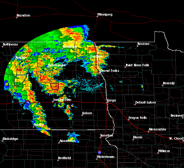 The tornado warning for eastern foster county will expire at 815 pm cdt, the storm which prompted the warning has weakened below severe limits, and no longer appears capable of producing a tornado. therefore, the warning will be allowed to expire. however heavy rain is still possible with this thunderstorm. a severe thunderstorm watch remains in effect until 100 am cdt for southeastern north dakota. to report severe weather, contact your nearest law enforcement agency. they will relay your report to the national weather service bismarck. The tornado warning for eastern foster county will expire at 815 pm cdt, the storm which prompted the warning has weakened below severe limits, and no longer appears capable of producing a tornado. therefore, the warning will be allowed to expire. however heavy rain is still possible with this thunderstorm. a severe thunderstorm watch remains in effect until 100 am cdt for southeastern north dakota. to report severe weather, contact your nearest law enforcement agency. they will relay your report to the national weather service bismarck.
|
| 6/30/2020 8:02 PM CDT |
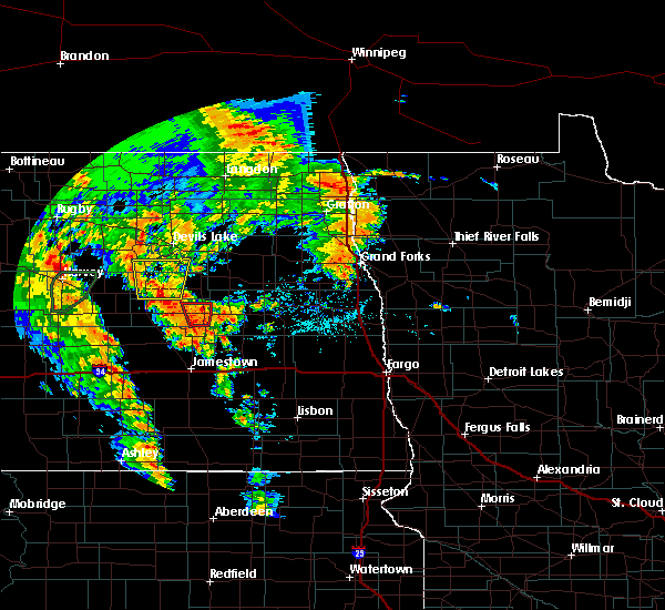 At 801 pm cdt, a severe thunderstorm capable of producing a tornado was located near glenfield, or 23 miles east of carrington, moving north at 25 mph (radar indicated rotation). Hazards include tornado. Flying debris will be dangerous to those caught without shelter. mobile homes will be damaged or destroyed. damage to roofs, windows, and vehicles will occur. tree damage is likely. This tornadic thunderstorm will remain over mainly rural areas of eastern foster county, including the following locations, juanita. At 801 pm cdt, a severe thunderstorm capable of producing a tornado was located near glenfield, or 23 miles east of carrington, moving north at 25 mph (radar indicated rotation). Hazards include tornado. Flying debris will be dangerous to those caught without shelter. mobile homes will be damaged or destroyed. damage to roofs, windows, and vehicles will occur. tree damage is likely. This tornadic thunderstorm will remain over mainly rural areas of eastern foster county, including the following locations, juanita.
|
| 6/30/2020 7:47 PM CDT |
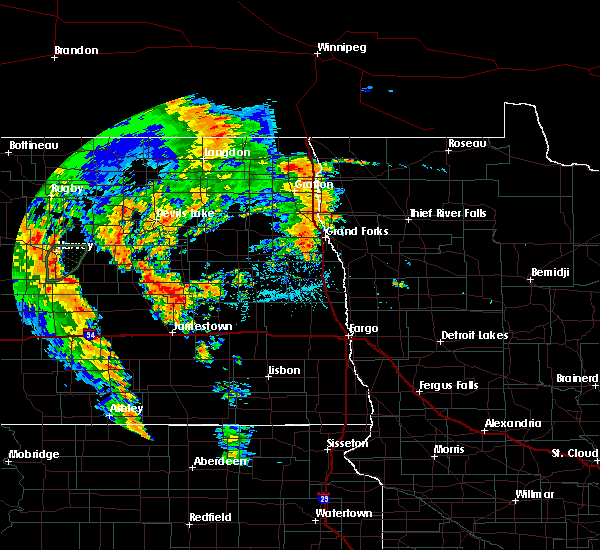 At 746 pm cdt, a severe thunderstorm capable of producing a tornado was located 5 miles northeast of kensal, or 24 miles east of carrington, moving north at 35 mph (radar indicated rotation). Hazards include tornado. Flying debris will be dangerous to those caught without shelter. mobile homes will be damaged or destroyed. damage to roofs, windows, and vehicles will occur. tree damage is likely. this dangerous storm will be near, glenfield around 800 pm cdt. Other locations impacted by this tornadic thunderstorm include juanita. At 746 pm cdt, a severe thunderstorm capable of producing a tornado was located 5 miles northeast of kensal, or 24 miles east of carrington, moving north at 35 mph (radar indicated rotation). Hazards include tornado. Flying debris will be dangerous to those caught without shelter. mobile homes will be damaged or destroyed. damage to roofs, windows, and vehicles will occur. tree damage is likely. this dangerous storm will be near, glenfield around 800 pm cdt. Other locations impacted by this tornadic thunderstorm include juanita.
|
| 6/7/2020 8:53 PM CDT |
 At 853 pm cdt, severe thunderstorms were located along a line extending from near glenfield to 7 miles south of cathay, moving north at 30 mph (radar indicated). Hazards include 70 mph wind gusts. Expect considerable tree damage. damage is likely to mobile homes, roofs, and outbuildings. these severe storms will be near, cathay around 905 pm cdt. mchenry around 910 pm cdt. Other locations impacted by these severe thunderstorms include juanita, melville, barlow and sykeston. At 853 pm cdt, severe thunderstorms were located along a line extending from near glenfield to 7 miles south of cathay, moving north at 30 mph (radar indicated). Hazards include 70 mph wind gusts. Expect considerable tree damage. damage is likely to mobile homes, roofs, and outbuildings. these severe storms will be near, cathay around 905 pm cdt. mchenry around 910 pm cdt. Other locations impacted by these severe thunderstorms include juanita, melville, barlow and sykeston.
|
| 6/7/2020 8:41 PM CDT |
 At 840 pm cdt, severe thunderstorms were located along a line extending from 7 miles southeast of glenfield to 13 miles south of cathay, moving north at 35 mph (radar indicated). Hazards include 70 mph wind gusts and quarter size hail. Hail damage to vehicles is expected. expect considerable tree damage. wind damage is also likely to mobile homes, roofs, and outbuildings. these severe storms will be near, glenfield around 855 pm cdt. mchenry and cathay around 905 pm cdt. Other locations impacted by these severe thunderstorms include eldridge, juanita, chase lake, melville, windsor, barlow, edmunds and sykeston. At 840 pm cdt, severe thunderstorms were located along a line extending from 7 miles southeast of glenfield to 13 miles south of cathay, moving north at 35 mph (radar indicated). Hazards include 70 mph wind gusts and quarter size hail. Hail damage to vehicles is expected. expect considerable tree damage. wind damage is also likely to mobile homes, roofs, and outbuildings. these severe storms will be near, glenfield around 855 pm cdt. mchenry and cathay around 905 pm cdt. Other locations impacted by these severe thunderstorms include eldridge, juanita, chase lake, melville, windsor, barlow, edmunds and sykeston.
|
| 6/7/2020 8:19 PM CDT |
 At 818 pm cdt, severe thunderstorms were located along a line extending from wimbledon to 5 miles southeast of pettibone, moving north at 25 mph (radar indicated). Hazards include 70 mph wind gusts and quarter size hail. Hail damage to vehicles is expected. expect considerable tree damage. wind damage is also likely to mobile homes, roofs, and outbuildings. severe thunderstorms will be near, courtenay around 825 pm cdt. woodworth around 830 pm cdt. glenfield around 900 pm cdt. mchenry around 915 pm cdt. Other locations impacted by these severe thunderstorms include eldridge, juanita, chase lake, melville, windsor, barlow, edmunds and sykeston. At 818 pm cdt, severe thunderstorms were located along a line extending from wimbledon to 5 miles southeast of pettibone, moving north at 25 mph (radar indicated). Hazards include 70 mph wind gusts and quarter size hail. Hail damage to vehicles is expected. expect considerable tree damage. wind damage is also likely to mobile homes, roofs, and outbuildings. severe thunderstorms will be near, courtenay around 825 pm cdt. woodworth around 830 pm cdt. glenfield around 900 pm cdt. mchenry around 915 pm cdt. Other locations impacted by these severe thunderstorms include eldridge, juanita, chase lake, melville, windsor, barlow, edmunds and sykeston.
|
| 9/2/2019 4:44 PM CDT |
 At 443 pm cdt, severe thunderstorms were located along a line extending from 5 miles south of glenfield to near buchanan to near medina, moving southeast at 55 mph. these are very dangerous storms (trained weather spotters). Hazards include 80 mph wind gusts and quarter size hail. Flying debris will be dangerous to those caught without shelter. mobile homes will be heavily damaged. expect considerable damage to roofs, windows, and vehicles. extensive tree damage and power outages are likely. Locations impacted include, jamestown, steele, medina, gackle, tappen, streeter, kensal, ypsilanti, glenfield, buchanan, spiritwood lake, montpelier, cleveland, spiritwood, grace city, dawson, pingree, mchenry, courtenay and lake isabel. At 443 pm cdt, severe thunderstorms were located along a line extending from 5 miles south of glenfield to near buchanan to near medina, moving southeast at 55 mph. these are very dangerous storms (trained weather spotters). Hazards include 80 mph wind gusts and quarter size hail. Flying debris will be dangerous to those caught without shelter. mobile homes will be heavily damaged. expect considerable damage to roofs, windows, and vehicles. extensive tree damage and power outages are likely. Locations impacted include, jamestown, steele, medina, gackle, tappen, streeter, kensal, ypsilanti, glenfield, buchanan, spiritwood lake, montpelier, cleveland, spiritwood, grace city, dawson, pingree, mchenry, courtenay and lake isabel.
|
| 9/2/2019 4:39 PM CDT |
 At 438 pm cdt, severe thunderstorms were located along a line extending from 5 miles south of glenfield to near buchanan to near medina, moving southeast at 55 mph (trained weather spotters). Hazards include 70 mph wind gusts and quarter size hail. Hail damage to vehicles is expected. expect considerable tree damage. wind damage is also likely to mobile homes, roofs, and outbuildings. Locations impacted include, jamestown, steele, medina, gackle, tappen, streeter, kensal, ypsilanti, glenfield, buchanan, spiritwood lake, montpelier, cleveland, spiritwood, grace city, dawson, pingree, mchenry, courtenay and lake isabel. At 438 pm cdt, severe thunderstorms were located along a line extending from 5 miles south of glenfield to near buchanan to near medina, moving southeast at 55 mph (trained weather spotters). Hazards include 70 mph wind gusts and quarter size hail. Hail damage to vehicles is expected. expect considerable tree damage. wind damage is also likely to mobile homes, roofs, and outbuildings. Locations impacted include, jamestown, steele, medina, gackle, tappen, streeter, kensal, ypsilanti, glenfield, buchanan, spiritwood lake, montpelier, cleveland, spiritwood, grace city, dawson, pingree, mchenry, courtenay and lake isabel.
|
| 9/2/2019 4:29 PM CDT |
 At 428 pm cdt, severe thunderstorms were located along a line extending from 6 miles southwest of glenfield to near buchanan to near medina, moving east at 50 mph (trained weather spotters). Hazards include 60 mph wind gusts and quarter size hail. Hail damage to vehicles is expected. expect wind damage to roofs, siding, and trees. Locations impacted include, jamestown, steele, medina, gackle, tappen, streeter, kensal, ypsilanti, glenfield, buchanan, spiritwood lake, montpelier, cleveland, spiritwood, grace city, dawson, pingree, mchenry, courtenay and lake isabel. At 428 pm cdt, severe thunderstorms were located along a line extending from 6 miles southwest of glenfield to near buchanan to near medina, moving east at 50 mph (trained weather spotters). Hazards include 60 mph wind gusts and quarter size hail. Hail damage to vehicles is expected. expect wind damage to roofs, siding, and trees. Locations impacted include, jamestown, steele, medina, gackle, tappen, streeter, kensal, ypsilanti, glenfield, buchanan, spiritwood lake, montpelier, cleveland, spiritwood, grace city, dawson, pingree, mchenry, courtenay and lake isabel.
|
| 9/2/2019 4:14 PM CDT |
 At 413 pm cdt, severe thunderstorms were located along a line extending from 6 miles southwest of grace city to 4 miles southeast of woodworth to near dawson, moving southeast at 50 mph (radar indicated). Hazards include 60 mph wind gusts and quarter size hail. Hail damage to vehicles is expected. expect wind damage to roofs, siding, and trees. Locations impacted include, jamestown, carrington, steele, medina, gackle, tappen, streeter, kensal, ypsilanti, glenfield, buchanan, spiritwood lake, montpelier, cleveland, bordulac, spiritwood, pettibone, grace city, dawson and pingree. At 413 pm cdt, severe thunderstorms were located along a line extending from 6 miles southwest of grace city to 4 miles southeast of woodworth to near dawson, moving southeast at 50 mph (radar indicated). Hazards include 60 mph wind gusts and quarter size hail. Hail damage to vehicles is expected. expect wind damage to roofs, siding, and trees. Locations impacted include, jamestown, carrington, steele, medina, gackle, tappen, streeter, kensal, ypsilanti, glenfield, buchanan, spiritwood lake, montpelier, cleveland, bordulac, spiritwood, pettibone, grace city, dawson and pingree.
|
| 9/2/2019 3:59 PM CDT |
 The national weather service in bismarck has issued a * severe thunderstorm warning for. kidder county in south central north dakota. foster county in southeastern north dakota. stutsman county in southeastern north dakota. Until 500 pm cdt. The national weather service in bismarck has issued a * severe thunderstorm warning for. kidder county in south central north dakota. foster county in southeastern north dakota. stutsman county in southeastern north dakota. Until 500 pm cdt.
|
| 7/8/2019 6:17 PM CDT |
 At 615 pm cdt, severe thunderstorms were located along a line extending from near tolna to 4 miles west of binford to near courtenay, moving east at 30 mph (radar indicated). Hazards include 60 mph wind gusts and nickel size hail. Expect damage to roofs, siding, and trees. Locations impacted include, kensal, glenfield, mchenry, courtenay and juanita. At 615 pm cdt, severe thunderstorms were located along a line extending from near tolna to 4 miles west of binford to near courtenay, moving east at 30 mph (radar indicated). Hazards include 60 mph wind gusts and nickel size hail. Expect damage to roofs, siding, and trees. Locations impacted include, kensal, glenfield, mchenry, courtenay and juanita.
|
| 7/8/2019 6:04 PM CDT |
 At 546 pm cdt, severe thunderstorms were located along a line extending from 13 miles southeast of fort totten to 5 miles southwest of kensal, moving east at 30 mph (radar indicated). Hazards include 60 mph wind gusts and penny size hail. Expect damage to roofs, siding, and trees. severe thunderstorms will be near, kensal around 555 pm cdt. courtenay around 610 pm cdt. Other locations impacted by these severe thunderstorms include juanita and edmunds. At 546 pm cdt, severe thunderstorms were located along a line extending from 13 miles southeast of fort totten to 5 miles southwest of kensal, moving east at 30 mph (radar indicated). Hazards include 60 mph wind gusts and penny size hail. Expect damage to roofs, siding, and trees. severe thunderstorms will be near, kensal around 555 pm cdt. courtenay around 610 pm cdt. Other locations impacted by these severe thunderstorms include juanita and edmunds.
|
| 7/8/2019 5:47 PM CDT |
 At 546 pm cdt, severe thunderstorms were located along a line extending from 13 miles southeast of fort totten to 5 miles southwest of kensal, moving east at 30 mph (radar indicated). Hazards include 60 mph wind gusts and penny size hail. Expect damage to roofs, siding, and trees. severe thunderstorms will be near, kensal around 555 pm cdt. courtenay around 610 pm cdt. Other locations impacted by these severe thunderstorms include juanita and edmunds. At 546 pm cdt, severe thunderstorms were located along a line extending from 13 miles southeast of fort totten to 5 miles southwest of kensal, moving east at 30 mph (radar indicated). Hazards include 60 mph wind gusts and penny size hail. Expect damage to roofs, siding, and trees. severe thunderstorms will be near, kensal around 555 pm cdt. courtenay around 610 pm cdt. Other locations impacted by these severe thunderstorms include juanita and edmunds.
|
| 6/13/2019 7:01 PM CDT |
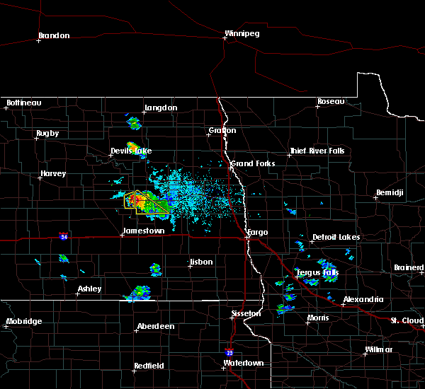 At 700 pm cdt, a severe thunderstorm was located near glenfield, or 30 miles east of carrington, moving southeast at 20 mph (radar indicated). Hazards include 60 mph wind gusts and quarter size hail. Hail damage to vehicles is expected. expect wind damage to roofs, siding, and trees. Locations impacted include, glenfield. At 700 pm cdt, a severe thunderstorm was located near glenfield, or 30 miles east of carrington, moving southeast at 20 mph (radar indicated). Hazards include 60 mph wind gusts and quarter size hail. Hail damage to vehicles is expected. expect wind damage to roofs, siding, and trees. Locations impacted include, glenfield.
|
| 6/13/2019 6:53 PM CDT |
 At 653 pm cdt, a severe thunderstorm was located over glenfield, or 28 miles east of carrington, moving southeast at 20 mph (radar indicated). Hazards include 60 mph wind gusts and quarter size hail. Hail damage to vehicles is expected. expect wind damage to roofs, siding, and trees. This severe thunderstorm will remain over mainly rural areas of southeastern foster county. At 653 pm cdt, a severe thunderstorm was located over glenfield, or 28 miles east of carrington, moving southeast at 20 mph (radar indicated). Hazards include 60 mph wind gusts and quarter size hail. Hail damage to vehicles is expected. expect wind damage to roofs, siding, and trees. This severe thunderstorm will remain over mainly rural areas of southeastern foster county.
|
| 6/29/2018 2:57 AM CDT |
 At 257 am cdt, severe thunderstorms were located along a line extending from 4 miles west of mchenry to 6 miles west of spiritwood lake to 6 miles southwest of montpelier, moving east at 55 mph (radar indicated). Hazards include 70 mph wind gusts and nickel size hail. Expect considerable tree damage. damage is likely to mobile homes, roofs, and outbuildings. These severe thunderstorms will remain over mainly rural areas of eastern foster and eastern stutsman counties, including the following locations, eldridge, juanita, sydney and millarton. At 257 am cdt, severe thunderstorms were located along a line extending from 4 miles west of mchenry to 6 miles west of spiritwood lake to 6 miles southwest of montpelier, moving east at 55 mph (radar indicated). Hazards include 70 mph wind gusts and nickel size hail. Expect considerable tree damage. damage is likely to mobile homes, roofs, and outbuildings. These severe thunderstorms will remain over mainly rural areas of eastern foster and eastern stutsman counties, including the following locations, eldridge, juanita, sydney and millarton.
|
| 6/29/2018 2:47 AM CDT |
 At 247 am cdt, severe thunderstorms were located along a line extending from 8 miles east of sheyenne to near bordulac to 4 miles southwest of buchanan, moving east at 50 mph (radar indicated). Hazards include 70 mph wind gusts and quarter size hail. Hail damage to vehicles is expected. expect considerable tree damage. wind damage is also likely to mobile homes, roofs, and outbuildings. these severe storms will be near, buchanan around 250 am cdt. kensal around 255 am cdt. glenfield and spiritwood lake around 300 am cdt. Other locations impacted by these severe thunderstorms include juanita, melville, barlow and edmunds. At 247 am cdt, severe thunderstorms were located along a line extending from 8 miles east of sheyenne to near bordulac to 4 miles southwest of buchanan, moving east at 50 mph (radar indicated). Hazards include 70 mph wind gusts and quarter size hail. Hail damage to vehicles is expected. expect considerable tree damage. wind damage is also likely to mobile homes, roofs, and outbuildings. these severe storms will be near, buchanan around 250 am cdt. kensal around 255 am cdt. glenfield and spiritwood lake around 300 am cdt. Other locations impacted by these severe thunderstorms include juanita, melville, barlow and edmunds.
|
| 6/29/2018 2:32 AM CDT |
 At 232 am cdt, severe thunderstorms were located along a line extending from near sheyenne to near carrington to 9 miles southeast of woodworth, moving east at 35 mph (radar indicated). Hazards include 70 mph wind gusts and quarter size hail. Hail damage to vehicles is expected. expect considerable tree damage. wind damage is also likely to mobile homes, roofs, and outbuildings. these severe storms will be near, carrington around 235 am cdt. bordulac around 250 am cdt. kensal and buchanan around 300 am cdt. Other locations impacted by these severe thunderstorms include juanita, emrick, bremen, chase lake, melville, heaton, hamberg, heimdal, barlow and edmunds. At 232 am cdt, severe thunderstorms were located along a line extending from near sheyenne to near carrington to 9 miles southeast of woodworth, moving east at 35 mph (radar indicated). Hazards include 70 mph wind gusts and quarter size hail. Hail damage to vehicles is expected. expect considerable tree damage. wind damage is also likely to mobile homes, roofs, and outbuildings. these severe storms will be near, carrington around 235 am cdt. bordulac around 250 am cdt. kensal and buchanan around 300 am cdt. Other locations impacted by these severe thunderstorms include juanita, emrick, bremen, chase lake, melville, heaton, hamberg, heimdal, barlow and edmunds.
|
| 6/29/2018 2:23 AM CDT |
 At 222 am cdt, severe thunderstorms were located along a line extending from 7 miles southwest of oberon to 8 miles west of carrington to 8 miles southeast of pettibone, moving east at 40 mph (70 mph winds were reported 2 miles south of harvey). Hazards include 70 mph wind gusts and nickel size hail. Expect considerable tree damage. damage is likely to mobile homes, roofs, and outbuildings. severe thunderstorms will be near, carrington around 235 am cdt. bordulac around 245 am cdt. buchanan around 300 am cdt. Other locations impacted by these severe thunderstorms include juanita, emrick, bremen, chase lake, melville, heaton, hamberg, heimdal, barlow and edmunds. At 222 am cdt, severe thunderstorms were located along a line extending from 7 miles southwest of oberon to 8 miles west of carrington to 8 miles southeast of pettibone, moving east at 40 mph (70 mph winds were reported 2 miles south of harvey). Hazards include 70 mph wind gusts and nickel size hail. Expect considerable tree damage. damage is likely to mobile homes, roofs, and outbuildings. severe thunderstorms will be near, carrington around 235 am cdt. bordulac around 245 am cdt. buchanan around 300 am cdt. Other locations impacted by these severe thunderstorms include juanita, emrick, bremen, chase lake, melville, heaton, hamberg, heimdal, barlow and edmunds.
|
| 8/18/2017 5:09 AM CDT |
 At 509 am cdt, a severe thunderstorm was located 7 miles southwest of bordulac, or 12 miles south of carrington, moving east at 30 mph (radar indicated). Hazards include 60 mph wind gusts and penny size hail. Expect damage to roofs, siding, and trees. this severe storm will be near, bordulac around 515 am cdt. kensal around 530 am cdt. Other locations impacted by this severe thunderstorm include juanita, melville and edmunds. At 509 am cdt, a severe thunderstorm was located 7 miles southwest of bordulac, or 12 miles south of carrington, moving east at 30 mph (radar indicated). Hazards include 60 mph wind gusts and penny size hail. Expect damage to roofs, siding, and trees. this severe storm will be near, bordulac around 515 am cdt. kensal around 530 am cdt. Other locations impacted by this severe thunderstorm include juanita, melville and edmunds.
|
| 8/18/2017 4:57 AM CDT |
 At 457 am cdt, a severe thunderstorm was located 5 miles south of bordulac, or 13 miles southeast of carrington, moving east at 40 mph (radar indicated). Hazards include 60 mph wind gusts and penny size hail. Expect damage to roofs, siding, and trees. this severe storm will be near, kensal around 510 am cdt. courtenay around 525 am cdt. Other locations impacted by this severe thunderstorm include juanita, melville and edmunds. At 457 am cdt, a severe thunderstorm was located 5 miles south of bordulac, or 13 miles southeast of carrington, moving east at 40 mph (radar indicated). Hazards include 60 mph wind gusts and penny size hail. Expect damage to roofs, siding, and trees. this severe storm will be near, kensal around 510 am cdt. courtenay around 525 am cdt. Other locations impacted by this severe thunderstorm include juanita, melville and edmunds.
|
| 8/18/2017 4:40 AM CDT |
 At 440 am cdt, a severe thunderstorm was located 8 miles south of carrington, moving east at 40 mph (radar indicated). Hazards include 60 mph wind gusts and quarter size hail. Hail damage to vehicles is expected. expect wind damage to roofs, siding, and trees. this severe storm will be near, bordulac around 450 am cdt. kensal around 510 am cdt. courtenay around 520 am cdt. Other locations impacted by this severe thunderstorm include juanita, melville, sykeston and edmunds. At 440 am cdt, a severe thunderstorm was located 8 miles south of carrington, moving east at 40 mph (radar indicated). Hazards include 60 mph wind gusts and quarter size hail. Hail damage to vehicles is expected. expect wind damage to roofs, siding, and trees. this severe storm will be near, bordulac around 450 am cdt. kensal around 510 am cdt. courtenay around 520 am cdt. Other locations impacted by this severe thunderstorm include juanita, melville, sykeston and edmunds.
|
| 8/18/2017 4:24 AM CDT |
 At 424 am cdt, a severe thunderstorm was located 11 miles north of woodworth, or 12 miles southwest of carrington, moving east at 40 mph (radar indicated). Hazards include 60 mph wind gusts and quarter size hail. Hail damage to vehicles is expected. expect wind damage to roofs, siding, and trees. this severe thunderstorm will be near, bordulac around 445 am cdt. pingree around 455 am cdt. kensal around 500 am cdt. courtenay around 515 am cdt. Other locations impacted by this severe thunderstorm include juanita, melville, sykeston and edmunds. At 424 am cdt, a severe thunderstorm was located 11 miles north of woodworth, or 12 miles southwest of carrington, moving east at 40 mph (radar indicated). Hazards include 60 mph wind gusts and quarter size hail. Hail damage to vehicles is expected. expect wind damage to roofs, siding, and trees. this severe thunderstorm will be near, bordulac around 445 am cdt. pingree around 455 am cdt. kensal around 500 am cdt. courtenay around 515 am cdt. Other locations impacted by this severe thunderstorm include juanita, melville, sykeston and edmunds.
|
| 7/21/2017 3:30 PM CDT |
 At 328 pm cdt, a severe thunderstorm was located near glenfield, or 30 miles east of carrington, moving east at 45 mph (radar indicated). Hazards include golf ball size hail and 70 mph wind gusts. People and animals outdoors will be injured. expect hail damage to roofs, siding, windows, and vehicles. expect considerable tree damage. wind damage is also likely to mobile homes, roofs, and outbuildings. Locations impacted include, wimbledon, kensal, glenfield, grace city, mchenry, and juanita. At 328 pm cdt, a severe thunderstorm was located near glenfield, or 30 miles east of carrington, moving east at 45 mph (radar indicated). Hazards include golf ball size hail and 70 mph wind gusts. People and animals outdoors will be injured. expect hail damage to roofs, siding, windows, and vehicles. expect considerable tree damage. wind damage is also likely to mobile homes, roofs, and outbuildings. Locations impacted include, wimbledon, kensal, glenfield, grace city, mchenry, and juanita.
|
| 7/21/2017 3:22 PM CDT | Multiple power lines down. multiple trees down. tractor trailer truck blown over. time estimated on rada in foster county ND, 0.4 miles SSE of Glenfield, ND |
| 7/21/2017 3:18 PM CDT | Measured 74 mph gust with 3/4" hail. door torn off of a quonset hut... and some siding was ripped off a house. large area of corn flattened. time estimated from rada in foster county ND, 6.7 miles SE of Glenfield, ND |
| 7/21/2017 3:18 PM CDT | Quarter sized hail reported 6.2 miles ESE of Glenfield, ND, quarter sized hail estimated. was also wind driven... so broke out windows... dented cars... and stripped some paint off siding. time estimated from radar. |
| 7/21/2017 3:18 PM CDT | One foot diameter trees down. broken windows from wind driven quarter size hail. a grain truck knocked over... and wind driven hail stripped paint of siding. time estim in foster county ND, 6.2 miles ESE of Glenfield, ND |
| 7/21/2017 3:17 PM CDT |
 At 316 pm cdt, severe thunderstorms were located along a line extending from near glenfield to near bordulac, moving east at 45 mph (radar indicated). Hazards include golf ball size hail and 70 mph wind gusts. People and animals outdoors will be injured. expect hail damage to roofs, siding, windows, and vehicles. expect considerable tree damage. wind damage is also likely to mobile homes, roofs, and outbuildings. Locations impacted include, carrington, wimbledon, kensal, glenfield, bordulac, grace city, mchenry, melville and juanita. At 316 pm cdt, severe thunderstorms were located along a line extending from near glenfield to near bordulac, moving east at 45 mph (radar indicated). Hazards include golf ball size hail and 70 mph wind gusts. People and animals outdoors will be injured. expect hail damage to roofs, siding, windows, and vehicles. expect considerable tree damage. wind damage is also likely to mobile homes, roofs, and outbuildings. Locations impacted include, carrington, wimbledon, kensal, glenfield, bordulac, grace city, mchenry, melville and juanita.
|
| 7/21/2017 3:02 PM CDT |
 At 243 pm cdt, a severe thunderstorm was located 11 miles southwest of carrington, moving east at 40 mph (radar indicated). Hazards include 60 mph wind gusts and half dollar size hail. Hail damage to vehicles is expected. expect wind damage to roofs, siding, and trees. this severe thunderstorm will be near, carrington around 255 pm cdt. bordulac around 310 pm cdt. kensal around 325 pm cdt. courtenay around 340 pm cdt. wimbledon around 345 pm cdt. Other locations impacted by this severe thunderstorm include juanita, melville, barlow, sykeston and edmunds. At 243 pm cdt, a severe thunderstorm was located 11 miles southwest of carrington, moving east at 40 mph (radar indicated). Hazards include 60 mph wind gusts and half dollar size hail. Hail damage to vehicles is expected. expect wind damage to roofs, siding, and trees. this severe thunderstorm will be near, carrington around 255 pm cdt. bordulac around 310 pm cdt. kensal around 325 pm cdt. courtenay around 340 pm cdt. wimbledon around 345 pm cdt. Other locations impacted by this severe thunderstorm include juanita, melville, barlow, sykeston and edmunds.
|
| 7/21/2017 2:44 PM CDT |
 At 243 pm cdt, a severe thunderstorm was located 11 miles southwest of carrington, moving east at 40 mph (radar indicated). Hazards include 60 mph wind gusts and half dollar size hail. Hail damage to vehicles is expected. expect wind damage to roofs, siding, and trees. this severe thunderstorm will be near, carrington around 255 pm cdt. bordulac around 310 pm cdt. kensal around 325 pm cdt. courtenay around 340 pm cdt. wimbledon around 345 pm cdt. Other locations impacted by this severe thunderstorm include juanita, melville, barlow, sykeston and edmunds. At 243 pm cdt, a severe thunderstorm was located 11 miles southwest of carrington, moving east at 40 mph (radar indicated). Hazards include 60 mph wind gusts and half dollar size hail. Hail damage to vehicles is expected. expect wind damage to roofs, siding, and trees. this severe thunderstorm will be near, carrington around 255 pm cdt. bordulac around 310 pm cdt. kensal around 325 pm cdt. courtenay around 340 pm cdt. wimbledon around 345 pm cdt. Other locations impacted by this severe thunderstorm include juanita, melville, barlow, sykeston and edmunds.
|
| 7/6/2017 3:37 AM CDT |
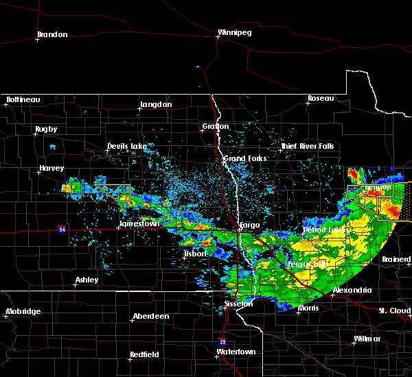 The severe thunderstorm warning for eastern foster county will expire at 345 am cdt, the storm which prompted the warning has weakened below severe limits, and no longer poses an immediate threat to life or property. therefore, the warning will be allowed to expire. a severe thunderstorm watch remains in effect until 500 am cdt for southeastern north dakota. The severe thunderstorm warning for eastern foster county will expire at 345 am cdt, the storm which prompted the warning has weakened below severe limits, and no longer poses an immediate threat to life or property. therefore, the warning will be allowed to expire. a severe thunderstorm watch remains in effect until 500 am cdt for southeastern north dakota.
|
| 7/6/2017 3:10 AM CDT |
 At 310 am cdt, a severe thunderstorm was located 5 miles south of glenfield, or 26 miles east of carrington, moving southeast at 25 mph (radar indicated). Hazards include quarter size hail. Damage to vehicles is expected. Locations impacted include, glenfield, grace city, mchenry and juanita. At 310 am cdt, a severe thunderstorm was located 5 miles south of glenfield, or 26 miles east of carrington, moving southeast at 25 mph (radar indicated). Hazards include quarter size hail. Damage to vehicles is expected. Locations impacted include, glenfield, grace city, mchenry and juanita.
|
| 7/6/2017 2:51 AM CDT |
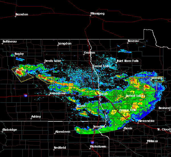 At 250 am cdt, a severe thunderstorm was located 5 miles west of glenfield, or 20 miles east of carrington, moving southeast at 25 mph (radar indicated). Hazards include 60 mph wind gusts and half dollar size hail. Hail damage to vehicles is expected. Expect wind damage to roofs, siding, and trees. At 250 am cdt, a severe thunderstorm was located 5 miles west of glenfield, or 20 miles east of carrington, moving southeast at 25 mph (radar indicated). Hazards include 60 mph wind gusts and half dollar size hail. Hail damage to vehicles is expected. Expect wind damage to roofs, siding, and trees.
|
| 7/6/2017 2:13 AM CDT |
 The severe thunderstorm warning for southeastern wells and foster counties will expire at 215 am cdt, the storm which prompted the warning has weakened below severe limits. therefore, the warning will be allowed to expire. a severe thunderstorm watch remains in effect until 500 am cdt for south central and southeastern north dakota. The severe thunderstorm warning for southeastern wells and foster counties will expire at 215 am cdt, the storm which prompted the warning has weakened below severe limits. therefore, the warning will be allowed to expire. a severe thunderstorm watch remains in effect until 500 am cdt for south central and southeastern north dakota.
|
| 7/6/2017 1:49 AM CDT |
 At 133 am cdt, a severe thunderstorm was located 6 miles northwest of carrington, moving southeast at 45 mph (radar indicated). Hazards include ping pong ball size hail and 60 mph wind gusts. People and animals outdoors will be injured. expect hail damage to roofs, siding, windows, and vehicles. expect wind damage to roofs, siding, and trees. Locations impacted include, carrington, glenfield, bordulac, grace city, mchenry, cathay, sykeston, melville, juanita, emrick, heaton and barlow. At 133 am cdt, a severe thunderstorm was located 6 miles northwest of carrington, moving southeast at 45 mph (radar indicated). Hazards include ping pong ball size hail and 60 mph wind gusts. People and animals outdoors will be injured. expect hail damage to roofs, siding, windows, and vehicles. expect wind damage to roofs, siding, and trees. Locations impacted include, carrington, glenfield, bordulac, grace city, mchenry, cathay, sykeston, melville, juanita, emrick, heaton and barlow.
|
| 7/6/2017 1:34 AM CDT |
 At 133 am cdt, a severe thunderstorm was located 6 miles northwest of carrington, moving southeast at 45 mph (radar indicated). Hazards include ping pong ball size hail and 60 mph wind gusts. People and animals outdoors will be injured. expect hail damage to roofs, siding, windows, and vehicles. expect wind damage to roofs, siding, and trees. Locations impacted include, carrington, glenfield, bordulac, grace city, mchenry, cathay, sykeston, melville, juanita, emrick, heaton and barlow. At 133 am cdt, a severe thunderstorm was located 6 miles northwest of carrington, moving southeast at 45 mph (radar indicated). Hazards include ping pong ball size hail and 60 mph wind gusts. People and animals outdoors will be injured. expect hail damage to roofs, siding, windows, and vehicles. expect wind damage to roofs, siding, and trees. Locations impacted include, carrington, glenfield, bordulac, grace city, mchenry, cathay, sykeston, melville, juanita, emrick, heaton and barlow.
|
| 7/6/2017 1:18 AM CDT |
 At 117 am cdt, a severe thunderstorm was located near cathay, or 17 miles northwest of carrington, moving southeast at 45 mph (radar indicated). Hazards include ping pong ball size hail and 60 mph wind gusts. People and animals outdoors will be injured. expect hail damage to roofs, siding, windows, and vehicles. Expect wind damage to roofs, siding, and trees. At 117 am cdt, a severe thunderstorm was located near cathay, or 17 miles northwest of carrington, moving southeast at 45 mph (radar indicated). Hazards include ping pong ball size hail and 60 mph wind gusts. People and animals outdoors will be injured. expect hail damage to roofs, siding, windows, and vehicles. Expect wind damage to roofs, siding, and trees.
|
| 6/9/2017 8:49 PM CDT |
 At 848 pm cdt, a severe thunderstorm was located over glenfield, or 25 miles east of carrington, moving east at 30 mph (radar indicated). Hazards include golf ball size hail and 60 mph wind gusts. People and animals outdoors will be injured. expect hail damage to roofs, siding, windows, and vehicles. expect wind damage to roofs, siding, and trees. This severe thunderstorm will remain over mainly rural areas of eastern foster county, including the following locations: juanita. At 848 pm cdt, a severe thunderstorm was located over glenfield, or 25 miles east of carrington, moving east at 30 mph (radar indicated). Hazards include golf ball size hail and 60 mph wind gusts. People and animals outdoors will be injured. expect hail damage to roofs, siding, windows, and vehicles. expect wind damage to roofs, siding, and trees. This severe thunderstorm will remain over mainly rural areas of eastern foster county, including the following locations: juanita.
|
| 6/9/2017 8:31 PM CDT |
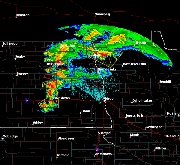 At 831 pm cdt, a severe thunderstorm was located 5 miles northeast of bordulac, or 12 miles east of carrington, moving east at 25 mph (radar indicated). Hazards include tennis ball size hail and 60 mph wind gusts. People and animals outdoors will be injured. expect hail damage to roofs, siding, windows, and vehicles. expect wind damage to roofs, siding, and trees. this severe storm will be near, glenfield around 905 pm cdt. Other locations impacted by this severe thunderstorm include juanita. At 831 pm cdt, a severe thunderstorm was located 5 miles northeast of bordulac, or 12 miles east of carrington, moving east at 25 mph (radar indicated). Hazards include tennis ball size hail and 60 mph wind gusts. People and animals outdoors will be injured. expect hail damage to roofs, siding, windows, and vehicles. expect wind damage to roofs, siding, and trees. this severe storm will be near, glenfield around 905 pm cdt. Other locations impacted by this severe thunderstorm include juanita.
|
| 6/9/2017 8:14 PM CDT |
 At 813 pm cdt, a severe thunderstorm was located near bordulac, or near carrington, moving east at 25 mph (radar indicated. at 810 pm cdt, golf ball size ball size hail was reported in carrington). Hazards include tennis ball size hail and 60 mph wind gusts. People and animals outdoors will be injured. expect hail damage to roofs, siding, windows, and vehicles. expect wind damage to roofs, siding, and trees. this severe thunderstorm will be near, bordulac around 820 pm cdt. glenfield around 905 pm cdt. Other locations impacted by this severe thunderstorm include juanita and melville. At 813 pm cdt, a severe thunderstorm was located near bordulac, or near carrington, moving east at 25 mph (radar indicated. at 810 pm cdt, golf ball size ball size hail was reported in carrington). Hazards include tennis ball size hail and 60 mph wind gusts. People and animals outdoors will be injured. expect hail damage to roofs, siding, windows, and vehicles. expect wind damage to roofs, siding, and trees. this severe thunderstorm will be near, bordulac around 820 pm cdt. glenfield around 905 pm cdt. Other locations impacted by this severe thunderstorm include juanita and melville.
|
| 9/4/2016 9:21 AM CDT |
 At 921 am cdt, a severe thunderstorm was located 5 miles southwest of courtenay, or 18 miles north of jamestown, moving northeast at 35 mph (radar indicated). Hazards include 60 mph wind gusts and quarter size hail. Hail damage to vehicles is expected. expect wind damage to roofs, siding, and trees. Locations impacted include, kensal, glenfield, buchanan and courtenay. At 921 am cdt, a severe thunderstorm was located 5 miles southwest of courtenay, or 18 miles north of jamestown, moving northeast at 35 mph (radar indicated). Hazards include 60 mph wind gusts and quarter size hail. Hail damage to vehicles is expected. expect wind damage to roofs, siding, and trees. Locations impacted include, kensal, glenfield, buchanan and courtenay.
|
| 9/4/2016 9:04 AM CDT |
 At 903 am cdt, a severe thunderstorm was located 8 miles southwest of courtenay, or 17 miles north of jamestown, moving northeast at 25 mph (radar indicated). Hazards include 60 mph wind gusts and quarter size hail. Hail damage to vehicles is expected. expect wind damage to roofs, siding, and trees. Locations impacted include, kensal, glenfield, buchanan, pingree and courtenay. At 903 am cdt, a severe thunderstorm was located 8 miles southwest of courtenay, or 17 miles north of jamestown, moving northeast at 25 mph (radar indicated). Hazards include 60 mph wind gusts and quarter size hail. Hail damage to vehicles is expected. expect wind damage to roofs, siding, and trees. Locations impacted include, kensal, glenfield, buchanan, pingree and courtenay.
|
| 9/4/2016 8:39 AM CDT |
 At 839 am cdt, a severe thunderstorm was located over buchanan, or 12 miles northwest of jamestown, moving northeast at 40 mph (radar indicated). Hazards include 60 mph wind gusts and quarter size hail. Hail damage to vehicles is expected. Expect wind damage to roofs, siding, and trees. At 839 am cdt, a severe thunderstorm was located over buchanan, or 12 miles northwest of jamestown, moving northeast at 40 mph (radar indicated). Hazards include 60 mph wind gusts and quarter size hail. Hail damage to vehicles is expected. Expect wind damage to roofs, siding, and trees.
|
| 7/20/2016 11:30 PM CDT |
 At 1130 pm cdt, a severe thunderstorm was located 5 miles northeast of courtenay, or 26 miles northeast of jamestown, moving east at 40 mph (radar indicated). Hazards include 60 mph wind gusts. Expect damage to roofs. siding. and trees. Locations impacted include, kensal, glenfield, mchenry, courtenay and juanita. At 1130 pm cdt, a severe thunderstorm was located 5 miles northeast of courtenay, or 26 miles northeast of jamestown, moving east at 40 mph (radar indicated). Hazards include 60 mph wind gusts. Expect damage to roofs. siding. and trees. Locations impacted include, kensal, glenfield, mchenry, courtenay and juanita.
|
| 7/20/2016 11:11 PM CDT |
 At 1111 pm cdt, a severe thunderstorm was located near courtenay, or 27 miles north of jamestown, moving southeast at 50 mph (radar indicated). Hazards include 60 mph wind gusts and quarter size hail. Hail damage to vehicles is expected. expect wind damage to roofs, siding, and trees. This severe thunderstorm will remain over mainly rural areas of northeastern stutsman and eastern foster counties, including the following locations: edmunds and juanita. At 1111 pm cdt, a severe thunderstorm was located near courtenay, or 27 miles north of jamestown, moving southeast at 50 mph (radar indicated). Hazards include 60 mph wind gusts and quarter size hail. Hail damage to vehicles is expected. expect wind damage to roofs, siding, and trees. This severe thunderstorm will remain over mainly rural areas of northeastern stutsman and eastern foster counties, including the following locations: edmunds and juanita.
|
| 7/20/2016 10:58 PM CDT |
 At 1058 pm cdt, a severe thunderstorm was located near kensal, or 17 miles southeast of carrington, moving east at 45 mph (radar indicated). Hazards include 60 mph wind gusts and quarter size hail. Hail damage to vehicles is expected. expect wind damage to roofs, siding, and trees. this severe thunderstorm will be near, courtenay around 1115 pm cdt. Other locations impacted by this severe thunderstorm include melville, juanita and edmunds. At 1058 pm cdt, a severe thunderstorm was located near kensal, or 17 miles southeast of carrington, moving east at 45 mph (radar indicated). Hazards include 60 mph wind gusts and quarter size hail. Hail damage to vehicles is expected. expect wind damage to roofs, siding, and trees. this severe thunderstorm will be near, courtenay around 1115 pm cdt. Other locations impacted by this severe thunderstorm include melville, juanita and edmunds.
|
| 7/10/2016 11:39 PM CDT |
 At 1139 pm cdt, severe thunderstorms were located along a line extending from mchenry to dickey to near spring creek colony, moving east at 45 mph (trained weather spotters). Hazards include 60 mph wind gusts and quarter size hail. Hail damage to vehicles is expected. expect wind damage to roofs, siding, and trees. Locations impacted include, jamestown, carrington, oakes, ellendale, edgeley, lamoure, kulm, gackle, and spiritwood. At 1139 pm cdt, severe thunderstorms were located along a line extending from mchenry to dickey to near spring creek colony, moving east at 45 mph (trained weather spotters). Hazards include 60 mph wind gusts and quarter size hail. Hail damage to vehicles is expected. expect wind damage to roofs, siding, and trees. Locations impacted include, jamestown, carrington, oakes, ellendale, edgeley, lamoure, kulm, gackle, and spiritwood.
|
| 7/10/2016 11:26 PM CDT |
 At 1124 pm cdt, severe thunderstorms were located along a line extending from 4 miles north of grace city to 7 miles west of adrian to 7 miles east of long lake, moving east at 45 mph (trained weather spotters). Hazards include 60 mph wind gusts and quarter size hail. Hail damage to vehicles is expected. expect wind damage to roofs, siding, and trees. Locations impacted include, jamestown, carrington, ellendale, ashley, wishek, lamoure, gackle, and streeter. At 1124 pm cdt, severe thunderstorms were located along a line extending from 4 miles north of grace city to 7 miles west of adrian to 7 miles east of long lake, moving east at 45 mph (trained weather spotters). Hazards include 60 mph wind gusts and quarter size hail. Hail damage to vehicles is expected. expect wind damage to roofs, siding, and trees. Locations impacted include, jamestown, carrington, ellendale, ashley, wishek, lamoure, gackle, and streeter.
|
| 7/10/2016 10:59 PM CDT |
 At 1058 pm cdt, severe thunderstorms were located along a line extending from new rockford to 4 miles east of gackle to 8 miles south of ashley, moving east at 45 mph (radar indicated). Hazards include 60 mph wind gusts and quarter size hail. Hail damage to vehicles is expected. Expect wind damage to roofs, siding, and trees. At 1058 pm cdt, severe thunderstorms were located along a line extending from new rockford to 4 miles east of gackle to 8 miles south of ashley, moving east at 45 mph (radar indicated). Hazards include 60 mph wind gusts and quarter size hail. Hail damage to vehicles is expected. Expect wind damage to roofs, siding, and trees.
|
| 7/4/2016 6:39 PM CDT |
 The severe thunderstorm warning for eastern foster county will expire at 645 pm cdt, the storm which prompted the warning has moved out of the area. therefore the warning will be allowed to expire. a severe thunderstorm watch remains in effect until 1000 pm cdt for southeastern north dakota. The severe thunderstorm warning for eastern foster county will expire at 645 pm cdt, the storm which prompted the warning has moved out of the area. therefore the warning will be allowed to expire. a severe thunderstorm watch remains in effect until 1000 pm cdt for southeastern north dakota.
|
| 7/4/2016 6:26 PM CDT |
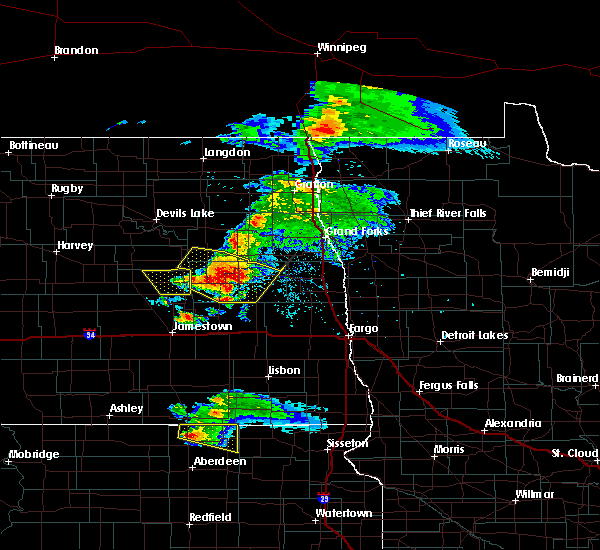 At 626 pm cdt, a severe thunderstorm was located over glenfield, or 27 miles east of carrington, moving southeast at 40 mph (radar indicated). Hazards include 60 mph wind gusts. Expect damage to roofs. siding. and trees. Locations impacted include, glenfield, grace city, mchenry and juanita. At 626 pm cdt, a severe thunderstorm was located over glenfield, or 27 miles east of carrington, moving southeast at 40 mph (radar indicated). Hazards include 60 mph wind gusts. Expect damage to roofs. siding. and trees. Locations impacted include, glenfield, grace city, mchenry and juanita.
|
| 7/4/2016 6:09 PM CDT |
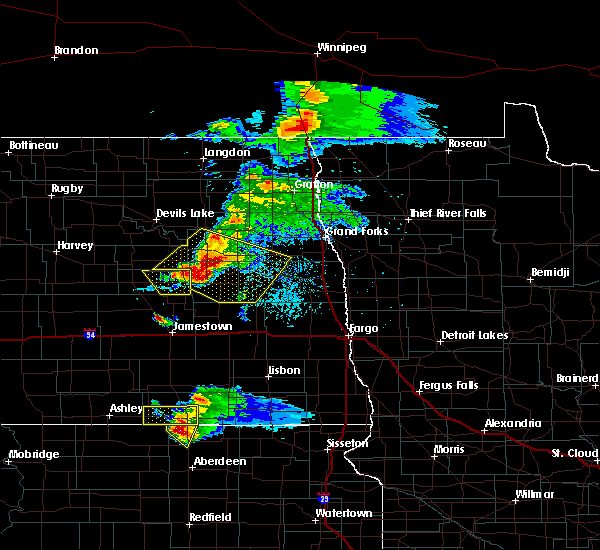 At 609 pm cdt, a severe thunderstorm was located near glenfield, or 25 miles east of carrington, moving southeast at 40 mph (radar indicated). Hazards include 70 mph wind gusts and penny size hail. Expect considerable tree damage. damage is likely to mobile homes, roofs, and outbuildings. Locations impacted include, glenfield, grace city, mchenry and juanita. At 609 pm cdt, a severe thunderstorm was located near glenfield, or 25 miles east of carrington, moving southeast at 40 mph (radar indicated). Hazards include 70 mph wind gusts and penny size hail. Expect considerable tree damage. damage is likely to mobile homes, roofs, and outbuildings. Locations impacted include, glenfield, grace city, mchenry and juanita.
|
| 7/4/2016 6:00 PM CDT |
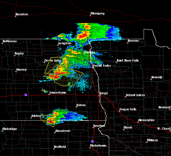 At 600 pm cdt, a severe thunderstorm was located over glenfield, or 25 miles east of carrington, moving southeast at 55 mph (radar indicated). Hazards include 70 mph wind gusts and penny size hail. Expect considerable tree damage. damage is likely to mobile homes, roofs, and outbuildings. This severe thunderstorm will remain over mainly rural areas of eastern foster county, including the following locations: juanita. At 600 pm cdt, a severe thunderstorm was located over glenfield, or 25 miles east of carrington, moving southeast at 55 mph (radar indicated). Hazards include 70 mph wind gusts and penny size hail. Expect considerable tree damage. damage is likely to mobile homes, roofs, and outbuildings. This severe thunderstorm will remain over mainly rural areas of eastern foster county, including the following locations: juanita.
|
| 6/17/2016 6:55 AM CDT | At 655 am cdt, severe thunderstorms were located along a line extending from 10 miles north of mchenry to near wimbledon, moving northeast at 45 mph (radar indicated). Hazards include 70 mph wind gusts and quarter size hail. Hail damage to vehicles is expected. expect considerable tree damage. wind damage is also likely to mobile homes, roofs, and outbuildings. These severe thunderstorms will remain over mainly rural areas of northeastern stutsman and foster counties, including the following locations, melville, edmunds, barlow and juanita. |
| 6/17/2016 6:36 AM CDT | At 635 am cdt, severe thunderstorms were located along a line extending from 8 miles northwest of grace city to near buchanan, moving northeast at 45 mph (radar indicated. emergency management reported tree branches down in carrington when these storms moved through). Hazards include 70 mph wind gusts and quarter size hail. Hail damage to vehicles is expected. expect considerable tree damage. wind damage is also likely to mobile homes, roofs, and outbuildings. these severe storms will be near, spiritwood lake around 650 am cdt. courtenay around 655 am cdt. Other locations impacted by these severe thunderstorms include melville, edmunds, barlow and juanita. |
| 6/17/2016 6:19 AM CDT | At 619 am cdt, severe thunderstorms were located along a line extending from 6 miles south of new rockford to 9 miles west of buchanan, moving east at 45 mph (radar indicated). Hazards include 70 mph wind gusts and quarter size hail. Hail damage to vehicles is expected. expect considerable tree damage. wind damage is also likely to mobile homes, roofs, and outbuildings. severe thunderstorms will be near, buchanan and pingree around 630 am cdt. grace city around 635 am cdt. spiritwood lake around 645 am cdt. courtenay around 655 am cdt. Other locations impacted by these severe thunderstorms include melville, edmunds, barlow and juanita. |
| 6/10/2016 2:15 AM CDT |
 At 214 am cdt, severe thunderstorms were located along a line extending from 11 miles north of mchenry to near buchanan, moving east at 45 mph (radar indicated). Hazards include 70 mph wind gusts. Expect considerable tree damage. damage is likely to mobile homes, roofs, and outbuildings. these severe storms will be near, spiritwood lake around 230 am cdt. Other locations impacted by these severe thunderstorms include melville, juanita and edmunds. At 214 am cdt, severe thunderstorms were located along a line extending from 11 miles north of mchenry to near buchanan, moving east at 45 mph (radar indicated). Hazards include 70 mph wind gusts. Expect considerable tree damage. damage is likely to mobile homes, roofs, and outbuildings. these severe storms will be near, spiritwood lake around 230 am cdt. Other locations impacted by these severe thunderstorms include melville, juanita and edmunds.
|
| 6/10/2016 1:42 AM CDT |
 At 140 am cdt, severe thunderstorms were located along a line extending from 12 miles south of maddock to 5 miles southwest of pettibone, moving east at 50 mph (radar indicated). Hazards include 70 mph wind gusts and penny size hail. Expect considerable tree damage. damage is likely to mobile homes, roofs, and outbuildings. severe thunderstorms will be near, woodworth around 155 am cdt. pingree around 220 am cdt. buchanan around 225 am cdt. spiritwood lake around 235 am cdt. Other locations impacted by these severe thunderstorms include bremen, chaseley, carrington, bowdon, sykeston, heimdal, lake williams, wellsburg, horsehead lake and hamberg. At 140 am cdt, severe thunderstorms were located along a line extending from 12 miles south of maddock to 5 miles southwest of pettibone, moving east at 50 mph (radar indicated). Hazards include 70 mph wind gusts and penny size hail. Expect considerable tree damage. damage is likely to mobile homes, roofs, and outbuildings. severe thunderstorms will be near, woodworth around 155 am cdt. pingree around 220 am cdt. buchanan around 225 am cdt. spiritwood lake around 235 am cdt. Other locations impacted by these severe thunderstorms include bremen, chaseley, carrington, bowdon, sykeston, heimdal, lake williams, wellsburg, horsehead lake and hamberg.
|
| 7/23/2015 10:07 PM CDT |
 At 1005 pm cdt, a severe thunderstorm was located over bordulac, or 9 miles southeast of carrington, moving east at 30 mph (law enforcement. at 956 pm cdt 60 mph were reported in carrington). Hazards include 60 mph wind gusts. Expect damage to roofs. siding and trees. Locations impacted include, carrington, wimbledon, kensal, glenfield, spiritwood lake, bordulac, grace city, pingree, mchenry, courtenay, edmunds, melville, barlow and juanita. At 1005 pm cdt, a severe thunderstorm was located over bordulac, or 9 miles southeast of carrington, moving east at 30 mph (law enforcement. at 956 pm cdt 60 mph were reported in carrington). Hazards include 60 mph wind gusts. Expect damage to roofs. siding and trees. Locations impacted include, carrington, wimbledon, kensal, glenfield, spiritwood lake, bordulac, grace city, pingree, mchenry, courtenay, edmunds, melville, barlow and juanita.
|
| 7/23/2015 9:43 PM CDT |
 At 942 pm cdt, a severe thunderstorm was located over carrington, moving east at 35 mph (radar indicated). Hazards include 60 mph wind gusts and quarter size hail. Hail damage to vehicles is expected. Expect wind damage to roofs, siding and trees. At 942 pm cdt, a severe thunderstorm was located over carrington, moving east at 35 mph (radar indicated). Hazards include 60 mph wind gusts and quarter size hail. Hail damage to vehicles is expected. Expect wind damage to roofs, siding and trees.
|
| 7/12/2015 10:15 PM CDT |
 At 1014 pm cdt, a severe thunderstorm was located near kensal, or 20 miles east of carrington, moving southeast at 30 mph (radar indicated). Hazards include golf ball size hail and 60 mph wind gusts. People and animals outdoors will be injured. expect hail damage to roofs, siding, windows and vehicles. expect wind damage to roofs, siding and trees. this severe storm will be near, courtenay around 1035 pm cdt. Other locations impacted by this severe thunderstorm include juanita. At 1014 pm cdt, a severe thunderstorm was located near kensal, or 20 miles east of carrington, moving southeast at 30 mph (radar indicated). Hazards include golf ball size hail and 60 mph wind gusts. People and animals outdoors will be injured. expect hail damage to roofs, siding, windows and vehicles. expect wind damage to roofs, siding and trees. this severe storm will be near, courtenay around 1035 pm cdt. Other locations impacted by this severe thunderstorm include juanita.
|
| 7/12/2015 9:57 PM CDT |
 At 956 pm cdt, a severe thunderstorm was located 5 miles northeast of bordulac, or 12 miles east of carrington, moving southeast at 25 mph (radar indicated). Hazards include 60 mph wind gusts and half dollar size hail. Hail damage to vehicles is expected. expect wind damage to roofs, siding and trees. this severe thunderstorm will be near, kensal around 1015 pm cdt. courtenay around 1035 pm cdt. Other locations impacted by this severe thunderstorm include juanita. At 956 pm cdt, a severe thunderstorm was located 5 miles northeast of bordulac, or 12 miles east of carrington, moving southeast at 25 mph (radar indicated). Hazards include 60 mph wind gusts and half dollar size hail. Hail damage to vehicles is expected. expect wind damage to roofs, siding and trees. this severe thunderstorm will be near, kensal around 1015 pm cdt. courtenay around 1035 pm cdt. Other locations impacted by this severe thunderstorm include juanita.
|
| 6/21/2015 10:35 PM CDT |
 At 1035 pm cdt, severe thunderstorms were located along a line extending from 7 miles east of glenfield to courtenay, moving east at 50 mph (radar indicated). Hazards include 60 mph wind gusts and quarter size hail. Hail damage to vehicles is expected. expect wind damage to roofs, siding and trees. these severe thunderstorms will remain over mainly rural areas of northeastern stutsman and eastern foster counties. A tornado watch remains in effect until 1100 pm cdt for southeastern north dakota. At 1035 pm cdt, severe thunderstorms were located along a line extending from 7 miles east of glenfield to courtenay, moving east at 50 mph (radar indicated). Hazards include 60 mph wind gusts and quarter size hail. Hail damage to vehicles is expected. expect wind damage to roofs, siding and trees. these severe thunderstorms will remain over mainly rural areas of northeastern stutsman and eastern foster counties. A tornado watch remains in effect until 1100 pm cdt for southeastern north dakota.
|
| 6/21/2015 10:23 PM CDT |
 At 1023 pm cdt, severe thunderstorms were located along a line extending from near mchenry to kensal, moving east at 40 mph (radar indicated). Hazards include 60 mph wind gusts and quarter size hail. Hail damage to vehicles is expected. expect wind damage to roofs, siding and trees. these severe storms will be near, glenfield around 1030 pm cdt. courtenay around 1035 pm cdt. other locations impacted by these severe thunderstorms include edmunds and juanita. A tornado watch remains in effect until 1100 pm cdt for southeastern north dakota. At 1023 pm cdt, severe thunderstorms were located along a line extending from near mchenry to kensal, moving east at 40 mph (radar indicated). Hazards include 60 mph wind gusts and quarter size hail. Hail damage to vehicles is expected. expect wind damage to roofs, siding and trees. these severe storms will be near, glenfield around 1030 pm cdt. courtenay around 1035 pm cdt. other locations impacted by these severe thunderstorms include edmunds and juanita. A tornado watch remains in effect until 1100 pm cdt for southeastern north dakota.
|
| 6/21/2015 10:14 PM CDT |
 At 1014 pm cdt, severe thunderstorms were located along a line extending from near grace city to 7 miles southeast of bordulac, moving east at 40 mph (radar indicated). Hazards include 60 mph wind gusts and quarter size hail. Hail damage to vehicles is expected. expect wind damage to roofs, siding and trees. these severe storms will be near, kensal, glenfield and mchenry around 1025 pm cdt. courtenay around 1035 pm cdt. other locations impacted by these severe thunderstorms include melville, juanita and edmunds. A tornado watch remains in effect until 1100 pm cdt for southeastern north dakota. At 1014 pm cdt, severe thunderstorms were located along a line extending from near grace city to 7 miles southeast of bordulac, moving east at 40 mph (radar indicated). Hazards include 60 mph wind gusts and quarter size hail. Hail damage to vehicles is expected. expect wind damage to roofs, siding and trees. these severe storms will be near, kensal, glenfield and mchenry around 1025 pm cdt. courtenay around 1035 pm cdt. other locations impacted by these severe thunderstorms include melville, juanita and edmunds. A tornado watch remains in effect until 1100 pm cdt for southeastern north dakota.
|
| 6/21/2015 10:03 PM CDT |
 At 1003 pm cdt, severe thunderstorms were located along a line extending from 5 miles west of grace city to 8 miles southwest of bordulac, moving east at 45 mph (radar indicated). Hazards include 60 mph wind gusts and quarter size hail. Hail damage to vehicles is expected. expect wind damage to roofs, siding and trees. severe thunderstorms will be near, grace city around 1010 pm cdt. kensal, glenfield and mchenry around 1025 pm cdt. courtenay around 1035 pm cdt. other locations impacted by these severe thunderstorms include melville, edmunds, barlow and juanita. A tornado watch remains in effect until 1100 pm cdt for southeastern north dakota. At 1003 pm cdt, severe thunderstorms were located along a line extending from 5 miles west of grace city to 8 miles southwest of bordulac, moving east at 45 mph (radar indicated). Hazards include 60 mph wind gusts and quarter size hail. Hail damage to vehicles is expected. expect wind damage to roofs, siding and trees. severe thunderstorms will be near, grace city around 1010 pm cdt. kensal, glenfield and mchenry around 1025 pm cdt. courtenay around 1035 pm cdt. other locations impacted by these severe thunderstorms include melville, edmunds, barlow and juanita. A tornado watch remains in effect until 1100 pm cdt for southeastern north dakota.
|
| 6/20/2015 5:33 PM CDT |
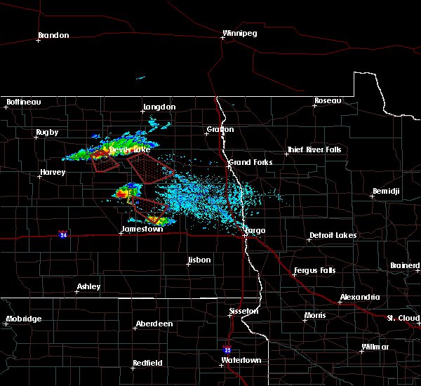 At 532 pm cdt, a severe thunderstorm was located 6 miles southeast of glenfield, or 30 miles east of carrington, moving southeast at 35 mph (trained weather spotters reported quarter sized hail and strong winds). Hazards include 60 mph wind gusts and quarter size hail. Hail damage to vehicles is expected. expect wind damage to roofs, siding and trees. Locations impacted include, glenfield. At 532 pm cdt, a severe thunderstorm was located 6 miles southeast of glenfield, or 30 miles east of carrington, moving southeast at 35 mph (trained weather spotters reported quarter sized hail and strong winds). Hazards include 60 mph wind gusts and quarter size hail. Hail damage to vehicles is expected. expect wind damage to roofs, siding and trees. Locations impacted include, glenfield.
|
| 6/20/2015 5:23 PM CDT |
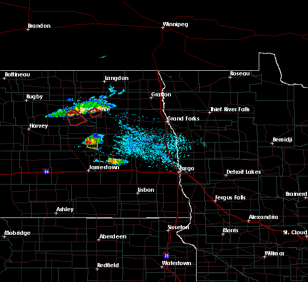 At 522 pm cdt, a severe thunderstorm was located over glenfield, or 25 miles east of carrington, moving southeast at 35 mph (trained weather spotters reported quarter size hail and strong winds). Hazards include 60 mph wind gusts and quarter size hail. Hail damage to vehicles is expected. expect wind damage to roofs, siding and trees. Locations impacted include, glenfield and mchenry. At 522 pm cdt, a severe thunderstorm was located over glenfield, or 25 miles east of carrington, moving southeast at 35 mph (trained weather spotters reported quarter size hail and strong winds). Hazards include 60 mph wind gusts and quarter size hail. Hail damage to vehicles is expected. expect wind damage to roofs, siding and trees. Locations impacted include, glenfield and mchenry.
|
Hail Maps for Glenfield, ND
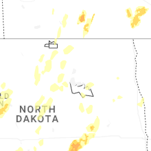
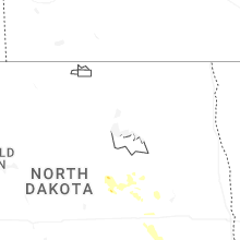
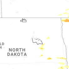


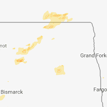


Connect with Interactive Hail Maps