

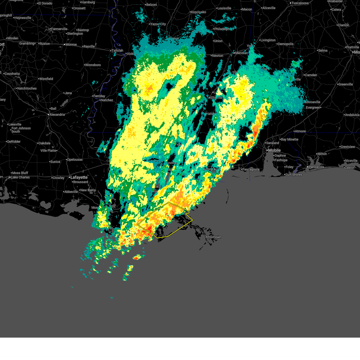
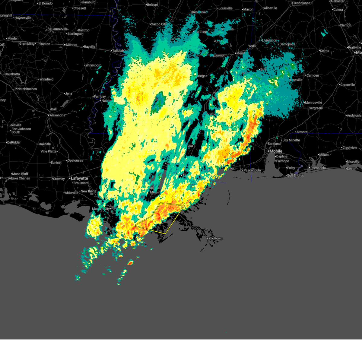
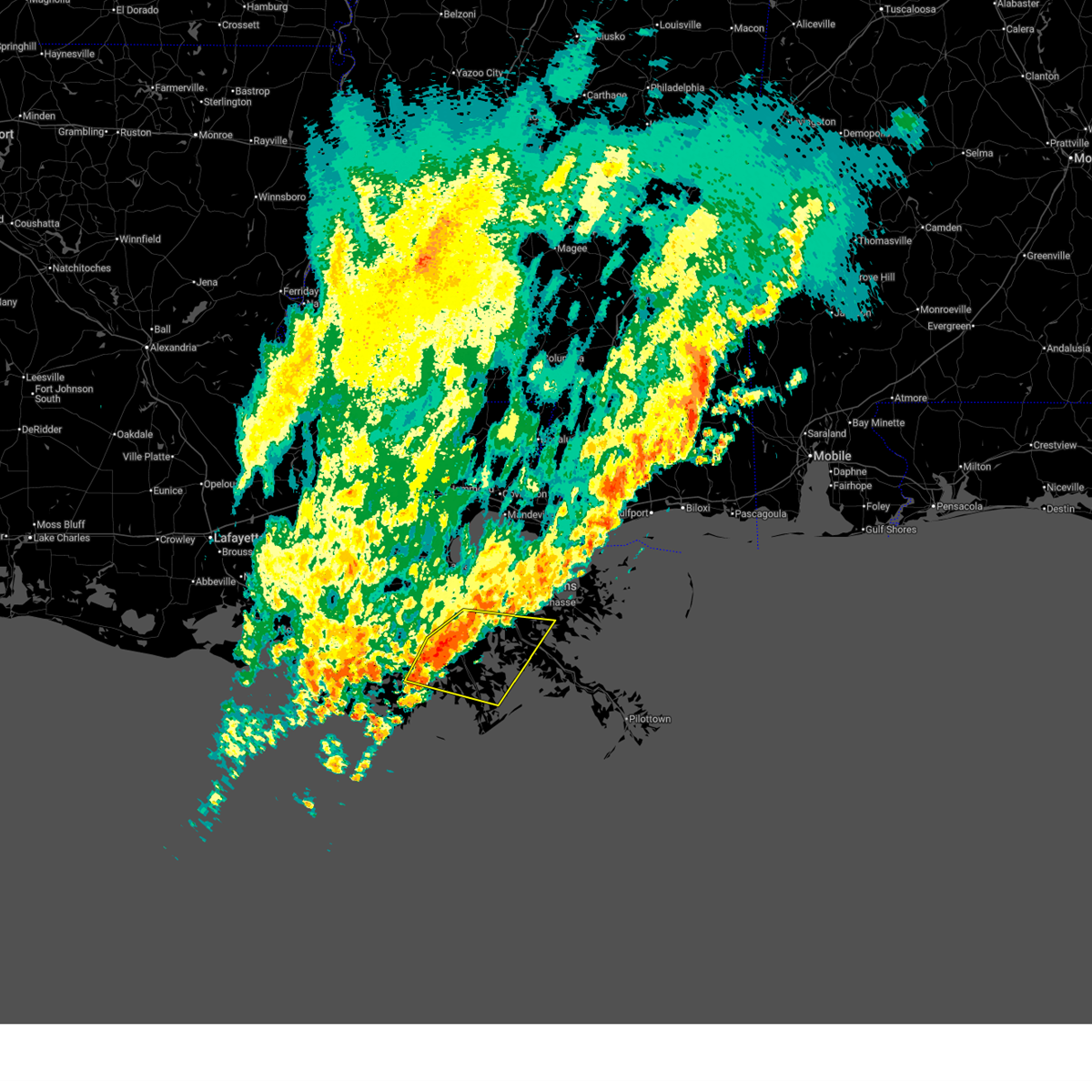
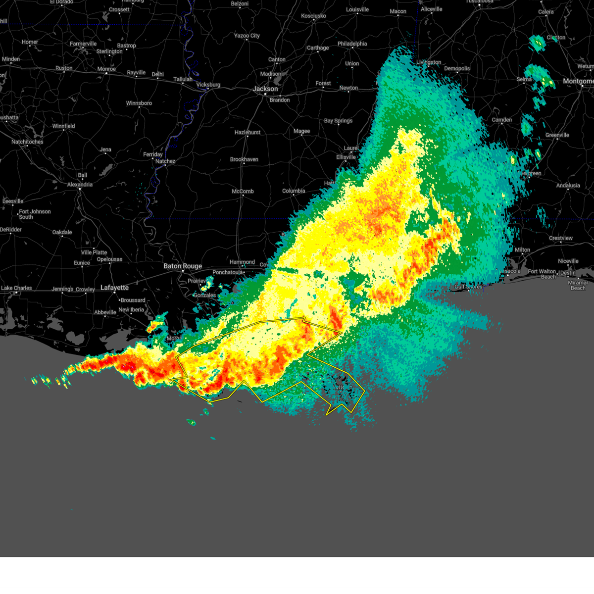
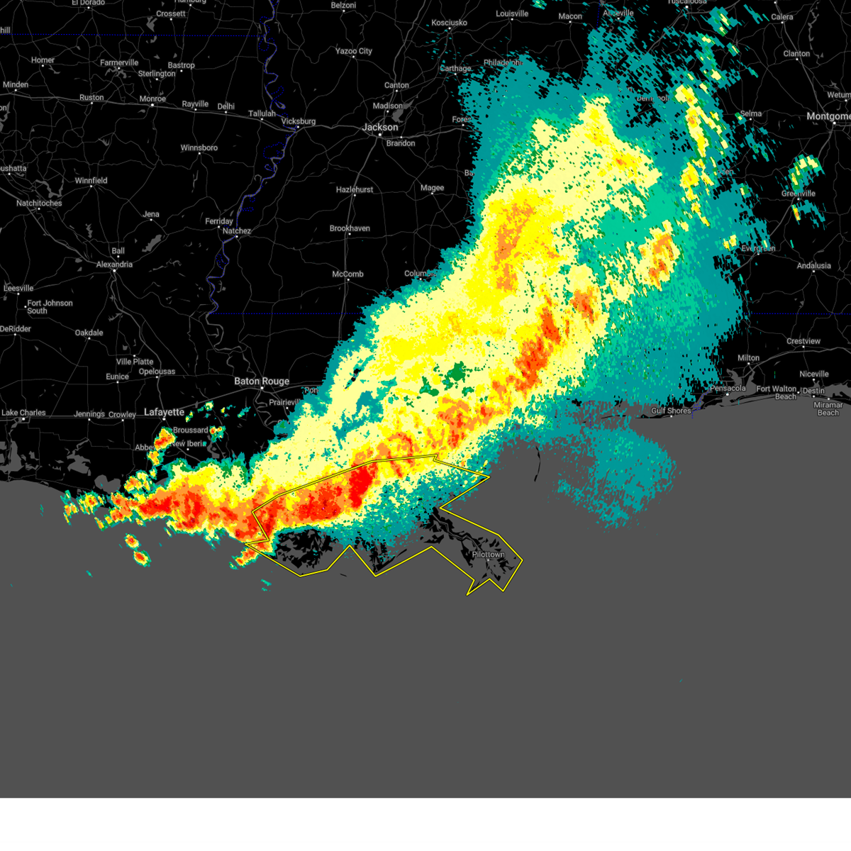
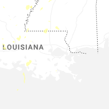
Hail Map for Golden Meadow, LA
The Golden Meadow, LA area has had 1 report of on-the-ground hail by trained spotters, and has been under severe weather warnings 9 times during the past 12 months. Doppler radar has detected hail at or near Golden Meadow, LA on 27 occasions, including 1 occasion during the past year.
| Name: | Golden Meadow, LA |
| Where Located: | 41 miles SSW of New Orleans, LA |
| Map: | Google Map for Golden Meadow, LA |
| Population: | 2101 |
| Housing Units: | 959 |
| More Info: | Search Google for Golden Meadow, LA |
0
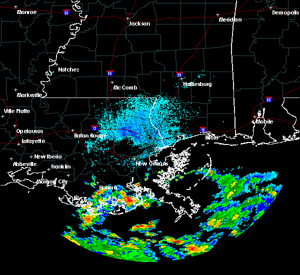
The Top Recent Hail Date for Golden Meadow, LA is Monday, August 18, 2025 (27th out of 27)
Hail and Wind Damage Spotted near Golden Meadow, LA
| Date / Time | Report Details |
|---|---|
| 5/24/2026 12:50 AM CDT |
 At 1250 am cdt, a severe thunderstorm was located near galliano, moving north at 25 mph (radar indicated). Hazards include 60 mph wind gusts. Expect damage to roofs, siding, and trees. Locations impacted include, galliano and golden meadow. At 1250 am cdt, a severe thunderstorm was located near galliano, moving north at 25 mph (radar indicated). Hazards include 60 mph wind gusts. Expect damage to roofs, siding, and trees. Locations impacted include, galliano and golden meadow.
|
| 5/24/2026 12:35 AM CDT |
 Svrlix the national weather service in new orleans has issued a * severe thunderstorm warning for, east central jefferson parish in southeastern louisiana, east central lafourche parish in southeastern louisiana, * until 115 am cdt. * at 1235 am cdt, a severe thunderstorm was located over golden meadow, or near galliano, moving north at 25 mph (radar indicated). Hazards include 60 mph wind gusts. expect damage to roofs, siding, and trees Svrlix the national weather service in new orleans has issued a * severe thunderstorm warning for, east central jefferson parish in southeastern louisiana, east central lafourche parish in southeastern louisiana, * until 115 am cdt. * at 1235 am cdt, a severe thunderstorm was located over golden meadow, or near galliano, moving north at 25 mph (radar indicated). Hazards include 60 mph wind gusts. expect damage to roofs, siding, and trees
|
| 3/12/2026 12:24 AM CDT |
 At 1224 am cdt, severe thunderstorms were located along a line extending from near pointe a la hache to near golden meadow, moving east at 25 mph (radar indicated). Hazards include 60 mph wind gusts. Expect damage to roofs, siding, and trees. Locations impacted include, grand isle, port sulphur, galliano, golden meadow, pointe a la hache, leeville, and empire. At 1224 am cdt, severe thunderstorms were located along a line extending from near pointe a la hache to near golden meadow, moving east at 25 mph (radar indicated). Hazards include 60 mph wind gusts. Expect damage to roofs, siding, and trees. Locations impacted include, grand isle, port sulphur, galliano, golden meadow, pointe a la hache, leeville, and empire.
|
| 3/12/2026 12:24 AM CDT |
 the severe thunderstorm warning has been cancelled and is no longer in effect the severe thunderstorm warning has been cancelled and is no longer in effect
|
| 3/11/2026 11:58 PM CDT |
 The severe thunderstorm warning that was previously in effect has been reissued. please refer to that bulletin for the latest severe weather information. a tornado watch remains in effect until 200 am cdt for southeastern louisiana. The severe thunderstorm warning that was previously in effect has been reissued. please refer to that bulletin for the latest severe weather information. a tornado watch remains in effect until 200 am cdt for southeastern louisiana.
|
| 3/11/2026 11:58 PM CDT |
 Svrlix the national weather service in new orleans has issued a * severe thunderstorm warning for, east central terrebonne parish in southeastern louisiana, central jefferson parish in southeastern louisiana, southeastern lafourche parish in southeastern louisiana, northwestern plaquemines parish in southeastern louisiana, * until 1245 am cdt. * at 1157 pm cdt, severe thunderstorms were located along a line extending from near myrtle grove to 7 miles southwest of golden meadow, moving east at 25 mph (radar indicated). Hazards include 60 mph wind gusts. expect damage to roofs, siding, and trees Svrlix the national weather service in new orleans has issued a * severe thunderstorm warning for, east central terrebonne parish in southeastern louisiana, central jefferson parish in southeastern louisiana, southeastern lafourche parish in southeastern louisiana, northwestern plaquemines parish in southeastern louisiana, * until 1245 am cdt. * at 1157 pm cdt, severe thunderstorms were located along a line extending from near myrtle grove to 7 miles southwest of golden meadow, moving east at 25 mph (radar indicated). Hazards include 60 mph wind gusts. expect damage to roofs, siding, and trees
|
| 3/11/2026 11:43 PM CDT |
 At 1142 pm cdt, severe thunderstorms were located along a line extending from 6 miles northeast of myrtle grove to golden meadow, moving east at 30 mph (radar indicated). Hazards include 60 mph wind gusts. Expect damage to roofs, siding, and trees. Locations impacted include, larose, cut off, galliano, golden meadow, jean lafitte, myrtle grove, lafitte, chauvin, barataria, montegut, and dulac. At 1142 pm cdt, severe thunderstorms were located along a line extending from 6 miles northeast of myrtle grove to golden meadow, moving east at 30 mph (radar indicated). Hazards include 60 mph wind gusts. Expect damage to roofs, siding, and trees. Locations impacted include, larose, cut off, galliano, golden meadow, jean lafitte, myrtle grove, lafitte, chauvin, barataria, montegut, and dulac.
|
| 3/11/2026 11:09 PM CDT |
 Svrlix the national weather service in new orleans has issued a * severe thunderstorm warning for, southeastern st. charles parish in southeastern louisiana, east central terrebonne parish in southeastern louisiana, central jefferson parish in southeastern louisiana, northeastern lafourche parish in southeastern louisiana, northwestern plaquemines parish in southeastern louisiana, * until midnight cdt. * at 1109 pm cdt, severe thunderstorms were located along a line extending from near barataria to near chauvin, moving east at 30 mph (radar indicated). Hazards include 60 mph wind gusts. expect damage to roofs, siding, and trees Svrlix the national weather service in new orleans has issued a * severe thunderstorm warning for, southeastern st. charles parish in southeastern louisiana, east central terrebonne parish in southeastern louisiana, central jefferson parish in southeastern louisiana, northeastern lafourche parish in southeastern louisiana, northwestern plaquemines parish in southeastern louisiana, * until midnight cdt. * at 1109 pm cdt, severe thunderstorms were located along a line extending from near barataria to near chauvin, moving east at 30 mph (radar indicated). Hazards include 60 mph wind gusts. expect damage to roofs, siding, and trees
|
| 10/26/2025 6:25 AM CDT | Svrlix the national weather service in new orleans has issued a * severe thunderstorm warning for, southeastern st. charles parish in southeastern louisiana, central jefferson parish in southeastern louisiana, east central lafourche parish in southeastern louisiana, northwestern plaquemines parish in southeastern louisiana, * until 700 am cdt. * at 625 am cdt, a severe thunderstorm was located over golden meadow, or near galliano, moving north at 50 mph (radar indicated). Hazards include 60 mph wind gusts. expect damage to roofs, siding, and trees |
| 3/31/2025 9:43 AM CDT |
 the severe thunderstorm warning has been cancelled and is no longer in effect the severe thunderstorm warning has been cancelled and is no longer in effect
|
| 3/31/2025 9:01 AM CDT |
 Svrlix the national weather service in new orleans has issued a * severe thunderstorm warning for, st. bernard parish in southeastern louisiana, southern st. charles parish in southeastern louisiana, southwestern orleans parish in southeastern louisiana, terrebonne parish in southeastern louisiana, jefferson parish in southeastern louisiana, lafourche parish in southeastern louisiana, plaquemines parish in southeastern louisiana, * until 1000 am cdt. * at 900 am cdt, a severe thunderstorm was located near barataria, or 13 miles northeast of larose, moving east at 45 mph (radar indicated). Hazards include 60 mph wind gusts and quarter size hail. Hail damage to vehicles is expected. Expect wind damage to roofs, siding, and trees. Svrlix the national weather service in new orleans has issued a * severe thunderstorm warning for, st. bernard parish in southeastern louisiana, southern st. charles parish in southeastern louisiana, southwestern orleans parish in southeastern louisiana, terrebonne parish in southeastern louisiana, jefferson parish in southeastern louisiana, lafourche parish in southeastern louisiana, plaquemines parish in southeastern louisiana, * until 1000 am cdt. * at 900 am cdt, a severe thunderstorm was located near barataria, or 13 miles northeast of larose, moving east at 45 mph (radar indicated). Hazards include 60 mph wind gusts and quarter size hail. Hail damage to vehicles is expected. Expect wind damage to roofs, siding, and trees.
|
| 5/17/2024 1:32 AM CDT |
 the severe thunderstorm warning has been cancelled and is no longer in effect the severe thunderstorm warning has been cancelled and is no longer in effect
|
| 5/17/2024 12:33 AM CDT |
 Svrlix the national weather service in new orleans has issued a * severe thunderstorm warning for, southeastern jefferson parish in southeastern louisiana, southeastern lafourche parish in southeastern louisiana, southern plaquemines parish in southeastern louisiana, * until 145 am cdt. * at 1233 am cdt, severe thunderstorms were located along a line extending from near empire to near golden meadow, moving southeast at 25 mph (radar indicated). Hazards include 60 mph wind gusts and penny size hail. expect damage to roofs, siding, and trees Svrlix the national weather service in new orleans has issued a * severe thunderstorm warning for, southeastern jefferson parish in southeastern louisiana, southeastern lafourche parish in southeastern louisiana, southern plaquemines parish in southeastern louisiana, * until 145 am cdt. * at 1233 am cdt, severe thunderstorms were located along a line extending from near empire to near golden meadow, moving southeast at 25 mph (radar indicated). Hazards include 60 mph wind gusts and penny size hail. expect damage to roofs, siding, and trees
|
| 3/8/2024 3:06 PM CST |
 The storm which prompted the warning has weakened below severe limits, and has exited the warned area. therefore, the warning will be allowed to expire. a tornado watch remains in effect until 900 pm cst for southeastern louisiana. The storm which prompted the warning has weakened below severe limits, and has exited the warned area. therefore, the warning will be allowed to expire. a tornado watch remains in effect until 900 pm cst for southeastern louisiana.
|
| 3/8/2024 2:35 PM CST |
 Svrlix the national weather service in new orleans has issued a * severe thunderstorm warning for, east central lafourche parish in southeastern louisiana, * until 315 pm cst. * at 235 pm cst, a severe thunderstorm was located near golden meadow, or near galliano, moving east at 40 mph (radar indicated). Hazards include 60 mph wind gusts and quarter size hail. Hail damage to vehicles is expected. Expect wind damage to roofs, siding, and trees. Svrlix the national weather service in new orleans has issued a * severe thunderstorm warning for, east central lafourche parish in southeastern louisiana, * until 315 pm cst. * at 235 pm cst, a severe thunderstorm was located near golden meadow, or near galliano, moving east at 40 mph (radar indicated). Hazards include 60 mph wind gusts and quarter size hail. Hail damage to vehicles is expected. Expect wind damage to roofs, siding, and trees.
|
| 2/12/2024 4:07 AM CST |
 At 407 am cst, a severe thunderstorm was located near golden meadow, or near galliano, moving northeast at 55 mph (radar indicated). Hazards include 60 mph wind gusts and half dollar size hail. Hail damage to vehicles is expected. Expect wind damage to roofs, siding, and trees. At 407 am cst, a severe thunderstorm was located near golden meadow, or near galliano, moving northeast at 55 mph (radar indicated). Hazards include 60 mph wind gusts and half dollar size hail. Hail damage to vehicles is expected. Expect wind damage to roofs, siding, and trees.
|
| 1/9/2024 2:07 AM CST |
 At 207 am cst, severe thunderstorms were located along a line extending from near woodmere to 6 miles southwest of golden meadow, moving east at 35 mph (radar indicated). Hazards include 60 mph wind gusts. Expect damage to roofs, siding, and trees. Locations impacted include, galliano, cut off, belle chasse, golden meadow, jean lafitte, myrtle grove, lafitte, barataria, leeville, poydras, and violet. At 207 am cst, severe thunderstorms were located along a line extending from near woodmere to 6 miles southwest of golden meadow, moving east at 35 mph (radar indicated). Hazards include 60 mph wind gusts. Expect damage to roofs, siding, and trees. Locations impacted include, galliano, cut off, belle chasse, golden meadow, jean lafitte, myrtle grove, lafitte, barataria, leeville, poydras, and violet.
|
| 1/9/2024 1:38 AM CST |
 At 137 am cst, severe thunderstorms were located along a line extending from near bayou gauche to 6 miles northeast of cocodrie, moving east at 35 mph (radar indicated). Hazards include 60 mph wind gusts. expect damage to roofs, siding, and trees At 137 am cst, severe thunderstorms were located along a line extending from near bayou gauche to 6 miles northeast of cocodrie, moving east at 35 mph (radar indicated). Hazards include 60 mph wind gusts. expect damage to roofs, siding, and trees
|
| 6/21/2023 5:58 PM CDT | Quarter sized hail reported 0.5 miles SSW of Golden Meadow, LA, picture of quarter size hail sent to the office from the emergency manager. |
| 6/21/2023 5:52 PM CDT |
 At 552 pm cdt, a severe thunderstorm capable of producing a tornado was located over galliano, moving south at 5 mph (radar indicated rotation). Hazards include tornado and golf ball size hail. Flying debris will be dangerous to those caught without shelter. mobile homes will be damaged or destroyed. damage to roofs, windows, and vehicles will occur. tree damage is likely. This dangerous storm will be near, golden meadow around 615 pm cdt. At 552 pm cdt, a severe thunderstorm capable of producing a tornado was located over galliano, moving south at 5 mph (radar indicated rotation). Hazards include tornado and golf ball size hail. Flying debris will be dangerous to those caught without shelter. mobile homes will be damaged or destroyed. damage to roofs, windows, and vehicles will occur. tree damage is likely. This dangerous storm will be near, golden meadow around 615 pm cdt.
|
| 6/21/2023 5:44 PM CDT |
 At 544 pm cdt, a severe thunderstorm was located over galliano, moving south at 10 mph (radar indicated). Hazards include golf ball size hail. People and animals outdoors will be injured. Expect damage to roofs, siding, windows, and vehicles. At 544 pm cdt, a severe thunderstorm was located over galliano, moving south at 10 mph (radar indicated). Hazards include golf ball size hail. People and animals outdoors will be injured. Expect damage to roofs, siding, windows, and vehicles.
|
| 6/21/2023 5:38 PM CDT |
 At 537 pm cdt, a severe thunderstorm was located near galliano, moving southeast at 10 mph (radar indicated). Hazards include golf ball size hail and 60 mph wind gusts. People and animals outdoors will be injured. expect hail damage to roofs, siding, windows, and vehicles. expect wind damage to roofs, siding, and trees. Locations impacted include, cut off, galliano, larose and golden meadow. At 537 pm cdt, a severe thunderstorm was located near galliano, moving southeast at 10 mph (radar indicated). Hazards include golf ball size hail and 60 mph wind gusts. People and animals outdoors will be injured. expect hail damage to roofs, siding, windows, and vehicles. expect wind damage to roofs, siding, and trees. Locations impacted include, cut off, galliano, larose and golden meadow.
|
| 6/21/2023 5:34 PM CDT |
 At 534 pm cdt, a severe thunderstorm was located near galliano, moving southeast at 10 mph (radar indicated). Hazards include 60 mph wind gusts and half dollar size hail. Hail damage to vehicles is expected. expect wind damage to roofs, siding, and trees. Locations impacted include, cut off, galliano, larose and golden meadow. At 534 pm cdt, a severe thunderstorm was located near galliano, moving southeast at 10 mph (radar indicated). Hazards include 60 mph wind gusts and half dollar size hail. Hail damage to vehicles is expected. expect wind damage to roofs, siding, and trees. Locations impacted include, cut off, galliano, larose and golden meadow.
|
| 6/21/2023 5:04 PM CDT |
 At 503 pm cdt, a severe thunderstorm was located near cut off, moving south at 10 mph (radar indicated). Hazards include 60 mph wind gusts and quarter size hail. Hail damage to vehicles is expected. Expect wind damage to roofs, siding, and trees. At 503 pm cdt, a severe thunderstorm was located near cut off, moving south at 10 mph (radar indicated). Hazards include 60 mph wind gusts and quarter size hail. Hail damage to vehicles is expected. Expect wind damage to roofs, siding, and trees.
|
| 6/20/2023 5:19 PM CDT |
 At 518 pm cdt, severe thunderstorms were located along a line extending from 6 miles southwest of larose to near leeville to 14 miles northeast of port fourchon, moving southeast at 20 mph (radar indicated). Hazards include 60 mph wind gusts and half dollar size hail. Hail damage to vehicles is expected. Expect wind damage to roofs, siding, and trees. At 518 pm cdt, severe thunderstorms were located along a line extending from 6 miles southwest of larose to near leeville to 14 miles northeast of port fourchon, moving southeast at 20 mph (radar indicated). Hazards include 60 mph wind gusts and half dollar size hail. Hail damage to vehicles is expected. Expect wind damage to roofs, siding, and trees.
|
| 6/20/2023 4:27 PM CDT |
 At 427 pm cdt, severe thunderstorms were located along a line extending from raceland to larose, moving southwest at 25 mph (radar indicated). Hazards include 70 mph wind gusts and half dollar size hail. Hail damage to vehicles is expected. expect considerable tree damage. Wind damage is also likely to mobile homes, roofs, and outbuildings. At 427 pm cdt, severe thunderstorms were located along a line extending from raceland to larose, moving southwest at 25 mph (radar indicated). Hazards include 70 mph wind gusts and half dollar size hail. Hail damage to vehicles is expected. expect considerable tree damage. Wind damage is also likely to mobile homes, roofs, and outbuildings.
|
| 4/16/2023 1:54 AM CDT |
 At 154 am cdt, a severe thunderstorm was located near golden meadow, or 7 miles southeast of galliano, moving east at 25 mph (radar indicated). Hazards include 60 mph wind gusts and half dollar size hail. Hail damage to vehicles is expected. Expect wind damage to roofs, siding, and trees. At 154 am cdt, a severe thunderstorm was located near golden meadow, or 7 miles southeast of galliano, moving east at 25 mph (radar indicated). Hazards include 60 mph wind gusts and half dollar size hail. Hail damage to vehicles is expected. Expect wind damage to roofs, siding, and trees.
|
| 4/16/2023 1:41 AM CDT |
 At 141 am cdt, a severe thunderstorm was located near galliano, moving northeast at 20 mph (radar indicated). Hazards include 60 mph wind gusts and half dollar size hail. Hail damage to vehicles is expected. expect wind damage to roofs, siding, and trees. locations impacted include, galliano, cut off and golden meadow. hail threat, radar indicated max hail size, 1. 25 in wind threat, radar indicated max wind gust, 60 mph. At 141 am cdt, a severe thunderstorm was located near galliano, moving northeast at 20 mph (radar indicated). Hazards include 60 mph wind gusts and half dollar size hail. Hail damage to vehicles is expected. expect wind damage to roofs, siding, and trees. locations impacted include, galliano, cut off and golden meadow. hail threat, radar indicated max hail size, 1. 25 in wind threat, radar indicated max wind gust, 60 mph.
|
| 4/16/2023 1:18 AM CDT |
 At 118 am cdt, a severe thunderstorm was located 8 miles southeast of montegut, or 11 miles southwest of galliano, moving northeast at 20 mph (radar indicated). Hazards include ping pong ball size hail and 60 mph wind gusts. People and animals outdoors will be injured. expect hail damage to roofs, siding, windows, and vehicles. Expect wind damage to roofs, siding, and trees. At 118 am cdt, a severe thunderstorm was located 8 miles southeast of montegut, or 11 miles southwest of galliano, moving northeast at 20 mph (radar indicated). Hazards include ping pong ball size hail and 60 mph wind gusts. People and animals outdoors will be injured. expect hail damage to roofs, siding, windows, and vehicles. Expect wind damage to roofs, siding, and trees.
|
| 4/7/2023 1:00 PM CDT |
 At 100 pm cdt, a severe thunderstorm was located near golden meadow, or near galliano, moving east at 15 mph (radar indicated). Hazards include 60 mph wind gusts and quarter size hail. Hail damage to vehicles is expected. Expect wind damage to roofs, siding, and trees. At 100 pm cdt, a severe thunderstorm was located near golden meadow, or near galliano, moving east at 15 mph (radar indicated). Hazards include 60 mph wind gusts and quarter size hail. Hail damage to vehicles is expected. Expect wind damage to roofs, siding, and trees.
|
| 4/7/2023 12:27 PM CDT |
 At 1226 pm cdt, a severe thunderstorm was located near galliano, moving east at 15 mph (radar indicated). Hazards include 60 mph wind gusts and quarter size hail. Hail damage to vehicles is expected. expect wind damage to roofs, siding, and trees. locations impacted include, cut off, galliano, larose and golden meadow. hail threat, radar indicated max hail size, 1. 00 in wind threat, radar indicated max wind gust, 60 mph. At 1226 pm cdt, a severe thunderstorm was located near galliano, moving east at 15 mph (radar indicated). Hazards include 60 mph wind gusts and quarter size hail. Hail damage to vehicles is expected. expect wind damage to roofs, siding, and trees. locations impacted include, cut off, galliano, larose and golden meadow. hail threat, radar indicated max hail size, 1. 00 in wind threat, radar indicated max wind gust, 60 mph.
|
| 4/7/2023 12:15 PM CDT |
 At 1215 pm cdt, a severe thunderstorm was located 7 miles southwest of galliano, moving east at 15 mph (radar indicated). Hazards include 60 mph wind gusts and quarter size hail. Hail damage to vehicles is expected. Expect wind damage to roofs, siding, and trees. At 1215 pm cdt, a severe thunderstorm was located 7 miles southwest of galliano, moving east at 15 mph (radar indicated). Hazards include 60 mph wind gusts and quarter size hail. Hail damage to vehicles is expected. Expect wind damage to roofs, siding, and trees.
|
| 10/27/2021 6:28 PM CDT |
 At 628 pm cdt, a severe thunderstorm capable of producing a tornado was located over golden meadow, or near galliano, moving northeast at 30 mph (radar indicated rotation). Hazards include tornado. Flying debris will be dangerous to those caught without shelter. mobile homes will be damaged or destroyed. damage to roofs, windows, and vehicles will occur. tree damage is likely. This tornadic thunderstorm will remain over mainly rural areas of east central lafourche and central jefferson parishes. At 628 pm cdt, a severe thunderstorm capable of producing a tornado was located over golden meadow, or near galliano, moving northeast at 30 mph (radar indicated rotation). Hazards include tornado. Flying debris will be dangerous to those caught without shelter. mobile homes will be damaged or destroyed. damage to roofs, windows, and vehicles will occur. tree damage is likely. This tornadic thunderstorm will remain over mainly rural areas of east central lafourche and central jefferson parishes.
|
| 10/27/2021 6:17 PM CDT |
 At 616 pm cdt, severe thunderstorms were located along a line extending from 13 miles southwest of lacombe to near jefferson to near jean lafitte to 9 miles west of leeville, moving northeast at 45 mph (radar indicated). Hazards include 60 mph wind gusts. Expect damage to roofs, siding, and trees. locations impacted include, new orleans, chalmette, cut off, galliano, avondale, larose, metairie, marrero, harvey, east new orleans, timberlane, belle chasse, jefferson, gretna, harahan, westwego, golden meadow, jean lafitte, luling and river ridge. this includes the following interstates, interstate 10 in louisiana between mile markers 217 and 254. interstate 310 between mile markers 1 and 7. interstate 510 between mile markers 1 and 3. interstate 610 between mile markers 1 and 4. hail threat, radar indicated max hail size, <. 75 in wind threat, radar indicated max wind gust, 60 mph. At 616 pm cdt, severe thunderstorms were located along a line extending from 13 miles southwest of lacombe to near jefferson to near jean lafitte to 9 miles west of leeville, moving northeast at 45 mph (radar indicated). Hazards include 60 mph wind gusts. Expect damage to roofs, siding, and trees. locations impacted include, new orleans, chalmette, cut off, galliano, avondale, larose, metairie, marrero, harvey, east new orleans, timberlane, belle chasse, jefferson, gretna, harahan, westwego, golden meadow, jean lafitte, luling and river ridge. this includes the following interstates, interstate 10 in louisiana between mile markers 217 and 254. interstate 310 between mile markers 1 and 7. interstate 510 between mile markers 1 and 3. interstate 610 between mile markers 1 and 4. hail threat, radar indicated max hail size, <. 75 in wind threat, radar indicated max wind gust, 60 mph.
|
| 10/27/2021 5:56 PM CDT |
 At 555 pm cdt, severe thunderstorms were located along a line extending from 13 miles southwest of madisonville to near new sarpy to bayou gauche to near cocodrie, moving east at 45 mph (radar indicated). Hazards include 60 mph wind gusts. expect damage to roofs, siding, and trees At 555 pm cdt, severe thunderstorms were located along a line extending from 13 miles southwest of madisonville to near new sarpy to bayou gauche to near cocodrie, moving east at 45 mph (radar indicated). Hazards include 60 mph wind gusts. expect damage to roofs, siding, and trees
|
| 7/7/2021 5:19 PM CDT |
 At 519 pm cdt, a severe thunderstorm was located over galliano, moving east at 15 mph (radar indicated). Hazards include 60 mph wind gusts. expect damage to roofs, siding, and trees At 519 pm cdt, a severe thunderstorm was located over galliano, moving east at 15 mph (radar indicated). Hazards include 60 mph wind gusts. expect damage to roofs, siding, and trees
|
| 8/30/2020 1:06 PM CDT |
 The severe thunderstorm warning for east central terrebonne and central lafourche parishes will expire at 115 pm cdt, the storm which prompted the warning has weakened below severe limits, and no longer poses an immediate threat to life or property. therefore, the warning will be allowed to expire. however gusty winds and heavy rain are still possible with this thunderstorm. The severe thunderstorm warning for east central terrebonne and central lafourche parishes will expire at 115 pm cdt, the storm which prompted the warning has weakened below severe limits, and no longer poses an immediate threat to life or property. therefore, the warning will be allowed to expire. however gusty winds and heavy rain are still possible with this thunderstorm.
|
| 8/30/2020 12:43 PM CDT |
 At 1242 pm cdt, a severe thunderstorm was located near chauvin, or 10 miles south of houma, moving east at 30 mph (radar indicated). Hazards include 60 mph wind gusts. expect damage to roofs, siding, and trees At 1242 pm cdt, a severe thunderstorm was located near chauvin, or 10 miles south of houma, moving east at 30 mph (radar indicated). Hazards include 60 mph wind gusts. expect damage to roofs, siding, and trees
|
| 7/27/2020 9:37 AM CDT |
 At 936 am cdt, a severe thunderstorm capable of producing a tornado was located over galliano, moving southeast at 5 mph (radar indicated rotation). Hazards include tornado. Flying debris will be dangerous to those caught without shelter. mobile homes will be damaged or destroyed. damage to roofs, windows, and vehicles will occur. tree damage is likely. This dangerous storm will be near, golden meadow around 1000 am cdt. At 936 am cdt, a severe thunderstorm capable of producing a tornado was located over galliano, moving southeast at 5 mph (radar indicated rotation). Hazards include tornado. Flying debris will be dangerous to those caught without shelter. mobile homes will be damaged or destroyed. damage to roofs, windows, and vehicles will occur. tree damage is likely. This dangerous storm will be near, golden meadow around 1000 am cdt.
|
| 7/27/2020 9:27 AM CDT |
 At 926 am cdt, a severe thunderstorm capable of producing a tornado was located over galliano, moving east at 5 mph (radar indicated rotation). Hazards include tornado. Flying debris will be dangerous to those caught without shelter. mobile homes will be damaged or destroyed. damage to roofs, windows, and vehicles will occur. tree damage is likely. this dangerous storm will be near, galliano around 930 am cdt. Golden meadow around 1000 am cdt. At 926 am cdt, a severe thunderstorm capable of producing a tornado was located over galliano, moving east at 5 mph (radar indicated rotation). Hazards include tornado. Flying debris will be dangerous to those caught without shelter. mobile homes will be damaged or destroyed. damage to roofs, windows, and vehicles will occur. tree damage is likely. this dangerous storm will be near, galliano around 930 am cdt. Golden meadow around 1000 am cdt.
|
| 7/13/2020 6:10 PM CDT |
 At 609 pm cdt, a severe thunderstorm was located over montegut, or 9 miles southeast of houma, moving southeast at 20 mph (radar indicated). Hazards include 60 mph wind gusts. expect damage to roofs, siding, and trees At 609 pm cdt, a severe thunderstorm was located over montegut, or 9 miles southeast of houma, moving southeast at 20 mph (radar indicated). Hazards include 60 mph wind gusts. expect damage to roofs, siding, and trees
|
| 6/22/2020 7:29 AM CDT |
 At 728 am cdt, severe thunderstorms were located along a line extending from near south vacherie to near mathews to 6 miles north of montegut to dulac, moving east at 35 mph (radar indicated). Hazards include 70 mph wind gusts. Expect considerable tree damage. Damage is likely to mobile homes, roofs, and outbuildings. At 728 am cdt, severe thunderstorms were located along a line extending from near south vacherie to near mathews to 6 miles north of montegut to dulac, moving east at 35 mph (radar indicated). Hazards include 70 mph wind gusts. Expect considerable tree damage. Damage is likely to mobile homes, roofs, and outbuildings.
|
| 4/23/2020 11:54 AM CDT |
 At 1153 am cdt, severe thunderstorms were located along a line extending from 10 miles south of lafitte to 17 miles east of golden meadow to 7 miles southeast of leeville, moving northeast at 65 mph (radar indicated). Hazards include 70 mph wind gusts. Expect considerable tree damage. damage is likely to mobile homes, roofs, and outbuildings. Locations impacted include, galliano, cut off, golden meadow, leeville and grand isle. At 1153 am cdt, severe thunderstorms were located along a line extending from 10 miles south of lafitte to 17 miles east of golden meadow to 7 miles southeast of leeville, moving northeast at 65 mph (radar indicated). Hazards include 70 mph wind gusts. Expect considerable tree damage. damage is likely to mobile homes, roofs, and outbuildings. Locations impacted include, galliano, cut off, golden meadow, leeville and grand isle.
|
| 9/1/2019 11:37 AM CDT |
 At 1136 am cdt, a severe thunderstorm was located near leeville, or 11 miles southeast of galliano, moving west at 25 mph (radar indicated). Hazards include 60 mph wind gusts. expect damage to roofs, siding, and trees At 1136 am cdt, a severe thunderstorm was located near leeville, or 11 miles southeast of galliano, moving west at 25 mph (radar indicated). Hazards include 60 mph wind gusts. expect damage to roofs, siding, and trees
|
| 6/24/2019 9:57 AM CDT |
 The national weather service in new orleans has issued a * severe thunderstorm warning for. east central lafourche parish in southeastern louisiana. southeastern jefferson parish in southeastern louisiana. until 1030 am cdt. At 957 am cdt, a severe thunderstorm was located near golden. The national weather service in new orleans has issued a * severe thunderstorm warning for. east central lafourche parish in southeastern louisiana. southeastern jefferson parish in southeastern louisiana. until 1030 am cdt. At 957 am cdt, a severe thunderstorm was located near golden.
|
| 5/12/2019 7:06 AM CDT |
 The severe thunderstorm warning for eastern terrebonne, southeastern lafourche and southeastern jefferson parishes will expire at 715 am cdt, the storm which prompted the warning has weakened below severe limits, and no longer poses an immediate threat to life or property. therefore, the warning will be allowed to expire. to report severe weather, contact your nearest law enforcement agency. they will relay your report to the national weather service new orleans. The severe thunderstorm warning for eastern terrebonne, southeastern lafourche and southeastern jefferson parishes will expire at 715 am cdt, the storm which prompted the warning has weakened below severe limits, and no longer poses an immediate threat to life or property. therefore, the warning will be allowed to expire. to report severe weather, contact your nearest law enforcement agency. they will relay your report to the national weather service new orleans.
|
| 5/12/2019 6:31 AM CDT |
 At 630 am cdt, a severe thunderstorm was located near golden meadow, or 7 miles south of galliano, moving east at 35 mph (radar indicated). Hazards include ping pong ball size hail and 60 mph wind gusts. People and animals outdoors will be injured. expect hail damage to roofs, siding, windows, and vehicles. Expect wind damage to roofs, siding, and trees. At 630 am cdt, a severe thunderstorm was located near golden meadow, or 7 miles south of galliano, moving east at 35 mph (radar indicated). Hazards include ping pong ball size hail and 60 mph wind gusts. People and animals outdoors will be injured. expect hail damage to roofs, siding, windows, and vehicles. Expect wind damage to roofs, siding, and trees.
|
| 5/11/2019 12:25 AM CDT |
 At 1225 am cdt, a severe thunderstorm capable of producing a tornado was located near galliano, moving northeast at 20 mph (radar indicated rotation). Hazards include tornado and half dollar size hail. Flying debris will be dangerous to those caught without shelter. mobile homes will be damaged or destroyed. damage to roofs, windows, and vehicles will occur. tree damage is likely. this dangerous storm will be near, cut off around 1230 am cdt. Larose around 1235 am cdt. At 1225 am cdt, a severe thunderstorm capable of producing a tornado was located near galliano, moving northeast at 20 mph (radar indicated rotation). Hazards include tornado and half dollar size hail. Flying debris will be dangerous to those caught without shelter. mobile homes will be damaged or destroyed. damage to roofs, windows, and vehicles will occur. tree damage is likely. this dangerous storm will be near, cut off around 1230 am cdt. Larose around 1235 am cdt.
|
| 5/11/2019 12:15 AM CDT |
 At 1215 am cdt, a severe thunderstorm capable of producing a tornado was located near galliano, moving northeast at 20 mph (radar indicated rotation). Hazards include tornado. Flying debris will be dangerous to those caught without shelter. mobile homes will be damaged or destroyed. damage to roofs, windows, and vehicles will occur. tree damage is likely. this dangerous storm will be near, golden meadow around 1225 am cdt. galliano around 1230 am cdt. Cut off and larose around 1235 am cdt. At 1215 am cdt, a severe thunderstorm capable of producing a tornado was located near galliano, moving northeast at 20 mph (radar indicated rotation). Hazards include tornado. Flying debris will be dangerous to those caught without shelter. mobile homes will be damaged or destroyed. damage to roofs, windows, and vehicles will occur. tree damage is likely. this dangerous storm will be near, golden meadow around 1225 am cdt. galliano around 1230 am cdt. Cut off and larose around 1235 am cdt.
|
| 4/7/2019 7:42 PM CDT |
 At 741 pm cdt, severe thunderstorms were located along a line extending from near convent to 8 miles west of leeville, moving east at 40 mph (radar indicated). Hazards include 60 mph wind gusts. expect damage to roofs, siding, and trees At 741 pm cdt, severe thunderstorms were located along a line extending from near convent to 8 miles west of leeville, moving east at 40 mph (radar indicated). Hazards include 60 mph wind gusts. expect damage to roofs, siding, and trees
|
| 11/1/2018 4:11 AM CDT |
 At 411 am cdt, a severe thunderstorm was located 7 miles southwest of leeville, or 16 miles south of galliano, moving northeast at 35 mph (radar indicated). Hazards include 60 mph wind gusts and penny size hail. expect damage to roofs, siding, and trees At 411 am cdt, a severe thunderstorm was located 7 miles southwest of leeville, or 16 miles south of galliano, moving northeast at 35 mph (radar indicated). Hazards include 60 mph wind gusts and penny size hail. expect damage to roofs, siding, and trees
|
| 7/23/2018 4:36 PM CDT |
 At 435 pm cdt, a severe thunderstorm was located over leeville, or 14 miles southeast of galliano, moving southeast at 30 mph (radar indicated). Hazards include 60 mph wind gusts and quarter size hail. Hail damage to vehicles is expected. expect wind damage to roofs, siding, and trees. Locations impacted include, golden meadow and leeville. At 435 pm cdt, a severe thunderstorm was located over leeville, or 14 miles southeast of galliano, moving southeast at 30 mph (radar indicated). Hazards include 60 mph wind gusts and quarter size hail. Hail damage to vehicles is expected. expect wind damage to roofs, siding, and trees. Locations impacted include, golden meadow and leeville.
|
| 7/23/2018 4:12 PM CDT |
 At 411 pm cdt, a severe thunderstorm was located over golden meadow, or over galliano, moving southeast at 30 mph (radar indicated). Hazards include 60 mph wind gusts and quarter size hail. Hail damage to vehicles is expected. Expect wind damage to roofs, siding, and trees. At 411 pm cdt, a severe thunderstorm was located over golden meadow, or over galliano, moving southeast at 30 mph (radar indicated). Hazards include 60 mph wind gusts and quarter size hail. Hail damage to vehicles is expected. Expect wind damage to roofs, siding, and trees.
|
| 7/1/2018 2:58 PM CDT |
 At 258 pm cdt, a severe thunderstorm was located near galliano, and is nearly stationary (radar indicated). Hazards include 60 mph wind gusts. expect damage to roofs, siding, and trees At 258 pm cdt, a severe thunderstorm was located near galliano, and is nearly stationary (radar indicated). Hazards include 60 mph wind gusts. expect damage to roofs, siding, and trees
|
| 5/26/2018 3:42 PM CDT |
 At 342 pm cdt, a severe thunderstorm was located near galliano, and is nearly stationary (radar indicated). Hazards include 60 mph wind gusts and penny size hail. expect damage to roofs, siding, and trees At 342 pm cdt, a severe thunderstorm was located near galliano, and is nearly stationary (radar indicated). Hazards include 60 mph wind gusts and penny size hail. expect damage to roofs, siding, and trees
|
| 3/19/2018 2:29 AM CDT |
 At 229 am cdt, a severe thunderstorm was located over golden meadow, or near galliano, moving east at 35 mph (radar indicated). Hazards include ping pong ball size hail and 60 mph wind gusts. People and animals outdoors will be injured. expect hail damage to roofs, siding, windows, and vehicles. Expect wind damage to roofs, siding, and trees. At 229 am cdt, a severe thunderstorm was located over golden meadow, or near galliano, moving east at 35 mph (radar indicated). Hazards include ping pong ball size hail and 60 mph wind gusts. People and animals outdoors will be injured. expect hail damage to roofs, siding, windows, and vehicles. Expect wind damage to roofs, siding, and trees.
|
| 3/19/2018 2:05 AM CDT |
 At 204 am cdt, a severe thunderstorm was located over montegut and chauvin, or 12 miles southeast of houma, moving east at 40 mph (radar indicated). Hazards include ping pong ball size hail and 60 mph wind gusts. People and animals outdoors will be injured. expect hail damage to roofs, siding, windows, and vehicles. Expect wind damage to roofs, siding, and trees. At 204 am cdt, a severe thunderstorm was located over montegut and chauvin, or 12 miles southeast of houma, moving east at 40 mph (radar indicated). Hazards include ping pong ball size hail and 60 mph wind gusts. People and animals outdoors will be injured. expect hail damage to roofs, siding, windows, and vehicles. Expect wind damage to roofs, siding, and trees.
|
| 3/19/2018 1:27 AM CDT |
 At 126 am cdt, a severe thunderstorm was located 7 miles southwest of houma, moving east at 45 mph (radar indicated). Hazards include ping pong ball size hail and 60 mph wind gusts. People and animals outdoors will be injured. expect hail damage to roofs, siding, windows, and vehicles. Expect wind damage to roofs, siding, and trees. At 126 am cdt, a severe thunderstorm was located 7 miles southwest of houma, moving east at 45 mph (radar indicated). Hazards include ping pong ball size hail and 60 mph wind gusts. People and animals outdoors will be injured. expect hail damage to roofs, siding, windows, and vehicles. Expect wind damage to roofs, siding, and trees.
|
| 10/22/2017 12:42 PM CDT |
 At 1241 pm cdt, severe thunderstorms were located along a line extending from near myrtle grove to 40 miles south of cocodrie, moving east at 45 mph (radar indicated). Hazards include 60 mph wind gusts. Expect damage to roofs, siding, and trees. Locations impacted include, cut off, galliano, port sulphur, larose, golden meadow, boothville-venice, boothville, empire, buras, venice, buras-triumph, myrtle grove, pointe a la hache, leeville, lafitte, boothville asos and grand isle. At 1241 pm cdt, severe thunderstorms were located along a line extending from near myrtle grove to 40 miles south of cocodrie, moving east at 45 mph (radar indicated). Hazards include 60 mph wind gusts. Expect damage to roofs, siding, and trees. Locations impacted include, cut off, galliano, port sulphur, larose, golden meadow, boothville-venice, boothville, empire, buras, venice, buras-triumph, myrtle grove, pointe a la hache, leeville, lafitte, boothville asos and grand isle.
|
| 10/22/2017 12:11 PM CDT |
 At 1211 pm cdt, severe thunderstorms were located along a line extending from 7 miles west of lake catherine to 7 miles southwest of cocodrie, moving east at 105 mph (radar indicated). Hazards include 60 mph wind gusts. expect damage to roofs, siding, and trees At 1211 pm cdt, severe thunderstorms were located along a line extending from 7 miles west of lake catherine to 7 miles southwest of cocodrie, moving east at 105 mph (radar indicated). Hazards include 60 mph wind gusts. expect damage to roofs, siding, and trees
|
| 5/30/2017 4:47 PM CDT |
 At 443 pm cdt, a severe thunderstorm capable of producing a tornado was located near leeville, or 14 miles southeast of galliano, moving north at 15 mph (radar indicated rotation). Hazards include tornado. Flying debris will be dangerous to those caught without shelter. mobile homes will be damaged or destroyed. damage to roofs, windows, and vehicles will occur. tree damage is likely. This tornadic thunderstorm will remain over mainly rural areas of southeastern lafourche parish. At 443 pm cdt, a severe thunderstorm capable of producing a tornado was located near leeville, or 14 miles southeast of galliano, moving north at 15 mph (radar indicated rotation). Hazards include tornado. Flying debris will be dangerous to those caught without shelter. mobile homes will be damaged or destroyed. damage to roofs, windows, and vehicles will occur. tree damage is likely. This tornadic thunderstorm will remain over mainly rural areas of southeastern lafourche parish.
|
| 5/30/2017 4:27 PM CDT |
 At 427 pm cdt, a severe thunderstorm capable of producing a tornado was located near leeville, or 15 miles southeast of galliano, moving north at 30 mph (radar indicated rotation). Hazards include tornado. Flying debris will be dangerous to those caught without shelter. mobile homes will be damaged or destroyed. damage to roofs, windows, and vehicles will occur. tree damage is likely. This dangerous storm will be near, golden meadow around 450 pm cdt. At 427 pm cdt, a severe thunderstorm capable of producing a tornado was located near leeville, or 15 miles southeast of galliano, moving north at 30 mph (radar indicated rotation). Hazards include tornado. Flying debris will be dangerous to those caught without shelter. mobile homes will be damaged or destroyed. damage to roofs, windows, and vehicles will occur. tree damage is likely. This dangerous storm will be near, golden meadow around 450 pm cdt.
|
| 5/30/2017 4:23 PM CDT |
 At 423 pm cdt, a severe thunderstorm capable of producing a tornado was located over leeville, or 15 miles southeast of galliano, moving north at 15 mph (radar indicated rotation). Hazards include tornado. Flying debris will be dangerous to those caught without shelter. mobile homes will be damaged or destroyed. damage to roofs, windows, and vehicles will occur. tree damage is likely. new circulation developing and a new tornado warning may be needed. This tornadic thunderstorm will remain over mainly rural areas of southeastern lafourche parish. At 423 pm cdt, a severe thunderstorm capable of producing a tornado was located over leeville, or 15 miles southeast of galliano, moving north at 15 mph (radar indicated rotation). Hazards include tornado. Flying debris will be dangerous to those caught without shelter. mobile homes will be damaged or destroyed. damage to roofs, windows, and vehicles will occur. tree damage is likely. new circulation developing and a new tornado warning may be needed. This tornadic thunderstorm will remain over mainly rural areas of southeastern lafourche parish.
|
| 5/30/2017 4:14 PM CDT |
 At 413 pm cdt, a severe thunderstorm capable of producing a tornado was located near golden meadow, or 7 miles southeast of galliano, moving north at 15 mph (radar indicated rotation). Hazards include tornado. Flying debris will be dangerous to those caught without shelter. mobile homes will be damaged or destroyed. damage to roofs, windows, and vehicles will occur. tree damage is likely. This dangerous storm will be near, golden meadow around 430 pm cdt. At 413 pm cdt, a severe thunderstorm capable of producing a tornado was located near golden meadow, or 7 miles southeast of galliano, moving north at 15 mph (radar indicated rotation). Hazards include tornado. Flying debris will be dangerous to those caught without shelter. mobile homes will be damaged or destroyed. damage to roofs, windows, and vehicles will occur. tree damage is likely. This dangerous storm will be near, golden meadow around 430 pm cdt.
|
| 5/30/2017 4:03 PM CDT |
 At 402 pm cdt, a severe thunderstorm capable of producing a tornado was located near leeville, or 10 miles south of galliano, moving north at 15 mph (radar indicated rotation). Hazards include tornado. Flying debris will be dangerous to those caught without shelter. mobile homes will be damaged or destroyed. damage to roofs, windows, and vehicles will occur. tree damage is likely. This dangerous storm will be near, golden meadow around 430 pm cdt. At 402 pm cdt, a severe thunderstorm capable of producing a tornado was located near leeville, or 10 miles south of galliano, moving north at 15 mph (radar indicated rotation). Hazards include tornado. Flying debris will be dangerous to those caught without shelter. mobile homes will be damaged or destroyed. damage to roofs, windows, and vehicles will occur. tree damage is likely. This dangerous storm will be near, golden meadow around 430 pm cdt.
|
| 5/30/2017 2:23 PM CDT |
 At 223 pm cdt, a severe thunderstorm capable of producing a tornado was located near galliano, moving north at 15 mph (radar indicated rotation). Hazards include tornado. Flying debris will be dangerous to those caught without shelter. mobile homes will be damaged or destroyed. damage to roofs, windows, and vehicles will occur. tree damage is likely. this dangerous storm will be near, cut off around 255 pm cdt. Larose around 300 pm cdt. At 223 pm cdt, a severe thunderstorm capable of producing a tornado was located near galliano, moving north at 15 mph (radar indicated rotation). Hazards include tornado. Flying debris will be dangerous to those caught without shelter. mobile homes will be damaged or destroyed. damage to roofs, windows, and vehicles will occur. tree damage is likely. this dangerous storm will be near, cut off around 255 pm cdt. Larose around 300 pm cdt.
|
| 5/30/2017 1:54 PM CDT |
 The severe thunderstorm warning for east central lafourche and central jefferson parishes will expire at 200 pm cdt, the severe thunderstorm which prompted the warning has weakened. therefore, the warning will be allowed to expire. The severe thunderstorm warning for east central lafourche and central jefferson parishes will expire at 200 pm cdt, the severe thunderstorm which prompted the warning has weakened. therefore, the warning will be allowed to expire.
|
| 5/30/2017 1:36 PM CDT |
 At 136 pm cdt, a severe thunderstorm was located over cut off, moving north at 10 mph (radar indicated). Hazards include 60 mph wind gusts and nickel size hail. expect damage to roofs, siding, and trees At 136 pm cdt, a severe thunderstorm was located over cut off, moving north at 10 mph (radar indicated). Hazards include 60 mph wind gusts and nickel size hail. expect damage to roofs, siding, and trees
|
| 5/4/2017 12:20 AM CDT | Telephone lines and electrical transformers down at port fourcho in lafourche county LA, 19.2 miles NNW of Golden Meadow, LA |
| 5/3/2017 1:53 PM CDT |
 At 153 pm cdt, a severe thunderstorm was located near houma, moving east at 65 mph (radar indicated). Hazards include 60 mph wind gusts and quarter size hail. Hail damage to vehicles is expected. Expect wind damage to roofs, siding, and trees. At 153 pm cdt, a severe thunderstorm was located near houma, moving east at 65 mph (radar indicated). Hazards include 60 mph wind gusts and quarter size hail. Hail damage to vehicles is expected. Expect wind damage to roofs, siding, and trees.
|
| 5/19/2016 10:01 PM CDT |
 At 1001 pm cdt, severe thunderstorms were located along a line extending from near napoleonville to near gray to 8 miles west of cocodrie, moving northeast at 35 mph (radar indicated). Hazards include 70 mph wind gusts and penny size hail. Expect considerable tree damage. Damage is likely to mobile homes, roofs, and outbuildings. At 1001 pm cdt, severe thunderstorms were located along a line extending from near napoleonville to near gray to 8 miles west of cocodrie, moving northeast at 35 mph (radar indicated). Hazards include 70 mph wind gusts and penny size hail. Expect considerable tree damage. Damage is likely to mobile homes, roofs, and outbuildings.
|
| 4/1/2016 12:53 PM CDT |
 The severe thunderstorm warning for southeastern lafourche, east central terrebonne and east central jefferson parishes will expire at 100 pm cdt, the storm which prompted the warning has moved out of the area and the warning will be allowed to expire. The severe thunderstorm warning for southeastern lafourche, east central terrebonne and east central jefferson parishes will expire at 100 pm cdt, the storm which prompted the warning has moved out of the area and the warning will be allowed to expire.
|
| 4/1/2016 12:16 PM CDT |
 At 1215 pm cdt, a severe thunderstorm was located 8 miles northeast of cocodrie, or 16 miles southwest of galliano, moving east at 65 mph (radar indicated). Hazards include 60 mph wind gusts and quarter size hail. Hail damage to vehicles is expected. Expect wind damage to roofs, siding, and trees. At 1215 pm cdt, a severe thunderstorm was located 8 miles northeast of cocodrie, or 16 miles southwest of galliano, moving east at 65 mph (radar indicated). Hazards include 60 mph wind gusts and quarter size hail. Hail damage to vehicles is expected. Expect wind damage to roofs, siding, and trees.
|
| 3/18/2016 11:41 AM CDT |
 At 1141 am cdt, a severe thunderstorm was located 7 miles west of galliano, moving northeast at 20 mph (radar indicated). Hazards include 60 mph wind gusts and quarter size hail. Hail damage to vehicles is expected. Expect wind damage to roofs, siding and trees. At 1141 am cdt, a severe thunderstorm was located 7 miles west of galliano, moving northeast at 20 mph (radar indicated). Hazards include 60 mph wind gusts and quarter size hail. Hail damage to vehicles is expected. Expect wind damage to roofs, siding and trees.
|
| 3/11/2016 4:45 AM CST |
 At 444 am cst, severe thunderstorms were located along a line extending from near sorrento to near destrehan to 10 miles south of lafitte, moving northeast at 60 mph (radar indicated). Hazards include 60 mph wind gusts. Expect damage to roofs. siding and trees. Locations impacted include, new orleans, hammond, hahnville, reserve, galliano, marrero, belle chasse, metairie, chalmette, harvey, cut off, laplace, avondale, timberlane, larose, jefferson, gretna, harahan, westwego and ponchatoula. At 444 am cst, severe thunderstorms were located along a line extending from near sorrento to near destrehan to 10 miles south of lafitte, moving northeast at 60 mph (radar indicated). Hazards include 60 mph wind gusts. Expect damage to roofs. siding and trees. Locations impacted include, new orleans, hammond, hahnville, reserve, galliano, marrero, belle chasse, metairie, chalmette, harvey, cut off, laplace, avondale, timberlane, larose, jefferson, gretna, harahan, westwego and ponchatoula.
|
| 3/11/2016 4:28 AM CST |
 The national weather service in new orleans has issued a * severe thunderstorm warning for. central lafourche parish in southeastern louisiana. st. charles parish in southeastern louisiana. southwestern orleans parish in southeastern louisiana. west central st. Bernard parish in southeastern louisiana. The national weather service in new orleans has issued a * severe thunderstorm warning for. central lafourche parish in southeastern louisiana. st. charles parish in southeastern louisiana. southwestern orleans parish in southeastern louisiana. west central st. Bernard parish in southeastern louisiana.
|
| 1/14/2016 10:45 PM CST | A crane was blown over and power poles were blown down in port fourcho in lafourche county LA, 19.2 miles NNW of Golden Meadow, LA |
| 12/23/2015 1:50 AM CST |
 At 149 am cst, a severe thunderstorm was located near golden meadow, or near galliano, moving northeast at 30 mph (radar indicated). Hazards include 60 mph wind gusts and half dollar size hail. Hail damage to vehicles is expected. Expect wind damage to roofs, siding and trees. At 149 am cst, a severe thunderstorm was located near golden meadow, or near galliano, moving northeast at 30 mph (radar indicated). Hazards include 60 mph wind gusts and half dollar size hail. Hail damage to vehicles is expected. Expect wind damage to roofs, siding and trees.
|
| 12/22/2015 8:31 PM CST |
 At 830 pm cst, a severe thunderstorm was located near cocodrie, or 22 miles southwest of galliano, moving northeast at 25 mph (radar indicated). Hazards include 60 mph wind gusts. Expect damage to roofs. Siding and trees. At 830 pm cst, a severe thunderstorm was located near cocodrie, or 22 miles southwest of galliano, moving northeast at 25 mph (radar indicated). Hazards include 60 mph wind gusts. Expect damage to roofs. Siding and trees.
|
| 7/25/2015 6:06 PM CDT | Power lines and trees down in golden meadow. power out down to grand isle per jefferson parish e in lafourche county LA, 0.5 miles SSW of Golden Meadow, LA |
| 7/25/2015 6:04 PM CDT |
 At 603 pm cdt, doppler radar indicated a severe thunderstorm capable of producing damaging winds in excess of 60 mph. this storm was located over golden meadow, or near galliano. this storm was nearly stationary. At 603 pm cdt, doppler radar indicated a severe thunderstorm capable of producing damaging winds in excess of 60 mph. this storm was located over golden meadow, or near galliano. this storm was nearly stationary.
|
| 4/27/2015 7:25 PM CDT | At 724 pm cdt, doppler radar indicated a severe thunderstorm capable of producing quarter size hail. this storm was located 7 miles southwest of golden meadow, or 8 miles southwest of galliano, and moving east at 40 mph. |
| 4/27/2015 6:46 PM CDT | At 646 pm cdt, doppler radar indicated a severe thunderstorm capable of producing quarter size hail. this storm was located 12 miles west of dulac, or 21 miles southwest of houma, and moving east at 45 mph. |
| 4/27/2015 10:18 AM CDT | At 1015 am cdt, doppler radar indicated a line of severe thunderstorms capable of producing destructive winds in excess of 70 mph. these storms were located along a line extending from 6 miles northeast of laplace to 8 miles southeast of bayou gauche to near larose to 20 miles west of dulac, and moving southeast at 45 mph. |
| 3/12/2015 11:19 PM CDT | The national weather service in new orleans has issued a * tornado warning for. central lafourche parish in southeastern louisiana. east central terrebonne parish in southeastern louisiana. until 1145 pm cdt * at 1118 pm cdt. Doppler radar indicated a severe thunderstorm. |
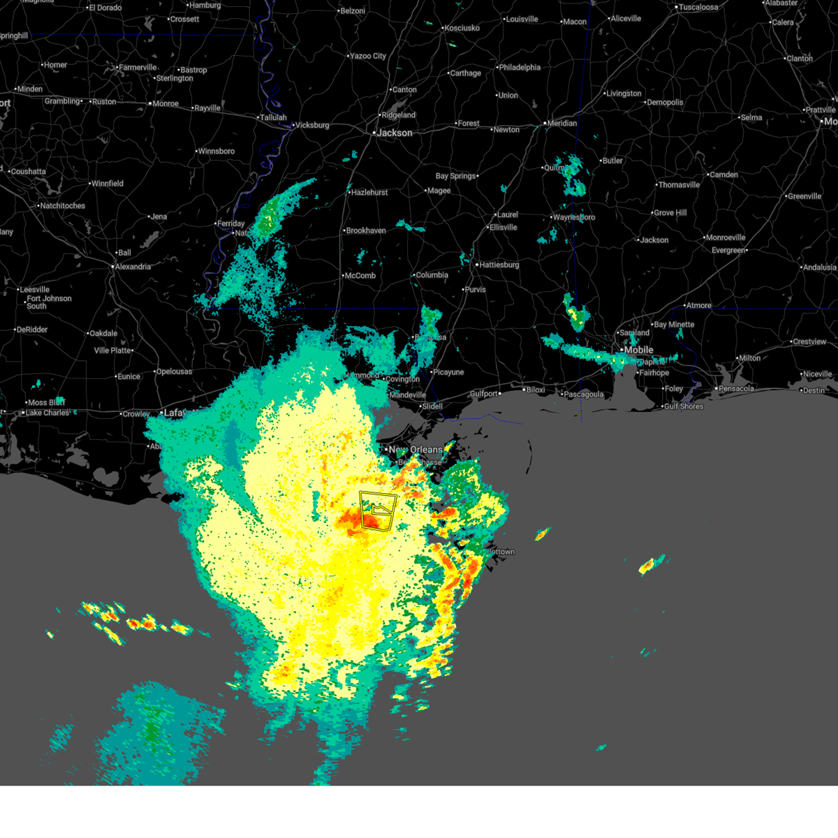
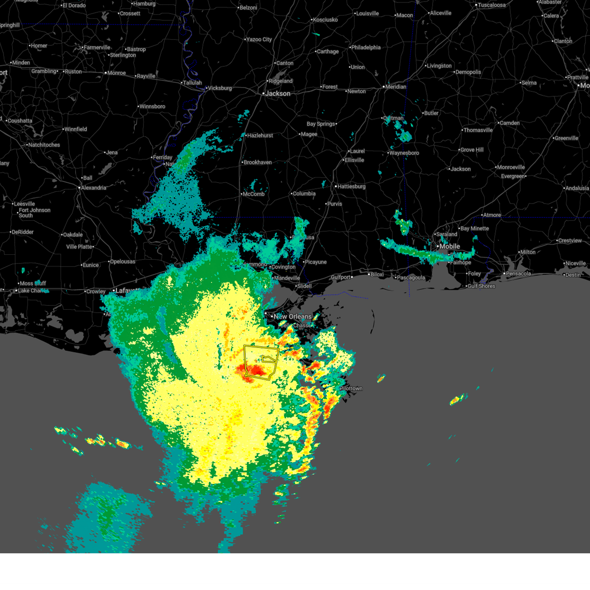
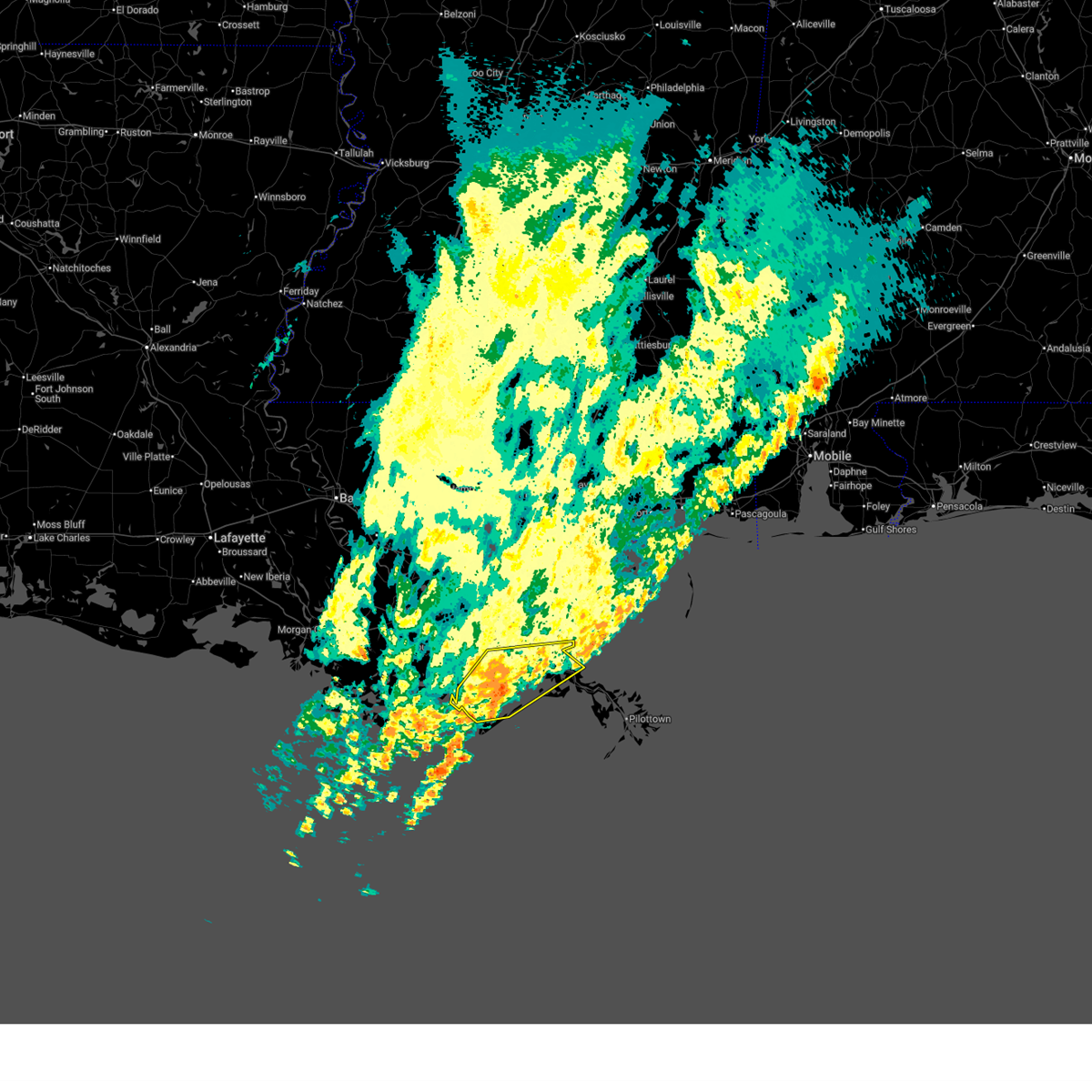
Hail Maps for Golden Meadow, LA


Connect with Interactive Hail Maps