

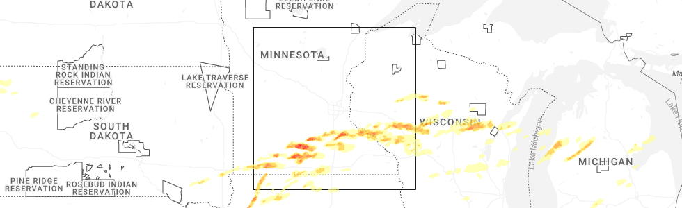
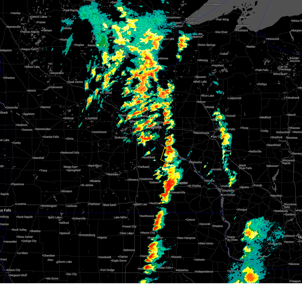
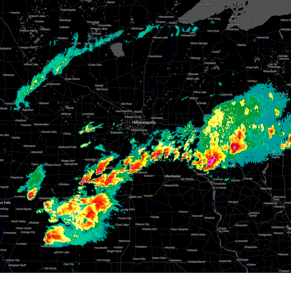
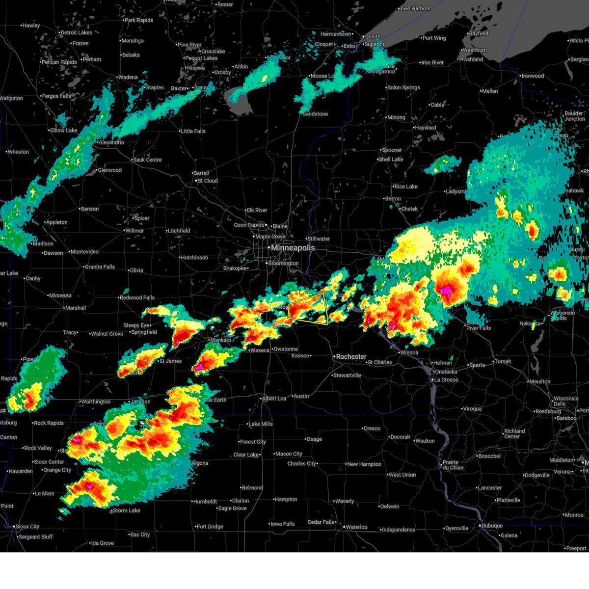
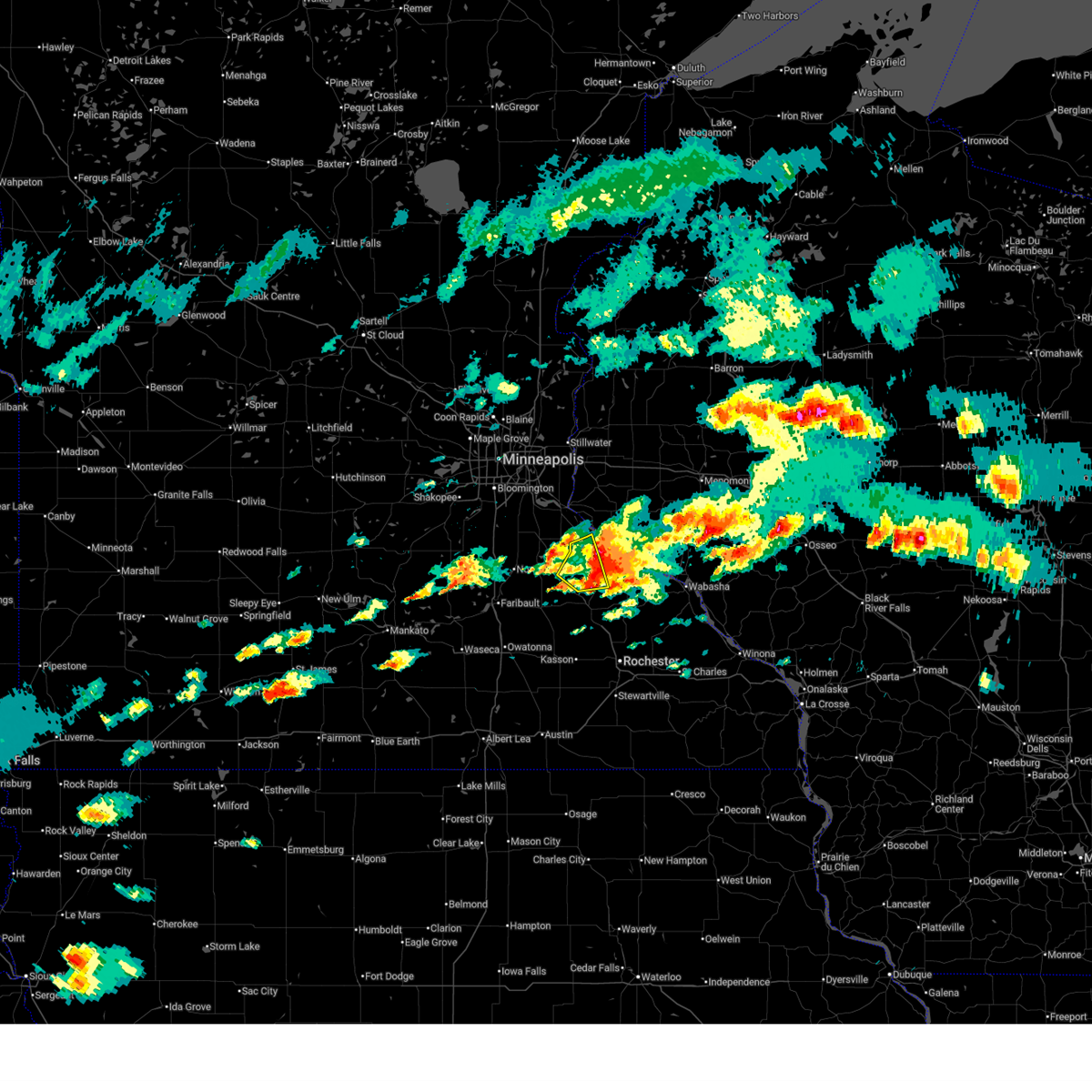
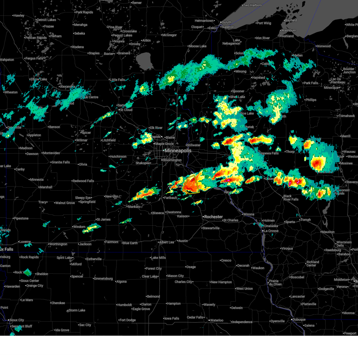
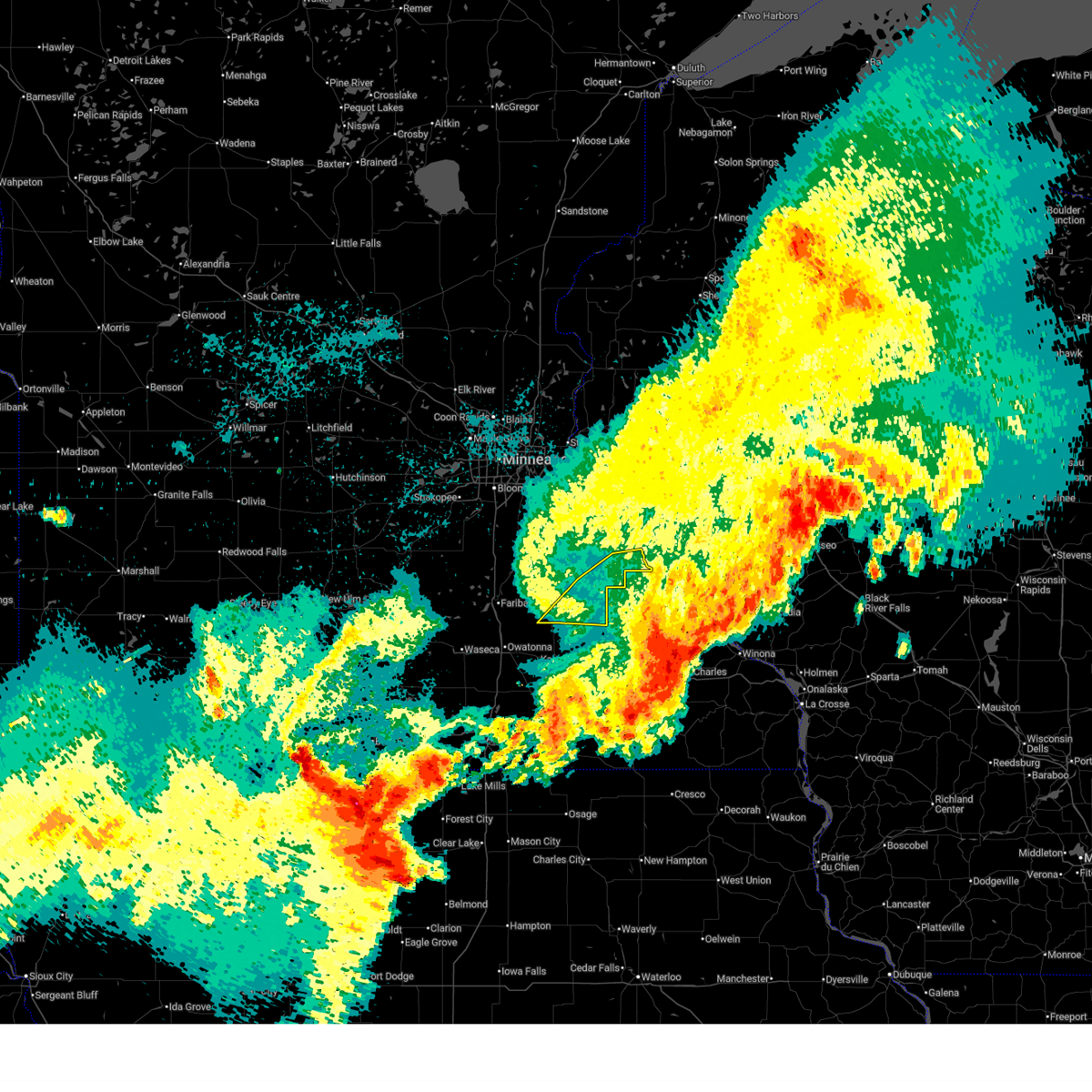
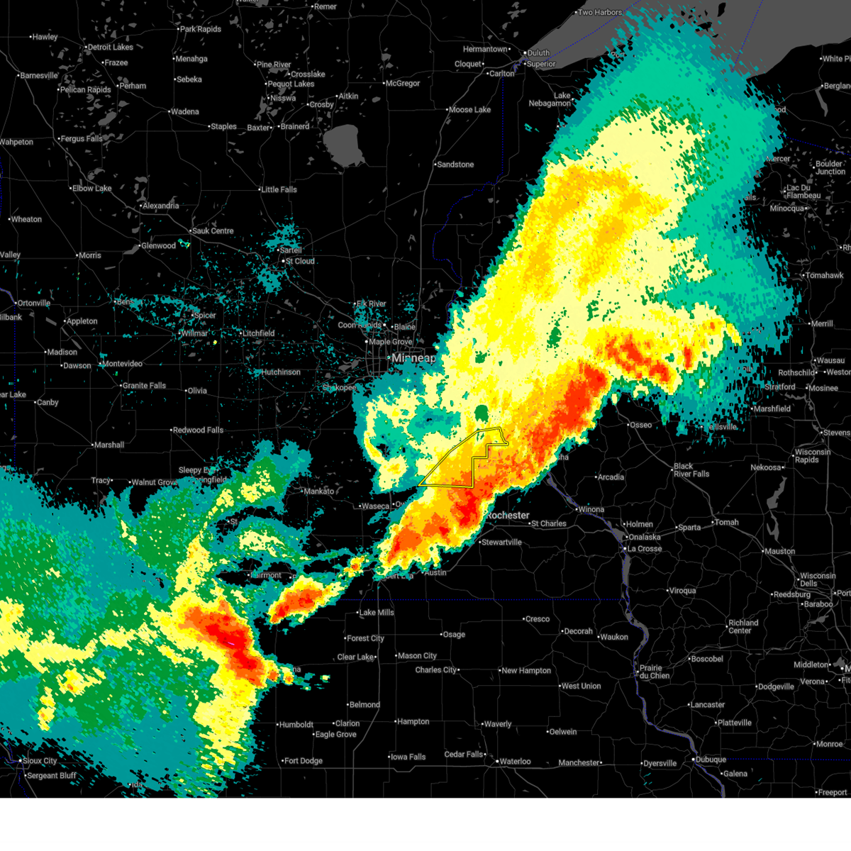
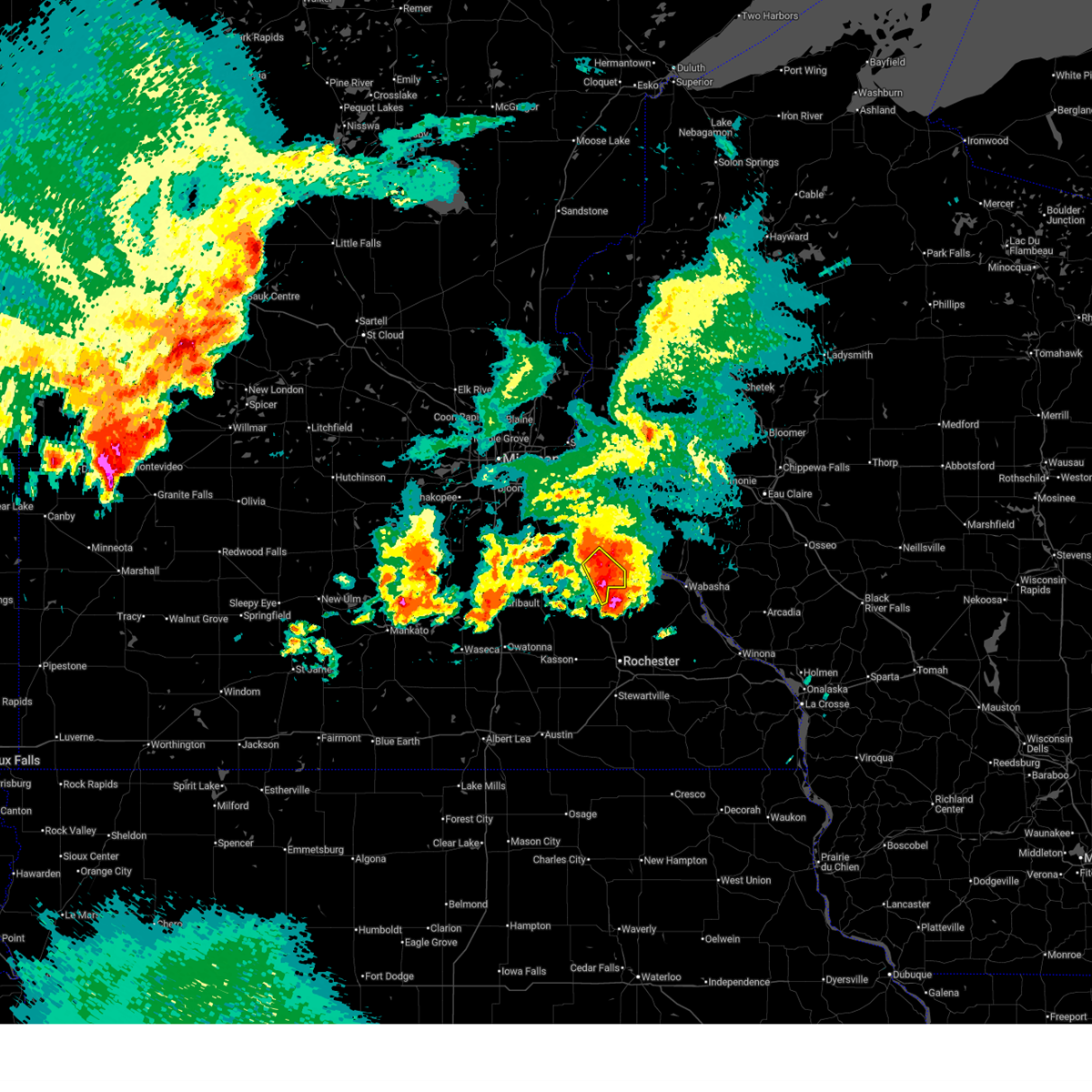
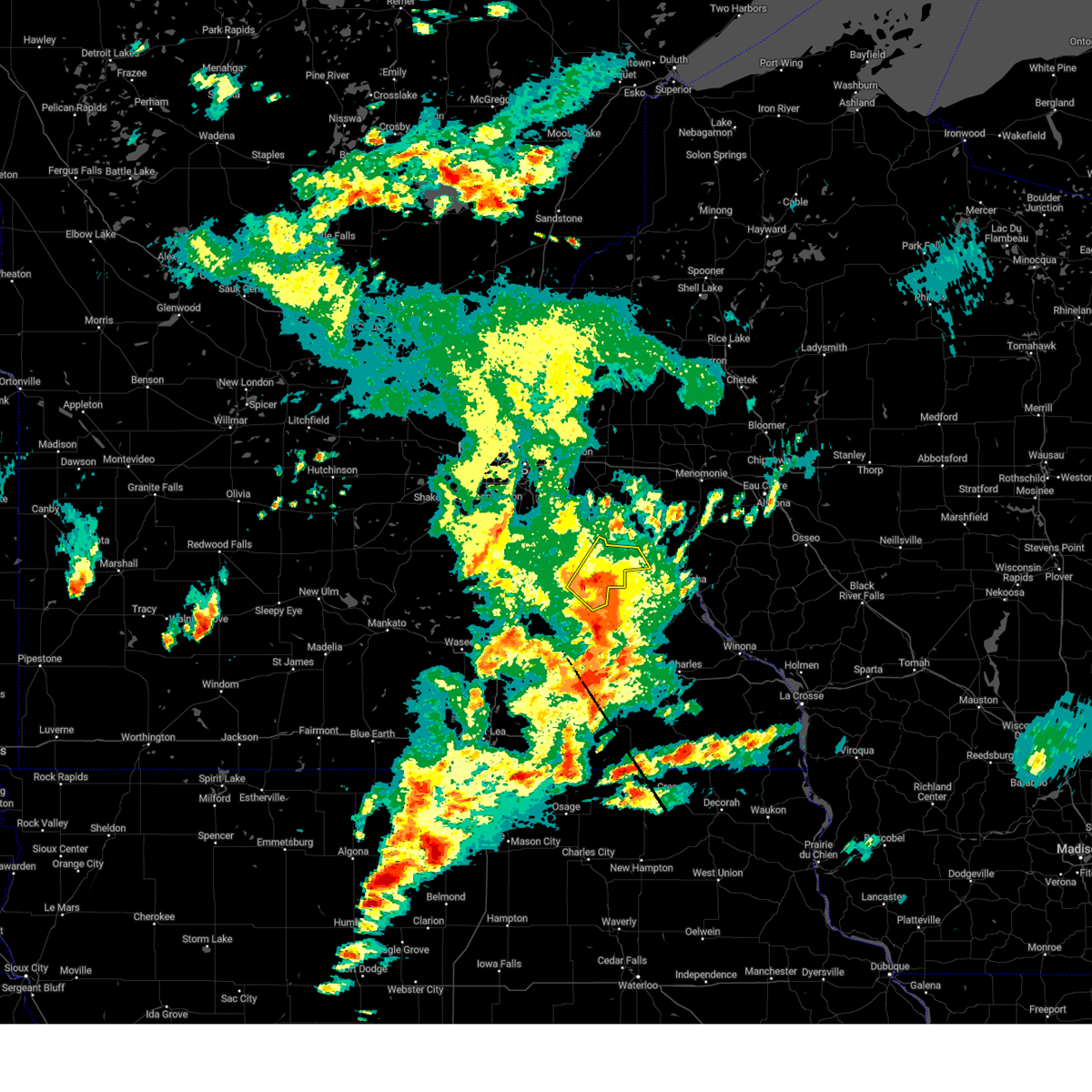
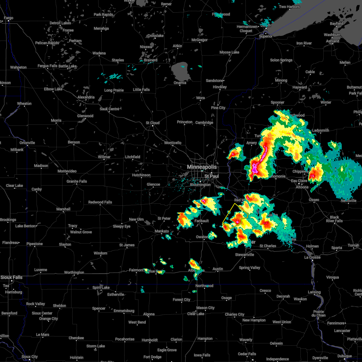
Hail Map for Goodhue, MN
The Goodhue, MN area has had 6 reports of on-the-ground hail by trained spotters, and has been under severe weather warnings 17 times during the past 12 months. Doppler radar has detected hail at or near Goodhue, MN on 60 occasions, including 4 occasions during the past year.
| Name: | Goodhue, MN |
| Where Located: | 51.1 miles SE of Minneapolis, MN |
| Map: | Google Map for Goodhue, MN |
| Population: | 1176 |
| Housing Units: | 443 |
| More Info: | Search Google for Goodhue, MN |
4
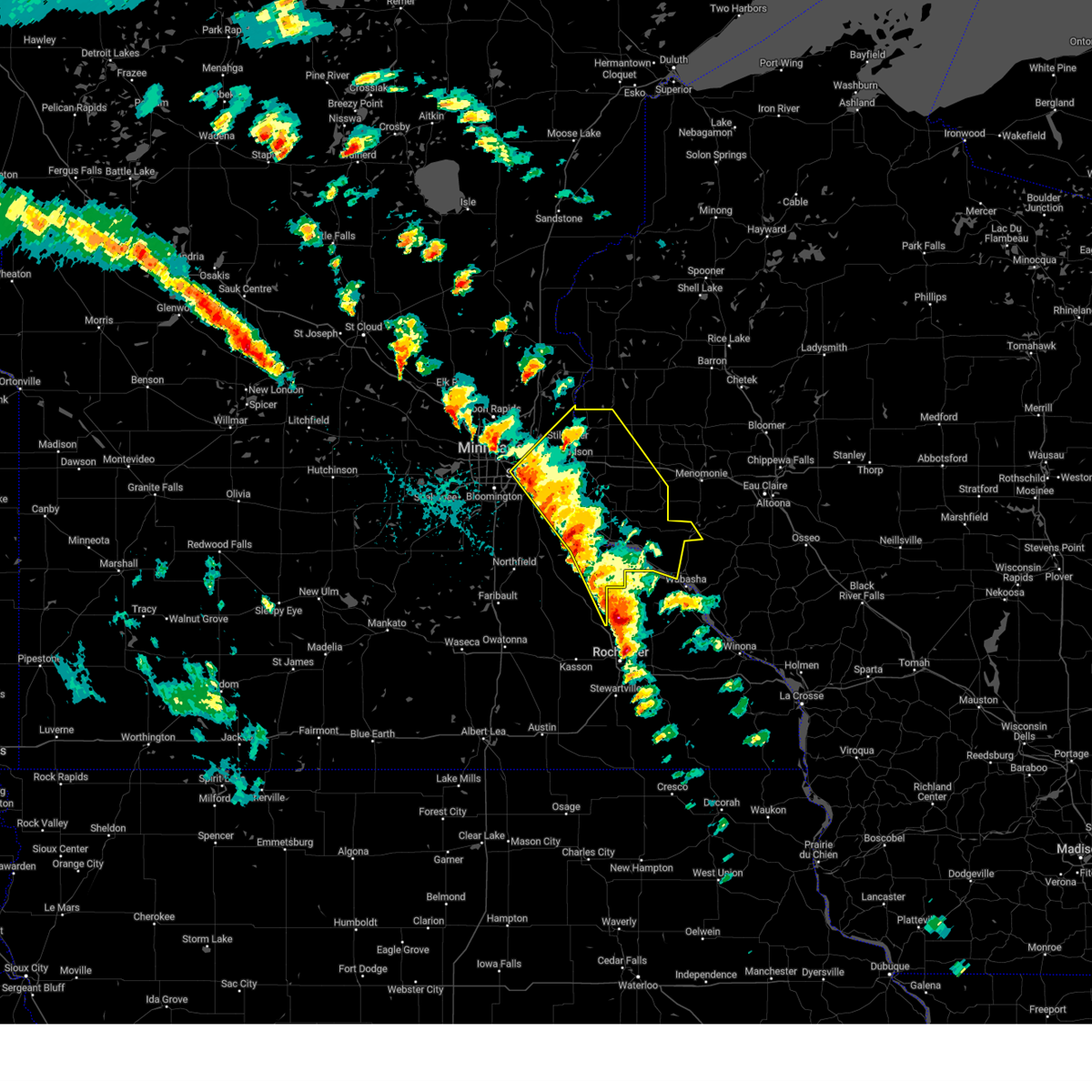
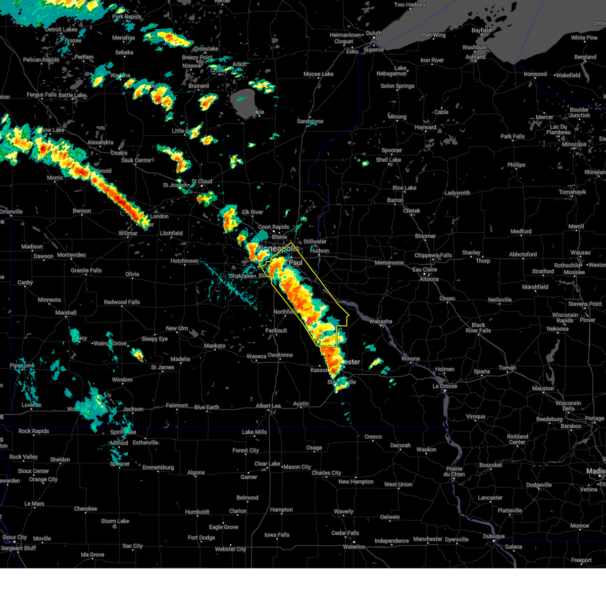
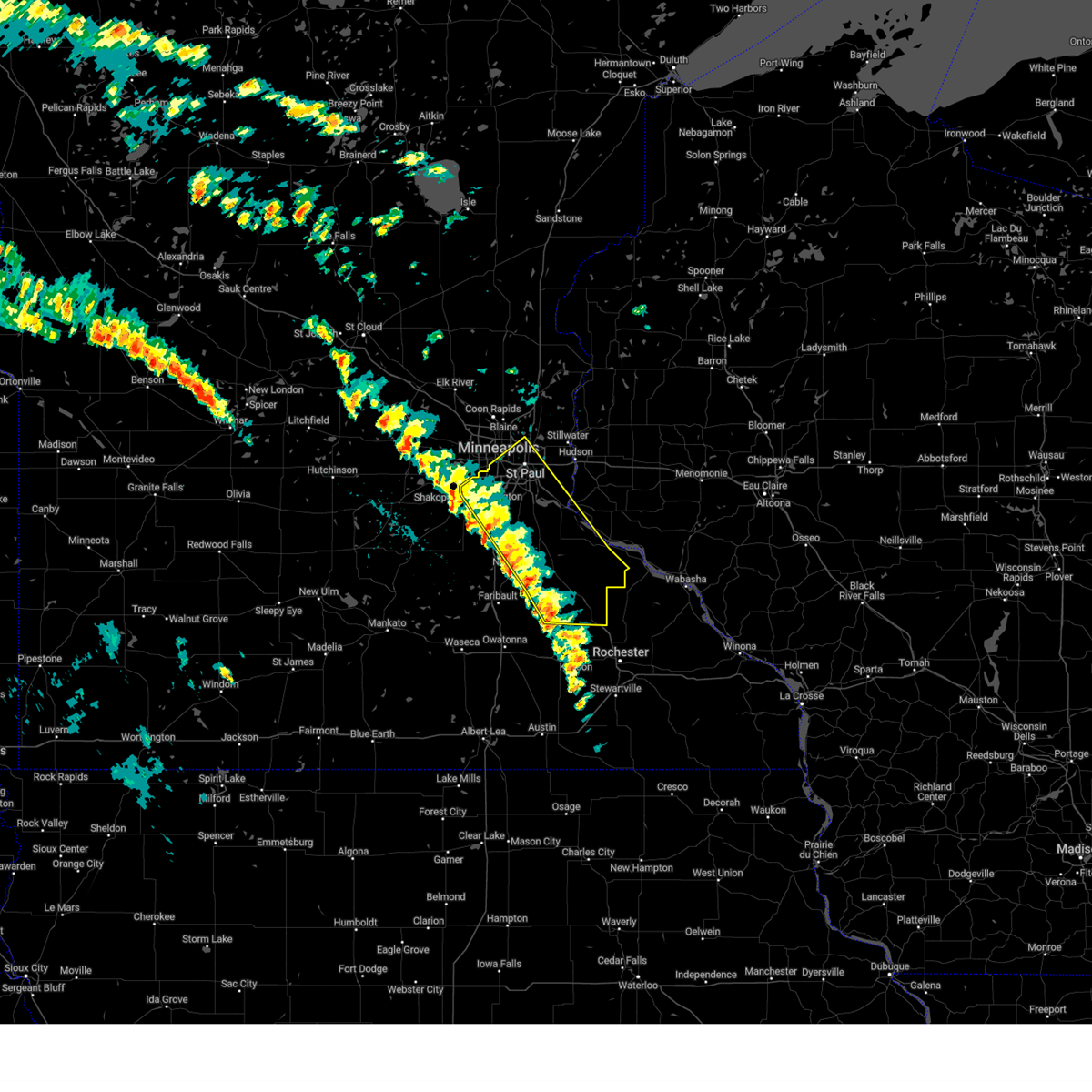
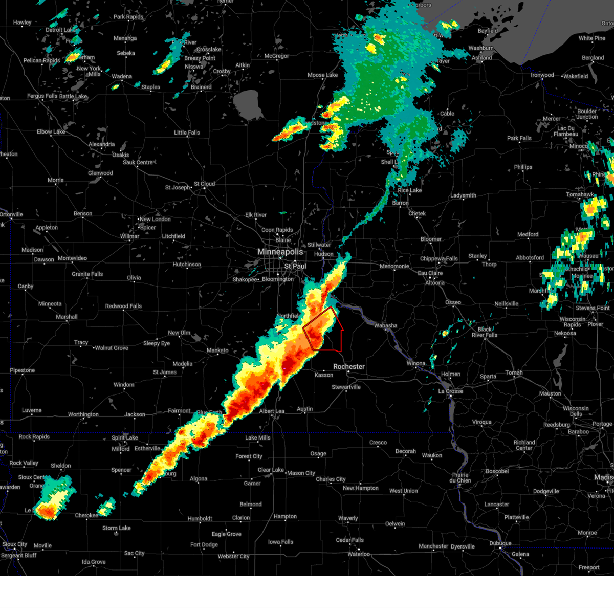
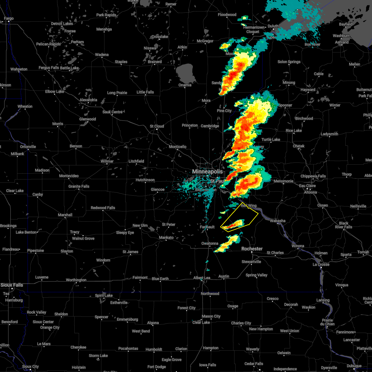
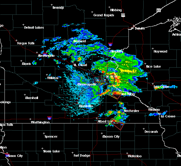
The Top Recent Hail Date for Goodhue, MN is Monday, April 13, 2026 (5th out of 60)
Hail and Wind Damage Spotted near Goodhue, MN
| Date / Time | Report Details |
|---|---|
| 4/17/2026 2:12 PM CDT |
 The storm which prompted the warning has moved out of the area. therefore, the warning will be allowed to expire. a tornado watch remains in effect until 800 pm cdt friday for a portion of southeast minnesota. The storm which prompted the warning has moved out of the area. therefore, the warning will be allowed to expire. a tornado watch remains in effect until 800 pm cdt friday for a portion of southeast minnesota.
|
| 4/17/2026 1:53 PM CDT |
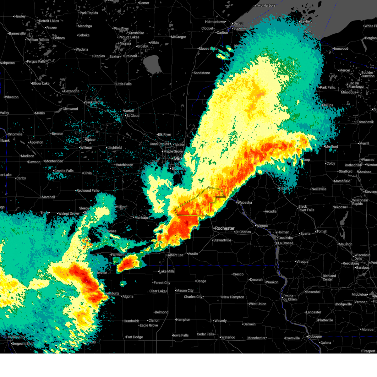
 At 153 pm cdt, a severe thunderstorm was located near goodhue, or 14 miles southwest of red wing, moving northeast at 60 mph (radar indicated). Hazards include ping pong ball size hail. People and animals outdoors will be injured. expect damage to roofs, siding, windows, and vehicles. Locations impacted include, wanamingo, zumbrota, goodhue, bellechester, vasa, welch, red wing, central point, wacouta, frontenac state park and frontenac. At 153 pm cdt, a severe thunderstorm was located near goodhue, or 14 miles southwest of red wing, moving northeast at 60 mph (radar indicated). Hazards include ping pong ball size hail. People and animals outdoors will be injured. expect damage to roofs, siding, windows, and vehicles. Locations impacted include, wanamingo, zumbrota, goodhue, bellechester, vasa, welch, red wing, central point, wacouta, frontenac state park and frontenac.
|
| 4/17/2026 1:39 PM CDT |
 Svrmpx the national weather service in the twin cities has issued a * severe thunderstorm warning for, goodhue county in southeastern minnesota, * until 215 pm cdt. * at 139 pm cdt, a severe thunderstorm was located 7 miles south of wanamingo, or 22 miles east of owatonna, moving northeast at 55 mph (radar indicated). Hazards include ping pong ball size hail. People and animals outdoors will be injured. Expect damage to roofs, siding, windows, and vehicles. Svrmpx the national weather service in the twin cities has issued a * severe thunderstorm warning for, goodhue county in southeastern minnesota, * until 215 pm cdt. * at 139 pm cdt, a severe thunderstorm was located 7 miles south of wanamingo, or 22 miles east of owatonna, moving northeast at 55 mph (radar indicated). Hazards include ping pong ball size hail. People and animals outdoors will be injured. Expect damage to roofs, siding, windows, and vehicles.
|
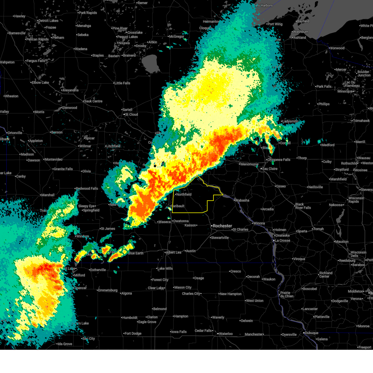
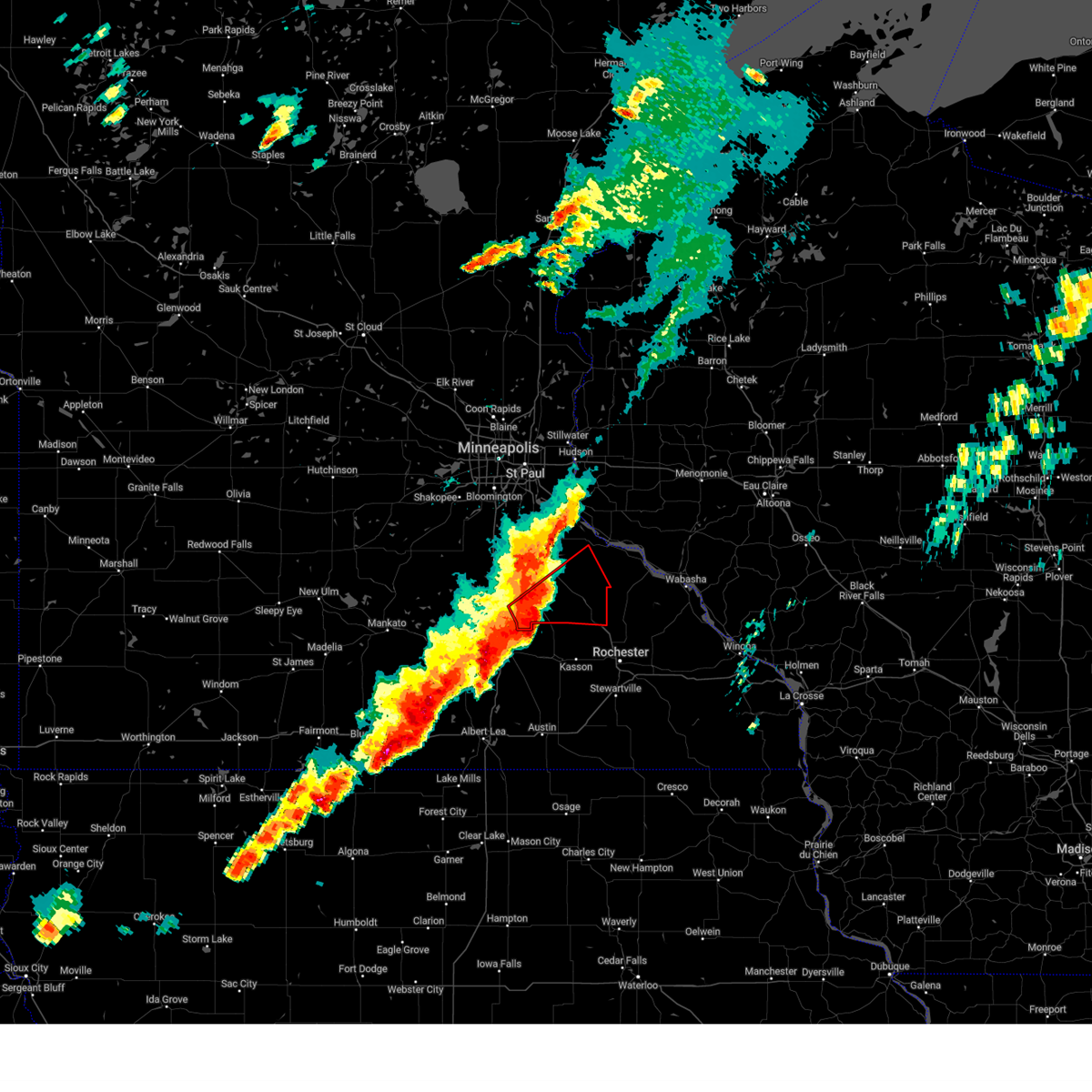
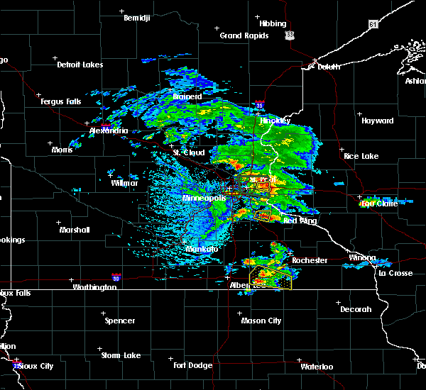
| 4/13/2026 7:35 PM CDT | Quarter sized hail reported 0.4 miles SE of Goodhue, MN |
| 4/13/2026 7:24 PM CDT |
 At 724 pm cdt, a severe thunderstorm was located near goodhue, or 13 miles southwest of red wing, moving east at 25 mph (radar indicated). Hazards include 60 mph wind gusts and quarter size hail. Hail damage to vehicles is expected. expect wind damage to roofs, siding, and trees. Locations impacted include, hader and goodhue. At 724 pm cdt, a severe thunderstorm was located near goodhue, or 13 miles southwest of red wing, moving east at 25 mph (radar indicated). Hazards include 60 mph wind gusts and quarter size hail. Hail damage to vehicles is expected. expect wind damage to roofs, siding, and trees. Locations impacted include, hader and goodhue.
|
| 4/13/2026 6:52 PM CDT |
 Svrmpx the national weather service in the twin cities has issued a * severe thunderstorm warning for, southwestern goodhue county in southeastern minnesota, * until 745 pm cdt. * at 652 pm cdt, a severe thunderstorm was located near stanton, or 10 miles east of northfield, moving east at 25 mph (radar indicated). Hazards include 60 mph wind gusts and quarter size hail. Hail damage to vehicles is expected. Expect wind damage to roofs, siding, and trees. Svrmpx the national weather service in the twin cities has issued a * severe thunderstorm warning for, southwestern goodhue county in southeastern minnesota, * until 745 pm cdt. * at 652 pm cdt, a severe thunderstorm was located near stanton, or 10 miles east of northfield, moving east at 25 mph (radar indicated). Hazards include 60 mph wind gusts and quarter size hail. Hail damage to vehicles is expected. Expect wind damage to roofs, siding, and trees.
|
| 4/13/2026 5:26 PM CDT |
 The storm which prompted the warning has moved out of the area. therefore, the warning will be allowed to expire. a tornado watch remains in effect until 1000 pm cdt monday for a portion of southeast minnesota. The storm which prompted the warning has moved out of the area. therefore, the warning will be allowed to expire. a tornado watch remains in effect until 1000 pm cdt monday for a portion of southeast minnesota.
|
| 4/13/2026 5:22 PM CDT |
 Svrmpx the national weather service in the twin cities has issued a * severe thunderstorm warning for, central goodhue county in southeastern minnesota, * until 615 pm cdt. * at 522 pm cdt, a severe thunderstorm was located over goodhue, or 11 miles south of red wing, moving east at 30 mph (radar indicated). Hazards include 60 mph wind gusts and quarter size hail. Hail damage to vehicles is expected. Expect wind damage to roofs, siding, and trees. Svrmpx the national weather service in the twin cities has issued a * severe thunderstorm warning for, central goodhue county in southeastern minnesota, * until 615 pm cdt. * at 522 pm cdt, a severe thunderstorm was located over goodhue, or 11 miles south of red wing, moving east at 30 mph (radar indicated). Hazards include 60 mph wind gusts and quarter size hail. Hail damage to vehicles is expected. Expect wind damage to roofs, siding, and trees.
|
| 4/13/2026 5:06 PM CDT |
 At 506 pm cdt, a severe thunderstorm was located 7 miles southeast of cannon falls, or 14 miles southwest of red wing, moving east at 15 mph (radar indicated). Hazards include 60 mph wind gusts and half dollar size hail. Hail damage to vehicles is expected. expect wind damage to roofs, siding, and trees. Locations impacted include, vasa, goodhue and welch. At 506 pm cdt, a severe thunderstorm was located 7 miles southeast of cannon falls, or 14 miles southwest of red wing, moving east at 15 mph (radar indicated). Hazards include 60 mph wind gusts and half dollar size hail. Hail damage to vehicles is expected. expect wind damage to roofs, siding, and trees. Locations impacted include, vasa, goodhue and welch.
|
| 4/13/2026 4:38 PM CDT |
 At 438 pm cdt, a severe thunderstorm was located 6 miles south of cannon falls, or 13 miles east of northfield, moving east at 15 mph (trained spotters reported ping pong ball size hail in dennison). Hazards include ping pong ball size hail and 60 mph wind gusts. People and animals outdoors will be injured. expect hail damage to roofs, siding, windows, and vehicles. expect wind damage to roofs, siding, and trees. Locations impacted include, cannon falls, wastedo, wanamingo, hader, zumbrota, vasa, goodhue and welch. At 438 pm cdt, a severe thunderstorm was located 6 miles south of cannon falls, or 13 miles east of northfield, moving east at 15 mph (trained spotters reported ping pong ball size hail in dennison). Hazards include ping pong ball size hail and 60 mph wind gusts. People and animals outdoors will be injured. expect hail damage to roofs, siding, windows, and vehicles. expect wind damage to roofs, siding, and trees. Locations impacted include, cannon falls, wastedo, wanamingo, hader, zumbrota, vasa, goodhue and welch.
|
| 4/13/2026 4:29 PM CDT |
 Svrmpx the national weather service in the twin cities has issued a * severe thunderstorm warning for, western goodhue county in southeastern minnesota, * until 530 pm cdt. * at 429 pm cdt, a severe thunderstorm was located near stanton, or 11 miles east of northfield, moving east at 25 mph (radar indicated). Hazards include two inch hail and 60 mph wind gusts. People and animals outdoors will be injured. expect hail damage to roofs, siding, windows, and vehicles. Expect wind damage to roofs, siding, and trees. Svrmpx the national weather service in the twin cities has issued a * severe thunderstorm warning for, western goodhue county in southeastern minnesota, * until 530 pm cdt. * at 429 pm cdt, a severe thunderstorm was located near stanton, or 11 miles east of northfield, moving east at 25 mph (radar indicated). Hazards include two inch hail and 60 mph wind gusts. People and animals outdoors will be injured. expect hail damage to roofs, siding, windows, and vehicles. Expect wind damage to roofs, siding, and trees.
|
| 4/13/2026 4:02 PM CDT |
 At 402 pm cdt, a severe thunderstorm was located 6 miles southeast of cannon falls, or 16 miles southwest of red wing, moving northeast at 20 mph (trained spotters reported ping pong size hail 6 miles south of cannon falls). Hazards include ping pong ball size hail and 60 mph wind gusts. People and animals outdoors will be injured. expect hail damage to roofs, siding, windows, and vehicles. expect wind damage to roofs, siding, and trees. Locations impacted include, kenyon, bombay, stanton, wanamingo, wastedo, cannon falls, hader, zumbrota, vasa, goodhue, red wing, welch, wacouta, frontenac state park, bellechester, frontenac and central point. At 402 pm cdt, a severe thunderstorm was located 6 miles southeast of cannon falls, or 16 miles southwest of red wing, moving northeast at 20 mph (trained spotters reported ping pong size hail 6 miles south of cannon falls). Hazards include ping pong ball size hail and 60 mph wind gusts. People and animals outdoors will be injured. expect hail damage to roofs, siding, windows, and vehicles. expect wind damage to roofs, siding, and trees. Locations impacted include, kenyon, bombay, stanton, wanamingo, wastedo, cannon falls, hader, zumbrota, vasa, goodhue, red wing, welch, wacouta, frontenac state park, bellechester, frontenac and central point.
|
| 4/13/2026 3:47 PM CDT |
 Svrmpx the national weather service in the twin cities has issued a * severe thunderstorm warning for, goodhue county in southeastern minnesota, * until 430 pm cdt. * at 347 pm cdt, a severe thunderstorm was located 9 miles south of cannon falls, or 13 miles east of northfield, moving east at 25 mph (trained spotters reported golf ball size hail). Hazards include golf ball size hail and 60 mph wind gusts. People and animals outdoors will be injured. expect hail damage to roofs, siding, windows, and vehicles. Expect wind damage to roofs, siding, and trees. Svrmpx the national weather service in the twin cities has issued a * severe thunderstorm warning for, goodhue county in southeastern minnesota, * until 430 pm cdt. * at 347 pm cdt, a severe thunderstorm was located 9 miles south of cannon falls, or 13 miles east of northfield, moving east at 25 mph (trained spotters reported golf ball size hail). Hazards include golf ball size hail and 60 mph wind gusts. People and animals outdoors will be injured. expect hail damage to roofs, siding, windows, and vehicles. Expect wind damage to roofs, siding, and trees.
|
| 7/28/2025 11:42 PM CDT |
 The storms which prompted the warning have moved out of the area. therefore, the warning will be allowed to expire. The storms which prompted the warning have moved out of the area. therefore, the warning will be allowed to expire.
|
| 7/28/2025 11:17 PM CDT |
 At 1117 pm cdt, severe thunderstorms were located along a line from 11 miles south of stockholm to 12 miles northeast of blooming prairie, or along a line from 21 miles southeast of red wing to 15 miles east of owatonna, moving southeast at 45 mph (radar indicated). Hazards include 60 mph wind gusts and small hail. Expect damage to roofs, siding, and trees. Locations impacted include, pine island, zumbrota, goodhue, wanamingo, frontenac, bellechester, bombay, frontenac state park and central point. At 1117 pm cdt, severe thunderstorms were located along a line from 11 miles south of stockholm to 12 miles northeast of blooming prairie, or along a line from 21 miles southeast of red wing to 15 miles east of owatonna, moving southeast at 45 mph (radar indicated). Hazards include 60 mph wind gusts and small hail. Expect damage to roofs, siding, and trees. Locations impacted include, pine island, zumbrota, goodhue, wanamingo, frontenac, bellechester, bombay, frontenac state park and central point.
|
| 7/28/2025 11:17 PM CDT |
 the severe thunderstorm warning has been cancelled and is no longer in effect the severe thunderstorm warning has been cancelled and is no longer in effect
|
| 7/28/2025 10:59 PM CDT |
 Svrmpx the national weather service in the twin cities has issued a * severe thunderstorm warning for, southeastern rice county in south central minnesota, goodhue county in southeastern minnesota, * until 1145 pm cdt. * at 1059 pm cdt, severe thunderstorms were located along a line from near frontenac to 8 miles southwest of kenyon, or along a line from 8 miles southeast of red wing to 10 miles northeast of owatonna, moving southeast at 45 mph (radar indicated). Hazards include 60 mph wind gusts and small hail. expect damage to roofs, siding, and trees Svrmpx the national weather service in the twin cities has issued a * severe thunderstorm warning for, southeastern rice county in south central minnesota, goodhue county in southeastern minnesota, * until 1145 pm cdt. * at 1059 pm cdt, severe thunderstorms were located along a line from near frontenac to 8 miles southwest of kenyon, or along a line from 8 miles southeast of red wing to 10 miles northeast of owatonna, moving southeast at 45 mph (radar indicated). Hazards include 60 mph wind gusts and small hail. expect damage to roofs, siding, and trees
|
| 7/28/2025 10:16 PM CDT |
 Svrmpx the national weather service in the twin cities has issued a * severe thunderstorm warning for, southeastern dakota county in east central minnesota, eastern rice county in south central minnesota, goodhue county in southeastern minnesota, * until 1100 pm cdt. * at 1016 pm cdt, severe thunderstorms were located along a line from 5 miles south of river falls to 6 miles northwest of dundas, or along a line from 5 miles south of river falls to 6 miles northwest of northfield, moving southeast at 45 mph (radar indicated). Hazards include 70 mph wind gusts and small hail. Expect considerable tree damage. Damage is likely to mobile homes, roofs, and outbuildings. Svrmpx the national weather service in the twin cities has issued a * severe thunderstorm warning for, southeastern dakota county in east central minnesota, eastern rice county in south central minnesota, goodhue county in southeastern minnesota, * until 1100 pm cdt. * at 1016 pm cdt, severe thunderstorms were located along a line from 5 miles south of river falls to 6 miles northwest of dundas, or along a line from 5 miles south of river falls to 6 miles northwest of northfield, moving southeast at 45 mph (radar indicated). Hazards include 70 mph wind gusts and small hail. Expect considerable tree damage. Damage is likely to mobile homes, roofs, and outbuildings.
|
| 5/15/2025 2:31 PM CDT |
 Svrmpx the national weather service in the twin cities has issued a * severe thunderstorm warning for, northeastern dakota county in east central minnesota, southern ramsey county in east central minnesota, washington county in east central minnesota, central goodhue county in southeastern minnesota, pepin county in west central wisconsin, pierce county in west central wisconsin, st. croix county in west central wisconsin, * until 315 pm cdt. * at 231 pm cdt, a line of severe thunderstorms were located from mendota heights to 11 miles east of pine island, or along a line from near st. paul to 26 miles south of red wing, moving northeast at 50 mph (radar indicated). Hazards include 60 mph wind gusts and quarter size hail. Hail damage to vehicles is expected. Expect wind damage to roofs, siding, and trees. Svrmpx the national weather service in the twin cities has issued a * severe thunderstorm warning for, northeastern dakota county in east central minnesota, southern ramsey county in east central minnesota, washington county in east central minnesota, central goodhue county in southeastern minnesota, pepin county in west central wisconsin, pierce county in west central wisconsin, st. croix county in west central wisconsin, * until 315 pm cdt. * at 231 pm cdt, a line of severe thunderstorms were located from mendota heights to 11 miles east of pine island, or along a line from near st. paul to 26 miles south of red wing, moving northeast at 50 mph (radar indicated). Hazards include 60 mph wind gusts and quarter size hail. Hail damage to vehicles is expected. Expect wind damage to roofs, siding, and trees.
|
| 5/15/2025 2:20 PM CDT |
 At 220 pm cdt, severe thunderstorms were located along a line from over mendota heights to 14 miles southeast of pine island, or along a line from 7 miles south of st. paul to 32 miles south of red wing, moving northeast at 40 mph (radar indicated). Hazards include 60 mph wind gusts and quarter size hail. Hail damage to vehicles is expected. expect wind damage to roofs, siding, and trees. locations impacted include, minneapolis, st. paul, red wing, bloomington, eagan, woodbury, burnsville, apple valley, edina, st. louis park, maplewood, richfield, cottage grove, inver grove heights, roseville, oakdale, shoreview, hastings, rosemount and south st. Paul. At 220 pm cdt, severe thunderstorms were located along a line from over mendota heights to 14 miles southeast of pine island, or along a line from 7 miles south of st. paul to 32 miles south of red wing, moving northeast at 40 mph (radar indicated). Hazards include 60 mph wind gusts and quarter size hail. Hail damage to vehicles is expected. expect wind damage to roofs, siding, and trees. locations impacted include, minneapolis, st. paul, red wing, bloomington, eagan, woodbury, burnsville, apple valley, edina, st. louis park, maplewood, richfield, cottage grove, inver grove heights, roseville, oakdale, shoreview, hastings, rosemount and south st. Paul.
|
| 5/15/2025 2:08 PM CDT |
 the severe thunderstorm warning has been cancelled and is no longer in effect the severe thunderstorm warning has been cancelled and is no longer in effect
|
| 5/15/2025 2:08 PM CDT |
 At 208 pm cdt, severe thunderstorms were located along a line from over burnsville to 12 miles southeast of pine island, or along a line from 11 miles south of minneapolis to 35 miles east of owatonna, moving northeast at 40 mph (radar indicated). Hazards include 60 mph wind gusts and quarter size hail. Hail damage to vehicles is expected. expect wind damage to roofs, siding, and trees. locations impacted include, minneapolis, st. paul, red wing, bloomington, eagan, woodbury, eden prairie, burnsville, lakeville, apple valley, edina, st. Louis park, maplewood, richfield, cottage grove, inver grove heights, roseville, oakdale, savage and shoreview. At 208 pm cdt, severe thunderstorms were located along a line from over burnsville to 12 miles southeast of pine island, or along a line from 11 miles south of minneapolis to 35 miles east of owatonna, moving northeast at 40 mph (radar indicated). Hazards include 60 mph wind gusts and quarter size hail. Hail damage to vehicles is expected. expect wind damage to roofs, siding, and trees. locations impacted include, minneapolis, st. paul, red wing, bloomington, eagan, woodbury, eden prairie, burnsville, lakeville, apple valley, edina, st. Louis park, maplewood, richfield, cottage grove, inver grove heights, roseville, oakdale, savage and shoreview.
|
| 5/15/2025 1:55 PM CDT |
 Svrmpx the national weather service in the twin cities has issued a * severe thunderstorm warning for, dakota county in east central minnesota, east hennepin and south hennepin county in east central minnesota, ramsey county in east central minnesota, northeastern scott county in east central minnesota, southwestern washington county in east central minnesota, northeastern rice county in south central minnesota, goodhue county in southeastern minnesota, southwestern pierce county in west central wisconsin, * until 230 pm cdt. * at 155 pm cdt, a broken line of severe thunderstorms were located along a line from over prior lake to 14 miles south of pine island, or along a line from 17 miles southwest of minneapolis to 28 miles east of owatonna, moving northeast at 40 mph (radar indicated). Hazards include 60 mph wind gusts and quarter size hail. Hail damage to vehicles is expected. Expect wind damage to roofs, siding, and trees. Svrmpx the national weather service in the twin cities has issued a * severe thunderstorm warning for, dakota county in east central minnesota, east hennepin and south hennepin county in east central minnesota, ramsey county in east central minnesota, northeastern scott county in east central minnesota, southwestern washington county in east central minnesota, northeastern rice county in south central minnesota, goodhue county in southeastern minnesota, southwestern pierce county in west central wisconsin, * until 230 pm cdt. * at 155 pm cdt, a broken line of severe thunderstorms were located along a line from over prior lake to 14 miles south of pine island, or along a line from 17 miles southwest of minneapolis to 28 miles east of owatonna, moving northeast at 40 mph (radar indicated). Hazards include 60 mph wind gusts and quarter size hail. Hail damage to vehicles is expected. Expect wind damage to roofs, siding, and trees.
|
| 4/28/2025 6:32 PM CDT |
 The tornado threat has diminished and the tornado warning has been cancelled. however, large hail and damaging winds remain likely and a severe thunderstorm warning remains in effect for the area. a tornado watch remains in effect until 1100 pm cdt for a portion of southeast minnesota. The tornado threat has diminished and the tornado warning has been cancelled. however, large hail and damaging winds remain likely and a severe thunderstorm warning remains in effect for the area. a tornado watch remains in effect until 1100 pm cdt for a portion of southeast minnesota.
|
| 4/28/2025 6:28 PM CDT |
 Svrmpx the national weather service in the twin cities has issued a * severe thunderstorm warning for, southeastern goodhue county in southeastern minnesota, pepin county in west central wisconsin, southeastern pierce county in west central wisconsin, * until 715 pm cdt. * at 628 pm cdt, a severe thunderstorm was located over goodhue, or 11 miles south of red wing, moving east at 45 mph (radar indicated). Hazards include 60 mph wind gusts and small hail. expect damage to roofs, siding, and trees Svrmpx the national weather service in the twin cities has issued a * severe thunderstorm warning for, southeastern goodhue county in southeastern minnesota, pepin county in west central wisconsin, southeastern pierce county in west central wisconsin, * until 715 pm cdt. * at 628 pm cdt, a severe thunderstorm was located over goodhue, or 11 miles south of red wing, moving east at 45 mph (radar indicated). Hazards include 60 mph wind gusts and small hail. expect damage to roofs, siding, and trees
|
| 4/28/2025 6:10 PM CDT |
 the tornado warning has been cancelled and is no longer in effect the tornado warning has been cancelled and is no longer in effect
|
| 4/28/2025 6:10 PM CDT |
 At 610 pm cdt, a severe thunderstorm capable of producing a tornado was located over wanamingo, or 21 miles southwest of red wing, moving east at 55 mph (radar indicated rotation). Hazards include tornado. Flying debris will be dangerous to those caught without shelter. mobile homes will be damaged or destroyed. damage to roofs, windows and vehicles will occur. tree damage is likely. Locations impacted include, pine island, zumbrota, goodhue, wanamingo, vasa, hader, wastedo and bombay. At 610 pm cdt, a severe thunderstorm capable of producing a tornado was located over wanamingo, or 21 miles southwest of red wing, moving east at 55 mph (radar indicated rotation). Hazards include tornado. Flying debris will be dangerous to those caught without shelter. mobile homes will be damaged or destroyed. damage to roofs, windows and vehicles will occur. tree damage is likely. Locations impacted include, pine island, zumbrota, goodhue, wanamingo, vasa, hader, wastedo and bombay.
|
| 4/28/2025 5:58 PM CDT |
 the tornado warning has been cancelled and is no longer in effect the tornado warning has been cancelled and is no longer in effect
|
| 4/28/2025 5:58 PM CDT |
 At 558 pm cdt, a severe thunderstorm capable of producing a tornado was located over kenyon, or 15 miles east of faribault, moving east at 55 mph (radar indicated rotation). Hazards include tornado. Flying debris will be dangerous to those caught without shelter. mobile homes will be damaged or destroyed. damage to roofs, windows and vehicles will occur. tree damage is likely. Locations impacted include, pine island, zumbrota, kenyon, goodhue, wanamingo, nerstrand, vasa, hader, wastedo, bombay, nerstrand big woods state park and ruskin. At 558 pm cdt, a severe thunderstorm capable of producing a tornado was located over kenyon, or 15 miles east of faribault, moving east at 55 mph (radar indicated rotation). Hazards include tornado. Flying debris will be dangerous to those caught without shelter. mobile homes will be damaged or destroyed. damage to roofs, windows and vehicles will occur. tree damage is likely. Locations impacted include, pine island, zumbrota, kenyon, goodhue, wanamingo, nerstrand, vasa, hader, wastedo, bombay, nerstrand big woods state park and ruskin.
|
| 4/28/2025 5:56 PM CDT |
 Tormpx the national weather service in the twin cities has issued a * tornado warning for, southeastern rice county in south central minnesota, northeastern steele county in south central minnesota, southwestern goodhue county in southeastern minnesota, * until 630 pm cdt. * at 556 pm cdt, a severe thunderstorm capable of producing a tornado was located near kenyon, or 14 miles east of faribault, moving east at 55 mph (radar indicated rotation). Hazards include tornado. Flying debris will be dangerous to those caught without shelter. mobile homes will be damaged or destroyed. damage to roofs, windows and vehicles will occur. Tree damage is likely. Tormpx the national weather service in the twin cities has issued a * tornado warning for, southeastern rice county in south central minnesota, northeastern steele county in south central minnesota, southwestern goodhue county in southeastern minnesota, * until 630 pm cdt. * at 556 pm cdt, a severe thunderstorm capable of producing a tornado was located near kenyon, or 14 miles east of faribault, moving east at 55 mph (radar indicated rotation). Hazards include tornado. Flying debris will be dangerous to those caught without shelter. mobile homes will be damaged or destroyed. damage to roofs, windows and vehicles will occur. Tree damage is likely.
|
| 7/31/2024 7:40 PM CDT |
 The storm which prompted the warning has moved out of the area. therefore, the warning will be allowed to expire. a severe thunderstorm watch remains in effect until 100 am cdt for southeastern minnesota. to report severe weather, contact your nearest law enforcement agency. they will relay your report to the national weather service the twin cities. The storm which prompted the warning has moved out of the area. therefore, the warning will be allowed to expire. a severe thunderstorm watch remains in effect until 100 am cdt for southeastern minnesota. to report severe weather, contact your nearest law enforcement agency. they will relay your report to the national weather service the twin cities.
|
| 7/31/2024 7:31 PM CDT |
 At 731 pm cdt, a severe thunderstorm was located near goodhue, or 12 miles south of red wing, moving southeast at 10 mph (radar indicated). Hazards include 60 mph wind gusts and quarter size hail. Hail damage to vehicles is expected. expect wind damage to roofs, siding, and trees. Locations impacted include, goodhue and bellechester. At 731 pm cdt, a severe thunderstorm was located near goodhue, or 12 miles south of red wing, moving southeast at 10 mph (radar indicated). Hazards include 60 mph wind gusts and quarter size hail. Hail damage to vehicles is expected. expect wind damage to roofs, siding, and trees. Locations impacted include, goodhue and bellechester.
|
| 7/31/2024 7:16 PM CDT |
 At 716 pm cdt, a severe thunderstorm was located over goodhue, or 10 miles south of red wing, moving southeast at 5 mph (radar indicated). Hazards include 60 mph wind gusts and half dollar size hail. Hail damage to vehicles is expected. expect wind damage to roofs, siding, and trees. This severe thunderstorm will remain over mainly rural areas of central goodhue county, including the following locations, bellechester. At 716 pm cdt, a severe thunderstorm was located over goodhue, or 10 miles south of red wing, moving southeast at 5 mph (radar indicated). Hazards include 60 mph wind gusts and half dollar size hail. Hail damage to vehicles is expected. expect wind damage to roofs, siding, and trees. This severe thunderstorm will remain over mainly rural areas of central goodhue county, including the following locations, bellechester.
|
| 7/31/2024 7:01 PM CDT |
 At 701 pm cdt, a severe thunderstorm was located over goodhue, or 9 miles south of red wing, moving southeast at 20 mph (radar indicated). Hazards include tennis ball size hail and 60 mph wind gusts. People and animals outdoors will be injured. expect hail damage to roofs, siding, windows, and vehicles. expect wind damage to roofs, siding, and trees. this severe storm will be near, goodhue around 705 pm cdt. Other locations impacted by this severe thunderstorm include bellechester. At 701 pm cdt, a severe thunderstorm was located over goodhue, or 9 miles south of red wing, moving southeast at 20 mph (radar indicated). Hazards include tennis ball size hail and 60 mph wind gusts. People and animals outdoors will be injured. expect hail damage to roofs, siding, windows, and vehicles. expect wind damage to roofs, siding, and trees. this severe storm will be near, goodhue around 705 pm cdt. Other locations impacted by this severe thunderstorm include bellechester.
|
| 7/31/2024 7:00 PM CDT | Photo provided of goodhue fire department radio antenna damaged from thunderstorm wind gusts. time estimated via rada in goodhue county MN, 0.3 miles SW of Goodhue, MN |
| 7/31/2024 6:43 PM CDT |
 Svrmpx the national weather service in the twin cities has issued a * severe thunderstorm warning for, central goodhue county in southeastern minnesota, * until 745 pm cdt. * at 642 pm cdt, a severe thunderstorm was located near welch, or 9 miles southwest of red wing, moving southeast at 5 mph (radar indicated). Hazards include 60 mph wind gusts and nickel size hail. expect damage to roofs, siding, and trees Svrmpx the national weather service in the twin cities has issued a * severe thunderstorm warning for, central goodhue county in southeastern minnesota, * until 745 pm cdt. * at 642 pm cdt, a severe thunderstorm was located near welch, or 9 miles southwest of red wing, moving southeast at 5 mph (radar indicated). Hazards include 60 mph wind gusts and nickel size hail. expect damage to roofs, siding, and trees
|
| 7/4/2024 4:48 PM CDT |
 the severe thunderstorm warning has been cancelled and is no longer in effect the severe thunderstorm warning has been cancelled and is no longer in effect
|
| 7/4/2024 4:29 PM CDT |
 At 428 pm cdt, a severe thunderstorm was located over goodhue, or 8 miles south of red wing, moving northeast at 35 mph (radar indicated). Hazards include 60 mph wind gusts and penny size hail. Expect damage to roofs, siding, and trees. Locations impacted include, red wing, zumbrota, goodhue, frontenac, wacouta, bellechester, frontenac state park, central point, and hader. At 428 pm cdt, a severe thunderstorm was located over goodhue, or 8 miles south of red wing, moving northeast at 35 mph (radar indicated). Hazards include 60 mph wind gusts and penny size hail. Expect damage to roofs, siding, and trees. Locations impacted include, red wing, zumbrota, goodhue, frontenac, wacouta, bellechester, frontenac state park, central point, and hader.
|
| 7/4/2024 4:08 PM CDT |
 Svrmpx the national weather service in the twin cities has issued a * severe thunderstorm warning for, goodhue county in southeastern minnesota, * until 500 pm cdt. * at 408 pm cdt, a severe thunderstorm was located near wanamingo, or 18 miles east of northfield, moving northeast at 35 mph (radar indicated). Hazards include 60 mph wind gusts and penny size hail. expect damage to roofs, siding, and trees Svrmpx the national weather service in the twin cities has issued a * severe thunderstorm warning for, goodhue county in southeastern minnesota, * until 500 pm cdt. * at 408 pm cdt, a severe thunderstorm was located near wanamingo, or 18 miles east of northfield, moving northeast at 35 mph (radar indicated). Hazards include 60 mph wind gusts and penny size hail. expect damage to roofs, siding, and trees
|
| 6/2/2024 7:30 PM CDT |
 The storms which prompted the warning have weakened below severe limits, and no longer pose an immediate threat to life or property. therefore, the warning has been allowed to expire. however, heavy rain is still expected with these thunderstorms. to report severe weather, contact your nearest law enforcement agency. they will relay your report to the national weather service the twin cities. The storms which prompted the warning have weakened below severe limits, and no longer pose an immediate threat to life or property. therefore, the warning has been allowed to expire. however, heavy rain is still expected with these thunderstorms. to report severe weather, contact your nearest law enforcement agency. they will relay your report to the national weather service the twin cities.
|
| 6/2/2024 7:03 PM CDT |
 At 703 pm cdt, severe thunderstorms were located along a line extending from 6 miles north of wanamingo to 6 miles southwest of kenyon, moving east at 20 mph (radar indicated). Hazards include 60 mph wind gusts and half dollar size hail. Hail damage to vehicles is expected. expect wind damage to roofs, siding, and trees. Locations impacted include, zumbrota, kenyon, goodhue, wanamingo, bombay, wastedo, and hader. At 703 pm cdt, severe thunderstorms were located along a line extending from 6 miles north of wanamingo to 6 miles southwest of kenyon, moving east at 20 mph (radar indicated). Hazards include 60 mph wind gusts and half dollar size hail. Hail damage to vehicles is expected. expect wind damage to roofs, siding, and trees. Locations impacted include, zumbrota, kenyon, goodhue, wanamingo, bombay, wastedo, and hader.
|
| 6/2/2024 6:40 PM CDT |
 Svrmpx the national weather service in the twin cities has issued a * severe thunderstorm warning for, southwestern goodhue county in southeastern minnesota, * until 730 pm cdt. * at 639 pm cdt, severe thunderstorms were located along a line extending from near stanton to 5 miles south of nerstrand, moving east at 20 mph (radar indicated). Hazards include 60 mph wind gusts and half dollar size hail. Hail damage to vehicles is expected. Expect wind damage to roofs, siding, and trees. Svrmpx the national weather service in the twin cities has issued a * severe thunderstorm warning for, southwestern goodhue county in southeastern minnesota, * until 730 pm cdt. * at 639 pm cdt, severe thunderstorms were located along a line extending from near stanton to 5 miles south of nerstrand, moving east at 20 mph (radar indicated). Hazards include 60 mph wind gusts and half dollar size hail. Hail damage to vehicles is expected. Expect wind damage to roofs, siding, and trees.
|
| 8/11/2023 8:15 PM CDT |
 At 815 pm cdt, a severe thunderstorm was located over goodhue, or 8 miles south of red wing, moving east at 50 mph (radar indicated). Hazards include 60 mph wind gusts and quarter size hail. Hail damage to vehicles is expected. expect wind damage to roofs, siding, and trees. locations impacted include, frontenac. hail threat, radar indicated max hail size, 1. 00 in wind threat, radar indicated max wind gust, 60 mph. At 815 pm cdt, a severe thunderstorm was located over goodhue, or 8 miles south of red wing, moving east at 50 mph (radar indicated). Hazards include 60 mph wind gusts and quarter size hail. Hail damage to vehicles is expected. expect wind damage to roofs, siding, and trees. locations impacted include, frontenac. hail threat, radar indicated max hail size, 1. 00 in wind threat, radar indicated max wind gust, 60 mph.
|
| 8/11/2023 8:03 PM CDT |
 At 802 pm cdt, a severe thunderstorm was located 7 miles north of wanamingo, or 16 miles southwest of red wing, moving east at 50 mph (radar indicated). Hazards include ping pong ball size hail and 60 mph wind gusts. People and animals outdoors will be injured. expect hail damage to roofs, siding, windows, and vehicles. expect wind damage to roofs, siding, and trees. this severe thunderstorm will be near, goodhue around 815 pm cdt. other locations in the path of this severe thunderstorm include frontenac. hail threat, radar indicated max hail size, 1. 50 in wind threat, radar indicated max wind gust, 60 mph. At 802 pm cdt, a severe thunderstorm was located 7 miles north of wanamingo, or 16 miles southwest of red wing, moving east at 50 mph (radar indicated). Hazards include ping pong ball size hail and 60 mph wind gusts. People and animals outdoors will be injured. expect hail damage to roofs, siding, windows, and vehicles. expect wind damage to roofs, siding, and trees. this severe thunderstorm will be near, goodhue around 815 pm cdt. other locations in the path of this severe thunderstorm include frontenac. hail threat, radar indicated max hail size, 1. 50 in wind threat, radar indicated max wind gust, 60 mph.
|
| 8/27/2022 9:35 PM CDT | At 935 pm cdt, severe thunderstorms were located along a line extending from 5 miles southwest of welch to near goodhue to zumbrota, moving northeast at 45 mph (radar indicated). Hazards include 60 mph wind gusts. Expect damage to roofs, siding, and trees. severe thunderstorms will be near, welch around 940 pm cdt. red wing around 945 pm cdt. bay city around 950 pm cdt. Other locations in the path of these severe thunderstorms include ellsworth, elmwood and plum city. |
| 8/27/2022 9:35 PM CDT | At 935 pm cdt, severe thunderstorms were located along a line extending from 5 miles southwest of welch to near goodhue to zumbrota, moving northeast at 45 mph (radar indicated). Hazards include 60 mph wind gusts. Expect damage to roofs, siding, and trees. severe thunderstorms will be near, welch around 940 pm cdt. red wing around 945 pm cdt. bay city around 950 pm cdt. Other locations in the path of these severe thunderstorms include ellsworth, elmwood and plum city. |
| 5/19/2022 4:39 PM CDT |
 The severe thunderstorm warning for southwestern goodhue county will expire at 445 pm cdt, the storm which prompted the warning has weakened below severe limits, and no longer poses an immediate threat to life or property. therefore, the warning will be allowed to expire. however small hail and gusty winds are still possible with this thunderstorm. a tornado watch remains in effect until 1000 pm cdt for southeastern minnesota. The severe thunderstorm warning for southwestern goodhue county will expire at 445 pm cdt, the storm which prompted the warning has weakened below severe limits, and no longer poses an immediate threat to life or property. therefore, the warning will be allowed to expire. however small hail and gusty winds are still possible with this thunderstorm. a tornado watch remains in effect until 1000 pm cdt for southeastern minnesota.
|
| 5/19/2022 4:30 PM CDT |
 At 430 pm cdt, a severe thunderstorm was located near wanamingo, or 17 miles southwest of red wing, moving northeast at 45 mph (radar indicated). Hazards include 60 mph wind gusts and quarter size hail. Hail damage to vehicles is expected. expect wind damage to roofs, siding, and trees. this severe storm will be near, goodhue around 440 pm cdt. hail threat, radar indicated max hail size, 1. 00 in wind threat, radar indicated max wind gust, 60 mph. At 430 pm cdt, a severe thunderstorm was located near wanamingo, or 17 miles southwest of red wing, moving northeast at 45 mph (radar indicated). Hazards include 60 mph wind gusts and quarter size hail. Hail damage to vehicles is expected. expect wind damage to roofs, siding, and trees. this severe storm will be near, goodhue around 440 pm cdt. hail threat, radar indicated max hail size, 1. 00 in wind threat, radar indicated max wind gust, 60 mph.
|
| 5/19/2022 4:21 PM CDT |
 At 421 pm cdt, a severe thunderstorm was located near wanamingo, or 16 miles north of mantorville, moving northeast at 45 mph (radar indicated). Hazards include 60 mph wind gusts and quarter size hail. Hail damage to vehicles is expected. expect wind damage to roofs, siding, and trees. this severe thunderstorm will be near, wanamingo around 425 pm cdt. zumbrota around 435 pm cdt. goodhue around 440 pm cdt. hail threat, radar indicated max hail size, 1. 00 in wind threat, radar indicated max wind gust, 60 mph. At 421 pm cdt, a severe thunderstorm was located near wanamingo, or 16 miles north of mantorville, moving northeast at 45 mph (radar indicated). Hazards include 60 mph wind gusts and quarter size hail. Hail damage to vehicles is expected. expect wind damage to roofs, siding, and trees. this severe thunderstorm will be near, wanamingo around 425 pm cdt. zumbrota around 435 pm cdt. goodhue around 440 pm cdt. hail threat, radar indicated max hail size, 1. 00 in wind threat, radar indicated max wind gust, 60 mph.
|
| 5/11/2022 9:14 PM CDT |
 At 913 pm cdt, a severe thunderstorm was located near red wing, moving east at 35 mph (radar indicated). Hazards include 60 mph wind gusts and quarter size hail. Hail damage to vehicles is expected. expect wind damage to roofs, siding, and trees. Locations impacted include, bay city and frontenac. At 913 pm cdt, a severe thunderstorm was located near red wing, moving east at 35 mph (radar indicated). Hazards include 60 mph wind gusts and quarter size hail. Hail damage to vehicles is expected. expect wind damage to roofs, siding, and trees. Locations impacted include, bay city and frontenac.
|
| 5/11/2022 8:27 PM CDT |
 At 827 pm cdt, a severe thunderstorm was located over stanton, or near northfield, moving east at 40 mph (radar indicated). Hazards include 70 mph wind gusts and quarter size hail. Hail damage to vehicles is expected. expect considerable tree damage. wind damage is also likely to mobile homes, roofs, and outbuildings. this severe thunderstorm will be near, cannon falls around 840 pm cdt. Other locations in the path of this severe thunderstorm include welch, red wing, bay city and frontenac. At 827 pm cdt, a severe thunderstorm was located over stanton, or near northfield, moving east at 40 mph (radar indicated). Hazards include 70 mph wind gusts and quarter size hail. Hail damage to vehicles is expected. expect considerable tree damage. wind damage is also likely to mobile homes, roofs, and outbuildings. this severe thunderstorm will be near, cannon falls around 840 pm cdt. Other locations in the path of this severe thunderstorm include welch, red wing, bay city and frontenac.
|
| 5/9/2022 6:48 PM CDT |
 At 647 pm cdt, a severe thunderstorm was located 7 miles east of goodhue, or 9 miles southeast of red wing, moving northeast at 50 mph (radar indicated). Hazards include ping pong ball size hail and 60 mph wind gusts. People and animals outdoors will be injured. expect hail damage to roofs, siding, windows, and vehicles. expect wind damage to roofs, siding, and trees. this severe thunderstorm will be near, stockholm and frontenac around 700 pm cdt. Other locations in the path of this severe thunderstorm include plum city, durand and eau galle. At 647 pm cdt, a severe thunderstorm was located 7 miles east of goodhue, or 9 miles southeast of red wing, moving northeast at 50 mph (radar indicated). Hazards include ping pong ball size hail and 60 mph wind gusts. People and animals outdoors will be injured. expect hail damage to roofs, siding, windows, and vehicles. expect wind damage to roofs, siding, and trees. this severe thunderstorm will be near, stockholm and frontenac around 700 pm cdt. Other locations in the path of this severe thunderstorm include plum city, durand and eau galle.
|
| 5/9/2022 5:54 PM CDT |
 At 554 pm cdt, a severe thunderstorm was located near wanamingo, or 17 miles east of northfield, moving northeast at 55 mph (radar indicated). Hazards include 60 mph wind gusts and quarter size hail. Hail damage to vehicles is expected. expect wind damage to roofs, siding, and trees. this severe thunderstorm will be near, goodhue around 605 pm cdt. welch around 610 pm cdt. Other locations in the path of this severe thunderstorm include red wing. At 554 pm cdt, a severe thunderstorm was located near wanamingo, or 17 miles east of northfield, moving northeast at 55 mph (radar indicated). Hazards include 60 mph wind gusts and quarter size hail. Hail damage to vehicles is expected. expect wind damage to roofs, siding, and trees. this severe thunderstorm will be near, goodhue around 605 pm cdt. welch around 610 pm cdt. Other locations in the path of this severe thunderstorm include red wing.
|
| 4/12/2022 7:57 PM CDT |
 At 756 pm cdt, severe thunderstorms were located along a line extending from 7 miles northwest of claremont to near kenyon to near faribault, moving northeast at 60 mph (radar indicated). Hazards include 60 mph wind gusts and quarter size hail. Hail damage to vehicles is expected. expect wind damage to roofs, siding, and trees. these severe storms will be near, kenyon and nerstrand around 800 pm cdt. other locations in the path of these severe thunderstorms include dundas, northfield, stanton, wanamingo, cannon falls, zumbrota and goodhue. hail threat, radar indicated max hail size, 1. 00 in wind threat, radar indicated max wind gust, 60 mph. At 756 pm cdt, severe thunderstorms were located along a line extending from 7 miles northwest of claremont to near kenyon to near faribault, moving northeast at 60 mph (radar indicated). Hazards include 60 mph wind gusts and quarter size hail. Hail damage to vehicles is expected. expect wind damage to roofs, siding, and trees. these severe storms will be near, kenyon and nerstrand around 800 pm cdt. other locations in the path of these severe thunderstorms include dundas, northfield, stanton, wanamingo, cannon falls, zumbrota and goodhue. hail threat, radar indicated max hail size, 1. 00 in wind threat, radar indicated max wind gust, 60 mph.
|
| 4/12/2022 7:44 PM CDT |
 At 744 pm cdt, severe thunderstorms were located along a line extending from near owatonna to morristown, moving northeast at 60 mph (radar indicated). Hazards include 60 mph wind gusts and quarter size hail. Hail damage to vehicles is expected. expect wind damage to roofs, siding, and trees. severe thunderstorms will be near, faribault around 755 pm cdt. kenyon around 800 pm cdt. other locations in the path of these severe thunderstorms include dundas, wanamingo, nerstrand, northfield, zumbrota, stanton, cannon falls and goodhue. hail threat, radar indicated max hail size, 1. 00 in wind threat, radar indicated max wind gust, 60 mph. At 744 pm cdt, severe thunderstorms were located along a line extending from near owatonna to morristown, moving northeast at 60 mph (radar indicated). Hazards include 60 mph wind gusts and quarter size hail. Hail damage to vehicles is expected. expect wind damage to roofs, siding, and trees. severe thunderstorms will be near, faribault around 755 pm cdt. kenyon around 800 pm cdt. other locations in the path of these severe thunderstorms include dundas, wanamingo, nerstrand, northfield, zumbrota, stanton, cannon falls and goodhue. hail threat, radar indicated max hail size, 1. 00 in wind threat, radar indicated max wind gust, 60 mph.
|
| 4/12/2022 2:37 PM CDT |
 The severe thunderstorm warning for southeastern dakota, central goodhue and southwestern pierce counties will expire at 245 pm cdt, the storm which prompted the warning has weakened below severe limits, and has exited the warned area. therefore, the warning will be allowed to expire. The severe thunderstorm warning for southeastern dakota, central goodhue and southwestern pierce counties will expire at 245 pm cdt, the storm which prompted the warning has weakened below severe limits, and has exited the warned area. therefore, the warning will be allowed to expire.
|
| 4/12/2022 2:19 PM CDT | At 218 pm cdt, a severe thunderstorm was located near cannon falls, or 15 miles east of northfield, moving northeast at 45 mph (trained weather spotters). Hazards include 60 mph wind gusts and quarter size hail. Hail damage to vehicles is expected. expect wind damage to roofs, siding, and trees. locations impacted include, goodhue, welch and red wing. hail threat, radar indicated max hail size, 1. 00 in wind threat, radar indicated max wind gust, 60 mph. |
| 4/12/2022 2:19 PM CDT | At 218 pm cdt, a severe thunderstorm was located near cannon falls, or 15 miles east of northfield, moving northeast at 45 mph (trained weather spotters). Hazards include 60 mph wind gusts and quarter size hail. Hail damage to vehicles is expected. expect wind damage to roofs, siding, and trees. locations impacted include, goodhue, welch and red wing. hail threat, radar indicated max hail size, 1. 00 in wind threat, radar indicated max wind gust, 60 mph. |
| 4/12/2022 1:57 PM CDT |
 At 157 pm cdt, a severe thunderstorm was located near nerstrand, or 6 miles south of northfield, moving east at 45 mph (radar indicated). Hazards include ping pong ball size hail and 60 mph wind gusts. People and animals outdoors will be injured. expect hail damage to roofs, siding, windows, and vehicles. expect wind damage to roofs, siding, and trees. this severe thunderstorm will be near, nerstrand around 205 pm cdt. stanton around 210 pm cdt. other locations in the path of this severe thunderstorm include cannon falls, goodhue, welch and red wing. hail threat, radar indicated max hail size, 1. 50 in wind threat, radar indicated max wind gust, 60 mph. At 157 pm cdt, a severe thunderstorm was located near nerstrand, or 6 miles south of northfield, moving east at 45 mph (radar indicated). Hazards include ping pong ball size hail and 60 mph wind gusts. People and animals outdoors will be injured. expect hail damage to roofs, siding, windows, and vehicles. expect wind damage to roofs, siding, and trees. this severe thunderstorm will be near, nerstrand around 205 pm cdt. stanton around 210 pm cdt. other locations in the path of this severe thunderstorm include cannon falls, goodhue, welch and red wing. hail threat, radar indicated max hail size, 1. 50 in wind threat, radar indicated max wind gust, 60 mph.
|
| 6/17/2021 8:42 PM CDT |
 At 842 pm cdt, severe thunderstorms were located along a line extending from 5 miles southwest of welch to 7 miles east of goodhue, moving east at 50 mph (radar indicated). Hazards include ping pong ball size hail. People and animals outdoors will be injured. expect damage to roofs, siding, windows, and vehicles. these severe storms will be near, frontenac around 905 pm cdt. stockholm around 910 pm cdt. pepin around 920 pm cdt. Other locations impacted by these severe thunderstorms include frontenac state park, bellechester, central point and ella. At 842 pm cdt, severe thunderstorms were located along a line extending from 5 miles southwest of welch to 7 miles east of goodhue, moving east at 50 mph (radar indicated). Hazards include ping pong ball size hail. People and animals outdoors will be injured. expect damage to roofs, siding, windows, and vehicles. these severe storms will be near, frontenac around 905 pm cdt. stockholm around 910 pm cdt. pepin around 920 pm cdt. Other locations impacted by these severe thunderstorms include frontenac state park, bellechester, central point and ella.
|
| 6/17/2021 8:28 PM CDT |
 At 828 pm cdt, a severe thunderstorm was located near goodhue, or 7 miles southwest of red wing, moving east at 50 mph (radar indicated). Hazards include golf ball size hail and 60 mph wind gusts. People and animals outdoors will be injured. expect hail damage to roofs, siding, windows, and vehicles. expect wind damage to roofs, siding, and trees. this severe thunderstorm will be near, frontenac around 845 pm cdt. stockholm around 850 pm cdt. pepin around 855 pm cdt. Other locations impacted by this severe thunderstorm include frontenac state park, bellechester, central point, ella and wacouta. At 828 pm cdt, a severe thunderstorm was located near goodhue, or 7 miles southwest of red wing, moving east at 50 mph (radar indicated). Hazards include golf ball size hail and 60 mph wind gusts. People and animals outdoors will be injured. expect hail damage to roofs, siding, windows, and vehicles. expect wind damage to roofs, siding, and trees. this severe thunderstorm will be near, frontenac around 845 pm cdt. stockholm around 850 pm cdt. pepin around 855 pm cdt. Other locations impacted by this severe thunderstorm include frontenac state park, bellechester, central point, ella and wacouta.
|
| 6/17/2021 7:56 PM CDT |
 At 755 pm cdt, a severe thunderstorm was located over goodhue, or 11 miles south of red wing, moving east at 40 mph (radar indicated). Hazards include two inch hail and 60 mph wind gusts. People and animals outdoors will be injured. expect hail damage to roofs, siding, windows, and vehicles. expect wind damage to roofs, siding, and trees. this severe storm will be near, frontenac around 815 pm cdt. Other locations impacted by this severe thunderstorm include frontenac state park, bellechester and central point. At 755 pm cdt, a severe thunderstorm was located over goodhue, or 11 miles south of red wing, moving east at 40 mph (radar indicated). Hazards include two inch hail and 60 mph wind gusts. People and animals outdoors will be injured. expect hail damage to roofs, siding, windows, and vehicles. expect wind damage to roofs, siding, and trees. this severe storm will be near, frontenac around 815 pm cdt. Other locations impacted by this severe thunderstorm include frontenac state park, bellechester and central point.
|
| 6/17/2021 7:53 PM CDT | Ping Pong Ball sized hail reported 0.3 miles SW of Goodhue, MN, picture from social media. |
| 6/17/2021 7:44 PM CDT |
 At 744 pm cdt, a severe thunderstorm was located near goodhue, or 14 miles southwest of red wing, moving east at 40 mph (radar indicated). Hazards include two inch hail and 60 mph wind gusts. People and animals outdoors will be injured. expect hail damage to roofs, siding, windows, and vehicles. expect wind damage to roofs, siding, and trees. this severe thunderstorm will be near, goodhue around 750 pm cdt. frontenac around 815 pm cdt. Other locations impacted by this severe thunderstorm include frontenac state park, wastedo, bellechester, central point and hader. At 744 pm cdt, a severe thunderstorm was located near goodhue, or 14 miles southwest of red wing, moving east at 40 mph (radar indicated). Hazards include two inch hail and 60 mph wind gusts. People and animals outdoors will be injured. expect hail damage to roofs, siding, windows, and vehicles. expect wind damage to roofs, siding, and trees. this severe thunderstorm will be near, goodhue around 750 pm cdt. frontenac around 815 pm cdt. Other locations impacted by this severe thunderstorm include frontenac state park, wastedo, bellechester, central point and hader.
|
| 9/6/2020 5:11 AM CDT |
 At 511 am cdt, a severe thunderstorm was located over goodhue, or 8 miles south of red wing, moving southeast at 40 mph (public). Hazards include quarter size hail. Damage to vehicles is expected. This severe thunderstorm will remain over mainly rural areas of central goodhue county, including the following locations, vasa and bellechester. At 511 am cdt, a severe thunderstorm was located over goodhue, or 8 miles south of red wing, moving southeast at 40 mph (public). Hazards include quarter size hail. Damage to vehicles is expected. This severe thunderstorm will remain over mainly rural areas of central goodhue county, including the following locations, vasa and bellechester.
|
| 9/6/2020 4:48 AM CDT |
 At 448 am cdt, a severe thunderstorm was located near cannon falls, or 15 miles west of red wing, moving southeast at 40 mph (public reports). Hazards include ping pong ball size hail. People and animals outdoors will be injured. expect damage to roofs, siding, windows, and vehicles. this severe thunderstorm will be near, welch around 500 am cdt. red wing around 505 am cdt. goodhue around 515 am cdt. Other locations impacted by this severe thunderstorm include vasa, bellechester and miesville. At 448 am cdt, a severe thunderstorm was located near cannon falls, or 15 miles west of red wing, moving southeast at 40 mph (public reports). Hazards include ping pong ball size hail. People and animals outdoors will be injured. expect damage to roofs, siding, windows, and vehicles. this severe thunderstorm will be near, welch around 500 am cdt. red wing around 505 am cdt. goodhue around 515 am cdt. Other locations impacted by this severe thunderstorm include vasa, bellechester and miesville.
|
| 8/10/2020 4:31 AM CDT |
 At 431 am cdt, severe thunderstorms were located along a line extending from near goodhue to near zumbrota to near west concord, moving east at 30 mph (radar indicated). Hazards include 60 mph wind gusts and quarter size hail. Hail damage to vehicles is expected. expect wind damage to roofs, siding, and trees. Locations impacted include, pine island, zumbrota, kenyon, goodhue, wanamingo, nerstrand, vasa, bellechester, wastedo, central point, ruskin and bombay. At 431 am cdt, severe thunderstorms were located along a line extending from near goodhue to near zumbrota to near west concord, moving east at 30 mph (radar indicated). Hazards include 60 mph wind gusts and quarter size hail. Hail damage to vehicles is expected. expect wind damage to roofs, siding, and trees. Locations impacted include, pine island, zumbrota, kenyon, goodhue, wanamingo, nerstrand, vasa, bellechester, wastedo, central point, ruskin and bombay.
|
| 8/10/2020 4:10 AM CDT |
 At 410 am cdt, severe thunderstorms were located along a line extending from 6 miles south of welch to near kenyon to 6 miles northeast of medford, moving east at 30 mph (radar indicated). Hazards include 60 mph wind gusts and quarter size hail. Hail damage to vehicles is expected. Expect wind damage to roofs, siding, and trees. At 410 am cdt, severe thunderstorms were located along a line extending from 6 miles south of welch to near kenyon to 6 miles northeast of medford, moving east at 30 mph (radar indicated). Hazards include 60 mph wind gusts and quarter size hail. Hail damage to vehicles is expected. Expect wind damage to roofs, siding, and trees.
|
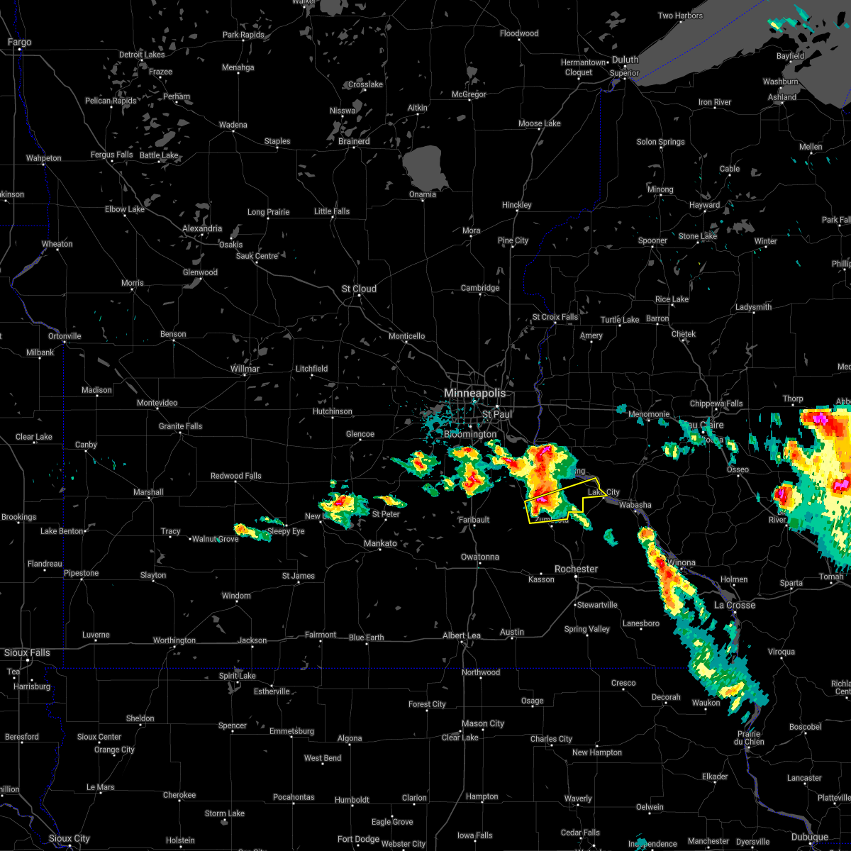
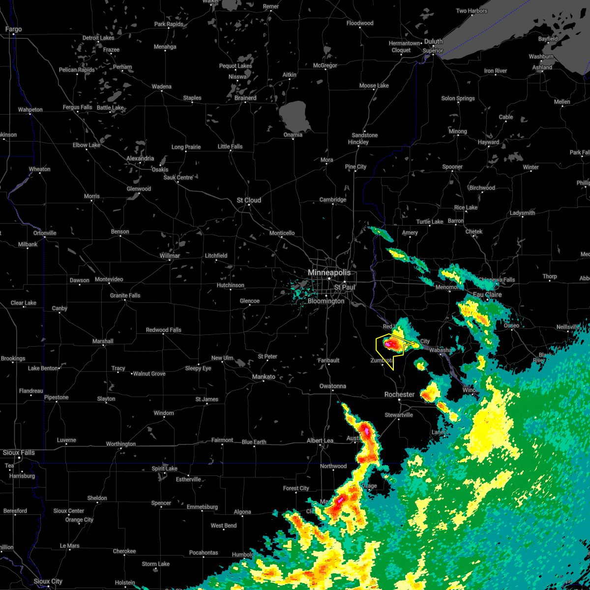
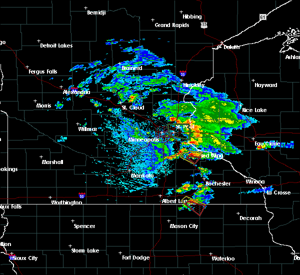
| 8/8/2020 5:46 PM CDT |
 At 545 pm cdt, a severe thunderstorm was located over bay city, or near red wing, moving northeast at 30 mph (radar indicated). Hazards include 70 mph wind gusts. Expect considerable tree damage. damage is likely to mobile homes, roofs, and outbuildings. Locations impacted include, red wing, goodhue, welch, bay city, stockholm, frontenac, vasa, diamond bluff, wacouta, central point, esdaile and red wing airport. At 545 pm cdt, a severe thunderstorm was located over bay city, or near red wing, moving northeast at 30 mph (radar indicated). Hazards include 70 mph wind gusts. Expect considerable tree damage. damage is likely to mobile homes, roofs, and outbuildings. Locations impacted include, red wing, goodhue, welch, bay city, stockholm, frontenac, vasa, diamond bluff, wacouta, central point, esdaile and red wing airport.
|
| 8/8/2020 5:46 PM CDT |
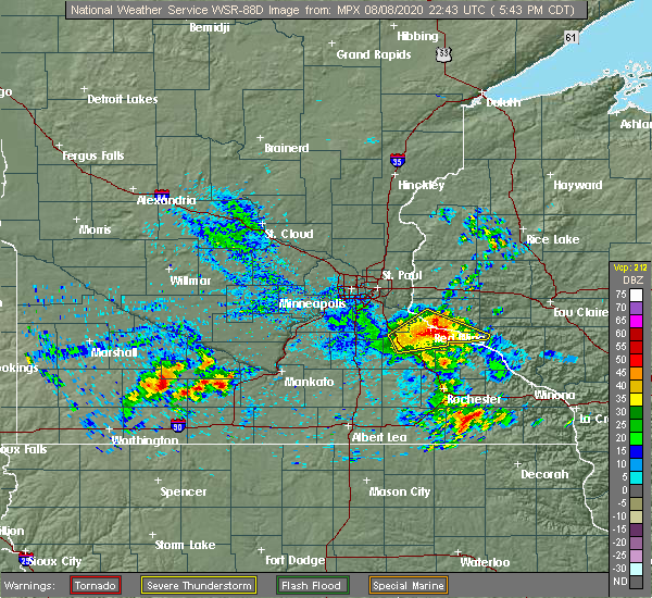 At 545 pm cdt, a severe thunderstorm was located over bay city, or near red wing, moving northeast at 30 mph (radar indicated). Hazards include 70 mph wind gusts. Expect considerable tree damage. damage is likely to mobile homes, roofs, and outbuildings. Locations impacted include, red wing, goodhue, welch, bay city, stockholm, frontenac, vasa, diamond bluff, wacouta, central point, esdaile and red wing airport. At 545 pm cdt, a severe thunderstorm was located over bay city, or near red wing, moving northeast at 30 mph (radar indicated). Hazards include 70 mph wind gusts. Expect considerable tree damage. damage is likely to mobile homes, roofs, and outbuildings. Locations impacted include, red wing, goodhue, welch, bay city, stockholm, frontenac, vasa, diamond bluff, wacouta, central point, esdaile and red wing airport.
|
| 8/8/2020 5:35 PM CDT |
 At 535 pm cdt, a severe thunderstorm was located over red wing, moving northeast at 30 mph (radar indicated). Hazards include 70 mph wind gusts. Expect considerable tree damage. damage is likely to mobile homes, roofs, and outbuildings. Locations impacted include, red wing, cannon falls, goodhue, welch, bay city, stockholm, frontenac, vasa, diamond bluff, wacouta, miesville and wastedo. At 535 pm cdt, a severe thunderstorm was located over red wing, moving northeast at 30 mph (radar indicated). Hazards include 70 mph wind gusts. Expect considerable tree damage. damage is likely to mobile homes, roofs, and outbuildings. Locations impacted include, red wing, cannon falls, goodhue, welch, bay city, stockholm, frontenac, vasa, diamond bluff, wacouta, miesville and wastedo.
|
| 8/8/2020 5:25 PM CDT |
 At 525 pm cdt, a severe thunderstorm was located near welch, or 8 miles west of red wing, moving northeast at 30 mph (radar indicated). Hazards include 60 mph wind gusts. expect damage to roofs, siding, and trees At 525 pm cdt, a severe thunderstorm was located near welch, or 8 miles west of red wing, moving northeast at 30 mph (radar indicated). Hazards include 60 mph wind gusts. expect damage to roofs, siding, and trees
|
| 9/24/2019 7:34 PM CDT |
 At 734 pm cdt, a severe thunderstorm was located near kenyon, or 14 miles northwest of mantorville, moving east at 45 mph (radar indicated). Hazards include 70 mph wind gusts. Expect considerable tree damage. damage is likely to mobile homes, roofs, and outbuildings. this severe thunderstorm will be near, wanamingo around 745 pm cdt. zumbrota around 750 pm cdt. Pine island and goodhue around 755 pm cdt. At 734 pm cdt, a severe thunderstorm was located near kenyon, or 14 miles northwest of mantorville, moving east at 45 mph (radar indicated). Hazards include 70 mph wind gusts. Expect considerable tree damage. damage is likely to mobile homes, roofs, and outbuildings. this severe thunderstorm will be near, wanamingo around 745 pm cdt. zumbrota around 750 pm cdt. Pine island and goodhue around 755 pm cdt.
|
| 8/13/2019 5:58 PM CDT |
 At 558 pm cdt, a severe thunderstorm capable of producing a tornado was located near goodhue, or 10 miles southwest of red wing, moving southeast at 25 mph (weather spotters reported a funnel cloud). Hazards include tornado. Flying debris will be dangerous to those caught without shelter. mobile homes will be damaged or destroyed. damage to roofs, windows, and vehicles will occur. tree damage is likely. This dangerous storm will be near, goodhue around 605 pm cdt. At 558 pm cdt, a severe thunderstorm capable of producing a tornado was located near goodhue, or 10 miles southwest of red wing, moving southeast at 25 mph (weather spotters reported a funnel cloud). Hazards include tornado. Flying debris will be dangerous to those caught without shelter. mobile homes will be damaged or destroyed. damage to roofs, windows, and vehicles will occur. tree damage is likely. This dangerous storm will be near, goodhue around 605 pm cdt.
|
| 8/13/2019 5:52 PM CDT |
 At 552 pm cdt, a severe thunderstorm was located near goodhue, or 11 miles southwest of red wing, moving southeast at 25 mph (radar indicated). Hazards include 60 mph wind gusts and quarter size hail. Hail damage to vehicles is expected. expect wind damage to roofs, siding, and trees. Locations impacted include, goodhue, welch and vasa. At 552 pm cdt, a severe thunderstorm was located near goodhue, or 11 miles southwest of red wing, moving southeast at 25 mph (radar indicated). Hazards include 60 mph wind gusts and quarter size hail. Hail damage to vehicles is expected. expect wind damage to roofs, siding, and trees. Locations impacted include, goodhue, welch and vasa.
|
| 8/13/2019 5:48 PM CDT |
 At 548 pm cdt, a severe thunderstorm capable of producing a tornado was located 7 miles northwest of goodhue, or 12 miles southwest of red wing, moving east at 30 mph (weather spotters reported a funnel cloud). Hazards include tornado. Flying debris will be dangerous to those caught without shelter. mobile homes will be damaged or destroyed. damage to roofs, windows, and vehicles will occur. tree damage is likely. This dangerous storm will be near, goodhue around 605 pm cdt. At 548 pm cdt, a severe thunderstorm capable of producing a tornado was located 7 miles northwest of goodhue, or 12 miles southwest of red wing, moving east at 30 mph (weather spotters reported a funnel cloud). Hazards include tornado. Flying debris will be dangerous to those caught without shelter. mobile homes will be damaged or destroyed. damage to roofs, windows, and vehicles will occur. tree damage is likely. This dangerous storm will be near, goodhue around 605 pm cdt.
|
| 8/13/2019 5:44 PM CDT |
 At 544 pm cdt, a severe thunderstorm capable of producing a tornado was located near cannon falls, or 13 miles southwest of red wing, moving southeast at 25 mph (radar indicated rotation). Hazards include tornado. Flying debris will be dangerous to those caught without shelter. mobile homes will be damaged or destroyed. damage to roofs, windows, and vehicles will occur. tree damage is likely. This dangerous storm will be near, goodhue around 610 pm cdt. At 544 pm cdt, a severe thunderstorm capable of producing a tornado was located near cannon falls, or 13 miles southwest of red wing, moving southeast at 25 mph (radar indicated rotation). Hazards include tornado. Flying debris will be dangerous to those caught without shelter. mobile homes will be damaged or destroyed. damage to roofs, windows, and vehicles will occur. tree damage is likely. This dangerous storm will be near, goodhue around 610 pm cdt.
|
| 8/13/2019 5:33 PM CDT |
 At 533 pm cdt, a severe thunderstorm was located over cannon falls, or 15 miles west of red wing, moving southeast at 25 mph (radar indicated). Hazards include 60 mph wind gusts and quarter size hail. Hail damage to vehicles is expected. Expect wind damage to roofs, siding, and trees. At 533 pm cdt, a severe thunderstorm was located over cannon falls, or 15 miles west of red wing, moving southeast at 25 mph (radar indicated). Hazards include 60 mph wind gusts and quarter size hail. Hail damage to vehicles is expected. Expect wind damage to roofs, siding, and trees.
|
| 8/5/2019 5:19 PM CDT |
 The national weather service in the twin cities has issued a * severe thunderstorm warning for. southeastern dakota county in east central minnesota. goodhue county in southeastern minnesota. northeastern rice county in south central minnesota. Until 600 pm cdt. The national weather service in the twin cities has issued a * severe thunderstorm warning for. southeastern dakota county in east central minnesota. goodhue county in southeastern minnesota. northeastern rice county in south central minnesota. Until 600 pm cdt.
|
| 7/20/2019 11:35 AM CDT |
 At 1123 am cdt, a severe thunderstorm was located over goodhue, or 13 miles southwest of red wing, moving east at 55 mph (radar indicated). Hazards include 60 mph wind gusts and penny size hail. Expect damage to roofs, siding, and trees. Locations impacted include, red wing, cannon falls, ellsworth, pine island, zumbrota, kenyon, goodhue, stanton, wanamingo, welch, bay city and frontenac. At 1123 am cdt, a severe thunderstorm was located over goodhue, or 13 miles southwest of red wing, moving east at 55 mph (radar indicated). Hazards include 60 mph wind gusts and penny size hail. Expect damage to roofs, siding, and trees. Locations impacted include, red wing, cannon falls, ellsworth, pine island, zumbrota, kenyon, goodhue, stanton, wanamingo, welch, bay city and frontenac.
|
| 7/20/2019 11:35 AM CDT |
 The severe thunderstorm warning for goodhue and southwestern pierce counties will expire at 1145 am cdt, the storm which prompted the warning has moved out of the area. therefore, the warning will be allowed to expire. a severe thunderstorm watch remains in effect until 400 pm cdt for south central and southeastern minnesota, and west central wisconsin. The severe thunderstorm warning for goodhue and southwestern pierce counties will expire at 1145 am cdt, the storm which prompted the warning has moved out of the area. therefore, the warning will be allowed to expire. a severe thunderstorm watch remains in effect until 400 pm cdt for south central and southeastern minnesota, and west central wisconsin.
|
| 7/20/2019 11:23 AM CDT |
 At 1123 am cdt, a severe thunderstorm was located over goodhue, or 13 miles southwest of red wing, moving east at 55 mph (radar indicated). Hazards include 60 mph wind gusts and penny size hail. Expect damage to roofs, siding, and trees. Locations impacted include, red wing, cannon falls, ellsworth, pine island, zumbrota, kenyon, goodhue, stanton, wanamingo, welch, bay city and frontenac. At 1123 am cdt, a severe thunderstorm was located over goodhue, or 13 miles southwest of red wing, moving east at 55 mph (radar indicated). Hazards include 60 mph wind gusts and penny size hail. Expect damage to roofs, siding, and trees. Locations impacted include, red wing, cannon falls, ellsworth, pine island, zumbrota, kenyon, goodhue, stanton, wanamingo, welch, bay city and frontenac.
|
| 7/20/2019 10:58 AM CDT |
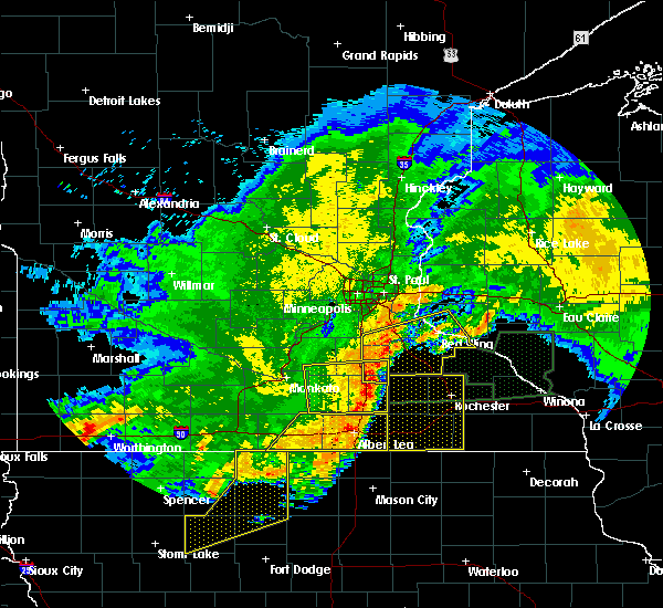 At 1057 am cdt, a line of severe thunderstorm was located near nerstrand, or near northfield, moving east at 55 mph. these thunderstorms have a history of producing wind damage and gusts in excess of 60 mph (radar indicated). Hazards include 60 mph wind gusts and penny size hail. expect damage to roofs, siding, and trees At 1057 am cdt, a line of severe thunderstorm was located near nerstrand, or near northfield, moving east at 55 mph. these thunderstorms have a history of producing wind damage and gusts in excess of 60 mph (radar indicated). Hazards include 60 mph wind gusts and penny size hail. expect damage to roofs, siding, and trees
|
| 7/18/2019 7:49 PM CDT |
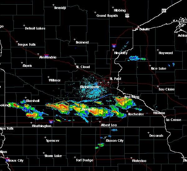 At 749 pm cdt, a severe thunderstorm was located near goodhue, or 14 miles southwest of red wing, moving east at 30 mph (radar indicated). Hazards include 60 mph wind gusts and nickel size hail. Expect damage to roofs, siding, and trees. this severe storm will be near, goodhue around 800 pm cdt. Other locations impacted by this severe thunderstorm include hader. At 749 pm cdt, a severe thunderstorm was located near goodhue, or 14 miles southwest of red wing, moving east at 30 mph (radar indicated). Hazards include 60 mph wind gusts and nickel size hail. Expect damage to roofs, siding, and trees. this severe storm will be near, goodhue around 800 pm cdt. Other locations impacted by this severe thunderstorm include hader.
|
| 7/18/2019 7:30 PM CDT |
 At 729 pm cdt, a severe thunderstorm was located near nerstrand, or 12 miles east of northfield, moving northeast at 40 mph (radar indicated). Hazards include 60 mph wind gusts and nickel size hail. Expect damage to roofs, siding, and trees. this severe storm will be near, cannon falls around 740 pm cdt. Other locations impacted by this severe thunderstorm include wastedo, hader, lake byllesby and bombay. At 729 pm cdt, a severe thunderstorm was located near nerstrand, or 12 miles east of northfield, moving northeast at 40 mph (radar indicated). Hazards include 60 mph wind gusts and nickel size hail. Expect damage to roofs, siding, and trees. this severe storm will be near, cannon falls around 740 pm cdt. Other locations impacted by this severe thunderstorm include wastedo, hader, lake byllesby and bombay.
|
| 7/18/2019 7:19 PM CDT |
 At 719 pm cdt, a severe thunderstorm was located over nerstrand, or 11 miles southeast of northfield, moving northeast at 40 mph (radar indicated). Hazards include 60 mph wind gusts and half dollar size hail. Hail damage to vehicles is expected. expect wind damage to roofs, siding, and trees. this severe thunderstorm will be near, stanton around 730 pm cdt. cannon falls around 740 pm cdt. Other locations impacted by this severe thunderstorm include wastedo, hader, lake byllesby and bombay. At 719 pm cdt, a severe thunderstorm was located over nerstrand, or 11 miles southeast of northfield, moving northeast at 40 mph (radar indicated). Hazards include 60 mph wind gusts and half dollar size hail. Hail damage to vehicles is expected. expect wind damage to roofs, siding, and trees. this severe thunderstorm will be near, stanton around 730 pm cdt. cannon falls around 740 pm cdt. Other locations impacted by this severe thunderstorm include wastedo, hader, lake byllesby and bombay.
|
| 7/15/2019 8:26 PM CDT |
 The severe thunderstorm warning for northwestern goodhue and southeastern rice counties will expire at 830 pm cdt, the storms which prompted the warning have weakened below severe limits, and no longer pose an immediate threat to life or property. therefore, the warning will be allowed to expire. however heavy rain is still possible with these thunderstorms. a severe thunderstorm watch remains in effect until 1000 pm cdt for south central, southeastern and east central minnesota. to report severe weather, contact your nearest law enforcement agency. they will relay your report to the national weather service the twin cities. The severe thunderstorm warning for northwestern goodhue and southeastern rice counties will expire at 830 pm cdt, the storms which prompted the warning have weakened below severe limits, and no longer pose an immediate threat to life or property. therefore, the warning will be allowed to expire. however heavy rain is still possible with these thunderstorms. a severe thunderstorm watch remains in effect until 1000 pm cdt for south central, southeastern and east central minnesota. to report severe weather, contact your nearest law enforcement agency. they will relay your report to the national weather service the twin cities.
|
| 7/15/2019 8:02 PM CDT |
 At 802 pm cdt, severe thunderstorms were located along a line extending from near welch to near nerstrand, moving southeast at 25 mph (radar indicated). Hazards include 60 mph wind gusts and quarter size hail. Hail damage to vehicles is expected. expect wind damage to roofs, siding, and trees. Locations impacted include, faribault, northfield, red wing, cannon falls, kenyon, dundas, goodhue, stanton, wanamingo, welch, nerstrand and bridgewater. At 802 pm cdt, severe thunderstorms were located along a line extending from near welch to near nerstrand, moving southeast at 25 mph (radar indicated). Hazards include 60 mph wind gusts and quarter size hail. Hail damage to vehicles is expected. expect wind damage to roofs, siding, and trees. Locations impacted include, faribault, northfield, red wing, cannon falls, kenyon, dundas, goodhue, stanton, wanamingo, welch, nerstrand and bridgewater.
|
| 7/15/2019 7:42 PM CDT |
 At 742 pm cdt, severe thunderstorms were located along a line extending from near cannon falls to near dundas, moving southeast at 20 mph (radar indicated). Hazards include 60 mph wind gusts and quarter size hail. Hail damage to vehicles is expected. Expect wind damage to roofs, siding, and trees. At 742 pm cdt, severe thunderstorms were located along a line extending from near cannon falls to near dundas, moving southeast at 20 mph (radar indicated). Hazards include 60 mph wind gusts and quarter size hail. Hail damage to vehicles is expected. Expect wind damage to roofs, siding, and trees.
|
| 7/1/2019 1:10 AM CDT |
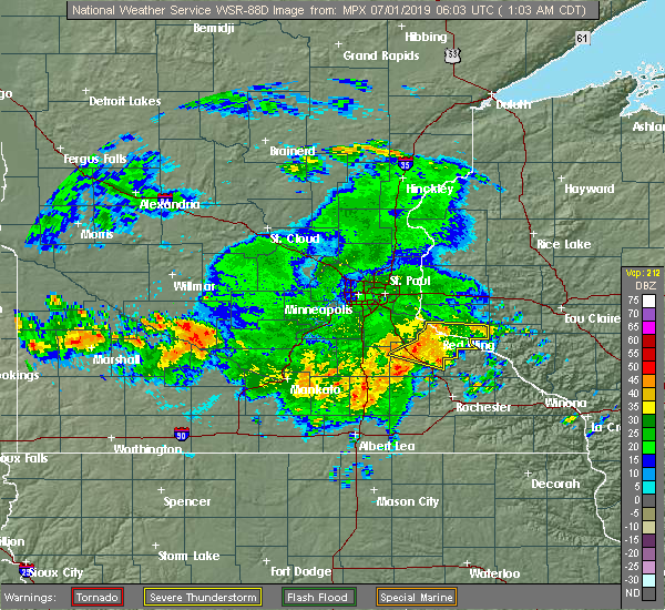 The severe thunderstorm warning for southeastern goodhue county will expire at 115 am cdt, the storms which prompted the warning have weakened below severe limits, and have exited the warned area. therefore, the warning will be allowed to expire. however heavy rain is still possible with these thunderstorms. a severe thunderstorm watch remains in effect until 400 am cdt for southeastern minnesota. to report severe weather, contact your nearest law enforcement agency. they will relay your report to the national weather service the twin cities. The severe thunderstorm warning for southeastern goodhue county will expire at 115 am cdt, the storms which prompted the warning have weakened below severe limits, and have exited the warned area. therefore, the warning will be allowed to expire. however heavy rain is still possible with these thunderstorms. a severe thunderstorm watch remains in effect until 400 am cdt for southeastern minnesota. to report severe weather, contact your nearest law enforcement agency. they will relay your report to the national weather service the twin cities.
|
| 7/1/2019 1:04 AM CDT |
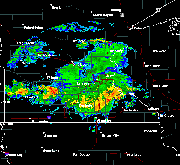 At 104 am cdt, severe thunderstorms were located along a line extending from near bay city to near frontenac to near goodhue, moving east at 60 mph (radar indicated). Hazards include 60 mph wind gusts. Expect damage to roofs, siding, and trees. These severe thunderstorms will remain over mainly rural areas of southeastern goodhue county, including the following locations, frontenac state park, bellechester, central point and wacouta. At 104 am cdt, severe thunderstorms were located along a line extending from near bay city to near frontenac to near goodhue, moving east at 60 mph (radar indicated). Hazards include 60 mph wind gusts. Expect damage to roofs, siding, and trees. These severe thunderstorms will remain over mainly rural areas of southeastern goodhue county, including the following locations, frontenac state park, bellechester, central point and wacouta.
|
| 7/1/2019 12:52 AM CDT |
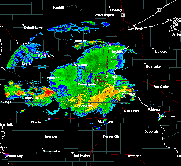 At 1252 am cdt, severe thunderstorms were located along a line extending from near red wing to near welch to 6 miles north of wanamingo, moving east at 50 mph (radar indicated). Hazards include 60 mph wind gusts. Expect damage to roofs, siding, and trees. these severe storms will be near, red wing around 1255 am cdt. zumbrota, goodhue and bay city around 100 am cdt. frontenac around 110 am cdt. Plum city around 115 am cdt. At 1252 am cdt, severe thunderstorms were located along a line extending from near red wing to near welch to 6 miles north of wanamingo, moving east at 50 mph (radar indicated). Hazards include 60 mph wind gusts. Expect damage to roofs, siding, and trees. these severe storms will be near, red wing around 1255 am cdt. zumbrota, goodhue and bay city around 100 am cdt. frontenac around 110 am cdt. Plum city around 115 am cdt.
|
| 7/1/2019 12:42 AM CDT |
 At 1241 am cdt, severe thunderstorms were located along a line extending from near hastings to near cannon falls to near stanton, moving east at 60 mph (radar indicated). Hazards include 60 mph wind gusts. Expect damage to roofs, siding, and trees. severe thunderstorms will be near, welch around 1250 am cdt. red wing and zumbrota around 1255 am cdt. goodhue and bay city around 100 am cdt. frontenac around 105 am cdt. plum city around 110 am cdt. This includes treasure island casino. At 1241 am cdt, severe thunderstorms were located along a line extending from near hastings to near cannon falls to near stanton, moving east at 60 mph (radar indicated). Hazards include 60 mph wind gusts. Expect damage to roofs, siding, and trees. severe thunderstorms will be near, welch around 1250 am cdt. red wing and zumbrota around 1255 am cdt. goodhue and bay city around 100 am cdt. frontenac around 105 am cdt. plum city around 110 am cdt. This includes treasure island casino.
|
| 6/4/2019 5:11 PM CDT |
 At 510 pm cdt, a severe thunderstorm was located near nerstrand, or 11 miles east of faribault, moving southeast at 50 mph (trained weather spotters). Hazards include 70 mph wind gusts and penny size hail. Expect considerable tree damage. Damage is likely to mobile homes, roofs, and outbuildings. At 510 pm cdt, a severe thunderstorm was located near nerstrand, or 11 miles east of faribault, moving southeast at 50 mph (trained weather spotters). Hazards include 70 mph wind gusts and penny size hail. Expect considerable tree damage. Damage is likely to mobile homes, roofs, and outbuildings.
|
| 9/20/2018 7:05 PM CDT |
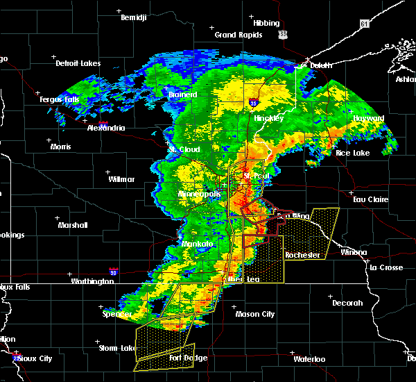 At 705 pm cdt, severe thunderstorms capable of producing tornadoes were located along a line extending from wanamingo to near berne, moving east at 55 mph (radar indicated rotation). Hazards include tornado. Flying debris will be dangerous to those caught without shelter. mobile homes will be damaged or destroyed. damage to roofs, windows, and vehicles will occur. tree damage is likely. these dangerous storms will be near, pine island and zumbrota around 710 pm cdt. goodhue around 715 pm cdt. Other locations impacted by these tornadic storms include hader and bellechester. At 705 pm cdt, severe thunderstorms capable of producing tornadoes were located along a line extending from wanamingo to near berne, moving east at 55 mph (radar indicated rotation). Hazards include tornado. Flying debris will be dangerous to those caught without shelter. mobile homes will be damaged or destroyed. damage to roofs, windows, and vehicles will occur. tree damage is likely. these dangerous storms will be near, pine island and zumbrota around 710 pm cdt. goodhue around 715 pm cdt. Other locations impacted by these tornadic storms include hader and bellechester.
|
| 9/20/2018 6:53 PM CDT |
 At 653 pm cdt, a severe thunderstorm capable of producing a tornado was located over west concord, or 10 miles northwest of dodge center, moving east at 60 mph (radar indicated rotation). Hazards include tornado. Flying debris will be dangerous to those caught without shelter. mobile homes will be damaged or destroyed. damage to roofs, windows, and vehicles will occur. tree damage is likely. this dangerous storm will be near, wanamingo around 705 pm cdt. pine island and zumbrota around 710 pm cdt. Other locations impacted by this tornadic thunderstorm include hader, bombay and bellechester. At 653 pm cdt, a severe thunderstorm capable of producing a tornado was located over west concord, or 10 miles northwest of dodge center, moving east at 60 mph (radar indicated rotation). Hazards include tornado. Flying debris will be dangerous to those caught without shelter. mobile homes will be damaged or destroyed. damage to roofs, windows, and vehicles will occur. tree damage is likely. this dangerous storm will be near, wanamingo around 705 pm cdt. pine island and zumbrota around 710 pm cdt. Other locations impacted by this tornadic thunderstorm include hader, bombay and bellechester.
|
| 9/20/2018 6:45 PM CDT |
 At 645 pm cdt, a confirmed tornado was located over ruskin, or near faribault, moving northeast at 65 mph (radar confirmed tornado). Hazards include damaging tornado. Flying debris will be dangerous to those caught without shelter. mobile homes will be damaged or destroyed. damage to roofs, windows, and vehicles will occur. tree damage is likely. this tornado will be near, kenyon and nerstrand around 650 pm cdt. wanamingo around 700 pm cdt. goodhue around 710 pm cdt. Other locations impacted by this tornadic thunderstorm include bellechester, merton, ruskin, hader, bombay and moland. At 645 pm cdt, a confirmed tornado was located over ruskin, or near faribault, moving northeast at 65 mph (radar confirmed tornado). Hazards include damaging tornado. Flying debris will be dangerous to those caught without shelter. mobile homes will be damaged or destroyed. damage to roofs, windows, and vehicles will occur. tree damage is likely. this tornado will be near, kenyon and nerstrand around 650 pm cdt. wanamingo around 700 pm cdt. goodhue around 710 pm cdt. Other locations impacted by this tornadic thunderstorm include bellechester, merton, ruskin, hader, bombay and moland.
|
| 9/20/2018 6:40 PM CDT |
 At 640 pm cdt, a severe thunderstorm capable of producing a tornado was located over medford, or 7 miles south of faribault, moving east at 70 mph (radar indicated rotation). Hazards include tornado. Flying debris will be dangerous to those caught without shelter. mobile homes will be damaged or destroyed. damage to roofs, windows, and vehicles will occur. tree damage is likely. this dangerous storm will be near, kenyon and nerstrand around 650 pm cdt. wanamingo around 700 pm cdt. pine island and zumbrota around 705 pm cdt. goodhue around 710 pm cdt. other locations impacted by this tornadic thunderstorm include clinton falls, bellechester, merton, ruskin, bombay, hader, owatonna airport and moland. This includes interstate 35 between mile markers 43 and 55. At 640 pm cdt, a severe thunderstorm capable of producing a tornado was located over medford, or 7 miles south of faribault, moving east at 70 mph (radar indicated rotation). Hazards include tornado. Flying debris will be dangerous to those caught without shelter. mobile homes will be damaged or destroyed. damage to roofs, windows, and vehicles will occur. tree damage is likely. this dangerous storm will be near, kenyon and nerstrand around 650 pm cdt. wanamingo around 700 pm cdt. pine island and zumbrota around 705 pm cdt. goodhue around 710 pm cdt. other locations impacted by this tornadic thunderstorm include clinton falls, bellechester, merton, ruskin, bombay, hader, owatonna airport and moland. This includes interstate 35 between mile markers 43 and 55.
|
| 9/17/2018 2:54 PM CDT |
 The severe thunderstorm warning for southeastern dakota, goodhue, southeastern rice and southwestern pierce counties will expire at 300 pm cdt, the storms which prompted the warning have weakened below severe limits, and have exited the warned area. therefore, the warning will be allowed to expire. however gusty winds are still possible with these thunderstorms. The severe thunderstorm warning for southeastern dakota, goodhue, southeastern rice and southwestern pierce counties will expire at 300 pm cdt, the storms which prompted the warning have weakened below severe limits, and have exited the warned area. therefore, the warning will be allowed to expire. however gusty winds are still possible with these thunderstorms.
|
| 9/17/2018 2:47 PM CDT |
 At 246 pm cdt, severe thunderstorms were located along a line extending from near martel to wanamingo, moving east at 45 mph (law enforcement). Hazards include 60 mph wind gusts. Expect damage to roofs, siding, and trees. Locations impacted include, red wing, hastings, prescott, cannon falls, pine island, zumbrota, kenyon, goodhue, stanton, wanamingo, welch and bay city. At 246 pm cdt, severe thunderstorms were located along a line extending from near martel to wanamingo, moving east at 45 mph (law enforcement). Hazards include 60 mph wind gusts. Expect damage to roofs, siding, and trees. Locations impacted include, red wing, hastings, prescott, cannon falls, pine island, zumbrota, kenyon, goodhue, stanton, wanamingo, welch and bay city.
|
| 9/17/2018 2:32 PM CDT |
 At 232 pm cdt, severe thunderstorms were located along a line extending from river falls to near nerstrand, moving east at 45 mph (law enforcement). Hazards include 60 mph wind gusts. Expect damage to roofs, siding, and trees. locations impacted include, faribault, northfield, red wing, woodbury, cottage grove, inver grove heights, hastings, rosemount, farmington, south st. paul, st. Paul park and prescott. At 232 pm cdt, severe thunderstorms were located along a line extending from river falls to near nerstrand, moving east at 45 mph (law enforcement). Hazards include 60 mph wind gusts. Expect damage to roofs, siding, and trees. locations impacted include, faribault, northfield, red wing, woodbury, cottage grove, inver grove heights, hastings, rosemount, farmington, south st. paul, st. Paul park and prescott.
|
| 9/17/2018 2:17 PM CDT |
 At 216 pm cdt, severe thunderstorms were located along a line extending from afton state park to near dundas, moving east at 45 mph (law enforcement). Hazards include 60 mph wind gusts. expect damage to roofs, siding, and trees At 216 pm cdt, severe thunderstorms were located along a line extending from afton state park to near dundas, moving east at 45 mph (law enforcement). Hazards include 60 mph wind gusts. expect damage to roofs, siding, and trees
|
| 8/27/2018 5:52 PM CDT |
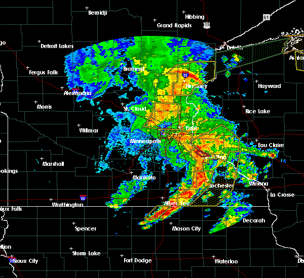 At 552 pm cdt, a severe thunderstorm was located over hager city, or near red wing, moving northeast at 55 mph (radar indicated). Hazards include 60 mph wind gusts. Expect damage to roofs, siding, and trees. Locations impacted include, red wing, pine island, zumbrota, goodhue, welch, frontenac, vasa, wacouta, bellechester, miesville, frontenac state park and central point. At 552 pm cdt, a severe thunderstorm was located over hager city, or near red wing, moving northeast at 55 mph (radar indicated). Hazards include 60 mph wind gusts. Expect damage to roofs, siding, and trees. Locations impacted include, red wing, pine island, zumbrota, goodhue, welch, frontenac, vasa, wacouta, bellechester, miesville, frontenac state park and central point.
|
| 8/27/2018 5:42 PM CDT |
 At 542 pm cdt, a severe thunderstorm was located over welch, or near red wing, moving northeast at 55 mph (radar indicated). Hazards include 60 mph wind gusts. Expect damage to roofs, siding, and trees. This severe thunderstorm will remain over mainly rural areas of goodhue county, including the following locations, vasa, bellechester, wacouta, frontenac state park, central point, hader and miesville. At 542 pm cdt, a severe thunderstorm was located over welch, or near red wing, moving northeast at 55 mph (radar indicated). Hazards include 60 mph wind gusts. Expect damage to roofs, siding, and trees. This severe thunderstorm will remain over mainly rural areas of goodhue county, including the following locations, vasa, bellechester, wacouta, frontenac state park, central point, hader and miesville.
|
| 8/27/2018 5:32 PM CDT |
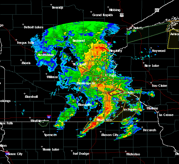 At 531 pm cdt, a severe thunderstorm was located over wastedo, or 16 miles east of northfield, moving northeast at 55 mph (radar indicated). Hazards include 60 mph wind gusts. Expect damage to roofs, siding, and trees. this severe storm will be near, welch around 545 pm cdt. red wing around 550 pm cdt. Other locations impacted by this severe thunderstorm include vasa, bellechester, bombay, wacouta, frontenac state park, wastedo, central point, hader, lake byllesby and miesville. At 531 pm cdt, a severe thunderstorm was located over wastedo, or 16 miles east of northfield, moving northeast at 55 mph (radar indicated). Hazards include 60 mph wind gusts. Expect damage to roofs, siding, and trees. this severe storm will be near, welch around 545 pm cdt. red wing around 550 pm cdt. Other locations impacted by this severe thunderstorm include vasa, bellechester, bombay, wacouta, frontenac state park, wastedo, central point, hader, lake byllesby and miesville.
|
| 8/27/2018 5:24 PM CDT |
 At 524 pm cdt, a severe thunderstorm was located near wastedo, or 11 miles southeast of northfield, moving northeast at 50 mph (radar indicated). Hazards include 60 mph wind gusts. Expect damage to roofs, siding, and trees. this severe storm will be near, cannon falls around 535 pm cdt. goodhue around 540 pm cdt. welch around 545 pm cdt. red wing around 550 pm cdt. Other locations impacted by this severe thunderstorm include vasa, bellechester, ruskin, bombay, wacouta, frontenac state park, wastedo, central point, hader and lake byllesby. At 524 pm cdt, a severe thunderstorm was located near wastedo, or 11 miles southeast of northfield, moving northeast at 50 mph (radar indicated). Hazards include 60 mph wind gusts. Expect damage to roofs, siding, and trees. this severe storm will be near, cannon falls around 535 pm cdt. goodhue around 540 pm cdt. welch around 545 pm cdt. red wing around 550 pm cdt. Other locations impacted by this severe thunderstorm include vasa, bellechester, ruskin, bombay, wacouta, frontenac state park, wastedo, central point, hader and lake byllesby.
|
| 8/27/2018 5:23 PM CDT |
 At 522 pm cdt, a severe thunderstorm capable of producing a tornado was located east of nerstrand in goodhue county, or 11 miles southeast of northfield, moving northeast at 55 mph (radar indicated rotation). Hazards include tornado. Flying debris will be dangerous to those caught without shelter. mobile homes will be damaged or destroyed. damage to roofs, windows, and vehicles will occur. tree damage is likely. this dangerous storm will be near, welch around 545 pm cdt. red wing around 550 pm cdt. Other locations impacted by this tornadic thunderstorm include hader, vasa and wastedo. At 522 pm cdt, a severe thunderstorm capable of producing a tornado was located east of nerstrand in goodhue county, or 11 miles southeast of northfield, moving northeast at 55 mph (radar indicated rotation). Hazards include tornado. Flying debris will be dangerous to those caught without shelter. mobile homes will be damaged or destroyed. damage to roofs, windows, and vehicles will occur. tree damage is likely. this dangerous storm will be near, welch around 545 pm cdt. red wing around 550 pm cdt. Other locations impacted by this tornadic thunderstorm include hader, vasa and wastedo.
|
| 8/27/2018 5:16 PM CDT |
 At 516 pm cdt, a severe thunderstorm capable of producing a tornado was located over nerstrand, or 8 miles southeast of northfield, moving northeast at 55 mph (radar indicated rotation). Hazards include tornado. Flying debris will be dangerous to those caught without shelter. mobile homes will be damaged or destroyed. damage to roofs, windows, and vehicles will occur. tree damage is likely. this dangerous storm will be near, cannon falls around 530 pm cdt. welch around 540 pm cdt. red wing around 545 pm cdt. other locations impacted by this tornadic thunderstorm include hader, vasa and wastedo. This includes treasure island casino. At 516 pm cdt, a severe thunderstorm capable of producing a tornado was located over nerstrand, or 8 miles southeast of northfield, moving northeast at 55 mph (radar indicated rotation). Hazards include tornado. Flying debris will be dangerous to those caught without shelter. mobile homes will be damaged or destroyed. damage to roofs, windows, and vehicles will occur. tree damage is likely. this dangerous storm will be near, cannon falls around 530 pm cdt. welch around 540 pm cdt. red wing around 545 pm cdt. other locations impacted by this tornadic thunderstorm include hader, vasa and wastedo. This includes treasure island casino.
|
| 8/27/2018 5:05 PM CDT |
 At 505 pm cdt, a severe thunderstorm was located over faribault, moving northeast at 55 mph (radar indicated). Hazards include 60 mph wind gusts. Expect damage to roofs, siding, and trees. this severe thunderstorm will be near, dundas around 515 pm cdt. northfield and nerstrand around 520 pm cdt. stanton around 525 pm cdt. cannon falls around 535 pm cdt. welch around 545 pm cdt. red wing around 550 pm cdt. other locations impacted by this severe thunderstorm include wacouta, bridgewater, wastedo, central point, lake byllesby, vasa, bellechester, ruskin, faribault airport and bombay. This includes treasure island casino. At 505 pm cdt, a severe thunderstorm was located over faribault, moving northeast at 55 mph (radar indicated). Hazards include 60 mph wind gusts. Expect damage to roofs, siding, and trees. this severe thunderstorm will be near, dundas around 515 pm cdt. northfield and nerstrand around 520 pm cdt. stanton around 525 pm cdt. cannon falls around 535 pm cdt. welch around 545 pm cdt. red wing around 550 pm cdt. other locations impacted by this severe thunderstorm include wacouta, bridgewater, wastedo, central point, lake byllesby, vasa, bellechester, ruskin, faribault airport and bombay. This includes treasure island casino.
|
| 7/12/2018 8:40 PM CDT |
 The severe thunderstorm warning for southeastern goodhue county will expire at 845 pm cdt, the storms which prompted the warning have weakened below severe limits, and have exited the warned area. therefore, the warning will be allowed to expire. however gusty winds and heavy rain are still possible with these thunderstorms. a severe thunderstorm watch remains in effect until midnight cdt for southeastern minnesota, and west central wisconsin. The severe thunderstorm warning for southeastern goodhue county will expire at 845 pm cdt, the storms which prompted the warning have weakened below severe limits, and have exited the warned area. therefore, the warning will be allowed to expire. however gusty winds and heavy rain are still possible with these thunderstorms. a severe thunderstorm watch remains in effect until midnight cdt for southeastern minnesota, and west central wisconsin.
|
| 7/12/2018 8:27 PM CDT |
 At 827 pm cdt, severe thunderstorms were located along a line extending from near red wing to near pine island, moving east at 40 mph (radar indicated). Hazards include 60 mph wind gusts. Expect damage to roofs, siding, and trees. Locations impacted include, pine island, zumbrota, goodhue, wanamingo, bellechester and central point. At 827 pm cdt, severe thunderstorms were located along a line extending from near red wing to near pine island, moving east at 40 mph (radar indicated). Hazards include 60 mph wind gusts. Expect damage to roofs, siding, and trees. Locations impacted include, pine island, zumbrota, goodhue, wanamingo, bellechester and central point.
|
| 7/12/2018 8:12 PM CDT |
 At 812 pm cdt, severe thunderstorms were located along a line extending from vasa to near bombay, moving east at 35 mph (radar indicated). Hazards include 60 mph wind gusts. expect damage to roofs, siding, and trees At 812 pm cdt, severe thunderstorms were located along a line extending from vasa to near bombay, moving east at 35 mph (radar indicated). Hazards include 60 mph wind gusts. expect damage to roofs, siding, and trees
|
| 7/12/2018 7:50 PM CDT |
 The severe thunderstorm warning for east central goodhue and southeastern pierce counties will expire at 800 pm cdt, the storms which prompted the warning have weakened below severe limits, and no longer pose an immediate threat to life or property. therefore, the warning will be allowed to expire. a severe thunderstorm watch remains in effect until midnight cdt for southeastern minnesota, and west central wisconsin. The severe thunderstorm warning for east central goodhue and southeastern pierce counties will expire at 800 pm cdt, the storms which prompted the warning have weakened below severe limits, and no longer pose an immediate threat to life or property. therefore, the warning will be allowed to expire. a severe thunderstorm watch remains in effect until midnight cdt for southeastern minnesota, and west central wisconsin.
|
| 7/12/2018 7:36 PM CDT |
 At 735 pm cdt, severe thunderstorms were located along a line extending from near plum city to near vasa, moving east at 35 mph (radar indicated). Hazards include 60 mph wind gusts. Expect damage to roofs, siding, and trees. Locations impacted include, red wing, goodhue, plum city, bay city, stockholm, frontenac, wacouta, bellechester, frontenac state park, central point and esdaile. At 735 pm cdt, severe thunderstorms were located along a line extending from near plum city to near vasa, moving east at 35 mph (radar indicated). Hazards include 60 mph wind gusts. Expect damage to roofs, siding, and trees. Locations impacted include, red wing, goodhue, plum city, bay city, stockholm, frontenac, wacouta, bellechester, frontenac state park, central point and esdaile.
|
| 7/12/2018 7:36 PM CDT |
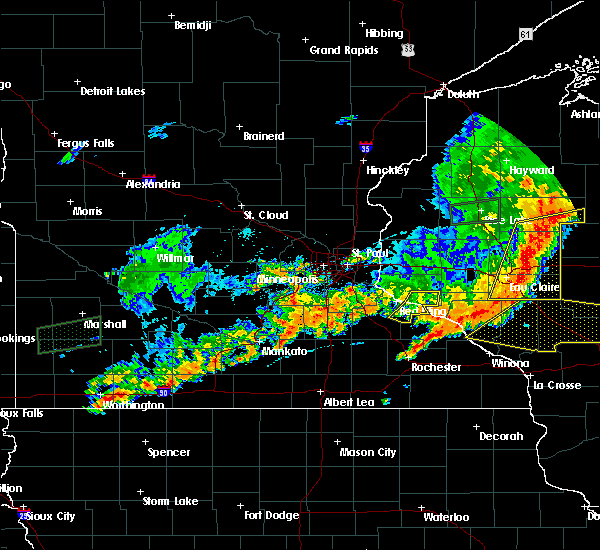 At 735 pm cdt, severe thunderstorms were located along a line extending from near plum city to near vasa, moving east at 35 mph (radar indicated). Hazards include 60 mph wind gusts. Expect damage to roofs, siding, and trees. Locations impacted include, red wing, goodhue, plum city, bay city, stockholm, frontenac, wacouta, bellechester, frontenac state park, central point and esdaile. At 735 pm cdt, severe thunderstorms were located along a line extending from near plum city to near vasa, moving east at 35 mph (radar indicated). Hazards include 60 mph wind gusts. Expect damage to roofs, siding, and trees. Locations impacted include, red wing, goodhue, plum city, bay city, stockholm, frontenac, wacouta, bellechester, frontenac state park, central point and esdaile.
|
| 7/12/2018 7:21 PM CDT |
 At 721 pm cdt, severe thunderstorms were located along a line extending from near esdaile to near cannon falls, moving east at 35 mph (radar indicated). Hazards include 60 mph wind gusts. Expect damage to roofs, siding, and trees. Locations impacted include, red wing, ellsworth, goodhue, welch, plum city, bay city, stockholm, frontenac, vasa, diamond bluff, wacouta and bellechester. At 721 pm cdt, severe thunderstorms were located along a line extending from near esdaile to near cannon falls, moving east at 35 mph (radar indicated). Hazards include 60 mph wind gusts. Expect damage to roofs, siding, and trees. Locations impacted include, red wing, ellsworth, goodhue, welch, plum city, bay city, stockholm, frontenac, vasa, diamond bluff, wacouta and bellechester.
|
| 7/12/2018 7:21 PM CDT |
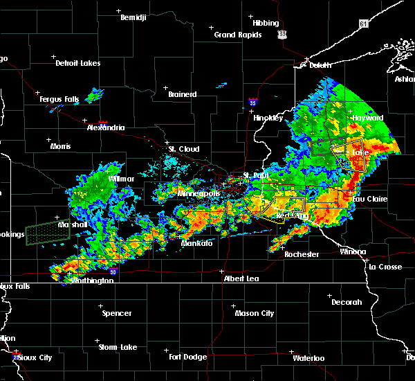 At 721 pm cdt, severe thunderstorms were located along a line extending from near esdaile to near cannon falls, moving east at 35 mph (radar indicated). Hazards include 60 mph wind gusts. Expect damage to roofs, siding, and trees. Locations impacted include, red wing, ellsworth, goodhue, welch, plum city, bay city, stockholm, frontenac, vasa, diamond bluff, wacouta and bellechester. At 721 pm cdt, severe thunderstorms were located along a line extending from near esdaile to near cannon falls, moving east at 35 mph (radar indicated). Hazards include 60 mph wind gusts. Expect damage to roofs, siding, and trees. Locations impacted include, red wing, ellsworth, goodhue, welch, plum city, bay city, stockholm, frontenac, vasa, diamond bluff, wacouta and bellechester.
|
| 7/12/2018 7:06 PM CDT |
 At 706 pm cdt, severe thunderstorms were located along a line extending from near diamond bluff to lake byllesby, moving east at 35 mph (radar indicated). Hazards include 60 mph wind gusts and penny size hail. expect damage to roofs, siding, and trees At 706 pm cdt, severe thunderstorms were located along a line extending from near diamond bluff to lake byllesby, moving east at 35 mph (radar indicated). Hazards include 60 mph wind gusts and penny size hail. expect damage to roofs, siding, and trees
|
| 6/14/2017 1:17 AM CDT |
 At 116 am cdt, severe thunderstorms were located along a line extending from near hastings to near wastedo, moving east at 50 mph (radar indicated). Hazards include 60 mph wind gusts. Expect damage to roofs, siding, and trees. these severe storms will be near, prescott around 120 am cdt. red wing, goodhue and welch around 130 am cdt. Other locations impacted by these severe thunderstorms include vasa, wastedo, miesville, hader and diamond bluff. At 116 am cdt, severe thunderstorms were located along a line extending from near hastings to near wastedo, moving east at 50 mph (radar indicated). Hazards include 60 mph wind gusts. Expect damage to roofs, siding, and trees. these severe storms will be near, prescott around 120 am cdt. red wing, goodhue and welch around 130 am cdt. Other locations impacted by these severe thunderstorms include vasa, wastedo, miesville, hader and diamond bluff.
|
| 6/14/2017 1:07 AM CDT |
 At 106 am cdt, severe thunderstorms were located along a line extending from vermillion to near stanton, moving east at 50 mph (radar indicated). Hazards include 60 mph wind gusts. Expect damage to roofs, siding, and trees. these severe storms will be near, hastings and cannon falls around 115 am cdt. prescott around 120 am cdt. red wing, goodhue and welch around 130 am cdt. Other locations impacted by these severe thunderstorms include vasa, wastedo, miesville, hader, new trier and diamond bluff. At 106 am cdt, severe thunderstorms were located along a line extending from vermillion to near stanton, moving east at 50 mph (radar indicated). Hazards include 60 mph wind gusts. Expect damage to roofs, siding, and trees. these severe storms will be near, hastings and cannon falls around 115 am cdt. prescott around 120 am cdt. red wing, goodhue and welch around 130 am cdt. Other locations impacted by these severe thunderstorms include vasa, wastedo, miesville, hader, new trier and diamond bluff.
|
| 6/14/2017 12:57 AM CDT |
 At 1256 am cdt, severe thunderstorms were located along a line extending from near farmington to near dundas, moving east at 45 mph (radar indicated). Hazards include 60 mph wind gusts and penny size hail. Expect damage to roofs, siding, and trees. these severe storms will be near, stanton around 105 am cdt. hastings and cannon falls around 115 am cdt. prescott around 120 am cdt. red wing, goodhue and welch around 130 am cdt. Other locations impacted by these severe thunderstorms include vasa, coates, vermillion, wastedo, miesville, hader, hampton, lake byllesby, randolph and new trier. At 1256 am cdt, severe thunderstorms were located along a line extending from near farmington to near dundas, moving east at 45 mph (radar indicated). Hazards include 60 mph wind gusts and penny size hail. Expect damage to roofs, siding, and trees. these severe storms will be near, stanton around 105 am cdt. hastings and cannon falls around 115 am cdt. prescott around 120 am cdt. red wing, goodhue and welch around 130 am cdt. Other locations impacted by these severe thunderstorms include vasa, coates, vermillion, wastedo, miesville, hader, hampton, lake byllesby, randolph and new trier.
|
| 6/14/2017 12:43 AM CDT |
 At 1243 am cdt, severe thunderstorms were located along a line extending from near credit river to near lonsdale, moving east at 50 mph (radar indicated). Hazards include 60 mph wind gusts and penny size hail. Expect damage to roofs, siding, and trees. severe thunderstorms will be near, lakeville and apple valley around 1255 am cdt. rosemount, farmington and dundas around 100 am cdt. northfield around 105 am cdt. stanton around 110 am cdt. hastings around 115 am cdt. prescott and cannon falls around 120 am cdt. red wing and welch around 130 am cdt. This includes treasure island casino. At 1243 am cdt, severe thunderstorms were located along a line extending from near credit river to near lonsdale, moving east at 50 mph (radar indicated). Hazards include 60 mph wind gusts and penny size hail. Expect damage to roofs, siding, and trees. severe thunderstorms will be near, lakeville and apple valley around 1255 am cdt. rosemount, farmington and dundas around 100 am cdt. northfield around 105 am cdt. stanton around 110 am cdt. hastings around 115 am cdt. prescott and cannon falls around 120 am cdt. red wing and welch around 130 am cdt. This includes treasure island casino.
|
| 6/12/2017 2:18 PM CDT |
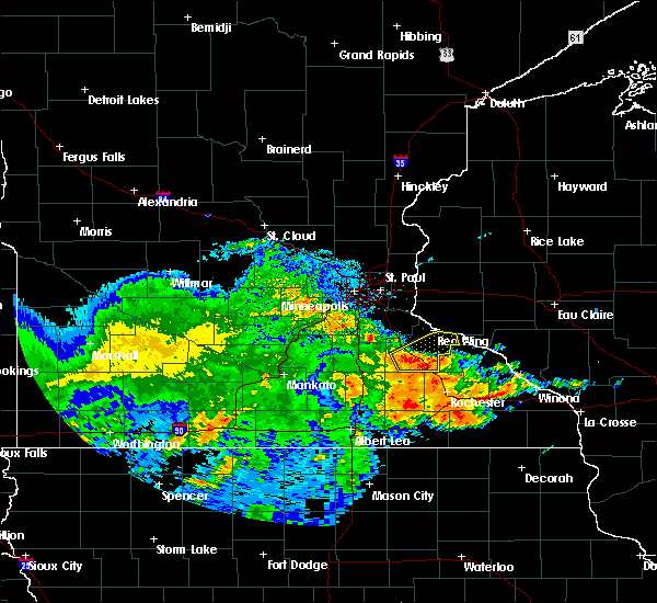 At 218 pm cdt, severe thunderstorms were located along a line extending from near wastedo to near goodhue to near mazeppa, moving east at 50 mph (radar indicated). Hazards include 60 mph wind gusts. Expect damage to roofs, siding, and trees. Locations impacted include, red wing, pine island, zumbrota, goodhue, wanamingo, vasa, wacouta, bellechester, bombay, wastedo, hader and frontenac state park. At 218 pm cdt, severe thunderstorms were located along a line extending from near wastedo to near goodhue to near mazeppa, moving east at 50 mph (radar indicated). Hazards include 60 mph wind gusts. Expect damage to roofs, siding, and trees. Locations impacted include, red wing, pine island, zumbrota, goodhue, wanamingo, vasa, wacouta, bellechester, bombay, wastedo, hader and frontenac state park.
|
| 6/12/2017 2:06 PM CDT |
 At 206 pm cdt, severe thunderstorms were located along a line extending from near nerstrand to near bombay to near berne, moving northeast at 55 mph (radar indicated). Hazards include 60 mph wind gusts. Expect damage to roofs, siding, and trees. Locations impacted include, red wing, pine island, zumbrota, kenyon, goodhue, wanamingo, welch, vasa, wacouta, bellechester, wastedo and bombay. At 206 pm cdt, severe thunderstorms were located along a line extending from near nerstrand to near bombay to near berne, moving northeast at 55 mph (radar indicated). Hazards include 60 mph wind gusts. Expect damage to roofs, siding, and trees. Locations impacted include, red wing, pine island, zumbrota, kenyon, goodhue, wanamingo, welch, vasa, wacouta, bellechester, wastedo and bombay.
|
| 6/12/2017 1:51 PM CDT |
 At 151 pm cdt, severe thunderstorms were located along a line extending from near bridgewater to near moland to dellwood, moving northeast at 50 mph (radar indicated). Hazards include 60 mph wind gusts. expect damage to roofs, siding, and trees At 151 pm cdt, severe thunderstorms were located along a line extending from near bridgewater to near moland to dellwood, moving northeast at 50 mph (radar indicated). Hazards include 60 mph wind gusts. expect damage to roofs, siding, and trees
|
| 6/11/2017 9:58 AM CDT |
 At 958 am cdt, severe thunderstorms were located along a line extending from near el paso to zumbrota, moving east at 45 mph (radar indicated). Hazards include 60 mph wind gusts and nickel size hail. Expect damage to roofs, siding, and trees. these severe storms will be near, elmwood around 1005 am cdt. Other locations impacted by these severe thunderstorms include beldenville, bellechester, el paso, red wing airport, wacouta, frontenac state park, central point, martel, esdaile and hager city. At 958 am cdt, severe thunderstorms were located along a line extending from near el paso to zumbrota, moving east at 45 mph (radar indicated). Hazards include 60 mph wind gusts and nickel size hail. Expect damage to roofs, siding, and trees. these severe storms will be near, elmwood around 1005 am cdt. Other locations impacted by these severe thunderstorms include beldenville, bellechester, el paso, red wing airport, wacouta, frontenac state park, central point, martel, esdaile and hager city.
|
| 6/11/2017 9:58 AM CDT |
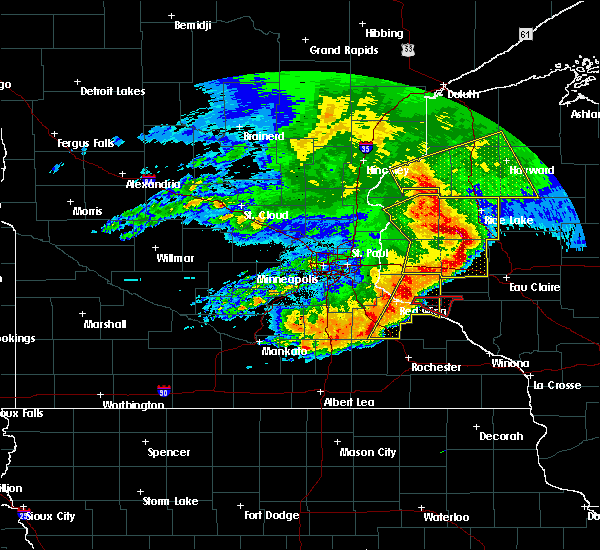 At 958 am cdt, severe thunderstorms were located along a line extending from near el paso to zumbrota, moving east at 45 mph (radar indicated). Hazards include 60 mph wind gusts and nickel size hail. Expect damage to roofs, siding, and trees. these severe storms will be near, elmwood around 1005 am cdt. Other locations impacted by these severe thunderstorms include beldenville, bellechester, el paso, red wing airport, wacouta, frontenac state park, central point, martel, esdaile and hager city. At 958 am cdt, severe thunderstorms were located along a line extending from near el paso to zumbrota, moving east at 45 mph (radar indicated). Hazards include 60 mph wind gusts and nickel size hail. Expect damage to roofs, siding, and trees. these severe storms will be near, elmwood around 1005 am cdt. Other locations impacted by these severe thunderstorms include beldenville, bellechester, el paso, red wing airport, wacouta, frontenac state park, central point, martel, esdaile and hager city.
|
| 6/11/2017 9:47 AM CDT |
 At 947 am cdt, severe thunderstorms were located along a line extending from near beldenville to near wanamingo, moving east at 45 mph (radar indicated). Hazards include 60 mph wind gusts and nickel size hail. Expect damage to roofs, siding, and trees. these severe storms will be near, goodhue and elmwood around 1005 am cdt. Other locations impacted by these severe thunderstorms include el paso, wacouta, wastedo, central point, martel, esdaile, beldenville, vasa, bellechester and bombay. At 947 am cdt, severe thunderstorms were located along a line extending from near beldenville to near wanamingo, moving east at 45 mph (radar indicated). Hazards include 60 mph wind gusts and nickel size hail. Expect damage to roofs, siding, and trees. these severe storms will be near, goodhue and elmwood around 1005 am cdt. Other locations impacted by these severe thunderstorms include el paso, wacouta, wastedo, central point, martel, esdaile, beldenville, vasa, bellechester and bombay.
|
| 6/11/2017 9:37 AM CDT |
 At 936 am cdt, a severe thunderstorm was located near wastedo, or 14 miles southwest of red wing, moving east at 55 mph (radar indicated). Hazards include 60 mph wind gusts and quarter size hail. Hail damage to vehicles is expected. expect wind damage to roofs, siding, and trees. this severe thunderstorm will be near, goodhue around 945 am cdt. red wing around 950 am cdt. Frontenac around 1000 am cdt. At 936 am cdt, a severe thunderstorm was located near wastedo, or 14 miles southwest of red wing, moving east at 55 mph (radar indicated). Hazards include 60 mph wind gusts and quarter size hail. Hail damage to vehicles is expected. expect wind damage to roofs, siding, and trees. this severe thunderstorm will be near, goodhue around 945 am cdt. red wing around 950 am cdt. Frontenac around 1000 am cdt.
|
| 5/17/2017 7:39 PM CDT |
 At 739 pm cdt, severe thunderstorms were located along a line extending from berne to near bluff valley campground to near weaver, moving north at 45 mph (radar indicated). Hazards include 60 mph wind gusts. Expect damage to roofs, siding, and trees. severe thunderstorms will be near, zumbrota and wanamingo around 755 pm cdt. goodhue and frontenac around 805 pm cdt. bay city around 815 pm cdt. red wing and welch around 820 pm cdt. other locations impacted by these severe thunderstorms include vasa, bellechester, porcupine, red wing airport, wacouta, frontenac state park, central point, hader, ella and hager city. this includes u. s. highway 61 between mile markers 82 and 104. a tornado watch remains in effect until 1000 pm cdt for southeastern and east central minnesota. A tornado watch also remains in effect until 1100 pm cdt for west central wisconsin. At 739 pm cdt, severe thunderstorms were located along a line extending from berne to near bluff valley campground to near weaver, moving north at 45 mph (radar indicated). Hazards include 60 mph wind gusts. Expect damage to roofs, siding, and trees. severe thunderstorms will be near, zumbrota and wanamingo around 755 pm cdt. goodhue and frontenac around 805 pm cdt. bay city around 815 pm cdt. red wing and welch around 820 pm cdt. other locations impacted by these severe thunderstorms include vasa, bellechester, porcupine, red wing airport, wacouta, frontenac state park, central point, hader, ella and hager city. this includes u. s. highway 61 between mile markers 82 and 104. a tornado watch remains in effect until 1000 pm cdt for southeastern and east central minnesota. A tornado watch also remains in effect until 1100 pm cdt for west central wisconsin.
|
| 5/16/2017 6:39 PM CDT |
 At 638 pm cdt, a severe thunderstorm was located over red wing, moving east at 40 mph (radar indicated). Hazards include 60 mph wind gusts and quarter size hail. Hail damage to vehicles is expected. expect wind damage to roofs, siding, and trees. locations impacted include, red wing, goodhue, welch, plum city, bay city, frontenac, vasa, diamond bluff, wacouta, central point, esdaile and red wing airport. A tornado watch remains in effect until 1000 pm cdt for west central wisconsin. At 638 pm cdt, a severe thunderstorm was located over red wing, moving east at 40 mph (radar indicated). Hazards include 60 mph wind gusts and quarter size hail. Hail damage to vehicles is expected. expect wind damage to roofs, siding, and trees. locations impacted include, red wing, goodhue, welch, plum city, bay city, frontenac, vasa, diamond bluff, wacouta, central point, esdaile and red wing airport. A tornado watch remains in effect until 1000 pm cdt for west central wisconsin.
|
| 5/16/2017 6:39 PM CDT |
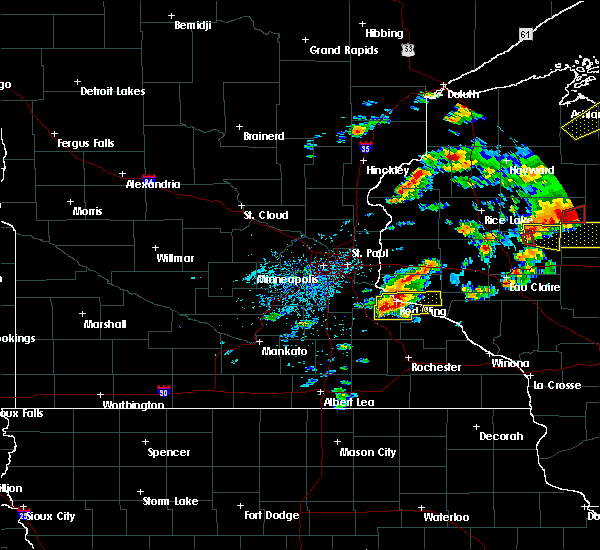 At 638 pm cdt, a severe thunderstorm was located over red wing, moving east at 40 mph (radar indicated). Hazards include 60 mph wind gusts and quarter size hail. Hail damage to vehicles is expected. expect wind damage to roofs, siding, and trees. locations impacted include, red wing, goodhue, welch, plum city, bay city, frontenac, vasa, diamond bluff, wacouta, central point, esdaile and red wing airport. A tornado watch remains in effect until 1000 pm cdt for west central wisconsin. At 638 pm cdt, a severe thunderstorm was located over red wing, moving east at 40 mph (radar indicated). Hazards include 60 mph wind gusts and quarter size hail. Hail damage to vehicles is expected. expect wind damage to roofs, siding, and trees. locations impacted include, red wing, goodhue, welch, plum city, bay city, frontenac, vasa, diamond bluff, wacouta, central point, esdaile and red wing airport. A tornado watch remains in effect until 1000 pm cdt for west central wisconsin.
|
| 5/16/2017 6:16 PM CDT |
 At 616 pm cdt, a severe thunderstorm was located over cannon falls, or 15 miles west of red wing, moving east at 40 mph (radar indicated). Hazards include 60 mph wind gusts and quarter size hail. Hail damage to vehicles is expected. Expect wind damage to roofs, siding, and trees. At 616 pm cdt, a severe thunderstorm was located over cannon falls, or 15 miles west of red wing, moving east at 40 mph (radar indicated). Hazards include 60 mph wind gusts and quarter size hail. Hail damage to vehicles is expected. Expect wind damage to roofs, siding, and trees.
|
| 4/9/2017 11:27 PM CDT |
 At 1127 pm cdt, a severe thunderstorm was located over goodhue, or 14 miles south of red wing, moving northeast at 45 mph (radar indicated). Hazards include quarter size hail. Damage to vehicles is expected. Locations impacted include, zumbrota, goodhue and bellechester. At 1127 pm cdt, a severe thunderstorm was located over goodhue, or 14 miles south of red wing, moving northeast at 45 mph (radar indicated). Hazards include quarter size hail. Damage to vehicles is expected. Locations impacted include, zumbrota, goodhue and bellechester.
|
| 4/9/2017 11:14 PM CDT |
 At 1113 pm cdt, a severe thunderstorm was located over pine island, or 11 miles north of mantorville, moving northeast at 45 mph (radar indicated). Hazards include 60 mph wind gusts and quarter size hail. Hail damage to vehicles is expected. expect wind damage to roofs, siding, and trees. This severe thunderstorm will remain over mainly rural areas of south central goodhue county, including the following locations: pine island, bellechester, goodhue, zumbrota and wanamingo. At 1113 pm cdt, a severe thunderstorm was located over pine island, or 11 miles north of mantorville, moving northeast at 45 mph (radar indicated). Hazards include 60 mph wind gusts and quarter size hail. Hail damage to vehicles is expected. expect wind damage to roofs, siding, and trees. This severe thunderstorm will remain over mainly rural areas of south central goodhue county, including the following locations: pine island, bellechester, goodhue, zumbrota and wanamingo.
|
| 3/6/2017 6:36 PM CST |
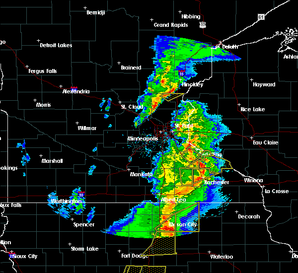 At 636 pm cst, a severe thunderstorm was located near wastedo, or 14 miles southwest of red wing, moving northeast at 50 mph (radar indicated). Hazards include 60 mph wind gusts and nickel size hail. Expect damage to roofs, siding, and trees. this severe storm will be near, goodhue around 640 pm cst. welch around 650 pm cst. other locations impacted by this severe thunderstorm include vasa. A tornado watch remains in effect until 1000 pm cst for southeastern and east central minnesota. At 636 pm cst, a severe thunderstorm was located near wastedo, or 14 miles southwest of red wing, moving northeast at 50 mph (radar indicated). Hazards include 60 mph wind gusts and nickel size hail. Expect damage to roofs, siding, and trees. this severe storm will be near, goodhue around 640 pm cst. welch around 650 pm cst. other locations impacted by this severe thunderstorm include vasa. A tornado watch remains in effect until 1000 pm cst for southeastern and east central minnesota.
|
| 3/6/2017 6:13 PM CST |
 At 612 pm cst, a severe thunderstorm was located over moland, or 11 miles northeast of owatonna, moving northeast at 50 mph (radar indicated). Hazards include 60 mph wind gusts and quarter size hail. Hail damage to vehicles is expected. expect wind damage to roofs, siding, and trees. this severe thunderstorm will be near, wanamingo around 630 pm cst. goodhue around 640 pm cst. welch around 650 pm cst. other locations impacted by this severe thunderstorm include vasa, wastedo, hader and bombay. A tornado watch remains in effect until 1000 pm cst for south central, southeastern and east central minnesota. At 612 pm cst, a severe thunderstorm was located over moland, or 11 miles northeast of owatonna, moving northeast at 50 mph (radar indicated). Hazards include 60 mph wind gusts and quarter size hail. Hail damage to vehicles is expected. expect wind damage to roofs, siding, and trees. this severe thunderstorm will be near, wanamingo around 630 pm cst. goodhue around 640 pm cst. welch around 650 pm cst. other locations impacted by this severe thunderstorm include vasa, wastedo, hader and bombay. A tornado watch remains in effect until 1000 pm cst for south central, southeastern and east central minnesota.
|
| 7/23/2016 10:23 AM CDT |
 At 1020 am cdt, a severe thunderstorm was located near vasa, or 12 miles west of red wing, moving northeast at 20 mph (radar indicated). Hazards include 60 mph wind gusts and penny size hail. Expect damage to roofs. siding. and trees. this severe thunderstorm will be near, welch around 1035 am cdt. other locations impacted by this severe thunderstorm include frontenac state park, hager city, coates, new trier, hampton, diamond bluff, bellechester, randolph, miesville, and hastings. this includes u. s. Highway 61 between mile markers 79 and 116. At 1020 am cdt, a severe thunderstorm was located near vasa, or 12 miles west of red wing, moving northeast at 20 mph (radar indicated). Hazards include 60 mph wind gusts and penny size hail. Expect damage to roofs. siding. and trees. this severe thunderstorm will be near, welch around 1035 am cdt. other locations impacted by this severe thunderstorm include frontenac state park, hager city, coates, new trier, hampton, diamond bluff, bellechester, randolph, miesville, and hastings. this includes u. s. Highway 61 between mile markers 79 and 116.
|
| 7/5/2016 8:42 PM CDT | Large tree dow in goodhue county MN, 0.3 miles SW of Goodhue, MN |
| 7/5/2016 8:30 PM CDT | Large trees and branches down. widespread power outage in goodhue county MN, 0.3 miles SW of Goodhue, MN |
| 7/5/2016 8:21 PM CDT |
 At 820 pm cdt, a severe thunderstorm was located over zumbrota, or 17 miles north of mantorville, moving east at 35 mph (radar indicated). Hazards include 70 mph wind gusts and quarter size hail. Hail damage to vehicles is expected. expect considerable tree damage. wind damage is also likely to mobile homes, roofs, and outbuildings. This severe thunderstorm will remain over mainly rural areas of southeastern goodhue county, including the following locations: bellechester, frontenac state park, central point, bombay and wacouta. At 820 pm cdt, a severe thunderstorm was located over zumbrota, or 17 miles north of mantorville, moving east at 35 mph (radar indicated). Hazards include 70 mph wind gusts and quarter size hail. Hail damage to vehicles is expected. expect considerable tree damage. wind damage is also likely to mobile homes, roofs, and outbuildings. This severe thunderstorm will remain over mainly rural areas of southeastern goodhue county, including the following locations: bellechester, frontenac state park, central point, bombay and wacouta.
|
| 7/5/2016 8:20 PM CDT | Barn damage. trees down. power lines dow in goodhue county MN, 3.2 miles W of Goodhue, MN |
| 7/5/2016 8:18 PM CDT | 3 to 4 trees snappe in goodhue county MN, 7.8 miles E of Goodhue, MN |
| 7/5/2016 8:15 PM CDT | Tree down on cr 9. time estimate in goodhue county MN, 1.8 miles E of Goodhue, MN |
| 7/5/2016 7:52 PM CDT |
 At 751 pm cdt, a severe thunderstorm was located near nerstrand, or 10 miles southeast of northfield, moving east at 35 mph (radar indicated). Hazards include 70 mph wind gusts and quarter size hail. Hail damage to vehicles is expected. expect considerable tree damage. wind damage is also likely to mobile homes, roofs, and outbuildings. this severe storm will be near, wanamingo around 810 pm cdt. zumbrota and goodhue around 820 pm cdt. pine island around 825 pm cdt. Other locations impacted by this severe thunderstorm include frontenac state park, wastedo, hader, coates, new trier, hampton, bombay, bellechester, miesville and wacouta. At 751 pm cdt, a severe thunderstorm was located near nerstrand, or 10 miles southeast of northfield, moving east at 35 mph (radar indicated). Hazards include 70 mph wind gusts and quarter size hail. Hail damage to vehicles is expected. expect considerable tree damage. wind damage is also likely to mobile homes, roofs, and outbuildings. this severe storm will be near, wanamingo around 810 pm cdt. zumbrota and goodhue around 820 pm cdt. pine island around 825 pm cdt. Other locations impacted by this severe thunderstorm include frontenac state park, wastedo, hader, coates, new trier, hampton, bombay, bellechester, miesville and wacouta.
|
| 7/5/2016 7:41 PM CDT |
 At 741 pm cdt, a severe thunderstorm was located near northfield, moving east at 35 mph (radar indicated). Hazards include 70 mph wind gusts and quarter size hail. Hail damage to vehicles is expected. expect considerable tree damage. wind damage is also likely to mobile homes, roofs, and outbuildings. this severe thunderstorm will be near, stanton around 745 pm cdt. wanamingo around 810 pm cdt. zumbrota and goodhue around 820 pm cdt. pine island around 825 pm cdt. other locations impacted by this severe thunderstorm include frontenac state park, wastedo, hader, coates, new trier, hampton, bombay, bellechester, miesville and wacouta. this includes u. s. Highway 61 between mile markers 75 and 113. At 741 pm cdt, a severe thunderstorm was located near northfield, moving east at 35 mph (radar indicated). Hazards include 70 mph wind gusts and quarter size hail. Hail damage to vehicles is expected. expect considerable tree damage. wind damage is also likely to mobile homes, roofs, and outbuildings. this severe thunderstorm will be near, stanton around 745 pm cdt. wanamingo around 810 pm cdt. zumbrota and goodhue around 820 pm cdt. pine island around 825 pm cdt. other locations impacted by this severe thunderstorm include frontenac state park, wastedo, hader, coates, new trier, hampton, bombay, bellechester, miesville and wacouta. this includes u. s. Highway 61 between mile markers 75 and 113.
|
| 6/10/2016 4:53 PM CDT |
 At 451 pm cdt, severe thunderstorms were located along a line extending from frontenac to near wanamingo, moving east at 45 mph (mesonet indicated. at 435 pm, a local wind sensor south of cannon falls reported a wind gust of 75 mph). Hazards include 70 mph wind gusts and nickel size hail. Expect considerable tree damage. damage is likely to mobile homes, roofs, and outbuildings. locations impacted include, pine island, zumbrota, kenyon, goodhue, wanamingo, pepin, stockholm, bellechester, wastedo, hader, central point and bombay. A tornado watch remains in effect until 900 pm cdt for west central wisconsin. At 451 pm cdt, severe thunderstorms were located along a line extending from frontenac to near wanamingo, moving east at 45 mph (mesonet indicated. at 435 pm, a local wind sensor south of cannon falls reported a wind gust of 75 mph). Hazards include 70 mph wind gusts and nickel size hail. Expect considerable tree damage. damage is likely to mobile homes, roofs, and outbuildings. locations impacted include, pine island, zumbrota, kenyon, goodhue, wanamingo, pepin, stockholm, bellechester, wastedo, hader, central point and bombay. A tornado watch remains in effect until 900 pm cdt for west central wisconsin.
|
| 6/10/2016 4:29 PM CDT |
 At 429 pm cdt, severe thunderstorms were located along a line extending from near goodhue to near kenyon, moving east at 45 mph (radar indicated). Hazards include 60 mph wind gusts and nickel size hail. Expect damage to roofs. siding. And trees. At 429 pm cdt, severe thunderstorms were located along a line extending from near goodhue to near kenyon, moving east at 45 mph (radar indicated). Hazards include 60 mph wind gusts and nickel size hail. Expect damage to roofs. siding. And trees.
|
| 4/24/2016 9:40 PM CDT |
 The severe thunderstorm warning for east central dakota, central goodhue and southwestern pierce counties will expire at 945 pm cdt, the storm which prompted the warning has weakened below severe limits. therefore the warning will be allowed to expire. however wind gusts to 40 mph are still possible with this thunderstorm. The severe thunderstorm warning for east central dakota, central goodhue and southwestern pierce counties will expire at 945 pm cdt, the storm which prompted the warning has weakened below severe limits. therefore the warning will be allowed to expire. however wind gusts to 40 mph are still possible with this thunderstorm.
|
| 4/24/2016 9:40 PM CDT | The severe thunderstorm warning for east central dakota, central goodhue and southwestern pierce counties will expire at 945 pm cdt, the storm which prompted the warning has weakened below severe limits. therefore the warning will be allowed to expire. however wind gusts to 40 mph are still possible with this thunderstorm. |
| 4/24/2016 9:29 PM CDT |
 At 929 pm cdt, a severe thunderstorm was located near vasa, or 11 miles southwest of red wing, moving north at 50 mph (radar indicated). Hazards include 60 mph wind gusts. Expect damage to roofs. siding. and trees. this severe storm will be near, red wing and welch around 940 pm cdt. Other locations impacted by this severe thunderstorm include hader, hager city, red wing airport, vasa, diamond bluff and miesville. At 929 pm cdt, a severe thunderstorm was located near vasa, or 11 miles southwest of red wing, moving north at 50 mph (radar indicated). Hazards include 60 mph wind gusts. Expect damage to roofs. siding. and trees. this severe storm will be near, red wing and welch around 940 pm cdt. Other locations impacted by this severe thunderstorm include hader, hager city, red wing airport, vasa, diamond bluff and miesville.
|
| 4/24/2016 9:17 PM CDT |
 At 916 pm cdt, a severe thunderstorm was located over wanamingo, or 17 miles north of mantorville, moving north at 65 mph (radar indicated). Hazards include 60 mph wind gusts. Expect damage to roofs. siding. and trees. this severe thunderstorm will be near, goodhue around 925 pm cdt. red wing and welch around 935 pm cdt. other locations impacted by this severe thunderstorm include hader, hager city, red wing airport, vasa, diamond bluff and miesville. this includes u. s. Highway 61 between mile markers 88 and 105. At 916 pm cdt, a severe thunderstorm was located over wanamingo, or 17 miles north of mantorville, moving north at 65 mph (radar indicated). Hazards include 60 mph wind gusts. Expect damage to roofs. siding. and trees. this severe thunderstorm will be near, goodhue around 925 pm cdt. red wing and welch around 935 pm cdt. other locations impacted by this severe thunderstorm include hader, hager city, red wing airport, vasa, diamond bluff and miesville. this includes u. s. Highway 61 between mile markers 88 and 105.
|
| 7/18/2015 1:24 AM CDT |
 At 124 am cdt, severe thunderstorms were located along a line extending from ellsworth to near mazeppa to near steele center, moving east at 50 mph (radar indicated). Hazards include 70 mph wind gusts. Expect considerable tree damage. damage is likely to mobile homes, roofs and outbuildings. these severe storms will be near, ellsworth around 130 am cdt. Other locations impacted by these severe thunderstorms include lemond, frontenac state park, bixby, afton state park, owatonna airport, hader, clinton falls, diamond bluff, el paso and bellechester. At 124 am cdt, severe thunderstorms were located along a line extending from ellsworth to near mazeppa to near steele center, moving east at 50 mph (radar indicated). Hazards include 70 mph wind gusts. Expect considerable tree damage. damage is likely to mobile homes, roofs and outbuildings. these severe storms will be near, ellsworth around 130 am cdt. Other locations impacted by these severe thunderstorms include lemond, frontenac state park, bixby, afton state park, owatonna airport, hader, clinton falls, diamond bluff, el paso and bellechester.
|
| 7/18/2015 12:55 AM CDT |
 At 1254 am cdt, severe thunderstorms were located along a line extending from grey cloud township to near northfield to near waldorf, moving east at 45 mph (radar indicated). Hazards include 70 mph wind gusts. Expect considerable tree damage. damage is likely to mobile homes, roofs and outbuildings. severe thunderstorms will be near, northfield, cottage grove, st. paul park, stanton and randolph around 100 am cdt. hastings and cannon falls around 105 am cdt. prescott around 110 am cdt. river falls and ellendale around 120 am cdt. goodhue around 125 am cdt. ellsworth around 130 am cdt. blooming prairie around 135 am cdt. stockholm and frontenac around 145 am cdt. Other locations impacted by these severe thunderstorms include lemond, frontenac state park, bixby, afton state park, owatonna airport, hader, clinton falls, bridgewater, st paul park and diamond bluff. At 1254 am cdt, severe thunderstorms were located along a line extending from grey cloud township to near northfield to near waldorf, moving east at 45 mph (radar indicated). Hazards include 70 mph wind gusts. Expect considerable tree damage. damage is likely to mobile homes, roofs and outbuildings. severe thunderstorms will be near, northfield, cottage grove, st. paul park, stanton and randolph around 100 am cdt. hastings and cannon falls around 105 am cdt. prescott around 110 am cdt. river falls and ellendale around 120 am cdt. goodhue around 125 am cdt. ellsworth around 130 am cdt. blooming prairie around 135 am cdt. stockholm and frontenac around 145 am cdt. Other locations impacted by these severe thunderstorms include lemond, frontenac state park, bixby, afton state park, owatonna airport, hader, clinton falls, bridgewater, st paul park and diamond bluff.
|
| 6/14/2012 4:58 PM CDT | Quarter sized hail reported 6.6 miles W of Goodhue, MN, mostly nickels with a few quarters...time estimated from radar |
| 6/14/2012 4:49 PM CDT | Half Dollar sized hail reported 8.3 miles WNW of Goodhue, MN |
| 6/14/2012 4:47 PM CDT | Half Dollar sized hail reported 5 miles WNW of Goodhue, MN |
| 5/2/2012 8:38 PM CDT | Golf Ball sized hail reported 9.8 miles W of Goodhue, MN |
| 1/1/0001 12:00 AM | 2 small trees down over the driveway. large tree broken off at the to in goodhue county MN, 5.8 miles E of Goodhue, MN |
Hail Maps for Goodhue, MN


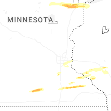


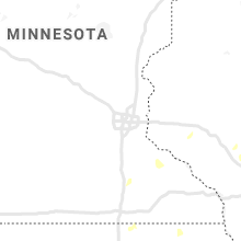


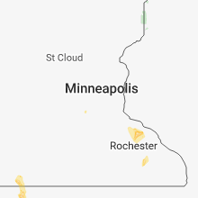


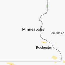


Connect with Interactive Hail Maps