

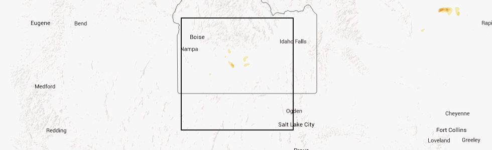
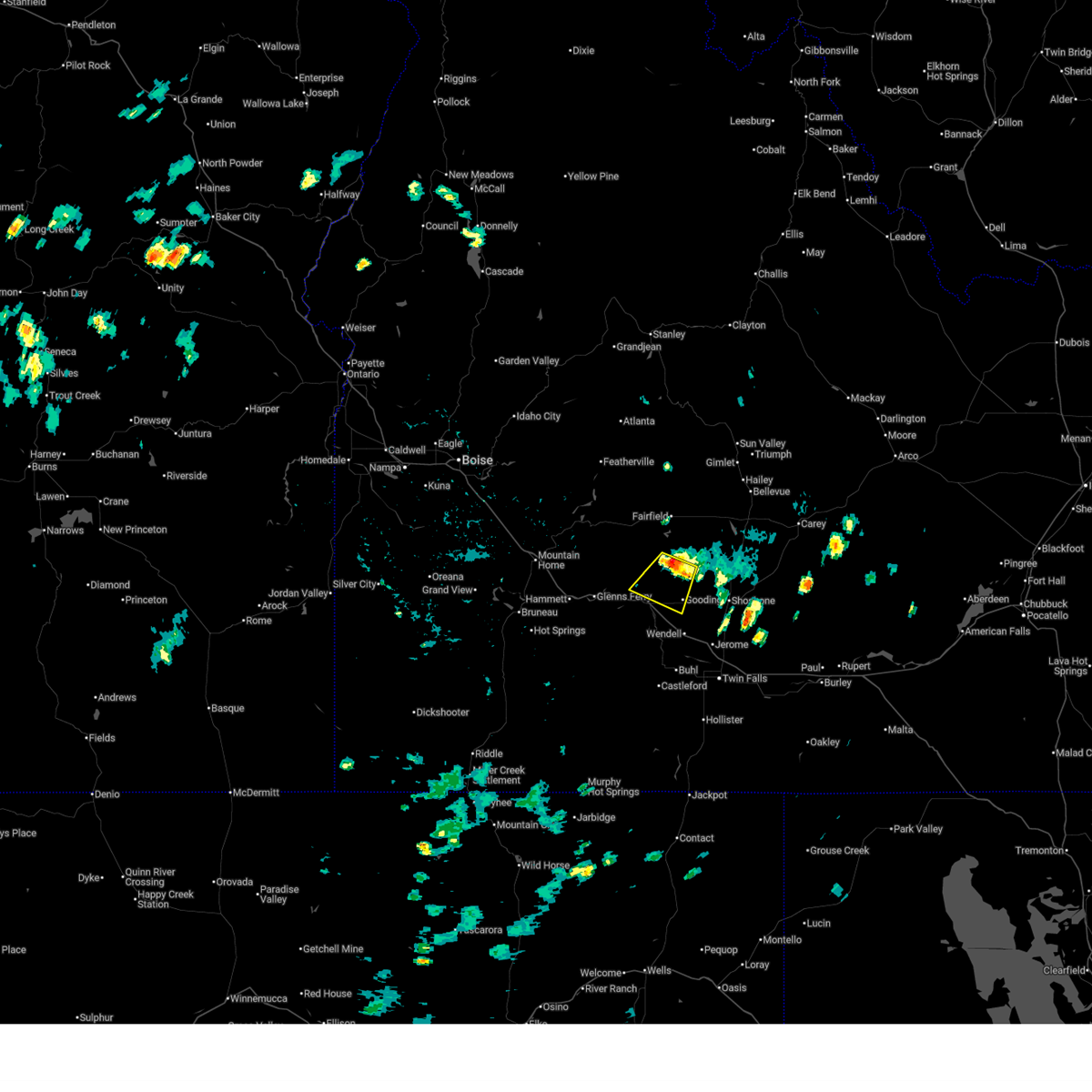
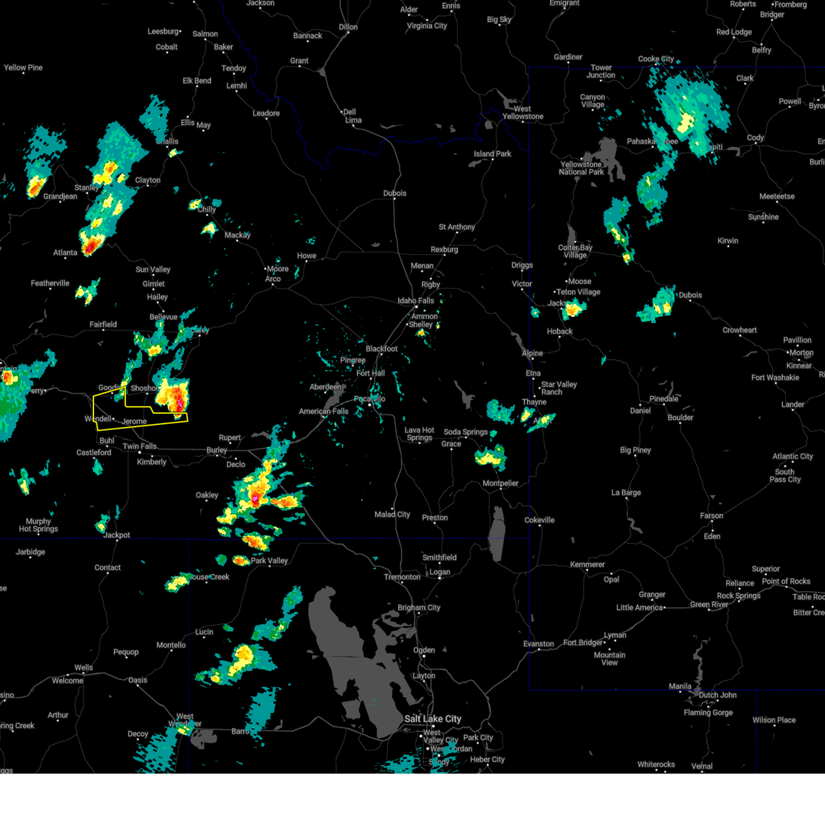
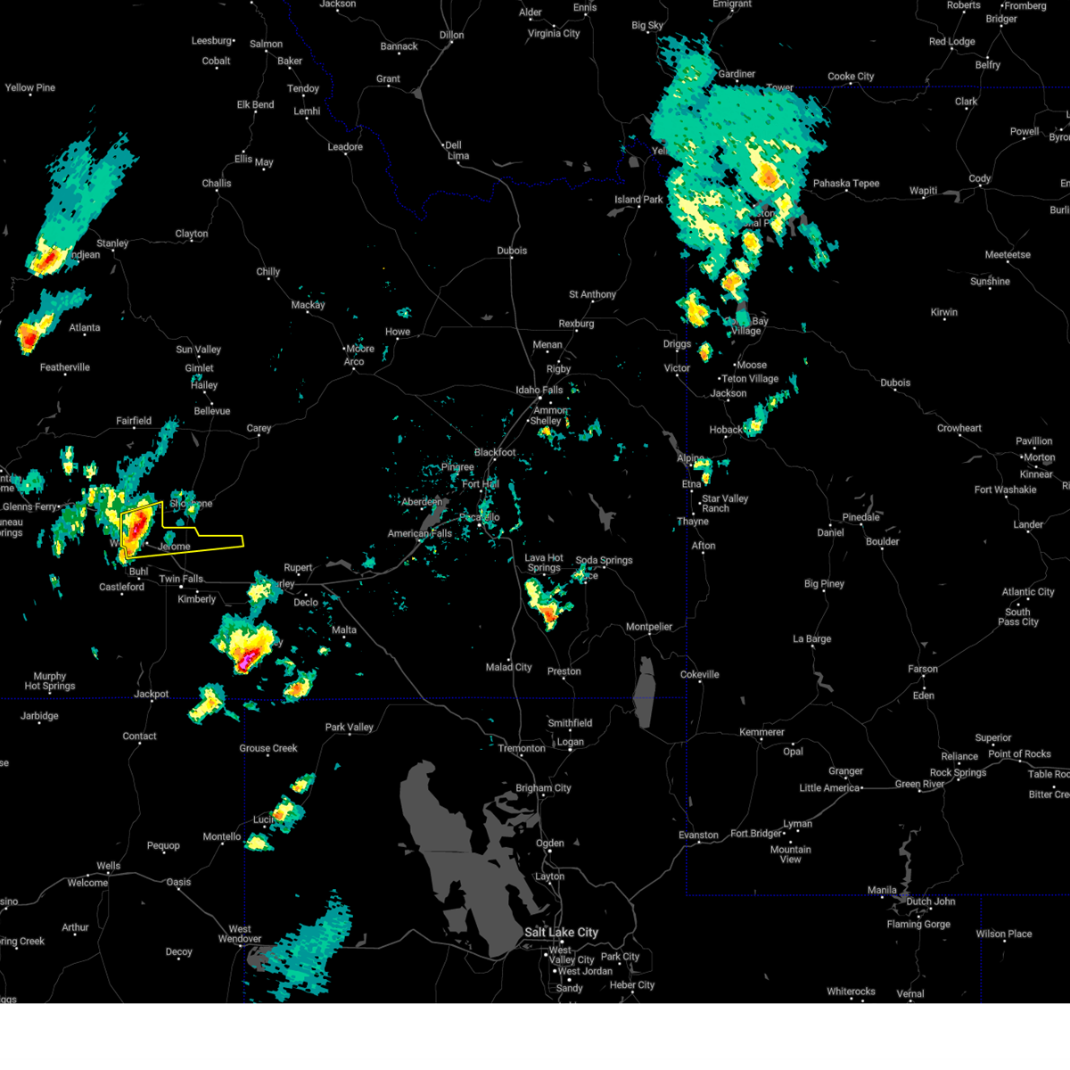
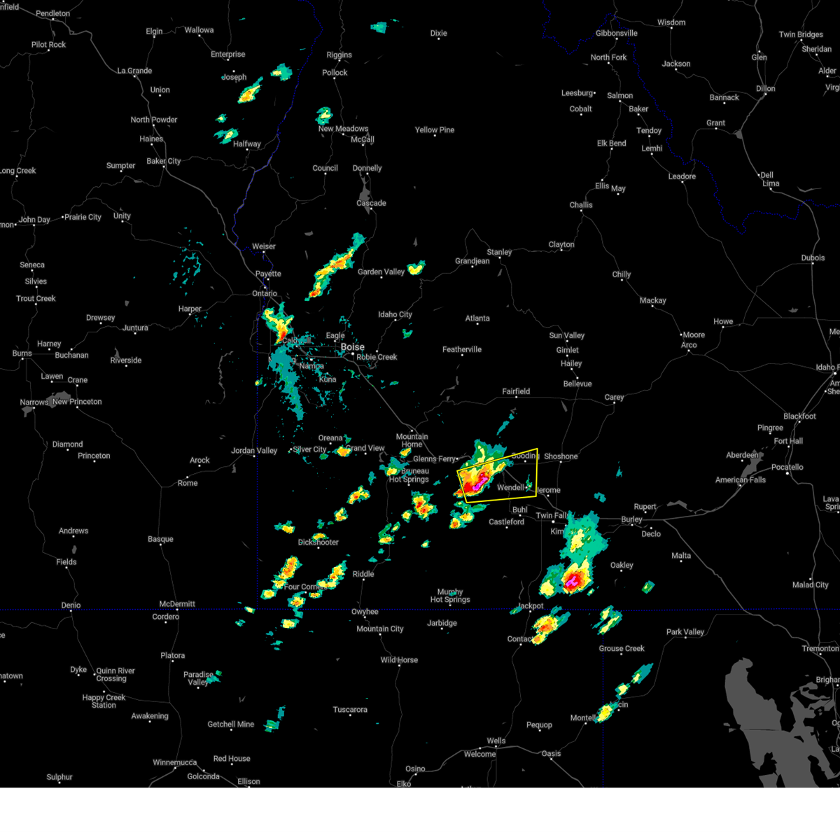
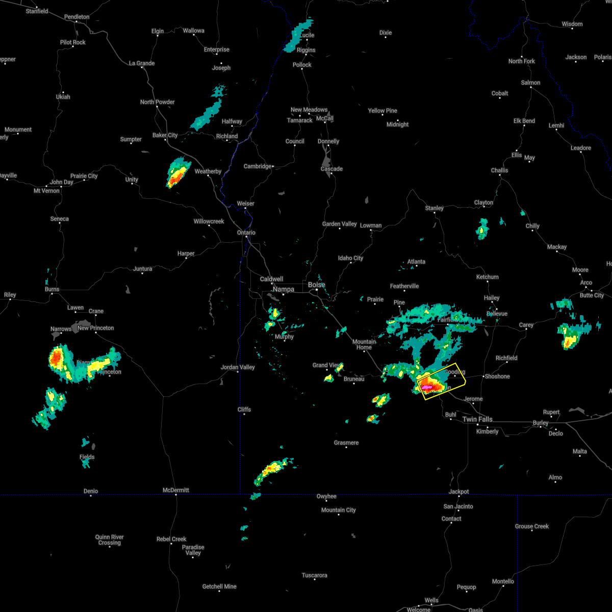
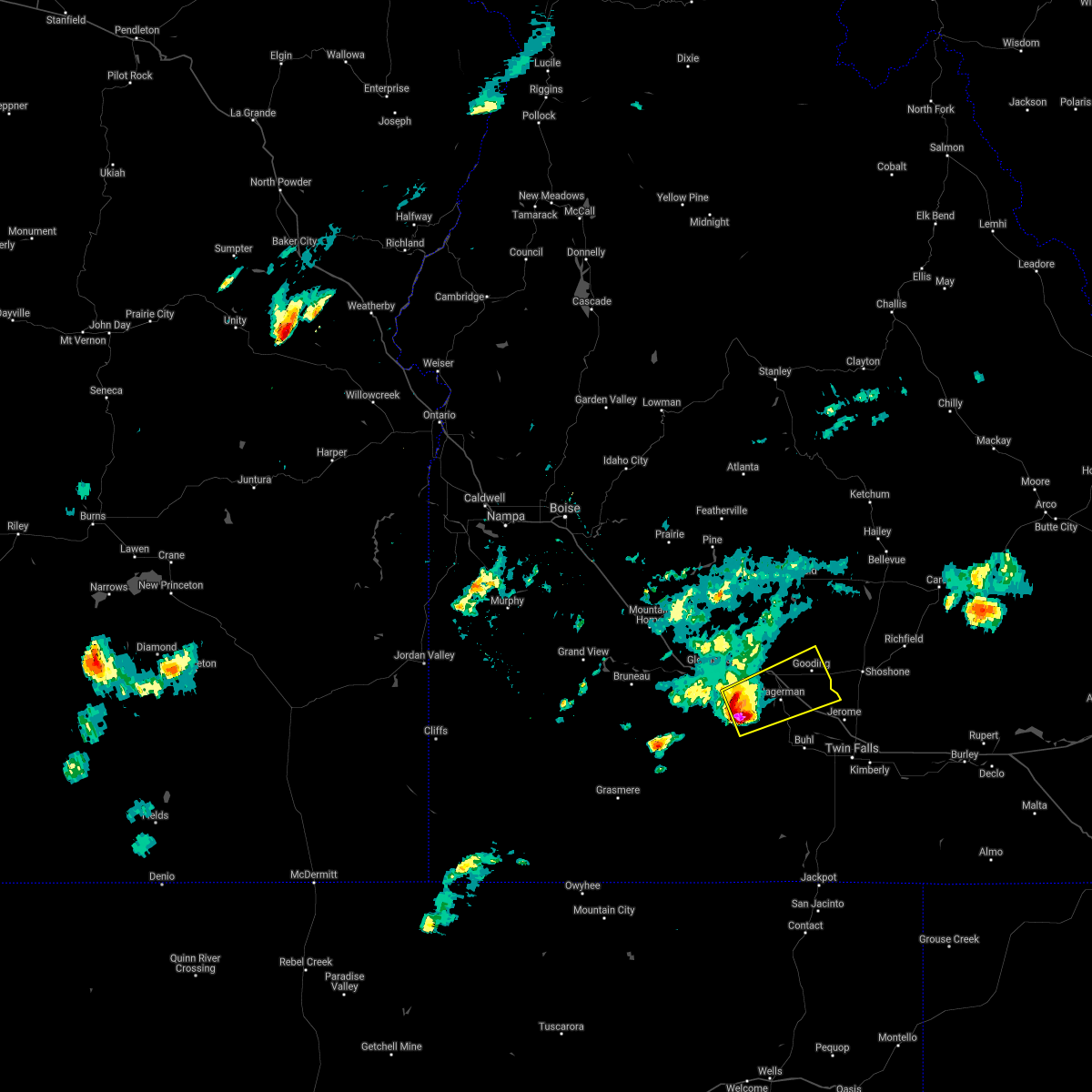
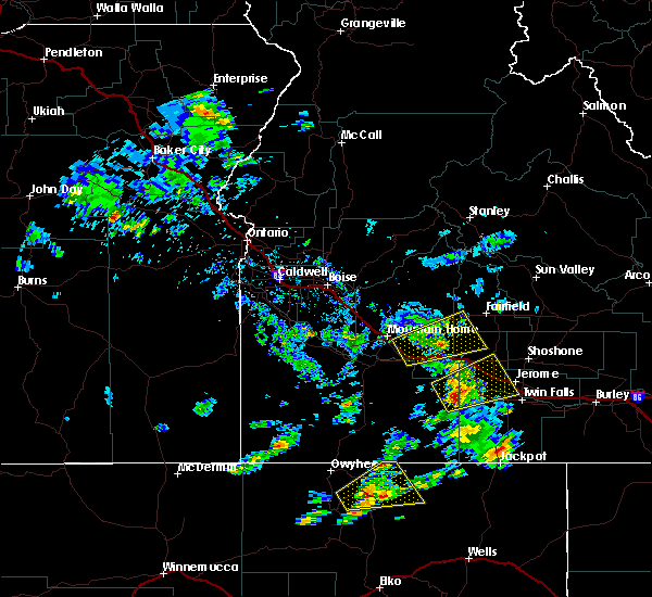
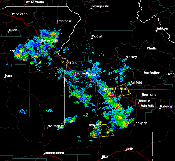
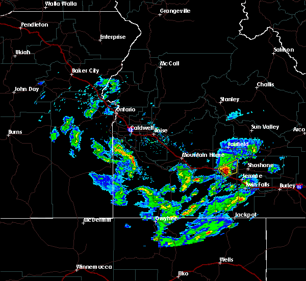
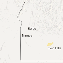
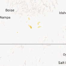
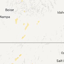
Hail Map for Gooding, ID
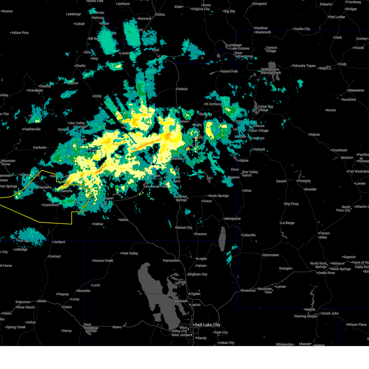
The Gooding, ID area has had 2 reports of on-the-ground hail by trained spotters, and has been under severe weather warnings 4 times during the past 12 months. Doppler radar has detected hail at or near Gooding, ID on 5 occasions.
| Name: | Gooding, ID |
| Where Located: | 29.1 miles NNW of Twin Falls, ID |
| Map: | Google Map for Gooding, ID |
| Population: | 3567 |
| Housing Units: | 1537 |
| More Info: | Search Google for Gooding, ID |
5
The Top Recent Hail Date for Gooding, ID is Friday, August 22, 2014 (1st out of 5)
Hail and Wind Damage Spotted near Gooding, ID
| Date / Time | Report Details |
|---|---|
| 12/17/2025 9:09 AM MST |
 Svrboi the national weather service in boise has issued a * severe thunderstorm warning for, jerome county in south central idaho, twin falls county in south central idaho, southeastern elmore county in southwestern idaho, east central owyhee county in southwestern idaho, southern gooding county in south central idaho, * until 1000 am mst. * at 908 am mst, severe thunderstorms were located along a line extending from near gooding to 9 miles south of twentymile butte to near crows nest butte to near twin butte, moving east at 65 mph (radar indicated). Hazards include 70 mph wind gusts and penny size hail. Expect considerable tree damage. damage is likely to mobile homes, roofs, and outbuildings. severe thunderstorms will be near, gooding, wendell, hagerman, and crows nest butte around 910 am mst. jerome, buhl, and castleford around 920 am mst. twin falls, filer, horse butte, and clover creek crossing around 930 am mst. kimberly, hansen, hazelton, and eden around 940 am mst. Murtaugh, rock creek, and milner dam around 950 am mst. Svrboi the national weather service in boise has issued a * severe thunderstorm warning for, jerome county in south central idaho, twin falls county in south central idaho, southeastern elmore county in southwestern idaho, east central owyhee county in southwestern idaho, southern gooding county in south central idaho, * until 1000 am mst. * at 908 am mst, severe thunderstorms were located along a line extending from near gooding to 9 miles south of twentymile butte to near crows nest butte to near twin butte, moving east at 65 mph (radar indicated). Hazards include 70 mph wind gusts and penny size hail. Expect considerable tree damage. damage is likely to mobile homes, roofs, and outbuildings. severe thunderstorms will be near, gooding, wendell, hagerman, and crows nest butte around 910 am mst. jerome, buhl, and castleford around 920 am mst. twin falls, filer, horse butte, and clover creek crossing around 930 am mst. kimberly, hansen, hazelton, and eden around 940 am mst. Murtaugh, rock creek, and milner dam around 950 am mst.
|
| 12/17/2025 8:33 AM MST |
 Svrboi the national weather service in boise has issued a * severe thunderstorm warning for, jerome county in south central idaho, northwestern twin falls county in south central idaho, southeastern elmore county in southwestern idaho, east central owyhee county in southwestern idaho, gooding county in south central idaho, * until 915 am mst. * at 832 am mst, severe thunderstorms were located along a line extending from near white arrow hot spring to near glenns ferry to bruneau sand dunes, moving east at 55 mph (radar indicated). Hazards include 70 mph wind gusts and penny size hail. Expect considerable tree damage. damage is likely to mobile homes, roofs, and outbuildings. severe thunderstorms will be near, bliss, deadman flat, and twentymile butte around 840 am mst. gooding and hagerman around 850 am mst. wendell around 900 am mst. Jerome around 910 am mst. Svrboi the national weather service in boise has issued a * severe thunderstorm warning for, jerome county in south central idaho, northwestern twin falls county in south central idaho, southeastern elmore county in southwestern idaho, east central owyhee county in southwestern idaho, gooding county in south central idaho, * until 915 am mst. * at 832 am mst, severe thunderstorms were located along a line extending from near white arrow hot spring to near glenns ferry to bruneau sand dunes, moving east at 55 mph (radar indicated). Hazards include 70 mph wind gusts and penny size hail. Expect considerable tree damage. damage is likely to mobile homes, roofs, and outbuildings. severe thunderstorms will be near, bliss, deadman flat, and twentymile butte around 840 am mst. gooding and hagerman around 850 am mst. wendell around 900 am mst. Jerome around 910 am mst.
|
| 8/29/2025 5:00 PM MDT |
 the severe thunderstorm warning has been cancelled and is no longer in effect the severe thunderstorm warning has been cancelled and is no longer in effect
|
| 8/29/2025 4:35 PM MDT |
 Svrboi the national weather service in boise has issued a * severe thunderstorm warning for, northern gooding county in south central idaho, * until 515 pm mdt. * at 433 pm mdt, a severe thunderstorm was located 8 miles east of white arrow hot spring, or 9 miles north of gooding, moving southwest at 10 mph (radar indicated). Hazards include quarter size hail. Damage to vehicles is expected. This severe thunderstorm will remain over mainly rural areas of northern gooding county but will also affect gooding. Svrboi the national weather service in boise has issued a * severe thunderstorm warning for, northern gooding county in south central idaho, * until 515 pm mdt. * at 433 pm mdt, a severe thunderstorm was located 8 miles east of white arrow hot spring, or 9 miles north of gooding, moving southwest at 10 mph (radar indicated). Hazards include quarter size hail. Damage to vehicles is expected. This severe thunderstorm will remain over mainly rural areas of northern gooding county but will also affect gooding.
|
| 6/26/2024 5:25 PM MDT |
 The storm which prompted the warning has moved out of the area. therefore, the warning will be allowed to expire. a severe thunderstorm watch remains in effect until 900 pm mdt for south central idaho. when safe to do so, please relay storm reports to the national weather service in boise via local law enforcement, or national weather service boise facebook and twitter accounts. The storm which prompted the warning has moved out of the area. therefore, the warning will be allowed to expire. a severe thunderstorm watch remains in effect until 900 pm mdt for south central idaho. when safe to do so, please relay storm reports to the national weather service in boise via local law enforcement, or national weather service boise facebook and twitter accounts.
|
| 6/26/2024 4:25 PM MDT |
 Svrboi the national weather service in boise has issued a * severe thunderstorm warning for, northern jerome county in south central idaho, southeastern gooding county in south central idaho, * until 530 pm mdt.. * at 424 pm mdt, a severe thunderstorm was located near wendell, or near gooding, moving east at 35 mph (radar indicated). Hazards include 60 mph wind gusts and quarter size hail. Hail damage to vehicles is expected. expect wind damage to roofs, siding, and trees. This severe thunderstorm will remain over mainly rural areas of northern jerome and southeastern gooding counties. Svrboi the national weather service in boise has issued a * severe thunderstorm warning for, northern jerome county in south central idaho, southeastern gooding county in south central idaho, * until 530 pm mdt.. * at 424 pm mdt, a severe thunderstorm was located near wendell, or near gooding, moving east at 35 mph (radar indicated). Hazards include 60 mph wind gusts and quarter size hail. Hail damage to vehicles is expected. expect wind damage to roofs, siding, and trees. This severe thunderstorm will remain over mainly rural areas of northern jerome and southeastern gooding counties.
|
| 6/26/2024 3:53 PM MDT |
 Svrboi the national weather service in boise has issued a * severe thunderstorm warning for, northwestern twin falls county in south central idaho, southeastern elmore county in southwestern idaho, eastern owyhee county in southwestern idaho, southern gooding county in south central idaho, * until 430 pm mdt.. * at 353 pm mdt, a severe thunderstorm was located over twentymile butte, or 14 miles southeast of glenns ferry, moving east at 30 mph (radar indicated). Hazards include 60 mph wind gusts and quarter size hail. Hail damage to vehicles is expected. expect wind damage to roofs, siding, and trees. This severe thunderstorm will be near, hagerman around 410 pm mdt. Svrboi the national weather service in boise has issued a * severe thunderstorm warning for, northwestern twin falls county in south central idaho, southeastern elmore county in southwestern idaho, eastern owyhee county in southwestern idaho, southern gooding county in south central idaho, * until 430 pm mdt.. * at 353 pm mdt, a severe thunderstorm was located over twentymile butte, or 14 miles southeast of glenns ferry, moving east at 30 mph (radar indicated). Hazards include 60 mph wind gusts and quarter size hail. Hail damage to vehicles is expected. expect wind damage to roofs, siding, and trees. This severe thunderstorm will be near, hagerman around 410 pm mdt.
|
| 5/13/2024 6:15 PM MDT | Gust of 64 mph reported at kgng. power lines down with outages reporte in gooding county ID, 3.2 miles ENE of Gooding, ID |
| 5/13/2024 6:09 PM MDT | Idaho power reports over 400 customers without power from gooding into far southwest lincoln count in lincoln county ID, 7.7 miles W of Gooding, ID |
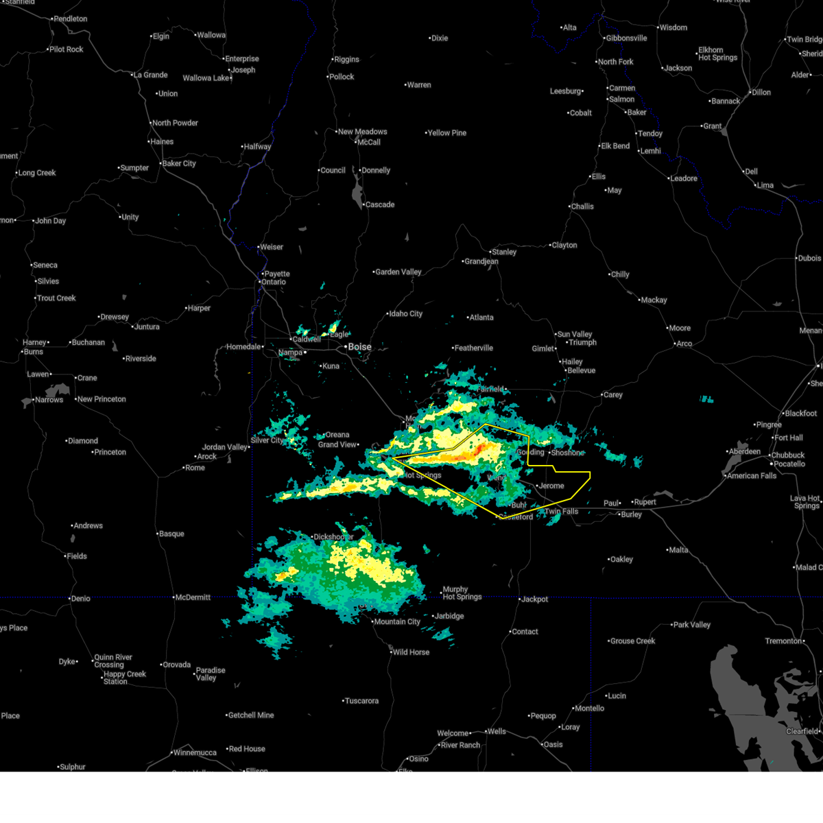
| 8/26/2020 7:42 PM MDT |
 At 740 pm mdt, a severe thunderstorm was located near bliss, or 13 miles west of gooding, moving northeast at 30 mph (radar indicated). Hazards include 60 mph wind gusts and quarter size hail. Hail damage to vehicles is expected. expect wind damage to roofs, siding, and trees. This severe storm will be near, south of bliss around 750 pm mdt. At 740 pm mdt, a severe thunderstorm was located near bliss, or 13 miles west of gooding, moving northeast at 30 mph (radar indicated). Hazards include 60 mph wind gusts and quarter size hail. Hail damage to vehicles is expected. expect wind damage to roofs, siding, and trees. This severe storm will be near, south of bliss around 750 pm mdt.
|
| 8/26/2020 7:21 PM MDT |
 At 721 pm mdt, a severe thunderstorm was located near twentymile butte, or 17 miles southeast of glenns ferry, moving northeast at 35 mph (radar indicated). Hazards include two inch hail and 60 mph wind gusts. People and animals outdoors will be injured. expect hail damage to roofs, siding, windows, and vehicles. expect wind damage to roofs, siding, and trees. this severe thunderstorm will be near, hagerman and bliss around 740 pm mdt. wendell around 750 pm mdt. Gooding around 800 pm mdt. At 721 pm mdt, a severe thunderstorm was located near twentymile butte, or 17 miles southeast of glenns ferry, moving northeast at 35 mph (radar indicated). Hazards include two inch hail and 60 mph wind gusts. People and animals outdoors will be injured. expect hail damage to roofs, siding, windows, and vehicles. expect wind damage to roofs, siding, and trees. this severe thunderstorm will be near, hagerman and bliss around 740 pm mdt. wendell around 750 pm mdt. Gooding around 800 pm mdt.
|
| 4/30/2020 4:15 PM MDT | Storm damage reported in gooding county ID, 12.9 miles SSW of Gooding, ID |
| 9/6/2019 1:09 PM MDT |
 At 109 pm mdt, a severe thunderstorm was located 8 miles south of hagerman, or 19 miles southwest of gooding, moving northeast at 30 mph (radar indicated). Hazards include 60 mph wind gusts and quarter size hail. Hail damage to vehicles is expected. expect wind damage to roofs, siding, and trees. this severe storm will be near, hagerman and buhl around 120 pm mdt. Gooding and wendell around 130 pm mdt. At 109 pm mdt, a severe thunderstorm was located 8 miles south of hagerman, or 19 miles southwest of gooding, moving northeast at 30 mph (radar indicated). Hazards include 60 mph wind gusts and quarter size hail. Hail damage to vehicles is expected. expect wind damage to roofs, siding, and trees. this severe storm will be near, hagerman and buhl around 120 pm mdt. Gooding and wendell around 130 pm mdt.
|
| 9/6/2019 12:44 PM MDT |
 At 1244 pm mdt, a severe thunderstorm was located 7 miles southeast of twentymile butte, or 24 miles southeast of glenns ferry, moving northeast at 30 mph (radar indicated). Hazards include 60 mph wind gusts and quarter size hail. Hail damage to vehicles is expected. expect wind damage to roofs, siding, and trees. this severe thunderstorm will be near, hagerman and buhl around 120 pm mdt. Gooding and wendell around 130 pm mdt. At 1244 pm mdt, a severe thunderstorm was located 7 miles southeast of twentymile butte, or 24 miles southeast of glenns ferry, moving northeast at 30 mph (radar indicated). Hazards include 60 mph wind gusts and quarter size hail. Hail damage to vehicles is expected. expect wind damage to roofs, siding, and trees. this severe thunderstorm will be near, hagerman and buhl around 120 pm mdt. Gooding and wendell around 130 pm mdt.
|
| 6/26/2017 5:30 PM MDT | Several trees and powerlines down around gooding. time estimated from radar. via social media in gooding county ID, 0.2 miles SW of Gooding, ID |
| 6/4/2017 8:25 PM MDT |
 The severe thunderstorm warning for northern twin falls, jerome and southeastern gooding counties will expire at 830 pm mdt, the storm which prompted the warning has moved out of the area. therefore the warning will be allowed to expire. when safe to do so, please relay storm reports to the national weather service in boise via local law enforcement, or national weather service boise facebook and twitter accounts. The severe thunderstorm warning for northern twin falls, jerome and southeastern gooding counties will expire at 830 pm mdt, the storm which prompted the warning has moved out of the area. therefore the warning will be allowed to expire. when safe to do so, please relay storm reports to the national weather service in boise via local law enforcement, or national weather service boise facebook and twitter accounts.
|
| 6/4/2017 7:46 PM MDT |
 At 744 pm mdt, thunderstorm outflow winds associated with a cold front were located near wendell, or 12 miles south of gooding, moving east at 65 mph (radar indicated). Hazards include 60 to 70 mph wind gusts. Expect damage to roofs, siding, and trees. this severe thunderstorm will be near, jerome and filer around 750 pm mdt. twin falls, kimberly, hansen and minidoka national monument around 815 pm mdt. Hazelton, eden, milner dam and murtaugh around 825 pm mdt. At 744 pm mdt, thunderstorm outflow winds associated with a cold front were located near wendell, or 12 miles south of gooding, moving east at 65 mph (radar indicated). Hazards include 60 to 70 mph wind gusts. Expect damage to roofs, siding, and trees. this severe thunderstorm will be near, jerome and filer around 750 pm mdt. twin falls, kimberly, hansen and minidoka national monument around 815 pm mdt. Hazelton, eden, milner dam and murtaugh around 825 pm mdt.
|
| 10/24/2016 5:18 PM MDT |
 At 517 pm mdt, doppler radar indicated a severe thunderstorm capable of producing quarter size hail and damaging winds in excess of 60 mph. this storm was located near gooding, and moving northeast at 35 mph. * this severe thunderstorm will be near, gooding around 530 pm mdt. At 517 pm mdt, doppler radar indicated a severe thunderstorm capable of producing quarter size hail and damaging winds in excess of 60 mph. this storm was located near gooding, and moving northeast at 35 mph. * this severe thunderstorm will be near, gooding around 530 pm mdt.
|
| 8/22/2014 7:30 PM MDT | Quarter sized hail reported 0.7 miles NE of Gooding, ID, spotter reported a lot of 1 inch hail... a torn up front porch... and the neighbors roof pulled back. |
| 8/22/2014 7:15 PM MDT | Quarter sized hail reported 0.7 miles NE of Gooding, ID, spotter reported 1 inch hail... water running through his shop... and downed branches in his yard measuring 2.5 inches. |
| 8/12/2014 4:20 PM MDT | Social media reported power outages in goodin in gooding county ID, 0.2 miles SW of Gooding, ID |
Hail Maps for Gooding, ID


Connect with Interactive Hail Maps