

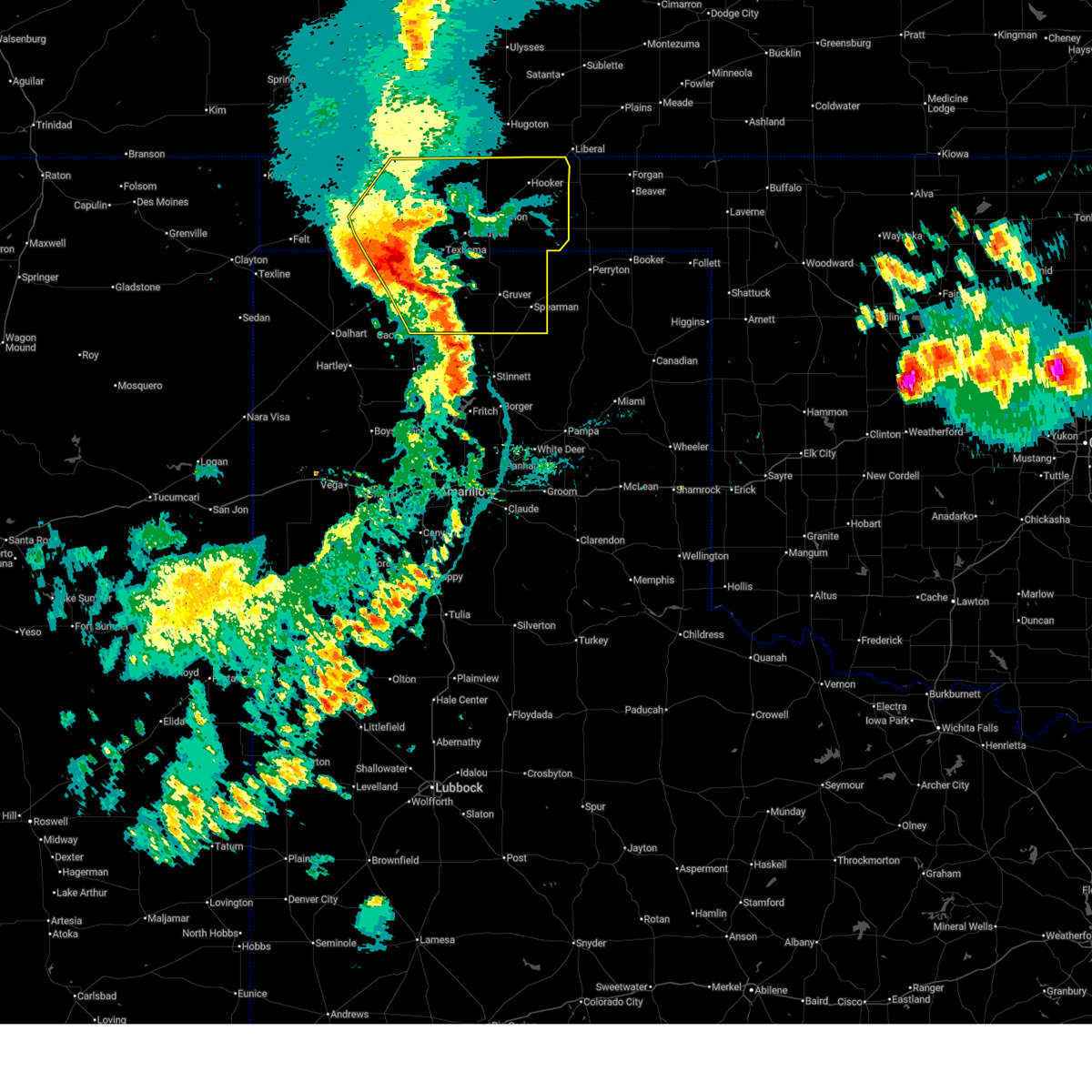
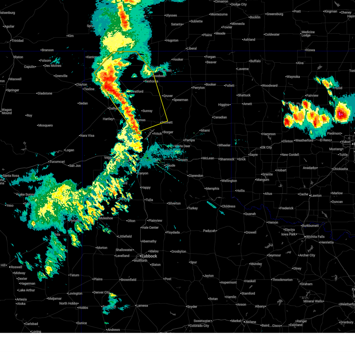
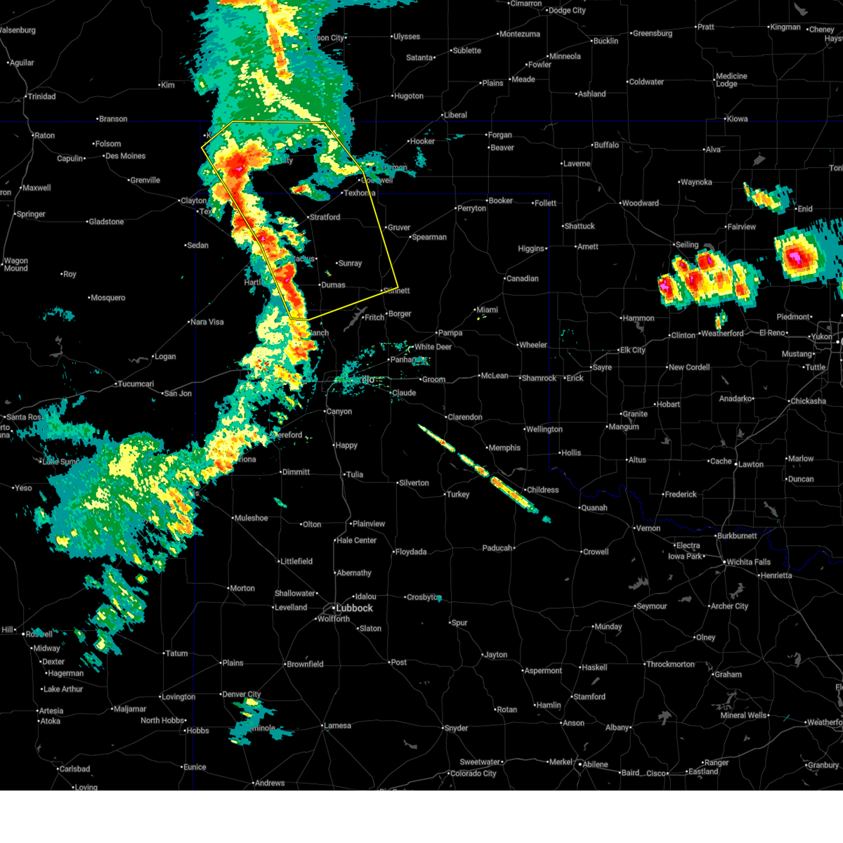
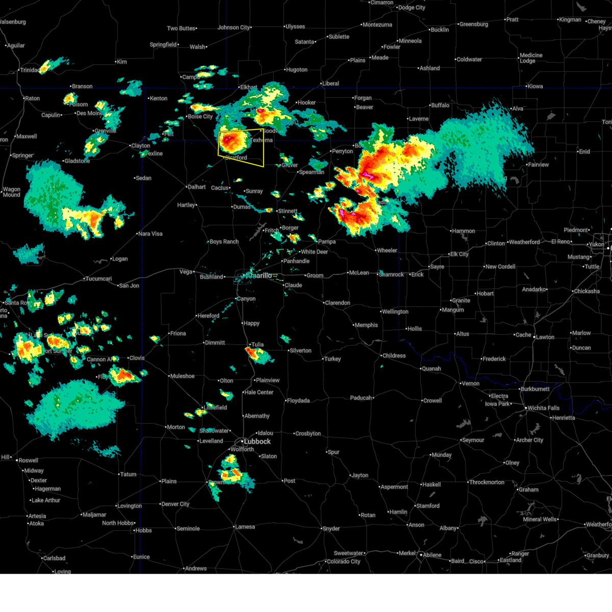
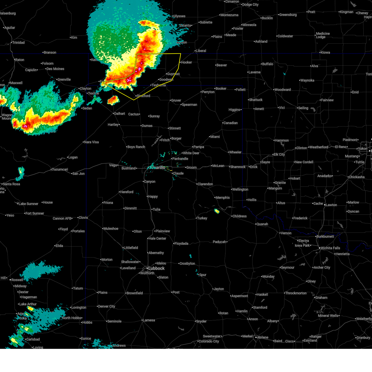
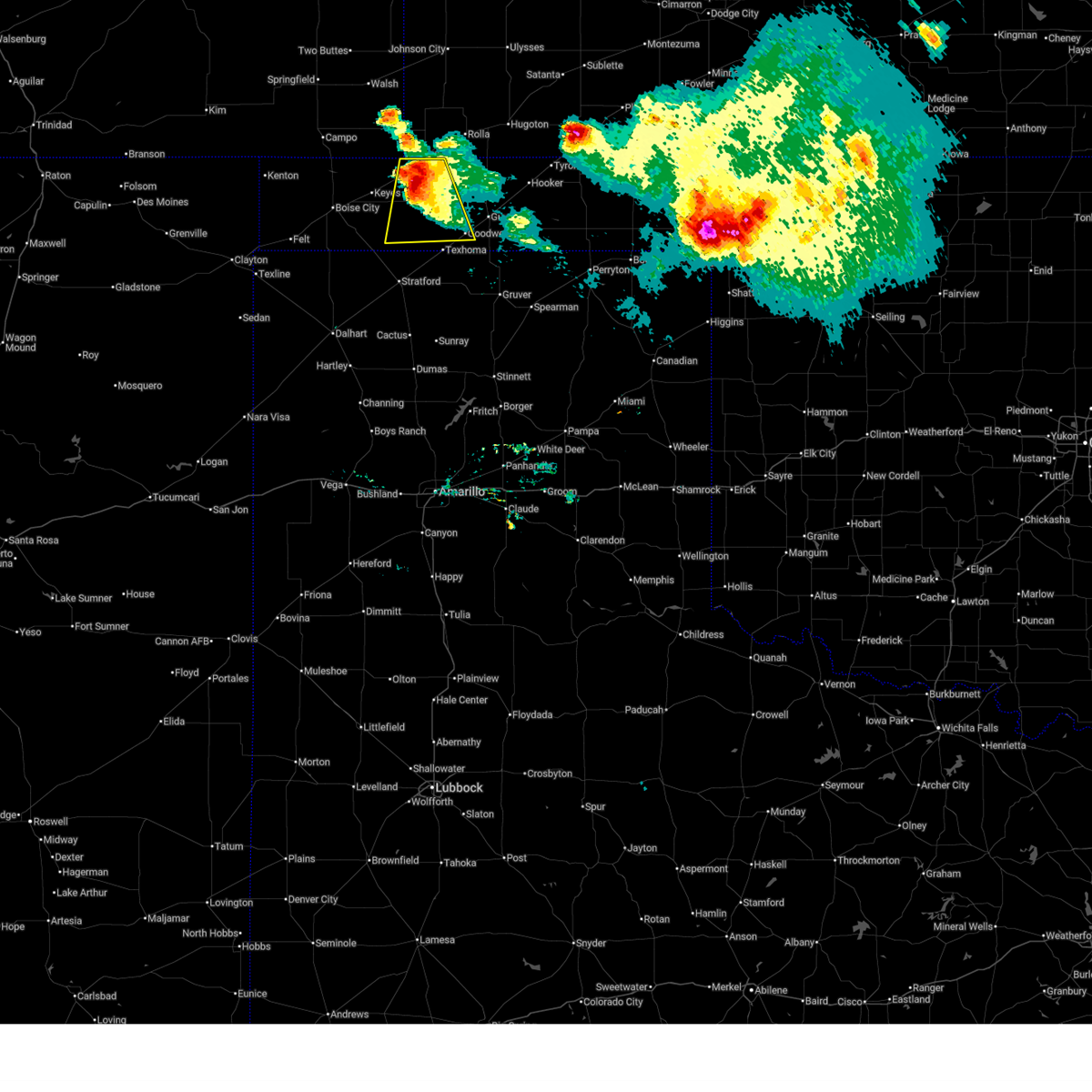
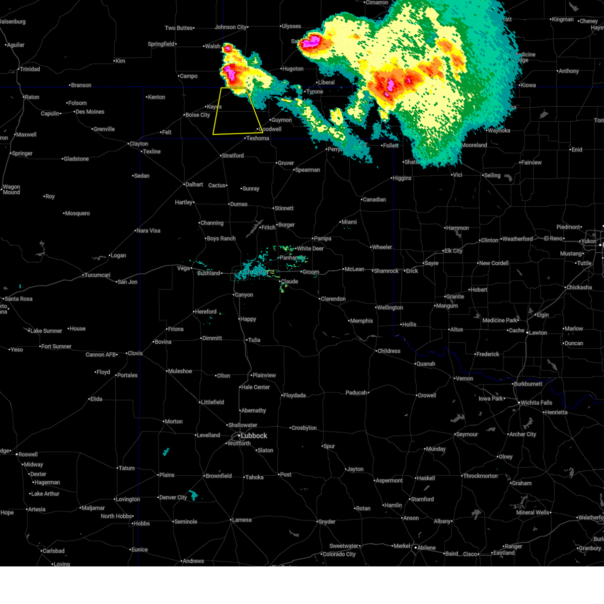
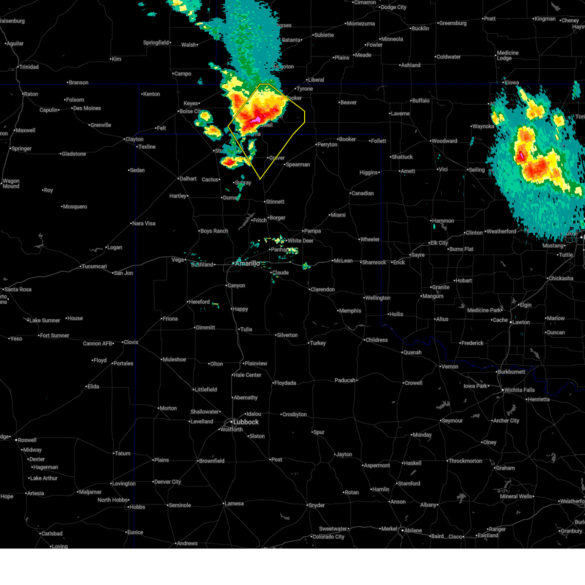
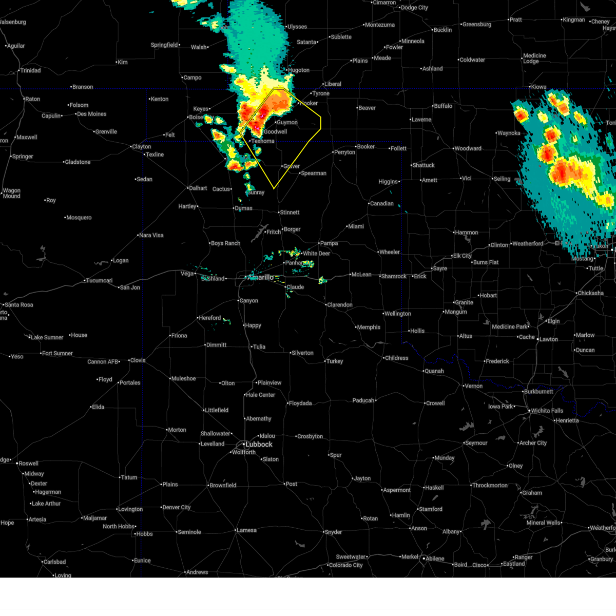
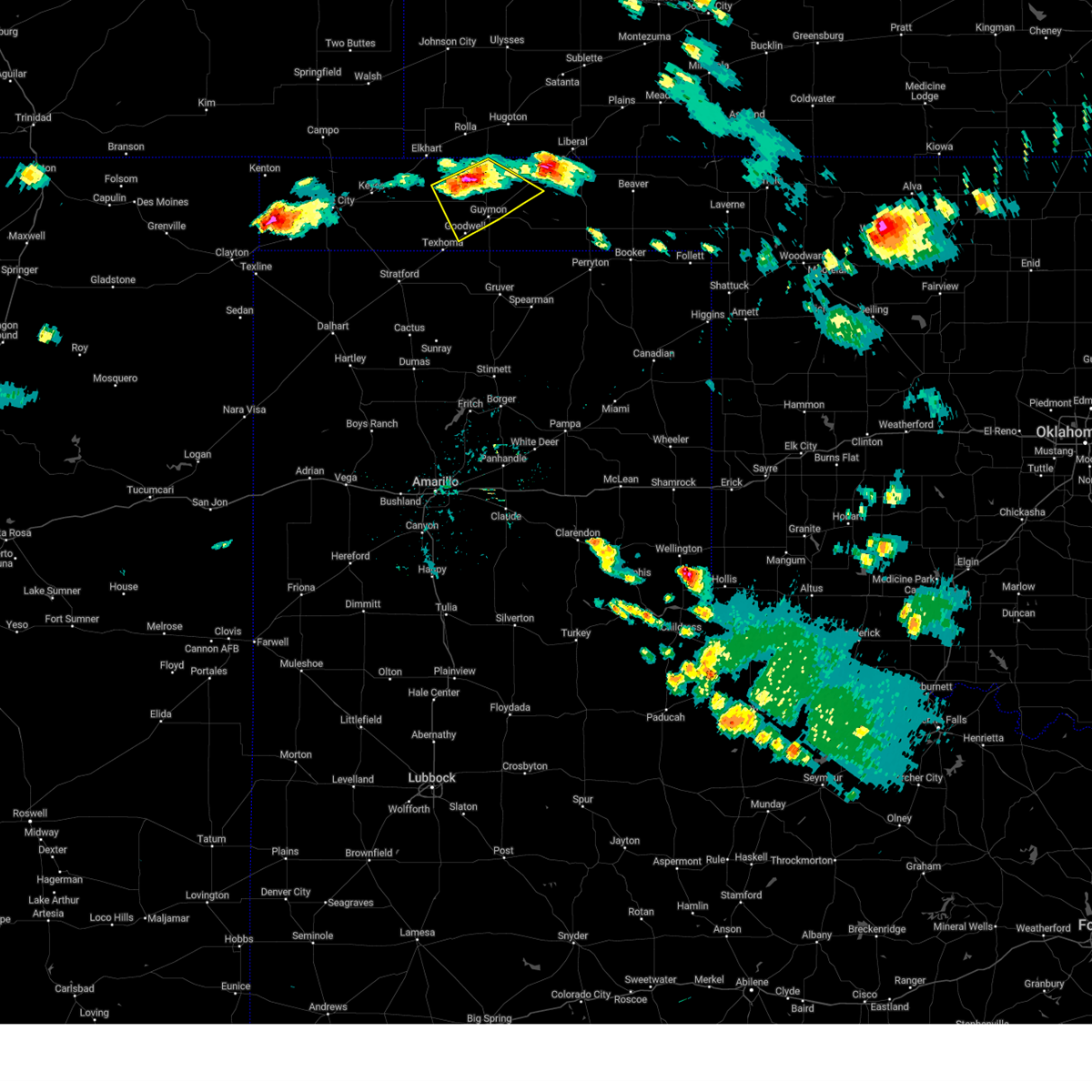
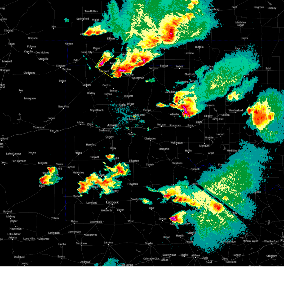
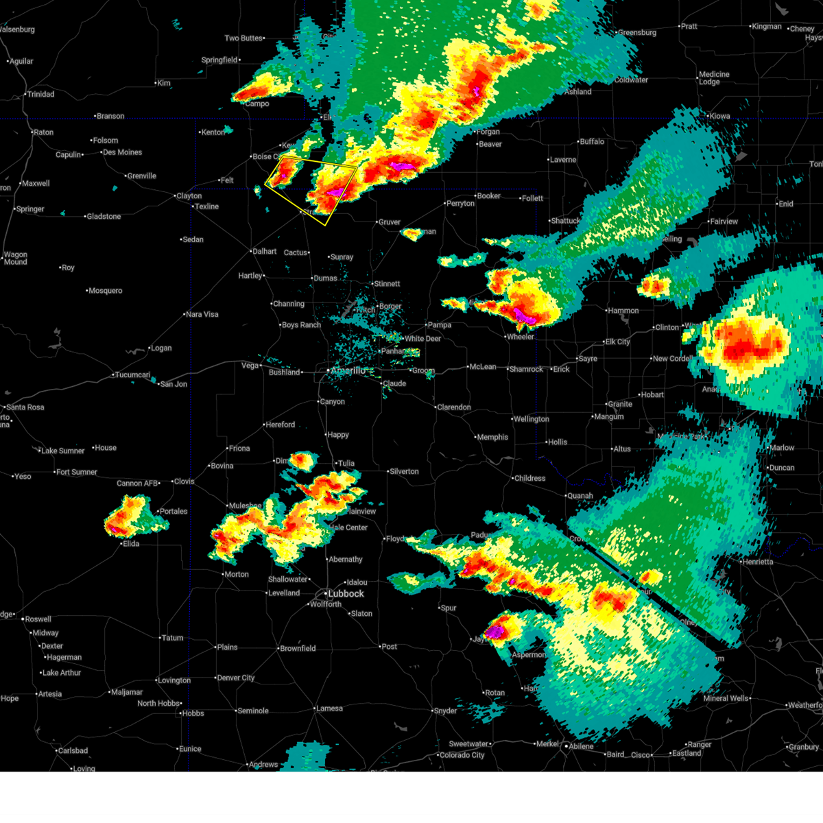
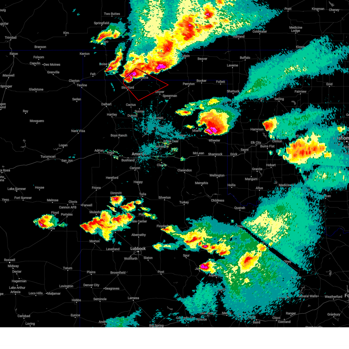
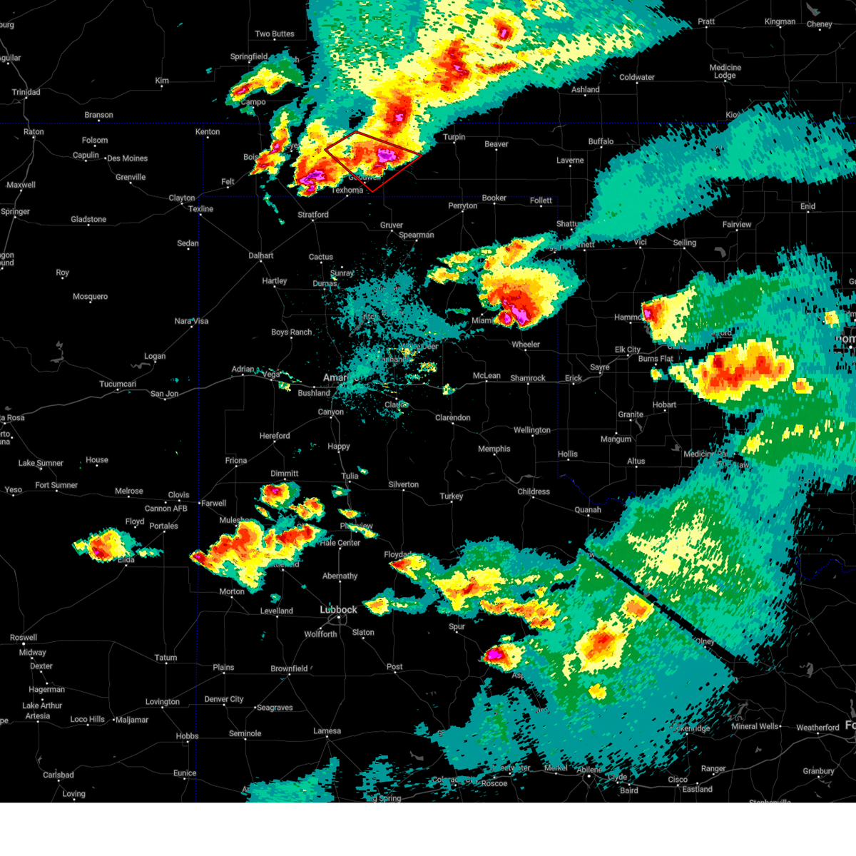
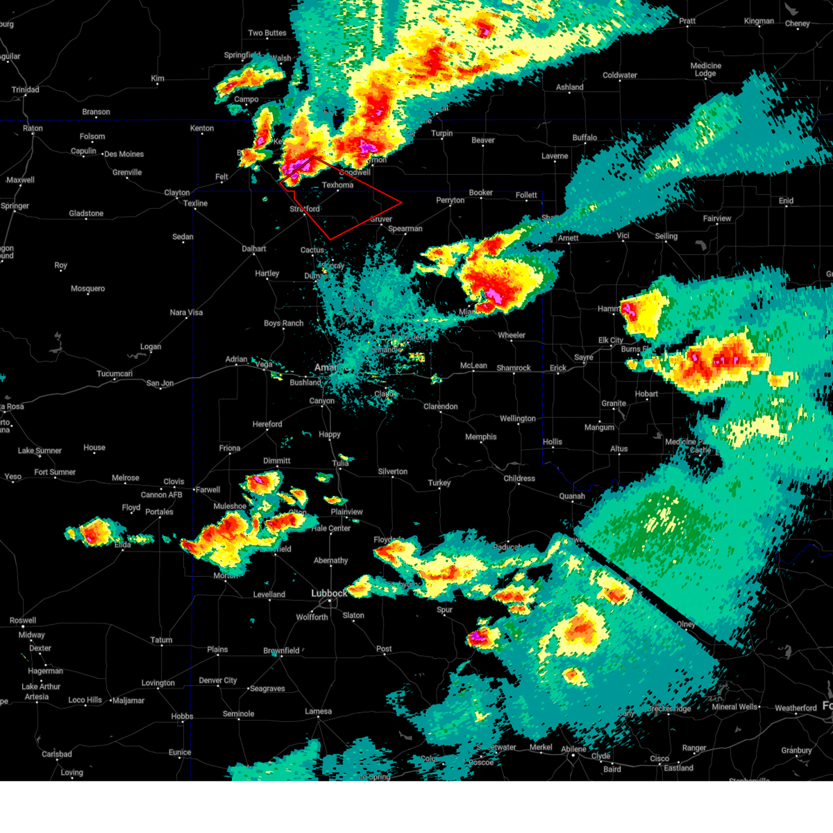
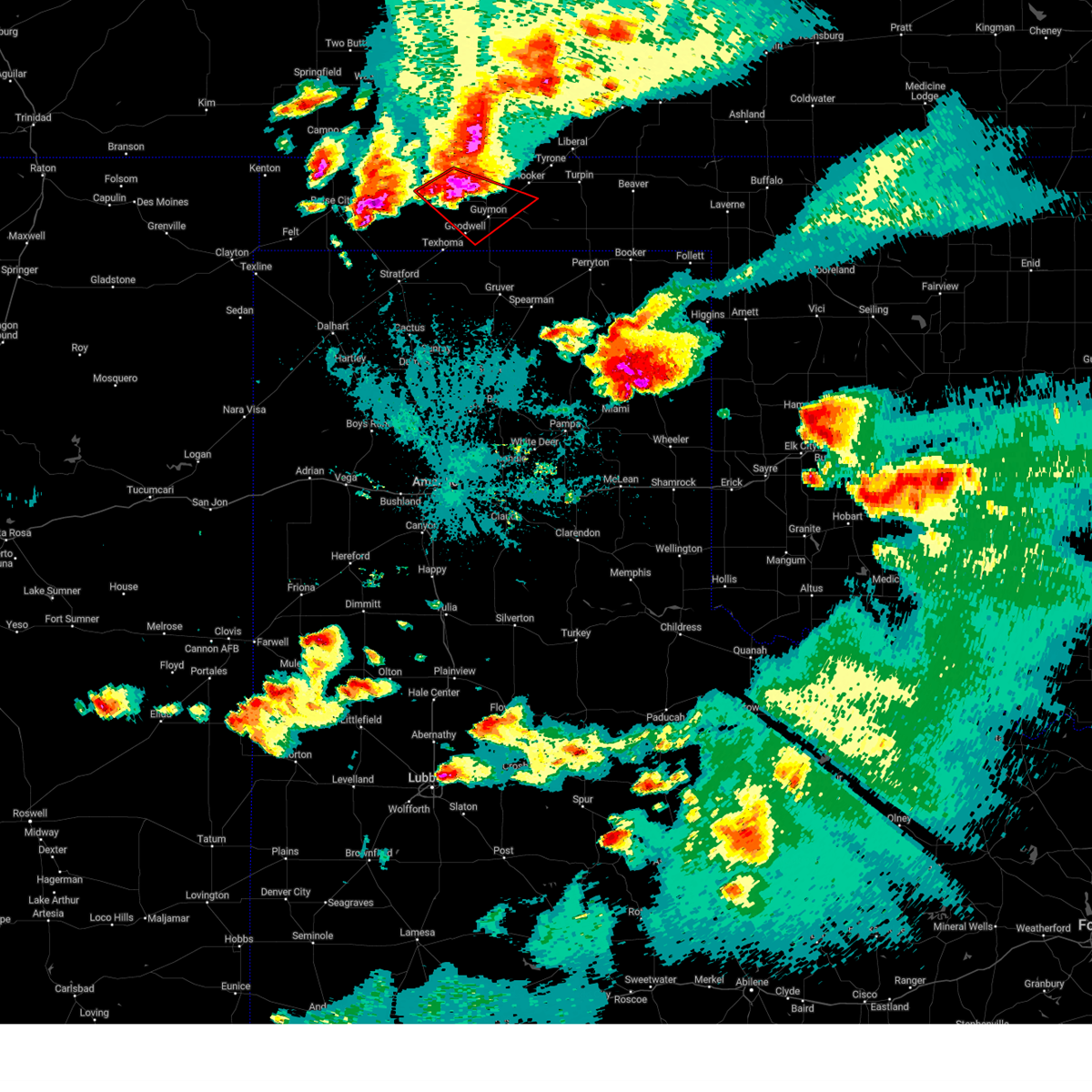
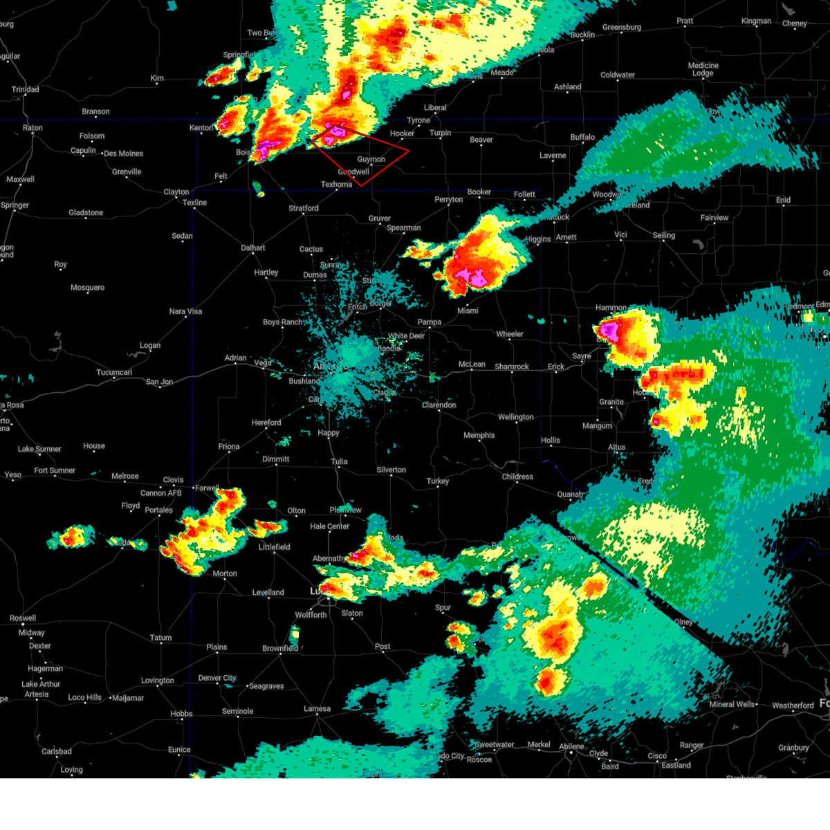
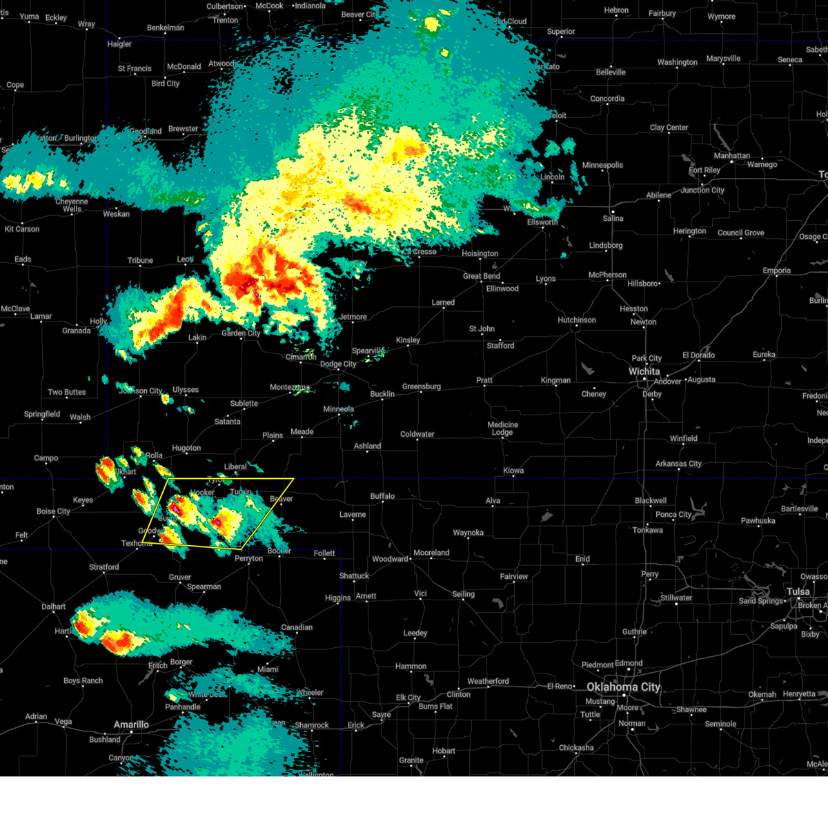
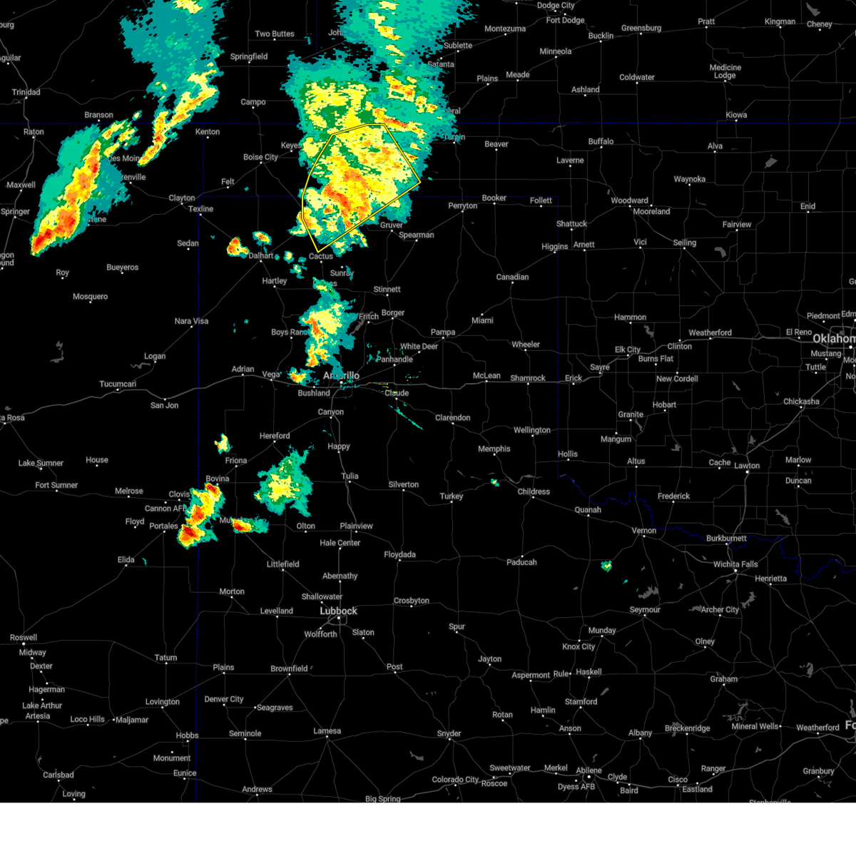
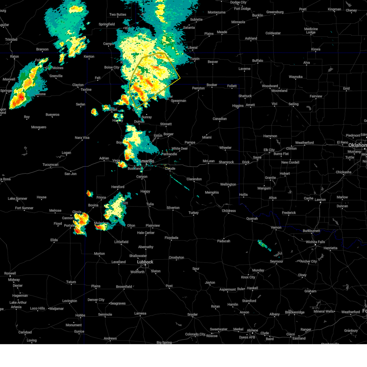
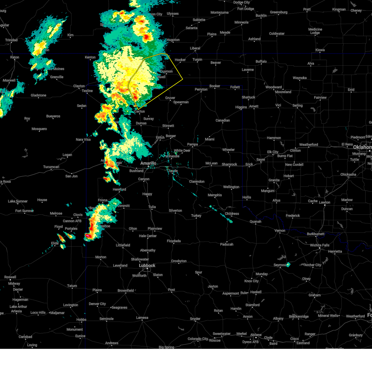
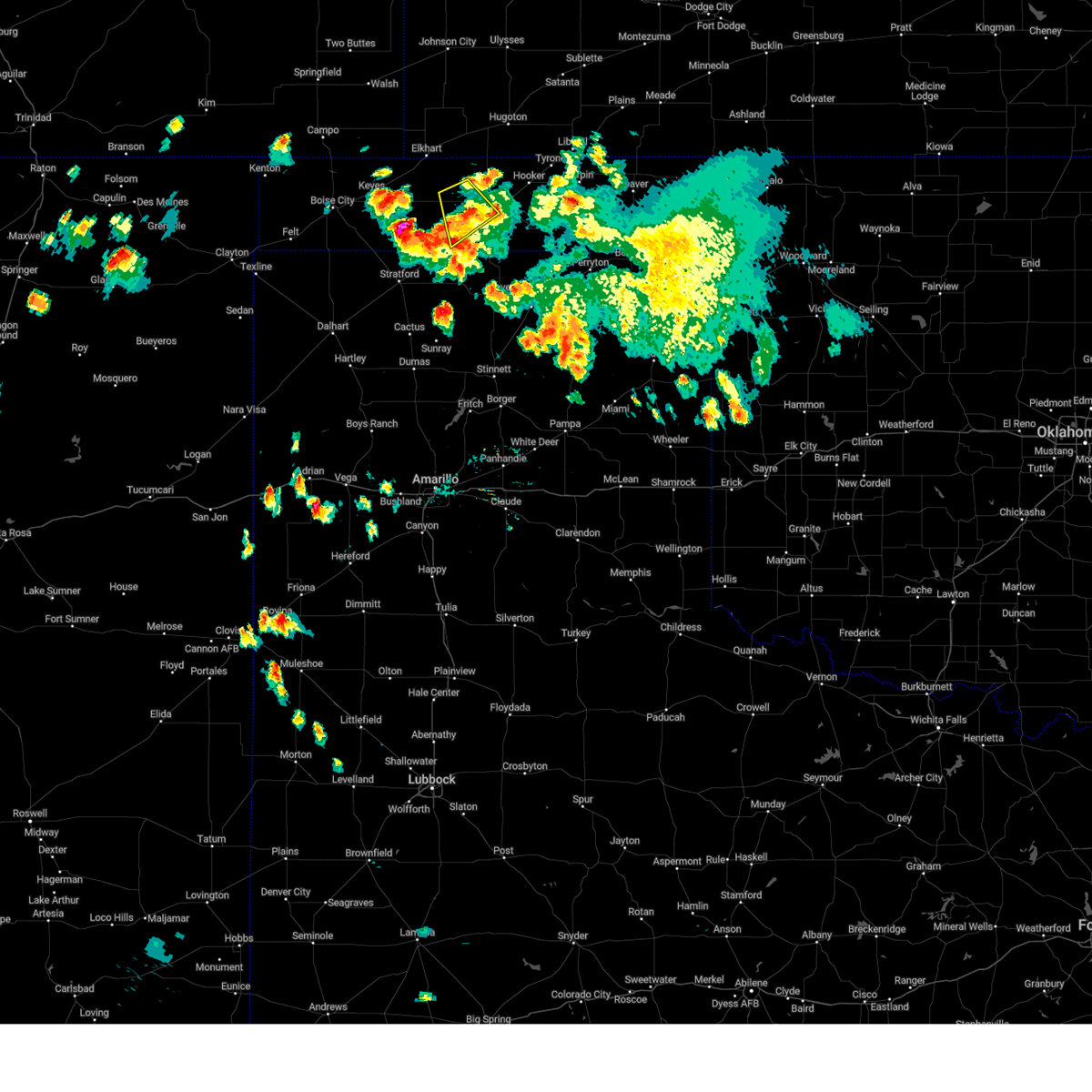
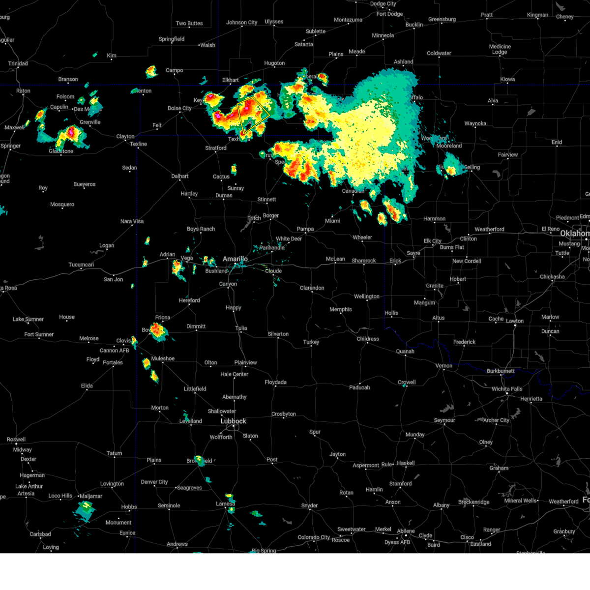
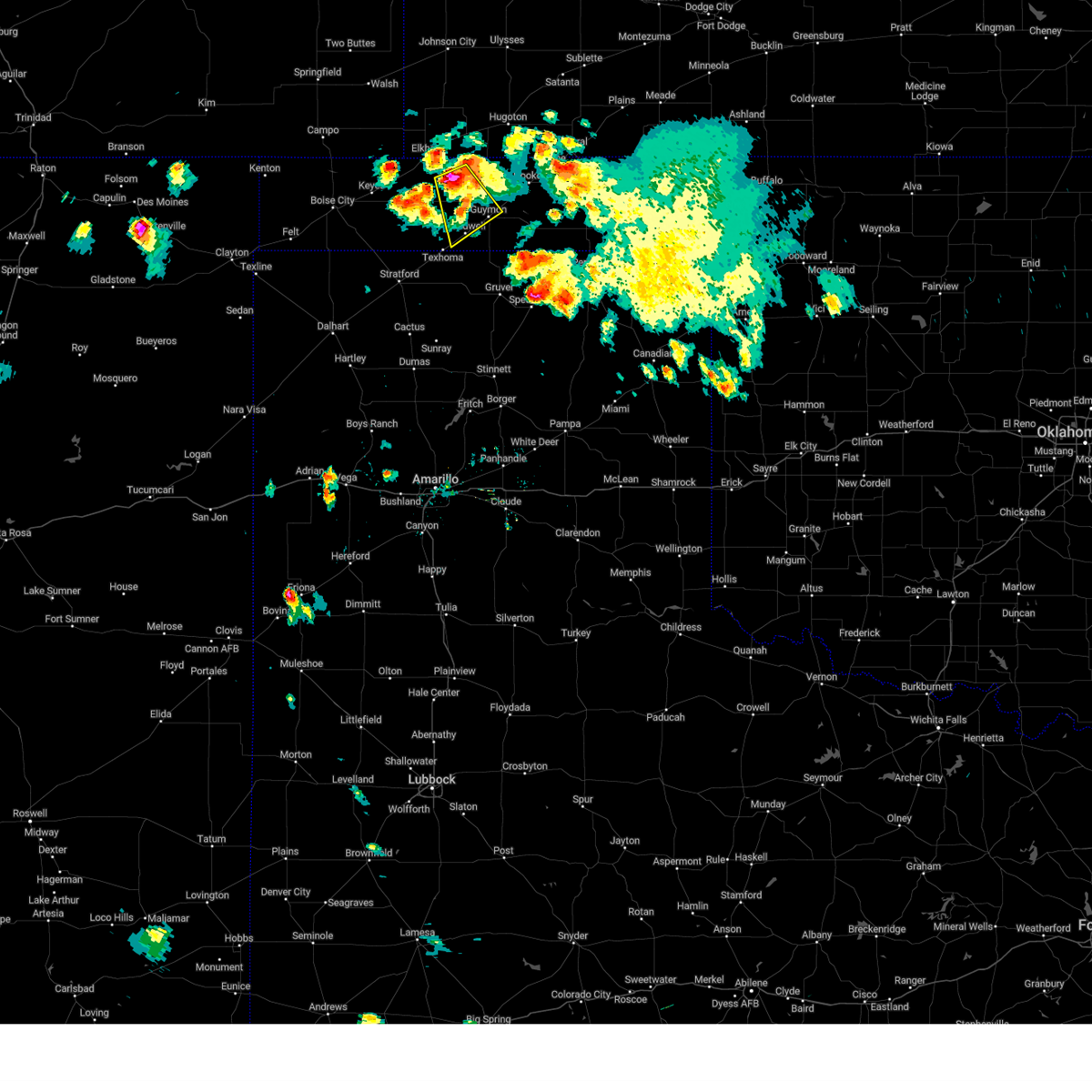
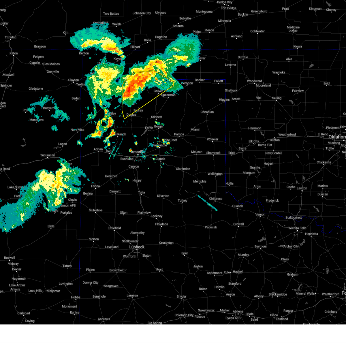
Hail Map for Goodwell, OK
The Goodwell, OK area has had 27 reports of on-the-ground hail by trained spotters, and has been under severe weather warnings 22 times during the past 12 months. Doppler radar has detected hail at or near Goodwell, OK on 80 occasions, including 6 occasions during the past year.
| Name: | Goodwell, OK |
| Where Located: | 96.3 miles N of Amarillo, TX |
| Map: | Google Map for Goodwell, OK |
| Population: | 1293 |
| Housing Units: | 447 |
| More Info: | Search Google for Goodwell, OK |
0
The Top Recent Hail Date for Goodwell, OK is Thursday, June 25, 2026 (53rd out of 80)
Hail and Wind Damage Spotted near Goodwell, OK
| Date / Time | Report Details |
|---|---|
| 6/26/2026 11:31 PM CDT |
 At 1130 pm cdt, severe thunderstorms were located along a line extending from 4 miles north of hough to 5 miles northeast of optima to 10 miles northwest of farnsworth, moving northeast at 55 mph (radar indicated). Hazards include 70 mph wind gusts and quarter size hail. Expect some tree damage. damage is likely to mobile homes, roofs, and outbuildings. hail damage to vehicles is expected. Locations impacted include, guymon, spearman, hooker, goodwell, gruver, tyrone, optima, hardesty, hough, baker, and adams. At 1130 pm cdt, severe thunderstorms were located along a line extending from 4 miles north of hough to 5 miles northeast of optima to 10 miles northwest of farnsworth, moving northeast at 55 mph (radar indicated). Hazards include 70 mph wind gusts and quarter size hail. Expect some tree damage. damage is likely to mobile homes, roofs, and outbuildings. hail damage to vehicles is expected. Locations impacted include, guymon, spearman, hooker, goodwell, gruver, tyrone, optima, hardesty, hough, baker, and adams.
|
| 6/26/2026 11:31 PM CDT |
 the severe thunderstorm warning has been cancelled and is no longer in effect the severe thunderstorm warning has been cancelled and is no longer in effect
|
| 6/26/2026 11:06 PM CDT |
 the severe thunderstorm warning has been cancelled and is no longer in effect the severe thunderstorm warning has been cancelled and is no longer in effect
|
| 6/26/2026 11:06 PM CDT |
 At 1105 pm cdt, severe thunderstorms were located along a line extending from 3 miles southwest of eva to 4 miles southeast of goodwell to 5 miles southwest of spearman, moving northeast at 50 mph (radar indicated). Hazards include 60 mph wind gusts and quarter size hail. Minor damage to roofs, siding, and trees is possible. hail damage to vehicles is expected. Locations impacted include, guymon, spearman, hooker, goodwell, gruver, tyrone, optima, hardesty, hough, adams, eva, morse, baker, and texhoma. At 1105 pm cdt, severe thunderstorms were located along a line extending from 3 miles southwest of eva to 4 miles southeast of goodwell to 5 miles southwest of spearman, moving northeast at 50 mph (radar indicated). Hazards include 60 mph wind gusts and quarter size hail. Minor damage to roofs, siding, and trees is possible. hail damage to vehicles is expected. Locations impacted include, guymon, spearman, hooker, goodwell, gruver, tyrone, optima, hardesty, hough, adams, eva, morse, baker, and texhoma.
|
| 6/26/2026 11:00 PM CDT | Ok mesonet measured a peak wind gust of 78 mph at 11:15 pm. first wind gusts of 58 mph occurred at 11 p in texas county OK, 1.9 miles WSW of Goodwell, OK |
| 6/26/2026 10:40 PM CDT |
 Svrama the national weather service in amarillo has issued a * severe thunderstorm warning for, texas county in the panhandle of oklahoma, eastern cimarron county in the panhandle of oklahoma, hansford county in the panhandle of texas, sherman county in the panhandle of texas, northeastern dallam county in the panhandle of texas, * until 1145 pm cdt. * at 1040 pm cdt, severe thunderstorms were located along a line extending from 4 miles east of keyes to 3 miles south of texhoma to 7 miles west of morse, moving northeast at 55 mph (radar indicated). Hazards include 70 mph wind gusts and quarter size hail. Expect some tree damage. damage is likely to mobile homes, roofs, and outbuildings. Hail damage to vehicles is expected. Svrama the national weather service in amarillo has issued a * severe thunderstorm warning for, texas county in the panhandle of oklahoma, eastern cimarron county in the panhandle of oklahoma, hansford county in the panhandle of texas, sherman county in the panhandle of texas, northeastern dallam county in the panhandle of texas, * until 1145 pm cdt. * at 1040 pm cdt, severe thunderstorms were located along a line extending from 4 miles east of keyes to 3 miles south of texhoma to 7 miles west of morse, moving northeast at 55 mph (radar indicated). Hazards include 70 mph wind gusts and quarter size hail. Expect some tree damage. damage is likely to mobile homes, roofs, and outbuildings. Hail damage to vehicles is expected.
|
| 6/26/2026 10:13 PM CDT |
 At 1013 pm cdt, severe thunderstorms were located along a line extending from 3 miles north of boise city to 4 miles north of conlen to 6 miles east of dumas, moving northeast at 35 mph (radar indicated). Hazards include 70 mph wind gusts and quarter size hail. Expect some tree damage. damage is likely to mobile homes, roofs, and outbuildings. hail damage to vehicles is expected. Locations impacted include, dumas, stratford, boise city, cactus, sunray, stinnett, goodwell, keyes, griggs, pringle, eva, morse, four way, conlen, texhoma, and sturgis. At 1013 pm cdt, severe thunderstorms were located along a line extending from 3 miles north of boise city to 4 miles north of conlen to 6 miles east of dumas, moving northeast at 35 mph (radar indicated). Hazards include 70 mph wind gusts and quarter size hail. Expect some tree damage. damage is likely to mobile homes, roofs, and outbuildings. hail damage to vehicles is expected. Locations impacted include, dumas, stratford, boise city, cactus, sunray, stinnett, goodwell, keyes, griggs, pringle, eva, morse, four way, conlen, texhoma, and sturgis.
|
| 6/26/2026 9:52 PM CDT |
 Svrama the national weather service in amarillo has issued a * severe thunderstorm warning for, western texas county in the panhandle of oklahoma, cimarron county in the panhandle of oklahoma, northwestern hutchinson county in the panhandle of texas, western hansford county in the panhandle of texas, sherman county in the panhandle of texas, eastern dallam county in the panhandle of texas, moore county in the panhandle of texas, eastern hartley county in the panhandle of texas, * until 1045 pm cdt. * at 952 pm cdt, severe thunderstorms were located along a line extending from 6 miles east of black mesa park to 8 miles west of conlen to 4 miles northwest of four way, moving northeast at 35 mph (radar indicated). Hazards include 70 mph wind gusts and quarter size hail. Expect some tree damage. damage is likely to mobile homes, roofs, and outbuildings. Hail damage to vehicles is expected. Svrama the national weather service in amarillo has issued a * severe thunderstorm warning for, western texas county in the panhandle of oklahoma, cimarron county in the panhandle of oklahoma, northwestern hutchinson county in the panhandle of texas, western hansford county in the panhandle of texas, sherman county in the panhandle of texas, eastern dallam county in the panhandle of texas, moore county in the panhandle of texas, eastern hartley county in the panhandle of texas, * until 1045 pm cdt. * at 952 pm cdt, severe thunderstorms were located along a line extending from 6 miles east of black mesa park to 8 miles west of conlen to 4 miles northwest of four way, moving northeast at 35 mph (radar indicated). Hazards include 70 mph wind gusts and quarter size hail. Expect some tree damage. damage is likely to mobile homes, roofs, and outbuildings. Hail damage to vehicles is expected.
|
| 6/25/2026 5:53 PM CDT |
 Svrama the national weather service in amarillo has issued a * severe thunderstorm warning for, southwestern texas county in the panhandle of oklahoma, southeastern cimarron county in the panhandle of oklahoma, northwestern hansford county in the panhandle of texas, northern sherman county in the panhandle of texas, * until 645 pm cdt. * at 553 pm cdt, a severe thunderstorm was located 7 miles west of texhoma, or 14 miles northeast of stratford, moving east at 30 mph (radar indicated). Hazards include 60 mph wind gusts and half dollar size hail. Minor damage to roofs, siding, and trees is possible. Hail damage to vehicles is expected. Svrama the national weather service in amarillo has issued a * severe thunderstorm warning for, southwestern texas county in the panhandle of oklahoma, southeastern cimarron county in the panhandle of oklahoma, northwestern hansford county in the panhandle of texas, northern sherman county in the panhandle of texas, * until 645 pm cdt. * at 553 pm cdt, a severe thunderstorm was located 7 miles west of texhoma, or 14 miles northeast of stratford, moving east at 30 mph (radar indicated). Hazards include 60 mph wind gusts and half dollar size hail. Minor damage to roofs, siding, and trees is possible. Hail damage to vehicles is expected.
|
| 6/25/2026 5:21 PM CDT |
 Svrama the national weather service in amarillo has issued a * severe thunderstorm warning for, southwestern texas county in the panhandle of oklahoma, * until 615 pm cdt. * at 521 pm cdt, a severe thunderstorm was located 7 miles northwest of goodwell, or 14 miles west of guymon, moving east at 20 mph (radar indicated). Hazards include two inch hail and 60 mph wind gusts. Minor damage to roofs, siding, and trees is possible. people and animals outdoors will be injured. Expect hail damage to roofs, siding, windows, and vehicles. Svrama the national weather service in amarillo has issued a * severe thunderstorm warning for, southwestern texas county in the panhandle of oklahoma, * until 615 pm cdt. * at 521 pm cdt, a severe thunderstorm was located 7 miles northwest of goodwell, or 14 miles west of guymon, moving east at 20 mph (radar indicated). Hazards include two inch hail and 60 mph wind gusts. Minor damage to roofs, siding, and trees is possible. people and animals outdoors will be injured. Expect hail damage to roofs, siding, windows, and vehicles.
|
| 6/24/2026 2:50 AM CDT |
 Svrama the national weather service in amarillo has issued a * severe thunderstorm warning for, central texas county in the panhandle of oklahoma, * until 345 am cdt. * at 250 am cdt, a severe thunderstorm was located 7 miles north of goodwell, or 9 miles west of guymon, moving east at 30 mph (radar indicated). Hazards include 60 mph wind gusts and half dollar size hail. Minor damage to roofs, siding, and trees is possible. Hail damage to vehicles is expected. Svrama the national weather service in amarillo has issued a * severe thunderstorm warning for, central texas county in the panhandle of oklahoma, * until 345 am cdt. * at 250 am cdt, a severe thunderstorm was located 7 miles north of goodwell, or 9 miles west of guymon, moving east at 30 mph (radar indicated). Hazards include 60 mph wind gusts and half dollar size hail. Minor damage to roofs, siding, and trees is possible. Hail damage to vehicles is expected.
|
| 6/12/2026 9:45 PM CDT |
 At 944 pm cdt, severe thunderstorms were located along a line extending from 11 miles northeast of hough to 4 miles south of optima to 14 miles south of guymon, moving east at 40 mph (radar indicated). Hazards include 70 mph wind gusts and penny size hail. Expect some tree damage. damage is likely to mobile homes, roofs, and outbuildings. Locations impacted include, guymon, hooker, goodwell, texhoma, tyrone, optima, hardesty, hough, baker, and adams. At 944 pm cdt, severe thunderstorms were located along a line extending from 11 miles northeast of hough to 4 miles south of optima to 14 miles south of guymon, moving east at 40 mph (radar indicated). Hazards include 70 mph wind gusts and penny size hail. Expect some tree damage. damage is likely to mobile homes, roofs, and outbuildings. Locations impacted include, guymon, hooker, goodwell, texhoma, tyrone, optima, hardesty, hough, baker, and adams.
|
| 6/12/2026 9:24 PM CDT |
 Svrama the national weather service in amarillo has issued a * severe thunderstorm warning for, texas county in the panhandle of oklahoma, * until 1000 pm cdt. * at 922 pm cdt, severe thunderstorms were located along a line extending from 5 miles northeast of hough to 6 miles west of guymon to texhoma, moving east at 40 mph. these are destructive storms for guymon, hooker, goodwill, hardesty (radar indicated). Hazards include 80 mph wind gusts and nickel size hail. Flying debris will be dangerous to those caught without shelter. mobile homes will be heavily damaged. expect considerable damage to roofs, windows, and vehicles. Tree damage and power outages are likely. Svrama the national weather service in amarillo has issued a * severe thunderstorm warning for, texas county in the panhandle of oklahoma, * until 1000 pm cdt. * at 922 pm cdt, severe thunderstorms were located along a line extending from 5 miles northeast of hough to 6 miles west of guymon to texhoma, moving east at 40 mph. these are destructive storms for guymon, hooker, goodwill, hardesty (radar indicated). Hazards include 80 mph wind gusts and nickel size hail. Flying debris will be dangerous to those caught without shelter. mobile homes will be heavily damaged. expect considerable damage to roofs, windows, and vehicles. Tree damage and power outages are likely.
|
| 6/12/2026 8:50 PM CDT |
 Svrama the national weather service in amarillo has issued a * severe thunderstorm warning for, texas county in the panhandle of oklahoma, southeastern cimarron county in the panhandle of oklahoma, northern sherman county in the panhandle of texas, northeastern dallam county in the panhandle of texas, * until 930 pm cdt. * at 850 pm cdt, severe thunderstorms were located along a line extending from 4 miles south of wilburton to 6 miles east of griggs to 7 miles southeast of felt, moving east at 45 mph (radar indicated). Hazards include 60 mph wind gusts. minor damage to roofs, siding, and trees is possible Svrama the national weather service in amarillo has issued a * severe thunderstorm warning for, texas county in the panhandle of oklahoma, southeastern cimarron county in the panhandle of oklahoma, northern sherman county in the panhandle of texas, northeastern dallam county in the panhandle of texas, * until 930 pm cdt. * at 850 pm cdt, severe thunderstorms were located along a line extending from 4 miles south of wilburton to 6 miles east of griggs to 7 miles southeast of felt, moving east at 45 mph (radar indicated). Hazards include 60 mph wind gusts. minor damage to roofs, siding, and trees is possible
|
| 5/14/2026 7:20 PM CDT |
 The storm which prompted the warning has weakened below severe limits, and has exited the warned area. therefore, the warning will be allowed to expire. a severe thunderstorm watch remains in effect until 1000 pm cdt for the panhandle of oklahoma. The storm which prompted the warning has weakened below severe limits, and has exited the warned area. therefore, the warning will be allowed to expire. a severe thunderstorm watch remains in effect until 1000 pm cdt for the panhandle of oklahoma.
|
| 5/14/2026 6:48 PM CDT |
 At 647 pm cdt, a severe thunderstorm was located 5 miles northeast of goodwell, or 6 miles southwest of guymon, moving east at 30 mph (radar indicated). Hazards include 70 mph wind gusts and penny size hail. Expect some tree damage. damage is likely to mobile homes, roofs, and outbuildings. Locations impacted include, guymon, goodwell, optima, and hardesty. At 647 pm cdt, a severe thunderstorm was located 5 miles northeast of goodwell, or 6 miles southwest of guymon, moving east at 30 mph (radar indicated). Hazards include 70 mph wind gusts and penny size hail. Expect some tree damage. damage is likely to mobile homes, roofs, and outbuildings. Locations impacted include, guymon, goodwell, optima, and hardesty.
|
| 5/14/2026 6:27 PM CDT |
 Svrama the national weather service in amarillo has issued a * severe thunderstorm warning for, southeastern texas county in the panhandle of oklahoma, * until 730 pm cdt. * at 627 pm cdt, a severe thunderstorm was located 5 miles west of goodwell, or 15 miles west of guymon, moving east at 30 mph (radar indicated). Hazards include 70 mph wind gusts and penny size hail. Blowing dust and reduced visibilities are likely. expect some tree damage. Damage is likely to mobile homes, roofs, and outbuildings. Svrama the national weather service in amarillo has issued a * severe thunderstorm warning for, southeastern texas county in the panhandle of oklahoma, * until 730 pm cdt. * at 627 pm cdt, a severe thunderstorm was located 5 miles west of goodwell, or 15 miles west of guymon, moving east at 30 mph (radar indicated). Hazards include 70 mph wind gusts and penny size hail. Blowing dust and reduced visibilities are likely. expect some tree damage. Damage is likely to mobile homes, roofs, and outbuildings.
|
| 5/14/2026 4:53 PM CDT |
 Svrama the national weather service in amarillo has issued a * severe thunderstorm warning for, central texas county in the panhandle of oklahoma, * until 600 pm cdt. * at 452 pm cdt, a severe thunderstorm was located 4 miles southeast of eva, or 16 miles south of elkhart, moving east at 30 mph (radar indicated). Hazards include 70 mph wind gusts. Expect some tree damage. Damage is likely to mobile homes, roofs, and outbuildings. Svrama the national weather service in amarillo has issued a * severe thunderstorm warning for, central texas county in the panhandle of oklahoma, * until 600 pm cdt. * at 452 pm cdt, a severe thunderstorm was located 4 miles southeast of eva, or 16 miles south of elkhart, moving east at 30 mph (radar indicated). Hazards include 70 mph wind gusts. Expect some tree damage. Damage is likely to mobile homes, roofs, and outbuildings.
|
| 9/9/2025 7:16 PM CDT | the severe thunderstorm warning has been cancelled and is no longer in effect |
| 9/9/2025 6:50 PM CDT | At 649 pm cdt, a severe thunderstorm was located 9 miles west of texhoma, or 12 miles northeast of stratford, moving northeast at 25 mph (radar indicated). Hazards include 60 mph wind gusts and half dollar size hail. Minor damage to roofs, siding, and trees is possible. hail damage to vehicles is expected. Locations impacted include, goodwell and texhoma. |
| 9/9/2025 6:34 PM CDT | Svrama the national weather service in amarillo has issued a * severe thunderstorm warning for, southwestern texas county in the panhandle of oklahoma, northwestern hansford county in the panhandle of texas, northern sherman county in the panhandle of texas, * until 730 pm cdt. * at 634 pm cdt, a severe thunderstorm was located 7 miles north of stratford, moving northeast at 30 mph (radar indicated). Hazards include ping pong ball size hail and 60 mph wind gusts. Minor damage to roofs, siding, and trees is possible. people and animals outdoors will be injured. Expect hail damage to roofs, siding, windows, and vehicles. |
| 8/3/2025 9:07 PM CDT |
 At 906 pm cdt, a severe thunderstorm was located 4 miles west of eva, or 14 miles south of elkhart, moving south at 45 mph (radar indicated). Hazards include 60 mph wind gusts and quarter size hail. Minor damage to roofs, siding, and trees is possible. hail damage to vehicles is expected. Locations impacted include, goodwell, eva, griggs, and sturgis. At 906 pm cdt, a severe thunderstorm was located 4 miles west of eva, or 14 miles south of elkhart, moving south at 45 mph (radar indicated). Hazards include 60 mph wind gusts and quarter size hail. Minor damage to roofs, siding, and trees is possible. hail damage to vehicles is expected. Locations impacted include, goodwell, eva, griggs, and sturgis.
|
| 8/3/2025 8:33 PM CDT |
 Svrama the national weather service in amarillo has issued a * severe thunderstorm warning for, western texas county in the panhandle of oklahoma, eastern cimarron county in the panhandle of oklahoma, * until 930 pm cdt. * at 833 pm cdt, a severe thunderstorm was located near elkhart, moving south at 35 mph (radar indicated). Hazards include golf ball size hail and 70 mph wind gusts. Expect some tree damage. damage is likely to mobile homes, roofs, and outbuildings. people and animals outdoors will be injured. Expect hail damage to roofs, siding, windows, and vehicles. Svrama the national weather service in amarillo has issued a * severe thunderstorm warning for, western texas county in the panhandle of oklahoma, eastern cimarron county in the panhandle of oklahoma, * until 930 pm cdt. * at 833 pm cdt, a severe thunderstorm was located near elkhart, moving south at 35 mph (radar indicated). Hazards include golf ball size hail and 70 mph wind gusts. Expect some tree damage. damage is likely to mobile homes, roofs, and outbuildings. people and animals outdoors will be injured. Expect hail damage to roofs, siding, windows, and vehicles.
|
| 6/15/2025 3:17 AM CDT |
 At 317 am cdt, severe thunderstorms were located along a line extending from 5 miles east of optima to 6 miles east of texhoma, moving southeast at 30 mph (radar indicated). Hazards include ping pong ball size hail and 60 mph wind gusts. Minor damage to roofs, siding, and trees is possible. people and animals outdoors will be injured. expect hail damage to roofs, siding, windows, and vehicles. Locations impacted include, guymon, goodwell, texhoma, hardesty, optima, hough, adams, gruver, and hooker. At 317 am cdt, severe thunderstorms were located along a line extending from 5 miles east of optima to 6 miles east of texhoma, moving southeast at 30 mph (radar indicated). Hazards include ping pong ball size hail and 60 mph wind gusts. Minor damage to roofs, siding, and trees is possible. people and animals outdoors will be injured. expect hail damage to roofs, siding, windows, and vehicles. Locations impacted include, guymon, goodwell, texhoma, hardesty, optima, hough, adams, gruver, and hooker.
|
| 6/15/2025 3:01 AM CDT |
 Svrama the national weather service in amarillo has issued a * severe thunderstorm warning for, central texas county in the panhandle of oklahoma, northwestern hansford county in the panhandle of texas, northeastern sherman county in the panhandle of texas, * until 345 am cdt. * at 301 am cdt, severe thunderstorms were located along a line extending from 6 miles north of optima to 3 miles east of texhoma, moving southeast at 35 mph (radar indicated). Hazards include 60 mph wind gusts and quarter size hail. Minor damage to roofs, siding, and trees is possible. Hail damage to vehicles is expected. Svrama the national weather service in amarillo has issued a * severe thunderstorm warning for, central texas county in the panhandle of oklahoma, northwestern hansford county in the panhandle of texas, northeastern sherman county in the panhandle of texas, * until 345 am cdt. * at 301 am cdt, severe thunderstorms were located along a line extending from 6 miles north of optima to 3 miles east of texhoma, moving southeast at 35 mph (radar indicated). Hazards include 60 mph wind gusts and quarter size hail. Minor damage to roofs, siding, and trees is possible. Hail damage to vehicles is expected.
|
| 6/8/2025 2:24 PM CDT |
 Svrama the national weather service in amarillo has issued a * severe thunderstorm warning for, central texas county in the panhandle of oklahoma, * until 330 pm cdt. * at 223 pm cdt, a severe thunderstorm was located over hough, or 14 miles northwest of guymon, moving southeast at 15 mph (radar indicated). Hazards include golf ball size hail and 60 mph wind gusts. Minor damage to roofs, siding, and trees is possible. people and animals outdoors will be injured. Expect hail damage to roofs, siding, windows, and vehicles. Svrama the national weather service in amarillo has issued a * severe thunderstorm warning for, central texas county in the panhandle of oklahoma, * until 330 pm cdt. * at 223 pm cdt, a severe thunderstorm was located over hough, or 14 miles northwest of guymon, moving southeast at 15 mph (radar indicated). Hazards include golf ball size hail and 60 mph wind gusts. Minor damage to roofs, siding, and trees is possible. people and animals outdoors will be injured. Expect hail damage to roofs, siding, windows, and vehicles.
|
| 6/6/2025 11:31 PM CDT |
 At 1131 pm cdt, a severe thunderstorm was located 7 miles southeast of griggs, or 12 miles north of stratford, moving southeast at 40 mph (radar indicated). Hazards include golf ball size hail and 60 mph wind gusts. Minor damage to roofs, siding, and trees is possible. people and animals outdoors will be injured. expect hail damage to roofs, siding, windows, and vehicles. Locations impacted include, goodwell, texhoma, and griggs. At 1131 pm cdt, a severe thunderstorm was located 7 miles southeast of griggs, or 12 miles north of stratford, moving southeast at 40 mph (radar indicated). Hazards include golf ball size hail and 60 mph wind gusts. Minor damage to roofs, siding, and trees is possible. people and animals outdoors will be injured. expect hail damage to roofs, siding, windows, and vehicles. Locations impacted include, goodwell, texhoma, and griggs.
|
| 6/6/2025 11:19 PM CDT |
 Svrama the national weather service in amarillo has issued a * severe thunderstorm warning for, southwestern texas county in the panhandle of oklahoma, southeastern cimarron county in the panhandle of oklahoma, northwestern sherman county in the panhandle of texas, northeastern dallam county in the panhandle of texas, * until midnight cdt. * at 1119 pm cdt, a severe thunderstorm was located near griggs, or 16 miles north of stratford, moving southeast at 40 mph (radar indicated). Hazards include 60 mph wind gusts and half dollar size hail. Minor damage to roofs, siding, and trees is possible. Hail damage to vehicles is expected. Svrama the national weather service in amarillo has issued a * severe thunderstorm warning for, southwestern texas county in the panhandle of oklahoma, southeastern cimarron county in the panhandle of oklahoma, northwestern sherman county in the panhandle of texas, northeastern dallam county in the panhandle of texas, * until midnight cdt. * at 1119 pm cdt, a severe thunderstorm was located near griggs, or 16 miles north of stratford, moving southeast at 40 mph (radar indicated). Hazards include 60 mph wind gusts and half dollar size hail. Minor damage to roofs, siding, and trees is possible. Hail damage to vehicles is expected.
|
| 6/6/2025 11:06 PM CDT |
 At 1105 pm cdt, a severe thunderstorm capable of producing a tornado was located 5 miles west of texhoma, or 14 miles northeast of stratford, moving southeast at 35 mph (radar indicated rotation). Hazards include tornado and three inch hail. Flying debris will be dangerous to those caught without shelter. mobile homes will be damaged or destroyed. damage to roofs, windows, and vehicles will occur. tree damage is likely. Locations impacted include, texhoma. At 1105 pm cdt, a severe thunderstorm capable of producing a tornado was located 5 miles west of texhoma, or 14 miles northeast of stratford, moving southeast at 35 mph (radar indicated rotation). Hazards include tornado and three inch hail. Flying debris will be dangerous to those caught without shelter. mobile homes will be damaged or destroyed. damage to roofs, windows, and vehicles will occur. tree damage is likely. Locations impacted include, texhoma.
|
| 6/6/2025 10:55 PM CDT |
 The tornado threat has diminished and the tornado warning has been cancelled. however, large hail and damaging winds remain likely and a severe thunderstorm warning remains in effect for the area. a tornado watch remains in effect until 600 am cdt for the panhandle of oklahoma. remember, a severe thunderstorm warning still remains in effect for texas county. The tornado threat has diminished and the tornado warning has been cancelled. however, large hail and damaging winds remain likely and a severe thunderstorm warning remains in effect for the area. a tornado watch remains in effect until 600 am cdt for the panhandle of oklahoma. remember, a severe thunderstorm warning still remains in effect for texas county.
|
| 6/6/2025 10:47 PM CDT |
 Torama the national weather service in amarillo has issued a * tornado warning for, southwestern texas county in the panhandle of oklahoma, southeastern cimarron county in the panhandle of oklahoma, northwestern hansford county in the panhandle of texas, northern sherman county in the panhandle of texas, * until 1130 pm cdt. * at 1047 pm cdt, a severe thunderstorm capable of producing a tornado was located over griggs, or 17 miles north of stratford, moving southeast at 40 mph (radar indicated rotation). Hazards include tornado and tennis ball size hail. Flying debris will be dangerous to those caught without shelter. mobile homes will be damaged or destroyed. damage to roofs, windows, and vehicles will occur. Tree damage is likely. Torama the national weather service in amarillo has issued a * tornado warning for, southwestern texas county in the panhandle of oklahoma, southeastern cimarron county in the panhandle of oklahoma, northwestern hansford county in the panhandle of texas, northern sherman county in the panhandle of texas, * until 1130 pm cdt. * at 1047 pm cdt, a severe thunderstorm capable of producing a tornado was located over griggs, or 17 miles north of stratford, moving southeast at 40 mph (radar indicated rotation). Hazards include tornado and tennis ball size hail. Flying debris will be dangerous to those caught without shelter. mobile homes will be damaged or destroyed. damage to roofs, windows, and vehicles will occur. Tree damage is likely.
|
| 6/6/2025 10:36 PM CDT |
 At 1035 pm cdt, a severe thunderstorm capable of producing a tornado was located 8 miles southwest of hough, or 10 miles northwest of guymon, moving southeast at 35 mph (radar indicated rotation). Hazards include tornado and two inch hail. Flying debris will be dangerous to those caught without shelter. mobile homes will be damaged or destroyed. damage to roofs, windows, and vehicles will occur. tree damage is likely. Locations impacted include, guymon, eva, goodwell, optima, and hough. At 1035 pm cdt, a severe thunderstorm capable of producing a tornado was located 8 miles southwest of hough, or 10 miles northwest of guymon, moving southeast at 35 mph (radar indicated rotation). Hazards include tornado and two inch hail. Flying debris will be dangerous to those caught without shelter. mobile homes will be damaged or destroyed. damage to roofs, windows, and vehicles will occur. tree damage is likely. Locations impacted include, guymon, eva, goodwell, optima, and hough.
|
| 6/6/2025 10:22 PM CDT |
 Torama the national weather service in amarillo has issued a * tornado warning for, central texas county in the panhandle of oklahoma, * until 1100 pm cdt. * at 1021 pm cdt, a severe thunderstorm capable of producing a tornado was located 4 miles east of eva, or 13 miles south of elkhart, moving southeast at 30 mph (radar indicated rotation). Hazards include tornado and golf ball size hail. Flying debris will be dangerous to those caught without shelter. mobile homes will be damaged or destroyed. damage to roofs, windows, and vehicles will occur. Tree damage is likely. Torama the national weather service in amarillo has issued a * tornado warning for, central texas county in the panhandle of oklahoma, * until 1100 pm cdt. * at 1021 pm cdt, a severe thunderstorm capable of producing a tornado was located 4 miles east of eva, or 13 miles south of elkhart, moving southeast at 30 mph (radar indicated rotation). Hazards include tornado and golf ball size hail. Flying debris will be dangerous to those caught without shelter. mobile homes will be damaged or destroyed. damage to roofs, windows, and vehicles will occur. Tree damage is likely.
|
| 6/6/2025 8:15 PM CDT |
 At 814 pm cdt, a severe thunderstorm was located 7 miles southeast of goodwell, or 12 miles south of guymon, moving southeast at 20 mph. this is a destructive storm for south central texas county, far northeast sherman county, and far northwest hansford county (radar indicated). Hazards include baseball size hail and 60 mph wind gusts. People and animals outdoors will be severely injured. expect shattered windows, extensive damage to roofs, siding, and vehicles. Locations impacted include, goodwell. At 814 pm cdt, a severe thunderstorm was located 7 miles southeast of goodwell, or 12 miles south of guymon, moving southeast at 20 mph. this is a destructive storm for south central texas county, far northeast sherman county, and far northwest hansford county (radar indicated). Hazards include baseball size hail and 60 mph wind gusts. People and animals outdoors will be severely injured. expect shattered windows, extensive damage to roofs, siding, and vehicles. Locations impacted include, goodwell.
|
| 6/6/2025 8:06 PM CDT | Tea Cup sized hail reported 3.5 miles NE of Goodwell, OK |
| 6/6/2025 8:00 PM CDT | Golf Ball sized hail reported 0.3 miles NW of Goodwell, OK |
| 6/6/2025 7:57 PM CDT |
 Torama the national weather service in amarillo has issued a * tornado warning for, southwestern texas county in the panhandle of oklahoma, northwestern hansford county in the panhandle of texas, northeastern sherman county in the panhandle of texas, * until 845 pm cdt. * at 756 pm cdt, a severe thunderstorm capable of producing a tornado was located near texhoma, or 18 miles southwest of guymon, moving southeast at 25 mph (radar indicated rotation). Hazards include tornado and tennis ball size hail. Flying debris will be dangerous to those caught without shelter. mobile homes will be damaged or destroyed. damage to roofs, windows, and vehicles will occur. Tree damage is likely. Torama the national weather service in amarillo has issued a * tornado warning for, southwestern texas county in the panhandle of oklahoma, northwestern hansford county in the panhandle of texas, northeastern sherman county in the panhandle of texas, * until 845 pm cdt. * at 756 pm cdt, a severe thunderstorm capable of producing a tornado was located near texhoma, or 18 miles southwest of guymon, moving southeast at 25 mph (radar indicated rotation). Hazards include tornado and tennis ball size hail. Flying debris will be dangerous to those caught without shelter. mobile homes will be damaged or destroyed. damage to roofs, windows, and vehicles will occur. Tree damage is likely.
|
| 6/6/2025 7:43 PM CDT |
 Svrama the national weather service in amarillo has issued a * severe thunderstorm warning for, southwestern texas county in the panhandle of oklahoma, northwestern hansford county in the panhandle of texas, northeastern sherman county in the panhandle of texas, * until 830 pm cdt. * at 742 pm cdt, a severe thunderstorm was located 4 miles northwest of goodwell, or 13 miles west of guymon, moving southeast at 30 mph (radar indicated). Hazards include golf ball size hail and 60 mph wind gusts. Minor damage to roofs, siding, and trees is possible. people and animals outdoors will be injured. Expect hail damage to roofs, siding, windows, and vehicles. Svrama the national weather service in amarillo has issued a * severe thunderstorm warning for, southwestern texas county in the panhandle of oklahoma, northwestern hansford county in the panhandle of texas, northeastern sherman county in the panhandle of texas, * until 830 pm cdt. * at 742 pm cdt, a severe thunderstorm was located 4 miles northwest of goodwell, or 13 miles west of guymon, moving southeast at 30 mph (radar indicated). Hazards include golf ball size hail and 60 mph wind gusts. Minor damage to roofs, siding, and trees is possible. people and animals outdoors will be injured. Expect hail damage to roofs, siding, windows, and vehicles.
|
| 5/19/2025 7:20 PM CDT | Mesonet station good goodwel in texas county OK, 1.9 miles WSW of Goodwell, OK |
| 4/24/2025 8:30 PM CDT | A heat burst occurred around 2030cdt from decaying thunderstorm in texas county OK, 1.9 miles WSW of Goodwell, OK |
| 4/23/2025 8:49 PM CDT |
 At 848 pm cdt, a severe thunderstorm was located over guymon, moving north at 15 mph (radar indicated). Hazards include golf ball size hail and 60 mph wind gusts. Minor damage to roofs, siding, and trees is possible. people and animals outdoors will be injured. expect hail damage to roofs, siding, windows, and vehicles. Locations impacted include, goodwell, optima, adams, boyd, floris, tyrone, forgan, guymon, hardesty, bryans corner, baker, mocane, turpin, and hooker. At 848 pm cdt, a severe thunderstorm was located over guymon, moving north at 15 mph (radar indicated). Hazards include golf ball size hail and 60 mph wind gusts. Minor damage to roofs, siding, and trees is possible. people and animals outdoors will be injured. expect hail damage to roofs, siding, windows, and vehicles. Locations impacted include, goodwell, optima, adams, boyd, floris, tyrone, forgan, guymon, hardesty, bryans corner, baker, mocane, turpin, and hooker.
|
| 4/23/2025 8:26 PM CDT |
 Svrama the national weather service in amarillo has issued a * severe thunderstorm warning for, western beaver county in the panhandle of oklahoma, eastern texas county in the panhandle of oklahoma, * until 1000 pm cdt. * at 825 pm cdt, severe thunderstorms were located along a line extending from 6 miles northwest of optima to 5 miles south of adams, moving northeast at 15 mph (radar indicated). Hazards include golf ball size hail and 60 mph wind gusts. Minor damage to roofs, siding, and trees is possible. people and animals outdoors will be injured. Expect hail damage to roofs, siding, windows, and vehicles. Svrama the national weather service in amarillo has issued a * severe thunderstorm warning for, western beaver county in the panhandle of oklahoma, eastern texas county in the panhandle of oklahoma, * until 1000 pm cdt. * at 825 pm cdt, severe thunderstorms were located along a line extending from 6 miles northwest of optima to 5 miles south of adams, moving northeast at 15 mph (radar indicated). Hazards include golf ball size hail and 60 mph wind gusts. Minor damage to roofs, siding, and trees is possible. people and animals outdoors will be injured. Expect hail damage to roofs, siding, windows, and vehicles.
|
| 9/17/2024 8:26 PM CDT |
 The storm which prompted the warning has weakened below severe limits, and no longer poses an immediate threat to life or property. therefore, the warning will be allowed to expire. however, gusty winds are still possible with this thunderstorm. The storm which prompted the warning has weakened below severe limits, and no longer poses an immediate threat to life or property. therefore, the warning will be allowed to expire. however, gusty winds are still possible with this thunderstorm.
|
| 9/17/2024 8:13 PM CDT |
 the severe thunderstorm warning has been cancelled and is no longer in effect the severe thunderstorm warning has been cancelled and is no longer in effect
|
| 9/17/2024 8:13 PM CDT |
 At 813 pm cdt, a severe thunderstorm was located near texhoma, or 18 miles southwest of guymon, moving northeast at 30 mph (radar indicated). Hazards include 60 mph wind gusts. Minor damage to roofs, siding, and trees is possible. Locations impacted include, guymon, stratford, goodwell, optima, hardesty, eva, hough, griggs, and texhoma. At 813 pm cdt, a severe thunderstorm was located near texhoma, or 18 miles southwest of guymon, moving northeast at 30 mph (radar indicated). Hazards include 60 mph wind gusts. Minor damage to roofs, siding, and trees is possible. Locations impacted include, guymon, stratford, goodwell, optima, hardesty, eva, hough, griggs, and texhoma.
|
| 9/17/2024 7:30 PM CDT |
 Svrama the national weather service in amarillo has issued a * severe thunderstorm warning for, texas county in the panhandle of oklahoma, southeastern cimarron county in the panhandle of oklahoma, northwestern hansford county in the panhandle of texas, northwestern sherman county in the panhandle of texas, northeastern dallam county in the panhandle of texas, * until 830 pm cdt. * at 729 pm cdt, a severe thunderstorm was located near stratford, moving northeast at 50 mph (radar indicated). Hazards include 70 mph wind gusts. Expect some tree damage. Damage is likely to mobile homes, roofs, and outbuildings. Svrama the national weather service in amarillo has issued a * severe thunderstorm warning for, texas county in the panhandle of oklahoma, southeastern cimarron county in the panhandle of oklahoma, northwestern hansford county in the panhandle of texas, northwestern sherman county in the panhandle of texas, northeastern dallam county in the panhandle of texas, * until 830 pm cdt. * at 729 pm cdt, a severe thunderstorm was located near stratford, moving northeast at 50 mph (radar indicated). Hazards include 70 mph wind gusts. Expect some tree damage. Damage is likely to mobile homes, roofs, and outbuildings.
|
| 8/3/2024 5:28 PM CDT |
 the severe thunderstorm warning has been cancelled and is no longer in effect the severe thunderstorm warning has been cancelled and is no longer in effect
|
| 8/3/2024 5:04 PM CDT |
 At 504 pm cdt, a severe thunderstorm was located 6 miles southwest of hough, or 11 miles northwest of guymon, moving southeast at 20 mph (radar indicated). Hazards include 60 mph wind gusts and quarter size hail. Minor damage to roofs, siding, and trees is possible. hail damage to vehicles is expected. Locations impacted include, guymon and goodwell. At 504 pm cdt, a severe thunderstorm was located 6 miles southwest of hough, or 11 miles northwest of guymon, moving southeast at 20 mph (radar indicated). Hazards include 60 mph wind gusts and quarter size hail. Minor damage to roofs, siding, and trees is possible. hail damage to vehicles is expected. Locations impacted include, guymon and goodwell.
|
| 8/3/2024 4:46 PM CDT |
 Svrama the national weather service in amarillo has issued a * severe thunderstorm warning for, western texas county in the panhandle of oklahoma, * until 545 pm cdt. * at 445 pm cdt, a severe thunderstorm was located 7 miles west of hough, or 13 miles southeast of elkhart, moving southeast at 20 mph (radar indicated). Hazards include 60 mph wind gusts and quarter size hail. Minor damage to roofs, siding, and trees is possible. Hail damage to vehicles is expected. Svrama the national weather service in amarillo has issued a * severe thunderstorm warning for, western texas county in the panhandle of oklahoma, * until 545 pm cdt. * at 445 pm cdt, a severe thunderstorm was located 7 miles west of hough, or 13 miles southeast of elkhart, moving southeast at 20 mph (radar indicated). Hazards include 60 mph wind gusts and quarter size hail. Minor damage to roofs, siding, and trees is possible. Hail damage to vehicles is expected.
|
| 7/19/2024 11:25 PM CDT |
 Svrama the national weather service in amarillo has issued a * severe thunderstorm warning for, southwestern texas county in the panhandle of oklahoma, northern hansford county in the panhandle of texas, sherman county in the panhandle of texas, northwestern moore county in the panhandle of texas, * until 1230 am cdt. * at 1124 pm cdt, severe thunderstorms were located along a line extending from 13 miles southeast of goodwell to 8 miles northwest of cactus, moving southeast at 25 mph (radar indicated). Hazards include 60 mph wind gusts. minor damage to roofs, siding, and trees is possible Svrama the national weather service in amarillo has issued a * severe thunderstorm warning for, southwestern texas county in the panhandle of oklahoma, northern hansford county in the panhandle of texas, sherman county in the panhandle of texas, northwestern moore county in the panhandle of texas, * until 1230 am cdt. * at 1124 pm cdt, severe thunderstorms were located along a line extending from 13 miles southeast of goodwell to 8 miles northwest of cactus, moving southeast at 25 mph (radar indicated). Hazards include 60 mph wind gusts. minor damage to roofs, siding, and trees is possible
|
| 7/19/2024 11:10 PM CDT | Storm damage reported in texas county OK, 1.9 miles WSW of Goodwell, OK |
| 7/19/2024 11:09 PM CDT |
 The storms which prompted the warning have weakened below severe limits, and no longer pose an immediate threat to life or property. therefore, the warning will be allowed to expire. however, gusty winds are still possible with these thunderstorms. a severe thunderstorm watch remains in effect until midnight cdt for the panhandle of oklahoma, and the panhandle of texas. The storms which prompted the warning have weakened below severe limits, and no longer pose an immediate threat to life or property. therefore, the warning will be allowed to expire. however, gusty winds are still possible with these thunderstorms. a severe thunderstorm watch remains in effect until midnight cdt for the panhandle of oklahoma, and the panhandle of texas.
|
| 7/19/2024 10:48 PM CDT |
 At 1048 pm cdt, severe thunderstorms were located along a line extending from 5 miles west of optima to 7 miles east of griggs, moving south at 30 mph (radar indicated). Hazards include 60 mph wind gusts and penny size hail. Minor damage to roofs, siding, and trees is possible. Locations impacted include, guymon, goodwell, optima, eva, hough, griggs, and texhoma. At 1048 pm cdt, severe thunderstorms were located along a line extending from 5 miles west of optima to 7 miles east of griggs, moving south at 30 mph (radar indicated). Hazards include 60 mph wind gusts and penny size hail. Minor damage to roofs, siding, and trees is possible. Locations impacted include, guymon, goodwell, optima, eva, hough, griggs, and texhoma.
|
| 7/19/2024 10:38 PM CDT |
 At 1038 pm cdt, severe thunderstorms were located along a line extending from 6 miles southeast of hough to 6 miles northeast of griggs, moving south at 30 mph (radar indicated). Hazards include 60 mph wind gusts and penny size hail. Minor damage to roofs, siding, and trees is possible. Locations impacted include, guymon, goodwell, optima, eva, hough, griggs, and texhoma. At 1038 pm cdt, severe thunderstorms were located along a line extending from 6 miles southeast of hough to 6 miles northeast of griggs, moving south at 30 mph (radar indicated). Hazards include 60 mph wind gusts and penny size hail. Minor damage to roofs, siding, and trees is possible. Locations impacted include, guymon, goodwell, optima, eva, hough, griggs, and texhoma.
|
| 7/19/2024 10:18 PM CDT |
 Svrama the national weather service in amarillo has issued a * severe thunderstorm warning for, texas county in the panhandle of oklahoma, southeastern cimarron county in the panhandle of oklahoma, northern sherman county in the panhandle of texas, * until 1115 pm cdt. * at 1017 pm cdt, severe thunderstorms were located along a line extending from 5 miles north of hough to 10 miles east of keyes, moving south at 30 mph (radar indicated). Hazards include 60 mph wind gusts and penny size hail. minor damage to roofs, siding, and trees is possible Svrama the national weather service in amarillo has issued a * severe thunderstorm warning for, texas county in the panhandle of oklahoma, southeastern cimarron county in the panhandle of oklahoma, northern sherman county in the panhandle of texas, * until 1115 pm cdt. * at 1017 pm cdt, severe thunderstorms were located along a line extending from 5 miles north of hough to 10 miles east of keyes, moving south at 30 mph (radar indicated). Hazards include 60 mph wind gusts and penny size hail. minor damage to roofs, siding, and trees is possible
|
| 7/16/2024 8:50 PM CDT | Storm damage reported in texas county OK, 1.9 miles WSW of Goodwell, OK |
| 7/16/2024 8:50 PM CDT |
 At 849 pm cdt, automated weather equipment reported severe thunderstorms were located along a line extending from 8 miles northwest of hooker to 3 miles south of guymon to 12 miles southeast of texhoma, moving east at 30 mph (automated weather equipment. at 840 pm cst, goodwell mesonet recorded a 60 mph wind gust). Hazards include 60 mph wind gusts and nickel size hail. Minor damage to roofs, siding, and trees is possible. Locations impacted include, guymon, spearman, hooker, goodwell, gruver, tyrone, optima, hardesty, hough, baker, adams, and turpin. At 849 pm cdt, automated weather equipment reported severe thunderstorms were located along a line extending from 8 miles northwest of hooker to 3 miles south of guymon to 12 miles southeast of texhoma, moving east at 30 mph (automated weather equipment. at 840 pm cst, goodwell mesonet recorded a 60 mph wind gust). Hazards include 60 mph wind gusts and nickel size hail. Minor damage to roofs, siding, and trees is possible. Locations impacted include, guymon, spearman, hooker, goodwell, gruver, tyrone, optima, hardesty, hough, baker, adams, and turpin.
|
| 7/16/2024 8:40 PM CDT | Storm damage reported in texas county OK, 1.9 miles WSW of Goodwell, OK |
| 7/16/2024 8:26 PM CDT |
 Svrama the national weather service in amarillo has issued a * severe thunderstorm warning for, northwestern beaver county in the panhandle of oklahoma, texas county in the panhandle of oklahoma, hansford county in the panhandle of texas, eastern sherman county in the panhandle of texas, northwestern ochiltree county in the panhandle of texas, * until 930 pm cdt. * at 826 pm cdt, severe thunderstorms were located along a line extending from 9 miles northeast of hough to 4 miles north of goodwell to 7 miles south of texhoma, moving east at 30 mph (radar indicated). Hazards include 60 mph wind gusts and nickel size hail. minor damage to roofs, siding, and trees is possible Svrama the national weather service in amarillo has issued a * severe thunderstorm warning for, northwestern beaver county in the panhandle of oklahoma, texas county in the panhandle of oklahoma, hansford county in the panhandle of texas, eastern sherman county in the panhandle of texas, northwestern ochiltree county in the panhandle of texas, * until 930 pm cdt. * at 826 pm cdt, severe thunderstorms were located along a line extending from 9 miles northeast of hough to 4 miles north of goodwell to 7 miles south of texhoma, moving east at 30 mph (radar indicated). Hazards include 60 mph wind gusts and nickel size hail. minor damage to roofs, siding, and trees is possible
|
| 7/16/2024 8:04 PM CDT |
 At 804 pm cdt, severe thunderstorms were located along a line extending from wilburton to near stratford, moving east at 25 mph (radar indicated). Hazards include 60 mph wind gusts and quarter size hail. Minor damage to roofs, siding, and trees is possible. hail damage to vehicles is expected. Locations impacted include, goodwell, eva, hough, griggs, texhoma, and sturgis. At 804 pm cdt, severe thunderstorms were located along a line extending from wilburton to near stratford, moving east at 25 mph (radar indicated). Hazards include 60 mph wind gusts and quarter size hail. Minor damage to roofs, siding, and trees is possible. hail damage to vehicles is expected. Locations impacted include, goodwell, eva, hough, griggs, texhoma, and sturgis.
|
| 7/16/2024 7:49 PM CDT |
 Svrama the national weather service in amarillo has issued a * severe thunderstorm warning for, western texas county in the panhandle of oklahoma, eastern cimarron county in the panhandle of oklahoma, northwestern hansford county in the panhandle of texas, northern sherman county in the panhandle of texas, northeastern dallam county in the panhandle of texas, * until 845 pm cdt. * at 749 pm cdt, severe thunderstorms were located along a line extending from 5 miles west of wilburton to 6 miles west of stratford, moving east at 25 mph (radar indicated). Hazards include 60 mph wind gusts. minor damage to roofs, siding, and trees is possible Svrama the national weather service in amarillo has issued a * severe thunderstorm warning for, western texas county in the panhandle of oklahoma, eastern cimarron county in the panhandle of oklahoma, northwestern hansford county in the panhandle of texas, northern sherman county in the panhandle of texas, northeastern dallam county in the panhandle of texas, * until 845 pm cdt. * at 749 pm cdt, severe thunderstorms were located along a line extending from 5 miles west of wilburton to 6 miles west of stratford, moving east at 25 mph (radar indicated). Hazards include 60 mph wind gusts. minor damage to roofs, siding, and trees is possible
|
| 7/3/2024 11:25 PM CDT |
 The storm which prompted the warning has weakened below severe limits, and has exited the warned area. therefore, the warning will be allowed to expire. The storm which prompted the warning has weakened below severe limits, and has exited the warned area. therefore, the warning will be allowed to expire.
|
| 7/3/2024 11:11 PM CDT |
 At 1110 pm cdt, a severe thunderstorm was located 4 miles west of texhoma, or 15 miles northeast of stratford, moving east at 20 mph (radar indicated). Hazards include 60 mph wind gusts and penny size hail. Minor damage to roofs, siding, and trees is possible. Locations impacted include, goodwell and texhoma. At 1110 pm cdt, a severe thunderstorm was located 4 miles west of texhoma, or 15 miles northeast of stratford, moving east at 20 mph (radar indicated). Hazards include 60 mph wind gusts and penny size hail. Minor damage to roofs, siding, and trees is possible. Locations impacted include, goodwell and texhoma.
|
| 7/3/2024 11:00 PM CDT |
 the severe thunderstorm warning has been cancelled and is no longer in effect the severe thunderstorm warning has been cancelled and is no longer in effect
|
| 7/3/2024 11:00 PM CDT |
 At 1100 pm cdt, a severe thunderstorm was located 7 miles west of texhoma, or 13 miles northeast of stratford, moving east at 20 mph (radar indicated). Hazards include 60 mph wind gusts and quarter size hail. Minor damage to roofs, siding, and trees is possible. hail damage to vehicles is expected. Locations impacted include, goodwell and texhoma. At 1100 pm cdt, a severe thunderstorm was located 7 miles west of texhoma, or 13 miles northeast of stratford, moving east at 20 mph (radar indicated). Hazards include 60 mph wind gusts and quarter size hail. Minor damage to roofs, siding, and trees is possible. hail damage to vehicles is expected. Locations impacted include, goodwell and texhoma.
|
| 7/3/2024 10:50 PM CDT | Storm damage reported in texas county OK, 1.9 miles WSW of Goodwell, OK |
| 7/3/2024 10:50 PM CDT |
 Svrama the national weather service in amarillo has issued a * severe thunderstorm warning for, southwestern texas county in the panhandle of oklahoma, southeastern cimarron county in the panhandle of oklahoma, northern sherman county in the panhandle of texas, * until 1130 pm cdt. * at 1050 pm cdt, a severe thunderstorm was located 10 miles southeast of griggs, or 12 miles northeast of stratford, moving east at 20 mph (radar indicated). Hazards include 60 mph wind gusts and quarter size hail. Minor damage to roofs, siding, and trees is possible. Hail damage to vehicles is expected. Svrama the national weather service in amarillo has issued a * severe thunderstorm warning for, southwestern texas county in the panhandle of oklahoma, southeastern cimarron county in the panhandle of oklahoma, northern sherman county in the panhandle of texas, * until 1130 pm cdt. * at 1050 pm cdt, a severe thunderstorm was located 10 miles southeast of griggs, or 12 miles northeast of stratford, moving east at 20 mph (radar indicated). Hazards include 60 mph wind gusts and quarter size hail. Minor damage to roofs, siding, and trees is possible. Hail damage to vehicles is expected.
|
| 7/3/2024 10:45 PM CDT | Storm damage reported in texas county OK, 1.9 miles WSW of Goodwell, OK |
| 7/3/2024 7:28 PM CDT |
 At 728 pm cdt, severe thunderstorms were located along a line extending from wilburton to 4 miles north of conlen, moving east at 35 mph (radar indicated). Hazards include 60 mph wind gusts and penny size hail. Minor damage to roofs, siding, and trees is possible. Locations impacted include, stratford, goodwell, eva, hough, griggs, texhoma, and sturgis. At 728 pm cdt, severe thunderstorms were located along a line extending from wilburton to 4 miles north of conlen, moving east at 35 mph (radar indicated). Hazards include 60 mph wind gusts and penny size hail. Minor damage to roofs, siding, and trees is possible. Locations impacted include, stratford, goodwell, eva, hough, griggs, texhoma, and sturgis.
|
| 7/3/2024 7:06 PM CDT |
 Svrama the national weather service in amarillo has issued a * severe thunderstorm warning for, western texas county in the panhandle of oklahoma, eastern cimarron county in the panhandle of oklahoma, northern sherman county in the panhandle of texas, northeastern dallam county in the panhandle of texas, * until 800 pm cdt. * at 705 pm cdt, severe thunderstorms were located along a line extending from 4 miles northwest of elkhart to 11 miles west of conlen, moving east at 35 mph (radar indicated). Hazards include 60 mph wind gusts and quarter size hail. Minor damage to roofs, siding, and trees is possible. Hail damage to vehicles is expected. Svrama the national weather service in amarillo has issued a * severe thunderstorm warning for, western texas county in the panhandle of oklahoma, eastern cimarron county in the panhandle of oklahoma, northern sherman county in the panhandle of texas, northeastern dallam county in the panhandle of texas, * until 800 pm cdt. * at 705 pm cdt, severe thunderstorms were located along a line extending from 4 miles northwest of elkhart to 11 miles west of conlen, moving east at 35 mph (radar indicated). Hazards include 60 mph wind gusts and quarter size hail. Minor damage to roofs, siding, and trees is possible. Hail damage to vehicles is expected.
|
| 6/26/2024 7:23 PM CDT |
 At 723 pm cdt, a severe thunderstorm was located 6 miles north of goodwell, or 8 miles west of guymon, moving northeast at 15 mph (radar indicated). Hazards include 60 mph wind gusts and quarter size hail. Minor damage to roofs, siding, and trees is possible. hail damage to vehicles is expected. Locations impacted include, guymon, goodwell, and optima. At 723 pm cdt, a severe thunderstorm was located 6 miles north of goodwell, or 8 miles west of guymon, moving northeast at 15 mph (radar indicated). Hazards include 60 mph wind gusts and quarter size hail. Minor damage to roofs, siding, and trees is possible. hail damage to vehicles is expected. Locations impacted include, guymon, goodwell, and optima.
|
| 6/26/2024 7:05 PM CDT |
 the severe thunderstorm warning has been cancelled and is no longer in effect the severe thunderstorm warning has been cancelled and is no longer in effect
|
| 6/26/2024 7:05 PM CDT |
 At 705 pm cdt, a severe thunderstorm was located 5 miles west of goodwell, or 14 miles southwest of guymon, moving northeast at 15 mph (radar indicated). Hazards include 60 mph wind gusts and quarter size hail. Minor damage to roofs, siding, and trees is possible. hail damage to vehicles is expected. Locations impacted include, guymon, goodwell, texhoma, and optima. At 705 pm cdt, a severe thunderstorm was located 5 miles west of goodwell, or 14 miles southwest of guymon, moving northeast at 15 mph (radar indicated). Hazards include 60 mph wind gusts and quarter size hail. Minor damage to roofs, siding, and trees is possible. hail damage to vehicles is expected. Locations impacted include, guymon, goodwell, texhoma, and optima.
|
| 6/26/2024 6:52 PM CDT |
 Svrama the national weather service in amarillo has issued a * severe thunderstorm warning for, central texas county in the panhandle of oklahoma, northwestern hansford county in the panhandle of texas, northeastern sherman county in the panhandle of texas, * until 745 pm cdt. * at 652 pm cdt, a severe thunderstorm was located 4 miles north of texhoma, or 18 miles southwest of guymon, moving northeast at 15 mph (radar indicated). Hazards include 60 mph wind gusts and quarter size hail. Minor damage to roofs, siding, and trees is possible. Hail damage to vehicles is expected. Svrama the national weather service in amarillo has issued a * severe thunderstorm warning for, central texas county in the panhandle of oklahoma, northwestern hansford county in the panhandle of texas, northeastern sherman county in the panhandle of texas, * until 745 pm cdt. * at 652 pm cdt, a severe thunderstorm was located 4 miles north of texhoma, or 18 miles southwest of guymon, moving northeast at 15 mph (radar indicated). Hazards include 60 mph wind gusts and quarter size hail. Minor damage to roofs, siding, and trees is possible. Hail damage to vehicles is expected.
|
| 6/19/2024 1:56 AM CDT |
 At 156 am cdt, severe thunderstorms were located along a line extending from 6 miles south of goodwell to near stratford to 6 miles north of dalhart, and are nearly stationary (radar indicated). Hazards include golf ball size hail and 60 mph wind gusts. Minor damage to roofs, siding, and trees is possible. people and animals outdoors will be injured. expect hail damage to roofs, siding, windows, and vehicles. Locations impacted include, dalhart, stratford, goodwell, ware, conlen, and texhoma. At 156 am cdt, severe thunderstorms were located along a line extending from 6 miles south of goodwell to near stratford to 6 miles north of dalhart, and are nearly stationary (radar indicated). Hazards include golf ball size hail and 60 mph wind gusts. Minor damage to roofs, siding, and trees is possible. people and animals outdoors will be injured. expect hail damage to roofs, siding, windows, and vehicles. Locations impacted include, dalhart, stratford, goodwell, ware, conlen, and texhoma.
|
| 6/19/2024 1:42 AM CDT |
 Svrama the national weather service in amarillo has issued a * severe thunderstorm warning for, southwestern texas county in the panhandle of oklahoma, southeastern cimarron county in the panhandle of oklahoma, northwestern hansford county in the panhandle of texas, northern sherman county in the panhandle of texas, eastern dallam county in the panhandle of texas, north central hartley county in the panhandle of texas, * until 245 am cdt. * at 141 am cdt, severe thunderstorms were located along a line extending from 6 miles south of goodwell to 3 miles north of stratford to 8 miles north of dalhart, moving southeast at 5 mph (radar indicated). Hazards include 60 mph wind gusts and half dollar size hail. Minor damage to roofs, siding, and trees is possible. Hail damage to vehicles is expected. Svrama the national weather service in amarillo has issued a * severe thunderstorm warning for, southwestern texas county in the panhandle of oklahoma, southeastern cimarron county in the panhandle of oklahoma, northwestern hansford county in the panhandle of texas, northern sherman county in the panhandle of texas, eastern dallam county in the panhandle of texas, north central hartley county in the panhandle of texas, * until 245 am cdt. * at 141 am cdt, severe thunderstorms were located along a line extending from 6 miles south of goodwell to 3 miles north of stratford to 8 miles north of dalhart, moving southeast at 5 mph (radar indicated). Hazards include 60 mph wind gusts and half dollar size hail. Minor damage to roofs, siding, and trees is possible. Hail damage to vehicles is expected.
|
| 6/19/2024 1:00 AM CDT | Tennis Ball sized hail reported 4.8 miles NE of Goodwell, OK, emergency manager relayed report via slack. dispatchers report large near baseball size hail on highway 54 between goodwell and texhoma. said it stopped before goodwell |
| 6/19/2024 12:58 AM CDT |
 At 1258 am cdt, severe thunderstorms were located along a line extending from near balko to 5 miles east of hardesty to 5 miles southeast of goodwell, moving east at 20 mph (radar indicated). Hazards include 60 mph wind gusts and penny size hail. Minor damage to roofs, siding, and trees is possible. Locations impacted include, goodwell, hardesty, bryans corner, balko, and boyd. At 1258 am cdt, severe thunderstorms were located along a line extending from near balko to 5 miles east of hardesty to 5 miles southeast of goodwell, moving east at 20 mph (radar indicated). Hazards include 60 mph wind gusts and penny size hail. Minor damage to roofs, siding, and trees is possible. Locations impacted include, goodwell, hardesty, bryans corner, balko, and boyd.
|
| 6/19/2024 12:32 AM CDT |
 At 1232 am cdt, severe thunderstorms were located along a line extending from 5 miles southeast of bryans corner to near hardesty to 10 miles southeast of goodwell, moving east at 15 mph (radar indicated). Hazards include 60 mph wind gusts and penny size hail. Minor damage to roofs, siding, and trees is possible. Locations impacted include, goodwell, hardesty, bryans corner, balko, and boyd. At 1232 am cdt, severe thunderstorms were located along a line extending from 5 miles southeast of bryans corner to near hardesty to 10 miles southeast of goodwell, moving east at 15 mph (radar indicated). Hazards include 60 mph wind gusts and penny size hail. Minor damage to roofs, siding, and trees is possible. Locations impacted include, goodwell, hardesty, bryans corner, balko, and boyd.
|
| 6/19/2024 12:11 AM CDT |
 Svrama the national weather service in amarillo has issued a * severe thunderstorm warning for, southwestern beaver county in the panhandle of oklahoma, southeastern texas county in the panhandle of oklahoma, northern hansford county in the panhandle of texas, northeastern sherman county in the panhandle of texas, northern ochiltree county in the panhandle of texas, * until 115 am cdt. * at 1211 am cdt, severe thunderstorms were located along a line extending from 3 miles south of bryans corner to 7 miles west of hardesty to 7 miles south of goodwell, moving east at 15 mph (radar indicated). Hazards include 60 mph wind gusts and quarter size hail. Minor damage to roofs, siding, and trees is possible. Hail damage to vehicles is expected. Svrama the national weather service in amarillo has issued a * severe thunderstorm warning for, southwestern beaver county in the panhandle of oklahoma, southeastern texas county in the panhandle of oklahoma, northern hansford county in the panhandle of texas, northeastern sherman county in the panhandle of texas, northern ochiltree county in the panhandle of texas, * until 115 am cdt. * at 1211 am cdt, severe thunderstorms were located along a line extending from 3 miles south of bryans corner to 7 miles west of hardesty to 7 miles south of goodwell, moving east at 15 mph (radar indicated). Hazards include 60 mph wind gusts and quarter size hail. Minor damage to roofs, siding, and trees is possible. Hail damage to vehicles is expected.
|
| 6/18/2024 11:58 PM CDT |
 At 1157 pm cdt, severe thunderstorms were located along a line extending from 4 miles southwest of bryans corner to 5 miles west of hardesty to 3 miles east of texhoma, moving southeast at 10 mph (radar indicated). Hazards include 60 mph wind gusts and half dollar size hail. Minor damage to roofs, siding, and trees is possible. hail damage to vehicles is expected. Locations impacted include, guymon, goodwell, texhoma, and hardesty. At 1157 pm cdt, severe thunderstorms were located along a line extending from 4 miles southwest of bryans corner to 5 miles west of hardesty to 3 miles east of texhoma, moving southeast at 10 mph (radar indicated). Hazards include 60 mph wind gusts and half dollar size hail. Minor damage to roofs, siding, and trees is possible. hail damage to vehicles is expected. Locations impacted include, guymon, goodwell, texhoma, and hardesty.
|
| 6/18/2024 11:35 PM CDT | 59 mph gust measured from goodwell mesonet. storms still ongoin in texas county OK, 1.9 miles WSW of Goodwell, OK |
| 6/18/2024 11:30 PM CDT |
 At 1129 pm cdt, severe thunderstorms were located along a line extending from 9 miles west of bryans corner to 7 miles west of hardesty to 5 miles southeast of goodwell, and are nearly stationary (radar indicated). Hazards include 60 mph wind gusts and half dollar size hail. Minor damage to roofs, siding, and trees is possible. hail damage to vehicles is expected. Locations impacted include, guymon, goodwell, texhoma, optima, hardesty, and adams. At 1129 pm cdt, severe thunderstorms were located along a line extending from 9 miles west of bryans corner to 7 miles west of hardesty to 5 miles southeast of goodwell, and are nearly stationary (radar indicated). Hazards include 60 mph wind gusts and half dollar size hail. Minor damage to roofs, siding, and trees is possible. hail damage to vehicles is expected. Locations impacted include, guymon, goodwell, texhoma, optima, hardesty, and adams.
|
| 6/18/2024 11:12 PM CDT |
 Svrama the national weather service in amarillo has issued a * severe thunderstorm warning for, west central beaver county in the panhandle of oklahoma, southern texas county in the panhandle of oklahoma, * until 1215 am cdt. * at 1112 pm cdt, severe thunderstorms were located along a line extending from 8 miles south of adams to 7 miles south of optima to 4 miles southeast of goodwell, and are nearly stationary (radar indicated). Hazards include 60 mph wind gusts and quarter size hail. Minor damage to roofs, siding, and trees is possible. Hail damage to vehicles is expected. Svrama the national weather service in amarillo has issued a * severe thunderstorm warning for, west central beaver county in the panhandle of oklahoma, southern texas county in the panhandle of oklahoma, * until 1215 am cdt. * at 1112 pm cdt, severe thunderstorms were located along a line extending from 8 miles south of adams to 7 miles south of optima to 4 miles southeast of goodwell, and are nearly stationary (radar indicated). Hazards include 60 mph wind gusts and quarter size hail. Minor damage to roofs, siding, and trees is possible. Hail damage to vehicles is expected.
|
| 6/18/2024 10:44 PM CDT |
 Svrama the national weather service in amarillo has issued a * severe thunderstorm warning for, central texas county in the panhandle of oklahoma, * until 1115 pm cdt. * at 1044 pm cdt, a cluster of severe thunderstorms was located 5 miles northwest of guymon, moving northeast at 30 mph (radar indicated). Hazards include 60 mph wind gusts and quarter size hail. Minor damage to roofs, siding, and trees is possible. Hail damage to vehicles is expected. Svrama the national weather service in amarillo has issued a * severe thunderstorm warning for, central texas county in the panhandle of oklahoma, * until 1115 pm cdt. * at 1044 pm cdt, a cluster of severe thunderstorms was located 5 miles northwest of guymon, moving northeast at 30 mph (radar indicated). Hazards include 60 mph wind gusts and quarter size hail. Minor damage to roofs, siding, and trees is possible. Hail damage to vehicles is expected.
|
| 6/14/2024 7:53 PM CDT |
 The storm which prompted the warning has moved out of the area. therefore, the warning will be allowed to expire. however, gusty winds are still possible with this thunderstorm. a severe thunderstorm watch remains in effect until 1000 pm cdt for the panhandle of oklahoma. The storm which prompted the warning has moved out of the area. therefore, the warning will be allowed to expire. however, gusty winds are still possible with this thunderstorm. a severe thunderstorm watch remains in effect until 1000 pm cdt for the panhandle of oklahoma.
|
| 6/14/2024 7:43 PM CDT |
 At 743 pm cdt, a severe thunderstorm was located 7 miles southeast of elkhart, moving northeast at 30 mph (radar indicated). Hazards include 70 mph wind gusts. Expect some tree damage. damage is likely to mobile homes, roofs, and outbuildings. Locations impacted include, guymon, goodwell, eva, hough, and texhoma. At 743 pm cdt, a severe thunderstorm was located 7 miles southeast of elkhart, moving northeast at 30 mph (radar indicated). Hazards include 70 mph wind gusts. Expect some tree damage. damage is likely to mobile homes, roofs, and outbuildings. Locations impacted include, guymon, goodwell, eva, hough, and texhoma.
|
| 6/14/2024 7:43 PM CDT |
 the severe thunderstorm warning has been cancelled and is no longer in effect the severe thunderstorm warning has been cancelled and is no longer in effect
|
| 6/14/2024 7:12 PM CDT |
 At 711 pm cdt, a severe thunderstorm was located 8 miles west of eva, or 17 miles southwest of elkhart, moving north at 30 mph (radar indicated). Hazards include 70 mph wind gusts and penny size hail. Expect some tree damage. damage is likely to mobile homes, roofs, and outbuildings. Locations impacted include, guymon, stratford, goodwell, keyes, eva, hough, griggs, texhoma, and sturgis. At 711 pm cdt, a severe thunderstorm was located 8 miles west of eva, or 17 miles southwest of elkhart, moving north at 30 mph (radar indicated). Hazards include 70 mph wind gusts and penny size hail. Expect some tree damage. damage is likely to mobile homes, roofs, and outbuildings. Locations impacted include, guymon, stratford, goodwell, keyes, eva, hough, griggs, texhoma, and sturgis.
|
| 6/14/2024 6:59 PM CDT |
 At 658 pm cdt, a severe thunderstorm was located near griggs, or 20 miles east of boise city, moving north at 40 mph (radar indicated). Hazards include 70 mph wind gusts and penny size hail. Expect some tree damage. damage is likely to mobile homes, roofs, and outbuildings. Locations impacted include, guymon, stratford, goodwell, keyes, eva, hough, griggs, texhoma, and sturgis. At 658 pm cdt, a severe thunderstorm was located near griggs, or 20 miles east of boise city, moving north at 40 mph (radar indicated). Hazards include 70 mph wind gusts and penny size hail. Expect some tree damage. damage is likely to mobile homes, roofs, and outbuildings. Locations impacted include, guymon, stratford, goodwell, keyes, eva, hough, griggs, texhoma, and sturgis.
|
| 6/14/2024 6:39 PM CDT |
 At 638 pm cdt, a severe thunderstorm was located 6 miles southeast of griggs, or 13 miles north of stratford, moving north at 25 mph (radar indicated). Hazards include 70 mph wind gusts and penny size hail. Expect some tree damage. damage is likely to mobile homes, roofs, and outbuildings. Locations impacted include, guymon, stratford, goodwell, keyes, eva, hough, griggs, texhoma, and sturgis. At 638 pm cdt, a severe thunderstorm was located 6 miles southeast of griggs, or 13 miles north of stratford, moving north at 25 mph (radar indicated). Hazards include 70 mph wind gusts and penny size hail. Expect some tree damage. damage is likely to mobile homes, roofs, and outbuildings. Locations impacted include, guymon, stratford, goodwell, keyes, eva, hough, griggs, texhoma, and sturgis.
|
| 6/14/2024 6:25 PM CDT |
 Svrama the national weather service in amarillo has issued a * severe thunderstorm warning for, western texas county in the panhandle of oklahoma, eastern cimarron county in the panhandle of oklahoma, northern sherman county in the panhandle of texas, northeastern dallam county in the panhandle of texas, * until 800 pm cdt. * at 625 pm cdt, a severe thunderstorm was located 7 miles north of stratford, moving north at 25 mph (radar indicated). Hazards include 70 mph wind gusts and quarter size hail. Expect some tree damage. damage is likely to mobile homes, roofs, and outbuildings. Hail damage to vehicles is expected. Svrama the national weather service in amarillo has issued a * severe thunderstorm warning for, western texas county in the panhandle of oklahoma, eastern cimarron county in the panhandle of oklahoma, northern sherman county in the panhandle of texas, northeastern dallam county in the panhandle of texas, * until 800 pm cdt. * at 625 pm cdt, a severe thunderstorm was located 7 miles north of stratford, moving north at 25 mph (radar indicated). Hazards include 70 mph wind gusts and quarter size hail. Expect some tree damage. damage is likely to mobile homes, roofs, and outbuildings. Hail damage to vehicles is expected.
|
| 6/8/2024 5:23 PM CDT |
 Svrama the national weather service in amarillo has issued a * severe thunderstorm warning for, southern texas county in the panhandle of oklahoma, northern hansford county in the panhandle of texas, northern sherman county in the panhandle of texas, * until 630 pm cdt. * at 523 pm cdt, severe thunderstorms were located along a line extending from 14 miles west of gruver to near stratford, moving northeast at 20 mph (radar indicated). Hazards include 60 mph wind gusts and penny size hail. minor damage to roofs, siding, and trees is possible Svrama the national weather service in amarillo has issued a * severe thunderstorm warning for, southern texas county in the panhandle of oklahoma, northern hansford county in the panhandle of texas, northern sherman county in the panhandle of texas, * until 630 pm cdt. * at 523 pm cdt, severe thunderstorms were located along a line extending from 14 miles west of gruver to near stratford, moving northeast at 20 mph (radar indicated). Hazards include 60 mph wind gusts and penny size hail. minor damage to roofs, siding, and trees is possible
|
| 6/7/2024 6:43 PM CDT |
 At 643 pm cdt, severe thunderstorms were located along a line extending from 9 miles southwest of eva to 5 miles northwest of stratford to dalhart, moving east at 45 mph (radar indicated). Hazards include 60 mph wind gusts and penny size hail. Minor damage to roofs, siding, and trees is possible. Locations impacted include, guymon, dalhart, stratford, cactus, sunray, goodwell, optima, eva, conlen, griggs, and texhoma. At 643 pm cdt, severe thunderstorms were located along a line extending from 9 miles southwest of eva to 5 miles northwest of stratford to dalhart, moving east at 45 mph (radar indicated). Hazards include 60 mph wind gusts and penny size hail. Minor damage to roofs, siding, and trees is possible. Locations impacted include, guymon, dalhart, stratford, cactus, sunray, goodwell, optima, eva, conlen, griggs, and texhoma.
|
| 6/7/2024 6:00 PM CDT |
 Svrama the national weather service in amarillo has issued a * severe thunderstorm warning for, southwestern texas county in the panhandle of oklahoma, southeastern cimarron county in the panhandle of oklahoma, northwestern hansford county in the panhandle of texas, sherman county in the panhandle of texas, eastern dallam county in the panhandle of texas, northwestern moore county in the panhandle of texas, northern hartley county in the panhandle of texas, * until 715 pm cdt. * at 600 pm cdt, severe thunderstorms were located along a line extending from 4 miles east of boise city to 8 miles east of sedan, moving east at 25 mph (radar indicated). Hazards include 70 mph wind gusts and penny size hail. Expect some tree damage. Damage is likely to mobile homes, roofs, and outbuildings. Svrama the national weather service in amarillo has issued a * severe thunderstorm warning for, southwestern texas county in the panhandle of oklahoma, southeastern cimarron county in the panhandle of oklahoma, northwestern hansford county in the panhandle of texas, sherman county in the panhandle of texas, eastern dallam county in the panhandle of texas, northwestern moore county in the panhandle of texas, northern hartley county in the panhandle of texas, * until 715 pm cdt. * at 600 pm cdt, severe thunderstorms were located along a line extending from 4 miles east of boise city to 8 miles east of sedan, moving east at 25 mph (radar indicated). Hazards include 70 mph wind gusts and penny size hail. Expect some tree damage. Damage is likely to mobile homes, roofs, and outbuildings.
|
| 6/1/2024 10:23 PM CDT |
 At 1023 pm cdt, severe thunderstorms were located along a line extending from 6 miles northwest of booker to 6 miles northeast of gruver, moving southeast at 20 mph (radar indicated). Hazards include 60 mph wind gusts and half dollar size hail. Minor damage to roofs, siding, and trees is possible. hail damage to vehicles is expected. Locations impacted include, perryton, goodwell, gruver, hardesty, bryans corner, and farnsworth. At 1023 pm cdt, severe thunderstorms were located along a line extending from 6 miles northwest of booker to 6 miles northeast of gruver, moving southeast at 20 mph (radar indicated). Hazards include 60 mph wind gusts and half dollar size hail. Minor damage to roofs, siding, and trees is possible. hail damage to vehicles is expected. Locations impacted include, perryton, goodwell, gruver, hardesty, bryans corner, and farnsworth.
|
| 6/1/2024 10:08 PM CDT |
 At 1008 pm cdt, severe thunderstorms were located along a line extending from 6 miles south of balko to 7 miles north of gruver, moving southeast at 30 mph (radar indicated). Hazards include golf ball size hail and 60 mph wind gusts. Minor damage to roofs, siding, and trees is possible. people and animals outdoors will be injured. expect hail damage to roofs, siding, windows, and vehicles. Locations impacted include, perryton, goodwell, gruver, hardesty, bryans corner, and farnsworth. At 1008 pm cdt, severe thunderstorms were located along a line extending from 6 miles south of balko to 7 miles north of gruver, moving southeast at 30 mph (radar indicated). Hazards include golf ball size hail and 60 mph wind gusts. Minor damage to roofs, siding, and trees is possible. people and animals outdoors will be injured. expect hail damage to roofs, siding, windows, and vehicles. Locations impacted include, perryton, goodwell, gruver, hardesty, bryans corner, and farnsworth.
|
| 6/1/2024 9:47 PM CDT |
 At 946 pm cdt, severe thunderstorms were located along a line extending from bryans corner to 10 miles south of goodwell, moving southeast at 20 mph (radar indicated). Hazards include golf ball size hail and 60 mph wind gusts. Minor damage to roofs, siding, and trees is possible. people and animals outdoors will be injured. expect hail damage to roofs, siding, windows, and vehicles. Locations impacted include, perryton, goodwell, gruver, hardesty, bryans corner, farnsworth, and texhoma. At 946 pm cdt, severe thunderstorms were located along a line extending from bryans corner to 10 miles south of goodwell, moving southeast at 20 mph (radar indicated). Hazards include golf ball size hail and 60 mph wind gusts. Minor damage to roofs, siding, and trees is possible. people and animals outdoors will be injured. expect hail damage to roofs, siding, windows, and vehicles. Locations impacted include, perryton, goodwell, gruver, hardesty, bryans corner, farnsworth, and texhoma.
|
| 6/1/2024 9:40 PM CDT |
 Svrama the national weather service in amarillo has issued a * severe thunderstorm warning for, southwestern beaver county in the panhandle of oklahoma, southern texas county in the panhandle of oklahoma, hansford county in the panhandle of texas, northeastern sherman county in the panhandle of texas, northern ochiltree county in the panhandle of texas, * until 1045 pm cdt. * at 940 pm cdt, severe thunderstorms were located along a line extending from 3 miles northwest of bryans corner to 8 miles south of goodwell, moving southeast at 20 mph (radar indicated). Hazards include ping pong ball size hail and 60 mph wind gusts. Minor damage to roofs, siding, and trees is possible. people and animals outdoors will be injured. Expect hail damage to roofs, siding, windows, and vehicles. Svrama the national weather service in amarillo has issued a * severe thunderstorm warning for, southwestern beaver county in the panhandle of oklahoma, southern texas county in the panhandle of oklahoma, hansford county in the panhandle of texas, northeastern sherman county in the panhandle of texas, northern ochiltree county in the panhandle of texas, * until 1045 pm cdt. * at 940 pm cdt, severe thunderstorms were located along a line extending from 3 miles northwest of bryans corner to 8 miles south of goodwell, moving southeast at 20 mph (radar indicated). Hazards include ping pong ball size hail and 60 mph wind gusts. Minor damage to roofs, siding, and trees is possible. people and animals outdoors will be injured. Expect hail damage to roofs, siding, windows, and vehicles.
|
| 6/1/2024 9:29 PM CDT |
 At 929 pm cdt, severe thunderstorms were located along a line extending from beaver to 10 miles south of hardesty, moving southeast at 30 mph (radar indicated). Hazards include 60 mph wind gusts and quarter size hail. Minor damage to roofs, siding, and trees is possible. hail damage to vehicles is expected. Locations impacted include, guymon, beaver, hooker, goodwell, forgan, optima, hardesty, elmwood, hough, adams, boyd, floris, eva, bryans corner, baker, mocane, turpin, balko, and texhoma. At 929 pm cdt, severe thunderstorms were located along a line extending from beaver to 10 miles south of hardesty, moving southeast at 30 mph (radar indicated). Hazards include 60 mph wind gusts and quarter size hail. Minor damage to roofs, siding, and trees is possible. hail damage to vehicles is expected. Locations impacted include, guymon, beaver, hooker, goodwell, forgan, optima, hardesty, elmwood, hough, adams, boyd, floris, eva, bryans corner, baker, mocane, turpin, balko, and texhoma.
|
| 6/1/2024 9:09 PM CDT |
 At 908 pm cdt, severe thunderstorms were located along a line extending from floris to 11 miles south of guymon, moving southeast at 35 mph (radar indicated). Hazards include 60 mph wind gusts and half dollar size hail. Minor damage to roofs, siding, and trees is possible. hail damage to vehicles is expected. Locations impacted include, guymon, beaver, hooker, goodwell, tyrone, forgan, optima, hardesty, elmwood, hough, adams, boyd, floris, eva, bryans corner, baker, mocane, turpin, balko, and texhoma. At 908 pm cdt, severe thunderstorms were located along a line extending from floris to 11 miles south of guymon, moving southeast at 35 mph (radar indicated). Hazards include 60 mph wind gusts and half dollar size hail. Minor damage to roofs, siding, and trees is possible. hail damage to vehicles is expected. Locations impacted include, guymon, beaver, hooker, goodwell, tyrone, forgan, optima, hardesty, elmwood, hough, adams, boyd, floris, eva, bryans corner, baker, mocane, turpin, balko, and texhoma.
|
| 6/1/2024 8:57 PM CDT |
 At 856 pm cdt, severe thunderstorms were located along a line extending from 5 miles northeast of turpin to 7 miles east of goodwell, moving east at 20 mph (radar indicated). Hazards include 70 mph wind gusts and half dollar size hail. Expect some tree damage. damage is likely to mobile homes, roofs, and outbuildings. hail damage to vehicles is expected. Locations impacted include, guymon, beaver, hooker, goodwell, tyrone, forgan, optima, hardesty, elmwood, hough, adams, boyd, floris, eva, bryans corner, baker, mocane, turpin, balko, and texhoma. At 856 pm cdt, severe thunderstorms were located along a line extending from 5 miles northeast of turpin to 7 miles east of goodwell, moving east at 20 mph (radar indicated). Hazards include 70 mph wind gusts and half dollar size hail. Expect some tree damage. damage is likely to mobile homes, roofs, and outbuildings. hail damage to vehicles is expected. Locations impacted include, guymon, beaver, hooker, goodwell, tyrone, forgan, optima, hardesty, elmwood, hough, adams, boyd, floris, eva, bryans corner, baker, mocane, turpin, balko, and texhoma.
|
| 6/1/2024 8:43 PM CDT |
 Svrama the national weather service in amarillo has issued a * severe thunderstorm warning for, beaver county in the panhandle of oklahoma, texas county in the panhandle of oklahoma, northern hansford county in the panhandle of texas, northeastern sherman county in the panhandle of texas, northwestern ochiltree county in the panhandle of texas, * until 945 pm cdt. * at 842 pm cdt, severe thunderstorms were located along a line extending from 5 miles northeast of turpin to 7 miles east of goodwell, moving southeast at 35 mph (radar indicated). Hazards include 70 mph wind gusts and quarter size hail. Expect some tree damage. damage is likely to mobile homes, roofs, and outbuildings. Hail damage to vehicles is expected. Svrama the national weather service in amarillo has issued a * severe thunderstorm warning for, beaver county in the panhandle of oklahoma, texas county in the panhandle of oklahoma, northern hansford county in the panhandle of texas, northeastern sherman county in the panhandle of texas, northwestern ochiltree county in the panhandle of texas, * until 945 pm cdt. * at 842 pm cdt, severe thunderstorms were located along a line extending from 5 miles northeast of turpin to 7 miles east of goodwell, moving southeast at 35 mph (radar indicated). Hazards include 70 mph wind gusts and quarter size hail. Expect some tree damage. damage is likely to mobile homes, roofs, and outbuildings. Hail damage to vehicles is expected.
|
| 5/31/2024 9:07 PM CDT |
 Svrama the national weather service in amarillo has issued a * severe thunderstorm warning for, eastern texas county in the panhandle of oklahoma, northwestern hutchinson county in the panhandle of texas, hansford county in the panhandle of texas, eastern sherman county in the panhandle of texas, moore county in the panhandle of texas, * until 1000 pm cdt. * at 907 pm cdt, severe thunderstorms were located along a line extending from 3 miles northeast of guymon to 13 miles southeast of texhoma to 5 miles northwest of four way, moving southeast at 25 mph (radar indicated). Hazards include 60 mph wind gusts and quarter size hail. Minor damage to roofs, siding, and trees is possible. Hail damage to vehicles is expected. Svrama the national weather service in amarillo has issued a * severe thunderstorm warning for, eastern texas county in the panhandle of oklahoma, northwestern hutchinson county in the panhandle of texas, hansford county in the panhandle of texas, eastern sherman county in the panhandle of texas, moore county in the panhandle of texas, * until 1000 pm cdt. * at 907 pm cdt, severe thunderstorms were located along a line extending from 3 miles northeast of guymon to 13 miles southeast of texhoma to 5 miles northwest of four way, moving southeast at 25 mph (radar indicated). Hazards include 60 mph wind gusts and quarter size hail. Minor damage to roofs, siding, and trees is possible. Hail damage to vehicles is expected.
|
| 5/30/2024 5:40 PM CDT | Storm damage reported in texas county OK, 1.9 miles WSW of Goodwell, OK |
| 5/28/2024 7:29 PM CDT |
 the severe thunderstorm warning has been cancelled and is no longer in effect the severe thunderstorm warning has been cancelled and is no longer in effect
|
| 5/28/2024 7:29 PM CDT |
 At 728 pm cdt, severe thunderstorms were located along a line extending from 9 miles northeast of hough to 6 miles south of guymon to 7 miles southeast of stratford, moving east at 50 mph (radar indicated). Hazards include 60 mph wind gusts and nickel size hail. Minor damage to roofs, siding, and trees is possible. Locations impacted include, guymon, hooker, goodwell, optima, hough, and texhoma. At 728 pm cdt, severe thunderstorms were located along a line extending from 9 miles northeast of hough to 6 miles south of guymon to 7 miles southeast of stratford, moving east at 50 mph (radar indicated). Hazards include 60 mph wind gusts and nickel size hail. Minor damage to roofs, siding, and trees is possible. Locations impacted include, guymon, hooker, goodwell, optima, hough, and texhoma.
|
| 5/28/2024 7:17 PM CDT |
 At 717 pm cdt, severe thunderstorms were located along a line extending from 6 miles north of hough to 7 miles southeast of texhoma to near stratford, moving east at 30 mph (radar indicated). Hazards include 60 mph wind gusts and nickel size hail. Minor damage to roofs, siding, and trees is possible. Locations impacted include, guymon, stratford, hooker, goodwell, optima, hough, and texhoma. At 717 pm cdt, severe thunderstorms were located along a line extending from 6 miles north of hough to 7 miles southeast of texhoma to near stratford, moving east at 30 mph (radar indicated). Hazards include 60 mph wind gusts and nickel size hail. Minor damage to roofs, siding, and trees is possible. Locations impacted include, guymon, stratford, hooker, goodwell, optima, hough, and texhoma.
|
| 5/28/2024 7:00 PM CDT |
 At 700 pm cdt, severe thunderstorms were located along a line extending from 7 miles southeast of wilburton to near texhoma to 6 miles north of conlen, moving east at 30 mph (radar indicated). Hazards include 60 mph wind gusts and quarter size hail. Minor damage to roofs, siding, and trees is possible. hail damage to vehicles is expected. Locations impacted include, guymon, stratford, hooker, goodwell, optima, eva, hough, griggs, and texhoma. At 700 pm cdt, severe thunderstorms were located along a line extending from 7 miles southeast of wilburton to near texhoma to 6 miles north of conlen, moving east at 30 mph (radar indicated). Hazards include 60 mph wind gusts and quarter size hail. Minor damage to roofs, siding, and trees is possible. hail damage to vehicles is expected. Locations impacted include, guymon, stratford, hooker, goodwell, optima, eva, hough, griggs, and texhoma.
|
| 5/28/2024 6:40 PM CDT |
 Svrama the national weather service in amarillo has issued a * severe thunderstorm warning for, texas county in the panhandle of oklahoma, eastern cimarron county in the panhandle of oklahoma, northwestern hansford county in the panhandle of texas, northern sherman county in the panhandle of texas, northeastern dallam county in the panhandle of texas, * until 745 pm cdt. * at 640 pm cdt, severe thunderstorms were located along a line extending from near elkhart to 9 miles west of texhoma to 10 miles northwest of conlen, moving east at 30 mph (radar indicated). Hazards include ping pong ball size hail and 60 mph wind gusts. Minor damage to roofs, siding, and trees is possible. people and animals outdoors will be injured. Expect hail damage to roofs, siding, windows, and vehicles. Svrama the national weather service in amarillo has issued a * severe thunderstorm warning for, texas county in the panhandle of oklahoma, eastern cimarron county in the panhandle of oklahoma, northwestern hansford county in the panhandle of texas, northern sherman county in the panhandle of texas, northeastern dallam county in the panhandle of texas, * until 745 pm cdt. * at 640 pm cdt, severe thunderstorms were located along a line extending from near elkhart to 9 miles west of texhoma to 10 miles northwest of conlen, moving east at 30 mph (radar indicated). Hazards include ping pong ball size hail and 60 mph wind gusts. Minor damage to roofs, siding, and trees is possible. people and animals outdoors will be injured. Expect hail damage to roofs, siding, windows, and vehicles.
|
| 5/12/2024 7:08 PM CDT |
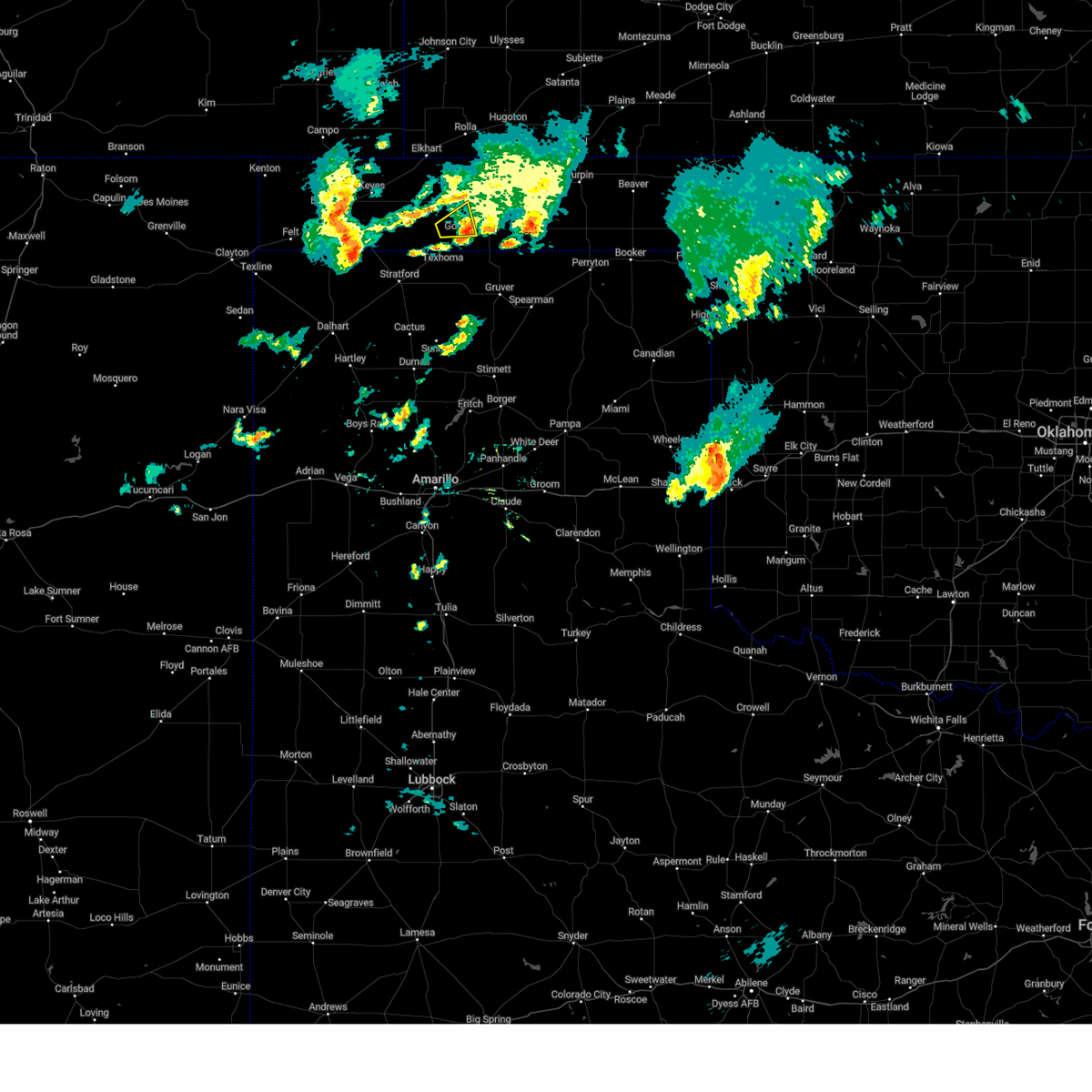 The storm which prompted the warning has weakened below severe limits, and has exited the warned area. therefore, the warning will be allowed to expire. The storm which prompted the warning has weakened below severe limits, and has exited the warned area. therefore, the warning will be allowed to expire.
|
| 5/12/2024 6:24 PM CDT |
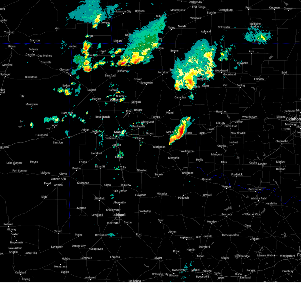 Svrama the national weather service in amarillo has issued a * severe thunderstorm warning for, southwestern texas county in the panhandle of oklahoma, * until 715 pm cdt. * at 624 pm cdt, a severe thunderstorm was located 5 miles west of goodwell, or 15 miles west of guymon, moving east at 10 mph (radar indicated). Hazards include 60 mph wind gusts and quarter size hail. Minor damage to roofs, siding, and trees is possible. Hail damage to vehicles is expected. Svrama the national weather service in amarillo has issued a * severe thunderstorm warning for, southwestern texas county in the panhandle of oklahoma, * until 715 pm cdt. * at 624 pm cdt, a severe thunderstorm was located 5 miles west of goodwell, or 15 miles west of guymon, moving east at 10 mph (radar indicated). Hazards include 60 mph wind gusts and quarter size hail. Minor damage to roofs, siding, and trees is possible. Hail damage to vehicles is expected.
|
| 5/12/2024 5:58 PM CDT |
 The storm which prompted the warning has moved out of the area. therefore, the warning will be allowed to expire. remember, a severe thunderstorm warning still remains in effect for texas county. The storm which prompted the warning has moved out of the area. therefore, the warning will be allowed to expire. remember, a severe thunderstorm warning still remains in effect for texas county.
|
| 5/12/2024 5:57 PM CDT |
 Svrama the national weather service in amarillo has issued a * severe thunderstorm warning for, south central texas county in the panhandle of oklahoma, * until 645 pm cdt. * at 557 pm cdt, a severe thunderstorm was located 5 miles northeast of goodwell, or 5 miles southwest of guymon, moving east at 15 mph (radar indicated). Hazards include 60 mph wind gusts and quarter size hail. Minor damage to roofs, siding, and trees is possible. Hail damage to vehicles is expected. Svrama the national weather service in amarillo has issued a * severe thunderstorm warning for, south central texas county in the panhandle of oklahoma, * until 645 pm cdt. * at 557 pm cdt, a severe thunderstorm was located 5 miles northeast of goodwell, or 5 miles southwest of guymon, moving east at 15 mph (radar indicated). Hazards include 60 mph wind gusts and quarter size hail. Minor damage to roofs, siding, and trees is possible. Hail damage to vehicles is expected.
|
| 5/12/2024 5:53 PM CDT | Quarter sized hail reported 3.5 miles WSW of Goodwell, OK, report from mping. |
| 5/12/2024 5:40 PM CDT |
 At 540 pm cdt, a severe thunderstorm was located over goodwell, or 11 miles southwest of guymon, moving southeast at 15 mph (radar indicated). Hazards include 60 mph wind gusts and half dollar size hail. Minor damage to roofs, siding, and trees is possible. hail damage to vehicles is expected. Locations impacted include, guymon and goodwell. At 540 pm cdt, a severe thunderstorm was located over goodwell, or 11 miles southwest of guymon, moving southeast at 15 mph (radar indicated). Hazards include 60 mph wind gusts and half dollar size hail. Minor damage to roofs, siding, and trees is possible. hail damage to vehicles is expected. Locations impacted include, guymon and goodwell.
|
| 5/12/2024 5:16 PM CDT | Golf Ball sized hail reported 5.3 miles SE of Goodwell, OK, via spotter network. |
| 5/12/2024 5:16 PM CDT |
 Svrama the national weather service in amarillo has issued a * severe thunderstorm warning for, southwestern texas county in the panhandle of oklahoma, * until 600 pm cdt. * at 516 pm cdt, a severe thunderstorm was located 5 miles northwest of goodwell, or 13 miles west of guymon, moving southeast at 15 mph (radar indicated). Hazards include golf ball size hail and 60 mph wind gusts. Minor damage to roofs, siding, and trees is possible. people and animals outdoors will be injured. Expect hail damage to roofs, siding, windows, and vehicles. Svrama the national weather service in amarillo has issued a * severe thunderstorm warning for, southwestern texas county in the panhandle of oklahoma, * until 600 pm cdt. * at 516 pm cdt, a severe thunderstorm was located 5 miles northwest of goodwell, or 13 miles west of guymon, moving southeast at 15 mph (radar indicated). Hazards include golf ball size hail and 60 mph wind gusts. Minor damage to roofs, siding, and trees is possible. people and animals outdoors will be injured. Expect hail damage to roofs, siding, windows, and vehicles.
|
| 10/2/2023 11:46 PM CDT |
 At 1146 pm cdt, severe thunderstorms were located along a line extending from 5 miles south of feterita to 5 miles southeast of hough to 4 miles north of texhoma, moving northeast at 45 mph (radar indicated). Hazards include 60 mph wind gusts. Minor damage to roofs, siding, and trees is possible. locations impacted include, guymon, stratford, hooker, goodwell, tyrone, optima, hardesty, hough, baker, adams, and texhoma. hail threat, radar indicated max hail size, <. 75 in wind threat, radar indicated max wind gust, 60 mph. At 1146 pm cdt, severe thunderstorms were located along a line extending from 5 miles south of feterita to 5 miles southeast of hough to 4 miles north of texhoma, moving northeast at 45 mph (radar indicated). Hazards include 60 mph wind gusts. Minor damage to roofs, siding, and trees is possible. locations impacted include, guymon, stratford, hooker, goodwell, tyrone, optima, hardesty, hough, baker, adams, and texhoma. hail threat, radar indicated max hail size, <. 75 in wind threat, radar indicated max wind gust, 60 mph.
|
| 10/2/2023 11:42 PM CDT |
 At 1141 pm cdt, severe thunderstorms were located along a line extending from 5 miles southeast of rolla to 5 miles south of hough to 3 miles northwest of texhoma, moving northeast at 45 mph (radar indicated). Hazards include 60 mph wind gusts. Minor damage to roofs, siding, and trees is possible. locations impacted include, guymon, stratford, hooker, goodwell, tyrone, optima, hardesty, eva, hough, baker, adams, and texhoma. hail threat, radar indicated max hail size, <. 75 in wind threat, radar indicated max wind gust, 60 mph. At 1141 pm cdt, severe thunderstorms were located along a line extending from 5 miles southeast of rolla to 5 miles south of hough to 3 miles northwest of texhoma, moving northeast at 45 mph (radar indicated). Hazards include 60 mph wind gusts. Minor damage to roofs, siding, and trees is possible. locations impacted include, guymon, stratford, hooker, goodwell, tyrone, optima, hardesty, eva, hough, baker, adams, and texhoma. hail threat, radar indicated max hail size, <. 75 in wind threat, radar indicated max wind gust, 60 mph.
|
| 10/2/2023 11:08 PM CDT |
 At 1108 pm cdt, severe thunderstorms were located along a line extending from 7 miles southwest of elkhart to 8 miles east of griggs to 8 miles northwest of stratford, moving northeast at 45 mph (radar indicated). Hazards include 60 mph wind gusts. minor damage to roofs, siding, and trees is possible At 1108 pm cdt, severe thunderstorms were located along a line extending from 7 miles southwest of elkhart to 8 miles east of griggs to 8 miles northwest of stratford, moving northeast at 45 mph (radar indicated). Hazards include 60 mph wind gusts. minor damage to roofs, siding, and trees is possible
|
| 8/13/2023 9:30 PM CDT |
 At 929 pm cdt, a severe thunderstorm was located 7 miles northwest of morse, or 19 miles west of spearman, moving northeast at 35 mph (radar indicated). Hazards include 60 mph wind gusts. Minor damage to roofs, siding, and trees is possible. locations impacted include, borger, guymon, perryton, spearman, sunray, stinnett, goodwell, gruver, hardesty, farnsworth, waka, pringle, and morse. hail threat, radar indicated max hail size, <. 75 in wind threat, radar indicated max wind gust, 60 mph. At 929 pm cdt, a severe thunderstorm was located 7 miles northwest of morse, or 19 miles west of spearman, moving northeast at 35 mph (radar indicated). Hazards include 60 mph wind gusts. Minor damage to roofs, siding, and trees is possible. locations impacted include, borger, guymon, perryton, spearman, sunray, stinnett, goodwell, gruver, hardesty, farnsworth, waka, pringle, and morse. hail threat, radar indicated max hail size, <. 75 in wind threat, radar indicated max wind gust, 60 mph.
|
| 8/13/2023 9:19 PM CDT |
 At 919 pm cdt, a severe thunderstorm was located 12 miles northwest of morse, or 24 miles west of spearman, moving northeast at 45 mph (radar indicated). Hazards include 60 mph wind gusts. minor damage to roofs, siding, and trees is possible At 919 pm cdt, a severe thunderstorm was located 12 miles northwest of morse, or 24 miles west of spearman, moving northeast at 45 mph (radar indicated). Hazards include 60 mph wind gusts. minor damage to roofs, siding, and trees is possible
|
| 8/13/2023 3:54 PM CDT |
 At 353 pm cdt, a severe thunderstorm was located over stratford, moving east at 20 mph (radar indicated). Hazards include 60 mph wind gusts and quarter size hail. Minor damage to roofs, siding, and trees is possible. Hail damage to vehicles is expected. At 353 pm cdt, a severe thunderstorm was located over stratford, moving east at 20 mph (radar indicated). Hazards include 60 mph wind gusts and quarter size hail. Minor damage to roofs, siding, and trees is possible. Hail damage to vehicles is expected.
|
| 7/21/2023 12:35 AM CDT | Measured by oklahoma mesone in texas county OK, 1.9 miles W of Goodwell, OK |
| 7/21/2023 12:34 AM CDT |
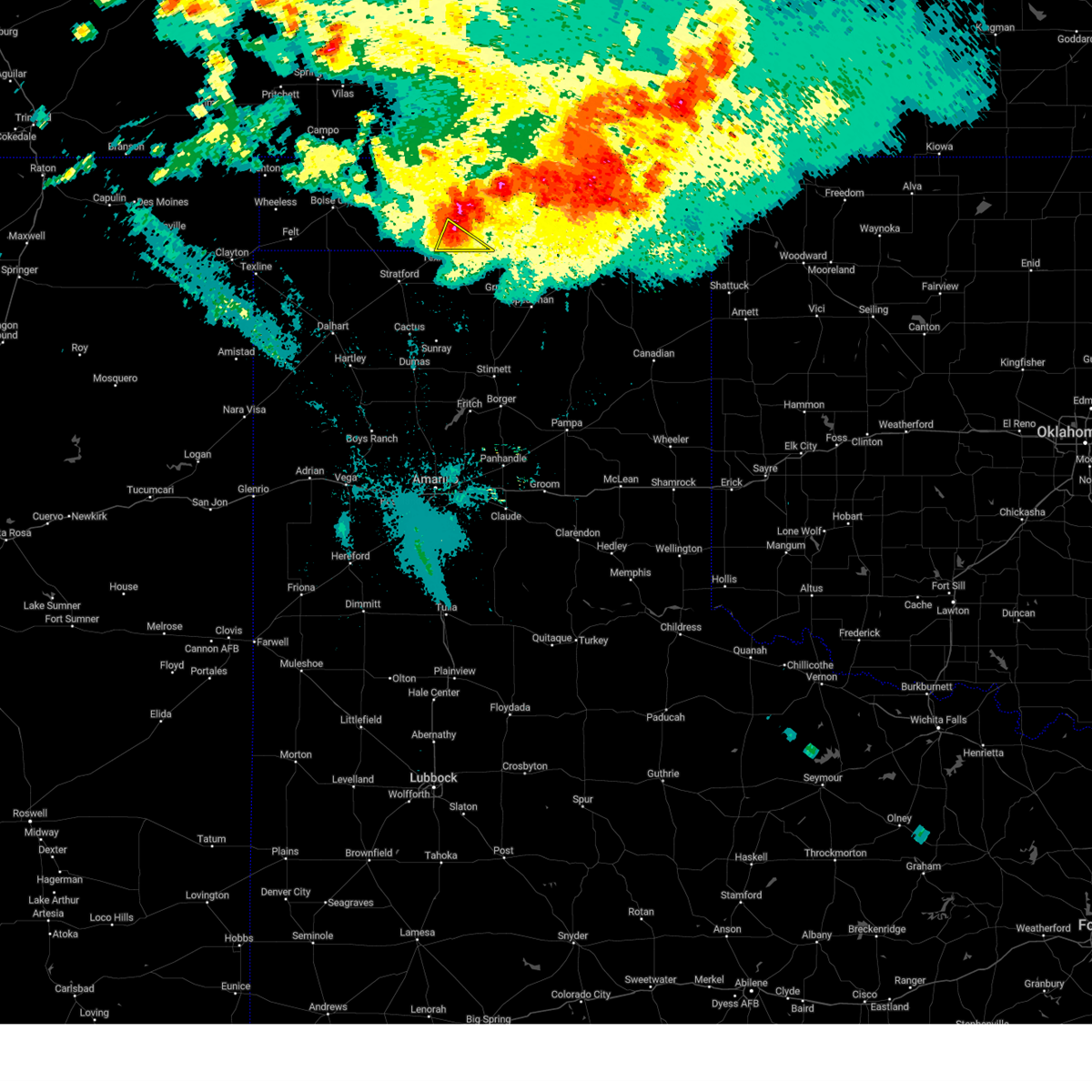 At 1234 am cdt, a severe thunderstorm was located near goodwell, or 12 miles southwest of guymon, moving southeast at 40 mph (radar indicated). Hazards include 60 mph wind gusts and nickel size hail. Minor damage to roofs, siding, and trees is possible. locations impacted include, goodwell and texhoma. hail threat, radar indicated max hail size, 0. 88in wind threat, radar indicated max wind gust, 60 mph. At 1234 am cdt, a severe thunderstorm was located near goodwell, or 12 miles southwest of guymon, moving southeast at 40 mph (radar indicated). Hazards include 60 mph wind gusts and nickel size hail. Minor damage to roofs, siding, and trees is possible. locations impacted include, goodwell and texhoma. hail threat, radar indicated max hail size, 0. 88in wind threat, radar indicated max wind gust, 60 mph.
|
| 7/21/2023 12:33 AM CDT |
 At 1233 am cdt, a severe thunderstorm was located near goodwell, or 13 miles southwest of guymon, moving southeast at 30 mph (radar indicated). Hazards include 60 mph wind gusts and nickel size hail. minor damage to roofs, siding, and trees is possible At 1233 am cdt, a severe thunderstorm was located near goodwell, or 13 miles southwest of guymon, moving southeast at 30 mph (radar indicated). Hazards include 60 mph wind gusts and nickel size hail. minor damage to roofs, siding, and trees is possible
|
| 7/21/2023 12:11 AM CDT |
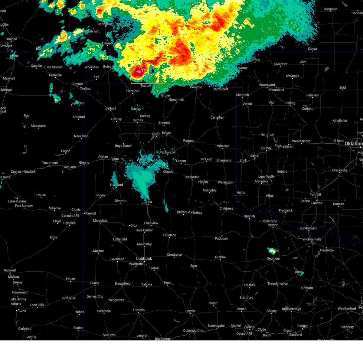 At 1211 am cdt, a severe thunderstorm was located 8 miles northwest of texhoma, or 20 miles northeast of stratford, moving southeast at 40 mph (radar indicated). Hazards include 70 mph wind gusts and quarter size hail. Expect some tree damage. damage is likely to mobile homes, roofs, and outbuildings. hail damage to vehicles is expected. Locations impacted include, goodwell, texhoma and griggs. At 1211 am cdt, a severe thunderstorm was located 8 miles northwest of texhoma, or 20 miles northeast of stratford, moving southeast at 40 mph (radar indicated). Hazards include 70 mph wind gusts and quarter size hail. Expect some tree damage. damage is likely to mobile homes, roofs, and outbuildings. hail damage to vehicles is expected. Locations impacted include, goodwell, texhoma and griggs.
|
| 7/20/2023 11:48 PM CDT |
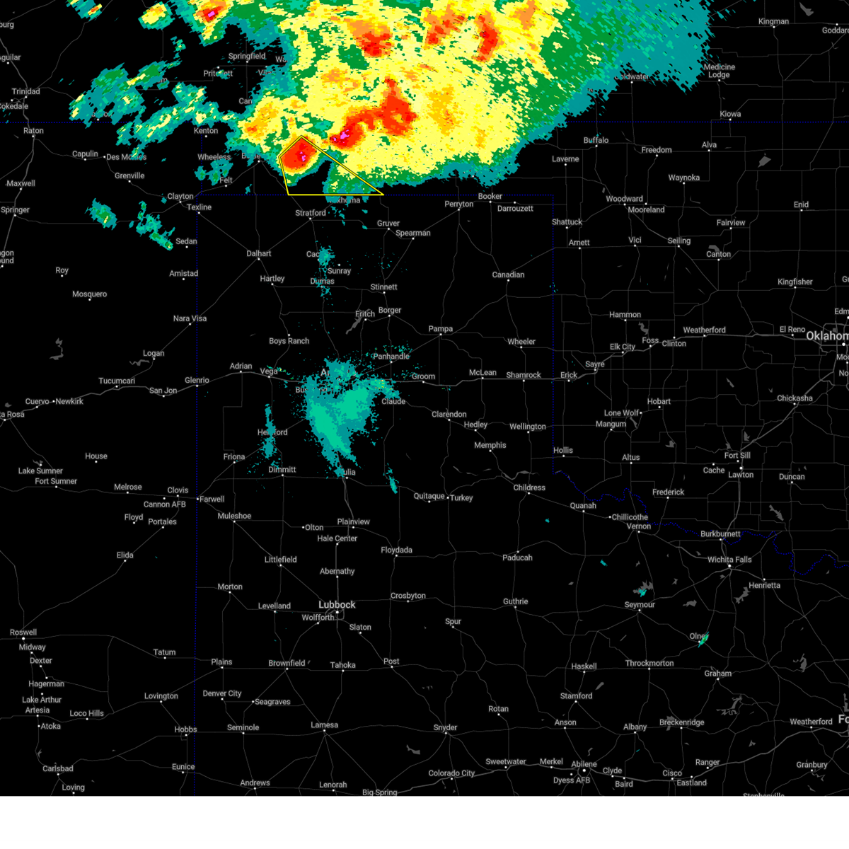 At 1148 pm cdt, a severe thunderstorm was located 6 miles north of griggs, or 23 miles east of boise city, moving southeast at 35 mph (radar indicated). Hazards include 70 mph wind gusts and ping pong ball size hail. Expect some tree damage. damage is likely to mobile homes, roofs, and outbuildings. people and animals outdoors will be injured. expect hail damage to roofs, siding, windows, and vehicles. Locations impacted include, goodwell, texhoma, keyes and griggs. At 1148 pm cdt, a severe thunderstorm was located 6 miles north of griggs, or 23 miles east of boise city, moving southeast at 35 mph (radar indicated). Hazards include 70 mph wind gusts and ping pong ball size hail. Expect some tree damage. damage is likely to mobile homes, roofs, and outbuildings. people and animals outdoors will be injured. expect hail damage to roofs, siding, windows, and vehicles. Locations impacted include, goodwell, texhoma, keyes and griggs.
|
| 7/20/2023 11:36 PM CDT |
 At 1135 pm cdt, a severe thunderstorm was located 7 miles northeast of eva, or 10 miles southeast of elkhart, moving southeast at 30 mph (radar indicated). Hazards include 60 mph wind gusts and quarter size hail. Minor damage to roofs, siding, and trees is possible. Hail damage to vehicles is expected. At 1135 pm cdt, a severe thunderstorm was located 7 miles northeast of eva, or 10 miles southeast of elkhart, moving southeast at 30 mph (radar indicated). Hazards include 60 mph wind gusts and quarter size hail. Minor damage to roofs, siding, and trees is possible. Hail damage to vehicles is expected.
|
| 7/20/2023 11:16 PM CDT |
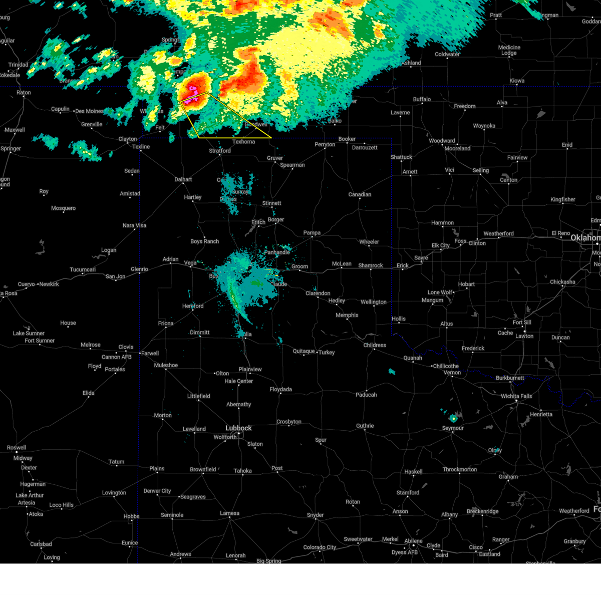 At 1115 pm cdt, a severe thunderstorm was located 5 miles west of keyes, or 11 miles northeast of boise city, moving southeast at 35 mph (radar indicated). Hazards include golf ball size hail and 70 mph wind gusts. Expect some tree damage. damage is likely to mobile homes, roofs, and outbuildings. people and animals outdoors will be injured. Expect hail damage to roofs, siding, windows, and vehicles. At 1115 pm cdt, a severe thunderstorm was located 5 miles west of keyes, or 11 miles northeast of boise city, moving southeast at 35 mph (radar indicated). Hazards include golf ball size hail and 70 mph wind gusts. Expect some tree damage. damage is likely to mobile homes, roofs, and outbuildings. people and animals outdoors will be injured. Expect hail damage to roofs, siding, windows, and vehicles.
|
| 7/9/2023 12:07 AM CDT |
 At 1206 am cdt, a severe thunderstorm was located 5 miles northeast of texhoma, or 16 miles southwest of guymon, moving southeast at 40 mph (radar indicated). Hazards include 60 mph wind gusts and quarter size hail. Minor damage to roofs, siding, and trees is possible. Hail damage to vehicles is expected. At 1206 am cdt, a severe thunderstorm was located 5 miles northeast of texhoma, or 16 miles southwest of guymon, moving southeast at 40 mph (radar indicated). Hazards include 60 mph wind gusts and quarter size hail. Minor damage to roofs, siding, and trees is possible. Hail damage to vehicles is expected.
|
| 7/9/2023 12:03 AM CDT |
 At 1202 am cdt, a severe thunderstorm was located 7 miles north of texhoma, or 18 miles west of guymon, moving south at 40 mph (radar indicated). Hazards include 60 mph wind gusts and quarter size hail. Minor damage to roofs, siding, and trees is possible. hail damage to vehicles is expected. locations impacted include, guymon, goodwell, texhoma, optima, eva, hough and griggs. hail threat, radar indicated max hail size, 1. 00in wind threat, radar indicated max wind gust, 60 mph. At 1202 am cdt, a severe thunderstorm was located 7 miles north of texhoma, or 18 miles west of guymon, moving south at 40 mph (radar indicated). Hazards include 60 mph wind gusts and quarter size hail. Minor damage to roofs, siding, and trees is possible. hail damage to vehicles is expected. locations impacted include, guymon, goodwell, texhoma, optima, eva, hough and griggs. hail threat, radar indicated max hail size, 1. 00in wind threat, radar indicated max wind gust, 60 mph.
|
| 7/8/2023 11:42 PM CDT |
 At 1142 pm cdt, a severe thunderstorm was located over eva, or 13 miles south of elkhart, moving southeast at 35 mph (radar indicated). Hazards include 70 mph wind gusts and ping pong ball size hail. Expect some tree damage. damage is likely to mobile homes, roofs, and outbuildings. people and animals outdoors will be injured. expect hail damage to roofs, siding, windows, and vehicles. locations impacted include, guymon, goodwell, texhoma, optima, eva, hough, griggs and sturgis. thunderstorm damage threat, considerable hail threat, radar indicated max hail size, 1. 50 in wind threat, radar indicated max wind gust, 70 mph. At 1142 pm cdt, a severe thunderstorm was located over eva, or 13 miles south of elkhart, moving southeast at 35 mph (radar indicated). Hazards include 70 mph wind gusts and ping pong ball size hail. Expect some tree damage. damage is likely to mobile homes, roofs, and outbuildings. people and animals outdoors will be injured. expect hail damage to roofs, siding, windows, and vehicles. locations impacted include, guymon, goodwell, texhoma, optima, eva, hough, griggs and sturgis. thunderstorm damage threat, considerable hail threat, radar indicated max hail size, 1. 50 in wind threat, radar indicated max wind gust, 70 mph.
|
| 7/8/2023 11:36 PM CDT |
 At 1135 pm cdt, a severe thunderstorm was located near eva, or 12 miles south of elkhart, moving southeast at 30 mph (radar indicated). Hazards include 60 mph wind gusts and quarter size hail. Minor damage to roofs, siding, and trees is possible. hail damage to vehicles is expected. locations impacted include, guymon, goodwell, texhoma, optima, eva, hough, griggs and sturgis. hail threat, radar indicated max hail size, 1. 00in wind threat, radar indicated max wind gust, 60 mph. At 1135 pm cdt, a severe thunderstorm was located near eva, or 12 miles south of elkhart, moving southeast at 30 mph (radar indicated). Hazards include 60 mph wind gusts and quarter size hail. Minor damage to roofs, siding, and trees is possible. hail damage to vehicles is expected. locations impacted include, guymon, goodwell, texhoma, optima, eva, hough, griggs and sturgis. hail threat, radar indicated max hail size, 1. 00in wind threat, radar indicated max wind gust, 60 mph.
|
| 7/8/2023 11:13 PM CDT |
 At 1113 pm cdt, a severe thunderstorm was located 7 miles west of elkhart, moving south at 40 mph (radar indicated). Hazards include 60 mph wind gusts and quarter size hail. Minor damage to roofs, siding, and trees is possible. Hail damage to vehicles is expected. At 1113 pm cdt, a severe thunderstorm was located 7 miles west of elkhart, moving south at 40 mph (radar indicated). Hazards include 60 mph wind gusts and quarter size hail. Minor damage to roofs, siding, and trees is possible. Hail damage to vehicles is expected.
|
| 7/7/2023 3:14 AM CDT | At 314 am cdt, severe thunderstorms were located along a line extending from 4 miles south of hayne to 7 miles northwest of tyrone to 6 miles northwest of wilburton, moving southeast at 30 mph (radar indicated). Hazards include two inch hail and 70 mph wind gusts. Expect some tree damage. damage is likely to mobile homes, roofs, and outbuildings. people and animals outdoors will be injured. Expect hail damage to roofs, siding, windows, and vehicles. |
| 7/6/2023 2:41 AM CDT |
 The severe thunderstorm warning for southwestern texas and eastern cimarron counties will expire at 245 am cdt, the storm which prompted the warning has weakened below severe limits, and no longer poses an immediate threat to life or property. therefore, the warning will be allowed to expire. however small hail, gusty winds and heavy rain are still possible with this thunderstorm. a severe thunderstorm watch remains in effect until 500 am cdt for the panhandle of oklahoma, and the panhandle of texas. The severe thunderstorm warning for southwestern texas and eastern cimarron counties will expire at 245 am cdt, the storm which prompted the warning has weakened below severe limits, and no longer poses an immediate threat to life or property. therefore, the warning will be allowed to expire. however small hail, gusty winds and heavy rain are still possible with this thunderstorm. a severe thunderstorm watch remains in effect until 500 am cdt for the panhandle of oklahoma, and the panhandle of texas.
|
| 7/6/2023 2:17 AM CDT |
 At 217 am cdt, automated weather equipment reported a severe thunderstorm was located 5 miles west of griggs, or 18 miles northwest of stratford, moving southeast at 35 mph (radar indicated). Hazards include 60 mph wind gusts and quarter size hail. Minor damage to roofs, siding, and trees is possible. hail damage to vehicles is expected. locations impacted include, guymon, boise city, goodwell, texhoma, keyes, eva, griggs and sturgis. hail threat, radar indicated max hail size, 1. 00in wind threat, radar indicated max wind gust, 60 mph. At 217 am cdt, automated weather equipment reported a severe thunderstorm was located 5 miles west of griggs, or 18 miles northwest of stratford, moving southeast at 35 mph (radar indicated). Hazards include 60 mph wind gusts and quarter size hail. Minor damage to roofs, siding, and trees is possible. hail damage to vehicles is expected. locations impacted include, guymon, boise city, goodwell, texhoma, keyes, eva, griggs and sturgis. hail threat, radar indicated max hail size, 1. 00in wind threat, radar indicated max wind gust, 60 mph.
|
| 7/6/2023 2:04 AM CDT |
 At 204 am cdt, automated weather equipment reported a severe thunderstorm was located 9 miles southeast of boise city, moving southeast at 30 mph (automated weather equipment. at 155 am cdt, a 71 mph wind gust was recorded 3 miles south southeast of boise city). Hazards include 70 mph wind gusts. Expect some tree damage. damage is likely to mobile homes, roofs, and outbuildings. locations impacted include, guymon, boise city, goodwell, texhoma, keyes, eva, griggs and sturgis. thunderstorm damage threat, considerable hail threat, radar indicated max hail size, <. 75 in wind threat, observed max wind gust, 70 mph. At 204 am cdt, automated weather equipment reported a severe thunderstorm was located 9 miles southeast of boise city, moving southeast at 30 mph (automated weather equipment. at 155 am cdt, a 71 mph wind gust was recorded 3 miles south southeast of boise city). Hazards include 70 mph wind gusts. Expect some tree damage. damage is likely to mobile homes, roofs, and outbuildings. locations impacted include, guymon, boise city, goodwell, texhoma, keyes, eva, griggs and sturgis. thunderstorm damage threat, considerable hail threat, radar indicated max hail size, <. 75 in wind threat, observed max wind gust, 70 mph.
|
| 7/6/2023 2:02 AM CDT |
 At 201 am cdt, automated weather equipment reported a severe thunderstorm was located 8 miles southeast of boise city, moving southeast at 25 mph (automated weather equipment. at 155 am cdt, a 71 mph wind gust recorded at boise city). Hazards include 70 mph wind gusts. Expect some tree damage. damage is likely to mobile homes, roofs, and outbuildings. locations impacted include, guymon, boise city, goodwell, texhoma, keyes, eva, griggs and sturgis. thunderstorm damage threat, considerable hail threat, radar indicated max hail size, <. 75 in wind threat, observed max wind gust, 70 mph. At 201 am cdt, automated weather equipment reported a severe thunderstorm was located 8 miles southeast of boise city, moving southeast at 25 mph (automated weather equipment. at 155 am cdt, a 71 mph wind gust recorded at boise city). Hazards include 70 mph wind gusts. Expect some tree damage. damage is likely to mobile homes, roofs, and outbuildings. locations impacted include, guymon, boise city, goodwell, texhoma, keyes, eva, griggs and sturgis. thunderstorm damage threat, considerable hail threat, radar indicated max hail size, <. 75 in wind threat, observed max wind gust, 70 mph.
|
| 7/6/2023 1:34 AM CDT |
 At 134 am cdt, a severe thunderstorm was located 14 miles southeast of campo, or 22 miles northeast of boise city, moving southeast at 35 mph (radar indicated). Hazards include 70 mph wind gusts and quarter size hail. Expect some tree damage. damage is likely to mobile homes, roofs, and outbuildings. hail damage to vehicles is expected. locations impacted include, guymon, boise city, goodwell, texhoma, keyes, eva, griggs and sturgis. thunderstorm damage threat, considerable hail threat, radar indicated max hail size, 1. 00in wind threat, radar indicated max wind gust, 70 mph. At 134 am cdt, a severe thunderstorm was located 14 miles southeast of campo, or 22 miles northeast of boise city, moving southeast at 35 mph (radar indicated). Hazards include 70 mph wind gusts and quarter size hail. Expect some tree damage. damage is likely to mobile homes, roofs, and outbuildings. hail damage to vehicles is expected. locations impacted include, guymon, boise city, goodwell, texhoma, keyes, eva, griggs and sturgis. thunderstorm damage threat, considerable hail threat, radar indicated max hail size, 1. 00in wind threat, radar indicated max wind gust, 70 mph.
|
| 7/6/2023 1:20 AM CDT |
 At 119 am cdt, a severe thunderstorm was located 8 miles east of campo, or 22 miles southeast of springfield, moving southeast at 35 mph (automated weather equipment. at 102 am cdt, an 82 mph wind gust was recorded at springfield colorado). Hazards include 70 mph wind gusts and quarter size hail. Expect some tree damage. damage is likely to mobile homes, roofs, and outbuildings. Hail damage to vehicles is expected. At 119 am cdt, a severe thunderstorm was located 8 miles east of campo, or 22 miles southeast of springfield, moving southeast at 35 mph (automated weather equipment. at 102 am cdt, an 82 mph wind gust was recorded at springfield colorado). Hazards include 70 mph wind gusts and quarter size hail. Expect some tree damage. damage is likely to mobile homes, roofs, and outbuildings. Hail damage to vehicles is expected.
|
| 7/5/2023 10:44 PM CDT |
 At 1044 pm cdt, severe thunderstorms were located along a line extending from 3 miles north of guymon to 7 miles southeast of goodwell, moving east at 25 mph (radar indicated). Hazards include 60 mph wind gusts and half dollar size hail. Minor damage to roofs, siding, and trees is possible. Hail damage to vehicles is expected. At 1044 pm cdt, severe thunderstorms were located along a line extending from 3 miles north of guymon to 7 miles southeast of goodwell, moving east at 25 mph (radar indicated). Hazards include 60 mph wind gusts and half dollar size hail. Minor damage to roofs, siding, and trees is possible. Hail damage to vehicles is expected.
|
| 6/27/2023 6:41 PM CDT |
 At 641 pm cdt, severe thunderstorms were located along a line extending from 5 miles west of elkhart to 6 miles southwest of hough to 10 miles southeast of goodwell, moving northeast at 50 mph. these are destructive storms for eva and guymon (radar indicated). Hazards include 80 mph wind gusts and ping pong ball size hail. Flying debris will be dangerous to those caught without shelter. mobile homes will be heavily damaged. expect considerable damage to roofs, windows, and vehicles. tree damage and power outages are likely. people and animals outdoors will be injured. Expect hail damage to roofs, siding, windows, and vehicles. At 641 pm cdt, severe thunderstorms were located along a line extending from 5 miles west of elkhart to 6 miles southwest of hough to 10 miles southeast of goodwell, moving northeast at 50 mph. these are destructive storms for eva and guymon (radar indicated). Hazards include 80 mph wind gusts and ping pong ball size hail. Flying debris will be dangerous to those caught without shelter. mobile homes will be heavily damaged. expect considerable damage to roofs, windows, and vehicles. tree damage and power outages are likely. people and animals outdoors will be injured. Expect hail damage to roofs, siding, windows, and vehicles.
|
| 6/27/2023 6:19 PM CDT |
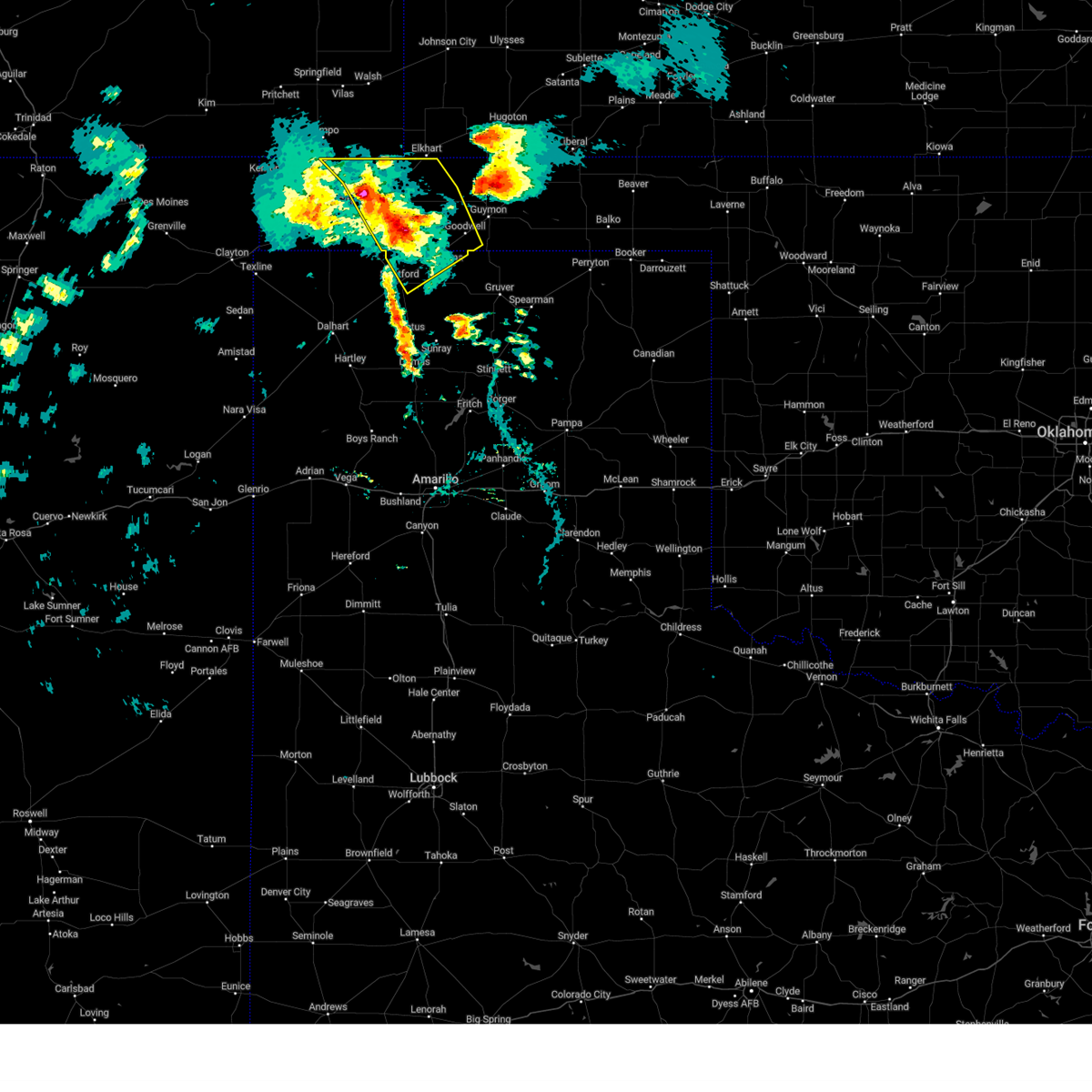 At 619 pm cdt, severe thunderstorms were located along a line extending from 6 miles north of keyes to 8 miles northeast of griggs to 4 miles east of stratford, moving northeast at 40 mph (radar indicated). Hazards include 70 mph wind gusts and ping pong ball size hail. Expect some tree damage. damage is likely to mobile homes, roofs, and outbuildings. people and animals outdoors will be injured. expect hail damage to roofs, siding, windows, and vehicles. locations impacted include, goodwell, keyes, eva, griggs, texhoma and sturgis. thunderstorm damage threat, considerable hail threat, radar indicated max hail size, 1. 50 in wind threat, radar indicated max wind gust, 70 mph. At 619 pm cdt, severe thunderstorms were located along a line extending from 6 miles north of keyes to 8 miles northeast of griggs to 4 miles east of stratford, moving northeast at 40 mph (radar indicated). Hazards include 70 mph wind gusts and ping pong ball size hail. Expect some tree damage. damage is likely to mobile homes, roofs, and outbuildings. people and animals outdoors will be injured. expect hail damage to roofs, siding, windows, and vehicles. locations impacted include, goodwell, keyes, eva, griggs, texhoma and sturgis. thunderstorm damage threat, considerable hail threat, radar indicated max hail size, 1. 50 in wind threat, radar indicated max wind gust, 70 mph.
|
| 6/27/2023 5:56 PM CDT |
 At 555 pm cdt, severe thunderstorms were located along a line extending from 4 miles southwest of black mesa park to 9 miles west of griggs to near conlen, moving northeast at 40 mph (radar indicated). Hazards include 60 mph wind gusts and quarter size hail. Minor damage to roofs, siding, and trees is possible. Hail damage to vehicles is expected. At 555 pm cdt, severe thunderstorms were located along a line extending from 4 miles southwest of black mesa park to 9 miles west of griggs to near conlen, moving northeast at 40 mph (radar indicated). Hazards include 60 mph wind gusts and quarter size hail. Minor damage to roofs, siding, and trees is possible. Hail damage to vehicles is expected.
|
| 6/23/2023 9:17 PM CDT | Ping Pong Ball sized hail reported 27.7 miles S of Goodwell, OK, time estimated by radar. |
| 6/21/2023 6:40 PM CDT | Quarter sized hail reported 0.3 miles NW of Goodwell, OK, quarter sized hail estimated at noble activity center in goodwell from 6:40 pm to 6:45 pm. |
| 6/21/2023 6:04 PM CDT |
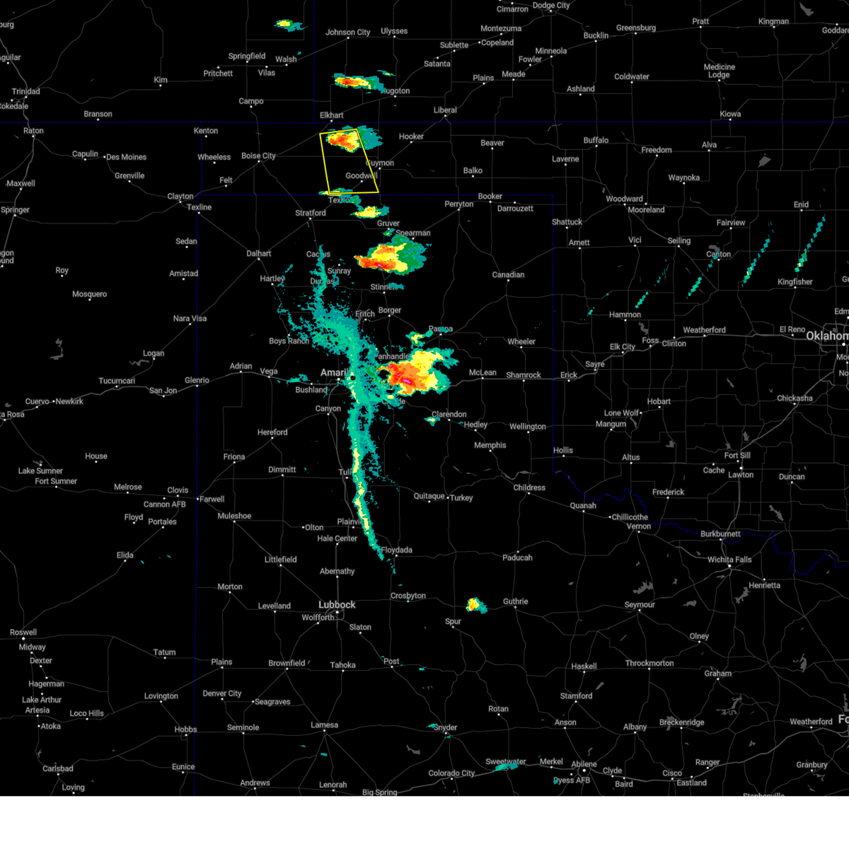 At 604 pm cdt, a severe thunderstorm was located 4 miles east of eva, or 15 miles south of elkhart, moving south at 15 mph (radar indicated). Hazards include two inch hail and 60 mph wind gusts. Minor damage to roofs, siding, and trees is possible. people and animals outdoors will be injured. Expect hail damage to roofs, siding, windows, and vehicles. At 604 pm cdt, a severe thunderstorm was located 4 miles east of eva, or 15 miles south of elkhart, moving south at 15 mph (radar indicated). Hazards include two inch hail and 60 mph wind gusts. Minor damage to roofs, siding, and trees is possible. people and animals outdoors will be injured. Expect hail damage to roofs, siding, windows, and vehicles.
|
| 6/17/2023 7:10 PM CDT |
 The severe thunderstorm warning for western texas county will expire at 715 pm cdt, the storm which prompted the warning has moved out of the area. therefore, the severe thunderstorm warning for western texas county will be allowed to expire. a tornado watch remains in effect until 1100 pm cdt for the panhandle of oklahoma, and the panhandle of texas. remember, a severe thunderstorm warning still remains in effect for northeastern texas county until 800 pm cdt. The severe thunderstorm warning for western texas county will expire at 715 pm cdt, the storm which prompted the warning has moved out of the area. therefore, the severe thunderstorm warning for western texas county will be allowed to expire. a tornado watch remains in effect until 1100 pm cdt for the panhandle of oklahoma, and the panhandle of texas. remember, a severe thunderstorm warning still remains in effect for northeastern texas county until 800 pm cdt.
|
| 6/17/2023 6:42 PM CDT |
 At 642 pm cdt, a severe thunderstorm was located 9 miles northwest of goodwell, or 15 miles west of guymon, moving east at 50 mph (radar indicated). Hazards include 60 mph wind gusts and quarter size hail. Minor damage to roofs, siding, and trees is possible. hail damage to vehicles is expected. locations impacted include, goodwell, texhoma, eva and hough. hail threat, radar indicated max hail size, 1. 00in wind threat, radar indicated max wind gust, 60 mph. At 642 pm cdt, a severe thunderstorm was located 9 miles northwest of goodwell, or 15 miles west of guymon, moving east at 50 mph (radar indicated). Hazards include 60 mph wind gusts and quarter size hail. Minor damage to roofs, siding, and trees is possible. hail damage to vehicles is expected. locations impacted include, goodwell, texhoma, eva and hough. hail threat, radar indicated max hail size, 1. 00in wind threat, radar indicated max wind gust, 60 mph.
|
| 6/17/2023 5:50 PM CDT |
 At 550 pm cdt, a severe thunderstorm was located 12 miles south of boise city, moving east at 50 mph (radar indicated). Hazards include ping pong ball size hail and 60 mph wind gusts. Minor damage to roofs, siding, and trees is possible. people and animals outdoors will be injured. Expect hail damage to roofs, siding, windows, and vehicles. At 550 pm cdt, a severe thunderstorm was located 12 miles south of boise city, moving east at 50 mph (radar indicated). Hazards include ping pong ball size hail and 60 mph wind gusts. Minor damage to roofs, siding, and trees is possible. people and animals outdoors will be injured. Expect hail damage to roofs, siding, windows, and vehicles.
|
| 6/12/2023 12:16 AM CDT |
 At 1216 am cdt, a severe thunderstorm was located 11 miles north of gruver, or 18 miles south of guymon, moving east at 40 mph (radar indicated). Hazards include 60 mph wind gusts and penny size hail. Minor damage to roofs, siding, and trees is possible. locations impacted include, goodwell and hardesty. hail threat, radar indicated max hail size, 0. 75in wind threat, radar indicated max wind gust, 60 mph. At 1216 am cdt, a severe thunderstorm was located 11 miles north of gruver, or 18 miles south of guymon, moving east at 40 mph (radar indicated). Hazards include 60 mph wind gusts and penny size hail. Minor damage to roofs, siding, and trees is possible. locations impacted include, goodwell and hardesty. hail threat, radar indicated max hail size, 0. 75in wind threat, radar indicated max wind gust, 60 mph.
|
| 6/11/2023 11:55 PM CDT |
 At 1155 pm cdt, a severe thunderstorm was located 4 miles southeast of texhoma, or 20 miles southwest of guymon, moving east at 40 mph (radar indicated). Hazards include 60 mph wind gusts and quarter size hail. Minor damage to roofs, siding, and trees is possible. hail damage to vehicles is expected. locations impacted include, goodwell, hardesty and texhoma. hail threat, radar indicated max hail size, 1. 00in wind threat, radar indicated max wind gust, 60 mph. At 1155 pm cdt, a severe thunderstorm was located 4 miles southeast of texhoma, or 20 miles southwest of guymon, moving east at 40 mph (radar indicated). Hazards include 60 mph wind gusts and quarter size hail. Minor damage to roofs, siding, and trees is possible. hail damage to vehicles is expected. locations impacted include, goodwell, hardesty and texhoma. hail threat, radar indicated max hail size, 1. 00in wind threat, radar indicated max wind gust, 60 mph.
|
| 6/11/2023 11:37 PM CDT |
 At 1137 pm cdt, a severe thunderstorm was located 9 miles west of texhoma, or 11 miles northeast of stratford, moving east at 40 mph (automated weather equipment. at 1127 pm cdt, automated weather equipment recorded a 60 mph wind gust 4 miles west northwest of stratford). Hazards include 60 mph wind gusts and quarter size hail. Minor damage to roofs, siding, and trees is possible. Hail damage to vehicles is expected. At 1137 pm cdt, a severe thunderstorm was located 9 miles west of texhoma, or 11 miles northeast of stratford, moving east at 40 mph (automated weather equipment. at 1127 pm cdt, automated weather equipment recorded a 60 mph wind gust 4 miles west northwest of stratford). Hazards include 60 mph wind gusts and quarter size hail. Minor damage to roofs, siding, and trees is possible. Hail damage to vehicles is expected.
|
| 6/11/2023 11:36 PM CDT |
 At 1136 pm cdt, a severe thunderstorm was located 9 miles west of texhoma, or 11 miles northeast of stratford, moving east at 40 mph (radar indicated). Hazards include 60 mph wind gusts and quarter size hail. Minor damage to roofs, siding, and trees is possible. Hail damage to vehicles is expected. At 1136 pm cdt, a severe thunderstorm was located 9 miles west of texhoma, or 11 miles northeast of stratford, moving east at 40 mph (radar indicated). Hazards include 60 mph wind gusts and quarter size hail. Minor damage to roofs, siding, and trees is possible. Hail damage to vehicles is expected.
|
| 6/11/2023 9:58 PM CDT |
 At 958 pm cdt, a severe thunderstorm was located 8 miles northwest of goodwell, or 14 miles west of guymon, moving east at 30 mph (radar indicated). Hazards include 60 mph wind gusts and quarter size hail. Minor damage to roofs, siding, and trees is possible. hail damage to vehicles is expected. locations impacted include, guymon and goodwell. hail threat, radar indicated max hail size, 1. 00in wind threat, radar indicated max wind gust, 60 mph. At 958 pm cdt, a severe thunderstorm was located 8 miles northwest of goodwell, or 14 miles west of guymon, moving east at 30 mph (radar indicated). Hazards include 60 mph wind gusts and quarter size hail. Minor damage to roofs, siding, and trees is possible. hail damage to vehicles is expected. locations impacted include, guymon and goodwell. hail threat, radar indicated max hail size, 1. 00in wind threat, radar indicated max wind gust, 60 mph.
|
| 6/11/2023 9:41 PM CDT |
 At 941 pm cdt, a severe thunderstorm was located 7 miles south of eva, or 21 miles south of elkhart, moving east at 25 mph (radar indicated). Hazards include 60 mph wind gusts and half dollar size hail. Minor damage to roofs, siding, and trees is possible. Hail damage to vehicles is expected. At 941 pm cdt, a severe thunderstorm was located 7 miles south of eva, or 21 miles south of elkhart, moving east at 25 mph (radar indicated). Hazards include 60 mph wind gusts and half dollar size hail. Minor damage to roofs, siding, and trees is possible. Hail damage to vehicles is expected.
|
| 5/31/2023 4:55 PM CDT | Storm damage reported in texas county OK, 1.9 miles WSW of Goodwell, OK |
| 5/30/2023 10:09 PM CDT |
 At 1009 pm cdt, severe thunderstorms were located along a line extending from 8 miles southeast of wilburton to near texhoma, moving east at 20 mph (radar indicated). Hazards include 60 mph wind gusts and quarter size hail. Minor damage to roofs, siding, and trees is possible. hail damage to vehicles is expected. locations impacted include, guymon, goodwell, texhoma and hough. hail threat, radar indicated max hail size, 1. 00in wind threat, radar indicated max wind gust, 60 mph. At 1009 pm cdt, severe thunderstorms were located along a line extending from 8 miles southeast of wilburton to near texhoma, moving east at 20 mph (radar indicated). Hazards include 60 mph wind gusts and quarter size hail. Minor damage to roofs, siding, and trees is possible. hail damage to vehicles is expected. locations impacted include, guymon, goodwell, texhoma and hough. hail threat, radar indicated max hail size, 1. 00in wind threat, radar indicated max wind gust, 60 mph.
|
| 5/30/2023 9:51 PM CDT |
 At 950 pm cdt, severe thunderstorms were located along a line extending from 6 miles south of wilburton to 5 miles northwest of texhoma, moving east at 20 mph (radar indicated). Hazards include 60 mph wind gusts and half dollar size hail. Minor damage to roofs, siding, and trees is possible. hail damage to vehicles is expected. locations impacted include, guymon, goodwell, texhoma, eva and hough. hail threat, radar indicated max hail size, 1. 25 in wind threat, radar indicated max wind gust, 60 mph. At 950 pm cdt, severe thunderstorms were located along a line extending from 6 miles south of wilburton to 5 miles northwest of texhoma, moving east at 20 mph (radar indicated). Hazards include 60 mph wind gusts and half dollar size hail. Minor damage to roofs, siding, and trees is possible. hail damage to vehicles is expected. locations impacted include, guymon, goodwell, texhoma, eva and hough. hail threat, radar indicated max hail size, 1. 25 in wind threat, radar indicated max wind gust, 60 mph.
|
| 5/30/2023 9:32 PM CDT |
 At 932 pm cdt, severe thunderstorms were located along a line extending from 3 miles southeast of elkhart to 9 miles southeast of griggs, moving east at 20 mph (radar indicated). Hazards include 60 mph wind gusts and quarter size hail. Minor damage to roofs, siding, and trees is possible. Hail damage to vehicles is expected. At 932 pm cdt, severe thunderstorms were located along a line extending from 3 miles southeast of elkhart to 9 miles southeast of griggs, moving east at 20 mph (radar indicated). Hazards include 60 mph wind gusts and quarter size hail. Minor damage to roofs, siding, and trees is possible. Hail damage to vehicles is expected.
|
| 5/28/2023 8:10 PM CDT |
 At 810 pm cdt, severe thunderstorms were located along a line extending from near hooker to near guymon to texhoma, moving east at 25 mph (radar indicated). Hazards include 70 mph wind gusts and half dollar size hail. Expect some tree damage. damage is likely to mobile homes, roofs, and outbuildings. Hail damage to vehicles is expected. At 810 pm cdt, severe thunderstorms were located along a line extending from near hooker to near guymon to texhoma, moving east at 25 mph (radar indicated). Hazards include 70 mph wind gusts and half dollar size hail. Expect some tree damage. damage is likely to mobile homes, roofs, and outbuildings. Hail damage to vehicles is expected.
|
| 5/28/2023 7:59 PM CDT |
 At 759 pm cdt, a severe thunderstorm was located over guymon, moving east at 35 mph (radar indicated). Hazards include ping pong ball size hail and 60 mph wind gusts. Minor damage to roofs, siding, and trees is possible. people and animals outdoors will be injured. expect hail damage to roofs, siding, windows, and vehicles. locations impacted include, guymon, beaver, hooker, goodwell, tyrone, forgan, optima, hardesty, gate, knowles, elmwood, hough, adams, boyd, floris, eva, bryans corner, baker, mocane and turpin. hail threat, radar indicated max hail size, 1. 50 in wind threat, radar indicated max wind gust, 60 mph. At 759 pm cdt, a severe thunderstorm was located over guymon, moving east at 35 mph (radar indicated). Hazards include ping pong ball size hail and 60 mph wind gusts. Minor damage to roofs, siding, and trees is possible. people and animals outdoors will be injured. expect hail damage to roofs, siding, windows, and vehicles. locations impacted include, guymon, beaver, hooker, goodwell, tyrone, forgan, optima, hardesty, gate, knowles, elmwood, hough, adams, boyd, floris, eva, bryans corner, baker, mocane and turpin. hail threat, radar indicated max hail size, 1. 50 in wind threat, radar indicated max wind gust, 60 mph.
|
| 5/28/2023 7:28 PM CDT |
 At 727 pm cdt, a severe thunderstorm was located 5 miles north of hooker, or 17 miles southwest of woods, moving east at 25 mph (radar indicated). Hazards include golf ball size hail and 60 mph wind gusts. Minor damage to roofs, siding, and trees is possible. people and animals outdoors will be injured. expect hail damage to roofs, siding, windows, and vehicles. locations impacted include, guymon, beaver, hooker, goodwell, tyrone, forgan, optima, hardesty, gate, knowles, elmwood, hough, adams, boyd, floris, eva, bryans corner, baker, mocane and turpin. thunderstorm damage threat, considerable hail threat, radar indicated max hail size, 1. 75 in wind threat, radar indicated max wind gust, 60 mph. At 727 pm cdt, a severe thunderstorm was located 5 miles north of hooker, or 17 miles southwest of woods, moving east at 25 mph (radar indicated). Hazards include golf ball size hail and 60 mph wind gusts. Minor damage to roofs, siding, and trees is possible. people and animals outdoors will be injured. expect hail damage to roofs, siding, windows, and vehicles. locations impacted include, guymon, beaver, hooker, goodwell, tyrone, forgan, optima, hardesty, gate, knowles, elmwood, hough, adams, boyd, floris, eva, bryans corner, baker, mocane and turpin. thunderstorm damage threat, considerable hail threat, radar indicated max hail size, 1. 75 in wind threat, radar indicated max wind gust, 60 mph.
|
| 5/28/2023 6:57 PM CDT |
 At 657 pm cdt, a severe thunderstorm was located 11 miles south of feterita, moving southeast at 10 mph (radar indicated). Hazards include golf ball size hail and 60 mph wind gusts. Minor damage to roofs, siding, and trees is possible. people and animals outdoors will be injured. expect hail damage to roofs, siding, windows, and vehicles. locations impacted include, guymon, beaver, hooker, goodwell, tyrone, forgan, optima, hardesty, gate, knowles, elmwood, hough, adams, boyd, floris, eva, bryans corner, baker, mocane and turpin. thunderstorm damage threat, considerable hail threat, radar indicated max hail size, 1. 75 in wind threat, radar indicated max wind gust, 60 mph. At 657 pm cdt, a severe thunderstorm was located 11 miles south of feterita, moving southeast at 10 mph (radar indicated). Hazards include golf ball size hail and 60 mph wind gusts. Minor damage to roofs, siding, and trees is possible. people and animals outdoors will be injured. expect hail damage to roofs, siding, windows, and vehicles. locations impacted include, guymon, beaver, hooker, goodwell, tyrone, forgan, optima, hardesty, gate, knowles, elmwood, hough, adams, boyd, floris, eva, bryans corner, baker, mocane and turpin. thunderstorm damage threat, considerable hail threat, radar indicated max hail size, 1. 75 in wind threat, radar indicated max wind gust, 60 mph.
|
| 5/28/2023 6:39 PM CDT |
 At 638 pm cdt, a severe thunderstorm was located 10 miles south of feterita, moving east at 55 mph (radar indicated). Hazards include ping pong ball size hail and 60 mph wind gusts. Minor damage to roofs, siding, and trees is possible. people and animals outdoors will be injured. Expect hail damage to roofs, siding, windows, and vehicles. At 638 pm cdt, a severe thunderstorm was located 10 miles south of feterita, moving east at 55 mph (radar indicated). Hazards include ping pong ball size hail and 60 mph wind gusts. Minor damage to roofs, siding, and trees is possible. people and animals outdoors will be injured. Expect hail damage to roofs, siding, windows, and vehicles.
|
| 5/3/2023 7:21 PM CDT |
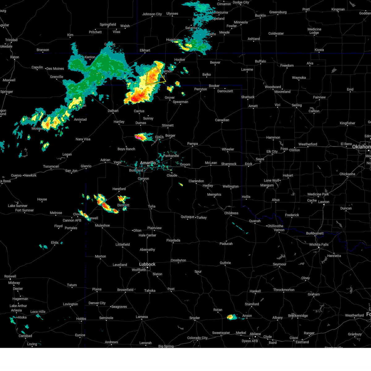 The severe thunderstorm warning for southwestern texas county will expire at 730 pm cdt, the storm which prompted the warning has weakened below severe limits, and no longer poses an immediate threat to life or property. therefore, the warning will be allowed to expire. however gusty winds are still possible with this thunderstorm. The severe thunderstorm warning for southwestern texas county will expire at 730 pm cdt, the storm which prompted the warning has weakened below severe limits, and no longer poses an immediate threat to life or property. therefore, the warning will be allowed to expire. however gusty winds are still possible with this thunderstorm.
|
| 5/3/2023 7:14 PM CDT |
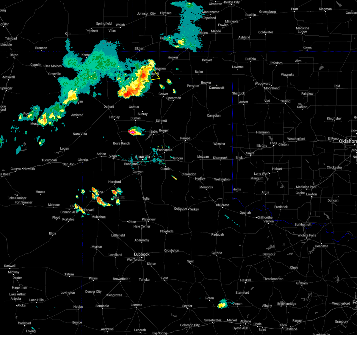 At 713 pm cdt, a severe thunderstorm was located 6 miles west of goodwell, or 15 miles west of guymon, moving east at 25 mph (radar indicated). Hazards include 60 mph wind gusts and nickel size hail. Minor damage to roofs, siding, and trees is possible. locations impacted include, goodwell. hail threat, radar indicated max hail size, 0. 88in wind threat, radar indicated max wind gust, 60 mph. At 713 pm cdt, a severe thunderstorm was located 6 miles west of goodwell, or 15 miles west of guymon, moving east at 25 mph (radar indicated). Hazards include 60 mph wind gusts and nickel size hail. Minor damage to roofs, siding, and trees is possible. locations impacted include, goodwell. hail threat, radar indicated max hail size, 0. 88in wind threat, radar indicated max wind gust, 60 mph.
|
| 5/3/2023 7:00 PM CDT |
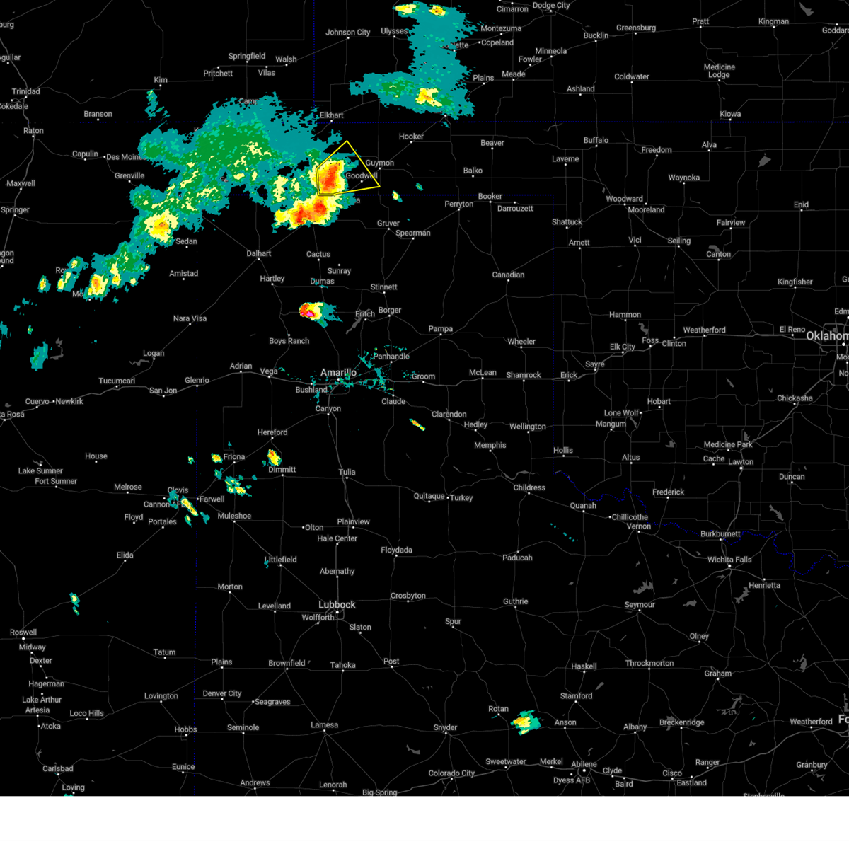 At 700 pm cdt, a severe thunderstorm was located 9 miles southeast of eva, or 19 miles west of guymon, moving northeast at 30 mph (radar indicated). Hazards include 60 mph wind gusts and half dollar size hail. Minor damage to roofs, siding, and trees is possible. hail damage to vehicles is expected. locations impacted include, goodwell. hail threat, radar indicated max hail size, 1. 25 in wind threat, radar indicated max wind gust, 60 mph. At 700 pm cdt, a severe thunderstorm was located 9 miles southeast of eva, or 19 miles west of guymon, moving northeast at 30 mph (radar indicated). Hazards include 60 mph wind gusts and half dollar size hail. Minor damage to roofs, siding, and trees is possible. hail damage to vehicles is expected. locations impacted include, goodwell. hail threat, radar indicated max hail size, 1. 25 in wind threat, radar indicated max wind gust, 60 mph.
|
| 5/3/2023 6:37 PM CDT |
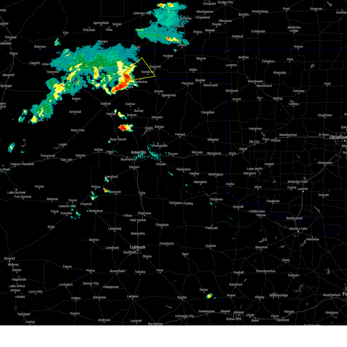 At 636 pm cdt, a severe thunderstorm was located 6 miles east of griggs, or 16 miles north of stratford, moving northeast at 30 mph (radar indicated). Hazards include 60 mph wind gusts and half dollar size hail. Minor damage to roofs, siding, and trees is possible. Hail damage to vehicles is expected. At 636 pm cdt, a severe thunderstorm was located 6 miles east of griggs, or 16 miles north of stratford, moving northeast at 30 mph (radar indicated). Hazards include 60 mph wind gusts and half dollar size hail. Minor damage to roofs, siding, and trees is possible. Hail damage to vehicles is expected.
|
| 2/26/2023 4:30 PM CST | Storm damage reported in texas county OK, 2.2 miles WSW of Goodwell, OK |
| 2/26/2023 3:59 PM CST |
 At 358 pm cst, automated weather equipment reported a severe thunderstorm was located 9 miles northeast of sunray, or 22 miles northeast of dumas, moving northeast at 80 mph (automated weather equipment. at 344 pm cst, automated weather equipment recorded a 65 mph wind gust 9 miles north northeast of sunray). Hazards include 70 mph wind gusts and quarter size hail. Expect some tree damage. damage is likely to mobile homes, roofs, and outbuildings. hail damage to vehicles is expected. locations impacted include, guymon, spearman, cactus, sunray, hooker, goodwell, gruver, tyrone, optima, hardesty, adams, farnsworth, waka, morse and baker. thunderstorm damage threat, considerable hail threat, radar indicated max hail size, 1. 00in wind threat, radar indicated max wind gust, 70 mph. At 358 pm cst, automated weather equipment reported a severe thunderstorm was located 9 miles northeast of sunray, or 22 miles northeast of dumas, moving northeast at 80 mph (automated weather equipment. at 344 pm cst, automated weather equipment recorded a 65 mph wind gust 9 miles north northeast of sunray). Hazards include 70 mph wind gusts and quarter size hail. Expect some tree damage. damage is likely to mobile homes, roofs, and outbuildings. hail damage to vehicles is expected. locations impacted include, guymon, spearman, cactus, sunray, hooker, goodwell, gruver, tyrone, optima, hardesty, adams, farnsworth, waka, morse and baker. thunderstorm damage threat, considerable hail threat, radar indicated max hail size, 1. 00in wind threat, radar indicated max wind gust, 70 mph.
|
| 2/26/2023 3:45 PM CST |
 At 345 pm cst, severe thunderstorms were located along a line extending from 5 miles northeast of cactus to near dumas, moving northeast at 70 mph (radar indicated). Hazards include 70 mph wind gusts and quarter size hail. Expect some tree damage. damage is likely to mobile homes, roofs, and outbuildings. Hail damage to vehicles is expected. At 345 pm cst, severe thunderstorms were located along a line extending from 5 miles northeast of cactus to near dumas, moving northeast at 70 mph (radar indicated). Hazards include 70 mph wind gusts and quarter size hail. Expect some tree damage. damage is likely to mobile homes, roofs, and outbuildings. Hail damage to vehicles is expected.
|
| 2/26/2023 3:44 PM CST |
 At 343 pm cst, severe thunderstorms were located along a line extending from 4 miles east of cactus to dumas, moving northeast at 70 mph (radar indicated). Hazards include 70 mph wind gusts and quarter size hail. Expect some tree damage. damage is likely to mobile homes, roofs, and outbuildings. Hail damage to vehicles is expected. At 343 pm cst, severe thunderstorms were located along a line extending from 4 miles east of cactus to dumas, moving northeast at 70 mph (radar indicated). Hazards include 70 mph wind gusts and quarter size hail. Expect some tree damage. damage is likely to mobile homes, roofs, and outbuildings. Hail damage to vehicles is expected.
|
| 9/1/2022 7:05 PM CDT |
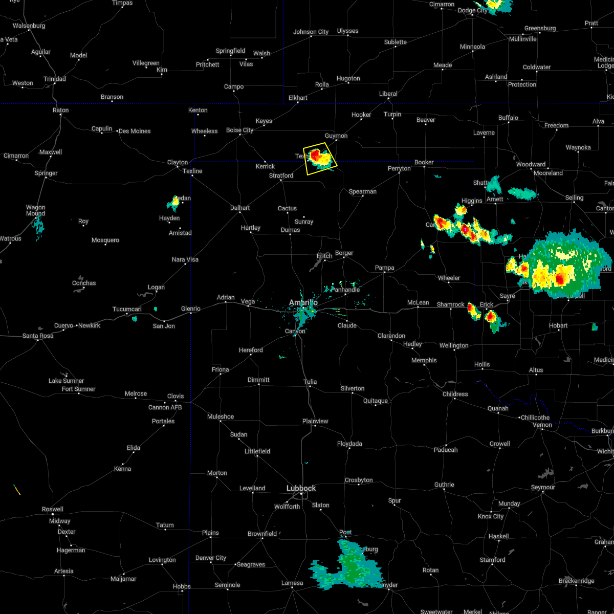 At 705 pm cdt, a severe thunderstorm was located 4 miles northeast of texhoma, or 17 miles southwest of guymon, moving south at 10 mph (radar indicated). Hazards include 60 mph wind gusts and quarter size hail. Minor damage to roofs, siding, and trees is possible. hail damage to vehicles is expected. locations impacted include, goodwell and texhoma. hail threat, radar indicated max hail size, 1. 00in wind threat, radar indicated max wind gust, 60 mph. At 705 pm cdt, a severe thunderstorm was located 4 miles northeast of texhoma, or 17 miles southwest of guymon, moving south at 10 mph (radar indicated). Hazards include 60 mph wind gusts and quarter size hail. Minor damage to roofs, siding, and trees is possible. hail damage to vehicles is expected. locations impacted include, goodwell and texhoma. hail threat, radar indicated max hail size, 1. 00in wind threat, radar indicated max wind gust, 60 mph.
|
| 9/1/2022 6:41 PM CDT |
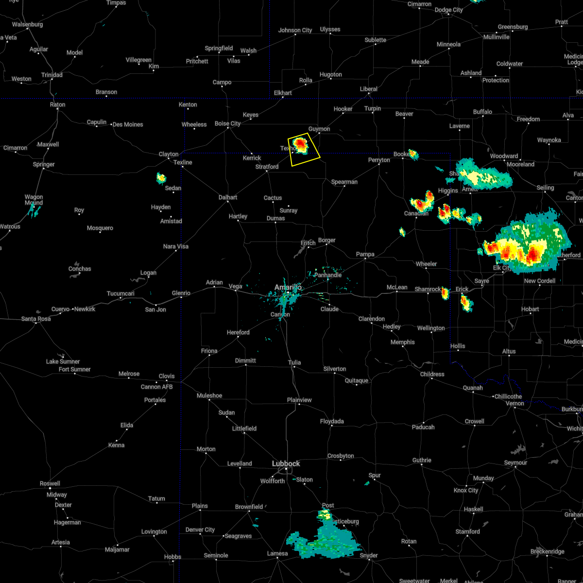 At 641 pm cdt, a severe thunderstorm was located near goodwell, or 14 miles southwest of guymon, moving south at 5 mph (radar indicated). Hazards include 60 mph wind gusts and quarter size hail. Minor damage to roofs, siding, and trees is possible. Hail damage to vehicles is expected. At 641 pm cdt, a severe thunderstorm was located near goodwell, or 14 miles southwest of guymon, moving south at 5 mph (radar indicated). Hazards include 60 mph wind gusts and quarter size hail. Minor damage to roofs, siding, and trees is possible. Hail damage to vehicles is expected.
|
| 8/29/2022 3:48 PM CDT |
 At 347 pm cdt, severe thunderstorms were located along a line extending from 5 miles northwest of hardesty to 5 miles north of stratford, moving south at 10 mph (radar indicated). Hazards include 60 mph wind gusts and quarter size hail. Minor damage to roofs, siding, and trees is possible. Hail damage to vehicles is expected. At 347 pm cdt, severe thunderstorms were located along a line extending from 5 miles northwest of hardesty to 5 miles north of stratford, moving south at 10 mph (radar indicated). Hazards include 60 mph wind gusts and quarter size hail. Minor damage to roofs, siding, and trees is possible. Hail damage to vehicles is expected.
|
| 8/29/2022 3:44 PM CDT | Quarter sized hail reported 3 miles W of Goodwell, OK |
| 8/29/2022 3:40 PM CDT | Storm damage reported in texas county OK, 1.9 miles WSW of Goodwell, OK |
| 6/20/2022 8:10 PM CDT | Mesonet station good goodwell. severe gust caused by collapsing shower that was not producing lightnin in texas county OK, 1.9 miles WSW of Goodwell, OK |
| 6/8/2022 5:01 AM CDT |
 At 501 am cdt, severe thunderstorms were located along a line extending from near booker to 9 miles northwest of waka to 3 miles southwest of texhoma, moving southeast at 45 mph (radar indicated). Hazards include 70 mph wind gusts and ping pong ball size hail. Expect some tree damage. damage is likely to mobile homes, roofs, and outbuildings. people and animals outdoors will be injured. expect hail damage to roofs, siding, windows, and vehicles. locations impacted include, guymon, perryton, spearman, lipscomb, stratford, booker, goodwell, gruver, darrouzett, hardesty, wolf creek park, elmwood, adams, farnsworth, boyd, waka, bryans corner, balko, morse and texhoma. thunderstorm damage threat, considerable hail threat, radar indicated max hail size, 1. 50 in wind threat, radar indicated max wind gust, 70 mph. At 501 am cdt, severe thunderstorms were located along a line extending from near booker to 9 miles northwest of waka to 3 miles southwest of texhoma, moving southeast at 45 mph (radar indicated). Hazards include 70 mph wind gusts and ping pong ball size hail. Expect some tree damage. damage is likely to mobile homes, roofs, and outbuildings. people and animals outdoors will be injured. expect hail damage to roofs, siding, windows, and vehicles. locations impacted include, guymon, perryton, spearman, lipscomb, stratford, booker, goodwell, gruver, darrouzett, hardesty, wolf creek park, elmwood, adams, farnsworth, boyd, waka, bryans corner, balko, morse and texhoma. thunderstorm damage threat, considerable hail threat, radar indicated max hail size, 1. 50 in wind threat, radar indicated max wind gust, 70 mph.
|
| 6/8/2022 4:42 AM CDT |
 At 442 am cdt, severe thunderstorms were located along a line extending from 4 miles southeast of elmwood to 7 miles south of hardesty to 6 miles east of griggs, moving southeast at 55 mph (radar indicated). Hazards include 70 mph wind gusts and half dollar size hail. Expect some tree damage. damage is likely to mobile homes, roofs, and outbuildings. hail damage to vehicles is expected. locations impacted include, guymon, perryton, spearman, lipscomb, stratford, beaver, booker, goodwell, gruver, optima, darrouzett, hardesty, wolf creek park, elmwood, adams, farnsworth, boyd, waka, eva and bryans corner. thunderstorm damage threat, considerable hail threat, radar indicated max hail size, 1. 25 in wind threat, radar indicated max wind gust, 70 mph. At 442 am cdt, severe thunderstorms were located along a line extending from 4 miles southeast of elmwood to 7 miles south of hardesty to 6 miles east of griggs, moving southeast at 55 mph (radar indicated). Hazards include 70 mph wind gusts and half dollar size hail. Expect some tree damage. damage is likely to mobile homes, roofs, and outbuildings. hail damage to vehicles is expected. locations impacted include, guymon, perryton, spearman, lipscomb, stratford, beaver, booker, goodwell, gruver, optima, darrouzett, hardesty, wolf creek park, elmwood, adams, farnsworth, boyd, waka, eva and bryans corner. thunderstorm damage threat, considerable hail threat, radar indicated max hail size, 1. 25 in wind threat, radar indicated max wind gust, 70 mph.
|
| 6/8/2022 4:40 AM CDT | Mesonet station good goodwell. 60 mph gusts occurred at the 435am and 440 am cdt observation in texas county OK, 1.9 miles WSW of Goodwell, OK |
| 6/8/2022 4:28 AM CDT |
 At 427 am cdt, severe thunderstorms were located along a line extending from 3 miles east of elmwood to 5 miles southeast of guymon to 9 miles south of keyes, moving southeast at 55 mph (radar indicated). Hazards include 70 mph wind gusts and half dollar size hail. Expect some tree damage. damage is likely to mobile homes, roofs, and outbuildings. Hail damage to vehicles is expected. At 427 am cdt, severe thunderstorms were located along a line extending from 3 miles east of elmwood to 5 miles southeast of guymon to 9 miles south of keyes, moving southeast at 55 mph (radar indicated). Hazards include 70 mph wind gusts and half dollar size hail. Expect some tree damage. damage is likely to mobile homes, roofs, and outbuildings. Hail damage to vehicles is expected.
|
| 6/8/2022 3:55 AM CDT |
 At 355 am cdt, a severe thunderstorm was located over hough, or 11 miles northwest of guymon, moving southeast at 40 mph (radar indicated). Hazards include 70 mph wind gusts and quarter size hail. Expect some tree damage. damage is likely to mobile homes, roofs, and outbuildings. hail damage to vehicles is expected. locations impacted include, guymon, hooker, goodwell, texhoma, optima, hardesty, eva, hough and adams. thunderstorm damage threat, considerable hail threat, radar indicated max hail size, 1. 00in wind threat, radar indicated max wind gust, 70 mph. At 355 am cdt, a severe thunderstorm was located over hough, or 11 miles northwest of guymon, moving southeast at 40 mph (radar indicated). Hazards include 70 mph wind gusts and quarter size hail. Expect some tree damage. damage is likely to mobile homes, roofs, and outbuildings. hail damage to vehicles is expected. locations impacted include, guymon, hooker, goodwell, texhoma, optima, hardesty, eva, hough and adams. thunderstorm damage threat, considerable hail threat, radar indicated max hail size, 1. 00in wind threat, radar indicated max wind gust, 70 mph.
|
| 6/8/2022 3:30 AM CDT |
 At 328 am cdt, automated weather equipment reported a severe thunderstorm was located over elkhart, moving south at 35 mph (automated weather equipment. elkart airport in southwest kasnas measured a 70 mph wind gust). Hazards include two inch hail and 70 mph wind gusts. Expect some tree damage. damage is likely to mobile homes, roofs, and outbuildings. people and animals outdoors will be injured. expect hail damage to roofs, siding, windows, and vehicles. locations impacted include, guymon, hooker, goodwell, texhoma, optima, hardesty, eva, hough and adams. thunderstorm damage threat, considerable hail threat, radar indicated max hail size, 2. 00 in wind threat, radar indicated max wind gust, 70 mph. At 328 am cdt, automated weather equipment reported a severe thunderstorm was located over elkhart, moving south at 35 mph (automated weather equipment. elkart airport in southwest kasnas measured a 70 mph wind gust). Hazards include two inch hail and 70 mph wind gusts. Expect some tree damage. damage is likely to mobile homes, roofs, and outbuildings. people and animals outdoors will be injured. expect hail damage to roofs, siding, windows, and vehicles. locations impacted include, guymon, hooker, goodwell, texhoma, optima, hardesty, eva, hough and adams. thunderstorm damage threat, considerable hail threat, radar indicated max hail size, 2. 00 in wind threat, radar indicated max wind gust, 70 mph.
|
| 6/8/2022 3:09 AM CDT |
 At 309 am cdt, a severe thunderstorm was located 10 miles north of elkhart, moving south at 35 mph (radar indicated). Hazards include two inch hail and 70 mph wind gusts. Expect some tree damage. damage is likely to mobile homes, roofs, and outbuildings. people and animals outdoors will be injured. Expect hail damage to roofs, siding, windows, and vehicles. At 309 am cdt, a severe thunderstorm was located 10 miles north of elkhart, moving south at 35 mph (radar indicated). Hazards include two inch hail and 70 mph wind gusts. Expect some tree damage. damage is likely to mobile homes, roofs, and outbuildings. people and animals outdoors will be injured. Expect hail damage to roofs, siding, windows, and vehicles.
|
| 6/7/2022 10:05 PM CDT | Storm damage reported in texas county OK, 1.9 miles W of Goodwell, OK |
| 6/6/2022 9:56 PM CDT |
 The severe thunderstorm warning for southwestern texas county will expire at 1000 pm cdt, the storms which prompted the warning have weakened below severe limits, and no longer pose an immediate threat to life or property. therefore, the warning will be allowed to expire. a severe thunderstorm watch remains in effect until 1100 pm cdt for the panhandle of oklahoma. The severe thunderstorm warning for southwestern texas county will expire at 1000 pm cdt, the storms which prompted the warning have weakened below severe limits, and no longer pose an immediate threat to life or property. therefore, the warning will be allowed to expire. a severe thunderstorm watch remains in effect until 1100 pm cdt for the panhandle of oklahoma.
|
| 6/6/2022 9:42 PM CDT |
 At 942 pm cdt, severe thunderstorms were located along a line extending from 4 miles southeast of eva to 9 miles northwest of goodwell to 5 miles north of texhoma, moving east at 35 mph (radar indicated). Hazards include 60 mph wind gusts and quarter size hail. Minor damage to roofs, siding, and trees is possible. hail damage to vehicles is expected. locations impacted include, guymon, goodwell, texhoma and eva. hail threat, radar indicated max hail size, 1. 00in wind threat, radar indicated max wind gust, 60 mph. At 942 pm cdt, severe thunderstorms were located along a line extending from 4 miles southeast of eva to 9 miles northwest of goodwell to 5 miles north of texhoma, moving east at 35 mph (radar indicated). Hazards include 60 mph wind gusts and quarter size hail. Minor damage to roofs, siding, and trees is possible. hail damage to vehicles is expected. locations impacted include, guymon, goodwell, texhoma and eva. hail threat, radar indicated max hail size, 1. 00in wind threat, radar indicated max wind gust, 60 mph.
|
| 6/6/2022 9:30 PM CDT |
 At 929 pm cdt, severe thunderstorms were located along a line extending from 10 miles east of eva to 5 miles northwest of texhoma to 7 miles northeast of stratford, moving east at 30 mph (radar indicated). Hazards include 60 mph wind gusts and quarter size hail. Minor damage to roofs, siding, and trees is possible. hail damage to vehicles is expected. locations impacted include, guymon, stratford, goodwell, eva and texhoma. hail threat, radar indicated max hail size, 1. 00in wind threat, radar indicated max wind gust, 60 mph. At 929 pm cdt, severe thunderstorms were located along a line extending from 10 miles east of eva to 5 miles northwest of texhoma to 7 miles northeast of stratford, moving east at 30 mph (radar indicated). Hazards include 60 mph wind gusts and quarter size hail. Minor damage to roofs, siding, and trees is possible. hail damage to vehicles is expected. locations impacted include, guymon, stratford, goodwell, eva and texhoma. hail threat, radar indicated max hail size, 1. 00in wind threat, radar indicated max wind gust, 60 mph.
|
| 6/6/2022 8:59 PM CDT |
 At 858 pm cdt, severe thunderstorms were located along a line extending from 3 miles southwest of eva to near griggs to 9 miles northwest of stratford, moving east at 30 mph (radar indicated). Hazards include 60 mph wind gusts and quarter size hail. Minor damage to roofs, siding, and trees is possible. Hail damage to vehicles is expected. At 858 pm cdt, severe thunderstorms were located along a line extending from 3 miles southwest of eva to near griggs to 9 miles northwest of stratford, moving east at 30 mph (radar indicated). Hazards include 60 mph wind gusts and quarter size hail. Minor damage to roofs, siding, and trees is possible. Hail damage to vehicles is expected.
|
| 6/3/2022 9:07 PM CDT |
 At 906 pm cdt, severe thunderstorms were located along a line extending from 8 miles northwest of keyes to 9 miles southwest of elkhart to wilburton, moving southeast at 25 mph (radar indicated). Hazards include 60 mph wind gusts and penny size hail. Minor damage to roofs, siding, and trees is possible. locations impacted include, guymon, boise city, goodwell, texhoma, keyes, eva, hough, griggs and sturgis. hail threat, radar indicated max hail size, 0. 75in wind threat, radar indicated max wind gust, 60 mph. At 906 pm cdt, severe thunderstorms were located along a line extending from 8 miles northwest of keyes to 9 miles southwest of elkhart to wilburton, moving southeast at 25 mph (radar indicated). Hazards include 60 mph wind gusts and penny size hail. Minor damage to roofs, siding, and trees is possible. locations impacted include, guymon, boise city, goodwell, texhoma, keyes, eva, hough, griggs and sturgis. hail threat, radar indicated max hail size, 0. 75in wind threat, radar indicated max wind gust, 60 mph.
|
| 6/3/2022 8:42 PM CDT |
 At 842 pm cdt, severe thunderstorms were located along a line extending from 10 miles north of boise city to 11 miles northeast of keyes to 9 miles north of elkhart, moving southeast at 25 mph (radar indicated). Hazards include 60 mph wind gusts and nickel size hail. Minor damage to roofs, siding, and trees is possible. locations impacted include, guymon, boise city, goodwell, texhoma, keyes, eva, hough, griggs and sturgis. hail threat, radar indicated max hail size, 0. 88in wind threat, radar indicated max wind gust, 60 mph. At 842 pm cdt, severe thunderstorms were located along a line extending from 10 miles north of boise city to 11 miles northeast of keyes to 9 miles north of elkhart, moving southeast at 25 mph (radar indicated). Hazards include 60 mph wind gusts and nickel size hail. Minor damage to roofs, siding, and trees is possible. locations impacted include, guymon, boise city, goodwell, texhoma, keyes, eva, hough, griggs and sturgis. hail threat, radar indicated max hail size, 0. 88in wind threat, radar indicated max wind gust, 60 mph.
|
| 6/3/2022 8:26 PM CDT |
 At 826 pm cdt, severe thunderstorms were located along a line extending from 11 miles south of campo to 13 miles north of keyes to 10 miles southeast of stonington, moving southeast at 25 mph (radar indicated). Hazards include 60 mph wind gusts and penny size hail. minor damage to roofs, siding, and trees is possible At 826 pm cdt, severe thunderstorms were located along a line extending from 11 miles south of campo to 13 miles north of keyes to 10 miles southeast of stonington, moving southeast at 25 mph (radar indicated). Hazards include 60 mph wind gusts and penny size hail. minor damage to roofs, siding, and trees is possible
|
| 5/18/2022 10:20 PM CDT |
 At 1020 pm cdt, automated weather equipment reported severe thunderstorms were located along a line extending from 4 miles south of fowler to 13 miles southwest of hardesty, moving east at 55 mph (automated weather equipment). Hazards include 60 mph wind gusts. Minor damage to roofs, siding, and trees is possible. locations impacted include, guymon, perryton, beaver, hooker, booker, goodwell, gruver, tyrone, forgan, optima, hardesty, gate, knowles, wolf creek park, baker, balko, elmwood, hough, adams and farnsworth. hail threat, radar indicated max hail size, <. 75 in wind threat, radar indicated max wind gust, 60 mph. At 1020 pm cdt, automated weather equipment reported severe thunderstorms were located along a line extending from 4 miles south of fowler to 13 miles southwest of hardesty, moving east at 55 mph (automated weather equipment). Hazards include 60 mph wind gusts. Minor damage to roofs, siding, and trees is possible. locations impacted include, guymon, perryton, beaver, hooker, booker, goodwell, gruver, tyrone, forgan, optima, hardesty, gate, knowles, wolf creek park, baker, balko, elmwood, hough, adams and farnsworth. hail threat, radar indicated max hail size, <. 75 in wind threat, radar indicated max wind gust, 60 mph.
|
| 5/18/2022 10:01 PM CDT |
 At 1001 pm cdt, severe thunderstorms were located along a line extending from near missler to 10 miles southeast of goodwell, moving east at 55 mph (radar indicated). Hazards include 60 mph wind gusts. minor damage to roofs, siding, and trees is possible At 1001 pm cdt, severe thunderstorms were located along a line extending from near missler to 10 miles southeast of goodwell, moving east at 55 mph (radar indicated). Hazards include 60 mph wind gusts. minor damage to roofs, siding, and trees is possible
|
| 5/18/2022 9:15 PM CDT | Storm damage reported in texas county OK, 24.6 miles SSE of Goodwell, OK |
| 5/16/2022 9:02 PM CDT |
 At 901 pm cdt, a severe thunderstorm was located 7 miles west of stratford, moving northeast at 45 mph (radar indicated). Hazards include 60 mph wind gusts and quarter size hail. Minor damage to roofs, siding, and trees is possible. Hail damage to vehicles is expected. At 901 pm cdt, a severe thunderstorm was located 7 miles west of stratford, moving northeast at 45 mph (radar indicated). Hazards include 60 mph wind gusts and quarter size hail. Minor damage to roofs, siding, and trees is possible. Hail damage to vehicles is expected.
|
| 5/1/2022 5:56 PM CDT |
 The severe thunderstorm warning for western texas county will expire at 600 pm cdt, the storm which prompted the warning has weakened below severe limits, and no longer poses an immediate threat to life or property. therefore, the warning will be allowed to expire. however small hail is still possible with this thunderstorm. a severe thunderstorm watch remains in effect until 1100 pm cdt for the panhandle of oklahoma. The severe thunderstorm warning for western texas county will expire at 600 pm cdt, the storm which prompted the warning has weakened below severe limits, and no longer poses an immediate threat to life or property. therefore, the warning will be allowed to expire. however small hail is still possible with this thunderstorm. a severe thunderstorm watch remains in effect until 1100 pm cdt for the panhandle of oklahoma.
|
| 5/1/2022 5:42 PM CDT |
 At 542 pm cdt, a severe thunderstorm was located 7 miles south of eva, or 20 miles south of elkhart, moving northeast at 55 mph (radar indicated). Hazards include 60 mph wind gusts and quarter size hail. Minor damage to roofs, siding, and trees is possible. hail damage to vehicles is expected. locations impacted include, guymon, goodwell, texhoma, optima and eva. hail threat, observed max hail size, 1. 00in wind threat, radar indicated max wind gust, 60 mph. At 542 pm cdt, a severe thunderstorm was located 7 miles south of eva, or 20 miles south of elkhart, moving northeast at 55 mph (radar indicated). Hazards include 60 mph wind gusts and quarter size hail. Minor damage to roofs, siding, and trees is possible. hail damage to vehicles is expected. locations impacted include, guymon, goodwell, texhoma, optima and eva. hail threat, observed max hail size, 1. 00in wind threat, radar indicated max wind gust, 60 mph.
|
| 5/1/2022 5:30 PM CDT |
 At 529 pm cdt, a severe thunderstorm was located 8 miles east of griggs, or 16 miles north of stratford, moving northeast at 55 mph (radar indicated). Hazards include 60 mph wind gusts and quarter size hail. Minor damage to roofs, siding, and trees is possible. hail damage to vehicles is expected. locations impacted include, guymon, goodwell, optima, eva, griggs, texhoma and sturgis. hail threat, radar indicated max hail size, 1. 00in wind threat, radar indicated max wind gust, 60 mph. At 529 pm cdt, a severe thunderstorm was located 8 miles east of griggs, or 16 miles north of stratford, moving northeast at 55 mph (radar indicated). Hazards include 60 mph wind gusts and quarter size hail. Minor damage to roofs, siding, and trees is possible. hail damage to vehicles is expected. locations impacted include, guymon, goodwell, optima, eva, griggs, texhoma and sturgis. hail threat, radar indicated max hail size, 1. 00in wind threat, radar indicated max wind gust, 60 mph.
|
| 5/1/2022 5:20 PM CDT |
 At 520 pm cdt, a severe thunderstorm was located 8 miles north of stratford, moving northeast at 55 mph (radar indicated). Hazards include ping pong ball size hail and 60 mph wind gusts. Minor damage to roofs, siding, and trees is possible. people and animals outdoors will be injured. expect hail damage to roofs, siding, windows, and vehicles. locations impacted include, guymon, stratford, goodwell, optima, eva, griggs, texhoma and sturgis. hail threat, radar indicated max hail size, 1. 50 in wind threat, radar indicated max wind gust, 60 mph. At 520 pm cdt, a severe thunderstorm was located 8 miles north of stratford, moving northeast at 55 mph (radar indicated). Hazards include ping pong ball size hail and 60 mph wind gusts. Minor damage to roofs, siding, and trees is possible. people and animals outdoors will be injured. expect hail damage to roofs, siding, windows, and vehicles. locations impacted include, guymon, stratford, goodwell, optima, eva, griggs, texhoma and sturgis. hail threat, radar indicated max hail size, 1. 50 in wind threat, radar indicated max wind gust, 60 mph.
|
| 5/1/2022 5:03 PM CDT |
 At 502 pm cdt, a severe thunderstorm was located 5 miles west of stratford, moving northeast at 55 mph (radar indicated). Hazards include ping pong ball size hail and 60 mph wind gusts. Minor damage to roofs, siding, and trees is possible. people and animals outdoors will be injured. Expect hail damage to roofs, siding, windows, and vehicles. At 502 pm cdt, a severe thunderstorm was located 5 miles west of stratford, moving northeast at 55 mph (radar indicated). Hazards include ping pong ball size hail and 60 mph wind gusts. Minor damage to roofs, siding, and trees is possible. people and animals outdoors will be injured. Expect hail damage to roofs, siding, windows, and vehicles.
|
| 4/23/2022 1:35 AM CDT |
 At 135 am cdt, severe thunderstorms were located along a line extending from 7 miles northwest of hough to near texhoma to 3 miles north of cactus, moving east at 40 mph (radar indicated). Hazards include 60 mph wind gusts. Minor damage to roofs, siding, and trees is possible. locations impacted include, guymon, stratford, hooker, goodwell, gruver, optima, eva, morse, hough and texhoma. hail threat, radar indicated max hail size, <. 75 in wind threat, radar indicated max wind gust, 60 mph. At 135 am cdt, severe thunderstorms were located along a line extending from 7 miles northwest of hough to near texhoma to 3 miles north of cactus, moving east at 40 mph (radar indicated). Hazards include 60 mph wind gusts. Minor damage to roofs, siding, and trees is possible. locations impacted include, guymon, stratford, hooker, goodwell, gruver, optima, eva, morse, hough and texhoma. hail threat, radar indicated max hail size, <. 75 in wind threat, radar indicated max wind gust, 60 mph.
|
| 4/23/2022 1:06 AM CDT |
 At 106 am cdt, severe thunderstorms were located along a line extending from 5 miles west of elkhart to 5 miles southwest of griggs to 9 miles northeast of dalhart, moving east at 40 mph (radar indicated). Hazards include 60 mph wind gusts. minor damage to roofs, siding, and trees is possible At 106 am cdt, severe thunderstorms were located along a line extending from 5 miles west of elkhart to 5 miles southwest of griggs to 9 miles northeast of dalhart, moving east at 40 mph (radar indicated). Hazards include 60 mph wind gusts. minor damage to roofs, siding, and trees is possible
|
| 4/22/2022 7:23 PM CDT |
 At 723 pm cdt, a severe thunderstorm was located 6 miles southeast of goodwell, or 10 miles south of guymon, moving northeast at 45 mph (radar indicated). Hazards include ping pong ball size hail and 60 mph wind gusts. Minor damage to roofs, siding, and trees is possible. people and animals outdoors will be injured. Expect hail damage to roofs, siding, windows, and vehicles. At 723 pm cdt, a severe thunderstorm was located 6 miles southeast of goodwell, or 10 miles south of guymon, moving northeast at 45 mph (radar indicated). Hazards include ping pong ball size hail and 60 mph wind gusts. Minor damage to roofs, siding, and trees is possible. people and animals outdoors will be injured. Expect hail damage to roofs, siding, windows, and vehicles.
|
| 4/22/2022 5:54 PM CDT | Hen Egg sized hail reported 25.2 miles SE of Goodwell, OK |
| 4/22/2022 5:36 PM CDT |
 At 536 pm cdt, severe thunderstorms were located along a line extending from 4 miles southwest of elkhart to 7 miles east of griggs, moving northeast at 50 mph (radar indicated). Hazards include tennis ball size hail and 60 mph wind gusts. Minor damage to roofs, siding, and trees is possible. people and animals outdoors will be injured. expect hail damage to roofs, siding, windows, and vehicles. locations impacted include, guymon, goodwell, texhoma, eva, hough, griggs and sturgis. thunderstorm damage threat, considerable hail threat, radar indicated max hail size, 2. 50 in wind threat, radar indicated max wind gust, 60 mph. At 536 pm cdt, severe thunderstorms were located along a line extending from 4 miles southwest of elkhart to 7 miles east of griggs, moving northeast at 50 mph (radar indicated). Hazards include tennis ball size hail and 60 mph wind gusts. Minor damage to roofs, siding, and trees is possible. people and animals outdoors will be injured. expect hail damage to roofs, siding, windows, and vehicles. locations impacted include, guymon, goodwell, texhoma, eva, hough, griggs and sturgis. thunderstorm damage threat, considerable hail threat, radar indicated max hail size, 2. 50 in wind threat, radar indicated max wind gust, 60 mph.
|
| 4/22/2022 5:26 PM CDT |
 At 525 pm cdt, severe thunderstorms were located along a line extending from 5 miles south of elkhart to 9 miles west of texhoma, moving northeast at 55 mph (trained weather spotters reported golf ball size hail). Hazards include golf ball size hail and 60 mph wind gusts. Minor damage to roofs, siding, and trees is possible. people and animals outdoors will be injured. Expect hail damage to roofs, siding, windows, and vehicles. At 525 pm cdt, severe thunderstorms were located along a line extending from 5 miles south of elkhart to 9 miles west of texhoma, moving northeast at 55 mph (trained weather spotters reported golf ball size hail). Hazards include golf ball size hail and 60 mph wind gusts. Minor damage to roofs, siding, and trees is possible. people and animals outdoors will be injured. Expect hail damage to roofs, siding, windows, and vehicles.
|
| 10/12/2021 8:52 PM CDT |
 At 852 pm cdt, severe thunderstorms were located along a line extending from 7 miles west of hooker to 11 miles south of goodwell, moving northeast at 35 mph (radar indicated). Hazards include golf ball size hail and 70 mph wind gusts. Expect some tree damage. damage is likely to mobile homes, roofs, and outbuildings. people and animals outdoors will be injured. Expect hail damage to roofs, siding, windows, and vehicles. At 852 pm cdt, severe thunderstorms were located along a line extending from 7 miles west of hooker to 11 miles south of goodwell, moving northeast at 35 mph (radar indicated). Hazards include golf ball size hail and 70 mph wind gusts. Expect some tree damage. damage is likely to mobile homes, roofs, and outbuildings. people and animals outdoors will be injured. Expect hail damage to roofs, siding, windows, and vehicles.
|
| 10/12/2021 8:40 PM CDT |
 At 840 pm cdt, a severe thunderstorm was located 8 miles northwest of hooker, or 17 miles northeast of guymon, moving northeast at 60 mph (radar indicated). Hazards include golf ball size hail and 70 mph wind gusts. Expect some tree damage. damage is likely to mobile homes, roofs, and outbuildings. people and animals outdoors will be injured. expect hail damage to roofs, siding, windows, and vehicles. locations impacted include, guymon, goodwell, optima and hough. thunderstorm damage threat, considerable hail threat, radar indicated max hail size, 1. 75 in wind threat, radar indicated max wind gust, 70 mph. At 840 pm cdt, a severe thunderstorm was located 8 miles northwest of hooker, or 17 miles northeast of guymon, moving northeast at 60 mph (radar indicated). Hazards include golf ball size hail and 70 mph wind gusts. Expect some tree damage. damage is likely to mobile homes, roofs, and outbuildings. people and animals outdoors will be injured. expect hail damage to roofs, siding, windows, and vehicles. locations impacted include, guymon, goodwell, optima and hough. thunderstorm damage threat, considerable hail threat, radar indicated max hail size, 1. 75 in wind threat, radar indicated max wind gust, 70 mph.
|
| 10/12/2021 8:32 PM CDT |
 At 831 pm cdt, a severe thunderstorm was located 5 miles southeast of hough, or 9 miles north of guymon, moving northeast at 30 mph (radar indicated). Hazards include tennis ball size hail and 70 mph wind gusts. Expect some tree damage. damage is likely to mobile homes, roofs, and outbuildings. people and animals outdoors will be injured. expect hail damage to roofs, siding, windows, and vehicles. locations impacted include, guymon, goodwell, optima and hough. thunderstorm damage threat, considerable hail threat, radar indicated max hail size, 2. 50 in wind threat, radar indicated max wind gust, 70 mph. At 831 pm cdt, a severe thunderstorm was located 5 miles southeast of hough, or 9 miles north of guymon, moving northeast at 30 mph (radar indicated). Hazards include tennis ball size hail and 70 mph wind gusts. Expect some tree damage. damage is likely to mobile homes, roofs, and outbuildings. people and animals outdoors will be injured. expect hail damage to roofs, siding, windows, and vehicles. locations impacted include, guymon, goodwell, optima and hough. thunderstorm damage threat, considerable hail threat, radar indicated max hail size, 2. 50 in wind threat, radar indicated max wind gust, 70 mph.
|
| 10/12/2021 8:14 PM CDT |
 At 813 pm cdt, a severe thunderstorm was located 9 miles northeast of hough, or 12 miles south of feterita, moving northeast at 60 mph (radar indicated). Hazards include tennis ball size hail and 70 mph wind gusts. Expect some tree damage. damage is likely to mobile homes, roofs, and outbuildings. people and animals outdoors will be injured. expect hail damage to roofs, siding, windows, and vehicles. locations impacted include, guymon, goodwell, texhoma, optima and hough. thunderstorm damage threat, considerable hail threat, radar indicated max hail size, 2. 50 in wind threat, radar indicated max wind gust, 70 mph. At 813 pm cdt, a severe thunderstorm was located 9 miles northeast of hough, or 12 miles south of feterita, moving northeast at 60 mph (radar indicated). Hazards include tennis ball size hail and 70 mph wind gusts. Expect some tree damage. damage is likely to mobile homes, roofs, and outbuildings. people and animals outdoors will be injured. expect hail damage to roofs, siding, windows, and vehicles. locations impacted include, guymon, goodwell, texhoma, optima and hough. thunderstorm damage threat, considerable hail threat, radar indicated max hail size, 2. 50 in wind threat, radar indicated max wind gust, 70 mph.
|
| 10/12/2021 8:04 PM CDT |
 At 804 pm cdt, a severe thunderstorm was located over hough, or 14 miles northwest of guymon, moving northeast at 60 mph (radar indicated). Hazards include 70 mph wind gusts and ping pong ball size hail. Expect some tree damage. damage is likely to mobile homes, roofs, and outbuildings. people and animals outdoors will be injured. expect hail damage to roofs, siding, windows, and vehicles. locations impacted include, guymon, goodwell, texhoma, optima, eva and hough. thunderstorm damage threat, considerable hail threat, radar indicated max hail size, 1. 50 in wind threat, radar indicated max wind gust, 70 mph. At 804 pm cdt, a severe thunderstorm was located over hough, or 14 miles northwest of guymon, moving northeast at 60 mph (radar indicated). Hazards include 70 mph wind gusts and ping pong ball size hail. Expect some tree damage. damage is likely to mobile homes, roofs, and outbuildings. people and animals outdoors will be injured. expect hail damage to roofs, siding, windows, and vehicles. locations impacted include, guymon, goodwell, texhoma, optima, eva and hough. thunderstorm damage threat, considerable hail threat, radar indicated max hail size, 1. 50 in wind threat, radar indicated max wind gust, 70 mph.
|
| 10/12/2021 7:57 PM CDT |
 At 757 pm cdt, a severe thunderstorm was located 7 miles southwest of hough, or 15 miles northwest of guymon, moving northeast at 55 mph (radar indicated). Hazards include 60 mph wind gusts and quarter size hail. Minor damage to roofs, siding, and trees is possible. Hail damage to vehicles is expected. At 757 pm cdt, a severe thunderstorm was located 7 miles southwest of hough, or 15 miles northwest of guymon, moving northeast at 55 mph (radar indicated). Hazards include 60 mph wind gusts and quarter size hail. Minor damage to roofs, siding, and trees is possible. Hail damage to vehicles is expected.
|
| 8/21/2021 6:07 PM CDT |
 At 607 pm cdt, a severe thunderstorm was located over baker, or 13 miles south of liberal, moving north at 30 mph (radar indicated). Hazards include ping pong ball size hail and 60 mph wind gusts. Minor damage to roofs, siding, and trees is possible. people and animals outdoors will be injured. expect hail damage to roofs, siding, windows, and vehicles. locations impacted include, guymon, hooker, goodwell, tyrone, optima, hardesty, hough, adams, boyd, floris, bryans corner, baker, turpin and balko. hail threat, radar indicated max hail size, 1. 50 in wind threat, radar indicated max wind gust, 60 mph. At 607 pm cdt, a severe thunderstorm was located over baker, or 13 miles south of liberal, moving north at 30 mph (radar indicated). Hazards include ping pong ball size hail and 60 mph wind gusts. Minor damage to roofs, siding, and trees is possible. people and animals outdoors will be injured. expect hail damage to roofs, siding, windows, and vehicles. locations impacted include, guymon, hooker, goodwell, tyrone, optima, hardesty, hough, adams, boyd, floris, bryans corner, baker, turpin and balko. hail threat, radar indicated max hail size, 1. 50 in wind threat, radar indicated max wind gust, 60 mph.
|
| 8/21/2021 5:53 PM CDT |
 At 553 pm cdt, a severe thunderstorm was located over boyd, or 16 miles west of beaver, moving north at 30 mph (radar indicated). Hazards include golf ball size hail and 60 mph wind gusts. Minor damage to roofs, siding, and trees is possible. people and animals outdoors will be injured. expect hail damage to roofs, siding, windows, and vehicles. locations impacted include, guymon, hooker, goodwell, tyrone, optima, hardesty, hough, adams, boyd, floris, bryans corner, baker, turpin and balko. thunderstorm damage threat, considerable hail threat, radar indicated max hail size, 1. 75 in wind threat, radar indicated max wind gust, 60 mph. At 553 pm cdt, a severe thunderstorm was located over boyd, or 16 miles west of beaver, moving north at 30 mph (radar indicated). Hazards include golf ball size hail and 60 mph wind gusts. Minor damage to roofs, siding, and trees is possible. people and animals outdoors will be injured. expect hail damage to roofs, siding, windows, and vehicles. locations impacted include, guymon, hooker, goodwell, tyrone, optima, hardesty, hough, adams, boyd, floris, bryans corner, baker, turpin and balko. thunderstorm damage threat, considerable hail threat, radar indicated max hail size, 1. 75 in wind threat, radar indicated max wind gust, 60 mph.
|
| 8/21/2021 5:39 PM CDT |
 At 539 pm cdt, a severe thunderstorm was located 8 miles southeast of guymon, moving northeast at 35 mph (radar indicated). Hazards include 60 mph wind gusts and quarter size hail. Minor damage to roofs, siding, and trees is possible. hail damage to vehicles is expected. locations impacted include, guymon, perryton, hooker, goodwell, tyrone, optima, hardesty, hough, adams, boyd, floris, bryans corner, baker, turpin and balko. hail threat, radar indicated max hail size, 1. 00in wind threat, radar indicated max wind gust, 60 mph. At 539 pm cdt, a severe thunderstorm was located 8 miles southeast of guymon, moving northeast at 35 mph (radar indicated). Hazards include 60 mph wind gusts and quarter size hail. Minor damage to roofs, siding, and trees is possible. hail damage to vehicles is expected. locations impacted include, guymon, perryton, hooker, goodwell, tyrone, optima, hardesty, hough, adams, boyd, floris, bryans corner, baker, turpin and balko. hail threat, radar indicated max hail size, 1. 00in wind threat, radar indicated max wind gust, 60 mph.
|
| 8/21/2021 5:20 PM CDT |
 At 520 pm cdt, a severe thunderstorm was located 10 miles north of gruver, or 19 miles northwest of spearman, moving north at 40 mph (radar indicated). Hazards include 60 mph wind gusts and quarter size hail. Minor damage to roofs, siding, and trees is possible. Hail damage to vehicles is expected. At 520 pm cdt, a severe thunderstorm was located 10 miles north of gruver, or 19 miles northwest of spearman, moving north at 40 mph (radar indicated). Hazards include 60 mph wind gusts and quarter size hail. Minor damage to roofs, siding, and trees is possible. Hail damage to vehicles is expected.
|
| 7/17/2021 4:02 PM CDT |
 At 402 pm cdt, a severe thunderstorm was located over goodwell, or 11 miles southwest of guymon, moving southeast at 10 mph (radar indicated). Hazards include 60 mph wind gusts and quarter size hail. Minor damage to roofs, siding, and trees is possible. Hail damage to vehicles is expected. At 402 pm cdt, a severe thunderstorm was located over goodwell, or 11 miles southwest of guymon, moving southeast at 10 mph (radar indicated). Hazards include 60 mph wind gusts and quarter size hail. Minor damage to roofs, siding, and trees is possible. Hail damage to vehicles is expected.
|
| 7/4/2021 8:41 PM CDT |
 At 823 pm cdt, automated weather equipment reported a severe thunderstorm was located 7 miles south of goodwell, or 16 miles southwest of guymon, moving southwest at 20 mph (automated weather equipment). Hazards include two inch hail and 70 mph wind gusts. Expect some tree damage. damage is likely to mobile homes, roofs, and outbuildings. people and animals outdoors will be injured. expect hail damage to roofs, siding, windows, and vehicles. Locations impacted include, guymon, stratford, goodwell, conlen, griggs and texhoma. At 823 pm cdt, automated weather equipment reported a severe thunderstorm was located 7 miles south of goodwell, or 16 miles southwest of guymon, moving southwest at 20 mph (automated weather equipment). Hazards include two inch hail and 70 mph wind gusts. Expect some tree damage. damage is likely to mobile homes, roofs, and outbuildings. people and animals outdoors will be injured. expect hail damage to roofs, siding, windows, and vehicles. Locations impacted include, guymon, stratford, goodwell, conlen, griggs and texhoma.
|
| 7/4/2021 8:41 PM CDT |
 At 840 pm cdt, a severe thunderstorm was located 8 miles southeast of texhoma, or 21 miles east of stratford, moving southwest at 25 mph (radar indicated). Hazards include ping pong ball size hail and 60 mph wind gusts. Minor damage to roofs, siding, and trees is possible. people and animals outdoors will be injured. expect hail damage to roofs, siding, windows, and vehicles. Locations impacted include, guymon, stratford, goodwell, conlen, griggs and texhoma. At 840 pm cdt, a severe thunderstorm was located 8 miles southeast of texhoma, or 21 miles east of stratford, moving southwest at 25 mph (radar indicated). Hazards include ping pong ball size hail and 60 mph wind gusts. Minor damage to roofs, siding, and trees is possible. people and animals outdoors will be injured. expect hail damage to roofs, siding, windows, and vehicles. Locations impacted include, guymon, stratford, goodwell, conlen, griggs and texhoma.
|
| 7/4/2021 8:23 PM CDT |
 At 823 pm cdt, automated weather equipment reported a severe thunderstorm was located 7 miles south of goodwell, or 16 miles southwest of guymon, moving southwest at 20 mph (automated weather equipment). Hazards include two inch hail and 70 mph wind gusts. Expect some tree damage. damage is likely to mobile homes, roofs, and outbuildings. people and animals outdoors will be injured. expect hail damage to roofs, siding, windows, and vehicles. Locations impacted include, guymon, stratford, goodwell, conlen, griggs and texhoma. At 823 pm cdt, automated weather equipment reported a severe thunderstorm was located 7 miles south of goodwell, or 16 miles southwest of guymon, moving southwest at 20 mph (automated weather equipment). Hazards include two inch hail and 70 mph wind gusts. Expect some tree damage. damage is likely to mobile homes, roofs, and outbuildings. people and animals outdoors will be injured. expect hail damage to roofs, siding, windows, and vehicles. Locations impacted include, guymon, stratford, goodwell, conlen, griggs and texhoma.
|
| 7/4/2021 8:19 PM CDT |
 At 819 pm cdt, a severe thunderstorm was located 6 miles south of goodwell, or 15 miles southwest of guymon, moving southwest at 25 mph (radar indicated). Hazards include two inch hail and 60 mph wind gusts. Minor damage to roofs, siding, and trees is possible. people and animals outdoors will be injured. expect hail damage to roofs, siding, windows, and vehicles. Locations impacted include, guymon, stratford, goodwell, conlen, griggs and texhoma. At 819 pm cdt, a severe thunderstorm was located 6 miles south of goodwell, or 15 miles southwest of guymon, moving southwest at 25 mph (radar indicated). Hazards include two inch hail and 60 mph wind gusts. Minor damage to roofs, siding, and trees is possible. people and animals outdoors will be injured. expect hail damage to roofs, siding, windows, and vehicles. Locations impacted include, guymon, stratford, goodwell, conlen, griggs and texhoma.
|
| 7/4/2021 8:10 PM CDT | Mesonet station good goodwell. initial severe wind gust occurred at 810 pm cdt with peak gust around 815 pm cd in texas county OK, 1.9 miles WSW of Goodwell, OK |
| 7/4/2021 8:04 PM CDT |
 At 804 pm cdt, a severe thunderstorm was located 10 miles southeast of griggs, or 12 miles northeast of stratford, moving southwest at 20 mph (radar indicated). Hazards include ping pong ball size hail and 60 mph wind gusts. Minor damage to roofs, siding, and trees is possible. people and animals outdoors will be injured. expect hail damage to roofs, siding, windows, and vehicles. Locations impacted include, guymon, stratford, goodwell, conlen, griggs and texhoma. At 804 pm cdt, a severe thunderstorm was located 10 miles southeast of griggs, or 12 miles northeast of stratford, moving southwest at 20 mph (radar indicated). Hazards include ping pong ball size hail and 60 mph wind gusts. Minor damage to roofs, siding, and trees is possible. people and animals outdoors will be injured. expect hail damage to roofs, siding, windows, and vehicles. Locations impacted include, guymon, stratford, goodwell, conlen, griggs and texhoma.
|
| 7/4/2021 7:42 PM CDT |
 At 741 pm cdt, a severe thunderstorm was located 5 miles northwest of texhoma, or 19 miles northeast of stratford, moving southwest at 20 mph (radar indicated). Hazards include ping pong ball size hail and 60 mph wind gusts. Minor damage to roofs, siding, and trees is possible. people and animals outdoors will be injured. Expect hail damage to roofs, siding, windows, and vehicles. At 741 pm cdt, a severe thunderstorm was located 5 miles northwest of texhoma, or 19 miles northeast of stratford, moving southwest at 20 mph (radar indicated). Hazards include ping pong ball size hail and 60 mph wind gusts. Minor damage to roofs, siding, and trees is possible. people and animals outdoors will be injured. Expect hail damage to roofs, siding, windows, and vehicles.
|
| 7/4/2021 7:21 PM CDT |
 At 721 pm cdt, a severe thunderstorm was located 5 miles west of goodwell, or 16 miles southwest of guymon, moving southwest at 20 mph (radar indicated). Hazards include golf ball size hail and 60 mph wind gusts. Minor damage to roofs, siding, and trees is possible. people and animals outdoors will be injured. expect hail damage to roofs, siding, windows, and vehicles. Locations impacted include, guymon, hooker, goodwell, optima, hardesty and texhoma. At 721 pm cdt, a severe thunderstorm was located 5 miles west of goodwell, or 16 miles southwest of guymon, moving southwest at 20 mph (radar indicated). Hazards include golf ball size hail and 60 mph wind gusts. Minor damage to roofs, siding, and trees is possible. people and animals outdoors will be injured. expect hail damage to roofs, siding, windows, and vehicles. Locations impacted include, guymon, hooker, goodwell, optima, hardesty and texhoma.
|
| 7/4/2021 7:02 PM CDT |
 At 702 pm cdt, a severe thunderstorm was located 4 miles north of goodwell, or 9 miles west of guymon, moving southwest at 15 mph (radar indicated). Hazards include golf ball size hail and 60 mph wind gusts. Minor damage to roofs, siding, and trees is possible. people and animals outdoors will be injured. expect hail damage to roofs, siding, windows, and vehicles. Locations impacted include, guymon, hooker, goodwell, optima, hardesty, hough and texhoma. At 702 pm cdt, a severe thunderstorm was located 4 miles north of goodwell, or 9 miles west of guymon, moving southwest at 15 mph (radar indicated). Hazards include golf ball size hail and 60 mph wind gusts. Minor damage to roofs, siding, and trees is possible. people and animals outdoors will be injured. expect hail damage to roofs, siding, windows, and vehicles. Locations impacted include, guymon, hooker, goodwell, optima, hardesty, hough and texhoma.
|
| 7/4/2021 6:48 PM CDT |
 At 648 pm cdt, a severe thunderstorm was located 5 miles west of guymon, moving southwest at 15 mph (radar indicated). Hazards include ping pong ball size hail and 60 mph wind gusts. Minor damage to roofs, siding, and trees is possible. people and animals outdoors will be injured. expect hail damage to roofs, siding, windows, and vehicles. Locations impacted include, guymon, hooker, goodwell, optima, hardesty, hough and texhoma. At 648 pm cdt, a severe thunderstorm was located 5 miles west of guymon, moving southwest at 15 mph (radar indicated). Hazards include ping pong ball size hail and 60 mph wind gusts. Minor damage to roofs, siding, and trees is possible. people and animals outdoors will be injured. expect hail damage to roofs, siding, windows, and vehicles. Locations impacted include, guymon, hooker, goodwell, optima, hardesty, hough and texhoma.
|
| 7/4/2021 6:37 PM CDT |
 At 637 pm cdt, a severe thunderstorm was located over guymon, moving south at 15 mph (radar indicated). Hazards include 60 mph wind gusts and half dollar size hail. Minor damage to roofs, siding, and trees is possible. hail damage to vehicles is expected. Locations impacted include, guymon, hooker, goodwell, optima, hardesty, hough and texhoma. At 637 pm cdt, a severe thunderstorm was located over guymon, moving south at 15 mph (radar indicated). Hazards include 60 mph wind gusts and half dollar size hail. Minor damage to roofs, siding, and trees is possible. hail damage to vehicles is expected. Locations impacted include, guymon, hooker, goodwell, optima, hardesty, hough and texhoma.
|
| 7/4/2021 6:23 PM CDT |
 At 623 pm cdt, a severe thunderstorm was located 4 miles north of guymon, moving south at 10 mph (radar indicated). Hazards include ping pong ball size hail and 60 mph wind gusts. Minor damage to roofs, siding, and trees is possible. people and animals outdoors will be injured. expect hail damage to roofs, siding, windows, and vehicles. Locations impacted include, guymon, hooker, goodwell, optima, hardesty, hough and texhoma. At 623 pm cdt, a severe thunderstorm was located 4 miles north of guymon, moving south at 10 mph (radar indicated). Hazards include ping pong ball size hail and 60 mph wind gusts. Minor damage to roofs, siding, and trees is possible. people and animals outdoors will be injured. expect hail damage to roofs, siding, windows, and vehicles. Locations impacted include, guymon, hooker, goodwell, optima, hardesty, hough and texhoma.
|
| 7/4/2021 6:20 PM CDT |
 At 620 pm cdt, a severe thunderstorm was located 5 miles north of guymon, moving south at 10 mph (radar indicated). Hazards include 60 mph wind gusts and half dollar size hail. Minor damage to roofs, siding, and trees is possible. Hail damage to vehicles is expected. At 620 pm cdt, a severe thunderstorm was located 5 miles north of guymon, moving south at 10 mph (radar indicated). Hazards include 60 mph wind gusts and half dollar size hail. Minor damage to roofs, siding, and trees is possible. Hail damage to vehicles is expected.
|
| 5/26/2021 5:16 PM CDT |
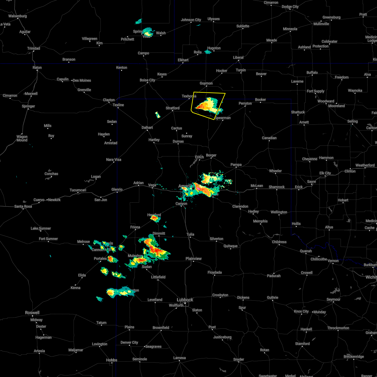 At 516 pm cdt, a severe thunderstorm was located 13 miles northwest of gruver, or 21 miles south of guymon, moving northeast at 20 mph (radar indicated). Hazards include ping pong ball size hail and 60 mph wind gusts. Minor damage to roofs, siding, and trees is possible. people and animals outdoors will be injured. expect hail damage to roofs, siding, windows, and vehicles. locations impacted include, goodwell and gruver. A tornado watch remains in effect until midnight cdt for the panhandle of oklahoma, and the panhandle of texas. At 516 pm cdt, a severe thunderstorm was located 13 miles northwest of gruver, or 21 miles south of guymon, moving northeast at 20 mph (radar indicated). Hazards include ping pong ball size hail and 60 mph wind gusts. Minor damage to roofs, siding, and trees is possible. people and animals outdoors will be injured. expect hail damage to roofs, siding, windows, and vehicles. locations impacted include, goodwell and gruver. A tornado watch remains in effect until midnight cdt for the panhandle of oklahoma, and the panhandle of texas.
|
| 5/26/2021 4:56 PM CDT |
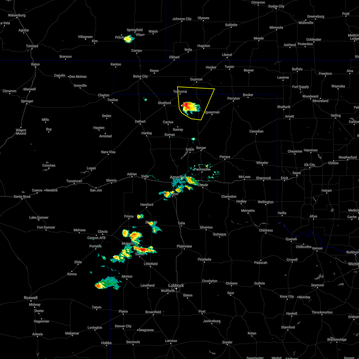 At 456 pm cdt, a severe thunderstorm was located 11 miles southeast of texhoma, or 21 miles east of stratford, moving northeast at 20 mph (radar indicated). Hazards include ping pong ball size hail and 60 mph wind gusts. Minor damage to roofs, siding, and trees is possible. people and animals outdoors will be injured. expect hail damage to roofs, siding, windows, and vehicles. Locations impacted include, goodwell, gruver and texhoma. At 456 pm cdt, a severe thunderstorm was located 11 miles southeast of texhoma, or 21 miles east of stratford, moving northeast at 20 mph (radar indicated). Hazards include ping pong ball size hail and 60 mph wind gusts. Minor damage to roofs, siding, and trees is possible. people and animals outdoors will be injured. expect hail damage to roofs, siding, windows, and vehicles. Locations impacted include, goodwell, gruver and texhoma.
|
| 5/26/2021 4:41 PM CDT |
 At 441 pm cdt, a severe thunderstorm was located 14 miles south of texhoma, or 18 miles east of stratford, moving north at 25 mph (radar indicated). Hazards include ping pong ball size hail and 60 mph wind gusts. Minor damage to roofs, siding, and trees is possible. people and animals outdoors will be injured. Expect hail damage to roofs, siding, windows, and vehicles. At 441 pm cdt, a severe thunderstorm was located 14 miles south of texhoma, or 18 miles east of stratford, moving north at 25 mph (radar indicated). Hazards include ping pong ball size hail and 60 mph wind gusts. Minor damage to roofs, siding, and trees is possible. people and animals outdoors will be injured. Expect hail damage to roofs, siding, windows, and vehicles.
|
| 5/26/2021 4:41 PM CDT |
 The national weather service in amarillo has issued a * severe thunderstorm warning for. southwestern texas county in the panhandle of oklahoma. western hansford county in the panhandle of texas. eastern sherman county in the panhandle of texas. Until 545 pm cdt. The national weather service in amarillo has issued a * severe thunderstorm warning for. southwestern texas county in the panhandle of oklahoma. western hansford county in the panhandle of texas. eastern sherman county in the panhandle of texas. Until 545 pm cdt.
|
| 5/15/2021 9:59 PM CDT |
 The national weather service in amarillo has issued a * severe thunderstorm warning for. west central beaver county in the panhandle of oklahoma. central texas county in the panhandle of oklahoma. north central hansford county in the panhandle of texas. Until 1045 pm cdt. The national weather service in amarillo has issued a * severe thunderstorm warning for. west central beaver county in the panhandle of oklahoma. central texas county in the panhandle of oklahoma. north central hansford county in the panhandle of texas. Until 1045 pm cdt.
|
| 5/7/2021 3:20 PM CDT |
 At 320 pm cdt, a severe thunderstorm was located 7 miles southwest of hough, or 9 miles northwest of guymon, moving east at 35 mph (radar indicated). Hazards include 60 mph wind gusts and penny size hail. Minor damage to roofs, siding, and trees is possible. Locations impacted include, goodwell and hough. At 320 pm cdt, a severe thunderstorm was located 7 miles southwest of hough, or 9 miles northwest of guymon, moving east at 35 mph (radar indicated). Hazards include 60 mph wind gusts and penny size hail. Minor damage to roofs, siding, and trees is possible. Locations impacted include, goodwell and hough.
|
| 5/7/2021 3:05 PM CDT |
 At 305 pm cdt, a severe thunderstorm was located 4 miles east of eva, or 14 miles south of elkhart, moving east at 30 mph (radar indicated). Hazards include 60 mph wind gusts and penny size hail. Minor damage to roofs, siding, and trees is possible. Locations impacted include, goodwell, eva and hough. At 305 pm cdt, a severe thunderstorm was located 4 miles east of eva, or 14 miles south of elkhart, moving east at 30 mph (radar indicated). Hazards include 60 mph wind gusts and penny size hail. Minor damage to roofs, siding, and trees is possible. Locations impacted include, goodwell, eva and hough.
|
| 5/7/2021 2:50 PM CDT |
 At 250 pm cdt, a severe thunderstorm was located over eva, or 13 miles south of elkhart, moving east at 30 mph (radar indicated). Hazards include 60 mph wind gusts and penny size hail. minor damage to roofs, siding, and trees is possible At 250 pm cdt, a severe thunderstorm was located over eva, or 13 miles south of elkhart, moving east at 30 mph (radar indicated). Hazards include 60 mph wind gusts and penny size hail. minor damage to roofs, siding, and trees is possible
|
| 8/14/2020 10:11 PM CDT |
 The severe thunderstorm warning for southwestern beaver, southeastern texas, hansford, northeastern sherman and northern ochiltree counties will expire at 1015 pm cdt, the storms which prompted the warning have moved out of the area. therefore, the warning will be allowed to expire. however gusty winds are still possible with these thunderstorms. remember, a tornado warning still remains in effect for south eastern hansford and southwest ochiltree county until 1030 pm for doppler indicated rotation. The severe thunderstorm warning for southwestern beaver, southeastern texas, hansford, northeastern sherman and northern ochiltree counties will expire at 1015 pm cdt, the storms which prompted the warning have moved out of the area. therefore, the warning will be allowed to expire. however gusty winds are still possible with these thunderstorms. remember, a tornado warning still remains in effect for south eastern hansford and southwest ochiltree county until 1030 pm for doppler indicated rotation.
|
| 8/14/2020 9:56 PM CDT |
 At 956 pm cdt, automated weather equipment reported severe thunderstorms were located along a line extending from 5 miles northwest of booker to 10 miles west of gruver, moving southeast at 35 mph (automated weather equipment). Hazards include 70 mph wind gusts and quarter size hail. Expect some tree damage. damage is likely to mobile homes, roofs, and outbuildings. hail damage to vehicles is expected. Locations impacted include, perryton, goodwell, gruver, hardesty, waka and farnsworth. At 956 pm cdt, automated weather equipment reported severe thunderstorms were located along a line extending from 5 miles northwest of booker to 10 miles west of gruver, moving southeast at 35 mph (automated weather equipment). Hazards include 70 mph wind gusts and quarter size hail. Expect some tree damage. damage is likely to mobile homes, roofs, and outbuildings. hail damage to vehicles is expected. Locations impacted include, perryton, goodwell, gruver, hardesty, waka and farnsworth.
|
| 8/14/2020 9:35 PM CDT | Mesonet was measuring gust above 60 mph for about 10 mins. see previous report at 925 pm for the highest windgust of 65 mp in texas county OK, 1.9 miles WSW of Goodwell, OK |
| 8/14/2020 9:34 PM CDT |
 At 932 pm cdt, automated weather equipment reported severe thunderstorms were located along a line extending from 4 miles southwest of balko to 12 miles south of texhoma, moving southeast at 35 mph (automated weather equipment in goodwell ok and the palo duro reservoir measured wind gusts ranging from 58 mph to 65 mph). Hazards include 65 mph wind gusts and quarter size hail. Minor damage to roofs, siding, and trees is possible. hail damage to vehicles is expected. Locations impacted include, perryton, goodwell, gruver, hardesty, bryans corner, adams, farnsworth, boyd, waka and texhoma. At 932 pm cdt, automated weather equipment reported severe thunderstorms were located along a line extending from 4 miles southwest of balko to 12 miles south of texhoma, moving southeast at 35 mph (automated weather equipment in goodwell ok and the palo duro reservoir measured wind gusts ranging from 58 mph to 65 mph). Hazards include 65 mph wind gusts and quarter size hail. Minor damage to roofs, siding, and trees is possible. hail damage to vehicles is expected. Locations impacted include, perryton, goodwell, gruver, hardesty, bryans corner, adams, farnsworth, boyd, waka and texhoma.
|
| 8/14/2020 9:25 PM CDT | Storm damage reported in texas county OK, 1.9 miles WSW of Goodwell, OK |
| 8/14/2020 9:17 PM CDT |
 At 917 pm cdt, severe thunderstorms were located along a line extending from bryans corner to 9 miles south of texhoma, moving southeast at 35 mph (radar indicated). Hazards include 70 mph wind gusts and quarter size hail. Expect some tree damage. damage is likely to mobile homes, roofs, and outbuildings. hail damage to vehicles is expected. Locations impacted include, perryton, stratford, goodwell, gruver, hardesty, bryans corner, adams, farnsworth, boyd, waka and texhoma. At 917 pm cdt, severe thunderstorms were located along a line extending from bryans corner to 9 miles south of texhoma, moving southeast at 35 mph (radar indicated). Hazards include 70 mph wind gusts and quarter size hail. Expect some tree damage. damage is likely to mobile homes, roofs, and outbuildings. hail damage to vehicles is expected. Locations impacted include, perryton, stratford, goodwell, gruver, hardesty, bryans corner, adams, farnsworth, boyd, waka and texhoma.
|
| 8/14/2020 9:09 PM CDT |
 At 909 pm cdt, severe thunderstorms were located along a line extending from bryans corner to 3 miles southwest of texhoma, moving southeast at 35 mph (radar indicated). Hazards include 70 mph wind gusts and quarter size hail. Expect some tree damage. damage is likely to mobile homes, roofs, and outbuildings. hail damage to vehicles is expected. Locations impacted include, guymon, perryton, stratford, goodwell, gruver, optima, hardesty, adams, farnsworth, boyd, waka, bryans corner, baker, turpin, balko and texhoma. At 909 pm cdt, severe thunderstorms were located along a line extending from bryans corner to 3 miles southwest of texhoma, moving southeast at 35 mph (radar indicated). Hazards include 70 mph wind gusts and quarter size hail. Expect some tree damage. damage is likely to mobile homes, roofs, and outbuildings. hail damage to vehicles is expected. Locations impacted include, guymon, perryton, stratford, goodwell, gruver, optima, hardesty, adams, farnsworth, boyd, waka, bryans corner, baker, turpin, balko and texhoma.
|
| 8/14/2020 8:58 PM CDT |
 At 857 pm cdt, severe thunderstorms were located along a line extending from 3 miles west of boyd to 7 miles west of texhoma, moving southeast at 30 mph. these are very dangerous storms (radar indicated). Hazards include 80 mph wind gusts and half dollar size hail. Flying debris will be dangerous to those caught without shelter. mobile homes will be heavily damaged. expect considerable damage to roofs, windows, and vehicles. tree damage and power outages are likely. hail damage to vehicles is expected. Locations impacted include, guymon, perryton, stratford, goodwell, gruver, optima, hardesty, adams, farnsworth, boyd, waka, bryans corner, baker, turpin, balko and texhoma. At 857 pm cdt, severe thunderstorms were located along a line extending from 3 miles west of boyd to 7 miles west of texhoma, moving southeast at 30 mph. these are very dangerous storms (radar indicated). Hazards include 80 mph wind gusts and half dollar size hail. Flying debris will be dangerous to those caught without shelter. mobile homes will be heavily damaged. expect considerable damage to roofs, windows, and vehicles. tree damage and power outages are likely. hail damage to vehicles is expected. Locations impacted include, guymon, perryton, stratford, goodwell, gruver, optima, hardesty, adams, farnsworth, boyd, waka, bryans corner, baker, turpin, balko and texhoma.
|
| 8/14/2020 8:55 PM CDT | Ping Pong Ball sized hail reported 0.8 miles WNW of Goodwell, OK, spotter said hail was mostly pea with a few ping pong ball size stones mixed in. also... said the hail was short lived. |
| 8/14/2020 8:45 PM CDT |
 At 844 pm cdt, severe thunderstorms were located along a line extending from 3 miles southeast of adams to 9 miles northwest of texhoma, moving southeast at 35 mph (radar indicated). Hazards include 70 mph wind gusts and half dollar size hail. Expect some tree damage. damage is likely to mobile homes, roofs, and outbuildings. Hail damage to vehicles is expected. At 844 pm cdt, severe thunderstorms were located along a line extending from 3 miles southeast of adams to 9 miles northwest of texhoma, moving southeast at 35 mph (radar indicated). Hazards include 70 mph wind gusts and half dollar size hail. Expect some tree damage. damage is likely to mobile homes, roofs, and outbuildings. Hail damage to vehicles is expected.
|
| 8/14/2020 8:35 PM CDT |
 At 835 pm cdt, a severe thunderstorm was located 7 miles south of eva, or 21 miles south of elkhart, moving south at 25 mph (radar indicated). Hazards include 70 mph wind gusts and ping pong ball size hail. Expect some tree damage. damage is likely to mobile homes, roofs, and outbuildings. people and animals outdoors will be injured. expect hail damage to roofs, siding, windows, and vehicles. Locations impacted include, guymon, goodwell, texhoma, keyes, eva, hough, griggs and sturgis. At 835 pm cdt, a severe thunderstorm was located 7 miles south of eva, or 21 miles south of elkhart, moving south at 25 mph (radar indicated). Hazards include 70 mph wind gusts and ping pong ball size hail. Expect some tree damage. damage is likely to mobile homes, roofs, and outbuildings. people and animals outdoors will be injured. expect hail damage to roofs, siding, windows, and vehicles. Locations impacted include, guymon, goodwell, texhoma, keyes, eva, hough, griggs and sturgis.
|
| 8/14/2020 8:25 PM CDT |
 At 825 pm cdt, a severe thunderstorm was located over eva, or 16 miles south of elkhart, moving south at 25 mph (radar indicated). Hazards include golf ball size hail and 70 mph wind gusts. Expect some tree damage. damage is likely to mobile homes, roofs, and outbuildings. people and animals outdoors will be injured. expect hail damage to roofs, siding, windows, and vehicles. Locations impacted include, guymon, goodwell, texhoma, keyes, eva, hough, griggs and sturgis. At 825 pm cdt, a severe thunderstorm was located over eva, or 16 miles south of elkhart, moving south at 25 mph (radar indicated). Hazards include golf ball size hail and 70 mph wind gusts. Expect some tree damage. damage is likely to mobile homes, roofs, and outbuildings. people and animals outdoors will be injured. expect hail damage to roofs, siding, windows, and vehicles. Locations impacted include, guymon, goodwell, texhoma, keyes, eva, hough, griggs and sturgis.
|
| 8/14/2020 8:17 PM CDT |
 At 817 pm cdt, a severe thunderstorm was located over eva, or 13 miles south of elkhart, moving south at 20 mph (radar indicated). Hazards include golf ball size hail and 70 mph wind gusts. Expect some tree damage. damage is likely to mobile homes, roofs, and outbuildings. people and animals outdoors will be injured. expect hail damage to roofs, siding, windows, and vehicles. Locations impacted include, guymon, goodwell, texhoma, keyes, eva, hough, griggs and sturgis. At 817 pm cdt, a severe thunderstorm was located over eva, or 13 miles south of elkhart, moving south at 20 mph (radar indicated). Hazards include golf ball size hail and 70 mph wind gusts. Expect some tree damage. damage is likely to mobile homes, roofs, and outbuildings. people and animals outdoors will be injured. expect hail damage to roofs, siding, windows, and vehicles. Locations impacted include, guymon, goodwell, texhoma, keyes, eva, hough, griggs and sturgis.
|
| 8/14/2020 8:08 PM CDT |
 At 808 pm cdt, a severe thunderstorm was located 4 miles northwest of eva, or 11 miles south of elkhart, moving south at 25 mph (radar indicated). Hazards include two inch hail and 70 mph wind gusts. Expect some tree damage. damage is likely to mobile homes, roofs, and outbuildings. people and animals outdoors will be injured. expect hail damage to roofs, siding, windows, and vehicles. Locations impacted include, guymon, boise city, goodwell, texhoma, keyes, eva, hough, griggs and sturgis. At 808 pm cdt, a severe thunderstorm was located 4 miles northwest of eva, or 11 miles south of elkhart, moving south at 25 mph (radar indicated). Hazards include two inch hail and 70 mph wind gusts. Expect some tree damage. damage is likely to mobile homes, roofs, and outbuildings. people and animals outdoors will be injured. expect hail damage to roofs, siding, windows, and vehicles. Locations impacted include, guymon, boise city, goodwell, texhoma, keyes, eva, hough, griggs and sturgis.
|
| 8/14/2020 7:57 PM CDT |
 At 757 pm cdt, a severe thunderstorm was located 7 miles northwest of eva, or 8 miles southwest of elkhart, moving south at 25 mph (radar indicated). Hazards include golf ball size hail and 70 mph wind gusts. Expect some tree damage. damage is likely to mobile homes, roofs, and outbuildings. people and animals outdoors will be injured. expect hail damage to roofs, siding, windows, and vehicles. Locations impacted include, guymon, boise city, goodwell, texhoma, keyes, eva, hough, griggs and sturgis. At 757 pm cdt, a severe thunderstorm was located 7 miles northwest of eva, or 8 miles southwest of elkhart, moving south at 25 mph (radar indicated). Hazards include golf ball size hail and 70 mph wind gusts. Expect some tree damage. damage is likely to mobile homes, roofs, and outbuildings. people and animals outdoors will be injured. expect hail damage to roofs, siding, windows, and vehicles. Locations impacted include, guymon, boise city, goodwell, texhoma, keyes, eva, hough, griggs and sturgis.
|
| 8/14/2020 7:37 PM CDT |
 At 737 pm cdt, a severe thunderstorm was located 6 miles west of elkhart, moving southwest at 25 mph (radar indicated). Hazards include 70 mph wind gusts and ping pong ball size hail. Expect some tree damage. damage is likely to mobile homes, roofs, and outbuildings. people and animals outdoors will be injured. Expect hail damage to roofs, siding, windows, and vehicles. At 737 pm cdt, a severe thunderstorm was located 6 miles west of elkhart, moving southwest at 25 mph (radar indicated). Hazards include 70 mph wind gusts and ping pong ball size hail. Expect some tree damage. damage is likely to mobile homes, roofs, and outbuildings. people and animals outdoors will be injured. Expect hail damage to roofs, siding, windows, and vehicles.
|
| 8/9/2020 9:58 PM CDT |
 At 957 pm cdt, automated weather equipment reported a severe thunderstorm was located 5 miles east of goodwell, or 8 miles south of guymon, moving southeast at 15 mph (automated weather equipment. at 9:50 pm cdt an automated weather station in goodwell gusted to 58 mph). Hazards include 60 mph wind gusts and penny size hail. Minor damage to roofs, siding, and trees is possible. Locations impacted include, guymon, goodwell and optima. At 957 pm cdt, automated weather equipment reported a severe thunderstorm was located 5 miles east of goodwell, or 8 miles south of guymon, moving southeast at 15 mph (automated weather equipment. at 9:50 pm cdt an automated weather station in goodwell gusted to 58 mph). Hazards include 60 mph wind gusts and penny size hail. Minor damage to roofs, siding, and trees is possible. Locations impacted include, guymon, goodwell and optima.
|
| 8/9/2020 9:50 PM CDT | Storm damage reported in texas county OK, 1.9 miles WSW of Goodwell, OK |
| 8/9/2020 9:20 PM CDT |
 At 920 pm cdt, a severe thunderstorm was located 4 miles northwest of goodwell, or 11 miles west of guymon, moving southeast at 15 mph (radar indicated). Hazards include 60 mph wind gusts and quarter size hail. Minor damage to roofs, siding, and trees is possible. Hail damage to vehicles is expected. At 920 pm cdt, a severe thunderstorm was located 4 miles northwest of goodwell, or 11 miles west of guymon, moving southeast at 15 mph (radar indicated). Hazards include 60 mph wind gusts and quarter size hail. Minor damage to roofs, siding, and trees is possible. Hail damage to vehicles is expected.
|
| 7/20/2020 11:05 PM CDT |
 At 1105 pm cdt, a severe thunderstorm was located 8 miles north of goodwell, or 9 miles west of guymon, moving east at 25 mph (radar indicated). Hazards include 60 mph wind gusts. Minor damage to roofs, siding, and trees is possible. Locations impacted include, guymon, goodwell, texhoma, optima, eva and hough. At 1105 pm cdt, a severe thunderstorm was located 8 miles north of goodwell, or 9 miles west of guymon, moving east at 25 mph (radar indicated). Hazards include 60 mph wind gusts. Minor damage to roofs, siding, and trees is possible. Locations impacted include, guymon, goodwell, texhoma, optima, eva and hough.
|
| 7/20/2020 10:48 PM CDT |
 At 1048 pm cdt, a severe thunderstorm was located over eva, or 13 miles south of elkhart, moving east at 25 mph (radar indicated). Hazards include 60 mph wind gusts. minor damage to roofs, siding, and trees is possible At 1048 pm cdt, a severe thunderstorm was located over eva, or 13 miles south of elkhart, moving east at 25 mph (radar indicated). Hazards include 60 mph wind gusts. minor damage to roofs, siding, and trees is possible
|
| 7/19/2020 8:37 PM CDT |
 At 837 pm cdt, a severe thunderstorm was located 9 miles east of stratford, moving northeast at 30 mph (radar indicated). Hazards include 60 mph wind gusts and penny size hail. Minor damage to roofs, siding, and trees is possible. Locations impacted include, stratford, goodwell and texhoma. At 837 pm cdt, a severe thunderstorm was located 9 miles east of stratford, moving northeast at 30 mph (radar indicated). Hazards include 60 mph wind gusts and penny size hail. Minor damage to roofs, siding, and trees is possible. Locations impacted include, stratford, goodwell and texhoma.
|
| 7/19/2020 8:37 PM CDT |
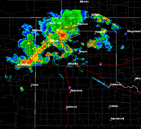 At 837 pm cdt, a severe thunderstorm was located 9 miles east of stratford, moving northeast at 30 mph (radar indicated). Hazards include 60 mph wind gusts and penny size hail. Minor damage to roofs, siding, and trees is possible. Locations impacted include, stratford, goodwell and texhoma. At 837 pm cdt, a severe thunderstorm was located 9 miles east of stratford, moving northeast at 30 mph (radar indicated). Hazards include 60 mph wind gusts and penny size hail. Minor damage to roofs, siding, and trees is possible. Locations impacted include, stratford, goodwell and texhoma.
|
| 7/19/2020 8:19 PM CDT |
 At 819 pm cdt, a severe thunderstorm was located over stratford, moving northeast at 30 mph (radar indicated). Hazards include 70 mph wind gusts and half dollar size hail. Expect some tree damage. damage is likely to mobile homes, roofs, and outbuildings. Hail damage to vehicles is expected. At 819 pm cdt, a severe thunderstorm was located over stratford, moving northeast at 30 mph (radar indicated). Hazards include 70 mph wind gusts and half dollar size hail. Expect some tree damage. damage is likely to mobile homes, roofs, and outbuildings. Hail damage to vehicles is expected.
|
| 7/14/2020 10:54 PM CDT |
 At 1053 pm cdt, severe thunderstorms were located along a line extending from 8 miles north of hough to 4 miles northeast of texhoma, moving east at 35 mph (radar indicated). Hazards include 60 mph wind gusts and nickel size hail. Minor damage to roofs, siding, and trees is possible. Locations impacted include, guymon, hooker, goodwell, texhoma, tyrone, optima, hardesty, hough, baker and adams. At 1053 pm cdt, severe thunderstorms were located along a line extending from 8 miles north of hough to 4 miles northeast of texhoma, moving east at 35 mph (radar indicated). Hazards include 60 mph wind gusts and nickel size hail. Minor damage to roofs, siding, and trees is possible. Locations impacted include, guymon, hooker, goodwell, texhoma, tyrone, optima, hardesty, hough, baker and adams.
|
| 7/14/2020 10:37 PM CDT |
 At 1035 pm cdt, severe thunderstorms were located along a line extending from 4 miles south of wilburton to 8 miles northwest of texhoma, moving east at 35 mph (automated weather equipment. at 1025 pm cdt, automated weather equipment recorded a 61 mph wind gust 12 miles northwest of eva). Hazards include 60 mph wind gusts. minor damage to roofs, siding, and trees is possible At 1035 pm cdt, severe thunderstorms were located along a line extending from 4 miles south of wilburton to 8 miles northwest of texhoma, moving east at 35 mph (automated weather equipment. at 1025 pm cdt, automated weather equipment recorded a 61 mph wind gust 12 miles northwest of eva). Hazards include 60 mph wind gusts. minor damage to roofs, siding, and trees is possible
|
| 7/14/2020 8:27 PM CDT |
 At 826 pm cdt, automated weather equipment reported severe thunderstorms were located along a line extending from goodwell to 4 miles west of gruver to pringle, moving east at 40 mph (automated weather equipment. at 820 pm cdt, automated weather equipment recorded a 62 mph wind gust at goodwell). Hazards include 70 mph wind gusts and quarter size hail. Expect some tree damage. damage is likely to mobile homes, roofs, and outbuildings. hail damage to vehicles is expected. Locations impacted include, guymon, perryton, spearman, hooker, goodwell, gruver, optima, hardesty, wolf creek park, adams, farnsworth, boyd, waka, floris, pringle, morse, bryans corner, baker, turpin and balko. At 826 pm cdt, automated weather equipment reported severe thunderstorms were located along a line extending from goodwell to 4 miles west of gruver to pringle, moving east at 40 mph (automated weather equipment. at 820 pm cdt, automated weather equipment recorded a 62 mph wind gust at goodwell). Hazards include 70 mph wind gusts and quarter size hail. Expect some tree damage. damage is likely to mobile homes, roofs, and outbuildings. hail damage to vehicles is expected. Locations impacted include, guymon, perryton, spearman, hooker, goodwell, gruver, optima, hardesty, wolf creek park, adams, farnsworth, boyd, waka, floris, pringle, morse, bryans corner, baker, turpin and balko.
|
| 7/14/2020 8:24 PM CDT |
 At 823 pm cdt, severe thunderstorms were located along a line extending from goodwell to 5 miles northwest of gruver to 3 miles northwest of pringle, moving east at 30 mph (radar indicated). Hazards include 70 mph wind gusts and quarter size hail. Expect some tree damage. damage is likely to mobile homes, roofs, and outbuildings. hail damage to vehicles is expected. Locations impacted include, guymon, perryton, spearman, hooker, goodwell, gruver, optima, hardesty, wolf creek park, adams, farnsworth, boyd, waka, floris, pringle, morse, bryans corner, baker, turpin and balko. At 823 pm cdt, severe thunderstorms were located along a line extending from goodwell to 5 miles northwest of gruver to 3 miles northwest of pringle, moving east at 30 mph (radar indicated). Hazards include 70 mph wind gusts and quarter size hail. Expect some tree damage. damage is likely to mobile homes, roofs, and outbuildings. hail damage to vehicles is expected. Locations impacted include, guymon, perryton, spearman, hooker, goodwell, gruver, optima, hardesty, wolf creek park, adams, farnsworth, boyd, waka, floris, pringle, morse, bryans corner, baker, turpin and balko.
|
| 7/14/2020 8:20 PM CDT | Storm damage reported in texas county OK, 1.9 miles WSW of Goodwell, OK |
| 7/14/2020 8:20 PM CDT | Half of a roof blown off of a mobile home. some 6 inch diameter tree limbs downe in texas county OK, 0.3 miles NW of Goodwell, OK |
| 7/14/2020 7:59 PM CDT |
 At 758 pm cdt, severe thunderstorms were located along a line extending from 8 miles northwest of goodwell to 12 miles southeast of texhoma to 8 miles east of sunray, moving east at 40 mph (radar indicated). Hazards include 70 mph wind gusts and quarter size hail. Expect some tree damage. damage is likely to mobile homes, roofs, and outbuildings. Hail damage to vehicles is expected. At 758 pm cdt, severe thunderstorms were located along a line extending from 8 miles northwest of goodwell to 12 miles southeast of texhoma to 8 miles east of sunray, moving east at 40 mph (radar indicated). Hazards include 70 mph wind gusts and quarter size hail. Expect some tree damage. damage is likely to mobile homes, roofs, and outbuildings. Hail damage to vehicles is expected.
|
| 7/14/2020 7:59 PM CDT |
 The national weather service in amarillo has issued a * severe thunderstorm warning for. western beaver county in the panhandle of oklahoma. texas county in the panhandle of oklahoma. northern hutchinson county in the panhandle of texas. Hansford county in the panhandle of texas. The national weather service in amarillo has issued a * severe thunderstorm warning for. western beaver county in the panhandle of oklahoma. texas county in the panhandle of oklahoma. northern hutchinson county in the panhandle of texas. Hansford county in the panhandle of texas.
|
| 7/11/2020 11:49 PM CDT |
 At 1149 pm cdt, a severe thunderstorm was located over optima, or 7 miles northeast of guymon, moving northeast at 30 mph (radar indicated). Hazards include golf ball size hail and 60 mph wind gusts. Minor damage to roofs, siding, and trees is possible. people and animals outdoors will be injured. expect hail damage to roofs, siding, windows, and vehicles. Locations impacted include, guymon, hooker, goodwell, optima, hardesty and hough. At 1149 pm cdt, a severe thunderstorm was located over optima, or 7 miles northeast of guymon, moving northeast at 30 mph (radar indicated). Hazards include golf ball size hail and 60 mph wind gusts. Minor damage to roofs, siding, and trees is possible. people and animals outdoors will be injured. expect hail damage to roofs, siding, windows, and vehicles. Locations impacted include, guymon, hooker, goodwell, optima, hardesty and hough.
|
| 7/11/2020 11:26 PM CDT |
 At 1125 pm cdt, a severe thunderstorm was located near guymon, moving northeast at 30 mph (radar indicated). Hazards include ping pong ball size hail and 60 mph wind gusts. Minor damage to roofs, siding, and trees is possible. people and animals outdoors will be injured. Expect hail damage to roofs, siding, windows, and vehicles. At 1125 pm cdt, a severe thunderstorm was located near guymon, moving northeast at 30 mph (radar indicated). Hazards include ping pong ball size hail and 60 mph wind gusts. Minor damage to roofs, siding, and trees is possible. people and animals outdoors will be injured. Expect hail damage to roofs, siding, windows, and vehicles.
|
| 7/11/2020 11:25 PM CDT | Storm damage reported in texas county OK, 1.9 miles WSW of Goodwell, OK |
| 7/11/2020 11:15 PM CDT |
 At 1115 pm cdt, severe thunderstorms were located along a line extending from 6 miles west of guymon to 3 miles northeast of goodwell to 9 miles east of texhoma, moving northeast at 25 mph (radar indicated). Hazards include ping pong ball size hail and 60 mph wind gusts. Minor damage to roofs, siding, and trees is possible. people and animals outdoors will be injured. expect hail damage to roofs, siding, windows, and vehicles. Locations impacted include, guymon, goodwell, optima and texhoma. At 1115 pm cdt, severe thunderstorms were located along a line extending from 6 miles west of guymon to 3 miles northeast of goodwell to 9 miles east of texhoma, moving northeast at 25 mph (radar indicated). Hazards include ping pong ball size hail and 60 mph wind gusts. Minor damage to roofs, siding, and trees is possible. people and animals outdoors will be injured. expect hail damage to roofs, siding, windows, and vehicles. Locations impacted include, guymon, goodwell, optima and texhoma.
|
| 7/11/2020 11:11 PM CDT | Golf Ball sized hail reported 0.8 miles WNW of Goodwell, OK |
| 7/11/2020 11:01 PM CDT |
 At 1101 pm cdt, severe thunderstorms were located along a line extending from 3 miles southwest of goodwell to 10 miles southeast of texhoma to 14 miles west of gruver, moving northeast at 15 mph (radar indicated). Hazards include 60 mph wind gusts and quarter size hail. Minor damage to roofs, siding, and trees is possible. hail damage to vehicles is expected. Locations impacted include, guymon, goodwell, gruver, optima and texhoma. At 1101 pm cdt, severe thunderstorms were located along a line extending from 3 miles southwest of goodwell to 10 miles southeast of texhoma to 14 miles west of gruver, moving northeast at 15 mph (radar indicated). Hazards include 60 mph wind gusts and quarter size hail. Minor damage to roofs, siding, and trees is possible. hail damage to vehicles is expected. Locations impacted include, guymon, goodwell, gruver, optima and texhoma.
|
| 7/11/2020 10:36 PM CDT |
 At 1035 pm cdt, severe thunderstorms were located along a line extending from 6 miles east of texhoma to 11 miles west of gruver to 9 miles northwest of morse, moving east at 25 mph (radar indicated). Hazards include 60 mph wind gusts and quarter size hail. Minor damage to roofs, siding, and trees is possible. Hail damage to vehicles is expected. At 1035 pm cdt, severe thunderstorms were located along a line extending from 6 miles east of texhoma to 11 miles west of gruver to 9 miles northwest of morse, moving east at 25 mph (radar indicated). Hazards include 60 mph wind gusts and quarter size hail. Minor damage to roofs, siding, and trees is possible. Hail damage to vehicles is expected.
|
| 6/22/2020 9:28 PM CDT |
 The severe thunderstorm warning for texas, northern hansford and northeastern sherman counties will expire at 930 pm cdt, the storms which prompted the warning have weakened below severe limits, and no longer pose an immediate threat to life or property. therefore, the warning will be allowed to expire. a severe thunderstorm watch remains in effect until 1100 pm cdt for the panhandle of oklahoma, and the panhandle of texas. The severe thunderstorm warning for texas, northern hansford and northeastern sherman counties will expire at 930 pm cdt, the storms which prompted the warning have weakened below severe limits, and no longer pose an immediate threat to life or property. therefore, the warning will be allowed to expire. a severe thunderstorm watch remains in effect until 1100 pm cdt for the panhandle of oklahoma, and the panhandle of texas.
|
| 6/22/2020 8:31 PM CDT |
 At 831 pm cdt, severe thunderstorms were located along a line extending from 7 miles southwest of hough to 13 miles south of goodwell, moving northeast at 10 mph (automated weather equipment). Hazards include 60 mph wind gusts. minor damage to roofs, siding, and trees is possible At 831 pm cdt, severe thunderstorms were located along a line extending from 7 miles southwest of hough to 13 miles south of goodwell, moving northeast at 10 mph (automated weather equipment). Hazards include 60 mph wind gusts. minor damage to roofs, siding, and trees is possible
|
| 6/22/2020 8:20 PM CDT | Storm damage reported in texas county OK, 1.9 miles WSW of Goodwell, OK |
| 6/22/2020 5:59 PM CDT |
 At 559 pm cdt, a severe thunderstorm was located 5 miles west of texhoma, or 17 miles northeast of stratford, moving southeast at 20 mph (radar indicated). Hazards include 60 mph wind gusts and half dollar size hail. Minor damage to roofs, siding, and trees is possible. hail damage to vehicles is expected. Locations impacted include, goodwell and texhoma. At 559 pm cdt, a severe thunderstorm was located 5 miles west of texhoma, or 17 miles northeast of stratford, moving southeast at 20 mph (radar indicated). Hazards include 60 mph wind gusts and half dollar size hail. Minor damage to roofs, siding, and trees is possible. hail damage to vehicles is expected. Locations impacted include, goodwell and texhoma.
|
| 6/22/2020 5:59 PM CDT |
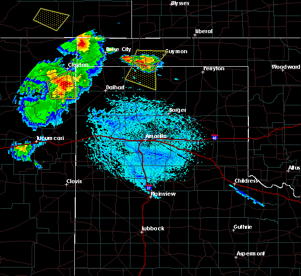 At 559 pm cdt, a severe thunderstorm was located 5 miles west of texhoma, or 17 miles northeast of stratford, moving southeast at 20 mph (radar indicated). Hazards include 60 mph wind gusts and half dollar size hail. Minor damage to roofs, siding, and trees is possible. hail damage to vehicles is expected. Locations impacted include, goodwell and texhoma. At 559 pm cdt, a severe thunderstorm was located 5 miles west of texhoma, or 17 miles northeast of stratford, moving southeast at 20 mph (radar indicated). Hazards include 60 mph wind gusts and half dollar size hail. Minor damage to roofs, siding, and trees is possible. hail damage to vehicles is expected. Locations impacted include, goodwell and texhoma.
|
| 6/22/2020 5:50 PM CDT |
 At 549 pm cdt, a severe thunderstorm was located 8 miles south of eva, or 22 miles south of elkhart, moving east at 20 mph (radar indicated). Hazards include 60 mph wind gusts and quarter size hail. Minor damage to roofs, siding, and trees is possible. Hail damage to vehicles is expected. At 549 pm cdt, a severe thunderstorm was located 8 miles south of eva, or 22 miles south of elkhart, moving east at 20 mph (radar indicated). Hazards include 60 mph wind gusts and quarter size hail. Minor damage to roofs, siding, and trees is possible. Hail damage to vehicles is expected.
|
| 3/30/2020 5:45 PM CDT |
 At 545 pm cdt, a severe thunderstorm was located over optima, or 9 miles northeast of guymon, moving southeast at 20 mph (radar indicated). Hazards include 60 mph wind gusts and penny size hail. Minor damage to roofs, siding, and trees is possible. hail may accumulate on roadways causing hazardous travel. Locations impacted include, guymon, goodwell, optima and hough. At 545 pm cdt, a severe thunderstorm was located over optima, or 9 miles northeast of guymon, moving southeast at 20 mph (radar indicated). Hazards include 60 mph wind gusts and penny size hail. Minor damage to roofs, siding, and trees is possible. hail may accumulate on roadways causing hazardous travel. Locations impacted include, guymon, goodwell, optima and hough.
|
| 3/30/2020 4:56 PM CDT |
 At 456 pm cdt, a severe thunderstorm was located over hough, or 12 miles northwest of guymon, moving southeast at 20 mph (radar indicated). Hazards include 60 mph wind gusts and quarter size hail. Minor damage to roofs, siding, and trees is possible. Hail damage to vehicles is expected. At 456 pm cdt, a severe thunderstorm was located over hough, or 12 miles northwest of guymon, moving southeast at 20 mph (radar indicated). Hazards include 60 mph wind gusts and quarter size hail. Minor damage to roofs, siding, and trees is possible. Hail damage to vehicles is expected.
|
| 8/21/2019 7:54 PM CDT |
 The severe thunderstorm warning for southern texas and southeastern cimarron counties will expire at 800 pm cdt, the storms which prompted the warning have weakened below severe limits, and no longer pose an immediate threat to life or property. therefore, the warning will be allowed to expire. however gusty winds are still possible with these thunderstorms. The severe thunderstorm warning for southern texas and southeastern cimarron counties will expire at 800 pm cdt, the storms which prompted the warning have weakened below severe limits, and no longer pose an immediate threat to life or property. therefore, the warning will be allowed to expire. however gusty winds are still possible with these thunderstorms.
|
| 8/21/2019 7:40 PM CDT |
 At 740 pm cdt, severe thunderstorms were located along a line extending from 5 miles south of griggs to 8 miles west of hardesty, moving southeast at 10 mph (radar indicated). Hazards include 60 mph wind gusts. Minor damage to roofs, siding, and trees is possible. Locations impacted include, guymon, goodwell, texhoma, optima, hardesty, eva and griggs. At 740 pm cdt, severe thunderstorms were located along a line extending from 5 miles south of griggs to 8 miles west of hardesty, moving southeast at 10 mph (radar indicated). Hazards include 60 mph wind gusts. Minor damage to roofs, siding, and trees is possible. Locations impacted include, guymon, goodwell, texhoma, optima, hardesty, eva and griggs.
|
| 8/21/2019 7:32 PM CDT |
 At 732 pm cdt, severe thunderstorms were located along a line extending from 10 miles southwest of griggs to 10 miles southwest of hardesty, moving southwest at 10 mph (radar indicated). Hazards include 60 mph wind gusts. Minor damage to roofs, siding, and trees is possible. Locations impacted include, guymon, goodwell, texhoma, optima, hardesty, eva, hough, griggs and sturgis. At 732 pm cdt, severe thunderstorms were located along a line extending from 10 miles southwest of griggs to 10 miles southwest of hardesty, moving southwest at 10 mph (radar indicated). Hazards include 60 mph wind gusts. Minor damage to roofs, siding, and trees is possible. Locations impacted include, guymon, goodwell, texhoma, optima, hardesty, eva, hough, griggs and sturgis.
|
| 8/21/2019 7:24 PM CDT |
 At 723 pm cdt, a severe thunderstorm was located near eva, or 17 miles south of elkhart, moving southwest at 5 mph (radar indicated). Hazards include 60 mph wind gusts. Minor damage to roofs, siding, and trees is possible. Locations impacted include, guymon, goodwell, texhoma, optima, hardesty, eva, hough, griggs and sturgis. At 723 pm cdt, a severe thunderstorm was located near eva, or 17 miles south of elkhart, moving southwest at 5 mph (radar indicated). Hazards include 60 mph wind gusts. Minor damage to roofs, siding, and trees is possible. Locations impacted include, guymon, goodwell, texhoma, optima, hardesty, eva, hough, griggs and sturgis.
|
| 8/21/2019 7:20 PM CDT | Storm damage reported in texas county OK, 1.9 miles WSW of Goodwell, OK |
| 8/21/2019 7:12 PM CDT |
 At 705 pm cdt, a severe thunderstorm was located 4 miles southwest of eva, or 17 miles south of elkhart, moving southwest at 5 mph (radar indicated). Hazards include 60 mph wind gusts and quarter size hail. Minor damage to roofs, siding, and trees is possible. hail damage to vehicles is expected. Locations impacted include, guymon, goodwell, texhoma, optima, keyes, hardesty, eva, hough, griggs and sturgis. At 705 pm cdt, a severe thunderstorm was located 4 miles southwest of eva, or 17 miles south of elkhart, moving southwest at 5 mph (radar indicated). Hazards include 60 mph wind gusts and quarter size hail. Minor damage to roofs, siding, and trees is possible. hail damage to vehicles is expected. Locations impacted include, guymon, goodwell, texhoma, optima, keyes, hardesty, eva, hough, griggs and sturgis.
|
| 8/21/2019 7:05 PM CDT |
 At 705 pm cdt, a severe thunderstorm was located 4 miles southwest of eva, or 17 miles south of elkhart, moving southwest at 5 mph (radar indicated). Hazards include 60 mph wind gusts and quarter size hail. Minor damage to roofs, siding, and trees is possible. hail damage to vehicles is expected. Locations impacted include, guymon, goodwell, texhoma, optima, keyes, hardesty, eva, hough, griggs and sturgis. At 705 pm cdt, a severe thunderstorm was located 4 miles southwest of eva, or 17 miles south of elkhart, moving southwest at 5 mph (radar indicated). Hazards include 60 mph wind gusts and quarter size hail. Minor damage to roofs, siding, and trees is possible. hail damage to vehicles is expected. Locations impacted include, guymon, goodwell, texhoma, optima, keyes, hardesty, eva, hough, griggs and sturgis.
|
| 8/21/2019 6:58 PM CDT |
 At 649 pm cdt, a severe thunderstorm was located over eva, or 16 miles south of elkhart, and is nearly stationary (radar indicated). Hazards include 60 mph wind gusts and quarter size hail. Minor damage to roofs, siding, and trees is possible. hail damage to vehicles is expected. Locations impacted include, guymon, hooker, goodwell, texhoma, tyrone, optima, keyes, hardesty, hough, adams, griggs, eva and sturgis. At 649 pm cdt, a severe thunderstorm was located over eva, or 16 miles south of elkhart, and is nearly stationary (radar indicated). Hazards include 60 mph wind gusts and quarter size hail. Minor damage to roofs, siding, and trees is possible. hail damage to vehicles is expected. Locations impacted include, guymon, hooker, goodwell, texhoma, tyrone, optima, keyes, hardesty, hough, adams, griggs, eva and sturgis.
|
| 8/21/2019 6:49 PM CDT |
 A severe thunderstorm warning remains in effect until 800 pm cdt for texas and eastern cimarron counties. at 649 pm cdt, a severe thunderstorm was located over eva, or 16 miles south of elkhart, and is nearly stationary. hazard. 60 mph wind gusts and quarter size hail. source. Radar indicated. A severe thunderstorm warning remains in effect until 800 pm cdt for texas and eastern cimarron counties. at 649 pm cdt, a severe thunderstorm was located over eva, or 16 miles south of elkhart, and is nearly stationary. hazard. 60 mph wind gusts and quarter size hail. source. Radar indicated.
|
| 8/21/2019 6:37 PM CDT |
 The national weather service in amarillo has issued a * severe thunderstorm warning for. texas county in the panhandle of oklahoma. eastern cimarron county in the panhandle of oklahoma. until 800 pm cdt. At 637 pm cdt, a severe thunderstorm was located 6 miles east of. The national weather service in amarillo has issued a * severe thunderstorm warning for. texas county in the panhandle of oklahoma. eastern cimarron county in the panhandle of oklahoma. until 800 pm cdt. At 637 pm cdt, a severe thunderstorm was located 6 miles east of.
|
| 6/23/2019 12:30 AM CDT |
 At 1230 am cdt, a severe thunderstorm was located 6 miles southeast of hough, or 8 miles north of guymon, moving east at 30 mph (radar indicated). Hazards include 60 mph wind gusts and half dollar size hail. Minor damage to roofs, siding, and trees is possible. hail damage to vehicles is expected. Locations impacted include, guymon, hooker, goodwell, tyrone, optima, hardesty, hough, baker, adams and turpin. At 1230 am cdt, a severe thunderstorm was located 6 miles southeast of hough, or 8 miles north of guymon, moving east at 30 mph (radar indicated). Hazards include 60 mph wind gusts and half dollar size hail. Minor damage to roofs, siding, and trees is possible. hail damage to vehicles is expected. Locations impacted include, guymon, hooker, goodwell, tyrone, optima, hardesty, hough, baker, adams and turpin.
|
| 6/23/2019 12:14 AM CDT |
 At 1213 am cdt, a severe thunderstorm was located near hough, or 14 miles south of rolla, moving east at 45 mph (radar indicated). Hazards include 60 mph wind gusts and penny size hail. minor damage to roofs, siding, and trees is possible At 1213 am cdt, a severe thunderstorm was located near hough, or 14 miles south of rolla, moving east at 45 mph (radar indicated). Hazards include 60 mph wind gusts and penny size hail. minor damage to roofs, siding, and trees is possible
|
| 6/13/2019 9:39 PM CDT |
 At 939 pm cdt, severe thunderstorms were located along a line extending from 3 miles northwest of griggs to 15 miles west of texhoma to near stratford, moving east at 45 mph (radar indicated). Hazards include 60 mph wind gusts and quarter size hail. Minor damage to roofs, siding, and trees is possible. Hail damage to vehicles is expected. At 939 pm cdt, severe thunderstorms were located along a line extending from 3 miles northwest of griggs to 15 miles west of texhoma to near stratford, moving east at 45 mph (radar indicated). Hazards include 60 mph wind gusts and quarter size hail. Minor damage to roofs, siding, and trees is possible. Hail damage to vehicles is expected.
|
| 6/13/2019 9:39 PM CDT |
 The national weather service in amarillo has issued a * severe thunderstorm warning for. southwestern texas county in the panhandle of oklahoma. southeastern cimarron county in the panhandle of oklahoma. sherman county in the panhandle of texas. Hansford county in the panhandle of texas. The national weather service in amarillo has issued a * severe thunderstorm warning for. southwestern texas county in the panhandle of oklahoma. southeastern cimarron county in the panhandle of oklahoma. sherman county in the panhandle of texas. Hansford county in the panhandle of texas.
|
| 6/2/2019 10:24 PM CDT |
 The severe thunderstorm warning for southern texas county will expire at 1030 pm cdt, the storm which prompted the warning has weakened below severe limits, and no longer poses an immediate threat to life or property. therefore, the warning will be allowed to expire. however dime size hail, gusty winds up to 50 mph, and heavy rain are still possible with this thunderstorm. a significant weather advisory is now in effect for southeastern texas county as a result. The severe thunderstorm warning for southern texas county will expire at 1030 pm cdt, the storm which prompted the warning has weakened below severe limits, and no longer poses an immediate threat to life or property. therefore, the warning will be allowed to expire. however dime size hail, gusty winds up to 50 mph, and heavy rain are still possible with this thunderstorm. a significant weather advisory is now in effect for southeastern texas county as a result.
|
| 6/2/2019 9:47 PM CDT |
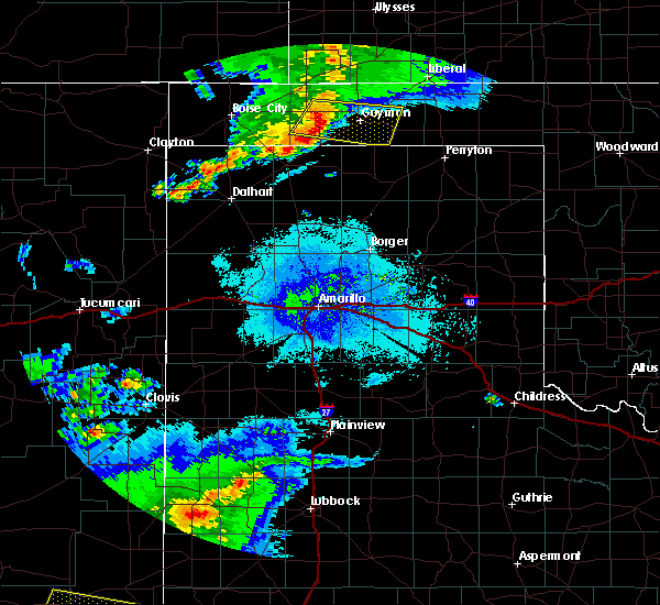 At 947 pm cdt, a severe thunderstorm was located 9 miles southeast of eva, or 16 miles west of guymon, moving east at 35 mph (radar indicated). Hazards include 60 mph wind gusts and quarter size hail. Minor damage to roofs, siding, and trees is possible. hail damage to vehicles is expected. Locations impacted include, guymon, goodwell and optima. At 947 pm cdt, a severe thunderstorm was located 9 miles southeast of eva, or 16 miles west of guymon, moving east at 35 mph (radar indicated). Hazards include 60 mph wind gusts and quarter size hail. Minor damage to roofs, siding, and trees is possible. hail damage to vehicles is expected. Locations impacted include, guymon, goodwell and optima.
|
| 6/2/2019 9:23 PM CDT |
 At 923 pm cdt, a severe thunderstorm was located 6 miles south of eva, or 20 miles south of elkhart, moving east at 40 mph (radar indicated). Hazards include 60 mph wind gusts and half dollar size hail. Minor damage to roofs, siding, and trees is possible. Hail damage to vehicles is expected. At 923 pm cdt, a severe thunderstorm was located 6 miles south of eva, or 20 miles south of elkhart, moving east at 40 mph (radar indicated). Hazards include 60 mph wind gusts and half dollar size hail. Minor damage to roofs, siding, and trees is possible. Hail damage to vehicles is expected.
|
| 5/26/2019 9:15 PM CDT | Storm damage reported in texas county OK, 0.3 miles NW of Goodwell, OK |
| 5/26/2019 9:12 PM CDT |
 At 911 pm cdt, severe thunderstorms were located along a line extending from 10 miles southwest of hough to 12 miles west of gruver to 4 miles north of lake meredith, moving east at 60 mph (radar indicated). Hazards include 60 mph wind gusts and quarter size hail. Minor damage to roofs, siding, and trees is possible. hail damage to vehicles is expected. locations impacted include, borger, guymon, spearman, fritch, sunray, hooker, stinnett, goodwell, gruver, optima, hardesty, sanford, hough, pringle, eva, morse, four way, masterson, lake meredith and texhoma. a tornado watch remains in effect until 1000 pm cdt for the panhandle of oklahoma, and the panhandle of texas. A tornado watch also remains in effect until 200 am cdt for the panhandle of texas. At 911 pm cdt, severe thunderstorms were located along a line extending from 10 miles southwest of hough to 12 miles west of gruver to 4 miles north of lake meredith, moving east at 60 mph (radar indicated). Hazards include 60 mph wind gusts and quarter size hail. Minor damage to roofs, siding, and trees is possible. hail damage to vehicles is expected. locations impacted include, borger, guymon, spearman, fritch, sunray, hooker, stinnett, goodwell, gruver, optima, hardesty, sanford, hough, pringle, eva, morse, four way, masterson, lake meredith and texhoma. a tornado watch remains in effect until 1000 pm cdt for the panhandle of oklahoma, and the panhandle of texas. A tornado watch also remains in effect until 200 am cdt for the panhandle of texas.
|
| 5/26/2019 9:10 PM CDT | Goodwell firefighter reports estimated 75 to 80 mph with initial gust front. a friend of his 3 miles north of town lost powe in texas county OK, 0.3 miles NW of Goodwell, OK |
| 5/26/2019 9:08 PM CDT |
 At 908 pm cdt, a severe thunderstorm capable of producing a tornado was located near goodwell, or 12 miles southwest of guymon, moving northeast at 60 mph (radar indicated rotation). Hazards include tornado and quarter size hail. Flying debris will be dangerous to those caught without shelter. mobile homes will be damaged or destroyed. damage to roofs, windows, and vehicles will occur. Tree damage is likely. At 908 pm cdt, a severe thunderstorm capable of producing a tornado was located near goodwell, or 12 miles southwest of guymon, moving northeast at 60 mph (radar indicated rotation). Hazards include tornado and quarter size hail. Flying debris will be dangerous to those caught without shelter. mobile homes will be damaged or destroyed. damage to roofs, windows, and vehicles will occur. Tree damage is likely.
|
| 5/26/2019 8:40 PM CDT |
 At 840 pm cdt, severe thunderstorms were located along a line extending from 6 miles southeast of keyes to 6 miles southeast of conlen to 9 miles east of channing, moving east at 55 mph (radar indicated). Hazards include 70 mph wind gusts and quarter size hail. Expect some tree damage. damage is likely to mobile homes, roofs, and outbuildings. Hail damage to vehicles is expected. At 840 pm cdt, severe thunderstorms were located along a line extending from 6 miles southeast of keyes to 6 miles southeast of conlen to 9 miles east of channing, moving east at 55 mph (radar indicated). Hazards include 70 mph wind gusts and quarter size hail. Expect some tree damage. damage is likely to mobile homes, roofs, and outbuildings. Hail damage to vehicles is expected.
|
| 5/26/2019 8:31 PM CDT |
 At 831 pm cdt, severe thunderstorms were located along a line extending from near keyes to 4 miles north of conlen to 9 miles northeast of channing, moving northeast at 60 mph (radar indicated). Hazards include 70 mph wind gusts and ping pong ball size hail. Expect some tree damage. damage is likely to mobile homes, roofs, and outbuildings. people and animals outdoors will be injured. expect hail damage to roofs, siding, windows, and vehicles. locations impacted include, dumas, stratford, hartley, cactus, fritch, sunray, channing, keyes, griggs, eva, four way, conlen, masterson, lake meredith, texhoma and sturgis. a tornado watch remains in effect until 1000 pm cdt for the panhandle of oklahoma, and the panhandle of texas. A tornado watch also remains in effect until 200 am cdt for the panhandle of texas. At 831 pm cdt, severe thunderstorms were located along a line extending from near keyes to 4 miles north of conlen to 9 miles northeast of channing, moving northeast at 60 mph (radar indicated). Hazards include 70 mph wind gusts and ping pong ball size hail. Expect some tree damage. damage is likely to mobile homes, roofs, and outbuildings. people and animals outdoors will be injured. expect hail damage to roofs, siding, windows, and vehicles. locations impacted include, dumas, stratford, hartley, cactus, fritch, sunray, channing, keyes, griggs, eva, four way, conlen, masterson, lake meredith, texhoma and sturgis. a tornado watch remains in effect until 1000 pm cdt for the panhandle of oklahoma, and the panhandle of texas. A tornado watch also remains in effect until 200 am cdt for the panhandle of texas.
|
| 5/26/2019 7:52 PM CDT |
 At 752 pm cdt, severe thunderstorms were located along a line extending from 9 miles north of felt to near ware to 9 miles east of romero, moving east at 55 mph (radar indicated). Hazards include 70 mph wind gusts and ping pong ball size hail. Expect some tree damage. damage is likely to mobile homes, roofs, and outbuildings. people and animals outdoors will be injured. Expect hail damage to roofs, siding, windows, and vehicles. At 752 pm cdt, severe thunderstorms were located along a line extending from 9 miles north of felt to near ware to 9 miles east of romero, moving east at 55 mph (radar indicated). Hazards include 70 mph wind gusts and ping pong ball size hail. Expect some tree damage. damage is likely to mobile homes, roofs, and outbuildings. people and animals outdoors will be injured. Expect hail damage to roofs, siding, windows, and vehicles.
|
| 5/23/2019 9:47 AM CDT |
 At 947 am cdt, a severe thunderstorm was located 4 miles west of hough, or 15 miles northwest of guymon, moving northeast at 55 mph (trained weather spotters). Hazards include golf ball size hail. People and animals outdoors will be injured. expect damage to roofs, siding, windows, and vehicles. Locations impacted include, goodwell, eva and hough. At 947 am cdt, a severe thunderstorm was located 4 miles west of hough, or 15 miles northwest of guymon, moving northeast at 55 mph (trained weather spotters). Hazards include golf ball size hail. People and animals outdoors will be injured. expect damage to roofs, siding, windows, and vehicles. Locations impacted include, goodwell, eva and hough.
|
| 5/23/2019 9:40 AM CDT |
 At 939 am cdt, a severe thunderstorm was located 9 miles east of eva, or 14 miles northwest of guymon, moving northeast at 55 mph (radar indicated). Hazards include two inch hail. People and animals outdoors will be injured. Expect damage to roofs, siding, windows, and vehicles. At 939 am cdt, a severe thunderstorm was located 9 miles east of eva, or 14 miles northwest of guymon, moving northeast at 55 mph (radar indicated). Hazards include two inch hail. People and animals outdoors will be injured. Expect damage to roofs, siding, windows, and vehicles.
|
| 5/6/2019 8:26 PM CDT |
 At 826 pm cdt, a severe thunderstorm was located near goodwell, or 7 miles southwest of guymon, moving northeast at 45 mph (radar indicated). Hazards include golf ball size hail and 60 mph wind gusts. Minor damage to roofs, siding, and trees is possible. people and animals outdoors will be injured. Expect hail damage to roofs, siding, windows, and vehicles. At 826 pm cdt, a severe thunderstorm was located near goodwell, or 7 miles southwest of guymon, moving northeast at 45 mph (radar indicated). Hazards include golf ball size hail and 60 mph wind gusts. Minor damage to roofs, siding, and trees is possible. people and animals outdoors will be injured. Expect hail damage to roofs, siding, windows, and vehicles.
|
| 5/6/2019 8:23 PM CDT | Golf Ball sized hail reported 0.3 miles NW of Goodwell, OK, quarter size to golfball size hail in goodwell |
| 5/4/2019 7:58 PM CDT |
 At 758 pm cdt, severe thunderstorms were located along a line extending from 11 miles south of goodwell to 14 miles south of texhoma to 6 miles west of stratford, moving southeast at 15 mph (radar indicated). Hazards include golf ball size hail and 60 mph wind gusts. Minor damage to roofs, siding, and trees is possible. people and animals outdoors will be injured. Expect hail damage to roofs, siding, windows, and vehicles. At 758 pm cdt, severe thunderstorms were located along a line extending from 11 miles south of goodwell to 14 miles south of texhoma to 6 miles west of stratford, moving southeast at 15 mph (radar indicated). Hazards include golf ball size hail and 60 mph wind gusts. Minor damage to roofs, siding, and trees is possible. people and animals outdoors will be injured. Expect hail damage to roofs, siding, windows, and vehicles.
|
| 5/4/2019 7:45 PM CDT |
 At 744 pm cdt, a severe thunderstorm was located 5 miles west of stratford, moving southeast at 20 mph. another severe thunderstorm was located 5 miles east of texhoma moving southeast at 20 mph (radar indicated). Hazards include golf ball size hail and 60 mph wind gusts. Minor damage to roofs, siding, and trees is possible. people and animals outdoors will be injured. expect hail damage to roofs, siding, windows, and vehicles. Locations impacted include, guymon, stratford, goodwell, conlen, griggs and texhoma. At 744 pm cdt, a severe thunderstorm was located 5 miles west of stratford, moving southeast at 20 mph. another severe thunderstorm was located 5 miles east of texhoma moving southeast at 20 mph (radar indicated). Hazards include golf ball size hail and 60 mph wind gusts. Minor damage to roofs, siding, and trees is possible. people and animals outdoors will be injured. expect hail damage to roofs, siding, windows, and vehicles. Locations impacted include, guymon, stratford, goodwell, conlen, griggs and texhoma.
|
| 5/4/2019 7:32 PM CDT |
 At 732 pm cdt, a severe thunderstorm was located 7 miles west of stratford, moving southeast at 20 mph (radar indicated). Hazards include two inch hail and 70 mph wind gusts. Expect some tree damage. damage is likely to mobile homes, roofs, and outbuildings. people and animals outdoors will be injured. expect hail damage to roofs, siding, windows, and vehicles. Locations impacted include, guymon, stratford, goodwell, conlen, griggs and texhoma. At 732 pm cdt, a severe thunderstorm was located 7 miles west of stratford, moving southeast at 20 mph (radar indicated). Hazards include two inch hail and 70 mph wind gusts. Expect some tree damage. damage is likely to mobile homes, roofs, and outbuildings. people and animals outdoors will be injured. expect hail damage to roofs, siding, windows, and vehicles. Locations impacted include, guymon, stratford, goodwell, conlen, griggs and texhoma.
|
| 5/4/2019 7:20 PM CDT |
 At 720 pm cdt, a severe thunderstorm was located 12 miles northwest of stratford, moving southeast at 15 mph (radar indicated). Hazards include golf ball size hail and 70 mph wind gusts. Expect some tree damage. damage is likely to mobile homes, roofs, and outbuildings. people and animals outdoors will be injured. expect hail damage to roofs, siding, windows, and vehicles. Locations impacted include, guymon, stratford, goodwell, conlen, griggs and texhoma. At 720 pm cdt, a severe thunderstorm was located 12 miles northwest of stratford, moving southeast at 15 mph (radar indicated). Hazards include golf ball size hail and 70 mph wind gusts. Expect some tree damage. damage is likely to mobile homes, roofs, and outbuildings. people and animals outdoors will be injured. expect hail damage to roofs, siding, windows, and vehicles. Locations impacted include, guymon, stratford, goodwell, conlen, griggs and texhoma.
|
| 5/4/2019 7:11 PM CDT |
 At 711 pm cdt, a severe thunderstorm was located 12 miles northwest of stratford, moving southeast at 15 mph (radar indicated). Hazards include golf ball size hail and 60 mph wind gusts. Minor damage to roofs, siding, and trees is possible. people and animals outdoors will be injured. expect hail damage to roofs, siding, windows, and vehicles. Locations impacted include, guymon, stratford, goodwell, conlen, griggs and texhoma. At 711 pm cdt, a severe thunderstorm was located 12 miles northwest of stratford, moving southeast at 15 mph (radar indicated). Hazards include golf ball size hail and 60 mph wind gusts. Minor damage to roofs, siding, and trees is possible. people and animals outdoors will be injured. expect hail damage to roofs, siding, windows, and vehicles. Locations impacted include, guymon, stratford, goodwell, conlen, griggs and texhoma.
|
| 5/4/2019 7:00 PM CDT |
 At 658 pm cdt, a severe thunderstorm was located 4 miles southeast of eva, or 18 miles south of elkhart, moving southeast at 25 mph. another severe thunderstorm was located 10 miles northwest of stratford, moving east at 15 mph (radar indicated). Hazards include ping pong ball size hail and 60 mph wind gusts. Minor damage to roofs, siding, and trees is possible. people and animals outdoors will be injured. expect hail damage to roofs, siding, windows, and vehicles. Locations impacted include, guymon, stratford, goodwell, conlen, griggs and texhoma. At 658 pm cdt, a severe thunderstorm was located 4 miles southeast of eva, or 18 miles south of elkhart, moving southeast at 25 mph. another severe thunderstorm was located 10 miles northwest of stratford, moving east at 15 mph (radar indicated). Hazards include ping pong ball size hail and 60 mph wind gusts. Minor damage to roofs, siding, and trees is possible. people and animals outdoors will be injured. expect hail damage to roofs, siding, windows, and vehicles. Locations impacted include, guymon, stratford, goodwell, conlen, griggs and texhoma.
|
| 5/4/2019 6:40 PM CDT |
 At 640 pm cdt, a severe thunderstorm was located 9 miles southwest of griggs, or 14 miles northwest of stratford, moving east at 20 mph (radar indicated). Hazards include 60 mph wind gusts and half dollar size hail. Minor damage to roofs, siding, and trees is possible. hail damage to vehicles is expected. Locations impacted include, guymon, stratford, goodwell, conlen, griggs and texhoma. At 640 pm cdt, a severe thunderstorm was located 9 miles southwest of griggs, or 14 miles northwest of stratford, moving east at 20 mph (radar indicated). Hazards include 60 mph wind gusts and half dollar size hail. Minor damage to roofs, siding, and trees is possible. hail damage to vehicles is expected. Locations impacted include, guymon, stratford, goodwell, conlen, griggs and texhoma.
|
| 5/4/2019 6:40 PM CDT |
 At 627 pm cdt, a severe thunderstorm was located 12 miles southwest of griggs, or 17 miles northwest of stratford, moving east at 20 mph (radar indicated). Hazards include ping pong ball size hail and 60 mph wind gusts. Minor damage to roofs, siding, and trees is possible. people and animals outdoors will be injured. Expect hail damage to roofs, siding, windows, and vehicles. At 627 pm cdt, a severe thunderstorm was located 12 miles southwest of griggs, or 17 miles northwest of stratford, moving east at 20 mph (radar indicated). Hazards include ping pong ball size hail and 60 mph wind gusts. Minor damage to roofs, siding, and trees is possible. people and animals outdoors will be injured. Expect hail damage to roofs, siding, windows, and vehicles.
|
| 5/4/2019 6:28 PM CDT |
 At 627 pm cdt, a severe thunderstorm was located 12 miles southwest of griggs, or 17 miles northwest of stratford, moving east at 20 mph (radar indicated). Hazards include ping pong ball size hail and 60 mph wind gusts. Minor damage to roofs, siding, and trees is possible. people and animals outdoors will be injured. Expect hail damage to roofs, siding, windows, and vehicles. At 627 pm cdt, a severe thunderstorm was located 12 miles southwest of griggs, or 17 miles northwest of stratford, moving east at 20 mph (radar indicated). Hazards include ping pong ball size hail and 60 mph wind gusts. Minor damage to roofs, siding, and trees is possible. people and animals outdoors will be injured. Expect hail damage to roofs, siding, windows, and vehicles.
|
| 8/21/2018 10:09 PM CDT |
 At 1009 pm cdt, severe thunderstorms were located along a line extending from 8 miles southwest of hough to 5 miles southeast of texhoma to 12 miles southeast of stratford, moving east at 30 mph (radar indicated). Hazards include 60 mph wind gusts. Minor damage to roofs, siding, and trees is possible. Locations impacted include, guymon, stratford, goodwell, eva, hough, conlen, texhoma and sturgis. At 1009 pm cdt, severe thunderstorms were located along a line extending from 8 miles southwest of hough to 5 miles southeast of texhoma to 12 miles southeast of stratford, moving east at 30 mph (radar indicated). Hazards include 60 mph wind gusts. Minor damage to roofs, siding, and trees is possible. Locations impacted include, guymon, stratford, goodwell, eva, hough, conlen, texhoma and sturgis.
|
| 8/21/2018 9:41 PM CDT |
 At 940 pm cdt, severe thunderstorms were located along a line extending from near eva to 8 miles west of texhoma to near stratford, moving east at 30 mph (radar indicated). Hazards include 60 mph wind gusts. minor damage to roofs, siding, and trees is possible At 940 pm cdt, severe thunderstorms were located along a line extending from near eva to 8 miles west of texhoma to near stratford, moving east at 30 mph (radar indicated). Hazards include 60 mph wind gusts. minor damage to roofs, siding, and trees is possible
|
| 8/21/2018 9:08 PM CDT |
 At 908 pm cdt, severe thunderstorms were located along a line extending from 6 miles northwest of guymon to near griggs to 6 miles northeast of texline, moving east at 35 mph (radar indicated). Hazards include 70 mph wind gusts and half dollar size hail. Expect some tree damage. damage is likely to mobile homes, roofs, and outbuildings. hail damage to vehicles is expected. Locations impacted include, guymon, stratford, boise city, goodwell, texline, optima, keyes, hardesty, wheeless, hough, felt, griggs, eva, texhoma and sturgis. At 908 pm cdt, severe thunderstorms were located along a line extending from 6 miles northwest of guymon to near griggs to 6 miles northeast of texline, moving east at 35 mph (radar indicated). Hazards include 70 mph wind gusts and half dollar size hail. Expect some tree damage. damage is likely to mobile homes, roofs, and outbuildings. hail damage to vehicles is expected. Locations impacted include, guymon, stratford, boise city, goodwell, texline, optima, keyes, hardesty, wheeless, hough, felt, griggs, eva, texhoma and sturgis.
|
| 8/21/2018 8:42 PM CDT |
 At 842 pm cdt, severe thunderstorms were located along a line extending from 4 miles east of eva to 11 miles southeast of boise city to 3 miles north of clayton, moving east at 35 mph (radar indicated). Hazards include 60 mph wind gusts and half dollar size hail. Minor damage to roofs, siding, and trees is possible. Hail damage to vehicles is expected. At 842 pm cdt, severe thunderstorms were located along a line extending from 4 miles east of eva to 11 miles southeast of boise city to 3 miles north of clayton, moving east at 35 mph (radar indicated). Hazards include 60 mph wind gusts and half dollar size hail. Minor damage to roofs, siding, and trees is possible. Hail damage to vehicles is expected.
|
| 7/29/2018 11:31 PM CDT |
 At 1130 pm cdt, a severe thunderstorm was located 4 miles southeast of optima, or 11 miles east of guymon, moving southeast at 30 mph (radar indicated). Hazards include 70 mph wind gusts and half dollar size hail. Expect some tree damage. damage is likely to mobile homes, roofs, and outbuildings. Hail damage to vehicles is expected. At 1130 pm cdt, a severe thunderstorm was located 4 miles southeast of optima, or 11 miles east of guymon, moving southeast at 30 mph (radar indicated). Hazards include 70 mph wind gusts and half dollar size hail. Expect some tree damage. damage is likely to mobile homes, roofs, and outbuildings. Hail damage to vehicles is expected.
|
| 7/29/2018 10:30 PM CDT |
 At 1030 pm cdt, a severe thunderstorm was located over rolla, moving southeast at 50 mph. this is a very dangerous storm (radar indicated). Hazards include 80 mph wind gusts and two inch hail. Flying debris will be dangerous to those caught without shelter. mobile homes will be heavily damaged. expect considerable damage to roofs, windows, and vehicles. tree damage and power outages are likely. people and animals outdoors will be injured. Expect hail damage to roofs, siding, windows, and vehicles. At 1030 pm cdt, a severe thunderstorm was located over rolla, moving southeast at 50 mph. this is a very dangerous storm (radar indicated). Hazards include 80 mph wind gusts and two inch hail. Flying debris will be dangerous to those caught without shelter. mobile homes will be heavily damaged. expect considerable damage to roofs, windows, and vehicles. tree damage and power outages are likely. people and animals outdoors will be injured. Expect hail damage to roofs, siding, windows, and vehicles.
|
| 7/19/2018 5:33 PM CDT |
 At 533 pm cdt, a severe thunderstorm was located 8 miles southwest of elkhart, moving southeast at 20 mph (radar indicated). Hazards include 60 mph wind gusts. Minor damage to roofs, siding, and trees is possible. Locations impacted include, guymon, goodwell, texhoma, eva, hough and sturgis. At 533 pm cdt, a severe thunderstorm was located 8 miles southwest of elkhart, moving southeast at 20 mph (radar indicated). Hazards include 60 mph wind gusts. Minor damage to roofs, siding, and trees is possible. Locations impacted include, guymon, goodwell, texhoma, eva, hough and sturgis.
|
| 7/19/2018 5:19 PM CDT |
 At 518 pm cdt, a severe thunderstorm was located 6 miles northwest of goodwell, or 12 miles west of guymon, moving southeast at 20 mph. another severe thunderstorm was located 5 miles north of sturgis, moving southeast at 20 mph (radar indicated). Hazards include 60 mph wind gusts. Minor damage to roofs, siding, and trees is possible. Locations impacted include, guymon, hooker, goodwell, texhoma, optima, hardesty, eva, hough, adams and sturgis. At 518 pm cdt, a severe thunderstorm was located 6 miles northwest of goodwell, or 12 miles west of guymon, moving southeast at 20 mph. another severe thunderstorm was located 5 miles north of sturgis, moving southeast at 20 mph (radar indicated). Hazards include 60 mph wind gusts. Minor damage to roofs, siding, and trees is possible. Locations impacted include, guymon, hooker, goodwell, texhoma, optima, hardesty, eva, hough, adams and sturgis.
|
| 7/19/2018 5:01 PM CDT |
 At 500 pm cdt, a severe thunderstorm was located 8 miles northwest of goodwell, or 13 miles west of guymon, moving southeast at 25 mph (radar indicated). Hazards include 70 mph wind gusts. Expect some tree damage. damage is likely to mobile homes, roofs, and outbuildings. Locations impacted include, guymon, hooker, goodwell, texhoma, optima, hardesty, eva, hough, adams and sturgis. At 500 pm cdt, a severe thunderstorm was located 8 miles northwest of goodwell, or 13 miles west of guymon, moving southeast at 25 mph (radar indicated). Hazards include 70 mph wind gusts. Expect some tree damage. damage is likely to mobile homes, roofs, and outbuildings. Locations impacted include, guymon, hooker, goodwell, texhoma, optima, hardesty, eva, hough, adams and sturgis.
|
| 7/19/2018 4:47 PM CDT |
 At 446 pm cdt, a severe thunderstorm was located 10 miles southeast of eva, or 14 miles west of guymon, moving south at 20 mph (radar indicated). Hazards include 60 mph wind gusts. Minor damage to roofs, siding, and trees is possible. Locations impacted include, guymon, hooker, goodwell, texhoma, tyrone, optima, hardesty, hough, adams, boyd, eva, bryans corner, baker, turpin and sturgis. At 446 pm cdt, a severe thunderstorm was located 10 miles southeast of eva, or 14 miles west of guymon, moving south at 20 mph (radar indicated). Hazards include 60 mph wind gusts. Minor damage to roofs, siding, and trees is possible. Locations impacted include, guymon, hooker, goodwell, texhoma, tyrone, optima, hardesty, hough, adams, boyd, eva, bryans corner, baker, turpin and sturgis.
|
| 7/19/2018 4:36 PM CDT |
 At 435 pm cdt, a severe thunderstorm was located 8 miles southwest of hough, or 12 miles northwest of guymon, moving southeast at 20 mph (radar indicated). Hazards include 60 mph wind gusts. Minor damage to roofs, siding, and trees is possible. Locations impacted include, guymon, hooker, goodwell, texhoma, tyrone, optima, hardesty, hough, adams, boyd, eva, bryans corner, baker, turpin and sturgis. At 435 pm cdt, a severe thunderstorm was located 8 miles southwest of hough, or 12 miles northwest of guymon, moving southeast at 20 mph (radar indicated). Hazards include 60 mph wind gusts. Minor damage to roofs, siding, and trees is possible. Locations impacted include, guymon, hooker, goodwell, texhoma, tyrone, optima, hardesty, hough, adams, boyd, eva, bryans corner, baker, turpin and sturgis.
|
| 7/19/2018 4:18 PM CDT |
 At 418 pm cdt, a severe thunderstorm was located 8 miles west of hough, or 14 miles southeast of elkhart, moving southeast at 30 mph (radar indicated). Hazards include 60 mph wind gusts. minor damage to roofs, siding, and trees is possible At 418 pm cdt, a severe thunderstorm was located 8 miles west of hough, or 14 miles southeast of elkhart, moving southeast at 30 mph (radar indicated). Hazards include 60 mph wind gusts. minor damage to roofs, siding, and trees is possible
|
| 6/24/2018 8:54 PM CDT |
 At 854 pm cdt, severe thunderstorms were located along a line extending from 6 miles east of hough to 7 miles west of guymon, moving east at 55 mph (radar indicated). Hazards include 60 mph wind gusts and quarter size hail. Minor damage to roofs, siding, and trees is possible. Hail damage to vehicles is expected. At 854 pm cdt, severe thunderstorms were located along a line extending from 6 miles east of hough to 7 miles west of guymon, moving east at 55 mph (radar indicated). Hazards include 60 mph wind gusts and quarter size hail. Minor damage to roofs, siding, and trees is possible. Hail damage to vehicles is expected.
|
| 6/22/2018 6:47 PM CDT | Golf Ball sized hail reported 13.1 miles SE of Goodwell, OK |
| 6/12/2018 10:49 PM CDT |
 At 1049 pm cdt, a severe thunderstorm was located 6 miles south of guymon, moving southeast at 35 mph (radar indicated). Hazards include 60 mph wind gusts and half dollar size hail. Minor damage to roofs, siding, and trees is possible. Hail damage to vehicles is expected. At 1049 pm cdt, a severe thunderstorm was located 6 miles south of guymon, moving southeast at 35 mph (radar indicated). Hazards include 60 mph wind gusts and half dollar size hail. Minor damage to roofs, siding, and trees is possible. Hail damage to vehicles is expected.
|
| 6/12/2018 10:43 PM CDT |
 At 1043 pm cdt, severe thunderstorms were located along a line extending from near guymon to 5 miles northwest of sunray to 7 miles southwest of channing, moving east at 20 mph (radar indicated). Hazards include tennis ball size hail and 60 mph wind gusts. Minor damage to roofs, siding, and trees is possible. people and animals outdoors will be injured. expect hail damage to roofs, siding, windows, and vehicles. Locations impacted include, dumas, guymon, hartley, cactus, sunray, goodwell, channing, optima, valley de oro, boys ranch, four way, masterson and texhoma. At 1043 pm cdt, severe thunderstorms were located along a line extending from near guymon to 5 miles northwest of sunray to 7 miles southwest of channing, moving east at 20 mph (radar indicated). Hazards include tennis ball size hail and 60 mph wind gusts. Minor damage to roofs, siding, and trees is possible. people and animals outdoors will be injured. expect hail damage to roofs, siding, windows, and vehicles. Locations impacted include, dumas, guymon, hartley, cactus, sunray, goodwell, channing, optima, valley de oro, boys ranch, four way, masterson and texhoma.
|
| 6/12/2018 10:17 PM CDT |
 At 1016 pm cdt, severe thunderstorms were located along a line extending from 8 miles north of goodwell to 3 miles north of cactus to 12 miles southwest of channing, moving east at 25 mph (radar indicated). Hazards include tennis ball size hail and 60 mph wind gusts. Minor damage to roofs, siding, and trees is possible. people and animals outdoors will be injured. expect hail damage to roofs, siding, windows, and vehicles. Locations impacted include, dumas, guymon, stratford, hartley, cactus, sunray, goodwell, channing, optima, valley de oro, boys ranch, eva, four way, conlen, masterson and texhoma. At 1016 pm cdt, severe thunderstorms were located along a line extending from 8 miles north of goodwell to 3 miles north of cactus to 12 miles southwest of channing, moving east at 25 mph (radar indicated). Hazards include tennis ball size hail and 60 mph wind gusts. Minor damage to roofs, siding, and trees is possible. people and animals outdoors will be injured. expect hail damage to roofs, siding, windows, and vehicles. Locations impacted include, dumas, guymon, stratford, hartley, cactus, sunray, goodwell, channing, optima, valley de oro, boys ranch, eva, four way, conlen, masterson and texhoma.
|
| 6/12/2018 9:57 PM CDT |
 At 956 pm cdt, severe thunderstorms were located along a line extending from 7 miles southeast of griggs to 12 miles south of conlen to 15 miles west of channing, moving east at 35 mph (radar indicated). Hazards include tennis ball size hail and 60 mph wind gusts. Minor damage to roofs, siding, and trees is possible. people and animals outdoors will be injured. expect hail damage to roofs, siding, windows, and vehicles. Locations impacted include, dumas, guymon, dalhart, stratford, hartley, cactus, sunray, goodwell, channing, optima, valley de oro, boys ranch, griggs, eva, four way, conlen, masterson and texhoma. At 956 pm cdt, severe thunderstorms were located along a line extending from 7 miles southeast of griggs to 12 miles south of conlen to 15 miles west of channing, moving east at 35 mph (radar indicated). Hazards include tennis ball size hail and 60 mph wind gusts. Minor damage to roofs, siding, and trees is possible. people and animals outdoors will be injured. expect hail damage to roofs, siding, windows, and vehicles. Locations impacted include, dumas, guymon, dalhart, stratford, hartley, cactus, sunray, goodwell, channing, optima, valley de oro, boys ranch, griggs, eva, four way, conlen, masterson and texhoma.
|
| 6/12/2018 9:49 PM CDT |
 At 948 pm cdt, severe thunderstorms were located along a line extending from 4 miles south of griggs to 11 miles east of dalhart to 17 miles southeast of romero, moving east at 35 mph (radar indicated). Hazards include tennis ball size hail and 60 mph wind gusts. Minor damage to roofs, siding, and trees is possible. people and animals outdoors will be injured. Expect hail damage to roofs, siding, windows, and vehicles. At 948 pm cdt, severe thunderstorms were located along a line extending from 4 miles south of griggs to 11 miles east of dalhart to 17 miles southeast of romero, moving east at 35 mph (radar indicated). Hazards include tennis ball size hail and 60 mph wind gusts. Minor damage to roofs, siding, and trees is possible. people and animals outdoors will be injured. Expect hail damage to roofs, siding, windows, and vehicles.
|
| 5/30/2018 10:28 PM CDT |
 At 1028 pm cdt, a severe thunderstorm was located 9 miles northwest of goodwell, or 12 miles west of guymon, moving east at 45 mph (radar indicated). Hazards include quarter size hail. damage to vehicles is expected At 1028 pm cdt, a severe thunderstorm was located 9 miles northwest of goodwell, or 12 miles west of guymon, moving east at 45 mph (radar indicated). Hazards include quarter size hail. damage to vehicles is expected
|
| 5/30/2018 10:17 PM CDT |
 At 1017 pm cdt, a severe thunderstorm was located 7 miles southeast of eva, or 20 miles west of guymon, moving northeast at 40 mph (radar indicated). Hazards include quarter size hail. Damage to vehicles is expected. Locations impacted include, goodwell and eva. At 1017 pm cdt, a severe thunderstorm was located 7 miles southeast of eva, or 20 miles west of guymon, moving northeast at 40 mph (radar indicated). Hazards include quarter size hail. Damage to vehicles is expected. Locations impacted include, goodwell and eva.
|
| 5/30/2018 10:02 PM CDT |
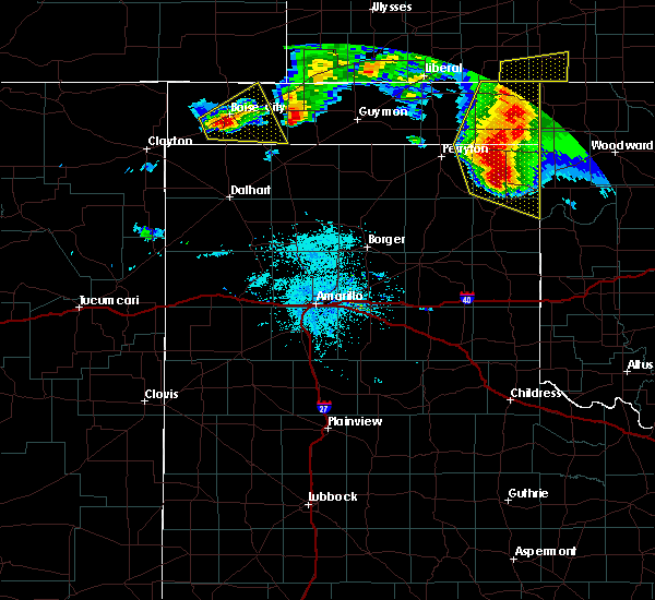 At 1002 pm cdt, a severe thunderstorm was located 6 miles northeast of griggs, or 21 miles north of stratford, moving southeast at 25 mph (radar indicated). Hazards include ping pong ball size hail. People and animals outdoors will be injured. Expect damage to roofs, siding, windows, and vehicles. At 1002 pm cdt, a severe thunderstorm was located 6 miles northeast of griggs, or 21 miles north of stratford, moving southeast at 25 mph (radar indicated). Hazards include ping pong ball size hail. People and animals outdoors will be injured. Expect damage to roofs, siding, windows, and vehicles.
|
| 5/30/2018 8:32 PM CDT |
 At 832 pm cdt, a severe thunderstorm was located 6 miles west of hardesty, or 11 miles southeast of guymon, moving east at 40 mph (radar indicated). Hazards include ping pong ball size hail and 60 mph wind gusts. Minor damage to roofs, siding, and trees is possible. people and animals outdoors will be injured. expect hail damage to roofs, siding, windows, and vehicles. Locations impacted include, guymon, hooker, goodwell, optima, hardesty, baker, adams and turpin. At 832 pm cdt, a severe thunderstorm was located 6 miles west of hardesty, or 11 miles southeast of guymon, moving east at 40 mph (radar indicated). Hazards include ping pong ball size hail and 60 mph wind gusts. Minor damage to roofs, siding, and trees is possible. people and animals outdoors will be injured. expect hail damage to roofs, siding, windows, and vehicles. Locations impacted include, guymon, hooker, goodwell, optima, hardesty, baker, adams and turpin.
|
| 5/30/2018 8:20 PM CDT |
 At 819 pm cdt, a severe thunderstorm was located 4 miles south of guymon, moving east at 40 mph (trained weather spotters reported 60 mph wind gust in guymon at 819 pm cdt). Hazards include golf ball size hail and 60 mph wind gusts. Minor damage to roofs, siding, and trees is possible. people and animals outdoors will be injured. expect hail damage to roofs, siding, windows, and vehicles. Locations impacted include, guymon, hooker, goodwell, optima, hardesty, baker, adams and turpin. At 819 pm cdt, a severe thunderstorm was located 4 miles south of guymon, moving east at 40 mph (trained weather spotters reported 60 mph wind gust in guymon at 819 pm cdt). Hazards include golf ball size hail and 60 mph wind gusts. Minor damage to roofs, siding, and trees is possible. people and animals outdoors will be injured. expect hail damage to roofs, siding, windows, and vehicles. Locations impacted include, guymon, hooker, goodwell, optima, hardesty, baker, adams and turpin.
|
| 5/30/2018 8:11 PM CDT |
 The severe thunderstorm warning for texas, southeastern cimarron, northern sherman, northwestern hansford and northeastern dallam counties will expire at 815 pm cdt, a new warning was also issued for northern sherman and northwestern hansford counties, which is in effect until 900 pm cdt. a new warning has been issued for eastern texas county, which is in effect until 915 pm cdt. the storm has moved out of dallam and cimarron counties. a severe thunderstorm watch remains in effect until 1000 pm cdt for the texas and oklahoma panhandles. The severe thunderstorm warning for texas, southeastern cimarron, northern sherman, northwestern hansford and northeastern dallam counties will expire at 815 pm cdt, a new warning was also issued for northern sherman and northwestern hansford counties, which is in effect until 900 pm cdt. a new warning has been issued for eastern texas county, which is in effect until 915 pm cdt. the storm has moved out of dallam and cimarron counties. a severe thunderstorm watch remains in effect until 1000 pm cdt for the texas and oklahoma panhandles.
|
| 5/30/2018 8:08 PM CDT |
 At 807 pm cdt, a severe thunderstorm was located over goodwell, or 10 miles southwest of guymon, moving east at 40 mph (radar indicated). Hazards include ping pong ball size hail and 60 mph wind gusts. Minor damage to roofs, siding, and trees is possible. people and animals outdoors will be injured. Expect hail damage to roofs, siding, windows, and vehicles. At 807 pm cdt, a severe thunderstorm was located over goodwell, or 10 miles southwest of guymon, moving east at 40 mph (radar indicated). Hazards include ping pong ball size hail and 60 mph wind gusts. Minor damage to roofs, siding, and trees is possible. people and animals outdoors will be injured. Expect hail damage to roofs, siding, windows, and vehicles.
|
| 5/30/2018 7:44 PM CDT |
 At 743 pm cdt, severe thunderstorms were located along a line extending from 5 miles northwest of hough to 9 miles southeast of griggs, moving east at 40 mph (radar indicated). Hazards include tennis ball size hail and 60 mph wind gusts. Minor damage to roofs, siding, and trees is possible. people and animals outdoors will be injured. expect hail damage to roofs, siding, windows, and vehicles. Locations impacted include, guymon, goodwell, gruver, eva, hough, griggs and texhoma. At 743 pm cdt, severe thunderstorms were located along a line extending from 5 miles northwest of hough to 9 miles southeast of griggs, moving east at 40 mph (radar indicated). Hazards include tennis ball size hail and 60 mph wind gusts. Minor damage to roofs, siding, and trees is possible. people and animals outdoors will be injured. expect hail damage to roofs, siding, windows, and vehicles. Locations impacted include, guymon, goodwell, gruver, eva, hough, griggs and texhoma.
|
| 5/30/2018 7:41 PM CDT |
 At 739 pm cdt, severe thunderstorms were located along a line extending from 7 miles northwest of hough to 7 miles southeast of griggs, moving east at 40 mph (radar indicated). Hazards include 60 mph wind gusts and quarter size hail. Minor damage to roofs, siding, and trees is possible. hail damage to vehicles is expected. blowing dust is reducing visibility near stratford. Locations impacted include, guymon, goodwell, gruver, eva, hough, griggs and texhoma. At 739 pm cdt, severe thunderstorms were located along a line extending from 7 miles northwest of hough to 7 miles southeast of griggs, moving east at 40 mph (radar indicated). Hazards include 60 mph wind gusts and quarter size hail. Minor damage to roofs, siding, and trees is possible. hail damage to vehicles is expected. blowing dust is reducing visibility near stratford. Locations impacted include, guymon, goodwell, gruver, eva, hough, griggs and texhoma.
|
| 5/30/2018 7:33 PM CDT |
 At 732 pm cdt, severe thunderstorms were located along a line extending from 9 miles southeast of elkhart to 5 miles south of griggs, moving east at 40 mph (radar indicated). Hazards include 60 mph wind gusts and quarter size hail. Minor damage to roofs, siding, and trees is possible. hail damage to vehicles is expected. Locations impacted include, guymon, goodwell, gruver, eva, hough, griggs, texhoma and sturgis. At 732 pm cdt, severe thunderstorms were located along a line extending from 9 miles southeast of elkhart to 5 miles south of griggs, moving east at 40 mph (radar indicated). Hazards include 60 mph wind gusts and quarter size hail. Minor damage to roofs, siding, and trees is possible. hail damage to vehicles is expected. Locations impacted include, guymon, goodwell, gruver, eva, hough, griggs, texhoma and sturgis.
|
| 5/30/2018 7:12 PM CDT |
 At 712 pm cdt, severe thunderstorms were located along a line extending from 8 miles west of elkhart to 14 miles southwest of griggs, moving east at 45 mph (radar indicated). Hazards include 60 mph wind gusts and quarter size hail. Minor damage to roofs, siding, and trees is possible. Hail damage to vehicles is expected. At 712 pm cdt, severe thunderstorms were located along a line extending from 8 miles west of elkhart to 14 miles southwest of griggs, moving east at 45 mph (radar indicated). Hazards include 60 mph wind gusts and quarter size hail. Minor damage to roofs, siding, and trees is possible. Hail damage to vehicles is expected.
|
| 5/28/2018 8:05 PM CDT |
 At 805 pm cdt, a severe thunderstorm capable of producing a tornado was located over guymon, moving northeast at 35 mph (radar indicated rotation). Hazards include tornado and golf ball size hail. Flying debris will be dangerous to those caught without shelter. mobile homes will be damaged or destroyed. damage to roofs, windows, and vehicles will occur. tree damage is likely. Locations impacted include, guymon, hooker, goodwell, tyrone, optima and hough. At 805 pm cdt, a severe thunderstorm capable of producing a tornado was located over guymon, moving northeast at 35 mph (radar indicated rotation). Hazards include tornado and golf ball size hail. Flying debris will be dangerous to those caught without shelter. mobile homes will be damaged or destroyed. damage to roofs, windows, and vehicles will occur. tree damage is likely. Locations impacted include, guymon, hooker, goodwell, tyrone, optima and hough.
|
| 5/28/2018 7:59 PM CDT |
 At 758 pm cdt, a severe thunderstorm was located 5 miles southeast of goodwell, or 12 miles southwest of guymon, moving northeast at 35 mph (radar indicated). Hazards include 60 mph wind gusts and half dollar size hail. Minor damage to roofs, siding, and trees is possible. Hail damage to vehicles is expected. At 758 pm cdt, a severe thunderstorm was located 5 miles southeast of goodwell, or 12 miles southwest of guymon, moving northeast at 35 mph (radar indicated). Hazards include 60 mph wind gusts and half dollar size hail. Minor damage to roofs, siding, and trees is possible. Hail damage to vehicles is expected.
|
| 5/28/2018 7:55 PM CDT |
 At 755 pm cdt, a severe thunderstorm capable of producing a tornado was located 5 miles west of guymon, moving northeast at 35 mph (weather spotters and emergency management are reporting a wall cloud). Hazards include tornado and golf ball size hail. Flying debris will be dangerous to those caught without shelter. mobile homes will be damaged or destroyed. damage to roofs, windows, and vehicles will occur. tree damage is likely. Locations impacted include, guymon, hooker, goodwell, tyrone, optima and hough. At 755 pm cdt, a severe thunderstorm capable of producing a tornado was located 5 miles west of guymon, moving northeast at 35 mph (weather spotters and emergency management are reporting a wall cloud). Hazards include tornado and golf ball size hail. Flying debris will be dangerous to those caught without shelter. mobile homes will be damaged or destroyed. damage to roofs, windows, and vehicles will occur. tree damage is likely. Locations impacted include, guymon, hooker, goodwell, tyrone, optima and hough.
|
| 5/28/2018 7:45 PM CDT | Roof blown off barn and another barn collapsed near goodwell... o in texas county OK, 0.3 miles NW of Goodwell, OK |
| 5/28/2018 7:38 PM CDT |
 At 737 pm cdt, a severe thunderstorm capable of producing a tornado was located over guymon, moving northeast at 35 mph (radar indicated rotation). Hazards include tornado and golf ball size hail. Flying debris will be dangerous to those caught without shelter. mobile homes will be damaged or destroyed. damage to roofs, windows, and vehicles will occur. Tree damage is likely. At 737 pm cdt, a severe thunderstorm capable of producing a tornado was located over guymon, moving northeast at 35 mph (radar indicated rotation). Hazards include tornado and golf ball size hail. Flying debris will be dangerous to those caught without shelter. mobile homes will be damaged or destroyed. damage to roofs, windows, and vehicles will occur. Tree damage is likely.
|
| 5/28/2018 7:31 PM CDT |
 At 730 pm cdt, severe thunderstorms were located along a line extending from 4 miles south of goodwell to near guymon to 4 miles northwest of optima to 7 miles northeast of hough to 6 miles southeast of wilburton, moving northeast at 35 mph (trained weather spotters have reported golf ball size hail and a rotating wall cloud in association with the storm near guymon). Hazards include golf ball size hail and 60 mph wind gusts. Minor damage to roofs, siding, and trees is possible. people and animals outdoors will be injured. expect hail damage to roofs, siding, windows, and vehicles. Locations impacted include, guymon, hooker, goodwell, texhoma, tyrone, optima, eva, hough and baker. At 730 pm cdt, severe thunderstorms were located along a line extending from 4 miles south of goodwell to near guymon to 4 miles northwest of optima to 7 miles northeast of hough to 6 miles southeast of wilburton, moving northeast at 35 mph (trained weather spotters have reported golf ball size hail and a rotating wall cloud in association with the storm near guymon). Hazards include golf ball size hail and 60 mph wind gusts. Minor damage to roofs, siding, and trees is possible. people and animals outdoors will be injured. expect hail damage to roofs, siding, windows, and vehicles. Locations impacted include, guymon, hooker, goodwell, texhoma, tyrone, optima, eva, hough and baker.
|
| 5/28/2018 7:15 PM CDT |
 At 714 pm cdt, a severe thunderstorm was located 4 miles west of guymon, moving northeast at 40 mph (trained weather spotters reported golf ball size hail in goodwell). Hazards include two inch hail and 60 mph wind gusts. Minor damage to roofs, siding, and trees is possible. people and animals outdoors will be injured. expect hail damage to roofs, siding, windows, and vehicles. Locations impacted include, guymon, hooker, goodwell, texhoma, tyrone, optima, eva, hough and baker. At 714 pm cdt, a severe thunderstorm was located 4 miles west of guymon, moving northeast at 40 mph (trained weather spotters reported golf ball size hail in goodwell). Hazards include two inch hail and 60 mph wind gusts. Minor damage to roofs, siding, and trees is possible. people and animals outdoors will be injured. expect hail damage to roofs, siding, windows, and vehicles. Locations impacted include, guymon, hooker, goodwell, texhoma, tyrone, optima, eva, hough and baker.
|
| 5/28/2018 7:07 PM CDT |
 The severe thunderstorm warning for western texas county will expire at 715 pm cdt, this severe thunderstorm warning has been replaced with another one due to new and ongoing storms, which is in effect until 800 pm cdt. a severe thunderstorm watch remains in effect until 1000 pm cdt for the panhandle of oklahoma. The severe thunderstorm warning for western texas county will expire at 715 pm cdt, this severe thunderstorm warning has been replaced with another one due to new and ongoing storms, which is in effect until 800 pm cdt. a severe thunderstorm watch remains in effect until 1000 pm cdt for the panhandle of oklahoma.
|
| 5/28/2018 7:06 PM CDT | Golf Ball sized hail reported 0.3 miles NW of Goodwell, OK |
| 5/28/2018 7:05 PM CDT | Half Dollar sized hail reported 0.3 miles NW of Goodwell, OK, emergency manager is reporting quarter to half dollar size hail. |
| 5/28/2018 7:01 PM CDT |
 At 701 pm cdt, a severe thunderstorm was located over goodwell, or 11 miles southwest of guymon, moving northeast at 40 mph. this is a very dangerous storm (radar indicated). Hazards include baseball size hail and 60 mph wind gusts. People and animals outdoors will be severely injured. Expect shattered windows, extensive damage to roofs, siding, and vehicles. At 701 pm cdt, a severe thunderstorm was located over goodwell, or 11 miles southwest of guymon, moving northeast at 40 mph. this is a very dangerous storm (radar indicated). Hazards include baseball size hail and 60 mph wind gusts. People and animals outdoors will be severely injured. Expect shattered windows, extensive damage to roofs, siding, and vehicles.
|
| 5/28/2018 6:51 PM CDT |
 At 650 pm cdt, a severe thunderstorm was located 6 miles east of texhoma, or 18 miles southwest of guymon, moving northeast at 30 mph (trained weather spotters reported half dollar size hail in texhoma). Hazards include 60 mph wind gusts and half dollar size hail. Minor damage to roofs, siding, and trees is possible. hail damage to vehicles is expected. Locations impacted include, guymon, goodwell, optima and texhoma. At 650 pm cdt, a severe thunderstorm was located 6 miles east of texhoma, or 18 miles southwest of guymon, moving northeast at 30 mph (trained weather spotters reported half dollar size hail in texhoma). Hazards include 60 mph wind gusts and half dollar size hail. Minor damage to roofs, siding, and trees is possible. hail damage to vehicles is expected. Locations impacted include, guymon, goodwell, optima and texhoma.
|
| 5/28/2018 6:49 PM CDT |
 At 649 pm cdt, a severe thunderstorm was located 8 miles southwest of hough, or 10 miles northwest of guymon, moving northeast at 30 mph (radar indicated). Hazards include 60 mph wind gusts and quarter size hail. Minor damage to roofs, siding, and trees is possible. hail damage to vehicles is expected. Locations impacted include, guymon, goodwell, eva and hough. At 649 pm cdt, a severe thunderstorm was located 8 miles southwest of hough, or 10 miles northwest of guymon, moving northeast at 30 mph (radar indicated). Hazards include 60 mph wind gusts and quarter size hail. Minor damage to roofs, siding, and trees is possible. hail damage to vehicles is expected. Locations impacted include, guymon, goodwell, eva and hough.
|
| 5/28/2018 6:33 PM CDT |
 At 622 pm cdt, a severe thunderstorm was located 9 miles east of stratford, moving northeast at 40 mph (radar indicated). Hazards include 60 mph wind gusts and half dollar size hail. Minor damage to roofs, siding, and trees is possible. Hail damage to vehicles is expected. At 622 pm cdt, a severe thunderstorm was located 9 miles east of stratford, moving northeast at 40 mph (radar indicated). Hazards include 60 mph wind gusts and half dollar size hail. Minor damage to roofs, siding, and trees is possible. Hail damage to vehicles is expected.
|
| 5/28/2018 6:33 PM CDT |
 At 633 pm cdt, a severe thunderstorm was located 6 miles southwest of texhoma, or 14 miles northeast of stratford, moving northeast at 40 mph (radar indicated). Hazards include 60 mph wind gusts and half dollar size hail. Minor damage to roofs, siding, and trees is possible. hail damage to vehicles is expected. Locations impacted include, guymon, goodwell, optima and texhoma. At 633 pm cdt, a severe thunderstorm was located 6 miles southwest of texhoma, or 14 miles northeast of stratford, moving northeast at 40 mph (radar indicated). Hazards include 60 mph wind gusts and half dollar size hail. Minor damage to roofs, siding, and trees is possible. hail damage to vehicles is expected. Locations impacted include, guymon, goodwell, optima and texhoma.
|
| 5/28/2018 6:32 PM CDT |
 At 632 pm cdt, a severe thunderstorm was located 8 miles southeast of eva, or 17 miles west of guymon, moving northeast at 35 mph (radar indicated. trained spotter also reported quarter size hail 6 miles north of texhoma). Hazards include 60 mph wind gusts and half dollar size hail. Minor damage to roofs, siding, and trees is possible. hail damage to vehicles is expected. Locations impacted include, guymon, goodwell, texhoma, eva and hough. At 632 pm cdt, a severe thunderstorm was located 8 miles southeast of eva, or 17 miles west of guymon, moving northeast at 35 mph (radar indicated. trained spotter also reported quarter size hail 6 miles north of texhoma). Hazards include 60 mph wind gusts and half dollar size hail. Minor damage to roofs, siding, and trees is possible. hail damage to vehicles is expected. Locations impacted include, guymon, goodwell, texhoma, eva and hough.
|
| 5/28/2018 6:26 PM CDT | Quarter sized hail reported 8.1 miles E of Goodwell, OK, quarter size hail reported. |
| 5/28/2018 6:22 PM CDT |
 At 622 pm cdt, a severe thunderstorm was located 9 miles east of stratford, moving northeast at 40 mph (radar indicated). Hazards include 60 mph wind gusts and half dollar size hail. Minor damage to roofs, siding, and trees is possible. Hail damage to vehicles is expected. At 622 pm cdt, a severe thunderstorm was located 9 miles east of stratford, moving northeast at 40 mph (radar indicated). Hazards include 60 mph wind gusts and half dollar size hail. Minor damage to roofs, siding, and trees is possible. Hail damage to vehicles is expected.
|
| 5/28/2018 6:19 PM CDT |
 At 619 pm cdt, a severe thunderstorm was located 7 miles northwest of texhoma, or 21 miles northeast of stratford, moving northeast at 35 mph (radar indicated). Hazards include tennis ball size hail and 60 mph wind gusts. Minor damage to roofs, siding, and trees is possible. people and animals outdoors will be injured. Expect hail damage to roofs, siding, windows, and vehicles. At 619 pm cdt, a severe thunderstorm was located 7 miles northwest of texhoma, or 21 miles northeast of stratford, moving northeast at 35 mph (radar indicated). Hazards include tennis ball size hail and 60 mph wind gusts. Minor damage to roofs, siding, and trees is possible. people and animals outdoors will be injured. Expect hail damage to roofs, siding, windows, and vehicles.
|
| 5/28/2018 6:11 PM CDT |
 At 611 pm cdt, a severe thunderstorm was located 7 miles west of texhoma, or 15 miles northeast of stratford, moving northeast at 25 mph (radar indicated). Hazards include tennis ball size hail and 60 mph wind gusts. Minor damage to roofs, siding, and trees is possible. people and animals outdoors will be injured. expect hail damage to roofs, siding, windows, and vehicles. Locations impacted include, guymon, goodwell and texhoma. At 611 pm cdt, a severe thunderstorm was located 7 miles west of texhoma, or 15 miles northeast of stratford, moving northeast at 25 mph (radar indicated). Hazards include tennis ball size hail and 60 mph wind gusts. Minor damage to roofs, siding, and trees is possible. people and animals outdoors will be injured. expect hail damage to roofs, siding, windows, and vehicles. Locations impacted include, guymon, goodwell and texhoma.
|
| 5/28/2018 6:01 PM CDT |
 A severe thunderstorm warning remains in effect until 630 pm cdt for southwestern texas and north central sherman counties. at 601 pm cdt, a severe thunderstorm was located 8 miles west of texhoma, or 12 miles northeast of stratford, moving northeast at 35 mph. hazard. Ping pong ball size hail and 60 mph wind gusts. A severe thunderstorm warning remains in effect until 630 pm cdt for southwestern texas and north central sherman counties. at 601 pm cdt, a severe thunderstorm was located 8 miles west of texhoma, or 12 miles northeast of stratford, moving northeast at 35 mph. hazard. Ping pong ball size hail and 60 mph wind gusts.
|
| 5/28/2018 6:01 PM CDT |
 At 552 pm cdt, a severe thunderstorm was located 7 miles north of stratford, moving northeast at 35 mph (trained weather spotters reported quarter size hail 2 miles southwest of stratford with this storm). Hazards include 60 mph wind gusts and quarter size hail. Minor damage to roofs, siding, and trees is possible. hail damage to vehicles is expected. Locations impacted include, guymon, goodwell, griggs and texhoma. At 552 pm cdt, a severe thunderstorm was located 7 miles north of stratford, moving northeast at 35 mph (trained weather spotters reported quarter size hail 2 miles southwest of stratford with this storm). Hazards include 60 mph wind gusts and quarter size hail. Minor damage to roofs, siding, and trees is possible. hail damage to vehicles is expected. Locations impacted include, guymon, goodwell, griggs and texhoma.
|
| 5/28/2018 5:52 PM CDT |
 At 552 pm cdt, a severe thunderstorm was located 7 miles north of stratford, moving northeast at 35 mph (trained weather spotters reported quarter size hail 2 miles southwest of stratford with this storm). Hazards include 60 mph wind gusts and quarter size hail. Minor damage to roofs, siding, and trees is possible. hail damage to vehicles is expected. Locations impacted include, guymon, goodwell, griggs and texhoma. At 552 pm cdt, a severe thunderstorm was located 7 miles north of stratford, moving northeast at 35 mph (trained weather spotters reported quarter size hail 2 miles southwest of stratford with this storm). Hazards include 60 mph wind gusts and quarter size hail. Minor damage to roofs, siding, and trees is possible. hail damage to vehicles is expected. Locations impacted include, guymon, goodwell, griggs and texhoma.
|
| 5/28/2018 5:37 PM CDT |
 At 537 pm cdt, a severe thunderstorm was located over stratford, moving northeast at 35 mph (radar indicated). Hazards include two inch hail and 60 mph wind gusts. Minor damage to roofs, siding, and trees is possible. people and animals outdoors will be injured. expect hail damage to roofs, siding, windows, and vehicles. Locations impacted include, guymon, stratford, goodwell, griggs and texhoma. At 537 pm cdt, a severe thunderstorm was located over stratford, moving northeast at 35 mph (radar indicated). Hazards include two inch hail and 60 mph wind gusts. Minor damage to roofs, siding, and trees is possible. people and animals outdoors will be injured. expect hail damage to roofs, siding, windows, and vehicles. Locations impacted include, guymon, stratford, goodwell, griggs and texhoma.
|
| 5/28/2018 5:30 PM CDT |
 At 530 pm cdt, a severe thunderstorm was located 5 miles northeast of conlen, or 6 miles southwest of stratford, moving northeast at 35 mph (radar indicated). Hazards include ping pong ball size hail and 60 mph wind gusts. Minor damage to roofs, siding, and trees is possible. people and animals outdoors will be injured. Expect hail damage to roofs, siding, windows, and vehicles. At 530 pm cdt, a severe thunderstorm was located 5 miles northeast of conlen, or 6 miles southwest of stratford, moving northeast at 35 mph (radar indicated). Hazards include ping pong ball size hail and 60 mph wind gusts. Minor damage to roofs, siding, and trees is possible. people and animals outdoors will be injured. Expect hail damage to roofs, siding, windows, and vehicles.
|
| 8/27/2017 8:30 PM CDT |
 At 829 pm cdt, a severe thunderstorm was located 5 miles northwest of texhoma, or 18 miles northeast of stratford, moving south at 30 mph (radar indicated). Hazards include 60 mph wind gusts and quarter size hail. Minor damage to roofs, siding, and trees is possible. Hail damage to vehicles is expected. At 829 pm cdt, a severe thunderstorm was located 5 miles northwest of texhoma, or 18 miles northeast of stratford, moving south at 30 mph (radar indicated). Hazards include 60 mph wind gusts and quarter size hail. Minor damage to roofs, siding, and trees is possible. Hail damage to vehicles is expected.
|
| 8/27/2017 8:18 PM CDT |
 At 817 pm cdt, severe thunderstorms were located along a line extending from 14 miles north of keyes to 8 miles east of eva, moving southwest at 25 mph (radar indicated). Hazards include 70 mph wind gusts and penny size hail. Expect some tree damage. damage is likely to mobile homes, roofs, and outbuildings. Locations impacted include, guymon, goodwell, texhoma, optima and eva. At 817 pm cdt, severe thunderstorms were located along a line extending from 14 miles north of keyes to 8 miles east of eva, moving southwest at 25 mph (radar indicated). Hazards include 70 mph wind gusts and penny size hail. Expect some tree damage. damage is likely to mobile homes, roofs, and outbuildings. Locations impacted include, guymon, goodwell, texhoma, optima and eva.
|
| 8/27/2017 7:44 PM CDT |
 At 743 pm cdt, severe thunderstorms were located along a line extending from 10 miles southeast of stonington to 6 miles north of hough, moving southwest at 25 mph (radar indicated). Hazards include 70 mph wind gusts and penny size hail. Expect some tree damage. Damage is likely to mobile homes, roofs, and outbuildings. At 743 pm cdt, severe thunderstorms were located along a line extending from 10 miles southeast of stonington to 6 miles north of hough, moving southwest at 25 mph (radar indicated). Hazards include 70 mph wind gusts and penny size hail. Expect some tree damage. Damage is likely to mobile homes, roofs, and outbuildings.
|
| 8/17/2017 8:56 PM CDT |
 At 855 pm cdt, a severe thunderstorm was located 7 miles east of optima, or 15 miles east of guymon, moving east at 35 mph (radar indicated). Hazards include 70 mph wind gusts and penny size hail. Expect some tree damage. damage is likely to mobile homes, roofs, and outbuildings. Locations impacted include, guymon, hooker, goodwell, tyrone, optima, hardesty, bryans corner, baker, adams, boyd and turpin. At 855 pm cdt, a severe thunderstorm was located 7 miles east of optima, or 15 miles east of guymon, moving east at 35 mph (radar indicated). Hazards include 70 mph wind gusts and penny size hail. Expect some tree damage. damage is likely to mobile homes, roofs, and outbuildings. Locations impacted include, guymon, hooker, goodwell, tyrone, optima, hardesty, bryans corner, baker, adams, boyd and turpin.
|
| 8/17/2017 8:38 PM CDT |
 At 837 pm cdt, a severe thunderstorm was located 4 miles northwest of optima, or 7 miles northeast of guymon, moving east at 35 mph (radar indicated. spotters confirm winds in excess of 60 mph and nickle size hail). Hazards include 70 mph wind gusts and ping pong ball size hail. Expect some tree damage. damage is likely to mobile homes, roofs, and outbuildings. people and animals outdoors will be injured. expect hail damage to roofs, siding, windows, and vehicles. Locations impacted include, guymon, hooker, goodwell, tyrone, optima, hardesty, bryans corner, hough, baker, adams, boyd and turpin. At 837 pm cdt, a severe thunderstorm was located 4 miles northwest of optima, or 7 miles northeast of guymon, moving east at 35 mph (radar indicated. spotters confirm winds in excess of 60 mph and nickle size hail). Hazards include 70 mph wind gusts and ping pong ball size hail. Expect some tree damage. damage is likely to mobile homes, roofs, and outbuildings. people and animals outdoors will be injured. expect hail damage to roofs, siding, windows, and vehicles. Locations impacted include, guymon, hooker, goodwell, tyrone, optima, hardesty, bryans corner, hough, baker, adams, boyd and turpin.
|
| 8/17/2017 8:16 PM CDT |
 At 815 pm cdt, a severe thunderstorm was located over hough, or 15 miles northwest of guymon, moving east at 40 mph (radar indicated). Hazards include 70 mph wind gusts and ping pong ball size hail. Expect some tree damage. damage is likely to mobile homes, roofs, and outbuildings. people and animals outdoors will be injured. Expect hail damage to roofs, siding, windows, and vehicles. At 815 pm cdt, a severe thunderstorm was located over hough, or 15 miles northwest of guymon, moving east at 40 mph (radar indicated). Hazards include 70 mph wind gusts and ping pong ball size hail. Expect some tree damage. damage is likely to mobile homes, roofs, and outbuildings. people and animals outdoors will be injured. Expect hail damage to roofs, siding, windows, and vehicles.
|
| 8/10/2017 11:07 PM CDT |
 The severe thunderstorm warning for texas county will expire at 1115 pm cdt, the storms which prompted the warning have weakened below severe limits, and have exited the warned area. therefore the warning will be allowed to expire. a severe thunderstorm watch remains in effect until midnight cdt for the eastern panhandle of oklahoma. to report severe weather, contact your nearest law enforcement agency. they will relay your report to the national weather service amarillo. The severe thunderstorm warning for texas county will expire at 1115 pm cdt, the storms which prompted the warning have weakened below severe limits, and have exited the warned area. therefore the warning will be allowed to expire. a severe thunderstorm watch remains in effect until midnight cdt for the eastern panhandle of oklahoma. to report severe weather, contact your nearest law enforcement agency. they will relay your report to the national weather service amarillo.
|
| 8/10/2017 10:29 PM CDT |
 At 1027 pm cdt, severe thunderstorms were located along a line extending from 5 miles east of eva to 3 miles west of tyrone, moving southeast at 40 mph (radar indicated). Hazards include 70 mph wind gusts and half dollar size hail. a 74 mph gust was recorded at the mesonet station near eva. Expect some tree damage. damage is likely to mobile homes, roofs, and outbuildings. hail damage to vehicles is expected. Locations impacted include, guymon, hooker, goodwell, texhoma, tyrone, optima, hardesty, eva, hough, baker and adams. At 1027 pm cdt, severe thunderstorms were located along a line extending from 5 miles east of eva to 3 miles west of tyrone, moving southeast at 40 mph (radar indicated). Hazards include 70 mph wind gusts and half dollar size hail. a 74 mph gust was recorded at the mesonet station near eva. Expect some tree damage. damage is likely to mobile homes, roofs, and outbuildings. hail damage to vehicles is expected. Locations impacted include, guymon, hooker, goodwell, texhoma, tyrone, optima, hardesty, eva, hough, baker and adams.
|
| 8/10/2017 10:16 PM CDT |
 At 1015 pm cdt, severe thunderstorms were located along a line extending from 3 miles east of elkhart to 10 miles northwest of hooker, moving southeast at 35 mph (radar indicated). Hazards include 70 mph wind gusts and half dollar size hail. Expect some tree damage. damage is likely to mobile homes, roofs, and outbuildings. Hail damage to vehicles is expected. At 1015 pm cdt, severe thunderstorms were located along a line extending from 3 miles east of elkhart to 10 miles northwest of hooker, moving southeast at 35 mph (radar indicated). Hazards include 70 mph wind gusts and half dollar size hail. Expect some tree damage. damage is likely to mobile homes, roofs, and outbuildings. Hail damage to vehicles is expected.
|
| 6/22/2017 8:38 PM CDT |
 At 838 pm cdt, a severe thunderstorm was located over eva, or 15 miles south of elkhart, moving southeast at 20 mph (radar indicated). Hazards include 60 mph wind gusts and half dollar size hail. Minor damage to roofs, siding, and trees is possible. hail damage to vehicles is expected. Locations impacted include, texhoma, eva and hough. At 838 pm cdt, a severe thunderstorm was located over eva, or 15 miles south of elkhart, moving southeast at 20 mph (radar indicated). Hazards include 60 mph wind gusts and half dollar size hail. Minor damage to roofs, siding, and trees is possible. hail damage to vehicles is expected. Locations impacted include, texhoma, eva and hough.
|
| 6/22/2017 8:14 PM CDT |
 At 813 pm cdt, a severe thunderstorm was located 6 miles northwest of eva, or 10 miles southwest of elkhart, moving southeast at 20 mph (radar indicated). Hazards include 60 mph wind gusts and half dollar size hail. Minor damage to roofs, siding, and trees is possible. hail damage to vehicles is expected. Locations impacted include, texhoma, keyes, eva, griggs, hough and sturgis. At 813 pm cdt, a severe thunderstorm was located 6 miles northwest of eva, or 10 miles southwest of elkhart, moving southeast at 20 mph (radar indicated). Hazards include 60 mph wind gusts and half dollar size hail. Minor damage to roofs, siding, and trees is possible. hail damage to vehicles is expected. Locations impacted include, texhoma, keyes, eva, griggs, hough and sturgis.
|
| 6/22/2017 7:40 PM CDT |
 At 740 pm cdt, a severe thunderstorm was located 11 miles west of elkhart, moving southeast at 20 mph (radar indicated). Hazards include 60 mph wind gusts and half dollar size hail. Minor damage to roofs, siding, and trees is possible. Hail damage to vehicles is expected. At 740 pm cdt, a severe thunderstorm was located 11 miles west of elkhart, moving southeast at 20 mph (radar indicated). Hazards include 60 mph wind gusts and half dollar size hail. Minor damage to roofs, siding, and trees is possible. Hail damage to vehicles is expected.
|
| 6/21/2017 10:23 PM CDT |
 The severe thunderstorm warning for central texas, northwestern hansford and northeastern sherman counties will expire at 1030 pm cdt, the storm which prompted the warning has weakened below severe limits, and have exited the warned area. therefore the warning will be allowed to expire. however gusty winds are still possible with this thunderstorm. The severe thunderstorm warning for central texas, northwestern hansford and northeastern sherman counties will expire at 1030 pm cdt, the storm which prompted the warning has weakened below severe limits, and have exited the warned area. therefore the warning will be allowed to expire. however gusty winds are still possible with this thunderstorm.
|
| 6/21/2017 10:04 PM CDT |
 At 1004 pm cdt, a severe thunderstorm was located 6 miles southeast of guymon, moving east at 25 mph (radar indicated). Hazards include 60 mph wind gusts. Minor damage to roofs, siding, and trees is possible. Locations impacted include, guymon, hooker, goodwell, optima, hough and texhoma. At 1004 pm cdt, a severe thunderstorm was located 6 miles southeast of guymon, moving east at 25 mph (radar indicated). Hazards include 60 mph wind gusts. Minor damage to roofs, siding, and trees is possible. Locations impacted include, guymon, hooker, goodwell, optima, hough and texhoma.
|
| 6/21/2017 9:28 PM CDT |
 At 927 pm cdt, a severe thunderstorm was located 8 miles northwest of goodwell, or 12 miles west of guymon, moving east at 35 mph (radar indicated). Hazards include 70 mph wind gusts and quarter size hail. Expect some tree damage. damage is likely to mobile homes, roofs, and outbuildings. Hail damage to vehicles is expected. At 927 pm cdt, a severe thunderstorm was located 8 miles northwest of goodwell, or 12 miles west of guymon, moving east at 35 mph (radar indicated). Hazards include 70 mph wind gusts and quarter size hail. Expect some tree damage. damage is likely to mobile homes, roofs, and outbuildings. Hail damage to vehicles is expected.
|
| 5/29/2017 8:30 PM CDT | Storm damage reported in texas county OK, 1.9 miles WSW of Goodwell, OK |
| 5/27/2017 7:55 PM CDT | Golf Ball sized hail reported 26.9 miles SSE of Goodwell, OK, late report of golf ball size hail received via facebook. time estimated from radar. |
| 5/15/2017 8:57 PM CDT |
 At 855 pm cdt, a severe thunderstorm was located 5 miles west of guymon, moving northeast at 40 mph (trained spotter reported 60 mph winds in goodwell). Hazards include 60 mph wind gusts and quarter size hail. Minor damage to roofs, siding, and trees is possible. hail damage to vehicles is expected. Locations impacted include, guymon, goodwell, optima, eva, hough and texhoma. At 855 pm cdt, a severe thunderstorm was located 5 miles west of guymon, moving northeast at 40 mph (trained spotter reported 60 mph winds in goodwell). Hazards include 60 mph wind gusts and quarter size hail. Minor damage to roofs, siding, and trees is possible. hail damage to vehicles is expected. Locations impacted include, guymon, goodwell, optima, eva, hough and texhoma.
|
| 5/15/2017 8:51 PM CDT | Thunderstorm wind gust due to microburs in texas county OK, 0.3 miles NW of Goodwell, OK |
| 5/15/2017 8:12 PM CDT |
 At 811 pm cdt, a severe thunderstorm was located 8 miles north of goodwell, or 10 miles west of guymon, moving northeast at 35 mph (trained weather spotter reported quarter size hail 6 miles north of texhoma). Hazards include 60 mph wind gusts and quarter size hail. Minor damage to roofs, siding, and trees is possible. hail damage to vehicles is expected. Locations impacted include, guymon, goodwell, optima, eva, hough and texhoma. At 811 pm cdt, a severe thunderstorm was located 8 miles north of goodwell, or 10 miles west of guymon, moving northeast at 35 mph (trained weather spotter reported quarter size hail 6 miles north of texhoma). Hazards include 60 mph wind gusts and quarter size hail. Minor damage to roofs, siding, and trees is possible. hail damage to vehicles is expected. Locations impacted include, guymon, goodwell, optima, eva, hough and texhoma.
|
| 5/15/2017 8:08 PM CDT | Quarter sized hail reported 8.1 miles E of Goodwell, OK, quarter size hail reported. |
| 5/15/2017 7:58 PM CDT |
 At 757 pm cdt, a severe thunderstorm was located 4 miles west of goodwell, or 13 miles west of guymon, moving northeast at 35 mph (radar indicated). Hazards include 60 mph wind gusts and quarter size hail. Minor damage to roofs, siding, and trees is possible. Hail damage to vehicles is expected. At 757 pm cdt, a severe thunderstorm was located 4 miles west of goodwell, or 13 miles west of guymon, moving northeast at 35 mph (radar indicated). Hazards include 60 mph wind gusts and quarter size hail. Minor damage to roofs, siding, and trees is possible. Hail damage to vehicles is expected.
|
| 5/15/2017 7:47 PM CDT |
 At 746 pm cdt, a severe thunderstorm was located 9 miles south of texhoma, or 18 miles east of stratford, moving north at 25 mph (local texhoma volunteer fire department reports ping pong size hail in texhoma). Hazards include ping pong ball size hail and 60 mph wind gusts. Minor damage to roofs, siding, and trees is possible. people and animals outdoors will be injured. expect hail damage to roofs, siding, windows, and vehicles. Locations impacted include, goodwell and texhoma. At 746 pm cdt, a severe thunderstorm was located 9 miles south of texhoma, or 18 miles east of stratford, moving north at 25 mph (local texhoma volunteer fire department reports ping pong size hail in texhoma). Hazards include ping pong ball size hail and 60 mph wind gusts. Minor damage to roofs, siding, and trees is possible. people and animals outdoors will be injured. expect hail damage to roofs, siding, windows, and vehicles. Locations impacted include, goodwell and texhoma.
|
| 5/15/2017 7:36 PM CDT |
 At 736 pm cdt, a severe thunderstorm was located 13 miles south of texhoma, or 18 miles east of stratford, moving north at 25 mph (public). Hazards include 60 mph wind gusts and quarter size hail. Minor damage to roofs, siding, and trees is possible. hail damage to vehicles is expected. Locations impacted include, stratford, goodwell and texhoma. At 736 pm cdt, a severe thunderstorm was located 13 miles south of texhoma, or 18 miles east of stratford, moving north at 25 mph (public). Hazards include 60 mph wind gusts and quarter size hail. Minor damage to roofs, siding, and trees is possible. hail damage to vehicles is expected. Locations impacted include, stratford, goodwell and texhoma.
|
| 5/15/2017 7:35 PM CDT |
 At 735 pm cdt, a severe thunderstorm was located 12 miles south of big bow, moving north at 60 mph (trained weather spotters). Hazards include 60 mph wind gusts and quarter size hail. Minor damage to roofs, siding, and trees is possible. hail damage to vehicles is expected. Locations impacted include, guymon, goodwell, eva and hough. At 735 pm cdt, a severe thunderstorm was located 12 miles south of big bow, moving north at 60 mph (trained weather spotters). Hazards include 60 mph wind gusts and quarter size hail. Minor damage to roofs, siding, and trees is possible. hail damage to vehicles is expected. Locations impacted include, guymon, goodwell, eva and hough.
|
| 5/15/2017 7:22 PM CDT |
 At 722 pm cdt, a severe thunderstorm was located 14 miles north of sunray, or 19 miles southeast of stratford, moving north at 25 mph (radar indicated). Hazards include 60 mph wind gusts and quarter size hail. Minor damage to roofs, siding, and trees is possible. Hail damage to vehicles is expected. At 722 pm cdt, a severe thunderstorm was located 14 miles north of sunray, or 19 miles southeast of stratford, moving north at 25 mph (radar indicated). Hazards include 60 mph wind gusts and quarter size hail. Minor damage to roofs, siding, and trees is possible. Hail damage to vehicles is expected.
|
| 5/15/2017 7:22 PM CDT |
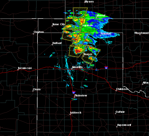 At 722 pm cdt, a severe thunderstorm was located 14 miles north of sunray, or 19 miles southeast of stratford, moving north at 25 mph (radar indicated). Hazards include 60 mph wind gusts and quarter size hail. Minor damage to roofs, siding, and trees is possible. Hail damage to vehicles is expected. At 722 pm cdt, a severe thunderstorm was located 14 miles north of sunray, or 19 miles southeast of stratford, moving north at 25 mph (radar indicated). Hazards include 60 mph wind gusts and quarter size hail. Minor damage to roofs, siding, and trees is possible. Hail damage to vehicles is expected.
|
| 5/15/2017 6:54 PM CDT |
 At 654 pm cdt, a severe thunderstorm was located 4 miles southwest of hough, or 12 miles northwest of guymon, moving north at 60 mph (radar indicated). Hazards include 60 mph wind gusts and quarter size hail. Minor damage to roofs, siding, and trees is possible. Hail damage to vehicles is expected. At 654 pm cdt, a severe thunderstorm was located 4 miles southwest of hough, or 12 miles northwest of guymon, moving north at 60 mph (radar indicated). Hazards include 60 mph wind gusts and quarter size hail. Minor damage to roofs, siding, and trees is possible. Hail damage to vehicles is expected.
|
| 5/15/2017 6:30 PM CDT |
 At 630 pm cdt, a severe thunderstorm was located 5 miles east of stratford, moving northeast at 40 mph (radar indicated). Hazards include 60 mph wind gusts and half dollar size hail. Minor damage to roofs, siding, and trees is possible. Hail damage to vehicles is expected. At 630 pm cdt, a severe thunderstorm was located 5 miles east of stratford, moving northeast at 40 mph (radar indicated). Hazards include 60 mph wind gusts and half dollar size hail. Minor damage to roofs, siding, and trees is possible. Hail damage to vehicles is expected.
|
| 5/15/2017 6:28 PM CDT |
 At 628 pm cdt, a severe thunderstorm was located 9 miles north of goodwell, or 11 miles west of guymon, moving north at 30 mph (radar indicated). Hazards include 60 mph wind gusts and quarter size hail. Minor damage to roofs, siding, and trees is possible. hail damage to vehicles is expected. Locations impacted include, goodwell, eva and hough. At 628 pm cdt, a severe thunderstorm was located 9 miles north of goodwell, or 11 miles west of guymon, moving north at 30 mph (radar indicated). Hazards include 60 mph wind gusts and quarter size hail. Minor damage to roofs, siding, and trees is possible. hail damage to vehicles is expected. Locations impacted include, goodwell, eva and hough.
|
| 5/15/2017 6:07 PM CDT |
 At 607 pm cdt, a severe thunderstorm was located 5 miles west of goodwell, or 14 miles southwest of guymon, moving north at 30 mph (radar indicated). Hazards include 60 mph wind gusts and half dollar size hail. Minor damage to roofs, siding, and trees is possible. Hail damage to vehicles is expected. At 607 pm cdt, a severe thunderstorm was located 5 miles west of goodwell, or 14 miles southwest of guymon, moving north at 30 mph (radar indicated). Hazards include 60 mph wind gusts and half dollar size hail. Minor damage to roofs, siding, and trees is possible. Hail damage to vehicles is expected.
|
| 5/15/2017 5:58 PM CDT |
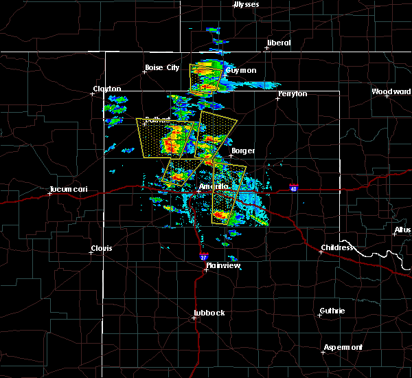 At 558 pm cdt, a severe thunderstorm was located near texhoma, or 17 miles southwest of guymon, moving north at 30 mph (public). Hazards include ping pong ball size hail and 60 mph wind gusts. Minor damage to roofs, siding, and trees is possible. people and animals outdoors will be injured. expect hail damage to roofs, siding, windows, and vehicles. Locations impacted include, goodwell, eva and texhoma. At 558 pm cdt, a severe thunderstorm was located near texhoma, or 17 miles southwest of guymon, moving north at 30 mph (public). Hazards include ping pong ball size hail and 60 mph wind gusts. Minor damage to roofs, siding, and trees is possible. people and animals outdoors will be injured. expect hail damage to roofs, siding, windows, and vehicles. Locations impacted include, goodwell, eva and texhoma.
|
| 5/15/2017 5:48 PM CDT |
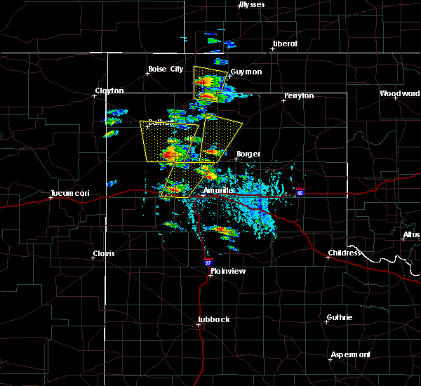 At 548 pm cdt, a severe thunderstorm was located over texhoma, or 19 miles northeast of stratford, moving north at 30 mph (radar indicated). Hazards include 60 mph wind gusts and quarter size hail. Minor damage to roofs, siding, and trees is possible. hail damage to vehicles is expected. Locations impacted include, goodwell, eva and texhoma. At 548 pm cdt, a severe thunderstorm was located over texhoma, or 19 miles northeast of stratford, moving north at 30 mph (radar indicated). Hazards include 60 mph wind gusts and quarter size hail. Minor damage to roofs, siding, and trees is possible. hail damage to vehicles is expected. Locations impacted include, goodwell, eva and texhoma.
|
| 5/15/2017 5:48 PM CDT |
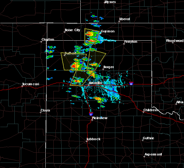 At 548 pm cdt, a severe thunderstorm was located over texhoma, or 19 miles northeast of stratford, moving north at 30 mph (radar indicated). Hazards include 60 mph wind gusts and quarter size hail. Minor damage to roofs, siding, and trees is possible. hail damage to vehicles is expected. Locations impacted include, goodwell, eva and texhoma. At 548 pm cdt, a severe thunderstorm was located over texhoma, or 19 miles northeast of stratford, moving north at 30 mph (radar indicated). Hazards include 60 mph wind gusts and quarter size hail. Minor damage to roofs, siding, and trees is possible. hail damage to vehicles is expected. Locations impacted include, goodwell, eva and texhoma.
|
| 5/15/2017 5:36 PM CDT |
 At 535 pm cdt, a severe thunderstorm was located 8 miles south of texhoma, or 15 miles east of stratford, moving north at 30 mph (radar indicated). Hazards include 60 mph wind gusts and quarter size hail. Minor damage to roofs, siding, and trees is possible. Hail damage to vehicles is expected. At 535 pm cdt, a severe thunderstorm was located 8 miles south of texhoma, or 15 miles east of stratford, moving north at 30 mph (radar indicated). Hazards include 60 mph wind gusts and quarter size hail. Minor damage to roofs, siding, and trees is possible. Hail damage to vehicles is expected.
|
| 8/4/2016 5:30 PM CDT | Storm damage reported in texas county OK, 1.9 miles WSW of Goodwell, OK |
| 8/4/2016 5:27 PM CDT | Wind blew over a wooden wishing wel in texas county OK, 1.3 miles WNW of Goodwell, OK |
| 6/13/2016 7:32 PM CDT |
 At 731 pm cdt, severe thunderstorms were located along a line extending from 8 miles west of tyrone to 9 miles southeast of goodwell, moving east at 45 mph (radar indicated). Hazards include 60 mph wind gusts and penny size hail. Minor damage to roofs. siding. and trees is possible. locations impacted include, guymon, hooker, goodwell and optima. A tornado watch remains in effect until 200 am cdt for the panhandle of oklahoma. At 731 pm cdt, severe thunderstorms were located along a line extending from 8 miles west of tyrone to 9 miles southeast of goodwell, moving east at 45 mph (radar indicated). Hazards include 60 mph wind gusts and penny size hail. Minor damage to roofs. siding. and trees is possible. locations impacted include, guymon, hooker, goodwell and optima. A tornado watch remains in effect until 200 am cdt for the panhandle of oklahoma.
|
| 6/13/2016 7:02 PM CDT |
 At 702 pm cdt, severe thunderstorms were located along a line extending from 7 miles north of hough to 9 miles west of texhoma, moving east at 45 mph (radar indicated). Hazards include 60 mph wind gusts and penny size hail. Minor damage to roofs. siding. and trees is possible. locations impacted include, guymon, hooker, goodwell, texhoma, optima, hough and eva. A tornado watch remains in effect until 200 am cdt for the panhandle of oklahoma, and the panhandle of texas. At 702 pm cdt, severe thunderstorms were located along a line extending from 7 miles north of hough to 9 miles west of texhoma, moving east at 45 mph (radar indicated). Hazards include 60 mph wind gusts and penny size hail. Minor damage to roofs. siding. and trees is possible. locations impacted include, guymon, hooker, goodwell, texhoma, optima, hough and eva. A tornado watch remains in effect until 200 am cdt for the panhandle of oklahoma, and the panhandle of texas.
|
| 6/13/2016 6:38 PM CDT |
 At 638 pm cdt, severe thunderstorms were located along a line extending from near elkhart to 13 miles southwest of griggs, moving east at 40 mph (radar indicated). Hazards include 60 mph wind gusts and nickel size hail. Minor damage to roofs. siding. And trees is possible. At 638 pm cdt, severe thunderstorms were located along a line extending from near elkhart to 13 miles southwest of griggs, moving east at 40 mph (radar indicated). Hazards include 60 mph wind gusts and nickel size hail. Minor damage to roofs. siding. And trees is possible.
|
| 6/6/2016 8:44 PM CDT |
 At 843 pm cdt, a severe thunderstorm was located over texhoma, or 19 miles southwest of guymon, moving south at 20 mph (radar indicated). Hazards include 60 mph wind gusts. Minor damage to roofs. siding. and trees is possible. Locations impacted include, goodwell and texhoma. At 843 pm cdt, a severe thunderstorm was located over texhoma, or 19 miles southwest of guymon, moving south at 20 mph (radar indicated). Hazards include 60 mph wind gusts. Minor damage to roofs. siding. and trees is possible. Locations impacted include, goodwell and texhoma.
|
| 6/6/2016 8:28 PM CDT |
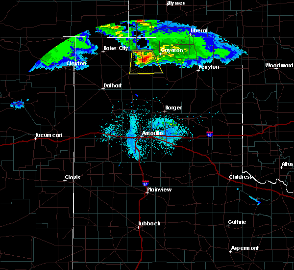 At 828 pm cdt, a severe thunderstorm was located near texhoma, or 18 miles southwest of guymon, moving south at 25 mph (radar indicated). Hazards include 60 mph wind gusts. Minor damage to roofs. siding. and trees is possible. Locations impacted include, goodwell and texhoma. At 828 pm cdt, a severe thunderstorm was located near texhoma, or 18 miles southwest of guymon, moving south at 25 mph (radar indicated). Hazards include 60 mph wind gusts. Minor damage to roofs. siding. and trees is possible. Locations impacted include, goodwell and texhoma.
|
| 6/6/2016 8:15 PM CDT |
 At 815 pm cdt, severe thunderstorms were located along a line extending from 5 miles northwest of texhoma to near optima, moving southeast at 20 mph (radar indicated). Hazards include 60 mph wind gusts. Minor damage to roofs. siding. and trees is possible. Locations impacted include, guymon, goodwell, optima and texhoma. At 815 pm cdt, severe thunderstorms were located along a line extending from 5 miles northwest of texhoma to near optima, moving southeast at 20 mph (radar indicated). Hazards include 60 mph wind gusts. Minor damage to roofs. siding. and trees is possible. Locations impacted include, guymon, goodwell, optima and texhoma.
|
| 6/6/2016 7:59 PM CDT |
 At 757 pm cdt, severe thunderstorms were located along a line extending from 7 miles south of eva to 5 miles northwest of optima, moving southeast at 20 mph (radar indicated). Hazards include 70 mph wind gusts and quarter size hail. Expect some tree damage. damage is likely to mobile homes, roofs, and outbuildings. hail damage to vehicles is expected. This storm produced a 68 mph wind gust as it passed through eva. At 757 pm cdt, severe thunderstorms were located along a line extending from 7 miles south of eva to 5 miles northwest of optima, moving southeast at 20 mph (radar indicated). Hazards include 70 mph wind gusts and quarter size hail. Expect some tree damage. damage is likely to mobile homes, roofs, and outbuildings. hail damage to vehicles is expected. This storm produced a 68 mph wind gust as it passed through eva.
|
| 6/6/2016 7:43 PM CDT |
 At 742 pm cdt, a severe thunderstorm was located 5 miles east of eva, or 15 miles south of elkhart, moving south at 25 mph (radar indicated). Hazards include 70 mph wind gusts and quarter size hail. Expect some tree damage. damage is likely to mobile homes. roofs, and outbuildings. hail damage to vehicles is expected. this storm produced a 68 mph wind gust at the oklahoma mesonet site located near eva. Locations impacted include, guymon, goodwell, optima, hough and eva. At 742 pm cdt, a severe thunderstorm was located 5 miles east of eva, or 15 miles south of elkhart, moving south at 25 mph (radar indicated). Hazards include 70 mph wind gusts and quarter size hail. Expect some tree damage. damage is likely to mobile homes. roofs, and outbuildings. hail damage to vehicles is expected. this storm produced a 68 mph wind gust at the oklahoma mesonet site located near eva. Locations impacted include, guymon, goodwell, optima, hough and eva.
|
| 6/6/2016 7:28 PM CDT |
 At 726 pm cdt, a severe thunderstorm was located 9 miles northeast of eva, or 10 miles southeast of elkhart, moving south at 25 mph (radar indicated). Hazards include 60 mph wind gusts and quarter size hail. Minor damage to roofs. siding. and trees is possible. hail damage to vehicles is expected. locations impacted include, guymon, goodwell, optima, hough and eva. This storm produced a wind gust to 58 mph as it passed over the oklahoma mesonet site near eva. At 726 pm cdt, a severe thunderstorm was located 9 miles northeast of eva, or 10 miles southeast of elkhart, moving south at 25 mph (radar indicated). Hazards include 60 mph wind gusts and quarter size hail. Minor damage to roofs. siding. and trees is possible. hail damage to vehicles is expected. locations impacted include, guymon, goodwell, optima, hough and eva. This storm produced a wind gust to 58 mph as it passed over the oklahoma mesonet site near eva.
|
| 6/6/2016 7:19 PM CDT |
 At 718 pm cdt, severe thunderstorms were located along a line extending from 5 miles north of eva to 6 miles south of feterita, moving south at 25 mph (radar indicated). Hazards include 60 mph wind gusts and quarter size hail. Minor damage to roofs. siding. and trees is possible. hail damage to vehicles is possible. Locations impacted include, guymon, goodwell, optima, hardesty, hough and eva. At 718 pm cdt, severe thunderstorms were located along a line extending from 5 miles north of eva to 6 miles south of feterita, moving south at 25 mph (radar indicated). Hazards include 60 mph wind gusts and quarter size hail. Minor damage to roofs. siding. and trees is possible. hail damage to vehicles is possible. Locations impacted include, guymon, goodwell, optima, hardesty, hough and eva.
|
| 6/6/2016 7:07 PM CDT |
 At 707 pm cdt, severe thunderstorms were located along a line extending from elkhart to hugoton, moving south at 25 mph (radar indicated). Hazards include 60 mph wind gusts and quarter size hail. Minor damage to roofs. siding. and trees is possible. Hail damage to vehicles is expected. At 707 pm cdt, severe thunderstorms were located along a line extending from elkhart to hugoton, moving south at 25 mph (radar indicated). Hazards include 60 mph wind gusts and quarter size hail. Minor damage to roofs. siding. and trees is possible. Hail damage to vehicles is expected.
|
| 5/29/2016 3:32 PM CDT |
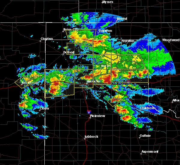 At 332 pm cdt, severe thunderstorms were located along a line extending from 8 miles northwest of griggs to 4 miles southwest of goodwell, moving east at 15 mph (radar indicated). Hazards include ping pong ball size hail and 60 mph wind gusts. Minor damage to roofs. siding. and trees is possible. people and animals outdoors will be injured. expect hail damage to roofs, siding, windows, and vehicles. Locations impacted include, goodwell, griggs and texhoma. At 332 pm cdt, severe thunderstorms were located along a line extending from 8 miles northwest of griggs to 4 miles southwest of goodwell, moving east at 15 mph (radar indicated). Hazards include ping pong ball size hail and 60 mph wind gusts. Minor damage to roofs. siding. and trees is possible. people and animals outdoors will be injured. expect hail damage to roofs, siding, windows, and vehicles. Locations impacted include, goodwell, griggs and texhoma.
|
| 5/29/2016 2:52 PM CDT |
 At 251 pm cdt, severe thunderstorms were located along a line extending from 9 miles north of keyes to 8 miles north of stratford, moving northeast at 15 mph (radar indicated). Hazards include golf ball size hail and 60 mph wind gusts. Minor damage to roofs. siding. and trees is possible. people and animals outdoors will be injured. Expect hail damage to roofs, siding, windows, and vehicles. At 251 pm cdt, severe thunderstorms were located along a line extending from 9 miles north of keyes to 8 miles north of stratford, moving northeast at 15 mph (radar indicated). Hazards include golf ball size hail and 60 mph wind gusts. Minor damage to roofs. siding. and trees is possible. people and animals outdoors will be injured. Expect hail damage to roofs, siding, windows, and vehicles.
|
| 5/29/2016 2:52 PM CDT |
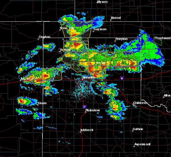 At 251 pm cdt, severe thunderstorms were located along a line extending from 9 miles north of keyes to 8 miles north of stratford, moving northeast at 15 mph (radar indicated). Hazards include golf ball size hail and 60 mph wind gusts. Minor damage to roofs. siding. and trees is possible. people and animals outdoors will be injured. Expect hail damage to roofs, siding, windows, and vehicles. At 251 pm cdt, severe thunderstorms were located along a line extending from 9 miles north of keyes to 8 miles north of stratford, moving northeast at 15 mph (radar indicated). Hazards include golf ball size hail and 60 mph wind gusts. Minor damage to roofs. siding. and trees is possible. people and animals outdoors will be injured. Expect hail damage to roofs, siding, windows, and vehicles.
|
| 5/22/2016 6:56 PM CDT | The national weather service in amarillo has issued a * severe thunderstorm warning for. eastern texas county in the panhandle of oklahoma. western beaver county in the panhandle of oklahoma. until 800 pm cdt * at 656 pm cdt. Severe thunderstorms were located along a line. |
| 5/16/2016 7:25 PM CDT | Storm damage reported in texas county OK, 1.9 miles WSW of Goodwell, OK |
| 5/16/2016 7:17 PM CDT | Storm damage reported in texas county OK, 0.4 miles NE of Goodwell, OK |
| 5/16/2016 7:15 PM CDT | Storm damage reported in texas county OK, 0.4 miles NE of Goodwell, OK |
| 5/16/2016 7:15 PM CDT |
 At 715 pm cdt, severe thunderstorms were located along a line extending from eva to 5 miles south of goodwell, moving east at 20 mph (radar indicated). Hazards include 70 mph wind gusts. this storm produced 70 mph winds when it moved through goodwell. Expect some tree damage. damage is likely to mobile homes. roofs, and outbuildings. Locations impacted include, guymon, hooker, goodwell, tyrone, optima, hardesty, hough, adams, eva and baker. At 715 pm cdt, severe thunderstorms were located along a line extending from eva to 5 miles south of goodwell, moving east at 20 mph (radar indicated). Hazards include 70 mph wind gusts. this storm produced 70 mph winds when it moved through goodwell. Expect some tree damage. damage is likely to mobile homes. roofs, and outbuildings. Locations impacted include, guymon, hooker, goodwell, tyrone, optima, hardesty, hough, adams, eva and baker.
|
| 5/16/2016 7:11 PM CDT |
 At 711 pm cdt, a severe thunderstorm was located 6 miles west of goodwell, or 14 miles west of guymon, moving east at 30 mph (radar indicated). Hazards include 70 mph wind gusts. Expect some tree damage. Damage is likely to mobile homes, roofs, and outbuildings. At 711 pm cdt, a severe thunderstorm was located 6 miles west of goodwell, or 14 miles west of guymon, moving east at 30 mph (radar indicated). Hazards include 70 mph wind gusts. Expect some tree damage. Damage is likely to mobile homes, roofs, and outbuildings.
|
| 5/16/2016 7:10 PM CDT | Storm damage reported in texas county OK, 0.4 miles NE of Goodwell, OK |
| 5/16/2016 7:04 PM CDT | Storm damage reported in texas county OK, 0.4 miles NE of Goodwell, OK |
| 4/29/2016 1:41 AM CDT |
 The severe thunderstorm warning for southwestern texas and northeastern sherman counties will expire at 145 am cdt, the storm which prompted the warning has moved out of the area. therefore the warning will be allowed to expire. a severe thunderstorm watch remains in effect until 600 am cdt for the oklahoma, and texas panhandles. remember, a severe thunderstorm warning still remains in effect for northeastern sherman county until 230 am cdt. The severe thunderstorm warning for southwestern texas and northeastern sherman counties will expire at 145 am cdt, the storm which prompted the warning has moved out of the area. therefore the warning will be allowed to expire. a severe thunderstorm watch remains in effect until 600 am cdt for the oklahoma, and texas panhandles. remember, a severe thunderstorm warning still remains in effect for northeastern sherman county until 230 am cdt.
|
| 4/29/2016 1:39 AM CDT |
 At 138 am cdt, a severe thunderstorm was located 5 miles south of guymon, moving east at 45 mph (radar indicated). Hazards include 60 mph wind gusts and quarter size hail. Minor damage to roofs. siding. and trees is possible. Hail damage to vehicles is expected. At 138 am cdt, a severe thunderstorm was located 5 miles south of guymon, moving east at 45 mph (radar indicated). Hazards include 60 mph wind gusts and quarter size hail. Minor damage to roofs. siding. and trees is possible. Hail damage to vehicles is expected.
|
| 4/29/2016 1:30 AM CDT |
 At 130 am cdt, a severe thunderstorm was located over goodwell, or 11 miles southwest of guymon, moving northeast at 35 mph. this is a very dangerous storm (trained weather spotters). Hazards include 80 mph wind gusts and quarter size hail. Flying debris will be dangerous to those caught without shelter. mobile homes will be heavily damaged. expect considerable damage to roofs, windows, and vehicles. tree damage and power outages are likely. hail damage to vehicles is expected. Locations impacted include, guymon, goodwell and texhoma. At 130 am cdt, a severe thunderstorm was located over goodwell, or 11 miles southwest of guymon, moving northeast at 35 mph. this is a very dangerous storm (trained weather spotters). Hazards include 80 mph wind gusts and quarter size hail. Flying debris will be dangerous to those caught without shelter. mobile homes will be heavily damaged. expect considerable damage to roofs, windows, and vehicles. tree damage and power outages are likely. hail damage to vehicles is expected. Locations impacted include, guymon, goodwell and texhoma.
|
| 4/29/2016 1:15 AM CDT |
 At 115 am cdt, a severe thunderstorm was located near texhoma, or 20 miles northeast of stratford, moving northeast at 40 mph. this is a very dangerous storm (trained weather spotters). Hazards include 80 mph wind gusts and half dollar size hail. Flying debris will be dangerous to those caught without shelter. mobile homes will be heavily damaged. expect considerable damage to roofs, windows, and vehicles. tree damage and power outages are likely. hail damage to vehicles is expected. Locations impacted include, guymon, goodwell, hough and texhoma. At 115 am cdt, a severe thunderstorm was located near texhoma, or 20 miles northeast of stratford, moving northeast at 40 mph. this is a very dangerous storm (trained weather spotters). Hazards include 80 mph wind gusts and half dollar size hail. Flying debris will be dangerous to those caught without shelter. mobile homes will be heavily damaged. expect considerable damage to roofs, windows, and vehicles. tree damage and power outages are likely. hail damage to vehicles is expected. Locations impacted include, guymon, goodwell, hough and texhoma.
|
| 4/29/2016 1:02 AM CDT |
 At 101 am cdt, a severe thunderstorm was located near griggs, or 15 miles north of stratford, moving northeast at 30 mph (radar indicated). Hazards include golf ball size hail and 60 mph wind gusts. Minor damage to roofs. siding. and trees is possible. people and animals outdoors will be injured. Expect hail damage to roofs, siding, windows, and vehicles. At 101 am cdt, a severe thunderstorm was located near griggs, or 15 miles north of stratford, moving northeast at 30 mph (radar indicated). Hazards include golf ball size hail and 60 mph wind gusts. Minor damage to roofs. siding. and trees is possible. people and animals outdoors will be injured. Expect hail damage to roofs, siding, windows, and vehicles.
|
| 4/15/2016 10:09 PM CDT |
 At 1008 pm cdt, a severe thunderstorm was located 7 miles south of keyes, or 16 miles east of boise city, moving northeast at 30 mph (radar indicated). Hazards include golf ball size hail and 60 mph wind gusts. Minor damage to roofs. siding. and trees is possible. people and animals outdoors will be injured. expect hail damage to roofs, siding, windows, and vehicles. Locations impacted include, guymon, stratford, hooker, goodwell, optima, keyes, griggs, hough, eva, texhoma and sturgis. At 1008 pm cdt, a severe thunderstorm was located 7 miles south of keyes, or 16 miles east of boise city, moving northeast at 30 mph (radar indicated). Hazards include golf ball size hail and 60 mph wind gusts. Minor damage to roofs. siding. and trees is possible. people and animals outdoors will be injured. expect hail damage to roofs, siding, windows, and vehicles. Locations impacted include, guymon, stratford, hooker, goodwell, optima, keyes, griggs, hough, eva, texhoma and sturgis.
|
| 4/15/2016 9:15 PM CDT |
 At 915 pm cdt, severe thunderstorms were located along a line extending from near elkhart to 9 miles north of griggs to 10 miles southeast of felt, moving east at 50 mph (radar indicated). Hazards include 60 mph wind gusts and quarter size hail. Minor damage to roofs. siding. and trees is possible. Hail damage to vehicles is expected. At 915 pm cdt, severe thunderstorms were located along a line extending from near elkhart to 9 miles north of griggs to 10 miles southeast of felt, moving east at 50 mph (radar indicated). Hazards include 60 mph wind gusts and quarter size hail. Minor damage to roofs. siding. and trees is possible. Hail damage to vehicles is expected.
|
| 4/15/2016 7:15 PM CDT |
 At 714 pm cdt, a severe thunderstorm was located 5 miles east of griggs, or 17 miles north of stratford, moving northeast at 45 mph (radar indicated). Hazards include golf ball size hail and 60 mph wind gusts. Minor damage to roofs. siding. and trees is possible. people and animals outdoors will be injured. Expect hail damage to roofs, siding, windows, and vehicles. At 714 pm cdt, a severe thunderstorm was located 5 miles east of griggs, or 17 miles north of stratford, moving northeast at 45 mph (radar indicated). Hazards include golf ball size hail and 60 mph wind gusts. Minor damage to roofs. siding. and trees is possible. people and animals outdoors will be injured. Expect hail damage to roofs, siding, windows, and vehicles.
|
| 4/15/2016 1:55 PM CDT | Hen Egg sized hail reported 25.7 miles SE of Goodwell, OK, hail up to 2 inches in diameter fell southwest of yarbrough. |
| 11/16/2015 4:34 PM CST |
 At 434 pm cst, a severe thunderstorm was located near guymon, moving north at 55 mph (radar indicated). Hazards include 60 mph wind gusts and half dollar size hail. Hail damage to vehicles is expected. minor wind damage to roofs, siding and trees is possible. locations impacted include, guymon, goodwell and hardesty. A tornado watch remains in effect until 900 pm cst. At 434 pm cst, a severe thunderstorm was located near guymon, moving north at 55 mph (radar indicated). Hazards include 60 mph wind gusts and half dollar size hail. Hail damage to vehicles is expected. minor wind damage to roofs, siding and trees is possible. locations impacted include, guymon, goodwell and hardesty. A tornado watch remains in effect until 900 pm cst.
|
| 11/16/2015 4:23 PM CST |
 At 422 pm cst, a severe thunderstorm was located 13 miles southeast of texhoma. another severe thunderstorm was lcoated 10 miles northeast of gruver. both storms are moving northeast at 55 mph (radar indicated). Hazards include 60 mph wind gusts and half dollar size hail. Hail damage to vehicles is expected. minor wind damage to roofs, siding and trees is possible. locations impacted include, guymon, goodwell and hardesty. A tornado watch remains in effect until 900 pm cst. At 422 pm cst, a severe thunderstorm was located 13 miles southeast of texhoma. another severe thunderstorm was lcoated 10 miles northeast of gruver. both storms are moving northeast at 55 mph (radar indicated). Hazards include 60 mph wind gusts and half dollar size hail. Hail damage to vehicles is expected. minor wind damage to roofs, siding and trees is possible. locations impacted include, guymon, goodwell and hardesty. A tornado watch remains in effect until 900 pm cst.
|
| 11/16/2015 4:15 PM CST |
 At 414 pm cst, severe thunderstorms extended from 14 miles southeast of texhoma to near gruver, moving northeast at 55 mph (radar indicated). Hazards include 60 mph wind gusts and half dollar size hail. Hail damage to vehicles is expected. Minor wind damage to roofs, siding and trees is possible. At 414 pm cst, severe thunderstorms extended from 14 miles southeast of texhoma to near gruver, moving northeast at 55 mph (radar indicated). Hazards include 60 mph wind gusts and half dollar size hail. Hail damage to vehicles is expected. Minor wind damage to roofs, siding and trees is possible.
|
| 11/16/2015 3:01 PM CST | Quarter sized hail reported 28.1 miles SSE of Goodwell, OK, hail of penny to quarter size was covering ok highway 95 south of elkhart |
| 9/10/2015 9:42 PM CDT |
 At 940 pm cdt, severe thunderstorms were located along a line extending from near turpin to 6 miles northwest of texhoma, and were moving southeast at 15 mph (radar indicated). Hazards include 65 mph wind gusts and half dollar size hail. Hail damage to vehicles is expected. minor wind damage to roofs, siding and trees is possible. locations impacted include, guymon, hooker, goodwell, tyrone, optima, hough, adams and baker. Time, mot, loc 0240z 346deg 270kt 3683 10093 3655 10189. At 940 pm cdt, severe thunderstorms were located along a line extending from near turpin to 6 miles northwest of texhoma, and were moving southeast at 15 mph (radar indicated). Hazards include 65 mph wind gusts and half dollar size hail. Hail damage to vehicles is expected. minor wind damage to roofs, siding and trees is possible. locations impacted include, guymon, hooker, goodwell, tyrone, optima, hough, adams and baker. Time, mot, loc 0240z 346deg 270kt 3683 10093 3655 10189.
|
| 9/10/2015 9:30 PM CDT | Storm damage reported in texas county OK, 1.9 miles WSW of Goodwell, OK |
| 9/10/2015 9:29 PM CDT |
 At 928 pm cdt, severe thunderstorms were located along a line extending from near baker to 8 miles east of griggs, moving southeast at 15 mph (radar indicated). Hazards include 60 mph wind gusts and half dollar size hail. Hail damage to vehicles is expected. minor wind damage to roofs, siding and trees is possible. locations impacted include, guymon, hooker, goodwell, tyrone, optima, eva, hough, adams and baker. Time, mot, loc 0228z 346deg 270kt 3691 10100 3663 10197. At 928 pm cdt, severe thunderstorms were located along a line extending from near baker to 8 miles east of griggs, moving southeast at 15 mph (radar indicated). Hazards include 60 mph wind gusts and half dollar size hail. Hail damage to vehicles is expected. minor wind damage to roofs, siding and trees is possible. locations impacted include, guymon, hooker, goodwell, tyrone, optima, eva, hough, adams and baker. Time, mot, loc 0228z 346deg 270kt 3691 10100 3663 10197.
|
| 9/10/2015 9:06 PM CDT |
 At 906 pm cdt, severe thunderstorms were located along a line extending from 7 miles northwest of hooker to near eva, moving southeast at 15 mph (radar indicated). Hazards include 60 mph wind gusts and half dollar size hail. Hail damage to vehicles is expected. Minor wind damage to roofs, siding and trees is possible. At 906 pm cdt, severe thunderstorms were located along a line extending from 7 miles northwest of hooker to near eva, moving southeast at 15 mph (radar indicated). Hazards include 60 mph wind gusts and half dollar size hail. Hail damage to vehicles is expected. Minor wind damage to roofs, siding and trees is possible.
|
| 5/16/2015 3:38 PM CDT | At 335 pm cdt, a severe thunderstorm was located 6 miles north of goodwell, and moving northeast at 35 mph (radar indicated). Hazards include hen egg size hail and 60 mph wind gusts. People and animals outdoors will be injured. expect hail damage to roofs, siding, windows and vehicles. Minor wind damage to roofs, siding and trees is possible. |
| 5/16/2015 3:38 PM CDT | At 335 pm cdt, a severe thunderstorm was located 6 miles north of goodwell, and moving northeast at 35 mph (radar indicated). Hazards include hen egg size hail and 60 mph wind gusts. People and animals outdoors will be injured. expect hail damage to roofs, siding, windows and vehicles. Minor wind damage to roofs, siding and trees is possible. |
| 5/16/2015 3:15 PM CDT | At 313 pm cdt, a severe thunderstorm was located near texhoma, and moving northeast at 45 mph (radar indicated). Hazards include hen egg size hail and 60 mph wind gusts. People and animals outdoors will be injured. expect hail damage to roofs, siding, windows and vehicles. Minor wind damage to roofs, siding and trees is possible. |
| 5/16/2015 3:15 PM CDT | At 313 pm cdt, a severe thunderstorm was located near texhoma, and moving northeast at 45 mph (radar indicated). Hazards include hen egg size hail and 60 mph wind gusts. People and animals outdoors will be injured. expect hail damage to roofs, siding, windows and vehicles. Minor wind damage to roofs, siding and trees is possible. |
| 5/16/2015 3:02 PM CDT | At 259 pm cdt, a severe thunderstorm was located 9 miles northeast of stratford, and moving northeast at 45 mph (radar indicated). Hazards include hen egg size hail and 60 mph wind gusts. People and animals outdoors will be injured. expect hail damage to roofs, siding, windows and vehicles. Minor wind damage to roofs, siding and trees is possible. |
| 5/16/2015 3:02 PM CDT | At 259 pm cdt, a severe thunderstorm was located 9 miles northeast of stratford, and moving northeast at 45 mph (radar indicated). Hazards include hen egg size hail and 60 mph wind gusts. People and animals outdoors will be injured. expect hail damage to roofs, siding, windows and vehicles. Minor wind damage to roofs, siding and trees is possible. |
| 5/7/2015 5:22 PM CDT | At 519 pm cdt, a severe thunderstorm was located 11 miles southeast of eva, and moving northeast at 20 mph (radar indicated). Hazards include 60 mph wind gusts and quarter size hail. Hail damage to vehicles is expected. Minor wind damage to roofs, siding and trees is possible. |
| 5/7/2015 5:05 PM CDT | At 504 pm cdt, a severe thunderstorm was located 11 miles northwest of texhoma, and moving northeast at 20 mph (radar indicated). Hazards include 60 mph wind gusts and quarter size hail. Hail damage to vehicles is expected. Minor wind damage to roofs, siding and trees is possible. |
| 5/7/2015 4:57 PM CDT | At 456 pm cdt, a severe thunderstorm was located 10 miles east of griggs, and moving northeast at 25 mph (radar indicated). Hazards include 60 mph wind gusts and quarter size hail. Hail damage to vehicles is expected. Minor wind damage to roofs, siding and trees is possible. |
| 10/9/2014 8:24 PM CDT | Quarter sized hail reported 0.3 miles NW of Goodwell, OK, hail to the size of quarters fell in goodwell. |
| 6/30/2014 10:30 PM CDT | Storm damage reported in texas county OK, 1.9 miles WSW of Goodwell, OK |
| 6/30/2014 10:25 PM CDT | Storm damage reported in texas county OK, 1.9 miles WSW of Goodwell, OK |
| 6/30/2014 10:20 PM CDT | Via oklahoma mesonet in texas county OK, 1.9 miles WSW of Goodwell, OK |
| 6/30/2014 10:15 PM CDT | Storm damage reported in texas county OK, 1.9 miles WSW of Goodwell, OK |
| 6/30/2014 9:40 PM CDT | Storm damage reported in texas county OK, 1.9 miles WSW of Goodwell, OK |
| 6/30/2014 9:20 PM CDT | Storm damage reported in texas county OK, 1.9 miles WSW of Goodwell, OK |
| 6/30/2014 9:15 PM CDT | Storm damage reported in texas county OK, 1.9 miles WSW of Goodwell, OK |
| 6/22/2014 9:15 PM CDT | Storm damage reported in texas county OK, 1.9 miles WSW of Goodwell, OK |
| 5/22/2014 6:50 PM CDT | Storm damage reported in texas county OK, 1.9 miles WSW of Goodwell, OK |
| 5/22/2014 6:45 PM CDT | Storm damage reported in texas county OK, 1.9 miles WSW of Goodwell, OK |
| 10/10/2013 8:00 PM CDT | Oklahoma mesonet in texas county OK, 1.9 miles WSW of Goodwell, OK |
| 8/14/2013 4:50 PM CDT | Estimated 60 to 70 mph winds. time estimated based on radar in texas county OK, 12.9 miles SSE of Goodwell, OK |
| 8/14/2013 4:50 PM CDT | Estimated 60 to 70 mph winds. time estimated based on rada in texas county OK, 12.9 miles SSE of Goodwell, OK |
| 8/7/2013 9:05 PM CDT | Storm damage reported in texas county OK, 1.9 miles WSW of Goodwell, OK |
| 8/7/2013 9:00 PM CDT | Storm damage reported in texas county OK, 1.9 miles WSW of Goodwell, OK |
| 6/4/2013 10:15 PM CDT | Quarter sized hail reported 0.3 miles NW of Goodwell, OK |
| 9/26/2012 7:45 PM CDT | Quarter sized hail reported 31.1 miles SSE of Goodwell, OK |
| 9/6/2012 6:00 PM CDT | Storm damage reported in texas county OK, 0.4 miles NE of Goodwell, OK |
| 9/4/2012 3:45 PM CDT | School net site at okla panhandle state universit in texas county OK, 0.4 miles NE of Goodwell, OK |
| 8/11/2012 6:35 PM CDT | Storm damage reported in texas county OK, 0.3 miles NW of Goodwell, OK |
| 6/14/2012 8:15 PM CDT | Golf Ball sized hail reported 10.5 miles SE of Goodwell, OK |
| 4/30/2012 3:22 AM CDT | Quarter sized hail reported 20.5 miles SE of Goodwell, OK, quarter size hail reported near eva |
| 4/26/2012 6:55 PM CDT | Quarter sized hail reported 24.6 miles SSE of Goodwell, OK, quarter size hail |
| 1/1/0001 12:00 AM | School net site in texas county OK, 0.3 miles NW of Goodwell, OK |
| 1/1/0001 12:00 AM | Measured 60 mph wind gust near oklahoma panhandle state universit in texas county OK, 0.9 miles ENE of Goodwell, OK |
| 1/1/0001 12:00 AM | Quarter sized hail reported 0.9 miles ENE of Goodwell, OK, quarter hail off highway 54 covering the ground |
Hail Maps for Goodwell, OK
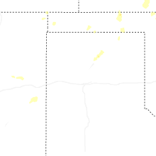
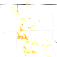
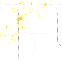
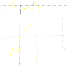
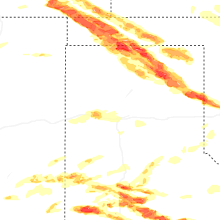
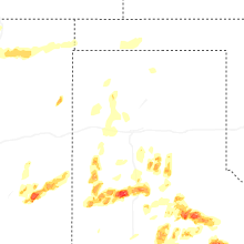


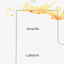


Connect with Interactive Hail Maps