

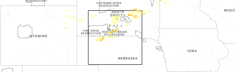
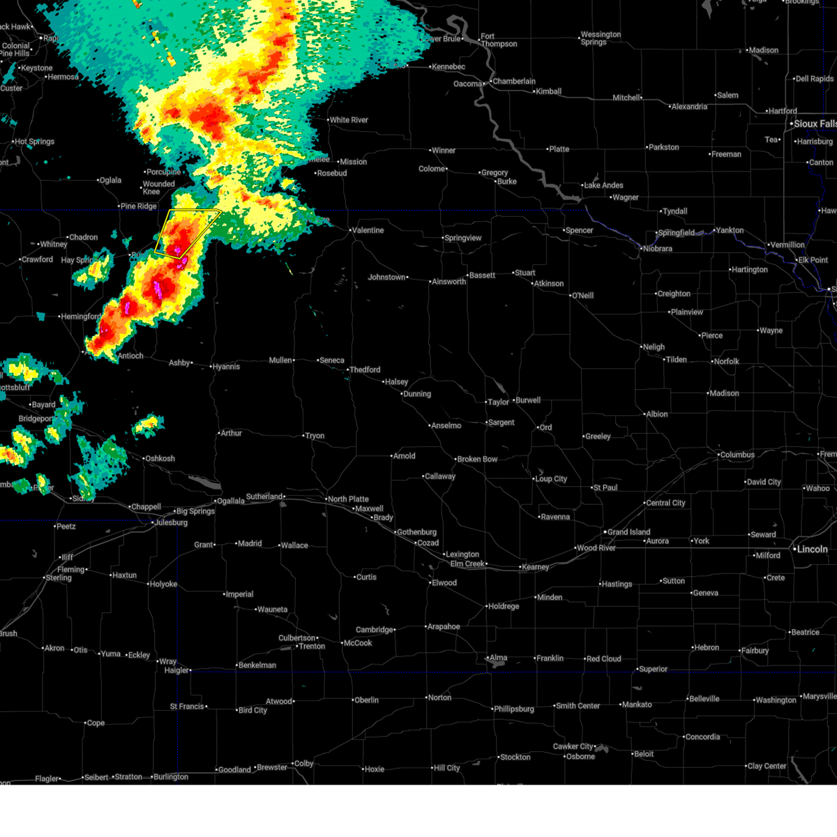
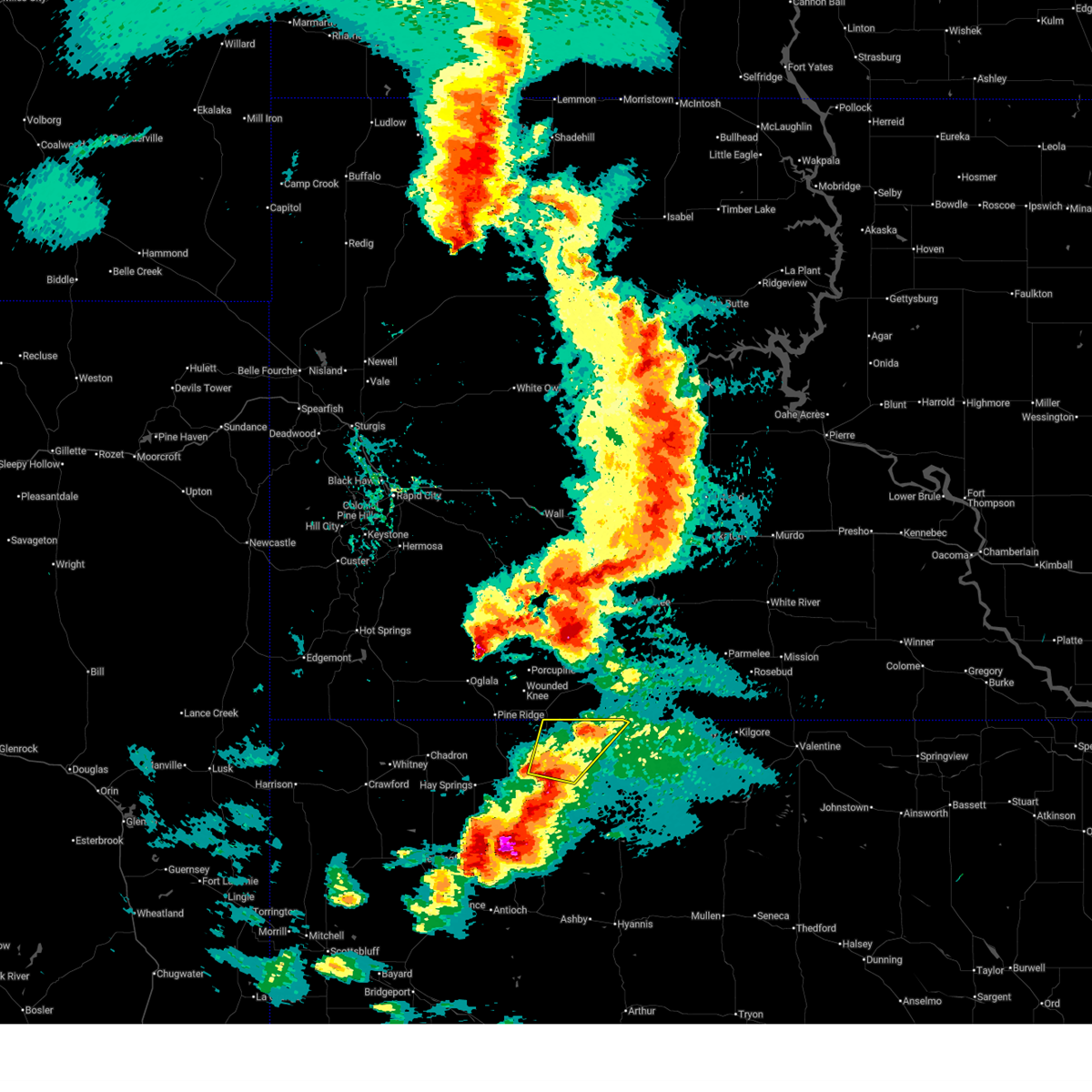
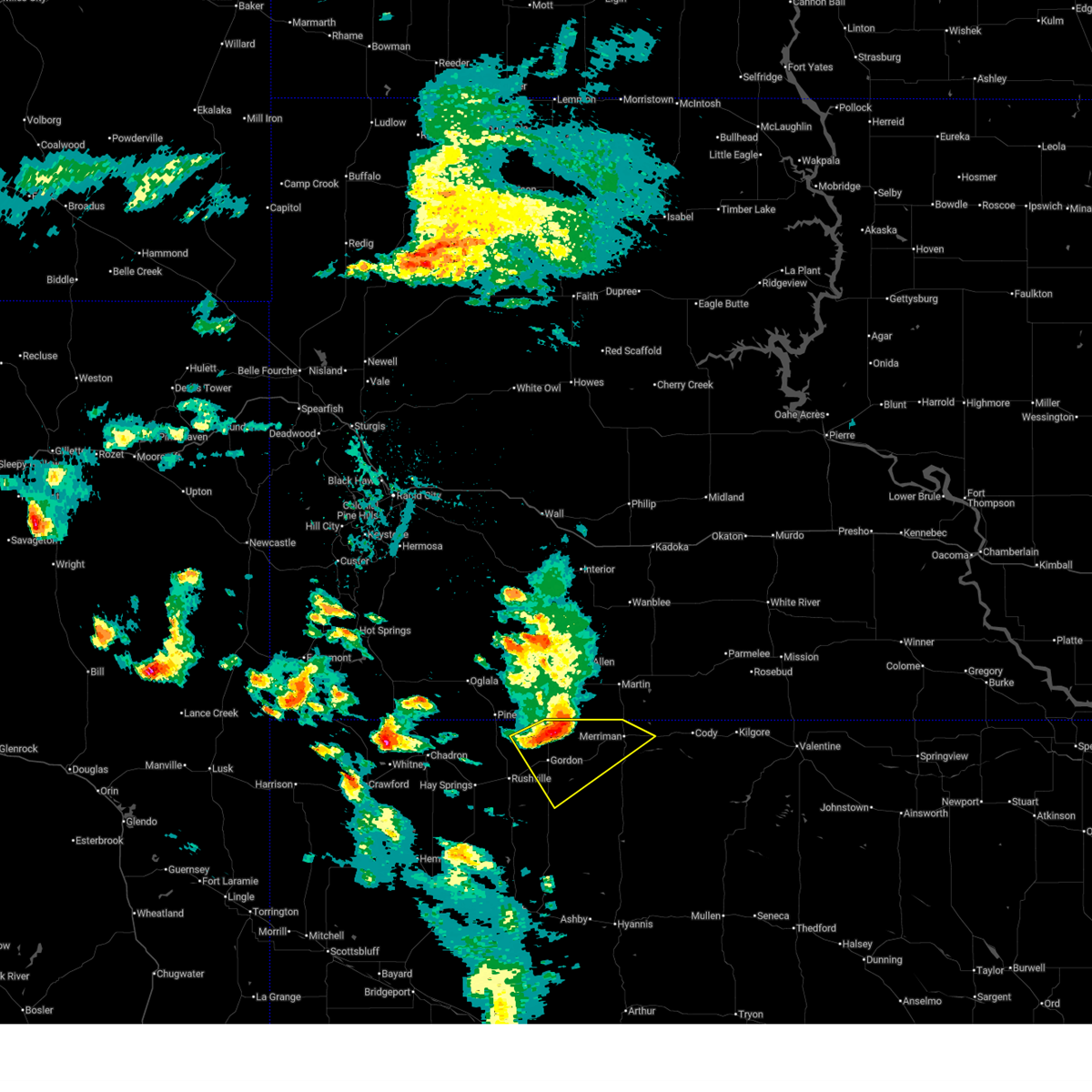
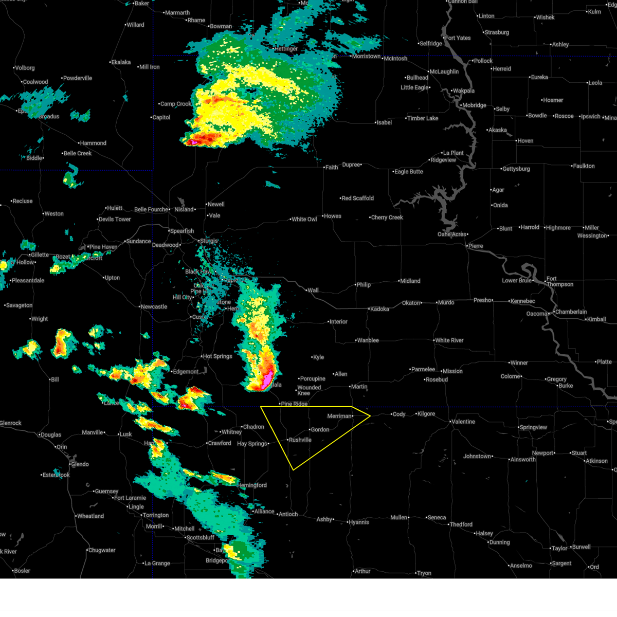
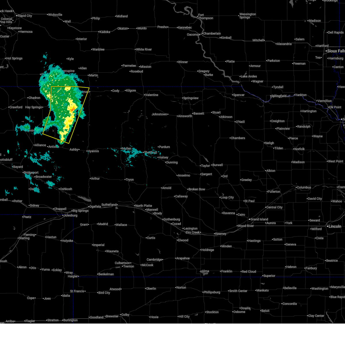
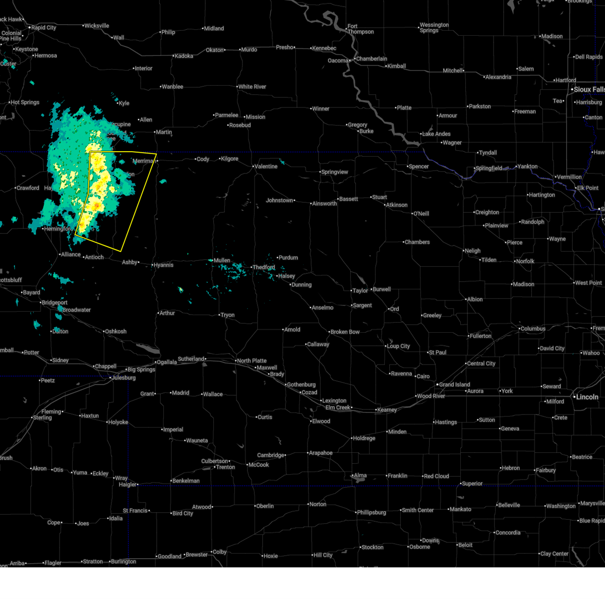
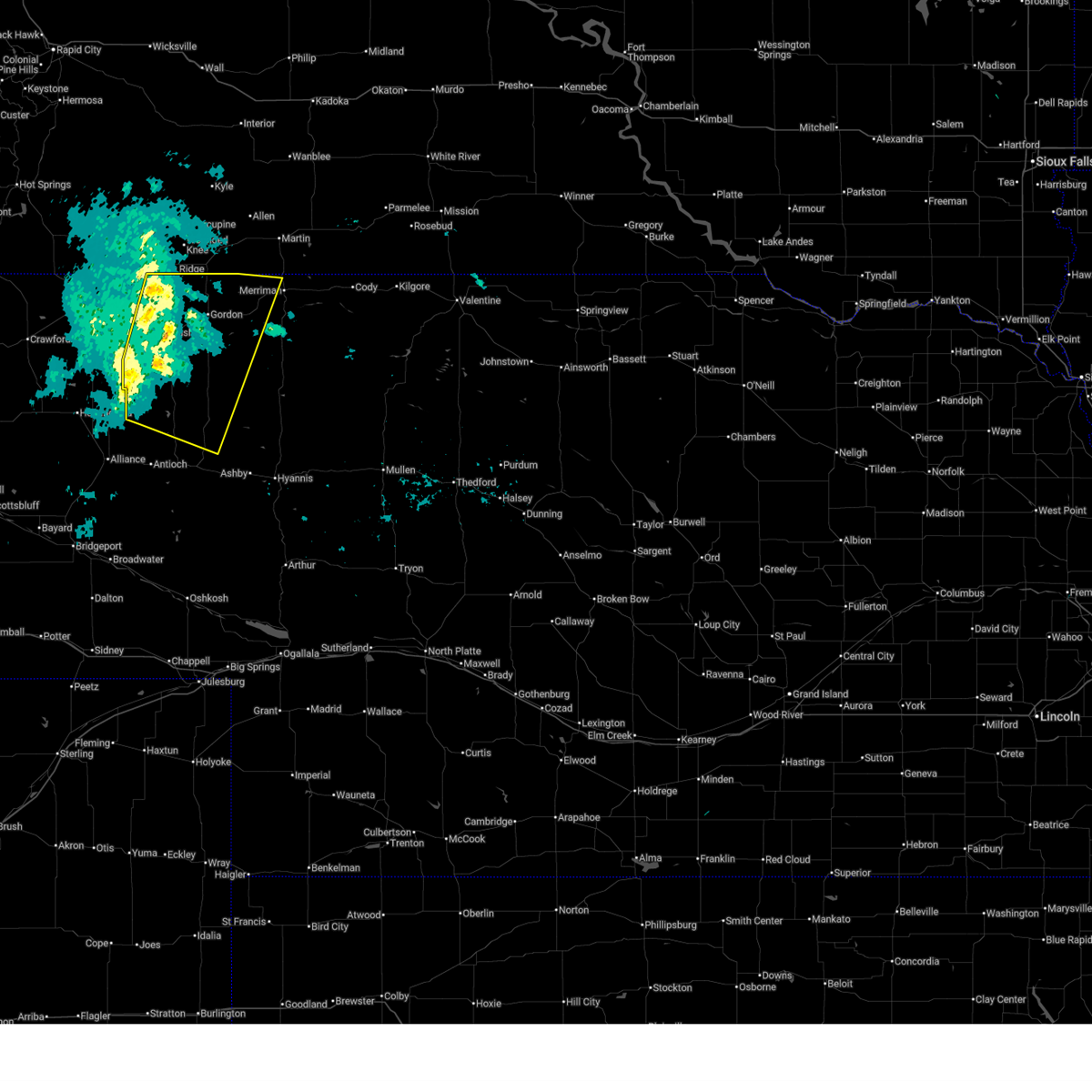
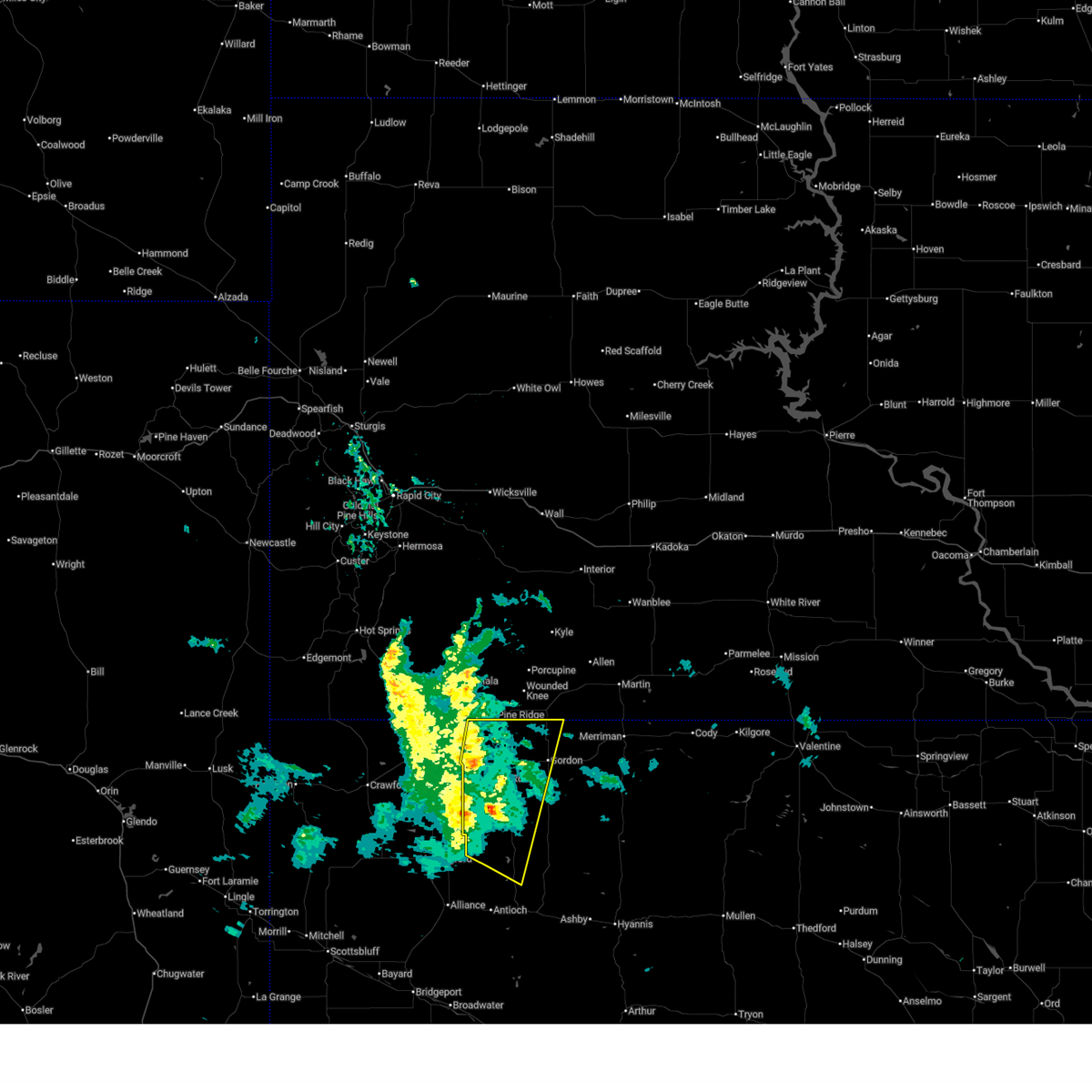
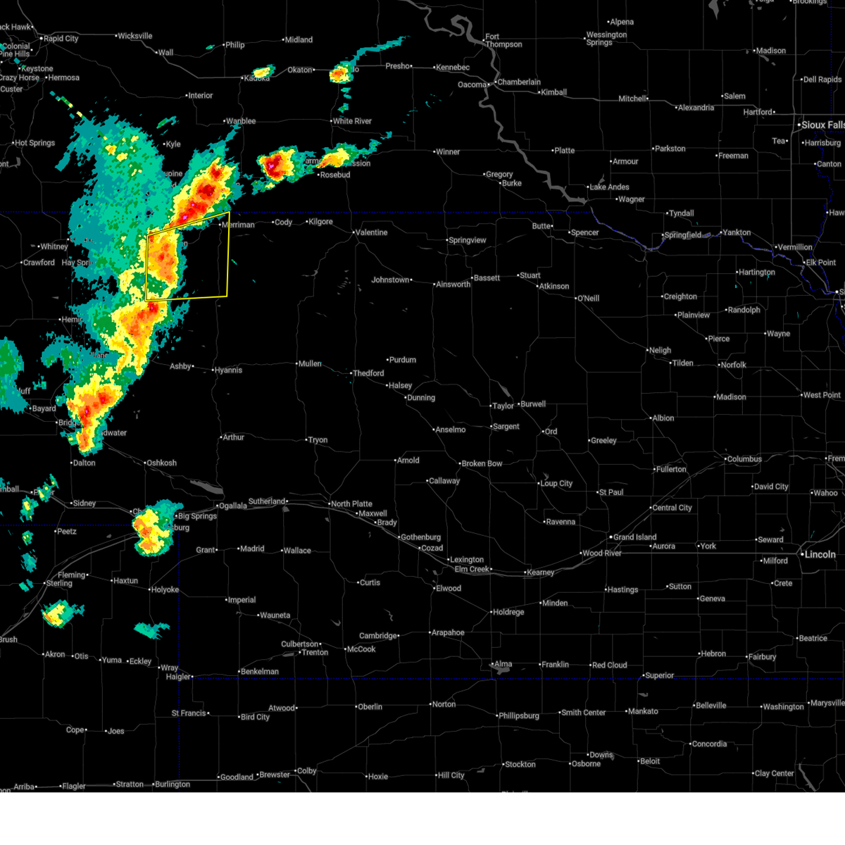
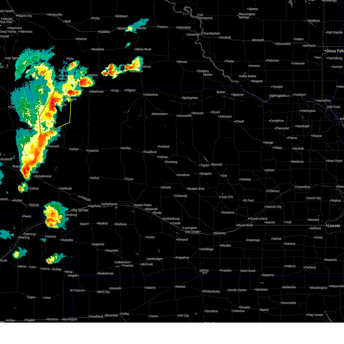
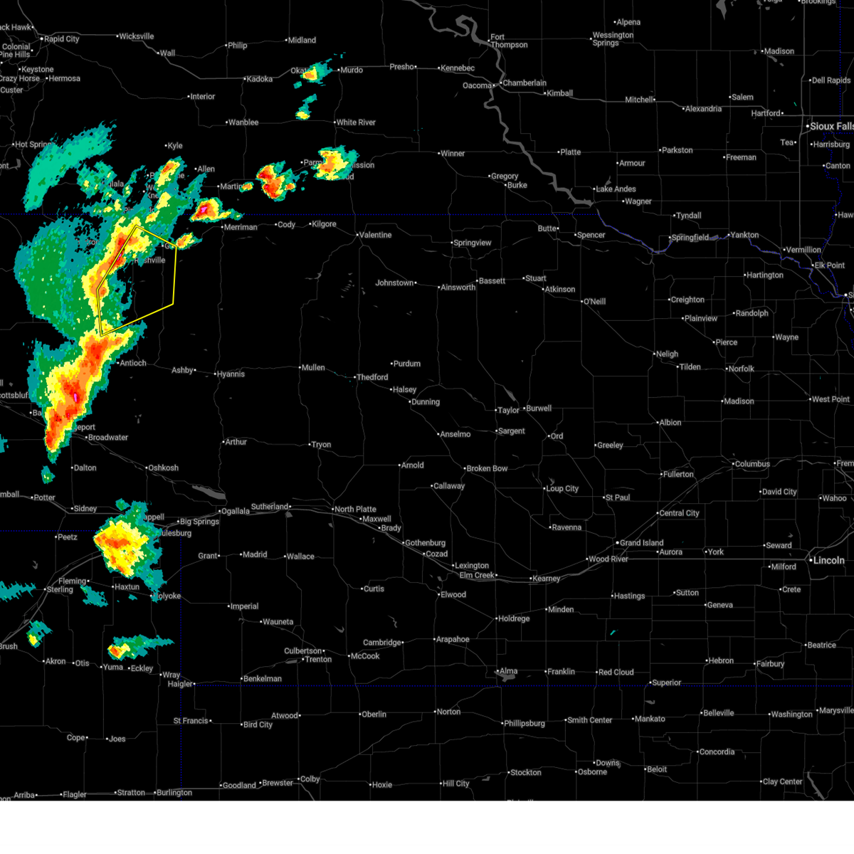
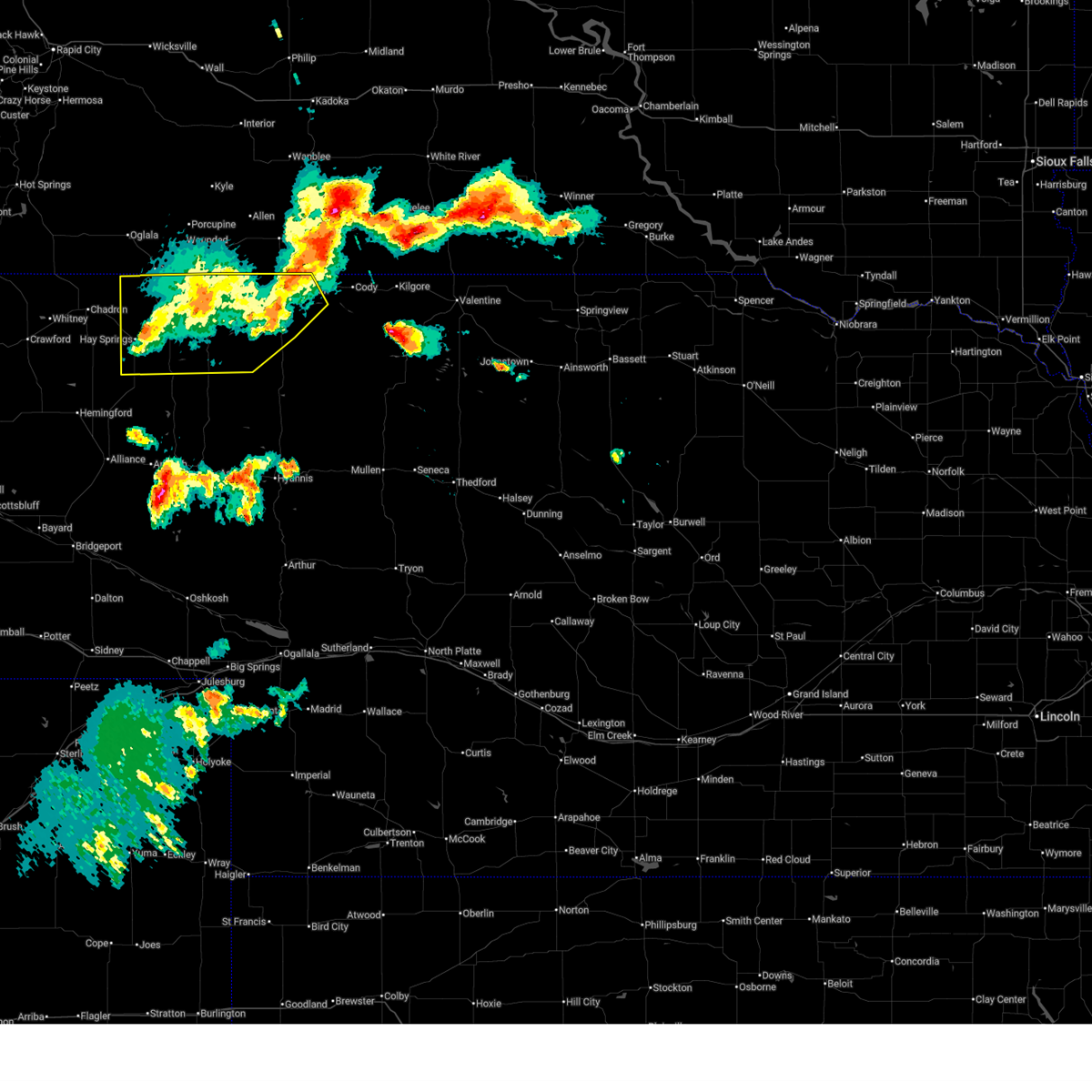
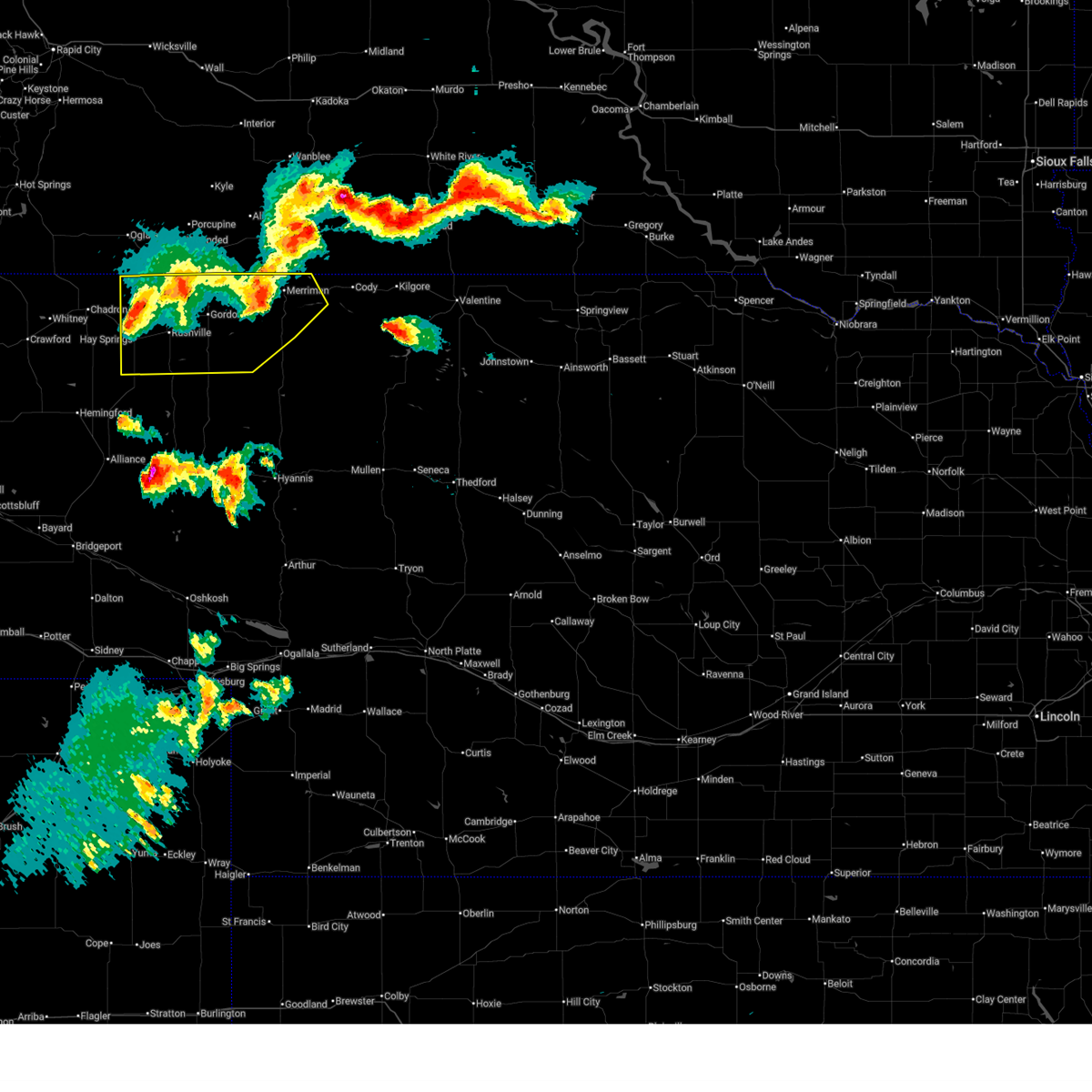
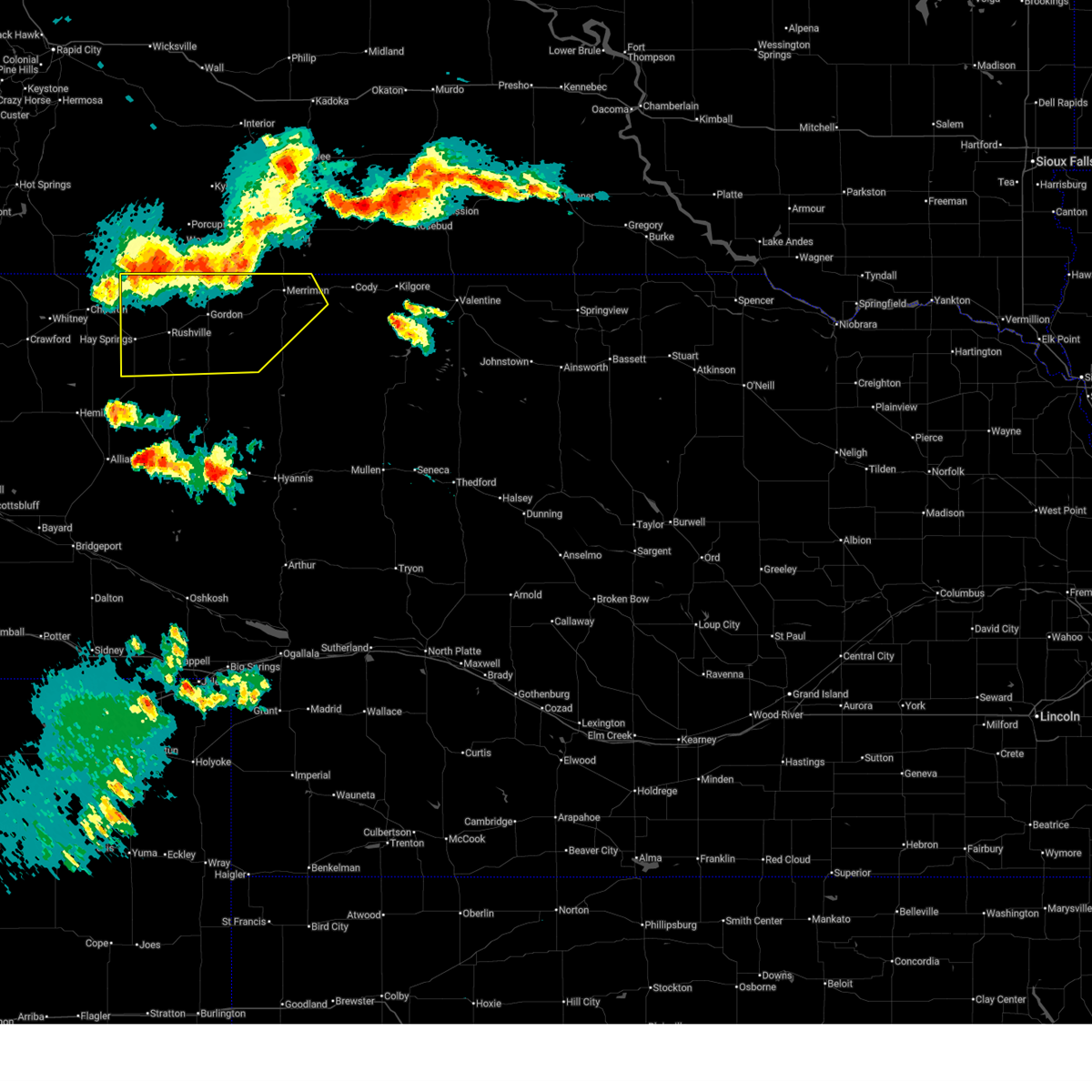
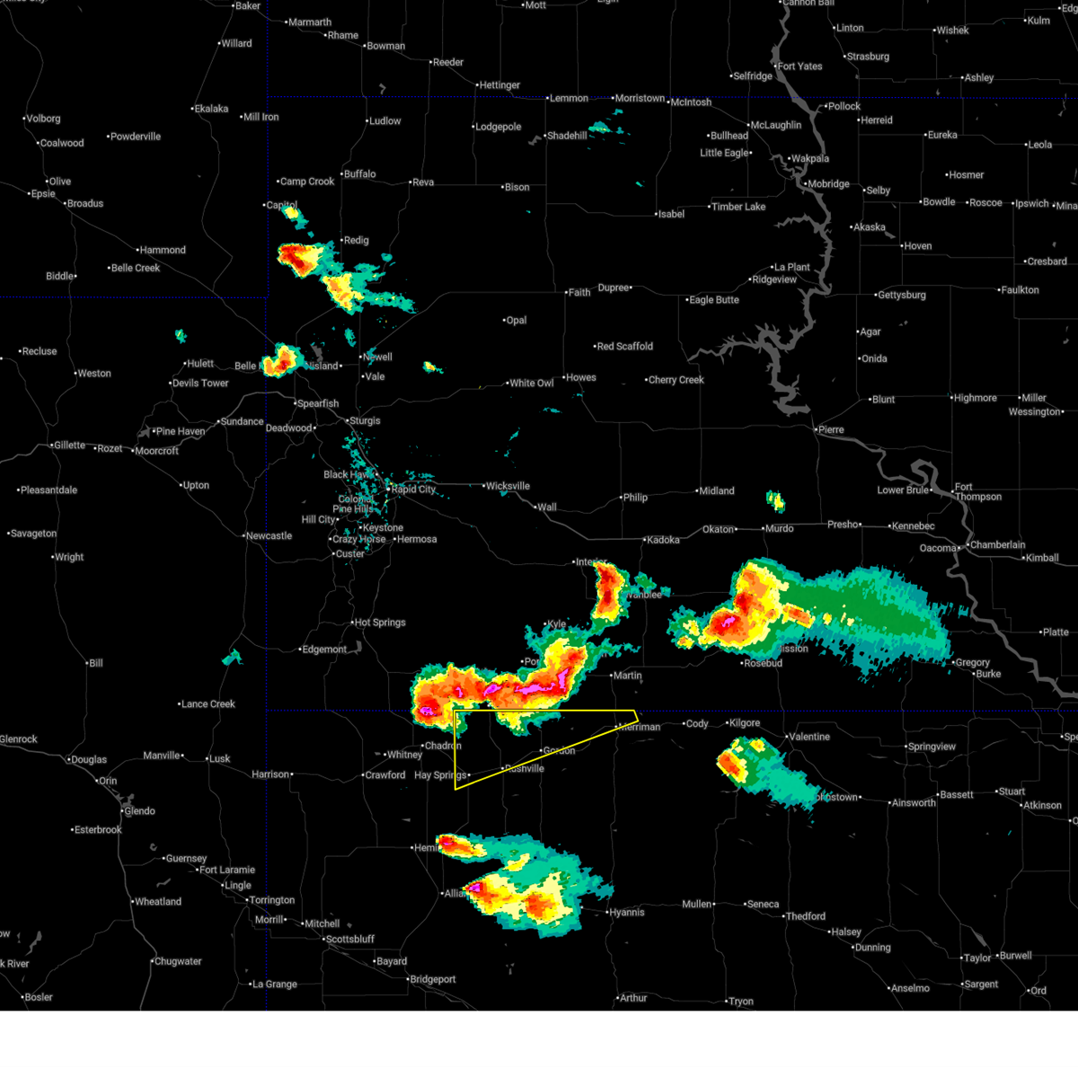
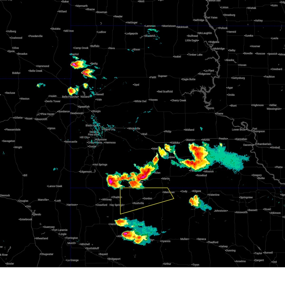
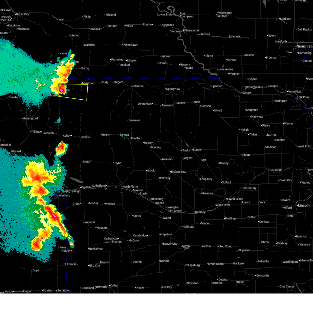
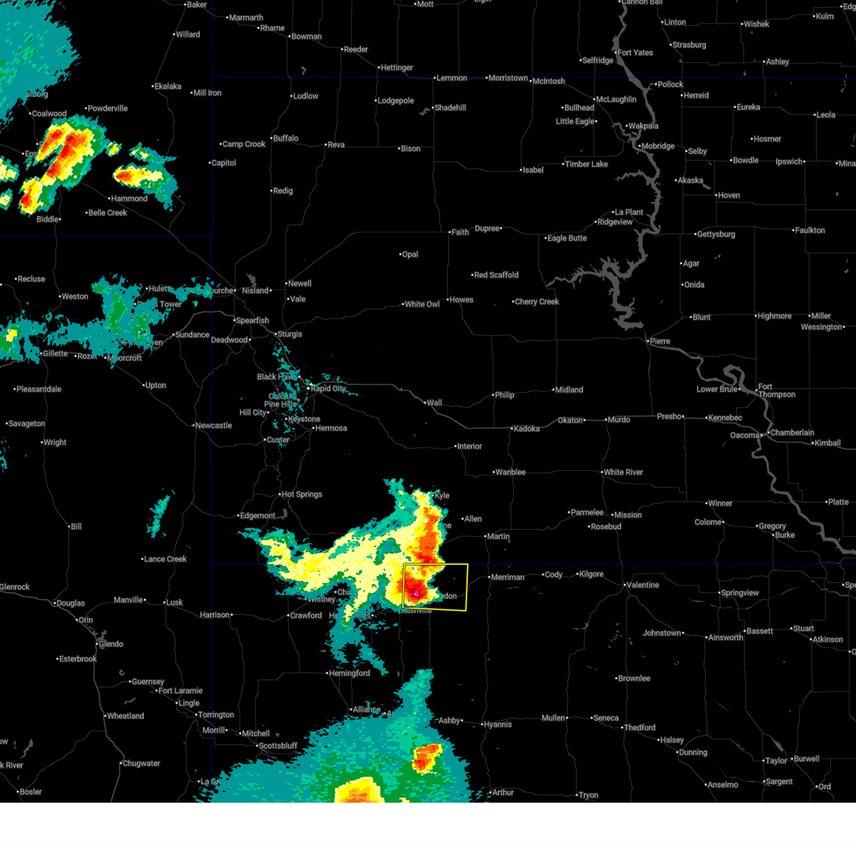
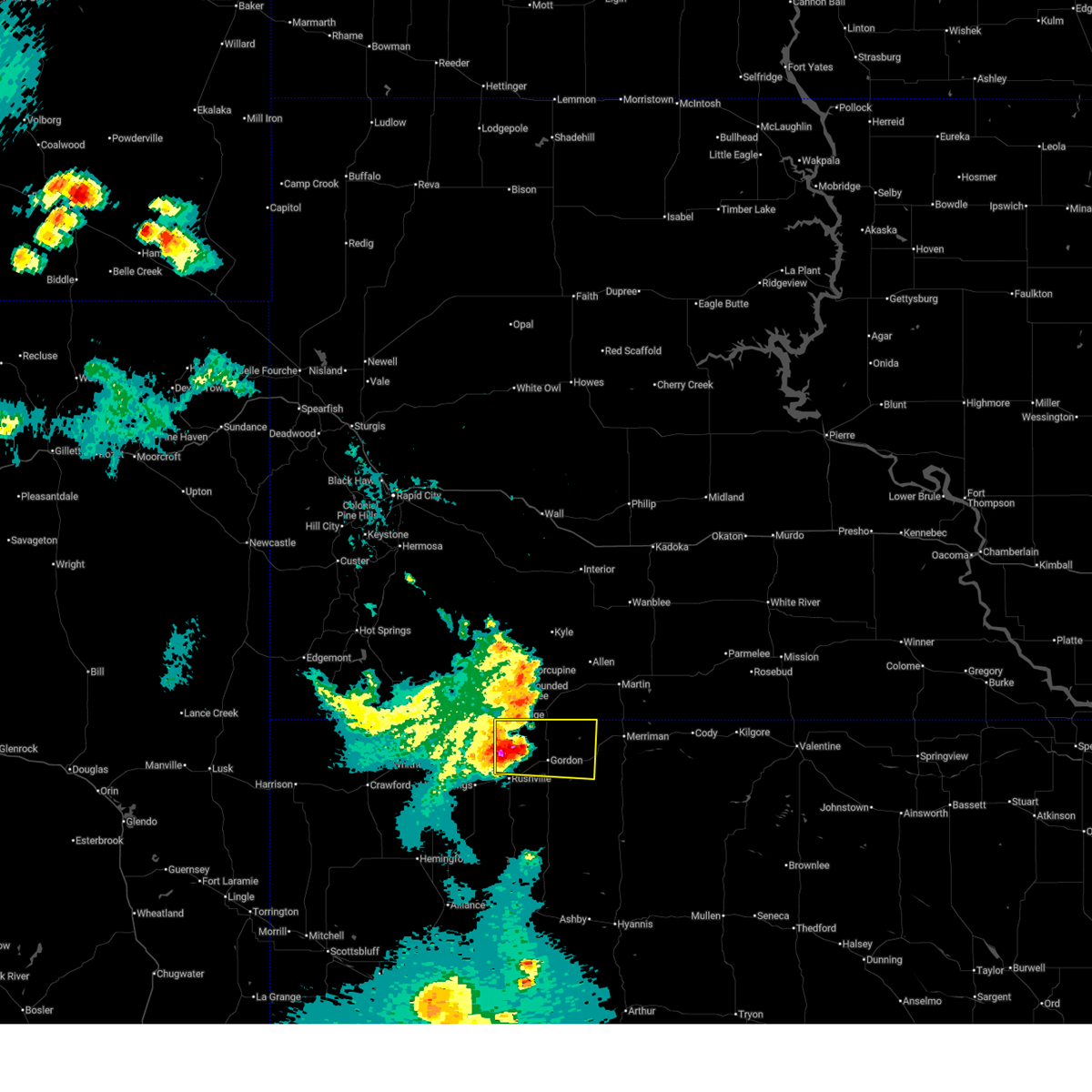
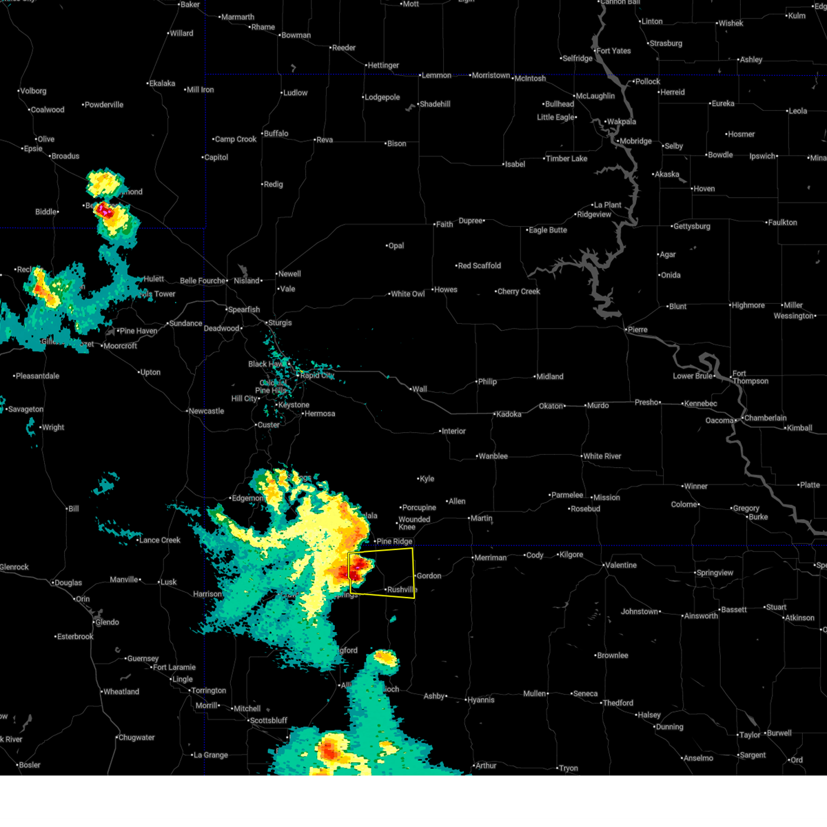
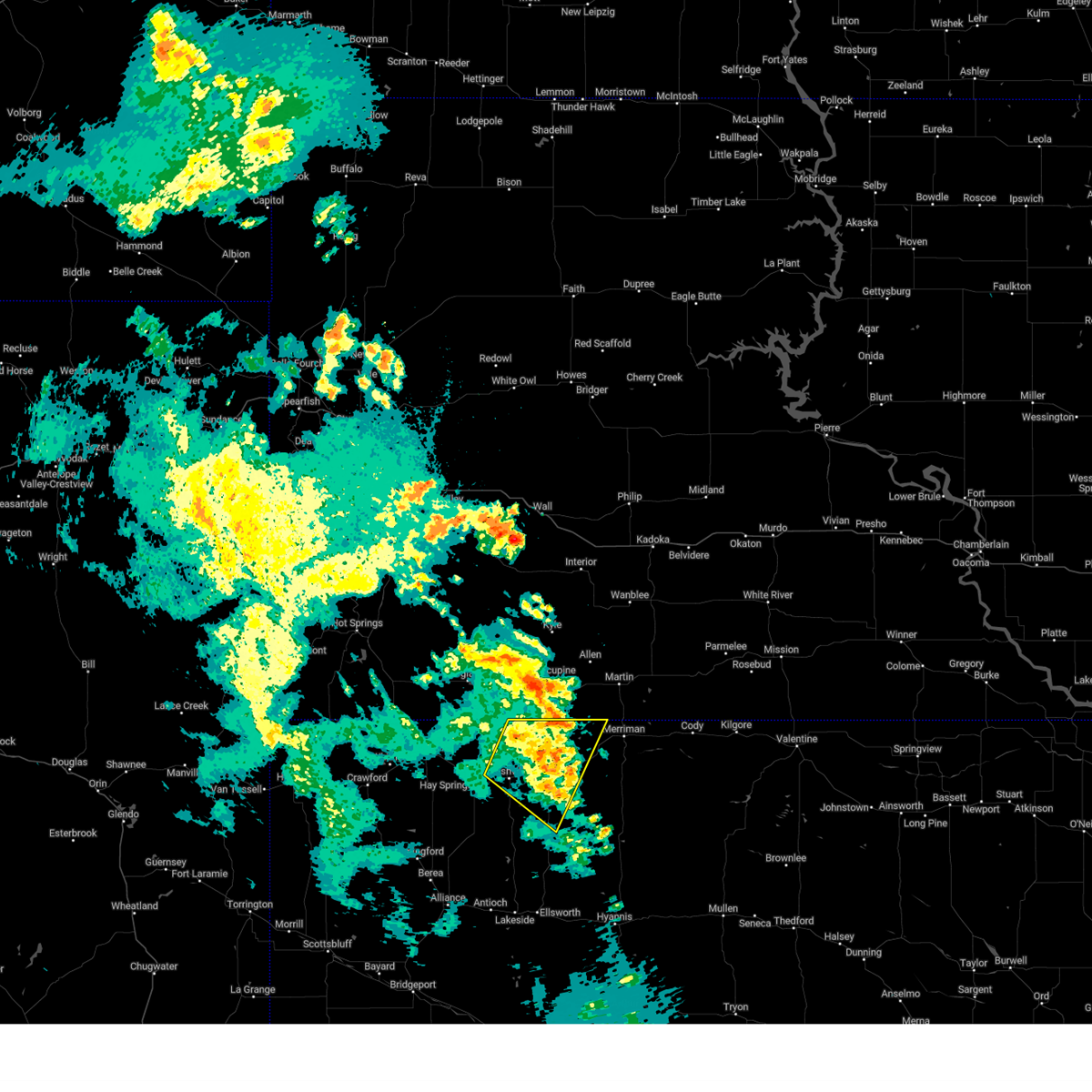
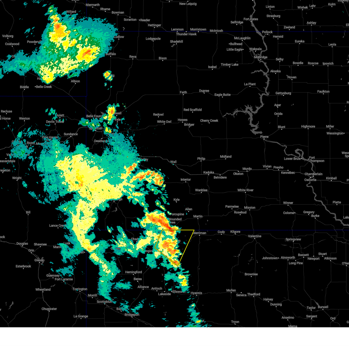
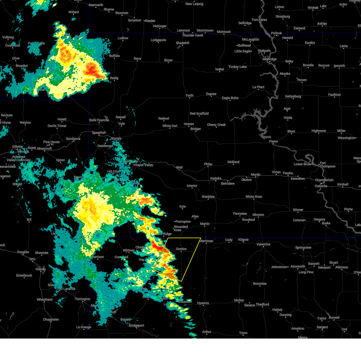
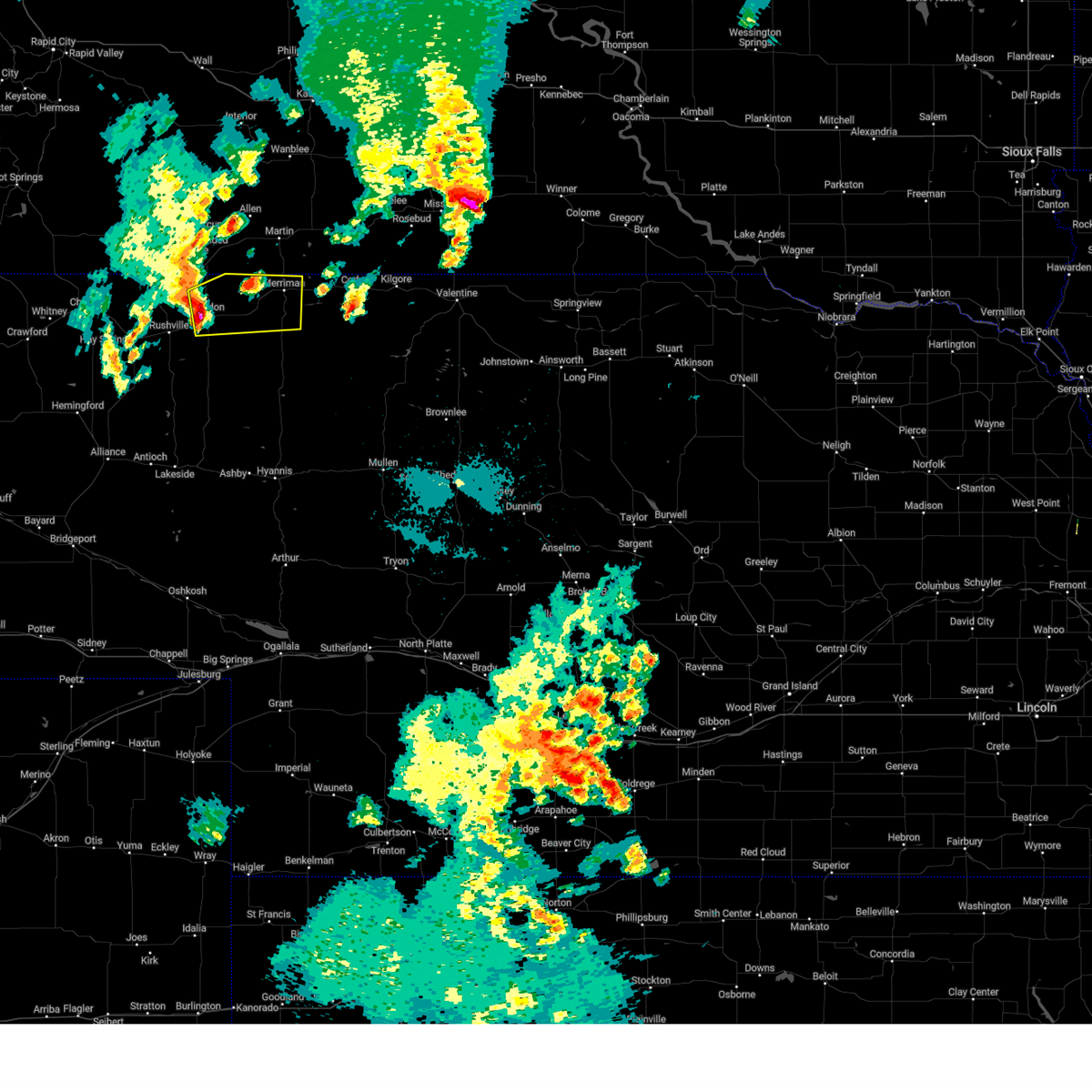
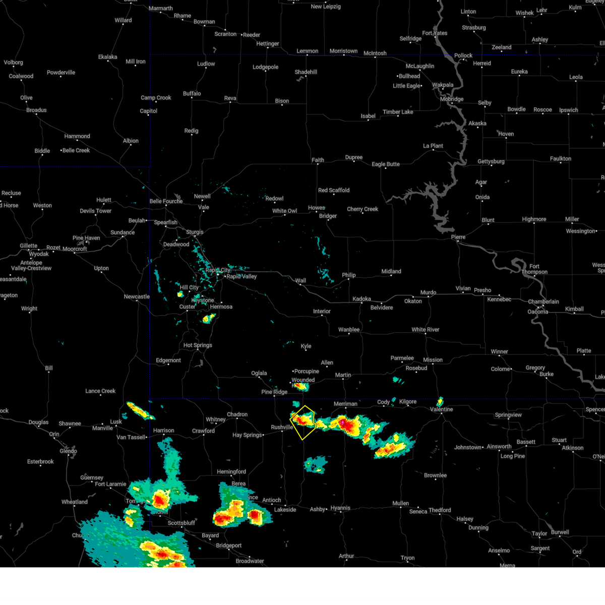
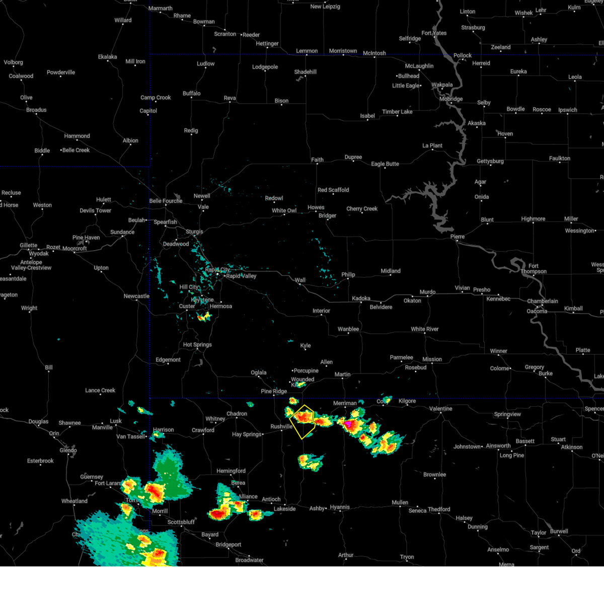
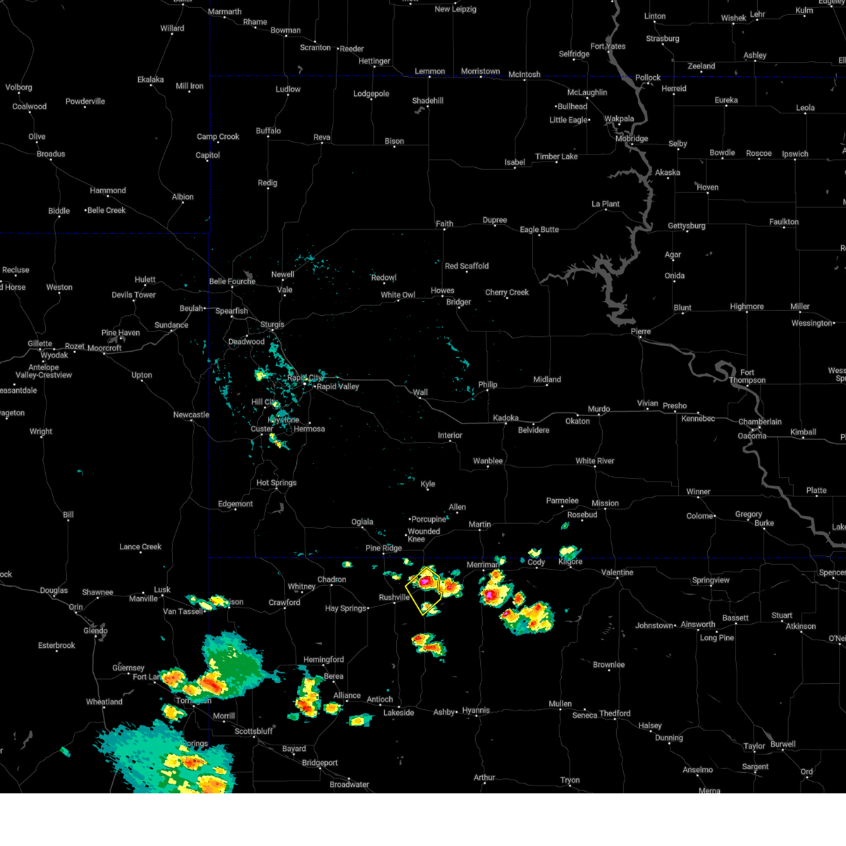
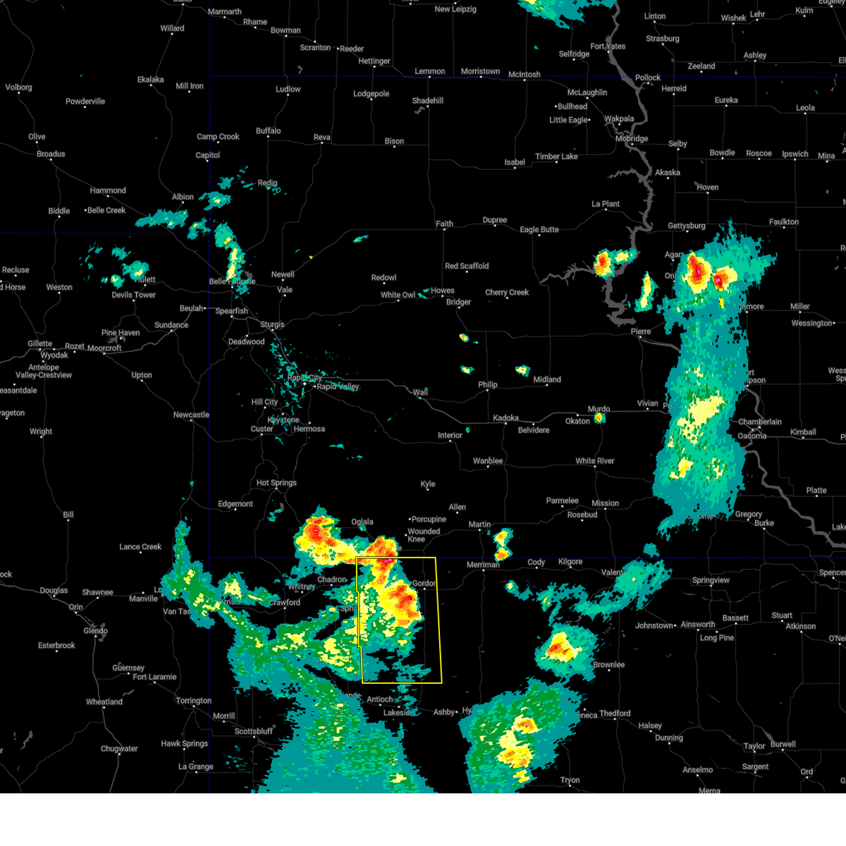
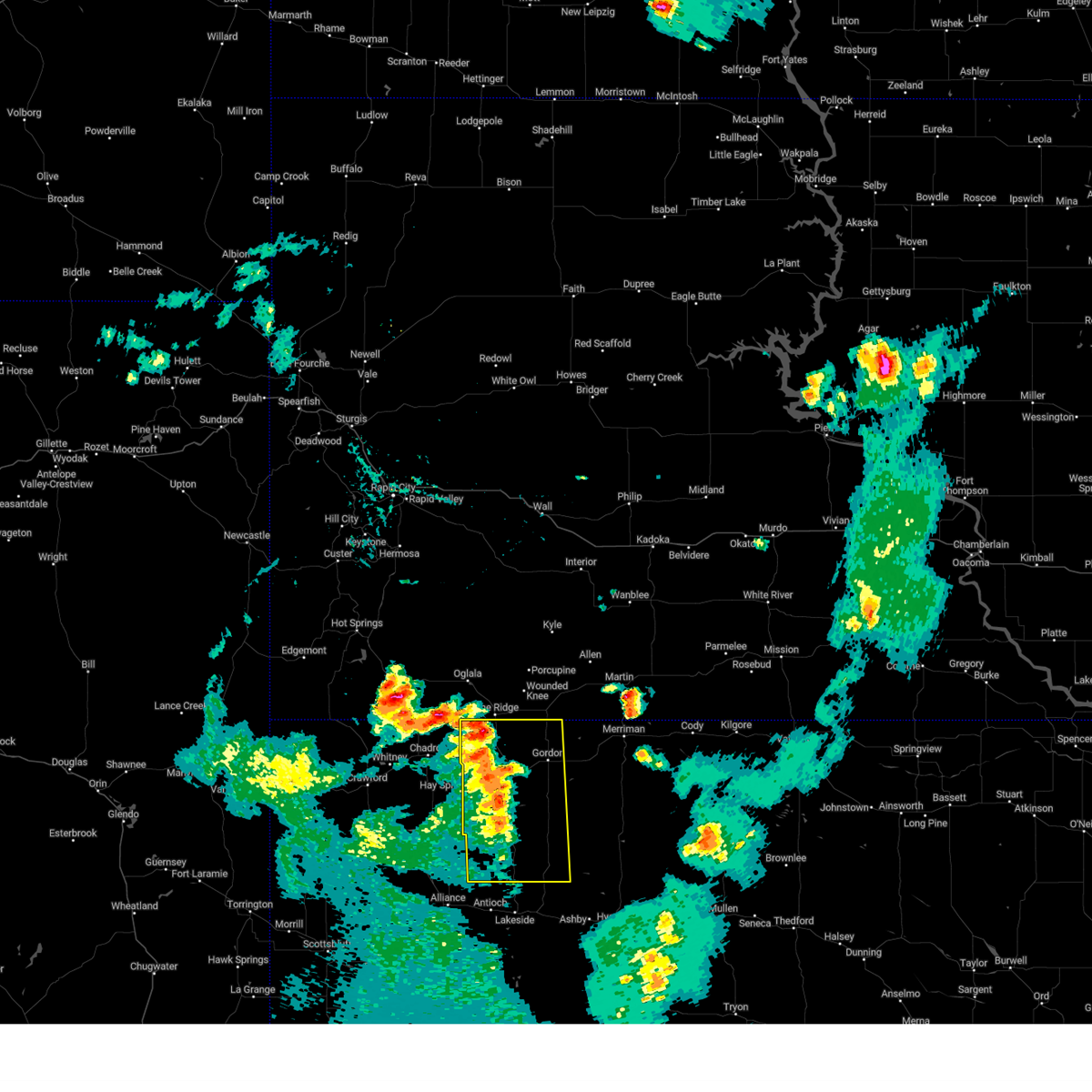
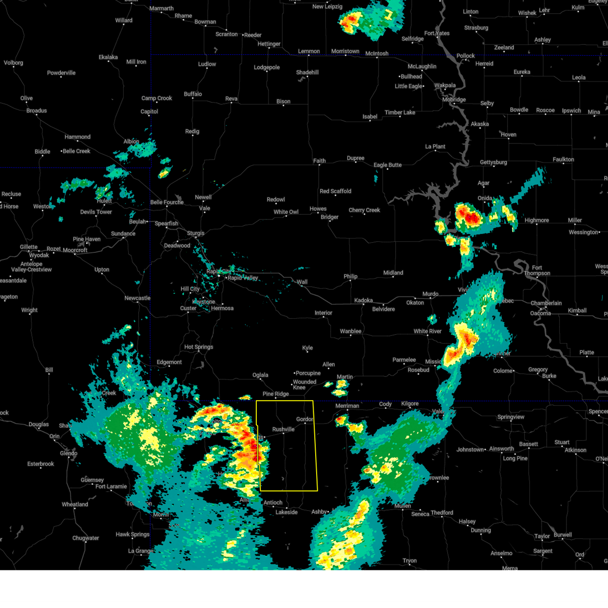
Hail Map for Gordon, NE
The Gordon, NE area has had 94 reports of on-the-ground hail by trained spotters, and has been under severe weather warnings 28 times during the past 12 months. Doppler radar has detected hail at or near Gordon, NE on 111 occasions, including 8 occasions during the past year.
| Name: | Gordon, NE |
| Where Located: | 84.1 miles W of Valentine, NE |
| Map: | Google Map for Gordon, NE |
| Population: | 1612 |
| Housing Units: | 806 |
| More Info: | Search Google for Gordon, NE |
1
The Top Recent Hail Date for Gordon, NE is Thursday, June 4, 2026 (19th out of 111)
Hail and Wind Damage Spotted near Gordon, NE
| Date / Time | Report Details |
|---|---|
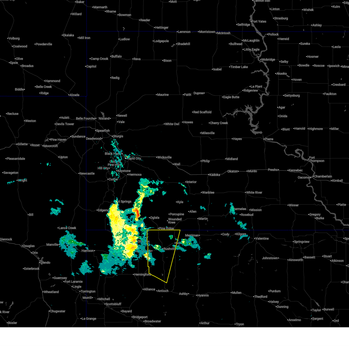
| 7/7/2026 4:48 PM MDT |
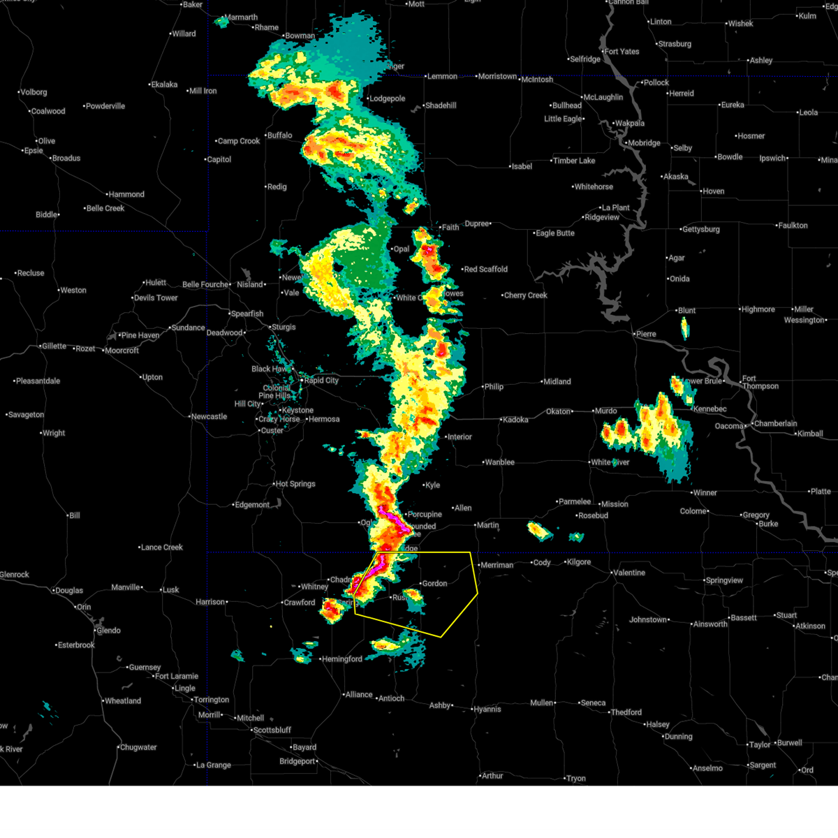
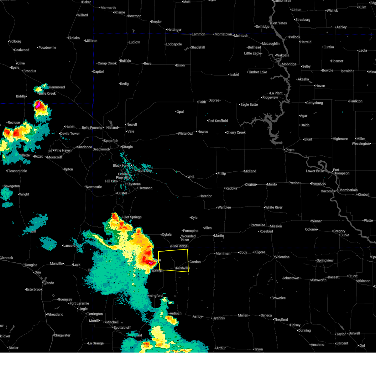
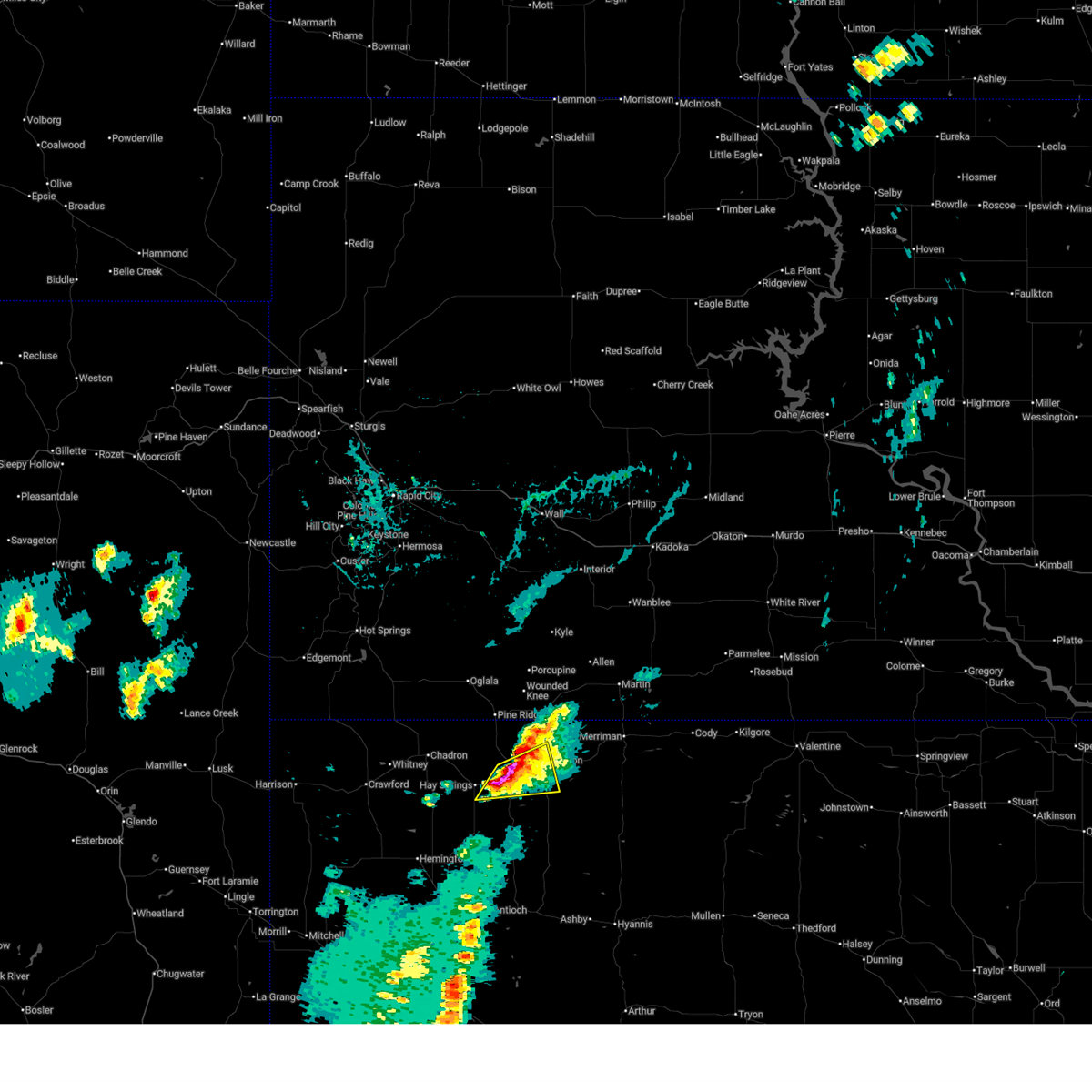 At 448 pm mdt, a severe thunderstorm was located over rushville, moving east at 15 mph (radar indicated). Hazards include ping pong ball size hail and 60 mph wind gusts. People and animals outdoors will be injured. expect hail damage to roofs, siding, windows, and vehicles. expect wind damage to roofs, siding, and trees. locations impacted include, gordon, rushville, clinton, lone butte, walgren lake state recreation area, and intersection of highway 27 and mills road. this includes the following highways, highway 20 between mile markers 84 and 107. Highway 250 between mile markers 43 and 48. At 448 pm mdt, a severe thunderstorm was located over rushville, moving east at 15 mph (radar indicated). Hazards include ping pong ball size hail and 60 mph wind gusts. People and animals outdoors will be injured. expect hail damage to roofs, siding, windows, and vehicles. expect wind damage to roofs, siding, and trees. locations impacted include, gordon, rushville, clinton, lone butte, walgren lake state recreation area, and intersection of highway 27 and mills road. this includes the following highways, highway 20 between mile markers 84 and 107. Highway 250 between mile markers 43 and 48.
|
| 7/7/2026 4:33 PM MDT |
 Svrlbf the national weather service in north platte has issued a * severe thunderstorm warning for, northern sheridan county in the panhandle of nebraska, * until 515 pm mdt. * at 432 pm mdt, a severe thunderstorm was located near rushville, moving east at 30 mph (radar indicated). Hazards include ping pong ball size hail and 60 mph wind gusts. People and animals outdoors will be injured. expect hail damage to roofs, siding, windows, and vehicles. Expect wind damage to roofs, siding, and trees. Svrlbf the national weather service in north platte has issued a * severe thunderstorm warning for, northern sheridan county in the panhandle of nebraska, * until 515 pm mdt. * at 432 pm mdt, a severe thunderstorm was located near rushville, moving east at 30 mph (radar indicated). Hazards include ping pong ball size hail and 60 mph wind gusts. People and animals outdoors will be injured. expect hail damage to roofs, siding, windows, and vehicles. Expect wind damage to roofs, siding, and trees.
|
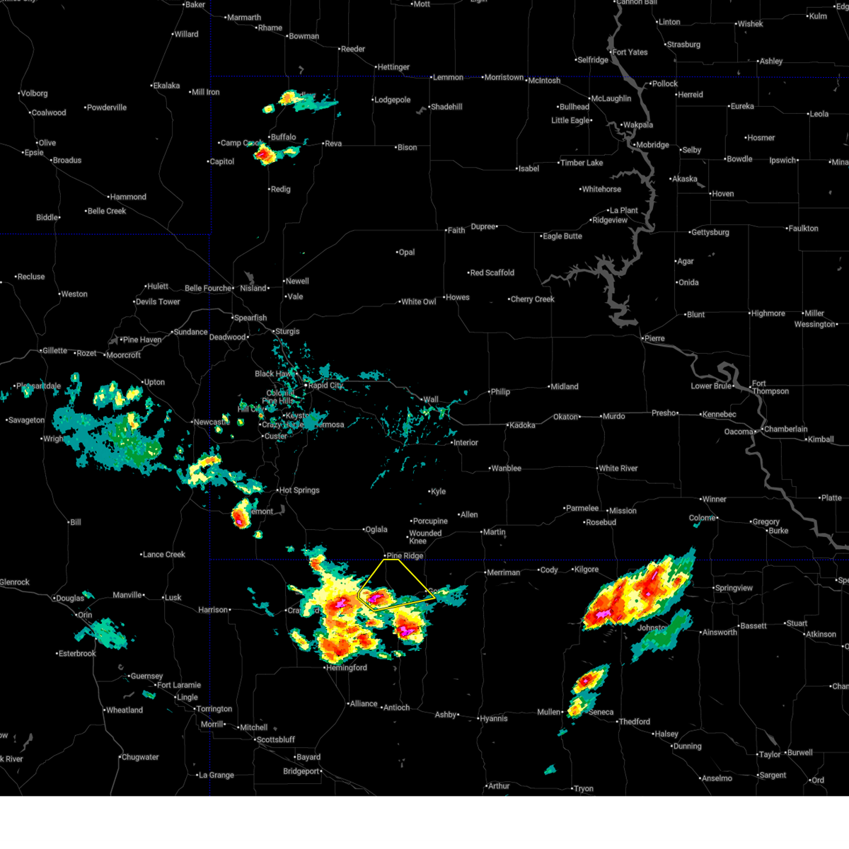
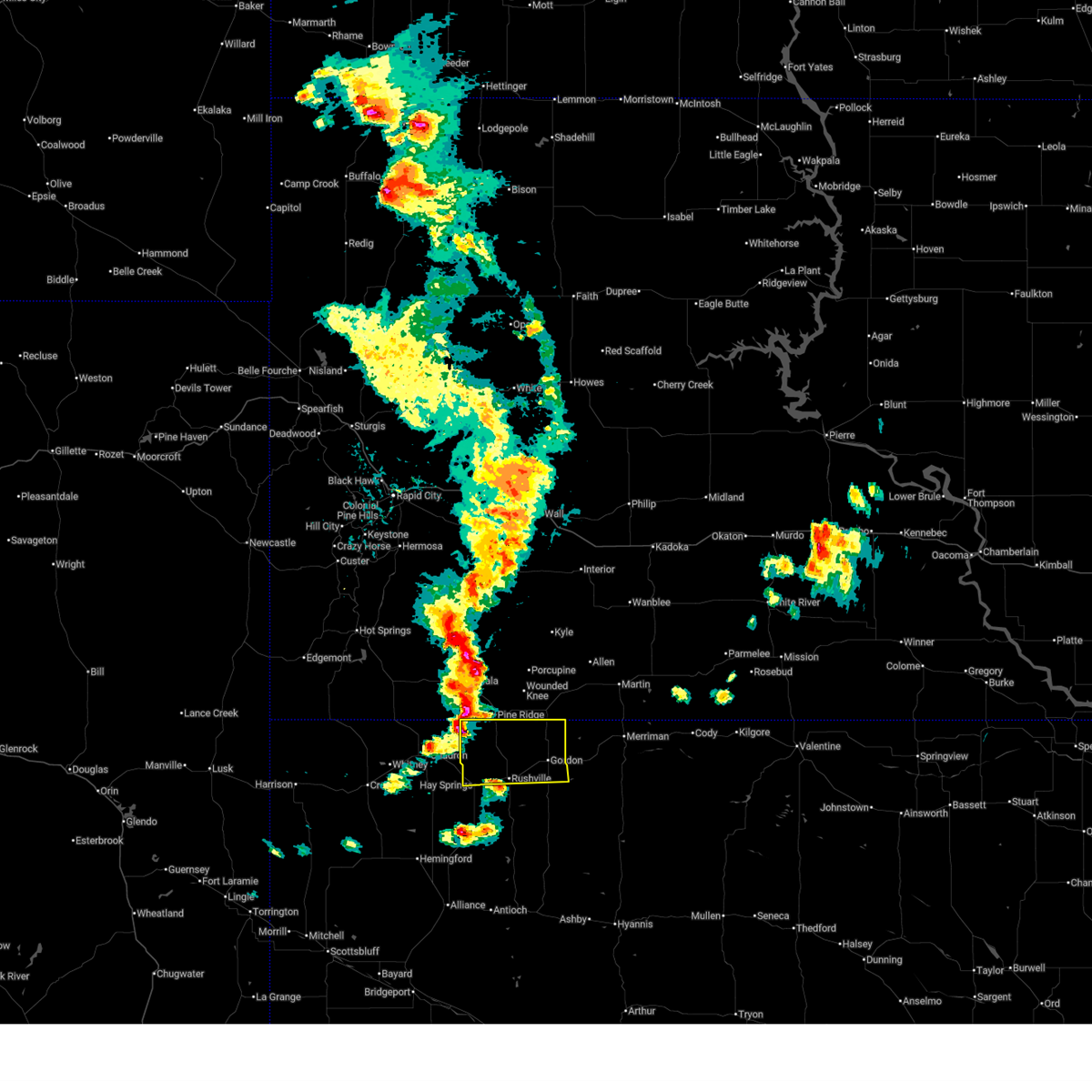
| 7/6/2026 6:44 PM MDT | Multiple medium to large tree limbs broke in sheridan county NE, 13.9 miles NNE of Gordon, NE |
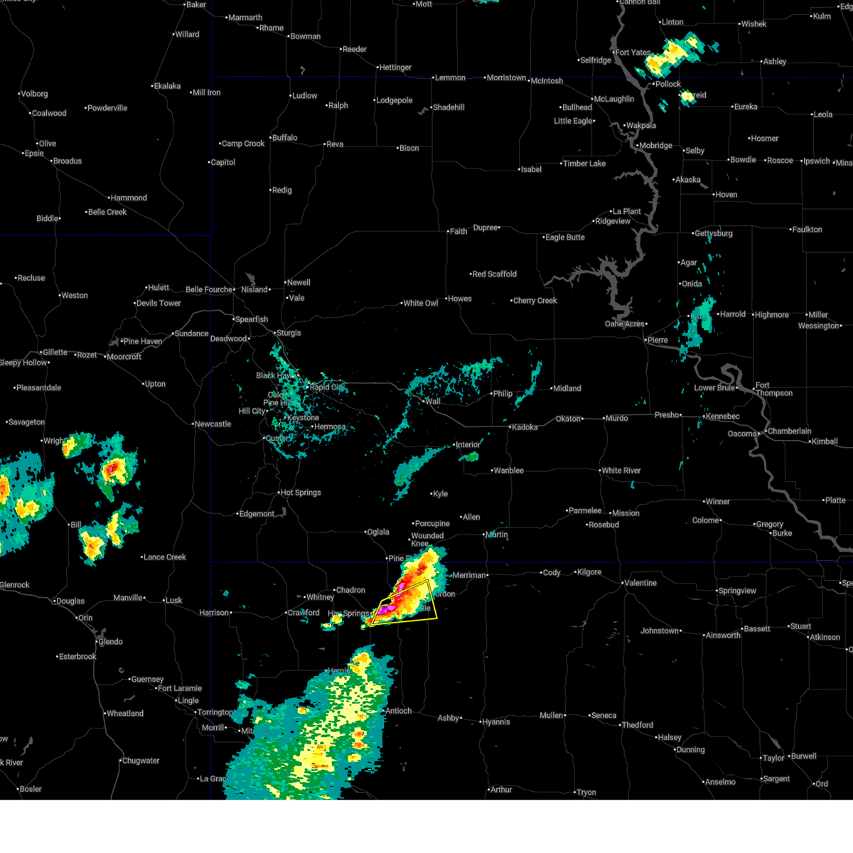
| 7/6/2026 6:43 PM MDT |
 At 643 pm mdt, a severe thunderstorm was located 12 miles southeast of rushville, moving northeast at 15 mph (radar indicated). Hazards include 60 mph wind gusts and quarter size hail. Hail damage to vehicles is expected. expect wind damage to roofs, siding, and trees. locations impacted include, gordon, highway 61 crossing the snake river, morgan lake, billys lake, lone butte, intersection of highway 61 and shadbolt road, highway 27 crossing the niobrara river, smith lake state wildlife management area, highway 250 crossing the niobrara river, rock hill, bayonne, and intersection of highway 27 and mills road. this includes the following highways, highway 20 between mile markers 101 and 118. highway 250 between mile markers 18 and 46. Highway 61 between mile markers 200 and 208. At 643 pm mdt, a severe thunderstorm was located 12 miles southeast of rushville, moving northeast at 15 mph (radar indicated). Hazards include 60 mph wind gusts and quarter size hail. Hail damage to vehicles is expected. expect wind damage to roofs, siding, and trees. locations impacted include, gordon, highway 61 crossing the snake river, morgan lake, billys lake, lone butte, intersection of highway 61 and shadbolt road, highway 27 crossing the niobrara river, smith lake state wildlife management area, highway 250 crossing the niobrara river, rock hill, bayonne, and intersection of highway 27 and mills road. this includes the following highways, highway 20 between mile markers 101 and 118. highway 250 between mile markers 18 and 46. Highway 61 between mile markers 200 and 208.
|
| 7/6/2026 6:09 PM MDT |
 Svrlbf the national weather service in north platte has issued a * severe thunderstorm warning for, west central cherry county in north central nebraska, central sheridan county in the panhandle of nebraska, * until 700 pm mdt. * at 609 pm mdt, a severe thunderstorm was located 14 miles southeast of rushville, moving northeast at 35 mph (radar indicated). Hazards include 60 mph wind gusts and quarter size hail. Hail damage to vehicles is expected. Expect wind damage to roofs, siding, and trees. Svrlbf the national weather service in north platte has issued a * severe thunderstorm warning for, west central cherry county in north central nebraska, central sheridan county in the panhandle of nebraska, * until 700 pm mdt. * at 609 pm mdt, a severe thunderstorm was located 14 miles southeast of rushville, moving northeast at 35 mph (radar indicated). Hazards include 60 mph wind gusts and quarter size hail. Hail damage to vehicles is expected. Expect wind damage to roofs, siding, and trees.
|
| 6/27/2026 8:58 PM MDT | Nebraska mesone in cherry county NE, 27.8 miles WNW of Gordon, NE |
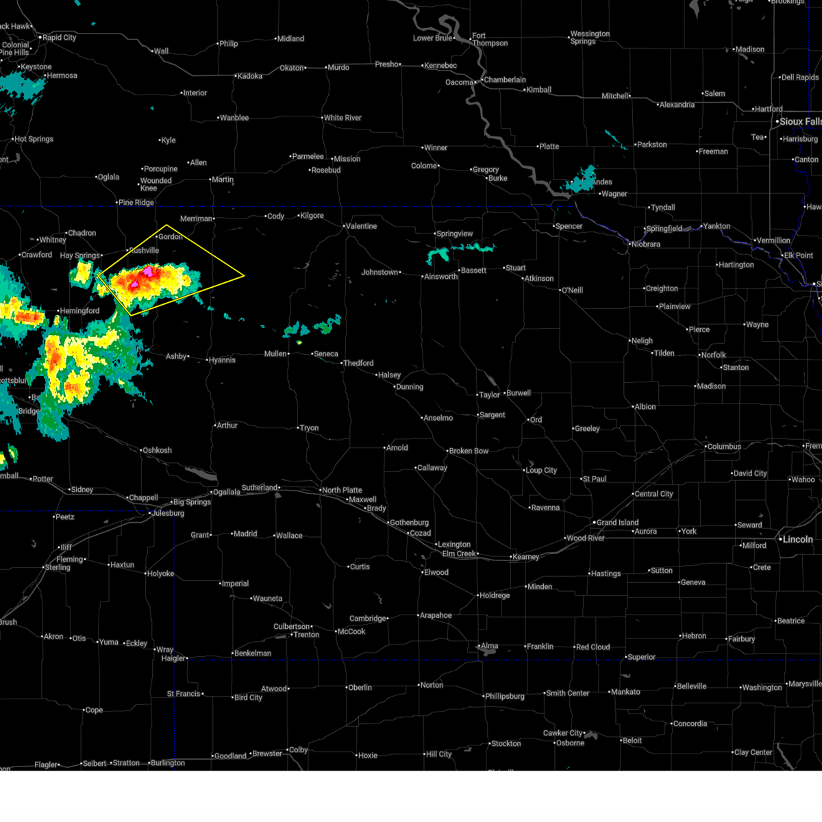
| 6/27/2026 8:15 PM MDT |
 At 815 pm mdt, a severe thunderstorm was located 8 miles southeast of gordon, moving northeast at 35 mph (radar indicated). Hazards include 60 mph wind gusts and quarter size hail. Hail damage to vehicles is expected. expect wind damage to roofs, siding, and trees. locations impacted include, gordon, hoover lake, irwin, intersection of highway 20 and irwin road, shell lake state wildlife management area, rock hill, and bayonne. this includes the following highways, highway 20 between mile markers 106 and 133. Highway 61 between mile markers 229 and 231. At 815 pm mdt, a severe thunderstorm was located 8 miles southeast of gordon, moving northeast at 35 mph (radar indicated). Hazards include 60 mph wind gusts and quarter size hail. Hail damage to vehicles is expected. expect wind damage to roofs, siding, and trees. locations impacted include, gordon, hoover lake, irwin, intersection of highway 20 and irwin road, shell lake state wildlife management area, rock hill, and bayonne. this includes the following highways, highway 20 between mile markers 106 and 133. Highway 61 between mile markers 229 and 231.
|
| 6/27/2026 7:50 PM MDT |
 Svrlbf the national weather service in north platte has issued a * severe thunderstorm warning for, northwestern cherry county in north central nebraska, northeastern sheridan county in the panhandle of nebraska, * until 830 pm mdt. * at 750 pm mdt, a severe thunderstorm was located near gordon, moving northeast at 35 mph (radar indicated). Hazards include 60 mph wind gusts and quarter size hail. Hail damage to vehicles is expected. Expect wind damage to roofs, siding, and trees. Svrlbf the national weather service in north platte has issued a * severe thunderstorm warning for, northwestern cherry county in north central nebraska, northeastern sheridan county in the panhandle of nebraska, * until 830 pm mdt. * at 750 pm mdt, a severe thunderstorm was located near gordon, moving northeast at 35 mph (radar indicated). Hazards include 60 mph wind gusts and quarter size hail. Hail damage to vehicles is expected. Expect wind damage to roofs, siding, and trees.
|
| 6/22/2026 10:32 PM MDT |
 At 1032 pm mdt, a severe thunderstorm was located 7 miles northeast of gordon, moving southeast at 55 mph (radar indicated). Hazards include ping pong ball size hail and 60 mph wind gusts. People and animals outdoors will be injured. expect hail damage to roofs, siding, windows, and vehicles. expect wind damage to roofs, siding, and trees. locations impacted include, gordon, merriman, hoover lake, irwin, highway 27 crossing the niobrara river, intersection of highway 20 and irwin road, shell lake state wildlife management area, rock hill, bayonne, and intersection of highway 27 and mills road. this includes the following highways, highway 20 between mile markers 99 and 146. Highway 61 between mile markers 218 and 231. At 1032 pm mdt, a severe thunderstorm was located 7 miles northeast of gordon, moving southeast at 55 mph (radar indicated). Hazards include ping pong ball size hail and 60 mph wind gusts. People and animals outdoors will be injured. expect hail damage to roofs, siding, windows, and vehicles. expect wind damage to roofs, siding, and trees. locations impacted include, gordon, merriman, hoover lake, irwin, highway 27 crossing the niobrara river, intersection of highway 20 and irwin road, shell lake state wildlife management area, rock hill, bayonne, and intersection of highway 27 and mills road. this includes the following highways, highway 20 between mile markers 99 and 146. Highway 61 between mile markers 218 and 231.
|
| 6/22/2026 10:06 PM MDT |
 Svrlbf the national weather service in north platte has issued a * severe thunderstorm warning for, northwestern cherry county in north central nebraska, northern sheridan county in the panhandle of nebraska, * until 1045 pm mdt. * at 1005 pm mdt, a severe thunderstorm was located near calico, or near pine ridge, moving southeast at 65 mph (radar indicated). Hazards include ping pong ball size hail and 60 mph wind gusts. People and animals outdoors will be injured. expect hail damage to roofs, siding, windows, and vehicles. Expect wind damage to roofs, siding, and trees. Svrlbf the national weather service in north platte has issued a * severe thunderstorm warning for, northwestern cherry county in north central nebraska, northern sheridan county in the panhandle of nebraska, * until 1045 pm mdt. * at 1005 pm mdt, a severe thunderstorm was located near calico, or near pine ridge, moving southeast at 65 mph (radar indicated). Hazards include ping pong ball size hail and 60 mph wind gusts. People and animals outdoors will be injured. expect hail damage to roofs, siding, windows, and vehicles. Expect wind damage to roofs, siding, and trees.
|
| 5/3/2026 6:11 PM MDT |
 The storms which prompted the warning have weakened below severe limits, and no longer pose an immediate threat to life or property. therefore, the warning will be allowed to expire. however, gusty winds are still possible with these thunderstorms. The storms which prompted the warning have weakened below severe limits, and no longer pose an immediate threat to life or property. therefore, the warning will be allowed to expire. however, gusty winds are still possible with these thunderstorms.
|
| 5/3/2026 5:43 PM MDT |
 At 543 pm mdt, severe thunderstorms were located along a line extending from 8 miles southwest of wakpamni to 19 miles north of antioch, moving east at 35 mph (radar indicated). Hazards include 60 mph wind gusts. Expect damage to roofs, siding, and trees. locations impacted include, gordon, rushville, clinton, watson lake, big hill, morgan lake, billys lake, lone butte, irwin, highway 27 crossing the niobrara river, smith lake state wildlife management area, highway 250 crossing the niobrara river, mount maria, intersection of highway 20 and irwin road, shell lake state wildlife management area, rock hill, bayonne, intersection of highway 27 and mills road, hoover lake, and diamond lake. this includes the following highways, highway 20 between mile markers 88 and 133. highway 250 between mile markers 12 and 48. Highway 61 near mile marker 230. At 543 pm mdt, severe thunderstorms were located along a line extending from 8 miles southwest of wakpamni to 19 miles north of antioch, moving east at 35 mph (radar indicated). Hazards include 60 mph wind gusts. Expect damage to roofs, siding, and trees. locations impacted include, gordon, rushville, clinton, watson lake, big hill, morgan lake, billys lake, lone butte, irwin, highway 27 crossing the niobrara river, smith lake state wildlife management area, highway 250 crossing the niobrara river, mount maria, intersection of highway 20 and irwin road, shell lake state wildlife management area, rock hill, bayonne, intersection of highway 27 and mills road, hoover lake, and diamond lake. this includes the following highways, highway 20 between mile markers 88 and 133. highway 250 between mile markers 12 and 48. Highway 61 near mile marker 230.
|
| 5/3/2026 5:26 PM MDT |
 Svrlbf the national weather service in north platte has issued a * severe thunderstorm warning for, northwestern cherry county in north central nebraska, sheridan county in the panhandle of nebraska, * until 615 pm mdt. * at 525 pm mdt, severe thunderstorms were located along a line extending from near wolf creek housing to 18 miles east of hemingford, moving east at 35 mph (radar indicated). Hazards include 60 mph wind gusts. expect damage to roofs, siding, and trees Svrlbf the national weather service in north platte has issued a * severe thunderstorm warning for, northwestern cherry county in north central nebraska, sheridan county in the panhandle of nebraska, * until 615 pm mdt. * at 525 pm mdt, severe thunderstorms were located along a line extending from near wolf creek housing to 18 miles east of hemingford, moving east at 35 mph (radar indicated). Hazards include 60 mph wind gusts. expect damage to roofs, siding, and trees
|
| 5/3/2026 5:15 PM MDT |
 At 515 pm mdt, severe thunderstorms were located along a line extending from 6 miles southwest of white clay to 14 miles south of hay springs, moving east at 40 mph (radar indicated). Hazards include 60 mph wind gusts. Expect damage to roofs, siding, and trees. locations impacted include, gordon, rushville, hay springs, white clay, clinton, intersection of highway 87 and craven creek road, lone butte, intersection of beaver creek road and white clay creek road, intersection of highway 87 and larabee road, smith lake state wildlife management area, highway 250 crossing the niobrara river, walgren lake state recreation area, mount maria, intersection of highway 27 and mills road, pine ridge, diamond lake, metcalf state wildlife management area, and intersection of highway 87 and antelope road. this includes the following highways, highway 20 between mile markers 74 and 107. Highway 250 between mile markers 13 and 48. At 515 pm mdt, severe thunderstorms were located along a line extending from 6 miles southwest of white clay to 14 miles south of hay springs, moving east at 40 mph (radar indicated). Hazards include 60 mph wind gusts. Expect damage to roofs, siding, and trees. locations impacted include, gordon, rushville, hay springs, white clay, clinton, intersection of highway 87 and craven creek road, lone butte, intersection of beaver creek road and white clay creek road, intersection of highway 87 and larabee road, smith lake state wildlife management area, highway 250 crossing the niobrara river, walgren lake state recreation area, mount maria, intersection of highway 27 and mills road, pine ridge, diamond lake, metcalf state wildlife management area, and intersection of highway 87 and antelope road. this includes the following highways, highway 20 between mile markers 74 and 107. Highway 250 between mile markers 13 and 48.
|
| 5/3/2026 4:51 PM MDT |
 Svrlbf the national weather service in north platte has issued a * severe thunderstorm warning for, sheridan county in the panhandle of nebraska, * until 530 pm mdt. * at 450 pm mdt, severe thunderstorms were located along a line extending from 6 miles south of slim butte to 7 miles north of box butte reservoir, moving southeast at 40 mph (radar indicated). Hazards include 60 mph wind gusts. expect damage to roofs, siding, and trees Svrlbf the national weather service in north platte has issued a * severe thunderstorm warning for, sheridan county in the panhandle of nebraska, * until 530 pm mdt. * at 450 pm mdt, severe thunderstorms were located along a line extending from 6 miles south of slim butte to 7 miles north of box butte reservoir, moving southeast at 40 mph (radar indicated). Hazards include 60 mph wind gusts. expect damage to roofs, siding, and trees
|
| 10/4/2025 6:35 PM MDT | Svrlbf the national weather service in north platte has issued a * severe thunderstorm warning for, northwestern cherry county in north central nebraska, northeastern sheridan county in the panhandle of nebraska, * until 700 pm mdt. * at 634 pm mdt, severe thunderstorms were located along a line extending from 8 miles southwest of wakpamni to 14 miles southeast of gordon, moving east at 55 mph (radar indicated). Hazards include 70 mph wind gusts and nickel size hail. Expect considerable tree damage. Damage is likely to mobile homes, roofs, and outbuildings. |
| 10/4/2025 6:27 PM MDT | Svrlbf the national weather service in north platte has issued a * severe thunderstorm warning for, northwestern cherry county in north central nebraska, northeastern sheridan county in the panhandle of nebraska, * until 700 pm mdt. * at 626 pm mdt, severe thunderstorms were located along a line extending from 9 miles northwest of gordon to 21 miles east of rushville, moving northeast at 55 mph (radar indicated). Hazards include 60 mph wind gusts and nickel size hail. expect damage to roofs, siding, and trees |
| 10/4/2025 6:06 PM MDT | At 605 pm mdt, severe thunderstorms were located along a line extending from near hay springs to 20 miles southeast of rushville, moving northeast at 50 mph (radar indicated). Hazards include 70 mph wind gusts and nickel size hail. Expect considerable tree damage. damage is likely to mobile homes, roofs, and outbuildings. locations impacted include, gordon, rushville, hay springs, white clay, clinton. this includes the following highways, highway 20 between mile markers 78 and 111. Highway 250 between mile markers 27 and 48. |
| 10/4/2025 5:51 PM MDT | At 550 pm mdt, a severe thunderstorm was located 15 miles southeast of hay springs, moving northeast at 60 mph (radar indicated). Hazards include 70 mph wind gusts and nickel size hail. Expect considerable tree damage. damage is likely to mobile homes, roofs, and outbuildings. locations impacted include, gordon, rushville, hay springs, white clay, clinton. this includes the following highways, highway 20 between mile markers 74 and 111. Highway 250 between mile markers 23 and 48. |
| 10/4/2025 5:40 PM MDT | Svrlbf the national weather service in north platte has issued a * severe thunderstorm warning for, central sheridan county in the panhandle of nebraska, * until 630 pm mdt. * at 540 pm mdt, a severe thunderstorm was located 19 miles northeast of berea, or 21 miles northeast of alliance, moving northeast at 60 mph (radar indicated). Hazards include 60 mph wind gusts and nickel size hail. Expect damage to roofs, siding, and trees. this severe thunderstorm will be near, gordon around 615 pm mdt. other locations impacted by this severe thunderstorm include intersection of highway 87 and craven creek road, billys lake, lone butte, intersection of beaver creek road and white clay creek road, intersection of highway 87 and larabee road, highway 27 crossing the niobrara river, smith lake state wildlife management area, mount maria, highway 250 crossing the niobrara river, and walgren lake state recreation area. this includes the following highways, highway 20 between mile markers 74 and 111. Highway 250 between mile markers 21 and 48. |
| 8/17/2025 6:29 PM MDT |
 Svrlbf the national weather service in north platte has issued a * severe thunderstorm warning for, northern sheridan county in the panhandle of nebraska, * until 715 pm mdt. * at 629 pm mdt, a severe thunderstorm was located 7 miles northeast of hay springs, moving northeast at 20 mph (radar indicated). Hazards include ping pong ball size hail and 60 mph wind gusts. People and animals outdoors will be injured. expect hail damage to roofs, siding, windows, and vehicles. Expect wind damage to roofs, siding, and trees. Svrlbf the national weather service in north platte has issued a * severe thunderstorm warning for, northern sheridan county in the panhandle of nebraska, * until 715 pm mdt. * at 629 pm mdt, a severe thunderstorm was located 7 miles northeast of hay springs, moving northeast at 20 mph (radar indicated). Hazards include ping pong ball size hail and 60 mph wind gusts. People and animals outdoors will be injured. expect hail damage to roofs, siding, windows, and vehicles. Expect wind damage to roofs, siding, and trees.
|
| 8/13/2025 6:55 PM MDT |
 Svrlbf the national weather service in north platte has issued a * severe thunderstorm warning for, northwestern cherry county in north central nebraska, northern sheridan county in the panhandle of nebraska, * until 900 pm cdt/800 pm mdt/. * at 755 pm cdt/655 pm mdt/, severe thunderstorms were located along a line extending from 9 miles northwest of merriman to 6 miles south of rushville, moving east at 35 mph (radar indicated). Hazards include 60 mph wind gusts and quarter size hail. Hail damage to vehicles is expected. Expect wind damage to roofs, siding, and trees. Svrlbf the national weather service in north platte has issued a * severe thunderstorm warning for, northwestern cherry county in north central nebraska, northern sheridan county in the panhandle of nebraska, * until 900 pm cdt/800 pm mdt/. * at 755 pm cdt/655 pm mdt/, severe thunderstorms were located along a line extending from 9 miles northwest of merriman to 6 miles south of rushville, moving east at 35 mph (radar indicated). Hazards include 60 mph wind gusts and quarter size hail. Hail damage to vehicles is expected. Expect wind damage to roofs, siding, and trees.
|
| 8/13/2025 6:47 PM MDT |
 At 646 pm mdt, severe thunderstorms were located along a line extending from swett to 9 miles southeast of wakpamni to 6 miles south of rushville, moving east at 30 mph (radar indicated). Hazards include 60 mph wind gusts and penny size hail. Expect damage to roofs, siding, and trees. locations impacted include, gordon, rushville, hay springs, clinton, lone butte, irwin, walgren lake state recreation area, shell lake state wildlife management area, rock hill, bayonne, and hoover lake. this includes the following highways, highway 20 between mile markers 79 and 132. highway 250 between mile markers 37 and 48. Highway 61 between mile markers 212 and 213. At 646 pm mdt, severe thunderstorms were located along a line extending from swett to 9 miles southeast of wakpamni to 6 miles south of rushville, moving east at 30 mph (radar indicated). Hazards include 60 mph wind gusts and penny size hail. Expect damage to roofs, siding, and trees. locations impacted include, gordon, rushville, hay springs, clinton, lone butte, irwin, walgren lake state recreation area, shell lake state wildlife management area, rock hill, bayonne, and hoover lake. this includes the following highways, highway 20 between mile markers 79 and 132. highway 250 between mile markers 37 and 48. Highway 61 between mile markers 212 and 213.
|
| 8/13/2025 6:25 PM MDT |
 Svrlbf the national weather service in north platte has issued a * severe thunderstorm warning for, northwestern cherry county in north central nebraska, northern sheridan county in the panhandle of nebraska, * until 730 pm mdt. * at 624 pm mdt, severe thunderstorms were located along a line extending from near porcupine butte housing to 8 miles southeast of wolf creek housing to near hay springs, moving southeast at 35 mph (radar indicated). Hazards include 60 mph wind gusts and penny size hail. expect damage to roofs, siding, and trees Svrlbf the national weather service in north platte has issued a * severe thunderstorm warning for, northwestern cherry county in north central nebraska, northern sheridan county in the panhandle of nebraska, * until 730 pm mdt. * at 624 pm mdt, severe thunderstorms were located along a line extending from near porcupine butte housing to 8 miles southeast of wolf creek housing to near hay springs, moving southeast at 35 mph (radar indicated). Hazards include 60 mph wind gusts and penny size hail. expect damage to roofs, siding, and trees
|
| 8/13/2025 6:04 PM MDT |
 At 603 pm mdt, severe thunderstorms were located along a line extending from near rockyford to pine ridge to 10 miles north of hay springs, moving east at 45 mph (radar indicated). Hazards include 60 mph wind gusts and nickel size hail. Expect damage to roofs, siding, and trees. these severe storms will be near, gordon around 635 pm mdt. other locations impacted by these severe thunderstorms include pine ridge, hoover lake, metcalf state wildlife management area, lone butte, mount maria, and clinton. this includes the following highways, highway 20 between mile markers 74 and 78, and between mile markers 81 and 111. Highway 250 between mile markers 47 and 48. At 603 pm mdt, severe thunderstorms were located along a line extending from near rockyford to pine ridge to 10 miles north of hay springs, moving east at 45 mph (radar indicated). Hazards include 60 mph wind gusts and nickel size hail. Expect damage to roofs, siding, and trees. these severe storms will be near, gordon around 635 pm mdt. other locations impacted by these severe thunderstorms include pine ridge, hoover lake, metcalf state wildlife management area, lone butte, mount maria, and clinton. this includes the following highways, highway 20 between mile markers 74 and 78, and between mile markers 81 and 111. Highway 250 between mile markers 47 and 48.
|
| 8/13/2025 5:47 PM MDT |
 Svrlbf the national weather service in north platte has issued a * severe thunderstorm warning for, northern sheridan county in the panhandle of nebraska, * until 630 pm mdt. * at 545 pm mdt, severe thunderstorms were located along a line extending from 7 miles east of intersection of red shirt and cuny table roads to slim buttes housing to near chadron, moving east at 40 mph (radar indicated). Hazards include 60 mph wind gusts and penny size hail. Expect damage to roofs, siding, and trees. severe thunderstorms will be near, white clay around 555 pm mdt. other locations impacted by these severe thunderstorms include pine ridge, hoover lake, metcalf state wildlife management area, lone butte, mount maria, and clinton. this includes the following highways, highway 20 between mile markers 74 and 78, and between mile markers 81 and 111. Highway 250 between mile markers 47 and 48. Svrlbf the national weather service in north platte has issued a * severe thunderstorm warning for, northern sheridan county in the panhandle of nebraska, * until 630 pm mdt. * at 545 pm mdt, severe thunderstorms were located along a line extending from 7 miles east of intersection of red shirt and cuny table roads to slim buttes housing to near chadron, moving east at 40 mph (radar indicated). Hazards include 60 mph wind gusts and penny size hail. Expect damage to roofs, siding, and trees. severe thunderstorms will be near, white clay around 555 pm mdt. other locations impacted by these severe thunderstorms include pine ridge, hoover lake, metcalf state wildlife management area, lone butte, mount maria, and clinton. this includes the following highways, highway 20 between mile markers 74 and 78, and between mile markers 81 and 111. Highway 250 between mile markers 47 and 48.
|
| 7/26/2025 6:01 PM MDT |
 At 600 pm mdt, a severe thunderstorm was located 15 miles southeast of gordon, moving east at 35 mph (radar indicated). Hazards include 60 mph wind gusts and penny size hail. Expect damage to roofs, siding, and trees. locations impacted include, gordon, merriman, highway 61 crossing the snake river, morgan lake, highway 61 crossing the niobrara river, irwin, intersection of highway 61 and shadbolt road, highway 27 crossing the niobrara river, intersection of highway 20 and irwin road, rock hill, bayonne, and intersection of highway 27 and mills road. this includes the following highways, highway 20 between mile markers 106 and 139. Highway 61 between mile markers 193 and 230. At 600 pm mdt, a severe thunderstorm was located 15 miles southeast of gordon, moving east at 35 mph (radar indicated). Hazards include 60 mph wind gusts and penny size hail. Expect damage to roofs, siding, and trees. locations impacted include, gordon, merriman, highway 61 crossing the snake river, morgan lake, highway 61 crossing the niobrara river, irwin, intersection of highway 61 and shadbolt road, highway 27 crossing the niobrara river, intersection of highway 20 and irwin road, rock hill, bayonne, and intersection of highway 27 and mills road. this includes the following highways, highway 20 between mile markers 106 and 139. Highway 61 between mile markers 193 and 230.
|
| 7/26/2025 5:44 PM MDT |
 Svrlbf the national weather service in north platte has issued a * severe thunderstorm warning for, northwestern cherry county in north central nebraska, northeastern sheridan county in the panhandle of nebraska, * until 630 pm mdt. * at 544 pm mdt, a severe thunderstorm was located 7 miles southeast of gordon, moving east at 35 mph (radar indicated). Hazards include 60 mph wind gusts and nickel size hail. expect damage to roofs, siding, and trees Svrlbf the national weather service in north platte has issued a * severe thunderstorm warning for, northwestern cherry county in north central nebraska, northeastern sheridan county in the panhandle of nebraska, * until 630 pm mdt. * at 544 pm mdt, a severe thunderstorm was located 7 miles southeast of gordon, moving east at 35 mph (radar indicated). Hazards include 60 mph wind gusts and nickel size hail. expect damage to roofs, siding, and trees
|
| 7/26/2025 5:13 PM MDT |
 At 513 pm mdt, a severe thunderstorm was located over rushville, moving southeast at 25 mph (radar indicated). Hazards include golf ball size hail and 60 mph wind gusts. People and animals outdoors will be injured. expect hail damage to roofs, siding, windows, and vehicles. expect wind damage to roofs, siding, and trees. locations impacted include, gordon, rushville, clinton, lone butte, highway 27 crossing the niobrara river, smith lake state wildlife management area, mount maria, highway 250 crossing the niobrara river, walgren lake state recreation area, and intersection of highway 27 and mills road. this includes the following highways, highway 20 between mile markers 83 and 111. Highway 250 between mile markers 22 and 48. At 513 pm mdt, a severe thunderstorm was located over rushville, moving southeast at 25 mph (radar indicated). Hazards include golf ball size hail and 60 mph wind gusts. People and animals outdoors will be injured. expect hail damage to roofs, siding, windows, and vehicles. expect wind damage to roofs, siding, and trees. locations impacted include, gordon, rushville, clinton, lone butte, highway 27 crossing the niobrara river, smith lake state wildlife management area, mount maria, highway 250 crossing the niobrara river, walgren lake state recreation area, and intersection of highway 27 and mills road. this includes the following highways, highway 20 between mile markers 83 and 111. Highway 250 between mile markers 22 and 48.
|
| 7/26/2025 4:59 PM MDT |
 Svrlbf the national weather service in north platte has issued a * severe thunderstorm warning for, central sheridan county in the panhandle of nebraska, * until 545 pm mdt. * at 459 pm mdt, severe thunderstorms were located along a line extending from 8 miles northwest of gordon to 8 miles southeast of hay springs, moving east at 30 mph (radar indicated). Hazards include 60 mph wind gusts and penny size hail. expect damage to roofs, siding, and trees Svrlbf the national weather service in north platte has issued a * severe thunderstorm warning for, central sheridan county in the panhandle of nebraska, * until 545 pm mdt. * at 459 pm mdt, severe thunderstorms were located along a line extending from 8 miles northwest of gordon to 8 miles southeast of hay springs, moving east at 30 mph (radar indicated). Hazards include 60 mph wind gusts and penny size hail. expect damage to roofs, siding, and trees
|
| 7/1/2025 8:12 PM MDT |
 The storms which prompted the warning have weakened below severe limits, and no longer pose an immediate threat to life or property. therefore, the warning will be allowed to expire. a severe thunderstorm watch remains in effect until 1100 pm mdt for the panhandle of and north central nebraska. The storms which prompted the warning have weakened below severe limits, and no longer pose an immediate threat to life or property. therefore, the warning will be allowed to expire. a severe thunderstorm watch remains in effect until 1100 pm mdt for the panhandle of and north central nebraska.
|
| 7/1/2025 7:56 PM MDT |
 At 755 pm mdt, severe thunderstorms were located along a line extending from lacreek wildlife refuge to 14 miles east of gordon to near hay springs, moving southeast at 25 mph (radar indicated). Hazards include 60 mph wind gusts and quarter size hail. Hail damage to vehicles is expected. expect wind damage to roofs, siding, and trees. locations impacted include, gordon, rushville, hay springs, merriman, clinton, intersection of highway 87 and craven creek road, lone butte, irwin, intersection of beaver creek road and white clay creek road, intersection of highway 87 and larabee road, rock hill, pine ridge, hoover lake, metcalf state wildlife management area, highway 27 crossing the niobrara river, mount maria, intersection of highway 20 and irwin road, highway 250 crossing the niobrara river, walgren lake state recreation area, and shell lake state wildlife management area. this includes the following highways, highway 20 between mile markers 74 and 148. highway 250 between mile markers 34 and 48. Highway 61 between mile markers 205 and 231. At 755 pm mdt, severe thunderstorms were located along a line extending from lacreek wildlife refuge to 14 miles east of gordon to near hay springs, moving southeast at 25 mph (radar indicated). Hazards include 60 mph wind gusts and quarter size hail. Hail damage to vehicles is expected. expect wind damage to roofs, siding, and trees. locations impacted include, gordon, rushville, hay springs, merriman, clinton, intersection of highway 87 and craven creek road, lone butte, irwin, intersection of beaver creek road and white clay creek road, intersection of highway 87 and larabee road, rock hill, pine ridge, hoover lake, metcalf state wildlife management area, highway 27 crossing the niobrara river, mount maria, intersection of highway 20 and irwin road, highway 250 crossing the niobrara river, walgren lake state recreation area, and shell lake state wildlife management area. this includes the following highways, highway 20 between mile markers 74 and 148. highway 250 between mile markers 34 and 48. Highway 61 between mile markers 205 and 231.
|
| 7/1/2025 7:25 PM MDT |
 Svrlbf the national weather service in north platte has issued a * severe thunderstorm warning for, northwestern cherry county in north central nebraska, northern sheridan county in the panhandle of nebraska, * until 815 pm mdt. * at 725 pm mdt, severe thunderstorms were located along a line extending from near lacreek north housing to 8 miles southeast of wakpamni to 10 miles northeast of chadron, moving south at 30 mph (radar indicated). Hazards include 70 mph wind gusts and half dollar size hail. Hail damage to vehicles is expected. expect considerable tree damage. Wind damage is also likely to mobile homes, roofs, and outbuildings. Svrlbf the national weather service in north platte has issued a * severe thunderstorm warning for, northwestern cherry county in north central nebraska, northern sheridan county in the panhandle of nebraska, * until 815 pm mdt. * at 725 pm mdt, severe thunderstorms were located along a line extending from near lacreek north housing to 8 miles southeast of wakpamni to 10 miles northeast of chadron, moving south at 30 mph (radar indicated). Hazards include 70 mph wind gusts and half dollar size hail. Hail damage to vehicles is expected. expect considerable tree damage. Wind damage is also likely to mobile homes, roofs, and outbuildings.
|
| 7/1/2025 7:10 PM MDT |
 At 709 pm mdt, severe thunderstorms were located along a line extending from near swett to 8 miles south of slim butte, moving south at 20 mph (radar indicated). Hazards include 70 mph wind gusts and ping pong ball size hail. People and animals outdoors will be injured. expect hail damage to roofs, siding, windows, and vehicles. expect considerable tree damage. wind damage is also likely to mobile homes, roofs, and outbuildings. locations impacted include, gordon, rushville, hay springs, merriman, white clay, clinton, intersection of highway 87 and craven creek road, irwin, intersection of beaver creek road and white clay creek road, intersection of highway 87 and larabee road, mount maria, shell lake state wildlife management area, pine ridge, hoover lake, and metcalf state wildlife management area. this includes the following highways, highway 20 between mile markers 74 and 111, and between mile markers 126 and 138. highway 250 near mile marker 48. Highway 61 between mile markers 226 and 231. At 709 pm mdt, severe thunderstorms were located along a line extending from near swett to 8 miles south of slim butte, moving south at 20 mph (radar indicated). Hazards include 70 mph wind gusts and ping pong ball size hail. People and animals outdoors will be injured. expect hail damage to roofs, siding, windows, and vehicles. expect considerable tree damage. wind damage is also likely to mobile homes, roofs, and outbuildings. locations impacted include, gordon, rushville, hay springs, merriman, white clay, clinton, intersection of highway 87 and craven creek road, irwin, intersection of beaver creek road and white clay creek road, intersection of highway 87 and larabee road, mount maria, shell lake state wildlife management area, pine ridge, hoover lake, and metcalf state wildlife management area. this includes the following highways, highway 20 between mile markers 74 and 111, and between mile markers 126 and 138. highway 250 near mile marker 48. Highway 61 between mile markers 226 and 231.
|
| 7/1/2025 6:49 PM MDT |
 Svrlbf the national weather service in north platte has issued a * severe thunderstorm warning for, northwestern cherry county in north central nebraska, northern sheridan county in the panhandle of nebraska, * until 730 pm mdt. * at 649 pm mdt, severe thunderstorms were located along a line extending from near yellow bear canyon to near slim butte, moving southeast at 40 mph (radar indicated). Hazards include two inch hail and 60 mph wind gusts. People and animals outdoors will be injured. expect hail damage to roofs, siding, windows, and vehicles. Expect wind damage to roofs, siding, and trees. Svrlbf the national weather service in north platte has issued a * severe thunderstorm warning for, northwestern cherry county in north central nebraska, northern sheridan county in the panhandle of nebraska, * until 730 pm mdt. * at 649 pm mdt, severe thunderstorms were located along a line extending from near yellow bear canyon to near slim butte, moving southeast at 40 mph (radar indicated). Hazards include two inch hail and 60 mph wind gusts. People and animals outdoors will be injured. expect hail damage to roofs, siding, windows, and vehicles. Expect wind damage to roofs, siding, and trees.
|
| 6/29/2025 6:30 PM MDT | Hen Egg sized hail reported 9.9 miles W of Gordon, NE, report via social media. |
| 6/13/2025 8:53 PM MDT |
 Svrlbf the national weather service in north platte has issued a * severe thunderstorm warning for, northwestern cherry county in north central nebraska, northeastern sheridan county in the panhandle of nebraska, * until 945 pm mdt. * at 853 pm mdt, a severe thunderstorm was located near gordon, moving east at 30 mph (radar indicated). Hazards include 60 mph wind gusts and quarter size hail. Hail damage to vehicles is expected. Expect wind damage to roofs, siding, and trees. Svrlbf the national weather service in north platte has issued a * severe thunderstorm warning for, northwestern cherry county in north central nebraska, northeastern sheridan county in the panhandle of nebraska, * until 945 pm mdt. * at 853 pm mdt, a severe thunderstorm was located near gordon, moving east at 30 mph (radar indicated). Hazards include 60 mph wind gusts and quarter size hail. Hail damage to vehicles is expected. Expect wind damage to roofs, siding, and trees.
|
| 6/13/2025 8:33 PM MDT |
 At 833 pm mdt, a severe thunderstorm was located near gordon, moving east at 20 mph (radar indicated). Hazards include 60 mph wind gusts and quarter size hail. Hail damage to vehicles is expected. expect wind damage to roofs, siding, and trees. locations impacted include, gordon, clinton, hoover lake, irwin, intersection of highway 20 and irwin road, shell lake state wildlife management area, and bayonne. This includes highway 20 between mile markers 95 and 122. At 833 pm mdt, a severe thunderstorm was located near gordon, moving east at 20 mph (radar indicated). Hazards include 60 mph wind gusts and quarter size hail. Hail damage to vehicles is expected. expect wind damage to roofs, siding, and trees. locations impacted include, gordon, clinton, hoover lake, irwin, intersection of highway 20 and irwin road, shell lake state wildlife management area, and bayonne. This includes highway 20 between mile markers 95 and 122.
|
| 6/13/2025 8:14 PM MDT |
 Svrlbf the national weather service in north platte has issued a * severe thunderstorm warning for, northwestern cherry county in north central nebraska, northeastern sheridan county in the panhandle of nebraska, * until 900 pm mdt. * at 814 pm mdt, a severe thunderstorm was located 9 miles north of rushville, moving east at 25 mph (radar indicated). Hazards include 60 mph wind gusts and quarter size hail. Hail damage to vehicles is expected. Expect wind damage to roofs, siding, and trees. Svrlbf the national weather service in north platte has issued a * severe thunderstorm warning for, northwestern cherry county in north central nebraska, northeastern sheridan county in the panhandle of nebraska, * until 900 pm mdt. * at 814 pm mdt, a severe thunderstorm was located 9 miles north of rushville, moving east at 25 mph (radar indicated). Hazards include 60 mph wind gusts and quarter size hail. Hail damage to vehicles is expected. Expect wind damage to roofs, siding, and trees.
|
| 6/13/2025 7:43 PM MDT |
 At 743 pm mdt, a severe thunderstorm was located 9 miles north of hay springs, moving east at 25 mph (radar indicated). Hazards include ping pong ball size hail and 60 mph wind gusts. People and animals outdoors will be injured. expect hail damage to roofs, siding, windows, and vehicles. expect wind damage to roofs, siding, and trees. locations impacted include, gordon, rushville, hay springs, clinton, metcalf state wildlife management area, lone butte, intersection of beaver creek road and white clay creek road, intersection of highway 87 and larabee road, and mount maria. this includes the following highways, highway 20 between mile markers 74 and 78, and between mile markers 81 and 105. Highway 250 between mile markers 46 and 48. At 743 pm mdt, a severe thunderstorm was located 9 miles north of hay springs, moving east at 25 mph (radar indicated). Hazards include ping pong ball size hail and 60 mph wind gusts. People and animals outdoors will be injured. expect hail damage to roofs, siding, windows, and vehicles. expect wind damage to roofs, siding, and trees. locations impacted include, gordon, rushville, hay springs, clinton, metcalf state wildlife management area, lone butte, intersection of beaver creek road and white clay creek road, intersection of highway 87 and larabee road, and mount maria. this includes the following highways, highway 20 between mile markers 74 and 78, and between mile markers 81 and 105. Highway 250 between mile markers 46 and 48.
|
| 6/13/2025 7:20 PM MDT |
 Svrlbf the national weather service in north platte has issued a * severe thunderstorm warning for, northwestern sheridan county in the panhandle of nebraska, * until 815 pm mdt. * at 720 pm mdt, a severe thunderstorm was located near chadron, moving east at 30 mph (radar indicated). Hazards include 60 mph wind gusts and quarter size hail. Hail damage to vehicles is expected. Expect wind damage to roofs, siding, and trees. Svrlbf the national weather service in north platte has issued a * severe thunderstorm warning for, northwestern sheridan county in the panhandle of nebraska, * until 815 pm mdt. * at 720 pm mdt, a severe thunderstorm was located near chadron, moving east at 30 mph (radar indicated). Hazards include 60 mph wind gusts and quarter size hail. Hail damage to vehicles is expected. Expect wind damage to roofs, siding, and trees.
|
| 4/27/2025 8:33 PM MDT |
 the severe thunderstorm warning has been cancelled and is no longer in effect the severe thunderstorm warning has been cancelled and is no longer in effect
|
| 4/27/2025 8:26 PM MDT |
 At 826 pm mdt, a severe thunderstorm was located 7 miles north of gordon, moving northeast at 35 mph (radar indicated). Hazards include ping pong ball size hail and 60 mph wind gusts. People and animals outdoors will be injured. expect hail damage to roofs, siding, windows, and vehicles. expect wind damage to roofs, siding, and trees. locations impacted include, gordon, clinton, and hoover lake. This includes highway 20 between mile markers 97 and 105. At 826 pm mdt, a severe thunderstorm was located 7 miles north of gordon, moving northeast at 35 mph (radar indicated). Hazards include ping pong ball size hail and 60 mph wind gusts. People and animals outdoors will be injured. expect hail damage to roofs, siding, windows, and vehicles. expect wind damage to roofs, siding, and trees. locations impacted include, gordon, clinton, and hoover lake. This includes highway 20 between mile markers 97 and 105.
|
| 4/27/2025 8:10 PM MDT |
 Svrlbf the national weather service in north platte has issued a * severe thunderstorm warning for, northeastern sheridan county in the panhandle of nebraska, * until 900 pm mdt. * at 810 pm mdt, a severe thunderstorm was located 7 miles west of gordon, moving northeast at 35 mph (radar indicated). Hazards include ping pong ball size hail and 60 mph wind gusts. People and animals outdoors will be injured. expect hail damage to roofs, siding, windows, and vehicles. Expect wind damage to roofs, siding, and trees. Svrlbf the national weather service in north platte has issued a * severe thunderstorm warning for, northeastern sheridan county in the panhandle of nebraska, * until 900 pm mdt. * at 810 pm mdt, a severe thunderstorm was located 7 miles west of gordon, moving northeast at 35 mph (radar indicated). Hazards include ping pong ball size hail and 60 mph wind gusts. People and animals outdoors will be injured. expect hail damage to roofs, siding, windows, and vehicles. Expect wind damage to roofs, siding, and trees.
|
| 9/17/2024 7:57 PM MDT |
 The storm which prompted the warning has weakened below severe limits, and no longer poses an immediate threat to life or property. therefore, the warning will be allowed to expire. however, gusty winds are still possible with this thunderstorm. a severe thunderstorm watch remains in effect until 900 pm mdt for the panhandle of and north central nebraska. to report severe weather, contact your nearest law enforcement agency. they will relay your report to the national weather service north platte. The storm which prompted the warning has weakened below severe limits, and no longer poses an immediate threat to life or property. therefore, the warning will be allowed to expire. however, gusty winds are still possible with this thunderstorm. a severe thunderstorm watch remains in effect until 900 pm mdt for the panhandle of and north central nebraska. to report severe weather, contact your nearest law enforcement agency. they will relay your report to the national weather service north platte.
|
| 9/17/2024 7:44 PM MDT |
 At 744 pm mdt, a severe thunderstorm was located near gordon, moving northeast at 50 mph (radar indicated). Hazards include 60 mph wind gusts. Expect damage to roofs, siding, and trees. locations impacted include, gordon, rushville, clinton, hoover lake, lone butte, irwin, highway 27 crossing the niobrara river, mount maria, shell lake state wildlife management area, rock hill, bayonne, and intersection of highway 27 and mills road. this includes the following highways, highway 20 between mile markers 85 and 119. Highway 250 between mile markers 43 and 48. At 744 pm mdt, a severe thunderstorm was located near gordon, moving northeast at 50 mph (radar indicated). Hazards include 60 mph wind gusts. Expect damage to roofs, siding, and trees. locations impacted include, gordon, rushville, clinton, hoover lake, lone butte, irwin, highway 27 crossing the niobrara river, mount maria, shell lake state wildlife management area, rock hill, bayonne, and intersection of highway 27 and mills road. this includes the following highways, highway 20 between mile markers 85 and 119. Highway 250 between mile markers 43 and 48.
|
| 9/17/2024 7:18 PM MDT |
 Svrlbf the national weather service in north platte has issued a * severe thunderstorm warning for, northwestern cherry county in north central nebraska, northern sheridan county in the panhandle of nebraska, * until 800 pm mdt. * at 718 pm mdt, a severe thunderstorm was located 18 miles south of rushville, moving northeast at 50 mph (radar indicated). Hazards include 60 mph wind gusts. expect damage to roofs, siding, and trees Svrlbf the national weather service in north platte has issued a * severe thunderstorm warning for, northwestern cherry county in north central nebraska, northern sheridan county in the panhandle of nebraska, * until 800 pm mdt. * at 718 pm mdt, a severe thunderstorm was located 18 miles south of rushville, moving northeast at 50 mph (radar indicated). Hazards include 60 mph wind gusts. expect damage to roofs, siding, and trees
|
| 8/26/2024 8:04 PM MDT |
 Svrlbf the national weather service in north platte has issued a * severe thunderstorm warning for, northwestern cherry county in north central nebraska, northeastern sheridan county in the panhandle of nebraska, * until 845 pm mdt. * at 804 pm mdt, a severe thunderstorm was located over gordon, moving east at 40 mph (radar indicated). Hazards include 60 mph wind gusts and quarter size hail. Hail damage to vehicles is expected. Expect wind damage to roofs, siding, and trees. Svrlbf the national weather service in north platte has issued a * severe thunderstorm warning for, northwestern cherry county in north central nebraska, northeastern sheridan county in the panhandle of nebraska, * until 845 pm mdt. * at 804 pm mdt, a severe thunderstorm was located over gordon, moving east at 40 mph (radar indicated). Hazards include 60 mph wind gusts and quarter size hail. Hail damage to vehicles is expected. Expect wind damage to roofs, siding, and trees.
|
| 8/26/2024 5:48 PM MDT | Quarter sized hail reported 13.4 miles SSE of Gordon, NE |
| 8/2/2024 5:13 PM MDT |
 the severe thunderstorm warning has been cancelled and is no longer in effect the severe thunderstorm warning has been cancelled and is no longer in effect
|
| 8/2/2024 5:02 PM MDT |
 At 502 pm mdt, a severe thunderstorm was located over gordon, and is nearly stationary (radar indicated). Hazards include quarter size hail. Damage to vehicles is expected. locations impacted include, gordon and intersection of highway 27 and mills road. This includes highway 20 between mile markers 100 and 111. At 502 pm mdt, a severe thunderstorm was located over gordon, and is nearly stationary (radar indicated). Hazards include quarter size hail. Damage to vehicles is expected. locations impacted include, gordon and intersection of highway 27 and mills road. This includes highway 20 between mile markers 100 and 111.
|
| 8/2/2024 4:48 PM MDT |
 Svrlbf the national weather service in north platte has issued a * severe thunderstorm warning for, northeastern sheridan county in the panhandle of nebraska, * until 545 pm mdt. * at 447 pm mdt, a severe thunderstorm was located just northwest of gordon, and is nearly stationary (radar indicated). Hazards include quarter size hail. damage to vehicles is expected Svrlbf the national weather service in north platte has issued a * severe thunderstorm warning for, northeastern sheridan county in the panhandle of nebraska, * until 545 pm mdt. * at 447 pm mdt, a severe thunderstorm was located just northwest of gordon, and is nearly stationary (radar indicated). Hazards include quarter size hail. damage to vehicles is expected
|
| 7/27/2024 8:11 PM MDT |
 The storms which prompted the warning have weakened below severe limits, and no longer pose an immediate threat to life or property. therefore, the warning will be allowed to expire. however, gusty winds are still possible with these thunderstorms. The storms which prompted the warning have weakened below severe limits, and no longer pose an immediate threat to life or property. therefore, the warning will be allowed to expire. however, gusty winds are still possible with these thunderstorms.
|
| 7/27/2024 7:56 PM MDT |
 At 756 pm mdt, severe thunderstorms were located along a line extending from near white clay to 6 miles south of rushville to 18 miles northwest of ellsworth, moving east at 30 mph (radar indicated). Hazards include 60 mph wind gusts. Expect damage to roofs, siding, and trees. locations impacted include, gordon, rushville, hay springs, white clay, clinton, intersection of highway 87 and craven creek road, billys lake, lone butte, intersection of beaver creek road and white clay creek road, intersection of highway 87 and larabee road, highway 27 crossing the niobrara river, smith lake state wildlife management area, mount maria, highway 250 crossing the niobrara river, walgren lake state recreation area, intersection of highway 27 and mills road, pine ridge, diamond lake, metcalf state wildlife management area, and wolf hill. this includes the following highways, highway 20 between mile markers 74 and 111. Highway 250 between mile markers 13 and 48. At 756 pm mdt, severe thunderstorms were located along a line extending from near white clay to 6 miles south of rushville to 18 miles northwest of ellsworth, moving east at 30 mph (radar indicated). Hazards include 60 mph wind gusts. Expect damage to roofs, siding, and trees. locations impacted include, gordon, rushville, hay springs, white clay, clinton, intersection of highway 87 and craven creek road, billys lake, lone butte, intersection of beaver creek road and white clay creek road, intersection of highway 87 and larabee road, highway 27 crossing the niobrara river, smith lake state wildlife management area, mount maria, highway 250 crossing the niobrara river, walgren lake state recreation area, intersection of highway 27 and mills road, pine ridge, diamond lake, metcalf state wildlife management area, and wolf hill. this includes the following highways, highway 20 between mile markers 74 and 111. Highway 250 between mile markers 13 and 48.
|
| 7/27/2024 7:29 PM MDT |
 Svrlbf the national weather service in north platte has issued a * severe thunderstorm warning for, sheridan county in the panhandle of nebraska, * until 815 pm mdt. * at 728 pm mdt, severe thunderstorms were located along a line extending from near chadron to 8 miles south of hay springs to near wild horse butte, moving east at 50 mph (radar indicated). Hazards include 60 mph wind gusts. expect damage to roofs, siding, and trees Svrlbf the national weather service in north platte has issued a * severe thunderstorm warning for, sheridan county in the panhandle of nebraska, * until 815 pm mdt. * at 728 pm mdt, severe thunderstorms were located along a line extending from near chadron to 8 miles south of hay springs to near wild horse butte, moving east at 50 mph (radar indicated). Hazards include 60 mph wind gusts. expect damage to roofs, siding, and trees
|
| 7/27/2024 5:55 PM MDT | 60 mph winds caused small branches to fall out of tre in cherry county NE, 22.9 miles NNW of Gordon, NE |
| 7/15/2024 6:03 PM MDT |
 Svrlbf the national weather service in north platte has issued a * severe thunderstorm warning for, southwestern cherry county in north central nebraska, sheridan county in the panhandle of nebraska, * until 700 pm mdt. * at 602 pm mdt, severe thunderstorms were located along a line extending from 6 miles north of rushville to 11 miles northeast of wild horse butte, moving southeast at 30 mph (radar indicated). Hazards include 60 mph wind gusts. expect damage to roofs, siding, and trees Svrlbf the national weather service in north platte has issued a * severe thunderstorm warning for, southwestern cherry county in north central nebraska, sheridan county in the panhandle of nebraska, * until 700 pm mdt. * at 602 pm mdt, severe thunderstorms were located along a line extending from 6 miles north of rushville to 11 miles northeast of wild horse butte, moving southeast at 30 mph (radar indicated). Hazards include 60 mph wind gusts. expect damage to roofs, siding, and trees
|
| 7/12/2024 6:12 PM MDT | Quarter sized hail reported 6.5 miles S of Gordon, NE |
| 7/1/2024 3:29 PM MDT |
 The storm which prompted the warning has weakened below severe limits, and no longer poses an immediate threat to life or property. therefore, the warning will be allowed to expire. however, gusty winds are still possible with this thunderstorm. a severe thunderstorm watch remains in effect until 800 pm mdt for the panhandle of nebraska. to report severe weather, contact your nearest law enforcement agency. they will relay your report to the national weather service north platte. The storm which prompted the warning has weakened below severe limits, and no longer poses an immediate threat to life or property. therefore, the warning will be allowed to expire. however, gusty winds are still possible with this thunderstorm. a severe thunderstorm watch remains in effect until 800 pm mdt for the panhandle of nebraska. to report severe weather, contact your nearest law enforcement agency. they will relay your report to the national weather service north platte.
|
| 7/1/2024 3:08 PM MDT |
 At 304 pm mdt, a severe thunderstorm was located near slim buttes housing, or 9 miles west of pine ridge, moving east at 35 mph near the state line (radar indicated). Hazards include 60 mph wind gusts and quarter size hail. Hail damage to vehicles is expected. expect wind damage to roofs, siding, and trees. locations impacted include, gordon, white clay, clinton, pine ridge, intersection of highway 87 and craven creek road, metcalf state wildlife management area, lone butte, intersection of highway 87 and larabee road, mount maria, and intersection of highway 27 and mills road. This includes highway 20 between mile markers 92 and 106. At 304 pm mdt, a severe thunderstorm was located near slim buttes housing, or 9 miles west of pine ridge, moving east at 35 mph near the state line (radar indicated). Hazards include 60 mph wind gusts and quarter size hail. Hail damage to vehicles is expected. expect wind damage to roofs, siding, and trees. locations impacted include, gordon, white clay, clinton, pine ridge, intersection of highway 87 and craven creek road, metcalf state wildlife management area, lone butte, intersection of highway 87 and larabee road, mount maria, and intersection of highway 27 and mills road. This includes highway 20 between mile markers 92 and 106.
|
| 7/1/2024 2:49 PM MDT |
 Svrlbf the national weather service in north platte has issued a * severe thunderstorm warning for, northern sheridan county in the panhandle of nebraska, * until 330 pm mdt. * at 248 pm mdt, a severe thunderstorm was located 7 miles south of slim butte, or 10 miles north of chadron, moving east at 35 mph (radar indicated). Hazards include 70 mph wind gusts and half dollar size hail. Hail damage to vehicles is expected. expect considerable tree damage. Wind damage is also likely to mobile homes, roofs, and outbuildings. Svrlbf the national weather service in north platte has issued a * severe thunderstorm warning for, northern sheridan county in the panhandle of nebraska, * until 330 pm mdt. * at 248 pm mdt, a severe thunderstorm was located 7 miles south of slim butte, or 10 miles north of chadron, moving east at 35 mph (radar indicated). Hazards include 70 mph wind gusts and half dollar size hail. Hail damage to vehicles is expected. expect considerable tree damage. Wind damage is also likely to mobile homes, roofs, and outbuildings.
|
| 6/25/2024 7:09 PM MDT | Golf Ball sized hail reported 30.5 miles NW of Gordon, NE, had a few golf ball size hail... time estimated off radar. |
| 5/25/2024 4:37 PM MDT |
 The storm which prompted the warning has weakened below severe limits, and has exited the warned area. therefore, the warning will be allowed to expire. The storm which prompted the warning has weakened below severe limits, and has exited the warned area. therefore, the warning will be allowed to expire.
|
| 5/25/2024 4:16 PM MDT |
 At 416 pm mdt, a severe thunderstorm was located 10 miles southeast of gordon, moving east at 30 mph (radar indicated). Hazards include 60 mph wind gusts and quarter size hail. Hail damage to vehicles is expected. expect wind damage to roofs, siding, and trees. locations impacted include, gordon, clinton, morgan lake, lone butte, irwin, highway 27 crossing the niobrara river, intersection of highway 20 and irwin road, rock hill, bayonne, and intersection of highway 27 and mills road. This includes highway 20 between mile markers 98 and 122. At 416 pm mdt, a severe thunderstorm was located 10 miles southeast of gordon, moving east at 30 mph (radar indicated). Hazards include 60 mph wind gusts and quarter size hail. Hail damage to vehicles is expected. expect wind damage to roofs, siding, and trees. locations impacted include, gordon, clinton, morgan lake, lone butte, irwin, highway 27 crossing the niobrara river, intersection of highway 20 and irwin road, rock hill, bayonne, and intersection of highway 27 and mills road. This includes highway 20 between mile markers 98 and 122.
|
| 5/25/2024 3:56 PM MDT |
 Svrlbf the national weather service in north platte has issued a * severe thunderstorm warning for, west central cherry county in north central nebraska, northeastern sheridan county in the panhandle of nebraska, * until 445 pm mdt. * at 354 pm mdt, a severe thunderstorm was located 8 miles east of rushville, moving east at 30 mph (radar indicated). Hazards include 60 mph wind gusts and quarter size hail. Hail damage to vehicles is expected. Expect wind damage to roofs, siding, and trees. Svrlbf the national weather service in north platte has issued a * severe thunderstorm warning for, west central cherry county in north central nebraska, northeastern sheridan county in the panhandle of nebraska, * until 445 pm mdt. * at 354 pm mdt, a severe thunderstorm was located 8 miles east of rushville, moving east at 30 mph (radar indicated). Hazards include 60 mph wind gusts and quarter size hail. Hail damage to vehicles is expected. Expect wind damage to roofs, siding, and trees.
|
| 5/25/2024 3:40 PM MDT |
 At 340 pm mdt, a severe thunderstorm was located near rushville, moving east at 40 mph (radar indicated). Hazards include 60 mph wind gusts and quarter size hail. Hail damage to vehicles is expected. expect wind damage to roofs, siding, and trees. locations impacted include, gordon, rushville, hay springs, clinton, lone butte, highway 27 crossing the niobrara river, highway 250 crossing the niobrara river, walgren lake state recreation area, and intersection of highway 27 and mills road. this includes the following highways, highway 20 between mile markers 80 and 108. Highway 250 between mile markers 31 and 48. At 340 pm mdt, a severe thunderstorm was located near rushville, moving east at 40 mph (radar indicated). Hazards include 60 mph wind gusts and quarter size hail. Hail damage to vehicles is expected. expect wind damage to roofs, siding, and trees. locations impacted include, gordon, rushville, hay springs, clinton, lone butte, highway 27 crossing the niobrara river, highway 250 crossing the niobrara river, walgren lake state recreation area, and intersection of highway 27 and mills road. this includes the following highways, highway 20 between mile markers 80 and 108. Highway 250 between mile markers 31 and 48.
|
| 5/25/2024 3:15 PM MDT |
 Svrlbf the national weather service in north platte has issued a * severe thunderstorm warning for, northern sheridan county in the panhandle of nebraska, * until 400 pm mdt. * at 315 pm mdt, a severe thunderstorm was located over hay springs, moving east at 35 mph (radar indicated). Hazards include 60 mph wind gusts and quarter size hail. Hail damage to vehicles is expected. Expect wind damage to roofs, siding, and trees. Svrlbf the national weather service in north platte has issued a * severe thunderstorm warning for, northern sheridan county in the panhandle of nebraska, * until 400 pm mdt. * at 315 pm mdt, a severe thunderstorm was located over hay springs, moving east at 35 mph (radar indicated). Hazards include 60 mph wind gusts and quarter size hail. Hail damage to vehicles is expected. Expect wind damage to roofs, siding, and trees.
|
| 5/14/2024 4:06 PM MDT |
 The storm which prompted the warning has weakened below severe limits, and no longer poses an immediate threat to life or property. therefore, the warning will be allowed to expire. however, small hail and gusty winds are still possible with this thunderstorm. The storm which prompted the warning has weakened below severe limits, and no longer poses an immediate threat to life or property. therefore, the warning will be allowed to expire. however, small hail and gusty winds are still possible with this thunderstorm.
|
| 5/14/2024 3:48 PM MDT | Quarter sized hail reported 3.8 miles E of Gordon, NE, spotter reported a few quarter sized hail stones. time estimate from radar. |
| 5/14/2024 3:46 PM MDT |
 At 345 pm mdt, a severe thunderstorm was located 8 miles northwest of gordon, moving east at 35 mph (radar indicated). Hazards include 60 mph wind gusts and quarter size hail. Hail damage to vehicles is expected. expect wind damage to roofs, siding, and trees. locations impacted include, gordon and mount maria. This includes highway 20 between mile markers 101 and 111. At 345 pm mdt, a severe thunderstorm was located 8 miles northwest of gordon, moving east at 35 mph (radar indicated). Hazards include 60 mph wind gusts and quarter size hail. Hail damage to vehicles is expected. expect wind damage to roofs, siding, and trees. locations impacted include, gordon and mount maria. This includes highway 20 between mile markers 101 and 111.
|
| 5/14/2024 3:34 PM MDT |
 Svrlbf the national weather service in north platte has issued a * severe thunderstorm warning for, northeastern sheridan county in the panhandle of nebraska, * until 415 pm mdt. * at 333 pm mdt, a severe thunderstorm was located 9 miles south of white clay, or 10 miles south of pine ridge, moving southeast at 35 mph (radar indicated). Hazards include ping pong ball size hail and 60 mph wind gusts. People and animals outdoors will be injured. expect hail damage to roofs, siding, windows, and vehicles. Expect wind damage to roofs, siding, and trees. Svrlbf the national weather service in north platte has issued a * severe thunderstorm warning for, northeastern sheridan county in the panhandle of nebraska, * until 415 pm mdt. * at 333 pm mdt, a severe thunderstorm was located 9 miles south of white clay, or 10 miles south of pine ridge, moving southeast at 35 mph (radar indicated). Hazards include ping pong ball size hail and 60 mph wind gusts. People and animals outdoors will be injured. expect hail damage to roofs, siding, windows, and vehicles. Expect wind damage to roofs, siding, and trees.
|
| 10/2/2023 7:48 PM MDT |
 At 747 pm mdt, a severe thunderstorm was located 12 miles south of gordon, moving north at 40 mph (radar indicated). Hazards include 60 mph wind gusts and quarter size hail. Hail damage to vehicles is expected. expect wind damage to roofs, siding, and trees. locations impacted include, gordon, lone butte, highway 27 crossing the niobrara river, rock hill, bayonne, and intersection of highway 27 and mills road. this includes highway 20 between mile markers 104 and 118. hail threat, radar indicated max hail size, 1. 00 in wind threat, radar indicated max wind gust, 60 mph. At 747 pm mdt, a severe thunderstorm was located 12 miles south of gordon, moving north at 40 mph (radar indicated). Hazards include 60 mph wind gusts and quarter size hail. Hail damage to vehicles is expected. expect wind damage to roofs, siding, and trees. locations impacted include, gordon, lone butte, highway 27 crossing the niobrara river, rock hill, bayonne, and intersection of highway 27 and mills road. this includes highway 20 between mile markers 104 and 118. hail threat, radar indicated max hail size, 1. 00 in wind threat, radar indicated max wind gust, 60 mph.
|
| 10/2/2023 7:30 PM MDT |
 At 730 pm mdt, a severe thunderstorm was located 18 miles south of gordon, moving north at 35 mph (radar indicated). Hazards include 60 mph wind gusts and quarter size hail. Hail damage to vehicles is expected. Expect wind damage to roofs, siding, and trees. At 730 pm mdt, a severe thunderstorm was located 18 miles south of gordon, moving north at 35 mph (radar indicated). Hazards include 60 mph wind gusts and quarter size hail. Hail damage to vehicles is expected. Expect wind damage to roofs, siding, and trees.
|
| 10/2/2023 7:01 PM MDT |
 At 701 pm mdt, severe thunderstorms were located along a line extending from 9 miles southeast of rushville to 16 miles north of ellsworth, moving north at 50 mph (radar indicated). Hazards include 60 mph wind gusts and quarter size hail. Hail damage to vehicles is expected. expect wind damage to roofs, siding, and trees. locations impacted include, gordon, rushville, clinton, big hill, morgan lake, billys lake, lone butte, highway 27 crossing the niobrara river, highway 250 crossing the niobrara river, rock hill, intersection of highway 27 and mills road, wolf hill, and argo hill. this includes the following highways, highway 20 between mile markers 92 and 114. highway 250 between mile markers 28 and 47. hail threat, radar indicated max hail size, 1. 00 in wind threat, radar indicated max wind gust, 60 mph. At 701 pm mdt, severe thunderstorms were located along a line extending from 9 miles southeast of rushville to 16 miles north of ellsworth, moving north at 50 mph (radar indicated). Hazards include 60 mph wind gusts and quarter size hail. Hail damage to vehicles is expected. expect wind damage to roofs, siding, and trees. locations impacted include, gordon, rushville, clinton, big hill, morgan lake, billys lake, lone butte, highway 27 crossing the niobrara river, highway 250 crossing the niobrara river, rock hill, intersection of highway 27 and mills road, wolf hill, and argo hill. this includes the following highways, highway 20 between mile markers 92 and 114. highway 250 between mile markers 28 and 47. hail threat, radar indicated max hail size, 1. 00 in wind threat, radar indicated max wind gust, 60 mph.
|
| 10/2/2023 6:43 PM MDT |
 At 643 pm mdt, severe thunderstorms were located along a line extending from 24 miles south of rushville to 6 miles northeast of ellsworth, moving north at 45 mph (radar indicated). Hazards include 60 mph wind gusts and half dollar size hail. Hail damage to vehicles is expected. Expect wind damage to roofs, siding, and trees. At 643 pm mdt, severe thunderstorms were located along a line extending from 24 miles south of rushville to 6 miles northeast of ellsworth, moving north at 45 mph (radar indicated). Hazards include 60 mph wind gusts and half dollar size hail. Hail damage to vehicles is expected. Expect wind damage to roofs, siding, and trees.
|
| 9/7/2023 4:25 PM MDT | Multiple tree branches downed and trampoline destroyed. gusts estimated to be at least 60 mp in sheridan county NE, 8.5 miles SSW of Gordon, NE |
| 9/7/2023 4:23 PM MDT |
 At 423 pm mdt, a severe thunderstorm was located 7 miles north of gordon, moving east at 40 mph (radar indicated). Hazards include 60 mph wind gusts and quarter size hail. Hail damage to vehicles is expected. expect wind damage to roofs, siding, and trees. locations impacted include, gordon and hoover lake. this includes highway 20 between mile markers 100 and 109. hail threat, radar indicated max hail size, 1. 00 in wind threat, radar indicated max wind gust, 60 mph. At 423 pm mdt, a severe thunderstorm was located 7 miles north of gordon, moving east at 40 mph (radar indicated). Hazards include 60 mph wind gusts and quarter size hail. Hail damage to vehicles is expected. expect wind damage to roofs, siding, and trees. locations impacted include, gordon and hoover lake. this includes highway 20 between mile markers 100 and 109. hail threat, radar indicated max hail size, 1. 00 in wind threat, radar indicated max wind gust, 60 mph.
|
| 9/7/2023 4:15 PM MDT | Lots of small hail. winds estimated to be at least 60 mp in sheridan county NE, 10.4 miles SE of Gordon, NE |
| 9/7/2023 4:05 PM MDT |
 At 404 pm mdt, a severe thunderstorm was located near wolf creek housing, or near pine ridge, moving southeast at 30 mph (radar indicated). Hazards include 60 mph wind gusts and quarter size hail. Hail damage to vehicles is expected. Expect wind damage to roofs, siding, and trees. At 404 pm mdt, a severe thunderstorm was located near wolf creek housing, or near pine ridge, moving southeast at 30 mph (radar indicated). Hazards include 60 mph wind gusts and quarter size hail. Hail damage to vehicles is expected. Expect wind damage to roofs, siding, and trees.
|
| 8/24/2023 5:15 PM MDT | Quarter sized hail reported 15.2 miles W of Gordon, NE |
| 8/8/2023 6:47 PM MDT |
 At 646 pm mdt, a severe thunderstorm was located 11 miles northeast of gordon, moving northeast at 15 mph (radar indicated). Hazards include golf ball size hail. People and animals outdoors will be injured. expect damage to roofs, siding, windows, and vehicles. locations impacted include, gordon, merriman, hoover lake, irwin, intersection of highway 20 and irwin road, shell lake state wildlife management area, rock hill, bayonne and intersection of highway 27 and mills road. this includes the following highways, highway 20 between mile markers 101 and 143. highway 61 between mile markers 220 and 231. thunderstorm damage threat, considerable hail threat, observed max hail size, 1. 75 in wind threat, radar indicated max wind gust, <50 mph. At 646 pm mdt, a severe thunderstorm was located 11 miles northeast of gordon, moving northeast at 15 mph (radar indicated). Hazards include golf ball size hail. People and animals outdoors will be injured. expect damage to roofs, siding, windows, and vehicles. locations impacted include, gordon, merriman, hoover lake, irwin, intersection of highway 20 and irwin road, shell lake state wildlife management area, rock hill, bayonne and intersection of highway 27 and mills road. this includes the following highways, highway 20 between mile markers 101 and 143. highway 61 between mile markers 220 and 231. thunderstorm damage threat, considerable hail threat, observed max hail size, 1. 75 in wind threat, radar indicated max wind gust, <50 mph.
|
| 8/8/2023 6:45 PM MDT | Golf Ball sized hail reported 8.5 miles SSW of Gordon, NE, public reports 15 min period of golf ball sized hail with leaf damage on many trees in area. |
| 8/8/2023 6:28 PM MDT | Golf Ball sized hail reported 0.5 miles NNW of Gordon, NE, public reports golf ball sized hail. |
| 8/8/2023 6:27 PM MDT | Golf Ball sized hail reported 0.4 miles SW of Gordon, NE, golfball sized hail. |
| 8/8/2023 6:27 PM MDT |
 At 627 pm mdt, a severe thunderstorm was located over gordon, moving northeast at 30 mph (radar indicated). Hazards include golf ball size hail. People and animals outdoors will be injured. Expect damage to roofs, siding, windows, and vehicles. At 627 pm mdt, a severe thunderstorm was located over gordon, moving northeast at 30 mph (radar indicated). Hazards include golf ball size hail. People and animals outdoors will be injured. Expect damage to roofs, siding, windows, and vehicles.
|
| 8/8/2023 6:26 PM MDT | Tennis Ball sized hail reported 0.4 miles SW of Gordon, NE, golf ball to just smaller than baseball size hail. |
| 8/3/2023 9:16 PM MDT |
 At 915 pm mdt, severe thunderstorms were located along a line extending from 6 miles east of wolf creek housing to near rushville to 7 miles northeast of box butte dam, moving east at 25 mph (radar indicated). Hazards include 60 mph wind gusts and quarter size hail. Hail damage to vehicles is expected. expect wind damage to roofs, siding, and trees. locations impacted include, gordon, rushville, hay springs, white clay, clinton, intersection of highway 87 and craven creek road, lone butte, walgren lake, intersection of highway 27 and mills road, pine ridge, metcalf state wildlife management area and intersection of highway 87 and antelope road. this includes the following highways, highway 20 between mile markers 74 and 107. highway 250 between mile markers 30 and 48. hail threat, radar indicated max hail size, 1. 00 in wind threat, radar indicated max wind gust, 60 mph. At 915 pm mdt, severe thunderstorms were located along a line extending from 6 miles east of wolf creek housing to near rushville to 7 miles northeast of box butte dam, moving east at 25 mph (radar indicated). Hazards include 60 mph wind gusts and quarter size hail. Hail damage to vehicles is expected. expect wind damage to roofs, siding, and trees. locations impacted include, gordon, rushville, hay springs, white clay, clinton, intersection of highway 87 and craven creek road, lone butte, walgren lake, intersection of highway 27 and mills road, pine ridge, metcalf state wildlife management area and intersection of highway 87 and antelope road. this includes the following highways, highway 20 between mile markers 74 and 107. highway 250 between mile markers 30 and 48. hail threat, radar indicated max hail size, 1. 00 in wind threat, radar indicated max wind gust, 60 mph.
|
| 8/3/2023 8:43 PM MDT |
 At 842 pm mdt, severe thunderstorms were located along a line extending from porcupine butte housing to 8 miles southwest of box butte campground, moving east at 20 mph (radar indicated). Hazards include 60 mph wind gusts and quarter size hail. Hail damage to vehicles is expected. Expect wind damage to roofs, siding, and trees. At 842 pm mdt, severe thunderstorms were located along a line extending from porcupine butte housing to 8 miles southwest of box butte campground, moving east at 20 mph (radar indicated). Hazards include 60 mph wind gusts and quarter size hail. Hail damage to vehicles is expected. Expect wind damage to roofs, siding, and trees.
|
| 7/23/2023 5:55 PM MDT |
 The severe thunderstorm warning for northeastern sheridan county will expire at 600 pm mdt, the severe thunderstorm which prompted the warning has weakened. therefore, the warning will be allowed to expire. The severe thunderstorm warning for northeastern sheridan county will expire at 600 pm mdt, the severe thunderstorm which prompted the warning has weakened. therefore, the warning will be allowed to expire.
|
| 7/23/2023 5:28 PM MDT |
 At 528 pm mdt, a severe thunderstorm was located near gordon, moving southeast at 35 mph (public). Hazards include 70 mph wind gusts and penny size hail. Expect considerable tree damage. damage is likely to mobile homes, roofs, and outbuildings. locations impacted include, gordon, white clay, clinton, pine ridge, intersection of highway 87 and craven creek road, intersection of highway 87 and larabee road and mount maria. this includes highway 20 between mile markers 94 and 109. thunderstorm damage threat, considerable hail threat, radar indicated max hail size, 0. 75 in wind threat, radar indicated max wind gust, 70 mph. At 528 pm mdt, a severe thunderstorm was located near gordon, moving southeast at 35 mph (public). Hazards include 70 mph wind gusts and penny size hail. Expect considerable tree damage. damage is likely to mobile homes, roofs, and outbuildings. locations impacted include, gordon, white clay, clinton, pine ridge, intersection of highway 87 and craven creek road, intersection of highway 87 and larabee road and mount maria. this includes highway 20 between mile markers 94 and 109. thunderstorm damage threat, considerable hail threat, radar indicated max hail size, 0. 75 in wind threat, radar indicated max wind gust, 70 mph.
|
| 7/23/2023 5:09 PM MDT |
 At 509 pm mdt, a severe thunderstorm was located over wolf creek housing, or near pine ridge, moving southeast at 30 mph (public). Hazards include 70 mph wind gusts and penny size hail. Expect considerable tree damage. Damage is likely to mobile homes, roofs, and outbuildings. At 509 pm mdt, a severe thunderstorm was located over wolf creek housing, or near pine ridge, moving southeast at 30 mph (public). Hazards include 70 mph wind gusts and penny size hail. Expect considerable tree damage. Damage is likely to mobile homes, roofs, and outbuildings.
|
| 7/18/2023 4:10 PM MDT | Tea Cup sized hail reported 8.7 miles N of Gordon, NE |
| 7/18/2023 4:00 PM MDT | Quarter sized hail reported 3.9 miles N of Gordon, NE |
| 7/18/2023 3:54 PM MDT |
 At 353 pm mdt, a severe thunderstorm was located near clinton, moving southeast at 30 mph (radar indicated). Hazards include golf ball size hail and 60 mph wind gusts. People and animals outdoors will be injured. expect hail damage to roofs, siding, windows, and vehicles. Expect wind damage to roofs, siding, and trees. At 353 pm mdt, a severe thunderstorm was located near clinton, moving southeast at 30 mph (radar indicated). Hazards include golf ball size hail and 60 mph wind gusts. People and animals outdoors will be injured. expect hail damage to roofs, siding, windows, and vehicles. Expect wind damage to roofs, siding, and trees.
|
| 7/18/2023 3:52 PM MDT | Hen Egg sized hail reported 8 miles ENE of Gordon, NE |
| 7/18/2023 3:50 PM MDT | Quarter sized hail reported 8.3 miles ENE of Gordon, NE |
| 7/18/2023 3:48 PM MDT |
 At 348 pm mdt, a severe thunderstorm was located 7 miles west of gordon, moving southeast at 30 mph (radar indicated). Hazards include golf ball size hail and 60 mph wind gusts. People and animals outdoors will be injured. expect hail damage to roofs, siding, windows, and vehicles. expect wind damage to roofs, siding, and trees. locations impacted include, gordon, rushville, white clay, clinton, pine ridge, intersection of highway 87 and craven creek road, intersection of highway 87 and larabee road and mount maria. this includes the following highways, highway 20 between mile markers 84 and 111. highway 250 between mile markers 45 and 48. thunderstorm damage threat, considerable hail threat, radar indicated max hail size, 1. 75 in wind threat, radar indicated max wind gust, 60 mph. At 348 pm mdt, a severe thunderstorm was located 7 miles west of gordon, moving southeast at 30 mph (radar indicated). Hazards include golf ball size hail and 60 mph wind gusts. People and animals outdoors will be injured. expect hail damage to roofs, siding, windows, and vehicles. expect wind damage to roofs, siding, and trees. locations impacted include, gordon, rushville, white clay, clinton, pine ridge, intersection of highway 87 and craven creek road, intersection of highway 87 and larabee road and mount maria. this includes the following highways, highway 20 between mile markers 84 and 111. highway 250 between mile markers 45 and 48. thunderstorm damage threat, considerable hail threat, radar indicated max hail size, 1. 75 in wind threat, radar indicated max wind gust, 60 mph.
|
| 7/18/2023 3:40 PM MDT | Tennis Ball sized hail reported 7.4 miles E of Gordon, NE |
| 7/18/2023 3:30 PM MDT |
 At 329 pm mdt, a severe thunderstorm was located 7 miles south of wolf creek housing, or 9 miles southeast of pine ridge, moving southeast at 25 mph (radar indicated). Hazards include golf ball size hail and 60 mph wind gusts. People and animals outdoors will be injured. expect hail damage to roofs, siding, windows, and vehicles. expect wind damage to roofs, siding, and trees. locations impacted include, gordon, rushville, white clay, clinton, pine ridge, intersection of highway 87 and craven creek road, intersection of highway 87 and larabee road and mount maria. this includes the following highways, highway 20 between mile markers 84 and 111. highway 250 between mile markers 45 and 48. thunderstorm damage threat, considerable hail threat, radar indicated max hail size, 1. 75 in wind threat, radar indicated max wind gust, 60 mph. At 329 pm mdt, a severe thunderstorm was located 7 miles south of wolf creek housing, or 9 miles southeast of pine ridge, moving southeast at 25 mph (radar indicated). Hazards include golf ball size hail and 60 mph wind gusts. People and animals outdoors will be injured. expect hail damage to roofs, siding, windows, and vehicles. expect wind damage to roofs, siding, and trees. locations impacted include, gordon, rushville, white clay, clinton, pine ridge, intersection of highway 87 and craven creek road, intersection of highway 87 and larabee road and mount maria. this includes the following highways, highway 20 between mile markers 84 and 111. highway 250 between mile markers 45 and 48. thunderstorm damage threat, considerable hail threat, radar indicated max hail size, 1. 75 in wind threat, radar indicated max wind gust, 60 mph.
|
| 7/18/2023 3:14 PM MDT |
 At 314 pm mdt, a severe thunderstorm was located over white clay, or near pine ridge, moving southeast at 20 mph (radar indicated). Hazards include 60 mph wind gusts and quarter size hail. Hail damage to vehicles is expected. expect wind damage to roofs, siding, and trees. locations impacted include, gordon, rushville, white clay, clinton, pine ridge, intersection of highway 87 and craven creek road, intersection of highway 87 and larabee road and mount maria. this includes the following highways, highway 20 between mile markers 84 and 111. highway 250 between mile markers 45 and 48. hail threat, radar indicated max hail size, 1. 00 in wind threat, radar indicated max wind gust, 60 mph. At 314 pm mdt, a severe thunderstorm was located over white clay, or near pine ridge, moving southeast at 20 mph (radar indicated). Hazards include 60 mph wind gusts and quarter size hail. Hail damage to vehicles is expected. expect wind damage to roofs, siding, and trees. locations impacted include, gordon, rushville, white clay, clinton, pine ridge, intersection of highway 87 and craven creek road, intersection of highway 87 and larabee road and mount maria. this includes the following highways, highway 20 between mile markers 84 and 111. highway 250 between mile markers 45 and 48. hail threat, radar indicated max hail size, 1. 00 in wind threat, radar indicated max wind gust, 60 mph.
|
| 7/18/2023 3:00 PM MDT |
 At 259 pm mdt, a severe thunderstorm was located near pine ridge, moving southeast at 25 mph (radar indicated). Hazards include ping pong ball size hail and 60 mph wind gusts. People and animals outdoors will be injured. expect hail damage to roofs, siding, windows, and vehicles. Expect wind damage to roofs, siding, and trees. At 259 pm mdt, a severe thunderstorm was located near pine ridge, moving southeast at 25 mph (radar indicated). Hazards include ping pong ball size hail and 60 mph wind gusts. People and animals outdoors will be injured. expect hail damage to roofs, siding, windows, and vehicles. Expect wind damage to roofs, siding, and trees.
|
| 7/13/2023 4:46 PM MDT |
 At 445 pm mdt, a severe thunderstorm was located 9 miles southeast of wakpamni, or 16 miles northeast of gordon, moving southeast at 35 mph (radar indicated). Hazards include 70 mph wind gusts and half dollar size hail. Hail damage to vehicles is expected. expect considerable tree damage. wind damage is also likely to mobile homes, roofs, and outbuildings. locations impacted include, gordon, merriman, hoover lake, eli, highway 61 crossing the niobrara river, irwin, intersection of highway 61 and shadbolt road, intersection of highway 20 and irwin road, shell lake state wildlife management area, rock hill and bayonne. this includes the following highways, highway 20 between mile markers 105 and 151. highway 61 between mile markers 207 and 231. thunderstorm damage threat, considerable hail threat, radar indicated max hail size, 1. 25 in wind threat, radar indicated max wind gust, 70 mph. At 445 pm mdt, a severe thunderstorm was located 9 miles southeast of wakpamni, or 16 miles northeast of gordon, moving southeast at 35 mph (radar indicated). Hazards include 70 mph wind gusts and half dollar size hail. Hail damage to vehicles is expected. expect considerable tree damage. wind damage is also likely to mobile homes, roofs, and outbuildings. locations impacted include, gordon, merriman, hoover lake, eli, highway 61 crossing the niobrara river, irwin, intersection of highway 61 and shadbolt road, intersection of highway 20 and irwin road, shell lake state wildlife management area, rock hill and bayonne. this includes the following highways, highway 20 between mile markers 105 and 151. highway 61 between mile markers 207 and 231. thunderstorm damage threat, considerable hail threat, radar indicated max hail size, 1. 25 in wind threat, radar indicated max wind gust, 70 mph.
|
| 7/13/2023 4:23 PM MDT |
 At 423 pm mdt, a severe thunderstorm was located near wakpamni, or 17 miles east of pine ridge, moving southeast at 35 mph (radar indicated). Hazards include 70 mph wind gusts and half dollar size hail. Hail damage to vehicles is expected. expect considerable tree damage. Wind damage is also likely to mobile homes, roofs, and outbuildings. At 423 pm mdt, a severe thunderstorm was located near wakpamni, or 17 miles east of pine ridge, moving southeast at 35 mph (radar indicated). Hazards include 70 mph wind gusts and half dollar size hail. Hail damage to vehicles is expected. expect considerable tree damage. Wind damage is also likely to mobile homes, roofs, and outbuildings.
|
| 7/3/2023 11:12 PM MDT |
 The severe thunderstorm warning for northwestern cherry and northeastern sheridan counties will expire at 1115 pm mdt, the storms which prompted the warning have weakened below severe limits, and no longer pose an immediate threat to life or property. therefore, the warning will be allowed to expire. a severe thunderstorm watch remains in effect until 400 am mdt for the panhandle of and north central nebraska. The severe thunderstorm warning for northwestern cherry and northeastern sheridan counties will expire at 1115 pm mdt, the storms which prompted the warning have weakened below severe limits, and no longer pose an immediate threat to life or property. therefore, the warning will be allowed to expire. a severe thunderstorm watch remains in effect until 400 am mdt for the panhandle of and north central nebraska.
|
| 7/3/2023 11:00 PM MDT |
 At 1059 pm mdt, severe thunderstorms were located along a line extending from 6 miles southeast of wolf creek housing to 18 miles southeast of rushville, moving east at 30 mph (radar indicated). Hazards include 60 mph wind gusts and quarter size hail. Hail damage to vehicles is expected. expect wind damage to roofs, siding, and trees. locations impacted include, gordon, clinton, big hill, morgan lake, billys lake, lone butte, irwin, smith lake state wildlife management area, rock hill, bayonne, hoover lake and argo hill. this includes the following highways, highway 20 between mile markers 93 and 134. highway 250 between mile markers 18 and 34. hail threat, radar indicated max hail size, 1. 00 in wind threat, radar indicated max wind gust, 60 mph. At 1059 pm mdt, severe thunderstorms were located along a line extending from 6 miles southeast of wolf creek housing to 18 miles southeast of rushville, moving east at 30 mph (radar indicated). Hazards include 60 mph wind gusts and quarter size hail. Hail damage to vehicles is expected. expect wind damage to roofs, siding, and trees. locations impacted include, gordon, clinton, big hill, morgan lake, billys lake, lone butte, irwin, smith lake state wildlife management area, rock hill, bayonne, hoover lake and argo hill. this includes the following highways, highway 20 between mile markers 93 and 134. highway 250 between mile markers 18 and 34. hail threat, radar indicated max hail size, 1. 00 in wind threat, radar indicated max wind gust, 60 mph.
|
| 7/3/2023 10:39 PM MDT |
 The severe thunderstorm warning for northern sheridan county will expire at 1045 pm mdt, the storms which prompted the warning remain severe so a new warning has been isused. a severe thunderstorm watch remains in effect until 400 am mdt for the panhandle of nebraska. The severe thunderstorm warning for northern sheridan county will expire at 1045 pm mdt, the storms which prompted the warning remain severe so a new warning has been isused. a severe thunderstorm watch remains in effect until 400 am mdt for the panhandle of nebraska.
|
| 7/3/2023 10:38 PM MDT |
 At 1036 pm mdt, severe thunderstorms were located along a line extending from near wolf creek housing to 18 miles north of ellsworth, moving east at 40 mph (radar indicated). Hazards include 60 mph wind gusts and quarter size hail. Hail damage to vehicles is expected. Expect wind damage to roofs, siding, and trees. At 1036 pm mdt, severe thunderstorms were located along a line extending from near wolf creek housing to 18 miles north of ellsworth, moving east at 40 mph (radar indicated). Hazards include 60 mph wind gusts and quarter size hail. Hail damage to vehicles is expected. Expect wind damage to roofs, siding, and trees.
|
| 7/3/2023 10:25 PM MDT |
 At 1024 pm mdt, severe thunderstorms were located along a line extending from near white clay to 12 miles south of hay springs, moving east at 45 mph (radar indicated). Hazards include 60 mph wind gusts and quarter size hail. Hail damage to vehicles is expected. expect wind damage to roofs, siding, and trees. locations impacted include, gordon, rushville, hay springs, white clay, clinton, lone butte, mount maria, highway 250 crossing the niobrara river, walgren lake state recreation area, pine ridge, and metcalf state wildlife management area. this includes the following highways, highway 20 between mile markers 74 and 108. highway 250 between mile markers 34 and 48. hail threat, radar indicated max hail size, 1. 00 in wind threat, radar indicated max wind gust, 60 mph. At 1024 pm mdt, severe thunderstorms were located along a line extending from near white clay to 12 miles south of hay springs, moving east at 45 mph (radar indicated). Hazards include 60 mph wind gusts and quarter size hail. Hail damage to vehicles is expected. expect wind damage to roofs, siding, and trees. locations impacted include, gordon, rushville, hay springs, white clay, clinton, lone butte, mount maria, highway 250 crossing the niobrara river, walgren lake state recreation area, pine ridge, and metcalf state wildlife management area. this includes the following highways, highway 20 between mile markers 74 and 108. highway 250 between mile markers 34 and 48. hail threat, radar indicated max hail size, 1. 00 in wind threat, radar indicated max wind gust, 60 mph.
|
| 7/3/2023 9:49 PM MDT |
 At 948 pm mdt, severe thunderstorms were located along a line extending from 12 miles north of chadron airport to 7 miles south of red cloud campground, moving east at 40 mph (radar indicated). Hazards include 70 mph wind gusts and quarter size hail. Hail damage to vehicles is expected. expect considerable tree damage. Wind damage is also likely to mobile homes, roofs, and outbuildings. At 948 pm mdt, severe thunderstorms were located along a line extending from 12 miles north of chadron airport to 7 miles south of red cloud campground, moving east at 40 mph (radar indicated). Hazards include 70 mph wind gusts and quarter size hail. Hail damage to vehicles is expected. expect considerable tree damage. Wind damage is also likely to mobile homes, roofs, and outbuildings.
|
| 6/27/2023 3:25 AM MDT |
 At 324 am mdt, a severe thunderstorm was located near gordon, moving east at 40 mph (radar indicated). Hazards include 60 mph wind gusts and quarter size hail. Hail damage to vehicles is expected. Expect wind damage to roofs, siding, and trees. At 324 am mdt, a severe thunderstorm was located near gordon, moving east at 40 mph (radar indicated). Hazards include 60 mph wind gusts and quarter size hail. Hail damage to vehicles is expected. Expect wind damage to roofs, siding, and trees.
|
| 6/27/2023 12:31 AM MDT |
 At 1231 am mdt, a severe thunderstorm was located near chadron, moving east at 25 mph (radar indicated). Hazards include 60 mph wind gusts and quarter size hail. Hail damage to vehicles is expected. Expect wind damage to roofs, siding, and trees. At 1231 am mdt, a severe thunderstorm was located near chadron, moving east at 25 mph (radar indicated). Hazards include 60 mph wind gusts and quarter size hail. Hail damage to vehicles is expected. Expect wind damage to roofs, siding, and trees.
|
| 6/23/2023 8:45 PM MDT | Quarter sized hail reported 25.5 miles NNW of Gordon, NE, report via public. |
| 5/30/2023 7:26 PM MDT |
 The severe thunderstorm warning for northwestern cherry and northeastern sheridan counties will expire at 730 pm mdt, the storms which prompted the warning remain severe so a new warning has been issued. a severe thunderstorm watch remains in effect until 1100 pm mdt for the panhandle of and north central nebraska. The severe thunderstorm warning for northwestern cherry and northeastern sheridan counties will expire at 730 pm mdt, the storms which prompted the warning remain severe so a new warning has been issued. a severe thunderstorm watch remains in effect until 1100 pm mdt for the panhandle of and north central nebraska.
|
| 5/30/2023 6:48 PM MDT |
 At 646 pm mdt, severe thunderstorms extended from near gordon to 12 miles southeast of wakpamni to 8 miles southwest of merriman, moving north at 15 mph. quarter size hail was already reported with these storms 5 miles southwest of gordon (radar indicated). Hazards include ping pong ball size hail and 60 mph wind gusts. People and animals outdoors will be injured. expect hail damage to roofs, siding, windows, and vehicles. expect wind damage to roofs, siding, and trees. locations impacted include, gordon, rushville, merriman, clinton, hoover lake, lone butte, irwin, intersection of highway 20 and irwin road, shell lake state wildlife management area, rock hill, bayonne and intersection of highway 27 and mills road. this includes the following highways, highway 20 between mile markers 87 and 138. highway 250 between mile markers 46 and 48. highway 61 between mile markers 220 and 231. hail threat, radar indicated max hail size, 1. 50 in wind threat, radar indicated max wind gust, 60 mph. At 646 pm mdt, severe thunderstorms extended from near gordon to 12 miles southeast of wakpamni to 8 miles southwest of merriman, moving north at 15 mph. quarter size hail was already reported with these storms 5 miles southwest of gordon (radar indicated). Hazards include ping pong ball size hail and 60 mph wind gusts. People and animals outdoors will be injured. expect hail damage to roofs, siding, windows, and vehicles. expect wind damage to roofs, siding, and trees. locations impacted include, gordon, rushville, merriman, clinton, hoover lake, lone butte, irwin, intersection of highway 20 and irwin road, shell lake state wildlife management area, rock hill, bayonne and intersection of highway 27 and mills road. this includes the following highways, highway 20 between mile markers 87 and 138. highway 250 between mile markers 46 and 48. highway 61 between mile markers 220 and 231. hail threat, radar indicated max hail size, 1. 50 in wind threat, radar indicated max wind gust, 60 mph.
|
| 5/30/2023 6:38 PM MDT | Quarter sized hail reported 5.1 miles NNE of Gordon, NE |
| 5/30/2023 6:24 PM MDT |
 At 624 pm mdt, severe thunderstorms were located along a line extending from near gordon to 16 miles south of wakpamni to 12 miles southwest of merriman, moving north at 15 mph (radar indicated). Hazards include ping pong ball size hail and 60 mph wind gusts. People and animals outdoors will be injured. expect hail damage to roofs, siding, windows, and vehicles. Expect wind damage to roofs, siding, and trees. At 624 pm mdt, severe thunderstorms were located along a line extending from near gordon to 16 miles south of wakpamni to 12 miles southwest of merriman, moving north at 15 mph (radar indicated). Hazards include ping pong ball size hail and 60 mph wind gusts. People and animals outdoors will be injured. expect hail damage to roofs, siding, windows, and vehicles. Expect wind damage to roofs, siding, and trees.
|
| 7/7/2022 5:43 PM MDT |
 At 542 pm mdt, severe thunderstorms were located along a line extending from near batesland to 8 miles north of rushville to near red cloud campground, moving southeast at 25 mph (radar indicated). Hazards include 60 mph wind gusts and penny size hail. expect damage to roofs, siding, and trees At 542 pm mdt, severe thunderstorms were located along a line extending from near batesland to 8 miles north of rushville to near red cloud campground, moving southeast at 25 mph (radar indicated). Hazards include 60 mph wind gusts and penny size hail. expect damage to roofs, siding, and trees
|
| 6/6/2022 5:55 PM MDT | Golf Ball sized hail reported 22.8 miles NNW of Gordon, NE |
| 6/6/2022 5:40 PM MDT | Quarter sized hail reported 5.9 miles N of Gordon, NE, via spotternetwork.org |
| 6/6/2022 5:31 PM MDT |
 At 530 pm mdt, severe thunderstorms were located along a line extending from 10 miles north of gordon to 7 miles east of rushville, moving southeast at 40 mph (radar indicated). Hazards include golf ball size hail and 60 mph wind gusts. People and animals outdoors will be injured. expect hail damage to roofs, siding, windows, and vehicles. expect wind damage to roofs, siding, and trees. locations impacted include, gordon, clinton, lone butte, irwin, highway 27 crossing the niobrara river, smith lake state wildlife management area, rock hill, bayonne, intersection of highway 27 and mills road, hoover lake. this includes the following highways, highway 20 between mile markers 94 and 131. highway 250 between mile markers 21 and 37. highway 61 between mile markers 215 and 224. thunderstorm damage threat, considerable hail threat, radar indicated max hail size, 1. 75 in wind threat, radar indicated max wind gust, 60 mph. At 530 pm mdt, severe thunderstorms were located along a line extending from 10 miles north of gordon to 7 miles east of rushville, moving southeast at 40 mph (radar indicated). Hazards include golf ball size hail and 60 mph wind gusts. People and animals outdoors will be injured. expect hail damage to roofs, siding, windows, and vehicles. expect wind damage to roofs, siding, and trees. locations impacted include, gordon, clinton, lone butte, irwin, highway 27 crossing the niobrara river, smith lake state wildlife management area, rock hill, bayonne, intersection of highway 27 and mills road, hoover lake. this includes the following highways, highway 20 between mile markers 94 and 131. highway 250 between mile markers 21 and 37. highway 61 between mile markers 215 and 224. thunderstorm damage threat, considerable hail threat, radar indicated max hail size, 1. 75 in wind threat, radar indicated max wind gust, 60 mph.
|
| 6/6/2022 5:20 PM MDT | Quarter sized hail reported 5.9 miles E of Gordon, NE, via twitter. |
| 6/6/2022 4:39 PM MDT |
 At 439 pm mdt, a severe thunderstorm was located near slim buttes, or 8 miles west of pine ridge, moving southeast at 60 mph (radar indicated). Hazards include 60 mph wind gusts and half dollar size hail. Hail damage to vehicles is expected. Expect wind damage to roofs, siding, and trees. At 439 pm mdt, a severe thunderstorm was located near slim buttes, or 8 miles west of pine ridge, moving southeast at 60 mph (radar indicated). Hazards include 60 mph wind gusts and half dollar size hail. Hail damage to vehicles is expected. Expect wind damage to roofs, siding, and trees.
|
| 6/6/2022 3:59 PM MDT | Quarter sized hail reported 17.1 miles WSW of Gordon, NE, via spotternetwork.org |
| 6/5/2022 3:26 PM MDT | Quarter sized hail reported 28.3 miles NW of Gordon, NE, large hail falling most the size of quarters.hail forlast 10 minutes. |
| 5/29/2022 6:14 PM MDT |
 At 613 pm mdt, severe thunderstorms were located along a line extending from near gordon to 15 miles north of ashby to 14 miles south of hyannis, moving east at 30 mph (radar indicated). Hazards include 60 mph wind gusts and penny size hail. Expect damage to roofs, siding, and trees. locations impacted include, gordon, rushville, hyannis, whitman, ashby, clinton, intersection of highway 87 and craven creek road, duluth, big hill, dipping vat meadow, billys lake, lone butte, swede lake, irwin, cogill lake, rock hill, pine ridge and hoover lake. this includes the following highways, highway 20 between mile markers 89 and 130. highway 250 between mile markers 41 and 48. highway 2 between mile markers 124 and 162. highway 61 between mile markers 138 and 210. hail threat, radar indicated max hail size, 0. 75 in wind threat, radar indicated max wind gust, 60 mph. At 613 pm mdt, severe thunderstorms were located along a line extending from near gordon to 15 miles north of ashby to 14 miles south of hyannis, moving east at 30 mph (radar indicated). Hazards include 60 mph wind gusts and penny size hail. Expect damage to roofs, siding, and trees. locations impacted include, gordon, rushville, hyannis, whitman, ashby, clinton, intersection of highway 87 and craven creek road, duluth, big hill, dipping vat meadow, billys lake, lone butte, swede lake, irwin, cogill lake, rock hill, pine ridge and hoover lake. this includes the following highways, highway 20 between mile markers 89 and 130. highway 250 between mile markers 41 and 48. highway 2 between mile markers 124 and 162. highway 61 between mile markers 138 and 210. hail threat, radar indicated max hail size, 0. 75 in wind threat, radar indicated max wind gust, 60 mph.
|
| 5/29/2022 5:42 PM MDT |
 At 541 pm mdt, severe thunderstorms were located along a line extending from 8 miles south of white clay to 10 miles northeast of ellsworth to 15 miles east of crescent lake national wildlife refuge, moving east at 30 mph (radar indicated). Hazards include 70 mph wind gusts and quarter size hail. Hail damage to vehicles is expected. expect considerable tree damage. Wind damage is also likely to mobile homes, roofs, and outbuildings. At 541 pm mdt, severe thunderstorms were located along a line extending from 8 miles south of white clay to 10 miles northeast of ellsworth to 15 miles east of crescent lake national wildlife refuge, moving east at 30 mph (radar indicated). Hazards include 70 mph wind gusts and quarter size hail. Hail damage to vehicles is expected. expect considerable tree damage. Wind damage is also likely to mobile homes, roofs, and outbuildings.
|
| 5/9/2022 12:00 AM MDT |
 At 1200 am mdt, severe thunderstorms were located along a line extending from near gordon to 27 miles east of rushville to 25 miles north of ashby, moving northeast at 55 mph (radar indicated). Hazards include 60 mph wind gusts and half dollar size hail. Hail damage to vehicles is expected. expect wind damage to roofs, siding, and trees. locations impacted include, gordon, merriman, clinton, highway 61 crossing the snake river, big hill, morgan lake, lone butte, irwin, highway 27 crossing the niobrara river, intersection of highway 20 and irwin road, shell lake state wildlife management area, rock hill, bayonne, intersection of highway 27 and mills road, round lake, highway 61 crossing the niobrara river and intersection of highway 61 and shadbolt road. this includes the following highways, highway 20 between mile markers 96 and 136. highway 61 between mile markers 187 and 228, and near mile marker 230. hail threat, radar indicated max hail size, 1. 25 in wind threat, radar indicated max wind gust, 60 mph. At 1200 am mdt, severe thunderstorms were located along a line extending from near gordon to 27 miles east of rushville to 25 miles north of ashby, moving northeast at 55 mph (radar indicated). Hazards include 60 mph wind gusts and half dollar size hail. Hail damage to vehicles is expected. expect wind damage to roofs, siding, and trees. locations impacted include, gordon, merriman, clinton, highway 61 crossing the snake river, big hill, morgan lake, lone butte, irwin, highway 27 crossing the niobrara river, intersection of highway 20 and irwin road, shell lake state wildlife management area, rock hill, bayonne, intersection of highway 27 and mills road, round lake, highway 61 crossing the niobrara river and intersection of highway 61 and shadbolt road. this includes the following highways, highway 20 between mile markers 96 and 136. highway 61 between mile markers 187 and 228, and near mile marker 230. hail threat, radar indicated max hail size, 1. 25 in wind threat, radar indicated max wind gust, 60 mph.
|
| 5/8/2022 11:44 PM MDT |
 At 1144 pm mdt, a severe thunderstorm was located 14 miles southeast of rushville, moving northeast at 60 mph (radar indicated). Hazards include 60 mph wind gusts and half dollar size hail. Hail damage to vehicles is expected. Expect wind damage to roofs, siding, and trees. At 1144 pm mdt, a severe thunderstorm was located 14 miles southeast of rushville, moving northeast at 60 mph (radar indicated). Hazards include 60 mph wind gusts and half dollar size hail. Hail damage to vehicles is expected. Expect wind damage to roofs, siding, and trees.
|
| 8/14/2021 4:30 PM MDT | Quarter sized hail reported 16.3 miles N of Gordon, NE, hailed for about 15 minutes. |
| 8/6/2021 6:35 PM MDT | Storm damage reported in sheridan county NE, 6.5 miles S of Gordon, NE |
| 8/6/2021 6:35 PM MDT |
 At 635 pm mdt, a severe thunderstorm was located near gordon, moving northeast at 50 mph (radar indicated). Hazards include 60 mph wind gusts. Expect damage to roofs, siding, and trees. locations impacted include, gordon, white clay, clinton, pine ridge, hoover lake, intersection of highway 87 and craven creek road, intersection of highway 87 and larabee road and mount maria. this includes highway 20 between mile markers 96 and 111. hail threat, radar indicated max hail size, <. 75 in wind threat, radar indicated max wind gust, 60 mph. At 635 pm mdt, a severe thunderstorm was located near gordon, moving northeast at 50 mph (radar indicated). Hazards include 60 mph wind gusts. Expect damage to roofs, siding, and trees. locations impacted include, gordon, white clay, clinton, pine ridge, hoover lake, intersection of highway 87 and craven creek road, intersection of highway 87 and larabee road and mount maria. this includes highway 20 between mile markers 96 and 111. hail threat, radar indicated max hail size, <. 75 in wind threat, radar indicated max wind gust, 60 mph.
|
| 8/6/2021 6:27 PM MDT | Storm damage reported in sheridan county NE, 0.5 miles NNW of Gordon, NE |
| 8/6/2021 6:03 PM MDT |
 At 603 pm mdt, a severe thunderstorm was located 11 miles southwest of white clay, or 11 miles north of hay springs, moving east at 20 mph (radar indicated). Hazards include 60 mph wind gusts. expect damage to roofs, siding, and trees At 603 pm mdt, a severe thunderstorm was located 11 miles southwest of white clay, or 11 miles north of hay springs, moving east at 20 mph (radar indicated). Hazards include 60 mph wind gusts. expect damage to roofs, siding, and trees
|
| 7/16/2021 8:22 PM MDT |
 At 820 pm mdt, severe thunderstorms were located along a line extending from 11 miles east of merriman to 17 miles southeast of rushville, moving southeast at 35 mph (public). Hazards include 60 mph wind gusts and nickel size hail. Expect damage to roofs, siding, and trees. locations impacted include, gordon, rushville, hay springs, merriman, medicine lake, clinton, lone butte, irwin, smith lake, walgren lake, shell lake, rock hill and bayonne. this includes the following highways, highway 20 between mile markers 74 and 147. highway 250 between mile markers 23 and 48. Highway 61 between mile markers 202 and 231. At 820 pm mdt, severe thunderstorms were located along a line extending from 11 miles east of merriman to 17 miles southeast of rushville, moving southeast at 35 mph (public). Hazards include 60 mph wind gusts and nickel size hail. Expect damage to roofs, siding, and trees. locations impacted include, gordon, rushville, hay springs, merriman, medicine lake, clinton, lone butte, irwin, smith lake, walgren lake, shell lake, rock hill and bayonne. this includes the following highways, highway 20 between mile markers 74 and 147. highway 250 between mile markers 23 and 48. Highway 61 between mile markers 202 and 231.
|
| 7/16/2021 8:02 PM MDT |
 At 801 pm mdt, severe thunderstorms were located along a line extending from near merriman to 9 miles southeast of hay springs, moving southeast at 30 mph (public). Hazards include 60 mph wind gusts and quarter size hail. Hail damage to vehicles is expected. expect wind damage to roofs, siding, and trees. locations impacted include, gordon, rushville, hay springs, merriman, medicine lake, clinton, lone butte, irwin, smith lake, walgren lake, shell lake, rock hill, bayonne, hoover lake and highway 61 crossing the niobrara river. this includes the following highways, highway 20 between mile markers 74 and 147. highway 250 between mile markers 23 and 48. Highway 61 between mile markers 202 and 231. At 801 pm mdt, severe thunderstorms were located along a line extending from near merriman to 9 miles southeast of hay springs, moving southeast at 30 mph (public). Hazards include 60 mph wind gusts and quarter size hail. Hail damage to vehicles is expected. expect wind damage to roofs, siding, and trees. locations impacted include, gordon, rushville, hay springs, merriman, medicine lake, clinton, lone butte, irwin, smith lake, walgren lake, shell lake, rock hill, bayonne, hoover lake and highway 61 crossing the niobrara river. this includes the following highways, highway 20 between mile markers 74 and 147. highway 250 between mile markers 23 and 48. Highway 61 between mile markers 202 and 231.
|
| 7/16/2021 7:43 PM MDT | Quarter sized hail reported 5.8 miles S of Gordon, NE |
| 7/16/2021 7:42 PM MDT |
 At 741 pm mdt, severe thunderstorms were located along a line extending from 9 miles northeast of gordon to near hay springs, moving southeast at 25 mph (radar indicated). Hazards include golf ball size hail and 70 mph wind gusts. People and animals outdoors will be injured. expect hail damage to roofs, siding, windows, and vehicles. expect considerable tree damage. Wind damage is also likely to mobile homes, roofs, and outbuildings. At 741 pm mdt, severe thunderstorms were located along a line extending from 9 miles northeast of gordon to near hay springs, moving southeast at 25 mph (radar indicated). Hazards include golf ball size hail and 70 mph wind gusts. People and animals outdoors will be injured. expect hail damage to roofs, siding, windows, and vehicles. expect considerable tree damage. Wind damage is also likely to mobile homes, roofs, and outbuildings.
|
| 7/16/2021 7:20 PM MDT |
 At 719 pm mdt, severe thunderstorms were located along a line extending from near batesland to 10 miles northwest of hay springs, moving south at 25 mph (radar indicated). Hazards include 70 mph wind gusts and quarter size hail. Hail damage to vehicles is expected. expect considerable tree damage. wind damage is also likely to mobile homes, roofs, and outbuildings. locations impacted include, gordon, rushville, white clay, clinton, intersection of highway 87 and craven creek road, lone butte, irwin, intersection of highway 87 and larabee road, mount maria, bayonne, pine ridge and hoover lake. this includes the following highways, highway 20 between mile markers 85 and 127. Highway 250 between mile markers 45 and 48. At 719 pm mdt, severe thunderstorms were located along a line extending from near batesland to 10 miles northwest of hay springs, moving south at 25 mph (radar indicated). Hazards include 70 mph wind gusts and quarter size hail. Hail damage to vehicles is expected. expect considerable tree damage. wind damage is also likely to mobile homes, roofs, and outbuildings. locations impacted include, gordon, rushville, white clay, clinton, intersection of highway 87 and craven creek road, lone butte, irwin, intersection of highway 87 and larabee road, mount maria, bayonne, pine ridge and hoover lake. this includes the following highways, highway 20 between mile markers 85 and 127. Highway 250 between mile markers 45 and 48.
|
| 7/16/2021 6:46 PM MDT |
 At 645 pm mdt, a severe thunderstorm was located near manderson, or 9 miles northeast of pine ridge, moving southeast at 30 mph (radar indicated). Hazards include two inch hail and 70 mph wind gusts. People and animals outdoors will be injured. expect hail damage to roofs, siding, windows, and vehicles. expect considerable tree damage. Wind damage is also likely to mobile homes, roofs, and outbuildings. At 645 pm mdt, a severe thunderstorm was located near manderson, or 9 miles northeast of pine ridge, moving southeast at 30 mph (radar indicated). Hazards include two inch hail and 70 mph wind gusts. People and animals outdoors will be injured. expect hail damage to roofs, siding, windows, and vehicles. expect considerable tree damage. Wind damage is also likely to mobile homes, roofs, and outbuildings.
|
| 7/3/2021 6:25 PM MDT | Golf Ball sized hail reported 16.4 miles WSW of Gordon, NE, mixed with some dime sun now shining in his location. |
| 6/13/2021 8:10 PM MDT | Ping Pong Ball sized hail reported 22.8 miles NNW of Gordon, NE, spotter reported some ping pong sized hail. |
| 6/11/2021 1:09 AM MDT |
 The severe thunderstorm warning for northwestern cherry and northeastern sheridan counties will expire at 115 am mdt, the storm which prompted the warning has weakened below severe limits, and has exited the warned area. therefore, the warning will be allowed to expire. however gusty winds are still possible with this thunderstorm. a severe thunderstorm watch remains in effect until 200 am mdt for the panhandle of and north central nebraska. The severe thunderstorm warning for northwestern cherry and northeastern sheridan counties will expire at 115 am mdt, the storm which prompted the warning has weakened below severe limits, and has exited the warned area. therefore, the warning will be allowed to expire. however gusty winds are still possible with this thunderstorm. a severe thunderstorm watch remains in effect until 200 am mdt for the panhandle of and north central nebraska.
|
| 6/11/2021 1:05 AM MDT |
 At 105 am mdt, a severe thunderstorm was located over lacreek wildlife refuge, or 11 miles southeast of martin, moving northeast at 40 mph (radar indicated). Hazards include 60 mph wind gusts and nickel size hail. Expect damage to roofs, siding, and trees. locations impacted include, gordon, merriman, hoover lake, highway 61 crossing the niobrara river, irwin, intersection of highway 61 and shadbolt road, intersection of highway 20 and irwin road, shell lake state wildlife management area, rock hill, bayonne and intersection of highway 27 and mills road. this includes the following highways, highway 20 between mile markers 103 and 147. Highway 61 between mile markers 206 and 231. At 105 am mdt, a severe thunderstorm was located over lacreek wildlife refuge, or 11 miles southeast of martin, moving northeast at 40 mph (radar indicated). Hazards include 60 mph wind gusts and nickel size hail. Expect damage to roofs, siding, and trees. locations impacted include, gordon, merriman, hoover lake, highway 61 crossing the niobrara river, irwin, intersection of highway 61 and shadbolt road, intersection of highway 20 and irwin road, shell lake state wildlife management area, rock hill, bayonne and intersection of highway 27 and mills road. this includes the following highways, highway 20 between mile markers 103 and 147. Highway 61 between mile markers 206 and 231.
|
| 6/11/2021 12:48 AM MDT |
 At 1247 am mdt, a severe thunderstorm was located near merriman, or 13 miles south of martin, moving northeast at 45 mph (radar indicated). Hazards include 60 mph wind gusts and quarter size hail. Hail damage to vehicles is expected. expect wind damage to roofs, siding, and trees. locations impacted include, gordon, merriman, hoover lake, highway 61 crossing the niobrara river, irwin, intersection of highway 61 and shadbolt road, intersection of highway 20 and irwin road, shell lake state wildlife management area, rock hill, bayonne and intersection of highway 27 and mills road. this includes the following highways, highway 20 between mile markers 103 and 147. Highway 61 between mile markers 206 and 231. At 1247 am mdt, a severe thunderstorm was located near merriman, or 13 miles south of martin, moving northeast at 45 mph (radar indicated). Hazards include 60 mph wind gusts and quarter size hail. Hail damage to vehicles is expected. expect wind damage to roofs, siding, and trees. locations impacted include, gordon, merriman, hoover lake, highway 61 crossing the niobrara river, irwin, intersection of highway 61 and shadbolt road, intersection of highway 20 and irwin road, shell lake state wildlife management area, rock hill, bayonne and intersection of highway 27 and mills road. this includes the following highways, highway 20 between mile markers 103 and 147. Highway 61 between mile markers 206 and 231.
|
| 6/11/2021 12:27 AM MDT |
 At 1227 am mdt, a severe thunderstorm was located near gordon, moving northeast at 40 mph (radar indicated). Hazards include 60 mph wind gusts and quarter size hail. Hail damage to vehicles is expected. Expect wind damage to roofs, siding, and trees. At 1227 am mdt, a severe thunderstorm was located near gordon, moving northeast at 40 mph (radar indicated). Hazards include 60 mph wind gusts and quarter size hail. Hail damage to vehicles is expected. Expect wind damage to roofs, siding, and trees.
|
| 6/11/2021 12:01 AM MDT |
 At 1200 am mdt, a severe thunderstorm was located over rushville, moving east at 50 mph (radar indicated). Hazards include 60 mph wind gusts and half dollar size hail. Hail damage to vehicles is expected. Expect wind damage to roofs, siding, and trees. At 1200 am mdt, a severe thunderstorm was located over rushville, moving east at 50 mph (radar indicated). Hazards include 60 mph wind gusts and half dollar size hail. Hail damage to vehicles is expected. Expect wind damage to roofs, siding, and trees.
|
| 6/10/2021 11:36 PM MDT |
 At 1135 pm mdt, a severe thunderstorm was located over hay springs, moving east at 30 mph (radar indicated). Hazards include ping pong ball size hail and 60 mph wind gusts. People and animals outdoors will be injured. expect hail damage to roofs, siding, windows, and vehicles. expect wind damage to roofs, siding, and trees. locations impacted include, gordon, rushville, hay springs, white clay, clinton, intersection of highway 87 and craven creek road, morgan lake, lone butte, irwin, intersection of beaver creek road and white clay creek road, intersection of highway 87 and larabee road, highway 27 crossing the niobrara river, mount maria, intersection of highway 20 and irwin road, highway 250 crossing the niobrara river, walgren lake state recreation area, shell lake state wildlife management area, rock hill, bayonne and intersection of highway 27 and mills road. this includes the following highways, highway 20 between mile markers 74 and 128. Highway 250 between mile markers 31 and 48. At 1135 pm mdt, a severe thunderstorm was located over hay springs, moving east at 30 mph (radar indicated). Hazards include ping pong ball size hail and 60 mph wind gusts. People and animals outdoors will be injured. expect hail damage to roofs, siding, windows, and vehicles. expect wind damage to roofs, siding, and trees. locations impacted include, gordon, rushville, hay springs, white clay, clinton, intersection of highway 87 and craven creek road, morgan lake, lone butte, irwin, intersection of beaver creek road and white clay creek road, intersection of highway 87 and larabee road, highway 27 crossing the niobrara river, mount maria, intersection of highway 20 and irwin road, highway 250 crossing the niobrara river, walgren lake state recreation area, shell lake state wildlife management area, rock hill, bayonne and intersection of highway 27 and mills road. this includes the following highways, highway 20 between mile markers 74 and 128. Highway 250 between mile markers 31 and 48.
|
| 6/10/2021 11:10 PM MDT |
 At 1108 pm mdt, severe thunderstorms were located along a line extending from near slim buttes to 7 miles east of chadron to 12 miles southeast of red cloud campground, moving northeast at 60 mph (radar indicated). Hazards include 60 mph wind gusts and quarter size hail. Hail damage to vehicles is expected. Expect wind damage to roofs, siding, and trees. At 1108 pm mdt, severe thunderstorms were located along a line extending from near slim buttes to 7 miles east of chadron to 12 miles southeast of red cloud campground, moving northeast at 60 mph (radar indicated). Hazards include 60 mph wind gusts and quarter size hail. Hail damage to vehicles is expected. Expect wind damage to roofs, siding, and trees.
|
| 5/26/2021 7:04 PM MDT | Quarter sized hail reported 22.8 miles NNW of Gordon, NE |
| 5/26/2021 5:58 PM MDT |
 The severe thunderstorm warning for northern sheridan county will expire at 600 pm mdt, the storm which prompted the warning has weakened below severe limits, and no longer poses an immediate threat to life or property. therefore, the warning will be allowed to expire. however small hail is still possible with this thunderstorm. a severe thunderstorm watch remains in effect until 900 pm mdt for the panhandle of and north central nebraska. The severe thunderstorm warning for northern sheridan county will expire at 600 pm mdt, the storm which prompted the warning has weakened below severe limits, and no longer poses an immediate threat to life or property. therefore, the warning will be allowed to expire. however small hail is still possible with this thunderstorm. a severe thunderstorm watch remains in effect until 900 pm mdt for the panhandle of and north central nebraska.
|
| 5/26/2021 5:48 PM MDT |
 At 548 pm mdt, a severe thunderstorm was located 7 miles north of rushville, moving northeast at 45 mph (radar indicated). Hazards include 60 mph wind gusts and quarter size hail. Hail damage to vehicles is expected. expect wind damage to roofs, siding, and trees. locations impacted include, gordon, rushville, hay springs, clinton, intersection of highway 87 and craven creek road, lone butte, intersection of beaver creek road and white clay creek road, intersection of highway 87 and larabee road, highway 27 crossing the niobrara river, mount maria, walgren lake state recreation area, intersection of highway 27 and mills road, metcalf state wildlife management area, intersection of highway 87 and antelope road and pine ridge. this includes the following highways, highway 20 between mile markers 74 and 105. Highway 250 between mile markers 40 and 48. At 548 pm mdt, a severe thunderstorm was located 7 miles north of rushville, moving northeast at 45 mph (radar indicated). Hazards include 60 mph wind gusts and quarter size hail. Hail damage to vehicles is expected. expect wind damage to roofs, siding, and trees. locations impacted include, gordon, rushville, hay springs, clinton, intersection of highway 87 and craven creek road, lone butte, intersection of beaver creek road and white clay creek road, intersection of highway 87 and larabee road, highway 27 crossing the niobrara river, mount maria, walgren lake state recreation area, intersection of highway 27 and mills road, metcalf state wildlife management area, intersection of highway 87 and antelope road and pine ridge. this includes the following highways, highway 20 between mile markers 74 and 105. Highway 250 between mile markers 40 and 48.
|
| 5/26/2021 5:18 PM MDT |
 At 518 pm mdt, a severe thunderstorm was located 7 miles west of hay springs, moving northeast at 45 mph (radar indicated). Hazards include 60 mph wind gusts and quarter size hail. Hail damage to vehicles is expected. Expect wind damage to roofs, siding, and trees. At 518 pm mdt, a severe thunderstorm was located 7 miles west of hay springs, moving northeast at 45 mph (radar indicated). Hazards include 60 mph wind gusts and quarter size hail. Hail damage to vehicles is expected. Expect wind damage to roofs, siding, and trees.
|
| 8/8/2020 7:24 PM MDT | Storm damage reported in cherry county NE, 15.2 miles WNW of Gordon, NE |
| 8/8/2020 6:26 PM MDT |
 At 626 pm mdt, severe thunderstorms were located along a line extending from near slim buttes to 9 miles southwest of white clay to 13 miles south of hay springs, moving northeast at 50 mph. these are very dangerous storms (radar indicated). Hazards include 80 mph wind gusts and penny size hail. Flying debris will be dangerous to those caught without shelter. mobile homes will be heavily damaged. expect considerable damage to roofs, windows, and vehicles. extensive tree damage and power outages are likely. these severe storms will be near, white clay around 635 pm mdt. rushville around 650 pm mdt. gordon around 710 pm mdt. other locations impacted by these severe thunderstorms include intersection of highway 87 and craven creek road, billys lake, morgan lake, lone butte, irwin, intersection of beaver creek road and white clay creek road, intersection of highway 87 and larabee road, highway 27 crossing the niobrara river, smith lake state wildlife management area and mount maria. this includes the following highways, highway 20 between mile markers 74 and 122. Highway 250 between mile markers 26 and 48. At 626 pm mdt, severe thunderstorms were located along a line extending from near slim buttes to 9 miles southwest of white clay to 13 miles south of hay springs, moving northeast at 50 mph. these are very dangerous storms (radar indicated). Hazards include 80 mph wind gusts and penny size hail. Flying debris will be dangerous to those caught without shelter. mobile homes will be heavily damaged. expect considerable damage to roofs, windows, and vehicles. extensive tree damage and power outages are likely. these severe storms will be near, white clay around 635 pm mdt. rushville around 650 pm mdt. gordon around 710 pm mdt. other locations impacted by these severe thunderstorms include intersection of highway 87 and craven creek road, billys lake, morgan lake, lone butte, irwin, intersection of beaver creek road and white clay creek road, intersection of highway 87 and larabee road, highway 27 crossing the niobrara river, smith lake state wildlife management area and mount maria. this includes the following highways, highway 20 between mile markers 74 and 122. Highway 250 between mile markers 26 and 48.
|
| 8/8/2020 6:12 PM MDT |
 At 611 pm mdt, severe thunderstorms were located along a line extending from 9 miles west of slim buttes to near red cloud campground to near box butte dam, moving east at 40 mph. these are very dangerous storms (radar indicated). Hazards include 80 mph wind gusts and penny size hail. Flying debris will be dangerous to those caught without shelter. mobile homes will be heavily damaged. expect considerable damage to roofs, windows, and vehicles. extensive tree damage and power outages are likely. severe thunderstorms will be near, hay springs around 625 pm mdt. rushville and white clay around 645 pm mdt. gordon around 705 pm mdt. other locations impacted by these severe thunderstorms include intersection of highway 87 and craven creek road, billys lake, morgan lake, lone butte, irwin, intersection of beaver creek road and white clay creek road, intersection of highway 87 and larabee road, highway 27 crossing the niobrara river, smith lake state wildlife management area and mount maria. these storms produced an 83 mph wind gust at the chadron airport at 6 pm mdt. this includes the following highways, highway 20 between mile markers 74 and 122. Highway 250 between mile markers 26 and 48. At 611 pm mdt, severe thunderstorms were located along a line extending from 9 miles west of slim buttes to near red cloud campground to near box butte dam, moving east at 40 mph. these are very dangerous storms (radar indicated). Hazards include 80 mph wind gusts and penny size hail. Flying debris will be dangerous to those caught without shelter. mobile homes will be heavily damaged. expect considerable damage to roofs, windows, and vehicles. extensive tree damage and power outages are likely. severe thunderstorms will be near, hay springs around 625 pm mdt. rushville and white clay around 645 pm mdt. gordon around 705 pm mdt. other locations impacted by these severe thunderstorms include intersection of highway 87 and craven creek road, billys lake, morgan lake, lone butte, irwin, intersection of beaver creek road and white clay creek road, intersection of highway 87 and larabee road, highway 27 crossing the niobrara river, smith lake state wildlife management area and mount maria. these storms produced an 83 mph wind gust at the chadron airport at 6 pm mdt. this includes the following highways, highway 20 between mile markers 74 and 122. Highway 250 between mile markers 26 and 48.
|
| 7/10/2020 7:25 PM MDT |
 At 725 pm mdt, a severe thunderstorm was located near lacreek wildlife refuge, or 11 miles southeast of martin, moving southeast at 35 mph. this is a very dangerous storm (radar indicated). Hazards include 80 mph wind gusts and tennis ball size hail. Flying debris will be dangerous to those caught without shelter. mobile homes will be heavily damaged. expect considerable damage to roofs, windows, and vehicles. extensive tree damage and power outages are likely. locations impacted include, gordon, cody, merriman, kilgore, nenzel, medicine lake, eli, irwin, rock hill, bayonne, hoover lake, cody lake, highway 61 crossing the niobrara river and intersection of highway 61 and shadbolt road. this includes the following highways, highway 20 between mile markers 104 and 174. Highway 61 between mile markers 205 and 231. At 725 pm mdt, a severe thunderstorm was located near lacreek wildlife refuge, or 11 miles southeast of martin, moving southeast at 35 mph. this is a very dangerous storm (radar indicated). Hazards include 80 mph wind gusts and tennis ball size hail. Flying debris will be dangerous to those caught without shelter. mobile homes will be heavily damaged. expect considerable damage to roofs, windows, and vehicles. extensive tree damage and power outages are likely. locations impacted include, gordon, cody, merriman, kilgore, nenzel, medicine lake, eli, irwin, rock hill, bayonne, hoover lake, cody lake, highway 61 crossing the niobrara river and intersection of highway 61 and shadbolt road. this includes the following highways, highway 20 between mile markers 104 and 174. Highway 61 between mile markers 205 and 231.
|
| 7/10/2020 6:56 PM MDT |
 At 656 pm mdt, a severe thunderstorm was located near swett, or 11 miles west of martin, moving southeast at 40 mph (radar indicated). Hazards include tennis ball size hail and 70 mph wind gusts. People and animals outdoors will be injured. expect hail damage to roofs, siding, windows, and vehicles. expect considerable tree damage. Wind damage is also likely to mobile homes, roofs, and outbuildings. At 656 pm mdt, a severe thunderstorm was located near swett, or 11 miles west of martin, moving southeast at 40 mph (radar indicated). Hazards include tennis ball size hail and 70 mph wind gusts. People and animals outdoors will be injured. expect hail damage to roofs, siding, windows, and vehicles. expect considerable tree damage. Wind damage is also likely to mobile homes, roofs, and outbuildings.
|
| 7/8/2020 7:08 PM MDT |
 The severe thunderstorm warning for northern sheridan county will expire at 715 pm mdt, the storm which prompted the warning has weakened below severe limits, and no longer poses an immediate threat to life or property. therefore, the warning will be allowed to expire. however gusty winds are still possible with this thunderstorm. The severe thunderstorm warning for northern sheridan county will expire at 715 pm mdt, the storm which prompted the warning has weakened below severe limits, and no longer poses an immediate threat to life or property. therefore, the warning will be allowed to expire. however gusty winds are still possible with this thunderstorm.
|
| 7/8/2020 6:46 PM MDT |
 At 646 pm mdt, a severe thunderstorm was located 10 miles south of white clay, or 10 miles north of rushville, moving northeast at 35 mph (radar indicated). Hazards include quarter size hail. Damage to vehicles is expected. locations impacted include, gordon, rushville, hay springs, white clay, clinton, intersection of highway 87 and craven creek road, lone butte, intersection of beaver creek road and white clay creek road, intersection of highway 87 and larabee road, mount maria, highway 250 crossing the niobrara river, walgren lake state recreation area, pine ridge, metcalf state wildlife management area and intersection of highway 87 and antelope road. this includes the following highways, highway 20 between mile markers 74 and 105. Highway 250 between mile markers 34 and 48. At 646 pm mdt, a severe thunderstorm was located 10 miles south of white clay, or 10 miles north of rushville, moving northeast at 35 mph (radar indicated). Hazards include quarter size hail. Damage to vehicles is expected. locations impacted include, gordon, rushville, hay springs, white clay, clinton, intersection of highway 87 and craven creek road, lone butte, intersection of beaver creek road and white clay creek road, intersection of highway 87 and larabee road, mount maria, highway 250 crossing the niobrara river, walgren lake state recreation area, pine ridge, metcalf state wildlife management area and intersection of highway 87 and antelope road. this includes the following highways, highway 20 between mile markers 74 and 105. Highway 250 between mile markers 34 and 48.
|
| 7/8/2020 6:26 PM MDT |
 The national weather service in north platte has issued a * severe thunderstorm warning for. northern sheridan county in the panhandle of nebraska. until 715 pm mdt. At 626 pm mdt, severe thunderstorms were located along a line extending from 6 miles southwest of white clay to near hay springs,. The national weather service in north platte has issued a * severe thunderstorm warning for. northern sheridan county in the panhandle of nebraska. until 715 pm mdt. At 626 pm mdt, severe thunderstorms were located along a line extending from 6 miles southwest of white clay to near hay springs,.
|
| 7/7/2020 11:15 PM MDT | Storm damage reported in sheridan county NE, 0.8 miles WSW of Gordon, NE |
| 7/7/2020 5:15 PM MDT | Awos station kgrn gordon airpor in sheridan county NE, 1.3 miles WSW of Gordon, NE |
| 6/6/2020 7:15 PM MDT | Power pole snapped along highway 20 at mm 117. report with photo via social media. time estimated from rada in cherry county NE, 10.9 miles W of Gordon, NE |
| 6/6/2020 7:10 PM MDT | Storm damage reported in sheridan county NE, 0.4 miles SW of Gordon, NE |
| 6/6/2020 7:05 PM MDT | Storm damage reported in sheridan county NE, 0.4 miles SW of Gordon, NE |
| 6/6/2020 7:03 PM MDT | Storm damage reported in sheridan county NE, 3.7 miles NW of Gordon, NE |
| 6/6/2020 7:01 PM MDT |
 At 700 pm mdt, severe thunderstorms were located along a line extending from 10 miles northwest of gordon to 20 miles east of rushville to near ashby, moving northeast at 55 mph (radar indicated). Hazards include 70 mph wind gusts. Expect considerable tree damage. Damage is likely to mobile homes, roofs, and outbuildings. At 700 pm mdt, severe thunderstorms were located along a line extending from 10 miles northwest of gordon to 20 miles east of rushville to near ashby, moving northeast at 55 mph (radar indicated). Hazards include 70 mph wind gusts. Expect considerable tree damage. Damage is likely to mobile homes, roofs, and outbuildings.
|
| 6/6/2020 6:35 PM MDT |
 At 633 pm mdt, severe thunderstorms were located along a line extending from near chadron to 15 miles east of wild horse butte to 10 miles southwest of ellsworth, moving northeast at 55 mph (radar indicated). Hazards include 70 mph wind gusts. Expect considerable tree damage. damage is likely to mobile homes, roofs, and outbuildings. locations impacted include, gordon, rushville, hay springs, ellsworth, white clay, ashby, antioch, clinton, intersection of highway 87 and craven creek road, big hill, dipping vat meadow, billys lake, lone butte, irwin, intersection of beaver creek road and white clay creek road, intersection of highway 87 and larabee road, rock hill, pine ridge, hoover lake and wickson lake. this includes the following highways, highway 20 between mile markers 74 and 129. highway 250 between mile markers 1 and 48. Highway 2 between mile markers 96 and 137. At 633 pm mdt, severe thunderstorms were located along a line extending from near chadron to 15 miles east of wild horse butte to 10 miles southwest of ellsworth, moving northeast at 55 mph (radar indicated). Hazards include 70 mph wind gusts. Expect considerable tree damage. damage is likely to mobile homes, roofs, and outbuildings. locations impacted include, gordon, rushville, hay springs, ellsworth, white clay, ashby, antioch, clinton, intersection of highway 87 and craven creek road, big hill, dipping vat meadow, billys lake, lone butte, irwin, intersection of beaver creek road and white clay creek road, intersection of highway 87 and larabee road, rock hill, pine ridge, hoover lake and wickson lake. this includes the following highways, highway 20 between mile markers 74 and 129. highway 250 between mile markers 1 and 48. Highway 2 between mile markers 96 and 137.
|
| 6/6/2020 6:16 PM MDT |
 At 615 pm mdt, severe thunderstorms were located along a line extending from 8 miles northwest of box butte campground to alliance airport to 13 miles west of crescent lake national wildlife refuge, moving northeast at 60 mph (radar indicated). Hazards include 70 mph wind gusts. Expect considerable tree damage. Damage is likely to mobile homes, roofs, and outbuildings. At 615 pm mdt, severe thunderstorms were located along a line extending from 8 miles northwest of box butte campground to alliance airport to 13 miles west of crescent lake national wildlife refuge, moving northeast at 60 mph (radar indicated). Hazards include 70 mph wind gusts. Expect considerable tree damage. Damage is likely to mobile homes, roofs, and outbuildings.
|
| 5/23/2020 7:56 PM MDT |
 The severe thunderstorm warning for northwestern cherry and northeastern sheridan counties will expire at 800 pm mdt, the storm which prompted the warning has weakened below severe limits, and no longer poses an immediate threat to life or property. therefore, the warning will be allowed to expire. however small hail, gusty winds and heavy rain are still possible with this thunderstorm. a severe thunderstorm watch remains in effect until 100 am mdt for the panhandle of and north central nebraska. The severe thunderstorm warning for northwestern cherry and northeastern sheridan counties will expire at 800 pm mdt, the storm which prompted the warning has weakened below severe limits, and no longer poses an immediate threat to life or property. therefore, the warning will be allowed to expire. however small hail, gusty winds and heavy rain are still possible with this thunderstorm. a severe thunderstorm watch remains in effect until 100 am mdt for the panhandle of and north central nebraska.
|
| 5/23/2020 7:33 PM MDT |
 At 732 pm mdt, a severe thunderstorm was located 11 miles northeast of gordon, moving northeast at 30 mph (radar indicated). Hazards include 60 mph wind gusts and nickel size hail. Expect damage to roofs, siding, and trees. locations impacted include, gordon, hoover lake, lone butte, irwin, highway 27 crossing the niobrara river, intersection of highway 20 and irwin road, shell lake state wildlife management area, rock hill, bayonne and intersection of highway 27 and mills road. this includes the following highways, highway 20 between mile markers 100 and 133. Highway 61 between mile markers 230 and 231. At 732 pm mdt, a severe thunderstorm was located 11 miles northeast of gordon, moving northeast at 30 mph (radar indicated). Hazards include 60 mph wind gusts and nickel size hail. Expect damage to roofs, siding, and trees. locations impacted include, gordon, hoover lake, lone butte, irwin, highway 27 crossing the niobrara river, intersection of highway 20 and irwin road, shell lake state wildlife management area, rock hill, bayonne and intersection of highway 27 and mills road. this includes the following highways, highway 20 between mile markers 100 and 133. Highway 61 between mile markers 230 and 231.
|
| 5/23/2020 7:23 PM MDT | Quarter sized hail reported 2.1 miles SW of Gordon, NE, dime to quarter size hail. |
| 5/23/2020 7:17 PM MDT |
 At 717 pm mdt, a severe thunderstorm was located near gordon, moving northeast at 20 mph (radar indicated). Hazards include ping pong ball size hail and 60 mph wind gusts. People and animals outdoors will be injured. expect hail damage to roofs, siding, windows, and vehicles. Expect wind damage to roofs, siding, and trees. At 717 pm mdt, a severe thunderstorm was located near gordon, moving northeast at 20 mph (radar indicated). Hazards include ping pong ball size hail and 60 mph wind gusts. People and animals outdoors will be injured. expect hail damage to roofs, siding, windows, and vehicles. Expect wind damage to roofs, siding, and trees.
|
| 9/11/2019 4:10 PM MDT |
 At 409 pm mdt, a severe thunderstorm was located 9 miles north of rushville, moving northeast at 40 mph (radar indicated). Hazards include two inch hail and 60 mph wind gusts. People and animals outdoors will be injured. expect hail damage to roofs, siding, windows, and vehicles. expect wind damage to roofs, siding, and trees. locations impacted include, gordon, rushville, hay springs, white clay, clinton, intersection of highway 87 and craven creek road, lone butte, intersection of beaver creek road and white clay creek road, intersection of highway 87 and larabee road, mount maria, highway 250 crossing the niobrara river, walgren lake state recreation area, pine ridge, hoover lake, metcalf state wildlife management area and intersection of highway 87 and antelope road. this includes the following highways, highway 20 between mile markers 77 and 106. Highway 250 between mile markers 37 and 48. At 409 pm mdt, a severe thunderstorm was located 9 miles north of rushville, moving northeast at 40 mph (radar indicated). Hazards include two inch hail and 60 mph wind gusts. People and animals outdoors will be injured. expect hail damage to roofs, siding, windows, and vehicles. expect wind damage to roofs, siding, and trees. locations impacted include, gordon, rushville, hay springs, white clay, clinton, intersection of highway 87 and craven creek road, lone butte, intersection of beaver creek road and white clay creek road, intersection of highway 87 and larabee road, mount maria, highway 250 crossing the niobrara river, walgren lake state recreation area, pine ridge, hoover lake, metcalf state wildlife management area and intersection of highway 87 and antelope road. this includes the following highways, highway 20 between mile markers 77 and 106. Highway 250 between mile markers 37 and 48.
|
| 9/11/2019 4:02 PM MDT |
 The national weather service in north platte has issued a * severe thunderstorm warning for. northern sheridan county in the panhandle of nebraska. until 445 pm mdt. At 402 pm mdt, a severe thunderstorm was located over rushville, moving northeast at 40 mph. The national weather service in north platte has issued a * severe thunderstorm warning for. northern sheridan county in the panhandle of nebraska. until 445 pm mdt. At 402 pm mdt, a severe thunderstorm was located over rushville, moving northeast at 40 mph.
|
| 9/10/2019 3:43 PM MDT | Half Dollar sized hail reported 12.8 miles WNW of Gordon, NE |
| 9/10/2019 1:44 PM MDT | Quarter sized hail reported 5.8 miles S of Gordon, NE, most of the hail was dime to nickel size... though the observer reported a few stones to the size of quarters. |
| 9/10/2019 1:43 PM MDT |
 At 142 pm mdt, a severe thunderstorm was located near gordon, moving northeast at 35 mph (radar indicated). Hazards include 60 mph wind gusts and half dollar size hail. Hail damage to vehicles is expected. Expect wind damage to roofs, siding, and trees. At 142 pm mdt, a severe thunderstorm was located near gordon, moving northeast at 35 mph (radar indicated). Hazards include 60 mph wind gusts and half dollar size hail. Hail damage to vehicles is expected. Expect wind damage to roofs, siding, and trees.
|
| 8/25/2019 10:45 PM MDT |
 At 1045 pm mdt, severe thunderstorms were located along a line extending from near merriman to 24 miles north of ellsworth, moving east at 45 mph (radar indicated). Hazards include 70 mph wind gusts and half dollar size hail. Hail damage to vehicles is expected. expect considerable tree damage. wind damage is also likely to mobile homes, roofs, and outbuildings. locations impacted include, gordon, merriman, medicine lake, clinton, speckel meir lake, eli, big hill, billys lake, lone butte, irwin, intersection of highway 61 and survey valley road, rock hill, hoover lake, indian hill, whitman road crossing the north branch of the middle loup river, highway 61 crossing the snake river, morgan lake, schoolhouse lake, highway 27 crossing the niobrara river and intersection of highway 20 and irwin road. this includes the following highways, highway 20 between mile markers 94 and 153. highway 250 between mile markers 29 and 43. Highway 61 between mile markers 176 and 231. At 1045 pm mdt, severe thunderstorms were located along a line extending from near merriman to 24 miles north of ellsworth, moving east at 45 mph (radar indicated). Hazards include 70 mph wind gusts and half dollar size hail. Hail damage to vehicles is expected. expect considerable tree damage. wind damage is also likely to mobile homes, roofs, and outbuildings. locations impacted include, gordon, merriman, medicine lake, clinton, speckel meir lake, eli, big hill, billys lake, lone butte, irwin, intersection of highway 61 and survey valley road, rock hill, hoover lake, indian hill, whitman road crossing the north branch of the middle loup river, highway 61 crossing the snake river, morgan lake, schoolhouse lake, highway 27 crossing the niobrara river and intersection of highway 20 and irwin road. this includes the following highways, highway 20 between mile markers 94 and 153. highway 250 between mile markers 29 and 43. Highway 61 between mile markers 176 and 231.
|
| 8/25/2019 10:41 PM MDT |
 The severe thunderstorm warning for northern sheridan county will expire at 1045 pm mdt, the storms which prompted the warning have moved out of the area. therefore, the warning will be allowed to expire. a severe thunderstorm watch remains in effect until 500 am mdt for the panhandle of and north central nebraska. to report severe weather, contact your nearest law enforcement agency. they will relay your report to the national weather service north platte. remember, a severe thunderstorm warning still remains in effect for northeastern and central sheridan county until 1130 pm mdt. The severe thunderstorm warning for northern sheridan county will expire at 1045 pm mdt, the storms which prompted the warning have moved out of the area. therefore, the warning will be allowed to expire. a severe thunderstorm watch remains in effect until 500 am mdt for the panhandle of and north central nebraska. to report severe weather, contact your nearest law enforcement agency. they will relay your report to the national weather service north platte. remember, a severe thunderstorm warning still remains in effect for northeastern and central sheridan county until 1130 pm mdt.
|
| 8/25/2019 10:25 PM MDT | Reports of power outages in gordo in sheridan county NE, 0.4 miles SW of Gordon, NE |
| 8/25/2019 10:25 PM MDT | Quarter sized hail reported 5.8 miles S of Gordon, NE |
| 8/25/2019 10:24 PM MDT |
 At 1023 pm mdt, severe thunderstorms were located along a line extending from 11 miles south of batesland to 13 miles south of rushville, moving east at 60 mph (radar indicated). Hazards include 70 mph wind gusts and ping pong ball size hail. People and animals outdoors will be injured. expect hail damage to roofs, siding, windows, and vehicles. expect considerable tree damage. Wind damage is also likely to mobile homes, roofs, and outbuildings. At 1023 pm mdt, severe thunderstorms were located along a line extending from 11 miles south of batesland to 13 miles south of rushville, moving east at 60 mph (radar indicated). Hazards include 70 mph wind gusts and ping pong ball size hail. People and animals outdoors will be injured. expect hail damage to roofs, siding, windows, and vehicles. expect considerable tree damage. Wind damage is also likely to mobile homes, roofs, and outbuildings.
|
| 8/25/2019 10:15 PM MDT | Quarter sized hail reported 16 miles ESE of Gordon, NE, report via social media... time estimated. |
| 8/25/2019 10:13 PM MDT |
 At 1012 pm mdt, severe thunderstorms were located along a line extending from 11 miles east of white clay to near rushville, moving east at 60 mph. these are very dangerous storms (radar indicated). Hazards include 80 mph wind gusts and two inch hail. Flying debris will be dangerous to those caught without shelter. mobile homes will be heavily damaged. expect considerable damage to roofs, windows, and vehicles. extensive tree damage and power outages are likely. these severe storms will be near, gordon around 1025 pm mdt. other locations impacted by these severe thunderstorms include pine ridge, intersection of highway 87 and craven creek road, metcalf state wildlife management area, lone butte, intersection of beaver creek road and white clay creek road, intersection of highway 87 and larabee road, mount maria, highway 250 crossing the niobrara river, intersection of highway 87 and antelope road and walgren lake state recreation area. this includes the following highways, highway 20 between mile markers 74 and 106. Highway 250 between mile markers 29 and 48. At 1012 pm mdt, severe thunderstorms were located along a line extending from 11 miles east of white clay to near rushville, moving east at 60 mph. these are very dangerous storms (radar indicated). Hazards include 80 mph wind gusts and two inch hail. Flying debris will be dangerous to those caught without shelter. mobile homes will be heavily damaged. expect considerable damage to roofs, windows, and vehicles. extensive tree damage and power outages are likely. these severe storms will be near, gordon around 1025 pm mdt. other locations impacted by these severe thunderstorms include pine ridge, intersection of highway 87 and craven creek road, metcalf state wildlife management area, lone butte, intersection of beaver creek road and white clay creek road, intersection of highway 87 and larabee road, mount maria, highway 250 crossing the niobrara river, intersection of highway 87 and antelope road and walgren lake state recreation area. this includes the following highways, highway 20 between mile markers 74 and 106. Highway 250 between mile markers 29 and 48.
|
| 8/25/2019 10:04 PM MDT |
 At 1003 pm mdt, severe thunderstorms were located along a line extending from white clay to near hay springs, moving southeast at 35 mph (radar indicated). Hazards include two inch hail and 70 mph wind gusts. People and animals outdoors will be injured. expect hail damage to roofs, siding, windows, and vehicles. expect considerable tree damage. wind damage is also likely to mobile homes, roofs, and outbuildings. these severe storms will be near, gordon around 1040 pm mdt. other locations impacted by these severe thunderstorms include pine ridge, intersection of highway 87 and craven creek road, metcalf state wildlife management area, lone butte, intersection of beaver creek road and white clay creek road, intersection of highway 87 and larabee road, mount maria, highway 250 crossing the niobrara river, intersection of highway 87 and antelope road and walgren lake state recreation area. this includes the following highways, highway 20 between mile markers 74 and 106. Highway 250 between mile markers 29 and 48. At 1003 pm mdt, severe thunderstorms were located along a line extending from white clay to near hay springs, moving southeast at 35 mph (radar indicated). Hazards include two inch hail and 70 mph wind gusts. People and animals outdoors will be injured. expect hail damage to roofs, siding, windows, and vehicles. expect considerable tree damage. wind damage is also likely to mobile homes, roofs, and outbuildings. these severe storms will be near, gordon around 1040 pm mdt. other locations impacted by these severe thunderstorms include pine ridge, intersection of highway 87 and craven creek road, metcalf state wildlife management area, lone butte, intersection of beaver creek road and white clay creek road, intersection of highway 87 and larabee road, mount maria, highway 250 crossing the niobrara river, intersection of highway 87 and antelope road and walgren lake state recreation area. this includes the following highways, highway 20 between mile markers 74 and 106. Highway 250 between mile markers 29 and 48.
|
| 8/25/2019 9:48 PM MDT |
 At 948 pm mdt, a severe thunderstorm was located 7 miles southeast of slim buttes, or 11 miles southwest of pine ridge, moving southeast at 40 mph (radar indicated). Hazards include two inch hail and 70 mph wind gusts. People and animals outdoors will be injured. expect hail damage to roofs, siding, windows, and vehicles. expect considerable tree damage. Wind damage is also likely to mobile homes, roofs, and outbuildings. At 948 pm mdt, a severe thunderstorm was located 7 miles southeast of slim buttes, or 11 miles southwest of pine ridge, moving southeast at 40 mph (radar indicated). Hazards include two inch hail and 70 mph wind gusts. People and animals outdoors will be injured. expect hail damage to roofs, siding, windows, and vehicles. expect considerable tree damage. Wind damage is also likely to mobile homes, roofs, and outbuildings.
|
| 7/15/2019 8:41 PM MDT |
 At 841 pm mdt, severe thunderstorms were located along a line extending from near gordon to 21 miles southeast of rushville to 6 miles northeast of ellsworth, moving east at 50 mph (radar indicated). Hazards include 70 mph wind gusts and nickel size hail. Expect considerable tree damage. damage is likely to mobile homes, roofs, and outbuildings. these severe thunderstorms will remain over mainly rural areas of southwestern cherry, northwestern grant and eastern sheridan counties, including the following locations, watson lake, big hill, dipping vat meadow, billys lake, morgan lake, finnegan lake, lone butte, highway 27 crossing the niobrara river, kennedy lake and smith lake state wildlife management area. this includes the following highways, highway 20 between mile markers 90 and 126. highway 250 between mile markers 1 and 48. Highway 2 between mile markers 113 and 118. At 841 pm mdt, severe thunderstorms were located along a line extending from near gordon to 21 miles southeast of rushville to 6 miles northeast of ellsworth, moving east at 50 mph (radar indicated). Hazards include 70 mph wind gusts and nickel size hail. Expect considerable tree damage. damage is likely to mobile homes, roofs, and outbuildings. these severe thunderstorms will remain over mainly rural areas of southwestern cherry, northwestern grant and eastern sheridan counties, including the following locations, watson lake, big hill, dipping vat meadow, billys lake, morgan lake, finnegan lake, lone butte, highway 27 crossing the niobrara river, kennedy lake and smith lake state wildlife management area. this includes the following highways, highway 20 between mile markers 90 and 126. highway 250 between mile markers 1 and 48. Highway 2 between mile markers 113 and 118.
|
| 7/15/2019 8:21 PM MDT |
 At 821 pm mdt, severe thunderstorms were located along a line extending from near rushville to 19 miles southeast of hay springs to near antioch, moving east at 40 mph (radar indicated). Hazards include 60 mph wind gusts and quarter size hail. Hail damage to vehicles is expected. expect wind damage to roofs, siding, and trees. severe thunderstorms will be near, rushville around 825 pm mdt. ellsworth around 840 pm mdt. gordon around 845 pm mdt. other locations impacted by these severe thunderstorms include watson lake, big hill, dipping vat meadow, billys lake, morgan lake, finnegan lake, lone butte, highway 27 crossing the niobrara river, kennedy lake and smith lake state wildlife management area. this includes the following highways, highway 20 between mile markers 84 and 126. highway 250 between mile markers 1 and 48. Highway 2 between mile markers 102 and 127. At 821 pm mdt, severe thunderstorms were located along a line extending from near rushville to 19 miles southeast of hay springs to near antioch, moving east at 40 mph (radar indicated). Hazards include 60 mph wind gusts and quarter size hail. Hail damage to vehicles is expected. expect wind damage to roofs, siding, and trees. severe thunderstorms will be near, rushville around 825 pm mdt. ellsworth around 840 pm mdt. gordon around 845 pm mdt. other locations impacted by these severe thunderstorms include watson lake, big hill, dipping vat meadow, billys lake, morgan lake, finnegan lake, lone butte, highway 27 crossing the niobrara river, kennedy lake and smith lake state wildlife management area. this includes the following highways, highway 20 between mile markers 84 and 126. highway 250 between mile markers 1 and 48. Highway 2 between mile markers 102 and 127.
|
| 7/9/2019 4:04 PM MDT |
 At 404 pm mdt, a severe thunderstorm was located 9 miles south of gordon, moving east at 45 mph (radar indicated). Hazards include 70 mph wind gusts and quarter size hail. Hail damage to vehicles is expected. expect considerable tree damage. wind damage is also likely to mobile homes, roofs, and outbuildings. locations impacted include, gordon, clinton, billys lake, morgan lake, lone butte, highway 27 crossing the niobrara river, rock hill, bayonne, intersection of highway 27 and mills road and big hill. This includes highway 20 between mile markers 98 and 119. At 404 pm mdt, a severe thunderstorm was located 9 miles south of gordon, moving east at 45 mph (radar indicated). Hazards include 70 mph wind gusts and quarter size hail. Hail damage to vehicles is expected. expect considerable tree damage. wind damage is also likely to mobile homes, roofs, and outbuildings. locations impacted include, gordon, clinton, billys lake, morgan lake, lone butte, highway 27 crossing the niobrara river, rock hill, bayonne, intersection of highway 27 and mills road and big hill. This includes highway 20 between mile markers 98 and 119.
|
| 7/9/2019 3:53 PM MDT |
 At 352 pm mdt, a severe thunderstorm was located near rushville, moving southeast at 50 mph (radar indicated. at 348 pm mdt 70 mph wind gusts and quarter size hail were reported in rushville). Hazards include 70 mph wind gusts and half dollar size hail. Hail damage to vehicles is expected. expect considerable tree damage. wind damage is also likely to mobile homes, roofs, and outbuildings. locations impacted include, gordon, rushville, clinton, big hill, billys lake, highway 27 crossing the niobrara river, rock hill, bayonne and intersection of highway 27 and mills road. this includes the following highways, highway 20 between mile markers 90 and 120. Highway 250 between mile markers 40 and 48. At 352 pm mdt, a severe thunderstorm was located near rushville, moving southeast at 50 mph (radar indicated. at 348 pm mdt 70 mph wind gusts and quarter size hail were reported in rushville). Hazards include 70 mph wind gusts and half dollar size hail. Hail damage to vehicles is expected. expect considerable tree damage. wind damage is also likely to mobile homes, roofs, and outbuildings. locations impacted include, gordon, rushville, clinton, big hill, billys lake, highway 27 crossing the niobrara river, rock hill, bayonne and intersection of highway 27 and mills road. this includes the following highways, highway 20 between mile markers 90 and 120. Highway 250 between mile markers 40 and 48.
|
| 7/9/2019 3:41 PM MDT |
 At 339 pm mdt, a severe thunderstorm was located near rushville, moving east at 55 mph (radar indicated. at 331 pm mdt quarter size hail was reported 10 miles north of hay springs). Hazards include 70 mph wind gusts and half dollar size hail. Hail damage to vehicles is expected. expect considerable tree damage. wind damage is also likely to mobile homes, roofs, and outbuildings. locations impacted include, gordon, rushville, clinton, intersection of highway 87 and craven creek road, morgan lake, lone butte, intersection of highway 87 and larabee road, highway 27 crossing the niobrara river, mount maria, intersection of highway 20 and irwin road, shell lake state wildlife management area, intersection of highway 27 and mills road and metcalf state wildlife management area. this includes the following highways, highway 20 between mile markers 82 and 132. Highway 250 between mile markers 41 and 48. At 339 pm mdt, a severe thunderstorm was located near rushville, moving east at 55 mph (radar indicated. at 331 pm mdt quarter size hail was reported 10 miles north of hay springs). Hazards include 70 mph wind gusts and half dollar size hail. Hail damage to vehicles is expected. expect considerable tree damage. wind damage is also likely to mobile homes, roofs, and outbuildings. locations impacted include, gordon, rushville, clinton, intersection of highway 87 and craven creek road, morgan lake, lone butte, intersection of highway 87 and larabee road, highway 27 crossing the niobrara river, mount maria, intersection of highway 20 and irwin road, shell lake state wildlife management area, intersection of highway 27 and mills road and metcalf state wildlife management area. this includes the following highways, highway 20 between mile markers 82 and 132. Highway 250 between mile markers 41 and 48.
|
| 7/9/2019 3:24 PM MDT |
 At 323 pm mdt, a severe thunderstorm was located 10 miles east of chadron, moving east at 55 mph (radar indicated). Hazards include 70 mph wind gusts and half dollar size hail. Hail damage to vehicles is expected. expect considerable tree damage. Wind damage is also likely to mobile homes, roofs, and outbuildings. At 323 pm mdt, a severe thunderstorm was located 10 miles east of chadron, moving east at 55 mph (radar indicated). Hazards include 70 mph wind gusts and half dollar size hail. Hail damage to vehicles is expected. expect considerable tree damage. Wind damage is also likely to mobile homes, roofs, and outbuildings.
|
| 7/5/2019 7:36 PM MDT | Quarter sized hail reported 22.1 miles N of Gordon, NE, estimated 40 to 50 mph wind gusts at location. time estimated from radar. |
| 7/5/2019 7:33 PM MDT | Hen Egg sized hail reported 19.7 miles N of Gordon, NE, report with photo via social media. time estimated from radar. |
| 7/4/2019 4:43 PM MDT | Golf Ball sized hail reported 24.9 miles NW of Gordon, NE, had golf ball size hail with the majority as moth ball and pea size. |
| 7/4/2019 4:30 PM MDT | Tennis Ball sized hail reported 20.6 miles NNW of Gordon, NE, significant damage from wind and hail... including shattered windows. hail measured 2.25+ in. smaller hail nearly covered ground. |
| 7/4/2019 4:30 PM MDT | Significant structure damage from wind and hail. wind estimated 80 mph. tin roof peeled off and windows shattere in cherry county NE, 20.6 miles NNW of Gordon, NE |
| 7/4/2019 3:26 PM MDT | Tennis Ball sized hail reported 8.7 miles NNW of Gordon, NE, hail ranging from pea size to tennis ball size. most of the hail was golf ball size. heavy rain reported as well with ponding in the yard. |
| 7/4/2019 3:12 PM MDT | Half Dollar sized hail reported 8 miles N of Gordon, NE, quarter to half dollar size hail |
| 7/4/2019 2:53 PM MDT | Quarter sized hail reported 7.2 miles NNE of Gordon, NE, pea to quarter size hail and heavy rain. |
| 7/4/2019 2:46 PM MDT |
 At 245 pm mdt, a severe thunderstorm was located 7 miles southwest of gordon, moving northeast at 15 mph (radar indicated). Hazards include 60 mph wind gusts and quarter size hail. Hail damage to vehicles is expected. Expect wind damage to roofs, siding, and trees. At 245 pm mdt, a severe thunderstorm was located 7 miles southwest of gordon, moving northeast at 15 mph (radar indicated). Hazards include 60 mph wind gusts and quarter size hail. Hail damage to vehicles is expected. Expect wind damage to roofs, siding, and trees.
|
| 7/3/2019 6:44 PM MDT |
 At 643 pm mdt, a severe thunderstorm was located 13 miles northeast of gordon, moving northeast at 10 mph (radar indicated). Hazards include 60 mph wind gusts and quarter size hail. Hail damage to vehicles is expected. Expect wind damage to roofs, siding, and trees. At 643 pm mdt, a severe thunderstorm was located 13 miles northeast of gordon, moving northeast at 10 mph (radar indicated). Hazards include 60 mph wind gusts and quarter size hail. Hail damage to vehicles is expected. Expect wind damage to roofs, siding, and trees.
|
| 7/3/2019 6:42 PM MDT | Quarter sized hail reported 13.8 miles WSW of Gordon, NE, quarter and nickel size hail |
| 7/3/2019 6:20 PM MDT |
 At 619 pm mdt, a severe thunderstorm was located 10 miles southeast of batesland, or 16 miles southwest of martin, moving northeast at 15 mph (radar indicated). Hazards include 60 mph wind gusts and quarter size hail. Hail damage to vehicles is expected. expect wind damage to roofs, siding, and trees. locations impacted include, gordon, hoover lake, irwin and shell lake state wildlife management area. This includes highway 20 between mile markers 105 and 117. At 619 pm mdt, a severe thunderstorm was located 10 miles southeast of batesland, or 16 miles southwest of martin, moving northeast at 15 mph (radar indicated). Hazards include 60 mph wind gusts and quarter size hail. Hail damage to vehicles is expected. expect wind damage to roofs, siding, and trees. locations impacted include, gordon, hoover lake, irwin and shell lake state wildlife management area. This includes highway 20 between mile markers 105 and 117.
|
| 7/3/2019 5:58 PM MDT |
 At 557 pm mdt, a severe thunderstorm was located 12 miles south of batesland, or 13 miles northeast of gordon, moving northeast at 15 mph (radar indicated). Hazards include 60 mph wind gusts and quarter size hail. Hail damage to vehicles is expected. Expect wind damage to roofs, siding, and trees. At 557 pm mdt, a severe thunderstorm was located 12 miles south of batesland, or 13 miles northeast of gordon, moving northeast at 15 mph (radar indicated). Hazards include 60 mph wind gusts and quarter size hail. Hail damage to vehicles is expected. Expect wind damage to roofs, siding, and trees.
|
| 6/20/2019 9:17 PM MDT | Estimated 60 mph wind with pebble size hai in cherry county NE, 11.2 miles NW of Gordon, NE |
| 6/20/2019 9:17 PM MDT | Quarter sized hail reported 7.1 miles NW of Gordon, NE |
| 6/20/2019 9:17 PM MDT | Storm damage reported in sheridan county NE, 7.1 miles NW of Gordon, NE |
| 6/20/2019 9:09 PM MDT |
 At 909 pm mdt, a severe thunderstorm was located 9 miles south of gordon, moving east at 25 mph (radar indicated). Hazards include 60 mph wind gusts and half dollar size hail. Hail damage to vehicles is expected. Expect wind damage to roofs, siding, and trees. At 909 pm mdt, a severe thunderstorm was located 9 miles south of gordon, moving east at 25 mph (radar indicated). Hazards include 60 mph wind gusts and half dollar size hail. Hail damage to vehicles is expected. Expect wind damage to roofs, siding, and trees.
|
| 7/27/2018 8:32 PM MDT | Quarter sized hail reported 9.2 miles NE of Gordon, NE |
| 7/27/2018 8:25 PM MDT | Golf Ball sized hail reported 7.1 miles NE of Gordon, NE |
| 7/27/2018 8:25 PM MDT |
 At 823 pm mdt, a severe thunderstorm was located 7 miles southwest of gordon, moving southeast at 50 mph (radar indicated). Hazards include two inch hail and 60 mph wind gusts. People and animals outdoors will be injured. expect hail damage to roofs, siding, windows, and vehicles. Expect wind damage to roofs, siding, and trees. At 823 pm mdt, a severe thunderstorm was located 7 miles southwest of gordon, moving southeast at 50 mph (radar indicated). Hazards include two inch hail and 60 mph wind gusts. People and animals outdoors will be injured. expect hail damage to roofs, siding, windows, and vehicles. Expect wind damage to roofs, siding, and trees.
|
| 7/27/2018 8:19 PM MDT |
 At 818 pm mdt, a severe thunderstorm was located 7 miles northeast of rushville, moving southeast at 50 mph. this is a very dangerous storm (radar indicated). Hazards include baseball size hail and 60 mph wind gusts. People and animals outdoors will be severely injured. expect shattered windows, extensive damage to roofs, siding, and vehicles. locations impacted include, gordon, rushville, white clay, clinton, pine ridge, intersection of highway 87 and craven creek road, intersection of highway 87 and larabee road, mount maria, intersection of highway 27 and mills road and lone butte. this includes the following highways, highway 20 between mile markers 85 and 111. Highway 250 between mile markers 47 and 48. At 818 pm mdt, a severe thunderstorm was located 7 miles northeast of rushville, moving southeast at 50 mph. this is a very dangerous storm (radar indicated). Hazards include baseball size hail and 60 mph wind gusts. People and animals outdoors will be severely injured. expect shattered windows, extensive damage to roofs, siding, and vehicles. locations impacted include, gordon, rushville, white clay, clinton, pine ridge, intersection of highway 87 and craven creek road, intersection of highway 87 and larabee road, mount maria, intersection of highway 27 and mills road and lone butte. this includes the following highways, highway 20 between mile markers 85 and 111. Highway 250 between mile markers 47 and 48.
|
| 7/27/2018 8:06 PM MDT |
 At 806 pm mdt, a severe thunderstorm was located 8 miles southeast of white clay, or 10 miles southeast of pine ridge, moving southeast at 45 mph (radar indicated). Hazards include two inch hail and 60 mph wind gusts. People and animals outdoors will be injured. expect hail damage to roofs, siding, windows, and vehicles. expect wind damage to roofs, siding, and trees. locations impacted include, gordon, rushville, white clay, clinton, pine ridge, intersection of highway 87 and craven creek road, intersection of highway 87 and larabee road, mount maria, intersection of highway 27 and mills road and lone butte. this includes the following highways, highway 20 between mile markers 85 and 111. Highway 250 between mile markers 47 and 48. At 806 pm mdt, a severe thunderstorm was located 8 miles southeast of white clay, or 10 miles southeast of pine ridge, moving southeast at 45 mph (radar indicated). Hazards include two inch hail and 60 mph wind gusts. People and animals outdoors will be injured. expect hail damage to roofs, siding, windows, and vehicles. expect wind damage to roofs, siding, and trees. locations impacted include, gordon, rushville, white clay, clinton, pine ridge, intersection of highway 87 and craven creek road, intersection of highway 87 and larabee road, mount maria, intersection of highway 27 and mills road and lone butte. this includes the following highways, highway 20 between mile markers 85 and 111. Highway 250 between mile markers 47 and 48.
|
| 7/27/2018 8:03 PM MDT | Baseball sized hail reported 15.6 miles ESE of Gordon, NE, reports of windows broken out... tree limbs down and power outage. |
| 7/27/2018 7:56 PM MDT | Golf Ball sized hail reported 17.6 miles SE of Gordon, NE |
| 7/27/2018 7:46 PM MDT |
 At 745 pm mdt, a severe thunderstorm was located near pine ridge, moving southeast at 35 mph (radar indicated). Hazards include two inch hail and 60 mph wind gusts. People and animals outdoors will be injured. expect hail damage to roofs, siding, windows, and vehicles. Expect wind damage to roofs, siding, and trees. At 745 pm mdt, a severe thunderstorm was located near pine ridge, moving southeast at 35 mph (radar indicated). Hazards include two inch hail and 60 mph wind gusts. People and animals outdoors will be injured. expect hail damage to roofs, siding, windows, and vehicles. Expect wind damage to roofs, siding, and trees.
|
| 7/25/2018 4:11 AM MDT |
 The severe thunderstorm warning for central sheridan county will expire at 415 am mdt, the storm which prompted the warning has weakened below severe limits, and no longer poses an immediate threat to life or property. therefore, the warning will be allowed to expire. however small hail and gusty winds are still possible with this thunderstorm. The severe thunderstorm warning for central sheridan county will expire at 415 am mdt, the storm which prompted the warning has weakened below severe limits, and no longer poses an immediate threat to life or property. therefore, the warning will be allowed to expire. however small hail and gusty winds are still possible with this thunderstorm.
|
| 7/25/2018 3:50 AM MDT |
 At 349 am mdt, a severe thunderstorm was located near hay springs, moving southeast at 40 mph (radar indicated). Hazards include 60 mph wind gusts and penny size hail. Expect damage to roofs, siding, and trees. locations impacted include, gordon, rushville, hay springs, clinton, lone butte, intersection of beaver creek road and white clay creek road, highway 27 crossing the niobrara river, highway 250 crossing the niobrara river, intersection of highway 87 and antelope road, walgren lake state recreation area and intersection of highway 27 and mills road. this includes the following highways, highway 20 between mile markers 74 and 110. Highway 250 between mile markers 30 and 48. At 349 am mdt, a severe thunderstorm was located near hay springs, moving southeast at 40 mph (radar indicated). Hazards include 60 mph wind gusts and penny size hail. Expect damage to roofs, siding, and trees. locations impacted include, gordon, rushville, hay springs, clinton, lone butte, intersection of beaver creek road and white clay creek road, highway 27 crossing the niobrara river, highway 250 crossing the niobrara river, intersection of highway 87 and antelope road, walgren lake state recreation area and intersection of highway 27 and mills road. this includes the following highways, highway 20 between mile markers 74 and 110. Highway 250 between mile markers 30 and 48.
|
| 7/25/2018 3:33 AM MDT |
 At 333 am mdt, a severe thunderstorm was located near chadron, moving east at 40 mph (radar indicated). Hazards include 60 mph wind gusts and penny size hail. expect damage to roofs, siding, and trees At 333 am mdt, a severe thunderstorm was located near chadron, moving east at 40 mph (radar indicated). Hazards include 60 mph wind gusts and penny size hail. expect damage to roofs, siding, and trees
|
| 7/16/2018 6:35 PM MDT | Three large trees down in town from strong winds in sheridan county NE, 0.4 miles SW of Gordon, NE |
| 7/16/2018 5:42 PM MDT | Estimated 70 mph wind gusts with storm. power is ou in sheridan county NE, 6.3 miles NW of Gordon, NE |
| 7/16/2018 5:26 PM MDT |
 At 525 pm mdt, a severe thunderstorm was located near gordon, moving southeast at 20 mph. this is a very dangerous storm (radar indicated. at 515 pm, a wind gust to 76 mph was reported at the airport in gordon). Hazards include 80 mph wind gusts and nickel size hail. Flying debris will be dangerous to those caught without shelter. mobile homes will be heavily damaged. expect considerable damage to roofs, windows, and vehicles. extensive tree damage and power outages are likely. locations impacted include, gordon, intersection of highway 20 and irwin road, rock hill, bayonne and intersection of highway 27 and mills road. This includes highway 20 between mile markers 104 and 120. At 525 pm mdt, a severe thunderstorm was located near gordon, moving southeast at 20 mph. this is a very dangerous storm (radar indicated. at 515 pm, a wind gust to 76 mph was reported at the airport in gordon). Hazards include 80 mph wind gusts and nickel size hail. Flying debris will be dangerous to those caught without shelter. mobile homes will be heavily damaged. expect considerable damage to roofs, windows, and vehicles. extensive tree damage and power outages are likely. locations impacted include, gordon, intersection of highway 20 and irwin road, rock hill, bayonne and intersection of highway 27 and mills road. This includes highway 20 between mile markers 104 and 120.
|
| 7/16/2018 5:15 PM MDT | Sustain at 54mph in sheridan county NE, 0.4 miles SW of Gordon, NE |
| 7/16/2018 5:06 PM MDT |
 At 506 pm mdt, a severe thunderstorm was located near gordon, moving southeast at 10 mph (radar indicated). Hazards include ping pong ball size hail and 60 mph wind gusts. People and animals outdoors will be injured. expect hail damage to roofs, siding, windows, and vehicles. Expect wind damage to roofs, siding, and trees. At 506 pm mdt, a severe thunderstorm was located near gordon, moving southeast at 10 mph (radar indicated). Hazards include ping pong ball size hail and 60 mph wind gusts. People and animals outdoors will be injured. expect hail damage to roofs, siding, windows, and vehicles. Expect wind damage to roofs, siding, and trees.
|
| 7/12/2018 3:50 PM MDT | Estimated 50-60 mph wind gusts in cherry county NE, 21.1 miles NW of Gordon, NE |
| 6/10/2018 8:18 PM MDT |
 At 818 pm mdt, a severe thunderstorm was located near gordon, moving east at 20 mph (radar indicated). Hazards include 60 mph wind gusts and quarter size hail. Hail damage to vehicles is expected. expect wind damage to roofs, siding, and trees. locations impacted include, gordon, clinton, lone butte, hoover lake and intersection of highway 27 and mills road. This includes highway 20 between mile markers 93 and 111. At 818 pm mdt, a severe thunderstorm was located near gordon, moving east at 20 mph (radar indicated). Hazards include 60 mph wind gusts and quarter size hail. Hail damage to vehicles is expected. expect wind damage to roofs, siding, and trees. locations impacted include, gordon, clinton, lone butte, hoover lake and intersection of highway 27 and mills road. This includes highway 20 between mile markers 93 and 111.
|
| 6/10/2018 8:02 PM MDT |
 At 801 pm mdt, a severe thunderstorm was located 7 miles west of gordon, moving east at 25 mph (radar indicated). Hazards include ping pong ball size hail and 60 mph wind gusts. People and animals outdoors will be injured. expect hail damage to roofs, siding, windows, and vehicles. expect wind damage to roofs, siding, and trees. locations impacted include, gordon, rushville, white clay, clinton, pine ridge, hoover lake, intersection of highway 87 and craven creek road, lone butte, intersection of highway 87 and larabee road, mount maria and intersection of highway 27 and mills road. this includes the following highways, highway 20 between mile markers 86 and 111. Highway 250 between mile markers 42 and 48. At 801 pm mdt, a severe thunderstorm was located 7 miles west of gordon, moving east at 25 mph (radar indicated). Hazards include ping pong ball size hail and 60 mph wind gusts. People and animals outdoors will be injured. expect hail damage to roofs, siding, windows, and vehicles. expect wind damage to roofs, siding, and trees. locations impacted include, gordon, rushville, white clay, clinton, pine ridge, hoover lake, intersection of highway 87 and craven creek road, lone butte, intersection of highway 87 and larabee road, mount maria and intersection of highway 27 and mills road. this includes the following highways, highway 20 between mile markers 86 and 111. Highway 250 between mile markers 42 and 48.
|
| 6/10/2018 8:00 PM MDT | Ping Pong Ball sized hail reported 7.5 miles E of Gordon, NE |
| 6/10/2018 7:42 PM MDT |
 At 742 pm mdt, severe thunderstorms were located along a line extending from pine ridge to rushville, moving northeast at 30 mph (trained weather spotters). Hazards include 60 mph wind gusts and quarter size hail. Hail damage to vehicles is expected. Expect wind damage to roofs, siding, and trees. At 742 pm mdt, severe thunderstorms were located along a line extending from pine ridge to rushville, moving northeast at 30 mph (trained weather spotters). Hazards include 60 mph wind gusts and quarter size hail. Hail damage to vehicles is expected. Expect wind damage to roofs, siding, and trees.
|
| 6/8/2018 7:55 PM MDT | Golf Ball sized hail reported 1.7 miles NW of Gordon, NE, hail ranging from quarter to golf ball size |
| 6/8/2018 7:47 PM MDT |
 At 746 pm mdt, a severe thunderstorm was located near gordon, moving east at 20 mph (radar indicated). Hazards include two inch hail and 60 mph wind gusts. People and animals outdoors will be injured. expect hail damage to roofs, siding, windows, and vehicles. Expect wind damage to roofs, siding, and trees. At 746 pm mdt, a severe thunderstorm was located near gordon, moving east at 20 mph (radar indicated). Hazards include two inch hail and 60 mph wind gusts. People and animals outdoors will be injured. expect hail damage to roofs, siding, windows, and vehicles. Expect wind damage to roofs, siding, and trees.
|
| 6/6/2018 8:51 PM MDT |
 At 851 pm mdt, a severe thunderstorm was located 8 miles south of rushville, moving northeast at 15 mph (radar indicated). Hazards include 60 mph wind gusts and quarter size hail. Hail damage to vehicles is expected. expect wind damage to roofs, siding, and trees. locations impacted include, gordon, rushville, clinton, lone butte, mount maria and highway 250 crossing the niobrara river. this includes the following highways, highway 20 between mile markers 86 and 107. Highway 250 between mile markers 30 and 48. At 851 pm mdt, a severe thunderstorm was located 8 miles south of rushville, moving northeast at 15 mph (radar indicated). Hazards include 60 mph wind gusts and quarter size hail. Hail damage to vehicles is expected. expect wind damage to roofs, siding, and trees. locations impacted include, gordon, rushville, clinton, lone butte, mount maria and highway 250 crossing the niobrara river. this includes the following highways, highway 20 between mile markers 86 and 107. Highway 250 between mile markers 30 and 48.
|
| 6/6/2018 8:32 PM MDT |
 At 832 pm mdt, a severe thunderstorm was located 13 miles south of rushville, moving north at 30 mph (radar indicated). Hazards include 60 mph wind gusts and quarter size hail. Hail damage to vehicles is expected. Expect wind damage to roofs, siding, and trees. At 832 pm mdt, a severe thunderstorm was located 13 miles south of rushville, moving north at 30 mph (radar indicated). Hazards include 60 mph wind gusts and quarter size hail. Hail damage to vehicles is expected. Expect wind damage to roofs, siding, and trees.
|
| 5/10/2018 5:13 PM MDT | Quarter sized hail reported 2.3 miles W of Gordon, NE |
| 5/10/2018 5:08 PM MDT |
 At 508 pm mdt, a severe thunderstorm was located over gordon, moving east at 15 mph (radar indicated). Hazards include golf ball size hail. People and animals outdoors will be injured. Expect damage to roofs, siding, windows, and vehicles. At 508 pm mdt, a severe thunderstorm was located over gordon, moving east at 15 mph (radar indicated). Hazards include golf ball size hail. People and animals outdoors will be injured. Expect damage to roofs, siding, windows, and vehicles.
|
| 5/10/2018 4:56 PM MDT |
 At 456 pm mdt, a severe thunderstorm was located over gordon, moving east at 35 mph (radar indicated). Hazards include golf ball size hail. People and animals outdoors will be injured. expect damage to roofs, siding, windows, and vehicles. locations impacted include, gordon, hoover lake, intersection of highway 87 and larabee road and mount maria. This includes highway 20 between mile markers 102 and 104. At 456 pm mdt, a severe thunderstorm was located over gordon, moving east at 35 mph (radar indicated). Hazards include golf ball size hail. People and animals outdoors will be injured. expect damage to roofs, siding, windows, and vehicles. locations impacted include, gordon, hoover lake, intersection of highway 87 and larabee road and mount maria. This includes highway 20 between mile markers 102 and 104.
|
| 5/10/2018 4:25 PM MDT |
 At 424 pm mdt, a severe thunderstorm was located 8 miles north of hay springs, moving east at 30 mph (radar indicated). Hazards include two inch hail. People and animals outdoors will be injured. Expect damage to roofs, siding, windows, and vehicles. At 424 pm mdt, a severe thunderstorm was located 8 miles north of hay springs, moving east at 30 mph (radar indicated). Hazards include two inch hail. People and animals outdoors will be injured. Expect damage to roofs, siding, windows, and vehicles.
|
| 5/10/2018 4:11 PM MDT | Quarter sized hail reported 22 miles NW of Gordon, NE |
| 5/10/2018 3:47 PM MDT |
 At 347 pm mdt, a severe thunderstorm was located 10 miles east of gordon, moving northeast at 35 mph (public). Hazards include golf ball size hail. People and animals outdoors will be injured. expect damage to roofs, siding, windows, and vehicles. locations impacted include, gordon, merriman, irwin, intersection of highway 20 and irwin road, bayonne, shell lake state wildlife management area and rock hill. this includes the following highways, highway 20 between mile markers 104 and 141. Highway 61 between mile markers 223 and 231. At 347 pm mdt, a severe thunderstorm was located 10 miles east of gordon, moving northeast at 35 mph (public). Hazards include golf ball size hail. People and animals outdoors will be injured. expect damage to roofs, siding, windows, and vehicles. locations impacted include, gordon, merriman, irwin, intersection of highway 20 and irwin road, bayonne, shell lake state wildlife management area and rock hill. this includes the following highways, highway 20 between mile markers 104 and 141. Highway 61 between mile markers 223 and 231.
|
| 5/10/2018 3:40 PM MDT | Golf Ball sized hail reported 5.8 miles W of Gordon, NE |
| 5/10/2018 3:37 PM MDT |
 At 336 pm mdt, a severe thunderstorm was located near gordon, moving northeast at 35 mph (radar indicated). Hazards include quarter size hail. damage to vehicles is expected At 336 pm mdt, a severe thunderstorm was located near gordon, moving northeast at 35 mph (radar indicated). Hazards include quarter size hail. damage to vehicles is expected
|
| 8/14/2017 9:11 PM MDT |
 The severe thunderstorm warning for northwestern cherry and northeastern sheridan counties will expire at 915 pm mdt, the storm which prompted the warning has weakened below severe limits, and no longer poses an immediate threat to life or property. therefore the warning will be allowed to expire. however gusty winds and heavy rain are still possible with this thunderstorm. The severe thunderstorm warning for northwestern cherry and northeastern sheridan counties will expire at 915 pm mdt, the storm which prompted the warning has weakened below severe limits, and no longer poses an immediate threat to life or property. therefore the warning will be allowed to expire. however gusty winds and heavy rain are still possible with this thunderstorm.
|
| 8/14/2017 8:47 PM MDT |
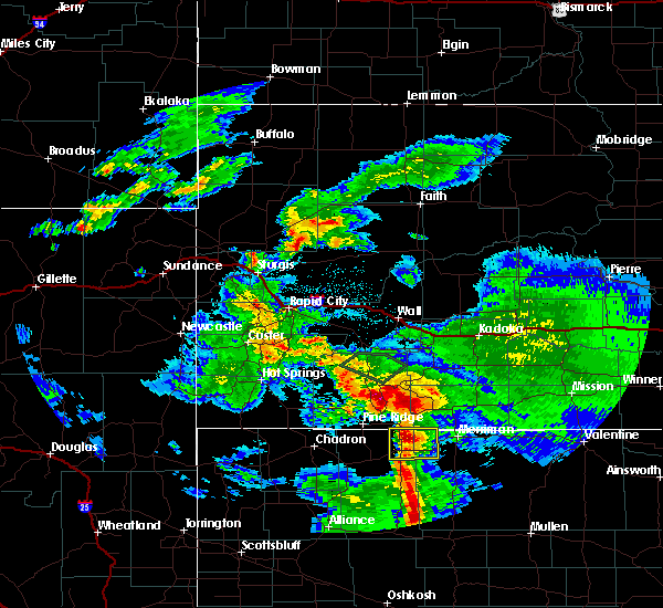 At 847 pm mdt, a severe thunderstorm was located 7 miles north of gordon, moving east at 20 mph (trained weather spotters). Hazards include half dollar size hail. Damage to vehicles is expected. locations impacted include, gordon, hoover lake, irwin, intersection of highway 20 and irwin road, shell lake state wildlife management area and bayonne. This includes highway 20 between mile markers 101 and 126. At 847 pm mdt, a severe thunderstorm was located 7 miles north of gordon, moving east at 20 mph (trained weather spotters). Hazards include half dollar size hail. Damage to vehicles is expected. locations impacted include, gordon, hoover lake, irwin, intersection of highway 20 and irwin road, shell lake state wildlife management area and bayonne. This includes highway 20 between mile markers 101 and 126.
|
| 8/14/2017 8:38 PM MDT | Half Dollar sized hail reported 5.8 miles S of Gordon, NE |
| 8/14/2017 8:31 PM MDT |
 At 830 pm mdt, a severe thunderstorm was located near gordon, moving northeast at 25 mph (radar indicated). Hazards include 60 mph wind gusts and half dollar size hail. Hail damage to vehicles is expected. Expect wind damage to roofs, siding, and trees. At 830 pm mdt, a severe thunderstorm was located near gordon, moving northeast at 25 mph (radar indicated). Hazards include 60 mph wind gusts and half dollar size hail. Hail damage to vehicles is expected. Expect wind damage to roofs, siding, and trees.
|
| 7/17/2017 9:57 PM MDT |
 The severe thunderstorm warning for northwestern cherry and northeastern sheridan counties will expire at 1000 pm mdt, the storms which prompted the warning have weakened below severe limits, and no longer pose an immediate threat to life or property. therefore the warning will be allowed to expire. however gusty winds and heavy rain are still possible with these thunderstorms. to report severe weather, contact your nearest law enforcement agency. they will relay your report to the national weather service north platte. The severe thunderstorm warning for northwestern cherry and northeastern sheridan counties will expire at 1000 pm mdt, the storms which prompted the warning have weakened below severe limits, and no longer pose an immediate threat to life or property. therefore the warning will be allowed to expire. however gusty winds and heavy rain are still possible with these thunderstorms. to report severe weather, contact your nearest law enforcement agency. they will relay your report to the national weather service north platte.
|
| 7/17/2017 9:50 PM MDT |
 At 949 pm mdt, severe thunderstorms were located along a line extending from near merriman to 6 miles southeast of gordon, moving southeast at 25 mph (radar indicated). Hazards include 60 mph wind gusts and penny size hail. Expect damage to roofs, siding, and trees. locations impacted include, gordon, merriman, hoover lake, highway 61 crossing the niobrara river, irwin, highway 27 crossing the niobrara river, intersection of highway 20 and irwin road, shell lake state wildlife management area, rock hill, bayonne and intersection of highway 27 and mills road. this includes the following highways, highway 20 between mile markers 101 and 141. Highway 61 between mile markers 218 and 231. At 949 pm mdt, severe thunderstorms were located along a line extending from near merriman to 6 miles southeast of gordon, moving southeast at 25 mph (radar indicated). Hazards include 60 mph wind gusts and penny size hail. Expect damage to roofs, siding, and trees. locations impacted include, gordon, merriman, hoover lake, highway 61 crossing the niobrara river, irwin, highway 27 crossing the niobrara river, intersection of highway 20 and irwin road, shell lake state wildlife management area, rock hill, bayonne and intersection of highway 27 and mills road. this includes the following highways, highway 20 between mile markers 101 and 141. Highway 61 between mile markers 218 and 231.
|
| 7/17/2017 9:30 PM MDT | South side of gordo in sheridan county NE, 0.4 miles SW of Gordon, NE |
| 7/17/2017 9:18 PM MDT |
 At 917 pm mdt, severe thunderstorms were located along a line extending from 11 miles southeast of batesland to near gordon to near rushville, moving southeast at 40 mph (radar indicated). Hazards include 60 mph wind gusts and quarter size hail. Hail damage to vehicles is expected. Expect wind damage to roofs, siding, and trees. At 917 pm mdt, severe thunderstorms were located along a line extending from 11 miles southeast of batesland to near gordon to near rushville, moving southeast at 40 mph (radar indicated). Hazards include 60 mph wind gusts and quarter size hail. Hail damage to vehicles is expected. Expect wind damage to roofs, siding, and trees.
|
| 7/17/2017 9:09 PM MDT |
 At 850 pm mdt, a severe thunderstorm was located near white clay, or near pine ridge, moving southeast at 25 mph (radar indicated). Hazards include 60 mph wind gusts and quarter size hail. Hail damage to vehicles is expected. Expect wind damage to roofs, siding, and trees. At 850 pm mdt, a severe thunderstorm was located near white clay, or near pine ridge, moving southeast at 25 mph (radar indicated). Hazards include 60 mph wind gusts and quarter size hail. Hail damage to vehicles is expected. Expect wind damage to roofs, siding, and trees.
|
| 7/17/2017 9:02 PM MDT | Quarter sized hail reported 13.2 miles SE of Gordon, NE, wind gusts to 60 mph at this location along with quarter size hail. |
| 7/17/2017 8:50 PM MDT |
 At 850 pm mdt, a severe thunderstorm was located near white clay, or near pine ridge, moving southeast at 25 mph (radar indicated). Hazards include 60 mph wind gusts and quarter size hail. Hail damage to vehicles is expected. Expect wind damage to roofs, siding, and trees. At 850 pm mdt, a severe thunderstorm was located near white clay, or near pine ridge, moving southeast at 25 mph (radar indicated). Hazards include 60 mph wind gusts and quarter size hail. Hail damage to vehicles is expected. Expect wind damage to roofs, siding, and trees.
|
| 7/7/2017 6:39 PM MDT | Quarter sized hail reported 32.4 miles NW of Gordon, NE |
| 7/6/2017 10:55 PM MDT |
 The severe thunderstorm warning for northwestern sheridan county will expire at 1100 pm mdt, the storms which prompted the warning have weakened below severe limits, and no longer pose an immediate threat to life or property. therefore the warning will be allowed to expire. however gusty winds are still possible with these thunderstorms. The severe thunderstorm warning for northwestern sheridan county will expire at 1100 pm mdt, the storms which prompted the warning have weakened below severe limits, and no longer pose an immediate threat to life or property. therefore the warning will be allowed to expire. however gusty winds are still possible with these thunderstorms.
|
| 7/6/2017 10:28 PM MDT |
 At 1028 pm mdt, severe thunderstorms were located along a line extending from near white clay to 12 miles northeast of box butte dam, moving east at 40 mph (radar indicated). Hazards include 60 mph wind gusts. Expect damage to roofs, siding, and trees. locations impacted include, gordon, rushville, hay springs, white clay, clinton, intersection of highway 87 and craven creek road, lone butte, intersection of beaver creek road and white clay creek road, intersection of highway 87 and larabee road, mount maria, highway 250 crossing the niobrara river, walgren lake state recreation area, pine ridge, hoover lake, metcalf state wildlife management area, intersection of highway 87 and antelope road and smith lake state wildlife management area. this includes the following highways, highway 20 between mile markers 74 and 105. Highway 250 between mile markers 28 and 48. At 1028 pm mdt, severe thunderstorms were located along a line extending from near white clay to 12 miles northeast of box butte dam, moving east at 40 mph (radar indicated). Hazards include 60 mph wind gusts. Expect damage to roofs, siding, and trees. locations impacted include, gordon, rushville, hay springs, white clay, clinton, intersection of highway 87 and craven creek road, lone butte, intersection of beaver creek road and white clay creek road, intersection of highway 87 and larabee road, mount maria, highway 250 crossing the niobrara river, walgren lake state recreation area, pine ridge, hoover lake, metcalf state wildlife management area, intersection of highway 87 and antelope road and smith lake state wildlife management area. this includes the following highways, highway 20 between mile markers 74 and 105. Highway 250 between mile markers 28 and 48.
|
| 7/6/2017 10:11 PM MDT |
 At 1009 pm mdt, severe thunderstorms were located along a line extending from near slim butte to 10 miles southwest of hemingford, moving east at 40 mph (radar indicated. at 1002 pm, a 63 mph wind gust was reported at chadron airport). Hazards include 60 mph wind gusts. expect damage to roofs, siding, and trees At 1009 pm mdt, severe thunderstorms were located along a line extending from near slim butte to 10 miles southwest of hemingford, moving east at 40 mph (radar indicated. at 1002 pm, a 63 mph wind gust was reported at chadron airport). Hazards include 60 mph wind gusts. expect damage to roofs, siding, and trees
|
| 6/27/2017 10:39 AM MDT |
 At 439 pm mdt, a severe thunderstorm was located near rushville, moving northeast at 45 mph (radar indicated). Hazards include 60 mph wind gusts and quarter size hail. Hail damage to vehicles is expected. expect wind damage to roofs, siding, and trees. locations impacted include, gordon, rushville, clinton, hoover lake, metcalf state wildlife management area, lone butte, intersection of beaver creek road and white clay creek road and mount maria. this includes the following highways, highway 20 between mile markers 81 and 112. Highway 250 between mile markers 43 and 48. At 439 pm mdt, a severe thunderstorm was located near rushville, moving northeast at 45 mph (radar indicated). Hazards include 60 mph wind gusts and quarter size hail. Hail damage to vehicles is expected. expect wind damage to roofs, siding, and trees. locations impacted include, gordon, rushville, clinton, hoover lake, metcalf state wildlife management area, lone butte, intersection of beaver creek road and white clay creek road and mount maria. this includes the following highways, highway 20 between mile markers 81 and 112. Highway 250 between mile markers 43 and 48.
|
| 6/27/2017 10:27 AM MDT |
 At 427 pm mdt, a severe thunderstorm was located near hay springs, moving northeast at 45 mph (radar indicated). Hazards include golf ball size hail and 60 mph wind gusts. People and animals outdoors will be injured. expect hail damage to roofs, siding, windows, and vehicles. Expect wind damage to roofs, siding, and trees. At 427 pm mdt, a severe thunderstorm was located near hay springs, moving northeast at 45 mph (radar indicated). Hazards include golf ball size hail and 60 mph wind gusts. People and animals outdoors will be injured. expect hail damage to roofs, siding, windows, and vehicles. Expect wind damage to roofs, siding, and trees.
|
| 6/12/2017 8:29 PM MDT |
 At 829 pm mdt, doppler radar indicated a severe thunderstorm capable of producing large hail up to ping pong ball size and damaging winds in excess of 60 mph. this storm was located 11 miles north of gordon, moving northeast at 30 mph. locations impacted include, gordon, rushville, clinton, hoover lake, lone butte, intersection of highway 87 and larabee road, mount maria and intersection of highway 27 and mills road. this includes the following highways, highway 20 between mile markers 89 and 109. highway 250 near mile marker 48. a tornado watch remains in effect until 200 am mdt for the panhandle of and north central nebraska. At 829 pm mdt, doppler radar indicated a severe thunderstorm capable of producing large hail up to ping pong ball size and damaging winds in excess of 60 mph. this storm was located 11 miles north of gordon, moving northeast at 30 mph. locations impacted include, gordon, rushville, clinton, hoover lake, lone butte, intersection of highway 87 and larabee road, mount maria and intersection of highway 27 and mills road. this includes the following highways, highway 20 between mile markers 89 and 109. highway 250 near mile marker 48. a tornado watch remains in effect until 200 am mdt for the panhandle of and north central nebraska.
|
| 6/12/2017 8:09 PM MDT |
 At 809 pm mdt, doppler radar indicated a severe thunderstorm capable of producing large hail up to ping pong ball size. this storm was located 7 miles northeast of rushville, and moving northeast at 20 mph. At 809 pm mdt, doppler radar indicated a severe thunderstorm capable of producing large hail up to ping pong ball size. this storm was located 7 miles northeast of rushville, and moving northeast at 20 mph.
|
| 6/12/2017 8:03 PM MDT |
 At 742 pm mdt, doppler radar indicated a severe thunderstorm capable of producing large damaging hail up to two inches in diameter. this storm was located 8 miles southeast of hay springs, and moving northeast at 20 mph. At 742 pm mdt, doppler radar indicated a severe thunderstorm capable of producing large damaging hail up to two inches in diameter. this storm was located 8 miles southeast of hay springs, and moving northeast at 20 mph.
|
| 6/12/2017 7:43 PM MDT |
 At 742 pm mdt, doppler radar indicated a severe thunderstorm capable of producing large damaging hail up to two inches in diameter. this storm was located 8 miles southeast of hay springs, and moving northeast at 20 mph. At 742 pm mdt, doppler radar indicated a severe thunderstorm capable of producing large damaging hail up to two inches in diameter. this storm was located 8 miles southeast of hay springs, and moving northeast at 20 mph.
|
| 9/4/2016 5:31 PM MDT | Quarter sized hail reported 15.6 miles ESE of Gordon, NE |
| 8/11/2016 6:45 PM MDT | Golf Ball sized hail reported 19.2 miles SW of Gordon, NE, golf ball size hail and 60 mph wind gusts occurred. |
| 7/30/2016 10:35 PM MDT |
 At 1034 pm mdt, severe thunderstorms were located along a line extending from near martin to 14 miles southeast of batesland to near gordon, moving southeast at 40 mph (radar indicated). Hazards include 70 mph wind gusts. Expect considerable tree damage. damage is likely to mobile homes, roofs, and outbuildings. locations impacted include, gordon, merriman, white clay, clinton, shell lake state wildlife management area, pine ridge, lone butte, intersection of highway 87 and craven creek road, intersection of highway 20 and irwin road, bayonne, highway 61 crossing the niobrara river, irwin, intersection of highway 27 and mills road, intersection of highway 87 and larabee road, rock hill, hoover lake, highway 27 crossing the niobrara river and mount maria. this includes the following highways, highway 20 between mile markers 93 and 139. Highway 61 between mile markers 212 and 230. At 1034 pm mdt, severe thunderstorms were located along a line extending from near martin to 14 miles southeast of batesland to near gordon, moving southeast at 40 mph (radar indicated). Hazards include 70 mph wind gusts. Expect considerable tree damage. damage is likely to mobile homes, roofs, and outbuildings. locations impacted include, gordon, merriman, white clay, clinton, shell lake state wildlife management area, pine ridge, lone butte, intersection of highway 87 and craven creek road, intersection of highway 20 and irwin road, bayonne, highway 61 crossing the niobrara river, irwin, intersection of highway 27 and mills road, intersection of highway 87 and larabee road, rock hill, hoover lake, highway 27 crossing the niobrara river and mount maria. this includes the following highways, highway 20 between mile markers 93 and 139. Highway 61 between mile markers 212 and 230.
|
| 7/30/2016 10:17 PM MDT |
 At 1017 pm mdt, severe thunderstorms were located along a line extending from near allen to 9 miles northeast of gordon to near rushville, moving southeast at 25 mph (radar indicated). Hazards include 70 mph wind gusts. Expect considerable tree damage. Damage is likely to mobile homes, roofs, and outbuildings. At 1017 pm mdt, severe thunderstorms were located along a line extending from near allen to 9 miles northeast of gordon to near rushville, moving southeast at 25 mph (radar indicated). Hazards include 70 mph wind gusts. Expect considerable tree damage. Damage is likely to mobile homes, roofs, and outbuildings.
|
| 7/30/2016 7:58 PM MDT |
 At 758 pm mdt, a severe thunderstorm was located 11 miles northeast of gordon, moving southeast at 10 mph (radar indicated). Hazards include 60 mph wind gusts and quarter size hail. Hail damage to vehicles is expected. expect wind damage to roofs, siding, and trees. locations impacted include, gordon, shell lake state wildlife management area, irwin, intersection of highway 20 and irwin road, hoover lake and bayonne. This includes highway 20 between mile markers 106 and 126. At 758 pm mdt, a severe thunderstorm was located 11 miles northeast of gordon, moving southeast at 10 mph (radar indicated). Hazards include 60 mph wind gusts and quarter size hail. Hail damage to vehicles is expected. expect wind damage to roofs, siding, and trees. locations impacted include, gordon, shell lake state wildlife management area, irwin, intersection of highway 20 and irwin road, hoover lake and bayonne. This includes highway 20 between mile markers 106 and 126.
|
| 7/30/2016 7:33 PM MDT |
 At 732 pm mdt, a severe thunderstorm was located 8 miles south of batesland, or 15 miles north of gordon, moving southeast at 25 mph (radar indicated). Hazards include 60 mph wind gusts and quarter size hail. Hail damage to vehicles is expected. expect wind damage to roofs, siding, and trees. locations impacted include, gordon, shell lake state wildlife management area, irwin, intersection of highway 20 and irwin road, bayonne and hoover lake. This includes highway 20 between mile markers 102 and 126. At 732 pm mdt, a severe thunderstorm was located 8 miles south of batesland, or 15 miles north of gordon, moving southeast at 25 mph (radar indicated). Hazards include 60 mph wind gusts and quarter size hail. Hail damage to vehicles is expected. expect wind damage to roofs, siding, and trees. locations impacted include, gordon, shell lake state wildlife management area, irwin, intersection of highway 20 and irwin road, bayonne and hoover lake. This includes highway 20 between mile markers 102 and 126.
|
| 7/30/2016 7:12 PM MDT |
 At 711 pm mdt, a severe thunderstorm was located near batesland, or 18 miles north of gordon, moving south at 20 mph (radar indicated). Hazards include 60 mph wind gusts and quarter size hail. Hail damage to vehicles is expected. Expect wind damage to roofs, siding, and trees. At 711 pm mdt, a severe thunderstorm was located near batesland, or 18 miles north of gordon, moving south at 20 mph (radar indicated). Hazards include 60 mph wind gusts and quarter size hail. Hail damage to vehicles is expected. Expect wind damage to roofs, siding, and trees.
|
| 7/29/2016 5:30 PM MDT | Ping Pong Ball sized hail reported 12.8 miles WNW of Gordon, NE, pea to ping pong size hail covered ground. |
| 7/29/2016 5:26 PM MDT | Ping Pong Ball sized hail reported 15.2 miles WNW of Gordon, NE |
| 7/29/2016 5:17 PM MDT |
 At 516 pm mdt, a severe thunderstorm was located near gordon, moving east at 25 mph (radar indicated). Hazards include 60 mph wind gusts and quarter size hail. Hail damage to vehicles is expected. expect wind damage to roofs, siding, and trees. locations impacted include, gordon, shell lake state wildlife management area, irwin, rock hill and bayonne. This includes highway 20 between mile markers 103 and 119. At 516 pm mdt, a severe thunderstorm was located near gordon, moving east at 25 mph (radar indicated). Hazards include 60 mph wind gusts and quarter size hail. Hail damage to vehicles is expected. expect wind damage to roofs, siding, and trees. locations impacted include, gordon, shell lake state wildlife management area, irwin, rock hill and bayonne. This includes highway 20 between mile markers 103 and 119.
|
| 7/29/2016 5:13 PM MDT | Ping Pong Ball sized hail reported 13.5 miles WNW of Gordon, NE |
| 7/29/2016 5:00 PM MDT | Storm damage reported in sheridan county NE, 3.8 miles E of Gordon, NE |
| 7/29/2016 5:00 PM MDT |
 At 459 pm mdt, a severe thunderstorm was located near gordon, moving east at 25 mph (radar indicated). Hazards include 60 mph wind gusts and quarter size hail. Hail damage to vehicles is expected. Expect wind damage to roofs, siding, and trees. At 459 pm mdt, a severe thunderstorm was located near gordon, moving east at 25 mph (radar indicated). Hazards include 60 mph wind gusts and quarter size hail. Hail damage to vehicles is expected. Expect wind damage to roofs, siding, and trees.
|
| 7/29/2016 4:41 PM MDT |
 At 441 pm mdt, a severe thunderstorm was located near rushville, moving east at 25 mph (radar indicated). Hazards include 60 mph wind gusts and quarter size hail. Hail damage to vehicles is expected. expect wind damage to roofs, siding, and trees. locations impacted include, gordon, rushville, clinton, mount maria, lone butte and intersection of highway 27 and mills road. this includes the following highways, highway 20 between mile markers 89 and 108. Highway 250 near mile marker 48. At 441 pm mdt, a severe thunderstorm was located near rushville, moving east at 25 mph (radar indicated). Hazards include 60 mph wind gusts and quarter size hail. Hail damage to vehicles is expected. expect wind damage to roofs, siding, and trees. locations impacted include, gordon, rushville, clinton, mount maria, lone butte and intersection of highway 27 and mills road. this includes the following highways, highway 20 between mile markers 89 and 108. Highway 250 near mile marker 48.
|
| 7/29/2016 4:30 PM MDT |
 At 430 pm mdt, a severe thunderstorm was located 7 miles northwest of rushville, moving east at 25 mph (radar indicated). Hazards include 60 mph wind gusts and quarter size hail. Hail damage to vehicles is expected. Expect wind damage to roofs, siding, and trees. At 430 pm mdt, a severe thunderstorm was located 7 miles northwest of rushville, moving east at 25 mph (radar indicated). Hazards include 60 mph wind gusts and quarter size hail. Hail damage to vehicles is expected. Expect wind damage to roofs, siding, and trees.
|
| 7/26/2016 8:45 PM MDT | Storm damage reported in cherry county NE, 31.6 miles NW of Gordon, NE |
| 7/26/2016 8:24 PM MDT | Storm damage reported in cherry county NE, 12.8 miles WNW of Gordon, NE |
| 7/26/2016 8:00 PM MDT |
 At 800 pm mdt, severe thunderstorms were located along a line extending from gordon to 14 miles northeast of wild horse butte, moving southeast at 25 mph (public). Hazards include golf ball size hail and 60 mph wind gusts. People and animals outdoors will be injured. expect hail damage to roofs, siding, windows, and vehicles. expect wind damage to roofs, siding, and trees. locations impacted include, gordon, rushville, hay springs, clinton, lone butte, walgren lake state recreation area, diamond lake, intersection of beaver creek road and white clay creek road, smith lake state wildlife management area, intersection of highway 87 and antelope road, intersection of highway 27 and mills road, hoover lake, highway 27 crossing the niobrara river and highway 250 crossing the niobrara river. this includes the following highways, highway 20 between mile markers 76 and 112. Highway 250 between mile markers 19 and 48. At 800 pm mdt, severe thunderstorms were located along a line extending from gordon to 14 miles northeast of wild horse butte, moving southeast at 25 mph (public). Hazards include golf ball size hail and 60 mph wind gusts. People and animals outdoors will be injured. expect hail damage to roofs, siding, windows, and vehicles. expect wind damage to roofs, siding, and trees. locations impacted include, gordon, rushville, hay springs, clinton, lone butte, walgren lake state recreation area, diamond lake, intersection of beaver creek road and white clay creek road, smith lake state wildlife management area, intersection of highway 87 and antelope road, intersection of highway 27 and mills road, hoover lake, highway 27 crossing the niobrara river and highway 250 crossing the niobrara river. this includes the following highways, highway 20 between mile markers 76 and 112. Highway 250 between mile markers 19 and 48.
|
| 7/26/2016 7:45 PM MDT | Fire department reported pivots blown over and roof blown off garage from straight line winds. time estimated by rada in sheridan county NE, 5.9 miles N of Gordon, NE |
| 7/26/2016 7:38 PM MDT |
 At 737 pm mdt, severe thunderstorms were located along a line extending from 10 miles south of white clay to 13 miles south of hay springs, moving southeast at 30 mph (public). Hazards include golf ball size hail and 60 mph wind gusts. People and animals outdoors will be injured. expect hail damage to roofs, siding, windows, and vehicles. expect wind damage to roofs, siding, and trees. locations impacted include, gordon, rushville, hay springs, clinton, lone butte, walgren lake state recreation area, diamond lake, intersection of beaver creek road and white clay creek road, smith lake state wildlife management area, intersection of highway 87 and antelope road, intersection of highway 27 and mills road, intersection of highway 87 and larabee road, hoover lake, highway 27 crossing the niobrara river, mount maria and highway 250 crossing the niobrara river. this includes the following highways, highway 20 between mile markers 76 and 112. Highway 250 between mile markers 19 and 48. At 737 pm mdt, severe thunderstorms were located along a line extending from 10 miles south of white clay to 13 miles south of hay springs, moving southeast at 30 mph (public). Hazards include golf ball size hail and 60 mph wind gusts. People and animals outdoors will be injured. expect hail damage to roofs, siding, windows, and vehicles. expect wind damage to roofs, siding, and trees. locations impacted include, gordon, rushville, hay springs, clinton, lone butte, walgren lake state recreation area, diamond lake, intersection of beaver creek road and white clay creek road, smith lake state wildlife management area, intersection of highway 87 and antelope road, intersection of highway 27 and mills road, intersection of highway 87 and larabee road, hoover lake, highway 27 crossing the niobrara river, mount maria and highway 250 crossing the niobrara river. this includes the following highways, highway 20 between mile markers 76 and 112. Highway 250 between mile markers 19 and 48.
|
| 7/26/2016 7:30 PM MDT |
 At 729 pm mdt, severe thunderstorms were located along a line extending from 8 miles southeast of white clay to near hay springs, moving southeast at 25 mph (radar indicated). Hazards include golf ball size hail and 60 mph wind gusts. People and animals outdoors will be injured. expect hail damage to roofs, siding, windows, and vehicles. Expect wind damage to roofs, siding, and trees. At 729 pm mdt, severe thunderstorms were located along a line extending from 8 miles southeast of white clay to near hay springs, moving southeast at 25 mph (radar indicated). Hazards include golf ball size hail and 60 mph wind gusts. People and animals outdoors will be injured. expect hail damage to roofs, siding, windows, and vehicles. Expect wind damage to roofs, siding, and trees.
|
| 7/26/2016 7:19 PM MDT |
 At 719 pm mdt, a severe thunderstorm was located 8 miles north of hay springs, moving southeast at 30 mph (radar indicated). Hazards include golf ball size hail and 60 mph wind gusts. People and animals outdoors will be injured. expect hail damage to roofs, siding, windows, and vehicles. expect wind damage to roofs, siding, and trees. locations impacted include, gordon, rushville, hay springs, white clay, clinton, pine ridge, lone butte, metcalf state wildlife management area, intersection of highway 87 and craven creek road, walgren lake state recreation area, intersection of beaver creek road and white clay creek road, intersection of highway 87 and antelope road, intersection of highway 87 and larabee road, mount maria and highway 250 crossing the niobrara river. this includes the following highways, highway 20 between mile markers 74 and 105. Highway 250 between mile markers 34 and 48. At 719 pm mdt, a severe thunderstorm was located 8 miles north of hay springs, moving southeast at 30 mph (radar indicated). Hazards include golf ball size hail and 60 mph wind gusts. People and animals outdoors will be injured. expect hail damage to roofs, siding, windows, and vehicles. expect wind damage to roofs, siding, and trees. locations impacted include, gordon, rushville, hay springs, white clay, clinton, pine ridge, lone butte, metcalf state wildlife management area, intersection of highway 87 and craven creek road, walgren lake state recreation area, intersection of beaver creek road and white clay creek road, intersection of highway 87 and antelope road, intersection of highway 87 and larabee road, mount maria and highway 250 crossing the niobrara river. this includes the following highways, highway 20 between mile markers 74 and 105. Highway 250 between mile markers 34 and 48.
|
| 7/26/2016 7:00 PM MDT |
 At 700 pm mdt, a severe thunderstorm was located 10 miles northeast of chadron, moving southeast at 25 mph (radar indicated). Hazards include golf ball size hail and 60 mph wind gusts. People and animals outdoors will be injured. expect hail damage to roofs, siding, windows, and vehicles. Expect wind damage to roofs, siding, and trees. At 700 pm mdt, a severe thunderstorm was located 10 miles northeast of chadron, moving southeast at 25 mph (radar indicated). Hazards include golf ball size hail and 60 mph wind gusts. People and animals outdoors will be injured. expect hail damage to roofs, siding, windows, and vehicles. Expect wind damage to roofs, siding, and trees.
|
| 6/29/2016 7:37 PM MDT |
 At 837 pm cdt/737 pm mdt/, severe thunderstorms were located along a line extending from near clearfield to kilgore to 12 miles southeast of batesland, moving south at 35 mph (radar indicated). Hazards include 70 mph wind gusts. Expect considerable tree damage. damage is likely to mobile homes, roofs, and outbuildings. locations impacted include, valentine, ainsworth, gordon, rushville, cody, merriman, kilgore, johnstown, nenzel, merritt reservoir, medicine lake, norden, valentine national wildlife refuge, crookston, wood lake, clinton, shell lake state wildlife management area, lone butte, steer creek campground and bobcat state wildlife management area. this includes the following highways, highway 183 between mile markers 194 and 203. highway 20 between mile markers 88 and 249. highway 250 between mile markers 30 and 48. highway 61 between mile markers 193 and 231. highway 97 between mile markers 100 and 141. Highway 83 between mile markers 184 and 222. At 837 pm cdt/737 pm mdt/, severe thunderstorms were located along a line extending from near clearfield to kilgore to 12 miles southeast of batesland, moving south at 35 mph (radar indicated). Hazards include 70 mph wind gusts. Expect considerable tree damage. damage is likely to mobile homes, roofs, and outbuildings. locations impacted include, valentine, ainsworth, gordon, rushville, cody, merriman, kilgore, johnstown, nenzel, merritt reservoir, medicine lake, norden, valentine national wildlife refuge, crookston, wood lake, clinton, shell lake state wildlife management area, lone butte, steer creek campground and bobcat state wildlife management area. this includes the following highways, highway 183 between mile markers 194 and 203. highway 20 between mile markers 88 and 249. highway 250 between mile markers 30 and 48. highway 61 between mile markers 193 and 231. highway 97 between mile markers 100 and 141. Highway 83 between mile markers 184 and 222.
|
| 6/29/2016 7:00 PM MDT |
 At 759 pm cdt/659 pm mdt/, severe thunderstorms were located along a line extending from near okreek to near harrington to near wounded knee, moving south at 50 mph (radar indicated). Hazards include 70 mph wind gusts. Expect considerable tree damage. Damage is likely to mobile homes, roofs, and outbuildings. At 759 pm cdt/659 pm mdt/, severe thunderstorms were located along a line extending from near okreek to near harrington to near wounded knee, moving south at 50 mph (radar indicated). Hazards include 70 mph wind gusts. Expect considerable tree damage. Damage is likely to mobile homes, roofs, and outbuildings.
|
| 6/28/2016 6:19 PM MDT |
 At 618 pm mdt, severe thunderstorms were located along a line extending from near merriman to 17 miles southwest of medicine lake to 27 miles south of gordon to 17 miles north of antioch, moving southeast at 50 mph (radar indicated). Hazards include 70 mph wind gusts and quarter size hail. Hail damage to vehicles is expected. expect considerable tree damage. wind damage is also likely to mobile homes, roofs, and outbuildings. locations impacted include, gordon, rushville, merriman and clinton. this includes the following highways, highway 20 between mile markers 82 and 150. highway 250 between mile markers 3 and 48. Highway 61 between mile markers 205 and 230. At 618 pm mdt, severe thunderstorms were located along a line extending from near merriman to 17 miles southwest of medicine lake to 27 miles south of gordon to 17 miles north of antioch, moving southeast at 50 mph (radar indicated). Hazards include 70 mph wind gusts and quarter size hail. Hail damage to vehicles is expected. expect considerable tree damage. wind damage is also likely to mobile homes, roofs, and outbuildings. locations impacted include, gordon, rushville, merriman and clinton. this includes the following highways, highway 20 between mile markers 82 and 150. highway 250 between mile markers 3 and 48. Highway 61 between mile markers 205 and 230.
|
| 6/28/2016 5:57 PM MDT |
 At 556 pm mdt, severe thunderstorms were located along a line extending from 8 miles south of batesland to 8 miles southwest of gordon to 14 miles southeast of hay springs to near hemingford, moving southeast at 60 mph. these are very dangerous storms (radar indicated). Hazards include 80 mph wind gusts and quarter size hail. Flying debris will be dangerous to those caught without shelter. mobile homes will be heavily damaged. expect considerable damage to roofs, windows, and vehicles. Extensive tree damage and power outages are likely. At 556 pm mdt, severe thunderstorms were located along a line extending from 8 miles south of batesland to 8 miles southwest of gordon to 14 miles southeast of hay springs to near hemingford, moving southeast at 60 mph. these are very dangerous storms (radar indicated). Hazards include 80 mph wind gusts and quarter size hail. Flying debris will be dangerous to those caught without shelter. mobile homes will be heavily damaged. expect considerable damage to roofs, windows, and vehicles. Extensive tree damage and power outages are likely.
|
| 6/28/2016 5:26 PM MDT |
 At 526 pm mdt, a severe thunderstorm was located near gordon, moving southeast at 25 mph (radar indicated). Hazards include ping pong ball size hail and 60 mph wind gusts. People and animals outdoors will be injured. expect hail damage to roofs, siding, windows, and vehicles. expect wind damage to roofs, siding, and trees. locations impacted include, gordon, clinton, intersection of highway 27 and mills road, lone butte and highway 27 crossing the niobrara river. This includes highway 20 between mile markers 95 and 111. At 526 pm mdt, a severe thunderstorm was located near gordon, moving southeast at 25 mph (radar indicated). Hazards include ping pong ball size hail and 60 mph wind gusts. People and animals outdoors will be injured. expect hail damage to roofs, siding, windows, and vehicles. expect wind damage to roofs, siding, and trees. locations impacted include, gordon, clinton, intersection of highway 27 and mills road, lone butte and highway 27 crossing the niobrara river. This includes highway 20 between mile markers 95 and 111.
|
| 6/28/2016 5:16 PM MDT | Quarter sized hail reported 7.7 miles SSE of Gordon, NE |
| 6/28/2016 5:13 PM MDT |
 At 512 pm mdt, a severe thunderstorm was located 8 miles north of gordon, moving southeast at 30 mph (radar indicated). Hazards include ping pong ball size hail and 60 mph wind gusts. People and animals outdoors will be injured. expect hail damage to roofs, siding, windows, and vehicles. Expect wind damage to roofs, siding, and trees. At 512 pm mdt, a severe thunderstorm was located 8 miles north of gordon, moving southeast at 30 mph (radar indicated). Hazards include ping pong ball size hail and 60 mph wind gusts. People and animals outdoors will be injured. expect hail damage to roofs, siding, windows, and vehicles. Expect wind damage to roofs, siding, and trees.
|
| 6/13/2016 6:48 PM MDT |
 At 647 pm mdt, a severe thunderstorm was located 10 miles northeast of gordon, moving north at 20 mph (radar indicated). Hazards include golf ball size hail and 60 mph wind gusts. People and animals outdoors will be injured. expect hail damage to roofs, siding, windows, and vehicles. expect wind damage to roofs, siding, and trees. locations impacted include, gordon, shell lake state wildlife management area, irwin, bayonne and hoover lake. This includes highway 20 between mile markers 107 and 118. At 647 pm mdt, a severe thunderstorm was located 10 miles northeast of gordon, moving north at 20 mph (radar indicated). Hazards include golf ball size hail and 60 mph wind gusts. People and animals outdoors will be injured. expect hail damage to roofs, siding, windows, and vehicles. expect wind damage to roofs, siding, and trees. locations impacted include, gordon, shell lake state wildlife management area, irwin, bayonne and hoover lake. This includes highway 20 between mile markers 107 and 118.
|
| 6/13/2016 6:34 PM MDT | Golf Ball sized hail reported 2.1 miles SW of Gordon, NE, hail destroyed garden. |
| 6/13/2016 6:28 PM MDT | Golf Ball sized hail reported 0.4 miles SW of Gordon, NE, west side of town by the golf course... report relayed from media. |
| 6/13/2016 6:26 PM MDT |
 At 626 pm mdt, a severe thunderstorm was located near gordon, moving north at 20 mph (radar indicated). Hazards include 60 mph wind gusts and half dollar size hail. Hail damage to vehicles is expected. expect wind damage to roofs, siding, and trees. locations impacted include, gordon, shell lake state wildlife management area, irwin, bayonne and hoover lake. This includes highway 20 between mile markers 108 and 118. At 626 pm mdt, a severe thunderstorm was located near gordon, moving north at 20 mph (radar indicated). Hazards include 60 mph wind gusts and half dollar size hail. Hail damage to vehicles is expected. expect wind damage to roofs, siding, and trees. locations impacted include, gordon, shell lake state wildlife management area, irwin, bayonne and hoover lake. This includes highway 20 between mile markers 108 and 118.
|
| 6/13/2016 6:20 PM MDT | Quarter sized hail reported 0.4 miles SW of Gordon, NE |
| 6/13/2016 6:15 PM MDT | Quarter sized hail reported 10 miles S of Gordon, NE, hail started 10 minutes ago. |
| 6/13/2016 6:09 PM MDT |
 At 609 pm mdt, a severe thunderstorm was located over gordon, moving north at 20 mph (radar indicated). Hazards include 60 mph wind gusts and quarter size hail. Hail damage to vehicles is expected. Expect wind damage to roofs, siding, and trees. At 609 pm mdt, a severe thunderstorm was located over gordon, moving north at 20 mph (radar indicated). Hazards include 60 mph wind gusts and quarter size hail. Hail damage to vehicles is expected. Expect wind damage to roofs, siding, and trees.
|
| 5/25/2016 2:14 PM MDT |
 At 213 pm mdt, a severe thunderstorm was located near gordon, moving east at 45 mph (radar indicated). Hazards include ping pong ball size hail and 60 mph wind gusts. People and animals outdoors will be injured. expect hail damage to roofs, siding, windows, and vehicles. Expect wind damage to roofs, siding, and trees. At 213 pm mdt, a severe thunderstorm was located near gordon, moving east at 45 mph (radar indicated). Hazards include ping pong ball size hail and 60 mph wind gusts. People and animals outdoors will be injured. expect hail damage to roofs, siding, windows, and vehicles. Expect wind damage to roofs, siding, and trees.
|
| 7/26/2015 2:21 PM MDT |
 At 219 pm mdt, a severe thunderstorm was located 9 miles northeast of gordon, moving northeast at 20 mph (radar indicated. at 220 pm mdt golf ball size hail was reported 4 miles east northeast of gordon). Hazards include golf ball size hail and 60 mph wind gusts. People and animals outdoors will be injured. expect hail damage to roofs, siding, windows and vehicles. expect wind damage to roofs, siding and trees. This severe thunderstorm will remain over mainly rural areas of northwestern cherry and northeastern sheridan counties, including the following locations, shell lake state wildlife management area, irwin, intersection of highway 20 and irwin road and bayonne. At 219 pm mdt, a severe thunderstorm was located 9 miles northeast of gordon, moving northeast at 20 mph (radar indicated. at 220 pm mdt golf ball size hail was reported 4 miles east northeast of gordon). Hazards include golf ball size hail and 60 mph wind gusts. People and animals outdoors will be injured. expect hail damage to roofs, siding, windows and vehicles. expect wind damage to roofs, siding and trees. This severe thunderstorm will remain over mainly rural areas of northwestern cherry and northeastern sheridan counties, including the following locations, shell lake state wildlife management area, irwin, intersection of highway 20 and irwin road and bayonne.
|
| 7/26/2015 2:20 PM MDT | Golf Ball sized hail reported 4.1 miles WSW of Gordon, NE |
| 7/26/2015 2:13 PM MDT |
 At 212 pm mdt, a severe thunderstorm was located 7 miles east of gordon, moving northeast at 20 mph (radar indicated). Hazards include 60 mph wind gusts and quarter size hail. Hail damage to vehicles is expected. expect wind damage to roofs, siding and trees. This severe thunderstorm will remain over mainly rural areas of northwestern cherry and northeastern sheridan counties, including the following locations, shell lake state wildlife management area, irwin, intersection of highway 20 and irwin road and bayonne. At 212 pm mdt, a severe thunderstorm was located 7 miles east of gordon, moving northeast at 20 mph (radar indicated). Hazards include 60 mph wind gusts and quarter size hail. Hail damage to vehicles is expected. expect wind damage to roofs, siding and trees. This severe thunderstorm will remain over mainly rural areas of northwestern cherry and northeastern sheridan counties, including the following locations, shell lake state wildlife management area, irwin, intersection of highway 20 and irwin road and bayonne.
|
| 7/5/2015 5:17 PM MDT | Baseball sized hail reported 19.1 miles NW of Gordon, NE |
| 7/5/2015 5:17 PM MDT | Storm chaser reported winds stronger than 80 mp in cherry county NE, 19.1 miles NW of Gordon, NE |
| 7/5/2015 5:17 PM MDT | Baseball sized hail reported 29.9 miles NW of Gordon, NE |
| 7/5/2015 4:48 PM MDT | Golf Ball sized hail reported 12.1 miles N of Gordon, NE, spotter reported seeing a wall cloud along with having golf ball size hail that broke the windshield of vehicle. |
| 7/5/2015 4:41 PM MDT | Ping Pong Ball sized hail reported 7.8 miles NNE of Gordon, NE, numerous trees blown over in the vicinity as well. |
| 7/5/2015 4:39 PM MDT |
 At 437 pm mdt, a severe thunderstorm was located 9 miles south of clinton, and moving south at 25 mph. this is a very dangerous storm (law enforcement). Hazards include 80 mph wind gusts and ping pong ball size hail. Flying debris will be dangerous to those caught without shelter. mobile homes will be heavily damaged. expect considerable damage to roofs, windows and vehicles. extensive tree damage and power outages are likely. locations impacted include, mainly rural areas of central sheridan county. This includes highway 20 between mile markers 91 and 111. At 437 pm mdt, a severe thunderstorm was located 9 miles south of clinton, and moving south at 25 mph. this is a very dangerous storm (law enforcement). Hazards include 80 mph wind gusts and ping pong ball size hail. Flying debris will be dangerous to those caught without shelter. mobile homes will be heavily damaged. expect considerable damage to roofs, windows and vehicles. extensive tree damage and power outages are likely. locations impacted include, mainly rural areas of central sheridan county. This includes highway 20 between mile markers 91 and 111.
|
| 7/5/2015 4:28 PM MDT |
 At 426 pm mdt, a severe thunderstorm was located near clinton, and moving south at 25 mph (public). Hazards include 60 mph wind gusts and quarter size hail. Hail damage to vehicles is expected. expect wind damage to roofs, siding and trees. locations impacted include, highway 27 crossing the niobrara river. This includes highway 20 between mile markers 91 and 111. At 426 pm mdt, a severe thunderstorm was located near clinton, and moving south at 25 mph (public). Hazards include 60 mph wind gusts and quarter size hail. Hail damage to vehicles is expected. expect wind damage to roofs, siding and trees. locations impacted include, highway 27 crossing the niobrara river. This includes highway 20 between mile markers 91 and 111.
|
| 7/5/2015 4:25 PM MDT |
 At 422 pm mdt, a severe thunderstorm was located near clinton, and moving south at 25 mph (radar indicated). Hazards include quarter size hail. Damage to vehicles is expected. locations impacted include, intersection of highway 27 and mills road, lone butte and highway 27 crossing the niobrara river. This includes highway 20 between mile markers 91 and 111. At 422 pm mdt, a severe thunderstorm was located near clinton, and moving south at 25 mph (radar indicated). Hazards include quarter size hail. Damage to vehicles is expected. locations impacted include, intersection of highway 27 and mills road, lone butte and highway 27 crossing the niobrara river. This includes highway 20 between mile markers 91 and 111.
|
| 7/5/2015 4:21 PM MDT | Quarter sized hail reported 6.3 miles NE of Gordon, NE, in addition to the quarter size hail... winds were approximated at 50-60 mph. |
| 7/5/2015 4:21 PM MDT | Ping Pong Ball sized hail reported 7.8 miles NNE of Gordon, NE, numerous trees blown over in the vicinity as well. |
| 7/5/2015 4:05 PM MDT |
 At 401 pm mdt, a severe thunderstorm was located 7 miles north of clinton, and moving southeast at 25 mph (radar indicated). Hazards include quarter size hail. damage to vehicles is expected At 401 pm mdt, a severe thunderstorm was located 7 miles north of clinton, and moving southeast at 25 mph (radar indicated). Hazards include quarter size hail. damage to vehicles is expected
|
| 7/5/2015 4:03 PM MDT | Quarter sized hail reported 9.9 miles SE of Gordon, NE |
| 6/25/2015 5:07 PM MDT |
 At 505 pm mdt, severe thunderstorms were located along a line extending from 9 miles southeast of gordon to 15 miles south of rushville, and moving southeast at 25 mph (radar indicated). Hazards include 60 mph wind gusts and quarter size hail. Hail damage to vehicles is expected. expect wind damage to roofs, siding and trees. locations impacted include, bayonne, rock hill and intersection of highway 20 and irwin road. This includes highway 20 between mile markers 77 and 121. At 505 pm mdt, severe thunderstorms were located along a line extending from 9 miles southeast of gordon to 15 miles south of rushville, and moving southeast at 25 mph (radar indicated). Hazards include 60 mph wind gusts and quarter size hail. Hail damage to vehicles is expected. expect wind damage to roofs, siding and trees. locations impacted include, bayonne, rock hill and intersection of highway 20 and irwin road. This includes highway 20 between mile markers 77 and 121.
|
| 6/25/2015 4:47 PM MDT |
 At 444 pm mdt, severe thunderstorms were located along a line extending from 6 miles northwest of gordon to hay springs, and moving southeast at 25 mph (radar indicated). Hazards include 60 mph wind gusts and quarter size hail. Hail damage to vehicles is expected. Expect wind damage to roofs, siding and trees. At 444 pm mdt, severe thunderstorms were located along a line extending from 6 miles northwest of gordon to hay springs, and moving southeast at 25 mph (radar indicated). Hazards include 60 mph wind gusts and quarter size hail. Hail damage to vehicles is expected. Expect wind damage to roofs, siding and trees.
|
| 6/24/2015 4:28 AM MDT | The severe thunderstorm warning for northwestern cherry and northeastern sheridan counties will expire at 530 am cdt, the storm which prompted the warning has weakened below severe limits, and no longer poses an immediate threat to life or property. however, scattered thunderstorms remain over the area and small hail is still possible. |
| 6/24/2015 4:07 AM MDT |
 At 405 am mdt, a severe thunderstorm was located 11 miles southwest of merriman, and moving east at 40 mph (radar indicated). Hazards include quarter size hail. Damage to vehicles is expected. the severe thunderstorm will be near, merriman around 420 am mdt. Other locations in the warning include highway 61 crossing the niobrara river. At 405 am mdt, a severe thunderstorm was located 11 miles southwest of merriman, and moving east at 40 mph (radar indicated). Hazards include quarter size hail. Damage to vehicles is expected. the severe thunderstorm will be near, merriman around 420 am mdt. Other locations in the warning include highway 61 crossing the niobrara river.
|
| 6/24/2015 3:45 AM MDT |
 At 344 am mdt, a severe thunderstorm was located 7 miles northeast of gordon, and moving east at 40 mph (radar indicated). Hazards include golf ball size hail. People and animals outdoors will be injured. Expect damage to roofs, siding, windows and vehicles. At 344 am mdt, a severe thunderstorm was located 7 miles northeast of gordon, and moving east at 40 mph (radar indicated). Hazards include golf ball size hail. People and animals outdoors will be injured. Expect damage to roofs, siding, windows and vehicles.
|
| 6/24/2015 3:39 AM MDT |
 At 337 am mdt, a severe thunderstorm was located 6 miles northwest of gordon, and moving east at 35 mph (radar indicated). Hazards include ping pong ball size hail. People and animals outdoors will be injured. expect damage to roofs, siding, windows and vehicles. The severe thunderstorm will be near, gordon around 345 am mdt. At 337 am mdt, a severe thunderstorm was located 6 miles northwest of gordon, and moving east at 35 mph (radar indicated). Hazards include ping pong ball size hail. People and animals outdoors will be injured. expect damage to roofs, siding, windows and vehicles. The severe thunderstorm will be near, gordon around 345 am mdt.
|
| 6/24/2015 3:26 AM MDT |
 The severe thunderstorm warning for northwestern cherry and northeastern sheridan counties will expire at 430 am cdt, the storm which prompted the warning has weakened below severe limits, and no longer poses an immediate threat to life or property. however, small hail and brief heavy rain are still possible with this thunderstorm. The severe thunderstorm warning for northwestern cherry and northeastern sheridan counties will expire at 430 am cdt, the storm which prompted the warning has weakened below severe limits, and no longer poses an immediate threat to life or property. however, small hail and brief heavy rain are still possible with this thunderstorm.
|
| 6/24/2015 3:12 AM MDT |
 At 311 am mdt, a severe thunderstorm was located 6 miles south of pine ridge, and moving east at 40 mph (radar indicated). Hazards include golf ball size hail. People and animals outdoors will be injured. expect damage to roofs, siding, windows and vehicles. The severe thunderstorm will affect mainly rural areas of northern sheridan county, including the following locations, mount maria and hoover lake. At 311 am mdt, a severe thunderstorm was located 6 miles south of pine ridge, and moving east at 40 mph (radar indicated). Hazards include golf ball size hail. People and animals outdoors will be injured. expect damage to roofs, siding, windows and vehicles. The severe thunderstorm will affect mainly rural areas of northern sheridan county, including the following locations, mount maria and hoover lake.
|
| 6/24/2015 3:04 AM MDT |
 At 302 am mdt, a severe thunderstorm was located 9 miles southwest of pine ridge, and moving east at 35 mph (radar indicated). Hazards include ping pong ball size hail. People and animals outdoors will be injured. expect damage to roofs, siding, windows and vehicles. The severe thunderstorm will affect mainly rural areas of northern sheridan county, including the following locations, white clay, intersection of highway 87 and larabee road, intersection of highway 87 and craven creek road and mount maria. At 302 am mdt, a severe thunderstorm was located 9 miles southwest of pine ridge, and moving east at 35 mph (radar indicated). Hazards include ping pong ball size hail. People and animals outdoors will be injured. expect damage to roofs, siding, windows and vehicles. The severe thunderstorm will affect mainly rural areas of northern sheridan county, including the following locations, white clay, intersection of highway 87 and larabee road, intersection of highway 87 and craven creek road and mount maria.
|
| 6/24/2015 2:57 AM MDT |
 At 255 am mdt, a severe thunderstorm was located 11 miles east of gordon, and moving east at 30 mph (radar indicated). Hazards include quarter size hail. Damage to vehicles is expected. the severe thunderstorm will be near, merriman around 325 am mdt. Other locations in the warning include highway 61 crossing the niobrara river. At 255 am mdt, a severe thunderstorm was located 11 miles east of gordon, and moving east at 30 mph (radar indicated). Hazards include quarter size hail. Damage to vehicles is expected. the severe thunderstorm will be near, merriman around 325 am mdt. Other locations in the warning include highway 61 crossing the niobrara river.
|
| 6/24/2015 2:45 AM MDT |
 At 240 am mdt, a severe thunderstorm was located 6 miles south of pine ridge, and moving northeast at 45 mph (radar indicated). Hazards include ping pong ball size hail. People and animals outdoors will be injured. expect damage to roofs, siding, windows and vehicles. The severe thunderstorm will affect mainly rural areas of northern sheridan county. At 240 am mdt, a severe thunderstorm was located 6 miles south of pine ridge, and moving northeast at 45 mph (radar indicated). Hazards include ping pong ball size hail. People and animals outdoors will be injured. expect damage to roofs, siding, windows and vehicles. The severe thunderstorm will affect mainly rural areas of northern sheridan county.
|
| 6/24/2015 2:43 AM MDT |
 At 240 am mdt, a severe thunderstorm was located 6 miles east of gordon, and moving east at 35 mph (radar indicated). Hazards include ping pong ball size hail. People and animals outdoors will be injured. expect damage to roofs, siding, windows and vehicles. the severe thunderstorm will be near, merriman around 315 am mdt. Other locations in the warning include bayonne, irwin, intersection of highway 20 and irwin road and highway 61 crossing the niobrara river. At 240 am mdt, a severe thunderstorm was located 6 miles east of gordon, and moving east at 35 mph (radar indicated). Hazards include ping pong ball size hail. People and animals outdoors will be injured. expect damage to roofs, siding, windows and vehicles. the severe thunderstorm will be near, merriman around 315 am mdt. Other locations in the warning include bayonne, irwin, intersection of highway 20 and irwin road and highway 61 crossing the niobrara river.
|
| 6/24/2015 2:37 AM MDT |
 At 230 am mdt, a severe thunderstorm was located 12 miles south of pine ridge, and moving northeast at 35 mph (radar indicated). Hazards include ping pong ball size hail. People and animals outdoors will be injured. expect damage to roofs, siding, windows and vehicles. The severe thunderstorm will affect mainly rural areas of northern sheridan county, including the following locations, intersection of highway 87 and craven creek road and white clay. At 230 am mdt, a severe thunderstorm was located 12 miles south of pine ridge, and moving northeast at 35 mph (radar indicated). Hazards include ping pong ball size hail. People and animals outdoors will be injured. expect damage to roofs, siding, windows and vehicles. The severe thunderstorm will affect mainly rural areas of northern sheridan county, including the following locations, intersection of highway 87 and craven creek road and white clay.
|
| 6/24/2015 2:21 AM MDT |
 At 216 am mdt, a severe thunderstorm was located 9 miles northwest of hay springs, and moving northeast at 35 mph (radar indicated). Hazards include ping pong ball size hail. People and animals outdoors will be injured. Expect damage to roofs, siding, windows and vehicles. At 216 am mdt, a severe thunderstorm was located 9 miles northwest of hay springs, and moving northeast at 35 mph (radar indicated). Hazards include ping pong ball size hail. People and animals outdoors will be injured. Expect damage to roofs, siding, windows and vehicles.
|
| 6/21/2015 3:10 AM MDT |
 At 307 am mdt, a severe thunderstorm was located 9 miles northeast of gordon, and moving southeast at 35 mph (radar indicated). Hazards include quarter size hail. Damage to vehicles is expected. locations impacted include, merriman, irwin, bayonne, rock hill, intersection of highway 20 and irwin road and highway 61 crossing the niobrara river. this includes highway 20 between mile markers 99 and 145. This includes highway 61 between mile markers 214 and 231. At 307 am mdt, a severe thunderstorm was located 9 miles northeast of gordon, and moving southeast at 35 mph (radar indicated). Hazards include quarter size hail. Damage to vehicles is expected. locations impacted include, merriman, irwin, bayonne, rock hill, intersection of highway 20 and irwin road and highway 61 crossing the niobrara river. this includes highway 20 between mile markers 99 and 145. This includes highway 61 between mile markers 214 and 231.
|
| 6/21/2015 2:41 AM MDT |
 At 238 am mdt, a severe thunderstorm was located 10 miles east of pine ridge, and moving southeast at 35 mph (radar indicated). Hazards include quarter size hail. damage to vehicles is expected At 238 am mdt, a severe thunderstorm was located 10 miles east of pine ridge, and moving southeast at 35 mph (radar indicated). Hazards include quarter size hail. damage to vehicles is expected
|
| 6/20/2015 8:54 PM MDT | Quarter sized hail reported 17 miles N of Gordon, NE |
| 6/20/2015 8:36 PM MDT |
 At 833 pm mdt, a severe thunderstorm was located 17 miles southeast of gordon, and moving southeast at 45 mph (public. golf ball size hail...60 mph winds and broken windows were reported 10 miles southeast of clinton). Hazards include golf ball size hail and 60 mph wind gusts. People and animals outdoors will be injured. expect hail damage to roofs, siding, windows and vehicles. expect wind damage to roofs, siding and trees. locations impacted include, billys lake, morgan lake, big hill, wolf hill, intersection of highway 61 and shadbolt road, watson lake, highway 61 crossing the snake river, dipping vat meadow, indian hill, intersection of highway 61 and survey valley road, round lake, speckel meir lake and sevenmile hill. this includes highway 20 between mile markers 107 and 121. This includes highway 61 between mile markers 176 and 216. At 833 pm mdt, a severe thunderstorm was located 17 miles southeast of gordon, and moving southeast at 45 mph (public. golf ball size hail...60 mph winds and broken windows were reported 10 miles southeast of clinton). Hazards include golf ball size hail and 60 mph wind gusts. People and animals outdoors will be injured. expect hail damage to roofs, siding, windows and vehicles. expect wind damage to roofs, siding and trees. locations impacted include, billys lake, morgan lake, big hill, wolf hill, intersection of highway 61 and shadbolt road, watson lake, highway 61 crossing the snake river, dipping vat meadow, indian hill, intersection of highway 61 and survey valley road, round lake, speckel meir lake and sevenmile hill. this includes highway 20 between mile markers 107 and 121. This includes highway 61 between mile markers 176 and 216.
|
| 6/20/2015 8:35 PM MDT | Golf Ball sized hail reported 12.3 miles N of Gordon, NE, relayed via storm chaser |
| 6/20/2015 8:35 PM MDT | Golf Ball sized hail reported 16.4 miles N of Gordon, NE |
| 6/20/2015 8:29 PM MDT |
 At 828 pm mdt, a severe thunderstorm was located 13 miles southeast of gordon, and moving southeast at 45 mph (radar indicated). Hazards include golf ball size hail and 60 mph wind gusts. People and animals outdoors will be injured. expect hail damage to roofs, siding, windows and vehicles. Expect wind damage to roofs, siding and trees. At 828 pm mdt, a severe thunderstorm was located 13 miles southeast of gordon, and moving southeast at 45 mph (radar indicated). Hazards include golf ball size hail and 60 mph wind gusts. People and animals outdoors will be injured. expect hail damage to roofs, siding, windows and vehicles. Expect wind damage to roofs, siding and trees.
|
| 6/20/2015 8:26 PM MDT | Quarter sized hail reported 9.6 miles NNE of Gordon, NE |
| 6/20/2015 8:26 PM MDT | Golf Ball sized hail reported 12.1 miles NNE of Gordon, NE, winds on the north side of the residents were all broken out. |
| 6/20/2015 8:13 PM MDT |
 At 812 pm mdt, a severe thunderstorm was located near gordon, and moving southeast at 45 mph (radar indicated). Hazards include golf ball size hail and 70 mph wind gusts. People and animals outdoors will be injured. expect hail damage to roofs, siding, windows and vehicles. expect considerable tree damage. wind damage is also likely to mobile homes, roofs and outbuildings. locations impacted include, shell lake state wildlife management area, intersection of highway 27 and mills road, highway 27 crossing the niobrara river, irwin, bayonne, rock hill, intersection of highway 20 and irwin road, morgan lake, intersection of highway 61 and shadbolt road and billys lake. this includes highway 20 between mile markers 86 and 124. This includes highway 61 between mile markers 207 and 213. At 812 pm mdt, a severe thunderstorm was located near gordon, and moving southeast at 45 mph (radar indicated). Hazards include golf ball size hail and 70 mph wind gusts. People and animals outdoors will be injured. expect hail damage to roofs, siding, windows and vehicles. expect considerable tree damage. wind damage is also likely to mobile homes, roofs and outbuildings. locations impacted include, shell lake state wildlife management area, intersection of highway 27 and mills road, highway 27 crossing the niobrara river, irwin, bayonne, rock hill, intersection of highway 20 and irwin road, morgan lake, intersection of highway 61 and shadbolt road and billys lake. this includes highway 20 between mile markers 86 and 124. This includes highway 61 between mile markers 207 and 213.
|
| 6/20/2015 8:12 PM MDT | Quarter sized hail reported 9.6 miles NNE of Gordon, NE |
| 6/20/2015 8:08 PM MDT | Quarter sized hail reported 4.2 miles ENE of Gordon, NE |
| 6/20/2015 8:03 PM MDT | Quarter sized hail reported 5.8 miles S of Gordon, NE, very little wind with the hail. |
| 6/20/2015 8:00 PM MDT | Golf Ball sized hail reported 12.4 miles ENE of Gordon, NE, delayed report...damage to siding and roof of house. |
| 6/20/2015 7:58 PM MDT |
 At 755 pm mdt, a severe thunderstorm was located 10 miles northwest of clinton, and moving southeast at 45 mph (public). Hazards include golf ball size hail and 70 mph wind gusts. People and animals outdoors will be injured. expect hail damage to roofs, siding, windows and vehicles. expect considerable tree damage. Wind damage is also likely to mobile homes, roofs and outbuildings. At 755 pm mdt, a severe thunderstorm was located 10 miles northwest of clinton, and moving southeast at 45 mph (public). Hazards include golf ball size hail and 70 mph wind gusts. People and animals outdoors will be injured. expect hail damage to roofs, siding, windows and vehicles. expect considerable tree damage. Wind damage is also likely to mobile homes, roofs and outbuildings.
|
| 6/20/2015 7:38 PM MDT |
 At 737 pm mdt, a severe thunderstorm was located 5 miles west of pine ridge, and moving southeast at 50 mph (trained weather spotters). Hazards include tennis ball size hail and 70 mph wind gusts. People and animals outdoors will be injured. expect hail damage to roofs, siding, windows and vehicles. expect considerable tree damage. wind damage is also likely to mobile homes, roofs and outbuildings. locations impacted include, gordon, clinton, white clay, metcalf state wildlife management area, intersection of highway 87 and craven creek road, intersection of highway 87 and larabee road, mount maria and hoover lake. This includes highway 20 between mile markers 97 and 111. At 737 pm mdt, a severe thunderstorm was located 5 miles west of pine ridge, and moving southeast at 50 mph (trained weather spotters). Hazards include tennis ball size hail and 70 mph wind gusts. People and animals outdoors will be injured. expect hail damage to roofs, siding, windows and vehicles. expect considerable tree damage. wind damage is also likely to mobile homes, roofs and outbuildings. locations impacted include, gordon, clinton, white clay, metcalf state wildlife management area, intersection of highway 87 and craven creek road, intersection of highway 87 and larabee road, mount maria and hoover lake. This includes highway 20 between mile markers 97 and 111.
|
| 6/20/2015 7:22 PM MDT |
 At 717 pm mdt, a severe thunderstorm was located 19 miles northwest of pine ridge, and moving southeast at 45 mph (law enforcement). Hazards include tennis ball size hail and 70 mph wind gusts. People and animals outdoors will be injured. expect hail damage to roofs, siding, windows and vehicles. expect considerable tree damage. Wind damage is also likely to mobile homes, roofs and outbuildings. At 717 pm mdt, a severe thunderstorm was located 19 miles northwest of pine ridge, and moving southeast at 45 mph (law enforcement). Hazards include tennis ball size hail and 70 mph wind gusts. People and animals outdoors will be injured. expect hail damage to roofs, siding, windows and vehicles. expect considerable tree damage. Wind damage is also likely to mobile homes, roofs and outbuildings.
|
| 6/18/2015 12:36 AM MDT |
 At 1233 am mdt, a severe thunderstorm was located 7 miles southwest of pine ridge, and moving southeast at 45 mph (trained weather spotters). Hazards include 60 mph wind gusts and quarter size hail. Hail damage to vehicles is expected. expect wind damage to roofs, siding and trees. locations impacted include, hay springs, rushville, gordon, clinton, metcalf state wildlife management area, intersection of highway 87 and larabee road, intersection of beaver creek road and white clay creek road, mount maria, intersection of highway 87 and antelope road, walgren lake state recreation area, hoover lake, highway 250 crossing the niobrara river, lone butte, intersection of highway 27 and mills road, highway 27 crossing the niobrara river, billys lake and big hill. This includes highway 20 between mile markers 74 and 112. At 1233 am mdt, a severe thunderstorm was located 7 miles southwest of pine ridge, and moving southeast at 45 mph (trained weather spotters). Hazards include 60 mph wind gusts and quarter size hail. Hail damage to vehicles is expected. expect wind damage to roofs, siding and trees. locations impacted include, hay springs, rushville, gordon, clinton, metcalf state wildlife management area, intersection of highway 87 and larabee road, intersection of beaver creek road and white clay creek road, mount maria, intersection of highway 87 and antelope road, walgren lake state recreation area, hoover lake, highway 250 crossing the niobrara river, lone butte, intersection of highway 27 and mills road, highway 27 crossing the niobrara river, billys lake and big hill. This includes highway 20 between mile markers 74 and 112.
|
| 6/18/2015 12:16 AM MDT |
 At 1215 am mdt, a severe thunderstorm was located 14 miles west of pine ridge, and moving southeast at 40 mph (trained weather spotters). Hazards include 60 mph wind gusts and quarter size hail. Hail damage to vehicles is expected. Expect wind damage to roofs, siding and trees. At 1215 am mdt, a severe thunderstorm was located 14 miles west of pine ridge, and moving southeast at 40 mph (trained weather spotters). Hazards include 60 mph wind gusts and quarter size hail. Hail damage to vehicles is expected. Expect wind damage to roofs, siding and trees.
|
| 6/17/2015 9:02 PM MDT |
 At 900 pm mdt, a severe thunderstorm was located 11 miles north of gordon, and moving east at 35 mph (radar indicated). Hazards include 60 mph wind gusts and quarter size hail. Hail damage to vehicles is expected. expect wind damage to roofs, siding and trees. locations impacted include, hoover lake. This includes highway 20 between mile markers 98 and 111. At 900 pm mdt, a severe thunderstorm was located 11 miles north of gordon, and moving east at 35 mph (radar indicated). Hazards include 60 mph wind gusts and quarter size hail. Hail damage to vehicles is expected. expect wind damage to roofs, siding and trees. locations impacted include, hoover lake. This includes highway 20 between mile markers 98 and 111.
|
| 6/17/2015 8:45 PM MDT |
 At 844 pm mdt, a severe thunderstorm was located 7 miles northwest of clinton, and moving east at 30 mph (radar indicated). Hazards include 60 mph wind gusts and quarter size hail. Hail damage to vehicles is expected. Expect wind damage to roofs, siding and trees. At 844 pm mdt, a severe thunderstorm was located 7 miles northwest of clinton, and moving east at 30 mph (radar indicated). Hazards include 60 mph wind gusts and quarter size hail. Hail damage to vehicles is expected. Expect wind damage to roofs, siding and trees.
|
| 6/2/2015 6:11 PM MDT | The severe thunderstorm warning for north central sheridan county will expire at 615 pm mdt, the storm which prompted the warning has weakened below severe limits, and no longer poses an immediate threat to life or property. however, heavy rain is still possible with this thunderstorm. in addition, strong thunderstorms may redevelop, and a severe thunderstorm watch remains in effect until 10 pm mdt. |
| 6/2/2015 5:41 PM MDT | At 539 pm mdt, a severe thunderstorm was located near clinton, and moving north at 15 mph (public). Hazards include golf ball size hail and 60 mph wind gusts. People and animals outdoors will be injured. expect hail damage to roofs, siding, windows and vehicles. expect wind damage to roofs, siding and trees. locations impacted include, rushville, gordon and clinton. This includes highway 20 between mile markers 91 and 107. |
| 6/2/2015 5:26 PM MDT | At 524 pm mdt, a severe thunderstorm was located 6 miles south of clinton, and moving north at 15 mph (radar indicated). Hazards include 60 mph wind gusts and quarter size hail. Hail damage to vehicles is expected. Expect wind damage to roofs, siding and trees. |
| 5/15/2015 9:25 PM MDT | At 924 pm mdt, a severe thunderstorm capable of producing a tornado was located 12 miles northeast of gordon, and moving north at 30 mph (radar indicated rotation). Hazards include tornado. Flying debris will be dangerous to those caught without shelter. mobile homes will be damaged or destroyed. damage to roofs, windows and vehicles will occur. tree damage is likely. locations impacted include, mainly rural areas of extreme northeastern sheridan and extreme northwestern cherry counties. this includes highway 20 between mile markers 105 and 111. Radar indicated. |
| 5/15/2015 9:12 PM MDT | At 911 pm mdt, a confirmed tornado was located near gordon, and moving northeast at 30 mph (law enforcement confirmed tornado). Hazards include damaging tornado and quarter size hail. Flying debris will be dangerous to those caught without shelter. mobile homes will be damaged or destroyed. damage to roofs, windows and vehicles will occur. tree damage is likely. the tornado will affect mainly rural areas of northeastern sheridan and northwestern cherry counties, including the following locations, shell lake state wildlife management area and hoover lake. this includes highway 20 between mile markers 105 and 111. Observed. |
| 5/15/2015 7:34 PM MDT | At 732 pm mdt, a severe thunderstorm was located 6 miles east of gordon, and moving north at 20 mph (radar indicated). Hazards include half dollar size hail. Damage to vehicles is expected. locations impacted include, shell lake state wildlife management area and hoover lake. this includes highway 20 between mile markers 106 and 121. 1. 25in. |
| 5/15/2015 7:32 PM MDT | Quarter sized hail reported 4.8 miles W of Gordon, NE |
| 5/15/2015 7:20 PM MDT | At 719 pm mdt, a severe thunderstorm was located 8 miles east of gordon, and moving north at 35 mph (radar indicated). Hazards include ping pong ball size hail. People and animals outdoors will be injured. Expect damage to roofs, siding, windows and vehicles. |
| 8/31/2014 4:58 PM MDT | Quarter sized hail reported 14 miles WNW of Gordon, NE, covering the ground. |
| 8/31/2014 4:31 PM MDT | Quarter sized hail reported 0.4 miles SW of Gordon, NE, wind gusts estimated 40-50 mph... hail covering the ground |
| 8/26/2014 6:54 PM MDT | Quarter sized hail reported 6.5 miles S of Gordon, NE, quite a bit of smaller marbel size hail as well. |
| 8/17/2014 6:25 PM MDT | Golf Ball sized hail reported 9.9 miles ESE of Gordon, NE, public report of hail up to golf ball size. |
| 6/6/2014 11:41 AM MDT | Golf Ball sized hail reported 10.1 miles NNW of Gordon, NE, few hail stones to size of golf balls. on edge of storm. |
| 8/3/2013 5:35 AM MDT | Dime to nickel size hail also occurred at report locatio in sheridan county NE, 5.8 miles S of Gordon, NE |
| 5/16/2013 6:55 PM MDT | Quarter sized hail reported 31.6 miles NW of Gordon, NE, ground is covered with nickel to quarter size hail. |
| 1/1/0001 12:00 AM | Quarter sized hail reported 1 miles SSW of Gordon, NE |
| 1/1/0001 12:00 AM | Tennis Ball sized hail reported 11 miles NNW of Gordon, NE |
| 1/1/0001 12:00 AM | Golf Ball sized hail reported 4.6 miles NE of Gordon, NE |
| 1/1/0001 12:00 AM | Golf Ball sized hail reported 9.9 miles ENE of Gordon, NE |
| 1/1/0001 12:00 AM | Quarter sized hail reported 6.7 miles N of Gordon, NE |
| 1/1/0001 12:00 AM | Quarter sized hail reported 14.2 miles NNW of Gordon, NE |
| 1/1/0001 12:00 AM | Quarter sized hail reported 16.3 miles N of Gordon, NE, winds up to 40 mph. |
Hail Maps for Gordon, NE
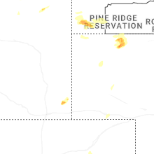
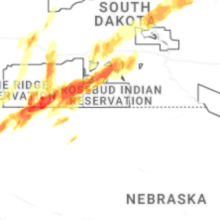
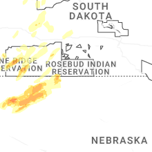
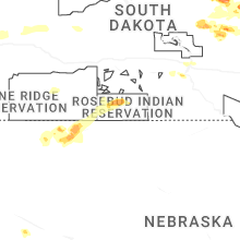
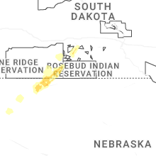
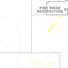
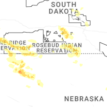
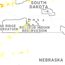
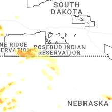
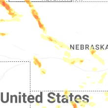
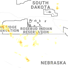
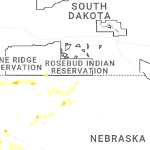
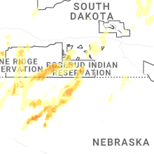


Connect with Interactive Hail Maps