

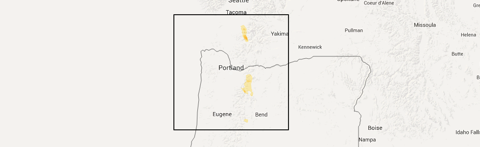
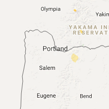
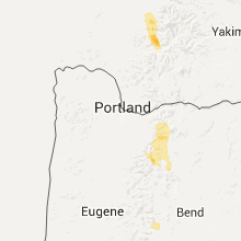
Hail Map for Government Camp, OR
The Government Camp, OR area has had 1 report of on-the-ground hail by trained spotters, and has been under severe weather warnings 0 times during the past 12 months. Doppler radar has detected hail at or near Government Camp, OR on 6 occasions.
| Name: | Government Camp, OR |
| Where Located: | 47.4 miles ESE of Portland, OR |
| Map: | Google Map for Government Camp, OR |
| Population: | 193 |
| Housing Units: | 630 |
| More Info: | Search Google for Government Camp, OR |
5
The Top Recent Hail Date for Government Camp, OR is Wednesday, April 20, 2016 (1st out of 6)
Hail and Wind Damage Spotted near Government Camp, OR
| Date / Time | Report Details |
|---|---|
| 4/20/2016 5:38 PM PDT |
 At 537 pm pdt, doppler radar indicated a severe thunderstorm capable of producing half dollar size hail. this storm was located near government camp, and moving north at 30 mph. At 537 pm pdt, doppler radar indicated a severe thunderstorm capable of producing half dollar size hail. this storm was located near government camp, and moving north at 30 mph.
|
| 8/10/2013 5:08 PM PDT | Ping Pong Ball sized hail reported 4 miles E of Government Camp, OR, 1.5 inch diameter hail observed on hwy 26 about 3 mi west of government camp |
| 8/9/2013 7:00 PM PDT | At least 10 or more trees down from tstm winds including one snapped 15-20 ft agl...lying mostly on the side of the highwa in hood river county OR, 4.3 miles W of Government Camp, OR |
| 8/9/2013 7:00 PM PDT | At least 10 or more trees down from tstm winds including one snapped 15-20 ft agl...lying mostly on the side of the highwa in clackamas county OR, 1.9 miles W of Government Camp, OR |
Hail Maps for Government Camp, OR


Connect with Interactive Hail Maps