

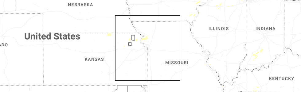
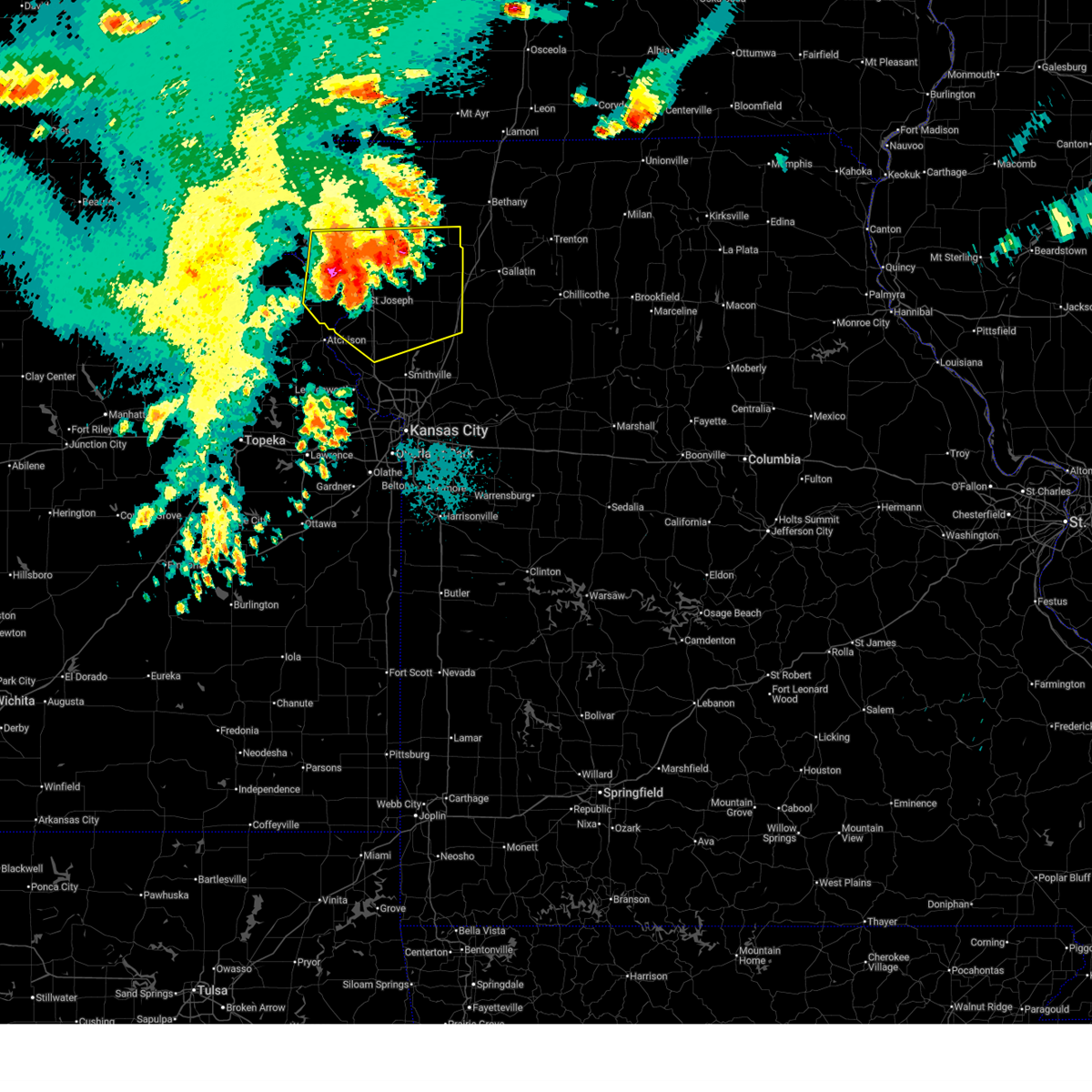
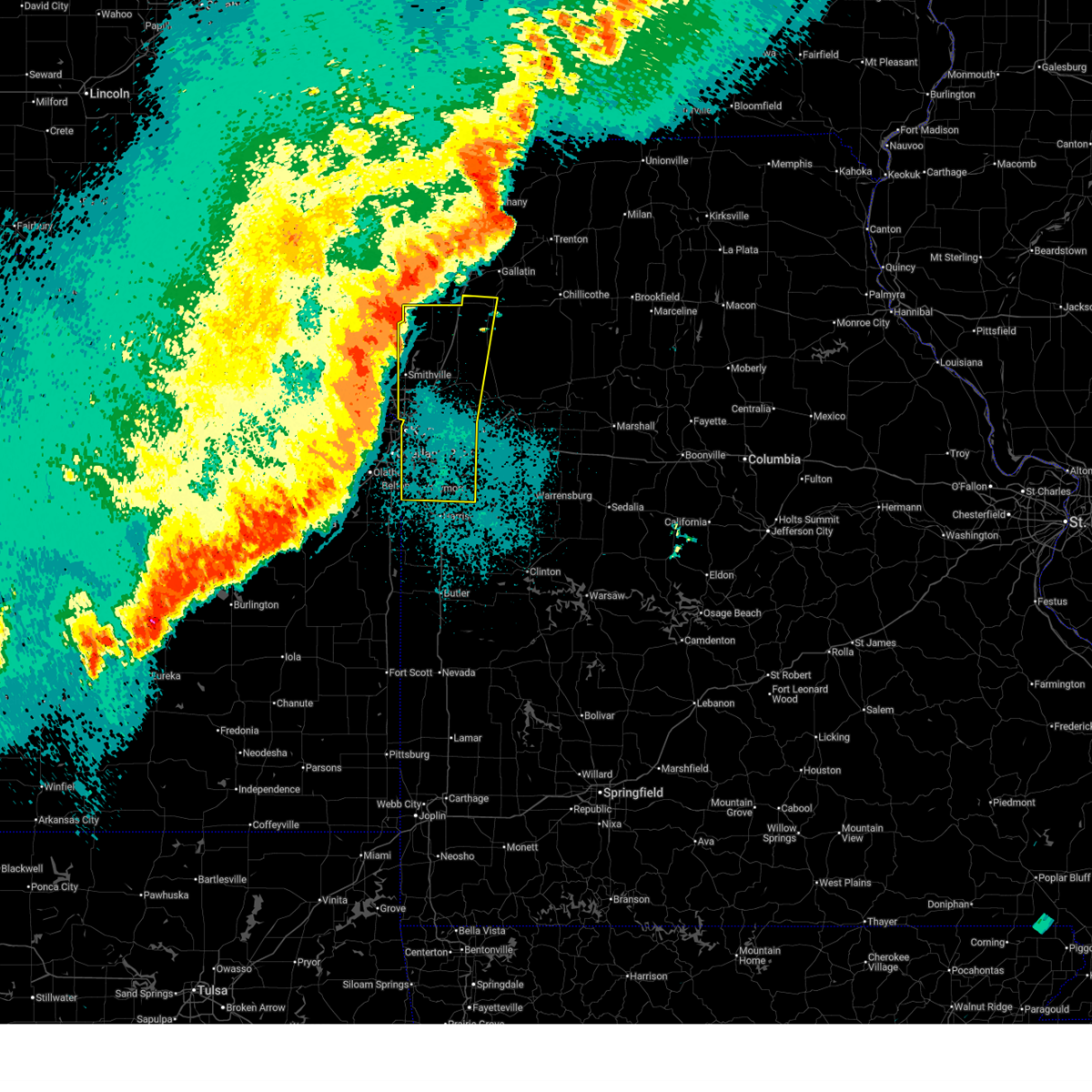
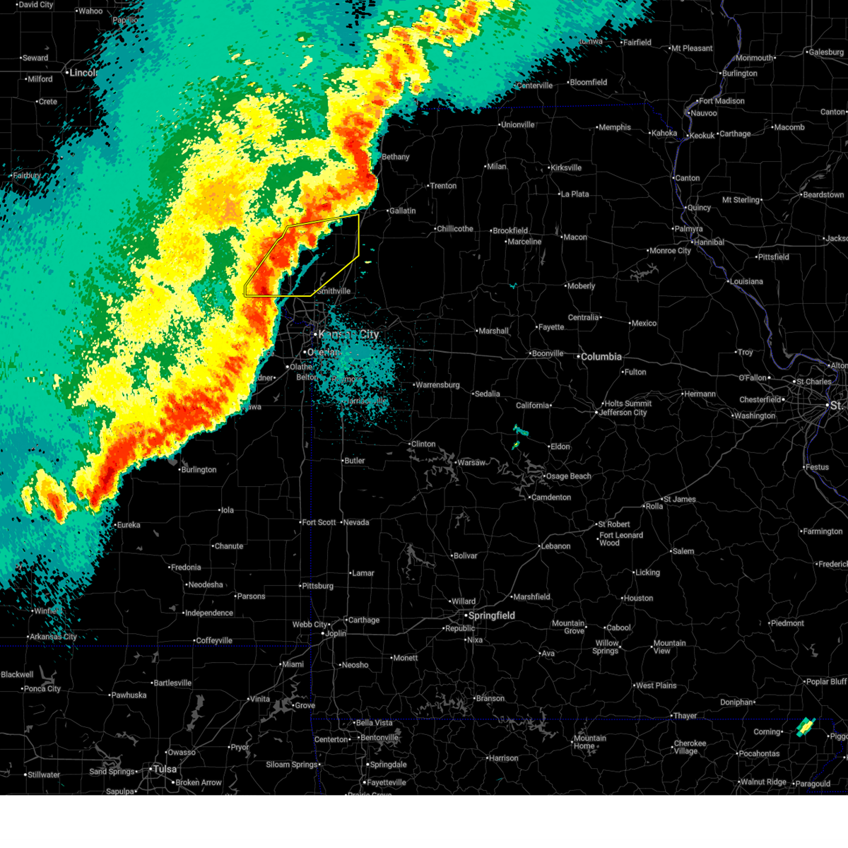
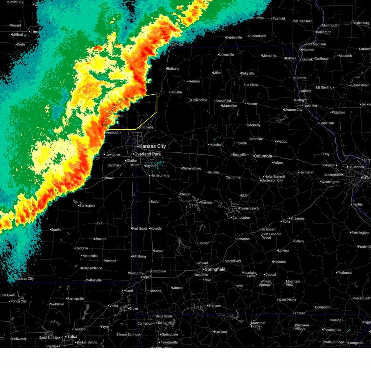
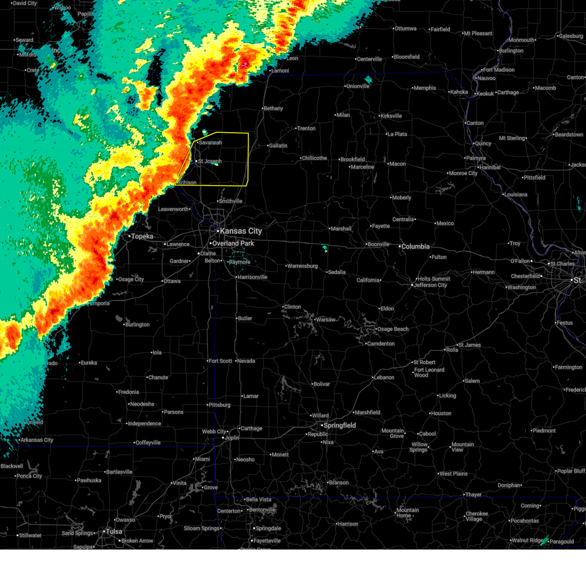
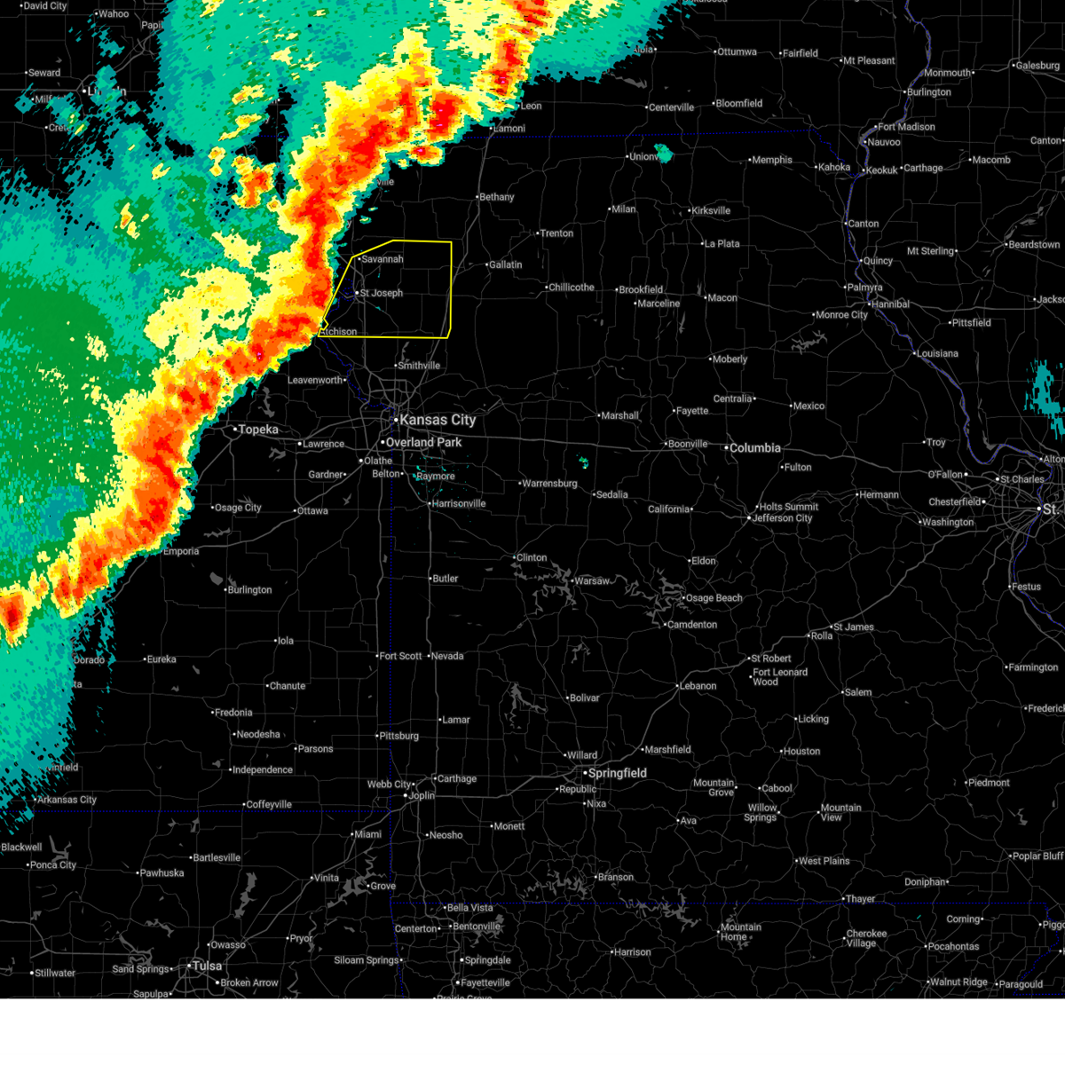
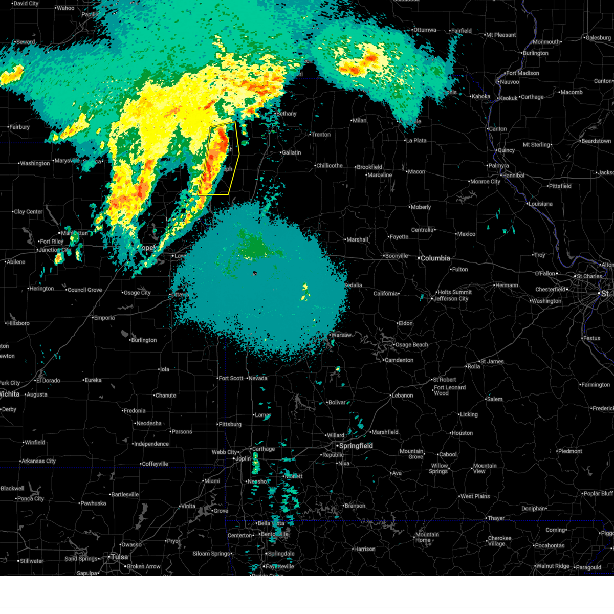
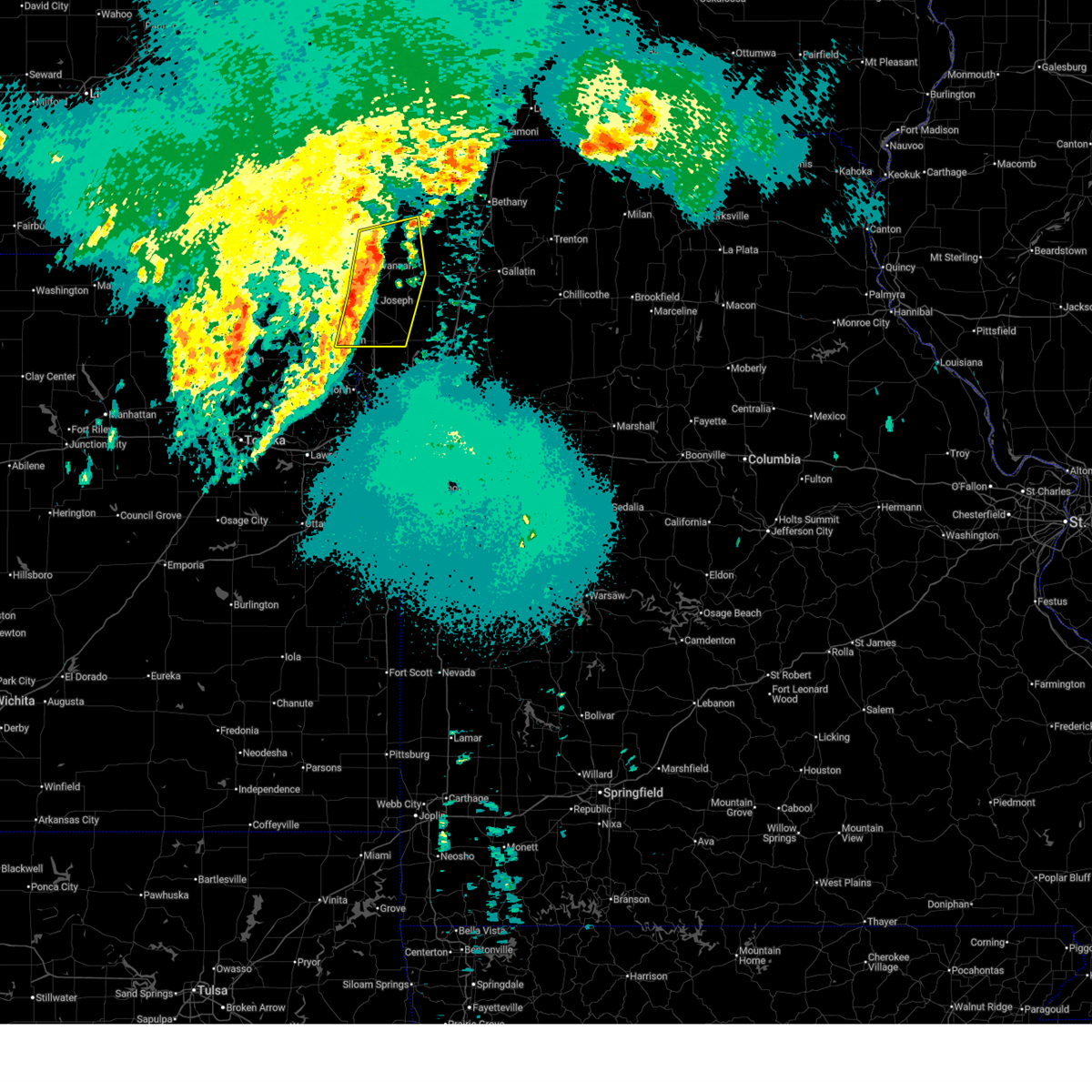
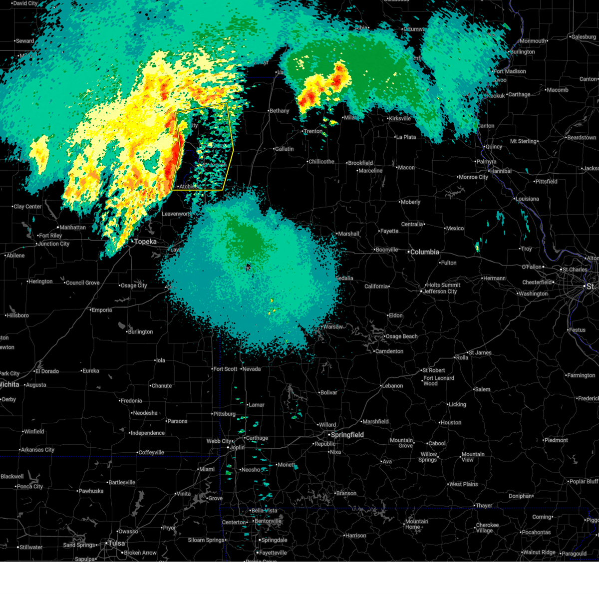
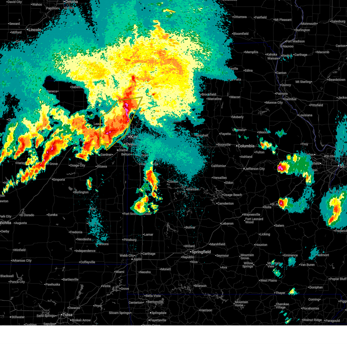
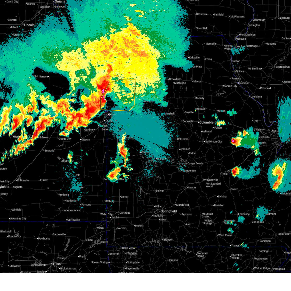
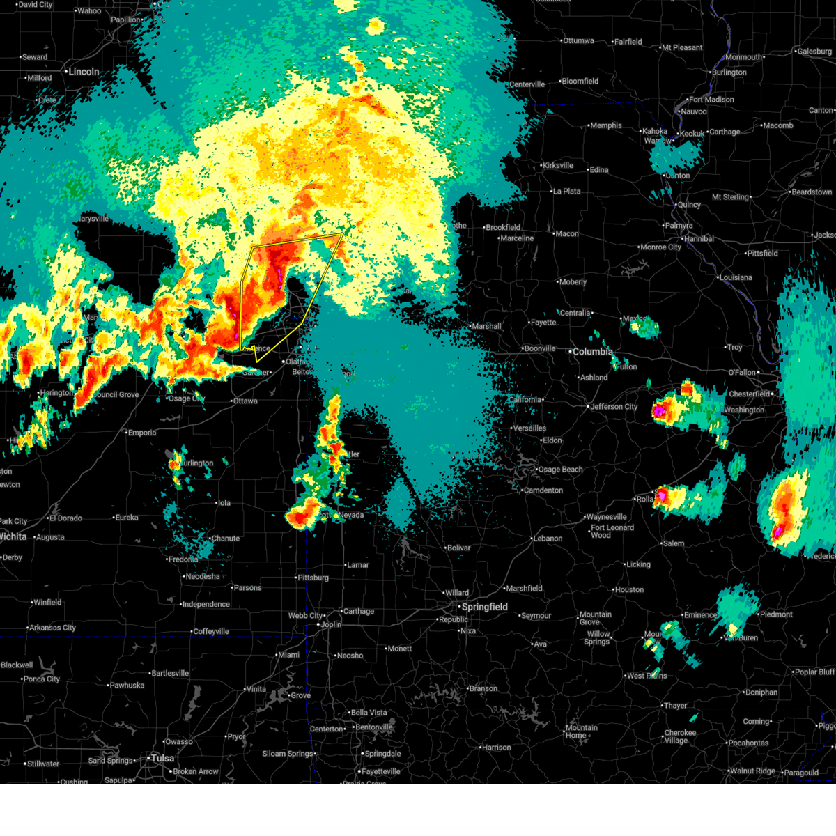
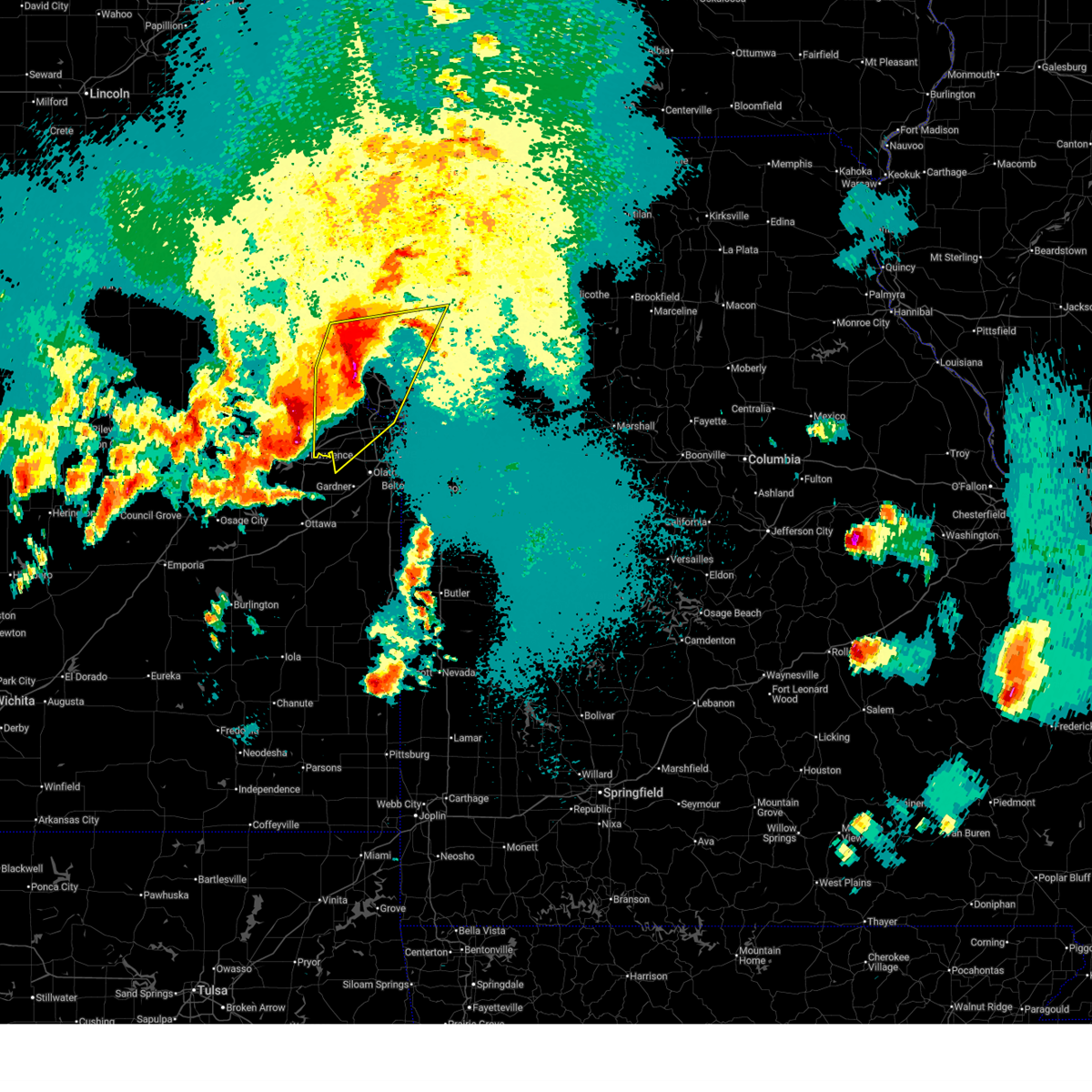
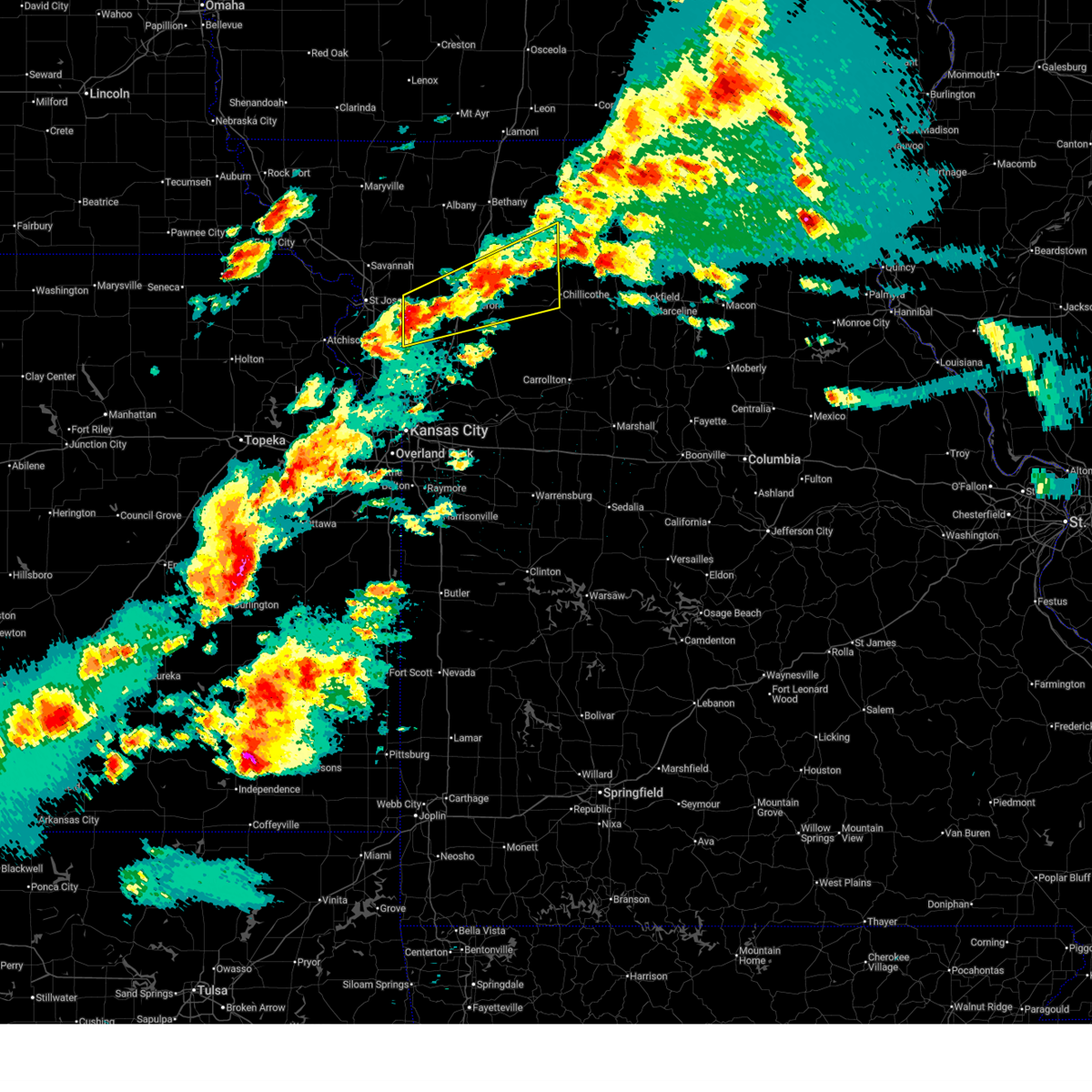
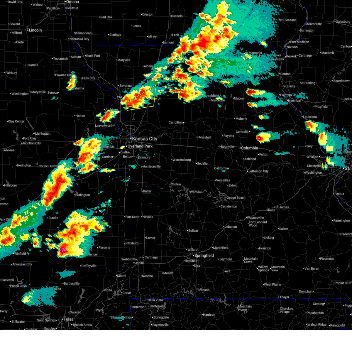
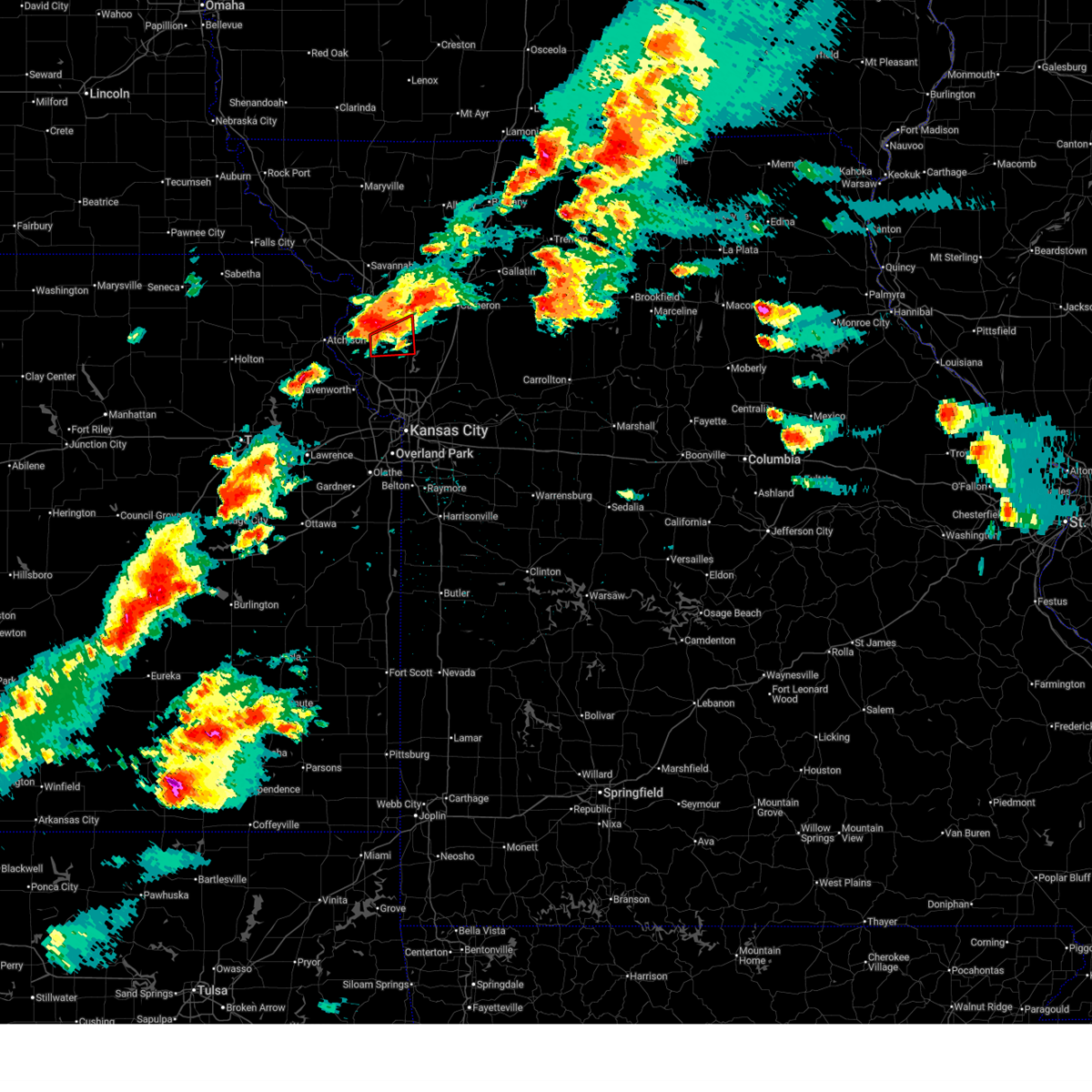
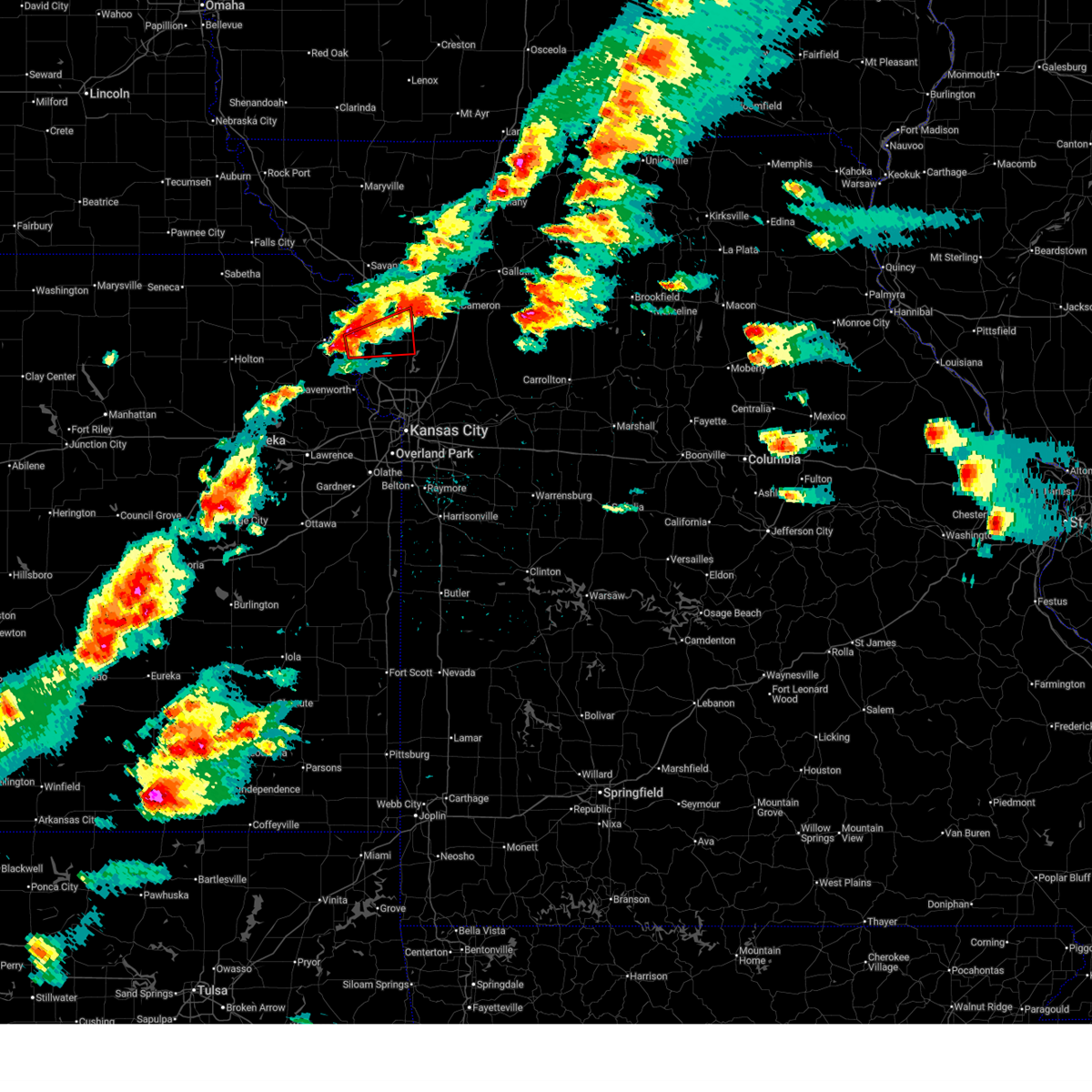
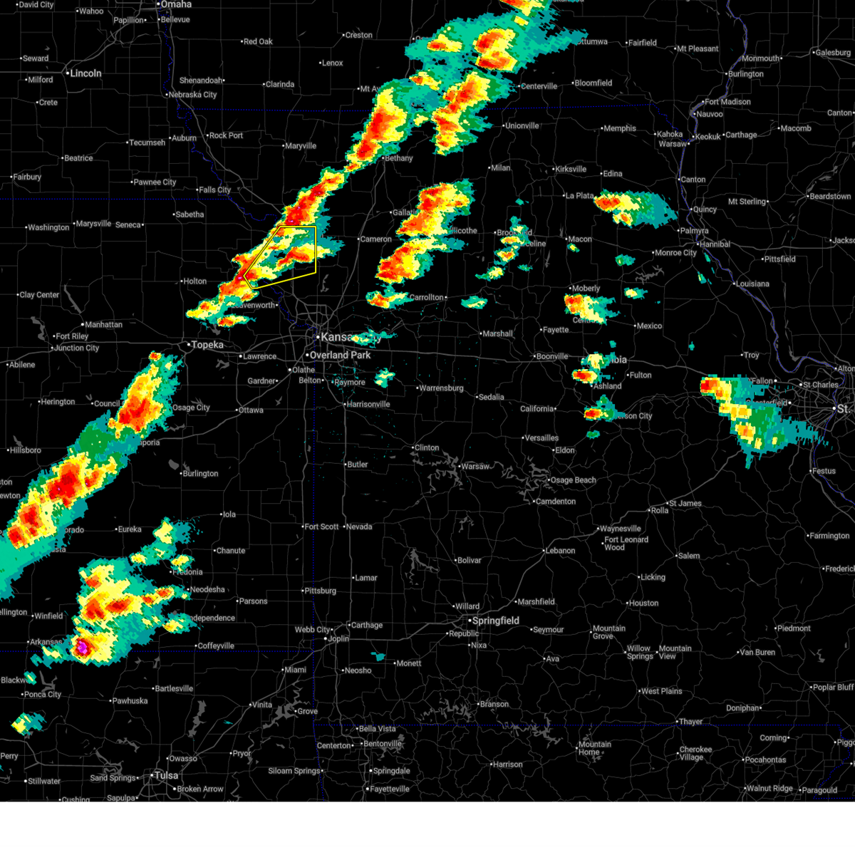
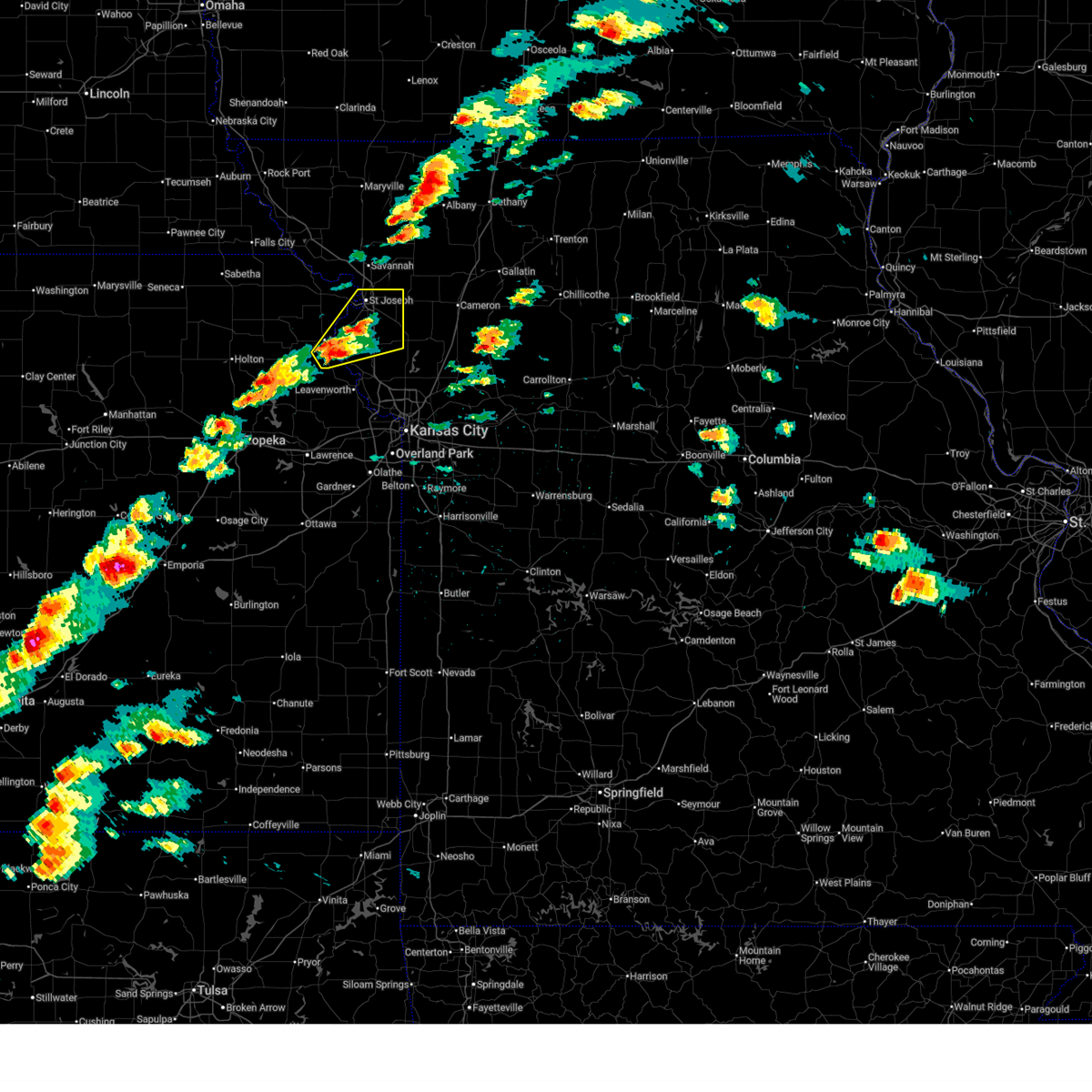
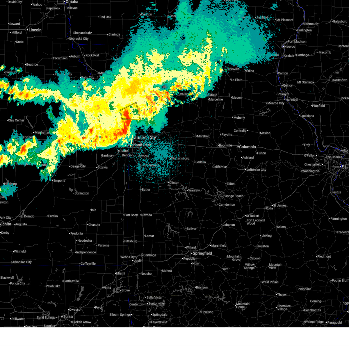
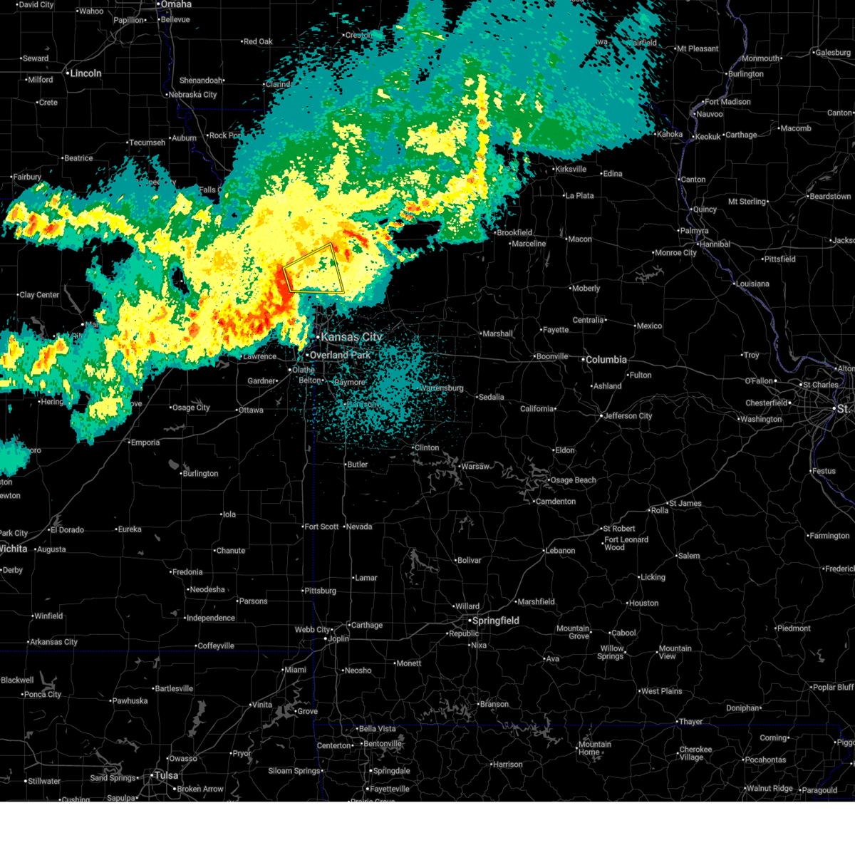
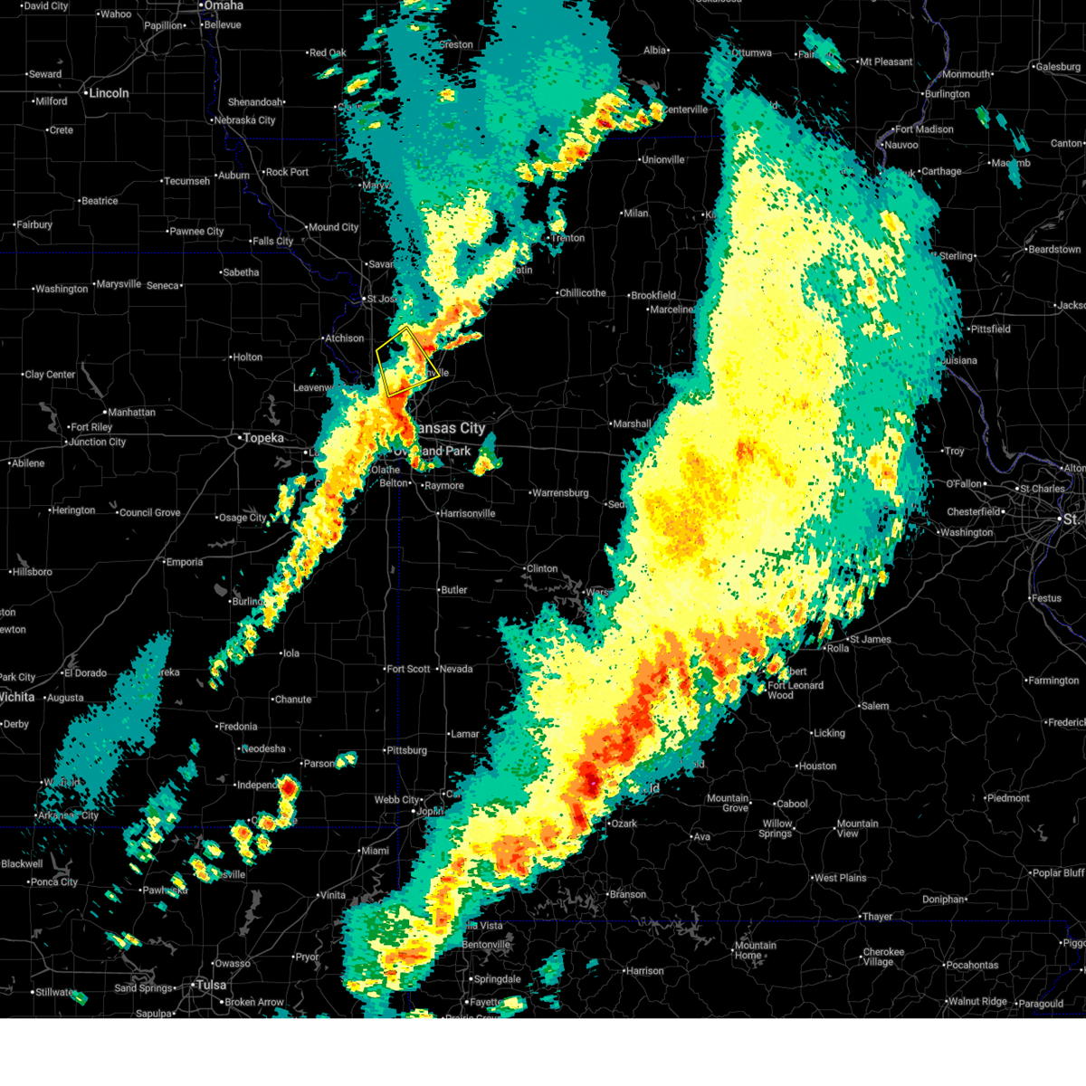
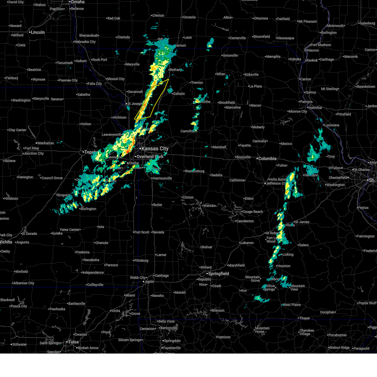
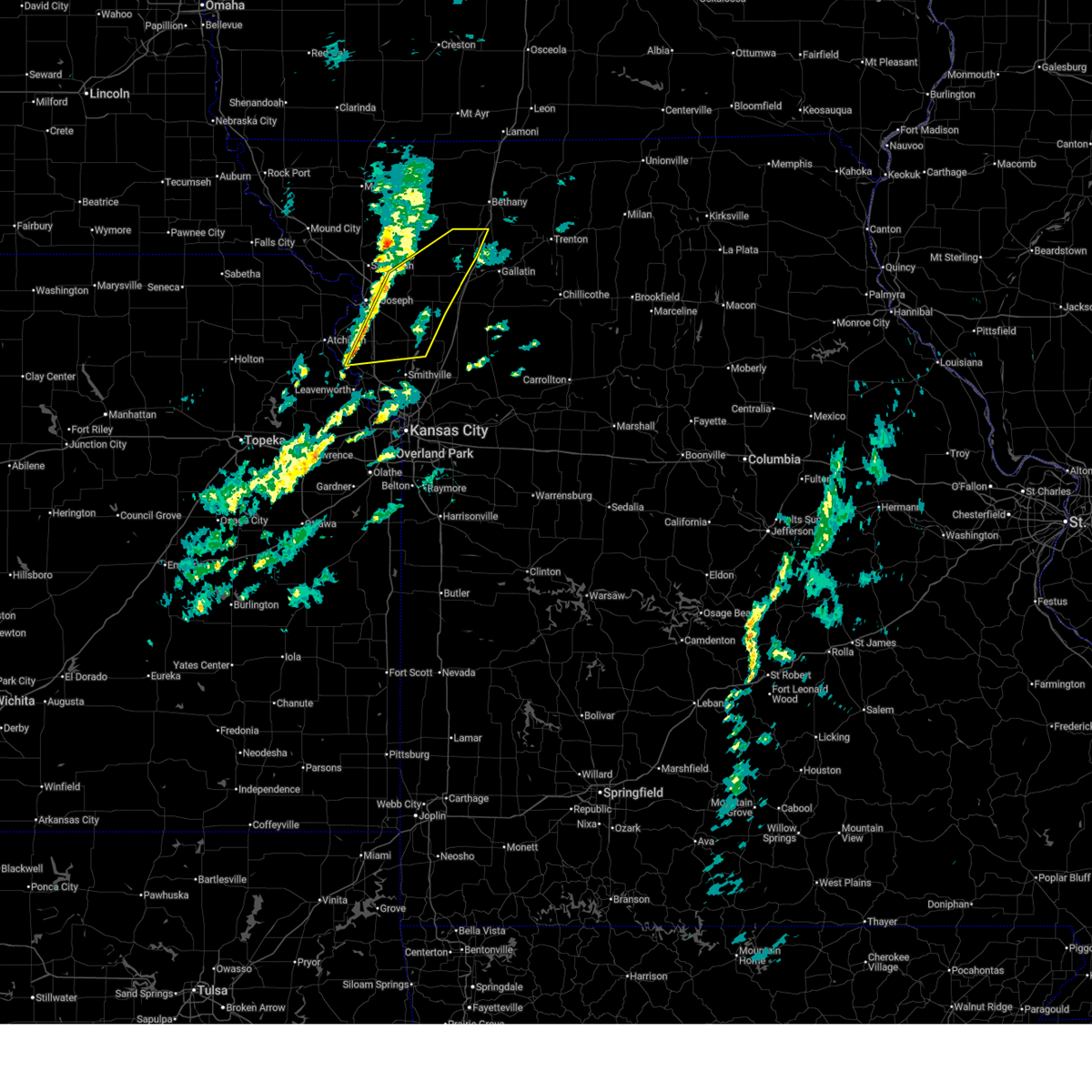
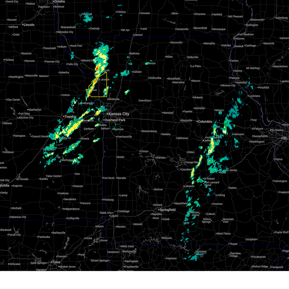
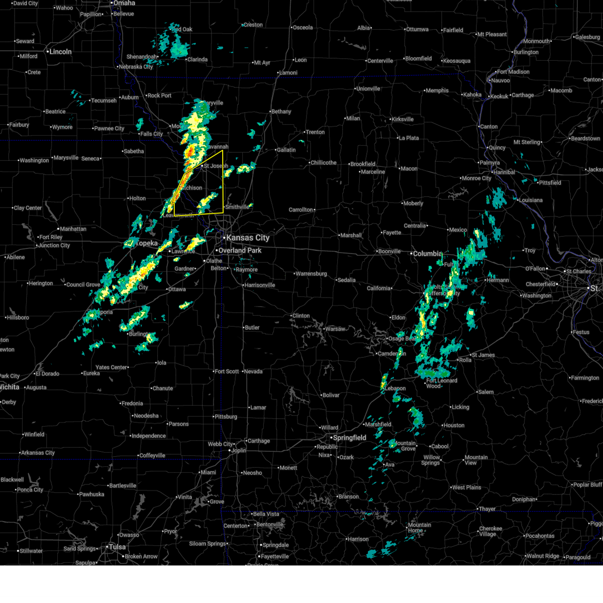
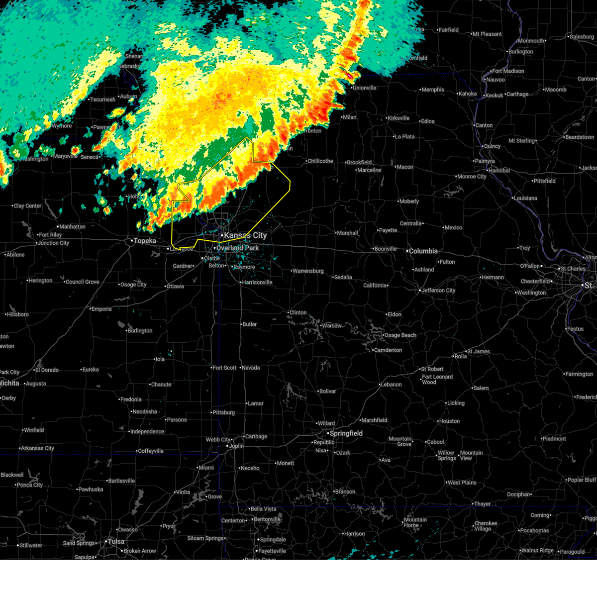
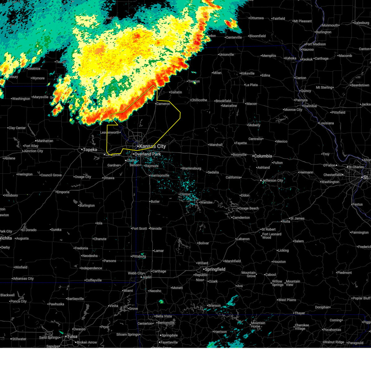
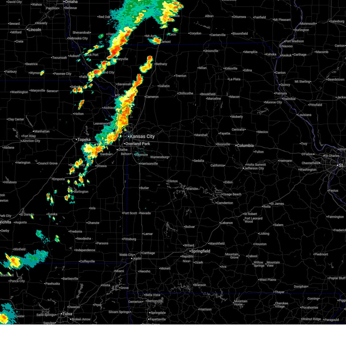
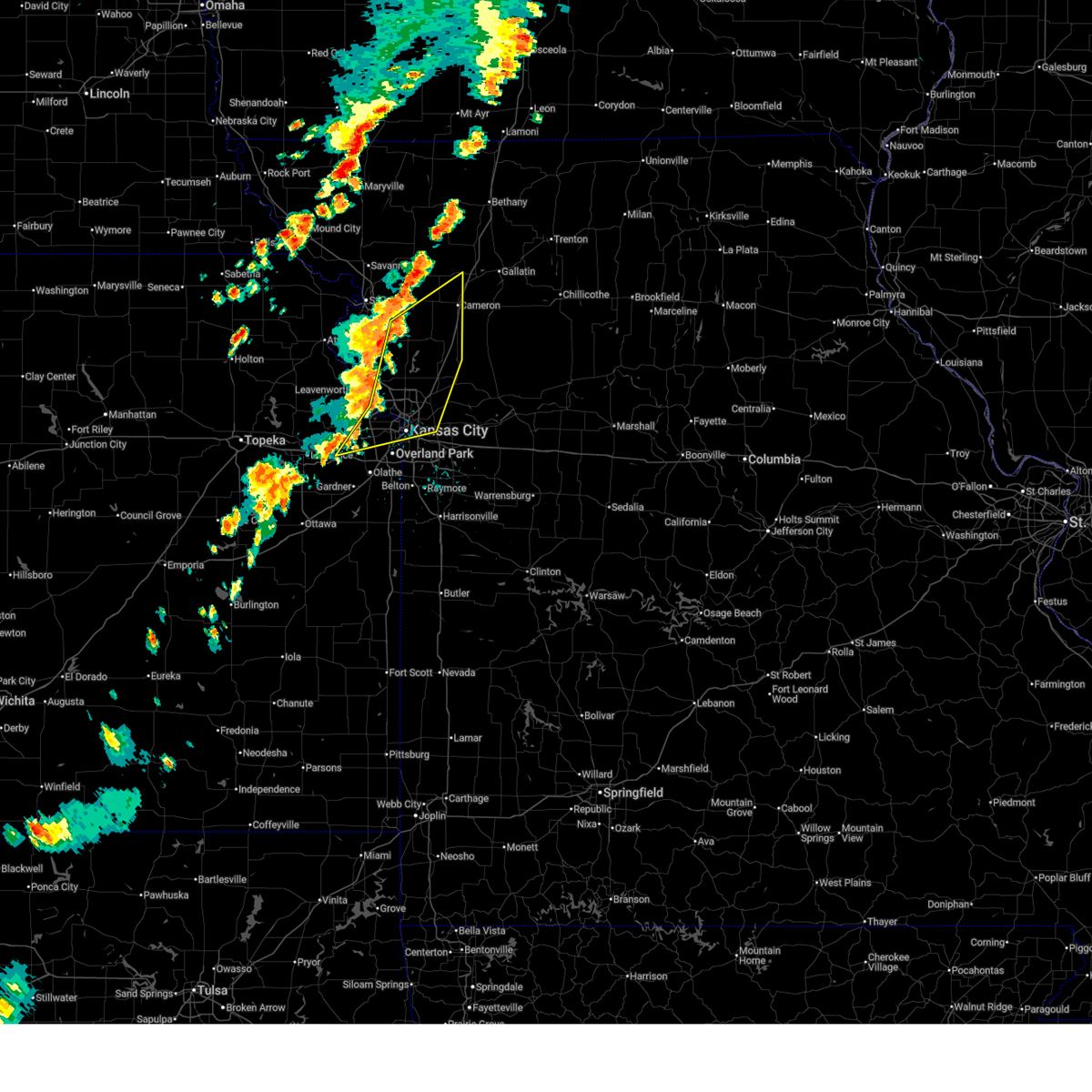
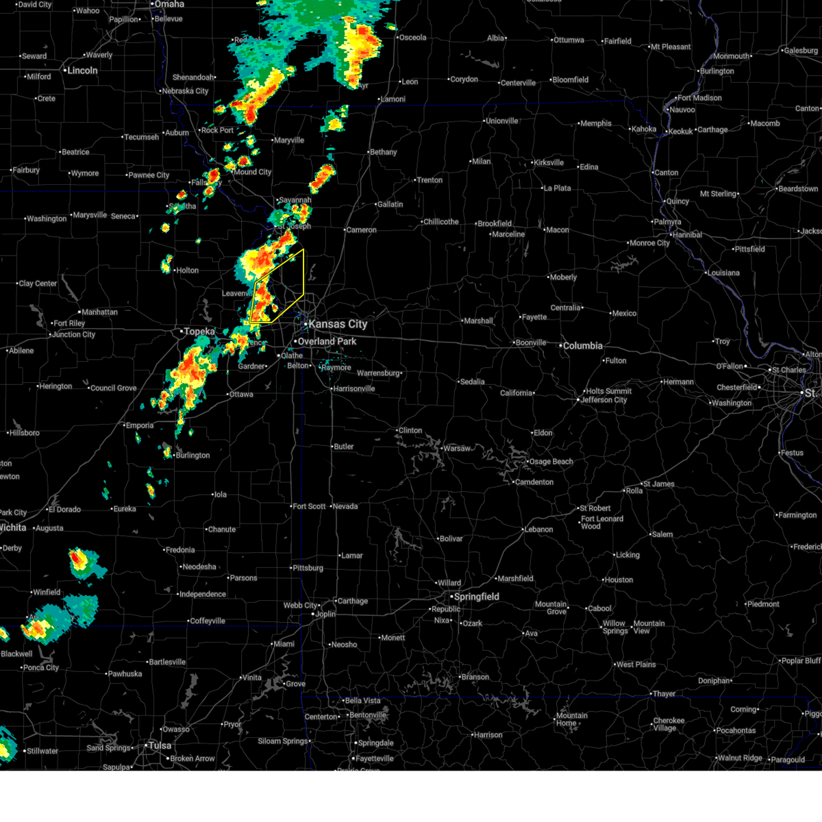
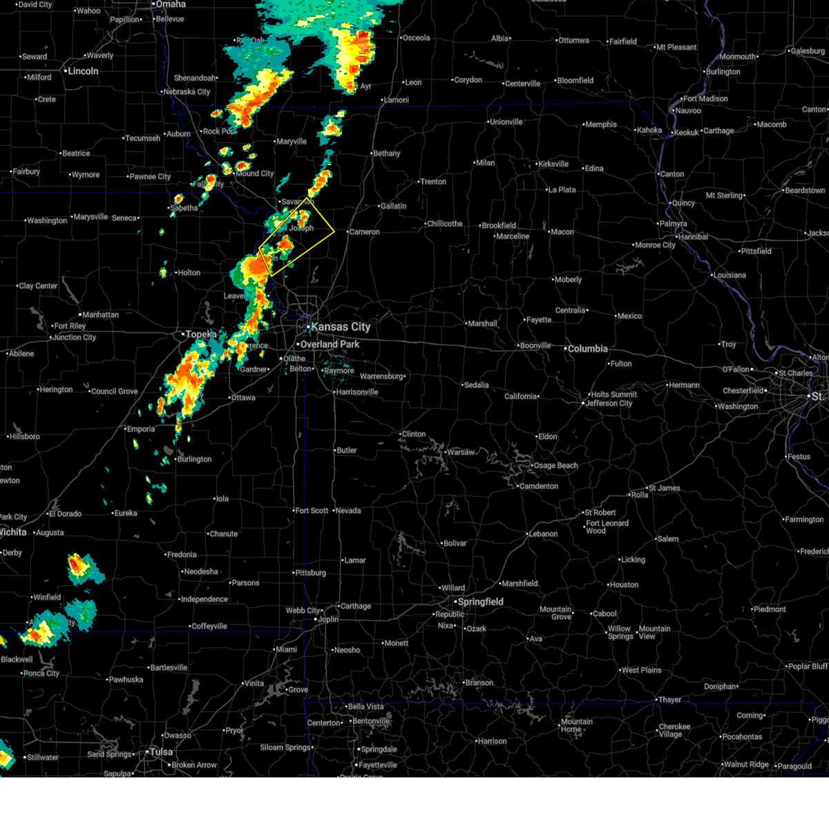
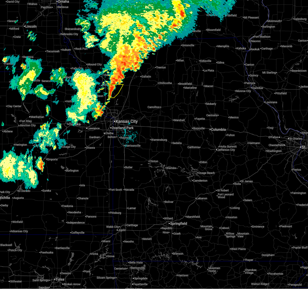
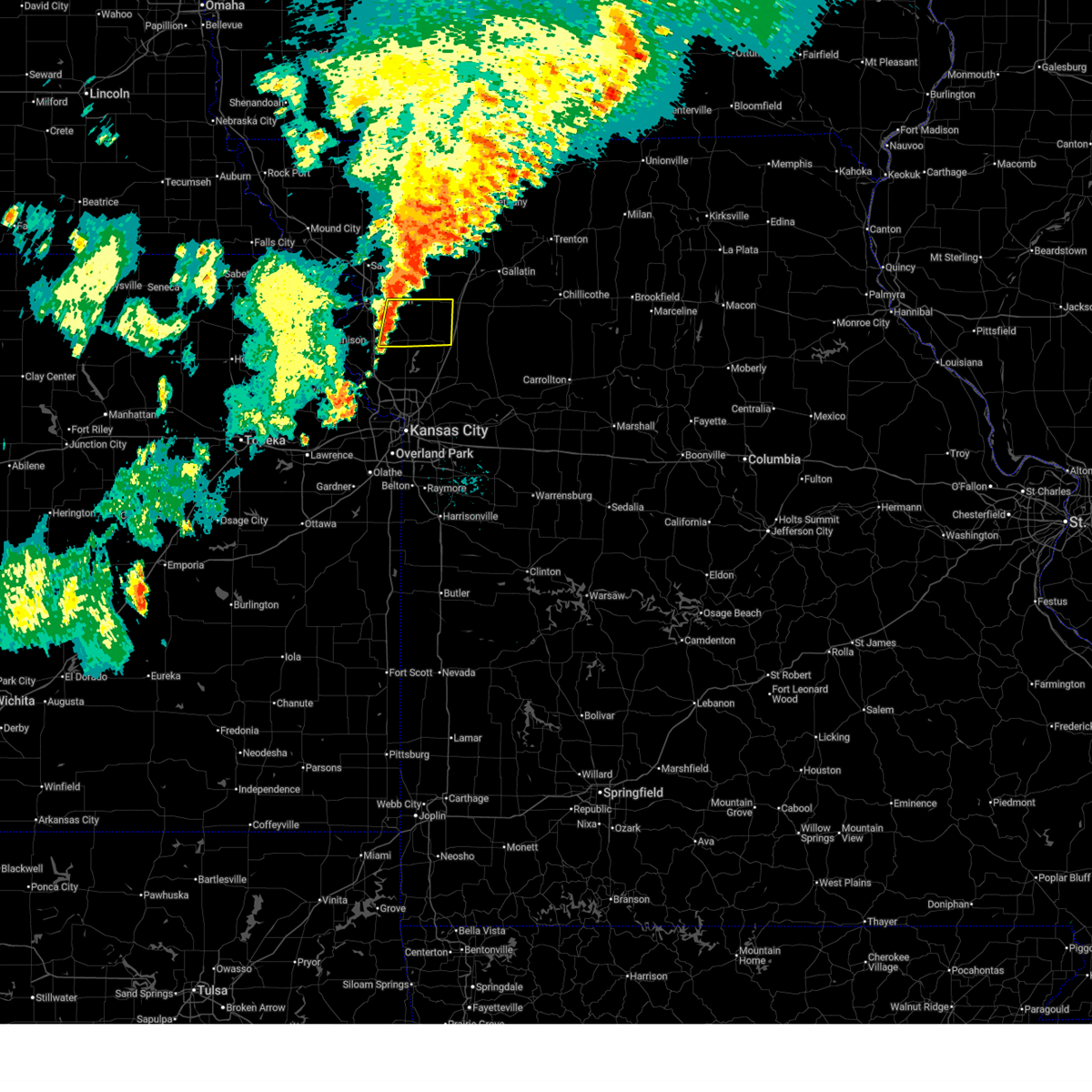
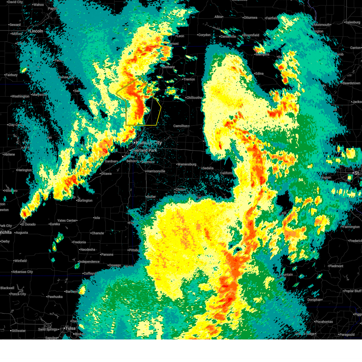
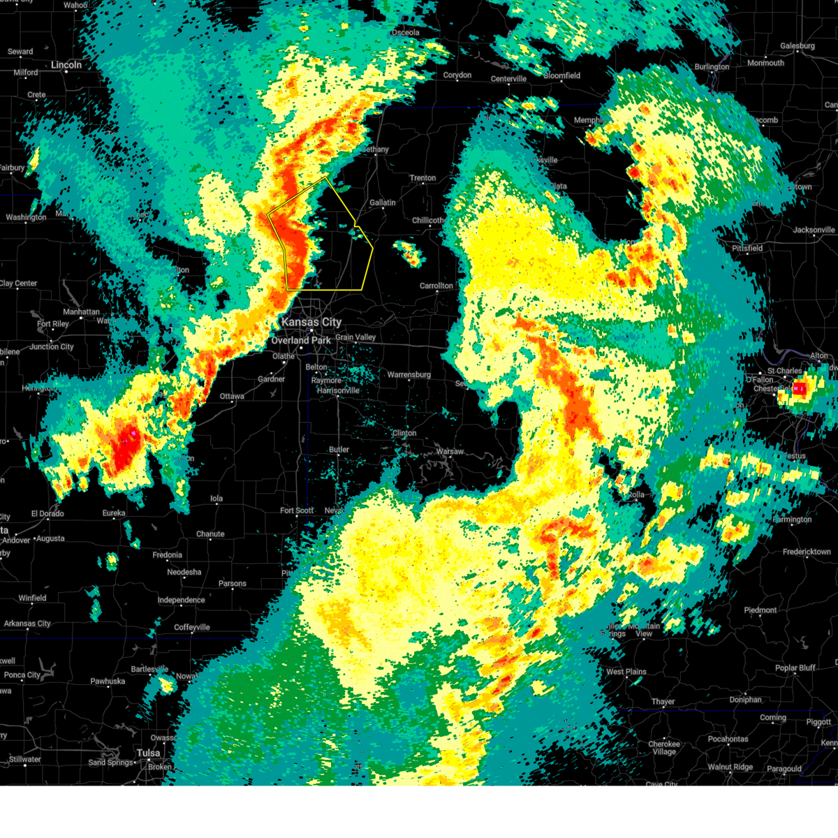
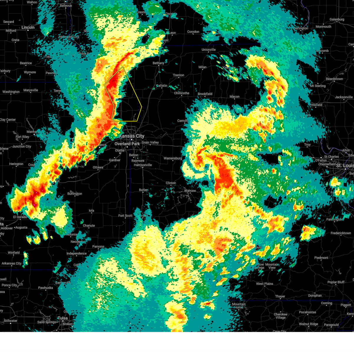
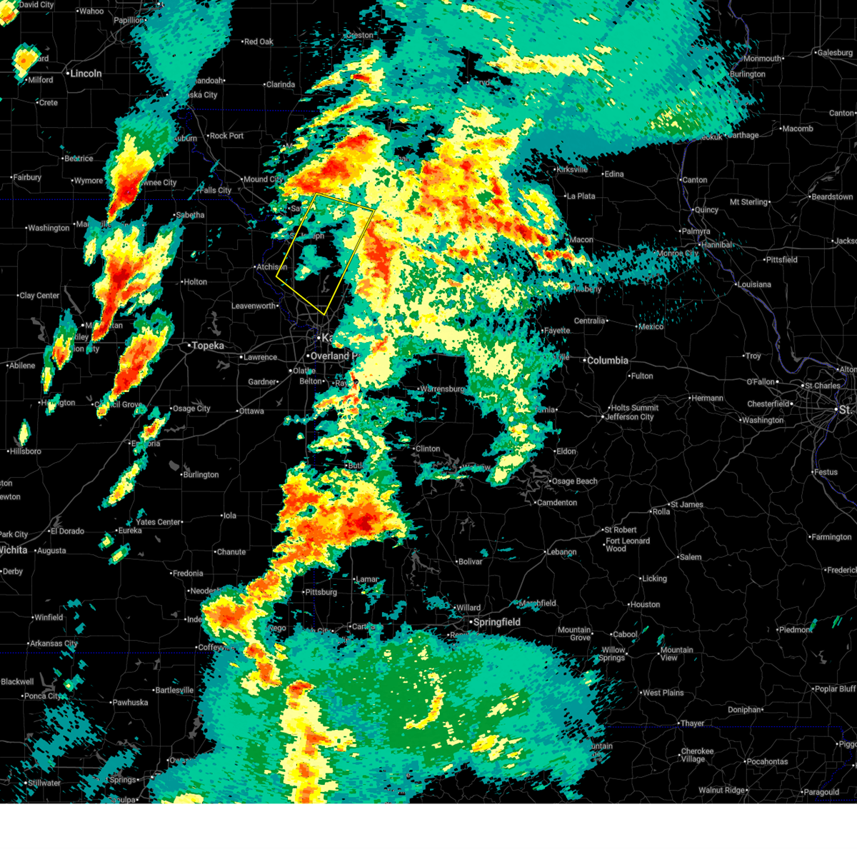
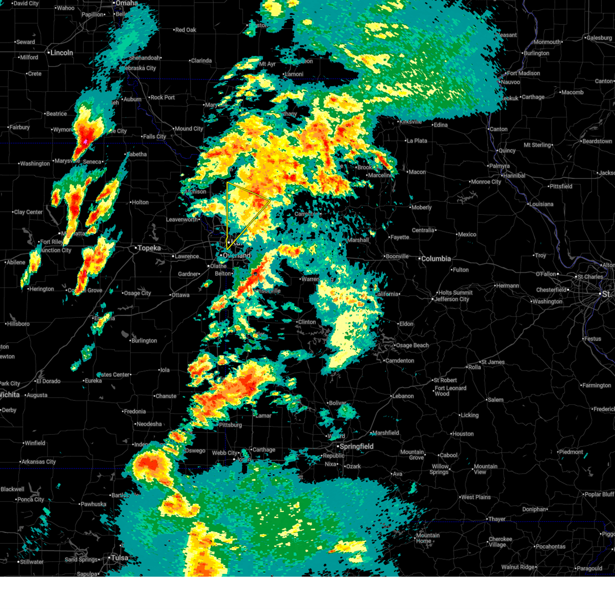
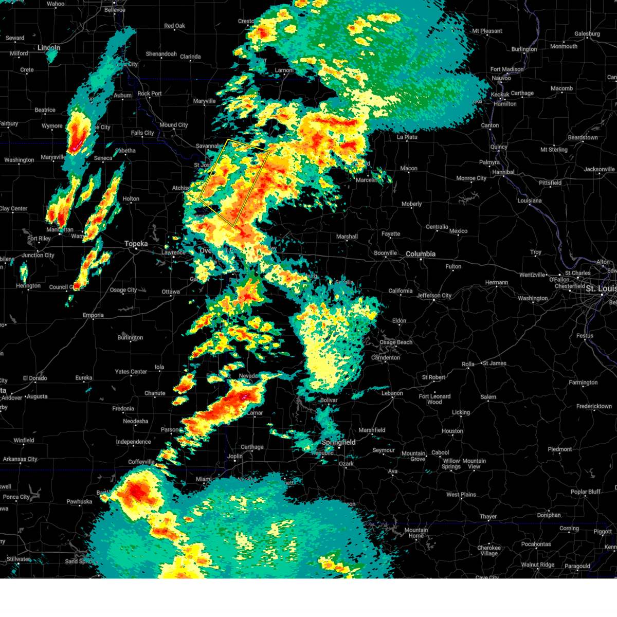
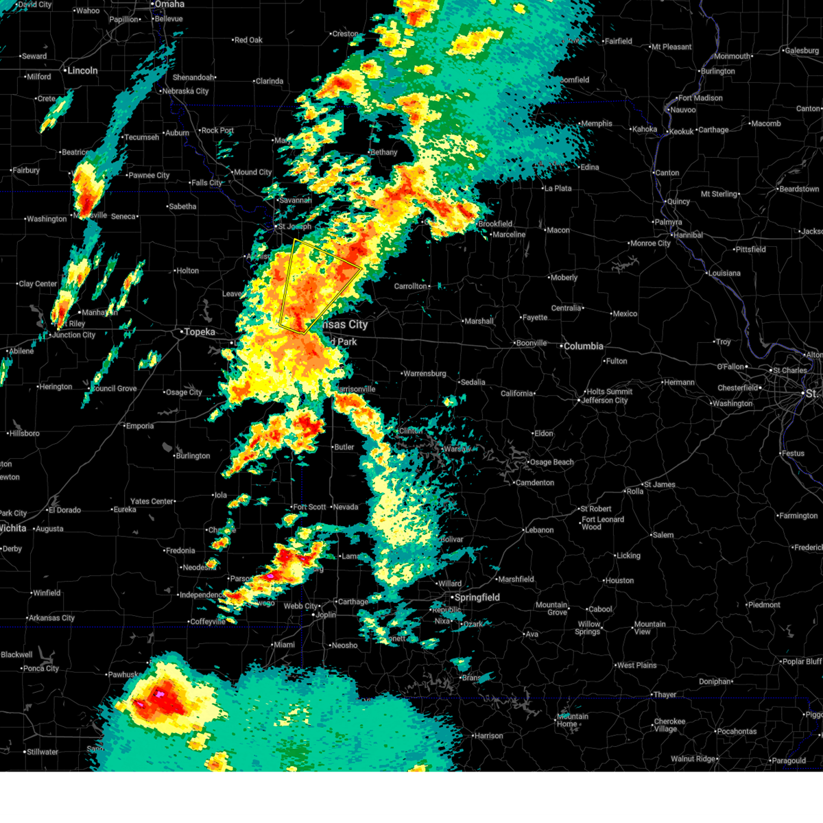
Hail Map for Gower, MO
The Gower, MO area has had 3 reports of on-the-ground hail by trained spotters, and has been under severe weather warnings 41 times during the past 12 months. Doppler radar has detected hail at or near Gower, MO on 60 occasions, including 3 occasions during the past year.
| Name: | Gower, MO |
| Where Located: | 35.2 miles N of Kansas City, MO |
| Map: | Google Map for Gower, MO |
| Population: | 1526 |
| Housing Units: | 598 |
| More Info: | Search Google for Gower, MO |
1
The Top Recent Hail Date for Gower, MO is Friday, July 3, 2026 (16th out of 60)
Hail and Wind Damage Spotted near Gower, MO
| Date / Time | Report Details |
|---|---|
| 7/4/2026 1:06 AM CDT |
 The storm which prompted the warning has weakened below severe limits, and no longer poses an immediate threat to life or property. therefore, the warning will be allowed to expire. however, gusty winds and heavy rain are still possible with this thunderstorm. The storm which prompted the warning has weakened below severe limits, and no longer poses an immediate threat to life or property. therefore, the warning will be allowed to expire. however, gusty winds and heavy rain are still possible with this thunderstorm.
|
| 7/4/2026 1:00 AM CDT |
 At 100 am cdt, a severe thunderstorm was located near maysville, moving east at 40 mph (radar indicated). Hazards include 60 mph wind gusts and nickel size hail. Expect damage to roofs, siding, and trees. locations impacted include, st. joseph, cameron, savannah, plattsburg, gower, maysville, country club villa, country club, stewartsville, agency, edgerton, union star, osborn, clarksdale, easton, turney, cosby, weatherby, amity, and fairport. this includes the following highways, interstate 35 in missouri between mile markers 43 and 56. interstate 29 between mile markers 39 and 54. Interstate 229 between mile markers 0 and 1. At 100 am cdt, a severe thunderstorm was located near maysville, moving east at 40 mph (radar indicated). Hazards include 60 mph wind gusts and nickel size hail. Expect damage to roofs, siding, and trees. locations impacted include, st. joseph, cameron, savannah, plattsburg, gower, maysville, country club villa, country club, stewartsville, agency, edgerton, union star, osborn, clarksdale, easton, turney, cosby, weatherby, amity, and fairport. this includes the following highways, interstate 35 in missouri between mile markers 43 and 56. interstate 29 between mile markers 39 and 54. Interstate 229 between mile markers 0 and 1.
|
| 7/4/2026 12:46 AM CDT |
 At 1246 am cdt, a severe thunderstorm was located near maysville, moving east at 40 mph (radar indicated). Hazards include 60 mph wind gusts and nickel size hail. Expect damage to roofs, siding, and trees. locations impacted include, st. joseph, cameron, savannah, plattsburg, gower, wathena, elwood, maysville, country club villa, country club, king city, stewartsville, agency, edgerton, dearborn, camden point, union star, osborn, amazonia, and clarksdale. this includes the following highways, interstate 35 in missouri between mile markers 43 and 56. interstate 29 between mile markers 26 and 71. Interstate 229 between mile markers 0 and 14. At 1246 am cdt, a severe thunderstorm was located near maysville, moving east at 40 mph (radar indicated). Hazards include 60 mph wind gusts and nickel size hail. Expect damage to roofs, siding, and trees. locations impacted include, st. joseph, cameron, savannah, plattsburg, gower, wathena, elwood, maysville, country club villa, country club, king city, stewartsville, agency, edgerton, dearborn, camden point, union star, osborn, amazonia, and clarksdale. this includes the following highways, interstate 35 in missouri between mile markers 43 and 56. interstate 29 between mile markers 26 and 71. Interstate 229 between mile markers 0 and 14.
|
| 7/4/2026 12:28 AM CDT |
 Svreax the national weather service in pleasant hill has issued a * severe thunderstorm warning for, doniphan county in northeastern kansas, buchanan county in northwestern missouri, clinton county in northwestern missouri, southern gentry county in northwestern missouri, southeastern holt county in northwestern missouri, northeastern platte county in west central missouri, andrew county in northwestern missouri, dekalb county in northwestern missouri, * until 115 am cdt. * at 1228 am cdt, a severe thunderstorm was located near union star, or near savannah, moving east at 40 mph (radar indicated). Hazards include 60 mph wind gusts and nickel size hail. expect damage to roofs, siding, and trees Svreax the national weather service in pleasant hill has issued a * severe thunderstorm warning for, doniphan county in northeastern kansas, buchanan county in northwestern missouri, clinton county in northwestern missouri, southern gentry county in northwestern missouri, southeastern holt county in northwestern missouri, northeastern platte county in west central missouri, andrew county in northwestern missouri, dekalb county in northwestern missouri, * until 115 am cdt. * at 1228 am cdt, a severe thunderstorm was located near union star, or near savannah, moving east at 40 mph (radar indicated). Hazards include 60 mph wind gusts and nickel size hail. expect damage to roofs, siding, and trees
|
| 5/18/2026 9:13 PM CDT |
 Svreax the national weather service in pleasant hill has issued a * severe thunderstorm warning for, northern cass county in west central missouri, southeastern buchanan county in northwestern missouri, clinton county in northwestern missouri, clay county in west central missouri, western ray county in west central missouri, western caldwell county in north central missouri, eastern platte county in west central missouri, jackson county in west central missouri, * until 1015 pm cdt. * at 913 pm cdt, severe thunderstorms were located along a line extending from gower to edgerton, moving east at 50 mph (automated weather station). Hazards include 70 mph wind gusts and penny size hail. Expect considerable tree damage. Damage is likely to mobile homes, roofs, and outbuildings. Svreax the national weather service in pleasant hill has issued a * severe thunderstorm warning for, northern cass county in west central missouri, southeastern buchanan county in northwestern missouri, clinton county in northwestern missouri, clay county in west central missouri, western ray county in west central missouri, western caldwell county in north central missouri, eastern platte county in west central missouri, jackson county in west central missouri, * until 1015 pm cdt. * at 913 pm cdt, severe thunderstorms were located along a line extending from gower to edgerton, moving east at 50 mph (automated weather station). Hazards include 70 mph wind gusts and penny size hail. Expect considerable tree damage. Damage is likely to mobile homes, roofs, and outbuildings.
|
| 5/18/2026 9:06 PM CDT |
 At 905 pm cdt, severe thunderstorms were located along a line extending from near stewartsville to near leavenworth, moving east at 55 mph (automated weather station). Hazards include 60 mph wind gusts and quarter size hail. Hail damage to vehicles is expected. expect wind damage to roofs, siding, and trees. locations impacted include, st. joseph, leavenworth, cameron, smithville, platte city, plattsburg, lathrop, weston, gower, stewartsville, agency, trimble, edgerton, dearborn, camden point, osborn, rushville, clarksdale, tracy, and lewis and clark village. this includes the following highways, interstate 35 in missouri between mile markers 43 and 55. interstate 29 between mile markers 18 and 50. Interstate 229 between mile markers 0 and 4. At 905 pm cdt, severe thunderstorms were located along a line extending from near stewartsville to near leavenworth, moving east at 55 mph (automated weather station). Hazards include 60 mph wind gusts and quarter size hail. Hail damage to vehicles is expected. expect wind damage to roofs, siding, and trees. locations impacted include, st. joseph, leavenworth, cameron, smithville, platte city, plattsburg, lathrop, weston, gower, stewartsville, agency, trimble, edgerton, dearborn, camden point, osborn, rushville, clarksdale, tracy, and lewis and clark village. this includes the following highways, interstate 35 in missouri between mile markers 43 and 55. interstate 29 between mile markers 18 and 50. Interstate 229 between mile markers 0 and 4.
|
| 5/18/2026 8:42 PM CDT |
 Svreax the national weather service in pleasant hill has issued a * severe thunderstorm warning for, southeastern doniphan county in northeastern kansas, northwestern leavenworth county in northeastern kansas, eastern atchison county in northeastern kansas, buchanan county in northwestern missouri, clinton county in northwestern missouri, northwestern clay county in west central missouri, platte county in west central missouri, southeastern andrew county in northwestern missouri, southern dekalb county in northwestern missouri, * until 945 pm cdt. * at 842 pm cdt, severe thunderstorms were located along a line extending from near clarksdale to 6 miles north of easton, moving east at 35 mph (automated weather station). Hazards include 60 mph wind gusts and quarter size hail. Hail damage to vehicles is expected. Expect wind damage to roofs, siding, and trees. Svreax the national weather service in pleasant hill has issued a * severe thunderstorm warning for, southeastern doniphan county in northeastern kansas, northwestern leavenworth county in northeastern kansas, eastern atchison county in northeastern kansas, buchanan county in northwestern missouri, clinton county in northwestern missouri, northwestern clay county in west central missouri, platte county in west central missouri, southeastern andrew county in northwestern missouri, southern dekalb county in northwestern missouri, * until 945 pm cdt. * at 842 pm cdt, severe thunderstorms were located along a line extending from near clarksdale to 6 miles north of easton, moving east at 35 mph (automated weather station). Hazards include 60 mph wind gusts and quarter size hail. Hail damage to vehicles is expected. Expect wind damage to roofs, siding, and trees.
|
| 5/18/2026 8:17 PM CDT |
 At 816 pm cdt, severe thunderstorms were located along a line extending from near savannah to elwood to rushville, moving east at 65 mph (automated weather station. at 813 pm, the st. joseph airport reported a 61 mph wind gust). Hazards include 70 mph wind gusts and quarter size hail. Hail damage to vehicles is expected. expect considerable tree damage. wind damage is also likely to mobile homes, roofs, and outbuildings. locations impacted include, st. joseph, cameron, savannah, plattsburg, lathrop, gower, wathena, elwood, maysville, country club villa, country club, stewartsville, agency, union star, osborn, amazonia, rushville, clarksdale, lewis and clark village, and easton. this includes the following highways, interstate 35 in missouri between mile markers 39 and 56. interstate 29 between mile markers 32 and 59. Interstate 229 between mile markers 0 and 14. At 816 pm cdt, severe thunderstorms were located along a line extending from near savannah to elwood to rushville, moving east at 65 mph (automated weather station. at 813 pm, the st. joseph airport reported a 61 mph wind gust). Hazards include 70 mph wind gusts and quarter size hail. Hail damage to vehicles is expected. expect considerable tree damage. wind damage is also likely to mobile homes, roofs, and outbuildings. locations impacted include, st. joseph, cameron, savannah, plattsburg, lathrop, gower, wathena, elwood, maysville, country club villa, country club, stewartsville, agency, union star, osborn, amazonia, rushville, clarksdale, lewis and clark village, and easton. this includes the following highways, interstate 35 in missouri between mile markers 39 and 56. interstate 29 between mile markers 32 and 59. Interstate 229 between mile markers 0 and 14.
|
| 5/18/2026 8:04 PM CDT |
 Svreax the national weather service in pleasant hill has issued a * severe thunderstorm warning for, southeastern doniphan county in northeastern kansas, buchanan county in northwestern missouri, clinton county in northwestern missouri, southeastern andrew county in northwestern missouri, dekalb county in northwestern missouri, * until 845 pm cdt. * at 804 pm cdt, severe thunderstorms were located along a line extending from 6 miles southeast of oregon to 6 miles northwest of rushville to near atchison, moving east at 65 mph (radar indicated). Hazards include 70 mph wind gusts and quarter size hail. Hail damage to vehicles is expected. expect considerable tree damage. Wind damage is also likely to mobile homes, roofs, and outbuildings. Svreax the national weather service in pleasant hill has issued a * severe thunderstorm warning for, southeastern doniphan county in northeastern kansas, buchanan county in northwestern missouri, clinton county in northwestern missouri, southeastern andrew county in northwestern missouri, dekalb county in northwestern missouri, * until 845 pm cdt. * at 804 pm cdt, severe thunderstorms were located along a line extending from 6 miles southeast of oregon to 6 miles northwest of rushville to near atchison, moving east at 65 mph (radar indicated). Hazards include 70 mph wind gusts and quarter size hail. Hail damage to vehicles is expected. expect considerable tree damage. Wind damage is also likely to mobile homes, roofs, and outbuildings.
|
| 5/17/2026 2:45 AM CDT |
 At 244 am cdt, severe thunderstorms were located along a line extending from near king city to 7 miles east of st. joseph to near dearborn, moving east at 35 mph (radar indicated). Hazards include 60 mph wind gusts and penny size hail. Expect damage to roofs, siding, and trees. locations impacted include, st. joseph, savannah, gower, country club villa, country club, king city, stewartsville, agency, dearborn, union star, clarksdale, easton, de kalb, cosby, rea, faucett, and helena. this includes the following highways, interstate 29 between mile markers 31 and 55. Interstate 229 between mile markers 0 and 5. At 244 am cdt, severe thunderstorms were located along a line extending from near king city to 7 miles east of st. joseph to near dearborn, moving east at 35 mph (radar indicated). Hazards include 60 mph wind gusts and penny size hail. Expect damage to roofs, siding, and trees. locations impacted include, st. joseph, savannah, gower, country club villa, country club, king city, stewartsville, agency, dearborn, union star, clarksdale, easton, de kalb, cosby, rea, faucett, and helena. this includes the following highways, interstate 29 between mile markers 31 and 55. Interstate 229 between mile markers 0 and 5.
|
| 5/17/2026 2:35 AM CDT |
 the severe thunderstorm warning has been cancelled and is no longer in effect the severe thunderstorm warning has been cancelled and is no longer in effect
|
| 5/17/2026 2:35 AM CDT |
 At 234 am cdt, severe thunderstorms were located along a line extending from near savannah to st. joseph to near lewis and clark village, moving east at 40 mph (radar indicated). Hazards include 60 mph wind gusts and penny size hail. Expect damage to roofs, siding, and trees. locations impacted include, st. joseph, savannah, gower, wathena, elwood, country club villa, country club, king city, stewartsville, agency, dearborn, union star, amazonia, rushville, clarksdale, lewis and clark village, easton, de kalb, bolckow, and rosendale. this includes the following highways, interstate 29 between mile markers 31 and 61. Interstate 229 between mile markers 0 and 14. At 234 am cdt, severe thunderstorms were located along a line extending from near savannah to st. joseph to near lewis and clark village, moving east at 40 mph (radar indicated). Hazards include 60 mph wind gusts and penny size hail. Expect damage to roofs, siding, and trees. locations impacted include, st. joseph, savannah, gower, wathena, elwood, country club villa, country club, king city, stewartsville, agency, dearborn, union star, amazonia, rushville, clarksdale, lewis and clark village, easton, de kalb, bolckow, and rosendale. this includes the following highways, interstate 29 between mile markers 31 and 61. Interstate 229 between mile markers 0 and 14.
|
| 5/17/2026 2:24 AM CDT |
 At 224 am cdt, severe thunderstorms were located along a line extending from near savannah to elwood to near lewis and clark village, moving east at 40 mph (radar indicated). Hazards include 60 mph wind gusts and penny size hail. Expect damage to roofs, siding, and trees. locations impacted include, st. joseph, atchison, savannah, gower, wathena, elwood, troy, country club villa, country club, king city, stewartsville, agency, dearborn, union star, amazonia, rushville, clarksdale, fillmore, lewis and clark village, and doniphan. this includes the following highways, interstate 29 between mile markers 31 and 70. Interstate 229 between mile markers 0 and 14. At 224 am cdt, severe thunderstorms were located along a line extending from near savannah to elwood to near lewis and clark village, moving east at 40 mph (radar indicated). Hazards include 60 mph wind gusts and penny size hail. Expect damage to roofs, siding, and trees. locations impacted include, st. joseph, atchison, savannah, gower, wathena, elwood, troy, country club villa, country club, king city, stewartsville, agency, dearborn, union star, amazonia, rushville, clarksdale, fillmore, lewis and clark village, and doniphan. this includes the following highways, interstate 29 between mile markers 31 and 70. Interstate 229 between mile markers 0 and 14.
|
| 5/17/2026 2:10 AM CDT |
 Svreax the national weather service in pleasant hill has issued a * severe thunderstorm warning for, southeastern doniphan county in northeastern kansas, northeastern atchison county in northeastern kansas, buchanan county in northwestern missouri, northwestern clinton county in northwestern missouri, western gentry county in northwestern missouri, eastern holt county in northwestern missouri, southern nodaway county in northwestern missouri, andrew county in northwestern missouri, western dekalb county in northwestern missouri, * until 300 am cdt. * at 210 am cdt, severe thunderstorms were located along a line extending from near maitland to near troy to near atchison, moving east at 40 mph (radar indicated). Hazards include 60 mph wind gusts and penny size hail. expect damage to roofs, siding, and trees Svreax the national weather service in pleasant hill has issued a * severe thunderstorm warning for, southeastern doniphan county in northeastern kansas, northeastern atchison county in northeastern kansas, buchanan county in northwestern missouri, northwestern clinton county in northwestern missouri, western gentry county in northwestern missouri, eastern holt county in northwestern missouri, southern nodaway county in northwestern missouri, andrew county in northwestern missouri, western dekalb county in northwestern missouri, * until 300 am cdt. * at 210 am cdt, severe thunderstorms were located along a line extending from near maitland to near troy to near atchison, moving east at 40 mph (radar indicated). Hazards include 60 mph wind gusts and penny size hail. expect damage to roofs, siding, and trees
|
| 4/27/2026 3:46 AM CDT |
 At 345 am cdt, severe thunderstorms were located along a line extending from 6 miles southwest of osborn to near smithville to near linwood, moving east at 45 mph (public). Hazards include 70 mph wind gusts and ping pong ball size hail. People and animals outdoors will be injured. expect hail damage to roofs, siding, windows, and vehicles. expect considerable tree damage. wind damage is also likely to mobile homes, roofs, and outbuildings. locations impacted include, shawnee, leavenworth, lansing, smithville, bonner springs, de soto, parkville, tonganoxie, platte city, basehor, edwardsville, riverside, plattsburg, weatherby lake, weston, gower, kansas city intl arpt, kansas city, lake waukomis, and agency. this includes the following highways, interstate 70 in kansas between mile markers 410 and 416. interstate 29 between mile markers 5 and 41. interstate 635 between mile markers 7 and 8. interstate 435 between mile markers 9 and 41. Kansas turnpike between mile markers 206 and 226. At 345 am cdt, severe thunderstorms were located along a line extending from 6 miles southwest of osborn to near smithville to near linwood, moving east at 45 mph (public). Hazards include 70 mph wind gusts and ping pong ball size hail. People and animals outdoors will be injured. expect hail damage to roofs, siding, windows, and vehicles. expect considerable tree damage. wind damage is also likely to mobile homes, roofs, and outbuildings. locations impacted include, shawnee, leavenworth, lansing, smithville, bonner springs, de soto, parkville, tonganoxie, platte city, basehor, edwardsville, riverside, plattsburg, weatherby lake, weston, gower, kansas city intl arpt, kansas city, lake waukomis, and agency. this includes the following highways, interstate 70 in kansas between mile markers 410 and 416. interstate 29 between mile markers 5 and 41. interstate 635 between mile markers 7 and 8. interstate 435 between mile markers 9 and 41. Kansas turnpike between mile markers 206 and 226.
|
| 4/27/2026 3:46 AM CDT |
 the severe thunderstorm warning has been cancelled and is no longer in effect the severe thunderstorm warning has been cancelled and is no longer in effect
|
| 4/27/2026 3:36 AM CDT |
 Svreax the national weather service in pleasant hill has issued a * severe thunderstorm warning for, southeastern buchanan county in northwestern missouri, clinton county in northwestern missouri, clay county in west central missouri, western ray county in west central missouri, caldwell county in north central missouri, eastern platte county in west central missouri, southeastern dekalb county in northwestern missouri, northeastern jackson county in west central missouri, * until 415 am cdt. * at 336 am cdt, severe thunderstorms were located along a line extending from near agency to near camden point to kansas city intl arpt, moving east at 55 mph (radar indicated). Hazards include 70 mph wind gusts and ping pong ball size hail. People and animals outdoors will be injured. expect hail damage to roofs, siding, windows, and vehicles. expect considerable tree damage. Wind damage is also likely to mobile homes, roofs, and outbuildings. Svreax the national weather service in pleasant hill has issued a * severe thunderstorm warning for, southeastern buchanan county in northwestern missouri, clinton county in northwestern missouri, clay county in west central missouri, western ray county in west central missouri, caldwell county in north central missouri, eastern platte county in west central missouri, southeastern dekalb county in northwestern missouri, northeastern jackson county in west central missouri, * until 415 am cdt. * at 336 am cdt, severe thunderstorms were located along a line extending from near agency to near camden point to kansas city intl arpt, moving east at 55 mph (radar indicated). Hazards include 70 mph wind gusts and ping pong ball size hail. People and animals outdoors will be injured. expect hail damage to roofs, siding, windows, and vehicles. expect considerable tree damage. Wind damage is also likely to mobile homes, roofs, and outbuildings.
|
| 4/27/2026 3:30 AM CDT |
 At 330 am cdt, severe thunderstorms were located along a line extending from near gower to near kansas city intl arpt to near lawrence, moving east at 35 mph (public. several power outages have been reported across parts of atchison county ks and leavenworth county ks). Hazards include 70 mph wind gusts and ping pong ball size hail. People and animals outdoors will be injured. expect hail damage to roofs, siding, windows, and vehicles. expect considerable tree damage. wind damage is also likely to mobile homes, roofs, and outbuildings. locations impacted include, shawnee, leavenworth, lansing, atchison, smithville, bonner springs, de soto, parkville, tonganoxie, platte city, basehor, edwardsville, riverside, plattsburg, weatherby lake, weston, gower, kansas city intl arpt, kansas city, and lake waukomis. this includes the following highways, interstate 70 in kansas between mile markers 410 and 416. interstate 29 between mile markers 5 and 41. interstate 635 between mile markers 7 and 8. interstate 435 between mile markers 9 and 41. Kansas turnpike between mile markers 206 and 226. At 330 am cdt, severe thunderstorms were located along a line extending from near gower to near kansas city intl arpt to near lawrence, moving east at 35 mph (public. several power outages have been reported across parts of atchison county ks and leavenworth county ks). Hazards include 70 mph wind gusts and ping pong ball size hail. People and animals outdoors will be injured. expect hail damage to roofs, siding, windows, and vehicles. expect considerable tree damage. wind damage is also likely to mobile homes, roofs, and outbuildings. locations impacted include, shawnee, leavenworth, lansing, atchison, smithville, bonner springs, de soto, parkville, tonganoxie, platte city, basehor, edwardsville, riverside, plattsburg, weatherby lake, weston, gower, kansas city intl arpt, kansas city, and lake waukomis. this includes the following highways, interstate 70 in kansas between mile markers 410 and 416. interstate 29 between mile markers 5 and 41. interstate 635 between mile markers 7 and 8. interstate 435 between mile markers 9 and 41. Kansas turnpike between mile markers 206 and 226.
|
| 4/27/2026 3:20 AM CDT |
 At 320 am cdt, severe thunderstorms were located along a line extending from near agency to near lansing to lawrence, moving east at 45 mph (public. several power outages have been reported across parts of atchison county ks and leavenworth county ks). Hazards include 60 mph wind gusts and quarter size hail. Hail damage to vehicles is expected. expect wind damage to roofs, siding, and trees. locations impacted include, shawnee, leavenworth, lansing, atchison, smithville, bonner springs, de soto, parkville, tonganoxie, platte city, basehor, edwardsville, riverside, plattsburg, weatherby lake, weston, gower, kansas city intl arpt, kansas city, and lake waukomis. this includes the following highways, interstate 70 in kansas between mile markers 410 and 416. interstate 29 between mile markers 5 and 41. interstate 635 between mile markers 7 and 8. interstate 435 between mile markers 9 and 41. Kansas turnpike between mile markers 206 and 226. At 320 am cdt, severe thunderstorms were located along a line extending from near agency to near lansing to lawrence, moving east at 45 mph (public. several power outages have been reported across parts of atchison county ks and leavenworth county ks). Hazards include 60 mph wind gusts and quarter size hail. Hail damage to vehicles is expected. expect wind damage to roofs, siding, and trees. locations impacted include, shawnee, leavenworth, lansing, atchison, smithville, bonner springs, de soto, parkville, tonganoxie, platte city, basehor, edwardsville, riverside, plattsburg, weatherby lake, weston, gower, kansas city intl arpt, kansas city, and lake waukomis. this includes the following highways, interstate 70 in kansas between mile markers 410 and 416. interstate 29 between mile markers 5 and 41. interstate 635 between mile markers 7 and 8. interstate 435 between mile markers 9 and 41. Kansas turnpike between mile markers 206 and 226.
|
| 4/27/2026 3:08 AM CDT |
 Svreax the national weather service in pleasant hill has issued a * severe thunderstorm warning for, wyandotte county in northeastern kansas, southeastern doniphan county in northeastern kansas, leavenworth county in northeastern kansas, northwestern johnson county in east central kansas, eastern atchison county in northeastern kansas, buchanan county in northwestern missouri, western clinton county in northwestern missouri, northwestern clay county in west central missouri, platte county in west central missouri, * until 400 am cdt. * at 308 am cdt, severe thunderstorms were located along a line extending from 6 miles northwest of dearborn to near mclouth to near lecompton, moving east at 35 mph (radar indicated). Hazards include 60 mph wind gusts and quarter size hail. Hail damage to vehicles is expected. Expect wind damage to roofs, siding, and trees. Svreax the national weather service in pleasant hill has issued a * severe thunderstorm warning for, wyandotte county in northeastern kansas, southeastern doniphan county in northeastern kansas, leavenworth county in northeastern kansas, northwestern johnson county in east central kansas, eastern atchison county in northeastern kansas, buchanan county in northwestern missouri, western clinton county in northwestern missouri, northwestern clay county in west central missouri, platte county in west central missouri, * until 400 am cdt. * at 308 am cdt, severe thunderstorms were located along a line extending from 6 miles northwest of dearborn to near mclouth to near lecompton, moving east at 35 mph (radar indicated). Hazards include 60 mph wind gusts and quarter size hail. Hail damage to vehicles is expected. Expect wind damage to roofs, siding, and trees.
|
| 4/23/2026 8:53 PM CDT |
 At 853 pm cdt, severe thunderstorms were located along a line extending from near trimble to houston lake to near lenexa, moving east at 55 mph (radar indicated). Hazards include 70 mph wind gusts and quarter size hail. Hail damage to vehicles is expected. expect considerable tree damage. wind damage is also likely to mobile homes, roofs, and outbuildings. locations impacted include, overland park, olathe, shawnee, lenexa, leavenworth, leawood, gladstone, prairie village, lansing, merriam, cameron, mission, smithville, kearney, bonner springs, de soto, parkville, platte city, basehor, and edwardsville. this includes the following highways, interstate 70 in missouri near mile marker 0. interstate 70 in kansas between mile markers 410 and 423. interstate 35 in missouri near mile marker 0, and between mile markers 5 and 12. interstate 35 in kansas between mile markers 219 and 235. interstate 29 between mile markers 0 and 31. interstate 635 between mile markers 0 and 12. interstate 435 between mile markers 0 and 52, and between mile markers 77 and 83. Kansas turnpike between mile markers 214 and 226. At 853 pm cdt, severe thunderstorms were located along a line extending from near trimble to houston lake to near lenexa, moving east at 55 mph (radar indicated). Hazards include 70 mph wind gusts and quarter size hail. Hail damage to vehicles is expected. expect considerable tree damage. wind damage is also likely to mobile homes, roofs, and outbuildings. locations impacted include, overland park, olathe, shawnee, lenexa, leavenworth, leawood, gladstone, prairie village, lansing, merriam, cameron, mission, smithville, kearney, bonner springs, de soto, parkville, platte city, basehor, and edwardsville. this includes the following highways, interstate 70 in missouri near mile marker 0. interstate 70 in kansas between mile markers 410 and 423. interstate 35 in missouri near mile marker 0, and between mile markers 5 and 12. interstate 35 in kansas between mile markers 219 and 235. interstate 29 between mile markers 0 and 31. interstate 635 between mile markers 0 and 12. interstate 435 between mile markers 0 and 52, and between mile markers 77 and 83. Kansas turnpike between mile markers 214 and 226.
|
| 4/23/2026 8:36 PM CDT |
 Svreax the national weather service in pleasant hill has issued a * severe thunderstorm warning for, wyandotte county in northeastern kansas, leavenworth county in northeastern kansas, northern johnson county in east central kansas, southeastern buchanan county in northwestern missouri, central clinton county in northwestern missouri, western clay county in west central missouri, platte county in west central missouri, * until 915 pm cdt. * at 836 pm cdt, severe thunderstorms were located along a line extending from near camden point to basehor to near eudora, moving northeast at 50 mph (radar indicated). Hazards include 60 mph wind gusts and quarter size hail. Hail damage to vehicles is expected. Expect wind damage to roofs, siding, and trees. Svreax the national weather service in pleasant hill has issued a * severe thunderstorm warning for, wyandotte county in northeastern kansas, leavenworth county in northeastern kansas, northern johnson county in east central kansas, southeastern buchanan county in northwestern missouri, central clinton county in northwestern missouri, western clay county in west central missouri, platte county in west central missouri, * until 915 pm cdt. * at 836 pm cdt, severe thunderstorms were located along a line extending from near camden point to basehor to near eudora, moving northeast at 50 mph (radar indicated). Hazards include 60 mph wind gusts and quarter size hail. Hail damage to vehicles is expected. Expect wind damage to roofs, siding, and trees.
|
| 4/17/2026 4:20 PM CDT |
 Svreax the national weather service in pleasant hill has issued a * severe thunderstorm warning for, daviess county in north central missouri, southwestern grundy county in north central missouri, clinton county in northwestern missouri, northern caldwell county in north central missouri, southern dekalb county in northwestern missouri, northwestern livingston county in north central missouri, * until 500 pm cdt. * at 420 pm cdt, severe thunderstorms were located along a line extending from near jamesport to gower, moving east at 45 mph (radar indicated). Hazards include 60 mph wind gusts and half dollar size hail. Hail damage to vehicles is expected. Expect wind damage to roofs, siding, and trees. Svreax the national weather service in pleasant hill has issued a * severe thunderstorm warning for, daviess county in north central missouri, southwestern grundy county in north central missouri, clinton county in northwestern missouri, northern caldwell county in north central missouri, southern dekalb county in northwestern missouri, northwestern livingston county in north central missouri, * until 500 pm cdt. * at 420 pm cdt, severe thunderstorms were located along a line extending from near jamesport to gower, moving east at 45 mph (radar indicated). Hazards include 60 mph wind gusts and half dollar size hail. Hail damage to vehicles is expected. Expect wind damage to roofs, siding, and trees.
|
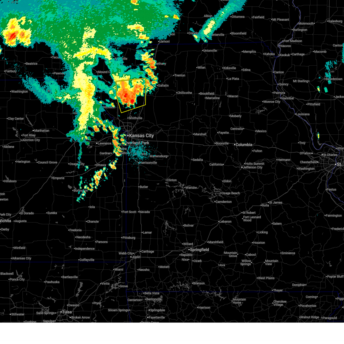
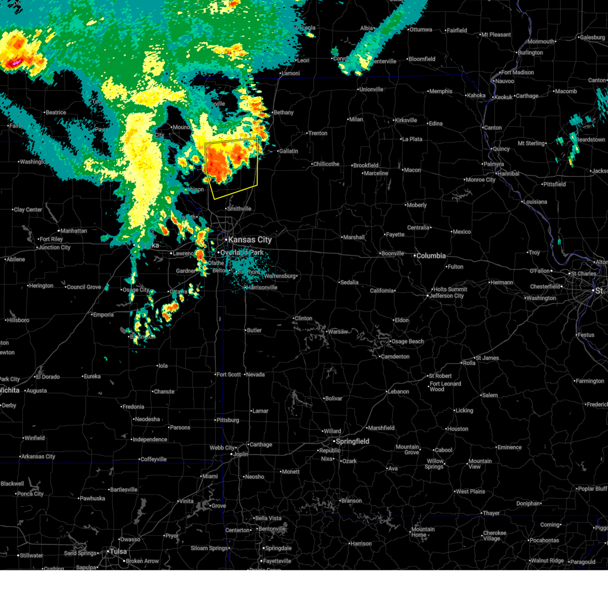
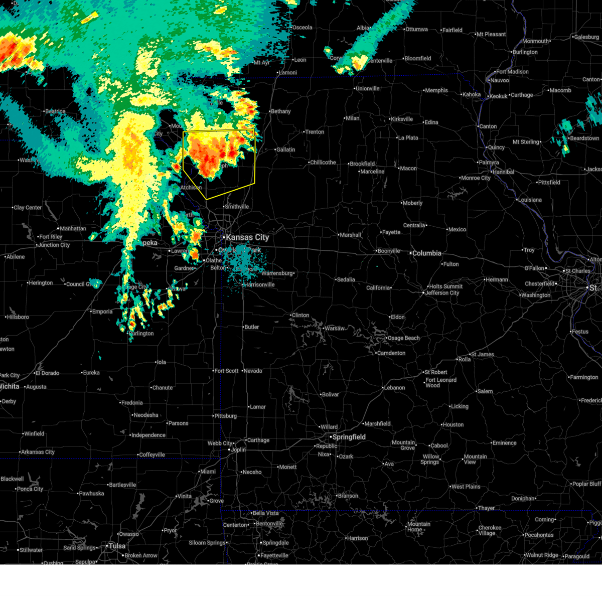
| 4/17/2026 4:15 PM CDT | Quarter sized hail reported 0.4 miles NW of Gower, MO, social media report. time estimated from radar. |
| 4/17/2026 3:51 PM CDT |
 Svreax the national weather service in pleasant hill has issued a * severe thunderstorm warning for, southeastern buchanan county in northwestern missouri, southwestern daviess county in north central missouri, northern clinton county in northwestern missouri, northwestern caldwell county in north central missouri, southeastern dekalb county in northwestern missouri, * until 430 pm cdt. * at 351 pm cdt, a severe thunderstorm was located over gower, moving northeast at 40 mph (radar indicated). Hazards include ping pong ball size hail and 60 mph wind gusts. People and animals outdoors will be injured. expect hail damage to roofs, siding, windows, and vehicles. Expect wind damage to roofs, siding, and trees. Svreax the national weather service in pleasant hill has issued a * severe thunderstorm warning for, southeastern buchanan county in northwestern missouri, southwestern daviess county in north central missouri, northern clinton county in northwestern missouri, northwestern caldwell county in north central missouri, southeastern dekalb county in northwestern missouri, * until 430 pm cdt. * at 351 pm cdt, a severe thunderstorm was located over gower, moving northeast at 40 mph (radar indicated). Hazards include ping pong ball size hail and 60 mph wind gusts. People and animals outdoors will be injured. expect hail damage to roofs, siding, windows, and vehicles. Expect wind damage to roofs, siding, and trees.
|
| 4/17/2026 3:37 PM CDT |
 At 336 pm cdt, a severe thunderstorm capable of producing a tornado was located over dearborn, or 10 miles southwest of gower, moving east at 35 mph (radar indicated rotation). Hazards include tornado and quarter size hail. Flying debris will be dangerous to those caught without shelter. mobile homes will be damaged or destroyed. damage to roofs, windows, and vehicles will occur. tree damage is likely. locations impacted include, gower, edgerton, and dearborn. This includes interstate 29 between mile markers 28 and 35. At 336 pm cdt, a severe thunderstorm capable of producing a tornado was located over dearborn, or 10 miles southwest of gower, moving east at 35 mph (radar indicated rotation). Hazards include tornado and quarter size hail. Flying debris will be dangerous to those caught without shelter. mobile homes will be damaged or destroyed. damage to roofs, windows, and vehicles will occur. tree damage is likely. locations impacted include, gower, edgerton, and dearborn. This includes interstate 29 between mile markers 28 and 35.
|
| 4/17/2026 3:31 PM CDT |
 At 330 pm cdt, a severe thunderstorm capable of producing a tornado was located west of dearborn, or 8 miles northeast of weston, moving east at 35 mph (radar indicated rotation). Hazards include tornado and quarter size hail. Flying debris will be dangerous to those caught without shelter. mobile homes will be damaged or destroyed. damage to roofs, windows, and vehicles will occur. tree damage is likely. locations impacted include, gower, agency, edgerton, dearborn, and faucett. This includes interstate 29 between mile markers 28 and 38. At 330 pm cdt, a severe thunderstorm capable of producing a tornado was located west of dearborn, or 8 miles northeast of weston, moving east at 35 mph (radar indicated rotation). Hazards include tornado and quarter size hail. Flying debris will be dangerous to those caught without shelter. mobile homes will be damaged or destroyed. damage to roofs, windows, and vehicles will occur. tree damage is likely. locations impacted include, gower, agency, edgerton, dearborn, and faucett. This includes interstate 29 between mile markers 28 and 38.
|
| 4/17/2026 3:25 PM CDT |
 Toreax the national weather service in pleasant hill has issued a * tornado warning for, southeastern buchanan county in northwestern missouri, western clinton county in northwestern missouri, northeastern platte county in west central missouri, * until 400 pm cdt. * at 325 pm cdt, a severe thunderstorm capable of producing a tornado was located near dearborn, or 8 miles north of weston, moving east at 40 mph (radar indicated rotation). Hazards include tornado and quarter size hail. Flying debris will be dangerous to those caught without shelter. mobile homes will be damaged or destroyed. damage to roofs, windows, and vehicles will occur. Tree damage is likely. Toreax the national weather service in pleasant hill has issued a * tornado warning for, southeastern buchanan county in northwestern missouri, western clinton county in northwestern missouri, northeastern platte county in west central missouri, * until 400 pm cdt. * at 325 pm cdt, a severe thunderstorm capable of producing a tornado was located near dearborn, or 8 miles north of weston, moving east at 40 mph (radar indicated rotation). Hazards include tornado and quarter size hail. Flying debris will be dangerous to those caught without shelter. mobile homes will be damaged or destroyed. damage to roofs, windows, and vehicles will occur. Tree damage is likely.
|
| 4/17/2026 3:02 PM CDT |
 At 302 pm cdt, a severe thunderstorm was located over agency, or 7 miles south of st. joseph, moving northeast at 35 mph (radar indicated). Hazards include 60 mph wind gusts and half dollar size hail. Hail damage to vehicles is expected. expect wind damage to roofs, siding, and trees. locations impacted include, st. joseph, atchison, gower, wathena, elwood, agency, dearborn, rushville, lewis and clark village, easton, de kalb, iatan, st. joseph airport, faucett, bean lake, and potter. this includes the following highways, interstate 29 between mile markers 28 and 51. Interstate 229 between mile markers 0 and 9. At 302 pm cdt, a severe thunderstorm was located over agency, or 7 miles south of st. joseph, moving northeast at 35 mph (radar indicated). Hazards include 60 mph wind gusts and half dollar size hail. Hail damage to vehicles is expected. expect wind damage to roofs, siding, and trees. locations impacted include, st. joseph, atchison, gower, wathena, elwood, agency, dearborn, rushville, lewis and clark village, easton, de kalb, iatan, st. joseph airport, faucett, bean lake, and potter. this includes the following highways, interstate 29 between mile markers 28 and 51. Interstate 229 between mile markers 0 and 9.
|
| 4/17/2026 2:27 PM CDT |
 Svreax the national weather service in pleasant hill has issued a * severe thunderstorm warning for, southeastern doniphan county in northeastern kansas, eastern atchison county in northeastern kansas, buchanan county in northwestern missouri, northern platte county in west central missouri, * until 315 pm cdt. * at 227 pm cdt, a severe thunderstorm was located near lewis and clark village, or 7 miles southeast of atchison, moving northeast at 40 mph (radar indicated). Hazards include 60 mph wind gusts and half dollar size hail. Hail damage to vehicles is expected. Expect wind damage to roofs, siding, and trees. Svreax the national weather service in pleasant hill has issued a * severe thunderstorm warning for, southeastern doniphan county in northeastern kansas, eastern atchison county in northeastern kansas, buchanan county in northwestern missouri, northern platte county in west central missouri, * until 315 pm cdt. * at 227 pm cdt, a severe thunderstorm was located near lewis and clark village, or 7 miles southeast of atchison, moving northeast at 40 mph (radar indicated). Hazards include 60 mph wind gusts and half dollar size hail. Hail damage to vehicles is expected. Expect wind damage to roofs, siding, and trees.
|
| 4/9/2026 11:07 PM CDT |
 At 1107 pm cdt, severe thunderstorms were located along a line extending from near gower to near smithville to near lake waukomis, moving east at 40 mph (radar indicated). Hazards include 60 mph wind gusts and quarter size hail. Hail damage to vehicles is expected. expect wind damage to roofs, siding, and trees. Locations impacted include, smithville, kearney, plattsburg, gower, trimble, edgerton, dearborn, camden point, and ridgely. At 1107 pm cdt, severe thunderstorms were located along a line extending from near gower to near smithville to near lake waukomis, moving east at 40 mph (radar indicated). Hazards include 60 mph wind gusts and quarter size hail. Hail damage to vehicles is expected. expect wind damage to roofs, siding, and trees. Locations impacted include, smithville, kearney, plattsburg, gower, trimble, edgerton, dearborn, camden point, and ridgely.
|
| 4/9/2026 10:54 PM CDT |
 Svreax the national weather service in pleasant hill has issued a * severe thunderstorm warning for, southeastern buchanan county in northwestern missouri, western clinton county in northwestern missouri, northwestern clay county in west central missouri, northeastern platte county in west central missouri, * until 1145 pm cdt. * at 1054 pm cdt, severe thunderstorms were located along a line extending from near dearborn to near camden point to near kansas city intl arpt, moving east at 30 mph (radar indicated). Hazards include 60 mph wind gusts and quarter size hail. Hail damage to vehicles is expected. Expect wind damage to roofs, siding, and trees. Svreax the national weather service in pleasant hill has issued a * severe thunderstorm warning for, southeastern buchanan county in northwestern missouri, western clinton county in northwestern missouri, northwestern clay county in west central missouri, northeastern platte county in west central missouri, * until 1145 pm cdt. * at 1054 pm cdt, severe thunderstorms were located along a line extending from near dearborn to near camden point to near kansas city intl arpt, moving east at 30 mph (radar indicated). Hazards include 60 mph wind gusts and quarter size hail. Hail damage to vehicles is expected. Expect wind damage to roofs, siding, and trees.
|
| 3/6/2026 11:53 PM CST |
 The storm which prompted the warning has weakened below severe limits, and no longer poses an immediate threat to life or property. therefore, the warning will be allowed to expire. however, gusty winds are still possible with this thunderstorm. a tornado watch remains in effect until 400 am cst for northwestern and west central missouri. The storm which prompted the warning has weakened below severe limits, and no longer poses an immediate threat to life or property. therefore, the warning will be allowed to expire. however, gusty winds are still possible with this thunderstorm. a tornado watch remains in effect until 400 am cst for northwestern and west central missouri.
|
| 3/6/2026 11:42 PM CST |
 At 1141 pm cst, a severe thunderstorm was located near trimble, or near plattsburg, moving northeast at 65 mph (radar indicated). Hazards include 60 mph wind gusts and penny size hail. Expect damage to roofs, siding, and trees. locations impacted include, smithville, kearney, gower, trimble, edgerton, camden point, ferrelview, ridgely, and hoover. this includes the following highways, interstate 35 in missouri between mile markers 25 and 27. interstate 29 between mile markers 10 and 14. Interstate 435 between mile markers 34 and 43. At 1141 pm cst, a severe thunderstorm was located near trimble, or near plattsburg, moving northeast at 65 mph (radar indicated). Hazards include 60 mph wind gusts and penny size hail. Expect damage to roofs, siding, and trees. locations impacted include, smithville, kearney, gower, trimble, edgerton, camden point, ferrelview, ridgely, and hoover. this includes the following highways, interstate 35 in missouri between mile markers 25 and 27. interstate 29 between mile markers 10 and 14. Interstate 435 between mile markers 34 and 43.
|
| 3/6/2026 11:23 PM CST |
 Svreax the national weather service in pleasant hill has issued a * severe thunderstorm warning for, southeastern buchanan county in northwestern missouri, southwestern clinton county in northwestern missouri, northwestern clay county in west central missouri, platte county in west central missouri, * until midnight cst. * at 1123 pm cst, a severe thunderstorm was located over platte city, moving northeast at 50 mph (radar indicated). Hazards include 60 mph wind gusts and penny size hail. expect damage to roofs, siding, and trees Svreax the national weather service in pleasant hill has issued a * severe thunderstorm warning for, southeastern buchanan county in northwestern missouri, southwestern clinton county in northwestern missouri, northwestern clay county in west central missouri, platte county in west central missouri, * until midnight cst. * at 1123 pm cst, a severe thunderstorm was located over platte city, moving northeast at 50 mph (radar indicated). Hazards include 60 mph wind gusts and penny size hail. expect damage to roofs, siding, and trees
|
| 1/8/2026 4:36 PM CST |
 The storms which prompted the warning have weakened below severe limits, and no longer pose an immediate threat to life or property. therefore, the warning will be allowed to expire. however, gusty winds are still possible with these thunderstorms. The storms which prompted the warning have weakened below severe limits, and no longer pose an immediate threat to life or property. therefore, the warning will be allowed to expire. however, gusty winds are still possible with these thunderstorms.
|
| 1/8/2026 4:27 PM CST |
 the severe thunderstorm warning has been cancelled and is no longer in effect the severe thunderstorm warning has been cancelled and is no longer in effect
|
| 1/8/2026 4:27 PM CST |
 At 427 pm cst, severe thunderstorms were located along a line extending from 6 miles north of maysville to near stewartsville to gower, moving east at 45 mph (radar indicated). Hazards include 60 mph wind gusts. Expect damage to roofs, siding, and trees. locations impacted include, plattsburg, gower, maysville, stewartsville, osborn, pattonsburg, weatherby, amity, fairport, and santa rosa. This includes interstate 35 in missouri between mile markers 73 and 81. At 427 pm cst, severe thunderstorms were located along a line extending from 6 miles north of maysville to near stewartsville to gower, moving east at 45 mph (radar indicated). Hazards include 60 mph wind gusts. Expect damage to roofs, siding, and trees. locations impacted include, plattsburg, gower, maysville, stewartsville, osborn, pattonsburg, weatherby, amity, fairport, and santa rosa. This includes interstate 35 in missouri between mile markers 73 and 81.
|
| 1/8/2026 3:57 PM CST |
 Svreax the national weather service in pleasant hill has issued a * severe thunderstorm warning for, eastern buchanan county in northwestern missouri, northwestern daviess county in north central missouri, western clinton county in northwestern missouri, southeastern gentry county in northwestern missouri, northeastern platte county in west central missouri, southeastern andrew county in northwestern missouri, dekalb county in northwestern missouri, * until 445 pm cst. * at 357 pm cst, severe thunderstorms were located along a line extending from 6 miles southwest of union star to near agency to 6 miles west of dearborn, moving northeast at 50 mph (radar indicated). Hazards include 60 mph wind gusts. expect damage to roofs, siding, and trees Svreax the national weather service in pleasant hill has issued a * severe thunderstorm warning for, eastern buchanan county in northwestern missouri, northwestern daviess county in north central missouri, western clinton county in northwestern missouri, southeastern gentry county in northwestern missouri, northeastern platte county in west central missouri, southeastern andrew county in northwestern missouri, dekalb county in northwestern missouri, * until 445 pm cst. * at 357 pm cst, severe thunderstorms were located along a line extending from 6 miles southwest of union star to near agency to 6 miles west of dearborn, moving northeast at 50 mph (radar indicated). Hazards include 60 mph wind gusts. expect damage to roofs, siding, and trees
|
| 1/8/2026 3:47 PM CST |
 the severe thunderstorm warning has been cancelled and is no longer in effect the severe thunderstorm warning has been cancelled and is no longer in effect
|
| 1/8/2026 3:47 PM CST |
 At 347 pm cst, severe thunderstorms were located along a line extending from st. joseph to near rushville to near lewis and clark village, moving northeast at 50 mph (radar indicated). Hazards include 60 mph wind gusts. Expect damage to roofs, siding, and trees. locations impacted include, st. joseph, atchison, gower, elwood, agency, edgerton, dearborn, camden point, rushville, lewis and clark village, easton, de kalb, cosby, ridgely, iatan, faucett, and bean lake. this includes the following highways, interstate 29 between mile markers 24 and 50. Interstate 229 between mile markers 0 and 7. At 347 pm cst, severe thunderstorms were located along a line extending from st. joseph to near rushville to near lewis and clark village, moving northeast at 50 mph (radar indicated). Hazards include 60 mph wind gusts. Expect damage to roofs, siding, and trees. locations impacted include, st. joseph, atchison, gower, elwood, agency, edgerton, dearborn, camden point, rushville, lewis and clark village, easton, de kalb, cosby, ridgely, iatan, faucett, and bean lake. this includes the following highways, interstate 29 between mile markers 24 and 50. Interstate 229 between mile markers 0 and 7.
|
| 1/8/2026 3:32 PM CST |
 Svreax the national weather service in pleasant hill has issued a * severe thunderstorm warning for, southeastern doniphan county in northeastern kansas, northwestern leavenworth county in northeastern kansas, eastern atchison county in northeastern kansas, buchanan county in northwestern missouri, northwestern clay county in west central missouri, platte county in west central missouri, southeastern andrew county in northwestern missouri, * until 400 pm cst. * at 331 pm cst, severe thunderstorms were located along a line extending from near rushville to near lewis and clark village to near winchester, moving northeast at 60 mph (radar indicated). Hazards include 60 mph wind gusts. expect damage to roofs, siding, and trees Svreax the national weather service in pleasant hill has issued a * severe thunderstorm warning for, southeastern doniphan county in northeastern kansas, northwestern leavenworth county in northeastern kansas, eastern atchison county in northeastern kansas, buchanan county in northwestern missouri, northwestern clay county in west central missouri, platte county in west central missouri, southeastern andrew county in northwestern missouri, * until 400 pm cst. * at 331 pm cst, severe thunderstorms were located along a line extending from near rushville to near lewis and clark village to near winchester, moving northeast at 60 mph (radar indicated). Hazards include 60 mph wind gusts. expect damage to roofs, siding, and trees
|
| 7/8/2025 2:51 AM CDT |
 The storms which prompted the warning have weakened below severe limits, and no longer pose an immediate threat to life or property. therefore, the warning will be allowed to expire. The storms which prompted the warning have weakened below severe limits, and no longer pose an immediate threat to life or property. therefore, the warning will be allowed to expire.
|
| 7/8/2025 2:16 AM CDT |
 Svreax the national weather service in pleasant hill has issued a * severe thunderstorm warning for, wyandotte county in northeastern kansas, leavenworth county in northeastern kansas, southern buchanan county in northwestern missouri, clay county in west central missouri, clinton county in northwestern missouri, northern ray county in west central missouri, caldwell county in north central missouri, platte county in west central missouri, northwestern jackson county in west central missouri, dekalb county in northwestern missouri, southwestern livingston county in north central missouri, * until 300 am cdt. * at 216 am cdt, severe thunderstorms were located along a line extending from near cameron to camden point to near winchester, moving southeast at 35 mph (radar indicated). Hazards include 60 mph wind gusts. expect damage to roofs, siding, and trees Svreax the national weather service in pleasant hill has issued a * severe thunderstorm warning for, wyandotte county in northeastern kansas, leavenworth county in northeastern kansas, southern buchanan county in northwestern missouri, clay county in west central missouri, clinton county in northwestern missouri, northern ray county in west central missouri, caldwell county in north central missouri, platte county in west central missouri, northwestern jackson county in west central missouri, dekalb county in northwestern missouri, southwestern livingston county in north central missouri, * until 300 am cdt. * at 216 am cdt, severe thunderstorms were located along a line extending from near cameron to camden point to near winchester, moving southeast at 35 mph (radar indicated). Hazards include 60 mph wind gusts. expect damage to roofs, siding, and trees
|
| 6/26/2025 5:18 PM CDT |
 At 518 pm cdt, a severe thunderstorm was located over edgerton, or 7 miles south of gower, moving northeast at 35 mph (automated weather station. kci airport reported a 66 mph wind gust with this storm). Hazards include 60 mph wind gusts and nickel size hail. Expect damage to roofs, siding, and trees. locations impacted include, lansing, parkville, platte city, weatherby lake, gower, kansas city intl arpt, kansas city, edgerton, camden point, ferrelview, tracy, farley, ridgely, wolcott, waldron, hoover, and piper. this includes the following highways, interstate 29 between mile markers 9 and 22. Interstate 435 between mile markers 16 and 39. At 518 pm cdt, a severe thunderstorm was located over edgerton, or 7 miles south of gower, moving northeast at 35 mph (automated weather station. kci airport reported a 66 mph wind gust with this storm). Hazards include 60 mph wind gusts and nickel size hail. Expect damage to roofs, siding, and trees. locations impacted include, lansing, parkville, platte city, weatherby lake, gower, kansas city intl arpt, kansas city, edgerton, camden point, ferrelview, tracy, farley, ridgely, wolcott, waldron, hoover, and piper. this includes the following highways, interstate 29 between mile markers 9 and 22. Interstate 435 between mile markers 16 and 39.
|
| 6/26/2025 5:11 PM CDT |
 Svreax the national weather service in pleasant hill has issued a * severe thunderstorm warning for, wyandotte county in northeastern kansas, southeastern leavenworth county in northeastern kansas, northwestern johnson county in east central kansas, southeastern buchanan county in northwestern missouri, clay county in west central missouri, clinton county in northwestern missouri, eastern platte county in west central missouri, northwestern jackson county in west central missouri, southeastern dekalb county in northwestern missouri, * until 615 pm cdt. * at 510 pm cdt, severe thunderstorms were located along a line extending from near gower to weatherby lake to near bonner springs, moving northeast at 25 mph (automated weather station). Hazards include 60 mph wind gusts and nickel size hail. expect damage to roofs, siding, and trees Svreax the national weather service in pleasant hill has issued a * severe thunderstorm warning for, wyandotte county in northeastern kansas, southeastern leavenworth county in northeastern kansas, northwestern johnson county in east central kansas, southeastern buchanan county in northwestern missouri, clay county in west central missouri, clinton county in northwestern missouri, eastern platte county in west central missouri, northwestern jackson county in west central missouri, southeastern dekalb county in northwestern missouri, * until 615 pm cdt. * at 510 pm cdt, severe thunderstorms were located along a line extending from near gower to weatherby lake to near bonner springs, moving northeast at 25 mph (automated weather station). Hazards include 60 mph wind gusts and nickel size hail. expect damage to roofs, siding, and trees
|
| 6/26/2025 5:01 PM CDT |
 the severe thunderstorm warning has been cancelled and is no longer in effect the severe thunderstorm warning has been cancelled and is no longer in effect
|
| 6/26/2025 5:01 PM CDT |
 At 500 pm cdt, severe thunderstorms were located along a line extending from 7 miles west of maysville to near clarksdale to near dearborn, moving northeast at 40 mph (radar indicated). Hazards include 60 mph wind gusts. Expect damage to roofs, siding, and trees. locations impacted include, st. joseph, gower, stewartsville, agency, dearborn, osborn, clarksdale, easton, cosby, and faucett. this includes the following highways, interstate 29 between mile markers 29 and 47. Interstate 229 between mile markers 0 and 3. At 500 pm cdt, severe thunderstorms were located along a line extending from 7 miles west of maysville to near clarksdale to near dearborn, moving northeast at 40 mph (radar indicated). Hazards include 60 mph wind gusts. Expect damage to roofs, siding, and trees. locations impacted include, st. joseph, gower, stewartsville, agency, dearborn, osborn, clarksdale, easton, cosby, and faucett. this includes the following highways, interstate 29 between mile markers 29 and 47. Interstate 229 between mile markers 0 and 3.
|
| 6/26/2025 4:54 PM CDT |
 At 453 pm cdt, a severe thunderstorm was located over tracy, or near weston, moving northeast at 35 mph (radar indicated. power outages have been reported in the leavenworth area). Hazards include 60 mph wind gusts and nickel size hail. Expect damage to roofs, siding, and trees. locations impacted include, leavenworth, lansing, bonner springs, parkville, platte city, basehor, weatherby lake, weston, gower, kansas city intl arpt, kansas city, edgerton, camden point, ferrelview, tracy, fairmount, farley, ridgely, fort leavenworth, and waldron. this includes the following highways, interstate 29 between mile markers 9 and 29. Interstate 435 between mile markers 16 and 39. At 453 pm cdt, a severe thunderstorm was located over tracy, or near weston, moving northeast at 35 mph (radar indicated. power outages have been reported in the leavenworth area). Hazards include 60 mph wind gusts and nickel size hail. Expect damage to roofs, siding, and trees. locations impacted include, leavenworth, lansing, bonner springs, parkville, platte city, basehor, weatherby lake, weston, gower, kansas city intl arpt, kansas city, edgerton, camden point, ferrelview, tracy, fairmount, farley, ridgely, fort leavenworth, and waldron. this includes the following highways, interstate 29 between mile markers 9 and 29. Interstate 435 between mile markers 16 and 39.
|
| 6/26/2025 4:42 PM CDT |
 Svreax the national weather service in pleasant hill has issued a * severe thunderstorm warning for, northwestern wyandotte county in northeastern kansas, central leavenworth county in northeastern kansas, southeastern buchanan county in northwestern missouri, platte county in west central missouri, * until 530 pm cdt. * at 442 pm cdt, a severe thunderstorm was located over leavenworth, moving northeast at 35 mph (radar indicated). Hazards include 60 mph wind gusts and nickel size hail. expect damage to roofs, siding, and trees Svreax the national weather service in pleasant hill has issued a * severe thunderstorm warning for, northwestern wyandotte county in northeastern kansas, central leavenworth county in northeastern kansas, southeastern buchanan county in northwestern missouri, platte county in west central missouri, * until 530 pm cdt. * at 442 pm cdt, a severe thunderstorm was located over leavenworth, moving northeast at 35 mph (radar indicated). Hazards include 60 mph wind gusts and nickel size hail. expect damage to roofs, siding, and trees
|
| 6/26/2025 4:40 PM CDT |
 Svreax the national weather service in pleasant hill has issued a * severe thunderstorm warning for, eastern doniphan county in northeastern kansas, buchanan county in northwestern missouri, northwestern clinton county in northwestern missouri, north central platte county in west central missouri, southeastern andrew county in northwestern missouri, southwestern dekalb county in northwestern missouri, * until 530 pm cdt. * at 440 pm cdt, a severe thunderstorm was located over agency, or near st. joseph, moving northeast at 25 mph (radar indicated). Hazards include 60 mph wind gusts and penny size hail. expect damage to roofs, siding, and trees Svreax the national weather service in pleasant hill has issued a * severe thunderstorm warning for, eastern doniphan county in northeastern kansas, buchanan county in northwestern missouri, northwestern clinton county in northwestern missouri, north central platte county in west central missouri, southeastern andrew county in northwestern missouri, southwestern dekalb county in northwestern missouri, * until 530 pm cdt. * at 440 pm cdt, a severe thunderstorm was located over agency, or near st. joseph, moving northeast at 25 mph (radar indicated). Hazards include 60 mph wind gusts and penny size hail. expect damage to roofs, siding, and trees
|
| 6/23/2025 9:21 PM CDT |
 At 921 pm cdt, severe thunderstorms were located along a line extending from clarksdale to near gower to near agency, moving northeast at 35 mph (radar indicated). Hazards include 60 mph wind gusts. Expect damage to roofs, siding, and trees. Locations impacted include, gower, stewartsville, and easton. At 921 pm cdt, severe thunderstorms were located along a line extending from clarksdale to near gower to near agency, moving northeast at 35 mph (radar indicated). Hazards include 60 mph wind gusts. Expect damage to roofs, siding, and trees. Locations impacted include, gower, stewartsville, and easton.
|
| 6/23/2025 9:11 PM CDT |
 Svreax the national weather service in pleasant hill has issued a * severe thunderstorm warning for, southeastern buchanan county in northwestern missouri, clinton county in northwestern missouri, southwestern dekalb county in northwestern missouri, * until 930 pm cdt. * at 911 pm cdt, severe thunderstorms were located along a line extending from near clarksdale to near gower to near dearborn, moving northeast at 35 mph (radar indicated). Hazards include 60 mph wind gusts and penny size hail. expect damage to roofs, siding, and trees Svreax the national weather service in pleasant hill has issued a * severe thunderstorm warning for, southeastern buchanan county in northwestern missouri, clinton county in northwestern missouri, southwestern dekalb county in northwestern missouri, * until 930 pm cdt. * at 911 pm cdt, severe thunderstorms were located along a line extending from near clarksdale to near gower to near dearborn, moving northeast at 35 mph (radar indicated). Hazards include 60 mph wind gusts and penny size hail. expect damage to roofs, siding, and trees
|
| 5/19/2025 9:10 PM CDT |
 the severe thunderstorm warning has been cancelled and is no longer in effect the severe thunderstorm warning has been cancelled and is no longer in effect
|
| 5/19/2025 9:10 PM CDT |
 At 909 pm cdt, severe thunderstorms were located along a line extending from near clarksdale to near osborn to near smithville, moving east at 35 mph (radar indicated). Hazards include 70 mph wind gusts and nickel size hail. Expect considerable tree damage. damage is likely to mobile homes, roofs, and outbuildings. locations impacted include, st. joseph, excelsior springs, cameron, smithville, kearney, savannah, lawson, plattsburg, lathrop, gower, maysville, country club villa, country club, king city, stewartsville, agency, trimble, edgerton, camden point, and holt. this includes the following highways, interstate 35 in missouri between mile markers 26 and 56. interstate 29 between mile markers 47 and 58. Interstate 229 between mile markers 10 and 14. At 909 pm cdt, severe thunderstorms were located along a line extending from near clarksdale to near osborn to near smithville, moving east at 35 mph (radar indicated). Hazards include 70 mph wind gusts and nickel size hail. Expect considerable tree damage. damage is likely to mobile homes, roofs, and outbuildings. locations impacted include, st. joseph, excelsior springs, cameron, smithville, kearney, savannah, lawson, plattsburg, lathrop, gower, maysville, country club villa, country club, king city, stewartsville, agency, trimble, edgerton, camden point, and holt. this includes the following highways, interstate 35 in missouri between mile markers 26 and 56. interstate 29 between mile markers 47 and 58. Interstate 229 between mile markers 10 and 14.
|
| 5/19/2025 8:51 PM CDT |
 Svreax the national weather service in pleasant hill has issued a * severe thunderstorm warning for, east central doniphan county in northeastern kansas, buchanan county in northwestern missouri, clinton county in northwestern missouri, northern clay county in west central missouri, southwestern gentry county in northwestern missouri, northwestern ray county in west central missouri, western caldwell county in north central missouri, northeastern platte county in west central missouri, southeastern andrew county in northwestern missouri, dekalb county in northwestern missouri, * until 930 pm cdt. * at 851 pm cdt, severe thunderstorms were located along a line extending from near country club villa to near gower to near smithville, moving east at 35 mph (radar indicated). Hazards include 70 mph wind gusts and nickel size hail. Expect considerable tree damage. Damage is likely to mobile homes, roofs, and outbuildings. Svreax the national weather service in pleasant hill has issued a * severe thunderstorm warning for, east central doniphan county in northeastern kansas, buchanan county in northwestern missouri, clinton county in northwestern missouri, northern clay county in west central missouri, southwestern gentry county in northwestern missouri, northwestern ray county in west central missouri, western caldwell county in north central missouri, northeastern platte county in west central missouri, southeastern andrew county in northwestern missouri, dekalb county in northwestern missouri, * until 930 pm cdt. * at 851 pm cdt, severe thunderstorms were located along a line extending from near country club villa to near gower to near smithville, moving east at 35 mph (radar indicated). Hazards include 70 mph wind gusts and nickel size hail. Expect considerable tree damage. Damage is likely to mobile homes, roofs, and outbuildings.
|
| 5/19/2025 8:45 PM CDT |
 At 845 pm cdt, severe thunderstorms were located along a line extending from savannah to near gower to near camden point, moving east at 35 mph (radar indicated). Hazards include 70 mph wind gusts and nickel size hail. Expect considerable tree damage. damage is likely to mobile homes, roofs, and outbuildings. locations impacted include, st. joseph, smithville, savannah, plattsburg, weston, gower, wathena, elwood, country club villa, country club, stewartsville, agency, trimble, edgerton, dearborn, camden point, union star, amazonia, clarksdale, and fillmore. this includes the following highways, interstate 29 between mile markers 22 and 67. Interstate 229 between mile markers 0 and 14. At 845 pm cdt, severe thunderstorms were located along a line extending from savannah to near gower to near camden point, moving east at 35 mph (radar indicated). Hazards include 70 mph wind gusts and nickel size hail. Expect considerable tree damage. damage is likely to mobile homes, roofs, and outbuildings. locations impacted include, st. joseph, smithville, savannah, plattsburg, weston, gower, wathena, elwood, country club villa, country club, stewartsville, agency, trimble, edgerton, dearborn, camden point, union star, amazonia, clarksdale, and fillmore. this includes the following highways, interstate 29 between mile markers 22 and 67. Interstate 229 between mile markers 0 and 14.
|
| 5/19/2025 8:22 PM CDT |
 Svreax the national weather service in pleasant hill has issued a * severe thunderstorm warning for, southeastern doniphan county in northeastern kansas, buchanan county in northwestern missouri, western clinton county in northwestern missouri, northwestern clay county in west central missouri, southeastern holt county in northwestern missouri, south central nodaway county in northwestern missouri, northern platte county in west central missouri, andrew county in northwestern missouri, southwestern dekalb county in northwestern missouri, * until 900 pm cdt. * at 821 pm cdt, severe thunderstorms were located along a line extending from 7 miles southwest of fillmore to 6 miles west of agency to near weston, moving east at 35 mph (radar indicated). Hazards include 60 mph wind gusts and quarter size hail. Hail damage to vehicles is expected. Expect wind damage to roofs, siding, and trees. Svreax the national weather service in pleasant hill has issued a * severe thunderstorm warning for, southeastern doniphan county in northeastern kansas, buchanan county in northwestern missouri, western clinton county in northwestern missouri, northwestern clay county in west central missouri, southeastern holt county in northwestern missouri, south central nodaway county in northwestern missouri, northern platte county in west central missouri, andrew county in northwestern missouri, southwestern dekalb county in northwestern missouri, * until 900 pm cdt. * at 821 pm cdt, severe thunderstorms were located along a line extending from 7 miles southwest of fillmore to 6 miles west of agency to near weston, moving east at 35 mph (radar indicated). Hazards include 60 mph wind gusts and quarter size hail. Hail damage to vehicles is expected. Expect wind damage to roofs, siding, and trees.
|
| 5/19/2025 5:25 PM CDT |
 The storms which prompted the warning have moved out of the area. therefore, the warning will be allowed to expire. a tornado watch remains in effect until 900 pm cdt for north central, northwestern and west central missouri. to report severe weather, contact your nearest law enforcement agency. they will relay your report to the national weather service pleasant hill. The storms which prompted the warning have moved out of the area. therefore, the warning will be allowed to expire. a tornado watch remains in effect until 900 pm cdt for north central, northwestern and west central missouri. to report severe weather, contact your nearest law enforcement agency. they will relay your report to the national weather service pleasant hill.
|
| 5/19/2025 5:06 PM CDT |
 the severe thunderstorm warning has been cancelled and is no longer in effect the severe thunderstorm warning has been cancelled and is no longer in effect
|
| 5/19/2025 5:06 PM CDT |
 At 506 pm cdt, a severe thunderstorm was located over holt, or near lathrop, moving northeast at 40 mph (automated weather station. kci airport and the downtown kansas city airport both reported wind gusts above 60 mph with these storms). Hazards include 70 mph wind gusts and nickel size hail. Expect considerable tree damage. damage is likely to mobile homes, roofs, and outbuildings. locations impacted include, kansas city, liberty, gladstone, excelsior springs, smithville, kearney, north kansas city, lawson, plattsburg, lathrop, gower, claycomo, pleasant valley, trimble, glenaire, holt, avondale, oakview, excelsior estates, and kansas city downtown. this includes the following highways, interstate 70 in missouri between mile markers 1 and 4. interstate 35 in missouri between mile markers 1 and 38. interstate 29 between mile markers 0 and 2. Interstate 435 between mile markers 40 and 57. At 506 pm cdt, a severe thunderstorm was located over holt, or near lathrop, moving northeast at 40 mph (automated weather station. kci airport and the downtown kansas city airport both reported wind gusts above 60 mph with these storms). Hazards include 70 mph wind gusts and nickel size hail. Expect considerable tree damage. damage is likely to mobile homes, roofs, and outbuildings. locations impacted include, kansas city, liberty, gladstone, excelsior springs, smithville, kearney, north kansas city, lawson, plattsburg, lathrop, gower, claycomo, pleasant valley, trimble, glenaire, holt, avondale, oakview, excelsior estates, and kansas city downtown. this includes the following highways, interstate 70 in missouri between mile markers 1 and 4. interstate 35 in missouri between mile markers 1 and 38. interstate 29 between mile markers 0 and 2. Interstate 435 between mile markers 40 and 57.
|
| 5/19/2025 4:48 PM CDT |
 Svreax the national weather service in pleasant hill has issued a * severe thunderstorm warning for, eastern buchanan county in northwestern missouri, southwestern daviess county in north central missouri, clinton county in northwestern missouri, northwestern clay county in west central missouri, northeastern platte county in west central missouri, southeastern andrew county in northwestern missouri, dekalb county in northwestern missouri, * until 530 pm cdt. * at 447 pm cdt, severe thunderstorms were located along a line extending from near agency to near ferrelview, moving northeast at 45 mph (radar indicated). Hazards include 60 mph wind gusts and penny size hail. expect damage to roofs, siding, and trees Svreax the national weather service in pleasant hill has issued a * severe thunderstorm warning for, eastern buchanan county in northwestern missouri, southwestern daviess county in north central missouri, clinton county in northwestern missouri, northwestern clay county in west central missouri, northeastern platte county in west central missouri, southeastern andrew county in northwestern missouri, dekalb county in northwestern missouri, * until 530 pm cdt. * at 447 pm cdt, severe thunderstorms were located along a line extending from near agency to near ferrelview, moving northeast at 45 mph (radar indicated). Hazards include 60 mph wind gusts and penny size hail. expect damage to roofs, siding, and trees
|
| 5/19/2025 4:24 PM CDT |
 Svreax the national weather service in pleasant hill has issued a * severe thunderstorm warning for, northeastern wyandotte county in northeastern kansas, southeastern buchanan county in northwestern missouri, southern clinton county in northwestern missouri, clay county in west central missouri, northwestern ray county in west central missouri, eastern platte county in west central missouri, northwestern jackson county in west central missouri, * until 515 pm cdt. * at 424 pm cdt, a severe thunderstorm was located over riverside, moving northeast at 40 mph (radar indicated). Hazards include 70 mph wind gusts and nickel size hail. Expect considerable tree damage. Damage is likely to mobile homes, roofs, and outbuildings. Svreax the national weather service in pleasant hill has issued a * severe thunderstorm warning for, northeastern wyandotte county in northeastern kansas, southeastern buchanan county in northwestern missouri, southern clinton county in northwestern missouri, clay county in west central missouri, northwestern ray county in west central missouri, eastern platte county in west central missouri, northwestern jackson county in west central missouri, * until 515 pm cdt. * at 424 pm cdt, a severe thunderstorm was located over riverside, moving northeast at 40 mph (radar indicated). Hazards include 70 mph wind gusts and nickel size hail. Expect considerable tree damage. Damage is likely to mobile homes, roofs, and outbuildings.
|
| 4/2/2025 3:36 AM CDT |
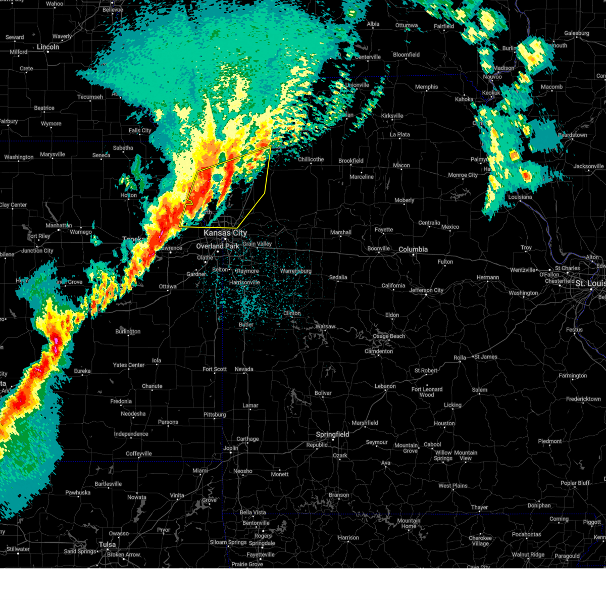 Svreax the national weather service in pleasant hill has issued a * severe thunderstorm warning for, northern leavenworth county in northeastern kansas, buchanan county in northwestern missouri, southwestern daviess county in north central missouri, clinton county in northwestern missouri, clay county in west central missouri, northwestern ray county in west central missouri, western caldwell county in north central missouri, platte county in west central missouri, southern dekalb county in northwestern missouri, * until 415 am cdt. * at 335 am cdt, severe thunderstorms were located along a line extending from agency to near dearborn to near leavenworth, moving east at 50 mph (radar indicated). Hazards include 60 mph wind gusts. expect damage to roofs, siding, and trees Svreax the national weather service in pleasant hill has issued a * severe thunderstorm warning for, northern leavenworth county in northeastern kansas, buchanan county in northwestern missouri, southwestern daviess county in north central missouri, clinton county in northwestern missouri, clay county in west central missouri, northwestern ray county in west central missouri, western caldwell county in north central missouri, platte county in west central missouri, southern dekalb county in northwestern missouri, * until 415 am cdt. * at 335 am cdt, severe thunderstorms were located along a line extending from agency to near dearborn to near leavenworth, moving east at 50 mph (radar indicated). Hazards include 60 mph wind gusts. expect damage to roofs, siding, and trees
|
| 3/14/2025 4:24 PM CDT |
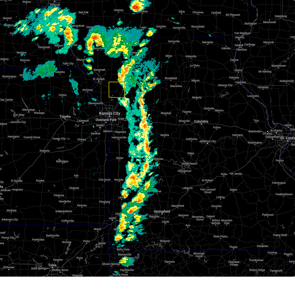 the severe thunderstorm warning has been cancelled and is no longer in effect the severe thunderstorm warning has been cancelled and is no longer in effect
|
| 3/14/2025 4:08 PM CDT |
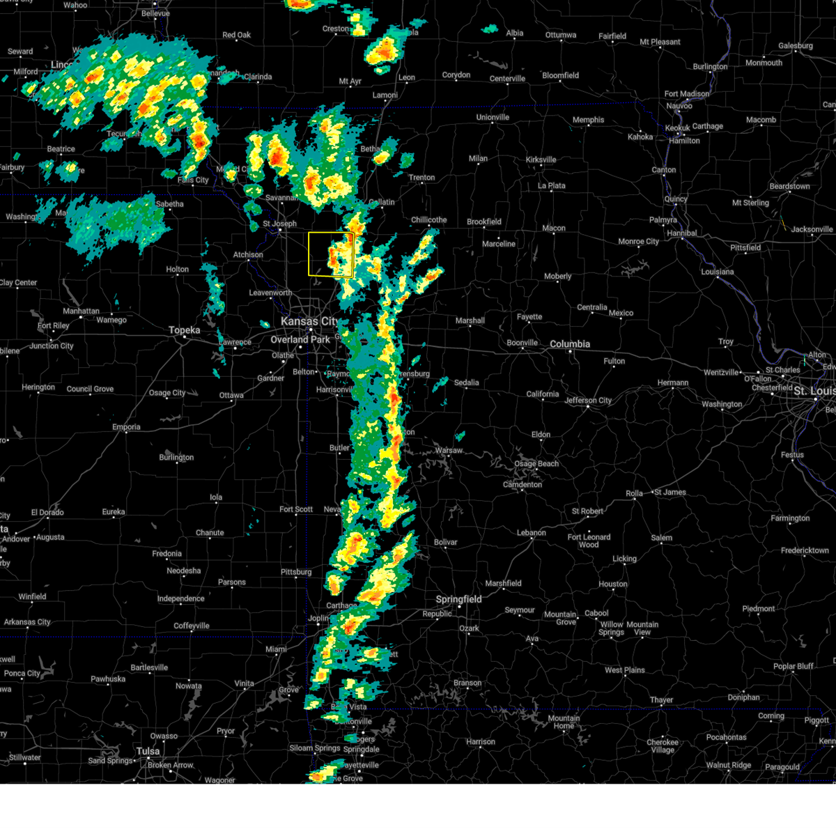 Svreax the national weather service in pleasant hill has issued a * severe thunderstorm warning for, clinton county in northwestern missouri, * until 500 pm cdt. * at 407 pm cdt, a severe thunderstorm was located over cameron, moving north at 65 mph (radar indicated). Hazards include 70 mph wind gusts and penny size hail. Expect considerable tree damage. Damage is likely to mobile homes, roofs, and outbuildings. Svreax the national weather service in pleasant hill has issued a * severe thunderstorm warning for, clinton county in northwestern missouri, * until 500 pm cdt. * at 407 pm cdt, a severe thunderstorm was located over cameron, moving north at 65 mph (radar indicated). Hazards include 70 mph wind gusts and penny size hail. Expect considerable tree damage. Damage is likely to mobile homes, roofs, and outbuildings.
|
| 3/14/2025 3:28 PM CDT |
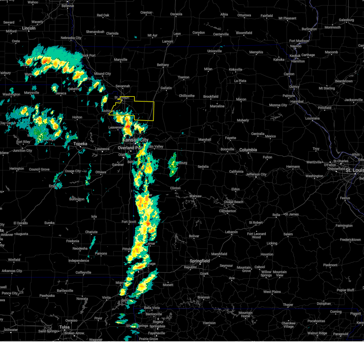 Svreax the national weather service in pleasant hill has issued a * severe thunderstorm warning for, buchanan county in northwestern missouri, clinton county in northwestern missouri, * until 415 pm cdt. * at 328 pm cdt, a severe thunderstorm was located near dearborn, or 9 miles southwest of gower, moving north at 55 mph (radar indicated). Hazards include 70 mph wind gusts and penny size hail. Expect considerable tree damage. Damage is likely to mobile homes, roofs, and outbuildings. Svreax the national weather service in pleasant hill has issued a * severe thunderstorm warning for, buchanan county in northwestern missouri, clinton county in northwestern missouri, * until 415 pm cdt. * at 328 pm cdt, a severe thunderstorm was located near dearborn, or 9 miles southwest of gower, moving north at 55 mph (radar indicated). Hazards include 70 mph wind gusts and penny size hail. Expect considerable tree damage. Damage is likely to mobile homes, roofs, and outbuildings.
|
| 10/30/2024 6:37 PM CDT |
 At 637 pm cdt, severe thunderstorms were located along a line extending from near savannah to 6 miles east of country club villa to agency, moving northeast at 45 mph (radar indicated). Hazards include 60 mph wind gusts and quarter size hail. Hail damage to vehicles is expected. expect wind damage to roofs, siding, and trees. locations impacted include, st. joseph, cameron, savannah, gower, wathena, elwood, maysville, country club villa, country club, king city, stewartsville, agency, union star, osborn, amazonia, clarksdale, easton, de kalb, cosby, and weatherby. this includes the following highways, interstate 35 in missouri near mile marker 49. interstate 29 between mile markers 34 and 59. Interstate 229 between mile markers 0 and 14. At 637 pm cdt, severe thunderstorms were located along a line extending from near savannah to 6 miles east of country club villa to agency, moving northeast at 45 mph (radar indicated). Hazards include 60 mph wind gusts and quarter size hail. Hail damage to vehicles is expected. expect wind damage to roofs, siding, and trees. locations impacted include, st. joseph, cameron, savannah, gower, wathena, elwood, maysville, country club villa, country club, king city, stewartsville, agency, union star, osborn, amazonia, clarksdale, easton, de kalb, cosby, and weatherby. this includes the following highways, interstate 35 in missouri near mile marker 49. interstate 29 between mile markers 34 and 59. Interstate 229 between mile markers 0 and 14.
|
| 10/30/2024 6:37 PM CDT |
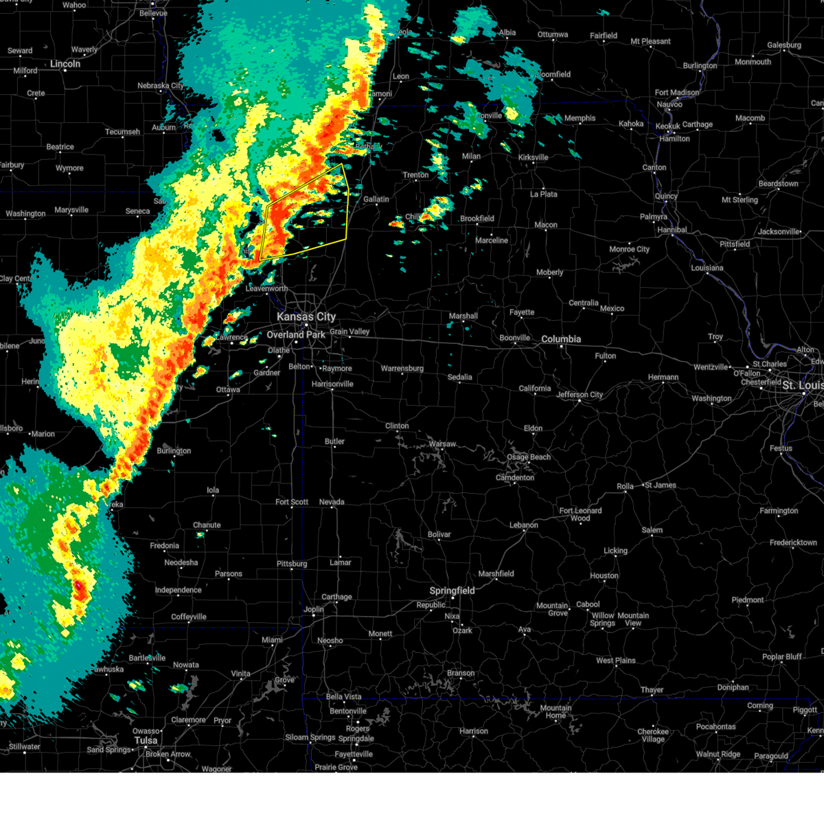 the severe thunderstorm warning has been cancelled and is no longer in effect the severe thunderstorm warning has been cancelled and is no longer in effect
|
| 10/30/2024 6:23 PM CDT |
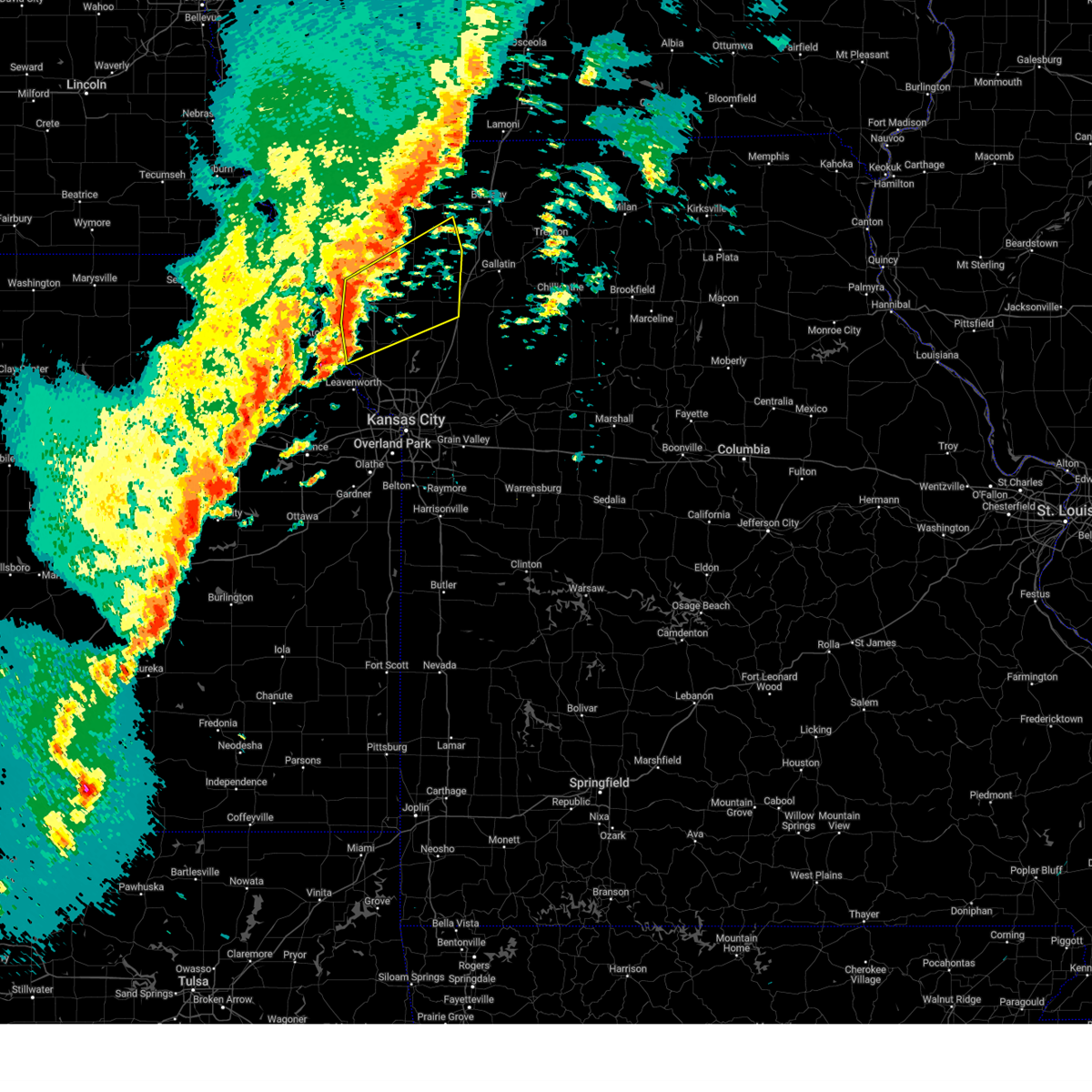 Svreax the national weather service in pleasant hill has issued a * severe thunderstorm warning for, southeastern doniphan county in northeastern kansas, buchanan county in northwestern missouri, northern clinton county in northwestern missouri, southern gentry county in northwestern missouri, north central platte county in west central missouri, southeastern andrew county in northwestern missouri, dekalb county in northwestern missouri, * until 715 pm cdt. * at 622 pm cdt, severe thunderstorms were located along a line extending from near country club to near st. joseph to near dearborn, moving northeast at 55 mph (radar indicated). Hazards include 60 mph wind gusts and quarter size hail. Hail damage to vehicles is expected. Expect wind damage to roofs, siding, and trees. Svreax the national weather service in pleasant hill has issued a * severe thunderstorm warning for, southeastern doniphan county in northeastern kansas, buchanan county in northwestern missouri, northern clinton county in northwestern missouri, southern gentry county in northwestern missouri, north central platte county in west central missouri, southeastern andrew county in northwestern missouri, dekalb county in northwestern missouri, * until 715 pm cdt. * at 622 pm cdt, severe thunderstorms were located along a line extending from near country club to near st. joseph to near dearborn, moving northeast at 55 mph (radar indicated). Hazards include 60 mph wind gusts and quarter size hail. Hail damage to vehicles is expected. Expect wind damage to roofs, siding, and trees.
|
| 10/24/2024 9:03 PM CDT |
 the severe thunderstorm warning has been cancelled and is no longer in effect the severe thunderstorm warning has been cancelled and is no longer in effect
|
| 10/24/2024 9:03 PM CDT |
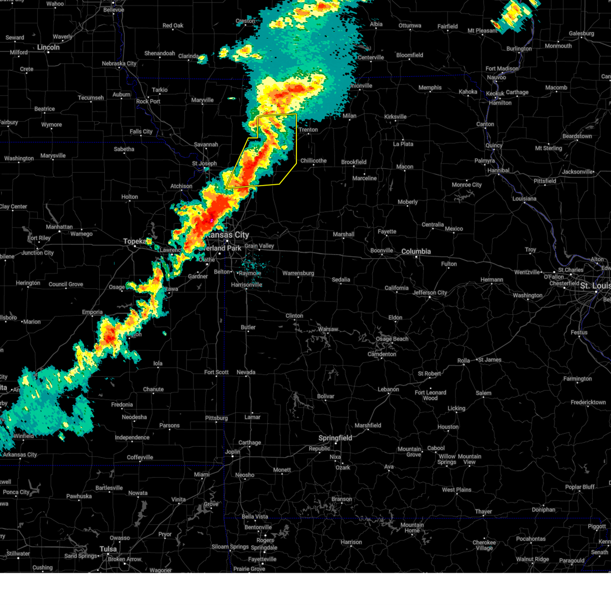 At 902 pm cdt, severe thunderstorms were located along a line extending from 7 miles west of gilman city to 6 miles northeast of cameron to near lathrop, moving east at 40 mph (radar indicated). Hazards include 60 mph wind gusts and quarter size hail. Hail damage to vehicles is expected. expect wind damage to roofs, siding, and trees. locations impacted include, cameron, hamilton, gallatin, maysville, stewartsville, jamesport, osborn, gilman city, breckenridge, pattonsburg, kingston, kidder, winston, altamont, coffey, turney, jameson, weatherby, mcfall, and lock springs. This includes interstate 35 in missouri between mile markers 44 and 90. At 902 pm cdt, severe thunderstorms were located along a line extending from 7 miles west of gilman city to 6 miles northeast of cameron to near lathrop, moving east at 40 mph (radar indicated). Hazards include 60 mph wind gusts and quarter size hail. Hail damage to vehicles is expected. expect wind damage to roofs, siding, and trees. locations impacted include, cameron, hamilton, gallatin, maysville, stewartsville, jamesport, osborn, gilman city, breckenridge, pattonsburg, kingston, kidder, winston, altamont, coffey, turney, jameson, weatherby, mcfall, and lock springs. This includes interstate 35 in missouri between mile markers 44 and 90.
|
| 10/24/2024 8:41 PM CDT |
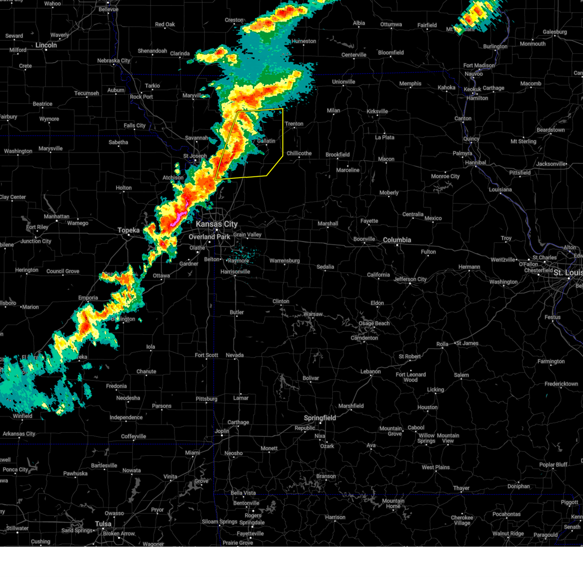 Svreax the national weather service in pleasant hill has issued a * severe thunderstorm warning for, daviess county in north central missouri, northern clinton county in northwestern missouri, southeastern gentry county in northwestern missouri, southern harrison county in north central missouri, northern caldwell county in north central missouri, dekalb county in northwestern missouri, * until 930 pm cdt. * at 841 pm cdt, severe thunderstorms were located along a line extending from 7 miles northwest of pattonsburg to osborn to near plattsburg, moving east at 35 mph (radar indicated). Hazards include 70 mph wind gusts and quarter size hail. Hail damage to vehicles is expected. expect considerable tree damage. Wind damage is also likely to mobile homes, roofs, and outbuildings. Svreax the national weather service in pleasant hill has issued a * severe thunderstorm warning for, daviess county in north central missouri, northern clinton county in northwestern missouri, southeastern gentry county in northwestern missouri, southern harrison county in north central missouri, northern caldwell county in north central missouri, dekalb county in northwestern missouri, * until 930 pm cdt. * at 841 pm cdt, severe thunderstorms were located along a line extending from 7 miles northwest of pattonsburg to osborn to near plattsburg, moving east at 35 mph (radar indicated). Hazards include 70 mph wind gusts and quarter size hail. Hail damage to vehicles is expected. expect considerable tree damage. Wind damage is also likely to mobile homes, roofs, and outbuildings.
|
| 10/24/2024 8:37 PM CDT |
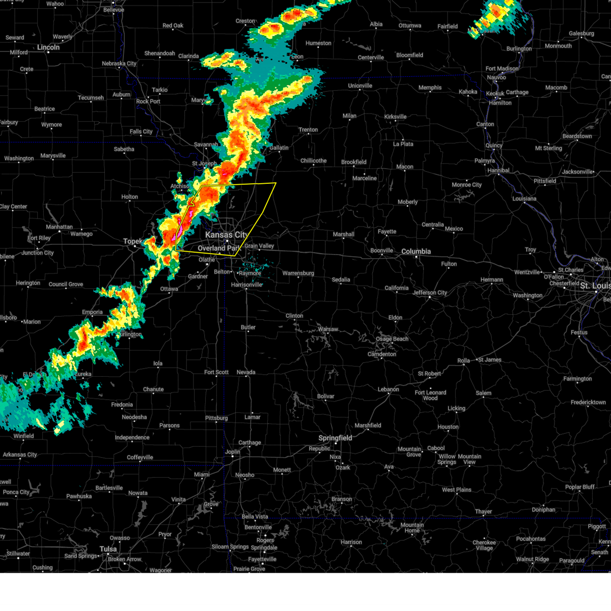 Svreax the national weather service in pleasant hill has issued a * severe thunderstorm warning for, wyandotte county in northeastern kansas, leavenworth county in northeastern kansas, northern johnson county in east central kansas, southeastern buchanan county in northwestern missouri, southern clinton county in northwestern missouri, clay county in west central missouri, northwestern ray county in west central missouri, southwestern caldwell county in north central missouri, platte county in west central missouri, northwestern jackson county in west central missouri, * until 915 pm cdt. * at 836 pm cdt, severe thunderstorms were located along a line extending from near edgerton to near lansing to near pleasant grove, moving east at 45 mph (radar indicated). Hazards include 70 mph wind gusts and quarter size hail. Hail damage to vehicles is expected. expect considerable tree damage. Wind damage is also likely to mobile homes, roofs, and outbuildings. Svreax the national weather service in pleasant hill has issued a * severe thunderstorm warning for, wyandotte county in northeastern kansas, leavenworth county in northeastern kansas, northern johnson county in east central kansas, southeastern buchanan county in northwestern missouri, southern clinton county in northwestern missouri, clay county in west central missouri, northwestern ray county in west central missouri, southwestern caldwell county in north central missouri, platte county in west central missouri, northwestern jackson county in west central missouri, * until 915 pm cdt. * at 836 pm cdt, severe thunderstorms were located along a line extending from near edgerton to near lansing to near pleasant grove, moving east at 45 mph (radar indicated). Hazards include 70 mph wind gusts and quarter size hail. Hail damage to vehicles is expected. expect considerable tree damage. Wind damage is also likely to mobile homes, roofs, and outbuildings.
|
| 10/24/2024 8:31 PM CDT |
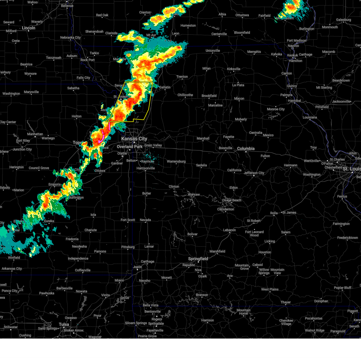 At 830 pm cdt, severe thunderstorms were located along a line extending from 7 miles east of king city to gower to near weston, moving east at 50 mph (radar indicated). Hazards include 70 mph wind gusts and quarter size hail. Hail damage to vehicles is expected. expect considerable tree damage. wind damage is also likely to mobile homes, roofs, and outbuildings. locations impacted include, st. joseph, savannah, plattsburg, lathrop, weston, gower, elwood, maysville, country club villa, country club, stewartsville, agency, trimble, edgerton, dearborn, camden point, union star, osborn, clarksdale, and easton. this includes the following highways, interstate 29 between mile markers 24 and 56. Interstate 229 between mile markers 0 and 12. At 830 pm cdt, severe thunderstorms were located along a line extending from 7 miles east of king city to gower to near weston, moving east at 50 mph (radar indicated). Hazards include 70 mph wind gusts and quarter size hail. Hail damage to vehicles is expected. expect considerable tree damage. wind damage is also likely to mobile homes, roofs, and outbuildings. locations impacted include, st. joseph, savannah, plattsburg, lathrop, weston, gower, elwood, maysville, country club villa, country club, stewartsville, agency, trimble, edgerton, dearborn, camden point, union star, osborn, clarksdale, and easton. this includes the following highways, interstate 29 between mile markers 24 and 56. Interstate 229 between mile markers 0 and 12.
|
| 10/24/2024 8:18 PM CDT |
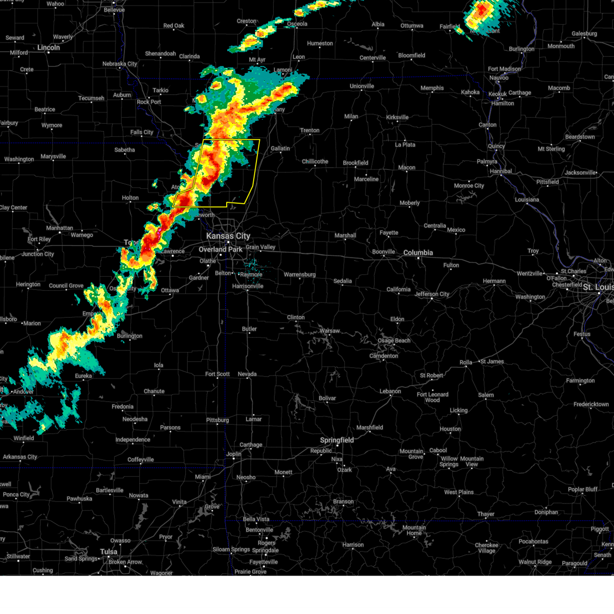 At 818 pm cdt, severe thunderstorms were located along a line extending from near king city to near gower to near weston, moving east at 45 mph (radar indicated). Hazards include 70 mph wind gusts and quarter size hail. Hail damage to vehicles is expected. expect considerable tree damage. wind damage is also likely to mobile homes, roofs, and outbuildings. locations impacted include, st. joseph, atchison, savannah, plattsburg, lathrop, weston, gower, wathena, elwood, maysville, country club villa, country club, stewartsville, agency, trimble, edgerton, dearborn, camden point, union star, and osborn. this includes the following highways, interstate 29 between mile markers 24 and 59. Interstate 229 between mile markers 0 and 14. At 818 pm cdt, severe thunderstorms were located along a line extending from near king city to near gower to near weston, moving east at 45 mph (radar indicated). Hazards include 70 mph wind gusts and quarter size hail. Hail damage to vehicles is expected. expect considerable tree damage. wind damage is also likely to mobile homes, roofs, and outbuildings. locations impacted include, st. joseph, atchison, savannah, plattsburg, lathrop, weston, gower, wathena, elwood, maysville, country club villa, country club, stewartsville, agency, trimble, edgerton, dearborn, camden point, union star, and osborn. this includes the following highways, interstate 29 between mile markers 24 and 59. Interstate 229 between mile markers 0 and 14.
|
| 10/24/2024 8:08 PM CDT |
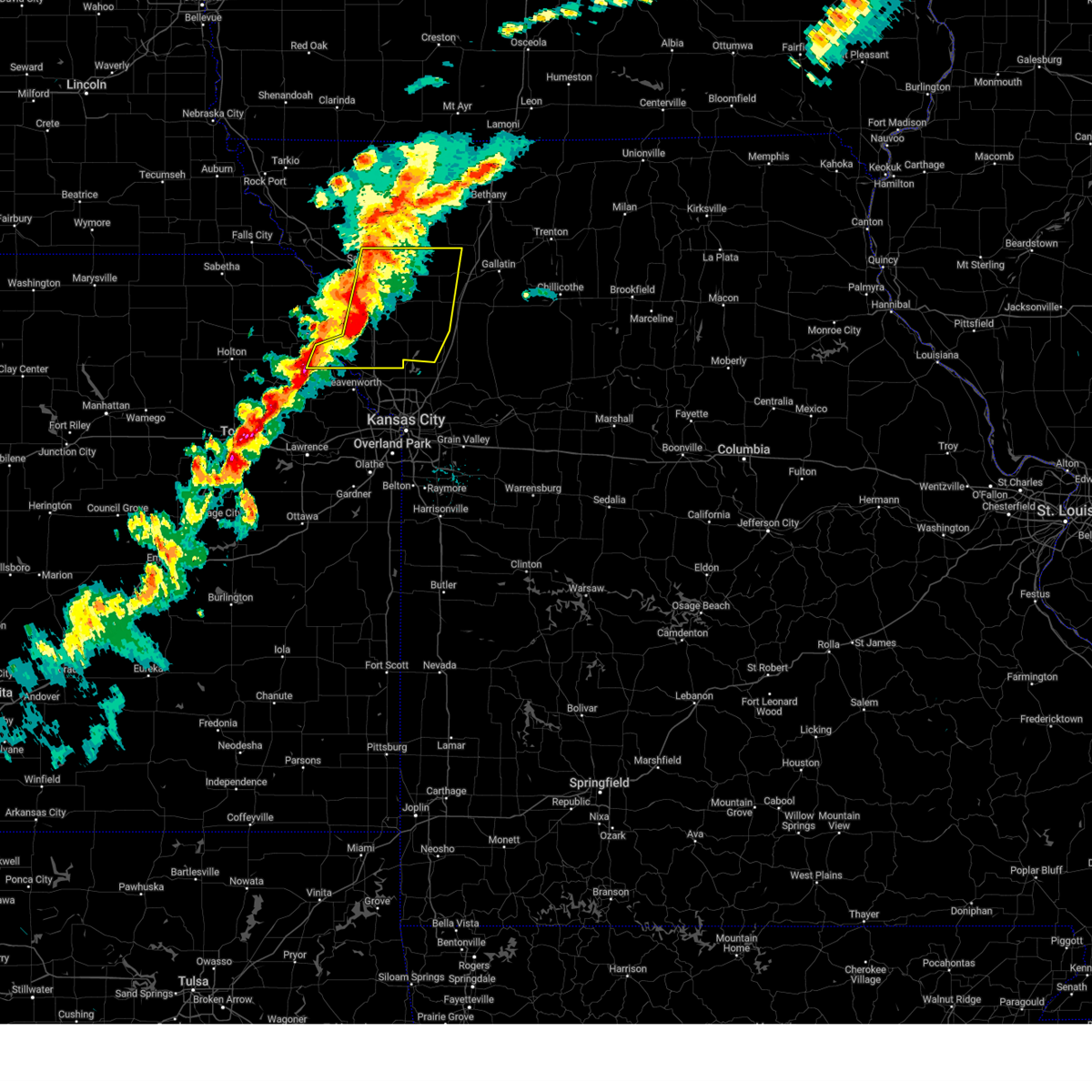 Svreax the national weather service in pleasant hill has issued a * severe thunderstorm warning for, east central doniphan county in northeastern kansas, southeastern atchison county in northeastern kansas, buchanan county in northwestern missouri, clinton county in northwestern missouri, northern platte county in west central missouri, southeastern andrew county in northwestern missouri, dekalb county in northwestern missouri, * until 845 pm cdt. * at 808 pm cdt, severe thunderstorms were located along a line extending from near union star to near dearborn to near easton, moving east at 45 mph (radar indicated). Hazards include 60 mph wind gusts and quarter size hail. Hail damage to vehicles is expected. Expect wind damage to roofs, siding, and trees. Svreax the national weather service in pleasant hill has issued a * severe thunderstorm warning for, east central doniphan county in northeastern kansas, southeastern atchison county in northeastern kansas, buchanan county in northwestern missouri, clinton county in northwestern missouri, northern platte county in west central missouri, southeastern andrew county in northwestern missouri, dekalb county in northwestern missouri, * until 845 pm cdt. * at 808 pm cdt, severe thunderstorms were located along a line extending from near union star to near dearborn to near easton, moving east at 45 mph (radar indicated). Hazards include 60 mph wind gusts and quarter size hail. Hail damage to vehicles is expected. Expect wind damage to roofs, siding, and trees.
|
| 9/19/2024 12:26 PM CDT |
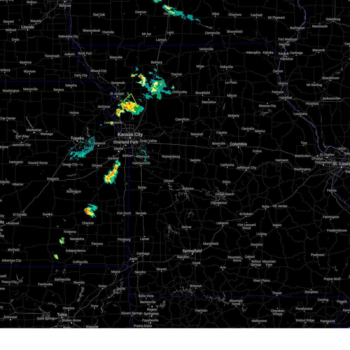 The storm which prompted the warning has weakened below severe limits, and no longer poses an immediate threat to life or property. therefore, the warning will be allowed to expire. The storm which prompted the warning has weakened below severe limits, and no longer poses an immediate threat to life or property. therefore, the warning will be allowed to expire.
|
| 9/19/2024 12:18 PM CDT |
 At 1218 pm cdt, a severe thunderstorm was located near gower, moving northeast at 30 mph (radar indicated). Hazards include 60 mph wind gusts and penny size hail. Expect damage to roofs, siding, and trees. Locations impacted include, gower, agency, and easton. At 1218 pm cdt, a severe thunderstorm was located near gower, moving northeast at 30 mph (radar indicated). Hazards include 60 mph wind gusts and penny size hail. Expect damage to roofs, siding, and trees. Locations impacted include, gower, agency, and easton.
|
| 9/19/2024 12:18 PM CDT |
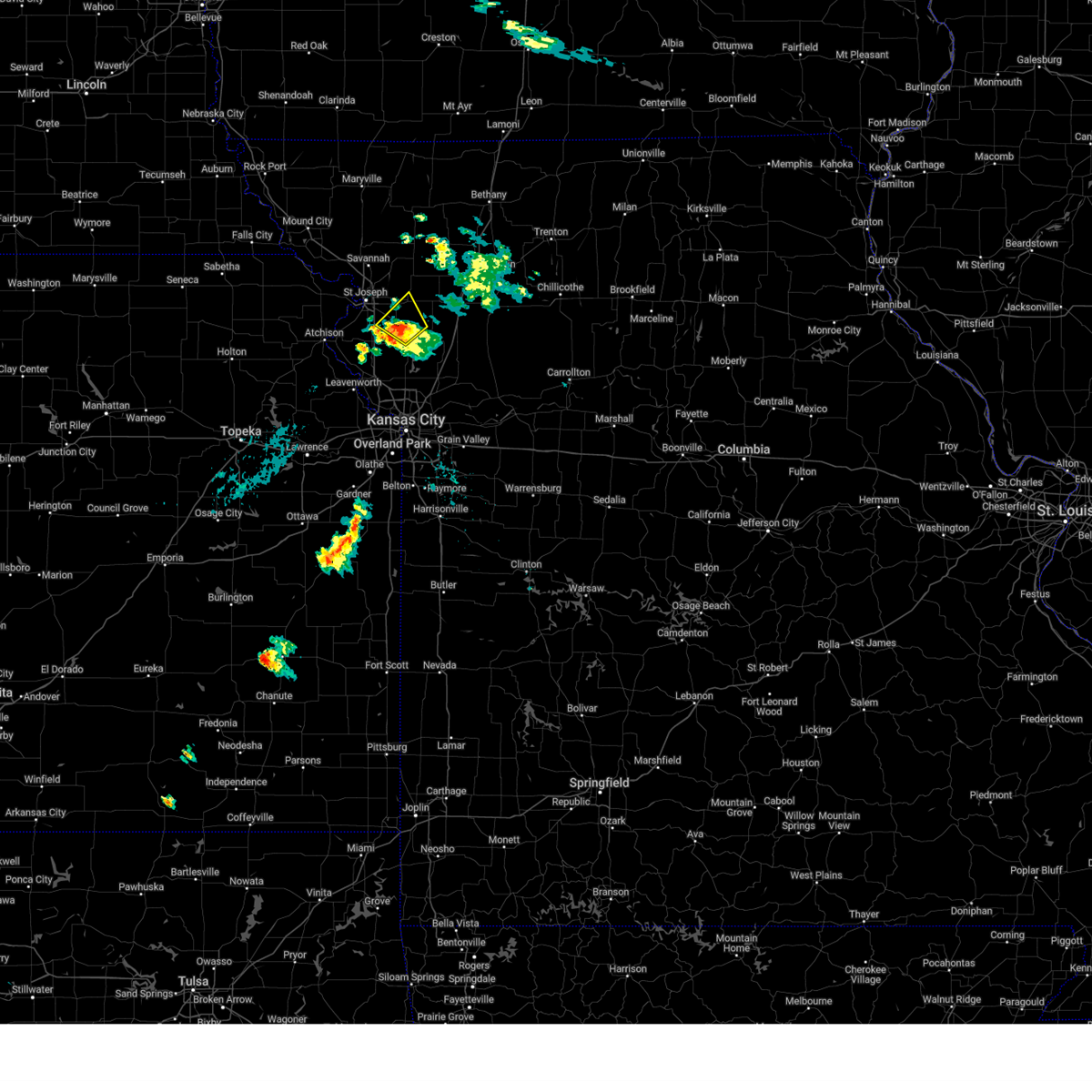 the severe thunderstorm warning has been cancelled and is no longer in effect the severe thunderstorm warning has been cancelled and is no longer in effect
|
| 9/19/2024 11:59 AM CDT |
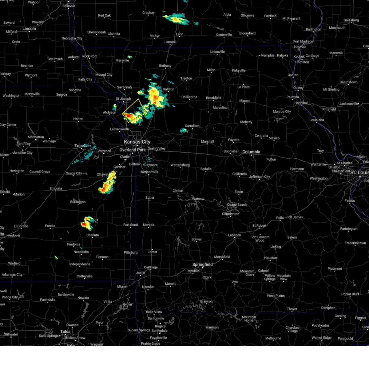 Svreax the national weather service in pleasant hill has issued a * severe thunderstorm warning for, southeastern buchanan county in northwestern missouri, northwestern clinton county in northwestern missouri, northeastern platte county in west central missouri, southwestern dekalb county in northwestern missouri, * until 1230 pm cdt. * at 1158 am cdt, a severe thunderstorm was located near dearborn, or 8 miles southwest of gower, moving northeast at 35 mph (radar indicated). Hazards include 60 mph wind gusts and penny size hail. expect damage to roofs, siding, and trees Svreax the national weather service in pleasant hill has issued a * severe thunderstorm warning for, southeastern buchanan county in northwestern missouri, northwestern clinton county in northwestern missouri, northeastern platte county in west central missouri, southwestern dekalb county in northwestern missouri, * until 1230 pm cdt. * at 1158 am cdt, a severe thunderstorm was located near dearborn, or 8 miles southwest of gower, moving northeast at 35 mph (radar indicated). Hazards include 60 mph wind gusts and penny size hail. expect damage to roofs, siding, and trees
|
| 8/27/2024 7:46 PM CDT |
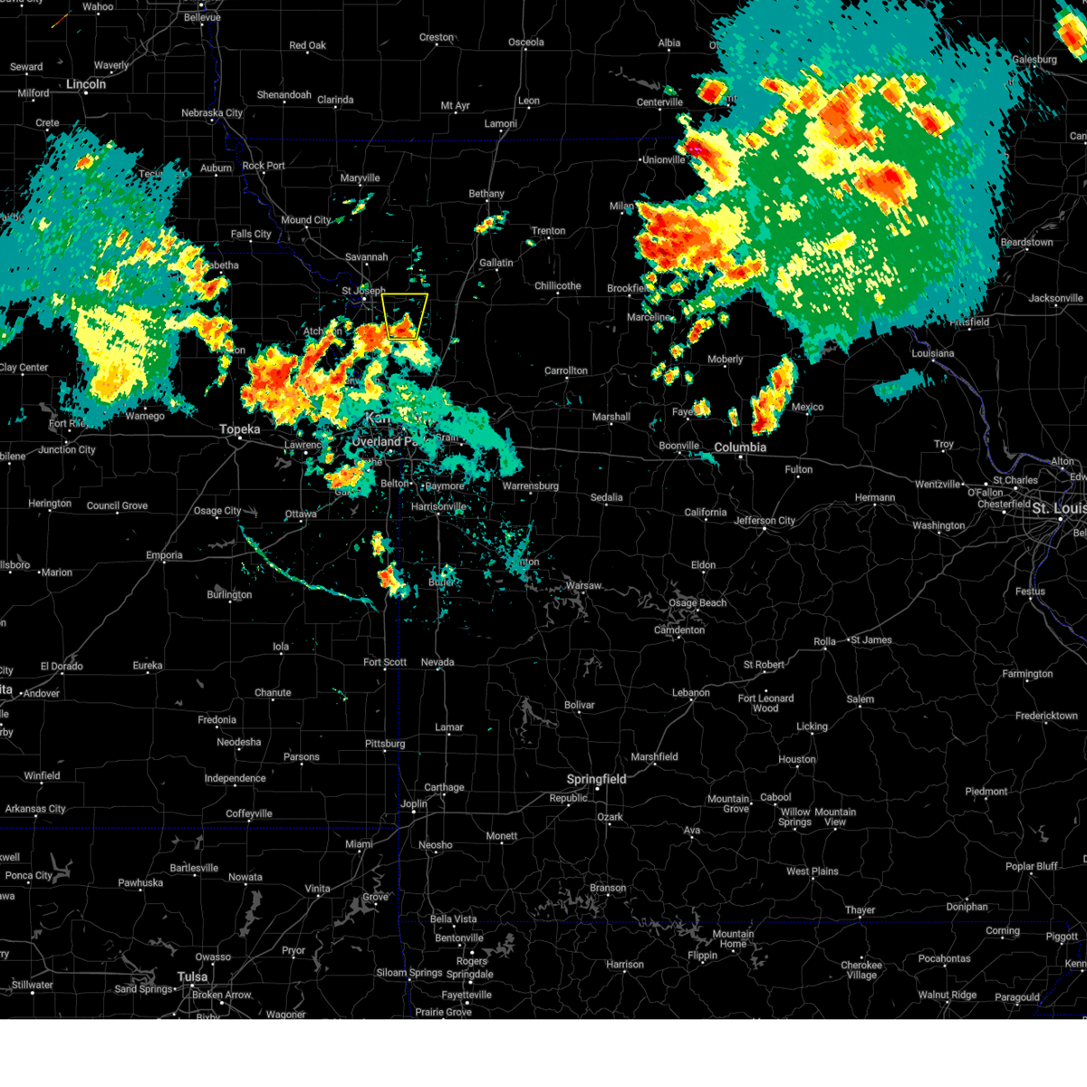 Svreax the national weather service in pleasant hill has issued a * severe thunderstorm warning for, eastern buchanan county in northwestern missouri, northwestern clinton county in northwestern missouri, southwestern dekalb county in northwestern missouri, * until 815 pm cdt. * at 745 pm cdt, a severe thunderstorm was located over gower, moving north at 15 mph (public). Hazards include 60 mph wind gusts and quarter size hail. Hail damage to vehicles is expected. Expect wind damage to roofs, siding, and trees. Svreax the national weather service in pleasant hill has issued a * severe thunderstorm warning for, eastern buchanan county in northwestern missouri, northwestern clinton county in northwestern missouri, southwestern dekalb county in northwestern missouri, * until 815 pm cdt. * at 745 pm cdt, a severe thunderstorm was located over gower, moving north at 15 mph (public). Hazards include 60 mph wind gusts and quarter size hail. Hail damage to vehicles is expected. Expect wind damage to roofs, siding, and trees.
|
| 8/27/2024 7:40 PM CDT | Storm damage reported in clinton county MO, 0.3 miles NE of Gower, MO |
| 8/27/2024 7:21 PM CDT |
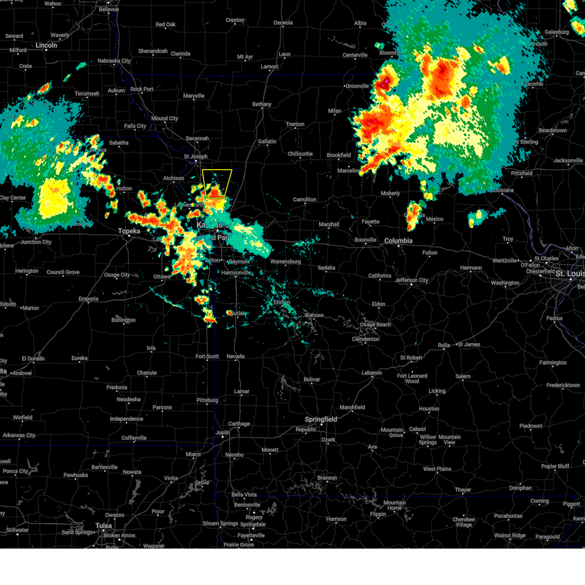 Svreax the national weather service in pleasant hill has issued a * severe thunderstorm warning for, southeastern buchanan county in northwestern missouri, southwestern clinton county in northwestern missouri, northwestern clay county in west central missouri, northeastern platte county in west central missouri, * until 745 pm cdt. * at 720 pm cdt, a severe thunderstorm was located over edgerton, or 7 miles north of smithville, moving north at 30 mph (radar indicated). Hazards include 60 mph wind gusts and quarter size hail. Hail damage to vehicles is expected. Expect wind damage to roofs, siding, and trees. Svreax the national weather service in pleasant hill has issued a * severe thunderstorm warning for, southeastern buchanan county in northwestern missouri, southwestern clinton county in northwestern missouri, northwestern clay county in west central missouri, northeastern platte county in west central missouri, * until 745 pm cdt. * at 720 pm cdt, a severe thunderstorm was located over edgerton, or 7 miles north of smithville, moving north at 30 mph (radar indicated). Hazards include 60 mph wind gusts and quarter size hail. Hail damage to vehicles is expected. Expect wind damage to roofs, siding, and trees.
|
| 7/31/2024 10:22 PM CDT |
 Svreax the national weather service in pleasant hill has issued a * severe thunderstorm warning for, leavenworth county in northeastern kansas, central atchison county in northeastern kansas, wyandotte county in northeastern kansas, northeastern miami county in east central kansas, doniphan county in northeastern kansas, johnson county in east central kansas, buchanan county in northwestern missouri, southeastern holt county in northwestern missouri, southern andrew county in northwestern missouri, western jackson county in west central missouri, northwestern cass county in west central missouri, clinton county in northwestern missouri, clay county in west central missouri, west central ray county in west central missouri, platte county in west central missouri, western dekalb county in northwestern missouri, * until 1115 pm cdt. * at 1022 pm cdt, severe thunderstorms were located along a line extending from 7 miles northwest of rushville to near lansing to near lawrence, moving east at 55 mph (radar indicated). Hazards include 70 mph wind gusts. Expect considerable tree damage. Damage is likely to mobile homes, roofs, and outbuildings. Svreax the national weather service in pleasant hill has issued a * severe thunderstorm warning for, leavenworth county in northeastern kansas, central atchison county in northeastern kansas, wyandotte county in northeastern kansas, northeastern miami county in east central kansas, doniphan county in northeastern kansas, johnson county in east central kansas, buchanan county in northwestern missouri, southeastern holt county in northwestern missouri, southern andrew county in northwestern missouri, western jackson county in west central missouri, northwestern cass county in west central missouri, clinton county in northwestern missouri, clay county in west central missouri, west central ray county in west central missouri, platte county in west central missouri, western dekalb county in northwestern missouri, * until 1115 pm cdt. * at 1022 pm cdt, severe thunderstorms were located along a line extending from 7 miles northwest of rushville to near lansing to near lawrence, moving east at 55 mph (radar indicated). Hazards include 70 mph wind gusts. Expect considerable tree damage. Damage is likely to mobile homes, roofs, and outbuildings.
|
| 7/16/2024 8:57 AM CDT |
 The storms which prompted the warning have weakened below severe limits, and no longer pose an immediate threat to life or property. therefore, the warning will be allowed to expire. however, gusty winds are still possible with these thunderstorms. a severe thunderstorm watch remains in effect until 100 pm cdt for northeastern kansas, and northwestern and west central missouri. The storms which prompted the warning have weakened below severe limits, and no longer pose an immediate threat to life or property. therefore, the warning will be allowed to expire. however, gusty winds are still possible with these thunderstorms. a severe thunderstorm watch remains in effect until 100 pm cdt for northeastern kansas, and northwestern and west central missouri.
|
| 7/16/2024 8:41 AM CDT |
 the severe thunderstorm warning has been cancelled and is no longer in effect the severe thunderstorm warning has been cancelled and is no longer in effect
|
| 7/16/2024 8:41 AM CDT |
 At 841 am cdt, severe thunderstorms were located along a line extending from 6 miles southeast of rushville to near camden point to near tracy, moving northeast at 35 mph (radar indicated). Hazards include 70 mph wind gusts. Expect considerable tree damage. damage is likely to mobile homes, roofs, and outbuildings. locations impacted include, leavenworth, lansing, smithville, kearney, platte city, plattsburg, lathrop, weston, gower, agency, trimble, edgerton, dearborn, camden point, ferrelview, holt, tracy, lewis and clark village, farley, and easton. this includes the following highways, interstate 35 in missouri between mile markers 22 and 34. interstate 29 between mile markers 11 and 41. Interstate 435 between mile markers 26 and 45. At 841 am cdt, severe thunderstorms were located along a line extending from 6 miles southeast of rushville to near camden point to near tracy, moving northeast at 35 mph (radar indicated). Hazards include 70 mph wind gusts. Expect considerable tree damage. damage is likely to mobile homes, roofs, and outbuildings. locations impacted include, leavenworth, lansing, smithville, kearney, platte city, plattsburg, lathrop, weston, gower, agency, trimble, edgerton, dearborn, camden point, ferrelview, holt, tracy, lewis and clark village, farley, and easton. this includes the following highways, interstate 35 in missouri between mile markers 22 and 34. interstate 29 between mile markers 11 and 41. Interstate 435 between mile markers 26 and 45.
|
| 7/16/2024 8:13 AM CDT |
 Svreax the national weather service in pleasant hill has issued a * severe thunderstorm warning for, northern leavenworth county in northeastern kansas, southeastern atchison county in northeastern kansas, southeastern buchanan county in northwestern missouri, western clinton county in northwestern missouri, northern clay county in west central missouri, platte county in west central missouri, * until 900 am cdt. * at 813 am cdt, severe thunderstorms were located along a line extending from 6 miles north of easton to near weston to near leavenworth, moving east at 45 mph (radar indicated). Hazards include 70 mph wind gusts. Expect considerable tree damage. Damage is likely to mobile homes, roofs, and outbuildings. Svreax the national weather service in pleasant hill has issued a * severe thunderstorm warning for, northern leavenworth county in northeastern kansas, southeastern atchison county in northeastern kansas, southeastern buchanan county in northwestern missouri, western clinton county in northwestern missouri, northern clay county in west central missouri, platte county in west central missouri, * until 900 am cdt. * at 813 am cdt, severe thunderstorms were located along a line extending from 6 miles north of easton to near weston to near leavenworth, moving east at 45 mph (radar indicated). Hazards include 70 mph wind gusts. Expect considerable tree damage. Damage is likely to mobile homes, roofs, and outbuildings.
|
| 7/16/2024 7:08 AM CDT |
 At 708 am cdt, a severe thunderstorm was located over osborn, or 8 miles west of cameron, moving east at 30 mph (radar indicated). Hazards include 60 mph wind gusts and quarter size hail. Hail damage to vehicles is expected. expect wind damage to roofs, siding, and trees. Locations impacted include, plattsburg, gower, stewartsville, and clarksdale. At 708 am cdt, a severe thunderstorm was located over osborn, or 8 miles west of cameron, moving east at 30 mph (radar indicated). Hazards include 60 mph wind gusts and quarter size hail. Hail damage to vehicles is expected. expect wind damage to roofs, siding, and trees. Locations impacted include, plattsburg, gower, stewartsville, and clarksdale.
|
| 7/16/2024 7:08 AM CDT |
 the severe thunderstorm warning has been cancelled and is no longer in effect the severe thunderstorm warning has been cancelled and is no longer in effect
|
| 7/16/2024 6:51 AM CDT |
 the severe thunderstorm warning has been cancelled and is no longer in effect the severe thunderstorm warning has been cancelled and is no longer in effect
|
| 7/16/2024 6:51 AM CDT |
 At 650 am cdt, a severe thunderstorm was located near stewartsville, or near gower, moving east at 30 mph (radar indicated). Hazards include 60 mph wind gusts and quarter size hail. Hail damage to vehicles is expected. expect wind damage to roofs, siding, and trees. locations impacted include, st. joseph, plattsburg, gower, stewartsville, agency, clarksdale, easton, amity, and faucett. this includes the following highways, interstate 29 between mile markers 33 and 49. Interstate 229 between mile markers 0 and 1. At 650 am cdt, a severe thunderstorm was located near stewartsville, or near gower, moving east at 30 mph (radar indicated). Hazards include 60 mph wind gusts and quarter size hail. Hail damage to vehicles is expected. expect wind damage to roofs, siding, and trees. locations impacted include, st. joseph, plattsburg, gower, stewartsville, agency, clarksdale, easton, amity, and faucett. this includes the following highways, interstate 29 between mile markers 33 and 49. Interstate 229 between mile markers 0 and 1.
|
| 7/16/2024 6:30 AM CDT |
 At 630 am cdt, a severe thunderstorm was located over agency, or near st. joseph, moving east at 30 mph (radar indicated). Hazards include ping pong ball size hail and 60 mph wind gusts. People and animals outdoors will be injured. expect hail damage to roofs, siding, windows, and vehicles. expect wind damage to roofs, siding, and trees. locations impacted include, st. joseph, plattsburg, gower, wathena, elwood, country club, stewartsville, agency, clarksdale, easton, de kalb, amity, st. joseph airport, and faucett. this includes the following highways, interstate 29 between mile markers 33 and 51. Interstate 229 between mile markers 0 and 9. At 630 am cdt, a severe thunderstorm was located over agency, or near st. joseph, moving east at 30 mph (radar indicated). Hazards include ping pong ball size hail and 60 mph wind gusts. People and animals outdoors will be injured. expect hail damage to roofs, siding, windows, and vehicles. expect wind damage to roofs, siding, and trees. locations impacted include, st. joseph, plattsburg, gower, wathena, elwood, country club, stewartsville, agency, clarksdale, easton, de kalb, amity, st. joseph airport, and faucett. this includes the following highways, interstate 29 between mile markers 33 and 51. Interstate 229 between mile markers 0 and 9.
|
| 7/16/2024 6:28 AM CDT |
 Svreax the national weather service in pleasant hill has issued a * severe thunderstorm warning for, southeastern doniphan county in northeastern kansas, buchanan county in northwestern missouri, northwestern clinton county in northwestern missouri, southeastern andrew county in northwestern missouri, southwestern dekalb county in northwestern missouri, * until 715 am cdt. * at 628 am cdt, a severe thunderstorm was located over agency, or near st. joseph, moving east at 30 mph (radar indicated). Hazards include 60 mph wind gusts and quarter size hail. Hail damage to vehicles is expected. Expect wind damage to roofs, siding, and trees. Svreax the national weather service in pleasant hill has issued a * severe thunderstorm warning for, southeastern doniphan county in northeastern kansas, buchanan county in northwestern missouri, northwestern clinton county in northwestern missouri, southeastern andrew county in northwestern missouri, southwestern dekalb county in northwestern missouri, * until 715 am cdt. * at 628 am cdt, a severe thunderstorm was located over agency, or near st. joseph, moving east at 30 mph (radar indicated). Hazards include 60 mph wind gusts and quarter size hail. Hail damage to vehicles is expected. Expect wind damage to roofs, siding, and trees.
|
| 7/2/2024 6:37 PM CDT |
 At 637 pm cdt, severe thunderstorms were located along a line extending from 6 miles north of plattsburg to near camden point, moving northeast at 25 mph (radar indicated. there are strong indications of a microburst occurring near camden point). Hazards include 70 mph wind gusts and penny size hail. Expect considerable tree damage. damage is likely to mobile homes, roofs, and outbuildings. locations impacted include, leavenworth, smithville, kearney, platte city, lawson, plattsburg, lathrop, weston, gower, trimble, edgerton, camden point, holt, tracy, turney, ridgely, beverly, and hoover. this includes the following highways, interstate 35 in missouri between mile markers 27 and 47. Interstate 29 between mile markers 19 and 28. At 637 pm cdt, severe thunderstorms were located along a line extending from 6 miles north of plattsburg to near camden point, moving northeast at 25 mph (radar indicated. there are strong indications of a microburst occurring near camden point). Hazards include 70 mph wind gusts and penny size hail. Expect considerable tree damage. damage is likely to mobile homes, roofs, and outbuildings. locations impacted include, leavenworth, smithville, kearney, platte city, lawson, plattsburg, lathrop, weston, gower, trimble, edgerton, camden point, holt, tracy, turney, ridgely, beverly, and hoover. this includes the following highways, interstate 35 in missouri between mile markers 27 and 47. Interstate 29 between mile markers 19 and 28.
|
| 7/2/2024 6:26 PM CDT |
 Svreax the national weather service in pleasant hill has issued a * severe thunderstorm warning for, southeastern buchanan county in northwestern missouri, clinton county in northwestern missouri, northern clay county in west central missouri, southwestern caldwell county in north central missouri, northeastern platte county in west central missouri, * until 715 pm cdt. * at 625 pm cdt, severe thunderstorms were located along a line extending from gower to near tracy, moving east at 25 mph (radar indicated). Hazards include 60 mph wind gusts and penny size hail. expect damage to roofs, siding, and trees Svreax the national weather service in pleasant hill has issued a * severe thunderstorm warning for, southeastern buchanan county in northwestern missouri, clinton county in northwestern missouri, northern clay county in west central missouri, southwestern caldwell county in north central missouri, northeastern platte county in west central missouri, * until 715 pm cdt. * at 625 pm cdt, severe thunderstorms were located along a line extending from gower to near tracy, moving east at 25 mph (radar indicated). Hazards include 60 mph wind gusts and penny size hail. expect damage to roofs, siding, and trees
|
| 7/2/2024 6:20 PM CDT |
 At 620 pm cdt, severe thunderstorms were located along a line extending from 7 miles southwest of pattonsburg to near gower, moving northeast at 40 mph (radar indicated). Hazards include 60 mph wind gusts and quarter size hail. Hail damage to vehicles is expected. expect wind damage to roofs, siding, and trees. locations impacted include, cameron, plattsburg, gower, maysville, stewartsville, agency, osborn, clarksdale, winston, easton, altamont, turney, jameson, weatherby, amity, fairport, and santa rosa. This includes interstate 35 in missouri between mile markers 49 and 75. At 620 pm cdt, severe thunderstorms were located along a line extending from 7 miles southwest of pattonsburg to near gower, moving northeast at 40 mph (radar indicated). Hazards include 60 mph wind gusts and quarter size hail. Hail damage to vehicles is expected. expect wind damage to roofs, siding, and trees. locations impacted include, cameron, plattsburg, gower, maysville, stewartsville, agency, osborn, clarksdale, winston, easton, altamont, turney, jameson, weatherby, amity, fairport, and santa rosa. This includes interstate 35 in missouri between mile markers 49 and 75.
|
| 7/2/2024 6:11 PM CDT |
 Svreax the national weather service in pleasant hill has issued a * severe thunderstorm warning for, eastern buchanan county in northwestern missouri, southwestern daviess county in north central missouri, northern clinton county in northwestern missouri, northwestern caldwell county in north central missouri, dekalb county in northwestern missouri, * until 700 pm cdt. * at 610 pm cdt, severe thunderstorms were located along a line extending from near maysville to near dearborn, moving northeast at 40 mph (radar indicated). Hazards include 60 mph wind gusts and quarter size hail. Hail damage to vehicles is expected. Expect wind damage to roofs, siding, and trees. Svreax the national weather service in pleasant hill has issued a * severe thunderstorm warning for, eastern buchanan county in northwestern missouri, southwestern daviess county in north central missouri, northern clinton county in northwestern missouri, northwestern caldwell county in north central missouri, dekalb county in northwestern missouri, * until 700 pm cdt. * at 610 pm cdt, severe thunderstorms were located along a line extending from near maysville to near dearborn, moving northeast at 40 mph (radar indicated). Hazards include 60 mph wind gusts and quarter size hail. Hail damage to vehicles is expected. Expect wind damage to roofs, siding, and trees.
|
| 7/2/2024 5:59 PM CDT |
 the severe thunderstorm warning has been cancelled and is no longer in effect the severe thunderstorm warning has been cancelled and is no longer in effect
|
| 7/2/2024 5:59 PM CDT |
 At 559 pm cdt, severe thunderstorms were located along a line extending from 7 miles southwest of clarksdale to near agency to near lewis and clark village, moving northeast at 35 mph (radar indicated). Hazards include 60 mph wind gusts and quarter size hail. Hail damage to vehicles is expected. expect wind damage to roofs, siding, and trees. locations impacted include, st. joseph, gower, agency, edgerton, dearborn, easton, de kalb, iatan, and faucett. this includes the following highways, interstate 29 between mile markers 28 and 47. Interstate 229 between mile markers 0 and 4. At 559 pm cdt, severe thunderstorms were located along a line extending from 7 miles southwest of clarksdale to near agency to near lewis and clark village, moving northeast at 35 mph (radar indicated). Hazards include 60 mph wind gusts and quarter size hail. Hail damage to vehicles is expected. expect wind damage to roofs, siding, and trees. locations impacted include, st. joseph, gower, agency, edgerton, dearborn, easton, de kalb, iatan, and faucett. this includes the following highways, interstate 29 between mile markers 28 and 47. Interstate 229 between mile markers 0 and 4.
|
| 7/2/2024 5:46 PM CDT |
 At 546 pm cdt, severe thunderstorms were located along a line extending from near agency to 6 miles northwest of dearborn to near lewis and clark village, moving east at 45 mph (radar indicated). Hazards include 60 mph wind gusts and quarter size hail. Hail damage to vehicles is expected. expect wind damage to roofs, siding, and trees. locations impacted include, st. joseph, atchison, gower, agency, edgerton, dearborn, rushville, lewis and clark village, easton, de kalb, iatan, faucett, bean lake, lewis and clark vi, and potter. this includes the following highways, interstate 29 between mile markers 27 and 47. Interstate 229 between mile markers 0 and 4. At 546 pm cdt, severe thunderstorms were located along a line extending from near agency to 6 miles northwest of dearborn to near lewis and clark village, moving east at 45 mph (radar indicated). Hazards include 60 mph wind gusts and quarter size hail. Hail damage to vehicles is expected. expect wind damage to roofs, siding, and trees. locations impacted include, st. joseph, atchison, gower, agency, edgerton, dearborn, rushville, lewis and clark village, easton, de kalb, iatan, faucett, bean lake, lewis and clark vi, and potter. this includes the following highways, interstate 29 between mile markers 27 and 47. Interstate 229 between mile markers 0 and 4.
|
| 7/2/2024 5:33 PM CDT |
 Svreax the national weather service in pleasant hill has issued a * severe thunderstorm warning for, eastern atchison county in northeastern kansas, buchanan county in northwestern missouri, northern platte county in west central missouri, * until 615 pm cdt. * at 533 pm cdt, severe thunderstorms were located along a line extending from 6 miles northeast of rushville to lewis and clark village to near nortonville, moving northeast at 35 mph (radar indicated). Hazards include 60 mph wind gusts and quarter size hail. Hail damage to vehicles is expected. Expect wind damage to roofs, siding, and trees. Svreax the national weather service in pleasant hill has issued a * severe thunderstorm warning for, eastern atchison county in northeastern kansas, buchanan county in northwestern missouri, northern platte county in west central missouri, * until 615 pm cdt. * at 533 pm cdt, severe thunderstorms were located along a line extending from 6 miles northeast of rushville to lewis and clark village to near nortonville, moving northeast at 35 mph (radar indicated). Hazards include 60 mph wind gusts and quarter size hail. Hail damage to vehicles is expected. Expect wind damage to roofs, siding, and trees.
|
| 6/26/2024 1:57 AM CDT |
 The storm which prompted the warning has weakened below severe limits, and no longer poses an immediate threat to life or property. therefore, the warning will be allowed to expire. however, gusty winds and heavy rain are still possible with this thunderstorm. a severe thunderstorm watch remains in effect until 700 am cdt for northeastern kansas, and northwestern missouri. The storm which prompted the warning has weakened below severe limits, and no longer poses an immediate threat to life or property. therefore, the warning will be allowed to expire. however, gusty winds and heavy rain are still possible with this thunderstorm. a severe thunderstorm watch remains in effect until 700 am cdt for northeastern kansas, and northwestern missouri.
|
| 6/26/2024 1:28 AM CDT |
 Svreax the national weather service in pleasant hill has issued a * severe thunderstorm warning for, southeastern doniphan county in northeastern kansas, northeastern atchison county in northeastern kansas, buchanan county in northwestern missouri, southeastern andrew county in northwestern missouri, * until 200 am cdt. * at 128 am cdt, a severe thunderstorm was located over wathena, moving southeast at 35 mph (radar indicated). Hazards include 60 mph wind gusts and penny size hail. expect damage to roofs, siding, and trees Svreax the national weather service in pleasant hill has issued a * severe thunderstorm warning for, southeastern doniphan county in northeastern kansas, northeastern atchison county in northeastern kansas, buchanan county in northwestern missouri, southeastern andrew county in northwestern missouri, * until 200 am cdt. * at 128 am cdt, a severe thunderstorm was located over wathena, moving southeast at 35 mph (radar indicated). Hazards include 60 mph wind gusts and penny size hail. expect damage to roofs, siding, and trees
|
| 6/13/2024 9:53 PM CDT |
 At 953 pm cdt, a severe thunderstorm was located over trimble, or near plattsburg, moving southeast at 30 mph (radar indicated). Hazards include ping pong ball size hail and 60 mph wind gusts. People and animals outdoors will be injured. expect hail damage to roofs, siding, windows, and vehicles. expect wind damage to roofs, siding, and trees. locations impacted include, excelsior springs, smithville, kearney, lawson, plattsburg, lathrop, gower, trimble, edgerton, holt, excelsior estates, ridgely, and hoover. This includes interstate 35 in missouri between mile markers 25 and 42. At 953 pm cdt, a severe thunderstorm was located over trimble, or near plattsburg, moving southeast at 30 mph (radar indicated). Hazards include ping pong ball size hail and 60 mph wind gusts. People and animals outdoors will be injured. expect hail damage to roofs, siding, windows, and vehicles. expect wind damage to roofs, siding, and trees. locations impacted include, excelsior springs, smithville, kearney, lawson, plattsburg, lathrop, gower, trimble, edgerton, holt, excelsior estates, ridgely, and hoover. This includes interstate 35 in missouri between mile markers 25 and 42.
|
| 6/13/2024 9:39 PM CDT |
 Svreax the national weather service in pleasant hill has issued a * severe thunderstorm warning for, southeastern buchanan county in northwestern missouri, clinton county in northwestern missouri, northern clay county in west central missouri, northeastern platte county in west central missouri, * until 1030 pm cdt. * at 939 pm cdt, a severe thunderstorm was located over gower, moving southeast at 35 mph (radar indicated). Hazards include ping pong ball size hail and 60 mph wind gusts. People and animals outdoors will be injured. expect hail damage to roofs, siding, windows, and vehicles. Expect wind damage to roofs, siding, and trees. Svreax the national weather service in pleasant hill has issued a * severe thunderstorm warning for, southeastern buchanan county in northwestern missouri, clinton county in northwestern missouri, northern clay county in west central missouri, northeastern platte county in west central missouri, * until 1030 pm cdt. * at 939 pm cdt, a severe thunderstorm was located over gower, moving southeast at 35 mph (radar indicated). Hazards include ping pong ball size hail and 60 mph wind gusts. People and animals outdoors will be injured. expect hail damage to roofs, siding, windows, and vehicles. Expect wind damage to roofs, siding, and trees.
|
| 5/26/2024 11:35 PM CDT |
 the severe thunderstorm warning has been cancelled and is no longer in effect the severe thunderstorm warning has been cancelled and is no longer in effect
|
| 5/26/2024 11:35 PM CDT |
 At 1135 pm cdt, a severe thunderstorm was located near lathrop, moving southeast at 30 mph (radar indicated). Hazards include ping pong ball size hail and 60 mph wind gusts. People and animals outdoors will be injured. expect hail damage to roofs, siding, windows, and vehicles. expect wind damage to roofs, siding, and trees. locations impacted include, cameron, plattsburg, lathrop, gower, stewartsville, holt, osborn, and turney. This includes interstate 35 in missouri between mile markers 32 and 52. At 1135 pm cdt, a severe thunderstorm was located near lathrop, moving southeast at 30 mph (radar indicated). Hazards include ping pong ball size hail and 60 mph wind gusts. People and animals outdoors will be injured. expect hail damage to roofs, siding, windows, and vehicles. expect wind damage to roofs, siding, and trees. locations impacted include, cameron, plattsburg, lathrop, gower, stewartsville, holt, osborn, and turney. This includes interstate 35 in missouri between mile markers 32 and 52.
|
| 5/26/2024 11:18 PM CDT |
 Svreax the national weather service in pleasant hill has issued a * severe thunderstorm warning for, southeastern buchanan county in northwestern missouri, clinton county in northwestern missouri, northwestern caldwell county in north central missouri, southern dekalb county in northwestern missouri, * until midnight cdt. * at 1118 pm cdt, a severe thunderstorm was located near stewartsville, or 7 miles northeast of gower, moving east at 25 mph (radar indicated). Hazards include ping pong ball size hail and 60 mph wind gusts. People and animals outdoors will be injured. expect hail damage to roofs, siding, windows, and vehicles. Expect wind damage to roofs, siding, and trees. Svreax the national weather service in pleasant hill has issued a * severe thunderstorm warning for, southeastern buchanan county in northwestern missouri, clinton county in northwestern missouri, northwestern caldwell county in north central missouri, southern dekalb county in northwestern missouri, * until midnight cdt. * at 1118 pm cdt, a severe thunderstorm was located near stewartsville, or 7 miles northeast of gower, moving east at 25 mph (radar indicated). Hazards include ping pong ball size hail and 60 mph wind gusts. People and animals outdoors will be injured. expect hail damage to roofs, siding, windows, and vehicles. Expect wind damage to roofs, siding, and trees.
|
| 5/21/2024 3:29 PM CDT |
 Svreax the national weather service in pleasant hill has issued a * severe thunderstorm warning for, eastern wyandotte county in northeastern kansas, eastern johnson county in east central kansas, southeastern buchanan county in northwestern missouri, western mercer county in north central missouri, harrison county in north central missouri, jackson county in west central missouri, northwestern johnson county in west central missouri, northern cass county in west central missouri, daviess county in north central missouri, clinton county in northwestern missouri, clay county in west central missouri, gentry county in northwestern missouri, western ray county in west central missouri, caldwell county in north central missouri, southwestern lafayette county in west central missouri, eastern platte county in west central missouri, dekalb county in northwestern missouri, * until 400 pm cdt. * at 329 pm cdt, severe thunderstorms were located along a line extending from near albany to near spring hill, moving east at 65 mph (radar indicated). Hazards include 60 mph wind gusts and quarter size hail. Hail damage to vehicles is expected. Expect wind damage to roofs, siding, and trees. Svreax the national weather service in pleasant hill has issued a * severe thunderstorm warning for, eastern wyandotte county in northeastern kansas, eastern johnson county in east central kansas, southeastern buchanan county in northwestern missouri, western mercer county in north central missouri, harrison county in north central missouri, jackson county in west central missouri, northwestern johnson county in west central missouri, northern cass county in west central missouri, daviess county in north central missouri, clinton county in northwestern missouri, clay county in west central missouri, gentry county in northwestern missouri, western ray county in west central missouri, caldwell county in north central missouri, southwestern lafayette county in west central missouri, eastern platte county in west central missouri, dekalb county in northwestern missouri, * until 400 pm cdt. * at 329 pm cdt, severe thunderstorms were located along a line extending from near albany to near spring hill, moving east at 65 mph (radar indicated). Hazards include 60 mph wind gusts and quarter size hail. Hail damage to vehicles is expected. Expect wind damage to roofs, siding, and trees.
|
| 5/21/2024 3:17 PM CDT |
 the severe thunderstorm warning has been cancelled and is no longer in effect the severe thunderstorm warning has been cancelled and is no longer in effect
|
| 5/21/2024 3:17 PM CDT |
 At 316 pm cdt, a severe thunderstorm was located over edgerton, or 7 miles south of gower, moving northeast at 70 mph (radar indicated). Hazards include 60 mph wind gusts and half dollar size hail. Hail damage to vehicles is expected. expect wind damage to roofs, siding, and trees. locations impacted include, smithville, platte city, plattsburg, weston, gower, trimble, edgerton, dearborn, camden point, tracy, farley, ridgely, beverly, hoover, and east leavenworth. this includes the following highways, interstate 29 between mile markers 14 and 31. Interstate 435 between mile markers 27 and 34. At 316 pm cdt, a severe thunderstorm was located over edgerton, or 7 miles south of gower, moving northeast at 70 mph (radar indicated). Hazards include 60 mph wind gusts and half dollar size hail. Hail damage to vehicles is expected. expect wind damage to roofs, siding, and trees. locations impacted include, smithville, platte city, plattsburg, weston, gower, trimble, edgerton, dearborn, camden point, tracy, farley, ridgely, beverly, hoover, and east leavenworth. this includes the following highways, interstate 29 between mile markers 14 and 31. Interstate 435 between mile markers 27 and 34.
|
| 5/21/2024 2:59 PM CDT |
 Svreax the national weather service in pleasant hill has issued a * severe thunderstorm warning for, northeastern leavenworth county in northeastern kansas, southeastern buchanan county in northwestern missouri, southwestern clinton county in northwestern missouri, northwestern clay county in west central missouri, platte county in west central missouri, * until 330 pm cdt. * at 258 pm cdt, a severe thunderstorm was located over leavenworth, moving northeast at 70 mph (radar indicated). Hazards include 60 mph wind gusts and half dollar size hail. Hail damage to vehicles is expected. Expect wind damage to roofs, siding, and trees. Svreax the national weather service in pleasant hill has issued a * severe thunderstorm warning for, northeastern leavenworth county in northeastern kansas, southeastern buchanan county in northwestern missouri, southwestern clinton county in northwestern missouri, northwestern clay county in west central missouri, platte county in west central missouri, * until 330 pm cdt. * at 258 pm cdt, a severe thunderstorm was located over leavenworth, moving northeast at 70 mph (radar indicated). Hazards include 60 mph wind gusts and half dollar size hail. Hail damage to vehicles is expected. Expect wind damage to roofs, siding, and trees.
|
| 5/19/2024 11:19 PM CDT | Report from mping: 3-inch tree limbs broken; power poles broken. time adjusted from rada in clinton county MO, 0.3 miles NE of Gower, MO |
| 5/19/2024 11:07 PM CDT |
 Svreax the national weather service in pleasant hill has issued a * severe thunderstorm warning for, doniphan county in northeastern kansas, northeastern atchison county in northeastern kansas, buchanan county in northwestern missouri, clinton county in northwestern missouri, northern clay county in west central missouri, northern platte county in west central missouri, southwestern dekalb county in northwestern missouri, * until 1145 pm cdt. * at 1107 pm cdt, severe thunderstorms were located along a line extending from near atchison to near camden point to near liberty, moving northeast at 50 mph (radar indicated). Hazards include 60 mph wind gusts. expect damage to roofs, siding, and trees Svreax the national weather service in pleasant hill has issued a * severe thunderstorm warning for, doniphan county in northeastern kansas, northeastern atchison county in northeastern kansas, buchanan county in northwestern missouri, clinton county in northwestern missouri, northern clay county in west central missouri, northern platte county in west central missouri, southwestern dekalb county in northwestern missouri, * until 1145 pm cdt. * at 1107 pm cdt, severe thunderstorms were located along a line extending from near atchison to near camden point to near liberty, moving northeast at 50 mph (radar indicated). Hazards include 60 mph wind gusts. expect damage to roofs, siding, and trees
|
| 5/6/2024 11:15 PM CDT |
 At 1114 pm cdt, a severe thunderstorm was located over gower, moving northeast at 45 mph (public. several reports of wind damage have been received from platte and leavenworth counties). Hazards include 60 mph wind gusts and penny size hail. Expect damage to roofs, siding, and trees. locations impacted include, st. joseph, platte city, gower, maysville, country club, stewartsville, agency, trimble, edgerton, dearborn, camden point, clarksdale, easton, cosby, ridgely, amity, faucett, hoover, and helena. this includes the following highways, interstate 29 between mile markers 14 and 17, and between mile markers 33 and 53. interstate 435 between mile markers 31 and 33. Interstate 229 between mile markers 0 and 5. At 1114 pm cdt, a severe thunderstorm was located over gower, moving northeast at 45 mph (public. several reports of wind damage have been received from platte and leavenworth counties). Hazards include 60 mph wind gusts and penny size hail. Expect damage to roofs, siding, and trees. locations impacted include, st. joseph, platte city, gower, maysville, country club, stewartsville, agency, trimble, edgerton, dearborn, camden point, clarksdale, easton, cosby, ridgely, amity, faucett, hoover, and helena. this includes the following highways, interstate 29 between mile markers 14 and 17, and between mile markers 33 and 53. interstate 435 between mile markers 31 and 33. Interstate 229 between mile markers 0 and 5.
|
| 5/6/2024 11:15 PM CDT |
 the severe thunderstorm warning has been cancelled and is no longer in effect the severe thunderstorm warning has been cancelled and is no longer in effect
|
| 5/6/2024 10:38 PM CDT |
 Svreax the national weather service in pleasant hill has issued a * severe thunderstorm warning for, north central leavenworth county in northeastern kansas, buchanan county in northwestern missouri, western clinton county in northwestern missouri, platte county in west central missouri, southeastern andrew county in northwestern missouri, southern dekalb county in northwestern missouri, * until 1130 pm cdt. * at 1038 pm cdt, a severe thunderstorm was located over weston, moving northeast at 55 mph (radar indicated). Hazards include 60 mph wind gusts and penny size hail. expect damage to roofs, siding, and trees Svreax the national weather service in pleasant hill has issued a * severe thunderstorm warning for, north central leavenworth county in northeastern kansas, buchanan county in northwestern missouri, western clinton county in northwestern missouri, platte county in west central missouri, southeastern andrew county in northwestern missouri, southern dekalb county in northwestern missouri, * until 1130 pm cdt. * at 1038 pm cdt, a severe thunderstorm was located over weston, moving northeast at 55 mph (radar indicated). Hazards include 60 mph wind gusts and penny size hail. expect damage to roofs, siding, and trees
|
| 4/18/2024 5:34 AM CDT |
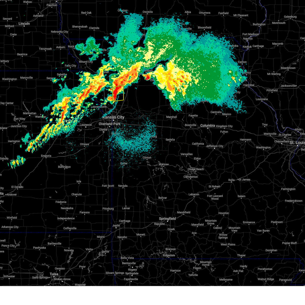 the severe thunderstorm warning has been cancelled and is no longer in effect the severe thunderstorm warning has been cancelled and is no longer in effect
|
| 4/18/2024 5:34 AM CDT |
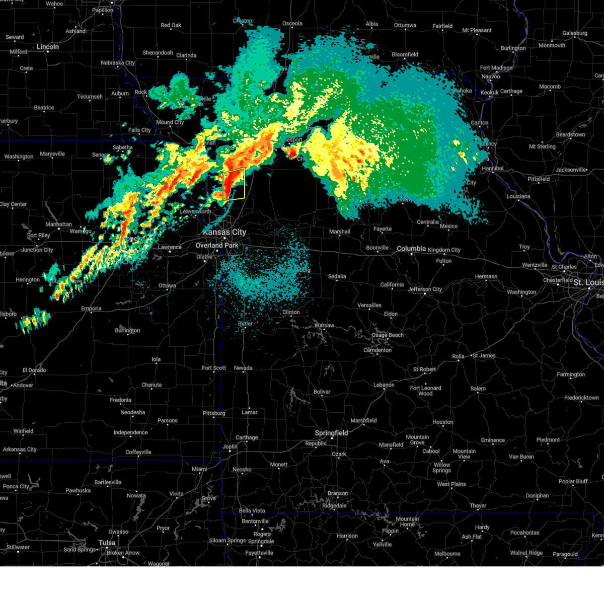 At 533 am cdt, a severe thunderstorm was located over plattsburg, moving east at 50 mph (radar indicated). Hazards include 60 mph wind gusts and quarter size hail. Hail damage to vehicles is expected. expect wind damage to roofs, siding, and trees. Locations impacted include, plattsburg, gower, trimble, and osborn. At 533 am cdt, a severe thunderstorm was located over plattsburg, moving east at 50 mph (radar indicated). Hazards include 60 mph wind gusts and quarter size hail. Hail damage to vehicles is expected. expect wind damage to roofs, siding, and trees. Locations impacted include, plattsburg, gower, trimble, and osborn.
|
| 4/18/2024 5:19 AM CDT |
 Svreax the national weather service in pleasant hill has issued a * severe thunderstorm warning for, southeastern buchanan county in northwestern missouri, clinton county in northwestern missouri, northeastern platte county in west central missouri, * until 545 am cdt. * at 518 am cdt, a severe thunderstorm was located near dearborn, or 7 miles southwest of gower, moving east at 50 mph (radar indicated). Hazards include 60 mph wind gusts and quarter size hail. Hail damage to vehicles is expected. Expect wind damage to roofs, siding, and trees. Svreax the national weather service in pleasant hill has issued a * severe thunderstorm warning for, southeastern buchanan county in northwestern missouri, clinton county in northwestern missouri, northeastern platte county in west central missouri, * until 545 am cdt. * at 518 am cdt, a severe thunderstorm was located near dearborn, or 7 miles southwest of gower, moving east at 50 mph (radar indicated). Hazards include 60 mph wind gusts and quarter size hail. Hail damage to vehicles is expected. Expect wind damage to roofs, siding, and trees.
|
| 4/18/2024 3:30 AM CDT |
 At 329 am cdt, severe thunderstorms were located along a line extending from gower to near ferrelview to near bonner springs, moving east at 45 mph (radar indicated). Hazards include 60 mph wind gusts and half dollar size hail. Hail damage to vehicles is expected. expect wind damage to roofs, siding, and trees. locations impacted include, kansas city, overland park, olathe, independence, shawnee, lenexa, leavenworth, leawood, raytown, liberty, gladstone, grandview, prairie village, lansing, excelsior springs, merriam, cameron, mission, smithville, and kearney. this includes the following highways, interstate 70 in missouri between mile markers 0 and 13. interstate 70 in kansas between mile markers 410 and 423. interstate 35 in missouri between mile markers 0 and 53. interstate 35 in kansas between mile markers 222 and 235. interstate 29 between mile markers 0 and 22. interstate 635 between mile markers 0 and 12. interstate 470 between mile markers 0 and 2. interstate 435 between mile markers 0 and 83. Kansas turnpike between mile markers 216 and 226. At 329 am cdt, severe thunderstorms were located along a line extending from gower to near ferrelview to near bonner springs, moving east at 45 mph (radar indicated). Hazards include 60 mph wind gusts and half dollar size hail. Hail damage to vehicles is expected. expect wind damage to roofs, siding, and trees. locations impacted include, kansas city, overland park, olathe, independence, shawnee, lenexa, leavenworth, leawood, raytown, liberty, gladstone, grandview, prairie village, lansing, excelsior springs, merriam, cameron, mission, smithville, and kearney. this includes the following highways, interstate 70 in missouri between mile markers 0 and 13. interstate 70 in kansas between mile markers 410 and 423. interstate 35 in missouri between mile markers 0 and 53. interstate 35 in kansas between mile markers 222 and 235. interstate 29 between mile markers 0 and 22. interstate 635 between mile markers 0 and 12. interstate 470 between mile markers 0 and 2. interstate 435 between mile markers 0 and 83. Kansas turnpike between mile markers 216 and 226.
|
| 4/18/2024 3:16 AM CDT |
 Svreax the national weather service in pleasant hill has issued a * severe thunderstorm warning for, wyandotte county in northeastern kansas, leavenworth county in northeastern kansas, northern johnson county in east central kansas, southeastern buchanan county in northwestern missouri, clinton county in northwestern missouri, clay county in west central missouri, platte county in west central missouri, northwestern jackson county in west central missouri, * until 400 am cdt. * at 316 am cdt, severe thunderstorms were located along a line extending from near agency to platte city to near linwood, moving east at 45 mph (radar indicated). Hazards include 60 mph wind gusts and half dollar size hail. Hail damage to vehicles is expected. Expect wind damage to roofs, siding, and trees. Svreax the national weather service in pleasant hill has issued a * severe thunderstorm warning for, wyandotte county in northeastern kansas, leavenworth county in northeastern kansas, northern johnson county in east central kansas, southeastern buchanan county in northwestern missouri, clinton county in northwestern missouri, clay county in west central missouri, platte county in west central missouri, northwestern jackson county in west central missouri, * until 400 am cdt. * at 316 am cdt, severe thunderstorms were located along a line extending from near agency to platte city to near linwood, moving east at 45 mph (radar indicated). Hazards include 60 mph wind gusts and half dollar size hail. Hail damage to vehicles is expected. Expect wind damage to roofs, siding, and trees.
|
| 4/16/2024 10:18 AM CDT |
 the severe thunderstorm warning has been cancelled and is no longer in effect the severe thunderstorm warning has been cancelled and is no longer in effect
|
| 4/16/2024 10:18 AM CDT |
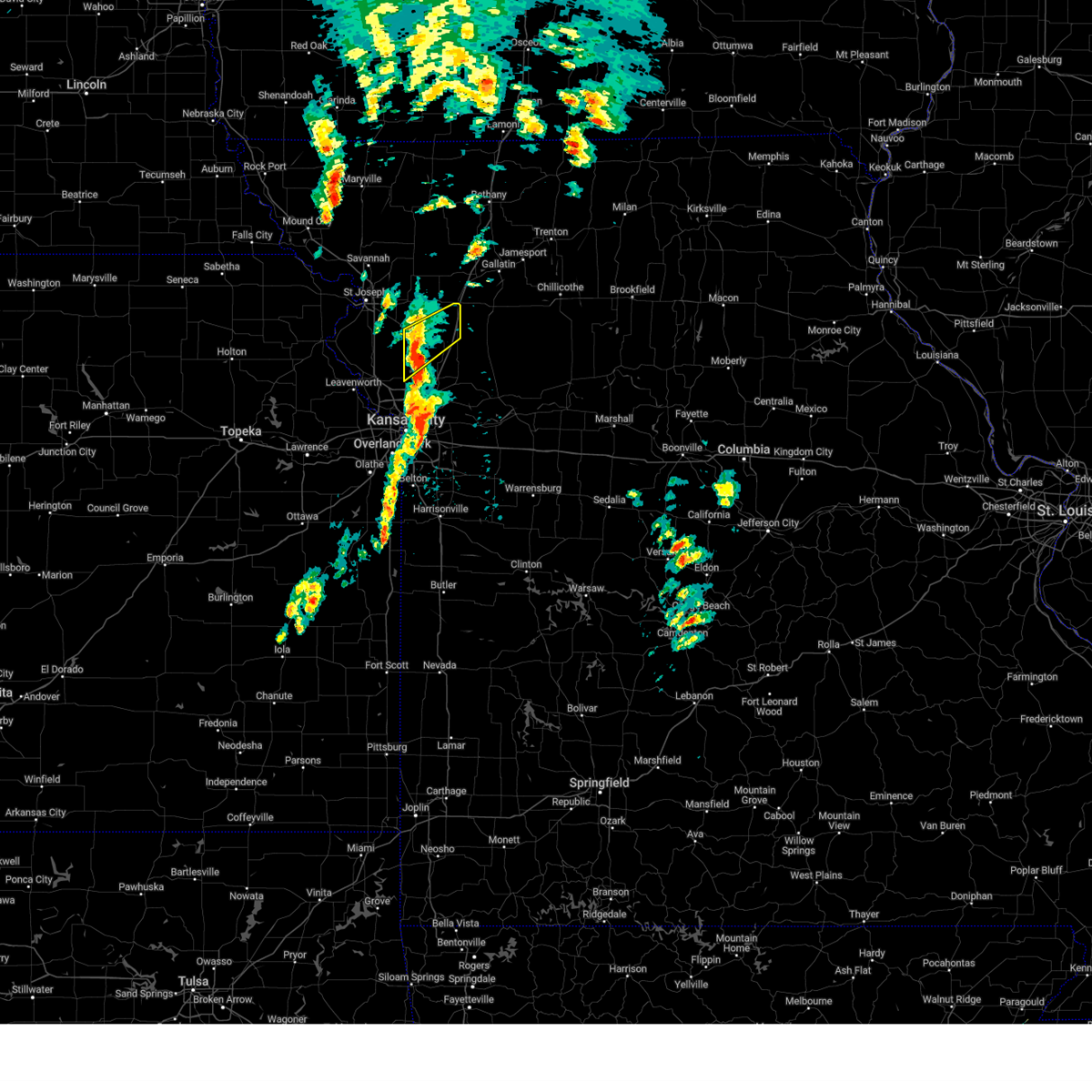 At 1017 am cdt, a severe thunderstorm was located near plattsburg, moving northeast at 65 mph (radar indicated). Hazards include 60 mph wind gusts and penny size hail. Expect damage to roofs, siding, and trees. locations impacted include, cameron, smithville, plattsburg, lathrop, gower, trimble, and turney. This includes interstate 35 in missouri between mile markers 39 and 53. At 1017 am cdt, a severe thunderstorm was located near plattsburg, moving northeast at 65 mph (radar indicated). Hazards include 60 mph wind gusts and penny size hail. Expect damage to roofs, siding, and trees. locations impacted include, cameron, smithville, plattsburg, lathrop, gower, trimble, and turney. This includes interstate 35 in missouri between mile markers 39 and 53.
|
| 4/16/2024 10:06 AM CDT |
 Svreax the national weather service in pleasant hill has issued a * severe thunderstorm warning for, southeastern buchanan county in northwestern missouri, clinton county in northwestern missouri, northwestern clay county in west central missouri, northeastern platte county in west central missouri, * until 1045 am cdt. * at 1005 am cdt, a severe thunderstorm was located over smithville, moving northeast at 50 mph (radar indicated). Hazards include 60 mph wind gusts. expect damage to roofs, siding, and trees Svreax the national weather service in pleasant hill has issued a * severe thunderstorm warning for, southeastern buchanan county in northwestern missouri, clinton county in northwestern missouri, northwestern clay county in west central missouri, northeastern platte county in west central missouri, * until 1045 am cdt. * at 1005 am cdt, a severe thunderstorm was located over smithville, moving northeast at 50 mph (radar indicated). Hazards include 60 mph wind gusts. expect damage to roofs, siding, and trees
|
| 4/1/2024 3:43 PM CDT |
 The storm which prompted the warning has weakened below severe limits, and no longer poses an immediate threat to life or property. therefore, the warning will be allowed to expire. however, small hail is still possible with this thunderstorm. a tornado watch remains in effect until 1100 pm cdt for northwestern and west central missouri. The storm which prompted the warning has weakened below severe limits, and no longer poses an immediate threat to life or property. therefore, the warning will be allowed to expire. however, small hail is still possible with this thunderstorm. a tornado watch remains in effect until 1100 pm cdt for northwestern and west central missouri.
|
| 4/1/2024 3:21 PM CDT |
 Svreax the national weather service in pleasant hill has issued a * severe thunderstorm warning for, buchanan county in northwestern missouri, northwestern clinton county in northwestern missouri, southwestern gentry county in northwestern missouri, southeastern andrew county in northwestern missouri, dekalb county in northwestern missouri, * until 345 pm cdt. * at 320 pm cdt, a severe thunderstorm was located near clarksdale, or 9 miles north of gower, moving northeast at 50 mph (radar indicated). Hazards include 60 mph wind gusts and quarter size hail. Hail damage to vehicles is expected. Expect wind damage to roofs, siding, and trees. Svreax the national weather service in pleasant hill has issued a * severe thunderstorm warning for, buchanan county in northwestern missouri, northwestern clinton county in northwestern missouri, southwestern gentry county in northwestern missouri, southeastern andrew county in northwestern missouri, dekalb county in northwestern missouri, * until 345 pm cdt. * at 320 pm cdt, a severe thunderstorm was located near clarksdale, or 9 miles north of gower, moving northeast at 50 mph (radar indicated). Hazards include 60 mph wind gusts and quarter size hail. Hail damage to vehicles is expected. Expect wind damage to roofs, siding, and trees.
|
| 3/14/2024 2:15 AM CDT |
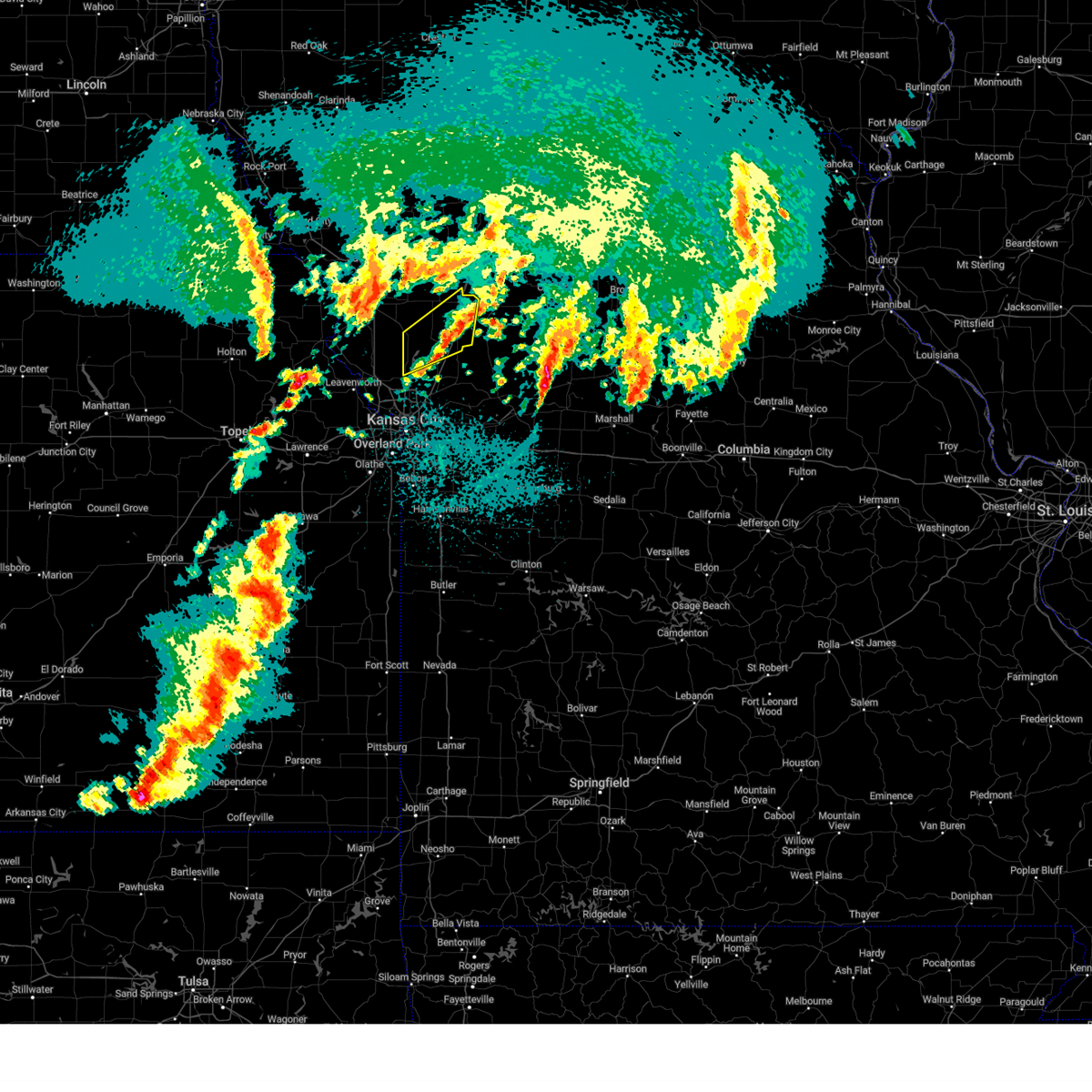 The storm which prompted the warning has weakened below severe limits, and no longer poses an immediate threat to life or property. therefore, the warning has been allowed to expire. however, small hail and gusty winds are still possible with this thunderstorm. a severe thunderstorm watch remains in effect until 600 am cdt for north central, northwestern and west central missouri. The storm which prompted the warning has weakened below severe limits, and no longer poses an immediate threat to life or property. therefore, the warning has been allowed to expire. however, small hail and gusty winds are still possible with this thunderstorm. a severe thunderstorm watch remains in effect until 600 am cdt for north central, northwestern and west central missouri.
|
| 3/14/2024 1:51 AM CDT |
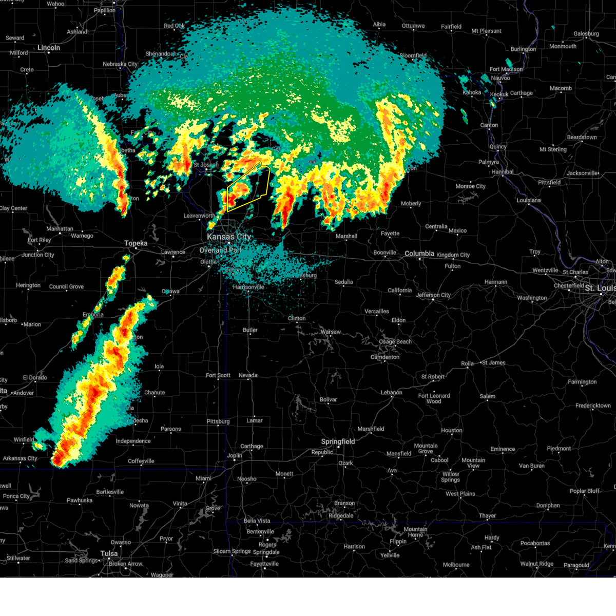 the severe thunderstorm warning has been cancelled and is no longer in effect the severe thunderstorm warning has been cancelled and is no longer in effect
|
| 3/14/2024 1:51 AM CDT |
 At 150 am cdt, a severe thunderstorm was located near trimble, or near plattsburg, moving northeast at 55 mph (radar indicated). Hazards include 60 mph wind gusts and quarter size hail. Hail damage to vehicles is expected. expect wind damage to roofs, siding, and trees. locations impacted include, cameron, smithville, plattsburg, lathrop, gower, trimble, osborn, and turney. This includes interstate 35 in missouri between mile markers 34 and 57. At 150 am cdt, a severe thunderstorm was located near trimble, or near plattsburg, moving northeast at 55 mph (radar indicated). Hazards include 60 mph wind gusts and quarter size hail. Hail damage to vehicles is expected. expect wind damage to roofs, siding, and trees. locations impacted include, cameron, smithville, plattsburg, lathrop, gower, trimble, osborn, and turney. This includes interstate 35 in missouri between mile markers 34 and 57.
|
| 3/14/2024 1:34 AM CDT |
 Svreax the national weather service in pleasant hill has issued a * severe thunderstorm warning for, southeastern buchanan county in northwestern missouri, clinton county in northwestern missouri, northwestern clay county in west central missouri, western caldwell county in north central missouri, northeastern platte county in west central missouri, southeastern dekalb county in northwestern missouri, * until 215 am cdt. * at 133 am cdt, a severe thunderstorm was located over tracy, or over platte city, moving northeast at 60 mph (radar indicated). Hazards include 60 mph wind gusts and quarter size hail. Hail damage to vehicles is expected. Expect wind damage to roofs, siding, and trees. Svreax the national weather service in pleasant hill has issued a * severe thunderstorm warning for, southeastern buchanan county in northwestern missouri, clinton county in northwestern missouri, northwestern clay county in west central missouri, western caldwell county in north central missouri, northeastern platte county in west central missouri, southeastern dekalb county in northwestern missouri, * until 215 am cdt. * at 133 am cdt, a severe thunderstorm was located over tracy, or over platte city, moving northeast at 60 mph (radar indicated). Hazards include 60 mph wind gusts and quarter size hail. Hail damage to vehicles is expected. Expect wind damage to roofs, siding, and trees.
|
| 3/13/2024 11:03 PM CDT |
 Svreax the national weather service in pleasant hill has issued a * severe thunderstorm warning for, northeastern leavenworth county in northeastern kansas, southeastern buchanan county in northwestern missouri, clinton county in northwestern missouri, northwestern clay county in west central missouri, platte county in west central missouri, * until 1145 pm cdt. * at 1102 pm cdt, severe thunderstorms were located along a line extending from agency to near lansing, moving northeast at 40 mph (radar indicated). Hazards include 60 mph wind gusts and quarter size hail. Hail damage to vehicles is expected. Expect wind damage to roofs, siding, and trees. Svreax the national weather service in pleasant hill has issued a * severe thunderstorm warning for, northeastern leavenworth county in northeastern kansas, southeastern buchanan county in northwestern missouri, clinton county in northwestern missouri, northwestern clay county in west central missouri, platte county in west central missouri, * until 1145 pm cdt. * at 1102 pm cdt, severe thunderstorms were located along a line extending from agency to near lansing, moving northeast at 40 mph (radar indicated). Hazards include 60 mph wind gusts and quarter size hail. Hail damage to vehicles is expected. Expect wind damage to roofs, siding, and trees.
|
| 9/23/2023 10:39 AM CDT |
 The severe thunderstorm warning for southeastern buchanan, western clinton, northwestern clay and northeastern platte counties will expire at 1045 am cdt, the severe thunderstorm which prompted the warning has weakened, however, small hail is still possible with this storm. therefore, the warning will be allowed to expire. The severe thunderstorm warning for southeastern buchanan, western clinton, northwestern clay and northeastern platte counties will expire at 1045 am cdt, the severe thunderstorm which prompted the warning has weakened, however, small hail is still possible with this storm. therefore, the warning will be allowed to expire.
|
| 9/23/2023 10:22 AM CDT |
 At 1022 am cdt, a severe thunderstorm was located over trimble, or near smithville, moving northeast at 35 mph (radar indicated). Hazards include quarter size hail. Damage to vehicles is expected. locations impacted include, smithville, plattsburg, lathrop, gower, trimble, edgerton, dearborn, camden point, ridgely and hoover. this includes interstate 29 between mile markers 27 and 35. hail threat, radar indicated max hail size, 1. 00 in wind threat, radar indicated max wind gust, <50 mph. At 1022 am cdt, a severe thunderstorm was located over trimble, or near smithville, moving northeast at 35 mph (radar indicated). Hazards include quarter size hail. Damage to vehicles is expected. locations impacted include, smithville, plattsburg, lathrop, gower, trimble, edgerton, dearborn, camden point, ridgely and hoover. this includes interstate 29 between mile markers 27 and 35. hail threat, radar indicated max hail size, 1. 00 in wind threat, radar indicated max wind gust, <50 mph.
|
| 9/23/2023 10:12 AM CDT |
 At 1012 am cdt, a severe thunderstorm was located near camden point, or near smithville, moving northeast at 35 mph (radar indicated). Hazards include half dollar size hail. damage to vehicles is expected At 1012 am cdt, a severe thunderstorm was located near camden point, or near smithville, moving northeast at 35 mph (radar indicated). Hazards include half dollar size hail. damage to vehicles is expected
|
| 9/23/2023 10:04 AM CDT |
 At 1003 am cdt, a severe thunderstorm was located over platte city, moving northeast at 35 mph (radar indicated). Hazards include quarter size hail. damage to vehicles is expected At 1003 am cdt, a severe thunderstorm was located over platte city, moving northeast at 35 mph (radar indicated). Hazards include quarter size hail. damage to vehicles is expected
|
| 7/30/2023 7:24 PM CDT |
 At 723 pm cdt, severe thunderstorms were located along a line extending from near clarksdale to near rushville to near lancaster, moving southeast at 55 mph (radar indicated). Hazards include 70 mph wind gusts and penny size hail. Expect considerable tree damage. Damage is likely to mobile homes, roofs, and outbuildings. At 723 pm cdt, severe thunderstorms were located along a line extending from near clarksdale to near rushville to near lancaster, moving southeast at 55 mph (radar indicated). Hazards include 70 mph wind gusts and penny size hail. Expect considerable tree damage. Damage is likely to mobile homes, roofs, and outbuildings.
|
| 7/29/2023 11:06 AM CDT |
 At 1106 am cdt, severe thunderstorms were located along a line extending from 9 miles west of pattonsburg to near cameron to near kearney, moving southeast at 50 mph (trained weather spotters). Hazards include 70 mph wind gusts and nickel size hail. Expect considerable tree damage. damage is likely to mobile homes, roofs, and outbuildings. locations impacted include, liberty, excelsior springs, cameron, smithville, kearney, lawson, plattsburg, lathrop, albany, gower, stanberry, maysville, king city, stewartsville, trimble, edgerton, dearborn, camden point, holt and union star. this includes the following highways, interstate 35 in missouri between mile markers 19 and 56. interstate 29 between mile markers 22 and 28. interstate 435 between mile markers 42 and 45. thunderstorm damage threat, considerable hail threat, radar indicated max hail size, 0. 88 in wind threat, observed max wind gust, 70 mph. At 1106 am cdt, severe thunderstorms were located along a line extending from 9 miles west of pattonsburg to near cameron to near kearney, moving southeast at 50 mph (trained weather spotters). Hazards include 70 mph wind gusts and nickel size hail. Expect considerable tree damage. damage is likely to mobile homes, roofs, and outbuildings. locations impacted include, liberty, excelsior springs, cameron, smithville, kearney, lawson, plattsburg, lathrop, albany, gower, stanberry, maysville, king city, stewartsville, trimble, edgerton, dearborn, camden point, holt and union star. this includes the following highways, interstate 35 in missouri between mile markers 19 and 56. interstate 29 between mile markers 22 and 28. interstate 435 between mile markers 42 and 45. thunderstorm damage threat, considerable hail threat, radar indicated max hail size, 0. 88 in wind threat, observed max wind gust, 70 mph.
|
| 7/29/2023 10:58 AM CDT |
 At 1058 am cdt, severe thunderstorms were located along a line extending from 9 miles northeast of king city to near cameron to near smithville, moving southeast at 50 mph (trained weather spotters). Hazards include 70 mph wind gusts and nickel size hail. Expect considerable tree damage. damage is likely to mobile homes, roofs, and outbuildings. locations impacted include, liberty, excelsior springs, cameron, smithville, kearney, lawson, plattsburg, lathrop, albany, gower, stanberry, maysville, king city, stewartsville, agency, trimble, edgerton, dearborn, camden point and holt. this includes the following highways, interstate 35 in missouri between mile markers 19 and 56. interstate 29 between mile markers 22 and 28. interstate 435 between mile markers 42 and 45. thunderstorm damage threat, considerable hail threat, radar indicated max hail size, 0. 88 in wind threat, observed max wind gust, 70 mph. At 1058 am cdt, severe thunderstorms were located along a line extending from 9 miles northeast of king city to near cameron to near smithville, moving southeast at 50 mph (trained weather spotters). Hazards include 70 mph wind gusts and nickel size hail. Expect considerable tree damage. damage is likely to mobile homes, roofs, and outbuildings. locations impacted include, liberty, excelsior springs, cameron, smithville, kearney, lawson, plattsburg, lathrop, albany, gower, stanberry, maysville, king city, stewartsville, agency, trimble, edgerton, dearborn, camden point and holt. this includes the following highways, interstate 35 in missouri between mile markers 19 and 56. interstate 29 between mile markers 22 and 28. interstate 435 between mile markers 42 and 45. thunderstorm damage threat, considerable hail threat, radar indicated max hail size, 0. 88 in wind threat, observed max wind gust, 70 mph.
|
| 7/29/2023 10:49 AM CDT |
 At 1049 am cdt, severe thunderstorms were located along a line extending from near stanberry to near maysville to near edgerton, moving east at 55 mph (trained weather spotters). Hazards include 70 mph wind gusts and nickel size hail. Expect considerable tree damage. damage is likely to mobile homes, roofs, and outbuildings. locations impacted include, st. joseph, liberty, excelsior springs, cameron, smithville, kearney, lawson, plattsburg, lathrop, albany, gower, stanberry, maysville, country club villa, country club, king city, stewartsville, agency, trimble and edgerton. this includes the following highways, interstate 35 in missouri between mile markers 18 and 56. interstate 29 between mile markers 22 and 54. interstate 435 between mile markers 42 and 45. interstate 229 between mile markers 0 and 4. thunderstorm damage threat, considerable hail threat, radar indicated max hail size, 0. 88 in wind threat, observed max wind gust, 70 mph. At 1049 am cdt, severe thunderstorms were located along a line extending from near stanberry to near maysville to near edgerton, moving east at 55 mph (trained weather spotters). Hazards include 70 mph wind gusts and nickel size hail. Expect considerable tree damage. damage is likely to mobile homes, roofs, and outbuildings. locations impacted include, st. joseph, liberty, excelsior springs, cameron, smithville, kearney, lawson, plattsburg, lathrop, albany, gower, stanberry, maysville, country club villa, country club, king city, stewartsville, agency, trimble and edgerton. this includes the following highways, interstate 35 in missouri between mile markers 18 and 56. interstate 29 between mile markers 22 and 54. interstate 435 between mile markers 42 and 45. interstate 229 between mile markers 0 and 4. thunderstorm damage threat, considerable hail threat, radar indicated max hail size, 0. 88 in wind threat, observed max wind gust, 70 mph.
|
| 7/29/2023 10:28 AM CDT |
 At 1028 am cdt, severe thunderstorms were located along a line extending from 7 miles south of maryville to 6 miles southwest of union star to near lewis and clark village, moving southeast at 50 mph (radar indicated). Hazards include 60 mph wind gusts and nickel size hail. expect damage to roofs, siding, and trees At 1028 am cdt, severe thunderstorms were located along a line extending from 7 miles south of maryville to 6 miles southwest of union star to near lewis and clark village, moving southeast at 50 mph (radar indicated). Hazards include 60 mph wind gusts and nickel size hail. expect damage to roofs, siding, and trees
|
| 7/5/2023 12:29 AM CDT |
 At 1229 am cdt, severe thunderstorms were located along a line extending from near king city to near smithville, moving east at 30 mph (radar indicated). Hazards include 60 mph wind gusts. Expect damage to roofs, siding, and trees. locations impacted include, st. joseph, smithville, plattsburg, lathrop, weston, gower, maysville, stewartsville, agency, trimble, edgerton, dearborn, camden point, holt, union star, osborn, clarksdale, easton, turney and cosby. this includes the following highways, interstate 35 in missouri near mile marker 30. interstate 29 between mile markers 24 and 50. interstate 229 between mile markers 0 and 2. hail threat, radar indicated max hail size, <. 75 in wind threat, radar indicated max wind gust, 60 mph. At 1229 am cdt, severe thunderstorms were located along a line extending from near king city to near smithville, moving east at 30 mph (radar indicated). Hazards include 60 mph wind gusts. Expect damage to roofs, siding, and trees. locations impacted include, st. joseph, smithville, plattsburg, lathrop, weston, gower, maysville, stewartsville, agency, trimble, edgerton, dearborn, camden point, holt, union star, osborn, clarksdale, easton, turney and cosby. this includes the following highways, interstate 35 in missouri near mile marker 30. interstate 29 between mile markers 24 and 50. interstate 229 between mile markers 0 and 2. hail threat, radar indicated max hail size, <. 75 in wind threat, radar indicated max wind gust, 60 mph.
|
| 7/4/2023 11:58 PM CDT |
 At 1157 pm cdt, severe thunderstorms were located along a line extending from 6 miles northeast of savannah to near weston, moving east at 35 mph (radar indicated). Hazards include 70 mph wind gusts. Expect considerable tree damage. Damage is likely to mobile homes, roofs, and outbuildings. At 1157 pm cdt, severe thunderstorms were located along a line extending from 6 miles northeast of savannah to near weston, moving east at 35 mph (radar indicated). Hazards include 70 mph wind gusts. Expect considerable tree damage. Damage is likely to mobile homes, roofs, and outbuildings.
|
| 6/30/2023 10:38 PM CDT |
 At 1037 pm cdt, severe thunderstorms were located along a line extending from near stanberry to 8 miles north of maysville to near cameron, moving northeast at 50 mph (radar indicated). Hazards include 60 mph wind gusts. Expect damage to roofs, siding, and trees. locations impacted include, cameron, plattsburg, gower, maysville, stewartsville, osborn, clarksdale, turney, weatherby, amity and fairport. this includes interstate 35 in missouri between mile markers 42 and 55. hail threat, radar indicated max hail size, <. 75 in wind threat, observed max wind gust, 60 mph. At 1037 pm cdt, severe thunderstorms were located along a line extending from near stanberry to 8 miles north of maysville to near cameron, moving northeast at 50 mph (radar indicated). Hazards include 60 mph wind gusts. Expect damage to roofs, siding, and trees. locations impacted include, cameron, plattsburg, gower, maysville, stewartsville, osborn, clarksdale, turney, weatherby, amity and fairport. this includes interstate 35 in missouri between mile markers 42 and 55. hail threat, radar indicated max hail size, <. 75 in wind threat, observed max wind gust, 60 mph.
|
| 6/30/2023 10:05 PM CDT |
 At 1005 pm cdt, severe thunderstorms were located along a line extending from near savannah to 6 miles west of clarksdale to near gower, moving northeast at 50 mph (radar indicated). Hazards include 70 mph wind gusts. Expect considerable tree damage. damage is likely to mobile homes, roofs, and outbuildings. locations impacted include, st. joseph, cameron, savannah, plattsburg, gower, elwood, maysville, country club villa, country club, king city, stewartsville, agency, union star, osborn, amazonia, clarksdale, easton, turney, cosby and weatherby. this includes the following highways, interstate 35 in missouri between mile markers 42 and 55. interstate 29 between mile markers 44 and 58. interstate 229 between mile markers 5 and 14. thunderstorm damage threat, considerable hail threat, radar indicated max hail size, <. 75 in wind threat, observed max wind gust, 70 mph. At 1005 pm cdt, severe thunderstorms were located along a line extending from near savannah to 6 miles west of clarksdale to near gower, moving northeast at 50 mph (radar indicated). Hazards include 70 mph wind gusts. Expect considerable tree damage. damage is likely to mobile homes, roofs, and outbuildings. locations impacted include, st. joseph, cameron, savannah, plattsburg, gower, elwood, maysville, country club villa, country club, king city, stewartsville, agency, union star, osborn, amazonia, clarksdale, easton, turney, cosby and weatherby. this includes the following highways, interstate 35 in missouri between mile markers 42 and 55. interstate 29 between mile markers 44 and 58. interstate 229 between mile markers 5 and 14. thunderstorm damage threat, considerable hail threat, radar indicated max hail size, <. 75 in wind threat, observed max wind gust, 70 mph.
|
| 6/30/2023 10:00 PM CDT |
 At 959 pm cdt, severe thunderstorms were located along a line extending from amazonia to near st. joseph to near edgerton, moving northeast at 50 mph (radar indicated). Hazards include 60 mph wind gusts. expect damage to roofs, siding, and trees At 959 pm cdt, severe thunderstorms were located along a line extending from amazonia to near st. joseph to near edgerton, moving northeast at 50 mph (radar indicated). Hazards include 60 mph wind gusts. expect damage to roofs, siding, and trees
|
| 6/30/2023 9:38 PM CDT |
 At 938 pm cdt, severe thunderstorms were located along a line extending from rushville to near dearborn to near leavenworth, moving northeast at 40 mph (radar indicated). Hazards include 70 mph wind gusts. Expect considerable tree damage. Damage is likely to mobile homes, roofs, and outbuildings. At 938 pm cdt, severe thunderstorms were located along a line extending from rushville to near dearborn to near leavenworth, moving northeast at 40 mph (radar indicated). Hazards include 70 mph wind gusts. Expect considerable tree damage. Damage is likely to mobile homes, roofs, and outbuildings.
|
| 6/29/2023 9:00 AM CDT |
 At 900 am cdt, severe thunderstorms were located along a line extending from king city to near osborn to plattsburg, moving east at 60 mph (radar indicated). Hazards include 70 mph wind gusts. Expect considerable tree damage. damage is likely to mobile homes, roofs, and outbuildings. locations impacted include, cameron, plattsburg, lathrop, hamilton, gallatin, gower, maysville, king city, braymer, stewartsville, polo, jamesport, union star, osborn, breckenridge, gilman city, kingston, pattonsburg, clarksdale and cowgill. this includes interstate 35 in missouri between mile markers 39 and 88. thunderstorm damage threat, considerable hail threat, radar indicated max hail size, <. 75 in wind threat, radar indicated max wind gust, 70 mph. At 900 am cdt, severe thunderstorms were located along a line extending from king city to near osborn to plattsburg, moving east at 60 mph (radar indicated). Hazards include 70 mph wind gusts. Expect considerable tree damage. damage is likely to mobile homes, roofs, and outbuildings. locations impacted include, cameron, plattsburg, lathrop, hamilton, gallatin, gower, maysville, king city, braymer, stewartsville, polo, jamesport, union star, osborn, breckenridge, gilman city, kingston, pattonsburg, clarksdale and cowgill. this includes interstate 35 in missouri between mile markers 39 and 88. thunderstorm damage threat, considerable hail threat, radar indicated max hail size, <. 75 in wind threat, radar indicated max wind gust, 70 mph.
|
| 6/29/2023 8:38 AM CDT |
 At 837 am cdt, severe thunderstorms were located along a line extending from near fillmore to 6 miles east of st. joseph to dearborn, moving east at 60 mph (radar indicated). Hazards include 70 mph wind gusts. Expect considerable tree damage. Damage is likely to mobile homes, roofs, and outbuildings. At 837 am cdt, severe thunderstorms were located along a line extending from near fillmore to 6 miles east of st. joseph to dearborn, moving east at 60 mph (radar indicated). Hazards include 70 mph wind gusts. Expect considerable tree damage. Damage is likely to mobile homes, roofs, and outbuildings.
|
| 5/8/2023 12:40 AM CDT |
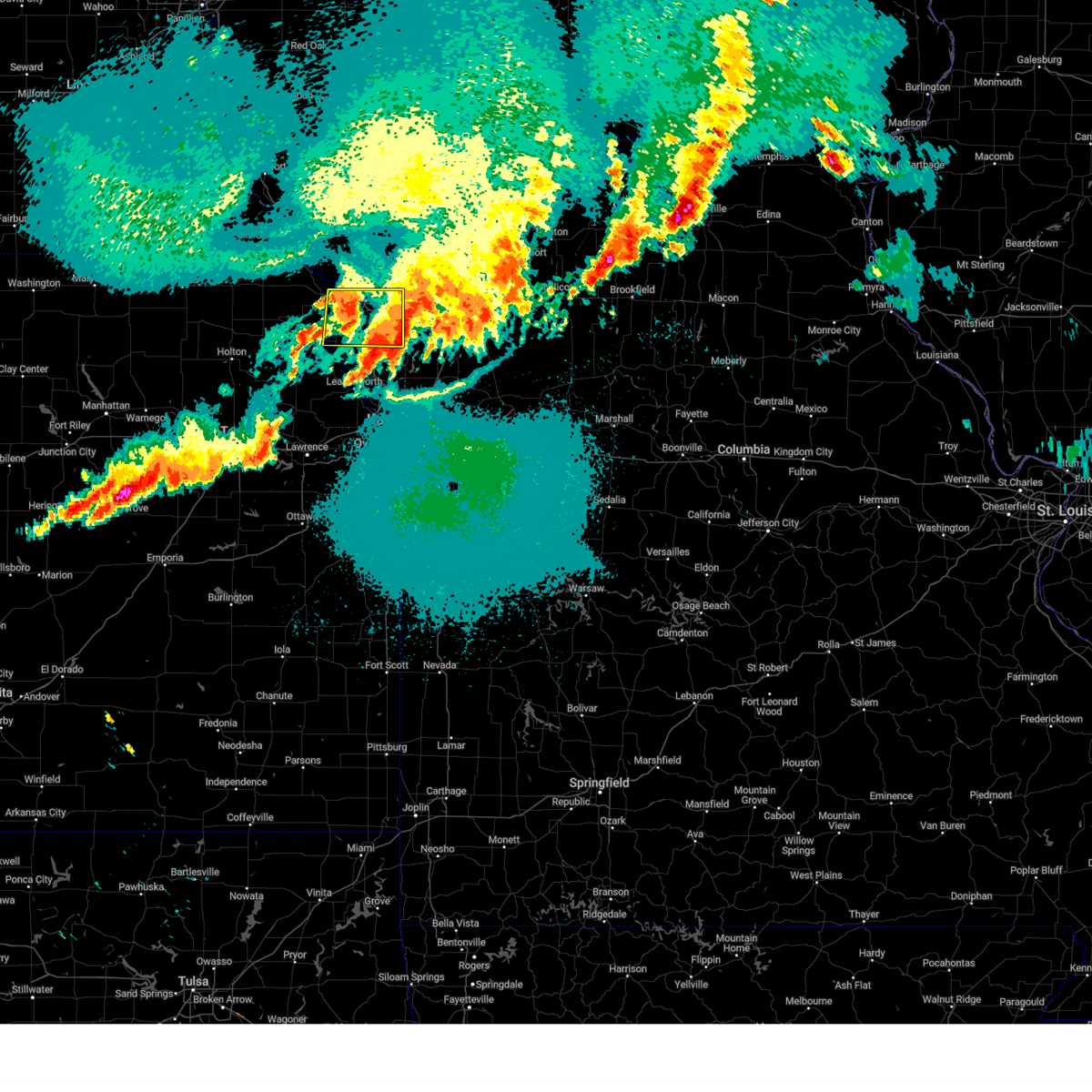 The severe thunderstorm warning for southeastern doniphan, northeastern atchison and buchanan counties will expire at 1245 am cdt, the storm which prompted the warning has weakened below severe limits, and no longer poses an immediate threat to life or property. therefore, the warning will be allowed to expire. however gusty winds are still possible with this thunderstorm. a severe thunderstorm watch remains in effect until 500 am cdt for northwestern and west central missouri. The severe thunderstorm warning for southeastern doniphan, northeastern atchison and buchanan counties will expire at 1245 am cdt, the storm which prompted the warning has weakened below severe limits, and no longer poses an immediate threat to life or property. therefore, the warning will be allowed to expire. however gusty winds are still possible with this thunderstorm. a severe thunderstorm watch remains in effect until 500 am cdt for northwestern and west central missouri.
|
| 5/8/2023 12:02 AM CDT |
 At 1202 am cdt, a severe thunderstorm was located near rushville, or 7 miles northeast of atchison, moving east at 40 mph (radar indicated). Hazards include 60 mph wind gusts and quarter size hail. Hail damage to vehicles is expected. Expect wind damage to roofs, siding, and trees. At 1202 am cdt, a severe thunderstorm was located near rushville, or 7 miles northeast of atchison, moving east at 40 mph (radar indicated). Hazards include 60 mph wind gusts and quarter size hail. Hail damage to vehicles is expected. Expect wind damage to roofs, siding, and trees.
|
| 5/8/2023 12:02 AM CDT |
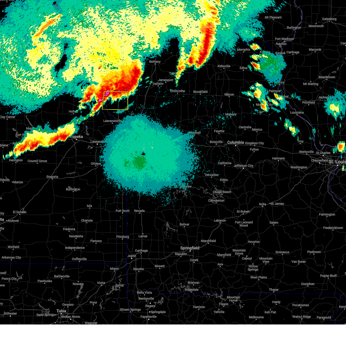 At 1202 am cdt, a severe thunderstorm was located near rushville, or 7 miles northeast of atchison, moving east at 40 mph (radar indicated). Hazards include 60 mph wind gusts and quarter size hail. Hail damage to vehicles is expected. Expect wind damage to roofs, siding, and trees. At 1202 am cdt, a severe thunderstorm was located near rushville, or 7 miles northeast of atchison, moving east at 40 mph (radar indicated). Hazards include 60 mph wind gusts and quarter size hail. Hail damage to vehicles is expected. Expect wind damage to roofs, siding, and trees.
|
| 4/20/2023 5:35 AM CDT |
 The severe thunderstorm warning for southeastern atchison, buchanan, clinton, gentry, northern platte, andrew and dekalb counties will expire at 545 am cdt, the storms which prompted the warning have weakened below severe limits, and no longer pose an immediate threat to life or property. therefore, the warning will be allowed to expire. however gusty winds to 50 mph are still possible with these thunderstorms. a severe thunderstorm watch remains in effect until 600 am cdt for northeastern kansas, and north central, northwestern and west central missouri. The severe thunderstorm warning for southeastern atchison, buchanan, clinton, gentry, northern platte, andrew and dekalb counties will expire at 545 am cdt, the storms which prompted the warning have weakened below severe limits, and no longer pose an immediate threat to life or property. therefore, the warning will be allowed to expire. however gusty winds to 50 mph are still possible with these thunderstorms. a severe thunderstorm watch remains in effect until 600 am cdt for northeastern kansas, and north central, northwestern and west central missouri.
|
| 4/20/2023 5:18 AM CDT |
 At 517 am cdt, severe thunderstorms were located along a line extending from near stanberry to near union star to near clarksdale to 6 miles east of rushville, moving east at 40 mph (radar indicated). Hazards include 60 mph wind gusts. Expect damage to roofs, siding, and trees. locations impacted include, st. joseph, cameron, savannah, plattsburg, lathrop, albany, gower, elwood, stanberry, maysville, country club villa, country club, king city, stewartsville, agency, trimble, edgerton, dearborn, camden point and union star. this includes the following highways, interstate 35 in missouri between mile markers 52 and 55. interstate 29 between mile markers 26 and 59. interstate 229 between mile markers 0 and 14. hail threat, radar indicated max hail size, <. 75 in wind threat, radar indicated max wind gust, 60 mph. At 517 am cdt, severe thunderstorms were located along a line extending from near stanberry to near union star to near clarksdale to 6 miles east of rushville, moving east at 40 mph (radar indicated). Hazards include 60 mph wind gusts. Expect damage to roofs, siding, and trees. locations impacted include, st. joseph, cameron, savannah, plattsburg, lathrop, albany, gower, elwood, stanberry, maysville, country club villa, country club, king city, stewartsville, agency, trimble, edgerton, dearborn, camden point and union star. this includes the following highways, interstate 35 in missouri between mile markers 52 and 55. interstate 29 between mile markers 26 and 59. interstate 229 between mile markers 0 and 14. hail threat, radar indicated max hail size, <. 75 in wind threat, radar indicated max wind gust, 60 mph.
|
| 4/20/2023 4:57 AM CDT |
 At 457 am cdt, severe thunderstorms were located along a line extending from 9 miles south of maryville to near savannah to near st. joseph to near atchison, moving east at 50 mph (radar indicated). Hazards include 60 mph wind gusts. expect damage to roofs, siding, and trees At 457 am cdt, severe thunderstorms were located along a line extending from 9 miles south of maryville to near savannah to near st. joseph to near atchison, moving east at 50 mph (radar indicated). Hazards include 60 mph wind gusts. expect damage to roofs, siding, and trees
|
| 4/4/2023 9:52 PM CDT |
 At 952 pm cdt, a severe thunderstorm was located near gower, moving northeast at 55 mph (public). Hazards include half dollar size hail. Damage to vehicles is expected. locations impacted include, gower, stewartsville, osborn, clarksdale, easton and turney. hail threat, observed max hail size, 1. 25 in wind threat, radar indicated max wind gust, <50 mph. At 952 pm cdt, a severe thunderstorm was located near gower, moving northeast at 55 mph (public). Hazards include half dollar size hail. Damage to vehicles is expected. locations impacted include, gower, stewartsville, osborn, clarksdale, easton and turney. hail threat, observed max hail size, 1. 25 in wind threat, radar indicated max wind gust, <50 mph.
|
| 4/4/2023 9:40 PM CDT |
 At 940 pm cdt, a severe thunderstorm was located near dearborn, or 11 miles west of gower, moving northeast at 60 mph (radar indicated). Hazards include quarter size hail. damage to vehicles is expected At 940 pm cdt, a severe thunderstorm was located near dearborn, or 11 miles west of gower, moving northeast at 60 mph (radar indicated). Hazards include quarter size hail. damage to vehicles is expected
|
| 7/8/2022 12:30 AM CDT |
 At 1229 am cdt, severe thunderstorms were located along a line extending from 7 miles east of maysville to cameron to near osborn to 6 miles north of lathrop to near plattsburg, moving east at 35 mph (law enforcement). Hazards include 60 mph wind gusts and penny size hail. Expect damage to roofs, siding, and trees. locations impacted include, cameron, plattsburg, lathrop, gower, maysville, stewartsville, trimble, union star, osborn, clarksdale, kidder, winston, altamont, turney, weatherby, amity, fairport and santa rosa. this includes interstate 35 in missouri between mile markers 36 and 71. hail threat, radar indicated max hail size, 0. 75 in wind threat, observed max wind gust, 60 mph. At 1229 am cdt, severe thunderstorms were located along a line extending from 7 miles east of maysville to cameron to near osborn to 6 miles north of lathrop to near plattsburg, moving east at 35 mph (law enforcement). Hazards include 60 mph wind gusts and penny size hail. Expect damage to roofs, siding, and trees. locations impacted include, cameron, plattsburg, lathrop, gower, maysville, stewartsville, trimble, union star, osborn, clarksdale, kidder, winston, altamont, turney, weatherby, amity, fairport and santa rosa. this includes interstate 35 in missouri between mile markers 36 and 71. hail threat, radar indicated max hail size, 0. 75 in wind threat, observed max wind gust, 60 mph.
|
| 7/8/2022 12:05 AM CDT |
 At 1205 am cdt, severe thunderstorms were located along a line extending from near union star to near clarksdale to near stewartsville to near gower to near dearborn, moving east at 35 mph (automated surface observing system). Hazards include 60 mph wind gusts and penny size hail. expect damage to roofs, siding, and trees At 1205 am cdt, severe thunderstorms were located along a line extending from near union star to near clarksdale to near stewartsville to near gower to near dearborn, moving east at 35 mph (automated surface observing system). Hazards include 60 mph wind gusts and penny size hail. expect damage to roofs, siding, and trees
|
| 6/21/2022 10:47 PM CDT |
 At 1046 pm cdt, a severe thunderstorm was located near smithville, moving northeast at 45 mph (radar indicated). Hazards include 70 mph wind gusts and penny size hail. Expect considerable tree damage. damage is likely to mobile homes, roofs, and outbuildings. locations impacted include, kansas city, overland park, olathe, independence, lee`s summit, shawnee, blue springs, lenexa, leavenworth, leawood, raytown, liberty, gladstone, prairie village, grain valley, excelsior springs, merriam, mission, smithville and kearney. this includes the following highways, interstate 70 in missouri between mile markers 0 and 23. interstate 70 in kansas between mile markers 410 and 423. interstate 35 in missouri between mile markers 0 and 34. interstate 35 in kansas between mile markers 225 and 235. interstate 29 between mile markers 0 and 31. interstate 635 between mile markers 0 and 12. interstate 470 between mile markers 15 and 16. interstate 435 between mile markers 3 and 67. kansas turnpike between mile markers 223 and 226. thunderstorm damage threat, considerable hail threat, radar indicated max hail size, 0. 75 in wind threat, radar indicated max wind gust, 70 mph. At 1046 pm cdt, a severe thunderstorm was located near smithville, moving northeast at 45 mph (radar indicated). Hazards include 70 mph wind gusts and penny size hail. Expect considerable tree damage. damage is likely to mobile homes, roofs, and outbuildings. locations impacted include, kansas city, overland park, olathe, independence, lee`s summit, shawnee, blue springs, lenexa, leavenworth, leawood, raytown, liberty, gladstone, prairie village, grain valley, excelsior springs, merriam, mission, smithville and kearney. this includes the following highways, interstate 70 in missouri between mile markers 0 and 23. interstate 70 in kansas between mile markers 410 and 423. interstate 35 in missouri between mile markers 0 and 34. interstate 35 in kansas between mile markers 225 and 235. interstate 29 between mile markers 0 and 31. interstate 635 between mile markers 0 and 12. interstate 470 between mile markers 15 and 16. interstate 435 between mile markers 3 and 67. kansas turnpike between mile markers 223 and 226. thunderstorm damage threat, considerable hail threat, radar indicated max hail size, 0. 75 in wind threat, radar indicated max wind gust, 70 mph.
|
| 6/21/2022 10:13 PM CDT |
 At 1012 pm cdt, a severe thunderstorm was located near lansing, moving northeast at 45 mph (radar indicated). Hazards include 70 mph wind gusts and penny size hail. Expect considerable tree damage. Damage is likely to mobile homes, roofs, and outbuildings. At 1012 pm cdt, a severe thunderstorm was located near lansing, moving northeast at 45 mph (radar indicated). Hazards include 70 mph wind gusts and penny size hail. Expect considerable tree damage. Damage is likely to mobile homes, roofs, and outbuildings.
|
| 6/17/2022 12:36 AM CDT |
 At 1235 am cdt, severe thunderstorms were located along a line extending from near clarksdale to near agency to near rushville, moving southeast at 50 mph (radar indicated). Hazards include 60 mph wind gusts. expect damage to roofs, siding, and trees At 1235 am cdt, severe thunderstorms were located along a line extending from near clarksdale to near agency to near rushville, moving southeast at 50 mph (radar indicated). Hazards include 60 mph wind gusts. expect damage to roofs, siding, and trees
|
| 6/11/2022 10:26 PM CDT |
 At 1026 pm cdt, a severe thunderstorm was located near plattsburg, moving south at 25 mph (radar indicated). Hazards include 60 mph wind gusts and quarter size hail. Hail damage to vehicles is expected. Expect wind damage to roofs, siding, and trees. At 1026 pm cdt, a severe thunderstorm was located near plattsburg, moving south at 25 mph (radar indicated). Hazards include 60 mph wind gusts and quarter size hail. Hail damage to vehicles is expected. Expect wind damage to roofs, siding, and trees.
|
| 6/11/2022 10:00 PM CDT |
 At 1000 pm cdt, a severe thunderstorm was located near plattsburg, moving southeast at 35 mph (radar indicated). Hazards include 60 mph wind gusts and half dollar size hail. Hail damage to vehicles is expected. Expect wind damage to roofs, siding, and trees. At 1000 pm cdt, a severe thunderstorm was located near plattsburg, moving southeast at 35 mph (radar indicated). Hazards include 60 mph wind gusts and half dollar size hail. Hail damage to vehicles is expected. Expect wind damage to roofs, siding, and trees.
|
| 6/11/2022 9:54 PM CDT |
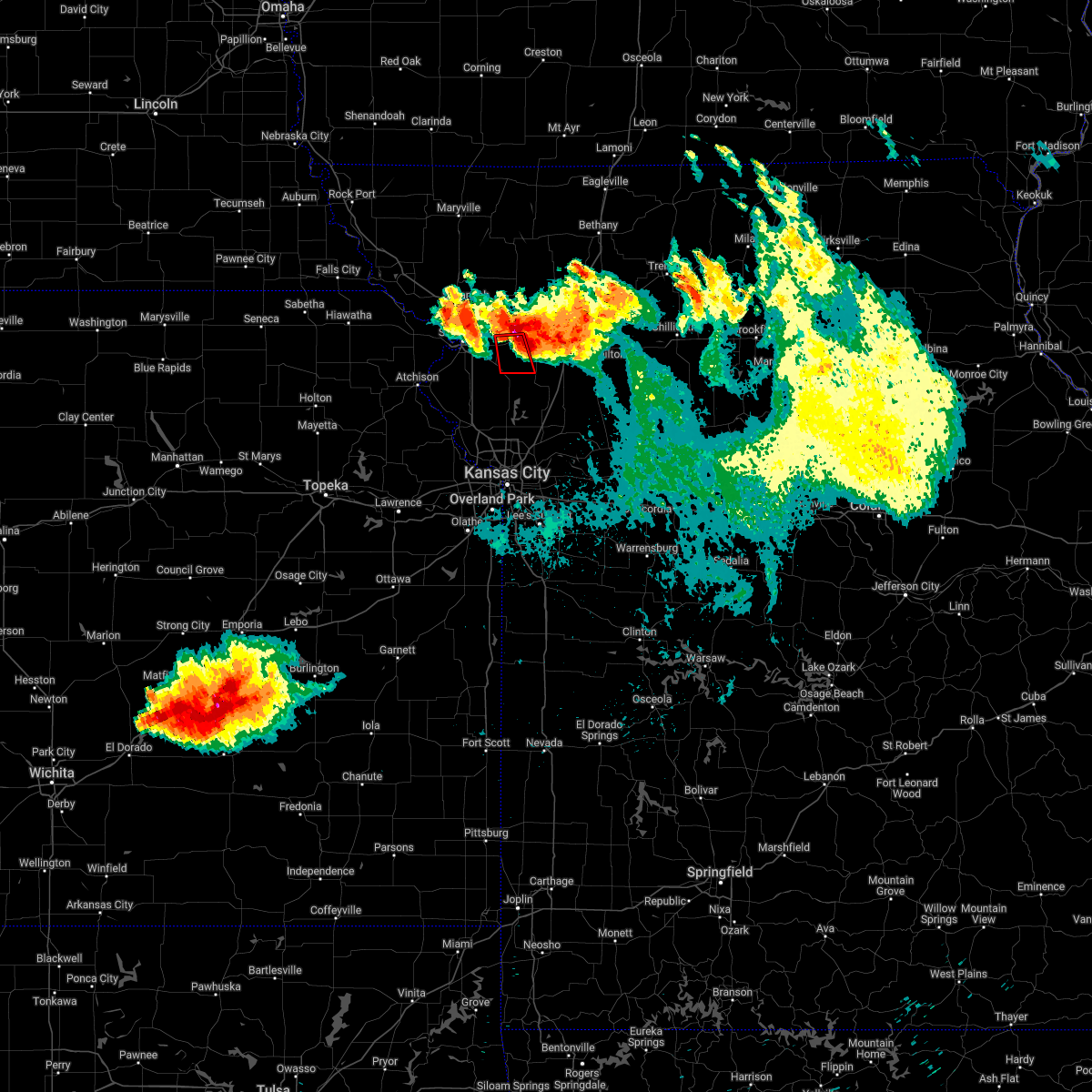 At 954 pm cdt, a severe thunderstorm capable of producing a tornado was located over clarksdale, or 11 miles north of gower, moving south at 25 mph (radar indicated rotation). Hazards include tornado and quarter size hail. Flying debris will be dangerous to those caught without shelter. mobile homes will be damaged or destroyed. damage to roofs, windows, and vehicles will occur. Tree damage is likely. At 954 pm cdt, a severe thunderstorm capable of producing a tornado was located over clarksdale, or 11 miles north of gower, moving south at 25 mph (radar indicated rotation). Hazards include tornado and quarter size hail. Flying debris will be dangerous to those caught without shelter. mobile homes will be damaged or destroyed. damage to roofs, windows, and vehicles will occur. Tree damage is likely.
|
| 4/29/2022 10:55 PM CDT |
 The severe thunderstorm warning for southeastern buchanan, worth, western daviess, clinton, gentry, western harrison, western caldwell, northeastern platte and dekalb counties will expire at 1100 pm cdt, the storms which prompted the warning have weakened below severe limits, and no longer pose an immediate threat to life or property. therefore, the warning will be allowed to expire. however gusty winds are still possible with these thunderstorms. a severe thunderstorm watch remains in effect until 400 am cdt for north central, northwestern and west central missouri. The severe thunderstorm warning for southeastern buchanan, worth, western daviess, clinton, gentry, western harrison, western caldwell, northeastern platte and dekalb counties will expire at 1100 pm cdt, the storms which prompted the warning have weakened below severe limits, and no longer pose an immediate threat to life or property. therefore, the warning will be allowed to expire. however gusty winds are still possible with these thunderstorms. a severe thunderstorm watch remains in effect until 400 am cdt for north central, northwestern and west central missouri.
|
| 4/29/2022 10:27 PM CDT |
 At 1027 pm cdt, severe thunderstorms were located along a line extending from near stanberry to near clarksdale to camden point, moving east at 35 mph (radar indicated). Hazards include 60 mph wind gusts and nickel size hail. Expect damage to roofs, siding, and trees. locations impacted include, cameron, bethany, plattsburg, lathrop, hamilton, gallatin, albany, gower, stanberry, maysville, king city, grant city, stewartsville, trimble, edgerton, dearborn, camden point, holt, union star and osborn. this includes the following highways, interstate 35 in missouri between mile markers 33 and 86. interstate 29 between mile markers 25 and 27. hail threat, radar indicated max hail size, 0. 88 in wind threat, radar indicated max wind gust, 60 mph. At 1027 pm cdt, severe thunderstorms were located along a line extending from near stanberry to near clarksdale to camden point, moving east at 35 mph (radar indicated). Hazards include 60 mph wind gusts and nickel size hail. Expect damage to roofs, siding, and trees. locations impacted include, cameron, bethany, plattsburg, lathrop, hamilton, gallatin, albany, gower, stanberry, maysville, king city, grant city, stewartsville, trimble, edgerton, dearborn, camden point, holt, union star and osborn. this includes the following highways, interstate 35 in missouri between mile markers 33 and 86. interstate 29 between mile markers 25 and 27. hail threat, radar indicated max hail size, 0. 88 in wind threat, radar indicated max wind gust, 60 mph.
|
| 4/29/2022 10:08 PM CDT |
 At 1007 pm cdt, severe thunderstorms were located along a line extending from 6 miles south of ravenwood to 7 miles east of st. joseph to weston, moving east at 35 mph (radar indicated). Hazards include 60 mph wind gusts and nickel size hail. expect damage to roofs, siding, and trees At 1007 pm cdt, severe thunderstorms were located along a line extending from 6 miles south of ravenwood to 7 miles east of st. joseph to weston, moving east at 35 mph (radar indicated). Hazards include 60 mph wind gusts and nickel size hail. expect damage to roofs, siding, and trees
|
| 4/23/2022 8:22 PM CDT |
 At 821 pm cdt, severe thunderstorms were located along a line extending from near maysville to 6 miles southeast of stewartsville to trimble, moving northeast at 55 mph (radar indicated). Hazards include 60 mph wind gusts and quarter size hail. Hail damage to vehicles is expected. expect wind damage to roofs, siding, and trees. locations impacted include, smithville, platte city, plattsburg, gower, stewartsville, trimble, edgerton, camden point, osborn, clarksdale, easton, ridgely, amity and hoover. this includes the following highways, interstate 29 between mile markers 17 and 20. interstate 435 near mile marker 31. hail threat, radar indicated max hail size, 1. 00 in wind threat, radar indicated max wind gust, 60 mph. At 821 pm cdt, severe thunderstorms were located along a line extending from near maysville to 6 miles southeast of stewartsville to trimble, moving northeast at 55 mph (radar indicated). Hazards include 60 mph wind gusts and quarter size hail. Hail damage to vehicles is expected. expect wind damage to roofs, siding, and trees. locations impacted include, smithville, platte city, plattsburg, gower, stewartsville, trimble, edgerton, camden point, osborn, clarksdale, easton, ridgely, amity and hoover. this includes the following highways, interstate 29 between mile markers 17 and 20. interstate 435 near mile marker 31. hail threat, radar indicated max hail size, 1. 00 in wind threat, radar indicated max wind gust, 60 mph.
|
| 4/23/2022 7:52 PM CDT |
 At 752 pm cdt, severe thunderstorms were located along a line extending from near agency to near dearborn to near leavenworth, moving northeast at 50 mph (radar indicated). Hazards include 60 mph wind gusts and quarter size hail. Hail damage to vehicles is expected. Expect wind damage to roofs, siding, and trees. At 752 pm cdt, severe thunderstorms were located along a line extending from near agency to near dearborn to near leavenworth, moving northeast at 50 mph (radar indicated). Hazards include 60 mph wind gusts and quarter size hail. Hail damage to vehicles is expected. Expect wind damage to roofs, siding, and trees.
|
| 3/29/2022 9:00 PM CDT |
 At 859 pm cdt, severe thunderstorms were located along a line extending from 10 miles northwest of union star to near country club villa to near gower to near ferrelview to near shawnee, moving east at 55 mph (radar indicated). Hazards include 60 mph wind gusts and quarter size hail. Hail damage to vehicles is expected. expect wind damage to roofs, siding, and trees. locations impacted include, kansas city, overland park, olathe, independence, lee`s summit, st. joseph, shawnee, blue springs, lenexa, leawood, raytown, liberty, gladstone, prairie village, grain valley, lansing, excelsior springs, merriam, cameron and mission. this includes the following highways, interstate 70 in missouri between mile markers 0 and 29. interstate 70 in kansas between mile markers 410 and 423. interstate 35 in missouri between mile markers 0 and 54. interstate 35 in kansas between mile markers 220 and 235. interstate 29 between mile markers 0 and 54. interstate 635 between mile markers 0 and 12. interstate 470 between mile markers 0 and 5, and between mile markers 9 and 16. interstate 435 between mile markers 0 and 83. interstate 229 between mile markers 0 and 2. kansas turnpike between mile markers 219 and 226. hail threat, radar indicated max hail size, 1. 00 in wind threat, radar indicated max wind gust, 60 mph. At 859 pm cdt, severe thunderstorms were located along a line extending from 10 miles northwest of union star to near country club villa to near gower to near ferrelview to near shawnee, moving east at 55 mph (radar indicated). Hazards include 60 mph wind gusts and quarter size hail. Hail damage to vehicles is expected. expect wind damage to roofs, siding, and trees. locations impacted include, kansas city, overland park, olathe, independence, lee`s summit, st. joseph, shawnee, blue springs, lenexa, leawood, raytown, liberty, gladstone, prairie village, grain valley, lansing, excelsior springs, merriam, cameron and mission. this includes the following highways, interstate 70 in missouri between mile markers 0 and 29. interstate 70 in kansas between mile markers 410 and 423. interstate 35 in missouri between mile markers 0 and 54. interstate 35 in kansas between mile markers 220 and 235. interstate 29 between mile markers 0 and 54. interstate 635 between mile markers 0 and 12. interstate 470 between mile markers 0 and 5, and between mile markers 9 and 16. interstate 435 between mile markers 0 and 83. interstate 229 between mile markers 0 and 2. kansas turnpike between mile markers 219 and 226. hail threat, radar indicated max hail size, 1. 00 in wind threat, radar indicated max wind gust, 60 mph.
|
| 3/29/2022 8:47 PM CDT |
 At 847 pm cdt, severe thunderstorms were located along a line extending from 7 miles northeast of savannah to lenexa, moving east at 80 mph (radar indicated). Hazards include 60 mph wind gusts and quarter size hail. Hail damage to vehicles is expected. Expect wind damage to roofs, siding, and trees. At 847 pm cdt, severe thunderstorms were located along a line extending from 7 miles northeast of savannah to lenexa, moving east at 80 mph (radar indicated). Hazards include 60 mph wind gusts and quarter size hail. Hail damage to vehicles is expected. Expect wind damage to roofs, siding, and trees.
|
| 10/24/2021 3:12 PM CDT |
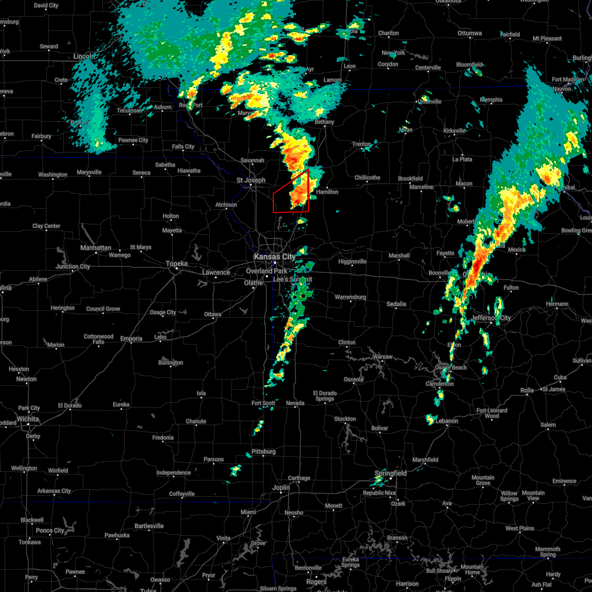 The tornado warning for clinton and southeastern dekalb counties will expire at 315 pm cdt, the tornado threat has diminished and the tornado warning has been cancelled. however, large hail and damaging winds remain likely and a severe thunderstorm warning remains in effect for the area. however small hail and gusty winds are still possible with this thunderstorm. a tornado watch remains in effect until 1000 pm cdt for northwestern missouri. remember, a severe thunderstorm warning still remains in effect for clinton and southeastern dekalb counties. The tornado warning for clinton and southeastern dekalb counties will expire at 315 pm cdt, the tornado threat has diminished and the tornado warning has been cancelled. however, large hail and damaging winds remain likely and a severe thunderstorm warning remains in effect for the area. however small hail and gusty winds are still possible with this thunderstorm. a tornado watch remains in effect until 1000 pm cdt for northwestern missouri. remember, a severe thunderstorm warning still remains in effect for clinton and southeastern dekalb counties.
|
| 10/24/2021 2:54 PM CDT |
 At 253 pm cdt, a severe thunderstorm capable of producing a tornado was located near gower, moving east at 35 mph (radar indicated rotation). Hazards include tornado and quarter size hail. Flying debris will be dangerous to those caught without shelter. mobile homes will be damaged or destroyed. damage to roofs, windows, and vehicles will occur. tree damage is likely. locations impacted include, cameron, plattsburg, lathrop, gower, stewartsville, osborn and turney. This includes interstate 35 in missouri between mile markers 39 and 55. At 253 pm cdt, a severe thunderstorm capable of producing a tornado was located near gower, moving east at 35 mph (radar indicated rotation). Hazards include tornado and quarter size hail. Flying debris will be dangerous to those caught without shelter. mobile homes will be damaged or destroyed. damage to roofs, windows, and vehicles will occur. tree damage is likely. locations impacted include, cameron, plattsburg, lathrop, gower, stewartsville, osborn and turney. This includes interstate 35 in missouri between mile markers 39 and 55.
|
| 10/24/2021 2:51 PM CDT |
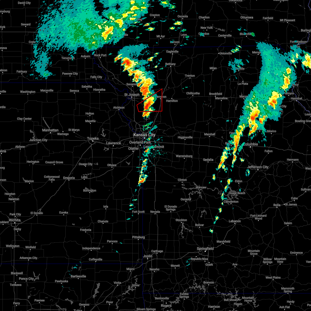 At 250 pm cdt, a severe thunderstorm capable of producing a tornado was located over gower, moving northeast at 35 mph. another circulation was south of cosby also moving northeast at 35 mph (radar indicated rotation). Hazards include tornado and quarter size hail. Flying debris will be dangerous to those caught without shelter. mobile homes will be damaged or destroyed. damage to roofs, windows, and vehicles will occur. Tree damage is likely. At 250 pm cdt, a severe thunderstorm capable of producing a tornado was located over gower, moving northeast at 35 mph. another circulation was south of cosby also moving northeast at 35 mph (radar indicated rotation). Hazards include tornado and quarter size hail. Flying debris will be dangerous to those caught without shelter. mobile homes will be damaged or destroyed. damage to roofs, windows, and vehicles will occur. Tree damage is likely.
|
| 10/24/2021 2:44 PM CDT |
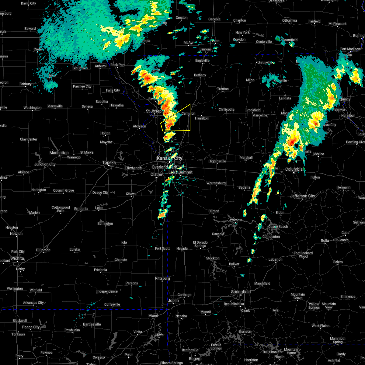 At 243 pm cdt, a severe thunderstorm was located near edgerton, or near gower, moving northeast at 35 mph (radar indicated). Hazards include 60 mph wind gusts and quarter size hail. Hail damage to vehicles is expected. Expect wind damage to roofs, siding, and trees. At 243 pm cdt, a severe thunderstorm was located near edgerton, or near gower, moving northeast at 35 mph (radar indicated). Hazards include 60 mph wind gusts and quarter size hail. Hail damage to vehicles is expected. Expect wind damage to roofs, siding, and trees.
|
| 7/10/2021 6:41 PM CDT |
 The severe thunderstorm warning for southeastern buchanan, northwestern clay, southwestern clinton and northeastern platte counties will expire at 645 pm cdt, the storm which prompted the warning has weakened below severe limits, and no longer poses an immediate threat to life or property. therefore, the warning will be allowed to expire. however gusty winds and heavy rain are still possible with this thunderstorm. a severe thunderstorm watch remains in effect until 1000 pm cdt for northwestern and west central missouri. The severe thunderstorm warning for southeastern buchanan, northwestern clay, southwestern clinton and northeastern platte counties will expire at 645 pm cdt, the storm which prompted the warning has weakened below severe limits, and no longer poses an immediate threat to life or property. therefore, the warning will be allowed to expire. however gusty winds and heavy rain are still possible with this thunderstorm. a severe thunderstorm watch remains in effect until 1000 pm cdt for northwestern and west central missouri.
|
| 7/10/2021 6:32 PM CDT |
 At 632 pm cdt, a severe thunderstorm was located near gower, moving southeast at 40 mph (radar indicated). Hazards include 60 mph wind gusts and quarter size hail. Hail damage to vehicles is expected. expect wind damage to roofs, siding, and trees. Locations impacted include, smithville, plattsburg, gower, agency, trimble, edgerton, easton, ridgely and faucett. At 632 pm cdt, a severe thunderstorm was located near gower, moving southeast at 40 mph (radar indicated). Hazards include 60 mph wind gusts and quarter size hail. Hail damage to vehicles is expected. expect wind damage to roofs, siding, and trees. Locations impacted include, smithville, plattsburg, gower, agency, trimble, edgerton, easton, ridgely and faucett.
|
| 7/10/2021 6:18 PM CDT |
 At 618 pm cdt, a severe thunderstorm was located over agency, or 7 miles south of st. joseph, moving southeast at 40 mph (radar indicated). Hazards include 60 mph wind gusts and quarter size hail. Hail damage to vehicles is expected. Expect wind damage to roofs, siding, and trees. At 618 pm cdt, a severe thunderstorm was located over agency, or 7 miles south of st. joseph, moving southeast at 40 mph (radar indicated). Hazards include 60 mph wind gusts and quarter size hail. Hail damage to vehicles is expected. Expect wind damage to roofs, siding, and trees.
|
| 7/10/2021 2:54 AM CDT |
 At 253 am cdt, severe thunderstorms were located along a line extending from near cameron to near gladstone, moving east at 45 mph (radar indicated). Hazards include 60 mph wind gusts. Expect damage to roofs, siding, and trees. Locations impacted include, liberty, excelsior springs, cameron, smithville, kearney, lawson, plattsburg, lathrop, hamilton, gower, stewartsville, trimble, polo, holt, osborn, crystal lakes, kingston, clarksdale, cowgill and excelsior estates. At 253 am cdt, severe thunderstorms were located along a line extending from near cameron to near gladstone, moving east at 45 mph (radar indicated). Hazards include 60 mph wind gusts. Expect damage to roofs, siding, and trees. Locations impacted include, liberty, excelsior springs, cameron, smithville, kearney, lawson, plattsburg, lathrop, hamilton, gower, stewartsville, trimble, polo, holt, osborn, crystal lakes, kingston, clarksdale, cowgill and excelsior estates.
|
| 7/10/2021 2:28 AM CDT |
 At 227 am cdt, severe thunderstorms were located along a line extending from near clarksdale to near leavenworth, moving east at 45 mph (radar indicated). Hazards include 60 mph wind gusts. expect damage to roofs, siding, and trees At 227 am cdt, severe thunderstorms were located along a line extending from near clarksdale to near leavenworth, moving east at 45 mph (radar indicated). Hazards include 60 mph wind gusts. expect damage to roofs, siding, and trees
|
| 7/10/2021 1:44 AM CDT |
 At 143 am cdt, severe thunderstorms were located along a line extending from near white cloud to near denison, moving east at 65 mph. automated weather station in falls city nebraska reported a 75 mph wind gust (trained weather spotters). Hazards include 70 mph wind gusts. Expect considerable tree damage. Damage is likely to mobile homes, roofs, and outbuildings. At 143 am cdt, severe thunderstorms were located along a line extending from near white cloud to near denison, moving east at 65 mph. automated weather station in falls city nebraska reported a 75 mph wind gust (trained weather spotters). Hazards include 70 mph wind gusts. Expect considerable tree damage. Damage is likely to mobile homes, roofs, and outbuildings.
|
| 6/24/2021 9:43 PM CDT |
 At 943 pm cdt, severe thunderstorms were located along a line extending from 6 miles southeast of cameron to near lathrop to trimble to near weston to 6 miles south of atchison, moving southeast at 30 mph (radar indicated). Hazards include 60 mph wind gusts and penny size hail. Expect damage to roofs, siding, and trees. Locations impacted include, leavenworth, atchison, cameron, smithville, kearney, platte city, lawson, plattsburg, lathrop, weston, gower, trimble, polo, edgerton, dearborn, camden point, holt, osborn, kingston and rushville. At 943 pm cdt, severe thunderstorms were located along a line extending from 6 miles southeast of cameron to near lathrop to trimble to near weston to 6 miles south of atchison, moving southeast at 30 mph (radar indicated). Hazards include 60 mph wind gusts and penny size hail. Expect damage to roofs, siding, and trees. Locations impacted include, leavenworth, atchison, cameron, smithville, kearney, platte city, lawson, plattsburg, lathrop, weston, gower, trimble, polo, edgerton, dearborn, camden point, holt, osborn, kingston and rushville.
|
| 6/24/2021 9:00 PM CDT |
 At 900 pm cdt, severe thunderstorms were located along a line extending from near stewartsville to near agency to 6 miles east of rushville to near atchison to near muscotah, moving southeast at 30 mph (radar indicated). Hazards include 60 mph wind gusts and penny size hail. expect damage to roofs, siding, and trees At 900 pm cdt, severe thunderstorms were located along a line extending from near stewartsville to near agency to 6 miles east of rushville to near atchison to near muscotah, moving southeast at 30 mph (radar indicated). Hazards include 60 mph wind gusts and penny size hail. expect damage to roofs, siding, and trees
|
| 6/24/2021 8:37 PM CDT |
 At 837 pm cdt, severe thunderstorms were located along a line extending from near clarksdale to near st. joseph to near troy to near denton, moving southeast at 20 mph (radar indicated). Hazards include 60 mph wind gusts and penny size hail. expect damage to roofs, siding, and trees At 837 pm cdt, severe thunderstorms were located along a line extending from near clarksdale to near st. joseph to near troy to near denton, moving southeast at 20 mph (radar indicated). Hazards include 60 mph wind gusts and penny size hail. expect damage to roofs, siding, and trees
|
| 6/11/2021 3:16 PM CDT |
 At 316 pm cdt, a severe thunderstorm was located near lathrop, moving southeast at 35 mph (radar indicated). Hazards include 70 mph wind gusts and ping pong ball size hail. People and animals outdoors will be injured. expect hail damage to roofs, siding, windows, and vehicles. expect considerable tree damage. wind damage is also likely to mobile homes, roofs, and outbuildings. Locations impacted include, lawson. At 316 pm cdt, a severe thunderstorm was located near lathrop, moving southeast at 35 mph (radar indicated). Hazards include 70 mph wind gusts and ping pong ball size hail. People and animals outdoors will be injured. expect hail damage to roofs, siding, windows, and vehicles. expect considerable tree damage. wind damage is also likely to mobile homes, roofs, and outbuildings. Locations impacted include, lawson.
|
| 6/11/2021 3:00 PM CDT | Power poles down in gower... mo and on j hwy at middle roa in clinton county MO, 0.4 miles NW of Gower, MO |
| 6/11/2021 2:44 PM CDT |
 At 243 pm cdt, a severe thunderstorm was located near clarksdale, or 9 miles north of gower, moving southeast at 35 mph (trained weather spotters). Hazards include two inch hail and 70 mph wind gusts. People and animals outdoors will be injured. expect hail damage to roofs, siding, windows, and vehicles. expect considerable tree damage. wind damage is also likely to mobile homes, roofs, and outbuildings. this severe thunderstorm will be near, stewartsville around 250 pm cdt. gower around 255 pm cdt. osborn around 300 pm cdt. other locations in the path of this severe thunderstorm include plattsburg, lathrop and lawson. This includes interstate 35 in missouri between mile markers 32 and 56. At 243 pm cdt, a severe thunderstorm was located near clarksdale, or 9 miles north of gower, moving southeast at 35 mph (trained weather spotters). Hazards include two inch hail and 70 mph wind gusts. People and animals outdoors will be injured. expect hail damage to roofs, siding, windows, and vehicles. expect considerable tree damage. wind damage is also likely to mobile homes, roofs, and outbuildings. this severe thunderstorm will be near, stewartsville around 250 pm cdt. gower around 255 pm cdt. osborn around 300 pm cdt. other locations in the path of this severe thunderstorm include plattsburg, lathrop and lawson. This includes interstate 35 in missouri between mile markers 32 and 56.
|
| 5/27/2021 4:05 AM CDT |
 At 405 am cdt, severe thunderstorms were located along a line extending from near gower to near plattsburg to near lathrop, moving northeast at 45 mph (radar indicated). Hazards include 60 mph wind gusts and nickel size hail. Expect damage to roofs, siding, and trees. severe thunderstorms will be near, lathrop around 410 am cdt. stewartsville around 415 am cdt. osborn around 420 am cdt. cameron around 425 am cdt. other locations in the path of these severe thunderstorms include kingston, maysville and hamilton. This includes interstate 35 in missouri between mile markers 35 and 66. At 405 am cdt, severe thunderstorms were located along a line extending from near gower to near plattsburg to near lathrop, moving northeast at 45 mph (radar indicated). Hazards include 60 mph wind gusts and nickel size hail. Expect damage to roofs, siding, and trees. severe thunderstorms will be near, lathrop around 410 am cdt. stewartsville around 415 am cdt. osborn around 420 am cdt. cameron around 425 am cdt. other locations in the path of these severe thunderstorms include kingston, maysville and hamilton. This includes interstate 35 in missouri between mile markers 35 and 66.
|
| 5/8/2021 11:55 PM CDT |
 At 1154 pm cdt, a severe thunderstorm was located over smithville, moving east at 55 mph (radar indicated). Hazards include 60 mph wind gusts and penny size hail. expect damage to roofs, siding, and trees At 1154 pm cdt, a severe thunderstorm was located over smithville, moving east at 55 mph (radar indicated). Hazards include 60 mph wind gusts and penny size hail. expect damage to roofs, siding, and trees
|
| 5/8/2021 11:47 PM CDT |
 At 1146 pm cdt, a severe thunderstorm was located over platte city, moving east at 55 mph (radar indicated). Hazards include 60 mph wind gusts and nickel size hail. Expect damage to roofs, siding, and trees. Locations impacted include, leavenworth, lansing, mission, bonner springs, parkville, tonganoxie, platte city, basehor, edwardsville, riverside, weatherby lake, weston, gower, westwood, lake quivira, kansas city kansas, kansas city, lake waukomis, edgerton and dearborn. At 1146 pm cdt, a severe thunderstorm was located over platte city, moving east at 55 mph (radar indicated). Hazards include 60 mph wind gusts and nickel size hail. Expect damage to roofs, siding, and trees. Locations impacted include, leavenworth, lansing, mission, bonner springs, parkville, tonganoxie, platte city, basehor, edwardsville, riverside, weatherby lake, weston, gower, westwood, lake quivira, kansas city kansas, kansas city, lake waukomis, edgerton and dearborn.
|
| 5/8/2021 11:35 PM CDT |
 At 1135 pm cdt, a severe thunderstorm was located over leavenworth, moving east at 55 mph (radar indicated). Hazards include 70 mph wind gusts and nickel size hail. Expect considerable tree damage. damage is likely to mobile homes, roofs, and outbuildings. Locations impacted include, leavenworth, lansing, atchison, mission, bonner springs, parkville, tonganoxie, platte city, basehor, edwardsville, riverside, weatherby lake, weston, gower, westwood, lake quivira, kansas city kansas, kansas city, lake waukomis and edgerton. At 1135 pm cdt, a severe thunderstorm was located over leavenworth, moving east at 55 mph (radar indicated). Hazards include 70 mph wind gusts and nickel size hail. Expect considerable tree damage. damage is likely to mobile homes, roofs, and outbuildings. Locations impacted include, leavenworth, lansing, atchison, mission, bonner springs, parkville, tonganoxie, platte city, basehor, edwardsville, riverside, weatherby lake, weston, gower, westwood, lake quivira, kansas city kansas, kansas city, lake waukomis and edgerton.
|
| 5/8/2021 11:19 PM CDT |
 At 1118 pm cdt, a severe thunderstorm was located over winchester, or 7 miles northeast of oskaloosa, moving east at 55 mph (radar indicated). Hazards include 70 mph wind gusts and nickel size hail. Expect considerable tree damage. Damage is likely to mobile homes, roofs, and outbuildings. At 1118 pm cdt, a severe thunderstorm was located over winchester, or 7 miles northeast of oskaloosa, moving east at 55 mph (radar indicated). Hazards include 70 mph wind gusts and nickel size hail. Expect considerable tree damage. Damage is likely to mobile homes, roofs, and outbuildings.
|
| 7/1/2020 5:04 AM CDT |
 At 504 am cdt, severe thunderstorms were located along a line extending from lathrop to holt to near kearney to near pleasant valley to near weatherby lake, moving southeast at 35 mph (radar indicated). Hazards include 60 mph wind gusts and quarter size hail. Hail damage to vehicles is expected. expect wind damage to roofs, siding, and trees. Locations impacted include, leavenworth, liberty, gladstone, lansing, excelsior springs, smithville, kearney, bonner springs, parkville, platte city, basehor, edwardsville, north kansas city, riverside, lawson, plattsburg, lathrop, weatherby lake, weston and gower. At 504 am cdt, severe thunderstorms were located along a line extending from lathrop to holt to near kearney to near pleasant valley to near weatherby lake, moving southeast at 35 mph (radar indicated). Hazards include 60 mph wind gusts and quarter size hail. Hail damage to vehicles is expected. expect wind damage to roofs, siding, and trees. Locations impacted include, leavenworth, liberty, gladstone, lansing, excelsior springs, smithville, kearney, bonner springs, parkville, platte city, basehor, edwardsville, north kansas city, riverside, lawson, plattsburg, lathrop, weatherby lake, weston and gower.
|
| 7/1/2020 4:44 AM CDT |
 At 444 am cdt, severe thunderstorms were located along a line extending from near stewartsville to near plattsburg to near smithville to near ferrelview to near leavenworth, moving southeast at 35 mph (radar indicated). Hazards include 60 mph wind gusts and quarter size hail. Hail damage to vehicles is expected. expect wind damage to roofs, siding, and trees. locations impacted include, st. Joseph, leavenworth, liberty, gladstone, lansing, excelsior springs, smithville, kearney, bonner springs, parkville, platte city, basehor, edwardsville, north kansas city, riverside, lawson, plattsburg, lathrop, weatherby lake and weston. At 444 am cdt, severe thunderstorms were located along a line extending from near stewartsville to near plattsburg to near smithville to near ferrelview to near leavenworth, moving southeast at 35 mph (radar indicated). Hazards include 60 mph wind gusts and quarter size hail. Hail damage to vehicles is expected. expect wind damage to roofs, siding, and trees. locations impacted include, st. Joseph, leavenworth, liberty, gladstone, lansing, excelsior springs, smithville, kearney, bonner springs, parkville, platte city, basehor, edwardsville, north kansas city, riverside, lawson, plattsburg, lathrop, weatherby lake and weston.
|
| 7/1/2020 4:27 AM CDT |
 At 426 am cdt, severe thunderstorms were located along a line extending from near clarksdale to near agency to near dearborn to near camden point to near weston, moving southeast at 35 mph (radar indicated). Hazards include 60 mph wind gusts and quarter size hail. Hail damage to vehicles is expected. Expect wind damage to roofs, siding, and trees. At 426 am cdt, severe thunderstorms were located along a line extending from near clarksdale to near agency to near dearborn to near camden point to near weston, moving southeast at 35 mph (radar indicated). Hazards include 60 mph wind gusts and quarter size hail. Hail damage to vehicles is expected. Expect wind damage to roofs, siding, and trees.
|
| 6/27/2020 1:49 AM CDT |
 At 133 am cdt, a severe thunderstorm was located near agency, or 7 miles east of st. joseph, moving east at 35 mph (law enforcement). Hazards include 70 mph wind gusts. Expect considerable tree damage. Damage is likely to mobile homes, roofs, and outbuildings. At 133 am cdt, a severe thunderstorm was located near agency, or 7 miles east of st. joseph, moving east at 35 mph (law enforcement). Hazards include 70 mph wind gusts. Expect considerable tree damage. Damage is likely to mobile homes, roofs, and outbuildings.
|
| 6/27/2020 1:34 AM CDT |
 At 133 am cdt, a severe thunderstorm was located near agency, or 7 miles east of st. joseph, moving east at 35 mph (law enforcement). Hazards include 70 mph wind gusts. Expect considerable tree damage. Damage is likely to mobile homes, roofs, and outbuildings. At 133 am cdt, a severe thunderstorm was located near agency, or 7 miles east of st. joseph, moving east at 35 mph (law enforcement). Hazards include 70 mph wind gusts. Expect considerable tree damage. Damage is likely to mobile homes, roofs, and outbuildings.
|
| 6/5/2020 3:05 AM CDT |
 At 305 am cdt, severe thunderstorms were located along a line extending from near new hampton to near clarksdale to 7 miles east of rushville, moving east at 65 mph (radar indicated). Hazards include 70 mph wind gusts and quarter size hail. Hail damage to vehicles is expected. expect considerable tree damage. Wind damage is also likely to mobile homes, roofs, and outbuildings. At 305 am cdt, severe thunderstorms were located along a line extending from near new hampton to near clarksdale to 7 miles east of rushville, moving east at 65 mph (radar indicated). Hazards include 70 mph wind gusts and quarter size hail. Hail damage to vehicles is expected. expect considerable tree damage. Wind damage is also likely to mobile homes, roofs, and outbuildings.
|
| 6/4/2020 2:08 AM CDT |
 The severe thunderstorm warning for wyandotte, leavenworth, northern johnson, eastern buchanan, clay, clinton, northwestern ray, southwestern caldwell, platte and northwestern jackson counties will expire at 215 am cdt, the storms which prompted the warning have moved out of the area. therefore, the warning will be allowed to expire. however gusty winds are still possible with these thunderstorms. a severe thunderstorm watch remains in effect until 300 am cdt for northeastern and east central kansas, and northwestern and west central missouri. remember, a severe thunderstorm warning still remains in effect for johnson and wyandotte county kansas and jackson, clay, and clinton counties in missouri. The severe thunderstorm warning for wyandotte, leavenworth, northern johnson, eastern buchanan, clay, clinton, northwestern ray, southwestern caldwell, platte and northwestern jackson counties will expire at 215 am cdt, the storms which prompted the warning have moved out of the area. therefore, the warning will be allowed to expire. however gusty winds are still possible with these thunderstorms. a severe thunderstorm watch remains in effect until 300 am cdt for northeastern and east central kansas, and northwestern and west central missouri. remember, a severe thunderstorm warning still remains in effect for johnson and wyandotte county kansas and jackson, clay, and clinton counties in missouri.
|
| 6/4/2020 1:41 AM CDT |
 At 140 am cdt, severe thunderstorms were located along a line extending from near clarksdale to near camden point to near mclouth, moving southeast at 60 mph (radar indicated). Hazards include 60 mph wind gusts and nickel size hail. expect damage to roofs, siding, and trees At 140 am cdt, severe thunderstorms were located along a line extending from near clarksdale to near camden point to near mclouth, moving southeast at 60 mph (radar indicated). Hazards include 60 mph wind gusts and nickel size hail. expect damage to roofs, siding, and trees
|
| 5/24/2020 2:30 PM CDT |
 At 229 pm cdt, a severe thunderstorm was located near gower, moving northeast at 30 mph (radar indicated). Hazards include golf ball size hail and 60 mph wind gusts. People and animals outdoors will be injured. expect hail damage to roofs, siding, windows, and vehicles. Expect wind damage to roofs, siding, and trees. At 229 pm cdt, a severe thunderstorm was located near gower, moving northeast at 30 mph (radar indicated). Hazards include golf ball size hail and 60 mph wind gusts. People and animals outdoors will be injured. expect hail damage to roofs, siding, windows, and vehicles. Expect wind damage to roofs, siding, and trees.
|
| 5/24/2020 2:21 PM CDT |
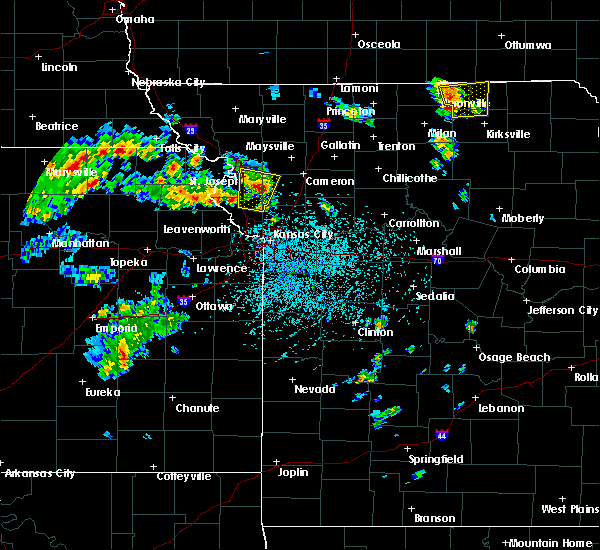 At 221 pm cdt, a severe thunderstorm was located near agency, or near gower, moving north at 30 mph (radar indicated). Hazards include 60 mph wind gusts and quarter size hail. Hail damage to vehicles is expected. expect wind damage to roofs, siding, and trees. Locations impacted include, gower and easton. At 221 pm cdt, a severe thunderstorm was located near agency, or near gower, moving north at 30 mph (radar indicated). Hazards include 60 mph wind gusts and quarter size hail. Hail damage to vehicles is expected. expect wind damage to roofs, siding, and trees. Locations impacted include, gower and easton.
|
| 5/24/2020 2:20 PM CDT | Baseball sized hail reported 0.4 miles NW of Gower, MO, report relayed through em. |
| 5/24/2020 2:00 PM CDT |
 At 159 pm cdt, a severe thunderstorm was located near dearborn, or 9 miles southwest of gower, moving north at 30 mph (radar indicated). Hazards include 60 mph wind gusts and quarter size hail. Hail damage to vehicles is expected. Expect wind damage to roofs, siding, and trees. At 159 pm cdt, a severe thunderstorm was located near dearborn, or 9 miles southwest of gower, moving north at 30 mph (radar indicated). Hazards include 60 mph wind gusts and quarter size hail. Hail damage to vehicles is expected. Expect wind damage to roofs, siding, and trees.
|
| 4/11/2020 8:54 PM CDT |
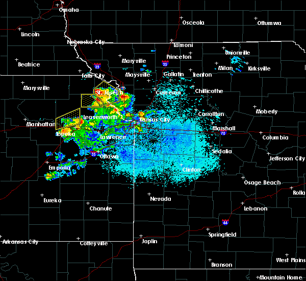 At 854 pm cdt, a severe thunderstorm was located near agency, or 9 miles west of gower, moving northeast at 30 mph (radar indicated). Hazards include 60 mph wind gusts and half dollar size hail. Hail damage to vehicles is expected. Expect wind damage to roofs, siding, and trees. At 854 pm cdt, a severe thunderstorm was located near agency, or 9 miles west of gower, moving northeast at 30 mph (radar indicated). Hazards include 60 mph wind gusts and half dollar size hail. Hail damage to vehicles is expected. Expect wind damage to roofs, siding, and trees.
|
| 8/18/2019 2:26 AM CDT |
 At 225 am cdt, a severe thunderstorm was located 7 miles northeast of easton, or 7 miles west of weston, moving east at 35 mph (radar indicated). Hazards include 60 mph wind gusts and quarter size hail. Hail damage to vehicles is expected. Expect wind damage to roofs, siding, and trees. At 225 am cdt, a severe thunderstorm was located 7 miles northeast of easton, or 7 miles west of weston, moving east at 35 mph (radar indicated). Hazards include 60 mph wind gusts and quarter size hail. Hail damage to vehicles is expected. Expect wind damage to roofs, siding, and trees.
|
| 8/17/2019 1:03 AM CDT |
 The national weather service in pleasant hill has issued a * severe thunderstorm warning for. southern doniphan county in northeastern kansas. central atchison county in northeastern kansas. buchanan county in northwestern missouri. Until 145 am cdt. The national weather service in pleasant hill has issued a * severe thunderstorm warning for. southern doniphan county in northeastern kansas. central atchison county in northeastern kansas. buchanan county in northwestern missouri. Until 145 am cdt.
|
| 8/15/2019 6:12 PM CDT |
 At 612 pm cdt, a severe thunderstorm was located over smithville, moving southeast at 45 mph (radar indicated). Hazards include 60 mph wind gusts and quarter size hail. Hail damage to vehicles is expected. Expect wind damage to roofs, siding, and trees. At 612 pm cdt, a severe thunderstorm was located over smithville, moving southeast at 45 mph (radar indicated). Hazards include 60 mph wind gusts and quarter size hail. Hail damage to vehicles is expected. Expect wind damage to roofs, siding, and trees.
|
| 8/15/2019 6:03 PM CDT |
 At 602 pm cdt, a severe thunderstorm was located near camden point, or 8 miles northwest of smithville, moving southeast at 45 mph (emergency management). Hazards include 60 mph wind gusts and quarter size hail. Hail damage to vehicles is expected. expect wind damage to roofs, siding, and trees. locations impacted include, kansas city, st. Joseph, leavenworth, gladstone, smithville, platte city, plattsburg, lathrop, weston, gower, agency, trimble, edgerton, dearborn, camden point, ferrelview, tracy, lewis and clark village, de kalb and ridgely. At 602 pm cdt, a severe thunderstorm was located near camden point, or 8 miles northwest of smithville, moving southeast at 45 mph (emergency management). Hazards include 60 mph wind gusts and quarter size hail. Hail damage to vehicles is expected. expect wind damage to roofs, siding, and trees. locations impacted include, kansas city, st. Joseph, leavenworth, gladstone, smithville, platte city, plattsburg, lathrop, weston, gower, agency, trimble, edgerton, dearborn, camden point, ferrelview, tracy, lewis and clark village, de kalb and ridgely.
|
| 8/15/2019 5:34 PM CDT |
 At 534 pm cdt, a severe thunderstorm was located near rushville, or 7 miles southwest of wathena, moving southeast at 45 mph (emergency management). Hazards include golf ball size hail and 70 mph wind gusts. People and animals outdoors will be injured. expect hail damage to roofs, siding, windows, and vehicles. expect considerable tree damage. Wind damage is also likely to mobile homes, roofs, and outbuildings. At 534 pm cdt, a severe thunderstorm was located near rushville, or 7 miles southwest of wathena, moving southeast at 45 mph (emergency management). Hazards include golf ball size hail and 70 mph wind gusts. People and animals outdoors will be injured. expect hail damage to roofs, siding, windows, and vehicles. expect considerable tree damage. Wind damage is also likely to mobile homes, roofs, and outbuildings.
|
| 6/22/2019 6:26 PM CDT |
 The severe thunderstorm warning for buchanan, western clinton and northeastern platte counties will expire at 630 pm cdt, the storm which prompted the warning has weakened below severe limits, and no longer poses an immediate threat to life or property. therefore, the warning will be allowed to expire. however small hail and gusty winds are still possible with this thunderstorm. a severe thunderstorm watch remains in effect until 1000 pm cdt for northeastern kansas, and northwestern and west central missouri. The severe thunderstorm warning for buchanan, western clinton and northeastern platte counties will expire at 630 pm cdt, the storm which prompted the warning has weakened below severe limits, and no longer poses an immediate threat to life or property. therefore, the warning will be allowed to expire. however small hail and gusty winds are still possible with this thunderstorm. a severe thunderstorm watch remains in effect until 1000 pm cdt for northeastern kansas, and northwestern and west central missouri.
|
| 6/22/2019 6:18 PM CDT |
 At 618 pm cdt, a severe thunderstorm was located over agency, or 7 miles west of gower, moving northeast at 35 mph (radar indicated). Hazards include 70 mph wind gusts and quarter size hail. Hail damage to vehicles is expected. expect considerable tree damage. wind damage is also likely to mobile homes, roofs, and outbuildings. locations impacted include, st. Joseph, leavenworth, platte city, plattsburg, weston, gower, agency, trimble, edgerton, dearborn, camden point, tracy, easton, de kalb, ridgely, faucett, beverly and hoover. At 618 pm cdt, a severe thunderstorm was located over agency, or 7 miles west of gower, moving northeast at 35 mph (radar indicated). Hazards include 70 mph wind gusts and quarter size hail. Hail damage to vehicles is expected. expect considerable tree damage. wind damage is also likely to mobile homes, roofs, and outbuildings. locations impacted include, st. Joseph, leavenworth, platte city, plattsburg, weston, gower, agency, trimble, edgerton, dearborn, camden point, tracy, easton, de kalb, ridgely, faucett, beverly and hoover.
|
| 6/22/2019 5:58 PM CDT |
 At 557 pm cdt, a severe thunderstorm was located near lewis and clark village, or 7 miles northwest of weston, moving northeast at 55 mph (radar indicated). Hazards include 70 mph wind gusts and quarter size hail. Hail damage to vehicles is expected. expect considerable tree damage. Wind damage is also likely to mobile homes, roofs, and outbuildings. At 557 pm cdt, a severe thunderstorm was located near lewis and clark village, or 7 miles northwest of weston, moving northeast at 55 mph (radar indicated). Hazards include 70 mph wind gusts and quarter size hail. Hail damage to vehicles is expected. expect considerable tree damage. Wind damage is also likely to mobile homes, roofs, and outbuildings.
|
| 6/22/2019 5:58 PM CDT |
 The national weather service in pleasant hill has issued a * severe thunderstorm warning for. north central leavenworth county in northeastern kansas. southeastern atchison county in northeastern kansas. buchanan county in northwestern missouri. Western clinton county in northwestern missouri. The national weather service in pleasant hill has issued a * severe thunderstorm warning for. north central leavenworth county in northeastern kansas. southeastern atchison county in northeastern kansas. buchanan county in northwestern missouri. Western clinton county in northwestern missouri.
|
| 6/21/2019 9:57 AM CDT |
 At 957 am cdt, a severe thunderstorm was located over lake quivira, moving east at 60 mph (radar indicated). Hazards include 60 mph wind gusts. expect damage to roofs, siding, and trees At 957 am cdt, a severe thunderstorm was located over lake quivira, moving east at 60 mph (radar indicated). Hazards include 60 mph wind gusts. expect damage to roofs, siding, and trees
|
| 6/21/2019 9:22 AM CDT |
 At 922 am cdt, a severe thunderstorm was located near winchester, or near oskaloosa, moving east at 50 mph (radar indicated). Hazards include 60 mph wind gusts. expect damage to roofs, siding, and trees At 922 am cdt, a severe thunderstorm was located near winchester, or near oskaloosa, moving east at 50 mph (radar indicated). Hazards include 60 mph wind gusts. expect damage to roofs, siding, and trees
|
| 5/25/2019 11:46 PM CDT |
 At 1145 pm cdt, a severe thunderstorm was located over gower, moving northeast at 25 mph (radar indicated). Hazards include 60 mph wind gusts and nickel size hail. expect damage to roofs, siding, and trees At 1145 pm cdt, a severe thunderstorm was located over gower, moving northeast at 25 mph (radar indicated). Hazards include 60 mph wind gusts and nickel size hail. expect damage to roofs, siding, and trees
|
| 5/21/2019 3:34 PM CDT |
 At 832 pm cdt, a line of thunderstorms extending from north of cameron to south of plattsburg, moving northeast at 45 mph. this storms may be capable of brief tornadoes (radar indicated). Hazards include 60 mph wind gusts and quarter size hail. Hail damage to vehicles is expected. Expect wind damage to roofs, siding, and trees. At 832 pm cdt, a line of thunderstorms extending from north of cameron to south of plattsburg, moving northeast at 45 mph. this storms may be capable of brief tornadoes (radar indicated). Hazards include 60 mph wind gusts and quarter size hail. Hail damage to vehicles is expected. Expect wind damage to roofs, siding, and trees.
|
| 5/18/2019 1:23 PM CDT |
 The severe thunderstorm warning for southeastern buchanan, northwestern clay, southwestern clinton and northeastern platte counties will expire at 130 pm cdt, the storm which prompted the warning has moved out of the area. therefore, the warning will be allowed to expire. to report severe weather, contact your nearest law enforcement agency. they will relay your report to the national weather service pleasant hill. The severe thunderstorm warning for southeastern buchanan, northwestern clay, southwestern clinton and northeastern platte counties will expire at 130 pm cdt, the storm which prompted the warning has moved out of the area. therefore, the warning will be allowed to expire. to report severe weather, contact your nearest law enforcement agency. they will relay your report to the national weather service pleasant hill.
|
| 5/18/2019 1:08 PM CDT |
 At 108 pm cdt, a severe thunderstorm was located over camden point, or near platte city, moving north at 25 mph (radar indicated). Hazards include 60 mph wind gusts. Expect damage to roofs, siding, and trees. Locations impacted include, smithville, gower, edgerton, dearborn, camden point, ridgely and faucett. At 108 pm cdt, a severe thunderstorm was located over camden point, or near platte city, moving north at 25 mph (radar indicated). Hazards include 60 mph wind gusts. Expect damage to roofs, siding, and trees. Locations impacted include, smithville, gower, edgerton, dearborn, camden point, ridgely and faucett.
|
| 5/18/2019 12:54 PM CDT |
 The national weather service in pleasant hill has issued a * severe thunderstorm warning for. southeastern buchanan county in northwestern missouri. northwestern clay county in west central missouri. southwestern clinton county in northwestern missouri. Northeastern platte county in west central missouri. The national weather service in pleasant hill has issued a * severe thunderstorm warning for. southeastern buchanan county in northwestern missouri. northwestern clay county in west central missouri. southwestern clinton county in northwestern missouri. Northeastern platte county in west central missouri.
|
| 5/14/2019 8:02 PM CDT |
 At 802 pm cdt, a severe thunderstorm was located near gower, moving southeast at 15 mph (radar indicated). Hazards include 60 mph wind gusts and quarter size hail. Hail damage to vehicles is expected. Expect wind damage to roofs, siding, and trees. At 802 pm cdt, a severe thunderstorm was located near gower, moving southeast at 15 mph (radar indicated). Hazards include 60 mph wind gusts and quarter size hail. Hail damage to vehicles is expected. Expect wind damage to roofs, siding, and trees.
|
| 5/14/2019 7:45 PM CDT |
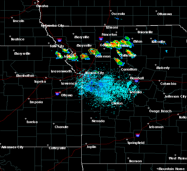 At 745 pm cdt, a severe thunderstorm was located near stewartsville, or near gower, moving southeast at 15 mph (radar indicated). Hazards include 60 mph wind gusts and quarter size hail. Hail damage to vehicles is expected. expect wind damage to roofs, siding, and trees. Locations impacted include, gower and easton. At 745 pm cdt, a severe thunderstorm was located near stewartsville, or near gower, moving southeast at 15 mph (radar indicated). Hazards include 60 mph wind gusts and quarter size hail. Hail damage to vehicles is expected. expect wind damage to roofs, siding, and trees. Locations impacted include, gower and easton.
|
| 5/14/2019 7:35 PM CDT |
 At 735 pm cdt, a severe thunderstorm was located near stewartsville, or 7 miles north of gower, moving southeast at 15 mph (radar indicated). Hazards include 60 mph wind gusts and quarter size hail. Hail damage to vehicles is expected. Expect wind damage to roofs, siding, and trees. At 735 pm cdt, a severe thunderstorm was located near stewartsville, or 7 miles north of gower, moving southeast at 15 mph (radar indicated). Hazards include 60 mph wind gusts and quarter size hail. Hail damage to vehicles is expected. Expect wind damage to roofs, siding, and trees.
|
| 6/30/2018 7:40 PM CDT |
 At 739 pm cdt, severe thunderstorms were located along a line extending from 6 miles west of amazonia to dearborn to near weatherby lake, moving east at 30 mph (radar indicated). Hazards include 60 mph wind gusts and penny size hail. Expect damage to roofs, siding, and trees. locations impacted include, st. joseph, gower, wathena, elwood, troy, agency, dearborn, rushville, lewis and clark village, doniphan, easton, de kalb, st. joseph airport, faucett, lewis and clark vi, bendena and fanning. this includes the following highways, interstate 29 between mile markers 32 and 51. Interstate 229 between mile markers 0 and 9. At 739 pm cdt, severe thunderstorms were located along a line extending from 6 miles west of amazonia to dearborn to near weatherby lake, moving east at 30 mph (radar indicated). Hazards include 60 mph wind gusts and penny size hail. Expect damage to roofs, siding, and trees. locations impacted include, st. joseph, gower, wathena, elwood, troy, agency, dearborn, rushville, lewis and clark village, doniphan, easton, de kalb, st. joseph airport, faucett, lewis and clark vi, bendena and fanning. this includes the following highways, interstate 29 between mile markers 32 and 51. Interstate 229 between mile markers 0 and 9.
|
| 6/30/2018 7:01 PM CDT |
 At 701 pm cdt, severe thunderstorms were located along a line extending from near mound city to near troy to near weston, moving east at 30 mph (radar indicated). Hazards include 60 mph wind gusts and nickel size hail. expect damage to roofs, siding, and trees At 701 pm cdt, severe thunderstorms were located along a line extending from near mound city to near troy to near weston, moving east at 30 mph (radar indicated). Hazards include 60 mph wind gusts and nickel size hail. expect damage to roofs, siding, and trees
|
| 6/11/2018 10:10 PM CDT |
 At 1009 pm cdt, severe thunderstorms were located along a line extending from near pattonsburg to near st. joseph, moving southeast at 35 mph (radar indicated). Hazards include 60 mph wind gusts and quarter size hail. Hail damage to vehicles is expected. Expect wind damage to roofs, siding, and trees. At 1009 pm cdt, severe thunderstorms were located along a line extending from near pattonsburg to near st. joseph, moving southeast at 35 mph (radar indicated). Hazards include 60 mph wind gusts and quarter size hail. Hail damage to vehicles is expected. Expect wind damage to roofs, siding, and trees.
|
| 6/11/2018 9:51 PM CDT |
 At 950 pm cdt, severe thunderstorms were located along a line extending from 6 miles north of pattonsburg to robinson, moving southeast at 30 mph (radar indicated). Hazards include 60 mph wind gusts and nickel size hail. expect damage to roofs, siding, and trees At 950 pm cdt, severe thunderstorms were located along a line extending from 6 miles north of pattonsburg to robinson, moving southeast at 30 mph (radar indicated). Hazards include 60 mph wind gusts and nickel size hail. expect damage to roofs, siding, and trees
|
| 6/2/2018 3:59 AM CDT |
 At 359 am cdt, a severe thunderstorm was located over gower, moving east at 60 mph (radar indicated). Hazards include 60 mph wind gusts and quarter size hail. Hail damage to vehicles is expected. Expect wind damage to roofs, siding, and trees. At 359 am cdt, a severe thunderstorm was located over gower, moving east at 60 mph (radar indicated). Hazards include 60 mph wind gusts and quarter size hail. Hail damage to vehicles is expected. Expect wind damage to roofs, siding, and trees.
|
| 6/2/2018 3:39 AM CDT |
 At 338 am cdt, a severe thunderstorm was located near lewis and clark village, or 7 miles northwest of weston, moving east at 55 mph (radar indicated). Hazards include 60 mph wind gusts. expect damage to roofs, siding, and trees At 338 am cdt, a severe thunderstorm was located near lewis and clark village, or 7 miles northwest of weston, moving east at 55 mph (radar indicated). Hazards include 60 mph wind gusts. expect damage to roofs, siding, and trees
|
| 5/2/2018 8:41 PM CDT |
 The severe thunderstorm warning for buchanan, worth, clinton, gentry, eastern nodaway, northern platte, eastern andrew and dekalb counties will expire at 845 pm cdt, the storms which prompted the warning have weakened below severe limits, and no longer pose an immediate threat to life or property. therefore, the warning will be allowed to expire. however gusty winds are still possible with these thunderstorms. a tornado watch remains in effect until 100 am cdt for northeastern kansas, and north central, northwestern and west central missouri. The severe thunderstorm warning for buchanan, worth, clinton, gentry, eastern nodaway, northern platte, eastern andrew and dekalb counties will expire at 845 pm cdt, the storms which prompted the warning have weakened below severe limits, and no longer pose an immediate threat to life or property. therefore, the warning will be allowed to expire. however gusty winds are still possible with these thunderstorms. a tornado watch remains in effect until 100 am cdt for northeastern kansas, and north central, northwestern and west central missouri.
|
| 5/2/2018 8:28 PM CDT |
 At 828 pm cdt, severe thunderstorms were located along a line extending from near athelstan to 7 miles northeast of stanberry to near edgerton, moving east at 45 mph (radar indicated). Hazards include 60 mph wind gusts and quarter size hail. Hail damage to vehicles is expected. expect wind damage to roofs, siding, and trees. locations impacted include, st. joseph, plattsburg, albany, weston, gower, elwood, stanberry, maysville, country club villa, country club, king city, grant city, stewartsville, agency, trimble, edgerton, dearborn, camden point, ravenwood and union star. this includes the following highways, interstate 29 between mile markers 24 and 54. interstate 229 between mile markers 0 and 6. A tornado watch remains in effect until 100 am cdt for northeastern kansas, and north central, northwestern and west central missouri. At 828 pm cdt, severe thunderstorms were located along a line extending from near athelstan to 7 miles northeast of stanberry to near edgerton, moving east at 45 mph (radar indicated). Hazards include 60 mph wind gusts and quarter size hail. Hail damage to vehicles is expected. expect wind damage to roofs, siding, and trees. locations impacted include, st. joseph, plattsburg, albany, weston, gower, elwood, stanberry, maysville, country club villa, country club, king city, grant city, stewartsville, agency, trimble, edgerton, dearborn, camden point, ravenwood and union star. this includes the following highways, interstate 29 between mile markers 24 and 54. interstate 229 between mile markers 0 and 6. A tornado watch remains in effect until 100 am cdt for northeastern kansas, and north central, northwestern and west central missouri.
|
| 5/2/2018 8:04 PM CDT |
 The national weather service in pleasant hill has issued a * severe thunderstorm warning for. east central doniphan county in northeastern kansas. buchanan county in northwestern missouri. worth county in northwestern missouri. Clinton county in northwestern missouri. The national weather service in pleasant hill has issued a * severe thunderstorm warning for. east central doniphan county in northeastern kansas. buchanan county in northwestern missouri. worth county in northwestern missouri. Clinton county in northwestern missouri.
|
| 5/2/2018 8:04 PM CDT |
 At 803 pm cdt, severe thunderstorms were located along a line extending from near maryville to 10 miles southwest of ravenwood to near weston, moving east at 45 mph. this line of storms has a history of producing winds of 60 to 70 mph (radar indicated). Hazards include 70 mph wind gusts and quarter size hail. Hail damage to vehicles is expected. expect considerable tree damage. Wind damage is also likely to mobile homes, roofs, and outbuildings. At 803 pm cdt, severe thunderstorms were located along a line extending from near maryville to 10 miles southwest of ravenwood to near weston, moving east at 45 mph. this line of storms has a history of producing winds of 60 to 70 mph (radar indicated). Hazards include 70 mph wind gusts and quarter size hail. Hail damage to vehicles is expected. expect considerable tree damage. Wind damage is also likely to mobile homes, roofs, and outbuildings.
|
| 8/21/2017 8:53 PM CDT |
 At 853 pm cdt, a severe thunderstorm was located near weston, moving east at 40 mph (radar indicated). Hazards include 60 mph wind gusts. Expect damage to roofs, siding, and trees. locations impacted include, kansas city, leavenworth, atchison, platte city, weston, gower, agency, edgerton, dearborn, camden point, ferrelview, rushville, easton, tracy, lewis and clark village, farley, de kalb, ridgely, iatan and fort leavenworth. this includes the following highways, interstate 29 between mile markers 9 and 39. Interstate 435 between mile markers 26 and 39. At 853 pm cdt, a severe thunderstorm was located near weston, moving east at 40 mph (radar indicated). Hazards include 60 mph wind gusts. Expect damage to roofs, siding, and trees. locations impacted include, kansas city, leavenworth, atchison, platte city, weston, gower, agency, edgerton, dearborn, camden point, ferrelview, rushville, easton, tracy, lewis and clark village, farley, de kalb, ridgely, iatan and fort leavenworth. this includes the following highways, interstate 29 between mile markers 9 and 39. Interstate 435 between mile markers 26 and 39.
|
| 8/21/2017 8:41 PM CDT |
 At 841 pm cdt, a severe thunderstorm was located over lewis and clark village, or near atchison, moving east at 40 mph (radar indicated). Hazards include 60 mph wind gusts and penny size hail. expect damage to roofs, siding, and trees At 841 pm cdt, a severe thunderstorm was located over lewis and clark village, or near atchison, moving east at 40 mph (radar indicated). Hazards include 60 mph wind gusts and penny size hail. expect damage to roofs, siding, and trees
|
| 6/16/2017 11:26 PM CDT |
 At 1125 pm cdt, severe thunderstorms were located along a line extending from camden point to near holt to kingston, moving southeast at 55 mph (radar indicated). Hazards include 70 mph wind gusts. Expect considerable tree damage. damage is likely to mobile homes, roofs, and outbuildings. locations impacted include, st. joseph, leavenworth, liberty, gladstone, excelsior springs, cameron, smithville, kearney, richmond, parkville, platte city, north kansas city, sugar creek, riverside, lawson, plattsburg, lathrop, hamilton, weatherby lake and weston. this includes the following highways, interstate 35 in missouri between mile markers 7 and 66. Interstate 29 between mile markers 0 and 47. At 1125 pm cdt, severe thunderstorms were located along a line extending from camden point to near holt to kingston, moving southeast at 55 mph (radar indicated). Hazards include 70 mph wind gusts. Expect considerable tree damage. damage is likely to mobile homes, roofs, and outbuildings. locations impacted include, st. joseph, leavenworth, liberty, gladstone, excelsior springs, cameron, smithville, kearney, richmond, parkville, platte city, north kansas city, sugar creek, riverside, lawson, plattsburg, lathrop, hamilton, weatherby lake and weston. this includes the following highways, interstate 35 in missouri between mile markers 7 and 66. Interstate 29 between mile markers 0 and 47.
|
| 6/16/2017 11:13 PM CDT |
 At 1112 pm cdt, severe thunderstorms were located along a line extending from near dearborn to near plattsburg to near cameron, moving southeast at 50 mph. these are very dangerous storms (radar indicated). Hazards include 80 mph wind gusts. Flying debris will be dangerous to those caught without shelter. mobile homes will be heavily damaged. expect considerable damage to roofs, windows, and vehicles. extensive tree damage and power outages are likely. locations impacted include, st. joseph, leavenworth, liberty, gladstone, excelsior springs, cameron, smithville, kearney, richmond, parkville, platte city, north kansas city, sugar creek, riverside, lawson, plattsburg, lathrop, hamilton, weatherby lake and weston. this includes the following highways, interstate 35 in missouri between mile markers 7 and 66. Interstate 29 between mile markers 0 and 58. At 1112 pm cdt, severe thunderstorms were located along a line extending from near dearborn to near plattsburg to near cameron, moving southeast at 50 mph. these are very dangerous storms (radar indicated). Hazards include 80 mph wind gusts. Flying debris will be dangerous to those caught without shelter. mobile homes will be heavily damaged. expect considerable damage to roofs, windows, and vehicles. extensive tree damage and power outages are likely. locations impacted include, st. joseph, leavenworth, liberty, gladstone, excelsior springs, cameron, smithville, kearney, richmond, parkville, platte city, north kansas city, sugar creek, riverside, lawson, plattsburg, lathrop, hamilton, weatherby lake and weston. this includes the following highways, interstate 35 in missouri between mile markers 7 and 66. Interstate 29 between mile markers 0 and 58.
|
| 6/16/2017 10:56 PM CDT |
 At 1056 pm cdt, severe thunderstorms were located along a line extending from near elwood to near clarksdale to 6 miles northeast of maysville, moving southeast at 70 mph. these are very dangerous storms (radar indicated). Hazards include 80 mph wind gusts. Flying debris will be dangerous to those caught without shelter. mobile homes will be heavily damaged. expect considerable damage to roofs, windows, and vehicles. Extensive tree damage and power outages are likely. At 1056 pm cdt, severe thunderstorms were located along a line extending from near elwood to near clarksdale to 6 miles northeast of maysville, moving southeast at 70 mph. these are very dangerous storms (radar indicated). Hazards include 80 mph wind gusts. Flying debris will be dangerous to those caught without shelter. mobile homes will be heavily damaged. expect considerable damage to roofs, windows, and vehicles. Extensive tree damage and power outages are likely.
|
| 5/18/2017 10:01 PM CDT |
 At 1001 pm cdt, severe thunderstorms were located along a line extending from lancaster to near easton to 6 miles west of lansing, moving northeast at 35 mph (radar indicated). Hazards include 60 mph wind gusts. expect damage to roofs, siding, and trees At 1001 pm cdt, severe thunderstorms were located along a line extending from lancaster to near easton to 6 miles west of lansing, moving northeast at 35 mph (radar indicated). Hazards include 60 mph wind gusts. expect damage to roofs, siding, and trees
|
| 3/6/2017 7:26 PM CST |
 At 726 pm cst, a severe thunderstorm was located over trimble, or near plattsburg, moving northeast at 45 mph (radar indicated). Hazards include 60 mph wind gusts and quarter size hail. Hail damage to vehicles is expected. Expect wind damage to roofs, siding, and trees. At 726 pm cst, a severe thunderstorm was located over trimble, or near plattsburg, moving northeast at 45 mph (radar indicated). Hazards include 60 mph wind gusts and quarter size hail. Hail damage to vehicles is expected. Expect wind damage to roofs, siding, and trees.
|
| 10/5/2016 11:45 PM CDT |
 At 1145 pm cdt, a severe thunderstorm was located near dearborn, or 9 miles southwest of gower, moving northeast at 35 mph (radar indicated). Hazards include 60 mph wind gusts and quarter size hail. Hail damage to vehicles is expected. Expect wind damage to roofs, siding, and trees. At 1145 pm cdt, a severe thunderstorm was located near dearborn, or 9 miles southwest of gower, moving northeast at 35 mph (radar indicated). Hazards include 60 mph wind gusts and quarter size hail. Hail damage to vehicles is expected. Expect wind damage to roofs, siding, and trees.
|
| 10/4/2016 10:41 PM CDT |
 The severe thunderstorm warning for southwestern clinton, northeastern platte, northwestern clay and southeastern buchanan counties will expire at 1045 pm cdt, the storm which prompted the warning has weakened below severe limits, and no longer pose an immediate threat to life or property. therefore, the warning will be allowed to expire. however gusty winds and heavy rain are still possible with this thunderstorm. The severe thunderstorm warning for southwestern clinton, northeastern platte, northwestern clay and southeastern buchanan counties will expire at 1045 pm cdt, the storm which prompted the warning has weakened below severe limits, and no longer pose an immediate threat to life or property. therefore, the warning will be allowed to expire. however gusty winds and heavy rain are still possible with this thunderstorm.
|
| 10/4/2016 10:32 PM CDT |
 At 1031 pm cdt, a severe thunderstorm was located over camden point, or near platte city, moving east at 45 mph (radar indicated). Hazards include 60 mph wind gusts. Expect damage to roofs. siding. and trees. locations impacted include, smithville, gower, agency, trimble, edgerton, dearborn, camden point, tracy, ridgely and faucett. This includes interstate 29 between mile markers 21 and 38. At 1031 pm cdt, a severe thunderstorm was located over camden point, or near platte city, moving east at 45 mph (radar indicated). Hazards include 60 mph wind gusts. Expect damage to roofs. siding. and trees. locations impacted include, smithville, gower, agency, trimble, edgerton, dearborn, camden point, tracy, ridgely and faucett. This includes interstate 29 between mile markers 21 and 38.
|
| 10/4/2016 10:18 PM CDT |
 At 1018 pm cdt, a severe thunderstorm was located near weston, moving northeast at 55 mph (radar indicated). Hazards include 60 mph wind gusts. Expect damage to roofs. siding. And trees. At 1018 pm cdt, a severe thunderstorm was located near weston, moving northeast at 55 mph (radar indicated). Hazards include 60 mph wind gusts. Expect damage to roofs. siding. And trees.
|
| 8/26/2016 6:32 PM CDT |
 At 632 pm cdt, a severe thunderstorm capable of producing a tornado was located over camden point, or near platte city, moving east at 15 mph (radar indicated rotation). Hazards include tornado. Flying debris will be dangerous to those caught without shelter. mobile homes will be damaged or destroyed. damage to roofs, windows, and vehicles will occur. tree damage is likely. Locations impacted include, smithville, gower, trimble, edgerton, camden point and ridgely. At 632 pm cdt, a severe thunderstorm capable of producing a tornado was located over camden point, or near platte city, moving east at 15 mph (radar indicated rotation). Hazards include tornado. Flying debris will be dangerous to those caught without shelter. mobile homes will be damaged or destroyed. damage to roofs, windows, and vehicles will occur. tree damage is likely. Locations impacted include, smithville, gower, trimble, edgerton, camden point and ridgely.
|
| 8/26/2016 6:18 PM CDT |
 At 618 pm cdt, a severe thunderstorm capable of producing a tornado was located over camden point, or near platte city, moving northeast at 25 mph (radar indicated rotation). Hazards include tornado. Flying debris will be dangerous to those caught without shelter. mobile homes will be damaged or destroyed. damage to roofs, windows, and vehicles will occur. Tree damage is likely. At 618 pm cdt, a severe thunderstorm capable of producing a tornado was located over camden point, or near platte city, moving northeast at 25 mph (radar indicated rotation). Hazards include tornado. Flying debris will be dangerous to those caught without shelter. mobile homes will be damaged or destroyed. damage to roofs, windows, and vehicles will occur. Tree damage is likely.
|
| 7/13/2016 10:41 AM CDT |
 At 1040 am cdt, severe thunderstorms were located along a line extending from near st. joseph to near ferrelview to near spring hill, moving east at 40 mph (radar indicated). Hazards include 70 mph wind gusts and nickel size hail. Expect considerable tree damage. Damage is likely to mobile homes, roofs, and outbuildings. At 1040 am cdt, severe thunderstorms were located along a line extending from near st. joseph to near ferrelview to near spring hill, moving east at 40 mph (radar indicated). Hazards include 70 mph wind gusts and nickel size hail. Expect considerable tree damage. Damage is likely to mobile homes, roofs, and outbuildings.
|
| 7/12/2016 4:51 AM CDT |
 At 451 am cdt, severe thunderstorms were located along a line extending from near troy to easton, moving east at 50 mph (radar indicated). Hazards include 60 mph wind gusts. Expect damage to roofs. siding. And trees. At 451 am cdt, severe thunderstorms were located along a line extending from near troy to easton, moving east at 50 mph (radar indicated). Hazards include 60 mph wind gusts. Expect damage to roofs. siding. And trees.
|
| 6/20/2016 6:35 PM CDT |
 At 635 pm cdt, a severe thunderstorm was located near stewartsville, or 7 miles north of plattsburg, moving southeast at 30 mph (radar indicated). Hazards include 60 mph wind gusts and quarter size hail. Hail damage to vehicles is expected. Expect wind damage to roofs, siding, and trees. At 635 pm cdt, a severe thunderstorm was located near stewartsville, or 7 miles north of plattsburg, moving southeast at 30 mph (radar indicated). Hazards include 60 mph wind gusts and quarter size hail. Hail damage to vehicles is expected. Expect wind damage to roofs, siding, and trees.
|
| 5/26/2016 3:45 PM CDT |
 At 345 pm cdt, a severe thunderstorm was located near agency, or near gower, moving northeast at 30 mph (radar indicated). Hazards include two inch hail and 70 mph wind gusts. People and animals outdoors will be injured. expect hail damage to roofs, siding, windows, and vehicles. expect considerable tree damage. Wind damage is also likely to mobile homes, roofs, and outbuildings. At 345 pm cdt, a severe thunderstorm was located near agency, or near gower, moving northeast at 30 mph (radar indicated). Hazards include two inch hail and 70 mph wind gusts. People and animals outdoors will be injured. expect hail damage to roofs, siding, windows, and vehicles. expect considerable tree damage. Wind damage is also likely to mobile homes, roofs, and outbuildings.
|
| 5/26/2016 2:56 PM CDT |
 At 256 pm cdt, a severe thunderstorm was located over gower, moving northeast at 40 mph (radar indicated). Hazards include two inch hail and 60 mph wind gusts. People and animals outdoors will be injured. expect hail damage to roofs, siding, windows, and vehicles. Expect wind damage to roofs, siding, and trees. At 256 pm cdt, a severe thunderstorm was located over gower, moving northeast at 40 mph (radar indicated). Hazards include two inch hail and 60 mph wind gusts. People and animals outdoors will be injured. expect hail damage to roofs, siding, windows, and vehicles. Expect wind damage to roofs, siding, and trees.
|
| 5/26/2016 2:49 PM CDT |
 At 249 pm cdt, a severe thunderstorm was located over agency, or 9 miles southeast of elwood, moving northeast at 50 mph (radar indicated). Hazards include two inch hail and 60 mph wind gusts. People and animals outdoors will be injured. expect hail damage to roofs, siding, windows, and vehicles. expect wind damage to roofs, siding, and trees. locations impacted include, gower, agency, dearborn, rushville, lewis and clark village, de kalb, lewis and clark vi and faucett. this includes interstate 29 between mile markers 25 and 40. A tornado watch remains in effect until 1000 pm cdt for northeastern kansas, and northwestern missouri. At 249 pm cdt, a severe thunderstorm was located over agency, or 9 miles southeast of elwood, moving northeast at 50 mph (radar indicated). Hazards include two inch hail and 60 mph wind gusts. People and animals outdoors will be injured. expect hail damage to roofs, siding, windows, and vehicles. expect wind damage to roofs, siding, and trees. locations impacted include, gower, agency, dearborn, rushville, lewis and clark village, de kalb, lewis and clark vi and faucett. this includes interstate 29 between mile markers 25 and 40. A tornado watch remains in effect until 1000 pm cdt for northeastern kansas, and northwestern missouri.
|
| 5/26/2016 2:40 PM CDT |
 At 240 pm cdt, a severe thunderstorm was located near dearborn, or 10 miles north of weston, moving northeast at 50 mph (radar indicated). Hazards include two inch hail and 60 mph wind gusts. People and animals outdoors will be injured. expect hail damage to roofs, siding, windows, and vehicles. expect wind damage to roofs, siding, and trees. locations impacted include, atchison, weston, gower, agency, dearborn, rushville, lewis and clark village, doniphan, de kalb, iatan, faucett, lewis and clark vi, potter and bean lake. this includes interstate 29 between mile markers 26 and 40. A tornado watch remains in effect until 1000 pm cdt for northeastern kansas, and northwestern missouri. At 240 pm cdt, a severe thunderstorm was located near dearborn, or 10 miles north of weston, moving northeast at 50 mph (radar indicated). Hazards include two inch hail and 60 mph wind gusts. People and animals outdoors will be injured. expect hail damage to roofs, siding, windows, and vehicles. expect wind damage to roofs, siding, and trees. locations impacted include, atchison, weston, gower, agency, dearborn, rushville, lewis and clark village, doniphan, de kalb, iatan, faucett, lewis and clark vi, potter and bean lake. this includes interstate 29 between mile markers 26 and 40. A tornado watch remains in effect until 1000 pm cdt for northeastern kansas, and northwestern missouri.
|
| 5/26/2016 2:27 PM CDT |
 At 227 pm cdt, a severe thunderstorm was located near lewis and clark village, or 7 miles west of weston, moving northeast at 50 mph (radar indicated). Hazards include two inch hail and 60 mph wind gusts. People and animals outdoors will be injured. expect hail damage to roofs, siding, windows, and vehicles. Expect wind damage to roofs, siding, and trees. At 227 pm cdt, a severe thunderstorm was located near lewis and clark village, or 7 miles west of weston, moving northeast at 50 mph (radar indicated). Hazards include two inch hail and 60 mph wind gusts. People and animals outdoors will be injured. expect hail damage to roofs, siding, windows, and vehicles. Expect wind damage to roofs, siding, and trees.
|
| 4/27/2016 4:09 PM CDT |
 At 409 pm cdt, a severe thunderstorm was located over edgerton, or near gower, moving northeast at 25 mph (radar indicated). Hazards include half dollar size hail. damage to vehicles is expected At 409 pm cdt, a severe thunderstorm was located over edgerton, or near gower, moving northeast at 25 mph (radar indicated). Hazards include half dollar size hail. damage to vehicles is expected
|
| 4/26/2016 8:37 AM CDT |
 At 837 am cdt, severe thunderstorms were located along a line extending from near clarksdale to near smithville, moving east at 60 mph (trained weather spotters). Hazards include 70 mph wind gusts and ping pong ball size hail. People and animals outdoors will be injured. expect hail damage to roofs, siding, windows, and vehicles. expect considerable tree damage. wind damage is also likely to mobile homes, roofs, and outbuildings. locations impacted include, kansas city, independence, liberty, gladstone, cameron, smithville, kearney, parkville, north kansas city, sugar creek, riverside, plattsburg, lathrop, weatherby lake, gower, claycomo, courtney, pleasant valley, lake waukomis and trimble. this includes the following highways, interstate 35 in missouri between mile markers 7 and 53. interstate 29 between mile markers 0 and 13. interstate 635 between mile markers 10 and 12. Interstate 435 between mile markers 35 and 57. At 837 am cdt, severe thunderstorms were located along a line extending from near clarksdale to near smithville, moving east at 60 mph (trained weather spotters). Hazards include 70 mph wind gusts and ping pong ball size hail. People and animals outdoors will be injured. expect hail damage to roofs, siding, windows, and vehicles. expect considerable tree damage. wind damage is also likely to mobile homes, roofs, and outbuildings. locations impacted include, kansas city, independence, liberty, gladstone, cameron, smithville, kearney, parkville, north kansas city, sugar creek, riverside, plattsburg, lathrop, weatherby lake, gower, claycomo, courtney, pleasant valley, lake waukomis and trimble. this includes the following highways, interstate 35 in missouri between mile markers 7 and 53. interstate 29 between mile markers 0 and 13. interstate 635 between mile markers 10 and 12. Interstate 435 between mile markers 35 and 57.
|
| 4/26/2016 8:34 AM CDT |
 At 834 am cdt, severe thunderstorms were located along a line extending from near clarksdale to near smithville, moving east at 60 mph (trained weather spotters). Hazards include 70 mph wind gusts and ping pong ball size hail. People and animals outdoors will be injured. expect hail damage to roofs, siding, windows, and vehicles. expect considerable tree damage. wind damage is also likely to mobile homes, roofs, and outbuildings. locations impacted include, kansas city, independence, liberty, gladstone, cameron, smithville, kearney, parkville, north kansas city, sugar creek, riverside, plattsburg, lathrop, weatherby lake, gower, claycomo, maysville, courtney, pleasant valley and lake waukomis. this includes the following highways, interstate 35 in missouri between mile markers 7 and 67. interstate 29 between mile markers 0 and 13. interstate 635 between mile markers 10 and 12. Interstate 435 between mile markers 35 and 56. At 834 am cdt, severe thunderstorms were located along a line extending from near clarksdale to near smithville, moving east at 60 mph (trained weather spotters). Hazards include 70 mph wind gusts and ping pong ball size hail. People and animals outdoors will be injured. expect hail damage to roofs, siding, windows, and vehicles. expect considerable tree damage. wind damage is also likely to mobile homes, roofs, and outbuildings. locations impacted include, kansas city, independence, liberty, gladstone, cameron, smithville, kearney, parkville, north kansas city, sugar creek, riverside, plattsburg, lathrop, weatherby lake, gower, claycomo, maysville, courtney, pleasant valley and lake waukomis. this includes the following highways, interstate 35 in missouri between mile markers 7 and 67. interstate 29 between mile markers 0 and 13. interstate 635 between mile markers 10 and 12. Interstate 435 between mile markers 35 and 56.
|
| 4/26/2016 8:28 AM CDT |
 At 828 am cdt, severe thunderstorms were located along a line extending from near king city to ferrelview, moving east at 60 mph (trained weather spotters). Hazards include 70 mph wind gusts and ping pong ball size hail. People and animals outdoors will be injured. expect hail damage to roofs, siding, windows, and vehicles. expect considerable tree damage. wind damage is also likely to mobile homes, roofs, and outbuildings. locations impacted include, kansas city, independence, st. joseph, leavenworth, liberty, gladstone, lansing, cameron, smithville, kearney, parkville, savannah, platte city, north kansas city, sugar creek, riverside, plattsburg, lathrop, weatherby lake and weston. this includes the following highways, interstate 35 in missouri between mile markers 6 and 67. interstate 29 between mile markers 0 and 58. interstate 635 between mile markers 10 and 12. interstate 435 between mile markers 20 and 57. Interstate 229 between mile markers 0 and 14. At 828 am cdt, severe thunderstorms were located along a line extending from near king city to ferrelview, moving east at 60 mph (trained weather spotters). Hazards include 70 mph wind gusts and ping pong ball size hail. People and animals outdoors will be injured. expect hail damage to roofs, siding, windows, and vehicles. expect considerable tree damage. wind damage is also likely to mobile homes, roofs, and outbuildings. locations impacted include, kansas city, independence, st. joseph, leavenworth, liberty, gladstone, lansing, cameron, smithville, kearney, parkville, savannah, platte city, north kansas city, sugar creek, riverside, plattsburg, lathrop, weatherby lake and weston. this includes the following highways, interstate 35 in missouri between mile markers 6 and 67. interstate 29 between mile markers 0 and 58. interstate 635 between mile markers 10 and 12. interstate 435 between mile markers 20 and 57. Interstate 229 between mile markers 0 and 14.
|
| 4/26/2016 8:17 AM CDT |
 At 816 am cdt, severe thunderstorms were located along a line extending from near union star to near leavenworth, moving east at 55 mph (trained weather spotters). Hazards include 70 mph wind gusts and ping pong ball size hail. People and animals outdoors will be injured. expect hail damage to roofs, siding, windows, and vehicles. expect considerable tree damage. wind damage is also likely to mobile homes, roofs, and outbuildings. locations impacted include, kansas city, independence, st. joseph, leavenworth, liberty, gladstone, lansing, cameron, smithville, kearney, parkville, savannah, platte city, north kansas city, sugar creek, riverside, plattsburg, lathrop, weatherby lake and weston. this includes the following highways, interstate 35 in missouri between mile markers 6 and 67. interstate 29 between mile markers 0 and 59. interstate 635 between mile markers 10 and 12. interstate 435 between mile markers 20 and 57. Interstate 229 between mile markers 0 and 14. At 816 am cdt, severe thunderstorms were located along a line extending from near union star to near leavenworth, moving east at 55 mph (trained weather spotters). Hazards include 70 mph wind gusts and ping pong ball size hail. People and animals outdoors will be injured. expect hail damage to roofs, siding, windows, and vehicles. expect considerable tree damage. wind damage is also likely to mobile homes, roofs, and outbuildings. locations impacted include, kansas city, independence, st. joseph, leavenworth, liberty, gladstone, lansing, cameron, smithville, kearney, parkville, savannah, platte city, north kansas city, sugar creek, riverside, plattsburg, lathrop, weatherby lake and weston. this includes the following highways, interstate 35 in missouri between mile markers 6 and 67. interstate 29 between mile markers 0 and 59. interstate 635 between mile markers 10 and 12. interstate 435 between mile markers 20 and 57. Interstate 229 between mile markers 0 and 14.
|
| 4/26/2016 8:06 AM CDT |
 At 806 am cdt, severe thunderstorms were located along a line extending from near savannah to near leavenworth, moving east at 55 mph (trained weather spotters). Hazards include 70 mph wind gusts and ping pong ball size hail. People and animals outdoors will be injured. expect hail damage to roofs, siding, windows, and vehicles. expect considerable tree damage. wind damage is also likely to mobile homes, roofs, and outbuildings. locations impacted include, kansas city, independence, st. joseph, leavenworth, liberty, gladstone, lansing, atchison, cameron, smithville, kearney, parkville, savannah, platte city, north kansas city, sugar creek, riverside, plattsburg, lathrop and weatherby lake. this includes the following highways, interstate 35 in missouri between mile markers 6 and 67. interstate 29 between mile markers 0 and 67. interstate 635 between mile markers 10 and 12. interstate 435 between mile markers 20 and 57. Interstate 229 between mile markers 0 and 14. At 806 am cdt, severe thunderstorms were located along a line extending from near savannah to near leavenworth, moving east at 55 mph (trained weather spotters). Hazards include 70 mph wind gusts and ping pong ball size hail. People and animals outdoors will be injured. expect hail damage to roofs, siding, windows, and vehicles. expect considerable tree damage. wind damage is also likely to mobile homes, roofs, and outbuildings. locations impacted include, kansas city, independence, st. joseph, leavenworth, liberty, gladstone, lansing, atchison, cameron, smithville, kearney, parkville, savannah, platte city, north kansas city, sugar creek, riverside, plattsburg, lathrop and weatherby lake. this includes the following highways, interstate 35 in missouri between mile markers 6 and 67. interstate 29 between mile markers 0 and 67. interstate 635 between mile markers 10 and 12. interstate 435 between mile markers 20 and 57. Interstate 229 between mile markers 0 and 14.
|
| 4/26/2016 7:51 AM CDT |
 At 750 am cdt, severe thunderstorms were located along a line extending from near fillmore to near easton, moving east at 65 mph (radar indicated). Hazards include golf ball size hail and 70 mph wind gusts. People and animals outdoors will be injured. expect hail damage to roofs, siding, windows, and vehicles. expect considerable tree damage. Wind damage is also likely to mobile homes, roofs, and outbuildings. At 750 am cdt, severe thunderstorms were located along a line extending from near fillmore to near easton, moving east at 65 mph (radar indicated). Hazards include golf ball size hail and 70 mph wind gusts. People and animals outdoors will be injured. expect hail damage to roofs, siding, windows, and vehicles. expect considerable tree damage. Wind damage is also likely to mobile homes, roofs, and outbuildings.
|
| 3/23/2016 6:51 PM CDT |
 At 651 pm cdt, a severe thunderstorm was located over camden point, or 7 miles northeast of platte city, moving northeast at 35 mph (radar indicated). Hazards include 60 mph wind gusts and quarter size hail. Hail damage to vehicles is expected. Expect wind damage to roofs, siding, and trees. At 651 pm cdt, a severe thunderstorm was located over camden point, or 7 miles northeast of platte city, moving northeast at 35 mph (radar indicated). Hazards include 60 mph wind gusts and quarter size hail. Hail damage to vehicles is expected. Expect wind damage to roofs, siding, and trees.
|
| 7/24/2015 7:34 AM CDT |
 At 733 am cdt, a severe thunderstorm was located over lewis and clark village, or near atchison, moving east at 40 mph (radar indicated). Hazards include 60 mph wind gusts. Expect damage to roofs. Siding and trees. At 733 am cdt, a severe thunderstorm was located over lewis and clark village, or near atchison, moving east at 40 mph (radar indicated). Hazards include 60 mph wind gusts. Expect damage to roofs. Siding and trees.
|
| 7/6/2015 3:52 PM CDT |
 At 351 pm cdt, a severe thunderstorm was located near dearborn, moving east at 15 mph (radar indicated). Hazards include 60 mph wind gusts and penny size hail. Expect damage to roofs. Siding and trees. At 351 pm cdt, a severe thunderstorm was located near dearborn, moving east at 15 mph (radar indicated). Hazards include 60 mph wind gusts and penny size hail. Expect damage to roofs. Siding and trees.
|
| 7/6/2015 3:27 PM CDT |
 At 326 pm cdt, a severe thunderstorm was located 7 miles northeast of agency, moving east at 25 mph (trained weather spotters). Hazards include 60 mph wind gusts and penny size hail. Expect damage to roofs. siding and trees. locations impacted include, st. Joseph, gower, country club villa, country club, stewartsville, agency and clarksdale. At 326 pm cdt, a severe thunderstorm was located 7 miles northeast of agency, moving east at 25 mph (trained weather spotters). Hazards include 60 mph wind gusts and penny size hail. Expect damage to roofs. siding and trees. locations impacted include, st. Joseph, gower, country club villa, country club, stewartsville, agency and clarksdale.
|
| 7/6/2015 2:55 PM CDT |
 At 254 pm cdt, a severe thunderstorm was located near country club villa, moving east at 20 mph (radar indicated). Hazards include 60 mph wind gusts and penny size hail. Expect damage to roofs. Siding and trees. At 254 pm cdt, a severe thunderstorm was located near country club villa, moving east at 20 mph (radar indicated). Hazards include 60 mph wind gusts and penny size hail. Expect damage to roofs. Siding and trees.
|
| 6/21/2015 3:09 PM CDT |
 The severe thunderstorm warning for southwestern dekalb and western clinton counties is being reissued, please refer to that bulletin for the latest severe weather information. additional strong thunderstorms are still possible, and a severe thunderstorm watch remains in effect until 5 pm cdt. to report severe weather, contact your nearest law enforcement agency. they will relay your report to the national weather service in pleasant hill. The severe thunderstorm warning for southwestern dekalb and western clinton counties is being reissued, please refer to that bulletin for the latest severe weather information. additional strong thunderstorms are still possible, and a severe thunderstorm watch remains in effect until 5 pm cdt. to report severe weather, contact your nearest law enforcement agency. they will relay your report to the national weather service in pleasant hill.
|
| 6/21/2015 3:04 PM CDT |
 At 239 pm, the public reported quarter size hail just outside of st. joseph. at 301 pm cdt, a severe thunderstorm was located 7 miles southeast of stewartsville, and moving east at 30 mph (radar indicated). Hazards include 60 mph wind gusts and quarter size hail. Hail damage to vehicles is expected. expect wind damage to roofs, siding and trees. Locations impacted include, osborn. At 239 pm, the public reported quarter size hail just outside of st. joseph. at 301 pm cdt, a severe thunderstorm was located 7 miles southeast of stewartsville, and moving east at 30 mph (radar indicated). Hazards include 60 mph wind gusts and quarter size hail. Hail damage to vehicles is expected. expect wind damage to roofs, siding and trees. Locations impacted include, osborn.
|
| 6/21/2015 2:38 PM CDT |
 At 233 pm cdt, a severe thunderstorm was located 7 miles northeast of agency, and moving east at 30 mph (radar indicated). Hazards include 60 mph wind gusts and quarter size hail. Hail damage to vehicles is expected. Expect wind damage to roofs, siding and trees. At 233 pm cdt, a severe thunderstorm was located 7 miles northeast of agency, and moving east at 30 mph (radar indicated). Hazards include 60 mph wind gusts and quarter size hail. Hail damage to vehicles is expected. Expect wind damage to roofs, siding and trees.
|
| 6/21/2015 12:54 PM CDT |
 At 1251 pm cdt, a severe thunderstorm was located near dearborn, and moving east at 30 mph. this is a very dangerous storm (law enforcement. at 1245 pm...fire and rescue crews reported softball size hail in de kalb. at 1245 pm, fire and rescue crews reported a e60.00 mph wind gust in de kalb). Hazards include baseball size hail and 60 mph wind gusts. People and animals outdoors will be severely injured. expect shattered windows, extensive damage to roofs, siding and vehicles. locations impacted include, gower, smithville, plattsburg, dearborn, camden point, edgerton, trimble and ridgely. This will impact i-29 between mile markers 26 and 39. At 1251 pm cdt, a severe thunderstorm was located near dearborn, and moving east at 30 mph. this is a very dangerous storm (law enforcement. at 1245 pm...fire and rescue crews reported softball size hail in de kalb. at 1245 pm, fire and rescue crews reported a e60.00 mph wind gust in de kalb). Hazards include baseball size hail and 60 mph wind gusts. People and animals outdoors will be severely injured. expect shattered windows, extensive damage to roofs, siding and vehicles. locations impacted include, gower, smithville, plattsburg, dearborn, camden point, edgerton, trimble and ridgely. This will impact i-29 between mile markers 26 and 39.
|
| 6/21/2015 12:40 PM CDT |
 At 1237 pm cdt, a severe thunderstorm was located 6 miles east of rushville, and moving east-southeast 30 mph (radar indicated). Hazards include golf ball size hail and 60 mph wind gusts. People and animals outdoors will be injured. expect hail damage to roofs, siding, windows and vehicles. Expect wind damage to roofs, siding and trees. At 1237 pm cdt, a severe thunderstorm was located 6 miles east of rushville, and moving east-southeast 30 mph (radar indicated). Hazards include golf ball size hail and 60 mph wind gusts. People and animals outdoors will be injured. expect hail damage to roofs, siding, windows and vehicles. Expect wind damage to roofs, siding and trees.
|
| 6/11/2015 9:27 PM CDT | The severe thunderstorm warning for south central dekalb and clinton counties has been reissued and continued east into caldwell and daviess counties, please refer to that bulletin for the latest severe weather information. |
| 6/11/2015 9:07 PM CDT |
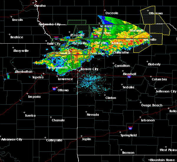 At 906 pm cdt, severe thunderstorms were located along a line extending from osborn to lathrop to 5 miles south of plattsburg, and moving east at 50 mph (radar indicated). Hazards include 60 mph wind gusts and penny size hail. Expect damage to roofs. siding and trees. locations impacted include, lathrop, cameron, osborn and turney. This will impact i-35 between mile markers 37 and 52. At 906 pm cdt, severe thunderstorms were located along a line extending from osborn to lathrop to 5 miles south of plattsburg, and moving east at 50 mph (radar indicated). Hazards include 60 mph wind gusts and penny size hail. Expect damage to roofs. siding and trees. locations impacted include, lathrop, cameron, osborn and turney. This will impact i-35 between mile markers 37 and 52.
|
| 6/11/2015 8:57 PM CDT | Storm damage reported in clinton county MO, 0.4 miles NW of Gower, MO |
| 6/11/2015 8:49 PM CDT |
 At 848 pm cdt, severe thunderstorms were located along a line extending from agency to camden point, and moving east at 40 mph (radar indicated). Hazards include 70 mph wind gusts and nickel size hail. Expect considerable tree damage. Damage is likely to mobile homes, roofs and outbuildings. At 848 pm cdt, severe thunderstorms were located along a line extending from agency to camden point, and moving east at 40 mph (radar indicated). Hazards include 70 mph wind gusts and nickel size hail. Expect considerable tree damage. Damage is likely to mobile homes, roofs and outbuildings.
|
| 1/1/0001 12:00 AM | Quarter sized hail reported 0.4 miles NW of Gower, MO, penny to quarter sized hail fell at 132. penny size hail still falling. |
Hail Maps for Gower, MO


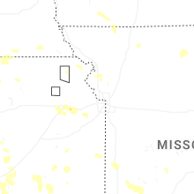


Connect with Interactive Hail Maps