

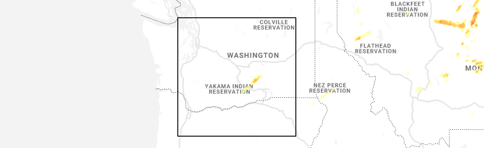
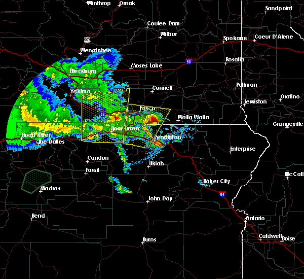
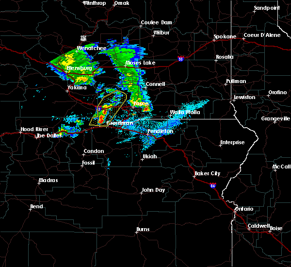
Hail Map for Grandview, WA
The Grandview, WA area has had 0 reports of on-the-ground hail by trained spotters, and has been under severe weather warnings 0 times during the past 12 months. Doppler radar has detected hail at or near Grandview, WA on 3 occasions.
| Name: | Grandview, WA |
| Where Located: | 37.5 miles SE of Yakima, WA |
| Map: | Google Map for Grandview, WA |
| Population: | 10862 |
| Housing Units: | 3136 |
| More Info: | Search Google for Grandview, WA |
1
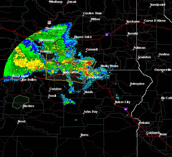
The Top Recent Hail Date for Grandview, WA is Wednesday, July 6, 2022 (2nd out of 3)
Hail and Wind Damage Spotted near Grandview, WA
| Date / Time | Report Details |
|---|---|
| 7/6/2022 11:57 PM PDT |
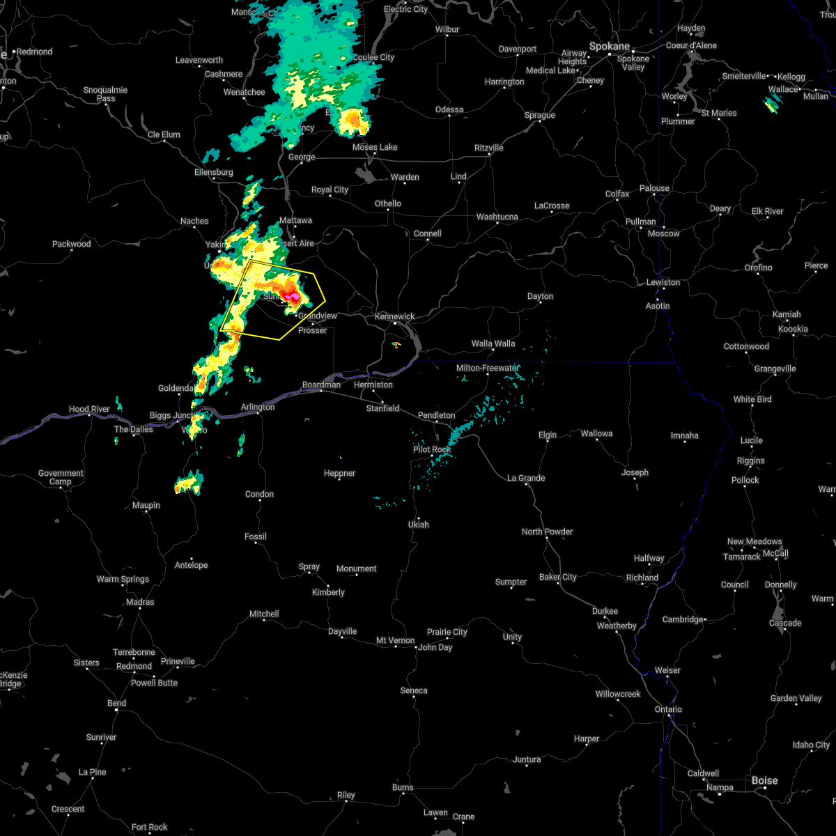 At 1156 pm pdt, a severe thunderstorm was located 11 miles northeast of sunnyside, moving northeast at 30 mph (radar indicated). Hazards include 60 mph wind gusts and quarter size hail. Hail damage to vehicles is expected. expect wind damage to roofs, siding, and trees. locations impacted include, sunnyside, grandview, toppenish, granger, zillah, mabton, satus and buena. hail threat, radar indicated max hail size, 1. 00 in wind threat, radar indicated max wind gust, 60 mph. At 1156 pm pdt, a severe thunderstorm was located 11 miles northeast of sunnyside, moving northeast at 30 mph (radar indicated). Hazards include 60 mph wind gusts and quarter size hail. Hail damage to vehicles is expected. expect wind damage to roofs, siding, and trees. locations impacted include, sunnyside, grandview, toppenish, granger, zillah, mabton, satus and buena. hail threat, radar indicated max hail size, 1. 00 in wind threat, radar indicated max wind gust, 60 mph.
|
| 7/6/2022 11:43 PM PDT |
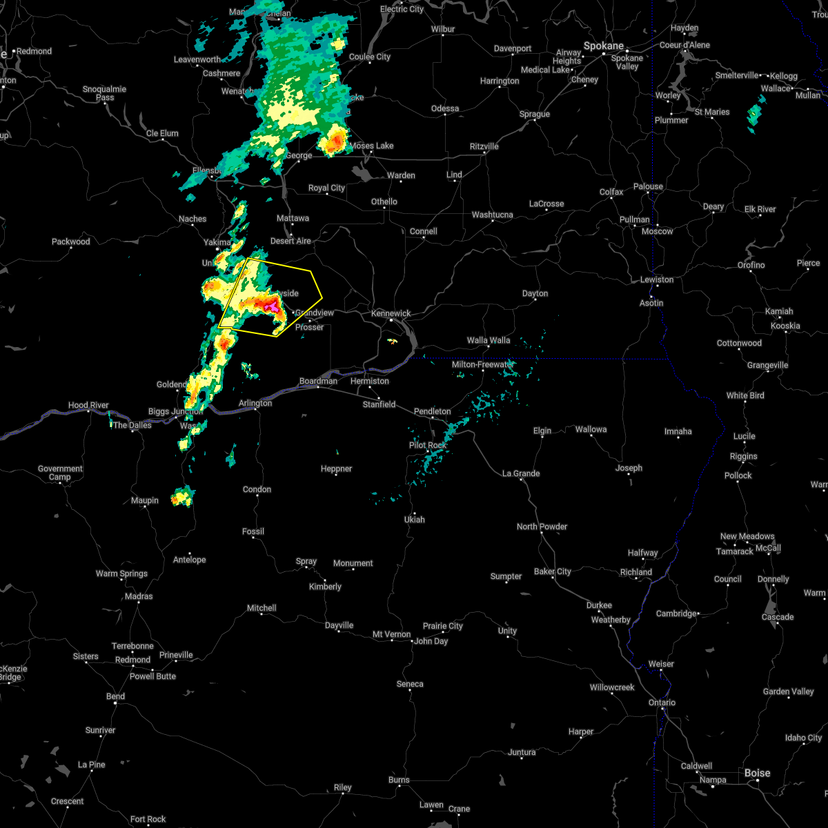 At 1143 pm pdt, a severe thunderstorm was located 7 miles northeast of sunnyside, moving northeast at 50 mph (radar indicated). Hazards include 60 mph wind gusts and quarter size hail. Hail damage to vehicles is expected. Expect wind damage to roofs, siding, and trees. At 1143 pm pdt, a severe thunderstorm was located 7 miles northeast of sunnyside, moving northeast at 50 mph (radar indicated). Hazards include 60 mph wind gusts and quarter size hail. Hail damage to vehicles is expected. Expect wind damage to roofs, siding, and trees.
|
| 5/30/2020 5:05 PM PDT |
 At 503 pm pdt, an area of strong to severe thunderstorms were located along a line extending from yakama reservation to 6 miles northwest of benton city, moving north at 50 to 60 mph (radar indicated). Hazards include 60 mph wind gusts and small hail. in addition, significant blowing dust may occur near freshly plowed fields, resulting in rapidly decreasing visibilities. Expect damage to roofs, siding, and trees. Locations impacted include, richland, sunnyside, prosser, grandview, toppenish, granger, benton city, zillah, mabton, hanford reservation and satus. At 503 pm pdt, an area of strong to severe thunderstorms were located along a line extending from yakama reservation to 6 miles northwest of benton city, moving north at 50 to 60 mph (radar indicated). Hazards include 60 mph wind gusts and small hail. in addition, significant blowing dust may occur near freshly plowed fields, resulting in rapidly decreasing visibilities. Expect damage to roofs, siding, and trees. Locations impacted include, richland, sunnyside, prosser, grandview, toppenish, granger, benton city, zillah, mabton, hanford reservation and satus.
|
| 5/30/2020 4:45 PM PDT |
 At 443 pm pdt, an area of severe thunderstorms were located along a line extending from near roosevelt to 11 miles north of paterson, moving north at 45 to 55 mph (radar indicated and spotter verified with several reports of winds in excess of 60 mph and significant blowing dust). Hazards include 70 mph wind gusts and quarter size hail, as well as blowing dust leading to near zero visibilities. Hail damage to vehicles is expected. expect considerable tree damage. Wind damage is also likely to mobile homes, roofs, and outbuildings. At 443 pm pdt, an area of severe thunderstorms were located along a line extending from near roosevelt to 11 miles north of paterson, moving north at 45 to 55 mph (radar indicated and spotter verified with several reports of winds in excess of 60 mph and significant blowing dust). Hazards include 70 mph wind gusts and quarter size hail, as well as blowing dust leading to near zero visibilities. Hail damage to vehicles is expected. expect considerable tree damage. Wind damage is also likely to mobile homes, roofs, and outbuildings.
|
| 5/4/2017 9:15 PM PDT |
 At 914 pm pdt, doppler radar indicated a severe thunderstorm capable of producing quarter size hail and damaging winds in excess of 60 mph. this storm was located 8 miles northwest of benton city, or 10 miles northeast of prosser, moving northeast at 35 mph. locations impacted include, richland, prosser, west richland, grandview, benton city and hanford reservation. At 914 pm pdt, doppler radar indicated a severe thunderstorm capable of producing quarter size hail and damaging winds in excess of 60 mph. this storm was located 8 miles northwest of benton city, or 10 miles northeast of prosser, moving northeast at 35 mph. locations impacted include, richland, prosser, west richland, grandview, benton city and hanford reservation.
|
| 5/4/2017 8:54 PM PDT |
 At 854 pm pdt, doppler radar indicated a severe thunderstorm capable of producing quarter size hail and damaging winds in excess of 60 mph. this storm was located over prosser, and moving northeast at 35 mph. At 854 pm pdt, doppler radar indicated a severe thunderstorm capable of producing quarter size hail and damaging winds in excess of 60 mph. this storm was located over prosser, and moving northeast at 35 mph.
|
| 6/28/2015 10:32 PM PDT |
 At 1030 pm pdt, doppler radar indicated a severe thunderstorm capable of producing damaging winds in excess of 60 mph. this storm was located along a line from southern benton county to southern walla walla county, moving north at 45 mph. locations impacted include, kennewick, pasco, richland, walla walla, hermiston, pendleton, sunnyside, prosser, boardman, dayton, meacham, west richland, grandview, college place, milton-freewater, umatilla, benton city, mabton, stanfield and irrigon. At 1030 pm pdt, doppler radar indicated a severe thunderstorm capable of producing damaging winds in excess of 60 mph. this storm was located along a line from southern benton county to southern walla walla county, moving north at 45 mph. locations impacted include, kennewick, pasco, richland, walla walla, hermiston, pendleton, sunnyside, prosser, boardman, dayton, meacham, west richland, grandview, college place, milton-freewater, umatilla, benton city, mabton, stanfield and irrigon.
|
| 6/28/2015 9:51 PM PDT |
 At 949 pm pdt, doppler radar indicated a severe thunderstorm capable of producing damaging winds in excess of 60 mph. this storm was located 17 miles northwest of ukiah, or 18 miles east of heppner, and moving north at 40 mph. At 949 pm pdt, doppler radar indicated a severe thunderstorm capable of producing damaging winds in excess of 60 mph. this storm was located 17 miles northwest of ukiah, or 18 miles east of heppner, and moving north at 40 mph.
|
Hail Maps for Grandview, WA


Connect with Interactive Hail Maps