

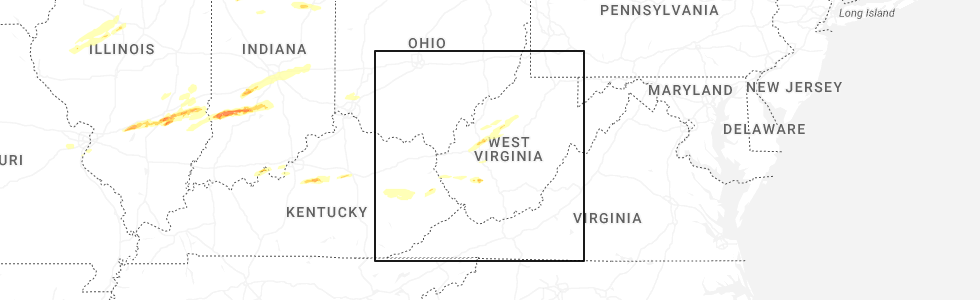
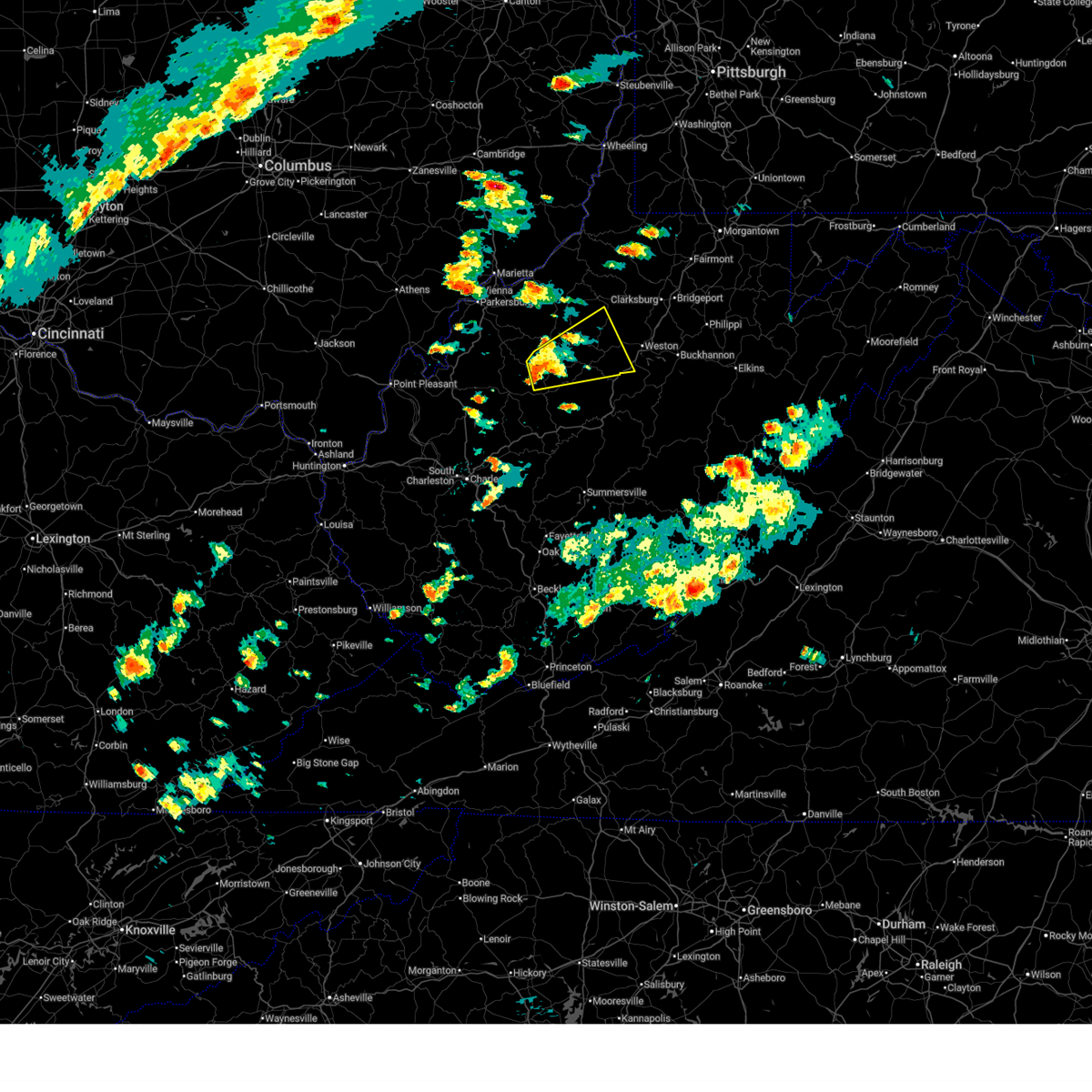
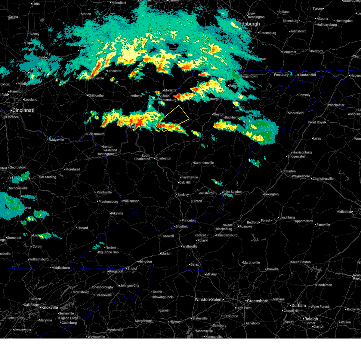
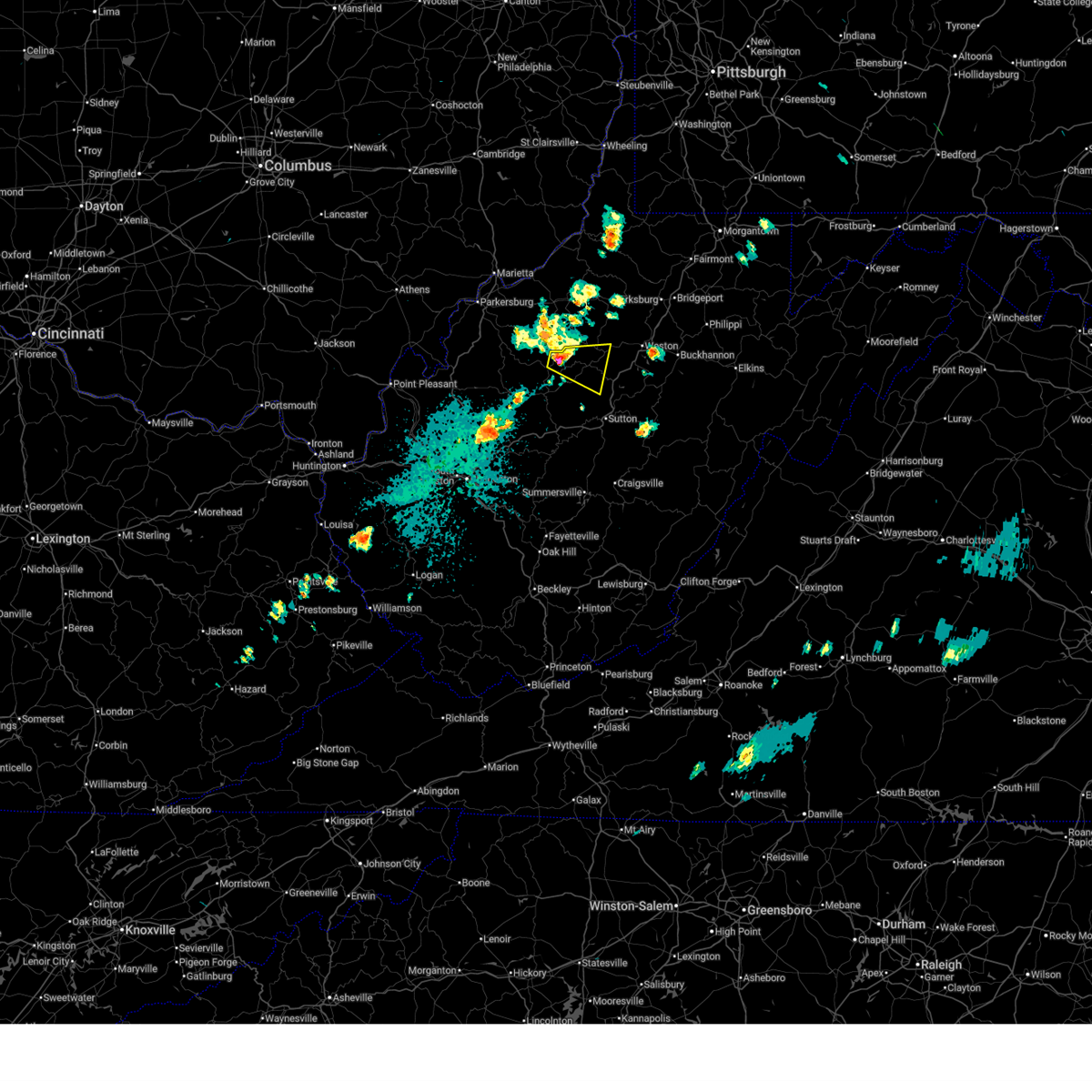
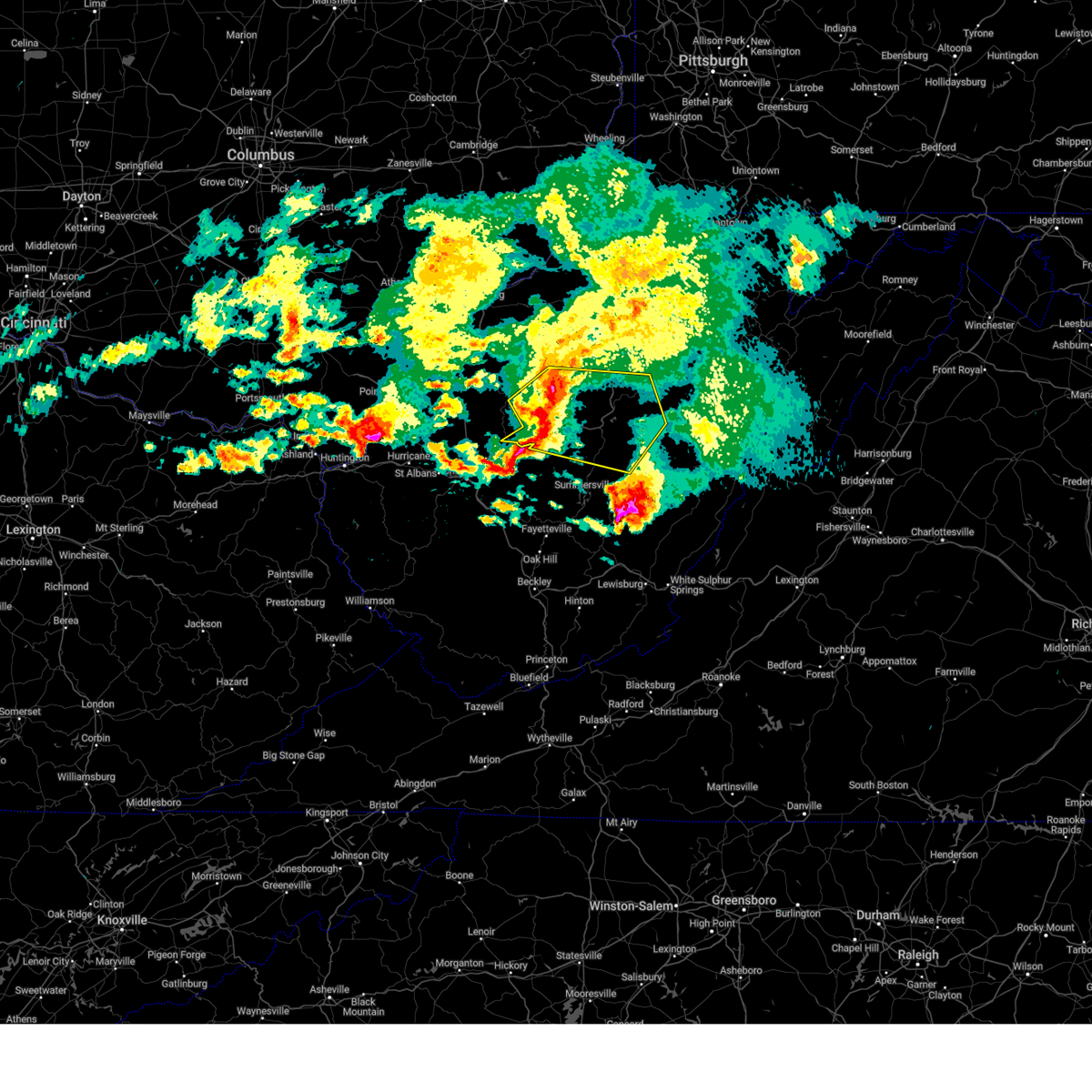
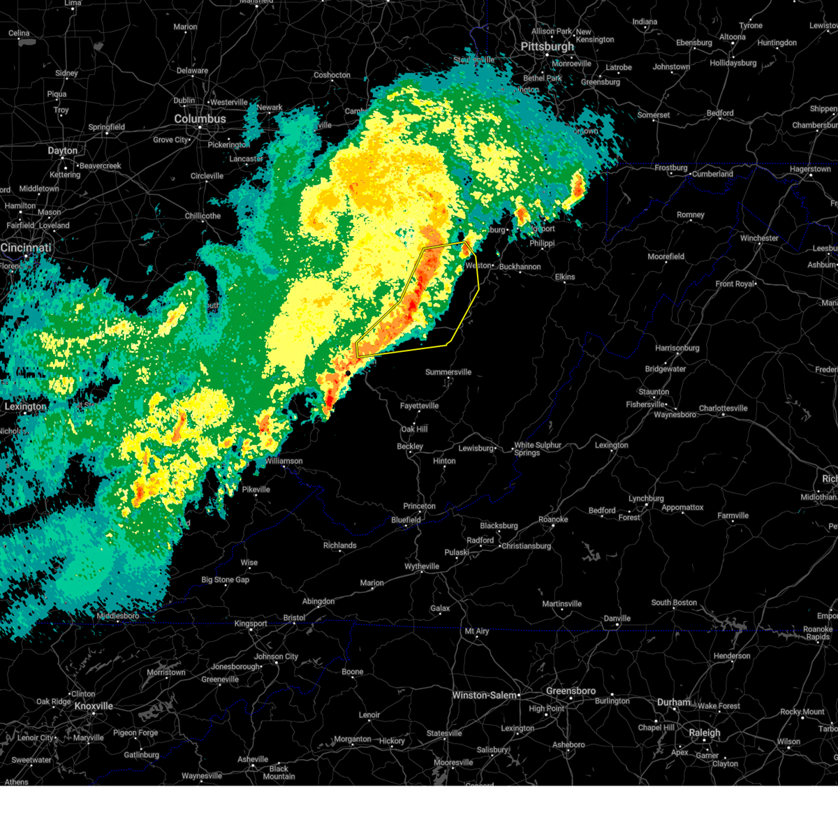
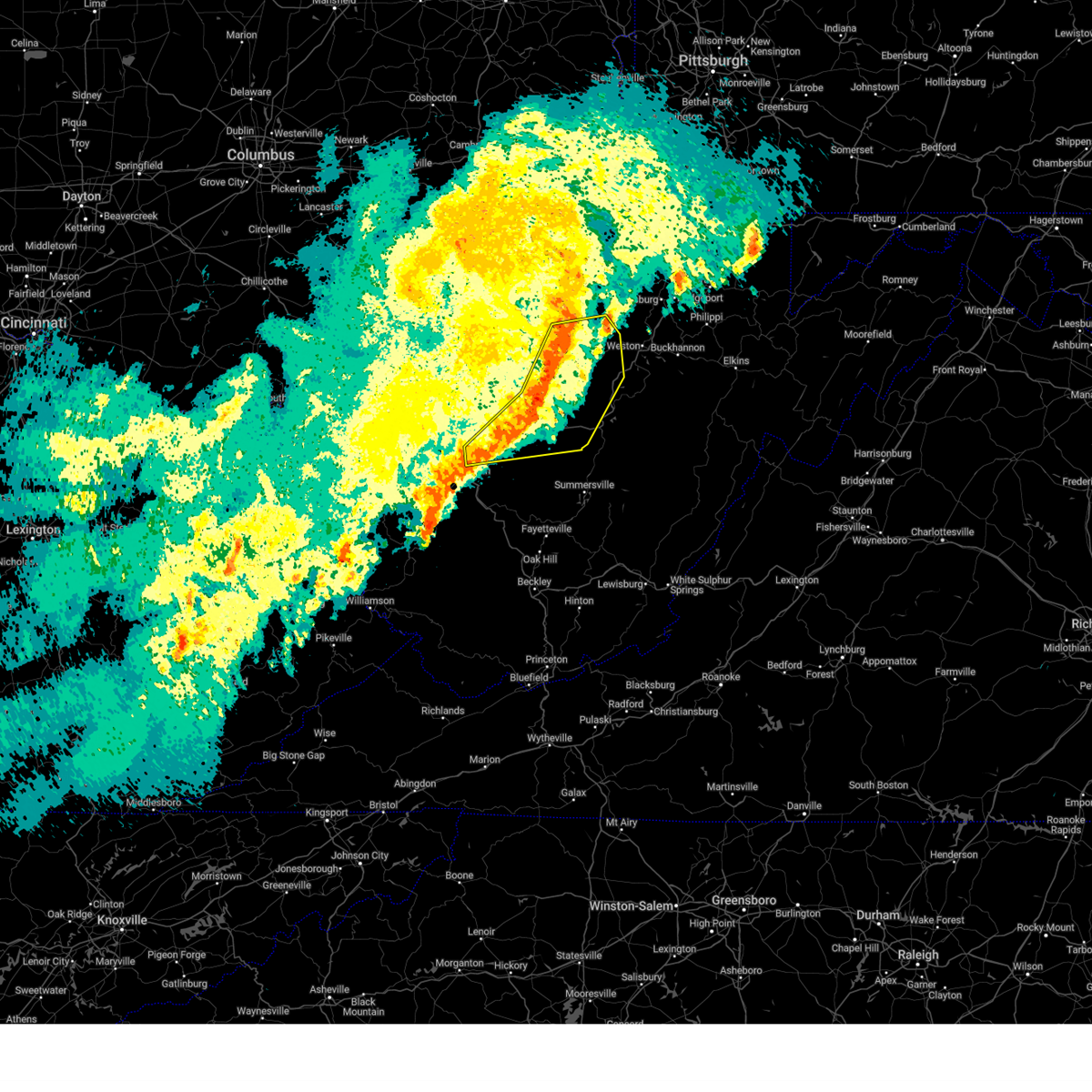
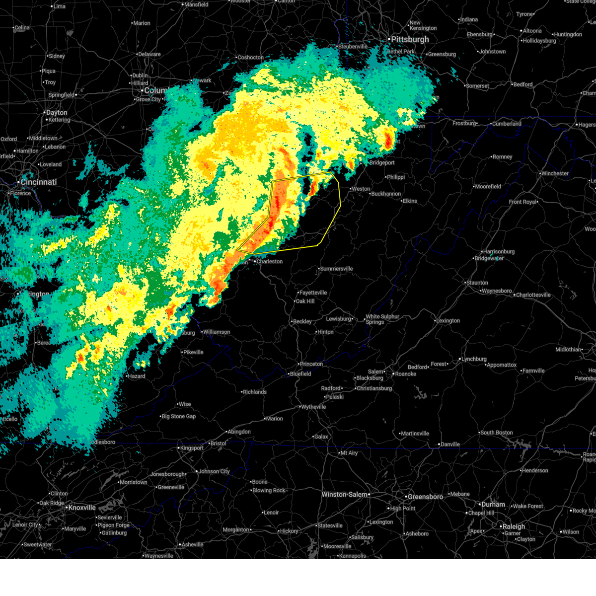
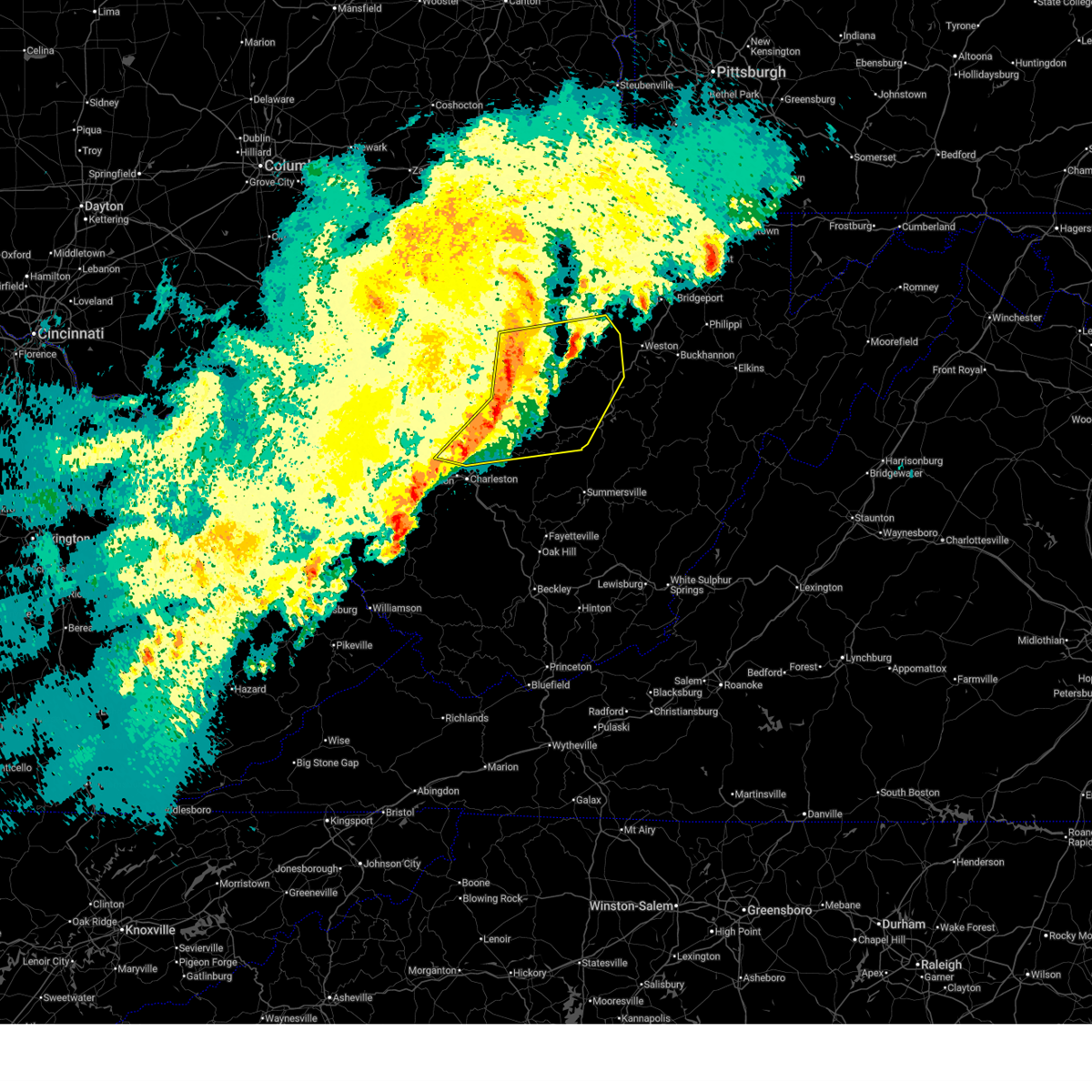
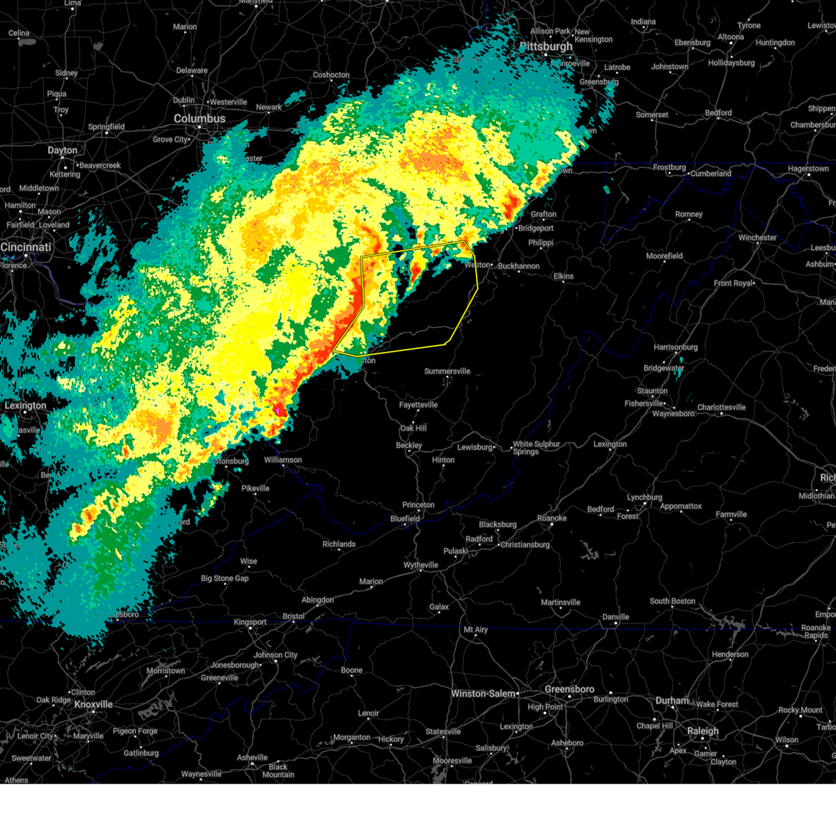
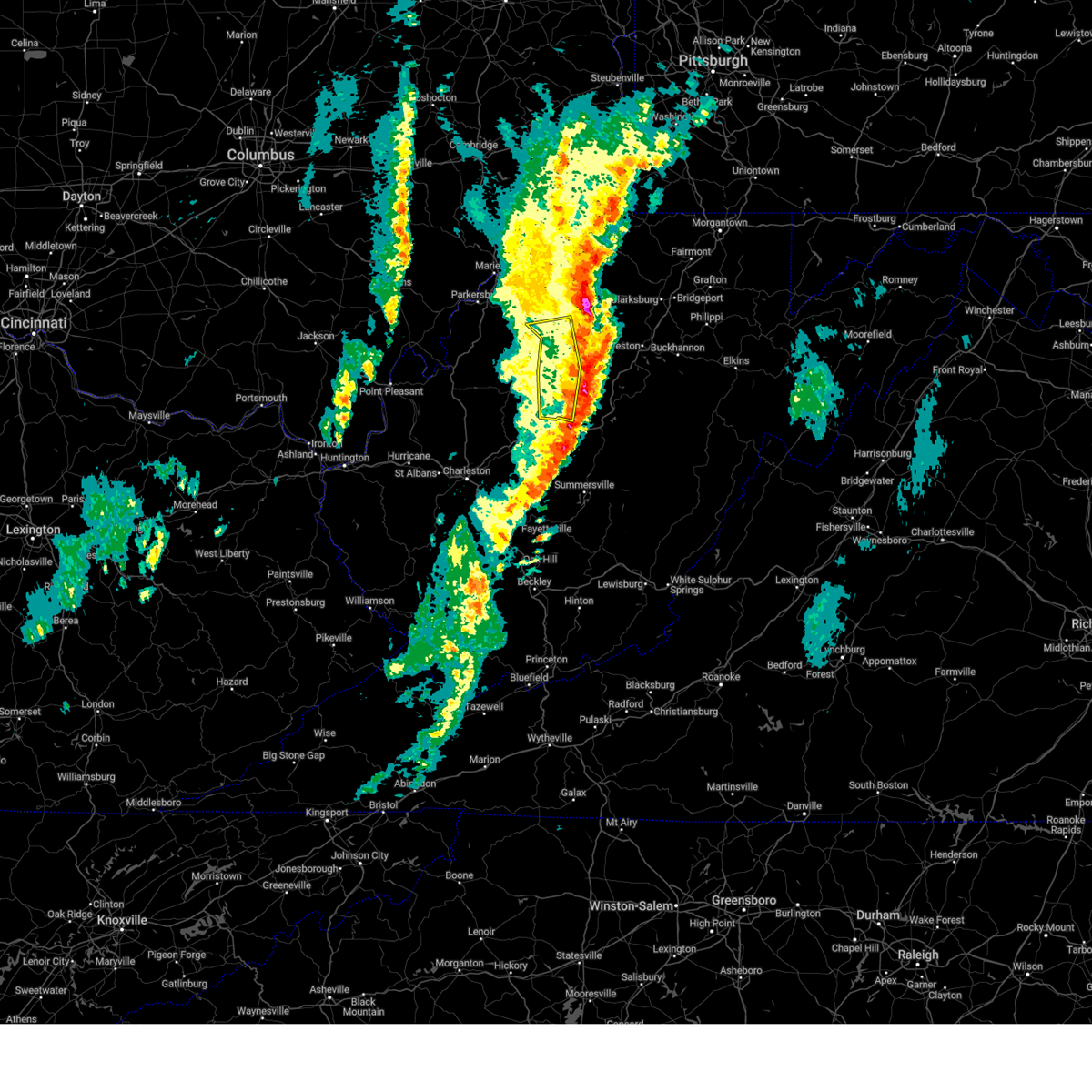
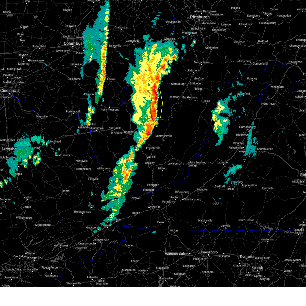
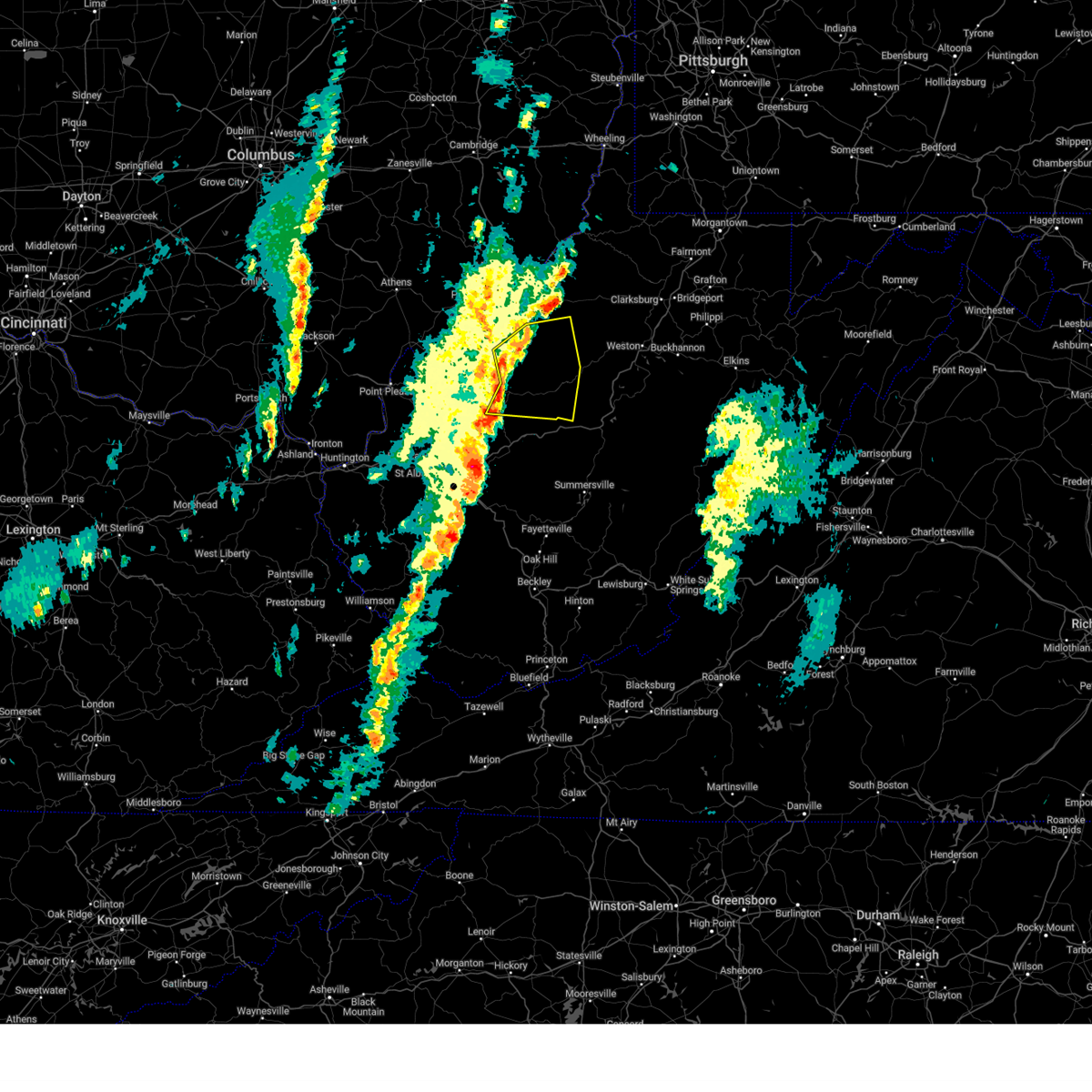
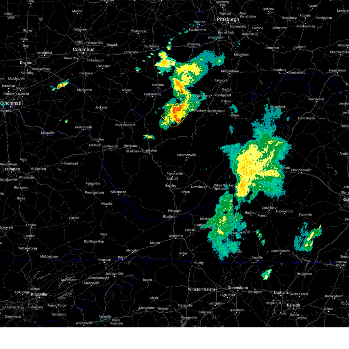
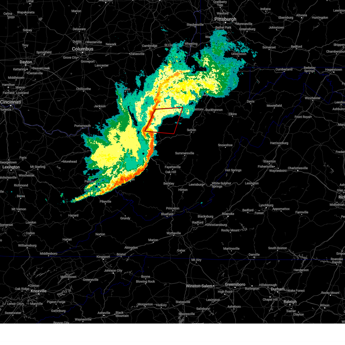
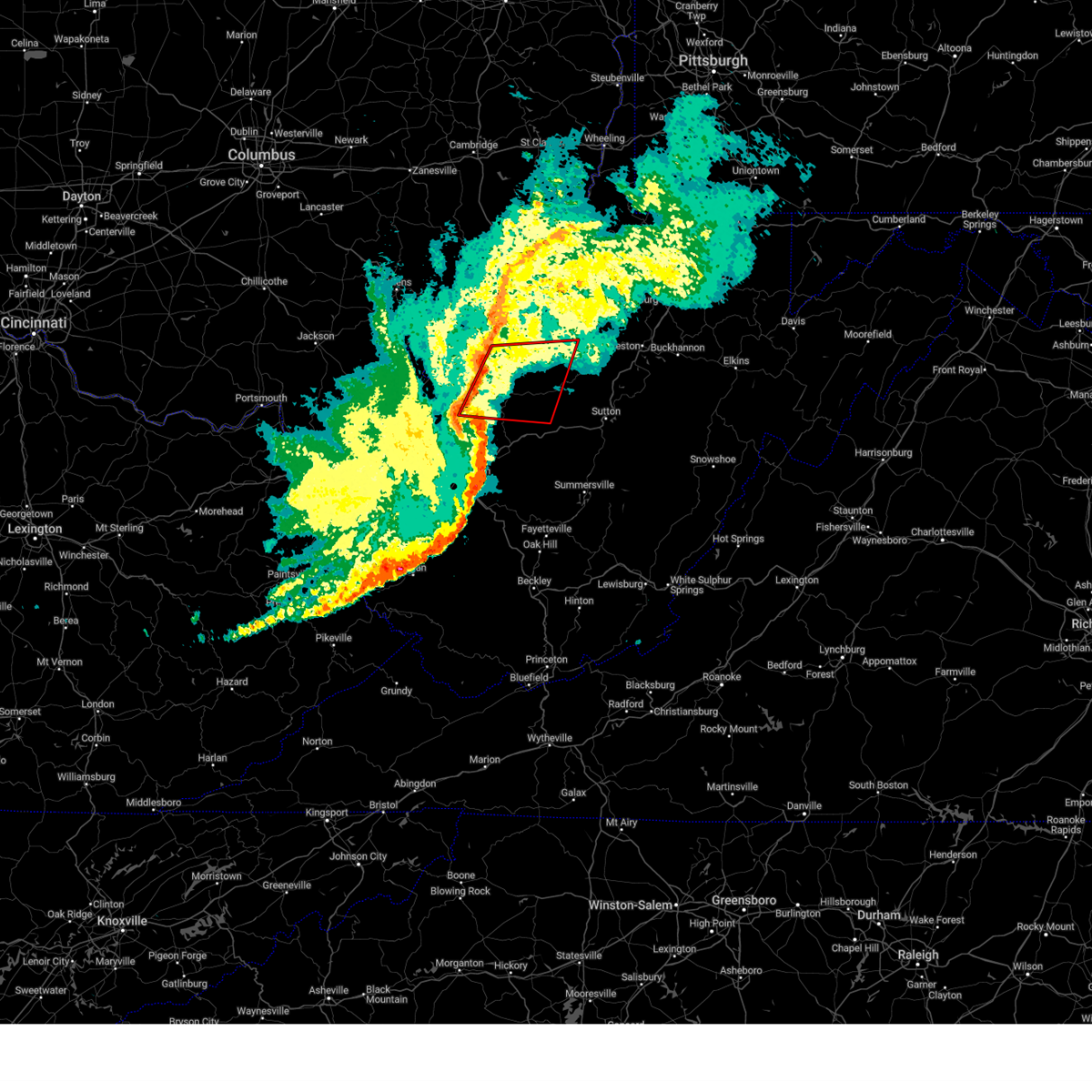
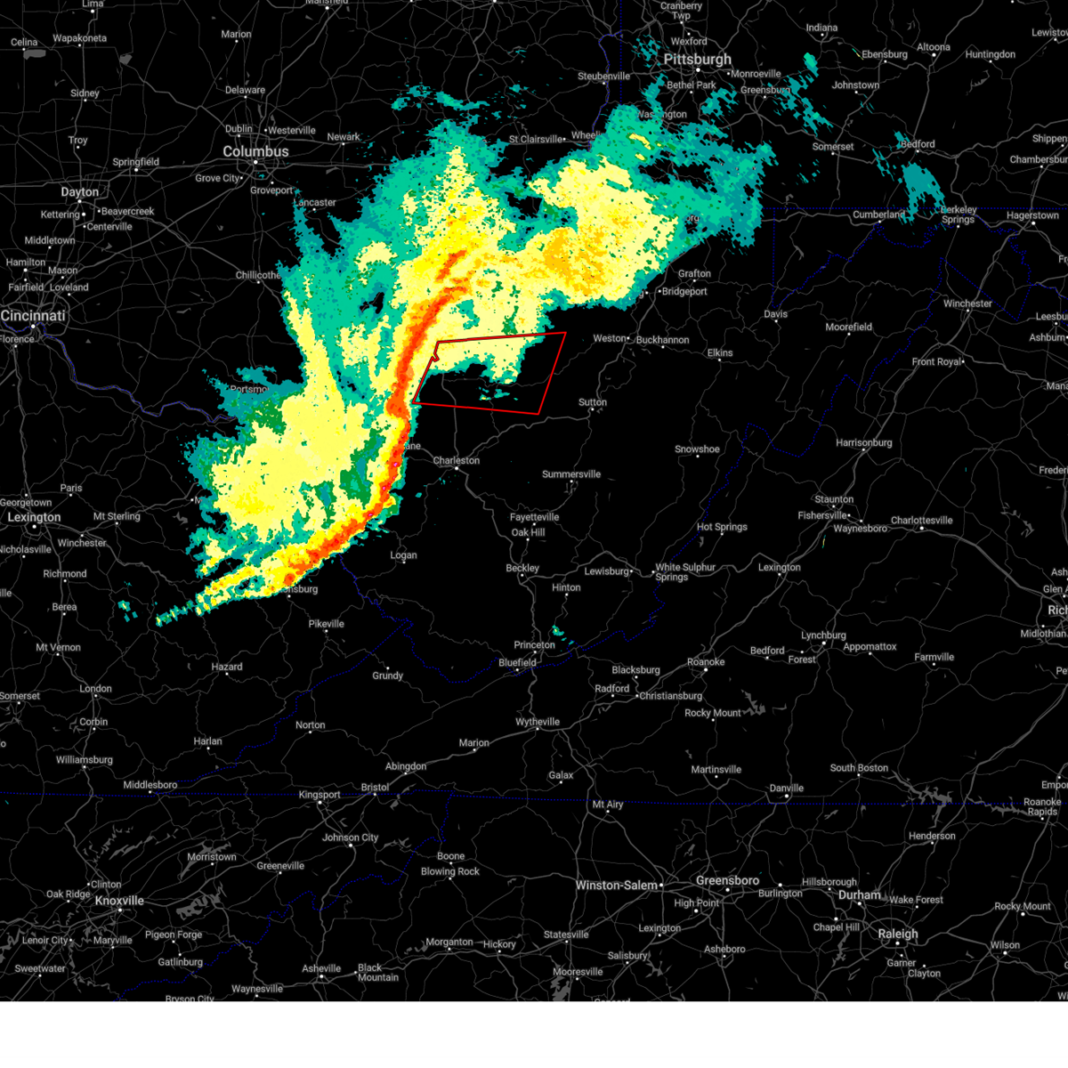
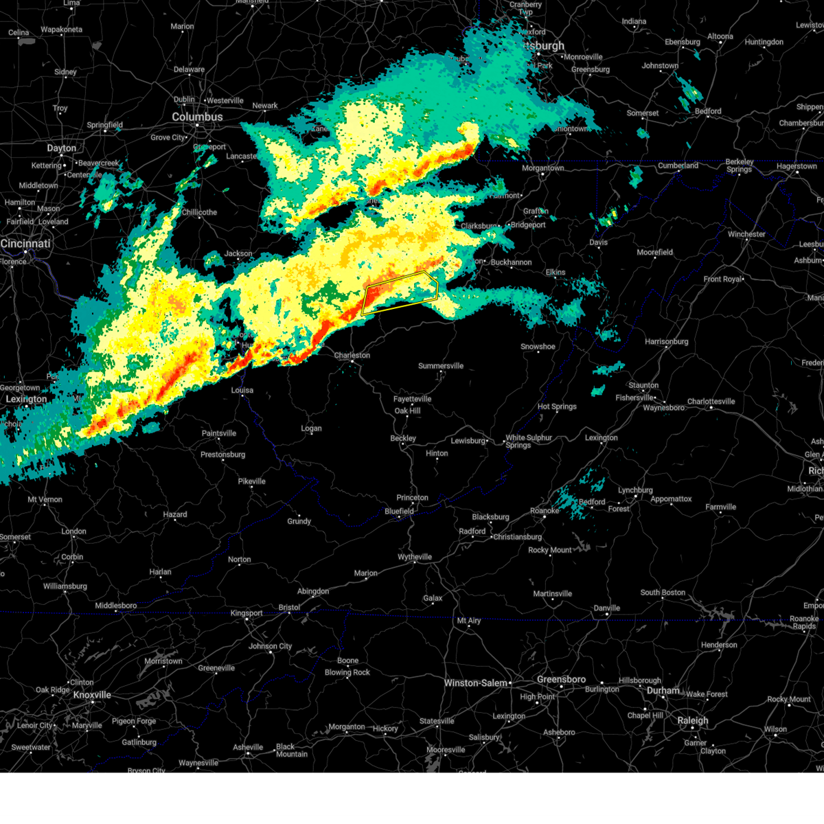
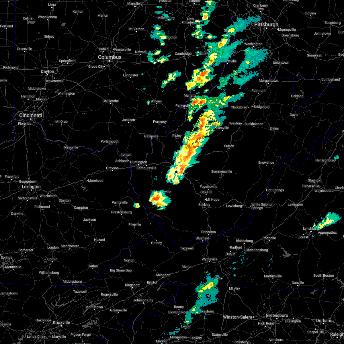
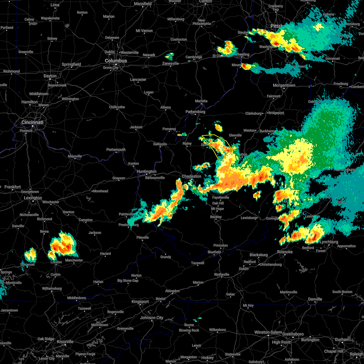
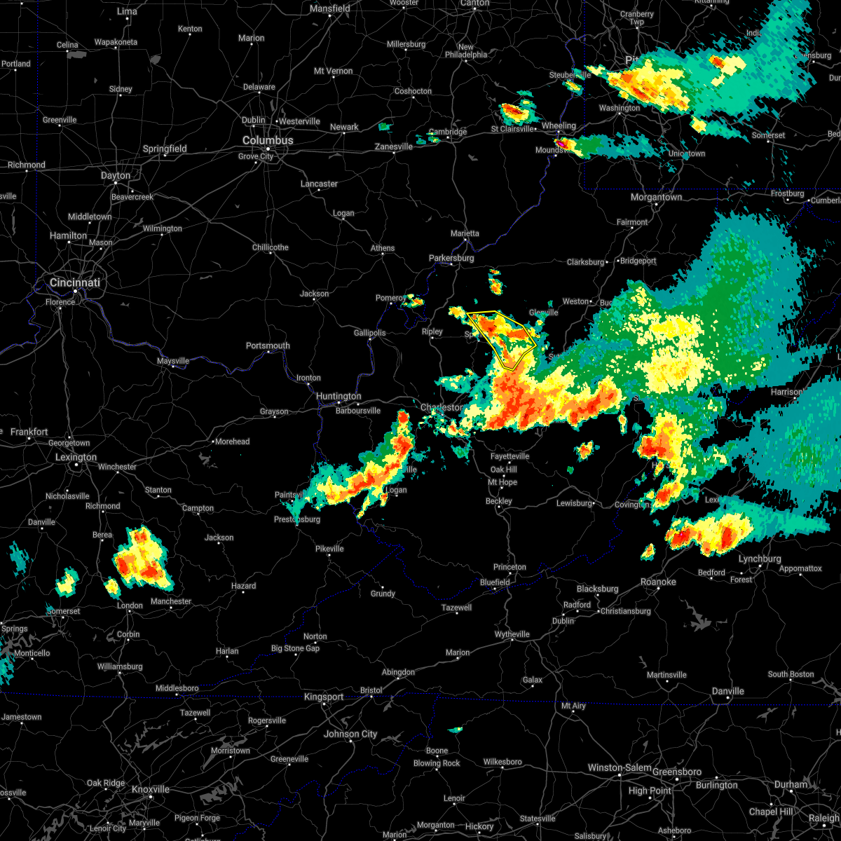
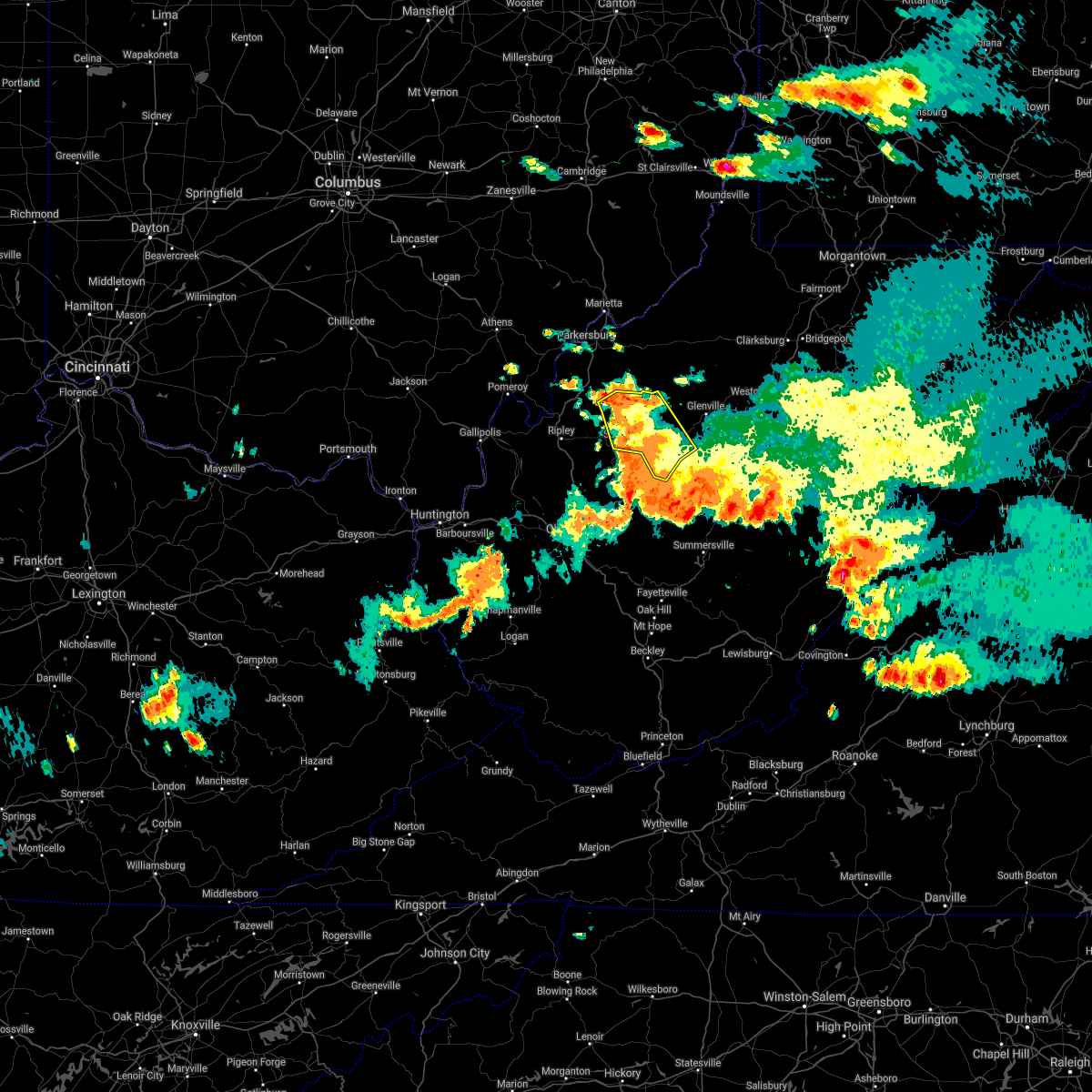
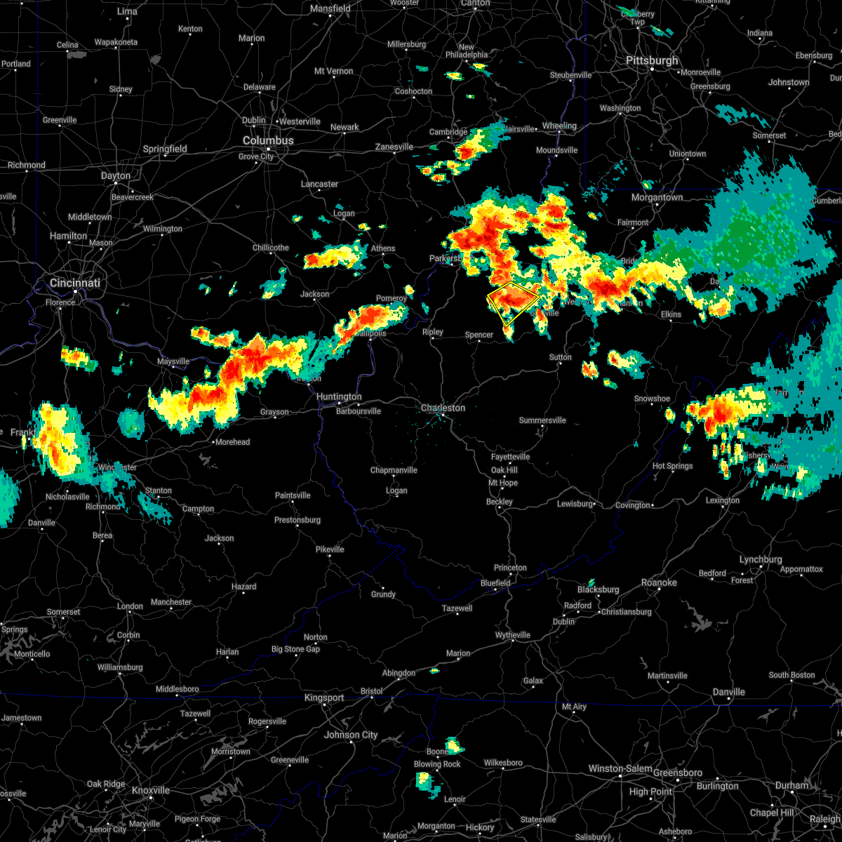
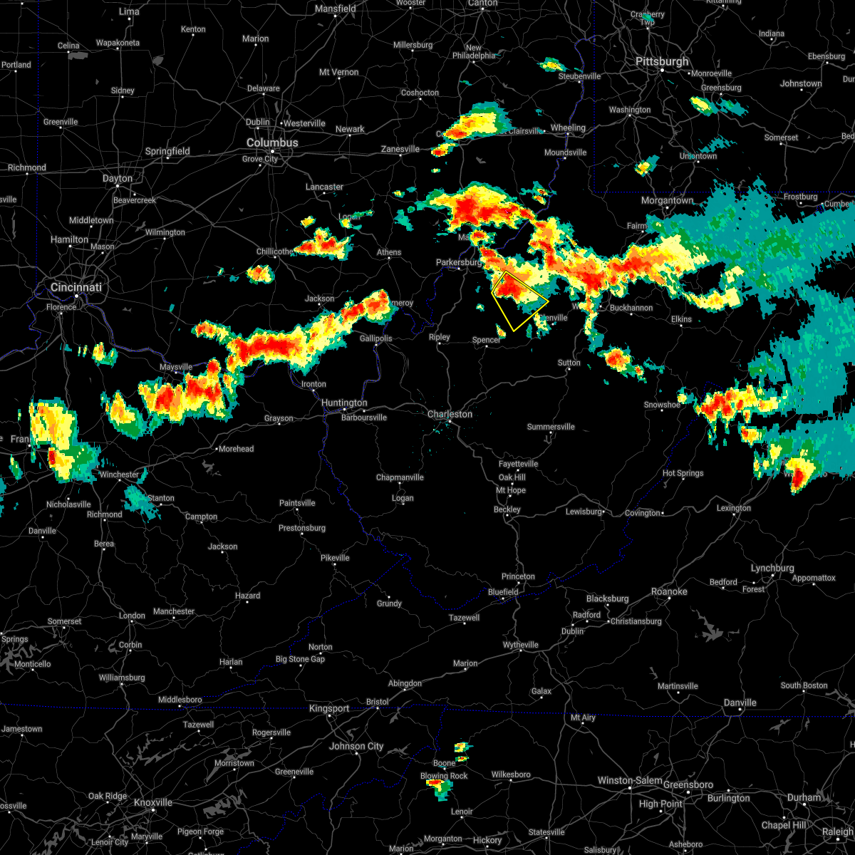
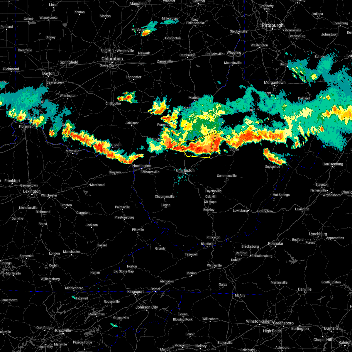
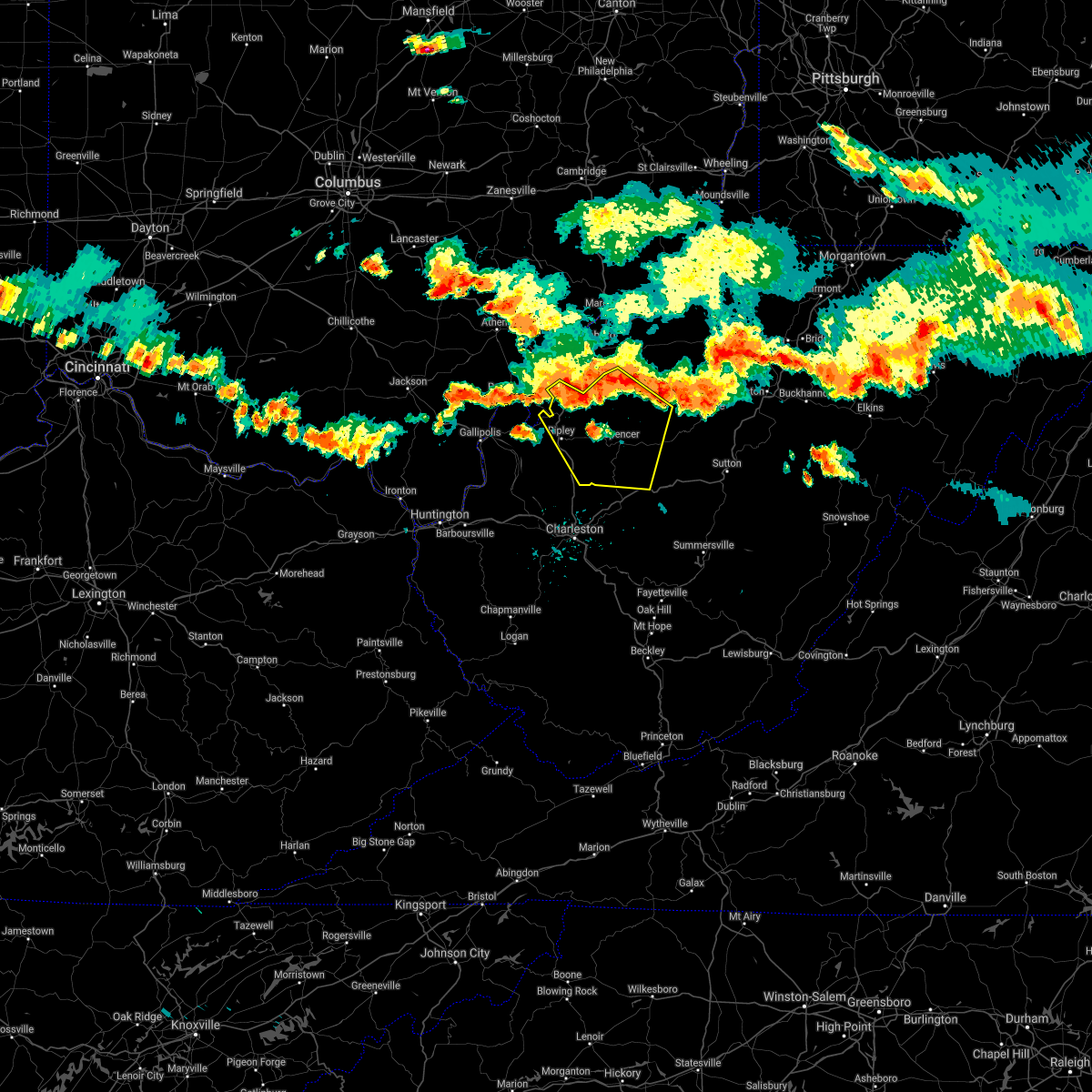
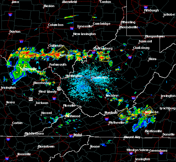
Hail Map for Grantsville, WV
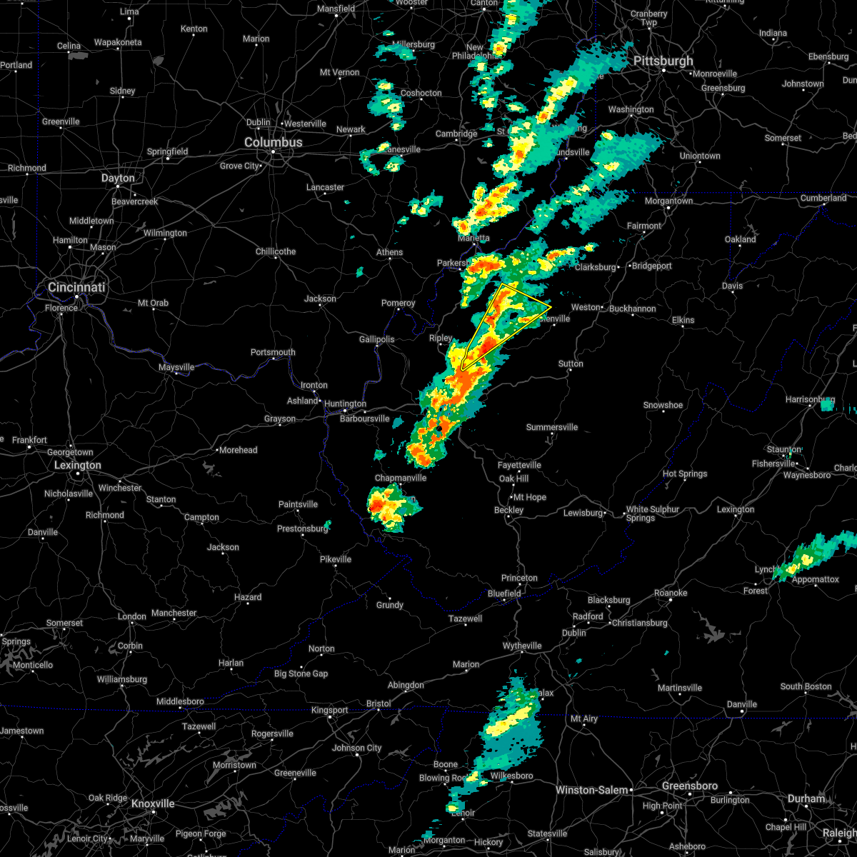
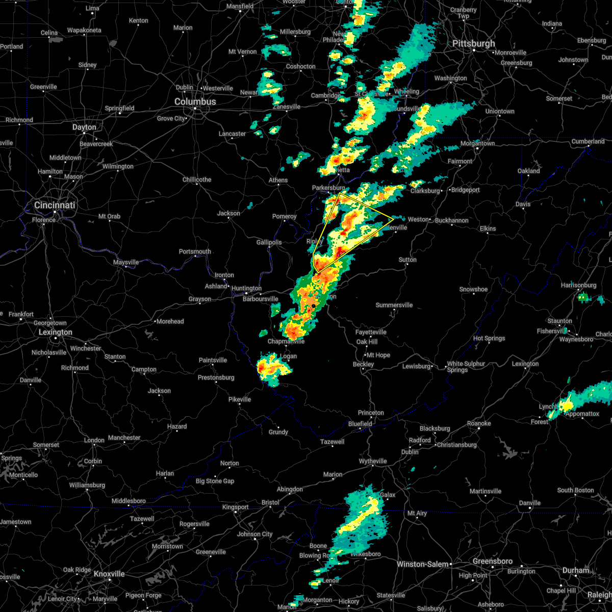
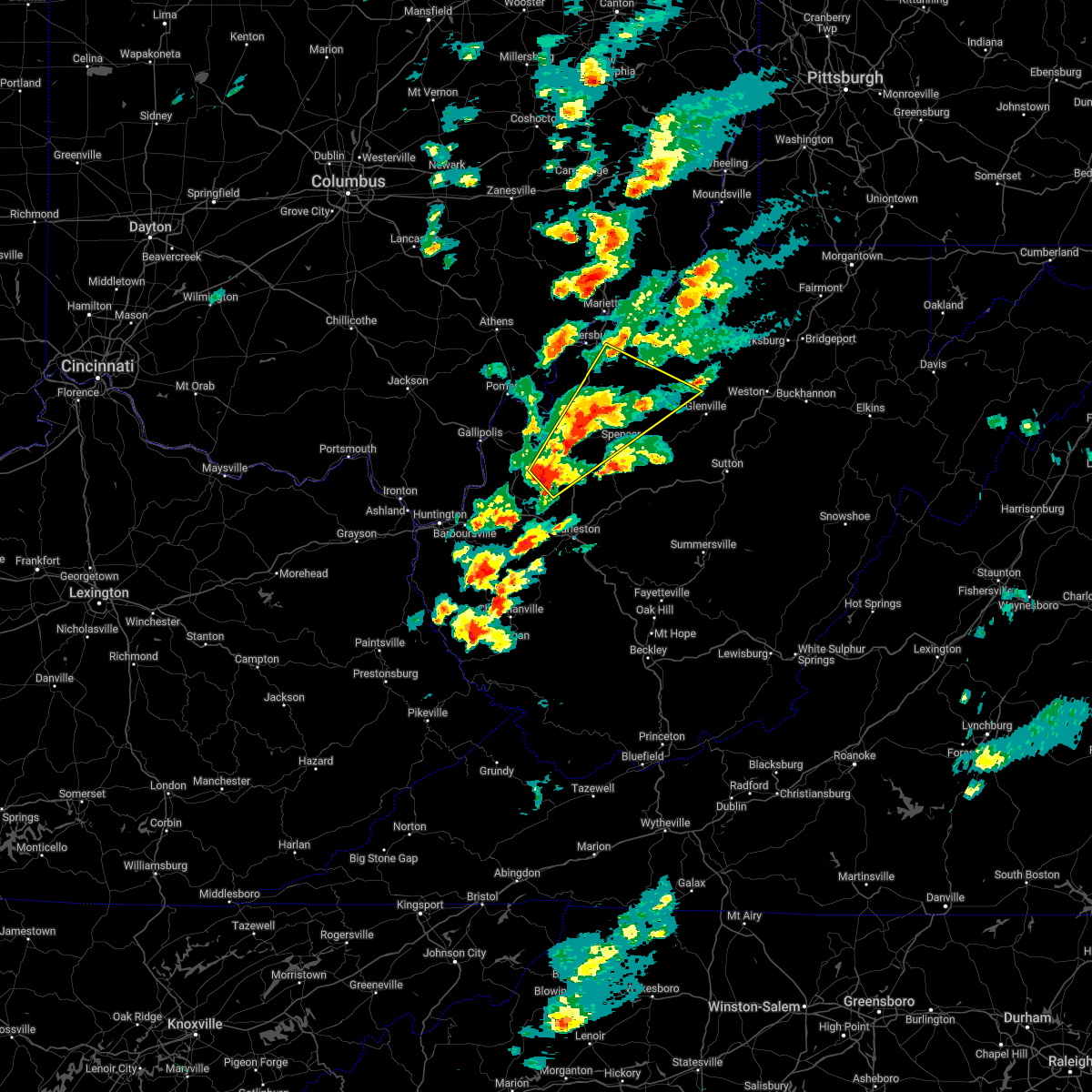
The Grantsville, WV area has had 6 reports of on-the-ground hail by trained spotters, and has been under severe weather warnings 9 times during the past 12 months. Doppler radar has detected hail at or near Grantsville, WV on 33 occasions, including 3 occasions during the past year.
| Name: | Grantsville, WV |
| Where Located: | 49.2 miles NE of Charleston, WV |
| Map: | Google Map for Grantsville, WV |
| Population: | 561 |
| Housing Units: | 303 |
| More Info: | Search Google for Grantsville, WV |
5
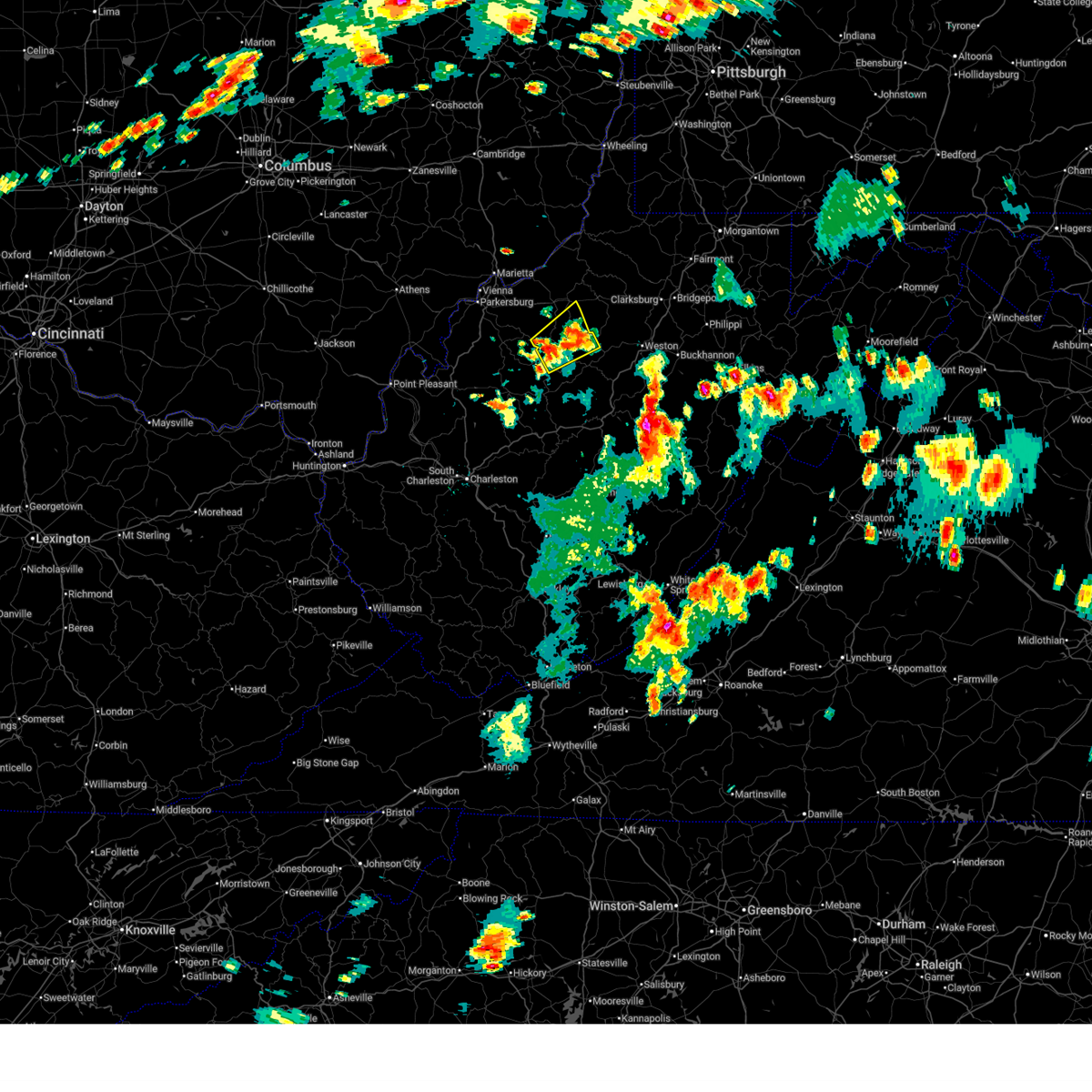
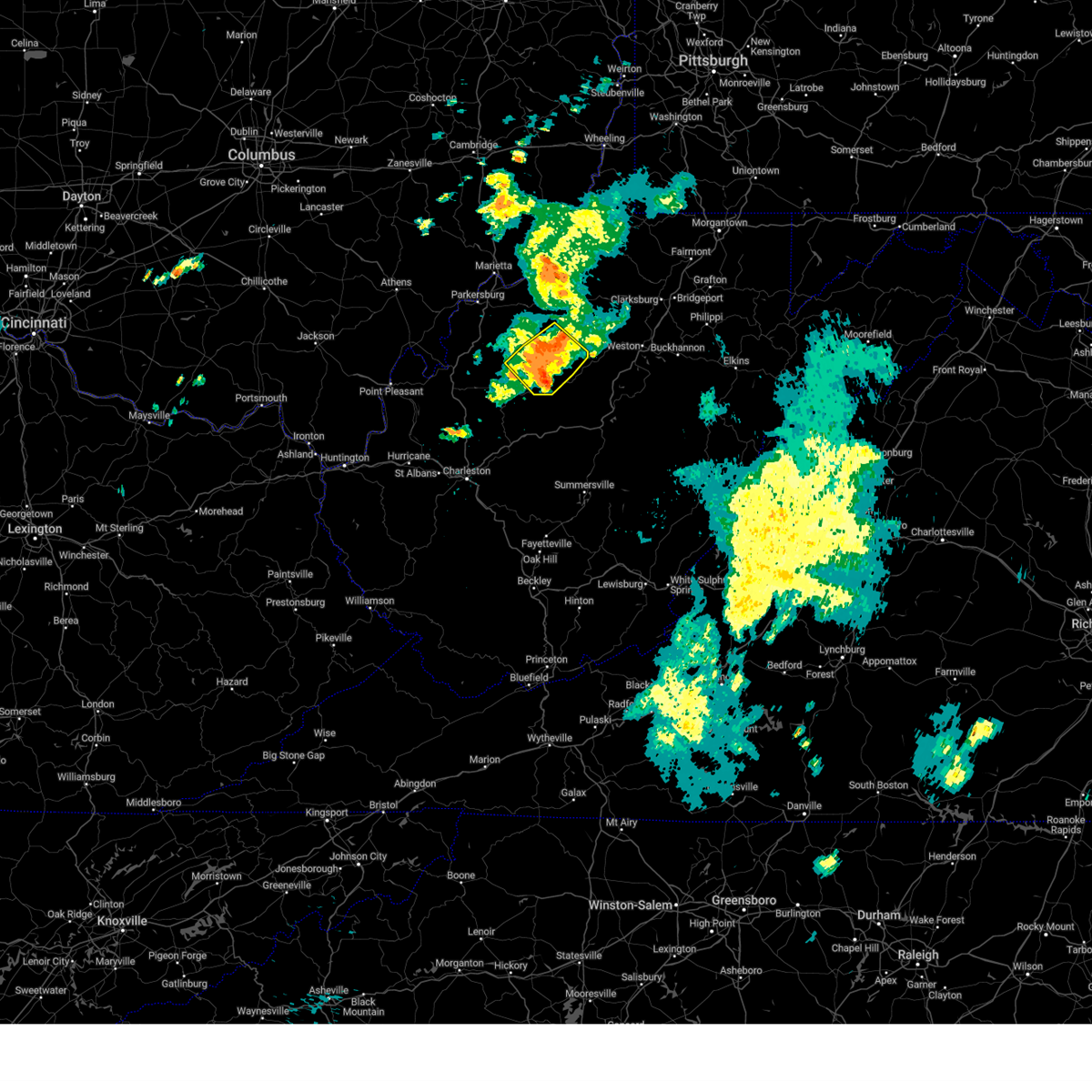
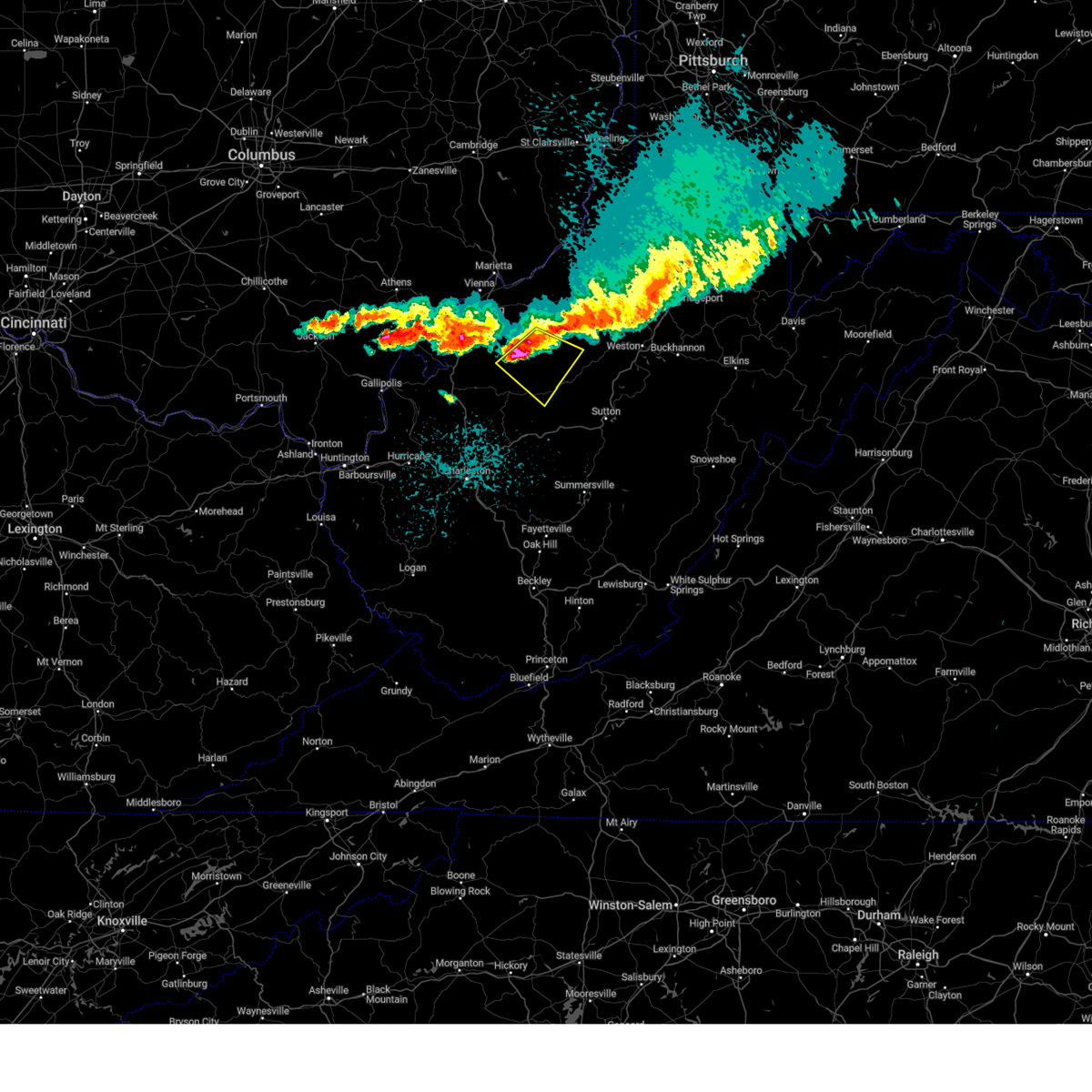
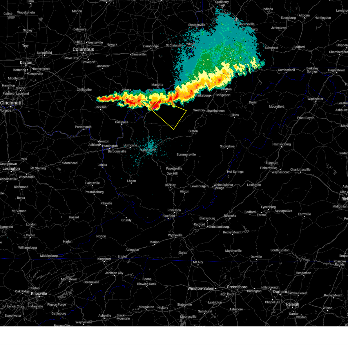
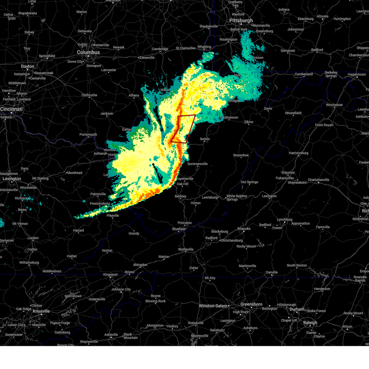
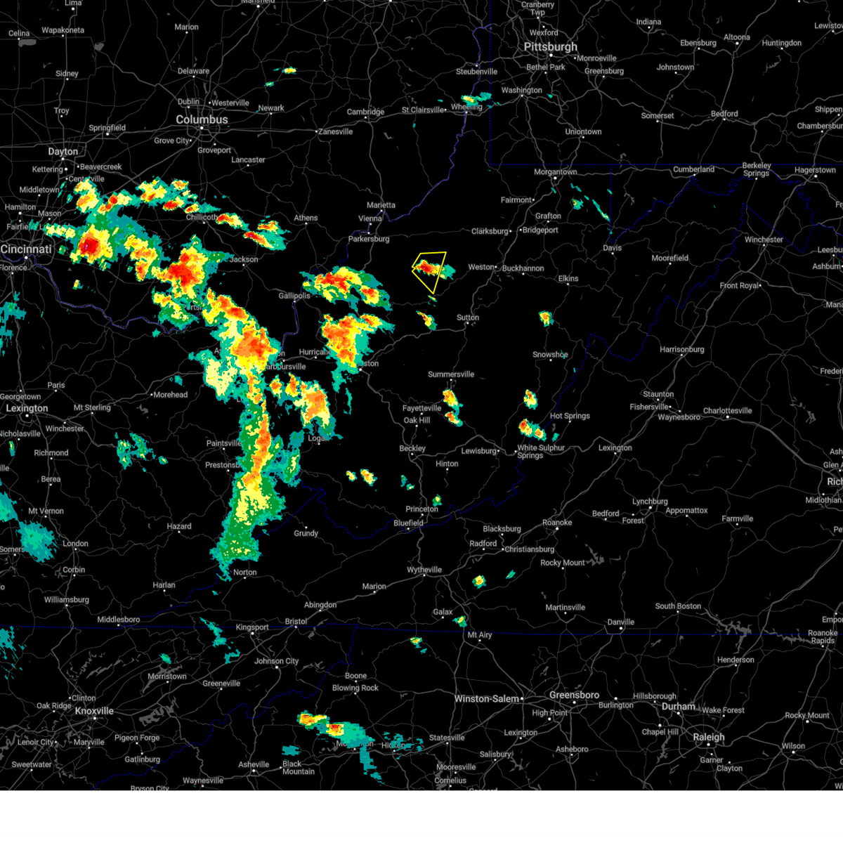
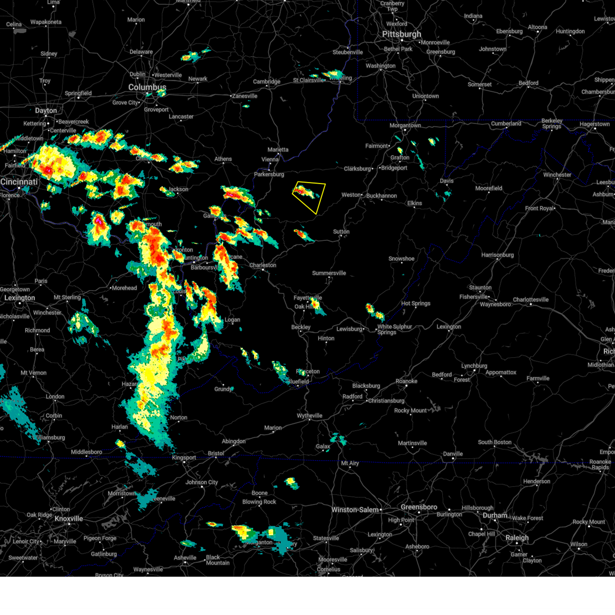
The Top Recent Hail Date for Grantsville, WV is Thursday, February 19, 2026 (7th out of 33)
Hail and Wind Damage Spotted near Grantsville, WV
| Date / Time | Report Details |
|---|---|
| 7/4/2026 3:58 PM EDT |
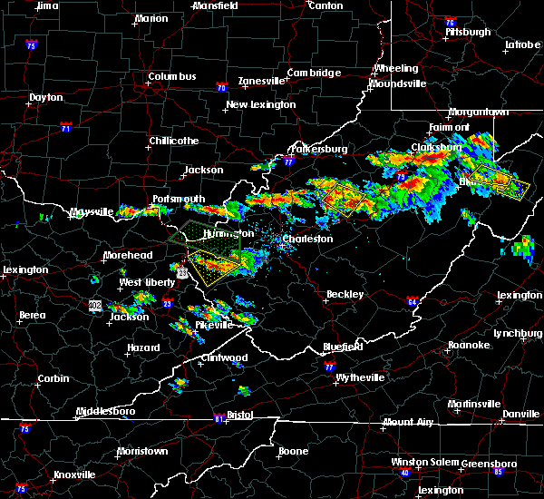
 Svrrlx the national weather service in charleston west virginia has issued a * severe thunderstorm warning for, northeastern calhoun county in north central west virginia, southeastern ritchie county in northwestern west virginia, northwestern gilmer county in north central west virginia, * until 430 pm edt. * at 357 pm edt, a severe thunderstorm was located 7 miles north of grantsville, moving northeast at 20 mph (radar indicated). Hazards include 60 mph wind gusts and quarter size hail. Hail damage to vehicles is expected. Expect wind damage to roofs, siding, and trees. Svrrlx the national weather service in charleston west virginia has issued a * severe thunderstorm warning for, northeastern calhoun county in north central west virginia, southeastern ritchie county in northwestern west virginia, northwestern gilmer county in north central west virginia, * until 430 pm edt. * at 357 pm edt, a severe thunderstorm was located 7 miles north of grantsville, moving northeast at 20 mph (radar indicated). Hazards include 60 mph wind gusts and quarter size hail. Hail damage to vehicles is expected. Expect wind damage to roofs, siding, and trees.
|
| 6/18/2026 6:47 AM EDT |
 Svrrlx the national weather service in charleston west virginia has issued a * severe thunderstorm warning for, calhoun county in north central west virginia, ritchie county in northwestern west virginia, doddridge county in northern west virginia, gilmer county in north central west virginia, lewis county in northern west virginia, braxton county in north central west virginia, southeastern wirt county in northwestern west virginia, roane county in central west virginia, northeastern clay county in north central west virginia, southern harrison county in northern west virginia, * until 715 am edt. * at 646 am edt, severe thunderstorms were located along a line extending from 6 miles west of north bend state park to 7 miles east of kenna, moving east at 75 mph (radar indicated). Hazards include 60 mph wind gusts. expect damage to roofs, siding, and trees Svrrlx the national weather service in charleston west virginia has issued a * severe thunderstorm warning for, calhoun county in north central west virginia, ritchie county in northwestern west virginia, doddridge county in northern west virginia, gilmer county in north central west virginia, lewis county in northern west virginia, braxton county in north central west virginia, southeastern wirt county in northwestern west virginia, roane county in central west virginia, northeastern clay county in north central west virginia, southern harrison county in northern west virginia, * until 715 am edt. * at 646 am edt, severe thunderstorms were located along a line extending from 6 miles west of north bend state park to 7 miles east of kenna, moving east at 75 mph (radar indicated). Hazards include 60 mph wind gusts. expect damage to roofs, siding, and trees
|
| 6/14/2026 7:44 PM EDT |
 Svrrlx the national weather service in charleston west virginia has issued a * severe thunderstorm warning for, northern calhoun county in north central west virginia, southeastern ritchie county in northwestern west virginia, southeastern doddridge county in northern west virginia, taylor county in northern west virginia, northern gilmer county in north central west virginia, lewis county in northern west virginia, northwestern upshur county in northeastern west virginia, northern barbour county in northeastern west virginia, harrison county in northern west virginia, * until 845 pm edt. * at 744 pm edt, severe thunderstorms were located along a line extending from near pleasant valley to near grantsville, moving east at 55 mph (radar indicated). Hazards include 60 mph wind gusts. expect damage to roofs, siding, and trees Svrrlx the national weather service in charleston west virginia has issued a * severe thunderstorm warning for, northern calhoun county in north central west virginia, southeastern ritchie county in northwestern west virginia, southeastern doddridge county in northern west virginia, taylor county in northern west virginia, northern gilmer county in north central west virginia, lewis county in northern west virginia, northwestern upshur county in northeastern west virginia, northern barbour county in northeastern west virginia, harrison county in northern west virginia, * until 845 pm edt. * at 744 pm edt, severe thunderstorms were located along a line extending from near pleasant valley to near grantsville, moving east at 55 mph (radar indicated). Hazards include 60 mph wind gusts. expect damage to roofs, siding, and trees
|
| 6/14/2026 3:45 PM EDT | Tree in roadway in the 5000 block of russet rd. time estimated from rada in calhoun county WV, 4 miles NNW of Grantsville, WV |
| 6/14/2026 3:34 PM EDT |
 Svrrlx the national weather service in charleston west virginia has issued a * severe thunderstorm warning for, northern calhoun county in north central west virginia, southeastern ritchie county in northwestern west virginia, southwestern doddridge county in northern west virginia, gilmer county in north central west virginia, northwestern lewis county in northern west virginia, * until 415 pm edt. * at 334 pm edt, a severe thunderstorm was located over grantsville, moving east at 40 mph (radar indicated). Hazards include 60 mph wind gusts. expect damage to roofs, siding, and trees Svrrlx the national weather service in charleston west virginia has issued a * severe thunderstorm warning for, northern calhoun county in north central west virginia, southeastern ritchie county in northwestern west virginia, southwestern doddridge county in northern west virginia, gilmer county in north central west virginia, northwestern lewis county in northern west virginia, * until 415 pm edt. * at 334 pm edt, a severe thunderstorm was located over grantsville, moving east at 40 mph (radar indicated). Hazards include 60 mph wind gusts. expect damage to roofs, siding, and trees
|
| 5/13/2026 3:58 PM EDT | Quarter sized hail reported 8.4 miles N of Grantsville, WV, time estimated by radar. |
| 2/20/2026 1:25 AM EST |
 The storm which prompted the warning has weakened below severe limits, and no longer poses an immediate threat to life or property. therefore, the warning will be allowed to expire. however, small hail and heavy rain are still possible with this thunderstorm. The storm which prompted the warning has weakened below severe limits, and no longer poses an immediate threat to life or property. therefore, the warning will be allowed to expire. however, small hail and heavy rain are still possible with this thunderstorm.
|
| 2/20/2026 1:13 AM EST |
 Svrrlx the national weather service in charleston west virginia has issued a * severe thunderstorm warning for, northern calhoun county in north central west virginia, southwestern gilmer county in north central west virginia, southeastern wirt county in northwestern west virginia, north central roane county in central west virginia, * until 130 am est. * at 113 am est, a severe thunderstorm was located 9 miles west of grantsville, moving east at 45 mph (radar indicated). Hazards include quarter size hail. damage to vehicles is expected Svrrlx the national weather service in charleston west virginia has issued a * severe thunderstorm warning for, northern calhoun county in north central west virginia, southwestern gilmer county in north central west virginia, southeastern wirt county in northwestern west virginia, north central roane county in central west virginia, * until 130 am est. * at 113 am est, a severe thunderstorm was located 9 miles west of grantsville, moving east at 45 mph (radar indicated). Hazards include quarter size hail. damage to vehicles is expected
|
| 2/20/2026 12:59 AM EST |
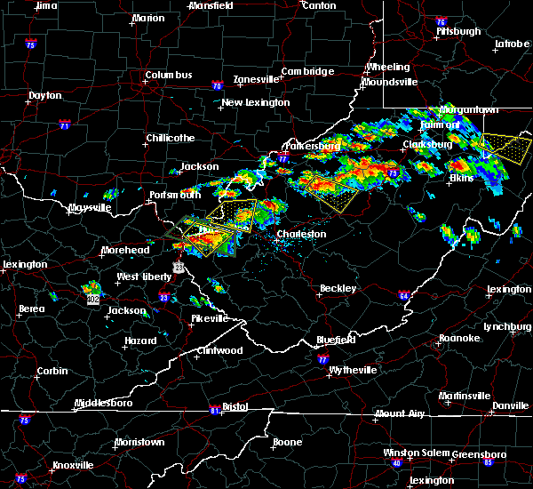
 Svrrlx the national weather service in charleston west virginia has issued a * severe thunderstorm warning for, northeastern calhoun county in north central west virginia, southeastern ritchie county in northwestern west virginia, southwestern doddridge county in northern west virginia, northwestern gilmer county in north central west virginia, * until 130 am est. * at 1258 am est, a severe thunderstorm was located near grantsville, moving northeast at 45 mph (radar indicated). Hazards include quarter size hail. damage to vehicles is expected Svrrlx the national weather service in charleston west virginia has issued a * severe thunderstorm warning for, northeastern calhoun county in north central west virginia, southeastern ritchie county in northwestern west virginia, southwestern doddridge county in northern west virginia, northwestern gilmer county in north central west virginia, * until 130 am est. * at 1258 am est, a severe thunderstorm was located near grantsville, moving northeast at 45 mph (radar indicated). Hazards include quarter size hail. damage to vehicles is expected
|
| 2/20/2026 12:34 AM EST |
 Svrrlx the national weather service in charleston west virginia has issued a * severe thunderstorm warning for, northern calhoun county in north central west virginia, southwestern ritchie county in northwestern west virginia, west central gilmer county in north central west virginia, southeastern wirt county in northwestern west virginia, northwestern roane county in central west virginia, east central jackson county in northwestern west virginia, * until 100 am est. * at 1234 am est, a severe thunderstorm was located 7 miles northwest of spencer, moving northeast at 50 mph (radar indicated). Hazards include quarter size hail. damage to vehicles is expected Svrrlx the national weather service in charleston west virginia has issued a * severe thunderstorm warning for, northern calhoun county in north central west virginia, southwestern ritchie county in northwestern west virginia, west central gilmer county in north central west virginia, southeastern wirt county in northwestern west virginia, northwestern roane county in central west virginia, east central jackson county in northwestern west virginia, * until 100 am est. * at 1234 am est, a severe thunderstorm was located 7 miles northwest of spencer, moving northeast at 50 mph (radar indicated). Hazards include quarter size hail. damage to vehicles is expected
|
| 8/24/2025 8:23 PM EDT |
 Svrrlx the national weather service in charleston west virginia has issued a * severe thunderstorm warning for, northeastern calhoun county in north central west virginia, gilmer county in north central west virginia, west central lewis county in northern west virginia, north central braxton county in north central west virginia, * until 915 pm edt. * at 822 pm edt, a severe thunderstorm was located near grantsville, moving east at 25 mph (radar indicated). Hazards include 60 mph wind gusts and quarter size hail. Hail damage to vehicles is expected. Expect wind damage to roofs, siding, and trees. Svrrlx the national weather service in charleston west virginia has issued a * severe thunderstorm warning for, northeastern calhoun county in north central west virginia, gilmer county in north central west virginia, west central lewis county in northern west virginia, north central braxton county in north central west virginia, * until 915 pm edt. * at 822 pm edt, a severe thunderstorm was located near grantsville, moving east at 25 mph (radar indicated). Hazards include 60 mph wind gusts and quarter size hail. Hail damage to vehicles is expected. Expect wind damage to roofs, siding, and trees.
|
| 8/24/2025 8:16 PM EDT | Several trees down... some blocking roadway... in several spots along north calhoun highway. time and location estimated from rada in calhoun county WV, 3.2 miles SW of Grantsville, WV |
| 8/24/2025 8:14 PM EDT | Tree damage resulting in 619 customers without powe in calhoun county WV, 6.1 miles S of Grantsville, WV |
| 4/14/2025 6:42 PM EDT |
 Svrrlx the national weather service in charleston west virginia has issued a * severe thunderstorm warning for, calhoun county in north central west virginia, north central nicholas county in southeastern west virginia, southern gilmer county in north central west virginia, southeastern lewis county in northern west virginia, braxton county in north central west virginia, southwestern upshur county in northeastern west virginia, southeastern roane county in central west virginia, northwestern webster county in northeastern west virginia, northern clay county in north central west virginia, * until 730 pm edt. * at 642 pm edt, a severe thunderstorm was located over wallback, or 9 miles northwest of clay, moving east at 55 mph (radar indicated). Hazards include 60 mph wind gusts and quarter size hail. Hail damage to vehicles is expected. Expect wind damage to roofs, siding, and trees. Svrrlx the national weather service in charleston west virginia has issued a * severe thunderstorm warning for, calhoun county in north central west virginia, north central nicholas county in southeastern west virginia, southern gilmer county in north central west virginia, southeastern lewis county in northern west virginia, braxton county in north central west virginia, southwestern upshur county in northeastern west virginia, southeastern roane county in central west virginia, northwestern webster county in northeastern west virginia, northern clay county in north central west virginia, * until 730 pm edt. * at 642 pm edt, a severe thunderstorm was located over wallback, or 9 miles northwest of clay, moving east at 55 mph (radar indicated). Hazards include 60 mph wind gusts and quarter size hail. Hail damage to vehicles is expected. Expect wind damage to roofs, siding, and trees.
|
| 4/3/2025 5:46 AM EDT |
 the severe thunderstorm warning has been cancelled and is no longer in effect the severe thunderstorm warning has been cancelled and is no longer in effect
|
| 4/3/2025 5:46 AM EDT |
 At 545 am edt, severe thunderstorms were located along a line extending from 11 miles north of glenville to near grantsville to amma, moving east at 60 mph (radar indicated). Hazards include 60 mph wind gusts. Expect damage to roofs, siding, and trees. Locations impacted include, smithville, glenville, newberne, berea, stumptown, tanner, frametown, wilsie, sand fork, tariff, gassaway, arnoldsburg, servia, auburn, grantsville, stouts mills, leopold, walton, troy, and exchange. At 545 am edt, severe thunderstorms were located along a line extending from 11 miles north of glenville to near grantsville to amma, moving east at 60 mph (radar indicated). Hazards include 60 mph wind gusts. Expect damage to roofs, siding, and trees. Locations impacted include, smithville, glenville, newberne, berea, stumptown, tanner, frametown, wilsie, sand fork, tariff, gassaway, arnoldsburg, servia, auburn, grantsville, stouts mills, leopold, walton, troy, and exchange.
|
| 4/3/2025 5:34 AM EDT |
 the severe thunderstorm warning has been cancelled and is no longer in effect the severe thunderstorm warning has been cancelled and is no longer in effect
|
| 4/3/2025 5:34 AM EDT |
 At 533 am edt, severe thunderstorms were located along a line extending from near elizabeth to near spencer to near sissonville, moving east at 60 mph (radar indicated). Hazards include 60 mph wind gusts. Expect damage to roofs, siding, and trees. Locations impacted include, cherry, smithville, glenville, newberne, lucille, berea, stumptown, poca, tanner, macfarlan, frametown, wilsie, harmony, sand fork, tariff, gassaway, arnoldsburg, servia, auburn, and grantsville. At 533 am edt, severe thunderstorms were located along a line extending from near elizabeth to near spencer to near sissonville, moving east at 60 mph (radar indicated). Hazards include 60 mph wind gusts. Expect damage to roofs, siding, and trees. Locations impacted include, cherry, smithville, glenville, newberne, lucille, berea, stumptown, poca, tanner, macfarlan, frametown, wilsie, harmony, sand fork, tariff, gassaway, arnoldsburg, servia, auburn, and grantsville.
|
| 4/3/2025 5:21 AM EDT |
 Svrrlx the national weather service in charleston west virginia has issued a * severe thunderstorm warning for, calhoun county in north central west virginia, east central putnam county in western west virginia, northern kanawha county in central west virginia, wirt county in northwestern west virginia, roane county in central west virginia, eastern jackson county in northwestern west virginia, south central wood county in northwestern west virginia, southern ritchie county in northwestern west virginia, southwestern doddridge county in northern west virginia, gilmer county in north central west virginia, northwestern lewis county in northern west virginia, western braxton county in north central west virginia, northern clay county in north central west virginia, * until 600 am edt. * at 521 am edt, severe thunderstorms were located along a line extending from 8 miles west of elizabeth to 7 miles west of spencer to near poca, moving east at 60 mph (radar indicated). Hazards include 60 mph wind gusts. expect damage to roofs, siding, and trees Svrrlx the national weather service in charleston west virginia has issued a * severe thunderstorm warning for, calhoun county in north central west virginia, east central putnam county in western west virginia, northern kanawha county in central west virginia, wirt county in northwestern west virginia, roane county in central west virginia, eastern jackson county in northwestern west virginia, south central wood county in northwestern west virginia, southern ritchie county in northwestern west virginia, southwestern doddridge county in northern west virginia, gilmer county in north central west virginia, northwestern lewis county in northern west virginia, western braxton county in north central west virginia, northern clay county in north central west virginia, * until 600 am edt. * at 521 am edt, severe thunderstorms were located along a line extending from 8 miles west of elizabeth to 7 miles west of spencer to near poca, moving east at 60 mph (radar indicated). Hazards include 60 mph wind gusts. expect damage to roofs, siding, and trees
|
| 3/16/2025 11:42 AM EDT |
 The storms which prompted the warning have moved out of the area. therefore, the warning will be allowed to expire. however, gusty winds and heavy rain are still possible with these thunderstorms. a tornado watch remains in effect until 400 pm edt for north central and northwestern west virginia. The storms which prompted the warning have moved out of the area. therefore, the warning will be allowed to expire. however, gusty winds and heavy rain are still possible with these thunderstorms. a tornado watch remains in effect until 400 pm edt for north central and northwestern west virginia.
|
| 3/16/2025 11:27 AM EDT |
 the severe thunderstorm warning has been cancelled and is no longer in effect the severe thunderstorm warning has been cancelled and is no longer in effect
|
| 3/16/2025 11:27 AM EDT |
 At 1127 am edt, severe thunderstorms were located along a line extending from near harrisville to 10 miles northwest of glenville to near grantsville to 6 miles north of big otter, moving east at 30 mph (radar indicated). Hazards include 60 mph wind gusts. Expect damage to roofs, siding, and trees. Locations impacted include, shock, millstone, smithville, arnoldsburg, rosedale, grantsville, mount zion, orma, big springs, nicut, stumptown, tanner, chloe, normantown, burnt house, and pullman. At 1127 am edt, severe thunderstorms were located along a line extending from near harrisville to 10 miles northwest of glenville to near grantsville to 6 miles north of big otter, moving east at 30 mph (radar indicated). Hazards include 60 mph wind gusts. Expect damage to roofs, siding, and trees. Locations impacted include, shock, millstone, smithville, arnoldsburg, rosedale, grantsville, mount zion, orma, big springs, nicut, stumptown, tanner, chloe, normantown, burnt house, and pullman.
|
| 3/16/2025 11:15 AM EDT | Trees down north of grantsville... including yellow creek rd... leading creek rd and on w little kanawha hw in calhoun county WV, 3.3 miles S of Grantsville, WV |
| 3/16/2025 11:00 AM EDT |
 Svrrlx the national weather service in charleston west virginia has issued a * severe thunderstorm warning for, calhoun county in north central west virginia, southern ritchie county in northwestern west virginia, western gilmer county in north central west virginia, west central braxton county in north central west virginia, eastern wirt county in northwestern west virginia, central roane county in central west virginia, * until 1145 am edt. * at 1100 am edt, severe thunderstorms were located along a line extending from near elizabeth to 12 miles west of grantsville to near spencer to 10 miles northwest of amma, moving east at 30 mph (radar indicated). Hazards include 60 mph wind gusts. expect damage to roofs, siding, and trees Svrrlx the national weather service in charleston west virginia has issued a * severe thunderstorm warning for, calhoun county in north central west virginia, southern ritchie county in northwestern west virginia, western gilmer county in north central west virginia, west central braxton county in north central west virginia, eastern wirt county in northwestern west virginia, central roane county in central west virginia, * until 1145 am edt. * at 1100 am edt, severe thunderstorms were located along a line extending from near elizabeth to 12 miles west of grantsville to near spencer to 10 miles northwest of amma, moving east at 30 mph (radar indicated). Hazards include 60 mph wind gusts. expect damage to roofs, siding, and trees
|
| 8/31/2024 2:30 PM EDT | Downed tree reported on e little kanawha highwa in calhoun county WV, 3 miles WNW of Grantsville, WV |
| 7/5/2024 7:39 PM EDT |
 The storm which prompted the warning has weakened below severe limits, and no longer poses an immediate threat to life or property. therefore, the warning will be allowed to expire. however, gusty winds and heavy rain are still possible with this thunderstorm. The storm which prompted the warning has weakened below severe limits, and no longer poses an immediate threat to life or property. therefore, the warning will be allowed to expire. however, gusty winds and heavy rain are still possible with this thunderstorm.
|
| 7/5/2024 7:35 PM EDT | Lines down along west little kanawha highway between creston and grantsvill in calhoun county WV, 6.4 miles ESE of Grantsville, WV |
| 7/5/2024 7:33 PM EDT |
 At 732 pm edt, a severe thunderstorm was located near grantsville, moving east at 25 mph (radar indicated). Hazards include 60 mph wind gusts and quarter size hail. Hail damage to vehicles is expected. expect wind damage to roofs, siding, and trees. Locations impacted include, grantsville, millstone, smithville, mount zion, newberne, creston, big springs, brohard, stumptown, tanner, annamoriah, burnt house, and munday. At 732 pm edt, a severe thunderstorm was located near grantsville, moving east at 25 mph (radar indicated). Hazards include 60 mph wind gusts and quarter size hail. Hail damage to vehicles is expected. expect wind damage to roofs, siding, and trees. Locations impacted include, grantsville, millstone, smithville, mount zion, newberne, creston, big springs, brohard, stumptown, tanner, annamoriah, burnt house, and munday.
|
| 7/5/2024 7:11 PM EDT |
 Svrrlx the national weather service in charleston west virginia has issued a * severe thunderstorm warning for, calhoun county in north central west virginia, south central ritchie county in northwestern west virginia, western gilmer county in north central west virginia, southeastern wirt county in northwestern west virginia, northern roane county in central west virginia, * until 745 pm edt. * at 709 pm edt, a severe thunderstorm was located near spencer, moving east at 25 mph (radar indicated). Hazards include 60 mph wind gusts and quarter size hail. Hail damage to vehicles is expected. Expect wind damage to roofs, siding, and trees. Svrrlx the national weather service in charleston west virginia has issued a * severe thunderstorm warning for, calhoun county in north central west virginia, south central ritchie county in northwestern west virginia, western gilmer county in north central west virginia, southeastern wirt county in northwestern west virginia, northern roane county in central west virginia, * until 745 pm edt. * at 709 pm edt, a severe thunderstorm was located near spencer, moving east at 25 mph (radar indicated). Hazards include 60 mph wind gusts and quarter size hail. Hail damage to vehicles is expected. Expect wind damage to roofs, siding, and trees.
|
| 5/26/2024 5:50 PM EDT | Tree and lines blocking u.s. highway 33 between apple drive and middle run. time estimated from rada in gilmer county WV, 8.3 miles NW of Grantsville, WV |
| 4/17/2024 10:17 PM EDT |
 Svrrlx the national weather service in charleston west virginia has issued a * severe thunderstorm warning for, northeastern calhoun county in north central west virginia, southeastern ritchie county in northwestern west virginia, gilmer county in north central west virginia, central braxton county in north central west virginia, * until 1045 pm edt. * at 1016 pm edt, a severe thunderstorm was located over grantsville, moving southeast at 35 mph (radar indicated). Hazards include 60 mph wind gusts and quarter size hail. Hail damage to vehicles is expected. Expect wind damage to roofs, siding, and trees. Svrrlx the national weather service in charleston west virginia has issued a * severe thunderstorm warning for, northeastern calhoun county in north central west virginia, southeastern ritchie county in northwestern west virginia, gilmer county in north central west virginia, central braxton county in north central west virginia, * until 1045 pm edt. * at 1016 pm edt, a severe thunderstorm was located over grantsville, moving southeast at 35 mph (radar indicated). Hazards include 60 mph wind gusts and quarter size hail. Hail damage to vehicles is expected. Expect wind damage to roofs, siding, and trees.
|
| 4/17/2024 10:00 PM EDT |
 Svrrlx the national weather service in charleston west virginia has issued a * severe thunderstorm warning for, calhoun county in north central west virginia, south central ritchie county in northwestern west virginia, gilmer county in north central west virginia, northwestern braxton county in north central west virginia, southeastern wirt county in northwestern west virginia, north central roane county in central west virginia, * until 1030 pm edt. * at 959 pm edt, a severe thunderstorm was located near grantsville, moving southeast at 35 mph (radar indicated). Hazards include 60 mph wind gusts and quarter size hail. Hail damage to vehicles is expected. Expect wind damage to roofs, siding, and trees. Svrrlx the national weather service in charleston west virginia has issued a * severe thunderstorm warning for, calhoun county in north central west virginia, south central ritchie county in northwestern west virginia, gilmer county in north central west virginia, northwestern braxton county in north central west virginia, southeastern wirt county in northwestern west virginia, north central roane county in central west virginia, * until 1030 pm edt. * at 959 pm edt, a severe thunderstorm was located near grantsville, moving southeast at 35 mph (radar indicated). Hazards include 60 mph wind gusts and quarter size hail. Hail damage to vehicles is expected. Expect wind damage to roofs, siding, and trees.
|
| 4/17/2024 9:54 PM EDT |
 the severe thunderstorm warning has been cancelled and is no longer in effect the severe thunderstorm warning has been cancelled and is no longer in effect
|
| 4/17/2024 9:54 PM EDT |
 At 954 pm edt, a severe thunderstorm was located 7 miles northwest of grantsville, moving southeast at 35 mph (radar indicated). Hazards include 60 mph wind gusts and half dollar size hail. Hail damage to vehicles is expected. expect wind damage to roofs, siding, and trees. Locations impacted include, grantsville, arnoldsburg, millstone, cherry, smithville, mount zion, lucille, creston, big springs, brohard, tanner, macfarlan, annamoriah, burnt house, and munday. At 954 pm edt, a severe thunderstorm was located 7 miles northwest of grantsville, moving southeast at 35 mph (radar indicated). Hazards include 60 mph wind gusts and half dollar size hail. Hail damage to vehicles is expected. expect wind damage to roofs, siding, and trees. Locations impacted include, grantsville, arnoldsburg, millstone, cherry, smithville, mount zion, lucille, creston, big springs, brohard, tanner, macfarlan, annamoriah, burnt house, and munday.
|
| 4/17/2024 9:32 PM EDT |
 Svrrlx the national weather service in charleston west virginia has issued a * severe thunderstorm warning for, calhoun county in north central west virginia, southwestern ritchie county in northwestern west virginia, northwestern gilmer county in north central west virginia, wirt county in northwestern west virginia, north central roane county in central west virginia, southeastern wood county in northwestern west virginia, * until 1000 pm edt. * at 931 pm edt, a severe thunderstorm was located over elizabeth, moving southeast at 40 mph (radar indicated). Hazards include 60 mph wind gusts and half dollar size hail. Hail damage to vehicles is expected. Expect wind damage to roofs, siding, and trees. Svrrlx the national weather service in charleston west virginia has issued a * severe thunderstorm warning for, calhoun county in north central west virginia, southwestern ritchie county in northwestern west virginia, northwestern gilmer county in north central west virginia, wirt county in northwestern west virginia, north central roane county in central west virginia, southeastern wood county in northwestern west virginia, * until 1000 pm edt. * at 931 pm edt, a severe thunderstorm was located over elizabeth, moving southeast at 40 mph (radar indicated). Hazards include 60 mph wind gusts and half dollar size hail. Hail damage to vehicles is expected. Expect wind damage to roofs, siding, and trees.
|
| 4/15/2024 4:05 PM EDT |
 Svrrlx the national weather service in charleston west virginia has issued a * severe thunderstorm warning for, northeastern calhoun county in north central west virginia, central gilmer county in north central west virginia, north central braxton county in north central west virginia, * until 430 pm edt. * at 404 pm edt, a cluster of severe thunderstorms was located over grantsville, moving east at 40 mph (radar indicated). Hazards include 60 mph wind gusts and quarter size hail. Hail damage to vehicles is expected. Expect wind damage to roofs, siding, and trees. Svrrlx the national weather service in charleston west virginia has issued a * severe thunderstorm warning for, northeastern calhoun county in north central west virginia, central gilmer county in north central west virginia, north central braxton county in north central west virginia, * until 430 pm edt. * at 404 pm edt, a cluster of severe thunderstorms was located over grantsville, moving east at 40 mph (radar indicated). Hazards include 60 mph wind gusts and quarter size hail. Hail damage to vehicles is expected. Expect wind damage to roofs, siding, and trees.
|
| 4/2/2024 11:34 AM EDT |
 At 1133 am edt, a severe squall line capable of producing both tornadoes and extensive straight line wind damage was located along a line extending from 9 miles northwest of grantsville to near arnoldsburg to 8 miles south of spencer, moving east at 65 mph (radar indicated rotation). Hazards include tornado. Flying debris will be dangerous to those caught without shelter. mobile homes will be damaged or destroyed. damage to roofs, windows, and vehicles will occur. tree damage is likely. these dangerous storms will be near, grantsville and arnoldsburg around 1140 am edt. Other locations impacted by these tornadic storms include millstone, tariff, mount zion, orma, looneyville, big springs, brohard, stumptown, tanner, and annamoriah. At 1133 am edt, a severe squall line capable of producing both tornadoes and extensive straight line wind damage was located along a line extending from 9 miles northwest of grantsville to near arnoldsburg to 8 miles south of spencer, moving east at 65 mph (radar indicated rotation). Hazards include tornado. Flying debris will be dangerous to those caught without shelter. mobile homes will be damaged or destroyed. damage to roofs, windows, and vehicles will occur. tree damage is likely. these dangerous storms will be near, grantsville and arnoldsburg around 1140 am edt. Other locations impacted by these tornadic storms include millstone, tariff, mount zion, orma, looneyville, big springs, brohard, stumptown, tanner, and annamoriah.
|
| 4/2/2024 11:34 AM EDT |
 the tornado warning has been cancelled and is no longer in effect the tornado warning has been cancelled and is no longer in effect
|
| 4/2/2024 11:18 AM EDT |
 At 1117 am edt, a severe squall line capable of producing both tornadoes and extensive straight line wind damage was located along a line extending from near elizabeth to kenna, moving east at 70 mph (radar indicated rotation). Hazards include tornado. Flying debris will be dangerous to those caught without shelter. mobile homes will be damaged or destroyed. damage to roofs, windows, and vehicles will occur. tree damage is likely. these dangerous storms will be near, spencer around 1125 am edt. grantsville and arnoldsburg around 1135 am edt. Other locations impacted by these tornadic storms include millstone, statts mills, cherry, peewee, harmony, tariff, mount zion, palestine, orma, and lucille. At 1117 am edt, a severe squall line capable of producing both tornadoes and extensive straight line wind damage was located along a line extending from near elizabeth to kenna, moving east at 70 mph (radar indicated rotation). Hazards include tornado. Flying debris will be dangerous to those caught without shelter. mobile homes will be damaged or destroyed. damage to roofs, windows, and vehicles will occur. tree damage is likely. these dangerous storms will be near, spencer around 1125 am edt. grantsville and arnoldsburg around 1135 am edt. Other locations impacted by these tornadic storms include millstone, statts mills, cherry, peewee, harmony, tariff, mount zion, palestine, orma, and lucille.
|
| 4/2/2024 11:18 AM EDT |
 the tornado warning has been cancelled and is no longer in effect the tornado warning has been cancelled and is no longer in effect
|
| 4/2/2024 11:03 AM EDT |
 Torrlx the national weather service in charleston west virginia has issued a * tornado warning for, calhoun county in north central west virginia, east central mason county in western west virginia, southeastern ritchie county in northwestern west virginia, northwestern gilmer county in north central west virginia, wirt county in northwestern west virginia, roane county in central west virginia, jackson county in northwestern west virginia, * until 1145 am edt. * at 1103 am edt, severe thunderstorms capable of producing both tornadoes and extensive straight line wind damage were located along a line extending from near ravenswood to near buffalo, moving east at 65 mph (radar indicated rotation). Hazards include tornado. Flying debris will be dangerous to those caught without shelter. mobile homes will be damaged or destroyed. damage to roofs, windows, and vehicles will occur. tree damage is likely. these dangerous storms will be near, ripley and sandyville around 1110 am edt. spencer around 1125 am edt. Other locations impacted by these tornadic storms include millstone, statts mills, cherry, given, mount zion, cottageville, lucille, big springs, brohard, and stumptown. Torrlx the national weather service in charleston west virginia has issued a * tornado warning for, calhoun county in north central west virginia, east central mason county in western west virginia, southeastern ritchie county in northwestern west virginia, northwestern gilmer county in north central west virginia, wirt county in northwestern west virginia, roane county in central west virginia, jackson county in northwestern west virginia, * until 1145 am edt. * at 1103 am edt, severe thunderstorms capable of producing both tornadoes and extensive straight line wind damage were located along a line extending from near ravenswood to near buffalo, moving east at 65 mph (radar indicated rotation). Hazards include tornado. Flying debris will be dangerous to those caught without shelter. mobile homes will be damaged or destroyed. damage to roofs, windows, and vehicles will occur. tree damage is likely. these dangerous storms will be near, ripley and sandyville around 1110 am edt. spencer around 1125 am edt. Other locations impacted by these tornadic storms include millstone, statts mills, cherry, given, mount zion, cottageville, lucille, big springs, brohard, and stumptown.
|
| 2/28/2024 7:57 AM EST |
 Svrrlx the national weather service in charleston west virginia has issued a * severe thunderstorm warning for, central calhoun county in north central west virginia, southwestern gilmer county in north central west virginia, central roane county in central west virginia, * until 830 am est. * at 757 am est, a severe thunderstorm was located near spencer, moving east at 60 mph (radar indicated). Hazards include 60 mph wind gusts and penny size hail. expect damage to roofs, siding, and trees Svrrlx the national weather service in charleston west virginia has issued a * severe thunderstorm warning for, central calhoun county in north central west virginia, southwestern gilmer county in north central west virginia, central roane county in central west virginia, * until 830 am est. * at 757 am est, a severe thunderstorm was located near spencer, moving east at 60 mph (radar indicated). Hazards include 60 mph wind gusts and penny size hail. expect damage to roofs, siding, and trees
|
| 7/28/2023 3:37 PM EDT |
 At 337 pm edt, severe thunderstorms were located along a line extending from near grantsville to near belle, moving east at 45 mph (radar indicated). Hazards include 60 mph wind gusts and nickel size hail. expect damage to roofs, siding, and trees At 337 pm edt, severe thunderstorms were located along a line extending from near grantsville to near belle, moving east at 45 mph (radar indicated). Hazards include 60 mph wind gusts and nickel size hail. expect damage to roofs, siding, and trees
|
| 7/18/2023 6:10 PM EDT |
 At 610 pm edt, a severe thunderstorm was located 9 miles north of grantsville, moving east at 10 mph (radar indicated). Hazards include 60 mph wind gusts and quarter size hail. Hail damage to vehicles is expected. expect wind damage to roofs, siding, and trees. Locations impacted include, grantsville, big springs, berea, smithville, burnt house and brohard. At 610 pm edt, a severe thunderstorm was located 9 miles north of grantsville, moving east at 10 mph (radar indicated). Hazards include 60 mph wind gusts and quarter size hail. Hail damage to vehicles is expected. expect wind damage to roofs, siding, and trees. Locations impacted include, grantsville, big springs, berea, smithville, burnt house and brohard.
|
| 7/18/2023 5:49 PM EDT |
 At 549 pm edt, a severe thunderstorm was located 10 miles east of elizabeth, moving east at 10 mph (radar indicated). Hazards include 60 mph wind gusts and quarter size hail. Hail damage to vehicles is expected. Expect wind damage to roofs, siding, and trees. At 549 pm edt, a severe thunderstorm was located 10 miles east of elizabeth, moving east at 10 mph (radar indicated). Hazards include 60 mph wind gusts and quarter size hail. Hail damage to vehicles is expected. Expect wind damage to roofs, siding, and trees.
|
| 6/13/2022 9:06 PM EDT |
 At 905 pm edt, severe thunderstorms were located along a line extending from near vienna to near elizabeth to 7 miles west of spencer, moving east at 55 mph (radar indicated). Hazards include 60 mph wind gusts and quarter size hail. Hail damage to vehicles is possible. Expect wind damage to roofs, siding, and trees. At 905 pm edt, severe thunderstorms were located along a line extending from near vienna to near elizabeth to 7 miles west of spencer, moving east at 55 mph (radar indicated). Hazards include 60 mph wind gusts and quarter size hail. Hail damage to vehicles is possible. Expect wind damage to roofs, siding, and trees.
|
| 6/13/2022 9:06 PM EDT |
 The national weather service in charleston west virginia has issued a * severe thunderstorm warning for. southeastern washington county in southeastern ohio. pleasants county in northwestern west virginia. calhoun county in north central west virginia. Ritchie county in northwestern west virginia. The national weather service in charleston west virginia has issued a * severe thunderstorm warning for. southeastern washington county in southeastern ohio. pleasants county in northwestern west virginia. calhoun county in north central west virginia. Ritchie county in northwestern west virginia.
|
| 5/6/2022 10:52 AM EDT |
 The severe thunderstorm warning for calhoun, southwestern gilmer, southwestern braxton, southeastern roane and northeastern clay counties will expire at 1100 am edt, the storm which prompted the warning has weakened below severe limits, and no longer poses an immediate threat to life or property. therefore, the warning will be allowed to expire. however heavy rain is still possible with this thunderstorm and may lead to minor water problems. The severe thunderstorm warning for calhoun, southwestern gilmer, southwestern braxton, southeastern roane and northeastern clay counties will expire at 1100 am edt, the storm which prompted the warning has weakened below severe limits, and no longer poses an immediate threat to life or property. therefore, the warning will be allowed to expire. however heavy rain is still possible with this thunderstorm and may lead to minor water problems.
|
| 5/6/2022 10:41 AM EDT |
 At 1041 am edt, a severe thunderstorm was located over arnoldsburg, or 8 miles south of grantsville, moving east at 35 mph (radar indicated). Hazards include 60 mph wind gusts and quarter size hail. Hail damage to vehicles is expected. expect wind damage to roofs, siding, and trees. locations impacted include, grantsville, arnoldsburg, big otter, cedar creek state park, wallback, nebo, shock, millstone, frametown, strange creek, wilsie, tariff, servia, rosedale, mount zion, orma, nicut, stumptown, chloe and normantown. hail threat, radar indicated max hail size, 1. 00 in wind threat, radar indicated max wind gust, 60 mph. At 1041 am edt, a severe thunderstorm was located over arnoldsburg, or 8 miles south of grantsville, moving east at 35 mph (radar indicated). Hazards include 60 mph wind gusts and quarter size hail. Hail damage to vehicles is expected. expect wind damage to roofs, siding, and trees. locations impacted include, grantsville, arnoldsburg, big otter, cedar creek state park, wallback, nebo, shock, millstone, frametown, strange creek, wilsie, tariff, servia, rosedale, mount zion, orma, nicut, stumptown, chloe and normantown. hail threat, radar indicated max hail size, 1. 00 in wind threat, radar indicated max wind gust, 60 mph.
|
| 5/6/2022 10:25 AM EDT |
 At 1025 am edt, a severe thunderstorm was located near arnoldsburg, or 7 miles southeast of spencer, moving east at 35 mph (radar indicated). Hazards include 60 mph wind gusts and quarter size hail. Hail damage to vehicles is expected. Expect wind damage to roofs, siding, and trees. At 1025 am edt, a severe thunderstorm was located near arnoldsburg, or 7 miles southeast of spencer, moving east at 35 mph (radar indicated). Hazards include 60 mph wind gusts and quarter size hail. Hail damage to vehicles is expected. Expect wind damage to roofs, siding, and trees.
|
| 3/23/2022 8:21 PM EDT |
 The severe thunderstorm warning for northern calhoun, southwestern ritchie, northwestern gilmer, eastern wirt and northwestern roane counties will expire at 830 pm edt, the storm which prompted the warning has weakened below severe limits, and no longer poses an immediate threat to life or property. therefore, the warning will be allowed to expire. however small hail and gusty winds are still possible with this thunderstorm. a tornado watch remains in effect until 1000 pm edt for central, north central and northwestern west virginia. The severe thunderstorm warning for northern calhoun, southwestern ritchie, northwestern gilmer, eastern wirt and northwestern roane counties will expire at 830 pm edt, the storm which prompted the warning has weakened below severe limits, and no longer poses an immediate threat to life or property. therefore, the warning will be allowed to expire. however small hail and gusty winds are still possible with this thunderstorm. a tornado watch remains in effect until 1000 pm edt for central, north central and northwestern west virginia.
|
| 3/23/2022 8:17 PM EDT |
 At 816 pm edt, a severe thunderstorm was located 7 miles southeast of elizabeth, moving northeast at 70 mph (radar indicated). Hazards include 60 mph wind gusts and nickel size hail. Expect damage to roofs, siding, and trees. locations impacted include, spencer, grantsville, reedy, cherry, smithville, newberne, lucille, creston, big springs, brohard, macfarlan, annamoriah, burnt house and munday. hail threat, radar indicated max hail size, 0. 88 in wind threat, radar indicated max wind gust, 60 mph. At 816 pm edt, a severe thunderstorm was located 7 miles southeast of elizabeth, moving northeast at 70 mph (radar indicated). Hazards include 60 mph wind gusts and nickel size hail. Expect damage to roofs, siding, and trees. locations impacted include, spencer, grantsville, reedy, cherry, smithville, newberne, lucille, creston, big springs, brohard, macfarlan, annamoriah, burnt house and munday. hail threat, radar indicated max hail size, 0. 88 in wind threat, radar indicated max wind gust, 60 mph.
|
| 3/23/2022 8:11 PM EDT |
 At 810 pm edt, a severe thunderstorm was located 8 miles north of spencer, moving northeast at 60 mph (radar indicated). Hazards include 60 mph wind gusts and nickel size hail. Expect damage to roofs, siding, and trees. locations impacted include, ripley, spencer, elizabeth, grantsville, kenna, reedy, statts mills, cherry, smithville, kentuck, newberne, lucille, big springs, brohard, macfarlan, annamoriah, fairplain, burnt house, peewee and walker. hail threat, radar indicated max hail size, 0. 88 in wind threat, radar indicated max wind gust, 60 mph. At 810 pm edt, a severe thunderstorm was located 8 miles north of spencer, moving northeast at 60 mph (radar indicated). Hazards include 60 mph wind gusts and nickel size hail. Expect damage to roofs, siding, and trees. locations impacted include, ripley, spencer, elizabeth, grantsville, kenna, reedy, statts mills, cherry, smithville, kentuck, newberne, lucille, big springs, brohard, macfarlan, annamoriah, fairplain, burnt house, peewee and walker. hail threat, radar indicated max hail size, 0. 88 in wind threat, radar indicated max wind gust, 60 mph.
|
| 3/23/2022 7:46 PM EDT |
 At 745 pm edt, a severe thunderstorm was located near kenna, or 11 miles northeast of winfield, moving northeast at 70 mph (radar indicated). Hazards include 60 mph wind gusts and nickel size hail. expect damage to roofs, siding, and trees At 745 pm edt, a severe thunderstorm was located near kenna, or 11 miles northeast of winfield, moving northeast at 70 mph (radar indicated). Hazards include 60 mph wind gusts and nickel size hail. expect damage to roofs, siding, and trees
|
| 7/7/2021 5:10 PM EDT | Multiple trees down in spruce run are in calhoun county WV, 12.3 miles NNW of Grantsville, WV |
| 7/7/2021 5:10 PM EDT | Multiple trees down in spruce run are in calhoun county WV, 11.9 miles NNW of Grantsville, WV |
| 6/21/2021 12:45 PM EDT | Trees down approx 11 miles up route 5w from glenvill in gilmer county WV, 5.1 miles W of Grantsville, WV |
| 6/21/2021 12:40 PM EDT |
 At 1239 pm edt, a severe thunderstorm was located near grantsville, moving east at 25 mph (radar indicated). Hazards include 60 mph wind gusts and quarter size hail. Hail damage to vehicles is expected. Expect wind damage to roofs, siding, and trees. At 1239 pm edt, a severe thunderstorm was located near grantsville, moving east at 25 mph (radar indicated). Hazards include 60 mph wind gusts and quarter size hail. Hail damage to vehicles is expected. Expect wind damage to roofs, siding, and trees.
|
| 6/13/2021 6:52 PM EDT |
 The severe thunderstorm warning for calhoun, southwestern gilmer, southeastern wirt and northeastern roane counties will expire at 700 pm edt, the storm which prompted the warning has weakened below severe limits, and no longer poses an immediate threat to life or property. therefore, the warning will be allowed to expire. a severe thunderstorm watch remains in effect until 700 pm edt for central, north central and northwestern west virginia. The severe thunderstorm warning for calhoun, southwestern gilmer, southeastern wirt and northeastern roane counties will expire at 700 pm edt, the storm which prompted the warning has weakened below severe limits, and no longer poses an immediate threat to life or property. therefore, the warning will be allowed to expire. a severe thunderstorm watch remains in effect until 700 pm edt for central, north central and northwestern west virginia.
|
| 6/13/2021 6:42 PM EDT |
 At 642 pm edt, a severe thunderstorm was located near grantsville, moving east at 35 mph (radar indicated). Hazards include 60 mph wind gusts and quarter size hail. Hail damage to vehicles is expected. expect wind damage to roofs, siding, and trees. Locations impacted include, grantsville, arnoldsburg, shock, millstone, orma, lucille, creston, nicut, stumptown, mount zion, annamoriah and chloe. At 642 pm edt, a severe thunderstorm was located near grantsville, moving east at 35 mph (radar indicated). Hazards include 60 mph wind gusts and quarter size hail. Hail damage to vehicles is expected. expect wind damage to roofs, siding, and trees. Locations impacted include, grantsville, arnoldsburg, shock, millstone, orma, lucille, creston, nicut, stumptown, mount zion, annamoriah and chloe.
|
| 6/13/2021 6:24 PM EDT |
 At 624 pm edt, a severe thunderstorm was located near elizabeth, moving southeast at 35 mph (radar indicated). Hazards include 60 mph wind gusts and penny size hail. expect damage to roofs, siding, and trees At 624 pm edt, a severe thunderstorm was located near elizabeth, moving southeast at 35 mph (radar indicated). Hazards include 60 mph wind gusts and penny size hail. expect damage to roofs, siding, and trees
|
| 6/13/2021 5:21 PM EDT |
 The severe thunderstorm warning for northeastern calhoun, south central ritchie and northwestern gilmer counties will expire at 530 pm edt, the storm which prompted the warning has moved out of the area. therefore, the warning will be allowed to expire. a severe thunderstorm watch remains in effect until 700 pm edt for north central and northwestern west virginia. remember, a severe thunderstorm warning still remains in effect for eastern calhoun county and the southern portion of gilmer county until 600 pm. The severe thunderstorm warning for northeastern calhoun, south central ritchie and northwestern gilmer counties will expire at 530 pm edt, the storm which prompted the warning has moved out of the area. therefore, the warning will be allowed to expire. a severe thunderstorm watch remains in effect until 700 pm edt for north central and northwestern west virginia. remember, a severe thunderstorm warning still remains in effect for eastern calhoun county and the southern portion of gilmer county until 600 pm.
|
| 6/13/2021 5:00 PM EDT |
 At 459 pm edt, a severe thunderstorm was located near grantsville, moving southeast at 15 mph (radar indicated). Hazards include 60 mph wind gusts and quarter size hail. Hail damage to vehicles is expected. expect wind damage to roofs, siding, and trees. Locations impacted include, glenville, grantsville, big springs, stumptown, tanner, normantown and burnt house. At 459 pm edt, a severe thunderstorm was located near grantsville, moving southeast at 15 mph (radar indicated). Hazards include 60 mph wind gusts and quarter size hail. Hail damage to vehicles is expected. expect wind damage to roofs, siding, and trees. Locations impacted include, glenville, grantsville, big springs, stumptown, tanner, normantown and burnt house.
|
| 6/13/2021 4:43 PM EDT |
 At 443 pm edt, a severe thunderstorm was located near grantsville, moving southeast at 15 mph (radar indicated). Hazards include 60 mph wind gusts and quarter size hail. Hail damage to vehicles is expected. Expect wind damage to roofs, siding, and trees. At 443 pm edt, a severe thunderstorm was located near grantsville, moving southeast at 15 mph (radar indicated). Hazards include 60 mph wind gusts and quarter size hail. Hail damage to vehicles is expected. Expect wind damage to roofs, siding, and trees.
|
| 6/13/2021 4:29 PM EDT |
 At 428 pm edt, a severe thunderstorm was located 8 miles north of grantsville, moving southeast at 20 mph (radar indicated). Hazards include 60 mph wind gusts and half dollar size hail. Hail damage to vehicles is expected. expect wind damage to roofs, siding, and trees. Locations impacted include, grantsville, smithville, big springs, brohard, macfarlan, burnt house and munday. At 428 pm edt, a severe thunderstorm was located 8 miles north of grantsville, moving southeast at 20 mph (radar indicated). Hazards include 60 mph wind gusts and half dollar size hail. Hail damage to vehicles is expected. expect wind damage to roofs, siding, and trees. Locations impacted include, grantsville, smithville, big springs, brohard, macfarlan, burnt house and munday.
|
| 6/13/2021 4:07 PM EDT |
 At 406 pm edt, a severe thunderstorm was located 7 miles southwest of north bend state park, or 9 miles southwest of harrisville, moving southeast at 20 mph (radar indicated). Hazards include 60 mph wind gusts and quarter size hail. Hail damage to vehicles is expected. Expect wind damage to roofs, siding, and trees. At 406 pm edt, a severe thunderstorm was located 7 miles southwest of north bend state park, or 9 miles southwest of harrisville, moving southeast at 20 mph (radar indicated). Hazards include 60 mph wind gusts and quarter size hail. Hail damage to vehicles is expected. Expect wind damage to roofs, siding, and trees.
|
| 8/27/2020 5:07 PM EDT | Trees down on altizer road. time estimated from rada in calhoun county WV, 9.3 miles NNE of Grantsville, WV |
| 8/27/2020 5:04 PM EDT | Trees down on altizer roa in calhoun county WV, 4.5 miles NNE of Grantsville, WV |
| 8/27/2020 5:04 PM EDT | Trees down on altizer roa in calhoun county WV, 4.5 miles NNE of Grantsville, WV |
| 8/25/2020 6:05 PM EDT |
 At 604 pm edt, a severe thunderstorm was located 10 miles northwest of amma, or 11 miles south of spencer, moving southeast at 40 mph (radar indicated). Hazards include 60 mph wind gusts. Expect damage to roofs, siding, and trees. Locations impacted include, ripley, spencer, grantsville, arnoldsburg, statts mills, harmony, tariff, mount zion, kentuck, walton, left hand, looneyville, fairplain, gay and gandeeville. At 604 pm edt, a severe thunderstorm was located 10 miles northwest of amma, or 11 miles south of spencer, moving southeast at 40 mph (radar indicated). Hazards include 60 mph wind gusts. Expect damage to roofs, siding, and trees. Locations impacted include, ripley, spencer, grantsville, arnoldsburg, statts mills, harmony, tariff, mount zion, kentuck, walton, left hand, looneyville, fairplain, gay and gandeeville.
|
| 8/25/2020 5:24 PM EDT |
 At 524 pm edt, a severe thunderstorm was located over ravenswood, or 8 miles south of forked run state park, moving southeast at 40 mph (radar indicated). Hazards include 60 mph wind gusts. expect damage to roofs, siding, and trees At 524 pm edt, a severe thunderstorm was located over ravenswood, or 8 miles south of forked run state park, moving southeast at 40 mph (radar indicated). Hazards include 60 mph wind gusts. expect damage to roofs, siding, and trees
|
| 8/1/2020 7:36 PM EDT |
 At 736 pm edt, severe thunderstorms were located along a line extending from 8 miles south of harrisville to near glenville to arnoldsburg, moving northeast at 35 mph (radar indicated). Hazards include 60 mph wind gusts. Expect damage to roofs, siding, and trees. Locations impacted include, glenville, grantsville, cedar creek state park, shock, millstone, smithville, mount zion, newberne, big springs, berea, stumptown, tanner, normantown and burnt house. At 736 pm edt, severe thunderstorms were located along a line extending from 8 miles south of harrisville to near glenville to arnoldsburg, moving northeast at 35 mph (radar indicated). Hazards include 60 mph wind gusts. Expect damage to roofs, siding, and trees. Locations impacted include, glenville, grantsville, cedar creek state park, shock, millstone, smithville, mount zion, newberne, big springs, berea, stumptown, tanner, normantown and burnt house.
|
| 8/1/2020 7:25 PM EDT | Tree down along route 5 west on annamoriah hill in calhoun county WV, 7.4 miles E of Grantsville, WV |
| 8/1/2020 7:17 PM EDT |
 At 717 pm edt, severe thunderstorms were located along a line extending from 11 miles east of elizabeth to near grantsville to 6 miles southeast of spencer, moving east at 35 mph (radar indicated). Hazards include 60 mph wind gusts. expect damage to roofs, siding, and trees At 717 pm edt, severe thunderstorms were located along a line extending from 11 miles east of elizabeth to near grantsville to 6 miles southeast of spencer, moving east at 35 mph (radar indicated). Hazards include 60 mph wind gusts. expect damage to roofs, siding, and trees
|
| 5/10/2020 9:24 PM EDT |
 At 924 pm edt, a severe thunderstorm was located over sandyville, or 7 miles north of ripley, moving east at 55 mph (radar indicated). Hazards include 60 mph wind gusts and half dollar size hail. Hail damage to vehicles is expected. Expect wind damage to roofs, siding, and trees. At 924 pm edt, a severe thunderstorm was located over sandyville, or 7 miles north of ripley, moving east at 55 mph (radar indicated). Hazards include 60 mph wind gusts and half dollar size hail. Hail damage to vehicles is expected. Expect wind damage to roofs, siding, and trees.
|
| 4/9/2020 1:36 AM EDT |
 At 136 am edt, a severe thunderstorm was located near grantsville, moving east at 75 mph (radar indicated). Hazards include 70 mph wind gusts and penny size hail. Expect considerable tree damage. Damage is likely to mobile homes, roofs, and outbuildings. At 136 am edt, a severe thunderstorm was located near grantsville, moving east at 75 mph (radar indicated). Hazards include 70 mph wind gusts and penny size hail. Expect considerable tree damage. Damage is likely to mobile homes, roofs, and outbuildings.
|
| 4/9/2020 1:34 AM EDT |
 At 133 am edt, severe thunderstorms were located along a line extending from 7 miles northeast of elizabeth to near spencer, moving east at 60 mph (radar indicated). Hazards include 70 mph wind gusts and quarter size hail. Hail damage to vehicles is expected. expect considerable tree damage. wind damage is also likely to mobile homes, roofs, and outbuildings. locations impacted include, parkersburg, marietta, belpre, spencer, harrisville, st. Marys, elizabeth, grantsville, vienna, williamstown, pennsboro, belmont, mineralwells, arnoldsburg, north bend state park, boaz, lubeck, newport, north hills and ellenboro. At 133 am edt, severe thunderstorms were located along a line extending from 7 miles northeast of elizabeth to near spencer, moving east at 60 mph (radar indicated). Hazards include 70 mph wind gusts and quarter size hail. Hail damage to vehicles is expected. expect considerable tree damage. wind damage is also likely to mobile homes, roofs, and outbuildings. locations impacted include, parkersburg, marietta, belpre, spencer, harrisville, st. Marys, elizabeth, grantsville, vienna, williamstown, pennsboro, belmont, mineralwells, arnoldsburg, north bend state park, boaz, lubeck, newport, north hills and ellenboro.
|
| 4/9/2020 1:18 AM EDT |
 At 116 am edt, a severe thunderstorm was located near elizabeth, moving east at 50 mph (radar indicated). Hazards include 70 mph wind gusts and quarter size hail. Hail damage to vehicles is expected. expect considerable tree damage. wind damage is also likely to mobile homes, roofs, and outbuildings. locations impacted include, parkersburg, marietta, belpre, ripley, spencer, harrisville, st. Marys, elizabeth, grantsville, vienna, williamstown, pennsboro, belmont, sandyville, mineralwells, arnoldsburg, washington, north bend state park, lubeck and boaz. At 116 am edt, a severe thunderstorm was located near elizabeth, moving east at 50 mph (radar indicated). Hazards include 70 mph wind gusts and quarter size hail. Hail damage to vehicles is expected. expect considerable tree damage. wind damage is also likely to mobile homes, roofs, and outbuildings. locations impacted include, parkersburg, marietta, belpre, ripley, spencer, harrisville, st. Marys, elizabeth, grantsville, vienna, williamstown, pennsboro, belmont, sandyville, mineralwells, arnoldsburg, washington, north bend state park, lubeck and boaz.
|
| 4/9/2020 1:01 AM EDT |
 At 100 am edt, a severe thunderstorm was located 7 miles east of forked run state park, moving east at 65 mph (radar indicated). Hazards include 70 mph wind gusts and quarter size hail. Hail damage to vehicles is expected. expect considerable tree damage. wind damage is also likely to mobile homes, roofs, and outbuildings. locations impacted include, parkersburg, marietta, belpre, ripley, spencer, harrisville, st. Marys, elizabeth, racine, grantsville, coolville, forked run state park, vienna, ravenswood, williamstown, pennsboro, belmont, sandyville, mineralwells and arnoldsburg. At 100 am edt, a severe thunderstorm was located 7 miles east of forked run state park, moving east at 65 mph (radar indicated). Hazards include 70 mph wind gusts and quarter size hail. Hail damage to vehicles is expected. expect considerable tree damage. wind damage is also likely to mobile homes, roofs, and outbuildings. locations impacted include, parkersburg, marietta, belpre, ripley, spencer, harrisville, st. Marys, elizabeth, racine, grantsville, coolville, forked run state park, vienna, ravenswood, williamstown, pennsboro, belmont, sandyville, mineralwells and arnoldsburg.
|
| 4/9/2020 12:54 AM EDT |
 At 1253 am edt, a severe thunderstorm was located near forked run state park, moving east at 75 mph (radar indicated). Hazards include 70 mph wind gusts and quarter size hail. Hail damage to vehicles is expected. expect considerable tree damage. Wind damage is also likely to mobile homes, roofs, and outbuildings. At 1253 am edt, a severe thunderstorm was located near forked run state park, moving east at 75 mph (radar indicated). Hazards include 70 mph wind gusts and quarter size hail. Hail damage to vehicles is expected. expect considerable tree damage. Wind damage is also likely to mobile homes, roofs, and outbuildings.
|
| 1/11/2020 4:51 PM EST |
 At 450 pm est, severe thunderstorms were located along a line extending from 12 miles south of harrisville to near grantsville to near arnoldsburg, moving east at 60 mph (radar indicated). Hazards include 60 mph wind gusts. Expect damage to roofs, siding, and trees. Locations impacted include, glenville, grantsville, arnoldsburg, cedar creek state park, sand fork, auburn, shock, millstone, smithville, baldwin, stouts mills, mount zion, troy, newberne, coxs mills, linn, big springs, berea, brohard and stumptown. At 450 pm est, severe thunderstorms were located along a line extending from 12 miles south of harrisville to near grantsville to near arnoldsburg, moving east at 60 mph (radar indicated). Hazards include 60 mph wind gusts. Expect damage to roofs, siding, and trees. Locations impacted include, glenville, grantsville, arnoldsburg, cedar creek state park, sand fork, auburn, shock, millstone, smithville, baldwin, stouts mills, mount zion, troy, newberne, coxs mills, linn, big springs, berea, brohard and stumptown.
|
| 1/11/2020 4:36 PM EST |
 At 435 pm est, severe thunderstorms were located along a line extending from 6 miles south of elizabeth to near spencer to 12 miles east of kenna, moving east at 55 mph (radar indicated). Hazards include 60 mph wind gusts. expect damage to roofs, siding, and trees At 435 pm est, severe thunderstorms were located along a line extending from 6 miles south of elizabeth to near spencer to 12 miles east of kenna, moving east at 55 mph (radar indicated). Hazards include 60 mph wind gusts. expect damage to roofs, siding, and trees
|
| 8/8/2019 6:39 PM EDT |
 At 639 pm edt, a severe thunderstorm was located over glenville, moving southeast at 30 mph (radar indicated). Hazards include 60 mph wind gusts and quarter size hail. Hail damage to vehicles is expected. expect wind damage to roofs, siding, and trees. Locations impacted include, glenville, grantsville, cedar creek state park, burnsville, sand fork, shock, wilsie, baldwin, stouts mills, sand run, exchange, newberne, stumptown, tanner, cedarville, normantown and coxs mills. At 639 pm edt, a severe thunderstorm was located over glenville, moving southeast at 30 mph (radar indicated). Hazards include 60 mph wind gusts and quarter size hail. Hail damage to vehicles is expected. expect wind damage to roofs, siding, and trees. Locations impacted include, glenville, grantsville, cedar creek state park, burnsville, sand fork, shock, wilsie, baldwin, stouts mills, sand run, exchange, newberne, stumptown, tanner, cedarville, normantown and coxs mills.
|
| 8/8/2019 6:21 PM EDT |
 At 621 pm edt, a severe thunderstorm was located 8 miles northwest of glenville, moving southeast at 30 mph (radar indicated). Hazards include 60 mph wind gusts and quarter size hail. Hail damage to vehicles is expected. Expect wind damage to roofs, siding, and trees. At 621 pm edt, a severe thunderstorm was located 8 miles northwest of glenville, moving southeast at 30 mph (radar indicated). Hazards include 60 mph wind gusts and quarter size hail. Hail damage to vehicles is expected. Expect wind damage to roofs, siding, and trees.
|
| 7/21/2019 1:24 PM EDT |
 At 124 pm edt, a severe thunderstorm was located near elizabeth, moving east at 5 mph (radar indicated). Hazards include 60 mph wind gusts and quarter size hail. Hail damage to vehicles is expected. Expect wind damage to roofs, siding, and trees. At 124 pm edt, a severe thunderstorm was located near elizabeth, moving east at 5 mph (radar indicated). Hazards include 60 mph wind gusts and quarter size hail. Hail damage to vehicles is expected. Expect wind damage to roofs, siding, and trees.
|
| 6/24/2019 8:12 PM EDT |
 At 812 pm edt, severe thunderstorms were located along a line extending from 7 miles northeast of spencer to near arnoldsburg to near wallback, moving northeast at 40 mph (radar indicated). Hazards include 60 mph wind gusts. Expect damage to roofs, siding, and trees. Locations impacted include, glenville, sutton, grantsville, gassaway, birch river, arnoldsburg, cedar creek state park, flatwoods, sand fork, nebo, shock, millstone, rosedale, mount zion, little birch, big springs, stumptown, tanner, annamoriah and frametown. At 812 pm edt, severe thunderstorms were located along a line extending from 7 miles northeast of spencer to near arnoldsburg to near wallback, moving northeast at 40 mph (radar indicated). Hazards include 60 mph wind gusts. Expect damage to roofs, siding, and trees. Locations impacted include, glenville, sutton, grantsville, gassaway, birch river, arnoldsburg, cedar creek state park, flatwoods, sand fork, nebo, shock, millstone, rosedale, mount zion, little birch, big springs, stumptown, tanner, annamoriah and frametown.
|
| 6/24/2019 7:42 PM EDT |
 At 742 pm edt, severe thunderstorms were located along a line extending from 10 miles east of kenna to near clendenin to near pratt, moving northeast at 40 mph (radar indicated). Hazards include 60 mph wind gusts. expect damage to roofs, siding, and trees At 742 pm edt, severe thunderstorms were located along a line extending from 10 miles east of kenna to near clendenin to near pratt, moving northeast at 40 mph (radar indicated). Hazards include 60 mph wind gusts. expect damage to roofs, siding, and trees
|
| 6/2/2019 3:11 PM EDT |
 The severe thunderstorm warning for southeastern calhoun, southwestern gilmer and west central braxton counties will expire at 315 pm edt, the storm which prompted the warning has moved out of the area. therefore, the warning will be allowed to expire. however small hail and gusty winds are still possible with this thunderstorm as it exits. a severe thunderstorm watch remains in effect until 800 pm edt for north central west virginia. The severe thunderstorm warning for southeastern calhoun, southwestern gilmer and west central braxton counties will expire at 315 pm edt, the storm which prompted the warning has moved out of the area. therefore, the warning will be allowed to expire. however small hail and gusty winds are still possible with this thunderstorm as it exits. a severe thunderstorm watch remains in effect until 800 pm edt for north central west virginia.
|
| 6/2/2019 3:00 PM EDT | Quarter sized hail reported 3.7 miles NNE of Grantsville, WV |
| 6/2/2019 2:59 PM EDT |
 At 258 pm edt, a severe thunderstorm was located 8 miles southwest of cedar creek state park, or 11 miles southeast of grantsville, moving southeast at 25 mph (radar indicated). Hazards include 60 mph wind gusts and half dollar size hail. Hail damage to vehicles is expected. expect wind damage to roofs, siding, and trees. Locations impacted include, grantsville, arnoldsburg, cedar creek state park, shock, millstone, orma, rosedale, nicut, stumptown, mount zion, cedarville and normantown. At 258 pm edt, a severe thunderstorm was located 8 miles southwest of cedar creek state park, or 11 miles southeast of grantsville, moving southeast at 25 mph (radar indicated). Hazards include 60 mph wind gusts and half dollar size hail. Hail damage to vehicles is expected. expect wind damage to roofs, siding, and trees. Locations impacted include, grantsville, arnoldsburg, cedar creek state park, shock, millstone, orma, rosedale, nicut, stumptown, mount zion, cedarville and normantown.
|
| 6/2/2019 2:24 PM EDT |
 At 224 pm edt, a severe thunderstorm was located near grantsville, moving southeast at 25 mph (radar indicated). Hazards include 60 mph wind gusts and half dollar size hail. this storm is exhibiting rotation. Hail damage to vehicles is expected. Expect wind damage to roofs, siding, and trees. At 224 pm edt, a severe thunderstorm was located near grantsville, moving southeast at 25 mph (radar indicated). Hazards include 60 mph wind gusts and half dollar size hail. this storm is exhibiting rotation. Hail damage to vehicles is expected. Expect wind damage to roofs, siding, and trees.
|
| 5/25/2019 6:13 PM EDT |
 The severe thunderstorm warning for northeastern calhoun, central gilmer and northwestern braxton counties will expire at 615 pm edt, the storm which prompted the warning has weakened below severe limits, and no longer poses an immediate threat to life or property. therefore, the warning will be allowed to expire. however small hail, gusty winds and heavy rain are still possible with this thunderstorm. a severe thunderstorm watch remains in effect until 1000 pm edt for north central west virginia. The severe thunderstorm warning for northeastern calhoun, central gilmer and northwestern braxton counties will expire at 615 pm edt, the storm which prompted the warning has weakened below severe limits, and no longer poses an immediate threat to life or property. therefore, the warning will be allowed to expire. however small hail, gusty winds and heavy rain are still possible with this thunderstorm. a severe thunderstorm watch remains in effect until 1000 pm edt for north central west virginia.
|
| 5/25/2019 5:57 PM EDT |
 At 556 pm edt, a severe thunderstorm was located over grantsville, moving east at 20 mph (radar indicated). Hazards include 60 mph wind gusts and quarter size hail. Hail damage to vehicles is expected. expect wind damage to roofs, siding, and trees. Locations impacted include, glenville, grantsville, cedar creek state park, sand fork, shock, baldwin, stouts mills, stumptown, mount zion, cedarville and normantown. At 556 pm edt, a severe thunderstorm was located over grantsville, moving east at 20 mph (radar indicated). Hazards include 60 mph wind gusts and quarter size hail. Hail damage to vehicles is expected. expect wind damage to roofs, siding, and trees. Locations impacted include, glenville, grantsville, cedar creek state park, sand fork, shock, baldwin, stouts mills, stumptown, mount zion, cedarville and normantown.
|
| 5/25/2019 5:40 PM EDT |
 At 540 pm edt, a severe thunderstorm was located near grantsville, moving east at 40 mph (radar indicated). Hazards include 60 mph wind gusts and quarter size hail. Hail damage to vehicles is expected. Expect wind damage to roofs, siding, and trees. At 540 pm edt, a severe thunderstorm was located near grantsville, moving east at 40 mph (radar indicated). Hazards include 60 mph wind gusts and quarter size hail. Hail damage to vehicles is expected. Expect wind damage to roofs, siding, and trees.
|
| 5/17/2019 5:44 PM EDT |
 At 544 pm edt, a severe thunderstorm was located 7 miles northeast of spencer, moving southeast at 30 mph (radar indicated). Hazards include 60 mph wind gusts and quarter size hail. Hail damage to vehicles is expected. Expect wind damage to roofs, siding, and trees. At 544 pm edt, a severe thunderstorm was located 7 miles northeast of spencer, moving southeast at 30 mph (radar indicated). Hazards include 60 mph wind gusts and quarter size hail. Hail damage to vehicles is expected. Expect wind damage to roofs, siding, and trees.
|
| 5/3/2019 3:41 PM EDT |
 At 339 pm edt, severe thunderstorms were located along a line extending from 7 miles west of grantsville to near arnoldsburg to 10 miles northeast of wallback to near big otter, moving northeast at 30 mph (radar indicated). Hazards include 60 mph wind gusts. Expect damage to roofs, siding, and trees. Locations impacted include, glenville, sutton, grantsville, gassaway, arnoldsburg, cedar creek state park, burnsville, flatwoods, sand fork, pullman, auburn, shock, millstone, smithville, rosedale, mount zion, newberne, big springs, berea and stumptown. At 339 pm edt, severe thunderstorms were located along a line extending from 7 miles west of grantsville to near arnoldsburg to 10 miles northeast of wallback to near big otter, moving northeast at 30 mph (radar indicated). Hazards include 60 mph wind gusts. Expect damage to roofs, siding, and trees. Locations impacted include, glenville, sutton, grantsville, gassaway, arnoldsburg, cedar creek state park, burnsville, flatwoods, sand fork, pullman, auburn, shock, millstone, smithville, rosedale, mount zion, newberne, big springs, berea and stumptown.
|
| 5/3/2019 3:37 PM EDT | Downed power lines on crummies creek rd in calhoun county WV, 2.6 miles NNE of Grantsville, WV |
| 5/3/2019 3:17 PM EDT |
 At 315 pm edt, severe thunderstorms were located along a line extending from spencer to 6 miles southwest of arnoldsburg to wallback to near clay, moving northeast at 30 mph (radar indicated). Hazards include 60 mph wind gusts. expect damage to roofs, siding, and trees At 315 pm edt, severe thunderstorms were located along a line extending from spencer to 6 miles southwest of arnoldsburg to wallback to near clay, moving northeast at 30 mph (radar indicated). Hazards include 60 mph wind gusts. expect damage to roofs, siding, and trees
|
| 4/14/2019 7:40 PM EDT |
 At 740 pm edt, severe thunderstorms were located along a line extending from near pine grove to near arnoldsburg, moving northeast at 50 mph (radar indicated). Hazards include 60 mph wind gusts. expect damage to roofs, siding, and trees At 740 pm edt, severe thunderstorms were located along a line extending from near pine grove to near arnoldsburg, moving northeast at 50 mph (radar indicated). Hazards include 60 mph wind gusts. expect damage to roofs, siding, and trees
|
| 7/31/2018 4:12 PM EDT |
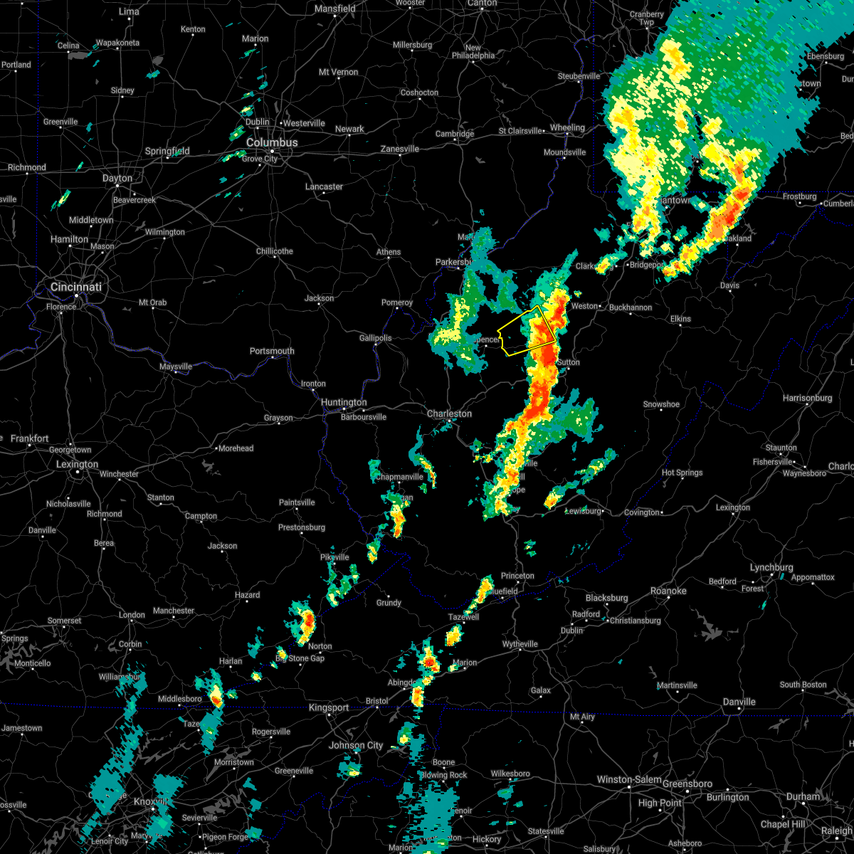 The severe thunderstorm warning for central calhoun and western gilmer counties will expire at 415 pm edt, the storm which prompted the warning has weakened below severe limits, and no longer poses an immediate threat to life or property. therefore, the warning will be allowed to expire. The severe thunderstorm warning for central calhoun and western gilmer counties will expire at 415 pm edt, the storm which prompted the warning has weakened below severe limits, and no longer poses an immediate threat to life or property. therefore, the warning will be allowed to expire.
|
| 7/31/2018 3:50 PM EDT | Numerous trees reported down throughout the mt zion area in calhoun county WV, 5.7 miles N of Grantsville, WV |
| 7/31/2018 3:50 PM EDT |
 At 349 pm edt, a severe thunderstorm was located near arnoldsburg, or near grantsville, moving northeast at 25 mph (radar indicated). Hazards include 60 mph wind gusts and quarter size hail. Hail damage to vehicles is expected. expect wind damage to roofs, siding, and trees. Locations impacted include, grantsville, arnoldsburg, cedar creek state park, millstone, big springs, stumptown, tanner, mount zion, cedarville and normantown. At 349 pm edt, a severe thunderstorm was located near arnoldsburg, or near grantsville, moving northeast at 25 mph (radar indicated). Hazards include 60 mph wind gusts and quarter size hail. Hail damage to vehicles is expected. expect wind damage to roofs, siding, and trees. Locations impacted include, grantsville, arnoldsburg, cedar creek state park, millstone, big springs, stumptown, tanner, mount zion, cedarville and normantown.
|
| 7/31/2018 3:26 PM EDT |
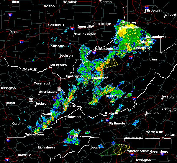 At 325 pm edt, a severe thunderstorm was located near spencer, moving northeast at 25 mph (radar indicated). Hazards include 60 mph wind gusts and quarter size hail. Hail damage to vehicles is expected. Expect wind damage to roofs, siding, and trees. At 325 pm edt, a severe thunderstorm was located near spencer, moving northeast at 25 mph (radar indicated). Hazards include 60 mph wind gusts and quarter size hail. Hail damage to vehicles is expected. Expect wind damage to roofs, siding, and trees.
|
| 7/1/2018 8:42 PM EDT |
 The severe thunderstorm warning for northeastern calhoun, southeastern ritchie and western gilmer counties will expire at 845 pm edt, the storm which prompted the warning has weakened below severe limits, and no longer poses an immediate threat to life or property. therefore, the warning will be allowed to expire. however heavy rain is still possible with this thunderstorm. The severe thunderstorm warning for northeastern calhoun, southeastern ritchie and western gilmer counties will expire at 845 pm edt, the storm which prompted the warning has weakened below severe limits, and no longer poses an immediate threat to life or property. therefore, the warning will be allowed to expire. however heavy rain is still possible with this thunderstorm.
|
| 7/1/2018 8:18 PM EDT |
 At 818 pm edt, a severe thunderstorm was located near cedar creek state park, or 7 miles southeast of grantsville, moving north at 15 mph (radar indicated). Hazards include 60 mph wind gusts and penny size hail. expect damage to roofs, siding, and trees At 818 pm edt, a severe thunderstorm was located near cedar creek state park, or 7 miles southeast of grantsville, moving north at 15 mph (radar indicated). Hazards include 60 mph wind gusts and penny size hail. expect damage to roofs, siding, and trees
|
| 7/22/2017 8:21 PM EDT |
 At 821 pm edt, a severe thunderstorm was located near grantsville, moving east at 35 mph (radar indicated). Hazards include 60 mph wind gusts and half dollar size hail. Hail damage to vehicles is expected. Expect wind damage to roofs, siding, and trees. At 821 pm edt, a severe thunderstorm was located near grantsville, moving east at 35 mph (radar indicated). Hazards include 60 mph wind gusts and half dollar size hail. Hail damage to vehicles is expected. Expect wind damage to roofs, siding, and trees.
|
| 7/22/2017 7:28 PM EDT |
 At 728 pm edt, a severe thunderstorm was located 7 miles northeast of grantsville, moving southeast at 25 mph (radar indicated). Hazards include 60 mph wind gusts and half dollar size hail. Hail damage to vehicles is expected. Expect wind damage to roofs, siding, and trees. At 728 pm edt, a severe thunderstorm was located 7 miles northeast of grantsville, moving southeast at 25 mph (radar indicated). Hazards include 60 mph wind gusts and half dollar size hail. Hail damage to vehicles is expected. Expect wind damage to roofs, siding, and trees.
|
| 7/22/2017 6:16 PM EDT |
 At 616 pm edt, severe thunderstorms were located along a line extending from 7 miles southwest of west union to 7 miles northwest of grantsville, moving southeast at 45 mph (radar indicated). Hazards include 70 mph wind gusts and ping pong ball size hail. People and animals outdoors will be injured. expect hail damage to roofs, siding, windows, and vehicles. expect considerable tree damage. Wind damage is also likely to mobile homes, roofs, and outbuildings. At 616 pm edt, severe thunderstorms were located along a line extending from 7 miles southwest of west union to 7 miles northwest of grantsville, moving southeast at 45 mph (radar indicated). Hazards include 70 mph wind gusts and ping pong ball size hail. People and animals outdoors will be injured. expect hail damage to roofs, siding, windows, and vehicles. expect considerable tree damage. Wind damage is also likely to mobile homes, roofs, and outbuildings.
|
| 4/29/2017 1:30 AM EDT | 2 large pine trees down in calhoun county WV, 14.6 miles N of Grantsville, WV |
| 3/1/2017 10:27 AM EST |
 The tornado warning for calhoun, southwestern gilmer and northwestern braxton counties will expire at 1030 am est, the tornadic thunderstorm which prompted the warning has moved east of the area and weakened. the storm was still capable of producing strong winds and damaging hail. the tornado warning will be allowed to expire. a severe thunderstorm watch remains in effect until 100 pm est for central and north central west virginia. The tornado warning for calhoun, southwestern gilmer and northwestern braxton counties will expire at 1030 am est, the tornadic thunderstorm which prompted the warning has moved east of the area and weakened. the storm was still capable of producing strong winds and damaging hail. the tornado warning will be allowed to expire. a severe thunderstorm watch remains in effect until 100 pm est for central and north central west virginia.
|
| 3/1/2017 10:16 AM EST |
 At 1016 am est, a severe thunderstorm capable of producing a tornado was located 7 miles east of arnoldsburg, or 9 miles southeast of grantsville, moving east at 65 mph (radar indicated rotation). Hazards include tornado and quarter size hail. Flying debris will be dangerous to those caught without shelter. mobile homes will be damaged or destroyed. damage to roofs, windows, and vehicles will occur. tree damage is likely. this dangerous storm will be near, cedar creek state park around 1025 am est. Other locations impacted by this tornadic thunderstorm include shock, millstone, orma, wilsie, rosedale, nicut, stumptown, mount zion, cedarville and chloe. At 1016 am est, a severe thunderstorm capable of producing a tornado was located 7 miles east of arnoldsburg, or 9 miles southeast of grantsville, moving east at 65 mph (radar indicated rotation). Hazards include tornado and quarter size hail. Flying debris will be dangerous to those caught without shelter. mobile homes will be damaged or destroyed. damage to roofs, windows, and vehicles will occur. tree damage is likely. this dangerous storm will be near, cedar creek state park around 1025 am est. Other locations impacted by this tornadic thunderstorm include shock, millstone, orma, wilsie, rosedale, nicut, stumptown, mount zion, cedarville and chloe.
|
| 3/1/2017 10:05 AM EST |
 At 1004 am est, a severe thunderstorm capable of producing a tornado was located near arnoldsburg, or near spencer, moving east at 65 mph (radar indicated rotation). Hazards include tornado and quarter size hail. Flying debris will be dangerous to those caught without shelter. mobile homes will be damaged or destroyed. damage to roofs, windows, and vehicles will occur. tree damage is likely. this dangerous storm will be near, arnoldsburg around 1010 am est. cedar creek state park around 1025 am est. Other locations impacted by this tornadic thunderstorm include shock, millstone, wilsie, harmony, tariff, rosedale, mount zion, orma, looneyville and nicut. At 1004 am est, a severe thunderstorm capable of producing a tornado was located near arnoldsburg, or near spencer, moving east at 65 mph (radar indicated rotation). Hazards include tornado and quarter size hail. Flying debris will be dangerous to those caught without shelter. mobile homes will be damaged or destroyed. damage to roofs, windows, and vehicles will occur. tree damage is likely. this dangerous storm will be near, arnoldsburg around 1010 am est. cedar creek state park around 1025 am est. Other locations impacted by this tornadic thunderstorm include shock, millstone, wilsie, harmony, tariff, rosedale, mount zion, orma, looneyville and nicut.
|
| 3/1/2017 9:55 AM EST |
 At 954 am est, a severe thunderstorm capable of producing a tornado was located near spencer, moving east at 60 mph (radar indicated rotation). Hazards include tornado and quarter size hail. Flying debris will be dangerous to those caught without shelter. mobile homes will be damaged or destroyed. damage to roofs, windows, and vehicles will occur. tree damage is likely. this dangerous storm will be near, arnoldsburg around 1010 am est. cedar creek state park around 1025 am est. Other locations impacted by this tornadic thunderstorm include shock, millstone, wilsie, harmony, tariff, rosedale, mount zion, orma, looneyville and nicut. At 954 am est, a severe thunderstorm capable of producing a tornado was located near spencer, moving east at 60 mph (radar indicated rotation). Hazards include tornado and quarter size hail. Flying debris will be dangerous to those caught without shelter. mobile homes will be damaged or destroyed. damage to roofs, windows, and vehicles will occur. tree damage is likely. this dangerous storm will be near, arnoldsburg around 1010 am est. cedar creek state park around 1025 am est. Other locations impacted by this tornadic thunderstorm include shock, millstone, wilsie, harmony, tariff, rosedale, mount zion, orma, looneyville and nicut.
|
| 3/1/2017 6:46 AM EST |
 At 646 am est, a severe thunderstorm was located near glenville, moving east at 85 mph (radar indicated). Hazards include 70 mph wind gusts and ping pong ball size hail. People and animals outdoors will be injured. expect hail damage to roofs, siding, windows, and vehicles. expect considerable tree damage. Wind damage is also likely to mobile homes, roofs, and outbuildings. At 646 am est, a severe thunderstorm was located near glenville, moving east at 85 mph (radar indicated). Hazards include 70 mph wind gusts and ping pong ball size hail. People and animals outdoors will be injured. expect hail damage to roofs, siding, windows, and vehicles. expect considerable tree damage. Wind damage is also likely to mobile homes, roofs, and outbuildings.
|
| 3/1/2017 6:34 AM EST |
 At 634 am est, a severe thunderstorm was located 7 miles northwest of grantsville, moving east at 70 mph (radar indicated). Hazards include 70 mph wind gusts and half dollar size hail. Hail damage to vehicles is expected. expect considerable tree damage. wind damage is also likely to mobile homes, roofs, and outbuildings. Locations impacted include, grantsville, reedy, cherry, peewee, smithville, mount zion, palestine, lucille, creston, big springs, brohard, tanner, macfarlan, annamoriah, burnt house and munday. At 634 am est, a severe thunderstorm was located 7 miles northwest of grantsville, moving east at 70 mph (radar indicated). Hazards include 70 mph wind gusts and half dollar size hail. Hail damage to vehicles is expected. expect considerable tree damage. wind damage is also likely to mobile homes, roofs, and outbuildings. Locations impacted include, grantsville, reedy, cherry, peewee, smithville, mount zion, palestine, lucille, creston, big springs, brohard, tanner, macfarlan, annamoriah, burnt house and munday.
|
| 3/1/2017 6:15 AM EST |
 At 615 am est, a severe thunderstorm was located near sandyville, or 9 miles northeast of ripley, moving east at 70 mph (radar indicated). Hazards include 70 mph wind gusts and half dollar size hail. Hail damage to vehicles is expected. expect considerable tree damage. Wind damage is also likely to mobile homes, roofs, and outbuildings. At 615 am est, a severe thunderstorm was located near sandyville, or 9 miles northeast of ripley, moving east at 70 mph (radar indicated). Hazards include 70 mph wind gusts and half dollar size hail. Hail damage to vehicles is expected. expect considerable tree damage. Wind damage is also likely to mobile homes, roofs, and outbuildings.
|
| 7/26/2016 6:00 PM EDT |
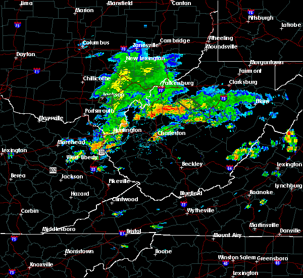 At 559 pm edt, a severe thunderstorm was located near arnoldsburg, or near grantsville, moving southeast at 25 mph (radar indicated). Hazards include 65 mph wind gusts. Expect damage to roofs. siding. And trees. At 559 pm edt, a severe thunderstorm was located near arnoldsburg, or near grantsville, moving southeast at 25 mph (radar indicated). Hazards include 65 mph wind gusts. Expect damage to roofs. siding. And trees.
|
| 4/28/2016 6:55 PM EDT |
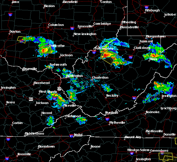 At 653 pm edt, a severe thunderstorm was located 9 miles northwest of grantsville, moving east at 40 mph. golf ball sized hail was reported 4 miles northeast of elizabeth (trained weather spotters). Hazards include golf ball size hail and 60 mph wind gusts. People and animals outdoors will be injured. expect hail damage to roofs, siding, windows, and vehicles. expect wind damage to roofs, siding, and trees. Locations impacted include, grantsville, cairo, macfarlan, berea, munday, burnt house, big springs, brohard, tanner, smithville and newberne. At 653 pm edt, a severe thunderstorm was located 9 miles northwest of grantsville, moving east at 40 mph. golf ball sized hail was reported 4 miles northeast of elizabeth (trained weather spotters). Hazards include golf ball size hail and 60 mph wind gusts. People and animals outdoors will be injured. expect hail damage to roofs, siding, windows, and vehicles. expect wind damage to roofs, siding, and trees. Locations impacted include, grantsville, cairo, macfarlan, berea, munday, burnt house, big springs, brohard, tanner, smithville and newberne.
|
| 4/28/2016 6:43 PM EDT |
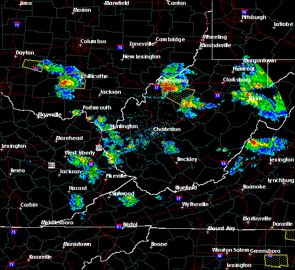 At 641 pm edt, a severe thunderstorm was located near elizabeth, moving east at 40 mph. ping pong ball sized hail was reported in mineral wells (trained weather spotters). Hazards include ping pong ball size hail and 60 mph wind gusts. People and animals outdoors will be injured. expect hail damage to roofs, siding, windows, and vehicles. expect wind damage to roofs, siding, and trees. Locations impacted include, elizabeth, grantsville, cairo, macfarlan, munday, burnt house, big springs, walker, smithville, berea, freeport, petroleum, brohard, tanner, greencastle, newberne and cherry. At 641 pm edt, a severe thunderstorm was located near elizabeth, moving east at 40 mph. ping pong ball sized hail was reported in mineral wells (trained weather spotters). Hazards include ping pong ball size hail and 60 mph wind gusts. People and animals outdoors will be injured. expect hail damage to roofs, siding, windows, and vehicles. expect wind damage to roofs, siding, and trees. Locations impacted include, elizabeth, grantsville, cairo, macfarlan, munday, burnt house, big springs, walker, smithville, berea, freeport, petroleum, brohard, tanner, greencastle, newberne and cherry.
|
| 4/28/2016 6:29 PM EDT |
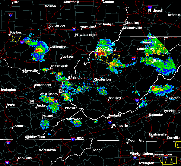 At 629 pm edt, a severe thunderstorm was located near mineralwells, or near elizabeth, moving east at 40 mph (radar indicated). Hazards include 60 mph wind gusts and half dollar size hail. Hail damage to vehicles is expected. Expect wind damage to roofs, siding, and trees. At 629 pm edt, a severe thunderstorm was located near mineralwells, or near elizabeth, moving east at 40 mph (radar indicated). Hazards include 60 mph wind gusts and half dollar size hail. Hail damage to vehicles is expected. Expect wind damage to roofs, siding, and trees.
|
| 7/14/2015 5:54 PM EDT | Trees down in calhoun county WV, 11.9 miles N of Grantsville, WV |
| 7/14/2015 5:48 PM EDT | Trees and power lines dow in calhoun county WV, 9.3 miles NNE of Grantsville, WV |
| 7/14/2015 5:09 PM EDT |
 At 507 pm edt, doppler radar indicated a line of severe thunderstorms capable of producing damaging winds in excess of 60 mph. these storms were located along a line extending from 6 miles southeast of pennsboro to near grantsville to 8 miles north of spencer, moving southeast at 45 mph. locations impacted include, spencer, harrisville, glenville, elizabeth, grantsville, salem, pennsboro, west union, arnoldsburg, north bend state park, cedar creek state park, ellenboro, cairo, reedy, sand fork, pullman, auburn, coxs mills, creston and wolf summit. At 507 pm edt, doppler radar indicated a line of severe thunderstorms capable of producing damaging winds in excess of 60 mph. these storms were located along a line extending from 6 miles southeast of pennsboro to near grantsville to 8 miles north of spencer, moving southeast at 45 mph. locations impacted include, spencer, harrisville, glenville, elizabeth, grantsville, salem, pennsboro, west union, arnoldsburg, north bend state park, cedar creek state park, ellenboro, cairo, reedy, sand fork, pullman, auburn, coxs mills, creston and wolf summit.
|
| 7/14/2015 4:34 PM EDT |
 At 433 pm edt, doppler radar indicated a line of severe thunderstorms capable of producing damaging winds in excess of 60 mph. these storms were located along a line extending from near belmont to mineralwells to forked run state park, and moving southeast at 45 mph. At 433 pm edt, doppler radar indicated a line of severe thunderstorms capable of producing damaging winds in excess of 60 mph. these storms were located along a line extending from near belmont to mineralwells to forked run state park, and moving southeast at 45 mph.
|
| 7/7/2015 5:28 PM EDT | The severe thunderstorm warning for north central roane. southwestern ritchie. southeastern wirt. calhoun and west central gilmer counties will expire at 530 pm edt. the storms which prompted the warning have weakened below severe limits and exited the warned area. Therefore the warning will be allowed to expire. |
| 7/7/2015 5:20 PM EDT | Two large trees down... 12 in diamete in calhoun county WV, 2.2 miles N of Grantsville, WV |
| 7/7/2015 5:10 PM EDT | Tree down at a residence in annamoriah in calhoun county WV, 6.8 miles E of Grantsville, WV |
| 7/7/2015 5:09 PM EDT |
 At 509 pm edt, doppler radar indicated a line of severe thunderstorms capable of producing damaging winds in excess of 60 mph. these storms were located along a line extending from elizabeth to near spencer. these storms were nearly stationary. locations impacted include, spencer, grantsville, macfarlan, munday, creston, mount zion, burnt house, annamoriah, big springs, brohard, stumptown, smithville and tanner. At 509 pm edt, doppler radar indicated a line of severe thunderstorms capable of producing damaging winds in excess of 60 mph. these storms were located along a line extending from elizabeth to near spencer. these storms were nearly stationary. locations impacted include, spencer, grantsville, macfarlan, munday, creston, mount zion, burnt house, annamoriah, big springs, brohard, stumptown, smithville and tanner.
|
| 7/7/2015 4:45 PM EDT |
 At 444 pm edt, doppler radar indicated a line of severe thunderstorms capable of producing damaging winds in excess of 60 mph. these storms were located along a line extending from elizabeth to near spencer, and moving east at 35 mph. At 444 pm edt, doppler radar indicated a line of severe thunderstorms capable of producing damaging winds in excess of 60 mph. these storms were located along a line extending from elizabeth to near spencer, and moving east at 35 mph.
|
| 6/26/2015 7:57 PM EDT | The severe thunderstorm warning for southeastern meigs. roane. southern wirt. central calhoun. east central mason and jackson counties will expire at 800 pm edt. this severe thunderstorm warning will expire at 8. however. a new severe thunderstorm warning has been issued downstream for roane county in west virginia. North central nicholas county in west. |
| 6/26/2015 7:57 PM EDT | The severe thunderstorm warning for southeastern meigs, roane, southern wirt, central calhoun, east central mason and jackson counties will expire at 800 pm edt, this severe thunderstorm warning will expire at 8. however, a new severe thunderstorm warning has been issued downstream for roane county in west virginia, north central nicholas county in west virginia, southern calhoun county in west virginia, central clay county in west virginia, southwestern gilmer county in west virginia, braxton county in west virginia, southeastern jackson county in west virginia, and northeastern kanawha county in west virginia until 900 pm edt. |
| 6/26/2015 7:27 PM EDT | At 727 pm edt, doppler radar indicated a severe thunderstorm capable of producing large damaging hail up to golf ball size and destructive winds in excess of 70 mph. this storm was located near ripley, moving east at 25 mph. locations impacted include, ripley, spencer, grantsville, ravenswood, amma, sandyville, arnoldsburg, kenna, reedy, fairplain, creston, harmony, gandeeville, looneyville, evans, left hand, given, tariff, peewee and mount zion. |
| 6/26/2015 7:27 PM EDT | At 727 pm edt, doppler radar indicated a severe thunderstorm capable of producing large damaging hail up to golf ball size and destructive winds in excess of 70 mph. this storm was located near ripley, moving east at 25 mph. locations impacted include, ripley, spencer, grantsville, ravenswood, amma, sandyville, arnoldsburg, kenna, reedy, fairplain, creston, harmony, gandeeville, looneyville, evans, left hand, given, tariff, peewee and mount zion. |
| 6/26/2015 7:00 PM EDT | At 659 pm edt, doppler radar indicated a severe thunderstorm capable of producing quarter size hail and damaging winds in excess of 60 mph. this storm was located 7 miles west of ripley, and moving east at 35 mph. |
| 6/26/2015 7:00 PM EDT | At 659 pm edt, doppler radar indicated a severe thunderstorm capable of producing quarter size hail and damaging winds in excess of 60 mph. this storm was located 7 miles west of ripley, and moving east at 35 mph. |
| 5/26/2015 6:39 PM EDT | The severe thunderstorm warning for southeastern ritchie, northeastern calhoun and northwestern gilmer counties will expire at 645 pm edt, the storm which prompted the warning has weakened below severe limits and exited the warned area. therefore the warning will be allowed to expire. |
| 5/26/2015 6:19 PM EDT | At 619 pm edt, trained weather spotters reported a severe thunderstorm producing quarter size hail about 5 miles northeast of mount zion. damaging winds in excess of 60 mph are also expected with this storm. this storm was located near grantsville, moving north at 30 mph. locations impacted include, grantsville, burnt house, big springs and tanner. |
| 5/26/2015 6:10 PM EDT | Several trees down. power outage in calhoun county WV, 0.2 miles WNW of Grantsville, WV |
| 5/26/2015 6:05 PM EDT | Quarter sized hail reported 2.9 miles N of Grantsville, WV |
| 5/26/2015 5:53 PM EDT | At 553 pm edt, doppler radar indicated a severe thunderstorm capable of producing quarter size hail and damaging winds in excess of 60 mph. this storm was located over arnoldsburg, or 8 miles south of grantsville, and moving north at 25 mph. |
| 4/9/2015 7:11 PM EDT | The severe thunderstorm warning for lewis. extreme north central braxton. east central calhoun and central gilmer counties will expire at 715 pm edt. the storm which prompted the warning has moved out of the warned area. A severe thunderstorm watch remains in effect until 1000 pm edt. |
| 4/9/2015 6:34 PM EDT | A severe thunderstorm warning remains in effect until 715 pm edt for lewis. north central braxton. east central calhoun and central gilmer counties. at 631 pm edt. national weather service doppler radar continued to indicate a severe thunderstorm capable of producing quarter size hail. this storm was located near stumptown. Or near grantsville. |
| 4/9/2015 6:11 PM EDT | The national weather service in charleston has issued a * severe thunderstorm warning for. north central braxton county in west virginia. northern calhoun county in west virginia. this includes the city of grantsville. South central doddridge county in west virginia. |
| 4/9/2015 6:11 PM EDT | The national weather service in charleston has issued a * severe thunderstorm warning for. north central braxton county in west virginia. northern calhoun county in west virginia. this includes the city of grantsville. South central doddridge county in west virginia. |
| 12/22/2013 2:30 AM EST | Trees limbs down across phone and power lines along route 33 in calhoun county WV, 8.4 miles N of Grantsville, WV |
| 7/26/2012 7:45 PM EDT | Two trees down on one residence in grantsville...1 tree on the house...1 tree on power lines in calhoun county WV, 0.2 miles WNW of Grantsville, WV |
| 7/3/2012 2:35 PM EDT | A tree down on power lines. electrical power lost to a few home in calhoun county WV, 0.2 miles WNW of Grantsville, WV |
| 1/1/0001 12:00 AM | Tree down along rt 8 se of community of nob in calhoun county WV, 5.9 miles SSW of Grantsville, WV |
| 1/1/0001 12:00 AM | Tree down along wv st rt 5 in calhoun county WV, 3.2 miles NW of Grantsville, WV |
| 1/1/0001 12:00 AM | Tree down along county rt 18 in calhoun county WV, 8.1 miles NNE of Grantsville, WV |
| 1/1/0001 12:00 AM | Quarter sized hail reported 3.8 miles NNE of Grantsville, WV |
| 1/1/0001 12:00 AM | Quarter sized hail reported 0.2 miles WNW of Grantsville, WV |
| 1/1/0001 12:00 AM | Trees are down on state route 33 west near stumptown in gilmer county WV, 7.5 miles NW of Grantsville, WV |
| 1/1/0001 12:00 AM | Golf Ball sized hail reported 7.8 miles NE of Grantsville, WV |
Hail Maps for Grantsville, WV

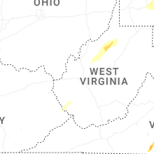


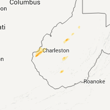


Connect with Interactive Hail Maps