

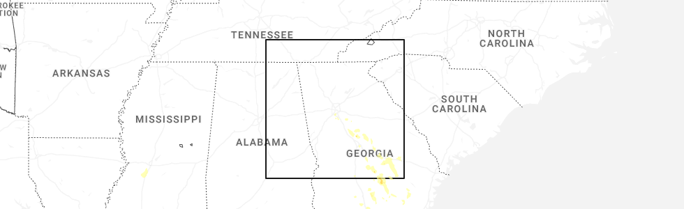
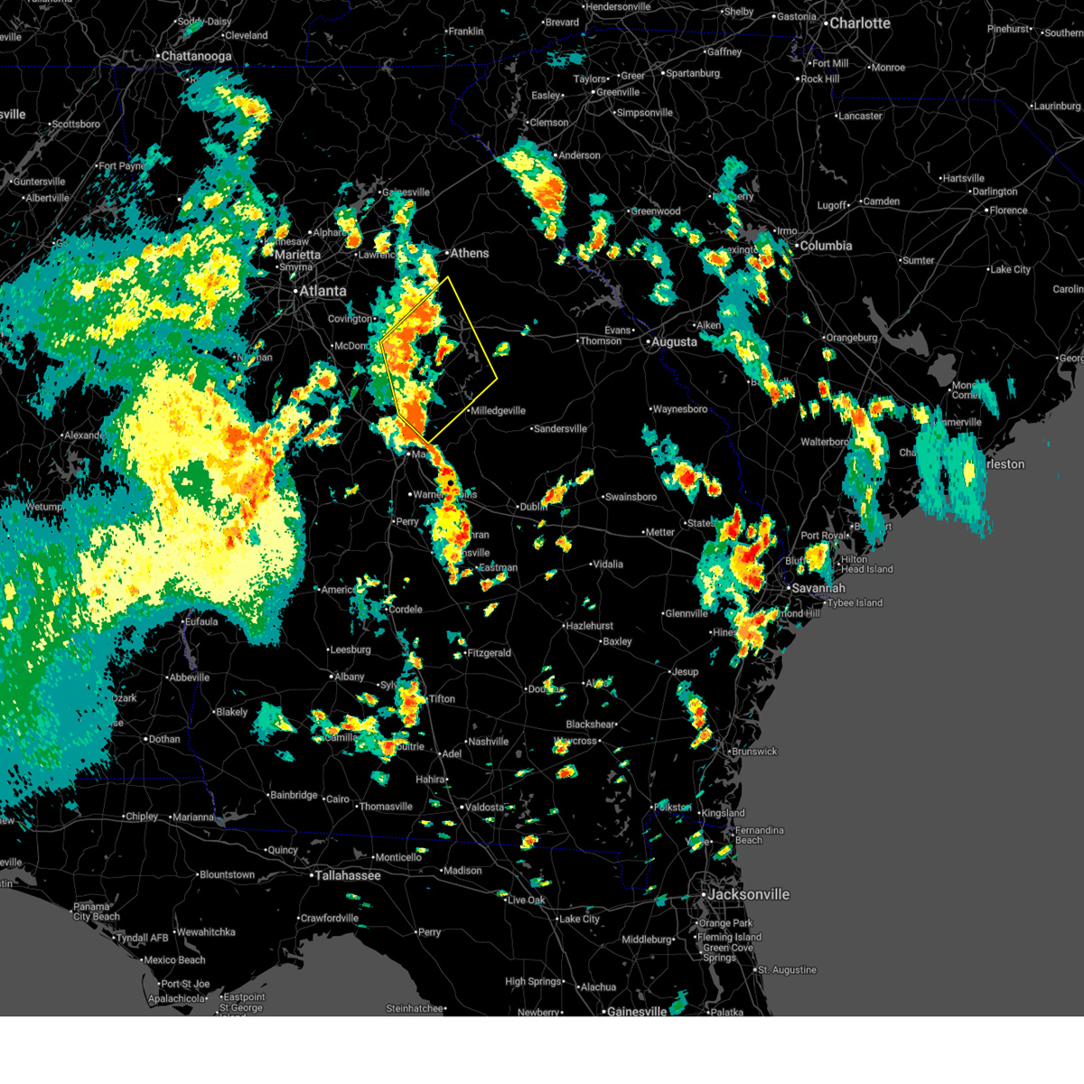
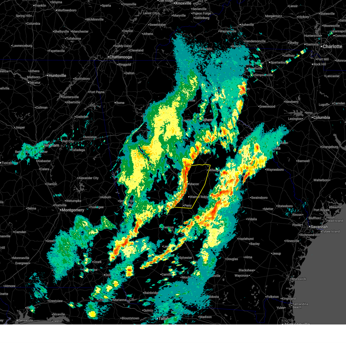
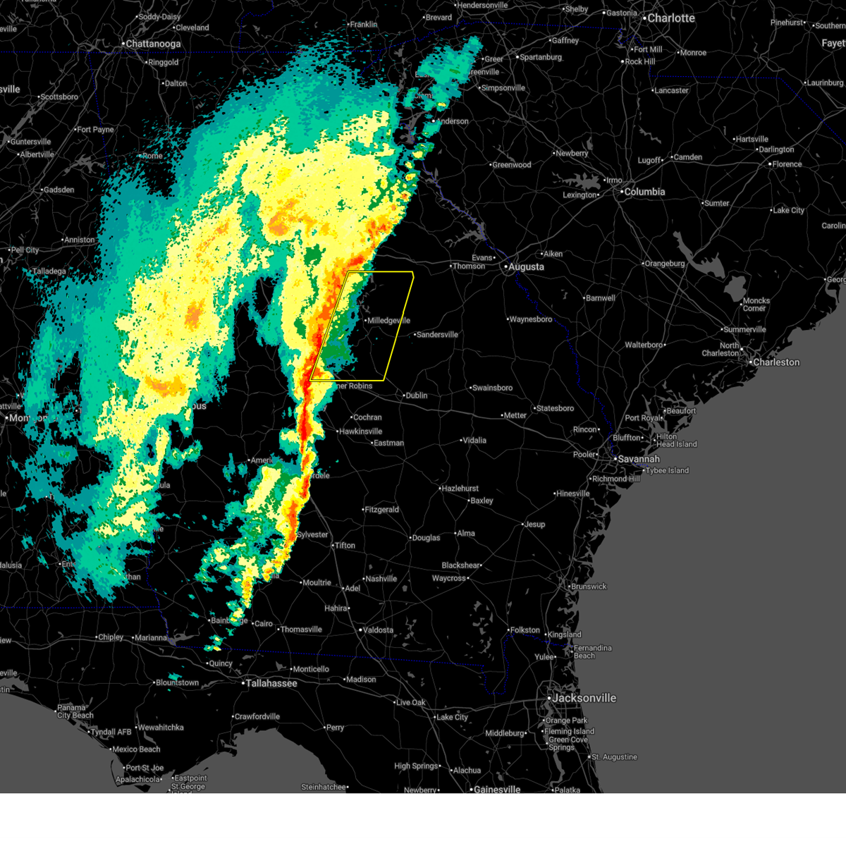
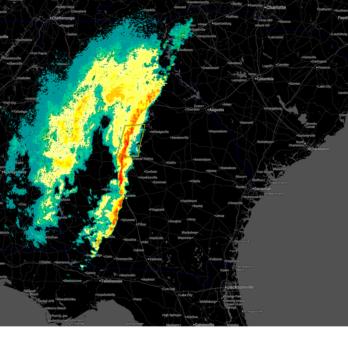
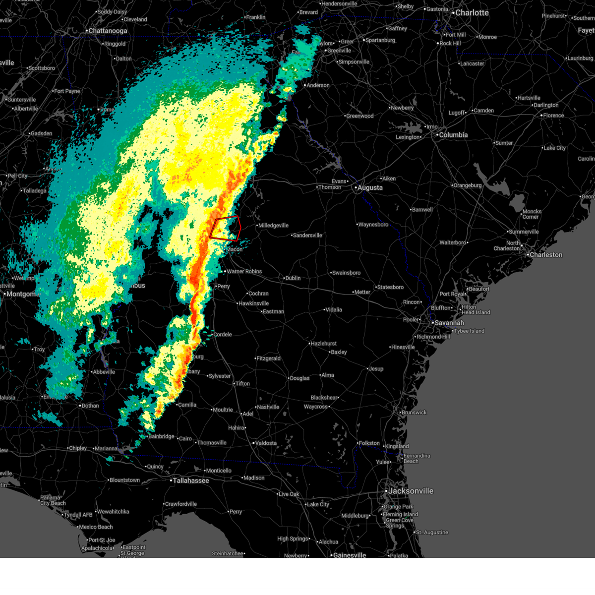
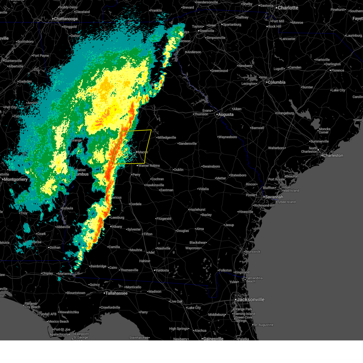
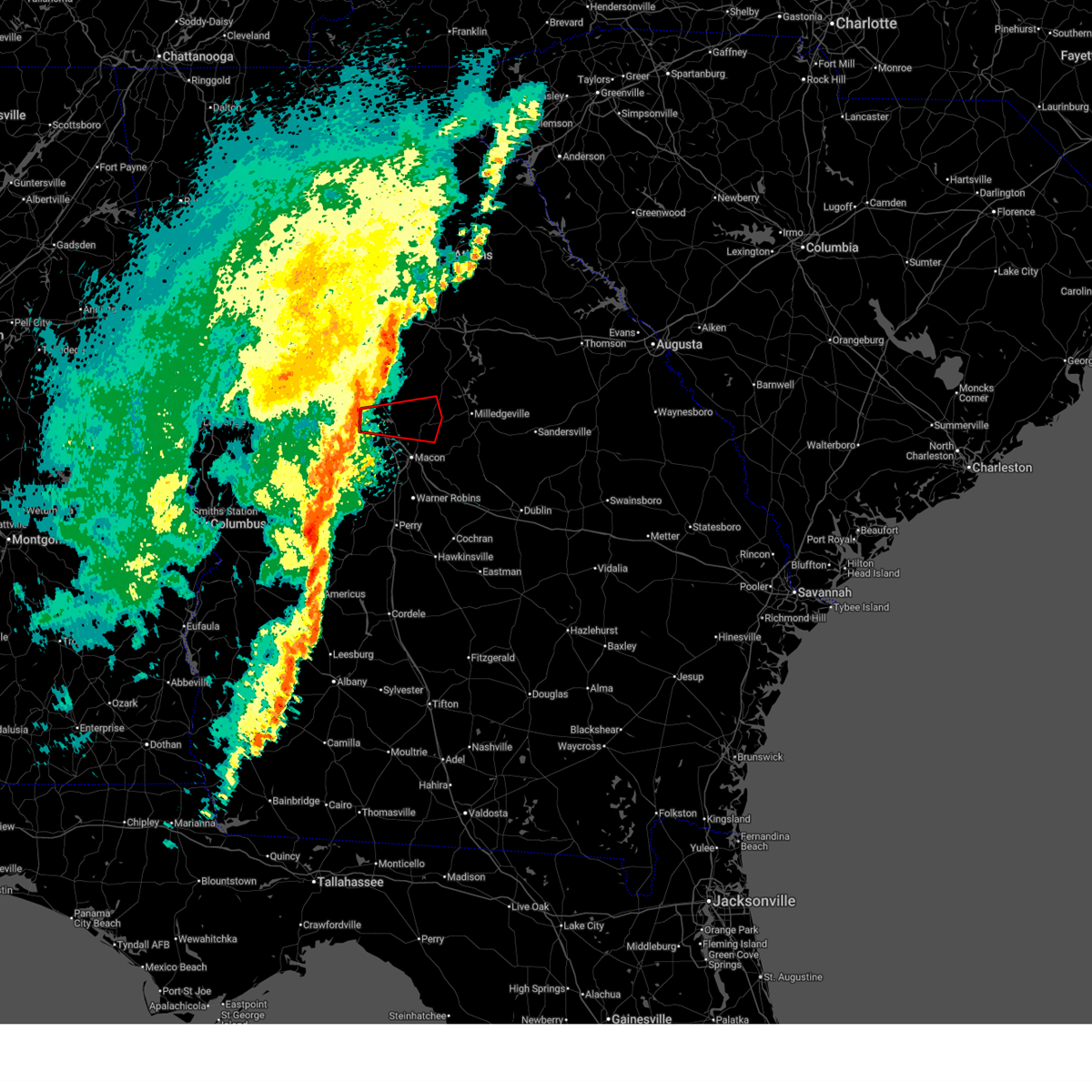
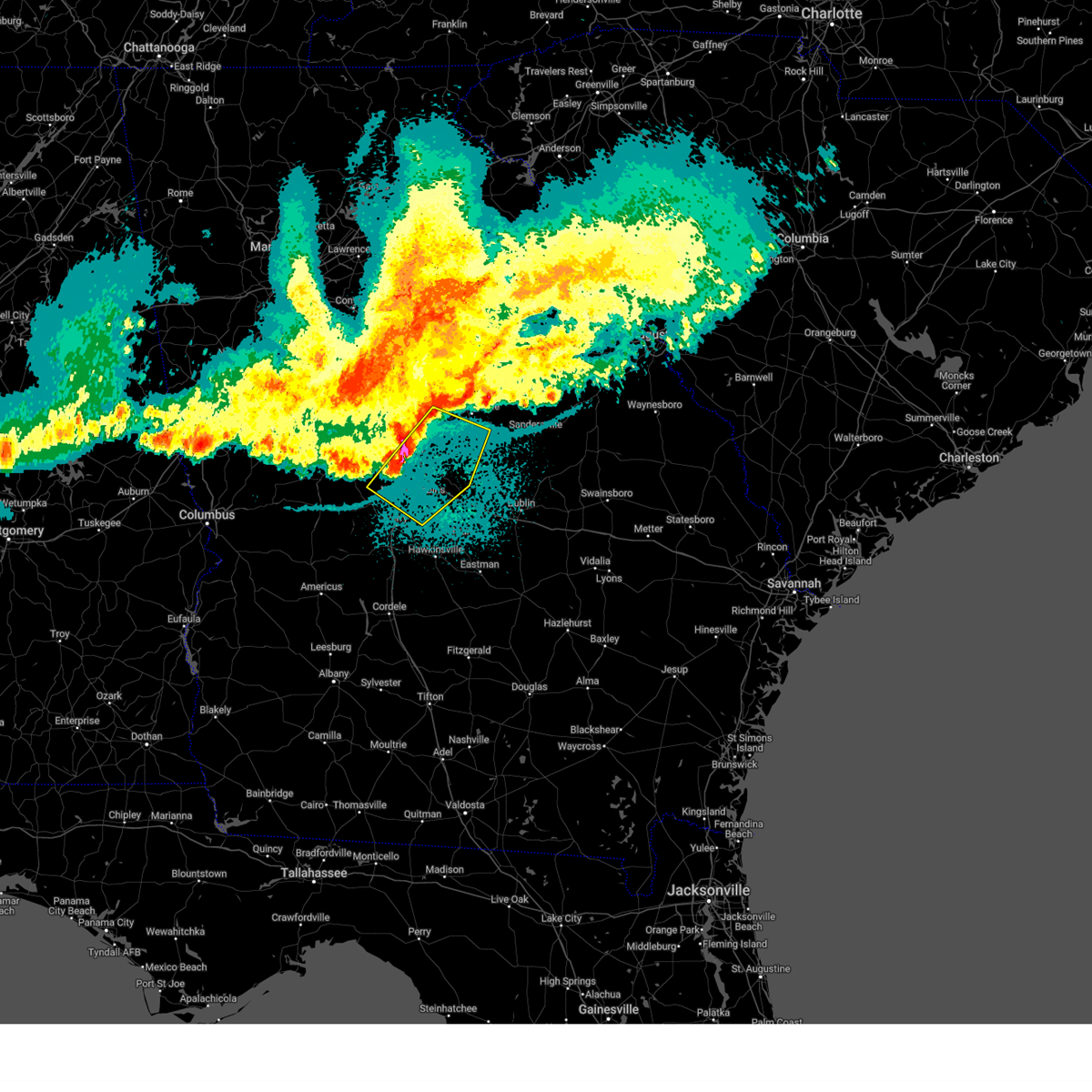
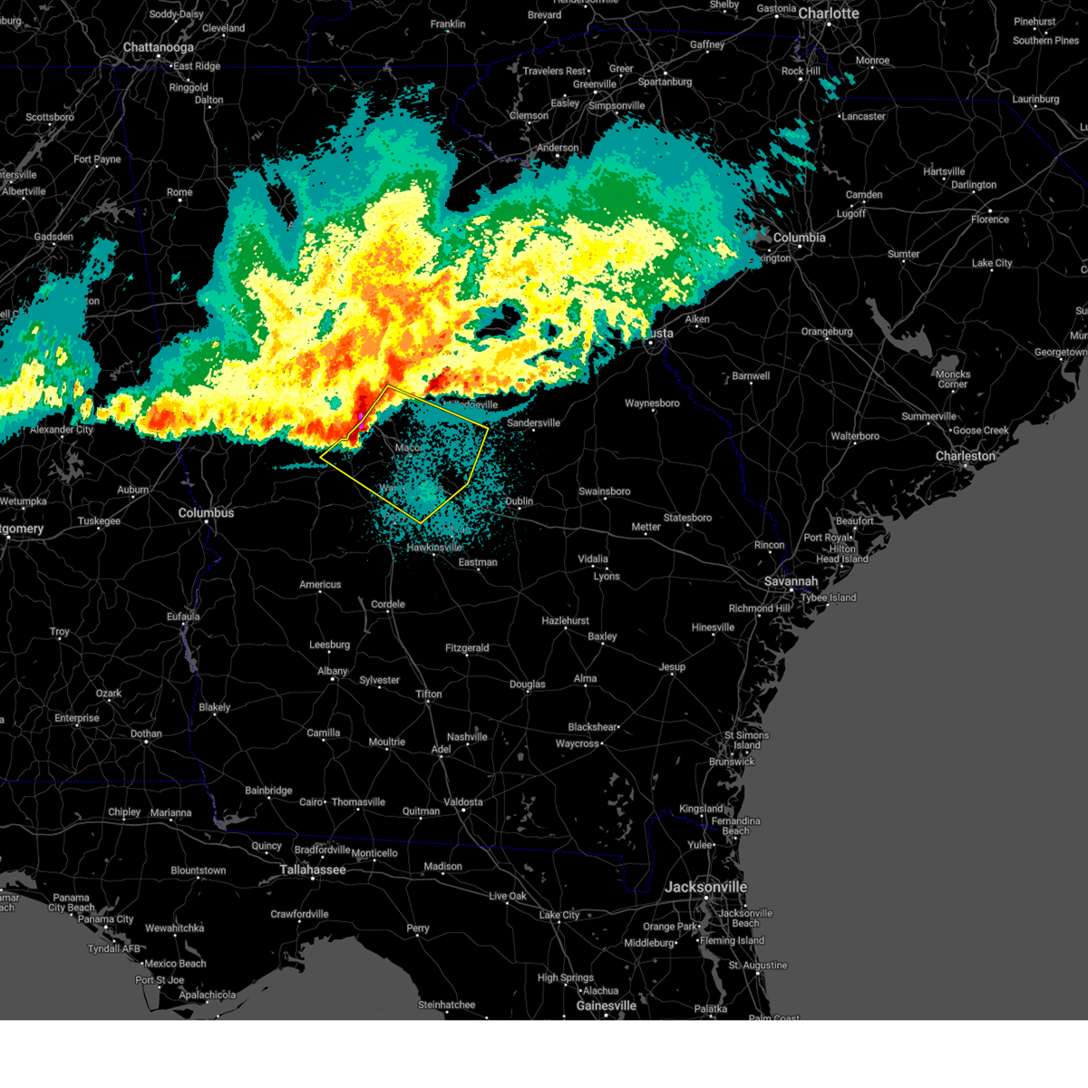
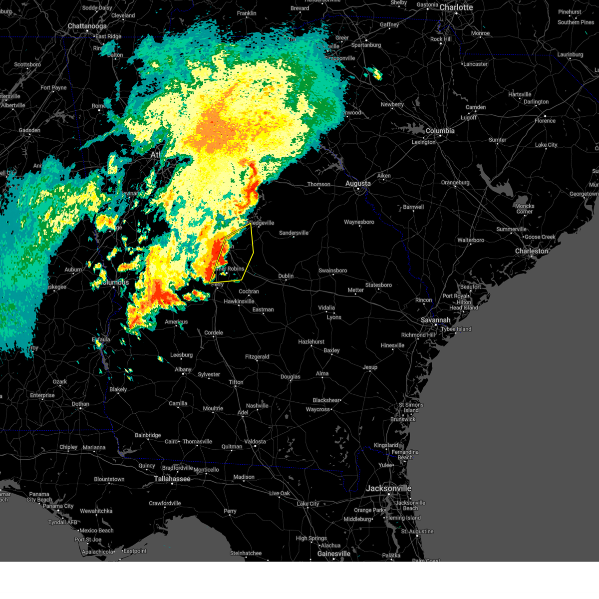
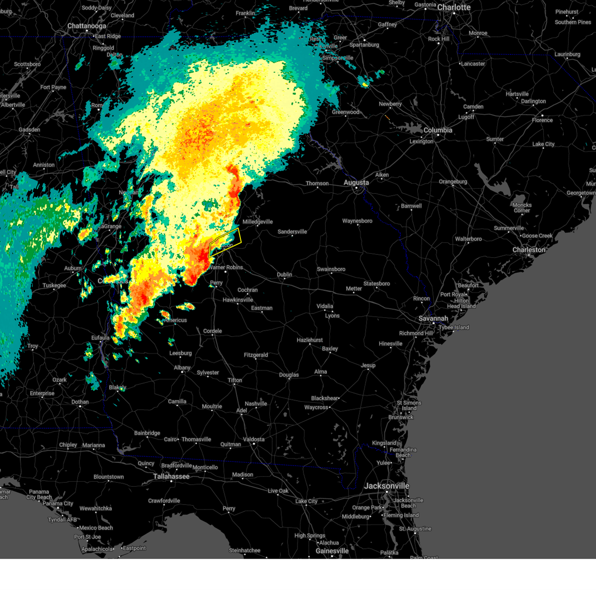
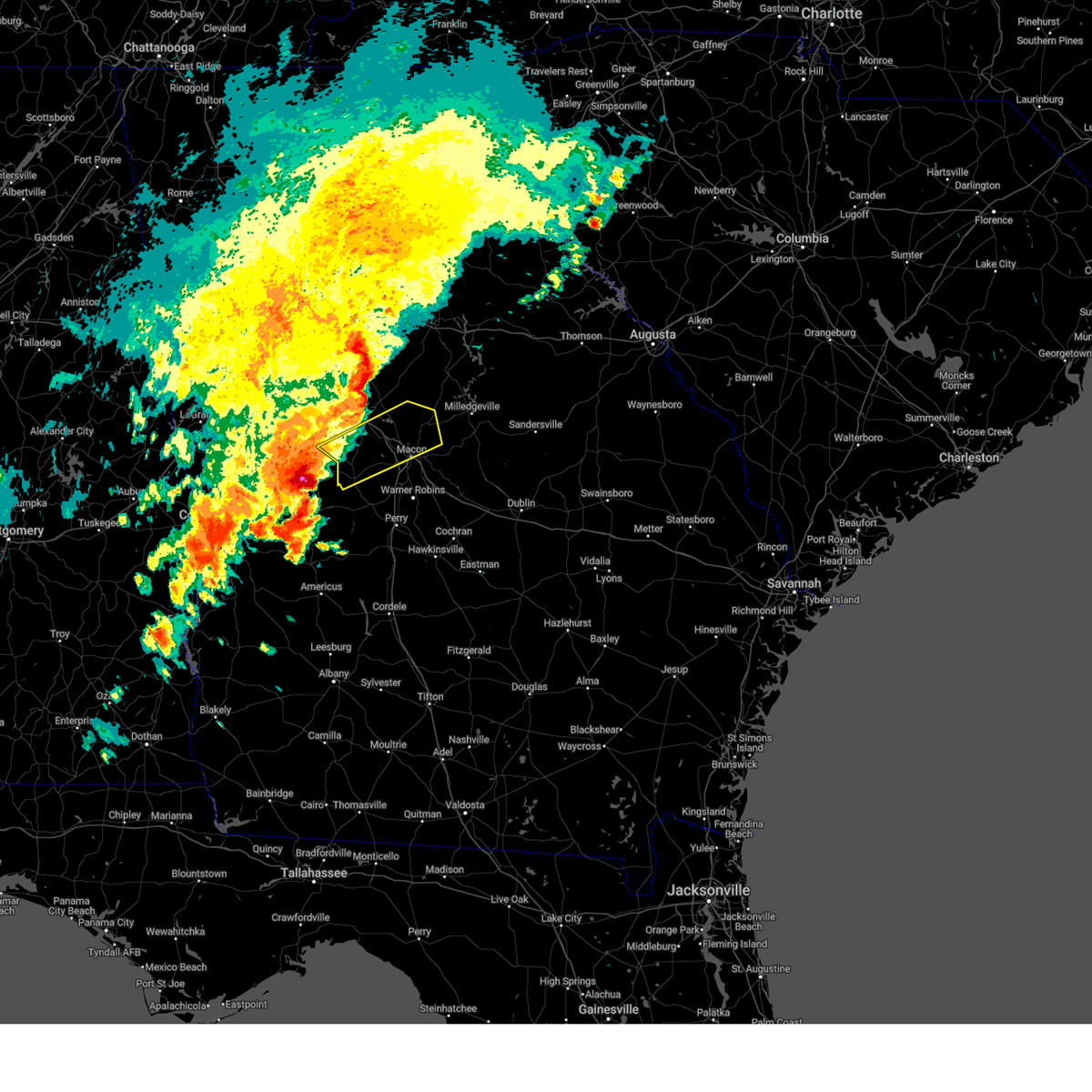
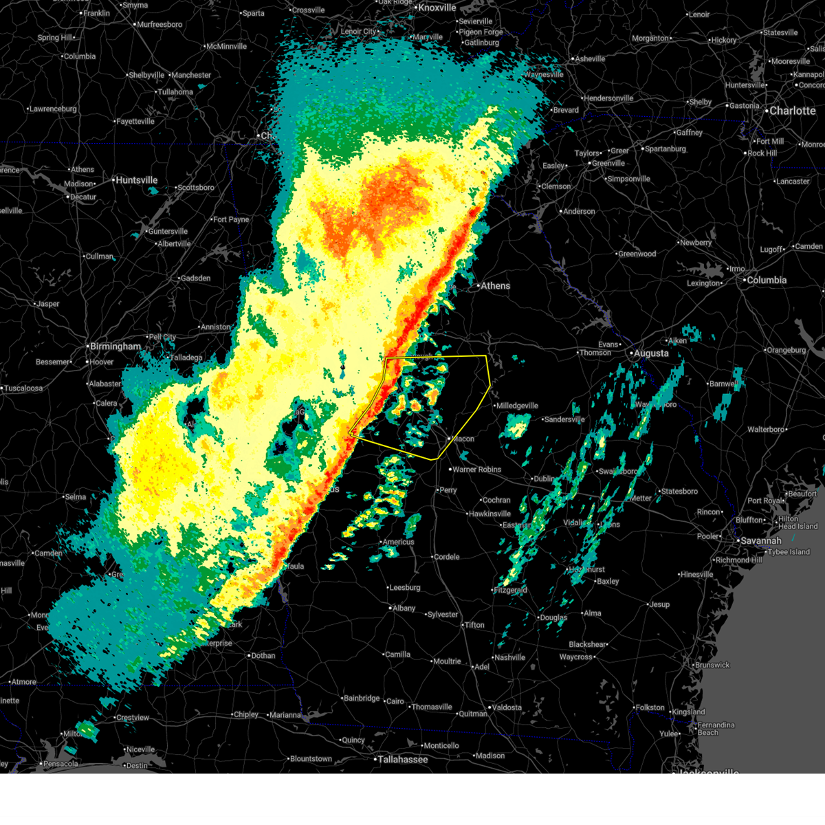
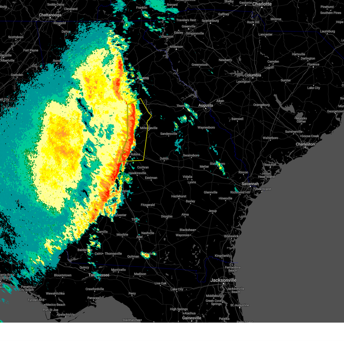
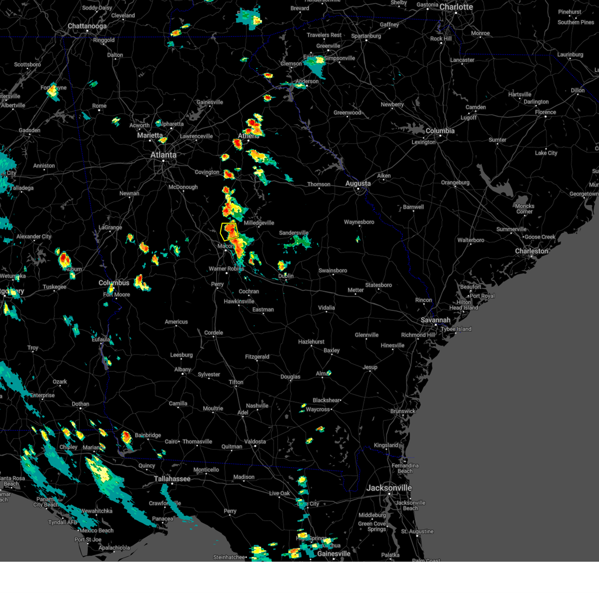
Hail Map for Gray, GA
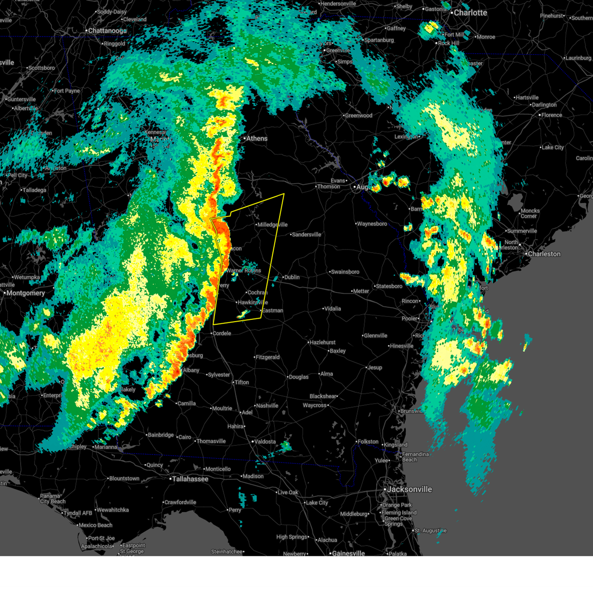
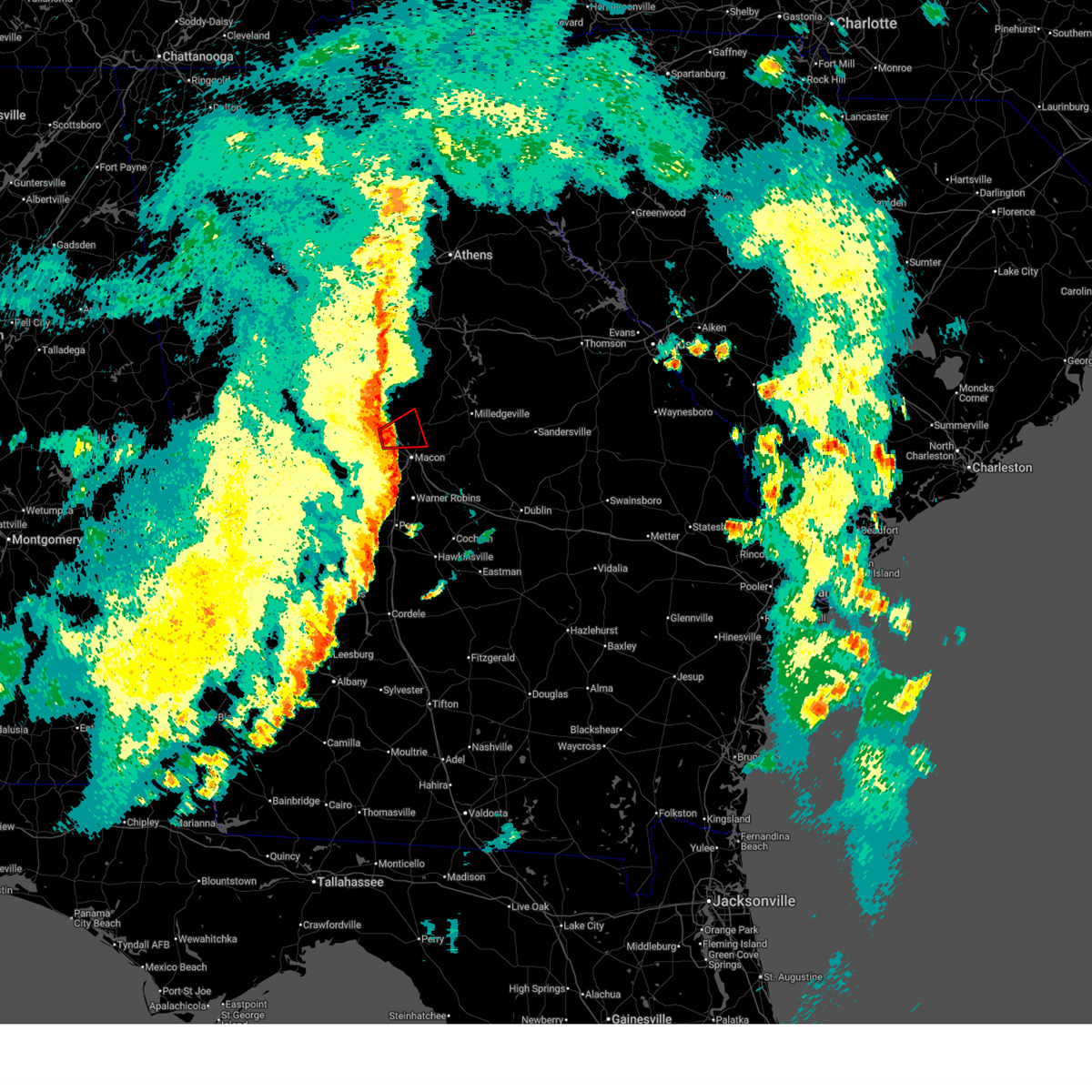
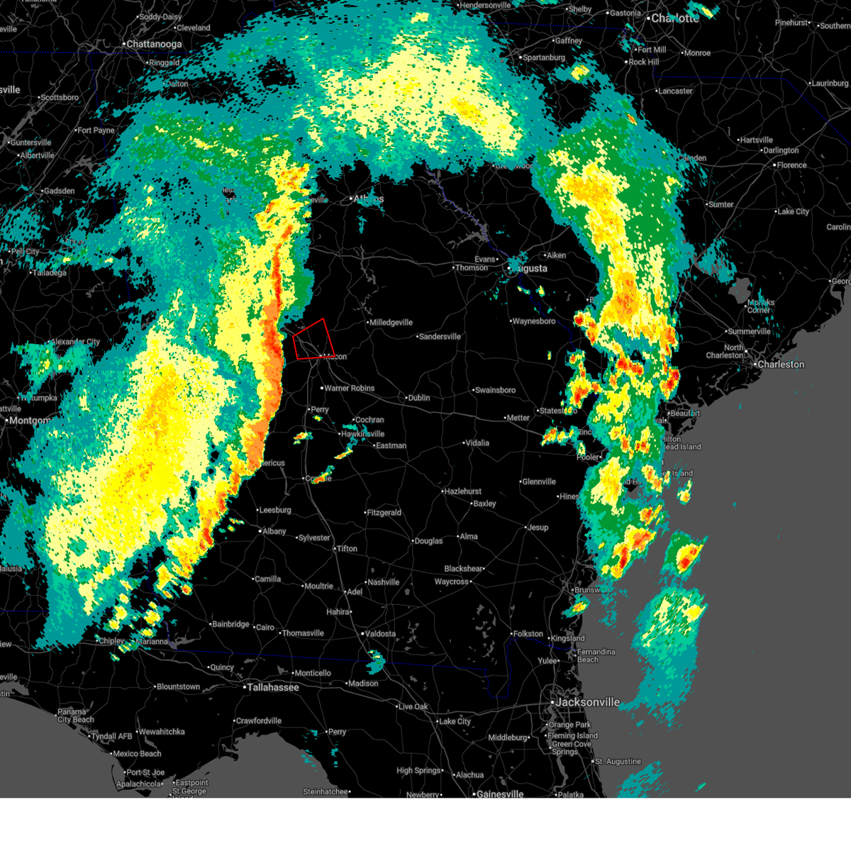
The Gray, GA area has had 4 reports of on-the-ground hail by trained spotters, and has been under severe weather warnings 19 times during the past 12 months. Doppler radar has detected hail at or near Gray, GA on 59 occasions, including 1 occasion during the past year.
| Name: | Gray, GA |
| Where Located: | 71.2 miles SE of Atlanta, GA |
| Map: | Google Map for Gray, GA |
| Population: | 3276 |
| Housing Units: | 1288 |
| More Info: | Search Google for Gray, GA |
0
The Top Recent Hail Date for Gray, GA is Sunday, May 17, 2026 (50th out of 59)
Hail and Wind Damage Spotted near Gray, GA
| Date / Time | Report Details |
|---|---|
| 6/18/2026 8:26 PM EDT |
 Svrffc the national weather service in peachtree city has issued a * severe thunderstorm warning for, northwestern laurens county in central georgia, northwestern dodge county in central georgia, eastern bibb county in central georgia, central hancock county in east central georgia, houston county in central georgia, jones county in central georgia, wilkinson county in central georgia, baldwin county in central georgia, pulaski county in central georgia, twiggs county in central georgia, southern putnam county in central georgia, northwestern wilcox county in central georgia, eastern dooly county in central georgia, bleckley county in central georgia, west central washington county in east central georgia, * until 930 pm edt. * at 826 pm edt, severe thunderstorms were located along a line extending from near clinton to near vienna, moving east at 45 mph (radar indicated). Hazards include 60 mph wind gusts. expect damage to roofs, siding, and trees Svrffc the national weather service in peachtree city has issued a * severe thunderstorm warning for, northwestern laurens county in central georgia, northwestern dodge county in central georgia, eastern bibb county in central georgia, central hancock county in east central georgia, houston county in central georgia, jones county in central georgia, wilkinson county in central georgia, baldwin county in central georgia, pulaski county in central georgia, twiggs county in central georgia, southern putnam county in central georgia, northwestern wilcox county in central georgia, eastern dooly county in central georgia, bleckley county in central georgia, west central washington county in east central georgia, * until 930 pm edt. * at 826 pm edt, severe thunderstorms were located along a line extending from near clinton to near vienna, moving east at 45 mph (radar indicated). Hazards include 60 mph wind gusts. expect damage to roofs, siding, and trees
|
| 6/18/2026 8:20 PM EDT | Public reports multiple trees snapped and downed along the end of rivermist roa in monroe county GA, 10.4 miles E of Gray, GA |
| 6/18/2026 8:19 PM EDT |
 At 819 pm edt, a severe thunderstorm capable of producing a tornado was located over arkwright, or 8 miles north of macon, moving northeast at 45 mph (radar indicated rotation). Hazards include tornado. Flying debris will be dangerous to those caught without shelter. mobile homes will be damaged or destroyed. damage to roofs, windows, and vehicles will occur. tree damage is likely. Locations impacted include, bolingbroke, wayside, arkwright, jarrell plantation, and dames ferry. At 819 pm edt, a severe thunderstorm capable of producing a tornado was located over arkwright, or 8 miles north of macon, moving northeast at 45 mph (radar indicated rotation). Hazards include tornado. Flying debris will be dangerous to those caught without shelter. mobile homes will be damaged or destroyed. damage to roofs, windows, and vehicles will occur. tree damage is likely. Locations impacted include, bolingbroke, wayside, arkwright, jarrell plantation, and dames ferry.
|
| 6/18/2026 8:03 PM EDT |
 Torffc the national weather service in peachtree city has issued a * tornado warning for, northern bibb county in central georgia, southeastern monroe county in central georgia, central jones county in central georgia, * until 830 pm edt. * at 803 pm edt, a severe thunderstorm capable of producing a tornado was located near lake tobesofkee, or 11 miles south of forsyth, moving northeast at 45 mph (radar indicated rotation). Hazards include tornado. Flying debris will be dangerous to those caught without shelter. mobile homes will be damaged or destroyed. damage to roofs, windows, and vehicles will occur. Tree damage is likely. Torffc the national weather service in peachtree city has issued a * tornado warning for, northern bibb county in central georgia, southeastern monroe county in central georgia, central jones county in central georgia, * until 830 pm edt. * at 803 pm edt, a severe thunderstorm capable of producing a tornado was located near lake tobesofkee, or 11 miles south of forsyth, moving northeast at 45 mph (radar indicated rotation). Hazards include tornado. Flying debris will be dangerous to those caught without shelter. mobile homes will be damaged or destroyed. damage to roofs, windows, and vehicles will occur. Tree damage is likely.
|
| 6/18/2026 3:54 PM EDT |
 Svrffc the national weather service in peachtree city has issued a * severe thunderstorm warning for, southeastern oconee county in northeastern georgia, northwestern baldwin county in central georgia, morgan county in north central georgia, putnam county in central georgia, northwestern hancock county in east central georgia, western greene county in east central georgia, jones county in central georgia, jasper county in central georgia, southeastern newton county in north central georgia, * until 445 pm edt. * at 353 pm edt, severe thunderstorms were located along a line extending from near calvin to near postell, moving northeast at 30 mph (radar indicated). Hazards include 60 mph wind gusts. expect damage to roofs, siding, and trees Svrffc the national weather service in peachtree city has issued a * severe thunderstorm warning for, southeastern oconee county in northeastern georgia, northwestern baldwin county in central georgia, morgan county in north central georgia, putnam county in central georgia, northwestern hancock county in east central georgia, western greene county in east central georgia, jones county in central georgia, jasper county in central georgia, southeastern newton county in north central georgia, * until 445 pm edt. * at 353 pm edt, severe thunderstorms were located along a line extending from near calvin to near postell, moving northeast at 30 mph (radar indicated). Hazards include 60 mph wind gusts. expect damage to roofs, siding, and trees
|
| 6/18/2026 3:50 PM EDT | A tree was downed onto greene settlement roa in jones county GA, 5.3 miles SE of Gray, GA |
| 6/18/2026 3:45 PM EDT |
 At 345 pm edt, severe thunderstorms were located along a line extending from near juliette to cross keys, moving east at 30 mph (radar indicated). Hazards include 60 mph wind gusts. Expect damage to roofs, siding, and trees. Locations impacted include, macon, gray, monticello, postell, james, bradley, wayside, dames ferry, mountain springs, griswoldville, round oak, greenberry crossroads, clinton, jarrell plantation, cross keys, hillsboro, arkwright, mcelheneys crossroads, juliette, and adgateville. At 345 pm edt, severe thunderstorms were located along a line extending from near juliette to cross keys, moving east at 30 mph (radar indicated). Hazards include 60 mph wind gusts. Expect damage to roofs, siding, and trees. Locations impacted include, macon, gray, monticello, postell, james, bradley, wayside, dames ferry, mountain springs, griswoldville, round oak, greenberry crossroads, clinton, jarrell plantation, cross keys, hillsboro, arkwright, mcelheneys crossroads, juliette, and adgateville.
|
| 6/18/2026 3:37 PM EDT |
 Svrffc the national weather service in peachtree city has issued a * severe thunderstorm warning for, central bibb county in central georgia, eastern monroe county in central georgia, jones county in central georgia, southern jasper county in central georgia, * until 400 pm edt. * at 336 pm edt, severe thunderstorms were located along a line extending from juliette to near macon, moving northeast at 30 mph (radar indicated). Hazards include 60 mph wind gusts. expect damage to roofs, siding, and trees Svrffc the national weather service in peachtree city has issued a * severe thunderstorm warning for, central bibb county in central georgia, eastern monroe county in central georgia, jones county in central georgia, southern jasper county in central georgia, * until 400 pm edt. * at 336 pm edt, severe thunderstorms were located along a line extending from juliette to near macon, moving northeast at 30 mph (radar indicated). Hazards include 60 mph wind gusts. expect damage to roofs, siding, and trees
|
| 3/16/2026 8:13 AM EDT |
 the tornado warning has been cancelled and is no longer in effect the tornado warning has been cancelled and is no longer in effect
|
| 3/16/2026 8:05 AM EDT |
 Torffc the national weather service in peachtree city has issued a * tornado warning for, southeastern jones county in central georgia, * until 830 am edt. * at 805 am edt, a severe thunderstorm capable of producing a tornado was located near clinton, or near gray, moving northeast at 35 mph (radar indicated rotation). Hazards include tornado. Flying debris will be dangerous to those caught without shelter. mobile homes will be damaged or destroyed. damage to roofs, windows, and vehicles will occur. Tree damage is likely. Torffc the national weather service in peachtree city has issued a * tornado warning for, southeastern jones county in central georgia, * until 830 am edt. * at 805 am edt, a severe thunderstorm capable of producing a tornado was located near clinton, or near gray, moving northeast at 35 mph (radar indicated rotation). Hazards include tornado. Flying debris will be dangerous to those caught without shelter. mobile homes will be damaged or destroyed. damage to roofs, windows, and vehicles will occur. Tree damage is likely.
|
| 3/16/2026 8:04 AM EDT |
 At 804 am edt, severe thunderstorms were located along a line extending from near round oak to near macon to near miami valley, moving east at 50 mph (radar indicated). Hazards include 60 mph wind gusts. Expect damage to roofs, siding, and trees. Locations impacted include, macon, milledgeville, perry, fort valley, gray, warner robins, centerville, byron, gordon, marshallville, ivey, payne, robins afb, payne city, midway-hardwick, meriwether, marion, postell, wayside, and robins air force base. At 804 am edt, severe thunderstorms were located along a line extending from near round oak to near macon to near miami valley, moving east at 50 mph (radar indicated). Hazards include 60 mph wind gusts. Expect damage to roofs, siding, and trees. Locations impacted include, macon, milledgeville, perry, fort valley, gray, warner robins, centerville, byron, gordon, marshallville, ivey, payne, robins afb, payne city, midway-hardwick, meriwether, marion, postell, wayside, and robins air force base.
|
| 3/16/2026 8:04 AM EDT |
 the severe thunderstorm warning has been cancelled and is no longer in effect the severe thunderstorm warning has been cancelled and is no longer in effect
|
| 3/16/2026 7:39 AM EDT |
 Svrffc the national weather service in peachtree city has issued a * severe thunderstorm warning for, northwestern wilkinson county in central georgia, northern macon county in west central georgia, baldwin county in central georgia, bibb county in central georgia, twiggs county in central georgia, monroe county in central georgia, peach county in central georgia, central houston county in central georgia, crawford county in central georgia, jones county in central georgia, * until 830 am edt. * at 739 am edt, severe thunderstorms were located along a line extending from near berner to sandy point to near hicks, moving east at 50 mph (radar indicated). Hazards include 60 mph wind gusts. expect damage to roofs, siding, and trees Svrffc the national weather service in peachtree city has issued a * severe thunderstorm warning for, northwestern wilkinson county in central georgia, northern macon county in west central georgia, baldwin county in central georgia, bibb county in central georgia, twiggs county in central georgia, monroe county in central georgia, peach county in central georgia, central houston county in central georgia, crawford county in central georgia, jones county in central georgia, * until 830 am edt. * at 739 am edt, severe thunderstorms were located along a line extending from near berner to sandy point to near hicks, moving east at 50 mph (radar indicated). Hazards include 60 mph wind gusts. expect damage to roofs, siding, and trees
|
| 3/12/2026 7:40 AM EDT |
 The storms which prompted the warning have weakened below severe limits, and have exited the warned area. therefore, the warning will be allowed to expire. a tornado watch remains in effect until 900 am edt for central and east central georgia. remember, a severe thunderstorm warning still remains in effect for washington, hancock, baldwin, and wilkinson counties. The storms which prompted the warning have weakened below severe limits, and have exited the warned area. therefore, the warning will be allowed to expire. a tornado watch remains in effect until 900 am edt for central and east central georgia. remember, a severe thunderstorm warning still remains in effect for washington, hancock, baldwin, and wilkinson counties.
|
| 3/12/2026 7:09 AM EDT |
 The storms which prompted the warning have moved out of the area. therefore, the warning will be allowed to expire. a tornado watch remains in effect until 900 am edt for central georgia. remember, a severe thunderstorm warning still remains in effect for jones, putnam, baldwin, bibb, and twiggs counties. The storms which prompted the warning have moved out of the area. therefore, the warning will be allowed to expire. a tornado watch remains in effect until 900 am edt for central georgia. remember, a severe thunderstorm warning still remains in effect for jones, putnam, baldwin, bibb, and twiggs counties.
|
| 3/12/2026 7:00 AM EDT |
 Svrffc the national weather service in peachtree city has issued a * severe thunderstorm warning for, wilkinson county in central georgia, baldwin county in central georgia, eastern bibb county in central georgia, central twiggs county in central georgia, putnam county in central georgia, hancock county in east central georgia, south central greene county in east central georgia, west central washington county in east central georgia, north central houston county in central georgia, eastern jones county in central georgia, * until 745 am edt. * at 659 am edt, severe thunderstorms were located along a line extending from ethridge to warner robins, moving east at 40 mph (radar indicated). Hazards include 60 mph wind gusts. expect damage to roofs, siding, and trees Svrffc the national weather service in peachtree city has issued a * severe thunderstorm warning for, wilkinson county in central georgia, baldwin county in central georgia, eastern bibb county in central georgia, central twiggs county in central georgia, putnam county in central georgia, hancock county in east central georgia, south central greene county in east central georgia, west central washington county in east central georgia, north central houston county in central georgia, eastern jones county in central georgia, * until 745 am edt. * at 659 am edt, severe thunderstorms were located along a line extending from ethridge to warner robins, moving east at 40 mph (radar indicated). Hazards include 60 mph wind gusts. expect damage to roofs, siding, and trees
|
| 3/12/2026 6:55 AM EDT |
 At 655 am edt, severe thunderstorms were located along a line extending from near round oak to payne city to near powerville, moving east at 30 mph (radar indicated). Hazards include 60 mph wind gusts. Expect damage to roofs, siding, and trees. Locations impacted include, macon, gray, warner robins, byron, payne, payne city, postell, lake tobesofkee, bradley, wayside, mountain springs, griswoldville, resseaus crossroads, round oak, wesleyan, arkwright, skipperton, ethridge, james, and bolingbroke. At 655 am edt, severe thunderstorms were located along a line extending from near round oak to payne city to near powerville, moving east at 30 mph (radar indicated). Hazards include 60 mph wind gusts. Expect damage to roofs, siding, and trees. Locations impacted include, macon, gray, warner robins, byron, payne, payne city, postell, lake tobesofkee, bradley, wayside, mountain springs, griswoldville, resseaus crossroads, round oak, wesleyan, arkwright, skipperton, ethridge, james, and bolingbroke.
|
| 3/12/2026 6:51 AM EDT |
 The tornado threat has diminished and the tornado warning has been cancelled. however, damaging winds remain likely and a severe thunderstorm warning remains in effect for the area. a tornado watch remains in effect until 900 am edt for central georgia. remember, a tornado warning still remains in effect for far southern jones county. The tornado threat has diminished and the tornado warning has been cancelled. however, damaging winds remain likely and a severe thunderstorm warning remains in effect for the area. a tornado watch remains in effect until 900 am edt for central georgia. remember, a tornado warning still remains in effect for far southern jones county.
|
| 3/12/2026 6:41 AM EDT |
 At 641 am edt, a severe thunderstorm capable of producing a tornado was located over jarrell plantation, or 9 miles west of gray, moving east at 35 mph (radar indicated rotation). Hazards include tornado. Flying debris will be dangerous to those caught without shelter. mobile homes will be damaged or destroyed. damage to roofs, windows, and vehicles will occur. tree damage is likely. Locations impacted include, gray, james, bradley, wayside, dames ferry, round oak, clinton, blountsville, and jarrell plantation. At 641 am edt, a severe thunderstorm capable of producing a tornado was located over jarrell plantation, or 9 miles west of gray, moving east at 35 mph (radar indicated rotation). Hazards include tornado. Flying debris will be dangerous to those caught without shelter. mobile homes will be damaged or destroyed. damage to roofs, windows, and vehicles will occur. tree damage is likely. Locations impacted include, gray, james, bradley, wayside, dames ferry, round oak, clinton, blountsville, and jarrell plantation.
|
| 3/12/2026 6:23 AM EDT |
 Svrffc the national weather service in peachtree city has issued a * severe thunderstorm warning for, northwestern baldwin county in central georgia, bibb county in central georgia, northwestern twiggs county in central georgia, southwestern putnam county in central georgia, monroe county in central georgia, northeastern peach county in central georgia, north central houston county in central georgia, crawford county in central georgia, jones county in central georgia, southeastern jasper county in central georgia, * until 715 am edt. * at 623 am edt, severe thunderstorms were located along a line extending from berner to russellville to near horns, moving east at 30 mph (radar indicated). Hazards include 60 mph wind gusts. expect damage to roofs, siding, and trees Svrffc the national weather service in peachtree city has issued a * severe thunderstorm warning for, northwestern baldwin county in central georgia, bibb county in central georgia, northwestern twiggs county in central georgia, southwestern putnam county in central georgia, monroe county in central georgia, northeastern peach county in central georgia, north central houston county in central georgia, crawford county in central georgia, jones county in central georgia, southeastern jasper county in central georgia, * until 715 am edt. * at 623 am edt, severe thunderstorms were located along a line extending from berner to russellville to near horns, moving east at 30 mph (radar indicated). Hazards include 60 mph wind gusts. expect damage to roofs, siding, and trees
|
| 3/12/2026 6:20 AM EDT |
 Torffc the national weather service in peachtree city has issued a * tornado warning for, northeastern monroe county in central georgia, jones county in central georgia, * until 700 am edt. * at 619 am edt, a severe thunderstorm capable of producing a tornado was located over forsyth, moving east at 35 mph (radar indicated rotation). Hazards include tornado. Flying debris will be dangerous to those caught without shelter. mobile homes will be damaged or destroyed. damage to roofs, windows, and vehicles will occur. Tree damage is likely. Torffc the national weather service in peachtree city has issued a * tornado warning for, northeastern monroe county in central georgia, jones county in central georgia, * until 700 am edt. * at 619 am edt, a severe thunderstorm capable of producing a tornado was located over forsyth, moving east at 35 mph (radar indicated rotation). Hazards include tornado. Flying debris will be dangerous to those caught without shelter. mobile homes will be damaged or destroyed. damage to roofs, windows, and vehicles will occur. Tree damage is likely.
|
| 5/18/2025 10:11 AM EDT |
 Svrffc the national weather service in peachtree city has issued a * severe thunderstorm warning for, marion county in west central georgia, bibb county in central georgia, southeastern pike county in west central georgia, muscogee county in west central georgia, monroe county in central georgia, chattahoochee county in west central georgia, northern stewart county in west central georgia, eastern upson county in west central georgia, houston county in central georgia, central jones county in central georgia, southeastern harris county in west central georgia, macon county in west central georgia, western twiggs county in central georgia, northwestern webster county in west central georgia, peach county in central georgia, crawford county in central georgia, schley county in west central georgia, southern talbot county in west central georgia, taylor county in west central georgia, lamar county in west central georgia, * until 1100 am edt. * at 1011 am edt, severe thunderstorms were located along a line extending from piedmont to logtown to near howard to juniper to benning park, moving east at 55 mph (radar indicated). Hazards include 60 mph wind gusts and quarter size hail. Hail damage to vehicles is expected. Expect wind damage to roofs, siding, and trees. Svrffc the national weather service in peachtree city has issued a * severe thunderstorm warning for, marion county in west central georgia, bibb county in central georgia, southeastern pike county in west central georgia, muscogee county in west central georgia, monroe county in central georgia, chattahoochee county in west central georgia, northern stewart county in west central georgia, eastern upson county in west central georgia, houston county in central georgia, central jones county in central georgia, southeastern harris county in west central georgia, macon county in west central georgia, western twiggs county in central georgia, northwestern webster county in west central georgia, peach county in central georgia, crawford county in central georgia, schley county in west central georgia, southern talbot county in west central georgia, taylor county in west central georgia, lamar county in west central georgia, * until 1100 am edt. * at 1011 am edt, severe thunderstorms were located along a line extending from piedmont to logtown to near howard to juniper to benning park, moving east at 55 mph (radar indicated). Hazards include 60 mph wind gusts and quarter size hail. Hail damage to vehicles is expected. Expect wind damage to roofs, siding, and trees.
|
| 5/3/2025 10:20 PM EDT |
 Svrffc the national weather service in peachtree city has issued a * severe thunderstorm warning for, northwestern bibb county in central georgia, southeastern monroe county in central georgia, central jones county in central georgia, * until 1045 pm edt. * at 1020 pm edt, a severe thunderstorm was located over bolingbroke, or 7 miles southeast of forsyth, moving northeast at 45 mph (radar indicated). Hazards include 60 mph wind gusts. expect damage to roofs, siding, and trees Svrffc the national weather service in peachtree city has issued a * severe thunderstorm warning for, northwestern bibb county in central georgia, southeastern monroe county in central georgia, central jones county in central georgia, * until 1045 pm edt. * at 1020 pm edt, a severe thunderstorm was located over bolingbroke, or 7 miles southeast of forsyth, moving northeast at 45 mph (radar indicated). Hazards include 60 mph wind gusts. expect damage to roofs, siding, and trees
|
| 4/22/2025 6:33 PM EDT |
 the severe thunderstorm warning has been cancelled and is no longer in effect the severe thunderstorm warning has been cancelled and is no longer in effect
|
| 4/22/2025 6:00 PM EDT |
 Svrffc the national weather service in peachtree city has issued a * severe thunderstorm warning for, west central wilkinson county in central georgia, bibb county in central georgia, northwestern twiggs county in central georgia, southeastern jones county in central georgia, * until 645 pm edt. * at 559 pm edt, a severe thunderstorm was located near skipperton, or near macon, moving east at 20 mph (radar indicated). Hazards include quarter size hail. damage to vehicles is expected Svrffc the national weather service in peachtree city has issued a * severe thunderstorm warning for, west central wilkinson county in central georgia, bibb county in central georgia, northwestern twiggs county in central georgia, southeastern jones county in central georgia, * until 645 pm edt. * at 559 pm edt, a severe thunderstorm was located near skipperton, or near macon, moving east at 20 mph (radar indicated). Hazards include quarter size hail. damage to vehicles is expected
|
| 4/10/2025 11:00 PM EDT |
 the severe thunderstorm warning has been cancelled and is no longer in effect the severe thunderstorm warning has been cancelled and is no longer in effect
|
| 4/10/2025 11:00 PM EDT |
 At 1100 pm edt, severe thunderstorms were located along a line extending from near greenberry crossroads to dry branch to near centerville, moving southeast at 55 mph (radar indicated). Hazards include 60 mph wind gusts and quarter size hail. Hail damage to vehicles is expected. expect wind damage to roofs, siding, and trees. Locations impacted include, jeffersonville, postell, robins air force base, mountain springs, griswoldville, district path, wesleyan, powerville, skipperton, browns crossing, warner robins, kathleen, byron, gordon, gray, ivey, james, macon, jack brown estates, and coopers. At 1100 pm edt, severe thunderstorms were located along a line extending from near greenberry crossroads to dry branch to near centerville, moving southeast at 55 mph (radar indicated). Hazards include 60 mph wind gusts and quarter size hail. Hail damage to vehicles is expected. expect wind damage to roofs, siding, and trees. Locations impacted include, jeffersonville, postell, robins air force base, mountain springs, griswoldville, district path, wesleyan, powerville, skipperton, browns crossing, warner robins, kathleen, byron, gordon, gray, ivey, james, macon, jack brown estates, and coopers.
|
| 4/10/2025 10:29 PM EDT |
 Svrffc the national weather service in peachtree city has issued a * severe thunderstorm warning for, western wilkinson county in central georgia, southern baldwin county in central georgia, bibb county in central georgia, twiggs county in central georgia, monroe county in central georgia, east central upson county in west central georgia, northeastern peach county in central georgia, northeastern houston county in central georgia, northern crawford county in central georgia, jones county in central georgia, southwestern jasper county in central georgia, * until 1115 pm edt. * at 1028 pm edt, severe thunderstorms were located along a line extending from near juliette to near forsyth to near culloden, moving southeast at 55 mph (radar indicated). Hazards include 60 mph wind gusts and quarter size hail. Hail damage to vehicles is expected. Expect wind damage to roofs, siding, and trees. Svrffc the national weather service in peachtree city has issued a * severe thunderstorm warning for, western wilkinson county in central georgia, southern baldwin county in central georgia, bibb county in central georgia, twiggs county in central georgia, monroe county in central georgia, east central upson county in west central georgia, northeastern peach county in central georgia, northeastern houston county in central georgia, northern crawford county in central georgia, jones county in central georgia, southwestern jasper county in central georgia, * until 1115 pm edt. * at 1028 pm edt, severe thunderstorms were located along a line extending from near juliette to near forsyth to near culloden, moving southeast at 55 mph (radar indicated). Hazards include 60 mph wind gusts and quarter size hail. Hail damage to vehicles is expected. Expect wind damage to roofs, siding, and trees.
|
| 4/6/2025 5:45 PM EDT |
 Svrffc the national weather service in peachtree city has issued a * severe thunderstorm warning for, northwestern wilkinson county in central georgia, southwestern baldwin county in central georgia, eastern bibb county in central georgia, twiggs county in central georgia, northeastern peach county in central georgia, northeastern houston county in central georgia, southeastern jones county in central georgia, * until 630 pm edt. * at 544 pm edt, severe thunderstorms were located along a line extending from near arkwright to near miami valley, moving east at 25 mph (radar indicated). Hazards include 60 mph wind gusts and nickel size hail. expect damage to roofs, siding, and trees Svrffc the national weather service in peachtree city has issued a * severe thunderstorm warning for, northwestern wilkinson county in central georgia, southwestern baldwin county in central georgia, eastern bibb county in central georgia, twiggs county in central georgia, northeastern peach county in central georgia, northeastern houston county in central georgia, southeastern jones county in central georgia, * until 630 pm edt. * at 544 pm edt, severe thunderstorms were located along a line extending from near arkwright to near miami valley, moving east at 25 mph (radar indicated). Hazards include 60 mph wind gusts and nickel size hail. expect damage to roofs, siding, and trees
|
| 4/6/2025 5:31 PM EDT |
 The storm which prompted the warning has moved out of the area. therefore, the warning has been allowed to expire. a tornado watch remains in effect until 700 pm edt for central and west central georgia. remember, a severe thunderstorm warning still remains in effect for bibb and jones county. The storm which prompted the warning has moved out of the area. therefore, the warning has been allowed to expire. a tornado watch remains in effect until 700 pm edt for central and west central georgia. remember, a severe thunderstorm warning still remains in effect for bibb and jones county.
|
| 4/6/2025 5:30 PM EDT |
 Svrffc the national weather service in peachtree city has issued a * severe thunderstorm warning for, northern bibb county in central georgia, southeastern jones county in central georgia, * until 545 pm edt. * at 529 pm edt, a severe thunderstorm was located over lizella, or 8 miles west of macon, moving east at 40 mph (radar indicated). Hazards include 60 mph wind gusts and nickel size hail. expect damage to roofs, siding, and trees Svrffc the national weather service in peachtree city has issued a * severe thunderstorm warning for, northern bibb county in central georgia, southeastern jones county in central georgia, * until 545 pm edt. * at 529 pm edt, a severe thunderstorm was located over lizella, or 8 miles west of macon, moving east at 40 mph (radar indicated). Hazards include 60 mph wind gusts and nickel size hail. expect damage to roofs, siding, and trees
|
| 4/6/2025 4:47 PM EDT |
 Svrffc the national weather service in peachtree city has issued a * severe thunderstorm warning for, northern bibb county in central georgia, monroe county in central georgia, east central upson county in west central georgia, northwestern crawford county in central georgia, jones county in central georgia, southeastern lamar county in west central georgia, * until 530 pm edt. * at 447 pm edt, a severe thunderstorm was located over salem, or 8 miles west of roberta, moving northeast at 55 mph (emergency management). Hazards include 60 mph wind gusts and quarter size hail. Hail damage to vehicles is expected. Expect wind damage to roofs, siding, and trees. Svrffc the national weather service in peachtree city has issued a * severe thunderstorm warning for, northern bibb county in central georgia, monroe county in central georgia, east central upson county in west central georgia, northwestern crawford county in central georgia, jones county in central georgia, southeastern lamar county in west central georgia, * until 530 pm edt. * at 447 pm edt, a severe thunderstorm was located over salem, or 8 miles west of roberta, moving northeast at 55 mph (emergency management). Hazards include 60 mph wind gusts and quarter size hail. Hail damage to vehicles is expected. Expect wind damage to roofs, siding, and trees.
|
| 3/16/2025 3:13 AM EDT |
 Svrffc the national weather service in peachtree city has issued a * severe thunderstorm warning for, bibb county in central georgia, southeastern monroe county in central georgia, central houston county in central georgia, jones county in central georgia, sumter county in west central georgia, macon county in west central georgia, western baldwin county in central georgia, northwestern twiggs county in central georgia, southern webster county in west central georgia, peach county in central georgia, crawford county in central georgia, schley county in west central georgia, southeastern taylor county in west central georgia, * until 400 am edt. * at 312 am edt, severe thunderstorms were located along a line extending from plant scherer to near lizella to leveretts, moving east at 35 mph (radar indicated). Hazards include 60 mph wind gusts. expect damage to roofs, siding, and trees Svrffc the national weather service in peachtree city has issued a * severe thunderstorm warning for, bibb county in central georgia, southeastern monroe county in central georgia, central houston county in central georgia, jones county in central georgia, sumter county in west central georgia, macon county in west central georgia, western baldwin county in central georgia, northwestern twiggs county in central georgia, southern webster county in west central georgia, peach county in central georgia, crawford county in central georgia, schley county in west central georgia, southeastern taylor county in west central georgia, * until 400 am edt. * at 312 am edt, severe thunderstorms were located along a line extending from plant scherer to near lizella to leveretts, moving east at 35 mph (radar indicated). Hazards include 60 mph wind gusts. expect damage to roofs, siding, and trees
|
| 2/16/2025 5:59 AM EST |
 Svrffc the national weather service in peachtree city has issued a * severe thunderstorm warning for, northern laurens county in central georgia, central bibb county in central georgia, hancock county in east central georgia, glascock county in east central georgia, northeastern houston county in central georgia, eastern jones county in central georgia, northwestern jefferson county in east central georgia, wilkinson county in central georgia, baldwin county in central georgia, southern warren county in east central georgia, twiggs county in central georgia, southeastern putnam county in central georgia, northeastern bleckley county in central georgia, northeastern peach county in central georgia, washington county in east central georgia, northwestern johnson county in east central georgia, * until 700 am est. * at 558 am est, severe thunderstorms were located along a line extending from near rockville to near james to jack brown estates, moving east at 55 mph (radar indicated). Hazards include 60 mph wind gusts. expect damage to roofs, siding, and trees Svrffc the national weather service in peachtree city has issued a * severe thunderstorm warning for, northern laurens county in central georgia, central bibb county in central georgia, hancock county in east central georgia, glascock county in east central georgia, northeastern houston county in central georgia, eastern jones county in central georgia, northwestern jefferson county in east central georgia, wilkinson county in central georgia, baldwin county in central georgia, southern warren county in east central georgia, twiggs county in central georgia, southeastern putnam county in central georgia, northeastern bleckley county in central georgia, northeastern peach county in central georgia, washington county in east central georgia, northwestern johnson county in east central georgia, * until 700 am est. * at 558 am est, severe thunderstorms were located along a line extending from near rockville to near james to jack brown estates, moving east at 55 mph (radar indicated). Hazards include 60 mph wind gusts. expect damage to roofs, siding, and trees
|
| 2/16/2025 5:39 AM EST |
 Torffc the national weather service in peachtree city has issued a * tornado warning for, northwestern wilkinson county in central georgia, southwestern baldwin county in central georgia, northern bibb county in central georgia, north central twiggs county in central georgia, southeastern monroe county in central georgia, southern jones county in central georgia, * until 630 am est. * at 539 am est, a severe thunderstorm capable of producing a tornado was located near bolingbroke, or 9 miles south of forsyth, moving east at 55 mph (radar indicated rotation). Hazards include tornado. Flying debris will be dangerous to those caught without shelter. mobile homes will be damaged or destroyed. damage to roofs, windows, and vehicles will occur. Tree damage is likely. Torffc the national weather service in peachtree city has issued a * tornado warning for, northwestern wilkinson county in central georgia, southwestern baldwin county in central georgia, northern bibb county in central georgia, north central twiggs county in central georgia, southeastern monroe county in central georgia, southern jones county in central georgia, * until 630 am est. * at 539 am est, a severe thunderstorm capable of producing a tornado was located near bolingbroke, or 9 miles south of forsyth, moving east at 55 mph (radar indicated rotation). Hazards include tornado. Flying debris will be dangerous to those caught without shelter. mobile homes will be damaged or destroyed. damage to roofs, windows, and vehicles will occur. Tree damage is likely.
|
| 2/16/2025 5:37 AM EST |
 the severe thunderstorm warning has been cancelled and is no longer in effect the severe thunderstorm warning has been cancelled and is no longer in effect
|
| 2/16/2025 5:37 AM EST |
 At 537 am est, severe thunderstorms were located along a line extending from calvin to near adgateville to plant scherer to near russellville, moving east at 55 mph (radar indicated). Hazards include 70 mph wind gusts. Expect considerable tree damage. damage is likely to mobile homes, roofs, and outbuildings. Locations impacted include, macon, eatonton, forsyth, gray, monticello, shady dale, payne, culloden, payne city, postell, lake tobesofkee, bradley, wayside, resseaus crossroads, round oak, russellville, central georgia experiment stn, plant harlee branch, wesleyan, and skipperton. At 537 am est, severe thunderstorms were located along a line extending from calvin to near adgateville to plant scherer to near russellville, moving east at 55 mph (radar indicated). Hazards include 70 mph wind gusts. Expect considerable tree damage. damage is likely to mobile homes, roofs, and outbuildings. Locations impacted include, macon, eatonton, forsyth, gray, monticello, shady dale, payne, culloden, payne city, postell, lake tobesofkee, bradley, wayside, resseaus crossroads, round oak, russellville, central georgia experiment stn, plant harlee branch, wesleyan, and skipperton.
|
| 2/16/2025 5:05 AM EST |
 Svrffc the national weather service in peachtree city has issued a * severe thunderstorm warning for, eastern spalding county in west central georgia, bibb county in central georgia, southeastern pike county in west central georgia, monroe county in central georgia, upson county in west central georgia, butts county in central georgia, jones county in central georgia, south central newton county in north central georgia, northwestern baldwin county in central georgia, putnam county in central georgia, southeastern henry county in north central georgia, northern crawford county in central georgia, jasper county in central georgia, lamar county in west central georgia, * until 600 am est. * at 505 am est, severe thunderstorms were located along a line extending from blacksville to walker mill to near milner to sprewell bluff state park, moving east at 55 mph (radar indicated). Hazards include 70 mph wind gusts. Expect considerable tree damage. Damage is likely to mobile homes, roofs, and outbuildings. Svrffc the national weather service in peachtree city has issued a * severe thunderstorm warning for, eastern spalding county in west central georgia, bibb county in central georgia, southeastern pike county in west central georgia, monroe county in central georgia, upson county in west central georgia, butts county in central georgia, jones county in central georgia, south central newton county in north central georgia, northwestern baldwin county in central georgia, putnam county in central georgia, southeastern henry county in north central georgia, northern crawford county in central georgia, jasper county in central georgia, lamar county in west central georgia, * until 600 am est. * at 505 am est, severe thunderstorms were located along a line extending from blacksville to walker mill to near milner to sprewell bluff state park, moving east at 55 mph (radar indicated). Hazards include 70 mph wind gusts. Expect considerable tree damage. Damage is likely to mobile homes, roofs, and outbuildings.
|
| 12/29/2024 5:31 AM EST |
 the severe thunderstorm warning has been cancelled and is no longer in effect the severe thunderstorm warning has been cancelled and is no longer in effect
|
| 12/29/2024 5:31 AM EST |
 At 530 am est, severe thunderstorms were located along a line extending from near rutledge to clinton to near lakewood, moving east at 55 mph (radar indicated). Hazards include 60 mph wind gusts. Expect damage to roofs, siding, and trees. Locations impacted include, macon, milledgeville, eatonton, madison, gray, monticello, jeffersonville, warner robins, centerville, byron, gordon, ivey, shady dale, payne, buckhead, robins afb, payne city, phoenix, meriwether, and marion. At 530 am est, severe thunderstorms were located along a line extending from near rutledge to clinton to near lakewood, moving east at 55 mph (radar indicated). Hazards include 60 mph wind gusts. Expect damage to roofs, siding, and trees. Locations impacted include, macon, milledgeville, eatonton, madison, gray, monticello, jeffersonville, warner robins, centerville, byron, gordon, ivey, shady dale, payne, buckhead, robins afb, payne city, phoenix, meriwether, and marion.
|
| 12/29/2024 5:18 AM EST |
 the severe thunderstorm warning has been cancelled and is no longer in effect the severe thunderstorm warning has been cancelled and is no longer in effect
|
| 12/29/2024 5:18 AM EST |
 At 518 am est, severe thunderstorms were located along a line extending from conyers to calvin to near monticello to near jarrell plantation to fort valley, moving northeast at 75 mph (radar indicated). Hazards include 60 mph wind gusts. Expect damage to roofs, siding, and trees. Locations impacted include, macon, milledgeville, conyers, monroe, covington, fort valley, eatonton, madison, gray, monticello, jeffersonville, warner robins, centerville, byron, social circle, oxford, gordon, porterdale, walnut grove, and ivey. At 518 am est, severe thunderstorms were located along a line extending from conyers to calvin to near monticello to near jarrell plantation to fort valley, moving northeast at 75 mph (radar indicated). Hazards include 60 mph wind gusts. Expect damage to roofs, siding, and trees. Locations impacted include, macon, milledgeville, conyers, monroe, covington, fort valley, eatonton, madison, gray, monticello, jeffersonville, warner robins, centerville, byron, social circle, oxford, gordon, porterdale, walnut grove, and ivey.
|
| 12/29/2024 4:53 AM EST |
 Svrffc the national weather service in peachtree city has issued a * severe thunderstorm warning for, bibb county in central georgia, monroe county in central georgia, northeastern houston county in central georgia, butts county in central georgia, jones county in central georgia, newton county in north central georgia, rockdale county in north central georgia, northwestern wilkinson county in central georgia, western baldwin county in central georgia, morgan county in north central georgia, twiggs county in central georgia, putnam county in central georgia, henry county in north central georgia, walton county in north central georgia, peach county in central georgia, crawford county in central georgia, jasper county in central georgia, northeastern taylor county in west central georgia, northeastern lamar county in west central georgia, * until 600 am est. * at 452 am est, severe thunderstorms were located along a line extending from stockbridge to high falls state park to brent to near reynolds, moving east at 50 mph (radar indicated). Hazards include 60 mph wind gusts. expect damage to roofs, siding, and trees Svrffc the national weather service in peachtree city has issued a * severe thunderstorm warning for, bibb county in central georgia, monroe county in central georgia, northeastern houston county in central georgia, butts county in central georgia, jones county in central georgia, newton county in north central georgia, rockdale county in north central georgia, northwestern wilkinson county in central georgia, western baldwin county in central georgia, morgan county in north central georgia, twiggs county in central georgia, putnam county in central georgia, henry county in north central georgia, walton county in north central georgia, peach county in central georgia, crawford county in central georgia, jasper county in central georgia, northeastern taylor county in west central georgia, northeastern lamar county in west central georgia, * until 600 am est. * at 452 am est, severe thunderstorms were located along a line extending from stockbridge to high falls state park to brent to near reynolds, moving east at 50 mph (radar indicated). Hazards include 60 mph wind gusts. expect damage to roofs, siding, and trees
|
| 8/29/2024 6:52 PM EDT |
 The storm which prompted the warning has weakened below severe limits, and no longer poses an immediate threat to life or property. therefore, the warning will be allowed to expire. however, gusty winds and heavy rain are still possible with this thunderstorm. The storm which prompted the warning has weakened below severe limits, and no longer poses an immediate threat to life or property. therefore, the warning will be allowed to expire. however, gusty winds and heavy rain are still possible with this thunderstorm.
|
| 8/29/2024 6:43 PM EDT |
 At 642 pm edt, a severe thunderstorm was located over wayside, or near gray, moving west at 5 mph (radar indicated). Hazards include 60 mph wind gusts. Expect damage to roofs, siding, and trees. Locations impacted include, wayside and round oak. At 642 pm edt, a severe thunderstorm was located over wayside, or near gray, moving west at 5 mph (radar indicated). Hazards include 60 mph wind gusts. Expect damage to roofs, siding, and trees. Locations impacted include, wayside and round oak.
|
| 8/29/2024 6:20 PM EDT |
 Svrffc the national weather service in peachtree city has issued a * severe thunderstorm warning for, central jones county in central georgia, * until 700 pm edt. * at 620 pm edt, a severe thunderstorm was located over bradley, or over gray, moving west at 5 mph (radar indicated). Hazards include 60 mph wind gusts. expect damage to roofs, siding, and trees Svrffc the national weather service in peachtree city has issued a * severe thunderstorm warning for, central jones county in central georgia, * until 700 pm edt. * at 620 pm edt, a severe thunderstorm was located over bradley, or over gray, moving west at 5 mph (radar indicated). Hazards include 60 mph wind gusts. expect damage to roofs, siding, and trees
|
| 8/18/2024 5:44 PM EDT |
 Svrffc the national weather service in peachtree city has issued a * severe thunderstorm warning for, wilkinson county in central georgia, baldwin county in central georgia, northeastern twiggs county in central georgia, southwestern washington county in east central georgia, southern jones county in central georgia, * until 630 pm edt. * at 543 pm edt, severe thunderstorms were located along a line extending from near resseaus crossroads to near gray to near arkwright, moving southeast at 45 mph (radar indicated). Hazards include 60 mph wind gusts. expect damage to roofs, siding, and trees Svrffc the national weather service in peachtree city has issued a * severe thunderstorm warning for, wilkinson county in central georgia, baldwin county in central georgia, northeastern twiggs county in central georgia, southwestern washington county in east central georgia, southern jones county in central georgia, * until 630 pm edt. * at 543 pm edt, severe thunderstorms were located along a line extending from near resseaus crossroads to near gray to near arkwright, moving southeast at 45 mph (radar indicated). Hazards include 60 mph wind gusts. expect damage to roofs, siding, and trees
|
| 8/18/2024 5:19 PM EDT |
 Svrffc the national weather service in peachtree city has issued a * severe thunderstorm warning for, northwestern baldwin county in central georgia, southwestern putnam county in central georgia, northeastern monroe county in central georgia, northern jones county in central georgia, southeastern jasper county in central georgia, * until 600 pm edt. * at 519 pm edt, severe thunderstorms were located along a line extending from near willard to adgateville to berner, moving southeast at 40 mph (radar indicated). Hazards include 60 mph wind gusts. expect damage to roofs, siding, and trees Svrffc the national weather service in peachtree city has issued a * severe thunderstorm warning for, northwestern baldwin county in central georgia, southwestern putnam county in central georgia, northeastern monroe county in central georgia, northern jones county in central georgia, southeastern jasper county in central georgia, * until 600 pm edt. * at 519 pm edt, severe thunderstorms were located along a line extending from near willard to adgateville to berner, moving southeast at 40 mph (radar indicated). Hazards include 60 mph wind gusts. expect damage to roofs, siding, and trees
|
| 7/31/2024 5:26 PM EDT | Tree down at randolph street and pulaski stree in jones county GA, 1 miles E of Gray, GA |
| 7/17/2024 5:17 PM EDT |
 Svrffc the national weather service in peachtree city has issued a * severe thunderstorm warning for, northwestern wilkinson county in central georgia, southwestern baldwin county in central georgia, northeastern bibb county in central georgia, north central twiggs county in central georgia, jones county in central georgia, * until 545 pm edt. * at 517 pm edt, a severe thunderstorm was located near cross keys, or near macon, moving east at 20 mph (radar indicated). Hazards include 60 mph wind gusts and penny size hail. expect damage to roofs, siding, and trees Svrffc the national weather service in peachtree city has issued a * severe thunderstorm warning for, northwestern wilkinson county in central georgia, southwestern baldwin county in central georgia, northeastern bibb county in central georgia, north central twiggs county in central georgia, jones county in central georgia, * until 545 pm edt. * at 517 pm edt, a severe thunderstorm was located near cross keys, or near macon, moving east at 20 mph (radar indicated). Hazards include 60 mph wind gusts and penny size hail. expect damage to roofs, siding, and trees
|
| 5/25/2024 1:47 PM EDT |
 the severe thunderstorm warning has been cancelled and is no longer in effect the severe thunderstorm warning has been cancelled and is no longer in effect
|
| 5/25/2024 1:47 PM EDT |
 At 147 pm edt, a severe thunderstorm was located over griswoldville, or 11 miles southeast of gray, moving east at 35 mph (radar indicated). Hazards include 60 mph wind gusts and quarter size hail. Hail damage to vehicles is expected. expect wind damage to roofs, siding, and trees. Locations impacted include, macon, gray, jeffersonville, irwinton, gordon, ivey, mcintyre, payne, payne city, postell, james, mountain springs, griswoldville, fitzpatrick, greenberry crossroads, clinton, ripley, cross keys, wesleyan, and dry branch. At 147 pm edt, a severe thunderstorm was located over griswoldville, or 11 miles southeast of gray, moving east at 35 mph (radar indicated). Hazards include 60 mph wind gusts and quarter size hail. Hail damage to vehicles is expected. expect wind damage to roofs, siding, and trees. Locations impacted include, macon, gray, jeffersonville, irwinton, gordon, ivey, mcintyre, payne, payne city, postell, james, mountain springs, griswoldville, fitzpatrick, greenberry crossroads, clinton, ripley, cross keys, wesleyan, and dry branch.
|
| 5/25/2024 1:16 PM EDT |
 Svrffc the national weather service in peachtree city has issued a * severe thunderstorm warning for, western wilkinson county in central georgia, southwestern baldwin county in central georgia, central bibb county in central georgia, northern twiggs county in central georgia, southeastern monroe county in central georgia, southern jones county in central georgia, * until 200 pm edt. * at 115 pm edt, a severe thunderstorm was located over bolingbroke, or 9 miles northwest of macon, moving east at 35 mph (radar indicated). Hazards include 60 mph wind gusts and penny size hail. expect damage to roofs, siding, and trees Svrffc the national weather service in peachtree city has issued a * severe thunderstorm warning for, western wilkinson county in central georgia, southwestern baldwin county in central georgia, central bibb county in central georgia, northern twiggs county in central georgia, southeastern monroe county in central georgia, southern jones county in central georgia, * until 200 pm edt. * at 115 pm edt, a severe thunderstorm was located over bolingbroke, or 9 miles northwest of macon, moving east at 35 mph (radar indicated). Hazards include 60 mph wind gusts and penny size hail. expect damage to roofs, siding, and trees
|
| 5/25/2024 12:52 PM EDT |
 the severe thunderstorm warning has been cancelled and is no longer in effect the severe thunderstorm warning has been cancelled and is no longer in effect
|
| 5/25/2024 12:52 PM EDT |
 At 1252 pm edt, a severe thunderstorm was located over blountsville, or 7 miles northeast of gray, moving southeast at 45 mph (radar indicated). Hazards include 60 mph wind gusts and penny size hail. Expect damage to roofs, siding, and trees. Locations impacted include, milledgeville, gray, monticello, meriwether, ethridge, james, bradley, wayside, haddock, resseaus crossroads, round oak, greenberry crossroads, plant harlee branch, hillsboro, browns crossing, stanfordville, adgateville, and blountsville. At 1252 pm edt, a severe thunderstorm was located over blountsville, or 7 miles northeast of gray, moving southeast at 45 mph (radar indicated). Hazards include 60 mph wind gusts and penny size hail. Expect damage to roofs, siding, and trees. Locations impacted include, milledgeville, gray, monticello, meriwether, ethridge, james, bradley, wayside, haddock, resseaus crossroads, round oak, greenberry crossroads, plant harlee branch, hillsboro, browns crossing, stanfordville, adgateville, and blountsville.
|
| 5/25/2024 12:22 PM EDT |
 Svrffc the national weather service in peachtree city has issued a * severe thunderstorm warning for, northwestern wilkinson county in central georgia, baldwin county in central georgia, southwestern putnam county in central georgia, southeastern butts county in central georgia, northern jones county in central georgia, southern jasper county in central georgia, * until 100 pm edt. * at 1222 pm edt, a severe thunderstorm was located over mcelheneys crossroads, or near monticello, moving southeast at 45 mph (radar indicated). Hazards include 60 mph wind gusts and penny size hail. expect damage to roofs, siding, and trees Svrffc the national weather service in peachtree city has issued a * severe thunderstorm warning for, northwestern wilkinson county in central georgia, baldwin county in central georgia, southwestern putnam county in central georgia, southeastern butts county in central georgia, northern jones county in central georgia, southern jasper county in central georgia, * until 100 pm edt. * at 1222 pm edt, a severe thunderstorm was located over mcelheneys crossroads, or near monticello, moving southeast at 45 mph (radar indicated). Hazards include 60 mph wind gusts and penny size hail. expect damage to roofs, siding, and trees
|
| 4/20/2024 7:01 PM EDT |
 Svrffc the national weather service in peachtree city has issued a * severe thunderstorm warning for, northwestern wilkinson county in central georgia, southwestern baldwin county in central georgia, east central bibb county in central georgia, northwestern twiggs county in central georgia, southeastern jones county in central georgia, * until 745 pm edt. * at 701 pm edt, severe thunderstorms were located along a line extending from mountain springs to near dry branch, moving east at 20 mph (radar indicated). Hazards include 60 mph wind gusts and quarter size hail. Hail damage to vehicles is expected. Expect wind damage to roofs, siding, and trees. Svrffc the national weather service in peachtree city has issued a * severe thunderstorm warning for, northwestern wilkinson county in central georgia, southwestern baldwin county in central georgia, east central bibb county in central georgia, northwestern twiggs county in central georgia, southeastern jones county in central georgia, * until 745 pm edt. * at 701 pm edt, severe thunderstorms were located along a line extending from mountain springs to near dry branch, moving east at 20 mph (radar indicated). Hazards include 60 mph wind gusts and quarter size hail. Hail damage to vehicles is expected. Expect wind damage to roofs, siding, and trees.
|
| 1/9/2024 11:00 AM EST | Tree down at the intersection of sr 49 and county line roa in jones county GA, 8.8 miles W of Gray, GA |
| 9/7/2023 5:21 PM EDT |
 The severe thunderstorm warning for north central bibb and southern jones counties will expire at 530 pm edt, the storm which prompted the warning has moved out of the area. therefore, the warning will be allowed to expire. remember, a severe thunderstorm warning still remains in effect for portions of southern jones county until 600 pm edt. The severe thunderstorm warning for north central bibb and southern jones counties will expire at 530 pm edt, the storm which prompted the warning has moved out of the area. therefore, the warning will be allowed to expire. remember, a severe thunderstorm warning still remains in effect for portions of southern jones county until 600 pm edt.
|
| 9/7/2023 5:15 PM EDT |
 At 515 pm edt, a severe thunderstorm was located over clinton, or over gray, moving east at 20 mph (radar indicated). Hazards include 60 mph wind gusts and quarter size hail. Hail damage to vehicles is expected. expect wind damage to roofs, siding, and trees. locations impacted include, macon, gray, postell, james, arkwright, mountain springs, haddock, greenberry crossroads, and clinton. hail threat, radar indicated max hail size, 1. 00 in wind threat, radar indicated max wind gust, 60 mph. At 515 pm edt, a severe thunderstorm was located over clinton, or over gray, moving east at 20 mph (radar indicated). Hazards include 60 mph wind gusts and quarter size hail. Hail damage to vehicles is expected. expect wind damage to roofs, siding, and trees. locations impacted include, macon, gray, postell, james, arkwright, mountain springs, haddock, greenberry crossroads, and clinton. hail threat, radar indicated max hail size, 1. 00 in wind threat, radar indicated max wind gust, 60 mph.
|
| 9/7/2023 5:04 PM EDT | Quarter sized hail reported 7.2 miles ENE of Gray, GA, multiple reports of quarter sized hail were made in the area of upper river rd near the river north subdivision. |
| 9/7/2023 4:47 PM EDT |
 At 446 pm edt, a severe thunderstorm was located over arkwright, or 9 miles north of macon, moving east at 20 mph (radar indicated). Hazards include 60 mph wind gusts and quarter size hail. Hail damage to vehicles is expected. Expect wind damage to roofs, siding, and trees. At 446 pm edt, a severe thunderstorm was located over arkwright, or 9 miles north of macon, moving east at 20 mph (radar indicated). Hazards include 60 mph wind gusts and quarter size hail. Hail damage to vehicles is expected. Expect wind damage to roofs, siding, and trees.
|
| 9/7/2023 4:18 PM EDT | Multiple trees were downed near the intersection of round oak juliette rd and ga hwy 1 in jones county GA, 9.7 miles SSE of Gray, GA |
| 9/7/2023 4:18 PM EDT | A few trees were downed on round oak juliette rd near the federal wildlife refuge office in jones county GA, 10.1 miles SE of Gray, GA |
| 9/7/2023 4:13 PM EDT |
 At 413 pm edt, a severe thunderstorm was located over blountsville, or near gray, moving east at 25 mph (public). Hazards include 60 mph wind gusts and quarter size hail. Hail damage to vehicles is expected. expect wind damage to roofs, siding, and trees. locations impacted include, milledgeville, gray, ethridge, james, bradley, wayside, haddock, round oak, greenberry crossroads, clinton, hillsboro, browns crossing, and blountsville. hail threat, observed max hail size, 1. 00 in wind threat, radar indicated max wind gust, 60 mph. At 413 pm edt, a severe thunderstorm was located over blountsville, or near gray, moving east at 25 mph (public). Hazards include 60 mph wind gusts and quarter size hail. Hail damage to vehicles is expected. expect wind damage to roofs, siding, and trees. locations impacted include, milledgeville, gray, ethridge, james, bradley, wayside, haddock, round oak, greenberry crossroads, clinton, hillsboro, browns crossing, and blountsville. hail threat, observed max hail size, 1. 00 in wind threat, radar indicated max wind gust, 60 mph.
|
| 9/7/2023 3:51 PM EDT |
 At 351 pm edt, a severe thunderstorm was located over hillsboro, or 11 miles south of monticello, moving southeast at 25 mph (radar indicated). Hazards include 60 mph wind gusts and quarter size hail. Hail damage to vehicles is expected. Expect wind damage to roofs, siding, and trees. At 351 pm edt, a severe thunderstorm was located over hillsboro, or 11 miles south of monticello, moving southeast at 25 mph (radar indicated). Hazards include 60 mph wind gusts and quarter size hail. Hail damage to vehicles is expected. Expect wind damage to roofs, siding, and trees.
|
| 9/7/2023 2:27 PM EDT |
 At 227 pm edt, a severe thunderstorm was located over greenberry crossroads, or near gray, moving east at 15 mph (radar indicated). Hazards include 60 mph wind gusts and quarter size hail. Hail damage to vehicles is expected. Expect wind damage to roofs, siding, and trees. At 227 pm edt, a severe thunderstorm was located over greenberry crossroads, or near gray, moving east at 15 mph (radar indicated). Hazards include 60 mph wind gusts and quarter size hail. Hail damage to vehicles is expected. Expect wind damage to roofs, siding, and trees.
|
| 9/7/2023 2:21 PM EDT |
 At 220 pm edt, severe thunderstorms were located along a line extending from rockville to near haddock, moving east at 30 mph (radar indicated). Hazards include 60 mph wind gusts and quarter size hail. Hail damage to vehicles is expected. expect wind damage to roofs, siding, and trees. locations impacted include, milledgeville, eatonton, gray, midway-hardwick, meriwether, ethridge, postell, james, bradley, coopers, allenwood, mountain springs, haddock, resseaus crossroads, oconee springs park, warfield, greenberry crossroads, clinton, rockville, and plant harlee branch. hail threat, radar indicated max hail size, 1. 00 in wind threat, radar indicated max wind gust, 60 mph. At 220 pm edt, severe thunderstorms were located along a line extending from rockville to near haddock, moving east at 30 mph (radar indicated). Hazards include 60 mph wind gusts and quarter size hail. Hail damage to vehicles is expected. expect wind damage to roofs, siding, and trees. locations impacted include, milledgeville, eatonton, gray, midway-hardwick, meriwether, ethridge, postell, james, bradley, coopers, allenwood, mountain springs, haddock, resseaus crossroads, oconee springs park, warfield, greenberry crossroads, clinton, rockville, and plant harlee branch. hail threat, radar indicated max hail size, 1. 00 in wind threat, radar indicated max wind gust, 60 mph.
|
| 9/7/2023 2:13 PM EDT |
 At 212 pm edt, severe thunderstorms were located along a line extending from near rockville to near greenberry crossroads, moving east at 30 mph (radar indicated). Hazards include 60 mph wind gusts and quarter size hail. Hail damage to vehicles is expected. expect wind damage to roofs, siding, and trees. locations impacted include, milledgeville, eatonton, gray, midway-hardwick, meriwether, ethridge, postell, james, bradley, coopers, allenwood, mountain springs, haddock, resseaus crossroads, oconee springs park, warfield, greenberry crossroads, clinton, rockville, and plant harlee branch. hail threat, radar indicated max hail size, 1. 00 in wind threat, radar indicated max wind gust, 60 mph. At 212 pm edt, severe thunderstorms were located along a line extending from near rockville to near greenberry crossroads, moving east at 30 mph (radar indicated). Hazards include 60 mph wind gusts and quarter size hail. Hail damage to vehicles is expected. expect wind damage to roofs, siding, and trees. locations impacted include, milledgeville, eatonton, gray, midway-hardwick, meriwether, ethridge, postell, james, bradley, coopers, allenwood, mountain springs, haddock, resseaus crossroads, oconee springs park, warfield, greenberry crossroads, clinton, rockville, and plant harlee branch. hail threat, radar indicated max hail size, 1. 00 in wind threat, radar indicated max wind gust, 60 mph.
|
| 9/7/2023 1:44 PM EDT |
 At 144 pm edt, severe thunderstorms were located along a line extending from willard to near arkwright, moving east at 30 mph (radar indicated). Hazards include 60 mph wind gusts and quarter size hail. Hail damage to vehicles is expected. Expect wind damage to roofs, siding, and trees. At 144 pm edt, severe thunderstorms were located along a line extending from willard to near arkwright, moving east at 30 mph (radar indicated). Hazards include 60 mph wind gusts and quarter size hail. Hail damage to vehicles is expected. Expect wind damage to roofs, siding, and trees.
|
| 8/27/2023 5:40 PM EDT |
 At 540 pm edt, a severe thunderstorm was located over wayside, or near gray, and is nearly stationary (radar indicated). Hazards include 60 mph wind gusts. expect damage to roofs, siding, and trees At 540 pm edt, a severe thunderstorm was located over wayside, or near gray, and is nearly stationary (radar indicated). Hazards include 60 mph wind gusts. expect damage to roofs, siding, and trees
|
| 8/7/2023 7:28 PM EDT |
 At 728 pm edt, severe thunderstorms were located along a line extending from near linton to near ivey to near mountain springs, moving east at 35 mph (radar indicated). Hazards include 60 mph wind gusts and penny size hail. expect damage to roofs, siding, and trees At 728 pm edt, severe thunderstorms were located along a line extending from near linton to near ivey to near mountain springs, moving east at 35 mph (radar indicated). Hazards include 60 mph wind gusts and penny size hail. expect damage to roofs, siding, and trees
|
| 8/7/2023 7:22 PM EDT | Tree down across roadway on 600 block of ethridge r in jones county GA, 5.8 miles SW of Gray, GA |
| 8/7/2023 7:03 PM EDT |
 At 703 pm edt, a severe thunderstorm was located near lake tobesofkee, or 7 miles west of macon, moving east at 40 mph (radar indicated). Hazards include 60 mph wind gusts. expect damage to roofs, siding, and trees At 703 pm edt, a severe thunderstorm was located near lake tobesofkee, or 7 miles west of macon, moving east at 40 mph (radar indicated). Hazards include 60 mph wind gusts. expect damage to roofs, siding, and trees
|
| 8/3/2023 6:56 PM EDT |
 At 655 pm edt, severe thunderstorms were located along a line extending from arkwright to near pancras to near stapleton, moving southeast at 40 mph (radar indicated). Hazards include 60 mph wind gusts and penny size hail. expect damage to roofs, siding, and trees At 655 pm edt, severe thunderstorms were located along a line extending from arkwright to near pancras to near stapleton, moving southeast at 40 mph (radar indicated). Hazards include 60 mph wind gusts and penny size hail. expect damage to roofs, siding, and trees
|
| 8/3/2023 6:09 PM EDT |
 At 609 pm edt, severe thunderstorms were located along a line extending from near powelton to devereux to mcelheneys crossroads, moving southeast at 30 mph (radar indicated). Hazards include 60 mph wind gusts and half dollar size hail. Hail damage to vehicles is expected. Expect wind damage to roofs, siding, and trees. At 609 pm edt, severe thunderstorms were located along a line extending from near powelton to devereux to mcelheneys crossroads, moving southeast at 30 mph (radar indicated). Hazards include 60 mph wind gusts and half dollar size hail. Hail damage to vehicles is expected. Expect wind damage to roofs, siding, and trees.
|
| 7/30/2023 3:35 PM EDT |
 The severe thunderstorm warning for central jones county will expire at 345 pm edt, the storm which prompted the warning has weakened below severe limits, and no longer poses an immediate threat to life or property. therefore, the warning will be allowed to expire. The severe thunderstorm warning for central jones county will expire at 345 pm edt, the storm which prompted the warning has weakened below severe limits, and no longer poses an immediate threat to life or property. therefore, the warning will be allowed to expire.
|
| 7/30/2023 3:20 PM EDT |
 At 320 pm edt, a severe thunderstorm was located over clinton, or over gray, moving southeast at 20 mph (radar indicated). Hazards include 60 mph wind gusts and nickel size hail. Expect damage to roofs, siding, and trees. locations impacted include, gray, round oak, bradley, wayside, clinton, and blountsville. hail threat, radar indicated max hail size, 0. 88 in wind threat, radar indicated max wind gust, 60 mph. At 320 pm edt, a severe thunderstorm was located over clinton, or over gray, moving southeast at 20 mph (radar indicated). Hazards include 60 mph wind gusts and nickel size hail. Expect damage to roofs, siding, and trees. locations impacted include, gray, round oak, bradley, wayside, clinton, and blountsville. hail threat, radar indicated max hail size, 0. 88 in wind threat, radar indicated max wind gust, 60 mph.
|
| 7/30/2023 2:58 PM EDT |
 At 258 pm edt, a severe thunderstorm was located over round oak, or 9 miles northwest of gray, moving southeast at 20 mph (radar indicated). Hazards include 60 mph wind gusts and nickel size hail. expect damage to roofs, siding, and trees At 258 pm edt, a severe thunderstorm was located over round oak, or 9 miles northwest of gray, moving southeast at 20 mph (radar indicated). Hazards include 60 mph wind gusts and nickel size hail. expect damage to roofs, siding, and trees
|
| 6/25/2023 7:42 PM EDT |
 At 742 pm edt, severe thunderstorms were located along a line extending from crest to near russellville to wayside, moving southeast at 40 mph (radar indicated). Hazards include 60 mph wind gusts. expect damage to roofs, siding, and trees At 742 pm edt, severe thunderstorms were located along a line extending from crest to near russellville to wayside, moving southeast at 40 mph (radar indicated). Hazards include 60 mph wind gusts. expect damage to roofs, siding, and trees
|
| 6/22/2023 8:45 PM EDT |
 At 844 pm edt, a severe thunderstorm was located over cross keys, or near macon, moving northeast at 20 mph (radar indicated). Hazards include 60 mph wind gusts and quarter size hail. Hail damage to vehicles is expected. expect wind damage to roofs, siding, and trees. locations impacted include, macon, gray, payne, payne city, postell, james, mountain springs, griswoldville, greenberry crossroads, clinton, cross keys, wesleyan, arkwright and franklinton. hail threat, radar indicated max hail size, 1. 00 in wind threat, radar indicated max wind gust, 60 mph. At 844 pm edt, a severe thunderstorm was located over cross keys, or near macon, moving northeast at 20 mph (radar indicated). Hazards include 60 mph wind gusts and quarter size hail. Hail damage to vehicles is expected. expect wind damage to roofs, siding, and trees. locations impacted include, macon, gray, payne, payne city, postell, james, mountain springs, griswoldville, greenberry crossroads, clinton, cross keys, wesleyan, arkwright and franklinton. hail threat, radar indicated max hail size, 1. 00 in wind threat, radar indicated max wind gust, 60 mph.
|
| 6/22/2023 8:32 PM EDT |
 At 832 pm edt, a severe thunderstorm was located over macon, moving northeast at 20 mph (radar indicated). Hazards include 60 mph wind gusts and quarter size hail. Hail damage to vehicles is expected. Expect wind damage to roofs, siding, and trees. At 832 pm edt, a severe thunderstorm was located over macon, moving northeast at 20 mph (radar indicated). Hazards include 60 mph wind gusts and quarter size hail. Hail damage to vehicles is expected. Expect wind damage to roofs, siding, and trees.
|
| 3/27/2023 8:34 AM EDT |
 At 833 am edt, a severe thunderstorm was located over macon, moving east at 40 mph (radar indicated). Hazards include 60 mph wind gusts and quarter size hail. Hail damage to vehicles is expected. Expect wind damage to roofs, siding, and trees. At 833 am edt, a severe thunderstorm was located over macon, moving east at 40 mph (radar indicated). Hazards include 60 mph wind gusts and quarter size hail. Hail damage to vehicles is expected. Expect wind damage to roofs, siding, and trees.
|
| 3/27/2023 7:12 AM EDT |
 At 712 am edt, a severe thunderstorm was located over mountain springs, or 8 miles southeast of gray, moving east at 35 mph (radar indicated). Hazards include 60 mph wind gusts and quarter size hail. Hail damage to vehicles is expected. Expect wind damage to roofs, siding, and trees. At 712 am edt, a severe thunderstorm was located over mountain springs, or 8 miles southeast of gray, moving east at 35 mph (radar indicated). Hazards include 60 mph wind gusts and quarter size hail. Hail damage to vehicles is expected. Expect wind damage to roofs, siding, and trees.
|
| 3/27/2023 6:47 AM EDT |
 At 647 am edt, a severe thunderstorm was located near bolingbroke, or near forsyth, moving east at 40 mph (radar indicated). Hazards include ping pong ball size hail and 60 mph wind gusts. People and animals outdoors will be injured. expect hail damage to roofs, siding, windows, and vehicles. expect wind damage to roofs, siding, and trees. locations impacted include, macon, forsyth, gray, payne, payne city, bradley, bolingbroke, wayside, dames ferry, round oak, clinton, jarrell plantation, wesleyan, arkwright and plant scherer. hail threat, radar indicated max hail size, 1. 50 in wind threat, radar indicated max wind gust, 60 mph. At 647 am edt, a severe thunderstorm was located near bolingbroke, or near forsyth, moving east at 40 mph (radar indicated). Hazards include ping pong ball size hail and 60 mph wind gusts. People and animals outdoors will be injured. expect hail damage to roofs, siding, windows, and vehicles. expect wind damage to roofs, siding, and trees. locations impacted include, macon, forsyth, gray, payne, payne city, bradley, bolingbroke, wayside, dames ferry, round oak, clinton, jarrell plantation, wesleyan, arkwright and plant scherer. hail threat, radar indicated max hail size, 1. 50 in wind threat, radar indicated max wind gust, 60 mph.
|
| 3/27/2023 6:39 AM EDT |
 At 639 am edt, a severe thunderstorm was located over russellville, or 7 miles south of forsyth, moving east at 40 mph (radar indicated). Hazards include 60 mph wind gusts and quarter size hail. Hail damage to vehicles is expected. expect wind damage to roofs, siding, and trees. locations impacted include, macon, forsyth, gray, payne, payne city, bradley, bolingbroke, wayside, dames ferry, round oak, russellville, brent, clinton, jarrell plantation, wesleyan, arkwright, collier, juliette and plant scherer. hail threat, radar indicated max hail size, 1. 00 in wind threat, radar indicated max wind gust, 60 mph. At 639 am edt, a severe thunderstorm was located over russellville, or 7 miles south of forsyth, moving east at 40 mph (radar indicated). Hazards include 60 mph wind gusts and quarter size hail. Hail damage to vehicles is expected. expect wind damage to roofs, siding, and trees. locations impacted include, macon, forsyth, gray, payne, payne city, bradley, bolingbroke, wayside, dames ferry, round oak, russellville, brent, clinton, jarrell plantation, wesleyan, arkwright, collier, juliette and plant scherer. hail threat, radar indicated max hail size, 1. 00 in wind threat, radar indicated max wind gust, 60 mph.
|
| 3/27/2023 6:28 AM EDT |
 At 628 am edt, a severe thunderstorm was located over culloden, or 11 miles south of barnesville, moving east at 40 mph (radar indicated). Hazards include 60 mph wind gusts and quarter size hail. Hail damage to vehicles is expected. Expect wind damage to roofs, siding, and trees. At 628 am edt, a severe thunderstorm was located over culloden, or 11 miles south of barnesville, moving east at 40 mph (radar indicated). Hazards include 60 mph wind gusts and quarter size hail. Hail damage to vehicles is expected. Expect wind damage to roofs, siding, and trees.
|
| 3/26/2023 7:12 AM EDT |
 At 712 am edt, a severe thunderstorm was located near browns crossing, or 8 miles west of milledgeville, moving east at 40 mph (radar indicated). Hazards include 60 mph wind gusts and half dollar size hail. Hail damage to vehicles is expected. expect wind damage to roofs, siding, and trees. Locations impacted include, milledgeville, eatonton, gray, midway-hardwick, liberty, meriwether, ethridge, devereux, beulah, underwood, allenwood, haddock, resseaus crossroads, oconee springs park, warfield, scottsboro, rockville, plant harlee branch, hardwick and browns crossing. At 712 am edt, a severe thunderstorm was located near browns crossing, or 8 miles west of milledgeville, moving east at 40 mph (radar indicated). Hazards include 60 mph wind gusts and half dollar size hail. Hail damage to vehicles is expected. expect wind damage to roofs, siding, and trees. Locations impacted include, milledgeville, eatonton, gray, midway-hardwick, liberty, meriwether, ethridge, devereux, beulah, underwood, allenwood, haddock, resseaus crossroads, oconee springs park, warfield, scottsboro, rockville, plant harlee branch, hardwick and browns crossing.
|
| 3/26/2023 6:57 AM EDT |
 At 656 am edt, a severe thunderstorm was located over bradley, or near gray, moving east at 40 mph (radar indicated). Hazards include 60 mph wind gusts and half dollar size hail. Hail damage to vehicles is expected. Expect wind damage to roofs, siding, and trees. At 656 am edt, a severe thunderstorm was located over bradley, or near gray, moving east at 40 mph (radar indicated). Hazards include 60 mph wind gusts and half dollar size hail. Hail damage to vehicles is expected. Expect wind damage to roofs, siding, and trees.
|
| 3/26/2023 6:48 AM EDT |
 At 647 am edt, severe thunderstorms were located along a line extending from near stanfordville to bradley, moving east at 45 mph (radar indicated). Hazards include 60 mph wind gusts and half dollar size hail. Hail damage to vehicles is expected. expect wind damage to roofs, siding, and trees. locations impacted include, gray, ethridge, bradley, wayside, dames ferry, haddock, round oak, clinton, willard, jarrell plantation, hillsboro, juliette, stanfordville, adgateville, plant scherer and blountsville. hail threat, radar indicated max hail size, 1. 25 in wind threat, radar indicated max wind gust, 60 mph. At 647 am edt, severe thunderstorms were located along a line extending from near stanfordville to bradley, moving east at 45 mph (radar indicated). Hazards include 60 mph wind gusts and half dollar size hail. Hail damage to vehicles is expected. expect wind damage to roofs, siding, and trees. locations impacted include, gray, ethridge, bradley, wayside, dames ferry, haddock, round oak, clinton, willard, jarrell plantation, hillsboro, juliette, stanfordville, adgateville, plant scherer and blountsville. hail threat, radar indicated max hail size, 1. 25 in wind threat, radar indicated max wind gust, 60 mph.
|
| 3/26/2023 6:24 AM EDT |
 At 624 am edt, severe thunderstorms were located along a line extending from near berner to near bolingbroke, moving east at 45 mph (radar indicated). Hazards include 60 mph wind gusts and half dollar size hail. Hail damage to vehicles is expected. expect wind damage to roofs, siding, and trees. locations impacted include, forsyth, gray, monticello, flovilla, bradley, wayside, round oak, russellville, blount, mcelheneys crossroads, collier, juliette, ethridge, james, bolingbroke, dames ferry, berner, haddock, brent and greenberry crossroads. hail threat, radar indicated max hail size, 1. 25 in wind threat, radar indicated max wind gust, 60 mph. At 624 am edt, severe thunderstorms were located along a line extending from near berner to near bolingbroke, moving east at 45 mph (radar indicated). Hazards include 60 mph wind gusts and half dollar size hail. Hail damage to vehicles is expected. expect wind damage to roofs, siding, and trees. locations impacted include, forsyth, gray, monticello, flovilla, bradley, wayside, round oak, russellville, blount, mcelheneys crossroads, collier, juliette, ethridge, james, bolingbroke, dames ferry, berner, haddock, brent and greenberry crossroads. hail threat, radar indicated max hail size, 1. 25 in wind threat, radar indicated max wind gust, 60 mph.
|
| 3/26/2023 6:10 AM EDT |
 At 609 am edt, severe thunderstorms were located along a line extending from near johnstonville to near russellville, moving east at 45 mph (radar indicated). Hazards include 60 mph wind gusts and half dollar size hail. Hail damage to vehicles is expected. Expect wind damage to roofs, siding, and trees. At 609 am edt, severe thunderstorms were located along a line extending from near johnstonville to near russellville, moving east at 45 mph (radar indicated). Hazards include 60 mph wind gusts and half dollar size hail. Hail damage to vehicles is expected. Expect wind damage to roofs, siding, and trees.
|
| 1/12/2023 5:19 PM EST |
 At 518 pm est, severe thunderstorms were located along a line extending from harmony to near eatonton to bradley, moving east at 50 mph (radar indicated). Hazards include 60 mph wind gusts. expect damage to roofs, siding, and trees At 518 pm est, severe thunderstorms were located along a line extending from harmony to near eatonton to bradley, moving east at 50 mph (radar indicated). Hazards include 60 mph wind gusts. expect damage to roofs, siding, and trees
|
| 1/12/2023 3:13 PM EST |
 At 312 pm est, a severe thunderstorm was located over haddock, or near gray, moving east at 45 mph (radar indicated). Hazards include 60 mph wind gusts. expect damage to roofs, siding, and trees At 312 pm est, a severe thunderstorm was located over haddock, or near gray, moving east at 45 mph (radar indicated). Hazards include 60 mph wind gusts. expect damage to roofs, siding, and trees
|
| 1/12/2023 3:07 PM EST |
 At 307 pm est, a severe thunderstorm capable of producing a tornado was located over gray, moving east at 35 mph (radar indicated rotation). Hazards include tornado. Flying debris will be dangerous to those caught without shelter. mobile homes will be damaged or destroyed. damage to roofs, windows, and vehicles will occur. tree damage is likely. Locations impacted include, milledgeville, gray, ethridge, bradley, wayside, browns crossing, haddock, clinton and blountsville. At 307 pm est, a severe thunderstorm capable of producing a tornado was located over gray, moving east at 35 mph (radar indicated rotation). Hazards include tornado. Flying debris will be dangerous to those caught without shelter. mobile homes will be damaged or destroyed. damage to roofs, windows, and vehicles will occur. tree damage is likely. Locations impacted include, milledgeville, gray, ethridge, bradley, wayside, browns crossing, haddock, clinton and blountsville.
|
| 1/12/2023 2:52 PM EST |
 At 252 pm est, a severe thunderstorm capable of producing a tornado was located over arkwright, or 7 miles north of macon, moving northeast at 45 mph (radar indicated rotation). Hazards include tornado. Flying debris will be dangerous to those caught without shelter. mobile homes will be damaged or destroyed. damage to roofs, windows, and vehicles will occur. Tree damage is likely. At 252 pm est, a severe thunderstorm capable of producing a tornado was located over arkwright, or 7 miles north of macon, moving northeast at 45 mph (radar indicated rotation). Hazards include tornado. Flying debris will be dangerous to those caught without shelter. mobile homes will be damaged or destroyed. damage to roofs, windows, and vehicles will occur. Tree damage is likely.
|
| 1/12/2023 2:44 PM EST |
 At 243 pm est, a severe thunderstorm was located over bolingbroke, or 9 miles northwest of macon, moving northeast at 35 mph (radar indicated). Hazards include 60 mph wind gusts. expect damage to roofs, siding, and trees At 243 pm est, a severe thunderstorm was located over bolingbroke, or 9 miles northwest of macon, moving northeast at 35 mph (radar indicated). Hazards include 60 mph wind gusts. expect damage to roofs, siding, and trees
|
| 7/7/2022 9:27 PM EDT |
 The severe thunderstorm warning for northwestern baldwin and central jones counties will expire at 930 pm edt, the storm which prompted the warning has weakened below severe limits, and has exited the warned area. therefore, the warning will be allowed to expire. however gusty winds and heavy rain are still possible with this thunderstorm. The severe thunderstorm warning for northwestern baldwin and central jones counties will expire at 930 pm edt, the storm which prompted the warning has weakened below severe limits, and has exited the warned area. therefore, the warning will be allowed to expire. however gusty winds and heavy rain are still possible with this thunderstorm.
|
| 7/7/2022 8:45 PM EDT |
 At 845 pm edt, a severe thunderstorm was located over haddock, or near gray, and is nearly stationary (radar indicated). Hazards include 60 mph wind gusts and quarter size hail. Hail damage to vehicles is expected. Expect wind damage to roofs, siding, and trees. At 845 pm edt, a severe thunderstorm was located over haddock, or near gray, and is nearly stationary (radar indicated). Hazards include 60 mph wind gusts and quarter size hail. Hail damage to vehicles is expected. Expect wind damage to roofs, siding, and trees.
|
| 6/17/2022 7:23 PM EDT |
 At 722 pm edt, a severe thunderstorm was located over stanfordville, or 8 miles southwest of eatonton, moving southeast at 25 mph (radar indicated). Hazards include 60 mph wind gusts and quarter size hail. Hail damage to vehicles is expected. Expect wind damage to roofs, siding, and trees. At 722 pm edt, a severe thunderstorm was located over stanfordville, or 8 miles southwest of eatonton, moving southeast at 25 mph (radar indicated). Hazards include 60 mph wind gusts and quarter size hail. Hail damage to vehicles is expected. Expect wind damage to roofs, siding, and trees.
|
| 6/15/2022 6:34 PM EDT |
 At 634 pm edt, a severe thunderstorm was located over bradley, or near gray, moving southwest at 20 mph (radar indicated). Hazards include 60 mph wind gusts and quarter size hail. Hail damage to vehicles is expected. expect wind damage to roofs, siding, and trees. locations impacted include, gray, ethridge, bradley, wayside, browns crossing, haddock, round oak, clinton, blountsville and stanfordville. hail threat, radar indicated max hail size, 1. 00 in wind threat, radar indicated max wind gust, 60 mph. At 634 pm edt, a severe thunderstorm was located over bradley, or near gray, moving southwest at 20 mph (radar indicated). Hazards include 60 mph wind gusts and quarter size hail. Hail damage to vehicles is expected. expect wind damage to roofs, siding, and trees. locations impacted include, gray, ethridge, bradley, wayside, browns crossing, haddock, round oak, clinton, blountsville and stanfordville. hail threat, radar indicated max hail size, 1. 00 in wind threat, radar indicated max wind gust, 60 mph.
|
| 6/15/2022 6:01 PM EDT |
 At 601 pm edt, a severe thunderstorm was located over ethridge, or 11 miles south of eatonton, moving southwest at 20 mph (radar indicated). Hazards include 60 mph wind gusts and quarter size hail. Hail damage to vehicles is expected. Expect wind damage to roofs, siding, and trees. At 601 pm edt, a severe thunderstorm was located over ethridge, or 11 miles south of eatonton, moving southwest at 20 mph (radar indicated). Hazards include 60 mph wind gusts and quarter size hail. Hail damage to vehicles is expected. Expect wind damage to roofs, siding, and trees.
|
| 4/5/2022 3:51 PM EDT |
 At 351 pm edt, severe thunderstorms were located along a line extending from near blountsville to near rutland to houston lake, moving east at 30 mph (radar indicated). Hazards include 60 mph wind gusts and penny size hail. Expect damage to roofs, siding, and trees. locations impacted include, macon, milledgeville, gray, jeffersonville, warner robins, centerville, gordon, ivey, robins air force base, meriwether, marion, tarversville, postell, bradley, mountain springs, griswoldville, district path, browns crossing, ethridge and james. hail threat, radar indicated max hail size, 0. 75 in wind threat, radar indicated max wind gust, 60 mph. At 351 pm edt, severe thunderstorms were located along a line extending from near blountsville to near rutland to houston lake, moving east at 30 mph (radar indicated). Hazards include 60 mph wind gusts and penny size hail. Expect damage to roofs, siding, and trees. locations impacted include, macon, milledgeville, gray, jeffersonville, warner robins, centerville, gordon, ivey, robins air force base, meriwether, marion, tarversville, postell, bradley, mountain springs, griswoldville, district path, browns crossing, ethridge and james. hail threat, radar indicated max hail size, 0. 75 in wind threat, radar indicated max wind gust, 60 mph.
|
| 4/5/2022 3:32 PM EDT |
 At 332 pm edt, a severe thunderstorm capable of producing a tornado was located over wesleyan, or 7 miles northwest of macon, moving northeast at 50 mph (radar indicated rotation). Hazards include tornado. Flying debris will be dangerous to those caught without shelter. mobile homes will be damaged or destroyed. damage to roofs, windows, and vehicles will occur. tree damage is likely. Locations impacted include, macon, payne, payne city, cross keys, wesleyan, postell and arkwright. At 332 pm edt, a severe thunderstorm capable of producing a tornado was located over wesleyan, or 7 miles northwest of macon, moving northeast at 50 mph (radar indicated rotation). Hazards include tornado. Flying debris will be dangerous to those caught without shelter. mobile homes will be damaged or destroyed. damage to roofs, windows, and vehicles will occur. tree damage is likely. Locations impacted include, macon, payne, payne city, cross keys, wesleyan, postell and arkwright.
|
| 4/5/2022 3:28 PM EDT |
 At 328 pm edt, severe thunderstorms were located along a line extending from near wayside to jack brown estates to saint louis, moving east at 30 mph (radar indicated). Hazards include 60 mph wind gusts and penny size hail. expect damage to roofs, siding, and trees At 328 pm edt, severe thunderstorms were located along a line extending from near wayside to jack brown estates to saint louis, moving east at 30 mph (radar indicated). Hazards include 60 mph wind gusts and penny size hail. expect damage to roofs, siding, and trees
|
| 4/5/2022 3:23 PM EDT |
 At 323 pm edt, a severe thunderstorm capable of producing a tornado was located over lizella, or 10 miles northeast of roberta, moving northeast at 50 mph (radar indicated rotation). Hazards include tornado. Flying debris will be dangerous to those caught without shelter. mobile homes will be damaged or destroyed. damage to roofs, windows, and vehicles will occur. Tree damage is likely. At 323 pm edt, a severe thunderstorm capable of producing a tornado was located over lizella, or 10 miles northeast of roberta, moving northeast at 50 mph (radar indicated rotation). Hazards include tornado. Flying debris will be dangerous to those caught without shelter. mobile homes will be damaged or destroyed. damage to roofs, windows, and vehicles will occur. Tree damage is likely.
|
| 3/16/2022 7:48 PM EDT | Quarter sized hail reported 0.1 miles WNW of Gray, GA, quarter sized hail reported with smaller hail covering the ground |
| 3/16/2022 7:26 PM EDT | Quarter sized hail reported 0.1 miles WNW of Gray, GA, quarter sized hail reported with smaller hail covering the ground |
| 3/16/2022 7:26 PM EDT |
 At 726 pm edt, a severe thunderstorm was located over clinton, or over gray, moving east at 10 mph (radar indicated). Hazards include half dollar size hail. damage to vehicles is expected At 726 pm edt, a severe thunderstorm was located over clinton, or over gray, moving east at 10 mph (radar indicated). Hazards include half dollar size hail. damage to vehicles is expected
|
| 3/16/2022 7:12 PM EDT | Golf Ball sized hail reported 8.8 miles SSE of Gray, GA, large hail in addition to a lot of small hail that completely covered the ground. |
| 12/30/2021 2:49 PM EST |
 At 249 pm est, a severe thunderstorm was located over clinton, or over gray, moving east at 40 mph (radar indicated). Hazards include 60 mph wind gusts and penny size hail. expect damage to roofs, siding, and trees At 249 pm est, a severe thunderstorm was located over clinton, or over gray, moving east at 40 mph (radar indicated). Hazards include 60 mph wind gusts and penny size hail. expect damage to roofs, siding, and trees
|
| 5/11/2021 4:45 PM EDT |
 At 445 pm edt, a severe thunderstorm was located near juliette, or 11 miles south of monticello, moving east at 20 mph (radar indicated). Hazards include 60 mph wind gusts and quarter size hail. Hail damage to vehicles is expected. Expect wind damage to roofs, siding, and trees. At 445 pm edt, a severe thunderstorm was located near juliette, or 11 miles south of monticello, moving east at 20 mph (radar indicated). Hazards include 60 mph wind gusts and quarter size hail. Hail damage to vehicles is expected. Expect wind damage to roofs, siding, and trees.
|
| 5/3/2021 1:56 PM EDT |
 The national weather service in peachtree city has issued a * severe thunderstorm warning for. northwestern baldwin county in central georgia. southwestern putnam county in central georgia. northeastern monroe county in central georgia. Northern jones county in central georgia. The national weather service in peachtree city has issued a * severe thunderstorm warning for. northwestern baldwin county in central georgia. southwestern putnam county in central georgia. northeastern monroe county in central georgia. Northern jones county in central georgia.
|
| 8/10/2020 5:07 PM EDT |
 At 507 pm edt, a severe thunderstorm was located near cross keys, or near macon, moving southeast at 15 mph (radar indicated). Hazards include 60 mph wind gusts and nickel size hail. expect damage to roofs, siding, and trees At 507 pm edt, a severe thunderstorm was located near cross keys, or near macon, moving southeast at 15 mph (radar indicated). Hazards include 60 mph wind gusts and nickel size hail. expect damage to roofs, siding, and trees
|
| 7/25/2020 3:12 PM EDT | Two trees were reported down on eatonton highway between homer chiles road and stallings road in jones county GA, 10.5 miles SSW of Gray, GA |
| 6/22/2020 5:48 PM EDT |
 At 547 pm edt, severe thunderstorms were located along a line extending from near arkwright to huber to near meadowdale, moving east at 35 mph (radar indicated). Hazards include 60 mph wind gusts. expect damage to roofs, siding, and trees At 547 pm edt, severe thunderstorms were located along a line extending from near arkwright to huber to near meadowdale, moving east at 35 mph (radar indicated). Hazards include 60 mph wind gusts. expect damage to roofs, siding, and trees
|
| 4/13/2020 3:13 AM EDT |
 At 313 am edt, severe thunderstorms were located along a line extending from near willard to wayside to near postell to byron, moving east at 50 mph (radar indicated). Hazards include 60 mph wind gusts. Expect damage to roofs, siding, and trees. Locations impacted include, macon, milledgeville, eatonton, gray, jeffersonville, warner robins, centerville, byron, gordon, ivey, mcintyre, shady dale, robins air force base, phoenix, midway-hardwick, meriwether, marion, postell, wayside and allenwood. At 313 am edt, severe thunderstorms were located along a line extending from near willard to wayside to near postell to byron, moving east at 50 mph (radar indicated). Hazards include 60 mph wind gusts. Expect damage to roofs, siding, and trees. Locations impacted include, macon, milledgeville, eatonton, gray, jeffersonville, warner robins, centerville, byron, gordon, ivey, mcintyre, shady dale, robins air force base, phoenix, midway-hardwick, meriwether, marion, postell, wayside and allenwood.
|
| 4/13/2020 2:54 AM EDT |
 At 254 am edt, severe thunderstorms were located along a line extending from near mcelheneys crossroads to near bolingbroke to near lee pope, moving east at 45 mph (radar indicated). Hazards include 60 mph wind gusts. expect damage to roofs, siding, and trees At 254 am edt, severe thunderstorms were located along a line extending from near mcelheneys crossroads to near bolingbroke to near lee pope, moving east at 45 mph (radar indicated). Hazards include 60 mph wind gusts. expect damage to roofs, siding, and trees
|
| 4/9/2020 6:00 AM EDT |
 At 559 am edt, a severe thunderstorm was located over plant scherer, or 9 miles east of forsyth, moving southeast at 50 mph (radar indicated). Hazards include 60 mph wind gusts and half dollar size hail. Hail damage to vehicles is expected. expect wind damage to roofs, siding, and trees. Locations impacted include, macon, forsyth, gray, postell, bradley, bolingbroke, wayside, dames ferry, clinton, jarrell plantation, wesleyan, arkwright, juliette and plant scherer. At 559 am edt, a severe thunderstorm was located over plant scherer, or 9 miles east of forsyth, moving southeast at 50 mph (radar indicated). Hazards include 60 mph wind gusts and half dollar size hail. Hail damage to vehicles is expected. expect wind damage to roofs, siding, and trees. Locations impacted include, macon, forsyth, gray, postell, bradley, bolingbroke, wayside, dames ferry, clinton, jarrell plantation, wesleyan, arkwright, juliette and plant scherer.
|
| 4/9/2020 5:50 AM EDT |
 At 549 am edt, a severe thunderstorm was located near forsyth, moving southeast at 50 mph (radar indicated). Hazards include 60 mph wind gusts and half dollar size hail. Hail damage to vehicles is expected. expect wind damage to roofs, siding, and trees. Locations impacted include, macon, forsyth, gray, postell, bradley, bolingbroke, wayside, dames ferry, clinton, jarrell plantation, high falls state park, wesleyan, arkwright, collier, juliette and plant scherer. At 549 am edt, a severe thunderstorm was located near forsyth, moving southeast at 50 mph (radar indicated). Hazards include 60 mph wind gusts and half dollar size hail. Hail damage to vehicles is expected. expect wind damage to roofs, siding, and trees. Locations impacted include, macon, forsyth, gray, postell, bradley, bolingbroke, wayside, dames ferry, clinton, jarrell plantation, high falls state park, wesleyan, arkwright, collier, juliette and plant scherer.
|
| 4/9/2020 5:40 AM EDT |
 At 540 am edt, a severe thunderstorm was located near chappel mill, or 8 miles northeast of barnesville, moving southeast at 50 mph (radar indicated). Hazards include 60 mph wind gusts and quarter size hail. Hail damage to vehicles is expected. Expect wind damage to roofs, siding, and trees. At 540 am edt, a severe thunderstorm was located near chappel mill, or 8 miles northeast of barnesville, moving southeast at 50 mph (radar indicated). Hazards include 60 mph wind gusts and quarter size hail. Hail damage to vehicles is expected. Expect wind damage to roofs, siding, and trees.
|
| 3/31/2020 1:09 PM EDT |
 At 109 pm edt, a severe thunderstorm was located over clinton, or near gray, moving east at 60 mph (radar indicated). Hazards include 60 mph wind gusts. expect damage to roofs, siding, and trees At 109 pm edt, a severe thunderstorm was located over clinton, or near gray, moving east at 60 mph (radar indicated). Hazards include 60 mph wind gusts. expect damage to roofs, siding, and trees
|
| 3/31/2020 1:05 PM EDT | Several trees downed near the 700 block of graham rd in jones county GA, 6.3 miles NE of Gray, GA |
| 6/23/2019 3:36 PM EDT |
 The severe thunderstorm warning for northeastern monroe and central jones counties will expire at 345 pm edt, the severe thunderstorm which prompted the warning has weakened. therefore, the warning will be allowed to expire. however gusty winds are still possible with this thunderstorm. The severe thunderstorm warning for northeastern monroe and central jones counties will expire at 345 pm edt, the severe thunderstorm which prompted the warning has weakened. therefore, the warning will be allowed to expire. however gusty winds are still possible with this thunderstorm.
|
| 6/23/2019 3:30 PM EDT |
 At 330 pm edt, a severe thunderstorm was located over plant scherer, or 8 miles east of forsyth, moving north at 10 mph (radar indicated). Hazards include 60 mph wind gusts and quarter size hail. Hail damage to vehicles is expected. expect wind damage to roofs, siding, and trees. Locations impacted include, forsyth, gray, postell, james, dames ferry, mountain springs, berner, griswoldville, greenberry crossroads, clinton, jarrell plantation, juliette, plant scherer and wayside. At 330 pm edt, a severe thunderstorm was located over plant scherer, or 8 miles east of forsyth, moving north at 10 mph (radar indicated). Hazards include 60 mph wind gusts and quarter size hail. Hail damage to vehicles is expected. expect wind damage to roofs, siding, and trees. Locations impacted include, forsyth, gray, postell, james, dames ferry, mountain springs, berner, griswoldville, greenberry crossroads, clinton, jarrell plantation, juliette, plant scherer and wayside.
|
| 6/23/2019 2:57 PM EDT |
 At 257 pm edt, a severe thunderstorm was located over bolingbroke, or 9 miles southeast of forsyth, moving north at 10 mph (radar indicated). Hazards include 60 mph wind gusts and quarter size hail. Hail damage to vehicles is expected. Expect wind damage to roofs, siding, and trees. At 257 pm edt, a severe thunderstorm was located over bolingbroke, or 9 miles southeast of forsyth, moving north at 10 mph (radar indicated). Hazards include 60 mph wind gusts and quarter size hail. Hail damage to vehicles is expected. Expect wind damage to roofs, siding, and trees.
|
| 6/22/2019 6:03 PM EDT |
 At 548 pm edt, a severe thunderstorm was located over griswoldville, or 10 miles east of macon, moving southeast at 15 mph (radar indicated). Hazards include 60 mph wind gusts and penny size hail. expect damage to roofs, siding, and trees At 548 pm edt, a severe thunderstorm was located over griswoldville, or 10 miles east of macon, moving southeast at 15 mph (radar indicated). Hazards include 60 mph wind gusts and penny size hail. expect damage to roofs, siding, and trees
|
| 6/22/2019 5:48 PM EDT |
 At 548 pm edt, a severe thunderstorm was located over griswoldville, or 10 miles east of macon, moving southeast at 15 mph (radar indicated). Hazards include 60 mph wind gusts and penny size hail. expect damage to roofs, siding, and trees At 548 pm edt, a severe thunderstorm was located over griswoldville, or 10 miles east of macon, moving southeast at 15 mph (radar indicated). Hazards include 60 mph wind gusts and penny size hail. expect damage to roofs, siding, and trees
|
| 6/22/2019 4:53 PM EDT |
 At 453 pm edt, a severe thunderstorm was located near postell, or near gray, moving southeast at 20 mph (radar indicated). Hazards include 60 mph wind gusts and quarter size hail. Hail damage to vehicles is expected. Expect wind damage to roofs, siding, and trees. At 453 pm edt, a severe thunderstorm was located near postell, or near gray, moving southeast at 20 mph (radar indicated). Hazards include 60 mph wind gusts and quarter size hail. Hail damage to vehicles is expected. Expect wind damage to roofs, siding, and trees.
|
| 6/20/2019 4:30 PM EDT |
 At 430 pm edt, a severe thunderstorm was located over greenberry crossroads, or 7 miles southeast of gray, moving east at 55 mph (radar indicated). Hazards include 60 mph wind gusts and penny size hail. Expect damage to roofs, siding, and trees. this storm has a history of producing damaging winds. Locations impacted include, macon, milledgeville, gray, irwinton, gordon, ivey, mcintyre, payne, payne city, midway-hardwick, postell, bradley, allenwood, mountain springs, griswoldville, hardwick, browns crossing, james, coopers and haddock. At 430 pm edt, a severe thunderstorm was located over greenberry crossroads, or 7 miles southeast of gray, moving east at 55 mph (radar indicated). Hazards include 60 mph wind gusts and penny size hail. Expect damage to roofs, siding, and trees. this storm has a history of producing damaging winds. Locations impacted include, macon, milledgeville, gray, irwinton, gordon, ivey, mcintyre, payne, payne city, midway-hardwick, postell, bradley, allenwood, mountain springs, griswoldville, hardwick, browns crossing, james, coopers and haddock.
|
| 6/20/2019 4:14 PM EDT |
 At 414 pm edt, a severe thunderstorm was located near arkwright, or 8 miles southwest of gray, moving east at 55 mph (radar indicated). Hazards include 70 mph wind gusts and penny size hail. Expect considerable tree damage. Damage is likely to mobile homes, roofs, and outbuildings. At 414 pm edt, a severe thunderstorm was located near arkwright, or 8 miles southwest of gray, moving east at 55 mph (radar indicated). Hazards include 70 mph wind gusts and penny size hail. Expect considerable tree damage. Damage is likely to mobile homes, roofs, and outbuildings.
|
| 5/4/2019 9:24 PM EDT | Report of one tree down on hwy 18 west near jarrell plantation road in jones count in jones county GA, 9.8 miles E of Gray, GA |
| 3/25/2019 9:05 PM EDT |
 At 905 pm edt, a severe thunderstorm was located near coopers, or 10 miles east of gray, moving east at 40 mph (radar indicated). Hazards include 60 mph wind gusts and penny size hail. Expect damage to roofs, siding, and trees. Locations impacted include, milledgeville, gray, gordon, ivey, midway-hardwick, postell, james, bradley, coopers, allenwood, mountain springs, griswoldville, haddock, pancras, greenberry crossroads, clinton, scottsboro, hardwick and browns crossing. At 905 pm edt, a severe thunderstorm was located near coopers, or 10 miles east of gray, moving east at 40 mph (radar indicated). Hazards include 60 mph wind gusts and penny size hail. Expect damage to roofs, siding, and trees. Locations impacted include, milledgeville, gray, gordon, ivey, midway-hardwick, postell, james, bradley, coopers, allenwood, mountain springs, griswoldville, haddock, pancras, greenberry crossroads, clinton, scottsboro, hardwick and browns crossing.
|
| 3/25/2019 8:58 PM EDT | A tree was downed into the roadway at the intersection of salem church-miller rd and ga-4 in jones county GA, 7.2 miles WNW of Gray, GA |
| 3/25/2019 8:47 PM EDT | A tree was blown down at the intersection of wheeler road and whitehead plac in jones county GA, 4 miles SSE of Gray, GA |
| 3/25/2019 8:44 PM EDT |
 At 844 pm edt, a severe thunderstorm was located near clinton, or near gray, moving east at 40 mph (radar indicated). Hazards include 60 mph wind gusts and penny size hail. expect damage to roofs, siding, and trees At 844 pm edt, a severe thunderstorm was located near clinton, or near gray, moving east at 40 mph (radar indicated). Hazards include 60 mph wind gusts and penny size hail. expect damage to roofs, siding, and trees
|
| 3/25/2019 7:36 PM EDT |
 The severe thunderstorm warning for northern jones county will expire at 745 pm edt, the storm which prompted the warning has moved out of the area. therefore, the warning will be allowed to expire. The severe thunderstorm warning for northern jones county will expire at 745 pm edt, the storm which prompted the warning has moved out of the area. therefore, the warning will be allowed to expire.
|
| 3/25/2019 7:11 PM EDT |
 At 711 pm edt, a severe thunderstorm was located over jarrell plantation, or 10 miles west of gray, moving east at 35 mph (radar indicated). Hazards include 60 mph wind gusts and quarter size hail. Hail damage to vehicles is expected. expect wind damage to roofs, siding, and trees. Locations impacted include, gray, ethridge, bradley, wayside, haddock, round oak, blountsville and jarrell plantation. At 711 pm edt, a severe thunderstorm was located over jarrell plantation, or 10 miles west of gray, moving east at 35 mph (radar indicated). Hazards include 60 mph wind gusts and quarter size hail. Hail damage to vehicles is expected. expect wind damage to roofs, siding, and trees. Locations impacted include, gray, ethridge, bradley, wayside, haddock, round oak, blountsville and jarrell plantation.
|
| 3/25/2019 7:00 PM EDT |
 At 659 pm edt, a severe thunderstorm was located over plant scherer, or 7 miles east of forsyth, moving east at 35 mph (radar indicated). Hazards include 60 mph wind gusts and quarter size hail. Hail damage to vehicles is expected. Expect wind damage to roofs, siding, and trees. At 659 pm edt, a severe thunderstorm was located over plant scherer, or 7 miles east of forsyth, moving east at 35 mph (radar indicated). Hazards include 60 mph wind gusts and quarter size hail. Hail damage to vehicles is expected. Expect wind damage to roofs, siding, and trees.
|
| 2/12/2019 3:35 PM EST |
 At 335 pm est, a severe thunderstorm was located over ripley, or near jeffersonville, moving east at 40 mph (radar indicated). Hazards include 60 mph wind gusts. Expect damage to roofs, siding, and trees. Locations impacted include, milledgeville, gray, jeffersonville, irwinton, gordon, ivey, mcintyre, dudley, toomsboro, danville, montrose, allentown, midway-hardwick, marion, tarversville, postell, mountain springs, griswoldville, nicklesville and royal. At 335 pm est, a severe thunderstorm was located over ripley, or near jeffersonville, moving east at 40 mph (radar indicated). Hazards include 60 mph wind gusts. Expect damage to roofs, siding, and trees. Locations impacted include, milledgeville, gray, jeffersonville, irwinton, gordon, ivey, mcintyre, dudley, toomsboro, danville, montrose, allentown, midway-hardwick, marion, tarversville, postell, mountain springs, griswoldville, nicklesville and royal.
|
| 2/12/2019 3:14 PM EST |
 At 314 pm est, a severe thunderstorm was located over middle georgia regional airport, or 9 miles south of macon, moving east at 40 mph (trained weather spotters). Hazards include 60 mph wind gusts. expect damage to roofs, siding, and trees At 314 pm est, a severe thunderstorm was located over middle georgia regional airport, or 9 miles south of macon, moving east at 40 mph (trained weather spotters). Hazards include 60 mph wind gusts. expect damage to roofs, siding, and trees
|
| 11/7/2018 5:58 PM EST |
 At 558 pm est, severe thunderstorms were located along a line extending from near gray to near dry branch to bullard, moving east at 40 mph (radar indicated). Hazards include 60 mph wind gusts. Expect damage to roofs, siding, and trees. Locations impacted include, dublin, gray, jeffersonville, irwinton, gordon, ivey, mcintyre, dudley, toomsboro, oconee, danville, montrose, allentown, marion, mountain springs, griswoldville, nicklesville, district path, james and coopers. At 558 pm est, severe thunderstorms were located along a line extending from near gray to near dry branch to bullard, moving east at 40 mph (radar indicated). Hazards include 60 mph wind gusts. Expect damage to roofs, siding, and trees. Locations impacted include, dublin, gray, jeffersonville, irwinton, gordon, ivey, mcintyre, dudley, toomsboro, oconee, danville, montrose, allentown, marion, mountain springs, griswoldville, nicklesville, district path, james and coopers.
|
| 11/7/2018 5:35 PM EST |
 At 535 pm est, severe thunderstorms were located along a line extending from near bolingbroke to jack brown estates, moving east at 45 mph (radar indicated). Hazards include 60 mph wind gusts. Expect damage to roofs, siding, and trees. Locations impacted include, macon, gray, byron, payne, payne city, marion, postell, lake tobesofkee, mountain springs, griswoldville, wesleyan, skipperton, arkwright, james, bolingbroke, jack brown estates, rutland, fitzpatrick, greenberry crossroads and clinton. At 535 pm est, severe thunderstorms were located along a line extending from near bolingbroke to jack brown estates, moving east at 45 mph (radar indicated). Hazards include 60 mph wind gusts. Expect damage to roofs, siding, and trees. Locations impacted include, macon, gray, byron, payne, payne city, marion, postell, lake tobesofkee, mountain springs, griswoldville, wesleyan, skipperton, arkwright, james, bolingbroke, jack brown estates, rutland, fitzpatrick, greenberry crossroads and clinton.
|
| 11/7/2018 5:24 PM EST |
 At 524 pm est, severe thunderstorms were located along a line extending from near forsyth to near horns, moving east at 45 mph (radar indicated). Hazards include 60 mph wind gusts. expect damage to roofs, siding, and trees At 524 pm est, severe thunderstorms were located along a line extending from near forsyth to near horns, moving east at 45 mph (radar indicated). Hazards include 60 mph wind gusts. expect damage to roofs, siding, and trees
|
| 8/8/2018 8:08 PM EDT |
 At 808 pm edt, a severe thunderstorm was located over arkwright, or 7 miles northwest of macon, moving northeast at 25 mph (radar indicated). Hazards include 60 mph wind gusts and quarter size hail. Hail damage to vehicles is expected. Expect wind damage to roofs, siding, and trees. At 808 pm edt, a severe thunderstorm was located over arkwright, or 7 miles northwest of macon, moving northeast at 25 mph (radar indicated). Hazards include 60 mph wind gusts and quarter size hail. Hail damage to vehicles is expected. Expect wind damage to roofs, siding, and trees.
|
| 6/3/2018 7:47 PM EDT |
 At 747 pm edt, a severe thunderstorm was located over adgateville, or near monticello, moving southeast at 35 mph (radar indicated). Hazards include 60 mph wind gusts and quarter size hail. Hail damage to vehicles is expected. Expect wind damage to roofs, siding, and trees. At 747 pm edt, a severe thunderstorm was located over adgateville, or near monticello, moving southeast at 35 mph (radar indicated). Hazards include 60 mph wind gusts and quarter size hail. Hail damage to vehicles is expected. Expect wind damage to roofs, siding, and trees.
|
| 6/1/2018 6:13 PM EDT |
 At 613 pm edt, severe thunderstorms were located along a line extending from near culverton to near underwood to haddock to near dames ferry, moving southeast at 15 mph (radar indicated). Hazards include 60 mph wind gusts. Expect damage to roofs, siding, and trees. Locations impacted include, milledgeville, gray, sparta, midway-hardwick, meriwether, postell, bradley, beulah, wayside, allenwood, round oak, hardwick, browns crossing, ethridge, devereux, james, coopers, underwood, haddock and linton. At 613 pm edt, severe thunderstorms were located along a line extending from near culverton to near underwood to haddock to near dames ferry, moving southeast at 15 mph (radar indicated). Hazards include 60 mph wind gusts. Expect damage to roofs, siding, and trees. Locations impacted include, milledgeville, gray, sparta, midway-hardwick, meriwether, postell, bradley, beulah, wayside, allenwood, round oak, hardwick, browns crossing, ethridge, devereux, james, coopers, underwood, haddock and linton.
|
| 6/1/2018 5:42 PM EDT |
 At 541 pm edt, severe thunderstorms were located along a line extending from springfield to oconee springs park to blountsville to near juliette, moving southeast at 10 mph (radar indicated). Hazards include 60 mph wind gusts. expect damage to roofs, siding, and trees At 541 pm edt, severe thunderstorms were located along a line extending from springfield to oconee springs park to blountsville to near juliette, moving southeast at 10 mph (radar indicated). Hazards include 60 mph wind gusts. expect damage to roofs, siding, and trees
|
| 6/1/2018 5:19 PM EDT |
 At 519 pm edt, severe thunderstorms were located along a line extending from veazey to hillsboro, moving southeast at 15 mph (radar indicated). Hazards include 60 mph wind gusts and penny size hail. expect damage to roofs, siding, and trees At 519 pm edt, severe thunderstorms were located along a line extending from veazey to hillsboro, moving southeast at 15 mph (radar indicated). Hazards include 60 mph wind gusts and penny size hail. expect damage to roofs, siding, and trees
|
| 5/18/2018 3:30 PM EDT | A tree was reported down near the intersection of highway 129/44 and fortville roa in jones county GA, 5.4 miles SW of Gray, GA |
| 5/18/2018 3:24 PM EDT | A tree was reported down along highway 22 near the lake jonesco golf cours in jones county GA, 4.6 miles WSW of Gray, GA |
| 5/18/2018 3:24 PM EDT | A tree was reported down in the 200 block of haddock driv in jones county GA, 7.6 miles WSW of Gray, GA |
| 5/18/2018 3:18 PM EDT | A tree was reported down on childs roa in jones county GA, 5.5 miles WNW of Gray, GA |
| 3/20/2018 1:24 AM EDT |
 At 124 am edt, severe thunderstorms were located along a line extending from berner to near orchard hill, moving east at 45 mph (radar indicated). Hazards include 60 mph wind gusts and half dollar size hail. Hail damage to vehicles is expected. Expect wind damage to roofs, siding, and trees. At 124 am edt, severe thunderstorms were located along a line extending from berner to near orchard hill, moving east at 45 mph (radar indicated). Hazards include 60 mph wind gusts and half dollar size hail. Hail damage to vehicles is expected. Expect wind damage to roofs, siding, and trees.
|
| 5/24/2017 7:57 PM EDT |
 At 757 pm edt, a severe thunderstorm was located over franklinton, or 7 miles southeast of macon, moving northeast at 45 mph (radar indicated). Hazards include 60 mph wind gusts and penny size hail. expect damage to roofs, siding, and trees At 757 pm edt, a severe thunderstorm was located over franklinton, or 7 miles southeast of macon, moving northeast at 45 mph (radar indicated). Hazards include 60 mph wind gusts and penny size hail. expect damage to roofs, siding, and trees
|
| 4/27/2017 7:52 PM EDT |
 At 751 pm edt, a severe thunderstorm was centered near jarrell plantation, or 11 miles east of forsyth, moving east at 30 mph (radar indicated). Hazards include 60 mph wind gusts and quarter size hail. Hail damage to vehicles is expected. Expect wind damage to roofs, siding, and trees. At 751 pm edt, a severe thunderstorm was centered near jarrell plantation, or 11 miles east of forsyth, moving east at 30 mph (radar indicated). Hazards include 60 mph wind gusts and quarter size hail. Hail damage to vehicles is expected. Expect wind damage to roofs, siding, and trees.
|
| 4/3/2017 1:51 PM EDT | A tree was reported down near the intersection of fawn court and buck roa in jones county GA, 4.1 miles NW of Gray, GA |
| 4/3/2017 1:42 PM EDT | A tree was reported down near the intersection of highway 11 and round oak juliette roa in jones county GA, 9.7 miles SSE of Gray, GA |
| 4/3/2017 1:32 PM EDT |
 At 132 pm edt, severe thunderstorms were located along a line extending from near adgateville to jarrell plantation to payne city, moving east at 40 mph (radar indicated). Hazards include 60 mph wind gusts and penny size hail. expect damage to roofs, siding, and trees At 132 pm edt, severe thunderstorms were located along a line extending from near adgateville to jarrell plantation to payne city, moving east at 40 mph (radar indicated). Hazards include 60 mph wind gusts and penny size hail. expect damage to roofs, siding, and trees
|
| 4/3/2017 1:16 PM EDT |
 At 115 pm edt, a severe squall line capable of producing both tornadoes and extensive straight line wind damage was located over plant scherer, or near forsyth, moving northeast at 45 mph (radar indicated rotation). Hazards include tornado and quarter size hail. Flying debris will be dangerous to those caught without shelter. mobile homes will be damaged or destroyed. damage to roofs, windows, and vehicles will occur. tree damage is likely. Locations impacted include, forsyth, bolingbroke, wayside, dames ferry, berner, juliette, plant scherer and jarrell plantation. At 115 pm edt, a severe squall line capable of producing both tornadoes and extensive straight line wind damage was located over plant scherer, or near forsyth, moving northeast at 45 mph (radar indicated rotation). Hazards include tornado and quarter size hail. Flying debris will be dangerous to those caught without shelter. mobile homes will be damaged or destroyed. damage to roofs, windows, and vehicles will occur. tree damage is likely. Locations impacted include, forsyth, bolingbroke, wayside, dames ferry, berner, juliette, plant scherer and jarrell plantation.
|
| 4/3/2017 1:04 PM EDT |
 At 103 pm edt, severe thunderstorms capable of producing both tornadoes and extensive straight line wind damage were located over brent, or near forsyth, moving northeast at 45 mph (radar indicated rotation). Hazards include tornado and quarter size hail. Flying debris will be dangerous to those caught without shelter. mobile homes will be damaged or destroyed. damage to roofs, windows, and vehicles will occur. Tree damage is likely. At 103 pm edt, severe thunderstorms capable of producing both tornadoes and extensive straight line wind damage were located over brent, or near forsyth, moving northeast at 45 mph (radar indicated rotation). Hazards include tornado and quarter size hail. Flying debris will be dangerous to those caught without shelter. mobile homes will be damaged or destroyed. damage to roofs, windows, and vehicles will occur. Tree damage is likely.
|
| 8/29/2016 7:17 PM EDT |
 At 716 pm edt, a severe thunderstorm was located over payne, or near macon, moving west at 30 mph (radar indicated). Hazards include 60 mph wind gusts. Expect damage to roofs. siding. and trees. Other locations in the warning include but are not limited to macon, payne, payne city, wesleyan, rutland, skipperton, franklinton, lizella, postell, lake tobesofkee, cross keys, bolingbroke and arkwright. At 716 pm edt, a severe thunderstorm was located over payne, or near macon, moving west at 30 mph (radar indicated). Hazards include 60 mph wind gusts. Expect damage to roofs. siding. and trees. Other locations in the warning include but are not limited to macon, payne, payne city, wesleyan, rutland, skipperton, franklinton, lizella, postell, lake tobesofkee, cross keys, bolingbroke and arkwright.
|
| 8/29/2016 6:57 PM EDT |
 At 657 pm edt, a severe thunderstorm was located over griswoldville, or 9 miles east of macon, moving west at 35 mph (radar indicated). Hazards include 60 mph wind gusts and quarter size hail. Hail damage to vehicles is expected. expect wind damage to roofs, siding, and trees. Other locations in the warning include but are not limited to macon, payne, payne city, wesleyan, james, dry branch, skipperton, rutland, franklinton, lizella, griswoldville, mountain springs, postell, fitzpatrick, greenberry crossroads, lake tobesofkee, cross keys, arkwright and bolingbroke. At 657 pm edt, a severe thunderstorm was located over griswoldville, or 9 miles east of macon, moving west at 35 mph (radar indicated). Hazards include 60 mph wind gusts and quarter size hail. Hail damage to vehicles is expected. expect wind damage to roofs, siding, and trees. Other locations in the warning include but are not limited to macon, payne, payne city, wesleyan, james, dry branch, skipperton, rutland, franklinton, lizella, griswoldville, mountain springs, postell, fitzpatrick, greenberry crossroads, lake tobesofkee, cross keys, arkwright and bolingbroke.
|
| 7/31/2016 3:28 PM EDT |
 At 327 pm edt, a severe thunderstorm was located near gray, moving northeast at 20 mph (radar indicated). Hazards include 60 mph wind gusts. Expect damage to roofs. siding. and trees. This severe thunderstorm will remain over mainly rural areas of south central jones county. At 327 pm edt, a severe thunderstorm was located near gray, moving northeast at 20 mph (radar indicated). Hazards include 60 mph wind gusts. Expect damage to roofs. siding. and trees. This severe thunderstorm will remain over mainly rural areas of south central jones county.
|
| 7/31/2016 2:53 PM EDT |
 At 252 pm edt, a severe thunderstorm was located near payne city, or near macon, moving east at 20 mph (radar indicated). Hazards include 60 mph wind gusts. Expect damage to roofs. siding. and trees. Other locations in the warning include but are not limited to macon, payne, payne city, wesleyan, dry branch, rutland, skipperton, franklinton, lizella, lake tobesofkee, cross keys, arkwright and fitzpatrick. At 252 pm edt, a severe thunderstorm was located near payne city, or near macon, moving east at 20 mph (radar indicated). Hazards include 60 mph wind gusts. Expect damage to roofs. siding. and trees. Other locations in the warning include but are not limited to macon, payne, payne city, wesleyan, dry branch, rutland, skipperton, franklinton, lizella, lake tobesofkee, cross keys, arkwright and fitzpatrick.
|
| 7/21/2016 7:20 PM EDT |
 At 719 pm edt, a severe thunderstorm was located near gray, moving south at 30 mph (radar indicated). Hazards include 60 mph wind gusts and quarter size hail. Hail damage to vehicles is expected. expect wind damage to roofs, siding, and trees. Other locations in the warning include but are not limited to gray, bradley, wayside, jarrell plantation and round oak. At 719 pm edt, a severe thunderstorm was located near gray, moving south at 30 mph (radar indicated). Hazards include 60 mph wind gusts and quarter size hail. Hail damage to vehicles is expected. expect wind damage to roofs, siding, and trees. Other locations in the warning include but are not limited to gray, bradley, wayside, jarrell plantation and round oak.
|
| 7/21/2016 6:45 PM EDT |
 At 644 pm edt, a severe thunderstorm was located over monticello, moving south at 30 mph (radar indicated). Hazards include 60 mph wind gusts and quarter size hail. Hail damage to vehicles is expected. expect wind damage to roofs, siding, and trees. Other locations in the warning include but are not limited to gray, monticello, shady dale, bradley, wayside, calvin, jarrell plantation, round oak, mcelheneys crossroads, eudora, hillsboro and adgateville. At 644 pm edt, a severe thunderstorm was located over monticello, moving south at 30 mph (radar indicated). Hazards include 60 mph wind gusts and quarter size hail. Hail damage to vehicles is expected. expect wind damage to roofs, siding, and trees. Other locations in the warning include but are not limited to gray, monticello, shady dale, bradley, wayside, calvin, jarrell plantation, round oak, mcelheneys crossroads, eudora, hillsboro and adgateville.
|
| 7/9/2016 3:47 PM EDT |
 At 347 pm edt, a severe thunderstorm was located 7 miles north of payne city, or 8 miles north of macon, moving east at 35 mph (radar indicated). Hazards include 60 mph wind gusts and penny size hail. Expect damage to roofs. siding. and trees. Other locations in the warning include but are not limited to macon, gray, payne, payne city, wesleyan, james, jarrell plantation, griswoldville, haddock, mountain springs, blountsville, dames ferry, postell, clinton, bradley, wayside, greenberry crossroads, cross keys, arkwright and bolingbroke. At 347 pm edt, a severe thunderstorm was located 7 miles north of payne city, or 8 miles north of macon, moving east at 35 mph (radar indicated). Hazards include 60 mph wind gusts and penny size hail. Expect damage to roofs. siding. and trees. Other locations in the warning include but are not limited to macon, gray, payne, payne city, wesleyan, james, jarrell plantation, griswoldville, haddock, mountain springs, blountsville, dames ferry, postell, clinton, bradley, wayside, greenberry crossroads, cross keys, arkwright and bolingbroke.
|
| 7/9/2016 3:32 PM EDT |
 At 332 pm edt, a severe thunderstorm was located 8 miles northwest of payne city, or 10 miles southeast of forsyth, moving east at 40 mph (radar indicated). Hazards include 60 mph wind gusts and penny size hail. Expect damage to roofs. siding. and trees. Other locations in the warning include but are not limited to macon, gray, payne, payne city, wesleyan, james, jarrell plantation, griswoldville, haddock, mountain springs, blountsville, dames ferry, postell, clinton, bradley, wayside, greenberry crossroads, cross keys, arkwright and bolingbroke. At 332 pm edt, a severe thunderstorm was located 8 miles northwest of payne city, or 10 miles southeast of forsyth, moving east at 40 mph (radar indicated). Hazards include 60 mph wind gusts and penny size hail. Expect damage to roofs. siding. and trees. Other locations in the warning include but are not limited to macon, gray, payne, payne city, wesleyan, james, jarrell plantation, griswoldville, haddock, mountain springs, blountsville, dames ferry, postell, clinton, bradley, wayside, greenberry crossroads, cross keys, arkwright and bolingbroke.
|
| 7/6/2016 3:10 PM EDT | Ema report of tree down on powerline off hwy 18 before camelot road. time estimated from rada in jones county GA, 5.5 miles ENE of Gray, GA |
| 7/6/2016 3:05 PM EDT |
 At 305 pm edt, a severe thunderstorm was located over gray, moving east at 25 mph (radar indicated). Hazards include 60 mph wind gusts. Expect damage to roofs. siding. and trees. Other locations in the warning include but are not limited to milledgeville, gray, gordon, ivey, midway- hardwick, coopers, james, haddock, clinton, allenwood, bradley, wayside, greenberry crossroads, round oak, browns crossing and pancras. At 305 pm edt, a severe thunderstorm was located over gray, moving east at 25 mph (radar indicated). Hazards include 60 mph wind gusts. Expect damage to roofs. siding. and trees. Other locations in the warning include but are not limited to milledgeville, gray, gordon, ivey, midway- hardwick, coopers, james, haddock, clinton, allenwood, bradley, wayside, greenberry crossroads, round oak, browns crossing and pancras.
|
| 6/17/2016 4:00 PM EDT | The jones county emergency manager reported a tree blown down near haddoc in jones county GA, 6.8 miles WSW of Gray, GA |
| 6/17/2016 3:55 PM EDT | The jones county emergency manager reported two trees blown down near round oa in jones county GA, 6.1 miles SSE of Gray, GA |
| 6/17/2016 3:50 PM EDT |
 At 350 pm edt, a severe thunderstorm was located near gray, moving southeast at 30 mph (radar indicated). Hazards include 60 mph wind gusts and half dollar size hail. Hail damage to vehicles is expected. expect wind damage to roofs, siding, and trees. Other locations in the warning include but are not limited to gray, clinton, bradley, wayside, james, greenberry crossroads, griswoldville, haddock, mountain springs and postell. At 350 pm edt, a severe thunderstorm was located near gray, moving southeast at 30 mph (radar indicated). Hazards include 60 mph wind gusts and half dollar size hail. Hail damage to vehicles is expected. expect wind damage to roofs, siding, and trees. Other locations in the warning include but are not limited to gray, clinton, bradley, wayside, james, greenberry crossroads, griswoldville, haddock, mountain springs and postell.
|
| 5/21/2016 3:21 PM EDT |
 At 320 pm edt, a severe thunderstorm was located near gray, moving southeast at 30 mph (radar indicated). Hazards include 60 mph wind gusts and quarter size hail. Hail damage to vehicles is expected. expect wind damage to roofs, siding, and trees. Other locations in the warning include but are not limited to milledgeville, gray, midway- hardwick, coopers, scottsboro, james, haddock, clinton, allenwood, bradley, wayside, greenberry crossroads, browns crossing and pancras. At 320 pm edt, a severe thunderstorm was located near gray, moving southeast at 30 mph (radar indicated). Hazards include 60 mph wind gusts and quarter size hail. Hail damage to vehicles is expected. expect wind damage to roofs, siding, and trees. Other locations in the warning include but are not limited to milledgeville, gray, midway- hardwick, coopers, scottsboro, james, haddock, clinton, allenwood, bradley, wayside, greenberry crossroads, browns crossing and pancras.
|
| 5/21/2016 3:15 PM EDT | A tree was blown down on the 900 block of fortville milledgeville r in jones county GA, 5.8 miles SW of Gray, GA |
| 12/24/2015 2:04 PM EST |
 At 203 pm est, a severe thunderstorm capable of producing a tornado was located 7 miles northwest of payne city, or 10 miles northwest of macon, moving east at 40 mph (radar indicated rotation). Hazards include tornado. Flying debris will be dangerous to those caught without shelter. mobile homes will be damaged or destroyed. damage to roofs, windows and vehicles will occur. tree damage is likely. Other locations in the warning include but are not limited to macon, gray, clinton, bradley, wayside, james, jarrell plantation, greenberry crossroads, arkwright, bolingbroke, dames ferry and postell. At 203 pm est, a severe thunderstorm capable of producing a tornado was located 7 miles northwest of payne city, or 10 miles northwest of macon, moving east at 40 mph (radar indicated rotation). Hazards include tornado. Flying debris will be dangerous to those caught without shelter. mobile homes will be damaged or destroyed. damage to roofs, windows and vehicles will occur. tree damage is likely. Other locations in the warning include but are not limited to macon, gray, clinton, bradley, wayside, james, jarrell plantation, greenberry crossroads, arkwright, bolingbroke, dames ferry and postell.
|
| 8/11/2015 9:29 PM EDT |
 At 929 pm edt, a severe thunderstorm was located near gray, moving southeast at 20 mph (radar indicated). Hazards include 60 mph wind gusts. Expect damage to roofs. siding and trees. Other locations in the warning include but are not limited to macon, gray, clinton, bradley, james, greenberry crossroads, cross keys, griswoldville, mountain springs and postell. At 929 pm edt, a severe thunderstorm was located near gray, moving southeast at 20 mph (radar indicated). Hazards include 60 mph wind gusts. Expect damage to roofs. siding and trees. Other locations in the warning include but are not limited to macon, gray, clinton, bradley, james, greenberry crossroads, cross keys, griswoldville, mountain springs and postell.
|
| 8/6/2015 4:49 PM EDT |
 At 447 pm edt, a line of severe thunderstorms were located from gray through gordon to jeffersonville, moving east at 30 mph (radar indicated). Hazards include 60 mph wind gusts and quarter size hail. Hail damage to vehicles is expected. expect wind damage to roofs, siding and trees. Other locations in the warning include but are not limited to milledgeville, gray, irwinton, gordon, ivey, mcintyre, toomsboro, danville, allentown, midway-hardwick, coopers, scottsboro, james, hardwick, haddock, mountain springs, allenwood, greenberry crossroads, underwood and browns crossing. At 447 pm edt, a line of severe thunderstorms were located from gray through gordon to jeffersonville, moving east at 30 mph (radar indicated). Hazards include 60 mph wind gusts and quarter size hail. Hail damage to vehicles is expected. expect wind damage to roofs, siding and trees. Other locations in the warning include but are not limited to milledgeville, gray, irwinton, gordon, ivey, mcintyre, toomsboro, danville, allentown, midway-hardwick, coopers, scottsboro, james, hardwick, haddock, mountain springs, allenwood, greenberry crossroads, underwood and browns crossing.
|
| 8/6/2015 4:28 PM EDT |
 At 428 pm edt, a severe thunderstorm was located over macon, moving east at 40 mph (radar indicated). Hazards include 60 mph wind gusts and penny size hail. Expect damage to roofs. siding and trees. Other locations in the warning include but are not limited to macon, gray, payne, payne city, wesleyan, james, dry branch, skipperton, rutland, franklinton, griswoldville, haddock, mountain springs, myricks mill, postell, clinton, greenberry crossroads, cross keys, arkwright and bolingbroke. At 428 pm edt, a severe thunderstorm was located over macon, moving east at 40 mph (radar indicated). Hazards include 60 mph wind gusts and penny size hail. Expect damage to roofs. siding and trees. Other locations in the warning include but are not limited to macon, gray, payne, payne city, wesleyan, james, dry branch, skipperton, rutland, franklinton, griswoldville, haddock, mountain springs, myricks mill, postell, clinton, greenberry crossroads, cross keys, arkwright and bolingbroke.
|
| 7/10/2015 4:00 PM EDT |
 At 359 pm edt, a severe thunderstorm was located 7 miles northwest of gordon, or 7 miles southeast of gray, and is nearly stationary (radar indicated). Hazards include 60 mph wind gusts and quarter size hail. Hail damage to vehicles is expected. expect wind damage to roofs, siding and trees. Other locations in the warning include but are not limited to macon, gray, gordon, james, dry branch, franklinton, griswoldville, mountain springs, myricks mill, postell, fitzpatrick, greenberry crossroads, cross keys and ripley. At 359 pm edt, a severe thunderstorm was located 7 miles northwest of gordon, or 7 miles southeast of gray, and is nearly stationary (radar indicated). Hazards include 60 mph wind gusts and quarter size hail. Hail damage to vehicles is expected. expect wind damage to roofs, siding and trees. Other locations in the warning include but are not limited to macon, gray, gordon, james, dry branch, franklinton, griswoldville, mountain springs, myricks mill, postell, fitzpatrick, greenberry crossroads, cross keys and ripley.
|
| 7/3/2015 11:52 AM EDT | 911 center reports several trees and powerlines down between highway 22 and highway 4 in jones county GA, 2.8 miles NW of Gray, GA |
| 7/3/2015 11:28 AM EDT |
 At 1128 am edt, a severe thunderstorm was located 9 miles west of midway-hardwick, or 9 miles west of milledgeville, moving southeast at 55 mph (radar indicated). Hazards include 60 mph wind gusts. Expect damage to roofs. siding and trees. Other locations in the warning include but are not limited to milledgeville, sandersville, gray, sparta, irwinton, gordon, davisboro, tennille, ivey, mcintyre, harrison, toomsboro, oconee, deepstep, riddleville, midway-hardwick, meriwether, warthen, scottsboro and jarrell plantation. At 1128 am edt, a severe thunderstorm was located 9 miles west of midway-hardwick, or 9 miles west of milledgeville, moving southeast at 55 mph (radar indicated). Hazards include 60 mph wind gusts. Expect damage to roofs. siding and trees. Other locations in the warning include but are not limited to milledgeville, sandersville, gray, sparta, irwinton, gordon, davisboro, tennille, ivey, mcintyre, harrison, toomsboro, oconee, deepstep, riddleville, midway-hardwick, meriwether, warthen, scottsboro and jarrell plantation.
|
| 7/3/2015 11:15 AM EDT |
 At 1115 am edt, a severe thunderstorm was located 9 miles north of gray, moving southeast at 45 mph (radar indicated). Hazards include 60 mph wind gusts. Expect damage to roofs. siding and trees. Other locations in the warning include but are not limited to milledgeville, eatonton, madison, gray, monticello, sparta, shady dale, phoenix, reynolds plantation, midway-hardwick, liberty, meriwether, scottsboro, jarrell plantation, warfield, harmony, griswoldville, allenwood, greenberry crossroads and central georgia experiment stn. At 1115 am edt, a severe thunderstorm was located 9 miles north of gray, moving southeast at 45 mph (radar indicated). Hazards include 60 mph wind gusts. Expect damage to roofs. siding and trees. Other locations in the warning include but are not limited to milledgeville, eatonton, madison, gray, monticello, sparta, shady dale, phoenix, reynolds plantation, midway-hardwick, liberty, meriwether, scottsboro, jarrell plantation, warfield, harmony, griswoldville, allenwood, greenberry crossroads and central georgia experiment stn.
|
| 7/3/2015 10:47 AM EDT |
 At 1046 am edt, a severe thunderstorm was located near flovilla, or 7 miles west of monticello, moving southeast at 45 mph (radar indicated). Hazards include 60 mph wind gusts. Expect damage to roofs. siding and trees. Other locations in the warning include but are not limited to milledgeville, eatonton, jackson, madison, gray, monticello, sparta, rutledge, flovilla, jenkinsburg, shady dale, phoenix, reynolds plantation, midway-hardwick, liberty, meriwether, calvin, scottsboro, jarrell plantation and warfield. At 1046 am edt, a severe thunderstorm was located near flovilla, or 7 miles west of monticello, moving southeast at 45 mph (radar indicated). Hazards include 60 mph wind gusts. Expect damage to roofs. siding and trees. Other locations in the warning include but are not limited to milledgeville, eatonton, jackson, madison, gray, monticello, sparta, rutledge, flovilla, jenkinsburg, shady dale, phoenix, reynolds plantation, midway-hardwick, liberty, meriwether, calvin, scottsboro, jarrell plantation and warfield.
|
| 11/23/2014 5:15 PM EST | Trees reported down near the clinton are in jones county GA, 1.3 miles NE of Gray, GA |
| 8/8/2014 2:00 PM EDT | Two trees down along hwy 49 in jones county GA, 5.5 miles NNW of Gray, GA |
| 6/6/2014 4:45 PM EDT | Jones county 911 relayed a report of 3 trees down across the count in jones county GA, 0.9 miles SW of Gray, GA |
| 5/14/2014 6:14 PM EDT | At least 10 trees were blown down countywide along with several power line in jones county GA, 5.7 miles SE of Gray, GA |
| 7/17/2013 9:19 PM EDT | 8 trees down in count in jones county GA, 9.8 miles E of Gray, GA |
| 6/28/2013 5:20 PM EDT | The jones county 911 call center reported three trees down county wid in jones county GA, 2.5 miles WSW of Gray, GA |
| 3/18/2013 7:45 PM EDT | Numerous trees down across count in jones county GA, 0.9 miles SW of Gray, GA |
| 7/26/2012 8:06 PM EDT | Seven trees were reported down by the media in jones county. time is based on rada in jones county GA, 3.1 miles NE of Gray, GA |
| 7/6/2012 5:28 PM EDT | Jones county 911 relayed a report of two trees down east of round oak. time is based on rada in jones county GA, 7.6 miles S of Gray, GA |
| 7/1/2012 6:05 PM EDT | Jones county 911 operator reported 6 to 8 trees down across northwest jones count in jones county GA, 10.6 miles SE of Gray, GA |
| 7/1/2012 6:05 PM EDT | 6 to 8 trees down across northwest jones count in jones county GA, 10.6 miles SE of Gray, GA |
| 6/10/2012 4:25 PM EDT | 911 dispatch reported 7 trees down across the count in jones county GA, 0.9 miles SW of Gray, GA |
| 5/17/2012 6:05 PM EDT | One tree blown down on old georgia highway 1 in jones county GA, 6.7 miles SE of Gray, GA |
| 1/1/0001 12:00 AM | Tree down near gray in jones county GA, 0.9 miles SW of Gray, GA |
| 1/1/0001 12:00 AM | Jones county 911 relayed a report of a couple of downed powerlines and a blown transforme in jones county GA, 4.1 miles NNE of Gray, GA |
| 1/1/0001 12:00 AM | 1 power line down in jones county GA, 6.8 miles WSW of Gray, GA |
| 1/1/0001 12:00 AM | Six to 12 trees down county wid in jones county GA, 5.7 miles SE of Gray, GA |
Hail Maps for Gray, GA
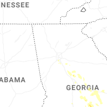
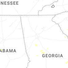

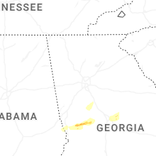


Connect with Interactive Hail Maps