

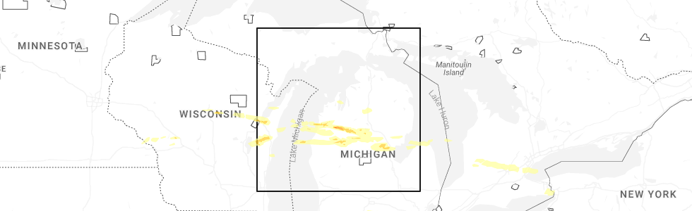
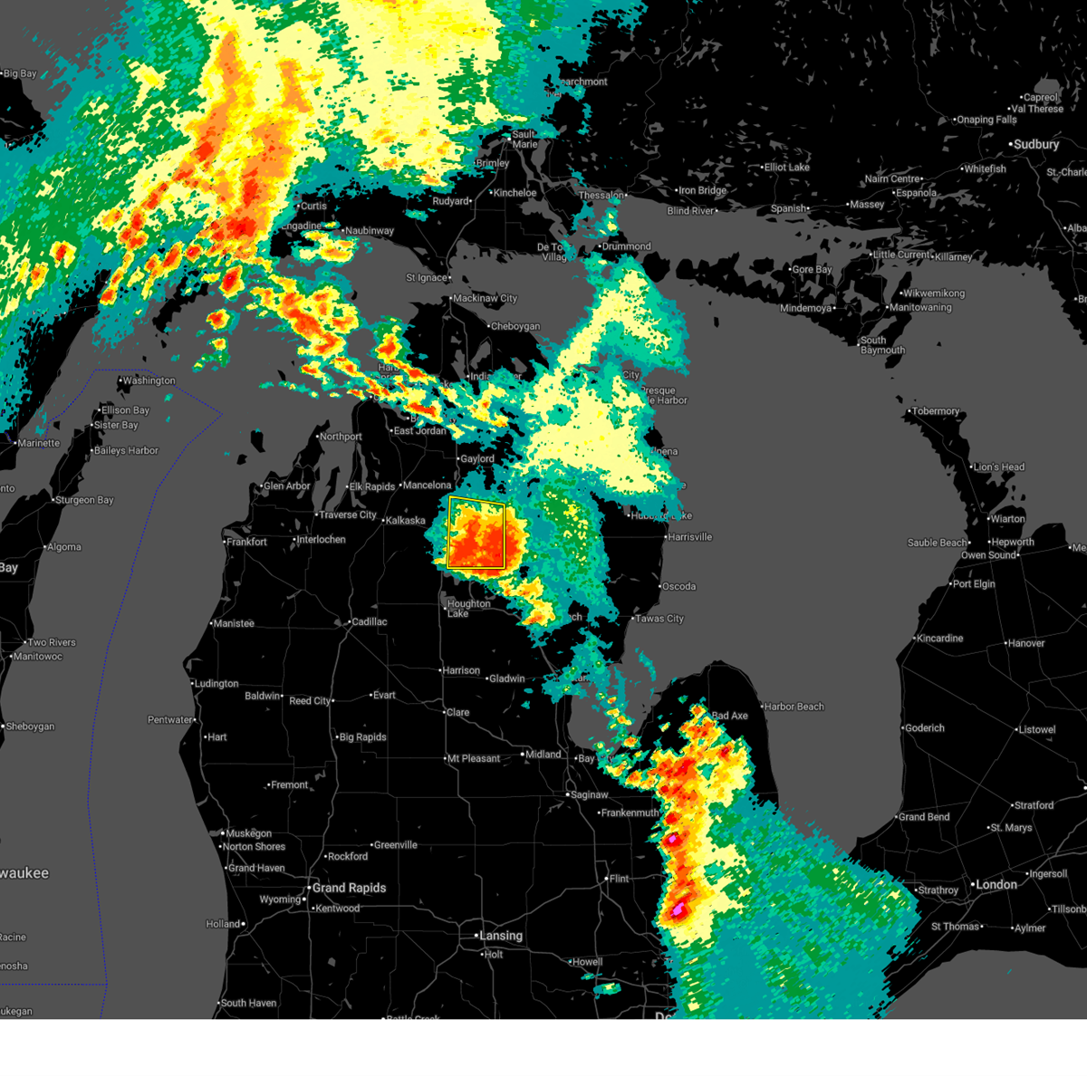
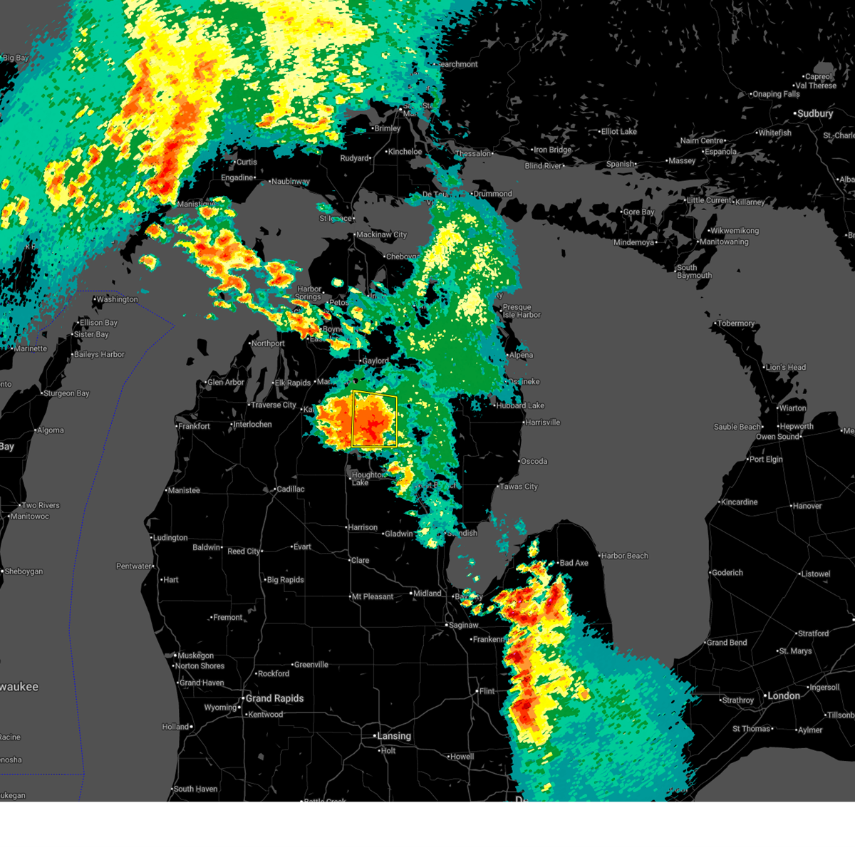
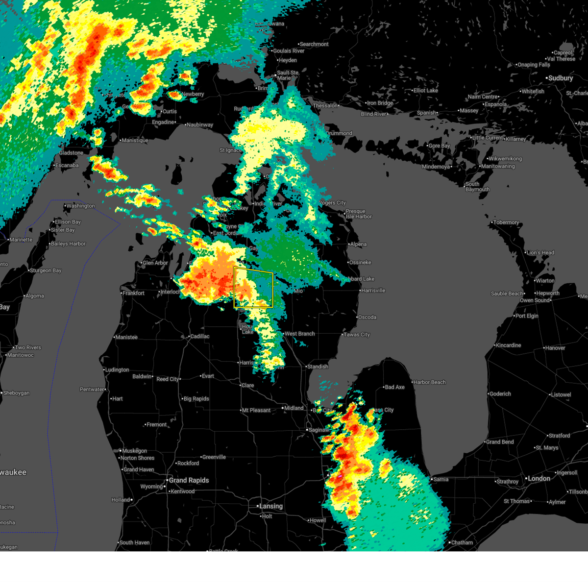
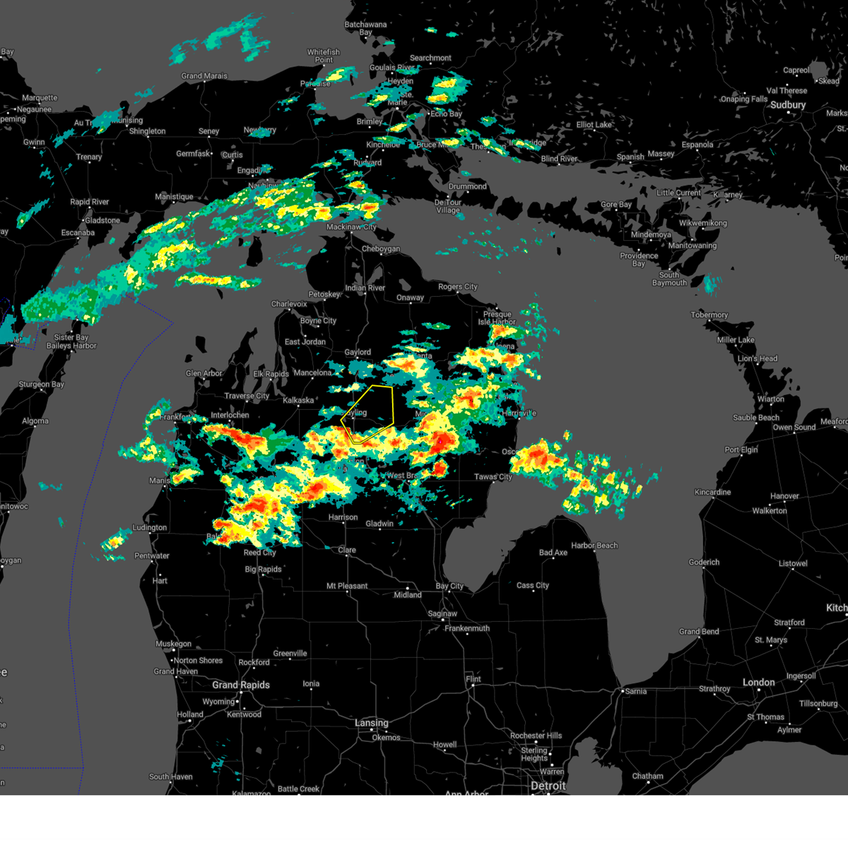
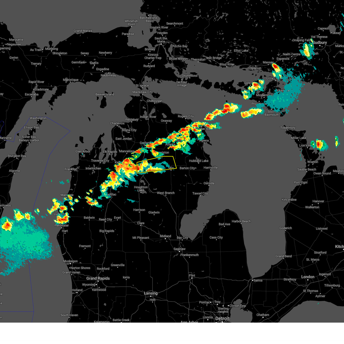
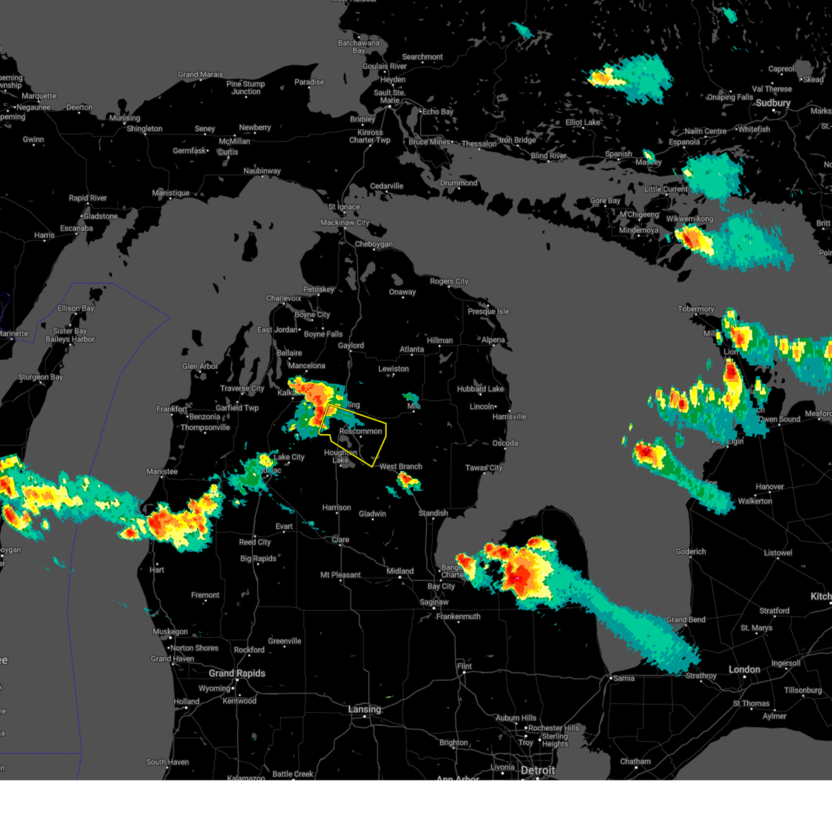
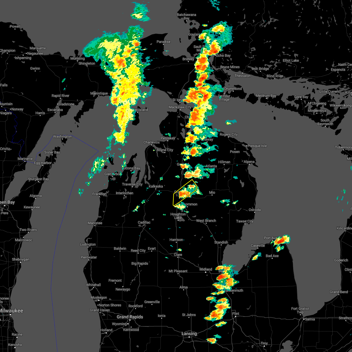
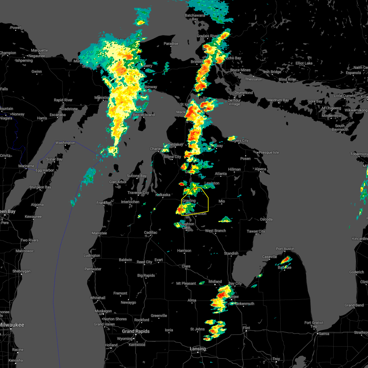
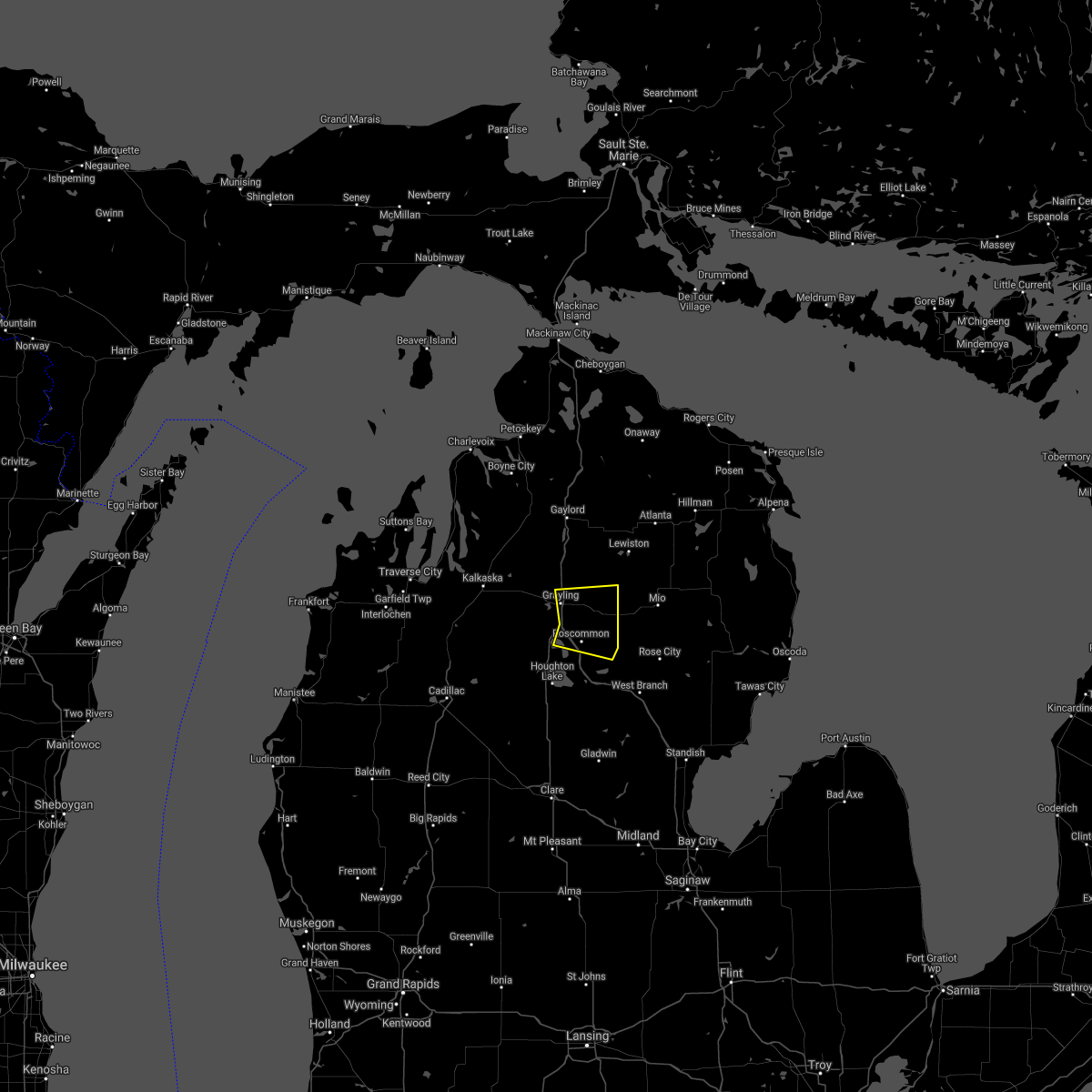
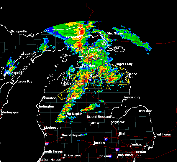
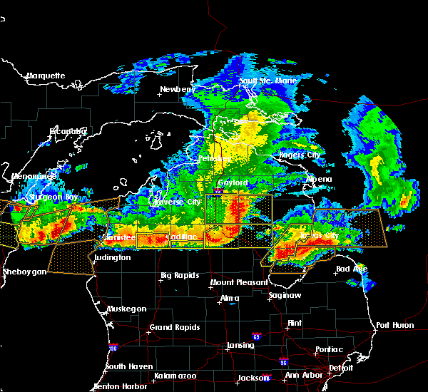
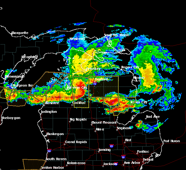
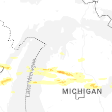
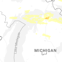
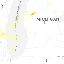
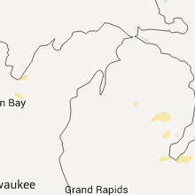
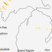
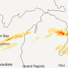
Hail Map for Grayling, MI
The Grayling, MI area has had 4 reports of on-the-ground hail by trained spotters, and has been under severe weather warnings 0 times during the past 12 months. Doppler radar has detected hail at or near Grayling, MI on 24 occasions, including 1 occasion during the past year.
| Name: | Grayling, MI |
| Where Located: | 45.1 miles E of Traverse City, MI |
| Map: | Google Map for Grayling, MI |
| Population: | 1884 |
| Housing Units: | 890 |
| More Info: | Search Google for Grayling, MI |
0
The Top Recent Hail Date for Grayling, MI is Monday, March 30, 2026 (24th out of 24)
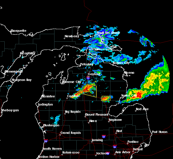
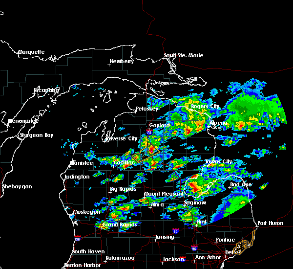
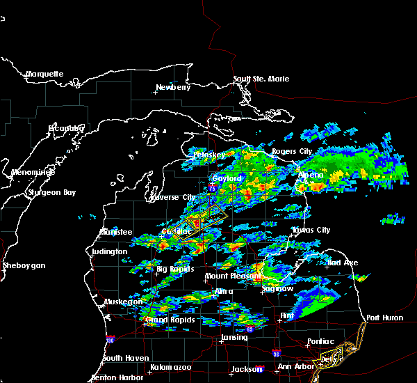
Hail and Wind Damage Spotted near Grayling, MI
| Date / Time | Report Details |
|---|---|
| 6/10/2026 8:31 PM EDT | Delayed report from social media of trees down. time estimated from rada in crawford county MI, 15.8 miles WSW of Grayling, MI |
| 6/21/2025 8:43 AM EDT |
 The storm which prompted the warning has weakened below severe limits. therefore, the warning will be allowed to expire. however, heavy rain is still possible with this thunderstorm. The storm which prompted the warning has weakened below severe limits. therefore, the warning will be allowed to expire. however, heavy rain is still possible with this thunderstorm.
|
| 6/21/2025 8:32 AM EDT |
 At 832 am edt, a severe thunderstorm was located over south branch township, or 8 miles northeast of roscommon, moving east at 40 mph (radar indicated). Hazards include 60 mph wind gusts and quarter size hail. Hail damage to vehicles is expected. expect wind damage to roofs, siding, and trees. This severe storm will be near, south branch township around 835 am edt. At 832 am edt, a severe thunderstorm was located over south branch township, or 8 miles northeast of roscommon, moving east at 40 mph (radar indicated). Hazards include 60 mph wind gusts and quarter size hail. Hail damage to vehicles is expected. expect wind damage to roofs, siding, and trees. This severe storm will be near, south branch township around 835 am edt.
|
| 6/21/2025 8:04 AM EDT |
 Svrapx the national weather service in gaylord has issued a * severe thunderstorm warning for, crawford county in northern michigan, * until 845 am edt. * at 804 am edt, a severe thunderstorm was located 7 miles southwest of frederic, or 8 miles northwest of grayling, moving east at 35 mph (radar indicated). Hazards include 60 mph wind gusts and quarter size hail. Hail damage to vehicles is expected. expect wind damage to roofs, siding, and trees. this severe thunderstorm will be near, grayling, frederic, and hartwick pines state park around 810 am edt. Lovells around 820 am edt. Svrapx the national weather service in gaylord has issued a * severe thunderstorm warning for, crawford county in northern michigan, * until 845 am edt. * at 804 am edt, a severe thunderstorm was located 7 miles southwest of frederic, or 8 miles northwest of grayling, moving east at 35 mph (radar indicated). Hazards include 60 mph wind gusts and quarter size hail. Hail damage to vehicles is expected. expect wind damage to roofs, siding, and trees. this severe thunderstorm will be near, grayling, frederic, and hartwick pines state park around 810 am edt. Lovells around 820 am edt.
|
| 4/18/2025 11:11 PM EDT |
 Svrapx the national weather service in gaylord has issued a * severe thunderstorm warning for, crawford county in northern michigan, * until 1145 pm edt. * at 1110 pm edt, a severe thunderstorm was located near grayling, moving northeast at 55 mph (radar indicated). Hazards include 60 mph wind gusts and quarter size hail. Hail damage to vehicles is expected. expect wind damage to roofs, siding, and trees. This severe thunderstorm will be near, lovells around 1120 pm edt. Svrapx the national weather service in gaylord has issued a * severe thunderstorm warning for, crawford county in northern michigan, * until 1145 pm edt. * at 1110 pm edt, a severe thunderstorm was located near grayling, moving northeast at 55 mph (radar indicated). Hazards include 60 mph wind gusts and quarter size hail. Hail damage to vehicles is expected. expect wind damage to roofs, siding, and trees. This severe thunderstorm will be near, lovells around 1120 pm edt.
|
| 4/27/2024 9:57 PM EDT |
 Svrapx the national weather service in gaylord has issued a * severe thunderstorm warning for, central crawford county in northern michigan, northwestern oscoda county in northern michigan, * until 1045 pm edt. * at 957 pm edt, a severe thunderstorm was located near grayling, moving east at 60 mph (radar indicated). Hazards include quarter size hail. Damage to vehicles is expected. this severe thunderstorm will be near, hartwick pines state park around 1005 pm edt. lovells around 1010 pm edt. garland and red oak around 1015 pm edt. lewiston and mio around 1020 pm edt. Fairview around 1030 pm edt. Svrapx the national weather service in gaylord has issued a * severe thunderstorm warning for, central crawford county in northern michigan, northwestern oscoda county in northern michigan, * until 1045 pm edt. * at 957 pm edt, a severe thunderstorm was located near grayling, moving east at 60 mph (radar indicated). Hazards include quarter size hail. Damage to vehicles is expected. this severe thunderstorm will be near, hartwick pines state park around 1005 pm edt. lovells around 1010 pm edt. garland and red oak around 1015 pm edt. lewiston and mio around 1020 pm edt. Fairview around 1030 pm edt.
|
| 4/27/2024 9:18 PM EDT |
 the severe thunderstorm warning has been cancelled and is no longer in effect the severe thunderstorm warning has been cancelled and is no longer in effect
|
| 4/27/2024 8:58 PM EDT |
 Svrapx the national weather service in gaylord has issued a * severe thunderstorm warning for, southwestern crawford county in northern michigan, southern kalkaska county in northern michigan, * until 945 pm edt. * at 858 pm edt, a severe thunderstorm was located near south boardman, or 10 miles south of kalkaska, moving east at 50 mph (radar indicated). Hazards include 60 mph wind gusts and quarter size hail. Hail damage to vehicles is expected. expect wind damage to roofs, siding, and trees. this severe thunderstorm will be near, sharon and sigma around 905 pm edt. grayling around 920 pm edt. hartwick pines state park around 925 pm edt. Other locations impacted by this severe thunderstorm include smithville. Svrapx the national weather service in gaylord has issued a * severe thunderstorm warning for, southwestern crawford county in northern michigan, southern kalkaska county in northern michigan, * until 945 pm edt. * at 858 pm edt, a severe thunderstorm was located near south boardman, or 10 miles south of kalkaska, moving east at 50 mph (radar indicated). Hazards include 60 mph wind gusts and quarter size hail. Hail damage to vehicles is expected. expect wind damage to roofs, siding, and trees. this severe thunderstorm will be near, sharon and sigma around 905 pm edt. grayling around 920 pm edt. hartwick pines state park around 925 pm edt. Other locations impacted by this severe thunderstorm include smithville.
|
| 8/3/2023 6:37 PM EDT |
 At 636 pm edt, a severe thunderstorm was located near moorestown, or 10 miles southwest of grayling, moving southeast at 40 mph (radar indicated). Hazards include 60 mph wind gusts and quarter size hail. Hail damage to vehicles is expected. Expect wind damage to roofs, siding, and trees. At 636 pm edt, a severe thunderstorm was located near moorestown, or 10 miles southwest of grayling, moving southeast at 40 mph (radar indicated). Hazards include 60 mph wind gusts and quarter size hail. Hail damage to vehicles is expected. Expect wind damage to roofs, siding, and trees.
|
| 6/25/2023 7:02 PM EDT |
 At 702 pm edt, severe thunderstorms were located along a line extending from near rhodes to near st. helen to 8 miles southeast of sigma, moving northeast at 30 mph (radar indicated). Hazards include 60 mph wind gusts. Expect damage to roofs, siding, and trees. locations impacted include, gladwin, west branch, grayling, roscommon, st. helen, hockaday, rhodes, higgins lake, north higgins lake, lake st. helen, winegars, twin lakes area, wooden shoe village, south branch township, nester township, moorestown, clear lake, bowmanville, south higgins lake and foster township. hail threat, radar indicated max hail size, <. 75 in wind threat, radar indicated max wind gust, 60 mph. At 702 pm edt, severe thunderstorms were located along a line extending from near rhodes to near st. helen to 8 miles southeast of sigma, moving northeast at 30 mph (radar indicated). Hazards include 60 mph wind gusts. Expect damage to roofs, siding, and trees. locations impacted include, gladwin, west branch, grayling, roscommon, st. helen, hockaday, rhodes, higgins lake, north higgins lake, lake st. helen, winegars, twin lakes area, wooden shoe village, south branch township, nester township, moorestown, clear lake, bowmanville, south higgins lake and foster township. hail threat, radar indicated max hail size, <. 75 in wind threat, radar indicated max wind gust, 60 mph.
|
| 6/25/2023 6:46 PM EDT |
 At 646 pm edt, severe thunderstorms were located along a line extending from near winegars to near nester township to near moorestown, moving northeast at 30 mph (radar indicated). Hazards include 60 mph wind gusts and penny size hail. expect damage to roofs, siding, and trees At 646 pm edt, severe thunderstorms were located along a line extending from near winegars to near nester township to near moorestown, moving northeast at 30 mph (radar indicated). Hazards include 60 mph wind gusts and penny size hail. expect damage to roofs, siding, and trees
|
| 7/20/2022 1:37 PM EDT |
 At 137 pm edt, a severe thunderstorm was located near grayling, moving northeast at 30 mph (radar indicated). Hazards include 60 mph wind gusts and half dollar size hail. Hail damage to vehicles is expected. expect wind damage to roofs, siding, and trees. locations impacted include, lovells. hail threat, radar indicated max hail size, 1. 25 in wind threat, radar indicated max wind gust, 60 mph. At 137 pm edt, a severe thunderstorm was located near grayling, moving northeast at 30 mph (radar indicated). Hazards include 60 mph wind gusts and half dollar size hail. Hail damage to vehicles is expected. expect wind damage to roofs, siding, and trees. locations impacted include, lovells. hail threat, radar indicated max hail size, 1. 25 in wind threat, radar indicated max wind gust, 60 mph.
|
| 7/20/2022 1:22 PM EDT |
 At 121 pm edt, a severe thunderstorm was located near grayling, moving northeast at 30 mph (radar indicated). Hazards include 60 mph wind gusts and half dollar size hail. Hail damage to vehicles is expected. expect wind damage to roofs, siding, and trees. this severe thunderstorm will be near, grayling around 135 pm edt. frederic and hartwick pines state park around 140 pm edt. other locations in the path of this severe thunderstorm include lovells. hail threat, radar indicated max hail size, 1. 25 in wind threat, radar indicated max wind gust, 60 mph. At 121 pm edt, a severe thunderstorm was located near grayling, moving northeast at 30 mph (radar indicated). Hazards include 60 mph wind gusts and half dollar size hail. Hail damage to vehicles is expected. expect wind damage to roofs, siding, and trees. this severe thunderstorm will be near, grayling around 135 pm edt. frederic and hartwick pines state park around 140 pm edt. other locations in the path of this severe thunderstorm include lovells. hail threat, radar indicated max hail size, 1. 25 in wind threat, radar indicated max wind gust, 60 mph.
|
| 9/7/2021 12:02 PM EDT |
 At 1202 pm edt, a severe thunderstorm was located near grayling, moving east at 50 mph (radar indicated). Hazards include 60 mph wind gusts and quarter size hail. Hail damage to vehicles is expected. expect wind damage to roofs, siding, and trees. locations impacted include, lovells. hail threat, radar indicated max hail size, 1. 00 in wind threat, radar indicated max wind gust, 60 mph. At 1202 pm edt, a severe thunderstorm was located near grayling, moving east at 50 mph (radar indicated). Hazards include 60 mph wind gusts and quarter size hail. Hail damage to vehicles is expected. expect wind damage to roofs, siding, and trees. locations impacted include, lovells. hail threat, radar indicated max hail size, 1. 00 in wind threat, radar indicated max wind gust, 60 mph.
|
| 9/7/2021 11:37 AM EDT |
 At 1137 am edt, a severe thunderstorm was located near bear lake, or 8 miles west of grayling, moving east at 50 mph (radar indicated). Hazards include 60 mph wind gusts and quarter size hail. Hail damage to vehicles is expected. expect wind damage to roofs, siding, and trees. this severe storm will be near, grayling around 1145 am edt. other locations in the path of this severe thunderstorm include hartwick pines state park and lovells. hail threat, radar indicated max hail size, 1. 00 in wind threat, radar indicated max wind gust, 60 mph. At 1137 am edt, a severe thunderstorm was located near bear lake, or 8 miles west of grayling, moving east at 50 mph (radar indicated). Hazards include 60 mph wind gusts and quarter size hail. Hail damage to vehicles is expected. expect wind damage to roofs, siding, and trees. this severe storm will be near, grayling around 1145 am edt. other locations in the path of this severe thunderstorm include hartwick pines state park and lovells. hail threat, radar indicated max hail size, 1. 00 in wind threat, radar indicated max wind gust, 60 mph.
|
| 9/7/2021 11:28 AM EDT |
 At 1128 am edt, a severe thunderstorm was located over sigma, or 9 miles southeast of kalkaska, moving east at 55 mph (radar indicated). Hazards include 60 mph wind gusts and quarter size hail. Hail damage to vehicles is expected. expect wind damage to roofs, siding, and trees. this severe thunderstorm will be near, grayling and frederic around 1145 am edt. other locations in the path of this severe thunderstorm include hartwick pines state park and lovells. hail threat, radar indicated max hail size, 1. 00 in wind threat, radar indicated max wind gust, 60 mph. At 1128 am edt, a severe thunderstorm was located over sigma, or 9 miles southeast of kalkaska, moving east at 55 mph (radar indicated). Hazards include 60 mph wind gusts and quarter size hail. Hail damage to vehicles is expected. expect wind damage to roofs, siding, and trees. this severe thunderstorm will be near, grayling and frederic around 1145 am edt. other locations in the path of this severe thunderstorm include hartwick pines state park and lovells. hail threat, radar indicated max hail size, 1. 00 in wind threat, radar indicated max wind gust, 60 mph.
|
| 8/29/2021 3:05 PM EDT | Report from mping: 1-inch tree limbs broken; shingles blown of in crawford county MI, 15.6 miles SW of Grayling, MI |
| 8/29/2021 3:01 PM EDT |
 At 301 pm edt, severe thunderstorms were located along a line extending from near grayling to near north higgins lake to 6 miles north of moddersville, moving northeast at 50 mph (radar indicated). Hazards include 60 mph wind gusts. Expect damage to roofs, siding, and trees. severe thunderstorms will be near, grayling and north higgins lake around 305 pm edt. higgins lake and roscommon county airport around 320 pm edt. other locations in the path of these severe thunderstorms include lovells, south higgins lake, roscommon, garland, lewiston, red oak, south branch township and luzerne. hail threat, radar indicated max hail size, <. 75 in wind threat, radar indicated max wind gust, 60 mph. At 301 pm edt, severe thunderstorms were located along a line extending from near grayling to near north higgins lake to 6 miles north of moddersville, moving northeast at 50 mph (radar indicated). Hazards include 60 mph wind gusts. Expect damage to roofs, siding, and trees. severe thunderstorms will be near, grayling and north higgins lake around 305 pm edt. higgins lake and roscommon county airport around 320 pm edt. other locations in the path of these severe thunderstorms include lovells, south higgins lake, roscommon, garland, lewiston, red oak, south branch township and luzerne. hail threat, radar indicated max hail size, <. 75 in wind threat, radar indicated max wind gust, 60 mph.
|
| 8/11/2021 6:31 PM EDT |
 At 631 pm edt, severe thunderstorms were located along a line extending from canada creek ranch to lovells to near grayling, moving east at 35 mph (radar indicated). Hazards include 60 mph wind gusts. Expect damage to roofs, siding, and trees. severe thunderstorms will be near, canada creek ranch and briley township around 635 pm edt. lewiston and garland around 645 pm edt. other locations in the path of these severe thunderstorms include hillman, loud township, comins, red oak, lockwood lake and mio. hail threat, radar indicated max hail size, <. 75 in wind threat, radar indicated max wind gust, 60 mph. At 631 pm edt, severe thunderstorms were located along a line extending from canada creek ranch to lovells to near grayling, moving east at 35 mph (radar indicated). Hazards include 60 mph wind gusts. Expect damage to roofs, siding, and trees. severe thunderstorms will be near, canada creek ranch and briley township around 635 pm edt. lewiston and garland around 645 pm edt. other locations in the path of these severe thunderstorms include hillman, loud township, comins, red oak, lockwood lake and mio. hail threat, radar indicated max hail size, <. 75 in wind threat, radar indicated max wind gust, 60 mph.
|
| 8/10/2021 11:41 PM EDT |
 At 1141 pm edt, severe thunderstorms were located along a line extending from near hartwick pines state park to roscommon, moving east at 50 mph (radar indicated). Hazards include 60 mph wind gusts and nickel size hail. Expect damage to roofs, siding, and trees. locations impacted include, south branch township. hail threat, radar indicated max hail size, 0. 88 in wind threat, radar indicated max wind gust, 60 mph. At 1141 pm edt, severe thunderstorms were located along a line extending from near hartwick pines state park to roscommon, moving east at 50 mph (radar indicated). Hazards include 60 mph wind gusts and nickel size hail. Expect damage to roofs, siding, and trees. locations impacted include, south branch township. hail threat, radar indicated max hail size, 0. 88 in wind threat, radar indicated max wind gust, 60 mph.
|
| 8/10/2021 11:28 PM EDT |
 At 1127 pm edt, severe thunderstorms were located along a line extending from near grayling to near moorestown, moving east at 50 mph (radar indicated). Hazards include 60 mph wind gusts and nickel size hail. Expect damage to roofs, siding, and trees. severe thunderstorms will be near, houghton lake, higgins lake and north higgins lake around 1135 pm edt. south higgins lake and roscommon county airport around 1140 pm edt. roscommon and prudenville around 1145 pm edt. other locations in the path of these severe thunderstorms include lake st. helen, south branch township and st. helen. hail threat, radar indicated max hail size, 0. 88 in wind threat, radar indicated max wind gust, 60 mph. At 1127 pm edt, severe thunderstorms were located along a line extending from near grayling to near moorestown, moving east at 50 mph (radar indicated). Hazards include 60 mph wind gusts and nickel size hail. Expect damage to roofs, siding, and trees. severe thunderstorms will be near, houghton lake, higgins lake and north higgins lake around 1135 pm edt. south higgins lake and roscommon county airport around 1140 pm edt. roscommon and prudenville around 1145 pm edt. other locations in the path of these severe thunderstorms include lake st. helen, south branch township and st. helen. hail threat, radar indicated max hail size, 0. 88 in wind threat, radar indicated max wind gust, 60 mph.
|
| 7/18/2020 11:57 AM EDT |
 The severe thunderstorm warning for northern crawford and northern kalkaska counties will expire at noon edt, the storms which prompted the warning have weakened below severe limits, and no longer pose an immediate threat to life or property. therefore, the warning will be allowed to expire. however gusty winds and heavy rain are still possible with these thunderstorms. The severe thunderstorm warning for northern crawford and northern kalkaska counties will expire at noon edt, the storms which prompted the warning have weakened below severe limits, and no longer pose an immediate threat to life or property. therefore, the warning will be allowed to expire. however gusty winds and heavy rain are still possible with these thunderstorms.
|
| 7/18/2020 11:49 AM EDT |
 At 1148 am edt, severe thunderstorms were located along a line extending from loud township to garland to near grayling, moving east at 45 mph (radar indicated). Hazards include 60 mph wind gusts. Expect damage to roofs, siding, and trees. Locations impacted include, grayling, frederic, lovells, darragh, hartwick pines state park and blue lake township. At 1148 am edt, severe thunderstorms were located along a line extending from loud township to garland to near grayling, moving east at 45 mph (radar indicated). Hazards include 60 mph wind gusts. Expect damage to roofs, siding, and trees. Locations impacted include, grayling, frederic, lovells, darragh, hartwick pines state park and blue lake township.
|
| 7/18/2020 11:29 AM EDT |
 At 1129 am edt, severe thunderstorms were located along a line extending from near hetherton to near lovells to sigma, moving east at 40 mph (radar indicated). Hazards include 60 mph wind gusts. Expect damage to roofs, siding, and trees. Locations impacted include, grayling, frederic, lovells, darragh, hartwick pines state park and blue lake township. At 1129 am edt, severe thunderstorms were located along a line extending from near hetherton to near lovells to sigma, moving east at 40 mph (radar indicated). Hazards include 60 mph wind gusts. Expect damage to roofs, siding, and trees. Locations impacted include, grayling, frederic, lovells, darragh, hartwick pines state park and blue lake township.
|
| 7/18/2020 11:08 AM EDT |
 At 1107 am edt, severe thunderstorms were located along a line extending from near eastern corwith township to near frederic to near south boardman, moving east at 40 mph (radar indicated). Hazards include 60 mph wind gusts. expect damage to roofs, siding, and trees At 1107 am edt, severe thunderstorms were located along a line extending from near eastern corwith township to near frederic to near south boardman, moving east at 40 mph (radar indicated). Hazards include 60 mph wind gusts. expect damage to roofs, siding, and trees
|
| 6/9/2020 10:16 PM EDT |
 At 1015 pm edt, a severe thunderstorm was located over roscommon, moving north at 50 mph (radar indicated). Hazards include 60 mph wind gusts and penny size hail. Expect damage to roofs, siding, and trees. locations impacted include, grayling, roscommon, prudenville, st. helen, roscommon county airport, south branch township, higgins lake, north higgins lake, lake st. Helen and south higgins lake. At 1015 pm edt, a severe thunderstorm was located over roscommon, moving north at 50 mph (radar indicated). Hazards include 60 mph wind gusts and penny size hail. Expect damage to roofs, siding, and trees. locations impacted include, grayling, roscommon, prudenville, st. helen, roscommon county airport, south branch township, higgins lake, north higgins lake, lake st. Helen and south higgins lake.
|
| 6/9/2020 10:00 PM EDT |
 At 959 pm edt, doppler radar indicated a severe thunderstorm capable of producing damaging winds in excess of 60 mph. this storm was located near lake st. helen, or near prudenville, and moving north at 50 mph. penny size hail may also accompany the damaging winds. At 959 pm edt, doppler radar indicated a severe thunderstorm capable of producing damaging winds in excess of 60 mph. this storm was located near lake st. helen, or near prudenville, and moving north at 50 mph. penny size hail may also accompany the damaging winds.
|
| 8/28/2018 2:37 AM EDT |
 The severe thunderstorm warning for otsego, crawford and southeastern kalkaska counties will expire at 245 am edt, the storms which prompted the warning have moved out of the area. therefore, the warning will be allowed to expire. The severe thunderstorm warning for otsego, crawford and southeastern kalkaska counties will expire at 245 am edt, the storms which prompted the warning have moved out of the area. therefore, the warning will be allowed to expire.
|
| 8/28/2018 2:27 AM EDT |
 At 227 am edt, severe thunderstorms were located along a line extending from near tomahawk creek flooding to atlanta to near roscommon, moving east at 75 mph (radar indicated). Hazards include 60 mph wind gusts. Expect damage to roofs, siding, and trees. Locations impacted include, gaylord, grayling, frederic, lovells, sparr, otsego lake state park, chester township, south branch township, johannesburg, eastern corwith township, waters and hartwick pines state park. At 227 am edt, severe thunderstorms were located along a line extending from near tomahawk creek flooding to atlanta to near roscommon, moving east at 75 mph (radar indicated). Hazards include 60 mph wind gusts. Expect damage to roofs, siding, and trees. Locations impacted include, gaylord, grayling, frederic, lovells, sparr, otsego lake state park, chester township, south branch township, johannesburg, eastern corwith township, waters and hartwick pines state park.
|
| 8/28/2018 1:58 AM EDT |
 At 158 am edt, severe thunderstorms were located along a line extending from near boyne falls to near alba to near fife lake, moving east at 75 mph (radar indicated). Hazards include 60 mph wind gusts. expect damage to roofs, siding, and trees At 158 am edt, severe thunderstorms were located along a line extending from near boyne falls to near alba to near fife lake, moving east at 75 mph (radar indicated). Hazards include 60 mph wind gusts. expect damage to roofs, siding, and trees
|
| 7/1/2018 9:24 PM EDT |
 At 922 pm edt, severe thunderstorms were located along a line extending from elmira to near otsego lake state park to near lovells to near roscommon, moving northeast at 45 mph (radar indicated. at 916 pm a wind gust of 52 mph was reported at the national weather service office, 9 miles south-southwest of gaylord). Hazards include 60 mph wind gusts. Expect damage to roofs, siding, and trees. Locations impacted include, gaylord, grayling, mancelona, lewiston, elmira, frederic, lovells, vanderbilt, sparr, otsego lake state park, pickerel lake, johannesburg, chester township, alba, eastern corwith township, waters, hartwick pines state park and blue lake township. At 922 pm edt, severe thunderstorms were located along a line extending from elmira to near otsego lake state park to near lovells to near roscommon, moving northeast at 45 mph (radar indicated. at 916 pm a wind gust of 52 mph was reported at the national weather service office, 9 miles south-southwest of gaylord). Hazards include 60 mph wind gusts. Expect damage to roofs, siding, and trees. Locations impacted include, gaylord, grayling, mancelona, lewiston, elmira, frederic, lovells, vanderbilt, sparr, otsego lake state park, pickerel lake, johannesburg, chester township, alba, eastern corwith township, waters, hartwick pines state park and blue lake township.
|
| 7/1/2018 9:17 PM EDT |
 At 916 pm edt, severe thunderstorms were located along a line extending from alba to near waters to near north higgins lake, moving northeast at 55 mph (radar indicated). Hazards include 60 mph wind gusts. Expect damage to roofs, siding, and trees. Locations impacted include, gaylord, grayling, mancelona, lewiston, elmira, frederic, lovells, vanderbilt, sparr, otsego lake state park, pickerel lake, johannesburg, chester township, alba, eastern corwith township, waters, hartwick pines state park and blue lake township. At 916 pm edt, severe thunderstorms were located along a line extending from alba to near waters to near north higgins lake, moving northeast at 55 mph (radar indicated). Hazards include 60 mph wind gusts. Expect damage to roofs, siding, and trees. Locations impacted include, gaylord, grayling, mancelona, lewiston, elmira, frederic, lovells, vanderbilt, sparr, otsego lake state park, pickerel lake, johannesburg, chester township, alba, eastern corwith township, waters, hartwick pines state park and blue lake township.
|
| 7/1/2018 9:15 PM EDT | Large tree blown down due to high wind in kalkaska county MI, 7.2 miles ESE of Grayling, MI |
| 7/1/2018 9:03 PM EDT |
 At 903 pm edt, severe thunderstorms were located along a line extending from near mancelona to 6 miles northwest of north higgins lake, moving northeast at 50 mph (radar indicated). Hazards include 60 mph wind gusts. expect damage to roofs, siding, and trees At 903 pm edt, severe thunderstorms were located along a line extending from near mancelona to 6 miles northwest of north higgins lake, moving northeast at 50 mph (radar indicated). Hazards include 60 mph wind gusts. expect damage to roofs, siding, and trees
|
| 7/6/2017 5:45 PM EDT | Reported trees on power lines. time estimate in crawford county MI, 3 miles ENE of Grayling, MI |
| 7/6/2017 5:45 PM EDT |
 At 544 pm edt, a severe thunderstorm was located near grayling, moving east at 25 mph (radar indicated). Hazards include 60 mph wind gusts and half dollar size hail. Hail damage to vehicles is expected. expect wind damage to roofs, siding, and trees. locations impacted include, grayling, roscommon, st. helen, south branch township, higgins lake, moorestown, north higgins lake, lake st. Helen and south higgins lake. At 544 pm edt, a severe thunderstorm was located near grayling, moving east at 25 mph (radar indicated). Hazards include 60 mph wind gusts and half dollar size hail. Hail damage to vehicles is expected. expect wind damage to roofs, siding, and trees. locations impacted include, grayling, roscommon, st. helen, south branch township, higgins lake, moorestown, north higgins lake, lake st. Helen and south higgins lake.
|
| 7/6/2017 5:19 PM EDT |
 At 518 pm edt, a severe thunderstorm was located near sigma, or 12 miles west of grayling, moving southeast at 35 mph (radar indicated). Hazards include 60 mph wind gusts and half dollar size hail. Hail damage to vehicles is expected. Expect wind damage to roofs, siding, and trees. At 518 pm edt, a severe thunderstorm was located near sigma, or 12 miles west of grayling, moving southeast at 35 mph (radar indicated). Hazards include 60 mph wind gusts and half dollar size hail. Hail damage to vehicles is expected. Expect wind damage to roofs, siding, and trees.
|
| 2/24/2017 4:22 PM EST |
 At 421 pm est, a severe thunderstorm was located near roscommon, moving northeast at 55 mph (radar indicated. at 347 pm, quarter size hail covering the road was reported between mcbain and lake city from this storm). Hazards include quarter size hail. Damage to vehicles is expected. Locations impacted include, grayling, roscommon, higgins lake, moorestown, north higgins lake, south higgins lake and south branch township. At 421 pm est, a severe thunderstorm was located near roscommon, moving northeast at 55 mph (radar indicated. at 347 pm, quarter size hail covering the road was reported between mcbain and lake city from this storm). Hazards include quarter size hail. Damage to vehicles is expected. Locations impacted include, grayling, roscommon, higgins lake, moorestown, north higgins lake, south higgins lake and south branch township.
|
| 2/24/2017 4:06 PM EST |
 At 405 pm est, a severe thunderstorm was located near moorestown, or 10 miles northwest of houghton lake, moving northeast at 55 mph (radar indicated. at 400 pm, three quarter inch hail was reported in lucas). Hazards include quarter size hail. damage to vehicles is expected At 405 pm est, a severe thunderstorm was located near moorestown, or 10 miles northwest of houghton lake, moving northeast at 55 mph (radar indicated. at 400 pm, three quarter inch hail was reported in lucas). Hazards include quarter size hail. damage to vehicles is expected
|
| 7/8/2016 1:31 PM EDT |
 At 131 pm edt, a severe thunderstorm was located over waters, or 9 miles south of gaylord, moving east at 50 mph (radar indicated). Hazards include 60 mph wind gusts and quarter size hail. Hail damage to vehicles is expected. Expect wind damage to roofs, siding, and trees. At 131 pm edt, a severe thunderstorm was located over waters, or 9 miles south of gaylord, moving east at 50 mph (radar indicated). Hazards include 60 mph wind gusts and quarter size hail. Hail damage to vehicles is expected. Expect wind damage to roofs, siding, and trees.
|
| 8/2/2015 5:35 PM EDT |
 At 534 pm edt, severe thunderstorms were located along a line extending from near garland to near twin lakes area, moving east at 65 mph (radar indicated). Hazards include 70 mph wind gusts and quarter size hail. Hail damage to vehicles is expected. expect considerable tree damage. wind damage is also likely to mobile homes, roofs and outbuildings. Locations impacted include, grayling, lewiston, mio, comins, frederic, mckinley, lovells, lockwood lake, red oak, garland, waters, chester township, mack lake, luzerne, south branch township, loud township, hartwick pines state park and fairview. At 534 pm edt, severe thunderstorms were located along a line extending from near garland to near twin lakes area, moving east at 65 mph (radar indicated). Hazards include 70 mph wind gusts and quarter size hail. Hail damage to vehicles is expected. expect considerable tree damage. wind damage is also likely to mobile homes, roofs and outbuildings. Locations impacted include, grayling, lewiston, mio, comins, frederic, mckinley, lovells, lockwood lake, red oak, garland, waters, chester township, mack lake, luzerne, south branch township, loud township, hartwick pines state park and fairview.
|
| 8/2/2015 5:13 PM EDT | Off-duty nws employee reports 50-100 trees down two miles south of frederi in crawford county MI, 7 miles S of Grayling, MI |
| 8/2/2015 5:00 PM EDT |
 At 459 pm edt, severe thunderstorms were located along a line extending from near warner township to 6 miles north of moorestown, moving east at 60 mph (radar indicated. earlier in grand traverse and antrim counties 60 to 70 mph winds were reported). Hazards include 70 mph wind gusts and quarter size hail. Hail damage to vehicles is expected. expect considerable tree damage. Wind damage is also likely to mobile homes, roofs and outbuildings. At 459 pm edt, severe thunderstorms were located along a line extending from near warner township to 6 miles north of moorestown, moving east at 60 mph (radar indicated. earlier in grand traverse and antrim counties 60 to 70 mph winds were reported). Hazards include 70 mph wind gusts and quarter size hail. Hail damage to vehicles is expected. expect considerable tree damage. Wind damage is also likely to mobile homes, roofs and outbuildings.
|
| 6/18/2015 12:56 PM EDT | Several trees and power lines down both sides of the town of frederic along old us-27.estimated wind gusts to 60 to 70 mp in crawford county MI, 9 miles S of Grayling, MI |
| 9/4/2014 8:47 PM EDT | Reports from law enforcement about power lines down over parts of crawford count in crawford county MI, 9 miles S of Grayling, MI |
| 9/1/2014 2:28 PM EDT | Trees and powerlines down. caller reported seeing funnel cloud as wel in crawford county MI, 9 miles S of Grayling, MI |
| 7/27/2014 12:40 PM EDT | Quarter sized hail reported 0 miles ESE of Grayling, MI |
| 7/27/2014 12:20 PM EDT | Quarter sized hail reported 9 miles S of Grayling, MI |
| 5/30/2013 3:30 PM EDT | Quarter sized hail reported 9 miles S of Grayling, MI, 1 inch hail observed in frederic. |
| 1/1/0001 12:00 AM | Quarter sized hail reported 0 miles ESE of Grayling, MI |
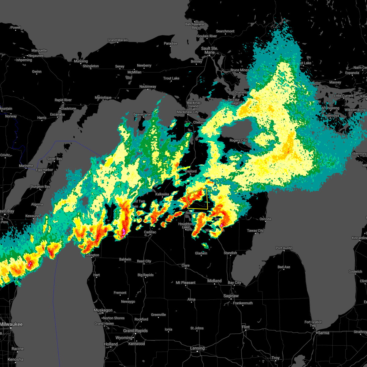
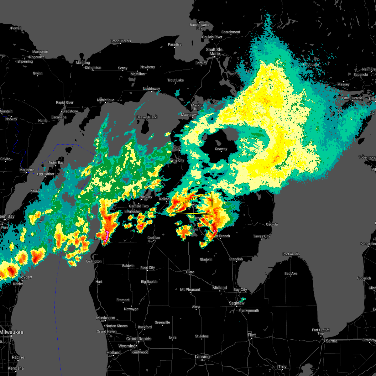
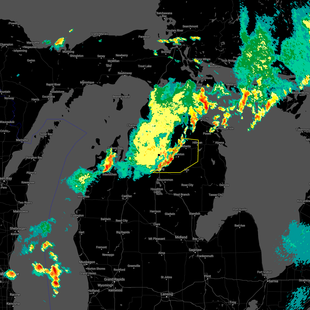
Hail Maps for Grayling, MI


Connect with Interactive Hail Maps