

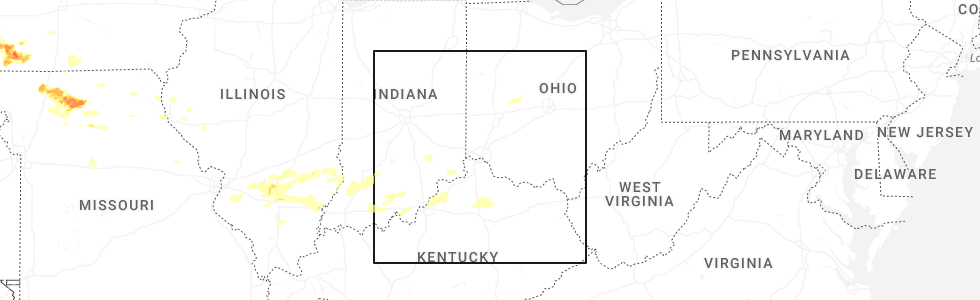
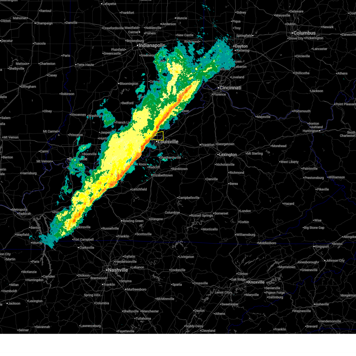
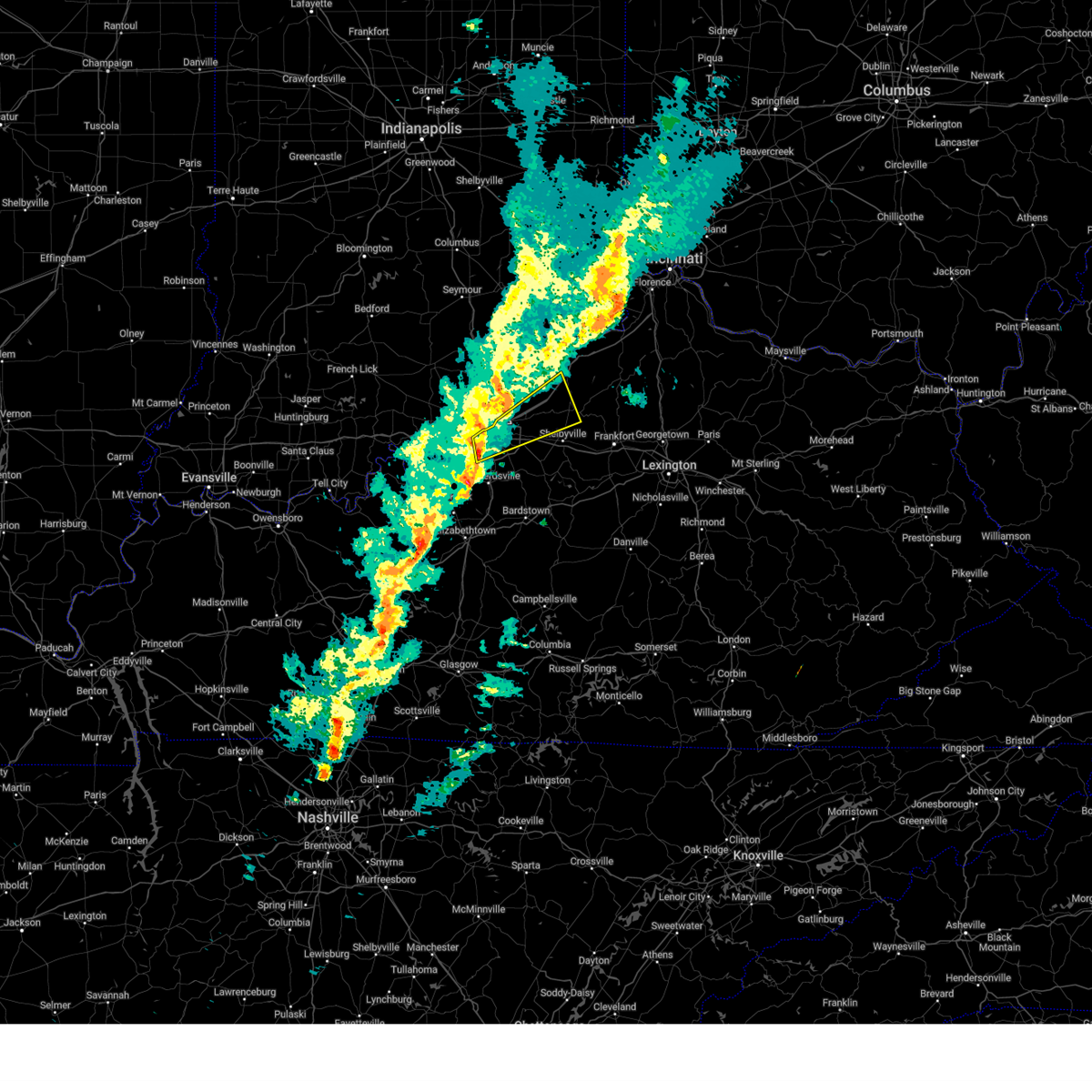
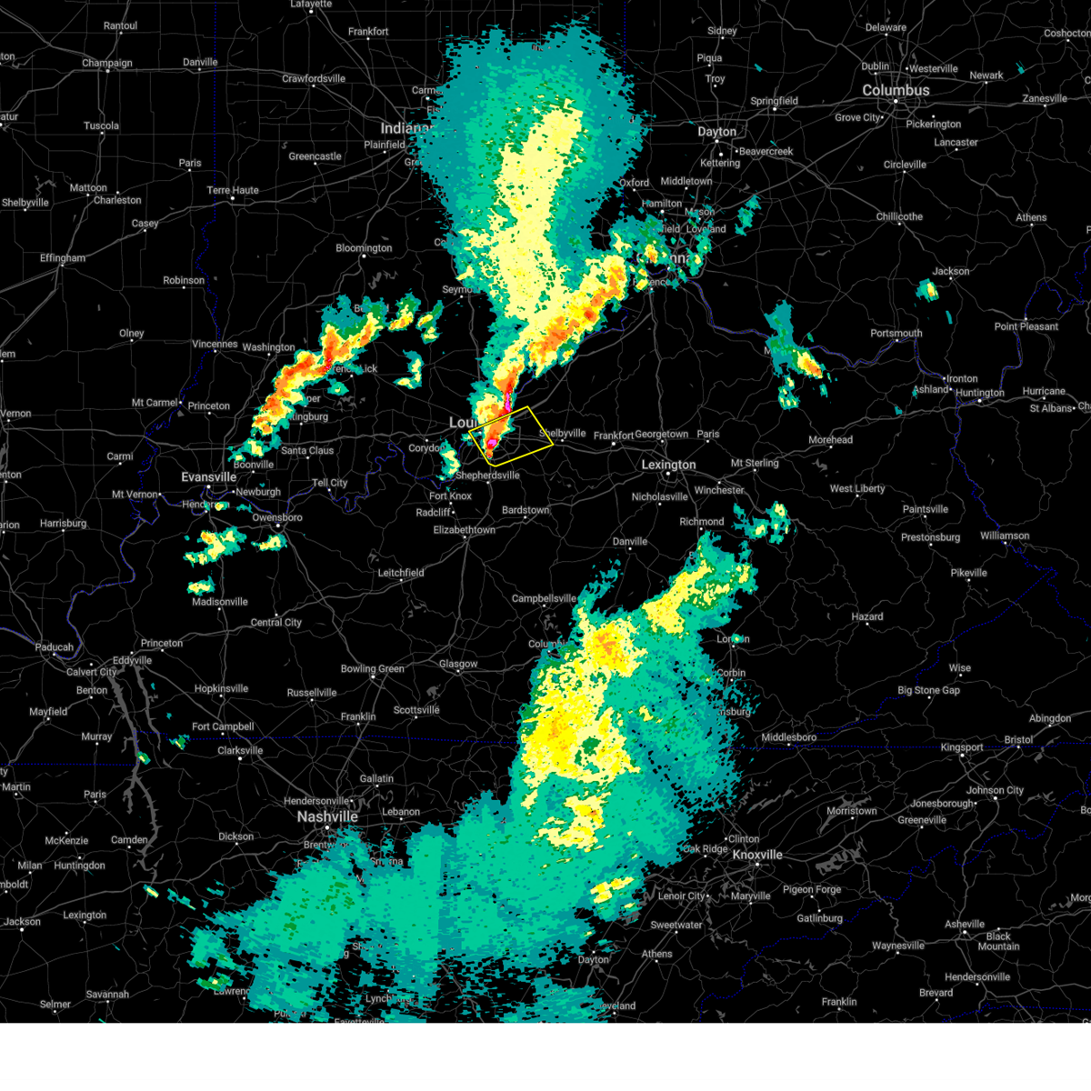
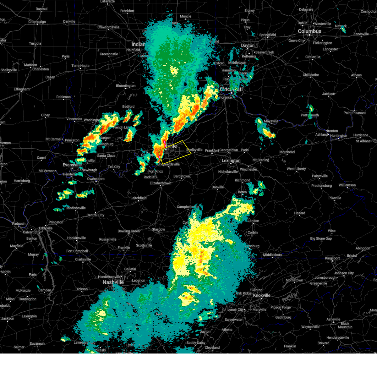
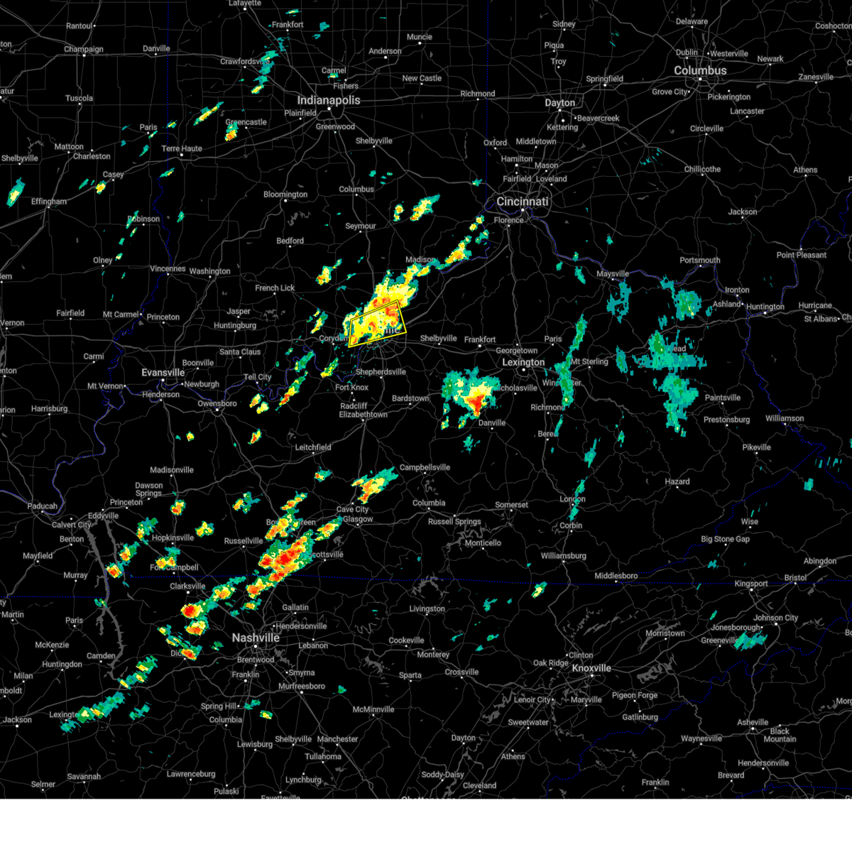
Hail Map for Graymoor-Devondale, KY
The Graymoor-Devondale, KY area has had 0 reports of on-the-ground hail by trained spotters, and has been under severe weather warnings 13 times during the past 12 months. Doppler radar has detected hail at or near Graymoor-Devondale, KY on 56 occasions, including 4 occasions during the past year.
| Name: | Graymoor-Devondale, KY |
| Where Located: | 20.4 miles NNE of Louisville, KY |
| Map: | Google Map for Graymoor-Devondale, KY |
| Population: | 2870 |
| Housing Units: | 1209 |
| More Info: | Search Google for Graymoor-Devondale, KY |
1
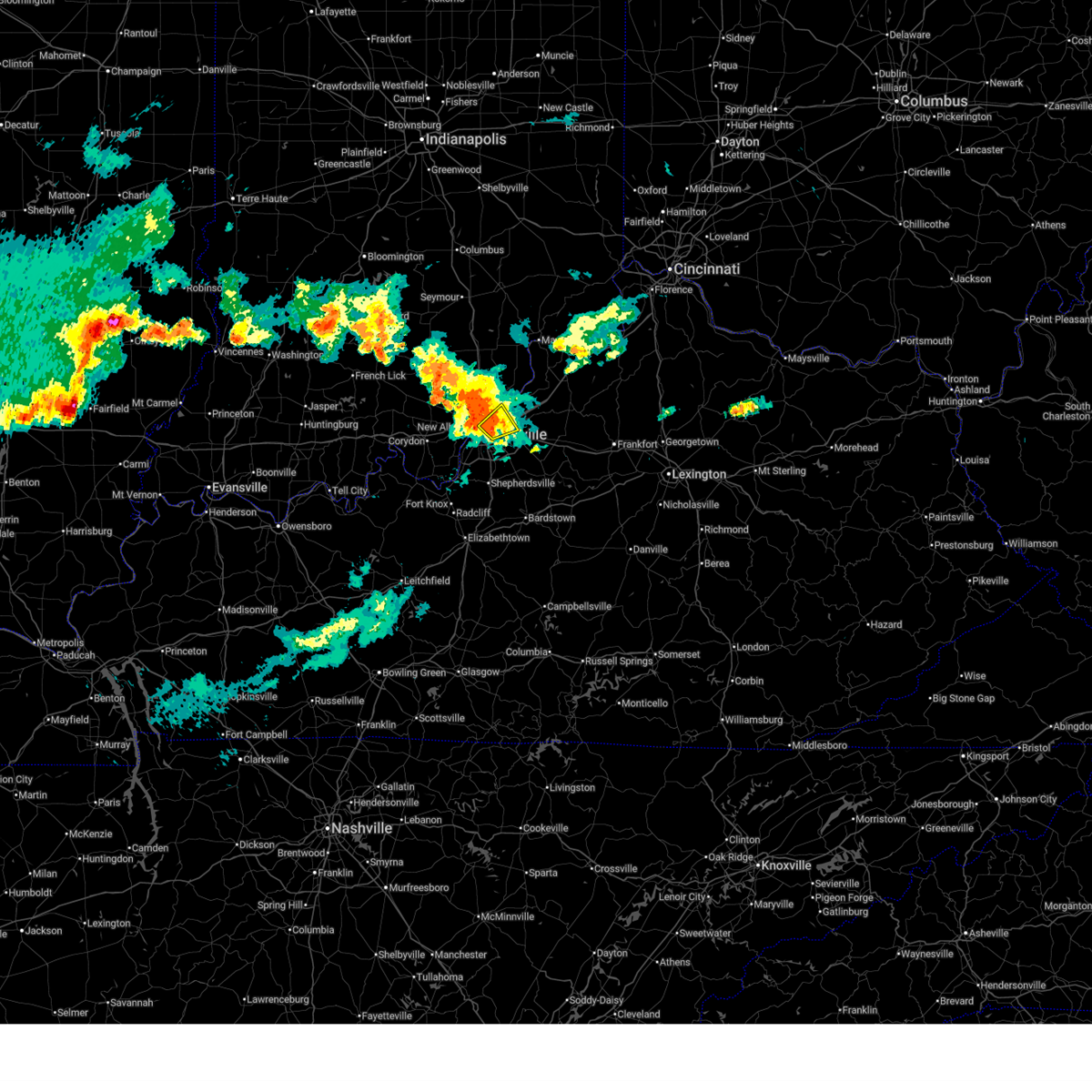
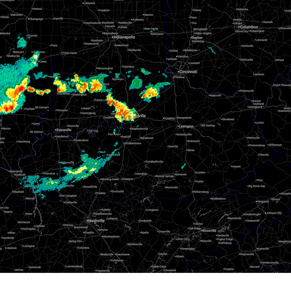
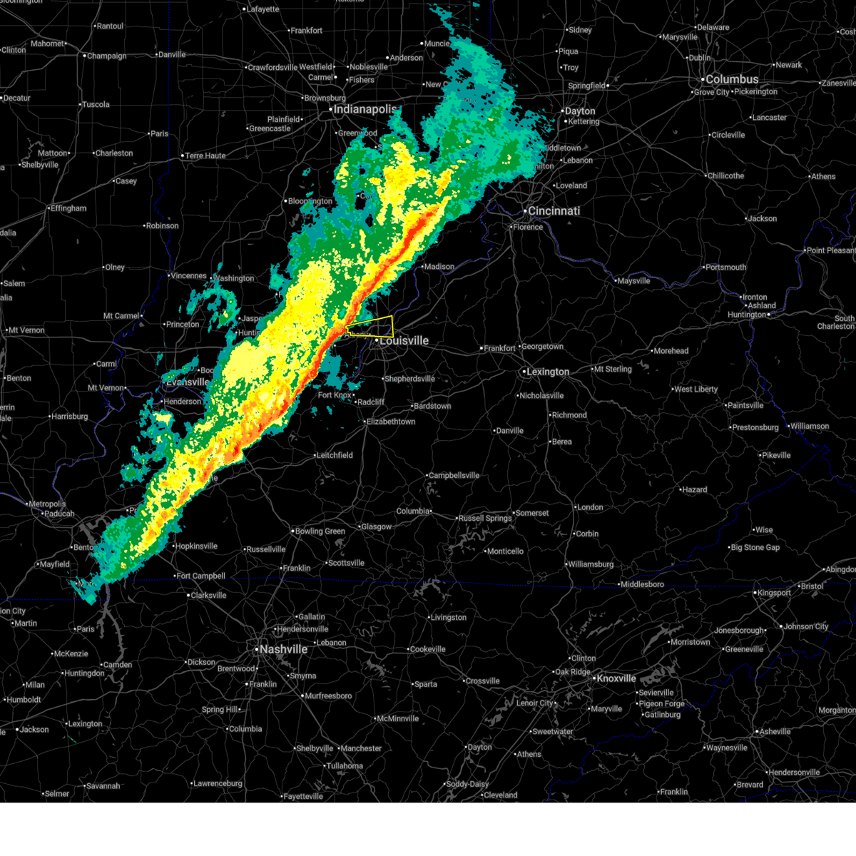
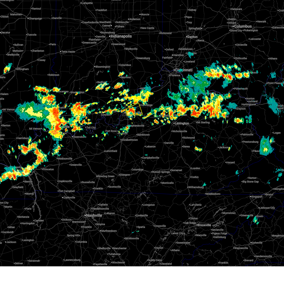
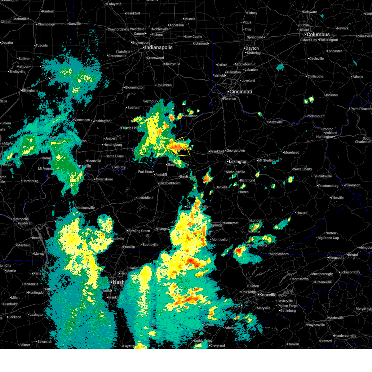
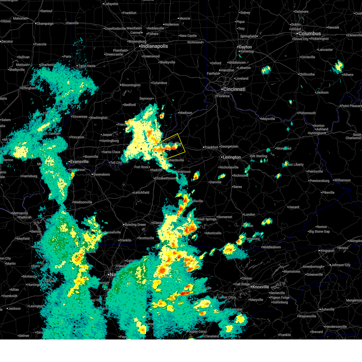
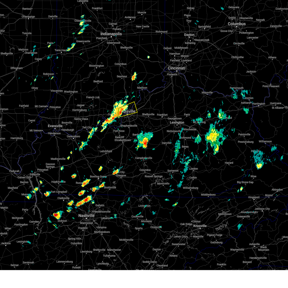
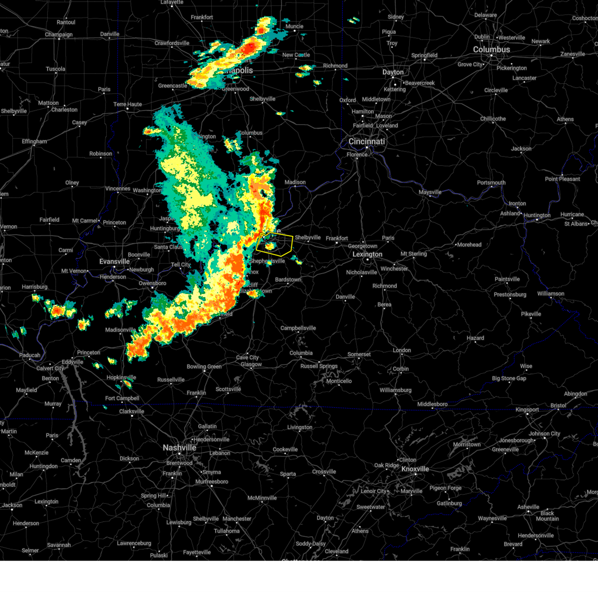
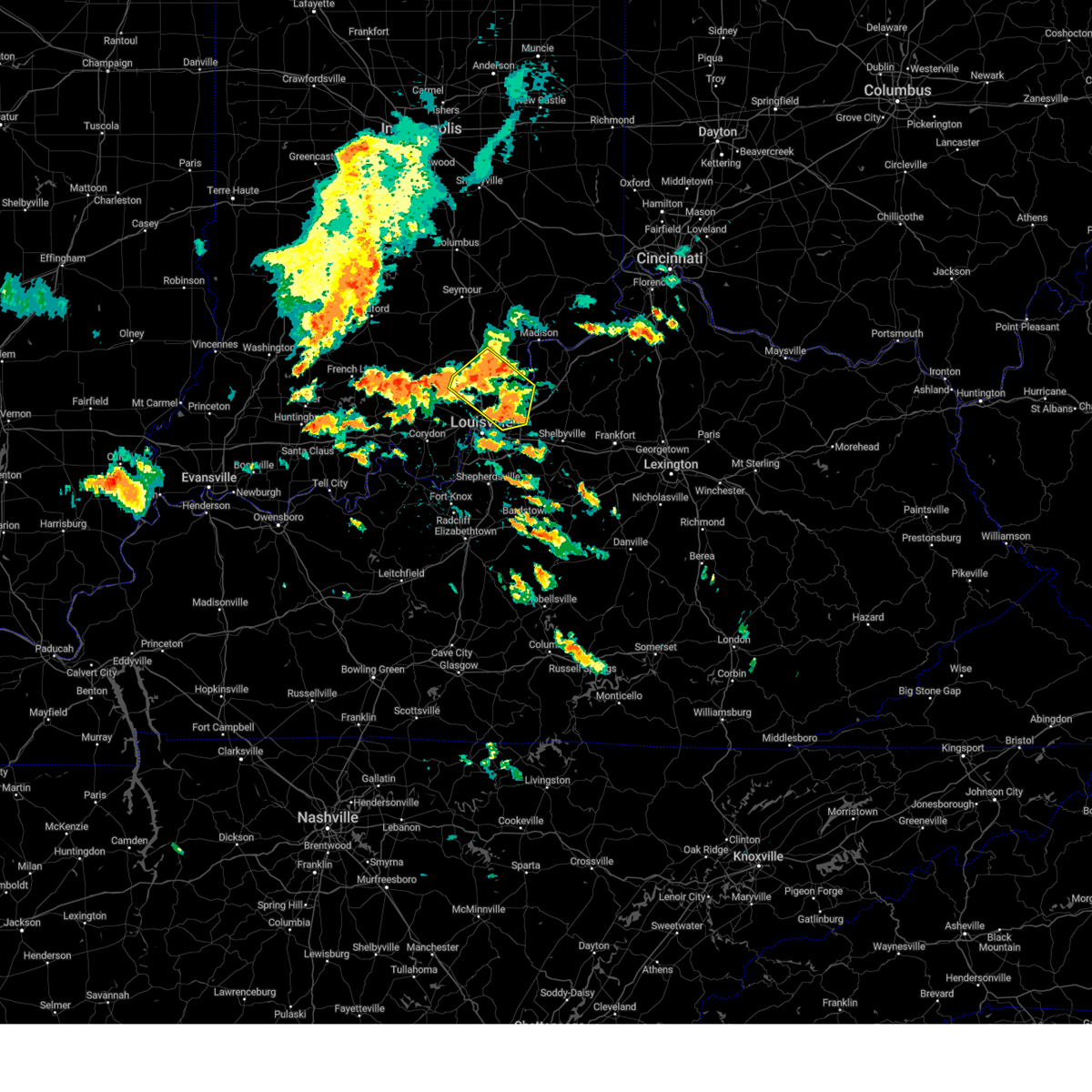
The Top Recent Hail Date for Graymoor-Devondale, KY is Saturday, May 16, 2026 (19th out of 56)
Hail and Wind Damage Spotted near Graymoor-Devondale, KY
| Date / Time | Report Details |
|---|---|
| 5/16/2026 6:32 PM EDT |
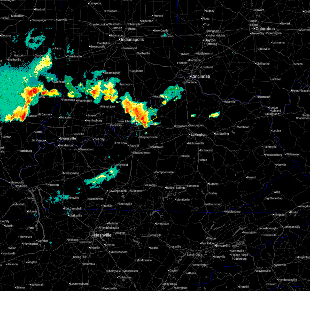 At 632 pm edt, a severe thunderstorm was located over brownsboro farm, moving northeast at 35 mph (radar indicated). Hazards include 60 mph wind gusts and quarter size hail. Hail damage to vehicles is expected. expect wind damage to roofs, siding, and trees. locations impacted include, louisville, jeffersonville, jeffersontown, st. Matthews, lyndon, la grange, middletown, douglass hills, prospect, and hurstbourne. At 632 pm edt, a severe thunderstorm was located over brownsboro farm, moving northeast at 35 mph (radar indicated). Hazards include 60 mph wind gusts and quarter size hail. Hail damage to vehicles is expected. expect wind damage to roofs, siding, and trees. locations impacted include, louisville, jeffersonville, jeffersontown, st. Matthews, lyndon, la grange, middletown, douglass hills, prospect, and hurstbourne.
|
| 5/16/2026 6:23 PM EDT |
 At 623 pm edt, a severe thunderstorm was located near utica, moving northeast at 30 mph (radar indicated). Hazards include quarter size hail. Damage to vehicles is expected. locations impacted include, louisville, jeffersonville, st. Matthews, lyndon, prospect, hurstbourne, graymoor-devondale, windy hills, anchorage, and beechwood village. At 623 pm edt, a severe thunderstorm was located near utica, moving northeast at 30 mph (radar indicated). Hazards include quarter size hail. Damage to vehicles is expected. locations impacted include, louisville, jeffersonville, st. Matthews, lyndon, prospect, hurstbourne, graymoor-devondale, windy hills, anchorage, and beechwood village.
|
| 5/16/2026 6:11 PM EDT |
 Svrlmk the national weather service in louisville has issued a * severe thunderstorm warning for, south central clark county in south central indiana, south central floyd county in south central indiana, west central oldham county in central kentucky, northern jefferson county in central kentucky, * until 630 pm edt. * at 610 pm edt, a severe thunderstorm was located over louisville, moving northeast at 30 mph (radar indicated). Hazards include quarter size hail. damage to vehicles is expected Svrlmk the national weather service in louisville has issued a * severe thunderstorm warning for, south central clark county in south central indiana, south central floyd county in south central indiana, west central oldham county in central kentucky, northern jefferson county in central kentucky, * until 630 pm edt. * at 610 pm edt, a severe thunderstorm was located over louisville, moving northeast at 30 mph (radar indicated). Hazards include quarter size hail. damage to vehicles is expected
|
| 3/16/2026 12:11 AM EDT |
 Svrlmk the national weather service in louisville has issued a * severe thunderstorm warning for, eastern jefferson county in south central indiana, eastern clark county in south central indiana, oldham county in central kentucky, northwestern shelby county in central kentucky, trimble county in central kentucky, western henry county in central kentucky, eastern jefferson county in central kentucky, * until 100 am edt. * at 1210 am edt, severe thunderstorms were located along a line extending from 9 miles north of prospect to glenview to fern creek, moving northeast at 75 mph (radar indicated). Hazards include 60 mph wind gusts. expect damage to roofs, siding, and trees Svrlmk the national weather service in louisville has issued a * severe thunderstorm warning for, eastern jefferson county in south central indiana, eastern clark county in south central indiana, oldham county in central kentucky, northwestern shelby county in central kentucky, trimble county in central kentucky, western henry county in central kentucky, eastern jefferson county in central kentucky, * until 100 am edt. * at 1210 am edt, severe thunderstorms were located along a line extending from 9 miles north of prospect to glenview to fern creek, moving northeast at 75 mph (radar indicated). Hazards include 60 mph wind gusts. expect damage to roofs, siding, and trees
|
| 12/28/2025 9:58 PM EST |
 The storms which prompted the warning have weakened below severe limits, and no longer pose an immediate threat to life or property. therefore, the warning will be allowed to expire. however, gusty winds are still possible with these thunderstorms. The storms which prompted the warning have weakened below severe limits, and no longer pose an immediate threat to life or property. therefore, the warning will be allowed to expire. however, gusty winds are still possible with these thunderstorms.
|
| 12/28/2025 9:48 PM EST |
 the severe thunderstorm warning has been cancelled and is no longer in effect the severe thunderstorm warning has been cancelled and is no longer in effect
|
| 12/28/2025 9:48 PM EST |
 At 947 pm est, severe thunderstorms were located along a line extending from mockingbird valley to 12 miles southeast of brandenburg, moving east at 50 mph (radar indicated). Hazards include 60 mph wind gusts. Expect damage to roofs, siding, and trees. locations impacted include, louisville, jeffersontown, st. Matthews, shively, shepherdsville, lyndon, douglass hills, hurstbourne, graymoor-devondale, and windy hills. At 947 pm est, severe thunderstorms were located along a line extending from mockingbird valley to 12 miles southeast of brandenburg, moving east at 50 mph (radar indicated). Hazards include 60 mph wind gusts. Expect damage to roofs, siding, and trees. locations impacted include, louisville, jeffersontown, st. Matthews, shively, shepherdsville, lyndon, douglass hills, hurstbourne, graymoor-devondale, and windy hills.
|
| 12/28/2025 9:36 PM EST |
 At 936 pm est, a severe thunderstorm was located over new albany, moving east at 45 mph (radar indicated). Hazards include 60 mph wind gusts. Expect damage to roofs, siding, and trees. Locations impacted include, louisville, jeffersonville, new albany, windy hills, northfield, rolling fields, glenview, riverwood, glenview hills, and crossgate. At 936 pm est, a severe thunderstorm was located over new albany, moving east at 45 mph (radar indicated). Hazards include 60 mph wind gusts. Expect damage to roofs, siding, and trees. Locations impacted include, louisville, jeffersonville, new albany, windy hills, northfield, rolling fields, glenview, riverwood, glenview hills, and crossgate.
|
| 12/28/2025 9:33 PM EST |
 Svrlmk the national weather service in louisville has issued a * severe thunderstorm warning for, southeastern harrison county in south central indiana, south central floyd county in south central indiana, east central meade county in central kentucky, southwestern jefferson county in central kentucky, northwestern bullitt county in central kentucky, north central hardin county in central kentucky, * until 1000 pm est. * at 933 pm est, severe thunderstorms were located along a line extending from near new albany to near brandenburg, moving east at 50 mph (radar indicated). Hazards include 60 mph wind gusts. expect damage to roofs, siding, and trees Svrlmk the national weather service in louisville has issued a * severe thunderstorm warning for, southeastern harrison county in south central indiana, south central floyd county in south central indiana, east central meade county in central kentucky, southwestern jefferson county in central kentucky, northwestern bullitt county in central kentucky, north central hardin county in central kentucky, * until 1000 pm est. * at 933 pm est, severe thunderstorms were located along a line extending from near new albany to near brandenburg, moving east at 50 mph (radar indicated). Hazards include 60 mph wind gusts. expect damage to roofs, siding, and trees
|
| 12/28/2025 9:20 PM EST |
 Svrlmk the national weather service in louisville has issued a * severe thunderstorm warning for, south central clark county in south central indiana, central floyd county in south central indiana, north central jefferson county in central kentucky, * until 945 pm est. * at 920 pm est, a severe thunderstorm was located 9 miles northeast of corydon, moving east at 45 mph (radar indicated). Hazards include 60 mph wind gusts. expect damage to roofs, siding, and trees Svrlmk the national weather service in louisville has issued a * severe thunderstorm warning for, south central clark county in south central indiana, central floyd county in south central indiana, north central jefferson county in central kentucky, * until 945 pm est. * at 920 pm est, a severe thunderstorm was located 9 miles northeast of corydon, moving east at 45 mph (radar indicated). Hazards include 60 mph wind gusts. expect damage to roofs, siding, and trees
|
| 7/17/2025 3:59 PM EDT |
 the severe thunderstorm warning has been cancelled and is no longer in effect the severe thunderstorm warning has been cancelled and is no longer in effect
|
| 7/17/2025 3:49 PM EDT |
 At 349 pm edt, a severe thunderstorm was located over worthington hills, moving east at 25 mph (radar indicated). Hazards include 60 mph wind gusts and penny size hail. Expect damage to roofs, siding, and trees. locations impacted include, louisville, jeffersonville, jeffersontown, st. Matthews, lyndon, la grange, middletown, douglass hills, prospect, and hurstbourne. At 349 pm edt, a severe thunderstorm was located over worthington hills, moving east at 25 mph (radar indicated). Hazards include 60 mph wind gusts and penny size hail. Expect damage to roofs, siding, and trees. locations impacted include, louisville, jeffersonville, jeffersontown, st. Matthews, lyndon, la grange, middletown, douglass hills, prospect, and hurstbourne.
|
| 7/17/2025 3:42 PM EDT |
 Svrlmk the national weather service in louisville has issued a * severe thunderstorm warning for, south central clark county in south central indiana, southwestern oldham county in central kentucky, northwestern shelby county in central kentucky, northeastern jefferson county in central kentucky, * until 415 pm edt. * at 341 pm edt, a severe thunderstorm was located over old brownsboro place, moving east at 25 mph (radar indicated). Hazards include 60 mph wind gusts and penny size hail. expect damage to roofs, siding, and trees Svrlmk the national weather service in louisville has issued a * severe thunderstorm warning for, south central clark county in south central indiana, southwestern oldham county in central kentucky, northwestern shelby county in central kentucky, northeastern jefferson county in central kentucky, * until 415 pm edt. * at 341 pm edt, a severe thunderstorm was located over old brownsboro place, moving east at 25 mph (radar indicated). Hazards include 60 mph wind gusts and penny size hail. expect damage to roofs, siding, and trees
|
| 5/16/2025 9:55 PM EDT |
 Svrlmk the national weather service in louisville has issued a * severe thunderstorm warning for, southeastern harrison county in south central indiana, south central clark county in south central indiana, southern floyd county in south central indiana, south central oldham county in central kentucky, western spencer county in central kentucky, west central shelby county in central kentucky, northwestern nelson county in central kentucky, southeastern meade county in central kentucky, jefferson county in central kentucky, bullitt county in central kentucky, northeastern hardin county in central kentucky, * until 1030 pm edt. * at 954 pm edt, a severe thunderstorm was located 9 miles northeast of brandenburg, moving east at 75 mph (radar indicated). Hazards include 70 mph wind gusts and quarter size hail. Hail damage to vehicles is expected. expect considerable tree damage. Wind damage is also likely to mobile homes, roofs, and outbuildings. Svrlmk the national weather service in louisville has issued a * severe thunderstorm warning for, southeastern harrison county in south central indiana, south central clark county in south central indiana, southern floyd county in south central indiana, south central oldham county in central kentucky, western spencer county in central kentucky, west central shelby county in central kentucky, northwestern nelson county in central kentucky, southeastern meade county in central kentucky, jefferson county in central kentucky, bullitt county in central kentucky, northeastern hardin county in central kentucky, * until 1030 pm edt. * at 954 pm edt, a severe thunderstorm was located 9 miles northeast of brandenburg, moving east at 75 mph (radar indicated). Hazards include 70 mph wind gusts and quarter size hail. Hail damage to vehicles is expected. expect considerable tree damage. Wind damage is also likely to mobile homes, roofs, and outbuildings.
|
| 5/2/2025 4:38 PM EDT |
 The storm which prompted the warning has moved out of the area. therefore, the warning will be allowed to expire. however, small hail, gusty winds and heavy rain are still possible with this thunderstorm. a severe thunderstorm watch remains in effect until 900 pm edt for south central indiana, and central kentucky. to report severe weather, contact your nearest law enforcement agency. they will relay your report to the national weather service louisville. The storm which prompted the warning has moved out of the area. therefore, the warning will be allowed to expire. however, small hail, gusty winds and heavy rain are still possible with this thunderstorm. a severe thunderstorm watch remains in effect until 900 pm edt for south central indiana, and central kentucky. to report severe weather, contact your nearest law enforcement agency. they will relay your report to the national weather service louisville.
|
| 5/2/2025 4:29 PM EDT |
 At 429 pm edt, a severe thunderstorm was located near middletown, moving northeast at 40 mph (radar indicated). Hazards include 60 mph wind gusts and quarter size hail. Hail damage to vehicles is expected. expect wind damage to roofs, siding, and trees. locations impacted include, louisville, jeffersonville, jeffersontown, st. Matthews, lyndon, la grange, middletown, douglass hills, prospect, and hurstbourne. At 429 pm edt, a severe thunderstorm was located near middletown, moving northeast at 40 mph (radar indicated). Hazards include 60 mph wind gusts and quarter size hail. Hail damage to vehicles is expected. expect wind damage to roofs, siding, and trees. locations impacted include, louisville, jeffersonville, jeffersontown, st. Matthews, lyndon, la grange, middletown, douglass hills, prospect, and hurstbourne.
|
| 5/2/2025 4:29 PM EDT |
 the severe thunderstorm warning has been cancelled and is no longer in effect the severe thunderstorm warning has been cancelled and is no longer in effect
|
| 5/2/2025 4:11 PM EDT |
 Svrlmk the national weather service in louisville has issued a * severe thunderstorm warning for, southern oldham county in central kentucky, northwestern spencer county in central kentucky, western shelby county in central kentucky, jefferson county in central kentucky, northeastern bullitt county in central kentucky, * until 445 pm edt. * at 411 pm edt, a severe thunderstorm was located over lynnview, moving northeast at 35 mph (radar indicated). Hazards include 60 mph wind gusts and penny size hail. expect damage to roofs, siding, and trees Svrlmk the national weather service in louisville has issued a * severe thunderstorm warning for, southern oldham county in central kentucky, northwestern spencer county in central kentucky, western shelby county in central kentucky, jefferson county in central kentucky, northeastern bullitt county in central kentucky, * until 445 pm edt. * at 411 pm edt, a severe thunderstorm was located over lynnview, moving northeast at 35 mph (radar indicated). Hazards include 60 mph wind gusts and penny size hail. expect damage to roofs, siding, and trees
|
| 4/3/2025 12:26 AM EDT |
 Svrlmk the national weather service in louisville has issued a * severe thunderstorm warning for, southeastern oldham county in central kentucky, northwestern spencer county in central kentucky, shelby county in central kentucky, southwestern henry county in central kentucky, jefferson county in central kentucky, northeastern bullitt county in central kentucky, southwestern franklin county in central kentucky, * until 100 am edt. * at 1226 am edt, a severe thunderstorm was located over buechel, moving northeast at 70 mph (radar indicated). Hazards include 70 mph wind gusts and penny size hail. Expect considerable tree damage. Damage is likely to mobile homes, roofs, and outbuildings. Svrlmk the national weather service in louisville has issued a * severe thunderstorm warning for, southeastern oldham county in central kentucky, northwestern spencer county in central kentucky, shelby county in central kentucky, southwestern henry county in central kentucky, jefferson county in central kentucky, northeastern bullitt county in central kentucky, southwestern franklin county in central kentucky, * until 100 am edt. * at 1226 am edt, a severe thunderstorm was located over buechel, moving northeast at 70 mph (radar indicated). Hazards include 70 mph wind gusts and penny size hail. Expect considerable tree damage. Damage is likely to mobile homes, roofs, and outbuildings.
|
| 4/3/2025 12:21 AM EDT |
 The storms which prompted the warning have weakened below severe limits, and have exited the warned area. therefore, the warning will be allowed to expire. however, gusty winds and heavy rain are still possible with these thunderstorms. a tornado watch remains in effect until 200 am edt for south central indiana, and central kentucky. to report severe weather, contact your nearest law enforcement agency. they will relay your report to the national weather service louisville. The storms which prompted the warning have weakened below severe limits, and have exited the warned area. therefore, the warning will be allowed to expire. however, gusty winds and heavy rain are still possible with these thunderstorms. a tornado watch remains in effect until 200 am edt for south central indiana, and central kentucky. to report severe weather, contact your nearest law enforcement agency. they will relay your report to the national weather service louisville.
|
| 4/2/2025 11:39 PM EDT |
 Svrlmk the national weather service in louisville has issued a * severe thunderstorm warning for, southeastern harrison county in south central indiana, jefferson county in south central indiana, clark county in south central indiana, floyd county in south central indiana, scott county in south central indiana, oldham county in central kentucky, trimble county in central kentucky, central jefferson county in central kentucky, * until 1230 am edt. * at 1139 pm edt, severe thunderstorms were located along a line extending from 9 miles south of scottsburg to 7 miles west of pleasure ridge park, moving northeast at 75 mph (radar indicated). Hazards include 60 mph wind gusts. expect damage to roofs, siding, and trees Svrlmk the national weather service in louisville has issued a * severe thunderstorm warning for, southeastern harrison county in south central indiana, jefferson county in south central indiana, clark county in south central indiana, floyd county in south central indiana, scott county in south central indiana, oldham county in central kentucky, trimble county in central kentucky, central jefferson county in central kentucky, * until 1230 am edt. * at 1139 pm edt, severe thunderstorms were located along a line extending from 9 miles south of scottsburg to 7 miles west of pleasure ridge park, moving northeast at 75 mph (radar indicated). Hazards include 60 mph wind gusts. expect damage to roofs, siding, and trees
|
| 3/19/2025 10:53 PM EDT |
 At 1053 pm edt, a severe thunderstorm was located over coldstream, moving northeast at 60 mph (radar indicated). Hazards include 60 mph wind gusts and penny size hail. Expect damage to roofs, siding, and trees. locations impacted include, louisville, jeffersontown, st. Matthews, lyndon, la grange, middletown, douglass hills, prospect, hurstbourne, and graymoor-devondale. At 1053 pm edt, a severe thunderstorm was located over coldstream, moving northeast at 60 mph (radar indicated). Hazards include 60 mph wind gusts and penny size hail. Expect damage to roofs, siding, and trees. locations impacted include, louisville, jeffersontown, st. Matthews, lyndon, la grange, middletown, douglass hills, prospect, hurstbourne, and graymoor-devondale.
|
| 3/19/2025 10:51 PM EDT |
 At 1050 pm edt, a severe thunderstorm was located over worthington hills, moving northeast at 70 mph (radar indicated). Hazards include 70 mph wind gusts and quarter size hail. Hail damage to vehicles is expected. expect considerable tree damage. wind damage is also likely to mobile homes, roofs, and outbuildings. locations impacted include, louisville, jeffersontown, st. Matthews, shively, lyndon, la grange, middletown, douglass hills, prospect, and hurstbourne. At 1050 pm edt, a severe thunderstorm was located over worthington hills, moving northeast at 70 mph (radar indicated). Hazards include 70 mph wind gusts and quarter size hail. Hail damage to vehicles is expected. expect considerable tree damage. wind damage is also likely to mobile homes, roofs, and outbuildings. locations impacted include, louisville, jeffersontown, st. Matthews, shively, lyndon, la grange, middletown, douglass hills, prospect, and hurstbourne.
|
| 3/19/2025 10:41 PM EDT |
 Svrlmk the national weather service in louisville has issued a * severe thunderstorm warning for, oldham county in central kentucky, northwestern shelby county in central kentucky, southeastern trimble county in central kentucky, western henry county in central kentucky, central jefferson county in central kentucky, * until 1115 pm edt. * at 1041 pm edt, a severe thunderstorm was located over strathmoor manor, moving northeast at 65 mph (radar indicated). Hazards include 60 mph wind gusts and penny size hail. expect damage to roofs, siding, and trees Svrlmk the national weather service in louisville has issued a * severe thunderstorm warning for, oldham county in central kentucky, northwestern shelby county in central kentucky, southeastern trimble county in central kentucky, western henry county in central kentucky, central jefferson county in central kentucky, * until 1115 pm edt. * at 1041 pm edt, a severe thunderstorm was located over strathmoor manor, moving northeast at 65 mph (radar indicated). Hazards include 60 mph wind gusts and penny size hail. expect damage to roofs, siding, and trees
|
| 3/15/2025 7:38 AM EDT |
 the severe thunderstorm warning has been cancelled and is no longer in effect the severe thunderstorm warning has been cancelled and is no longer in effect
|
| 3/15/2025 7:38 AM EDT |
 At 737 am edt, a severe thunderstorm was located over west buechel, moving northeast at 60 mph (muhammad ali international airport reported 69 mph wind gusts). Hazards include 70 mph wind gusts and quarter size hail. Hail damage to vehicles is expected. expect considerable tree damage. wind damage is also likely to mobile homes, roofs, and outbuildings. locations impacted include, louisville, jeffersonville, jeffersontown, st. Matthews, shively, lyndon, middletown, douglass hills, prospect, and hurstbourne. At 737 am edt, a severe thunderstorm was located over west buechel, moving northeast at 60 mph (muhammad ali international airport reported 69 mph wind gusts). Hazards include 70 mph wind gusts and quarter size hail. Hail damage to vehicles is expected. expect considerable tree damage. wind damage is also likely to mobile homes, roofs, and outbuildings. locations impacted include, louisville, jeffersonville, jeffersontown, st. Matthews, shively, lyndon, middletown, douglass hills, prospect, and hurstbourne.
|
| 3/15/2025 7:25 AM EDT |
 Svrlmk the national weather service in louisville has issued a * severe thunderstorm warning for, south central clark county in south central indiana, south central floyd county in south central indiana, southwestern oldham county in central kentucky, northwestern shelby county in central kentucky, jefferson county in central kentucky, northwestern bullitt county in central kentucky, * until 800 am edt. * at 725 am edt, a severe thunderstorm was located over pleasure ridge park, moving northeast at 60 mph (radar indicated). Hazards include 60 mph wind gusts and quarter size hail. Hail damage to vehicles is expected. Expect wind damage to roofs, siding, and trees. Svrlmk the national weather service in louisville has issued a * severe thunderstorm warning for, south central clark county in south central indiana, south central floyd county in south central indiana, southwestern oldham county in central kentucky, northwestern shelby county in central kentucky, jefferson county in central kentucky, northwestern bullitt county in central kentucky, * until 800 am edt. * at 725 am edt, a severe thunderstorm was located over pleasure ridge park, moving northeast at 60 mph (radar indicated). Hazards include 60 mph wind gusts and quarter size hail. Hail damage to vehicles is expected. Expect wind damage to roofs, siding, and trees.
|
| 9/24/2024 1:58 PM EDT |
 The storm which prompted the warning has moved out of the area. therefore, the warning will be allowed to expire. a severe thunderstorm watch remains in effect until 800 pm edt for south central indiana, and central kentucky. remember, a severe thunderstorm warning still remains in effect for oldham county. The storm which prompted the warning has moved out of the area. therefore, the warning will be allowed to expire. a severe thunderstorm watch remains in effect until 800 pm edt for south central indiana, and central kentucky. remember, a severe thunderstorm warning still remains in effect for oldham county.
|
| 9/24/2024 1:26 PM EDT |
 Svrlmk the national weather service in louisville has issued a * severe thunderstorm warning for, northeastern harrison county in south central indiana, southwestern clark county in south central indiana, floyd county in south central indiana, southwestern oldham county in central kentucky, northern jefferson county in central kentucky, * until 200 pm edt. * at 126 pm edt, a severe thunderstorm was located near new albany, moving east at 40 mph (radar indicated). Hazards include 60 mph wind gusts and quarter size hail. Hail damage to vehicles is expected. Expect wind damage to roofs, siding, and trees. Svrlmk the national weather service in louisville has issued a * severe thunderstorm warning for, northeastern harrison county in south central indiana, southwestern clark county in south central indiana, floyd county in south central indiana, southwestern oldham county in central kentucky, northern jefferson county in central kentucky, * until 200 pm edt. * at 126 pm edt, a severe thunderstorm was located near new albany, moving east at 40 mph (radar indicated). Hazards include 60 mph wind gusts and quarter size hail. Hail damage to vehicles is expected. Expect wind damage to roofs, siding, and trees.
|
| 8/1/2024 5:04 PM EDT |
 Svrlmk the national weather service in louisville has issued a * severe thunderstorm warning for, jefferson county in central kentucky, * until 530 pm edt. * at 504 pm edt, a severe thunderstorm was located over audubon park, moving east at 45 mph (radar indicated). Hazards include 60 mph wind gusts. expect damage to roofs, siding, and trees Svrlmk the national weather service in louisville has issued a * severe thunderstorm warning for, jefferson county in central kentucky, * until 530 pm edt. * at 504 pm edt, a severe thunderstorm was located over audubon park, moving east at 45 mph (radar indicated). Hazards include 60 mph wind gusts. expect damage to roofs, siding, and trees
|
| 7/31/2024 2:57 PM EDT |
 Svrlmk the national weather service in louisville has issued a * severe thunderstorm warning for, clark county in south central indiana, northeastern floyd county in south central indiana, southern scott county in south central indiana, southeastern washington county in south central indiana, western oldham county in central kentucky, northeastern jefferson county in central kentucky, * until 330 pm edt. * at 257 pm edt, a severe thunderstorm was located 10 miles south of scottsburg, moving southeast at 20 mph (radar indicated). Hazards include 60 mph wind gusts and quarter size hail. Hail damage to vehicles is expected. Expect wind damage to roofs, siding, and trees. Svrlmk the national weather service in louisville has issued a * severe thunderstorm warning for, clark county in south central indiana, northeastern floyd county in south central indiana, southern scott county in south central indiana, southeastern washington county in south central indiana, western oldham county in central kentucky, northeastern jefferson county in central kentucky, * until 330 pm edt. * at 257 pm edt, a severe thunderstorm was located 10 miles south of scottsburg, moving southeast at 20 mph (radar indicated). Hazards include 60 mph wind gusts and quarter size hail. Hail damage to vehicles is expected. Expect wind damage to roofs, siding, and trees.
|
| 5/26/2024 11:24 PM EDT |
 the severe thunderstorm warning has been cancelled and is no longer in effect the severe thunderstorm warning has been cancelled and is no longer in effect
|
| 5/26/2024 11:24 PM EDT |
 At 1124 pm edt, severe thunderstorms were located along a line extending from jeffersonville to 6 miles southwest of shepherdsville, moving east at 70 mph (radar indicated). Hazards include 60 mph wind gusts and penny size hail. Expect damage to roofs, siding, and trees. locations impacted include, louisville, jeffersonville, new albany, jeffersontown, st. Matthews, shively, shelbyville, shepherdsville, lyndon, and la grange. At 1124 pm edt, severe thunderstorms were located along a line extending from jeffersonville to 6 miles southwest of shepherdsville, moving east at 70 mph (radar indicated). Hazards include 60 mph wind gusts and penny size hail. Expect damage to roofs, siding, and trees. locations impacted include, louisville, jeffersonville, new albany, jeffersontown, st. Matthews, shively, shelbyville, shepherdsville, lyndon, and la grange.
|
| 5/26/2024 11:09 PM EDT |
 Svrlmk the national weather service in louisville has issued a * severe thunderstorm warning for, southeastern harrison county in south central indiana, south central clark county in south central indiana, southeastern floyd county in south central indiana, oldham county in central kentucky, spencer county in central kentucky, western shelby county in central kentucky, northeastern nelson county in central kentucky, southeastern meade county in central kentucky, jefferson county in central kentucky, bullitt county in central kentucky, northeastern hardin county in central kentucky, * until midnight edt. * at 1109 pm edt, severe thunderstorms were located along a line extending from 7 miles east of corydon to 9 miles southeast of brandenburg, moving east at 70 mph (radar indicated). Hazards include 60 mph wind gusts and penny size hail. expect damage to roofs, siding, and trees Svrlmk the national weather service in louisville has issued a * severe thunderstorm warning for, southeastern harrison county in south central indiana, south central clark county in south central indiana, southeastern floyd county in south central indiana, oldham county in central kentucky, spencer county in central kentucky, western shelby county in central kentucky, northeastern nelson county in central kentucky, southeastern meade county in central kentucky, jefferson county in central kentucky, bullitt county in central kentucky, northeastern hardin county in central kentucky, * until midnight edt. * at 1109 pm edt, severe thunderstorms were located along a line extending from 7 miles east of corydon to 9 miles southeast of brandenburg, moving east at 70 mph (radar indicated). Hazards include 60 mph wind gusts and penny size hail. expect damage to roofs, siding, and trees
|
| 5/26/2024 12:17 PM EDT |
 At 1216 pm edt, a severe thunderstorm was located near prospect, moving northeast at 60 mph (radar indicated). Hazards include 75 mph wind gusts. Expect considerable tree damage. damage is likely to mobile homes, roofs, and outbuildings. Locations impacted include, louisville, jeffersonville, lyndon, la grange, prospect, graymoor-devondale, windy hills, anchorage, worthington hills, and barbourmeade. At 1216 pm edt, a severe thunderstorm was located near prospect, moving northeast at 60 mph (radar indicated). Hazards include 75 mph wind gusts. Expect considerable tree damage. damage is likely to mobile homes, roofs, and outbuildings. Locations impacted include, louisville, jeffersonville, lyndon, la grange, prospect, graymoor-devondale, windy hills, anchorage, worthington hills, and barbourmeade.
|
| 5/26/2024 12:07 PM EDT |
 At 1206 pm edt, a severe thunderstorm was located near jeffersonville, moving east at 45 mph. this is a destructive storm for southern indiana (radar indicated). Hazards include 80 mph wind gusts. Flying debris will be dangerous to those caught without shelter. mobile homes will be heavily damaged. expect considerable damage to roofs, windows, and vehicles. extensive tree damage and power outages are likely. locations impacted include, louisville, jeffersonville, new albany, st. Matthews, lyndon, la grange, prospect, graymoor-devondale, windy hills, and anchorage. At 1206 pm edt, a severe thunderstorm was located near jeffersonville, moving east at 45 mph. this is a destructive storm for southern indiana (radar indicated). Hazards include 80 mph wind gusts. Flying debris will be dangerous to those caught without shelter. mobile homes will be heavily damaged. expect considerable damage to roofs, windows, and vehicles. extensive tree damage and power outages are likely. locations impacted include, louisville, jeffersonville, new albany, st. Matthews, lyndon, la grange, prospect, graymoor-devondale, windy hills, and anchorage.
|
| 5/26/2024 12:00 PM EDT |
 Svrlmk the national weather service in louisville has issued a * severe thunderstorm warning for, south central jefferson county in south central indiana, clark county in south central indiana, floyd county in south central indiana, southern scott county in south central indiana, southeastern washington county in south central indiana, oldham county in central kentucky, northern shelby county in central kentucky, trimble county in central kentucky, western henry county in central kentucky, northern jefferson county in central kentucky, * until 1230 pm edt. * at 1159 am edt, a severe thunderstorm was located over louisville, moving northeast at 65 mph (radar indicated). Hazards include 70 mph wind gusts. Expect considerable tree damage. Damage is likely to mobile homes, roofs, and outbuildings. Svrlmk the national weather service in louisville has issued a * severe thunderstorm warning for, south central jefferson county in south central indiana, clark county in south central indiana, floyd county in south central indiana, southern scott county in south central indiana, southeastern washington county in south central indiana, oldham county in central kentucky, northern shelby county in central kentucky, trimble county in central kentucky, western henry county in central kentucky, northern jefferson county in central kentucky, * until 1230 pm edt. * at 1159 am edt, a severe thunderstorm was located over louisville, moving northeast at 65 mph (radar indicated). Hazards include 70 mph wind gusts. Expect considerable tree damage. Damage is likely to mobile homes, roofs, and outbuildings.
|
| 5/22/2024 8:01 PM EDT |
 The storm which prompted the warning has weakened below severe limits, and has exited the warned area. therefore, the warning has been allowed to expire. to report severe weather, contact your nearest law enforcement agency. they will relay your report to the national weather service louisville. The storm which prompted the warning has weakened below severe limits, and has exited the warned area. therefore, the warning has been allowed to expire. to report severe weather, contact your nearest law enforcement agency. they will relay your report to the national weather service louisville.
|
| 5/22/2024 7:44 PM EDT |
 At 744 pm edt, a severe thunderstorm was located over prospect, moving east at 25 mph (radar indicated). Hazards include 60 mph wind gusts. Expect damage to roofs, siding, and trees. locations impacted include, louisville, jeffersonville, new albany, st. Matthews, shively, prospect, graymoor-devondale, windy hills, audubon park, and beechwood village. At 744 pm edt, a severe thunderstorm was located over prospect, moving east at 25 mph (radar indicated). Hazards include 60 mph wind gusts. Expect damage to roofs, siding, and trees. locations impacted include, louisville, jeffersonville, new albany, st. Matthews, shively, prospect, graymoor-devondale, windy hills, audubon park, and beechwood village.
|
| 5/22/2024 7:28 PM EDT |
 Svrlmk the national weather service in louisville has issued a * severe thunderstorm warning for, southwestern clark county in south central indiana, eastern floyd county in south central indiana, southwestern oldham county in central kentucky, northwestern jefferson county in central kentucky, * until 800 pm edt. * at 727 pm edt, a severe thunderstorm was located near new albany, moving east at 25 mph (radar indicated). Hazards include 60 mph wind gusts. expect damage to roofs, siding, and trees Svrlmk the national weather service in louisville has issued a * severe thunderstorm warning for, southwestern clark county in south central indiana, eastern floyd county in south central indiana, southwestern oldham county in central kentucky, northwestern jefferson county in central kentucky, * until 800 pm edt. * at 727 pm edt, a severe thunderstorm was located near new albany, moving east at 25 mph (radar indicated). Hazards include 60 mph wind gusts. expect damage to roofs, siding, and trees
|
| 4/19/2024 12:28 AM EDT |
 The storms which prompted the warning have weakened below severe limits, and no longer pose an immediate threat to life or property. therefore, the warning will be allowed to expire. however, gusty winds and heavy rain are still possible with these thunderstorms. a severe thunderstorm watch remains in effect until 300 am edt for south central indiana, and central kentucky. The storms which prompted the warning have weakened below severe limits, and no longer pose an immediate threat to life or property. therefore, the warning will be allowed to expire. however, gusty winds and heavy rain are still possible with these thunderstorms. a severe thunderstorm watch remains in effect until 300 am edt for south central indiana, and central kentucky.
|
| 4/19/2024 12:20 AM EDT |
 the severe thunderstorm warning has been cancelled and is no longer in effect the severe thunderstorm warning has been cancelled and is no longer in effect
|
| 4/19/2024 12:20 AM EDT |
 At 1219 am edt, severe thunderstorms were located along a line extending from near jeffersonville to lynnview to near hollyvilla, moving east at 45 mph (at 1212 am edt...louisville airport reported a gust to 62 mph). Hazards include 60 mph wind gusts and penny size hail. Expect damage to roofs, siding, and trees. locations impacted include, louisville, jeffersonville, jeffersontown, st. Matthews, lyndon, middletown, douglass hills, prospect, hurstbourne, and graymoor-devondale. At 1219 am edt, severe thunderstorms were located along a line extending from near jeffersonville to lynnview to near hollyvilla, moving east at 45 mph (at 1212 am edt...louisville airport reported a gust to 62 mph). Hazards include 60 mph wind gusts and penny size hail. Expect damage to roofs, siding, and trees. locations impacted include, louisville, jeffersonville, jeffersontown, st. Matthews, lyndon, middletown, douglass hills, prospect, hurstbourne, and graymoor-devondale.
|
| 4/19/2024 12:08 AM EDT |
 At 1208 am edt, severe thunderstorms were located along a line extending from new albany to pleasure ridge par to near valley station, moving east at 45 mph (radar indicated). Hazards include 60 mph wind gusts and penny size hail. Expect damage to roofs, siding, and trees. locations impacted include, louisville, jeffersonville, new albany, jeffersontown, st. Matthews, shively, shepherdsville, lyndon, middletown, and douglass hills. At 1208 am edt, severe thunderstorms were located along a line extending from new albany to pleasure ridge par to near valley station, moving east at 45 mph (radar indicated). Hazards include 60 mph wind gusts and penny size hail. Expect damage to roofs, siding, and trees. locations impacted include, louisville, jeffersonville, new albany, jeffersontown, st. Matthews, shively, shepherdsville, lyndon, middletown, and douglass hills.
|
| 4/19/2024 12:08 AM EDT |
 the severe thunderstorm warning has been cancelled and is no longer in effect the severe thunderstorm warning has been cancelled and is no longer in effect
|
| 4/18/2024 11:53 PM EDT |
 Svrlmk the national weather service in louisville has issued a * severe thunderstorm warning for, southeastern harrison county in south central indiana, south central clark county in south central indiana, floyd county in south central indiana, southwestern oldham county in central kentucky, jefferson county in central kentucky, northwestern bullitt county in central kentucky, * until 1230 am edt. * at 1152 pm edt, severe thunderstorms were located along a line extending from 11 miles west of new albany to 8 miles southeast of corydon to near brandenburg, moving east at 45 mph (radar indicated). Hazards include 60 mph wind gusts and penny size hail. expect damage to roofs, siding, and trees Svrlmk the national weather service in louisville has issued a * severe thunderstorm warning for, southeastern harrison county in south central indiana, south central clark county in south central indiana, floyd county in south central indiana, southwestern oldham county in central kentucky, jefferson county in central kentucky, northwestern bullitt county in central kentucky, * until 1230 am edt. * at 1152 pm edt, severe thunderstorms were located along a line extending from 11 miles west of new albany to 8 miles southeast of corydon to near brandenburg, moving east at 45 mph (radar indicated). Hazards include 60 mph wind gusts and penny size hail. expect damage to roofs, siding, and trees
|
| 4/2/2024 5:32 PM EDT |
 Svrlmk the national weather service in louisville has issued a * severe thunderstorm warning for, central clark county in south central indiana, oldham county in central kentucky, northwestern shelby county in central kentucky, southern trimble county in central kentucky, western henry county in central kentucky, northeastern jefferson county in central kentucky, * until 600 pm edt. * at 532 pm edt, severe thunderstorms were located along a line extending from 9 miles north of prospect to louisville, moving east at 50 mph (radar indicated). Hazards include 60 mph wind gusts and nickel size hail. expect damage to roofs, siding, and trees Svrlmk the national weather service in louisville has issued a * severe thunderstorm warning for, central clark county in south central indiana, oldham county in central kentucky, northwestern shelby county in central kentucky, southern trimble county in central kentucky, western henry county in central kentucky, northeastern jefferson county in central kentucky, * until 600 pm edt. * at 532 pm edt, severe thunderstorms were located along a line extending from 9 miles north of prospect to louisville, moving east at 50 mph (radar indicated). Hazards include 60 mph wind gusts and nickel size hail. expect damage to roofs, siding, and trees
|
| 3/15/2024 12:04 AM EDT |
 the severe thunderstorm warning has been cancelled and is no longer in effect the severe thunderstorm warning has been cancelled and is no longer in effect
|
| 3/15/2024 12:04 AM EDT |
 At 1204 am edt, severe thunderstorms were located along a line extending from lyndon to near shepherdsville, moving east at 55 mph (radar indicated). Hazards include 60 mph wind gusts. Expect damage to roofs, siding, and trees. locations impacted include, louisville, jeffersonville, jeffersontown, st. Matthews, shively, shepherdsville, lyndon, middletown, douglass hills, and prospect. At 1204 am edt, severe thunderstorms were located along a line extending from lyndon to near shepherdsville, moving east at 55 mph (radar indicated). Hazards include 60 mph wind gusts. Expect damage to roofs, siding, and trees. locations impacted include, louisville, jeffersonville, jeffersontown, st. Matthews, shively, shepherdsville, lyndon, middletown, douglass hills, and prospect.
|
| 3/14/2024 11:57 PM EDT |
 the severe thunderstorm warning has been cancelled and is no longer in effect the severe thunderstorm warning has been cancelled and is no longer in effect
|
| 3/14/2024 11:57 PM EDT |
 At 1156 pm edt, severe thunderstorms were located along a line extending from seneca gardens to 7 miles south of valley station, moving east at 55 mph (radar indicated). Hazards include 60 mph wind gusts. Expect damage to roofs, siding, and trees. locations impacted include, louisville, jeffersonville, new albany, jeffersontown, st. Matthews, shively, shepherdsville, lyndon, middletown, and douglass hills. At 1156 pm edt, severe thunderstorms were located along a line extending from seneca gardens to 7 miles south of valley station, moving east at 55 mph (radar indicated). Hazards include 60 mph wind gusts. Expect damage to roofs, siding, and trees. locations impacted include, louisville, jeffersonville, new albany, jeffersontown, st. Matthews, shively, shepherdsville, lyndon, middletown, and douglass hills.
|
| 3/14/2024 11:41 PM EDT |
 Svrlmk the national weather service in louisville has issued a * severe thunderstorm warning for, southeastern harrison county in south central indiana, south central clark county in south central indiana, southern floyd county in south central indiana, east central meade county in central kentucky, jefferson county in central kentucky, bullitt county in central kentucky, north central hardin county in central kentucky, * until 1215 am edt. * at 1141 pm edt, severe thunderstorms were located along a line extending from 7 miles west of new albany to near brandenburg, moving east at 55 mph (radar indicated). Hazards include 60 mph wind gusts. expect damage to roofs, siding, and trees Svrlmk the national weather service in louisville has issued a * severe thunderstorm warning for, southeastern harrison county in south central indiana, south central clark county in south central indiana, southern floyd county in south central indiana, east central meade county in central kentucky, jefferson county in central kentucky, bullitt county in central kentucky, north central hardin county in central kentucky, * until 1215 am edt. * at 1141 pm edt, severe thunderstorms were located along a line extending from 7 miles west of new albany to near brandenburg, moving east at 55 mph (radar indicated). Hazards include 60 mph wind gusts. expect damage to roofs, siding, and trees
|
| 3/6/2024 10:06 AM EST |
 Torlmk the national weather service in louisville has issued a * this is a test message. tornado warning for, meade county in central kentucky, larue county in central kentucky, jessamine county in central kentucky, nicholas county in central kentucky, adair county in south central kentucky, bourbon county in central kentucky, warren county in south central kentucky, cumberland county in south central kentucky, henry county in central kentucky, russell county in south central kentucky, taylor county in central kentucky, jefferson county in central kentucky, hardin county in central kentucky, spencer county in central kentucky, scott county in central kentucky, hancock county in central kentucky, trimble county in central kentucky, monroe county in south central kentucky, metcalfe county in south central kentucky, shelby county in central kentucky, logan county in south central kentucky, nelson county in central kentucky, anderson county in central kentucky, clark county in central kentucky, marion county in central kentucky, simpson county in south central kentucky, grayson county in central kentucky, casey county in central kentucky, franklin county in central kentucky, edmonson county in south central kentucky, lincoln county in central kentucky, woodford county in central kentucky, butler county in south central kentucky, madison county in central kentucky, barren county in south central kentucky, ohio county in central kentucky, oldham county in central kentucky, garrard county in central kentucky, hart county in central kentucky, bullitt county in central kentucky, harrison county in central kentucky, mercer county in central kentucky, clinton county in south central kentucky, green county in central kentucky, allen county in south central kentucky, washington county in central kentucky, boyle county in central kentucky, breckinridge county in central kentucky, fayette county in central kentucky, * this is a test message. until 1030 am est/930 am cst/. * this is a test message. Torlmk the national weather service in louisville has issued a * this is a test message. tornado warning for, meade county in central kentucky, larue county in central kentucky, jessamine county in central kentucky, nicholas county in central kentucky, adair county in south central kentucky, bourbon county in central kentucky, warren county in south central kentucky, cumberland county in south central kentucky, henry county in central kentucky, russell county in south central kentucky, taylor county in central kentucky, jefferson county in central kentucky, hardin county in central kentucky, spencer county in central kentucky, scott county in central kentucky, hancock county in central kentucky, trimble county in central kentucky, monroe county in south central kentucky, metcalfe county in south central kentucky, shelby county in central kentucky, logan county in south central kentucky, nelson county in central kentucky, anderson county in central kentucky, clark county in central kentucky, marion county in central kentucky, simpson county in south central kentucky, grayson county in central kentucky, casey county in central kentucky, franklin county in central kentucky, edmonson county in south central kentucky, lincoln county in central kentucky, woodford county in central kentucky, butler county in south central kentucky, madison county in central kentucky, barren county in south central kentucky, ohio county in central kentucky, oldham county in central kentucky, garrard county in central kentucky, hart county in central kentucky, bullitt county in central kentucky, harrison county in central kentucky, mercer county in central kentucky, clinton county in south central kentucky, green county in central kentucky, allen county in south central kentucky, washington county in central kentucky, boyle county in central kentucky, breckinridge county in central kentucky, fayette county in central kentucky, * this is a test message. until 1030 am est/930 am cst/. * this is a test message.
|
| 8/25/2023 8:34 PM EDT |
 At 833 pm edt, a severe thunderstorm was located over louisville, moving southeast at 15 mph (radar indicated). Hazards include 60 mph wind gusts and quarter size hail. Hail damage to vehicles is expected. expect wind damage to roofs, siding, and trees. locations impacted include, louisville, jeffersonville, new albany, jeffersontown, st. matthews, shively, lyndon, middletown, douglass hills and prospect. hail threat, radar indicated max hail size, 1. 00 in wind threat, radar indicated max wind gust, 60 mph. At 833 pm edt, a severe thunderstorm was located over louisville, moving southeast at 15 mph (radar indicated). Hazards include 60 mph wind gusts and quarter size hail. Hail damage to vehicles is expected. expect wind damage to roofs, siding, and trees. locations impacted include, louisville, jeffersonville, new albany, jeffersontown, st. matthews, shively, lyndon, middletown, douglass hills and prospect. hail threat, radar indicated max hail size, 1. 00 in wind threat, radar indicated max wind gust, 60 mph.
|
| 8/25/2023 8:11 PM EDT |
 The severe thunderstorm warning for northeastern jefferson county will expire at 815 pm edt, the storm which prompted the warning has weakened below severe limits, and no longer poses an immediate threat to life or property. therefore, the warning will be allowed to expire. however, gusty winds are still possible with this thunderstorm. remember, a severe thunderstorm warning still remains in effect for central jefferson county until 845 pm edt. The severe thunderstorm warning for northeastern jefferson county will expire at 815 pm edt, the storm which prompted the warning has weakened below severe limits, and no longer poses an immediate threat to life or property. therefore, the warning will be allowed to expire. however, gusty winds are still possible with this thunderstorm. remember, a severe thunderstorm warning still remains in effect for central jefferson county until 845 pm edt.
|
| 8/25/2023 8:08 PM EDT |
 At 808 pm edt, a severe thunderstorm was located over jeffersonville, moving southeast at 20 mph (radar indicated). Hazards include 60 mph wind gusts and penny size hail. expect damage to roofs, siding, and trees At 808 pm edt, a severe thunderstorm was located over jeffersonville, moving southeast at 20 mph (radar indicated). Hazards include 60 mph wind gusts and penny size hail. expect damage to roofs, siding, and trees
|
| 8/25/2023 7:57 PM EDT |
 At 755 pm edt, a severe thunderstorm was located over st. matthews, moving southeast at 20 mph (radar indicated). Hazards include 60 mph wind gusts and penny size hail. Expect damage to roofs, siding, and trees. locations impacted include, louisville, jeffersontown, st. matthews, lyndon, middletown, douglass hills, hurstbourne, graymoor-devondale, windy hills and anchorage. hail threat, radar indicated max hail size, 0. 75 in wind threat, radar indicated max wind gust, 60 mph. At 755 pm edt, a severe thunderstorm was located over st. matthews, moving southeast at 20 mph (radar indicated). Hazards include 60 mph wind gusts and penny size hail. Expect damage to roofs, siding, and trees. locations impacted include, louisville, jeffersontown, st. matthews, lyndon, middletown, douglass hills, hurstbourne, graymoor-devondale, windy hills and anchorage. hail threat, radar indicated max hail size, 0. 75 in wind threat, radar indicated max wind gust, 60 mph.
|
| 8/25/2023 7:39 PM EDT |
 At 738 pm edt, a severe thunderstorm was located over sycamore, moving southeast at 20 mph (radar indicated). Hazards include 60 mph wind gusts. expect damage to roofs, siding, and trees At 738 pm edt, a severe thunderstorm was located over sycamore, moving southeast at 20 mph (radar indicated). Hazards include 60 mph wind gusts. expect damage to roofs, siding, and trees
|
| 8/7/2023 2:06 AM EDT |
 The severe thunderstorm warning for central clark, southeastern floyd, oldham, northwestern shelby, southwestern trimble and central jefferson counties will expire at 215 am edt, the storms which prompted the warning have weakened below severe limits, and no longer pose an immediate threat to life or property. therefore, the warning will be allowed to expire. however, gusty winds are still possible with these thunderstorms. a tornado watch remains in effect until 500 am edt for south central indiana, and central kentucky. The severe thunderstorm warning for central clark, southeastern floyd, oldham, northwestern shelby, southwestern trimble and central jefferson counties will expire at 215 am edt, the storms which prompted the warning have weakened below severe limits, and no longer pose an immediate threat to life or property. therefore, the warning will be allowed to expire. however, gusty winds are still possible with these thunderstorms. a tornado watch remains in effect until 500 am edt for south central indiana, and central kentucky.
|
| 8/7/2023 1:50 AM EDT |
 At 149 am edt, severe thunderstorms were located along a line extending from 8 miles north of prospect to glenview to louisville, moving east at 50 mph (radar indicated). Hazards include 60 mph wind gusts. Expect damage to roofs, siding, and trees. locations impacted include, louisville, jeffersonville, new albany, jeffersontown, st. matthews, shively, lyndon, la grange, middletown and douglass hills. hail threat, radar indicated max hail size, <. 75 in wind threat, radar indicated max wind gust, 60 mph. At 149 am edt, severe thunderstorms were located along a line extending from 8 miles north of prospect to glenview to louisville, moving east at 50 mph (radar indicated). Hazards include 60 mph wind gusts. Expect damage to roofs, siding, and trees. locations impacted include, louisville, jeffersonville, new albany, jeffersontown, st. matthews, shively, lyndon, la grange, middletown and douglass hills. hail threat, radar indicated max hail size, <. 75 in wind threat, radar indicated max wind gust, 60 mph.
|
| 8/7/2023 1:30 AM EDT |
 At 129 am edt, severe thunderstorms were located along a line extending from 13 miles southeast of salem to 6 miles northwest of new albany to 7 miles northeast of corydon, moving east at 50 mph (radar indicated). Hazards include 60 mph wind gusts. expect damage to roofs, siding, and trees At 129 am edt, severe thunderstorms were located along a line extending from 13 miles southeast of salem to 6 miles northwest of new albany to 7 miles northeast of corydon, moving east at 50 mph (radar indicated). Hazards include 60 mph wind gusts. expect damage to roofs, siding, and trees
|
| 7/18/2023 2:01 AM EDT |
 At 201 am edt, a severe thunderstorm was located over middletown, moving southeast at 45 mph (radar indicated). Hazards include 60 mph wind gusts and quarter size hail. Hail damage to vehicles is expected. expect wind damage to roofs, siding, and trees. locations impacted include, louisville, jeffersontown, st. matthews, lyndon, middletown, douglass hills, prospect, hurstbourne, graymoor-devondale and windy hills. hail threat, radar indicated max hail size, 1. 00 in wind threat, radar indicated max wind gust, 60 mph. At 201 am edt, a severe thunderstorm was located over middletown, moving southeast at 45 mph (radar indicated). Hazards include 60 mph wind gusts and quarter size hail. Hail damage to vehicles is expected. expect wind damage to roofs, siding, and trees. locations impacted include, louisville, jeffersontown, st. matthews, lyndon, middletown, douglass hills, prospect, hurstbourne, graymoor-devondale and windy hills. hail threat, radar indicated max hail size, 1. 00 in wind threat, radar indicated max wind gust, 60 mph.
|
| 7/18/2023 1:52 AM EDT |
 At 152 am edt, a severe thunderstorm was located over northfield, moving southeast at 45 mph (radar indicated). Hazards include 60 mph wind gusts and quarter size hail. Hail damage to vehicles is expected. Expect wind damage to roofs, siding, and trees. At 152 am edt, a severe thunderstorm was located over northfield, moving southeast at 45 mph (radar indicated). Hazards include 60 mph wind gusts and quarter size hail. Hail damage to vehicles is expected. Expect wind damage to roofs, siding, and trees.
|
| 7/18/2023 12:57 AM EDT |
 At 1257 am edt, a severe thunderstorm was located over anchorage, moving southeast at 25 mph (radar indicated). Hazards include 60 mph wind gusts and quarter size hail. Hail damage to vehicles is expected. Expect wind damage to roofs, siding, and trees. At 1257 am edt, a severe thunderstorm was located over anchorage, moving southeast at 25 mph (radar indicated). Hazards include 60 mph wind gusts and quarter size hail. Hail damage to vehicles is expected. Expect wind damage to roofs, siding, and trees.
|
| 7/2/2023 6:07 PM EDT |
 At 607 pm edt, a severe thunderstorm was located near jeffersontown, moving east at 45 mph (radar indicated). Hazards include 60 mph wind gusts. expect damage to roofs, siding, and trees At 607 pm edt, a severe thunderstorm was located near jeffersontown, moving east at 45 mph (radar indicated). Hazards include 60 mph wind gusts. expect damage to roofs, siding, and trees
|
| 6/25/2023 8:46 PM EDT |
 At 846 pm edt, a severe thunderstorm was located over louisville, moving southeast at 50 mph (radar indicated). Hazards include ping pong ball size hail and 60 mph wind gusts. People and animals outdoors will be injured. expect hail damage to roofs, siding, windows, and vehicles. Expect wind damage to roofs, siding, and trees. At 846 pm edt, a severe thunderstorm was located over louisville, moving southeast at 50 mph (radar indicated). Hazards include ping pong ball size hail and 60 mph wind gusts. People and animals outdoors will be injured. expect hail damage to roofs, siding, windows, and vehicles. Expect wind damage to roofs, siding, and trees.
|
| 6/25/2023 8:21 PM EDT |
 At 821 pm edt, a severe thunderstorm was located over creekside, moving east at 55 mph (radar indicated). Hazards include golf ball size hail and 60 mph wind gusts. People and animals outdoors will be injured. expect hail damage to roofs, siding, windows, and vehicles. Expect wind damage to roofs, siding, and trees. At 821 pm edt, a severe thunderstorm was located over creekside, moving east at 55 mph (radar indicated). Hazards include golf ball size hail and 60 mph wind gusts. People and animals outdoors will be injured. expect hail damage to roofs, siding, windows, and vehicles. Expect wind damage to roofs, siding, and trees.
|
| 6/25/2023 6:50 PM EDT |
 At 650 pm edt, a severe thunderstorm was located over fairdale, moving southeast at 35 mph (radar indicated). Hazards include two inch hail and 70 mph wind gusts. People and animals outdoors will be injured. expect hail damage to roofs, siding, windows, and vehicles. expect considerable tree damage. wind damage is also likely to mobile homes, roofs, and outbuildings. locations impacted include, louisville, jeffersonville, new albany, jeffersontown, st. matthews, shively, shepherdsville, lyndon, douglass hills and hurstbourne. thunderstorm damage threat, considerable hail threat, radar indicated max hail size, 2. 00 in wind threat, radar indicated max wind gust, 70 mph. At 650 pm edt, a severe thunderstorm was located over fairdale, moving southeast at 35 mph (radar indicated). Hazards include two inch hail and 70 mph wind gusts. People and animals outdoors will be injured. expect hail damage to roofs, siding, windows, and vehicles. expect considerable tree damage. wind damage is also likely to mobile homes, roofs, and outbuildings. locations impacted include, louisville, jeffersonville, new albany, jeffersontown, st. matthews, shively, shepherdsville, lyndon, douglass hills and hurstbourne. thunderstorm damage threat, considerable hail threat, radar indicated max hail size, 2. 00 in wind threat, radar indicated max wind gust, 70 mph.
|
| 6/25/2023 6:37 PM EDT |
 At 636 pm edt, a severe thunderstorm was located over st. dennis, moving southeast at 35 mph (radar indicated). Hazards include two inch hail and 70 mph wind gusts. People and animals outdoors will be injured. expect hail damage to roofs, siding, windows, and vehicles. expect considerable tree damage. wind damage is also likely to mobile homes, roofs, and outbuildings. locations impacted include, louisville, jeffersonville, new albany, jeffersontown, st. matthews, shively, shepherdsville, lyndon, douglass hills and hurstbourne. thunderstorm damage threat, considerable hail threat, radar indicated max hail size, 2. 00 in wind threat, radar indicated max wind gust, 70 mph. At 636 pm edt, a severe thunderstorm was located over st. dennis, moving southeast at 35 mph (radar indicated). Hazards include two inch hail and 70 mph wind gusts. People and animals outdoors will be injured. expect hail damage to roofs, siding, windows, and vehicles. expect considerable tree damage. wind damage is also likely to mobile homes, roofs, and outbuildings. locations impacted include, louisville, jeffersonville, new albany, jeffersontown, st. matthews, shively, shepherdsville, lyndon, douglass hills and hurstbourne. thunderstorm damage threat, considerable hail threat, radar indicated max hail size, 2. 00 in wind threat, radar indicated max wind gust, 70 mph.
|
| 6/25/2023 6:32 PM EDT |
 At 632 pm edt, a severe thunderstorm was located near st. dennis, moving southeast at 35 mph (radar indicated). Hazards include 70 mph wind gusts and half dollar size hail. Hail damage to vehicles is expected. expect considerable tree damage. wind damage is also likely to mobile homes, roofs, and outbuildings. locations impacted include, louisville, jeffersonville, new albany, jeffersontown, st. matthews, shively, shepherdsville, lyndon, douglass hills and hurstbourne. thunderstorm damage threat, considerable hail threat, radar indicated max hail size, 1. 25 in wind threat, radar indicated max wind gust, 70 mph. At 632 pm edt, a severe thunderstorm was located near st. dennis, moving southeast at 35 mph (radar indicated). Hazards include 70 mph wind gusts and half dollar size hail. Hail damage to vehicles is expected. expect considerable tree damage. wind damage is also likely to mobile homes, roofs, and outbuildings. locations impacted include, louisville, jeffersonville, new albany, jeffersontown, st. matthews, shively, shepherdsville, lyndon, douglass hills and hurstbourne. thunderstorm damage threat, considerable hail threat, radar indicated max hail size, 1. 25 in wind threat, radar indicated max wind gust, 70 mph.
|
| 6/25/2023 6:29 PM EDT |
 At 629 pm edt, a severe thunderstorm was located near st. dennis, moving southeast at 35 mph (radar indicated). Hazards include 60 mph wind gusts and quarter size hail. Hail damage to vehicles is expected. Expect wind damage to roofs, siding, and trees. At 629 pm edt, a severe thunderstorm was located near st. dennis, moving southeast at 35 mph (radar indicated). Hazards include 60 mph wind gusts and quarter size hail. Hail damage to vehicles is expected. Expect wind damage to roofs, siding, and trees.
|
| 6/25/2023 6:06 PM EDT |
 At 606 pm edt, a severe thunderstorm was located near st. dennis, moving southeast at 35 mph (radar indicated). Hazards include 60 mph wind gusts and quarter size hail. Hail damage to vehicles is expected. Expect wind damage to roofs, siding, and trees. At 606 pm edt, a severe thunderstorm was located near st. dennis, moving southeast at 35 mph (radar indicated). Hazards include 60 mph wind gusts and quarter size hail. Hail damage to vehicles is expected. Expect wind damage to roofs, siding, and trees.
|
| 5/9/2023 3:40 AM EDT |
 At 340 am edt, a severe thunderstorm was located near shively, moving east at 35 mph (radar indicated). Hazards include ping pong ball size hail and 60 mph wind gusts. People and animals outdoors will be injured. expect hail damage to roofs, siding, windows, and vehicles. expect wind damage to roofs, siding, and trees. locations impacted include, louisville, jeffersontown, st. matthews, shively, lyndon, hurstbourne, graymoor-devondale, windy hills, pioneer village and hurstbourne acres. hail threat, radar indicated max hail size, 1. 50 in wind threat, radar indicated max wind gust, 60 mph. At 340 am edt, a severe thunderstorm was located near shively, moving east at 35 mph (radar indicated). Hazards include ping pong ball size hail and 60 mph wind gusts. People and animals outdoors will be injured. expect hail damage to roofs, siding, windows, and vehicles. expect wind damage to roofs, siding, and trees. locations impacted include, louisville, jeffersontown, st. matthews, shively, lyndon, hurstbourne, graymoor-devondale, windy hills, pioneer village and hurstbourne acres. hail threat, radar indicated max hail size, 1. 50 in wind threat, radar indicated max wind gust, 60 mph.
|
| 5/9/2023 3:29 AM EDT |
 At 329 am edt, a severe thunderstorm was located over pleasure ridge park, moving east at 35 mph (radar indicated). Hazards include ping pong ball size hail and 60 mph wind gusts. People and animals outdoors will be injured. expect hail damage to roofs, siding, windows, and vehicles. Expect wind damage to roofs, siding, and trees. At 329 am edt, a severe thunderstorm was located over pleasure ridge park, moving east at 35 mph (radar indicated). Hazards include ping pong ball size hail and 60 mph wind gusts. People and animals outdoors will be injured. expect hail damage to roofs, siding, windows, and vehicles. Expect wind damage to roofs, siding, and trees.
|
| 5/7/2023 9:12 AM EDT |
 The severe thunderstorm warning for east central harrison, southeastern clark, southeastern floyd, oldham, northwestern shelby, southwestern henry and jefferson counties will expire at 915 am edt, the storms which prompted the warning have weakened below severe limits, and no longer pose an immediate threat to life or property. therefore, the warning will be allowed to expire. however gusty winds are still possible with these thunderstorms. The severe thunderstorm warning for east central harrison, southeastern clark, southeastern floyd, oldham, northwestern shelby, southwestern henry and jefferson counties will expire at 915 am edt, the storms which prompted the warning have weakened below severe limits, and no longer pose an immediate threat to life or property. therefore, the warning will be allowed to expire. however gusty winds are still possible with these thunderstorms.
|
| 5/7/2023 8:51 AM EDT |
 At 851 am edt, severe thunderstorms were located along a line extending from 9 miles northeast of prospect to near st. dennis, moving southeast at 45 mph (radar indicated). Hazards include 60 mph wind gusts and quarter size hail. Hail damage to vehicles is expected. Expect wind damage to roofs, siding, and trees. At 851 am edt, severe thunderstorms were located along a line extending from 9 miles northeast of prospect to near st. dennis, moving southeast at 45 mph (radar indicated). Hazards include 60 mph wind gusts and quarter size hail. Hail damage to vehicles is expected. Expect wind damage to roofs, siding, and trees.
|
| 4/5/2023 5:17 PM EDT |
 At 517 pm edt, severe thunderstorms capable of producing both tornadoes and extensive straight line wind damage were located over anchorage, moving northeast at 55 mph (radar indicated rotation). Hazards include tornado. Flying debris will be dangerous to those caught without shelter. mobile homes will be damaged or destroyed. damage to roofs, windows, and vehicles will occur. tree damage is likely. these dangerous storms will be near, la grange around 530 pm edt. Other locations in the path of this tornadic thunderstorm include new castle. At 517 pm edt, severe thunderstorms capable of producing both tornadoes and extensive straight line wind damage were located over anchorage, moving northeast at 55 mph (radar indicated rotation). Hazards include tornado. Flying debris will be dangerous to those caught without shelter. mobile homes will be damaged or destroyed. damage to roofs, windows, and vehicles will occur. tree damage is likely. these dangerous storms will be near, la grange around 530 pm edt. Other locations in the path of this tornadic thunderstorm include new castle.
|
| 4/5/2023 5:08 PM EDT |
 At 507 pm edt, severe thunderstorms were located along a line extending from 8 miles north of jeffersonville to minor lane heights to 6 miles south of shepherdsville, moving northeast at 70 mph. these are destructive storms for the louisville metro (radar indicated). Hazards include 80 mph wind gusts. Flying debris will be dangerous to those caught without shelter. mobile homes will be heavily damaged. expect considerable damage to roofs, windows, and vehicles. extensive tree damage and power outages are likely. At 504 pm edt, louisville airport reported a gust to 78 mph!. At 507 pm edt, severe thunderstorms were located along a line extending from 8 miles north of jeffersonville to minor lane heights to 6 miles south of shepherdsville, moving northeast at 70 mph. these are destructive storms for the louisville metro (radar indicated). Hazards include 80 mph wind gusts. Flying debris will be dangerous to those caught without shelter. mobile homes will be heavily damaged. expect considerable damage to roofs, windows, and vehicles. extensive tree damage and power outages are likely. At 504 pm edt, louisville airport reported a gust to 78 mph!.
|
| 4/5/2023 5:00 PM EDT |
 At 459 pm edt, severe thunderstorms were located along a line extending from near st. dennis to 12 miles southwest of shepherdsville to 8 miles northwest of elizabethtown, moving east at 60 mph (radar indicated). Hazards include 70 mph wind gusts. Expect considerable tree damage. damage is likely to mobile homes, roofs, and outbuildings. locations impacted include, louisville, elizabethtown, jeffersonville, new albany, jeffersontown, st. Matthews, shively, shepherdsville, lyndon and middletown. At 459 pm edt, severe thunderstorms were located along a line extending from near st. dennis to 12 miles southwest of shepherdsville to 8 miles northwest of elizabethtown, moving east at 60 mph (radar indicated). Hazards include 70 mph wind gusts. Expect considerable tree damage. damage is likely to mobile homes, roofs, and outbuildings. locations impacted include, louisville, elizabethtown, jeffersonville, new albany, jeffersontown, st. Matthews, shively, shepherdsville, lyndon and middletown.
|
| 4/5/2023 4:49 PM EDT |
 At 449 pm edt, severe thunderstorms were located along a line extending from near corydon to 10 miles southeast of brandenburg to 14 miles west of elizabethtown, moving east at 60 mph (radar indicated). Hazards include 60 mph wind gusts. Expect damage to roofs, siding, and trees. severe thunderstorms will be near, elizabethtown, st. dennis, pleasure ridge park and valley station around 500 pm edt. louisville, new albany, shively, audubon park, lynnview, parkway village, poplar hills, newburg and okolona around 505 pm edt. other locations in the path of these severe thunderstorms include jeffersonville, shepherdsville, st. regis park, west buechel, watterson park, woodlawn park, seneca gardens, strathmoor village, rolling fields, houston acres, jeffersontown, st. Matthews, lyndon, middletown, douglass hills, prospect, hurstbourne, graymoor-devondale, windy hills and anchorage. At 449 pm edt, severe thunderstorms were located along a line extending from near corydon to 10 miles southeast of brandenburg to 14 miles west of elizabethtown, moving east at 60 mph (radar indicated). Hazards include 60 mph wind gusts. Expect damage to roofs, siding, and trees. severe thunderstorms will be near, elizabethtown, st. dennis, pleasure ridge park and valley station around 500 pm edt. louisville, new albany, shively, audubon park, lynnview, parkway village, poplar hills, newburg and okolona around 505 pm edt. other locations in the path of these severe thunderstorms include jeffersonville, shepherdsville, st. regis park, west buechel, watterson park, woodlawn park, seneca gardens, strathmoor village, rolling fields, houston acres, jeffersontown, st. Matthews, lyndon, middletown, douglass hills, prospect, hurstbourne, graymoor-devondale, windy hills and anchorage.
|
| 7/6/2022 3:27 PM EDT |
 The severe thunderstorm warning for south central clark and central jefferson counties will expire at 330 pm edt, the storm which prompted the warning has weakened below severe limits, and no longer poses an immediate threat to life or property. therefore, the warning will be allowed to expire. a severe thunderstorm watch remains in effect until 700 pm edt for south central indiana, and central kentucky. remember, a severe thunderstorm warning still remains in effect for portions of northeastern jefferson county, kentucky, until 400 pm edt. The severe thunderstorm warning for south central clark and central jefferson counties will expire at 330 pm edt, the storm which prompted the warning has weakened below severe limits, and no longer poses an immediate threat to life or property. therefore, the warning will be allowed to expire. a severe thunderstorm watch remains in effect until 700 pm edt for south central indiana, and central kentucky. remember, a severe thunderstorm warning still remains in effect for portions of northeastern jefferson county, kentucky, until 400 pm edt.
|
| 7/6/2022 3:16 PM EDT |
 At 315 pm edt, a severe thunderstorm was located over louisville, moving southeast at 15 mph (radar indicated). Hazards include 60 mph wind gusts. Expect damage to roofs, siding, and trees. this severe storm will be near, louisville around 320 pm edt. other locations in the path of this severe thunderstorm include audubon park, parkway village, mockingbird valley, rolling fields, glenview, riverwood, brownsboro village, druid hills, newburg, windy hills, northfield, watterson park, lynnview, seneca gardens, strathmoor village, kingsley, strathmoor manor, bellewood, glenview hills, jeffersontown, st. matthews, lyndon, douglass hills, hurstbourne, graymoor-devondale, hurstbourne acres, st. regis park, beechwood village and west buechel. hail threat, radar indicated max hail size, <. 75 in wind threat, radar indicated max wind gust, 60 mph. At 315 pm edt, a severe thunderstorm was located over louisville, moving southeast at 15 mph (radar indicated). Hazards include 60 mph wind gusts. Expect damage to roofs, siding, and trees. this severe storm will be near, louisville around 320 pm edt. other locations in the path of this severe thunderstorm include audubon park, parkway village, mockingbird valley, rolling fields, glenview, riverwood, brownsboro village, druid hills, newburg, windy hills, northfield, watterson park, lynnview, seneca gardens, strathmoor village, kingsley, strathmoor manor, bellewood, glenview hills, jeffersontown, st. matthews, lyndon, douglass hills, hurstbourne, graymoor-devondale, hurstbourne acres, st. regis park, beechwood village and west buechel. hail threat, radar indicated max hail size, <. 75 in wind threat, radar indicated max wind gust, 60 mph.
|
| 7/6/2022 3:07 PM EDT |
 At 307 pm edt, a severe thunderstorm was located over new albany, moving southeast at 10 mph (radar indicated). Hazards include 60 mph wind gusts and penny size hail. Expect damage to roofs, siding, and trees. this severe thunderstorm will be near, jeffersonville around 310 pm edt. louisville around 315 pm edt. shively around 320 pm edt. other locations in the path of this severe thunderstorm include st. matthews, hurstbourne, graymoor-devondale, windy hills, hurstbourne acres, audubon park, st. regis park, beechwood village, west buechel and northfield. hail threat, radar indicated max hail size, 0. 75 in wind threat, radar indicated max wind gust, 60 mph. At 307 pm edt, a severe thunderstorm was located over new albany, moving southeast at 10 mph (radar indicated). Hazards include 60 mph wind gusts and penny size hail. Expect damage to roofs, siding, and trees. this severe thunderstorm will be near, jeffersonville around 310 pm edt. louisville around 315 pm edt. shively around 320 pm edt. other locations in the path of this severe thunderstorm include st. matthews, hurstbourne, graymoor-devondale, windy hills, hurstbourne acres, audubon park, st. regis park, beechwood village, west buechel and northfield. hail threat, radar indicated max hail size, 0. 75 in wind threat, radar indicated max wind gust, 60 mph.
|
| 6/22/2022 4:39 PM EDT |
 At 438 pm edt, severe thunderstorms were from graymoor-devondale to near fairdale to 6 miles southwest of valley station, moving southeast at 25 mph. multiple trees were blown down at the junction of zorn avenue and interstate 71 in louisville with these storms (radar indicated). Hazards include 60 mph wind gusts and quarter size hail. Hail damage to vehicles is expected. expect wind damage to roofs, siding, and trees. locations impacted include, louisville, jeffersonville, jeffersontown, st. matthews, shively, lyndon, middletown, douglass hills, prospect and hurstbourne. hail threat, radar indicated max hail size, 1. 00 in wind threat, radar indicated max wind gust, 60 mph. At 438 pm edt, severe thunderstorms were from graymoor-devondale to near fairdale to 6 miles southwest of valley station, moving southeast at 25 mph. multiple trees were blown down at the junction of zorn avenue and interstate 71 in louisville with these storms (radar indicated). Hazards include 60 mph wind gusts and quarter size hail. Hail damage to vehicles is expected. expect wind damage to roofs, siding, and trees. locations impacted include, louisville, jeffersonville, jeffersontown, st. matthews, shively, lyndon, middletown, douglass hills, prospect and hurstbourne. hail threat, radar indicated max hail size, 1. 00 in wind threat, radar indicated max wind gust, 60 mph.
|
| 6/22/2022 4:31 PM EDT |
 At 430 pm edt, severe thunderstorms were from glenview to shively to 7 miles southwest of valley station, moving east at 25 mph (radar indicated). Hazards include 60 mph wind gusts and quarter size hail. Hail damage to vehicles is expected. Expect wind damage to roofs, siding, and trees. At 430 pm edt, severe thunderstorms were from glenview to shively to 7 miles southwest of valley station, moving east at 25 mph (radar indicated). Hazards include 60 mph wind gusts and quarter size hail. Hail damage to vehicles is expected. Expect wind damage to roofs, siding, and trees.
|
| 5/21/2022 5:09 PM EDT |
 The severe thunderstorm warning for south central jefferson, eastern clark, western oldham and central jefferson counties will expire at 515 pm edt, the storms which prompted the warning have weakened below severe limits, and no longer pose an immediate threat to life or property. therefore, the warning will be allowed to expire. however small hail and gusty winds are still possible with these thunderstorms. a severe thunderstorm watch remains in effect until 700 pm edt for south central indiana, and central kentucky. The severe thunderstorm warning for south central jefferson, eastern clark, western oldham and central jefferson counties will expire at 515 pm edt, the storms which prompted the warning have weakened below severe limits, and no longer pose an immediate threat to life or property. therefore, the warning will be allowed to expire. however small hail and gusty winds are still possible with these thunderstorms. a severe thunderstorm watch remains in effect until 700 pm edt for south central indiana, and central kentucky.
|
| 5/21/2022 5:00 PM EDT |
 At 458 pm edt, severe thunderstorms were located along a line extending from 9 miles southwest of madison to louisville, moving east at 45 mph. a 60 mph gust was recorded at bowman field in louisville, kentucky (automated weather station). Hazards include 60 mph wind gusts. Expect damage to roofs, siding, and trees. locations impacted include, louisville, jeffersonville, jeffersontown, st. matthews, lyndon, middletown, douglass hills, prospect, hurstbourne and graymoor-devondale. hail threat, radar indicated max hail size, <. 75 in wind threat, observed max wind gust, 60 mph. At 458 pm edt, severe thunderstorms were located along a line extending from 9 miles southwest of madison to louisville, moving east at 45 mph. a 60 mph gust was recorded at bowman field in louisville, kentucky (automated weather station). Hazards include 60 mph wind gusts. Expect damage to roofs, siding, and trees. locations impacted include, louisville, jeffersonville, jeffersontown, st. matthews, lyndon, middletown, douglass hills, prospect, hurstbourne and graymoor-devondale. hail threat, radar indicated max hail size, <. 75 in wind threat, observed max wind gust, 60 mph.
|
| 5/21/2022 4:53 PM EDT |
 At 452 pm edt, severe thunderstorms were located along a line extending from 8 miles west of madison, indiana, to louisville, kentucky moving east at 45 mph (radar indicated). Hazards include 60 mph wind gusts. Expect damage to roofs, siding, and trees. locations impacted include, graymoor-devondale, northfield, glenview, bancroft, old brownsboro place, glenview hills, glenview manor, thornhill, hills and dales, minor lane heights, jeffersontown, lyndon, douglass hills, hurstbourne, barbourmeade, rolling hills, langdon place, bellemeade, plantation, blue ridge manor, middletown, anchorage, worthington hills, coldstream and woodland hills. hail threat, radar indicated max hail size, <. 75 in wind threat, radar indicated max wind gust, 60 mph. At 452 pm edt, severe thunderstorms were located along a line extending from 8 miles west of madison, indiana, to louisville, kentucky moving east at 45 mph (radar indicated). Hazards include 60 mph wind gusts. Expect damage to roofs, siding, and trees. locations impacted include, graymoor-devondale, northfield, glenview, bancroft, old brownsboro place, glenview hills, glenview manor, thornhill, hills and dales, minor lane heights, jeffersontown, lyndon, douglass hills, hurstbourne, barbourmeade, rolling hills, langdon place, bellemeade, plantation, blue ridge manor, middletown, anchorage, worthington hills, coldstream and woodland hills. hail threat, radar indicated max hail size, <. 75 in wind threat, radar indicated max wind gust, 60 mph.
|
| 5/21/2022 4:24 PM EDT |
 At 423 pm edt, severe thunderstorms were located along a line extending from 9 miles west of scottsburg to near corydon, moving east at 40 mph (radar indicated). Hazards include 60 mph wind gusts. Expect damage to roofs, siding, and trees. severe thunderstorms will be near, scottsburg around 435 pm edt. other locations in the path of these severe thunderstorms include st. dennis, pleasure ridge park, valley station, shively, fairdale, louisville, audubon park, watterson park, lynnview, parkway village, poplar hills, newburg, okolona, west buechel, hollow creek, seneca gardens, strathmoor village, rolling fields, riverwood, norbourne estates, kingsley, strathmoor manor, bellewood, st. matthews, madison, hurstbourne, graymoor-devondale, windy hills, hurstbourne acres, st. regis park, beechwood village, barbourmeade, northfield, jeffersontown, lyndon, middletown, douglass hills, anchorage, worthington hills, coldstream, rolling hills, langdon place and plantation. hail threat, radar indicated max hail size, <. 75 in wind threat, radar indicated max wind gust, 60 mph. At 423 pm edt, severe thunderstorms were located along a line extending from 9 miles west of scottsburg to near corydon, moving east at 40 mph (radar indicated). Hazards include 60 mph wind gusts. Expect damage to roofs, siding, and trees. severe thunderstorms will be near, scottsburg around 435 pm edt. other locations in the path of these severe thunderstorms include st. dennis, pleasure ridge park, valley station, shively, fairdale, louisville, audubon park, watterson park, lynnview, parkway village, poplar hills, newburg, okolona, west buechel, hollow creek, seneca gardens, strathmoor village, rolling fields, riverwood, norbourne estates, kingsley, strathmoor manor, bellewood, st. matthews, madison, hurstbourne, graymoor-devondale, windy hills, hurstbourne acres, st. regis park, beechwood village, barbourmeade, northfield, jeffersontown, lyndon, middletown, douglass hills, anchorage, worthington hills, coldstream, rolling hills, langdon place and plantation. hail threat, radar indicated max hail size, <. 75 in wind threat, radar indicated max wind gust, 60 mph.
|
| 4/13/2022 8:24 PM EDT |
 At 824 pm edt, a severe thunderstorm was located near woodland hills, moving northeast at 70 mph. this is a destructive storm for louisville (radar indicated). Hazards include 80 mph wind gusts and quarter size hail. Flying debris will be dangerous to those caught without shelter. mobile homes will be heavily damaged. expect considerable damage to roofs, windows, and vehicles. extensive tree damage and power outages are likely. This severe thunderstorm will remain over mainly rural areas of east central harrison, south central clark, southeastern floyd, northwestern spencer, southwestern oldham, southwestern shelby, jefferson, northeastern hardin and bullitt counties, including the following locations, yoder, clarksville, montclair, waterford, louisville bowman field, bardstown junction, hobbs, smithville, belmont and watson. At 824 pm edt, a severe thunderstorm was located near woodland hills, moving northeast at 70 mph. this is a destructive storm for louisville (radar indicated). Hazards include 80 mph wind gusts and quarter size hail. Flying debris will be dangerous to those caught without shelter. mobile homes will be heavily damaged. expect considerable damage to roofs, windows, and vehicles. extensive tree damage and power outages are likely. This severe thunderstorm will remain over mainly rural areas of east central harrison, south central clark, southeastern floyd, northwestern spencer, southwestern oldham, southwestern shelby, jefferson, northeastern hardin and bullitt counties, including the following locations, yoder, clarksville, montclair, waterford, louisville bowman field, bardstown junction, hobbs, smithville, belmont and watson.
|
| 4/13/2022 8:11 PM EDT |
 At 811 pm edt, a severe thunderstorm was located over hollyvilla, moving northeast at 70 mph (radar indicated). Hazards include 70 mph wind gusts and quarter size hail. Hail damage to vehicles is expected. expect considerable tree damage. wind damage is also likely to mobile homes, roofs, and outbuildings. this severe thunderstorm will be near, audubon park, lynnview, okolona and newburg around 815 pm edt. st. regis park, west buechel, watterson park, hollow creek, seneca gardens, strathmoor village, houston acres, norbourne estates, kingsley and meadowview estates around 820 pm edt. jeffersontown, lyndon, middletown, douglass hills, hurstbourne, anchorage, hurstbourne acres, beechwood village, rolling hills and langdon place around 825 pm edt. Worthington hills around 830 pm edt. At 811 pm edt, a severe thunderstorm was located over hollyvilla, moving northeast at 70 mph (radar indicated). Hazards include 70 mph wind gusts and quarter size hail. Hail damage to vehicles is expected. expect considerable tree damage. wind damage is also likely to mobile homes, roofs, and outbuildings. this severe thunderstorm will be near, audubon park, lynnview, okolona and newburg around 815 pm edt. st. regis park, west buechel, watterson park, hollow creek, seneca gardens, strathmoor village, houston acres, norbourne estates, kingsley and meadowview estates around 820 pm edt. jeffersontown, lyndon, middletown, douglass hills, hurstbourne, anchorage, hurstbourne acres, beechwood village, rolling hills and langdon place around 825 pm edt. Worthington hills around 830 pm edt.
|
| 3/18/2022 11:39 PM EDT |
 At 1138 pm edt, a severe thunderstorm capable of producing a tornado was located over moorland, moving northeast at 40 mph (radar indicated rotation). Hazards include tornado. Flying debris will be dangerous to those caught without shelter. mobile homes will be damaged or destroyed. damage to roofs, windows, and vehicles will occur. tree damage is likely. This tornadic thunderstorm will remain over mainly rural areas of southwestern oldham and northeastern jefferson counties, including the following locations, demplytown, centerfield, pewee valley, buckner, floydsburg, crestwood, park lake, orchard grass hills, cedar point and brownsboro. At 1138 pm edt, a severe thunderstorm capable of producing a tornado was located over moorland, moving northeast at 40 mph (radar indicated rotation). Hazards include tornado. Flying debris will be dangerous to those caught without shelter. mobile homes will be damaged or destroyed. damage to roofs, windows, and vehicles will occur. tree damage is likely. This tornadic thunderstorm will remain over mainly rural areas of southwestern oldham and northeastern jefferson counties, including the following locations, demplytown, centerfield, pewee valley, buckner, floydsburg, crestwood, park lake, orchard grass hills, cedar point and brownsboro.
|
| 3/18/2022 11:27 PM EDT |
 At 1127 pm edt, a severe thunderstorm capable of producing a tornado was located over strathmoor manor, moving northeast at 40 mph (radar indicated rotation). Hazards include tornado. Flying debris will be dangerous to those caught without shelter. mobile homes will be damaged or destroyed. damage to roofs, windows, and vehicles will occur. tree damage is likely. this dangerous storm will be near, rolling fields, norbourne estates, meadowview estates, brownsboro village, mockingbird valley, springlee, plymouth village and broad fields around 1130 pm edt. jeffersontown, st. matthews, hurstbourne, graymoor-devondale, windy hills, hurstbourne acres, st. regis park, beechwood village, northfield and woodlawn park around 1135 pm edt. lyndon, middletown, douglass hills, prospect, anchorage, barbourmeade, rolling hills, langdon place, plantation and blue ridge manor around 1140 pm edt. Worthington hills and coldstream around 1145 pm edt. At 1127 pm edt, a severe thunderstorm capable of producing a tornado was located over strathmoor manor, moving northeast at 40 mph (radar indicated rotation). Hazards include tornado. Flying debris will be dangerous to those caught without shelter. mobile homes will be damaged or destroyed. damage to roofs, windows, and vehicles will occur. tree damage is likely. this dangerous storm will be near, rolling fields, norbourne estates, meadowview estates, brownsboro village, mockingbird valley, springlee, plymouth village and broad fields around 1130 pm edt. jeffersontown, st. matthews, hurstbourne, graymoor-devondale, windy hills, hurstbourne acres, st. regis park, beechwood village, northfield and woodlawn park around 1135 pm edt. lyndon, middletown, douglass hills, prospect, anchorage, barbourmeade, rolling hills, langdon place, plantation and blue ridge manor around 1140 pm edt. Worthington hills and coldstream around 1145 pm edt.
|
| 3/18/2022 11:22 PM EDT |
 At 1122 pm edt, a severe thunderstorm capable of producing a tornado was located over lynnview, moving northeast at 35 mph (radar indicated rotation). Hazards include tornado. Flying debris will be dangerous to those caught without shelter. mobile homes will be damaged or destroyed. damage to roofs, windows, and vehicles will occur. tree damage is likely. this dangerous storm will be near, audubon park, watterson park, poplar hills and newburg around 1125 pm edt. other locations in the path of this tornadic thunderstorm include louisville, west buechel, seneca gardens, strathmoor village, kingsley, strathmoor manor, buechel, fern creek, st. matthews, windy hills, hurstbourne acres, st. Regis park, beechwood village, woodlawn park, houston acres, norbourne estates, richlawn, norwood, jeffersontown, lyndon, douglass hills, hurstbourne, graymoor-devondale, northfield, bellemeade, wildwood, crossgate and thornhill. At 1122 pm edt, a severe thunderstorm capable of producing a tornado was located over lynnview, moving northeast at 35 mph (radar indicated rotation). Hazards include tornado. Flying debris will be dangerous to those caught without shelter. mobile homes will be damaged or destroyed. damage to roofs, windows, and vehicles will occur. tree damage is likely. this dangerous storm will be near, audubon park, watterson park, poplar hills and newburg around 1125 pm edt. other locations in the path of this tornadic thunderstorm include louisville, west buechel, seneca gardens, strathmoor village, kingsley, strathmoor manor, buechel, fern creek, st. matthews, windy hills, hurstbourne acres, st. Regis park, beechwood village, woodlawn park, houston acres, norbourne estates, richlawn, norwood, jeffersontown, lyndon, douglass hills, hurstbourne, graymoor-devondale, northfield, bellemeade, wildwood, crossgate and thornhill.
|
| 3/18/2022 11:05 PM EDT |
 At 1105 pm edt, a severe thunderstorm capable of producing a tornado was located near valley station, moving northeast at 40 mph (radar indicated rotation). Hazards include tornado. Flying debris will be dangerous to those caught without shelter. mobile homes will be damaged or destroyed. damage to roofs, windows, and vehicles will occur. tree damage is likely. this dangerous storm will be near, fairdale around 1110 pm edt. hollyvilla and south park view around 1115 pm edt. audubon park, lynnview, parkway village, poplar hills, okolona and newburg around 1120 pm edt. west buechel, watterson park, hollow creek, seneca gardens, strathmoor village, kingsley, strathmoor manor, spring mill, highview and buechel around 1125 pm edt. other locations in the path of this tornadic thunderstorm include jeffersontown, st. matthews, lyndon, douglass hills, hurstbourne, graymoor-devondale, windy hills, hurstbourne acres, st. Regis park and beechwood village. At 1105 pm edt, a severe thunderstorm capable of producing a tornado was located near valley station, moving northeast at 40 mph (radar indicated rotation). Hazards include tornado. Flying debris will be dangerous to those caught without shelter. mobile homes will be damaged or destroyed. damage to roofs, windows, and vehicles will occur. tree damage is likely. this dangerous storm will be near, fairdale around 1110 pm edt. hollyvilla and south park view around 1115 pm edt. audubon park, lynnview, parkway village, poplar hills, okolona and newburg around 1120 pm edt. west buechel, watterson park, hollow creek, seneca gardens, strathmoor village, kingsley, strathmoor manor, spring mill, highview and buechel around 1125 pm edt. other locations in the path of this tornadic thunderstorm include jeffersontown, st. matthews, lyndon, douglass hills, hurstbourne, graymoor-devondale, windy hills, hurstbourne acres, st. Regis park and beechwood village.
|
| 7/8/2021 7:25 PM EDT |
 The severe thunderstorm warning for south central clark and northwestern jefferson counties will expire at 730 pm edt, the storm which prompted the warning has weakened below severe limits, and no longer poses an immediate threat to life or property. therefore, the warning will be allowed to expire. however heavy rain and frequent lightning are still possible with this thunderstorm. The severe thunderstorm warning for south central clark and northwestern jefferson counties will expire at 730 pm edt, the storm which prompted the warning has weakened below severe limits, and no longer poses an immediate threat to life or property. therefore, the warning will be allowed to expire. however heavy rain and frequent lightning are still possible with this thunderstorm.
|
| 7/8/2021 7:20 PM EDT |
 At 720 pm edt, a severe thunderstorm was located over windy hills, moving east at 35 mph (radar indicated). Hazards include 60 mph wind gusts and penny size hail. Expect damage to roofs, siding, and trees. This severe thunderstorm will remain over mainly rural areas of south central clark and northwestern jefferson counties, including the following locations, clarksville, louisville bowman field, oak park, watson, clark regional airport, cementville, utica and sellersburg. At 720 pm edt, a severe thunderstorm was located over windy hills, moving east at 35 mph (radar indicated). Hazards include 60 mph wind gusts and penny size hail. Expect damage to roofs, siding, and trees. This severe thunderstorm will remain over mainly rural areas of south central clark and northwestern jefferson counties, including the following locations, clarksville, louisville bowman field, oak park, watson, clark regional airport, cementville, utica and sellersburg.
|
| 7/8/2021 7:03 PM EDT |
 At 703 pm edt, a severe thunderstorm was located over new albany, moving east at 35 mph (radar indicated). Hazards include 60 mph wind gusts and penny size hail. Expect damage to roofs, siding, and trees. this severe thunderstorm will be near, louisville and jeffersonville around 710 pm edt. audubon park, parkway village, rolling fields, mockingbird valley and newburg around 715 pm edt. st. matthews, prospect, windy hills, west buechel, northfield, watterson park, woodlawn park, lynnview, green spring and seneca gardens around 720 pm edt. Other locations in the path of this severe thunderstorm include graymoor-devondale, beechwood village, barbourmeade, spring valley, brownsboro farm, meadowview estates and old brownsboro place. At 703 pm edt, a severe thunderstorm was located over new albany, moving east at 35 mph (radar indicated). Hazards include 60 mph wind gusts and penny size hail. Expect damage to roofs, siding, and trees. this severe thunderstorm will be near, louisville and jeffersonville around 710 pm edt. audubon park, parkway village, rolling fields, mockingbird valley and newburg around 715 pm edt. st. matthews, prospect, windy hills, west buechel, northfield, watterson park, woodlawn park, lynnview, green spring and seneca gardens around 720 pm edt. Other locations in the path of this severe thunderstorm include graymoor-devondale, beechwood village, barbourmeade, spring valley, brownsboro farm, meadowview estates and old brownsboro place.
|
| 4/7/2021 6:41 PM EDT |
 The severe thunderstorm warning for south central clark, southeastern floyd and northwestern jefferson counties will expire at 645 pm edt, the storm which prompted the warning has weakened below severe limits, and no longer poses an immediate threat to life or property. therefore, the warning will be allowed to expire. however gusty winds are still possible with this thunderstorm. report severe weather to local law enforcement, post your report to the national weather service louisville facebook page, or tweet your report using hashtag l, m, k, spotter. The severe thunderstorm warning for south central clark, southeastern floyd and northwestern jefferson counties will expire at 645 pm edt, the storm which prompted the warning has weakened below severe limits, and no longer poses an immediate threat to life or property. therefore, the warning will be allowed to expire. however gusty winds are still possible with this thunderstorm. report severe weather to local law enforcement, post your report to the national weather service louisville facebook page, or tweet your report using hashtag l, m, k, spotter.
|
| 4/7/2021 6:41 PM EDT |
 At 620 pm edt, a severe thunderstorm was located over st. dennis, moving northeast at 30 mph (radar indicated). Hazards include 60 mph wind gusts and penny size hail. expect damage to roofs, siding, and trees At 620 pm edt, a severe thunderstorm was located over st. dennis, moving northeast at 30 mph (radar indicated). Hazards include 60 mph wind gusts and penny size hail. expect damage to roofs, siding, and trees
|
| 4/7/2021 6:21 PM EDT |
 At 620 pm edt, a severe thunderstorm was located over st. dennis, moving northeast at 30 mph (radar indicated). Hazards include 60 mph wind gusts and penny size hail. expect damage to roofs, siding, and trees At 620 pm edt, a severe thunderstorm was located over st. dennis, moving northeast at 30 mph (radar indicated). Hazards include 60 mph wind gusts and penny size hail. expect damage to roofs, siding, and trees
|
| 7/20/2020 3:56 PM EDT |
 The severe thunderstorm warning for jefferson county will expire at 400 pm edt, the storms which prompted the warning have weakened. however, gusty winds to 45 mph, heavy rain, and deadly lightning are still occurring. report severe weather to local law enforcement, post your report to the national weather service louisville facebook page, or tweet your report using hashtag l, m, k, spotter. The severe thunderstorm warning for jefferson county will expire at 400 pm edt, the storms which prompted the warning have weakened. however, gusty winds to 45 mph, heavy rain, and deadly lightning are still occurring. report severe weather to local law enforcement, post your report to the national weather service louisville facebook page, or tweet your report using hashtag l, m, k, spotter.
|
| 7/20/2020 3:39 PM EDT |
 At 338 pm edt, severe thunderstorms were from middletown to okolona, moving east at 25 mph (radar indicated). Hazards include 60 mph wind gusts and penny size hail. Expect damage to roofs, siding, and trees. locations impacted include, louisville, jeffersontown, st. Matthews, shively, lyndon, hurstbourne, windy hills, hurstbourne acres, and audubon park. At 338 pm edt, severe thunderstorms were from middletown to okolona, moving east at 25 mph (radar indicated). Hazards include 60 mph wind gusts and penny size hail. Expect damage to roofs, siding, and trees. locations impacted include, louisville, jeffersontown, st. Matthews, shively, lyndon, hurstbourne, windy hills, hurstbourne acres, and audubon park.
|
| 7/20/2020 3:26 PM EDT |
 At 325 pm edt, severe thunderstorms were from poplar hills to shively, moving east at 10 mph (radar indicated). Hazards include 60 mph wind gusts. expect damage to roofs, siding, and trees At 325 pm edt, severe thunderstorms were from poplar hills to shively, moving east at 10 mph (radar indicated). Hazards include 60 mph wind gusts. expect damage to roofs, siding, and trees
|
| 7/11/2020 9:03 PM EDT |
 At 902 pm edt, severe thunderstorms were from near carefree town to near hollyvilla, moving southeast at 35 mph (radar indicated). Hazards include 60 mph wind gusts. Expect damage to roofs, siding, and trees. locations impacted include, louisville, jeffersonville, new albany, jeffersontown, st. Matthews, shively, shepherdsville, lyndon, hurstbourne, and corydon. At 902 pm edt, severe thunderstorms were from near carefree town to near hollyvilla, moving southeast at 35 mph (radar indicated). Hazards include 60 mph wind gusts. Expect damage to roofs, siding, and trees. locations impacted include, louisville, jeffersonville, new albany, jeffersontown, st. Matthews, shively, shepherdsville, lyndon, hurstbourne, and corydon.
|
| 7/11/2020 8:40 PM EDT |
 At 840 pm edt, severe thunderstorms were from near english to near pleasure ridge park, moving southeast at 35 mph (radar indicated). Hazards include 60 mph wind gusts and penny size hail. expect damage to roofs, siding, and trees At 840 pm edt, severe thunderstorms were from near english to near pleasure ridge park, moving southeast at 35 mph (radar indicated). Hazards include 60 mph wind gusts and penny size hail. expect damage to roofs, siding, and trees
|
| 7/11/2020 8:27 PM EDT |
 At 827 pm edt, severe thunderstorms were from near coldstream to fern creek to near corydon, moving southeast at 45 mph (radar indicated). Hazards include 60 mph wind gusts and nickel size hail. Expect damage to roofs, siding, and trees. locations impacted include, louisville, jeffersonville, new albany, jeffersontown, st. Matthews, shively, shepherdsville, lyndon, middletown, and douglass hills. At 827 pm edt, severe thunderstorms were from near coldstream to fern creek to near corydon, moving southeast at 45 mph (radar indicated). Hazards include 60 mph wind gusts and nickel size hail. Expect damage to roofs, siding, and trees. locations impacted include, louisville, jeffersonville, new albany, jeffersontown, st. Matthews, shively, shepherdsville, lyndon, middletown, and douglass hills.
|
| 7/11/2020 8:09 PM EDT |
 At 807 pm edt, severe thunderstorms were from 10 miles north of prospect to near jeffersonville to 6 miles north of corydon, moving southeast at 45 mph (radar indicated). Hazards include 60 mph wind gusts and nickel size hail. Expect damage to roofs, siding, and trees. severe thunderstorms will be near, louisville around 815 pm edt. jeffersontown around 820 pm edt. anchorage around 825 pm edt. middletown around 830 pm edt. Other locations impacted by these severe thunderstorms include crandall, clarksville, bradford, clark siding, buckner, watson, floyds knobs, and utica. At 807 pm edt, severe thunderstorms were from 10 miles north of prospect to near jeffersonville to 6 miles north of corydon, moving southeast at 45 mph (radar indicated). Hazards include 60 mph wind gusts and nickel size hail. Expect damage to roofs, siding, and trees. severe thunderstorms will be near, louisville around 815 pm edt. jeffersontown around 820 pm edt. anchorage around 825 pm edt. middletown around 830 pm edt. Other locations impacted by these severe thunderstorms include crandall, clarksville, bradford, clark siding, buckner, watson, floyds knobs, and utica.
|
| 7/8/2020 4:04 PM EDT |
 At 404 pm edt, a severe thunderstorm was located over meadow vale, and is nearly stationary (radar indicated). Hazards include 60 mph wind gusts. Expect damage to roofs, siding, and trees. locations impacted include, louisville, jeffersontown, st. Matthews, lyndon, middletown, douglass hills, prospect, hurstbourne, graymoor-devondale and windy hills. At 404 pm edt, a severe thunderstorm was located over meadow vale, and is nearly stationary (radar indicated). Hazards include 60 mph wind gusts. Expect damage to roofs, siding, and trees. locations impacted include, louisville, jeffersontown, st. Matthews, lyndon, middletown, douglass hills, prospect, hurstbourne, graymoor-devondale and windy hills.
|
| 7/8/2020 3:42 PM EDT |
 At 342 pm edt, a severe thunderstorm was located over hickory hill, and is nearly stationary (radar indicated). Hazards include 60 mph wind gusts and quarter size hail. Hail damage to vehicles is expected. Expect wind damage to roofs, siding, and trees. At 342 pm edt, a severe thunderstorm was located over hickory hill, and is nearly stationary (radar indicated). Hazards include 60 mph wind gusts and quarter size hail. Hail damage to vehicles is expected. Expect wind damage to roofs, siding, and trees.
|
| 6/29/2020 8:32 PM EDT |
 At 832 pm edt, severe thunderstorms were located along a line extending from anchorage to 6 miles east of fern creek, moving east at 10 mph (radar indicated). Hazards include 60 mph wind gusts and penny size hail. Expect damage to roofs, siding, and trees. locations impacted include, louisville, jeffersonville, jeffersontown, st. Matthews, lyndon, middletown, douglass hills, prospect, hurstbourne and graymoor-devondale. At 832 pm edt, severe thunderstorms were located along a line extending from anchorage to 6 miles east of fern creek, moving east at 10 mph (radar indicated). Hazards include 60 mph wind gusts and penny size hail. Expect damage to roofs, siding, and trees. locations impacted include, louisville, jeffersonville, jeffersontown, st. Matthews, lyndon, middletown, douglass hills, prospect, hurstbourne and graymoor-devondale.
|
| 6/29/2020 8:15 PM EDT |
 At 815 pm edt, severe thunderstorms were located along a line extending from keeneland to near fern creek, moving east at 5 mph (radar indicated). Hazards include 60 mph wind gusts and penny size hail. expect damage to roofs, siding, and trees At 815 pm edt, severe thunderstorms were located along a line extending from keeneland to near fern creek, moving east at 5 mph (radar indicated). Hazards include 60 mph wind gusts and penny size hail. expect damage to roofs, siding, and trees
|
| 4/8/2020 10:56 PM EDT |
 At 1055 pm edt, severe thunderstorms were located along a line extending from 8 miles north of new castle to near la grange to 8 miles east of brandenburg, moving east at 50 mph (radar indicated). Hazards include 60 mph wind gusts. Expect damage to roofs, siding, and trees. locations impacted include, louisville, jeffersonville, jeffersontown, st. Matthews, shively, shepherdsville, lyndon, la grange, middletown and douglass hills. At 1055 pm edt, severe thunderstorms were located along a line extending from 8 miles north of new castle to near la grange to 8 miles east of brandenburg, moving east at 50 mph (radar indicated). Hazards include 60 mph wind gusts. Expect damage to roofs, siding, and trees. locations impacted include, louisville, jeffersonville, jeffersontown, st. Matthews, shively, shepherdsville, lyndon, la grange, middletown and douglass hills.
|
| 4/8/2020 10:28 PM EDT |
 At 1028 pm edt, severe thunderstorms were located along a line extending from 8 miles southwest of madison to 10 miles northwest of prospect to 8 miles south of carefree town, moving east at 50 mph (radar indicated). Hazards include 70 mph wind gusts. Expect considerable tree damage. Damage is likely to mobile homes, roofs, and outbuildings. At 1028 pm edt, severe thunderstorms were located along a line extending from 8 miles southwest of madison to 10 miles northwest of prospect to 8 miles south of carefree town, moving east at 50 mph (radar indicated). Hazards include 70 mph wind gusts. Expect considerable tree damage. Damage is likely to mobile homes, roofs, and outbuildings.
|
| 3/28/2020 11:20 PM EDT |
 At 1120 pm edt, a severe thunderstorm was located over sycamore, moving east at 50 mph (radar indicated). Hazards include 60 mph wind gusts and penny size hail. Expect damage to roofs, siding, and trees. locations impacted include, louisville, jeffersonville, jeffersontown, st. Matthews, lyndon, middletown, douglass hills, hurstbourne, graymoor-devondale and windy hills. At 1120 pm edt, a severe thunderstorm was located over sycamore, moving east at 50 mph (radar indicated). Hazards include 60 mph wind gusts and penny size hail. Expect damage to roofs, siding, and trees. locations impacted include, louisville, jeffersonville, jeffersontown, st. Matthews, lyndon, middletown, douglass hills, hurstbourne, graymoor-devondale and windy hills.
|
| 3/28/2020 11:02 PM EDT |
 At 1101 pm edt, a severe thunderstorm was located over shively, moving east at 50 mph (radar indicated). Hazards include 60 mph wind gusts. expect damage to roofs, siding, and trees At 1101 pm edt, a severe thunderstorm was located over shively, moving east at 50 mph (radar indicated). Hazards include 60 mph wind gusts. expect damage to roofs, siding, and trees
|
| 6/23/2019 4:58 PM EDT |
 At 458 pm edt, severe thunderstorms were located along a line extending from 11 miles northwest of la grange to near jeffersontown to near pioneer village, moving east at 45 mph (radar indicated). Hazards include 60 mph wind gusts. expect damage to roofs, siding, and trees At 458 pm edt, severe thunderstorms were located along a line extending from 11 miles northwest of la grange to near jeffersontown to near pioneer village, moving east at 45 mph (radar indicated). Hazards include 60 mph wind gusts. expect damage to roofs, siding, and trees
|
| 6/23/2019 4:47 PM EDT |
 At 446 pm edt, severe thunderstorms were located along a line extending from 8 miles northwest of prospect to audubon park to 7 miles south of valley station, moving east at 50 mph (radar indicated). Hazards include 60 mph wind gusts and penny size hail. Expect damage to roofs, siding, and trees. locations impacted include, louisville, jeffersonville, new albany, jeffersontown, st. Matthews, shively, shepherdsville, lyndon, middletown and douglass hills. At 446 pm edt, severe thunderstorms were located along a line extending from 8 miles northwest of prospect to audubon park to 7 miles south of valley station, moving east at 50 mph (radar indicated). Hazards include 60 mph wind gusts and penny size hail. Expect damage to roofs, siding, and trees. locations impacted include, louisville, jeffersonville, new albany, jeffersontown, st. Matthews, shively, shepherdsville, lyndon, middletown and douglass hills.
|
| 6/23/2019 4:23 PM EDT |
 At 423 pm edt, severe thunderstorms were located along a line extending from 9 miles south of borden to 8 miles west of valley station to near brandenburg, moving east at 50 mph (radar indicated). Hazards include 60 mph wind gusts and penny size hail. expect damage to roofs, siding, and trees At 423 pm edt, severe thunderstorms were located along a line extending from 9 miles south of borden to 8 miles west of valley station to near brandenburg, moving east at 50 mph (radar indicated). Hazards include 60 mph wind gusts and penny size hail. expect damage to roofs, siding, and trees
|
| 6/5/2019 9:50 PM EDT |
 At 949 pm edt, severe thunderstorms were located along a line extending from richlawn to south park view, moving east at 40 mph (radar indicated). Hazards include 60 mph wind gusts. Expect damage to roofs, siding, and trees. locations impacted include, louisville, jeffersonville, jeffersontown, st. Matthews, shively, shepherdsville, lyndon, middletown, douglass hills and prospect. At 949 pm edt, severe thunderstorms were located along a line extending from richlawn to south park view, moving east at 40 mph (radar indicated). Hazards include 60 mph wind gusts. Expect damage to roofs, siding, and trees. locations impacted include, louisville, jeffersonville, jeffersontown, st. Matthews, shively, shepherdsville, lyndon, middletown, douglass hills and prospect.
|
| 6/5/2019 9:28 PM EDT |
 At 928 pm edt, severe thunderstorms were located along a line extending from near new albany to near st. dennis, moving southeast at 40 mph (radar indicated). Hazards include 60 mph wind gusts. expect damage to roofs, siding, and trees At 928 pm edt, severe thunderstorms were located along a line extending from near new albany to near st. dennis, moving southeast at 40 mph (radar indicated). Hazards include 60 mph wind gusts. expect damage to roofs, siding, and trees
|
| 6/5/2019 7:51 PM EDT |
 The severe thunderstorm warning for southwestern oldham and north central jefferson counties will expire at 800 pm edt, the storm which prompted the warning has weakened below severe limits, and no longer poses an immediate threat to life or property. therefore, the warning will be allowed to expire. however gusty winds are still possible with this thunderstorm. a severe thunderstorm watch remains in effect until 1100 pm edt for south central indiana, and central kentucky. The severe thunderstorm warning for southwestern oldham and north central jefferson counties will expire at 800 pm edt, the storm which prompted the warning has weakened below severe limits, and no longer poses an immediate threat to life or property. therefore, the warning will be allowed to expire. however gusty winds are still possible with this thunderstorm. a severe thunderstorm watch remains in effect until 1100 pm edt for south central indiana, and central kentucky.
|
| 6/5/2019 7:46 PM EDT |
 At 746 pm edt, a severe thunderstorm was located over hills and dales, moving southeast at 25 mph (radar indicated). Hazards include 60 mph wind gusts and penny size hail. Expect damage to roofs, siding, and trees. locations impacted include, louisville, st. matthews, lyndon, prospect, hurstbourne, graymoor-devondale, windy hills, st. Regis park, worthington hills and beechwood village. At 746 pm edt, a severe thunderstorm was located over hills and dales, moving southeast at 25 mph (radar indicated). Hazards include 60 mph wind gusts and penny size hail. Expect damage to roofs, siding, and trees. locations impacted include, louisville, st. matthews, lyndon, prospect, hurstbourne, graymoor-devondale, windy hills, st. Regis park, worthington hills and beechwood village.
|
| 6/5/2019 7:24 PM EDT |
 At 723 pm edt, a severe thunderstorm was located near new albany, moving southeast at 25 mph (radar indicated). Hazards include 60 mph wind gusts and quarter size hail. Hail damage to vehicles is expected. Expect wind damage to roofs, siding, and trees. At 723 pm edt, a severe thunderstorm was located near new albany, moving southeast at 25 mph (radar indicated). Hazards include 60 mph wind gusts and quarter size hail. Hail damage to vehicles is expected. Expect wind damage to roofs, siding, and trees.
|
| 5/16/2019 9:09 PM EDT |
 At 909 pm edt, severe thunderstorms were located along a line extending from near coldstream to anchorage to riverwood, moving southeast at 30 mph (radar indicated). Hazards include 60 mph wind gusts and quarter size hail. Hail damage to vehicles is expected. Expect wind damage to roofs, siding, and trees. At 909 pm edt, severe thunderstorms were located along a line extending from near coldstream to anchorage to riverwood, moving southeast at 30 mph (radar indicated). Hazards include 60 mph wind gusts and quarter size hail. Hail damage to vehicles is expected. Expect wind damage to roofs, siding, and trees.
|
| 5/1/2019 7:49 PM EDT |
 At 749 pm edt, a severe thunderstorm was located over newburg, moving northeast at 40 mph (radar indicated). Hazards include 60 mph wind gusts and penny size hail. expect damage to roofs, siding, and trees At 749 pm edt, a severe thunderstorm was located over newburg, moving northeast at 40 mph (radar indicated). Hazards include 60 mph wind gusts and penny size hail. expect damage to roofs, siding, and trees
|
| 4/23/2019 7:10 PM EDT |
 The severe thunderstorm warning for east central jefferson county will expire at 715 pm edt, the storm which prompted the warning has weakened below severe limits. we received reports of hail from pea to nickel size with the storm earlier. report severe weather to local law enforcement, post your report to the national weather service louisville facebook page, or tweet your report using hashtag l, m, k, spotter. The severe thunderstorm warning for east central jefferson county will expire at 715 pm edt, the storm which prompted the warning has weakened below severe limits. we received reports of hail from pea to nickel size with the storm earlier. report severe weather to local law enforcement, post your report to the national weather service louisville facebook page, or tweet your report using hashtag l, m, k, spotter.
|
| 4/23/2019 6:50 PM EDT |
 At 648 pm edt, a severe thunderstorm was located just west of middletown, moving east at 20 mph (radar indicated). Hazards include 60 mph wind gusts and quarter size hail. Hail damage to vehicles is expected. Expect wind damage to roofs, siding, and trees. At 648 pm edt, a severe thunderstorm was located just west of middletown, moving east at 20 mph (radar indicated). Hazards include 60 mph wind gusts and quarter size hail. Hail damage to vehicles is expected. Expect wind damage to roofs, siding, and trees.
|
| 4/12/2019 6:43 AM EDT |
 At 643 am edt, a severe thunderstorm was located over green spring, moving northeast at 55 mph (radar indicated). Hazards include 60 mph wind gusts. Expect damage to roofs, siding, and trees. locations impacted include, louisville, jeffersontown, st. Matthews, lyndon, middletown, douglass hills, prospect, hurstbourne, graymoor-devondale and windy hills. At 643 am edt, a severe thunderstorm was located over green spring, moving northeast at 55 mph (radar indicated). Hazards include 60 mph wind gusts. Expect damage to roofs, siding, and trees. locations impacted include, louisville, jeffersontown, st. Matthews, lyndon, middletown, douglass hills, prospect, hurstbourne, graymoor-devondale and windy hills.
|
| 4/12/2019 6:35 AM EDT |
 At 634 am edt, a severe thunderstorm was located over strathmoor manor, moving northeast at 55 mph. louisville international airport just reported a gust to 59 mph (radar indicated). Hazards include 60 mph wind gusts. expect damage to roofs, siding, and trees At 634 am edt, a severe thunderstorm was located over strathmoor manor, moving northeast at 55 mph. louisville international airport just reported a gust to 59 mph (radar indicated). Hazards include 60 mph wind gusts. expect damage to roofs, siding, and trees
|
| 12/31/2018 3:38 PM EST |
 At 338 pm est, a severe thunderstorm was located 8 miles southeast of corydon, moving east at 55 mph (radar indicated). Hazards include 70 mph wind gusts. Expect considerable tree damage. Damage is likely to mobile homes, roofs, and outbuildings. At 338 pm est, a severe thunderstorm was located 8 miles southeast of corydon, moving east at 55 mph (radar indicated). Hazards include 70 mph wind gusts. Expect considerable tree damage. Damage is likely to mobile homes, roofs, and outbuildings.
|
| 7/20/2018 9:32 PM EDT |
 At 932 pm edt, a severe thunderstorm was located over jeffersonville, moving southeast at 55 mph (radar indicated). Hazards include ping pong ball size hail and 60 mph wind gusts. People and animals outdoors will be injured. expect hail damage to roofs, siding, windows, and vehicles. Expect wind damage to roofs, siding, and trees. At 932 pm edt, a severe thunderstorm was located over jeffersonville, moving southeast at 55 mph (radar indicated). Hazards include ping pong ball size hail and 60 mph wind gusts. People and animals outdoors will be injured. expect hail damage to roofs, siding, windows, and vehicles. Expect wind damage to roofs, siding, and trees.
|
| 7/5/2018 6:34 PM EDT |
 At 634 pm edt, a severe thunderstorm was located over glenview, moving southeast at 25 mph (radar indicated). Hazards include 60 mph wind gusts. expect damage to roofs, siding, and trees At 634 pm edt, a severe thunderstorm was located over glenview, moving southeast at 25 mph (radar indicated). Hazards include 60 mph wind gusts. expect damage to roofs, siding, and trees
|
| 6/26/2018 1:04 PM EDT |
 At 103 pm edt, severe thunderstorms were located along a line extending from near salem to 7 miles west of pleasure ridge park to 10 miles southeast of brandenburg, moving east at 40 mph (radar indicated). Hazards include 60 mph wind gusts. expect damage to roofs, siding, and trees At 103 pm edt, severe thunderstorms were located along a line extending from near salem to 7 miles west of pleasure ridge park to 10 miles southeast of brandenburg, moving east at 40 mph (radar indicated). Hazards include 60 mph wind gusts. expect damage to roofs, siding, and trees
|
| 5/31/2018 2:35 PM EDT |
 At 235 pm edt, severe thunderstorms were located along a line extending from 9 miles south of vernon to brownsboro village, moving northeast at 50 mph (radar indicated). Hazards include 70 mph wind gusts. Expect considerable tree damage. Damage is likely to mobile homes, roofs, and outbuildings. At 235 pm edt, severe thunderstorms were located along a line extending from 9 miles south of vernon to brownsboro village, moving northeast at 50 mph (radar indicated). Hazards include 70 mph wind gusts. Expect considerable tree damage. Damage is likely to mobile homes, roofs, and outbuildings.
|
| 4/3/2018 8:28 PM EDT |
 The severe thunderstorm warning for oldham. northwestern shelby. south central trimble. southwestern henry and northeastern jefferson counties will expire at 830 pm edt. the severe thunderstorm which prompted the warning has moved out of the warning area. therefore, the warning will be allowed to expire. A tornado watch remains in effect until 100 am edt for central. The severe thunderstorm warning for oldham. northwestern shelby. south central trimble. southwestern henry and northeastern jefferson counties will expire at 830 pm edt. the severe thunderstorm which prompted the warning has moved out of the warning area. therefore, the warning will be allowed to expire. A tornado watch remains in effect until 100 am edt for central.
|
| 4/3/2018 8:09 PM EDT |
 At 808 pm edt, a severe thunderstorm was located over la grange, moving northeast at 70 mph (radar indicated). Hazards include 60 mph wind gusts and nickel size hail. Expect damage to roofs, siding, and trees. locations impacted include, louisville, jeffersontown, st. matthews, lyndon, la grange, middletown, douglass hills, prospect, hurstbourne and graymoor-devondale. A tornado watch remains in effect until 100 am edt for central kentucky. At 808 pm edt, a severe thunderstorm was located over la grange, moving northeast at 70 mph (radar indicated). Hazards include 60 mph wind gusts and nickel size hail. Expect damage to roofs, siding, and trees. locations impacted include, louisville, jeffersontown, st. matthews, lyndon, la grange, middletown, douglass hills, prospect, hurstbourne and graymoor-devondale. A tornado watch remains in effect until 100 am edt for central kentucky.
|
| 4/3/2018 7:53 PM EDT |
 At 753 pm edt, a severe thunderstorm was located over mockingbird valley, moving northeast at 70 mph (radar indicated). Hazards include 60 mph wind gusts and nickel size hail. expect damage to roofs, siding, and trees At 753 pm edt, a severe thunderstorm was located over mockingbird valley, moving northeast at 70 mph (radar indicated). Hazards include 60 mph wind gusts and nickel size hail. expect damage to roofs, siding, and trees
|
| 7/7/2017 8:47 PM EDT |
 At 847 pm edt, a severe thunderstorm was located over meadowview estates, moving southeast at 55 mph (radar indicated). Hazards include 60 mph wind gusts. Expect damage to roofs, siding, and trees. locations impacted include, louisville, jeffersonville, new albany, jeffersontown, st. Matthews, shively, lyndon, middletown, douglass hills and prospect. At 847 pm edt, a severe thunderstorm was located over meadowview estates, moving southeast at 55 mph (radar indicated). Hazards include 60 mph wind gusts. Expect damage to roofs, siding, and trees. locations impacted include, louisville, jeffersonville, new albany, jeffersontown, st. Matthews, shively, lyndon, middletown, douglass hills and prospect.
|
| 7/7/2017 8:30 PM EDT |
 At 830 pm edt, a severe thunderstorm was located 7 miles east of new providence town, moving south at 40 mph (radar indicated). Hazards include 60 mph wind gusts. expect damage to roofs, siding, and trees At 830 pm edt, a severe thunderstorm was located 7 miles east of new providence town, moving south at 40 mph (radar indicated). Hazards include 60 mph wind gusts. expect damage to roofs, siding, and trees
|
| 6/5/2017 6:35 PM EDT |
 At 634 pm edt, a severe thunderstorm was located near new albany, moving south at 15 mph (radar indicated). Hazards include 60 mph wind gusts and quarter size hail. Hail damage to vehicles is expected. expect wind damage to roofs, siding, and trees. locations impacted include, louisville, jeffersonville, new albany, jeffersontown, st. Matthews, shively, lyndon, middletown, douglass hills and prospect. At 634 pm edt, a severe thunderstorm was located near new albany, moving south at 15 mph (radar indicated). Hazards include 60 mph wind gusts and quarter size hail. Hail damage to vehicles is expected. expect wind damage to roofs, siding, and trees. locations impacted include, louisville, jeffersonville, new albany, jeffersontown, st. Matthews, shively, lyndon, middletown, douglass hills and prospect.
|
| 6/5/2017 6:14 PM EDT |
 At 614 pm edt, a severe thunderstorm was located 8 miles east of new providence town, moving south at 15 mph (radar indicated). Hazards include 60 mph wind gusts and quarter size hail. Hail damage to vehicles is expected. Expect wind damage to roofs, siding, and trees. At 614 pm edt, a severe thunderstorm was located 8 miles east of new providence town, moving south at 15 mph (radar indicated). Hazards include 60 mph wind gusts and quarter size hail. Hail damage to vehicles is expected. Expect wind damage to roofs, siding, and trees.
|
| 5/20/2017 7:27 PM EDT |
 The severe thunderstorm warning for central jefferson county will expire at 730 pm edt, the storm which prompted the warning has weakened below severe limits, and no longer poses an immediate threat to life or property. therefore the warning will be allowed to expire. however heavy rain is still possible with this thunderstorm. a severe thunderstorm watch remains in effect until 1100 pm edt for south central indiana, and central kentucky. report severe weather to local law enforcement, post your report to the national weather service louisville facebook page, or tweet your report using hashtag l, m, k, spotter. The severe thunderstorm warning for central jefferson county will expire at 730 pm edt, the storm which prompted the warning has weakened below severe limits, and no longer poses an immediate threat to life or property. therefore the warning will be allowed to expire. however heavy rain is still possible with this thunderstorm. a severe thunderstorm watch remains in effect until 1100 pm edt for south central indiana, and central kentucky. report severe weather to local law enforcement, post your report to the national weather service louisville facebook page, or tweet your report using hashtag l, m, k, spotter.
|
| 5/20/2017 7:22 PM EDT |
 At 722 pm edt, a severe thunderstorm was located over jeffersontown, moving northeast at 55 mph (radar indicated). Hazards include 60 mph wind gusts and penny size hail. Expect damage to roofs, siding, and trees. locations impacted include, louisville, jeffersonville, jeffersontown, st. Matthews, lyndon, middletown, douglass hills, prospect, hurstbourne and graymoor-devondale. At 722 pm edt, a severe thunderstorm was located over jeffersontown, moving northeast at 55 mph (radar indicated). Hazards include 60 mph wind gusts and penny size hail. Expect damage to roofs, siding, and trees. locations impacted include, louisville, jeffersonville, jeffersontown, st. Matthews, lyndon, middletown, douglass hills, prospect, hurstbourne and graymoor-devondale.
|
| 5/20/2017 7:14 PM EDT |
 At 713 pm edt, a severe thunderstorm was located over okolona, moving northeast at 55 mph. a second thunderstorm with strong winds was located about 3 miles southeast of jeffersontown and moving northeast at 55 mph (radar indicated). Hazards include 60 mph wind gusts and penny size hail. Expect damage to roofs, siding, and trees. locations impacted include, louisville, jeffersonville, jeffersontown, st. Matthews, shively, lyndon, middletown, douglass hills, prospect and hurstbourne. At 713 pm edt, a severe thunderstorm was located over okolona, moving northeast at 55 mph. a second thunderstorm with strong winds was located about 3 miles southeast of jeffersontown and moving northeast at 55 mph (radar indicated). Hazards include 60 mph wind gusts and penny size hail. Expect damage to roofs, siding, and trees. locations impacted include, louisville, jeffersonville, jeffersontown, st. Matthews, shively, lyndon, middletown, douglass hills, prospect and hurstbourne.
|
| 5/20/2017 7:00 PM EDT |
 At 700 pm edt, a severe thunderstorm was located over valley station, moving northeast at 55 mph (radar indicated). Hazards include 60 mph wind gusts and penny size hail. expect damage to roofs, siding, and trees At 700 pm edt, a severe thunderstorm was located over valley station, moving northeast at 55 mph (radar indicated). Hazards include 60 mph wind gusts and penny size hail. expect damage to roofs, siding, and trees
|
| 3/30/2017 9:19 PM EDT |
 At 918 pm edt, a severe thunderstorm was located over spring valley, moving northeast at 55 mph (radar indicated). Hazards include 60 mph wind gusts and quarter size hail. Hail damage to vehicles is expected. expect wind damage to roofs, siding, and trees. pea to dime size hail has been reported in the louisville metro. locations impacted include, louisville, jeffersonville, jeffersontown, st. Matthews, lyndon, la grange, middletown, douglass hills, prospect and hurstbourne. At 918 pm edt, a severe thunderstorm was located over spring valley, moving northeast at 55 mph (radar indicated). Hazards include 60 mph wind gusts and quarter size hail. Hail damage to vehicles is expected. expect wind damage to roofs, siding, and trees. pea to dime size hail has been reported in the louisville metro. locations impacted include, louisville, jeffersonville, jeffersontown, st. Matthews, lyndon, la grange, middletown, douglass hills, prospect and hurstbourne.
|
| 3/30/2017 9:04 PM EDT |
 At 904 pm edt, a severe thunderstorm was located over fairdale, moving northeast at 55 mph (radar indicated). Hazards include 60 mph wind gusts and quarter size hail. Hail damage to vehicles is expected. Expect wind damage to roofs, siding, and trees. At 904 pm edt, a severe thunderstorm was located over fairdale, moving northeast at 55 mph (radar indicated). Hazards include 60 mph wind gusts and quarter size hail. Hail damage to vehicles is expected. Expect wind damage to roofs, siding, and trees.
|
| 3/1/2017 6:46 AM EST |
 At 646 am est, severe thunderstorms were located along a line extending from creekside to 10 miles south of brandenburg, moving southeast at 50 mph (radar indicated). Hazards include 60 mph wind gusts and quarter size hail. Hail damage to vehicles is expected. Expect wind damage to roofs, siding, and trees. At 646 am est, severe thunderstorms were located along a line extending from creekside to 10 miles south of brandenburg, moving southeast at 50 mph (radar indicated). Hazards include 60 mph wind gusts and quarter size hail. Hail damage to vehicles is expected. Expect wind damage to roofs, siding, and trees.
|
| 3/1/2017 6:22 AM EST |
 At 621 am est, severe thunderstorms were located along a line extending from 8 miles north of brooksburg to 7 miles southwest of brandenburg, moving east at 55 mph (radar indicated). Hazards include 60 mph wind gusts. expect damage to roofs, siding, and trees At 621 am est, severe thunderstorms were located along a line extending from 8 miles north of brooksburg to 7 miles southwest of brandenburg, moving east at 55 mph (radar indicated). Hazards include 60 mph wind gusts. expect damage to roofs, siding, and trees
|
| 2/24/2017 7:09 PM EST |
 At 708 pm est, severe thunderstorms were located along a line extending from near coldstream to near highview, moving east at 35 mph (radar indicated). Hazards include 60 mph wind gusts and penny size hail. public reported lots of pea size hail. Expect damage to roofs, siding, and trees. locations impacted include, louisville, jeffersontown, st. Matthews, lyndon, la grange, middletown, douglass hills, prospect, hurstbourne and graymoor-devondale. At 708 pm est, severe thunderstorms were located along a line extending from near coldstream to near highview, moving east at 35 mph (radar indicated). Hazards include 60 mph wind gusts and penny size hail. public reported lots of pea size hail. Expect damage to roofs, siding, and trees. locations impacted include, louisville, jeffersontown, st. Matthews, lyndon, la grange, middletown, douglass hills, prospect, hurstbourne and graymoor-devondale.
|
| 2/24/2017 6:49 PM EST |
 At 648 pm est, severe thunderstorms were located along a line extending from riverwood to near shepherdsville, moving east at 35 mph (radar indicated). Hazards include 60 mph wind gusts and quarter size hail. Hail damage to vehicles is expected. Expect wind damage to roofs, siding, and trees. At 648 pm est, severe thunderstorms were located along a line extending from riverwood to near shepherdsville, moving east at 35 mph (radar indicated). Hazards include 60 mph wind gusts and quarter size hail. Hail damage to vehicles is expected. Expect wind damage to roofs, siding, and trees.
|
| 9/10/2016 3:53 PM EDT |
 At 353 pm edt, a severe thunderstorm was located over west buechel, moving east at 30 mph (radar indicated). Hazards include 60 mph wind gusts. Expect damage to roofs. siding. And trees. At 353 pm edt, a severe thunderstorm was located over west buechel, moving east at 30 mph (radar indicated). Hazards include 60 mph wind gusts. Expect damage to roofs. siding. And trees.
|
| 6/12/2016 6:25 PM EDT |
 At 624 pm edt, a severe thunderstorm was located over just north of mockingbird valley, moving south at 15 mph (radar indicated). Hazards include 60 mph wind gusts. Expect damage to roofs. siding. And trees. At 624 pm edt, a severe thunderstorm was located over just north of mockingbird valley, moving south at 15 mph (radar indicated). Hazards include 60 mph wind gusts. Expect damage to roofs. siding. And trees.
|
| 5/11/2016 8:33 PM EDT |
 At 831 pm edt, a severe thunderstorm was located 8 miles northeast of corydon, moving east at 35 mph (radar indicated). Hazards include 60 mph wind gusts and quarter size hail. Hail damage to vehicles is expected. Expect wind damage to roofs, siding, and trees. At 831 pm edt, a severe thunderstorm was located 8 miles northeast of corydon, moving east at 35 mph (radar indicated). Hazards include 60 mph wind gusts and quarter size hail. Hail damage to vehicles is expected. Expect wind damage to roofs, siding, and trees.
|
| 5/10/2016 7:24 PM EDT |
 At 724 pm edt, a severe thunderstorm was located over moorland, moving east at 40 mph (radar indicated). Hazards include 60 mph wind gusts and quarter size hail. Hail damage to vehicles is expected. Expect wind damage to roofs, siding, and trees. At 724 pm edt, a severe thunderstorm was located over moorland, moving east at 40 mph (radar indicated). Hazards include 60 mph wind gusts and quarter size hail. Hail damage to vehicles is expected. Expect wind damage to roofs, siding, and trees.
|
| 5/7/2016 9:55 PM EDT |
 The severe thunderstorm warning for eastern harrison, floyd, southwestern clark, jefferson, east central meade, southwestern oldham, north central hardin and bullitt counties will expire at 1000 pm edt, the storms which prompted the warning have weakened. therefore the warning will be allowed to expire. a severe thunderstorm watch remains in effect until 200 am edt for south central indiana, and central kentucky. The severe thunderstorm warning for eastern harrison, floyd, southwestern clark, jefferson, east central meade, southwestern oldham, north central hardin and bullitt counties will expire at 1000 pm edt, the storms which prompted the warning have weakened. therefore the warning will be allowed to expire. a severe thunderstorm watch remains in effect until 200 am edt for south central indiana, and central kentucky.
|
| 5/7/2016 9:55 PM EDT | The severe thunderstorm warning for eastern harrison, floyd, southwestern clark, jefferson, east central meade, southwestern oldham, north central hardin and bullitt counties will expire at 1000 pm edt, the storms which prompted the warning have weakened. therefore the warning will be allowed to expire. a severe thunderstorm watch remains in effect until 200 am edt for south central indiana, and central kentucky. |
| 5/7/2016 9:55 PM EDT |
 The severe thunderstorm warning for eastern harrison, floyd, southwestern clark, jefferson, east central meade, southwestern oldham, north central hardin and bullitt counties will expire at 1000 pm edt, the storms which prompted the warning have weakened. therefore the warning will be allowed to expire. a severe thunderstorm watch remains in effect until 200 am edt for south central indiana, and central kentucky. The severe thunderstorm warning for eastern harrison, floyd, southwestern clark, jefferson, east central meade, southwestern oldham, north central hardin and bullitt counties will expire at 1000 pm edt, the storms which prompted the warning have weakened. therefore the warning will be allowed to expire. a severe thunderstorm watch remains in effect until 200 am edt for south central indiana, and central kentucky.
|
| 5/7/2016 9:40 PM EDT |
 At 940 pm edt, severe thunderstorms were located along a line extending from 8 miles southeast of new providence town to 9 miles west of shepherdsville, moving east at 60 mph (trained weather spotters). Hazards include 60 mph wind gusts and quarter size hail. Hail damage to vehicles is expected. expect wind damage to roofs, siding, and trees. locations impacted include, louisville, jeffersonville, new albany, jeffersontown, st. Matthews, shively, shepherdsville, lyndon, middletown and douglass hills. At 940 pm edt, severe thunderstorms were located along a line extending from 8 miles southeast of new providence town to 9 miles west of shepherdsville, moving east at 60 mph (trained weather spotters). Hazards include 60 mph wind gusts and quarter size hail. Hail damage to vehicles is expected. expect wind damage to roofs, siding, and trees. locations impacted include, louisville, jeffersonville, new albany, jeffersontown, st. Matthews, shively, shepherdsville, lyndon, middletown and douglass hills.
|
| 5/7/2016 9:18 PM EDT |
 At 917 pm edt/817 pm cdt/, severe thunderstorms were located along a line extending from 9 miles southwest of salem to 10 miles northeast of hardinsburg, moving east at 60 mph (trained weather spotters. these line of storms has a history of producing wind damage and 60 mph gusts). Hazards include 60 mph wind gusts and quarter size hail. Hail damage to vehicles is expected. Expect wind damage to roofs, siding, and trees. At 917 pm edt/817 pm cdt/, severe thunderstorms were located along a line extending from 9 miles southwest of salem to 10 miles northeast of hardinsburg, moving east at 60 mph (trained weather spotters. these line of storms has a history of producing wind damage and 60 mph gusts). Hazards include 60 mph wind gusts and quarter size hail. Hail damage to vehicles is expected. Expect wind damage to roofs, siding, and trees.
|
| 5/7/2016 9:14 PM EDT |
 At 914 pm edt, a severe thunderstorm was located near taylorsville, moving east at 55 mph (radar indicated). Hazards include 60 mph wind gusts and quarter size hail. Hail damage to vehicles is expected. expect wind damage to roofs, siding, and trees. locations impacted include, louisville, jeffersonville, new albany, jeffersontown, st. Matthews, shively, shelbyville, shepherdsville, lyndon and middletown. At 914 pm edt, a severe thunderstorm was located near taylorsville, moving east at 55 mph (radar indicated). Hazards include 60 mph wind gusts and quarter size hail. Hail damage to vehicles is expected. expect wind damage to roofs, siding, and trees. locations impacted include, louisville, jeffersonville, new albany, jeffersontown, st. Matthews, shively, shelbyville, shepherdsville, lyndon and middletown.
|
| 5/7/2016 8:59 PM EDT |
 At 858 pm edt, a severe thunderstorm was located over okolona, moving east at 55 mph (radar indicated). Hazards include 60 mph wind gusts and quarter size hail. Hail damage to vehicles is expected. Expect wind damage to roofs, siding, and trees. At 858 pm edt, a severe thunderstorm was located over okolona, moving east at 55 mph (radar indicated). Hazards include 60 mph wind gusts and quarter size hail. Hail damage to vehicles is expected. Expect wind damage to roofs, siding, and trees.
|
| 5/7/2016 5:13 PM EDT |
 At 513 pm edt, severe thunderstorms were located along a line extending from 7 miles south of la grange to strathmoor manor, moving southeast at 50 mph (radar indicated). Hazards include 60 mph wind gusts and quarter size hail. Hail damage to vehicles is expected. expect wind damage to roofs, siding, and trees. locations impacted include, louisville, frankfort, jeffersontown, st. matthews, shelbyville, lyndon, middletown, douglass hills, hurstbourne and graymoor-devondale. those attending outdoor events in the path of these storms should prepare for imminent dangerous weather conditions. Seek shelter now!. At 513 pm edt, severe thunderstorms were located along a line extending from 7 miles south of la grange to strathmoor manor, moving southeast at 50 mph (radar indicated). Hazards include 60 mph wind gusts and quarter size hail. Hail damage to vehicles is expected. expect wind damage to roofs, siding, and trees. locations impacted include, louisville, frankfort, jeffersontown, st. matthews, shelbyville, lyndon, middletown, douglass hills, hurstbourne and graymoor-devondale. those attending outdoor events in the path of these storms should prepare for imminent dangerous weather conditions. Seek shelter now!.
|
| 5/7/2016 5:05 PM EDT |
 At 505 pm edt, severe thunderstorms were located along a line extending from near coldstream to rolling fields, moving southeast at 50 mph (radar indicated). Hazards include 60 mph wind gusts and quarter size hail. Hail damage to vehicles is expected. Expect wind damage to roofs, siding, and trees. At 505 pm edt, severe thunderstorms were located along a line extending from near coldstream to rolling fields, moving southeast at 50 mph (radar indicated). Hazards include 60 mph wind gusts and quarter size hail. Hail damage to vehicles is expected. Expect wind damage to roofs, siding, and trees.
|
| 3/31/2016 4:34 PM EDT |
 At 434 pm edt, a severe thunderstorm was located over middletown, moving east at 65 mph (radar indicated). Hazards include 60 mph wind gusts. Expect damage to roofs. siding. and trees. locations impacted include, louisville, jeffersonville, jeffersontown, st. Matthews, lyndon, middletown, douglass hills, prospect, hurstbourne and graymoor-devondale. At 434 pm edt, a severe thunderstorm was located over middletown, moving east at 65 mph (radar indicated). Hazards include 60 mph wind gusts. Expect damage to roofs. siding. and trees. locations impacted include, louisville, jeffersonville, jeffersontown, st. Matthews, lyndon, middletown, douglass hills, prospect, hurstbourne and graymoor-devondale.
|
| 3/31/2016 4:11 PM EDT |
 At 410 pm edt, a severe thunderstorm was located near valley station, moving east at 60 mph (radar indicated). Hazards include 70 mph wind gusts. Expect considerable tree damage. Damage is likely to mobile homes, roofs, and outbuildings. At 410 pm edt, a severe thunderstorm was located near valley station, moving east at 60 mph (radar indicated). Hazards include 70 mph wind gusts. Expect considerable tree damage. Damage is likely to mobile homes, roofs, and outbuildings.
|
| 3/27/2016 9:56 PM EDT |
 At 956 pm edt, a severe thunderstorm was located over prospect, moving northeast at 50 mph (radar indicated). Hazards include 60 mph wind gusts. Expect damage to roofs. siding. And trees. At 956 pm edt, a severe thunderstorm was located over prospect, moving northeast at 50 mph (radar indicated). Hazards include 60 mph wind gusts. Expect damage to roofs. siding. And trees.
|
| 12/23/2015 6:41 PM EST | At 641 pm est, a severe thunderstorm was located 7 miles northwest of st. dennis, moving northeast at 70 mph (radar indicated). Hazards include 60 mph wind gusts. Expect damage to roofs. Siding and trees. |
| 12/23/2015 6:41 PM EST | At 641 pm est, a severe thunderstorm was located 7 miles northwest of st. dennis, moving northeast at 70 mph (radar indicated). Hazards include 60 mph wind gusts. Expect damage to roofs. Siding and trees. |
| 9/1/2015 8:17 PM EDT |
 At 815 pm edt, a severe thunderstorm was located over green spring, near prospect, and is nearly stationary (radar indicated). Hazards include 60 mph wind gusts. Expect damage to roofs. siding and trees. Locations impacted include, prospect, northfield, green spring, spring valley, brownsboro farm, glenview, bancroft and riverwood. At 815 pm edt, a severe thunderstorm was located over green spring, near prospect, and is nearly stationary (radar indicated). Hazards include 60 mph wind gusts. Expect damage to roofs. siding and trees. Locations impacted include, prospect, northfield, green spring, spring valley, brownsboro farm, glenview, bancroft and riverwood.
|
| 9/1/2015 8:01 PM EDT |
 At 800 pm edt, a severe thunderstorm was located over glenview, and is nearly stationary (radar indicated). Hazards include 60 mph wind gusts. Expect damage to roofs. Siding and trees. At 800 pm edt, a severe thunderstorm was located over glenview, and is nearly stationary (radar indicated). Hazards include 60 mph wind gusts. Expect damage to roofs. Siding and trees.
|
| 9/1/2015 7:49 PM EDT |
 At 749 pm edt, a severe thunderstorm was located over norwood, and is nearly stationary (public). Hazards include 60 mph wind gusts. Expect damage to roofs. Siding and trees. At 749 pm edt, a severe thunderstorm was located over norwood, and is nearly stationary (public). Hazards include 60 mph wind gusts. Expect damage to roofs. Siding and trees.
|
| 7/29/2015 6:27 PM EDT | The severe thunderstorm warning for southwestern henry, northeastern bullitt, northwestern spencer, northwestern shelby, oldham and jefferson counties will expire at 630 pm edt/530 pm cdt/, the storm which prompted the warning has weakened and moved out of the warned area. however, heavy rain is still possible with this thunderstorm. to report severe weather, contact your nearest law enforcement agency. they will relay your report to the national weather service in louisville. |
| 7/29/2015 6:12 PM EDT |
 At 611 pm edt, a severe thunderstorm was located near anchorage, and moving southeast at 25 mph (radar indicated). Hazards include 60 mph wind gusts. Expect damage to roofs. siding and trees. Locations impacted include, jeffersontown, middletown, highview, fern creek, floydsburg, centerfield, liro, tarascon, hunters hollow, ballardsville, jericho, smithfield, fisherville, thixton, todds point, l s park, conner, simpsonville, routt and wilsonville. At 611 pm edt, a severe thunderstorm was located near anchorage, and moving southeast at 25 mph (radar indicated). Hazards include 60 mph wind gusts. Expect damage to roofs. siding and trees. Locations impacted include, jeffersontown, middletown, highview, fern creek, floydsburg, centerfield, liro, tarascon, hunters hollow, ballardsville, jericho, smithfield, fisherville, thixton, todds point, l s park, conner, simpsonville, routt and wilsonville.
|
| 7/29/2015 5:52 PM EDT |
 At 550 pm edt, a severe thunderstorm was located 7 miles west of prospect, and moving southeast at 30 mph (radar indicated). Hazards include 60 mph wind gusts. Expect damage to roofs. Siding and trees. At 550 pm edt, a severe thunderstorm was located 7 miles west of prospect, and moving southeast at 30 mph (radar indicated). Hazards include 60 mph wind gusts. Expect damage to roofs. Siding and trees.
|
| 7/17/2015 10:45 PM EDT |
 At 1043 pm edt, a severe thunderstorm was located 8 miles south of la grange, and moving southeast at 45 mph (radar indicated). Hazards include 60 mph wind gusts. Expect damage to roofs. Siding and trees. At 1043 pm edt, a severe thunderstorm was located 8 miles south of la grange, and moving southeast at 45 mph (radar indicated). Hazards include 60 mph wind gusts. Expect damage to roofs. Siding and trees.
|
| 7/17/2015 10:35 PM EDT |
 At 1034 pm edt, severe thunderstorms were located along a line extending from 7 miles southeast of la grange to lyndon to jeffersonville, and moving southeast at 30 mph (radar indicated). Hazards include 60 mph wind gusts. Expect damage to roofs. siding and trees. Locations impacted include, louisville, todds point and louisville bowman field. At 1034 pm edt, severe thunderstorms were located along a line extending from 7 miles southeast of la grange to lyndon to jeffersonville, and moving southeast at 30 mph (radar indicated). Hazards include 60 mph wind gusts. Expect damage to roofs. siding and trees. Locations impacted include, louisville, todds point and louisville bowman field.
|
| 7/17/2015 10:23 PM EDT |
 At 1020 pm edt, severe thunderstorms were located along a line extending from la grange to prospect to new albany, and moving southeast at 30 mph (radar indicated). Hazards include 60 mph wind gusts. Expect damage to roofs. siding and trees. locations impacted include, louisville, new albany, jeffersonville, lyndon, anchorage, st. matthews, middletown, tarascon, liro, oak park, jericho, clarksville, park lake, orchard grass hills, centerfield, crestwood, pewee valley, ballardsville, smithfield and floydsburg. Everyone at forecastle event on the louisville riverfront are in the path of these storms and should prepare for dangerous weather conditions. At 1020 pm edt, severe thunderstorms were located along a line extending from la grange to prospect to new albany, and moving southeast at 30 mph (radar indicated). Hazards include 60 mph wind gusts. Expect damage to roofs. siding and trees. locations impacted include, louisville, new albany, jeffersonville, lyndon, anchorage, st. matthews, middletown, tarascon, liro, oak park, jericho, clarksville, park lake, orchard grass hills, centerfield, crestwood, pewee valley, ballardsville, smithfield and floydsburg. Everyone at forecastle event on the louisville riverfront are in the path of these storms and should prepare for dangerous weather conditions.
|
| 7/17/2015 10:08 PM EDT |
 At 1006 pm edt, severe thunderstorms were located along a line extending from 7 miles southwest of bedford to 7 miles northwest of prospect to 11 miles northwest of new albany, and moving southeast at 30 mph (radar indicated). Hazards include 60 mph wind gusts. Expect damage to roofs. Siding and trees. At 1006 pm edt, severe thunderstorms were located along a line extending from 7 miles southwest of bedford to 7 miles northwest of prospect to 11 miles northwest of new albany, and moving southeast at 30 mph (radar indicated). Hazards include 60 mph wind gusts. Expect damage to roofs. Siding and trees.
|
| 7/14/2015 4:35 AM EDT |
 At 433 am edt, a severe thunderstorm was located near prospect, and moving southeast at 50 mph (radar indicated). Hazards include 60 mph wind gusts. Expect damage to roofs. Siding and trees. At 433 am edt, a severe thunderstorm was located near prospect, and moving southeast at 50 mph (radar indicated). Hazards include 60 mph wind gusts. Expect damage to roofs. Siding and trees.
|
| 7/13/2015 2:13 PM EDT |
 At 212 pm edt, severe thunderstorms were located along a line extending from 7 miles east of bedford to 6 miles northwest of prospect to 8 miles south of salem, and moving southeast at 40 mph (radar indicated). Hazards include 60 mph wind gusts. Expect damage to roofs. Siding and trees. At 212 pm edt, severe thunderstorms were located along a line extending from 7 miles east of bedford to 6 miles northwest of prospect to 8 miles south of salem, and moving southeast at 40 mph (radar indicated). Hazards include 60 mph wind gusts. Expect damage to roofs. Siding and trees.
|
| 6/26/2015 5:40 PM EDT | At 537 pm edt, a severe thunderstorm was located near okolona, and moving northeast at 40 mph. at 536 pm a 58 mph wind gusts was observed by the louisville international airport by asos (radar indicated). Hazards include 60 mph wind gusts. Expect damage to roofs. siding and trees. locations impacted include, new albany, jeffersontown, jeffersonville, st. Matthews, lyndon, middletown, anchorage, prospect, louisville bowman field, floyds knobs, fisherville, clarksville, oak park, utica, watson, cementville and clark regional airport. |
| 6/26/2015 5:40 PM EDT | At 537 pm edt, a severe thunderstorm was located near okolona, and moving northeast at 40 mph. at 536 pm a 58 mph wind gusts was observed by the louisville international airport by asos (radar indicated). Hazards include 60 mph wind gusts. Expect damage to roofs. siding and trees. locations impacted include, new albany, jeffersontown, jeffersonville, st. Matthews, lyndon, middletown, anchorage, prospect, louisville bowman field, floyds knobs, fisherville, clarksville, oak park, utica, watson, cementville and clark regional airport. |
| 6/26/2015 5:22 PM EDT | At 520 pm edt, a severe thunderstorm was located 6 miles southeast of valley station, and moving northeast at 40 mph (radar indicated). Hazards include 60 mph wind gusts. Expect damage to roofs. Siding and trees. |
| 6/26/2015 5:22 PM EDT | At 520 pm edt, a severe thunderstorm was located 6 miles southeast of valley station, and moving northeast at 40 mph (radar indicated). Hazards include 60 mph wind gusts. Expect damage to roofs. Siding and trees. |
| 6/18/2015 5:02 PM EDT | At 459 pm edt, a severe thunderstorm was located near st. matthews, and moving east at 20 mph (radar indicated). Hazards include 60 mph wind gusts. Expect damage to roofs. siding and trees. Locations impacted include, fern creek, lyndon, jeffersontown, anchorage and middletown. |
| 6/18/2015 4:49 PM EDT | At 447 pm edt, a severe thunderstorm was located near louisville, and moving east at 20 mph (radar indicated). Hazards include 60 mph wind gusts. Expect damage to roofs. Siding and trees. |
| 5/30/2015 4:27 PM EDT | At 425 pm edt, severe thunderstorms were located along a line extending from louisville to okolona, moving northeast at 30 mph (radar indicated). Hazards include 65 mph wind gusts and penny size hail. Expect damage to roofs. Siding and trees. |
| 5/27/2015 2:11 PM EDT | At 210 pm edt, a severe thunderstorm was located near okolona, and moving east at 40 mph (spotter reported one inch hail in prp). Hazards include 60 mph wind gusts and quarter size hail. Hail damage to vehicles is expected. expect wind damage to roofs, siding and trees. locations impacted include, highview, st. Matthews, fern creek, jeffersontown, lyndon, prospect, middletown, anchorage, louisville bowman field and fisherville. |
| 5/27/2015 2:05 PM EDT | At 202 pm edt, a severe thunderstorm was located near pleasure ridge park, and moving east at 40 mph (radar indicated). Hazards include 60 mph wind gusts. Expect damage to roofs. siding and trees. locations impacted include, louisville, fairdale, okolona, highview, st. Matthews, fern creek, jeffersontown, lyndon, middletown, anchorage, prospect, louisville international airport, louisville bowman field and fisherville. |
| 5/27/2015 1:54 PM EDT | At 151 pm edt, a severe thunderstorm was located 5 miles west of pleasure ridge park, and moving east at 40 mph (radar indicated). Hazards include 60 mph wind gusts. Expect damage to roofs. Siding and trees. |
| 5/27/2015 1:54 PM EDT | At 151 pm edt, a severe thunderstorm was located 5 miles west of pleasure ridge park, and moving east at 40 mph (radar indicated). Hazards include 60 mph wind gusts. Expect damage to roofs. Siding and trees. |
| 5/11/2015 6:30 PM EDT | At 627 pm edt, a severe thunderstorm was located near fern creek, and moving northeast at 45 mph. the strongest part of the storm is between fern creek and hikes point, and heading into jeffersontown (radar indicated). Hazards include 60 mph wind gusts. Expect damage to roofs. siding and trees. locations impacted include, jeffersontown, lyndon, middletown, anchorage, whitfield, routt and fisherville. 75in. |
| 5/11/2015 6:21 PM EDT | At 619 pm edt, a severe thunderstorm was located near okolona, and moving northeast at 40 mph (radar indicated). Hazards include 60 mph wind gusts. Expect damage to roofs. Siding and trees. |
| 4/25/2015 7:41 PM EDT | At 739 pm edt, a severe thunderstorm was located near st. matthews, and moving east at 40 mph (radar indicated). Hazards include 60 mph wind gusts and quarter size hail. Hail damage to vehicles is expected. expect wind damage to roofs, siding and trees. locations impacted include, lyndon, jeffersontown, anchorage, middletown, orchard grass hills, pewee valley, crestwood, park lake and floydsburg. 1. 00in. |
| 4/25/2015 7:33 PM EDT | At 730 pm edt, a severe thunderstorm was located near jeffersonville, and moving east at 40 mph (radar indicated). Hazards include 60 mph wind gusts and quarter size hail. Hail damage to vehicles is expected. Expect wind damage to roofs, siding and trees. |
| 4/25/2015 7:33 PM EDT | At 730 pm edt, a severe thunderstorm was located near jeffersonville, and moving east at 40 mph (radar indicated). Hazards include 60 mph wind gusts and quarter size hail. Hail damage to vehicles is expected. Expect wind damage to roofs, siding and trees. |
| 4/7/2015 5:57 PM EDT | The severe thunderstorm warning for jefferson county will expire at 605 pm edt. the storm which prompted the warning has weakened below severe limits. and no longer poses an immediate threat to life or property. however. Heavy rain and flash flooding remain possible with this thunderstorm. |
| 4/7/2015 5:42 PM EDT | A severe thunderstorm warning remains in effect for jefferson county until 605 pm edt. at 540 pm edt. a severe thunderstorm was located near louisville. and moving east at 40 mph. hazard. 60 mph wind gusts. source. Radar indicated. |
| 4/7/2015 5:33 PM EDT | The national weather service in louisville has issued a * severe thunderstorm warning for. southeastern floyd county in south central indiana. east central harrison county in south central indiana. jefferson county in north central kentucky. Until 605 pm edt. |
| 4/7/2015 5:33 PM EDT | The national weather service in louisville has issued a * severe thunderstorm warning for. southeastern floyd county in south central indiana. east central harrison county in south central indiana. jefferson county in north central kentucky. Until 605 pm edt. |
| 4/2/2015 4:02 PM EDT | A severe thunderstorm warning remains in effect for jefferson and southeastern harrison counties until 425 pm edt. at 359 pm edt. severe thunderstorms were located along a line extending from 6 miles east of middletown to fern creek to fairdale to 8 miles south of valley station. and moving east at 40 mph. hazard. 60 mph wind gusts and half dollar size hail. |
| 4/2/2015 4:02 PM EDT | A severe thunderstorm warning remains in effect for jefferson and southeastern harrison counties until 425 pm edt. at 359 pm edt. severe thunderstorms were located along a line extending from 6 miles east of middletown to fern creek to fairdale to 8 miles south of valley station. and moving east at 40 mph. hazard. 60 mph wind gusts and half dollar size hail. |
| 4/2/2015 3:46 PM EDT | A severe thunderstorm warning remains in effect for jefferson. south central floyd and southeastern harrison counties until 425 pm edt. at 343 pm edt. severe thunderstorms were located along a line extending from anchorage to okolona to valley station to 9 miles east of brandenburg. And moving east at 40 mph. |
| 4/2/2015 3:46 PM EDT | A severe thunderstorm warning remains in effect for jefferson. south central floyd and southeastern harrison counties until 425 pm edt. at 343 pm edt. severe thunderstorms were located along a line extending from anchorage to okolona to valley station to 9 miles east of brandenburg. And moving east at 40 mph. |
| 4/2/2015 3:46 PM EDT | A severe thunderstorm warning remains in effect for jefferson. south central floyd and southeastern harrison counties until 425 pm edt. at 343 pm edt. severe thunderstorms were located along a line extending from anchorage to okolona to valley station to 9 miles east of brandenburg. And moving east at 40 mph. |
| 4/2/2015 3:43 PM EDT | A severe thunderstorm warning remains in effect for southwestern oldham. northern part of jefferson. south central clark and southeastern floyd counties until 345 pm edt. at 340 pm edt. a severe thunderstorm was located near st. matthews. and moving east at 40 mph. hazard. 60 mph wind gusts and golf ball size hail. |
| 4/2/2015 3:43 PM EDT | A severe thunderstorm warning remains in effect for southwestern oldham. northern part of jefferson. south central clark and southeastern floyd counties until 345 pm edt. at 340 pm edt. a severe thunderstorm was located near st. matthews. and moving east at 40 mph. hazard. 60 mph wind gusts and golf ball size hail. |
| 4/2/2015 3:33 PM EDT | The national weather service in louisville has issued a * severe thunderstorm warning for. south central floyd county in south central indiana. southeastern harrison county in south central indiana. jefferson county in north central kentucky. Until 425 pm edt. |
| 4/2/2015 3:33 PM EDT | The national weather service in louisville has issued a * severe thunderstorm warning for. south central floyd county in south central indiana. southeastern harrison county in south central indiana. jefferson county in north central kentucky. Until 425 pm edt. |
| 4/2/2015 3:29 PM EDT | A severe thunderstorm warning remains in effect for southwestern oldham. northern part of jefferson. southern clark. floyd and central harrison counties until 345 pm edt. at 326 pm edt. a severe thunderstorm was located near shively. and moving east at 40 mph. hazard. 60 mph wind gusts and half dollar size hail. |
| 4/2/2015 3:29 PM EDT | A severe thunderstorm warning remains in effect for southwestern oldham. northern part of jefferson. southern clark. floyd and central harrison counties until 345 pm edt. at 326 pm edt. a severe thunderstorm was located near shively. and moving east at 40 mph. hazard. 60 mph wind gusts and half dollar size hail. |
| 4/2/2015 3:29 PM EDT | A severe thunderstorm warning remains in effect for southwestern oldham. northern part of jefferson. southern clark. floyd and central harrison counties until 345 pm edt. at 326 pm edt. a severe thunderstorm was located near shively. and moving east at 40 mph. hazard. 60 mph wind gusts and half dollar size hail. |
| 4/2/2015 3:15 PM EDT | A severe thunderstorm warning remains in effect for southwestern oldham. northern part of jefferson. southern clark. floyd and central harrison counties until 345 pm edt. at 311 pm edt. a severe thunderstorm was located 8 miles east of corydon. and moving east at 50 mph. hazard. 60 mph wind gusts and half dollar size hail. |
| 4/2/2015 3:15 PM EDT | A severe thunderstorm warning remains in effect for southwestern oldham. northern part of jefferson. southern clark. floyd and central harrison counties until 345 pm edt. at 311 pm edt. a severe thunderstorm was located 8 miles east of corydon. and moving east at 50 mph. hazard. 60 mph wind gusts and half dollar size hail. |
| 4/2/2015 3:00 PM EDT | The national weather service in louisville has issued a * severe thunderstorm warning for. southern clark county in south central indiana. floyd county in south central indiana. central harrison county in south central indiana. Northern jefferson county in north central kentucky. |
| 4/2/2015 3:00 PM EDT | The national weather service in louisville has issued a * severe thunderstorm warning for. southern clark county in south central indiana. floyd county in south central indiana. central harrison county in south central indiana. Northern jefferson county in north central kentucky. |
Hail Maps for Graymoor-Devondale, KY
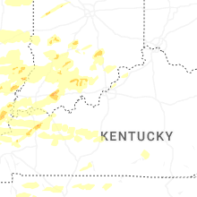


Connect with Interactive Hail Maps