

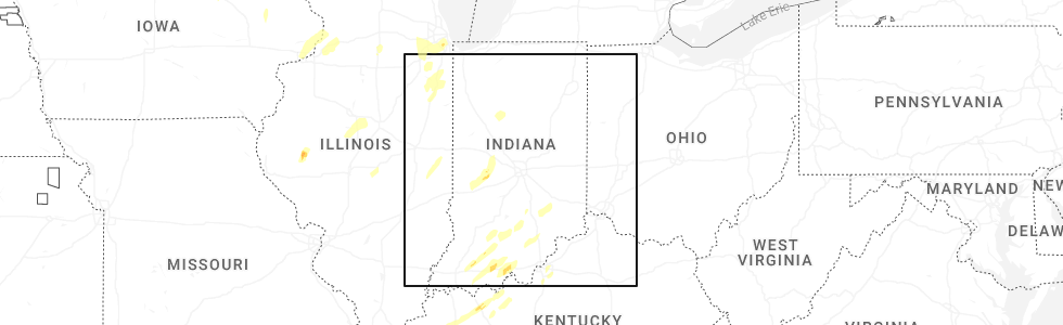
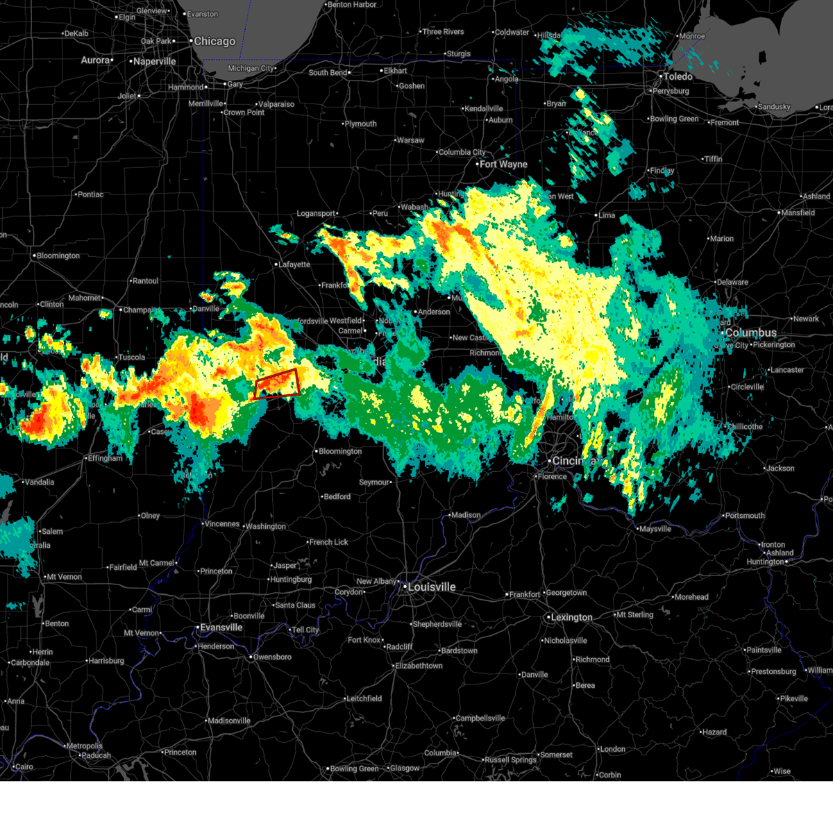
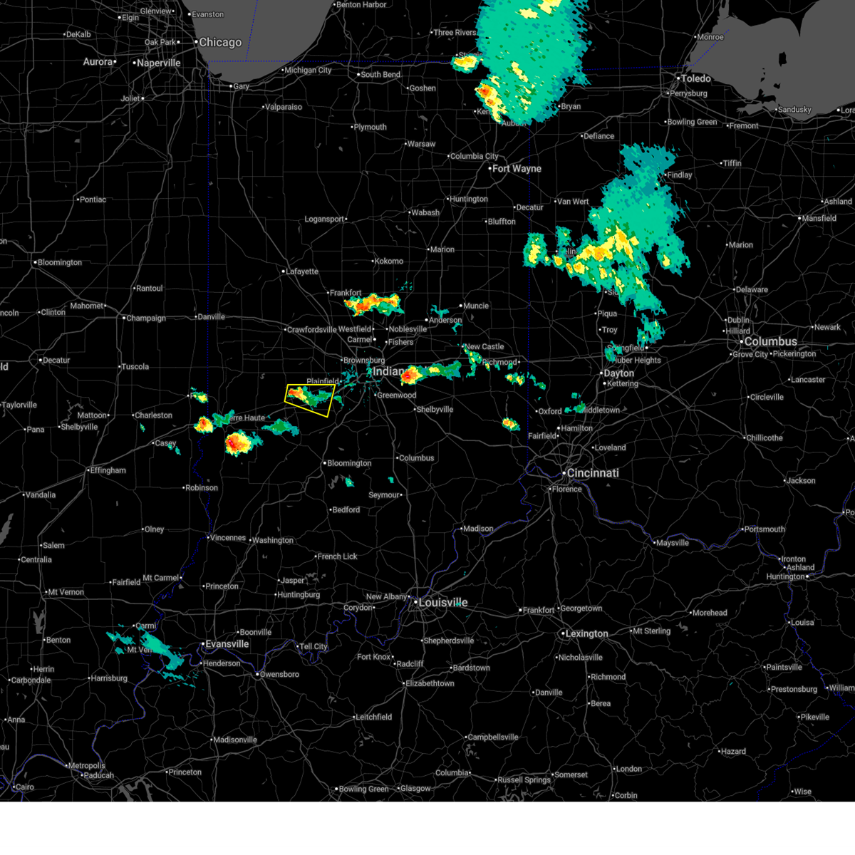
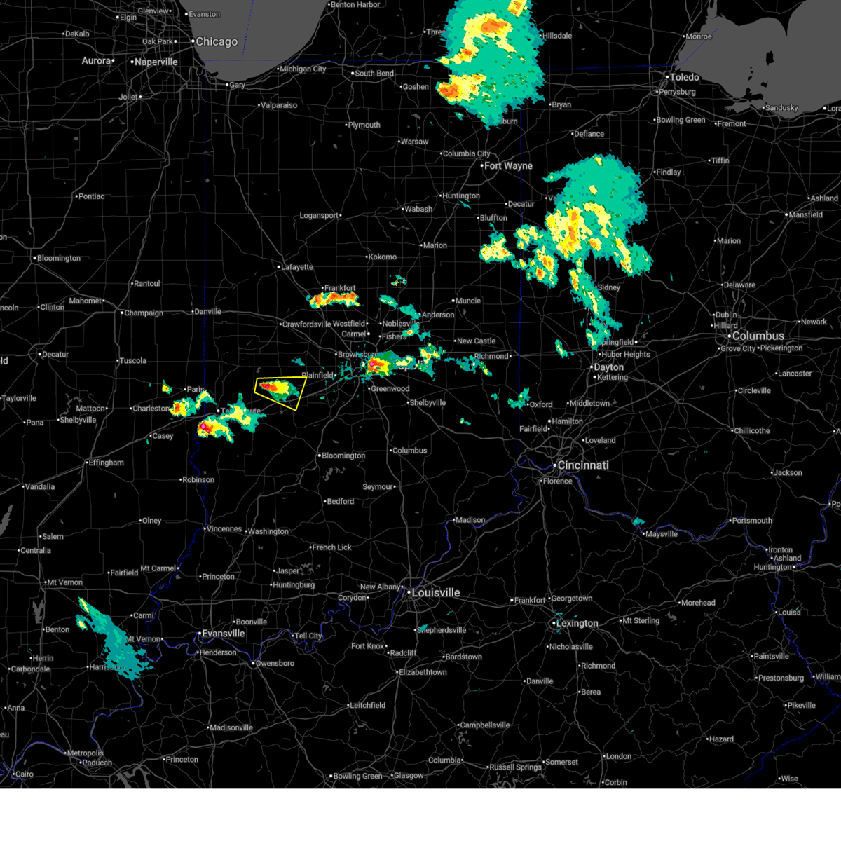
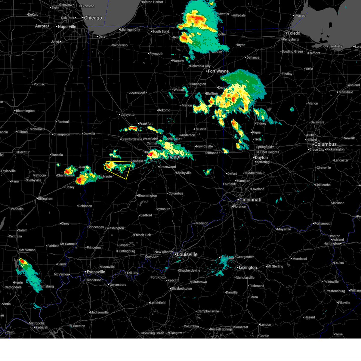
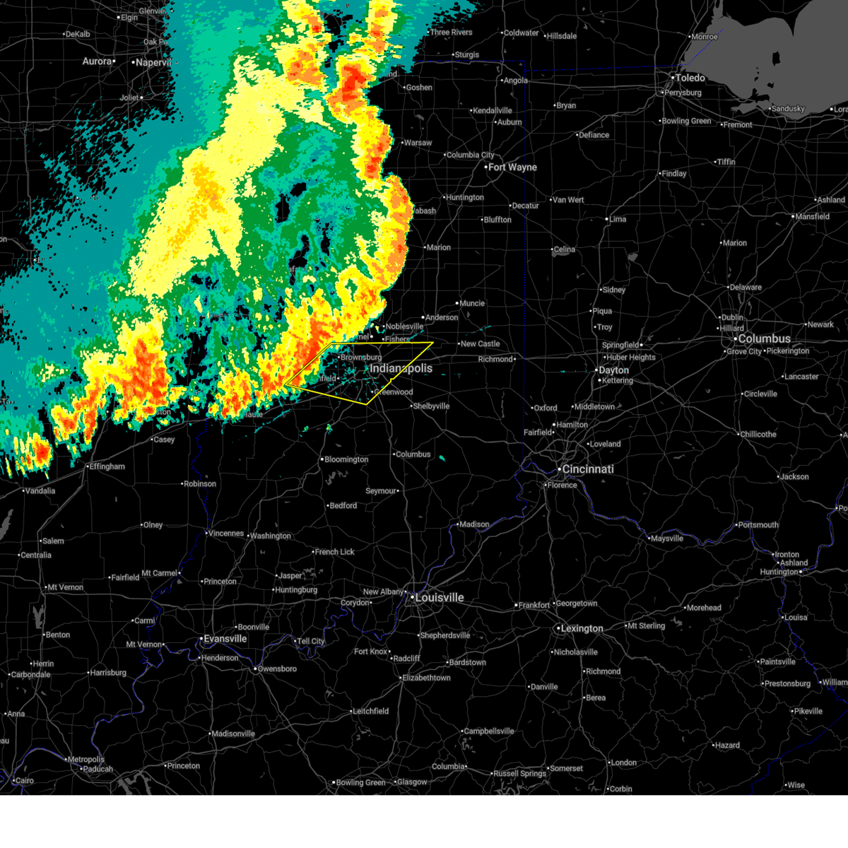
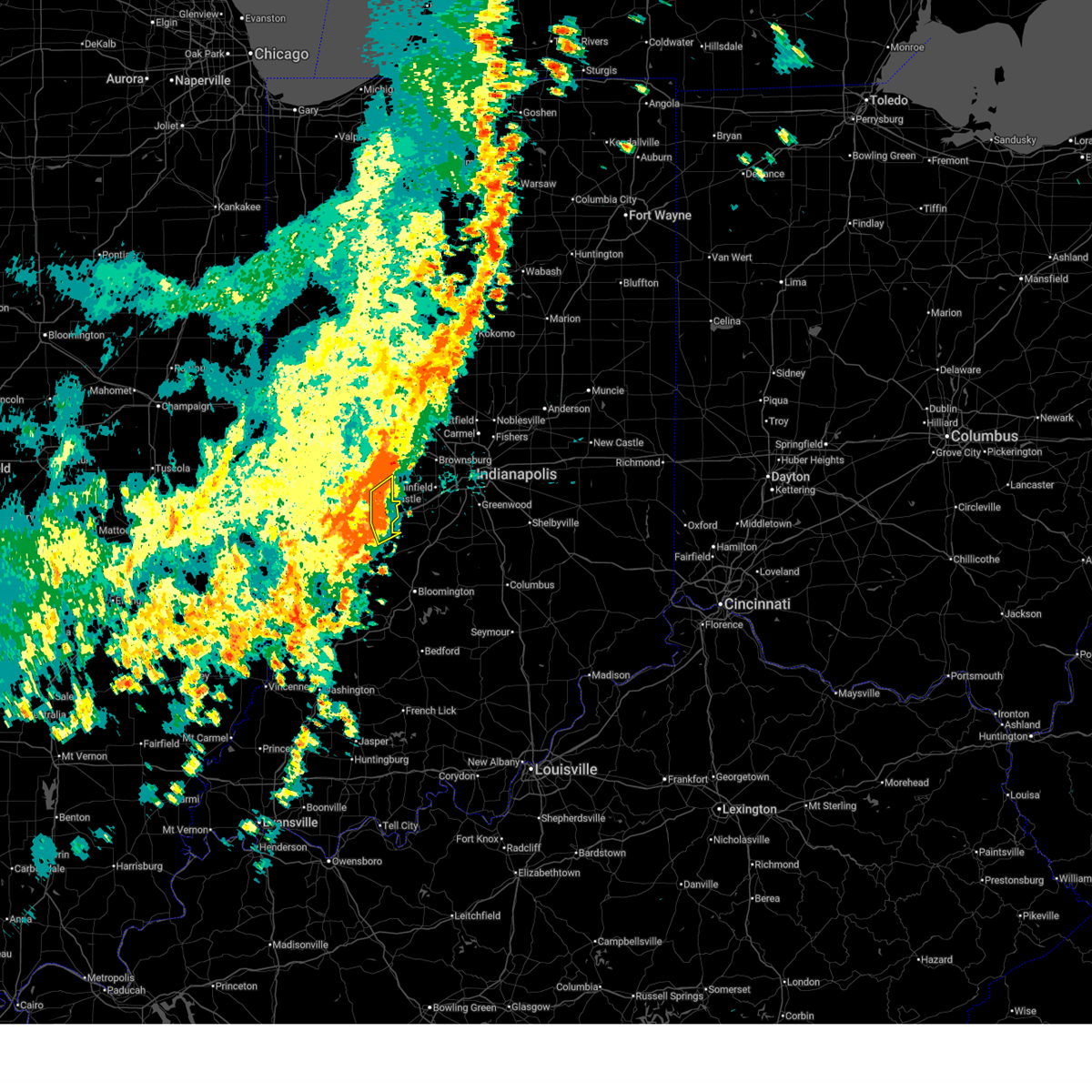
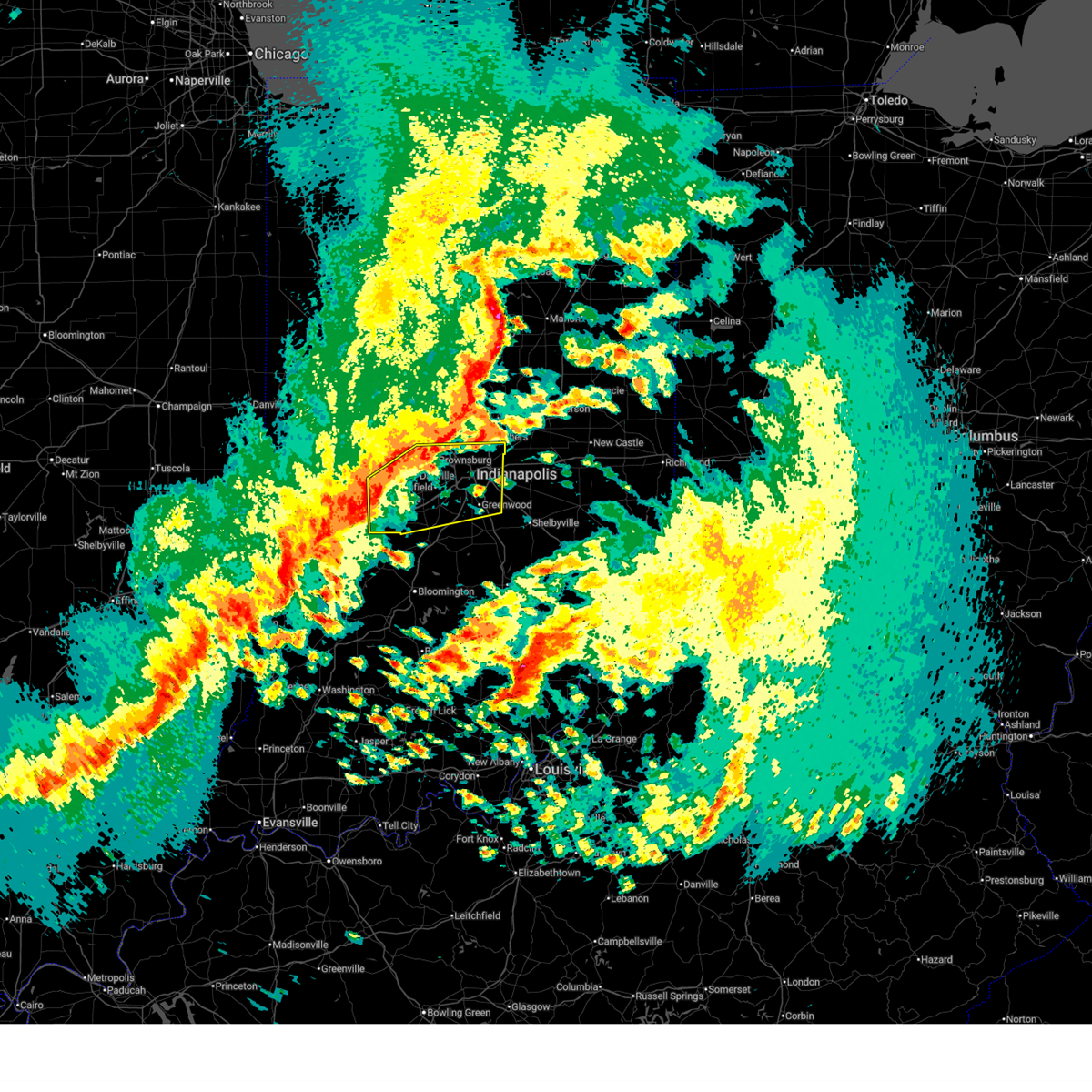
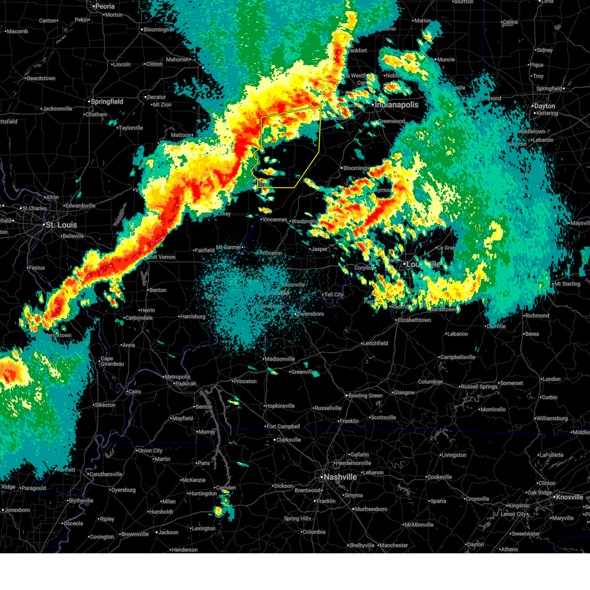
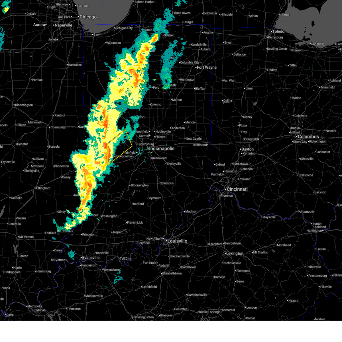
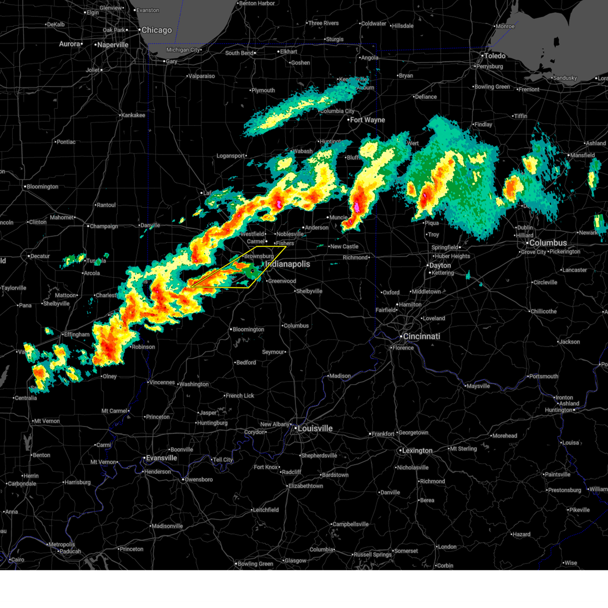
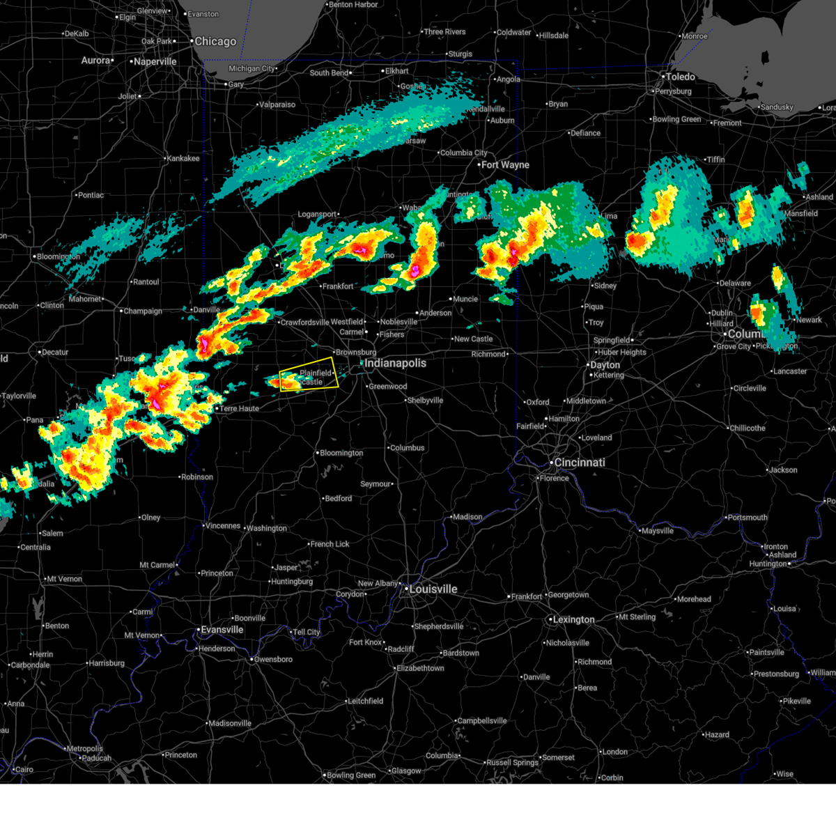
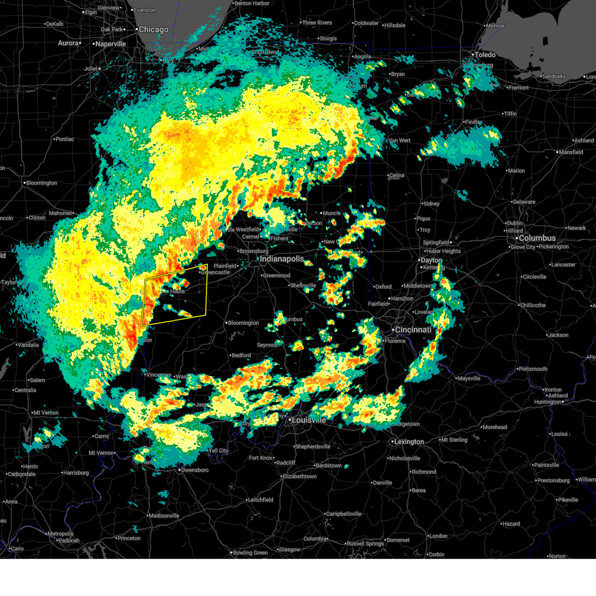
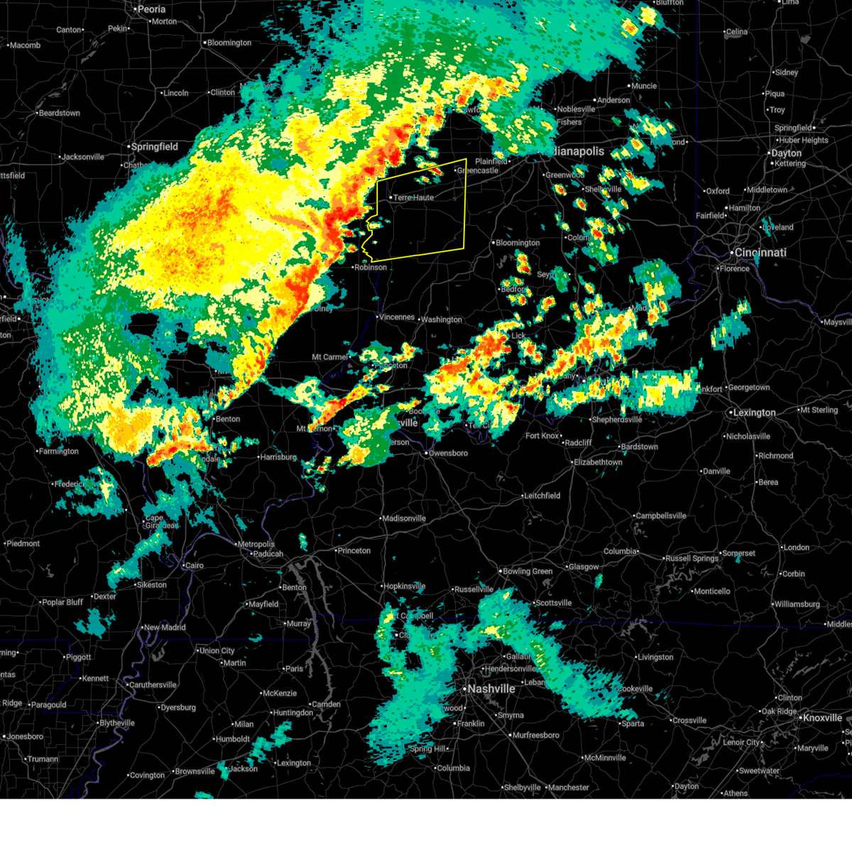
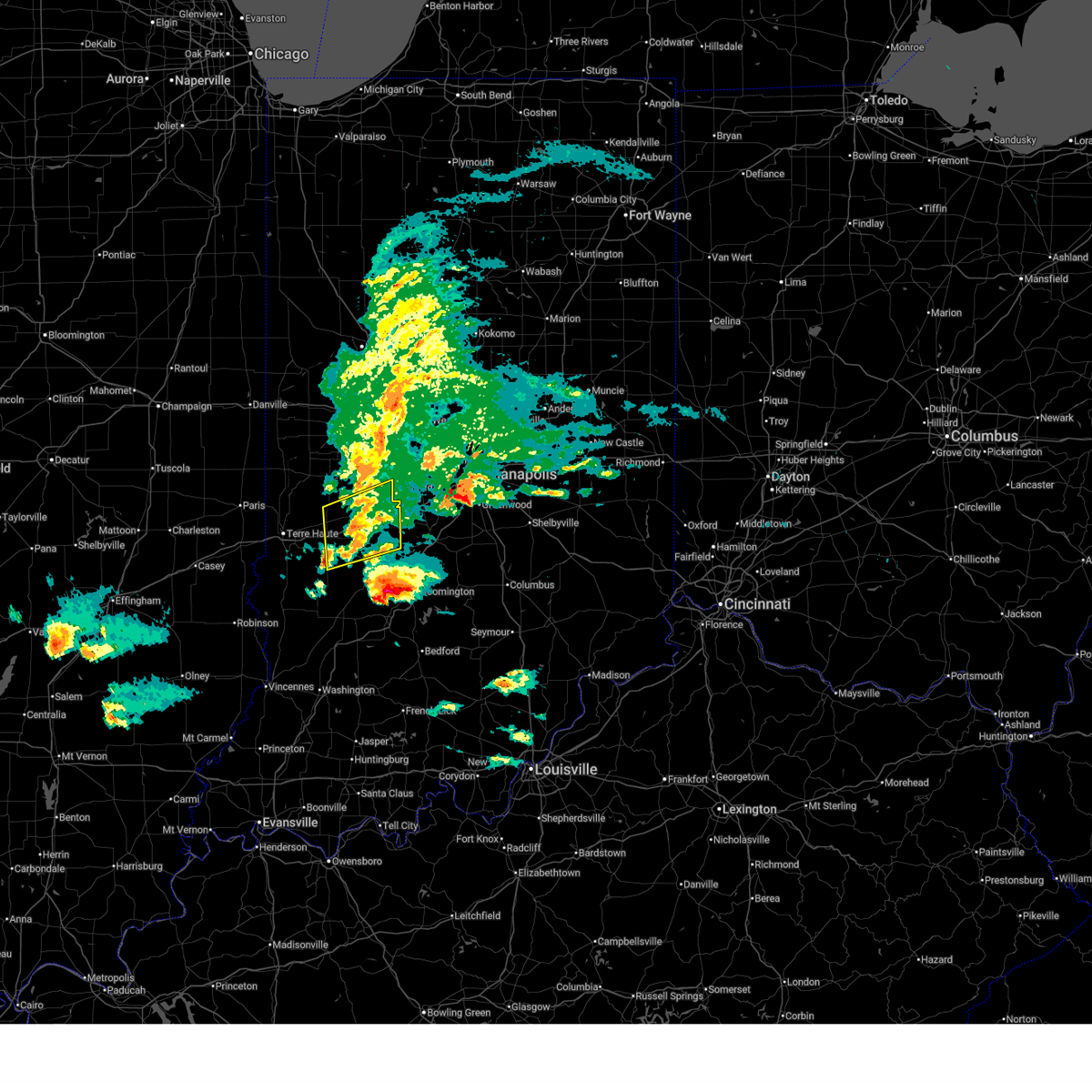
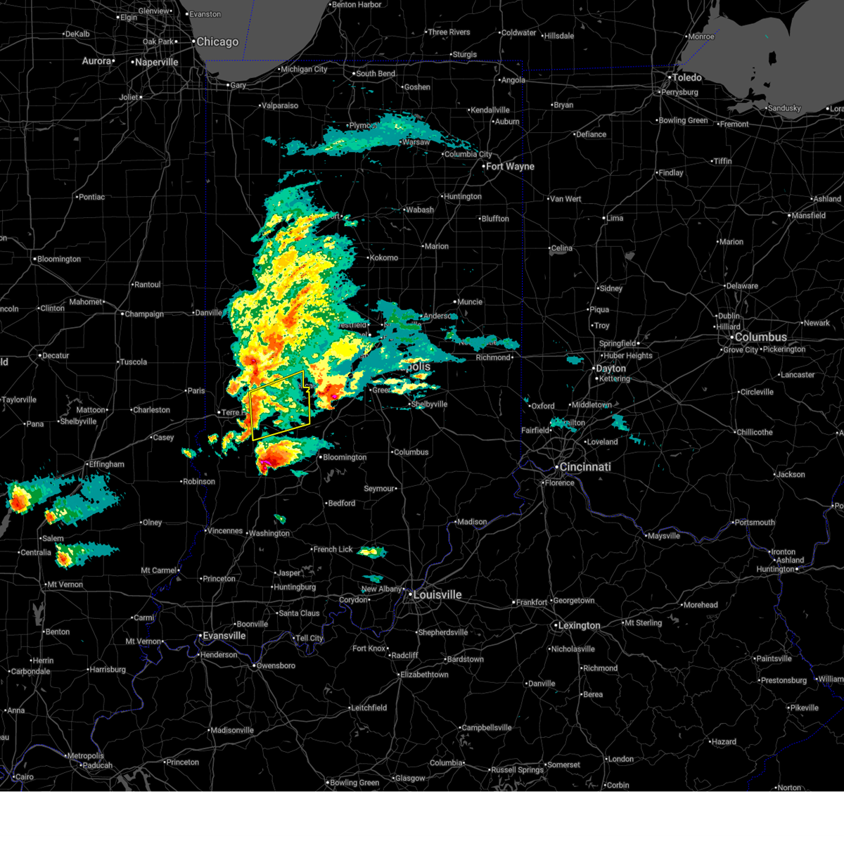
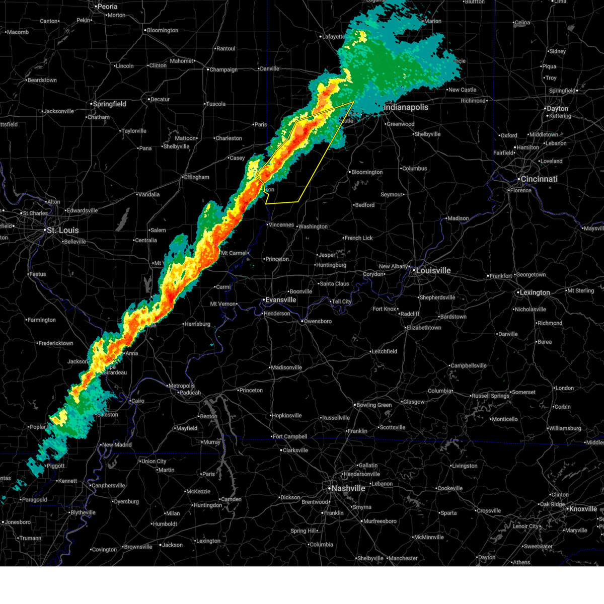
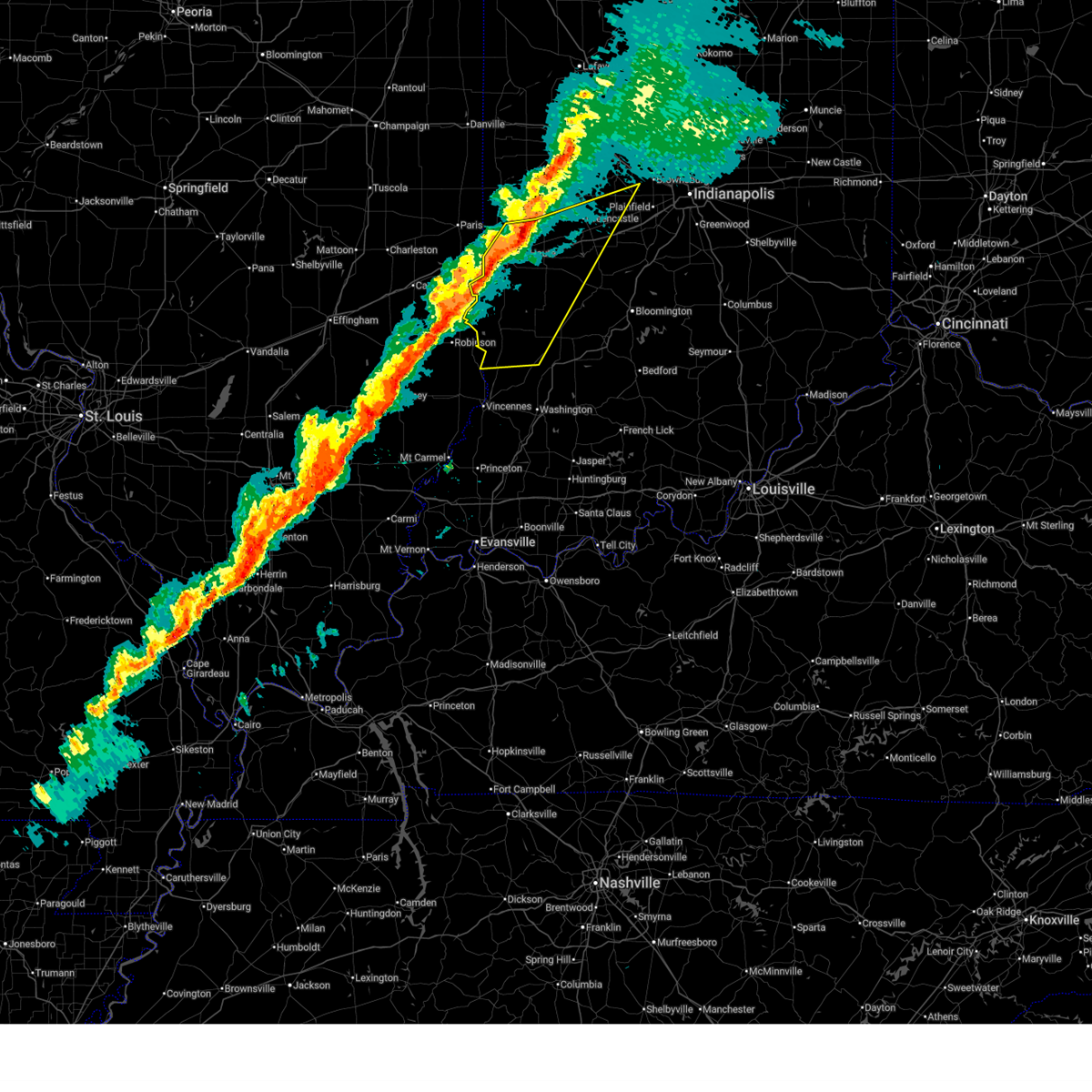
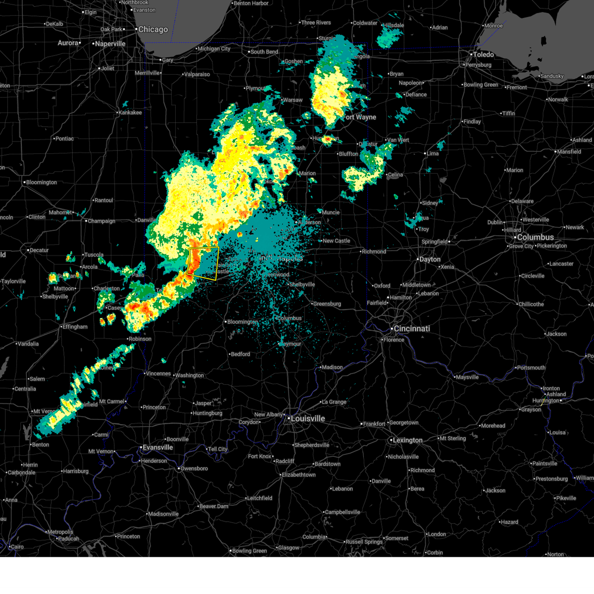
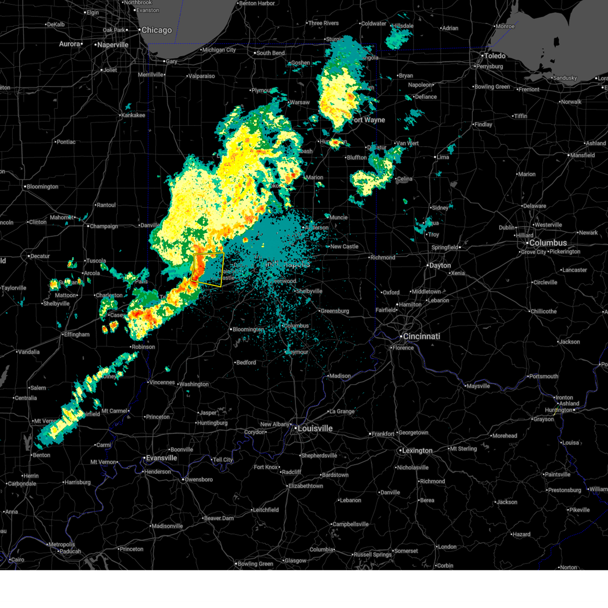
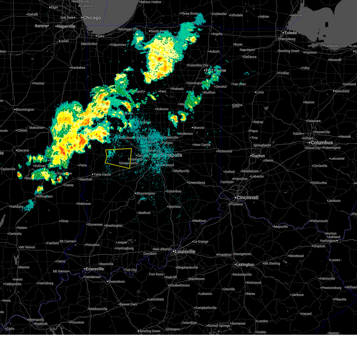
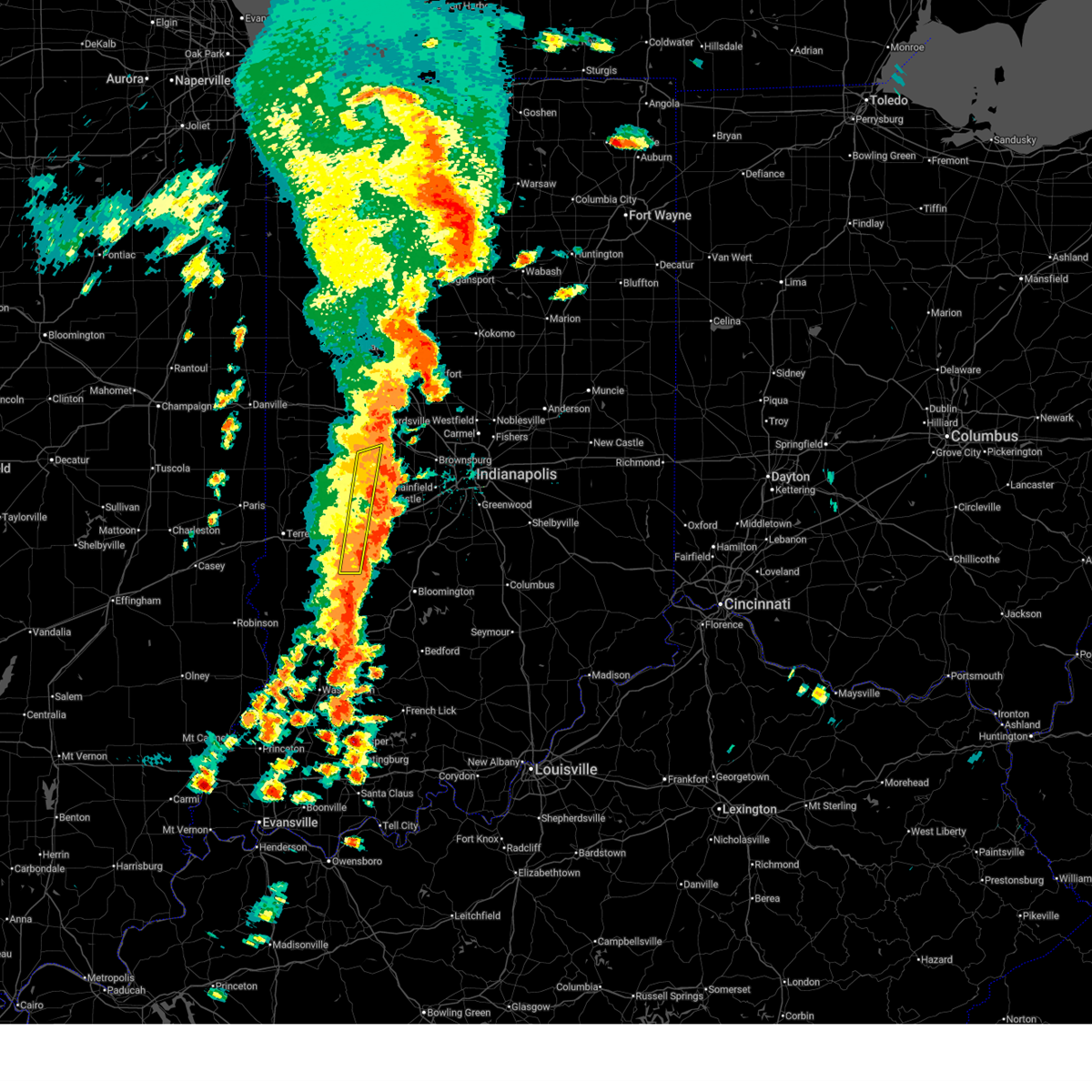
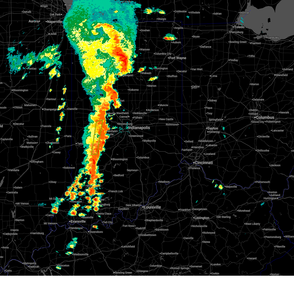
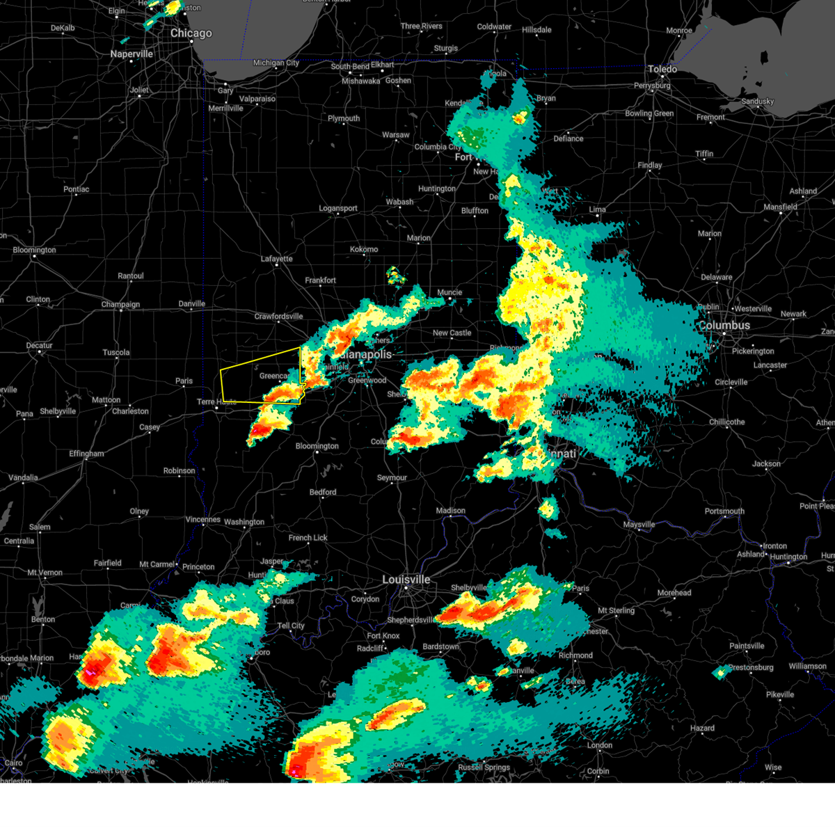
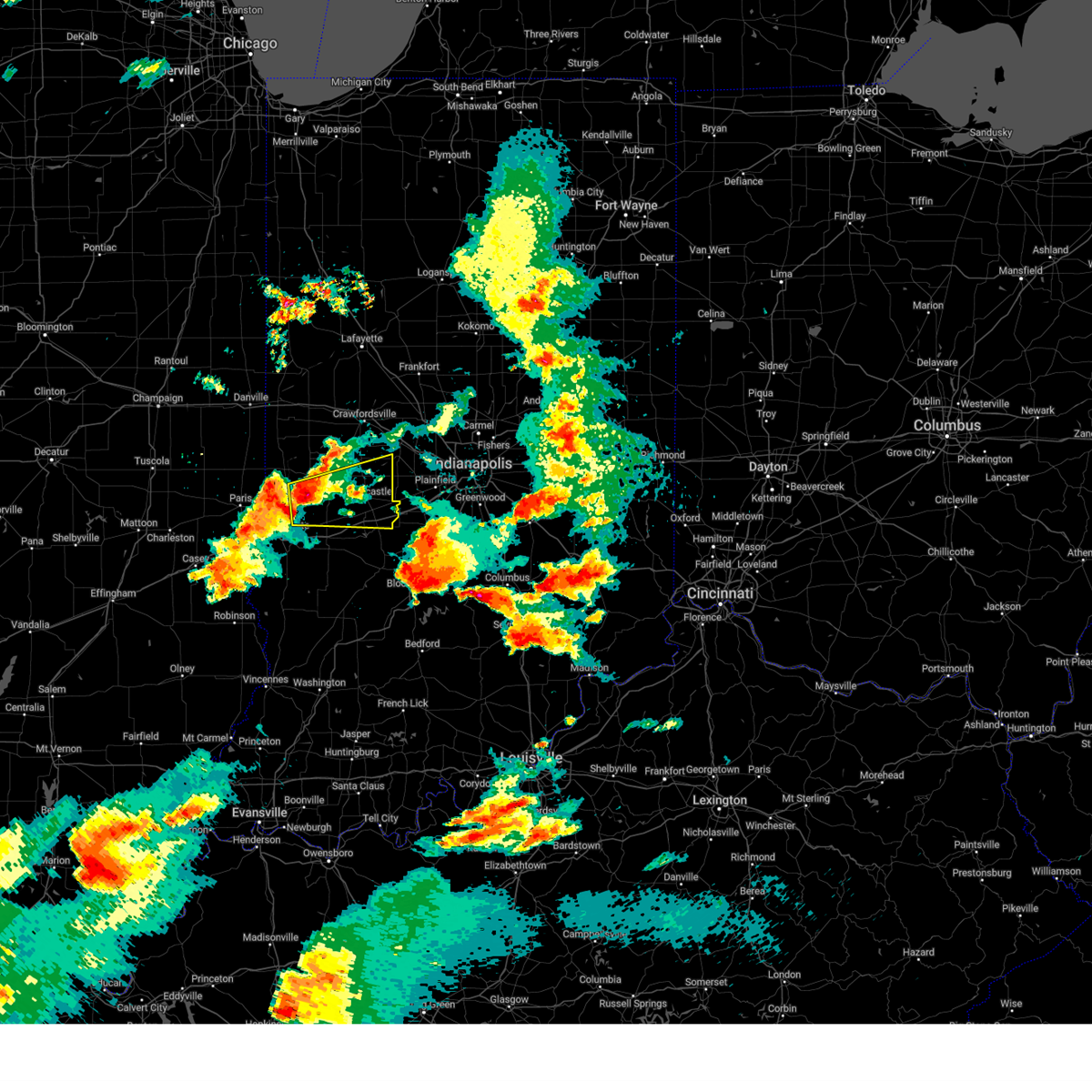
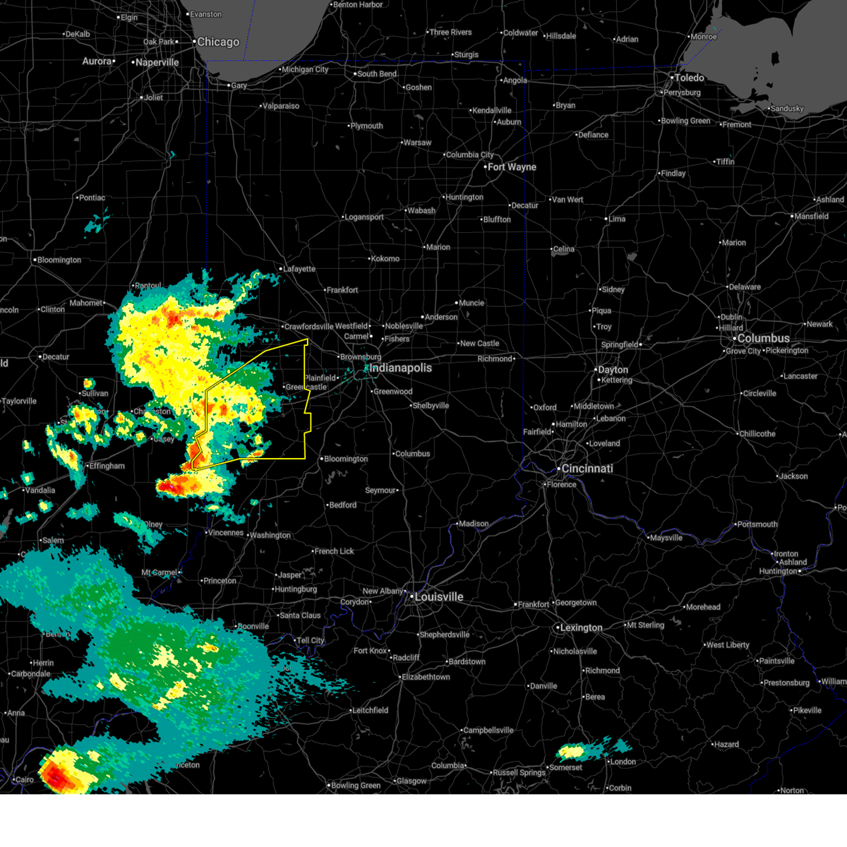
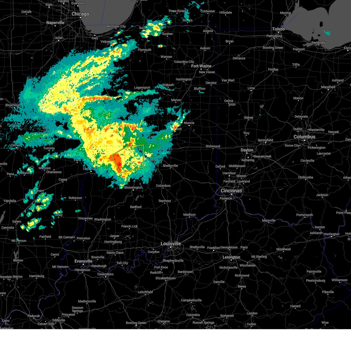
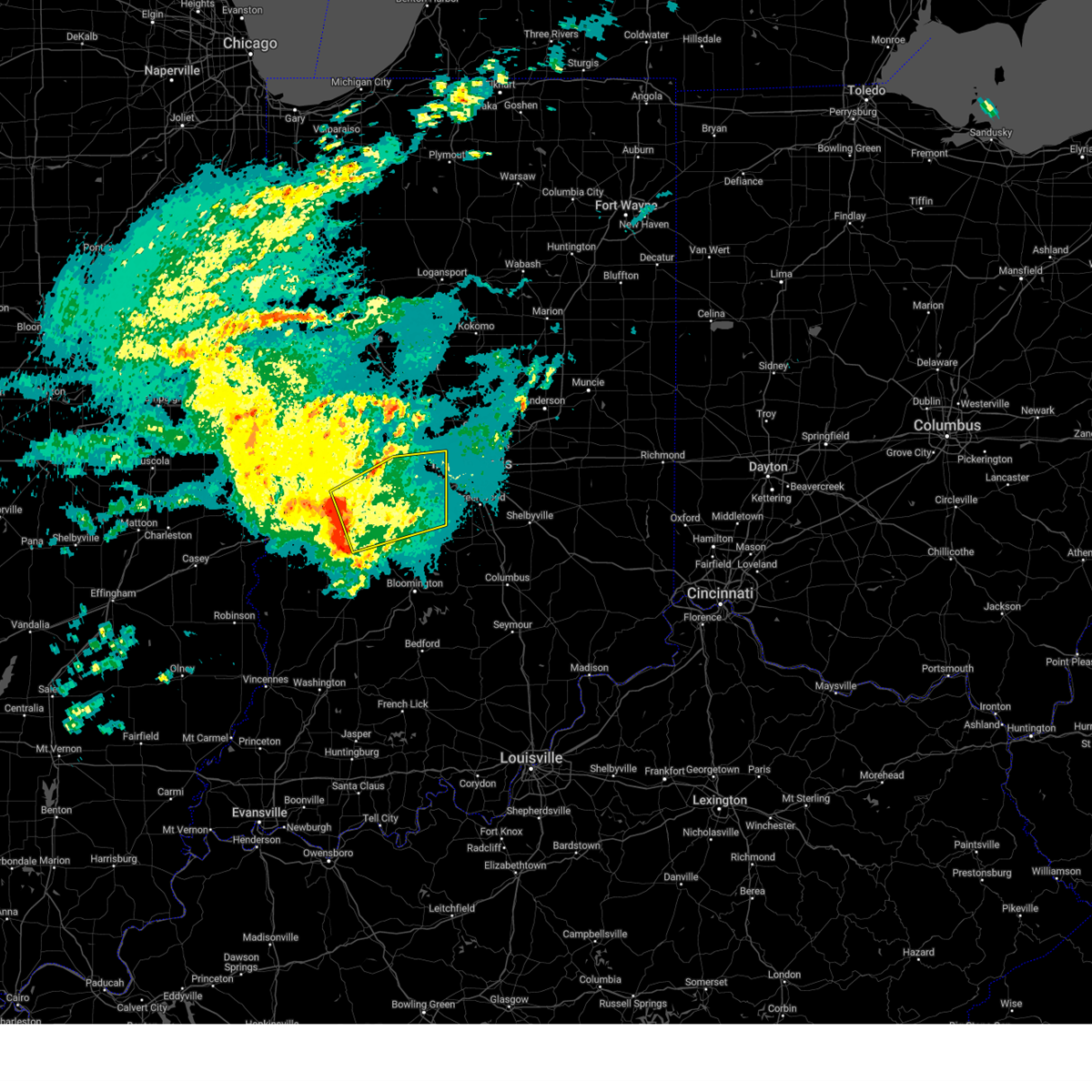
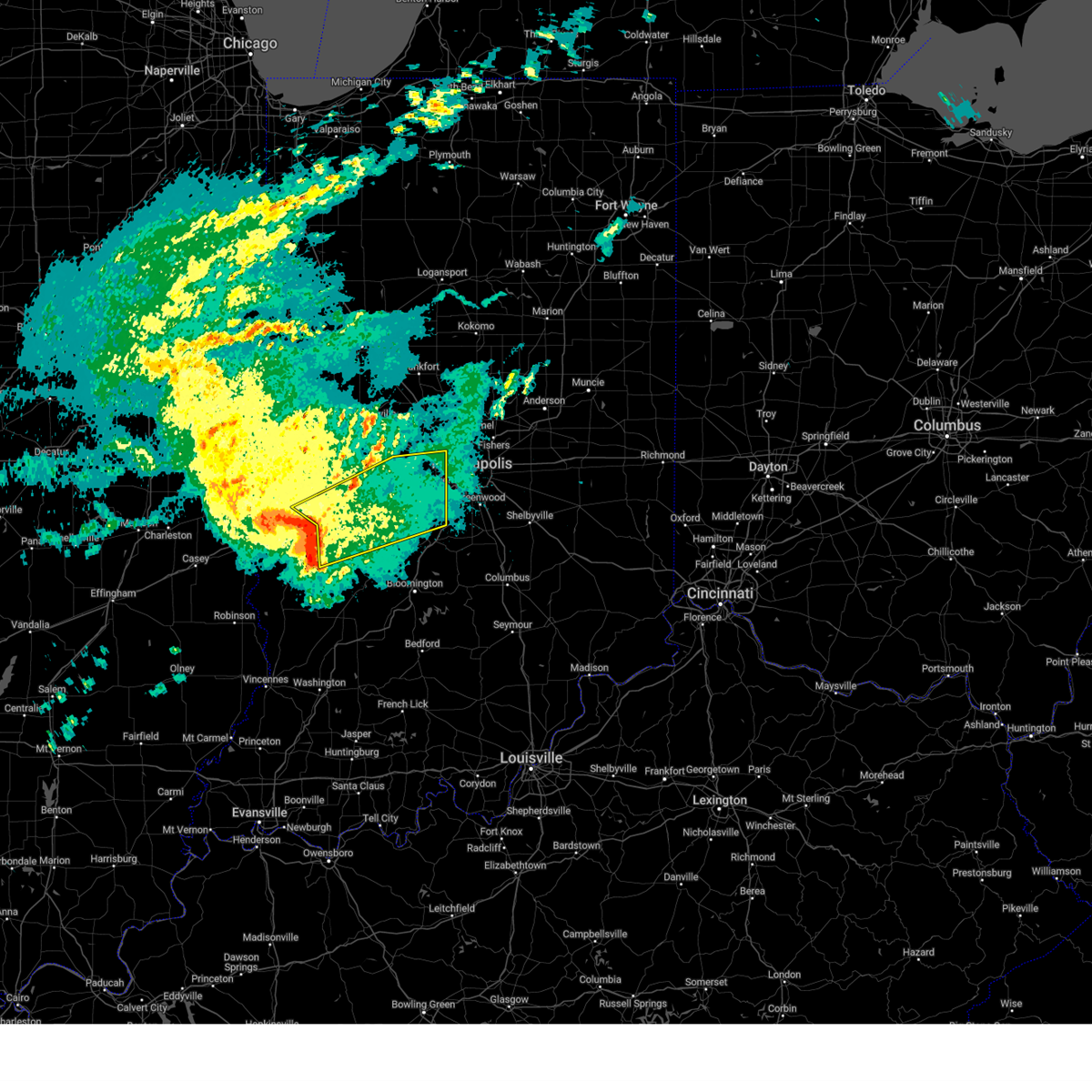
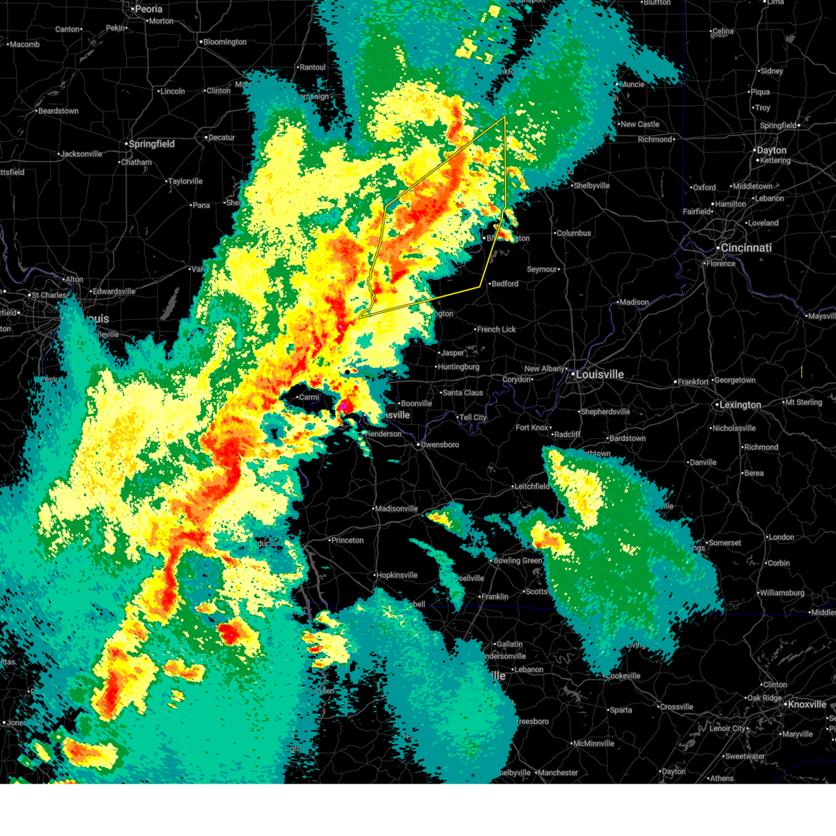
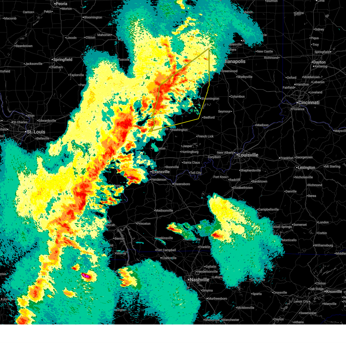
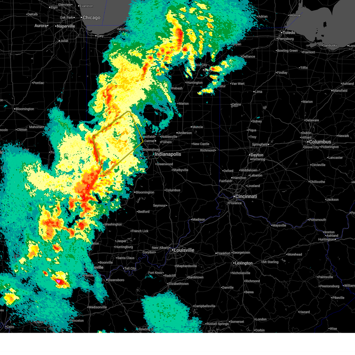
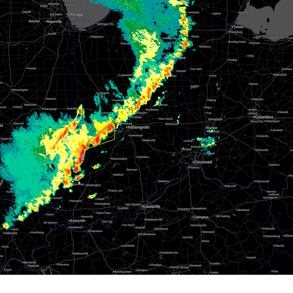
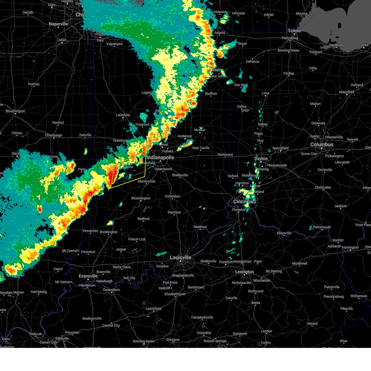
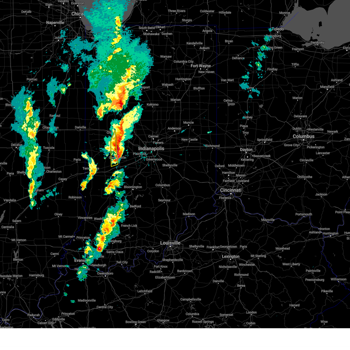
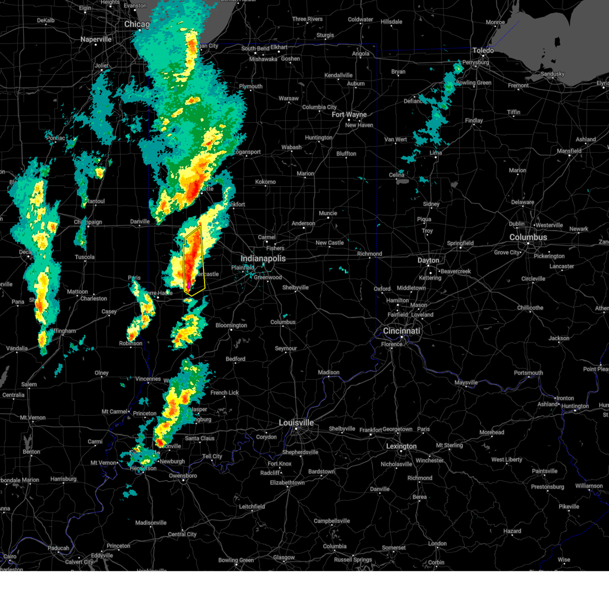
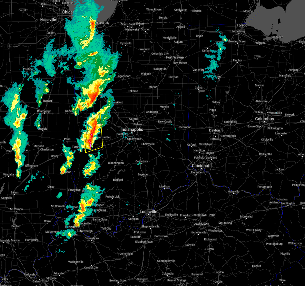
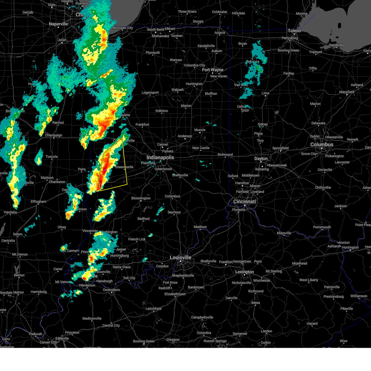
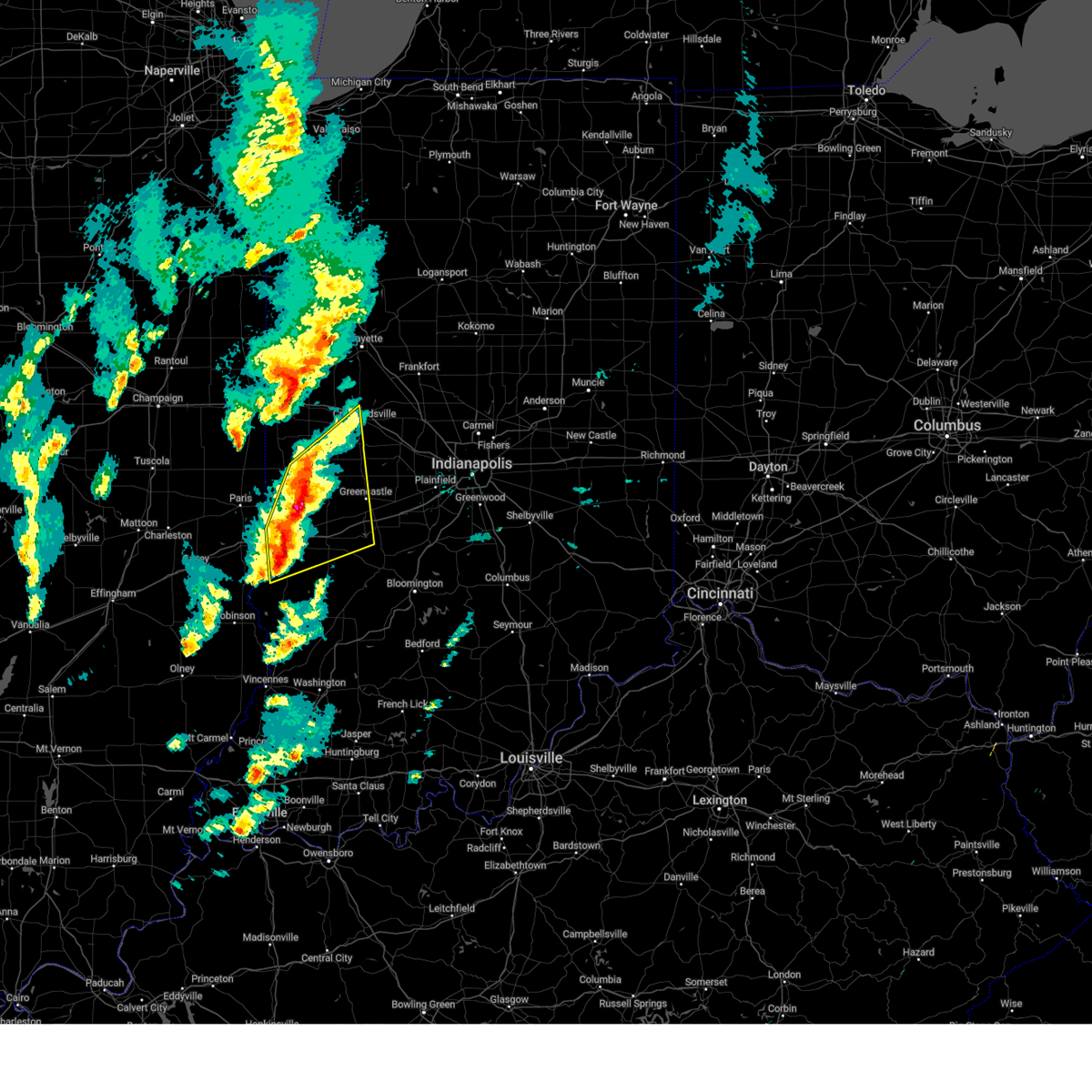
Hail Map for Greencastle, IN
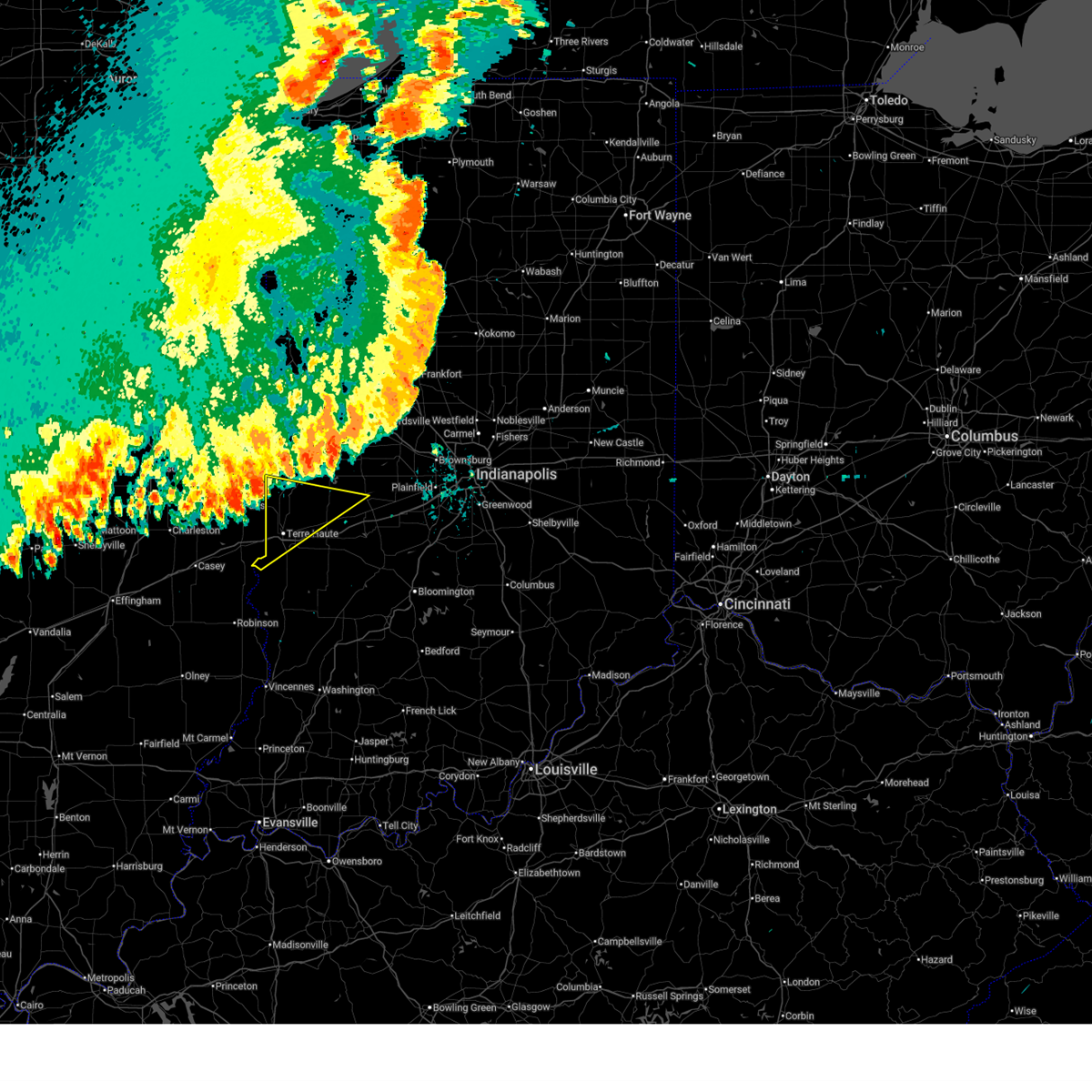
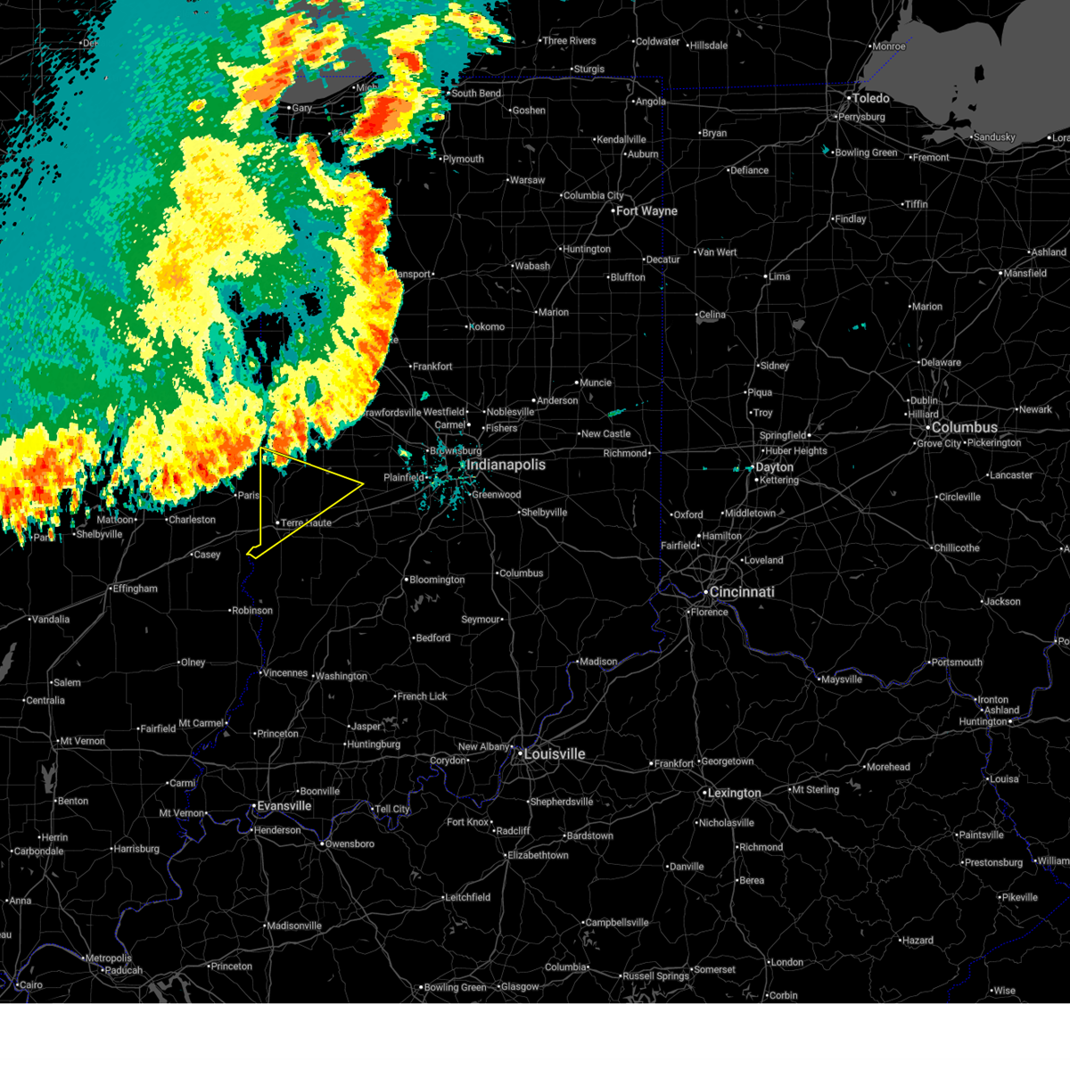
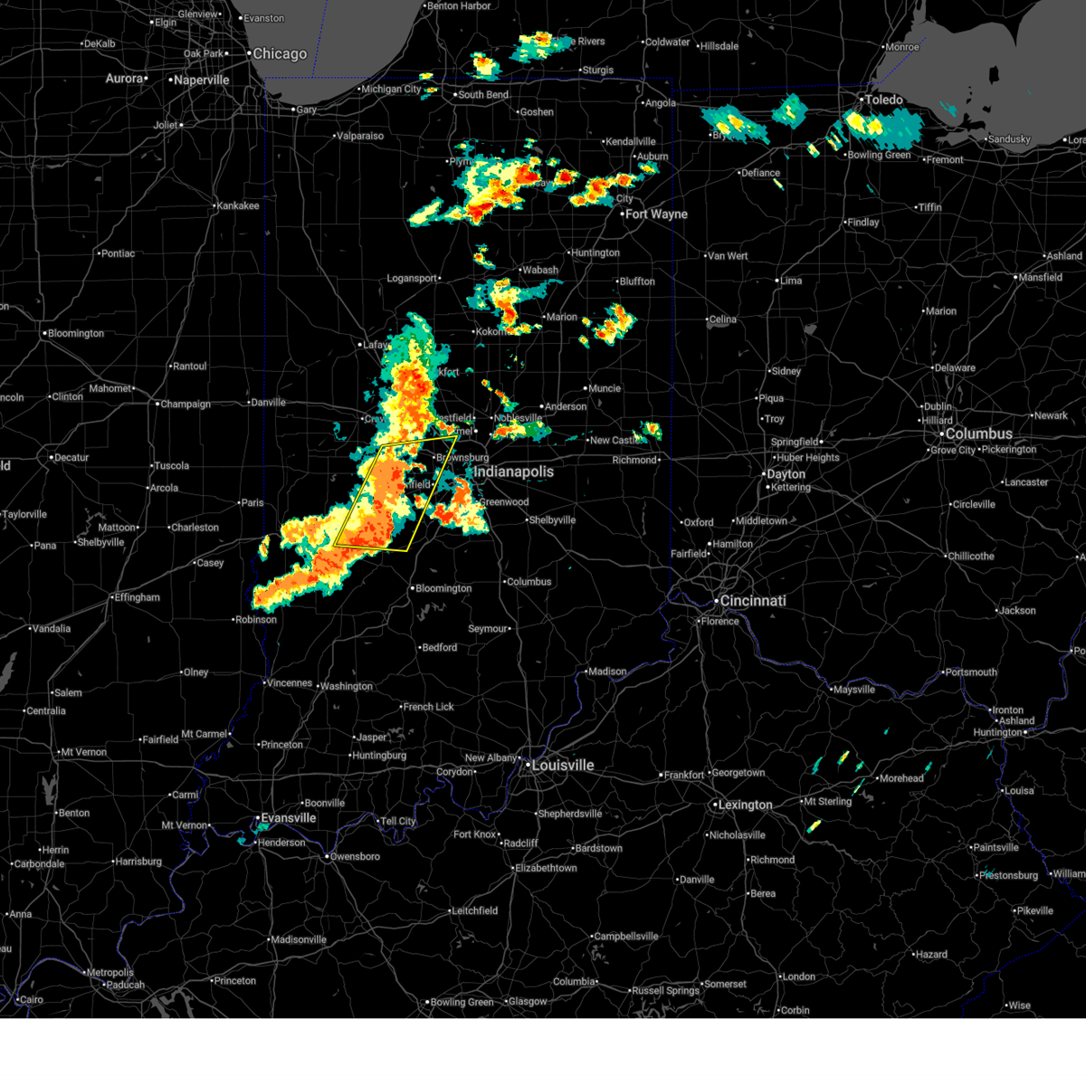
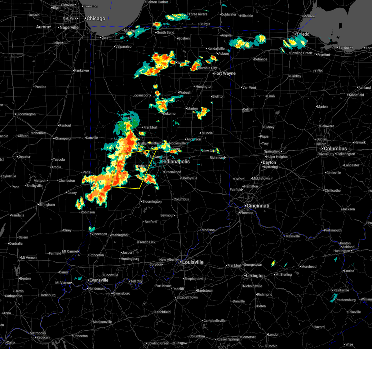
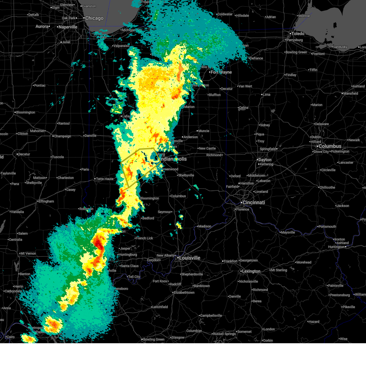
The Greencastle, IN area has had 7 reports of on-the-ground hail by trained spotters, and has been under severe weather warnings 38 times during the past 12 months. Doppler radar has detected hail at or near Greencastle, IN on 60 occasions.
| Name: | Greencastle, IN |
| Where Located: | 38.1 miles WSW of Indianapolis, IN |
| Map: | Google Map for Greencastle, IN |
| Population: | 10326 |
| Housing Units: | 3742 |
| More Info: | Search Google for Greencastle, IN |
1
The Top Recent Hail Date for Greencastle, IN is Wednesday, March 19, 2025 (15th out of 60)
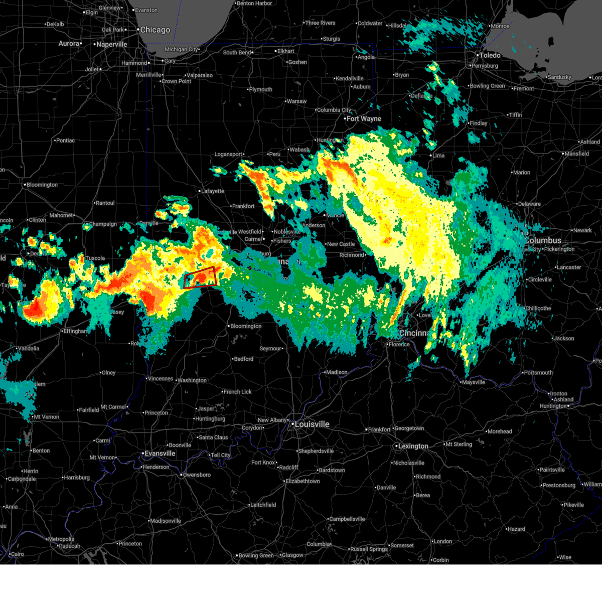
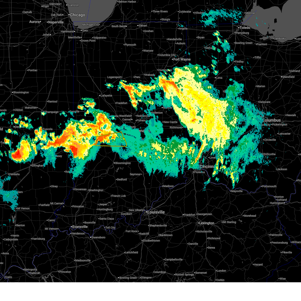
Hail and Wind Damage Spotted near Greencastle, IN
| Date / Time | Report Details |
|---|---|
| 6/17/2026 8:52 PM EDT |
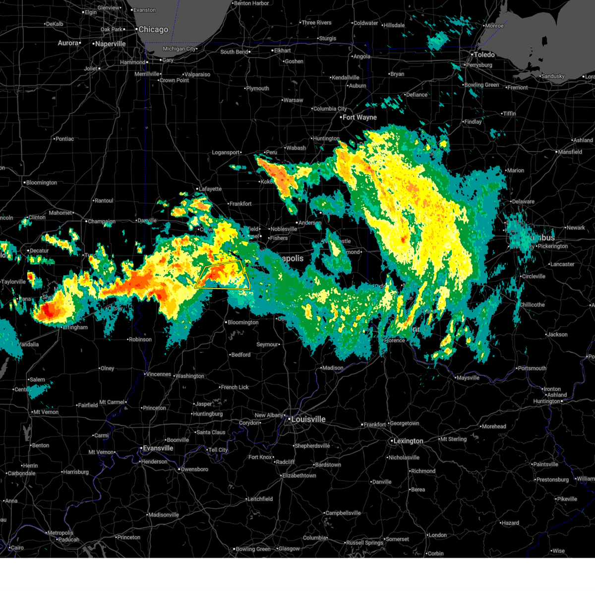 At 852 pm edt, a severe thunderstorm was located near greencastle, or 31 miles northwest of bloomington, moving east at 45 mph (radar indicated). Hazards include 60 mph wind gusts. Expect damage to roofs, siding, and trees. locations impacted include, plainfield, greencastle, mooresville, avon, cloverdale, brooklyn, monrovia, clayton, fillmore, coatesville, amo, stilesville, bethany, belle union, lake hart, waverly, little point, eminence, and centerton. This includes interstate 70 between mile markers 36 and 68. At 852 pm edt, a severe thunderstorm was located near greencastle, or 31 miles northwest of bloomington, moving east at 45 mph (radar indicated). Hazards include 60 mph wind gusts. Expect damage to roofs, siding, and trees. locations impacted include, plainfield, greencastle, mooresville, avon, cloverdale, brooklyn, monrovia, clayton, fillmore, coatesville, amo, stilesville, bethany, belle union, lake hart, waverly, little point, eminence, and centerton. This includes interstate 70 between mile markers 36 and 68.
|
| 6/17/2026 8:44 PM EDT |
 The tornado threat has diminished and the tornado warning has been cancelled. however damaging winds remain possible and a severe thunderstorm warning remains in effect for the area. a tornado watch remains in effect until 100 am edt for west central indiana. The tornado threat has diminished and the tornado warning has been cancelled. however damaging winds remain possible and a severe thunderstorm warning remains in effect for the area. a tornado watch remains in effect until 100 am edt for west central indiana.
|
| 6/17/2026 8:43 PM EDT |
 Svrind the national weather service in indianapolis has issued a * severe thunderstorm warning for, northern morgan county in central indiana, southern hendricks county in central indiana, southern putnam county in west central indiana, * until 930 pm edt. * at 843 pm edt, a severe thunderstorm was located near greencastle, or 26 miles east of terre haute, moving east at 50 mph (radar indicated). Hazards include 60 mph wind gusts and penny size hail. expect damage to roofs, siding, and trees Svrind the national weather service in indianapolis has issued a * severe thunderstorm warning for, northern morgan county in central indiana, southern hendricks county in central indiana, southern putnam county in west central indiana, * until 930 pm edt. * at 843 pm edt, a severe thunderstorm was located near greencastle, or 26 miles east of terre haute, moving east at 50 mph (radar indicated). Hazards include 60 mph wind gusts and penny size hail. expect damage to roofs, siding, and trees
|
| 6/17/2026 8:35 PM EDT |
 At 835 pm edt, a severe thunderstorm capable of producing a tornado was located near brazil, or 20 miles east of terre haute, moving east at 50 mph (radar indicated rotation). Hazards include tornado. Flying debris will be dangerous to those caught without shelter. mobile homes will be damaged or destroyed. damage to roofs, windows, and vehicles will occur. tree damage is likely. locations impacted include, greencastle, harmony, fillmore, lena, reelsville, and belle union. This includes interstate 70 between mile markers 46 and 47. At 835 pm edt, a severe thunderstorm capable of producing a tornado was located near brazil, or 20 miles east of terre haute, moving east at 50 mph (radar indicated rotation). Hazards include tornado. Flying debris will be dangerous to those caught without shelter. mobile homes will be damaged or destroyed. damage to roofs, windows, and vehicles will occur. tree damage is likely. locations impacted include, greencastle, harmony, fillmore, lena, reelsville, and belle union. This includes interstate 70 between mile markers 46 and 47.
|
| 6/17/2026 8:27 PM EDT |
 the tornado warning has been cancelled and is no longer in effect the tornado warning has been cancelled and is no longer in effect
|
| 6/17/2026 8:27 PM EDT |
 At 826 pm edt, a severe thunderstorm capable of producing a tornado was located over brazil, or 13 miles northeast of terre haute, moving east at 45 mph (radar indicated rotation). Hazards include tornado. Flying debris will be dangerous to those caught without shelter. mobile homes will be damaged or destroyed. damage to roofs, windows, and vehicles will occur. tree damage is likely. locations impacted include, greencastle, brazil, knightsville, harmony, fillmore, carbon, reelsville, lena, and belle union. This includes interstate 70 between mile markers 46 and 47. At 826 pm edt, a severe thunderstorm capable of producing a tornado was located over brazil, or 13 miles northeast of terre haute, moving east at 45 mph (radar indicated rotation). Hazards include tornado. Flying debris will be dangerous to those caught without shelter. mobile homes will be damaged or destroyed. damage to roofs, windows, and vehicles will occur. tree damage is likely. locations impacted include, greencastle, brazil, knightsville, harmony, fillmore, carbon, reelsville, lena, and belle union. This includes interstate 70 between mile markers 46 and 47.
|
| 6/17/2026 8:15 PM EDT |
 Torind the national weather service in indianapolis has issued a * tornado warning for, northeastern vigo county in west central indiana, northwestern clay county in west central indiana, southeastern parke county in west central indiana, central putnam county in west central indiana, * until 845 pm edt. * at 815 pm edt, a severe thunderstorm capable of producing a tornado was located near brazil, or 10 miles northeast of terre haute, moving east at 60 mph (radar indicated rotation). Hazards include tornado. Flying debris will be dangerous to those caught without shelter. mobile homes will be damaged or destroyed. damage to roofs, windows, and vehicles will occur. Tree damage is likely. Torind the national weather service in indianapolis has issued a * tornado warning for, northeastern vigo county in west central indiana, northwestern clay county in west central indiana, southeastern parke county in west central indiana, central putnam county in west central indiana, * until 845 pm edt. * at 815 pm edt, a severe thunderstorm capable of producing a tornado was located near brazil, or 10 miles northeast of terre haute, moving east at 60 mph (radar indicated rotation). Hazards include tornado. Flying debris will be dangerous to those caught without shelter. mobile homes will be damaged or destroyed. damage to roofs, windows, and vehicles will occur. Tree damage is likely.
|
| 6/16/2026 8:45 PM EDT |
 Torind the national weather service in indianapolis has issued a * tornado warning for, northwestern morgan county in central indiana, southwestern hendricks county in central indiana, southeastern putnam county in west central indiana, * until 915 pm edt. * at 845 pm edt, a severe thunderstorm capable of producing a tornado was located near greencastle, or 31 miles south of crawfordsville, moving east at 30 mph (radar indicated rotation). Hazards include tornado. Flying debris will be dangerous to those caught without shelter. mobile homes will be damaged or destroyed. damage to roofs, windows, and vehicles will occur. Tree damage is likely. Torind the national weather service in indianapolis has issued a * tornado warning for, northwestern morgan county in central indiana, southwestern hendricks county in central indiana, southeastern putnam county in west central indiana, * until 915 pm edt. * at 845 pm edt, a severe thunderstorm capable of producing a tornado was located near greencastle, or 31 miles south of crawfordsville, moving east at 30 mph (radar indicated rotation). Hazards include tornado. Flying debris will be dangerous to those caught without shelter. mobile homes will be damaged or destroyed. damage to roofs, windows, and vehicles will occur. Tree damage is likely.
|
| 6/16/2026 8:43 PM EDT |
 Svrind the national weather service in indianapolis has issued a * severe thunderstorm warning for, northwestern morgan county in central indiana, southwestern hendricks county in central indiana, southeastern putnam county in west central indiana, * until 930 pm edt. * at 843 pm edt, a severe thunderstorm was located over greencastle, or 30 miles south of crawfordsville, moving east at 30 mph (radar indicated). Hazards include 60 mph wind gusts. expect damage to roofs, siding, and trees Svrind the national weather service in indianapolis has issued a * severe thunderstorm warning for, northwestern morgan county in central indiana, southwestern hendricks county in central indiana, southeastern putnam county in west central indiana, * until 930 pm edt. * at 843 pm edt, a severe thunderstorm was located over greencastle, or 30 miles south of crawfordsville, moving east at 30 mph (radar indicated). Hazards include 60 mph wind gusts. expect damage to roofs, siding, and trees
|
| 6/16/2026 8:18 PM EDT |
 At 818 pm edt, a severe thunderstorm was located 7 miles west of greencastle, or 23 miles northeast of terre haute, moving east at 30 mph (radar indicated). Hazards include 60 mph wind gusts and quarter size hail. Hail damage to vehicles is expected. expect wind damage to roofs, siding, and trees. locations impacted include, greencastle, cloverdale, fillmore, coatesville, reelsville, lena, and belle union. This includes interstate 70 between mile markers 37 and 46. At 818 pm edt, a severe thunderstorm was located 7 miles west of greencastle, or 23 miles northeast of terre haute, moving east at 30 mph (radar indicated). Hazards include 60 mph wind gusts and quarter size hail. Hail damage to vehicles is expected. expect wind damage to roofs, siding, and trees. locations impacted include, greencastle, cloverdale, fillmore, coatesville, reelsville, lena, and belle union. This includes interstate 70 between mile markers 37 and 46.
|
| 6/16/2026 8:05 PM EDT |
 Svrind the national weather service in indianapolis has issued a * severe thunderstorm warning for, western hendricks county in central indiana, north central clay county in west central indiana, north central owen county in west central indiana, southeastern parke county in west central indiana, southern putnam county in west central indiana, * until 830 pm edt. * at 805 pm edt, a severe thunderstorm was located 7 miles north of brazil, or 19 miles northeast of terre haute, moving east at 40 mph (radar indicated). Hazards include 60 mph wind gusts and quarter size hail. Hail damage to vehicles is expected. Expect wind damage to roofs, siding, and trees. Svrind the national weather service in indianapolis has issued a * severe thunderstorm warning for, western hendricks county in central indiana, north central clay county in west central indiana, north central owen county in west central indiana, southeastern parke county in west central indiana, southern putnam county in west central indiana, * until 830 pm edt. * at 805 pm edt, a severe thunderstorm was located 7 miles north of brazil, or 19 miles northeast of terre haute, moving east at 40 mph (radar indicated). Hazards include 60 mph wind gusts and quarter size hail. Hail damage to vehicles is expected. Expect wind damage to roofs, siding, and trees.
|
| 6/11/2026 10:26 PM EDT |
 Svrind the national weather service in indianapolis has issued a * severe thunderstorm warning for, northwestern hancock county in central indiana, northeastern morgan county in central indiana, northwestern johnson county in central indiana, hendricks county in central indiana, marion county in central indiana, southeastern boone county in central indiana, southern hamilton county in central indiana, east central putnam county in west central indiana, * until 1115 pm edt. * at 1026 pm edt, severe thunderstorms were located along a line extending from near zionsville to near greencastle, moving east at 45 mph (radar indicated). Hazards include 60 mph wind gusts. expect damage to roofs, siding, and trees Svrind the national weather service in indianapolis has issued a * severe thunderstorm warning for, northwestern hancock county in central indiana, northeastern morgan county in central indiana, northwestern johnson county in central indiana, hendricks county in central indiana, marion county in central indiana, southeastern boone county in central indiana, southern hamilton county in central indiana, east central putnam county in west central indiana, * until 1115 pm edt. * at 1026 pm edt, severe thunderstorms were located along a line extending from near zionsville to near greencastle, moving east at 45 mph (radar indicated). Hazards include 60 mph wind gusts. expect damage to roofs, siding, and trees
|
| 6/11/2026 10:20 PM EDT | Storm damage reported in putnam county IN, 11.9 miles SE of Greencastle, IN |
| 6/11/2026 10:02 PM EDT |
 At 1002 pm edt, severe thunderstorms were located along a line extending from near rockville to near marshall, moving southeast at 40 mph (radar indicated). Hazards include 60 mph wind gusts. Expect damage to roofs, siding, and trees. locations impacted include, terre haute, greencastle, brazil, clinton, west terre haute, fairview park, prairieton, prairie creek, seelyville, knightsville, rosedale, harmony, staunton, carbon, universal, mecca, fontanet, blanford, shepardsville, and lena. This includes interstate 70 between mile markers 1 and 16. At 1002 pm edt, severe thunderstorms were located along a line extending from near rockville to near marshall, moving southeast at 40 mph (radar indicated). Hazards include 60 mph wind gusts. Expect damage to roofs, siding, and trees. locations impacted include, terre haute, greencastle, brazil, clinton, west terre haute, fairview park, prairieton, prairie creek, seelyville, knightsville, rosedale, harmony, staunton, carbon, universal, mecca, fontanet, blanford, shepardsville, and lena. This includes interstate 70 between mile markers 1 and 16.
|
| 6/11/2026 9:44 PM EDT |
 Svrind the national weather service in indianapolis has issued a * severe thunderstorm warning for, vigo county in west central indiana, northwestern clay county in west central indiana, southern parke county in west central indiana, southern vermillion county in west central indiana, west central putnam county in west central indiana, * until 1030 pm edt. * at 944 pm edt, severe thunderstorms were located along a line extending from 6 miles east of chrisman to near ashmore, moving east at 55 mph (radar indicated). Hazards include 60 mph wind gusts. expect damage to roofs, siding, and trees Svrind the national weather service in indianapolis has issued a * severe thunderstorm warning for, vigo county in west central indiana, northwestern clay county in west central indiana, southern parke county in west central indiana, southern vermillion county in west central indiana, west central putnam county in west central indiana, * until 1030 pm edt. * at 944 pm edt, severe thunderstorms were located along a line extending from 6 miles east of chrisman to near ashmore, moving east at 55 mph (radar indicated). Hazards include 60 mph wind gusts. expect damage to roofs, siding, and trees
|
| 6/9/2026 8:47 PM EDT |
 At 847 pm edt, severe thunderstorms were located along a line extending from 9 miles northwest of brownsburg to 7 miles north of spencer, moving east at 40 mph (radar indicated). Hazards include 60 mph wind gusts. Expect damage to roofs, siding, and trees. locations impacted include, indianapolis, plainfield, brownsburg, zionsville, greencastle, danville, avon, pittsboro, cloverdale, clermont, monrovia, clayton, bainbridge, paragon, fillmore, coatesville, north salem, lizton, amo, and stilesville. this includes the following highways, interstate 65 between mile markers 124 and 129. interstate 70 between mile markers 30 and 63. Interstate 74 between mile markers 55 and 70. At 847 pm edt, severe thunderstorms were located along a line extending from 9 miles northwest of brownsburg to 7 miles north of spencer, moving east at 40 mph (radar indicated). Hazards include 60 mph wind gusts. Expect damage to roofs, siding, and trees. locations impacted include, indianapolis, plainfield, brownsburg, zionsville, greencastle, danville, avon, pittsboro, cloverdale, clermont, monrovia, clayton, bainbridge, paragon, fillmore, coatesville, north salem, lizton, amo, and stilesville. this includes the following highways, interstate 65 between mile markers 124 and 129. interstate 70 between mile markers 30 and 63. Interstate 74 between mile markers 55 and 70.
|
| 6/9/2026 8:25 PM EDT |
 Svrind the national weather service in indianapolis has issued a * severe thunderstorm warning for, western morgan county in central indiana, hendricks county in central indiana, northeastern clay county in west central indiana, northeastern owen county in west central indiana, southeastern parke county in west central indiana, northwestern marion county in central indiana, southeastern boone county in central indiana, southeastern montgomery county in west central indiana, putnam county in west central indiana, * until 915 pm edt. * at 825 pm edt, severe thunderstorms were located along a line extending from 14 miles northwest of danville to 8 miles south of brazil, moving east at 40 mph (radar indicated). Hazards include 60 mph wind gusts. expect damage to roofs, siding, and trees Svrind the national weather service in indianapolis has issued a * severe thunderstorm warning for, western morgan county in central indiana, hendricks county in central indiana, northeastern clay county in west central indiana, northeastern owen county in west central indiana, southeastern parke county in west central indiana, northwestern marion county in central indiana, southeastern boone county in central indiana, southeastern montgomery county in west central indiana, putnam county in west central indiana, * until 915 pm edt. * at 825 pm edt, severe thunderstorms were located along a line extending from 14 miles northwest of danville to 8 miles south of brazil, moving east at 40 mph (radar indicated). Hazards include 60 mph wind gusts. expect damage to roofs, siding, and trees
|
| 5/18/2026 2:04 PM EDT |
 At 203 pm edt, severe thunderstorms were located along a line extending from near greencastle to 16 miles north of spencer, moving east at 40 mph (radar indicated). Hazards include 60 mph wind gusts. Expect damage to roofs, siding, and trees. locations impacted include, greencastle, cloverdale, fillmore, devore, quincy, and belle union. This includes interstate 70 between mile markers 40 and 49. At 203 pm edt, severe thunderstorms were located along a line extending from near greencastle to 16 miles north of spencer, moving east at 40 mph (radar indicated). Hazards include 60 mph wind gusts. Expect damage to roofs, siding, and trees. locations impacted include, greencastle, cloverdale, fillmore, devore, quincy, and belle union. This includes interstate 70 between mile markers 40 and 49.
|
| 5/18/2026 1:54 PM EDT |
 At 154 pm edt, severe thunderstorms were located along a line extending from near greencastle to 14 miles north of spencer, moving east at 40 mph (radar indicated). Hazards include 60 mph wind gusts. Expect damage to roofs, siding, and trees. locations impacted include, greencastle, cloverdale, fillmore, quincy, cagles mill lake, devore, and belle union. This includes interstate 70 between mile markers 34 and 49. At 154 pm edt, severe thunderstorms were located along a line extending from near greencastle to 14 miles north of spencer, moving east at 40 mph (radar indicated). Hazards include 60 mph wind gusts. Expect damage to roofs, siding, and trees. locations impacted include, greencastle, cloverdale, fillmore, quincy, cagles mill lake, devore, and belle union. This includes interstate 70 between mile markers 34 and 49.
|
| 5/18/2026 1:31 PM EDT |
 Svrind the national weather service in indianapolis has issued a * severe thunderstorm warning for, eastern clay county in west central indiana, northern owen county in west central indiana, southern putnam county in west central indiana, * until 215 pm edt. * at 131 pm edt, severe thunderstorms were located along a line extending from 6 miles southeast of brazil to 14 miles west of spencer, moving northeast at 40 mph (radar indicated). Hazards include 60 mph wind gusts. expect damage to roofs, siding, and trees Svrind the national weather service in indianapolis has issued a * severe thunderstorm warning for, eastern clay county in west central indiana, northern owen county in west central indiana, southern putnam county in west central indiana, * until 215 pm edt. * at 131 pm edt, severe thunderstorms were located along a line extending from 6 miles southeast of brazil to 14 miles west of spencer, moving northeast at 40 mph (radar indicated). Hazards include 60 mph wind gusts. expect damage to roofs, siding, and trees
|
| 4/27/2026 10:37 PM EDT |
 At 1036 pm edt, severe thunderstorms were located along a line extending from 11 miles south of greencastle to 14 miles northeast of sullivan to 6 miles northwest of linton, moving east at 55 mph (radar indicated). Hazards include 70 mph wind gusts and quarter size hail. Hail damage to vehicles is expected. expect considerable tree damage. wind damage is also likely to mobile homes, roofs, and outbuildings. locations impacted include, greencastle, brazil, linton, sullivan, jasonville, cloverdale, shelburn, farmersburg, dugger, knightsville, clay city, hymera, fairbanks, harmony, staunton, center point, merom, riley, reelsville, and saline city. This includes interstate 70 between mile markers 12 and 41. At 1036 pm edt, severe thunderstorms were located along a line extending from 11 miles south of greencastle to 14 miles northeast of sullivan to 6 miles northwest of linton, moving east at 55 mph (radar indicated). Hazards include 70 mph wind gusts and quarter size hail. Hail damage to vehicles is expected. expect considerable tree damage. wind damage is also likely to mobile homes, roofs, and outbuildings. locations impacted include, greencastle, brazil, linton, sullivan, jasonville, cloverdale, shelburn, farmersburg, dugger, knightsville, clay city, hymera, fairbanks, harmony, staunton, center point, merom, riley, reelsville, and saline city. This includes interstate 70 between mile markers 12 and 41.
|
| 4/27/2026 10:26 PM EDT |
 Svrind the national weather service in indianapolis has issued a * severe thunderstorm warning for, northern morgan county in central indiana, northern johnson county in central indiana, hendricks county in central indiana, marion county in central indiana, eastern putnam county in west central indiana, * until 1130 pm edt. * at 1026 pm edt, severe thunderstorms were located along a line extending from near brownsburg to 9 miles east of brazil, moving east at 50 mph (radar indicated). Hazards include 70 mph wind gusts and quarter size hail. Hail damage to vehicles is expected. expect considerable tree damage. Wind damage is also likely to mobile homes, roofs, and outbuildings. Svrind the national weather service in indianapolis has issued a * severe thunderstorm warning for, northern morgan county in central indiana, northern johnson county in central indiana, hendricks county in central indiana, marion county in central indiana, eastern putnam county in west central indiana, * until 1130 pm edt. * at 1026 pm edt, severe thunderstorms were located along a line extending from near brownsburg to 9 miles east of brazil, moving east at 50 mph (radar indicated). Hazards include 70 mph wind gusts and quarter size hail. Hail damage to vehicles is expected. expect considerable tree damage. Wind damage is also likely to mobile homes, roofs, and outbuildings.
|
| 4/27/2026 10:06 PM EDT |
 Svrind the national weather service in indianapolis has issued a * severe thunderstorm warning for, vigo county in west central indiana, sullivan county in southwestern indiana, clay county in west central indiana, western owen county in west central indiana, southern parke county in west central indiana, northwestern greene county in southwestern indiana, southwestern vermillion county in west central indiana, southwestern putnam county in west central indiana, * until 1100 pm edt. * at 1006 pm edt, severe thunderstorms were located along a line extending from near clinton to near hutsonville to near robinson, moving east at 55 mph (radar indicated). Hazards include 70 mph wind gusts and quarter size hail. Hail damage to vehicles is expected. expect considerable tree damage. Wind damage is also likely to mobile homes, roofs, and outbuildings. Svrind the national weather service in indianapolis has issued a * severe thunderstorm warning for, vigo county in west central indiana, sullivan county in southwestern indiana, clay county in west central indiana, western owen county in west central indiana, southern parke county in west central indiana, northwestern greene county in southwestern indiana, southwestern vermillion county in west central indiana, southwestern putnam county in west central indiana, * until 1100 pm edt. * at 1006 pm edt, severe thunderstorms were located along a line extending from near clinton to near hutsonville to near robinson, moving east at 55 mph (radar indicated). Hazards include 70 mph wind gusts and quarter size hail. Hail damage to vehicles is expected. expect considerable tree damage. Wind damage is also likely to mobile homes, roofs, and outbuildings.
|
| 4/2/2026 7:46 PM EDT |
 the severe thunderstorm warning has been cancelled and is no longer in effect the severe thunderstorm warning has been cancelled and is no longer in effect
|
| 4/2/2026 7:46 PM EDT |
 At 746 pm edt, severe thunderstorms were located along a line extending from 13 miles northeast of rockville to 8 miles east of brazil, moving northeast at 60 mph (radar indicated.**!). Hazards include 60 mph wind gusts and penny size hail. Expect damage to roofs, siding, and trees. locations impacted include, greencastle, ladoga, jamestown, roachdale, bainbridge, fillmore, north salem, lizton, advance, russellville, new ross, carpentersville, groveland, and reelsville. This includes interstate 74 between mile markers 44 and 57. At 746 pm edt, severe thunderstorms were located along a line extending from 13 miles northeast of rockville to 8 miles east of brazil, moving northeast at 60 mph (radar indicated.**!). Hazards include 60 mph wind gusts and penny size hail. Expect damage to roofs, siding, and trees. locations impacted include, greencastle, ladoga, jamestown, roachdale, bainbridge, fillmore, north salem, lizton, advance, russellville, new ross, carpentersville, groveland, and reelsville. This includes interstate 74 between mile markers 44 and 57.
|
| 4/2/2026 7:31 PM EDT |
 Svrind the national weather service in indianapolis has issued a * severe thunderstorm warning for, northwestern hendricks county in central indiana, northwestern clay county in west central indiana, southeastern parke county in west central indiana, southwestern boone county in central indiana, southeastern montgomery county in west central indiana, putnam county in west central indiana, * until 815 pm edt. * at 730 pm edt, severe thunderstorms were located along a line extending from near rockville to 8 miles south of brazil, moving northeast at 55 mph (radar indicated). Hazards include 60 mph wind gusts and penny size hail. expect damage to roofs, siding, and trees Svrind the national weather service in indianapolis has issued a * severe thunderstorm warning for, northwestern hendricks county in central indiana, northwestern clay county in west central indiana, southeastern parke county in west central indiana, southwestern boone county in central indiana, southeastern montgomery county in west central indiana, putnam county in west central indiana, * until 815 pm edt. * at 730 pm edt, severe thunderstorms were located along a line extending from near rockville to 8 miles south of brazil, moving northeast at 55 mph (radar indicated). Hazards include 60 mph wind gusts and penny size hail. expect damage to roofs, siding, and trees
|
| 3/22/2026 9:08 PM EDT |
 Svrind the national weather service in indianapolis has issued a * severe thunderstorm warning for, northwestern hancock county in central indiana, northern morgan county in central indiana, southern hendricks county in central indiana, marion county in central indiana, southern putnam county in west central indiana, * until 1000 pm edt. * at 908 pm edt, severe thunderstorms were located along a line extending from near zionsville to 7 miles southwest of greencastle, moving east at 40 mph (radar indicated). Hazards include quarter size hail. damage to vehicles is expected Svrind the national weather service in indianapolis has issued a * severe thunderstorm warning for, northwestern hancock county in central indiana, northern morgan county in central indiana, southern hendricks county in central indiana, marion county in central indiana, southern putnam county in west central indiana, * until 1000 pm edt. * at 908 pm edt, severe thunderstorms were located along a line extending from near zionsville to 7 miles southwest of greencastle, moving east at 40 mph (radar indicated). Hazards include quarter size hail. damage to vehicles is expected
|
| 3/22/2026 8:34 PM EDT |
 Svrind the national weather service in indianapolis has issued a * severe thunderstorm warning for, northwestern morgan county in central indiana, southern hendricks county in central indiana, east central putnam county in west central indiana, * until 915 pm edt. * at 833 pm edt, a severe thunderstorm was located over greencastle, or 27 miles south of crawfordsville, moving east at 30 mph (radar indicated). Hazards include 60 mph wind gusts and quarter size hail. Hail damage to vehicles is expected. Expect wind damage to roofs, siding, and trees. Svrind the national weather service in indianapolis has issued a * severe thunderstorm warning for, northwestern morgan county in central indiana, southern hendricks county in central indiana, east central putnam county in west central indiana, * until 915 pm edt. * at 833 pm edt, a severe thunderstorm was located over greencastle, or 27 miles south of crawfordsville, moving east at 30 mph (radar indicated). Hazards include 60 mph wind gusts and quarter size hail. Hail damage to vehicles is expected. Expect wind damage to roofs, siding, and trees.
|
| 3/11/2026 8:02 AM EDT | At 801 am edt, severe thunderstorms were located along a line extending from 6 miles north of brazil to 17 miles north of linton, moving east at 60 mph (radar indicated). Hazards include 60 mph wind gusts. Expect damage to roofs, siding, and trees. locations impacted include, terre haute, greencastle, brazil, cloverdale, seelyville, knightsville, clay city, rosedale, harmony, staunton, carbon, center point, riley, fontanet, bowling green, lena, patricksburg, reelsville, cory, and saline city. This includes interstate 70 between mile markers 13 and 42. |
| 3/11/2026 7:47 AM EDT |
 the severe thunderstorm warning has been cancelled and is no longer in effect the severe thunderstorm warning has been cancelled and is no longer in effect
|
| 3/11/2026 7:47 AM EDT |
 At 746 am edt, severe thunderstorms were located along a line extending from 6 miles south of clinton to 9 miles north of sullivan, moving east at 65 mph (radar indicated). Hazards include 60 mph wind gusts. Expect damage to roofs, siding, and trees. locations impacted include, terre haute, greencastle, brazil, west terre haute, cloverdale, shelburn, prairieton, prairie creek, farmersburg, seelyville, knightsville, clay city, hymera, fairbanks, rosedale, harmony, staunton, carbon, center point, and riley. This includes interstate 70 between mile markers 1 and 42. At 746 am edt, severe thunderstorms were located along a line extending from 6 miles south of clinton to 9 miles north of sullivan, moving east at 65 mph (radar indicated). Hazards include 60 mph wind gusts. Expect damage to roofs, siding, and trees. locations impacted include, terre haute, greencastle, brazil, west terre haute, cloverdale, shelburn, prairieton, prairie creek, farmersburg, seelyville, knightsville, clay city, hymera, fairbanks, rosedale, harmony, staunton, carbon, center point, and riley. This includes interstate 70 between mile markers 1 and 42.
|
| 3/11/2026 7:23 AM EDT |
 Svrind the national weather service in indianapolis has issued a * severe thunderstorm warning for, vigo county in west central indiana, northern sullivan county in southwestern indiana, clay county in west central indiana, owen county in west central indiana, southeastern parke county in west central indiana, northwestern greene county in southwestern indiana, southwestern putnam county in west central indiana, * until 815 am edt. * at 723 am edt, severe thunderstorms were located along a line extending from near vermilion to hutsonville, moving east at 60 mph (radar indicated). Hazards include 60 mph wind gusts. expect damage to roofs, siding, and trees Svrind the national weather service in indianapolis has issued a * severe thunderstorm warning for, vigo county in west central indiana, northern sullivan county in southwestern indiana, clay county in west central indiana, owen county in west central indiana, southeastern parke county in west central indiana, northwestern greene county in southwestern indiana, southwestern putnam county in west central indiana, * until 815 am edt. * at 723 am edt, severe thunderstorms were located along a line extending from near vermilion to hutsonville, moving east at 60 mph (radar indicated). Hazards include 60 mph wind gusts. expect damage to roofs, siding, and trees
|
| 2/19/2026 6:53 PM EST |
 The storms which prompted the warning have weakened below severe limits, and no longer pose an immediate threat to life or property. therefore, the warning will be allowed to expire. a tornado watch remains in effect until 900 pm est for central and west central indiana. The storms which prompted the warning have weakened below severe limits, and no longer pose an immediate threat to life or property. therefore, the warning will be allowed to expire. a tornado watch remains in effect until 900 pm est for central and west central indiana.
|
| 2/19/2026 6:33 PM EST |
 Svrind the national weather service in indianapolis has issued a * severe thunderstorm warning for, west central morgan county in central indiana, central clay county in west central indiana, northern owen county in west central indiana, southeastern parke county in west central indiana, southern putnam county in west central indiana, * until 700 pm est. * at 633 pm est, severe thunderstorms were located along a line extending from near brazil to 15 miles west of spencer, moving east at 50 mph (radar indicated). Hazards include 60 mph wind gusts and nickel size hail. expect damage to roofs, siding, and trees Svrind the national weather service in indianapolis has issued a * severe thunderstorm warning for, west central morgan county in central indiana, central clay county in west central indiana, northern owen county in west central indiana, southeastern parke county in west central indiana, southern putnam county in west central indiana, * until 700 pm est. * at 633 pm est, severe thunderstorms were located along a line extending from near brazil to 15 miles west of spencer, moving east at 50 mph (radar indicated). Hazards include 60 mph wind gusts and nickel size hail. expect damage to roofs, siding, and trees
|
| 12/28/2025 6:50 PM EST |
 At 650 pm est, severe thunderstorms were located along a line extending from 6 miles northwest of greencastle to near flat rock, moving east at 70 mph (radar indicated). Hazards include 60 mph wind gusts. Expect damage to roofs, siding, and trees. locations impacted include, terre haute, greencastle, danville, brazil, linton, sullivan, jasonville, cloverdale, shelburn, farmersburg, seelyville, dugger, knightsville, clay city, hymera, lyons, fairbanks, carlisle, harmony, and oaktown. This includes interstate 70 between mile markers 11 and 47. At 650 pm est, severe thunderstorms were located along a line extending from 6 miles northwest of greencastle to near flat rock, moving east at 70 mph (radar indicated). Hazards include 60 mph wind gusts. Expect damage to roofs, siding, and trees. locations impacted include, terre haute, greencastle, danville, brazil, linton, sullivan, jasonville, cloverdale, shelburn, farmersburg, seelyville, dugger, knightsville, clay city, hymera, lyons, fairbanks, carlisle, harmony, and oaktown. This includes interstate 70 between mile markers 11 and 47.
|
| 12/28/2025 6:32 PM EST |
 Svrind the national weather service in indianapolis has issued a * severe thunderstorm warning for, vigo county in west central indiana, sullivan county in southwestern indiana, southwestern hendricks county in central indiana, north central knox county in southwestern indiana, clay county in west central indiana, western owen county in west central indiana, southeastern parke county in west central indiana, western greene county in southwestern indiana, putnam county in west central indiana, * until 715 pm est. * at 632 pm est, severe thunderstorms were located along a line extending from 7 miles east of clinton to near ste. marie, moving east at 70 mph (radar indicated). Hazards include 60 mph wind gusts. expect damage to roofs, siding, and trees Svrind the national weather service in indianapolis has issued a * severe thunderstorm warning for, vigo county in west central indiana, sullivan county in southwestern indiana, southwestern hendricks county in central indiana, north central knox county in southwestern indiana, clay county in west central indiana, western owen county in west central indiana, southeastern parke county in west central indiana, western greene county in southwestern indiana, putnam county in west central indiana, * until 715 pm est. * at 632 pm est, severe thunderstorms were located along a line extending from 7 miles east of clinton to near ste. marie, moving east at 70 mph (radar indicated). Hazards include 60 mph wind gusts. expect damage to roofs, siding, and trees
|
| 9/3/2025 11:08 PM EDT |
 the severe thunderstorm warning has been cancelled and is no longer in effect the severe thunderstorm warning has been cancelled and is no longer in effect
|
| 9/3/2025 11:08 PM EDT |
 At 1107 pm edt, a severe thunderstorm was located 7 miles northeast of greencastle, or 23 miles south of crawfordsville, moving east at 55 mph (radar indicated). Hazards include 60 mph wind gusts. Expect damage to roofs, siding, and trees. Locations impacted include, greencastle, roachdale, bainbridge, fillmore, coatesville, north salem, russellville, carpentersville, groveland, and belle union. At 1107 pm edt, a severe thunderstorm was located 7 miles northeast of greencastle, or 23 miles south of crawfordsville, moving east at 55 mph (radar indicated). Hazards include 60 mph wind gusts. Expect damage to roofs, siding, and trees. Locations impacted include, greencastle, roachdale, bainbridge, fillmore, coatesville, north salem, russellville, carpentersville, groveland, and belle union.
|
| 9/3/2025 10:51 PM EDT |
 Svrind the national weather service in indianapolis has issued a * severe thunderstorm warning for, western hendricks county in central indiana, southeastern parke county in west central indiana, putnam county in west central indiana, * until 1115 pm edt. * at 1051 pm edt, a severe thunderstorm was located 11 miles east of rockville, or 21 miles south of crawfordsville, moving east at 55 mph (radar indicated). Hazards include 60 mph wind gusts. expect damage to roofs, siding, and trees Svrind the national weather service in indianapolis has issued a * severe thunderstorm warning for, western hendricks county in central indiana, southeastern parke county in west central indiana, putnam county in west central indiana, * until 1115 pm edt. * at 1051 pm edt, a severe thunderstorm was located 11 miles east of rockville, or 21 miles south of crawfordsville, moving east at 55 mph (radar indicated). Hazards include 60 mph wind gusts. expect damage to roofs, siding, and trees
|
| 6/18/2025 4:08 PM EDT |
 the severe thunderstorm warning has been cancelled and is no longer in effect the severe thunderstorm warning has been cancelled and is no longer in effect
|
| 6/18/2025 4:08 PM EDT |
 At 408 pm edt, severe thunderstorms were located along a line extending from 6 miles southeast of crawfordsville to 11 miles south of greencastle, moving northeast at 30 mph (radar indicated). Hazards include 70 mph wind gusts and penny size hail. Expect considerable tree damage. damage is likely to mobile homes, roofs, and outbuildings. locations impacted include, greencastle, roachdale, bainbridge, patricksburg, reelsville, bowling green, carpentersville, and cagles mill lake. This includes interstate 70 between mile markers 31 and 39. At 408 pm edt, severe thunderstorms were located along a line extending from 6 miles southeast of crawfordsville to 11 miles south of greencastle, moving northeast at 30 mph (radar indicated). Hazards include 70 mph wind gusts and penny size hail. Expect considerable tree damage. damage is likely to mobile homes, roofs, and outbuildings. locations impacted include, greencastle, roachdale, bainbridge, patricksburg, reelsville, bowling green, carpentersville, and cagles mill lake. This includes interstate 70 between mile markers 31 and 39.
|
| 6/18/2025 3:53 PM EDT | Svrind the national weather service in indianapolis has issued a * severe thunderstorm warning for, northwestern monroe county in south central indiana, morgan county in central indiana, northwestern brown county in south central indiana, hendricks county in central indiana, northeastern owen county in west central indiana, western marion county in central indiana, southern boone county in central indiana, southeastern montgomery county in west central indiana, putnam county in west central indiana, * until 445 pm edt. * at 353 pm edt, severe thunderstorms were located along a line extending from 9 miles south of crawfordsville to 12 miles northwest of spencer, moving northeast at 55 mph (radar indicated). Hazards include 70 mph wind gusts and penny size hail. Expect considerable tree damage. Damage is likely to mobile homes, roofs, and outbuildings. |
| 6/18/2025 3:47 PM EDT | At 347 pm edt, severe thunderstorms were located along a line extending from 12 miles southwest of crawfordsville to 10 miles southeast of brazil, moving northeast at 65 mph (radar indicated). Hazards include 70 mph wind gusts and penny size hail. Expect considerable tree damage. damage is likely to mobile homes, roofs, and outbuildings. locations impacted include, greencastle, brazil, rockville, seelyville, ladoga, roachdale, knightsville, clay city, bainbridge, harmony, staunton, carbon, russellville, center point, riley, carpentersville, bridgeton, reelsville, saline city, and cagles mill lake. This includes interstate 70 between mile markers 13 and 39. |
| 6/18/2025 3:47 PM EDT | the severe thunderstorm warning has been cancelled and is no longer in effect |
| 6/18/2025 3:23 PM EDT | Svrind the national weather service in indianapolis has issued a * severe thunderstorm warning for, vigo county in west central indiana, clay county in west central indiana, northwestern owen county in west central indiana, parke county in west central indiana, southeastern vermillion county in west central indiana, south central montgomery county in west central indiana, western putnam county in west central indiana, * until 415 pm edt. * at 322 pm edt, severe thunderstorms were located along a line extending from near rockville to 10 miles south of terre haute, moving northeast at 30 mph (radar indicated). Hazards include 70 mph wind gusts and penny size hail. Expect considerable tree damage. Damage is likely to mobile homes, roofs, and outbuildings. |
| 5/16/2025 8:29 PM EDT |
 The storm which prompted the warning has moved out of the area. therefore, the warning will be allowed to expire. a tornado watch remains in effect until 1100 pm edt for central and west central indiana. The storm which prompted the warning has moved out of the area. therefore, the warning will be allowed to expire. a tornado watch remains in effect until 1100 pm edt for central and west central indiana.
|
| 5/16/2025 7:38 PM EDT |
 Svrind the national weather service in indianapolis has issued a * severe thunderstorm warning for, northeastern vigo county in west central indiana, northwestern clay county in west central indiana, southern parke county in west central indiana, putnam county in west central indiana, * until 830 pm edt. * at 738 pm edt, a severe thunderstorm was located 9 miles northwest of brazil, or 13 miles northeast of terre haute, moving east at 45 mph (radar indicated). Hazards include ping pong ball size hail and 60 mph wind gusts. People and animals outdoors will be injured. expect hail damage to roofs, siding, windows, and vehicles. Expect wind damage to roofs, siding, and trees. Svrind the national weather service in indianapolis has issued a * severe thunderstorm warning for, northeastern vigo county in west central indiana, northwestern clay county in west central indiana, southern parke county in west central indiana, putnam county in west central indiana, * until 830 pm edt. * at 738 pm edt, a severe thunderstorm was located 9 miles northwest of brazil, or 13 miles northeast of terre haute, moving east at 45 mph (radar indicated). Hazards include ping pong ball size hail and 60 mph wind gusts. People and animals outdoors will be injured. expect hail damage to roofs, siding, windows, and vehicles. Expect wind damage to roofs, siding, and trees.
|
| 5/16/2025 6:02 PM EDT |
 Svrind the national weather service in indianapolis has issued a * severe thunderstorm warning for, vigo county in west central indiana, northern sullivan county in southwestern indiana, clay county in west central indiana, owen county in west central indiana, southern parke county in west central indiana, southwestern boone county in central indiana, southern vermillion county in west central indiana, southeastern montgomery county in west central indiana, putnam county in west central indiana, * until 700 pm edt. * at 602 pm edt, severe thunderstorms were located along a line extending from near clinton to near hutsonville, moving northeast at 70 mph (radar indicated). Hazards include 60 mph wind gusts and quarter size hail. Hail damage to vehicles is expected. Expect wind damage to roofs, siding, and trees. Svrind the national weather service in indianapolis has issued a * severe thunderstorm warning for, vigo county in west central indiana, northern sullivan county in southwestern indiana, clay county in west central indiana, owen county in west central indiana, southern parke county in west central indiana, southwestern boone county in central indiana, southern vermillion county in west central indiana, southeastern montgomery county in west central indiana, putnam county in west central indiana, * until 700 pm edt. * at 602 pm edt, severe thunderstorms were located along a line extending from near clinton to near hutsonville, moving northeast at 70 mph (radar indicated). Hazards include 60 mph wind gusts and quarter size hail. Hail damage to vehicles is expected. Expect wind damage to roofs, siding, and trees.
|
| 4/19/2025 5:16 AM EDT |
 the severe thunderstorm warning has been cancelled and is no longer in effect the severe thunderstorm warning has been cancelled and is no longer in effect
|
| 4/19/2025 5:16 AM EDT |
 At 515 am edt, severe thunderstorms were located along a line extending from 8 miles northwest of greencastle to 11 miles west of danville to 13 miles north of spencer, moving northeast at 75 mph (radar indicated). Hazards include 70 mph wind gusts and penny size hail. Expect considerable tree damage. damage is likely to mobile homes, roofs, and outbuildings. locations impacted include, stilesville, north salem, pittsboro, amo, plainfield, coatesville, fillmore, mooresville, brooklyn, avon, groveland, brownsburg, belle union, clayton, lake hart, danville, bainbridge, monrovia, little point, and greencastle. this includes the following highways, interstate 70 between mile markers 38 and 68. Interstate 74 between mile markers 63 and 69. At 515 am edt, severe thunderstorms were located along a line extending from 8 miles northwest of greencastle to 11 miles west of danville to 13 miles north of spencer, moving northeast at 75 mph (radar indicated). Hazards include 70 mph wind gusts and penny size hail. Expect considerable tree damage. damage is likely to mobile homes, roofs, and outbuildings. locations impacted include, stilesville, north salem, pittsboro, amo, plainfield, coatesville, fillmore, mooresville, brooklyn, avon, groveland, brownsburg, belle union, clayton, lake hart, danville, bainbridge, monrovia, little point, and greencastle. this includes the following highways, interstate 70 between mile markers 38 and 68. Interstate 74 between mile markers 63 and 69.
|
| 4/19/2025 5:15 AM EDT | Thunderstorm wind gust at kgpc greencastl in putnam county IN, 2.1 miles WNW of Greencastle, IN |
| 4/19/2025 5:07 AM EDT |
 the severe thunderstorm warning has been cancelled and is no longer in effect the severe thunderstorm warning has been cancelled and is no longer in effect
|
| 4/19/2025 5:07 AM EDT |
 At 507 am edt, severe thunderstorms were located along a line extending from near rockville to near greencastle to 11 miles northwest of spencer, moving northeast at 75 mph (radar indicated). Hazards include 70 mph wind gusts and penny size hail. Expect considerable tree damage. damage is likely to mobile homes, roofs, and outbuildings. locations impacted include, stilesville, north salem, pittsboro, quincy, carpentersville, plainfield, fillmore, mooresville, brooklyn, reelsville, bainbridge, eminence, centerton, cagles mill lake, devore, amo, lena, coatesville, avon, and groveland. this includes the following highways, interstate 70 between mile markers 30 and 68. Interstate 74 between mile markers 63 and 69. At 507 am edt, severe thunderstorms were located along a line extending from near rockville to near greencastle to 11 miles northwest of spencer, moving northeast at 75 mph (radar indicated). Hazards include 70 mph wind gusts and penny size hail. Expect considerable tree damage. damage is likely to mobile homes, roofs, and outbuildings. locations impacted include, stilesville, north salem, pittsboro, quincy, carpentersville, plainfield, fillmore, mooresville, brooklyn, reelsville, bainbridge, eminence, centerton, cagles mill lake, devore, amo, lena, coatesville, avon, and groveland. this includes the following highways, interstate 70 between mile markers 30 and 68. Interstate 74 between mile markers 63 and 69.
|
| 4/19/2025 4:58 AM EDT |
 Svrind the national weather service in indianapolis has issued a * severe thunderstorm warning for, northeastern vigo county in west central indiana, northern morgan county in central indiana, hendricks county in central indiana, clay county in west central indiana, northern owen county in west central indiana, southeastern parke county in west central indiana, putnam county in west central indiana, * until 545 am edt. * at 458 am edt, severe thunderstorms were located along a line extending from near clinton to near brazil to 16 miles west of spencer, moving northeast at 75 mph (radar indicated). Hazards include 70 mph wind gusts and penny size hail. Expect considerable tree damage. Damage is likely to mobile homes, roofs, and outbuildings. Svrind the national weather service in indianapolis has issued a * severe thunderstorm warning for, northeastern vigo county in west central indiana, northern morgan county in central indiana, hendricks county in central indiana, clay county in west central indiana, northern owen county in west central indiana, southeastern parke county in west central indiana, putnam county in west central indiana, * until 545 am edt. * at 458 am edt, severe thunderstorms were located along a line extending from near clinton to near brazil to 16 miles west of spencer, moving northeast at 75 mph (radar indicated). Hazards include 70 mph wind gusts and penny size hail. Expect considerable tree damage. Damage is likely to mobile homes, roofs, and outbuildings.
|
| 4/2/2025 8:54 PM EDT |
 At 854 pm edt, a severe thunderstorm was located 8 miles east of greencastle, or 27 miles southeast of crawfordsville, moving northeast at 75 mph (radar indicated). Hazards include 70 mph wind gusts and quarter size hail. Hail damage to vehicles is expected. expect considerable tree damage. wind damage is also likely to mobile homes, roofs, and outbuildings. locations impacted include, newberry, pittsboro, bicknell, smithville, plainfield, fillmore, crane, carlisle, freedom, farmersburg, reelsville, vincennes university, dugger, elnora, pimento, pleasantville, brazil, worthington, martinsville, and eminence. this includes the following highways, interstate 65 between mile markers 131 and 132. interstate 70 between mile markers 13 and 67. Interstate 74 between mile markers 59 and 68. At 854 pm edt, a severe thunderstorm was located 8 miles east of greencastle, or 27 miles southeast of crawfordsville, moving northeast at 75 mph (radar indicated). Hazards include 70 mph wind gusts and quarter size hail. Hail damage to vehicles is expected. expect considerable tree damage. wind damage is also likely to mobile homes, roofs, and outbuildings. locations impacted include, newberry, pittsboro, bicknell, smithville, plainfield, fillmore, crane, carlisle, freedom, farmersburg, reelsville, vincennes university, dugger, elnora, pimento, pleasantville, brazil, worthington, martinsville, and eminence. this includes the following highways, interstate 65 between mile markers 131 and 132. interstate 70 between mile markers 13 and 67. Interstate 74 between mile markers 59 and 68.
|
| 4/2/2025 8:52 PM EDT |
 At 852 pm edt, a severe thunderstorm was located 8 miles south of crawfordsville, moving northeast at 65 mph (radar indicated). Hazards include 70 mph wind gusts and penny size hail. Expect considerable tree damage. damage is likely to mobile homes, roofs, and outbuildings. locations impacted include, north salem, new richmond, carpentersville, lizton, ulen, mellott, darlington, russellville, ladoga, dayton, bridgeton, bainbridge, yeddo, linden, brazil, shades state park, roachdale, kingman, knightsville, and alamo. this includes the following highways, interstate 65 between mile markers 132 and 169. interstate 70 near mile marker 21. Interstate 74 between mile markers 16 and 59. At 852 pm edt, a severe thunderstorm was located 8 miles south of crawfordsville, moving northeast at 65 mph (radar indicated). Hazards include 70 mph wind gusts and penny size hail. Expect considerable tree damage. damage is likely to mobile homes, roofs, and outbuildings. locations impacted include, north salem, new richmond, carpentersville, lizton, ulen, mellott, darlington, russellville, ladoga, dayton, bridgeton, bainbridge, yeddo, linden, brazil, shades state park, roachdale, kingman, knightsville, and alamo. this includes the following highways, interstate 65 between mile markers 132 and 169. interstate 70 near mile marker 21. Interstate 74 between mile markers 16 and 59.
|
| 4/2/2025 8:50 PM EDT | Cup anemometer at 33 fee in putnam county IN, 0.4 miles WNW of Greencastle, IN |
| 4/2/2025 8:43 PM EDT |
 Svrind the national weather service in indianapolis has issued a * severe thunderstorm warning for, southeastern vigo county in west central indiana, monroe county in south central indiana, morgan county in central indiana, northern knox county in southwestern indiana, owen county in west central indiana, northern martin county in southwestern indiana, south central boone county in central indiana, northwestern lawrence county in south central indiana, southern putnam county in west central indiana, northern daviess county in southwestern indiana, sullivan county in southwestern indiana, hendricks county in central indiana, clay county in west central indiana, greene county in southwestern indiana, * until 930 pm edt. * at 843 pm edt, severe thunderstorms were located along a line extending from 8 miles east of brazil to 14 miles north of linton to 7 miles southeast of russellville, moving east at 70 mph (radar indicated). Hazards include 70 mph wind gusts and half dollar size hail. Hail damage to vehicles is expected. expect considerable tree damage. Wind damage is also likely to mobile homes, roofs, and outbuildings. Svrind the national weather service in indianapolis has issued a * severe thunderstorm warning for, southeastern vigo county in west central indiana, monroe county in south central indiana, morgan county in central indiana, northern knox county in southwestern indiana, owen county in west central indiana, northern martin county in southwestern indiana, south central boone county in central indiana, northwestern lawrence county in south central indiana, southern putnam county in west central indiana, northern daviess county in southwestern indiana, sullivan county in southwestern indiana, hendricks county in central indiana, clay county in west central indiana, greene county in southwestern indiana, * until 930 pm edt. * at 843 pm edt, severe thunderstorms were located along a line extending from 8 miles east of brazil to 14 miles north of linton to 7 miles southeast of russellville, moving east at 70 mph (radar indicated). Hazards include 70 mph wind gusts and half dollar size hail. Hail damage to vehicles is expected. expect considerable tree damage. Wind damage is also likely to mobile homes, roofs, and outbuildings.
|
| 4/2/2025 8:34 PM EDT |
 Svrind the national weather service in indianapolis has issued a * severe thunderstorm warning for, southern fountain county in west central indiana, southeastern tippecanoe county in west central indiana, western clinton county in central indiana, northwestern hendricks county in central indiana, northwestern clay county in west central indiana, parke county in west central indiana, western boone county in central indiana, montgomery county in west central indiana, northern putnam county in west central indiana, * until 915 pm edt. * at 834 pm edt, severe thunderstorms were located along a line extending from 8 miles northeast of newport to near brazil, moving northeast at 65 mph (radar indicated). Hazards include 70 mph wind gusts and penny size hail. Expect considerable tree damage. Damage is likely to mobile homes, roofs, and outbuildings. Svrind the national weather service in indianapolis has issued a * severe thunderstorm warning for, southern fountain county in west central indiana, southeastern tippecanoe county in west central indiana, western clinton county in central indiana, northwestern hendricks county in central indiana, northwestern clay county in west central indiana, parke county in west central indiana, western boone county in central indiana, montgomery county in west central indiana, northern putnam county in west central indiana, * until 915 pm edt. * at 834 pm edt, severe thunderstorms were located along a line extending from 8 miles northeast of newport to near brazil, moving northeast at 65 mph (radar indicated). Hazards include 70 mph wind gusts and penny size hail. Expect considerable tree damage. Damage is likely to mobile homes, roofs, and outbuildings.
|
| 3/30/2025 5:56 PM EDT |
 At 556 pm edt, severe thunderstorms were located along a line extending from 10 miles northwest of danville to 10 miles southeast of greencastle, moving northeast at 50 mph (public). Hazards include 60 mph wind gusts and quarter size hail. Hail damage to vehicles is expected. expect wind damage to roofs, siding, and trees. locations impacted include, stilesville, pittsboro, amo, coatesville, fillmore, belle union, clayton, danville, reelsville, monrovia, center point, little point, greencastle, eminence, cloverdale, and cagles mill lake. this includes the following highways, interstate 70 between mile markers 24 and 60. Interstate 74 near mile marker 62. At 556 pm edt, severe thunderstorms were located along a line extending from 10 miles northwest of danville to 10 miles southeast of greencastle, moving northeast at 50 mph (public). Hazards include 60 mph wind gusts and quarter size hail. Hail damage to vehicles is expected. expect wind damage to roofs, siding, and trees. locations impacted include, stilesville, pittsboro, amo, coatesville, fillmore, belle union, clayton, danville, reelsville, monrovia, center point, little point, greencastle, eminence, cloverdale, and cagles mill lake. this includes the following highways, interstate 70 between mile markers 24 and 60. Interstate 74 near mile marker 62.
|
| 3/30/2025 5:56 PM EDT |
 the severe thunderstorm warning has been cancelled and is no longer in effect the severe thunderstorm warning has been cancelled and is no longer in effect
|
| 3/30/2025 5:30 PM EDT |
 Svrind the national weather service in indianapolis has issued a * severe thunderstorm warning for, northwestern morgan county in central indiana, western hendricks county in central indiana, northeastern clay county in west central indiana, north central owen county in west central indiana, southeastern parke county in west central indiana, putnam county in west central indiana, * until 615 pm edt. * at 530 pm edt, severe thunderstorms were located along a line extending from 9 miles west of greencastle to 11 miles south of brazil, moving northeast at 50 mph (public). Hazards include 60 mph wind gusts and quarter size hail. Hail damage to vehicles is expected. Expect wind damage to roofs, siding, and trees. Svrind the national weather service in indianapolis has issued a * severe thunderstorm warning for, northwestern morgan county in central indiana, western hendricks county in central indiana, northeastern clay county in west central indiana, north central owen county in west central indiana, southeastern parke county in west central indiana, putnam county in west central indiana, * until 615 pm edt. * at 530 pm edt, severe thunderstorms were located along a line extending from 9 miles west of greencastle to 11 miles south of brazil, moving northeast at 50 mph (public). Hazards include 60 mph wind gusts and quarter size hail. Hail damage to vehicles is expected. Expect wind damage to roofs, siding, and trees.
|
| 3/19/2025 7:32 PM EDT |
 the severe thunderstorm warning has been cancelled and is no longer in effect the severe thunderstorm warning has been cancelled and is no longer in effect
|
| 3/19/2025 7:28 PM EDT | Quarter sized hail reported 1.4 miles ESE of Greencastle, IN, reports of 1.00 inch hail from the northwest side of greencastle where it caused siding damage to the east side of greencastle as reported by ema to greencastle 3.5 ne |
| 3/19/2025 7:28 PM EDT |
 At 728 pm edt, severe thunderstorms were located along a line extending from near crawfordsville to 6 miles northeast of brazil, moving northeast at 55 mph (radar indicated). Hazards include 60 mph wind gusts and quarter size hail. Hail damage to vehicles is expected. expect wind damage to roofs, siding, and trees. locations impacted include, new market, reelsville, russellville, crawfordsville, and greencastle. This includes interstate 74 near mile marker 33. At 728 pm edt, severe thunderstorms were located along a line extending from near crawfordsville to 6 miles northeast of brazil, moving northeast at 55 mph (radar indicated). Hazards include 60 mph wind gusts and quarter size hail. Hail damage to vehicles is expected. expect wind damage to roofs, siding, and trees. locations impacted include, new market, reelsville, russellville, crawfordsville, and greencastle. This includes interstate 74 near mile marker 33.
|
| 3/19/2025 7:28 PM EDT |
 the severe thunderstorm warning has been cancelled and is no longer in effect the severe thunderstorm warning has been cancelled and is no longer in effect
|
| 3/19/2025 7:25 PM EDT | Quarter sized hail reported 0.4 miles WNW of Greencastle, IN |
| 3/19/2025 7:24 PM EDT | Thunderstorm winds downed roof and siding material off of barn across us highway 231 and brick chapel. possible brief weak tornado. time estimated by rada in putnam county IN, 4.9 miles SSE of Greencastle, IN |
| 3/19/2025 7:18 PM EDT |
 the severe thunderstorm warning has been cancelled and is no longer in effect the severe thunderstorm warning has been cancelled and is no longer in effect
|
| 3/19/2025 7:18 PM EDT |
 At 718 pm edt, severe thunderstorms were located along a line extending from near crawfordsville to near brazil, moving northeast at 55 mph (radar indicated). Hazards include 70 mph wind gusts and quarter size hail. Hail damage to vehicles is expected. expect considerable tree damage. wind damage is also likely to mobile homes, roofs, and outbuildings. locations impacted include, waveland, harmony, lena, cecil harden lake, russellville, reelsville, new market, shades state park, knightsville, alamo, crawfordsville, greencastle, and brazil. this includes the following highways, interstate 70 between mile markers 30 and 32. Interstate 74 between mile markers 31 and 33. At 718 pm edt, severe thunderstorms were located along a line extending from near crawfordsville to near brazil, moving northeast at 55 mph (radar indicated). Hazards include 70 mph wind gusts and quarter size hail. Hail damage to vehicles is expected. expect considerable tree damage. wind damage is also likely to mobile homes, roofs, and outbuildings. locations impacted include, waveland, harmony, lena, cecil harden lake, russellville, reelsville, new market, shades state park, knightsville, alamo, crawfordsville, greencastle, and brazil. this includes the following highways, interstate 70 between mile markers 30 and 32. Interstate 74 between mile markers 31 and 33.
|
| 3/19/2025 7:17 PM EDT |
 Svrind the national weather service in indianapolis has issued a * severe thunderstorm warning for, southeastern carroll county in north central indiana, southeastern tippecanoe county in west central indiana, western clinton county in central indiana, western hendricks county in central indiana, western boone county in central indiana, montgomery county in west central indiana, central putnam county in west central indiana, * until 800 pm edt. * at 716 pm edt, severe thunderstorms were located along a line extending from near crawfordsville to near brazil, moving northeast at 50 mph (radar indicated). Hazards include 70 mph wind gusts and quarter size hail. Hail damage to vehicles is expected. expect considerable tree damage. Wind damage is also likely to mobile homes, roofs, and outbuildings. Svrind the national weather service in indianapolis has issued a * severe thunderstorm warning for, southeastern carroll county in north central indiana, southeastern tippecanoe county in west central indiana, western clinton county in central indiana, western hendricks county in central indiana, western boone county in central indiana, montgomery county in west central indiana, central putnam county in west central indiana, * until 800 pm edt. * at 716 pm edt, severe thunderstorms were located along a line extending from near crawfordsville to near brazil, moving northeast at 50 mph (radar indicated). Hazards include 70 mph wind gusts and quarter size hail. Hail damage to vehicles is expected. expect considerable tree damage. Wind damage is also likely to mobile homes, roofs, and outbuildings.
|
| 3/19/2025 7:10 PM EDT |
 the severe thunderstorm warning has been cancelled and is no longer in effect the severe thunderstorm warning has been cancelled and is no longer in effect
|
| 3/19/2025 7:10 PM EDT |
 At 709 pm edt, severe thunderstorms were located along a line extending from 10 miles southwest of crawfordsville to 6 miles east of terre haute, moving northeast at 55 mph (radar indicated). Hazards include 70 mph wind gusts and quarter size hail. Hail damage to vehicles is expected. expect considerable tree damage. wind damage is also likely to mobile homes, roofs, and outbuildings. locations impacted include, fontanet, seelyville, waveland, staunton, harmony, lena, cecil harden lake, marshall, russellville, carbon, bridgeton, reelsville, brazil, new market, shades state park, knightsville, alamo, judson, rockville, and crawfordsville. this includes the following highways, interstate 70 between mile markers 16 and 38. Interstate 74 between mile markers 32 and 33. At 709 pm edt, severe thunderstorms were located along a line extending from 10 miles southwest of crawfordsville to 6 miles east of terre haute, moving northeast at 55 mph (radar indicated). Hazards include 70 mph wind gusts and quarter size hail. Hail damage to vehicles is expected. expect considerable tree damage. wind damage is also likely to mobile homes, roofs, and outbuildings. locations impacted include, fontanet, seelyville, waveland, staunton, harmony, lena, cecil harden lake, marshall, russellville, carbon, bridgeton, reelsville, brazil, new market, shades state park, knightsville, alamo, judson, rockville, and crawfordsville. this includes the following highways, interstate 70 between mile markers 16 and 38. Interstate 74 between mile markers 32 and 33.
|
| 3/19/2025 7:02 PM EDT |
 the severe thunderstorm warning has been cancelled and is no longer in effect the severe thunderstorm warning has been cancelled and is no longer in effect
|
| 3/19/2025 7:02 PM EDT |
 At 701 pm edt, severe thunderstorms were located along a line extending from 8 miles northeast of rockville to 8 miles south of terre haute, moving northeast at 55 mph (radar indicated). Hazards include 70 mph wind gusts and quarter size hail. Hail damage to vehicles is expected. expect considerable tree damage. wind damage is also likely to mobile homes, roofs, and outbuildings. locations impacted include, rosedale, russellville, bridgeton, reelsville, saline city, center point, brazil, shades state park, cagles mill lake, riley, knightsville, alamo, fontanet, seelyville, waveland, staunton, bowling green, harmony, lena, and cecil harden lake. this includes the following highways, interstate 70 between mile markers 10 and 39. Interstate 74 between mile markers 32 and 33. At 701 pm edt, severe thunderstorms were located along a line extending from 8 miles northeast of rockville to 8 miles south of terre haute, moving northeast at 55 mph (radar indicated). Hazards include 70 mph wind gusts and quarter size hail. Hail damage to vehicles is expected. expect considerable tree damage. wind damage is also likely to mobile homes, roofs, and outbuildings. locations impacted include, rosedale, russellville, bridgeton, reelsville, saline city, center point, brazil, shades state park, cagles mill lake, riley, knightsville, alamo, fontanet, seelyville, waveland, staunton, bowling green, harmony, lena, and cecil harden lake. this includes the following highways, interstate 70 between mile markers 10 and 39. Interstate 74 between mile markers 32 and 33.
|
| 3/19/2025 6:53 PM EDT |
 Svrind the national weather service in indianapolis has issued a * severe thunderstorm warning for, vigo county in west central indiana, southeastern fountain county in west central indiana, north central sullivan county in southwestern indiana, clay county in west central indiana, northwestern owen county in west central indiana, parke county in west central indiana, southeastern vermillion county in west central indiana, southwestern montgomery county in west central indiana, western putnam county in west central indiana, * until 745 pm edt. * at 652 pm edt, severe thunderstorms were located along a line extending from rockville to 11 miles north of sullivan, moving northeast at 55 mph (radar indicated). Hazards include 70 mph wind gusts and quarter size hail. Hail damage to vehicles is expected. expect considerable tree damage. Wind damage is also likely to mobile homes, roofs, and outbuildings. Svrind the national weather service in indianapolis has issued a * severe thunderstorm warning for, vigo county in west central indiana, southeastern fountain county in west central indiana, north central sullivan county in southwestern indiana, clay county in west central indiana, northwestern owen county in west central indiana, parke county in west central indiana, southeastern vermillion county in west central indiana, southwestern montgomery county in west central indiana, western putnam county in west central indiana, * until 745 pm edt. * at 652 pm edt, severe thunderstorms were located along a line extending from rockville to 11 miles north of sullivan, moving northeast at 55 mph (radar indicated). Hazards include 70 mph wind gusts and quarter size hail. Hail damage to vehicles is expected. expect considerable tree damage. Wind damage is also likely to mobile homes, roofs, and outbuildings.
|
| 3/15/2025 4:08 AM EDT |
 Svrind the national weather service in indianapolis has issued a * severe thunderstorm warning for, northern morgan county in central indiana, hendricks county in central indiana, northeastern owen county in west central indiana, western marion county in central indiana, eastern putnam county in west central indiana, * until 445 am edt. * at 408 am edt, severe thunderstorms were located along a line extending from near greencastle to 11 miles north of spencer, moving northeast at 70 mph (radar indicated). Hazards include 60 mph wind gusts. expect damage to roofs, siding, and trees Svrind the national weather service in indianapolis has issued a * severe thunderstorm warning for, northern morgan county in central indiana, hendricks county in central indiana, northeastern owen county in west central indiana, western marion county in central indiana, eastern putnam county in west central indiana, * until 445 am edt. * at 408 am edt, severe thunderstorms were located along a line extending from near greencastle to 11 miles north of spencer, moving northeast at 70 mph (radar indicated). Hazards include 60 mph wind gusts. expect damage to roofs, siding, and trees
|
| 7/15/2024 11:21 PM EDT |
 Svrind the national weather service in indianapolis has issued a * severe thunderstorm warning for, carroll county in north central indiana, fountain county in west central indiana, tippecanoe county in west central indiana, western clinton county in central indiana, parke county in west central indiana, northwestern boone county in central indiana, warren county in west central indiana, vermillion county in west central indiana, montgomery county in west central indiana, northwestern putnam county in west central indiana, * until midnight edt. * at 1121 pm edt, severe thunderstorms were located along a line extending from 6 miles south of rensselaer to near rossville to near arcola to near sullivan, moving southeast at 60 mph (radar indicated). Hazards include 60 mph wind gusts. expect damage to roofs, siding, and trees Svrind the national weather service in indianapolis has issued a * severe thunderstorm warning for, carroll county in north central indiana, fountain county in west central indiana, tippecanoe county in west central indiana, western clinton county in central indiana, parke county in west central indiana, northwestern boone county in central indiana, warren county in west central indiana, vermillion county in west central indiana, montgomery county in west central indiana, northwestern putnam county in west central indiana, * until midnight edt. * at 1121 pm edt, severe thunderstorms were located along a line extending from 6 miles south of rensselaer to near rossville to near arcola to near sullivan, moving southeast at 60 mph (radar indicated). Hazards include 60 mph wind gusts. expect damage to roofs, siding, and trees
|
| 6/29/2024 3:26 PM EDT |
 Svrind the national weather service in indianapolis has issued a * severe thunderstorm warning for, northwestern morgan county in central indiana, hendricks county in central indiana, western marion county in central indiana, southwestern boone county in central indiana, southeastern montgomery county in west central indiana, northern putnam county in west central indiana, * until 415 pm edt. * at 325 pm edt, severe thunderstorms were located along a line extending from 13 miles southwest of lebanon to 12 miles west of danville to near greencastle, moving east at 35 mph. this storm has a history of producing winds as high as 68 mph (radar indicated). Hazards include 70 mph wind gusts and penny size hail. Expect considerable tree damage. Damage is likely to mobile homes, roofs, and outbuildings. Svrind the national weather service in indianapolis has issued a * severe thunderstorm warning for, northwestern morgan county in central indiana, hendricks county in central indiana, western marion county in central indiana, southwestern boone county in central indiana, southeastern montgomery county in west central indiana, northern putnam county in west central indiana, * until 415 pm edt. * at 325 pm edt, severe thunderstorms were located along a line extending from 13 miles southwest of lebanon to 12 miles west of danville to near greencastle, moving east at 35 mph. this storm has a history of producing winds as high as 68 mph (radar indicated). Hazards include 70 mph wind gusts and penny size hail. Expect considerable tree damage. Damage is likely to mobile homes, roofs, and outbuildings.
|
| 5/24/2024 4:54 PM EDT |
 The storm which prompted the warning has moved out of the area. therefore, the warning will be allowed to expire. however, gusty winds are still possible with this thunderstorm. The storm which prompted the warning has moved out of the area. therefore, the warning will be allowed to expire. however, gusty winds are still possible with this thunderstorm.
|
| 5/24/2024 4:29 PM EDT |
 the severe thunderstorm warning has been cancelled and is no longer in effect the severe thunderstorm warning has been cancelled and is no longer in effect
|
| 5/24/2024 4:29 PM EDT |
 At 429 pm edt, a severe thunderstorm was located 9 miles east of rockville, or 23 miles south of crawfordsville, moving northeast at 20 mph (radar indicated). Hazards include 60 mph wind gusts and quarter size hail. Hail damage to vehicles is expected. expect wind damage to roofs, siding, and trees. locations impacted include, greencastle, rockville, cloverdale, montezuma, carbon, mecca, bloomingdale, marshall, lena, cecil harden lake, belle union, bridgeton, reelsville, cagles mill lake, and judson. This includes interstate 70 between mile markers 32 and 47. At 429 pm edt, a severe thunderstorm was located 9 miles east of rockville, or 23 miles south of crawfordsville, moving northeast at 20 mph (radar indicated). Hazards include 60 mph wind gusts and quarter size hail. Hail damage to vehicles is expected. expect wind damage to roofs, siding, and trees. locations impacted include, greencastle, rockville, cloverdale, montezuma, carbon, mecca, bloomingdale, marshall, lena, cecil harden lake, belle union, bridgeton, reelsville, cagles mill lake, and judson. This includes interstate 70 between mile markers 32 and 47.
|
| 5/24/2024 4:11 PM EDT |
 Svrind the national weather service in indianapolis has issued a * severe thunderstorm warning for, northeastern vigo county in west central indiana, northeastern clay county in west central indiana, north central owen county in west central indiana, parke county in west central indiana, central vermillion county in west central indiana, southwestern putnam county in west central indiana, * until 500 pm edt. * at 410 pm edt, a severe thunderstorm was located 8 miles south of rockville, or 15 miles northeast of terre haute, moving northeast at 25 mph (radar indicated). Hazards include 60 mph wind gusts and quarter size hail. Hail damage to vehicles is expected. Expect wind damage to roofs, siding, and trees. Svrind the national weather service in indianapolis has issued a * severe thunderstorm warning for, northeastern vigo county in west central indiana, northeastern clay county in west central indiana, north central owen county in west central indiana, parke county in west central indiana, central vermillion county in west central indiana, southwestern putnam county in west central indiana, * until 500 pm edt. * at 410 pm edt, a severe thunderstorm was located 8 miles south of rockville, or 15 miles northeast of terre haute, moving northeast at 25 mph (radar indicated). Hazards include 60 mph wind gusts and quarter size hail. Hail damage to vehicles is expected. Expect wind damage to roofs, siding, and trees.
|
| 5/7/2024 5:43 PM EDT |
 the severe thunderstorm warning has been cancelled and is no longer in effect the severe thunderstorm warning has been cancelled and is no longer in effect
|
| 5/7/2024 5:18 PM EDT |
 At 517 pm edt, a severe thunderstorm was located 7 miles southwest of greencastle, or 24 miles east of terre haute, moving east at 45 mph (radar indicated). Hazards include ping pong ball size hail and 60 mph wind gusts. People and animals outdoors will be injured. expect hail damage to roofs, siding, windows, and vehicles. expect wind damage to roofs, siding, and trees. locations impacted include, greencastle, cloverdale, fillmore, reelsville, and belle union. This includes interstate 70 between mile markers 30 and 49. At 517 pm edt, a severe thunderstorm was located 7 miles southwest of greencastle, or 24 miles east of terre haute, moving east at 45 mph (radar indicated). Hazards include ping pong ball size hail and 60 mph wind gusts. People and animals outdoors will be injured. expect hail damage to roofs, siding, windows, and vehicles. expect wind damage to roofs, siding, and trees. locations impacted include, greencastle, cloverdale, fillmore, reelsville, and belle union. This includes interstate 70 between mile markers 30 and 49.
|
| 5/7/2024 5:18 PM EDT |
 the severe thunderstorm warning has been cancelled and is no longer in effect the severe thunderstorm warning has been cancelled and is no longer in effect
|
| 5/7/2024 5:09 PM EDT |
 Svrind the national weather service in indianapolis has issued a * severe thunderstorm warning for, northeastern clay county in west central indiana, southern putnam county in west central indiana, * until 600 pm edt. * at 509 pm edt, a severe thunderstorm was located near brazil, or 18 miles east of terre haute, moving east at 45 mph (radar indicated). Hazards include ping pong ball size hail and 60 mph wind gusts. People and animals outdoors will be injured. expect hail damage to roofs, siding, windows, and vehicles. Expect wind damage to roofs, siding, and trees. Svrind the national weather service in indianapolis has issued a * severe thunderstorm warning for, northeastern clay county in west central indiana, southern putnam county in west central indiana, * until 600 pm edt. * at 509 pm edt, a severe thunderstorm was located near brazil, or 18 miles east of terre haute, moving east at 45 mph (radar indicated). Hazards include ping pong ball size hail and 60 mph wind gusts. People and animals outdoors will be injured. expect hail damage to roofs, siding, windows, and vehicles. Expect wind damage to roofs, siding, and trees.
|
| 4/1/2024 9:19 PM EDT |
 At 919 pm edt, a severe thunderstorm was located 8 miles north of greencastle, or 20 miles south of crawfordsville, moving northeast at 30 mph (radar indicated). Hazards include ping pong ball size hail and 60 mph wind gusts. People and animals outdoors will be injured. expect hail damage to roofs, siding, windows, and vehicles. expect wind damage to roofs, siding, and trees. Locations impacted include, greencastle, roachdale, bainbridge, fillmore, groveland, and carpentersville. At 919 pm edt, a severe thunderstorm was located 8 miles north of greencastle, or 20 miles south of crawfordsville, moving northeast at 30 mph (radar indicated). Hazards include ping pong ball size hail and 60 mph wind gusts. People and animals outdoors will be injured. expect hail damage to roofs, siding, windows, and vehicles. expect wind damage to roofs, siding, and trees. Locations impacted include, greencastle, roachdale, bainbridge, fillmore, groveland, and carpentersville.
|
| 4/1/2024 9:19 PM EDT |
 the severe thunderstorm warning has been cancelled and is no longer in effect the severe thunderstorm warning has been cancelled and is no longer in effect
|
| 4/1/2024 9:16 PM EDT | Quarter sized hail reported 6.9 miles SSW of Greencastle, IN, officer reported 1in hail. |
| 4/1/2024 9:08 PM EDT |
 At 907 pm edt, a severe thunderstorm was located near greencastle, or 23 miles south of crawfordsville, moving northeast at 30 mph (radar indicated). Hazards include 60 mph wind gusts and quarter size hail. Hail damage to vehicles is expected. expect wind damage to roofs, siding, and trees. locations impacted include, greencastle, ladoga, roachdale, bainbridge, fillmore, new ross, carpentersville, and groveland. This includes interstate 74 between mile markers 44 and 46. At 907 pm edt, a severe thunderstorm was located near greencastle, or 23 miles south of crawfordsville, moving northeast at 30 mph (radar indicated). Hazards include 60 mph wind gusts and quarter size hail. Hail damage to vehicles is expected. expect wind damage to roofs, siding, and trees. locations impacted include, greencastle, ladoga, roachdale, bainbridge, fillmore, new ross, carpentersville, and groveland. This includes interstate 74 between mile markers 44 and 46.
|
| 4/1/2024 9:08 PM EDT |
 the severe thunderstorm warning has been cancelled and is no longer in effect the severe thunderstorm warning has been cancelled and is no longer in effect
|
| 4/1/2024 8:52 PM EDT |
 Svrind the national weather service in indianapolis has issued a * severe thunderstorm warning for, north central clay county in west central indiana, southeastern parke county in west central indiana, southeastern montgomery county in west central indiana, putnam county in west central indiana, * until 945 pm edt. * at 852 pm edt, a severe thunderstorm was located 8 miles northwest of greencastle, or 24 miles south of crawfordsville, moving northeast at 30 mph (radar indicated). Hazards include 60 mph wind gusts and quarter size hail. Hail damage to vehicles is expected. Expect wind damage to roofs, siding, and trees. Svrind the national weather service in indianapolis has issued a * severe thunderstorm warning for, north central clay county in west central indiana, southeastern parke county in west central indiana, southeastern montgomery county in west central indiana, putnam county in west central indiana, * until 945 pm edt. * at 852 pm edt, a severe thunderstorm was located 8 miles northwest of greencastle, or 24 miles south of crawfordsville, moving northeast at 30 mph (radar indicated). Hazards include 60 mph wind gusts and quarter size hail. Hail damage to vehicles is expected. Expect wind damage to roofs, siding, and trees.
|
| 3/14/2024 8:44 PM EDT |
 The storms which prompted the warning have weakened below severe limits, and no longer pose an immediate threat to life or property. therefore, the warning will be allowed to expire. however, gusty winds and heavy rain are still possible with these thunderstorms. a tornado watch remains in effect until midnight edt for central, south central and west central indiana. The storms which prompted the warning have weakened below severe limits, and no longer pose an immediate threat to life or property. therefore, the warning will be allowed to expire. however, gusty winds and heavy rain are still possible with these thunderstorms. a tornado watch remains in effect until midnight edt for central, south central and west central indiana.
|
| 3/14/2024 8:19 PM EDT | Quarter sized hail reported 6.9 miles NE of Greencastle, IN, time estimated from radar. |
| 3/14/2024 8:17 PM EDT |
 Svrind the national weather service in indianapolis has issued a * severe thunderstorm warning for, northeastern vigo county in west central indiana, clay county in west central indiana, northern owen county in west central indiana, eastern parke county in west central indiana, southern montgomery county in west central indiana, putnam county in west central indiana, * until 845 pm edt. * at 817 pm edt, severe thunderstorms were located along a line extending from near rockville to 16 miles north of linton, moving east at 45 mph (radar indicated). Hazards include 60 mph wind gusts and quarter size hail. Hail damage to vehicles is expected. Expect wind damage to roofs, siding, and trees. Svrind the national weather service in indianapolis has issued a * severe thunderstorm warning for, northeastern vigo county in west central indiana, clay county in west central indiana, northern owen county in west central indiana, eastern parke county in west central indiana, southern montgomery county in west central indiana, putnam county in west central indiana, * until 845 pm edt. * at 817 pm edt, severe thunderstorms were located along a line extending from near rockville to 16 miles north of linton, moving east at 45 mph (radar indicated). Hazards include 60 mph wind gusts and quarter size hail. Hail damage to vehicles is expected. Expect wind damage to roofs, siding, and trees.
|
| 3/14/2024 7:48 PM EDT |
 Svrind the national weather service in indianapolis has issued a * severe thunderstorm warning for, eastern vigo county in west central indiana, northwestern clay county in west central indiana, southeastern parke county in west central indiana, southwestern putnam county in west central indiana, * until 830 pm edt. * at 748 pm edt, a severe thunderstorm was located over brazil, or 12 miles east of terre haute, moving east at 35 mph (radar indicated). Hazards include 60 mph wind gusts and quarter size hail. Hail damage to vehicles is expected. Expect wind damage to roofs, siding, and trees. Svrind the national weather service in indianapolis has issued a * severe thunderstorm warning for, eastern vigo county in west central indiana, northwestern clay county in west central indiana, southeastern parke county in west central indiana, southwestern putnam county in west central indiana, * until 830 pm edt. * at 748 pm edt, a severe thunderstorm was located over brazil, or 12 miles east of terre haute, moving east at 35 mph (radar indicated). Hazards include 60 mph wind gusts and quarter size hail. Hail damage to vehicles is expected. Expect wind damage to roofs, siding, and trees.
|
| 2/28/2024 1:52 AM EST |
 Svrind the national weather service in indianapolis has issued a * severe thunderstorm warning for, morgan county in central indiana, northern johnson county in central indiana, hendricks county in central indiana, northeastern owen county in west central indiana, marion county in central indiana, eastern putnam county in west central indiana, * until 230 am est. * at 151 am est, severe thunderstorms were located along a line extending from near danville to 10 miles southeast of greencastle, moving east at 55 mph (radar indicated). Hazards include 60 mph wind gusts and quarter size hail. Hail damage to vehicles is expected. expect wind damage to roofs, siding, and trees. severe thunderstorms will be near, danville, clayton, amo, stilesville, belle union, eminence, and little point around 155 am est. plainfield, brownsburg, avon, and monrovia around 200 am est. indianapolis, speedway, mooresville, clermont, and lake hart around 205 am est. wynnedale, spring hill, indianapolis int'l airport, eagle creek reservoir, and camby around 210 am est. other locations in the path of these severe thunderstorms include meridian hills, rocky ripple, crows nest, north crows nest, broad ripple, indiana state fairgrounds, monument circle, greenwood, lawrence, beech grove, southport, warren park, homecroft, williams creek and castleton. this includes the following highways, interstate 65 between mile markers 92 and 126. interstate 69 between mile markers 200 and 202. interstate 70 between mile markers 40 and 93. Interstate 74 between mile markers 64 and 100. Svrind the national weather service in indianapolis has issued a * severe thunderstorm warning for, morgan county in central indiana, northern johnson county in central indiana, hendricks county in central indiana, northeastern owen county in west central indiana, marion county in central indiana, eastern putnam county in west central indiana, * until 230 am est. * at 151 am est, severe thunderstorms were located along a line extending from near danville to 10 miles southeast of greencastle, moving east at 55 mph (radar indicated). Hazards include 60 mph wind gusts and quarter size hail. Hail damage to vehicles is expected. expect wind damage to roofs, siding, and trees. severe thunderstorms will be near, danville, clayton, amo, stilesville, belle union, eminence, and little point around 155 am est. plainfield, brownsburg, avon, and monrovia around 200 am est. indianapolis, speedway, mooresville, clermont, and lake hart around 205 am est. wynnedale, spring hill, indianapolis int'l airport, eagle creek reservoir, and camby around 210 am est. other locations in the path of these severe thunderstorms include meridian hills, rocky ripple, crows nest, north crows nest, broad ripple, indiana state fairgrounds, monument circle, greenwood, lawrence, beech grove, southport, warren park, homecroft, williams creek and castleton. this includes the following highways, interstate 65 between mile markers 92 and 126. interstate 69 between mile markers 200 and 202. interstate 70 between mile markers 40 and 93. Interstate 74 between mile markers 64 and 100.
|
| 2/28/2024 1:45 AM EST |
 At 144 am est, a severe thunderstorm was located 10 miles southeast of brazil, or 23 miles east of terre haute, moving east at 50 mph (radar indicated). Hazards include 70 mph wind gusts and quarter size hail. Hail damage to vehicles is expected. expect considerable tree damage. wind damage is also likely to mobile homes, roofs, and outbuildings. locations impacted include, cloverdale and cagles mill lake. This includes interstate 70 between mile markers 27 and 41. At 144 am est, a severe thunderstorm was located 10 miles southeast of brazil, or 23 miles east of terre haute, moving east at 50 mph (radar indicated). Hazards include 70 mph wind gusts and quarter size hail. Hail damage to vehicles is expected. expect considerable tree damage. wind damage is also likely to mobile homes, roofs, and outbuildings. locations impacted include, cloverdale and cagles mill lake. This includes interstate 70 between mile markers 27 and 41.
|
| 2/28/2024 1:27 AM EST |
 Svrind the national weather service in indianapolis has issued a * severe thunderstorm warning for, eastern vigo county in west central indiana, clay county in west central indiana, northwestern owen county in west central indiana, southeastern parke county in west central indiana, southwestern putnam county in west central indiana, * until 200 am est. * at 127 am est, a severe thunderstorm was located 8 miles southwest of brazil, or 8 miles east of terre haute, moving east at 50 mph (radar indicated). Hazards include 70 mph wind gusts and quarter size hail. Hail damage to vehicles is expected. expect considerable tree damage. wind damage is also likely to mobile homes, roofs, and outbuildings. this severe thunderstorm will be near, center point around 135 am est. cagles mill lake around 145 am est. other locations in the path of this severe thunderstorm include cloverdale. This includes interstate 70 between mile markers 13 and 41. Svrind the national weather service in indianapolis has issued a * severe thunderstorm warning for, eastern vigo county in west central indiana, clay county in west central indiana, northwestern owen county in west central indiana, southeastern parke county in west central indiana, southwestern putnam county in west central indiana, * until 200 am est. * at 127 am est, a severe thunderstorm was located 8 miles southwest of brazil, or 8 miles east of terre haute, moving east at 50 mph (radar indicated). Hazards include 70 mph wind gusts and quarter size hail. Hail damage to vehicles is expected. expect considerable tree damage. wind damage is also likely to mobile homes, roofs, and outbuildings. this severe thunderstorm will be near, center point around 135 am est. cagles mill lake around 145 am est. other locations in the path of this severe thunderstorm include cloverdale. This includes interstate 70 between mile markers 13 and 41.
|
| 9/26/2023 4:24 PM EDT |
 At 424 pm edt, a severe thunderstorm was located near brazil, or 17 miles east of terre haute, moving northeast at 35 mph (radar indicated). Hazards include 60 mph wind gusts and quarter size hail. Hail damage to vehicles is expected. expect wind damage to roofs, siding, and trees. this severe thunderstorm will be near, lena and reelsville around 430 pm edt. greencastle around 435 pm edt. other locations in the path of this severe thunderstorm include fillmore. hail threat, radar indicated max hail size, 1. 00 in wind threat, radar indicated max wind gust, 60 mph. At 424 pm edt, a severe thunderstorm was located near brazil, or 17 miles east of terre haute, moving northeast at 35 mph (radar indicated). Hazards include 60 mph wind gusts and quarter size hail. Hail damage to vehicles is expected. expect wind damage to roofs, siding, and trees. this severe thunderstorm will be near, lena and reelsville around 430 pm edt. greencastle around 435 pm edt. other locations in the path of this severe thunderstorm include fillmore. hail threat, radar indicated max hail size, 1. 00 in wind threat, radar indicated max wind gust, 60 mph.
|
| 7/26/2023 1:57 AM EDT |
 The severe thunderstorm warning for southwestern hendricks and central putnam counties will expire at 200 am edt, the storm which prompted the warning has weakened below severe limits, and has exited the warned area. therefore, the warning will be allowed to expire. The severe thunderstorm warning for southwestern hendricks and central putnam counties will expire at 200 am edt, the storm which prompted the warning has weakened below severe limits, and has exited the warned area. therefore, the warning will be allowed to expire.
|
| 7/26/2023 1:34 AM EDT |
 At 134 am edt, a severe thunderstorm was located over greencastle, or 27 miles south of crawfordsville, moving east at 30 mph (radar indicated). Hazards include 60 mph wind gusts and quarter size hail. Hail damage to vehicles is expected. expect wind damage to roofs, siding, and trees. this severe storm will be near, fillmore around 140 am edt. other locations in the path of this severe thunderstorm include coatesville. hail threat, radar indicated max hail size, 1. 00 in wind threat, radar indicated max wind gust, 60 mph. At 134 am edt, a severe thunderstorm was located over greencastle, or 27 miles south of crawfordsville, moving east at 30 mph (radar indicated). Hazards include 60 mph wind gusts and quarter size hail. Hail damage to vehicles is expected. expect wind damage to roofs, siding, and trees. this severe storm will be near, fillmore around 140 am edt. other locations in the path of this severe thunderstorm include coatesville. hail threat, radar indicated max hail size, 1. 00 in wind threat, radar indicated max wind gust, 60 mph.
|
| 7/26/2023 1:27 AM EDT |
 At 127 am edt, a severe thunderstorm was located over greencastle, or 27 miles south of crawfordsville, moving east at 30 mph (radar indicated). Hazards include 60 mph wind gusts and quarter size hail. Hail damage to vehicles is expected. expect wind damage to roofs, siding, and trees. this severe thunderstorm will be near, greencastle around 135 am edt. fillmore around 145 am edt. other locations in the path of this severe thunderstorm include groveland, coatesville and stilesville. hail threat, radar indicated max hail size, 1. 00 in wind threat, radar indicated max wind gust, 60 mph. At 127 am edt, a severe thunderstorm was located over greencastle, or 27 miles south of crawfordsville, moving east at 30 mph (radar indicated). Hazards include 60 mph wind gusts and quarter size hail. Hail damage to vehicles is expected. expect wind damage to roofs, siding, and trees. this severe thunderstorm will be near, greencastle around 135 am edt. fillmore around 145 am edt. other locations in the path of this severe thunderstorm include groveland, coatesville and stilesville. hail threat, radar indicated max hail size, 1. 00 in wind threat, radar indicated max wind gust, 60 mph.
|
| 7/17/2023 6:24 PM EDT |
 At 624 pm edt, a severe thunderstorm was located 9 miles southeast of rockville, or 20 miles northeast of terre haute, moving southeast at 30 mph (radar indicated). Hazards include 60 mph wind gusts and quarter size hail. Hail damage to vehicles is expected. expect wind damage to roofs, siding, and trees. this severe thunderstorm will be near, lena around 635 pm edt. other locations in the path of this severe thunderstorm include reelsville, greencastle, cloverdale and cagles mill lake. this includes interstate 70 between mile markers 33 and 45. hail threat, radar indicated max hail size, 1. 00 in wind threat, radar indicated max wind gust, 60 mph. At 624 pm edt, a severe thunderstorm was located 9 miles southeast of rockville, or 20 miles northeast of terre haute, moving southeast at 30 mph (radar indicated). Hazards include 60 mph wind gusts and quarter size hail. Hail damage to vehicles is expected. expect wind damage to roofs, siding, and trees. this severe thunderstorm will be near, lena around 635 pm edt. other locations in the path of this severe thunderstorm include reelsville, greencastle, cloverdale and cagles mill lake. this includes interstate 70 between mile markers 33 and 45. hail threat, radar indicated max hail size, 1. 00 in wind threat, radar indicated max wind gust, 60 mph.
|
| 7/1/2023 8:54 PM EDT |
 The severe thunderstorm warning for putnam county will expire at 900 pm edt, the storms which prompted the warning have weakened below severe limits, and no longer pose an immediate threat to life or property. therefore, the warning will be allowed to expire. however gusty winds are still possible with these thunderstorms. a severe thunderstorm watch remains in effect until 1100 pm edt for central and west central indiana. The severe thunderstorm warning for putnam county will expire at 900 pm edt, the storms which prompted the warning have weakened below severe limits, and no longer pose an immediate threat to life or property. therefore, the warning will be allowed to expire. however gusty winds are still possible with these thunderstorms. a severe thunderstorm watch remains in effect until 1100 pm edt for central and west central indiana.
|
| 7/1/2023 8:45 PM EDT |
 At 844 pm edt, severe thunderstorms were located along a line extending from 16 miles northeast of brazil to greencastle to 15 miles north of spencer, moving east at 45 mph (radar indicated). Hazards include 60 mph wind gusts and penny size hail. Expect damage to roofs, siding, and trees. locations impacted include, fillmore, belle union and groveland. this includes interstate 70 between mile markers 37 and 49. hail threat, radar indicated max hail size, 0. 75 in wind threat, radar indicated max wind gust, 60 mph. At 844 pm edt, severe thunderstorms were located along a line extending from 16 miles northeast of brazil to greencastle to 15 miles north of spencer, moving east at 45 mph (radar indicated). Hazards include 60 mph wind gusts and penny size hail. Expect damage to roofs, siding, and trees. locations impacted include, fillmore, belle union and groveland. this includes interstate 70 between mile markers 37 and 49. hail threat, radar indicated max hail size, 0. 75 in wind threat, radar indicated max wind gust, 60 mph.
|
| 7/1/2023 8:30 PM EDT |
 At 830 pm edt, severe thunderstorms were located along a line extending from 7 miles northeast of brazil to 9 miles southwest of greencastle to 10 miles northwest of spencer, moving northeast at 45 mph (radar indicated). Hazards include 60 mph wind gusts and penny size hail. Expect damage to roofs, siding, and trees. severe thunderstorms will be near, cloverdale around 840 pm edt. greencastle around 845 pm edt. bainbridge, fillmore and belle union around 850 pm edt. other locations in the path of these severe thunderstorms include carpentersville, groveland and roachdale. this includes interstate 70 between mile markers 31 and 49. hail threat, radar indicated max hail size, 0. 75 in wind threat, radar indicated max wind gust, 60 mph. At 830 pm edt, severe thunderstorms were located along a line extending from 7 miles northeast of brazil to 9 miles southwest of greencastle to 10 miles northwest of spencer, moving northeast at 45 mph (radar indicated). Hazards include 60 mph wind gusts and penny size hail. Expect damage to roofs, siding, and trees. severe thunderstorms will be near, cloverdale around 840 pm edt. greencastle around 845 pm edt. bainbridge, fillmore and belle union around 850 pm edt. other locations in the path of these severe thunderstorms include carpentersville, groveland and roachdale. this includes interstate 70 between mile markers 31 and 49. hail threat, radar indicated max hail size, 0. 75 in wind threat, radar indicated max wind gust, 60 mph.
|
| 7/1/2023 1:59 AM EDT |
 At 158 am edt, severe thunderstorms were located along a line extending from 8 miles west of danville to 6 miles northwest of martinsville to near spencer, moving east at 45 mph (radar indicated). Hazards include 60 mph wind gusts and quarter size hail. Hail damage to vehicles is expected. expect wind damage to roofs, siding, and trees. these severe storms will be near, martinsville, monrovia, centerton and lake hart around 205 am edt. other locations in the path of these severe thunderstorms include brooklyn, bethany, avon, plainfield, mooresville, unionville, mahalasville and lake lemon. this includes interstate 70 between mile markers 39 and 68. hail threat, radar indicated max hail size, 1. 00 in wind threat, radar indicated max wind gust, 60 mph. At 158 am edt, severe thunderstorms were located along a line extending from 8 miles west of danville to 6 miles northwest of martinsville to near spencer, moving east at 45 mph (radar indicated). Hazards include 60 mph wind gusts and quarter size hail. Hail damage to vehicles is expected. expect wind damage to roofs, siding, and trees. these severe storms will be near, martinsville, monrovia, centerton and lake hart around 205 am edt. other locations in the path of these severe thunderstorms include brooklyn, bethany, avon, plainfield, mooresville, unionville, mahalasville and lake lemon. this includes interstate 70 between mile markers 39 and 68. hail threat, radar indicated max hail size, 1. 00 in wind threat, radar indicated max wind gust, 60 mph.
|
| 7/1/2023 1:47 AM EDT |
 At 146 am edt, severe thunderstorms were located along a line extending from 8 miles north of greencastle to 16 miles west of martinsville to 9 miles northwest of spencer, moving east at 45 mph (radar indicated). Hazards include 70 mph wind gusts and quarter size hail. Hail damage to vehicles is expected. expect considerable tree damage. wind damage is also likely to mobile homes, roofs, and outbuildings. severe thunderstorms will be near, eminence, quincy, little point and belle union around 150 am edt. devore around 155 am edt. spencer, coatesville, groveland and mccormicks creek state park around 200 am edt. monrovia, gosport, amo, stilesville, stinesville and lake hart around 205 am edt. other locations in the path of these severe thunderstorms include martinsville, danville, brooklyn, paragon, bethany, centerton, clayton, avon, plainfield, mooresville, lake lemon, mahalasville and unionville. this includes interstate 70 between mile markers 34 and 68. thunderstorm damage threat, considerable hail threat, radar indicated max hail size, 1. 00 in wind threat, radar indicated max wind gust, 70 mph. At 146 am edt, severe thunderstorms were located along a line extending from 8 miles north of greencastle to 16 miles west of martinsville to 9 miles northwest of spencer, moving east at 45 mph (radar indicated). Hazards include 70 mph wind gusts and quarter size hail. Hail damage to vehicles is expected. expect considerable tree damage. wind damage is also likely to mobile homes, roofs, and outbuildings. severe thunderstorms will be near, eminence, quincy, little point and belle union around 150 am edt. devore around 155 am edt. spencer, coatesville, groveland and mccormicks creek state park around 200 am edt. monrovia, gosport, amo, stilesville, stinesville and lake hart around 205 am edt. other locations in the path of these severe thunderstorms include martinsville, danville, brooklyn, paragon, bethany, centerton, clayton, avon, plainfield, mooresville, lake lemon, mahalasville and unionville. this includes interstate 70 between mile markers 34 and 68. thunderstorm damage threat, considerable hail threat, radar indicated max hail size, 1. 00 in wind threat, radar indicated max wind gust, 70 mph.
|
| 7/1/2023 1:30 AM EDT |
 At 129 am edt, a severe thunderstorm was located 8 miles east of brazil, or 22 miles east of terre haute, moving east at 45 mph (radar indicated). Hazards include 70 mph wind gusts and quarter size hail. Hail damage to vehicles is expected. expect considerable tree damage. wind damage is also likely to mobile homes, roofs, and outbuildings. this severe storm will be near, cagles mill lake around 135 am edt. cloverdale around 140 am edt. other locations in the path of this severe thunderstorm include quincy, devore and belle union. this includes interstate 70 between mile markers 30 and 47. thunderstorm damage threat, considerable hail threat, radar indicated max hail size, 1. 00 in wind threat, radar indicated max wind gust, 70 mph. At 129 am edt, a severe thunderstorm was located 8 miles east of brazil, or 22 miles east of terre haute, moving east at 45 mph (radar indicated). Hazards include 70 mph wind gusts and quarter size hail. Hail damage to vehicles is expected. expect considerable tree damage. wind damage is also likely to mobile homes, roofs, and outbuildings. this severe storm will be near, cagles mill lake around 135 am edt. cloverdale around 140 am edt. other locations in the path of this severe thunderstorm include quincy, devore and belle union. this includes interstate 70 between mile markers 30 and 47. thunderstorm damage threat, considerable hail threat, radar indicated max hail size, 1. 00 in wind threat, radar indicated max wind gust, 70 mph.
|
| 7/1/2023 1:22 AM EDT |
 At 122 am edt, a severe thunderstorm was located over brazil, or 15 miles east of terre haute, moving east at 45 mph (radar indicated). Hazards include 70 mph wind gusts and penny size hail. Expect considerable tree damage. damage is likely to mobile homes, roofs, and outbuildings. this severe thunderstorm will be near, reelsville around 130 am edt. cagles mill lake around 140 am edt. other locations in the path of this severe thunderstorm include cloverdale, devore, belle union and quincy. this includes interstate 70 between mile markers 30 and 47. thunderstorm damage threat, considerable hail threat, radar indicated max hail size, 0. 75 in wind threat, radar indicated max wind gust, 70 mph. At 122 am edt, a severe thunderstorm was located over brazil, or 15 miles east of terre haute, moving east at 45 mph (radar indicated). Hazards include 70 mph wind gusts and penny size hail. Expect considerable tree damage. damage is likely to mobile homes, roofs, and outbuildings. this severe thunderstorm will be near, reelsville around 130 am edt. cagles mill lake around 140 am edt. other locations in the path of this severe thunderstorm include cloverdale, devore, belle union and quincy. this includes interstate 70 between mile markers 30 and 47. thunderstorm damage threat, considerable hail threat, radar indicated max hail size, 0. 75 in wind threat, radar indicated max wind gust, 70 mph.
|
| 6/29/2023 3:30 PM EDT | Power out for half of greencastle due to storms. numerous trees down. some barns have lost roof in putnam county IN, 0.4 miles WNW of Greencastle, IN |
| 6/29/2023 3:10 PM EDT |
 At 309 pm edt, severe thunderstorms were located along a line extending from near crawfordsville to near brazil, moving east at 80 mph (radar indicated). Hazards include 80 mph wind gusts. Flying debris will be dangerous to those caught without shelter. mobile homes will be heavily damaged. expect considerable damage to roofs, windows, and vehicles. extensive tree damage and power outages are likely. severe thunderstorms will be near, ladoga around 315 pm edt. greencastle, cloverdale, jamestown and new ross around 320 pm edt. fillmore, coatesville, belle union, little point and eminence around 325 pm edt. other locations in the path of these severe thunderstorms include amo, stilesville, monrovia and clayton. this includes the following highways, interstate 70 between mile markers 27 and 63. Interstate 74 between mile markers 52 and 67. At 309 pm edt, severe thunderstorms were located along a line extending from near crawfordsville to near brazil, moving east at 80 mph (radar indicated). Hazards include 80 mph wind gusts. Flying debris will be dangerous to those caught without shelter. mobile homes will be heavily damaged. expect considerable damage to roofs, windows, and vehicles. extensive tree damage and power outages are likely. severe thunderstorms will be near, ladoga around 315 pm edt. greencastle, cloverdale, jamestown and new ross around 320 pm edt. fillmore, coatesville, belle union, little point and eminence around 325 pm edt. other locations in the path of these severe thunderstorms include amo, stilesville, monrovia and clayton. this includes the following highways, interstate 70 between mile markers 27 and 63. Interstate 74 between mile markers 52 and 67.
|
| 6/29/2023 2:59 PM EDT |
 At 259 pm edt, severe thunderstorms were located along a line extending from 9 miles northeast of veedersburg to 7 miles south of terre haute, moving east at 80 mph (radar indicated). Hazards include 70 mph wind gusts. Expect considerable tree damage. damage is likely to mobile homes, roofs, and outbuildings. severe thunderstorms will be near, new richmond around 305 pm edt. linden and center point around 310 pm edt. darlington, colfax, bowling green and patricksburg around 315 pm edt. other locations in the path of these severe thunderstorms include thorntown, cagles mill lake, spencer, gosport, devore, quincy, mccormicks creek state park, paragon, stinesville and martinsville. this includes the following highways, interstate 65 between mile markers 128 and 147. interstate 70 between mile markers 21 and 68. interstate 74 between mile markers 28 and 69. thunderstorm damage threat, considerable hail threat, radar indicated max hail size, <. 75 in wind threat, radar indicated max wind gust, 70 mph. At 259 pm edt, severe thunderstorms were located along a line extending from 9 miles northeast of veedersburg to 7 miles south of terre haute, moving east at 80 mph (radar indicated). Hazards include 70 mph wind gusts. Expect considerable tree damage. damage is likely to mobile homes, roofs, and outbuildings. severe thunderstorms will be near, new richmond around 305 pm edt. linden and center point around 310 pm edt. darlington, colfax, bowling green and patricksburg around 315 pm edt. other locations in the path of these severe thunderstorms include thorntown, cagles mill lake, spencer, gosport, devore, quincy, mccormicks creek state park, paragon, stinesville and martinsville. this includes the following highways, interstate 65 between mile markers 128 and 147. interstate 70 between mile markers 21 and 68. interstate 74 between mile markers 28 and 69. thunderstorm damage threat, considerable hail threat, radar indicated max hail size, <. 75 in wind threat, radar indicated max wind gust, 70 mph.
|
| 6/25/2023 3:09 PM EDT |
 At 309 pm edt, a severe thunderstorm was located over greencastle, or 25 miles south of crawfordsville, moving east at 40 mph (radar indicated). Hazards include 60 mph wind gusts and quarter size hail. Hail damage to vehicles is expected. expect wind damage to roofs, siding, and trees. this severe thunderstorm will be near, coatesville and groveland around 320 pm edt. amo and stilesville around 325 pm edt. other locations in the path of this severe thunderstorm include danville and clayton. hail threat, radar indicated max hail size, 1. 00 in wind threat, radar indicated max wind gust, 60 mph. At 309 pm edt, a severe thunderstorm was located over greencastle, or 25 miles south of crawfordsville, moving east at 40 mph (radar indicated). Hazards include 60 mph wind gusts and quarter size hail. Hail damage to vehicles is expected. expect wind damage to roofs, siding, and trees. this severe thunderstorm will be near, coatesville and groveland around 320 pm edt. amo and stilesville around 325 pm edt. other locations in the path of this severe thunderstorm include danville and clayton. hail threat, radar indicated max hail size, 1. 00 in wind threat, radar indicated max wind gust, 60 mph.
|
| 4/5/2023 8:35 AM EDT | Added info to previous report. a number of trees down in putnam county. noted between bainbridge and danville... and also near belle unio in putnam county IN, 0.6 miles SSE of Greencastle, IN |
| 2/27/2023 12:26 PM EST |
 At 1226 pm est, a severe thunderstorm capable of producing a tornado was located over greencastle, or 28 miles south of crawfordsville, moving northeast at 50 mph (radar indicated rotation). Hazards include tornado. Flying debris will be dangerous to those caught without shelter. mobile homes will be damaged or destroyed. damage to roofs, windows, and vehicles will occur. tree damage is likely. this dangerous storm will be near, fillmore around 1230 pm est. Other locations in the path of this tornadic thunderstorm include groveland. At 1226 pm est, a severe thunderstorm capable of producing a tornado was located over greencastle, or 28 miles south of crawfordsville, moving northeast at 50 mph (radar indicated rotation). Hazards include tornado. Flying debris will be dangerous to those caught without shelter. mobile homes will be damaged or destroyed. damage to roofs, windows, and vehicles will occur. tree damage is likely. this dangerous storm will be near, fillmore around 1230 pm est. Other locations in the path of this tornadic thunderstorm include groveland.
|
| 2/27/2023 12:13 PM EST |
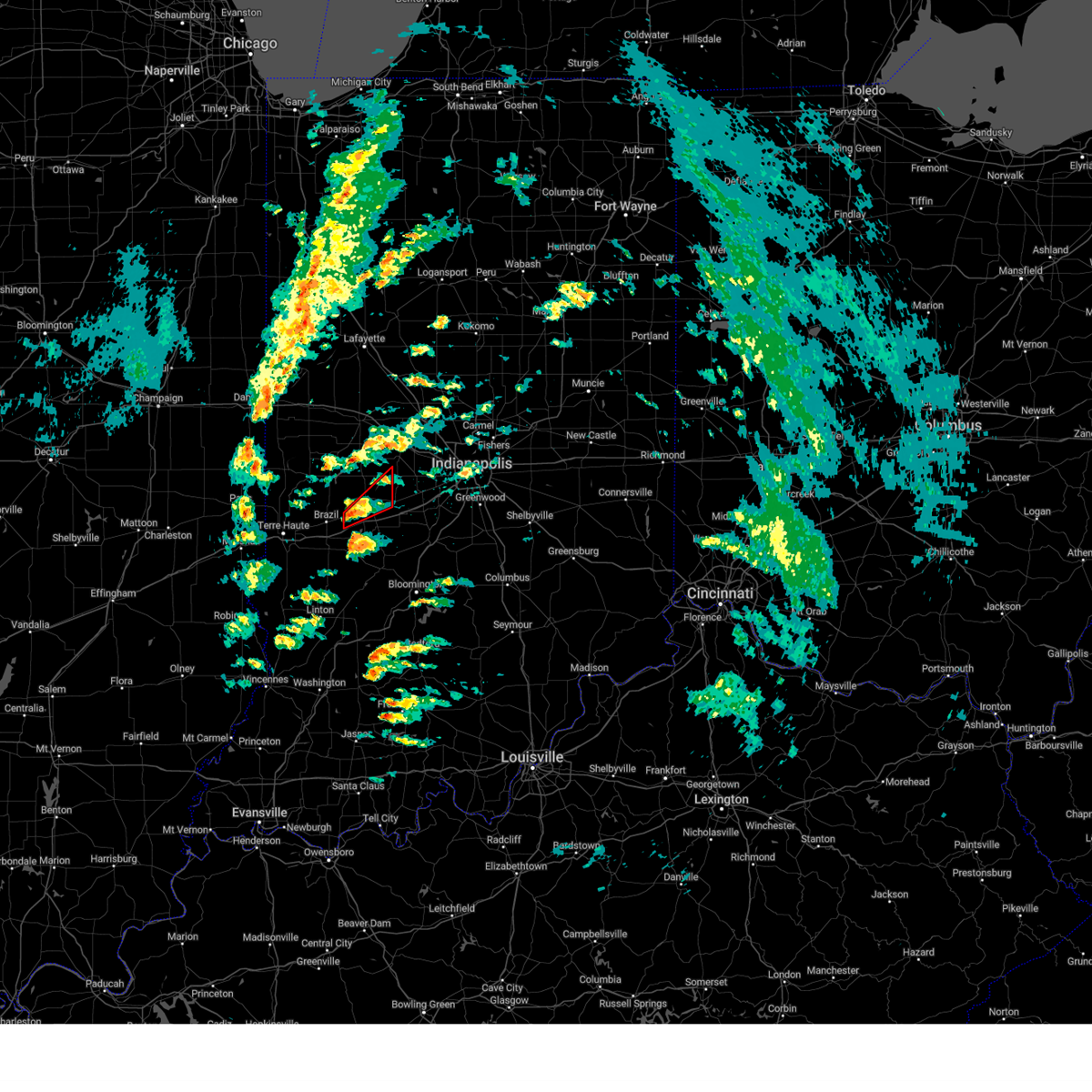 At 1213 pm est, a severe thunderstorm capable of producing a tornado was located 7 miles east of brazil, or 22 miles east of terre haute, moving northeast at 50 mph (radar indicated rotation). Hazards include tornado. Flying debris will be dangerous to those caught without shelter. mobile homes will be damaged or destroyed. damage to roofs, windows, and vehicles will occur. tree damage is likely. this dangerous storm will be near, greencastle around 1225 pm est. fillmore around 1230 pm est. Other locations in the path of this tornadic thunderstorm include groveland. At 1213 pm est, a severe thunderstorm capable of producing a tornado was located 7 miles east of brazil, or 22 miles east of terre haute, moving northeast at 50 mph (radar indicated rotation). Hazards include tornado. Flying debris will be dangerous to those caught without shelter. mobile homes will be damaged or destroyed. damage to roofs, windows, and vehicles will occur. tree damage is likely. this dangerous storm will be near, greencastle around 1225 pm est. fillmore around 1230 pm est. Other locations in the path of this tornadic thunderstorm include groveland.
|
| 8/1/2022 8:41 AM EDT |
 The severe thunderstorm warning for northwestern monroe, western morgan, western hendricks, central clay, northern owen, southwestern boone, southeastern montgomery and putnam counties will expire at 845 am edt, the storm which prompted the warning has moved out of the area. therefore, the warning will be allowed to expire. however gusty winds are still possible with this thunderstorm. The severe thunderstorm warning for northwestern monroe, western morgan, western hendricks, central clay, northern owen, southwestern boone, southeastern montgomery and putnam counties will expire at 845 am edt, the storm which prompted the warning has moved out of the area. therefore, the warning will be allowed to expire. however gusty winds are still possible with this thunderstorm.
|
| 8/1/2022 8:28 AM EDT |
 At 827 am edt, a severe thunderstorm was located near greencastle, or 31 miles northwest of bloomington, moving east at 40 mph (radar indicated). Hazards include 60 mph wind gusts and nickel size hail. Expect damage to roofs, siding, and trees. locations impacted include, stilesville, quincy, eminence, little point and paragon. this includes the following highways, interstate 70 between mile markers 17 and 19, and between mile markers 29 and 56. interstate 74 between mile markers 34 and 58. hail threat, radar indicated max hail size, 0. 88 in wind threat, radar indicated max wind gust, 60 mph. At 827 am edt, a severe thunderstorm was located near greencastle, or 31 miles northwest of bloomington, moving east at 40 mph (radar indicated). Hazards include 60 mph wind gusts and nickel size hail. Expect damage to roofs, siding, and trees. locations impacted include, stilesville, quincy, eminence, little point and paragon. this includes the following highways, interstate 70 between mile markers 17 and 19, and between mile markers 29 and 56. interstate 74 between mile markers 34 and 58. hail threat, radar indicated max hail size, 0. 88 in wind threat, radar indicated max wind gust, 60 mph.
|
| 8/1/2022 8:12 AM EDT |
 At 812 am edt, a severe thunderstorm was located 8 miles northeast of brazil, or 22 miles northeast of terre haute, moving east at 45 mph (radar indicated). Hazards include 60 mph wind gusts. Expect damage to roofs, siding, and trees. this severe thunderstorm will be near, reelsville around 815 am edt. greencastle around 820 am edt. cloverdale and cagles mill lake around 825 am edt. belle union and devore around 830 am edt. other locations in the path of this severe thunderstorm include eminence, quincy, little point and paragon. this includes the following highways, interstate 70 between mile markers 17 and 19, and between mile markers 29 and 56. interstate 74 between mile markers 34 and 58. hail threat, radar indicated max hail size, <. 75 in wind threat, radar indicated max wind gust, 60 mph. At 812 am edt, a severe thunderstorm was located 8 miles northeast of brazil, or 22 miles northeast of terre haute, moving east at 45 mph (radar indicated). Hazards include 60 mph wind gusts. Expect damage to roofs, siding, and trees. this severe thunderstorm will be near, reelsville around 815 am edt. greencastle around 820 am edt. cloverdale and cagles mill lake around 825 am edt. belle union and devore around 830 am edt. other locations in the path of this severe thunderstorm include eminence, quincy, little point and paragon. this includes the following highways, interstate 70 between mile markers 17 and 19, and between mile markers 29 and 56. interstate 74 between mile markers 34 and 58. hail threat, radar indicated max hail size, <. 75 in wind threat, radar indicated max wind gust, 60 mph.
|
| 7/24/2022 5:57 PM EDT |
 The severe thunderstorm warning for northwestern morgan, southwestern hendricks and southeastern putnam counties will expire at 600 pm edt, the storm which prompted the warning has weakened below severe limits, and has exited the warned area. therefore, the warning will be allowed to expire. however gusty winds and heavy rain are still possible with this thunderstorm. The severe thunderstorm warning for northwestern morgan, southwestern hendricks and southeastern putnam counties will expire at 600 pm edt, the storm which prompted the warning has weakened below severe limits, and has exited the warned area. therefore, the warning will be allowed to expire. however gusty winds and heavy rain are still possible with this thunderstorm.
|
| 7/24/2022 5:40 PM EDT |
 At 539 pm edt, a severe thunderstorm was located 7 miles southeast of greencastle, or 31 miles north of bloomington, moving east at 20 mph (radar indicated). Hazards include 60 mph wind gusts and quarter size hail. Hail damage to vehicles is expected. expect wind damage to roofs, siding, and trees. locations impacted include, stilesville, little point and eminence. This includes interstate 70 between mile markers 40 and 52. At 539 pm edt, a severe thunderstorm was located 7 miles southeast of greencastle, or 31 miles north of bloomington, moving east at 20 mph (radar indicated). Hazards include 60 mph wind gusts and quarter size hail. Hail damage to vehicles is expected. expect wind damage to roofs, siding, and trees. locations impacted include, stilesville, little point and eminence. This includes interstate 70 between mile markers 40 and 52.
|
| 7/24/2022 5:32 PM EDT |
 At 532 pm edt, a severe thunderstorm capable of producing a tornado was located near greencastle, or 31 miles east of terre haute, moving southeast at 20 mph (weather spotters reported funnel cloud). Hazards include tornado and quarter size hail. Flying debris will be dangerous to those caught without shelter. mobile homes will be damaged or destroyed. damage to roofs, windows, and vehicles will occur. tree damage is likely. this dangerous storm will be near, belle union around 550 pm edt. This includes interstate 70 between mile markers 40 and 48. At 532 pm edt, a severe thunderstorm capable of producing a tornado was located near greencastle, or 31 miles east of terre haute, moving southeast at 20 mph (weather spotters reported funnel cloud). Hazards include tornado and quarter size hail. Flying debris will be dangerous to those caught without shelter. mobile homes will be damaged or destroyed. damage to roofs, windows, and vehicles will occur. tree damage is likely. this dangerous storm will be near, belle union around 550 pm edt. This includes interstate 70 between mile markers 40 and 48.
|
| 7/24/2022 5:30 PM EDT | Multiple reports of trees and powerlines dow in putnam county IN, 0.4 miles WNW of Greencastle, IN |
| 7/24/2022 5:14 PM EDT |
 At 513 pm edt, a severe thunderstorm was located over greencastle, or 26 miles south of crawfordsville, moving east at 20 mph (radar indicated). Hazards include ping pong ball size hail and 60 mph wind gusts. People and animals outdoors will be injured. expect hail damage to roofs, siding, windows, and vehicles. expect wind damage to roofs, siding, and trees. this severe thunderstorm will be near, cloverdale around 525 pm edt. fillmore around 530 pm edt. other locations in the path of this severe thunderstorm include coatesville, belle union, amo, stilesville, little point and eminence. This includes interstate 70 between mile markers 39 and 52. At 513 pm edt, a severe thunderstorm was located over greencastle, or 26 miles south of crawfordsville, moving east at 20 mph (radar indicated). Hazards include ping pong ball size hail and 60 mph wind gusts. People and animals outdoors will be injured. expect hail damage to roofs, siding, windows, and vehicles. expect wind damage to roofs, siding, and trees. this severe thunderstorm will be near, cloverdale around 525 pm edt. fillmore around 530 pm edt. other locations in the path of this severe thunderstorm include coatesville, belle union, amo, stilesville, little point and eminence. This includes interstate 70 between mile markers 39 and 52.
|
| 5/26/2022 7:40 PM EDT |
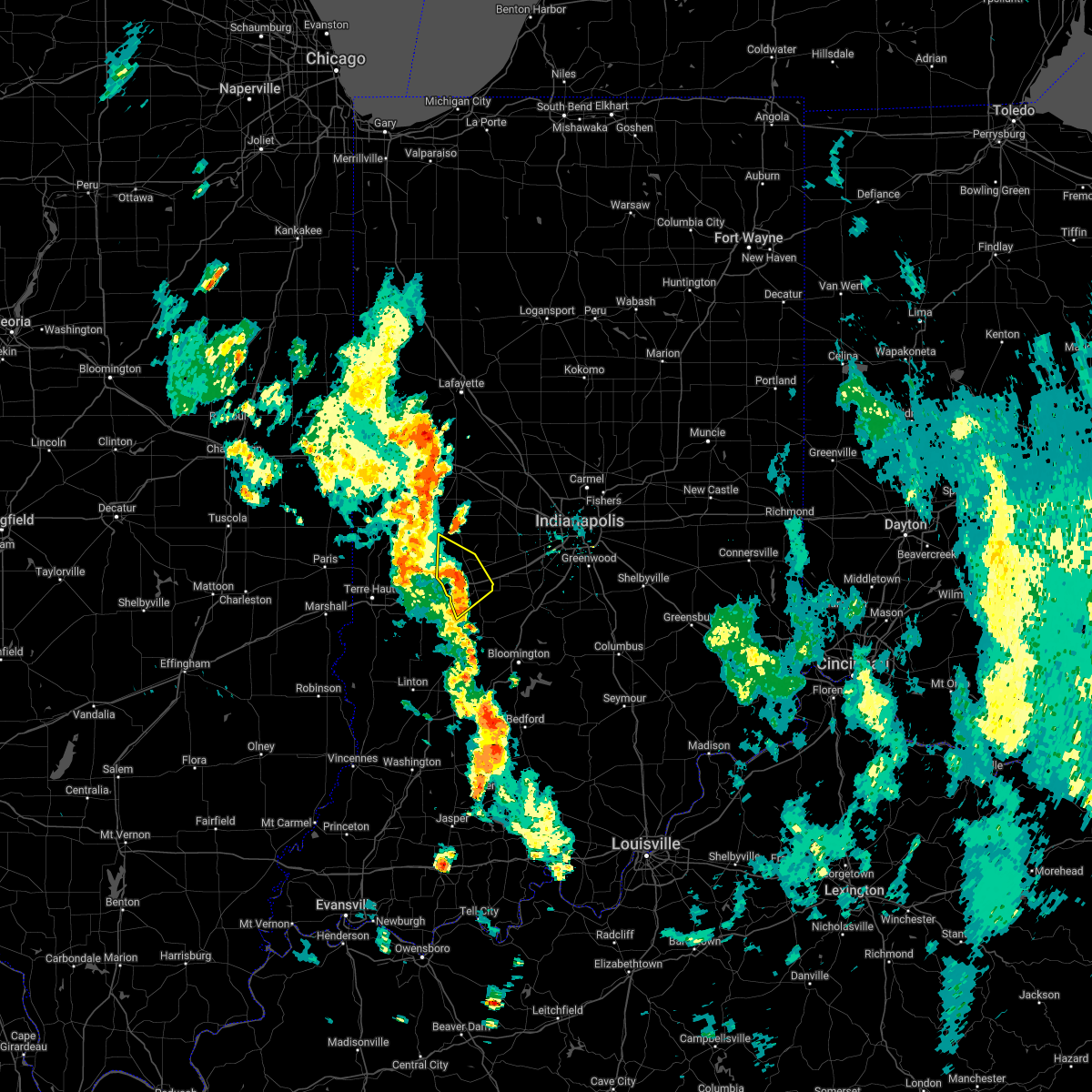 At 740 pm edt, severe thunderstorms were located along a line extending from 6 miles southwest of greencastle to 15 miles east of brazil to 11 miles north of spencer, moving north at 30 mph (radar indicated). Hazards include 60 mph wind gusts and penny size hail. Expect damage to roofs, siding, and trees. locations impacted include, greencastle. this includes interstate 70 between mile markers 32 and 46. hail threat, radar indicated max hail size, 0. 75 in wind threat, radar indicated max wind gust, 60 mph. At 740 pm edt, severe thunderstorms were located along a line extending from 6 miles southwest of greencastle to 15 miles east of brazil to 11 miles north of spencer, moving north at 30 mph (radar indicated). Hazards include 60 mph wind gusts and penny size hail. Expect damage to roofs, siding, and trees. locations impacted include, greencastle. this includes interstate 70 between mile markers 32 and 46. hail threat, radar indicated max hail size, 0. 75 in wind threat, radar indicated max wind gust, 60 mph.
|
| 5/26/2022 7:22 PM EDT |
 At 722 pm edt, severe thunderstorms were located along a line extending from 7 miles east of brazil to near spencer, moving north at 30 mph (radar indicated). Hazards include 60 mph wind gusts and penny size hail. Expect damage to roofs, siding, and trees. severe thunderstorms will be near, cagles mill lake and reelsville around 730 pm edt. devore and lena around 735 pm edt. cloverdale around 740 pm edt. other locations in the path of these severe thunderstorms include greencastle. this includes interstate 70 between mile markers 26 and 46. hail threat, radar indicated max hail size, 0. 75 in wind threat, radar indicated max wind gust, 60 mph. At 722 pm edt, severe thunderstorms were located along a line extending from 7 miles east of brazil to near spencer, moving north at 30 mph (radar indicated). Hazards include 60 mph wind gusts and penny size hail. Expect damage to roofs, siding, and trees. severe thunderstorms will be near, cagles mill lake and reelsville around 730 pm edt. devore and lena around 735 pm edt. cloverdale around 740 pm edt. other locations in the path of these severe thunderstorms include greencastle. this includes interstate 70 between mile markers 26 and 46. hail threat, radar indicated max hail size, 0. 75 in wind threat, radar indicated max wind gust, 60 mph.
|
| 3/6/2022 2:34 AM EST |
 At 233 am est, a severe thunderstorm was located near lebanon, or 13 miles south of frankfort, moving northeast at 80 mph (radar indicated). Hazards include 70 mph wind gusts. Expect considerable tree damage. damage is likely to mobile homes, roofs, and outbuildings. this severe thunderstorm will remain over mainly rural areas of northern vigo, southwestern clinton, hendricks, northwestern clay, southern parke, boone, southern vermillion, southeastern montgomery and putnam counties. this includes the following highways, interstate 65 between mile markers 134 and 153. interstate 70 between mile markers 1 and 5. interstate 74 between mile markers 42 and 66. thunderstorm damage threat, considerable hail threat, radar indicated max hail size, <. 75 in wind threat, radar indicated max wind gust, 70 mph. At 233 am est, a severe thunderstorm was located near lebanon, or 13 miles south of frankfort, moving northeast at 80 mph (radar indicated). Hazards include 70 mph wind gusts. Expect considerable tree damage. damage is likely to mobile homes, roofs, and outbuildings. this severe thunderstorm will remain over mainly rural areas of northern vigo, southwestern clinton, hendricks, northwestern clay, southern parke, boone, southern vermillion, southeastern montgomery and putnam counties. this includes the following highways, interstate 65 between mile markers 134 and 153. interstate 70 between mile markers 1 and 5. interstate 74 between mile markers 42 and 66. thunderstorm damage threat, considerable hail threat, radar indicated max hail size, <. 75 in wind threat, radar indicated max wind gust, 70 mph.
|
| 3/6/2022 2:11 AM EST |
 At 210 am est, a severe thunderstorm was located 10 miles southwest of crawfordsville, moving east at 80 mph (radar indicated). Hazards include 70 mph wind gusts. Expect considerable tree damage. damage is likely to mobile homes, roofs, and outbuildings. this severe thunderstorm will be near, ladoga and new ross around 220 am est. jamestown and advance around 225 am est. thorntown around 230 am est. other locations in the path of this severe thunderstorm include lebanon and ulen. this includes the following highways, interstate 65 between mile markers 134 and 153. interstate 70 between mile markers 1 and 5. interstate 74 between mile markers 23 and 66. thunderstorm damage threat, considerable hail threat, radar indicated max hail size, <. 75 in wind threat, radar indicated max wind gust, 70 mph. At 210 am est, a severe thunderstorm was located 10 miles southwest of crawfordsville, moving east at 80 mph (radar indicated). Hazards include 70 mph wind gusts. Expect considerable tree damage. damage is likely to mobile homes, roofs, and outbuildings. this severe thunderstorm will be near, ladoga and new ross around 220 am est. jamestown and advance around 225 am est. thorntown around 230 am est. other locations in the path of this severe thunderstorm include lebanon and ulen. this includes the following highways, interstate 65 between mile markers 134 and 153. interstate 70 between mile markers 1 and 5. interstate 74 between mile markers 23 and 66. thunderstorm damage threat, considerable hail threat, radar indicated max hail size, <. 75 in wind threat, radar indicated max wind gust, 70 mph.
|
| 8/25/2021 12:15 PM EDT | Forwarded report of multiple trees blown down...including onto power lines. time approximate in putnam county IN, 1.1 miles NE of Greencastle, IN |
| 6/18/2021 7:20 PM EDT |
 At 719 pm edt, a severe thunderstorm was located near greencastle, or 30 miles east of terre haute, moving southeast at 20 mph (radar indicated). Hazards include golf ball size hail and 60 mph wind gusts. People and animals outdoors will be injured. expect hail damage to roofs, siding, windows, and vehicles. expect wind damage to roofs, siding, and trees. locations impacted include, cloverdale, belle union, quincy, devore, little point, eminence, gosport and paragon. This includes interstate 70 between mile markers 34 and 50. At 719 pm edt, a severe thunderstorm was located near greencastle, or 30 miles east of terre haute, moving southeast at 20 mph (radar indicated). Hazards include golf ball size hail and 60 mph wind gusts. People and animals outdoors will be injured. expect hail damage to roofs, siding, windows, and vehicles. expect wind damage to roofs, siding, and trees. locations impacted include, cloverdale, belle union, quincy, devore, little point, eminence, gosport and paragon. This includes interstate 70 between mile markers 34 and 50.
|
| 6/18/2021 6:55 PM EDT |
 At 655 pm edt, a severe thunderstorm was located 8 miles east of brazil, or 22 miles east of terre haute, moving southeast at 30 mph (radar indicated). Hazards include golf ball size hail and 60 mph wind gusts. People and animals outdoors will be injured. expect hail damage to roofs, siding, windows, and vehicles. expect wind damage to roofs, siding, and trees. this severe thunderstorm will be near, cloverdale and cagles mill lake around 710 pm edt. other locations in the path of this severe thunderstorm include devore, quincy, spencer, gosport and paragon. This includes interstate 70 between mile markers 28 and 50. At 655 pm edt, a severe thunderstorm was located 8 miles east of brazil, or 22 miles east of terre haute, moving southeast at 30 mph (radar indicated). Hazards include golf ball size hail and 60 mph wind gusts. People and animals outdoors will be injured. expect hail damage to roofs, siding, windows, and vehicles. expect wind damage to roofs, siding, and trees. this severe thunderstorm will be near, cloverdale and cagles mill lake around 710 pm edt. other locations in the path of this severe thunderstorm include devore, quincy, spencer, gosport and paragon. This includes interstate 70 between mile markers 28 and 50.
|
| 8/10/2020 7:15 PM EDT |
 At 715 pm edt, a severe thunderstorm was located 12 miles east of greencastle, or 28 miles north of bloomington, moving east at 40 mph (radar indicated). Hazards include 60 mph wind gusts. expect damage to roofs, siding, and trees At 715 pm edt, a severe thunderstorm was located 12 miles east of greencastle, or 28 miles north of bloomington, moving east at 40 mph (radar indicated). Hazards include 60 mph wind gusts. expect damage to roofs, siding, and trees
|
| 8/10/2020 7:00 PM EDT | Tree and power lines down. time estimated from rada in putnam county IN, 2.3 miles SSE of Greencastle, IN |
| 7/21/2020 9:33 PM EDT |
 At 933 pm edt, severe thunderstorms were located along a line extending from 8 miles northwest of danville to 13 miles southeast of greencastle, moving east at 35 mph. this storm has a history of producing wind damage with damage noted in downtown greencastle (emergency management). Hazards include 60 mph wind gusts. Expect damage to roofs, siding, and trees. locations impacted include, plainfield, brownsburg, greencastle, mooresville, danville, avon, pittsboro, cloverdale, brooklyn, monrovia, clayton, roachdale, bainbridge, fillmore, coatesville, north salem, lizton, amo, stilesville and bethany. this includes the following highways, interstate 70 between mile markers 36 and 68. Interstate 74 between mile markers 55 and 69. At 933 pm edt, severe thunderstorms were located along a line extending from 8 miles northwest of danville to 13 miles southeast of greencastle, moving east at 35 mph. this storm has a history of producing wind damage with damage noted in downtown greencastle (emergency management). Hazards include 60 mph wind gusts. Expect damage to roofs, siding, and trees. locations impacted include, plainfield, brownsburg, greencastle, mooresville, danville, avon, pittsboro, cloverdale, brooklyn, monrovia, clayton, roachdale, bainbridge, fillmore, coatesville, north salem, lizton, amo, stilesville and bethany. this includes the following highways, interstate 70 between mile markers 36 and 68. Interstate 74 between mile markers 55 and 69.
|
| 7/21/2020 9:20 PM EDT | Sporadic power lines down across town. a measured 50 mph gust was made near this location. time estimated from rada in putnam county IN, 0.9 miles SE of Greencastle, IN |
| 7/21/2020 9:15 PM EDT |
 At 915 pm edt, severe thunderstorms were located along a line extending from 12 miles north of greencastle to near brazil, moving east at 20 mph. this storm has a history of producing damaging winds (radar indicated). Hazards include 60 mph wind gusts. Expect damage to roofs, siding, and trees. locations impacted include, greencastle and reelsville. This includes interstate 70 between mile markers 33 and 36. At 915 pm edt, severe thunderstorms were located along a line extending from 12 miles north of greencastle to near brazil, moving east at 20 mph. this storm has a history of producing damaging winds (radar indicated). Hazards include 60 mph wind gusts. Expect damage to roofs, siding, and trees. locations impacted include, greencastle and reelsville. This includes interstate 70 between mile markers 33 and 36.
|
| 7/21/2020 9:14 PM EDT |
 At 914 pm edt, severe thunderstorms were located along a line extending from 14 miles south of crawfordsville to 10 miles south of greencastle, moving east at 35 mph (radar indicated). Hazards include 60 mph wind gusts. expect damage to roofs, siding, and trees At 914 pm edt, severe thunderstorms were located along a line extending from 14 miles south of crawfordsville to 10 miles south of greencastle, moving east at 35 mph (radar indicated). Hazards include 60 mph wind gusts. expect damage to roofs, siding, and trees
|
| 7/21/2020 9:00 PM EDT |
 At 900 pm edt, severe thunderstorms were located along a line extending from 11 miles east of rockville to brazil, moving east at 25 mph (radar indicated). Hazards include 60 mph wind gusts. Expect damage to roofs, siding, and trees. locations impacted include, greencastle, brazil, knightsville, harmony, carbon, russellville, reelsville, lena and cecil harden lake. This includes interstate 70 between mile markers 30 and 36. At 900 pm edt, severe thunderstorms were located along a line extending from 11 miles east of rockville to brazil, moving east at 25 mph (radar indicated). Hazards include 60 mph wind gusts. Expect damage to roofs, siding, and trees. locations impacted include, greencastle, brazil, knightsville, harmony, carbon, russellville, reelsville, lena and cecil harden lake. This includes interstate 70 between mile markers 30 and 36.
|
| 7/21/2020 8:44 PM EDT |
 At 844 pm edt, severe thunderstorms were located along a line extending from near rockville to near brazil, moving east at 20 mph (radar indicated). Hazards include 60 mph wind gusts. expect damage to roofs, siding, and trees At 844 pm edt, severe thunderstorms were located along a line extending from near rockville to near brazil, moving east at 20 mph (radar indicated). Hazards include 60 mph wind gusts. expect damage to roofs, siding, and trees
|
| 7/12/2020 12:44 AM EDT |
 At 1243 am edt, severe thunderstorms were located along a line extending from 12 miles east of greencastle to 8 miles west of spencer to near chauncey, moving southeast at 60 mph (radar indicated). Hazards include 60 mph wind gusts and quarter size hail. Hail damage to vehicles is expected. expect wind damage to roofs, siding, and trees. locations impacted include, greencastle, mooresville, linton, sullivan, spencer, ellettsville, jasonville, cloverdale, brooklyn, worthington, shelburn, farmersburg, monrovia, clayton, dugger, clay city, gosport, hymera, fairbanks and carlisle. This includes interstate 70 between mile markers 27 and 65. At 1243 am edt, severe thunderstorms were located along a line extending from 12 miles east of greencastle to 8 miles west of spencer to near chauncey, moving southeast at 60 mph (radar indicated). Hazards include 60 mph wind gusts and quarter size hail. Hail damage to vehicles is expected. expect wind damage to roofs, siding, and trees. locations impacted include, greencastle, mooresville, linton, sullivan, spencer, ellettsville, jasonville, cloverdale, brooklyn, worthington, shelburn, farmersburg, monrovia, clayton, dugger, clay city, gosport, hymera, fairbanks and carlisle. This includes interstate 70 between mile markers 27 and 65.
|
| 7/12/2020 12:29 AM EDT |
 At 1228 am edt, severe thunderstorms were located along a line extending from near greencastle to 10 miles south of brazil to near newton, moving southeast at 60 mph. quarter size hail was reported in carlisle in vigo county at 1222 am (radar indicated). Hazards include 60 mph wind gusts and quarter size hail. Hail damage to vehicles is expected. Expect wind damage to roofs, siding, and trees. At 1228 am edt, severe thunderstorms were located along a line extending from near greencastle to 10 miles south of brazil to near newton, moving southeast at 60 mph. quarter size hail was reported in carlisle in vigo county at 1222 am (radar indicated). Hazards include 60 mph wind gusts and quarter size hail. Hail damage to vehicles is expected. Expect wind damage to roofs, siding, and trees.
|
| 7/11/2020 5:57 PM EDT |
 The severe thunderstorm warning for northwestern morgan, southwestern hendricks and central putnam counties will expire at 600 pm edt, the storm which prompted the warning has weakened below severe limits, and no longer poses an immediate threat to life or property. therefore, the warning will be allowed to expire. however small hail, gusty winds and heavy rain are still possible with this thunderstorm. The severe thunderstorm warning for northwestern morgan, southwestern hendricks and central putnam counties will expire at 600 pm edt, the storm which prompted the warning has weakened below severe limits, and no longer poses an immediate threat to life or property. therefore, the warning will be allowed to expire. however small hail, gusty winds and heavy rain are still possible with this thunderstorm.
|
| 7/11/2020 5:33 PM EDT |
 At 533 pm edt, a severe thunderstorm was located near greencastle, or 23 miles south of crawfordsville, moving southeast at 30 mph (radar indicated). Hazards include 60 mph wind gusts. expect damage to roofs, siding, and trees At 533 pm edt, a severe thunderstorm was located near greencastle, or 23 miles south of crawfordsville, moving southeast at 30 mph (radar indicated). Hazards include 60 mph wind gusts. expect damage to roofs, siding, and trees
|
| 4/8/2020 8:35 PM EDT | Awos station kgpc greencastl in putnam county IN, 1.6 miles WNW of Greencastle, IN |
| 4/8/2020 8:27 PM EDT |
 At 827 pm edt, a severe thunderstorm was located near danville, or 25 miles southeast of crawfordsville, moving east at 70 mph (radar indicated). Hazards include 70 mph wind gusts and quarter size hail. Hail damage to vehicles is expected. expect considerable tree damage. Wind damage is also likely to mobile homes, roofs, and outbuildings. At 827 pm edt, a severe thunderstorm was located near danville, or 25 miles southeast of crawfordsville, moving east at 70 mph (radar indicated). Hazards include 70 mph wind gusts and quarter size hail. Hail damage to vehicles is expected. expect considerable tree damage. Wind damage is also likely to mobile homes, roofs, and outbuildings.
|
| 4/8/2020 8:22 PM EDT | Corrects timing on previous tstm wnd gst report from 1 ese greencastle. awos station kgpc greencastl in putnam county IN, 1.6 miles WNW of Greencastle, IN |
| 4/8/2020 8:14 PM EDT |
 At 813 pm edt, a severe thunderstorm was located 13 miles east of rockville, or 15 miles south of crawfordsville, moving east at 60 mph (radar indicated). Hazards include 60 mph wind gusts and penny size hail. Expect damage to roofs, siding, and trees. locations impacted include, crawfordsville, greencastle, rockville, ladoga, roachdale, bainbridge, new market, fillmore, waveland, carbon, russellville, new ross, mecca, bloomingdale, marshall, wallace, alamo, carpentersville, bridgeton and shades state park. This includes interstate 70 between mile markers 43 and 48. At 813 pm edt, a severe thunderstorm was located 13 miles east of rockville, or 15 miles south of crawfordsville, moving east at 60 mph (radar indicated). Hazards include 60 mph wind gusts and penny size hail. Expect damage to roofs, siding, and trees. locations impacted include, crawfordsville, greencastle, rockville, ladoga, roachdale, bainbridge, new market, fillmore, waveland, carbon, russellville, new ross, mecca, bloomingdale, marshall, wallace, alamo, carpentersville, bridgeton and shades state park. This includes interstate 70 between mile markers 43 and 48.
|
| 4/8/2020 7:55 PM EDT |
 At 755 pm edt, a severe thunderstorm was located near newport, or 22 miles southeast of danville, moving east at 60 mph (radar indicated). Hazards include 60 mph wind gusts and penny size hail. expect damage to roofs, siding, and trees At 755 pm edt, a severe thunderstorm was located near newport, or 22 miles southeast of danville, moving east at 60 mph (radar indicated). Hazards include 60 mph wind gusts and penny size hail. expect damage to roofs, siding, and trees
|
| 1/11/2020 4:47 AM EST | Trees down in greencastle are in putnam county IN, 1.3 miles S of Greencastle, IN |
| 8/20/2019 2:24 PM EDT |
 At 220 pm edt, severe thunderstorms were located along a line extending from near danville to 7 miles west of mooresville to 9 miles east of spencer, moving east at 50 mph (emergency management. at 201 pm, trees and tree limbs were reported down all across putnam county). Hazards include 60 mph wind gusts. Expect damage to roofs, siding, and trees. locations impacted include, plainfield, greencastle, danville, avon, cloverdale, monrovia, clayton, roachdale, gosport, bainbridge, paragon, fillmore, coatesville, amo, stilesville, quincy, carpentersville, groveland, belle union and little point. This includes interstate 70 between mile markers 32 and 63. At 220 pm edt, severe thunderstorms were located along a line extending from near danville to 7 miles west of mooresville to 9 miles east of spencer, moving east at 50 mph (emergency management. at 201 pm, trees and tree limbs were reported down all across putnam county). Hazards include 60 mph wind gusts. Expect damage to roofs, siding, and trees. locations impacted include, plainfield, greencastle, danville, avon, cloverdale, monrovia, clayton, roachdale, gosport, bainbridge, paragon, fillmore, coatesville, amo, stilesville, quincy, carpentersville, groveland, belle union and little point. This includes interstate 70 between mile markers 32 and 63.
|
| 8/20/2019 2:01 PM EDT | Emergency manager reports trees and tree limbs down across the county with some on car in putnam county IN, 1.4 miles SSE of Greencastle, IN |
| 8/20/2019 2:00 PM EDT |
 The national weather service in indianapolis has issued a * severe thunderstorm warning for. western morgan county in central indiana. southern hendricks county in central indiana. central clay county in west central indiana. Southeastern parke county in west central indiana. The national weather service in indianapolis has issued a * severe thunderstorm warning for. western morgan county in central indiana. southern hendricks county in central indiana. central clay county in west central indiana. Southeastern parke county in west central indiana.
|
| 8/18/2019 7:52 PM EDT |
 At 751 pm edt, severe thunderstorms were located along a line extending from 8 miles west of anderson to near lawrence to 13 miles northwest of martinsville, moving east at 35 mph (radar indicated). Hazards include 60 mph wind gusts and quarter size hail. Hail damage to vehicles is expected. expect wind damage to roofs, siding, and trees. locations impacted include, indianapolis, anderson, carmel, fishers, noblesville, greenwood, lawrence, plainfield, greenfield, beech grove, speedway, greencastle, mooresville, danville, southport, westfield, avon, cumberland, cicero and mccordsville. those attending outdoor events across the indianapolis metro area are in the path of these storms and should prepare for dangerous weather conditions. seek shelter now! this includes the following highways, interstate 65 between mile markers 100 and 119. interstate 69 between mile markers 200 and 228. interstate 70 between mile markers 46 and 107. Interstate 74 between mile markers 72 and 100. At 751 pm edt, severe thunderstorms were located along a line extending from 8 miles west of anderson to near lawrence to 13 miles northwest of martinsville, moving east at 35 mph (radar indicated). Hazards include 60 mph wind gusts and quarter size hail. Hail damage to vehicles is expected. expect wind damage to roofs, siding, and trees. locations impacted include, indianapolis, anderson, carmel, fishers, noblesville, greenwood, lawrence, plainfield, greenfield, beech grove, speedway, greencastle, mooresville, danville, southport, westfield, avon, cumberland, cicero and mccordsville. those attending outdoor events across the indianapolis metro area are in the path of these storms and should prepare for dangerous weather conditions. seek shelter now! this includes the following highways, interstate 65 between mile markers 100 and 119. interstate 69 between mile markers 200 and 228. interstate 70 between mile markers 46 and 107. Interstate 74 between mile markers 72 and 100.
|
| 8/18/2019 7:24 PM EDT |
 At 722 pm edt, severe thunderstorms were located along a line extending from 6 miles northwest of noblesville to speedway to 9 miles east of brazil, moving east at 35 mph (radar indicated). Hazards include 60 mph wind gusts and quarter size hail. Hail damage to vehicles is expected. Expect wind damage to roofs, siding, and trees. At 722 pm edt, severe thunderstorms were located along a line extending from 6 miles northwest of noblesville to speedway to 9 miles east of brazil, moving east at 35 mph (radar indicated). Hazards include 60 mph wind gusts and quarter size hail. Hail damage to vehicles is expected. Expect wind damage to roofs, siding, and trees.
|
| 8/18/2019 7:10 PM EDT |
 At 708 pm edt, severe thunderstorms were located along a line extending from 13 miles northeast of lebanon to near brownsburg to near danville to 6 miles east of greencastle, moving east at 35 mph (radar indicated). Hazards include 60 mph wind gusts and quarter size hail. Hail damage to vehicles is expected. expect wind damage to roofs, siding, and trees. locations impacted include, indianapolis, carmel, fishers, noblesville, lawrence, plainfield, brownsburg, lebanon, beech grove, zionsville, speedway, greencastle, danville, rockville, westfield, avon, cicero, mccordsville, pittsboro and whitestown. those attending outdoor events in the indianapolis metro area are in the path of these storms and should prepare for dangerous weather conditions. seek shelter now! this includes the following highways, interstate 65 between mile markers 108 and 150. interstate 69 between mile markers 200 and 210. interstate 70 between mile markers 63 and 92. Interstate 74 between mile markers 42 and 73. At 708 pm edt, severe thunderstorms were located along a line extending from 13 miles northeast of lebanon to near brownsburg to near danville to 6 miles east of greencastle, moving east at 35 mph (radar indicated). Hazards include 60 mph wind gusts and quarter size hail. Hail damage to vehicles is expected. expect wind damage to roofs, siding, and trees. locations impacted include, indianapolis, carmel, fishers, noblesville, lawrence, plainfield, brownsburg, lebanon, beech grove, zionsville, speedway, greencastle, danville, rockville, westfield, avon, cicero, mccordsville, pittsboro and whitestown. those attending outdoor events in the indianapolis metro area are in the path of these storms and should prepare for dangerous weather conditions. seek shelter now! this includes the following highways, interstate 65 between mile markers 108 and 150. interstate 69 between mile markers 200 and 210. interstate 70 between mile markers 63 and 92. Interstate 74 between mile markers 42 and 73.
|
| 8/18/2019 6:55 PM EDT |
 At 655 pm edt, severe thunderstorms were located along a line extending from 9 miles southeast of frankfort to 6 miles northwest of brownsburg to near danville to greencastle, moving east at 40 mph (radar indicated). Hazards include 70 mph wind gusts and quarter size hail. Hail damage to vehicles is expected. expect considerable tree damage. wind damage is also likely to mobile homes, roofs, and outbuildings. locations impacted include, indianapolis, crawfordsville, carmel, fishers, noblesville, lawrence, plainfield, brownsburg, lebanon, beech grove, zionsville, speedway, greencastle, danville, clinton, rockville, westfield, avon, cicero and mccordsville. those attending outdoor events in the indianapolis metro area are in the path of these storms and should prepare for imminent dangerous weather conditions. seek shelter now! this includes the following highways, interstate 65 between mile markers 108 and 150. interstate 69 between mile markers 200 and 210. interstate 70 between mile markers 63 and 92. Interstate 74 between mile markers 32 and 73. At 655 pm edt, severe thunderstorms were located along a line extending from 9 miles southeast of frankfort to 6 miles northwest of brownsburg to near danville to greencastle, moving east at 40 mph (radar indicated). Hazards include 70 mph wind gusts and quarter size hail. Hail damage to vehicles is expected. expect considerable tree damage. wind damage is also likely to mobile homes, roofs, and outbuildings. locations impacted include, indianapolis, crawfordsville, carmel, fishers, noblesville, lawrence, plainfield, brownsburg, lebanon, beech grove, zionsville, speedway, greencastle, danville, clinton, rockville, westfield, avon, cicero and mccordsville. those attending outdoor events in the indianapolis metro area are in the path of these storms and should prepare for imminent dangerous weather conditions. seek shelter now! this includes the following highways, interstate 65 between mile markers 108 and 150. interstate 69 between mile markers 200 and 210. interstate 70 between mile markers 63 and 92. Interstate 74 between mile markers 32 and 73.
|
| 8/18/2019 6:35 PM EDT |
 At 634 pm edt, severe thunderstorms were located along a line extending from 10 miles northwest of lebanon to 12 miles southeast of crawfordsville to 6 miles southeast of rockville, moving east at 35 mph (radar indicated). Hazards include 70 mph wind gusts and quarter size hail. Hail damage to vehicles is expected. expect considerable tree damage. wind damage is also likely to mobile homes, roofs, and outbuildings. locations impacted include, indianapolis, crawfordsville, carmel, fishers, noblesville, lawrence, plainfield, brownsburg, lebanon, beech grove, zionsville, speedway, greencastle, danville, clinton, rockville, westfield, avon, cicero and mccordsville. those attending outdoor events in the indianapolis metro area are in the path of these storms and should prepare for imminent dangerous weather conditions. seek shelter now! this includes the following highways, interstate 65 between mile markers 108 and 150. interstate 69 between mile markers 200 and 210. interstate 70 between mile markers 63 and 92. Interstate 74 between mile markers 32 and 73. At 634 pm edt, severe thunderstorms were located along a line extending from 10 miles northwest of lebanon to 12 miles southeast of crawfordsville to 6 miles southeast of rockville, moving east at 35 mph (radar indicated). Hazards include 70 mph wind gusts and quarter size hail. Hail damage to vehicles is expected. expect considerable tree damage. wind damage is also likely to mobile homes, roofs, and outbuildings. locations impacted include, indianapolis, crawfordsville, carmel, fishers, noblesville, lawrence, plainfield, brownsburg, lebanon, beech grove, zionsville, speedway, greencastle, danville, clinton, rockville, westfield, avon, cicero and mccordsville. those attending outdoor events in the indianapolis metro area are in the path of these storms and should prepare for imminent dangerous weather conditions. seek shelter now! this includes the following highways, interstate 65 between mile markers 108 and 150. interstate 69 between mile markers 200 and 210. interstate 70 between mile markers 63 and 92. Interstate 74 between mile markers 32 and 73.
|
| 8/18/2019 6:13 PM EDT |
 At 612 pm edt, severe thunderstorms were located along a line extending from 7 miles north of crawfordsville to 15 miles northeast of rockville to near clinton, moving east at 35 mph. these are very dangerous storms (radar indicated). Hazards include 80 mph wind gusts and quarter size hail. Flying debris will be dangerous to those caught without shelter. mobile homes will be heavily damaged. expect considerable damage to roofs, windows, and vehicles. Extensive tree damage and power outages are likely. At 612 pm edt, severe thunderstorms were located along a line extending from 7 miles north of crawfordsville to 15 miles northeast of rockville to near clinton, moving east at 35 mph. these are very dangerous storms (radar indicated). Hazards include 80 mph wind gusts and quarter size hail. Flying debris will be dangerous to those caught without shelter. mobile homes will be heavily damaged. expect considerable damage to roofs, windows, and vehicles. Extensive tree damage and power outages are likely.
|
| 7/10/2019 7:27 PM EDT |
 The severe thunderstorm warning for southeastern vigo. clay. northwestern owen and southern putnam counties will expire at 730 pm edt. the storms which prompted the warning have weakened below severe limits, and no longer pose an immediate threat to life or property. therefore, the warning will be allowed to expire. However gusty. The severe thunderstorm warning for southeastern vigo. clay. northwestern owen and southern putnam counties will expire at 730 pm edt. the storms which prompted the warning have weakened below severe limits, and no longer pose an immediate threat to life or property. therefore, the warning will be allowed to expire. However gusty.
|
| 7/10/2019 6:59 PM EDT |
 At 658 pm edt, severe thunderstorms were located along a line extending from near greencastle to near brazil to 7 miles southwest of terre haute, moving southeast at 10 mph (radar indicated). Hazards include 60 mph wind gusts and nickel size hail. Expect damage to roofs, siding, and trees. locations impacted include, terre haute, greencastle, brazil, cloverdale, seelyville, knightsville, harmony, staunton, fillmore, carbon, center point, riley, bowling green, lena, reelsville, cory, saline city, cagles mill lake and indiana state university. This includes interstate 70 between mile markers 7 and 44. At 658 pm edt, severe thunderstorms were located along a line extending from near greencastle to near brazil to 7 miles southwest of terre haute, moving southeast at 10 mph (radar indicated). Hazards include 60 mph wind gusts and nickel size hail. Expect damage to roofs, siding, and trees. locations impacted include, terre haute, greencastle, brazil, cloverdale, seelyville, knightsville, harmony, staunton, fillmore, carbon, center point, riley, bowling green, lena, reelsville, cory, saline city, cagles mill lake and indiana state university. This includes interstate 70 between mile markers 7 and 44.
|
| 7/10/2019 6:43 PM EDT |
 At 642 pm edt, severe thunderstorms were located along a line extending from 8 miles northwest of greencastle to near brazil to near dennison, moving southeast at 10 mph (radar indicated). Hazards include 60 mph wind gusts and nickel size hail. expect damage to roofs, siding, and trees At 642 pm edt, severe thunderstorms were located along a line extending from 8 miles northwest of greencastle to near brazil to near dennison, moving southeast at 10 mph (radar indicated). Hazards include 60 mph wind gusts and nickel size hail. expect damage to roofs, siding, and trees
|
| 7/10/2019 6:35 PM EDT | One or more trees down and blocking a roa in parke county IN, 9.1 miles ESE of Greencastle, IN |
| 6/30/2019 6:38 PM EDT |
 At 637 pm edt, a severe thunderstorm was located 10 miles north of spencer, or 21 miles northwest of bloomington, moving southeast at 35 mph (radar indicated). Hazards include 60 mph wind gusts. Expect damage to roofs, siding, and trees. locations impacted include, greencastle, brazil, spencer, ellettsville, jasonville, cloverdale, worthington, knightsville, clay city, gosport, bainbridge, paragon, harmony, staunton, fillmore, carbon, center point, stinesville, quincy and freedom. This includes interstate 70 between mile markers 17 and 54. At 637 pm edt, a severe thunderstorm was located 10 miles north of spencer, or 21 miles northwest of bloomington, moving southeast at 35 mph (radar indicated). Hazards include 60 mph wind gusts. Expect damage to roofs, siding, and trees. locations impacted include, greencastle, brazil, spencer, ellettsville, jasonville, cloverdale, worthington, knightsville, clay city, gosport, bainbridge, paragon, harmony, staunton, fillmore, carbon, center point, stinesville, quincy and freedom. This includes interstate 70 between mile markers 17 and 54.
|
| 6/30/2019 6:14 PM EDT |
 At 614 pm edt, a severe thunderstorm was located near greencastle, or 28 miles east of terre haute, moving southeast at 30 mph (radar indicated). Hazards include 60 mph wind gusts. expect damage to roofs, siding, and trees At 614 pm edt, a severe thunderstorm was located near greencastle, or 28 miles east of terre haute, moving southeast at 30 mph (radar indicated). Hazards include 60 mph wind gusts. expect damage to roofs, siding, and trees
|
| 6/30/2019 5:51 PM EDT |
 At 551 pm edt, a severe thunderstorm was located over greencastle, or 26 miles south of crawfordsville, moving southeast at 30 mph (radar indicated). Hazards include 60 mph wind gusts and quarter size hail. Hail damage to vehicles is expected. expect wind damage to roofs, siding, and trees. locations impacted include, greencastle, brazil, rockville, cloverdale, knightsville, bainbridge, harmony, staunton, fillmore, carbon, russellville, bloomingdale, marshall, center point, quincy, bridgeton, reelsville, saline city, eminence and cagles mill lake. This includes interstate 70 between mile markers 20 and 53. At 551 pm edt, a severe thunderstorm was located over greencastle, or 26 miles south of crawfordsville, moving southeast at 30 mph (radar indicated). Hazards include 60 mph wind gusts and quarter size hail. Hail damage to vehicles is expected. expect wind damage to roofs, siding, and trees. locations impacted include, greencastle, brazil, rockville, cloverdale, knightsville, bainbridge, harmony, staunton, fillmore, carbon, russellville, bloomingdale, marshall, center point, quincy, bridgeton, reelsville, saline city, eminence and cagles mill lake. This includes interstate 70 between mile markers 20 and 53.
|
| 6/30/2019 5:50 PM EDT | Trees reported down all along us 40 near putnamville. report via faceboo in putnam county IN, 5.1 miles NNE of Greencastle, IN |
| 6/30/2019 5:27 PM EDT |
 At 526 pm edt, a severe thunderstorm was located near rockville, or 19 miles southwest of crawfordsville, moving southeast at 25 mph (radar indicated). Hazards include 60 mph wind gusts and quarter size hail. Hail damage to vehicles is expected. Expect wind damage to roofs, siding, and trees. At 526 pm edt, a severe thunderstorm was located near rockville, or 19 miles southwest of crawfordsville, moving southeast at 25 mph (radar indicated). Hazards include 60 mph wind gusts and quarter size hail. Hail damage to vehicles is expected. Expect wind damage to roofs, siding, and trees.
|
| 6/24/2019 8:07 PM EDT |
 At 807 pm edt, a severe thunderstorm was located near greencastle, or 24 miles south of crawfordsville, moving east at 40 mph (radar indicated). Hazards include 60 mph wind gusts. expect damage to roofs, siding, and trees At 807 pm edt, a severe thunderstorm was located near greencastle, or 24 miles south of crawfordsville, moving east at 40 mph (radar indicated). Hazards include 60 mph wind gusts. expect damage to roofs, siding, and trees
|
| 6/23/2019 3:09 PM EDT |
 The severe thunderstorm warning for northwestern monroe, northeastern clay, eastern owen and southwestern putnam counties will expire at 315 pm edt, the storms which prompted the warning have moved out of the area. therefore, the warning will be allowed to expire. however gusty winds are still possible with these thunderstorms. a severe thunderstorm watch remains in effect until 800 pm edt for south central, central, southwestern and west central indiana. The severe thunderstorm warning for northwestern monroe, northeastern clay, eastern owen and southwestern putnam counties will expire at 315 pm edt, the storms which prompted the warning have moved out of the area. therefore, the warning will be allowed to expire. however gusty winds are still possible with these thunderstorms. a severe thunderstorm watch remains in effect until 800 pm edt for south central, central, southwestern and west central indiana.
|
| 6/23/2019 2:54 PM EDT |
 At 254 pm edt, severe thunderstorms were located along a line extending from 11 miles northwest of spencer to 9 miles west of bloomington, moving northeast at 40 mph (law enforcement). Hazards include 60 mph wind gusts and penny size hail. Expect damage to roofs, siding, and trees. locations impacted include, bloomington, greencastle, brazil, spencer, ellettsville, cloverdale, knightsville, gosport, harmony, stinesville, indiana university, quincy, mccormicks creek state park, reelsville, cagles mill lake, devore and whitehall. This includes interstate 70 between mile markers 27 and 44. At 254 pm edt, severe thunderstorms were located along a line extending from 11 miles northwest of spencer to 9 miles west of bloomington, moving northeast at 40 mph (law enforcement). Hazards include 60 mph wind gusts and penny size hail. Expect damage to roofs, siding, and trees. locations impacted include, bloomington, greencastle, brazil, spencer, ellettsville, cloverdale, knightsville, gosport, harmony, stinesville, indiana university, quincy, mccormicks creek state park, reelsville, cagles mill lake, devore and whitehall. This includes interstate 70 between mile markers 27 and 44.
|
| 6/23/2019 2:52 PM EDT |
 At 252 pm edt, severe thunderstorms were located along a line extending from 9 miles northeast of brazil to 7 miles northeast of spencer to 7 miles south of bloomington, moving northeast at 60 mph. this storm has a history of producing significant tree damage (law enforcement). Hazards include 60 mph wind gusts. expect damage to roofs, siding, and trees At 252 pm edt, severe thunderstorms were located along a line extending from 9 miles northeast of brazil to 7 miles northeast of spencer to 7 miles south of bloomington, moving northeast at 60 mph. this storm has a history of producing significant tree damage (law enforcement). Hazards include 60 mph wind gusts. expect damage to roofs, siding, and trees
|
| 6/23/2019 2:32 PM EDT |
 At 231 pm edt, severe thunderstorms were located along a line extending from 13 miles south of brazil to bloomfield, moving northeast at 40 mph (radar indicated). Hazards include 60 mph wind gusts and penny size hail. Expect damage to roofs, siding, and trees. locations impacted include, bloomington, greencastle, bloomfield, spencer, ellettsville, cloverdale, worthington, knightsville, clay city, gosport, harmony, center point, stinesville, quincy, freedom, reelsville, saline city, cagles mill lake, devore and whitehall. This includes interstate 70 between mile markers 21 and 44. At 231 pm edt, severe thunderstorms were located along a line extending from 13 miles south of brazil to bloomfield, moving northeast at 40 mph (radar indicated). Hazards include 60 mph wind gusts and penny size hail. Expect damage to roofs, siding, and trees. locations impacted include, bloomington, greencastle, bloomfield, spencer, ellettsville, cloverdale, worthington, knightsville, clay city, gosport, harmony, center point, stinesville, quincy, freedom, reelsville, saline city, cagles mill lake, devore and whitehall. This includes interstate 70 between mile markers 21 and 44.
|
| 6/23/2019 2:12 PM EDT |
 At 210 pm edt, severe thunderstorms were located along a line extending from 9 miles north of sullivan to 9 miles south of linton, moving northeast at 40 mph (radar indicated). Hazards include 60 mph wind gusts and penny size hail. expect damage to roofs, siding, and trees At 210 pm edt, severe thunderstorms were located along a line extending from 9 miles north of sullivan to 9 miles south of linton, moving northeast at 40 mph (radar indicated). Hazards include 60 mph wind gusts and penny size hail. expect damage to roofs, siding, and trees
|
| 6/16/2019 4:40 AM EDT |
 The severe thunderstorm warning for monroe, western morgan, southwestern hendricks, owen, northeastern greene and southern putnam counties will expire at 445 am edt, the storm which prompted the warning has weakened below severe limits, and no longer poses an immediate threat to life or property. therefore, the warning will be allowed to expire. The severe thunderstorm warning for monroe, western morgan, southwestern hendricks, owen, northeastern greene and southern putnam counties will expire at 445 am edt, the storm which prompted the warning has weakened below severe limits, and no longer poses an immediate threat to life or property. therefore, the warning will be allowed to expire.
|
| 6/16/2019 4:36 AM EDT |
 At 435 am edt, a severe thunderstorm was located 10 miles east of greencastle, or 29 miles southwest of indianapolis, moving east at 55 mph (radar indicated). Hazards include 60 mph wind gusts. Expect damage to roofs, siding, and trees. locations impacted include, bloomington, martinsville, greencastle, bloomfield, spencer, ellettsville, cloverdale, worthington, monrovia, clayton, gosport, paragon, fillmore, coatesville, amo, stilesville, stinesville, quincy, smithville and freedom. This includes interstate 70 between mile markers 32 and 62. At 435 am edt, a severe thunderstorm was located 10 miles east of greencastle, or 29 miles southwest of indianapolis, moving east at 55 mph (radar indicated). Hazards include 60 mph wind gusts. Expect damage to roofs, siding, and trees. locations impacted include, bloomington, martinsville, greencastle, bloomfield, spencer, ellettsville, cloverdale, worthington, monrovia, clayton, gosport, paragon, fillmore, coatesville, amo, stilesville, stinesville, quincy, smithville and freedom. This includes interstate 70 between mile markers 32 and 62.
|
| 6/16/2019 4:23 AM EDT |
 At 422 am edt, a severe thunderstorm was located 12 miles south of greencastle, or 26 miles northwest of bloomington, moving east at 45 mph (radar indicated). Hazards include 60 mph wind gusts. Expect damage to roofs, siding, and trees. locations impacted include, bloomington, plainfield, brownsburg, martinsville, greencastle, danville, bloomfield, spencer, avon, ellettsville, pittsboro, cloverdale, worthington, monrovia, clayton, roachdale, gosport, bainbridge, paragon and fillmore. this includes the following highways, interstate 70 between mile markers 30 and 62. Interstate 74 between mile markers 57 and 64. At 422 am edt, a severe thunderstorm was located 12 miles south of greencastle, or 26 miles northwest of bloomington, moving east at 45 mph (radar indicated). Hazards include 60 mph wind gusts. Expect damage to roofs, siding, and trees. locations impacted include, bloomington, plainfield, brownsburg, martinsville, greencastle, danville, bloomfield, spencer, avon, ellettsville, pittsboro, cloverdale, worthington, monrovia, clayton, roachdale, gosport, bainbridge, paragon and fillmore. this includes the following highways, interstate 70 between mile markers 30 and 62. Interstate 74 between mile markers 57 and 64.
|
| 6/16/2019 4:02 AM EDT |
 At 401 am edt, a severe thunderstorm was located near brazil, or 11 miles east of terre haute, moving east at 55 mph (radar indicated). Hazards include 60 mph wind gusts. expect damage to roofs, siding, and trees At 401 am edt, a severe thunderstorm was located near brazil, or 11 miles east of terre haute, moving east at 55 mph (radar indicated). Hazards include 60 mph wind gusts. expect damage to roofs, siding, and trees
|
| 6/15/2019 6:14 PM EDT |
 At 614 pm edt, a severe thunderstorm was located 9 miles east of greencastle, or 30 miles north of bloomington, moving east at 35 mph. this storm has a history of weak rotation (radar indicated). Hazards include 70 mph wind gusts. Expect considerable tree damage. damage is likely to mobile homes, roofs, and outbuildings. locations impacted include, plainfield, greencastle, mooresville, danville, avon, brooklyn, monrovia, clayton, fillmore, coatesville, amo, stilesville, bethany, belle union, lake hart, little point and eminence. This includes interstate 70 between mile markers 45 and 68. At 614 pm edt, a severe thunderstorm was located 9 miles east of greencastle, or 30 miles north of bloomington, moving east at 35 mph. this storm has a history of weak rotation (radar indicated). Hazards include 70 mph wind gusts. Expect considerable tree damage. damage is likely to mobile homes, roofs, and outbuildings. locations impacted include, plainfield, greencastle, mooresville, danville, avon, brooklyn, monrovia, clayton, fillmore, coatesville, amo, stilesville, bethany, belle union, lake hart, little point and eminence. This includes interstate 70 between mile markers 45 and 68.
|
| 6/15/2019 6:01 PM EDT |
 At 601 pm edt, a severe thunderstorm was located near greencastle, or 30 miles east of terre haute, moving east at 35 mph. this storm is showing signs of weak rotation (radar indicated). Hazards include 70 mph wind gusts. Expect considerable tree damage. Damage is likely to mobile homes, roofs, and outbuildings. At 601 pm edt, a severe thunderstorm was located near greencastle, or 30 miles east of terre haute, moving east at 35 mph. this storm is showing signs of weak rotation (radar indicated). Hazards include 70 mph wind gusts. Expect considerable tree damage. Damage is likely to mobile homes, roofs, and outbuildings.
|
| 5/23/2019 4:56 AM EDT |
 At 456 am edt, severe thunderstorms were located along a line extending from near brownsburg to 8 miles southwest of danville to 8 miles southwest of greencastle, moving east at 55 mph (radar indicated). Hazards include 60 mph wind gusts and penny size hail. Expect damage to roofs, siding, and trees. locations impacted include, indianapolis, plainfield, brownsburg, speedway, greencastle, mooresville, danville, avon, pittsboro, cloverdale, meridian hills, clermont, monrovia, clayton, rocky ripple, fillmore, coatesville, williams creek, amo and stilesville. this includes the following highways, interstate 65 between mile markers 111 and 127. interstate 70 between mile markers 24 and 84. Interstate 74 between mile markers 59 and 73. At 456 am edt, severe thunderstorms were located along a line extending from near brownsburg to 8 miles southwest of danville to 8 miles southwest of greencastle, moving east at 55 mph (radar indicated). Hazards include 60 mph wind gusts and penny size hail. Expect damage to roofs, siding, and trees. locations impacted include, indianapolis, plainfield, brownsburg, speedway, greencastle, mooresville, danville, avon, pittsboro, cloverdale, meridian hills, clermont, monrovia, clayton, rocky ripple, fillmore, coatesville, williams creek, amo and stilesville. this includes the following highways, interstate 65 between mile markers 111 and 127. interstate 70 between mile markers 24 and 84. Interstate 74 between mile markers 59 and 73.
|
| 5/23/2019 4:44 AM EDT |
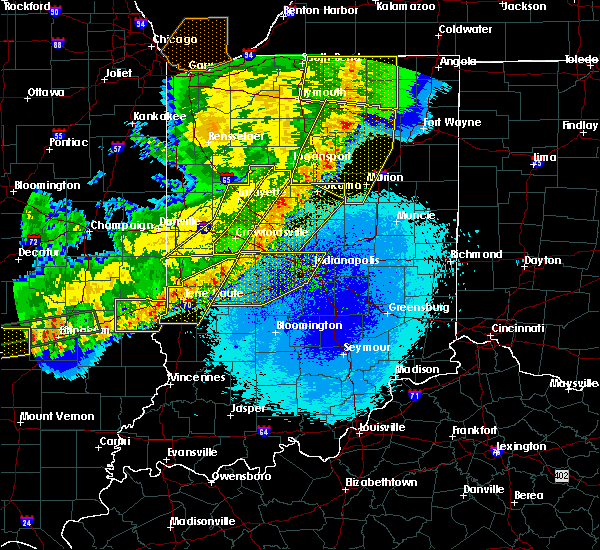 At 443 am edt, severe thunderstorms were located along a line extending from 11 miles northwest of danville to greencastle to brazil, moving east at 55 mph (radar indicated). Hazards include 70 mph wind gusts and penny size hail. Expect considerable tree damage. damage is likely to mobile homes, roofs, and outbuildings. locations impacted include, indianapolis, plainfield, brownsburg, speedway, greencastle, mooresville, danville, avon, pittsboro, cloverdale, meridian hills, clermont, monrovia, clayton, bainbridge, harmony, rocky ripple, fillmore, coatesville and north salem. this includes the following highways, interstate 65 between mile markers 111 and 127. interstate 70 between mile markers 23 and 84. Interstate 74 between mile markers 55 and 73. At 443 am edt, severe thunderstorms were located along a line extending from 11 miles northwest of danville to greencastle to brazil, moving east at 55 mph (radar indicated). Hazards include 70 mph wind gusts and penny size hail. Expect considerable tree damage. damage is likely to mobile homes, roofs, and outbuildings. locations impacted include, indianapolis, plainfield, brownsburg, speedway, greencastle, mooresville, danville, avon, pittsboro, cloverdale, meridian hills, clermont, monrovia, clayton, bainbridge, harmony, rocky ripple, fillmore, coatesville and north salem. this includes the following highways, interstate 65 between mile markers 111 and 127. interstate 70 between mile markers 23 and 84. Interstate 74 between mile markers 55 and 73.
|
| 5/23/2019 4:17 AM EDT |
 At 416 am edt, severe thunderstorms were located along a line extending from 12 miles northeast of rockville to 8 miles northwest of brazil to near dennison, moving east at 55 mph (radar indicated). Hazards include 70 mph wind gusts and penny size hail. Expect considerable tree damage. Damage is likely to mobile homes, roofs, and outbuildings. At 416 am edt, severe thunderstorms were located along a line extending from 12 miles northeast of rockville to 8 miles northwest of brazil to near dennison, moving east at 55 mph (radar indicated). Hazards include 70 mph wind gusts and penny size hail. Expect considerable tree damage. Damage is likely to mobile homes, roofs, and outbuildings.
|
| 5/19/2019 6:06 PM EDT |
 The severe thunderstorm warning for southeastern vigo, clay, southeastern parke, central owen and southern putnam counties will expire at 615 pm edt, the storms which prompted the warning have weakened below severe limits, and no longer pose an immediate threat to life or property. therefore, the warning will be allowed to expire. however gusty winds are still possible with these thunderstorms. a severe thunderstorm watch remains in effect until 1000 pm edt for west central indiana. The severe thunderstorm warning for southeastern vigo, clay, southeastern parke, central owen and southern putnam counties will expire at 615 pm edt, the storms which prompted the warning have weakened below severe limits, and no longer pose an immediate threat to life or property. therefore, the warning will be allowed to expire. however gusty winds are still possible with these thunderstorms. a severe thunderstorm watch remains in effect until 1000 pm edt for west central indiana.
|
| 5/19/2019 5:59 PM EDT |
 At 558 pm edt, severe thunderstorms were located along a line extending from 11 miles southeast of crawfordsville to 6 miles southwest of greencastle, moving east at 35 mph (radar indicated). Hazards include 60 mph wind gusts and quarter size hail. Hail damage to vehicles is expected. Expect wind damage to roofs, siding, and trees. At 558 pm edt, severe thunderstorms were located along a line extending from 11 miles southeast of crawfordsville to 6 miles southwest of greencastle, moving east at 35 mph (radar indicated). Hazards include 60 mph wind gusts and quarter size hail. Hail damage to vehicles is expected. Expect wind damage to roofs, siding, and trees.
|
| 5/19/2019 5:43 PM EDT |
 At 543 pm edt, severe thunderstorms were located along a line extending from near brazil to 16 miles southeast of terre haute, moving east at 40 mph (radar indicated). Hazards include 60 mph wind gusts and quarter size hail. Hail damage to vehicles is expected. expect wind damage to roofs, siding, and trees. locations impacted include, greencastle, brazil, spencer, cloverdale, seelyville, knightsville, clay city, harmony, staunton, fillmore, carbon, center point, riley, quincy, bridgeton, reelsville, saline city, cagles mill lake, devore and bowling green. This includes interstate 70 between mile markers 14 and 46. At 543 pm edt, severe thunderstorms were located along a line extending from near brazil to 16 miles southeast of terre haute, moving east at 40 mph (radar indicated). Hazards include 60 mph wind gusts and quarter size hail. Hail damage to vehicles is expected. expect wind damage to roofs, siding, and trees. locations impacted include, greencastle, brazil, spencer, cloverdale, seelyville, knightsville, clay city, harmony, staunton, fillmore, carbon, center point, riley, quincy, bridgeton, reelsville, saline city, cagles mill lake, devore and bowling green. This includes interstate 70 between mile markers 14 and 46.
|
| 5/19/2019 5:27 PM EDT |
 At 527 pm edt, severe thunderstorms were located along a line extending from 6 miles southeast of clinton to 11 miles north of sullivan, moving east at 40 mph (radar indicated). Hazards include 60 mph wind gusts and quarter size hail. Hail damage to vehicles is expected. Expect wind damage to roofs, siding, and trees. At 527 pm edt, severe thunderstorms were located along a line extending from 6 miles southeast of clinton to 11 miles north of sullivan, moving east at 40 mph (radar indicated). Hazards include 60 mph wind gusts and quarter size hail. Hail damage to vehicles is expected. Expect wind damage to roofs, siding, and trees.
|
| 6/10/2018 5:00 PM EDT |
 At 459 pm edt, severe thunderstorms were located along a line extending from 9 miles west of danville to 11 miles south of greencastle to 9 miles northwest of spencer to 15 miles southeast of terre haute, moving east at 60 mph (radar indicated). Hazards include 60 mph wind gusts. Expect damage to roofs, siding, and trees. locations impacted include, plainfield, brownsburg, martinsville, greencastle, mooresville, danville, spencer, avon, pittsboro, cloverdale, brooklyn, monrovia, clayton, clay city, gosport, paragon, fillmore, coatesville, north salem and lizton. this includes the following highways, interstate 70 between mile markers 31 and 68. Interstate 74 between mile markers 55 and 69. At 459 pm edt, severe thunderstorms were located along a line extending from 9 miles west of danville to 11 miles south of greencastle to 9 miles northwest of spencer to 15 miles southeast of terre haute, moving east at 60 mph (radar indicated). Hazards include 60 mph wind gusts. Expect damage to roofs, siding, and trees. locations impacted include, plainfield, brownsburg, martinsville, greencastle, mooresville, danville, spencer, avon, pittsboro, cloverdale, brooklyn, monrovia, clayton, clay city, gosport, paragon, fillmore, coatesville, north salem and lizton. this includes the following highways, interstate 70 between mile markers 31 and 68. Interstate 74 between mile markers 55 and 69.
|
| 6/10/2018 4:48 PM EDT |
 At 448 pm edt, a severe thunderstorm capable of producing a tornado was located 8 miles north of greencastle, or 19 miles south of crawfordsville, moving east at 45 mph (radar indicated rotation). Hazards include tornado. Flying debris will be dangerous to those caught without shelter. mobile homes will be damaged or destroyed. damage to roofs, windows, and vehicles will occur. tree damage is likely. This dangerous storm will be near, fillmore around 455 pm edt. At 448 pm edt, a severe thunderstorm capable of producing a tornado was located 8 miles north of greencastle, or 19 miles south of crawfordsville, moving east at 45 mph (radar indicated rotation). Hazards include tornado. Flying debris will be dangerous to those caught without shelter. mobile homes will be damaged or destroyed. damage to roofs, windows, and vehicles will occur. tree damage is likely. This dangerous storm will be near, fillmore around 455 pm edt.
|
| 6/10/2018 4:47 PM EDT | One tree or large branch blown down in greencastle. location approximate. time based on radar. report received via twitte in putnam county IN, 0.4 miles WNW of Greencastle, IN |
| 6/10/2018 4:46 PM EDT |
 At 445 pm edt, severe thunderstorms were located along a line extending from 10 miles southeast of crawfordsville to 7 miles southwest of greencastle to near terre haute, moving east at 50 mph (radar indicated). Hazards include 60 mph wind gusts. expect damage to roofs, siding, and trees At 445 pm edt, severe thunderstorms were located along a line extending from 10 miles southeast of crawfordsville to 7 miles southwest of greencastle to near terre haute, moving east at 50 mph (radar indicated). Hazards include 60 mph wind gusts. expect damage to roofs, siding, and trees
|
| 6/10/2018 4:38 PM EDT |
 At 438 pm edt, a severe thunderstorm capable of producing a tornado was located 9 miles northwest of greencastle, or 20 miles south of crawfordsville, moving southeast at 55 mph (radar indicated rotation). Hazards include tornado. Flying debris will be dangerous to those caught without shelter. mobile homes will be damaged or destroyed. damage to roofs, windows, and vehicles will occur. tree damage is likely. this dangerous storm will be near, greencastle and bainbridge around 445 pm edt. fillmore around 450 pm edt. This includes interstate 70 between mile markers 39 and 40. At 438 pm edt, a severe thunderstorm capable of producing a tornado was located 9 miles northwest of greencastle, or 20 miles south of crawfordsville, moving southeast at 55 mph (radar indicated rotation). Hazards include tornado. Flying debris will be dangerous to those caught without shelter. mobile homes will be damaged or destroyed. damage to roofs, windows, and vehicles will occur. tree damage is likely. this dangerous storm will be near, greencastle and bainbridge around 445 pm edt. fillmore around 450 pm edt. This includes interstate 70 between mile markers 39 and 40.
|
| 6/10/2018 4:32 PM EDT | In the vicinity of county road 880 west and county road 750 north scattered tree limbs were down and a couple trees snapped about halfway their trunks. in the same gene in putnam county IN, 12.4 miles SE of Greencastle, IN |
| 5/28/2018 3:14 PM EDT |
 At 314 pm edt, a severe thunderstorm was located 8 miles northwest of greencastle, or 23 miles south of crawfordsville, moving southwest at 10 mph (emergency management). Hazards include 60 mph wind gusts. Expect damage to roofs, siding, and trees. Locations impacted include, greencastle and bainbridge. At 314 pm edt, a severe thunderstorm was located 8 miles northwest of greencastle, or 23 miles south of crawfordsville, moving southwest at 10 mph (emergency management). Hazards include 60 mph wind gusts. Expect damage to roofs, siding, and trees. Locations impacted include, greencastle and bainbridge.
|
| 5/28/2018 3:00 PM EDT | Measured 59 mph gust with instrument on vehicle. on cr 350 in putnam county IN, 6.1 miles SE of Greencastle, IN |
| 5/28/2018 2:55 PM EDT | Power lines knocked down by downed trees and blocking the roa in putnam county IN, 6.4 miles SSE of Greencastle, IN |
| 5/28/2018 2:54 PM EDT |
 At 254 pm edt, a severe thunderstorm was located 7 miles north of greencastle, or 20 miles south of crawfordsville, moving southwest at 10 mph (emergency management). Hazards include 60 mph wind gusts and quarter size hail. Hail damage to vehicles is expected. Expect wind damage to roofs, siding, and trees. At 254 pm edt, a severe thunderstorm was located 7 miles north of greencastle, or 20 miles south of crawfordsville, moving southwest at 10 mph (emergency management). Hazards include 60 mph wind gusts and quarter size hail. Hail damage to vehicles is expected. Expect wind damage to roofs, siding, and trees.
|
| 5/28/2018 2:52 PM EDT | Road was partially blocked by downed trees. has since been cleared. time estimated based on rada in putnam county IN, 5.5 miles SSE of Greencastle, IN |
| 5/28/2018 2:52 PM EDT | Road blocked by downed trees. time estimated from rada in putnam county IN, 6.3 miles SSE of Greencastle, IN |
| 5/28/2018 2:51 PM EDT | Wind gust of 52 mph at brick chapel north of greencastl in putnam county IN, 4.9 miles SSE of Greencastle, IN |
| 1/22/2018 8:06 PM EST | Tree blown down. approximate locatio in putnam county IN, 0.4 miles WNW of Greencastle, IN |
| 11/5/2017 7:26 PM EDT |
 The severe thunderstorm warning for eastern vigo, northern clay and southwestern putnam counties will expire at 630 pm est, the storm which prompted the warning has weakened below severe limits, and no longer poses an immediate threat to life or property. therefore the warning will be allowed to expire. however heavy rain is still possible with this thunderstorm. a tornado watch remains in effect until 700 pm est for west central indiana. The severe thunderstorm warning for eastern vigo, northern clay and southwestern putnam counties will expire at 630 pm est, the storm which prompted the warning has weakened below severe limits, and no longer poses an immediate threat to life or property. therefore the warning will be allowed to expire. however heavy rain is still possible with this thunderstorm. a tornado watch remains in effect until 700 pm est for west central indiana.
|
| 11/5/2017 7:13 PM EDT |
 At 612 pm est, a severe thunderstorm was located 7 miles northeast of brazil, or 21 miles northeast of terre haute, moving northeast at 50 mph (radar indicated). Hazards include 60 mph wind gusts and quarter size hail. Hail damage to vehicles is expected. expect wind damage to roofs, siding, and trees. locations impacted include, terre haute, greencastle, brazil, cloverdale, seelyville, knightsville, harmony, staunton, carbon, center point, riley, lena, reelsville, cory, saline city and pimento. this includes interstate 70 between mile markers 8 and 41. A tornado watch remains in effect until 700 pm est for west central indiana. At 612 pm est, a severe thunderstorm was located 7 miles northeast of brazil, or 21 miles northeast of terre haute, moving northeast at 50 mph (radar indicated). Hazards include 60 mph wind gusts and quarter size hail. Hail damage to vehicles is expected. expect wind damage to roofs, siding, and trees. locations impacted include, terre haute, greencastle, brazil, cloverdale, seelyville, knightsville, harmony, staunton, carbon, center point, riley, lena, reelsville, cory, saline city and pimento. this includes interstate 70 between mile markers 8 and 41. A tornado watch remains in effect until 700 pm est for west central indiana.
|
| 11/5/2017 6:43 PM EDT |
 At 543 pm est, a severe thunderstorm was located near terre haute, moving northeast at 50 mph (radar indicated). Hazards include 60 mph wind gusts and quarter size hail. Hail damage to vehicles is expected. Expect wind damage to roofs, siding, and trees. At 543 pm est, a severe thunderstorm was located near terre haute, moving northeast at 50 mph (radar indicated). Hazards include 60 mph wind gusts and quarter size hail. Hail damage to vehicles is expected. Expect wind damage to roofs, siding, and trees.
|
| 7/11/2017 12:02 PM EDT |
 At 1202 pm edt, severe thunderstorms were located along a line extending from near crawfordsville to 8 miles east of rockville, moving east at 70 mph. this storm has a history of producing winds in excess of 60 mph (trained weather spotters). Hazards include 70 mph wind gusts. Expect considerable tree damage. damage is likely to mobile homes, roofs, and outbuildings. locations impacted include, crawfordsville, greencastle, rockville, ladoga, waynetown, roachdale, darlington, bainbridge, new market, hillsboro, waveland, russellville, bloomingdale, marshall, wallace, alamo, carpentersville, cecil harden lake, turkey run state park and shades state park. This includes interstate 74 between mile markers 19 and 43. At 1202 pm edt, severe thunderstorms were located along a line extending from near crawfordsville to 8 miles east of rockville, moving east at 70 mph. this storm has a history of producing winds in excess of 60 mph (trained weather spotters). Hazards include 70 mph wind gusts. Expect considerable tree damage. damage is likely to mobile homes, roofs, and outbuildings. locations impacted include, crawfordsville, greencastle, rockville, ladoga, waynetown, roachdale, darlington, bainbridge, new market, hillsboro, waveland, russellville, bloomingdale, marshall, wallace, alamo, carpentersville, cecil harden lake, turkey run state park and shades state park. This includes interstate 74 between mile markers 19 and 43.
|
| 7/11/2017 11:47 AM EDT |
 At 1146 am edt, severe thunderstorms were located along a line extending from veedersburg to near newport, moving east at 50 mph. at 1137 am edt, trained spotters reported winds in excess of 60 mph in perrysville (trained weather spotters). Hazards include 70 mph wind gusts. Expect considerable tree damage. damage is likely to mobile homes, roofs, and outbuildings. locations impacted include, crawfordsville, greencastle, covington, rockville, veedersburg, newport, cayuga, montezuma, ladoga, waynetown, roachdale, darlington, bainbridge, new market, dana, hillsboro, kingman, waveland, russellville and bloomingdale. This includes interstate 74 between mile markers 8 and 43. At 1146 am edt, severe thunderstorms were located along a line extending from veedersburg to near newport, moving east at 50 mph. at 1137 am edt, trained spotters reported winds in excess of 60 mph in perrysville (trained weather spotters). Hazards include 70 mph wind gusts. Expect considerable tree damage. damage is likely to mobile homes, roofs, and outbuildings. locations impacted include, crawfordsville, greencastle, covington, rockville, veedersburg, newport, cayuga, montezuma, ladoga, waynetown, roachdale, darlington, bainbridge, new market, dana, hillsboro, kingman, waveland, russellville and bloomingdale. This includes interstate 74 between mile markers 8 and 43.
|
| 7/11/2017 11:28 AM EDT |
 At 1127 am edt, severe thunderstorms were located along a line extending from near danville to near ridge farm, moving east at 50 mph (radar indicated). Hazards include 70 mph wind gusts. Expect considerable tree damage. Damage is likely to mobile homes, roofs, and outbuildings. At 1127 am edt, severe thunderstorms were located along a line extending from near danville to near ridge farm, moving east at 50 mph (radar indicated). Hazards include 70 mph wind gusts. Expect considerable tree damage. Damage is likely to mobile homes, roofs, and outbuildings.
|
| 7/7/2017 6:24 PM EDT |
 At 624 pm edt, a severe thunderstorm was located 7 miles east of clinton, or 13 miles northeast of terre haute, moving southeast at 25 mph (radar indicated). Hazards include 60 mph wind gusts and quarter size hail. Hail damage to vehicles is expected. Expect wind damage to roofs, siding, and trees. At 624 pm edt, a severe thunderstorm was located 7 miles east of clinton, or 13 miles northeast of terre haute, moving southeast at 25 mph (radar indicated). Hazards include 60 mph wind gusts and quarter size hail. Hail damage to vehicles is expected. Expect wind damage to roofs, siding, and trees.
|
| 7/7/2017 5:41 PM EDT |
 At 541 pm edt, severe thunderstorms were located along a line extending from near speedway to 10 miles northwest of greencastle, moving southeast at 40 mph (radar indicated). Hazards include 60 mph wind gusts and quarter size hail. Hail damage to vehicles is expected. expect wind damage to roofs, siding, and trees. locations impacted include, indianapolis, plainfield, brownsburg, beech grove, speedway, greencastle, mooresville, danville, rockville, southport, avon, pittsboro, clermont, monrovia, clayton, roachdale, bainbridge, homecroft, fillmore and coatesville. this includes the following highways, interstate 65 between mile markers 102 and 114, and between mile markers 116 and 127. interstate 70 between mile markers 50 and 83. Interstate 74 between mile markers 55 and 73. At 541 pm edt, severe thunderstorms were located along a line extending from near speedway to 10 miles northwest of greencastle, moving southeast at 40 mph (radar indicated). Hazards include 60 mph wind gusts and quarter size hail. Hail damage to vehicles is expected. expect wind damage to roofs, siding, and trees. locations impacted include, indianapolis, plainfield, brownsburg, beech grove, speedway, greencastle, mooresville, danville, rockville, southport, avon, pittsboro, clermont, monrovia, clayton, roachdale, bainbridge, homecroft, fillmore and coatesville. this includes the following highways, interstate 65 between mile markers 102 and 114, and between mile markers 116 and 127. interstate 70 between mile markers 50 and 83. Interstate 74 between mile markers 55 and 73.
|
| 7/7/2017 5:29 PM EDT |
 At 529 pm edt, severe thunderstorms were located along a line extending from near brownsburg to 7 miles east of rockville, moving southeast at 40 mph (radar indicated). Hazards include 60 mph wind gusts and quarter size hail. Hail damage to vehicles is expected. Expect wind damage to roofs, siding, and trees. At 529 pm edt, severe thunderstorms were located along a line extending from near brownsburg to 7 miles east of rockville, moving southeast at 40 mph (radar indicated). Hazards include 60 mph wind gusts and quarter size hail. Hail damage to vehicles is expected. Expect wind damage to roofs, siding, and trees.
|
| 7/7/2017 4:05 PM EDT |
 At 405 pm edt, a severe thunderstorm was located near greencastle, or 27 miles east of terre haute, moving southeast at 25 mph (radar indicated). Hazards include 60 mph wind gusts and quarter size hail. Hail damage to vehicles is expected. Expect wind damage to roofs, siding, and trees. At 405 pm edt, a severe thunderstorm was located near greencastle, or 27 miles east of terre haute, moving southeast at 25 mph (radar indicated). Hazards include 60 mph wind gusts and quarter size hail. Hail damage to vehicles is expected. Expect wind damage to roofs, siding, and trees.
|
| 5/10/2017 11:09 PM EDT |
 At 1108 pm edt, severe thunderstorms were located along a line extending from 6 miles southwest of danville to 7 miles west of martinsville to 8 miles northeast of bloomfield, moving east at 60 mph (radar indicated). Hazards include 70 mph wind gusts. Expect considerable tree damage. damage is likely to mobile homes, roofs, and outbuildings. locations impacted include, bloomington, plainfield, martinsville, greencastle, mooresville, danville, spencer, avon, ellettsville, jasonville, cloverdale, brooklyn, worthington, monrovia, clayton, clay city, gosport, bainbridge, paragon and fillmore. This includes interstate 70 between mile markers 36 and 68. At 1108 pm edt, severe thunderstorms were located along a line extending from 6 miles southwest of danville to 7 miles west of martinsville to 8 miles northeast of bloomfield, moving east at 60 mph (radar indicated). Hazards include 70 mph wind gusts. Expect considerable tree damage. damage is likely to mobile homes, roofs, and outbuildings. locations impacted include, bloomington, plainfield, martinsville, greencastle, mooresville, danville, spencer, avon, ellettsville, jasonville, cloverdale, brooklyn, worthington, monrovia, clayton, clay city, gosport, bainbridge, paragon and fillmore. This includes interstate 70 between mile markers 36 and 68.
|
| 5/10/2017 10:59 PM EDT |
 At 1058 pm edt, severe thunderstorms were located along a line extending from 16 miles south of crawfordsville to 10 miles southeast of greencastle to 10 miles northwest of bloomfield, moving east at 55 mph (radar indicated). Hazards include 60 mph wind gusts. Expect damage to roofs, siding, and trees. locations impacted include, bloomington, plainfield, martinsville, greencastle, mooresville, danville, spencer, avon, ellettsville, jasonville, cloverdale, brooklyn, worthington, monrovia, clayton, clay city, gosport, bainbridge, paragon and fillmore. This includes interstate 70 between mile markers 25 and 68. At 1058 pm edt, severe thunderstorms were located along a line extending from 16 miles south of crawfordsville to 10 miles southeast of greencastle to 10 miles northwest of bloomfield, moving east at 55 mph (radar indicated). Hazards include 60 mph wind gusts. Expect damage to roofs, siding, and trees. locations impacted include, bloomington, plainfield, martinsville, greencastle, mooresville, danville, spencer, avon, ellettsville, jasonville, cloverdale, brooklyn, worthington, monrovia, clayton, clay city, gosport, bainbridge, paragon and fillmore. This includes interstate 70 between mile markers 25 and 68.
|
| 5/10/2017 10:46 PM EDT |
 At 1045 pm edt, severe thunderstorms were located along a line extending from 10 miles northeast of rockville to 9 miles southwest of greencastle to 15 miles north of linton, moving east at 55 mph (radar indicated). Hazards include 60 mph wind gusts. expect damage to roofs, siding, and trees At 1045 pm edt, severe thunderstorms were located along a line extending from 10 miles northeast of rockville to 9 miles southwest of greencastle to 15 miles north of linton, moving east at 55 mph (radar indicated). Hazards include 60 mph wind gusts. expect damage to roofs, siding, and trees
|
| 4/29/2017 10:25 PM EDT |
 The severe thunderstorm warning for northwestern morgan, southwestern hendricks, eastern clay, owen and southern putnam counties will expire at 1030 pm edt, the storm which prompted the warning has weakened below severe limits, and no longer poses an immediate threat to life or property. therefore, the warning will be allowed to expire. The severe thunderstorm warning for northwestern morgan, southwestern hendricks, eastern clay, owen and southern putnam counties will expire at 1030 pm edt, the storm which prompted the warning has weakened below severe limits, and no longer poses an immediate threat to life or property. therefore, the warning will be allowed to expire.
|
| 4/29/2017 9:54 PM EDT |
 At 954 pm edt, a severe thunderstorm was located 12 miles north of spencer, or 25 miles northwest of bloomington, moving north at 20 mph (radar indicated). Hazards include 60 mph wind gusts and quarter size hail. Hail damage to vehicles is expected. expect wind damage to roofs, siding, and trees. locations impacted include, greencastle, spencer, cloverdale, gosport, fillmore, coatesville, amo, stilesville, coal city, bowling green, quincy, mccormicks creek state park, freedom, belle union, patricksburg, reelsville, little point, eminence, cagles mill lake and devore. This includes interstate 70 between mile markers 29 and 52. At 954 pm edt, a severe thunderstorm was located 12 miles north of spencer, or 25 miles northwest of bloomington, moving north at 20 mph (radar indicated). Hazards include 60 mph wind gusts and quarter size hail. Hail damage to vehicles is expected. expect wind damage to roofs, siding, and trees. locations impacted include, greencastle, spencer, cloverdale, gosport, fillmore, coatesville, amo, stilesville, coal city, bowling green, quincy, mccormicks creek state park, freedom, belle union, patricksburg, reelsville, little point, eminence, cagles mill lake and devore. This includes interstate 70 between mile markers 29 and 52.
|
| 4/29/2017 9:44 PM EDT |
 At 943 pm edt, a severe thunderstorm was located 11 miles south of greencastle, or 25 miles northwest of bloomington, moving northeast at 60 mph (radar indicated). Hazards include 60 mph wind gusts and quarter size hail. Hail damage to vehicles is expected. Expect wind damage to roofs, siding, and trees. At 943 pm edt, a severe thunderstorm was located 11 miles south of greencastle, or 25 miles northwest of bloomington, moving northeast at 60 mph (radar indicated). Hazards include 60 mph wind gusts and quarter size hail. Hail damage to vehicles is expected. Expect wind damage to roofs, siding, and trees.
|
| 4/26/2017 6:59 PM EDT |
 At 659 pm edt, a severe thunderstorm was located near greencastle, or 24 miles south of crawfordsville, moving northeast at 50 mph (radar indicated). Hazards include 70 mph wind gusts. Expect considerable tree damage. Damage is likely to mobile homes, roofs, and outbuildings. At 659 pm edt, a severe thunderstorm was located near greencastle, or 24 miles south of crawfordsville, moving northeast at 50 mph (radar indicated). Hazards include 70 mph wind gusts. Expect considerable tree damage. Damage is likely to mobile homes, roofs, and outbuildings.
|
| 4/26/2017 6:41 PM EDT |
 At 640 pm edt, severe thunderstorms were located along a line extending from near rockville to 9 miles northwest of spencer, moving northeast at 45 mph. these are very dangerous storms (radar indicated). Hazards include 80 mph wind gusts and penny size hail. Flying debris will be dangerous to those caught without shelter. mobile homes will be heavily damaged. expect considerable damage to roofs, windows, and vehicles. extensive tree damage and power outages are likely. locations impacted include, greencastle, brazil, rockville, cloverdale, knightsville, harmony, carbon, bloomingdale, marshall, center point, bowling green, quincy, lena, cecil harden lake, bridgeton, reelsville, cagles mill lake, devore and judson. This includes interstate 70 between mile markers 24 and 43. At 640 pm edt, severe thunderstorms were located along a line extending from near rockville to 9 miles northwest of spencer, moving northeast at 45 mph. these are very dangerous storms (radar indicated). Hazards include 80 mph wind gusts and penny size hail. Flying debris will be dangerous to those caught without shelter. mobile homes will be heavily damaged. expect considerable damage to roofs, windows, and vehicles. extensive tree damage and power outages are likely. locations impacted include, greencastle, brazil, rockville, cloverdale, knightsville, harmony, carbon, bloomingdale, marshall, center point, bowling green, quincy, lena, cecil harden lake, bridgeton, reelsville, cagles mill lake, devore and judson. This includes interstate 70 between mile markers 24 and 43.
|
| 4/26/2017 6:35 PM EDT | Multiple trees down across county roads. 231 between greencastle and 40 closed due to multiple trees and power lines down. 1 inch hail reported also. time estimate in putnam county IN, 2.2 miles N of Greencastle, IN |
| 4/26/2017 6:24 PM EDT |
 The national weather service in indianapolis has issued a * severe thunderstorm warning for. eastern vigo county in west central indiana. clay county in west central indiana. parke county in west central indiana. Northern owen county in west central indiana. The national weather service in indianapolis has issued a * severe thunderstorm warning for. eastern vigo county in west central indiana. clay county in west central indiana. parke county in west central indiana. Northern owen county in west central indiana.
|
| 4/26/2017 6:24 PM EDT |
 At 624 pm edt, severe thunderstorms were located along a line extending from near clinton to 16 miles south of brazil, moving northeast at 45 mph (radar indicated). Hazards include 70 mph wind gusts and penny size hail. Expect considerable tree damage. Damage is likely to mobile homes, roofs, and outbuildings. At 624 pm edt, severe thunderstorms were located along a line extending from near clinton to 16 miles south of brazil, moving northeast at 45 mph (radar indicated). Hazards include 70 mph wind gusts and penny size hail. Expect considerable tree damage. Damage is likely to mobile homes, roofs, and outbuildings.
|
| 4/20/2017 4:44 PM EDT |
 At 443 pm edt, a severe thunderstorm was located 8 miles southwest of greencastle, or 23 miles east of terre haute, moving east at 35 mph (radar indicated). Hazards include 60 mph wind gusts and quarter size hail. Hail damage to vehicles is expected. Expect wind damage to roofs, siding, and trees. At 443 pm edt, a severe thunderstorm was located 8 miles southwest of greencastle, or 23 miles east of terre haute, moving east at 35 mph (radar indicated). Hazards include 60 mph wind gusts and quarter size hail. Hail damage to vehicles is expected. Expect wind damage to roofs, siding, and trees.
|
| 4/20/2017 4:33 PM EDT |
 At 433 pm edt, a severe thunderstorm was located near brazil, or 17 miles east of terre haute, moving east at 40 mph (radar indicated). Hazards include 60 mph wind gusts and quarter size hail. Hail damage to vehicles is expected. expect wind damage to roofs, siding, and trees. locations impacted include, greencastle, brazil, seelyville, knightsville, rosedale, harmony, staunton, carbon, fontanet, bridgeton, reelsville and lena. This includes interstate 70 between mile markers 26 and 39. At 433 pm edt, a severe thunderstorm was located near brazil, or 17 miles east of terre haute, moving east at 40 mph (radar indicated). Hazards include 60 mph wind gusts and quarter size hail. Hail damage to vehicles is expected. expect wind damage to roofs, siding, and trees. locations impacted include, greencastle, brazil, seelyville, knightsville, rosedale, harmony, staunton, carbon, fontanet, bridgeton, reelsville and lena. This includes interstate 70 between mile markers 26 and 39.
|
| 4/20/2017 4:22 PM EDT |
 At 422 pm edt, a severe thunderstorm was located near brazil, or 12 miles northeast of terre haute, moving east at 35 mph (radar indicated). Hazards include quarter size hail. damage to vehicles is expected At 422 pm edt, a severe thunderstorm was located near brazil, or 12 miles northeast of terre haute, moving east at 35 mph (radar indicated). Hazards include quarter size hail. damage to vehicles is expected
|
| 11/18/2016 5:28 PM EST |
 At 527 pm est, severe thunderstorms were located along a line extending from 14 miles southeast of crawfordsville to 7 miles southwest of bloomfield, moving east at 50 mph (radar indicated). Hazards include 70 mph wind gusts. Expect considerable tree damage. damage is likely to mobile homes, roofs, and outbuildings. locations impacted include, greencastle, brazil, linton, bloomfield, spencer, jasonville, cloverdale, worthington, ladoga, roachdale, dugger, knightsville, clay city, bainbridge, lyons, harmony, new market, fillmore, carbon and russellville. This includes interstate 70 between mile markers 21 and 47. At 527 pm est, severe thunderstorms were located along a line extending from 14 miles southeast of crawfordsville to 7 miles southwest of bloomfield, moving east at 50 mph (radar indicated). Hazards include 70 mph wind gusts. Expect considerable tree damage. damage is likely to mobile homes, roofs, and outbuildings. locations impacted include, greencastle, brazil, linton, bloomfield, spencer, jasonville, cloverdale, worthington, ladoga, roachdale, dugger, knightsville, clay city, bainbridge, lyons, harmony, new market, fillmore, carbon and russellville. This includes interstate 70 between mile markers 21 and 47.
|
| 11/18/2016 5:15 PM EST | One tree down west side in putnam county IN, 0.4 miles WNW of Greencastle, IN |
| 11/18/2016 5:09 PM EST |
 At 508 pm est, severe thunderstorms were located along a line extending from 11 miles northeast of rockville to 8 miles southwest of linton, moving east at 35 mph (radar indicated). Hazards include 70 mph wind gusts. Expect considerable tree damage. damage is likely to mobile homes, roofs, and outbuildings. locations impacted include, terre haute, greencastle, brazil, linton, sullivan, rockville, bloomfield, spencer, jasonville, cloverdale, worthington, shelburn, farmersburg, seelyville, ladoga, roachdale, dugger, knightsville, clay city and hymera. This includes interstate 70 between mile markers 10 and 47. At 508 pm est, severe thunderstorms were located along a line extending from 11 miles northeast of rockville to 8 miles southwest of linton, moving east at 35 mph (radar indicated). Hazards include 70 mph wind gusts. Expect considerable tree damage. damage is likely to mobile homes, roofs, and outbuildings. locations impacted include, terre haute, greencastle, brazil, linton, sullivan, rockville, bloomfield, spencer, jasonville, cloverdale, worthington, shelburn, farmersburg, seelyville, ladoga, roachdale, dugger, knightsville, clay city and hymera. This includes interstate 70 between mile markers 10 and 47.
|
| 11/18/2016 4:48 PM EST |
 At 447 pm est, severe thunderstorms were located along a line extending from 6 miles east of newport to 6 miles southeast of palestine, moving east at 30 mph (radar indicated). Hazards include 70 mph wind gusts. Expect considerable tree damage. Damage is likely to mobile homes, roofs, and outbuildings. At 447 pm est, severe thunderstorms were located along a line extending from 6 miles east of newport to 6 miles southeast of palestine, moving east at 30 mph (radar indicated). Hazards include 70 mph wind gusts. Expect considerable tree damage. Damage is likely to mobile homes, roofs, and outbuildings.
|
| 7/13/2016 7:57 PM EDT |
 At 756 pm edt, a severe thunderstorm was located near spencer, or 16 miles northwest of bloomington, moving east at 50 mph (radar indicated). Hazards include 60 mph wind gusts. Expect damage to roofs. siding. and trees. locations impacted include, washington, greencastle, bloomfield, spencer, shoals, loogootee, cloverdale, odon, roachdale, bainbridge, fillmore, russellville, montgomery, newberry, crane, cannelburg, alfordsville, west boggs lake, groveland and glendale fishery. This includes interstate 70 between mile markers 39 and 47. At 756 pm edt, a severe thunderstorm was located near spencer, or 16 miles northwest of bloomington, moving east at 50 mph (radar indicated). Hazards include 60 mph wind gusts. Expect damage to roofs. siding. and trees. locations impacted include, washington, greencastle, bloomfield, spencer, shoals, loogootee, cloverdale, odon, roachdale, bainbridge, fillmore, russellville, montgomery, newberry, crane, cannelburg, alfordsville, west boggs lake, groveland and glendale fishery. This includes interstate 70 between mile markers 39 and 47.
|
| 7/13/2016 7:46 PM EDT |
 At 746 pm edt, a severe thunderstorm was located near spencer, or 21 miles northwest of bloomington, moving east at 50 mph (radar indicated). Hazards include 60 mph wind gusts. Expect damage to roofs. siding. and trees. locations impacted include, washington, greencastle, linton, bloomfield, spencer, shoals, loogootee, cloverdale, worthington, odon, roachdale, bainbridge, lyons, elnora, fillmore, plainville, waveland, russellville, montgomery and switz city. This includes interstate 70 between mile markers 26 and 47. At 746 pm edt, a severe thunderstorm was located near spencer, or 21 miles northwest of bloomington, moving east at 50 mph (radar indicated). Hazards include 60 mph wind gusts. Expect damage to roofs. siding. and trees. locations impacted include, washington, greencastle, linton, bloomfield, spencer, shoals, loogootee, cloverdale, worthington, odon, roachdale, bainbridge, lyons, elnora, fillmore, plainville, waveland, russellville, montgomery and switz city. This includes interstate 70 between mile markers 26 and 47.
|
| 7/13/2016 7:27 PM EDT |
 At 726 pm edt, a severe thunderstorm was located 12 miles north of linton, or 20 miles southeast of terre haute, moving east at 50 mph (radar indicated). Hazards include 60 mph wind gusts. Expect damage to roofs. siding. And trees. At 726 pm edt, a severe thunderstorm was located 12 miles north of linton, or 20 miles southeast of terre haute, moving east at 50 mph (radar indicated). Hazards include 60 mph wind gusts. Expect damage to roofs. siding. And trees.
|
| 7/13/2016 6:42 PM EDT |
 The severe thunderstorm warning for north central clay, central putnam and southwestern hendricks counties will expire at 645 pm edt, the storm which prompted the warning has weakened below severe limits, and no longer poses an immediate threat to life or property. therefore, the warning will be allowed to expire. however small. The severe thunderstorm warning for north central clay, central putnam and southwestern hendricks counties will expire at 645 pm edt, the storm which prompted the warning has weakened below severe limits, and no longer poses an immediate threat to life or property. therefore, the warning will be allowed to expire. however small.
|
| 7/13/2016 6:39 PM EDT |
 At 639 pm edt, a severe thunderstorm was located 10 miles east of greencastle, or 29 miles southwest of indianapolis, moving northeast at 45 mph (radar indicated). Hazards include 60 mph wind gusts and penny size hail. Expect damage to roofs. siding. and trees. locations impacted include, martinsville, greencastle, danville, cloverdale, monrovia, clayton, fillmore, coatesville, amo, stilesville, belle union, devore, eminence, quincy, lake hart, centerton and little point. This includes interstate 70 between mile markers 39 and 62. At 639 pm edt, a severe thunderstorm was located 10 miles east of greencastle, or 29 miles southwest of indianapolis, moving northeast at 45 mph (radar indicated). Hazards include 60 mph wind gusts and penny size hail. Expect damage to roofs. siding. and trees. locations impacted include, martinsville, greencastle, danville, cloverdale, monrovia, clayton, fillmore, coatesville, amo, stilesville, belle union, devore, eminence, quincy, lake hart, centerton and little point. This includes interstate 70 between mile markers 39 and 62.
|
| 7/13/2016 6:35 PM EDT |
 At 634 pm edt, a severe thunderstorm was located near brazil, or 17 miles east of terre haute, moving northeast at 40 mph (radar indicated). Hazards include 60 mph wind gusts and quarter size hail. Hail damage to vehicles is expected. expect wind damage to roofs, siding, and trees. Locations impacted include, greencastle, brazil, knightsville, bainbridge, harmony, fillmore, coatesville, amo, lena, carpentersville, reelsville and groveland. At 634 pm edt, a severe thunderstorm was located near brazil, or 17 miles east of terre haute, moving northeast at 40 mph (radar indicated). Hazards include 60 mph wind gusts and quarter size hail. Hail damage to vehicles is expected. expect wind damage to roofs, siding, and trees. Locations impacted include, greencastle, brazil, knightsville, bainbridge, harmony, fillmore, coatesville, amo, lena, carpentersville, reelsville and groveland.
|
| 7/13/2016 6:32 PM EDT |
 At 632 pm edt, a severe thunderstorm was located 7 miles southeast of greencastle, or 29 miles northwest of bloomington, moving northeast at 50 mph (radar indicated). Hazards include 60 mph wind gusts and penny size hail. Expect damage to roofs. siding. And trees. At 632 pm edt, a severe thunderstorm was located 7 miles southeast of greencastle, or 29 miles northwest of bloomington, moving northeast at 50 mph (radar indicated). Hazards include 60 mph wind gusts and penny size hail. Expect damage to roofs. siding. And trees.
|
| 7/13/2016 6:23 PM EDT |
 At 623 pm edt, a severe thunderstorm was located near greencastle, or 25 miles east of terre haute, moving northeast at 45 mph (radar indicated). Hazards include 60 mph wind gusts and quarter size hail. Hail damage to vehicles is expected. expect wind damage to roofs, siding, and trees. locations impacted include, greencastle, brazil, roachdale, knightsville, bainbridge, harmony, staunton, fillmore, coatesville, amo, carbon, reelsville, groveland, lena and carpentersville. This includes interstate 70 between mile markers 18 and 22. At 623 pm edt, a severe thunderstorm was located near greencastle, or 25 miles east of terre haute, moving northeast at 45 mph (radar indicated). Hazards include 60 mph wind gusts and quarter size hail. Hail damage to vehicles is expected. expect wind damage to roofs, siding, and trees. locations impacted include, greencastle, brazil, roachdale, knightsville, bainbridge, harmony, staunton, fillmore, coatesville, amo, carbon, reelsville, groveland, lena and carpentersville. This includes interstate 70 between mile markers 18 and 22.
|
| 7/13/2016 6:11 PM EDT |
 At 611 pm edt, a severe thunderstorm was located near brazil, or 17 miles east of terre haute, moving northeast at 45 mph (radar indicated). Hazards include 60 mph wind gusts and quarter size hail. Hail damage to vehicles is expected. Expect wind damage to roofs, siding, and trees. At 611 pm edt, a severe thunderstorm was located near brazil, or 17 miles east of terre haute, moving northeast at 45 mph (radar indicated). Hazards include 60 mph wind gusts and quarter size hail. Hail damage to vehicles is expected. Expect wind damage to roofs, siding, and trees.
|
| 7/13/2016 6:06 PM EDT |
 At 606 pm edt, a severe thunderstorm was located 10 miles east of greencastle, or 28 miles southwest of indianapolis, moving east at 50 mph (radar indicated). Hazards include 60 mph wind gusts and quarter size hail. Hail damage to vehicles is expected. expect wind damage to roofs, siding, and trees. locations impacted include, indianapolis, plainfield, brownsburg, speedway, greencastle, mooresville, danville, avon, pittsboro, cloverdale, clermont, monrovia, clayton, fillmore, coatesville, amo, stilesville, indianapolis int`l airport, belle union and eminence. this includes the following highways, interstate 65 between mile markers 121 and 127. interstate 70 between mile markers 42 and 78. Interstate 74 between mile markers 62 and 73. At 606 pm edt, a severe thunderstorm was located 10 miles east of greencastle, or 28 miles southwest of indianapolis, moving east at 50 mph (radar indicated). Hazards include 60 mph wind gusts and quarter size hail. Hail damage to vehicles is expected. expect wind damage to roofs, siding, and trees. locations impacted include, indianapolis, plainfield, brownsburg, speedway, greencastle, mooresville, danville, avon, pittsboro, cloverdale, clermont, monrovia, clayton, fillmore, coatesville, amo, stilesville, indianapolis int`l airport, belle union and eminence. this includes the following highways, interstate 65 between mile markers 121 and 127. interstate 70 between mile markers 42 and 78. Interstate 74 between mile markers 62 and 73.
|
| 7/13/2016 6:01 PM EDT |
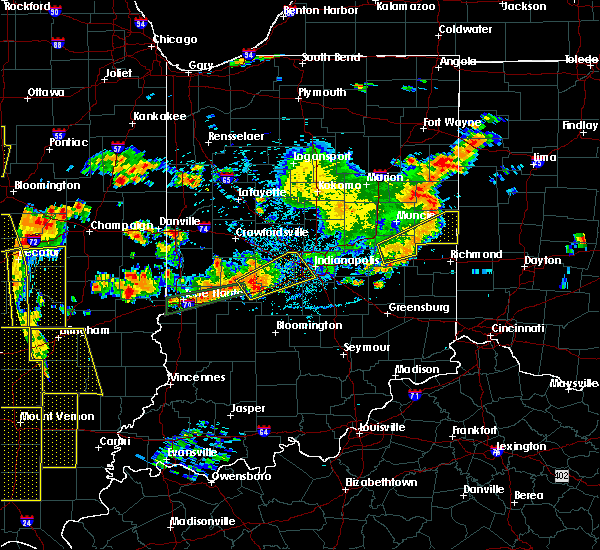 At 601 pm edt, a severe thunderstorm was located 7 miles east of greencastle, or 28 miles south of crawfordsville, moving northeast at 45 mph (radar indicated). Hazards include 60 mph wind gusts and quarter size hail. Hail damage to vehicles is expected. Expect wind damage to roofs, siding, and trees. At 601 pm edt, a severe thunderstorm was located 7 miles east of greencastle, or 28 miles south of crawfordsville, moving northeast at 45 mph (radar indicated). Hazards include 60 mph wind gusts and quarter size hail. Hail damage to vehicles is expected. Expect wind damage to roofs, siding, and trees.
|
| 6/15/2016 5:56 PM EDT | The severe thunderstorm warning for putnam, western greene, southeastern vigo, owen, western morgan, clay and sullivan counties will expire at 600 pm edt, the storms which prompted the warning have weakened below severe limits, and no longer pose an immediate threat to life or property. therefore the warning will be allowed to expire. however gusty winds and heavy rain are still possible with these thunderstorms. a severe thunderstorm watch remains in effect until 1100 pm edt for south central, west central, central and southwestern indiana. |
| 6/15/2016 5:46 PM EDT |
 At 546 pm edt, severe thunderstorms were located along a line extending from near danville to 7 miles south of sullivan, moving east at 45 mph (radar indicated). Hazards include 60 mph wind gusts. Expect damage to roofs. siding. and trees. locations impacted include, greencastle, brazil, linton, sullivan, bloomfield, spencer, jasonville, cloverdale, worthington, shelburn, farmersburg, dugger, knightsville, clay city, gosport, hymera, lyons, paragon, harmony and fillmore. This includes interstate 70 between mile markers 20 and 56. At 546 pm edt, severe thunderstorms were located along a line extending from near danville to 7 miles south of sullivan, moving east at 45 mph (radar indicated). Hazards include 60 mph wind gusts. Expect damage to roofs. siding. and trees. locations impacted include, greencastle, brazil, linton, sullivan, bloomfield, spencer, jasonville, cloverdale, worthington, shelburn, farmersburg, dugger, knightsville, clay city, gosport, hymera, lyons, paragon, harmony and fillmore. This includes interstate 70 between mile markers 20 and 56.
|
| 6/15/2016 5:30 PM EDT |
 At 529 pm edt, severe thunderstorms were located along a line extending from 9 miles north of greencastle to palestine, moving east at 45 mph (radar indicated). Hazards include 60 mph wind gusts. Expect damage to roofs. siding. And trees. At 529 pm edt, severe thunderstorms were located along a line extending from 9 miles north of greencastle to palestine, moving east at 45 mph (radar indicated). Hazards include 60 mph wind gusts. Expect damage to roofs. siding. And trees.
|
| 6/15/2016 5:18 PM EDT |
 At 518 pm edt, severe thunderstorms were located along a line extending from 9 miles northwest of greencastle to 7 miles north of sullivan, moving southeast at 40 mph (radar indicated). Hazards include 60 mph wind gusts. Expect damage to roofs. siding. and trees. locations impacted include, terre haute, greencastle, brazil, sullivan, west terre haute, jasonville, cloverdale, shelburn, prairieton, prairie creek, farmersburg, seelyville, knightsville, clay city, hymera, fairbanks, rosedale, carlisle, harmony and staunton. This includes interstate 70 between mile markers 5 and 47. At 518 pm edt, severe thunderstorms were located along a line extending from 9 miles northwest of greencastle to 7 miles north of sullivan, moving southeast at 40 mph (radar indicated). Hazards include 60 mph wind gusts. Expect damage to roofs. siding. and trees. locations impacted include, terre haute, greencastle, brazil, sullivan, west terre haute, jasonville, cloverdale, shelburn, prairieton, prairie creek, farmersburg, seelyville, knightsville, clay city, hymera, fairbanks, rosedale, carlisle, harmony and staunton. This includes interstate 70 between mile markers 5 and 47.
|
| 6/15/2016 5:05 PM EDT |
 At 505 pm edt, severe thunderstorms were located along a line extending from 10 miles northeast of rockville to 9 miles northeast of west union, moving southeast at 40 mph (radar indicated). Hazards include 60 mph wind gusts. Expect damage to roofs. siding. And trees. At 505 pm edt, severe thunderstorms were located along a line extending from 10 miles northeast of rockville to 9 miles northeast of west union, moving southeast at 40 mph (radar indicated). Hazards include 60 mph wind gusts. Expect damage to roofs. siding. And trees.
|
| 5/1/2016 9:10 PM EDT |
 At 909 pm edt, a severe thunderstorm was located near greencastle, or 22 miles south of crawfordsville, moving east at 35 mph (radar indicated). Hazards include quarter size hail. Damage to vehicles is expected. Locations impacted include, greencastle, bainbridge, fillmore, carpentersville, belle union and groveland. At 909 pm edt, a severe thunderstorm was located near greencastle, or 22 miles south of crawfordsville, moving east at 35 mph (radar indicated). Hazards include quarter size hail. Damage to vehicles is expected. Locations impacted include, greencastle, bainbridge, fillmore, carpentersville, belle union and groveland.
|
| 5/1/2016 9:01 PM EDT |
 At 900 pm edt, a severe thunderstorm was located 10 miles northwest of greencastle, or 24 miles south of crawfordsville, moving east at 35 mph (radar indicated). Hazards include golf ball size hail. People and animals outdoors will be injured. Expect damage to roofs, siding, windows, and vehicles. At 900 pm edt, a severe thunderstorm was located 10 miles northwest of greencastle, or 24 miles south of crawfordsville, moving east at 35 mph (radar indicated). Hazards include golf ball size hail. People and animals outdoors will be injured. Expect damage to roofs, siding, windows, and vehicles.
|
| 5/1/2016 8:40 PM EDT |
 At 840 pm edt, a severe thunderstorm capable of producing a tornado was located near greencastle, or 31 miles south of crawfordsville, moving east at 30 mph (radar indicated rotation). Hazards include tornado and ping pong ball size hail. Flying debris will be dangerous to those caught without shelter. mobile homes will be damaged or destroyed. damage to roofs, windows, and vehicles will occur. tree damage is likely. this dangerous storm will be near, belle union around 845 pm edt. coatesville, stilesville, little point and eminence around 855 pm edt. amo around 900 pm edt. This includes interstate 70 between mile markers 40 and 55. At 840 pm edt, a severe thunderstorm capable of producing a tornado was located near greencastle, or 31 miles south of crawfordsville, moving east at 30 mph (radar indicated rotation). Hazards include tornado and ping pong ball size hail. Flying debris will be dangerous to those caught without shelter. mobile homes will be damaged or destroyed. damage to roofs, windows, and vehicles will occur. tree damage is likely. this dangerous storm will be near, belle union around 845 pm edt. coatesville, stilesville, little point and eminence around 855 pm edt. amo around 900 pm edt. This includes interstate 70 between mile markers 40 and 55.
|
| 5/1/2016 8:38 PM EDT | Quarter sized hail reported 0.4 miles WNW of Greencastle, IN, broken windows from hail. |
| 5/1/2016 8:33 PM EDT |
 At 833 pm edt, a severe thunderstorm capable of producing a tornado was located near greencastle, or 30 miles east of terre haute, moving east at 35 mph (radar indicated rotation). Hazards include tornado and ping pong ball size hail. Flying debris will be dangerous to those caught without shelter. mobile homes will be damaged or destroyed. damage to roofs, windows, and vehicles will occur. tree damage is likely. this dangerous storm will be near, fillmore around 840 pm edt. belle union around 845 pm edt. coatesville, amo, stilesville, little point and eminence around 850 pm edt. This includes interstate 70 between mile markers 40 and 55. At 833 pm edt, a severe thunderstorm capable of producing a tornado was located near greencastle, or 30 miles east of terre haute, moving east at 35 mph (radar indicated rotation). Hazards include tornado and ping pong ball size hail. Flying debris will be dangerous to those caught without shelter. mobile homes will be damaged or destroyed. damage to roofs, windows, and vehicles will occur. tree damage is likely. this dangerous storm will be near, fillmore around 840 pm edt. belle union around 845 pm edt. coatesville, amo, stilesville, little point and eminence around 850 pm edt. This includes interstate 70 between mile markers 40 and 55.
|
| 5/1/2016 8:28 PM EDT |
 At 827 pm edt, a severe thunderstorm was located near greencastle, or 27 miles northeast of terre haute, moving east at 35 mph (trained weather spotters). Hazards include ping pong ball size hail. People and animals outdoors will be injured. expect damage to roofs, siding, windows, and vehicles. locations impacted include, greencastle, cloverdale, bainbridge, fillmore, belle union, reelsville and groveland. This includes interstate 70 between mile markers 36 and 47. At 827 pm edt, a severe thunderstorm was located near greencastle, or 27 miles northeast of terre haute, moving east at 35 mph (trained weather spotters). Hazards include ping pong ball size hail. People and animals outdoors will be injured. expect damage to roofs, siding, windows, and vehicles. locations impacted include, greencastle, cloverdale, bainbridge, fillmore, belle union, reelsville and groveland. This includes interstate 70 between mile markers 36 and 47.
|
| 5/1/2016 8:17 PM EDT |
 At 817 pm edt, a severe thunderstorm was located 8 miles west of greencastle, or 23 miles northeast of terre haute, moving east at 35 mph (trained weather spotters). Hazards include ping pong ball size hail. People and animals outdoors will be injured. expect damage to roofs, siding, windows, and vehicles. locations impacted include, greencastle, cloverdale, bainbridge, harmony, fillmore, carbon, belle union, lena, reelsville and groveland. This includes interstate 70 between mile markers 35 and 47. At 817 pm edt, a severe thunderstorm was located 8 miles west of greencastle, or 23 miles northeast of terre haute, moving east at 35 mph (trained weather spotters). Hazards include ping pong ball size hail. People and animals outdoors will be injured. expect damage to roofs, siding, windows, and vehicles. locations impacted include, greencastle, cloverdale, bainbridge, harmony, fillmore, carbon, belle union, lena, reelsville and groveland. This includes interstate 70 between mile markers 35 and 47.
|
| 5/1/2016 8:03 PM EDT |
 At 803 pm edt, a severe thunderstorm was located near brazil, or 15 miles northeast of terre haute, moving east at 35 mph (trained weather spotters). Hazards include golf ball size hail. People and animals outdoors will be injured. Expect damage to roofs, siding, windows, and vehicles. At 803 pm edt, a severe thunderstorm was located near brazil, or 15 miles northeast of terre haute, moving east at 35 mph (trained weather spotters). Hazards include golf ball size hail. People and animals outdoors will be injured. Expect damage to roofs, siding, windows, and vehicles.
|
| 7/17/2015 7:51 PM EDT |
 The severe thunderstorm warning for northeastern clay and southern putnam counties will expire at 800 pm edt, the storm which prompted the warning has weakened below severe limits, and no longer pose an immediate threat to life or property. therefore the warning will be allowed to expire. however gusty winds and heavy rain are still possible with this thunderstorm. The severe thunderstorm warning for northeastern clay and southern putnam counties will expire at 800 pm edt, the storm which prompted the warning has weakened below severe limits, and no longer pose an immediate threat to life or property. therefore the warning will be allowed to expire. however gusty winds and heavy rain are still possible with this thunderstorm.
|
| 7/17/2015 7:39 PM EDT |
 At 739 pm edt, a severe thunderstorm was located near greencastle, or 26 miles east of terre haute, moving east at 25 mph (radar indicated). Hazards include 60 mph wind gusts and quarter size hail. Hail damage to vehicles is expected. expect wind damage to roofs, siding and trees. locations impacted include, greencastle, brazil, cloverdale, knightsville, harmony, fillmore, carbon, belle union, lena and reelsville. This includes interstate 70 between mile markers 28 and 48. At 739 pm edt, a severe thunderstorm was located near greencastle, or 26 miles east of terre haute, moving east at 25 mph (radar indicated). Hazards include 60 mph wind gusts and quarter size hail. Hail damage to vehicles is expected. expect wind damage to roofs, siding and trees. locations impacted include, greencastle, brazil, cloverdale, knightsville, harmony, fillmore, carbon, belle union, lena and reelsville. This includes interstate 70 between mile markers 28 and 48.
|
| 7/17/2015 7:23 PM EDT |
 At 723 pm edt, a severe thunderstorm was located near brazil, or 19 miles east of terre haute, moving east at 25 mph (radar indicated). Hazards include 60 mph wind gusts and quarter size hail. Hail damage to vehicles is expected. Expect wind damage to roofs, siding and trees. At 723 pm edt, a severe thunderstorm was located near brazil, or 19 miles east of terre haute, moving east at 25 mph (radar indicated). Hazards include 60 mph wind gusts and quarter size hail. Hail damage to vehicles is expected. Expect wind damage to roofs, siding and trees.
|
| 7/13/2015 12:13 PM EDT |
 At 1210 pm edt, a severe thunderstorm was located 5 miles north of brazil, and moving southeast at 35 mph (radar indicated). Hazards include 60 mph wind gusts and quarter size hail. Hail damage to vehicles is expected. expect wind damage to roofs, siding and trees. locations impacted include, brazil, harmony, knightsville, staunton, reelsville, center point and saline city. This includes interstate 70 between mile markers 20 and 38. At 1210 pm edt, a severe thunderstorm was located 5 miles north of brazil, and moving southeast at 35 mph (radar indicated). Hazards include 60 mph wind gusts and quarter size hail. Hail damage to vehicles is expected. expect wind damage to roofs, siding and trees. locations impacted include, brazil, harmony, knightsville, staunton, reelsville, center point and saline city. This includes interstate 70 between mile markers 20 and 38.
|
| 7/13/2015 11:57 AM EDT |
 At 1154 am edt, a severe thunderstorm was located near rockville, and moving southeast at 35 mph (radar indicated). Hazards include 60 mph wind gusts and half dollar size hail. Hail damage to vehicles is expected. Expect wind damage to roofs, siding and trees. At 1154 am edt, a severe thunderstorm was located near rockville, and moving southeast at 35 mph (radar indicated). Hazards include 60 mph wind gusts and half dollar size hail. Hail damage to vehicles is expected. Expect wind damage to roofs, siding and trees.
|
| 7/13/2015 11:48 AM EDT |
 At 1146 am edt, severe thunderstorms were located along a line extending from lawrence to speedway to 9 miles east of greencastle, and moving southeast at 45 mph (radar indicated. 61 mph wind was reported at eagle creek airpark). Hazards include 70 mph wind gusts and penny size hail. Expect considerable tree damage. damage is likely to mobile homes, roofs and outbuildings. locations impacted include, beech grove, southport, stilesville, warren park, camby and homecroft. this includes interstate 65 between mile markers 102 and 135. this includes interstate 69 between mile markers 200 and 209. this includes interstate 70 between mile markers 62 and 93. This includes interstate 74 between mile markers 50 and 100. At 1146 am edt, severe thunderstorms were located along a line extending from lawrence to speedway to 9 miles east of greencastle, and moving southeast at 45 mph (radar indicated. 61 mph wind was reported at eagle creek airpark). Hazards include 70 mph wind gusts and penny size hail. Expect considerable tree damage. damage is likely to mobile homes, roofs and outbuildings. locations impacted include, beech grove, southport, stilesville, warren park, camby and homecroft. this includes interstate 65 between mile markers 102 and 135. this includes interstate 69 between mile markers 200 and 209. this includes interstate 70 between mile markers 62 and 93. This includes interstate 74 between mile markers 50 and 100.
|
| 7/13/2015 11:43 AM EDT |
 At 1140 am edt, a severe thunderstorm was located near rockville, and moving south at 35 mph (radar indicated). Hazards include ping pong ball size hail and 60 mph wind gusts. People and animals outdoors will be injured. expect hail damage to roofs, siding, windows and vehicles. expect wind damage to roofs, siding and trees. Locations impacted include, rockville, judson, russellville, mecca, cecil harden lake, bridgeton, rosedale and lena. At 1140 am edt, a severe thunderstorm was located near rockville, and moving south at 35 mph (radar indicated). Hazards include ping pong ball size hail and 60 mph wind gusts. People and animals outdoors will be injured. expect hail damage to roofs, siding, windows and vehicles. expect wind damage to roofs, siding and trees. Locations impacted include, rockville, judson, russellville, mecca, cecil harden lake, bridgeton, rosedale and lena.
|
| 7/13/2015 11:39 AM EDT |
 At 1137 am edt, severe thunderstorms were located along a line extending from fishers to speedway to 10 miles west of danville, and moving southeast at 45 mph (radar indicated. 65 mph wind was reported near noblesville. 60 mph wind was reported near brownsburg). Hazards include 70 mph wind gusts and penny size hail. Expect considerable tree damage. damage is likely to mobile homes, roofs and outbuildings. locations impacted include, indianapolis, danville, speedway, greencastle, lawrence, plainfield, beech grove, southport, castleton, wynnedale, spring hill, rocky ripple, crows nest, broad ripple, avon, geist reservoir, indiana state fairgrounds, fillmore, coatesville and amo. this includes interstate 65 between mile markers 102 and 144. this includes interstate 69 between mile markers 200 and 209. this includes interstate 70 between mile markers 62 and 93. This includes interstate 74 between mile markers 37 and 100. At 1137 am edt, severe thunderstorms were located along a line extending from fishers to speedway to 10 miles west of danville, and moving southeast at 45 mph (radar indicated. 65 mph wind was reported near noblesville. 60 mph wind was reported near brownsburg). Hazards include 70 mph wind gusts and penny size hail. Expect considerable tree damage. damage is likely to mobile homes, roofs and outbuildings. locations impacted include, indianapolis, danville, speedway, greencastle, lawrence, plainfield, beech grove, southport, castleton, wynnedale, spring hill, rocky ripple, crows nest, broad ripple, avon, geist reservoir, indiana state fairgrounds, fillmore, coatesville and amo. this includes interstate 65 between mile markers 102 and 144. this includes interstate 69 between mile markers 200 and 209. this includes interstate 70 between mile markers 62 and 93. This includes interstate 74 between mile markers 37 and 100.
|
| 7/13/2015 11:33 AM EDT |
 At 1130 am edt, a severe thunderstorm was located 8 miles northeast of newport, and moving south at 35 mph (radar indicated). Hazards include 60 mph wind gusts and quarter size hail. Hail damage to vehicles is expected. expect wind damage to roofs, siding and trees. locations impacted include, rockville, shades state park, turkey run state park, bloomingdale, montezuma, marshall, waveland, judson, russellville, mecca, cecil harden lake, bridgeton, lena and rosedale. This includes interstate 74 between mile markers 19 and 23. At 1130 am edt, a severe thunderstorm was located 8 miles northeast of newport, and moving south at 35 mph (radar indicated). Hazards include 60 mph wind gusts and quarter size hail. Hail damage to vehicles is expected. expect wind damage to roofs, siding and trees. locations impacted include, rockville, shades state park, turkey run state park, bloomingdale, montezuma, marshall, waveland, judson, russellville, mecca, cecil harden lake, bridgeton, lena and rosedale. This includes interstate 74 between mile markers 19 and 23.
|
| 7/13/2015 11:30 AM EDT |
 At 1126 am edt, severe thunderstorms were located along a line extending from noblesville to zionsville to 13 miles southeast of crawfordsville, and moving southeast at 45 mph (radar indicated). Hazards include 70 mph wind gusts and penny size hail. Expect considerable tree damage. damage is likely to mobile homes, roofs and outbuildings. locations impacted include, indianapolis, brownsburg, carmel, fishers, danville, speedway, greencastle, lawrence, plainfield, beech grove, southport, pittsboro, carpentersville, bainbridge, eagle creek reservoir, meridian hills, williams creek, groveland, rocky ripple and clermont. this includes interstate 65 between mile markers 101 and 148. this includes interstate 69 between mile markers 200 and 209. this includes interstate 70 between mile markers 62 and 93. This includes interstate 74 between mile markers 24 and 100. At 1126 am edt, severe thunderstorms were located along a line extending from noblesville to zionsville to 13 miles southeast of crawfordsville, and moving southeast at 45 mph (radar indicated). Hazards include 70 mph wind gusts and penny size hail. Expect considerable tree damage. damage is likely to mobile homes, roofs and outbuildings. locations impacted include, indianapolis, brownsburg, carmel, fishers, danville, speedway, greencastle, lawrence, plainfield, beech grove, southport, pittsboro, carpentersville, bainbridge, eagle creek reservoir, meridian hills, williams creek, groveland, rocky ripple and clermont. this includes interstate 65 between mile markers 101 and 148. this includes interstate 69 between mile markers 200 and 209. this includes interstate 70 between mile markers 62 and 93. This includes interstate 74 between mile markers 24 and 100.
|
| 7/13/2015 11:17 AM EDT |
 At 1117 am edt, a severe thunderstorm was located near veedersburg, and moving south at 35 mph (radar indicated). Hazards include 60 mph wind gusts and quarter size hail. Hail damage to vehicles is expected. Expect wind damage to roofs, siding and trees. At 1117 am edt, a severe thunderstorm was located near veedersburg, and moving south at 35 mph (radar indicated). Hazards include 60 mph wind gusts and quarter size hail. Hail damage to vehicles is expected. Expect wind damage to roofs, siding and trees.
|
| 7/13/2015 11:11 AM EDT |
 At 1108 am edt, severe thunderstorms were located along a line extending from 7 miles west of tipton to lebanon to crawfordsville, and moving southeast at 45 mph (radar indicated). Hazards include 60 mph wind gusts and penny size hail. Expect damage to roofs. Siding and trees. At 1108 am edt, severe thunderstorms were located along a line extending from 7 miles west of tipton to lebanon to crawfordsville, and moving southeast at 45 mph (radar indicated). Hazards include 60 mph wind gusts and penny size hail. Expect damage to roofs. Siding and trees.
|
| 6/21/2015 2:08 AM EDT |
 The severe thunderstorm warning for putnam county will expire at 215 am edt/115 am cdt/, the storm which prompted the warning has moved out of the warned area. The severe thunderstorm warning for putnam county will expire at 215 am edt/115 am cdt/, the storm which prompted the warning has moved out of the warned area.
|
| 6/21/2015 2:04 AM EDT |
 At 202 am edt, a severe thunderstorm was located 12 miles northwest of greencastle, and moving east at 25 mph (radar indicated). Hazards include 60 mph wind gusts. Expect damage to roofs. siding and trees. locations impacted include, greencastle, bainbridge, carpentersville, roachdale and fillmore. This includes interstate 70 between mile markers 41 and 43. At 202 am edt, a severe thunderstorm was located 12 miles northwest of greencastle, and moving east at 25 mph (radar indicated). Hazards include 60 mph wind gusts. Expect damage to roofs. siding and trees. locations impacted include, greencastle, bainbridge, carpentersville, roachdale and fillmore. This includes interstate 70 between mile markers 41 and 43.
|
| 6/21/2015 1:48 AM EDT |
 At 146 am edt, a severe thunderstorm was located 10 miles east of rockville, and moving east at 25 mph (radar indicated). Hazards include 60 mph wind gusts. Expect damage to roofs. siding and trees. locations impacted include, greencastle, cecil harden lake, russellville, lena, ladoga, bainbridge, carpentersville, roachdale and fillmore. This includes interstate 70 between mile markers 41 and 43. At 146 am edt, a severe thunderstorm was located 10 miles east of rockville, and moving east at 25 mph (radar indicated). Hazards include 60 mph wind gusts. Expect damage to roofs. siding and trees. locations impacted include, greencastle, cecil harden lake, russellville, lena, ladoga, bainbridge, carpentersville, roachdale and fillmore. This includes interstate 70 between mile markers 41 and 43.
|
| 6/21/2015 1:28 AM EDT |
 At 127 am edt, a severe thunderstorm was located 5 miles northeast of rockville, and moving east at 25 mph (radar indicated). Hazards include 60 mph wind gusts. Expect damage to roofs. Siding and trees. At 127 am edt, a severe thunderstorm was located 5 miles northeast of rockville, and moving east at 25 mph (radar indicated). Hazards include 60 mph wind gusts. Expect damage to roofs. Siding and trees.
|
| 6/8/2015 12:23 AM EDT | At 1220 am edt, severe thunderstorms were located along a line extending from 8 miles southwest of greencastle to 11 miles northeast of sullivan, and moving southeast at 20 mph (radar indicated). Hazards include 60 mph wind gusts. Expect damage to roofs. siding and trees. locations impacted include, clay city, bowling green, jasonville, dugger, cagles mill lake, vicksburg, cloverdale, coal city, patricksburg and belle union. This includes interstate 70 between mile markers 20 and 47. |
| 6/8/2015 12:09 AM EDT | At 1206 am edt, severe thunderstorms were located along a line extending from 9 miles northeast of brazil to 12 miles south of terre haute, and moving southeast at 20 mph (radar indicated). Hazards include 60 mph wind gusts. Expect damage to roofs. Siding and trees. |
| 4/8/2015 8:39 AM EDT | The national weather service in indianapolis has issued a * severe thunderstorm warning for. southeastern hamilton county in central indiana. hancock county in central indiana. southern hendricks county in central indiana. Southwestern henry county in east central indiana. |
| 4/8/2015 8:25 AM EDT | A severe thunderstorm warning remains in effect for north central clay. southern hendricks. southwestern marion. northern morgan. southeastern parke and central putnam counties until 845 am edt. at 823 am edt. a severe thunderstorm was located 10 miles southeast of rockville. and moving east at 40 mph. hazard. Quarter size hail. |
| 4/8/2015 8:15 AM EDT | The national weather service in indianapolis has issued a * severe thunderstorm warning for. north central clay county in west central indiana. southern hendricks county in central indiana. southwestern marion county in central indiana. Northern morgan county in central indiana. |
| 4/8/2015 7:53 AM EDT | A severe thunderstorm warning remains in effect for extreme southern montgomery. parke. northern putnam and central vermillion counties until 815 am edt. at 751 am edt. a severe thunderstorm was located 8 miles east of rockville. and moving east at 35 mph. hazard. Quarter size hail. |
| 4/8/2015 7:27 AM EDT | The national weather service in indianapolis has issued a * severe thunderstorm warning for. southern montgomery county in west central indiana. parke county in west central indiana. northern putnam county in west central indiana. East central vermillion county in west central indiana. |
| 7/14/2014 4:17 PM EDT | Trees down. time estimated from radar in putnam county IN, 0.4 miles WNW of Greencastle, IN |
| 7/14/2014 4:12 PM EDT | Scattered trees down around county including greencastle....largest 1 foot diameter and half rotted. measured wind of 48 mp in putnam county IN, 0.4 miles WNW of Greencastle, IN |
| 1/30/2013 12:45 AM EST | Storm damage reported in putnam county IN, 0.4 miles WNW of Greencastle, IN |
| 7/27/2012 3:20 PM EDT | Several trees downed in madison townshi in putnam county IN, 3.6 miles ESE of Greencastle, IN |
| 3/2/2012 2:00 PM EST | Quarter sized hail reported 0.4 miles WNW of Greencastle, IN |
| 3/2/2012 10:21 AM EST | Quarter sized hail reported 3.3 miles NW of Greencastle, IN |
| 1/1/0001 12:00 AM | Trees were blown down. time estimate in putnam county IN, 0.4 miles WNW of Greencastle, IN |
Hail Maps for Greencastle, IN

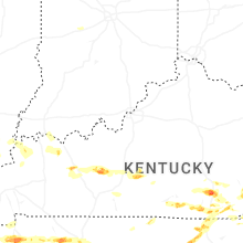
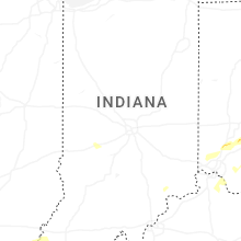

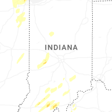


Connect with Interactive Hail Maps