

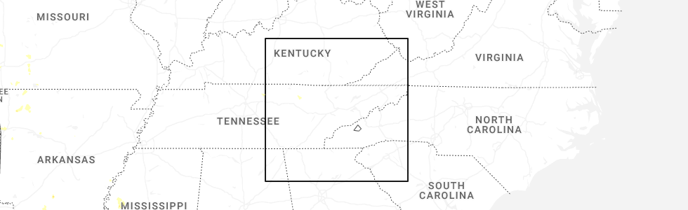
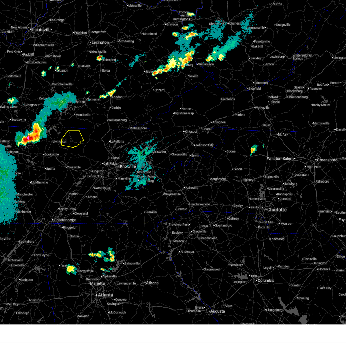
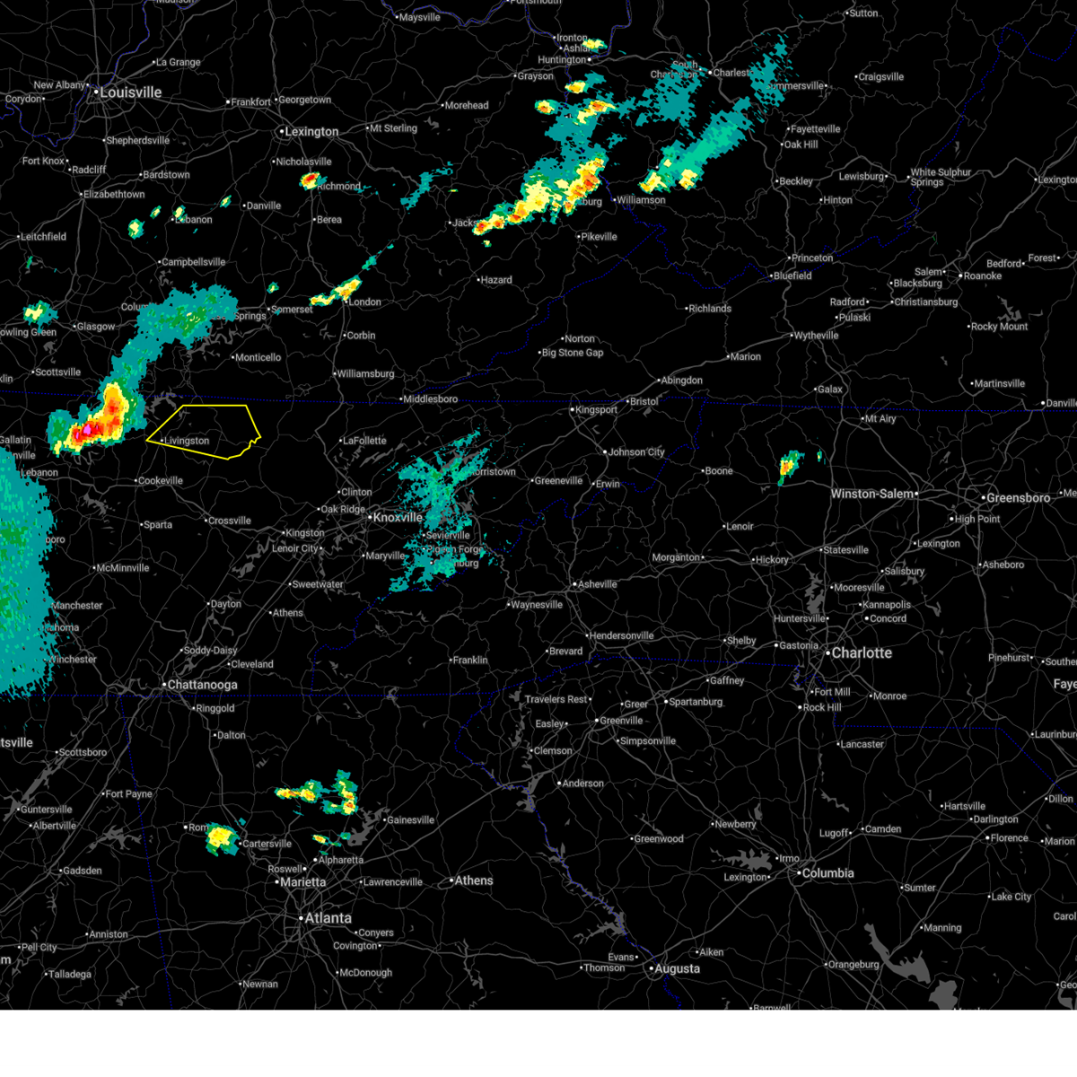
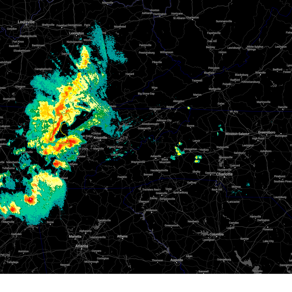
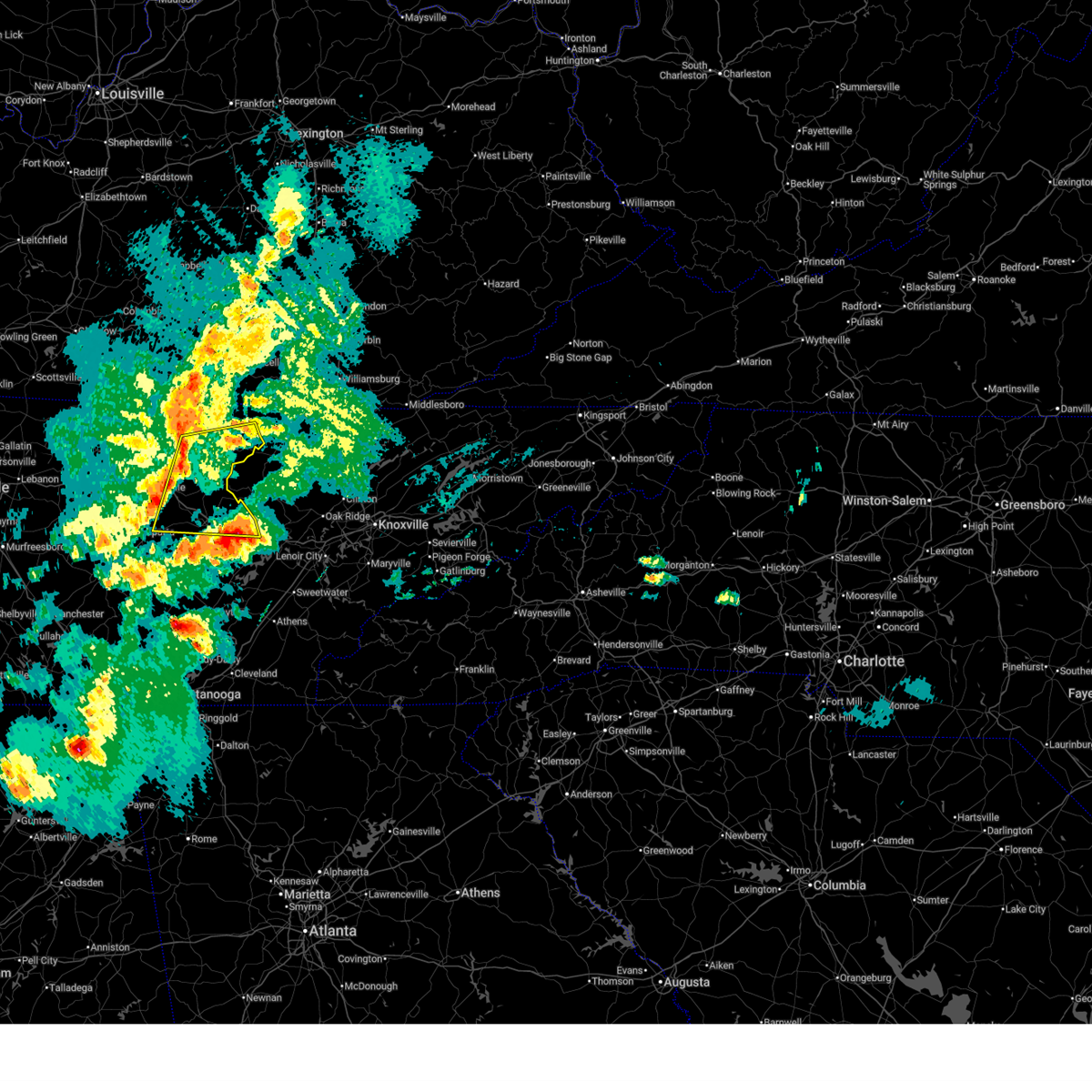
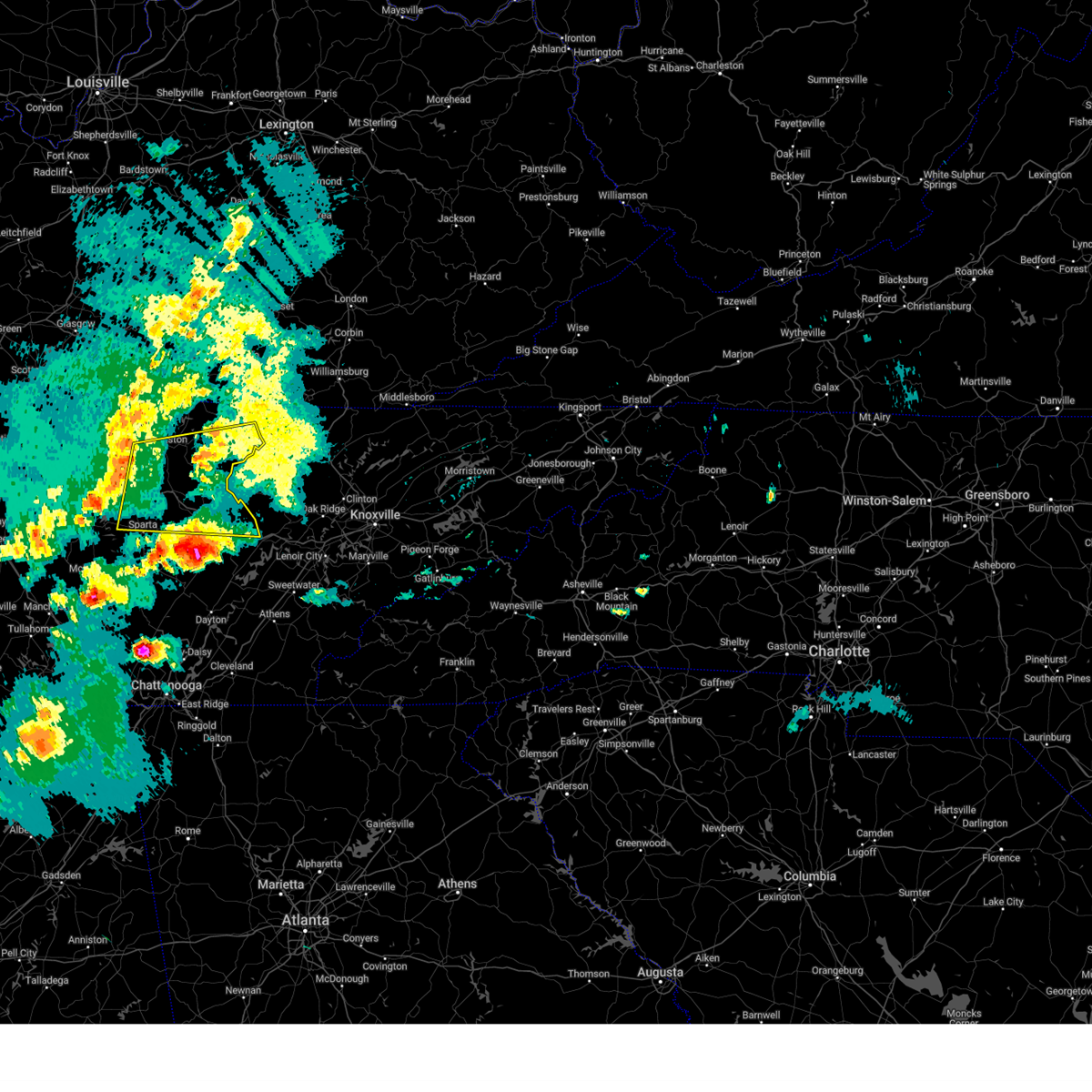
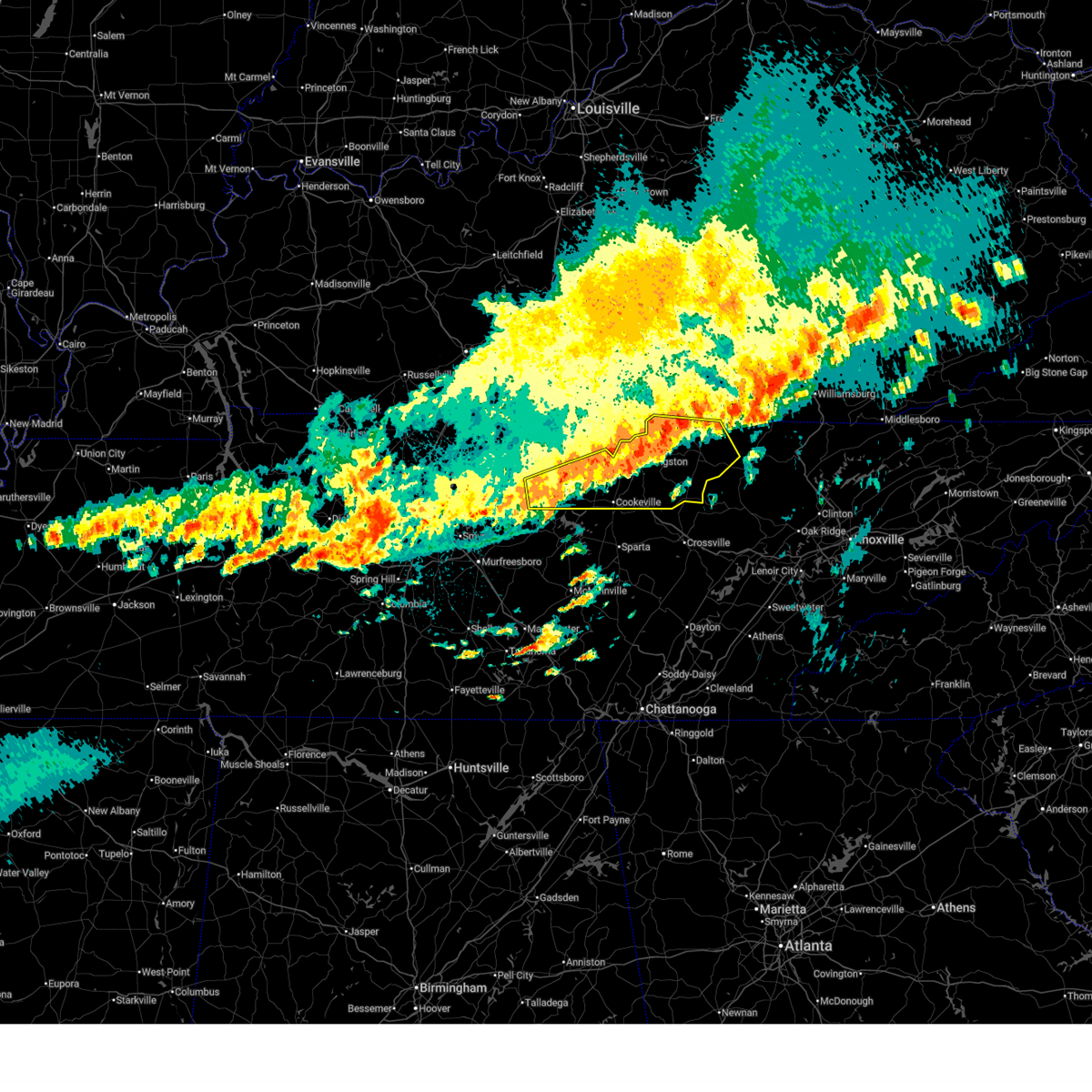
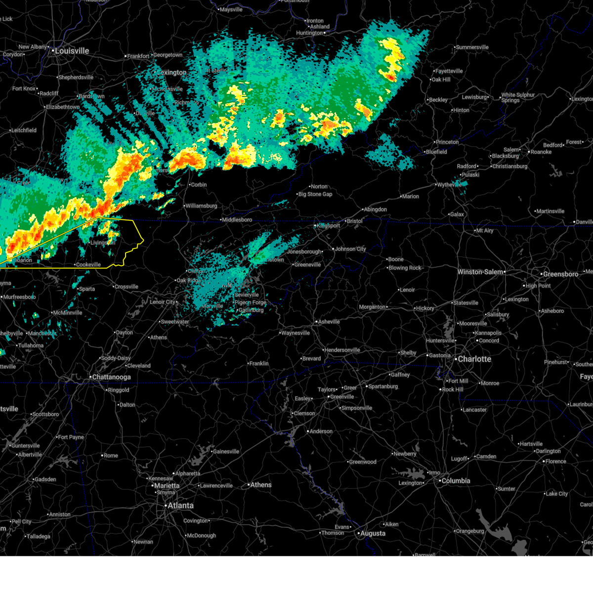
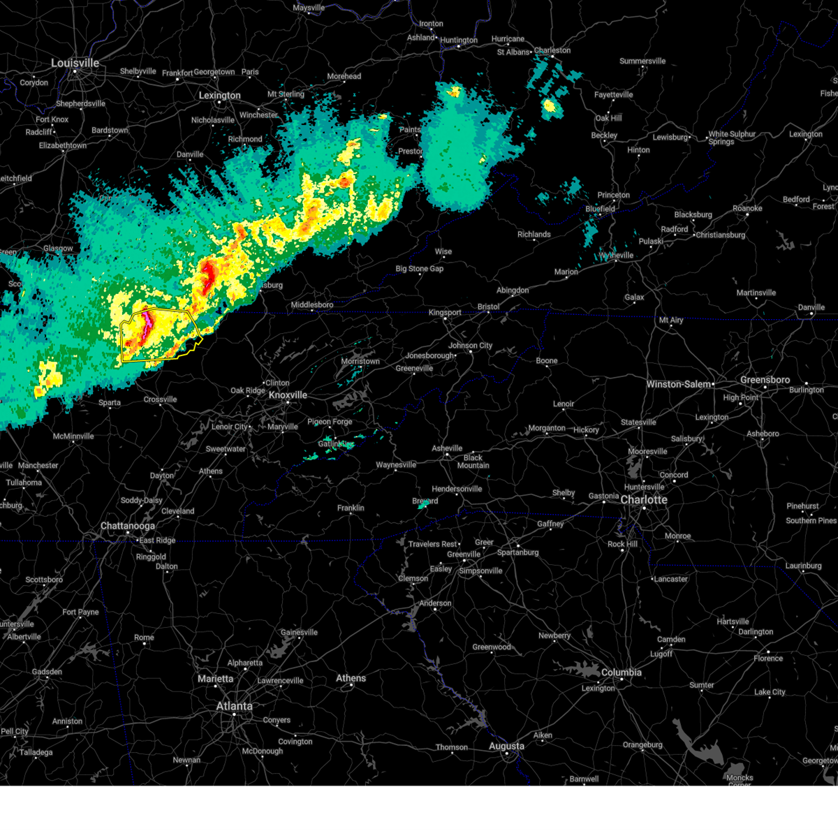
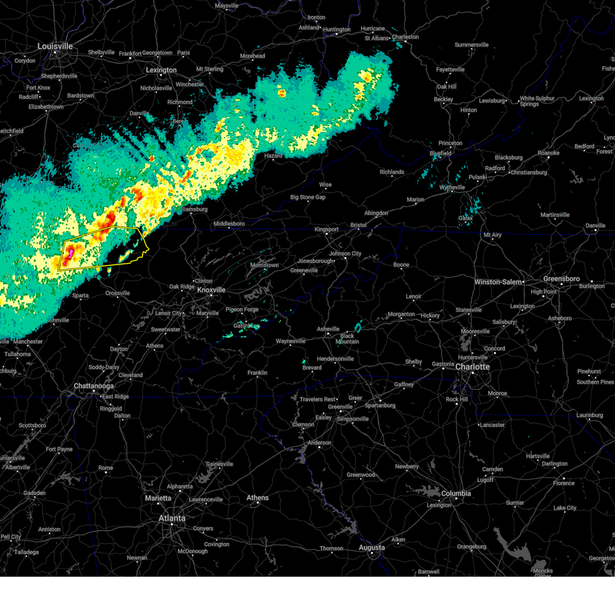
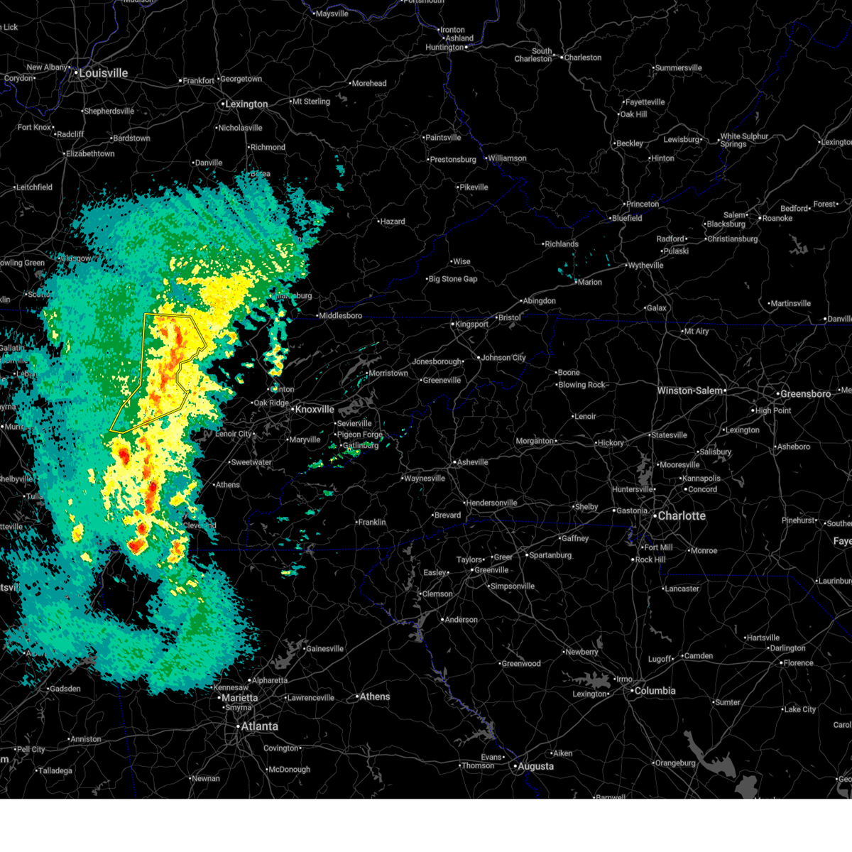
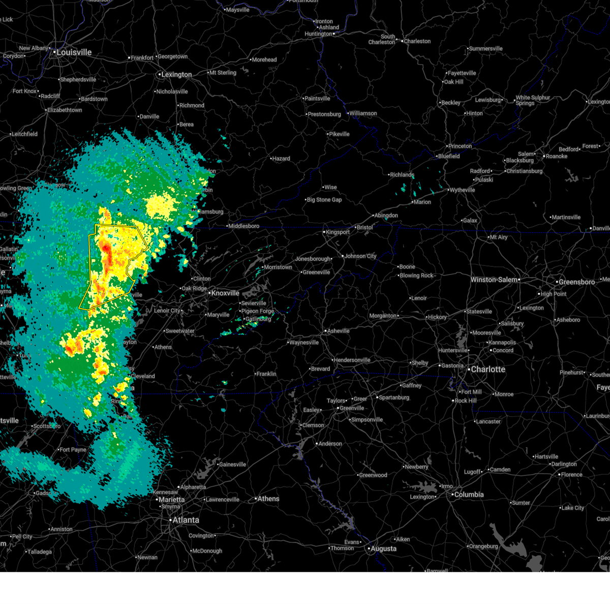
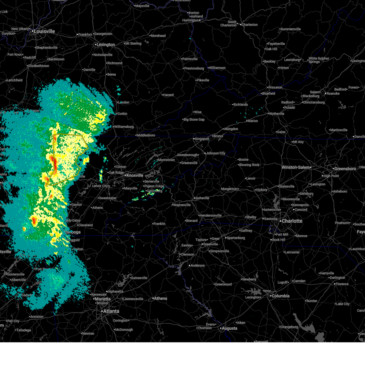
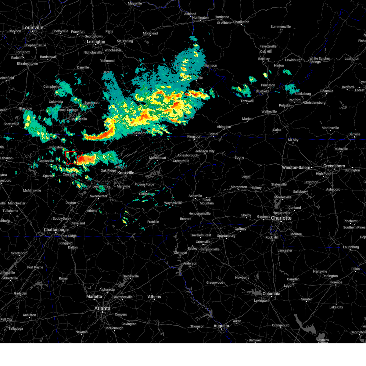
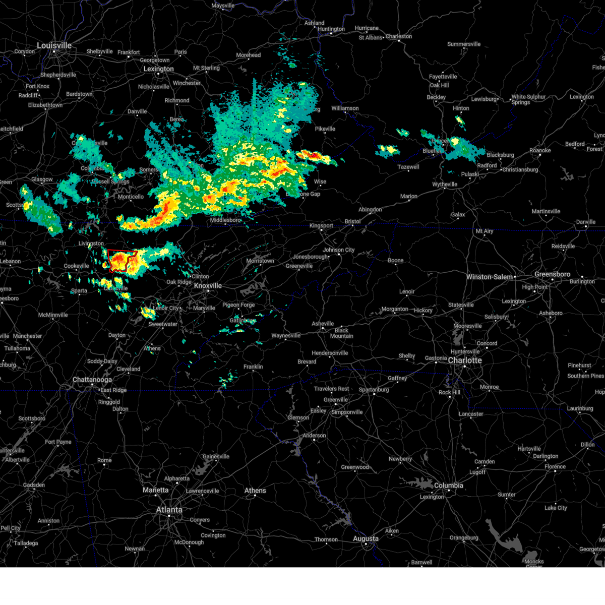
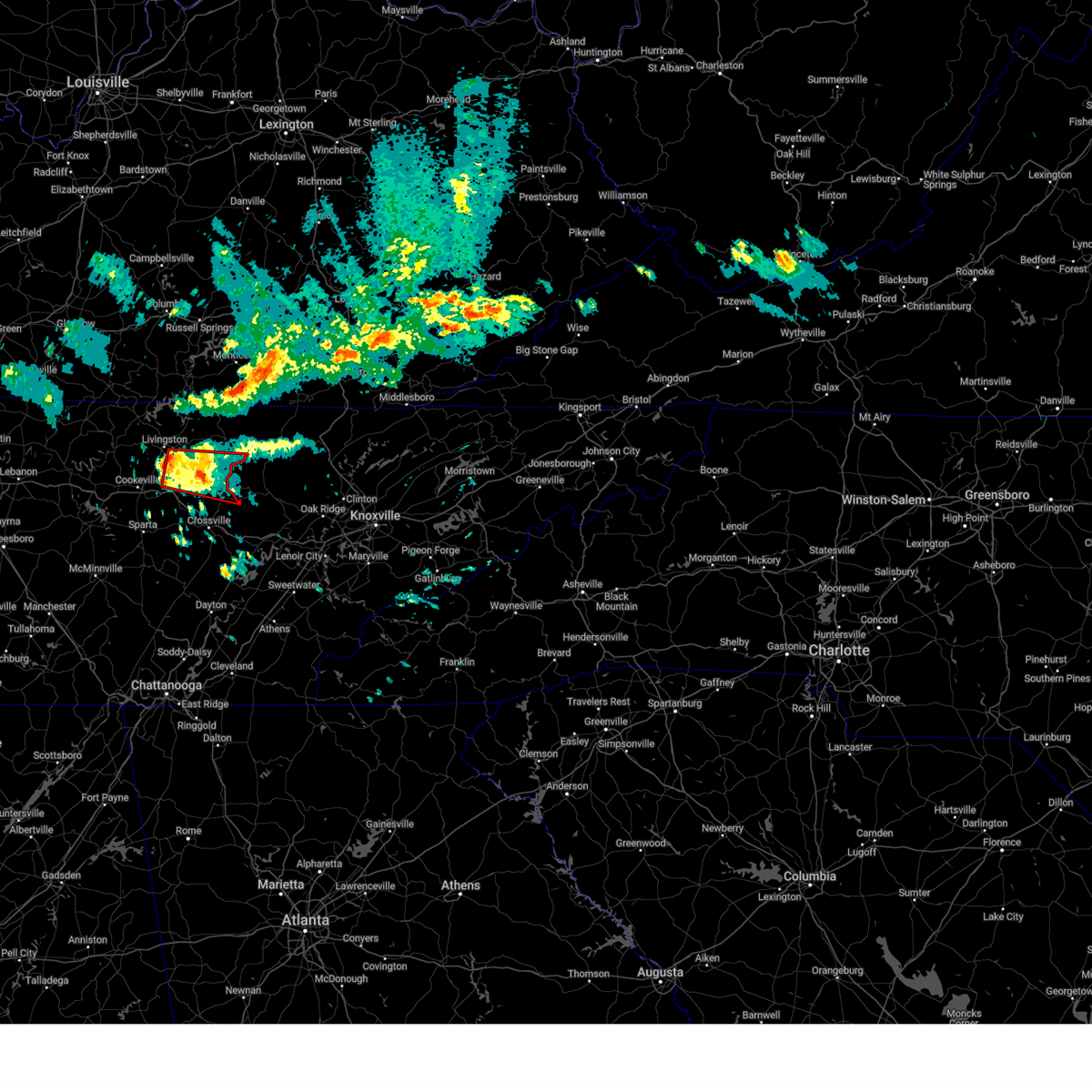
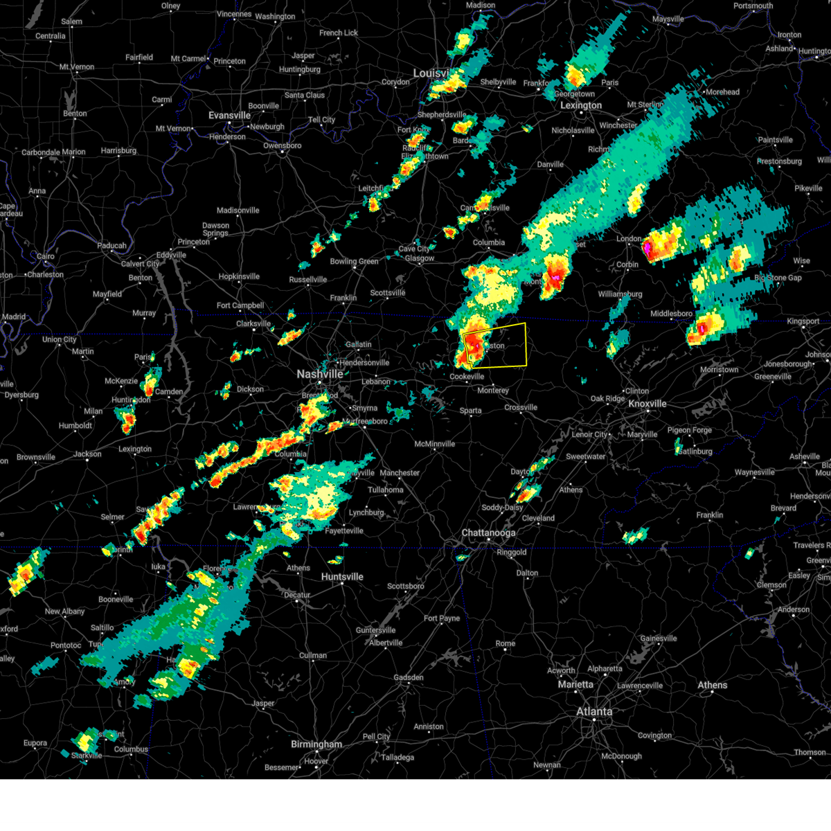
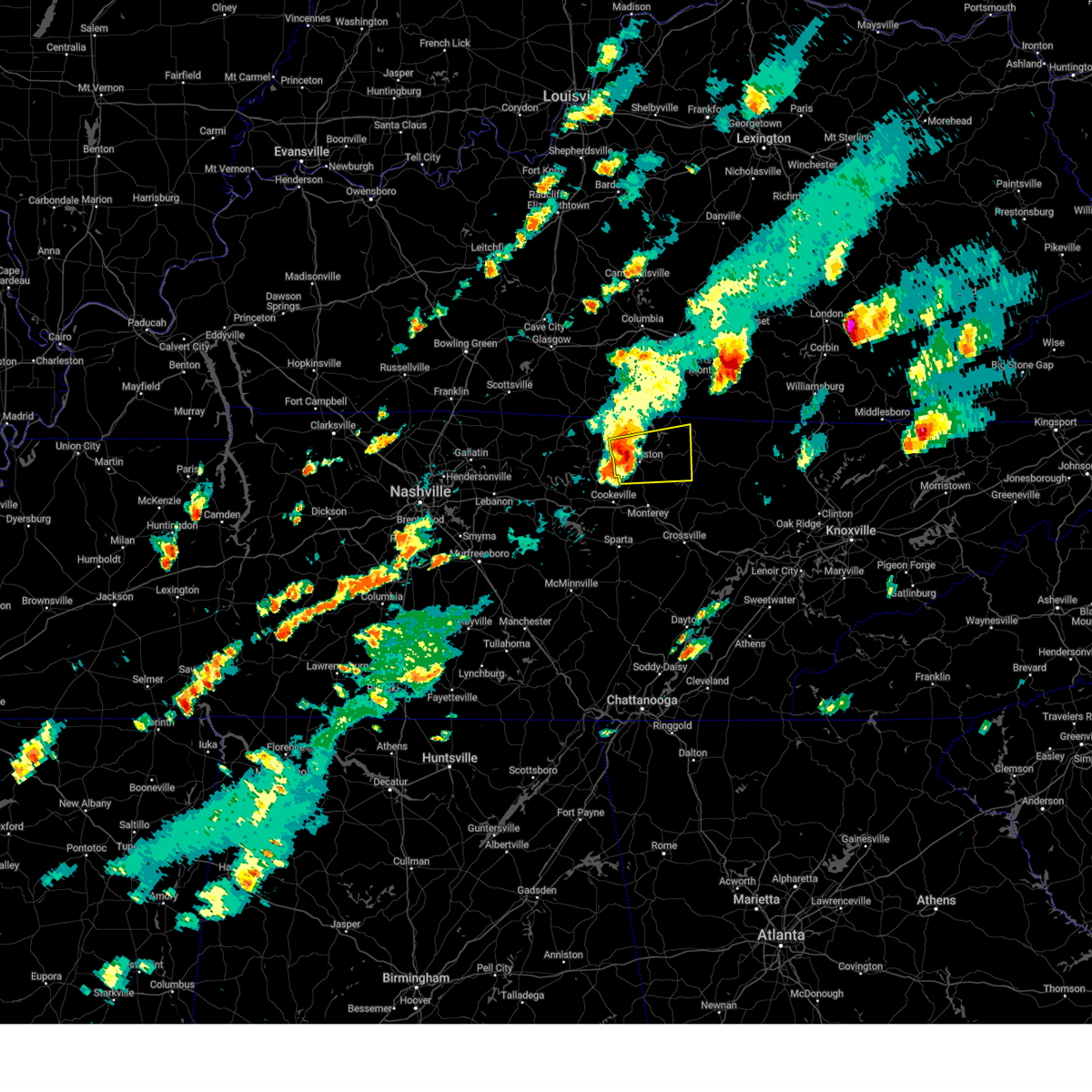
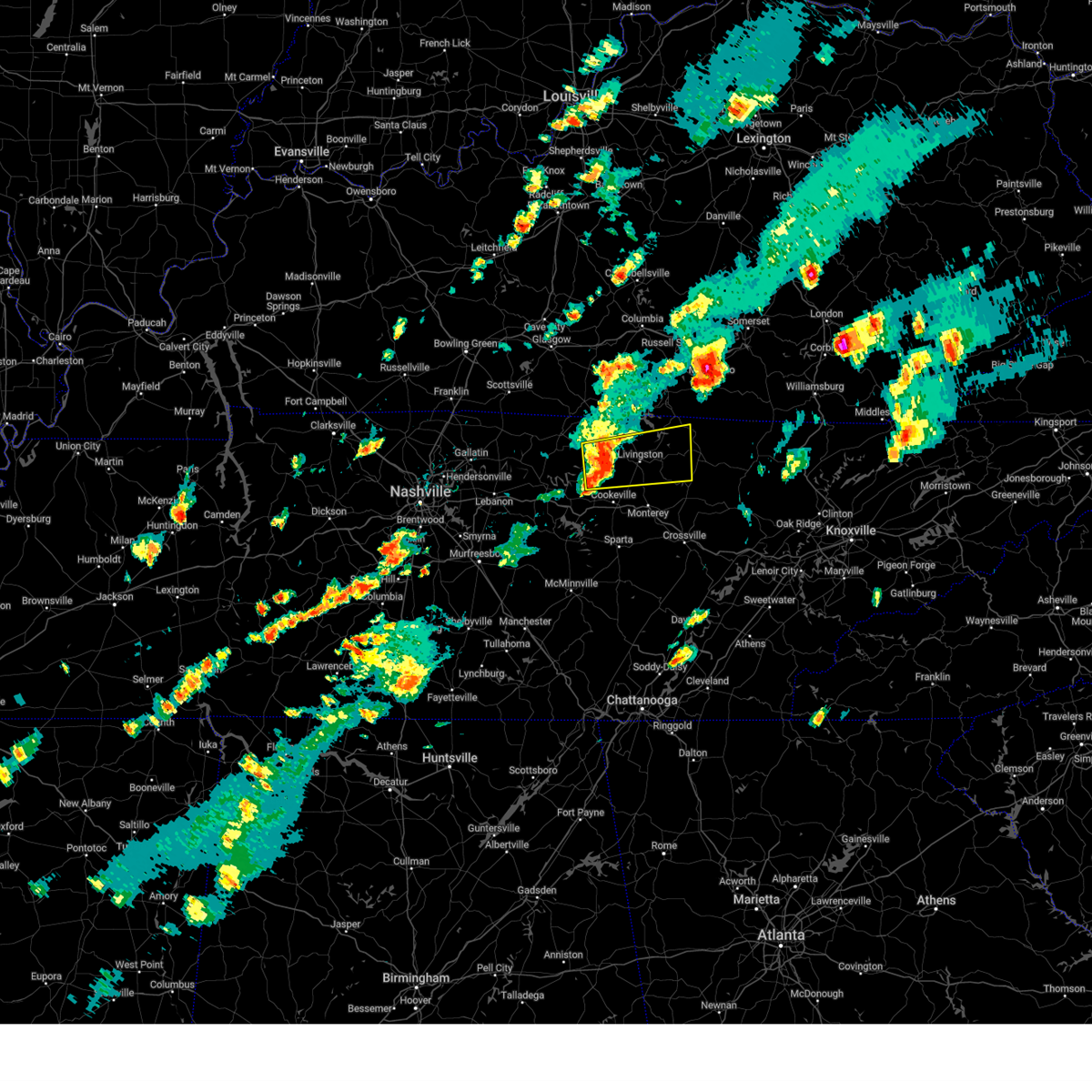
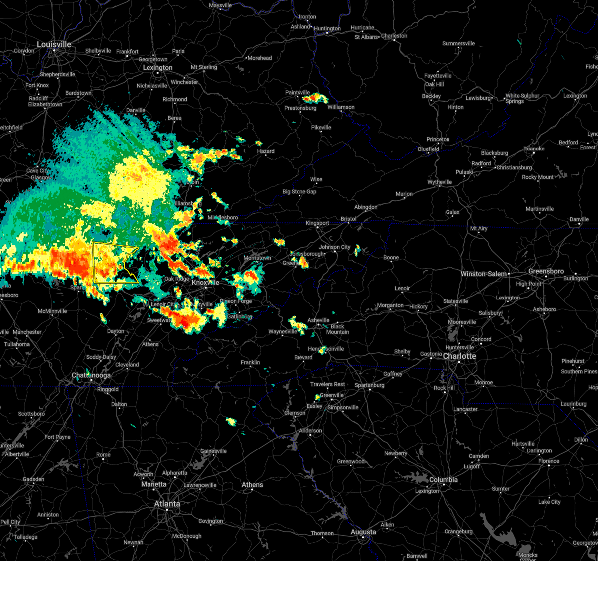
Hail Map for Grimsley, TN
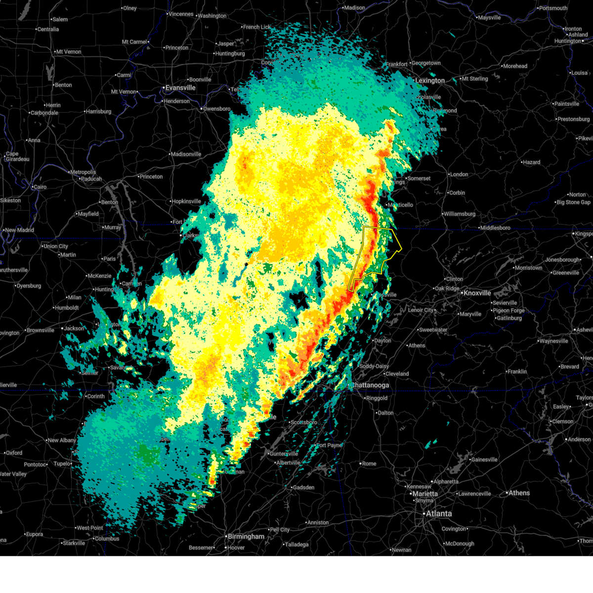
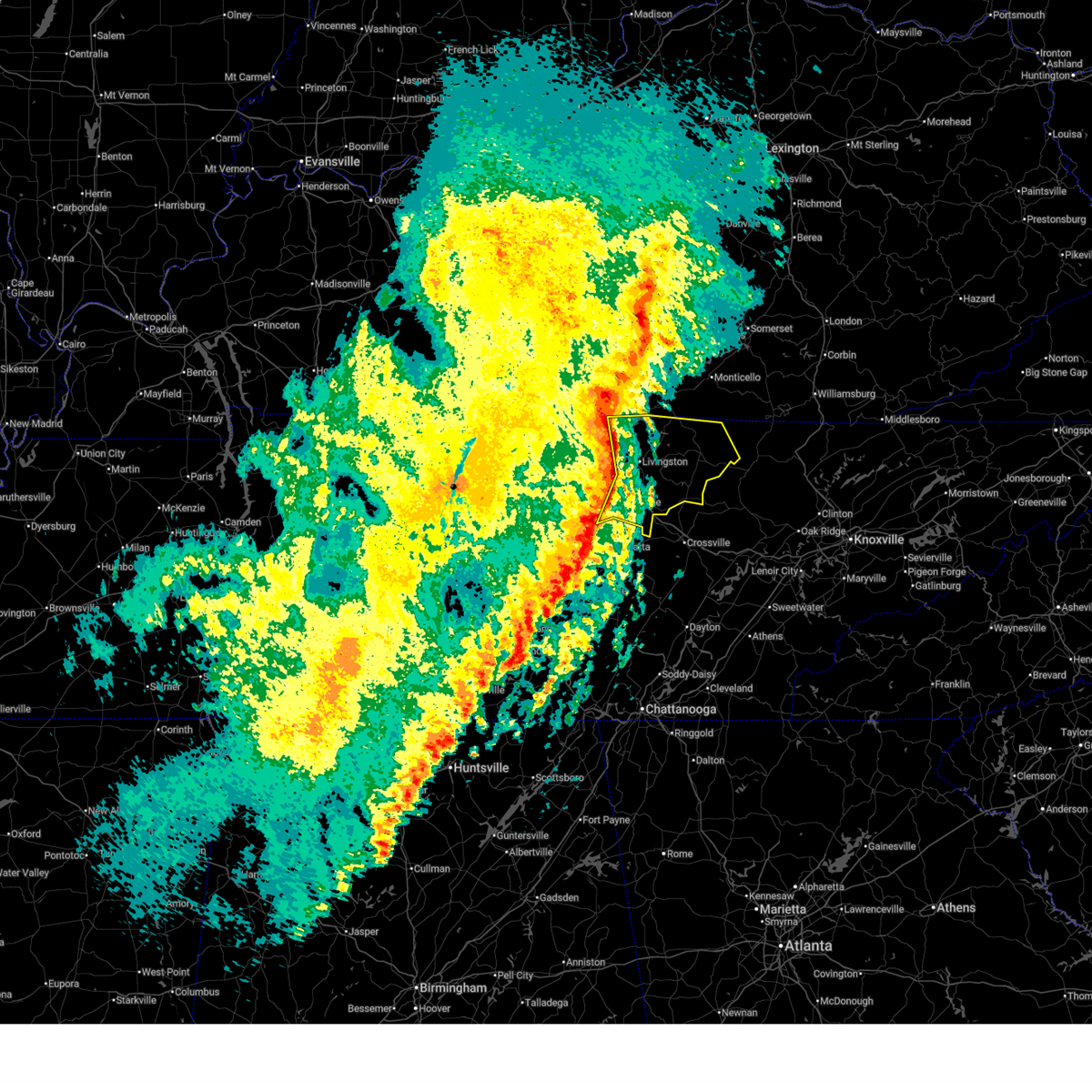
The Grimsley, TN area has had 1 report of on-the-ground hail by trained spotters, and has been under severe weather warnings 11 times during the past 12 months. Doppler radar has detected hail at or near Grimsley, TN on 40 occasions, including 2 occasions during the past year.
| Name: | Grimsley, TN |
| Where Located: | 63.6 miles WNW of Knoxville, TN |
| Map: | Google Map for Grimsley, TN |
| Population: | 1167 |
| Housing Units: | 524 |
| More Info: | Search Google for Grimsley, TN |
1
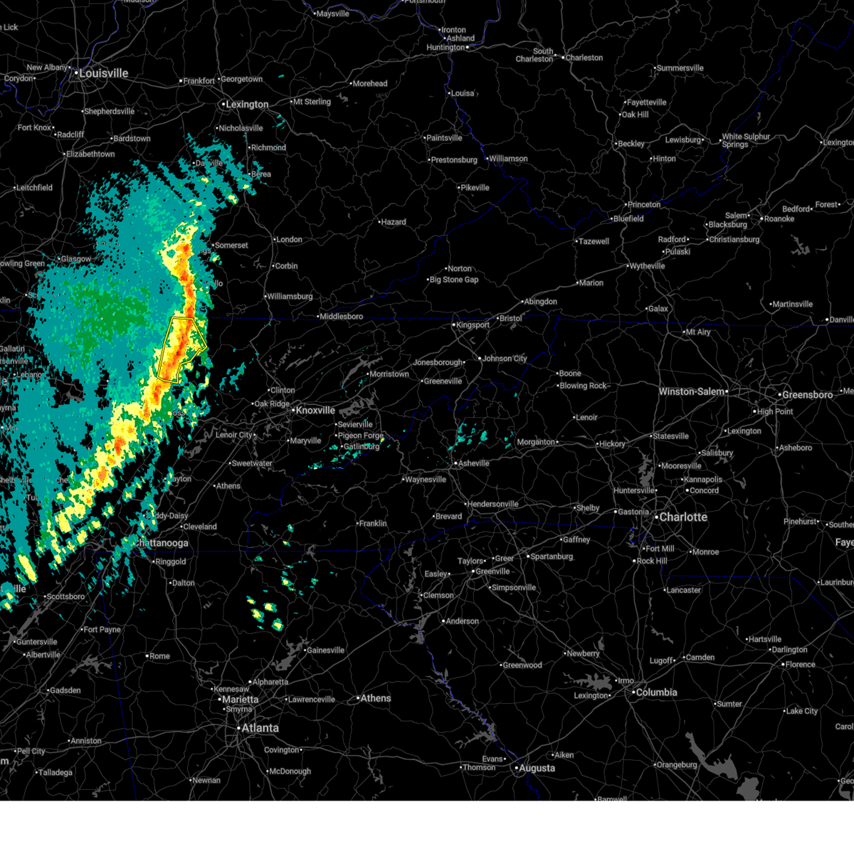
The Top Recent Hail Date for Grimsley, TN is Tuesday, September 16, 2025 (7th out of 40)
Hail and Wind Damage Spotted near Grimsley, TN
| Date / Time | Report Details |
|---|---|
| 3/16/2026 1:01 AM CDT |
 At 100 am cdt, severe thunderstorms were located along a line extending from near mount pisgah to 8 miles east of jamestown to 11 miles north of fairfield glade, moving east at 45 mph (radar indicated). Hazards include 60 mph wind gusts. Expect damage to roofs, siding, and trees. Locations impacted include, jamestown, allardt, grimsley, pickett state park, pall mall, and clarkrange. At 100 am cdt, severe thunderstorms were located along a line extending from near mount pisgah to 8 miles east of jamestown to 11 miles north of fairfield glade, moving east at 45 mph (radar indicated). Hazards include 60 mph wind gusts. Expect damage to roofs, siding, and trees. Locations impacted include, jamestown, allardt, grimsley, pickett state park, pall mall, and clarkrange.
|
| 3/16/2026 1:01 AM CDT |
 the severe thunderstorm warning has been cancelled and is no longer in effect the severe thunderstorm warning has been cancelled and is no longer in effect
|
| 3/16/2026 12:47 AM CDT |
 At 1246 am cdt, severe thunderstorms were located along a line extending from sunnybrook to near jamestown to 6 miles east of monterey, moving east at 55 mph (radar indicated). Hazards include 60 mph wind gusts. Expect damage to roofs, siding, and trees. locations impacted include, jamestown, byrdstown, monterey, allardt, grimsley, clarkrange, crawford, pickett state park, and pall mall. This includes interstate 40 between mile markers 302 and 304. At 1246 am cdt, severe thunderstorms were located along a line extending from sunnybrook to near jamestown to 6 miles east of monterey, moving east at 55 mph (radar indicated). Hazards include 60 mph wind gusts. Expect damage to roofs, siding, and trees. locations impacted include, jamestown, byrdstown, monterey, allardt, grimsley, clarkrange, crawford, pickett state park, and pall mall. This includes interstate 40 between mile markers 302 and 304.
|
| 3/16/2026 12:47 AM CDT |
 the severe thunderstorm warning has been cancelled and is no longer in effect the severe thunderstorm warning has been cancelled and is no longer in effect
|
| 3/16/2026 12:19 AM CDT |
 Svrohx the national weather service in nashville has issued a * severe thunderstorm warning for, overton county in middle tennessee, pickett county in middle tennessee, eastern clay county in middle tennessee, putnam county in middle tennessee, fentress county in middle tennessee, * until 115 am cdt. * at 1218 am cdt, severe thunderstorms were located along a line extending from near celina to 7 miles north of algood to near cookeville, moving east at 45 mph (radar indicated). Hazards include 60 mph wind gusts. expect damage to roofs, siding, and trees Svrohx the national weather service in nashville has issued a * severe thunderstorm warning for, overton county in middle tennessee, pickett county in middle tennessee, eastern clay county in middle tennessee, putnam county in middle tennessee, fentress county in middle tennessee, * until 115 am cdt. * at 1218 am cdt, severe thunderstorms were located along a line extending from near celina to 7 miles north of algood to near cookeville, moving east at 45 mph (radar indicated). Hazards include 60 mph wind gusts. expect damage to roofs, siding, and trees
|
| 9/16/2025 5:03 PM CDT | the severe thunderstorm warning has been cancelled and is no longer in effect |
| 9/16/2025 4:35 PM CDT | Svrohx the national weather service in nashville has issued a * severe thunderstorm warning for, southeastern overton county in middle tennessee, northwestern cumberland county in middle tennessee, southeastern putnam county in middle tennessee, southwestern fentress county in middle tennessee, * until 515 pm cdt. * at 435 pm cdt, a severe thunderstorm was located 13 miles southwest of jamestown, moving south at 20 mph (radar indicated). Hazards include 60 mph wind gusts. expect damage to roofs, siding, and trees |
| 9/5/2025 8:59 PM CDT |
 the severe thunderstorm warning has been cancelled and is no longer in effect the severe thunderstorm warning has been cancelled and is no longer in effect
|
| 9/5/2025 8:34 PM CDT |
 At 834 pm cdt, a severe thunderstorm was located over jamestown, moving east at 30 mph (radar indicated). Hazards include 60 mph wind gusts and penny size hail. Expect damage to roofs, siding, and trees. Locations impacted include, jamestown, allardt, pickett state park, and pall mall. At 834 pm cdt, a severe thunderstorm was located over jamestown, moving east at 30 mph (radar indicated). Hazards include 60 mph wind gusts and penny size hail. Expect damage to roofs, siding, and trees. Locations impacted include, jamestown, allardt, pickett state park, and pall mall.
|
| 9/5/2025 8:34 PM CDT |
 the severe thunderstorm warning has been cancelled and is no longer in effect the severe thunderstorm warning has been cancelled and is no longer in effect
|
| 9/5/2025 8:10 PM CDT |
 Svrohx the national weather service in nashville has issued a * severe thunderstorm warning for, northern overton county in middle tennessee, southern pickett county in middle tennessee, fentress county in middle tennessee, * until 915 pm cdt. * at 810 pm cdt, a severe thunderstorm was located 8 miles south of byrdstown, moving east at 30 mph (radar indicated). Hazards include 60 mph wind gusts and penny size hail. expect damage to roofs, siding, and trees Svrohx the national weather service in nashville has issued a * severe thunderstorm warning for, northern overton county in middle tennessee, southern pickett county in middle tennessee, fentress county in middle tennessee, * until 915 pm cdt. * at 810 pm cdt, a severe thunderstorm was located 8 miles south of byrdstown, moving east at 30 mph (radar indicated). Hazards include 60 mph wind gusts and penny size hail. expect damage to roofs, siding, and trees
|
| 5/20/2025 9:11 PM EDT |
 the severe thunderstorm warning has been cancelled and is no longer in effect the severe thunderstorm warning has been cancelled and is no longer in effect
|
| 5/20/2025 9:11 PM EDT |
 At 811 pm cdt, severe thunderstorms were located along a line extending from near jamestown to near crossville, moving east at 55 mph (radar indicated). Hazards include 65 mph wind gusts and quarter size hail. Hail damage to vehicles is expected. expect wind damage to roofs, siding, and trees. Locations impacted include, grimsley, allardt, slate springs, jamestown, clarkrange, fairfield glade, crossville, crab orchard, and pleasant hill. At 811 pm cdt, severe thunderstorms were located along a line extending from near jamestown to near crossville, moving east at 55 mph (radar indicated). Hazards include 65 mph wind gusts and quarter size hail. Hail damage to vehicles is expected. expect wind damage to roofs, siding, and trees. Locations impacted include, grimsley, allardt, slate springs, jamestown, clarkrange, fairfield glade, crossville, crab orchard, and pleasant hill.
|
| 5/20/2025 8:59 PM EDT |
 At 759 pm cdt, severe thunderstorms were located along a line extending from 7 miles west of jamestown to 9 miles south of monterey, moving east at 50 mph (trained weather spotters. at 757 pm cdt...several trees were blown down across putnam county with these storms). Hazards include 65 mph wind gusts and quarter size hail. Hail damage to vehicles is expected. expect wind damage to roofs, siding, and trees. Locations impacted include, grimsley, allardt, slate springs, jamestown, pleasant hill, clarkrange, fairfield glade, crawford, monterey, crossville, and crab orchard. At 759 pm cdt, severe thunderstorms were located along a line extending from 7 miles west of jamestown to 9 miles south of monterey, moving east at 50 mph (trained weather spotters. at 757 pm cdt...several trees were blown down across putnam county with these storms). Hazards include 65 mph wind gusts and quarter size hail. Hail damage to vehicles is expected. expect wind damage to roofs, siding, and trees. Locations impacted include, grimsley, allardt, slate springs, jamestown, pleasant hill, clarkrange, fairfield glade, crawford, monterey, crossville, and crab orchard.
|
| 5/20/2025 8:59 PM EDT |
 the severe thunderstorm warning has been cancelled and is no longer in effect the severe thunderstorm warning has been cancelled and is no longer in effect
|
| 5/20/2025 8:28 PM EDT |
 Svrohx the national weather service in nashville has issued a * severe thunderstorm warning for, overton county in middle tennessee, south central pickett county in middle tennessee, cumberland county in middle tennessee, southeastern jackson county in middle tennessee, northern white county in middle tennessee, putnam county in middle tennessee, fentress county in middle tennessee, * until 830 pm cdt. * at 728 pm cdt, severe thunderstorms were located along a line extending from gainesboro to baxter, moving east at 55 mph (radar indicated). Hazards include 65 mph wind gusts and quarter size hail. Hail damage to vehicles is expected. Expect wind damage to roofs, siding, and trees. Svrohx the national weather service in nashville has issued a * severe thunderstorm warning for, overton county in middle tennessee, south central pickett county in middle tennessee, cumberland county in middle tennessee, southeastern jackson county in middle tennessee, northern white county in middle tennessee, putnam county in middle tennessee, fentress county in middle tennessee, * until 830 pm cdt. * at 728 pm cdt, severe thunderstorms were located along a line extending from gainesboro to baxter, moving east at 55 mph (radar indicated). Hazards include 65 mph wind gusts and quarter size hail. Hail damage to vehicles is expected. Expect wind damage to roofs, siding, and trees.
|
| 5/17/2025 12:04 AM CDT |
 At 1203 am cdt, severe thunderstorms were located along a line extending from duckrun to 7 miles southeast of gainesboro, moving east at 75 mph (radar indicated). Hazards include 60 mph wind gusts and quarter size hail. Hail damage to vehicles is expected. expect wind damage to roofs, siding, and trees. locations impacted include, grimsley, allardt, hickman, gordonsville, algood, gainesboro, baxter, livingston, rickman, pall mall, carthage, wolf river dock, jamestown, byrdstown, clarkrange, crawford, granville, pickett state park, monterey, and south carthage. This includes interstate 40 between mile markers 252 and 268, and between mile markers 278 and 302. At 1203 am cdt, severe thunderstorms were located along a line extending from duckrun to 7 miles southeast of gainesboro, moving east at 75 mph (radar indicated). Hazards include 60 mph wind gusts and quarter size hail. Hail damage to vehicles is expected. expect wind damage to roofs, siding, and trees. locations impacted include, grimsley, allardt, hickman, gordonsville, algood, gainesboro, baxter, livingston, rickman, pall mall, carthage, wolf river dock, jamestown, byrdstown, clarkrange, crawford, granville, pickett state park, monterey, and south carthage. This includes interstate 40 between mile markers 252 and 268, and between mile markers 278 and 302.
|
| 5/17/2025 12:04 AM CDT |
 the severe thunderstorm warning has been cancelled and is no longer in effect the severe thunderstorm warning has been cancelled and is no longer in effect
|
| 5/16/2025 11:28 PM CDT |
 Svrohx the national weather service in nashville has issued a * severe thunderstorm warning for, overton county in middle tennessee, pickett county in middle tennessee, smith county in middle tennessee, jackson county in middle tennessee, central wilson county in middle tennessee, southeastern clay county in middle tennessee, central putnam county in middle tennessee, fentress county in middle tennessee, * until 1230 am cdt. * at 1128 pm cdt, severe thunderstorms were located along a line extending from near sunnybrook to near lebanon, moving east at 75 mph (radar indicated). Hazards include 60 mph wind gusts and quarter size hail. Hail damage to vehicles is expected. Expect wind damage to roofs, siding, and trees. Svrohx the national weather service in nashville has issued a * severe thunderstorm warning for, overton county in middle tennessee, pickett county in middle tennessee, smith county in middle tennessee, jackson county in middle tennessee, central wilson county in middle tennessee, southeastern clay county in middle tennessee, central putnam county in middle tennessee, fentress county in middle tennessee, * until 1230 am cdt. * at 1128 pm cdt, severe thunderstorms were located along a line extending from near sunnybrook to near lebanon, moving east at 75 mph (radar indicated). Hazards include 60 mph wind gusts and quarter size hail. Hail damage to vehicles is expected. Expect wind damage to roofs, siding, and trees.
|
| 4/3/2025 6:44 AM CDT |
 the severe thunderstorm warning has been cancelled and is no longer in effect the severe thunderstorm warning has been cancelled and is no longer in effect
|
| 4/3/2025 6:44 AM CDT |
 At 644 am cdt, a severe thunderstorm was located near byrdstown, moving east at 45 mph (radar indicated). Hazards include 60 mph wind gusts and quarter size hail. Hail damage to vehicles is expected. expect wind damage to roofs, siding, and trees. Locations impacted include, grimsley, allardt, jamestown, byrdstown, livingston, crawford, pall mall, and pickett state park. At 644 am cdt, a severe thunderstorm was located near byrdstown, moving east at 45 mph (radar indicated). Hazards include 60 mph wind gusts and quarter size hail. Hail damage to vehicles is expected. expect wind damage to roofs, siding, and trees. Locations impacted include, grimsley, allardt, jamestown, byrdstown, livingston, crawford, pall mall, and pickett state park.
|
| 4/3/2025 6:11 AM CDT |
 Svrohx the national weather service in nashville has issued a * severe thunderstorm warning for, overton county in middle tennessee, pickett county in middle tennessee, eastern jackson county in middle tennessee, southeastern clay county in middle tennessee, northwestern putnam county in middle tennessee, fentress county in middle tennessee, * until 715 am cdt. * at 610 am cdt, a severe thunderstorm was located 7 miles east of gainesboro, moving east at 45 mph (radar indicated). Hazards include 60 mph wind gusts and quarter size hail. Hail damage to vehicles is expected. Expect wind damage to roofs, siding, and trees. Svrohx the national weather service in nashville has issued a * severe thunderstorm warning for, overton county in middle tennessee, pickett county in middle tennessee, eastern jackson county in middle tennessee, southeastern clay county in middle tennessee, northwestern putnam county in middle tennessee, fentress county in middle tennessee, * until 715 am cdt. * at 610 am cdt, a severe thunderstorm was located 7 miles east of gainesboro, moving east at 45 mph (radar indicated). Hazards include 60 mph wind gusts and quarter size hail. Hail damage to vehicles is expected. Expect wind damage to roofs, siding, and trees.
|
| 3/15/2025 5:33 PM CDT |
 At 533 pm cdt, severe thunderstorms were located along a line extending from near sunnybrook to 14 miles south of jamestown to near crossville, moving east at 45 mph (radar indicated). Hazards include 60 mph wind gusts and quarter size hail. Hail damage to vehicles is expected. expect wind damage to roofs, siding, and trees. locations impacted include, grimsley, allardt, slate springs, virgin falls state natural area, pall mall, jamestown, pleasant hill, byrdstown, clarkrange, fairfield glade, crawford, pickett state park, and crossville. This includes interstate 40 between mile markers 304 and 324. At 533 pm cdt, severe thunderstorms were located along a line extending from near sunnybrook to 14 miles south of jamestown to near crossville, moving east at 45 mph (radar indicated). Hazards include 60 mph wind gusts and quarter size hail. Hail damage to vehicles is expected. expect wind damage to roofs, siding, and trees. locations impacted include, grimsley, allardt, slate springs, virgin falls state natural area, pall mall, jamestown, pleasant hill, byrdstown, clarkrange, fairfield glade, crawford, pickett state park, and crossville. This includes interstate 40 between mile markers 304 and 324.
|
| 3/15/2025 5:16 PM CDT |
 At 516 pm cdt, severe thunderstorms were located along a line extending from near albany to 6 miles east of monterey to 8 miles east of sparta, moving northeast at 40 mph (radar indicated). Hazards include 60 mph wind gusts and quarter size hail. Hail damage to vehicles is expected. expect wind damage to roofs, siding, and trees. locations impacted include, grimsley, allardt, slate springs, livingston, virgin falls state natural area, pall mall, jamestown, pleasant hill, byrdstown, clarkrange, fairfield glade, crawford, pickett state park, monterey, and crossville. This includes interstate 40 between mile markers 297 and 324. At 516 pm cdt, severe thunderstorms were located along a line extending from near albany to 6 miles east of monterey to 8 miles east of sparta, moving northeast at 40 mph (radar indicated). Hazards include 60 mph wind gusts and quarter size hail. Hail damage to vehicles is expected. expect wind damage to roofs, siding, and trees. locations impacted include, grimsley, allardt, slate springs, livingston, virgin falls state natural area, pall mall, jamestown, pleasant hill, byrdstown, clarkrange, fairfield glade, crawford, pickett state park, monterey, and crossville. This includes interstate 40 between mile markers 297 and 324.
|
| 3/15/2025 5:16 PM CDT |
 the severe thunderstorm warning has been cancelled and is no longer in effect the severe thunderstorm warning has been cancelled and is no longer in effect
|
| 3/15/2025 5:01 PM CDT |
 Svrohx the national weather service in nashville has issued a * severe thunderstorm warning for, overton county in middle tennessee, pickett county in middle tennessee, northwestern cumberland county in middle tennessee, northeastern clay county in middle tennessee, eastern white county in middle tennessee, southeastern putnam county in middle tennessee, fentress county in middle tennessee, * until 600 pm cdt. * at 501 pm cdt, severe thunderstorms were located along a line extending from 9 miles west of byrdstown to near monterey to 6 miles north of spencer, moving northeast at 40 mph (radar indicated). Hazards include 60 mph wind gusts and quarter size hail. Hail damage to vehicles is expected. Expect wind damage to roofs, siding, and trees. Svrohx the national weather service in nashville has issued a * severe thunderstorm warning for, overton county in middle tennessee, pickett county in middle tennessee, northwestern cumberland county in middle tennessee, northeastern clay county in middle tennessee, eastern white county in middle tennessee, southeastern putnam county in middle tennessee, fentress county in middle tennessee, * until 600 pm cdt. * at 501 pm cdt, severe thunderstorms were located along a line extending from 9 miles west of byrdstown to near monterey to 6 miles north of spencer, moving northeast at 40 mph (radar indicated). Hazards include 60 mph wind gusts and quarter size hail. Hail damage to vehicles is expected. Expect wind damage to roofs, siding, and trees.
|
| 2/6/2025 7:12 PM CST |
 The storm which prompted the warning has moved out of the area. therefore, the warning will be allowed to expire. The storm which prompted the warning has moved out of the area. therefore, the warning will be allowed to expire.
|
| 2/6/2025 7:08 PM CST |
 the tornado warning has been cancelled and is no longer in effect the tornado warning has been cancelled and is no longer in effect
|
| 2/6/2025 7:08 PM CST |
 At 707 pm cst, a severe thunderstorm capable of producing a tornado was located 13 miles south of jamestown, moving east at 35 mph (radar indicated rotation. there have been minor reports of wind damage with this storm). Hazards include tornado and quarter size hail. Flying debris will be dangerous to those caught without shelter. mobile homes will be damaged or destroyed. damage to roofs, windows, and vehicles will occur. tree damage is likely. Locations impacted include, grimsley and clarkrange. At 707 pm cst, a severe thunderstorm capable of producing a tornado was located 13 miles south of jamestown, moving east at 35 mph (radar indicated rotation. there have been minor reports of wind damage with this storm). Hazards include tornado and quarter size hail. Flying debris will be dangerous to those caught without shelter. mobile homes will be damaged or destroyed. damage to roofs, windows, and vehicles will occur. tree damage is likely. Locations impacted include, grimsley and clarkrange.
|
| 2/6/2025 7:01 PM CST |
 the tornado warning has been cancelled and is no longer in effect the tornado warning has been cancelled and is no longer in effect
|
| 2/6/2025 7:01 PM CST |
 At 658 pm cst, a severe thunderstorm capable of producing a tornado was located 13 miles northeast of monterey, or 14 miles southwest of jamestown, moving east at 35 mph (radar indicated rotation. there have been reports of minor wind damage with this storm). Hazards include tornado and quarter size hail. Flying debris will be dangerous to those caught without shelter. mobile homes will be damaged or destroyed. damage to roofs, windows, and vehicles will occur. tree damage is likely. Locations impacted include, grimsley and clarkrange. At 658 pm cst, a severe thunderstorm capable of producing a tornado was located 13 miles northeast of monterey, or 14 miles southwest of jamestown, moving east at 35 mph (radar indicated rotation. there have been reports of minor wind damage with this storm). Hazards include tornado and quarter size hail. Flying debris will be dangerous to those caught without shelter. mobile homes will be damaged or destroyed. damage to roofs, windows, and vehicles will occur. tree damage is likely. Locations impacted include, grimsley and clarkrange.
|
| 2/6/2025 6:44 PM CST | Multiple power flashe in overton county TN, 7.2 miles E of Grimsley, TN |
| 2/6/2025 6:42 PM CST |
 Torohx the national weather service in nashville has issued a * tornado warning for, southeastern overton county in middle tennessee, north central cumberland county in middle tennessee, east central putnam county in middle tennessee, southwestern fentress county in middle tennessee, * until 715 pm cst. * at 642 pm cst, a severe thunderstorm capable of producing a tornado was located 8 miles north of monterey, or 9 miles southeast of livingston, moving east at 35 mph (radar indicated rotation). Hazards include tornado and quarter size hail. Flying debris will be dangerous to those caught without shelter. mobile homes will be damaged or destroyed. damage to roofs, windows, and vehicles will occur. tree damage is likely. This tornadic thunderstorm will remain over mainly rural areas of southeastern overton, north central cumberland, east central putnam and southwestern fentress counties, including the following locations, crawford, grimsley, and clarkrange. Torohx the national weather service in nashville has issued a * tornado warning for, southeastern overton county in middle tennessee, north central cumberland county in middle tennessee, east central putnam county in middle tennessee, southwestern fentress county in middle tennessee, * until 715 pm cst. * at 642 pm cst, a severe thunderstorm capable of producing a tornado was located 8 miles north of monterey, or 9 miles southeast of livingston, moving east at 35 mph (radar indicated rotation). Hazards include tornado and quarter size hail. Flying debris will be dangerous to those caught without shelter. mobile homes will be damaged or destroyed. damage to roofs, windows, and vehicles will occur. tree damage is likely. This tornadic thunderstorm will remain over mainly rural areas of southeastern overton, north central cumberland, east central putnam and southwestern fentress counties, including the following locations, crawford, grimsley, and clarkrange.
|
| 9/24/2024 4:52 PM CDT |
 the severe thunderstorm warning has been cancelled and is no longer in effect the severe thunderstorm warning has been cancelled and is no longer in effect
|
| 9/24/2024 4:52 PM CDT |
 At 451 pm cdt, a severe thunderstorm was located over livingston, moving east at 45 mph (radar indicated). Hazards include 60 mph wind gusts and penny size hail. Expect damage to roofs, siding, and trees. Locations impacted include, livingston, standing stone state park, and rickman. At 451 pm cdt, a severe thunderstorm was located over livingston, moving east at 45 mph (radar indicated). Hazards include 60 mph wind gusts and penny size hail. Expect damage to roofs, siding, and trees. Locations impacted include, livingston, standing stone state park, and rickman.
|
| 9/24/2024 4:34 PM CDT |
 Svrohx the national weather service in nashville has issued a * severe thunderstorm warning for, overton county in middle tennessee, western pickett county in middle tennessee, eastern jackson county in middle tennessee, southeastern clay county in middle tennessee, north central putnam county in middle tennessee, northwestern fentress county in middle tennessee, * until 515 pm cdt. * at 434 pm cdt, a severe thunderstorm was located near gainesboro, moving east at 45 mph (radar indicated). Hazards include 60 mph wind gusts and penny size hail. expect damage to roofs, siding, and trees Svrohx the national weather service in nashville has issued a * severe thunderstorm warning for, overton county in middle tennessee, western pickett county in middle tennessee, eastern jackson county in middle tennessee, southeastern clay county in middle tennessee, north central putnam county in middle tennessee, northwestern fentress county in middle tennessee, * until 515 pm cdt. * at 434 pm cdt, a severe thunderstorm was located near gainesboro, moving east at 45 mph (radar indicated). Hazards include 60 mph wind gusts and penny size hail. expect damage to roofs, siding, and trees
|
| 7/30/2024 4:45 PM EDT |
 the severe thunderstorm warning has been cancelled and is no longer in effect the severe thunderstorm warning has been cancelled and is no longer in effect
|
| 7/30/2024 4:30 PM EDT |
 the severe thunderstorm warning has been cancelled and is no longer in effect the severe thunderstorm warning has been cancelled and is no longer in effect
|
| 7/30/2024 4:30 PM EDT |
 At 330 pm cdt, severe thunderstorms were located along a line extending from 10 miles south of huntsville to 6 miles east of monterey, moving southeast at 40 mph (radar indicated). Hazards include 60 mph wind gusts and quarter size hail. Hail damage to vehicles is expected. expect wind damage to roofs, siding, and trees. locations impacted include, fairfield glade, monterey, crawford, grimsley, slate springs, and clarkrange. This includes interstate 40 between mile markers 301 and 316. At 330 pm cdt, severe thunderstorms were located along a line extending from 10 miles south of huntsville to 6 miles east of monterey, moving southeast at 40 mph (radar indicated). Hazards include 60 mph wind gusts and quarter size hail. Hail damage to vehicles is expected. expect wind damage to roofs, siding, and trees. locations impacted include, fairfield glade, monterey, crawford, grimsley, slate springs, and clarkrange. This includes interstate 40 between mile markers 301 and 316.
|
| 7/30/2024 3:15 PM CDT | Facebook report and photo of 12 trees uprooted in yard of home in hanging lim in overton county TN, 9.7 miles ENE of Grimsley, TN |
| 7/30/2024 4:11 PM EDT |
 Svrohx the national weather service in nashville has issued a * severe thunderstorm warning for, eastern overton county in middle tennessee, southern pickett county in middle tennessee, northern cumberland county in middle tennessee, southeastern putnam county in middle tennessee, fentress county in middle tennessee, * until 400 pm cdt. * at 310 pm cdt, severe thunderstorms were located along a line extending from oneida to livingston, moving southeast at 40 mph (radar indicated). Hazards include 60 mph wind gusts and quarter size hail. Hail damage to vehicles is expected. Expect wind damage to roofs, siding, and trees. Svrohx the national weather service in nashville has issued a * severe thunderstorm warning for, eastern overton county in middle tennessee, southern pickett county in middle tennessee, northern cumberland county in middle tennessee, southeastern putnam county in middle tennessee, fentress county in middle tennessee, * until 400 pm cdt. * at 310 pm cdt, severe thunderstorms were located along a line extending from oneida to livingston, moving southeast at 40 mph (radar indicated). Hazards include 60 mph wind gusts and quarter size hail. Hail damage to vehicles is expected. Expect wind damage to roofs, siding, and trees.
|
| 7/30/2024 2:04 PM CDT |
 Svrohx the national weather service in nashville has issued a * severe thunderstorm warning for, southeastern overton county in middle tennessee, northeastern putnam county in middle tennessee, southwestern fentress county in middle tennessee, * until 230 pm cdt. * at 204 pm cdt, a severe thunderstorm was located near monterey, or 10 miles south of livingston, moving southeast at 25 mph (radar indicated). Hazards include 60 mph wind gusts. expect damage to roofs, siding, and trees Svrohx the national weather service in nashville has issued a * severe thunderstorm warning for, southeastern overton county in middle tennessee, northeastern putnam county in middle tennessee, southwestern fentress county in middle tennessee, * until 230 pm cdt. * at 204 pm cdt, a severe thunderstorm was located near monterey, or 10 miles south of livingston, moving southeast at 25 mph (radar indicated). Hazards include 60 mph wind gusts. expect damage to roofs, siding, and trees
|
| 5/23/2024 6:58 PM EDT |
 the severe thunderstorm warning has been cancelled and is no longer in effect the severe thunderstorm warning has been cancelled and is no longer in effect
|
| 5/23/2024 6:50 PM EDT |
 At 550 pm cdt, a severe thunderstorm was located 12 miles north of fairfield glade, or 17 miles west of wartburg, moving east at 30 mph (radar indicated). Hazards include 60 mph wind gusts and penny size hail. Expect damage to roofs, siding, and trees. Locations impacted include, fairfield glade and slate springs. At 550 pm cdt, a severe thunderstorm was located 12 miles north of fairfield glade, or 17 miles west of wartburg, moving east at 30 mph (radar indicated). Hazards include 60 mph wind gusts and penny size hail. Expect damage to roofs, siding, and trees. Locations impacted include, fairfield glade and slate springs.
|
| 5/23/2024 6:39 PM EDT |
 Svrohx the national weather service in nashville has issued a * severe thunderstorm warning for, northeastern cumberland county in middle tennessee, southern fentress county in middle tennessee, * until 615 pm cdt. * at 538 pm cdt, a severe thunderstorm was located 13 miles northwest of fairfield glade, or 15 miles north of crossville, moving east at 35 mph (radar indicated). Hazards include 60 mph wind gusts and penny size hail. expect damage to roofs, siding, and trees Svrohx the national weather service in nashville has issued a * severe thunderstorm warning for, northeastern cumberland county in middle tennessee, southern fentress county in middle tennessee, * until 615 pm cdt. * at 538 pm cdt, a severe thunderstorm was located 13 miles northwest of fairfield glade, or 15 miles north of crossville, moving east at 35 mph (radar indicated). Hazards include 60 mph wind gusts and penny size hail. expect damage to roofs, siding, and trees
|
| 5/22/2024 6:26 PM CDT |
 The storms which prompted the warning have moved out of the area. therefore, the warning will be allowed to expire. a severe thunderstorm watch remains in effect until 1000 pm cdt for middle tennessee. The storms which prompted the warning have moved out of the area. therefore, the warning will be allowed to expire. a severe thunderstorm watch remains in effect until 1000 pm cdt for middle tennessee.
|
| 5/22/2024 6:12 PM CDT |
 At 611 pm cdt, severe thunderstorms were located along a line extending from near great meadows campsites to 7 miles southeast of jamestown to monterey, moving east at 55 mph (radar indicated). Hazards include 60 mph wind gusts and nickel size hail. Expect damage to roofs, siding, and trees. locations impacted include, jamestown, fairfield glade, monterey, allardt, grimsley, slate springs, clarkrange, crawford, pall mall, and pickett state park. This includes interstate 40 between mile markers 300 and 314. At 611 pm cdt, severe thunderstorms were located along a line extending from near great meadows campsites to 7 miles southeast of jamestown to monterey, moving east at 55 mph (radar indicated). Hazards include 60 mph wind gusts and nickel size hail. Expect damage to roofs, siding, and trees. locations impacted include, jamestown, fairfield glade, monterey, allardt, grimsley, slate springs, clarkrange, crawford, pall mall, and pickett state park. This includes interstate 40 between mile markers 300 and 314.
|
| 5/22/2024 5:56 PM CDT |
 Svrohx the national weather service in nashville has issued a * severe thunderstorm warning for, overton county in middle tennessee, pickett county in middle tennessee, northern cumberland county in middle tennessee, southeastern putnam county in middle tennessee, fentress county in middle tennessee, * until 630 pm cdt. * at 555 pm cdt, severe thunderstorms were located along a line extending from near sunnybrook to 8 miles southwest of jamestown to near monterey, moving east at 55 mph (radar indicated). Hazards include 60 mph wind gusts and nickel size hail. expect damage to roofs, siding, and trees Svrohx the national weather service in nashville has issued a * severe thunderstorm warning for, overton county in middle tennessee, pickett county in middle tennessee, northern cumberland county in middle tennessee, southeastern putnam county in middle tennessee, fentress county in middle tennessee, * until 630 pm cdt. * at 555 pm cdt, severe thunderstorms were located along a line extending from near sunnybrook to 8 miles southwest of jamestown to near monterey, moving east at 55 mph (radar indicated). Hazards include 60 mph wind gusts and nickel size hail. expect damage to roofs, siding, and trees
|
| 5/22/2024 5:38 PM CDT |
 the severe thunderstorm warning has been cancelled and is no longer in effect the severe thunderstorm warning has been cancelled and is no longer in effect
|
| 5/22/2024 5:38 PM CDT |
 At 537 pm cdt, severe thunderstorms were located along a line extending from near albany to near livingston to near algood, moving east at 55 mph (radar indicated). Hazards include 60 mph wind gusts and penny size hail. Expect damage to roofs, siding, and trees. locations impacted include, cookeville, livingston, jamestown, byrdstown, fairfield glade, algood, monterey, allardt, grimsley, slate springs, rickman, pall mall, wolf river dock, clarkrange, crawford, dale hollow lake, pickett state park, and standing stone state park. This includes interstate 40 between mile markers 283 and 315. At 537 pm cdt, severe thunderstorms were located along a line extending from near albany to near livingston to near algood, moving east at 55 mph (radar indicated). Hazards include 60 mph wind gusts and penny size hail. Expect damage to roofs, siding, and trees. locations impacted include, cookeville, livingston, jamestown, byrdstown, fairfield glade, algood, monterey, allardt, grimsley, slate springs, rickman, pall mall, wolf river dock, clarkrange, crawford, dale hollow lake, pickett state park, and standing stone state park. This includes interstate 40 between mile markers 283 and 315.
|
| 5/22/2024 5:29 PM CDT |
 At 528 pm cdt, severe thunderstorms were located along a line extending from 8 miles southeast of burkesville to near livingston to baxter, moving east at 55 mph (radar indicated). Hazards include 60 mph wind gusts and penny size hail. Expect damage to roofs, siding, and trees. locations impacted include, cookeville, livingston, jamestown, celina, gainesboro, byrdstown, fairfield glade, algood, monterey, baxter, allardt, hamptons crossroads, slate springs, clarkrange, cummins falls state park, ashlock, grimsley, burgess falls state park, rickman, and pall mall. This includes interstate 40 between mile markers 270 and 315. At 528 pm cdt, severe thunderstorms were located along a line extending from 8 miles southeast of burkesville to near livingston to baxter, moving east at 55 mph (radar indicated). Hazards include 60 mph wind gusts and penny size hail. Expect damage to roofs, siding, and trees. locations impacted include, cookeville, livingston, jamestown, celina, gainesboro, byrdstown, fairfield glade, algood, monterey, baxter, allardt, hamptons crossroads, slate springs, clarkrange, cummins falls state park, ashlock, grimsley, burgess falls state park, rickman, and pall mall. This includes interstate 40 between mile markers 270 and 315.
|
| 5/22/2024 5:29 PM CDT |
 the severe thunderstorm warning has been cancelled and is no longer in effect the severe thunderstorm warning has been cancelled and is no longer in effect
|
| 5/22/2024 5:13 PM CDT |
 Svrohx the national weather service in nashville has issued a * severe thunderstorm warning for, overton county in middle tennessee, pickett county in middle tennessee, northern cumberland county in middle tennessee, southeastern smith county in middle tennessee, northern de kalb county in middle tennessee, jackson county in middle tennessee, clay county in middle tennessee, northwestern white county in middle tennessee, putnam county in middle tennessee, fentress county in middle tennessee, * until 600 pm cdt. * at 513 pm cdt, severe thunderstorms were located along a line extending from near celina to gainesboro to near gordonsville, moving east at 55 mph (radar indicated). Hazards include 60 mph wind gusts and penny size hail. expect damage to roofs, siding, and trees Svrohx the national weather service in nashville has issued a * severe thunderstorm warning for, overton county in middle tennessee, pickett county in middle tennessee, northern cumberland county in middle tennessee, southeastern smith county in middle tennessee, northern de kalb county in middle tennessee, jackson county in middle tennessee, clay county in middle tennessee, northwestern white county in middle tennessee, putnam county in middle tennessee, fentress county in middle tennessee, * until 600 pm cdt. * at 513 pm cdt, severe thunderstorms were located along a line extending from near celina to gainesboro to near gordonsville, moving east at 55 mph (radar indicated). Hazards include 60 mph wind gusts and penny size hail. expect damage to roofs, siding, and trees
|
| 5/8/2024 8:13 PM CDT |
 Svrohx the national weather service in nashville has issued a * severe thunderstorm warning for, northeastern cumberland county in middle tennessee, southwestern fentress county in middle tennessee, * until 845 pm cdt. * at 812 pm cdt, a severe thunderstorm was located 10 miles north of fairfield glade, or 14 miles northeast of crossville, moving east at 30 mph (radar indicated). Hazards include 60 mph wind gusts and penny size hail. expect damage to roofs, siding, and trees Svrohx the national weather service in nashville has issued a * severe thunderstorm warning for, northeastern cumberland county in middle tennessee, southwestern fentress county in middle tennessee, * until 845 pm cdt. * at 812 pm cdt, a severe thunderstorm was located 10 miles north of fairfield glade, or 14 miles northeast of crossville, moving east at 30 mph (radar indicated). Hazards include 60 mph wind gusts and penny size hail. expect damage to roofs, siding, and trees
|
| 5/8/2024 8:02 PM CDT |
 the severe thunderstorm warning has been cancelled and is no longer in effect the severe thunderstorm warning has been cancelled and is no longer in effect
|
| 5/8/2024 8:02 PM CDT |
 At 801 pm cdt, a severe thunderstorm was located 11 miles north of crossville, moving east at 45 mph (radar indicated). Hazards include 60 mph wind gusts and nickel size hail. Expect damage to roofs, siding, and trees. locations impacted include, crossville, fairfield glade, monterey, pleasant hill, grimsley, slate springs, clarkrange, and crawford. This includes interstate 40 between mile markers 300 and 321. At 801 pm cdt, a severe thunderstorm was located 11 miles north of crossville, moving east at 45 mph (radar indicated). Hazards include 60 mph wind gusts and nickel size hail. Expect damage to roofs, siding, and trees. locations impacted include, crossville, fairfield glade, monterey, pleasant hill, grimsley, slate springs, clarkrange, and crawford. This includes interstate 40 between mile markers 300 and 321.
|
| 5/8/2024 7:46 PM CDT |
 Torohx the national weather service in nashville has issued a * tornado warning for, southeastern overton county in middle tennessee, north central cumberland county in middle tennessee, east central putnam county in middle tennessee, southwestern fentress county in middle tennessee, * until 815 pm cdt. * at 745 pm cdt, a severe thunderstorm capable of producing a tornado was located near monterey, or 15 miles south of livingston, moving east at 45 mph (radar indicated rotation). Hazards include tornado. Flying debris will be dangerous to those caught without shelter. mobile homes will be damaged or destroyed. damage to roofs, windows, and vehicles will occur. tree damage is likely. this tornadic thunderstorm will remain over mainly rural areas of southeastern overton, north central cumberland, east central putnam and southwestern fentress counties, including the following locations, crawford, grimsley, and clarkrange. This includes interstate 40 between mile markers 300 and 303. Torohx the national weather service in nashville has issued a * tornado warning for, southeastern overton county in middle tennessee, north central cumberland county in middle tennessee, east central putnam county in middle tennessee, southwestern fentress county in middle tennessee, * until 815 pm cdt. * at 745 pm cdt, a severe thunderstorm capable of producing a tornado was located near monterey, or 15 miles south of livingston, moving east at 45 mph (radar indicated rotation). Hazards include tornado. Flying debris will be dangerous to those caught without shelter. mobile homes will be damaged or destroyed. damage to roofs, windows, and vehicles will occur. tree damage is likely. this tornadic thunderstorm will remain over mainly rural areas of southeastern overton, north central cumberland, east central putnam and southwestern fentress counties, including the following locations, crawford, grimsley, and clarkrange. This includes interstate 40 between mile markers 300 and 303.
|
| 5/8/2024 7:41 PM CDT |
 Svrohx the national weather service in nashville has issued a * severe thunderstorm warning for, southern overton county in middle tennessee, northern cumberland county in middle tennessee, northeastern white county in middle tennessee, eastern putnam county in middle tennessee, southwestern fentress county in middle tennessee, * until 815 pm cdt. * at 741 pm cdt, a severe thunderstorm was located near monterey, or 10 miles east of cookeville, moving east at 45 mph (radar indicated). Hazards include 60 mph wind gusts and nickel size hail. expect damage to roofs, siding, and trees Svrohx the national weather service in nashville has issued a * severe thunderstorm warning for, southern overton county in middle tennessee, northern cumberland county in middle tennessee, northeastern white county in middle tennessee, eastern putnam county in middle tennessee, southwestern fentress county in middle tennessee, * until 815 pm cdt. * at 741 pm cdt, a severe thunderstorm was located near monterey, or 10 miles east of cookeville, moving east at 45 mph (radar indicated). Hazards include 60 mph wind gusts and nickel size hail. expect damage to roofs, siding, and trees
|
| 5/8/2024 8:19 AM CDT |
 the severe thunderstorm warning has been cancelled and is no longer in effect the severe thunderstorm warning has been cancelled and is no longer in effect
|
| 5/8/2024 8:19 AM CDT |
 At 818 am cdt, a severe thunderstorm was located near grimsley, moving east at 35 mph (radar indicated). Hazards include 60 mph wind gusts and penny size hail. Expect damage to roofs, siding, and trees. Locations impacted include, jamestown, allardt, grimsley, and clarkrange. At 818 am cdt, a severe thunderstorm was located near grimsley, moving east at 35 mph (radar indicated). Hazards include 60 mph wind gusts and penny size hail. Expect damage to roofs, siding, and trees. Locations impacted include, jamestown, allardt, grimsley, and clarkrange.
|
| 5/8/2024 7:54 AM CDT |
 Svrohx the national weather service in nashville has issued a * severe thunderstorm warning for, overton county in middle tennessee, central pickett county in middle tennessee, fentress county in middle tennessee, * until 845 am cdt. * at 753 am cdt, a severe thunderstorm was located 7 miles east of livingston, moving east at 40 mph (radar indicated). Hazards include 60 mph wind gusts and quarter size hail. Hail damage to vehicles is expected. Expect wind damage to roofs, siding, and trees. Svrohx the national weather service in nashville has issued a * severe thunderstorm warning for, overton county in middle tennessee, central pickett county in middle tennessee, fentress county in middle tennessee, * until 845 am cdt. * at 753 am cdt, a severe thunderstorm was located 7 miles east of livingston, moving east at 40 mph (radar indicated). Hazards include 60 mph wind gusts and quarter size hail. Hail damage to vehicles is expected. Expect wind damage to roofs, siding, and trees.
|
| 8/12/2023 1:24 PM CDT |
 At 123 pm cdt, severe thunderstorms were located along a line extending from algood to sparta to spencer, moving east at 55 mph (radar indicated). Hazards include 60 mph wind gusts. expect damage to roofs, siding, and trees At 123 pm cdt, severe thunderstorms were located along a line extending from algood to sparta to spencer, moving east at 55 mph (radar indicated). Hazards include 60 mph wind gusts. expect damage to roofs, siding, and trees
|
| 8/7/2023 12:56 PM CDT |
 At 1255 pm cdt, a severe thunderstorm was located 10 miles north of fairfield glade, or 16 miles northeast of crossville, moving east at 55 mph (radar indicated). Hazards include 60 mph wind gusts and penny size hail. Expect damage to roofs, siding, and trees. locations impacted include, crossville, fairfield glade, grimsley, slate springs and clarkrange. this includes interstate 40 between mile markers 312 and 321. hail threat, radar indicated max hail size, 0. 75 in wind threat, radar indicated max wind gust, 60 mph. At 1255 pm cdt, a severe thunderstorm was located 10 miles north of fairfield glade, or 16 miles northeast of crossville, moving east at 55 mph (radar indicated). Hazards include 60 mph wind gusts and penny size hail. Expect damage to roofs, siding, and trees. locations impacted include, crossville, fairfield glade, grimsley, slate springs and clarkrange. this includes interstate 40 between mile markers 312 and 321. hail threat, radar indicated max hail size, 0. 75 in wind threat, radar indicated max wind gust, 60 mph.
|
| 8/7/2023 12:49 PM CDT |
 At 1249 pm cdt, a severe thunderstorm was located 13 miles northwest of fairfield glade, or 13 miles north of crossville, moving east at 55 mph (radar indicated). Hazards include 70 mph wind gusts and penny size hail. Expect considerable tree damage. damage is likely to mobile homes, roofs, and outbuildings. locations impacted include, crossville, fairfield glade, pleasant hill, grimsley, slate springs and clarkrange. this includes interstate 40 between mile markers 306 and 321. thunderstorm damage threat, considerable hail threat, radar indicated max hail size, 0. 75 in wind threat, radar indicated max wind gust, 70 mph. At 1249 pm cdt, a severe thunderstorm was located 13 miles northwest of fairfield glade, or 13 miles north of crossville, moving east at 55 mph (radar indicated). Hazards include 70 mph wind gusts and penny size hail. Expect considerable tree damage. damage is likely to mobile homes, roofs, and outbuildings. locations impacted include, crossville, fairfield glade, pleasant hill, grimsley, slate springs and clarkrange. this includes interstate 40 between mile markers 306 and 321. thunderstorm damage threat, considerable hail threat, radar indicated max hail size, 0. 75 in wind threat, radar indicated max wind gust, 70 mph.
|
| 8/7/2023 12:38 PM CDT |
 At 1237 pm cdt, a severe thunderstorm was located over monterey, or 14 miles east of cookeville, moving east at 55 mph (radar indicated). Hazards include 70 mph wind gusts and penny size hail. Expect considerable tree damage. Damage is likely to mobile homes, roofs, and outbuildings. At 1237 pm cdt, a severe thunderstorm was located over monterey, or 14 miles east of cookeville, moving east at 55 mph (radar indicated). Hazards include 70 mph wind gusts and penny size hail. Expect considerable tree damage. Damage is likely to mobile homes, roofs, and outbuildings.
|
| 8/7/2023 10:41 AM CDT |
 The severe thunderstorm warning for fentress county will expire at 1045 am cdt, the storm which prompted the warning has moved out of the area. therefore, the warning will be allowed to expire. a tornado watch remains in effect until 600 pm cdt for middle tennessee. The severe thunderstorm warning for fentress county will expire at 1045 am cdt, the storm which prompted the warning has moved out of the area. therefore, the warning will be allowed to expire. a tornado watch remains in effect until 600 pm cdt for middle tennessee.
|
| 8/7/2023 10:08 AM CDT |
 At 1007 am cdt, a severe thunderstorm was located over jamestown, moving east at 50 mph (radar indicated). Hazards include 60 mph wind gusts and quarter size hail. Hail damage to vehicles is expected. Expect wind damage to roofs, siding, and trees. At 1007 am cdt, a severe thunderstorm was located over jamestown, moving east at 50 mph (radar indicated). Hazards include 60 mph wind gusts and quarter size hail. Hail damage to vehicles is expected. Expect wind damage to roofs, siding, and trees.
|
| 7/1/2023 3:07 PM CDT |
 At 307 pm cdt, severe thunderstorms were located along a line extending from near livingston to near monterey to 11 miles east of sparta, moving east at 45 mph (radar indicated). Hazards include 60 mph wind gusts. Expect damage to roofs, siding, and trees. locations impacted include, crossville, livingston, monterey, pleasant hill, clarkrange, crawford, virgin falls state natural area and rickman. this includes interstate 40 between mile markers 295 and 316. hail threat, radar indicated max hail size, <. 75 in wind threat, radar indicated max wind gust, 60 mph. At 307 pm cdt, severe thunderstorms were located along a line extending from near livingston to near monterey to 11 miles east of sparta, moving east at 45 mph (radar indicated). Hazards include 60 mph wind gusts. Expect damage to roofs, siding, and trees. locations impacted include, crossville, livingston, monterey, pleasant hill, clarkrange, crawford, virgin falls state natural area and rickman. this includes interstate 40 between mile markers 295 and 316. hail threat, radar indicated max hail size, <. 75 in wind threat, radar indicated max wind gust, 60 mph.
|
| 7/1/2023 2:51 PM CDT |
 At 250 pm cdt, severe thunderstorms were located along a line extending from 7 miles southwest of livingston to near algood to sparta, moving east at 45 mph (radar indicated). Hazards include 60 mph wind gusts. expect damage to roofs, siding, and trees At 250 pm cdt, severe thunderstorms were located along a line extending from 7 miles southwest of livingston to near algood to sparta, moving east at 45 mph (radar indicated). Hazards include 60 mph wind gusts. expect damage to roofs, siding, and trees
|
| 6/26/2023 2:34 AM CDT |
 At 234 am cdt, a severe thunderstorm was located 7 miles north of crossville, moving east at 55 mph (radar indicated). Hazards include 60 mph wind gusts and penny size hail. expect damage to roofs, siding, and trees At 234 am cdt, a severe thunderstorm was located 7 miles north of crossville, moving east at 55 mph (radar indicated). Hazards include 60 mph wind gusts and penny size hail. expect damage to roofs, siding, and trees
|
| 6/26/2023 1:09 AM CDT |
 The severe thunderstorm warning for overton, northern cumberland, jackson, southwestern clay, putnam and southern fentress counties will expire at 115 am cdt, the storms which prompted the warning have weakened below severe limits, and no longer pose an immediate threat to life or property. therefore, the warning will be allowed to expire. however gusty winds and heavy rain are still possible with these thunderstorms. a severe thunderstorm watch remains in effect until 300 am cdt for middle tennessee. The severe thunderstorm warning for overton, northern cumberland, jackson, southwestern clay, putnam and southern fentress counties will expire at 115 am cdt, the storms which prompted the warning have weakened below severe limits, and no longer pose an immediate threat to life or property. therefore, the warning will be allowed to expire. however gusty winds and heavy rain are still possible with these thunderstorms. a severe thunderstorm watch remains in effect until 300 am cdt for middle tennessee.
|
| 6/26/2023 12:28 AM CDT |
 At 1227 am cdt, severe thunderstorms were located along a line extending from 7 miles east of celina to 7 miles south of mount pisgah to huntsville, moving southeast at 55 mph (radar indicated). Hazards include 60 mph wind gusts and penny size hail. expect damage to roofs, siding, and trees At 1227 am cdt, severe thunderstorms were located along a line extending from 7 miles east of celina to 7 miles south of mount pisgah to huntsville, moving southeast at 55 mph (radar indicated). Hazards include 60 mph wind gusts and penny size hail. expect damage to roofs, siding, and trees
|
| 6/11/2023 6:22 PM CDT |
 The severe thunderstorm warning for central fentress county will expire at 630 pm cdt, the storm which prompted the warning has moved out of the area. therefore, the warning will be allowed to expire. a severe thunderstorm watch remains in effect until 1000 pm cdt for middle tennessee. The severe thunderstorm warning for central fentress county will expire at 630 pm cdt, the storm which prompted the warning has moved out of the area. therefore, the warning will be allowed to expire. a severe thunderstorm watch remains in effect until 1000 pm cdt for middle tennessee.
|
| 6/11/2023 5:55 PM CDT |
 At 555 pm cdt, a severe thunderstorm was located 12 miles south of jamestown, moving east at 45 mph (radar indicated). Hazards include 60 mph wind gusts and nickel size hail. expect damage to roofs, siding, and trees At 555 pm cdt, a severe thunderstorm was located 12 miles south of jamestown, moving east at 45 mph (radar indicated). Hazards include 60 mph wind gusts and nickel size hail. expect damage to roofs, siding, and trees
|
| 6/11/2023 4:13 PM CDT |
 At 412 pm cdt, a severe thunderstorm was located 7 miles southwest of jamestown, moving east at 35 mph (radar indicated). Hazards include 60 mph wind gusts and half dollar size hail. Hail damage to vehicles is expected. Expect wind damage to roofs, siding, and trees. At 412 pm cdt, a severe thunderstorm was located 7 miles southwest of jamestown, moving east at 35 mph (radar indicated). Hazards include 60 mph wind gusts and half dollar size hail. Hail damage to vehicles is expected. Expect wind damage to roofs, siding, and trees.
|
| 6/11/2023 3:55 PM CDT |
 At 355 pm cdt, a severe thunderstorm was located 7 miles southeast of livingston, moving east at 35 mph (radar indicated). Hazards include golf ball size hail and 60 mph wind gusts. People and animals outdoors will be injured. expect hail damage to roofs, siding, windows, and vehicles. expect wind damage to roofs, siding, and trees. Locations impacted include, livingston and crawford. At 355 pm cdt, a severe thunderstorm was located 7 miles southeast of livingston, moving east at 35 mph (radar indicated). Hazards include golf ball size hail and 60 mph wind gusts. People and animals outdoors will be injured. expect hail damage to roofs, siding, windows, and vehicles. expect wind damage to roofs, siding, and trees. Locations impacted include, livingston and crawford.
|
| 6/11/2023 3:45 PM CDT |
 At 345 pm cdt, a severe thunderstorm was located near livingston, moving east at 35 mph (radar indicated). Hazards include ping pong ball size hail and 60 mph wind gusts. People and animals outdoors will be injured. expect hail damage to roofs, siding, windows, and vehicles. expect wind damage to roofs, siding, and trees. Locations impacted include, livingston, crawford and rickman. At 345 pm cdt, a severe thunderstorm was located near livingston, moving east at 35 mph (radar indicated). Hazards include ping pong ball size hail and 60 mph wind gusts. People and animals outdoors will be injured. expect hail damage to roofs, siding, windows, and vehicles. expect wind damage to roofs, siding, and trees. Locations impacted include, livingston, crawford and rickman.
|
| 6/11/2023 3:37 PM CDT |
 At 336 pm cdt, a severe thunderstorm was located 7 miles southwest of livingston, moving east at 35 mph (radar indicated). Hazards include ping pong ball size hail and 60 mph wind gusts. People and animals outdoors will be injured. expect hail damage to roofs, siding, windows, and vehicles. Expect wind damage to roofs, siding, and trees. At 336 pm cdt, a severe thunderstorm was located 7 miles southwest of livingston, moving east at 35 mph (radar indicated). Hazards include ping pong ball size hail and 60 mph wind gusts. People and animals outdoors will be injured. expect hail damage to roofs, siding, windows, and vehicles. Expect wind damage to roofs, siding, and trees.
|
| 5/9/2023 2:55 AM CDT |
 At 254 am cdt, a severe thunderstorm was located over jamestown, moving southeast at 35 mph (radar indicated). Hazards include 60 mph wind gusts and quarter size hail. Hail damage to vehicles is expected. expect wind damage to roofs, siding, and trees. locations impacted include, jamestown, allardt and pall mall. hail threat, radar indicated max hail size, 1. 00 in wind threat, radar indicated max wind gust, 60 mph. At 254 am cdt, a severe thunderstorm was located over jamestown, moving southeast at 35 mph (radar indicated). Hazards include 60 mph wind gusts and quarter size hail. Hail damage to vehicles is expected. expect wind damage to roofs, siding, and trees. locations impacted include, jamestown, allardt and pall mall. hail threat, radar indicated max hail size, 1. 00 in wind threat, radar indicated max wind gust, 60 mph.
|
| 5/9/2023 2:41 AM CDT |
 At 241 am cdt, a severe thunderstorm was located 7 miles northwest of jamestown, moving southeast at 35 mph (radar indicated). Hazards include 60 mph wind gusts and quarter size hail. Hail damage to vehicles is expected. Expect wind damage to roofs, siding, and trees. At 241 am cdt, a severe thunderstorm was located 7 miles northwest of jamestown, moving southeast at 35 mph (radar indicated). Hazards include 60 mph wind gusts and quarter size hail. Hail damage to vehicles is expected. Expect wind damage to roofs, siding, and trees.
|
| 3/3/2023 1:15 PM CST |
 At 115 pm cst, a severe thunderstorm was located near jamestown, moving northeast at 80 mph (radar indicated). Hazards include 70 mph wind gusts. Expect considerable tree damage. damage is likely to mobile homes, roofs, and outbuildings. locations impacted include, jamestown, byrdstown, allardt, grimsley, crawford, pickett state park and pall mall. thunderstorm damage threat, considerable hail threat, radar indicated max hail size, <. 75 in wind threat, radar indicated max wind gust, 70 mph. At 115 pm cst, a severe thunderstorm was located near jamestown, moving northeast at 80 mph (radar indicated). Hazards include 70 mph wind gusts. Expect considerable tree damage. damage is likely to mobile homes, roofs, and outbuildings. locations impacted include, jamestown, byrdstown, allardt, grimsley, crawford, pickett state park and pall mall. thunderstorm damage threat, considerable hail threat, radar indicated max hail size, <. 75 in wind threat, radar indicated max wind gust, 70 mph.
|
| 3/3/2023 1:00 PM CST |
 At 1259 pm cst, a severe thunderstorm was located 9 miles southeast of livingston, moving northeast at 80 mph (radar indicated). Hazards include 70 mph wind gusts. Expect considerable tree damage. Damage is likely to mobile homes, roofs, and outbuildings. At 1259 pm cst, a severe thunderstorm was located 9 miles southeast of livingston, moving northeast at 80 mph (radar indicated). Hazards include 70 mph wind gusts. Expect considerable tree damage. Damage is likely to mobile homes, roofs, and outbuildings.
|
| 3/3/2023 12:50 PM CST |
 At 1249 pm cst, severe thunderstorms were located along a line extending from near livingston to near monterey to 7 miles northeast of sparta, moving northeast at 85 mph (radar indicated). Hazards include 70 mph wind gusts. Expect considerable tree damage. damage is likely to mobile homes, roofs, and outbuildings. locations impacted include, cookeville, crossville, sparta, jamestown, algood, monterey, allardt, pleasant hill, doyle, grimsley, hamptons crossroads, bakers crossroads, slate springs, virgin falls state natural area, burgess falls state park, rock island state park, rickman, clarkrange and crawford. this includes interstate 40 between mile markers 282 and 321. thunderstorm damage threat, considerable hail threat, radar indicated max hail size, <. 75 in wind threat, radar indicated max wind gust, 70 mph. At 1249 pm cst, severe thunderstorms were located along a line extending from near livingston to near monterey to 7 miles northeast of sparta, moving northeast at 85 mph (radar indicated). Hazards include 70 mph wind gusts. Expect considerable tree damage. damage is likely to mobile homes, roofs, and outbuildings. locations impacted include, cookeville, crossville, sparta, jamestown, algood, monterey, allardt, pleasant hill, doyle, grimsley, hamptons crossroads, bakers crossroads, slate springs, virgin falls state natural area, burgess falls state park, rock island state park, rickman, clarkrange and crawford. this includes interstate 40 between mile markers 282 and 321. thunderstorm damage threat, considerable hail threat, radar indicated max hail size, <. 75 in wind threat, radar indicated max wind gust, 70 mph.
|
| 3/3/2023 12:36 PM CST |
 At 1235 pm cst, severe thunderstorms were located along a line extending from near baxter to 9 miles northwest of sparta to 9 miles southeast of smithville, moving northeast at 80 mph (radar indicated). Hazards include 70 mph wind gusts. Expect considerable tree damage. damage is likely to mobile homes, roofs, and outbuildings. locations impacted include, cookeville, crossville, sparta, jamestown, algood, monterey, baxter, allardt, pleasant hill, doyle, grimsley, hamptons crossroads, bakers crossroads, slate springs, virgin falls state natural area, burgess falls state park, rock island state park, rickman, clarkrange and crawford. this includes interstate 40 between mile markers 272 and 321. thunderstorm damage threat, considerable hail threat, radar indicated max hail size, <. 75 in wind threat, radar indicated max wind gust, 70 mph. At 1235 pm cst, severe thunderstorms were located along a line extending from near baxter to 9 miles northwest of sparta to 9 miles southeast of smithville, moving northeast at 80 mph (radar indicated). Hazards include 70 mph wind gusts. Expect considerable tree damage. damage is likely to mobile homes, roofs, and outbuildings. locations impacted include, cookeville, crossville, sparta, jamestown, algood, monterey, baxter, allardt, pleasant hill, doyle, grimsley, hamptons crossroads, bakers crossroads, slate springs, virgin falls state natural area, burgess falls state park, rock island state park, rickman, clarkrange and crawford. this includes interstate 40 between mile markers 272 and 321. thunderstorm damage threat, considerable hail threat, radar indicated max hail size, <. 75 in wind threat, radar indicated max wind gust, 70 mph.
|
| 3/3/2023 12:24 PM CST |
 At 1224 pm cst, severe thunderstorms were located along a line extending from 10 miles southeast of gordonsville to 6 miles southeast of smithville to near mcminnville, moving northeast at 85 mph (radar indicated). Hazards include 70 mph wind gusts. Expect considerable tree damage. Damage is likely to mobile homes, roofs, and outbuildings. At 1224 pm cst, severe thunderstorms were located along a line extending from 10 miles southeast of gordonsville to 6 miles southeast of smithville to near mcminnville, moving northeast at 85 mph (radar indicated). Hazards include 70 mph wind gusts. Expect considerable tree damage. Damage is likely to mobile homes, roofs, and outbuildings.
|
| 1/3/2023 12:24 PM CST |
 At 1224 pm cst, a severe thunderstorm was located 12 miles northwest of fairfield glade, or 14 miles north of crossville, moving east at 50 mph (radar indicated). Hazards include 60 mph wind gusts. Expect damage to roofs, siding, and trees. locations impacted include, crossville, fairfield glade, crab orchard, pleasant hill, grimsley, lake tansi, cumberland mountain state park, slate springs and clarkrange. this includes interstate 40 between mile markers 306 and 340. hail threat, radar indicated max hail size, <. 75 in wind threat, radar indicated max wind gust, 60 mph. At 1224 pm cst, a severe thunderstorm was located 12 miles northwest of fairfield glade, or 14 miles north of crossville, moving east at 50 mph (radar indicated). Hazards include 60 mph wind gusts. Expect damage to roofs, siding, and trees. locations impacted include, crossville, fairfield glade, crab orchard, pleasant hill, grimsley, lake tansi, cumberland mountain state park, slate springs and clarkrange. this includes interstate 40 between mile markers 306 and 340. hail threat, radar indicated max hail size, <. 75 in wind threat, radar indicated max wind gust, 60 mph.
|
| 1/3/2023 12:09 PM CST |
 At 1208 pm cst, a severe thunderstorm was located near monterey, or 14 miles northeast of sparta, moving northeast at 50 mph (radar indicated). Hazards include 60 mph wind gusts. expect damage to roofs, siding, and trees At 1208 pm cst, a severe thunderstorm was located near monterey, or 14 miles northeast of sparta, moving northeast at 50 mph (radar indicated). Hazards include 60 mph wind gusts. expect damage to roofs, siding, and trees
|
| 7/21/2022 3:59 AM CDT |
 At 358 am cdt, severe thunderstorms were located along a line extending from 8 miles east of monterey to near sparta, moving east at 35 mph (radar indicated). Hazards include 60 mph wind gusts. Expect damage to roofs, siding, and trees. locations impacted include, cookeville, sparta, smithville, algood, monterey, baxter, pleasant hill, dowelltown, grimsley, hamptons crossroads, bakers crossroads, burgess falls state park, rickman, clarkrange, crawford and edgar evans state park. this includes interstate 40 between mile markers 270 and 315. hail threat, radar indicated max hail size, <. 75 in wind threat, radar indicated max wind gust, 60 mph. At 358 am cdt, severe thunderstorms were located along a line extending from 8 miles east of monterey to near sparta, moving east at 35 mph (radar indicated). Hazards include 60 mph wind gusts. Expect damage to roofs, siding, and trees. locations impacted include, cookeville, sparta, smithville, algood, monterey, baxter, pleasant hill, dowelltown, grimsley, hamptons crossroads, bakers crossroads, burgess falls state park, rickman, clarkrange, crawford and edgar evans state park. this includes interstate 40 between mile markers 270 and 315. hail threat, radar indicated max hail size, <. 75 in wind threat, radar indicated max wind gust, 60 mph.
|
| 7/21/2022 3:30 AM CDT |
 At 330 am cdt, severe thunderstorms were located along a line extending from near algood to 6 miles north of smithville, moving east at 35 mph (radar indicated). Hazards include 60 mph wind gusts. expect damage to roofs, siding, and trees At 330 am cdt, severe thunderstorms were located along a line extending from near algood to 6 miles north of smithville, moving east at 35 mph (radar indicated). Hazards include 60 mph wind gusts. expect damage to roofs, siding, and trees
|
| 7/21/2022 2:27 AM CDT |
 At 226 am cdt, severe thunderstorms were located along a line extending from 7 miles northeast of jamestown to near celina, moving southeast at 30 mph (radar indicated). Hazards include 60 mph wind gusts and penny size hail. expect damage to roofs, siding, and trees At 226 am cdt, severe thunderstorms were located along a line extending from 7 miles northeast of jamestown to near celina, moving southeast at 30 mph (radar indicated). Hazards include 60 mph wind gusts and penny size hail. expect damage to roofs, siding, and trees
|
| 7/21/2022 1:56 AM CDT |
 At 155 am cdt, a severe thunderstorm was located near byrdstown, moving southeast at 45 mph (radar indicated). Hazards include 60 mph wind gusts. expect damage to roofs, siding, and trees At 155 am cdt, a severe thunderstorm was located near byrdstown, moving southeast at 45 mph (radar indicated). Hazards include 60 mph wind gusts. expect damage to roofs, siding, and trees
|
| 7/8/2022 4:15 PM CDT | Tree down at golden mountain rd and charles hennessee road... blocking the road. time estimated via rada in overton county TN, 7.3 miles E of Grimsley, TN |
| 7/8/2022 3:59 PM CDT | Tree down blocking jones lane in vines ridge community. time estimated via rada in overton county TN, 7.3 miles E of Grimsley, TN |
| 7/8/2022 3:57 PM CDT | ***sub severe report*** tree down on hanging limb rd (hwy 164) and east fork road. time estimated via rada in overton county TN, 7.3 miles E of Grimsley, TN |
| 7/7/2022 4:32 PM CDT |
 At 432 pm cdt, severe thunderstorms were located along a line extending from 13 miles north of fairfield glade to 10 miles northwest of spring city, moving southeast at 25 mph (radar indicated). Hazards include 60 mph wind gusts and penny size hail. Expect damage to roofs, siding, and trees. locations impacted include, crossville, fairfield glade, crab orchard, lake tansi, cumberland mountain state park and slate springs. this includes interstate 40 between mile markers 315 and 339. hail threat, radar indicated max hail size, 0. 75 in wind threat, radar indicated max wind gust, 60 mph. At 432 pm cdt, severe thunderstorms were located along a line extending from 13 miles north of fairfield glade to 10 miles northwest of spring city, moving southeast at 25 mph (radar indicated). Hazards include 60 mph wind gusts and penny size hail. Expect damage to roofs, siding, and trees. locations impacted include, crossville, fairfield glade, crab orchard, lake tansi, cumberland mountain state park and slate springs. this includes interstate 40 between mile markers 315 and 339. hail threat, radar indicated max hail size, 0. 75 in wind threat, radar indicated max wind gust, 60 mph.
|
| 7/7/2022 4:17 PM CDT |
 At 416 pm cdt, severe thunderstorms were located along a line extending from near clarkrange to near crossville, moving east at 30 mph (radar indicated). Hazards include 60 mph wind gusts and penny size hail. expect damage to roofs, siding, and trees At 416 pm cdt, severe thunderstorms were located along a line extending from near clarkrange to near crossville, moving east at 30 mph (radar indicated). Hazards include 60 mph wind gusts and penny size hail. expect damage to roofs, siding, and trees
|
| 4/13/2022 9:25 PM CDT |
 At 925 pm cdt, severe thunderstorms were located along a line extending from near mount pisgah to 10 miles northeast of spencer, moving east at 60 mph (radar indicated). Hazards include 60 mph wind gusts. expect damage to roofs, siding, and trees At 925 pm cdt, severe thunderstorms were located along a line extending from near mount pisgah to 10 miles northeast of spencer, moving east at 60 mph (radar indicated). Hazards include 60 mph wind gusts. expect damage to roofs, siding, and trees
|
| 4/13/2022 10:17 PM EDT |
 At 916 pm cdt, severe thunderstorms were located along a line extending from near jamestown to 6 miles southeast of monterey, moving east at 60 mph (radar indicated). Hazards include 60 mph wind gusts. Expect damage to roofs, siding, and trees. locations impacted include, crossville, jamestown, byrdstown, fairfield glade, monterey, allardt, pleasant hill, grimsley, slate springs, pall mall, clarkrange, crawford and pickett state park. this includes interstate 40 between mile markers 290 and 319. hail threat, radar indicated max hail size, <. 75 in wind threat, radar indicated max wind gust, 60 mph. At 916 pm cdt, severe thunderstorms were located along a line extending from near jamestown to 6 miles southeast of monterey, moving east at 60 mph (radar indicated). Hazards include 60 mph wind gusts. Expect damage to roofs, siding, and trees. locations impacted include, crossville, jamestown, byrdstown, fairfield glade, monterey, allardt, pleasant hill, grimsley, slate springs, pall mall, clarkrange, crawford and pickett state park. this includes interstate 40 between mile markers 290 and 319. hail threat, radar indicated max hail size, <. 75 in wind threat, radar indicated max wind gust, 60 mph.
|
| 4/13/2022 8:53 PM CDT |
 At 852 pm cdt, severe thunderstorms were located along a line extending from 7 miles southeast of celina to 7 miles south of baxter, moving east at 60 mph (radar indicated). Hazards include 70 mph wind gusts. Expect considerable tree damage. Damage is likely to mobile homes, roofs, and outbuildings. At 852 pm cdt, severe thunderstorms were located along a line extending from 7 miles southeast of celina to 7 miles south of baxter, moving east at 60 mph (radar indicated). Hazards include 70 mph wind gusts. Expect considerable tree damage. Damage is likely to mobile homes, roofs, and outbuildings.
|
| 12/6/2021 8:41 AM EST |
 At 739 am cst, severe thunderstorms were located along a line extending from oneida to clarkrange to mayland, moving east at 45 mph (radar indicated). Hazards include 60 mph wind gusts. Expect damage to roofs, siding, and trees. locations impacted include, fairfield glade, slate springs and clarkrange. This includes interstate 40 between mile markers 308 and 316. At 739 am cst, severe thunderstorms were located along a line extending from oneida to clarkrange to mayland, moving east at 45 mph (radar indicated). Hazards include 60 mph wind gusts. Expect damage to roofs, siding, and trees. locations impacted include, fairfield glade, slate springs and clarkrange. This includes interstate 40 between mile markers 308 and 316.
|
| 12/6/2021 8:29 AM EST |
 At 729 am cst, severe thunderstorms were located along a line extending from near pickett state forest to near jamestown to near monterey, moving east at 55 mph (radar indicated). Hazards include 60 mph wind gusts. Expect damage to roofs, siding, and trees. locations impacted include, jamestown, fairfield glade, monterey, allardt, grimsley, slate springs, clarkrange, crawford and pickett state park. This includes interstate 40 between mile markers 298 and 316. At 729 am cst, severe thunderstorms were located along a line extending from near pickett state forest to near jamestown to near monterey, moving east at 55 mph (radar indicated). Hazards include 60 mph wind gusts. Expect damage to roofs, siding, and trees. locations impacted include, jamestown, fairfield glade, monterey, allardt, grimsley, slate springs, clarkrange, crawford and pickett state park. This includes interstate 40 between mile markers 298 and 316.
|
| 12/6/2021 8:11 AM EST |
 At 711 am cst, severe thunderstorms were located along a line extending from near sunnybrook, kentucky to near algood, moving east at 45 mph (radar indicated). Hazards include 60 mph wind gusts. expect damage to roofs, siding, and trees At 711 am cst, severe thunderstorms were located along a line extending from near sunnybrook, kentucky to near algood, moving east at 45 mph (radar indicated). Hazards include 60 mph wind gusts. expect damage to roofs, siding, and trees
|
| 12/6/2021 7:07 AM CST |
 At 706 am cst, severe thunderstorms were located along a line extending from near sunnybrook, kentucky to cookeville, moving east at 50 mph (radar indicated). Hazards include 60 mph wind gusts. Expect damage to roofs, siding, and trees. locations impacted include, cookeville, livingston, jamestown, byrdstown, algood, monterey, crawford, huntersville, rickman, pall mall, pickett state park and static. This includes interstate 40 between mile markers 284 and 303. At 706 am cst, severe thunderstorms were located along a line extending from near sunnybrook, kentucky to cookeville, moving east at 50 mph (radar indicated). Hazards include 60 mph wind gusts. Expect damage to roofs, siding, and trees. locations impacted include, cookeville, livingston, jamestown, byrdstown, algood, monterey, crawford, huntersville, rickman, pall mall, pickett state park and static. This includes interstate 40 between mile markers 284 and 303.
|
| 12/6/2021 6:38 AM CST |
 At 637 am cst, severe thunderstorms were located along a line extending from near celina to near gordonsville, moving east at 50 mph (radar indicated). Hazards include 60 mph wind gusts. expect damage to roofs, siding, and trees At 637 am cst, severe thunderstorms were located along a line extending from near celina to near gordonsville, moving east at 50 mph (radar indicated). Hazards include 60 mph wind gusts. expect damage to roofs, siding, and trees
|
| 10/6/2021 6:53 PM CDT |
 At 653 pm cdt, a severe thunderstorm capable of producing a tornado was located 10 miles south of jamestown, moving north at 20 mph (radar indicated rotation). Hazards include tornado. Flying debris will be dangerous to those caught without shelter. mobile homes will be damaged or destroyed. damage to roofs, windows, and vehicles will occur. tree damage is likely. this dangerous storm will be near, jamestown around 725 pm cdt. Other locations impacted by this tornadic thunderstorm include grimsley and allardt. At 653 pm cdt, a severe thunderstorm capable of producing a tornado was located 10 miles south of jamestown, moving north at 20 mph (radar indicated rotation). Hazards include tornado. Flying debris will be dangerous to those caught without shelter. mobile homes will be damaged or destroyed. damage to roofs, windows, and vehicles will occur. tree damage is likely. this dangerous storm will be near, jamestown around 725 pm cdt. Other locations impacted by this tornadic thunderstorm include grimsley and allardt.
|
| 10/6/2021 6:35 PM CDT |
 At 635 pm cdt, a severe thunderstorm capable of producing a tornado was located near clarkrange, or 16 miles south of jamestown, moving north at 20 mph (radar indicated rotation). Hazards include tornado. Flying debris will be dangerous to those caught without shelter. mobile homes will be damaged or destroyed. damage to roofs, windows, and vehicles will occur. tree damage is likely. Locations impacted include, grimsley and clarkrange. At 635 pm cdt, a severe thunderstorm capable of producing a tornado was located near clarkrange, or 16 miles south of jamestown, moving north at 20 mph (radar indicated rotation). Hazards include tornado. Flying debris will be dangerous to those caught without shelter. mobile homes will be damaged or destroyed. damage to roofs, windows, and vehicles will occur. tree damage is likely. Locations impacted include, grimsley and clarkrange.
|
| 10/6/2021 6:20 PM CDT |
 At 620 pm cdt, a severe thunderstorm capable of producing a tornado was located 11 miles north of crossville, or near rinnie, moving north at 20 mph (radar indicated rotation). Hazards include tornado. Flying debris will be dangerous to those caught without shelter. mobile homes will be damaged or destroyed. damage to roofs, windows, and vehicles will occur. tree damage is likely. This tornadic thunderstorm will remain over mainly rural areas of north central cumberland and southwestern fentress counties, including the following locations, grimsley and clarkrange. At 620 pm cdt, a severe thunderstorm capable of producing a tornado was located 11 miles north of crossville, or near rinnie, moving north at 20 mph (radar indicated rotation). Hazards include tornado. Flying debris will be dangerous to those caught without shelter. mobile homes will be damaged or destroyed. damage to roofs, windows, and vehicles will occur. tree damage is likely. This tornadic thunderstorm will remain over mainly rural areas of north central cumberland and southwestern fentress counties, including the following locations, grimsley and clarkrange.
|
| 7/30/2021 5:34 AM CDT |
 At 533 am cdt, a severe thunderstorm was located 11 miles east of monterey, or 12 miles north of crossville, moving southeast at 45 mph (radar indicated). Hazards include 60 mph wind gusts. Expect damage to roofs, siding, and trees. locations impacted include, livingston, jamestown, monterey, allardt, grimsley, clarkrange, crawford and rickman. This includes interstate 40 between mile markers 295 and 304. At 533 am cdt, a severe thunderstorm was located 11 miles east of monterey, or 12 miles north of crossville, moving southeast at 45 mph (radar indicated). Hazards include 60 mph wind gusts. Expect damage to roofs, siding, and trees. locations impacted include, livingston, jamestown, monterey, allardt, grimsley, clarkrange, crawford and rickman. This includes interstate 40 between mile markers 295 and 304.
|
| 7/30/2021 5:08 AM CDT |
 At 508 am cdt, a severe thunderstorm was located 7 miles east of livingston, moving southeast at 45 mph (radar indicated). Hazards include 60 mph wind gusts. expect damage to roofs, siding, and trees At 508 am cdt, a severe thunderstorm was located 7 miles east of livingston, moving southeast at 45 mph (radar indicated). Hazards include 60 mph wind gusts. expect damage to roofs, siding, and trees
|
| 6/21/2021 3:58 PM CDT |
 At 357 pm cdt, a severe thunderstorm was located 8 miles southeast of jamestown, moving east at 45 mph (radar indicated). Hazards include 60 mph wind gusts. Expect damage to roofs, siding, and trees. Locations impacted include, jamestown, allardt and grimsley. At 357 pm cdt, a severe thunderstorm was located 8 miles southeast of jamestown, moving east at 45 mph (radar indicated). Hazards include 60 mph wind gusts. Expect damage to roofs, siding, and trees. Locations impacted include, jamestown, allardt and grimsley.
|
| 6/21/2021 3:40 PM CDT |
 At 339 pm cdt, a severe thunderstorm was located 9 miles southwest of jamestown, moving east at 45 mph (radar indicated). Hazards include 60 mph wind gusts. expect damage to roofs, siding, and trees At 339 pm cdt, a severe thunderstorm was located 9 miles southwest of jamestown, moving east at 45 mph (radar indicated). Hazards include 60 mph wind gusts. expect damage to roofs, siding, and trees
|
| 6/3/2021 5:51 AM CDT |
 The severe thunderstorm warning for southern overton, northwestern cumberland, eastern putnam and southwestern fentress counties will expire at 600 am cdt, the storm which prompted the warning has weakened below severe limits. therefore, the warning will be allowed to expire. The severe thunderstorm warning for southern overton, northwestern cumberland, eastern putnam and southwestern fentress counties will expire at 600 am cdt, the storm which prompted the warning has weakened below severe limits. therefore, the warning will be allowed to expire.
|
| 6/3/2021 5:23 AM CDT |
 At 522 am cdt, a severe thunderstorm was located 7 miles southeast of cookeville, moving northeast at 40 mph (radar indicated). Hazards include 60 mph wind gusts. expect damage to roofs, siding, and trees At 522 am cdt, a severe thunderstorm was located 7 miles southeast of cookeville, moving northeast at 40 mph (radar indicated). Hazards include 60 mph wind gusts. expect damage to roofs, siding, and trees
|
| 5/28/2021 1:36 PM CDT |
 The tornado warning for southeastern overton and west central fentress counties will expire at 145 pm cdt, the storm which prompted the warning has weakened below severe limits, and no longer appears capable of producing a tornado. therefore, the warning will be allowed to expire. The tornado warning for southeastern overton and west central fentress counties will expire at 145 pm cdt, the storm which prompted the warning has weakened below severe limits, and no longer appears capable of producing a tornado. therefore, the warning will be allowed to expire.
|
| 5/28/2021 1:25 PM CDT |
 At 125 pm cdt, a severe thunderstorm capable of producing a tornado was located near monterey, or 12 miles southeast of livingston, moving east at 40 mph (radar indicated rotation). Hazards include tornado. Flying debris will be dangerous to those caught without shelter. mobile homes will be damaged or destroyed. damage to roofs, windows, and vehicles will occur. tree damage is likely. This tornadic thunderstorm will remain over mainly rural areas of southeastern overton and west central fentress counties, including the following locations, crawford. At 125 pm cdt, a severe thunderstorm capable of producing a tornado was located near monterey, or 12 miles southeast of livingston, moving east at 40 mph (radar indicated rotation). Hazards include tornado. Flying debris will be dangerous to those caught without shelter. mobile homes will be damaged or destroyed. damage to roofs, windows, and vehicles will occur. tree damage is likely. This tornadic thunderstorm will remain over mainly rural areas of southeastern overton and west central fentress counties, including the following locations, crawford.
|
| 5/28/2021 1:15 PM CDT |
 At 115 pm cdt, a severe thunderstorm capable of producing a tornado was located near monterey, or 9 miles east of cookeville, moving east at 40 mph (radar indicated rotation). Hazards include tornado. Flying debris will be dangerous to those caught without shelter. mobile homes will be damaged or destroyed. damage to roofs, windows, and vehicles will occur. tree damage is likely. this dangerous storm will be near, monterey around 120 pm cdt. other locations impacted by this tornadic thunderstorm include crawford, rickman and clarkrange. This includes interstate 40 between mile markers 293 and 303. At 115 pm cdt, a severe thunderstorm capable of producing a tornado was located near monterey, or 9 miles east of cookeville, moving east at 40 mph (radar indicated rotation). Hazards include tornado. Flying debris will be dangerous to those caught without shelter. mobile homes will be damaged or destroyed. damage to roofs, windows, and vehicles will occur. tree damage is likely. this dangerous storm will be near, monterey around 120 pm cdt. other locations impacted by this tornadic thunderstorm include crawford, rickman and clarkrange. This includes interstate 40 between mile markers 293 and 303.
|
| 5/4/2021 9:05 AM EDT |
 At 805 am cdt, a severe thunderstorm was located 7 miles south of jamestown, moving northeast at 35 mph (radar indicated). Hazards include 60 mph wind gusts and penny size hail. expect damage to roofs, siding, and trees At 805 am cdt, a severe thunderstorm was located 7 miles south of jamestown, moving northeast at 35 mph (radar indicated). Hazards include 60 mph wind gusts and penny size hail. expect damage to roofs, siding, and trees
|
| 3/27/2021 9:07 AM CDT |
 At 906 am cdt, a severe thunderstorm was located 11 miles southeast of livingston, moving east at 30 mph (radar indicated). Hazards include quarter size hail. Damage to vehicles is expected. Locations impacted include, jamestown, allardt, grimsley and clarkrange. At 906 am cdt, a severe thunderstorm was located 11 miles southeast of livingston, moving east at 30 mph (radar indicated). Hazards include quarter size hail. Damage to vehicles is expected. Locations impacted include, jamestown, allardt, grimsley and clarkrange.
|
| 3/27/2021 8:41 AM CDT |
 At 841 am cdt, a severe thunderstorm was located near algood, or 8 miles southwest of livingston, moving east at 30 mph (radar indicated). Hazards include quarter size hail. damage to vehicles is expected At 841 am cdt, a severe thunderstorm was located near algood, or 8 miles southwest of livingston, moving east at 30 mph (radar indicated). Hazards include quarter size hail. damage to vehicles is expected
|
| 7/31/2020 3:31 PM CDT |
 At 331 pm cdt, a severe thunderstorm was located 11 miles southwest of jamestown, moving northeast at 25 mph (radar indicated). Hazards include 60 mph wind gusts. Expect damage to roofs, siding, and trees. Locations impacted include, jamestown, allardt and grimsley. At 331 pm cdt, a severe thunderstorm was located 11 miles southwest of jamestown, moving northeast at 25 mph (radar indicated). Hazards include 60 mph wind gusts. Expect damage to roofs, siding, and trees. Locations impacted include, jamestown, allardt and grimsley.
|
| 7/31/2020 3:15 PM CDT |
 At 315 pm cdt, a severe thunderstorm was located 9 miles northeast of monterey, or 14 miles southeast of livingston, moving northeast at 25 mph (radar indicated). Hazards include 60 mph wind gusts. expect damage to roofs, siding, and trees At 315 pm cdt, a severe thunderstorm was located 9 miles northeast of monterey, or 14 miles southeast of livingston, moving northeast at 25 mph (radar indicated). Hazards include 60 mph wind gusts. expect damage to roofs, siding, and trees
|
| 5/3/2020 6:16 PM CDT |
 At 616 pm cdt, severe thunderstorms were located along a line extending from 10 miles west of byrdstown to near livingston to 10 miles north of monterey, moving east at 50 mph (radar indicated). Hazards include 70 mph wind gusts and penny size hail. Expect considerable tree damage. damage is likely to mobile homes, roofs, and outbuildings. Locations impacted include, jamestown, byrdstown, allardt, grimsley, wolf river dock, clarkrange, crawford, huntersville, pall mall, pickett state park and static. At 616 pm cdt, severe thunderstorms were located along a line extending from 10 miles west of byrdstown to near livingston to 10 miles north of monterey, moving east at 50 mph (radar indicated). Hazards include 70 mph wind gusts and penny size hail. Expect considerable tree damage. damage is likely to mobile homes, roofs, and outbuildings. Locations impacted include, jamestown, byrdstown, allardt, grimsley, wolf river dock, clarkrange, crawford, huntersville, pall mall, pickett state park and static.
|
| 5/3/2020 5:43 PM CDT |
 At 542 pm cdt, severe thunderstorms were located along a line extending from near red boiling springs to near gainesboro to near baxter, moving east at 50 mph (radar indicated). Hazards include 70 mph wind gusts. Expect considerable tree damage. Damage is likely to mobile homes, roofs, and outbuildings. At 542 pm cdt, severe thunderstorms were located along a line extending from near red boiling springs to near gainesboro to near baxter, moving east at 50 mph (radar indicated). Hazards include 70 mph wind gusts. Expect considerable tree damage. Damage is likely to mobile homes, roofs, and outbuildings.
|
| 3/29/2020 3:54 AM EDT |
 At 253 am cdt, severe thunderstorms were located along a line extending from 10 miles north of fairfield glade to 7 miles southeast of crossville, moving east at 75 mph (radar indicated). Hazards include 75 mph wind gusts. Expect considerable tree damage. damage is likely to mobile homes, roofs, and outbuildings. locations impacted include, crossville, fairfield glade, crab orchard, grimsley, cumberland mountain state park, slate springs, clarkrange and lake tansi. This includes interstate 40 between mile markers 316 and 329. At 253 am cdt, severe thunderstorms were located along a line extending from 10 miles north of fairfield glade to 7 miles southeast of crossville, moving east at 75 mph (radar indicated). Hazards include 75 mph wind gusts. Expect considerable tree damage. damage is likely to mobile homes, roofs, and outbuildings. locations impacted include, crossville, fairfield glade, crab orchard, grimsley, cumberland mountain state park, slate springs, clarkrange and lake tansi. This includes interstate 40 between mile markers 316 and 329.
|
| 3/29/2020 2:34 AM CDT |
 At 234 am cdt, severe thunderstorms were located along a line extending from near monterey to 7 miles northeast of spencer, moving east at 75 mph (radar indicated). Hazards include 70 mph wind gusts. Expect considerable tree damage. Damage is likely to mobile homes, roofs, and outbuildings. At 234 am cdt, severe thunderstorms were located along a line extending from near monterey to 7 miles northeast of spencer, moving east at 75 mph (radar indicated). Hazards include 70 mph wind gusts. Expect considerable tree damage. Damage is likely to mobile homes, roofs, and outbuildings.
|
| 3/3/2020 2:50 AM CST |
 The severe thunderstorm warning for southeastern overton, north central cumberland, east central putnam and southern fentress counties will expire at 300 am cst, the storms which prompted the warning have weakened below severe limits, and no longer pose an immediate threat to life or property. therefore, the warning will be allowed to expire. however small hail and gusty winds are still possible with these thunderstorms. a tornado watch remains in effect until 300 am cst for middle tennessee. The severe thunderstorm warning for southeastern overton, north central cumberland, east central putnam and southern fentress counties will expire at 300 am cst, the storms which prompted the warning have weakened below severe limits, and no longer pose an immediate threat to life or property. therefore, the warning will be allowed to expire. however small hail and gusty winds are still possible with these thunderstorms. a tornado watch remains in effect until 300 am cst for middle tennessee.
|
| 3/3/2020 2:13 AM CST |
 At 212 am cst, severe thunderstorms were located along a line extending from 12 miles southeast of livingston to monterey, moving east at 70 mph (radar indicated). Hazards include 60 mph wind gusts and quarter size hail. Hail damage to vehicles is expected. Expect wind damage to roofs, siding, and trees. At 212 am cst, severe thunderstorms were located along a line extending from 12 miles southeast of livingston to monterey, moving east at 70 mph (radar indicated). Hazards include 60 mph wind gusts and quarter size hail. Hail damage to vehicles is expected. Expect wind damage to roofs, siding, and trees.
|
| 2/5/2020 8:11 PM CST |
 At 811 pm cst, a severe thunderstorm was located 10 miles west of crossville, moving northeast at 60 mph (radar indicated). Hazards include 60 mph wind gusts. expect damage to roofs, siding, and trees At 811 pm cst, a severe thunderstorm was located 10 miles west of crossville, moving northeast at 60 mph (radar indicated). Hazards include 60 mph wind gusts. expect damage to roofs, siding, and trees
|
| 12/29/2019 8:57 PM CST |
 The severe thunderstorm warning for eastern overton, southwestern pickett and west central fentress counties will expire at 900 pm cst, the storm which prompted the warning has weakened below severe limits, and no longer poses an immediate threat to life or property. therefore, the warning will be allowed to expire. however gusty winds are still possible with this thunderstorm. The severe thunderstorm warning for eastern overton, southwestern pickett and west central fentress counties will expire at 900 pm cst, the storm which prompted the warning has weakened below severe limits, and no longer poses an immediate threat to life or property. therefore, the warning will be allowed to expire. however gusty winds are still possible with this thunderstorm.
|
| 12/29/2019 8:47 PM CST |
 At 846 pm cst, a severe thunderstorm was located 8 miles north of monterey, or 9 miles southeast of livingston, moving northeast at 55 mph (radar indicated). Hazards include 60 mph wind gusts. Expect damage to roofs, siding, and trees. Locations impacted include, livingston and crawford. At 846 pm cst, a severe thunderstorm was located 8 miles north of monterey, or 9 miles southeast of livingston, moving northeast at 55 mph (radar indicated). Hazards include 60 mph wind gusts. Expect damage to roofs, siding, and trees. Locations impacted include, livingston and crawford.
|
| 12/29/2019 8:34 PM CST |
 At 834 pm cst, a severe thunderstorm was located over algood, or near cookeville, moving northeast at 55 mph (radar indicated). Hazards include 60 mph wind gusts. expect damage to roofs, siding, and trees At 834 pm cst, a severe thunderstorm was located over algood, or near cookeville, moving northeast at 55 mph (radar indicated). Hazards include 60 mph wind gusts. expect damage to roofs, siding, and trees
|
| 6/21/2019 9:34 PM CDT |
 At 934 pm cdt, severe thunderstorms were located along a line extending from 6 miles northwest of oneida to 13 miles southwest of helenwood to near fairfield glade, moving east at 55 mph (radar indicated). Hazards include 60 mph wind gusts and nickel size hail. Expect damage to roofs, siding, and trees. locations impacted include, crossville, jamestown, fairfield glade, allardt, pleasant hill, grimsley, slate springs and clarkrange. This includes interstate 40 between mile markers 308 and 321. At 934 pm cdt, severe thunderstorms were located along a line extending from 6 miles northwest of oneida to 13 miles southwest of helenwood to near fairfield glade, moving east at 55 mph (radar indicated). Hazards include 60 mph wind gusts and nickel size hail. Expect damage to roofs, siding, and trees. locations impacted include, crossville, jamestown, fairfield glade, allardt, pleasant hill, grimsley, slate springs and clarkrange. This includes interstate 40 between mile markers 308 and 321.
|
| 6/21/2019 9:06 PM CDT |
 At 906 pm cdt, severe thunderstorms were located along a line extending from near byrdstown to 10 miles southeast of livingston to 8 miles southeast of cookeville, moving east at 55 mph (radar indicated). Hazards include 60 mph wind gusts and nickel size hail. expect damage to roofs, siding, and trees At 906 pm cdt, severe thunderstorms were located along a line extending from near byrdstown to 10 miles southeast of livingston to 8 miles southeast of cookeville, moving east at 55 mph (radar indicated). Hazards include 60 mph wind gusts and nickel size hail. expect damage to roofs, siding, and trees
|
| 6/21/2019 8:59 PM CDT |
 A severe thunderstorm warning remains in effect until 915 pm cdt for overton. pickett. southeastern jackson. eastern clay. central putnam and fentress counties. At 859 pm cdt, severe thunderstorms were located along a line extending from near sunnybrook to 9 miles south of byrdstown to near algood, moving east at 65 mph. A severe thunderstorm warning remains in effect until 915 pm cdt for overton. pickett. southeastern jackson. eastern clay. central putnam and fentress counties. At 859 pm cdt, severe thunderstorms were located along a line extending from near sunnybrook to 9 miles south of byrdstown to near algood, moving east at 65 mph.
|
| 6/21/2019 8:33 PM CDT |
 At 833 pm cdt, severe thunderstorms were located along a line extending from near celina to near gainesboro to near gordonsville, moving east at 55 mph (radar indicated). Hazards include 70 mph wind gusts and nickel size hail. Expect considerable tree damage. Damage is likely to mobile homes, roofs, and outbuildings. At 833 pm cdt, severe thunderstorms were located along a line extending from near celina to near gainesboro to near gordonsville, moving east at 55 mph (radar indicated). Hazards include 70 mph wind gusts and nickel size hail. Expect considerable tree damage. Damage is likely to mobile homes, roofs, and outbuildings.
|
| 6/19/2019 10:09 PM CDT |
 At 1009 pm cdt, a severe thunderstorm was located over jamestown, moving east at 45 mph (radar indicated). Hazards include 60 mph wind gusts and penny size hail. Expect damage to roofs, siding, and trees. Locations impacted include, jamestown, allardt and pall mall. At 1009 pm cdt, a severe thunderstorm was located over jamestown, moving east at 45 mph (radar indicated). Hazards include 60 mph wind gusts and penny size hail. Expect damage to roofs, siding, and trees. Locations impacted include, jamestown, allardt and pall mall.
|
| 6/19/2019 10:01 PM CDT |
 At 1001 pm cdt, severe thunderstorms were located along a line extending from 7 miles southeast of monterey to 10 miles north of pikeville, moving east at 35 mph (radar indicated). Hazards include 60 mph wind gusts and penny size hail. expect damage to roofs, siding, and trees At 1001 pm cdt, severe thunderstorms were located along a line extending from 7 miles southeast of monterey to 10 miles north of pikeville, moving east at 35 mph (radar indicated). Hazards include 60 mph wind gusts and penny size hail. expect damage to roofs, siding, and trees
|
| 6/19/2019 9:50 PM CDT |
 At 950 pm cdt, a severe thunderstorm was located 10 miles east of livingston, moving east at 45 mph (radar indicated). Hazards include 70 mph wind gusts and penny size hail. Expect considerable tree damage. Damage is likely to mobile homes, roofs, and outbuildings. At 950 pm cdt, a severe thunderstorm was located 10 miles east of livingston, moving east at 45 mph (radar indicated). Hazards include 70 mph wind gusts and penny size hail. Expect considerable tree damage. Damage is likely to mobile homes, roofs, and outbuildings.
|
| 11/6/2018 2:09 AM CST |
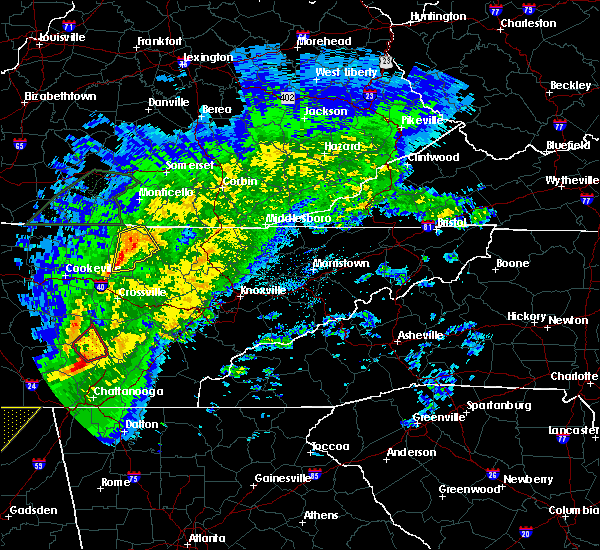 At 208 am cst, a severe thunderstorm was located 9 miles east of jamestown, moving northeast at 60 mph (radar indicated). Hazards include 60 mph wind gusts. Expect damage to roofs, siding, and trees. locations impacted include, jamestown, allardt, grimsley, pall mall and pickett state park. A tornado watch remains in effect until 600 am cst for middle tennessee. At 208 am cst, a severe thunderstorm was located 9 miles east of jamestown, moving northeast at 60 mph (radar indicated). Hazards include 60 mph wind gusts. Expect damage to roofs, siding, and trees. locations impacted include, jamestown, allardt, grimsley, pall mall and pickett state park. A tornado watch remains in effect until 600 am cst for middle tennessee.
|
| 11/6/2018 1:48 AM CST |
 At 147 am cst, a severe thunderstorm was located 10 miles east of livingston, moving northeast at 60 mph (radar indicated). Hazards include 60 mph wind gusts. expect damage to roofs, siding, and trees At 147 am cst, a severe thunderstorm was located 10 miles east of livingston, moving northeast at 60 mph (radar indicated). Hazards include 60 mph wind gusts. expect damage to roofs, siding, and trees
|
| 7/20/2018 8:34 PM CDT |
 At 834 pm cdt, a severe thunderstorm capable of producing a tornado was located near monterey, or 13 miles south of livingston, moving east at 20 mph (radar indicated rotation). Hazards include tornado and quarter size hail. Flying debris will be dangerous to those caught without shelter. mobile homes will be damaged or destroyed. damage to roofs, windows, and vehicles will occur. tree damage is likely. this tornadic thunderstorm will remain over mainly rural areas of southeastern overton, northwestern cumberland, northeastern putnam and southwestern fentress counties, including the following locations, crawford, grimsley, rickman, slate springs and clarkrange. This includes interstate 40 between mile markers 293 and 315. At 834 pm cdt, a severe thunderstorm capable of producing a tornado was located near monterey, or 13 miles south of livingston, moving east at 20 mph (radar indicated rotation). Hazards include tornado and quarter size hail. Flying debris will be dangerous to those caught without shelter. mobile homes will be damaged or destroyed. damage to roofs, windows, and vehicles will occur. tree damage is likely. this tornadic thunderstorm will remain over mainly rural areas of southeastern overton, northwestern cumberland, northeastern putnam and southwestern fentress counties, including the following locations, crawford, grimsley, rickman, slate springs and clarkrange. This includes interstate 40 between mile markers 293 and 315.
|
| 7/20/2018 7:29 PM CDT |
 At 728 pm cdt, severe thunderstorms were located along a line extending from sunnybrook to 9 miles west of byrdstown to near livingston, moving east at 30 mph (radar indicated). Hazards include 60 mph wind gusts and quarter size hail. Hail damage to vehicles is expected. expect wind damage to roofs, siding, and trees. locations impacted include, livingston, jamestown, celina, gainesboro, byrdstown, allardt, wolf river dock, dale hollow lake, pall mall, pickett state park, standing stone state park and grimsley. A tornado watch remains in effect until 200 am cdt for middle tennessee. At 728 pm cdt, severe thunderstorms were located along a line extending from sunnybrook to 9 miles west of byrdstown to near livingston, moving east at 30 mph (radar indicated). Hazards include 60 mph wind gusts and quarter size hail. Hail damage to vehicles is expected. expect wind damage to roofs, siding, and trees. locations impacted include, livingston, jamestown, celina, gainesboro, byrdstown, allardt, wolf river dock, dale hollow lake, pall mall, pickett state park, standing stone state park and grimsley. A tornado watch remains in effect until 200 am cdt for middle tennessee.
|
| 7/20/2018 7:12 PM CDT |
 At 711 pm cdt, severe thunderstorms were located along a line extending from near albany to near celina to 7 miles northeast of gainesboro, moving east at 30 mph (radar indicated). Hazards include 60 mph wind gusts and quarter size hail. Hail damage to vehicles is expected. Expect wind damage to roofs, siding, and trees. At 711 pm cdt, severe thunderstorms were located along a line extending from near albany to near celina to 7 miles northeast of gainesboro, moving east at 30 mph (radar indicated). Hazards include 60 mph wind gusts and quarter size hail. Hail damage to vehicles is expected. Expect wind damage to roofs, siding, and trees.
|
| 6/27/2018 3:38 PM CDT |
 At 337 pm cdt, severe thunderstorms were located along a line extending from allardt to near monterey, moving southeast at 35 mph (radar indicated. at 330 pm cdt, several reports of trees and power lines being blown down have been received across clay, jackson, and overton counties with these storms). Hazards include 60 mph wind gusts. Expect damage to roofs, siding, and trees. Locations impacted include, jamestown, allardt, crawford, grimsley, rickman and clarkrange. At 337 pm cdt, severe thunderstorms were located along a line extending from allardt to near monterey, moving southeast at 35 mph (radar indicated. at 330 pm cdt, several reports of trees and power lines being blown down have been received across clay, jackson, and overton counties with these storms). Hazards include 60 mph wind gusts. Expect damage to roofs, siding, and trees. Locations impacted include, jamestown, allardt, crawford, grimsley, rickman and clarkrange.
|
| 6/27/2018 3:18 PM CDT |
 At 317 pm cdt, severe thunderstorms were located along a line extending from near jamestown to 8 miles north of monterey to near gainesboro, moving southeast at 40 mph (emergency management. at 311 pm cdt, several trees and power lines were reportedly blown down across livingston with these storms). Hazards include 60 mph wind gusts. Expect damage to roofs, siding, and trees. Locations impacted include, livingston, jamestown, celina, gainesboro, byrdstown, allardt, grimsley, whitleyville, rickman, pall mall, wolf river dock, clarkrange, crawford, dale hollow lake, pickett state park and standing stone state park. At 317 pm cdt, severe thunderstorms were located along a line extending from near jamestown to 8 miles north of monterey to near gainesboro, moving southeast at 40 mph (emergency management. at 311 pm cdt, several trees and power lines were reportedly blown down across livingston with these storms). Hazards include 60 mph wind gusts. Expect damage to roofs, siding, and trees. Locations impacted include, livingston, jamestown, celina, gainesboro, byrdstown, allardt, grimsley, whitleyville, rickman, pall mall, wolf river dock, clarkrange, crawford, dale hollow lake, pickett state park and standing stone state park.
|
| 6/27/2018 2:58 PM CDT |
 At 257 pm cdt, severe thunderstorms were located along a line extending from near byrdstown to livingston to red boiling springs, moving southeast at 35 mph (radar indicated). Hazards include 60 mph wind gusts and penny size hail. expect damage to roofs, siding, and trees At 257 pm cdt, severe thunderstorms were located along a line extending from near byrdstown to livingston to red boiling springs, moving southeast at 35 mph (radar indicated). Hazards include 60 mph wind gusts and penny size hail. expect damage to roofs, siding, and trees
|
| 6/26/2018 2:54 PM CDT |
 At 253 pm cdt, severe thunderstorms were located along a line extending from near jamestown to near gainesboro, moving east at 30 mph (radar indicated). Hazards include 60 mph wind gusts. Expect damage to roofs, siding, and trees. Locations impacted include, livingston, jamestown, celina, gainesboro, byrdstown, allardt, whitleyville, dale hollow lake, pall mall, pickett state park, standing stone state park and wolf river dock. At 253 pm cdt, severe thunderstorms were located along a line extending from near jamestown to near gainesboro, moving east at 30 mph (radar indicated). Hazards include 60 mph wind gusts. Expect damage to roofs, siding, and trees. Locations impacted include, livingston, jamestown, celina, gainesboro, byrdstown, allardt, whitleyville, dale hollow lake, pall mall, pickett state park, standing stone state park and wolf river dock.
|
| 6/26/2018 2:43 PM CDT |
 At 241 pm cdt, severe thunderstorms were located along a line extending from near byrdstown to gainesboro, moving east at 30 mph (emergency management. at 230 pm cdt, trees were reportedly blown down near byrdstown with these storms). Hazards include 60 mph wind gusts and penny size hail. Expect damage to roofs, siding, and trees. Locations impacted include, livingston, jamestown, celina, gainesboro, byrdstown, allardt, wolf river dock, whitleyville, dale hollow lake, pall mall, pickett state park and standing stone state park. At 241 pm cdt, severe thunderstorms were located along a line extending from near byrdstown to gainesboro, moving east at 30 mph (emergency management. at 230 pm cdt, trees were reportedly blown down near byrdstown with these storms). Hazards include 60 mph wind gusts and penny size hail. Expect damage to roofs, siding, and trees. Locations impacted include, livingston, jamestown, celina, gainesboro, byrdstown, allardt, wolf river dock, whitleyville, dale hollow lake, pall mall, pickett state park and standing stone state park.
|
| 6/26/2018 2:22 PM CDT |
 At 221 pm cdt, severe thunderstorms were located along a line extending from near dale hollow lake to gainesboro, moving east at 30 mph (radar indicated. at 215 pm cdt, trees were reportedly blown down in monroe county, kentucky with this line of storms). Hazards include 60 mph wind gusts and penny size hail. expect damage to roofs, siding, and trees At 221 pm cdt, severe thunderstorms were located along a line extending from near dale hollow lake to gainesboro, moving east at 30 mph (radar indicated. at 215 pm cdt, trees were reportedly blown down in monroe county, kentucky with this line of storms). Hazards include 60 mph wind gusts and penny size hail. expect damage to roofs, siding, and trees
|
| 4/4/2018 12:03 AM EDT |
 At 1103 pm cdt, severe thunderstorms were located along a line extending from near blue heron to 6 miles northwest of crossville, moving east at 50 mph (radar indicated). Hazards include 60 mph wind gusts and quarter size hail. Hail damage to vehicles is expected. expect wind damage to roofs, siding, and trees. locations impacted include, allardt, grimsley, slate springs and clarkrange. This includes interstate 40 between mile markers 310 and 315. At 1103 pm cdt, severe thunderstorms were located along a line extending from near blue heron to 6 miles northwest of crossville, moving east at 50 mph (radar indicated). Hazards include 60 mph wind gusts and quarter size hail. Hail damage to vehicles is expected. expect wind damage to roofs, siding, and trees. locations impacted include, allardt, grimsley, slate springs and clarkrange. This includes interstate 40 between mile markers 310 and 315.
|
| 4/3/2018 10:23 PM CDT |
 At 1023 pm cdt, severe thunderstorms were located along a line extending from near livingston to cookeville, moving northeast at 75 mph (radar indicated). Hazards include 60 mph wind gusts and quarter size hail. Hail damage to vehicles is expected. Expect wind damage to roofs, siding, and trees. At 1023 pm cdt, severe thunderstorms were located along a line extending from near livingston to cookeville, moving northeast at 75 mph (radar indicated). Hazards include 60 mph wind gusts and quarter size hail. Hail damage to vehicles is expected. Expect wind damage to roofs, siding, and trees.
|
| 5/27/2017 9:29 PM EDT |
 At 829 pm cdt, severe thunderstorms were located along a line extending from byrdstown to sparta, moving east at 55 mph. these are very dangerous storms (radar indicated). Hazards include 80 mph wind gusts and quarter size hail. Flying debris will be dangerous to those caught without shelter. mobile homes will be heavily damaged. expect considerable damage to roofs, windows, and vehicles. extensive tree damage and power outages are likely. Locations impacted include, cookeville, livingston, jamestown, byrdstown, fairfield glade, algood, monterey, allardt, grimsley, slate springs, rickman, pall mall, wolf river dock, clarkrange, crawford and pickett state park. At 829 pm cdt, severe thunderstorms were located along a line extending from byrdstown to sparta, moving east at 55 mph. these are very dangerous storms (radar indicated). Hazards include 80 mph wind gusts and quarter size hail. Flying debris will be dangerous to those caught without shelter. mobile homes will be heavily damaged. expect considerable damage to roofs, windows, and vehicles. extensive tree damage and power outages are likely. Locations impacted include, cookeville, livingston, jamestown, byrdstown, fairfield glade, algood, monterey, allardt, grimsley, slate springs, rickman, pall mall, wolf river dock, clarkrange, crawford and pickett state park.
|
| 5/27/2017 8:06 PM CDT |
 At 805 pm cdt, severe thunderstorms were located along a line extending from near celina to 7woodbury, moving east at 45 mph (radar indicated). Hazards include 70 mph wind gusts and quarter size hail. Hail damage to vehicles is expected. expect considerable tree damage. Wind damage is also likely to mobile homes, roofs, and outbuildings. At 805 pm cdt, severe thunderstorms were located along a line extending from near celina to 7woodbury, moving east at 45 mph (radar indicated). Hazards include 70 mph wind gusts and quarter size hail. Hail damage to vehicles is expected. expect considerable tree damage. Wind damage is also likely to mobile homes, roofs, and outbuildings.
|
| 5/27/2017 7:32 PM CDT |
 At 732 pm cdt, a severe thunderstorm was located near jamestown, moving east at 35 mph (radar indicated). Hazards include 60 mph wind gusts and half dollar size hail. Hail damage to vehicles is expected. expect wind damage to roofs, siding, and trees. Locations impacted include, jamestown, allardt and grimsley. At 732 pm cdt, a severe thunderstorm was located near jamestown, moving east at 35 mph (radar indicated). Hazards include 60 mph wind gusts and half dollar size hail. Hail damage to vehicles is expected. expect wind damage to roofs, siding, and trees. Locations impacted include, jamestown, allardt and grimsley.
|
| 5/27/2017 7:19 PM CDT |
 At 719 pm cdt, a severe thunderstorm was located 9 miles east of livingston, moving east at 25 mph (radar indicated). Hazards include 60 mph wind gusts and half dollar size hail. Hail damage to vehicles is expected. Expect wind damage to roofs, siding, and trees. At 719 pm cdt, a severe thunderstorm was located 9 miles east of livingston, moving east at 25 mph (radar indicated). Hazards include 60 mph wind gusts and half dollar size hail. Hail damage to vehicles is expected. Expect wind damage to roofs, siding, and trees.
|
| 3/1/2017 10:06 AM EST |
 At 904 am cst, severe thunderstorms were located along a line extending from co-operative to near fairfield glade, moving east at 65 mph (radar indicated). Hazards include 60 mph wind gusts. Expect damage to roofs, siding, and trees. locations impacted include, crossville, jamestown, fairfield glade, crab orchard, allardt, grimsley, lake tansi, cumberland mountain state park, slate springs, clarkrange and pickett state park. A tornado watch remains in effect until 1000 am cst for middle tennessee. At 904 am cst, severe thunderstorms were located along a line extending from co-operative to near fairfield glade, moving east at 65 mph (radar indicated). Hazards include 60 mph wind gusts. Expect damage to roofs, siding, and trees. locations impacted include, crossville, jamestown, fairfield glade, crab orchard, allardt, grimsley, lake tansi, cumberland mountain state park, slate springs, clarkrange and pickett state park. A tornado watch remains in effect until 1000 am cst for middle tennessee.
|
| 3/1/2017 9:53 AM EST |
 At 852 am cst, severe thunderstorms were located along a line extending from great meadows campsites to 6 miles southwest of crossville, moving east at 65 mph (radar indicated). Hazards include 60 mph wind gusts. Expect damage to roofs, siding, and trees. locations impacted include, crossville, jamestown, fairfield glade, crab orchard, allardt, pleasant hill, grimsley, cumberland mountain state park, slate springs, pall mall, lake tansi, clarkrange, crawford and pickett state park. A tornado watch remains in effect until 1000 am cst for middle tennessee. At 852 am cst, severe thunderstorms were located along a line extending from great meadows campsites to 6 miles southwest of crossville, moving east at 65 mph (radar indicated). Hazards include 60 mph wind gusts. Expect damage to roofs, siding, and trees. locations impacted include, crossville, jamestown, fairfield glade, crab orchard, allardt, pleasant hill, grimsley, cumberland mountain state park, slate springs, pall mall, lake tansi, clarkrange, crawford and pickett state park. A tornado watch remains in effect until 1000 am cst for middle tennessee.
|
| 3/1/2017 9:43 AM EST |
 At 843 am cst, severe thunderstorms were located along a line extending from near mount pisgah to 12 miles east of sparta, moving east at 90 mph (radar indicated). Hazards include 70 mph wind gusts. Expect considerable tree damage. Damage is likely to mobile homes, roofs, and outbuildings. At 843 am cst, severe thunderstorms were located along a line extending from near mount pisgah to 12 miles east of sparta, moving east at 90 mph (radar indicated). Hazards include 70 mph wind gusts. Expect considerable tree damage. Damage is likely to mobile homes, roofs, and outbuildings.
|
| 3/1/2017 8:35 AM CST |
 At 835 am cst, severe thunderstorms were located along a line extending from sunnybrook to 7 miles southeast of sparta, moving east at 75 mph (radar indicated). Hazards include 70 mph wind gusts and penny size hail. Expect considerable tree damage. damage is likely to mobile homes, roofs, and outbuildings. locations impacted include, cookeville, crossville, sparta, livingston, jamestown, byrdstown, algood, monterey, allardt, pleasant hill, doyle, grimsley, hamptons crossroads, bakers crossroads, virgin falls state natural area, rickman, pall mall, indian rock lake, clarkrange and crawford. A tornado watch remains in effect until 1000 am cst for middle tennessee. At 835 am cst, severe thunderstorms were located along a line extending from sunnybrook to 7 miles southeast of sparta, moving east at 75 mph (radar indicated). Hazards include 70 mph wind gusts and penny size hail. Expect considerable tree damage. damage is likely to mobile homes, roofs, and outbuildings. locations impacted include, cookeville, crossville, sparta, livingston, jamestown, byrdstown, algood, monterey, allardt, pleasant hill, doyle, grimsley, hamptons crossroads, bakers crossroads, virgin falls state natural area, rickman, pall mall, indian rock lake, clarkrange and crawford. A tornado watch remains in effect until 1000 am cst for middle tennessee.
|
| 3/1/2017 8:20 AM CST |
 At 820 am cst, severe thunderstorms were located along a line extending from 9 miles west of byrdstown to 11 miles southeast of smithville, moving east at 65 mph (radar indicated). Hazards include 70 mph wind gusts and penny size hail. Expect considerable tree damage. Damage is likely to mobile homes, roofs, and outbuildings. At 820 am cst, severe thunderstorms were located along a line extending from 9 miles west of byrdstown to 11 miles southeast of smithville, moving east at 65 mph (radar indicated). Hazards include 70 mph wind gusts and penny size hail. Expect considerable tree damage. Damage is likely to mobile homes, roofs, and outbuildings.
|
| 2/24/2017 10:50 PM CST |
 At 1050 pm cst, a severe thunderstorm was located 9 miles southwest of jamestown, moving northeast at 45 mph (radar indicated). Hazards include 60 mph wind gusts and quarter size hail. Hail damage to vehicles is expected. expect wind damage to roofs, siding, and trees. Locations impacted include, crawford, grimsley and clarkrange. At 1050 pm cst, a severe thunderstorm was located 9 miles southwest of jamestown, moving northeast at 45 mph (radar indicated). Hazards include 60 mph wind gusts and quarter size hail. Hail damage to vehicles is expected. expect wind damage to roofs, siding, and trees. Locations impacted include, crawford, grimsley and clarkrange.
|
| 2/24/2017 10:29 PM CST |
 At 1028 pm cst, a severe thunderstorm was located near monterey, or 11 miles east of cookeville, moving northeast at 45 mph (radar indicated). Hazards include 60 mph wind gusts and quarter size hail. Hail damage to vehicles is expected. Expect wind damage to roofs, siding, and trees. At 1028 pm cst, a severe thunderstorm was located near monterey, or 11 miles east of cookeville, moving northeast at 45 mph (radar indicated). Hazards include 60 mph wind gusts and quarter size hail. Hail damage to vehicles is expected. Expect wind damage to roofs, siding, and trees.
|
| 7/8/2016 10:55 PM CDT |
 At 1054 pm cdt, severe thunderstorms were located along a line extending from near clarkrange to near crossville, moving east at 40 mph (radar indicated). Hazards include 60 mph wind gusts. Expect damage to roofs. siding. And trees. At 1054 pm cdt, severe thunderstorms were located along a line extending from near clarkrange to near crossville, moving east at 40 mph (radar indicated). Hazards include 60 mph wind gusts. Expect damage to roofs. siding. And trees.
|
| 7/8/2016 10:32 PM CDT |
 At 1031 pm cdt, severe thunderstorms were located along a line extending from near byrdstown to near monterey, moving east at 50 mph (radar indicated). Hazards include 60 mph wind gusts and penny size hail. Expect damage to roofs. siding. and trees. Locations impacted include, livingston, jamestown, byrdstown, allardt, rickman, wolf river dock, pall mall, grimsley, pickett state park, crawford and clarkrange. At 1031 pm cdt, severe thunderstorms were located along a line extending from near byrdstown to near monterey, moving east at 50 mph (radar indicated). Hazards include 60 mph wind gusts and penny size hail. Expect damage to roofs. siding. and trees. Locations impacted include, livingston, jamestown, byrdstown, allardt, rickman, wolf river dock, pall mall, grimsley, pickett state park, crawford and clarkrange.
|
| 7/8/2016 9:58 PM CDT |
 At 958 pm cdt, severe thunderstorms were located along a line extending from near celina to near baxter, moving east at 60 mph (radar indicated). Hazards include 70 mph wind gusts and penny size hail. Expect considerable tree damage. damage is likely to mobile homes, roofs, and outbuildings. Locations impacted include, livingston, jamestown, celina, gainesboro, byrdstown, allardt, granville, rickman, wolf river dock, standing stone state park, whitleyville, crawford, moss, pall mall, dale hollow lake, grimsley, pickett state park and clarkrange. At 958 pm cdt, severe thunderstorms were located along a line extending from near celina to near baxter, moving east at 60 mph (radar indicated). Hazards include 70 mph wind gusts and penny size hail. Expect considerable tree damage. damage is likely to mobile homes, roofs, and outbuildings. Locations impacted include, livingston, jamestown, celina, gainesboro, byrdstown, allardt, granville, rickman, wolf river dock, standing stone state park, whitleyville, crawford, moss, pall mall, dale hollow lake, grimsley, pickett state park and clarkrange.
|
| 7/8/2016 9:50 PM CDT |
 At 950 pm cdt, severe thunderstorms were located along a line extending from tompkinsville to baxter, moving east at 50 mph (radar indicated). Hazards include 60 mph wind gusts and penny size hail. Expect damage to roofs. siding. And trees. At 950 pm cdt, severe thunderstorms were located along a line extending from tompkinsville to baxter, moving east at 50 mph (radar indicated). Hazards include 60 mph wind gusts and penny size hail. Expect damage to roofs. siding. And trees.
|
| 7/8/2016 5:04 PM CDT |
 At 502 pm cdt, severe thunderstorms were located along a line extending from 13 miles northeast of monterey to near baxter, moving east at 35 mph (public. at 500 pm cdt...quarter size hail was reported in cookeville). Hazards include 60 mph wind gusts and quarter size hail. Hail damage to vehicles is expected. expect wind damage to roofs, siding, and trees. Locations impacted include, cookeville, crossville, sparta, fairfield glade, algood, monterey, baxter, crab orchard, pleasant hill, doyle, slate springs, virgin falls state natural area, burgess falls state park, hamptons crossroads, lake tansi, cumberland mountain state park, bakers crossroads and clarkrange. At 502 pm cdt, severe thunderstorms were located along a line extending from 13 miles northeast of monterey to near baxter, moving east at 35 mph (public. at 500 pm cdt...quarter size hail was reported in cookeville). Hazards include 60 mph wind gusts and quarter size hail. Hail damage to vehicles is expected. expect wind damage to roofs, siding, and trees. Locations impacted include, cookeville, crossville, sparta, fairfield glade, algood, monterey, baxter, crab orchard, pleasant hill, doyle, slate springs, virgin falls state natural area, burgess falls state park, hamptons crossroads, lake tansi, cumberland mountain state park, bakers crossroads and clarkrange.
|
| 7/8/2016 4:56 PM CDT |
 At 455 pm cdt, severe thunderstorms were located along a line extending from 12 miles northeast of monterey to near baxter, moving east at 35 mph (radar indicated). Hazards include 60 mph wind gusts and quarter size hail. Hail damage to vehicles is expected. Expect wind damage to roofs, siding, and trees. At 455 pm cdt, severe thunderstorms were located along a line extending from 12 miles northeast of monterey to near baxter, moving east at 35 mph (radar indicated). Hazards include 60 mph wind gusts and quarter size hail. Hail damage to vehicles is expected. Expect wind damage to roofs, siding, and trees.
|
| 7/8/2016 5:35 PM EDT |
 At 434 pm cdt, severe thunderstorms were located along a line extending from 8 miles north of monterey to 7 miles north of crossville, moving east at 35 mph (radar indicated). Hazards include 60 mph wind gusts and quarter size hail. Hail damage to vehicles is expected. Expect wind damage to roofs, siding, and trees. At 434 pm cdt, severe thunderstorms were located along a line extending from 8 miles north of monterey to 7 miles north of crossville, moving east at 35 mph (radar indicated). Hazards include 60 mph wind gusts and quarter size hail. Hail damage to vehicles is expected. Expect wind damage to roofs, siding, and trees.
|
| 7/8/2016 4:13 PM CDT |
 At 412 pm cdt, a severe thunderstorm was located 9 miles southeast of livingston, moving east at 35 mph (radar indicated). Hazards include 60 mph wind gusts and quarter size hail. Hail damage to vehicles is expected. Expect wind damage to roofs, siding, and trees. At 412 pm cdt, a severe thunderstorm was located 9 miles southeast of livingston, moving east at 35 mph (radar indicated). Hazards include 60 mph wind gusts and quarter size hail. Hail damage to vehicles is expected. Expect wind damage to roofs, siding, and trees.
|
| 7/8/2016 4:04 PM CDT |
 At 404 pm cdt, a severe thunderstorm was located 11 miles north of fairfield glade, or 13 miles west of wartburg, moving east at 35 mph (radar indicated). Hazards include 60 mph wind gusts and half dollar size hail. Hail damage to vehicles is expected. expect wind damage to roofs, siding, and trees. Locations impacted include, fairfield glade, grimsley and clarkrange. At 404 pm cdt, a severe thunderstorm was located 11 miles north of fairfield glade, or 13 miles west of wartburg, moving east at 35 mph (radar indicated). Hazards include 60 mph wind gusts and half dollar size hail. Hail damage to vehicles is expected. expect wind damage to roofs, siding, and trees. Locations impacted include, fairfield glade, grimsley and clarkrange.
|
| 7/8/2016 4:43 PM EDT |
 At 343 pm cdt, a severe thunderstorm was located 12 miles northeast of monterey, or 16 miles south of jamestown, moving east at 35 mph (radar indicated). Hazards include 60 mph wind gusts and half dollar size hail. Hail damage to vehicles is expected. Expect wind damage to roofs, siding, and trees. At 343 pm cdt, a severe thunderstorm was located 12 miles northeast of monterey, or 16 miles south of jamestown, moving east at 35 mph (radar indicated). Hazards include 60 mph wind gusts and half dollar size hail. Hail damage to vehicles is expected. Expect wind damage to roofs, siding, and trees.
|
| 7/7/2016 4:27 PM CDT |
 At 427 pm cdt, a severe thunderstorm was located near jamestown, moving east at 65 mph (radar indicated). Hazards include 60 mph wind gusts and penny size hail. Expect damage to roofs. siding. and trees. Locations impacted include, jamestown, allardt, grimsley, pickett state park and pall mall. At 427 pm cdt, a severe thunderstorm was located near jamestown, moving east at 65 mph (radar indicated). Hazards include 60 mph wind gusts and penny size hail. Expect damage to roofs. siding. and trees. Locations impacted include, jamestown, allardt, grimsley, pickett state park and pall mall.
|
| 7/7/2016 4:02 PM CDT |
 At 402 pm cdt, a severe thunderstorm was located 8 miles west of byrdstown, moving east at 35 mph (radar indicated). Hazards include 60 mph wind gusts and penny size hail. Expect damage to roofs. siding. And trees. At 402 pm cdt, a severe thunderstorm was located 8 miles west of byrdstown, moving east at 35 mph (radar indicated). Hazards include 60 mph wind gusts and penny size hail. Expect damage to roofs. siding. And trees.
|
| 7/6/2016 5:10 PM CDT |
 At 509 pm cdt, severe thunderstorms were located along a line extending from byrdstown to baxter, moving east at 40 mph (radar indicated). Hazards include 60 mph wind gusts and penny size hail. Expect damage to roofs. siding. and trees. Locations impacted include, cookeville, livingston, jamestown, byrdstown, algood, monterey, baxter, allardt, rickman, pall mall, pickett state park and crawford. At 509 pm cdt, severe thunderstorms were located along a line extending from byrdstown to baxter, moving east at 40 mph (radar indicated). Hazards include 60 mph wind gusts and penny size hail. Expect damage to roofs. siding. and trees. Locations impacted include, cookeville, livingston, jamestown, byrdstown, algood, monterey, baxter, allardt, rickman, pall mall, pickett state park and crawford.
|
| 7/6/2016 4:50 PM CDT |
 At 449 pm cdt, severe thunderstorms were located along a line extending from celina to carthage, moving east at 55 mph (radar indicated). Hazards include 60 mph wind gusts and penny size hail. Expect damage to roofs. siding. And trees. At 449 pm cdt, severe thunderstorms were located along a line extending from celina to carthage, moving east at 55 mph (radar indicated). Hazards include 60 mph wind gusts and penny size hail. Expect damage to roofs. siding. And trees.
|
| 7/4/2016 4:39 PM CDT |
 At 438 pm cdt, severe thunderstorms were located along a line extending from near great meadows campsites to 12 miles southeast of livingston, moving east at 40 mph (radar indicated. these storms have a history of blowing down numerous trees and power lines across jackson and smith counties). Hazards include 60 mph wind gusts. Expect damage to roofs. siding. and trees. Locations impacted include, jamestown, byrdstown, allardt, pickett state park and pall mall. At 438 pm cdt, severe thunderstorms were located along a line extending from near great meadows campsites to 12 miles southeast of livingston, moving east at 40 mph (radar indicated. these storms have a history of blowing down numerous trees and power lines across jackson and smith counties). Hazards include 60 mph wind gusts. Expect damage to roofs. siding. and trees. Locations impacted include, jamestown, byrdstown, allardt, pickett state park and pall mall.
|
| 7/4/2016 4:26 PM CDT |
 At 425 pm cdt, severe thunderstorms were located along a line extending from 6 miles southeast of sunnybrook to near livingston, moving east at 50 mph (radar indicated). Hazards include 60 mph wind gusts. Expect damage to roofs. siding. and trees. Locations impacted include, livingston, jamestown, byrdstown, allardt, rickman, wolf river dock, pall mall, pickett state park, crawford and standing stone state park. At 425 pm cdt, severe thunderstorms were located along a line extending from 6 miles southeast of sunnybrook to near livingston, moving east at 50 mph (radar indicated). Hazards include 60 mph wind gusts. Expect damage to roofs. siding. and trees. Locations impacted include, livingston, jamestown, byrdstown, allardt, rickman, wolf river dock, pall mall, pickett state park, crawford and standing stone state park.
|
| 7/4/2016 4:01 PM CDT |
 At 401 pm cdt, severe thunderstorms were located along a line extending from near byrdstown to gainesboro, moving east at 40 mph (radar indicated). Hazards include 60 mph wind gusts. Expect damage to roofs. siding. And trees. At 401 pm cdt, severe thunderstorms were located along a line extending from near byrdstown to gainesboro, moving east at 40 mph (radar indicated). Hazards include 60 mph wind gusts. Expect damage to roofs. siding. And trees.
|
| 7/14/2015 1:52 PM CDT | Golf Ball sized hail reported 1.1 miles ESE of Grimsley, TN, golfball sized hail reported in grimsley |
| 7/14/2015 1:42 PM CDT |
 At 142 pm cdt, a severe thunderstorm was located 8 miles south of jamestown, moving east at 45 mph (radar indicated). Hazards include 60 mph wind gusts and quarter size hail. Hail damage to vehicles is expected. expect wind damage to roofs, siding and trees. Locations impacted include, jamestown, allardt, grimsley and clarkrange. At 142 pm cdt, a severe thunderstorm was located 8 miles south of jamestown, moving east at 45 mph (radar indicated). Hazards include 60 mph wind gusts and quarter size hail. Hail damage to vehicles is expected. expect wind damage to roofs, siding and trees. Locations impacted include, jamestown, allardt, grimsley and clarkrange.
|
| 7/14/2015 1:26 PM CDT |
 At 126 pm cdt, a severe thunderstorm was located 9 miles southeast of livingston, moving east at 40 mph (radar indicated). Hazards include 60 mph wind gusts and quarter size hail. Hail damage to vehicles is expected. expect wind damage to roofs, siding and trees. This severe thunderstorm will remain over mainly rural areas of central fentress and southeastern overton counties, including the following locations, grimsley, allardt, crawford and clarkrange. At 126 pm cdt, a severe thunderstorm was located 9 miles southeast of livingston, moving east at 40 mph (radar indicated). Hazards include 60 mph wind gusts and quarter size hail. Hail damage to vehicles is expected. expect wind damage to roofs, siding and trees. This severe thunderstorm will remain over mainly rural areas of central fentress and southeastern overton counties, including the following locations, grimsley, allardt, crawford and clarkrange.
|
| 7/13/2015 7:25 PM CDT |
 At 724 pm cdt, a severe thunderstorm was located 7 miles east of celina, moving southeast at 25 mph (radar indicated). Hazards include golf ball size hail and 60 mph wind gusts. People and animals outdoors will be injured. expect hail damage to roofs, siding, windows and vehicles. expect wind damage to roofs, siding and trees. this severe storm will be near, livingston around 750 pm cdt. Other locations impacted by this severe thunderstorm include grimsley, standing stone state park, crawford, rickman and dale hollow lake. At 724 pm cdt, a severe thunderstorm was located 7 miles east of celina, moving southeast at 25 mph (radar indicated). Hazards include golf ball size hail and 60 mph wind gusts. People and animals outdoors will be injured. expect hail damage to roofs, siding, windows and vehicles. expect wind damage to roofs, siding and trees. this severe storm will be near, livingston around 750 pm cdt. Other locations impacted by this severe thunderstorm include grimsley, standing stone state park, crawford, rickman and dale hollow lake.
|
| 7/13/2015 6:57 PM CDT |
 At 655 pm cdt, a severe thunderstorm was located 7 miles south of burkesville, or 10 miles northeast of celina, moving south at 25 mph (radar indicated). Hazards include 60 mph wind gusts and half dollar size hail. Hail damage to vehicles is expected. expect wind damage to roofs, siding and trees. this severe thunderstorm will be near, celina around 715 pm cdt. livingston around 750 pm cdt. Other locations impacted by this severe thunderstorm include grimsley, standing stone state park, crawford, rickman and dale hollow lake. At 655 pm cdt, a severe thunderstorm was located 7 miles south of burkesville, or 10 miles northeast of celina, moving south at 25 mph (radar indicated). Hazards include 60 mph wind gusts and half dollar size hail. Hail damage to vehicles is expected. expect wind damage to roofs, siding and trees. this severe thunderstorm will be near, celina around 715 pm cdt. livingston around 750 pm cdt. Other locations impacted by this severe thunderstorm include grimsley, standing stone state park, crawford, rickman and dale hollow lake.
|
| 6/29/2015 8:07 PM CDT |
 At 806 pm cdt, a severe thunderstorm was located over jamestown, moving east at 30 mph (radar indicated). Hazards include 60 mph wind gusts and quarter size hail. Hail damage to vehicles is expected. expect wind damage to roofs, siding and trees. This severe thunderstorm will remain over mainly rural areas of fentress, southwestern pickett and central overton counties, including the following locations, grimsley, allardt and crawford. At 806 pm cdt, a severe thunderstorm was located over jamestown, moving east at 30 mph (radar indicated). Hazards include 60 mph wind gusts and quarter size hail. Hail damage to vehicles is expected. expect wind damage to roofs, siding and trees. This severe thunderstorm will remain over mainly rural areas of fentress, southwestern pickett and central overton counties, including the following locations, grimsley, allardt and crawford.
|
| 6/29/2015 7:48 PM CDT |
 At 747 pm cdt, a severe thunderstorm was located 7 miles west of jamestown, moving east at 30 mph (radar indicated). Hazards include 60 mph wind gusts and quarter size hail. Hail damage to vehicles is expected. expect wind damage to roofs, siding and trees. this severe thunderstorm will be near, jamestown around 800 pm cdt. Other locations impacted by this severe thunderstorm include grimsley, allardt, pickett state park, crawford, pall mall and dale hollow lake. At 747 pm cdt, a severe thunderstorm was located 7 miles west of jamestown, moving east at 30 mph (radar indicated). Hazards include 60 mph wind gusts and quarter size hail. Hail damage to vehicles is expected. expect wind damage to roofs, siding and trees. this severe thunderstorm will be near, jamestown around 800 pm cdt. Other locations impacted by this severe thunderstorm include grimsley, allardt, pickett state park, crawford, pall mall and dale hollow lake.
|
| 5/21/2013 3:00 PM CDT | Numerous trees were blown down and a carport was damaged in the grimsley are in fentress county TN, 3 miles WNW of Grimsley, TN |
| 7/5/2012 5:00 PM CDT | Trees down in grimsle in fentress county TN, 3.1 miles WSW of Grimsley, TN |
| 7/5/2012 4:30 PM CDT | Dannys discount in grimsley roof blow in fentress county TN, 3.1 miles WSW of Grimsley, TN |
Hail Maps for Grimsley, TN
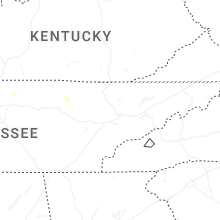


Connect with Interactive Hail Maps