

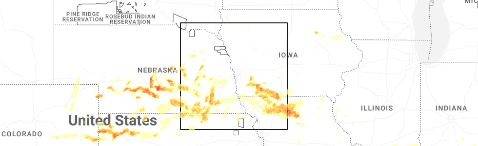
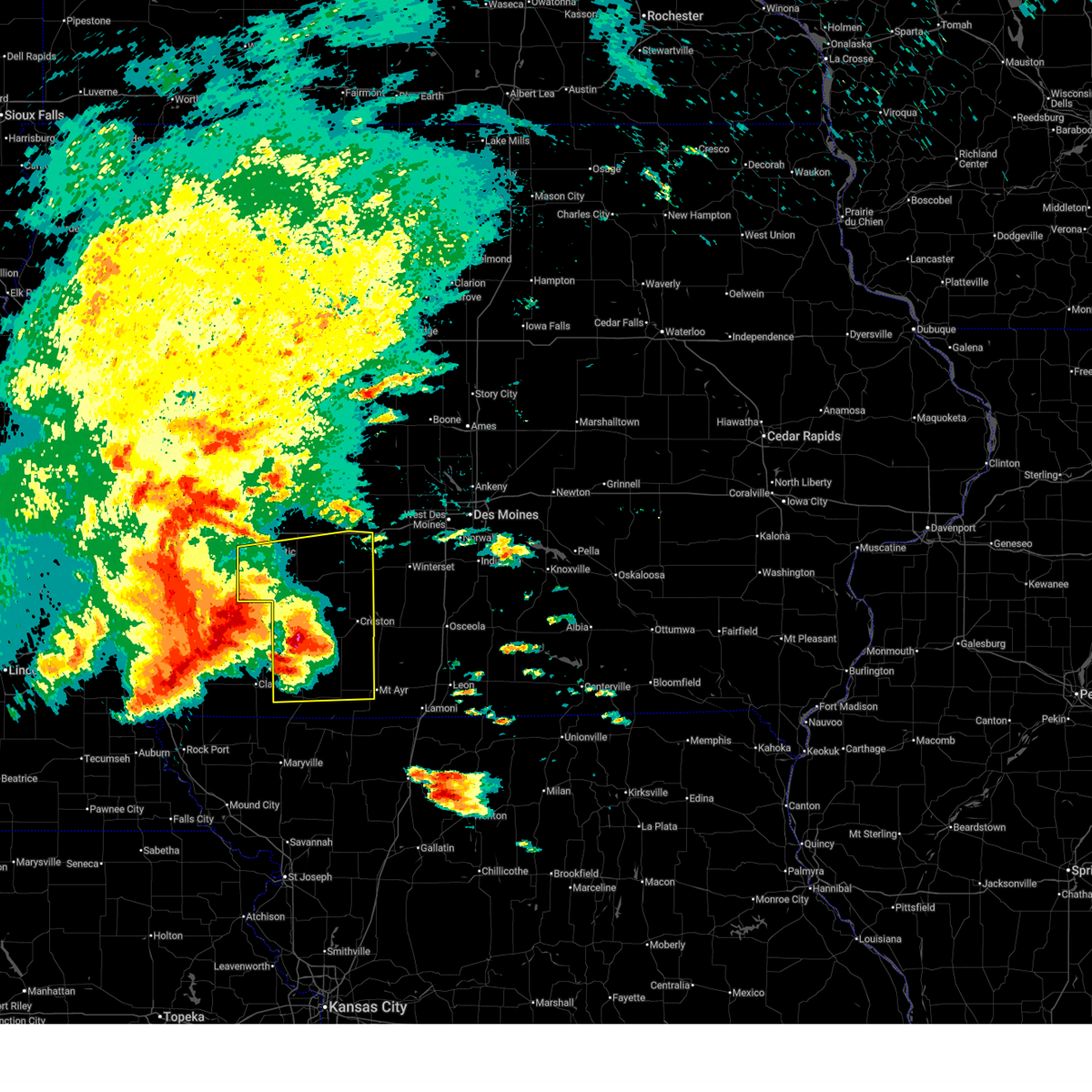
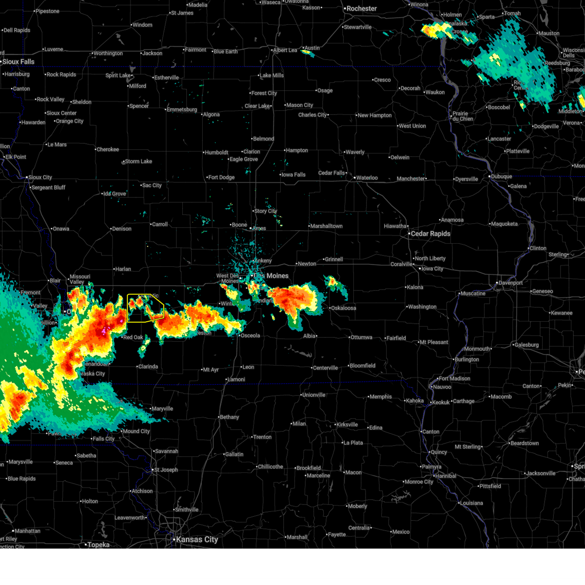
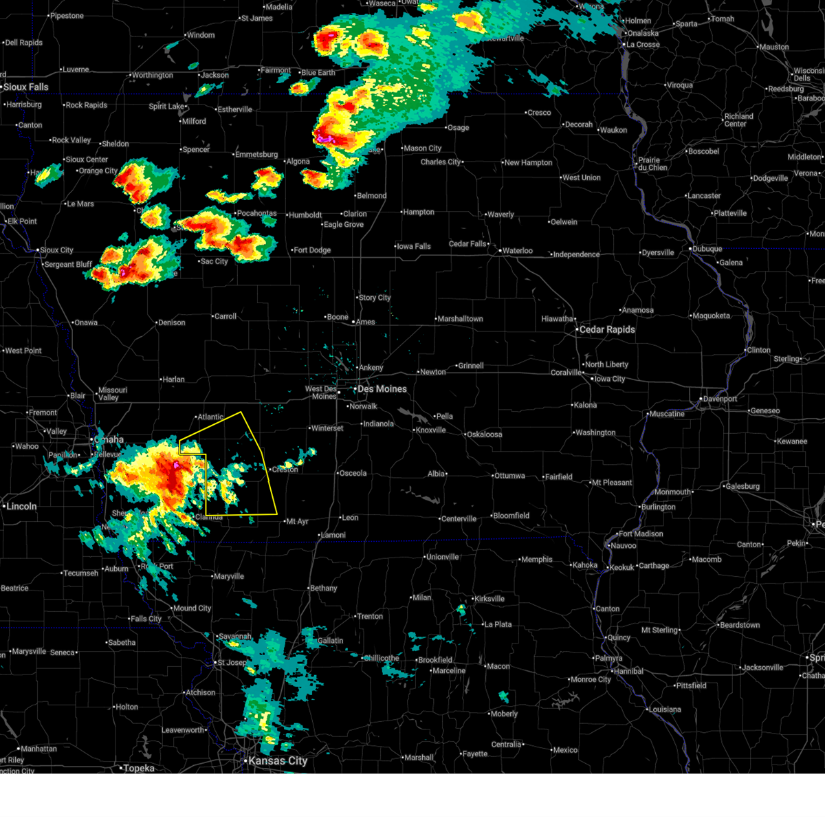
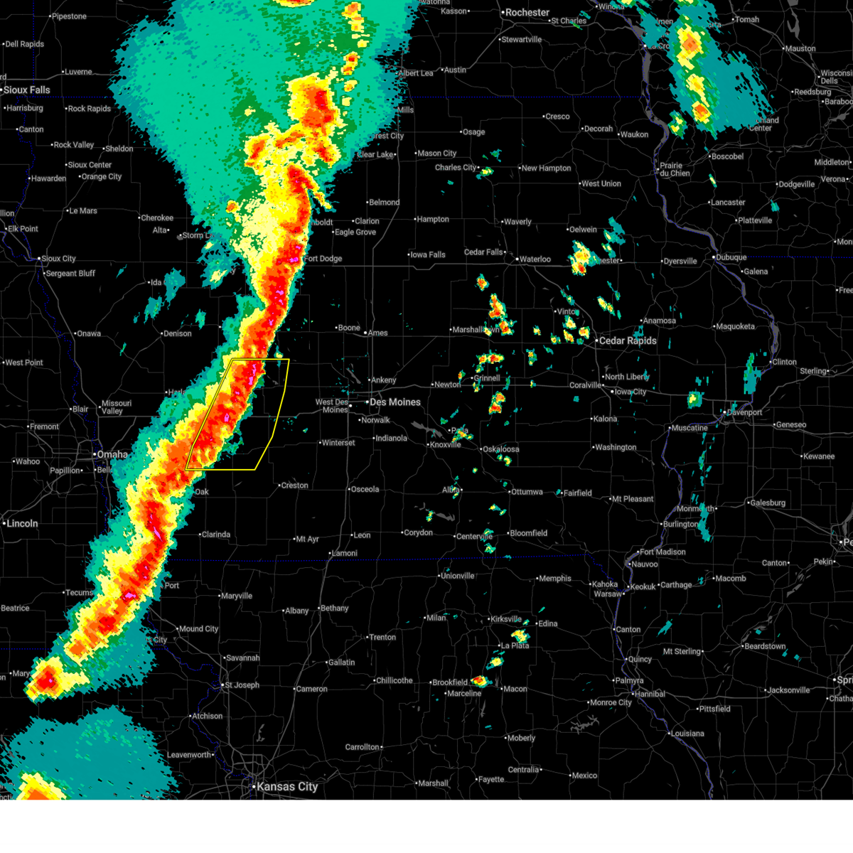
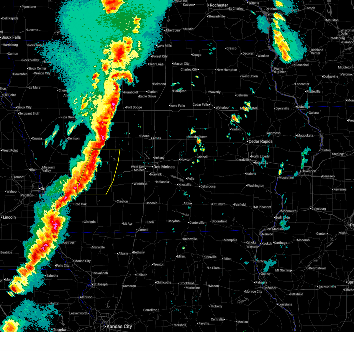
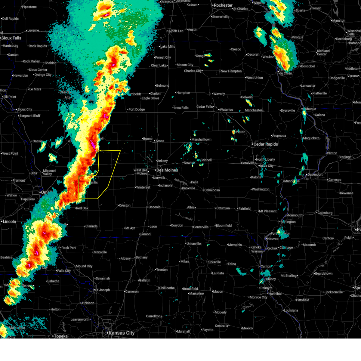
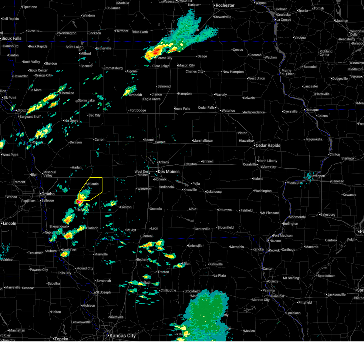
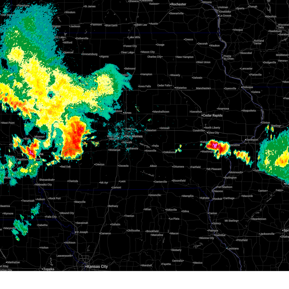
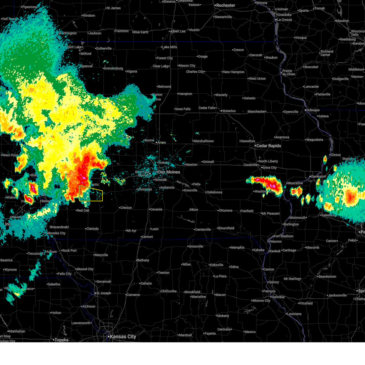
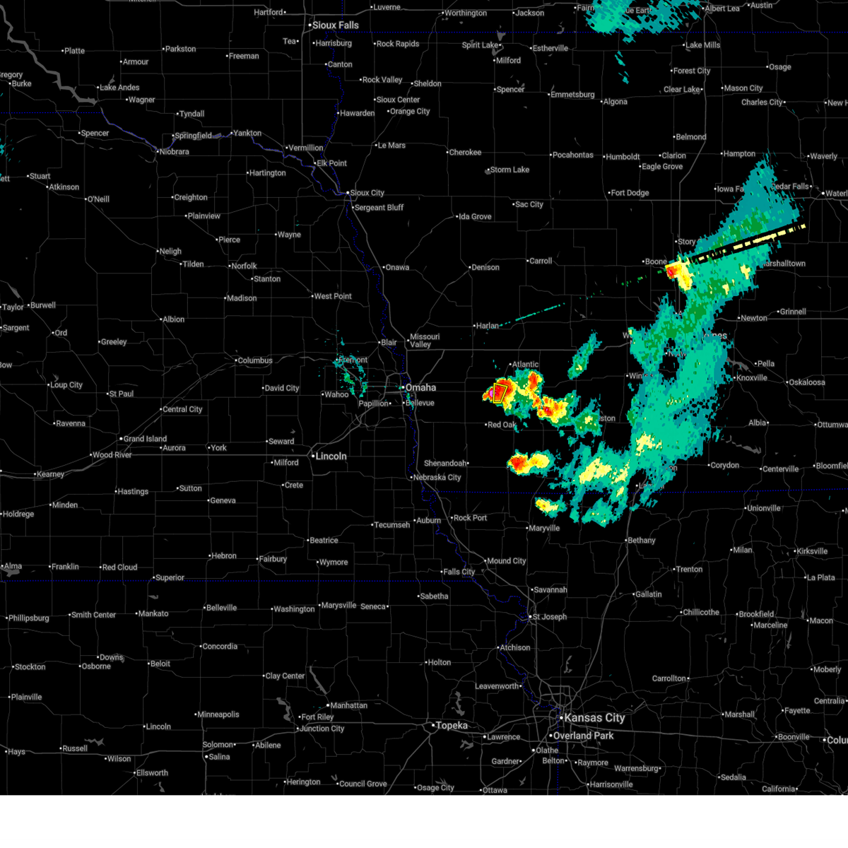
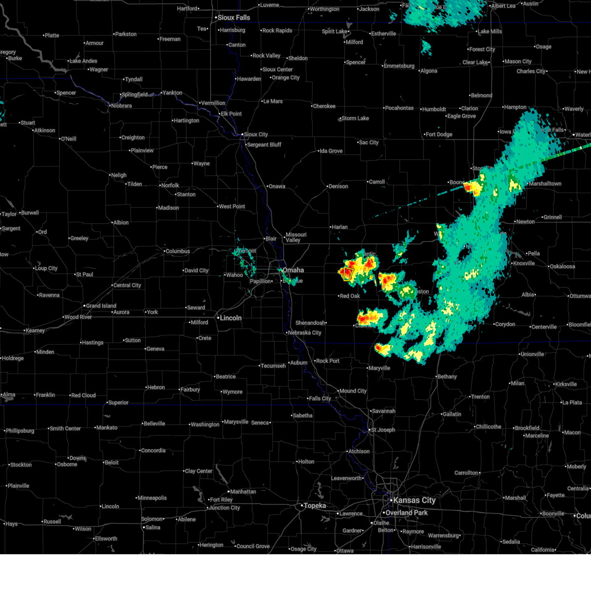
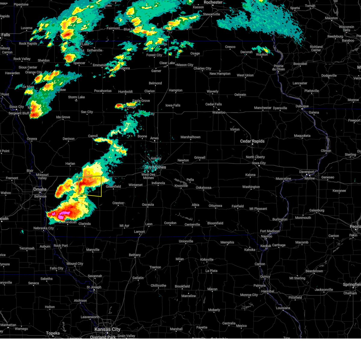
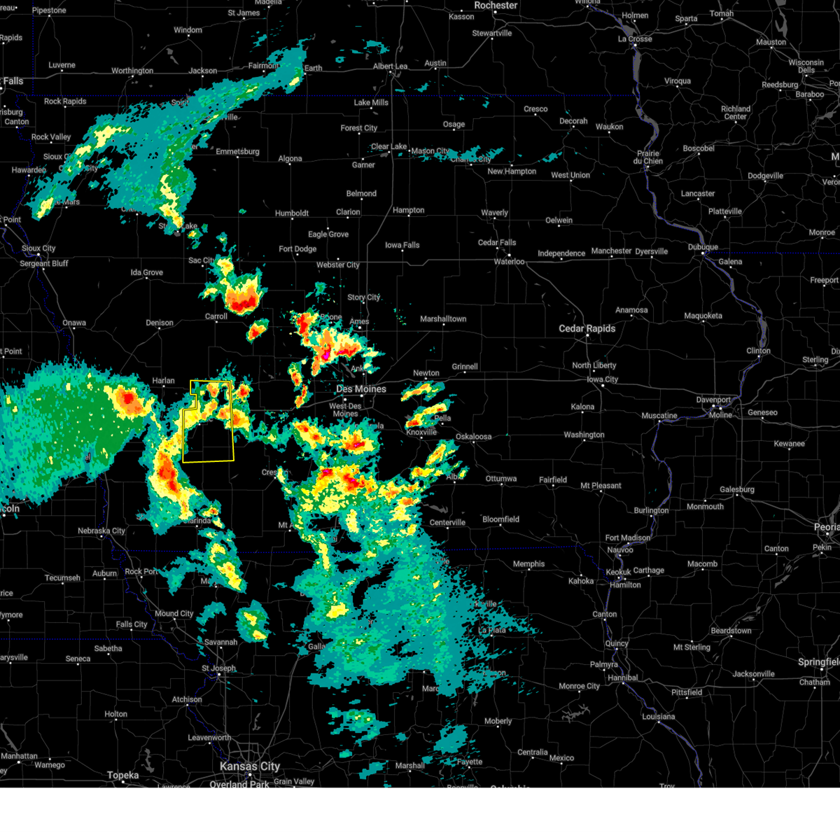
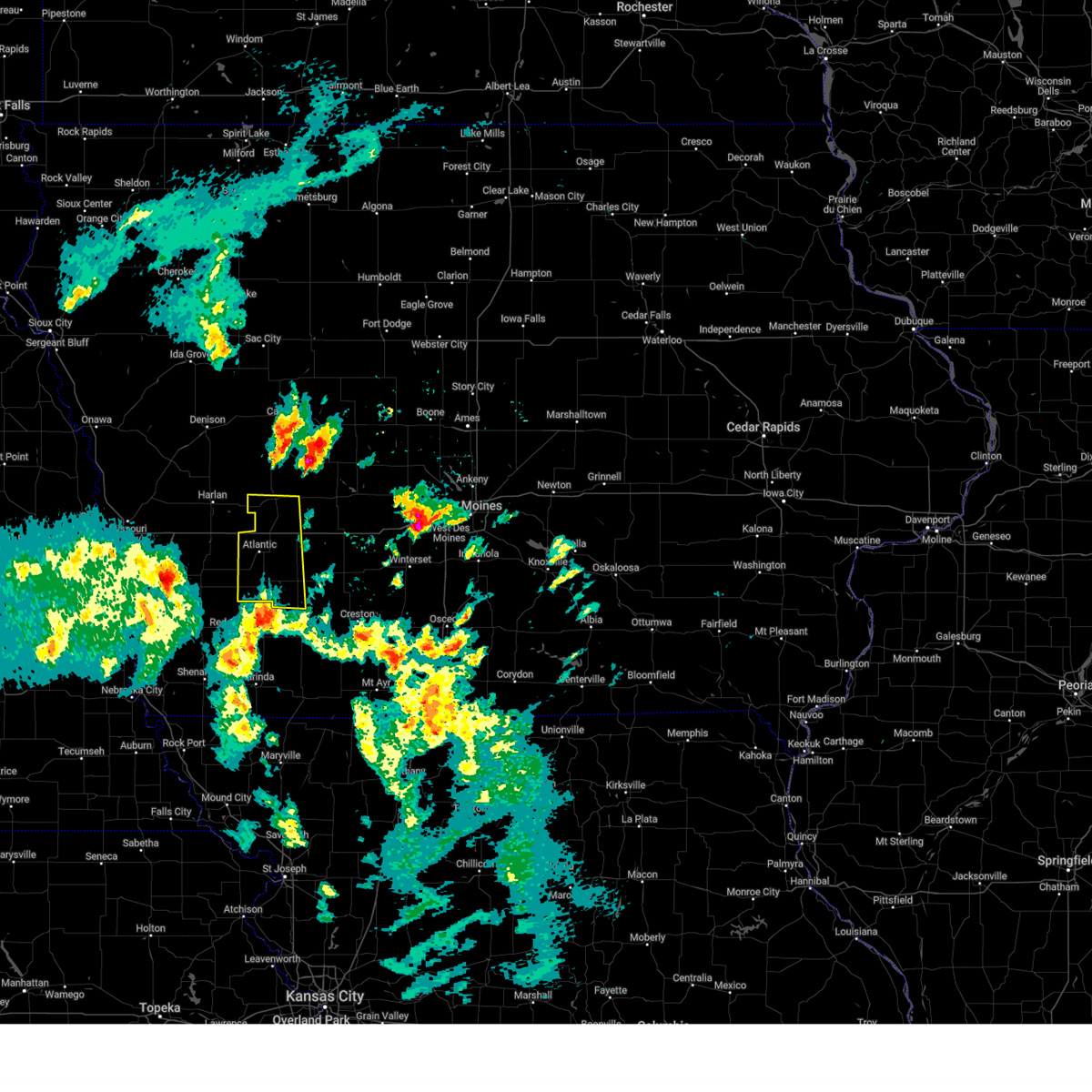
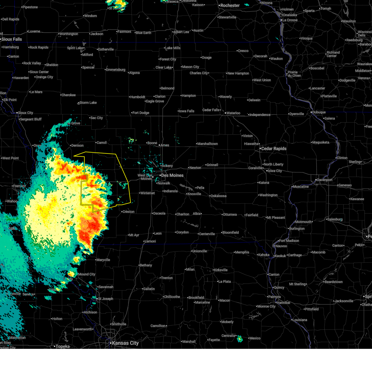
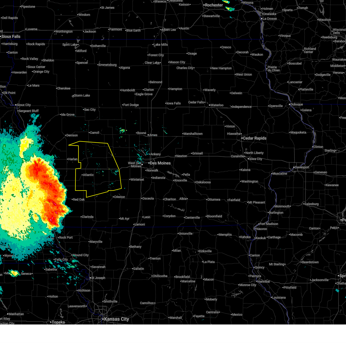
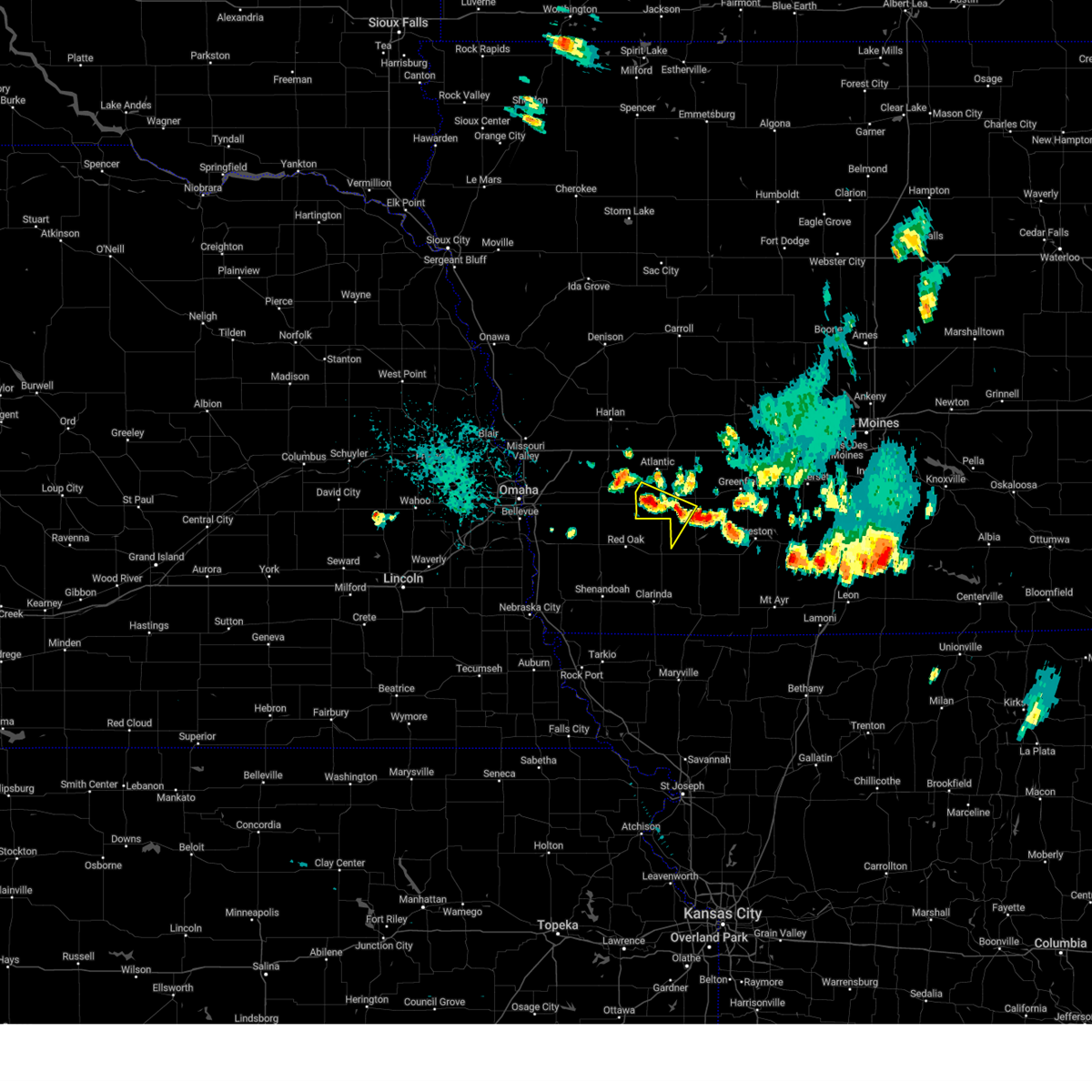
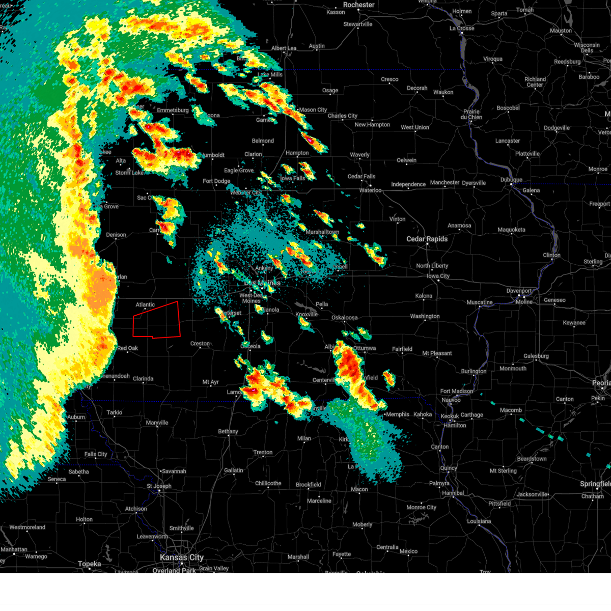
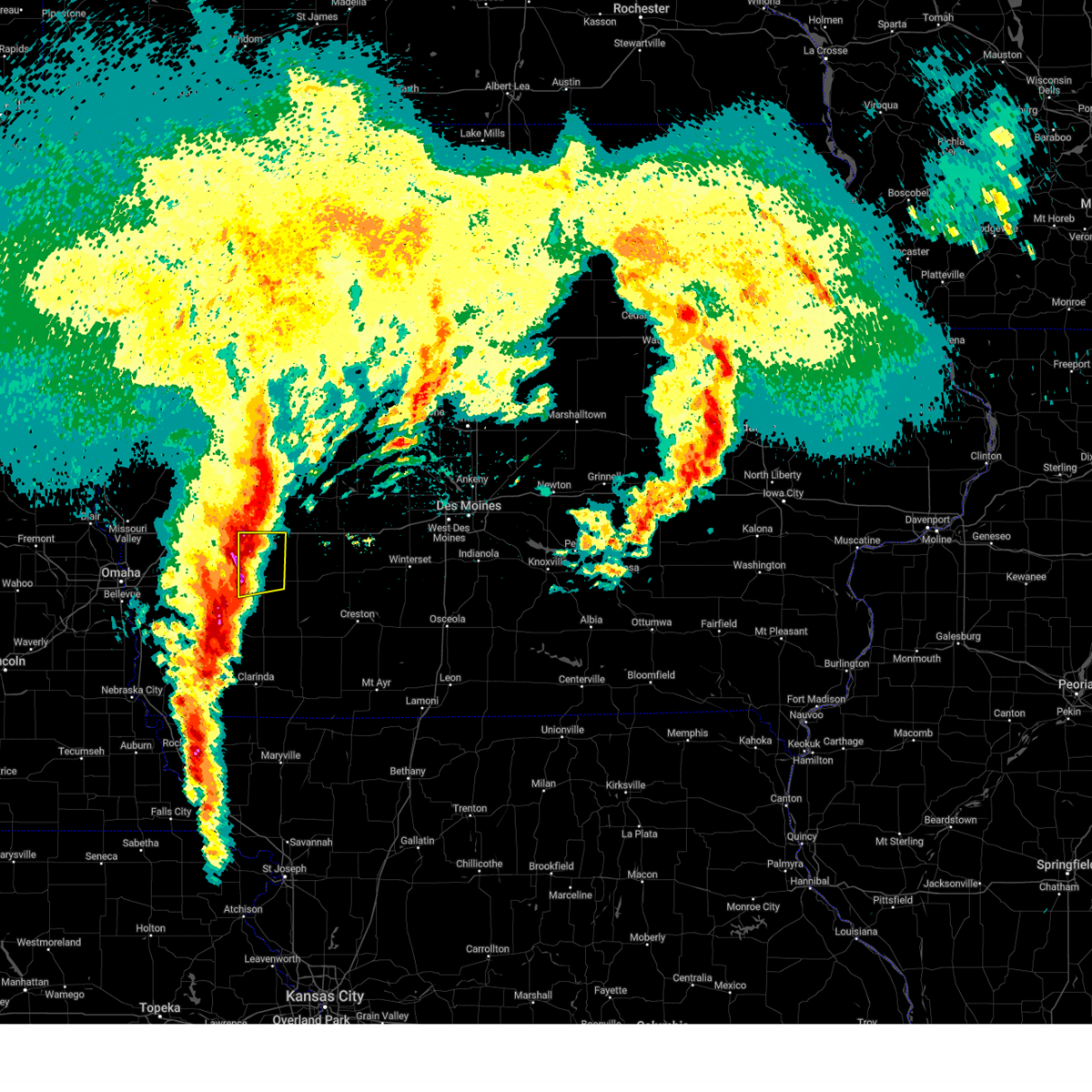
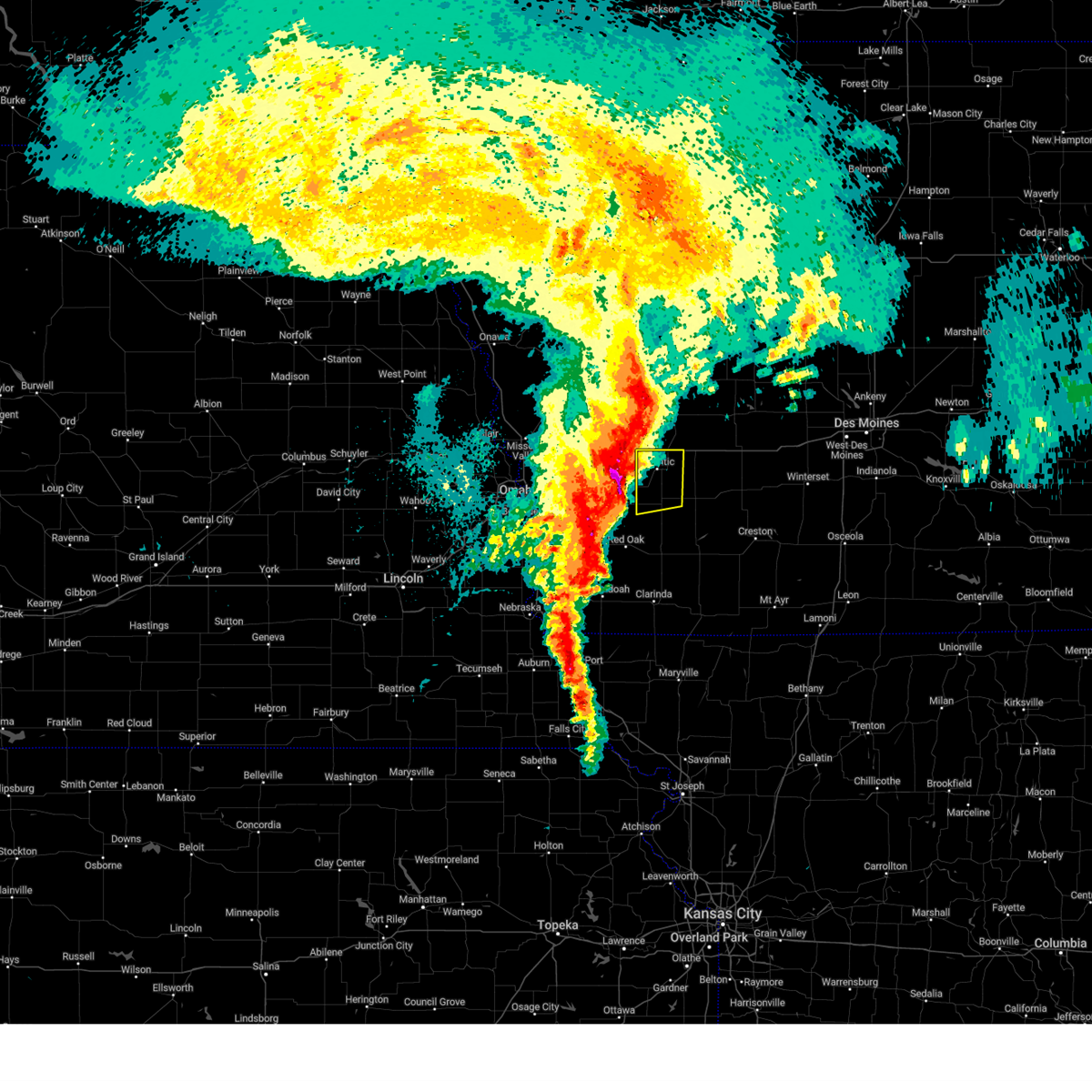
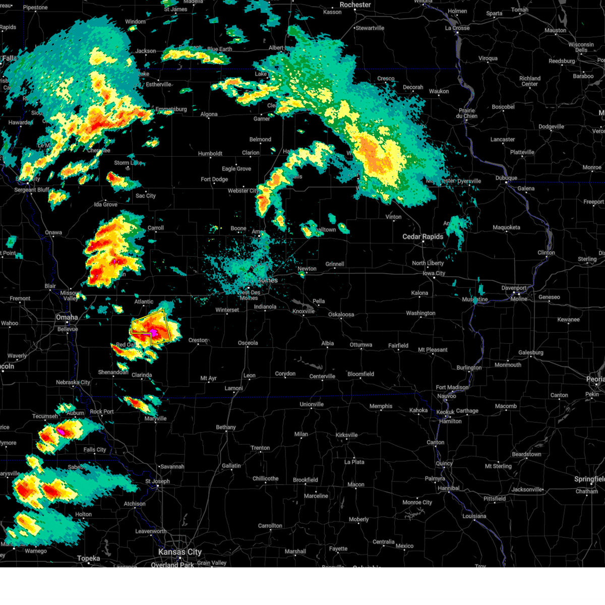
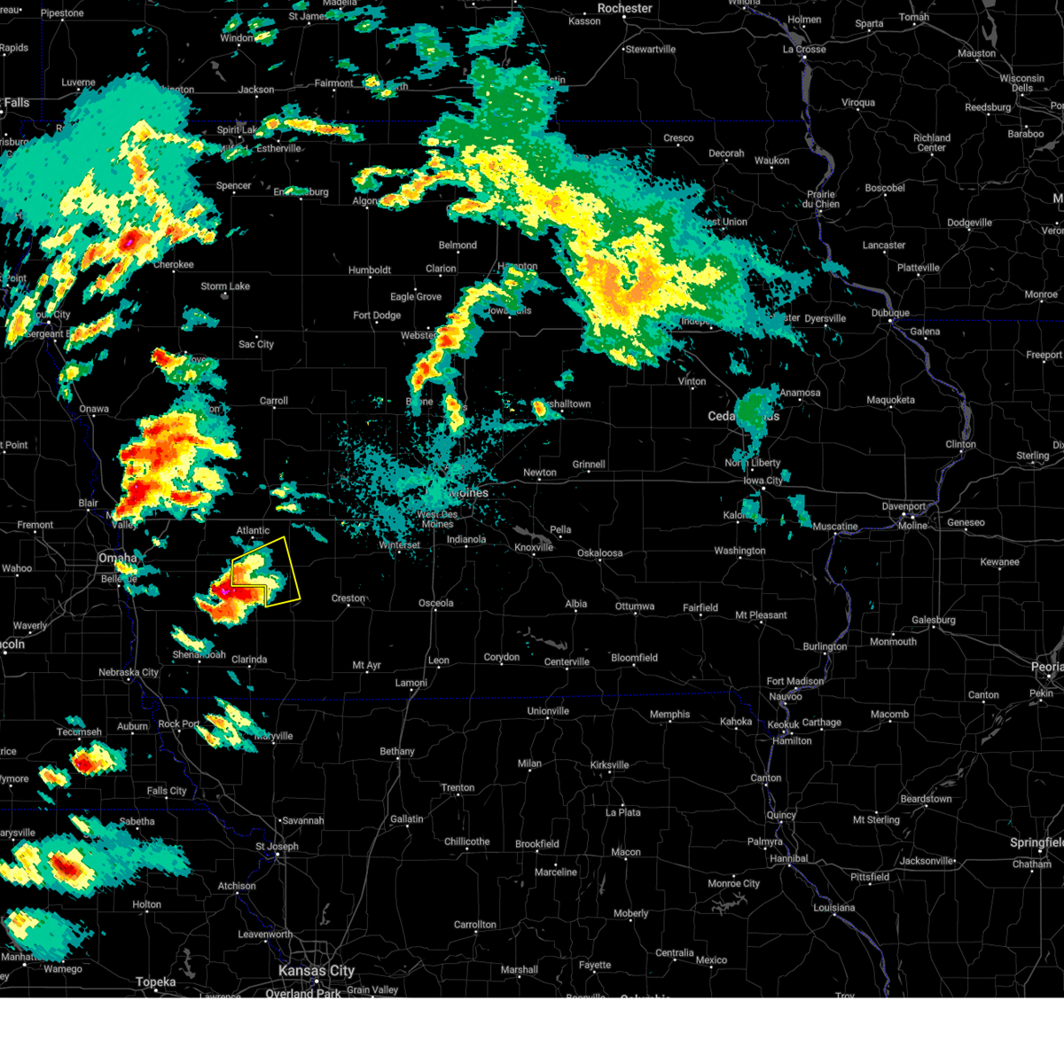
Hail Map for Griswold, IA
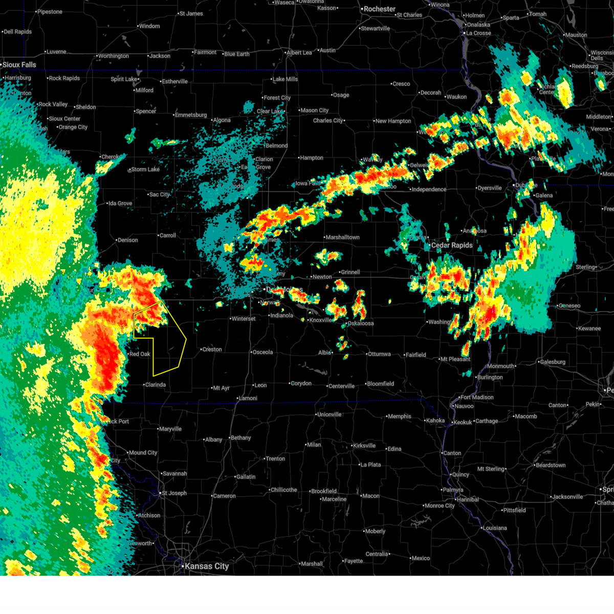
The Griswold, IA area has had 5 reports of on-the-ground hail by trained spotters, and has been under severe weather warnings 16 times during the past 12 months. Doppler radar has detected hail at or near Griswold, IA on 94 occasions, including 9 occasions during the past year.
| Name: | Griswold, IA |
| Where Located: | 41.6 miles E of Omaha, NE |
| Map: | Google Map for Griswold, IA |
| Population: | 1036 |
| Housing Units: | 507 |
| More Info: | Search Google for Griswold, IA |
1
The Top Recent Hail Date for Griswold, IA is Saturday, May 16, 2026 (5th out of 94)
Hail and Wind Damage Spotted near Griswold, IA
| Date / Time | Report Details |
|---|---|
| 7/8/2026 9:53 PM CDT |
 Svrdmx the national weather service in des moines has issued a * severe thunderstorm warning for, western cass county in southwestern iowa, southwestern audubon county in west central iowa, * until 1045 pm cdt. * at 952 pm cdt, severe thunderstorms were located along a line extending from near tennant to near avoca to oakland, moving southeast at 30 mph (radar indicated). Hazards include 60 mph wind gusts and penny size hail. expect damage to roofs, siding, and trees Svrdmx the national weather service in des moines has issued a * severe thunderstorm warning for, western cass county in southwestern iowa, southwestern audubon county in west central iowa, * until 1045 pm cdt. * at 952 pm cdt, severe thunderstorms were located along a line extending from near tennant to near avoca to oakland, moving southeast at 30 mph (radar indicated). Hazards include 60 mph wind gusts and penny size hail. expect damage to roofs, siding, and trees
|
| 6/13/2026 9:52 AM CDT |
 The storms which prompted the warning have weakened over cass county. therefore, the warning will be allowed to expire. a severe thunderstorm watch remains in effect until 300 pm cdt for southwestern iowa. remember, a severe thunderstorm warning still remains in effect for for much of adams county. The storms which prompted the warning have weakened over cass county. therefore, the warning will be allowed to expire. a severe thunderstorm watch remains in effect until 300 pm cdt for southwestern iowa. remember, a severe thunderstorm warning still remains in effect for for much of adams county.
|
| 6/13/2026 9:13 AM CDT |
 Svrdmx the national weather service in des moines has issued a * severe thunderstorm warning for, western cass county in southwestern iowa, western adams county in southwestern iowa, * until 1000 am cdt. * at 910 am cdt, severe thunderstorms were located along a line extending from 5 miles south of minden to old town park to near randolph, moving east at 45 mph (radar indicated). Hazards include 60 mph wind gusts and quarter size hail. Hail damage to vehicles is expected. Expect wind damage to roofs, siding, and trees. Svrdmx the national weather service in des moines has issued a * severe thunderstorm warning for, western cass county in southwestern iowa, western adams county in southwestern iowa, * until 1000 am cdt. * at 910 am cdt, severe thunderstorms were located along a line extending from 5 miles south of minden to old town park to near randolph, moving east at 45 mph (radar indicated). Hazards include 60 mph wind gusts and quarter size hail. Hail damage to vehicles is expected. Expect wind damage to roofs, siding, and trees.
|
| 6/11/2026 6:18 AM CDT | Measured from personal weather statio in cass county IA, 0.3 miles NNW of Griswold, IA |
| 6/11/2026 6:06 AM CDT | Storm damage reported in pottawattamie county IA, 5.4 miles ESE of Griswold, IA |
| 6/11/2026 5:59 AM CDT |
 Svrdmx the national weather service in des moines has issued a * severe thunderstorm warning for, cass county in southwestern iowa, western union county in south central iowa, northwestern ringgold county in south central iowa, adams county in southwestern iowa, taylor county in southwestern iowa, adair county in southwestern iowa, * until 700 am cdt. * at 558 am cdt, severe thunderstorms were located along a line extending from shelby to near coin, moving east at 70 mph (radar indicated). Hazards include 70 mph wind gusts and quarter size hail. Hail damage to vehicles is expected. expect considerable tree damage. Wind damage is also likely to mobile homes, roofs, and outbuildings. Svrdmx the national weather service in des moines has issued a * severe thunderstorm warning for, cass county in southwestern iowa, western union county in south central iowa, northwestern ringgold county in south central iowa, adams county in southwestern iowa, taylor county in southwestern iowa, adair county in southwestern iowa, * until 700 am cdt. * at 558 am cdt, severe thunderstorms were located along a line extending from shelby to near coin, moving east at 70 mph (radar indicated). Hazards include 70 mph wind gusts and quarter size hail. Hail damage to vehicles is expected. expect considerable tree damage. Wind damage is also likely to mobile homes, roofs, and outbuildings.
|
| 6/5/2026 11:10 PM CDT | Measured from personal weather statio in cass county IA, 7.7 miles NW of Griswold, IA |
| 6/5/2026 11:01 PM CDT | Measured from personal weather statio in cass county IA, 0.3 miles NNW of Griswold, IA |
| 6/5/2026 10:53 PM CDT |
 Svrdmx the national weather service in des moines has issued a * severe thunderstorm warning for, cass county in southwestern iowa, * until midnight cdt. * at 1053 pm cdt, a severe thunderstorm was located over griswold, or 14 miles north of red oak, moving east at 20 mph (radar indicated). Hazards include 60 mph wind gusts and half dollar size hail. Hail damage to vehicles is expected. Expect wind damage to roofs, siding, and trees. Svrdmx the national weather service in des moines has issued a * severe thunderstorm warning for, cass county in southwestern iowa, * until midnight cdt. * at 1053 pm cdt, a severe thunderstorm was located over griswold, or 14 miles north of red oak, moving east at 20 mph (radar indicated). Hazards include 60 mph wind gusts and half dollar size hail. Hail damage to vehicles is expected. Expect wind damage to roofs, siding, and trees.
|
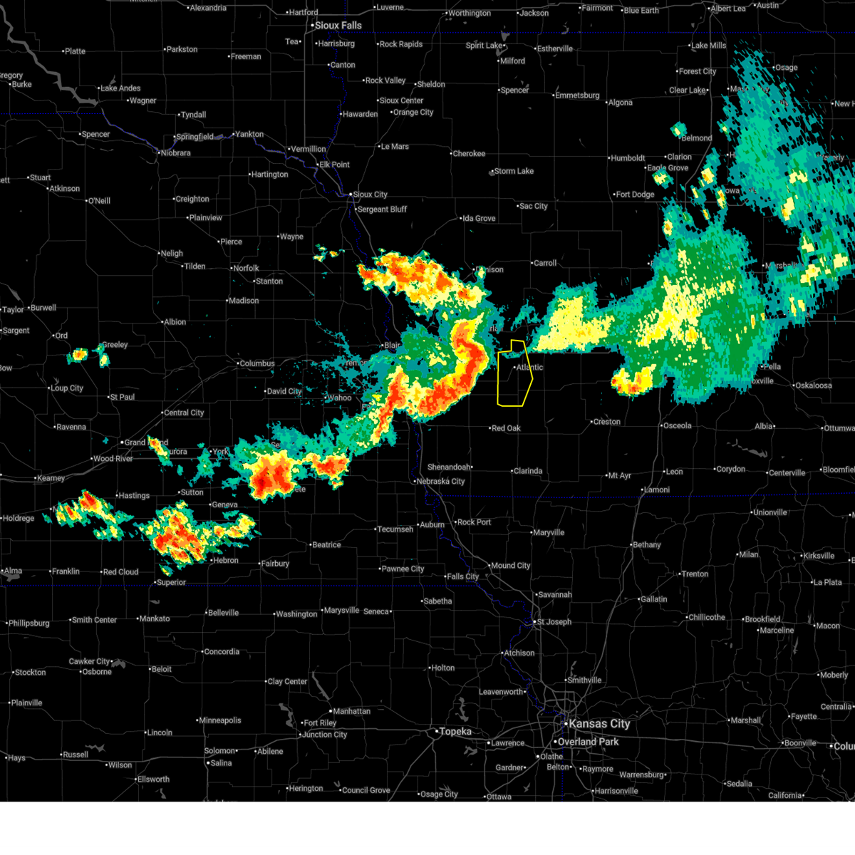
| 5/17/2026 10:01 PM CDT |
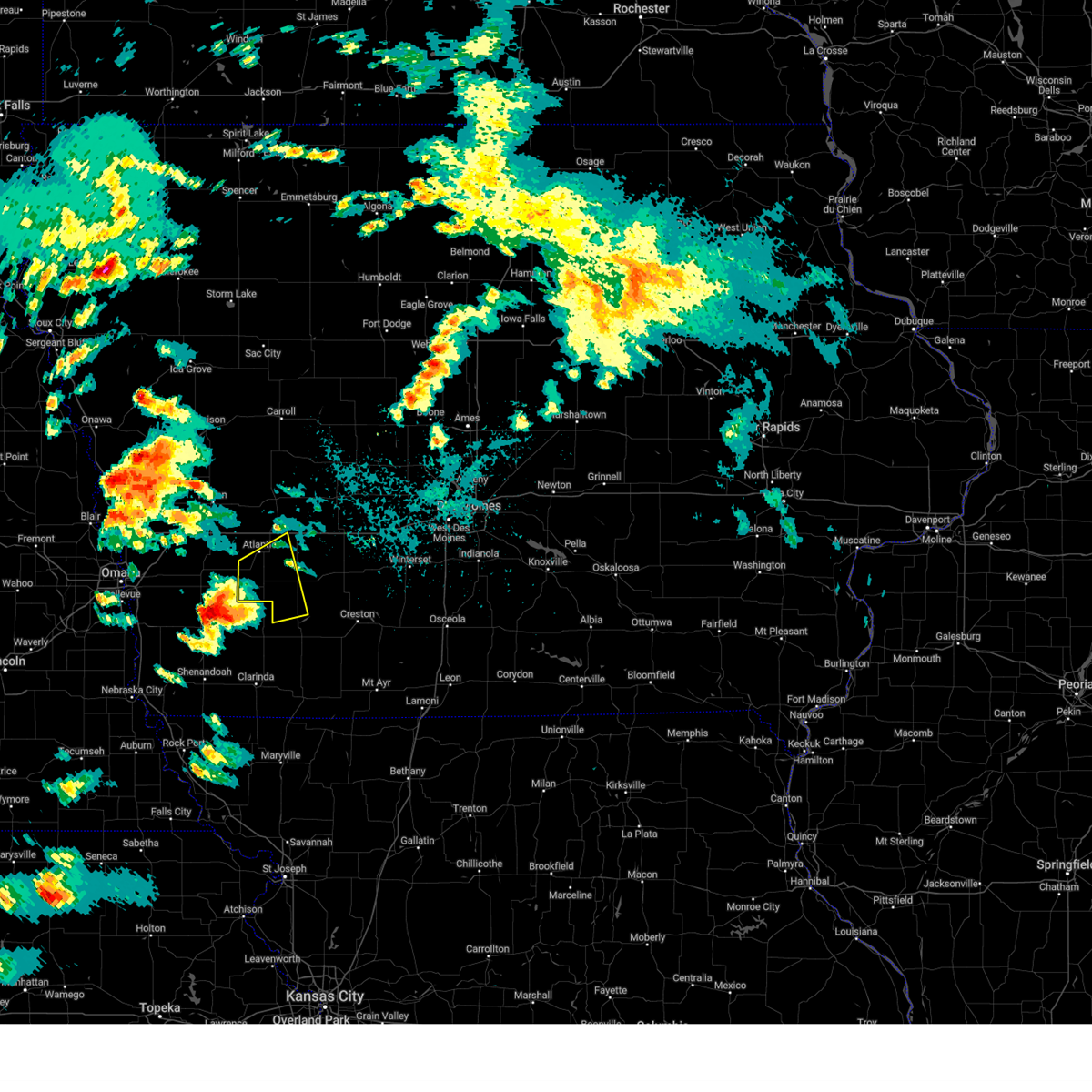
 At 1001 pm cdt, severe thunderstorms were located along a line extending from near adair to 6 miles north of bridgewater to near hacklebarney woods county park, moving east at 50 mph (radar indicated). Hazards include 60 mph wind gusts and penny size hail. Expect damage to roofs, siding, and trees. Locations impacted include, atlantic, greenfield, griswold, lake icaria, anita, adair, fontanelle, lewis, massena, cumberland, bridgewater, marne, wiota, nodaway, carbon, lake anita state park, greenfield municipal airport, nodaway park, griswold park, and cold springs state park. At 1001 pm cdt, severe thunderstorms were located along a line extending from near adair to 6 miles north of bridgewater to near hacklebarney woods county park, moving east at 50 mph (radar indicated). Hazards include 60 mph wind gusts and penny size hail. Expect damage to roofs, siding, and trees. Locations impacted include, atlantic, greenfield, griswold, lake icaria, anita, adair, fontanelle, lewis, massena, cumberland, bridgewater, marne, wiota, nodaway, carbon, lake anita state park, greenfield municipal airport, nodaway park, griswold park, and cold springs state park.
|
| 5/17/2026 9:31 PM CDT |
 Svrdmx the national weather service in des moines has issued a * severe thunderstorm warning for, cass county in southwestern iowa, northwestern adams county in southwestern iowa, adair county in southwestern iowa, * until 1030 pm cdt. * at 930 pm cdt, severe thunderstorms were located along a line extending from 4 miles east of walnut to 7 miles southwest of marne to 5 miles southwest of elliott, moving east at 55 mph (radar indicated). Hazards include 60 mph wind gusts and penny size hail. expect damage to roofs, siding, and trees Svrdmx the national weather service in des moines has issued a * severe thunderstorm warning for, cass county in southwestern iowa, northwestern adams county in southwestern iowa, adair county in southwestern iowa, * until 1030 pm cdt. * at 930 pm cdt, severe thunderstorms were located along a line extending from 4 miles east of walnut to 7 miles southwest of marne to 5 miles southwest of elliott, moving east at 55 mph (radar indicated). Hazards include 60 mph wind gusts and penny size hail. expect damage to roofs, siding, and trees
|
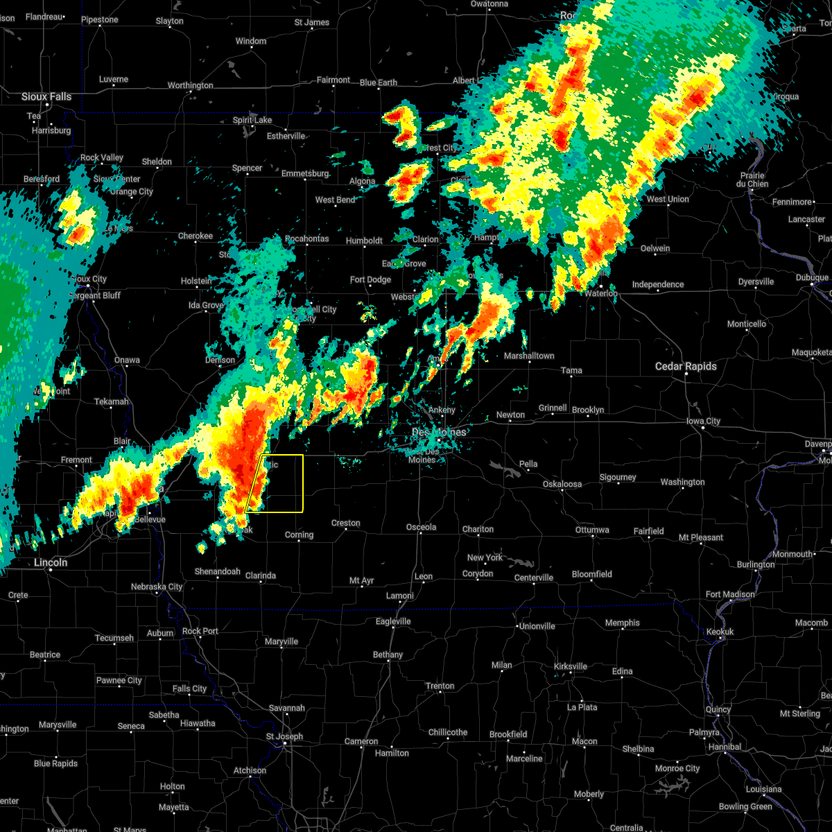
| 5/15/2026 7:09 PM CDT |
 At 709 pm cdt, severe thunderstorms were located along a line extending from near griswold to 5 miles north of viking lake state park to near hepburn, moving east at 45 mph (red oak awos observed a 74 mph wind gust at 658 pm). Hazards include 70 mph wind gusts and quarter size hail. Hail damage to vehicles is expected. expect considerable tree damage. wind damage is also likely to mobile homes, roofs, and outbuildings. these severe storms will be near, nodaway around 715 pm cdt. corning, carbon, and corning municipal airport around 720 pm cdt. lake icaria, cumberland, and lake icaria state park around 725 pm cdt. massena and prescott around 730 pm cdt. lenox and bridgewater around 735 pm cdt. kent around 740 pm cdt. fontanelle and cromwell around 745 pm cdt. Other locations impacted by these severe thunderstorms include kent, fontanelle, sharpsburg, bridgewater, cumberland, clearfield, corning municipal airport, cromwell, carbon, and nodaway. At 709 pm cdt, severe thunderstorms were located along a line extending from near griswold to 5 miles north of viking lake state park to near hepburn, moving east at 45 mph (red oak awos observed a 74 mph wind gust at 658 pm). Hazards include 70 mph wind gusts and quarter size hail. Hail damage to vehicles is expected. expect considerable tree damage. wind damage is also likely to mobile homes, roofs, and outbuildings. these severe storms will be near, nodaway around 715 pm cdt. corning, carbon, and corning municipal airport around 720 pm cdt. lake icaria, cumberland, and lake icaria state park around 725 pm cdt. massena and prescott around 730 pm cdt. lenox and bridgewater around 735 pm cdt. kent around 740 pm cdt. fontanelle and cromwell around 745 pm cdt. Other locations impacted by these severe thunderstorms include kent, fontanelle, sharpsburg, bridgewater, cumberland, clearfield, corning municipal airport, cromwell, carbon, and nodaway.
|
| 5/15/2026 6:52 PM CDT |
 Svrdmx the national weather service in des moines has issued a * severe thunderstorm warning for, southern cass county in southwestern iowa, western union county in south central iowa, northwestern ringgold county in south central iowa, adams county in southwestern iowa, northern taylor county in southwestern iowa, southwestern adair county in southwestern iowa, * until 745 pm cdt. * at 652 pm cdt, severe thunderstorms were located along a line extending from 4 miles southwest of farm creek public wildlife area to red oak to 6 miles north of yorktown, moving east at 45 mph (radar indicated). Hazards include 70 mph wind gusts and quarter size hail. Hail damage to vehicles is expected. expect considerable tree damage. Wind damage is also likely to mobile homes, roofs, and outbuildings. Svrdmx the national weather service in des moines has issued a * severe thunderstorm warning for, southern cass county in southwestern iowa, western union county in south central iowa, northwestern ringgold county in south central iowa, adams county in southwestern iowa, northern taylor county in southwestern iowa, southwestern adair county in southwestern iowa, * until 745 pm cdt. * at 652 pm cdt, severe thunderstorms were located along a line extending from 4 miles southwest of farm creek public wildlife area to red oak to 6 miles north of yorktown, moving east at 45 mph (radar indicated). Hazards include 70 mph wind gusts and quarter size hail. Hail damage to vehicles is expected. expect considerable tree damage. Wind damage is also likely to mobile homes, roofs, and outbuildings.
|
| 4/23/2026 6:02 PM CDT |
 At 602 pm cdt, severe thunderstorms were located along a line extending from 4 miles north of bagley to 5 miles southwest of guthrie center to 4 miles south of lake anita state park to near grant, moving east at 20 mph (radar indicated). Hazards include 60 mph wind gusts and quarter size hail. Hail damage to vehicles is expected. expect wind damage to roofs, siding, and trees. locations impacted include, atlantic, greenfield, guthrie center, panora, lake panorama, anita, exira, adair, fontanelle, bayard, lewis, casey, massena, menlo, bagley, cumberland, yale, jamaica, bridgewater, and brayton. This includes interstate 80 between mile markers 59 and 90. At 602 pm cdt, severe thunderstorms were located along a line extending from 4 miles north of bagley to 5 miles southwest of guthrie center to 4 miles south of lake anita state park to near grant, moving east at 20 mph (radar indicated). Hazards include 60 mph wind gusts and quarter size hail. Hail damage to vehicles is expected. expect wind damage to roofs, siding, and trees. locations impacted include, atlantic, greenfield, guthrie center, panora, lake panorama, anita, exira, adair, fontanelle, bayard, lewis, casey, massena, menlo, bagley, cumberland, yale, jamaica, bridgewater, and brayton. This includes interstate 80 between mile markers 59 and 90.
|
| 4/23/2026 5:39 PM CDT |
 Svrdmx the national weather service in des moines has issued a * severe thunderstorm warning for, cass county in southwestern iowa, guthrie county in west central iowa, central audubon county in west central iowa, western adair county in southwestern iowa, * until 645 pm cdt. * at 538 pm cdt, severe thunderstorms were located along a line extending from 4 miles northwest of bayard to 8 miles north of adair to near wiota to 4 miles east of elliott, moving east at 40 mph (radar indicated). Hazards include 60 mph wind gusts and quarter size hail. Hail damage to vehicles is expected. Expect wind damage to roofs, siding, and trees. Svrdmx the national weather service in des moines has issued a * severe thunderstorm warning for, cass county in southwestern iowa, guthrie county in west central iowa, central audubon county in west central iowa, western adair county in southwestern iowa, * until 645 pm cdt. * at 538 pm cdt, severe thunderstorms were located along a line extending from 4 miles northwest of bayard to 8 miles north of adair to near wiota to 4 miles east of elliott, moving east at 40 mph (radar indicated). Hazards include 60 mph wind gusts and quarter size hail. Hail damage to vehicles is expected. Expect wind damage to roofs, siding, and trees.
|
| 4/23/2026 5:15 PM CDT |
 Svrdmx the national weather service in des moines has issued a * severe thunderstorm warning for, southwestern greene county in west central iowa, cass county in southwestern iowa, guthrie county in west central iowa, eastern audubon county in west central iowa, southeastern carroll county in west central iowa, northwestern adair county in southwestern iowa, * until 545 pm cdt. * at 513 pm cdt, severe thunderstorms were located along a line extending from dedham to 7 miles east of gray to elliott, moving northeast at 45 mph (radar indicated). Hazards include 60 mph wind gusts and quarter size hail. Hail damage to vehicles is expected. Expect wind damage to roofs, siding, and trees. Svrdmx the national weather service in des moines has issued a * severe thunderstorm warning for, southwestern greene county in west central iowa, cass county in southwestern iowa, guthrie county in west central iowa, eastern audubon county in west central iowa, southeastern carroll county in west central iowa, northwestern adair county in southwestern iowa, * until 545 pm cdt. * at 513 pm cdt, severe thunderstorms were located along a line extending from dedham to 7 miles east of gray to elliott, moving northeast at 45 mph (radar indicated). Hazards include 60 mph wind gusts and quarter size hail. Hail damage to vehicles is expected. Expect wind damage to roofs, siding, and trees.
|
| 3/6/2026 6:10 PM CST |
 Svrdmx the national weather service in des moines has issued a * severe thunderstorm warning for, cass county in southwestern iowa, * until 700 pm cst. * at 609 pm cst, a severe thunderstorm was located over elliott, or 11 miles northeast of red oak, moving northeast at 55 mph (radar indicated). Hazards include 60 mph wind gusts and quarter size hail. Hail damage to vehicles is expected. Expect wind damage to roofs, siding, and trees. Svrdmx the national weather service in des moines has issued a * severe thunderstorm warning for, cass county in southwestern iowa, * until 700 pm cst. * at 609 pm cst, a severe thunderstorm was located over elliott, or 11 miles northeast of red oak, moving northeast at 55 mph (radar indicated). Hazards include 60 mph wind gusts and quarter size hail. Hail damage to vehicles is expected. Expect wind damage to roofs, siding, and trees.
|
| 8/10/2025 3:48 AM CDT |
 Svrdmx the national weather service in des moines has issued a * severe thunderstorm warning for, cass county in southwestern iowa, adams county in southwestern iowa, northwestern taylor county in southwestern iowa, southwestern adair county in southwestern iowa, * until 430 am cdt. * at 347 am cdt, severe thunderstorms were located along a line extending from farm creek public wildlife area to near red oak to near coin, moving east at 45 mph (radar indicated). Hazards include 70 mph wind gusts. Expect considerable tree damage. Damage is likely to mobile homes, roofs, and outbuildings. Svrdmx the national weather service in des moines has issued a * severe thunderstorm warning for, cass county in southwestern iowa, adams county in southwestern iowa, northwestern taylor county in southwestern iowa, southwestern adair county in southwestern iowa, * until 430 am cdt. * at 347 am cdt, severe thunderstorms were located along a line extending from farm creek public wildlife area to near red oak to near coin, moving east at 45 mph (radar indicated). Hazards include 70 mph wind gusts. Expect considerable tree damage. Damage is likely to mobile homes, roofs, and outbuildings.
|
| 7/30/2025 2:11 AM CDT |
 the severe thunderstorm warning has been cancelled and is no longer in effect the severe thunderstorm warning has been cancelled and is no longer in effect
|
| 7/30/2025 1:25 AM CDT |
 Svrdmx the national weather service in des moines has issued a * severe thunderstorm warning for, cass county in southwestern iowa, guthrie county in west central iowa, southeastern audubon county in west central iowa, northwestern adair county in southwestern iowa, west central dallas county in central iowa, * until 230 am cdt. * at 125 am cdt, severe thunderstorms were located along a line extending from 5 miles west of guthrie center to anita to near elliott, moving east at 25 mph (radar indicated). Hazards include 60 mph wind gusts. expect damage to roofs, siding, and trees Svrdmx the national weather service in des moines has issued a * severe thunderstorm warning for, cass county in southwestern iowa, guthrie county in west central iowa, southeastern audubon county in west central iowa, northwestern adair county in southwestern iowa, west central dallas county in central iowa, * until 230 am cdt. * at 125 am cdt, severe thunderstorms were located along a line extending from 5 miles west of guthrie center to anita to near elliott, moving east at 25 mph (radar indicated). Hazards include 60 mph wind gusts. expect damage to roofs, siding, and trees
|
| 7/10/2025 11:32 PM CDT |
 At 1132 pm cdt, a severe thunderstorm was located near massena, or 15 miles southeast of atlantic, moving east at 35 mph (radar indicated). Hazards include 60 mph wind gusts. Expect damage to roofs, siding, and trees. Locations impacted include, griswold, lewis, massena, cumberland, griswold park, and cold springs state park. At 1132 pm cdt, a severe thunderstorm was located near massena, or 15 miles southeast of atlantic, moving east at 35 mph (radar indicated). Hazards include 60 mph wind gusts. Expect damage to roofs, siding, and trees. Locations impacted include, griswold, lewis, massena, cumberland, griswold park, and cold springs state park.
|
| 7/10/2025 11:10 PM CDT |
 Svrdmx the national weather service in des moines has issued a * severe thunderstorm warning for, southern cass county in southwestern iowa, * until 1145 pm cdt. * at 1109 pm cdt, a severe thunderstorm was located over cold springs state park, or 8 miles south of atlantic, moving east at 35 mph (radar indicated). Hazards include 60 mph wind gusts and penny size hail. expect damage to roofs, siding, and trees Svrdmx the national weather service in des moines has issued a * severe thunderstorm warning for, southern cass county in southwestern iowa, * until 1145 pm cdt. * at 1109 pm cdt, a severe thunderstorm was located over cold springs state park, or 8 miles south of atlantic, moving east at 35 mph (radar indicated). Hazards include 60 mph wind gusts and penny size hail. expect damage to roofs, siding, and trees
|
| 7/7/2025 11:24 PM CDT | Pw in cass county IA, 4.9 miles WNW of Griswold, IA |
| 6/15/2025 8:59 PM CDT |
 At 859 pm cdt, a severe thunderstorm was located over griswold, or 13 miles north of red oak, moving southwest at 10 mph (trained weather spotters reported ping pong ball sized hail in griswold ). Hazards include ping pong ball size hail and 60 mph wind gusts. People and animals outdoors will be injured. expect hail damage to roofs, siding, windows, and vehicles. expect wind damage to roofs, siding, and trees. Locations impacted include, griswold and griswold park. At 859 pm cdt, a severe thunderstorm was located over griswold, or 13 miles north of red oak, moving southwest at 10 mph (trained weather spotters reported ping pong ball sized hail in griswold ). Hazards include ping pong ball size hail and 60 mph wind gusts. People and animals outdoors will be injured. expect hail damage to roofs, siding, windows, and vehicles. expect wind damage to roofs, siding, and trees. Locations impacted include, griswold and griswold park.
|
| 6/15/2025 8:57 PM CDT |
 At 857 pm cdt, a severe thunderstorm was located over griswold, or 14 miles north of red oak, moving southwest at 10 mph (radar indicated). Hazards include ping pong ball size hail and 60 mph wind gusts. People and animals outdoors will be injured. expect hail damage to roofs, siding, windows, and vehicles. expect wind damage to roofs, siding, and trees. Locations impacted include, griswold and griswold park. At 857 pm cdt, a severe thunderstorm was located over griswold, or 14 miles north of red oak, moving southwest at 10 mph (radar indicated). Hazards include ping pong ball size hail and 60 mph wind gusts. People and animals outdoors will be injured. expect hail damage to roofs, siding, windows, and vehicles. expect wind damage to roofs, siding, and trees. Locations impacted include, griswold and griswold park.
|
| 6/15/2025 8:55 PM CDT | Ping Pong Ball sized hail reported 0.4 miles SSW of Griswold, IA, largest hail to ping pong ball sized. |
| 6/15/2025 8:48 PM CDT |
 Svrdmx the national weather service in des moines has issued a * severe thunderstorm warning for, southwestern cass county in southwestern iowa, * until 930 pm cdt. * at 848 pm cdt, a severe thunderstorm was located over griswold, or 13 miles southwest of atlantic, moving southwest at 10 mph (radar indicated). Hazards include 60 mph wind gusts and half dollar size hail. Hail damage to vehicles is expected. Expect wind damage to roofs, siding, and trees. Svrdmx the national weather service in des moines has issued a * severe thunderstorm warning for, southwestern cass county in southwestern iowa, * until 930 pm cdt. * at 848 pm cdt, a severe thunderstorm was located over griswold, or 13 miles southwest of atlantic, moving southwest at 10 mph (radar indicated). Hazards include 60 mph wind gusts and half dollar size hail. Hail damage to vehicles is expected. Expect wind damage to roofs, siding, and trees.
|
| 4/17/2025 8:37 PM CDT |
 At 836 pm cdt, the leading edge of a severe thunderstorm was located near wiota, or near atlantic, moving east at 30 mph (radar indicated). Hazards include 60 mph wind gusts and quarter size hail. Hail damage to vehicles is expected. expect wind damage to roofs, siding, and trees. locations impacted include, lake anita state park, cumberland, anita, wiota, massena, lewis, griswold, griswold park, cold springs state park, atlantic, atlantic municipal airport, anita municipal airport, and marne. This includes interstate 80 between mile markers 60 and 73. At 836 pm cdt, the leading edge of a severe thunderstorm was located near wiota, or near atlantic, moving east at 30 mph (radar indicated). Hazards include 60 mph wind gusts and quarter size hail. Hail damage to vehicles is expected. expect wind damage to roofs, siding, and trees. locations impacted include, lake anita state park, cumberland, anita, wiota, massena, lewis, griswold, griswold park, cold springs state park, atlantic, atlantic municipal airport, anita municipal airport, and marne. This includes interstate 80 between mile markers 60 and 73.
|
| 4/17/2025 8:23 PM CDT |
 Tordmx the national weather service in des moines has issued a * tornado warning for, southwestern cass county in southwestern iowa, * until 915 pm cdt. * at 823 pm cdt, a severe thunderstorm capable of producing a tornado was located 6 miles northeast of farm creek public wildlife area, or 13 miles southwest of atlantic, moving east at 25 mph (radar indicated rotation). Hazards include tornado and half dollar size hail. Flying debris will be dangerous to those caught without shelter. mobile homes will be damaged or destroyed. damage to roofs, windows, and vehicles will occur. Tree damage is likely. Tordmx the national weather service in des moines has issued a * tornado warning for, southwestern cass county in southwestern iowa, * until 915 pm cdt. * at 823 pm cdt, a severe thunderstorm capable of producing a tornado was located 6 miles northeast of farm creek public wildlife area, or 13 miles southwest of atlantic, moving east at 25 mph (radar indicated rotation). Hazards include tornado and half dollar size hail. Flying debris will be dangerous to those caught without shelter. mobile homes will be damaged or destroyed. damage to roofs, windows, and vehicles will occur. Tree damage is likely.
|
| 4/17/2025 8:10 PM CDT |
 Svrdmx the national weather service in des moines has issued a * severe thunderstorm warning for, cass county in southwestern iowa, * until 915 pm cdt. * at 809 pm cdt, a severe thunderstorm was located 7 miles northwest of lewis, or 10 miles west of atlantic, moving east at 30 mph (emergency management. at 808 pm, the pottawattamie county emergency manager reported golf ball sized hail near hancock). Hazards include golf ball size hail and 60 mph wind gusts. People and animals outdoors will be injured. expect hail damage to roofs, siding, windows, and vehicles. Expect wind damage to roofs, siding, and trees. Svrdmx the national weather service in des moines has issued a * severe thunderstorm warning for, cass county in southwestern iowa, * until 915 pm cdt. * at 809 pm cdt, a severe thunderstorm was located 7 miles northwest of lewis, or 10 miles west of atlantic, moving east at 30 mph (emergency management. at 808 pm, the pottawattamie county emergency manager reported golf ball sized hail near hancock). Hazards include golf ball size hail and 60 mph wind gusts. People and animals outdoors will be injured. expect hail damage to roofs, siding, windows, and vehicles. Expect wind damage to roofs, siding, and trees.
|
| 3/14/2025 5:21 PM CDT |
 At 520 pm cdt, a severe thunderstorm was located 5 miles northeast of marne, or 7 miles north of atlantic, moving north at 55 mph (radar indicated). Hazards include 60 mph wind gusts and penny size hail. Expect damage to roofs, siding, and trees. locations impacted include, exira, lake anita state park, kimballton, cumberland, anita, wiota, elk horn, massena, lewis, griswold, brayton, griswold park, cold springs state park, atlantic, atlantic municipal airport, anita municipal airport, and marne. This includes interstate 80 between mile markers 50 and 71. At 520 pm cdt, a severe thunderstorm was located 5 miles northeast of marne, or 7 miles north of atlantic, moving north at 55 mph (radar indicated). Hazards include 60 mph wind gusts and penny size hail. Expect damage to roofs, siding, and trees. locations impacted include, exira, lake anita state park, kimballton, cumberland, anita, wiota, elk horn, massena, lewis, griswold, brayton, griswold park, cold springs state park, atlantic, atlantic municipal airport, anita municipal airport, and marne. This includes interstate 80 between mile markers 50 and 71.
|
| 3/14/2025 5:21 PM CDT |
 the severe thunderstorm warning has been cancelled and is no longer in effect the severe thunderstorm warning has been cancelled and is no longer in effect
|
| 3/14/2025 4:59 PM CDT | Delayed repor in cass county IA, 9.2 miles WNW of Griswold, IA |
| 3/14/2025 4:57 PM CDT |
 Svrdmx the national weather service in des moines has issued a * severe thunderstorm warning for, cass county in southwestern iowa, southern audubon county in west central iowa, northwestern adams county in southwestern iowa, * until 545 pm cdt. * at 457 pm cdt, a severe thunderstorm was located over grant, or 15 miles south of atlantic, moving north at 65 mph (radar indicated). Hazards include 60 mph wind gusts and quarter size hail. Hail damage to vehicles is expected. Expect wind damage to roofs, siding, and trees. Svrdmx the national weather service in des moines has issued a * severe thunderstorm warning for, cass county in southwestern iowa, southern audubon county in west central iowa, northwestern adams county in southwestern iowa, * until 545 pm cdt. * at 457 pm cdt, a severe thunderstorm was located over grant, or 15 miles south of atlantic, moving north at 65 mph (radar indicated). Hazards include 60 mph wind gusts and quarter size hail. Hail damage to vehicles is expected. Expect wind damage to roofs, siding, and trees.
|
| 7/31/2024 7:13 PM CDT |
 At 711 pm cdt, severe thunderstorms were located along a line extending from near defiance to near audubon to 5 miles southeast of lake anita state park to near bridgewater, moving east at 40 mph (radar indicated). Hazards include 60 mph wind gusts and nickel size hail. at 705 pm cdt, a 59 mph wind gust was recorded at atlantic municipal airport. winds of this magnitude have lasted at least 10 minutes. Expect damage to roofs, siding, and trees. locations impacted include, atlantic, audubon, greenfield, guthrie center, stuart, manning, coon rapids, panora, griswold, lake panorama, anita, exira, adair, manilla, fontanelle, elk horn, bayard, lewis, casey, and orient. This includes interstate 80 between mile markers 50 and 96. At 711 pm cdt, severe thunderstorms were located along a line extending from near defiance to near audubon to 5 miles southeast of lake anita state park to near bridgewater, moving east at 40 mph (radar indicated). Hazards include 60 mph wind gusts and nickel size hail. at 705 pm cdt, a 59 mph wind gust was recorded at atlantic municipal airport. winds of this magnitude have lasted at least 10 minutes. Expect damage to roofs, siding, and trees. locations impacted include, atlantic, audubon, greenfield, guthrie center, stuart, manning, coon rapids, panora, griswold, lake panorama, anita, exira, adair, manilla, fontanelle, elk horn, bayard, lewis, casey, and orient. This includes interstate 80 between mile markers 50 and 96.
|
| 7/31/2024 6:26 PM CDT |
 Svrdmx the national weather service in des moines has issued a * severe thunderstorm warning for, southwestern greene county in west central iowa, southwestern madison county in south central iowa, cass county in southwestern iowa, guthrie county in west central iowa, audubon county in west central iowa, northern adams county in southwestern iowa, southeastern crawford county in west central iowa, southern carroll county in west central iowa, adair county in southwestern iowa, * until 730 pm cdt. * at 623 pm cdt, severe thunderstorms were located along a line extending from near modale to persia to farm creek public wildlife area to 5 miles northwest of red oak, moving east at 50 mph. these are destructive storms for adair, cass, audubon, guthrie, adams, crawford, and carroll counties (a public wearher station recorded a 76 mph wind gust in northern mills county). Hazards include 80 mph wind gusts and nickel size hail. Flying debris will be dangerous to those caught without shelter. mobile homes will be heavily damaged. expect considerable damage to roofs, windows, and vehicles. Extensive tree damage and power outages are likely. Svrdmx the national weather service in des moines has issued a * severe thunderstorm warning for, southwestern greene county in west central iowa, southwestern madison county in south central iowa, cass county in southwestern iowa, guthrie county in west central iowa, audubon county in west central iowa, northern adams county in southwestern iowa, southeastern crawford county in west central iowa, southern carroll county in west central iowa, adair county in southwestern iowa, * until 730 pm cdt. * at 623 pm cdt, severe thunderstorms were located along a line extending from near modale to persia to farm creek public wildlife area to 5 miles northwest of red oak, moving east at 50 mph. these are destructive storms for adair, cass, audubon, guthrie, adams, crawford, and carroll counties (a public wearher station recorded a 76 mph wind gust in northern mills county). Hazards include 80 mph wind gusts and nickel size hail. Flying debris will be dangerous to those caught without shelter. mobile homes will be heavily damaged. expect considerable damage to roofs, windows, and vehicles. Extensive tree damage and power outages are likely.
|
| 7/10/2024 1:59 PM CDT |
 Svrdmx the national weather service in des moines has issued a * severe thunderstorm warning for, southern cass county in southwestern iowa, northwestern adams county in southwestern iowa, * until 245 pm cdt. * at 159 pm cdt, a severe thunderstorm was located near grant, or 13 miles south of atlantic, moving southeast at 15 mph (radar indicated). Hazards include 60 mph wind gusts and quarter size hail. Hail damage to vehicles is expected. Expect wind damage to roofs, siding, and trees. Svrdmx the national weather service in des moines has issued a * severe thunderstorm warning for, southern cass county in southwestern iowa, northwestern adams county in southwestern iowa, * until 245 pm cdt. * at 159 pm cdt, a severe thunderstorm was located near grant, or 13 miles south of atlantic, moving southeast at 15 mph (radar indicated). Hazards include 60 mph wind gusts and quarter size hail. Hail damage to vehicles is expected. Expect wind damage to roofs, siding, and trees.
|
| 6/25/2024 10:58 PM CDT |
 The storms which prompted the warning have weakened below severe limits, and no longer pose an immediate threat to life or property. therefore, the warning will be allowed to expire. however, gusty winds and heavy rain are still possible with these thunderstorms. a severe thunderstorm watch remains in effect until midnight cdt for southwestern iowa. The storms which prompted the warning have weakened below severe limits, and no longer pose an immediate threat to life or property. therefore, the warning will be allowed to expire. however, gusty winds and heavy rain are still possible with these thunderstorms. a severe thunderstorm watch remains in effect until midnight cdt for southwestern iowa.
|
| 6/25/2024 10:40 PM CDT |
 At 1039 pm cdt, severe thunderstorms were located along a line extending from wiota to massena to near carbon, moving east at 40 mph (radar indicated). Hazards include 60 mph wind gusts and penny size hail. Expect damage to roofs, siding, and trees. Locations impacted include, atlantic, griswold, lake icaria, anita, fontanelle, lewis, massena, cumberland, bridgewater, wiota, lake anita state park, nodaway park, griswold park, cold springs state park, lake icaria state park, atlantic municipal airport, and anita municipal airport. At 1039 pm cdt, severe thunderstorms were located along a line extending from wiota to massena to near carbon, moving east at 40 mph (radar indicated). Hazards include 60 mph wind gusts and penny size hail. Expect damage to roofs, siding, and trees. Locations impacted include, atlantic, griswold, lake icaria, anita, fontanelle, lewis, massena, cumberland, bridgewater, wiota, lake anita state park, nodaway park, griswold park, cold springs state park, lake icaria state park, atlantic municipal airport, and anita municipal airport.
|
| 6/25/2024 10:40 PM CDT |
 the severe thunderstorm warning has been cancelled and is no longer in effect the severe thunderstorm warning has been cancelled and is no longer in effect
|
| 6/25/2024 10:07 PM CDT |
 Svrdmx the national weather service in des moines has issued a * severe thunderstorm warning for, cass county in southwestern iowa, southwestern guthrie county in west central iowa, southern audubon county in west central iowa, northern adams county in southwestern iowa, western adair county in southwestern iowa, * until 1100 pm cdt. * at 1006 pm cdt, severe thunderstorms were located along a line extending from avoca to 6 miles north of farm creek public wildlife area to 4 miles southeast of henderson, moving east at 60 mph (trained weather spotters). Hazards include 70 mph wind gusts. Expect considerable tree damage. Damage is likely to mobile homes, roofs, and outbuildings. Svrdmx the national weather service in des moines has issued a * severe thunderstorm warning for, cass county in southwestern iowa, southwestern guthrie county in west central iowa, southern audubon county in west central iowa, northern adams county in southwestern iowa, western adair county in southwestern iowa, * until 1100 pm cdt. * at 1006 pm cdt, severe thunderstorms were located along a line extending from avoca to 6 miles north of farm creek public wildlife area to 4 miles southeast of henderson, moving east at 60 mph (trained weather spotters). Hazards include 70 mph wind gusts. Expect considerable tree damage. Damage is likely to mobile homes, roofs, and outbuildings.
|
| 6/15/2024 8:59 PM CDT |
 The storms which prompted the warning have weakened below severe limits, and no longer pose an immediate threat to life or property. therefore, the warning will be allowed to expire. however, gusty winds and heavy rain are still possible with these thunderstorms. a severe thunderstorm watch remains in effect until 200 am cdt for southwestern iowa. The storms which prompted the warning have weakened below severe limits, and no longer pose an immediate threat to life or property. therefore, the warning will be allowed to expire. however, gusty winds and heavy rain are still possible with these thunderstorms. a severe thunderstorm watch remains in effect until 200 am cdt for southwestern iowa.
|
| 6/15/2024 8:40 PM CDT |
 At 840 pm cdt, severe thunderstorms were located along a line extending from near grant to near villisca to 5 miles west of hopkins to 5 miles west of maryville, moving northeast at 45 mph (radar indicated). Hazards include 60 mph wind gusts and penny size hail. Expect damage to roofs, siding, and trees. Locations impacted include, corning, bedford, lenox, griswold, lake icaria, lewis, new market, massena, cumberland, prescott, gravity, bridgewater, nodaway, sharpsburg, conway, carbon, athelstan, lake of three fires state park, corning municipal airport, and bedford municipal airport. At 840 pm cdt, severe thunderstorms were located along a line extending from near grant to near villisca to 5 miles west of hopkins to 5 miles west of maryville, moving northeast at 45 mph (radar indicated). Hazards include 60 mph wind gusts and penny size hail. Expect damage to roofs, siding, and trees. Locations impacted include, corning, bedford, lenox, griswold, lake icaria, lewis, new market, massena, cumberland, prescott, gravity, bridgewater, nodaway, sharpsburg, conway, carbon, athelstan, lake of three fires state park, corning municipal airport, and bedford municipal airport.
|
| 6/15/2024 8:18 PM CDT |
 Svrdmx the national weather service in des moines has issued a * severe thunderstorm warning for, southern cass county in southwestern iowa, adams county in southwestern iowa, taylor county in southwestern iowa, southwestern adair county in southwestern iowa, * until 900 pm cdt. * at 817 pm cdt, severe thunderstorms were located along a line extending from near red oak to near essex to near burlington junction to 4 miles north of mound city, moving northeast at 50 mph (radar indicated). Hazards include 60 mph wind gusts and penny size hail. expect damage to roofs, siding, and trees Svrdmx the national weather service in des moines has issued a * severe thunderstorm warning for, southern cass county in southwestern iowa, adams county in southwestern iowa, taylor county in southwestern iowa, southwestern adair county in southwestern iowa, * until 900 pm cdt. * at 817 pm cdt, severe thunderstorms were located along a line extending from near red oak to near essex to near burlington junction to 4 miles north of mound city, moving northeast at 50 mph (radar indicated). Hazards include 60 mph wind gusts and penny size hail. expect damage to roofs, siding, and trees
|
| 5/24/2024 3:45 AM CDT | Pws kiagrisw in cass county IA, 9 miles WNW of Griswold, IA |
| 5/24/2024 3:36 AM CDT |
 At 336 am cdt, severe thunderstorms were located along a line extending from 5 miles northwest of lake view to 4 miles northeast of aspinwall to 5 miles south of lake anita state park, moving east at 50 mph (radar indicated). Hazards include 70 mph wind gusts and quarter size hail. Hail damage to vehicles is expected. expect considerable tree damage. wind damage is also likely to mobile homes, roofs, and outbuildings. locations impacted include, carroll, denison, creston, atlantic, sac city, audubon, greenfield, rockwell city, corning, guthrie center, lake city, manning, lenox, coon rapids, glidden, lake view, griswold, odebolt, black hawk lake, and north twin lake. This includes interstate 80 between mile markers 50 and 87. At 336 am cdt, severe thunderstorms were located along a line extending from 5 miles northwest of lake view to 4 miles northeast of aspinwall to 5 miles south of lake anita state park, moving east at 50 mph (radar indicated). Hazards include 70 mph wind gusts and quarter size hail. Hail damage to vehicles is expected. expect considerable tree damage. wind damage is also likely to mobile homes, roofs, and outbuildings. locations impacted include, carroll, denison, creston, atlantic, sac city, audubon, greenfield, rockwell city, corning, guthrie center, lake city, manning, lenox, coon rapids, glidden, lake view, griswold, odebolt, black hawk lake, and north twin lake. This includes interstate 80 between mile markers 50 and 87.
|
| 5/24/2024 3:18 AM CDT |
 Tordmx the national weather service in des moines has issued a * tornado warning for, cass county in southwestern iowa, northwestern adams county in southwestern iowa, western adair county in southwestern iowa, * until 400 am cdt. * at 317 am cdt, a severe thunderstorm capable of producing a tornado was located near farm creek public wildlife area, or 13 miles north of red oak, moving east at 60 mph (radar indicated rotation). Hazards include tornado and quarter size hail. Flying debris will be dangerous to those caught without shelter. mobile homes will be damaged or destroyed. damage to roofs, windows, and vehicles will occur. tree damage is likely. this dangerous storm will be near, griswold, lewis, cold springs state park, and griswold park around 325 am cdt. cumberland around 335 am cdt. massena around 340 am cdt. Other locations impacted by this tornadic thunderstorm include wiota, lake anita state park, massena, lewis, bridgewater, cumberland, cold springs state park, griswold park, and anita. Tordmx the national weather service in des moines has issued a * tornado warning for, cass county in southwestern iowa, northwestern adams county in southwestern iowa, western adair county in southwestern iowa, * until 400 am cdt. * at 317 am cdt, a severe thunderstorm capable of producing a tornado was located near farm creek public wildlife area, or 13 miles north of red oak, moving east at 60 mph (radar indicated rotation). Hazards include tornado and quarter size hail. Flying debris will be dangerous to those caught without shelter. mobile homes will be damaged or destroyed. damage to roofs, windows, and vehicles will occur. tree damage is likely. this dangerous storm will be near, griswold, lewis, cold springs state park, and griswold park around 325 am cdt. cumberland around 335 am cdt. massena around 340 am cdt. Other locations impacted by this tornadic thunderstorm include wiota, lake anita state park, massena, lewis, bridgewater, cumberland, cold springs state park, griswold park, and anita.
|
| 5/24/2024 3:07 AM CDT |
 Svrdmx the national weather service in des moines has issued a * severe thunderstorm warning for, western greene county in west central iowa, cass county in southwestern iowa, western union county in south central iowa, guthrie county in west central iowa, audubon county in west central iowa, sac county in west central iowa, adams county in southwestern iowa, calhoun county in west central iowa, crawford county in west central iowa, northern taylor county in southwestern iowa, carroll county in west central iowa, adair county in southwestern iowa, * until 400 am cdt. * at 307 am cdt, severe thunderstorms were located along a line extending from 4 miles south of battle creek to dunlap to farm creek public wildlife area, moving east at 85 mph (radar indicated). Hazards include 70 mph wind gusts and quarter size hail. Hail damage to vehicles is expected. expect considerable tree damage. Wind damage is also likely to mobile homes, roofs, and outbuildings. Svrdmx the national weather service in des moines has issued a * severe thunderstorm warning for, western greene county in west central iowa, cass county in southwestern iowa, western union county in south central iowa, guthrie county in west central iowa, audubon county in west central iowa, sac county in west central iowa, adams county in southwestern iowa, calhoun county in west central iowa, crawford county in west central iowa, northern taylor county in southwestern iowa, carroll county in west central iowa, adair county in southwestern iowa, * until 400 am cdt. * at 307 am cdt, severe thunderstorms were located along a line extending from 4 miles south of battle creek to dunlap to farm creek public wildlife area, moving east at 85 mph (radar indicated). Hazards include 70 mph wind gusts and quarter size hail. Hail damage to vehicles is expected. expect considerable tree damage. Wind damage is also likely to mobile homes, roofs, and outbuildings.
|
| 5/21/2024 3:10 PM CDT |
 the tornado warning has been cancelled and is no longer in effect the tornado warning has been cancelled and is no longer in effect
|
| 5/21/2024 2:52 PM CDT |
 Tordmx the national weather service in des moines has issued a * tornado warning for, cass county in southwestern iowa, northwestern adams county in southwestern iowa, * until 330 pm cdt. * at 252 pm cdt, a severe thunderstorm capable of producing a tornado was located near elliott, or 10 miles northeast of red oak, moving northeast at 50 mph (radar indicated rotation). Hazards include tornado and quarter size hail. Flying debris will be dangerous to those caught without shelter. mobile homes will be damaged or destroyed. damage to roofs, windows, and vehicles will occur. tree damage is likely. this dangerous storm will be near, cumberland around 305 pm cdt. lake anita state park around 315 pm cdt. anita and anita municipal airport around 320 pm cdt. other locations impacted by this tornadic thunderstorm include wiota, lake anita state park, massena, lewis, cumberland, cold springs state park, griswold park, anita, and anita municipal airport. This includes interstate 80 between mile markers 62 and 73. Tordmx the national weather service in des moines has issued a * tornado warning for, cass county in southwestern iowa, northwestern adams county in southwestern iowa, * until 330 pm cdt. * at 252 pm cdt, a severe thunderstorm capable of producing a tornado was located near elliott, or 10 miles northeast of red oak, moving northeast at 50 mph (radar indicated rotation). Hazards include tornado and quarter size hail. Flying debris will be dangerous to those caught without shelter. mobile homes will be damaged or destroyed. damage to roofs, windows, and vehicles will occur. tree damage is likely. this dangerous storm will be near, cumberland around 305 pm cdt. lake anita state park around 315 pm cdt. anita and anita municipal airport around 320 pm cdt. other locations impacted by this tornadic thunderstorm include wiota, lake anita state park, massena, lewis, cumberland, cold springs state park, griswold park, anita, and anita municipal airport. This includes interstate 80 between mile markers 62 and 73.
|
| 5/21/2024 2:28 PM CDT |
 Svrdmx the national weather service in des moines has issued a * severe thunderstorm warning for, cass county in southwestern iowa, audubon county in west central iowa, northwestern adams county in southwestern iowa, * until 330 pm cdt. * at 228 pm cdt, severe thunderstorms were located along a line extending from near avoca to near stanton, moving northeast at 45 mph (radar indicated). Hazards include 60 mph wind gusts and half dollar size hail. Hail damage to vehicles is expected. Expect wind damage to roofs, siding, and trees. Svrdmx the national weather service in des moines has issued a * severe thunderstorm warning for, cass county in southwestern iowa, audubon county in west central iowa, northwestern adams county in southwestern iowa, * until 330 pm cdt. * at 228 pm cdt, severe thunderstorms were located along a line extending from near avoca to near stanton, moving northeast at 45 mph (radar indicated). Hazards include 60 mph wind gusts and half dollar size hail. Hail damage to vehicles is expected. Expect wind damage to roofs, siding, and trees.
|
| 5/21/2024 7:21 AM CDT |
 the severe thunderstorm warning has been cancelled and is no longer in effect the severe thunderstorm warning has been cancelled and is no longer in effect
|
| 5/21/2024 7:21 AM CDT |
 At 721 am cdt, a severe thunderstorm was located near lewis, or near atlantic, moving east at 35 mph (radar indicated). Hazards include golf ball size hail and 70 mph wind gusts. People and animals outdoors will be injured. expect hail damage to roofs, siding, windows, and vehicles. expect considerable tree damage. wind damage is also likely to mobile homes, roofs, and outbuildings. this severe storm will be near, atlantic around 725 am cdt. wiota around 730 am cdt. other locations impacted by this severe thunderstorm include wiota, lewis, cumberland, cold springs state park, griswold park, atlantic municipal airport, and marne. This includes interstate 80 between mile markers 50 and 65. At 721 am cdt, a severe thunderstorm was located near lewis, or near atlantic, moving east at 35 mph (radar indicated). Hazards include golf ball size hail and 70 mph wind gusts. People and animals outdoors will be injured. expect hail damage to roofs, siding, windows, and vehicles. expect considerable tree damage. wind damage is also likely to mobile homes, roofs, and outbuildings. this severe storm will be near, atlantic around 725 am cdt. wiota around 730 am cdt. other locations impacted by this severe thunderstorm include wiota, lewis, cumberland, cold springs state park, griswold park, atlantic municipal airport, and marne. This includes interstate 80 between mile markers 50 and 65.
|
| 5/21/2024 7:21 AM CDT |
 At 720 am cdt, severe thunderstorms were located along a line extending from near manning to brayton to 4 miles west of elliott, moving east at 30 mph (trained weather spotters). Hazards include ping pong ball size hail and 60 mph wind gusts. People and animals outdoors will be injured. expect hail damage to roofs, siding, windows, and vehicles. expect wind damage to roofs, siding, and trees. locations impacted include, carroll, atlantic, audubon, manning, coon rapids, griswold, anita, exira, adair, elk horn, lewis, templeton, kimballton, dedham, cumberland, halbur, brayton, marne, wiota, and willey. This includes interstate 80 between mile markers 50 and 73. At 720 am cdt, severe thunderstorms were located along a line extending from near manning to brayton to 4 miles west of elliott, moving east at 30 mph (trained weather spotters). Hazards include ping pong ball size hail and 60 mph wind gusts. People and animals outdoors will be injured. expect hail damage to roofs, siding, windows, and vehicles. expect wind damage to roofs, siding, and trees. locations impacted include, carroll, atlantic, audubon, manning, coon rapids, griswold, anita, exira, adair, elk horn, lewis, templeton, kimballton, dedham, cumberland, halbur, brayton, marne, wiota, and willey. This includes interstate 80 between mile markers 50 and 73.
|
| 5/21/2024 7:07 AM CDT |
 Svrdmx the national weather service in des moines has issued a * severe thunderstorm warning for, western cass county in southwestern iowa, * until 730 am cdt. * at 707 am cdt, a severe thunderstorm was located 6 miles northwest of griswold park, or 10 miles southwest of atlantic, moving east at 35 mph (radar indicated). Hazards include golf ball size hail and 70 mph wind gusts. People and animals outdoors will be injured. expect hail damage to roofs, siding, windows, and vehicles. expect considerable tree damage. wind damage is also likely to mobile homes, roofs, and outbuildings. this severe thunderstorm will be near, lewis and cold springs state park around 710 am cdt. atlantic around 715 am cdt. other locations impacted by this severe thunderstorm include wiota, lewis, cumberland, cold springs state park, griswold park, atlantic municipal airport, and marne. This includes interstate 80 between mile markers 50 and 65. Svrdmx the national weather service in des moines has issued a * severe thunderstorm warning for, western cass county in southwestern iowa, * until 730 am cdt. * at 707 am cdt, a severe thunderstorm was located 6 miles northwest of griswold park, or 10 miles southwest of atlantic, moving east at 35 mph (radar indicated). Hazards include golf ball size hail and 70 mph wind gusts. People and animals outdoors will be injured. expect hail damage to roofs, siding, windows, and vehicles. expect considerable tree damage. wind damage is also likely to mobile homes, roofs, and outbuildings. this severe thunderstorm will be near, lewis and cold springs state park around 710 am cdt. atlantic around 715 am cdt. other locations impacted by this severe thunderstorm include wiota, lewis, cumberland, cold springs state park, griswold park, atlantic municipal airport, and marne. This includes interstate 80 between mile markers 50 and 65.
|
| 5/21/2024 6:51 AM CDT |
 Svrdmx the national weather service in des moines has issued a * severe thunderstorm warning for, cass county in southwestern iowa, western guthrie county in west central iowa, audubon county in west central iowa, southeastern crawford county in west central iowa, southern carroll county in west central iowa, * until 745 am cdt. * at 651 am cdt, severe thunderstorms were located along a line extending from 4 miles west of manilla to near walnut to 5 miles northeast of silver city, moving east at 30 mph (radar indicated). Hazards include 60 mph wind gusts and quarter size hail. Hail damage to vehicles is expected. Expect wind damage to roofs, siding, and trees. Svrdmx the national weather service in des moines has issued a * severe thunderstorm warning for, cass county in southwestern iowa, western guthrie county in west central iowa, audubon county in west central iowa, southeastern crawford county in west central iowa, southern carroll county in west central iowa, * until 745 am cdt. * at 651 am cdt, severe thunderstorms were located along a line extending from 4 miles west of manilla to near walnut to 5 miles northeast of silver city, moving east at 30 mph (radar indicated). Hazards include 60 mph wind gusts and quarter size hail. Hail damage to vehicles is expected. Expect wind damage to roofs, siding, and trees.
|
| 5/19/2024 8:09 PM CDT |
 At 808 pm cdt, severe thunderstorms were located along a line extending from 4 miles west of brayton to 6 miles southeast of lake anita state park to 4 miles southeast of new market, moving northeast at 50 mph (radar indicated). Hazards include 60 mph wind gusts and quarter size hail. Hail damage to vehicles is expected. expect wind damage to roofs, siding, and trees. locations impacted include, creston, atlantic, greenfield, corning, guthrie center, bedford, stuart, lenox, griswold, green valley lake, lake icaria, anita, afton, exira, adair, fontanelle, dexter, lewis, casey, and new market. This includes interstate 80 between mile markers 50 and 98. At 808 pm cdt, severe thunderstorms were located along a line extending from 4 miles west of brayton to 6 miles southeast of lake anita state park to 4 miles southeast of new market, moving northeast at 50 mph (radar indicated). Hazards include 60 mph wind gusts and quarter size hail. Hail damage to vehicles is expected. expect wind damage to roofs, siding, and trees. locations impacted include, creston, atlantic, greenfield, corning, guthrie center, bedford, stuart, lenox, griswold, green valley lake, lake icaria, anita, afton, exira, adair, fontanelle, dexter, lewis, casey, and new market. This includes interstate 80 between mile markers 50 and 98.
|
| 5/19/2024 7:58 PM CDT |
 Svrdmx the national weather service in des moines has issued a * severe thunderstorm warning for, western madison county in south central iowa, cass county in southwestern iowa, western union county in south central iowa, southern guthrie county in west central iowa, southeastern audubon county in west central iowa, adams county in southwestern iowa, northwestern ringgold county in south central iowa, taylor county in southwestern iowa, adair county in southwestern iowa, * until 845 pm cdt. * at 758 pm cdt, severe thunderstorms were located along a line extending from 4 miles north of marne to 4 miles north of massena to 6 miles south of new market, moving east at 45 mph (radar indicated). Hazards include 60 mph wind gusts and quarter size hail. Hail damage to vehicles is expected. Expect wind damage to roofs, siding, and trees. Svrdmx the national weather service in des moines has issued a * severe thunderstorm warning for, western madison county in south central iowa, cass county in southwestern iowa, western union county in south central iowa, southern guthrie county in west central iowa, southeastern audubon county in west central iowa, adams county in southwestern iowa, northwestern ringgold county in south central iowa, taylor county in southwestern iowa, adair county in southwestern iowa, * until 845 pm cdt. * at 758 pm cdt, severe thunderstorms were located along a line extending from 4 miles north of marne to 4 miles north of massena to 6 miles south of new market, moving east at 45 mph (radar indicated). Hazards include 60 mph wind gusts and quarter size hail. Hail damage to vehicles is expected. Expect wind damage to roofs, siding, and trees.
|
| 5/6/2024 9:40 PM CDT |
 At 940 pm cdt, severe thunderstorms were located along a line extending from near kirkman to 4 miles west of grant to near blanchard, moving northeast at 70 mph (radar indicated). Hazards include 70 mph wind gusts and quarter size hail. Hail damage to vehicles is expected. expect considerable tree damage. wind damage is also likely to mobile homes, roofs, and outbuildings. locations impacted include, atlantic, audubon, corning, bedford, griswold, lake icaria, anita, exira, adair, fontanelle, elk horn, bayard, lewis, new market, massena, kimballton, cumberland, prescott, gravity, and bridgewater. This includes interstate 80 between mile markers 50 and 80. At 940 pm cdt, severe thunderstorms were located along a line extending from near kirkman to 4 miles west of grant to near blanchard, moving northeast at 70 mph (radar indicated). Hazards include 70 mph wind gusts and quarter size hail. Hail damage to vehicles is expected. expect considerable tree damage. wind damage is also likely to mobile homes, roofs, and outbuildings. locations impacted include, atlantic, audubon, corning, bedford, griswold, lake icaria, anita, exira, adair, fontanelle, elk horn, bayard, lewis, new market, massena, kimballton, cumberland, prescott, gravity, and bridgewater. This includes interstate 80 between mile markers 50 and 80.
|
| 5/6/2024 9:27 PM CDT |
 Svrdmx the national weather service in des moines has issued a * severe thunderstorm warning for, cass county in southwestern iowa, western guthrie county in west central iowa, audubon county in west central iowa, adams county in southwestern iowa, taylor county in southwestern iowa, western adair county in southwestern iowa, * until 1015 pm cdt. * at 927 pm cdt, severe thunderstorms were located along a line extending from nishna bend recreation area to near red oak to 4 miles northeast of fairfax, moving northeast at 75 mph (radar indicated). Hazards include 70 mph wind gusts and quarter size hail. Hail damage to vehicles is expected. expect considerable tree damage. Wind damage is also likely to mobile homes, roofs, and outbuildings. Svrdmx the national weather service in des moines has issued a * severe thunderstorm warning for, cass county in southwestern iowa, western guthrie county in west central iowa, audubon county in west central iowa, adams county in southwestern iowa, taylor county in southwestern iowa, western adair county in southwestern iowa, * until 1015 pm cdt. * at 927 pm cdt, severe thunderstorms were located along a line extending from nishna bend recreation area to near red oak to 4 miles northeast of fairfax, moving northeast at 75 mph (radar indicated). Hazards include 70 mph wind gusts and quarter size hail. Hail damage to vehicles is expected. expect considerable tree damage. Wind damage is also likely to mobile homes, roofs, and outbuildings.
|
| 4/30/2024 4:39 PM CDT |
 Svrdmx the national weather service in des moines has issued a * severe thunderstorm warning for, southern cass county in southwestern iowa, northwestern union county in south central iowa, northern adams county in southwestern iowa, adair county in southwestern iowa, * until 530 pm cdt. * at 438 pm cdt, a severe thunderstorm was located 6 miles north of carbon, or 11 miles northwest of corning, moving east at 35 mph (radar indicated). Hazards include two inch hail and 60 mph wind gusts. People and animals outdoors will be injured. expect hail damage to roofs, siding, windows, and vehicles. Expect wind damage to roofs, siding, and trees. Svrdmx the national weather service in des moines has issued a * severe thunderstorm warning for, southern cass county in southwestern iowa, northwestern union county in south central iowa, northern adams county in southwestern iowa, adair county in southwestern iowa, * until 530 pm cdt. * at 438 pm cdt, a severe thunderstorm was located 6 miles north of carbon, or 11 miles northwest of corning, moving east at 35 mph (radar indicated). Hazards include two inch hail and 60 mph wind gusts. People and animals outdoors will be injured. expect hail damage to roofs, siding, windows, and vehicles. Expect wind damage to roofs, siding, and trees.
|
| 4/30/2024 4:26 PM CDT |
 At 426 pm cdt, a severe thunderstorm was located near grant, or 13 miles northwest of corning, moving east at 45 mph (radar indicated). Hazards include two inch hail and 60 mph wind gusts. People and animals outdoors will be injured. expect hail damage to roofs, siding, windows, and vehicles. expect wind damage to roofs, siding, and trees. Locations impacted include, griswold, massena, cumberland, and griswold park. At 426 pm cdt, a severe thunderstorm was located near grant, or 13 miles northwest of corning, moving east at 45 mph (radar indicated). Hazards include two inch hail and 60 mph wind gusts. People and animals outdoors will be injured. expect hail damage to roofs, siding, windows, and vehicles. expect wind damage to roofs, siding, and trees. Locations impacted include, griswold, massena, cumberland, and griswold park.
|
| 4/30/2024 4:09 PM CDT |
 At 408 pm cdt, a severe thunderstorm was located over elliott, or 10 miles north of red oak, moving east at 35 mph (trained weather spotter reported golf ball sized hail southwest of griswold in northern montgomery county). Hazards include golf ball size hail and 60 mph wind gusts. People and animals outdoors will be injured. expect hail damage to roofs, siding, windows, and vehicles. expect wind damage to roofs, siding, and trees. Locations impacted include, griswold, lewis, massena, cumberland, cold springs state park, and griswold park. At 408 pm cdt, a severe thunderstorm was located over elliott, or 10 miles north of red oak, moving east at 35 mph (trained weather spotter reported golf ball sized hail southwest of griswold in northern montgomery county). Hazards include golf ball size hail and 60 mph wind gusts. People and animals outdoors will be injured. expect hail damage to roofs, siding, windows, and vehicles. expect wind damage to roofs, siding, and trees. Locations impacted include, griswold, lewis, massena, cumberland, cold springs state park, and griswold park.
|
| 4/30/2024 3:58 PM CDT |
 Svrdmx the national weather service in des moines has issued a * severe thunderstorm warning for, cass county in southwestern iowa, northwestern adams county in southwestern iowa, * until 445 pm cdt. * at 357 pm cdt, a severe thunderstorm was located 5 miles west of elliott, or 7 miles north of red oak, moving east at 35 mph (radar indicated). Hazards include ping pong ball size hail and 60 mph wind gusts. People and animals outdoors will be injured. expect hail damage to roofs, siding, windows, and vehicles. Expect wind damage to roofs, siding, and trees. Svrdmx the national weather service in des moines has issued a * severe thunderstorm warning for, cass county in southwestern iowa, northwestern adams county in southwestern iowa, * until 445 pm cdt. * at 357 pm cdt, a severe thunderstorm was located 5 miles west of elliott, or 7 miles north of red oak, moving east at 35 mph (radar indicated). Hazards include ping pong ball size hail and 60 mph wind gusts. People and animals outdoors will be injured. expect hail damage to roofs, siding, windows, and vehicles. Expect wind damage to roofs, siding, and trees.
|
| 4/30/2024 12:05 PM CDT |
 Svrdmx the national weather service in des moines has issued a * severe thunderstorm warning for, cass county in southwestern iowa, western adair county in southwestern iowa, * until 1245 pm cdt. * at 1204 pm cdt, a severe thunderstorm was located 5 miles north of grant, or 12 miles south of atlantic, moving east at 35 mph (radar indicated). Hazards include 60 mph wind gusts and half dollar size hail. Hail damage to vehicles is expected. Expect wind damage to roofs, siding, and trees. Svrdmx the national weather service in des moines has issued a * severe thunderstorm warning for, cass county in southwestern iowa, western adair county in southwestern iowa, * until 1245 pm cdt. * at 1204 pm cdt, a severe thunderstorm was located 5 miles north of grant, or 12 miles south of atlantic, moving east at 35 mph (radar indicated). Hazards include 60 mph wind gusts and half dollar size hail. Hail damage to vehicles is expected. Expect wind damage to roofs, siding, and trees.
|
| 7/12/2023 7:43 AM CDT |
 The severe thunderstorm warning for cass, western union, southwestern guthrie, audubon, adams, northwestern ringgold, taylor and adair counties will expire at 745 am cdt, the storms which prompted the warning have moved out of the area. therefore, the warning will be allowed to expire. a severe thunderstorm watch remains in effect until 1100 am cdt for south central, southwestern and west central iowa. gusty winds also remain possible behind these storms. The severe thunderstorm warning for cass, western union, southwestern guthrie, audubon, adams, northwestern ringgold, taylor and adair counties will expire at 745 am cdt, the storms which prompted the warning have moved out of the area. therefore, the warning will be allowed to expire. a severe thunderstorm watch remains in effect until 1100 am cdt for south central, southwestern and west central iowa. gusty winds also remain possible behind these storms.
|
| 7/12/2023 6:41 AM CDT |
 At 640 am cdt, severe thunderstorms were located along a line extending from 4 miles east of irwin to 4 miles west of atlantic municipal airport to henderson to near glenwood, moving southeast at 65 mph (radar indicated). Hazards include 70 mph wind gusts. Expect considerable tree damage. Damage is likely to mobile homes, roofs, and outbuildings. At 640 am cdt, severe thunderstorms were located along a line extending from 4 miles east of irwin to 4 miles west of atlantic municipal airport to henderson to near glenwood, moving southeast at 65 mph (radar indicated). Hazards include 70 mph wind gusts. Expect considerable tree damage. Damage is likely to mobile homes, roofs, and outbuildings.
|
| 7/12/2023 6:07 AM CDT |
 At 607 am cdt, severe thunderstorms were located along a line extending from near battle creek to near woodbine to omaha, moving southeast at 55 mph (radar indicated). Hazards include 70 mph wind gusts. Expect considerable tree damage. Damage is likely to mobile homes, roofs, and outbuildings. At 607 am cdt, severe thunderstorms were located along a line extending from near battle creek to near woodbine to omaha, moving southeast at 55 mph (radar indicated). Hazards include 70 mph wind gusts. Expect considerable tree damage. Damage is likely to mobile homes, roofs, and outbuildings.
|
| 6/29/2023 8:35 AM CDT |
 At 834 am cdt, severe thunderstorms were located along a line extending from near walnut to carbon to near bedford municipal airport, moving east at 60 mph (trained weather spotters. at 830am, a 62 mph gust was reported in montgomery county). Hazards include 60 mph wind gusts and penny size hail. Expect damage to roofs, siding, and trees. locations impacted include, creston, atlantic, greenfield, corning, bedford, lenox, griswold, green valley lake, lake icaria, anita, adair, fontanelle, lewis, new market, orient, clearfield, massena, diagonal, cumberland and prescott. this includes interstate 80 between mile markers 50 and 81. hail threat, radar indicated max hail size, 0. 75 in wind threat, radar indicated max wind gust, 60 mph. At 834 am cdt, severe thunderstorms were located along a line extending from near walnut to carbon to near bedford municipal airport, moving east at 60 mph (trained weather spotters. at 830am, a 62 mph gust was reported in montgomery county). Hazards include 60 mph wind gusts and penny size hail. Expect damage to roofs, siding, and trees. locations impacted include, creston, atlantic, greenfield, corning, bedford, lenox, griswold, green valley lake, lake icaria, anita, adair, fontanelle, lewis, new market, orient, clearfield, massena, diagonal, cumberland and prescott. this includes interstate 80 between mile markers 50 and 81. hail threat, radar indicated max hail size, 0. 75 in wind threat, radar indicated max wind gust, 60 mph.
|
| 6/29/2023 8:16 AM CDT |
 At 815 am cdt, severe thunderstorms were located along a line extending from near minden to near red oak to near braddyville, moving east at 60 mph (radar indicated). Hazards include 60 mph wind gusts and penny size hail. expect damage to roofs, siding, and trees At 815 am cdt, severe thunderstorms were located along a line extending from near minden to near red oak to near braddyville, moving east at 60 mph (radar indicated). Hazards include 60 mph wind gusts and penny size hail. expect damage to roofs, siding, and trees
|
| 4/19/2023 7:24 PM CDT |
 At 723 pm cdt, a severe thunderstorm was located near griswold park, or 12 miles southwest of atlantic, moving northeast at 35 mph (radar indicated). Hazards include 60 mph wind gusts and half dollar size hail. Hail damage to vehicles is expected. expect wind damage to roofs, siding, and trees. this severe thunderstorm will be near, lewis and cold springs state park around 730 pm cdt. atlantic, marne and atlantic municipal airport around 740 pm cdt. other locations in the path of this severe thunderstorm include wiota and brayton. this includes interstate 80 between mile markers 50 and 70. hail threat, radar indicated max hail size, 1. 25 in wind threat, radar indicated max wind gust, 60 mph. At 723 pm cdt, a severe thunderstorm was located near griswold park, or 12 miles southwest of atlantic, moving northeast at 35 mph (radar indicated). Hazards include 60 mph wind gusts and half dollar size hail. Hail damage to vehicles is expected. expect wind damage to roofs, siding, and trees. this severe thunderstorm will be near, lewis and cold springs state park around 730 pm cdt. atlantic, marne and atlantic municipal airport around 740 pm cdt. other locations in the path of this severe thunderstorm include wiota and brayton. this includes interstate 80 between mile markers 50 and 70. hail threat, radar indicated max hail size, 1. 25 in wind threat, radar indicated max wind gust, 60 mph.
|
| 4/14/2023 9:08 PM CDT |
 At 908 pm cdt, a severe thunderstorm was located 5 miles east of hancock, or 12 miles west of atlantic, moving northeast at 30 mph (radar indicated). Hazards include 60 mph wind gusts and quarter size hail. Hail damage to vehicles is expected. expect wind damage to roofs, siding, and trees. this severe thunderstorm will be near, marne around 925 pm cdt. other locations in the path of this severe thunderstorm include atlantic municipal airport, atlantic, wiota and brayton. this includes interstate 80 between mile markers 50 and 64. hail threat, radar indicated max hail size, 1. 00 in wind threat, radar indicated max wind gust, 60 mph. At 908 pm cdt, a severe thunderstorm was located 5 miles east of hancock, or 12 miles west of atlantic, moving northeast at 30 mph (radar indicated). Hazards include 60 mph wind gusts and quarter size hail. Hail damage to vehicles is expected. expect wind damage to roofs, siding, and trees. this severe thunderstorm will be near, marne around 925 pm cdt. other locations in the path of this severe thunderstorm include atlantic municipal airport, atlantic, wiota and brayton. this includes interstate 80 between mile markers 50 and 64. hail threat, radar indicated max hail size, 1. 00 in wind threat, radar indicated max wind gust, 60 mph.
|
| 9/17/2022 8:58 PM CDT | Golf Ball sized hail reported 0.4 miles SSW of Griswold, IA |
| 6/15/2022 1:05 AM CDT |
 At 105 am cdt, severe thunderstorms were located along a line extending from 8 miles northeast of atlantic to 7 miles east of elliott, moving east at 40 mph (radar indicated). Hazards include 60 mph wind gusts and nickel size hail. Expect damage to roofs, siding, and trees. locations impacted include, atlantic, griswold, anita, lewis, massena, cumberland, wiota, lake anita state park, cold springs state park, atlantic municipal airport and anita municipal airport. hail threat, radar indicated max hail size, 0. 88 in wind threat, radar indicated max wind gust, 60 mph. At 105 am cdt, severe thunderstorms were located along a line extending from 8 miles northeast of atlantic to 7 miles east of elliott, moving east at 40 mph (radar indicated). Hazards include 60 mph wind gusts and nickel size hail. Expect damage to roofs, siding, and trees. locations impacted include, atlantic, griswold, anita, lewis, massena, cumberland, wiota, lake anita state park, cold springs state park, atlantic municipal airport and anita municipal airport. hail threat, radar indicated max hail size, 0. 88 in wind threat, radar indicated max wind gust, 60 mph.
|
| 6/15/2022 12:54 AM CDT | Report of large tree on vehicle. time estimate via rada in cass county IA, 0.4 miles SSW of Griswold, IA |
| 6/15/2022 12:43 AM CDT |
 At 1242 am cdt, severe thunderstorms were located along a line extending from near walnut to near emerson, moving east at 35 mph (radar indicated). Hazards include 70 mph wind gusts and quarter size hail. Hail damage to vehicles is expected. expect considerable tree damage. Wind damage is also likely to mobile homes, roofs, and outbuildings. At 1242 am cdt, severe thunderstorms were located along a line extending from near walnut to near emerson, moving east at 35 mph (radar indicated). Hazards include 70 mph wind gusts and quarter size hail. Hail damage to vehicles is expected. expect considerable tree damage. Wind damage is also likely to mobile homes, roofs, and outbuildings.
|
| 6/14/2022 10:03 PM CDT |
 At 1002 pm cdt, a severe thunderstorm was located near atlantic, moving northeast at 45 mph (radar indicated). Hazards include ping pong ball size hail and 60 mph wind gusts. People and animals outdoors will be injured. expect hail damage to roofs, siding, windows, and vehicles. expect wind damage to roofs, siding, and trees. locations impacted include, cumberland, wiota, anita, lake anita state park and anita municipal airport. hail threat, radar indicated max hail size, 1. 50 in wind threat, radar indicated max wind gust, 60 mph. At 1002 pm cdt, a severe thunderstorm was located near atlantic, moving northeast at 45 mph (radar indicated). Hazards include ping pong ball size hail and 60 mph wind gusts. People and animals outdoors will be injured. expect hail damage to roofs, siding, windows, and vehicles. expect wind damage to roofs, siding, and trees. locations impacted include, cumberland, wiota, anita, lake anita state park and anita municipal airport. hail threat, radar indicated max hail size, 1. 50 in wind threat, radar indicated max wind gust, 60 mph.
|
| 6/14/2022 9:42 PM CDT |
 At 942 pm cdt, a severe thunderstorm was located near elliott, or 17 miles southwest of atlantic, moving northeast at 45 mph (radar indicated). Hazards include 70 mph wind gusts and half dollar size hail. Hail damage to vehicles is expected. expect considerable tree damage. wind damage is also likely to mobile homes, roofs, and outbuildings. this severe thunderstorm will be near, griswold and griswold park around 950 pm cdt. lewis and cold springs state park around 955 pm cdt. other locations in the path of this severe thunderstorm include atlantic, cumberland, atlantic municipal airport, wiota, anita, lake anita state park and anita municipal airport. this includes interstate 80 between mile markers 59 and 71. thunderstorm damage threat, considerable hail threat, radar indicated max hail size, 1. 25 in wind threat, radar indicated max wind gust, 70 mph. At 942 pm cdt, a severe thunderstorm was located near elliott, or 17 miles southwest of atlantic, moving northeast at 45 mph (radar indicated). Hazards include 70 mph wind gusts and half dollar size hail. Hail damage to vehicles is expected. expect considerable tree damage. wind damage is also likely to mobile homes, roofs, and outbuildings. this severe thunderstorm will be near, griswold and griswold park around 950 pm cdt. lewis and cold springs state park around 955 pm cdt. other locations in the path of this severe thunderstorm include atlantic, cumberland, atlantic municipal airport, wiota, anita, lake anita state park and anita municipal airport. this includes interstate 80 between mile markers 59 and 71. thunderstorm damage threat, considerable hail threat, radar indicated max hail size, 1. 25 in wind threat, radar indicated max wind gust, 70 mph.
|
| 4/22/2022 5:38 AM CDT |
 At 538 am cdt, a severe thunderstorm was located near griswold, or 14 miles southwest of atlantic, moving northeast at 35 mph (radar indicated). Hazards include 60 mph wind gusts and quarter size hail. Hail damage to vehicles is expected. expect wind damage to roofs, siding, and trees. this severe thunderstorm will be near, griswold and griswold park around 545 am cdt. cold springs state park around 550 am cdt. lewis around 555 am cdt. other locations in the path of this severe thunderstorm include atlantic municipal airport and atlantic. hail threat, radar indicated max hail size, 1. 00 in wind threat, radar indicated max wind gust, 60 mph. At 538 am cdt, a severe thunderstorm was located near griswold, or 14 miles southwest of atlantic, moving northeast at 35 mph (radar indicated). Hazards include 60 mph wind gusts and quarter size hail. Hail damage to vehicles is expected. expect wind damage to roofs, siding, and trees. this severe thunderstorm will be near, griswold and griswold park around 545 am cdt. cold springs state park around 550 am cdt. lewis around 555 am cdt. other locations in the path of this severe thunderstorm include atlantic municipal airport and atlantic. hail threat, radar indicated max hail size, 1. 00 in wind threat, radar indicated max wind gust, 60 mph.
|
| 3/5/2022 3:22 PM CST |
 At 322 pm cst, a severe thunderstorm capable of producing a tornado was located near elliott, or 16 miles southwest of atlantic, moving northeast at 50 mph (radar indicated rotation). Hazards include tornado and quarter size hail. Flying debris will be dangerous to those caught without shelter. mobile homes will be damaged or destroyed. damage to roofs, windows, and vehicles will occur. tree damage is likely. this dangerous storm will be near, griswold around 325 pm cst. other locations in the path of this tornadic thunderstorm include atlantic. This includes interstate 80 between mile markers 58 and 67. At 322 pm cst, a severe thunderstorm capable of producing a tornado was located near elliott, or 16 miles southwest of atlantic, moving northeast at 50 mph (radar indicated rotation). Hazards include tornado and quarter size hail. Flying debris will be dangerous to those caught without shelter. mobile homes will be damaged or destroyed. damage to roofs, windows, and vehicles will occur. tree damage is likely. this dangerous storm will be near, griswold around 325 pm cst. other locations in the path of this tornadic thunderstorm include atlantic. This includes interstate 80 between mile markers 58 and 67.
|
| 12/15/2021 4:47 PM CST |
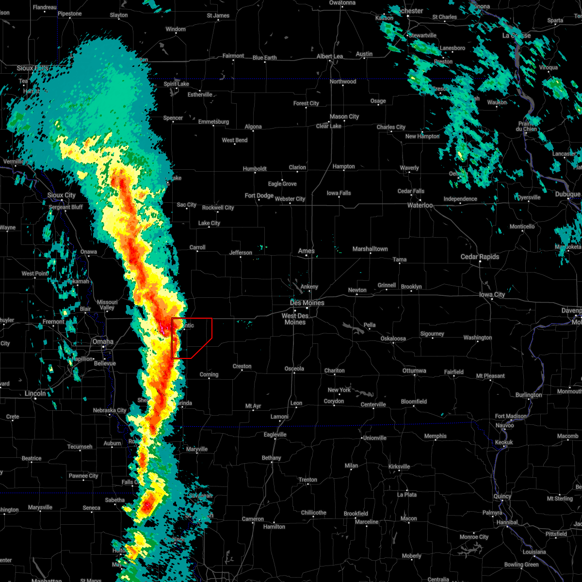 At 446 pm cst, a confirmed tornado was located 8 miles northwest of griswold, or 12 miles west of atlantic, moving northeast at 80 mph (radar confirmed tornado). Hazards include damaging tornado. Flying debris will be dangerous to those caught without shelter. mobile homes will be damaged or destroyed. damage to roofs, windows, and vehicles will occur. tree damage is likely. this tornado will be near, marne around 455 pm cst. atlantic around 455 pm cst. Other locations impacted by this tornadic thunderstorm include wiota, lake anita state park, lewis, cumberland, griswold park, cold springs state park, atlantic municipal airport, anita municipal airport, anita and marne. At 446 pm cst, a confirmed tornado was located 8 miles northwest of griswold, or 12 miles west of atlantic, moving northeast at 80 mph (radar confirmed tornado). Hazards include damaging tornado. Flying debris will be dangerous to those caught without shelter. mobile homes will be damaged or destroyed. damage to roofs, windows, and vehicles will occur. tree damage is likely. this tornado will be near, marne around 455 pm cst. atlantic around 455 pm cst. Other locations impacted by this tornadic thunderstorm include wiota, lake anita state park, lewis, cumberland, griswold park, cold springs state park, atlantic municipal airport, anita municipal airport, anita and marne.
|
| 12/15/2021 4:37 PM CST |
 At 437 pm cst, a tornado producing storm was located near macedonia, or 21 miles southwest of atlantic, moving northeast at 80 mph (radar confirmed tornado). Hazards include damaging tornado. Flying debris will be dangerous to those caught without shelter. mobile homes will be damaged or destroyed. damage to roofs, windows, and vehicles will occur. tree damage is likely. this tornadic storm will be near, griswold around 445 pm cst. atlantic around 455 pm cst. This includes interstate 80 between mile markers 50 and 73. At 437 pm cst, a tornado producing storm was located near macedonia, or 21 miles southwest of atlantic, moving northeast at 80 mph (radar confirmed tornado). Hazards include damaging tornado. Flying debris will be dangerous to those caught without shelter. mobile homes will be damaged or destroyed. damage to roofs, windows, and vehicles will occur. tree damage is likely. this tornadic storm will be near, griswold around 445 pm cst. atlantic around 455 pm cst. This includes interstate 80 between mile markers 50 and 73.
|
| 12/15/2021 4:13 PM CST |
 At 412 pm cst, severe thunderstorms were located along a line extending from near pisgah to near hamburg, moving northeast at 70 mph. these are destructive storms for southwest iowa! (radar indicated). Hazards include 80 mph wind gusts. Flying debris will be dangerous to those caught without shelter. mobile homes will be heavily damaged. expect considerable damage to roofs, windows, and vehicles. Extensive tree damage and power outages are likely. At 412 pm cst, severe thunderstorms were located along a line extending from near pisgah to near hamburg, moving northeast at 70 mph. these are destructive storms for southwest iowa! (radar indicated). Hazards include 80 mph wind gusts. Flying debris will be dangerous to those caught without shelter. mobile homes will be heavily damaged. expect considerable damage to roofs, windows, and vehicles. Extensive tree damage and power outages are likely.
|
| 7/10/2021 12:21 AM CDT |
 At 1220 am cdt, severe thunderstorms were located along a line extending from 9 miles south of atlantic to near elliott, moving southeast at 30 mph (radar indicated). Hazards include 60 mph wind gusts and penny size hail. Expect damage to roofs, siding, and trees. Locations impacted include, lake icaria and corning. At 1220 am cdt, severe thunderstorms were located along a line extending from 9 miles south of atlantic to near elliott, moving southeast at 30 mph (radar indicated). Hazards include 60 mph wind gusts and penny size hail. Expect damage to roofs, siding, and trees. Locations impacted include, lake icaria and corning.
|
| 7/9/2021 11:56 PM CDT |
 At 1156 pm cdt, severe thunderstorms were located along a line extending from near atlantic to near oakland, moving southeast at 30 mph (radar indicated). Hazards include 60 mph wind gusts and penny size hail. Expect damage to roofs, siding, and trees. severe thunderstorms will be near, atlantic around 1200 am cdt. griswold around 1215 am cdt. Other locations in the path of these severe thunderstorms include lake icaria. At 1156 pm cdt, severe thunderstorms were located along a line extending from near atlantic to near oakland, moving southeast at 30 mph (radar indicated). Hazards include 60 mph wind gusts and penny size hail. Expect damage to roofs, siding, and trees. severe thunderstorms will be near, atlantic around 1200 am cdt. griswold around 1215 am cdt. Other locations in the path of these severe thunderstorms include lake icaria.
|
| 6/18/2021 11:35 PM CDT | Tennis Ball sized hail reported 8.3 miles E of Griswold, IA, social media post of hail ranging from quarter to tennis ball sized. |
| 6/18/2021 11:32 PM CDT |
 At 1132 pm cdt, a severe thunderstorm was located near griswold, or 11 miles southwest of atlantic, moving east at 40 mph (radar indicated). Hazards include ping pong ball size hail and 60 mph wind gusts. People and animals outdoors will be injured. expect hail damage to roofs, siding, windows, and vehicles. expect wind damage to roofs, siding, and trees. This severe thunderstorm will be near, griswold around 1140 pm cdt. At 1132 pm cdt, a severe thunderstorm was located near griswold, or 11 miles southwest of atlantic, moving east at 40 mph (radar indicated). Hazards include ping pong ball size hail and 60 mph wind gusts. People and animals outdoors will be injured. expect hail damage to roofs, siding, windows, and vehicles. expect wind damage to roofs, siding, and trees. This severe thunderstorm will be near, griswold around 1140 pm cdt.
|
| 10/11/2020 11:37 PM CDT |
 At 1137 pm cdt, severe thunderstorms were located along a line extending from 7 miles northwest of greenfield to near hopkins, moving east at 50 mph (trained weather spotters). Hazards include 60 mph wind gusts. Expect damage to roofs, siding, and trees. Locations impacted include, atlantic, greenfield, corning, bedford, lenox, griswold, lake icaria, fontanelle, lewis, new market, clearfield, massena, cumberland, prescott, blockton, gravity, bridgewater, nodaway, cromwell and sharpsburg. At 1137 pm cdt, severe thunderstorms were located along a line extending from 7 miles northwest of greenfield to near hopkins, moving east at 50 mph (trained weather spotters). Hazards include 60 mph wind gusts. Expect damage to roofs, siding, and trees. Locations impacted include, atlantic, greenfield, corning, bedford, lenox, griswold, lake icaria, fontanelle, lewis, new market, clearfield, massena, cumberland, prescott, blockton, gravity, bridgewater, nodaway, cromwell and sharpsburg.
|
| 10/11/2020 11:16 PM CDT |
 At 1115 pm cdt, severe thunderstorms were located along a line extending from near atlantic to near blanchard, moving east at 50 mph (trained weather spotters). Hazards include 60 mph wind gusts. Expect damage to roofs, siding, and trees. Locations impacted include, atlantic, greenfield, corning, bedford, lenox, griswold, lake icaria, fontanelle, lewis, new market, clearfield, massena, cumberland, prescott, blockton, gravity, bridgewater, nodaway, cromwell and sharpsburg. At 1115 pm cdt, severe thunderstorms were located along a line extending from near atlantic to near blanchard, moving east at 50 mph (trained weather spotters). Hazards include 60 mph wind gusts. Expect damage to roofs, siding, and trees. Locations impacted include, atlantic, greenfield, corning, bedford, lenox, griswold, lake icaria, fontanelle, lewis, new market, clearfield, massena, cumberland, prescott, blockton, gravity, bridgewater, nodaway, cromwell and sharpsburg.
|
| 10/11/2020 11:01 PM CDT |
 At 1101 pm cdt, severe thunderstorms were located along a line extending from near griswold to 8 miles south of farragut, moving east at 45 mph (radar indicated). Hazards include 60 mph wind gusts. expect damage to roofs, siding, and trees At 1101 pm cdt, severe thunderstorms were located along a line extending from near griswold to 8 miles south of farragut, moving east at 45 mph (radar indicated). Hazards include 60 mph wind gusts. expect damage to roofs, siding, and trees
|
| 8/10/2020 9:39 AM CDT |
 At 938 am cdt, a severe thunderstorm was located near atlantic, moving east at 55 mph (radar indicated). Hazards include 60 mph wind gusts. expect damage to roofs, siding, and trees At 938 am cdt, a severe thunderstorm was located near atlantic, moving east at 55 mph (radar indicated). Hazards include 60 mph wind gusts. expect damage to roofs, siding, and trees
|
| 6/9/2020 9:39 PM CDT |
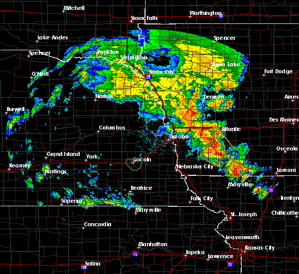 At 938 pm cdt, severe thunderstorms were located along a line extending from near griswold to 10 miles northeast of stanton, moving northeast at 45 mph (trained weather spotters). Hazards include 70 mph wind gusts. at 8:38pm, trained weather spotters estimated wind gusts of 60 to 70 mph in griswold. Expect considerable tree damage. damage is likely to mobile homes, roofs, and outbuildings. Locations impacted include, griswold, lewis, cumberland, griswold park and cold springs state park. At 938 pm cdt, severe thunderstorms were located along a line extending from near griswold to 10 miles northeast of stanton, moving northeast at 45 mph (trained weather spotters). Hazards include 70 mph wind gusts. at 8:38pm, trained weather spotters estimated wind gusts of 60 to 70 mph in griswold. Expect considerable tree damage. damage is likely to mobile homes, roofs, and outbuildings. Locations impacted include, griswold, lewis, cumberland, griswold park and cold springs state park.
|
| 6/9/2020 9:37 PM CDT | 60 to 70 mph wind gusts in griswol in cass county IA, 0.3 miles NNW of Griswold, IA |
| 6/9/2020 9:23 PM CDT |
 At 922 pm cdt, severe thunderstorms were located along a line extending from near oakland to near elliott to near villisca, moving northeast at 35 mph (radar indicated). Hazards include 60 mph wind gusts. expect damage to roofs, siding, and trees At 922 pm cdt, severe thunderstorms were located along a line extending from near oakland to near elliott to near villisca, moving northeast at 35 mph (radar indicated). Hazards include 60 mph wind gusts. expect damage to roofs, siding, and trees
|
| 7/16/2019 3:40 PM CDT |
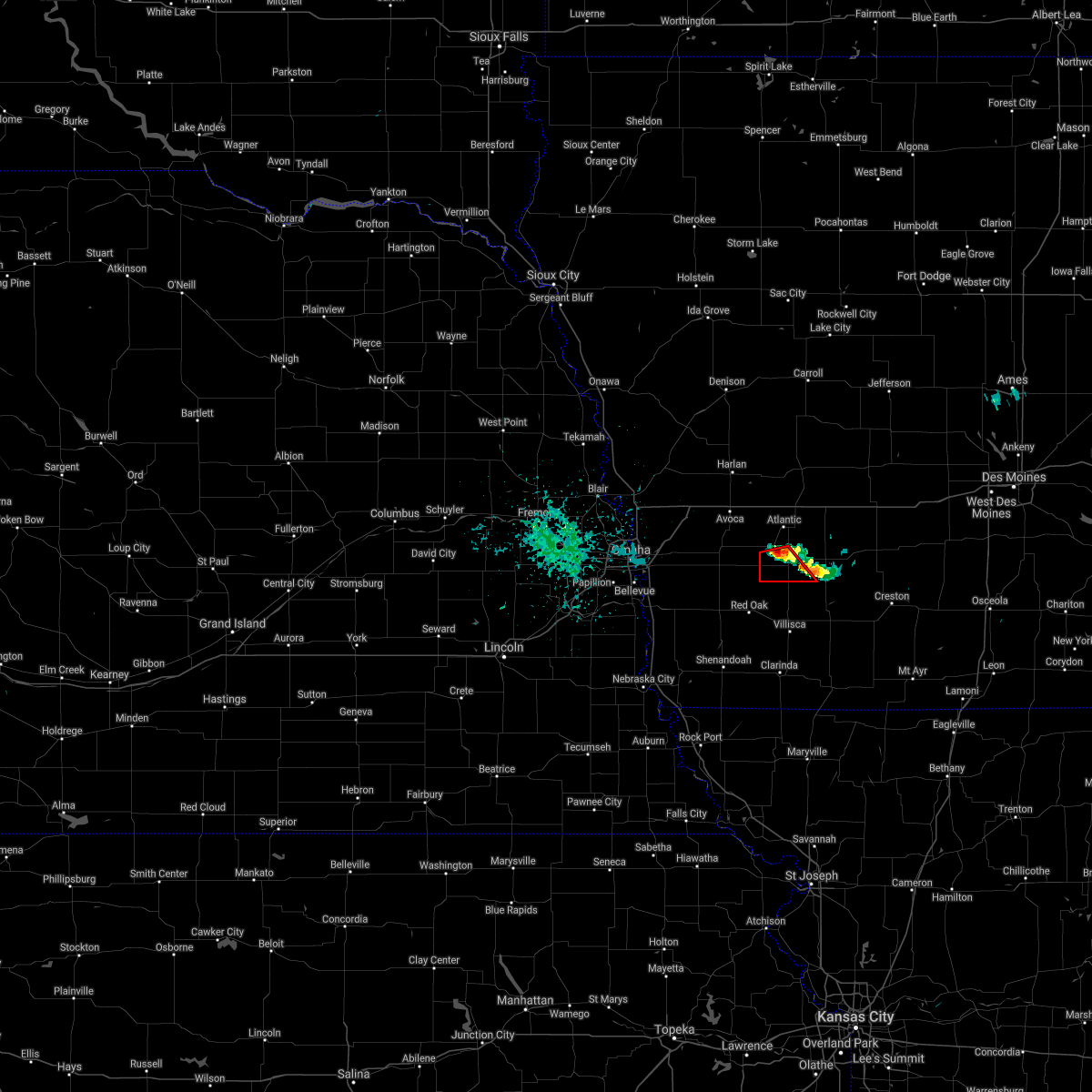 At 340 pm cdt, a severe thunderstorm capable of producing a tornado was located near griswold, or 9 miles south of atlantic, moving southeast at 10 mph (radar indicated rotation). Hazards include tornado. Flying debris will be dangerous to those caught without shelter. mobile homes will be damaged or destroyed. damage to roofs, windows, and vehicles will occur. tree damage is likely. This tornadic thunderstorm will remain over mainly rural areas of southwestern cass county, including the following locations, griswold park, cold springs state park and lewis. At 340 pm cdt, a severe thunderstorm capable of producing a tornado was located near griswold, or 9 miles south of atlantic, moving southeast at 10 mph (radar indicated rotation). Hazards include tornado. Flying debris will be dangerous to those caught without shelter. mobile homes will be damaged or destroyed. damage to roofs, windows, and vehicles will occur. tree damage is likely. This tornadic thunderstorm will remain over mainly rural areas of southwestern cass county, including the following locations, griswold park, cold springs state park and lewis.
|
| 9/1/2018 6:49 AM CDT |
 At 648 am cdt, a severe thunderstorm with damaging winds was located 9 miles north of lake icaria, or 14 miles north of corning, moving east at 55 mph (radar indicated). Hazards include 70 mph wind gusts or higher along with quarter size hail. Hail damage to vehicles is expected. expect considerable tree damage. wind damage is also likely to mobile homes, roofs, and outbuildings. Locations impacted include, greenfield, corning, griswold, lake icaria, fontanelle, lewis, massena, cumberland, prescott, bridgewater, carbon, nodaway park, corning municipal airport, griswold park, cold springs state park and lake icaria state park. At 648 am cdt, a severe thunderstorm with damaging winds was located 9 miles north of lake icaria, or 14 miles north of corning, moving east at 55 mph (radar indicated). Hazards include 70 mph wind gusts or higher along with quarter size hail. Hail damage to vehicles is expected. expect considerable tree damage. wind damage is also likely to mobile homes, roofs, and outbuildings. Locations impacted include, greenfield, corning, griswold, lake icaria, fontanelle, lewis, massena, cumberland, prescott, bridgewater, carbon, nodaway park, corning municipal airport, griswold park, cold springs state park and lake icaria state park.
|
| 9/1/2018 6:39 AM CDT |
 At 637 am cdt, a severe thunderstorm was located 8 miles east of griswold, or 12 miles south of atlantic, moving east at 40 mph. the storm is rapidly strengthening and may produce widespread wind damage across northern adams county, southern cass and adair counties in the warned area (radar indicated). Hazards include 70 mph wind gusts and quarter size hail. Hail damage to vehicles is expected. expect considerable tree damage. wind damage is also likely to mobile homes, roofs, and outbuildings. Locations impacted include, greenfield, corning, griswold, lake icaria, fontanelle, lewis, massena, cumberland, prescott, bridgewater, carbon, nodaway park, corning municipal airport, griswold park, cold springs state park and lake icaria state park. At 637 am cdt, a severe thunderstorm was located 8 miles east of griswold, or 12 miles south of atlantic, moving east at 40 mph. the storm is rapidly strengthening and may produce widespread wind damage across northern adams county, southern cass and adair counties in the warned area (radar indicated). Hazards include 70 mph wind gusts and quarter size hail. Hail damage to vehicles is expected. expect considerable tree damage. wind damage is also likely to mobile homes, roofs, and outbuildings. Locations impacted include, greenfield, corning, griswold, lake icaria, fontanelle, lewis, massena, cumberland, prescott, bridgewater, carbon, nodaway park, corning municipal airport, griswold park, cold springs state park and lake icaria state park.
|
| 9/1/2018 6:30 AM CDT |
 At 629 am cdt, a severe thunderstorm was located near griswold, or 14 miles south of atlantic, moving east at 40 mph (radar indicated). Hazards include 60 mph wind gusts and quarter size hail. Hail damage to vehicles is expected. Expect wind damage to roofs, siding, and trees. At 629 am cdt, a severe thunderstorm was located near griswold, or 14 miles south of atlantic, moving east at 40 mph (radar indicated). Hazards include 60 mph wind gusts and quarter size hail. Hail damage to vehicles is expected. Expect wind damage to roofs, siding, and trees.
|
| 6/28/2018 11:17 AM CDT |
 At 1115 am cdt, severe thunderstorms were located along a line extending from 8 miles south of coon rapids to 14 miles south of guthrie center to 8 miles north of lake icaria, moving east at 45 mph (trained weather spotters. an area of more intense wind damage may be occurring across portions of northern and central adiar county). Hazards include 70 mph wind gusts and quarter size hail. Hail damage to vehicles is expected. expect considerable tree damage. wind damage is also likely to mobile homes, roofs, and outbuildings. locations impacted include, atlantic, audubon, greenfield, guthrie center, stuart, panora, griswold, lake panorama, anita, exira, adair, fontanelle, dexter, lewis, casey, orient, diamondhead lake, massena, menlo and cumberland. This includes interstate 80 between mile markers 56 and 97. At 1115 am cdt, severe thunderstorms were located along a line extending from 8 miles south of coon rapids to 14 miles south of guthrie center to 8 miles north of lake icaria, moving east at 45 mph (trained weather spotters. an area of more intense wind damage may be occurring across portions of northern and central adiar county). Hazards include 70 mph wind gusts and quarter size hail. Hail damage to vehicles is expected. expect considerable tree damage. wind damage is also likely to mobile homes, roofs, and outbuildings. locations impacted include, atlantic, audubon, greenfield, guthrie center, stuart, panora, griswold, lake panorama, anita, exira, adair, fontanelle, dexter, lewis, casey, orient, diamondhead lake, massena, menlo and cumberland. This includes interstate 80 between mile markers 56 and 97.
|
| 6/28/2018 11:01 AM CDT |
 At 1100 am cdt, severe thunderstorms were located along a line extending from 7 miles north of audubon to 14 miles northeast of atlantic to 9 miles east of griswold, moving east at 45 mph (trained weather spotters. these storms have a history of producing wind damage across southwest iowa). Hazards include 70 mph wind gusts and quarter size hail. Hail damage to vehicles is expected. expect considerable tree damage. Wind damage is also likely to mobile homes, roofs, and outbuildings. At 1100 am cdt, severe thunderstorms were located along a line extending from 7 miles north of audubon to 14 miles northeast of atlantic to 9 miles east of griswold, moving east at 45 mph (trained weather spotters. these storms have a history of producing wind damage across southwest iowa). Hazards include 70 mph wind gusts and quarter size hail. Hail damage to vehicles is expected. expect considerable tree damage. Wind damage is also likely to mobile homes, roofs, and outbuildings.
|
| 6/11/2018 6:33 PM CDT |
 At 610 pm cdt, a severe thunderstorm was located near walnut, or 10 miles west of atlantic, moving northeast at 15 mph (radar indicated). Hazards include ping pong ball size hail and 60 mph wind gusts. People and animals outdoors will be injured. expect hail damage to roofs, siding, windows, and vehicles. Expect wind damage to roofs, siding, and trees. At 610 pm cdt, a severe thunderstorm was located near walnut, or 10 miles west of atlantic, moving northeast at 15 mph (radar indicated). Hazards include ping pong ball size hail and 60 mph wind gusts. People and animals outdoors will be injured. expect hail damage to roofs, siding, windows, and vehicles. Expect wind damage to roofs, siding, and trees.
|
| 6/11/2018 6:11 PM CDT |
 At 610 pm cdt, a severe thunderstorm was located near walnut, or 10 miles west of atlantic, moving northeast at 15 mph (radar indicated). Hazards include ping pong ball size hail and 60 mph wind gusts. People and animals outdoors will be injured. expect hail damage to roofs, siding, windows, and vehicles. Expect wind damage to roofs, siding, and trees. At 610 pm cdt, a severe thunderstorm was located near walnut, or 10 miles west of atlantic, moving northeast at 15 mph (radar indicated). Hazards include ping pong ball size hail and 60 mph wind gusts. People and animals outdoors will be injured. expect hail damage to roofs, siding, windows, and vehicles. Expect wind damage to roofs, siding, and trees.
|
| 6/6/2018 8:41 PM CDT |
 The severe thunderstorm warning for cass, southern guthrie, southern audubon and adair counties will expire at 845 pm cdt, the storms which prompted the warning have weakened below severe limits, and no longer pose an immediate threat to life or property. therefore, the warning will be allowed to expire. however gusty winds in excess of 50 mph and heavy rain are still possible with these thunderstorms. a severe thunderstorm watch remains in effect until 1000 pm cdt for central, south central, southwestern and west central iowa. The severe thunderstorm warning for cass, southern guthrie, southern audubon and adair counties will expire at 845 pm cdt, the storms which prompted the warning have weakened below severe limits, and no longer pose an immediate threat to life or property. therefore, the warning will be allowed to expire. however gusty winds in excess of 50 mph and heavy rain are still possible with these thunderstorms. a severe thunderstorm watch remains in effect until 1000 pm cdt for central, south central, southwestern and west central iowa.
|
| 6/6/2018 8:05 PM CDT |
 At 745 pm cdt, severe thunderstorms were located along a line extending from 11 miles northeast of walnut to near stuart, moving south at 20 mph (radar indicated). Hazards include 60 mph wind gusts and quarter size hail. Hail damage to vehicles is expected. Expect wind damage to roofs, siding, and trees. At 745 pm cdt, severe thunderstorms were located along a line extending from 11 miles northeast of walnut to near stuart, moving south at 20 mph (radar indicated). Hazards include 60 mph wind gusts and quarter size hail. Hail damage to vehicles is expected. Expect wind damage to roofs, siding, and trees.
|
| 6/6/2018 7:45 PM CDT |
 At 745 pm cdt, severe thunderstorms were located along a line extending from 11 miles northeast of walnut to near stuart, moving south at 20 mph (radar indicated). Hazards include 60 mph wind gusts and quarter size hail. Hail damage to vehicles is expected. Expect wind damage to roofs, siding, and trees. At 745 pm cdt, severe thunderstorms were located along a line extending from 11 miles northeast of walnut to near stuart, moving south at 20 mph (radar indicated). Hazards include 60 mph wind gusts and quarter size hail. Hail damage to vehicles is expected. Expect wind damage to roofs, siding, and trees.
|
| 6/2/2018 2:41 AM CDT |
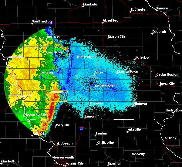 The severe thunderstorm warning for cass and western adair counties will expire at 245 am cdt, the storm which prompted the warning has weakened below severe limits, and no longer poses an immediate threat to life or property. therefore, the warning will be allowed to expire. however gusty winds and heavy rain are still likely with this thunderstorm. The severe thunderstorm warning for cass and western adair counties will expire at 245 am cdt, the storm which prompted the warning has weakened below severe limits, and no longer poses an immediate threat to life or property. therefore, the warning will be allowed to expire. however gusty winds and heavy rain are still likely with this thunderstorm.
|
| 6/2/2018 2:06 AM CDT |
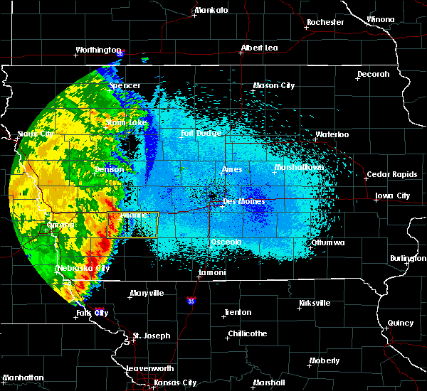 At 205 am cdt, a severe thunderstorm was located near atlantic, moving east at 25 mph (radar indicated. however, at 155 am, the atlantic airport measured a wind gust of 66 mph. at 203 am, public report of power out in atlantic). Hazards include 60 mph wind gusts. Expect damage to roofs, siding, and trees. locations impacted include, atlantic, griswold, anita, adair, fontanelle, lewis, massena, cumberland, bridgewater, marne, wiota, lake anita state park, nodaway park, griswold park, cold springs state park, atlantic municipal airport and anita municipal airport. This includes interstate 80 between mile markers 50 and 84. At 205 am cdt, a severe thunderstorm was located near atlantic, moving east at 25 mph (radar indicated. however, at 155 am, the atlantic airport measured a wind gust of 66 mph. at 203 am, public report of power out in atlantic). Hazards include 60 mph wind gusts. Expect damage to roofs, siding, and trees. locations impacted include, atlantic, griswold, anita, adair, fontanelle, lewis, massena, cumberland, bridgewater, marne, wiota, lake anita state park, nodaway park, griswold park, cold springs state park, atlantic municipal airport and anita municipal airport. This includes interstate 80 between mile markers 50 and 84.
|
| 6/2/2018 1:54 AM CDT |
 At 153 am cdt, a severe thunderstorm was located near atlantic, moving east at 30 mph (radar indicated). Hazards include 60 mph wind gusts. expect damage to roofs, siding, and trees At 153 am cdt, a severe thunderstorm was located near atlantic, moving east at 30 mph (radar indicated). Hazards include 60 mph wind gusts. expect damage to roofs, siding, and trees
|
| 8/21/2017 2:07 AM CDT |
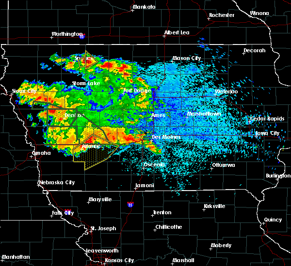 At 207 am cdt, a severe thunderstorm was located 8 miles northeast of atlantic, moving southeast at 35 mph (radar indicated). Hazards include 60 mph wind gusts and penny size hail. expect damage to roofs, siding, and trees At 207 am cdt, a severe thunderstorm was located 8 miles northeast of atlantic, moving southeast at 35 mph (radar indicated). Hazards include 60 mph wind gusts and penny size hail. expect damage to roofs, siding, and trees
|
| 6/16/2017 9:27 PM CDT |
 The severe thunderstorm warning for southern cass and southwestern adair counties will expire at 930 pm cdt, the storms which prompted the warning have moved out of the area. therefore the warning will be allowed to expire. however gusty winds are still possible with these thunderstorms. a severe thunderstorm watch remains in effect until 400 am cdt for southwestern iowa. The severe thunderstorm warning for southern cass and southwestern adair counties will expire at 930 pm cdt, the storms which prompted the warning have moved out of the area. therefore the warning will be allowed to expire. however gusty winds are still possible with these thunderstorms. a severe thunderstorm watch remains in effect until 400 am cdt for southwestern iowa.
|
| 6/16/2017 9:16 PM CDT |
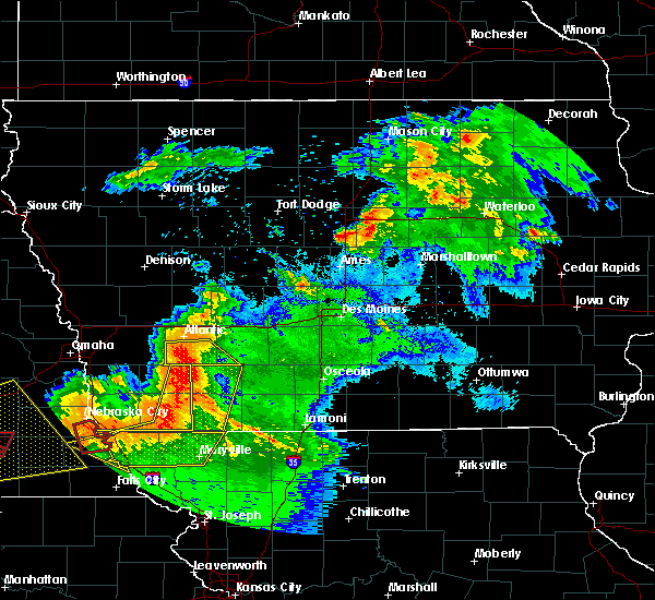 At 916 pm cdt, severe thunderstorms were located along a line extending from 10 miles southeast of atlantic to 6 miles northeast of stanton, moving southeast at 45 mph (radar indicated). Hazards include 60 mph wind gusts. Expect damage to roofs, siding, and trees. Locations impacted include, griswold, lewis, massena, cumberland, bridgewater, cold springs state park and griswold park. At 916 pm cdt, severe thunderstorms were located along a line extending from 10 miles southeast of atlantic to 6 miles northeast of stanton, moving southeast at 45 mph (radar indicated). Hazards include 60 mph wind gusts. Expect damage to roofs, siding, and trees. Locations impacted include, griswold, lewis, massena, cumberland, bridgewater, cold springs state park and griswold park.
|
| 6/16/2017 9:01 PM CDT | Storm damage reported in cass county IA, 0.3 miles NNW of Griswold, IA |
| 6/16/2017 8:55 PM CDT |
 At 855 pm cdt, severe thunderstorms were located along a line extending from near atlantic to near elliott, moving southeast at 45 mph (radar indicated). Hazards include 70 mph wind gusts. Expect considerable tree damage. damage is likely to mobile homes, roofs, and outbuildings. locations impacted include, atlantic, griswold, lewis, massena, cumberland, bridgewater, marne, wiota, cold springs state park, griswold park and atlantic municipal airport. This includes interstate 80 between mile markers 50 and 61. At 855 pm cdt, severe thunderstorms were located along a line extending from near atlantic to near elliott, moving southeast at 45 mph (radar indicated). Hazards include 70 mph wind gusts. Expect considerable tree damage. damage is likely to mobile homes, roofs, and outbuildings. locations impacted include, atlantic, griswold, lewis, massena, cumberland, bridgewater, marne, wiota, cold springs state park, griswold park and atlantic municipal airport. This includes interstate 80 between mile markers 50 and 61.
|
| 6/16/2017 8:50 PM CDT | Broken tree branches across town along with power outage in cass county IA, 0.3 miles NNW of Griswold, IA |
| 6/16/2017 8:49 PM CDT |
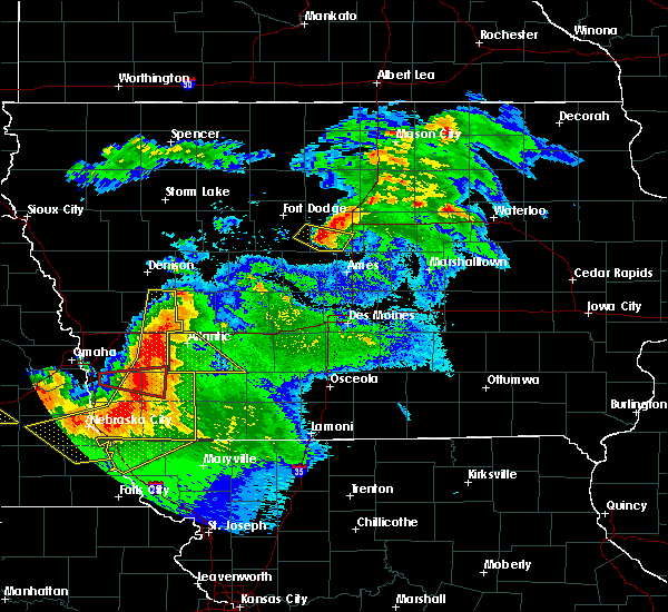 At 849 pm cdt, severe thunderstorms were located along a line extending from 6 miles east of walnut to 6 miles east of carson, moving southeast at 45 mph (radar indicated). Hazards include 60 mph wind gusts. Expect damage to roofs, siding, and trees. locations impacted include, atlantic, griswold, lewis, massena, cumberland, bridgewater, marne, wiota, cold springs state park, griswold park and atlantic municipal airport. This includes interstate 80 between mile markers 50 and 61. At 849 pm cdt, severe thunderstorms were located along a line extending from 6 miles east of walnut to 6 miles east of carson, moving southeast at 45 mph (radar indicated). Hazards include 60 mph wind gusts. Expect damage to roofs, siding, and trees. locations impacted include, atlantic, griswold, lewis, massena, cumberland, bridgewater, marne, wiota, cold springs state park, griswold park and atlantic municipal airport. This includes interstate 80 between mile markers 50 and 61.
|
| 6/16/2017 8:36 PM CDT |
 At 836 pm cdt, severe thunderstorms were located along a line extending from 6 miles north of walnut to oakland, moving southeast at 45 mph (radar indicated). Hazards include 60 mph wind gusts. expect damage to roofs, siding, and trees At 836 pm cdt, severe thunderstorms were located along a line extending from 6 miles north of walnut to oakland, moving southeast at 45 mph (radar indicated). Hazards include 60 mph wind gusts. expect damage to roofs, siding, and trees
|
| 6/15/2017 9:45 PM CDT |
 At 944 pm cdt, a severe thunderstorm was located 15 miles northwest of greenfield, moving southeast at 35 mph (radar indicated). Hazards include 60 mph wind gusts and half dollar size hail. Hail damage to vehicles is expected. Expect wind damage to roofs, siding, and trees. At 944 pm cdt, a severe thunderstorm was located 15 miles northwest of greenfield, moving southeast at 35 mph (radar indicated). Hazards include 60 mph wind gusts and half dollar size hail. Hail damage to vehicles is expected. Expect wind damage to roofs, siding, and trees.
|
| 6/15/2017 7:11 PM CDT |
 At 710 pm cdt, a severe thunderstorm was located near griswold, or 9 miles south of atlantic, moving east at 30 mph (radar indicated). Hazards include 60 mph wind gusts and half dollar size hail. Hail damage to vehicles is expected. expect wind damage to roofs, siding, and trees. Locations impacted include, griswold, cumberland, griswold park and cold springs state park. At 710 pm cdt, a severe thunderstorm was located near griswold, or 9 miles south of atlantic, moving east at 30 mph (radar indicated). Hazards include 60 mph wind gusts and half dollar size hail. Hail damage to vehicles is expected. expect wind damage to roofs, siding, and trees. Locations impacted include, griswold, cumberland, griswold park and cold springs state park.
|
| 6/15/2017 6:50 PM CDT |
 At 650 pm cdt, a severe thunderstorm was located near elliott, or 17 miles southwest of atlantic, moving east at 35 mph (radar indicated). Hazards include 60 mph wind gusts and half dollar size hail. Hail damage to vehicles is expected. Expect wind damage to roofs, siding, and trees. At 650 pm cdt, a severe thunderstorm was located near elliott, or 17 miles southwest of atlantic, moving east at 35 mph (radar indicated). Hazards include 60 mph wind gusts and half dollar size hail. Hail damage to vehicles is expected. Expect wind damage to roofs, siding, and trees.
|
| 5/27/2017 9:04 AM CDT |
 At 903 am cdt, a severe thunderstorm was located near griswold, or 7 miles southwest of atlantic, moving north at 35 mph (radar indicated). Hazards include quarter size hail. damage to vehicles is expected At 903 am cdt, a severe thunderstorm was located near griswold, or 7 miles southwest of atlantic, moving north at 35 mph (radar indicated). Hazards include quarter size hail. damage to vehicles is expected
|
| 5/27/2017 9:04 AM CDT |
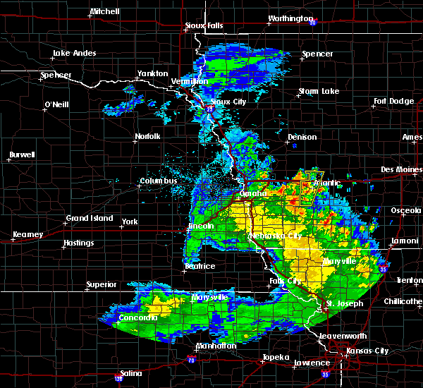 At 927 am cdt, severe thunderstorms were located along a line extending from near walnut to near atlantic, moving north at 25 mph (radar indicated). Hazards include quarter size hail. Damage to vehicles is expected. locations impacted include, atlantic, lewis, marne, cold springs state park, griswold park and atlantic municipal airport. This includes interstate 80 between mile markers 50 and 63. At 927 am cdt, severe thunderstorms were located along a line extending from near walnut to near atlantic, moving north at 25 mph (radar indicated). Hazards include quarter size hail. Damage to vehicles is expected. locations impacted include, atlantic, lewis, marne, cold springs state park, griswold park and atlantic municipal airport. This includes interstate 80 between mile markers 50 and 63.
|
| 5/16/2017 8:22 PM CDT |
 At 822 pm cdt, severe thunderstorms were located along a line extending from near coon rapids to 9 miles west of guthrie center to 7 miles southeast of atlantic, moving northeast at 50 mph (radar indicated). Hazards include 60 mph wind gusts and quarter size hail. Hail damage to vehicles is expected. Expect wind damage to roofs, siding, and trees. At 822 pm cdt, severe thunderstorms were located along a line extending from near coon rapids to 9 miles west of guthrie center to 7 miles southeast of atlantic, moving northeast at 50 mph (radar indicated). Hazards include 60 mph wind gusts and quarter size hail. Hail damage to vehicles is expected. Expect wind damage to roofs, siding, and trees.
|
| 5/16/2017 7:53 PM CDT |
 At 753 pm cdt, a severe thunderstorm was located near atlantic, moving east at 40 mph (radar indicated). Hazards include 60 mph wind gusts and quarter size hail. Hail damage to vehicles is expected. Expect wind damage to roofs, siding, and trees. At 753 pm cdt, a severe thunderstorm was located near atlantic, moving east at 40 mph (radar indicated). Hazards include 60 mph wind gusts and quarter size hail. Hail damage to vehicles is expected. Expect wind damage to roofs, siding, and trees.
|
| 3/6/2017 5:07 PM CST |
 At 507 pm cst, severe thunderstorms were located along a line extending from 8 miles north of audubon to near macedonia, moving northeast at 35 mph (radar indicated). Hazards include 60 mph wind gusts and quarter size hail. Hail damage to vehicles is expected. Expect wind damage to roofs, siding, and trees. At 507 pm cst, severe thunderstorms were located along a line extending from 8 miles north of audubon to near macedonia, moving northeast at 35 mph (radar indicated). Hazards include 60 mph wind gusts and quarter size hail. Hail damage to vehicles is expected. Expect wind damage to roofs, siding, and trees.
|
| 8/23/2016 11:23 PM CDT |
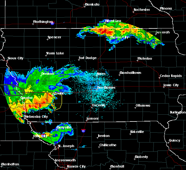 At 1122 pm cdt, severe thunderstorms were located along a line extending from near atlantic to 7 miles southeast of griswold to near elliott, moving east at 30 mph (radar indicated). Hazards include 60 mph wind gusts and quarter size hail. Hail damage to vehicles is expected. expect wind damage to roofs, siding, and trees. Locations impacted include, atlantic, griswold, lake icaria, lewis, massena, cumberland, marne, wiota, carbon, lake anita state park, cold springs state park, griswold park, atlantic municipal airport and lake icaria state park. At 1122 pm cdt, severe thunderstorms were located along a line extending from near atlantic to 7 miles southeast of griswold to near elliott, moving east at 30 mph (radar indicated). Hazards include 60 mph wind gusts and quarter size hail. Hail damage to vehicles is expected. expect wind damage to roofs, siding, and trees. Locations impacted include, atlantic, griswold, lake icaria, lewis, massena, cumberland, marne, wiota, carbon, lake anita state park, cold springs state park, griswold park, atlantic municipal airport and lake icaria state park.
|
| 8/23/2016 11:08 PM CDT |
 At 1107 pm cdt, severe thunderstorms were located along a line extending from near atlantic to griswold to 6 miles west of elliott, moving east at 30 mph (radar indicated). Hazards include 60 mph wind gusts. Expect damage to roofs. siding. And trees. At 1107 pm cdt, severe thunderstorms were located along a line extending from near atlantic to griswold to 6 miles west of elliott, moving east at 30 mph (radar indicated). Hazards include 60 mph wind gusts. Expect damage to roofs. siding. And trees.
|
| 8/11/2016 8:51 PM CDT |
 The severe thunderstorm warning for southwestern guthrie, cass, northwestern adair, southeastern audubon and northwestern adams counties will expire at 900 pm cdt, the storms which prompted the warning have moved out of the area. therefore the warning will be allowed to expire. however heavy rain is still possible with these thunderstorms. a severe thunderstorm watch remains in effect until 1100 pm cdt for west central and southwestern iowa. The severe thunderstorm warning for southwestern guthrie, cass, northwestern adair, southeastern audubon and northwestern adams counties will expire at 900 pm cdt, the storms which prompted the warning have moved out of the area. therefore the warning will be allowed to expire. however heavy rain is still possible with these thunderstorms. a severe thunderstorm watch remains in effect until 1100 pm cdt for west central and southwestern iowa.
|
| 8/11/2016 8:20 PM CDT |
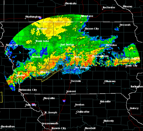 At 818 pm cdt, severe thunderstorms were located along a line extending from 16 miles southeast of audubon to near atlantic to near griswold, moving southeast at 35 mph (law enforcement. at 810 pm...trees and power lines were reported down in atlantic). Hazards include 60 mph wind gusts. Expect damage to roofs. siding. And trees. At 818 pm cdt, severe thunderstorms were located along a line extending from 16 miles southeast of audubon to near atlantic to near griswold, moving southeast at 35 mph (law enforcement. at 810 pm...trees and power lines were reported down in atlantic). Hazards include 60 mph wind gusts. Expect damage to roofs. siding. And trees.
|
| 4/27/2016 4:41 PM CDT |
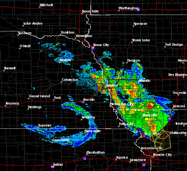 The severe thunderstorm warning for southwestern cass county will expire at 445 pm cdt, the storm which prompted the warning has weakened below severe limits, and no longer pose an immediate threat to life or property. therefore the warning will be allowed to expire. a tornado watch remains in effect until 900 pm cdt for southwestern iowa. The severe thunderstorm warning for southwestern cass county will expire at 445 pm cdt, the storm which prompted the warning has weakened below severe limits, and no longer pose an immediate threat to life or property. therefore the warning will be allowed to expire. a tornado watch remains in effect until 900 pm cdt for southwestern iowa.
|
| 4/27/2016 4:16 PM CDT |
 At 416 pm cdt, a severe thunderstorm was located near griswold, or 13 miles south of atlantic, moving north at 15 mph (radar indicated). Hazards include quarter size hail. Damage to vehicles is expected. locations impacted include, atlantic, griswold, lewis, cold springs state park, griswold park and atlantic municipal airport. A tornado watch remains in effect until 900 pm cdt for southwestern iowa. At 416 pm cdt, a severe thunderstorm was located near griswold, or 13 miles south of atlantic, moving north at 15 mph (radar indicated). Hazards include quarter size hail. Damage to vehicles is expected. locations impacted include, atlantic, griswold, lewis, cold springs state park, griswold park and atlantic municipal airport. A tornado watch remains in effect until 900 pm cdt for southwestern iowa.
|
| 4/27/2016 3:59 PM CDT |
 At 359 pm cdt, a severe thunderstorm was located 4 miles east of elliott, or 17 miles south of atlantic, moving north at 25 mph (radar indicated). Hazards include quarter size hail. damage to vehicles is expected At 359 pm cdt, a severe thunderstorm was located 4 miles east of elliott, or 17 miles south of atlantic, moving north at 25 mph (radar indicated). Hazards include quarter size hail. damage to vehicles is expected
|
| 4/24/2016 9:32 PM CDT |
 At 931 pm cdt, a severe thunderstorm was located 11 miles east of griswold, or 15 miles northwest of corning, moving northeast at 45 mph (radar indicated). Hazards include 60 mph wind gusts. Expect damage to roofs. siding. And trees. At 931 pm cdt, a severe thunderstorm was located 11 miles east of griswold, or 15 miles northwest of corning, moving northeast at 45 mph (radar indicated). Hazards include 60 mph wind gusts. Expect damage to roofs. siding. And trees.
|
| 11/11/2015 1:48 PM CST |
 At 148 pm cst, a severe thunderstorm was located 5 miles northwest of elliott, or 17 miles southwest of atlantic, moving northeast at 55 mph (trained weather spotters). Hazards include 60 mph wind gusts. Expect damage to roofs. Siding and trees. At 148 pm cst, a severe thunderstorm was located 5 miles northwest of elliott, or 17 miles southwest of atlantic, moving northeast at 55 mph (trained weather spotters). Hazards include 60 mph wind gusts. Expect damage to roofs. Siding and trees.
|
| 5/7/2015 5:22 PM CDT | At 520 pm cdt, a severe thunderstorm was located 6 miles east of griswold, or 13 miles south of atlantic, moving east at 25 mph (radar indicated). Hazards include quarter size hail. Damage to vehicles is expected. this severe thunderstorm will remain over mainly rural areas of southwestern cass county, including the following locations, cumberland, griswold park and cold springs state park. 1. 00in. |
| 5/7/2015 4:56 PM CDT | At 456 pm cdt, a severe thunderstorm was located near elliott, or 19 miles southwest of atlantic, moving northeast at 25 mph (radar indicated). Hazards include 60 mph wind gusts and half dollar size hail. Hail damage to vehicles is expected. expect wind damage to roofs, siding and trees. this severe thunderstorm will be near, griswold around 510 pm cdt. other locations impacted by this severe thunderstorm include cumberland, griswold park and cold springs state park. 1. 25in. |
| 6/3/2014 5:50 PM CDT | 60 mph and very heavy rain. small tree limb damag in cass county IA, 5.3 miles W of Griswold, IA |
| 3/29/2012 8:10 PM CDT | Quarter sized hail reported 3.1 miles N of Griswold, IA |
| 1/1/0001 12:00 AM | Quarter sized hail reported 3.1 miles N of Griswold, IA, 1 inch hail |
Hail Maps for Griswold, IA
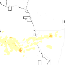


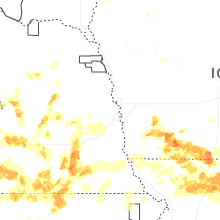

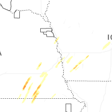
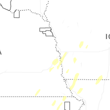
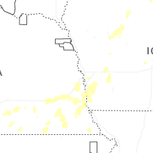
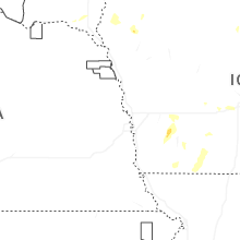
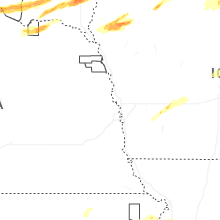

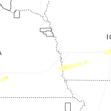


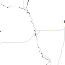


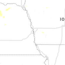


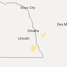


Connect with Interactive Hail Maps