

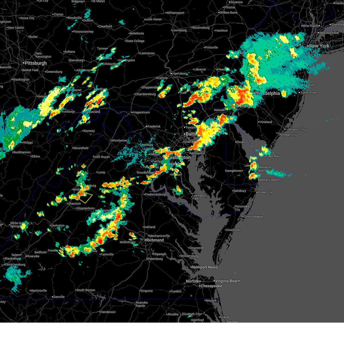
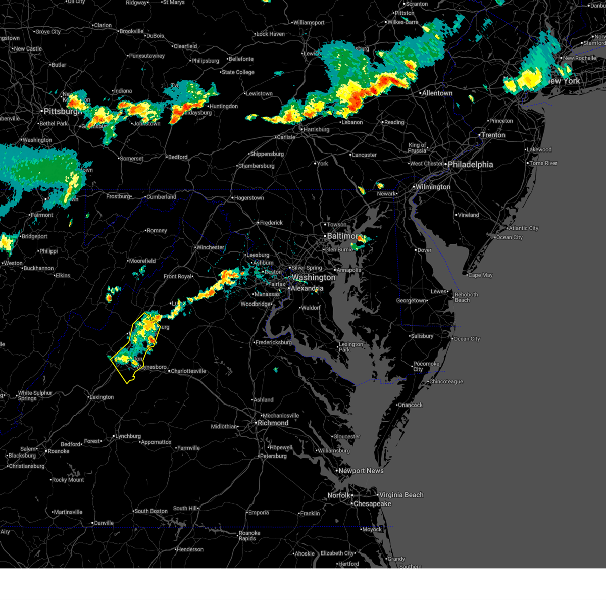
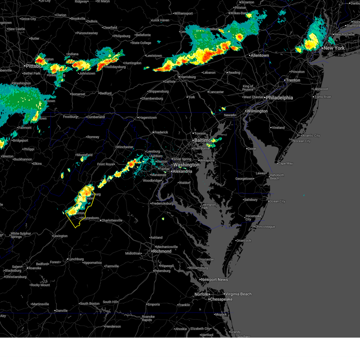
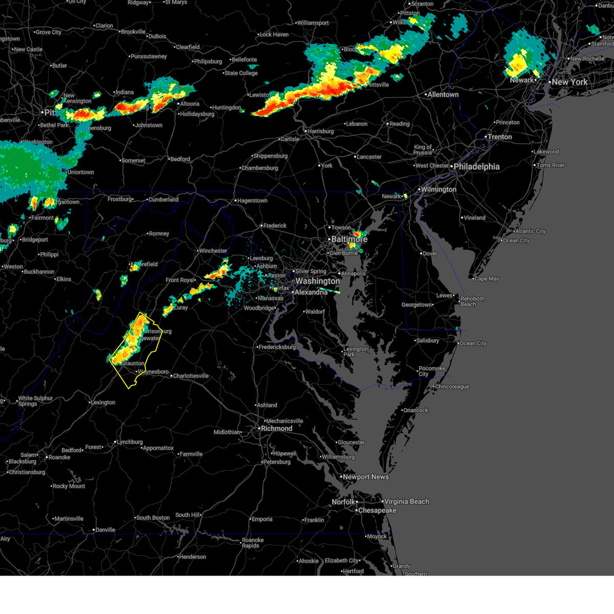
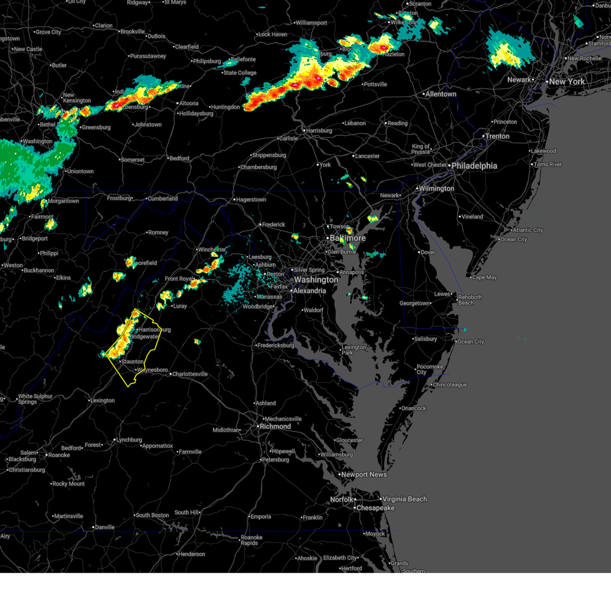
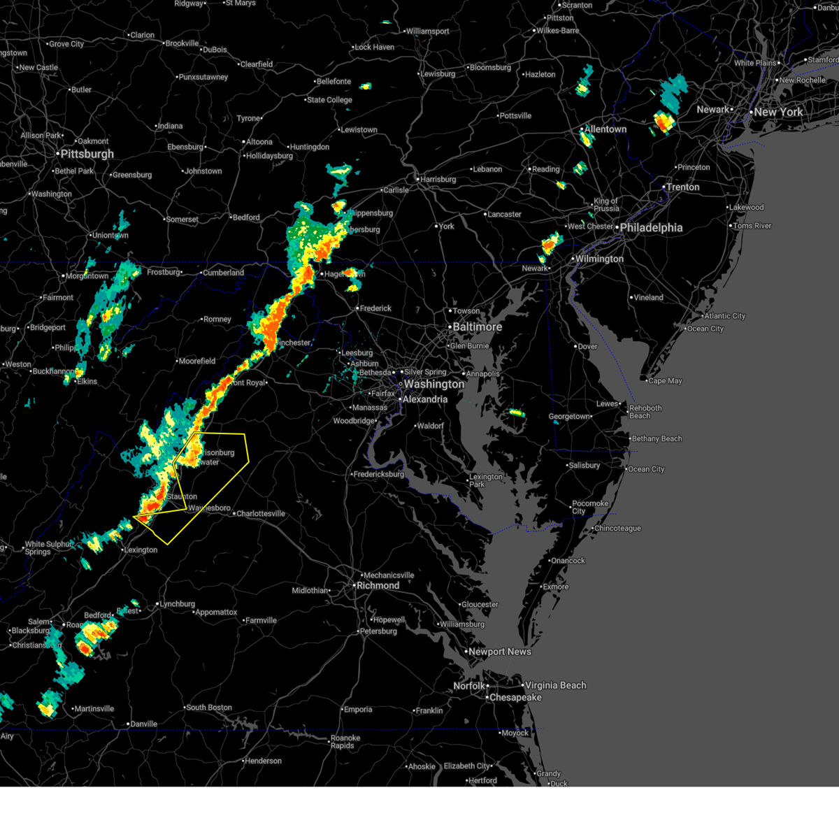
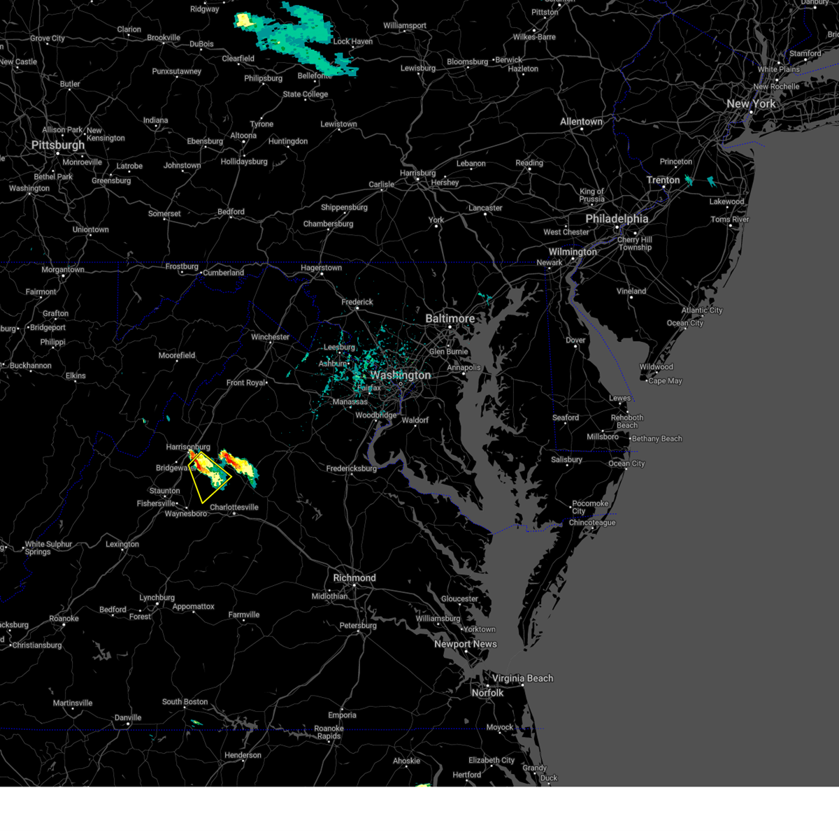
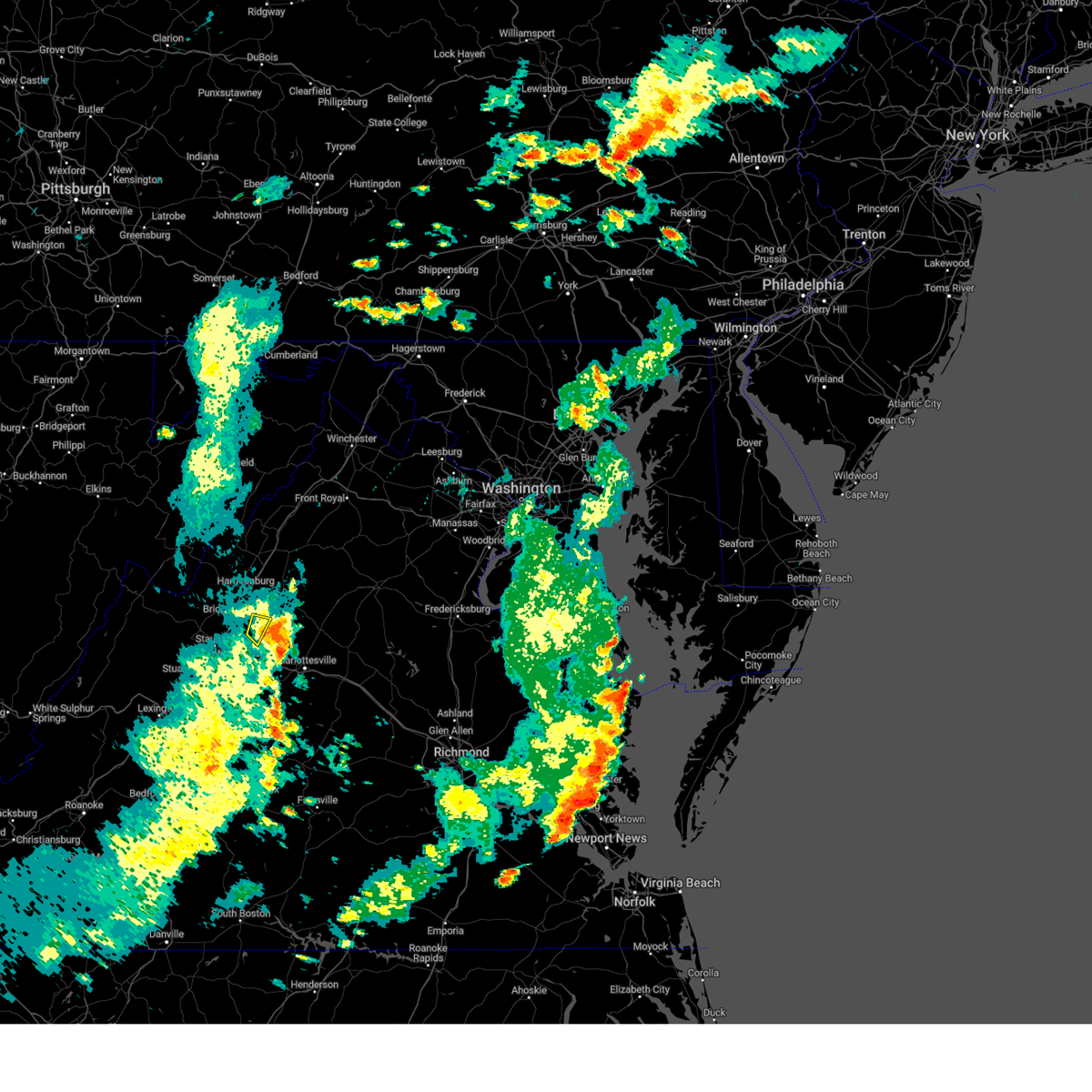
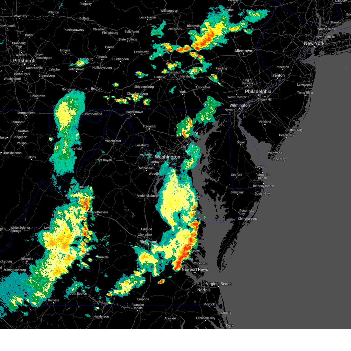
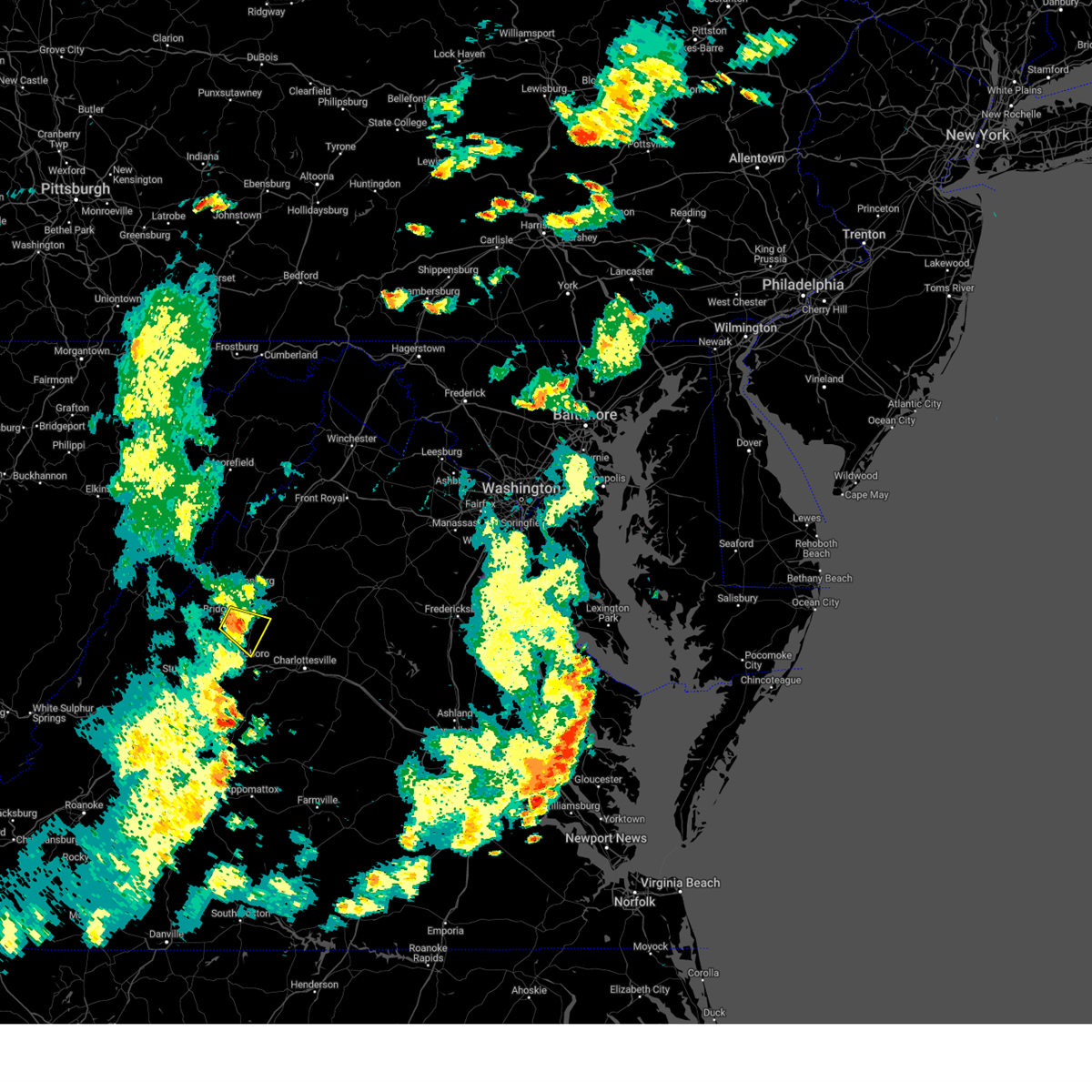
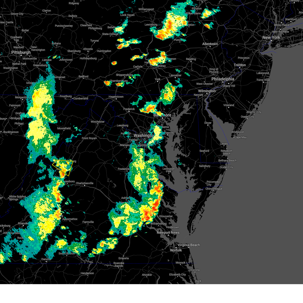
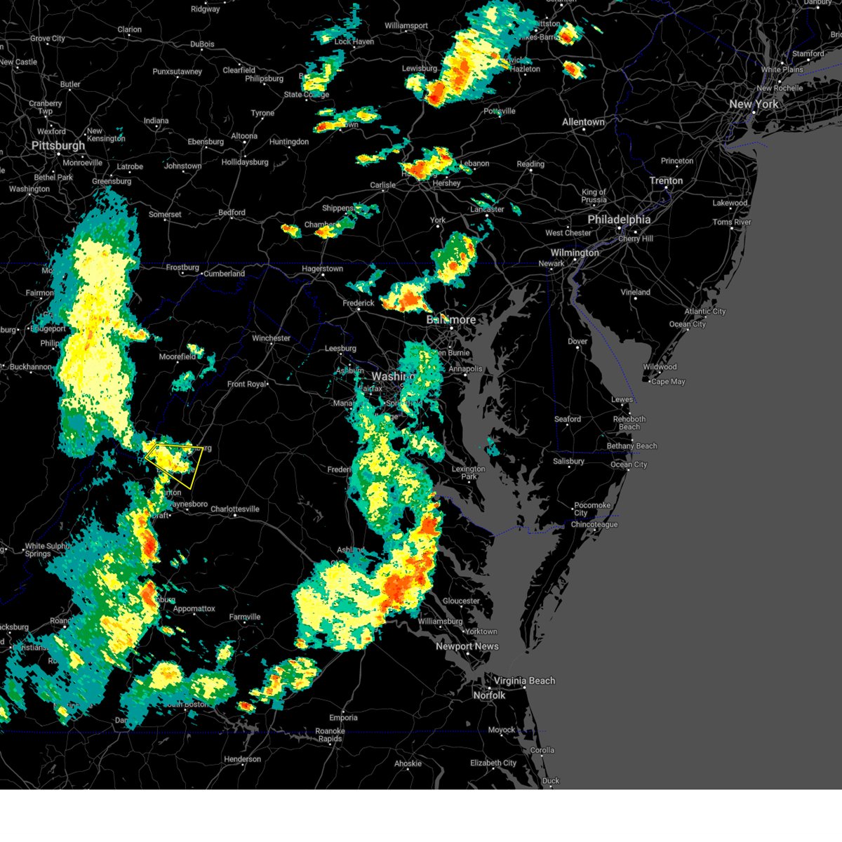
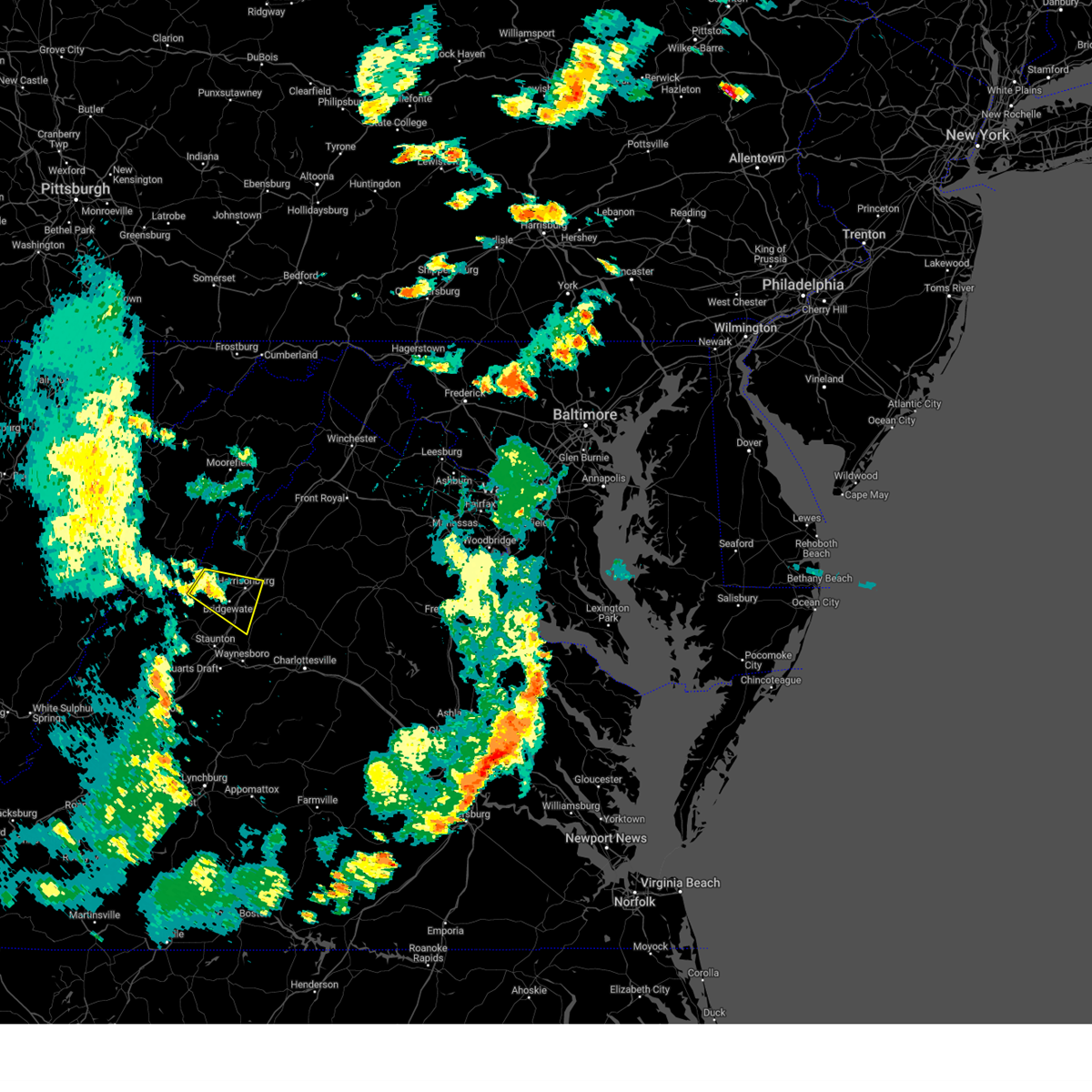
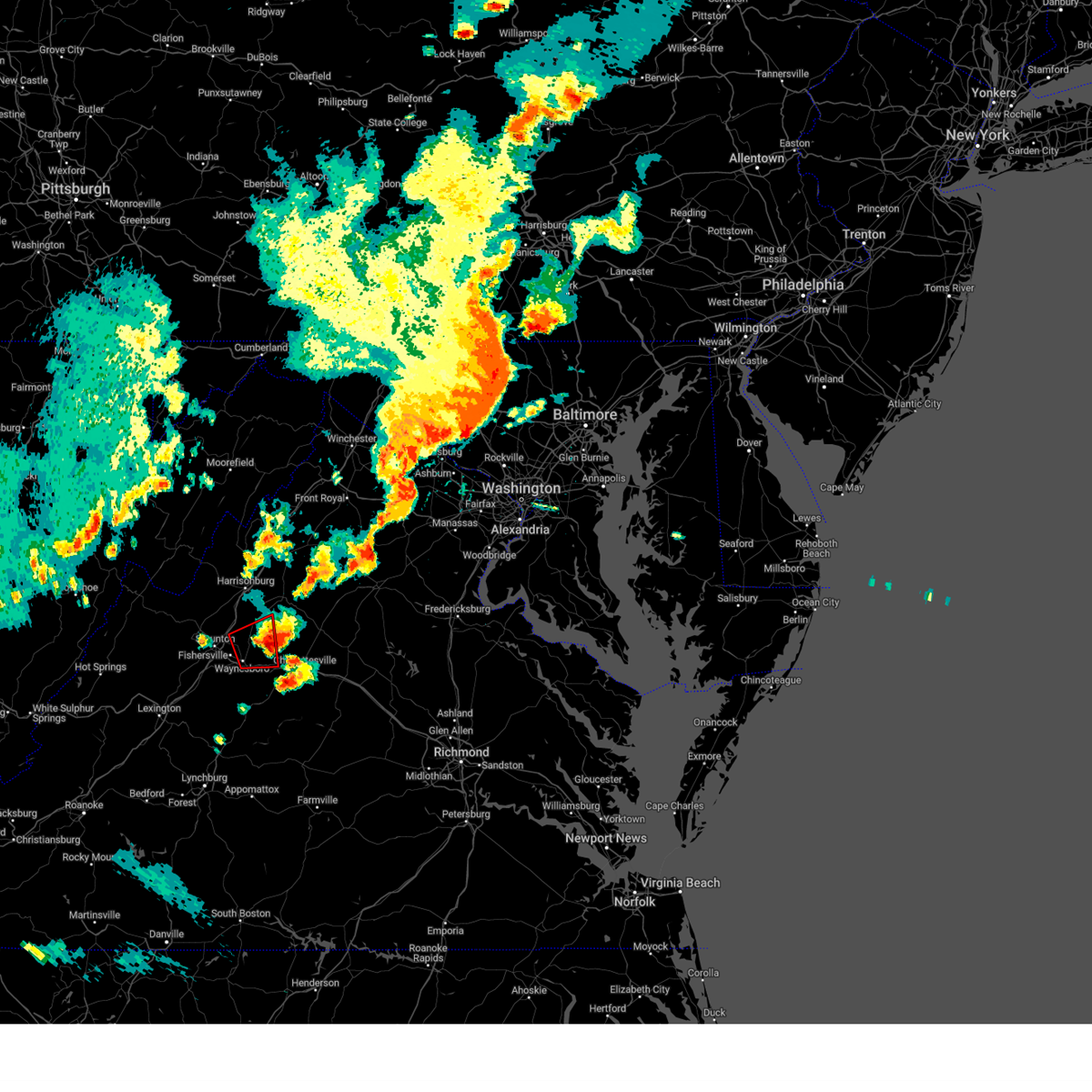
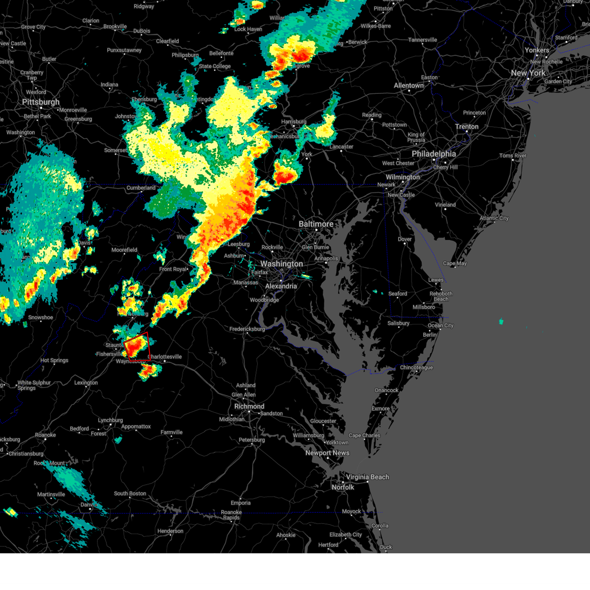
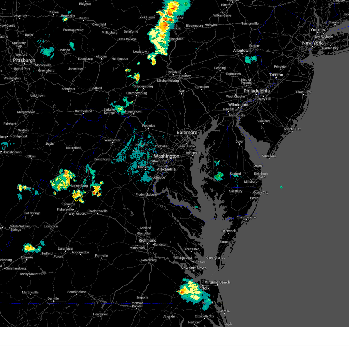
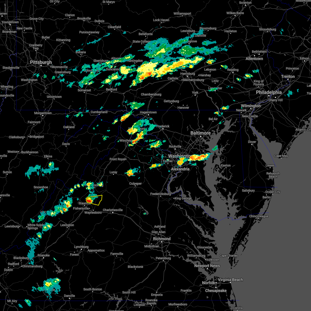
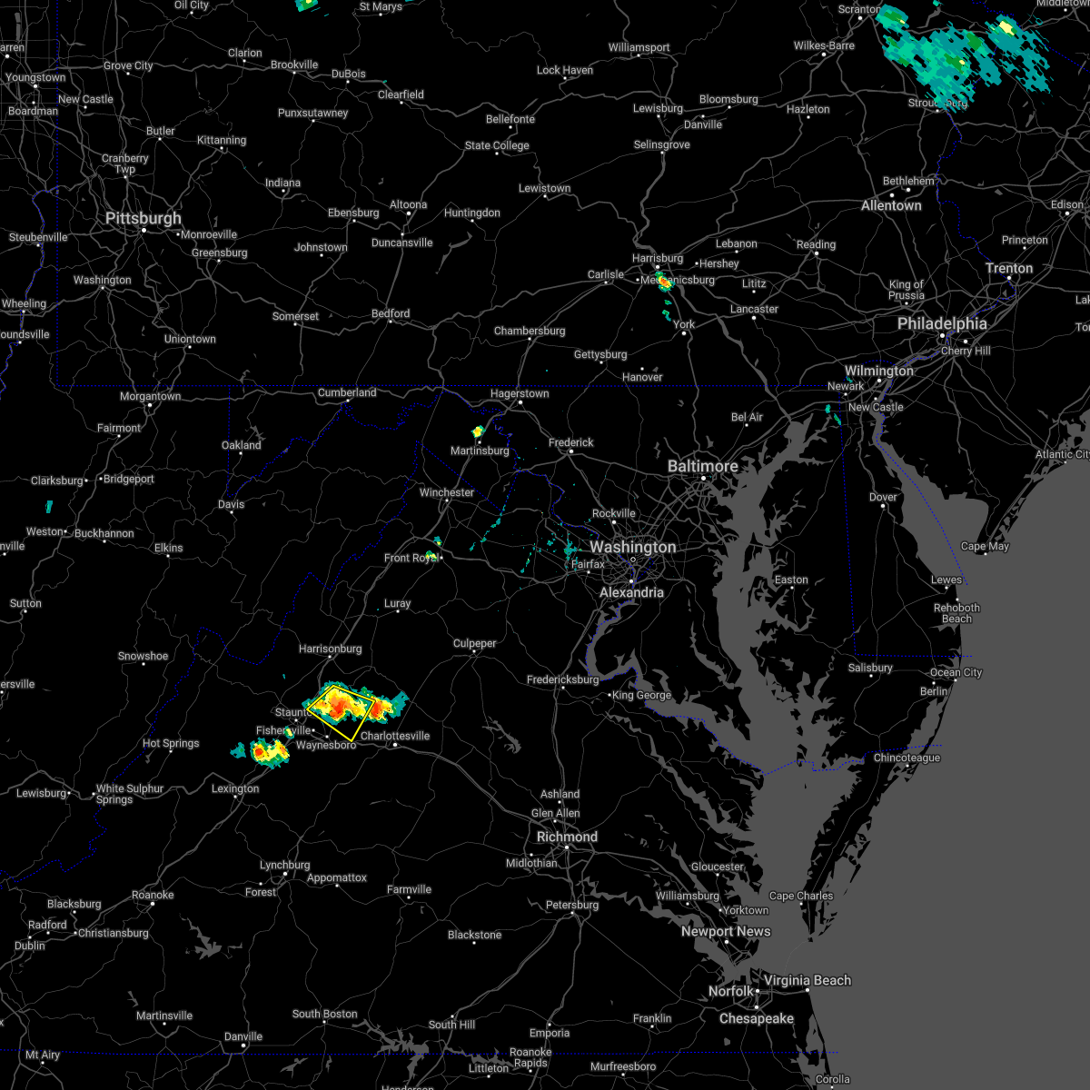
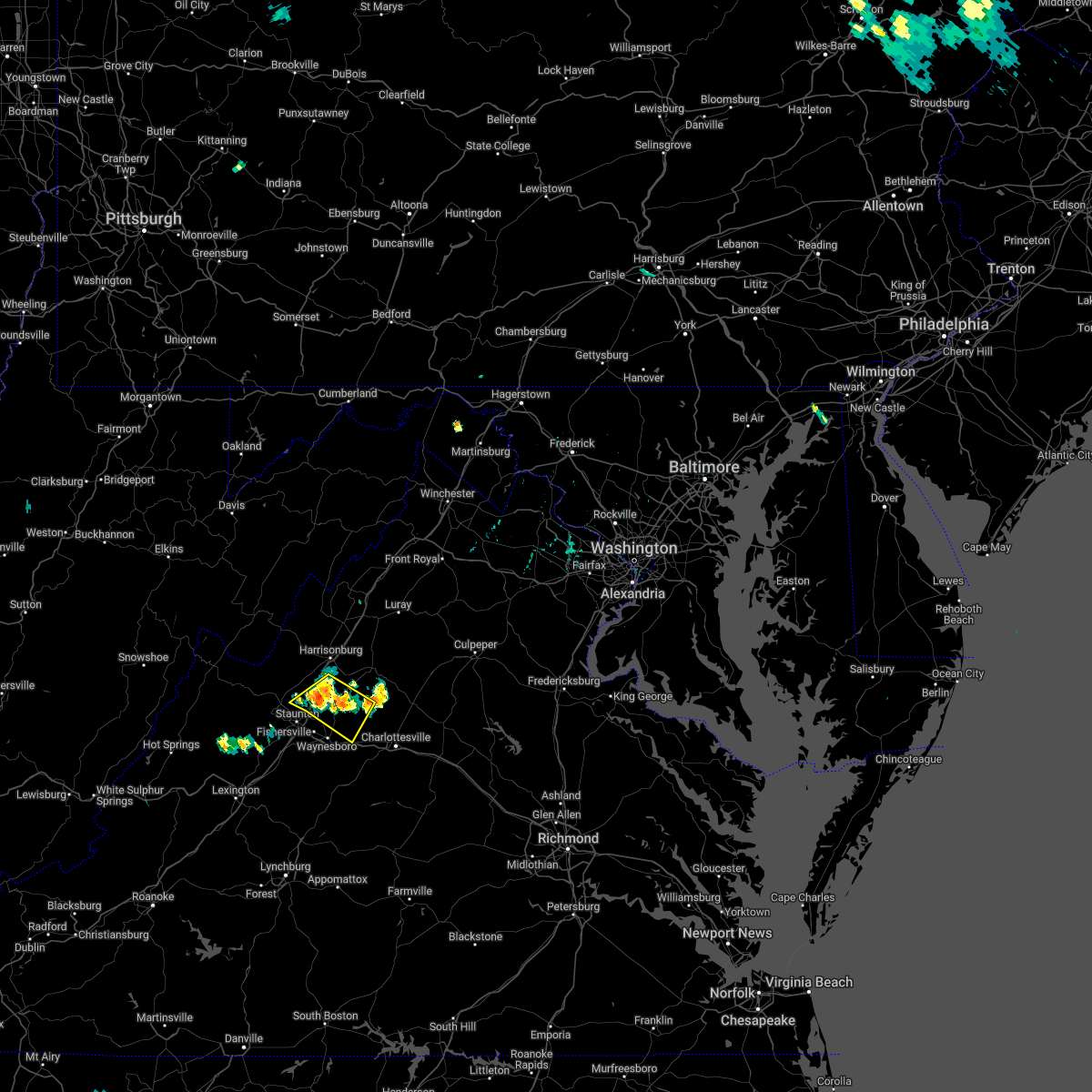
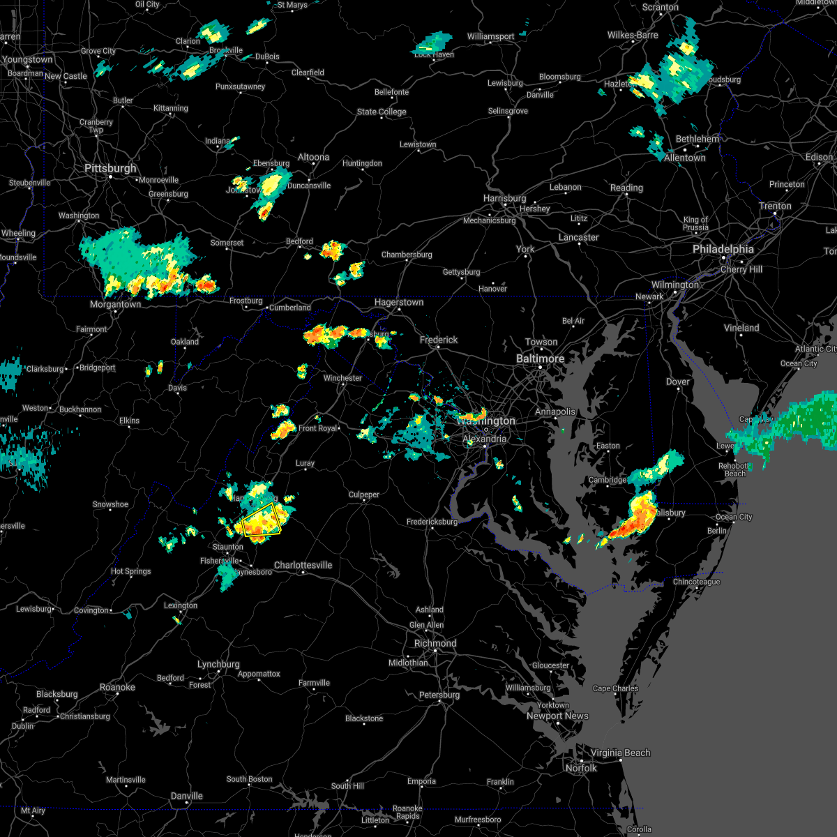
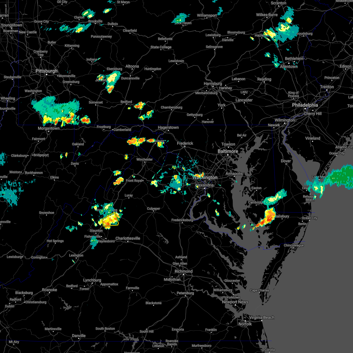
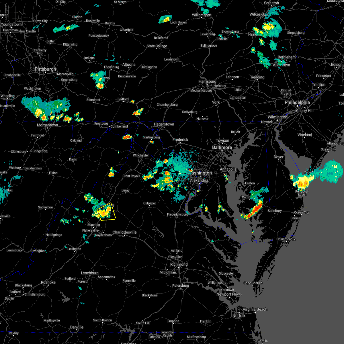
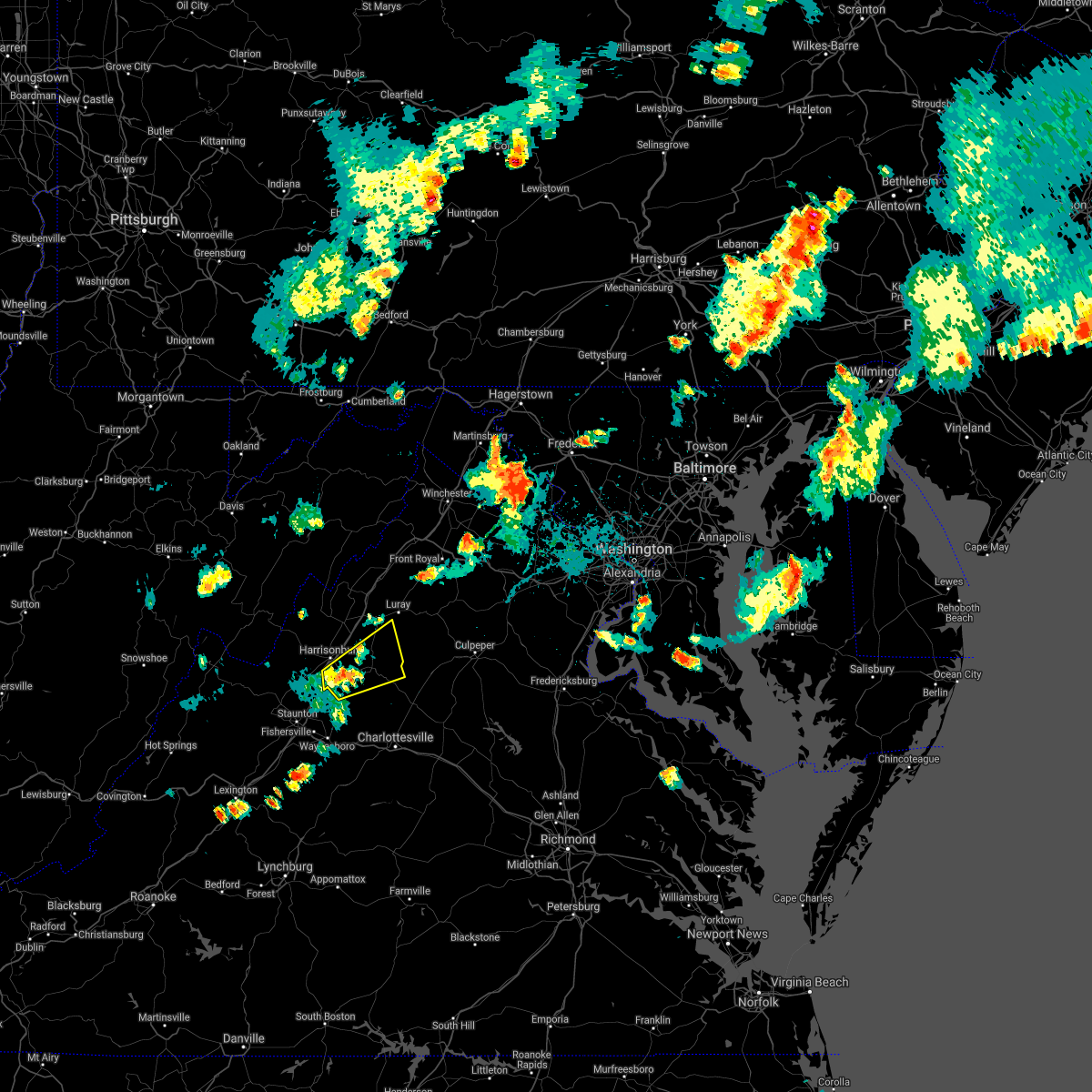
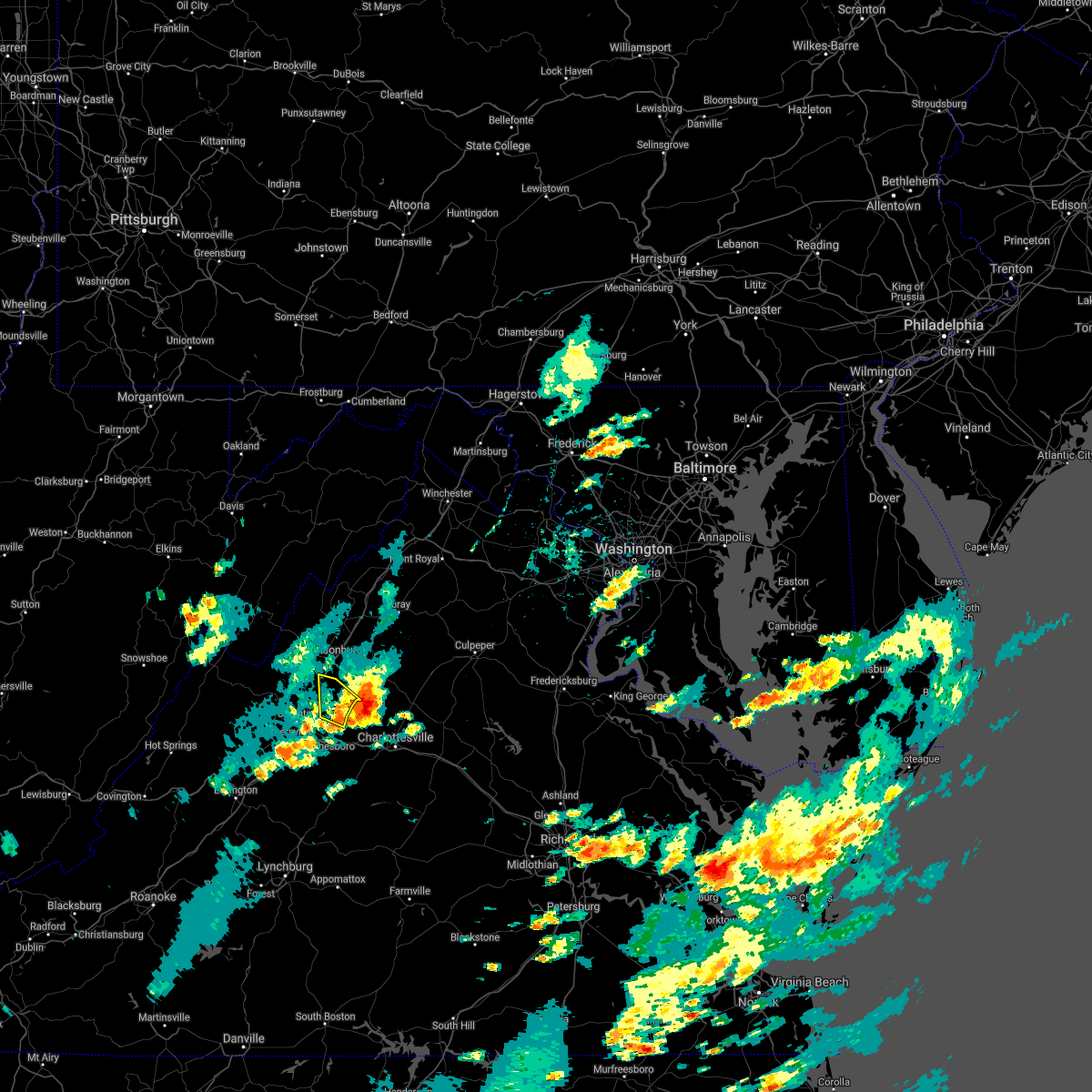
Hail Map for Grottoes, VA
The Grottoes, VA area has had 2 reports of on-the-ground hail by trained spotters, and has been under severe weather warnings 11 times during the past 12 months. Doppler radar has detected hail at or near Grottoes, VA on 25 occasions, including 1 occasion during the past year.
| Name: | Grottoes, VA |
| Where Located: | 71.3 miles SE of Elkins, WV |
| Map: | Google Map for Grottoes, VA |
| Population: | 2668 |
| Housing Units: | 1135 |
| More Info: | Search Google for Grottoes, VA |
5
The Top Recent Hail Date for Grottoes, VA is Tuesday, July 1, 2025 (2nd out of 25)

Hail and Wind Damage Spotted near Grottoes, VA
| Date / Time | Report Details |
|---|---|
| 7/31/2025 2:24 PM EDT |
 Svrlwx the national weather service in sterling virginia has issued a * severe thunderstorm warning for, south central rockingham county in western virginia, northwestern albemarle county in central virginia, west central greene county in central virginia, northeastern augusta county in western virginia, * until 300 pm edt. * at 223 pm edt, a severe thunderstorm was located near grottoes, or 11 miles southeast of harrisonburg, moving southeast at 20 mph (radar indicated). Hazards include 60 mph wind gusts. Damaging winds will cause some trees and large branches to fall. this could injure those outdoors, as well as damage homes and vehicles. roadways may become blocked by downed trees. localized power outages are possible. Unsecured light objects may become projectiles. Svrlwx the national weather service in sterling virginia has issued a * severe thunderstorm warning for, south central rockingham county in western virginia, northwestern albemarle county in central virginia, west central greene county in central virginia, northeastern augusta county in western virginia, * until 300 pm edt. * at 223 pm edt, a severe thunderstorm was located near grottoes, or 11 miles southeast of harrisonburg, moving southeast at 20 mph (radar indicated). Hazards include 60 mph wind gusts. Damaging winds will cause some trees and large branches to fall. this could injure those outdoors, as well as damage homes and vehicles. roadways may become blocked by downed trees. localized power outages are possible. Unsecured light objects may become projectiles.
|
| 7/25/2025 3:52 PM EDT |
 The storms which prompted the warning have weakened below severe limits, and have exited the warned area. therefore, the warning will be allowed to expire. to report severe weather, contact your nearest law enforcement agency. they will relay your report to the national weather service sterling virginia. The storms which prompted the warning have weakened below severe limits, and have exited the warned area. therefore, the warning will be allowed to expire. to report severe weather, contact your nearest law enforcement agency. they will relay your report to the national weather service sterling virginia.
|
| 7/25/2025 3:44 PM EDT |
 At 344 pm edt, severe thunderstorms were located along a line extending from near broadway to near grottoes to staunton, moving southeast at 15 mph (radar indicated). Hazards include 60 mph wind gusts. Damaging winds will cause some trees and large branches to fall. this could injure those outdoors, as well as damage homes and vehicles. roadways may become blocked by downed trees. localized power outages are possible. unsecured light objects may become projectiles. Locations impacted include, harrisonburg, staunton, waynesboro, stuarts draft, grottoes, shenandoah, massanutten, crimora, sherando, fishersville, verona, elkton, weyers cave, dayton, lyndhurst, new hope, mount sidney, mount crawford, rocky bar, and penn laird. At 344 pm edt, severe thunderstorms were located along a line extending from near broadway to near grottoes to staunton, moving southeast at 15 mph (radar indicated). Hazards include 60 mph wind gusts. Damaging winds will cause some trees and large branches to fall. this could injure those outdoors, as well as damage homes and vehicles. roadways may become blocked by downed trees. localized power outages are possible. unsecured light objects may become projectiles. Locations impacted include, harrisonburg, staunton, waynesboro, stuarts draft, grottoes, shenandoah, massanutten, crimora, sherando, fishersville, verona, elkton, weyers cave, dayton, lyndhurst, new hope, mount sidney, mount crawford, rocky bar, and penn laird.
|
| 7/25/2025 3:27 PM EDT |
 At 327 pm edt, severe thunderstorms were located along a line extending from near broadway to near bridgewater to staunton, moving southeast at 15 mph (radar indicated). Hazards include 60 mph wind gusts. Damaging winds will cause some trees and large branches to fall. this could injure those outdoors, as well as damage homes and vehicles. roadways may become blocked by downed trees. localized power outages are possible. unsecured light objects may become projectiles. Locations impacted include, harrisonburg, staunton, waynesboro, stuarts draft, bridgewater, broadway, grottoes, shenandoah, massanutten, crimora, sherando, dale enterprise, fishersville, verona, elkton, weyers cave, dayton, lyndhurst, new hope, and mount sidney. At 327 pm edt, severe thunderstorms were located along a line extending from near broadway to near bridgewater to staunton, moving southeast at 15 mph (radar indicated). Hazards include 60 mph wind gusts. Damaging winds will cause some trees and large branches to fall. this could injure those outdoors, as well as damage homes and vehicles. roadways may become blocked by downed trees. localized power outages are possible. unsecured light objects may become projectiles. Locations impacted include, harrisonburg, staunton, waynesboro, stuarts draft, bridgewater, broadway, grottoes, shenandoah, massanutten, crimora, sherando, dale enterprise, fishersville, verona, elkton, weyers cave, dayton, lyndhurst, new hope, and mount sidney.
|
| 7/25/2025 3:10 PM EDT |
 Svrlwx the national weather service in sterling virginia has issued a * severe thunderstorm warning for, southern rockingham county in western virginia, eastern augusta county in western virginia, the city of staunton in western virginia, the city of waynesboro in western virginia, the city of harrisonburg in western virginia, * until 400 pm edt. * at 310 pm edt, severe thunderstorms were located along a line extending from near broadway to near bridgewater to near staunton, moving southeast at 15 mph (radar indicated). Hazards include localized 60 mph wind gusts. Damaging winds will cause some trees and large branches to fall. this could injure those outdoors, as well as damage homes and vehicles. roadways may become blocked by downed trees. localized power outages are possible. Unsecured light objects may become projectiles. Svrlwx the national weather service in sterling virginia has issued a * severe thunderstorm warning for, southern rockingham county in western virginia, eastern augusta county in western virginia, the city of staunton in western virginia, the city of waynesboro in western virginia, the city of harrisonburg in western virginia, * until 400 pm edt. * at 310 pm edt, severe thunderstorms were located along a line extending from near broadway to near bridgewater to near staunton, moving southeast at 15 mph (radar indicated). Hazards include localized 60 mph wind gusts. Damaging winds will cause some trees and large branches to fall. this could injure those outdoors, as well as damage homes and vehicles. roadways may become blocked by downed trees. localized power outages are possible. Unsecured light objects may become projectiles.
|
| 7/1/2025 4:30 PM EDT | Several large trees blew down around grottoe in rockingham county VA, 0.3 miles ESE of Grottoes, VA |
| 7/1/2025 4:28 PM EDT |
 the severe thunderstorm warning has been cancelled and is no longer in effect the severe thunderstorm warning has been cancelled and is no longer in effect
|
| 7/1/2025 4:28 PM EDT |
 At 428 pm edt, a severe thunderstorm was located over grottoes, or 11 miles south of harrisonburg, moving northeast at 30 mph (radar indicated). Hazards include 60 mph wind gusts and half dollar size hail. Damaging winds will cause some trees and large branches to fall. this could injure those outdoors, as well as damage homes and vehicles. roadways may become blocked by downed trees. localized power outages are possible. unsecured light objects may become projectiles. Locations impacted include, grottoes, massanutten, crimora, weyers cave, new hope, mount sidney, rocky bar, penn laird, port republic, boonesville, mission home, keezletown, mcgaheysville, saint george, shady grove, montevideo, and staunton airport. At 428 pm edt, a severe thunderstorm was located over grottoes, or 11 miles south of harrisonburg, moving northeast at 30 mph (radar indicated). Hazards include 60 mph wind gusts and half dollar size hail. Damaging winds will cause some trees and large branches to fall. this could injure those outdoors, as well as damage homes and vehicles. roadways may become blocked by downed trees. localized power outages are possible. unsecured light objects may become projectiles. Locations impacted include, grottoes, massanutten, crimora, weyers cave, new hope, mount sidney, rocky bar, penn laird, port republic, boonesville, mission home, keezletown, mcgaheysville, saint george, shady grove, montevideo, and staunton airport.
|
| 7/1/2025 4:16 PM EDT |
 Svrlwx the national weather service in sterling virginia has issued a * severe thunderstorm warning for, southeastern rockingham county in western virginia, northwestern albemarle county in central virginia, southwestern greene county in central virginia, east central augusta county in western virginia, the northeastern city of staunton in western virginia, * until 445 pm edt. * at 416 pm edt, a severe thunderstorm was located near staunton, moving northeast at 30 mph (radar indicated). Hazards include 60 mph wind gusts. Damaging winds will cause some trees and large branches to fall. this could injure those outdoors, as well as damage homes and vehicles. roadways may become blocked by downed trees. localized power outages are possible. Unsecured light objects may become projectiles. Svrlwx the national weather service in sterling virginia has issued a * severe thunderstorm warning for, southeastern rockingham county in western virginia, northwestern albemarle county in central virginia, southwestern greene county in central virginia, east central augusta county in western virginia, the northeastern city of staunton in western virginia, * until 445 pm edt. * at 416 pm edt, a severe thunderstorm was located near staunton, moving northeast at 30 mph (radar indicated). Hazards include 60 mph wind gusts. Damaging winds will cause some trees and large branches to fall. this could injure those outdoors, as well as damage homes and vehicles. roadways may become blocked by downed trees. localized power outages are possible. Unsecured light objects may become projectiles.
|
| 6/19/2025 2:34 PM EDT |
 At 233 pm edt, severe thunderstorms were located along a line extending from near shenandoah to stuarts draft, moving east at 40 mph (radar indicated). Hazards include 60 mph wind gusts. Damaging winds will cause some trees and large branches to fall. this could injure those outdoors, as well as damage homes and vehicles. roadways may become blocked by downed trees. localized power outages are possible. unsecured light objects may become projectiles. Locations impacted include, waynesboro, stuarts draft, grottoes, shenandoah, massanutten, crimora, stanley, sherando, wintergreen, afton, big meadows, elkton, weyers cave, lyndhurst, nellysford, greenville, new hope, rocky bar, ingham, and penn laird. At 233 pm edt, severe thunderstorms were located along a line extending from near shenandoah to stuarts draft, moving east at 40 mph (radar indicated). Hazards include 60 mph wind gusts. Damaging winds will cause some trees and large branches to fall. this could injure those outdoors, as well as damage homes and vehicles. roadways may become blocked by downed trees. localized power outages are possible. unsecured light objects may become projectiles. Locations impacted include, waynesboro, stuarts draft, grottoes, shenandoah, massanutten, crimora, stanley, sherando, wintergreen, afton, big meadows, elkton, weyers cave, lyndhurst, nellysford, greenville, new hope, rocky bar, ingham, and penn laird.
|
| 6/19/2025 2:34 PM EDT |
 the severe thunderstorm warning has been cancelled and is no longer in effect the severe thunderstorm warning has been cancelled and is no longer in effect
|
| 6/19/2025 2:19 PM EDT |
 Svrlwx the national weather service in sterling virginia has issued a * severe thunderstorm warning for, northwestern nelson county in central virginia, west central madison county in northwestern virginia, southeastern rockingham county in western virginia, southwestern page county in northwestern virginia, northwestern albemarle county in central virginia, central greene county in central virginia, eastern augusta county in western virginia, the city of waynesboro in western virginia, the city of harrisonburg in western virginia, * until 245 pm edt. * at 218 pm edt, severe thunderstorms were located along a line extending from near harrisonburg to 8 miles northeast of brownsburg, moving east at 40 mph (radar indicated). Hazards include 60 mph wind gusts. Damaging winds will cause some trees and large branches to fall. this could injure those outdoors, as well as damage homes and vehicles. roadways may become blocked by downed trees. localized power outages are possible. Unsecured light objects may become projectiles. Svrlwx the national weather service in sterling virginia has issued a * severe thunderstorm warning for, northwestern nelson county in central virginia, west central madison county in northwestern virginia, southeastern rockingham county in western virginia, southwestern page county in northwestern virginia, northwestern albemarle county in central virginia, central greene county in central virginia, eastern augusta county in western virginia, the city of waynesboro in western virginia, the city of harrisonburg in western virginia, * until 245 pm edt. * at 218 pm edt, severe thunderstorms were located along a line extending from near harrisonburg to 8 miles northeast of brownsburg, moving east at 40 mph (radar indicated). Hazards include 60 mph wind gusts. Damaging winds will cause some trees and large branches to fall. this could injure those outdoors, as well as damage homes and vehicles. roadways may become blocked by downed trees. localized power outages are possible. Unsecured light objects may become projectiles.
|
| 5/30/2025 5:37 PM EDT |
 the severe thunderstorm warning has been cancelled and is no longer in effect the severe thunderstorm warning has been cancelled and is no longer in effect
|
| 5/30/2025 5:37 PM EDT |
 At 537 pm edt, severe thunderstorms were located along a line extending from near timberville to near harrisonburg to near grottoes, moving east at 40 mph (radar indicated). Hazards include 60 mph wind gusts. Damaging winds will cause some trees and large branches to fall. this could injure those outdoors, as well as damage homes and vehicles. roadways may become blocked by downed trees. localized power outages are possible. unsecured light objects may become projectiles. Locations impacted include, alma, newport, rocky bar, honeyville, penn laird, ingham, port republic, shenandoah caverns, luray, leaksville, hamburg, broadway, dayton, mount crawford, quicksburg, harrisonburg, stanley, timberville, keezletown, and shenandoah. At 537 pm edt, severe thunderstorms were located along a line extending from near timberville to near harrisonburg to near grottoes, moving east at 40 mph (radar indicated). Hazards include 60 mph wind gusts. Damaging winds will cause some trees and large branches to fall. this could injure those outdoors, as well as damage homes and vehicles. roadways may become blocked by downed trees. localized power outages are possible. unsecured light objects may become projectiles. Locations impacted include, alma, newport, rocky bar, honeyville, penn laird, ingham, port republic, shenandoah caverns, luray, leaksville, hamburg, broadway, dayton, mount crawford, quicksburg, harrisonburg, stanley, timberville, keezletown, and shenandoah.
|
| 5/30/2025 5:27 PM EDT |
 Svrlwx the national weather service in sterling virginia has issued a * severe thunderstorm warning for, southwestern shenandoah county in northwestern virginia, rockingham county in western virginia, page county in northwestern virginia, north central albemarle county in central virginia, western greene county in central virginia, northeastern augusta county in western virginia, the city of harrisonburg in western virginia, * until 600 pm edt. * at 527 pm edt, severe thunderstorms were located along a line extending from near broadway to near bridgewater to near staunton, moving east at 40 mph (radar indicated). Hazards include 60 mph wind gusts. Damaging winds will cause some trees and large branches to fall. this could injure those outdoors, as well as damage homes and vehicles. roadways may become blocked by downed trees. localized power outages are possible. Unsecured light objects may become projectiles. Svrlwx the national weather service in sterling virginia has issued a * severe thunderstorm warning for, southwestern shenandoah county in northwestern virginia, rockingham county in western virginia, page county in northwestern virginia, north central albemarle county in central virginia, western greene county in central virginia, northeastern augusta county in western virginia, the city of harrisonburg in western virginia, * until 600 pm edt. * at 527 pm edt, severe thunderstorms were located along a line extending from near broadway to near bridgewater to near staunton, moving east at 40 mph (radar indicated). Hazards include 60 mph wind gusts. Damaging winds will cause some trees and large branches to fall. this could injure those outdoors, as well as damage homes and vehicles. roadways may become blocked by downed trees. localized power outages are possible. Unsecured light objects may become projectiles.
|
| 5/15/2025 7:15 PM EDT | Quarter sized hail reported 8.5 miles W of Grottoes, VA |
| 5/15/2025 7:11 PM EDT |
 Torlwx the national weather service in sterling virginia has issued a * tornado warning for, south central rockingham county in western virginia, northwestern albemarle county in central virginia, east central augusta county in western virginia, * until 745 pm edt. * at 711 pm edt, a severe thunderstorm capable of producing a tornado was located near grottoes, or 14 miles southeast of harrisonburg, moving southeast at 15 mph (radar indicated rotation). Hazards include tornado and ping pong ball size hail. For those in the direct path of a tornado touchdown, flying debris will be dangerous to those caught without shelter. damage to roofs, siding, and windows may occur. mobile homes may be damaged or destroyed. tree damage is likely. This tornadic thunderstorm will remain over mainly rural areas of south central rockingham, northwestern albemarle and east central augusta counties, including the following locations, white hall. Torlwx the national weather service in sterling virginia has issued a * tornado warning for, south central rockingham county in western virginia, northwestern albemarle county in central virginia, east central augusta county in western virginia, * until 745 pm edt. * at 711 pm edt, a severe thunderstorm capable of producing a tornado was located near grottoes, or 14 miles southeast of harrisonburg, moving southeast at 15 mph (radar indicated rotation). Hazards include tornado and ping pong ball size hail. For those in the direct path of a tornado touchdown, flying debris will be dangerous to those caught without shelter. damage to roofs, siding, and windows may occur. mobile homes may be damaged or destroyed. tree damage is likely. This tornadic thunderstorm will remain over mainly rural areas of south central rockingham, northwestern albemarle and east central augusta counties, including the following locations, white hall.
|
| 5/15/2025 6:32 PM EDT |
 Svrlwx the national weather service in sterling virginia has issued a * severe thunderstorm warning for, southeastern rockingham county in western virginia, northwestern albemarle county in central virginia, southwestern greene county in central virginia, east central augusta county in western virginia, * until 715 pm edt. * at 632 pm edt, a severe thunderstorm was located near massanutten, or near harrisonburg, moving southeast at 20 mph (radar indicated). Hazards include 60 mph wind gusts and quarter size hail. Damaging winds will cause some trees and large branches to fall. this could injure those outdoors, as well as damage homes and vehicles. roadways may become blocked by downed trees. localized power outages are possible. Unsecured light objects may become projectiles. Svrlwx the national weather service in sterling virginia has issued a * severe thunderstorm warning for, southeastern rockingham county in western virginia, northwestern albemarle county in central virginia, southwestern greene county in central virginia, east central augusta county in western virginia, * until 715 pm edt. * at 632 pm edt, a severe thunderstorm was located near massanutten, or near harrisonburg, moving southeast at 20 mph (radar indicated). Hazards include 60 mph wind gusts and quarter size hail. Damaging winds will cause some trees and large branches to fall. this could injure those outdoors, as well as damage homes and vehicles. roadways may become blocked by downed trees. localized power outages are possible. Unsecured light objects may become projectiles.
|
| 9/27/2024 4:12 PM EDT |
 The storm which prompted the warning has weakened below severe limits, and no longer poses an immediate threat to life or property. therefore, the warning will be allowed to expire. The storm which prompted the warning has weakened below severe limits, and no longer poses an immediate threat to life or property. therefore, the warning will be allowed to expire.
|
| 9/27/2024 4:03 PM EDT |
 At 403 pm edt, a severe thunderstorm was located 7 miles southeast of grottoes, or 14 miles northeast of waynesboro, moving north at 40 mph (radar indicated). Hazards include 60 mph wind gusts. Damaging winds will cause some trees and large branches to fall. this could injure those outdoors, as well as damage homes and vehicles. roadways may become blocked by downed trees. localized power outages are possible. unsecured light objects may become projectiles. Locations impacted include, grottoes and port republic. At 403 pm edt, a severe thunderstorm was located 7 miles southeast of grottoes, or 14 miles northeast of waynesboro, moving north at 40 mph (radar indicated). Hazards include 60 mph wind gusts. Damaging winds will cause some trees and large branches to fall. this could injure those outdoors, as well as damage homes and vehicles. roadways may become blocked by downed trees. localized power outages are possible. unsecured light objects may become projectiles. Locations impacted include, grottoes and port republic.
|
| 9/27/2024 3:57 PM EDT |
 At 356 pm edt, a severe thunderstorm was located near crozet, or 12 miles northeast of waynesboro, moving north at 35 mph (radar indicated). Hazards include 60 mph wind gusts. Damaging winds will cause some trees and large branches to fall. this could injure those outdoors, as well as damage homes and vehicles. roadways may become blocked by downed trees. localized power outages are possible. unsecured light objects may become projectiles. Locations impacted include, grottoes, white hall, and port republic. At 356 pm edt, a severe thunderstorm was located near crozet, or 12 miles northeast of waynesboro, moving north at 35 mph (radar indicated). Hazards include 60 mph wind gusts. Damaging winds will cause some trees and large branches to fall. this could injure those outdoors, as well as damage homes and vehicles. roadways may become blocked by downed trees. localized power outages are possible. unsecured light objects may become projectiles. Locations impacted include, grottoes, white hall, and port republic.
|
| 9/27/2024 3:52 PM EDT |
 Svrlwx the national weather service in sterling virginia has issued a * severe thunderstorm warning for, southeastern rockingham county in western virginia, northwestern albemarle county in central virginia, east central augusta county in western virginia, * until 415 pm edt. * at 351 pm edt, a severe thunderstorm was located near crozet, or 12 miles northwest of charlottesville, moving north at 40 mph (radar indicated). Hazards include 60 mph wind gusts. Damaging winds will cause some trees and large branches to fall. this could injure those outdoors, as well as damage homes and vehicles. roadways may become blocked by downed trees. localized power outages are possible. Unsecured light objects may become projectiles. Svrlwx the national weather service in sterling virginia has issued a * severe thunderstorm warning for, southeastern rockingham county in western virginia, northwestern albemarle county in central virginia, east central augusta county in western virginia, * until 415 pm edt. * at 351 pm edt, a severe thunderstorm was located near crozet, or 12 miles northwest of charlottesville, moving north at 40 mph (radar indicated). Hazards include 60 mph wind gusts. Damaging winds will cause some trees and large branches to fall. this could injure those outdoors, as well as damage homes and vehicles. roadways may become blocked by downed trees. localized power outages are possible. Unsecured light objects may become projectiles.
|
| 7/4/2024 6:51 PM EDT |
 The storm which prompted the warning has weakened below severe limits, and no longer poses an immediate threat to life or property. therefore, the warning will be allowed to expire. The storm which prompted the warning has weakened below severe limits, and no longer poses an immediate threat to life or property. therefore, the warning will be allowed to expire.
|
| 7/4/2024 6:45 PM EDT |
 At 645 pm edt, a severe thunderstorm was located near grottoes, or 12 miles northeast of waynesboro, moving east at 15 mph (radar indicated). Hazards include 60 mph wind gusts. Damaging winds will cause some trees and large branches to fall. this could injure those outdoors, as well as damage homes and vehicles. roadways may become blocked by downed trees. localized power outages are possible. unsecured light objects may become projectiles. Locations impacted include, grottoes and port republic. At 645 pm edt, a severe thunderstorm was located near grottoes, or 12 miles northeast of waynesboro, moving east at 15 mph (radar indicated). Hazards include 60 mph wind gusts. Damaging winds will cause some trees and large branches to fall. this could injure those outdoors, as well as damage homes and vehicles. roadways may become blocked by downed trees. localized power outages are possible. unsecured light objects may become projectiles. Locations impacted include, grottoes and port republic.
|
| 7/4/2024 6:20 PM EDT |
 Svrlwx the national weather service in sterling virginia has issued a * severe thunderstorm warning for, south central rockingham county in western virginia, east central augusta county in western virginia, * until 700 pm edt. * at 620 pm edt, a severe thunderstorm was located near grottoes, or 10 miles northeast of staunton, moving east at 15 mph (radar indicated). Hazards include 60 mph wind gusts. Damaging winds will cause some trees and large branches to fall. this could injure those outdoors, as well as damage homes and vehicles. roadways may become blocked by downed trees. localized power outages are possible. Unsecured light objects may become projectiles. Svrlwx the national weather service in sterling virginia has issued a * severe thunderstorm warning for, south central rockingham county in western virginia, east central augusta county in western virginia, * until 700 pm edt. * at 620 pm edt, a severe thunderstorm was located near grottoes, or 10 miles northeast of staunton, moving east at 15 mph (radar indicated). Hazards include 60 mph wind gusts. Damaging winds will cause some trees and large branches to fall. this could injure those outdoors, as well as damage homes and vehicles. roadways may become blocked by downed trees. localized power outages are possible. Unsecured light objects may become projectiles.
|
| 7/4/2024 6:09 PM EDT |
 The storm which prompted the warning has weakened below severe limits, and no longer poses an immediate threat to life or property. therefore, the warning will be allowed to expire. The storm which prompted the warning has weakened below severe limits, and no longer poses an immediate threat to life or property. therefore, the warning will be allowed to expire.
|
| 7/4/2024 5:56 PM EDT |
 At 555 pm edt, a severe thunderstorm was located over bridgewater, or 7 miles southwest of harrisonburg, moving southeast at 15 mph (radar indicated). Hazards include 60 mph wind gusts. Damaging winds will cause some trees and large branches to fall. this could injure those outdoors, as well as damage homes and vehicles. roadways may become blocked by downed trees. localized power outages are possible. unsecured light objects may become projectiles. Locations impacted include, harrisonburg, bridgewater, grottoes, dale enterprise, weyers cave, dayton, mount sidney, mount crawford, penn laird, pleasant valley, rawley springs, montezuma, clover hill, mount solon, sangerville, keezletown, hinton, and staunton airport. At 555 pm edt, a severe thunderstorm was located over bridgewater, or 7 miles southwest of harrisonburg, moving southeast at 15 mph (radar indicated). Hazards include 60 mph wind gusts. Damaging winds will cause some trees and large branches to fall. this could injure those outdoors, as well as damage homes and vehicles. roadways may become blocked by downed trees. localized power outages are possible. unsecured light objects may become projectiles. Locations impacted include, harrisonburg, bridgewater, grottoes, dale enterprise, weyers cave, dayton, mount sidney, mount crawford, penn laird, pleasant valley, rawley springs, montezuma, clover hill, mount solon, sangerville, keezletown, hinton, and staunton airport.
|
| 7/4/2024 5:37 PM EDT |
 Svrlwx the national weather service in sterling virginia has issued a * severe thunderstorm warning for, southwestern rockingham county in western virginia, northeastern augusta county in western virginia, the city of harrisonburg in western virginia, * until 615 pm edt. * at 536 pm edt, a severe thunderstorm was located 8 miles northwest of bridgewater, or 11 miles west of harrisonburg, moving east at 20 mph (radar indicated). Hazards include 60 mph wind gusts and quarter size hail. Damaging winds will cause some trees and large branches to fall. this could injure those outdoors, as well as damage homes and vehicles. roadways may become blocked by downed trees. localized power outages are possible. Unsecured light objects may become projectiles. Svrlwx the national weather service in sterling virginia has issued a * severe thunderstorm warning for, southwestern rockingham county in western virginia, northeastern augusta county in western virginia, the city of harrisonburg in western virginia, * until 615 pm edt. * at 536 pm edt, a severe thunderstorm was located 8 miles northwest of bridgewater, or 11 miles west of harrisonburg, moving east at 20 mph (radar indicated). Hazards include 60 mph wind gusts and quarter size hail. Damaging winds will cause some trees and large branches to fall. this could injure those outdoors, as well as damage homes and vehicles. roadways may become blocked by downed trees. localized power outages are possible. Unsecured light objects may become projectiles.
|
| 6/26/2024 8:09 PM EDT |
 Svrlwx the national weather service in sterling virginia has issued a * severe thunderstorm warning for, southwestern madison county in northwestern virginia, west central orange county in central virginia, southeastern rockingham county in western virginia, southwestern page county in northwestern virginia, northern albemarle county in central virginia, greene county in central virginia, east central augusta county in western virginia, the eastern city of harrisonburg in western virginia, * until 845 pm edt. * at 809 pm edt, severe thunderstorms were located along a line extending from near massanutten to 9 miles east of grottoes to near crozet, moving east at 40 mph (radar indicated). Hazards include 60 mph wind gusts. Damaging winds will cause some trees and large branches to fall. this could injure those outdoors, as well as damage homes and vehicles. roadways may become blocked by downed trees. localized power outages are possible. Unsecured light objects may become projectiles. Svrlwx the national weather service in sterling virginia has issued a * severe thunderstorm warning for, southwestern madison county in northwestern virginia, west central orange county in central virginia, southeastern rockingham county in western virginia, southwestern page county in northwestern virginia, northern albemarle county in central virginia, greene county in central virginia, east central augusta county in western virginia, the eastern city of harrisonburg in western virginia, * until 845 pm edt. * at 809 pm edt, severe thunderstorms were located along a line extending from near massanutten to 9 miles east of grottoes to near crozet, moving east at 40 mph (radar indicated). Hazards include 60 mph wind gusts. Damaging winds will cause some trees and large branches to fall. this could injure those outdoors, as well as damage homes and vehicles. roadways may become blocked by downed trees. localized power outages are possible. Unsecured light objects may become projectiles.
|
| 5/26/2024 8:32 PM EDT |
 At 832 pm edt, severe thunderstorms were located along a line extending from near petersburg to 8 miles west of broadway to near crozet to near dillwyn, moving east at 40 mph (radar indicated). Hazards include 60 mph wind gusts and quarter size hail. Damaging winds will cause some trees and large branches to fall. this could injure those outdoors, as well as damage homes and vehicles. roadways may become blocked by downed trees. localized power outages are possible. unsecured light objects may become projectiles. Locations impacted include, harrisonburg, bridgewater, crozet, broadway, grottoes, timberville, massanutten, crimora, dale enterprise, elkton, weyers cave, dayton, ivy, scottsville, esmont, mount crawford, rocky bar, tunis, penn laird, and port republic. At 832 pm edt, severe thunderstorms were located along a line extending from near petersburg to 8 miles west of broadway to near crozet to near dillwyn, moving east at 40 mph (radar indicated). Hazards include 60 mph wind gusts and quarter size hail. Damaging winds will cause some trees and large branches to fall. this could injure those outdoors, as well as damage homes and vehicles. roadways may become blocked by downed trees. localized power outages are possible. unsecured light objects may become projectiles. Locations impacted include, harrisonburg, bridgewater, crozet, broadway, grottoes, timberville, massanutten, crimora, dale enterprise, elkton, weyers cave, dayton, ivy, scottsville, esmont, mount crawford, rocky bar, tunis, penn laird, and port republic.
|
| 5/26/2024 8:32 PM EDT |
 the severe thunderstorm warning has been cancelled and is no longer in effect the severe thunderstorm warning has been cancelled and is no longer in effect
|
| 5/26/2024 8:24 PM EDT | Large tree down blocking the road on birch ave at 6th street in grottoes in rockingham county VA, 0.7 miles NNW of Grottoes, VA |
| 5/26/2024 8:12 PM EDT |
 the severe thunderstorm warning has been cancelled and is no longer in effect the severe thunderstorm warning has been cancelled and is no longer in effect
|
| 5/26/2024 8:12 PM EDT |
 At 811 pm edt, severe thunderstorms were located along a line extending from 9 miles southwest of petersburg to 6 miles south of brandywine to near afton to near tower hill, moving east at 45 mph (radar indicated). Hazards include 60 mph wind gusts and quarter size hail. Damaging winds will cause some trees and large branches to fall. this could injure those outdoors, as well as damage homes and vehicles. roadways may become blocked by downed trees. localized power outages are possible. unsecured light objects may become projectiles. Locations impacted include, harrisonburg, staunton, waynesboro, franklin, stuarts draft, bridgewater, crozet, broadway, grottoes, timberville, massanutten, crimora, sherando, shipman, schuyler, wintergreen, afton, dale enterprise, fishersville, and verona. At 811 pm edt, severe thunderstorms were located along a line extending from 9 miles southwest of petersburg to 6 miles south of brandywine to near afton to near tower hill, moving east at 45 mph (radar indicated). Hazards include 60 mph wind gusts and quarter size hail. Damaging winds will cause some trees and large branches to fall. this could injure those outdoors, as well as damage homes and vehicles. roadways may become blocked by downed trees. localized power outages are possible. unsecured light objects may become projectiles. Locations impacted include, harrisonburg, staunton, waynesboro, franklin, stuarts draft, bridgewater, crozet, broadway, grottoes, timberville, massanutten, crimora, sherando, shipman, schuyler, wintergreen, afton, dale enterprise, fishersville, and verona.
|
| 5/26/2024 7:42 PM EDT |
 Svrlwx the national weather service in sterling virginia has issued a * severe thunderstorm warning for, nelson county in central virginia, rockingham county in western virginia, western albemarle county in central virginia, western greene county in central virginia, augusta county in western virginia, the city of staunton in western virginia, the city of harrisonburg in western virginia, the city of waynesboro in western virginia, eastern highland county in western virginia, pendleton county in eastern west virginia, southwestern hardy county in eastern west virginia, * until 845 pm edt. * at 742 pm edt, severe thunderstorms were located along a line extending from 13 miles southeast of elkins to monterey to near fairfield to near evington, moving east at 40 mph (radar indicated). Hazards include 60 mph wind gusts. Damaging winds will cause some trees and large branches to fall. this could injure those outdoors, as well as damage homes and vehicles. roadways may become blocked by downed trees. localized power outages are possible. Unsecured light objects may become projectiles. Svrlwx the national weather service in sterling virginia has issued a * severe thunderstorm warning for, nelson county in central virginia, rockingham county in western virginia, western albemarle county in central virginia, western greene county in central virginia, augusta county in western virginia, the city of staunton in western virginia, the city of harrisonburg in western virginia, the city of waynesboro in western virginia, eastern highland county in western virginia, pendleton county in eastern west virginia, southwestern hardy county in eastern west virginia, * until 845 pm edt. * at 742 pm edt, severe thunderstorms were located along a line extending from 13 miles southeast of elkins to monterey to near fairfield to near evington, moving east at 40 mph (radar indicated). Hazards include 60 mph wind gusts. Damaging winds will cause some trees and large branches to fall. this could injure those outdoors, as well as damage homes and vehicles. roadways may become blocked by downed trees. localized power outages are possible. Unsecured light objects may become projectiles.
|
| 8/7/2023 4:51 PM EDT |
 The tornado warning for northern nelson, southeastern rockingham, northwestern albemarle, and east central augusta counties and the city of waynesboro will expire at 500 pm edt, the tornado threat has diminished and the tornado warning has been cancelled. however, large hail and damaging winds remain likely and a severe thunderstorm warning remains in effect for the area. a tornado watch remains in effect until 900 pm edt for central and western virginia. The tornado warning for northern nelson, southeastern rockingham, northwestern albemarle, and east central augusta counties and the city of waynesboro will expire at 500 pm edt, the tornado threat has diminished and the tornado warning has been cancelled. however, large hail and damaging winds remain likely and a severe thunderstorm warning remains in effect for the area. a tornado watch remains in effect until 900 pm edt for central and western virginia.
|
| 8/7/2023 4:34 PM EDT |
 At 432 pm edt, a severe thunderstorm capable of producing a tornado was located near waynesboro, moving east at 45 mph (radar indicated rotation. a trained spotter reported a funnel cloud over the city of waynesboro). Hazards include tornado and ping pong ball size hail. For those in the direct path of a tornado touchdown, flying debris will be dangerous to those caught without shelter. damage to roofs, siding, and windows may occur. mobile homes may be damaged or destroyed. tree damage is likely. this dangerous storm will be near, crozet around 440 pm edt. Other locations impacted by this tornadic thunderstorm include yancey mills, new hope, greenwood, hermitage, white hall and fishersville. At 432 pm edt, a severe thunderstorm capable of producing a tornado was located near waynesboro, moving east at 45 mph (radar indicated rotation. a trained spotter reported a funnel cloud over the city of waynesboro). Hazards include tornado and ping pong ball size hail. For those in the direct path of a tornado touchdown, flying debris will be dangerous to those caught without shelter. damage to roofs, siding, and windows may occur. mobile homes may be damaged or destroyed. tree damage is likely. this dangerous storm will be near, crozet around 440 pm edt. Other locations impacted by this tornadic thunderstorm include yancey mills, new hope, greenwood, hermitage, white hall and fishersville.
|
| 8/7/2023 4:25 PM EDT |
 At 425 pm edt, a severe thunderstorm capable of producing a tornado was located near stuarts draft, or near waynesboro, moving east at 35 mph (radar indicated rotation). Hazards include tornado and ping pong ball size hail. For those in the direct path of a tornado touchdown, flying debris will be dangerous to those caught without shelter. damage to roofs, siding, and windows may occur. mobile homes may be damaged or destroyed. tree damage is likely. this dangerous storm will be near, waynesboro, crimora and afton around 440 pm edt. crozet around 450 pm edt. Other locations impacted by this tornadic thunderstorm include fishersville, greenwood, hermitage, yancey mills, verona, new hope, white hall and lyndhurst. At 425 pm edt, a severe thunderstorm capable of producing a tornado was located near stuarts draft, or near waynesboro, moving east at 35 mph (radar indicated rotation). Hazards include tornado and ping pong ball size hail. For those in the direct path of a tornado touchdown, flying debris will be dangerous to those caught without shelter. damage to roofs, siding, and windows may occur. mobile homes may be damaged or destroyed. tree damage is likely. this dangerous storm will be near, waynesboro, crimora and afton around 440 pm edt. crozet around 450 pm edt. Other locations impacted by this tornadic thunderstorm include fishersville, greenwood, hermitage, yancey mills, verona, new hope, white hall and lyndhurst.
|
| 7/28/2023 7:17 PM EDT |
 At 716 pm edt, severe thunderstorms were located along a line extending from 6 miles east of timberville to near clifford, moving east at 30 mph (law enforcement). Hazards include 60 mph wind gusts. Damaging winds will cause some trees and large branches to fall. this could injure those outdoors, as well as damage homes and vehicles. roadways may become blocked by downed trees. localized power outages are possible. unsecured light objects may become projectiles. locations impacted include, waynesboro, stuarts draft, crozet, grottoes, shenandoah, massanutten, crimora, stanley, sherando, shipman, schuyler, free union, wintergreen, afton, big meadows, fishersville, elkton, weyers cave, new market and lyndhurst. hail threat, radar indicated max hail size, <. 75 in wind threat, observed max wind gust, 60 mph. At 716 pm edt, severe thunderstorms were located along a line extending from 6 miles east of timberville to near clifford, moving east at 30 mph (law enforcement). Hazards include 60 mph wind gusts. Damaging winds will cause some trees and large branches to fall. this could injure those outdoors, as well as damage homes and vehicles. roadways may become blocked by downed trees. localized power outages are possible. unsecured light objects may become projectiles. locations impacted include, waynesboro, stuarts draft, crozet, grottoes, shenandoah, massanutten, crimora, stanley, sherando, shipman, schuyler, free union, wintergreen, afton, big meadows, fishersville, elkton, weyers cave, new market and lyndhurst. hail threat, radar indicated max hail size, <. 75 in wind threat, observed max wind gust, 60 mph.
|
| 7/28/2023 6:29 PM EDT |
 At 628 pm edt, severe thunderstorms were located along a line extending from 10 miles east of brandywine to near glasgow, moving east at 30 mph (radar indicated). Hazards include 60 mph wind gusts. Damaging winds will cause some trees and large branches to fall. this could injure those outdoors, as well as damage homes and vehicles. roadways may become blocked by downed trees. localized power outages are possible. Unsecured light objects may become projectiles. At 628 pm edt, severe thunderstorms were located along a line extending from 10 miles east of brandywine to near glasgow, moving east at 30 mph (radar indicated). Hazards include 60 mph wind gusts. Damaging winds will cause some trees and large branches to fall. this could injure those outdoors, as well as damage homes and vehicles. roadways may become blocked by downed trees. localized power outages are possible. Unsecured light objects may become projectiles.
|
| 7/6/2023 9:20 PM EDT |
 The severe thunderstorm warning for south central rockingham and east central augusta counties will expire at 930 pm edt, the storm which prompted the warning has weakened below severe limits, and no longer poses an immediate threat to life or property. therefore, the warning will be allowed to expire. however gusty winds and heavy rain are still possible with this thunderstorm. to report severe weather, contact your nearest law enforcement agency. they will relay your report to the national weather service sterling virginia. The severe thunderstorm warning for south central rockingham and east central augusta counties will expire at 930 pm edt, the storm which prompted the warning has weakened below severe limits, and no longer poses an immediate threat to life or property. therefore, the warning will be allowed to expire. however gusty winds and heavy rain are still possible with this thunderstorm. to report severe weather, contact your nearest law enforcement agency. they will relay your report to the national weather service sterling virginia.
|
| 7/6/2023 9:12 PM EDT |
 At 912 pm edt, a severe thunderstorm was located southeast of bridgewater, or 7 miles south of harrisonburg, moving southeast at 5 mph (broadcast media reports damage in bridgewater). Hazards include 60 mph wind gusts. Damaging winds will cause some trees and large branches to fall. this could injure those outdoors, as well as damage homes and vehicles. roadways may become blocked by downed trees. localized power outages are possible. unsecured light objects may become projectiles. locations impacted include, grottoes, weyers cave, port republic and staunton airport. hail threat, radar indicated max hail size, <. 75 in wind threat, observed max wind gust, 60 mph. At 912 pm edt, a severe thunderstorm was located southeast of bridgewater, or 7 miles south of harrisonburg, moving southeast at 5 mph (broadcast media reports damage in bridgewater). Hazards include 60 mph wind gusts. Damaging winds will cause some trees and large branches to fall. this could injure those outdoors, as well as damage homes and vehicles. roadways may become blocked by downed trees. localized power outages are possible. unsecured light objects may become projectiles. locations impacted include, grottoes, weyers cave, port republic and staunton airport. hail threat, radar indicated max hail size, <. 75 in wind threat, observed max wind gust, 60 mph.
|
| 7/6/2023 8:57 PM EDT |
 At 857 pm edt, a severe thunderstorm was located near bridgewater, or near harrisonburg, moving southeast at 5 mph (radar indicated). Hazards include 60 mph wind gusts. Damaging winds will cause some trees and large branches to fall. this could injure those outdoors, as well as damage homes and vehicles. roadways may become blocked by downed trees. localized power outages are possible. unsecured light objects may become projectiles. locations impacted include, grottoes, weyers cave, mount crawford, port republic, pleasant valley and staunton airport. hail threat, radar indicated max hail size, <. 75 in wind threat, radar indicated max wind gust, 60 mph. At 857 pm edt, a severe thunderstorm was located near bridgewater, or near harrisonburg, moving southeast at 5 mph (radar indicated). Hazards include 60 mph wind gusts. Damaging winds will cause some trees and large branches to fall. this could injure those outdoors, as well as damage homes and vehicles. roadways may become blocked by downed trees. localized power outages are possible. unsecured light objects may become projectiles. locations impacted include, grottoes, weyers cave, mount crawford, port republic, pleasant valley and staunton airport. hail threat, radar indicated max hail size, <. 75 in wind threat, radar indicated max wind gust, 60 mph.
|
| 7/6/2023 8:47 PM EDT |
 At 847 pm edt, a severe thunderstorm was located over bridgewater, or near harrisonburg, moving southeast at 5 mph (radar indicated). Hazards include 60 mph wind gusts. Damaging winds will cause some trees and large branches to fall. this could injure those outdoors, as well as damage homes and vehicles. roadways may become blocked by downed trees. localized power outages are possible. Unsecured light objects may become projectiles. At 847 pm edt, a severe thunderstorm was located over bridgewater, or near harrisonburg, moving southeast at 5 mph (radar indicated). Hazards include 60 mph wind gusts. Damaging winds will cause some trees and large branches to fall. this could injure those outdoors, as well as damage homes and vehicles. roadways may become blocked by downed trees. localized power outages are possible. Unsecured light objects may become projectiles.
|
| 6/9/2022 1:21 AM EDT |
 At 121 am edt, a severe thunderstorm was located near massanutten, or 11 miles east of harrisonburg, moving east at 45 mph (radar indicated). Hazards include 60 mph wind gusts. Damaging winds will cause some trees and large branches to fall. this could injure those outdoors, as well as damage homes and vehicles. roadways may become blocked by downed trees. localized power outages are possible. unsecured light objects may become projectiles. locations impacted include, harrisonburg, grottoes, shenandoah, massanutten, elkton, rocky bar, penn laird, port republic, mission home, swift run, keezletown, mcgaheysville and montevideo. hail threat, radar indicated max hail size, <. 75 in wind threat, radar indicated max wind gust, 60 mph. At 121 am edt, a severe thunderstorm was located near massanutten, or 11 miles east of harrisonburg, moving east at 45 mph (radar indicated). Hazards include 60 mph wind gusts. Damaging winds will cause some trees and large branches to fall. this could injure those outdoors, as well as damage homes and vehicles. roadways may become blocked by downed trees. localized power outages are possible. unsecured light objects may become projectiles. locations impacted include, harrisonburg, grottoes, shenandoah, massanutten, elkton, rocky bar, penn laird, port republic, mission home, swift run, keezletown, mcgaheysville and montevideo. hail threat, radar indicated max hail size, <. 75 in wind threat, radar indicated max wind gust, 60 mph.
|
| 6/9/2022 12:59 AM EDT |
 At 1258 am edt, a severe thunderstorm was located near bridgewater, or 9 miles southwest of harrisonburg, moving east at 45 mph (radar indicated). Hazards include 60 mph wind gusts and nickel size hail. Damaging winds will cause some trees and large branches to fall. this could injure those outdoors, as well as damage homes and vehicles. roadways may become blocked by downed trees. localized power outages are possible. unsecured light objects may become projectiles. locations impacted include, harrisonburg, bridgewater, grottoes, shenandoah, massanutten, dale enterprise, elkton, weyers cave, dayton, mount sidney, mount crawford, rocky bar, penn laird, port republic, pleasant valley, mission home, montezuma, swift run, clover hill and keezletown. hail threat, radar indicated max hail size, 0. 88 in wind threat, radar indicated max wind gust, 60 mph. At 1258 am edt, a severe thunderstorm was located near bridgewater, or 9 miles southwest of harrisonburg, moving east at 45 mph (radar indicated). Hazards include 60 mph wind gusts and nickel size hail. Damaging winds will cause some trees and large branches to fall. this could injure those outdoors, as well as damage homes and vehicles. roadways may become blocked by downed trees. localized power outages are possible. unsecured light objects may become projectiles. locations impacted include, harrisonburg, bridgewater, grottoes, shenandoah, massanutten, dale enterprise, elkton, weyers cave, dayton, mount sidney, mount crawford, rocky bar, penn laird, port republic, pleasant valley, mission home, montezuma, swift run, clover hill and keezletown. hail threat, radar indicated max hail size, 0. 88 in wind threat, radar indicated max wind gust, 60 mph.
|
| 6/9/2022 12:42 AM EDT |
 At 1242 am edt, a severe thunderstorm was located 13 miles west of bridgewater, or 16 miles northwest of staunton, moving east at 45 mph (radar indicated). Hazards include 60 mph wind gusts and quarter size hail. Damaging winds will cause some trees and large branches to fall. this could injure those outdoors, as well as damage homes and vehicles. roadways may become blocked by downed trees. localized power outages are possible. Unsecured light objects may become projectiles. At 1242 am edt, a severe thunderstorm was located 13 miles west of bridgewater, or 16 miles northwest of staunton, moving east at 45 mph (radar indicated). Hazards include 60 mph wind gusts and quarter size hail. Damaging winds will cause some trees and large branches to fall. this could injure those outdoors, as well as damage homes and vehicles. roadways may become blocked by downed trees. localized power outages are possible. Unsecured light objects may become projectiles.
|
| 6/2/2022 2:54 PM EDT |
 At 253 pm edt, a severe thunderstorm was located near crimora, or 8 miles northeast of staunton, moving east at 30 mph (radar indicated). Hazards include 60 mph wind gusts and quarter size hail. Damaging winds will cause some trees and large branches to fall. this could injure those outdoors, as well as damage homes and vehicles. roadways may become blocked by downed trees. localized power outages are possible. unsecured light objects may become projectiles. locations impacted include, grottoes, crimora, verona, weyers cave, new hope, mount sidney, port republic, fort defiance and staunton airport. hail threat, radar indicated max hail size, 1. 00 in wind threat, radar indicated max wind gust, 60 mph. At 253 pm edt, a severe thunderstorm was located near crimora, or 8 miles northeast of staunton, moving east at 30 mph (radar indicated). Hazards include 60 mph wind gusts and quarter size hail. Damaging winds will cause some trees and large branches to fall. this could injure those outdoors, as well as damage homes and vehicles. roadways may become blocked by downed trees. localized power outages are possible. unsecured light objects may become projectiles. locations impacted include, grottoes, crimora, verona, weyers cave, new hope, mount sidney, port republic, fort defiance and staunton airport. hail threat, radar indicated max hail size, 1. 00 in wind threat, radar indicated max wind gust, 60 mph.
|
| 6/2/2022 2:39 PM EDT |
 At 239 pm edt, a severe thunderstorm was located near staunton, moving east at 30 mph (radar indicated). Hazards include 60 mph wind gusts and quarter size hail. Damaging winds will cause some trees and large branches to fall. this could injure those outdoors, as well as damage homes and vehicles. roadways may become blocked by downed trees. localized power outages are possible. Unsecured light objects may become projectiles. At 239 pm edt, a severe thunderstorm was located near staunton, moving east at 30 mph (radar indicated). Hazards include 60 mph wind gusts and quarter size hail. Damaging winds will cause some trees and large branches to fall. this could injure those outdoors, as well as damage homes and vehicles. roadways may become blocked by downed trees. localized power outages are possible. Unsecured light objects may become projectiles.
|
| 6/1/2022 3:31 PM EDT | Two large maple trees uprooted in the 100 block of shawen lan in augusta county VA, 4.8 miles N of Grottoes, VA |
| 6/1/2022 3:31 PM EDT |
 At 330 pm edt, a severe thunderstorm was located over crimora, or 8 miles north of waynesboro, moving southeast at 15 mph (radar indicated). Hazards include 60 mph wind gusts and quarter size hail. Damaging winds will cause some trees and large branches to fall. this could injure those outdoors, as well as damage homes and vehicles. roadways may become blocked by downed trees. localized power outages are possible. unsecured light objects may become projectiles. locations impacted include, grottoes, crimora, verona, weyers cave, new hope, port republic and staunton airport. hail threat, radar indicated max hail size, 1. 00 in wind threat, radar indicated max wind gust, 60 mph. At 330 pm edt, a severe thunderstorm was located over crimora, or 8 miles north of waynesboro, moving southeast at 15 mph (radar indicated). Hazards include 60 mph wind gusts and quarter size hail. Damaging winds will cause some trees and large branches to fall. this could injure those outdoors, as well as damage homes and vehicles. roadways may become blocked by downed trees. localized power outages are possible. unsecured light objects may become projectiles. locations impacted include, grottoes, crimora, verona, weyers cave, new hope, port republic and staunton airport. hail threat, radar indicated max hail size, 1. 00 in wind threat, radar indicated max wind gust, 60 mph.
|
| 6/1/2022 3:08 PM EDT |
 At 308 pm edt, a severe thunderstorm was located near grottoes, or 9 miles northeast of staunton, moving southeast at 15 mph (radar indicated). Hazards include 60 mph wind gusts and quarter size hail. Damaging winds will cause some trees and large branches to fall. this could injure those outdoors, as well as damage homes and vehicles. roadways may become blocked by downed trees. localized power outages are possible. Unsecured light objects may become projectiles. At 308 pm edt, a severe thunderstorm was located near grottoes, or 9 miles northeast of staunton, moving southeast at 15 mph (radar indicated). Hazards include 60 mph wind gusts and quarter size hail. Damaging winds will cause some trees and large branches to fall. this could injure those outdoors, as well as damage homes and vehicles. roadways may become blocked by downed trees. localized power outages are possible. Unsecured light objects may become projectiles.
|
| 8/30/2021 2:55 PM EDT |
 At 255 pm edt, severe thunderstorms were located along a line extending from near harrisonburg to near bridgewater, moving southeast at 15 mph (radar indicated). Hazards include 60 mph wind gusts. Damaging winds will cause some trees and large branches to fall. this could injure those outdoors, as well as damage homes and vehicles. roadways may become blocked by downed trees. localized power outages are possible. unsecured light objects may become projectiles. locations impacted include, harrisonburg, bridgewater, grottoes, massanutten, dale enterprise, verona, elkton, weyers cave, dayton, mount sidney, mount crawford, penn laird, port republic, pleasant valley, moscow, montezuma, mount solon, fort defiance, keezletown and mcgaheysville. hail threat, radar indicated max hail size, <. 75 in wind threat, radar indicated max wind gust, 60 mph. At 255 pm edt, severe thunderstorms were located along a line extending from near harrisonburg to near bridgewater, moving southeast at 15 mph (radar indicated). Hazards include 60 mph wind gusts. Damaging winds will cause some trees and large branches to fall. this could injure those outdoors, as well as damage homes and vehicles. roadways may become blocked by downed trees. localized power outages are possible. unsecured light objects may become projectiles. locations impacted include, harrisonburg, bridgewater, grottoes, massanutten, dale enterprise, verona, elkton, weyers cave, dayton, mount sidney, mount crawford, penn laird, port republic, pleasant valley, moscow, montezuma, mount solon, fort defiance, keezletown and mcgaheysville. hail threat, radar indicated max hail size, <. 75 in wind threat, radar indicated max wind gust, 60 mph.
|
| 8/30/2021 2:39 PM EDT |
 At 239 pm edt, severe thunderstorms were located along a line extending from near dale enterprise to 6 miles west of bridgewater, moving southeast at 15 mph (radar indicated). Hazards include 60 mph wind gusts. Damaging winds will cause some trees and large branches to fall. this could injure those outdoors, as well as damage homes and vehicles. roadways may become blocked by downed trees. localized power outages are possible. Unsecured light objects may become projectiles. At 239 pm edt, severe thunderstorms were located along a line extending from near dale enterprise to 6 miles west of bridgewater, moving southeast at 15 mph (radar indicated). Hazards include 60 mph wind gusts. Damaging winds will cause some trees and large branches to fall. this could injure those outdoors, as well as damage homes and vehicles. roadways may become blocked by downed trees. localized power outages are possible. Unsecured light objects may become projectiles.
|
| 8/28/2021 8:05 PM EDT |
 At 805 pm edt, a severe thunderstorm was located near crimora, or 12 miles northeast of waynesboro, moving east at 25 mph (radar indicated). Hazards include 60 mph wind gusts. Damaging winds will cause some trees and large branches to fall. this could injure those outdoors, as well as damage homes and vehicles. roadways may become blocked by downed trees. localized power outages are possible. Unsecured light objects may become projectiles. At 805 pm edt, a severe thunderstorm was located near crimora, or 12 miles northeast of waynesboro, moving east at 25 mph (radar indicated). Hazards include 60 mph wind gusts. Damaging winds will cause some trees and large branches to fall. this could injure those outdoors, as well as damage homes and vehicles. roadways may become blocked by downed trees. localized power outages are possible. Unsecured light objects may become projectiles.
|
| 8/28/2021 7:59 PM EDT | Tree and wires down on garage lane near s e side highwa in rockingham county VA, 0.8 miles W of Grottoes, VA |
| 8/13/2021 3:17 PM EDT |
 At 316 pm edt, severe thunderstorms were located along a line extending from near shenandoah to 6 miles east of grottoes, moving east at 15 mph (radar indicated). Hazards include 60 mph wind gusts. Damaging winds will cause some trees and large branches to fall. this could injure those outdoors, as well as damage homes and vehicles. roadways may become blocked by downed trees. localized power outages are possible. unsecured light objects may become projectiles. locations impacted include, crimora, elkton, rocky bar, mission home, swift run, boonesville, jollett, haneytown, saint george and shady grove. hail threat, radar indicated max hail size, <. 75 in wind threat, radar indicated max wind gust, 60 mph. At 316 pm edt, severe thunderstorms were located along a line extending from near shenandoah to 6 miles east of grottoes, moving east at 15 mph (radar indicated). Hazards include 60 mph wind gusts. Damaging winds will cause some trees and large branches to fall. this could injure those outdoors, as well as damage homes and vehicles. roadways may become blocked by downed trees. localized power outages are possible. unsecured light objects may become projectiles. locations impacted include, crimora, elkton, rocky bar, mission home, swift run, boonesville, jollett, haneytown, saint george and shady grove. hail threat, radar indicated max hail size, <. 75 in wind threat, radar indicated max wind gust, 60 mph.
|
| 6/8/2021 9:36 PM EDT |
 The severe thunderstorm warning for south central rockingham and east central augusta counties will expire at 945 pm edt, the storms which prompted the warning have weakened below severe limits, and no longer pose an immediate threat to life or property. therefore, the warning will be allowed to expire. however gusty winds are still possible with these thunderstorms. The severe thunderstorm warning for south central rockingham and east central augusta counties will expire at 945 pm edt, the storms which prompted the warning have weakened below severe limits, and no longer pose an immediate threat to life or property. therefore, the warning will be allowed to expire. however gusty winds are still possible with these thunderstorms.
|
| 6/8/2021 9:30 PM EDT |
 At 930 pm edt, severe thunderstorms were located along a line extending from massanutten to grottoes, moving east at 5 mph (radar indicated). Hazards include 60 mph wind gusts. Damaging winds will cause some trees and large branches to fall. this could injure those outdoors, as well as damage homes and vehicles. roadways may become blocked by downed trees. localized power outages are possible. unsecured light objects may become projectiles. Locations impacted include, grottoes, massanutten, weyers cave, mount crawford, rocky bar, penn laird, port republic, keezletown, mcgaheysville, montevideo and staunton airport. At 930 pm edt, severe thunderstorms were located along a line extending from massanutten to grottoes, moving east at 5 mph (radar indicated). Hazards include 60 mph wind gusts. Damaging winds will cause some trees and large branches to fall. this could injure those outdoors, as well as damage homes and vehicles. roadways may become blocked by downed trees. localized power outages are possible. unsecured light objects may become projectiles. Locations impacted include, grottoes, massanutten, weyers cave, mount crawford, rocky bar, penn laird, port republic, keezletown, mcgaheysville, montevideo and staunton airport.
|
| 6/8/2021 9:21 PM EDT |
 At 921 pm edt, severe thunderstorms were located along a line extending from massanutten to near grottoes, moving east at 10 mph (radar indicated). Hazards include 60 mph wind gusts. Damaging winds will cause some trees and large branches to fall. this could injure those outdoors, as well as damage homes and vehicles. roadways may become blocked by downed trees. localized power outages are possible. unsecured light objects may become projectiles. Locations impacted include, harrisonburg, bridgewater, grottoes, massanutten, weyers cave, dayton, mount crawford, rocky bar, penn laird, port republic, pleasant valley, keezletown, mcgaheysville, montevideo and staunton airport. At 921 pm edt, severe thunderstorms were located along a line extending from massanutten to near grottoes, moving east at 10 mph (radar indicated). Hazards include 60 mph wind gusts. Damaging winds will cause some trees and large branches to fall. this could injure those outdoors, as well as damage homes and vehicles. roadways may become blocked by downed trees. localized power outages are possible. unsecured light objects may become projectiles. Locations impacted include, harrisonburg, bridgewater, grottoes, massanutten, weyers cave, dayton, mount crawford, rocky bar, penn laird, port republic, pleasant valley, keezletown, mcgaheysville, montevideo and staunton airport.
|
| 6/8/2021 9:06 PM EDT |
 At 906 pm edt, a severe thunderstorm was located near harrisonburg, moving east at 5 mph (radar indicated). Hazards include 60 mph wind gusts. Damaging winds will cause some trees and large branches to fall. this could injure those outdoors, as well as damage homes and vehicles. roadways may become blocked by downed trees. localized power outages are possible. Unsecured light objects may become projectiles. At 906 pm edt, a severe thunderstorm was located near harrisonburg, moving east at 5 mph (radar indicated). Hazards include 60 mph wind gusts. Damaging winds will cause some trees and large branches to fall. this could injure those outdoors, as well as damage homes and vehicles. roadways may become blocked by downed trees. localized power outages are possible. Unsecured light objects may become projectiles.
|
| 5/26/2021 7:06 PM EDT |
 At 706 pm edt, a severe thunderstorm was located near harrisonburg, moving east at 35 mph (radar indicated). Hazards include 60 mph wind gusts. Damaging winds will cause some trees and large branches to fall. this could injure those outdoors, as well as damage homes and vehicles. roadways may become blocked by downed trees. localized power outages are possible. Unsecured light objects may become projectiles. At 706 pm edt, a severe thunderstorm was located near harrisonburg, moving east at 35 mph (radar indicated). Hazards include 60 mph wind gusts. Damaging winds will cause some trees and large branches to fall. this could injure those outdoors, as well as damage homes and vehicles. roadways may become blocked by downed trees. localized power outages are possible. Unsecured light objects may become projectiles.
|
| 8/11/2020 8:15 PM EDT | Multiple trees down in rockingham county VA, 2 miles SE of Grottoes, VA |
| 8/7/2020 5:57 PM EDT | Numerous trees and wires down including on cars on us-340 eastside highway and on va-608 battlefield roa in augusta county VA, 3.4 miles N of Grottoes, VA |
| 8/7/2020 5:23 PM EDT | Numerous trees and wires down including on cars on us-340 eastside highway and on va-608 battlefield roa in augusta county VA, 3.4 miles N of Grottoes, VA |
| 8/7/2020 5:17 PM EDT |
 At 517 pm edt, severe thunderstorms were located along a line extending from near grottoes to 7 miles south of bridgewater, moving east at 10 mph (radar indicated). Hazards include 60 mph wind gusts and quarter size hail. Damaging winds will cause some trees and large branches to fall. this could injure those outdoors, as well as damage homes and vehicles. roadways may become blocked by downed trees. localized power outages are possible. unsecured light objects may become projectiles. Locations impacted include, grottoes, verona, weyers cave, new hope, mount sidney, fort defiance and staunton airport. At 517 pm edt, severe thunderstorms were located along a line extending from near grottoes to 7 miles south of bridgewater, moving east at 10 mph (radar indicated). Hazards include 60 mph wind gusts and quarter size hail. Damaging winds will cause some trees and large branches to fall. this could injure those outdoors, as well as damage homes and vehicles. roadways may become blocked by downed trees. localized power outages are possible. unsecured light objects may become projectiles. Locations impacted include, grottoes, verona, weyers cave, new hope, mount sidney, fort defiance and staunton airport.
|
| 8/7/2020 5:13 PM EDT |
 At 512 pm edt, a severe thunderstorm was located near crimora, or 8 miles northeast of staunton, moving southeast at 20 mph (radar indicated). Hazards include 60 mph wind gusts and quarter size hail. Damaging winds will cause some trees and large branches to fall. this could injure those outdoors, as well as damage homes and vehicles. roadways may become blocked by downed trees. localized power outages are possible. Unsecured light objects may become projectiles. At 512 pm edt, a severe thunderstorm was located near crimora, or 8 miles northeast of staunton, moving southeast at 20 mph (radar indicated). Hazards include 60 mph wind gusts and quarter size hail. Damaging winds will cause some trees and large branches to fall. this could injure those outdoors, as well as damage homes and vehicles. roadways may become blocked by downed trees. localized power outages are possible. Unsecured light objects may become projectiles.
|
| 8/7/2020 5:01 PM EDT |
 At 501 pm edt, severe thunderstorms were located along a line extending from near bridgewater to 8 miles north of staunton, moving east at 10 mph (radar indicated). Hazards include 60 mph wind gusts and quarter size hail. Damaging winds will cause some trees and large branches to fall. this could injure those outdoors, as well as damage homes and vehicles. roadways may become blocked by downed trees. localized power outages are possible. unsecured light objects may become projectiles. Locations impacted include, staunton, grottoes, verona, weyers cave, new hope, mount sidney, port republic, fort defiance and staunton airport. At 501 pm edt, severe thunderstorms were located along a line extending from near bridgewater to 8 miles north of staunton, moving east at 10 mph (radar indicated). Hazards include 60 mph wind gusts and quarter size hail. Damaging winds will cause some trees and large branches to fall. this could injure those outdoors, as well as damage homes and vehicles. roadways may become blocked by downed trees. localized power outages are possible. unsecured light objects may become projectiles. Locations impacted include, staunton, grottoes, verona, weyers cave, new hope, mount sidney, port republic, fort defiance and staunton airport.
|
| 8/7/2020 4:49 PM EDT |
 At 449 pm edt, severe thunderstorms were located along a line extending from near bridgewater to 9 miles north of staunton, moving southeast at 15 mph (radar indicated). Hazards include 60 mph wind gusts. Damaging winds will cause some trees and large branches to fall. this could injure those outdoors, as well as damage homes and vehicles. roadways may become blocked by downed trees. localized power outages are possible. unsecured light objects may become projectiles. Locations impacted include, staunton, grottoes, verona, weyers cave, new hope, mount sidney, mount crawford, port republic, mount solon, fort defiance, moscow and staunton airport. At 449 pm edt, severe thunderstorms were located along a line extending from near bridgewater to 9 miles north of staunton, moving southeast at 15 mph (radar indicated). Hazards include 60 mph wind gusts. Damaging winds will cause some trees and large branches to fall. this could injure those outdoors, as well as damage homes and vehicles. roadways may become blocked by downed trees. localized power outages are possible. unsecured light objects may become projectiles. Locations impacted include, staunton, grottoes, verona, weyers cave, new hope, mount sidney, mount crawford, port republic, mount solon, fort defiance, moscow and staunton airport.
|
| 8/7/2020 4:39 PM EDT |
 The national weather service in sterling virginia has issued a * severe thunderstorm warning for. south central rockingham county in western virginia. northeastern augusta county in western virginia. the northern city of staunton in western virginia. Until 530 pm edt. The national weather service in sterling virginia has issued a * severe thunderstorm warning for. south central rockingham county in western virginia. northeastern augusta county in western virginia. the northern city of staunton in western virginia. Until 530 pm edt.
|
| 8/6/2020 5:20 PM EDT | Tree fell on a house at 26 teter r in augusta county VA, 1.3 miles NNW of Grottoes, VA |
| 8/6/2020 4:27 PM EDT |
 The severe thunderstorm warning for south central rockingham and east central augusta counties will expire at 430 pm edt, the storm which prompted the warning has moved out of the area. therefore, the warning will be allowed to expire. to report severe weather, contact your nearest law enforcement agency. they will relay your report to the national weather service sterling virginia. The severe thunderstorm warning for south central rockingham and east central augusta counties will expire at 430 pm edt, the storm which prompted the warning has moved out of the area. therefore, the warning will be allowed to expire. to report severe weather, contact your nearest law enforcement agency. they will relay your report to the national weather service sterling virginia.
|
| 8/6/2020 4:13 PM EDT | Trees down at 400 block of harriston rd in augusta county VA, 4 miles N of Grottoes, VA |
| 8/6/2020 4:11 PM EDT | Multiple large trees and snapped branches down in multiple directions between jollett springs mobile home park and va-778 harriston roa in augusta county VA, 4 miles N of Grottoes, VA |
| 8/6/2020 4:09 PM EDT |
 At 409 pm edt, a severe thunderstorm was located 7 miles northwest of crimora, or 7 miles northeast of staunton, and is nearly stationary (radar indicated). Hazards include 70 mph wind gusts and quarter size hail. Damaging winds will cause some trees and large branches to fall. this could injure those outdoors, as well as damage homes and vehicles. roadways may become blocked by downed trees. localized power outages are possible. unsecured light objects may become projectiles. Locations impacted include, grottoes, crimora, weyers cave, new hope, mount crawford, port republic and staunton airport. At 409 pm edt, a severe thunderstorm was located 7 miles northwest of crimora, or 7 miles northeast of staunton, and is nearly stationary (radar indicated). Hazards include 70 mph wind gusts and quarter size hail. Damaging winds will cause some trees and large branches to fall. this could injure those outdoors, as well as damage homes and vehicles. roadways may become blocked by downed trees. localized power outages are possible. unsecured light objects may become projectiles. Locations impacted include, grottoes, crimora, weyers cave, new hope, mount crawford, port republic and staunton airport.
|
| 8/6/2020 4:09 PM EDT |
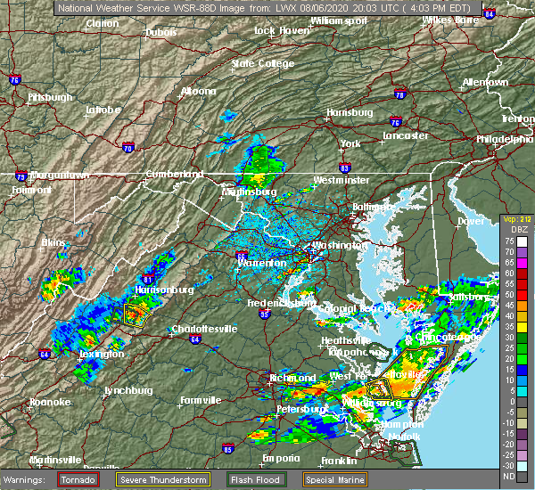 At 409 pm edt, a severe thunderstorm capable of producing a tornado was located near grottoes, or 12 miles northeast of waynesboro, moving east at 15 mph (radar indicated rotation). Hazards include tornado. For those in the direct path of a tornado touchdown, flying debris will be dangerous to those caught without shelter. damage to roofs, siding, and windows may occur. mobile homes may be damaged or destroyed. tree damage is likely. This tornadic thunderstorm will remain over mainly rural areas of south central rockingham, northwestern albemarle, western greene and east central augusta counties. At 409 pm edt, a severe thunderstorm capable of producing a tornado was located near grottoes, or 12 miles northeast of waynesboro, moving east at 15 mph (radar indicated rotation). Hazards include tornado. For those in the direct path of a tornado touchdown, flying debris will be dangerous to those caught without shelter. damage to roofs, siding, and windows may occur. mobile homes may be damaged or destroyed. tree damage is likely. This tornadic thunderstorm will remain over mainly rural areas of south central rockingham, northwestern albemarle, western greene and east central augusta counties.
|
| 8/6/2020 4:07 PM EDT | Power lines down in rockingham county VA, 2 miles SE of Grottoes, VA |
| 8/6/2020 4:03 PM EDT | Trees down at 153 middle lane rd in augusta county VA, 3.6 miles NE of Grottoes, VA |
| 8/6/2020 4:01 PM EDT |
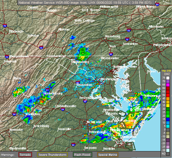 At 401 pm edt, a severe thunderstorm was located near staunton, and is nearly stationary (radar indicated). Hazards include 60 mph wind gusts. Damaging winds will cause some trees and large branches to fall. this could injure those outdoors, as well as damage homes and vehicles. roadways may become blocked by downed trees. localized power outages are possible. unsecured light objects may become projectiles. Locations impacted include, grottoes, crimora, verona, weyers cave, new hope, mount sidney, mount crawford, port republic, fort defiance and staunton airport. At 401 pm edt, a severe thunderstorm was located near staunton, and is nearly stationary (radar indicated). Hazards include 60 mph wind gusts. Damaging winds will cause some trees and large branches to fall. this could injure those outdoors, as well as damage homes and vehicles. roadways may become blocked by downed trees. localized power outages are possible. unsecured light objects may become projectiles. Locations impacted include, grottoes, crimora, verona, weyers cave, new hope, mount sidney, mount crawford, port republic, fort defiance and staunton airport.
|
| 8/6/2020 3:55 PM EDT | Numerous trees down near the intersection of east side hwy and jollett drive in augusta county VA, 4 miles N of Grottoes, VA |
| 8/6/2020 3:47 PM EDT |
 At 347 pm edt, a severe thunderstorm was located just north of staunton, and is nearly stationary (radar indicated). Hazards include isolated damaging wind gusts up to 60 mph. Damaging winds will cause some trees and large branches to fall. this could injure those outdoors, as well as damage homes and vehicles. roadways may become blocked by downed trees. localized power outages are possible. Unsecured light objects may become projectiles. At 347 pm edt, a severe thunderstorm was located just north of staunton, and is nearly stationary (radar indicated). Hazards include isolated damaging wind gusts up to 60 mph. Damaging winds will cause some trees and large branches to fall. this could injure those outdoors, as well as damage homes and vehicles. roadways may become blocked by downed trees. localized power outages are possible. Unsecured light objects may become projectiles.
|
| 7/21/2020 5:21 PM EDT |
 At 521 pm edt, a severe thunderstorm was located near staunton, moving northeast at 20 mph (radar indicated). Hazards include 60 mph wind gusts. Damaging winds will cause some trees and large branches to fall. this could injure those outdoors, as well as damage homes and vehicles. roadways may become blocked by downed trees. localized power outages are possible. unsecured light objects may become projectiles. Locations impacted include, staunton, bridgewater, grottoes, fishersville, verona, weyers cave, new hope, mount sidney, mount crawford, port republic, fort defiance and staunton airport. At 521 pm edt, a severe thunderstorm was located near staunton, moving northeast at 20 mph (radar indicated). Hazards include 60 mph wind gusts. Damaging winds will cause some trees and large branches to fall. this could injure those outdoors, as well as damage homes and vehicles. roadways may become blocked by downed trees. localized power outages are possible. unsecured light objects may become projectiles. Locations impacted include, staunton, bridgewater, grottoes, fishersville, verona, weyers cave, new hope, mount sidney, mount crawford, port republic, fort defiance and staunton airport.
|
| 7/21/2020 5:01 PM EDT |
 At 501 pm edt, a severe thunderstorm was located near staunton, moving northeast at 30 mph (radar indicated). Hazards include 60 mph wind gusts and quarter size hail. Damaging winds will cause some trees and large branches to fall. this could injure those outdoors, as well as damage homes and vehicles. roadways may become blocked by downed trees. localized power outages are possible. Unsecured light objects may become projectiles. At 501 pm edt, a severe thunderstorm was located near staunton, moving northeast at 30 mph (radar indicated). Hazards include 60 mph wind gusts and quarter size hail. Damaging winds will cause some trees and large branches to fall. this could injure those outdoors, as well as damage homes and vehicles. roadways may become blocked by downed trees. localized power outages are possible. Unsecured light objects may become projectiles.
|
| 7/5/2020 5:06 PM EDT |
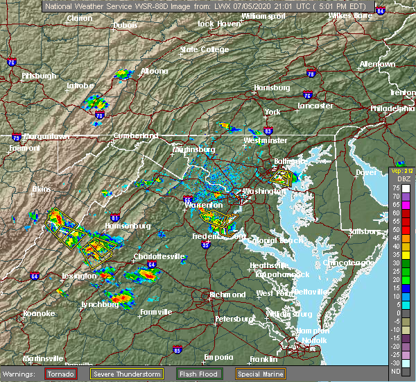 The severe thunderstorm warning for south central rockingham and northeastern augusta counties will expire at 515 pm edt, the storm which prompted the warning has moved just south of the area. a new warning has been issued. this warning will be allowed to expire. gusty winds are still possible with this thunderstorm. The severe thunderstorm warning for south central rockingham and northeastern augusta counties will expire at 515 pm edt, the storm which prompted the warning has moved just south of the area. a new warning has been issued. this warning will be allowed to expire. gusty winds are still possible with this thunderstorm.
|
| 7/5/2020 5:00 PM EDT |
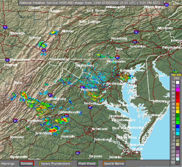 At 459 pm edt, a severe thunderstorm was located near grottoes, or 7 miles south of harrisonburg, and is nearly stationary (radar indicated). Hazards include 60 mph wind gusts and quarter size hail. Damaging winds will cause some trees and large branches to fall. this could injure those outdoors, as well as damage homes and vehicles. roadways may become blocked by downed trees. localized power outages are possible. unsecured light objects may become projectiles. Locations impacted include, grottoes, crimora, verona, weyers cave, new hope, mount sidney, hermitage, fort defiance and staunton airport. At 459 pm edt, a severe thunderstorm was located near grottoes, or 7 miles south of harrisonburg, and is nearly stationary (radar indicated). Hazards include 60 mph wind gusts and quarter size hail. Damaging winds will cause some trees and large branches to fall. this could injure those outdoors, as well as damage homes and vehicles. roadways may become blocked by downed trees. localized power outages are possible. unsecured light objects may become projectiles. Locations impacted include, grottoes, crimora, verona, weyers cave, new hope, mount sidney, hermitage, fort defiance and staunton airport.
|
| 7/5/2020 4:23 PM EDT |
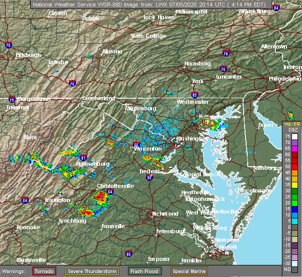 At 423 pm edt, a severe thunderstorm was located near bridgewater, or 7 miles southwest of harrisonburg, and is nearly stationary (radar indicated). Hazards include 60 mph wind gusts and quarter size hail. Damaging winds will cause some trees and large branches to fall. this could injure those outdoors, as well as damage homes and vehicles. roadways may become blocked by downed trees. localized power outages are possible. Unsecured light objects may become projectiles. At 423 pm edt, a severe thunderstorm was located near bridgewater, or 7 miles southwest of harrisonburg, and is nearly stationary (radar indicated). Hazards include 60 mph wind gusts and quarter size hail. Damaging winds will cause some trees and large branches to fall. this could injure those outdoors, as well as damage homes and vehicles. roadways may become blocked by downed trees. localized power outages are possible. Unsecured light objects may become projectiles.
|
| 4/9/2020 4:05 AM EDT |
 The severe thunderstorm warning for augusta , the city of staunton and the city of waynesboro will expire at 415 am edt, the storms which prompted the warning have moved out of the area. therefore, the warning will be allowed to expire. a severe thunderstorm watch remains in effect until 600 am edt for central and western virginia. to report severe weather, contact your nearest law enforcement agency. they will relay your report to the national weather service sterling virginia. The severe thunderstorm warning for augusta , the city of staunton and the city of waynesboro will expire at 415 am edt, the storms which prompted the warning have moved out of the area. therefore, the warning will be allowed to expire. a severe thunderstorm watch remains in effect until 600 am edt for central and western virginia. to report severe weather, contact your nearest law enforcement agency. they will relay your report to the national weather service sterling virginia.
|
| 4/9/2020 3:55 AM EDT |
 At 355 am edt, severe thunderstorms were located along a line extending from 6 miles southwest of bridgewater to 6 miles northwest of stuarts draft, moving east at 60 mph (radar indicated). Hazards include 60 mph wind gusts. Damaging winds will cause some trees and large branches to fall. this could injure those outdoors, as well as damage homes and vehicles. roadways may become blocked by downed trees. localized power outages are possible. unsecured light objects may become projectiles. Locations impacted include, staunton, waynesboro, stuarts draft, grottoes, crimora, sherando, fishersville, verona, weyers cave, lyndhurst, greenville, new hope, mount sidney, augusta springs, middlebrook, churchville, hermitage, moscow, buffalo gap and afton mountain. At 355 am edt, severe thunderstorms were located along a line extending from 6 miles southwest of bridgewater to 6 miles northwest of stuarts draft, moving east at 60 mph (radar indicated). Hazards include 60 mph wind gusts. Damaging winds will cause some trees and large branches to fall. this could injure those outdoors, as well as damage homes and vehicles. roadways may become blocked by downed trees. localized power outages are possible. unsecured light objects may become projectiles. Locations impacted include, staunton, waynesboro, stuarts draft, grottoes, crimora, sherando, fishersville, verona, weyers cave, lyndhurst, greenville, new hope, mount sidney, augusta springs, middlebrook, churchville, hermitage, moscow, buffalo gap and afton mountain.
|
| 4/9/2020 3:44 AM EDT |
 At 344 am edt, severe thunderstorms were located along a line extending from 14 miles northwest of staunton to near brownsburg, moving east at 65 mph (radar indicated). Hazards include 60 mph wind gusts. Damaging winds will cause some trees and large branches to fall. this could injure those outdoors, as well as damage homes and vehicles. roadways may become blocked by downed trees. localized power outages are possible. unsecured light objects may become projectiles. Locations impacted include, staunton, waynesboro, stuarts draft, grottoes, crimora, sherando, fishersville, verona, weyers cave, lyndhurst, craigsville, greenville, new hope, mount sidney, augusta springs, middlebrook, churchville, deerfield, hermitage and moscow. At 344 am edt, severe thunderstorms were located along a line extending from 14 miles northwest of staunton to near brownsburg, moving east at 65 mph (radar indicated). Hazards include 60 mph wind gusts. Damaging winds will cause some trees and large branches to fall. this could injure those outdoors, as well as damage homes and vehicles. roadways may become blocked by downed trees. localized power outages are possible. unsecured light objects may become projectiles. Locations impacted include, staunton, waynesboro, stuarts draft, grottoes, crimora, sherando, fishersville, verona, weyers cave, lyndhurst, craigsville, greenville, new hope, mount sidney, augusta springs, middlebrook, churchville, deerfield, hermitage and moscow.
|
| 4/9/2020 3:14 AM EDT |
 At 314 am edt, severe thunderstorms were located along a line extending from near burnsville to near nimrod hall, moving east at 65 mph (radar indicated). Hazards include 60 mph wind gusts and quarter size hail. Damaging winds will cause some trees and large branches to fall. this could injure those outdoors, as well as damage homes and vehicles. roadways may become blocked by downed trees. localized power outages are possible. Unsecured light objects may become projectiles. At 314 am edt, severe thunderstorms were located along a line extending from near burnsville to near nimrod hall, moving east at 65 mph (radar indicated). Hazards include 60 mph wind gusts and quarter size hail. Damaging winds will cause some trees and large branches to fall. this could injure those outdoors, as well as damage homes and vehicles. roadways may become blocked by downed trees. localized power outages are possible. Unsecured light objects may become projectiles.
|
| 9/28/2019 3:24 PM EDT |
 At 324 pm edt, a severe thunderstorm was located 8 miles east of grottoes, or 16 miles southeast of harrisonburg, moving southeast at 10 mph (radar indicated). Hazards include 60 mph wind gusts and half dollar size hail. Damaging winds will cause some trees and large branches to fall. this could injure those outdoors, as well as damage homes and vehicles. roadways may become blocked by downed trees. localized power outages are possible. Unsecured light objects may become projectiles. At 324 pm edt, a severe thunderstorm was located 8 miles east of grottoes, or 16 miles southeast of harrisonburg, moving southeast at 10 mph (radar indicated). Hazards include 60 mph wind gusts and half dollar size hail. Damaging winds will cause some trees and large branches to fall. this could injure those outdoors, as well as damage homes and vehicles. roadways may become blocked by downed trees. localized power outages are possible. Unsecured light objects may become projectiles.
|
| 8/20/2019 5:43 PM EDT |
 At 516 pm edt, a severe thunderstorm was located over bridgewater, or 7 miles southwest of harrisonburg, moving east at 20 mph (radar indicated). Hazards include 60 mph wind gusts and quarter size hail. Damaging winds will cause some trees and large branches to fall. this could injure those outdoors, as well as damage homes and vehicles. roadways may become blocked by downed trees. localized power outages are possible. Unsecured light objects may become projectiles. At 516 pm edt, a severe thunderstorm was located over bridgewater, or 7 miles southwest of harrisonburg, moving east at 20 mph (radar indicated). Hazards include 60 mph wind gusts and quarter size hail. Damaging winds will cause some trees and large branches to fall. this could injure those outdoors, as well as damage homes and vehicles. roadways may become blocked by downed trees. localized power outages are possible. Unsecured light objects may become projectiles.
|
| 8/20/2019 5:16 PM EDT |
 The national weather service in sterling virginia has issued a * severe thunderstorm warning for. south central rockingham county in western virginia. northeastern augusta county in western virginia. until 600 pm edt. At 516 pm edt, a severe thunderstorm was located over bridgewater,. The national weather service in sterling virginia has issued a * severe thunderstorm warning for. south central rockingham county in western virginia. northeastern augusta county in western virginia. until 600 pm edt. At 516 pm edt, a severe thunderstorm was located over bridgewater,.
|
| 8/15/2019 7:04 PM EDT |
 A severe thunderstorm warning remains in effect until 730 pm edt for southeastern rockingham and east central augusta counties. at 704 pm edt, a severe thunderstorm was located over crimora, or 8 miles north of waynesboro, moving southeast at 10 mph. hazard. 60 mph wind gusts and quarter size hail. source. Radar indicated. A severe thunderstorm warning remains in effect until 730 pm edt for southeastern rockingham and east central augusta counties. at 704 pm edt, a severe thunderstorm was located over crimora, or 8 miles north of waynesboro, moving southeast at 10 mph. hazard. 60 mph wind gusts and quarter size hail. source. Radar indicated.
|
| 8/15/2019 6:42 PM EDT |
 At 641 pm edt, a severe thunderstorm was located near grottoes, or 8 miles northeast of staunton, moving east at 10 mph (radar indicated). Hazards include 60 mph wind gusts and quarter size hail. Damaging winds will cause some trees and large branches to fall. this could injure those outdoors, as well as damage homes and vehicles. roadways may become blocked by downed trees. localized power outages are possible. Unsecured light objects may become projectiles. At 641 pm edt, a severe thunderstorm was located near grottoes, or 8 miles northeast of staunton, moving east at 10 mph (radar indicated). Hazards include 60 mph wind gusts and quarter size hail. Damaging winds will cause some trees and large branches to fall. this could injure those outdoors, as well as damage homes and vehicles. roadways may become blocked by downed trees. localized power outages are possible. Unsecured light objects may become projectiles.
|
| 7/31/2019 3:22 PM EDT |
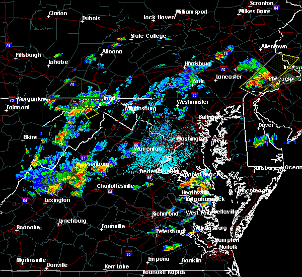 At 322 pm edt, a severe thunderstorm was located over grottoes, or 11 miles southeast of harrisonburg, moving east at 20 mph (radar indicated). Hazards include 60 mph wind gusts. Damaging winds will cause some trees and large branches to fall. this could injure those outdoors, as well as damage homes and vehicles. roadways may become blocked by downed trees. localized power outages are possible. Unsecured light objects may become projectiles. At 322 pm edt, a severe thunderstorm was located over grottoes, or 11 miles southeast of harrisonburg, moving east at 20 mph (radar indicated). Hazards include 60 mph wind gusts. Damaging winds will cause some trees and large branches to fall. this could injure those outdoors, as well as damage homes and vehicles. roadways may become blocked by downed trees. localized power outages are possible. Unsecured light objects may become projectiles.
|
| 7/21/2019 4:46 PM EDT |
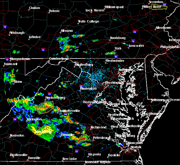 At 445 pm edt, a severe thunderstorm was located over grottoes, or 13 miles southeast of harrisonburg, moving east at 10 mph (radar indicated and observed. a wind gust to 61 mph was measured at weyers cave, near grottoes). Hazards include 60 mph wind gusts and quarter size hail. Damaging winds will cause some trees and large branches to fall. this could injure those outdoors, as well as damage homes and vehicles. roadways may become blocked by downed trees. localized power outages are possible. unsecured light objects may become projectiles. Locations impacted include, grottoes, massanutten, elkton, weyers cave, new hope, mount sidney, rocky bar, port republic, mission home, fort defiance, mcgaheysville, montevideo and staunton airport. At 445 pm edt, a severe thunderstorm was located over grottoes, or 13 miles southeast of harrisonburg, moving east at 10 mph (radar indicated and observed. a wind gust to 61 mph was measured at weyers cave, near grottoes). Hazards include 60 mph wind gusts and quarter size hail. Damaging winds will cause some trees and large branches to fall. this could injure those outdoors, as well as damage homes and vehicles. roadways may become blocked by downed trees. localized power outages are possible. unsecured light objects may become projectiles. Locations impacted include, grottoes, massanutten, elkton, weyers cave, new hope, mount sidney, rocky bar, port republic, mission home, fort defiance, mcgaheysville, montevideo and staunton airport.
|
| 7/21/2019 4:22 PM EDT |
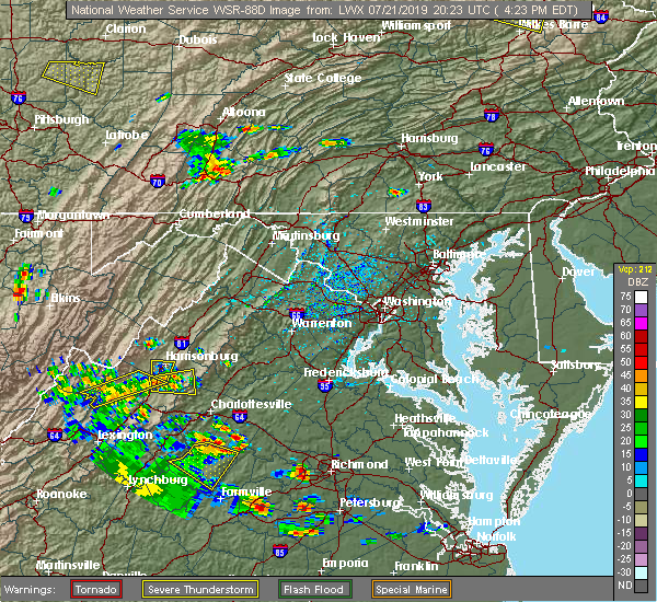 At 421 pm edt, a severe thunderstorm was located near grottoes, or 9 miles south of harrisonburg, moving east at 10 mph (radar indicated). Hazards include 60 mph wind gusts and quarter size hail. Damaging winds will cause some trees and large branches to fall. this could injure those outdoors, as well as damage homes and vehicles. roadways may become blocked by downed trees. localized power outages are possible. Unsecured light objects may become projectiles. At 421 pm edt, a severe thunderstorm was located near grottoes, or 9 miles south of harrisonburg, moving east at 10 mph (radar indicated). Hazards include 60 mph wind gusts and quarter size hail. Damaging winds will cause some trees and large branches to fall. this could injure those outdoors, as well as damage homes and vehicles. roadways may become blocked by downed trees. localized power outages are possible. Unsecured light objects may become projectiles.
|
| 7/17/2019 2:54 PM EDT |
 At 253 pm edt, a severe thunderstorm was located near sherando, or near waynesboro, moving northeast at 25 mph (radar indicated). Hazards include 60 mph wind gusts. Damaging winds will cause some trees and large branches to fall. this could injure those outdoors, as well as damage homes and vehicles. roadways may become blocked by downed trees. localized power outages are possible. Unsecured light objects may become projectiles. At 253 pm edt, a severe thunderstorm was located near sherando, or near waynesboro, moving northeast at 25 mph (radar indicated). Hazards include 60 mph wind gusts. Damaging winds will cause some trees and large branches to fall. this could injure those outdoors, as well as damage homes and vehicles. roadways may become blocked by downed trees. localized power outages are possible. Unsecured light objects may become projectiles.
|
| 7/6/2019 4:34 PM EDT |
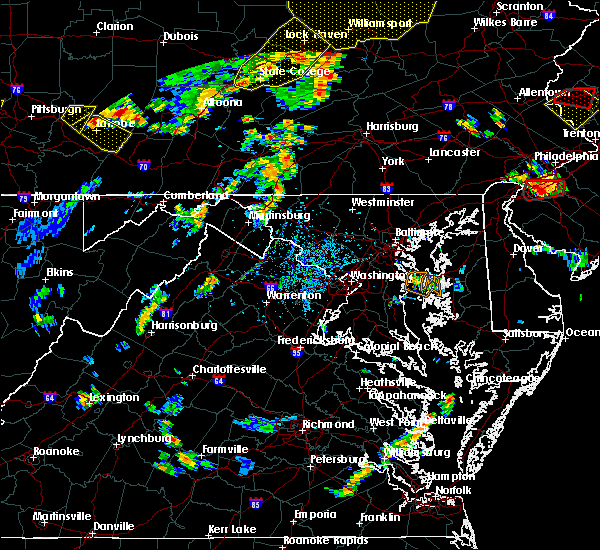 The national weather service in sterling virginia has issued a * severe thunderstorm warning for. southern rockingham county in western virginia. the city of harrisonburg in western virginia. until 515 pm edt. At 434 pm edt, a severe thunderstorm was located near dale. The national weather service in sterling virginia has issued a * severe thunderstorm warning for. southern rockingham county in western virginia. the city of harrisonburg in western virginia. until 515 pm edt. At 434 pm edt, a severe thunderstorm was located near dale.
|
| 7/5/2019 5:52 PM EDT |
 The severe thunderstorm warning for southwestern rockingham and northeastern augusta counties will expire at 600 pm edt, the storm which prompted the warning has weakened below severe limits, and no longer poses an immediate threat to life or property. therefore, the warning will be allowed to expire. The severe thunderstorm warning for southwestern rockingham and northeastern augusta counties will expire at 600 pm edt, the storm which prompted the warning has weakened below severe limits, and no longer poses an immediate threat to life or property. therefore, the warning will be allowed to expire.
|
| 7/5/2019 5:25 PM EDT |
 At 525 pm edt, a severe thunderstorm was located near bridgewater, or 11 miles southwest of harrisonburg, moving east at 10 mph (radar indicated). Hazards include 60 mph wind gusts and quarter size hail. Damaging winds will cause some trees and large branches to fall. this could injure those outdoors, as well as damage homes and vehicles. roadways may become blocked by downed trees. localized power outages are possible. Unsecured light objects may become projectiles. At 525 pm edt, a severe thunderstorm was located near bridgewater, or 11 miles southwest of harrisonburg, moving east at 10 mph (radar indicated). Hazards include 60 mph wind gusts and quarter size hail. Damaging winds will cause some trees and large branches to fall. this could injure those outdoors, as well as damage homes and vehicles. roadways may become blocked by downed trees. localized power outages are possible. Unsecured light objects may become projectiles.
|
| 6/24/2019 4:01 PM EDT |
 At 401 pm edt, a severe thunderstorm was located near grottoes, or 12 miles southeast of harrisonburg, moving east at 20 mph (radar indicated). Hazards include 60 mph wind gusts. Damaging winds will cause some trees and large branches to fall. this could injure those outdoors, as well as damage homes and vehicles. roadways may become blocked by downed trees. localized power outages are possible. Unsecured light objects may become projectiles. At 401 pm edt, a severe thunderstorm was located near grottoes, or 12 miles southeast of harrisonburg, moving east at 20 mph (radar indicated). Hazards include 60 mph wind gusts. Damaging winds will cause some trees and large branches to fall. this could injure those outdoors, as well as damage homes and vehicles. roadways may become blocked by downed trees. localized power outages are possible. Unsecured light objects may become projectiles.
|
| 5/30/2019 6:05 PM EDT |
 The severe thunderstorm warning for southeastern rockingham county will expire at 615 pm edt, the storm which prompted the warning is moving out of the area. therefore, the warning will be allowed to expire. The severe thunderstorm warning for southeastern rockingham county will expire at 615 pm edt, the storm which prompted the warning is moving out of the area. therefore, the warning will be allowed to expire.
|
| 5/30/2019 5:46 PM EDT |
 At 546 pm edt, a severe thunderstorm was located near grottoes, or 7 miles southeast of harrisonburg, moving east at 35 mph (radar indicated). Hazards include 60 mph wind gusts and quarter size hail. Damaging winds will cause some trees and large branches to fall. this could injure those outdoors, as well as damage homes and vehicles. roadways may become blocked by downed trees. localized power outages are possible. unsecured light objects may become projectiles. Locations impacted include, grottoes, massanutten, elkton, rocky bar, penn laird, port republic, mcgaheysville and montevideo. At 546 pm edt, a severe thunderstorm was located near grottoes, or 7 miles southeast of harrisonburg, moving east at 35 mph (radar indicated). Hazards include 60 mph wind gusts and quarter size hail. Damaging winds will cause some trees and large branches to fall. this could injure those outdoors, as well as damage homes and vehicles. roadways may become blocked by downed trees. localized power outages are possible. unsecured light objects may become projectiles. Locations impacted include, grottoes, massanutten, elkton, rocky bar, penn laird, port republic, mcgaheysville and montevideo.
|
| 5/30/2019 5:38 PM EDT |
 At 526 pm edt, a severe thunderstorm was located near bridgewater, or 10 miles southwest of harrisonburg, moving east at 35 mph (radar indicated). Hazards include 60 mph wind gusts and quarter size hail. Damaging winds will cause some trees and large branches to fall. this could injure those outdoors, as well as damage homes and vehicles. roadways may become blocked by downed trees. localized power outages are possible. Unsecured light objects may become projectiles. At 526 pm edt, a severe thunderstorm was located near bridgewater, or 10 miles southwest of harrisonburg, moving east at 35 mph (radar indicated). Hazards include 60 mph wind gusts and quarter size hail. Damaging winds will cause some trees and large branches to fall. this could injure those outdoors, as well as damage homes and vehicles. roadways may become blocked by downed trees. localized power outages are possible. Unsecured light objects may become projectiles.
|
| 5/30/2019 5:26 PM EDT |
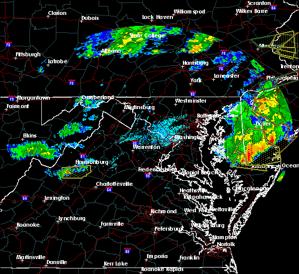 At 526 pm edt, a severe thunderstorm was located near bridgewater, or 10 miles southwest of harrisonburg, moving east at 35 mph (radar indicated). Hazards include 60 mph wind gusts and quarter size hail. Damaging winds will cause some trees and large branches to fall. this could injure those outdoors, as well as damage homes and vehicles. roadways may become blocked by downed trees. localized power outages are possible. Unsecured light objects may become projectiles. At 526 pm edt, a severe thunderstorm was located near bridgewater, or 10 miles southwest of harrisonburg, moving east at 35 mph (radar indicated). Hazards include 60 mph wind gusts and quarter size hail. Damaging winds will cause some trees and large branches to fall. this could injure those outdoors, as well as damage homes and vehicles. roadways may become blocked by downed trees. localized power outages are possible. Unsecured light objects may become projectiles.
|
| 5/25/2019 4:38 PM EDT |
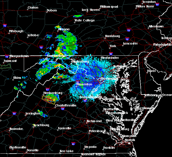 At 437 pm edt, a severe thunderstorm was located near massanutten, or 12 miles southeast of harrisonburg, moving east at 25 mph (radar indicated). Hazards include golf ball size hail and 70 mph wind gusts. Expect wind damage to trees and power lines. hail is large enough to dent and damage vehicles. Some hail damage to roofs, siding, and windows is possible. At 437 pm edt, a severe thunderstorm was located near massanutten, or 12 miles southeast of harrisonburg, moving east at 25 mph (radar indicated). Hazards include golf ball size hail and 70 mph wind gusts. Expect wind damage to trees and power lines. hail is large enough to dent and damage vehicles. Some hail damage to roofs, siding, and windows is possible.
|
| 5/25/2019 4:26 PM EDT |
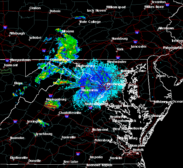 At 425 pm edt, a severe thunderstorm capable of producing a tornado was located over grottoes, or 11 miles southeast of harrisonburg, moving east at 25 mph (radar indicated rotation). Hazards include tornado and golf ball size hail. For those in the direct path of a tornado touchdown, flying debris will be dangerous to those caught without shelter. damage to roofs, siding, and windows may occur. mobile homes may be damaged or destroyed. tree damage is likely. Locations impacted include, grottoes, mission home, port republic, shady grove and boonesville. At 425 pm edt, a severe thunderstorm capable of producing a tornado was located over grottoes, or 11 miles southeast of harrisonburg, moving east at 25 mph (radar indicated rotation). Hazards include tornado and golf ball size hail. For those in the direct path of a tornado touchdown, flying debris will be dangerous to those caught without shelter. damage to roofs, siding, and windows may occur. mobile homes may be damaged or destroyed. tree damage is likely. Locations impacted include, grottoes, mission home, port republic, shady grove and boonesville.
|
| 5/25/2019 4:18 PM EDT | Golf Ball sized hail reported 2.3 miles SSW of Grottoes, VA, golf ball sized hail in the port republic area. |
| 5/25/2019 4:16 PM EDT |
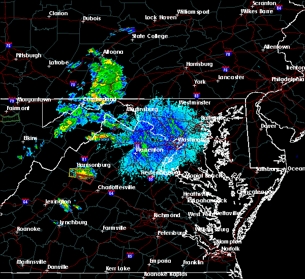 At 416 pm edt, a severe thunderstorm capable of producing a tornado was located over grottoes, or 9 miles south of harrisonburg, moving east at 30 mph (radar indicated rotation). Hazards include tornado and golf ball size hail. For those in the direct path of a tornado touchdown, flying debris will be dangerous to those caught without shelter. damage to roofs, siding, and windows may occur. mobile homes may be damaged or destroyed. tree damage is likely. This tornadic thunderstorm will remain over mainly rural areas of south central rockingham, north central albemarle and southwestern greene counties, including the following locations, mission home, port republic, shady grove and boonesville. At 416 pm edt, a severe thunderstorm capable of producing a tornado was located over grottoes, or 9 miles south of harrisonburg, moving east at 30 mph (radar indicated rotation). Hazards include tornado and golf ball size hail. For those in the direct path of a tornado touchdown, flying debris will be dangerous to those caught without shelter. damage to roofs, siding, and windows may occur. mobile homes may be damaged or destroyed. tree damage is likely. This tornadic thunderstorm will remain over mainly rural areas of south central rockingham, north central albemarle and southwestern greene counties, including the following locations, mission home, port republic, shady grove and boonesville.
|
| 5/25/2019 4:08 PM EDT |
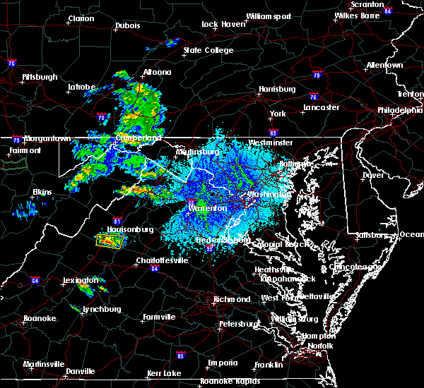 At 407 pm edt, a severe thunderstorm was located near harrisonburg, moving east at 25 mph (radar indicated). Hazards include golf ball size hail and 70 mph wind gusts. Expect wind damage to trees and power lines. hail is large enough to dent and damage vehicles. some hail damage to roofs, siding, and windows is possible. Locations impacted include, harrisonburg, bridgewater, grottoes, massanutten, elkton, weyers cave, dayton, mount crawford, rocky bar, penn laird, port republic, pleasant valley, montezuma, keezletown, mcgaheysville and montevideo. At 407 pm edt, a severe thunderstorm was located near harrisonburg, moving east at 25 mph (radar indicated). Hazards include golf ball size hail and 70 mph wind gusts. Expect wind damage to trees and power lines. hail is large enough to dent and damage vehicles. some hail damage to roofs, siding, and windows is possible. Locations impacted include, harrisonburg, bridgewater, grottoes, massanutten, elkton, weyers cave, dayton, mount crawford, rocky bar, penn laird, port republic, pleasant valley, montezuma, keezletown, mcgaheysville and montevideo.
|
| 5/25/2019 3:55 PM EDT |
 At 355 pm edt, a severe thunderstorm was located over bridgewater, or near harrisonburg, moving east at 25 mph (radar indicated). Hazards include 60 mph wind gusts and quarter size hail. Damaging winds will cause some trees and large branches to fall. this could injure those outdoors, as well as damage homes and vehicles. roadways may become blocked by downed trees. localized power outages are possible. Unsecured light objects may become projectiles. At 355 pm edt, a severe thunderstorm was located over bridgewater, or near harrisonburg, moving east at 25 mph (radar indicated). Hazards include 60 mph wind gusts and quarter size hail. Damaging winds will cause some trees and large branches to fall. this could injure those outdoors, as well as damage homes and vehicles. roadways may become blocked by downed trees. localized power outages are possible. Unsecured light objects may become projectiles.
|
| 4/14/2019 6:33 PM EDT |
 At 633 pm edt, severe thunderstorms were located along a line extending from shenandoah to 8 miles southeast of massanutten, moving northeast at 55 mph (radar indicated). Hazards include 60 mph wind gusts. Damaging winds will cause some trees and large branches to fall. this could injure those outdoors, as well as damage homes and vehicles. roadways may become blocked by downed trees. localized power outages are possible. unsecured light objects may become projectiles. Locations impacted include, grottoes, shenandoah, massanutten, stanardsville, free union, hollymead, elkton, ruckersville, rocky bar, quinque, port republic, lydia, stony point, haneytown, newtown, amicus, mcgaheysville, montevideo, shady grove and mcmullen. At 633 pm edt, severe thunderstorms were located along a line extending from shenandoah to 8 miles southeast of massanutten, moving northeast at 55 mph (radar indicated). Hazards include 60 mph wind gusts. Damaging winds will cause some trees and large branches to fall. this could injure those outdoors, as well as damage homes and vehicles. roadways may become blocked by downed trees. localized power outages are possible. unsecured light objects may become projectiles. Locations impacted include, grottoes, shenandoah, massanutten, stanardsville, free union, hollymead, elkton, ruckersville, rocky bar, quinque, port republic, lydia, stony point, haneytown, newtown, amicus, mcgaheysville, montevideo, shady grove and mcmullen.
|
| 4/14/2019 6:32 PM EDT |
 At 632 pm edt, a severe thunderstorm was located near crozet, or 11 miles northwest of charlottesville, moving northeast at 45 mph (radar indicated). Hazards include 60 mph wind gusts. Damaging winds will cause some trees and large branches to fall. this could injure those outdoors, as well as damage homes and vehicles. roadways may become blocked by downed trees. localized power outages are possible. unsecured light objects may become projectiles. Locations impacted include, charlottesville, waynesboro, crozet, grottoes, crimora, sherando, free union, wintergreen, afton, westmoreland, hollymead, lyndhurst, nellysford, ivy, new hope, north garden, covesville, yancey mills, stony point and flordon. At 632 pm edt, a severe thunderstorm was located near crozet, or 11 miles northwest of charlottesville, moving northeast at 45 mph (radar indicated). Hazards include 60 mph wind gusts. Damaging winds will cause some trees and large branches to fall. this could injure those outdoors, as well as damage homes and vehicles. roadways may become blocked by downed trees. localized power outages are possible. unsecured light objects may become projectiles. Locations impacted include, charlottesville, waynesboro, crozet, grottoes, crimora, sherando, free union, wintergreen, afton, westmoreland, hollymead, lyndhurst, nellysford, ivy, new hope, north garden, covesville, yancey mills, stony point and flordon.
|
| 4/14/2019 6:09 PM EDT |
 At 609 pm edt, severe thunderstorms were located along a line extending from grottoes to near crozet, moving northeast at 55 mph (radar indicated). Hazards include 60 mph wind gusts. Damaging winds will cause some trees and large branches to fall. this could injure those outdoors, as well as damage homes and vehicles. roadways may become blocked by downed trees. localized power outages are possible. Unsecured light objects may become projectiles. At 609 pm edt, severe thunderstorms were located along a line extending from grottoes to near crozet, moving northeast at 55 mph (radar indicated). Hazards include 60 mph wind gusts. Damaging winds will cause some trees and large branches to fall. this could injure those outdoors, as well as damage homes and vehicles. roadways may become blocked by downed trees. localized power outages are possible. Unsecured light objects may become projectiles.
|
| 4/14/2019 5:59 PM EDT |
 At 558 pm edt, a severe thunderstorm was located near wintergreen, or 14 miles north of clifford, moving northeast at 45 mph (radar indicated). Hazards include 60 mph wind gusts and quarter size hail. Damaging winds will cause some trees and large branches to fall. this could injure those outdoors, as well as damage homes and vehicles. roadways may become blocked by downed trees. localized power outages are possible. Unsecured light objects may become projectiles. At 558 pm edt, a severe thunderstorm was located near wintergreen, or 14 miles north of clifford, moving northeast at 45 mph (radar indicated). Hazards include 60 mph wind gusts and quarter size hail. Damaging winds will cause some trees and large branches to fall. this could injure those outdoors, as well as damage homes and vehicles. roadways may become blocked by downed trees. localized power outages are possible. Unsecured light objects may become projectiles.
|
| 9/1/2018 3:18 PM EDT |
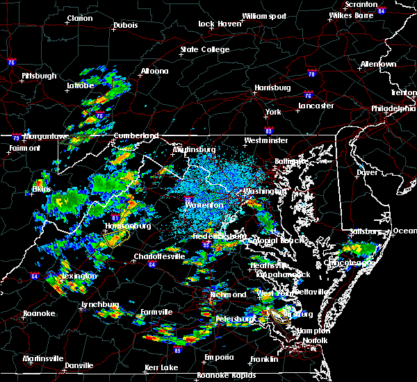 At 318 pm edt, a severe thunderstorm was located near massanutten, or 11 miles southeast of harrisonburg, moving east at 10 mph (radar indicated). Hazards include 60 mph wind gusts. Damaging winds will cause some trees and large branches to fall. this could injure those outdoors, as well as damage homes and vehicles. roadways may become blocked by downed trees. localized power outages are possible. Unsecured light objects may become projectiles. At 318 pm edt, a severe thunderstorm was located near massanutten, or 11 miles southeast of harrisonburg, moving east at 10 mph (radar indicated). Hazards include 60 mph wind gusts. Damaging winds will cause some trees and large branches to fall. this could injure those outdoors, as well as damage homes and vehicles. roadways may become blocked by downed trees. localized power outages are possible. Unsecured light objects may become projectiles.
|
| 8/30/2018 5:35 PM EDT |
 The severe thunderstorm warning for southeastern augusta , the city of staunton and the city of waynesboro will expire at 545 pm edt, the storm which prompted the warning has weakened below severe limits, and no longer pose an immediate threat to life or property. therefore the warning will be allowed to expire. however heavy rain is still possible with this thunderstorm. to report severe weather, contact your nearest law enforcement agency. they will relay your report to the national weather service sterling virginia. The severe thunderstorm warning for southeastern augusta , the city of staunton and the city of waynesboro will expire at 545 pm edt, the storm which prompted the warning has weakened below severe limits, and no longer pose an immediate threat to life or property. therefore the warning will be allowed to expire. however heavy rain is still possible with this thunderstorm. to report severe weather, contact your nearest law enforcement agency. they will relay your report to the national weather service sterling virginia.
|
| 8/30/2018 5:20 PM EDT |
 At 519 pm edt, a severe thunderstorm was located near waynesboro, moving northeast at 10 mph (radar indicated). Hazards include 60 mph wind gusts. Damaging winds will cause some trees and large branches to fall. this could injure those outdoors, as well as damage homes and vehicles. roadways may become blocked by downed trees. localized power outages are possible. unsecured light objects may become projectiles. Locations impacted include, staunton, waynesboro, stuarts draft, grottoes, crimora, sherando, wintergreen, fishersville, verona, weyers cave, lyndhurst, greenville, new hope, mount sidney, middlebrook, hermitage, mint spring, fort defiance, spottswood and staunton airport. At 519 pm edt, a severe thunderstorm was located near waynesboro, moving northeast at 10 mph (radar indicated). Hazards include 60 mph wind gusts. Damaging winds will cause some trees and large branches to fall. this could injure those outdoors, as well as damage homes and vehicles. roadways may become blocked by downed trees. localized power outages are possible. unsecured light objects may become projectiles. Locations impacted include, staunton, waynesboro, stuarts draft, grottoes, crimora, sherando, wintergreen, fishersville, verona, weyers cave, lyndhurst, greenville, new hope, mount sidney, middlebrook, hermitage, mint spring, fort defiance, spottswood and staunton airport.
|
| 8/30/2018 5:15 PM EDT | Trees and fences blown down near the intersection of us-340 eastside highway and stull run lan in augusta county VA, 2 miles N of Grottoes, VA |
| 8/30/2018 5:10 PM EDT | Multiple trees down along patterson mill roa in augusta county VA, 4.7 miles NNE of Grottoes, VA |
| 8/30/2018 5:02 PM EDT |
 At 502 pm edt, a severe thunderstorm was located near stuarts draft, or near staunton, moving northeast at 10 mph (radar indicated). Hazards include 60 mph wind gusts. Damaging winds will cause some trees and large branches to fall. this could injure those outdoors, as well as damage homes and vehicles. roadways may become blocked by downed trees. localized power outages are possible. Unsecured light objects may become projectiles. At 502 pm edt, a severe thunderstorm was located near stuarts draft, or near staunton, moving northeast at 10 mph (radar indicated). Hazards include 60 mph wind gusts. Damaging winds will cause some trees and large branches to fall. this could injure those outdoors, as well as damage homes and vehicles. roadways may become blocked by downed trees. localized power outages are possible. Unsecured light objects may become projectiles.
|
| 8/30/2018 4:40 PM EDT | Tree down on augusta ave near grotto town limi in rockingham county VA, 0.7 miles NNW of Grottoes, VA |
| 8/8/2018 5:42 PM EDT | Power lines down on 6800 block of new haven roa in rockingham county VA, 2.3 miles SSW of Grottoes, VA |
| 8/8/2018 5:42 PM EDT |
 At 542 pm edt, a severe thunderstorm was located near grottoes, or 11 miles southeast of harrisonburg, moving southeast at 20 mph (radar indicated). Hazards include 60 mph wind gusts and quarter size hail. Damaging winds will cause some trees and large branches to fall. this could injure those outdoors, as well as damage homes and vehicles. roadways may become blocked by downed trees. localized power outages are possible. unsecured light objects may become projectiles. Locations impacted include, grottoes, massanutten, weyers cave, rocky bar, mission home, port republic, mcgaheysville and montevideo. At 542 pm edt, a severe thunderstorm was located near grottoes, or 11 miles southeast of harrisonburg, moving southeast at 20 mph (radar indicated). Hazards include 60 mph wind gusts and quarter size hail. Damaging winds will cause some trees and large branches to fall. this could injure those outdoors, as well as damage homes and vehicles. roadways may become blocked by downed trees. localized power outages are possible. unsecured light objects may become projectiles. Locations impacted include, grottoes, massanutten, weyers cave, rocky bar, mission home, port republic, mcgaheysville and montevideo.
|
| 8/8/2018 5:27 PM EDT |
 At 527 pm edt, a severe thunderstorm was located near grottoes, or 7 miles south of harrisonburg, moving southeast at 20 mph (radar indicated). Hazards include 60 mph wind gusts and quarter size hail. Damaging winds will cause some trees and large branches to fall. this could injure those outdoors, as well as damage homes and vehicles. roadways may become blocked by downed trees. localized power outages are possible. Unsecured light objects may become projectiles. At 527 pm edt, a severe thunderstorm was located near grottoes, or 7 miles south of harrisonburg, moving southeast at 20 mph (radar indicated). Hazards include 60 mph wind gusts and quarter size hail. Damaging winds will cause some trees and large branches to fall. this could injure those outdoors, as well as damage homes and vehicles. roadways may become blocked by downed trees. localized power outages are possible. Unsecured light objects may become projectiles.
|
| 8/2/2018 6:13 PM EDT |
 The severe thunderstorm warning for southeastern rockingham, and northeastern augusta counties and the southern city of harrisonburg will expire at 615 pm edt, the storm which prompted the warning has moved out of the area. therefore the warning will be allowed to expire. a severe thunderstorm warning is still in effect for portions of northeastern rockingham county. The severe thunderstorm warning for southeastern rockingham, and northeastern augusta counties and the southern city of harrisonburg will expire at 615 pm edt, the storm which prompted the warning has moved out of the area. therefore the warning will be allowed to expire. a severe thunderstorm warning is still in effect for portions of northeastern rockingham county.
|
| 8/2/2018 5:45 PM EDT |
 At 544 pm edt, a severe thunderstorm was located over massanutten, or near harrisonburg, moving northeast at 25 mph (radar indicated). Hazards include 60 mph wind gusts. Damaging winds will cause some trees and large branches to fall. this could injure those outdoors, as well as damage homes and vehicles. roadways may become blocked by downed trees. localized power outages are possible. unsecured light objects may become projectiles. Locations impacted include, harrisonburg, bridgewater, grottoes, massanutten, elkton, weyers cave, mount sidney, mount crawford, rocky bar, penn laird, port republic, pleasant valley, fort defiance, keezletown, mcgaheysville, montevideo and staunton airport. At 544 pm edt, a severe thunderstorm was located over massanutten, or near harrisonburg, moving northeast at 25 mph (radar indicated). Hazards include 60 mph wind gusts. Damaging winds will cause some trees and large branches to fall. this could injure those outdoors, as well as damage homes and vehicles. roadways may become blocked by downed trees. localized power outages are possible. unsecured light objects may become projectiles. Locations impacted include, harrisonburg, bridgewater, grottoes, massanutten, elkton, weyers cave, mount sidney, mount crawford, rocky bar, penn laird, port republic, pleasant valley, fort defiance, keezletown, mcgaheysville, montevideo and staunton airport.
|
| 8/2/2018 5:23 PM EDT |
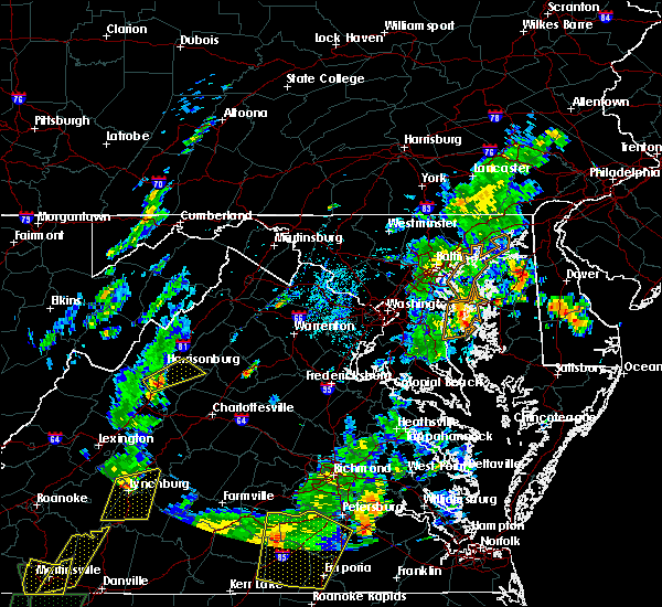 At 522 pm edt, a severe thunderstorm was located near bridgewater, or 8 miles south of harrisonburg, moving northeast at 30 mph (radar indicated). Hazards include 60 mph wind gusts and quarter size hail. Damaging winds will cause some trees and large branches to fall. this could injure those outdoors, as well as damage homes and vehicles. roadways may become blocked by downed trees. localized power outages are possible. Unsecured light objects may become projectiles. At 522 pm edt, a severe thunderstorm was located near bridgewater, or 8 miles south of harrisonburg, moving northeast at 30 mph (radar indicated). Hazards include 60 mph wind gusts and quarter size hail. Damaging winds will cause some trees and large branches to fall. this could injure those outdoors, as well as damage homes and vehicles. roadways may become blocked by downed trees. localized power outages are possible. Unsecured light objects may become projectiles.
|
| 6/24/2018 2:25 PM EDT |
 At 225 pm edt, a severe thunderstorm was located near crimora, or 7 miles north of waynesboro, moving east at 40 mph (radar indicated). Hazards include 60 mph wind gusts and half dollar size hail. Damaging winds will cause some trees and large branches to fall. this could injure those outdoors, as well as damage homes and vehicles. roadways may become blocked by downed trees. localized power outages are possible. Unsecured light objects may become projectiles. At 225 pm edt, a severe thunderstorm was located near crimora, or 7 miles north of waynesboro, moving east at 40 mph (radar indicated). Hazards include 60 mph wind gusts and half dollar size hail. Damaging winds will cause some trees and large branches to fall. this could injure those outdoors, as well as damage homes and vehicles. roadways may become blocked by downed trees. localized power outages are possible. Unsecured light objects may become projectiles.
|
| 6/24/2018 2:11 PM EDT |
 At 210 pm edt, a severe thunderstorm was located over staunton, moving east at 35 mph (radar indicated). Hazards include 60 mph wind gusts and quarter size hail. Damaging winds will cause some trees and large branches to fall. this could injure those outdoors, as well as damage homes and vehicles. roadways may become blocked by downed trees. localized power outages are possible. unsecured light objects may become projectiles. Locations impacted include, staunton, waynesboro, grottoes, crimora, fishersville, verona, weyers cave, lyndhurst, new hope, mount sidney, hermitage, fort defiance and staunton airport. At 210 pm edt, a severe thunderstorm was located over staunton, moving east at 35 mph (radar indicated). Hazards include 60 mph wind gusts and quarter size hail. Damaging winds will cause some trees and large branches to fall. this could injure those outdoors, as well as damage homes and vehicles. roadways may become blocked by downed trees. localized power outages are possible. unsecured light objects may become projectiles. Locations impacted include, staunton, waynesboro, grottoes, crimora, fishersville, verona, weyers cave, lyndhurst, new hope, mount sidney, hermitage, fort defiance and staunton airport.
|
| 6/24/2018 1:46 PM EDT |
 At 146 pm edt, a severe thunderstorm was located 12 miles west of staunton, moving east at 40 mph (radar indicated). Hazards include 60 mph wind gusts and quarter size hail. Damaging winds will cause some trees and large branches to fall. this could injure those outdoors, as well as damage homes and vehicles. roadways may become blocked by downed trees. localized power outages are possible. Unsecured light objects may become projectiles. At 146 pm edt, a severe thunderstorm was located 12 miles west of staunton, moving east at 40 mph (radar indicated). Hazards include 60 mph wind gusts and quarter size hail. Damaging winds will cause some trees and large branches to fall. this could injure those outdoors, as well as damage homes and vehicles. roadways may become blocked by downed trees. localized power outages are possible. Unsecured light objects may become projectiles.
|
| 6/10/2018 2:52 PM EDT |
 At 251 pm edt, a severe thunderstorm was located near shenandoah airport, or 9 miles south of harrisonburg, moving southeast at 20 mph (radar indicated). Hazards include 70 mph wind gusts and ping pong ball size hail. Damaging winds will cause some trees and large branches to fall. this could injure those outdoors, as well as damage homes and vehicles. roadways may become blocked by downed trees. localized power outages are possible. unsecured light objects may become projectiles. Locations impacted include, harrisonburg, bridgewater, grottoes, weyers cave, dayton, mount sidney, mount crawford, rocky bar, penn laird, port republic, pleasant valley, montevideo and staunton airport. At 251 pm edt, a severe thunderstorm was located near shenandoah airport, or 9 miles south of harrisonburg, moving southeast at 20 mph (radar indicated). Hazards include 70 mph wind gusts and ping pong ball size hail. Damaging winds will cause some trees and large branches to fall. this could injure those outdoors, as well as damage homes and vehicles. roadways may become blocked by downed trees. localized power outages are possible. unsecured light objects may become projectiles. Locations impacted include, harrisonburg, bridgewater, grottoes, weyers cave, dayton, mount sidney, mount crawford, rocky bar, penn laird, port republic, pleasant valley, montevideo and staunton airport.
|
| 6/10/2018 2:40 PM EDT |
 At 239 pm edt, a severe thunderstorm was located near bridgewater, or 9 miles southwest of harrisonburg, moving east at 20 mph (radar indicated). Hazards include 60 mph wind gusts and quarter size hail. Damaging winds will cause some trees and large branches to fall. this could injure those outdoors, as well as damage homes and vehicles. roadways may become blocked by downed trees. localized power outages are possible. Unsecured light objects may become projectiles. At 239 pm edt, a severe thunderstorm was located near bridgewater, or 9 miles southwest of harrisonburg, moving east at 20 mph (radar indicated). Hazards include 60 mph wind gusts and quarter size hail. Damaging winds will cause some trees and large branches to fall. this could injure those outdoors, as well as damage homes and vehicles. roadways may become blocked by downed trees. localized power outages are possible. Unsecured light objects may become projectiles.
|
| 5/14/2018 5:55 PM EDT | Multiple trees down along browns gap roa in rockingham county VA, 1 miles NW of Grottoes, VA |
| 5/14/2018 5:42 PM EDT |
 At 542 pm edt, severe thunderstorms were located along a line extending from bridgewater to 7 miles northeast of bells valley, moving southeast at 30 mph (radar indicated). Hazards include 60 mph wind gusts and quarter size hail. Damaging winds will cause some trees and large branches to fall. this could injure those outdoors, as well as damage homes and vehicles. roadways may become blocked by downed trees. localized power outages are possible. Unsecured light objects may become projectiles. At 542 pm edt, severe thunderstorms were located along a line extending from bridgewater to 7 miles northeast of bells valley, moving southeast at 30 mph (radar indicated). Hazards include 60 mph wind gusts and quarter size hail. Damaging winds will cause some trees and large branches to fall. this could injure those outdoors, as well as damage homes and vehicles. roadways may become blocked by downed trees. localized power outages are possible. Unsecured light objects may become projectiles.
|
| 5/14/2018 5:33 PM EDT |
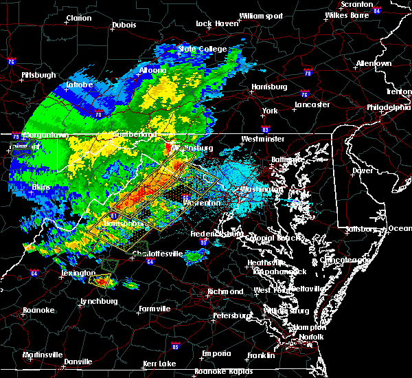 At 533 pm edt, severe thunderstorms were located along a line extending from near timberville to near bridgewater, moving east at 40 mph (radar indicated). Hazards include 60 mph wind gusts and half dollar size hail. Damaging winds will cause some trees and large branches to fall. this could injure those outdoors, as well as damage homes and vehicles. roadways may become blocked by downed trees. localized power outages are possible. Unsecured light objects may become projectiles. At 533 pm edt, severe thunderstorms were located along a line extending from near timberville to near bridgewater, moving east at 40 mph (radar indicated). Hazards include 60 mph wind gusts and half dollar size hail. Damaging winds will cause some trees and large branches to fall. this could injure those outdoors, as well as damage homes and vehicles. roadways may become blocked by downed trees. localized power outages are possible. Unsecured light objects may become projectiles.
|
| 4/15/2018 8:05 PM EDT |
 At 805 pm edt, a severe thunderstorm capable of producing a tornado was located near stuarts draft, or near waynesboro, moving north at 55 mph (radar indicated rotation). Hazards include tornado and quarter size hail. For those in the direct path of a tornado touchdown, flying debris will be dangerous to those caught without shelter. damage to roofs, siding, and windows may occur. mobile homes may be damaged or destroyed. Tree damage is likely. At 805 pm edt, a severe thunderstorm capable of producing a tornado was located near stuarts draft, or near waynesboro, moving north at 55 mph (radar indicated rotation). Hazards include tornado and quarter size hail. For those in the direct path of a tornado touchdown, flying debris will be dangerous to those caught without shelter. damage to roofs, siding, and windows may occur. mobile homes may be damaged or destroyed. Tree damage is likely.
|
| 7/14/2017 4:05 PM EDT | Tree down onto power lines near intersection of ore bank rd and browns gap rd in rockingham county VA, 3.1 miles W of Grottoes, VA |
| 7/14/2017 4:02 PM EDT | Tree down onto power lines near intersection of ore bank rd and browns gap rd in rockingham county VA, 3.1 miles W of Grottoes, VA |
| 7/14/2017 4:02 PM EDT | Tree down onto power lines at 100 7st in rockingham county VA, 0.3 miles WSW of Grottoes, VA |
| 7/14/2017 4:02 PM EDT |
 At 402 pm edt, a severe thunderstorm was located near grottoes, or 13 miles southeast of harrisonburg, moving southeast at 20 mph (radar indicated). Hazards include 60 mph wind gusts and quarter size hail. Damaging winds will cause some trees and large branches to fall. this could injure those outdoors, as well as damage homes and vehicles. roadways may become blocked by downed trees. localized power outages are possible. Unsecured light objects may become projectiles. At 402 pm edt, a severe thunderstorm was located near grottoes, or 13 miles southeast of harrisonburg, moving southeast at 20 mph (radar indicated). Hazards include 60 mph wind gusts and quarter size hail. Damaging winds will cause some trees and large branches to fall. this could injure those outdoors, as well as damage homes and vehicles. roadways may become blocked by downed trees. localized power outages are possible. Unsecured light objects may become projectiles.
|
| 3/1/2017 12:34 PM EST |
 At 1234 pm est, severe thunderstorms were located along a line extending from near front royal to near afton, moving east at 50 mph (radar indicated). Hazards include 60 mph wind gusts. Damaging winds will cause some trees and large branches to fall. this could injure those outdoors, as well as damage homes and vehicles. roadways may become blocked by downed trees. localized power outages are possible. unsecured light objects may become projectiles. Locations impacted include, waynesboro, front royal, strasburg, stuarts draft, crozet, luray, grottoes, shenandoah, massanutten, crimora, stanley, sherando, wintergreen, afton, big meadows, fishersville, elkton, lyndhurst, nellysford and new hope. At 1234 pm est, severe thunderstorms were located along a line extending from near front royal to near afton, moving east at 50 mph (radar indicated). Hazards include 60 mph wind gusts. Damaging winds will cause some trees and large branches to fall. this could injure those outdoors, as well as damage homes and vehicles. roadways may become blocked by downed trees. localized power outages are possible. unsecured light objects may become projectiles. Locations impacted include, waynesboro, front royal, strasburg, stuarts draft, crozet, luray, grottoes, shenandoah, massanutten, crimora, stanley, sherando, wintergreen, afton, big meadows, fishersville, elkton, lyndhurst, nellysford and new hope.
|
| 3/1/2017 12:16 PM EST |
 At 1215 pm est, severe thunderstorms were located along a line extending from woodstock to near stuarts draft, moving east at 50 mph (radar indicated). Hazards include 60 mph wind gusts. Damaging winds will cause some trees and large branches to fall. this could injure those outdoors, as well as damage homes and vehicles. roadways may become blocked by downed trees. localized power outages are possible. unsecured light objects may become projectiles. Locations impacted include, harrisonburg, staunton, waynesboro, front royal, strasburg, woodstock, stuarts draft, bridgewater, crozet, luray, broadway, grottoes, timberville, shenandoah, massanutten, crimora, mount jackson, stanley, sherando and wintergreen. At 1215 pm est, severe thunderstorms were located along a line extending from woodstock to near stuarts draft, moving east at 50 mph (radar indicated). Hazards include 60 mph wind gusts. Damaging winds will cause some trees and large branches to fall. this could injure those outdoors, as well as damage homes and vehicles. roadways may become blocked by downed trees. localized power outages are possible. unsecured light objects may become projectiles. Locations impacted include, harrisonburg, staunton, waynesboro, front royal, strasburg, woodstock, stuarts draft, bridgewater, crozet, luray, broadway, grottoes, timberville, shenandoah, massanutten, crimora, mount jackson, stanley, sherando and wintergreen.
|
| 3/1/2017 12:08 PM EST |
 At 1208 pm est, severe thunderstorms were located along a line extending from near mathias to near bells valley, moving east at 50 mph (radar indicated). Hazards include 60 mph wind gusts. Damaging winds will cause some trees and large branches to fall. this could injure those outdoors, as well as damage homes and vehicles. roadways may become blocked by downed trees. localized power outages are possible. unsecured light objects may become projectiles. Locations impacted include, harrisonburg, staunton, waynesboro, front royal, strasburg, woodstock, stuarts draft, bridgewater, crozet, luray, broadway, grottoes, timberville, shenandoah, massanutten, crimora, mount jackson, stanley, sherando and wintergreen. At 1208 pm est, severe thunderstorms were located along a line extending from near mathias to near bells valley, moving east at 50 mph (radar indicated). Hazards include 60 mph wind gusts. Damaging winds will cause some trees and large branches to fall. this could injure those outdoors, as well as damage homes and vehicles. roadways may become blocked by downed trees. localized power outages are possible. unsecured light objects may become projectiles. Locations impacted include, harrisonburg, staunton, waynesboro, front royal, strasburg, woodstock, stuarts draft, bridgewater, crozet, luray, broadway, grottoes, timberville, shenandoah, massanutten, crimora, mount jackson, stanley, sherando and wintergreen.
|
| 3/1/2017 11:56 AM EST |
 At 1156 am est, severe thunderstorms were located along a line extending from near rough run to near yost, moving east at 50 mph (radar indicated). Hazards include 60 mph wind gusts. Damaging winds will cause some trees and large branches to fall. this could injure those outdoors, as well as damage homes and vehicles. roadways may become blocked by downed trees. localized power outages are possible. Unsecured light objects may become projectiles. At 1156 am est, severe thunderstorms were located along a line extending from near rough run to near yost, moving east at 50 mph (radar indicated). Hazards include 60 mph wind gusts. Damaging winds will cause some trees and large branches to fall. this could injure those outdoors, as well as damage homes and vehicles. roadways may become blocked by downed trees. localized power outages are possible. Unsecured light objects may become projectiles.
|
| 8/31/2016 5:30 PM EDT | Large tree down near intersection of eastside hwy and patterson mill rd in augusta county VA, 3.4 miles N of Grottoes, VA |
| 7/27/2016 1:59 PM EDT |
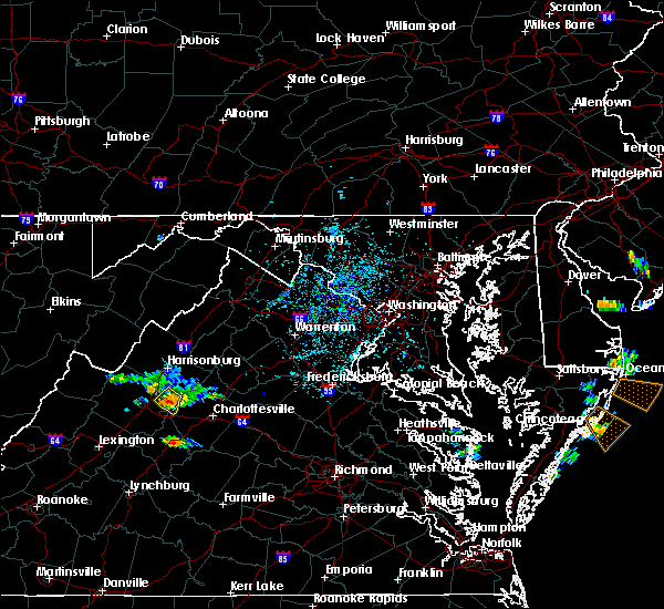 At 158 pm edt, a severe thunderstorm was located over crimora, or 7 miles northeast of waynesboro, moving southeast at 20 mph (radar indicated). Hazards include 60 mph wind gusts and quarter size hail. Damaging winds will cause some trees and large branches to fall. this could injure those outdoors, as well as damage homes and vehicles. roadways may become blocked by downed trees. localized power outages are possible. unsecured light objects may become projectiles. Locations impacted include, grottoes, crimora, new hope and hermitage. At 158 pm edt, a severe thunderstorm was located over crimora, or 7 miles northeast of waynesboro, moving southeast at 20 mph (radar indicated). Hazards include 60 mph wind gusts and quarter size hail. Damaging winds will cause some trees and large branches to fall. this could injure those outdoors, as well as damage homes and vehicles. roadways may become blocked by downed trees. localized power outages are possible. unsecured light objects may become projectiles. Locations impacted include, grottoes, crimora, new hope and hermitage.
|
| 7/27/2016 1:45 PM EDT |
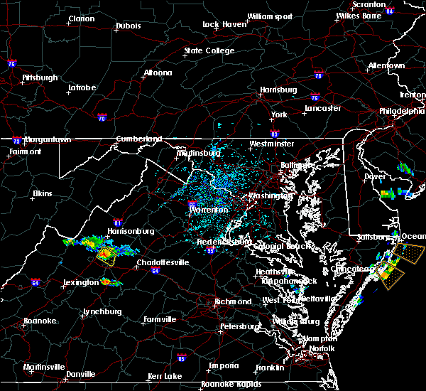 At 145 pm edt, a severe thunderstorm was located near crimora, or 8 miles east of staunton, moving southeast at 20 mph (radar indicated). Hazards include 60 mph wind gusts and quarter size hail. Damaging winds will cause some trees and large branches to fall. this could injure those outdoors, as well as damage homes and vehicles. roadways may become blocked by downed trees. localized power outages are possible. Unsecured light objects may become projectiles. At 145 pm edt, a severe thunderstorm was located near crimora, or 8 miles east of staunton, moving southeast at 20 mph (radar indicated). Hazards include 60 mph wind gusts and quarter size hail. Damaging winds will cause some trees and large branches to fall. this could injure those outdoors, as well as damage homes and vehicles. roadways may become blocked by downed trees. localized power outages are possible. Unsecured light objects may become projectiles.
|
| 7/16/2016 3:49 PM EDT |
 At 349 pm edt, a severe thunderstorm was located over grottoes, or 12 miles south of harrisonburg, moving northeast at 15 mph (radar indicated). Hazards include 60 mph wind gusts and quarter size hail. Damaging winds will cause some trees and large branches to fall. this could injure those outdoors, as well as damage homes and vehicles. roadways may become blocked by downed trees. localized power outages are possible. Unsecured light objects may become projectiles. At 349 pm edt, a severe thunderstorm was located over grottoes, or 12 miles south of harrisonburg, moving northeast at 15 mph (radar indicated). Hazards include 60 mph wind gusts and quarter size hail. Damaging winds will cause some trees and large branches to fall. this could injure those outdoors, as well as damage homes and vehicles. roadways may become blocked by downed trees. localized power outages are possible. Unsecured light objects may become projectiles.
|
| 6/28/2016 5:06 PM EDT |
 The severe thunderstorm warning for east central augusta county will expire at 515 pm edt, the storm which prompted the warning has weakened below severe limits, and no longer pose an immediate threat to life or property. therefore the warning will be allowed to expire. however small hail and gusty winds are still possible with this thunderstorm. The severe thunderstorm warning for east central augusta county will expire at 515 pm edt, the storm which prompted the warning has weakened below severe limits, and no longer pose an immediate threat to life or property. therefore the warning will be allowed to expire. however small hail and gusty winds are still possible with this thunderstorm.
|
| 6/28/2016 4:52 PM EDT |
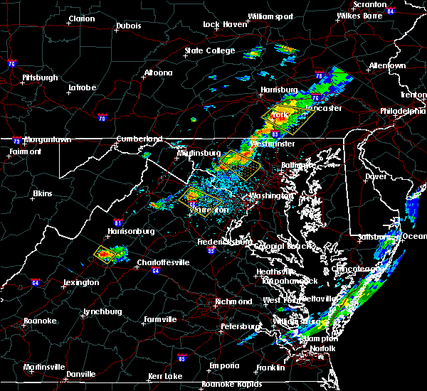 At 452 pm edt, a severe thunderstorm was located near crimora, or 9 miles northeast of staunton, moving southeast at 10 mph (radar indicated). Hazards include 60 mph wind gusts and quarter size hail. Damaging winds will cause some trees and large branches to fall. this could injure those outdoors, as well as damage homes and vehicles. roadways may become blocked by downed trees. localized power outages are possible. unsecured light objects may become projectiles. Locations impacted include, grottoes, crimora, verona, weyers cave, new hope, hermitage and staunton airport. At 452 pm edt, a severe thunderstorm was located near crimora, or 9 miles northeast of staunton, moving southeast at 10 mph (radar indicated). Hazards include 60 mph wind gusts and quarter size hail. Damaging winds will cause some trees and large branches to fall. this could injure those outdoors, as well as damage homes and vehicles. roadways may become blocked by downed trees. localized power outages are possible. unsecured light objects may become projectiles. Locations impacted include, grottoes, crimora, verona, weyers cave, new hope, hermitage and staunton airport.
|
| 6/28/2016 4:34 PM EDT |
 At 433 pm edt, a severe thunderstorm was located 7 miles northeast of staunton, and is nearly stationary (radar indicated). Hazards include 60 mph wind gusts and quarter size hail. Damaging winds will cause some trees and large branches to fall. this could injure those outdoors, as well as damage homes and vehicles. roadways may become blocked by downed trees. localized power outages are possible. Unsecured light objects may become projectiles. At 433 pm edt, a severe thunderstorm was located 7 miles northeast of staunton, and is nearly stationary (radar indicated). Hazards include 60 mph wind gusts and quarter size hail. Damaging winds will cause some trees and large branches to fall. this could injure those outdoors, as well as damage homes and vehicles. roadways may become blocked by downed trees. localized power outages are possible. Unsecured light objects may become projectiles.
|
| 6/21/2016 2:49 PM EDT |
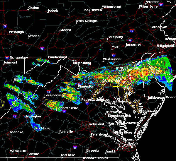 At 249 pm edt, a severe thunderstorm was located 8 miles southeast of massanutten, or 15 miles southeast of harrisonburg, moving east at 30 mph (radar indicated). Hazards include 70 mph wind gusts and ping pong ball size hail. Damaging winds will cause some trees and large branches to fall. this could injure those outdoors, as well as damage homes and vehicles. roadways may become blocked by downed trees. localized power outages are possible. unsecured light objects may become projectiles. Locations impacted include, grottoes, free union, saint george, shady grove, haneytown, mission home, dyke, boonesville and white hall. At 249 pm edt, a severe thunderstorm was located 8 miles southeast of massanutten, or 15 miles southeast of harrisonburg, moving east at 30 mph (radar indicated). Hazards include 70 mph wind gusts and ping pong ball size hail. Damaging winds will cause some trees and large branches to fall. this could injure those outdoors, as well as damage homes and vehicles. roadways may become blocked by downed trees. localized power outages are possible. unsecured light objects may become projectiles. Locations impacted include, grottoes, free union, saint george, shady grove, haneytown, mission home, dyke, boonesville and white hall.
|
| 6/21/2016 2:36 PM EDT |
 At 236 pm edt, a severe thunderstorm was located near grottoes, or 8 miles southeast of harrisonburg, moving east at 30 mph (radar indicated). Hazards include 60 mph wind gusts and quarter size hail. Damaging winds will cause some trees and large branches to fall. this could injure those outdoors, as well as damage homes and vehicles. roadways may become blocked by downed trees. localized power outages are possible. unsecured light objects may become projectiles. Locations impacted include, grottoes, free union, weyers cave, saint george, haneytown, mission home, white hall, montevideo, rocky bar, port republic, shady grove, dyke, boonesville and staunton airport. At 236 pm edt, a severe thunderstorm was located near grottoes, or 8 miles southeast of harrisonburg, moving east at 30 mph (radar indicated). Hazards include 60 mph wind gusts and quarter size hail. Damaging winds will cause some trees and large branches to fall. this could injure those outdoors, as well as damage homes and vehicles. roadways may become blocked by downed trees. localized power outages are possible. unsecured light objects may become projectiles. Locations impacted include, grottoes, free union, weyers cave, saint george, haneytown, mission home, white hall, montevideo, rocky bar, port republic, shady grove, dyke, boonesville and staunton airport.
|
| 6/21/2016 2:16 PM EDT |
 At 216 pm edt, a severe thunderstorm was located over bridgewater, or near harrisonburg, moving east at 30 mph (radar indicated). Hazards include 60 mph wind gusts and quarter size hail. Damaging winds will cause some trees and large branches to fall. this could injure those outdoors, as well as damage homes and vehicles. roadways may become blocked by downed trees. localized power outages are possible. Unsecured light objects may become projectiles. At 216 pm edt, a severe thunderstorm was located over bridgewater, or near harrisonburg, moving east at 30 mph (radar indicated). Hazards include 60 mph wind gusts and quarter size hail. Damaging winds will cause some trees and large branches to fall. this could injure those outdoors, as well as damage homes and vehicles. roadways may become blocked by downed trees. localized power outages are possible. Unsecured light objects may become projectiles.
|
| 6/16/2016 7:50 PM EDT |
 At 750 pm edt, severe thunderstorms were located along a line extending from front royal to near stanley to near waynesboro, moving east at 45 mph (radar indicated). Hazards include 60 mph wind gusts and quarter size hail. Damaging winds will cause some trees and large branches to fall. this could injure those outdoors, as well as damage homes and vehicles. roadways may become blocked by downed trees. localized power outages are possible. unsecured light objects may become projectiles. Locations impacted include, waynesboro, stuarts draft, luray, grottoes, shenandoah, massanutten, crimora, stanley, big meadows, fishersville, elkton, lyndhurst, greenville, new hope, hermitage, kimball, jollett, ida, glen echo and riverside. At 750 pm edt, severe thunderstorms were located along a line extending from front royal to near stanley to near waynesboro, moving east at 45 mph (radar indicated). Hazards include 60 mph wind gusts and quarter size hail. Damaging winds will cause some trees and large branches to fall. this could injure those outdoors, as well as damage homes and vehicles. roadways may become blocked by downed trees. localized power outages are possible. unsecured light objects may become projectiles. Locations impacted include, waynesboro, stuarts draft, luray, grottoes, shenandoah, massanutten, crimora, stanley, big meadows, fishersville, elkton, lyndhurst, greenville, new hope, hermitage, kimball, jollett, ida, glen echo and riverside.
|
| 6/16/2016 7:43 PM EDT | Large tree down on shawen lan in augusta county VA, 4.8 miles N of Grottoes, VA |
| 6/16/2016 7:22 PM EDT |
 At 722 pm edt, severe thunderstorms were located along a line extending from 7 miles southeast of wardensville to near broadway to 12 miles west of staunton, moving east at 45 mph (radar indicated). Hazards include 60 mph wind gusts and quarter size hail. Damaging winds will cause some trees and large branches to fall. this could injure those outdoors, as well as damage homes and vehicles. roadways may become blocked by downed trees. localized power outages are possible. unsecured light objects may become projectiles. Locations impacted include, harrisonburg, staunton, waynesboro, stuarts draft, bridgewater, luray, broadway, grottoes, timberville, shenandoah, massanutten, crimora, mount jackson, stanley, dale enterprise, big meadows, basye-bryce mountain, fishersville, woodstock and verona. At 722 pm edt, severe thunderstorms were located along a line extending from 7 miles southeast of wardensville to near broadway to 12 miles west of staunton, moving east at 45 mph (radar indicated). Hazards include 60 mph wind gusts and quarter size hail. Damaging winds will cause some trees and large branches to fall. this could injure those outdoors, as well as damage homes and vehicles. roadways may become blocked by downed trees. localized power outages are possible. unsecured light objects may become projectiles. Locations impacted include, harrisonburg, staunton, waynesboro, stuarts draft, bridgewater, luray, broadway, grottoes, timberville, shenandoah, massanutten, crimora, mount jackson, stanley, dale enterprise, big meadows, basye-bryce mountain, fishersville, woodstock and verona.
|
| 6/16/2016 6:55 PM EDT |
 At 654 pm edt, severe thunderstorms were located along a line extending from 6 miles east of moorefield to near brandywine to 6 miles northeast of burnsville, moving east at 45 mph (radar indicated). Hazards include 60 mph wind gusts and quarter size hail. Damaging winds will cause some trees and large branches to fall. this could injure those outdoors, as well as damage homes and vehicles. roadways may become blocked by downed trees. localized power outages are possible. Unsecured light objects may become projectiles. At 654 pm edt, severe thunderstorms were located along a line extending from 6 miles east of moorefield to near brandywine to 6 miles northeast of burnsville, moving east at 45 mph (radar indicated). Hazards include 60 mph wind gusts and quarter size hail. Damaging winds will cause some trees and large branches to fall. this could injure those outdoors, as well as damage homes and vehicles. roadways may become blocked by downed trees. localized power outages are possible. Unsecured light objects may become projectiles.
|
| 5/1/2016 7:15 PM EDT |
 At 715 pm edt, a severe thunderstorm was located over harrisonburg, moving southeast at 25 mph (radar indicated). Hazards include 60 mph wind gusts and quarter size hail. Hail damage to vehicles is expected. expect wind damage to roofs, siding, and trees. Locations impacted include, harrisonburg, grottoes, massanutten, dale enterprise, dayton, mcgaheysville, montevideo, pleasant valley, port republic, singers glen, hinton, penn laird, keezletown and linville. At 715 pm edt, a severe thunderstorm was located over harrisonburg, moving southeast at 25 mph (radar indicated). Hazards include 60 mph wind gusts and quarter size hail. Hail damage to vehicles is expected. expect wind damage to roofs, siding, and trees. Locations impacted include, harrisonburg, grottoes, massanutten, dale enterprise, dayton, mcgaheysville, montevideo, pleasant valley, port republic, singers glen, hinton, penn laird, keezletown and linville.
|
| 5/1/2016 6:59 PM EDT |
 At 659 pm edt, a severe thunderstorm was located near dale enterprise, or near harrisonburg, moving southeast at 25 mph (radar indicated). Hazards include 60 mph wind gusts and quarter size hail. Hail damage to vehicles is expected. Expect wind damage to roofs, siding, and trees. At 659 pm edt, a severe thunderstorm was located near dale enterprise, or near harrisonburg, moving southeast at 25 mph (radar indicated). Hazards include 60 mph wind gusts and quarter size hail. Hail damage to vehicles is expected. Expect wind damage to roofs, siding, and trees.
|
| 9/9/2015 6:51 PM EDT |
 The severe thunderstorm warning for east central augusta, northwestern albemarle and northern nelson counties and the city of waynesboro will expire at 700 pm edt, the storm which prompted the warning has weakened below severe limits, and no longer poses an immediate threat to life or property. therefore the warning will be allowed to expire. however gusty winds and heavy rain are still possible with this thunderstorm. The severe thunderstorm warning for east central augusta, northwestern albemarle and northern nelson counties and the city of waynesboro will expire at 700 pm edt, the storm which prompted the warning has weakened below severe limits, and no longer poses an immediate threat to life or property. therefore the warning will be allowed to expire. however gusty winds and heavy rain are still possible with this thunderstorm.
|
| 9/9/2015 6:30 PM EDT |
 At 630 pm edt, doppler radar indicated a severe thunderstorm capable of producing damaging winds in excess of 60 mph. this storm was located over crimora, or near waynesboro, moving northeast at 15 mph. locations impacted include, waynesboro, crimora, afton, new hope and hermitage. At 630 pm edt, doppler radar indicated a severe thunderstorm capable of producing damaging winds in excess of 60 mph. this storm was located over crimora, or near waynesboro, moving northeast at 15 mph. locations impacted include, waynesboro, crimora, afton, new hope and hermitage.
|
| 9/9/2015 6:12 PM EDT |
 At 612 pm edt, doppler radar indicated a severe thunderstorm capable of producing quarter size hail and damaging winds in excess of 60 mph. this storm was located over waynesboro, and moving northeast at 15 mph. At 612 pm edt, doppler radar indicated a severe thunderstorm capable of producing quarter size hail and damaging winds in excess of 60 mph. this storm was located over waynesboro, and moving northeast at 15 mph.
|
| 7/8/2012 4:02 PM EDT | Tree down blocking road on east side hwy in augusta county VA, 0.7 miles NNW of Grottoes, VA |
| 6/29/2012 10:15 PM EDT | Storm damage reported in rockingham county VA, 1.6 miles ESE of Grottoes, VA |
| 6/29/2012 9:18 PM EDT | Many large trees dow in rockingham county VA, 1.5 miles NNW of Grottoes, VA |
| 6/28/2012 9:18 PM EDT | Many large trees dow in rockingham county VA, 1.5 miles NNW of Grottoes, VA |
Hail Maps for Grottoes, VA


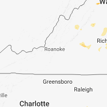

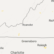


Connect with Interactive Hail Maps