

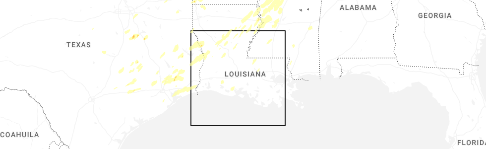
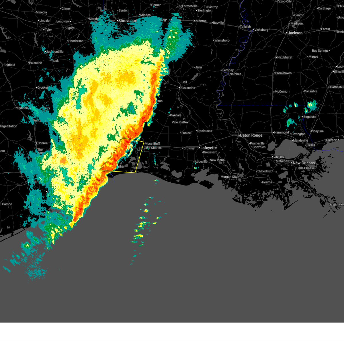
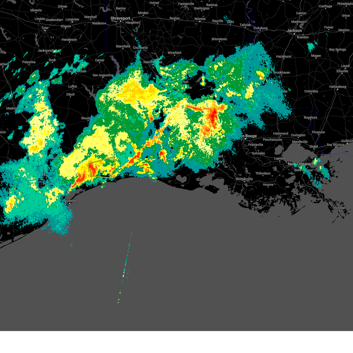
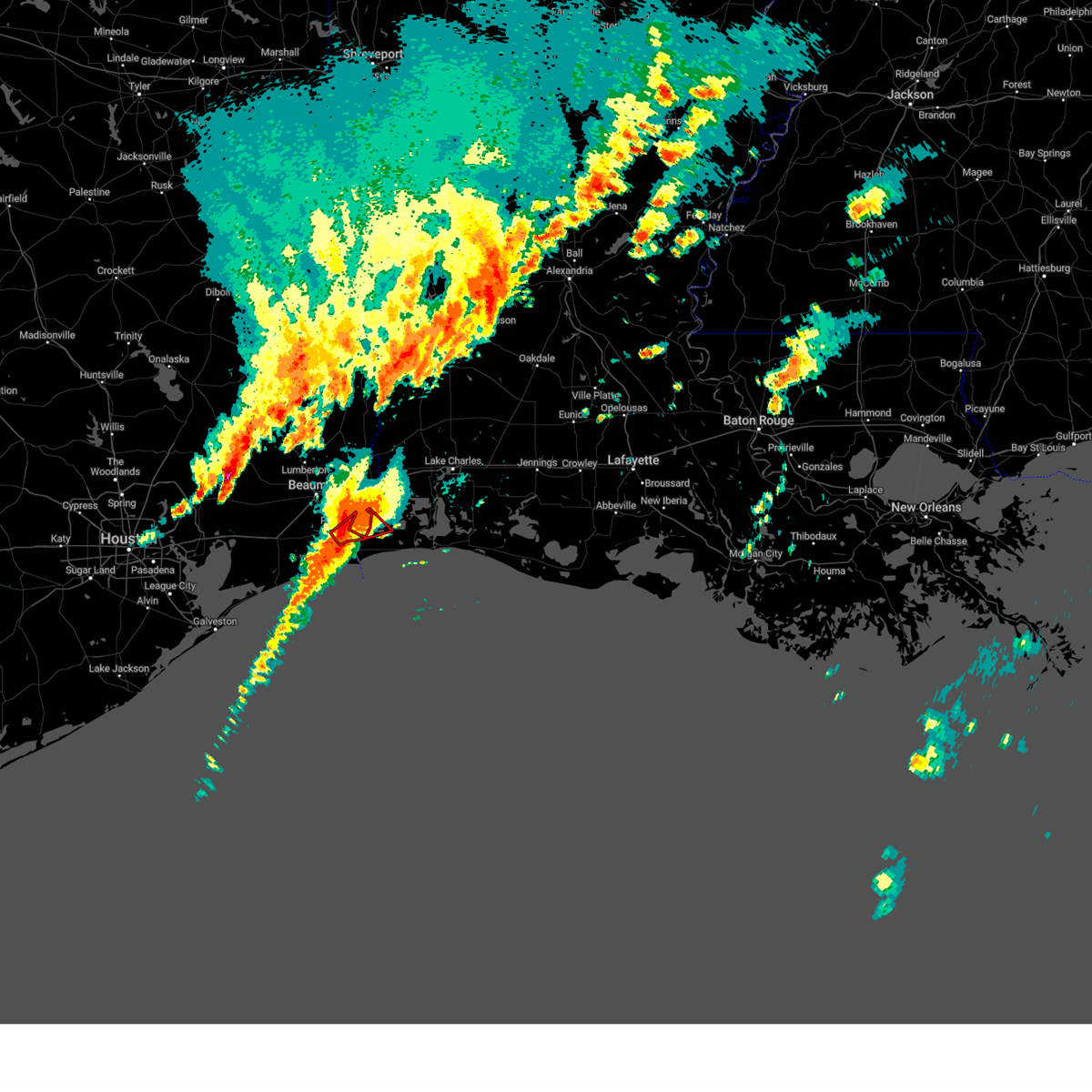
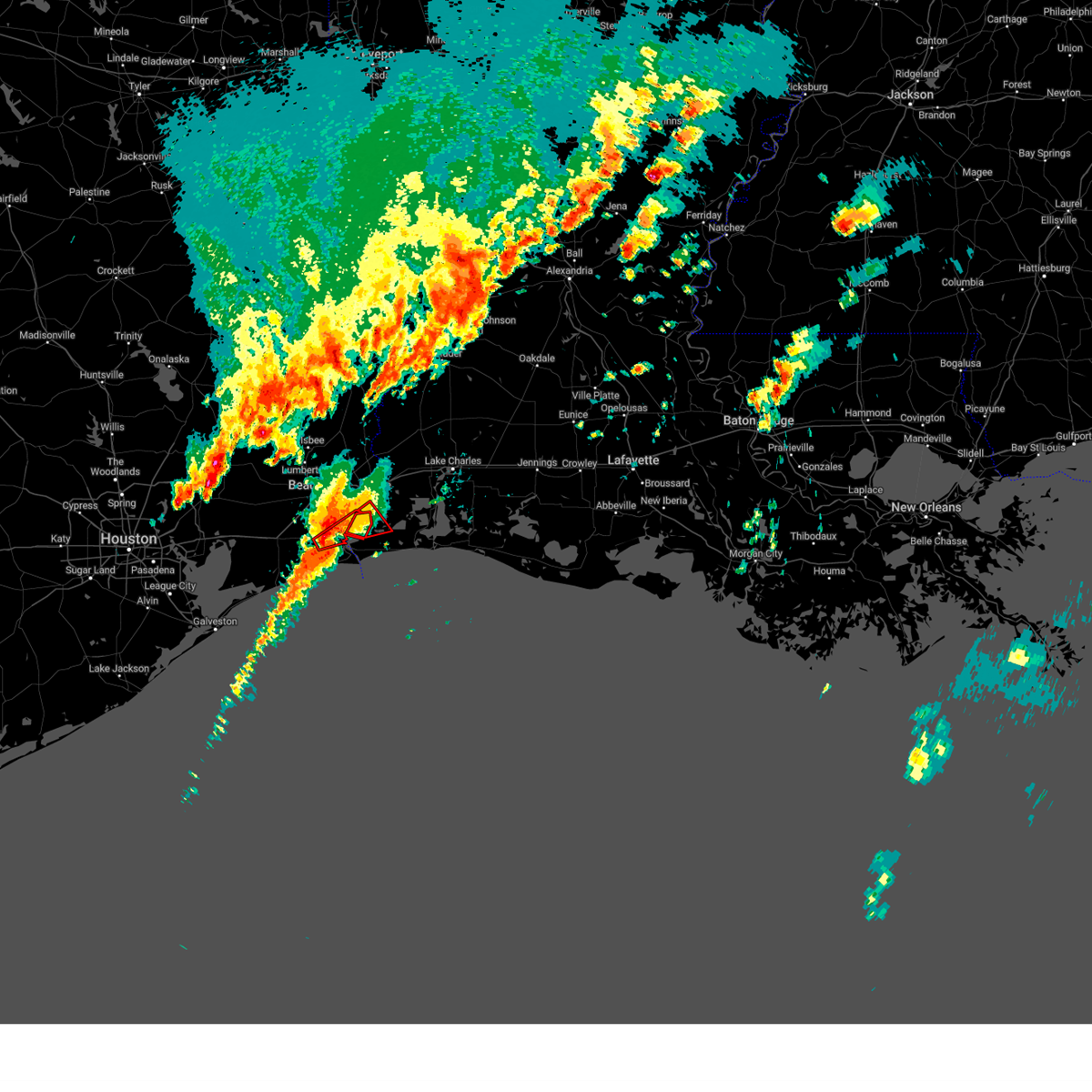
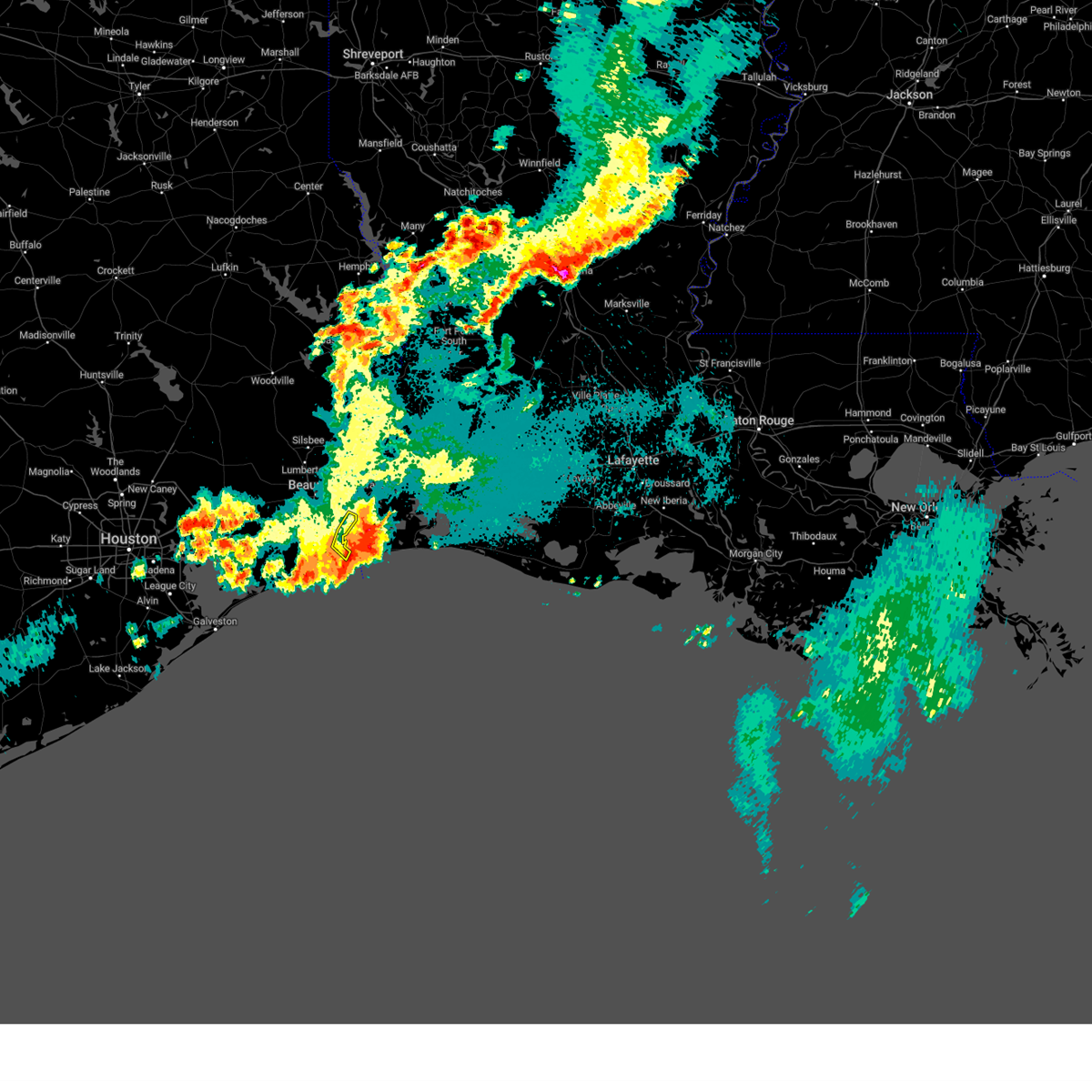
Hail Map for Groves, TX
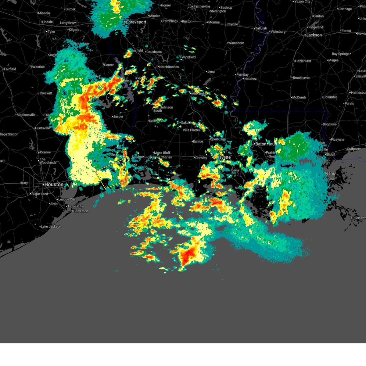
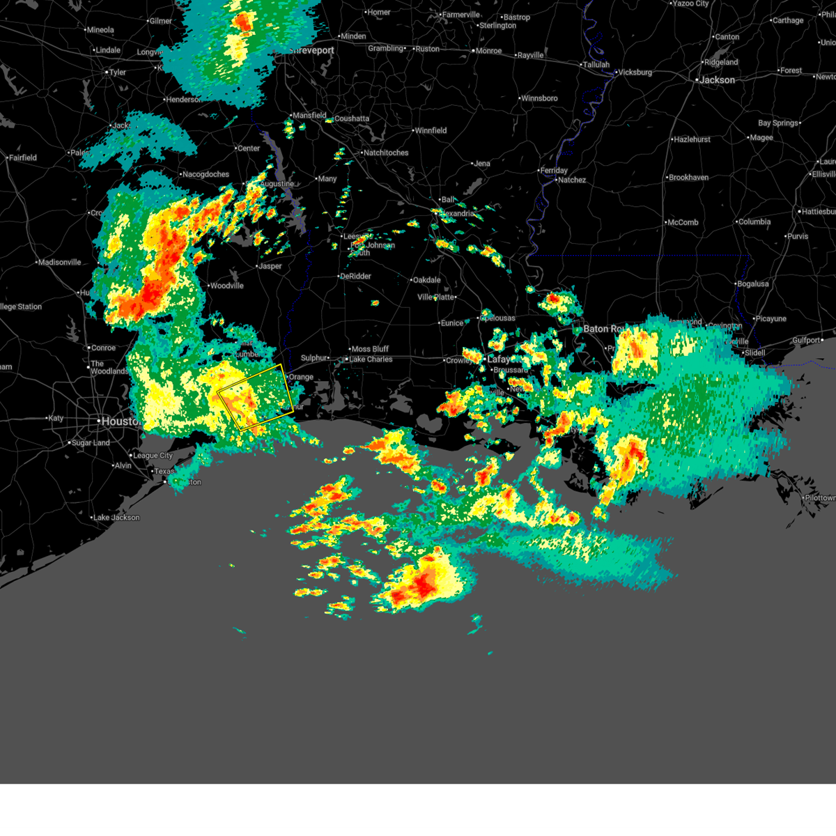
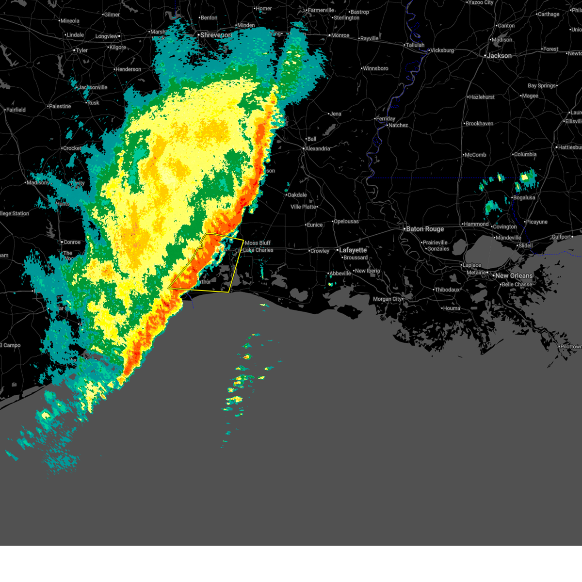
The Groves, TX area has had 1 report of on-the-ground hail by trained spotters, and has been under severe weather warnings 7 times during the past 12 months. Doppler radar has detected hail at or near Groves, TX on 39 occasions.
| Name: | Groves, TX |
| Where Located: | 15 miles SW of Beaumont, TX |
| Map: | Google Map for Groves, TX |
| Population: | 16144 |
| Housing Units: | 7037 |
| More Info: | Search Google for Groves, TX |
1
The Top Recent Hail Date for Groves, TX is Saturday, December 28, 2024 (15th out of 39)
Hail and Wind Damage Spotted near Groves, TX
| Date / Time | Report Details |
|---|---|
| 5/23/2026 8:21 AM CDT |
 The storm which prompted the warning has weakened below severe limits, and no longer poses an immediate threat to life or property. therefore, the warning will be allowed to expire. however heavy rain is still possible with this thunderstorm. The storm which prompted the warning has weakened below severe limits, and no longer poses an immediate threat to life or property. therefore, the warning will be allowed to expire. however heavy rain is still possible with this thunderstorm.
|
| 5/23/2026 7:49 AM CDT |
 Svrlch the national weather service in lake charles has issued a * severe thunderstorm warning for, northwestern cameron parish in southwestern louisiana, central jefferson county in southeastern texas, orange county in southeastern texas, * until 830 am cdt. * at 749 am cdt, a severe thunderstorm was located over la belle, or 8 miles east of hamshire, moving east at 35 mph (radar indicated). Hazards include 60 mph wind gusts. expect damage to roofs, siding, and trees Svrlch the national weather service in lake charles has issued a * severe thunderstorm warning for, northwestern cameron parish in southwestern louisiana, central jefferson county in southeastern texas, orange county in southeastern texas, * until 830 am cdt. * at 749 am cdt, a severe thunderstorm was located over la belle, or 8 miles east of hamshire, moving east at 35 mph (radar indicated). Hazards include 60 mph wind gusts. expect damage to roofs, siding, and trees
|
| 2/14/2026 8:26 PM CST |
 the severe thunderstorm warning has been cancelled and is no longer in effect the severe thunderstorm warning has been cancelled and is no longer in effect
|
| 2/14/2026 8:26 PM CST |
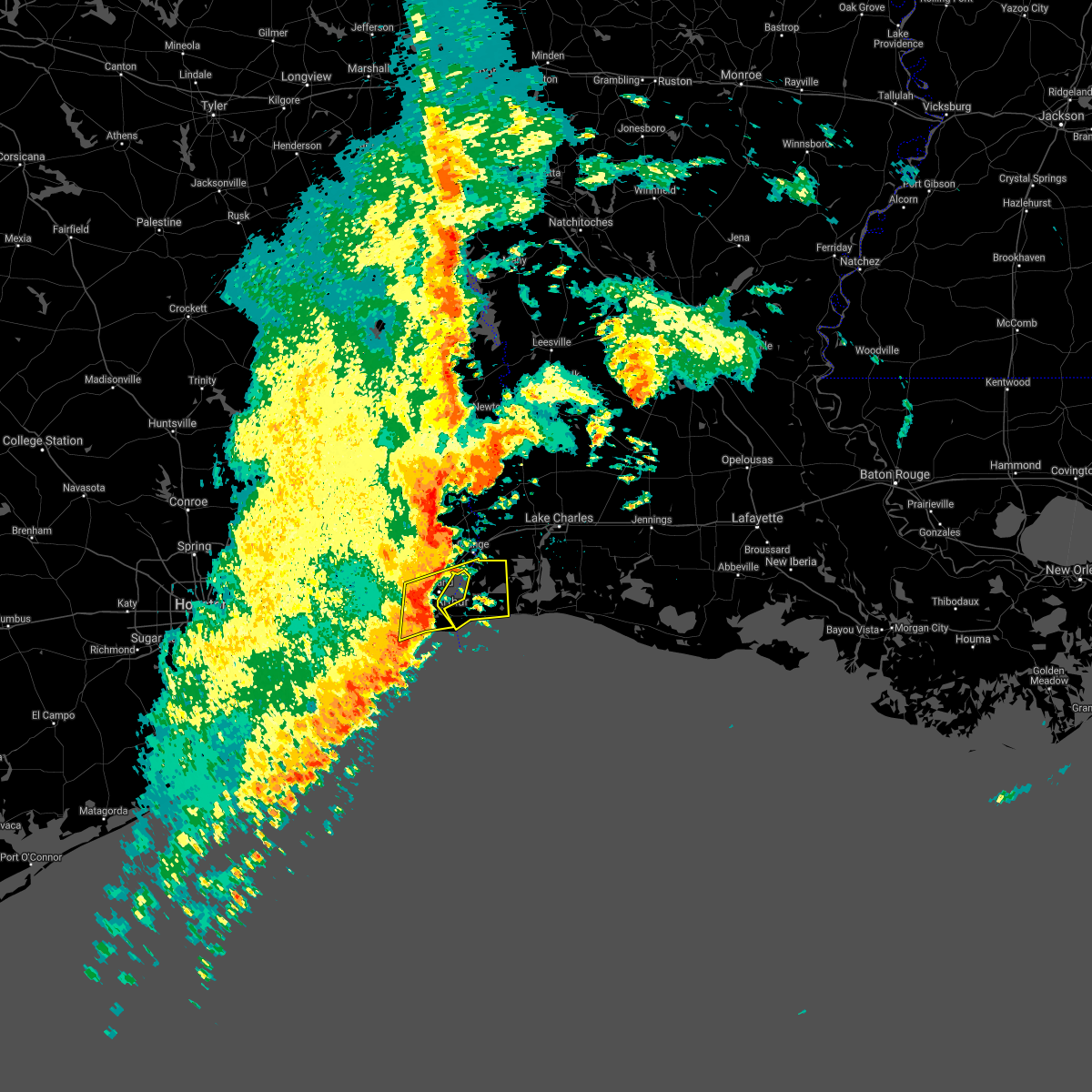
 At 825 pm cst, a severe thunderstorm was located near sabine national wildlife, moving east at 40 mph (radar indicated). Hazards include 70 mph wind gusts. Expect considerable tree damage. damage is likely to mobile homes, roofs, and outbuildings. Locations impacted include, lake charles, port arthur, sulphur, orange, nederland, groves, port neches, bridge city, westlake, west orange, vinton, moss bluff, starks, sabine national wildlife, lunita, port acres, toomey, edgerly, holly beach, and carlyss. At 825 pm cst, a severe thunderstorm was located near sabine national wildlife, moving east at 40 mph (radar indicated). Hazards include 70 mph wind gusts. Expect considerable tree damage. damage is likely to mobile homes, roofs, and outbuildings. Locations impacted include, lake charles, port arthur, sulphur, orange, nederland, groves, port neches, bridge city, westlake, west orange, vinton, moss bluff, starks, sabine national wildlife, lunita, port acres, toomey, edgerly, holly beach, and carlyss.
|
| 2/14/2026 7:59 PM CST |
 Svrlch the national weather service in lake charles has issued a * severe thunderstorm warning for, northwestern cameron parish in southwestern louisiana, southwestern beauregard parish in southwestern louisiana, calcasieu parish in southwestern louisiana, northeastern jefferson county in southeastern texas, southwestern newton county in southeastern texas, orange county in southeastern texas, southern jasper county in southeastern texas, * until 845 pm cst. * at 759 pm cst, a severe thunderstorm was located over orangefield, or over bridge city, moving east at 40 mph (radar indicated). Hazards include 70 mph wind gusts. Expect considerable tree damage. Damage is likely to mobile homes, roofs, and outbuildings. Svrlch the national weather service in lake charles has issued a * severe thunderstorm warning for, northwestern cameron parish in southwestern louisiana, southwestern beauregard parish in southwestern louisiana, calcasieu parish in southwestern louisiana, northeastern jefferson county in southeastern texas, southwestern newton county in southeastern texas, orange county in southeastern texas, southern jasper county in southeastern texas, * until 845 pm cst. * at 759 pm cst, a severe thunderstorm was located over orangefield, or over bridge city, moving east at 40 mph (radar indicated). Hazards include 70 mph wind gusts. Expect considerable tree damage. Damage is likely to mobile homes, roofs, and outbuildings.
|
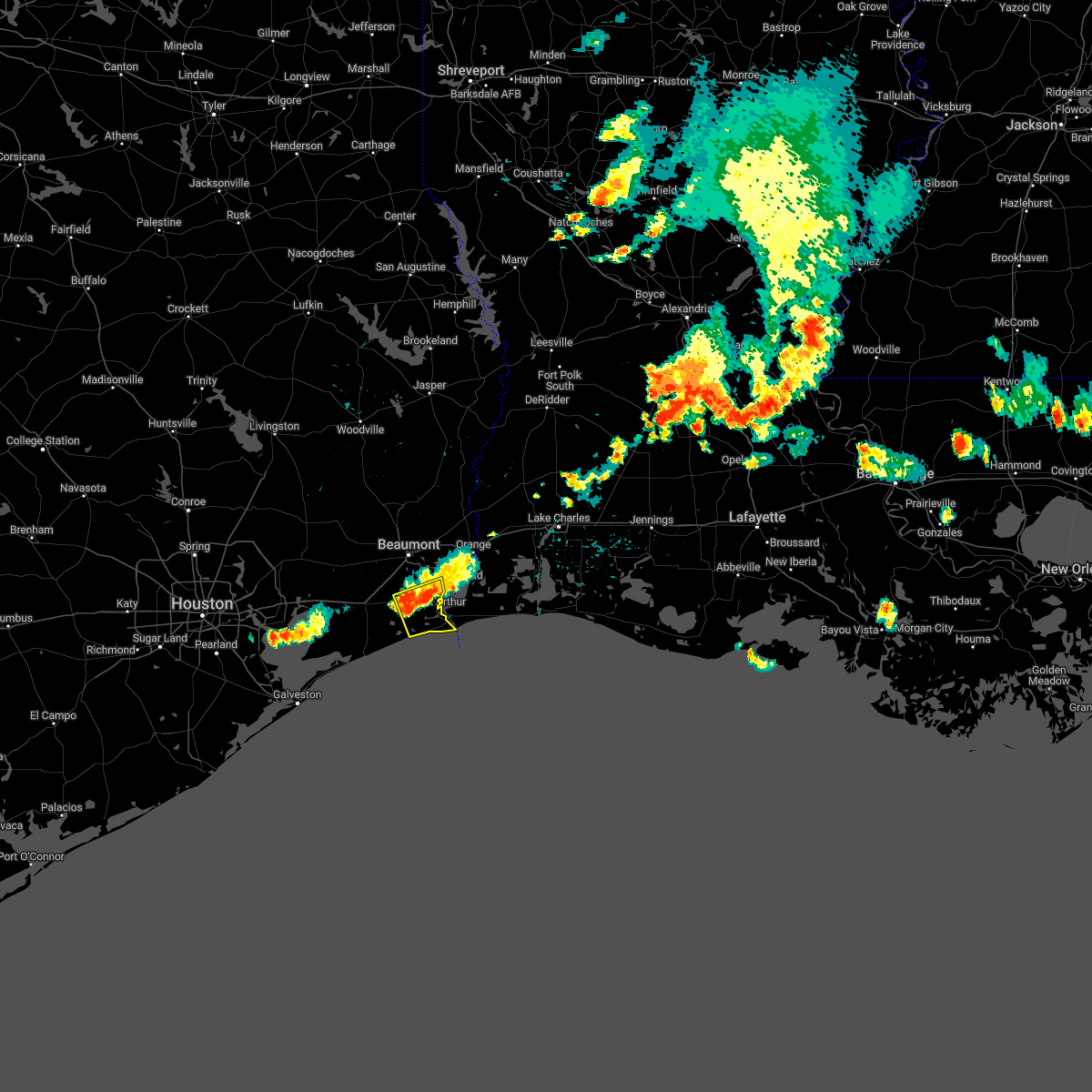
| 10/25/2025 5:39 AM CDT | Svrlch the national weather service in lake charles has issued a * severe thunderstorm warning for, northwestern cameron parish in southwestern louisiana, southwestern calcasieu parish in southwestern louisiana, eastern jefferson county in southeastern texas, orange county in southeastern texas, * until 645 am cdt. * at 539 am cdt, severe thunderstorms were located along a line extending from pine forest to 10 miles west of sabine pass, moving northeast at 35 mph (radar indicated). Hazards include 60 mph wind gusts. expect damage to roofs, siding, and trees |
| 10/25/2025 4:51 AM CDT | Svrlch the national weather service in lake charles has issued a * severe thunderstorm warning for, jefferson county in southeastern texas, orange county in southeastern texas, * until 545 am cdt. * at 451 am cdt, severe thunderstorms were located along a line extending from near devers to near smith point, moving east at 35 mph (radar indicated). Hazards include 60 mph wind gusts and penny size hail. expect damage to roofs, siding, and trees |
| 5/2/2025 9:21 PM CDT |
 The storm which prompted the warning has weakened below severe limits, and no longer poses an immediate threat to life or property. therefore, the warning will be allowed to expire. however heavy rain is still possible with this thunderstorm. The storm which prompted the warning has weakened below severe limits, and no longer poses an immediate threat to life or property. therefore, the warning will be allowed to expire. however heavy rain is still possible with this thunderstorm.
|
| 5/2/2025 9:12 PM CDT |
 At 912 pm cdt, a severe thunderstorm was located over port acres, or near nederland, moving east at 30 mph (radar indicated). Hazards include 60 mph wind gusts and penny size hail. Expect damage to roofs, siding, and trees. Locations impacted include, port arthur, groves, la belle, nederland, port neches, port acres, central gardens, southeast texas regional airport, beaumont, bridge city, and vidor. At 912 pm cdt, a severe thunderstorm was located over port acres, or near nederland, moving east at 30 mph (radar indicated). Hazards include 60 mph wind gusts and penny size hail. Expect damage to roofs, siding, and trees. Locations impacted include, port arthur, groves, la belle, nederland, port neches, port acres, central gardens, southeast texas regional airport, beaumont, bridge city, and vidor.
|
| 5/2/2025 8:50 PM CDT |
 Svrlch the national weather service in lake charles has issued a * severe thunderstorm warning for, central jefferson county in southeastern texas, southwestern orange county in southeastern texas, * until 930 pm cdt. * at 850 pm cdt, a severe thunderstorm was located near fannett, or 7 miles northeast of hamshire, moving east at 35 mph (radar indicated). Hazards include 60 mph wind gusts and penny size hail. expect damage to roofs, siding, and trees Svrlch the national weather service in lake charles has issued a * severe thunderstorm warning for, central jefferson county in southeastern texas, southwestern orange county in southeastern texas, * until 930 pm cdt. * at 850 pm cdt, a severe thunderstorm was located near fannett, or 7 miles northeast of hamshire, moving east at 35 mph (radar indicated). Hazards include 60 mph wind gusts and penny size hail. expect damage to roofs, siding, and trees
|
| 3/24/2025 4:38 AM CDT |
 At 438 am cdt, severe thunderstorms were located along a line extending from near west orange to 14 miles southeast of sabine pass, moving east at 50 mph (radar indicated). Hazards include 60 mph wind gusts and nickel size hail. Expect damage to roofs, siding, and trees. Locations impacted include, port arthur, groves, sabine pass, port neches, bridge city, west orange, and orange. At 438 am cdt, severe thunderstorms were located along a line extending from near west orange to 14 miles southeast of sabine pass, moving east at 50 mph (radar indicated). Hazards include 60 mph wind gusts and nickel size hail. Expect damage to roofs, siding, and trees. Locations impacted include, port arthur, groves, sabine pass, port neches, bridge city, west orange, and orange.
|
| 3/24/2025 4:24 AM CDT |
 At 424 am cdt, severe thunderstorms were located along a line extending from near groves to 16 miles southwest of sabine pass, moving east at 55 mph (radar indicated). Hazards include 60 mph wind gusts and nickel size hail. Expect damage to roofs, siding, and trees. Locations impacted include, port arthur, groves, port acres, sea rim state park, central gardens, bridge city, sabine pass, nederland, port neches, southeast texas regional airport, west orange, orange, and beaumont. At 424 am cdt, severe thunderstorms were located along a line extending from near groves to 16 miles southwest of sabine pass, moving east at 55 mph (radar indicated). Hazards include 60 mph wind gusts and nickel size hail. Expect damage to roofs, siding, and trees. Locations impacted include, port arthur, groves, port acres, sea rim state park, central gardens, bridge city, sabine pass, nederland, port neches, southeast texas regional airport, west orange, orange, and beaumont.
|
| 3/24/2025 3:56 AM CDT |
 Svrlch the national weather service in lake charles has issued a * severe thunderstorm warning for, jefferson county in southeastern texas, southern orange county in southeastern texas, * until 445 am cdt. * at 356 am cdt, severe thunderstorms were located along a line extending from near hamshire to near rollover pass, moving east at 45 mph (radar indicated). Hazards include 60 mph wind gusts and nickel size hail. expect damage to roofs, siding, and trees Svrlch the national weather service in lake charles has issued a * severe thunderstorm warning for, jefferson county in southeastern texas, southern orange county in southeastern texas, * until 445 am cdt. * at 356 am cdt, severe thunderstorms were located along a line extending from near hamshire to near rollover pass, moving east at 45 mph (radar indicated). Hazards include 60 mph wind gusts and nickel size hail. expect damage to roofs, siding, and trees
|
| 12/28/2024 3:54 PM CST |
 the tornado warning has been cancelled and is no longer in effect the tornado warning has been cancelled and is no longer in effect
|
| 12/28/2024 3:54 PM CST |
 At 353 pm cst, a confirmed large and extremely dangerous tornado was located over port arthur, moving east at 30 mph. this is a particularly dangerous situation. take cover now! (radar confirmed tornado). Hazards include damaging tornado. You are in a life-threatening situation. flying debris may be deadly to those caught without shelter. mobile homes will be destroyed. considerable damage to homes, businesses, and vehicles is likely and complete destruction is possible. The tornado will be near, port arthur and groves around 400 pm cst. At 353 pm cst, a confirmed large and extremely dangerous tornado was located over port arthur, moving east at 30 mph. this is a particularly dangerous situation. take cover now! (radar confirmed tornado). Hazards include damaging tornado. You are in a life-threatening situation. flying debris may be deadly to those caught without shelter. mobile homes will be destroyed. considerable damage to homes, businesses, and vehicles is likely and complete destruction is possible. The tornado will be near, port arthur and groves around 400 pm cst.
|
| 12/28/2024 3:41 PM CST |
 Torlch the national weather service in lake charles has issued a * tornado warning for, northwestern cameron parish in southwestern louisiana, east central jefferson county in southeastern texas, southeastern orange county in southeastern texas, * until 430 pm cst. * at 340 pm cst, a confirmed large and extremely dangerous tornado was located 7 miles southeast of la belle, or 9 miles west of port arthur, moving northeast at 35 mph. this is a particularly dangerous situation. take cover now! (radar confirmed tornado). Hazards include damaging tornado. You are in a life-threatening situation. flying debris may be deadly to those caught without shelter. mobile homes will be destroyed. considerable damage to homes, businesses, and vehicles is likely and complete destruction is possible. the tornado will be near, port arthur around 345 pm cst. groves around 350 pm cst. Orange around 410 pm cst. Torlch the national weather service in lake charles has issued a * tornado warning for, northwestern cameron parish in southwestern louisiana, east central jefferson county in southeastern texas, southeastern orange county in southeastern texas, * until 430 pm cst. * at 340 pm cst, a confirmed large and extremely dangerous tornado was located 7 miles southeast of la belle, or 9 miles west of port arthur, moving northeast at 35 mph. this is a particularly dangerous situation. take cover now! (radar confirmed tornado). Hazards include damaging tornado. You are in a life-threatening situation. flying debris may be deadly to those caught without shelter. mobile homes will be destroyed. considerable damage to homes, businesses, and vehicles is likely and complete destruction is possible. the tornado will be near, port arthur around 345 pm cst. groves around 350 pm cst. Orange around 410 pm cst.
|
| 5/28/2024 2:07 PM CDT |
 the severe thunderstorm warning has been cancelled and is no longer in effect the severe thunderstorm warning has been cancelled and is no longer in effect
|
| 5/28/2024 2:07 PM CDT |
 At 207 pm cdt, severe thunderstorms were located along a line extending from near buna to near pine forest to near nome, moving southeast at 35 mph (radar indicated). Hazards include 60 mph wind gusts and quarter size hail. Hail damage to vehicles is expected. expect wind damage to roofs, siding, and trees. Locations impacted include, beaumont, port arthur, orange, nederland, groves, port neches, lumberton, vidor, bridge city, silsbee, west orange, sour lake, deweyville, evadale, central gardens, mauriceville, buna, bevil oaks, rose city, and pine forest. At 207 pm cdt, severe thunderstorms were located along a line extending from near buna to near pine forest to near nome, moving southeast at 35 mph (radar indicated). Hazards include 60 mph wind gusts and quarter size hail. Hail damage to vehicles is expected. expect wind damage to roofs, siding, and trees. Locations impacted include, beaumont, port arthur, orange, nederland, groves, port neches, lumberton, vidor, bridge city, silsbee, west orange, sour lake, deweyville, evadale, central gardens, mauriceville, buna, bevil oaks, rose city, and pine forest.
|
| 5/28/2024 1:37 PM CDT |
 Svrlch the national weather service in lake charles has issued a * severe thunderstorm warning for, jefferson county in southeastern texas, southeastern tyler county in southeastern texas, southwestern newton county in southeastern texas, hardin county in southeastern texas, orange county in southeastern texas, southeastern jasper county in southeastern texas, * until 215 pm cdt. * at 136 pm cdt, severe thunderstorms were located along a line extending from 6 miles southwest of spurger to near kountze to hardin, moving southeast at 35 mph (radar indicated). Hazards include 60 mph wind gusts and quarter size hail. Hail damage to vehicles is expected. Expect wind damage to roofs, siding, and trees. Svrlch the national weather service in lake charles has issued a * severe thunderstorm warning for, jefferson county in southeastern texas, southeastern tyler county in southeastern texas, southwestern newton county in southeastern texas, hardin county in southeastern texas, orange county in southeastern texas, southeastern jasper county in southeastern texas, * until 215 pm cdt. * at 136 pm cdt, severe thunderstorms were located along a line extending from 6 miles southwest of spurger to near kountze to hardin, moving southeast at 35 mph (radar indicated). Hazards include 60 mph wind gusts and quarter size hail. Hail damage to vehicles is expected. Expect wind damage to roofs, siding, and trees.
|
| 5/13/2024 4:21 PM CDT |
 At 421 pm cdt, severe thunderstorms were located along a line extending from 6 miles south of toomey to 13 miles south of sabine pass, moving east at 50 mph (radar indicated). Hazards include 60 mph wind gusts. Expect damage to roofs, siding, and trees. Locations impacted include, port arthur, orange, groves, bridge city, sabine pass, johnsons bayou, sabine national wildlife, and hackberry. At 421 pm cdt, severe thunderstorms were located along a line extending from 6 miles south of toomey to 13 miles south of sabine pass, moving east at 50 mph (radar indicated). Hazards include 60 mph wind gusts. Expect damage to roofs, siding, and trees. Locations impacted include, port arthur, orange, groves, bridge city, sabine pass, johnsons bayou, sabine national wildlife, and hackberry.
|
| 5/13/2024 3:51 PM CDT |
 Svrlch the national weather service in lake charles has issued a * severe thunderstorm warning for, northwestern cameron parish in southwestern louisiana, jefferson county in southeastern texas, southern orange county in southeastern texas, * until 445 pm cdt. * at 351 pm cdt, severe thunderstorms were located along a line extending from near vidor to 6 miles northwest of high island, moving east at 35 mph (radar indicated). Hazards include 60 mph wind gusts. expect damage to roofs, siding, and trees Svrlch the national weather service in lake charles has issued a * severe thunderstorm warning for, northwestern cameron parish in southwestern louisiana, jefferson county in southeastern texas, southern orange county in southeastern texas, * until 445 pm cdt. * at 351 pm cdt, severe thunderstorms were located along a line extending from near vidor to 6 miles northwest of high island, moving east at 35 mph (radar indicated). Hazards include 60 mph wind gusts. expect damage to roofs, siding, and trees
|
| 5/12/2024 1:52 PM CDT |
 The storm which prompted the warning has weakened below severe limits, and has exited the warned area. therefore, the warning will be allowed to expire. a tornado watch remains in effect until 700 pm cdt for southwestern louisiana, and southeastern texas. The storm which prompted the warning has weakened below severe limits, and has exited the warned area. therefore, the warning will be allowed to expire. a tornado watch remains in effect until 700 pm cdt for southwestern louisiana, and southeastern texas.
|
| 5/12/2024 1:28 PM CDT |
 Svrlch the national weather service in lake charles has issued a * severe thunderstorm warning for, northwestern cameron parish in southwestern louisiana, southwestern calcasieu parish in southwestern louisiana, east central jefferson county in southeastern texas, southeastern orange county in southeastern texas, * until 230 pm cdt. * at 128 pm cdt, a severe thunderstorm was located 7 miles southeast of groves, moving east at 45 mph (radar indicated). Hazards include two inch hail and 60 mph wind gusts. People and animals outdoors will be injured. expect hail damage to roofs, siding, windows, and vehicles. Expect wind damage to roofs, siding, and trees. Svrlch the national weather service in lake charles has issued a * severe thunderstorm warning for, northwestern cameron parish in southwestern louisiana, southwestern calcasieu parish in southwestern louisiana, east central jefferson county in southeastern texas, southeastern orange county in southeastern texas, * until 230 pm cdt. * at 128 pm cdt, a severe thunderstorm was located 7 miles southeast of groves, moving east at 45 mph (radar indicated). Hazards include two inch hail and 60 mph wind gusts. People and animals outdoors will be injured. expect hail damage to roofs, siding, windows, and vehicles. Expect wind damage to roofs, siding, and trees.
|
| 5/12/2024 1:22 PM CDT |
 At 122 pm cdt, a severe thunderstorm was located over groves, moving east at 35 mph. this is a destructive storm for port arthur, groves and sabine lake (radar indicated). Hazards include baseball size hail and 60 mph wind gusts. People and animals outdoors will be severely injured. expect shattered windows, extensive damage to roofs, siding, and vehicles. Locations impacted include, beaumont, port arthur, orange, nederland, groves, port neches, bridge city, west orange, central gardens, pinehurst, port acres, orangefield, and southeast texas regional airport. At 122 pm cdt, a severe thunderstorm was located over groves, moving east at 35 mph. this is a destructive storm for port arthur, groves and sabine lake (radar indicated). Hazards include baseball size hail and 60 mph wind gusts. People and animals outdoors will be severely injured. expect shattered windows, extensive damage to roofs, siding, and vehicles. Locations impacted include, beaumont, port arthur, orange, nederland, groves, port neches, bridge city, west orange, central gardens, pinehurst, port acres, orangefield, and southeast texas regional airport.
|
| 5/12/2024 1:20 PM CDT | Hen Egg sized hail reported 0.7 miles ENE of Groves, TX, hail from golfball to hen egg size reported at groves. |
| 5/12/2024 1:10 PM CDT |
 At 110 pm cdt, a severe thunderstorm was located over central gardens, moving northeast at 30 mph. this is a destructive storm for nederland, groves, port neches, and port arthur! (radar indicated). Hazards include baseball size hail and 60 mph wind gusts. People and animals outdoors will be severely injured. expect shattered windows, extensive damage to roofs, siding, and vehicles. Locations impacted include, beaumont, port arthur, orange, nederland, groves, port neches, vidor, bridge city, west orange, central gardens, rose city, pinehurst, port acres, orangefield, fannett, la belle, and southeast texas regional airport. At 110 pm cdt, a severe thunderstorm was located over central gardens, moving northeast at 30 mph. this is a destructive storm for nederland, groves, port neches, and port arthur! (radar indicated). Hazards include baseball size hail and 60 mph wind gusts. People and animals outdoors will be severely injured. expect shattered windows, extensive damage to roofs, siding, and vehicles. Locations impacted include, beaumont, port arthur, orange, nederland, groves, port neches, vidor, bridge city, west orange, central gardens, rose city, pinehurst, port acres, orangefield, fannett, la belle, and southeast texas regional airport.
|
| 5/12/2024 1:02 PM CDT |
 At 101 pm cdt, a severe thunderstorm was located near southeast texas regional airport, or near central gardens, moving northeast at 30 mph (radar indicated). Hazards include tennis ball size hail and 60 mph wind gusts. People and animals outdoors will be injured. expect hail damage to roofs, siding, windows, and vehicles. expect wind damage to roofs, siding, and trees. Locations impacted include, beaumont, port arthur, orange, nederland, groves, port neches, vidor, bridge city, west orange, central gardens, rose city, pinehurst, port acres, orangefield, fannett, la belle, and southeast texas regional airport. At 101 pm cdt, a severe thunderstorm was located near southeast texas regional airport, or near central gardens, moving northeast at 30 mph (radar indicated). Hazards include tennis ball size hail and 60 mph wind gusts. People and animals outdoors will be injured. expect hail damage to roofs, siding, windows, and vehicles. expect wind damage to roofs, siding, and trees. Locations impacted include, beaumont, port arthur, orange, nederland, groves, port neches, vidor, bridge city, west orange, central gardens, rose city, pinehurst, port acres, orangefield, fannett, la belle, and southeast texas regional airport.
|
| 5/12/2024 12:54 PM CDT |
 Svrlch the national weather service in lake charles has issued a * severe thunderstorm warning for, northwestern cameron parish in southwestern louisiana, central jefferson county in southeastern texas, orange county in southeastern texas, * until 200 pm cdt. * at 1254 pm cdt, a severe thunderstorm was located near la belle, or 9 miles northeast of hamshire, moving east at 30 mph (radar indicated). Hazards include ping pong ball size hail and 60 mph wind gusts. People and animals outdoors will be injured. expect hail damage to roofs, siding, windows, and vehicles. Expect wind damage to roofs, siding, and trees. Svrlch the national weather service in lake charles has issued a * severe thunderstorm warning for, northwestern cameron parish in southwestern louisiana, central jefferson county in southeastern texas, orange county in southeastern texas, * until 200 pm cdt. * at 1254 pm cdt, a severe thunderstorm was located near la belle, or 9 miles northeast of hamshire, moving east at 30 mph (radar indicated). Hazards include ping pong ball size hail and 60 mph wind gusts. People and animals outdoors will be injured. expect hail damage to roofs, siding, windows, and vehicles. Expect wind damage to roofs, siding, and trees.
|
| 5/2/2024 8:55 AM CDT | Trees blown down in the area and a commercial building has damage to a garage doo in jefferson county TX, 1.1 miles SSW of Groves, TX |
| 4/10/2024 6:51 AM CDT |
 The storms which prompted the warning have moved out of the area. therefore, the warning has been allowed to expire. a tornado watch remains in effect until 900 am cdt for southwestern louisiana, and southeastern texas. The storms which prompted the warning have moved out of the area. therefore, the warning has been allowed to expire. a tornado watch remains in effect until 900 am cdt for southwestern louisiana, and southeastern texas.
|
| 4/10/2024 6:11 AM CDT |
 At 610 am cdt, severe thunderstorms were located along a line extending from near pinehurst to 8 miles west of sabine national wildlife to 6 miles south of johnsons bayou, moving east at 45 mph. these are destructive storms for northern cameron parish (radar indicated). Hazards include 80 mph wind gusts and nickel size hail. Flying debris will be dangerous to those caught without shelter. mobile homes will be heavily damaged. expect considerable damage to roofs, windows, and vehicles. extensive tree damage and power outages are likely. Locations impacted include, port arthur, orange, nederland, groves, port neches, vidor, bridge city, cameron, west orange, vinton, central gardens, sabine national wildlife, sabine pass, johnsons bayou, pinehurst, toomey, orangefield, edgerly, hackberry, and holly beach. At 610 am cdt, severe thunderstorms were located along a line extending from near pinehurst to 8 miles west of sabine national wildlife to 6 miles south of johnsons bayou, moving east at 45 mph. these are destructive storms for northern cameron parish (radar indicated). Hazards include 80 mph wind gusts and nickel size hail. Flying debris will be dangerous to those caught without shelter. mobile homes will be heavily damaged. expect considerable damage to roofs, windows, and vehicles. extensive tree damage and power outages are likely. Locations impacted include, port arthur, orange, nederland, groves, port neches, vidor, bridge city, cameron, west orange, vinton, central gardens, sabine national wildlife, sabine pass, johnsons bayou, pinehurst, toomey, orangefield, edgerly, hackberry, and holly beach.
|
| 4/10/2024 6:02 AM CDT |
 the tornado warning has been cancelled and is no longer in effect the tornado warning has been cancelled and is no longer in effect
|
| 4/10/2024 5:56 AM CDT |
 At 556 am cdt, a severe thunderstorm capable of producing a tornado was located near port arthur, moving northeast at 60 mph (radar indicated rotation). Hazards include tornado. Flying debris will be dangerous to those caught without shelter. mobile homes will be damaged or destroyed. damage to roofs, windows, and vehicles will occur. tree damage is likely. This dangerous storm will be near, port arthur, groves, port neches, and bridge city around 600 am cdt. At 556 am cdt, a severe thunderstorm capable of producing a tornado was located near port arthur, moving northeast at 60 mph (radar indicated rotation). Hazards include tornado. Flying debris will be dangerous to those caught without shelter. mobile homes will be damaged or destroyed. damage to roofs, windows, and vehicles will occur. tree damage is likely. This dangerous storm will be near, port arthur, groves, port neches, and bridge city around 600 am cdt.
|
| 4/10/2024 5:55 AM CDT |
 The storms which prompted the warning continues and is replaced by warning number 67. therefore, the warning will be allowed to expire. a tornado watch remains in effect until 900 am cdt for southeastern texas. remember, a severe thunderstorm warning still remains in effect for jefferson county. The storms which prompted the warning continues and is replaced by warning number 67. therefore, the warning will be allowed to expire. a tornado watch remains in effect until 900 am cdt for southeastern texas. remember, a severe thunderstorm warning still remains in effect for jefferson county.
|
| 4/10/2024 5:53 AM CDT |
 Svrlch the national weather service in lake charles has issued a * severe thunderstorm warning for, northwestern cameron parish in southwestern louisiana, southwestern calcasieu parish in southwestern louisiana, northeastern jefferson county in southeastern texas, central orange county in southeastern texas, * until 645 am cdt. * at 552 am cdt, severe thunderstorms were located along a line extending from near vidor to near groves to 7 miles south of sabine pass, moving east at 45 mph (radar indicated). Hazards include 60 mph wind gusts and nickel size hail. expect damage to roofs, siding, and trees Svrlch the national weather service in lake charles has issued a * severe thunderstorm warning for, northwestern cameron parish in southwestern louisiana, southwestern calcasieu parish in southwestern louisiana, northeastern jefferson county in southeastern texas, central orange county in southeastern texas, * until 645 am cdt. * at 552 am cdt, severe thunderstorms were located along a line extending from near vidor to near groves to 7 miles south of sabine pass, moving east at 45 mph (radar indicated). Hazards include 60 mph wind gusts and nickel size hail. expect damage to roofs, siding, and trees
|
| 4/10/2024 5:42 AM CDT |
 Torlch the national weather service in lake charles has issued a * tornado warning for, east central jefferson county in southeastern texas, south central orange county in southeastern texas, * until 615 am cdt. * at 540 am cdt, a severe thunderstorm capable of producing a tornado was located near la belle, or 11 miles southeast of hamshire, moving east at 45 mph (radar indicated rotation). Hazards include tornado. Flying debris will be dangerous to those caught without shelter. mobile homes will be damaged or destroyed. damage to roofs, windows, and vehicles will occur. tree damage is likely. this dangerous storm will be near, port arthur and port acres around 545 am cdt. Nederland, groves, and port neches around 555 am cdt. Torlch the national weather service in lake charles has issued a * tornado warning for, east central jefferson county in southeastern texas, south central orange county in southeastern texas, * until 615 am cdt. * at 540 am cdt, a severe thunderstorm capable of producing a tornado was located near la belle, or 11 miles southeast of hamshire, moving east at 45 mph (radar indicated rotation). Hazards include tornado. Flying debris will be dangerous to those caught without shelter. mobile homes will be damaged or destroyed. damage to roofs, windows, and vehicles will occur. tree damage is likely. this dangerous storm will be near, port arthur and port acres around 545 am cdt. Nederland, groves, and port neches around 555 am cdt.
|
| 4/10/2024 5:11 AM CDT |
 At 511 am cdt, severe thunderstorms were located along a line extending from 7 miles west of winnie to 6 miles north of high island to 7 miles southeast of gilchrist, moving east at 45 mph (radar indicated). Hazards include 60 mph wind gusts. Expect damage to roofs, siding, and trees. Locations impacted include, beaumont, port arthur, nederland, groves, port neches, vidor, hamshire, central gardens, sabine pass, china, rose city, port acres, fannett, la belle, southeast texas regional airport, and sea rim state park. At 511 am cdt, severe thunderstorms were located along a line extending from 7 miles west of winnie to 6 miles north of high island to 7 miles southeast of gilchrist, moving east at 45 mph (radar indicated). Hazards include 60 mph wind gusts. Expect damage to roofs, siding, and trees. Locations impacted include, beaumont, port arthur, nederland, groves, port neches, vidor, hamshire, central gardens, sabine pass, china, rose city, port acres, fannett, la belle, southeast texas regional airport, and sea rim state park.
|
| 4/10/2024 5:01 AM CDT |
 Svrlch the national weather service in lake charles has issued a * severe thunderstorm warning for, jefferson county in southeastern texas, southwestern orange county in southeastern texas, * until 600 am cdt. * at 500 am cdt, severe thunderstorms were located along a line extending from near anahuac to 7 miles north of gilchrist to 7 miles south of bolivar peninsula, moving east at 45 mph (radar indicated). Hazards include 60 mph wind gusts. expect damage to roofs, siding, and trees Svrlch the national weather service in lake charles has issued a * severe thunderstorm warning for, jefferson county in southeastern texas, southwestern orange county in southeastern texas, * until 600 am cdt. * at 500 am cdt, severe thunderstorms were located along a line extending from near anahuac to 7 miles north of gilchrist to 7 miles south of bolivar peninsula, moving east at 45 mph (radar indicated). Hazards include 60 mph wind gusts. expect damage to roofs, siding, and trees
|
| 3/22/2024 12:28 AM CDT |
 The storm which prompted the warning has moved out of the area. therefore, the warning will be allowed to expire. The storm which prompted the warning has moved out of the area. therefore, the warning will be allowed to expire.
|
| 3/22/2024 12:03 AM CDT |
 At 1203 am cdt, a severe thunderstorm was located over bridge city, moving east at 25 mph (radar indicated). Hazards include quarter size hail. Damage to vehicles is expected. Locations impacted include, port arthur, orange, groves, port neches, vidor, bridge city, west orange, mauriceville, pinehurst, forest heights, orangefield, and toomey. At 1203 am cdt, a severe thunderstorm was located over bridge city, moving east at 25 mph (radar indicated). Hazards include quarter size hail. Damage to vehicles is expected. Locations impacted include, port arthur, orange, groves, port neches, vidor, bridge city, west orange, mauriceville, pinehurst, forest heights, orangefield, and toomey.
|
| 3/21/2024 11:33 PM CDT |
 Svrlch the national weather service in lake charles has issued a * severe thunderstorm warning for, northwestern cameron parish in southwestern louisiana, southwestern calcasieu parish in southwestern louisiana, northeastern jefferson county in southeastern texas, orange county in southeastern texas, * until 1230 am cdt. * at 1133 pm cdt, a severe thunderstorm was located near beaumont, moving east at 25 mph (radar indicated). Hazards include 60 mph wind gusts and quarter size hail. Hail damage to vehicles is expected. Expect wind damage to roofs, siding, and trees. Svrlch the national weather service in lake charles has issued a * severe thunderstorm warning for, northwestern cameron parish in southwestern louisiana, southwestern calcasieu parish in southwestern louisiana, northeastern jefferson county in southeastern texas, orange county in southeastern texas, * until 1230 am cdt. * at 1133 pm cdt, a severe thunderstorm was located near beaumont, moving east at 25 mph (radar indicated). Hazards include 60 mph wind gusts and quarter size hail. Hail damage to vehicles is expected. Expect wind damage to roofs, siding, and trees.
|
| 9/8/2023 2:07 PM CDT |
 At 207 pm cdt, severe thunderstorms were located along a line extending from near village mills to near vinton, moving southwest at 30 mph (radar indicated). Hazards include 60 mph wind gusts and penny size hail. expect damage to roofs, siding, and trees At 207 pm cdt, severe thunderstorms were located along a line extending from near village mills to near vinton, moving southwest at 30 mph (radar indicated). Hazards include 60 mph wind gusts and penny size hail. expect damage to roofs, siding, and trees
|
| 6/10/2023 8:59 PM CDT |
 At 859 pm cdt, a severe thunderstorm was located near central gardens, moving southeast at 40 mph (radar indicated). Hazards include 70 mph wind gusts and ping pong ball size hail. People and animals outdoors will be injured. expect hail damage to roofs, siding, windows, and vehicles. expect considerable tree damage. Wind damage is also likely to mobile homes, roofs, and outbuildings. At 859 pm cdt, a severe thunderstorm was located near central gardens, moving southeast at 40 mph (radar indicated). Hazards include 70 mph wind gusts and ping pong ball size hail. People and animals outdoors will be injured. expect hail damage to roofs, siding, windows, and vehicles. expect considerable tree damage. Wind damage is also likely to mobile homes, roofs, and outbuildings.
|
| 5/10/2023 5:42 PM CDT |
 The severe thunderstorm warning for northwestern cameron and southwestern calcasieu parishes, east central jefferson and southeastern orange counties will expire at 545 pm cdt, the storm which prompted the warning has weakened below severe limits, and has exited the warned area. therefore, the warning will be allowed to expire. however gusty winds and heavy rain are still possible with this thunderstorm. The severe thunderstorm warning for northwestern cameron and southwestern calcasieu parishes, east central jefferson and southeastern orange counties will expire at 545 pm cdt, the storm which prompted the warning has weakened below severe limits, and has exited the warned area. therefore, the warning will be allowed to expire. however gusty winds and heavy rain are still possible with this thunderstorm.
|
| 5/10/2023 5:26 PM CDT |
 At 526 pm cdt, a severe thunderstorm was located over bridge city, moving northeast at 25 mph (radar indicated). Hazards include 60 mph wind gusts and penny size hail. Expect damage to roofs, siding, and trees. locations impacted include, port arthur, orange, nederland, groves, port neches, bridge city, west orange, pinehurst, orangefield and hackberry. hail threat, radar indicated max hail size, 0. 75 in wind threat, radar indicated max wind gust, 60 mph. At 526 pm cdt, a severe thunderstorm was located over bridge city, moving northeast at 25 mph (radar indicated). Hazards include 60 mph wind gusts and penny size hail. Expect damage to roofs, siding, and trees. locations impacted include, port arthur, orange, nederland, groves, port neches, bridge city, west orange, pinehurst, orangefield and hackberry. hail threat, radar indicated max hail size, 0. 75 in wind threat, radar indicated max wind gust, 60 mph.
|
| 5/10/2023 5:12 PM CDT |
 At 512 pm cdt, a severe thunderstorm was located over groves, moving northeast at 35 mph (radar indicated). Hazards include 60 mph wind gusts and penny size hail. expect damage to roofs, siding, and trees At 512 pm cdt, a severe thunderstorm was located over groves, moving northeast at 35 mph (radar indicated). Hazards include 60 mph wind gusts and penny size hail. expect damage to roofs, siding, and trees
|
| 4/21/2023 1:20 AM CDT |
 At 120 am cdt, a severe thunderstorm capable of producing a tornado was located near central gardens, moving east at 40 mph (radar indicated rotation). Hazards include tornado. Flying debris will be dangerous to those caught without shelter. mobile homes will be damaged or destroyed. damage to roofs, windows, and vehicles will occur. tree damage is likely. this dangerous storm will be near, nederland around 125 am cdt. port arthur and port neches around 130 am cdt. Groves around 135 am cdt. At 120 am cdt, a severe thunderstorm capable of producing a tornado was located near central gardens, moving east at 40 mph (radar indicated rotation). Hazards include tornado. Flying debris will be dangerous to those caught without shelter. mobile homes will be damaged or destroyed. damage to roofs, windows, and vehicles will occur. tree damage is likely. this dangerous storm will be near, nederland around 125 am cdt. port arthur and port neches around 130 am cdt. Groves around 135 am cdt.
|
| 4/21/2023 12:57 AM CDT |
 At 1257 am cdt, a severe thunderstorm capable of producing a tornado was located near fannett, or 7 miles southeast of nome, moving east at 40 mph (radar indicated rotation). Hazards include tornado. Flying debris will be dangerous to those caught without shelter. mobile homes will be damaged or destroyed. damage to roofs, windows, and vehicles will occur. tree damage is likely. this dangerous storm will be near, port acres around 120 am cdt. nederland, central gardens and southeast texas regional airport around 125 am cdt. port arthur, groves and port neches around 130 am cdt. This includes interstate 10 in texas between mile markers 849 and 837. At 1257 am cdt, a severe thunderstorm capable of producing a tornado was located near fannett, or 7 miles southeast of nome, moving east at 40 mph (radar indicated rotation). Hazards include tornado. Flying debris will be dangerous to those caught without shelter. mobile homes will be damaged or destroyed. damage to roofs, windows, and vehicles will occur. tree damage is likely. this dangerous storm will be near, port acres around 120 am cdt. nederland, central gardens and southeast texas regional airport around 125 am cdt. port arthur, groves and port neches around 130 am cdt. This includes interstate 10 in texas between mile markers 849 and 837.
|
| 4/15/2023 9:56 PM CDT |
 The severe thunderstorm warning for east central jefferson county will expire at 1000 pm cdt, the storm which prompted the warning has moved out of the area. therefore, the warning will be allowed to expire. however gusty winds and heavy rain are still possible with this thunderstorm. a severe thunderstorm watch remains in effect until midnight cdt for southeastern texas. The severe thunderstorm warning for east central jefferson county will expire at 1000 pm cdt, the storm which prompted the warning has moved out of the area. therefore, the warning will be allowed to expire. however gusty winds and heavy rain are still possible with this thunderstorm. a severe thunderstorm watch remains in effect until midnight cdt for southeastern texas.
|
| 4/15/2023 9:39 PM CDT |
 At 939 pm cdt, a severe thunderstorm was located near port arthur, moving southeast at 20 mph (radar indicated). Hazards include 60 mph wind gusts and quarter size hail. Hail damage to vehicles is expected. expect wind damage to roofs, siding, and trees. locations impacted include, port arthur, groves and port neches. hail threat, radar indicated max hail size, 1. 00 in wind threat, radar indicated max wind gust, 60 mph. At 939 pm cdt, a severe thunderstorm was located near port arthur, moving southeast at 20 mph (radar indicated). Hazards include 60 mph wind gusts and quarter size hail. Hail damage to vehicles is expected. expect wind damage to roofs, siding, and trees. locations impacted include, port arthur, groves and port neches. hail threat, radar indicated max hail size, 1. 00 in wind threat, radar indicated max wind gust, 60 mph.
|
| 4/15/2023 9:16 PM CDT |
 At 915 pm cdt, a severe thunderstorm was located near port acres, or near nederland, moving southeast at 10 mph (radar indicated). Hazards include ping pong ball size hail and 60 mph wind gusts. People and animals outdoors will be injured. expect hail damage to roofs, siding, windows, and vehicles. expect wind damage to roofs, siding, and trees. locations impacted include, port arthur, nederland, groves, port neches, central gardens, port acres and southeast texas regional airport. hail threat, radar indicated max hail size, 1. 50 in wind threat, radar indicated max wind gust, 60 mph. At 915 pm cdt, a severe thunderstorm was located near port acres, or near nederland, moving southeast at 10 mph (radar indicated). Hazards include ping pong ball size hail and 60 mph wind gusts. People and animals outdoors will be injured. expect hail damage to roofs, siding, windows, and vehicles. expect wind damage to roofs, siding, and trees. locations impacted include, port arthur, nederland, groves, port neches, central gardens, port acres and southeast texas regional airport. hail threat, radar indicated max hail size, 1. 50 in wind threat, radar indicated max wind gust, 60 mph.
|
| 4/15/2023 9:04 PM CDT |
 At 903 pm cdt, a severe thunderstorm was located over southeast texas regional airport, or over nederland, moving southeast at 15 mph (radar indicated). Hazards include golf ball size hail and 60 mph wind gusts. People and animals outdoors will be injured. expect hail damage to roofs, siding, windows, and vehicles. expect wind damage to roofs, siding, and trees. locations impacted include, beaumont, port arthur, nederland, groves, port neches, central gardens, port acres and southeast texas regional airport. thunderstorm damage threat, considerable hail threat, radar indicated max hail size, 1. 75 in wind threat, radar indicated max wind gust, 60 mph. At 903 pm cdt, a severe thunderstorm was located over southeast texas regional airport, or over nederland, moving southeast at 15 mph (radar indicated). Hazards include golf ball size hail and 60 mph wind gusts. People and animals outdoors will be injured. expect hail damage to roofs, siding, windows, and vehicles. expect wind damage to roofs, siding, and trees. locations impacted include, beaumont, port arthur, nederland, groves, port neches, central gardens, port acres and southeast texas regional airport. thunderstorm damage threat, considerable hail threat, radar indicated max hail size, 1. 75 in wind threat, radar indicated max wind gust, 60 mph.
|
| 4/15/2023 8:55 PM CDT |
 At 855 pm cdt, a severe thunderstorm was located near southeast texas regional airport, or near central gardens, moving southeast at 10 mph (radar indicated). Hazards include 60 mph wind gusts and quarter size hail. Hail damage to vehicles is expected. Expect wind damage to roofs, siding, and trees. At 855 pm cdt, a severe thunderstorm was located near southeast texas regional airport, or near central gardens, moving southeast at 10 mph (radar indicated). Hazards include 60 mph wind gusts and quarter size hail. Hail damage to vehicles is expected. Expect wind damage to roofs, siding, and trees.
|
| 1/24/2023 4:19 PM CST |
 At 419 pm cst, severe thunderstorms were located along a line extending from near buna to near mauriceville to central gardens, moving northeast at 30 mph (radar indicated). Hazards include 60 mph wind gusts. Expect damage to roofs, siding, and trees. locations impacted include, beaumont, port arthur, orange, nederland, groves, port neches, vidor, bridge city, west orange, deweyville, central gardens, mauriceville, rose city, pine forest, gist, pinehurst, port acres, hartburg, forest heights and toomey. hail threat, radar indicated max hail size, <. 75 in wind threat, radar indicated max wind gust, 60 mph. At 419 pm cst, severe thunderstorms were located along a line extending from near buna to near mauriceville to central gardens, moving northeast at 30 mph (radar indicated). Hazards include 60 mph wind gusts. Expect damage to roofs, siding, and trees. locations impacted include, beaumont, port arthur, orange, nederland, groves, port neches, vidor, bridge city, west orange, deweyville, central gardens, mauriceville, rose city, pine forest, gist, pinehurst, port acres, hartburg, forest heights and toomey. hail threat, radar indicated max hail size, <. 75 in wind threat, radar indicated max wind gust, 60 mph.
|
| 1/24/2023 4:17 PM CST |
 At 416 pm cst, a severe thunderstorm capable of producing a tornado was located over port acres, or near nederland, moving northeast at 35 mph (radar indicated rotation). Hazards include tornado. Flying debris will be dangerous to those caught without shelter. mobile homes will be damaged or destroyed. damage to roofs, windows, and vehicles will occur. tree damage is likely. this dangerous storm will be near, southeast texas regional airport around 420 pm cst. port arthur, nederland and central gardens around 425 pm cst. groves and port neches around 430 pm cst. Bridge city and orangefield around 445 pm cst. At 416 pm cst, a severe thunderstorm capable of producing a tornado was located over port acres, or near nederland, moving northeast at 35 mph (radar indicated rotation). Hazards include tornado. Flying debris will be dangerous to those caught without shelter. mobile homes will be damaged or destroyed. damage to roofs, windows, and vehicles will occur. tree damage is likely. this dangerous storm will be near, southeast texas regional airport around 420 pm cst. port arthur, nederland and central gardens around 425 pm cst. groves and port neches around 430 pm cst. Bridge city and orangefield around 445 pm cst.
|
| 1/24/2023 3:59 PM CST |
 At 359 pm cst, severe thunderstorms were located along a line extending from near silsbee to near pine forest to near la belle, moving northeast at 30 mph (radar indicated). Hazards include 60 mph wind gusts. expect damage to roofs, siding, and trees At 359 pm cst, severe thunderstorms were located along a line extending from near silsbee to near pine forest to near la belle, moving northeast at 30 mph (radar indicated). Hazards include 60 mph wind gusts. expect damage to roofs, siding, and trees
|
| 1/24/2023 3:41 PM CST |
 At 341 pm cst, severe thunderstorms were located along a line extending from 6 miles west of lumberton to near beaumont to near stowell, moving northeast at 50 mph (radar indicated). Hazards include 60 mph wind gusts. Expect damage to roofs, siding, and trees. Locations impacted include, beaumont, port arthur, nederland, groves, port neches, lumberton, vidor, bridge city, silsbee, sour lake, nome, hamshire, evadale, central gardens, bevil oaks, china, rose city, pine forest, lakeview and weiss bluff. At 341 pm cst, severe thunderstorms were located along a line extending from 6 miles west of lumberton to near beaumont to near stowell, moving northeast at 50 mph (radar indicated). Hazards include 60 mph wind gusts. Expect damage to roofs, siding, and trees. Locations impacted include, beaumont, port arthur, nederland, groves, port neches, lumberton, vidor, bridge city, silsbee, sour lake, nome, hamshire, evadale, central gardens, bevil oaks, china, rose city, pine forest, lakeview and weiss bluff.
|
| 1/24/2023 3:19 PM CST |
 At 318 pm cst, severe thunderstorms were located along a line extending from near daisetta to 6 miles southeast of devers to 9 miles north of bolivar peninsula, moving northeast at 45 mph (radar indicated). Hazards include 60 mph wind gusts and penny size hail. expect damage to roofs, siding, and trees At 318 pm cst, severe thunderstorms were located along a line extending from near daisetta to 6 miles southeast of devers to 9 miles north of bolivar peninsula, moving northeast at 45 mph (radar indicated). Hazards include 60 mph wind gusts and penny size hail. expect damage to roofs, siding, and trees
|
| 12/30/2022 3:05 AM CST |
 At 305 am cst, a severe thunderstorm was located near port arthur, moving northeast at 40 mph (radar indicated). Hazards include 60 mph wind gusts and quarter size hail. Hail damage to vehicles is expected. Expect wind damage to roofs, siding, and trees. At 305 am cst, a severe thunderstorm was located near port arthur, moving northeast at 40 mph (radar indicated). Hazards include 60 mph wind gusts and quarter size hail. Hail damage to vehicles is expected. Expect wind damage to roofs, siding, and trees.
|
| 12/30/2022 2:47 AM CST |
 At 246 am cst, severe thunderstorms were located along a line extending from near bridge city to 8 miles northeast of high island, moving east at 20 mph (radar indicated). Hazards include 60 mph wind gusts and quarter size hail. Hail damage to vehicles is expected. expect wind damage to roofs, siding, and trees. locations impacted include, beaumont, port arthur, nederland, groves, port neches, bridge city, sabine pass, central gardens, la belle, port acres, southeast texas regional airport and sea rim state park. hail threat, radar indicated max hail size, 1. 00 in wind threat, radar indicated max wind gust, 60 mph. At 246 am cst, severe thunderstorms were located along a line extending from near bridge city to 8 miles northeast of high island, moving east at 20 mph (radar indicated). Hazards include 60 mph wind gusts and quarter size hail. Hail damage to vehicles is expected. expect wind damage to roofs, siding, and trees. locations impacted include, beaumont, port arthur, nederland, groves, port neches, bridge city, sabine pass, central gardens, la belle, port acres, southeast texas regional airport and sea rim state park. hail threat, radar indicated max hail size, 1. 00 in wind threat, radar indicated max wind gust, 60 mph.
|
| 12/30/2022 2:28 AM CST |
 At 228 am cst, severe thunderstorms were located along a line extending from near bridge city to near high island, moving east at 20 mph (radar indicated). Hazards include 60 mph wind gusts and quarter size hail. Hail damage to vehicles is expected. Expect wind damage to roofs, siding, and trees. At 228 am cst, severe thunderstorms were located along a line extending from near bridge city to near high island, moving east at 20 mph (radar indicated). Hazards include 60 mph wind gusts and quarter size hail. Hail damage to vehicles is expected. Expect wind damage to roofs, siding, and trees.
|
| 12/30/2022 2:13 AM CST |
 At 213 am cst, a severe thunderstorm was located near central gardens, moving northeast at 55 mph (radar indicated). Hazards include 60 mph wind gusts and quarter size hail. Hail damage to vehicles is expected. expect wind damage to roofs, siding, and trees. locations impacted include, beaumont, port arthur, orange, nederland, groves, port neches, vidor, bridge city, west orange, hamshire, central gardens, mauriceville, rose city, pine forest, pinehurst, port acres, orangefield, fannett, la belle and southeast texas regional airport. hail threat, radar indicated max hail size, 1. 00 in wind threat, radar indicated max wind gust, 60 mph. At 213 am cst, a severe thunderstorm was located near central gardens, moving northeast at 55 mph (radar indicated). Hazards include 60 mph wind gusts and quarter size hail. Hail damage to vehicles is expected. expect wind damage to roofs, siding, and trees. locations impacted include, beaumont, port arthur, orange, nederland, groves, port neches, vidor, bridge city, west orange, hamshire, central gardens, mauriceville, rose city, pine forest, pinehurst, port acres, orangefield, fannett, la belle and southeast texas regional airport. hail threat, radar indicated max hail size, 1. 00 in wind threat, radar indicated max wind gust, 60 mph.
|
| 12/30/2022 1:56 AM CST |
 At 156 am cst, a severe thunderstorm was located over fannett, or near hamshire, moving northeast at 55 mph (radar indicated). Hazards include 60 mph wind gusts and nickel size hail. expect damage to roofs, siding, and trees At 156 am cst, a severe thunderstorm was located over fannett, or near hamshire, moving northeast at 55 mph (radar indicated). Hazards include 60 mph wind gusts and nickel size hail. expect damage to roofs, siding, and trees
|
| 6/2/2022 7:22 PM CDT |
 At 722 pm cdt, a severe thunderstorm was located near port acres, or near port arthur, moving south at 20 mph (radar indicated). Hazards include 70 mph wind gusts and quarter size hail. Hail damage to vehicles is expected. expect considerable tree damage. Wind damage is also likely to mobile homes, roofs, and outbuildings. At 722 pm cdt, a severe thunderstorm was located near port acres, or near port arthur, moving south at 20 mph (radar indicated). Hazards include 70 mph wind gusts and quarter size hail. Hail damage to vehicles is expected. expect considerable tree damage. Wind damage is also likely to mobile homes, roofs, and outbuildings.
|
| 3/22/2022 9:56 AM CDT |
 The severe thunderstorm warning for northwestern cameron and southwestern calcasieu parishes, eastern jefferson and orange counties will expire at 1000 am cdt, the storm which prompted the warning has weakened below severe limits, and no longer poses an immediate threat to life or property. therefore, the warning will be allowed to expire. however gusty winds and heavy rain are still possible with this thunderstorm. a tornado watch remains in effect until 200 pm cdt for southwestern louisiana, and southeastern texas. The severe thunderstorm warning for northwestern cameron and southwestern calcasieu parishes, eastern jefferson and orange counties will expire at 1000 am cdt, the storm which prompted the warning has weakened below severe limits, and no longer poses an immediate threat to life or property. therefore, the warning will be allowed to expire. however gusty winds and heavy rain are still possible with this thunderstorm. a tornado watch remains in effect until 200 pm cdt for southwestern louisiana, and southeastern texas.
|
| 3/22/2022 9:48 AM CDT |
 At 948 am cdt, a severe thunderstorm was located near forest heights, or near orange, moving northeast at 55 mph (radar indicated). Hazards include 60 mph wind gusts and quarter size hail. Hail damage to vehicles is expected. expect wind damage to roofs, siding, and trees. locations impacted include, port arthur, orange, nederland, groves, port neches, vidor, bridge city, west orange, vinton, central gardens, sabine national wildlife, mauriceville, rose city, pine forest, pinehurst, forest heights, toomey, orangefield and southeast texas regional airport. hail threat, radar indicated max hail size, 1. 00 in wind threat, radar indicated max wind gust, 60 mph. At 948 am cdt, a severe thunderstorm was located near forest heights, or near orange, moving northeast at 55 mph (radar indicated). Hazards include 60 mph wind gusts and quarter size hail. Hail damage to vehicles is expected. expect wind damage to roofs, siding, and trees. locations impacted include, port arthur, orange, nederland, groves, port neches, vidor, bridge city, west orange, vinton, central gardens, sabine national wildlife, mauriceville, rose city, pine forest, pinehurst, forest heights, toomey, orangefield and southeast texas regional airport. hail threat, radar indicated max hail size, 1. 00 in wind threat, radar indicated max wind gust, 60 mph.
|
| 3/22/2022 9:35 AM CDT |
 At 935 am cdt, a severe thunderstorm was located over orangefield, or near bridge city, moving northeast at 55 mph (radar indicated). Hazards include 60 mph wind gusts and quarter size hail. Hail damage to vehicles is expected. expect wind damage to roofs, siding, and trees. locations impacted include, beaumont, port arthur, orange, nederland, groves, port neches, vidor, bridge city, west orange, vinton, deweyville, central gardens, starks, sabine national wildlife, mauriceville, rose city, pine forest, lakeview, lunita and port acres. hail threat, radar indicated max hail size, 1. 00 in wind threat, radar indicated max wind gust, 60 mph. At 935 am cdt, a severe thunderstorm was located over orangefield, or near bridge city, moving northeast at 55 mph (radar indicated). Hazards include 60 mph wind gusts and quarter size hail. Hail damage to vehicles is expected. expect wind damage to roofs, siding, and trees. locations impacted include, beaumont, port arthur, orange, nederland, groves, port neches, vidor, bridge city, west orange, vinton, deweyville, central gardens, starks, sabine national wildlife, mauriceville, rose city, pine forest, lakeview, lunita and port acres. hail threat, radar indicated max hail size, 1. 00 in wind threat, radar indicated max wind gust, 60 mph.
|
| 3/22/2022 9:21 AM CDT |
 At 920 am cdt, a severe thunderstorm was located near central gardens, moving northeast at 55 mph (radar indicated). Hazards include 60 mph wind gusts and quarter size hail. Hail damage to vehicles is expected. Expect wind damage to roofs, siding, and trees. At 920 am cdt, a severe thunderstorm was located near central gardens, moving northeast at 55 mph (radar indicated). Hazards include 60 mph wind gusts and quarter size hail. Hail damage to vehicles is expected. Expect wind damage to roofs, siding, and trees.
|
| 12/18/2021 1:32 PM CST |
 At 131 pm cst, severe thunderstorms were located along a line extending from near edgerly to near port arthur, moving east at 30 mph (radar indicated). Hazards include 60 mph wind gusts and penny size hail. expect damage to roofs, siding, and trees At 131 pm cst, severe thunderstorms were located along a line extending from near edgerly to near port arthur, moving east at 30 mph (radar indicated). Hazards include 60 mph wind gusts and penny size hail. expect damage to roofs, siding, and trees
|
| 10/27/2021 11:14 AM CDT |
 At 1114 am cdt, severe thunderstorms were located along a line extending from port neches to 6 miles southwest of sabine pass, moving east at 40 mph (radar indicated). Hazards include 60 mph wind gusts and penny size hail. expect damage to roofs, siding, and trees At 1114 am cdt, severe thunderstorms were located along a line extending from port neches to 6 miles southwest of sabine pass, moving east at 40 mph (radar indicated). Hazards include 60 mph wind gusts and penny size hail. expect damage to roofs, siding, and trees
|
| 10/27/2021 9:11 AM CDT |
 The tornado warning for northeastern jefferson and southwestern orange counties will expire at 915 am cdt, the tornadic thunderstorm which prompted the warning has weakened. therefore, the warning will be allowed to expire. a tornado watch remains in effect until 400 pm cdt for southeastern texas. The tornado warning for northeastern jefferson and southwestern orange counties will expire at 915 am cdt, the tornadic thunderstorm which prompted the warning has weakened. therefore, the warning will be allowed to expire. a tornado watch remains in effect until 400 pm cdt for southeastern texas.
|
| 10/27/2021 9:03 AM CDT |
 At 902 am cdt, a severe thunderstorm capable of producing a tornado was located over southeast texas regional airport, or near nederland, moving north at 30 mph. the rotation with this storm has weakend for the time being, however it may tighten up and produce another tornado at anytime (radar indicated rotation). Hazards include tornado. Flying debris will be dangerous to those caught without shelter. mobile homes will be damaged or destroyed. damage to roofs, windows, and vehicles will occur. tree damage is likely. Locations impacted include, beaumont, port arthur, nederland, groves, port neches, bridge city, central gardens, rose city, port acres and southeast texas regional airport. At 902 am cdt, a severe thunderstorm capable of producing a tornado was located over southeast texas regional airport, or near nederland, moving north at 30 mph. the rotation with this storm has weakend for the time being, however it may tighten up and produce another tornado at anytime (radar indicated rotation). Hazards include tornado. Flying debris will be dangerous to those caught without shelter. mobile homes will be damaged or destroyed. damage to roofs, windows, and vehicles will occur. tree damage is likely. Locations impacted include, beaumont, port arthur, nederland, groves, port neches, bridge city, central gardens, rose city, port acres and southeast texas regional airport.
|
| 10/27/2021 8:55 AM CDT |
 At 855 am cdt, a severe thunderstorm capable of producing a tornado was located over port acres, or near nederland, moving north at 30 mph (radar indicated rotation). Hazards include tornado. Flying debris will be dangerous to those caught without shelter. mobile homes will be damaged or destroyed. damage to roofs, windows, and vehicles will occur. tree damage is likely. Locations impacted include, beaumont, port arthur, nederland, groves, port neches, bridge city, central gardens, rose city, port acres and southeast texas regional airport. At 855 am cdt, a severe thunderstorm capable of producing a tornado was located over port acres, or near nederland, moving north at 30 mph (radar indicated rotation). Hazards include tornado. Flying debris will be dangerous to those caught without shelter. mobile homes will be damaged or destroyed. damage to roofs, windows, and vehicles will occur. tree damage is likely. Locations impacted include, beaumont, port arthur, nederland, groves, port neches, bridge city, central gardens, rose city, port acres and southeast texas regional airport.
|
| 10/27/2021 8:49 AM CDT |
 At 849 am cdt, a severe thunderstorm capable of producing a tornado was located near port acres, or 7 miles west of port arthur, moving north at 25 mph (radar indicated rotation). Hazards include tornado. Flying debris will be dangerous to those caught without shelter. mobile homes will be damaged or destroyed. damage to roofs, windows, and vehicles will occur. tree damage is likely. Locations impacted include, beaumont, port arthur, nederland, groves, port neches, bridge city, central gardens, rose city, port acres and southeast texas regional airport. At 849 am cdt, a severe thunderstorm capable of producing a tornado was located near port acres, or 7 miles west of port arthur, moving north at 25 mph (radar indicated rotation). Hazards include tornado. Flying debris will be dangerous to those caught without shelter. mobile homes will be damaged or destroyed. damage to roofs, windows, and vehicles will occur. tree damage is likely. Locations impacted include, beaumont, port arthur, nederland, groves, port neches, bridge city, central gardens, rose city, port acres and southeast texas regional airport.
|
| 10/27/2021 8:42 AM CDT |
 At 842 am cdt, a severe thunderstorm capable of producing a tornado was located 7 miles southeast of la belle, or 8 miles west of port arthur, moving north at 25 mph (radar indicated rotation). Hazards include tornado. Flying debris will be dangerous to those caught without shelter. mobile homes will be damaged or destroyed. damage to roofs, windows, and vehicles will occur. Tree damage is likely. At 842 am cdt, a severe thunderstorm capable of producing a tornado was located 7 miles southeast of la belle, or 8 miles west of port arthur, moving north at 25 mph (radar indicated rotation). Hazards include tornado. Flying debris will be dangerous to those caught without shelter. mobile homes will be damaged or destroyed. damage to roofs, windows, and vehicles will occur. Tree damage is likely.
|
| 6/15/2021 5:08 PM CDT |
 At 507 pm cdt, a severe thunderstorm was located over port acres, or near nederland, moving southwest at 30 mph (radar indicated). Hazards include 60 mph wind gusts and quarter size hail. Hail damage to vehicles is expected. Expect wind damage to roofs, siding, and trees. At 507 pm cdt, a severe thunderstorm was located over port acres, or near nederland, moving southwest at 30 mph (radar indicated). Hazards include 60 mph wind gusts and quarter size hail. Hail damage to vehicles is expected. Expect wind damage to roofs, siding, and trees.
|
| 6/15/2021 4:54 PM CDT |
 At 453 pm cdt, a severe thunderstorm was located near bridge city, moving southwest at 30 mph (radar indicated). Hazards include 60 mph wind gusts and quarter size hail. Hail damage to vehicles is expected. Expect wind damage to roofs, siding, and trees. At 453 pm cdt, a severe thunderstorm was located near bridge city, moving southwest at 30 mph (radar indicated). Hazards include 60 mph wind gusts and quarter size hail. Hail damage to vehicles is expected. Expect wind damage to roofs, siding, and trees.
|
| 5/17/2021 3:44 AM CDT |
 At 344 am cdt, a severe thunderstorm was located near sabine pass, moving northeast at 40 mph (radar indicated). Hazards include 60 mph wind gusts and half dollar size hail. Hail damage to vehicles is expected. Expect wind damage to roofs, siding, and trees. At 344 am cdt, a severe thunderstorm was located near sabine pass, moving northeast at 40 mph (radar indicated). Hazards include 60 mph wind gusts and half dollar size hail. Hail damage to vehicles is expected. Expect wind damage to roofs, siding, and trees.
|
| 8/28/2020 2:08 PM CDT |
 The severe thunderstorm warning for northwestern cameron parish, east central jefferson and southeastern orange counties will expire at 215 pm cdt, the storm which prompted the warning has weakened below severe limits, and no longer poses an immediate threat to life or property. therefore, the warning will be allowed to expire. however gusty winds are still possible with this thunderstorm. The severe thunderstorm warning for northwestern cameron parish, east central jefferson and southeastern orange counties will expire at 215 pm cdt, the storm which prompted the warning has weakened below severe limits, and no longer poses an immediate threat to life or property. therefore, the warning will be allowed to expire. however gusty winds are still possible with this thunderstorm.
|
| 8/28/2020 1:51 PM CDT |
 At 150 pm cdt, a severe thunderstorm was located near sabine pass, moving east at 25 mph (radar indicated). Hazards include 60 mph wind gusts. Expect damage to roofs, siding, and trees. Locations impacted include, port arthur, orange, groves, bridge city, west orange, sabine pass, johnsons bayou, pinehurst and constance beach. At 150 pm cdt, a severe thunderstorm was located near sabine pass, moving east at 25 mph (radar indicated). Hazards include 60 mph wind gusts. Expect damage to roofs, siding, and trees. Locations impacted include, port arthur, orange, groves, bridge city, west orange, sabine pass, johnsons bayou, pinehurst and constance beach.
|
| 8/28/2020 1:27 PM CDT |
 At 127 pm cdt, a severe thunderstorm was located near port arthur, moving east at 35 mph (radar indicated). Hazards include 60 mph wind gusts. expect damage to roofs, siding, and trees At 127 pm cdt, a severe thunderstorm was located near port arthur, moving east at 35 mph (radar indicated). Hazards include 60 mph wind gusts. expect damage to roofs, siding, and trees
|
| 8/28/2020 1:09 PM CDT |
 At 108 pm cdt, a severe thunderstorm was located near port acres, or 7 miles west of port arthur, moving northeast at 20 mph (radar indicated). Hazards include 60 mph wind gusts. Expect damage to roofs, siding, and trees. Locations impacted include, beaumont, port arthur, nederland, groves, port neches, central gardens, port acres and southeast texas regional airport. At 108 pm cdt, a severe thunderstorm was located near port acres, or 7 miles west of port arthur, moving northeast at 20 mph (radar indicated). Hazards include 60 mph wind gusts. Expect damage to roofs, siding, and trees. Locations impacted include, beaumont, port arthur, nederland, groves, port neches, central gardens, port acres and southeast texas regional airport.
|
| 8/28/2020 12:58 PM CDT |
 At 1257 pm cdt, a severe thunderstorm was located near la belle, or 11 miles west of port arthur, moving northeast at 20 mph (radar indicated). Hazards include 60 mph wind gusts and half inch hail. expect damage to roofs, siding, and trees At 1257 pm cdt, a severe thunderstorm was located near la belle, or 11 miles west of port arthur, moving northeast at 20 mph (radar indicated). Hazards include 60 mph wind gusts and half inch hail. expect damage to roofs, siding, and trees
|
| 8/26/2020 1:26 PM CDT |
 The severe thunderstorm warning for northwestern cameron, southwestern beauregard and western calcasieu parishes, northern jefferson, southwestern newton, southeastern hardin, orange and southeastern jasper counties will expire at 130 pm cdt, the line of storms which prompted the warning have weakened below severe limits, and no longer pose an immediate threat to life or property. therefore, the warning will be allowed to expire. however gusty winds are still possible with this line of thunderstorms. The severe thunderstorm warning for northwestern cameron, southwestern beauregard and western calcasieu parishes, northern jefferson, southwestern newton, southeastern hardin, orange and southeastern jasper counties will expire at 130 pm cdt, the line of storms which prompted the warning have weakened below severe limits, and no longer pose an immediate threat to life or property. therefore, the warning will be allowed to expire. however gusty winds are still possible with this line of thunderstorms.
|
| 8/26/2020 1:03 PM CDT |
 At 101 pm cdt, a line of severe thunderstorms were located along a line extending from near de quincy to near forest heights to groves, moving northwest at 45 mph (radar indicated). Hazards include 60 mph wind gusts. Expect damage to roofs, siding, and trees. locations impacted include, beaumont, port arthur, sulphur, orange, nederland, groves, port neches, lumberton, vidor and bridge city. this includes the following highways, interstate 10 in texas between mile markers 880 and 847. Interstate 10 in louisiana between mile markers 1 and 19. At 101 pm cdt, a line of severe thunderstorms were located along a line extending from near de quincy to near forest heights to groves, moving northwest at 45 mph (radar indicated). Hazards include 60 mph wind gusts. Expect damage to roofs, siding, and trees. locations impacted include, beaumont, port arthur, sulphur, orange, nederland, groves, port neches, lumberton, vidor and bridge city. this includes the following highways, interstate 10 in texas between mile markers 880 and 847. Interstate 10 in louisiana between mile markers 1 and 19.
|
| 8/26/2020 12:30 PM CDT |
 At 1229 pm cdt, severe thunderstorms were located along a line extending from lebleu settlement to near sabine national wildlife, moving west at 45 mph (radar indicated). Hazards include 60 mph wind gusts. expect damage to roofs, siding, and trees At 1229 pm cdt, severe thunderstorms were located along a line extending from lebleu settlement to near sabine national wildlife, moving west at 45 mph (radar indicated). Hazards include 60 mph wind gusts. expect damage to roofs, siding, and trees
|
| 5/5/2020 9:18 PM CDT |
 At 918 pm cdt, a severe thunderstorm was located near central gardens, moving east at 15 mph (radar indicated). Hazards include quarter size hail. Damage to vehicles is expected. locations impacted include, beaumont, port arthur, nederland, groves, port neches, central gardens, port acres and southeast texas regional airport. This includes interstate 10 in texas between mile markers 851 and 847. At 918 pm cdt, a severe thunderstorm was located near central gardens, moving east at 15 mph (radar indicated). Hazards include quarter size hail. Damage to vehicles is expected. locations impacted include, beaumont, port arthur, nederland, groves, port neches, central gardens, port acres and southeast texas regional airport. This includes interstate 10 in texas between mile markers 851 and 847.
|
| 5/5/2020 9:07 PM CDT |
 At 907 pm cdt, a severe thunderstorm was located 7 miles north of la belle, or 7 miles west of central gardens, moving east at 15 mph (radar indicated). Hazards include quarter size hail. damage to vehicles is expected At 907 pm cdt, a severe thunderstorm was located 7 miles north of la belle, or 7 miles west of central gardens, moving east at 15 mph (radar indicated). Hazards include quarter size hail. damage to vehicles is expected
|
| 4/18/2020 6:40 PM CDT |
 At 639 pm cdt, a severe thunderstorm was located over fannett, or near hamshire, moving east at 35 mph (radar indicated). Hazards include 60 mph wind gusts and quarter size hail. Hail damage to vehicles is expected. expect wind damage to roofs, siding, and trees. locations impacted include, beaumont, port arthur, nederland, groves, port neches, vidor, hamshire, central gardens, fannett, la belle, port acres and southeast texas regional airport. This includes interstate 10 in texas between mile markers 850 and 832. At 639 pm cdt, a severe thunderstorm was located over fannett, or near hamshire, moving east at 35 mph (radar indicated). Hazards include 60 mph wind gusts and quarter size hail. Hail damage to vehicles is expected. expect wind damage to roofs, siding, and trees. locations impacted include, beaumont, port arthur, nederland, groves, port neches, vidor, hamshire, central gardens, fannett, la belle, port acres and southeast texas regional airport. This includes interstate 10 in texas between mile markers 850 and 832.
|
| 4/18/2020 6:27 PM CDT |
 At 627 pm cdt, a severe thunderstorm was located near hamshire, moving east at 35 mph (radar indicated). Hazards include two inch hail and 60 mph wind gusts. People and animals outdoors will be injured. expect hail damage to roofs, siding, windows, and vehicles. expect wind damage to roofs, siding, and trees. locations impacted include, beaumont, port arthur, nederland, groves, port neches, vidor, nome, hamshire, central gardens, china, rose city, port acres, fannett, la belle and southeast texas regional airport. This includes interstate 10 in texas between mile markers 857 and 856, and between mile markers 852 and 832. At 627 pm cdt, a severe thunderstorm was located near hamshire, moving east at 35 mph (radar indicated). Hazards include two inch hail and 60 mph wind gusts. People and animals outdoors will be injured. expect hail damage to roofs, siding, windows, and vehicles. expect wind damage to roofs, siding, and trees. locations impacted include, beaumont, port arthur, nederland, groves, port neches, vidor, nome, hamshire, central gardens, china, rose city, port acres, fannett, la belle and southeast texas regional airport. This includes interstate 10 in texas between mile markers 857 and 856, and between mile markers 852 and 832.
|
| 4/18/2020 6:12 PM CDT |
 At 611 pm cdt, a severe thunderstorm was located 8 miles southeast of devers, or 9 miles southwest of nome, moving east at 35 mph (radar indicated). Hazards include golf ball size hail and 60 mph wind gusts. People and animals outdoors will be injured. expect hail damage to roofs, siding, windows, and vehicles. Expect wind damage to roofs, siding, and trees. At 611 pm cdt, a severe thunderstorm was located 8 miles southeast of devers, or 9 miles southwest of nome, moving east at 35 mph (radar indicated). Hazards include golf ball size hail and 60 mph wind gusts. People and animals outdoors will be injured. expect hail damage to roofs, siding, windows, and vehicles. Expect wind damage to roofs, siding, and trees.
|
| 1/11/2020 2:40 AM CST |
 At 238 am cst, severe thunderstorms were located along a line extending from near hornbeck to near bivens to 22 miles southeast of high island, moving east at 40 mph (radar indicated. at 2:22 am cst jack brooks airport in beaumont reported a wind gust to 69 mph). Hazards include 70 mph wind gusts. Expect considerable tree damage. damage is likely to mobile homes, roofs, and outbuildings. locations impacted include, beaumont, lake charles, port arthur, sulphur, orange, nederland, groves, port neches, vidor, bridge city, leesville, west orange, vinton, newton, rosepine, merryville, anacoco, singer, sabine pass and johnsons bayou. this includes the following highways, interstate 10 in texas between mile markers 880 and 860. interstate 10 in louisiana between mile markers 1 and 26. Interstate 210 near mile marker 1. At 238 am cst, severe thunderstorms were located along a line extending from near hornbeck to near bivens to 22 miles southeast of high island, moving east at 40 mph (radar indicated. at 2:22 am cst jack brooks airport in beaumont reported a wind gust to 69 mph). Hazards include 70 mph wind gusts. Expect considerable tree damage. damage is likely to mobile homes, roofs, and outbuildings. locations impacted include, beaumont, lake charles, port arthur, sulphur, orange, nederland, groves, port neches, vidor, bridge city, leesville, west orange, vinton, newton, rosepine, merryville, anacoco, singer, sabine pass and johnsons bayou. this includes the following highways, interstate 10 in texas between mile markers 880 and 860. interstate 10 in louisiana between mile markers 1 and 26. Interstate 210 near mile marker 1.
|
| 1/11/2020 2:16 AM CST |
 At 216 am cst, severe thunderstorms were located along a line extending from 7 miles north of toledo bend dam to call to 16 miles south of high island, moving east at 40 mph (radar indicated). Hazards include 60 mph wind gusts. expect damage to roofs, siding, and trees At 216 am cst, severe thunderstorms were located along a line extending from 7 miles north of toledo bend dam to call to 16 miles south of high island, moving east at 40 mph (radar indicated). Hazards include 60 mph wind gusts. expect damage to roofs, siding, and trees
|
| 5/10/2019 1:49 AM CDT | Personal weather station measured wind gust to 60 mph in grove in jefferson county TX, 1.1 miles N of Groves, TX |
| 5/10/2019 12:54 AM CDT |
 At 1254 am cdt, severe thunderstorms were located along a line extending from near orange to near port arthur to near sabine pass, moving east at 30 mph (radar indicated). Hazards include 60 mph wind gusts and quarter size hail. Hail damage to vehicles is expected. Expect wind damage to roofs, siding, and trees. At 1254 am cdt, severe thunderstorms were located along a line extending from near orange to near port arthur to near sabine pass, moving east at 30 mph (radar indicated). Hazards include 60 mph wind gusts and quarter size hail. Hail damage to vehicles is expected. Expect wind damage to roofs, siding, and trees.
|
| 5/10/2019 12:43 AM CDT |
 At 1242 am cdt, a severe thunderstorm capable of producing a tornado was located over nederland, moving northeast at 25 mph (radar indicated rotation). Hazards include tornado and quarter size hail. Flying debris will be dangerous to those caught without shelter. mobile homes will be damaged or destroyed. damage to roofs, windows, and vehicles will occur. tree damage is likely. this dangerous storm will be near, bridge city around 100 am cdt. Orangefield around 105 am cdt. At 1242 am cdt, a severe thunderstorm capable of producing a tornado was located over nederland, moving northeast at 25 mph (radar indicated rotation). Hazards include tornado and quarter size hail. Flying debris will be dangerous to those caught without shelter. mobile homes will be damaged or destroyed. damage to roofs, windows, and vehicles will occur. tree damage is likely. this dangerous storm will be near, bridge city around 100 am cdt. Orangefield around 105 am cdt.
|
| 5/10/2019 12:35 AM CDT |
 At 1234 am cdt, a severe thunderstorm capable of producing a tornado was located over port acres, or near nederland, moving east at 15 mph (radar indicated rotation). Hazards include tornado. Flying debris will be dangerous to those caught without shelter. mobile homes will be damaged or destroyed. damage to roofs, windows, and vehicles will occur. tree damage is likely. This dangerous storm will be near, nederland, port neches and southeast texas regional airport around 1245 am cdt. At 1234 am cdt, a severe thunderstorm capable of producing a tornado was located over port acres, or near nederland, moving east at 15 mph (radar indicated rotation). Hazards include tornado. Flying debris will be dangerous to those caught without shelter. mobile homes will be damaged or destroyed. damage to roofs, windows, and vehicles will occur. tree damage is likely. This dangerous storm will be near, nederland, port neches and southeast texas regional airport around 1245 am cdt.
|
| 5/10/2019 12:20 AM CDT |
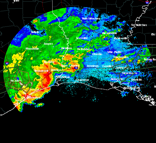 At 1219 am cdt, a severe thunderstorm capable of producing a tornado was located over la belle, or 10 miles southwest of central gardens, moving east at 20 mph (radar indicated rotation). Hazards include tornado. Flying debris will be dangerous to those caught without shelter. mobile homes will be damaged or destroyed. damage to roofs, windows, and vehicles will occur. tree damage is likely. this dangerous storm will be near, port acres around 1240 am cdt. Nederland, port neches and southeast texas regional airport around 1245 am cdt. At 1219 am cdt, a severe thunderstorm capable of producing a tornado was located over la belle, or 10 miles southwest of central gardens, moving east at 20 mph (radar indicated rotation). Hazards include tornado. Flying debris will be dangerous to those caught without shelter. mobile homes will be damaged or destroyed. damage to roofs, windows, and vehicles will occur. tree damage is likely. this dangerous storm will be near, port acres around 1240 am cdt. Nederland, port neches and southeast texas regional airport around 1245 am cdt.
|
| 5/9/2019 11:58 PM CDT |
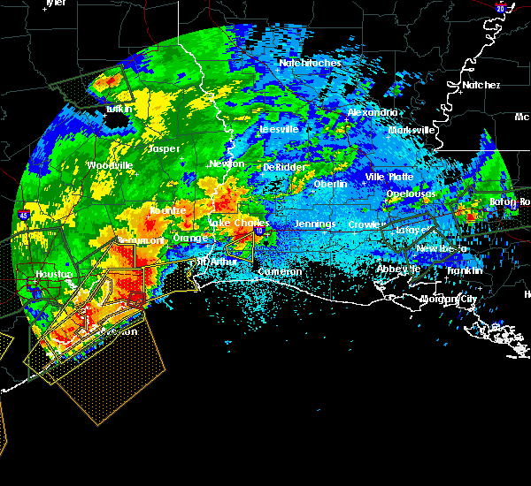 At 1139 pm cdt, a severe thunderstorm was located 8 miles southwest of stowell, or 15 miles southwest of hamshire, moving east at 30 mph (radar indicated). Hazards include 60 mph wind gusts and quarter size hail. Hail damage to vehicles is expected. Expect wind damage to roofs, siding, and trees. At 1139 pm cdt, a severe thunderstorm was located 8 miles southwest of stowell, or 15 miles southwest of hamshire, moving east at 30 mph (radar indicated). Hazards include 60 mph wind gusts and quarter size hail. Hail damage to vehicles is expected. Expect wind damage to roofs, siding, and trees.
|
| 4/7/2019 2:36 PM CDT |
 At 236 pm cdt, severe thunderstorms were located along a line extending from near town bluff to wrights settlement to 11 miles south of johnsons bayou, moving northeast at 50 mph (radar indicated). Hazards include 60 mph wind gusts and quarter size hail. Hail damage to vehicles is expected. expect wind damage to roofs, siding, and trees. Locations impacted include, beaumont, lake charles, port arthur, sulphur, orange, nederland, groves, port neches, vidor, bridge city, cameron, westlake, west orange, vinton, woodville, kirbyville, colmesneil, chester, singer and johnsons bayou. At 236 pm cdt, severe thunderstorms were located along a line extending from near town bluff to wrights settlement to 11 miles south of johnsons bayou, moving northeast at 50 mph (radar indicated). Hazards include 60 mph wind gusts and quarter size hail. Hail damage to vehicles is expected. expect wind damage to roofs, siding, and trees. Locations impacted include, beaumont, lake charles, port arthur, sulphur, orange, nederland, groves, port neches, vidor, bridge city, cameron, westlake, west orange, vinton, woodville, kirbyville, colmesneil, chester, singer and johnsons bayou.
|
| 4/7/2019 2:10 PM CDT |
 At 210 pm cdt, severe thunderstorms were located along a line extending from near wildwood to near lumberton to 19 miles south of sabine pass, moving northeast at 50 mph (radar indicated). Hazards include 60 mph wind gusts and quarter size hail. Hail damage to vehicles is expected. Expect wind damage to roofs, siding, and trees. At 210 pm cdt, severe thunderstorms were located along a line extending from near wildwood to near lumberton to 19 miles south of sabine pass, moving northeast at 50 mph (radar indicated). Hazards include 60 mph wind gusts and quarter size hail. Hail damage to vehicles is expected. Expect wind damage to roofs, siding, and trees.
|
| 4/7/2019 1:56 PM CDT |
 At 155 pm cdt, severe thunderstorms were located along a line extending from 7 miles east of shepherd to near saratoga to 11 miles east of high island, moving northeast at 55 mph (radar indicated). Hazards include 60 mph wind gusts and quarter size hail. Hail damage to vehicles is expected. expect wind damage to roofs, siding, and trees. Locations impacted include, beaumont, port arthur, nederland, groves, port neches, lumberton, vidor, bridge city, silsbee, woodville, kountze, sour lake, nome, central gardens, warren, thicket, saratoga, hamshire, fred and wildwood. At 155 pm cdt, severe thunderstorms were located along a line extending from 7 miles east of shepherd to near saratoga to 11 miles east of high island, moving northeast at 55 mph (radar indicated). Hazards include 60 mph wind gusts and quarter size hail. Hail damage to vehicles is expected. expect wind damage to roofs, siding, and trees. Locations impacted include, beaumont, port arthur, nederland, groves, port neches, lumberton, vidor, bridge city, silsbee, woodville, kountze, sour lake, nome, central gardens, warren, thicket, saratoga, hamshire, fred and wildwood.
|
| 4/7/2019 1:37 PM CDT |
 At 137 pm cdt, severe thunderstorms were located along a line extending from near cleveland to daisetta to 13 miles southeast of gilchrist, moving northeast at 55 mph (radar indicated). Hazards include 60 mph wind gusts and quarter size hail. Hail damage to vehicles is expected. Expect wind damage to roofs, siding, and trees. At 137 pm cdt, severe thunderstorms were located along a line extending from near cleveland to daisetta to 13 miles southeast of gilchrist, moving northeast at 55 mph (radar indicated). Hazards include 60 mph wind gusts and quarter size hail. Hail damage to vehicles is expected. Expect wind damage to roofs, siding, and trees.
|
| 11/7/2018 10:09 PM CST |
 At 1009 pm cst, a severe thunderstorm was located over beaumont, moving southeast at 15 mph (radar indicated). Hazards include quarter size hail. damage to vehicles is expected At 1009 pm cst, a severe thunderstorm was located over beaumont, moving southeast at 15 mph (radar indicated). Hazards include quarter size hail. damage to vehicles is expected
|
| 8/28/2017 12:34 AM CDT |
 At 1233 am cdt, a severe thunderstorm capable of producing a tornado was located 7 miles east of groves, moving northwest at 25 mph (radar indicated rotation). Hazards include tornado. Flying debris will be dangerous to those caught without shelter. mobile homes will be damaged or destroyed. damage to roofs, windows, and vehicles will occur. tree damage is likely. This dangerous storm will be near, groves, port neches and bridge city around 1245 am cdt. At 1233 am cdt, a severe thunderstorm capable of producing a tornado was located 7 miles east of groves, moving northwest at 25 mph (radar indicated rotation). Hazards include tornado. Flying debris will be dangerous to those caught without shelter. mobile homes will be damaged or destroyed. damage to roofs, windows, and vehicles will occur. tree damage is likely. This dangerous storm will be near, groves, port neches and bridge city around 1245 am cdt.
|
| 8/28/2017 12:19 AM CDT |
 At 1219 am cdt, a severe thunderstorm capable of producing a tornado was located 8 miles northwest of johnsons bayou, moving northwest at 25 mph (radar indicated rotation). Hazards include tornado. Flying debris will be dangerous to those caught without shelter. mobile homes will be damaged or destroyed. damage to roofs, windows, and vehicles will occur. tree damage is likely. This dangerous storm will be near, port arthur, groves, port neches and bridge city around 1245 am cdt. At 1219 am cdt, a severe thunderstorm capable of producing a tornado was located 8 miles northwest of johnsons bayou, moving northwest at 25 mph (radar indicated rotation). Hazards include tornado. Flying debris will be dangerous to those caught without shelter. mobile homes will be damaged or destroyed. damage to roofs, windows, and vehicles will occur. tree damage is likely. This dangerous storm will be near, port arthur, groves, port neches and bridge city around 1245 am cdt.
|
| 8/27/2017 9:18 AM CDT |
 At 918 am cdt, a severe thunderstorm capable of producing a tornado was located over rose city, or near vidor, moving northwest at 30 mph (radar indicated rotation). Hazards include tornado. Flying debris will be dangerous to those caught without shelter. mobile homes will be damaged or destroyed. damage to roofs, windows, and vehicles will occur. tree damage is likely. this dangerous storm will be near, pine forest around 925 am cdt. lakeview around 935 am cdt. weiss bluff around 940 am cdt. Beaumont and lumberton around 945 am cdt. At 918 am cdt, a severe thunderstorm capable of producing a tornado was located over rose city, or near vidor, moving northwest at 30 mph (radar indicated rotation). Hazards include tornado. Flying debris will be dangerous to those caught without shelter. mobile homes will be damaged or destroyed. damage to roofs, windows, and vehicles will occur. tree damage is likely. this dangerous storm will be near, pine forest around 925 am cdt. lakeview around 935 am cdt. weiss bluff around 940 am cdt. Beaumont and lumberton around 945 am cdt.
|
| 5/3/2017 10:00 PM CDT |
 At 959 pm cdt, severe thunderstorms were located along a line extending from port neches to 7 miles southeast of hamshire to 9 miles southeast of high island, moving southeast at 25 mph (radar indicated). Hazards include 60 mph wind gusts and quarter size hail. Hail damage to vehicles is expected. expect wind damage to roofs, siding, and trees. Locations impacted include, port arthur, nederland, groves, port neches, sabine pass, port acres, southeast texas regional airport and sea rim state park. At 959 pm cdt, severe thunderstorms were located along a line extending from port neches to 7 miles southeast of hamshire to 9 miles southeast of high island, moving southeast at 25 mph (radar indicated). Hazards include 60 mph wind gusts and quarter size hail. Hail damage to vehicles is expected. expect wind damage to roofs, siding, and trees. Locations impacted include, port arthur, nederland, groves, port neches, sabine pass, port acres, southeast texas regional airport and sea rim state park.
|
| 5/3/2017 9:39 PM CDT |
 At 939 pm cdt, severe thunderstorms were located along a line extending from near port acres to near winnie to near gilchrist, moving southeast at 30 mph (radar indicated). Hazards include 60 mph wind gusts and quarter size hail. Hail damage to vehicles is expected. Expect wind damage to roofs, siding, and trees. At 939 pm cdt, severe thunderstorms were located along a line extending from near port acres to near winnie to near gilchrist, moving southeast at 30 mph (radar indicated). Hazards include 60 mph wind gusts and quarter size hail. Hail damage to vehicles is expected. Expect wind damage to roofs, siding, and trees.
|
| 3/29/2017 5:43 PM CDT |
 At 543 pm cdt, severe thunderstorms were located along a line extending from near vidor to port arthur, moving east at 40 mph (radar indicated). Hazards include 60 mph wind gusts. expect damage to roofs, siding, and trees At 543 pm cdt, severe thunderstorms were located along a line extending from near vidor to port arthur, moving east at 40 mph (radar indicated). Hazards include 60 mph wind gusts. expect damage to roofs, siding, and trees
|
| 3/29/2017 5:29 PM CDT |
 At 529 pm cdt, severe thunderstorms were located along a line extending from near pine forest to southeast texas regional airport, moving east at 35 mph (radar indicated). Hazards include 60 mph wind gusts and quarter size hail. Hail damage to vehicles is expected. expect wind damage to roofs, siding, and trees. locations impacted include, beaumont, port arthur, nederland, groves, port neches, vidor, bridge city, central gardens, rose city, pine forest, port acres and southeast texas regional airport. A tornado watch remains in effect until 900 pm cdt for southeastern texas. At 529 pm cdt, severe thunderstorms were located along a line extending from near pine forest to southeast texas regional airport, moving east at 35 mph (radar indicated). Hazards include 60 mph wind gusts and quarter size hail. Hail damage to vehicles is expected. expect wind damage to roofs, siding, and trees. locations impacted include, beaumont, port arthur, nederland, groves, port neches, vidor, bridge city, central gardens, rose city, pine forest, port acres and southeast texas regional airport. A tornado watch remains in effect until 900 pm cdt for southeastern texas.
|
| 3/29/2017 5:15 PM CDT |
 At 515 pm cdt, severe thunderstorms were located along a line extending from near bevil oaks to la belle, moving northeast at 25 mph (radar indicated). Hazards include 60 mph wind gusts and quarter size hail. Hail damage to vehicles is expected. expect wind damage to roofs, siding, and trees. locations impacted include, beaumont, port arthur, nederland, groves, port neches, vidor, bridge city, central gardens, rose city, pine forest, port acres, fannett, la belle and southeast texas regional airport. A tornado watch remains in effect until 900 pm cdt for southeastern texas. At 515 pm cdt, severe thunderstorms were located along a line extending from near bevil oaks to la belle, moving northeast at 25 mph (radar indicated). Hazards include 60 mph wind gusts and quarter size hail. Hail damage to vehicles is expected. expect wind damage to roofs, siding, and trees. locations impacted include, beaumont, port arthur, nederland, groves, port neches, vidor, bridge city, central gardens, rose city, pine forest, port acres, fannett, la belle and southeast texas regional airport. A tornado watch remains in effect until 900 pm cdt for southeastern texas.
|
| 3/29/2017 5:00 PM CDT |
 At 500 pm cdt, severe thunderstorms were located along a line extending from china to near hamshire, moving east at 30 mph (radar indicated). Hazards include 60 mph wind gusts. expect damage to roofs, siding, and trees At 500 pm cdt, severe thunderstorms were located along a line extending from china to near hamshire, moving east at 30 mph (radar indicated). Hazards include 60 mph wind gusts. expect damage to roofs, siding, and trees
|
| 3/29/2017 3:05 PM CDT |
 At 305 pm cdt, a severe thunderstorm was located near groves, moving northeast at 50 mph (radar indicated). Hazards include 60 mph wind gusts and quarter size hail. Hail damage to vehicles is expected. expect wind damage to roofs, siding, and trees. locations impacted include, port arthur, orange, groves, port neches, bridge city, west orange and orangefield. A tornado watch remains in effect until 900 pm cdt for southwestern louisiana, and southeastern texas. At 305 pm cdt, a severe thunderstorm was located near groves, moving northeast at 50 mph (radar indicated). Hazards include 60 mph wind gusts and quarter size hail. Hail damage to vehicles is expected. expect wind damage to roofs, siding, and trees. locations impacted include, port arthur, orange, groves, port neches, bridge city, west orange and orangefield. A tornado watch remains in effect until 900 pm cdt for southwestern louisiana, and southeastern texas.
|
| 3/29/2017 2:46 PM CDT |
 At 246 pm cdt, a severe thunderstorm was located near sabine pass, moving northeast at 50 mph (radar indicated). Hazards include 60 mph wind gusts and quarter size hail. Hail damage to vehicles is expected. Expect wind damage to roofs, siding, and trees. At 246 pm cdt, a severe thunderstorm was located near sabine pass, moving northeast at 50 mph (radar indicated). Hazards include 60 mph wind gusts and quarter size hail. Hail damage to vehicles is expected. Expect wind damage to roofs, siding, and trees.
|
| 1/2/2017 10:28 AM CST |
 At 1028 am cst, severe thunderstorms were located along a line extending from near ragley to near buhler to near gilchrist, moving east at 45 mph (radar indicated). Hazards include 70 mph wind gusts. Expect considerable tree damage. damage is likely to mobile homes, roofs, and outbuildings. locations impacted include, beaumont, lake charles, port arthur, orange, nederland, groves, port neches, vidor, bridge city, west orange, vinton, sour lake, nome, starks, central gardens, hamshire, sabine pass, de quincy, mauriceville and dequincy. A tornado watch remains in effect until 200 pm cst for southwestern louisiana, and southeastern texas. At 1028 am cst, severe thunderstorms were located along a line extending from near ragley to near buhler to near gilchrist, moving east at 45 mph (radar indicated). Hazards include 70 mph wind gusts. Expect considerable tree damage. damage is likely to mobile homes, roofs, and outbuildings. locations impacted include, beaumont, lake charles, port arthur, orange, nederland, groves, port neches, vidor, bridge city, west orange, vinton, sour lake, nome, starks, central gardens, hamshire, sabine pass, de quincy, mauriceville and dequincy. A tornado watch remains in effect until 200 pm cst for southwestern louisiana, and southeastern texas.
|
| 1/2/2017 10:28 AM CST |
 A severe thunderstorm warning remains in effect until 1045 am cst for northwestern cameron and western calcasieu parishes. orange. jefferson. southeastern hardin. southeastern jasper and southwestern newton counties. At 1028 am cst, severe thunderstorms were located along a line extending from near ragley to near buhler to near gilchrist, moving. A severe thunderstorm warning remains in effect until 1045 am cst for northwestern cameron and western calcasieu parishes. orange. jefferson. southeastern hardin. southeastern jasper and southwestern newton counties. At 1028 am cst, severe thunderstorms were located along a line extending from near ragley to near buhler to near gilchrist, moving.
|
| 1/2/2017 10:28 AM CST |
 At 1028 am cst, severe thunderstorms were located along a line extending from near ragley to near buhler to near gilchrist, moving east at 45 mph (radar indicated). Hazards include 70 mph wind gusts. Expect considerable tree damage. damage is likely to mobile homes, roofs, and outbuildings. locations impacted include, beaumont, lake charles, port arthur, orange, nederland, groves, port neches, vidor, bridge city, west orange, vinton, sour lake, nome, starks, central gardens, hamshire, sabine pass, de quincy, mauriceville and dequincy. A tornado watch remains in effect until 200 pm cst for southwestern louisiana, and southeastern texas. At 1028 am cst, severe thunderstorms were located along a line extending from near ragley to near buhler to near gilchrist, moving east at 45 mph (radar indicated). Hazards include 70 mph wind gusts. Expect considerable tree damage. damage is likely to mobile homes, roofs, and outbuildings. locations impacted include, beaumont, lake charles, port arthur, orange, nederland, groves, port neches, vidor, bridge city, west orange, vinton, sour lake, nome, starks, central gardens, hamshire, sabine pass, de quincy, mauriceville and dequincy. A tornado watch remains in effect until 200 pm cst for southwestern louisiana, and southeastern texas.
|
| 1/2/2017 9:57 AM CST |
 At 957 am cst, severe thunderstorms were located along a line extending from near fields to near starks to near smith point, moving east at 45 mph (radar indicated). Hazards include 70 mph wind gusts. Expect considerable tree damage. Damage is likely to mobile homes, roofs, and outbuildings. At 957 am cst, severe thunderstorms were located along a line extending from near fields to near starks to near smith point, moving east at 45 mph (radar indicated). Hazards include 70 mph wind gusts. Expect considerable tree damage. Damage is likely to mobile homes, roofs, and outbuildings.
|
| 12/3/2016 11:13 AM CST |
 At 1113 am cst, a severe thunderstorm capable of producing a tornado was located near groves, moving northeast at 30 mph (radar indicated rotation). Hazards include tornado. Flying debris will be dangerous to those caught without shelter. mobile homes will be damaged or destroyed. damage to roofs, windows, and vehicles will occur. tree damage is likely. this dangerous storm will be near, bridge city around 1120 am cst. orangefield around 1125 am cst. West orange around 1130 am cst. At 1113 am cst, a severe thunderstorm capable of producing a tornado was located near groves, moving northeast at 30 mph (radar indicated rotation). Hazards include tornado. Flying debris will be dangerous to those caught without shelter. mobile homes will be damaged or destroyed. damage to roofs, windows, and vehicles will occur. tree damage is likely. this dangerous storm will be near, bridge city around 1120 am cst. orangefield around 1125 am cst. West orange around 1130 am cst.
|
| 12/3/2016 10:59 AM CST |
 At 1058 am cst, a severe thunderstorm capable of producing a tornado was located over port arthur, moving northeast at 30 mph (radar indicated rotation). Hazards include tornado. Flying debris will be dangerous to those caught without shelter. mobile homes will be damaged or destroyed. damage to roofs, windows, and vehicles will occur. tree damage is likely. this dangerous storm will be near, groves and port neches around 1110 am cst. bridge city around 1120 am cst. orangefield around 1125 am cst. West orange around 1130 am cst. At 1058 am cst, a severe thunderstorm capable of producing a tornado was located over port arthur, moving northeast at 30 mph (radar indicated rotation). Hazards include tornado. Flying debris will be dangerous to those caught without shelter. mobile homes will be damaged or destroyed. damage to roofs, windows, and vehicles will occur. tree damage is likely. this dangerous storm will be near, groves and port neches around 1110 am cst. bridge city around 1120 am cst. orangefield around 1125 am cst. West orange around 1130 am cst.
|
| 12/3/2016 10:54 AM CST |
 At 1053 am cst, a severe thunderstorm capable of producing a tornado was located near port acres, or near port arthur, moving northeast at 35 mph (radar indicated rotation). Hazards include tornado and quarter size hail. Flying debris will be dangerous to those caught without shelter. mobile homes will be damaged or destroyed. damage to roofs, windows, and vehicles will occur. tree damage is likely. This tornadic thunderstorm will remain over mainly rural areas of south central orange and east central jefferson counties. At 1053 am cst, a severe thunderstorm capable of producing a tornado was located near port acres, or near port arthur, moving northeast at 35 mph (radar indicated rotation). Hazards include tornado and quarter size hail. Flying debris will be dangerous to those caught without shelter. mobile homes will be damaged or destroyed. damage to roofs, windows, and vehicles will occur. tree damage is likely. This tornadic thunderstorm will remain over mainly rural areas of south central orange and east central jefferson counties.
|
| 12/3/2016 10:36 AM CST |
 At 1036 am cst, a severe thunderstorm capable of producing a tornado was located near la belle, or 12 miles east of hamshire, moving northeast at 35 mph (radar indicated rotation). Hazards include tornado and quarter size hail. Flying debris will be dangerous to those caught without shelter. mobile homes will be damaged or destroyed. damage to roofs, windows, and vehicles will occur. tree damage is likely. this dangerous storm will be near, port acres around 1050 am cst. southeast texas regional airport around 1055 am cst. Port arthur, nederland, groves, port neches and central gardens around 1100 am cst. At 1036 am cst, a severe thunderstorm capable of producing a tornado was located near la belle, or 12 miles east of hamshire, moving northeast at 35 mph (radar indicated rotation). Hazards include tornado and quarter size hail. Flying debris will be dangerous to those caught without shelter. mobile homes will be damaged or destroyed. damage to roofs, windows, and vehicles will occur. tree damage is likely. this dangerous storm will be near, port acres around 1050 am cst. southeast texas regional airport around 1055 am cst. Port arthur, nederland, groves, port neches and central gardens around 1100 am cst.
|
| 8/13/2016 5:25 PM CDT |
 At 525 pm cdt, a severe thunderstorm was located near port neches, moving east at 20 mph (radar indicated). Hazards include 60 mph wind gusts. Expect damage to roofs. siding. And trees. At 525 pm cdt, a severe thunderstorm was located near port neches, moving east at 20 mph (radar indicated). Hazards include 60 mph wind gusts. Expect damage to roofs. siding. And trees.
|
| 4/27/2016 6:47 AM CDT |
 At 646 am cdt, severe thunderstorms were located along a line extending from 8 miles southeast of pineland to newton to near bancroft to mauriceville to 12 miles east of high island, moving east at 45 mph (radar indicated). Hazards include 60 mph wind gusts and quarter size hail. Hail damage to vehicles is expected. Expect wind damage to roofs, siding, and trees. At 646 am cdt, severe thunderstorms were located along a line extending from 8 miles southeast of pineland to newton to near bancroft to mauriceville to 12 miles east of high island, moving east at 45 mph (radar indicated). Hazards include 60 mph wind gusts and quarter size hail. Hail damage to vehicles is expected. Expect wind damage to roofs, siding, and trees.
|
| 4/27/2016 6:42 AM CDT |
 At 639 am cdt, severe thunderstorms were located along a line extending from hemphill to near jamestown to near kirbyville to 6 miles west of old salem to 6 miles southeast of buna to wrights settlement to near gist to near vidor to 6 miles east of high island, moving east at 45 mph (radar indicated). Hazards include 60 mph wind gusts and penny size hail. Expect damage to roofs. siding. and trees. Locations impacted include, beaumont, port arthur, orange, nederland, groves, port neches, lumberton, vidor, bridge city, jasper, silsbee, west orange, newton, kirbyville, nome, deweyville, fred, bon weir, hamshire and burkeville. At 639 am cdt, severe thunderstorms were located along a line extending from hemphill to near jamestown to near kirbyville to 6 miles west of old salem to 6 miles southeast of buna to wrights settlement to near gist to near vidor to 6 miles east of high island, moving east at 45 mph (radar indicated). Hazards include 60 mph wind gusts and penny size hail. Expect damage to roofs. siding. and trees. Locations impacted include, beaumont, port arthur, orange, nederland, groves, port neches, lumberton, vidor, bridge city, jasper, silsbee, west orange, newton, kirbyville, nome, deweyville, fred, bon weir, hamshire and burkeville.
|
| 4/27/2016 6:15 AM CDT |
 At 614 am cdt, severe thunderstorms were located along a line extending from 6 miles south of macune to 6 miles west of jasper to near spurger to caney head to 7 miles east of kountze to 8 miles northwest of evadale to silsbee to near lumberton to bevil oaks to near winnie to 7 miles southeast of anahuac, moving east at 45 mph (radar indicated). Hazards include 60 mph wind gusts. Expect damage to roofs. siding. And trees. At 614 am cdt, severe thunderstorms were located along a line extending from 6 miles south of macune to 6 miles west of jasper to near spurger to caney head to 7 miles east of kountze to 8 miles northwest of evadale to silsbee to near lumberton to bevil oaks to near winnie to 7 miles southeast of anahuac, moving east at 45 mph (radar indicated). Hazards include 60 mph wind gusts. Expect damage to roofs. siding. And trees.
|
| 1/8/2016 8:40 PM CST |
 At 840 pm cst, a severe thunderstorm was located near port arthur, moving northeast at 35 mph (radar indicated). Hazards include quarter size hail. damage to vehicles is expected At 840 pm cst, a severe thunderstorm was located near port arthur, moving northeast at 35 mph (radar indicated). Hazards include quarter size hail. damage to vehicles is expected
|
| 5/27/2015 6:38 AM CDT | At 637 am cdt, doppler radar indicated a line of severe thunderstorms capable of producing quarter size hail and damaging winds in excess of 60 mph. these storms were located along a line extending from near buhler to carlyss to near high island, and moving southeast at 20 mph. |
| 5/27/2015 6:38 AM CDT | At 637 am cdt, doppler radar indicated a line of severe thunderstorms capable of producing quarter size hail and damaging winds in excess of 60 mph. these storms were located along a line extending from near buhler to carlyss to near high island, and moving southeast at 20 mph. |
| 5/27/2015 6:18 AM CDT | At 617 am cdt, doppler radar indicated a line of severe thunderstorms capable of producing quarter size hail and damaging winds in excess of 60 mph. these storms were located along a line extending from near edgerly to bridge city to near gilchrist, moving southeast at 30 mph. locations impacted include, beaumont, lake charles, port arthur, sulphur, orange, nederland, groves, port neches, vidor, bridge city, westlake, west orange, vinton, deweyville, moss bluff, lake charles regional airport, starks, central gardens, hamshire and fields. |
| 5/27/2015 6:18 AM CDT | At 617 am cdt, doppler radar indicated a line of severe thunderstorms capable of producing quarter size hail and damaging winds in excess of 60 mph. these storms were located along a line extending from near edgerly to bridge city to near gilchrist, moving southeast at 30 mph. locations impacted include, beaumont, lake charles, port arthur, sulphur, orange, nederland, groves, port neches, vidor, bridge city, westlake, west orange, vinton, deweyville, moss bluff, lake charles regional airport, starks, central gardens, hamshire and fields. |
| 5/27/2015 5:30 AM CDT | At 530 am cdt, doppler radar indicated a line of severe thunderstorms capable of producing quarter size hail and damaging winds in excess of 60 mph. these storms were located along a line extending from near bancroft to near weiss bluff to near cove, and moving southeast at 30 mph. |
| 5/27/2015 5:30 AM CDT | At 530 am cdt, doppler radar indicated a line of severe thunderstorms capable of producing quarter size hail and damaging winds in excess of 60 mph. these storms were located along a line extending from near bancroft to near weiss bluff to near cove, and moving southeast at 30 mph. |
| 5/26/2015 12:52 AM CDT | The severe thunderstorm warning for calcasieu, northwestern cameron, jefferson davis, southeastern beauregard, eastern rapides, central st. landry, evangeline, avoyelles, acadia and southeastern allen parishes, southeastern orange and southeastern jefferson counties will expire at 100 am cdt, the storms which prompted the warning have weakened below severe limits and exited the warned area. therefore the warning will be allowed to expire. however gusty winds are still possible with these thunderstorms. |
| 5/26/2015 12:52 AM CDT | The severe thunderstorm warning for calcasieu, northwestern cameron, jefferson davis, southeastern beauregard, eastern rapides, central st. landry, evangeline, avoyelles, acadia and southeastern allen parishes, southeastern orange and southeastern jefferson counties will expire at 100 am cdt, the storms which prompted the warning have weakened below severe limits and exited the warned area. therefore the warning will be allowed to expire. however gusty winds are still possible with these thunderstorms. |
| 5/25/2015 11:29 PM CDT | At 1128 pm cdt, doppler radar indicated a line of severe thunderstorms capable of producing quarter size hail and damaging winds in excess of 60 mph. these storms were located along a line extending from esler regional airport to near elton to near port arthur, and moving southeast at 15 mph. |
| 5/25/2015 11:29 PM CDT | At 1128 pm cdt, doppler radar indicated a line of severe thunderstorms capable of producing quarter size hail and damaging winds in excess of 60 mph. these storms were located along a line extending from esler regional airport to near elton to near port arthur, and moving southeast at 15 mph. |
| 5/25/2015 11:17 PM CDT | At 1117 pm cdt, doppler radar indicated a line of severe thunderstorms capable of producing quarter size hail and damaging winds in excess of 60 mph. these storms were located along a line extending from libuse to near cheneyville to near lake charles to near port acres, moving southeast at 50 mph. locations impacted include, beaumont, lake charles, port arthur, alexandria, sulphur, orange, nederland, groves, pineville, port neches, vidor, jennings, bridge city, oakdale, ville platte, westlake, west orange, mamou, welsh and vinton. a tornado watch remains in effect until 200 am cdt for southwestern louisiana and southeastern texas. a tornado watch also remains in effect until 500 am cdt for central louisiana. |
| 5/25/2015 11:17 PM CDT | At 1117 pm cdt, doppler radar indicated a line of severe thunderstorms capable of producing quarter size hail and damaging winds in excess of 60 mph. these storms were located along a line extending from libuse to near cheneyville to near lake charles to near port acres, moving southeast at 50 mph. locations impacted include, beaumont, lake charles, port arthur, alexandria, sulphur, orange, nederland, groves, pineville, port neches, vidor, jennings, bridge city, oakdale, ville platte, westlake, west orange, mamou, welsh and vinton. a tornado watch remains in effect until 200 am cdt for southwestern louisiana and southeastern texas. a tornado watch also remains in effect until 500 am cdt for central louisiana. |
| 5/25/2015 10:59 PM CDT | At 1058 pm cdt, doppler radar indicated a line of severe thunderstorms capable of producing quarter size hail and damaging winds in excess of 60 mph. these storms were located along a line extending from near boyce to near glenmora to near vinton to hamshire, and moving southeast at 45 mph. |
| 5/25/2015 10:59 PM CDT | At 1058 pm cdt, doppler radar indicated a line of severe thunderstorms capable of producing quarter size hail and damaging winds in excess of 60 mph. these storms were located along a line extending from near boyce to near glenmora to near vinton to hamshire, and moving southeast at 45 mph. |
| 4/27/2015 6:31 PM CDT | At 630 pm cdt, doppler radar indicated a severe thunderstorm capable of producing large hail up to ping pong ball size and damaging winds in excess of 60 mph. this storm was located just west of vinton, moving northeast at 45 mph. |
| 4/27/2015 6:31 PM CDT | At 630 pm cdt, doppler radar indicated a severe thunderstorm capable of producing large hail up to ping pong ball size and damaging winds in excess of 60 mph. this storm was located just west of vinton, moving northeast at 45 mph. |
| 4/27/2015 5:59 PM CDT | At 558 pm cdt, doppler radar indicated a line of severe thunderstorms capable of producing large hail up to ping pong ball size and damaging winds in excess of 60 mph. these storms were located along a line extending from near central gardens to near groves, and moving northeast at 40 mph. |
| 4/27/2015 5:59 PM CDT | At 558 pm cdt, doppler radar indicated a line of severe thunderstorms capable of producing large hail up to ping pong ball size and damaging winds in excess of 60 mph. these storms were located along a line extending from near central gardens to near groves, and moving northeast at 40 mph. |
| 4/27/2015 5:50 PM CDT | At 549 pm cdt, doppler radar indicated a line of severe thunderstorms capable of producing large damaging hail up to golf ball size and damaging winds in excess of 60 mph. these storms were located along a line extending from southeast texas regional airport to port arthur, moving northeast at 45 mph. locations impacted include, beaumont, port arthur, orange, nederland, groves, port neches, vidor, bridge city, west orange, central gardens, rose city, orangefield, port acres and southeast texas regional airport. |
| 4/27/2015 5:37 PM CDT | At 537 pm cdt, doppler radar indicated a line of severe thunderstorms capable of producing half dollar size hail and damaging winds in excess of 60 mph. these storms were located along a line extending from near la belle to 8 miles south of port acres to near sabine pass, moving northeast at 45 mph. locations impacted include, beaumont, port arthur, orange, nederland, groves, port neches, vidor, bridge city, west orange, sabine pass, central gardens, rose city, orangefield, la belle, port acres, southeast texas regional airport and sea rim state park. |
| 4/27/2015 5:23 PM CDT | At 523 pm cdt, doppler radar indicated a line of severe thunderstorms capable of producing half dollar size hail and destructive winds in excess of 70 mph. these storms were located along a line extending from 8 miles southeast of stowell to 13 miles southwest of sabine pass to 21 miles east of high island, moving northeast at 40 mph. locations impacted include, beaumont, port arthur, orange, nederland, groves, port neches, vidor, bridge city, west orange, sabine pass, central gardens, hamshire, rose city, orangefield, la belle, port acres, southeast texas regional airport, fannett, winnie and sea rim state park. |
| 4/27/2015 5:00 PM CDT | At 500 pm cdt, doppler radar indicated a line of severe thunderstorms capable of producing large damaging hail up to golf ball size and destructive winds in excess of 70 mph. these storms were located along a line extending from 8 miles southeast of high island to 16 miles southeast of gilchrist, and moving northeast at 45 mph. |
| 4/27/2015 6:40 AM CDT | At 639 am cdt, doppler radar indicated a severe thunderstorm capable of producing quarter size hail and damaging winds in excess of 60 mph. this storm was located over central gardens, and moving east at 40 mph. |
| 4/27/2015 6:40 AM CDT | At 639 am cdt, doppler radar indicated a severe thunderstorm capable of producing quarter size hail and damaging winds in excess of 60 mph. this storm was located over central gardens, and moving east at 40 mph. |
| 4/19/2015 9:07 PM CDT | At 906 pm cdt, doppler radar indicated a line of severe thunderstorms capable of producing quarter size hail and damaging winds in excess of 60 mph. these storms were located along a line extending from winnie to near high island to near bolivar peninsula, and moving east at 50 mph. |
| 4/19/2015 8:31 PM CDT | At 814 pm cdt, doppler radar indicated a severe thunderstorm capable of producing quarter size hail and damaging winds in excess of 60 mph. this storm was located over hamshire, and moving east at 40 mph. |
| 4/19/2015 8:14 PM CDT | The national weather service in lake charles has issued a * severe thunderstorm warning for. central orange county in southeastern texas. jefferson county in southeastern texas. until 900 pm cdt * at 814 pm cdt. Doppler radar indicated a severe thunderstorm. |
| 4/17/2015 9:36 PM CDT | At 934 pm cdt, doppler radar indicated a line of severe thunderstorms capable of producing quarter size hail and damaging winds in excess of 60 mph. these storms were located along a line extending from near winnie to 24 miles south of sabine pass, and moving east at 40 mph. |
| 4/16/2015 8:11 PM CDT | At 811 pm cdt, doppler radar indicated a severe thunderstorm capable of producing quarter size hail. this storm was located near southeast texas regional airport, or near central gardens, moving east at 30 mph. locations impacted include, beaumont, port arthur, nederland, central gardens, rose city, port acres, southeast texas regional airport and la belle. |
| 4/16/2015 7:50 PM CDT | At 749 pm cdt, doppler radar indicated a severe thunderstorm capable of producing quarter size hail. this storm was located over hamshire, and moving northeast at 30 mph. |
Hail Maps for Groves, TX
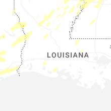


Connect with Interactive Hail Maps