

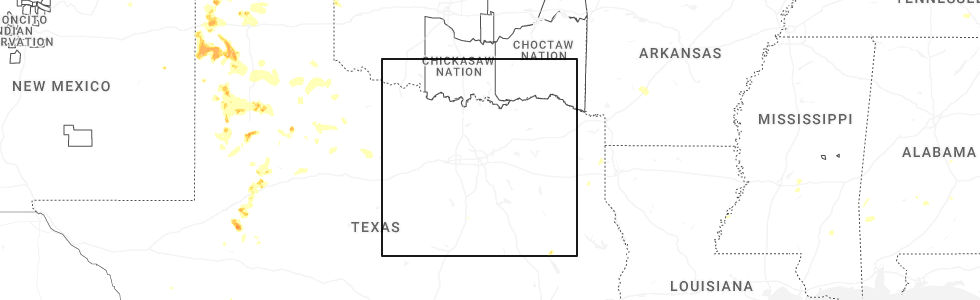
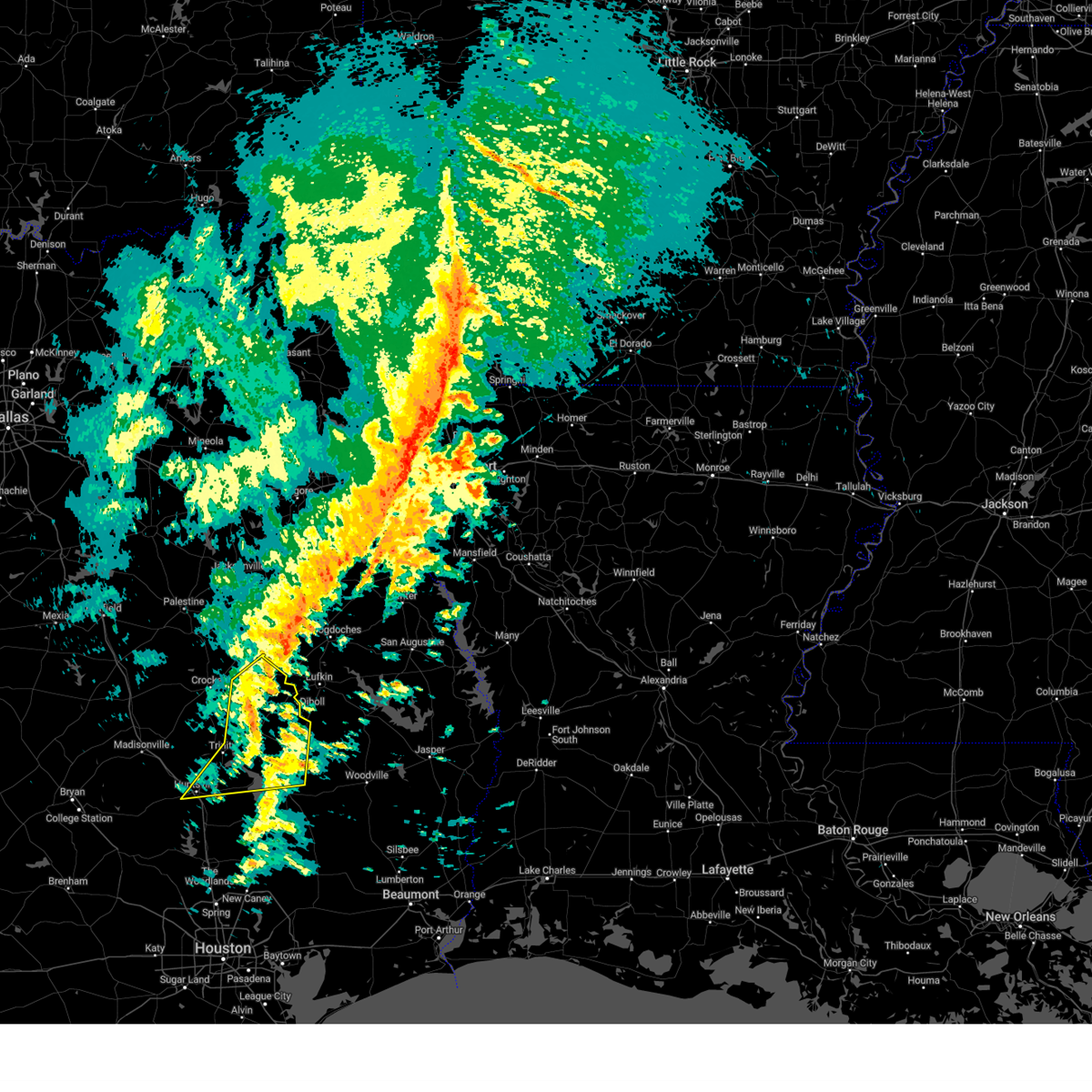
Hail Map for Groveton, TX
The Groveton, TX area has had 3 reports of on-the-ground hail by trained spotters, and has been under severe weather warnings 12 times during the past 12 months. Doppler radar has detected hail at or near Groveton, TX on 59 occasions, including 2 occasions during the past year.
| Name: | Groveton, TX |
| Where Located: | 31.3 miles SW of Lufkin, TX |
| Map: | Google Map for Groveton, TX |
| Population: | 1057 |
| Housing Units: | 540 |
| More Info: | Search Google for Groveton, TX |
0
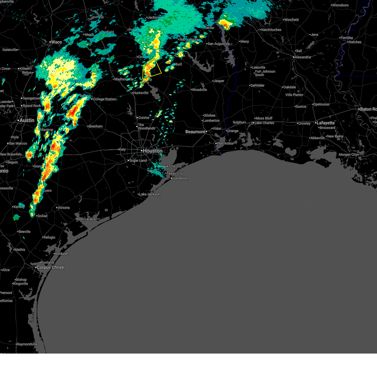
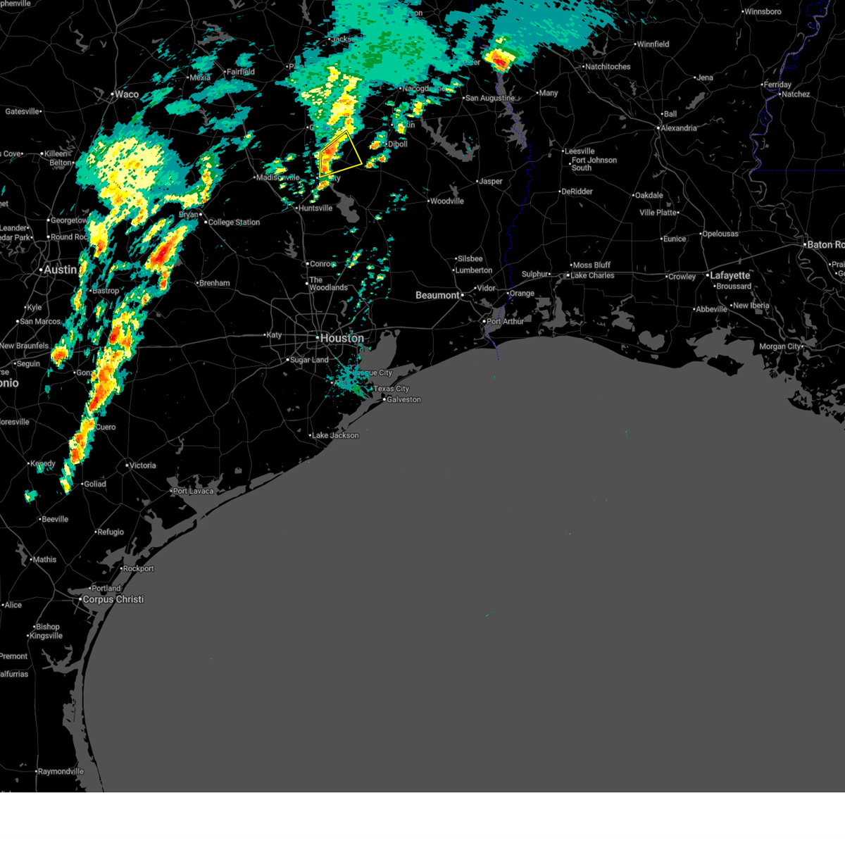
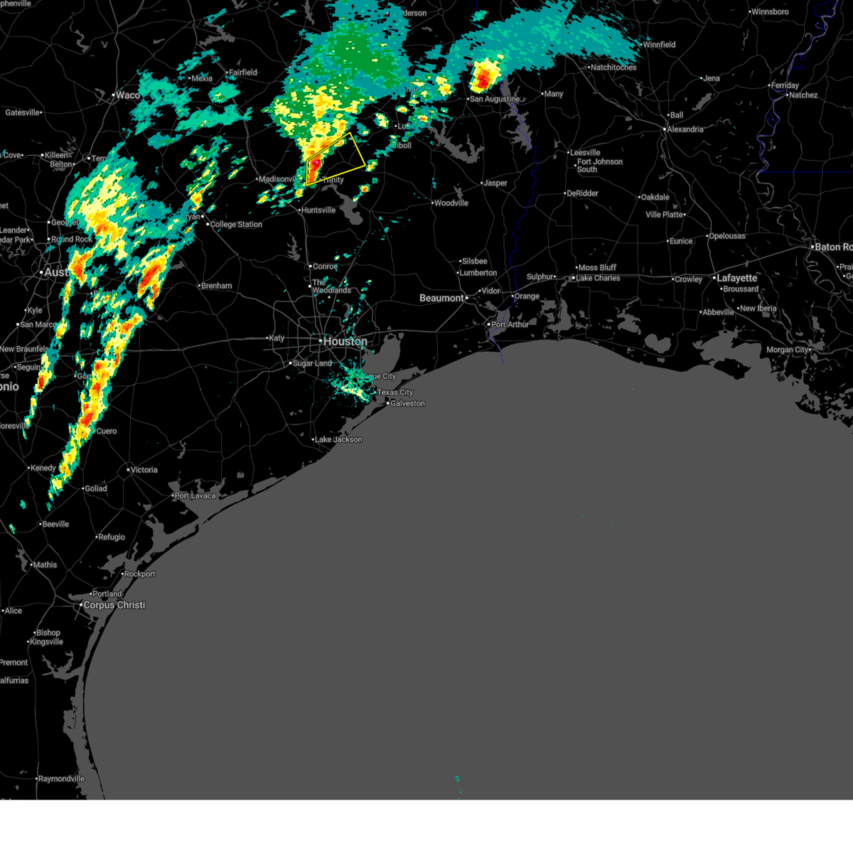
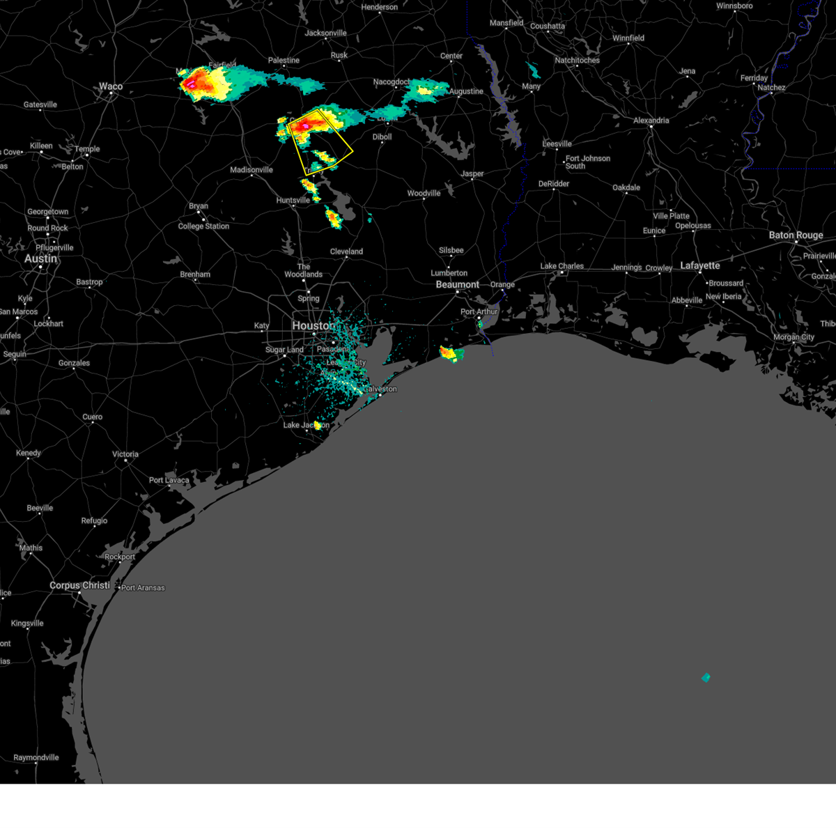
The Top Recent Hail Date for Groveton, TX is Saturday, May 23, 2026 (59th out of 59)
Hail and Wind Damage Spotted near Groveton, TX
| Date / Time | Report Details |
|---|---|
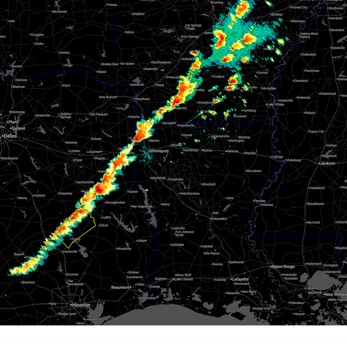
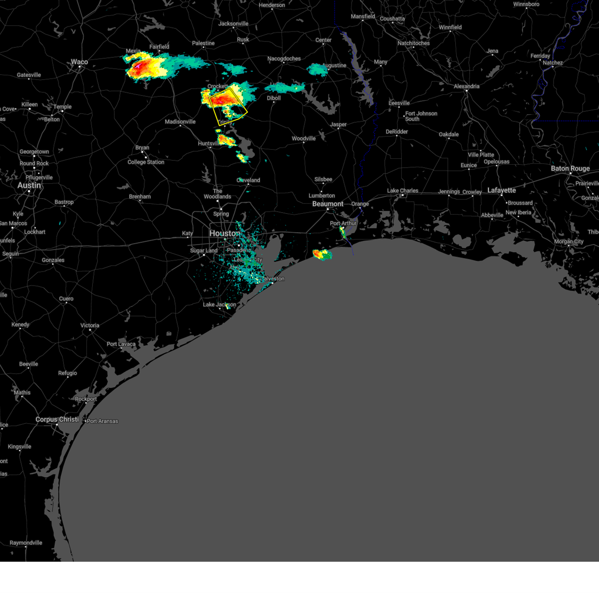
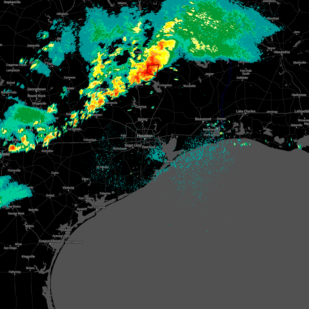
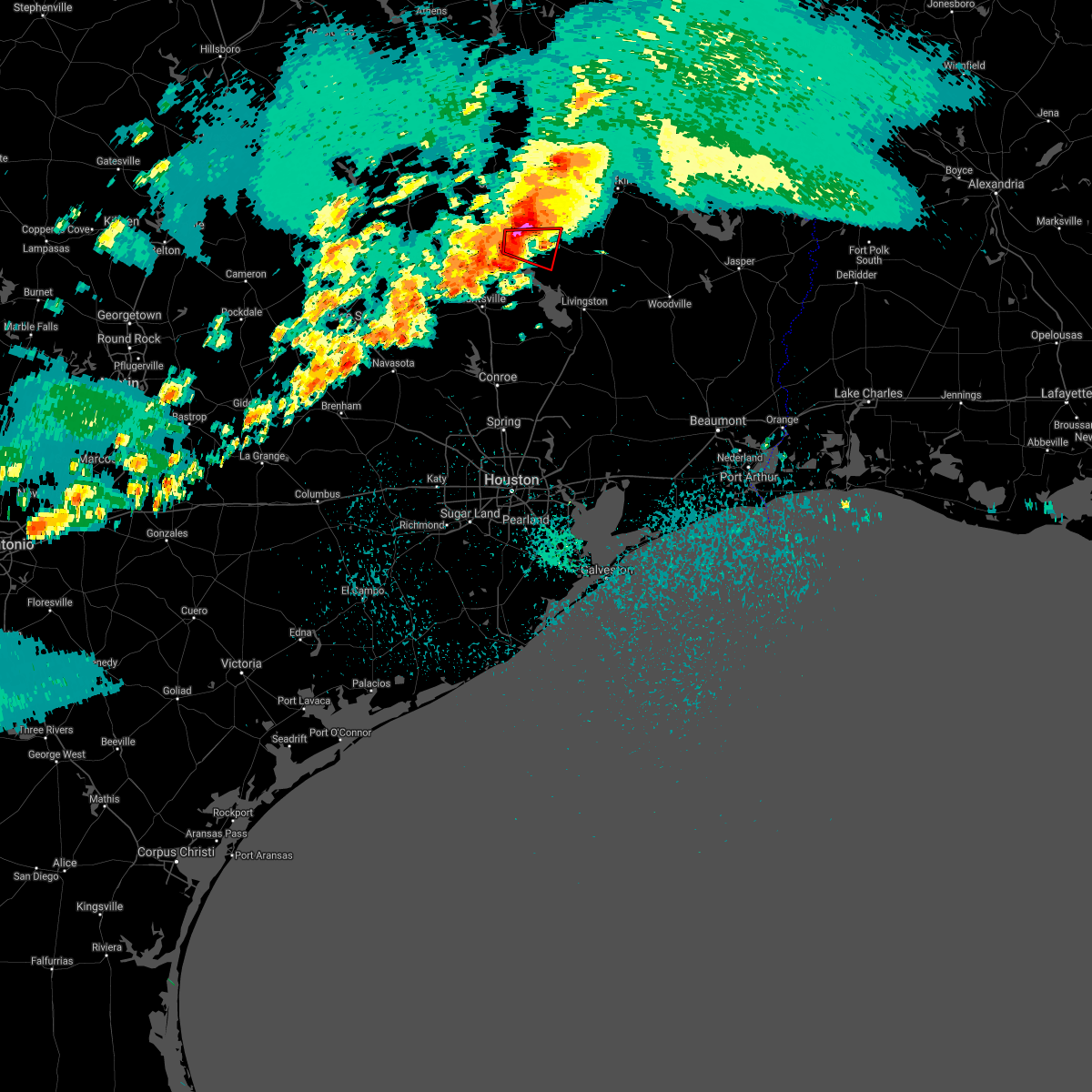
| 5/23/2026 4:39 PM CDT |
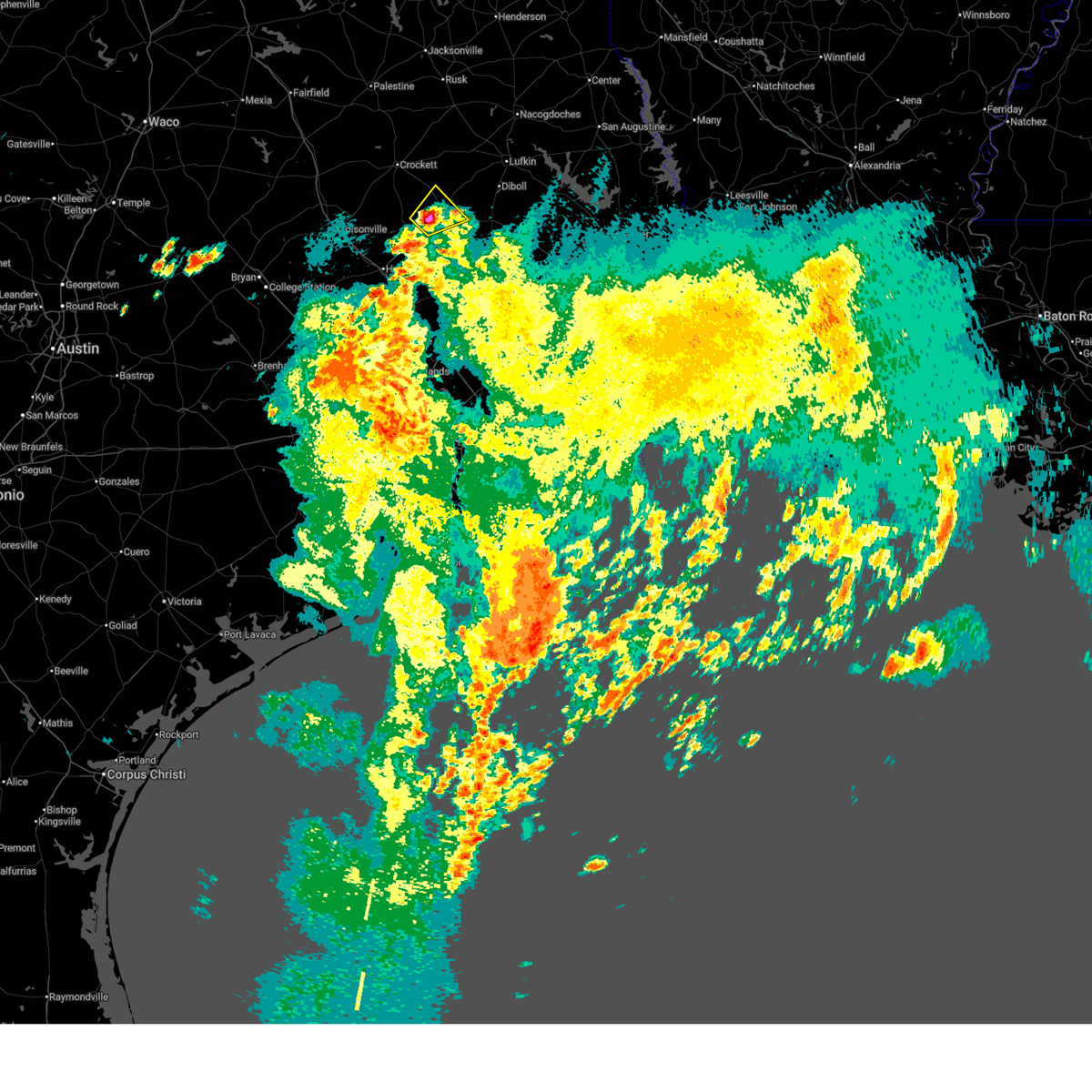 Svrhgx the national weather service in league city has issued a * severe thunderstorm warning for, southwestern trinity county in southeastern texas, northwestern polk county in southeastern texas, * until 530 pm cdt. * at 439 pm cdt, a severe thunderstorm was located near groveton, or 21 miles southwest of apple springs, moving northeast at 10 mph (radar indicated). Hazards include 60 mph wind gusts and quarter size hail. Hail damage to vehicles is expected. Expect wind damage to roofs, siding, and trees. Svrhgx the national weather service in league city has issued a * severe thunderstorm warning for, southwestern trinity county in southeastern texas, northwestern polk county in southeastern texas, * until 530 pm cdt. * at 439 pm cdt, a severe thunderstorm was located near groveton, or 21 miles southwest of apple springs, moving northeast at 10 mph (radar indicated). Hazards include 60 mph wind gusts and quarter size hail. Hail damage to vehicles is expected. Expect wind damage to roofs, siding, and trees.
|
| 3/15/2026 6:30 PM CDT |
 Svrhgx the national weather service in league city has issued a * severe thunderstorm warning for, southern trinity county in southeastern texas, northwestern san jacinto county in southeastern texas, central polk county in southeastern texas, east central walker county in southeastern texas, * until 715 pm cdt. * at 629 pm cdt, severe thunderstorms were located along a line extending from near diboll to riverside, moving southeast at around 35 mph (radar indicated). Hazards include 60 mph wind gusts and quarter size hail. Hail damage to vehicles is expected. Expect wind damage to roofs, siding, and trees. Svrhgx the national weather service in league city has issued a * severe thunderstorm warning for, southern trinity county in southeastern texas, northwestern san jacinto county in southeastern texas, central polk county in southeastern texas, east central walker county in southeastern texas, * until 715 pm cdt. * at 629 pm cdt, severe thunderstorms were located along a line extending from near diboll to riverside, moving southeast at around 35 mph (radar indicated). Hazards include 60 mph wind gusts and quarter size hail. Hail damage to vehicles is expected. Expect wind damage to roofs, siding, and trees.
|
| 3/15/2026 6:11 PM CDT |
 the severe thunderstorm warning has been cancelled and is no longer in effect the severe thunderstorm warning has been cancelled and is no longer in effect
|
| 3/15/2026 6:11 PM CDT |
 At 611 pm cdt, severe thunderstorms were located along a line extending from 8 miles northwest of apple springs to 7 miles west of trinity, moving southeast at 35 mph (radar indicated). Hazards include 60 mph wind gusts and quarter size hail. Hail damage to vehicles is expected. expect wind damage to roofs, siding, and trees. Locations impacted include, apple springs, trinity, groveton, riverside, pennington, and centralia. At 611 pm cdt, severe thunderstorms were located along a line extending from 8 miles northwest of apple springs to 7 miles west of trinity, moving southeast at 35 mph (radar indicated). Hazards include 60 mph wind gusts and quarter size hail. Hail damage to vehicles is expected. expect wind damage to roofs, siding, and trees. Locations impacted include, apple springs, trinity, groveton, riverside, pennington, and centralia.
|
| 3/15/2026 5:51 PM CDT |
 Svrhgx the national weather service in league city has issued a * severe thunderstorm warning for, trinity county in southeastern texas, central houston county in southeastern texas, northeastern madison county in southeastern texas, northeastern walker county in southeastern texas, * until 630 pm cdt. * at 551 pm cdt, severe thunderstorms were located along a line extending from 6 miles north of kennard to 8 miles south of austonio, moving southeast at 30 mph (radar indicated). Hazards include 60 mph wind gusts and half dollar size hail. Hail damage to vehicles is expected. Expect wind damage to roofs, siding, and trees. Svrhgx the national weather service in league city has issued a * severe thunderstorm warning for, trinity county in southeastern texas, central houston county in southeastern texas, northeastern madison county in southeastern texas, northeastern walker county in southeastern texas, * until 630 pm cdt. * at 551 pm cdt, severe thunderstorms were located along a line extending from 6 miles north of kennard to 8 miles south of austonio, moving southeast at 30 mph (radar indicated). Hazards include 60 mph wind gusts and half dollar size hail. Hail damage to vehicles is expected. Expect wind damage to roofs, siding, and trees.
|
| 3/11/2026 8:33 AM CDT |
 the severe thunderstorm warning has been cancelled and is no longer in effect the severe thunderstorm warning has been cancelled and is no longer in effect
|
| 3/11/2026 8:27 AM CDT |
 the severe thunderstorm warning has been cancelled and is no longer in effect the severe thunderstorm warning has been cancelled and is no longer in effect
|
| 3/11/2026 8:27 AM CDT |
 At 827 am cdt, a severe thunderstorm was located 7 miles northwest of groveton, or 17 miles southwest of apple springs, moving northeast at 40 mph (radar indicated). Hazards include 60 mph wind gusts. Expect damage to roofs, siding, and trees. Locations impacted include, groveton and pennington. At 827 am cdt, a severe thunderstorm was located 7 miles northwest of groveton, or 17 miles southwest of apple springs, moving northeast at 40 mph (radar indicated). Hazards include 60 mph wind gusts. Expect damage to roofs, siding, and trees. Locations impacted include, groveton and pennington.
|
| 3/11/2026 8:10 AM CDT |
 Svrhgx the national weather service in league city has issued a * severe thunderstorm warning for, northwestern trinity county in southeastern texas, central houston county in southeastern texas, northeastern walker county in southeastern texas, * until 845 am cdt. * at 810 am cdt, a severe thunderstorm was located near trinity, or 18 miles southeast of austonio, moving northeast at 40 mph (radar indicated). Hazards include 60 mph wind gusts and penny size hail. expect damage to roofs, siding, and trees Svrhgx the national weather service in league city has issued a * severe thunderstorm warning for, northwestern trinity county in southeastern texas, central houston county in southeastern texas, northeastern walker county in southeastern texas, * until 845 am cdt. * at 810 am cdt, a severe thunderstorm was located near trinity, or 18 miles southeast of austonio, moving northeast at 40 mph (radar indicated). Hazards include 60 mph wind gusts and penny size hail. expect damage to roofs, siding, and trees
|
| 10/25/2025 3:42 AM CDT | the severe thunderstorm warning has been cancelled and is no longer in effect |
| 10/25/2025 3:42 AM CDT | At 342 am cdt, severe thunderstorms were located along a line extending from 9 miles east of grapeland to west livingston to near plum grove, moving east at 55 mph (radar indicated). Hazards include 60 mph wind gusts. Expect damage to roofs, siding, and trees. Locations impacted include, conroe, huntsville, cleveland, crockett, willis, livingston, austonio, apple springs, the woodlands, spring, oak ridge north, trinity, shepherd, shenandoah, onalaska, splendora, corrigan, patton village, roman forest, and grapeland. |
| 10/25/2025 3:11 AM CDT | Svrhgx the national weather service in league city has issued a * severe thunderstorm warning for, trinity county in southeastern texas, eastern grimes county in southeastern texas, montgomery county in southeastern texas, san jacinto county in southeastern texas, houston county in southeastern texas, eastern madison county in southeastern texas, northwestern liberty county in southeastern texas, northeastern waller county in southeastern texas, polk county in southeastern texas, walker county in southeastern texas, northwestern harris county in southeastern texas, * until 400 am cdt. * at 311 am cdt, severe thunderstorms were located along a line extending from 13 miles northeast of centerville to new waverly to the woodlands pavillion, moving east at 55 mph (radar indicated). Hazards include 60 mph wind gusts. expect damage to roofs, siding, and trees |
| 6/1/2025 2:06 PM CDT |
 At 205 pm cdt, a severe thunderstorm was located 8 miles northeast of lovelady, or 8 miles southeast of crockett, moving southeast at 20 mph (radar indicated). Hazards include 60 mph wind gusts and quarter size hail. Hail damage to vehicles is expected. expect wind damage to roofs, siding, and trees. Locations impacted include, groveton, lovelady, and pennington. At 205 pm cdt, a severe thunderstorm was located 8 miles northeast of lovelady, or 8 miles southeast of crockett, moving southeast at 20 mph (radar indicated). Hazards include 60 mph wind gusts and quarter size hail. Hail damage to vehicles is expected. expect wind damage to roofs, siding, and trees. Locations impacted include, groveton, lovelady, and pennington.
|
| 6/1/2025 1:52 PM CDT |
 Svrhgx the national weather service in league city has issued a * severe thunderstorm warning for, west central trinity county in southeastern texas, central houston county in southeastern texas, northeastern walker county in southeastern texas, * until 215 pm cdt. * at 151 pm cdt, a severe thunderstorm was located near crockett, moving southeast at 20 mph (radar indicated). Hazards include 60 mph wind gusts and quarter size hail. Hail damage to vehicles is expected. Expect wind damage to roofs, siding, and trees. Svrhgx the national weather service in league city has issued a * severe thunderstorm warning for, west central trinity county in southeastern texas, central houston county in southeastern texas, northeastern walker county in southeastern texas, * until 215 pm cdt. * at 151 pm cdt, a severe thunderstorm was located near crockett, moving southeast at 20 mph (radar indicated). Hazards include 60 mph wind gusts and quarter size hail. Hail damage to vehicles is expected. Expect wind damage to roofs, siding, and trees.
|
| 5/26/2025 11:57 PM CDT |
 Svrhgx the national weather service in league city has issued a * severe thunderstorm warning for, southern trinity county in southeastern texas, northern montgomery county in southeastern texas, san jacinto county in southeastern texas, northwestern liberty county in southeastern texas, polk county in southeastern texas, walker county in southeastern texas, * until 1245 am cdt. * at 1157 pm cdt, severe thunderstorms were located along a line extending from huntsville to montgomery, moving east at 40 mph (radar indicated). Hazards include 60 mph wind gusts and penny size hail. expect damage to roofs, siding, and trees Svrhgx the national weather service in league city has issued a * severe thunderstorm warning for, southern trinity county in southeastern texas, northern montgomery county in southeastern texas, san jacinto county in southeastern texas, northwestern liberty county in southeastern texas, polk county in southeastern texas, walker county in southeastern texas, * until 1245 am cdt. * at 1157 pm cdt, severe thunderstorms were located along a line extending from huntsville to montgomery, moving east at 40 mph (radar indicated). Hazards include 60 mph wind gusts and penny size hail. expect damage to roofs, siding, and trees
|
| 3/4/2025 9:14 AM CST |
 The storm which prompted the warning has moved east of the area. therefore, the warning will be allowed to expire. however, gusty winds are still possible with other showers and thunderstorm. The storm which prompted the warning has moved east of the area. therefore, the warning will be allowed to expire. however, gusty winds are still possible with other showers and thunderstorm.
|
| 3/4/2025 8:54 AM CST |
 At 853 am cst, a line of severe thunderstorms was located near groveton, or 18 miles southwest of apple springs, moving northeast at 55 mph (radar indicated). Hazards include 60 mph wind gusts. Expect damage to roofs, siding, and trees. Locations impacted include, point blank, seven oaks, onalaska, huntsville, leggett, sebastopol, trinity, apple springs, pennington, moscow, oakhurst, groveton, corrigan, kennard, centralia, and riverside. At 853 am cst, a line of severe thunderstorms was located near groveton, or 18 miles southwest of apple springs, moving northeast at 55 mph (radar indicated). Hazards include 60 mph wind gusts. Expect damage to roofs, siding, and trees. Locations impacted include, point blank, seven oaks, onalaska, huntsville, leggett, sebastopol, trinity, apple springs, pennington, moscow, oakhurst, groveton, corrigan, kennard, centralia, and riverside.
|
| 3/4/2025 8:54 AM CST |
 the severe thunderstorm warning has been cancelled and is no longer in effect the severe thunderstorm warning has been cancelled and is no longer in effect
|
| 3/4/2025 8:26 AM CST |
 Svrhgx the national weather service in league city has issued a * severe thunderstorm warning for, trinity county in southeastern texas, northwestern san jacinto county in southeastern texas, central houston county in southeastern texas, northeastern madison county in southeastern texas, northwestern polk county in southeastern texas, central walker county in southeastern texas, * until 915 am cst. * at 824 am cst, a cluster of strong and severe thunderstorms was located 7 miles northwest of huntsville, moving northeast at 60 mph (radar indicated). Hazards include 60 mph wind gusts. expect damage to roofs, siding, and trees Svrhgx the national weather service in league city has issued a * severe thunderstorm warning for, trinity county in southeastern texas, northwestern san jacinto county in southeastern texas, central houston county in southeastern texas, northeastern madison county in southeastern texas, northwestern polk county in southeastern texas, central walker county in southeastern texas, * until 915 am cst. * at 824 am cst, a cluster of strong and severe thunderstorms was located 7 miles northwest of huntsville, moving northeast at 60 mph (radar indicated). Hazards include 60 mph wind gusts. expect damage to roofs, siding, and trees
|
| 12/28/2024 2:01 PM CST |
 the severe thunderstorm warning has been cancelled and is no longer in effect the severe thunderstorm warning has been cancelled and is no longer in effect
|
| 12/28/2024 2:01 PM CST |
 At 200 pm cst, a severe thunderstorm was located 8 miles northwest of kennard, or 15 miles northeast of crockett, moving northeast at 40 mph (radar indicated). Hazards include 60 mph wind gusts and quarter size hail. Hail damage to vehicles is expected. expect wind damage to roofs, siding, and trees. Locations impacted include, apple springs, trinity, groveton, kennard, pennington, and centralia. At 200 pm cst, a severe thunderstorm was located 8 miles northwest of kennard, or 15 miles northeast of crockett, moving northeast at 40 mph (radar indicated). Hazards include 60 mph wind gusts and quarter size hail. Hail damage to vehicles is expected. expect wind damage to roofs, siding, and trees. Locations impacted include, apple springs, trinity, groveton, kennard, pennington, and centralia.
|
| 12/28/2024 1:31 PM CST |
 Svrhgx the national weather service in league city has issued a * severe thunderstorm warning for, trinity county in southeastern texas, houston county in southeastern texas, eastern madison county in southeastern texas, northeastern walker county in southeastern texas, * until 215 pm cst. * at 130 pm cst, a cluster of storm to severe thunderstorms was centered near crockett, moving northeast at 40 mph (radar indicated). Hazards include 60 mph wind gusts and quarter size hail. Hail damage to vehicles is expected. Expect wind damage to roofs, siding, and trees. Svrhgx the national weather service in league city has issued a * severe thunderstorm warning for, trinity county in southeastern texas, houston county in southeastern texas, eastern madison county in southeastern texas, northeastern walker county in southeastern texas, * until 215 pm cst. * at 130 pm cst, a cluster of storm to severe thunderstorms was centered near crockett, moving northeast at 40 mph (radar indicated). Hazards include 60 mph wind gusts and quarter size hail. Hail damage to vehicles is expected. Expect wind damage to roofs, siding, and trees.
|
| 5/31/2024 6:22 AM CDT |
 Svrhgx the national weather service in league city has issued a * severe thunderstorm warning for, central trinity county in southeastern texas, east central colorado county in southeastern texas, northeastern wharton county in southeastern texas, southeastern austin county in southeastern texas, northwestern fort bend county in southeastern texas, central montgomery county in southeastern texas, western san jacinto county in southeastern texas, east central houston county in southeastern texas, southeastern waller county in southeastern texas, west central polk county in southeastern texas, southeastern walker county in southeastern texas, central harris county in southeastern texas, * until 645 am cdt. * at 621 am cdt, severe thunderstorms were located along a line extending from near point blank to near eagle lake, moving southeast at around 50 mph (radar indicated). Hazards include 60 mph wind gusts and penny size hail. expect damage to roofs, siding, and trees Svrhgx the national weather service in league city has issued a * severe thunderstorm warning for, central trinity county in southeastern texas, east central colorado county in southeastern texas, northeastern wharton county in southeastern texas, southeastern austin county in southeastern texas, northwestern fort bend county in southeastern texas, central montgomery county in southeastern texas, western san jacinto county in southeastern texas, east central houston county in southeastern texas, southeastern waller county in southeastern texas, west central polk county in southeastern texas, southeastern walker county in southeastern texas, central harris county in southeastern texas, * until 645 am cdt. * at 621 am cdt, severe thunderstorms were located along a line extending from near point blank to near eagle lake, moving southeast at around 50 mph (radar indicated). Hazards include 60 mph wind gusts and penny size hail. expect damage to roofs, siding, and trees
|
| 5/30/2024 6:49 PM CDT |
 Svrhgx the national weather service in league city has issued a * severe thunderstorm warning for, central trinity county in southeastern texas, north central san jacinto county in southeastern texas, northern polk county in southeastern texas, * until 715 pm cdt. * at 649 pm cdt, severe thunderstorms were located along a line extending from near diboll to 7 miles east of groveton to near trinity, moving southeast at 25 mph (radar indicated). Hazards include 60 mph wind gusts and quarter size hail. Hail damage to vehicles is expected. Expect wind damage to roofs, siding, and trees. Svrhgx the national weather service in league city has issued a * severe thunderstorm warning for, central trinity county in southeastern texas, north central san jacinto county in southeastern texas, northern polk county in southeastern texas, * until 715 pm cdt. * at 649 pm cdt, severe thunderstorms were located along a line extending from near diboll to 7 miles east of groveton to near trinity, moving southeast at 25 mph (radar indicated). Hazards include 60 mph wind gusts and quarter size hail. Hail damage to vehicles is expected. Expect wind damage to roofs, siding, and trees.
|
| 5/22/2024 9:35 PM CDT |
 The storms which prompted the warning have weakened below severe limits, and no longer pose an immediate threat to life or property. therefore, the warning will be allowed to expire. however, gusty winds are still possible with these thunderstorms. a tornado watch remains in effect until midnight cdt for southeastern texas. to report severe weather, contact your nearest law enforcement agency. they will relay your report to the national weather service league city. The storms which prompted the warning have weakened below severe limits, and no longer pose an immediate threat to life or property. therefore, the warning will be allowed to expire. however, gusty winds are still possible with these thunderstorms. a tornado watch remains in effect until midnight cdt for southeastern texas. to report severe weather, contact your nearest law enforcement agency. they will relay your report to the national weather service league city.
|
| 5/22/2024 8:57 PM CDT |
 Svrhgx the national weather service in league city has issued a * severe thunderstorm warning for, trinity county in southeastern texas, houston county in southeastern texas, northeastern madison county in southeastern texas, northeastern walker county in southeastern texas, * until 945 pm cdt. * at 856 pm cdt, severe thunderstorms were located along a line extending from 11 miles south of maydelle to 8 miles northwest of huntsville, moving east at 45 mph (radar indicated). Hazards include 60 mph wind gusts and quarter size hail. Hail damage to vehicles is expected. Expect wind damage to roofs, siding, and trees. Svrhgx the national weather service in league city has issued a * severe thunderstorm warning for, trinity county in southeastern texas, houston county in southeastern texas, northeastern madison county in southeastern texas, northeastern walker county in southeastern texas, * until 945 pm cdt. * at 856 pm cdt, severe thunderstorms were located along a line extending from 11 miles south of maydelle to 8 miles northwest of huntsville, moving east at 45 mph (radar indicated). Hazards include 60 mph wind gusts and quarter size hail. Hail damage to vehicles is expected. Expect wind damage to roofs, siding, and trees.
|
| 5/9/2024 8:35 PM CDT |
 The storm which prompted the warning has moved out of the area. therefore, the warning has been allowed to expire. a severe thunderstorm watch remains in effect until midnight cdt for southeastern texas. The storm which prompted the warning has moved out of the area. therefore, the warning has been allowed to expire. a severe thunderstorm watch remains in effect until midnight cdt for southeastern texas.
|
| 5/9/2024 8:17 PM CDT |
 At 817 pm cdt, a severe thunderstorm was located 8 miles southeast of groveton, or 18 miles north of livingston, moving east at 30 mph (radar indicated). Hazards include quarter size hail. Damage to vehicles is expected. Locations impacted include, trinity, groveton, and sebastopol. At 817 pm cdt, a severe thunderstorm was located 8 miles southeast of groveton, or 18 miles north of livingston, moving east at 30 mph (radar indicated). Hazards include quarter size hail. Damage to vehicles is expected. Locations impacted include, trinity, groveton, and sebastopol.
|
| 5/9/2024 8:02 PM CDT |
 Svrhgx the national weather service in league city has issued a * severe thunderstorm warning for, southwestern trinity county in southeastern texas, northwestern san jacinto county in southeastern texas, west central polk county in southeastern texas, east central walker county in southeastern texas, * until 830 pm cdt. * at 802 pm cdt, a severe thunderstorm was located near sebastopol, or 21 miles southwest of apple springs, moving northeast at 20 mph (radar indicated). Hazards include quarter size hail. damage to vehicles is expected Svrhgx the national weather service in league city has issued a * severe thunderstorm warning for, southwestern trinity county in southeastern texas, northwestern san jacinto county in southeastern texas, west central polk county in southeastern texas, east central walker county in southeastern texas, * until 830 pm cdt. * at 802 pm cdt, a severe thunderstorm was located near sebastopol, or 21 miles southwest of apple springs, moving northeast at 20 mph (radar indicated). Hazards include quarter size hail. damage to vehicles is expected
|
| 5/3/2024 3:52 AM CDT |
 Svrhgx the national weather service in league city has issued a * severe thunderstorm warning for, trinity county in southeastern texas, northwestern san jacinto county in southeastern texas, houston county in southeastern texas, northeastern madison county in southeastern texas, northwestern polk county in southeastern texas, northern walker county in southeastern texas, * until 430 am cdt. * at 352 am cdt, severe thunderstorms were located along a line extending from 8 miles northeast of grapeland to 13 miles west of riverside, moving east at 30 mph (radar indicated). Hazards include 60 mph wind gusts and quarter size hail. Hail damage to vehicles is expected. Expect wind damage to roofs, siding, and trees. Svrhgx the national weather service in league city has issued a * severe thunderstorm warning for, trinity county in southeastern texas, northwestern san jacinto county in southeastern texas, houston county in southeastern texas, northeastern madison county in southeastern texas, northwestern polk county in southeastern texas, northern walker county in southeastern texas, * until 430 am cdt. * at 352 am cdt, severe thunderstorms were located along a line extending from 8 miles northeast of grapeland to 13 miles west of riverside, moving east at 30 mph (radar indicated). Hazards include 60 mph wind gusts and quarter size hail. Hail damage to vehicles is expected. Expect wind damage to roofs, siding, and trees.
|
| 5/1/2024 10:44 PM CDT |
 The storm which prompted the warning has weakened below severe limits, and no longer poses an immediate threat to life or property. therefore, the warning will be allowed to expire. however, small hail, gusty winds and heavy rain are still possible with this thunderstorm. a severe thunderstorm watch remains in effect until 200 am cdt for southeastern texas. The storm which prompted the warning has weakened below severe limits, and no longer poses an immediate threat to life or property. therefore, the warning will be allowed to expire. however, small hail, gusty winds and heavy rain are still possible with this thunderstorm. a severe thunderstorm watch remains in effect until 200 am cdt for southeastern texas.
|
| 5/1/2024 10:24 PM CDT |
 At 1024 pm cdt, a severe thunderstorm was located near sebastopol, or 24 miles southwest of apple springs, moving east at 10 mph (radar indicated). Hazards include half dollar size hail. Damage to vehicles is expected. Locations impacted include, trinity, groveton, and sebastopol. At 1024 pm cdt, a severe thunderstorm was located near sebastopol, or 24 miles southwest of apple springs, moving east at 10 mph (radar indicated). Hazards include half dollar size hail. Damage to vehicles is expected. Locations impacted include, trinity, groveton, and sebastopol.
|
| 5/1/2024 10:24 PM CDT |
 the severe thunderstorm warning has been cancelled and is no longer in effect the severe thunderstorm warning has been cancelled and is no longer in effect
|
| 5/1/2024 10:00 PM CDT |
 Svrhgx the national weather service in league city has issued a * severe thunderstorm warning for, southwestern trinity county in southeastern texas, northwestern san jacinto county in southeastern texas, southern houston county in southeastern texas, western polk county in southeastern texas, east central walker county in southeastern texas, * until 1045 pm cdt. * at 959 pm cdt, a severe thunderstorm was located near trinity, or 22 miles southeast of austonio, moving east at 10 mph (radar indicated). Hazards include half dollar size hail. damage to vehicles is expected Svrhgx the national weather service in league city has issued a * severe thunderstorm warning for, southwestern trinity county in southeastern texas, northwestern san jacinto county in southeastern texas, southern houston county in southeastern texas, western polk county in southeastern texas, east central walker county in southeastern texas, * until 1045 pm cdt. * at 959 pm cdt, a severe thunderstorm was located near trinity, or 22 miles southeast of austonio, moving east at 10 mph (radar indicated). Hazards include half dollar size hail. damage to vehicles is expected
|
| 5/1/2024 9:41 PM CDT |
 At 938 pm cdt, a severe thunderstorm was located 9 miles east of lovelady, or 15 miles southeast of crockett, moving northeast at 20 mph (radar indicated). Hazards include quarter size hail. Damage to vehicles is expected. Locations impacted include, trinity, groveton, and lovelady. At 938 pm cdt, a severe thunderstorm was located 9 miles east of lovelady, or 15 miles southeast of crockett, moving northeast at 20 mph (radar indicated). Hazards include quarter size hail. Damage to vehicles is expected. Locations impacted include, trinity, groveton, and lovelady.
|
| 5/1/2024 9:09 PM CDT |
 Svrhgx the national weather service in league city has issued a * severe thunderstorm warning for, west central trinity county in southeastern texas, south central houston county in southeastern texas, northeastern walker county in southeastern texas, * until 1000 pm cdt. * at 907 pm cdt, a severe thunderstorm was located near lovelady, or 14 miles southeast of austonio, moving northeast at 20 mph (radar indicated). Hazards include ping pong ball size hail. People and animals outdoors will be injured. Expect damage to roofs, siding, windows, and vehicles. Svrhgx the national weather service in league city has issued a * severe thunderstorm warning for, west central trinity county in southeastern texas, south central houston county in southeastern texas, northeastern walker county in southeastern texas, * until 1000 pm cdt. * at 907 pm cdt, a severe thunderstorm was located near lovelady, or 14 miles southeast of austonio, moving northeast at 20 mph (radar indicated). Hazards include ping pong ball size hail. People and animals outdoors will be injured. Expect damage to roofs, siding, windows, and vehicles.
|
| 4/28/2024 10:22 PM CDT |
 Svrhgx the national weather service in league city has issued a * severe thunderstorm warning for, southern trinity county in southeastern texas, northwestern san jacinto county in southeastern texas, central polk county in southeastern texas, * until 1100 pm cdt. * at 1019 pm cdt, a cluster of severe thunderstorms continues to impact portions over portions of trinity, polk, and northern san jacinto counties. heavy rainfall, damaging wind gusts, and large hail likely. a tornado is possible (radar indicated). Hazards include golf ball size hail and 70 mph wind gusts. People and animals outdoors will be injured. expect hail damage to roofs, siding, windows, and vehicles. expect considerable tree damage. Wind damage is also likely to mobile homes, roofs, and outbuildings. Svrhgx the national weather service in league city has issued a * severe thunderstorm warning for, southern trinity county in southeastern texas, northwestern san jacinto county in southeastern texas, central polk county in southeastern texas, * until 1100 pm cdt. * at 1019 pm cdt, a cluster of severe thunderstorms continues to impact portions over portions of trinity, polk, and northern san jacinto counties. heavy rainfall, damaging wind gusts, and large hail likely. a tornado is possible (radar indicated). Hazards include golf ball size hail and 70 mph wind gusts. People and animals outdoors will be injured. expect hail damage to roofs, siding, windows, and vehicles. expect considerable tree damage. Wind damage is also likely to mobile homes, roofs, and outbuildings.
|
| 4/28/2024 9:47 PM CDT |
 Svrhgx the national weather service in league city has issued a * severe thunderstorm warning for, trinity county in southeastern texas, northwestern san jacinto county in southeastern texas, northern polk county in southeastern texas, northeastern walker county in southeastern texas, * until 1030 pm cdt. * at 946 pm cdt, a severe thunderstorm was located 8 miles east of groveton, or 12 miles south of apple springs, moving northeast at 40 mph (radar indicated). Hazards include golf ball size hail and 70 mph wind gusts. People and animals outdoors will be injured. expect hail damage to roofs, siding, windows, and vehicles. expect considerable tree damage. Wind damage is also likely to mobile homes, roofs, and outbuildings. Svrhgx the national weather service in league city has issued a * severe thunderstorm warning for, trinity county in southeastern texas, northwestern san jacinto county in southeastern texas, northern polk county in southeastern texas, northeastern walker county in southeastern texas, * until 1030 pm cdt. * at 946 pm cdt, a severe thunderstorm was located 8 miles east of groveton, or 12 miles south of apple springs, moving northeast at 40 mph (radar indicated). Hazards include golf ball size hail and 70 mph wind gusts. People and animals outdoors will be injured. expect hail damage to roofs, siding, windows, and vehicles. expect considerable tree damage. Wind damage is also likely to mobile homes, roofs, and outbuildings.
|
| 4/28/2024 9:25 PM CDT | Several large trees were downed on highway 9 in trinity county TX, 4 miles SSW of Groveton, TX |
| 4/28/2024 9:18 PM CDT |
 Svrhgx the national weather service in league city has issued a * severe thunderstorm warning for, trinity county in southeastern texas, northwestern san jacinto county in southeastern texas, northwestern polk county in southeastern texas, northeastern walker county in southeastern texas, * until 945 pm cdt. * at 917 pm cdt, a severe thunderstorm was located over trinity, northern san jacinto, and northwestern polk counties, moving slowly east to northeast (radar indicated). Hazards include golf ball size hail and 70 mph wind gusts. People and animals outdoors will be injured. expect hail damage to roofs, siding, windows, and vehicles. expect considerable tree damage. Wind damage is also likely to mobile homes, roofs, and outbuildings. Svrhgx the national weather service in league city has issued a * severe thunderstorm warning for, trinity county in southeastern texas, northwestern san jacinto county in southeastern texas, northwestern polk county in southeastern texas, northeastern walker county in southeastern texas, * until 945 pm cdt. * at 917 pm cdt, a severe thunderstorm was located over trinity, northern san jacinto, and northwestern polk counties, moving slowly east to northeast (radar indicated). Hazards include golf ball size hail and 70 mph wind gusts. People and animals outdoors will be injured. expect hail damage to roofs, siding, windows, and vehicles. expect considerable tree damage. Wind damage is also likely to mobile homes, roofs, and outbuildings.
|
| 4/28/2024 9:13 PM CDT |
 Svrhgx the national weather service in league city has issued a * severe thunderstorm warning for, trinity county in southeastern texas, northwestern san jacinto county in southeastern texas, northwestern polk county in southeastern texas, northeastern walker county in southeastern texas, * until 945 pm cdt. * at 911 pm cdt, a severe thunderstorm was located over trinity county, northern san jacinto county, and northwestern polk county, moving slowly east to northeast (radar indicated). Hazards include 60 mph wind gusts and quarter size hail. Hail damage to vehicles is expected. Expect wind damage to roofs, siding, and trees. Svrhgx the national weather service in league city has issued a * severe thunderstorm warning for, trinity county in southeastern texas, northwestern san jacinto county in southeastern texas, northwestern polk county in southeastern texas, northeastern walker county in southeastern texas, * until 945 pm cdt. * at 911 pm cdt, a severe thunderstorm was located over trinity county, northern san jacinto county, and northwestern polk county, moving slowly east to northeast (radar indicated). Hazards include 60 mph wind gusts and quarter size hail. Hail damage to vehicles is expected. Expect wind damage to roofs, siding, and trees.
|
| 4/28/2024 8:29 PM CDT |
 Svrhgx the national weather service in league city has issued a * severe thunderstorm warning for, trinity county in southeastern texas, northwestern san jacinto county in southeastern texas, central houston county in southeastern texas, northeastern walker county in southeastern texas, * until 915 pm cdt. * at 829 pm cdt, severe thunderstorms were located along a line extending from 6 miles north of apple springs to near trinity, moving northeast at 40 mph (radar indicated). Hazards include 60 mph wind gusts and quarter size hail. Hail damage to vehicles is expected. Expect wind damage to roofs, siding, and trees. Svrhgx the national weather service in league city has issued a * severe thunderstorm warning for, trinity county in southeastern texas, northwestern san jacinto county in southeastern texas, central houston county in southeastern texas, northeastern walker county in southeastern texas, * until 915 pm cdt. * at 829 pm cdt, severe thunderstorms were located along a line extending from 6 miles north of apple springs to near trinity, moving northeast at 40 mph (radar indicated). Hazards include 60 mph wind gusts and quarter size hail. Hail damage to vehicles is expected. Expect wind damage to roofs, siding, and trees.
|
| 4/28/2024 8:16 PM CDT |
 At 816 pm cdt, a severe thunderstorm was located over groveton, or 12 miles southwest of apple springs, moving northeast at 20 mph (radar indicated). Hazards include 60 mph wind gusts and quarter size hail. Hail damage to vehicles is expected. expect wind damage to roofs, siding, and trees. Locations impacted include, apple springs, groveton, kennard, pennington, and centralia. At 816 pm cdt, a severe thunderstorm was located over groveton, or 12 miles southwest of apple springs, moving northeast at 20 mph (radar indicated). Hazards include 60 mph wind gusts and quarter size hail. Hail damage to vehicles is expected. expect wind damage to roofs, siding, and trees. Locations impacted include, apple springs, groveton, kennard, pennington, and centralia.
|
| 4/28/2024 8:09 PM CDT |
 At 809 pm cdt, a severe thunderstorm was located 7 miles northwest of groveton, or 13 miles west of apple springs, moving north at 35 mph (radar indicated). Hazards include golf ball size hail and 70 mph wind gusts. People and animals outdoors will be injured. expect hail damage to roofs, siding, windows, and vehicles. expect considerable tree damage. wind damage is also likely to mobile homes, roofs, and outbuildings. Locations impacted include, apple springs, trinity, groveton, kennard, pennington, and centralia. At 809 pm cdt, a severe thunderstorm was located 7 miles northwest of groveton, or 13 miles west of apple springs, moving north at 35 mph (radar indicated). Hazards include golf ball size hail and 70 mph wind gusts. People and animals outdoors will be injured. expect hail damage to roofs, siding, windows, and vehicles. expect considerable tree damage. wind damage is also likely to mobile homes, roofs, and outbuildings. Locations impacted include, apple springs, trinity, groveton, kennard, pennington, and centralia.
|
| 4/28/2024 7:56 PM CDT |
 Svrhgx the national weather service in league city has issued a * severe thunderstorm warning for, trinity county in southeastern texas, east central houston county in southeastern texas, * until 830 pm cdt. * at 756 pm cdt, a severe thunderstorm was located near groveton, or 19 miles southwest of apple springs, moving north at 35 mph (radar indicated). Hazards include 70 mph wind gusts and quarter size hail. Hail damage to vehicles is expected. expect considerable tree damage. Wind damage is also likely to mobile homes, roofs, and outbuildings. Svrhgx the national weather service in league city has issued a * severe thunderstorm warning for, trinity county in southeastern texas, east central houston county in southeastern texas, * until 830 pm cdt. * at 756 pm cdt, a severe thunderstorm was located near groveton, or 19 miles southwest of apple springs, moving north at 35 mph (radar indicated). Hazards include 70 mph wind gusts and quarter size hail. Hail damage to vehicles is expected. expect considerable tree damage. Wind damage is also likely to mobile homes, roofs, and outbuildings.
|
| 4/28/2024 7:44 PM CDT |
 At 744 pm cdt, a severe thunderstorm was located 9 miles west of groveton, or 19 miles southeast of crockett, moving north at 35 mph (radar indicated). Hazards include 70 mph wind gusts and quarter size hail. Hail damage to vehicles is expected. expect considerable tree damage. wind damage is also likely to mobile homes, roofs, and outbuildings. Locations impacted include, trinity, groveton, sebastopol, pennington, and centralia. At 744 pm cdt, a severe thunderstorm was located 9 miles west of groveton, or 19 miles southeast of crockett, moving north at 35 mph (radar indicated). Hazards include 70 mph wind gusts and quarter size hail. Hail damage to vehicles is expected. expect considerable tree damage. wind damage is also likely to mobile homes, roofs, and outbuildings. Locations impacted include, trinity, groveton, sebastopol, pennington, and centralia.
|
| 4/28/2024 7:44 PM CDT |
 the severe thunderstorm warning has been cancelled and is no longer in effect the severe thunderstorm warning has been cancelled and is no longer in effect
|
| 4/28/2024 7:33 PM CDT |
 Svrhgx the national weather service in league city has issued a * severe thunderstorm warning for, trinity county in southeastern texas, northern san jacinto county in southeastern texas, central houston county in southeastern texas, northeastern walker county in southeastern texas, * until 800 pm cdt. * at 733 pm cdt, a severe thunderstorm was located near trinity, or 24 miles southeast of austonio, moving north at 35 mph (radar indicated). Hazards include 60 mph wind gusts and quarter size hail. Hail damage to vehicles is expected. Expect wind damage to roofs, siding, and trees. Svrhgx the national weather service in league city has issued a * severe thunderstorm warning for, trinity county in southeastern texas, northern san jacinto county in southeastern texas, central houston county in southeastern texas, northeastern walker county in southeastern texas, * until 800 pm cdt. * at 733 pm cdt, a severe thunderstorm was located near trinity, or 24 miles southeast of austonio, moving north at 35 mph (radar indicated). Hazards include 60 mph wind gusts and quarter size hail. Hail damage to vehicles is expected. Expect wind damage to roofs, siding, and trees.
|
| 6/10/2023 7:23 PM CDT |
 At 722 pm cdt, a severe thunderstorm was located over lovelady, or 13 miles south of crockett, moving southeast at 45 mph (radar indicated). Hazards include 60 mph wind gusts and quarter size hail. Hail damage to vehicles is expected. Expect wind damage to roofs, siding, and trees. At 722 pm cdt, a severe thunderstorm was located over lovelady, or 13 miles south of crockett, moving southeast at 45 mph (radar indicated). Hazards include 60 mph wind gusts and quarter size hail. Hail damage to vehicles is expected. Expect wind damage to roofs, siding, and trees.
|
| 4/26/2023 10:06 PM CDT | Golf Ball sized hail reported 10.1 miles S of Groveton, TX, report received via mping. |
| 4/5/2023 8:40 PM CDT |
 The severe thunderstorm warning for southern trinity and southeastern houston counties will expire at 845 pm cdt, the storm which prompted the warning has weakened below severe limits, and no longer poses an immediate threat to life or property. therefore, the warning will be allowed to expire. however small hail is still possible with this thunderstorm. The severe thunderstorm warning for southern trinity and southeastern houston counties will expire at 845 pm cdt, the storm which prompted the warning has weakened below severe limits, and no longer poses an immediate threat to life or property. therefore, the warning will be allowed to expire. however small hail is still possible with this thunderstorm.
|
| 4/5/2023 8:31 PM CDT |
 At 831 pm cdt, a severe thunderstorm was located near trinity, or 24 miles southeast of austonio, moving northeast at 35 mph (radar indicated). Hazards include quarter size hail. Damage to vehicles is expected. locations impacted include, trinity, groveton and pennington. hail threat, radar indicated max hail size, 1. 00 in wind threat, radar indicated max wind gust, <50 mph. At 831 pm cdt, a severe thunderstorm was located near trinity, or 24 miles southeast of austonio, moving northeast at 35 mph (radar indicated). Hazards include quarter size hail. Damage to vehicles is expected. locations impacted include, trinity, groveton and pennington. hail threat, radar indicated max hail size, 1. 00 in wind threat, radar indicated max wind gust, <50 mph.
|
| 4/5/2023 8:16 PM CDT |
 At 816 pm cdt, a severe thunderstorm was located over riverside, or 15 miles northeast of huntsville, moving northeast at 35 mph (radar indicated). Hazards include half dollar size hail. damage to vehicles is expected At 816 pm cdt, a severe thunderstorm was located over riverside, or 15 miles northeast of huntsville, moving northeast at 35 mph (radar indicated). Hazards include half dollar size hail. damage to vehicles is expected
|
| 3/2/2023 10:43 PM CST |
 The severe thunderstorm warning for trinity, northwestern san jacinto, houston, western polk and northeastern walker counties will expire at 1045 pm cst, the storms which prompted the warning have moved out of the area. therefore, the warning will be allowed to expire. a severe thunderstorm watch remains in effect until midnight cst for southeastern texas. The severe thunderstorm warning for trinity, northwestern san jacinto, houston, western polk and northeastern walker counties will expire at 1045 pm cst, the storms which prompted the warning have moved out of the area. therefore, the warning will be allowed to expire. a severe thunderstorm watch remains in effect until midnight cst for southeastern texas.
|
| 3/2/2023 10:22 PM CST |
 At 1021 pm cst, severe thunderstorms were located along a line extending from near rusk to near forest to near riverside, moving northeast at 60 mph (radar indicated). Hazards include 60 mph wind gusts and penny size hail. Expect damage to roofs, siding, and trees. locations impacted include, huntsville, crockett, apple springs, trinity, groveton, lovelady, riverside, kennard, latexo, sebastopol, pennington, oakhurst, weches and centralia. hail threat, radar indicated max hail size, 0. 75 in wind threat, radar indicated max wind gust, 60 mph. At 1021 pm cst, severe thunderstorms were located along a line extending from near rusk to near forest to near riverside, moving northeast at 60 mph (radar indicated). Hazards include 60 mph wind gusts and penny size hail. Expect damage to roofs, siding, and trees. locations impacted include, huntsville, crockett, apple springs, trinity, groveton, lovelady, riverside, kennard, latexo, sebastopol, pennington, oakhurst, weches and centralia. hail threat, radar indicated max hail size, 0. 75 in wind threat, radar indicated max wind gust, 60 mph.
|
| 3/2/2023 10:04 PM CST |
 At 1003 pm cst, severe thunderstorms were located along a line extending from 10 miles south of maydelle to 8 miles east of latexo to 15 miles east of madisonville, moving northeast at 45 mph (radar indicated). Hazards include 60 mph wind gusts and penny size hail. expect damage to roofs, siding, and trees At 1003 pm cst, severe thunderstorms were located along a line extending from 10 miles south of maydelle to 8 miles east of latexo to 15 miles east of madisonville, moving northeast at 45 mph (radar indicated). Hazards include 60 mph wind gusts and penny size hail. expect damage to roofs, siding, and trees
|
| 5/5/2022 4:41 PM CDT |
 At 440 pm cdt, severe thunderstorms were located along a line extending from 6 miles northeast of groveton to 7 miles southwest of point blank to new waverly to 6 miles north of montgomery, moving east at 40 mph (radar indicated). Hazards include 60 mph wind gusts. Expect damage to roofs, siding, and trees. locations impacted include, conroe, huntsville, willis, livingston, trinity, shepherd, panorama village, onalaska, cut and shoot, groveton, new waverly, coldspring, point blank, montgomery, riverside, sebastopol, lake livingston state park, west livingston, huntsville state park and lake conroe dam. hail threat, radar indicated max hail size, <. 75 in wind threat, radar indicated max wind gust, 60 mph. At 440 pm cdt, severe thunderstorms were located along a line extending from 6 miles northeast of groveton to 7 miles southwest of point blank to new waverly to 6 miles north of montgomery, moving east at 40 mph (radar indicated). Hazards include 60 mph wind gusts. Expect damage to roofs, siding, and trees. locations impacted include, conroe, huntsville, willis, livingston, trinity, shepherd, panorama village, onalaska, cut and shoot, groveton, new waverly, coldspring, point blank, montgomery, riverside, sebastopol, lake livingston state park, west livingston, huntsville state park and lake conroe dam. hail threat, radar indicated max hail size, <. 75 in wind threat, radar indicated max wind gust, 60 mph.
|
| 5/5/2022 4:23 PM CDT |
 At 423 pm cdt, severe thunderstorms were located along a line extending from near lovelady to 9 miles east of huntsville to panorama village, moving east at 45 mph (radar indicated). Hazards include 60 mph wind gusts. expect damage to roofs, siding, and trees At 423 pm cdt, severe thunderstorms were located along a line extending from near lovelady to 9 miles east of huntsville to panorama village, moving east at 45 mph (radar indicated). Hazards include 60 mph wind gusts. expect damage to roofs, siding, and trees
|
| 3/14/2022 7:27 PM CDT |
 At 726 pm cdt, a severe thunderstorm was located near lovelady, or 14 miles southeast of crockett, moving northeast at 20 to 30 mph (radar indicated). Hazards include 60 mph wind gusts and quarter size hail. Hail damage to vehicles is expected. Expect wind damage to roofs, siding, and trees. At 726 pm cdt, a severe thunderstorm was located near lovelady, or 14 miles southeast of crockett, moving northeast at 20 to 30 mph (radar indicated). Hazards include 60 mph wind gusts and quarter size hail. Hail damage to vehicles is expected. Expect wind damage to roofs, siding, and trees.
|
| 5/11/2021 4:54 PM CDT |
 At 453 pm cdt, a severe thunderstorm was located 7 miles south of groveton, or 19 miles northwest of livingston, moving east at 35 mph (radar indicated). Hazards include 60 mph wind gusts and quarter size hail. Hail damage to vehicles is expected. Expect wind damage to roofs, siding, and trees. At 453 pm cdt, a severe thunderstorm was located 7 miles south of groveton, or 19 miles northwest of livingston, moving east at 35 mph (radar indicated). Hazards include 60 mph wind gusts and quarter size hail. Hail damage to vehicles is expected. Expect wind damage to roofs, siding, and trees.
|
| 5/11/2021 4:50 PM CDT |
 At 449 pm cdt, a severe thunderstorm capable of producing a tornado was located 7 miles west of groveton, or 21 miles southwest of apple springs, moving east at 20 mph (radar indicated rotation). Hazards include tornado and quarter size hail. Flying debris will be dangerous to those caught without shelter. mobile homes will be damaged or destroyed. damage to roofs, windows, and vehicles will occur. tree damage is likely. This dangerous storm will be near, groveton around 510 pm cdt. At 449 pm cdt, a severe thunderstorm capable of producing a tornado was located 7 miles west of groveton, or 21 miles southwest of apple springs, moving east at 20 mph (radar indicated rotation). Hazards include tornado and quarter size hail. Flying debris will be dangerous to those caught without shelter. mobile homes will be damaged or destroyed. damage to roofs, windows, and vehicles will occur. tree damage is likely. This dangerous storm will be near, groveton around 510 pm cdt.
|
| 5/11/2021 4:38 PM CDT |
 At 436 pm cdt, a severe thunderstorm capable of producing a tornado was located 5 miles north of trinity, or 20 miles south of crockett, moving east at 25 mph (radar indicated rotation). Hazards include tornado and half dollar size hail. Flying debris will be dangerous to those caught without shelter. mobile homes will be damaged or destroyed. damage to roofs, windows, and vehicles will occur. tree damage is likely. This dangerous storm will be near, groveton around 505 pm cdt. At 436 pm cdt, a severe thunderstorm capable of producing a tornado was located 5 miles north of trinity, or 20 miles south of crockett, moving east at 25 mph (radar indicated rotation). Hazards include tornado and half dollar size hail. Flying debris will be dangerous to those caught without shelter. mobile homes will be damaged or destroyed. damage to roofs, windows, and vehicles will occur. tree damage is likely. This dangerous storm will be near, groveton around 505 pm cdt.
|
| 5/11/2021 4:27 PM CDT |
 At 427 pm cdt, a severe thunderstorm capable of producing a tornado was located near lovelady, or 16 miles southeast of austonio, moving east at 20 mph (radar indicated rotation). Hazards include tornado and quarter size hail. Flying debris will be dangerous to those caught without shelter. mobile homes will be damaged or destroyed. damage to roofs, windows, and vehicles will occur. tree damage is likely. This dangerous storm will be near, groveton around 500 pm cdt. At 427 pm cdt, a severe thunderstorm capable of producing a tornado was located near lovelady, or 16 miles southeast of austonio, moving east at 20 mph (radar indicated rotation). Hazards include tornado and quarter size hail. Flying debris will be dangerous to those caught without shelter. mobile homes will be damaged or destroyed. damage to roofs, windows, and vehicles will occur. tree damage is likely. This dangerous storm will be near, groveton around 500 pm cdt.
|
| 5/9/2021 8:00 PM CDT |
 At 800 pm cdt, a severe thunderstorm was located 7 miles north of groveton, or 9 miles southwest of apple springs, moving east at 20 mph (radar indicated). Hazards include 60 mph wind gusts and quarter size hail. Hail damage to vehicles is expected. Expect wind damage to roofs, siding, and trees. At 800 pm cdt, a severe thunderstorm was located 7 miles north of groveton, or 9 miles southwest of apple springs, moving east at 20 mph (radar indicated). Hazards include 60 mph wind gusts and quarter size hail. Hail damage to vehicles is expected. Expect wind damage to roofs, siding, and trees.
|
| 3/23/2021 2:21 AM CDT |
 At 221 am cdt, a severe thunderstorm was located near groveton, or 19 miles southwest of apple springs, moving east at 50 mph (radar indicated). Hazards include 60 mph wind gusts and quarter size hail. Hail damage to vehicles is expected. expect wind damage to roofs, siding, and trees. Locations impacted include, groveton. At 221 am cdt, a severe thunderstorm was located near groveton, or 19 miles southwest of apple springs, moving east at 50 mph (radar indicated). Hazards include 60 mph wind gusts and quarter size hail. Hail damage to vehicles is expected. expect wind damage to roofs, siding, and trees. Locations impacted include, groveton.
|
| 3/23/2021 2:11 AM CDT |
 At 211 am cdt, a severe thunderstorm was located over sebastopol, or 24 miles northeast of huntsville, moving east at 40 mph (radar indicated). Hazards include 60 mph wind gusts and penny size hail. Expect damage to roofs, siding, and trees. Locations impacted include, trinity, groveton, riverside and sebastopol. At 211 am cdt, a severe thunderstorm was located over sebastopol, or 24 miles northeast of huntsville, moving east at 40 mph (radar indicated). Hazards include 60 mph wind gusts and penny size hail. Expect damage to roofs, siding, and trees. Locations impacted include, trinity, groveton, riverside and sebastopol.
|
| 3/23/2021 1:55 AM CDT |
 At 155 am cdt, a severe thunderstorm was located near trinity, or 17 miles north of huntsville, moving east at 50 mph (radar indicated). Hazards include 60 mph wind gusts and penny size hail. expect damage to roofs, siding, and trees At 155 am cdt, a severe thunderstorm was located near trinity, or 17 miles north of huntsville, moving east at 50 mph (radar indicated). Hazards include 60 mph wind gusts and penny size hail. expect damage to roofs, siding, and trees
|
| 8/17/2020 12:09 AM CDT |
 At 1208 am cdt, a cluster of severe thunderstorms was located near corrigan, or 9 miles southwest of diboll, moving south at 25 mph (radar indicated). Hazards include 60 mph wind gusts and quarter size hail. Hail damage to vehicles is expected. Expect wind damage to roofs, siding, and trees. At 1208 am cdt, a cluster of severe thunderstorms was located near corrigan, or 9 miles southwest of diboll, moving south at 25 mph (radar indicated). Hazards include 60 mph wind gusts and quarter size hail. Hail damage to vehicles is expected. Expect wind damage to roofs, siding, and trees.
|
| 8/16/2020 11:44 PM CDT |
 At 1143 pm cdt, a severe thunderstorm was located near kennard, or 9 miles northwest of apple springs, moving southwest at 25 mph (radar indicated). Hazards include 60 mph wind gusts and quarter size hail. Hail damage to vehicles is expected. Expect wind damage to roofs, siding, and trees. At 1143 pm cdt, a severe thunderstorm was located near kennard, or 9 miles northwest of apple springs, moving southwest at 25 mph (radar indicated). Hazards include 60 mph wind gusts and quarter size hail. Hail damage to vehicles is expected. Expect wind damage to roofs, siding, and trees.
|
| 7/31/2020 3:54 PM CDT |
 At 354 pm cdt, a severe thunderstorm was located near groveton, or 19 miles southwest of apple springs, moving southeast at 35 mph (radar indicated). Hazards include 60 mph wind gusts and penny size hail. Expect damage to roofs, siding, and trees. Locations impacted include, trinity and groveton. At 354 pm cdt, a severe thunderstorm was located near groveton, or 19 miles southwest of apple springs, moving southeast at 35 mph (radar indicated). Hazards include 60 mph wind gusts and penny size hail. Expect damage to roofs, siding, and trees. Locations impacted include, trinity and groveton.
|
| 7/31/2020 3:42 PM CDT |
 At 342 pm cdt, a severe thunderstorm was located near lovelady, or 15 miles southeast of crockett, moving southeast at 35 mph (radar indicated). Hazards include 60 mph wind gusts and quarter size hail. Hail damage to vehicles is expected. Expect wind damage to roofs, siding, and trees. At 342 pm cdt, a severe thunderstorm was located near lovelady, or 15 miles southeast of crockett, moving southeast at 35 mph (radar indicated). Hazards include 60 mph wind gusts and quarter size hail. Hail damage to vehicles is expected. Expect wind damage to roofs, siding, and trees.
|
| 4/29/2020 2:50 AM CDT |
 At 249 am cdt, severe thunderstorms were located along a line extending from near lufkin to near trinity to 13 miles northwest of riverside to 9 miles northwest of madisonville to 9 miles north of franklin, moving south at 45 mph (radar indicated). Hazards include 60 mph wind gusts and quarter size hail. Hail damage to vehicles is expected. Expect wind damage to roofs, siding, and trees. At 249 am cdt, severe thunderstorms were located along a line extending from near lufkin to near trinity to 13 miles northwest of riverside to 9 miles northwest of madisonville to 9 miles north of franklin, moving south at 45 mph (radar indicated). Hazards include 60 mph wind gusts and quarter size hail. Hail damage to vehicles is expected. Expect wind damage to roofs, siding, and trees.
|
| 4/29/2020 2:28 AM CDT |
 At 227 am cdt, severe thunderstorms were located along a line extending from 7 miles south of buffalo to near lovelady to wells, moving south at 25 mph (radar indicated). Hazards include 60 mph wind gusts and quarter size hail. Hail damage to vehicles is expected. Expect wind damage to roofs, siding, and trees. At 227 am cdt, severe thunderstorms were located along a line extending from 7 miles south of buffalo to near lovelady to wells, moving south at 25 mph (radar indicated). Hazards include 60 mph wind gusts and quarter size hail. Hail damage to vehicles is expected. Expect wind damage to roofs, siding, and trees.
|
| 4/24/2020 9:00 PM CDT |
 At 859 pm cdt, a severe thunderstorm was located 7 miles east of groveton, or 11 miles south of apple springs, moving southeast at 55 mph (radar indicated). Hazards include 60 mph wind gusts and half dollar size hail. Hail damage to vehicles is expected. Expect wind damage to roofs, siding, and trees. At 859 pm cdt, a severe thunderstorm was located 7 miles east of groveton, or 11 miles south of apple springs, moving southeast at 55 mph (radar indicated). Hazards include 60 mph wind gusts and half dollar size hail. Hail damage to vehicles is expected. Expect wind damage to roofs, siding, and trees.
|
| 4/22/2020 5:31 PM CDT |
 At 531 pm cdt, a severe thunderstorm capable of producing a tornado was located over sebastopol, or 21 miles northwest of livingston, moving east at 55 mph (radar indicated rotation). Hazards include tornado and two inch hail. Flying debris will be dangerous to those caught without shelter. mobile homes will be damaged or destroyed. damage to roofs, windows, and vehicles will occur. tree damage is likely. This dangerous storm will be near, onalaska around 535 pm cdt. At 531 pm cdt, a severe thunderstorm capable of producing a tornado was located over sebastopol, or 21 miles northwest of livingston, moving east at 55 mph (radar indicated rotation). Hazards include tornado and two inch hail. Flying debris will be dangerous to those caught without shelter. mobile homes will be damaged or destroyed. damage to roofs, windows, and vehicles will occur. tree damage is likely. This dangerous storm will be near, onalaska around 535 pm cdt.
|
| 4/22/2020 5:28 PM CDT |
 At 528 pm cdt, a severe thunderstorm was located near groveton, or 19 miles southwest of apple springs, moving east at 45 mph (radar indicated). Hazards include quarter size hail. Damage to vehicles is expected. Locations impacted include, trinity, groveton, riverside and sebastopol. At 528 pm cdt, a severe thunderstorm was located near groveton, or 19 miles southwest of apple springs, moving east at 45 mph (radar indicated). Hazards include quarter size hail. Damage to vehicles is expected. Locations impacted include, trinity, groveton, riverside and sebastopol.
|
| 4/22/2020 5:17 PM CDT |
 At 517 pm cdt, a severe thunderstorm capable of producing a tornado was located over riverside, or 13 miles northeast of huntsville, moving east at 55 mph (radar indicated rotation). Hazards include tornado and hail up to two inches in diameter. Flying debris will be dangerous to those caught without shelter. mobile homes will be damaged or destroyed. damage to roofs, windows, and vehicles will occur. tree damage is likely. this dangerous storm will be near, trinity around 520 pm cdt. sebastopol around 530 pm cdt. Onalaska around 535 pm cdt. At 517 pm cdt, a severe thunderstorm capable of producing a tornado was located over riverside, or 13 miles northeast of huntsville, moving east at 55 mph (radar indicated rotation). Hazards include tornado and hail up to two inches in diameter. Flying debris will be dangerous to those caught without shelter. mobile homes will be damaged or destroyed. damage to roofs, windows, and vehicles will occur. tree damage is likely. this dangerous storm will be near, trinity around 520 pm cdt. sebastopol around 530 pm cdt. Onalaska around 535 pm cdt.
|
| 4/22/2020 5:01 PM CDT |
 At 500 pm cdt, a severe thunderstorm was located near trinity, or 14 miles north of huntsville, moving east at 45 mph (radar indicated). Hazards include quarter size hail. damage to vehicles is expected At 500 pm cdt, a severe thunderstorm was located near trinity, or 14 miles north of huntsville, moving east at 45 mph (radar indicated). Hazards include quarter size hail. damage to vehicles is expected
|
| 4/22/2020 4:33 PM CDT |
 At 433 pm cdt, a severe thunderstorm was located near trinity, or 16 miles north of huntsville, moving northeast at 55 mph (radar indicated). Hazards include 60 mph wind gusts and quarter size hail. Hail damage to vehicles is expected. Expect wind damage to roofs, siding, and trees. At 433 pm cdt, a severe thunderstorm was located near trinity, or 16 miles north of huntsville, moving northeast at 55 mph (radar indicated). Hazards include 60 mph wind gusts and quarter size hail. Hail damage to vehicles is expected. Expect wind damage to roofs, siding, and trees.
|
| 4/9/2020 6:24 PM CDT |
 The severe thunderstorm warning for southern trinity, san jacinto, southeastern montgomery, northwestern liberty and polk counties will expire at 630 pm cdt, the storms which prompted the warning have weakened below severe limits, and no longer pose an immediate threat to life or property. therefore, the warning will be allowed to expire. however small hail, gusty winds, and heavy rain are still possible with these thunderstorms. a severe thunderstorm watch remains in effect until 1000 pm cdt for southeastern texas. The severe thunderstorm warning for southern trinity, san jacinto, southeastern montgomery, northwestern liberty and polk counties will expire at 630 pm cdt, the storms which prompted the warning have weakened below severe limits, and no longer pose an immediate threat to life or property. therefore, the warning will be allowed to expire. however small hail, gusty winds, and heavy rain are still possible with these thunderstorms. a severe thunderstorm watch remains in effect until 1000 pm cdt for southeastern texas.
|
| 4/9/2020 6:11 PM CDT |
 At 609 pm cdt, severe thunderstorms were located along a line extending from near sebastopol to near shepherd to near woodbranch, moving east at 45 mph (radar indicated). Hazards include 60 mph wind gusts and quarter size hail. Hail damage to vehicles is expected. expect wind damage to roofs, siding, and trees. Locations impacted include, cleveland, livingston, shepherd, onalaska, splendora, corrigan, patton village, roman forest, woodbranch, groveton, coldspring, point blank, plum grove, goodrich, north cleveland, seven oaks, sebastopol, lake livingston state park, west livingston and alabama-coushatta reservation. At 609 pm cdt, severe thunderstorms were located along a line extending from near sebastopol to near shepherd to near woodbranch, moving east at 45 mph (radar indicated). Hazards include 60 mph wind gusts and quarter size hail. Hail damage to vehicles is expected. expect wind damage to roofs, siding, and trees. Locations impacted include, cleveland, livingston, shepherd, onalaska, splendora, corrigan, patton village, roman forest, woodbranch, groveton, coldspring, point blank, plum grove, goodrich, north cleveland, seven oaks, sebastopol, lake livingston state park, west livingston and alabama-coushatta reservation.
|
| 4/9/2020 5:47 PM CDT |
 At 546 pm cdt, severe thunderstorms were located along a line extending from near trinity to 8 miles east of new waverly to near tomball, moving east at 45 mph (radar indicated). Hazards include 60 mph wind gusts and quarter size hail. Hail damage to vehicles is expected. Expect wind damage to roofs, siding, and trees. At 546 pm cdt, severe thunderstorms were located along a line extending from near trinity to 8 miles east of new waverly to near tomball, moving east at 45 mph (radar indicated). Hazards include 60 mph wind gusts and quarter size hail. Hail damage to vehicles is expected. Expect wind damage to roofs, siding, and trees.
|
| 3/4/2020 10:52 AM CST |
 At 1051 am cst, a severe thunderstorm was located 8 miles north of groveton, or 9 miles west of apple springs, moving east at 50 mph (spotters have reported pea to dime sized hail and and strong winds across parts of houston county). Hazards include 60 mph wind gusts and quarter size hail. Hail damage to vehicles is expected. expect wind damage to roofs, siding, and trees. Locations impacted include, groveton and pennington. At 1051 am cst, a severe thunderstorm was located 8 miles north of groveton, or 9 miles west of apple springs, moving east at 50 mph (spotters have reported pea to dime sized hail and and strong winds across parts of houston county). Hazards include 60 mph wind gusts and quarter size hail. Hail damage to vehicles is expected. expect wind damage to roofs, siding, and trees. Locations impacted include, groveton and pennington.
|
| 3/4/2020 10:41 AM CST |
 At 1040 am cst, a severe thunderstorm was located 10 miles east of lovelady, or 15 miles southeast of crockett, moving east at 50 mph (spotters have reported pea to dime sized hail and and strong winds across parts of houston county). Hazards include 60 mph wind gusts and quarter size hail. Hail damage to vehicles is expected. expect wind damage to roofs, siding, and trees. Locations impacted include, groveton, lovelady and pennington. At 1040 am cst, a severe thunderstorm was located 10 miles east of lovelady, or 15 miles southeast of crockett, moving east at 50 mph (spotters have reported pea to dime sized hail and and strong winds across parts of houston county). Hazards include 60 mph wind gusts and quarter size hail. Hail damage to vehicles is expected. expect wind damage to roofs, siding, and trees. Locations impacted include, groveton, lovelady and pennington.
|
| 3/4/2020 10:23 AM CST |
 At 1023 am cst, a severe thunderstorm was located near lovelady, or 8 miles southeast of austonio, moving east at 50 mph (radar indicated). Hazards include 60 mph wind gusts and quarter size hail. Hail damage to vehicles is expected. Expect wind damage to roofs, siding, and trees. At 1023 am cst, a severe thunderstorm was located near lovelady, or 8 miles southeast of austonio, moving east at 50 mph (radar indicated). Hazards include 60 mph wind gusts and quarter size hail. Hail damage to vehicles is expected. Expect wind damage to roofs, siding, and trees.
|
| 6/23/2019 3:46 PM CDT |
 At 346 pm cdt, a severe thunderstorm was located near sebastopol, or 24 miles southwest of apple springs, moving north at 40 mph (radar indicated). Hazards include quarter size hail. damage to vehicles is possible At 346 pm cdt, a severe thunderstorm was located near sebastopol, or 24 miles southwest of apple springs, moving north at 40 mph (radar indicated). Hazards include quarter size hail. damage to vehicles is possible
|
| 6/16/2019 1:27 PM CDT |
 At 126 pm cdt, a severe thunderstorm was located near lovelady, or 17 miles south of crockett, moving north at 35 mph (radar indicated). Hazards include 60 mph wind gusts. Expect damage to roofs, siding, and trees. Locations impacted include, crockett, trinity, groveton, lovelady, sebastopol and pennington. At 126 pm cdt, a severe thunderstorm was located near lovelady, or 17 miles south of crockett, moving north at 35 mph (radar indicated). Hazards include 60 mph wind gusts. Expect damage to roofs, siding, and trees. Locations impacted include, crockett, trinity, groveton, lovelady, sebastopol and pennington.
|
| 6/16/2019 1:25 PM CDT |
 At 125 pm cdt, a severe thunderstorm was located 7 miles southeast of groveton, or 17 miles south of apple springs, moving north at 35 mph (radar indicated). Hazards include 60 mph wind gusts and quarter size hail. Hail damage to vehicles is expected. Expect wind damage to roofs, siding, and trees. At 125 pm cdt, a severe thunderstorm was located 7 miles southeast of groveton, or 17 miles south of apple springs, moving north at 35 mph (radar indicated). Hazards include 60 mph wind gusts and quarter size hail. Hail damage to vehicles is expected. Expect wind damage to roofs, siding, and trees.
|
| 6/16/2019 1:17 PM CDT |
 At 117 pm cdt, a severe thunderstorm was located near trinity, or 20 miles southeast of austonio, moving north at 35 mph (radar indicated). Hazards include 60 mph wind gusts. Expect damage to roofs, siding, and trees. Locations impacted include, crockett, trinity, groveton, lovelady, riverside, sebastopol and pennington. At 117 pm cdt, a severe thunderstorm was located near trinity, or 20 miles southeast of austonio, moving north at 35 mph (radar indicated). Hazards include 60 mph wind gusts. Expect damage to roofs, siding, and trees. Locations impacted include, crockett, trinity, groveton, lovelady, riverside, sebastopol and pennington.
|
| 6/16/2019 1:07 PM CDT |
 At 107 pm cdt, a severe thunderstorm was located over trinity, or 16 miles northeast of huntsville, moving north at 35 mph (radar indicated). Hazards include 60 mph wind gusts. expect damage to roofs, siding, and trees At 107 pm cdt, a severe thunderstorm was located over trinity, or 16 miles northeast of huntsville, moving north at 35 mph (radar indicated). Hazards include 60 mph wind gusts. expect damage to roofs, siding, and trees
|
| 5/9/2019 8:46 PM CDT |
 At 846 pm cdt, a severe thunderstorm was located over sebastopol, or 20 miles northeast of huntsville, moving north at 25 mph (radar indicated). Hazards include ping pong ball size hail. People and animals outdoors will be injured. Expect damage to roofs, siding, windows, and vehicles. At 846 pm cdt, a severe thunderstorm was located over sebastopol, or 20 miles northeast of huntsville, moving north at 25 mph (radar indicated). Hazards include ping pong ball size hail. People and animals outdoors will be injured. Expect damage to roofs, siding, windows, and vehicles.
|
| 5/9/2019 8:32 PM CDT |
 At 832 pm cdt, a severe thunderstorm was located near livingston, moving north at 25 mph (radar indicated). Hazards include two inch hail. People and animals outdoors will be injured. Expect damage to roofs, siding, windows, and vehicles. At 832 pm cdt, a severe thunderstorm was located near livingston, moving north at 25 mph (radar indicated). Hazards include two inch hail. People and animals outdoors will be injured. Expect damage to roofs, siding, windows, and vehicles.
|
| 5/9/2019 8:08 PM CDT |
 At 807 pm cdt, a severe thunderstorm was located near onalaska, or 13 miles northwest of livingston, moving north at 20 mph (radar indicated). Hazards include tennis ball size hail. People and animals outdoors will be injured. Expect damage to roofs, siding, windows, and vehicles. At 807 pm cdt, a severe thunderstorm was located near onalaska, or 13 miles northwest of livingston, moving north at 20 mph (radar indicated). Hazards include tennis ball size hail. People and animals outdoors will be injured. Expect damage to roofs, siding, windows, and vehicles.
|
| 5/2/2019 4:45 AM CDT |
 The national weather service in league city has issued a * severe thunderstorm warning for. northeastern trinity county in southeastern texas. east central houston county in southeastern texas. north central polk county in southeastern texas. Until 515 am cdt. The national weather service in league city has issued a * severe thunderstorm warning for. northeastern trinity county in southeastern texas. east central houston county in southeastern texas. north central polk county in southeastern texas. Until 515 am cdt.
|
| 4/13/2019 1:55 PM CDT |
 At 155 pm cdt, a severe thunderstorm was located near groveton, or 19 miles southwest of apple springs, moving northeast at 45 mph (radar indicated). Hazards include ping pong ball size hail and 60 mph wind gusts. People and animals outdoors will be injured. expect hail damage to roofs, siding, windows, and vehicles. Expect wind damage to roofs, siding, and trees. At 155 pm cdt, a severe thunderstorm was located near groveton, or 19 miles southwest of apple springs, moving northeast at 45 mph (radar indicated). Hazards include ping pong ball size hail and 60 mph wind gusts. People and animals outdoors will be injured. expect hail damage to roofs, siding, windows, and vehicles. Expect wind damage to roofs, siding, and trees.
|
| 4/7/2019 2:32 PM CDT |
 At 232 pm cdt, severe thunderstorms were located along a line extending from near latexo to near diboll, moving north at 45 mph (radar indicated). Hazards include 60 mph wind gusts and pea size hail. Expect damage to roofs, siding, and trees. Locations impacted include, crockett, austonio, apple springs, corrigan, grapeland, groveton, lovelady, kennard, latexo, seven oaks, alabama-coushatta reservation, leggett, pennington, moscow, weches and centralia. At 232 pm cdt, severe thunderstorms were located along a line extending from near latexo to near diboll, moving north at 45 mph (radar indicated). Hazards include 60 mph wind gusts and pea size hail. Expect damage to roofs, siding, and trees. Locations impacted include, crockett, austonio, apple springs, corrigan, grapeland, groveton, lovelady, kennard, latexo, seven oaks, alabama-coushatta reservation, leggett, pennington, moscow, weches and centralia.
|
| 4/7/2019 2:01 PM CDT |
 At 200 pm cdt, severe thunderstorms were located along a line extending from near lovelady to near alabama-coushatta reservation, moving north at 35 mph (radar indicated). Hazards include 60 mph wind gusts and pea size hail. expect damage to roofs, siding, and trees At 200 pm cdt, severe thunderstorms were located along a line extending from near lovelady to near alabama-coushatta reservation, moving north at 35 mph (radar indicated). Hazards include 60 mph wind gusts and pea size hail. expect damage to roofs, siding, and trees
|
| 3/18/2018 7:03 PM CDT |
 At 702 pm cdt, a severe thunderstorm was located near onalaska, or 16 miles northwest of livingston, moving east at 35 mph (radar indicated). Hazards include two inch hail and 70 mph wind gusts. People and animals outdoors will be injured. expect hail damage to roofs, siding, windows, and vehicles. expect considerable tree damage. Wind damage is also likely to mobile homes, roofs, and outbuildings. At 702 pm cdt, a severe thunderstorm was located near onalaska, or 16 miles northwest of livingston, moving east at 35 mph (radar indicated). Hazards include two inch hail and 70 mph wind gusts. People and animals outdoors will be injured. expect hail damage to roofs, siding, windows, and vehicles. expect considerable tree damage. Wind damage is also likely to mobile homes, roofs, and outbuildings.
|
| 3/17/2018 10:02 PM CDT |
 At 1001 pm cdt, a severe thunderstorm was located 8 miles east of lovelady, or 15 miles southeast of crockett, moving east at 30 mph (radar indicated). Hazards include quarter size hail. Damage to vehicles is possible. Locations impacted include, groveton, lovelady and pennington. At 1001 pm cdt, a severe thunderstorm was located 8 miles east of lovelady, or 15 miles southeast of crockett, moving east at 30 mph (radar indicated). Hazards include quarter size hail. Damage to vehicles is possible. Locations impacted include, groveton, lovelady and pennington.
|
| 3/17/2018 9:40 PM CDT |
 At 939 pm cdt, a severe thunderstorm was located over lovelady, or 10 miles southeast of austonio, moving east at 30 mph (radar indicated). Hazards include 60 mph wind gusts and quarter size hail. Hail damage to vehicles is expected. Expect wind damage to roofs, siding, and trees. At 939 pm cdt, a severe thunderstorm was located over lovelady, or 10 miles southeast of austonio, moving east at 30 mph (radar indicated). Hazards include 60 mph wind gusts and quarter size hail. Hail damage to vehicles is expected. Expect wind damage to roofs, siding, and trees.
|
| 5/20/2017 8:16 AM CDT |
 At 815 am cdt, a severe thunderstorm was located near groveton, or 11 miles south of apple springs, moving northeast at 25 mph (radar indicated). Hazards include 60 mph wind gusts and quarter size hail. Hail damage to vehicles is expected. Expect wind damage to roofs, siding, and trees. At 815 am cdt, a severe thunderstorm was located near groveton, or 11 miles south of apple springs, moving northeast at 25 mph (radar indicated). Hazards include 60 mph wind gusts and quarter size hail. Hail damage to vehicles is expected. Expect wind damage to roofs, siding, and trees.
|
| 4/26/2017 4:43 PM CDT |
 At 443 pm cdt, a severe thunderstorm was located near corrigan, or 11 miles southwest of diboll, moving east at 70 mph (radar indicated). Hazards include 60 mph wind gusts and half dollar size hail. Hail damage to vehicles is expected. expect wind damage to roofs, siding, and trees. locations impacted include, corrigan, groveton and moscow. A tornado watch remains in effect until 1100 pm cdt for southeastern texas. At 443 pm cdt, a severe thunderstorm was located near corrigan, or 11 miles southwest of diboll, moving east at 70 mph (radar indicated). Hazards include 60 mph wind gusts and half dollar size hail. Hail damage to vehicles is expected. expect wind damage to roofs, siding, and trees. locations impacted include, corrigan, groveton and moscow. A tornado watch remains in effect until 1100 pm cdt for southeastern texas.
|
| 4/26/2017 4:30 PM CDT |
 At 429 pm cdt, a severe thunderstorm was located near groveton, or 20 miles southwest of apple springs, moving east at 70 mph (radar indicated). Hazards include 60 mph wind gusts and quarter size hail. Hail damage to vehicles is expected. Expect wind damage to roofs, siding, and trees. At 429 pm cdt, a severe thunderstorm was located near groveton, or 20 miles southwest of apple springs, moving east at 70 mph (radar indicated). Hazards include 60 mph wind gusts and quarter size hail. Hail damage to vehicles is expected. Expect wind damage to roofs, siding, and trees.
|
| 4/26/2017 4:16 PM CDT |
 At 415 pm cdt, a severe thunderstorm was located near groveton, or 11 miles southwest of apple springs, moving northeast at 50 mph (radar indicated). Hazards include 60 mph wind gusts and quarter size hail. Hail damage to vehicles is expected. Expect wind damage to roofs, siding, and trees. At 415 pm cdt, a severe thunderstorm was located near groveton, or 11 miles southwest of apple springs, moving northeast at 50 mph (radar indicated). Hazards include 60 mph wind gusts and quarter size hail. Hail damage to vehicles is expected. Expect wind damage to roofs, siding, and trees.
|
| 4/2/2017 1:08 PM CDT |
 At 107 pm cdt, severe thunderstorms were located along a line extending from 9 miles north of groveton to near onalaska, moving northeast at 30 mph (radar indicated). Hazards include 60 mph wind gusts and quarter size hail. Hail damage to vehicles is expected. Expect wind damage to roofs, siding, and trees. At 107 pm cdt, severe thunderstorms were located along a line extending from 9 miles north of groveton to near onalaska, moving northeast at 30 mph (radar indicated). Hazards include 60 mph wind gusts and quarter size hail. Hail damage to vehicles is expected. Expect wind damage to roofs, siding, and trees.
|
| 4/2/2017 8:05 AM CDT |
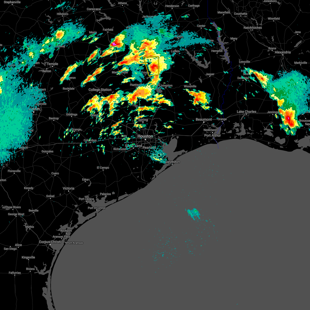 At 804 am cdt, a severe thunderstorm was located near groveton, or 17 miles southwest of apple springs, moving north at 40 mph (radar indicated). Hazards include 60 mph wind gusts and quarter size hail. Hail damage to vehicles is expected. expect wind damage to roofs, siding, and trees. locations impacted include, groveton and pennington. A tornado watch remains in effect until 100 pm cdt for southeastern texas. At 804 am cdt, a severe thunderstorm was located near groveton, or 17 miles southwest of apple springs, moving north at 40 mph (radar indicated). Hazards include 60 mph wind gusts and quarter size hail. Hail damage to vehicles is expected. expect wind damage to roofs, siding, and trees. locations impacted include, groveton and pennington. A tornado watch remains in effect until 100 pm cdt for southeastern texas.
|
| 4/2/2017 7:44 AM CDT |
 At 744 am cdt, a severe thunderstorm was located near sebastopol, or 23 miles northwest of livingston, moving north at 40 mph (radar indicated). Hazards include 60 mph wind gusts and quarter size hail. Hail damage to vehicles is expected. Expect wind damage to roofs, siding, and trees. At 744 am cdt, a severe thunderstorm was located near sebastopol, or 23 miles northwest of livingston, moving north at 40 mph (radar indicated). Hazards include 60 mph wind gusts and quarter size hail. Hail damage to vehicles is expected. Expect wind damage to roofs, siding, and trees.
|
| 4/2/2017 7:37 AM CDT |
 At 737 am cdt, a severe thunderstorm was located near sebastopol, or 17 miles northwest of livingston, moving north at 35 mph (radar indicated). Hazards include 60 mph wind gusts and quarter size hail. Hail damage to vehicles is expected. expect wind damage to roofs, siding, and trees. locations impacted include, trinity, onalaska, groveton and sebastopol. A tornado watch remains in effect until 100 pm cdt for southeastern texas. At 737 am cdt, a severe thunderstorm was located near sebastopol, or 17 miles northwest of livingston, moving north at 35 mph (radar indicated). Hazards include 60 mph wind gusts and quarter size hail. Hail damage to vehicles is expected. expect wind damage to roofs, siding, and trees. locations impacted include, trinity, onalaska, groveton and sebastopol. A tornado watch remains in effect until 100 pm cdt for southeastern texas.
|
| 4/2/2017 7:18 AM CDT |
 At 718 am cdt, a severe thunderstorm was located near point blank, or 16 miles west of livingston, moving north at 35 mph (radar indicated). Hazards include 60 mph wind gusts and quarter size hail. Hail damage to vehicles is expected. Expect wind damage to roofs, siding, and trees. At 718 am cdt, a severe thunderstorm was located near point blank, or 16 miles west of livingston, moving north at 35 mph (radar indicated). Hazards include 60 mph wind gusts and quarter size hail. Hail damage to vehicles is expected. Expect wind damage to roofs, siding, and trees.
|
| 3/24/2017 8:31 PM CDT |
 At 830 pm cdt, a severe thunderstorm was located near sebastopol, or 20 miles northwest of livingston, moving northeast at 40 mph. this storm has a history of blowing trees down in walker county (radar indicated). Hazards include 60 mph wind gusts and quarter size hail. Hail damage to vehicles is expected. Expect wind damage to roofs, siding, and trees. At 830 pm cdt, a severe thunderstorm was located near sebastopol, or 20 miles northwest of livingston, moving northeast at 40 mph. this storm has a history of blowing trees down in walker county (radar indicated). Hazards include 60 mph wind gusts and quarter size hail. Hail damage to vehicles is expected. Expect wind damage to roofs, siding, and trees.
|
| 2/14/2017 8:58 AM CST |
 At 858 am cst, severe thunderstorms were located along a line extending from 9 miles east of crockett to near point blank to 7 miles east of cut and shoot, moving northeast at 85 mph (radar indicated). Hazards include 60 mph wind gusts. expect damage to roofs, siding, and trees At 858 am cst, severe thunderstorms were located along a line extending from 9 miles east of crockett to near point blank to 7 miles east of cut and shoot, moving northeast at 85 mph (radar indicated). Hazards include 60 mph wind gusts. expect damage to roofs, siding, and trees
|
| 2/14/2017 8:21 AM CST |
 At 819 am cst, severe thunderstorms were located along a line extending from 14 miles east of madisonville to huntsville to 6 miles west of new waverly, moving east at 30 mph. this storm produced 60 mph gusts as it passed over huntsville (radar indicated). Hazards include 60 mph wind gusts. expect damage to roofs, siding, and trees At 819 am cst, severe thunderstorms were located along a line extending from 14 miles east of madisonville to huntsville to 6 miles west of new waverly, moving east at 30 mph. this storm produced 60 mph gusts as it passed over huntsville (radar indicated). Hazards include 60 mph wind gusts. expect damage to roofs, siding, and trees
|
| 1/2/2017 7:45 AM CST |
 At 745 am cst, severe thunderstorms were located along a line extending from near apple springs to 6 miles north of hockley to weston lakes, moving east at 35 mph (radar indicated). Hazards include 60 mph wind gusts and penny size hail. expect damage to roofs, siding, and trees At 745 am cst, severe thunderstorms were located along a line extending from near apple springs to 6 miles north of hockley to weston lakes, moving east at 35 mph (radar indicated). Hazards include 60 mph wind gusts and penny size hail. expect damage to roofs, siding, and trees
|
| 1/2/2017 6:59 AM CST |
 At 658 am cst, severe thunderstorms were located along a line extending from 8 miles southwest of maydelle to 15 miles east of madisonville, moving east at 35 mph (radar indicated). Hazards include 60 mph wind gusts. expect damage to roofs, siding, and trees At 658 am cst, severe thunderstorms were located along a line extending from 8 miles southwest of maydelle to 15 miles east of madisonville, moving east at 35 mph (radar indicated). Hazards include 60 mph wind gusts. expect damage to roofs, siding, and trees
|
| 5/2/2016 4:18 AM CDT |
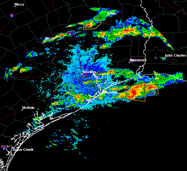 At 417 am cdt, a severe thunderstorm was located 8 miles northeast of trinity, or 22 miles southwest of apple springs, moving east at 15 mph (radar indicated). Hazards include quarter size hail. damage to vehicles is possible At 417 am cdt, a severe thunderstorm was located 8 miles northeast of trinity, or 22 miles southwest of apple springs, moving east at 15 mph (radar indicated). Hazards include quarter size hail. damage to vehicles is possible
|
| 4/27/2016 4:29 AM CDT |
 At 428 am cdt, a severe thunderstorm was located near groveton, or 10 miles southwest of apple springs, moving northeast at 35 mph (radar indicated). Hazards include 60 mph wind gusts and penny size hail. Expect damage to roofs. siding. And trees. At 428 am cdt, a severe thunderstorm was located near groveton, or 10 miles southwest of apple springs, moving northeast at 35 mph (radar indicated). Hazards include 60 mph wind gusts and penny size hail. Expect damage to roofs. siding. And trees.
|
| 4/27/2016 4:26 AM CDT |
 At 425 am cdt, severe thunderstorms were located along a line extending from 8 miles northeast of madisonville to 9 miles west of huntsville to 12 miles west of huntsville state park, moving northeast at 45 mph (radar indicated). Hazards include 60 mph wind gusts. Expect damage to roofs. siding. And trees. At 425 am cdt, severe thunderstorms were located along a line extending from 8 miles northeast of madisonville to 9 miles west of huntsville to 12 miles west of huntsville state park, moving northeast at 45 mph (radar indicated). Hazards include 60 mph wind gusts. Expect damage to roofs. siding. And trees.
|
| 12/27/2015 9:47 AM CST |
 At 947 am cst, a severe thunderstorm was located near groveton, or 11 miles southwest of apple springs, moving north at 45 mph (radar indicated). Hazards include 60 mph wind gusts. Expect damage to roofs. Siding and trees. At 947 am cst, a severe thunderstorm was located near groveton, or 11 miles southwest of apple springs, moving north at 45 mph (radar indicated). Hazards include 60 mph wind gusts. Expect damage to roofs. Siding and trees.
|
| 11/17/2015 9:40 AM CST |
 The severe thunderstorm warning for trinity, northern walker, northwestern san jacinto, central houston and northern polk counties will expire at 945 am cst, the storms which prompted the warning have weakened below severe limits, and no longer pose an immediate threat to life or property. therefore the warning will be allowed to expire. however gusty winds are still possible with these thunderstorms. a tornado watch remains in effect until 400 pm cst for southeastern texas. The severe thunderstorm warning for trinity, northern walker, northwestern san jacinto, central houston and northern polk counties will expire at 945 am cst, the storms which prompted the warning have weakened below severe limits, and no longer pose an immediate threat to life or property. therefore the warning will be allowed to expire. however gusty winds are still possible with these thunderstorms. a tornado watch remains in effect until 400 pm cst for southeastern texas.
|
| 11/17/2015 9:10 AM CST | Trinity county sheriffs office reported large tree down on fm1280 nw of groveto in trinity county TX, 10.3 miles SE of Groveton, TX |
| 11/17/2015 8:57 AM CST |
 At 854 am cst, severe thunderstorms were located along a line extending from near lovelady to near sebastopol to near onalaska to point blank, moving northeast at 45 mph. the ground is wet and trees still have foliage, so the primary hazard with these storms will be toppled trees (radar indicated). Hazards include 60 mph wind gusts. Expect damage to roofs. Siding and trees. At 854 am cst, severe thunderstorms were located along a line extending from near lovelady to near sebastopol to near onalaska to point blank, moving northeast at 45 mph. the ground is wet and trees still have foliage, so the primary hazard with these storms will be toppled trees (radar indicated). Hazards include 60 mph wind gusts. Expect damage to roofs. Siding and trees.
|
| 11/17/2015 8:39 AM CST |
 At 837 am cst, clusters of strong to severe thunderstorms were located near pennington and another on about to move northeast across the lake and toward trinity. movement of most cells were northeast at 45 mph (radar indicated). Hazards include 60 mph wind gusts and penny size hail. Expect damage to roofs. siding and trees. locations impacted include, apple springs, trinity, groveton, kennard, sebastopol, weches, pennington and centralia. A tornado watch remains in effect until 900 am cst for southeastern texas. At 837 am cst, clusters of strong to severe thunderstorms were located near pennington and another on about to move northeast across the lake and toward trinity. movement of most cells were northeast at 45 mph (radar indicated). Hazards include 60 mph wind gusts and penny size hail. Expect damage to roofs. siding and trees. locations impacted include, apple springs, trinity, groveton, kennard, sebastopol, weches, pennington and centralia. A tornado watch remains in effect until 900 am cst for southeastern texas.
|
| 11/17/2015 8:04 AM CST |
 At 804 am cst, severe thunderstorms were located along a line extending from near lovelady to trinity to near riverside, moving northeast at 45 mph (radar indicated). Hazards include 60 mph wind gusts and penny size hail. Expect damage to roofs. Siding and trees. At 804 am cst, severe thunderstorms were located along a line extending from near lovelady to trinity to near riverside, moving northeast at 45 mph (radar indicated). Hazards include 60 mph wind gusts and penny size hail. Expect damage to roofs. Siding and trees.
|
| 5/30/2015 6:50 PM CDT | At 649 pm cdt, doppler radar indicated a severe thunderstorm capable of producing quarter size hail and damaging winds in excess of 60 mph. this storm was located near groveton, or 10 miles southwest of apple springs, and moving northeast at 20 mph. |
| 5/25/2015 7:28 PM CDT | At 728 pm cdt, doppler radar indicated a severe thunderstorm capable of producing quarter size hail and damaging winds in excess of 60 mph. this storm was located near riverside, or 11 miles east of huntsville, and moving east at 35 mph. |
| 5/25/2015 6:52 PM CDT | At 651 pm cdt, doppler radar indicated a severe thunderstorm capable of producing damaging winds in excess of 60 mph. this storm was located 8 miles south of kennard, or 11 miles west of apple springs, and moving east at 45 mph. |
| 4/27/2015 5:08 AM CDT | At 508 am cdt, doppler radar indicated a line of severe thunderstorms capable of producing destructive winds in excess of 70 mph. these storms were located along a line extending from near woden to 11 miles north of chester to near seven oaks, moving east at 55 mph. locations impacted include, apple springs, onalaska, corrigan, groveton, seven oaks, moscow, leggett and centralia. a tornado watch remains in effect until 900 am cdt for southeastern texas. |
| 4/27/2015 4:40 AM CDT | At 440 am cdt, doppler radar indicated a line of severe thunderstorms capable of producing destructive winds in excess of 70 mph. these storms were located along a line extending from near pollok to 8 miles northwest of corrigan to near riverside, and moving east at 55 mph. |
| 4/27/2015 4:36 AM CDT | Widespread trees down reported on the north side of trinity county... with three quarter inch hail reported from apple spring to groveton in trinity county TX, 0.4 miles SSE of Groveton, TX |
| 4/19/2015 5:42 PM CDT | The severe thunderstorm warning for southeastern houston and central trinity counties will expire at 545 pm cdt, the storm which prompted the warning has weakened below severe limits. therefore the warning will be allowed to expire. small hail up to one-half inch is still possible with this storm. |
| 4/19/2015 5:36 PM CDT | At 535 pm cdt, doppler radar indicated a severe thunderstorm capable of producing quarter size hail. this storm was located 9 miles northwest of groveton, or 17 miles southeast of crockett, moving east at 40 mph. locations impacted include, groveton and pennington. |
| 4/19/2015 5:16 PM CDT | The national weather service in league city has issued a * severe thunderstorm warning for. south central houston county in southeastern texas. central trinity county in southeastern texas. northeastern walker county in southeastern texas. Until 545 pm cdt. |
| 4/18/2015 11:40 PM CDT | At 1139 pm cdt, doppler radar indicated a line of severe thunderstorms capable of producing quarter size hail and damaging winds in excess of 60 mph. these storms were located along a line extending from near hudson to seven oaks to near coldspring, and moving east at around 50 mph. |
| 6/6/2013 4:16 PM CDT | Numerous trees and power lines down...especially between apple springs and groveto in trinity county TX, 5.6 miles SW of Groveton, TX |
| 8/31/2012 6:30 PM CDT | Trees down near groveton at hwys fm355 and us287 in trinity county TX, 1.1 miles WSW of Groveton, TX |
| 7/21/2012 9:37 PM CDT | Numerous trees down across town and power outage in trinity county TX, 0.4 miles SSE of Groveton, TX |
| 7/21/2012 9:16 PM CDT | Trees downed on fm2501 in trinity county TX, 10.1 miles SW of Groveton, TX |
| 7/21/2012 9:16 PM CDT | Tree limbs down on highway 94 in trinity county TX, 5.1 miles SW of Groveton, TX |
| 4/4/2012 12:58 AM CDT | Quarter sized hail reported 6 miles SW of Groveton, TX, on highway 94 |
| 1/1/0001 12:00 AM | Golf Ball sized hail reported 0.4 miles SSE of Groveton, TX, hail fell in groveton reported by the public to dispatch. |
Hail Maps for Groveton, TX
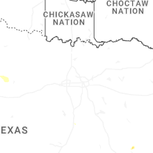
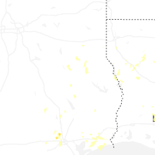
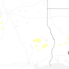


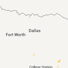


Connect with Interactive Hail Maps