

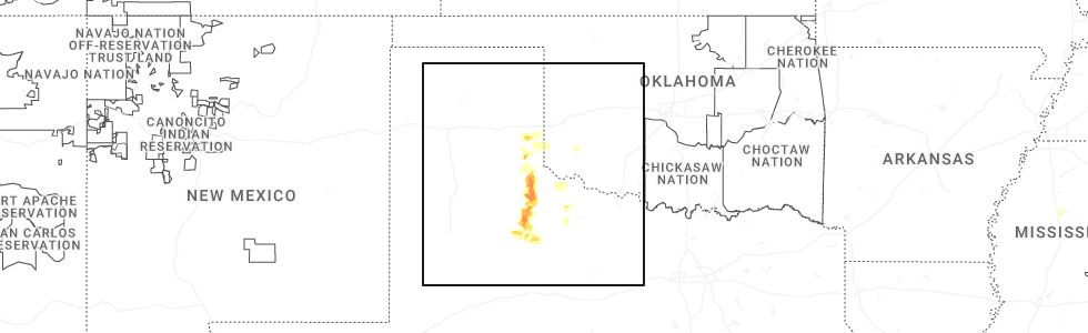
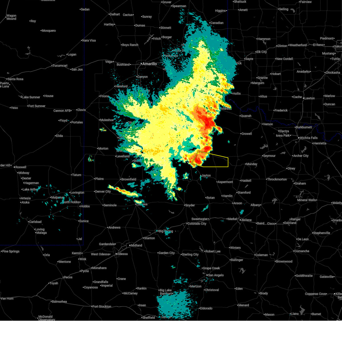
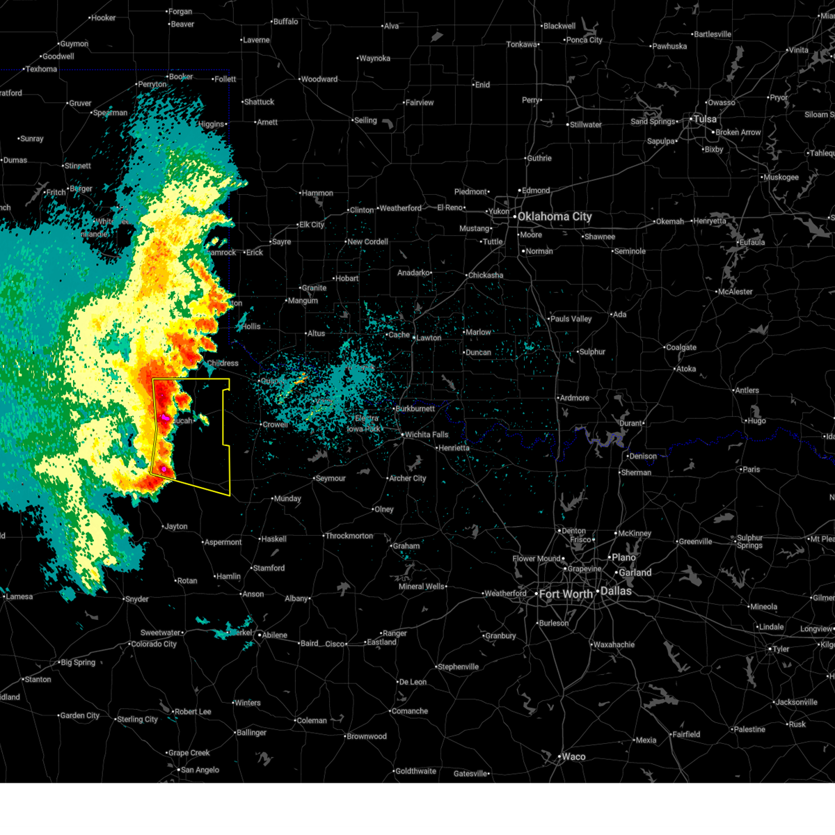
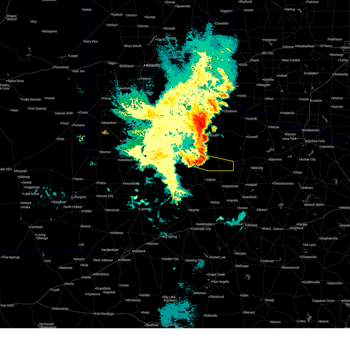
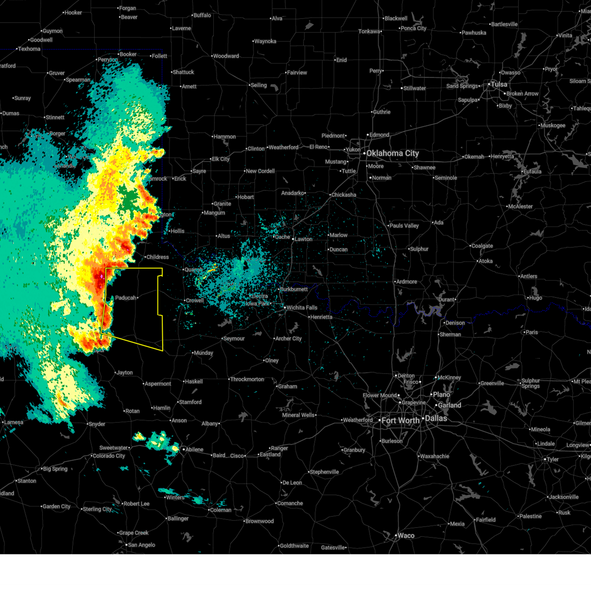
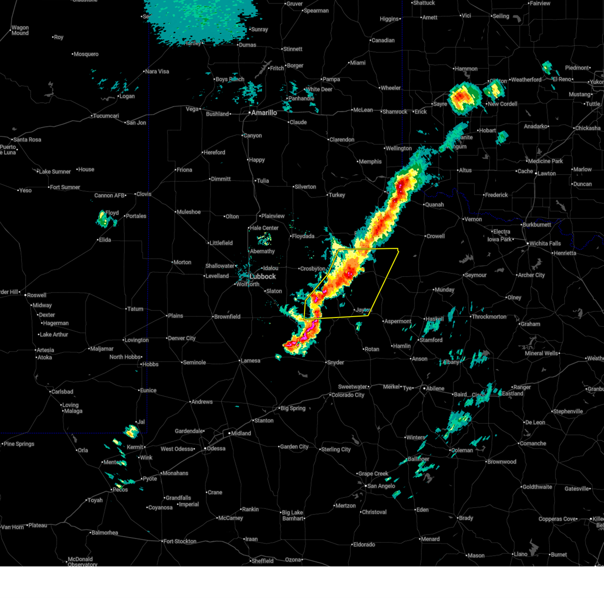
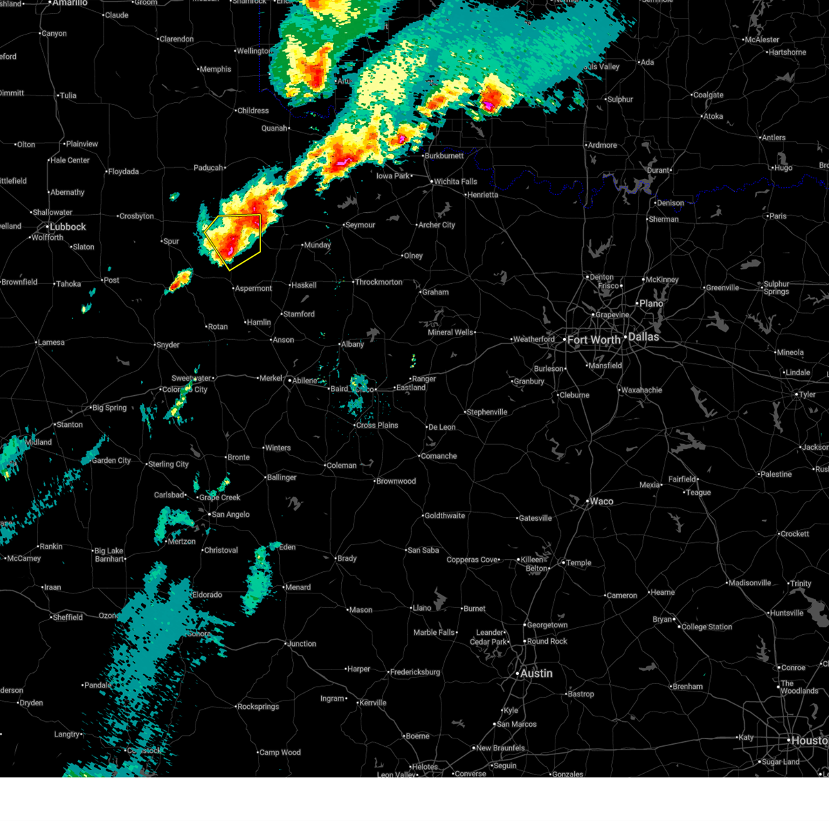
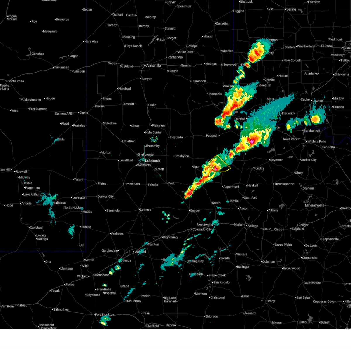
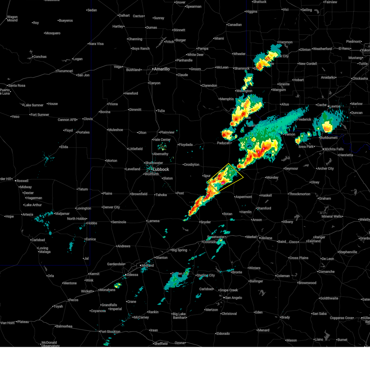
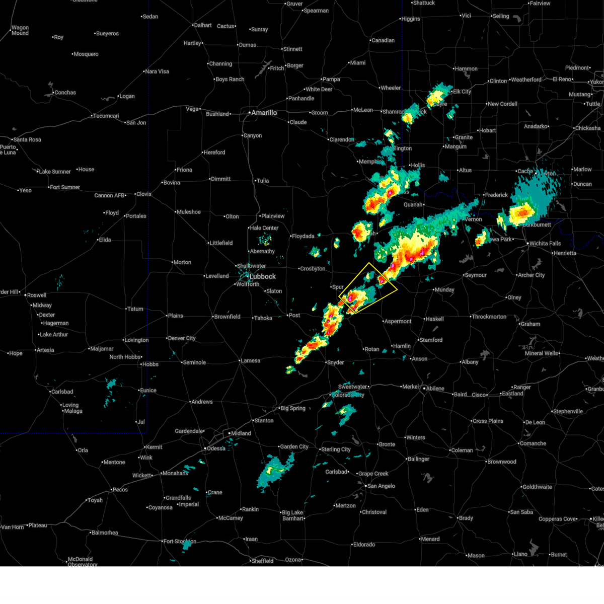
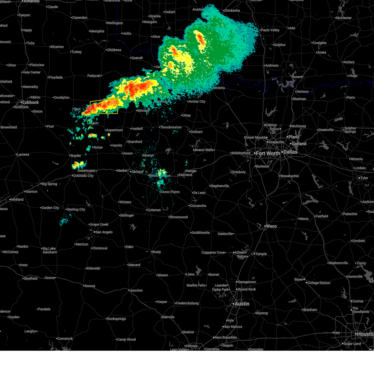
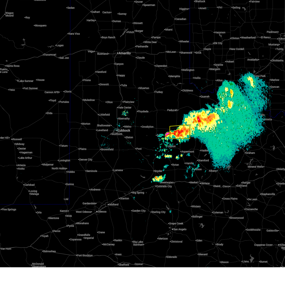
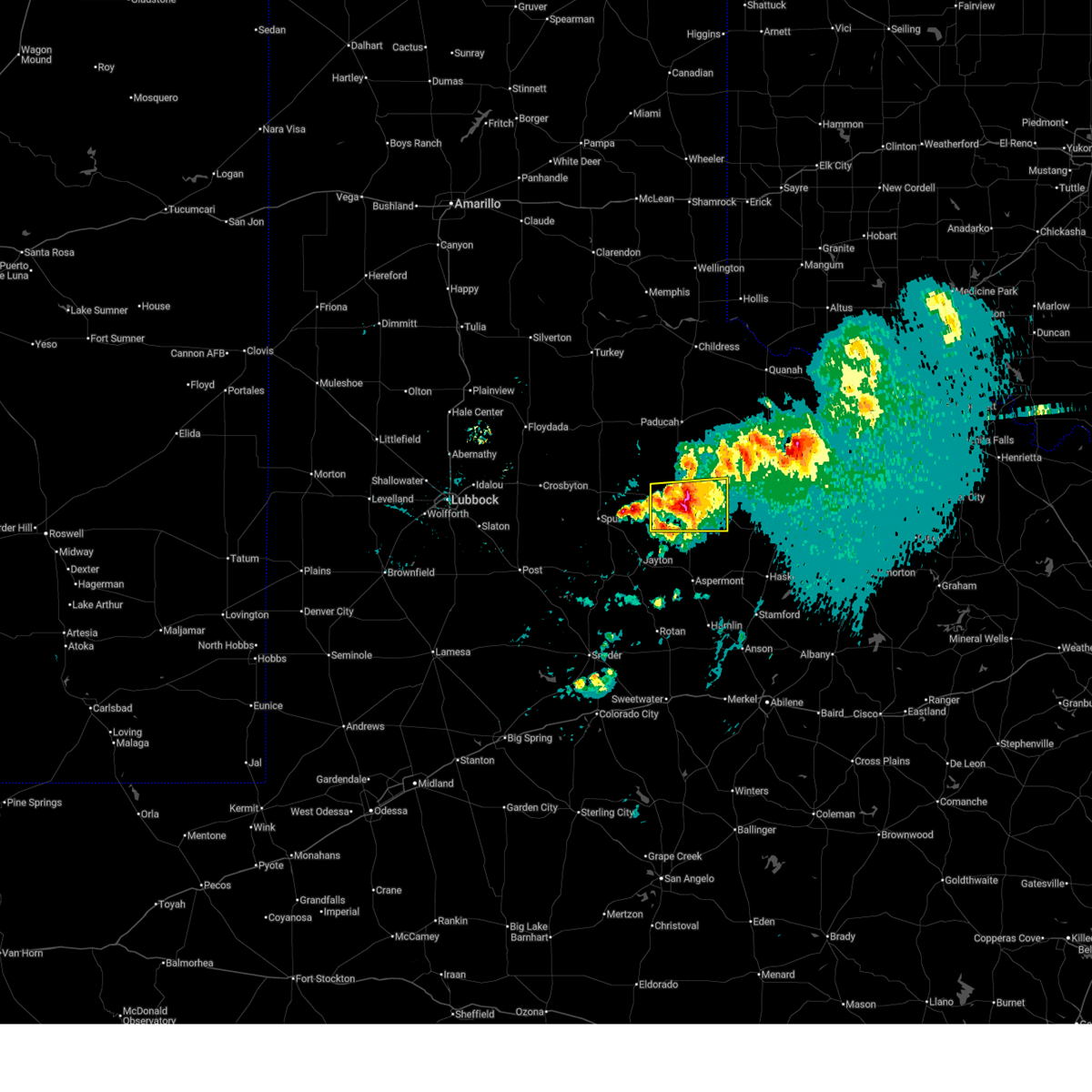
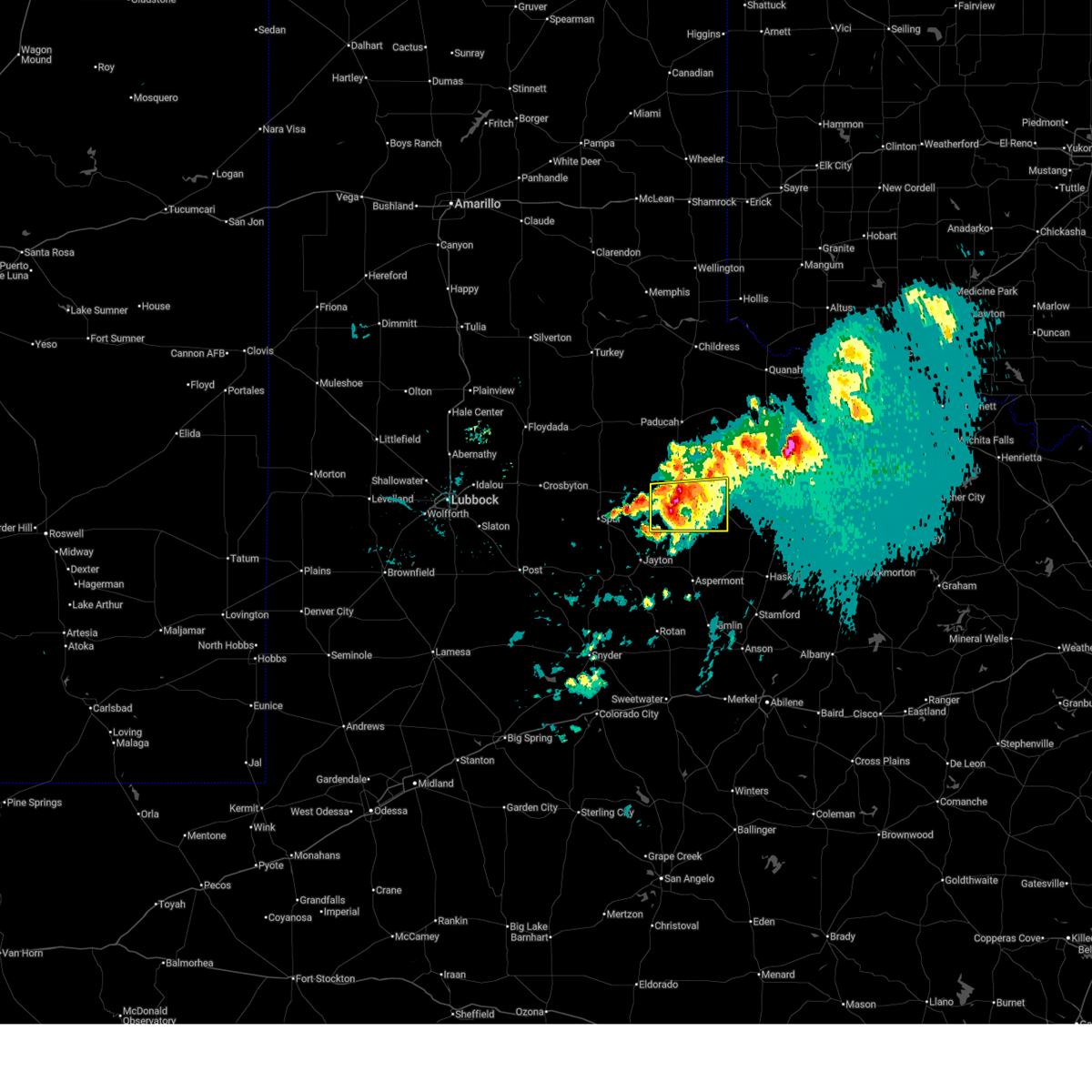
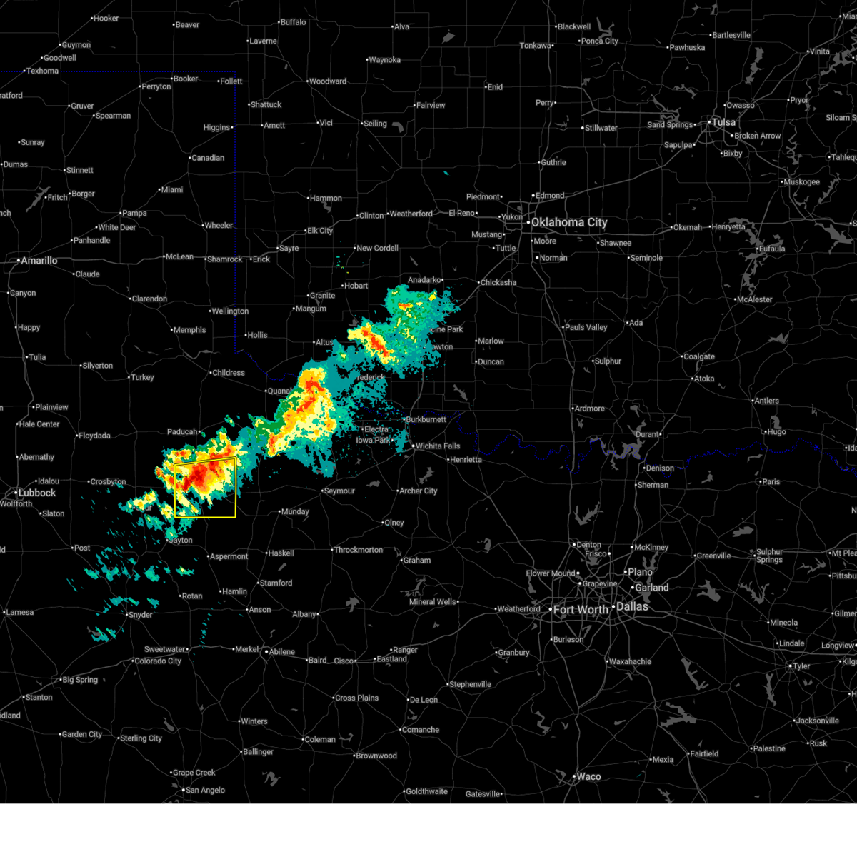
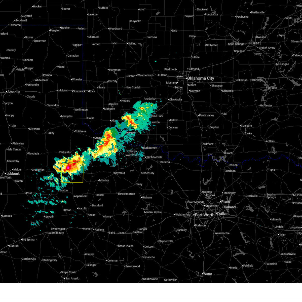
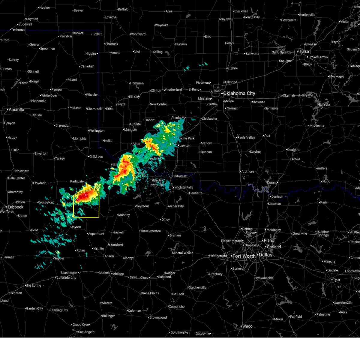
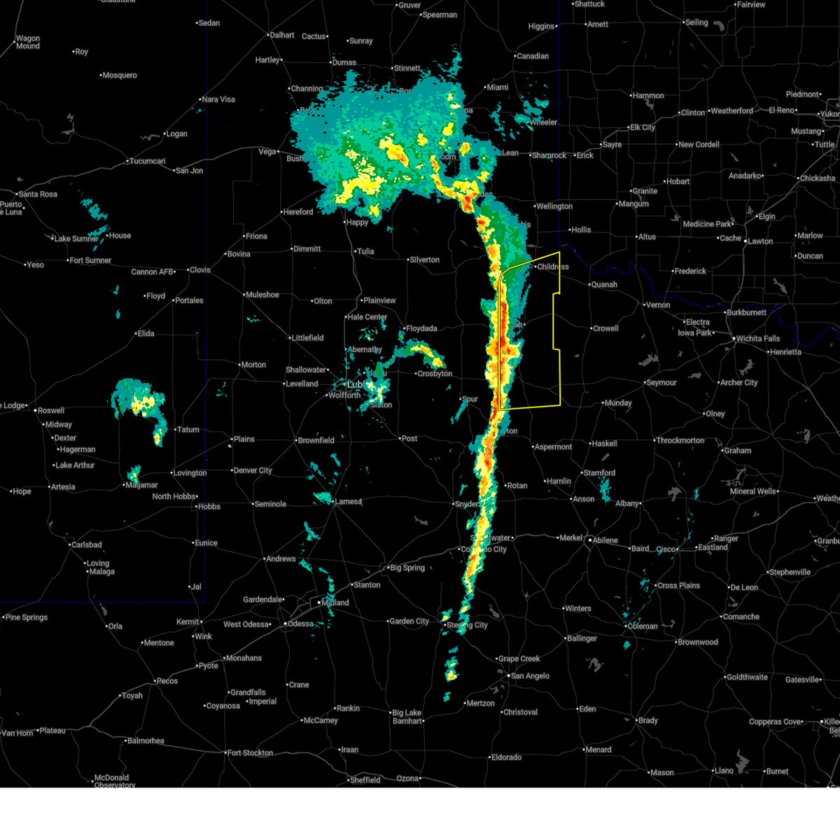
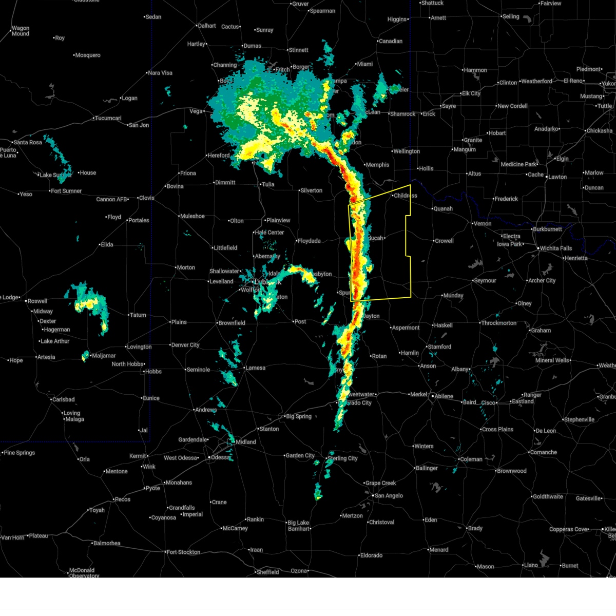
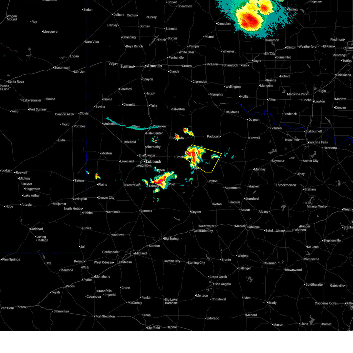
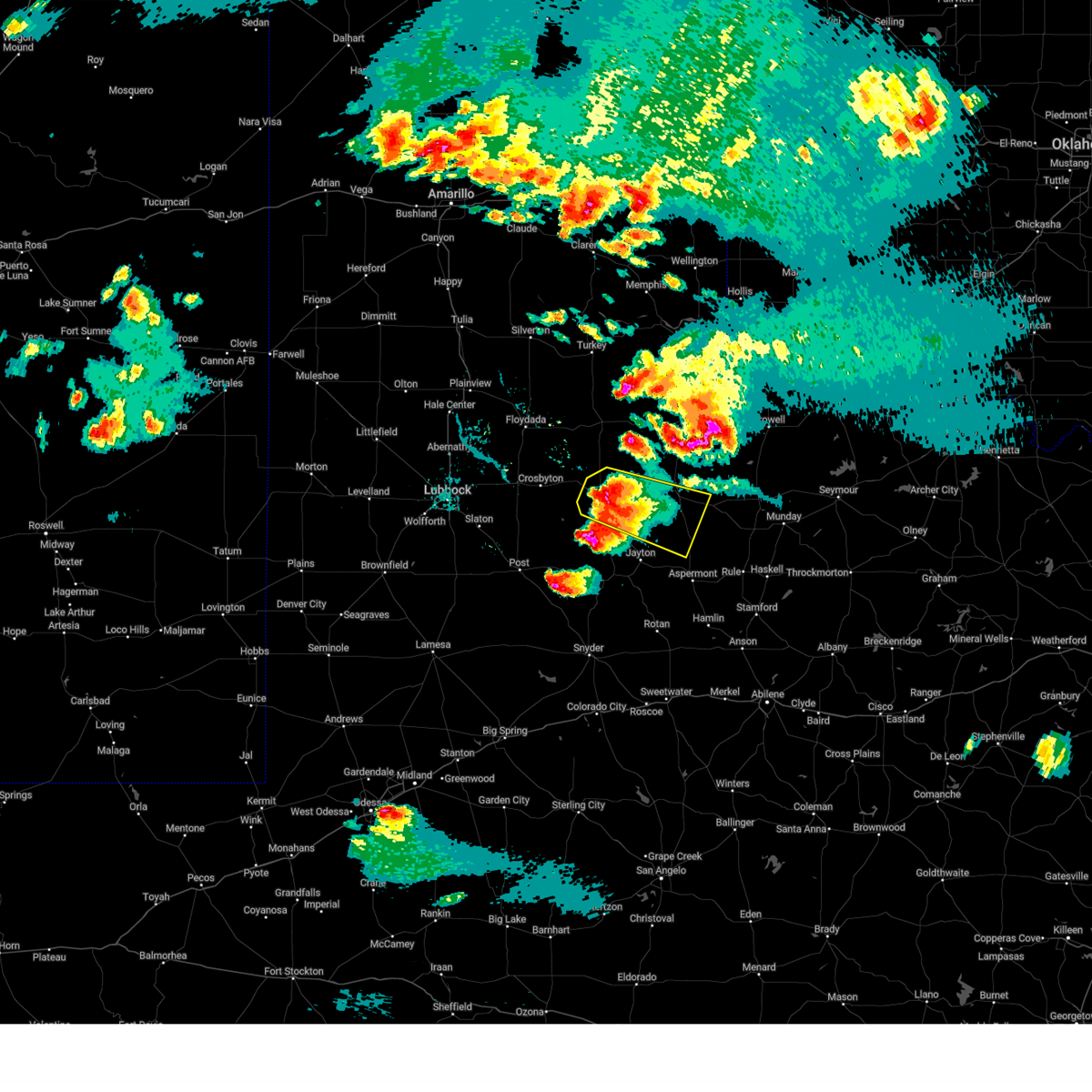
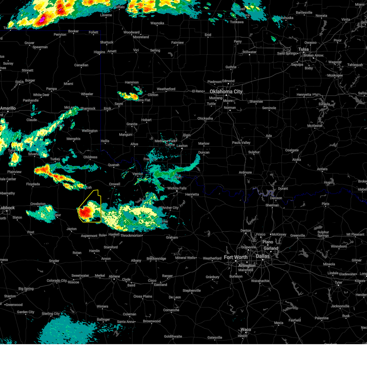
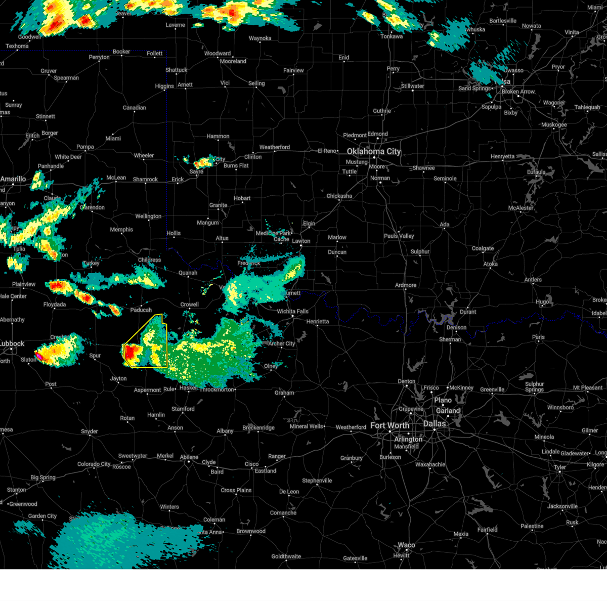
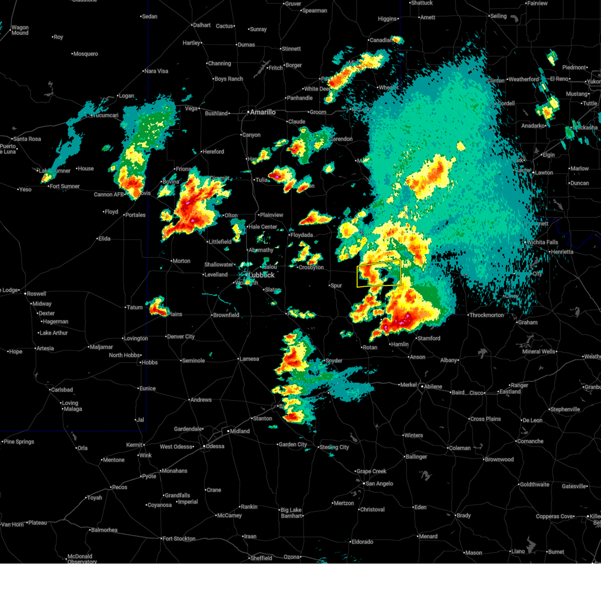
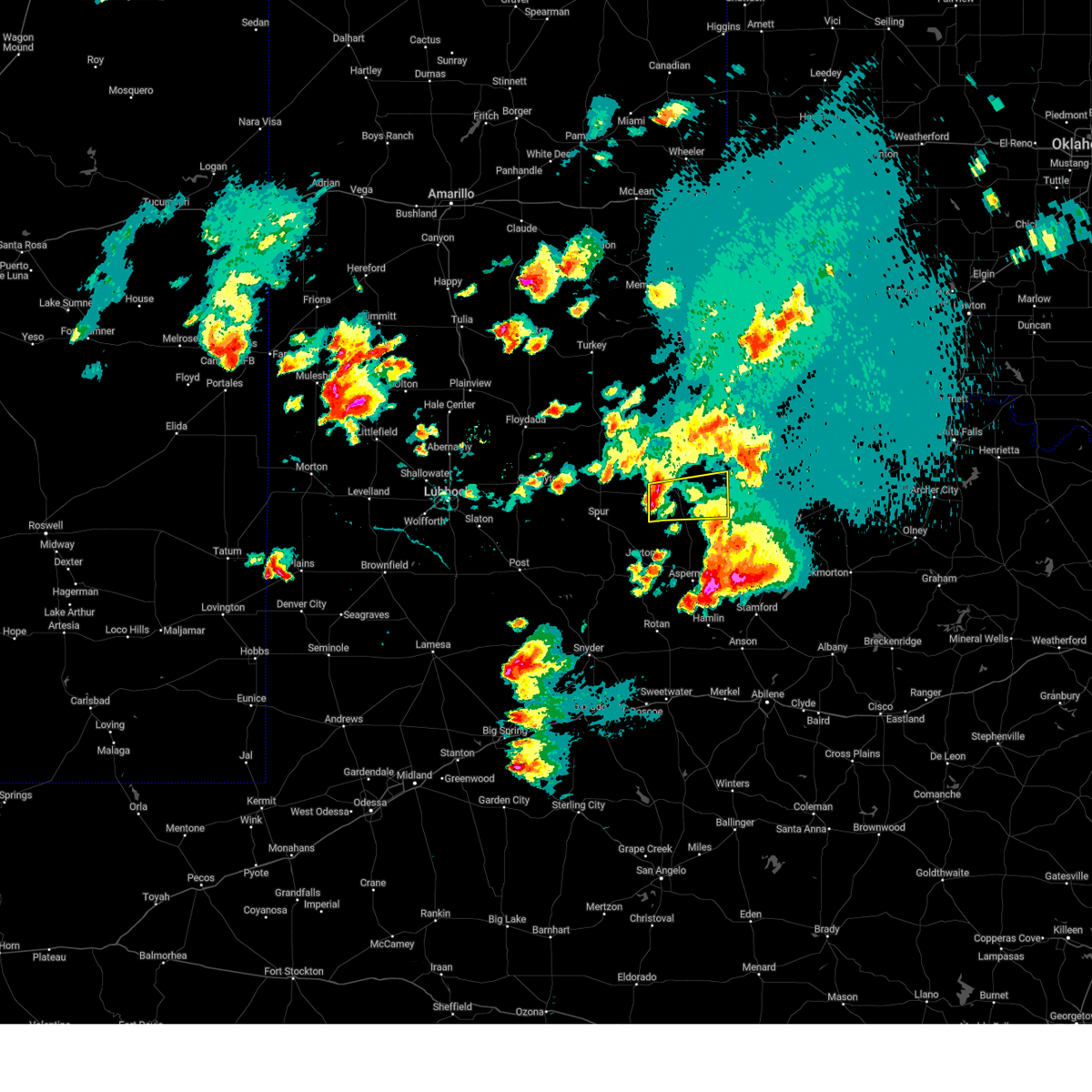
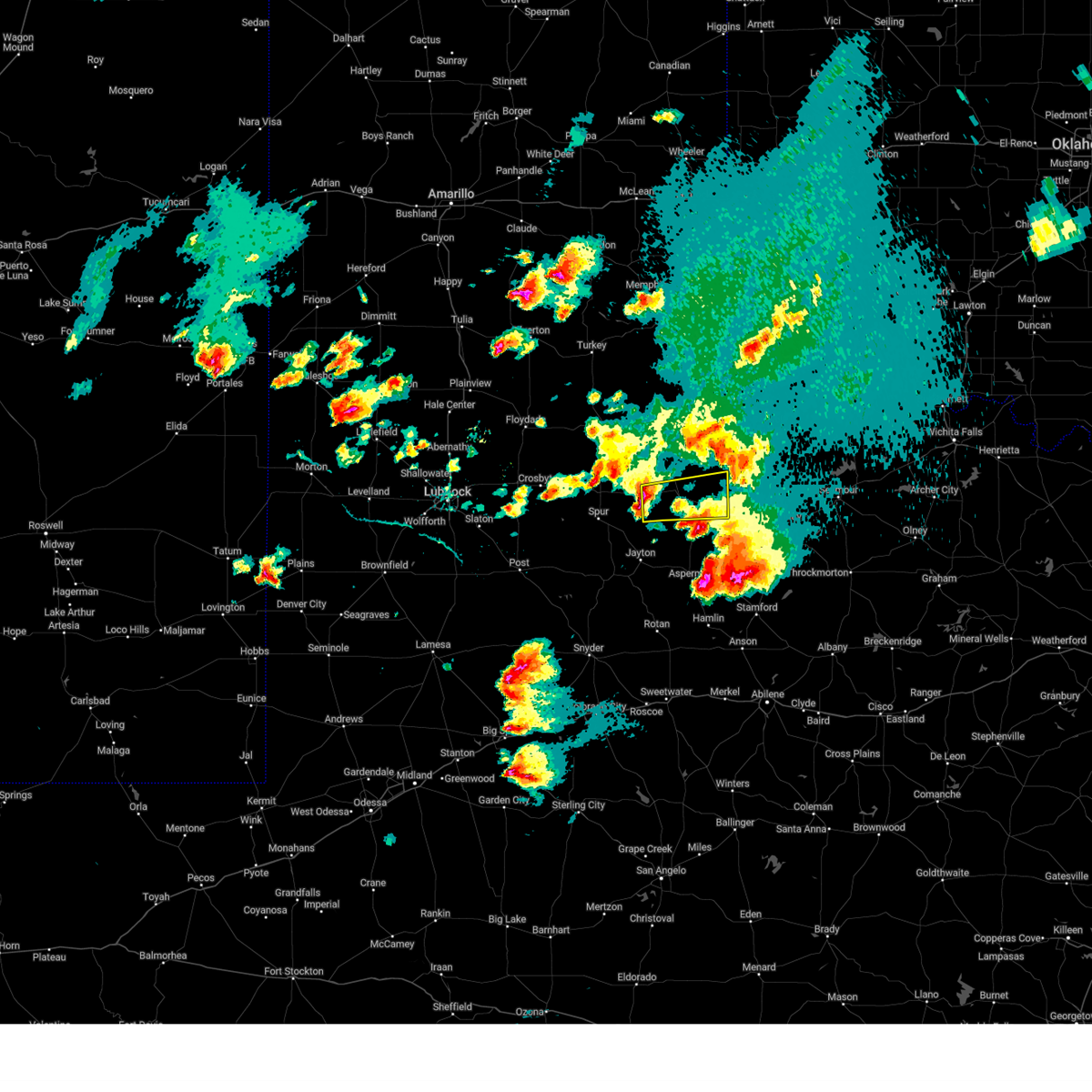
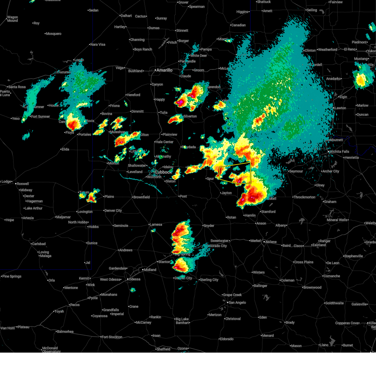
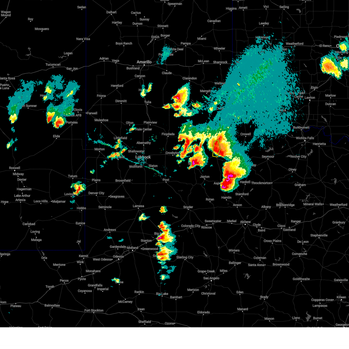
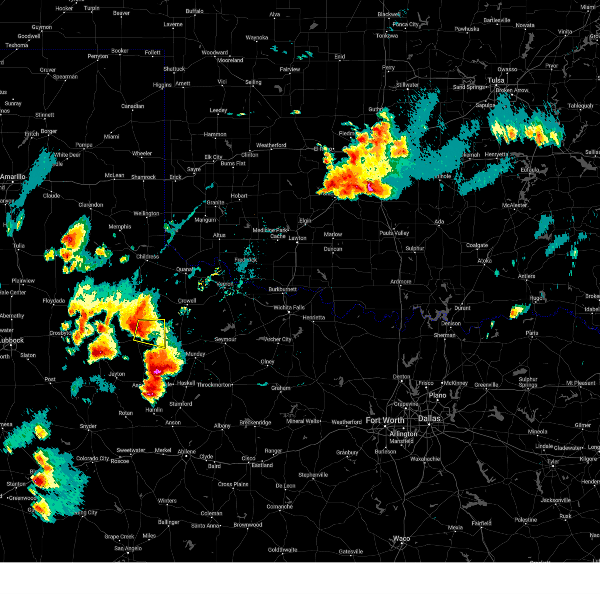
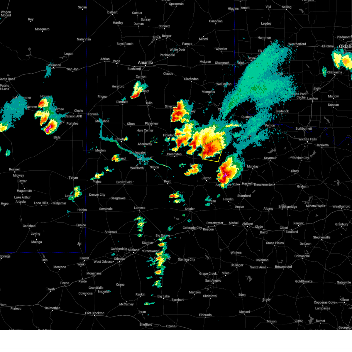
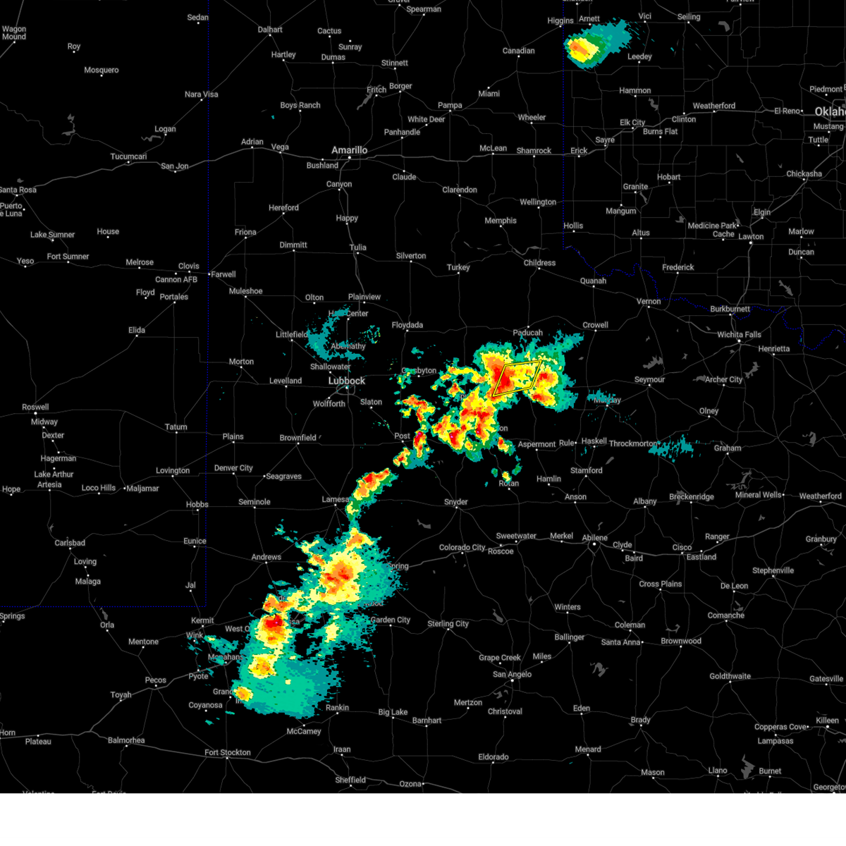
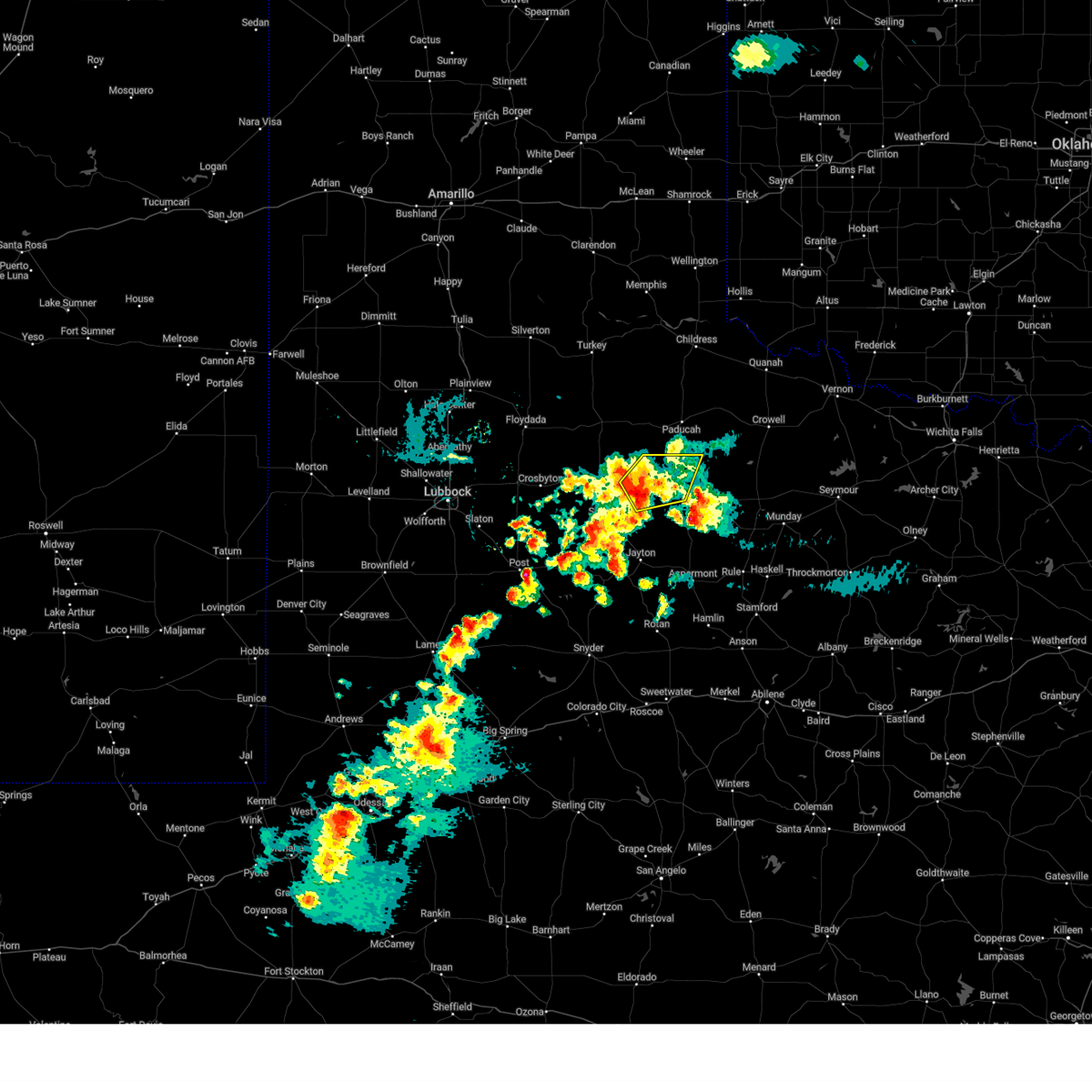
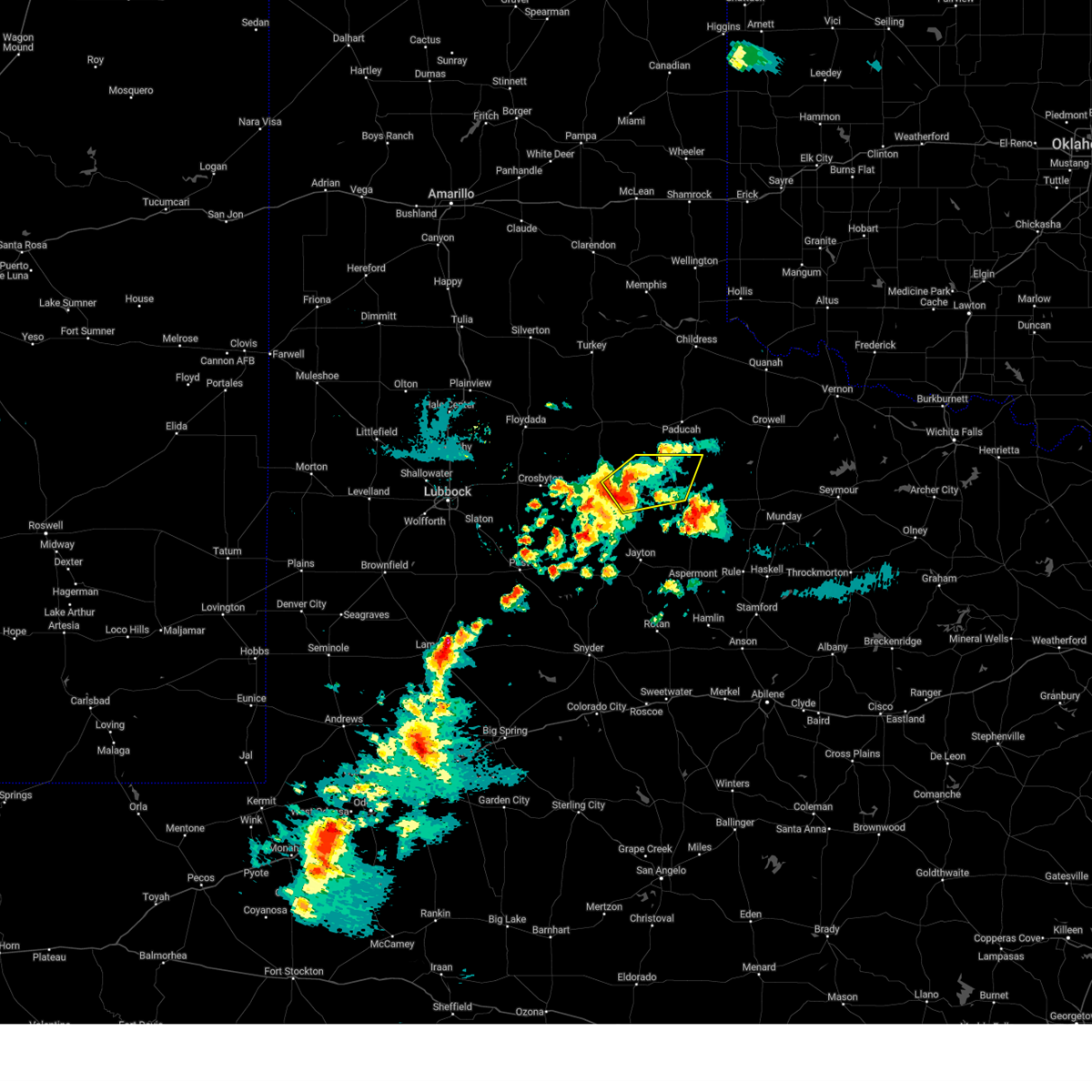
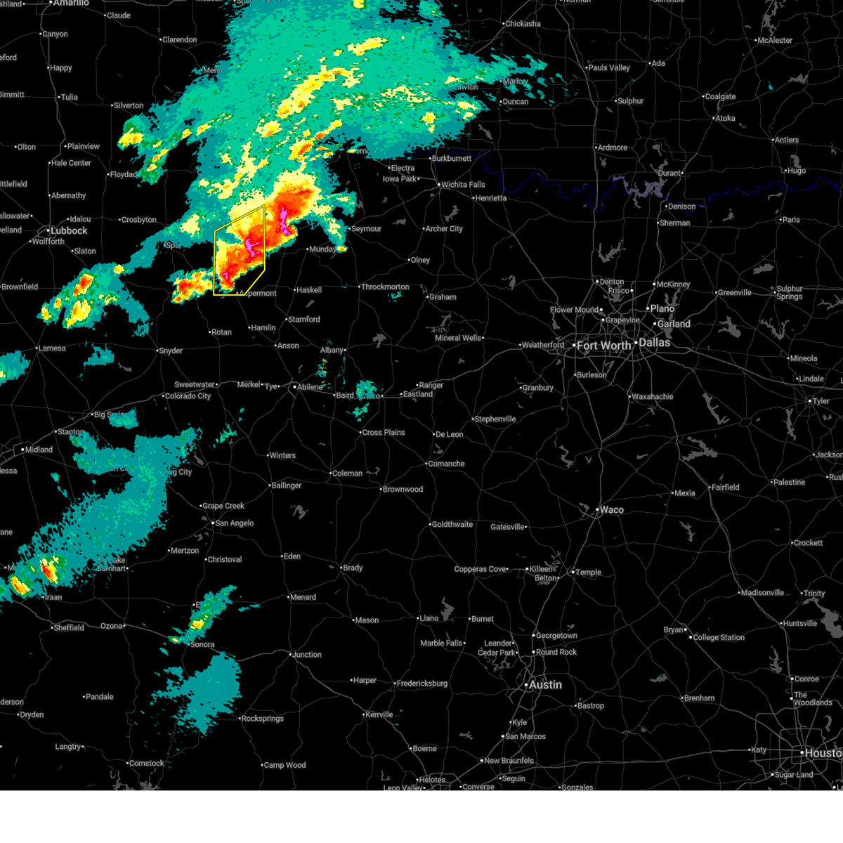
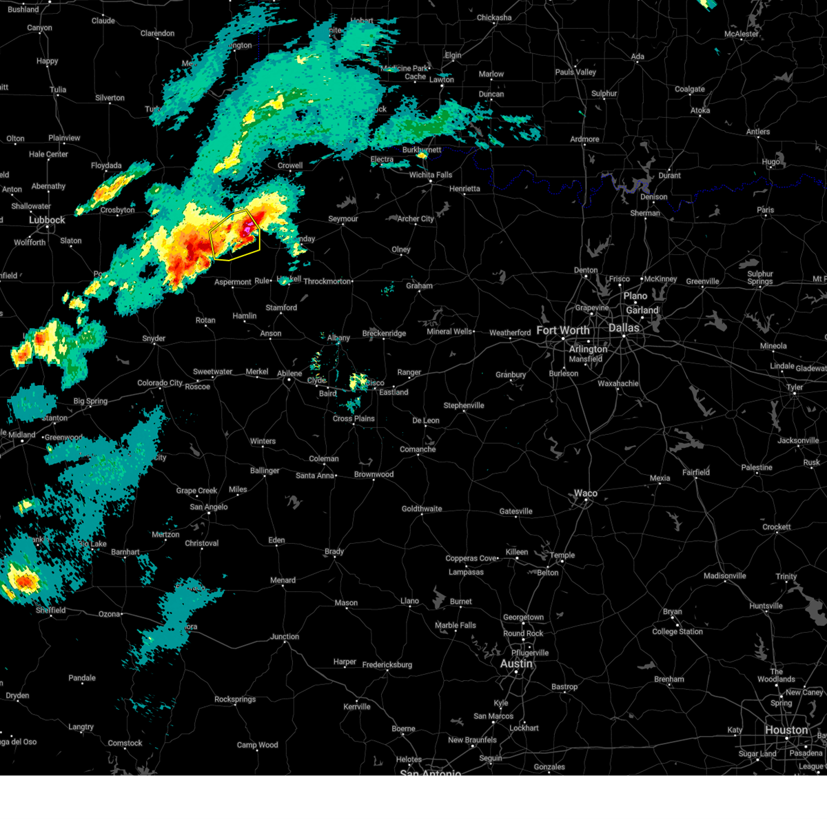
Hail Map for Guthrie, TX
The Guthrie, TX area has had 19 reports of on-the-ground hail by trained spotters, and has been under severe weather warnings 43 times during the past 12 months. Doppler radar has detected hail at or near Guthrie, TX on 115 occasions, including 5 occasions during the past year.
| Name: | Guthrie, TX |
| Where Located: | 56.2 miles S of Childress, TX |
| Map: | Google Map for Guthrie, TX |
| Population: | 160 |
| Housing Units: | 78 |
| More Info: | Search Google for Guthrie, TX |
2
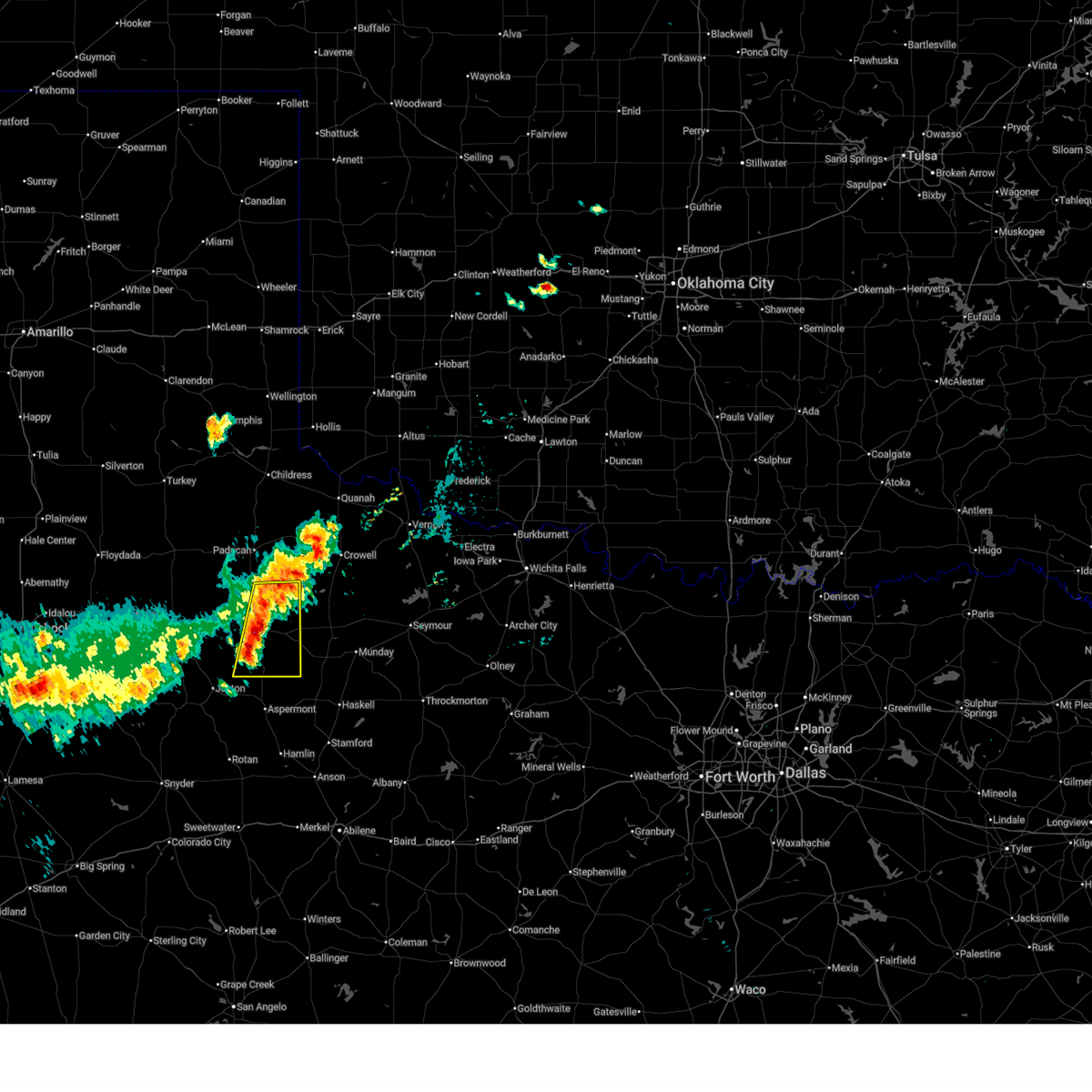
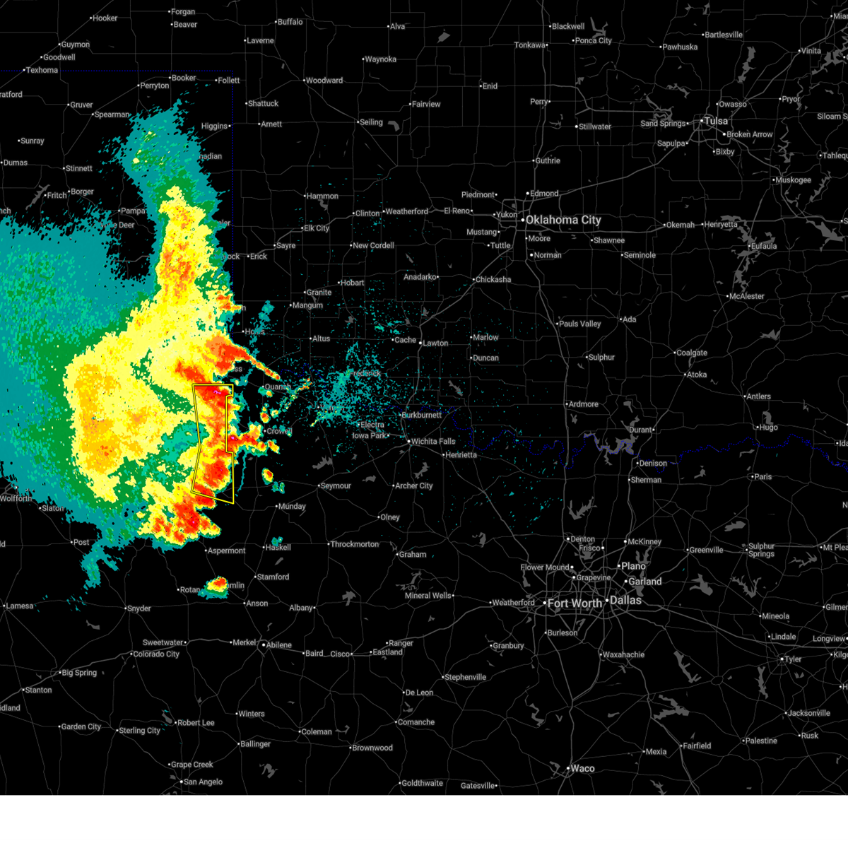
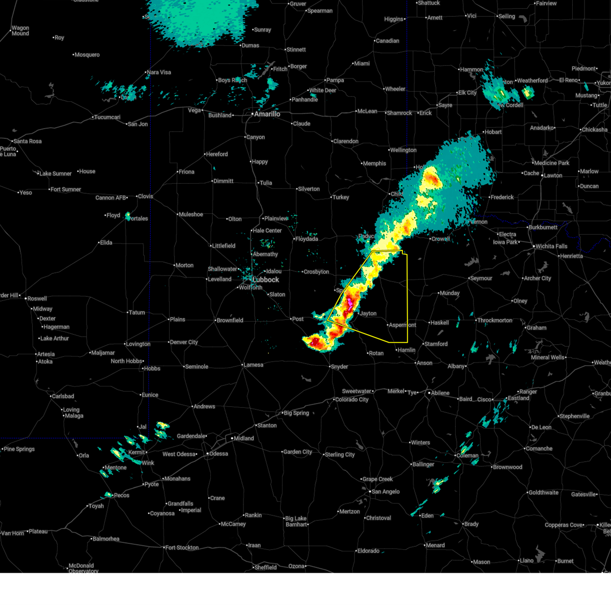
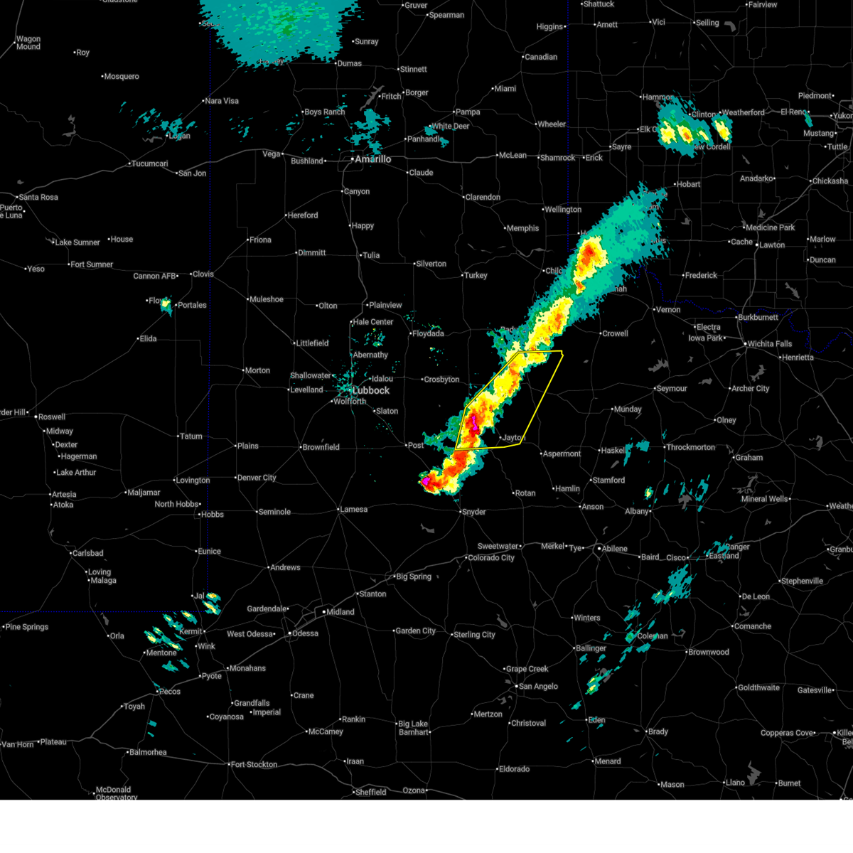
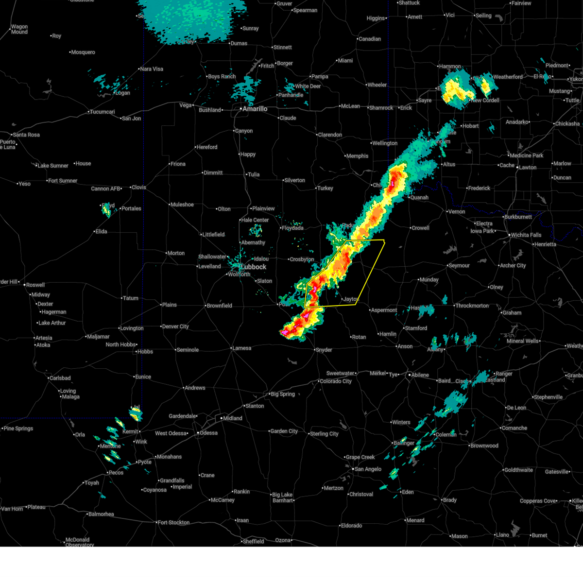
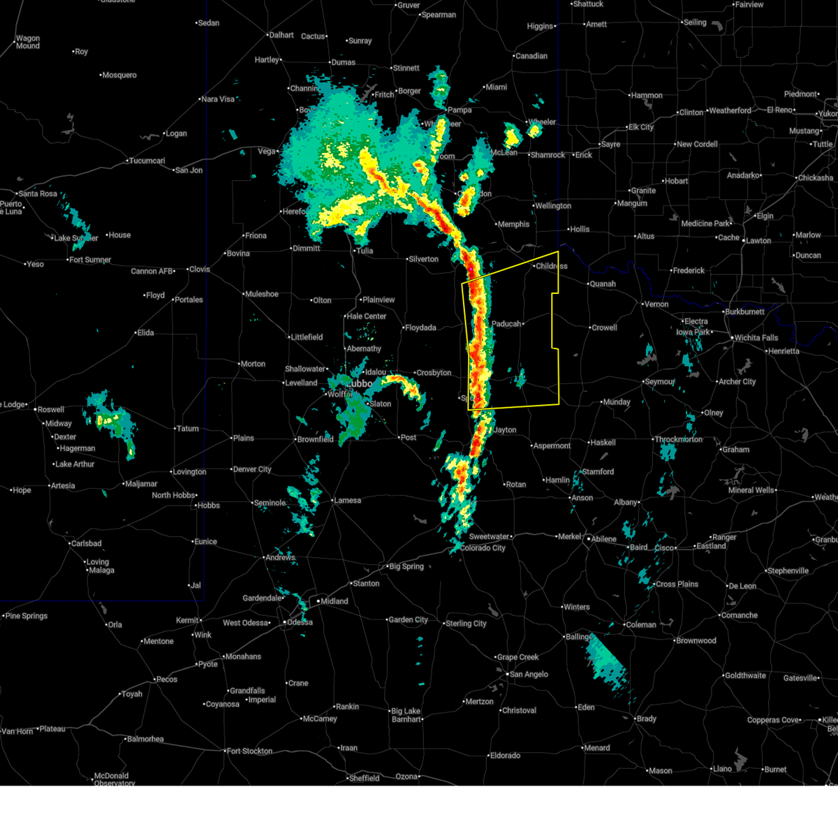
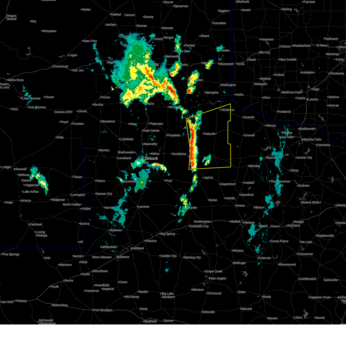
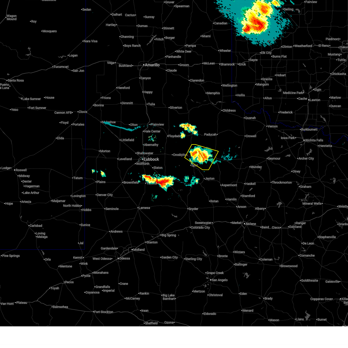
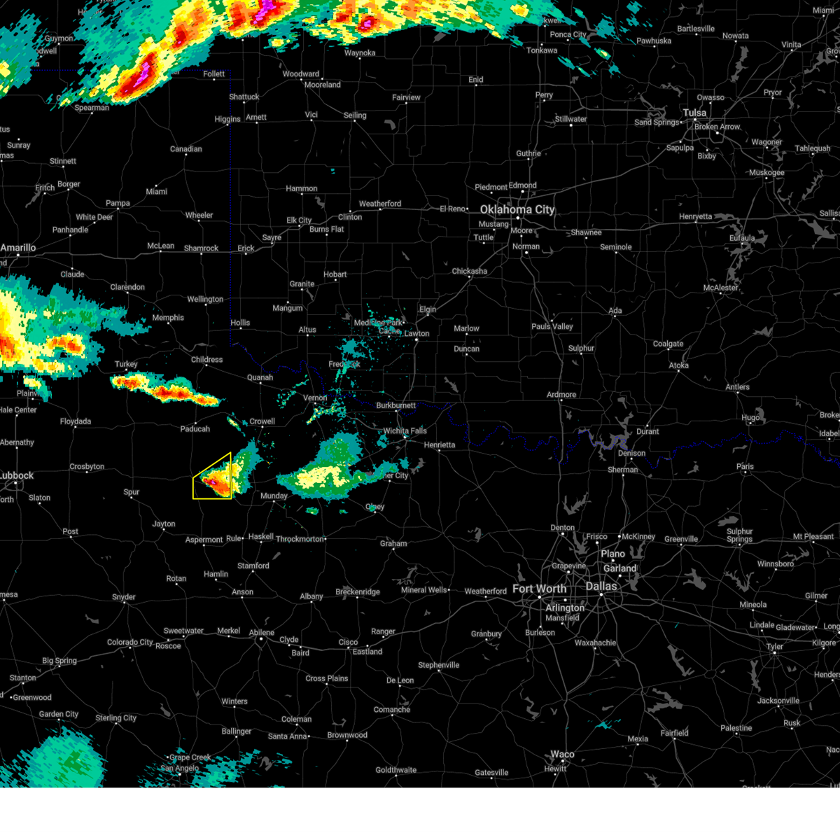
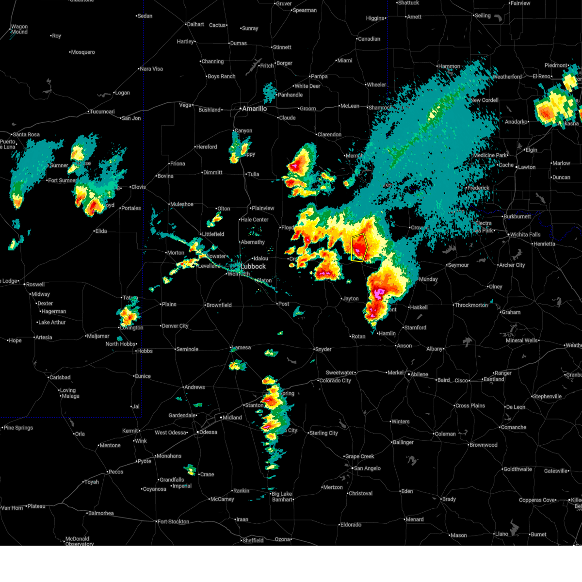
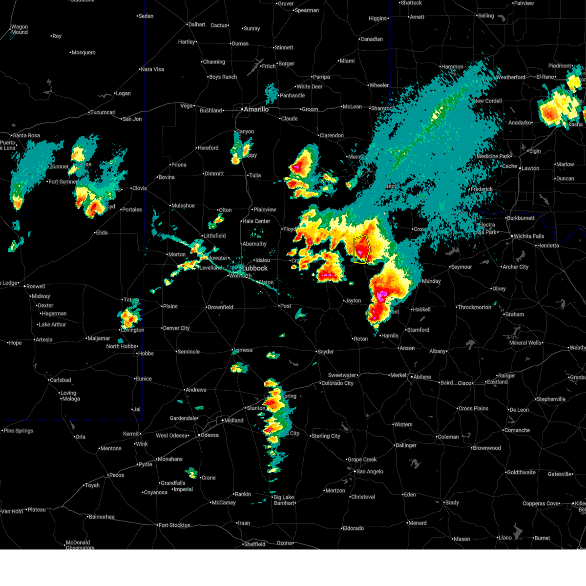
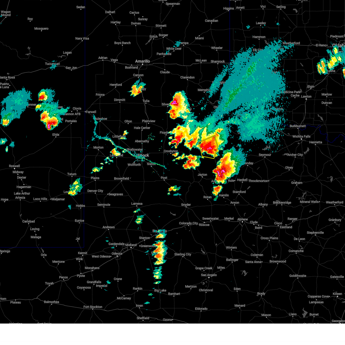
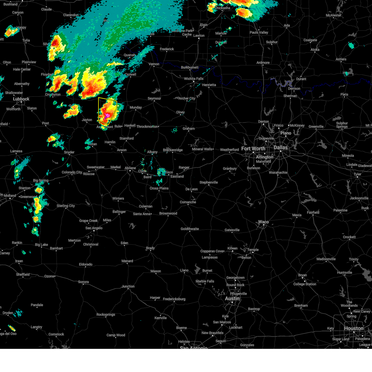
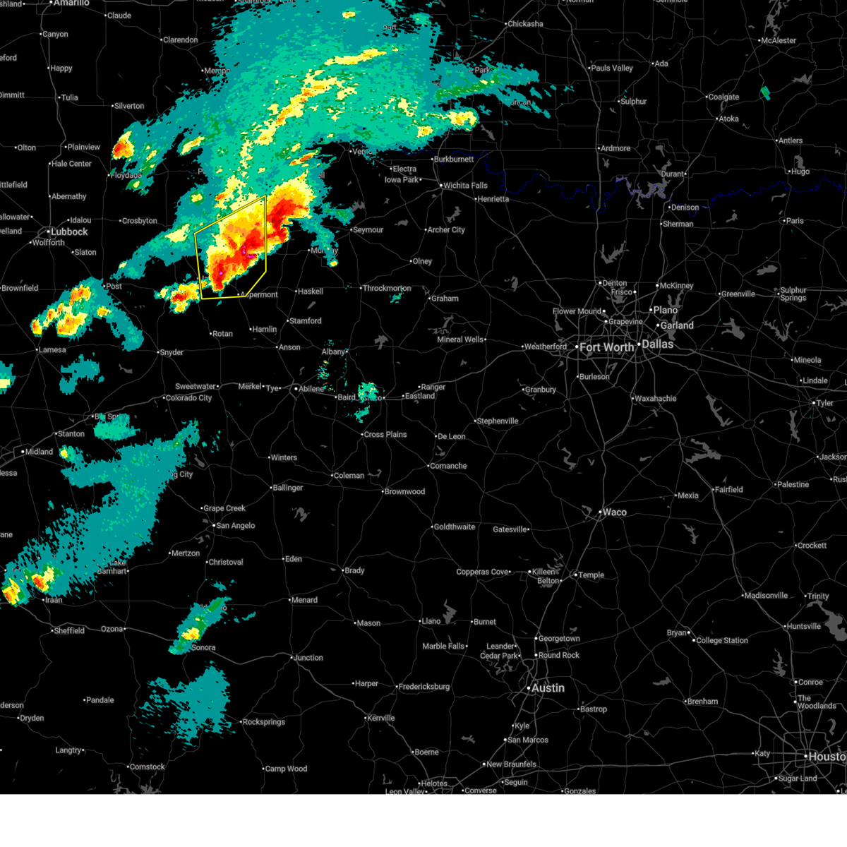
The Top Recent Hail Date for Guthrie, TX is Tuesday, March 31, 2026 (8th out of 115)
Hail and Wind Damage Spotted near Guthrie, TX
| Date / Time | Report Details |
|---|---|
| 5/31/2026 8:20 PM CDT |
 Svrlub the national weather service in lubbock texas has issued a * severe thunderstorm warning for, king county in northwestern texas, northern stonewall county in northwestern texas, * until 915 pm cdt. * at 820 pm cdt, severe thunderstorms were located along a line extending from 8 miles southeast of chalk to 14 miles south of guthrie, moving northeast at 15 mph (radar indicated). Hazards include 60 mph wind gusts and quarter size hail. Hail damage to vehicles is expected. Expect wind damage to roofs, siding, and trees. Svrlub the national weather service in lubbock texas has issued a * severe thunderstorm warning for, king county in northwestern texas, northern stonewall county in northwestern texas, * until 915 pm cdt. * at 820 pm cdt, severe thunderstorms were located along a line extending from 8 miles southeast of chalk to 14 miles south of guthrie, moving northeast at 15 mph (radar indicated). Hazards include 60 mph wind gusts and quarter size hail. Hail damage to vehicles is expected. Expect wind damage to roofs, siding, and trees.
|
| 5/26/2026 1:29 PM CDT |
 Svrlub the national weather service in lubbock texas has issued a * severe thunderstorm warning for, northeastern kent county in northwestern texas, dickens county in northwestern texas, king county in northwestern texas, southeastern motley county in northwestern texas, southwestern cottle county in northwestern texas, northwestern stonewall county in northwestern texas, * until 215 pm cdt. * at 129 pm cdt, severe thunderstorms were located along a line extending from 4 miles north of dickens to 6 miles east of girard, moving northeast at 20 mph (radar indicated). Hazards include 60 mph wind gusts and quarter size hail. Hail damage to vehicles is expected. Expect wind damage to roofs, siding, and trees. Svrlub the national weather service in lubbock texas has issued a * severe thunderstorm warning for, northeastern kent county in northwestern texas, dickens county in northwestern texas, king county in northwestern texas, southeastern motley county in northwestern texas, southwestern cottle county in northwestern texas, northwestern stonewall county in northwestern texas, * until 215 pm cdt. * at 129 pm cdt, severe thunderstorms were located along a line extending from 4 miles north of dickens to 6 miles east of girard, moving northeast at 20 mph (radar indicated). Hazards include 60 mph wind gusts and quarter size hail. Hail damage to vehicles is expected. Expect wind damage to roofs, siding, and trees.
|
| 5/24/2026 12:38 AM CDT |
 The storms which prompted the warning have weakened below severe limits, and no longer pose an immediate threat to life or property. therefore, the warning will be allowed to expire. however, small hail, gusty winds and heavy rain are still possible with these thunderstorms. to report severe weather, contact your nearest law enforcement agency. they will relay your report to the national weather service lubbock texas. The storms which prompted the warning have weakened below severe limits, and no longer pose an immediate threat to life or property. therefore, the warning will be allowed to expire. however, small hail, gusty winds and heavy rain are still possible with these thunderstorms. to report severe weather, contact your nearest law enforcement agency. they will relay your report to the national weather service lubbock texas.
|
| 5/24/2026 12:24 AM CDT |
 At 1223 am cdt, severe thunderstorms were located along a line extending from 7 miles east of guthrie to 21 miles south of finney to 13 miles north of swenson, moving east at 45 mph (radar indicated). Hazards include 60 mph wind gusts and nickel size hail. Expect damage to roofs, siding, and trees. These severe thunderstorms will remain over mainly rural areas of southeastern dickens and southern king counties. At 1223 am cdt, severe thunderstorms were located along a line extending from 7 miles east of guthrie to 21 miles south of finney to 13 miles north of swenson, moving east at 45 mph (radar indicated). Hazards include 60 mph wind gusts and nickel size hail. Expect damage to roofs, siding, and trees. These severe thunderstorms will remain over mainly rural areas of southeastern dickens and southern king counties.
|
| 5/24/2026 12:22 AM CDT |
 At 1221 am cdt, severe thunderstorms were located along a line extending from 9 miles south of childress to 4 miles east of chalk to 7 miles southeast of guthrie, moving east at 45 mph (west texas mesonet. at 1219 am cdt, a wind gust of 64 mph was measured by the mesonet near hackberry). Hazards include 60 mph wind gusts and nickel size hail. Expect damage to roofs, siding, and trees. Locations impacted include, paducah, guthrie, grow, cee vee, finney, delwin, chalk, swearingen, and hackberry. At 1221 am cdt, severe thunderstorms were located along a line extending from 9 miles south of childress to 4 miles east of chalk to 7 miles southeast of guthrie, moving east at 45 mph (west texas mesonet. at 1219 am cdt, a wind gust of 64 mph was measured by the mesonet near hackberry). Hazards include 60 mph wind gusts and nickel size hail. Expect damage to roofs, siding, and trees. Locations impacted include, paducah, guthrie, grow, cee vee, finney, delwin, chalk, swearingen, and hackberry.
|
| 5/24/2026 12:10 AM CDT |
 At 1209 am cdt, severe thunderstorms were located along a line extending from 6 miles northeast of cee vee to 5 miles northwest of chalk to 5 miles southwest of guthrie, moving east at 45 mph (west texas mesonet. wind gusts between 63 mph and 75 mph have been observed by the mesonet near paducah). Hazards include 70 mph wind gusts and nickel size hail. Expect considerable tree damage. damage is likely to mobile homes, roofs, and outbuildings. Locations impacted include, paducah, guthrie, grow, cee vee, dumont, northfield, finney, delwin, chalk, swearingen, and hackberry. At 1209 am cdt, severe thunderstorms were located along a line extending from 6 miles northeast of cee vee to 5 miles northwest of chalk to 5 miles southwest of guthrie, moving east at 45 mph (west texas mesonet. wind gusts between 63 mph and 75 mph have been observed by the mesonet near paducah). Hazards include 70 mph wind gusts and nickel size hail. Expect considerable tree damage. damage is likely to mobile homes, roofs, and outbuildings. Locations impacted include, paducah, guthrie, grow, cee vee, dumont, northfield, finney, delwin, chalk, swearingen, and hackberry.
|
| 5/24/2026 12:06 AM CDT |
 At 1206 am cdt, severe thunderstorms were located along a line extending from 6 miles west of guthrie to 19 miles north of jayton to 4 miles northeast of girard, moving east at 25 mph (west texas mesonet. at 1159 pm cdt, a wind gust of 60 mph was measured by the mesonet 10 miles west of guthrie). Hazards include 60 mph wind gusts and nickel size hail. Expect damage to roofs, siding, and trees. These severe thunderstorms will remain over mainly rural areas of southeastern dickens and southern king counties. At 1206 am cdt, severe thunderstorms were located along a line extending from 6 miles west of guthrie to 19 miles north of jayton to 4 miles northeast of girard, moving east at 25 mph (west texas mesonet. at 1159 pm cdt, a wind gust of 60 mph was measured by the mesonet 10 miles west of guthrie). Hazards include 60 mph wind gusts and nickel size hail. Expect damage to roofs, siding, and trees. These severe thunderstorms will remain over mainly rural areas of southeastern dickens and southern king counties.
|
| 5/24/2026 12:01 AM CDT |
 At 1201 am cdt, severe thunderstorms were located along a line extending from 5 miles north of cee vee to 5 miles north of delwin to 9 miles west of guthrie, moving east at 40 mph (radar indicated). Hazards include 60 mph wind gusts and nickel size hail. Expect damage to roofs, siding, and trees. Locations impacted include, paducah, guthrie, grow, cee vee, dumont, northfield, finney, delwin, chalk, swearingen, and hackberry. At 1201 am cdt, severe thunderstorms were located along a line extending from 5 miles north of cee vee to 5 miles north of delwin to 9 miles west of guthrie, moving east at 40 mph (radar indicated). Hazards include 60 mph wind gusts and nickel size hail. Expect damage to roofs, siding, and trees. Locations impacted include, paducah, guthrie, grow, cee vee, dumont, northfield, finney, delwin, chalk, swearingen, and hackberry.
|
| 5/23/2026 11:59 PM CDT | Measured by the west texas mesone in king county TX, 9.4 miles ENE of Guthrie, TX |
| 5/23/2026 11:55 PM CDT |
 Svrlub the national weather service in lubbock texas has issued a * severe thunderstorm warning for, southeastern dickens county in northwestern texas, southern king county in northwestern texas, * until 1245 am cdt. * at 1155 pm cdt, severe thunderstorms were located along a line extending from 9 miles south of dumont to 13 miles southwest of guthrie to 9 miles north of girard to 5 miles east of spur, moving east at 25 mph (radar indicated). Hazards include 60 mph wind gusts and nickel size hail. Expect damage to roofs, siding, and trees. These severe thunderstorms will remain over mainly rural areas of southeastern dickens and southern king counties. Svrlub the national weather service in lubbock texas has issued a * severe thunderstorm warning for, southeastern dickens county in northwestern texas, southern king county in northwestern texas, * until 1245 am cdt. * at 1155 pm cdt, severe thunderstorms were located along a line extending from 9 miles south of dumont to 13 miles southwest of guthrie to 9 miles north of girard to 5 miles east of spur, moving east at 25 mph (radar indicated). Hazards include 60 mph wind gusts and nickel size hail. Expect damage to roofs, siding, and trees. These severe thunderstorms will remain over mainly rural areas of southeastern dickens and southern king counties.
|
| 5/23/2026 11:43 PM CDT |
 Svrlub the national weather service in lubbock texas has issued a * severe thunderstorm warning for, northeastern dickens county in northwestern texas, king county in northwestern texas, eastern motley county in northwestern texas, cottle county in northwestern texas, * until 1245 am cdt. * at 1142 pm cdt, severe thunderstorms were located along a line extending from 8 miles northwest of northfield to 8 miles east of matador to 6 miles southeast of afton, moving east at 55 mph (radar indicated). Hazards include 60 mph wind gusts and nickel size hail. expect damage to roofs, siding, and trees Svrlub the national weather service in lubbock texas has issued a * severe thunderstorm warning for, northeastern dickens county in northwestern texas, king county in northwestern texas, eastern motley county in northwestern texas, cottle county in northwestern texas, * until 1245 am cdt. * at 1142 pm cdt, severe thunderstorms were located along a line extending from 8 miles northwest of northfield to 8 miles east of matador to 6 miles southeast of afton, moving east at 55 mph (radar indicated). Hazards include 60 mph wind gusts and nickel size hail. expect damage to roofs, siding, and trees
|
| 5/15/2026 8:43 PM CDT |
 At 842 pm cdt, severe thunderstorms were located along a line extending from guthrie to 8 miles northeast of jayton to 4 miles south of clairemont, moving southeast at 25 mph (radar indicated). Hazards include 60 mph wind gusts and quarter size hail. Hail damage to vehicles is expected. expect wind damage to roofs, siding, and trees. near zero visibility will be possible along any outflow boundary or stronger wind gust that occurs. Locations impacted include, aspermont, jayton, guthrie, girard, peacock, old glory, swenson, and clairemont. At 842 pm cdt, severe thunderstorms were located along a line extending from guthrie to 8 miles northeast of jayton to 4 miles south of clairemont, moving southeast at 25 mph (radar indicated). Hazards include 60 mph wind gusts and quarter size hail. Hail damage to vehicles is expected. expect wind damage to roofs, siding, and trees. near zero visibility will be possible along any outflow boundary or stronger wind gust that occurs. Locations impacted include, aspermont, jayton, guthrie, girard, peacock, old glory, swenson, and clairemont.
|
| 5/15/2026 8:26 PM CDT |
 Svrlub the national weather service in lubbock texas has issued a * severe thunderstorm warning for, northern kent county in northwestern texas, southeastern dickens county in northwestern texas, king county in northwestern texas, south central cottle county in northwestern texas, stonewall county in northwestern texas, * until 930 pm cdt. * at 824 pm cdt, severe thunderstorms were located along a line extending from chalk to 7 miles west of clairemont, moving southeast at 30 mph (radar indicated). Hazards include 70 mph wind gusts and half dollar size hail. Hail damage to vehicles is expected. expect considerable tree damage. Wind damage is also likely to mobile homes, roofs, and outbuildings. Svrlub the national weather service in lubbock texas has issued a * severe thunderstorm warning for, northern kent county in northwestern texas, southeastern dickens county in northwestern texas, king county in northwestern texas, south central cottle county in northwestern texas, stonewall county in northwestern texas, * until 930 pm cdt. * at 824 pm cdt, severe thunderstorms were located along a line extending from chalk to 7 miles west of clairemont, moving southeast at 30 mph (radar indicated). Hazards include 70 mph wind gusts and half dollar size hail. Hail damage to vehicles is expected. expect considerable tree damage. Wind damage is also likely to mobile homes, roofs, and outbuildings.
|
| 5/15/2026 8:16 PM CDT |
 At 816 pm cdt, severe thunderstorms were located along a line extending from grow to 9 miles northeast of girard to 10 miles northeast of lake alan henry, moving southeast at 35 mph (radar indicated). Hazards include 60 mph wind gusts and half dollar size hail. Hail damage to vehicles is expected. expect wind damage to roofs, siding, and trees. near zero visibility will be possible along any outflow boundary or stronger wind gust that occurs. Locations impacted include, spur, jayton, guthrie, girard, grow, and finney. At 816 pm cdt, severe thunderstorms were located along a line extending from grow to 9 miles northeast of girard to 10 miles northeast of lake alan henry, moving southeast at 35 mph (radar indicated). Hazards include 60 mph wind gusts and half dollar size hail. Hail damage to vehicles is expected. expect wind damage to roofs, siding, and trees. near zero visibility will be possible along any outflow boundary or stronger wind gust that occurs. Locations impacted include, spur, jayton, guthrie, girard, grow, and finney.
|
| 5/15/2026 8:03 PM CDT |
 At 803 pm cdt, severe thunderstorms were located along a line extending from 3 miles southeast of delwin to 9 miles northeast of girard to 9 miles northeast of lake alan henry, moving southeast at 35 mph (radar indicated). Hazards include 60 mph wind gusts and quarter size hail. Hail damage to vehicles is expected. expect wind damage to roofs, siding, and trees. near zero visibility will be possible along any outflow boundary or stronger wind gust that occurs. Locations impacted include, spur, jayton, guthrie, girard, grow, dumont, and finney. At 803 pm cdt, severe thunderstorms were located along a line extending from 3 miles southeast of delwin to 9 miles northeast of girard to 9 miles northeast of lake alan henry, moving southeast at 35 mph (radar indicated). Hazards include 60 mph wind gusts and quarter size hail. Hail damage to vehicles is expected. expect wind damage to roofs, siding, and trees. near zero visibility will be possible along any outflow boundary or stronger wind gust that occurs. Locations impacted include, spur, jayton, guthrie, girard, grow, dumont, and finney.
|
| 5/15/2026 7:53 PM CDT |
 At 753 pm cdt, severe thunderstorms were located along a line extending from dumont to 5 miles northwest of girard to 6 miles northwest of lake alan henry, moving southeast at 35 mph (radar indicated). Hazards include 60 mph wind gusts and quarter size hail. Hail damage to vehicles is expected. expect wind damage to roofs, siding, and trees. Locations impacted include, spur, jayton, dickens, guthrie, girard, grow, dumont, and finney. At 753 pm cdt, severe thunderstorms were located along a line extending from dumont to 5 miles northwest of girard to 6 miles northwest of lake alan henry, moving southeast at 35 mph (radar indicated). Hazards include 60 mph wind gusts and quarter size hail. Hail damage to vehicles is expected. expect wind damage to roofs, siding, and trees. Locations impacted include, spur, jayton, dickens, guthrie, girard, grow, dumont, and finney.
|
| 5/15/2026 7:43 PM CDT |
 Svrlub the national weather service in lubbock texas has issued a * severe thunderstorm warning for, northern kent county in northwestern texas, dickens county in northwestern texas, northeastern garza county in northwestern texas, king county in northwestern texas, southeastern crosby county in northwestern texas, southeastern motley county in northwestern texas, southwestern cottle county in northwestern texas, northwestern stonewall county in northwestern texas, * until 830 pm cdt. * at 743 pm cdt, severe thunderstorms were located along a line extending from 3 miles northwest of dumont to 5 miles east of spur to 7 miles north of justiceburg, moving southeast at 35 mph (radar indicated). Hazards include 60 mph wind gusts and quarter size hail. Hail damage to vehicles is expected. Expect wind damage to roofs, siding, and trees. Svrlub the national weather service in lubbock texas has issued a * severe thunderstorm warning for, northern kent county in northwestern texas, dickens county in northwestern texas, northeastern garza county in northwestern texas, king county in northwestern texas, southeastern crosby county in northwestern texas, southeastern motley county in northwestern texas, southwestern cottle county in northwestern texas, northwestern stonewall county in northwestern texas, * until 830 pm cdt. * at 743 pm cdt, severe thunderstorms were located along a line extending from 3 miles northwest of dumont to 5 miles east of spur to 7 miles north of justiceburg, moving southeast at 35 mph (radar indicated). Hazards include 60 mph wind gusts and quarter size hail. Hail damage to vehicles is expected. Expect wind damage to roofs, siding, and trees.
|
| 5/14/2026 8:19 PM CDT |
 At 819 pm cdt, severe thunderstorms were located along a line extending from 3 miles north of kirkland to 6 miles east of paducah to 9 miles south of dumont, moving east at 35 mph (radar indicated). Hazards include 60 mph wind gusts and quarter size hail. Hail damage to vehicles is expected. expect wind damage to roofs, siding, and trees. Locations impacted include, paducah, guthrie, grow, finney, delwin, chalk, swearingen, and hackberry. At 819 pm cdt, severe thunderstorms were located along a line extending from 3 miles north of kirkland to 6 miles east of paducah to 9 miles south of dumont, moving east at 35 mph (radar indicated). Hazards include 60 mph wind gusts and quarter size hail. Hail damage to vehicles is expected. expect wind damage to roofs, siding, and trees. Locations impacted include, paducah, guthrie, grow, finney, delwin, chalk, swearingen, and hackberry.
|
| 5/14/2026 8:00 PM CDT |
 Svrlub the national weather service in lubbock texas has issued a * severe thunderstorm warning for, eastern dickens county in northwestern texas, king county in northwestern texas, southern childress county in the panhandle of texas, southeastern motley county in northwestern texas, cottle county in northwestern texas, southeastern hall county in the panhandle of texas, northeastern stonewall county in northwestern texas, * until 900 pm cdt. * at 759 pm cdt, severe thunderstorms were located along a line extending from near childress to 5 miles west of paducah to 7 miles southeast of afton, moving east at 60 mph (radar indicated). Hazards include 60 mph wind gusts and quarter size hail. Hail damage to vehicles is expected. expect wind damage to roofs, siding, and trees. Near zero visbility will be possible along any outflow boundary or stronger wind gust that occurs. Svrlub the national weather service in lubbock texas has issued a * severe thunderstorm warning for, eastern dickens county in northwestern texas, king county in northwestern texas, southern childress county in the panhandle of texas, southeastern motley county in northwestern texas, cottle county in northwestern texas, southeastern hall county in the panhandle of texas, northeastern stonewall county in northwestern texas, * until 900 pm cdt. * at 759 pm cdt, severe thunderstorms were located along a line extending from near childress to 5 miles west of paducah to 7 miles southeast of afton, moving east at 60 mph (radar indicated). Hazards include 60 mph wind gusts and quarter size hail. Hail damage to vehicles is expected. expect wind damage to roofs, siding, and trees. Near zero visbility will be possible along any outflow boundary or stronger wind gust that occurs.
|
| 4/14/2026 6:11 PM CDT |
 At 611 pm cdt, a severe thunderstorm was located 12 miles southeast of guthrie, moving northeast at 50 mph (radar indicated). Hazards include 60 mph wind gusts and quarter size hail. Hail damage to vehicles is expected. expect wind damage to roofs, siding, and trees. Locations impacted include, guthrie. At 611 pm cdt, a severe thunderstorm was located 12 miles southeast of guthrie, moving northeast at 50 mph (radar indicated). Hazards include 60 mph wind gusts and quarter size hail. Hail damage to vehicles is expected. expect wind damage to roofs, siding, and trees. Locations impacted include, guthrie.
|
| 4/14/2026 6:04 PM CDT |
 At 603 pm cdt, a severe thunderstorm was located 13 miles north of swenson, or 15 miles south of guthrie, moving northeast at 55 mph (radar indicated). Hazards include 60 mph wind gusts and quarter size hail. Hail damage to vehicles is expected. expect wind damage to roofs, siding, and trees. Locations impacted include, jayton, guthrie, and girard. At 603 pm cdt, a severe thunderstorm was located 13 miles north of swenson, or 15 miles south of guthrie, moving northeast at 55 mph (radar indicated). Hazards include 60 mph wind gusts and quarter size hail. Hail damage to vehicles is expected. expect wind damage to roofs, siding, and trees. Locations impacted include, jayton, guthrie, and girard.
|
| 4/14/2026 5:48 PM CDT |
 Svrlub the national weather service in lubbock texas has issued a * severe thunderstorm warning for, northeastern kent county in northwestern texas, southeastern dickens county in northwestern texas, southern king county in northwestern texas, northwestern stonewall county in northwestern texas, * until 645 pm cdt. * at 547 pm cdt, a severe thunderstorm was located over jayton, moving northeast at 50 mph (radar indicated). Hazards include 60 mph wind gusts and quarter size hail. Hail damage to vehicles is expected. Expect wind damage to roofs, siding, and trees. Svrlub the national weather service in lubbock texas has issued a * severe thunderstorm warning for, northeastern kent county in northwestern texas, southeastern dickens county in northwestern texas, southern king county in northwestern texas, northwestern stonewall county in northwestern texas, * until 645 pm cdt. * at 547 pm cdt, a severe thunderstorm was located over jayton, moving northeast at 50 mph (radar indicated). Hazards include 60 mph wind gusts and quarter size hail. Hail damage to vehicles is expected. Expect wind damage to roofs, siding, and trees.
|
| 4/14/2026 5:47 PM CDT | Storm damage reported in king county TX, 8.4 miles NW of Guthrie, TX |
| 4/14/2026 5:36 PM CDT |
 At 536 pm cdt, a severe thunderstorm was located 7 miles southeast of guthrie, moving northeast at 40 mph (radar indicated). Hazards include 60 mph wind gusts and quarter size hail. Hail damage to vehicles is expected. expect wind damage to roofs, siding, and trees. This severe thunderstorm will remain over mainly rural areas of southwestern king county. At 536 pm cdt, a severe thunderstorm was located 7 miles southeast of guthrie, moving northeast at 40 mph (radar indicated). Hazards include 60 mph wind gusts and quarter size hail. Hail damage to vehicles is expected. expect wind damage to roofs, siding, and trees. This severe thunderstorm will remain over mainly rural areas of southwestern king county.
|
| 4/14/2026 5:22 PM CDT |
 At 522 pm cdt, a severe thunderstorm was located 11 miles south of guthrie, moving northeast at 35 mph (radar indicated). Hazards include 60 mph wind gusts and quarter size hail. Hail damage to vehicles is expected. expect wind damage to roofs, siding, and trees. Locations impacted include, guthrie. At 522 pm cdt, a severe thunderstorm was located 11 miles south of guthrie, moving northeast at 35 mph (radar indicated). Hazards include 60 mph wind gusts and quarter size hail. Hail damage to vehicles is expected. expect wind damage to roofs, siding, and trees. Locations impacted include, guthrie.
|
| 4/14/2026 5:07 PM CDT |
 At 506 pm cdt, a severe thunderstorm was located 10 miles northeast of jayton, moving northeast at 35 mph (radar indicated). Hazards include 60 mph wind gusts and quarter size hail. Hail damage to vehicles is expected. expect wind damage to roofs, siding, and trees. Locations impacted include, jayton, guthrie, and girard. At 506 pm cdt, a severe thunderstorm was located 10 miles northeast of jayton, moving northeast at 35 mph (radar indicated). Hazards include 60 mph wind gusts and quarter size hail. Hail damage to vehicles is expected. expect wind damage to roofs, siding, and trees. Locations impacted include, jayton, guthrie, and girard.
|
| 4/14/2026 4:51 PM CDT |
 Svrlub the national weather service in lubbock texas has issued a * severe thunderstorm warning for, northeastern kent county in northwestern texas, southeastern dickens county in northwestern texas, southern king county in northwestern texas, northwestern stonewall county in northwestern texas, * until 545 pm cdt. * at 450 pm cdt, a severe thunderstorm was located 4 miles east of girard, or 7 miles north of jayton, moving northeast at 40 mph (radar indicated). Hazards include 60 mph wind gusts and quarter size hail. Hail damage to vehicles is expected. Expect wind damage to roofs, siding, and trees. Svrlub the national weather service in lubbock texas has issued a * severe thunderstorm warning for, northeastern kent county in northwestern texas, southeastern dickens county in northwestern texas, southern king county in northwestern texas, northwestern stonewall county in northwestern texas, * until 545 pm cdt. * at 450 pm cdt, a severe thunderstorm was located 4 miles east of girard, or 7 miles north of jayton, moving northeast at 40 mph (radar indicated). Hazards include 60 mph wind gusts and quarter size hail. Hail damage to vehicles is expected. Expect wind damage to roofs, siding, and trees.
|
| 4/1/2026 6:38 PM CDT | Initial gust of 69 mph at 6:36 pm cdt. west texas mesone in king county TX, 8 miles WNW of Guthrie, TX |
| 3/31/2026 10:34 PM CDT | Storm damage reported in king county TX, 8.4 miles NW of Guthrie, TX |
| 3/31/2026 10:15 PM CDT |
 Svrlub the national weather service in lubbock texas has issued a * severe thunderstorm warning for, southern king county in northwestern texas, * until 1115 pm cdt. * at 1015 pm cdt, a severe thunderstorm was located 11 miles southwest of guthrie, moving east at 20 mph (radar indicated). Hazards include 60 mph wind gusts and quarter size hail. Hail damage to vehicles is expected. expect wind damage to roofs, siding, and trees. This severe thunderstorm will remain over mainly rural areas of southern king county. Svrlub the national weather service in lubbock texas has issued a * severe thunderstorm warning for, southern king county in northwestern texas, * until 1115 pm cdt. * at 1015 pm cdt, a severe thunderstorm was located 11 miles southwest of guthrie, moving east at 20 mph (radar indicated). Hazards include 60 mph wind gusts and quarter size hail. Hail damage to vehicles is expected. expect wind damage to roofs, siding, and trees. This severe thunderstorm will remain over mainly rural areas of southern king county.
|
| 3/31/2026 10:03 PM CDT |
 At 1003 pm cdt, a severe thunderstorm was located 13 miles southwest of guthrie, moving east at 15 mph (radar indicated). Hazards include 60 mph wind gusts and quarter size hail. Hail damage to vehicles is expected. expect wind damage to roofs, siding, and trees. Locations impacted include, guthrie. At 1003 pm cdt, a severe thunderstorm was located 13 miles southwest of guthrie, moving east at 15 mph (radar indicated). Hazards include 60 mph wind gusts and quarter size hail. Hail damage to vehicles is expected. expect wind damage to roofs, siding, and trees. Locations impacted include, guthrie.
|
| 3/31/2026 10:00 PM CDT |
 the severe thunderstorm warning has been cancelled and is no longer in effect the severe thunderstorm warning has been cancelled and is no longer in effect
|
| 3/31/2026 9:46 PM CDT |
 At 946 pm cdt, a severe thunderstorm was located 6 miles southeast of guthrie, moving east at 20 mph (radar indicated). Hazards include 60 mph wind gusts and quarter size hail. Hail damage to vehicles is expected. expect wind damage to roofs, siding, and trees. Locations impacted include, guthrie. At 946 pm cdt, a severe thunderstorm was located 6 miles southeast of guthrie, moving east at 20 mph (radar indicated). Hazards include 60 mph wind gusts and quarter size hail. Hail damage to vehicles is expected. expect wind damage to roofs, siding, and trees. Locations impacted include, guthrie.
|
| 3/31/2026 9:39 PM CDT |
 At 939 pm cdt, a severe thunderstorm was located 4 miles south of guthrie, moving south at 20 mph (radar indicated). Hazards include 60 mph wind gusts and quarter size hail. Hail damage to vehicles is expected. expect wind damage to roofs, siding, and trees. Locations impacted include, guthrie. At 939 pm cdt, a severe thunderstorm was located 4 miles south of guthrie, moving south at 20 mph (radar indicated). Hazards include 60 mph wind gusts and quarter size hail. Hail damage to vehicles is expected. expect wind damage to roofs, siding, and trees. Locations impacted include, guthrie.
|
| 3/31/2026 9:24 PM CDT | Storm damage reported in king county TX, 1.9 miles SE of Guthrie, TX |
| 3/31/2026 9:19 PM CDT |
 At 919 pm cdt, a severe thunderstorm was located near guthrie, moving south at 15 mph (trained weather spotters). Hazards include golf ball size hail and 70 mph wind gusts. People and animals outdoors will be injured. expect hail damage to roofs, siding, windows, and vehicles. expect considerable tree damage. wind damage is also likely to mobile homes, roofs, and outbuildings. Locations impacted include, guthrie and finney. At 919 pm cdt, a severe thunderstorm was located near guthrie, moving south at 15 mph (trained weather spotters). Hazards include golf ball size hail and 70 mph wind gusts. People and animals outdoors will be injured. expect hail damage to roofs, siding, windows, and vehicles. expect considerable tree damage. wind damage is also likely to mobile homes, roofs, and outbuildings. Locations impacted include, guthrie and finney.
|
| 3/31/2026 9:19 PM CDT |
 the severe thunderstorm warning has been cancelled and is no longer in effect the severe thunderstorm warning has been cancelled and is no longer in effect
|
| 3/31/2026 9:15 PM CDT |
 Svrlub the national weather service in lubbock texas has issued a * severe thunderstorm warning for, king county in northwestern texas, * until 1015 pm cdt. * at 915 pm cdt, a severe thunderstorm was located near guthrie, moving south at 15 mph (trained weather spotters). Hazards include golf ball size hail and 70 mph wind gusts. People and animals outdoors will be injured. expect hail damage to roofs, siding, windows, and vehicles. expect considerable tree damage. Wind damage is also likely to mobile homes, roofs, and outbuildings. Svrlub the national weather service in lubbock texas has issued a * severe thunderstorm warning for, king county in northwestern texas, * until 1015 pm cdt. * at 915 pm cdt, a severe thunderstorm was located near guthrie, moving south at 15 mph (trained weather spotters). Hazards include golf ball size hail and 70 mph wind gusts. People and animals outdoors will be injured. expect hail damage to roofs, siding, windows, and vehicles. expect considerable tree damage. Wind damage is also likely to mobile homes, roofs, and outbuildings.
|
| 3/31/2026 9:08 PM CDT |
 Svrlub the national weather service in lubbock texas has issued a * severe thunderstorm warning for, king county in northwestern texas, southeastern cottle county in northwestern texas, * until 1015 pm cdt. * at 908 pm cdt, a severe thunderstorm was located 4 miles south of finney, or 6 miles northwest of guthrie, moving south at 15 mph (trained weather spotters). Hazards include golf ball size hail and 70 mph wind gusts. People and animals outdoors will be injured. expect hail damage to roofs, siding, windows, and vehicles. expect considerable tree damage. Wind damage is also likely to mobile homes, roofs, and outbuildings. Svrlub the national weather service in lubbock texas has issued a * severe thunderstorm warning for, king county in northwestern texas, southeastern cottle county in northwestern texas, * until 1015 pm cdt. * at 908 pm cdt, a severe thunderstorm was located 4 miles south of finney, or 6 miles northwest of guthrie, moving south at 15 mph (trained weather spotters). Hazards include golf ball size hail and 70 mph wind gusts. People and animals outdoors will be injured. expect hail damage to roofs, siding, windows, and vehicles. expect considerable tree damage. Wind damage is also likely to mobile homes, roofs, and outbuildings.
|
| 3/31/2026 8:55 PM CDT | Golf Ball sized hail reported 11.1 miles S of Guthrie, TX, hailstones ranging from quarter to golf ball size. |
| 11/20/2025 5:01 PM CST | the severe thunderstorm warning has been cancelled and is no longer in effect |
| 11/20/2025 4:55 PM CST |
 At 454 pm cst, severe thunderstorms were located along a line extending from 5 miles northwest of cee vee to near finney to 10 miles east of girard, moving east at 30 mph (radar indicated). Hazards include 60 mph wind gusts and quarter size hail. Hail damage to vehicles is expected. expect wind damage to roofs, siding, and trees. Locations impacted include, childress, paducah, guthrie, cee vee, kirkland, swearingen, grow, dumont, tell, finney, delwin, chalk, and hackberry. At 454 pm cst, severe thunderstorms were located along a line extending from 5 miles northwest of cee vee to near finney to 10 miles east of girard, moving east at 30 mph (radar indicated). Hazards include 60 mph wind gusts and quarter size hail. Hail damage to vehicles is expected. expect wind damage to roofs, siding, and trees. Locations impacted include, childress, paducah, guthrie, cee vee, kirkland, swearingen, grow, dumont, tell, finney, delwin, chalk, and hackberry.
|
| 11/20/2025 4:55 PM CST |
 the severe thunderstorm warning has been cancelled and is no longer in effect the severe thunderstorm warning has been cancelled and is no longer in effect
|
| 11/20/2025 4:38 PM CST |
 At 438 pm cst, severe thunderstorms were located along a line extending from 3 miles northeast of northfield to 3 miles east of dumont to 10 miles northeast of girard, moving east at 45 mph (radar indicated). Hazards include 60 mph wind gusts and quarter size hail. Hail damage to vehicles is expected. expect wind damage to roofs, siding, and trees. Locations impacted include, childress, paducah, guthrie, cee vee, kirkland, swearingen, grow, dumont, tell, finney, northfield, delwin, chalk, and hackberry. At 438 pm cst, severe thunderstorms were located along a line extending from 3 miles northeast of northfield to 3 miles east of dumont to 10 miles northeast of girard, moving east at 45 mph (radar indicated). Hazards include 60 mph wind gusts and quarter size hail. Hail damage to vehicles is expected. expect wind damage to roofs, siding, and trees. Locations impacted include, childress, paducah, guthrie, cee vee, kirkland, swearingen, grow, dumont, tell, finney, northfield, delwin, chalk, and hackberry.
|
| 11/20/2025 4:29 PM CST |
 At 429 pm cst, severe thunderstorms were located along a line extending from 5 miles west of northfield to 6 miles west of dumont to 3 miles north of girard, moving east at 40 mph (radar indicated). Hazards include 60 mph wind gusts and quarter size hail. Hail damage to vehicles is expected. expect wind damage to roofs, siding, and trees. Locations impacted include, childress, paducah, guthrie, cee vee, kirkland, swearingen, grow, dumont, tell, finney, northfield, delwin, chalk, and hackberry. At 429 pm cst, severe thunderstorms were located along a line extending from 5 miles west of northfield to 6 miles west of dumont to 3 miles north of girard, moving east at 40 mph (radar indicated). Hazards include 60 mph wind gusts and quarter size hail. Hail damage to vehicles is expected. expect wind damage to roofs, siding, and trees. Locations impacted include, childress, paducah, guthrie, cee vee, kirkland, swearingen, grow, dumont, tell, finney, northfield, delwin, chalk, and hackberry.
|
| 11/20/2025 4:19 PM CST |
 Svrlub the national weather service in lubbock texas has issued a * severe thunderstorm warning for, north central kent county in northwestern texas, dickens county in northwestern texas, king county in northwestern texas, southern childress county in the panhandle of texas, motley county in northwestern texas, cottle county in northwestern texas, southeastern hall county in the panhandle of texas, * until 515 pm cst. * at 418 pm cst, severe thunderstorms were located along a line extending from 7 miles east of flomot to 6 miles east of afton to 6 miles southeast of spur, moving east at 40 mph (radar indicated). Hazards include 60 mph wind gusts and quarter size hail. Hail damage to vehicles is expected. Expect wind damage to roofs, siding, and trees. Svrlub the national weather service in lubbock texas has issued a * severe thunderstorm warning for, north central kent county in northwestern texas, dickens county in northwestern texas, king county in northwestern texas, southern childress county in the panhandle of texas, motley county in northwestern texas, cottle county in northwestern texas, southeastern hall county in the panhandle of texas, * until 515 pm cst. * at 418 pm cst, severe thunderstorms were located along a line extending from 7 miles east of flomot to 6 miles east of afton to 6 miles southeast of spur, moving east at 40 mph (radar indicated). Hazards include 60 mph wind gusts and quarter size hail. Hail damage to vehicles is expected. Expect wind damage to roofs, siding, and trees.
|
| 6/17/2025 9:01 PM CDT |
 the severe thunderstorm warning has been cancelled and is no longer in effect the severe thunderstorm warning has been cancelled and is no longer in effect
|
| 6/17/2025 8:57 PM CDT |
 the severe thunderstorm warning has been cancelled and is no longer in effect the severe thunderstorm warning has been cancelled and is no longer in effect
|
| 6/17/2025 8:57 PM CDT |
 At 856 pm cdt, a severe thunderstorm was located 6 miles northeast of dickens, moving southeast at 25 mph (radar indicated). Hazards include 60 mph wind gusts and penny size hail. Expect damage to roofs, siding, and trees. Locations impacted include, dickens and afton. At 856 pm cdt, a severe thunderstorm was located 6 miles northeast of dickens, moving southeast at 25 mph (radar indicated). Hazards include 60 mph wind gusts and penny size hail. Expect damage to roofs, siding, and trees. Locations impacted include, dickens and afton.
|
| 6/17/2025 8:44 PM CDT |
 Svrlub the national weather service in lubbock texas has issued a * severe thunderstorm warning for, dickens county in northwestern texas, western king county in northwestern texas, south central motley county in northwestern texas, * until 930 pm cdt. * at 844 pm cdt, a severe thunderstorm was located 4 miles north of dickens, moving southeast at 25 mph (radar indicated). Hazards include 60 mph wind gusts and quarter size hail. Hail damage to vehicles is expected. Expect wind damage to roofs, siding, and trees. Svrlub the national weather service in lubbock texas has issued a * severe thunderstorm warning for, dickens county in northwestern texas, western king county in northwestern texas, south central motley county in northwestern texas, * until 930 pm cdt. * at 844 pm cdt, a severe thunderstorm was located 4 miles north of dickens, moving southeast at 25 mph (radar indicated). Hazards include 60 mph wind gusts and quarter size hail. Hail damage to vehicles is expected. Expect wind damage to roofs, siding, and trees.
|
| 6/8/2025 7:16 PM CDT |
 the severe thunderstorm warning has been cancelled and is no longer in effect the severe thunderstorm warning has been cancelled and is no longer in effect
|
| 6/8/2025 7:06 PM CDT |
 At 706 pm cdt, a severe thunderstorm was located 12 miles north of girard, or 13 miles southeast of dickens, moving east at 30 mph (radar indicated). Hazards include 60 mph wind gusts and half dollar size hail. Hail damage to vehicles is expected. expect wind damage to roofs, siding, and trees. Locations impacted include, guthrie. At 706 pm cdt, a severe thunderstorm was located 12 miles north of girard, or 13 miles southeast of dickens, moving east at 30 mph (radar indicated). Hazards include 60 mph wind gusts and half dollar size hail. Hail damage to vehicles is expected. expect wind damage to roofs, siding, and trees. Locations impacted include, guthrie.
|
| 6/8/2025 6:53 PM CDT |
 At 652 pm cdt, a severe thunderstorm was located 6 miles southeast of dickens, moving east at 30 mph (radar indicated). Hazards include golf ball size hail and 70 mph wind gusts. People and animals outdoors will be injured. expect hail damage to roofs, siding, windows, and vehicles. expect considerable tree damage. wind damage is also likely to mobile homes, roofs, and outbuildings. Locations impacted include, spur, dickens, and guthrie. At 652 pm cdt, a severe thunderstorm was located 6 miles southeast of dickens, moving east at 30 mph (radar indicated). Hazards include golf ball size hail and 70 mph wind gusts. People and animals outdoors will be injured. expect hail damage to roofs, siding, windows, and vehicles. expect considerable tree damage. wind damage is also likely to mobile homes, roofs, and outbuildings. Locations impacted include, spur, dickens, and guthrie.
|
| 6/8/2025 6:46 PM CDT |
 Svrlub the national weather service in lubbock texas has issued a * severe thunderstorm warning for, northeastern kent county in northwestern texas, central dickens county in northwestern texas, southwestern king county in northwestern texas, northwestern stonewall county in northwestern texas, * until 745 pm cdt. * at 646 pm cdt, a severe thunderstorm was located near dickens, moving east at 30 mph (radar indicated). Hazards include golf ball size hail and 70 mph wind gusts. People and animals outdoors will be injured. expect hail damage to roofs, siding, windows, and vehicles. expect considerable tree damage. Wind damage is also likely to mobile homes, roofs, and outbuildings. Svrlub the national weather service in lubbock texas has issued a * severe thunderstorm warning for, northeastern kent county in northwestern texas, central dickens county in northwestern texas, southwestern king county in northwestern texas, northwestern stonewall county in northwestern texas, * until 745 pm cdt. * at 646 pm cdt, a severe thunderstorm was located near dickens, moving east at 30 mph (radar indicated). Hazards include golf ball size hail and 70 mph wind gusts. People and animals outdoors will be injured. expect hail damage to roofs, siding, windows, and vehicles. expect considerable tree damage. Wind damage is also likely to mobile homes, roofs, and outbuildings.
|
| 6/6/2025 12:40 AM CDT |
 The storm which prompted the warning has weakened below severe limits, and no longer poses an immediate threat to life or property. therefore, the warning will be allowed to expire. The storm which prompted the warning has weakened below severe limits, and no longer poses an immediate threat to life or property. therefore, the warning will be allowed to expire.
|
| 6/6/2025 12:16 AM CDT |
 At 1215 am cdt, a severe thunderstorm was located 7 miles southeast of guthrie, moving east at 15 mph (radar indicated). Hazards include ping pong ball size hail and 60 mph wind gusts. People and animals outdoors will be injured. expect hail damage to roofs, siding, windows, and vehicles. expect wind damage to roofs, siding, and trees. This severe thunderstorm will remain over mainly rural areas of eastern king county. At 1215 am cdt, a severe thunderstorm was located 7 miles southeast of guthrie, moving east at 15 mph (radar indicated). Hazards include ping pong ball size hail and 60 mph wind gusts. People and animals outdoors will be injured. expect hail damage to roofs, siding, windows, and vehicles. expect wind damage to roofs, siding, and trees. This severe thunderstorm will remain over mainly rural areas of eastern king county.
|
| 6/6/2025 12:16 AM CDT |
 the severe thunderstorm warning has been cancelled and is no longer in effect the severe thunderstorm warning has been cancelled and is no longer in effect
|
| 6/6/2025 12:08 AM CDT |
 At 1207 am cdt, a severe thunderstorm was located 6 miles south of guthrie, moving northeast at 20 mph (radar indicated). Hazards include ping pong ball size hail and 60 mph wind gusts. People and animals outdoors will be injured. expect hail damage to roofs, siding, windows, and vehicles. expect wind damage to roofs, siding, and trees. Locations impacted include, guthrie. At 1207 am cdt, a severe thunderstorm was located 6 miles south of guthrie, moving northeast at 20 mph (radar indicated). Hazards include ping pong ball size hail and 60 mph wind gusts. People and animals outdoors will be injured. expect hail damage to roofs, siding, windows, and vehicles. expect wind damage to roofs, siding, and trees. Locations impacted include, guthrie.
|
| 6/5/2025 11:54 PM CDT |
 At 1153 pm cdt, a severe thunderstorm was located 4 miles south of guthrie, moving east at 20 mph (radar indicated). Hazards include 60 mph wind gusts and quarter size hail. Hail damage to vehicles is expected. expect wind damage to roofs, siding, and trees. Locations impacted include, guthrie. At 1153 pm cdt, a severe thunderstorm was located 4 miles south of guthrie, moving east at 20 mph (radar indicated). Hazards include 60 mph wind gusts and quarter size hail. Hail damage to vehicles is expected. expect wind damage to roofs, siding, and trees. Locations impacted include, guthrie.
|
| 6/5/2025 11:39 PM CDT |
 Svrlub the national weather service in lubbock texas has issued a * severe thunderstorm warning for, king county in northwestern texas, southeastern cottle county in northwestern texas, * until 1245 am cdt. * at 1138 pm cdt, a severe thunderstorm was located 6 miles southwest of guthrie, moving northeast at 20 mph (radar indicated). Hazards include 60 mph wind gusts and quarter size hail. Hail damage to vehicles is expected. Expect wind damage to roofs, siding, and trees. Svrlub the national weather service in lubbock texas has issued a * severe thunderstorm warning for, king county in northwestern texas, southeastern cottle county in northwestern texas, * until 1245 am cdt. * at 1138 pm cdt, a severe thunderstorm was located 6 miles southwest of guthrie, moving northeast at 20 mph (radar indicated). Hazards include 60 mph wind gusts and quarter size hail. Hail damage to vehicles is expected. Expect wind damage to roofs, siding, and trees.
|
| 5/25/2025 7:23 PM CDT |
 the severe thunderstorm warning has been cancelled and is no longer in effect the severe thunderstorm warning has been cancelled and is no longer in effect
|
| 5/25/2025 7:10 PM CDT |
 the severe thunderstorm warning has been cancelled and is no longer in effect the severe thunderstorm warning has been cancelled and is no longer in effect
|
| 5/25/2025 7:10 PM CDT |
 At 710 pm cdt, a severe thunderstorm was located 9 miles southwest of guthrie, moving east at 25 mph (radar indicated). Hazards include 60 mph wind gusts and quarter size hail. Hail damage to vehicles is expected. expect wind damage to roofs, siding, and trees. Locations impacted include, guthrie. At 710 pm cdt, a severe thunderstorm was located 9 miles southwest of guthrie, moving east at 25 mph (radar indicated). Hazards include 60 mph wind gusts and quarter size hail. Hail damage to vehicles is expected. expect wind damage to roofs, siding, and trees. Locations impacted include, guthrie.
|
| 5/25/2025 7:04 PM CDT |
 At 704 pm cdt, a severe thunderstorm was located 10 miles southwest of guthrie, moving east at 25 mph (radar indicated). Hazards include 60 mph wind gusts and quarter size hail. Hail damage to vehicles is expected. expect wind damage to roofs, siding, and trees. Locations impacted include, guthrie. At 704 pm cdt, a severe thunderstorm was located 10 miles southwest of guthrie, moving east at 25 mph (radar indicated). Hazards include 60 mph wind gusts and quarter size hail. Hail damage to vehicles is expected. expect wind damage to roofs, siding, and trees. Locations impacted include, guthrie.
|
| 5/25/2025 6:54 PM CDT |
 Svrlub the national weather service in lubbock texas has issued a * severe thunderstorm warning for, east central dickens county in northwestern texas, king county in northwestern texas, * until 800 pm cdt. * at 653 pm cdt, a severe thunderstorm was located 14 miles west of guthrie, moving east at 30 mph (radar indicated). Hazards include 60 mph wind gusts and half dollar size hail. Hail damage to vehicles is expected. Expect wind damage to roofs, siding, and trees. Svrlub the national weather service in lubbock texas has issued a * severe thunderstorm warning for, east central dickens county in northwestern texas, king county in northwestern texas, * until 800 pm cdt. * at 653 pm cdt, a severe thunderstorm was located 14 miles west of guthrie, moving east at 30 mph (radar indicated). Hazards include 60 mph wind gusts and half dollar size hail. Hail damage to vehicles is expected. Expect wind damage to roofs, siding, and trees.
|
| 5/25/2025 6:21 PM CDT | Report of multiple downed powerline in king county TX, 9.7 miles S of Guthrie, TX |
| 5/25/2025 6:13 PM CDT |
 At 613 pm cdt, a severe thunderstorm was located 5 miles south of grow, or 7 miles northeast of guthrie, moving east at 30 mph (radar indicated). Hazards include two inch hail and 60 mph wind gusts. People and animals outdoors will be injured. expect hail damage to roofs, siding, windows, and vehicles. expect wind damage to roofs, siding, and trees. Locations impacted include, finney and grow. At 613 pm cdt, a severe thunderstorm was located 5 miles south of grow, or 7 miles northeast of guthrie, moving east at 30 mph (radar indicated). Hazards include two inch hail and 60 mph wind gusts. People and animals outdoors will be injured. expect hail damage to roofs, siding, windows, and vehicles. expect wind damage to roofs, siding, and trees. Locations impacted include, finney and grow.
|
| 5/25/2025 6:10 PM CDT |
 Svrlub the national weather service in lubbock texas has issued a * severe thunderstorm warning for, northeastern king county in northwestern texas, * until 700 pm cdt. * at 610 pm cdt, a severe thunderstorm was located 7 miles northeast of guthrie, moving east at 30 mph (radar indicated). Hazards include two inch hail and 60 mph wind gusts. People and animals outdoors will be injured. expect hail damage to roofs, siding, windows, and vehicles. Expect wind damage to roofs, siding, and trees. Svrlub the national weather service in lubbock texas has issued a * severe thunderstorm warning for, northeastern king county in northwestern texas, * until 700 pm cdt. * at 610 pm cdt, a severe thunderstorm was located 7 miles northeast of guthrie, moving east at 30 mph (radar indicated). Hazards include two inch hail and 60 mph wind gusts. People and animals outdoors will be injured. expect hail damage to roofs, siding, windows, and vehicles. Expect wind damage to roofs, siding, and trees.
|
| 5/25/2025 6:05 PM CDT |
 At 605 pm cdt, a severe thunderstorm was located over finney, or 8 miles north of guthrie, moving east at 15 mph (radar indicated). Hazards include two inch hail and 60 mph wind gusts. People and animals outdoors will be injured. expect hail damage to roofs, siding, windows, and vehicles. expect wind damage to roofs, siding, and trees. Locations impacted include, finney, grow, and delwin. At 605 pm cdt, a severe thunderstorm was located over finney, or 8 miles north of guthrie, moving east at 15 mph (radar indicated). Hazards include two inch hail and 60 mph wind gusts. People and animals outdoors will be injured. expect hail damage to roofs, siding, windows, and vehicles. expect wind damage to roofs, siding, and trees. Locations impacted include, finney, grow, and delwin.
|
| 5/25/2025 6:05 PM CDT |
 the severe thunderstorm warning has been cancelled and is no longer in effect the severe thunderstorm warning has been cancelled and is no longer in effect
|
| 5/25/2025 6:04 PM CDT | Power poles broken along us-83. time and location estimated from rada in king county TX, 5.7 miles SSE of Guthrie, TX |
| 5/25/2025 5:52 PM CDT |
 At 552 pm cdt, a severe thunderstorm was located 13 miles northeast of swenson, or 15 miles north of aspermont, moving northeast at 10 mph (radar indicated). Hazards include tennis ball size hail and 60 mph wind gusts. People and animals outdoors will be injured. expect hail damage to roofs, siding, windows, and vehicles. expect wind damage to roofs, siding, and trees. Locations impacted include, guthrie. At 552 pm cdt, a severe thunderstorm was located 13 miles northeast of swenson, or 15 miles north of aspermont, moving northeast at 10 mph (radar indicated). Hazards include tennis ball size hail and 60 mph wind gusts. People and animals outdoors will be injured. expect hail damage to roofs, siding, windows, and vehicles. expect wind damage to roofs, siding, and trees. Locations impacted include, guthrie.
|
| 5/25/2025 5:49 PM CDT |
 At 549 pm cdt, a severe thunderstorm was located near finney, or 10 miles northwest of guthrie, moving east at 15 mph (radar indicated). Hazards include tennis ball size hail and 60 mph wind gusts. People and animals outdoors will be injured. expect hail damage to roofs, siding, windows, and vehicles. expect wind damage to roofs, siding, and trees. Locations impacted include, guthrie, finney, grow, delwin, and dumont. At 549 pm cdt, a severe thunderstorm was located near finney, or 10 miles northwest of guthrie, moving east at 15 mph (radar indicated). Hazards include tennis ball size hail and 60 mph wind gusts. People and animals outdoors will be injured. expect hail damage to roofs, siding, windows, and vehicles. expect wind damage to roofs, siding, and trees. Locations impacted include, guthrie, finney, grow, delwin, and dumont.
|
| 5/25/2025 5:38 PM CDT |
 Svrlub the national weather service in lubbock texas has issued a * severe thunderstorm warning for, northeastern dickens county in northwestern texas, northwestern king county in northwestern texas, southeastern motley county in northwestern texas, southwestern cottle county in northwestern texas, * until 645 pm cdt. * at 538 pm cdt, a severe thunderstorm was located near dumont, or 13 miles northwest of guthrie, moving east at 15 mph (radar indicated). Hazards include tennis ball size hail. People and animals outdoors will be injured. Expect damage to roofs, siding, windows, and vehicles. Svrlub the national weather service in lubbock texas has issued a * severe thunderstorm warning for, northeastern dickens county in northwestern texas, northwestern king county in northwestern texas, southeastern motley county in northwestern texas, southwestern cottle county in northwestern texas, * until 645 pm cdt. * at 538 pm cdt, a severe thunderstorm was located near dumont, or 13 miles northwest of guthrie, moving east at 15 mph (radar indicated). Hazards include tennis ball size hail. People and animals outdoors will be injured. Expect damage to roofs, siding, windows, and vehicles.
|
| 5/25/2025 5:37 PM CDT |
 At 537 pm cdt, a severe thunderstorm was located 10 miles northeast of swenson, or 13 miles north of aspermont, moving northeast at 10 mph (radar indicated). Hazards include tennis ball size hail and 60 mph wind gusts. People and animals outdoors will be injured. expect hail damage to roofs, siding, windows, and vehicles. expect wind damage to roofs, siding, and trees. Locations impacted include, guthrie. At 537 pm cdt, a severe thunderstorm was located 10 miles northeast of swenson, or 13 miles north of aspermont, moving northeast at 10 mph (radar indicated). Hazards include tennis ball size hail and 60 mph wind gusts. People and animals outdoors will be injured. expect hail damage to roofs, siding, windows, and vehicles. expect wind damage to roofs, siding, and trees. Locations impacted include, guthrie.
|
| 5/25/2025 5:21 PM CDT |
 Svrlub the national weather service in lubbock texas has issued a * severe thunderstorm warning for, southeastern king county in northwestern texas, northeastern stonewall county in northwestern texas, * until 615 pm cdt. * at 521 pm cdt, a severe thunderstorm was located 9 miles northeast of swenson, or 12 miles north of aspermont, moving north at 20 mph (radar indicated). Hazards include golf ball size hail and 60 mph wind gusts. People and animals outdoors will be injured. expect hail damage to roofs, siding, windows, and vehicles. Expect wind damage to roofs, siding, and trees. Svrlub the national weather service in lubbock texas has issued a * severe thunderstorm warning for, southeastern king county in northwestern texas, northeastern stonewall county in northwestern texas, * until 615 pm cdt. * at 521 pm cdt, a severe thunderstorm was located 9 miles northeast of swenson, or 12 miles north of aspermont, moving north at 20 mph (radar indicated). Hazards include golf ball size hail and 60 mph wind gusts. People and animals outdoors will be injured. expect hail damage to roofs, siding, windows, and vehicles. Expect wind damage to roofs, siding, and trees.
|
| 5/25/2025 3:38 PM CDT |
 the severe thunderstorm warning has been cancelled and is no longer in effect the severe thunderstorm warning has been cancelled and is no longer in effect
|
| 5/25/2025 3:23 PM CDT |
 Svrlub the national weather service in lubbock texas has issued a * severe thunderstorm warning for, eastern king county in northwestern texas, * until 415 pm cdt. * at 322 pm cdt, a severe thunderstorm was located 4 miles east of guthrie, moving northeast at 10 mph (radar indicated). Hazards include 60 mph wind gusts and half dollar size hail. Hail damage to vehicles is expected. Expect wind damage to roofs, siding, and trees. Svrlub the national weather service in lubbock texas has issued a * severe thunderstorm warning for, eastern king county in northwestern texas, * until 415 pm cdt. * at 322 pm cdt, a severe thunderstorm was located 4 miles east of guthrie, moving northeast at 10 mph (radar indicated). Hazards include 60 mph wind gusts and half dollar size hail. Hail damage to vehicles is expected. Expect wind damage to roofs, siding, and trees.
|
| 5/24/2025 9:36 PM CDT |
 the severe thunderstorm warning has been cancelled and is no longer in effect the severe thunderstorm warning has been cancelled and is no longer in effect
|
| 5/24/2025 9:36 PM CDT |
 At 936 pm cdt, severe thunderstorms were located along a line extending from 6 miles northeast of guthrie to 12 miles northeast of jayton to 5 miles north of clairemont, moving east at 20 mph (radar indicated). Hazards include 60 mph wind gusts and quarter size hail. Hail damage to vehicles is expected. expect wind damage to roofs, siding, and trees. Locations impacted include, jayton, guthrie, and girard. At 936 pm cdt, severe thunderstorms were located along a line extending from 6 miles northeast of guthrie to 12 miles northeast of jayton to 5 miles north of clairemont, moving east at 20 mph (radar indicated). Hazards include 60 mph wind gusts and quarter size hail. Hail damage to vehicles is expected. expect wind damage to roofs, siding, and trees. Locations impacted include, jayton, guthrie, and girard.
|
| 5/24/2025 9:24 PM CDT |
 Svrlub the national weather service in lubbock texas has issued a * severe thunderstorm warning for, northern kent county in northwestern texas, southeastern dickens county in northwestern texas, eastern garza county in northwestern texas, king county in northwestern texas, northern stonewall county in northwestern texas, * until 1030 pm cdt. * at 923 pm cdt, severe thunderstorms were located along a line extending from 4 miles north of guthrie to 9 miles east of girard to 10 miles west of clairemont, moving east at 20 mph (radar indicated). Hazards include 60 mph wind gusts and quarter size hail. Hail damage to vehicles is expected. Expect wind damage to roofs, siding, and trees. Svrlub the national weather service in lubbock texas has issued a * severe thunderstorm warning for, northern kent county in northwestern texas, southeastern dickens county in northwestern texas, eastern garza county in northwestern texas, king county in northwestern texas, northern stonewall county in northwestern texas, * until 1030 pm cdt. * at 923 pm cdt, severe thunderstorms were located along a line extending from 4 miles north of guthrie to 9 miles east of girard to 10 miles west of clairemont, moving east at 20 mph (radar indicated). Hazards include 60 mph wind gusts and quarter size hail. Hail damage to vehicles is expected. Expect wind damage to roofs, siding, and trees.
|
| 5/24/2025 9:14 PM CDT |
 At 914 pm cdt, a severe thunderstorm was located over guthrie, moving east at 25 mph (west texas mesonet. at 859 pm cdt, a wind gust of 67 mph was measured by the mesonet 10 miles west of guthrie). Hazards include 70 mph wind gusts and quarter size hail. Hail damage to vehicles is expected. expect considerable tree damage. wind damage is also likely to mobile homes, roofs, and outbuildings. Locations impacted include, guthrie. At 914 pm cdt, a severe thunderstorm was located over guthrie, moving east at 25 mph (west texas mesonet. at 859 pm cdt, a wind gust of 67 mph was measured by the mesonet 10 miles west of guthrie). Hazards include 70 mph wind gusts and quarter size hail. Hail damage to vehicles is expected. expect considerable tree damage. wind damage is also likely to mobile homes, roofs, and outbuildings. Locations impacted include, guthrie.
|
| 5/24/2025 9:03 PM CDT |
 At 903 pm cdt, a severe thunderstorm was located 5 miles west of guthrie, moving east at 30 mph (west texas mesonet. at 859 pm cdt, a wind gust of 67 mph was measured by the mesonet 10 miles west of guthrie). Hazards include 70 mph wind gusts and quarter size hail. Hail damage to vehicles is expected. expect considerable tree damage. wind damage is also likely to mobile homes, roofs, and outbuildings. Locations impacted include, guthrie. At 903 pm cdt, a severe thunderstorm was located 5 miles west of guthrie, moving east at 30 mph (west texas mesonet. at 859 pm cdt, a wind gust of 67 mph was measured by the mesonet 10 miles west of guthrie). Hazards include 70 mph wind gusts and quarter size hail. Hail damage to vehicles is expected. expect considerable tree damage. wind damage is also likely to mobile homes, roofs, and outbuildings. Locations impacted include, guthrie.
|
| 5/24/2025 9:01 PM CDT |
 At 900 pm cdt, a severe thunderstorm was located 7 miles west of guthrie, moving east at 30 mph (west texas mesonet. at 852 pm cdt, a wind gust of 59 mph was measured by the mesonet 10 miles west of guthrie). Hazards include 60 mph wind gusts and quarter size hail. Hail damage to vehicles is expected. expect wind damage to roofs, siding, and trees. Locations impacted include, guthrie. At 900 pm cdt, a severe thunderstorm was located 7 miles west of guthrie, moving east at 30 mph (west texas mesonet. at 852 pm cdt, a wind gust of 59 mph was measured by the mesonet 10 miles west of guthrie). Hazards include 60 mph wind gusts and quarter size hail. Hail damage to vehicles is expected. expect wind damage to roofs, siding, and trees. Locations impacted include, guthrie.
|
| 5/24/2025 8:59 PM CDT | Also gusted to 59 mph at 852 pm and 858 pm. measured by ttu mesone in king county TX, 9.4 miles ENE of Guthrie, TX |
| 5/24/2025 8:48 PM CDT | Measured by ttu mesone in king county TX, 9.4 miles ENE of Guthrie, TX |
| 5/24/2025 8:47 PM CDT |
 At 847 pm cdt, a severe thunderstorm was located 11 miles south of dumont, or 13 miles west of guthrie, moving east at 30 mph (radar indicated). Hazards include 60 mph wind gusts and quarter size hail. Hail damage to vehicles is expected. expect wind damage to roofs, siding, and trees. Locations impacted include, guthrie, finney, grow, and dumont. At 847 pm cdt, a severe thunderstorm was located 11 miles south of dumont, or 13 miles west of guthrie, moving east at 30 mph (radar indicated). Hazards include 60 mph wind gusts and quarter size hail. Hail damage to vehicles is expected. expect wind damage to roofs, siding, and trees. Locations impacted include, guthrie, finney, grow, and dumont.
|
| 5/24/2025 8:33 PM CDT |
 Svrlub the national weather service in lubbock texas has issued a * severe thunderstorm warning for, northeastern dickens county in northwestern texas, northwestern king county in northwestern texas, * until 930 pm cdt. * at 833 pm cdt, a severe thunderstorm was located 9 miles east of dickens, moving northeast at 35 mph (radar indicated). Hazards include 60 mph wind gusts and quarter size hail. Hail damage to vehicles is expected. Expect wind damage to roofs, siding, and trees. Svrlub the national weather service in lubbock texas has issued a * severe thunderstorm warning for, northeastern dickens county in northwestern texas, northwestern king county in northwestern texas, * until 930 pm cdt. * at 833 pm cdt, a severe thunderstorm was located 9 miles east of dickens, moving northeast at 35 mph (radar indicated). Hazards include 60 mph wind gusts and quarter size hail. Hail damage to vehicles is expected. Expect wind damage to roofs, siding, and trees.
|
| 4/29/2025 5:54 PM CDT |
 the severe thunderstorm warning has been cancelled and is no longer in effect the severe thunderstorm warning has been cancelled and is no longer in effect
|
| 4/29/2025 5:54 PM CDT |
 At 553 pm cdt, a severe thunderstorm was located 14 miles northwest of o'brien, or 15 miles west of knox city, moving east at 30 mph. this is a destructive storm for rural areas (radar indicated). Hazards include softball size hail and 60 mph wind gusts. People and animals outdoors will be severely injured. expect shattered windows, extensive damage to roofs, siding, and vehicles. Locations impacted include, peacock, swenson, and aspermont. At 553 pm cdt, a severe thunderstorm was located 14 miles northwest of o'brien, or 15 miles west of knox city, moving east at 30 mph. this is a destructive storm for rural areas (radar indicated). Hazards include softball size hail and 60 mph wind gusts. People and animals outdoors will be severely injured. expect shattered windows, extensive damage to roofs, siding, and vehicles. Locations impacted include, peacock, swenson, and aspermont.
|
| 4/29/2025 5:42 PM CDT |
 At 541 pm cdt, a severe thunderstorm was located 13 miles southeast of guthrie, moving east at 30 mph. this is a destructive storm for rural areas (radar indicated). Hazards include softball size hail and 60 mph wind gusts. People and animals outdoors will be severely injured. expect shattered windows, extensive damage to roofs, siding, and vehicles. Locations impacted include, guthrie, peacock, swenson, and aspermont. At 541 pm cdt, a severe thunderstorm was located 13 miles southeast of guthrie, moving east at 30 mph. this is a destructive storm for rural areas (radar indicated). Hazards include softball size hail and 60 mph wind gusts. People and animals outdoors will be severely injured. expect shattered windows, extensive damage to roofs, siding, and vehicles. Locations impacted include, guthrie, peacock, swenson, and aspermont.
|
| 4/29/2025 5:28 PM CDT |
 Svrlub the national weather service in lubbock texas has issued a * severe thunderstorm warning for, eastern kent county in northwestern texas, southeastern dickens county in northwestern texas, king county in northwestern texas, stonewall county in northwestern texas, * until 630 pm cdt. * at 526 pm cdt, a severe thunderstorm was located 11 miles south of guthrie, moving east at 30 mph. this is a destructive storm for jayton and peacock (radar indicated). Hazards include softball size hail and 60 mph wind gusts. People and animals outdoors will be severely injured. Expect shattered windows, extensive damage to roofs, siding, and vehicles. Svrlub the national weather service in lubbock texas has issued a * severe thunderstorm warning for, eastern kent county in northwestern texas, southeastern dickens county in northwestern texas, king county in northwestern texas, stonewall county in northwestern texas, * until 630 pm cdt. * at 526 pm cdt, a severe thunderstorm was located 11 miles south of guthrie, moving east at 30 mph. this is a destructive storm for jayton and peacock (radar indicated). Hazards include softball size hail and 60 mph wind gusts. People and animals outdoors will be severely injured. Expect shattered windows, extensive damage to roofs, siding, and vehicles.
|
| 4/29/2025 5:18 PM CDT |
 At 517 pm cdt, a severe thunderstorm was located 14 miles west of benjamin, moving northeast at 20 mph. this is a destructive storm for southeastern king county (trained weather spotters). Hazards include softball size hail and 60 mph wind gusts. People and animals outdoors will be severely injured. expect shattered windows, extensive damage to roofs, siding, and vehicles. This severe thunderstorm will remain over mainly rural areas of southern king and north central stonewall counties. At 517 pm cdt, a severe thunderstorm was located 14 miles west of benjamin, moving northeast at 20 mph. this is a destructive storm for southeastern king county (trained weather spotters). Hazards include softball size hail and 60 mph wind gusts. People and animals outdoors will be severely injured. expect shattered windows, extensive damage to roofs, siding, and vehicles. This severe thunderstorm will remain over mainly rural areas of southern king and north central stonewall counties.
|
| 4/29/2025 5:12 PM CDT |
 At 511 pm cdt, a severe thunderstorm was located 15 miles east of guthrie, moving northeast at 15 mph. this is a destructive storm for southeastern king (trained weather spotters). Hazards include baseball size hail and 60 mph wind gusts. People and animals outdoors will be severely injured. expect shattered windows, extensive damage to roofs, siding, and vehicles. This severe thunderstorm will remain over mainly rural areas of southern king and north central stonewall counties. At 511 pm cdt, a severe thunderstorm was located 15 miles east of guthrie, moving northeast at 15 mph. this is a destructive storm for southeastern king (trained weather spotters). Hazards include baseball size hail and 60 mph wind gusts. People and animals outdoors will be severely injured. expect shattered windows, extensive damage to roofs, siding, and vehicles. This severe thunderstorm will remain over mainly rural areas of southern king and north central stonewall counties.
|
| 4/29/2025 5:07 PM CDT |
 At 506 pm cdt, a severe thunderstorm was located 14 miles southeast of guthrie, moving northeast at 15 mph. this is a destructive storm for southeastern king county (trained weather spotters). Hazards include baseball size hail and 60 mph wind gusts. People and animals outdoors will be severely injured. expect shattered windows, extensive damage to roofs, siding, and vehicles. This severe thunderstorm will remain over mainly rural areas of southern king and north central stonewall counties. At 506 pm cdt, a severe thunderstorm was located 14 miles southeast of guthrie, moving northeast at 15 mph. this is a destructive storm for southeastern king county (trained weather spotters). Hazards include baseball size hail and 60 mph wind gusts. People and animals outdoors will be severely injured. expect shattered windows, extensive damage to roofs, siding, and vehicles. This severe thunderstorm will remain over mainly rural areas of southern king and north central stonewall counties.
|
| 4/29/2025 5:05 PM CDT | Softball sized hail reported 14 miles WNW of Guthrie, TX, public report from mping. corrected for location. location estimated from radar. |
| 4/29/2025 4:58 PM CDT |
 At 458 pm cdt, a severe thunderstorm was located 12 miles southeast of guthrie, moving northeast at 15 mph. this is a destructive storm for southeastern king county (trained weather spotters). Hazards include softball size hail and 60 mph wind gusts. People and animals outdoors will be severely injured. expect shattered windows, extensive damage to roofs, siding, and vehicles. This severe thunderstorm will remain over mainly rural areas of southern king and north central stonewall counties. At 458 pm cdt, a severe thunderstorm was located 12 miles southeast of guthrie, moving northeast at 15 mph. this is a destructive storm for southeastern king county (trained weather spotters). Hazards include softball size hail and 60 mph wind gusts. People and animals outdoors will be severely injured. expect shattered windows, extensive damage to roofs, siding, and vehicles. This severe thunderstorm will remain over mainly rural areas of southern king and north central stonewall counties.
|
| 4/29/2025 4:54 PM CDT | Softball sized hail reported 11.5 miles NNW of Guthrie, TX, mc report. |
| 4/29/2025 4:49 PM CDT |
 At 449 pm cdt, a severe thunderstorm was located 12 miles southeast of guthrie, moving northeast at 25 mph. this is a destructive storm for southeastern king county (trained weather spotters). Hazards include baseball size hail and 60 mph wind gusts. People and animals outdoors will be severely injured. expect shattered windows, extensive damage to roofs, siding, and vehicles. Locations impacted include, guthrie. At 449 pm cdt, a severe thunderstorm was located 12 miles southeast of guthrie, moving northeast at 25 mph. this is a destructive storm for southeastern king county (trained weather spotters). Hazards include baseball size hail and 60 mph wind gusts. People and animals outdoors will be severely injured. expect shattered windows, extensive damage to roofs, siding, and vehicles. Locations impacted include, guthrie.
|
| 4/29/2025 4:47 PM CDT | Golf Ball sized hail reported 14.3 miles NNW of Guthrie, TX, report from mping: golf ball (1.75 in.). |
| 4/29/2025 4:41 PM CDT | Softball sized hail reported 11.5 miles NNW of Guthrie, TX, social media video shows 5 inch diameter hail found along the roadside. time estimated from radar. |
| 4/29/2025 4:40 PM CDT |
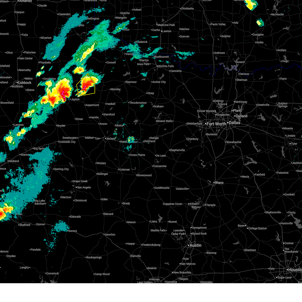 At 439 pm cdt, a severe thunderstorm was located 11 miles southeast of guthrie, moving northeast at 20 mph (trained weather spotters). Hazards include golf ball size hail and 60 mph wind gusts. People and animals outdoors will be injured. expect hail damage to roofs, siding, windows, and vehicles. expect wind damage to roofs, siding, and trees. Locations impacted include, guthrie. At 439 pm cdt, a severe thunderstorm was located 11 miles southeast of guthrie, moving northeast at 20 mph (trained weather spotters). Hazards include golf ball size hail and 60 mph wind gusts. People and animals outdoors will be injured. expect hail damage to roofs, siding, windows, and vehicles. expect wind damage to roofs, siding, and trees. Locations impacted include, guthrie.
|
| 4/29/2025 4:35 PM CDT | Hen Egg sized hail reported 8.5 miles NNW of Guthrie, TX, nssl report. |
| 4/29/2025 4:26 PM CDT |
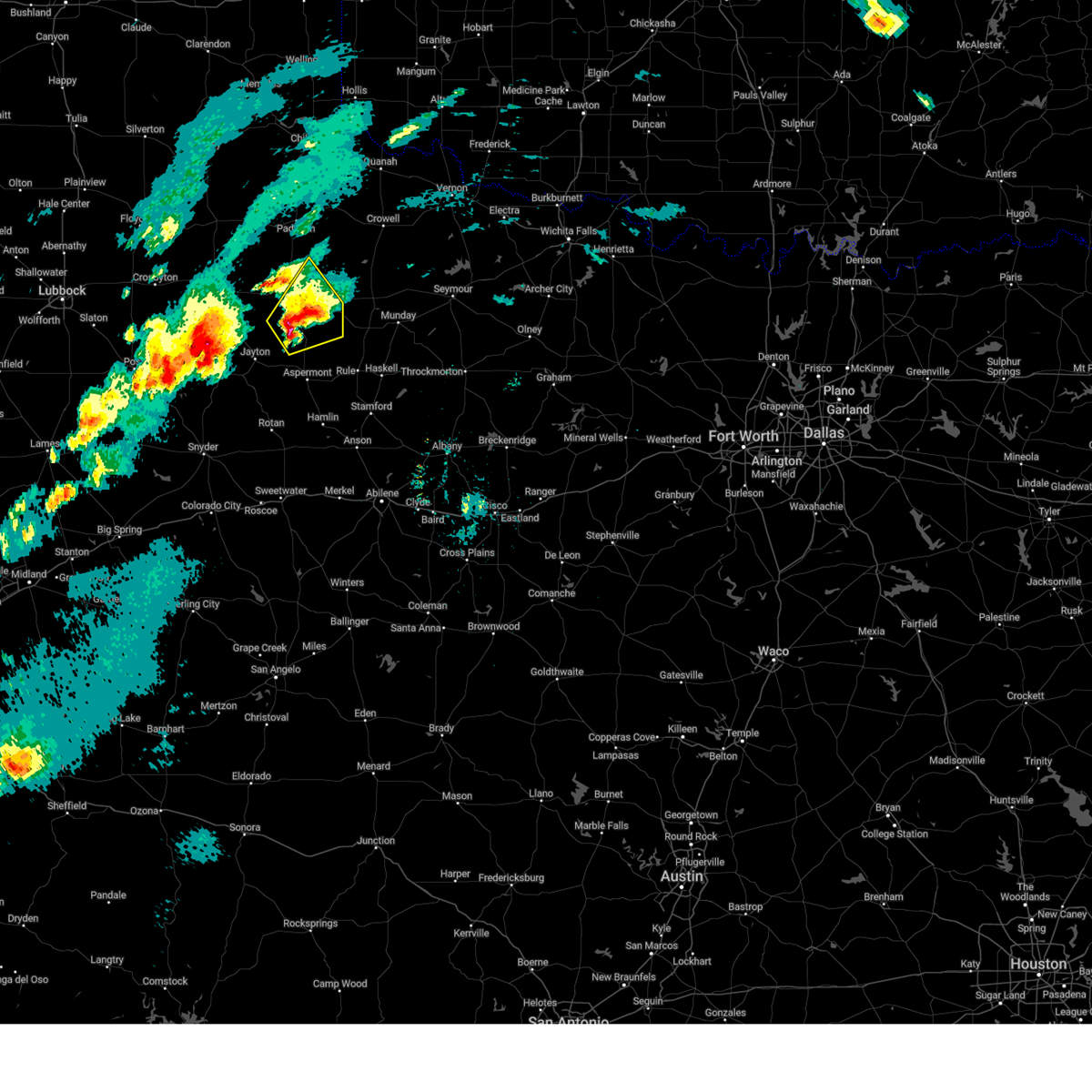 Svrlub the national weather service in lubbock texas has issued a * severe thunderstorm warning for, king county in northwestern texas, northeastern stonewall county in northwestern texas, * until 530 pm cdt. * at 426 pm cdt, a severe thunderstorm was located 14 miles south of guthrie, moving northeast at 15 mph (radar indicated). Hazards include ping pong ball size hail and 60 mph wind gusts. People and animals outdoors will be injured. expect hail damage to roofs, siding, windows, and vehicles. Expect wind damage to roofs, siding, and trees. Svrlub the national weather service in lubbock texas has issued a * severe thunderstorm warning for, king county in northwestern texas, northeastern stonewall county in northwestern texas, * until 530 pm cdt. * at 426 pm cdt, a severe thunderstorm was located 14 miles south of guthrie, moving northeast at 15 mph (radar indicated). Hazards include ping pong ball size hail and 60 mph wind gusts. People and animals outdoors will be injured. expect hail damage to roofs, siding, windows, and vehicles. Expect wind damage to roofs, siding, and trees.
|
| 4/29/2025 4:12 PM CDT |
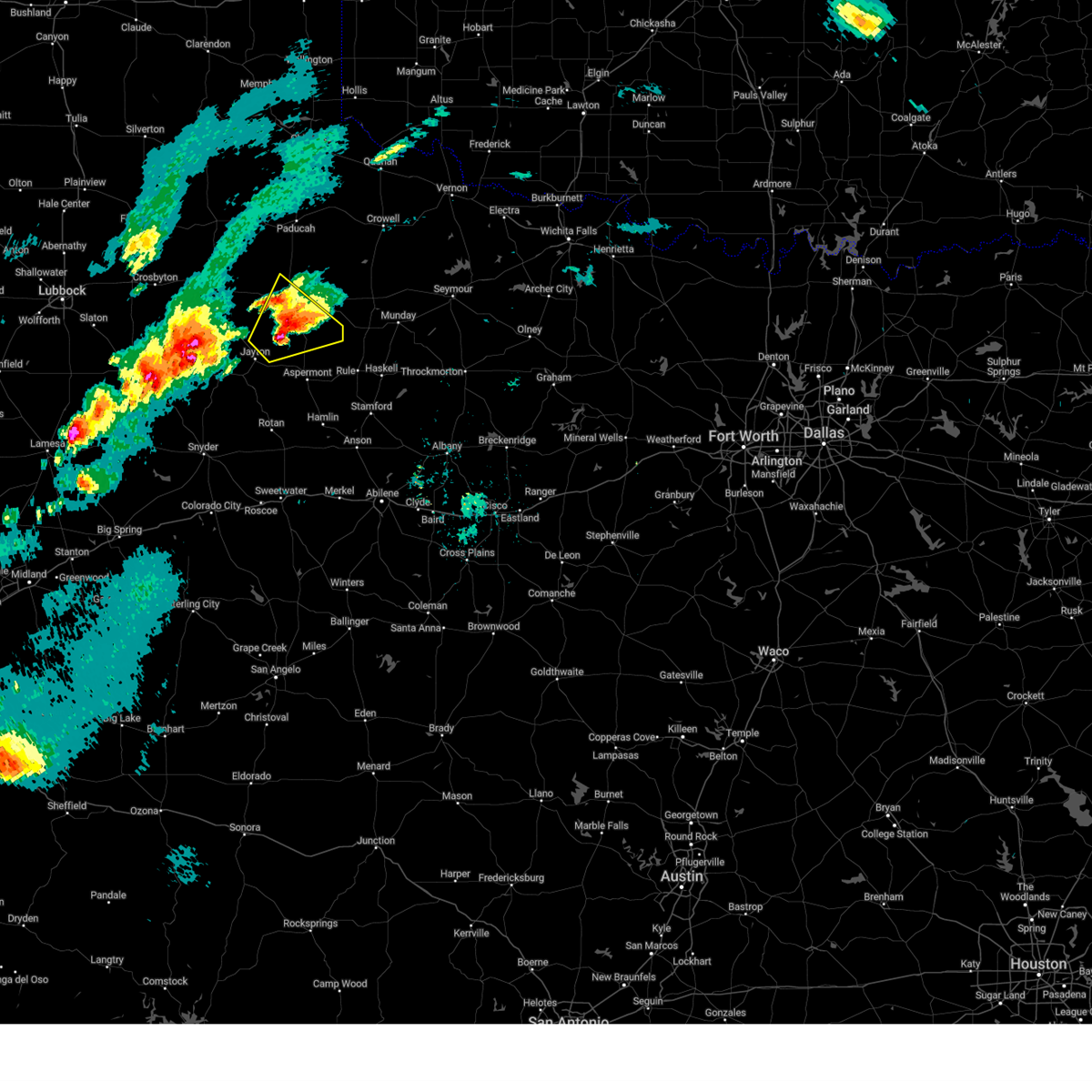 At 412 pm cdt, a severe thunderstorm was located 14 miles north of swenson, or 15 miles northeast of jayton, moving northeast at 20 mph (radar indicated). Hazards include ping pong ball size hail and 60 mph wind gusts. People and animals outdoors will be injured. expect hail damage to roofs, siding, windows, and vehicles. expect wind damage to roofs, siding, and trees. Locations impacted include, guthrie. At 412 pm cdt, a severe thunderstorm was located 14 miles north of swenson, or 15 miles northeast of jayton, moving northeast at 20 mph (radar indicated). Hazards include ping pong ball size hail and 60 mph wind gusts. People and animals outdoors will be injured. expect hail damage to roofs, siding, windows, and vehicles. expect wind damage to roofs, siding, and trees. Locations impacted include, guthrie.
|
| 4/29/2025 4:01 PM CDT |
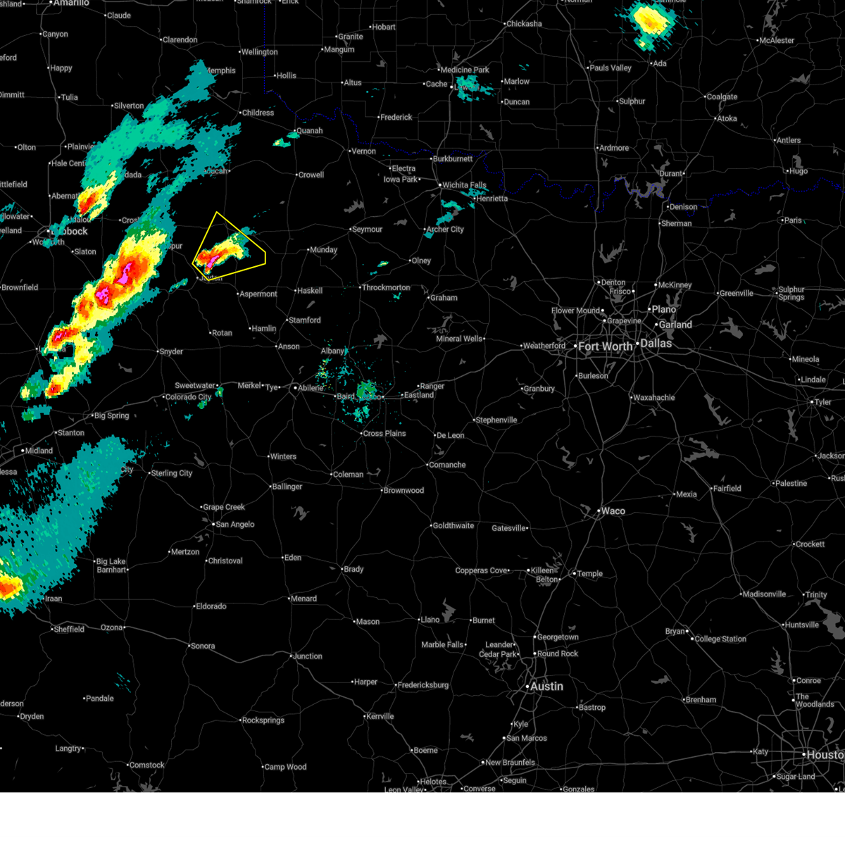 At 400 pm cdt, a severe thunderstorm was located 14 miles south of guthrie, moving northeast at 40 mph (radar indicated). Hazards include 60 mph wind gusts and half dollar size hail. Hail damage to vehicles is expected. expect wind damage to roofs, siding, and trees. Locations impacted include, guthrie. At 400 pm cdt, a severe thunderstorm was located 14 miles south of guthrie, moving northeast at 40 mph (radar indicated). Hazards include 60 mph wind gusts and half dollar size hail. Hail damage to vehicles is expected. expect wind damage to roofs, siding, and trees. Locations impacted include, guthrie.
|
| 4/29/2025 3:48 PM CDT |
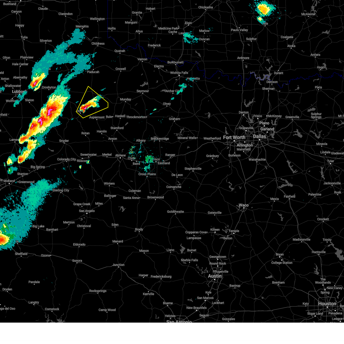 Svrlub the national weather service in lubbock texas has issued a * severe thunderstorm warning for, northeastern kent county in northwestern texas, southeastern dickens county in northwestern texas, southern king county in northwestern texas, northern stonewall county in northwestern texas, * until 430 pm cdt. * at 348 pm cdt, a severe thunderstorm was located 10 miles northeast of jayton, moving northeast at 30 mph (radar indicated). Hazards include 60 mph wind gusts and quarter size hail. Hail damage to vehicles is expected. Expect wind damage to roofs, siding, and trees. Svrlub the national weather service in lubbock texas has issued a * severe thunderstorm warning for, northeastern kent county in northwestern texas, southeastern dickens county in northwestern texas, southern king county in northwestern texas, northern stonewall county in northwestern texas, * until 430 pm cdt. * at 348 pm cdt, a severe thunderstorm was located 10 miles northeast of jayton, moving northeast at 30 mph (radar indicated). Hazards include 60 mph wind gusts and quarter size hail. Hail damage to vehicles is expected. Expect wind damage to roofs, siding, and trees.
|
| 4/29/2025 2:39 AM CDT |
 the severe thunderstorm warning has been cancelled and is no longer in effect the severe thunderstorm warning has been cancelled and is no longer in effect
|
| 4/29/2025 2:39 AM CDT |
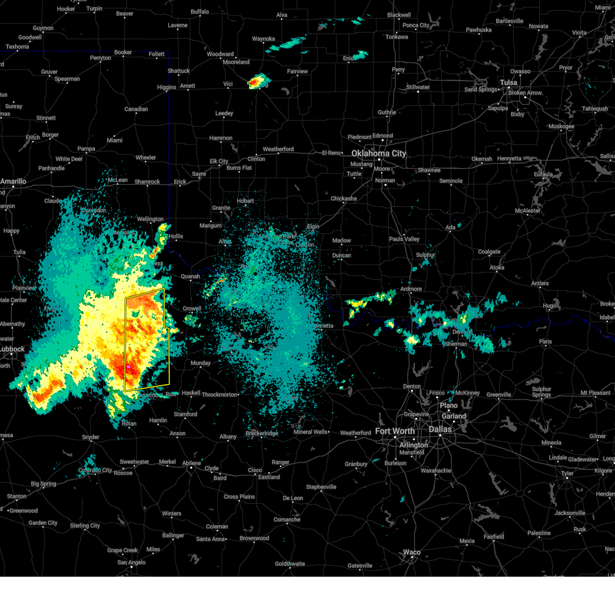 At 238 am cdt, severe thunderstorms were located along a line extending from 6 miles southeast of swearingen to 10 miles east of guthrie to 8 miles northwest of swenson, moving east at 50 mph (west texas mesonet). Hazards include 60 mph wind gusts. Expect damage to roofs, siding, and trees. Locations impacted include, hackberry, grow, paducah, guthrie, finney, delwin, chalk, and swearingen. At 238 am cdt, severe thunderstorms were located along a line extending from 6 miles southeast of swearingen to 10 miles east of guthrie to 8 miles northwest of swenson, moving east at 50 mph (west texas mesonet). Hazards include 60 mph wind gusts. Expect damage to roofs, siding, and trees. Locations impacted include, hackberry, grow, paducah, guthrie, finney, delwin, chalk, and swearingen.
|
| 4/29/2025 2:21 AM CDT |
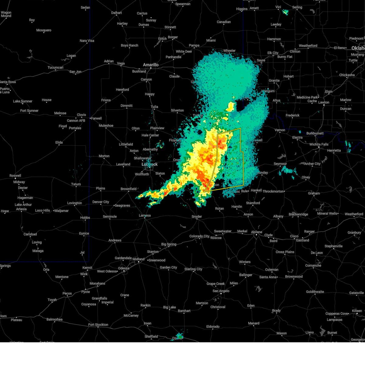 Svrlub the national weather service in lubbock texas has issued a * severe thunderstorm warning for, northeastern kent county in northwestern texas, southeastern dickens county in northwestern texas, king county in northwestern texas, cottle county in northwestern texas, northern stonewall county in northwestern texas, * until 300 am cdt. * at 220 am cdt, severe thunderstorms were located along a line extending from near paducah to 3 miles southwest of guthrie to 3 miles west of jayton, moving east at 50 mph (west texas mesonet). Hazards include 60 mph wind gusts and penny size hail. expect damage to roofs, siding, and trees Svrlub the national weather service in lubbock texas has issued a * severe thunderstorm warning for, northeastern kent county in northwestern texas, southeastern dickens county in northwestern texas, king county in northwestern texas, cottle county in northwestern texas, northern stonewall county in northwestern texas, * until 300 am cdt. * at 220 am cdt, severe thunderstorms were located along a line extending from near paducah to 3 miles southwest of guthrie to 3 miles west of jayton, moving east at 50 mph (west texas mesonet). Hazards include 60 mph wind gusts and penny size hail. expect damage to roofs, siding, and trees
|
| 4/29/2025 2:12 AM CDT | Measured by ttu mesone in king county TX, 9.4 miles ENE of Guthrie, TX |
| 4/28/2025 6:29 PM CDT |
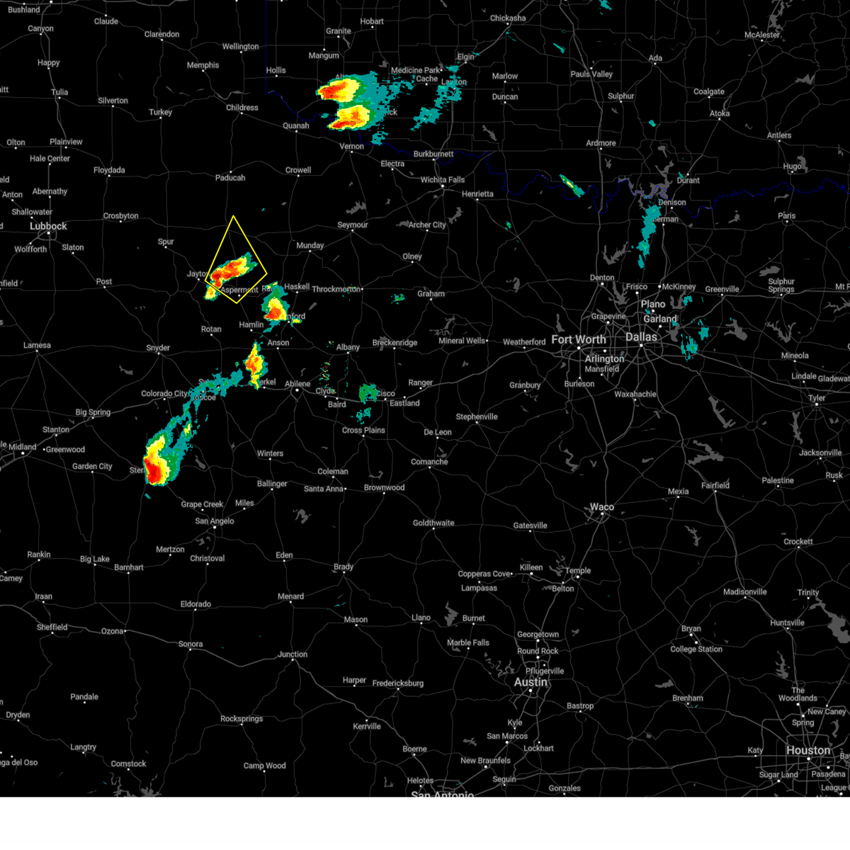 Svrlub the national weather service in lubbock texas has issued a * severe thunderstorm warning for, northeastern kent county in northwestern texas, south central king county in northwestern texas, northern stonewall county in northwestern texas, * until 730 pm cdt. * at 628 pm cdt, a severe thunderstorm was located 6 miles north of peacock, or 10 miles east of jayton, moving northeast at 45 mph (radar indicated). Hazards include 70 mph wind gusts and ping pong ball size hail. People and animals outdoors will be injured. expect hail damage to roofs, siding, windows, and vehicles. expect considerable tree damage. Wind damage is also likely to mobile homes, roofs, and outbuildings. Svrlub the national weather service in lubbock texas has issued a * severe thunderstorm warning for, northeastern kent county in northwestern texas, south central king county in northwestern texas, northern stonewall county in northwestern texas, * until 730 pm cdt. * at 628 pm cdt, a severe thunderstorm was located 6 miles north of peacock, or 10 miles east of jayton, moving northeast at 45 mph (radar indicated). Hazards include 70 mph wind gusts and ping pong ball size hail. People and animals outdoors will be injured. expect hail damage to roofs, siding, windows, and vehicles. expect considerable tree damage. Wind damage is also likely to mobile homes, roofs, and outbuildings.
|
| 11/18/2024 1:55 AM CST |
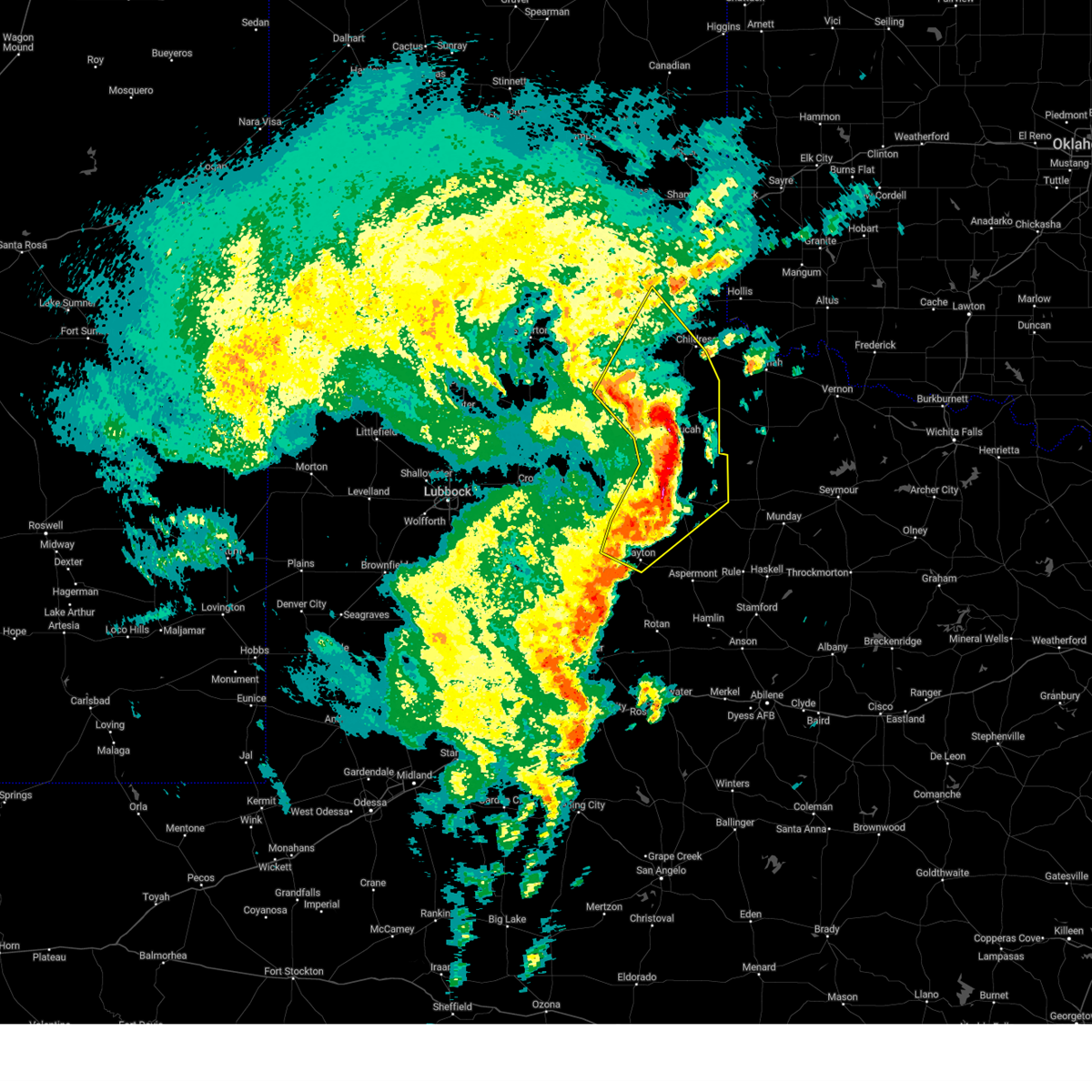 At 155 am cst, severe thunderstorms were located along a line extending from 6 miles west of northfield to 9 miles northwest of paducah to 3 miles northeast of delwin to 4 miles southwest of finney to near girard, moving northeast at 55 mph (radar indicated). Hazards include 70 mph wind gusts. Expect considerable tree damage. damage is likely to mobile homes, roofs, and outbuildings. Locations impacted include, childress, paducah, jayton, guthrie, girard, cee vee, swearingen, grow, dumont, tell, northfield, finney, delwin, chalk, hackberry, and estelline. At 155 am cst, severe thunderstorms were located along a line extending from 6 miles west of northfield to 9 miles northwest of paducah to 3 miles northeast of delwin to 4 miles southwest of finney to near girard, moving northeast at 55 mph (radar indicated). Hazards include 70 mph wind gusts. Expect considerable tree damage. damage is likely to mobile homes, roofs, and outbuildings. Locations impacted include, childress, paducah, jayton, guthrie, girard, cee vee, swearingen, grow, dumont, tell, northfield, finney, delwin, chalk, hackberry, and estelline.
|
| 11/18/2024 1:41 AM CST |
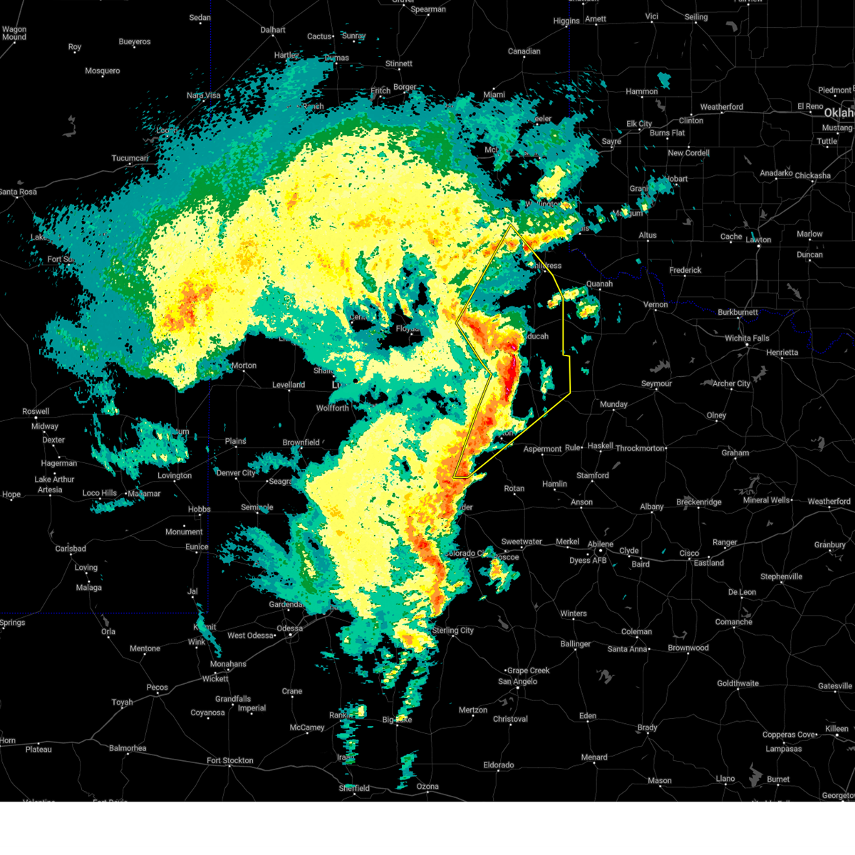 At 140 am cst, severe thunderstorms were located along a line extending from 9 miles southeast of flomot to 11 miles west of delwin to near dumont to 14 miles west of guthrie to 3 miles north of clairemont, moving northeast at 55 mph (radar indicated). Hazards include 60 mph wind gusts. Expect damage to roofs, siding, and trees. Locations impacted include, childress, paducah, matador, jayton, guthrie, girard, cee vee, clairemont, swearingen, grow, dumont, tell, northfield, finney, delwin, chalk, hackberry, and estelline. At 140 am cst, severe thunderstorms were located along a line extending from 9 miles southeast of flomot to 11 miles west of delwin to near dumont to 14 miles west of guthrie to 3 miles north of clairemont, moving northeast at 55 mph (radar indicated). Hazards include 60 mph wind gusts. Expect damage to roofs, siding, and trees. Locations impacted include, childress, paducah, matador, jayton, guthrie, girard, cee vee, clairemont, swearingen, grow, dumont, tell, northfield, finney, delwin, chalk, hackberry, and estelline.
|
| 11/18/2024 1:15 AM CST |
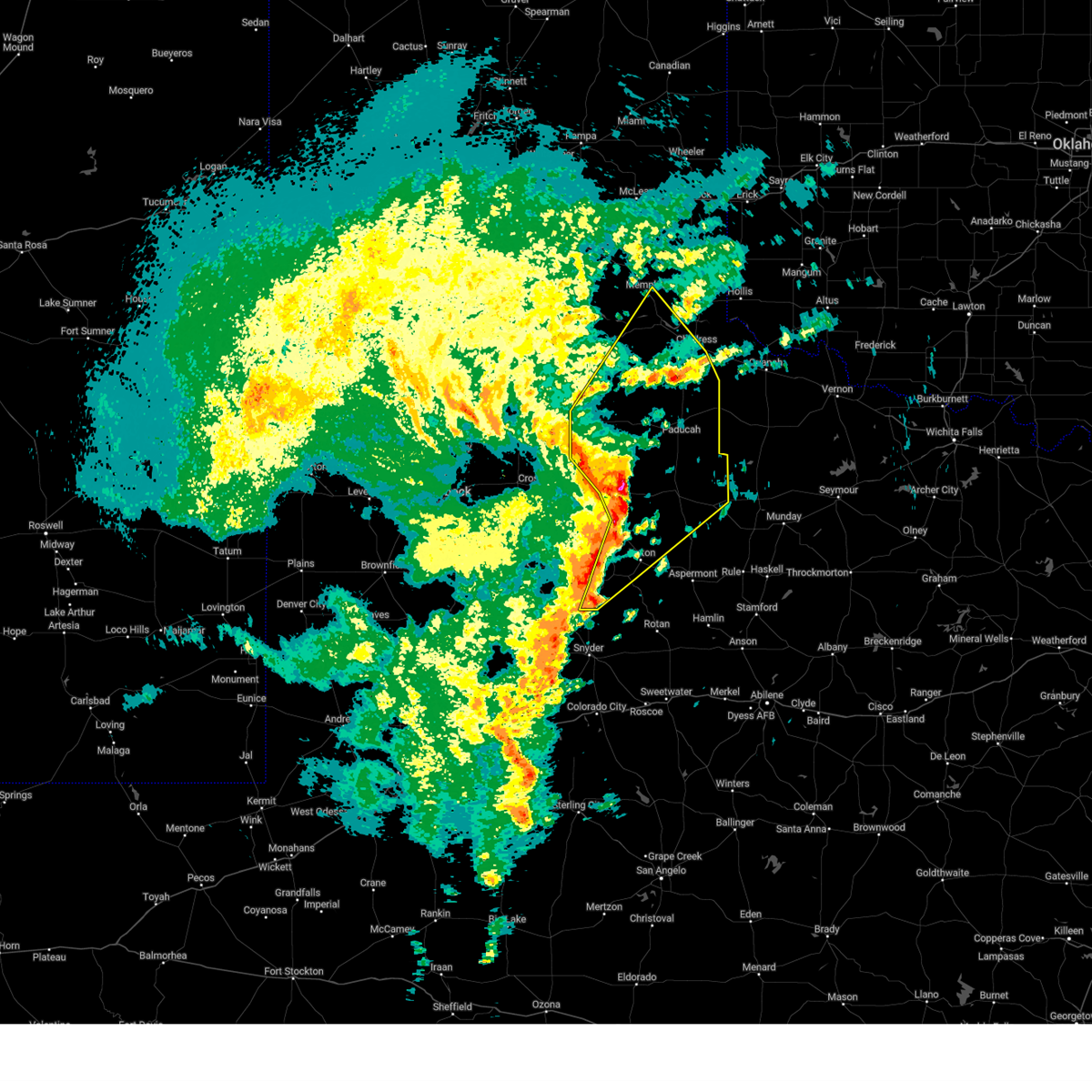 Svrlub the national weather service in lubbock texas has issued a * severe thunderstorm warning for, central kent county in northwestern texas, dickens county in northwestern texas, southwestern childress county in the panhandle of texas, king county in northwestern texas, cottle county in northwestern texas, motley county in northwestern texas, eastern hall county in the panhandle of texas, northwestern stonewall county in northwestern texas, * until 215 am cst. * at 114 am cst, severe thunderstorms were located along a line extending from near dougherty to 3 miles north of dickens to 7 miles northeast of spur to 8 miles west of girard to 8 miles southeast of lake alan henry, moving northeast at 55 mph (radar indicated). Hazards include 60 mph wind gusts. expect damage to roofs, siding, and trees Svrlub the national weather service in lubbock texas has issued a * severe thunderstorm warning for, central kent county in northwestern texas, dickens county in northwestern texas, southwestern childress county in the panhandle of texas, king county in northwestern texas, cottle county in northwestern texas, motley county in northwestern texas, eastern hall county in the panhandle of texas, northwestern stonewall county in northwestern texas, * until 215 am cst. * at 114 am cst, severe thunderstorms were located along a line extending from near dougherty to 3 miles north of dickens to 7 miles northeast of spur to 8 miles west of girard to 8 miles southeast of lake alan henry, moving northeast at 55 mph (radar indicated). Hazards include 60 mph wind gusts. expect damage to roofs, siding, and trees
|
| 8/15/2024 3:13 PM CDT | Storm damage reported in king county TX, 9.4 miles ENE of Guthrie, TX |
| 7/7/2024 8:40 PM CDT |
 the severe thunderstorm warning has been cancelled and is no longer in effect the severe thunderstorm warning has been cancelled and is no longer in effect
|
| 7/7/2024 8:40 PM CDT |
 At 837 pm cdt, severe thunderstorms were located along a line extending from near grow to 3 miles northwest of jayton, moving east at 25 mph (radar indicated). Hazards include 60 mph wind gusts and quarter size hail. Hail damage to vehicles is expected. expect wind damage to roofs, siding, and trees. Locations impacted include, aspermont, jayton, guthrie, girard, grow, peacock, finney, and swenson. At 837 pm cdt, severe thunderstorms were located along a line extending from near grow to 3 miles northwest of jayton, moving east at 25 mph (radar indicated). Hazards include 60 mph wind gusts and quarter size hail. Hail damage to vehicles is expected. expect wind damage to roofs, siding, and trees. Locations impacted include, aspermont, jayton, guthrie, girard, grow, peacock, finney, and swenson.
|
| 7/7/2024 8:12 PM CDT |
 Svrlub the national weather service in lubbock texas has issued a * severe thunderstorm warning for, northeastern kent county in northwestern texas, southern dickens county in northwestern texas, king county in northwestern texas, southwestern cottle county in northwestern texas, stonewall county in northwestern texas, * until 915 pm cdt. * at 812 pm cdt, severe thunderstorms were located along a line extending from near finney to 7 miles south of spur, moving southeast at 30 mph (radar indicated). Hazards include 60 mph wind gusts and quarter size hail. Hail damage to vehicles is expected. Expect wind damage to roofs, siding, and trees. Svrlub the national weather service in lubbock texas has issued a * severe thunderstorm warning for, northeastern kent county in northwestern texas, southern dickens county in northwestern texas, king county in northwestern texas, southwestern cottle county in northwestern texas, stonewall county in northwestern texas, * until 915 pm cdt. * at 812 pm cdt, severe thunderstorms were located along a line extending from near finney to 7 miles south of spur, moving southeast at 30 mph (radar indicated). Hazards include 60 mph wind gusts and quarter size hail. Hail damage to vehicles is expected. Expect wind damage to roofs, siding, and trees.
|
| 5/2/2024 5:28 PM CDT |
 At 528 pm cdt, a severe thunderstorm was located 6 miles east of guthrie, moving east at 20 mph (radar indicated). Hazards include 60 mph wind gusts and quarter size hail. Hail damage to vehicles is expected. expect wind damage to roofs, siding, and trees. Locations impacted include, guthrie. At 528 pm cdt, a severe thunderstorm was located 6 miles east of guthrie, moving east at 20 mph (radar indicated). Hazards include 60 mph wind gusts and quarter size hail. Hail damage to vehicles is expected. expect wind damage to roofs, siding, and trees. Locations impacted include, guthrie.
|
| 5/2/2024 5:24 PM CDT | Quarter sized hail reported 6.4 miles NNW of Guthrie, TX |
| 5/2/2024 5:14 PM CDT |
 At 514 pm cdt, a severe thunderstorm was located over guthrie, moving east at 20 mph (radar indicated). Hazards include 60 mph wind gusts and quarter size hail. Hail damage to vehicles is expected. expect wind damage to roofs, siding, and trees. Locations impacted include, guthrie. At 514 pm cdt, a severe thunderstorm was located over guthrie, moving east at 20 mph (radar indicated). Hazards include 60 mph wind gusts and quarter size hail. Hail damage to vehicles is expected. expect wind damage to roofs, siding, and trees. Locations impacted include, guthrie.
|
| 5/2/2024 5:02 PM CDT |
 Svrlub the national weather service in lubbock texas has issued a * severe thunderstorm warning for, central king county in northwestern texas, * until 600 pm cdt. * at 501 pm cdt, a severe thunderstorm was located near guthrie, moving east at 20 mph (radar indicated). Hazards include 60 mph wind gusts and quarter size hail. Hail damage to vehicles is expected. Expect wind damage to roofs, siding, and trees. Svrlub the national weather service in lubbock texas has issued a * severe thunderstorm warning for, central king county in northwestern texas, * until 600 pm cdt. * at 501 pm cdt, a severe thunderstorm was located near guthrie, moving east at 20 mph (radar indicated). Hazards include 60 mph wind gusts and quarter size hail. Hail damage to vehicles is expected. Expect wind damage to roofs, siding, and trees.
|
| 4/27/2024 1:07 PM CDT |
 the severe thunderstorm warning has been cancelled and is no longer in effect the severe thunderstorm warning has been cancelled and is no longer in effect
|
| 4/27/2024 1:07 PM CDT |
 At 106 pm cdt, a severe thunderstorm was located 11 miles southeast of guthrie, moving northeast at 30 mph (radar indicated). Hazards include 70 mph wind gusts and ping pong ball size hail. People and animals outdoors will be injured. expect hail damage to roofs, siding, windows, and vehicles. expect considerable tree damage. wind damage is also likely to mobile homes, roofs, and outbuildings. Locations impacted include, guthrie. At 106 pm cdt, a severe thunderstorm was located 11 miles southeast of guthrie, moving northeast at 30 mph (radar indicated). Hazards include 70 mph wind gusts and ping pong ball size hail. People and animals outdoors will be injured. expect hail damage to roofs, siding, windows, and vehicles. expect considerable tree damage. wind damage is also likely to mobile homes, roofs, and outbuildings. Locations impacted include, guthrie.
|
| 4/27/2024 12:53 PM CDT |
 the severe thunderstorm warning has been cancelled and is no longer in effect the severe thunderstorm warning has been cancelled and is no longer in effect
|
| 4/27/2024 12:53 PM CDT |
 At 1252 pm cdt, a severe thunderstorm was located 13 miles south of guthrie, moving northeast at 30 mph (radar indicated). Hazards include 70 mph wind gusts and ping pong ball size hail. People and animals outdoors will be injured. expect hail damage to roofs, siding, windows, and vehicles. expect considerable tree damage. wind damage is also likely to mobile homes, roofs, and outbuildings. Locations impacted include, guthrie. At 1252 pm cdt, a severe thunderstorm was located 13 miles south of guthrie, moving northeast at 30 mph (radar indicated). Hazards include 70 mph wind gusts and ping pong ball size hail. People and animals outdoors will be injured. expect hail damage to roofs, siding, windows, and vehicles. expect considerable tree damage. wind damage is also likely to mobile homes, roofs, and outbuildings. Locations impacted include, guthrie.
|
| 4/27/2024 12:36 PM CDT |
 Svrlub the national weather service in lubbock texas has issued a * severe thunderstorm warning for, east central kent county in northwestern texas, king county in northwestern texas, northwestern stonewall county in northwestern texas, * until 115 pm cdt. * at 1235 pm cdt, a severe thunderstorm was located 11 miles northeast of jayton, moving northeast at 35 mph (radar indicated). Hazards include 70 mph wind gusts and half dollar size hail. Hail damage to vehicles is expected. expect considerable tree damage. Wind damage is also likely to mobile homes, roofs, and outbuildings. Svrlub the national weather service in lubbock texas has issued a * severe thunderstorm warning for, east central kent county in northwestern texas, king county in northwestern texas, northwestern stonewall county in northwestern texas, * until 115 pm cdt. * at 1235 pm cdt, a severe thunderstorm was located 11 miles northeast of jayton, moving northeast at 35 mph (radar indicated). Hazards include 70 mph wind gusts and half dollar size hail. Hail damage to vehicles is expected. expect considerable tree damage. Wind damage is also likely to mobile homes, roofs, and outbuildings.
|
| 4/26/2024 2:13 AM CDT |
 At 213 am cdt, a severe thunderstorm was located 10 miles south of guthrie, moving east at 35 mph (radar indicated). Hazards include 60 mph wind gusts and quarter size hail. Hail damage to vehicles is expected. expect wind damage to roofs, siding, and trees. Locations impacted include, guthrie. At 213 am cdt, a severe thunderstorm was located 10 miles south of guthrie, moving east at 35 mph (radar indicated). Hazards include 60 mph wind gusts and quarter size hail. Hail damage to vehicles is expected. expect wind damage to roofs, siding, and trees. Locations impacted include, guthrie.
|
| 4/26/2024 2:03 AM CDT |
 the severe thunderstorm warning has been cancelled and is no longer in effect the severe thunderstorm warning has been cancelled and is no longer in effect
|
| 4/26/2024 2:03 AM CDT |
 At 203 am cdt, a severe thunderstorm was located 9 miles south of guthrie, moving east at 45 mph (radar indicated). Hazards include 60 mph wind gusts and quarter size hail. Hail damage to vehicles is expected. expect wind damage to roofs, siding, and trees. Locations impacted include, guthrie. At 203 am cdt, a severe thunderstorm was located 9 miles south of guthrie, moving east at 45 mph (radar indicated). Hazards include 60 mph wind gusts and quarter size hail. Hail damage to vehicles is expected. expect wind damage to roofs, siding, and trees. Locations impacted include, guthrie.
|
| 4/26/2024 1:53 AM CDT |
 At 153 am cdt, a severe thunderstorm was located 13 miles east of girard, or 14 miles northeast of jayton, moving east at 45 mph (radar indicated). Hazards include 60 mph wind gusts and quarter size hail. Hail damage to vehicles is expected. expect wind damage to roofs, siding, and trees. Locations impacted include, guthrie. At 153 am cdt, a severe thunderstorm was located 13 miles east of girard, or 14 miles northeast of jayton, moving east at 45 mph (radar indicated). Hazards include 60 mph wind gusts and quarter size hail. Hail damage to vehicles is expected. expect wind damage to roofs, siding, and trees. Locations impacted include, guthrie.
|
| 4/26/2024 1:42 AM CDT |
 Svrlub the national weather service in lubbock texas has issued a * severe thunderstorm warning for, northeastern kent county in northwestern texas, southeastern dickens county in northwestern texas, king county in northwestern texas, northern stonewall county in northwestern texas, * until 300 am cdt. * at 142 am cdt, a severe thunderstorm was located 5 miles northeast of girard, or 11 miles north of jayton, moving east at 45 mph (radar indicated). Hazards include ping pong ball size hail and 60 mph wind gusts. People and animals outdoors will be injured. expect hail damage to roofs, siding, windows, and vehicles. Expect wind damage to roofs, siding, and trees. Svrlub the national weather service in lubbock texas has issued a * severe thunderstorm warning for, northeastern kent county in northwestern texas, southeastern dickens county in northwestern texas, king county in northwestern texas, northern stonewall county in northwestern texas, * until 300 am cdt. * at 142 am cdt, a severe thunderstorm was located 5 miles northeast of girard, or 11 miles north of jayton, moving east at 45 mph (radar indicated). Hazards include ping pong ball size hail and 60 mph wind gusts. People and animals outdoors will be injured. expect hail damage to roofs, siding, windows, and vehicles. Expect wind damage to roofs, siding, and trees.
|
| 4/26/2024 1:33 AM CDT |
 the severe thunderstorm warning has been cancelled and is no longer in effect the severe thunderstorm warning has been cancelled and is no longer in effect
|
| 4/26/2024 1:19 AM CDT |
 At 119 am cdt, severe thunderstorms were located along a line extending from 8 miles east of paducah to 14 miles west of benjamin, moving northeast at 50 mph (radar indicated). Hazards include 60 mph wind gusts and penny size hail. Expect damage to roofs, siding, and trees. Locations impacted include, guthrie, grow, chalk, and hackberry. At 119 am cdt, severe thunderstorms were located along a line extending from 8 miles east of paducah to 14 miles west of benjamin, moving northeast at 50 mph (radar indicated). Hazards include 60 mph wind gusts and penny size hail. Expect damage to roofs, siding, and trees. Locations impacted include, guthrie, grow, chalk, and hackberry.
|
| 4/26/2024 1:14 AM CDT |
 At 113 am cdt, severe thunderstorms were located along a line extending from 4 miles north of chalk to 10 miles east of guthrie, moving northeast at 55 mph (radar indicated). Hazards include 60 mph wind gusts and penny size hail. Expect damage to roofs, siding, and trees. Locations impacted include, guthrie, grow, dumont, finney, delwin, chalk, and hackberry. At 113 am cdt, severe thunderstorms were located along a line extending from 4 miles north of chalk to 10 miles east of guthrie, moving northeast at 55 mph (radar indicated). Hazards include 60 mph wind gusts and penny size hail. Expect damage to roofs, siding, and trees. Locations impacted include, guthrie, grow, dumont, finney, delwin, chalk, and hackberry.
|
| 4/26/2024 1:08 AM CDT |
 At 108 am cdt, severe thunderstorms were located along a line extending from 5 miles northwest of chalk to 7 miles east of guthrie, moving northeast at 50 mph (radar indicated). Hazards include 70 mph wind gusts and quarter size hail. Hail damage to vehicles is expected. expect considerable tree damage. wind damage is also likely to mobile homes, roofs, and outbuildings. Locations impacted include, guthrie, grow, dumont, finney, delwin, chalk, and hackberry. At 108 am cdt, severe thunderstorms were located along a line extending from 5 miles northwest of chalk to 7 miles east of guthrie, moving northeast at 50 mph (radar indicated). Hazards include 70 mph wind gusts and quarter size hail. Hail damage to vehicles is expected. expect considerable tree damage. wind damage is also likely to mobile homes, roofs, and outbuildings. Locations impacted include, guthrie, grow, dumont, finney, delwin, chalk, and hackberry.
|
| 4/26/2024 12:54 AM CDT |
 At 1254 am cdt, severe thunderstorms were located along a line extending from near delwin to 4 miles south of guthrie, moving northeast at 55 mph (radar indicated). Hazards include 70 mph wind gusts and quarter size hail. Hail damage to vehicles is expected. expect considerable tree damage. wind damage is also likely to mobile homes, roofs, and outbuildings. Locations impacted include, guthrie, grow, dumont, finney, delwin, chalk, and hackberry. At 1254 am cdt, severe thunderstorms were located along a line extending from near delwin to 4 miles south of guthrie, moving northeast at 55 mph (radar indicated). Hazards include 70 mph wind gusts and quarter size hail. Hail damage to vehicles is expected. expect considerable tree damage. wind damage is also likely to mobile homes, roofs, and outbuildings. Locations impacted include, guthrie, grow, dumont, finney, delwin, chalk, and hackberry.
|
| 4/26/2024 12:54 AM CDT |
 the severe thunderstorm warning has been cancelled and is no longer in effect the severe thunderstorm warning has been cancelled and is no longer in effect
|
| 4/26/2024 12:46 AM CDT | Storm damage reported in king county TX, 9.4 miles ENE of Guthrie, TX |
| 4/26/2024 12:45 AM CDT | Storm damage reported in king county TX, 9.4 miles ENE of Guthrie, TX |
| 4/26/2024 12:41 AM CDT |
 Svrlub the national weather service in lubbock texas has issued a * severe thunderstorm warning for, northeastern kent county in northwestern texas, eastern dickens county in northwestern texas, king county in northwestern texas, southern cottle county in northwestern texas, northern stonewall county in northwestern texas, * until 200 am cdt. * at 1241 am cdt, severe thunderstorms were located along a line extending from 5 miles west of dumont to 6 miles east of girard, moving northeast at 55 mph (radar indicated). Hazards include 70 mph wind gusts and quarter size hail. Hail damage to vehicles is expected. expect considerable tree damage. Wind damage is also likely to mobile homes, roofs, and outbuildings. Svrlub the national weather service in lubbock texas has issued a * severe thunderstorm warning for, northeastern kent county in northwestern texas, eastern dickens county in northwestern texas, king county in northwestern texas, southern cottle county in northwestern texas, northern stonewall county in northwestern texas, * until 200 am cdt. * at 1241 am cdt, severe thunderstorms were located along a line extending from 5 miles west of dumont to 6 miles east of girard, moving northeast at 55 mph (radar indicated). Hazards include 70 mph wind gusts and quarter size hail. Hail damage to vehicles is expected. expect considerable tree damage. Wind damage is also likely to mobile homes, roofs, and outbuildings.
|
| 4/15/2024 6:42 PM CDT |
 At 641 pm cdt, a severe thunderstorm was located 14 miles west of o'brien, or 16 miles west of knox city, moving northeast at 65 mph (public reported quarter size hail 16 miles north of aspermont at 635 pm cdt). Hazards include 70 mph wind gusts and ping pong ball size hail. People and animals outdoors will be injured. expect hail damage to roofs, siding, windows, and vehicles. expect considerable tree damage. wind damage is also likely to mobile homes, roofs, and outbuildings. Locations impacted include, guthrie. At 641 pm cdt, a severe thunderstorm was located 14 miles west of o'brien, or 16 miles west of knox city, moving northeast at 65 mph (public reported quarter size hail 16 miles north of aspermont at 635 pm cdt). Hazards include 70 mph wind gusts and ping pong ball size hail. People and animals outdoors will be injured. expect hail damage to roofs, siding, windows, and vehicles. expect considerable tree damage. wind damage is also likely to mobile homes, roofs, and outbuildings. Locations impacted include, guthrie.
|
| 4/15/2024 6:32 PM CDT |
 Svrlub the national weather service in lubbock texas has issued a * severe thunderstorm warning for, eastern king county in northwestern texas, northern stonewall county in northwestern texas, * until 715 pm cdt. * at 632 pm cdt, a severe thunderstorm was located 4 miles northeast of swenson, or 8 miles north of aspermont, moving northeast at 60 mph (radar indicated). Hazards include golf ball size hail and 70 mph wind gusts. People and animals outdoors will be injured. expect hail damage to roofs, siding, windows, and vehicles. expect considerable tree damage. Wind damage is also likely to mobile homes, roofs, and outbuildings. Svrlub the national weather service in lubbock texas has issued a * severe thunderstorm warning for, eastern king county in northwestern texas, northern stonewall county in northwestern texas, * until 715 pm cdt. * at 632 pm cdt, a severe thunderstorm was located 4 miles northeast of swenson, or 8 miles north of aspermont, moving northeast at 60 mph (radar indicated). Hazards include golf ball size hail and 70 mph wind gusts. People and animals outdoors will be injured. expect hail damage to roofs, siding, windows, and vehicles. expect considerable tree damage. Wind damage is also likely to mobile homes, roofs, and outbuildings.
|
| 4/15/2024 6:21 PM CDT |
 At 621 pm cdt, a severe thunderstorm was located 10 miles southeast of guthrie, moving northeast at 60 mph (radar indicated). Hazards include golf ball size hail and 70 mph wind gusts. People and animals outdoors will be injured. expect hail damage to roofs, siding, windows, and vehicles. expect considerable tree damage. wind damage is also likely to mobile homes, roofs, and outbuildings. Locations impacted include, guthrie and grow. At 621 pm cdt, a severe thunderstorm was located 10 miles southeast of guthrie, moving northeast at 60 mph (radar indicated). Hazards include golf ball size hail and 70 mph wind gusts. People and animals outdoors will be injured. expect hail damage to roofs, siding, windows, and vehicles. expect considerable tree damage. wind damage is also likely to mobile homes, roofs, and outbuildings. Locations impacted include, guthrie and grow.
|
| 4/15/2024 6:15 PM CDT |
 At 615 pm cdt, a severe thunderstorm was located 12 miles southeast of guthrie, moving northeast at 60 mph (radar indicated). Hazards include two inch hail and 70 mph wind gusts. People and animals outdoors will be injured. expect hail damage to roofs, siding, windows, and vehicles. expect considerable tree damage. wind damage is also likely to mobile homes, roofs, and outbuildings. Locations impacted include, guthrie and grow. At 615 pm cdt, a severe thunderstorm was located 12 miles southeast of guthrie, moving northeast at 60 mph (radar indicated). Hazards include two inch hail and 70 mph wind gusts. People and animals outdoors will be injured. expect hail damage to roofs, siding, windows, and vehicles. expect considerable tree damage. wind damage is also likely to mobile homes, roofs, and outbuildings. Locations impacted include, guthrie and grow.
|
| 4/15/2024 6:09 PM CDT |
 At 609 pm cdt, a severe thunderstorm was located 13 miles north of swenson, or 16 miles south of guthrie, moving northeast at 60 mph (radar indicated). Hazards include two inch hail and 70 mph wind gusts. People and animals outdoors will be injured. expect hail damage to roofs, siding, windows, and vehicles. expect considerable tree damage. wind damage is also likely to mobile homes, roofs, and outbuildings. Locations impacted include, guthrie, grow, and finney. At 609 pm cdt, a severe thunderstorm was located 13 miles north of swenson, or 16 miles south of guthrie, moving northeast at 60 mph (radar indicated). Hazards include two inch hail and 70 mph wind gusts. People and animals outdoors will be injured. expect hail damage to roofs, siding, windows, and vehicles. expect considerable tree damage. wind damage is also likely to mobile homes, roofs, and outbuildings. Locations impacted include, guthrie, grow, and finney.
|
| 4/15/2024 6:03 PM CDT |
 At 603 pm cdt, a severe thunderstorm was located 8 miles north of swenson, or 14 miles northwest of aspermont, moving northeast at 60 mph (radar indicated). Hazards include golf ball size hail and 60 mph wind gusts. People and animals outdoors will be injured. expect hail damage to roofs, siding, windows, and vehicles. expect wind damage to roofs, siding, and trees. Locations impacted include, guthrie, grow, peacock, finney, and swenson. At 603 pm cdt, a severe thunderstorm was located 8 miles north of swenson, or 14 miles northwest of aspermont, moving northeast at 60 mph (radar indicated). Hazards include golf ball size hail and 60 mph wind gusts. People and animals outdoors will be injured. expect hail damage to roofs, siding, windows, and vehicles. expect wind damage to roofs, siding, and trees. Locations impacted include, guthrie, grow, peacock, finney, and swenson.
|
| 4/15/2024 5:57 PM CDT |
 Svrlub the national weather service in lubbock texas has issued a * severe thunderstorm warning for, king county in northwestern texas, northern stonewall county in northwestern texas, * until 645 pm cdt. * at 557 pm cdt, a severe thunderstorm was located near swenson, or 9 miles northwest of aspermont, moving northeast at 60 mph (radar indicated). Hazards include 60 mph wind gusts and half dollar size hail. Hail damage to vehicles is expected. Expect wind damage to roofs, siding, and trees. Svrlub the national weather service in lubbock texas has issued a * severe thunderstorm warning for, king county in northwestern texas, northern stonewall county in northwestern texas, * until 645 pm cdt. * at 557 pm cdt, a severe thunderstorm was located near swenson, or 9 miles northwest of aspermont, moving northeast at 60 mph (radar indicated). Hazards include 60 mph wind gusts and half dollar size hail. Hail damage to vehicles is expected. Expect wind damage to roofs, siding, and trees.
|
| 4/9/2024 8:18 AM CDT |
 At 818 am cdt, a severe thunderstorm was located over guthrie, moving northeast at 35 mph (radar indicated). Hazards include ping pong ball size hail and 60 mph wind gusts. People and animals outdoors will be injured. expect hail damage to roofs, siding, windows, and vehicles. expect wind damage to roofs, siding, and trees. Locations impacted include, guthrie. At 818 am cdt, a severe thunderstorm was located over guthrie, moving northeast at 35 mph (radar indicated). Hazards include ping pong ball size hail and 60 mph wind gusts. People and animals outdoors will be injured. expect hail damage to roofs, siding, windows, and vehicles. expect wind damage to roofs, siding, and trees. Locations impacted include, guthrie.
|
| 4/9/2024 8:04 AM CDT |
 At 804 am cdt, a severe thunderstorm was located 10 miles southwest of guthrie, moving northeast at 35 mph (radar indicated). Hazards include ping pong ball size hail and 60 mph wind gusts. People and animals outdoors will be injured. expect hail damage to roofs, siding, windows, and vehicles. expect wind damage to roofs, siding, and trees. Locations impacted include, guthrie and finney. At 804 am cdt, a severe thunderstorm was located 10 miles southwest of guthrie, moving northeast at 35 mph (radar indicated). Hazards include ping pong ball size hail and 60 mph wind gusts. People and animals outdoors will be injured. expect hail damage to roofs, siding, windows, and vehicles. expect wind damage to roofs, siding, and trees. Locations impacted include, guthrie and finney.
|
| 4/9/2024 8:04 AM CDT |
 the severe thunderstorm warning has been cancelled and is no longer in effect the severe thunderstorm warning has been cancelled and is no longer in effect
|
| 4/9/2024 7:55 AM CDT |
 At 755 am cdt, a severe thunderstorm was located 10 miles northeast of girard, or 16 miles southwest of guthrie, moving northeast at 35 mph (radar indicated). Hazards include ping pong ball size hail and 60 mph wind gusts. People and animals outdoors will be injured. expect hail damage to roofs, siding, windows, and vehicles. expect wind damage to roofs, siding, and trees. Locations impacted include, guthrie and finney. At 755 am cdt, a severe thunderstorm was located 10 miles northeast of girard, or 16 miles southwest of guthrie, moving northeast at 35 mph (radar indicated). Hazards include ping pong ball size hail and 60 mph wind gusts. People and animals outdoors will be injured. expect hail damage to roofs, siding, windows, and vehicles. expect wind damage to roofs, siding, and trees. Locations impacted include, guthrie and finney.
|
| 4/9/2024 7:45 AM CDT |
 Svrlub the national weather service in lubbock texas has issued a * severe thunderstorm warning for, northeastern kent county in northwestern texas, southeastern dickens county in northwestern texas, western king county in northwestern texas, northern stonewall county in northwestern texas, * until 845 am cdt. * at 744 am cdt, a severe thunderstorm was located 4 miles north of girard, or 12 miles east of spur, moving northeast at 35 mph (west texas mesonet at lake alan henry measured 69 mph at 6:48am cdt). Hazards include 70 mph wind gusts and ping pong ball size hail. People and animals outdoors will be injured. expect hail damage to roofs, siding, windows, and vehicles. expect considerable tree damage. Wind damage is also likely to mobile homes, roofs, and outbuildings. Svrlub the national weather service in lubbock texas has issued a * severe thunderstorm warning for, northeastern kent county in northwestern texas, southeastern dickens county in northwestern texas, western king county in northwestern texas, northern stonewall county in northwestern texas, * until 845 am cdt. * at 744 am cdt, a severe thunderstorm was located 4 miles north of girard, or 12 miles east of spur, moving northeast at 35 mph (west texas mesonet at lake alan henry measured 69 mph at 6:48am cdt). Hazards include 70 mph wind gusts and ping pong ball size hail. People and animals outdoors will be injured. expect hail damage to roofs, siding, windows, and vehicles. expect considerable tree damage. Wind damage is also likely to mobile homes, roofs, and outbuildings.
|
| 10/4/2023 5:31 PM CDT |
 At 530 pm cdt, a severe thunderstorm was located 9 miles south of guthrie, moving east at 35 mph (radar indicated). Hazards include 60 mph wind gusts and half dollar size hail. Hail damage to vehicles is expected. expect wind damage to roofs, siding, and trees. locations impacted include, spur, dickens, and guthrie. hail threat, radar indicated max hail size, 1. 25 in wind threat, radar indicated max wind gust, 60 mph. At 530 pm cdt, a severe thunderstorm was located 9 miles south of guthrie, moving east at 35 mph (radar indicated). Hazards include 60 mph wind gusts and half dollar size hail. Hail damage to vehicles is expected. expect wind damage to roofs, siding, and trees. locations impacted include, spur, dickens, and guthrie. hail threat, radar indicated max hail size, 1. 25 in wind threat, radar indicated max wind gust, 60 mph.
|
| 10/4/2023 5:00 PM CDT |
 At 500 pm cdt, a severe thunderstorm was located 14 miles east of dickens, moving east at 30 mph (radar indicated). Hazards include 60 mph wind gusts and half dollar size hail. Hail damage to vehicles is expected. Expect wind damage to roofs, siding, and trees. At 500 pm cdt, a severe thunderstorm was located 14 miles east of dickens, moving east at 30 mph (radar indicated). Hazards include 60 mph wind gusts and half dollar size hail. Hail damage to vehicles is expected. Expect wind damage to roofs, siding, and trees.
|
| 10/4/2023 4:39 PM CDT |
 At 438 pm cdt, a severe thunderstorm was located 4 miles southwest of guthrie, moving northeast at 30 mph (radar indicated). Hazards include 60 mph wind gusts and half dollar size hail. Hail damage to vehicles is expected. Expect wind damage to roofs, siding, and trees. At 438 pm cdt, a severe thunderstorm was located 4 miles southwest of guthrie, moving northeast at 30 mph (radar indicated). Hazards include 60 mph wind gusts and half dollar size hail. Hail damage to vehicles is expected. Expect wind damage to roofs, siding, and trees.
|
| 9/11/2023 5:47 PM CDT |
 At 546 pm cdt, a severe thunderstorm was located 7 miles south of guthrie, moving southeast at 30 mph (west texas mesonet. at 529 pm cdt, a wind gust of 64 mph was measured by the mesonet in guthrie). Hazards include 60 mph wind gusts and quarter size hail. Hail damage to vehicles is expected. expect wind damage to roofs, siding, and trees. Locations impacted include, guthrie, old glory, swenson, and us-380 near the haskell-stonewall county line. At 546 pm cdt, a severe thunderstorm was located 7 miles south of guthrie, moving southeast at 30 mph (west texas mesonet. at 529 pm cdt, a wind gust of 64 mph was measured by the mesonet in guthrie). Hazards include 60 mph wind gusts and quarter size hail. Hail damage to vehicles is expected. expect wind damage to roofs, siding, and trees. Locations impacted include, guthrie, old glory, swenson, and us-380 near the haskell-stonewall county line.
|
| 9/11/2023 5:37 PM CDT |
 At 537 pm cdt, a severe thunderstorm was located 5 miles southwest of guthrie, moving southeast at 30 mph (west texas mesonet. at 529 pm cdt, a wind gust of 64 mph was measured by the mesonet in guthrie). Hazards include 60 mph wind gusts and quarter size hail. Hail damage to vehicles is expected. expect wind damage to roofs, siding, and trees. Locations impacted include, guthrie, finney, old glory, swenson, and us-380 near the haskell- stonewall county line. At 537 pm cdt, a severe thunderstorm was located 5 miles southwest of guthrie, moving southeast at 30 mph (west texas mesonet. at 529 pm cdt, a wind gust of 64 mph was measured by the mesonet in guthrie). Hazards include 60 mph wind gusts and quarter size hail. Hail damage to vehicles is expected. expect wind damage to roofs, siding, and trees. Locations impacted include, guthrie, finney, old glory, swenson, and us-380 near the haskell- stonewall county line.
|
| 9/11/2023 5:35 PM CDT |
 At 534 pm cdt, a severe thunderstorm was located 5 miles southwest of guthrie, moving southeast at 30 mph (west texas mesonet. at 529 pm cdt, a wind gust of 64 mph was measured by the mesonet in guthrie). Hazards include 60 mph wind gusts and quarter size hail. Hail damage to vehicles is expected. expect wind damage to roofs, siding, and trees. locations impacted include, guthrie, finney, old glory, swenson, and us-380 near the haskell-stonewall county line. hail threat, radar indicated max hail size, 1. 00 in wind threat, observed max wind gust, 60 mph. At 534 pm cdt, a severe thunderstorm was located 5 miles southwest of guthrie, moving southeast at 30 mph (west texas mesonet. at 529 pm cdt, a wind gust of 64 mph was measured by the mesonet in guthrie). Hazards include 60 mph wind gusts and quarter size hail. Hail damage to vehicles is expected. expect wind damage to roofs, siding, and trees. locations impacted include, guthrie, finney, old glory, swenson, and us-380 near the haskell-stonewall county line. hail threat, radar indicated max hail size, 1. 00 in wind threat, observed max wind gust, 60 mph.
|
| 9/11/2023 5:29 PM CDT | Storm damage reported in king county TX, 9.4 miles ENE of Guthrie, TX |
| 9/11/2023 5:20 PM CDT |
 At 520 pm cdt, a severe thunderstorm was located 9 miles south of dumont, or 10 miles west of guthrie, moving southeast at 30 mph (radar indicated). Hazards include 60 mph wind gusts and quarter size hail. Hail damage to vehicles is expected. Expect wind damage to roofs, siding, and trees. At 520 pm cdt, a severe thunderstorm was located 9 miles south of dumont, or 10 miles west of guthrie, moving southeast at 30 mph (radar indicated). Hazards include 60 mph wind gusts and quarter size hail. Hail damage to vehicles is expected. Expect wind damage to roofs, siding, and trees.
|
| 7/16/2023 3:59 AM CDT |
 The severe thunderstorm warning for king and cottle counties will expire at 400 am cdt, the storms which prompted the warning have weakened below severe limits, and no longer pose an immediate threat to life or property. therefore, the warning will be allowed to expire. however gusty winds and heavy rain are still possible with these thunderstorms. remember, a severe thunderstorm warning still remains in effect for southern portions of king county until 5 am cdt. The severe thunderstorm warning for king and cottle counties will expire at 400 am cdt, the storms which prompted the warning have weakened below severe limits, and no longer pose an immediate threat to life or property. therefore, the warning will be allowed to expire. however gusty winds and heavy rain are still possible with these thunderstorms. remember, a severe thunderstorm warning still remains in effect for southern portions of king county until 5 am cdt.
|
| 7/16/2023 3:33 AM CDT |
 At 333 am cdt, severe thunderstorms were located along a line extending from paducah to guthrie, moving east at 20 mph (west texas mesonet. the west texas mesonet site near paducah measured a wind gust to 61 mph). Hazards include 60 mph wind gusts. Expect damage to roofs, siding, and trees. locations impacted include, paducah, guthrie, grow, dumont, finney, delwin, chalk, swearingen and hackberry. hail threat, radar indicated max hail size, <. 75 in wind threat, observed max wind gust, 60 mph. At 333 am cdt, severe thunderstorms were located along a line extending from paducah to guthrie, moving east at 20 mph (west texas mesonet. the west texas mesonet site near paducah measured a wind gust to 61 mph). Hazards include 60 mph wind gusts. Expect damage to roofs, siding, and trees. locations impacted include, paducah, guthrie, grow, dumont, finney, delwin, chalk, swearingen and hackberry. hail threat, radar indicated max hail size, <. 75 in wind threat, observed max wind gust, 60 mph.
|
| 7/16/2023 3:12 AM CDT |
 At 311 am cdt, a severe thunderstorm was located 4 miles west of chalk, or 9 miles south of paducah, moving east at 30 mph (west texas mesonet. the west texas mesonet site 10 miles west of guthrie reported a wind gust to 59 mph at 302 am). Hazards include 60 mph wind gusts. expect damage to roofs, siding, and trees At 311 am cdt, a severe thunderstorm was located 4 miles west of chalk, or 9 miles south of paducah, moving east at 30 mph (west texas mesonet. the west texas mesonet site 10 miles west of guthrie reported a wind gust to 59 mph at 302 am). Hazards include 60 mph wind gusts. expect damage to roofs, siding, and trees
|
| 7/16/2023 3:02 AM CDT | Storm damage reported in king county TX, 9.4 miles ENE of Guthrie, TX |
| 7/16/2023 3:02 AM CDT |
 At 302 am cdt, severe thunderstorms were located along a line extending from 3 miles east of dumont to 3 miles west of girard to 5 miles southeast of post, moving east at 35 mph (radar indicated). Hazards include 60 mph wind gusts. Expect damage to roofs, siding, and trees. locations impacted include, post, spur, dickens, guthrie, white river lake, kalgary, girard, afton, caprock, grow, southland, dumont, finney, delwin and chalk. hail threat, radar indicated max hail size, <. 75 in wind threat, radar indicated max wind gust, 60 mph. At 302 am cdt, severe thunderstorms were located along a line extending from 3 miles east of dumont to 3 miles west of girard to 5 miles southeast of post, moving east at 35 mph (radar indicated). Hazards include 60 mph wind gusts. Expect damage to roofs, siding, and trees. locations impacted include, post, spur, dickens, guthrie, white river lake, kalgary, girard, afton, caprock, grow, southland, dumont, finney, delwin and chalk. hail threat, radar indicated max hail size, <. 75 in wind threat, radar indicated max wind gust, 60 mph.
|
| 7/16/2023 2:50 AM CDT |
 At 250 am cdt, severe thunderstorms were located along a line extending from 12 miles north of dumont to spur to near post, moving southeast at 35 mph (radar indicated). Hazards include 60 mph wind gusts. Expect damage to roofs, siding, and trees. locations impacted include, post, crosbyton, spur, dickens, guthrie, white river lake, kalgary, girard, afton, caprock, grow, southland, dumont, finney, delwin, chalk, mcadoo and roaring springs. hail threat, radar indicated max hail size, <. 75 in wind threat, radar indicated max wind gust, 60 mph. At 250 am cdt, severe thunderstorms were located along a line extending from 12 miles north of dumont to spur to near post, moving southeast at 35 mph (radar indicated). Hazards include 60 mph wind gusts. Expect damage to roofs, siding, and trees. locations impacted include, post, crosbyton, spur, dickens, guthrie, white river lake, kalgary, girard, afton, caprock, grow, southland, dumont, finney, delwin, chalk, mcadoo and roaring springs. hail threat, radar indicated max hail size, <. 75 in wind threat, radar indicated max wind gust, 60 mph.
|
| 7/16/2023 2:34 AM CDT |
 At 234 am cdt, severe thunderstorms were located along a line extending from 10 miles northwest of delwin to 3 miles southeast of mcadoo to 5 miles southwest of caprock, moving southeast at 35 mph (west texas mesonet). Hazards include 60 mph wind gusts. expect damage to roofs, siding, and trees At 234 am cdt, severe thunderstorms were located along a line extending from 10 miles northwest of delwin to 3 miles southeast of mcadoo to 5 miles southwest of caprock, moving southeast at 35 mph (west texas mesonet). Hazards include 60 mph wind gusts. expect damage to roofs, siding, and trees
|
| 6/30/2023 8:41 PM CDT |
 The severe thunderstorm warning for eastern kent, southeastern dickens, southern king and stonewall counties will expire at 845 pm cdt, the storms which prompted the warning have weakened below severe limits, and no longer pose an immediate threat to life or property. therefore, the warning will be allowed to expire. however gusty winds and heavy rain are still possible with these thunderstorms. The severe thunderstorm warning for eastern kent, southeastern dickens, southern king and stonewall counties will expire at 845 pm cdt, the storms which prompted the warning have weakened below severe limits, and no longer pose an immediate threat to life or property. therefore, the warning will be allowed to expire. however gusty winds and heavy rain are still possible with these thunderstorms.
|
| 6/30/2023 8:30 PM CDT |
 At 830 pm cdt, severe thunderstorms were located along a line extending from 8 miles west of guthrie to 5 miles north of swenson to 12 miles northwest of rotan, moving east at 30 mph (radar indicated). Hazards include 60 mph wind gusts and penny size hail. Expect damage to roofs, siding, and trees. locations impacted include, aspermont, jayton, dickens, guthrie, girard, peacock and swenson. hail threat, radar indicated max hail size, 0. 75 in wind threat, radar indicated max wind gust, 60 mph. At 830 pm cdt, severe thunderstorms were located along a line extending from 8 miles west of guthrie to 5 miles north of swenson to 12 miles northwest of rotan, moving east at 30 mph (radar indicated). Hazards include 60 mph wind gusts and penny size hail. Expect damage to roofs, siding, and trees. locations impacted include, aspermont, jayton, dickens, guthrie, girard, peacock and swenson. hail threat, radar indicated max hail size, 0. 75 in wind threat, radar indicated max wind gust, 60 mph.
|
| 6/30/2023 8:04 PM CDT |
 At 803 pm cdt, severe thunderstorms were located along a line extending from 14 miles east of dickens to 3 miles northeast of jayton to 8 miles south of clairemont, moving east at 30 mph (radar indicated). Hazards include 60 mph wind gusts and penny size hail. Expect damage to roofs, siding, and trees. locations impacted include, spur, aspermont, jayton, dickens, guthrie, girard, peacock, swenson and clairemont. hail threat, radar indicated max hail size, 0. 75 in wind threat, radar indicated max wind gust, 60 mph. At 803 pm cdt, severe thunderstorms were located along a line extending from 14 miles east of dickens to 3 miles northeast of jayton to 8 miles south of clairemont, moving east at 30 mph (radar indicated). Hazards include 60 mph wind gusts and penny size hail. Expect damage to roofs, siding, and trees. locations impacted include, spur, aspermont, jayton, dickens, guthrie, girard, peacock, swenson and clairemont. hail threat, radar indicated max hail size, 0. 75 in wind threat, radar indicated max wind gust, 60 mph.
|
| 6/30/2023 7:40 PM CDT |
 At 739 pm cdt, severe thunderstorms were located along a line extending from 12 miles east of dickens to 6 miles east of lake alan henry, moving east at 30 mph (radar indicated). Hazards include 60 mph wind gusts and penny size hail. expect damage to roofs, siding, and trees At 739 pm cdt, severe thunderstorms were located along a line extending from 12 miles east of dickens to 6 miles east of lake alan henry, moving east at 30 mph (radar indicated). Hazards include 60 mph wind gusts and penny size hail. expect damage to roofs, siding, and trees
|
| 6/23/2023 10:14 PM CDT |
 At 1014 pm cdt, a severe thunderstorm was located over guthrie, moving northeast at 35 mph (radar indicated). Hazards include 60 mph wind gusts and penny size hail. Expect damage to roofs, siding, and trees. locations impacted include, guthrie and finney. hail threat, radar indicated max hail size, 0. 75 in wind threat, radar indicated max wind gust, 60 mph. At 1014 pm cdt, a severe thunderstorm was located over guthrie, moving northeast at 35 mph (radar indicated). Hazards include 60 mph wind gusts and penny size hail. Expect damage to roofs, siding, and trees. locations impacted include, guthrie and finney. hail threat, radar indicated max hail size, 0. 75 in wind threat, radar indicated max wind gust, 60 mph.
|
| 6/23/2023 10:06 PM CDT |
 At 1005 pm cdt, a severe thunderstorm was located over guthrie, moving northeast at 40 mph (radar indicated). Hazards include 60 mph wind gusts and half dollar size hail. Hail damage to vehicles is expected. Expect wind damage to roofs, siding, and trees. At 1005 pm cdt, a severe thunderstorm was located over guthrie, moving northeast at 40 mph (radar indicated). Hazards include 60 mph wind gusts and half dollar size hail. Hail damage to vehicles is expected. Expect wind damage to roofs, siding, and trees.
|
| 6/21/2023 9:34 PM CDT | Storm damage reported in king county TX, 9.4 miles ENE of Guthrie, TX |
| 6/2/2023 7:04 PM CDT |
 At 704 pm cdt, severe thunderstorms were located along a line extending from 3 miles southeast of paducah to 8 miles north of swenson to 11 miles north of rotan, moving east at 25 mph (radar indicated). Hazards include 70 mph wind gusts and penny size hail. Expect considerable tree damage. damage is likely to mobile homes, roofs, and outbuildings. locations impacted include, aspermont, jayton, guthrie, grow, peacock, dumont, finney, delwin, chalk and swenson. thunderstorm damage threat, considerable hail threat, radar indicated max hail size, 0. 75 in wind threat, radar indicated max wind gust, 70 mph. At 704 pm cdt, severe thunderstorms were located along a line extending from 3 miles southeast of paducah to 8 miles north of swenson to 11 miles north of rotan, moving east at 25 mph (radar indicated). Hazards include 70 mph wind gusts and penny size hail. Expect considerable tree damage. damage is likely to mobile homes, roofs, and outbuildings. locations impacted include, aspermont, jayton, guthrie, grow, peacock, dumont, finney, delwin, chalk and swenson. thunderstorm damage threat, considerable hail threat, radar indicated max hail size, 0. 75 in wind threat, radar indicated max wind gust, 70 mph.
|
| 6/2/2023 6:51 PM CDT |
 At 650 pm cdt, severe thunderstorms were located along a line extending from 3 miles south of paducah to 11 miles northeast of jayton to 10 miles south of clairemont, moving east at 15 mph (west texas mesonet. the west texas mesonet station in jayton measured a wind gust to 64 mph). Hazards include 70 mph wind gusts and penny size hail. Expect considerable tree damage. damage is likely to mobile homes, roofs, and outbuildings. locations impacted include, aspermont, jayton, guthrie, girard, grow, peacock, dumont, finney, delwin, chalk, swenson and clairemont. thunderstorm damage threat, considerable hail threat, radar indicated max hail size, 0. 75 in wind threat, observed max wind gust, 70 mph. At 650 pm cdt, severe thunderstorms were located along a line extending from 3 miles south of paducah to 11 miles northeast of jayton to 10 miles south of clairemont, moving east at 15 mph (west texas mesonet. the west texas mesonet station in jayton measured a wind gust to 64 mph). Hazards include 70 mph wind gusts and penny size hail. Expect considerable tree damage. damage is likely to mobile homes, roofs, and outbuildings. locations impacted include, aspermont, jayton, guthrie, girard, grow, peacock, dumont, finney, delwin, chalk, swenson and clairemont. thunderstorm damage threat, considerable hail threat, radar indicated max hail size, 0. 75 in wind threat, observed max wind gust, 70 mph.
|
| 6/2/2023 6:45 PM CDT |
 At 645 pm cdt, severe thunderstorms were located along a line extending from 4 miles north of delwin to 10 miles northeast of jayton to 10 miles south of clairemont, moving east at 15 mph (radar indicated). Hazards include 60 mph wind gusts and penny size hail. Expect damage to roofs, siding, and trees. locations impacted include, aspermont, jayton, guthrie, girard, grow, peacock, dumont, finney, delwin, chalk, swenson and clairemont. hail threat, radar indicated max hail size, 0. 75 in wind threat, radar indicated max wind gust, 60 mph. At 645 pm cdt, severe thunderstorms were located along a line extending from 4 miles north of delwin to 10 miles northeast of jayton to 10 miles south of clairemont, moving east at 15 mph (radar indicated). Hazards include 60 mph wind gusts and penny size hail. Expect damage to roofs, siding, and trees. locations impacted include, aspermont, jayton, guthrie, girard, grow, peacock, dumont, finney, delwin, chalk, swenson and clairemont. hail threat, radar indicated max hail size, 0. 75 in wind threat, radar indicated max wind gust, 60 mph.
|
| 6/2/2023 6:29 PM CDT |
 At 629 pm cdt, severe thunderstorms were located along a line extending from 10 miles northeast of afton to 7 miles northeast of girard to 7 miles southeast of lake alan henry, moving east at 15 mph (radar indicated). Hazards include 60 mph wind gusts. expect damage to roofs, siding, and trees At 629 pm cdt, severe thunderstorms were located along a line extending from 10 miles northeast of afton to 7 miles northeast of girard to 7 miles southeast of lake alan henry, moving east at 15 mph (radar indicated). Hazards include 60 mph wind gusts. expect damage to roofs, siding, and trees
|
| 6/2/2023 6:21 PM CDT |
 At 621 pm cdt, severe thunderstorms were located along a line extending from 4 miles south of matador to 9 miles east of afton to 6 miles north of girard, moving northeast at 40 mph (radar indicated). Hazards include 60 mph wind gusts and penny size hail. Expect damage to roofs, siding, and trees. locations impacted include, spur, dickens, girard, afton, dumont and roaring springs. hail threat, radar indicated max hail size, 0. 75 in wind threat, radar indicated max wind gust, 60 mph. At 621 pm cdt, severe thunderstorms were located along a line extending from 4 miles south of matador to 9 miles east of afton to 6 miles north of girard, moving northeast at 40 mph (radar indicated). Hazards include 60 mph wind gusts and penny size hail. Expect damage to roofs, siding, and trees. locations impacted include, spur, dickens, girard, afton, dumont and roaring springs. hail threat, radar indicated max hail size, 0. 75 in wind threat, radar indicated max wind gust, 60 mph.
|
| 6/2/2023 6:14 PM CDT |
 At 613 pm cdt, severe thunderstorms were located along a line extending from 9 miles southwest of matador to 7 miles northeast of dickens to 4 miles northwest of girard, moving east at 40 mph (radar indicated). Hazards include 70 mph wind gusts and nickel size hail. Expect considerable tree damage. damage is likely to mobile homes, roofs, and outbuildings. Locations impacted include, spur, matador, dickens, girard, dumont, afton, mcadoo and roaring springs. At 613 pm cdt, severe thunderstorms were located along a line extending from 9 miles southwest of matador to 7 miles northeast of dickens to 4 miles northwest of girard, moving east at 40 mph (radar indicated). Hazards include 70 mph wind gusts and nickel size hail. Expect considerable tree damage. damage is likely to mobile homes, roofs, and outbuildings. Locations impacted include, spur, matador, dickens, girard, dumont, afton, mcadoo and roaring springs.
|
| 6/2/2023 5:58 PM CDT |
 At 557 pm cdt, severe thunderstorms were located along a line extending from mcadoo to 4 miles west of girard, moving northeast at 40 mph (radar indicated). Hazards include 70 mph wind gusts and penny size hail. Expect considerable tree damage. damage is likely to mobile homes, roofs, and outbuildings. Locations impacted include, spur, matador, dickens, girard, dumont, afton, mcadoo and roaring springs. At 557 pm cdt, severe thunderstorms were located along a line extending from mcadoo to 4 miles west of girard, moving northeast at 40 mph (radar indicated). Hazards include 70 mph wind gusts and penny size hail. Expect considerable tree damage. damage is likely to mobile homes, roofs, and outbuildings. Locations impacted include, spur, matador, dickens, girard, dumont, afton, mcadoo and roaring springs.
|
| 6/2/2023 5:50 PM CDT |
 At 550 pm cdt, severe thunderstorms were located along a line extending from 4 miles southwest of mcadoo to 7 miles west of girard, moving northeast at 40 mph (radar indicated). Hazards include 60 mph wind gusts and penny size hail. expect damage to roofs, siding, and trees At 550 pm cdt, severe thunderstorms were located along a line extending from 4 miles southwest of mcadoo to 7 miles west of girard, moving northeast at 40 mph (radar indicated). Hazards include 60 mph wind gusts and penny size hail. expect damage to roofs, siding, and trees
|
| 2/26/2023 7:31 PM CST |
 At 730 pm cst, severe thunderstorms were located along a line extending from 9 miles south of swearingen to 14 miles northeast of swenson to 11 miles northwest of hobbs, moving east at 65 mph (radar indicated). Hazards include 70 mph wind gusts and quarter size hail. Hail damage to vehicles is expected. expect considerable tree damage. wind damage is also likely to mobile homes, roofs, and outbuildings. Locations impacted include, aspermont, jayton, guthrie, grow, peacock, old glory, and swenson. At 730 pm cst, severe thunderstorms were located along a line extending from 9 miles south of swearingen to 14 miles northeast of swenson to 11 miles northwest of hobbs, moving east at 65 mph (radar indicated). Hazards include 70 mph wind gusts and quarter size hail. Hail damage to vehicles is expected. expect considerable tree damage. wind damage is also likely to mobile homes, roofs, and outbuildings. Locations impacted include, aspermont, jayton, guthrie, grow, peacock, old glory, and swenson.
|
| 2/26/2023 7:22 PM CST | Measured by the west texas mesonet as a broken line of showers and thunderstorms moved throug in king county TX, 9.4 miles ENE of Guthrie, TX |
| 2/26/2023 7:19 PM CST |
 At 718 pm cst, severe thunderstorms were located along a line extending from paducah to 13 miles northeast of jayton to 10 miles east of fluvanna, moving east at 65 mph (radar indicated). Hazards include 70 mph wind gusts and quarter size hail. Hail damage to vehicles is expected. expect considerable tree damage. Wind damage is also likely to mobile homes, roofs, and outbuildings. At 718 pm cst, severe thunderstorms were located along a line extending from paducah to 13 miles northeast of jayton to 10 miles east of fluvanna, moving east at 65 mph (radar indicated). Hazards include 70 mph wind gusts and quarter size hail. Hail damage to vehicles is expected. expect considerable tree damage. Wind damage is also likely to mobile homes, roofs, and outbuildings.
|
| 10/27/2022 9:38 PM CDT |
 At 938 pm cdt, a severe thunderstorm was located 8 miles south of guthrie, moving northeast at 30 mph (radar indicated). Hazards include 60 mph wind gusts and quarter size hail. Hail damage to vehicles is expected. expect wind damage to roofs, siding, and trees. locations impacted include, guthrie. hail threat, radar indicated max hail size, 1. 00 in wind threat, radar indicated max wind gust, 60 mph. At 938 pm cdt, a severe thunderstorm was located 8 miles south of guthrie, moving northeast at 30 mph (radar indicated). Hazards include 60 mph wind gusts and quarter size hail. Hail damage to vehicles is expected. expect wind damage to roofs, siding, and trees. locations impacted include, guthrie. hail threat, radar indicated max hail size, 1. 00 in wind threat, radar indicated max wind gust, 60 mph.
|
| 10/27/2022 9:30 PM CDT |
 At 930 pm cdt, a severe thunderstorm was located 10 miles south of guthrie, moving northeast at 30 mph (radar indicated). Hazards include 60 mph wind gusts and quarter size hail. Hail damage to vehicles is expected. Expect wind damage to roofs, siding, and trees. At 930 pm cdt, a severe thunderstorm was located 10 miles south of guthrie, moving northeast at 30 mph (radar indicated). Hazards include 60 mph wind gusts and quarter size hail. Hail damage to vehicles is expected. Expect wind damage to roofs, siding, and trees.
|
| 10/27/2022 9:16 PM CDT |
 At 916 pm cdt, a severe thunderstorm was located 8 miles southwest of guthrie, moving northeast at 35 mph (radar indicated). Hazards include 60 mph wind gusts and quarter size hail. Hail damage to vehicles is expected. expect wind damage to roofs, siding, and trees. locations impacted include, guthrie. hail threat, radar indicated max hail size, 1. 00 in wind threat, radar indicated max wind gust, 60 mph. At 916 pm cdt, a severe thunderstorm was located 8 miles southwest of guthrie, moving northeast at 35 mph (radar indicated). Hazards include 60 mph wind gusts and quarter size hail. Hail damage to vehicles is expected. expect wind damage to roofs, siding, and trees. locations impacted include, guthrie. hail threat, radar indicated max hail size, 1. 00 in wind threat, radar indicated max wind gust, 60 mph.
|
| 10/27/2022 9:11 PM CDT |
 At 910 pm cdt, a severe thunderstorm was located 12 miles southwest of guthrie, moving northeast at 35 mph (radar indicated). Hazards include 60 mph wind gusts and quarter size hail. Hail damage to vehicles is expected. expect wind damage to roofs, siding, and trees. locations impacted include, guthrie. hail threat, radar indicated max hail size, 1. 00 in wind threat, radar indicated max wind gust, 60 mph. At 910 pm cdt, a severe thunderstorm was located 12 miles southwest of guthrie, moving northeast at 35 mph (radar indicated). Hazards include 60 mph wind gusts and quarter size hail. Hail damage to vehicles is expected. expect wind damage to roofs, siding, and trees. locations impacted include, guthrie. hail threat, radar indicated max hail size, 1. 00 in wind threat, radar indicated max wind gust, 60 mph.
|
| 10/27/2022 9:00 PM CDT |
 At 859 pm cdt, a severe thunderstorm was located 7 miles northeast of girard, or 12 miles north of jayton, moving northeast at 35 mph (radar indicated). Hazards include 60 mph wind gusts and quarter size hail. Hail damage to vehicles is expected. expect wind damage to roofs, siding, and trees. locations impacted include, guthrie. hail threat, radar indicated max hail size, 1. 00 in wind threat, radar indicated max wind gust, 60 mph. At 859 pm cdt, a severe thunderstorm was located 7 miles northeast of girard, or 12 miles north of jayton, moving northeast at 35 mph (radar indicated). Hazards include 60 mph wind gusts and quarter size hail. Hail damage to vehicles is expected. expect wind damage to roofs, siding, and trees. locations impacted include, guthrie. hail threat, radar indicated max hail size, 1. 00 in wind threat, radar indicated max wind gust, 60 mph.
|
| 10/27/2022 8:48 PM CDT |
 At 847 pm cdt, a severe thunderstorm was located over girard, or 9 miles northwest of jayton, moving northeast at 35 mph (radar indicated). Hazards include 60 mph wind gusts and quarter size hail. Hail damage to vehicles is expected. Expect wind damage to roofs, siding, and trees. At 847 pm cdt, a severe thunderstorm was located over girard, or 9 miles northwest of jayton, moving northeast at 35 mph (radar indicated). Hazards include 60 mph wind gusts and quarter size hail. Hail damage to vehicles is expected. Expect wind damage to roofs, siding, and trees.
|
| 10/27/2022 7:22 PM CDT |
 At 721 pm cdt, a severe thunderstorm was located 6 miles south of guthrie, moving northeast at 30 mph (radar indicated). Hazards include 60 mph wind gusts and quarter size hail. Hail damage to vehicles is expected. Expect wind damage to roofs, siding, and trees. At 721 pm cdt, a severe thunderstorm was located 6 miles south of guthrie, moving northeast at 30 mph (radar indicated). Hazards include 60 mph wind gusts and quarter size hail. Hail damage to vehicles is expected. Expect wind damage to roofs, siding, and trees.
|
| 6/8/2022 9:53 AM CDT |
 The severe thunderstorm warning for dickens, king and central crosby counties will expire at 1000 am cdt, the storms which prompted the warning have weakened below severe limits, and no longer pose an immediate threat to life or property. therefore, the warning will be allowed to expire. however gusty winds are still possible with these thunderstorms. a severe thunderstorm watch remains in effect until 100 pm cdt for northwestern texas. The severe thunderstorm warning for dickens, king and central crosby counties will expire at 1000 am cdt, the storms which prompted the warning have weakened below severe limits, and no longer pose an immediate threat to life or property. therefore, the warning will be allowed to expire. however gusty winds are still possible with these thunderstorms. a severe thunderstorm watch remains in effect until 100 pm cdt for northwestern texas.
|
| 6/8/2022 9:42 AM CDT |
 At 942 am cdt, severe thunderstorms were located along a line extending from caprock to 13 miles northwest of o`brien, moving south at 45 mph (radar indicated). Hazards include 60 mph wind gusts. Expect damage to roofs, siding, and trees. locations impacted include, crosbyton, spur, dickens, guthrie, white river lake, ralls, kalgary, caprock, finney, afton and mcadoo. hail threat, radar indicated max hail size, <. 75 in wind threat, radar indicated max wind gust, 60 mph. At 942 am cdt, severe thunderstorms were located along a line extending from caprock to 13 miles northwest of o`brien, moving south at 45 mph (radar indicated). Hazards include 60 mph wind gusts. Expect damage to roofs, siding, and trees. locations impacted include, crosbyton, spur, dickens, guthrie, white river lake, ralls, kalgary, caprock, finney, afton and mcadoo. hail threat, radar indicated max hail size, <. 75 in wind threat, radar indicated max wind gust, 60 mph.
|
| 6/8/2022 9:28 AM CDT |
 At 927 am cdt, severe thunderstorms were located along a line extending from 7 miles south of ralls to 13 miles west of benjamin, moving south at 55 mph (radar indicated). Hazards include 70 mph wind gusts. Expect considerable tree damage. Damage is likely to mobile homes, roofs, and outbuildings. At 927 am cdt, severe thunderstorms were located along a line extending from 7 miles south of ralls to 13 miles west of benjamin, moving south at 55 mph (radar indicated). Hazards include 70 mph wind gusts. Expect considerable tree damage. Damage is likely to mobile homes, roofs, and outbuildings.
|
| 6/8/2022 9:20 AM CDT | Storm damage reported in king county TX, 1 miles SE of Guthrie, TX |
| 6/8/2022 9:18 AM CDT | Storm damage reported in king county TX, 9.4 miles ENE of Guthrie, TX |
| 6/8/2022 9:07 AM CDT |
 At 905 am cdt, severe thunderstorms were located along a line extending from 6 miles south of crosbyton to 10 miles southeast of chalk, moving south at 60 mph (radar indicated. at 900 am the west texas mesonet in ralls reported a wind gust of 58 mph). Hazards include 70 mph wind gusts. Expect considerable tree damage. damage is likely to mobile homes, roofs, and outbuildings. locations impacted include, floydada, crosbyton, spur, paducah, matador, dickens, guthrie, white river lake, ralls, kalgary, cone, dougherty, afton, grow, dumont, finney, delwin, chalk, mcadoo and hackberry. thunderstorm damage threat, considerable hail threat, radar indicated max hail size, <. 75 in wind threat, radar indicated max wind gust, 70 mph. At 905 am cdt, severe thunderstorms were located along a line extending from 6 miles south of crosbyton to 10 miles southeast of chalk, moving south at 60 mph (radar indicated. at 900 am the west texas mesonet in ralls reported a wind gust of 58 mph). Hazards include 70 mph wind gusts. Expect considerable tree damage. damage is likely to mobile homes, roofs, and outbuildings. locations impacted include, floydada, crosbyton, spur, paducah, matador, dickens, guthrie, white river lake, ralls, kalgary, cone, dougherty, afton, grow, dumont, finney, delwin, chalk, mcadoo and hackberry. thunderstorm damage threat, considerable hail threat, radar indicated max hail size, <. 75 in wind threat, radar indicated max wind gust, 70 mph.
|
| 6/8/2022 8:51 AM CDT |
 At 849 am cdt, severe thunderstorms were located along a line extending from 5 miles southeast of cone to 9 miles northeast of chalk, moving south at 60 mph. these are destructive storms for motley, cottle, king, and dickens counties (radar indicated. at 844 am the west texas mesonet at roaring springs reported a wind gust of 81 mph). Hazards include 80 mph wind gusts. Flying debris will be dangerous to those caught without shelter. mobile homes will be heavily damaged. expect considerable damage to roofs, windows, and vehicles. extensive tree damage and power outages are likely. locations impacted include, floydada, crosbyton, spur, paducah, matador, dickens, guthrie, white river lake, ralls, kalgary, cone, dougherty, afton, grow, dumont, finney, delwin, chalk, mcadoo and hackberry. thunderstorm damage threat, destructive hail threat, radar indicated max hail size, <. 75 in wind threat, radar indicated max wind gust, 80 mph. At 849 am cdt, severe thunderstorms were located along a line extending from 5 miles southeast of cone to 9 miles northeast of chalk, moving south at 60 mph. these are destructive storms for motley, cottle, king, and dickens counties (radar indicated. at 844 am the west texas mesonet at roaring springs reported a wind gust of 81 mph). Hazards include 80 mph wind gusts. Flying debris will be dangerous to those caught without shelter. mobile homes will be heavily damaged. expect considerable damage to roofs, windows, and vehicles. extensive tree damage and power outages are likely. locations impacted include, floydada, crosbyton, spur, paducah, matador, dickens, guthrie, white river lake, ralls, kalgary, cone, dougherty, afton, grow, dumont, finney, delwin, chalk, mcadoo and hackberry. thunderstorm damage threat, destructive hail threat, radar indicated max hail size, <. 75 in wind threat, radar indicated max wind gust, 80 mph.
|
| 6/8/2022 8:42 AM CDT |
 At 842 am cdt, severe thunderstorms were located along a line extending from 5 miles northeast of cone to 5 miles south of swearingen, moving south at 65 mph (radar indicated). Hazards include 60 mph wind gusts. expect damage to roofs, siding, and trees At 842 am cdt, severe thunderstorms were located along a line extending from 5 miles northeast of cone to 5 miles south of swearingen, moving south at 65 mph (radar indicated). Hazards include 60 mph wind gusts. expect damage to roofs, siding, and trees
|
| 5/28/2022 8:59 PM CDT |
 At 858 pm cdt, a severe thunderstorm was located 5 miles north of swenson, or 10 miles northwest of aspermont, moving east at 30 mph. this is a destructive storm for locations between guthrie and aspermont (radar indicated). Hazards include 80 mph wind gusts and ping pong ball size hail. Flying debris will be dangerous to those caught without shelter. mobile homes will be heavily damaged. expect considerable damage to roofs, windows, and vehicles. Extensive tree damage and power outages are likely. At 858 pm cdt, a severe thunderstorm was located 5 miles north of swenson, or 10 miles northwest of aspermont, moving east at 30 mph. this is a destructive storm for locations between guthrie and aspermont (radar indicated). Hazards include 80 mph wind gusts and ping pong ball size hail. Flying debris will be dangerous to those caught without shelter. mobile homes will be heavily damaged. expect considerable damage to roofs, windows, and vehicles. Extensive tree damage and power outages are likely.
|
| 5/28/2022 6:09 PM CDT |
 At 608 pm cdt, a severe thunderstorm was located near guthrie, moving east at 25 mph (radar indicated). Hazards include 70 mph wind gusts and quarter size hail. Hail damage to vehicles is expected. expect considerable tree damage. wind damage is also likely to mobile homes, roofs, and outbuildings. locations impacted include, guthrie and finney. thunderstorm damage threat, considerable hail threat, radar indicated max hail size, 1. 00 in wind threat, radar indicated max wind gust, 70 mph. At 608 pm cdt, a severe thunderstorm was located near guthrie, moving east at 25 mph (radar indicated). Hazards include 70 mph wind gusts and quarter size hail. Hail damage to vehicles is expected. expect considerable tree damage. wind damage is also likely to mobile homes, roofs, and outbuildings. locations impacted include, guthrie and finney. thunderstorm damage threat, considerable hail threat, radar indicated max hail size, 1. 00 in wind threat, radar indicated max wind gust, 70 mph.
|
| 5/28/2022 5:54 PM CDT |
 At 554 pm cdt, a severe thunderstorm was located 8 miles west of guthrie, moving east-northeast at 20 mph (radar indicated). Hazards include 70 mph wind gusts and quarter size hail. Hail damage to vehicles is expected. expect considerable tree damage. Wind damage is also likely to mobile homes, roofs, and outbuildings. At 554 pm cdt, a severe thunderstorm was located 8 miles west of guthrie, moving east-northeast at 20 mph (radar indicated). Hazards include 70 mph wind gusts and quarter size hail. Hail damage to vehicles is expected. expect considerable tree damage. Wind damage is also likely to mobile homes, roofs, and outbuildings.
|
| 5/24/2022 7:00 PM CDT |
 At 659 pm cdt, a severe thunderstorm was located 5 miles west of girard, or 8 miles southeast of spur, moving east at 30 mph (radar indicated). Hazards include 70 mph wind gusts and quarter size hail. Hail damage to vehicles is expected. expect considerable tree damage. wind damage is also likely to mobile homes, roofs, and outbuildings. locations impacted include, spur, jayton, guthrie, girard, grow, dumont, finney and clairemont. thunderstorm damage threat, considerable hail threat, radar indicated max hail size, 1. 00 in wind threat, radar indicated max wind gust, 70 mph. At 659 pm cdt, a severe thunderstorm was located 5 miles west of girard, or 8 miles southeast of spur, moving east at 30 mph (radar indicated). Hazards include 70 mph wind gusts and quarter size hail. Hail damage to vehicles is expected. expect considerable tree damage. wind damage is also likely to mobile homes, roofs, and outbuildings. locations impacted include, spur, jayton, guthrie, girard, grow, dumont, finney and clairemont. thunderstorm damage threat, considerable hail threat, radar indicated max hail size, 1. 00 in wind threat, radar indicated max wind gust, 70 mph.
|
| 5/24/2022 6:44 PM CDT |
 At 644 pm cdt, a severe thunderstorm was located 8 miles south of spur, moving east at 30 mph (radar indicated). Hazards include 70 mph wind gusts and quarter size hail. Hail damage to vehicles is expected. expect considerable tree damage. Wind damage is also likely to mobile homes, roofs, and outbuildings. At 644 pm cdt, a severe thunderstorm was located 8 miles south of spur, moving east at 30 mph (radar indicated). Hazards include 70 mph wind gusts and quarter size hail. Hail damage to vehicles is expected. expect considerable tree damage. Wind damage is also likely to mobile homes, roofs, and outbuildings.
|
| 5/16/2022 10:12 PM CDT | West texas mesonet in king county TX, 9.4 miles ENE of Guthrie, TX |
| 4/1/2022 6:08 PM CDT | Storm damage reported in king county TX, 9.4 miles ENE of Guthrie, TX |
| 4/1/2022 6:07 PM CDT | Storm damage reported in king county TX, 9.4 miles ENE of Guthrie, TX |
| 10/26/2021 8:58 PM CDT |
 At 858 pm cdt, severe thunderstorms were located along a line extending from 9 miles west of truscott to 13 miles south of guthrie, moving northeast at 45 mph (radar indicated). Hazards include 60 mph wind gusts and penny size hail. Expect damage to roofs, siding, and trees. locations impacted include, guthrie. hail threat, radar indicated max hail size, 0. 75 in wind threat, radar indicated max wind gust, 60 mph. At 858 pm cdt, severe thunderstorms were located along a line extending from 9 miles west of truscott to 13 miles south of guthrie, moving northeast at 45 mph (radar indicated). Hazards include 60 mph wind gusts and penny size hail. Expect damage to roofs, siding, and trees. locations impacted include, guthrie. hail threat, radar indicated max hail size, 0. 75 in wind threat, radar indicated max wind gust, 60 mph.
|
| 10/26/2021 8:44 PM CDT |
 At 844 pm cdt, severe thunderstorms were located along a line extending from 7 miles southeast of swearingen to 12 miles southeast of guthrie, moving northeast at 35 mph (radar indicated). Hazards include 60 mph wind gusts and penny size hail. Expect damage to roofs, siding, and trees. locations impacted include, guthrie, grow, chalk and hackberry. hail threat, radar indicated max hail size, 0. 75 in wind threat, radar indicated max wind gust, 60 mph. At 844 pm cdt, severe thunderstorms were located along a line extending from 7 miles southeast of swearingen to 12 miles southeast of guthrie, moving northeast at 35 mph (radar indicated). Hazards include 60 mph wind gusts and penny size hail. Expect damage to roofs, siding, and trees. locations impacted include, guthrie, grow, chalk and hackberry. hail threat, radar indicated max hail size, 0. 75 in wind threat, radar indicated max wind gust, 60 mph.
|
| 10/26/2021 8:34 PM CDT |
 At 834 pm cdt, severe thunderstorms were located along a line extending from 10 miles south of swearingen to 13 miles south of guthrie, moving northeast at 35 mph (radar indicated). Hazards include 60 mph wind gusts and quarter size hail. Hail damage to vehicles is expected. expect wind damage to roofs, siding, and trees. locations impacted include, guthrie, grow, chalk and hackberry. hail threat, radar indicated max hail size, 1. 00 in wind threat, radar indicated max wind gust, 60 mph. At 834 pm cdt, severe thunderstorms were located along a line extending from 10 miles south of swearingen to 13 miles south of guthrie, moving northeast at 35 mph (radar indicated). Hazards include 60 mph wind gusts and quarter size hail. Hail damage to vehicles is expected. expect wind damage to roofs, siding, and trees. locations impacted include, guthrie, grow, chalk and hackberry. hail threat, radar indicated max hail size, 1. 00 in wind threat, radar indicated max wind gust, 60 mph.
|
| 10/26/2021 8:19 PM CDT |
 At 819 pm cdt, severe thunderstorms were located along a line extending from 3 miles west of chalk to 13 miles northeast of jayton, moving northeast at 30 mph (radar indicated). Hazards include 60 mph wind gusts and half dollar size hail. Hail damage to vehicles is expected. Expect wind damage to roofs, siding, and trees. At 819 pm cdt, severe thunderstorms were located along a line extending from 3 miles west of chalk to 13 miles northeast of jayton, moving northeast at 30 mph (radar indicated). Hazards include 60 mph wind gusts and half dollar size hail. Hail damage to vehicles is expected. Expect wind damage to roofs, siding, and trees.
|
| 10/26/2021 8:05 PM CDT | West texas mesonet in king county TX, 9.4 miles ENE of Guthrie, TX |
| 6/7/2021 3:10 AM CDT |
 At 310 am cdt, a severe thunderstorm was located 10 miles southeast of guthrie, moving east at 15 mph. the most intense part of the storm was located about 10 miles south of guthrie along us highway 83 (radar indicated). Hazards include 60 mph wind gusts and half dollar size hail. Hail damage to vehicles is expected. expect wind damage to roofs, siding, and trees. This severe thunderstorm will remain over mainly rural areas of eastern king county. At 310 am cdt, a severe thunderstorm was located 10 miles southeast of guthrie, moving east at 15 mph. the most intense part of the storm was located about 10 miles south of guthrie along us highway 83 (radar indicated). Hazards include 60 mph wind gusts and half dollar size hail. Hail damage to vehicles is expected. expect wind damage to roofs, siding, and trees. This severe thunderstorm will remain over mainly rural areas of eastern king county.
|
| 6/7/2021 2:52 AM CDT |
 At 251 am cdt, a severe thunderstorm was located 6 miles south of guthrie, moving east at 20 mph. this storm complex is showing indications of starting to more rapidly move eastward thus increasing the threat of high winds (radar indicated). Hazards include ping pong ball size hail and 60 mph wind gusts. People and animals outdoors will be injured. expect hail damage to roofs, siding, windows, and vehicles. expect wind damage to roofs, siding, and trees. Locations impacted include, guthrie. At 251 am cdt, a severe thunderstorm was located 6 miles south of guthrie, moving east at 20 mph. this storm complex is showing indications of starting to more rapidly move eastward thus increasing the threat of high winds (radar indicated). Hazards include ping pong ball size hail and 60 mph wind gusts. People and animals outdoors will be injured. expect hail damage to roofs, siding, windows, and vehicles. expect wind damage to roofs, siding, and trees. Locations impacted include, guthrie.
|
| 6/7/2021 2:45 AM CDT |
 At 244 am cdt, a severe thunderstorm was located 6 miles south of guthrie, moving east at 25 mph. additional intense storm cores were located just northeast of guthrie and about 12 miles south of guthrie along us highway 83 (radar indicated). Hazards include golf ball size hail and 60 mph wind gusts. People and animals outdoors will be injured. expect hail damage to roofs, siding, windows, and vehicles. expect wind damage to roofs, siding, and trees. Locations impacted include, guthrie, finney and grow. At 244 am cdt, a severe thunderstorm was located 6 miles south of guthrie, moving east at 25 mph. additional intense storm cores were located just northeast of guthrie and about 12 miles south of guthrie along us highway 83 (radar indicated). Hazards include golf ball size hail and 60 mph wind gusts. People and animals outdoors will be injured. expect hail damage to roofs, siding, windows, and vehicles. expect wind damage to roofs, siding, and trees. Locations impacted include, guthrie, finney and grow.
|
| 6/7/2021 2:35 AM CDT |
 At 234 am cdt, a severe thunderstorm was located near guthrie, moving northeast at 25 mph. a second intense storm was located along texas highway 114 about 10 miles west of guthrie. a third intense core was located about 15 miles south of guthrie along us highway 83 (radar indicated). Hazards include ping pong ball size hail and 60 mph wind gusts. People and animals outdoors will be injured. expect hail damage to roofs, siding, windows, and vehicles. expect wind damage to roofs, siding, and trees. Locations impacted include, guthrie, finney and grow. At 234 am cdt, a severe thunderstorm was located near guthrie, moving northeast at 25 mph. a second intense storm was located along texas highway 114 about 10 miles west of guthrie. a third intense core was located about 15 miles south of guthrie along us highway 83 (radar indicated). Hazards include ping pong ball size hail and 60 mph wind gusts. People and animals outdoors will be injured. expect hail damage to roofs, siding, windows, and vehicles. expect wind damage to roofs, siding, and trees. Locations impacted include, guthrie, finney and grow.
|
| 6/7/2021 2:28 AM CDT |
 At 227 am cdt, a severe thunderstorm was located over guthrie, moving northeast at 25 mph. a second severe storm was located along highway 114 near the king and dickens county line (radar indicated). Hazards include 60 mph wind gusts and half dollar size hail. Hail damage to vehicles is expected. Expect wind damage to roofs, siding, and trees. At 227 am cdt, a severe thunderstorm was located over guthrie, moving northeast at 25 mph. a second severe storm was located along highway 114 near the king and dickens county line (radar indicated). Hazards include 60 mph wind gusts and half dollar size hail. Hail damage to vehicles is expected. Expect wind damage to roofs, siding, and trees.
|
| 6/2/2021 5:43 AM CDT |
 The national weather service in lubbock texas has issued a * severe thunderstorm warning for. southern king county in northwestern texas. northeastern stonewall county in northwestern texas. until 615 am cdt. At 542 am cdt, a severe thunderstorm was located near guthrie,. The national weather service in lubbock texas has issued a * severe thunderstorm warning for. southern king county in northwestern texas. northeastern stonewall county in northwestern texas. until 615 am cdt. At 542 am cdt, a severe thunderstorm was located near guthrie,.
|
| 6/2/2021 5:34 AM CDT | West texas mesonet report in king county TX, 9.4 miles ENE of Guthrie, TX |
| 5/17/2021 12:31 AM CDT |
 At 1231 am cdt, severe thunderstorms were located along a line extending from 5 miles southeast of finney to 5 miles northeast of spur to 7 miles north of crosbyton, moving east at 30 mph (radar indicated). Hazards include 60 mph wind gusts and quarter size hail. Hail damage to vehicles is expected. expect wind damage to roofs, siding, and trees. Locations impacted include, crosbyton, spur, dickens, guthrie, white river lake, kalgary, grow, dumont, finney, afton and mcadoo. At 1231 am cdt, severe thunderstorms were located along a line extending from 5 miles southeast of finney to 5 miles northeast of spur to 7 miles north of crosbyton, moving east at 30 mph (radar indicated). Hazards include 60 mph wind gusts and quarter size hail. Hail damage to vehicles is expected. expect wind damage to roofs, siding, and trees. Locations impacted include, crosbyton, spur, dickens, guthrie, white river lake, kalgary, grow, dumont, finney, afton and mcadoo.
|
| 5/17/2021 12:14 AM CDT |
 At 1214 am cdt, severe thunderstorms were located along a line extending from 12 miles southwest of truscott to 7 miles east of dickens to 4 miles southeast of cone, moving south at 25 mph (radar indicated). Hazards include 60 mph wind gusts and quarter size hail. Hail damage to vehicles is expected. expect wind damage to roofs, siding, and trees. Locations impacted include, crosbyton, spur, dickens, guthrie, white river lake, ralls, kalgary, cone, afton, grow, dumont, finney and mcadoo. At 1214 am cdt, severe thunderstorms were located along a line extending from 12 miles southwest of truscott to 7 miles east of dickens to 4 miles southeast of cone, moving south at 25 mph (radar indicated). Hazards include 60 mph wind gusts and quarter size hail. Hail damage to vehicles is expected. expect wind damage to roofs, siding, and trees. Locations impacted include, crosbyton, spur, dickens, guthrie, white river lake, ralls, kalgary, cone, afton, grow, dumont, finney and mcadoo.
|
| 5/17/2021 12:02 AM CDT |
 At 1202 am cdt, severe thunderstorms were located along a line extending from 11 miles west of truscott to 6 miles southeast of afton to cone, moving south at 25 mph (radar indicated). Hazards include 60 mph wind gusts and quarter size hail. Hail damage to vehicles is expected. expect wind damage to roofs, siding, and trees. Locations impacted include, floydada, crosbyton, spur, dickens, guthrie, white river lake, ralls, kalgary, cone, afton, grow, dumont, finney and mcadoo. At 1202 am cdt, severe thunderstorms were located along a line extending from 11 miles west of truscott to 6 miles southeast of afton to cone, moving south at 25 mph (radar indicated). Hazards include 60 mph wind gusts and quarter size hail. Hail damage to vehicles is expected. expect wind damage to roofs, siding, and trees. Locations impacted include, floydada, crosbyton, spur, dickens, guthrie, white river lake, ralls, kalgary, cone, afton, grow, dumont, finney and mcadoo.
|
| 5/16/2021 11:42 PM CDT |
 At 1141 pm cdt, severe thunderstorms were located along a line extending from 10 miles northwest of truscott to 5 miles northeast of afton to 6 miles northeast of petersburg, moving south at 25 mph (radar indicated). Hazards include 60 mph wind gusts and quarter size hail. Hail damage to vehicles is expected. Expect wind damage to roofs, siding, and trees. At 1141 pm cdt, severe thunderstorms were located along a line extending from 10 miles northwest of truscott to 5 miles northeast of afton to 6 miles northeast of petersburg, moving south at 25 mph (radar indicated). Hazards include 60 mph wind gusts and quarter size hail. Hail damage to vehicles is expected. Expect wind damage to roofs, siding, and trees.
|
| 5/16/2021 11:31 PM CDT |
 At 1131 pm cdt, severe thunderstorms were located along a line extending from 11 miles west of crowell to finney to 5 miles northeast of crosbyton, moving south at 25 mph (radar indicated). Hazards include 60 mph wind gusts and quarter size hail. Hail damage to vehicles is expected. expect wind damage to roofs, siding, and trees. Locations impacted include, floydada, crosbyton, paducah, matador, dickens, guthrie, dougherty, afton, grow, dumont, finney, delwin, chalk, mcadoo, hackberry and roaring springs. At 1131 pm cdt, severe thunderstorms were located along a line extending from 11 miles west of crowell to finney to 5 miles northeast of crosbyton, moving south at 25 mph (radar indicated). Hazards include 60 mph wind gusts and quarter size hail. Hail damage to vehicles is expected. expect wind damage to roofs, siding, and trees. Locations impacted include, floydada, crosbyton, paducah, matador, dickens, guthrie, dougherty, afton, grow, dumont, finney, delwin, chalk, mcadoo, hackberry and roaring springs.
|
| 5/16/2021 11:08 PM CDT |
 At 1108 pm cdt, severe thunderstorms were located along a line extending from 11 miles east of swearingen to 3 miles northwest of delwin to 9 miles east of cone, moving east at 25 mph (radar indicated). Hazards include 60 mph wind gusts and quarter size hail. Hail damage to vehicles is expected. expect wind damage to roofs, siding, and trees. Locations impacted include, floydada, crosbyton, paducah, matador, dickens, guthrie, dougherty, afton, grow, dumont, finney, delwin, chalk, mcadoo, hackberry and roaring springs. At 1108 pm cdt, severe thunderstorms were located along a line extending from 11 miles east of swearingen to 3 miles northwest of delwin to 9 miles east of cone, moving east at 25 mph (radar indicated). Hazards include 60 mph wind gusts and quarter size hail. Hail damage to vehicles is expected. expect wind damage to roofs, siding, and trees. Locations impacted include, floydada, crosbyton, paducah, matador, dickens, guthrie, dougherty, afton, grow, dumont, finney, delwin, chalk, mcadoo, hackberry and roaring springs.
|
| 5/16/2021 10:39 PM CDT |
 The national weather service in lubbock texas has issued a * severe thunderstorm warning for. northern dickens county in northwestern texas. southeastern floyd county in northwestern texas. northern king county in northwestern texas. Southeastern childress county in the panhandle of texas. The national weather service in lubbock texas has issued a * severe thunderstorm warning for. northern dickens county in northwestern texas. southeastern floyd county in northwestern texas. northern king county in northwestern texas. Southeastern childress county in the panhandle of texas.
|
| 4/27/2021 3:23 PM CDT |
 At 323 pm cdt, a severe thunderstorm was located 6 miles southeast of grow, or 8 miles northeast of guthrie, moving east at 40 mph (radar indicated). Hazards include tennis ball size hail and 60 mph wind gusts. People and animals outdoors will be injured. expect hail damage to roofs, siding, windows, and vehicles. expect wind damage to roofs, siding, and trees. Locations impacted include, finney, grow and chalk. At 323 pm cdt, a severe thunderstorm was located 6 miles southeast of grow, or 8 miles northeast of guthrie, moving east at 40 mph (radar indicated). Hazards include tennis ball size hail and 60 mph wind gusts. People and animals outdoors will be injured. expect hail damage to roofs, siding, windows, and vehicles. expect wind damage to roofs, siding, and trees. Locations impacted include, finney, grow and chalk.
|
| 4/27/2021 3:20 PM CDT |
 At 319 pm cdt, a severe thunderstorm capable of producing a tornado was located 5 miles south of grow, or 7 miles north of guthrie, moving east at 40 mph (radar indicated rotation). Hazards include tornado and two inch hail. Flying debris will be dangerous to those caught without shelter. mobile homes will be damaged or destroyed. damage to roofs, windows, and vehicles will occur. tree damage is likely. Locations impacted include, finney. At 319 pm cdt, a severe thunderstorm capable of producing a tornado was located 5 miles south of grow, or 7 miles north of guthrie, moving east at 40 mph (radar indicated rotation). Hazards include tornado and two inch hail. Flying debris will be dangerous to those caught without shelter. mobile homes will be damaged or destroyed. damage to roofs, windows, and vehicles will occur. tree damage is likely. Locations impacted include, finney.
|
| 4/27/2021 3:14 PM CDT |
 At 313 pm cdt, a severe thunderstorm was located near finney, or 6 miles north of guthrie, moving east at 40 mph (radar indicated). Hazards include two inch hail and 60 mph wind gusts. People and animals outdoors will be injured. expect hail damage to roofs, siding, windows, and vehicles. expect wind damage to roofs, siding, and trees. Locations impacted include, guthrie, grow, dumont, finney, delwin, chalk and hackberry. At 313 pm cdt, a severe thunderstorm was located near finney, or 6 miles north of guthrie, moving east at 40 mph (radar indicated). Hazards include two inch hail and 60 mph wind gusts. People and animals outdoors will be injured. expect hail damage to roofs, siding, windows, and vehicles. expect wind damage to roofs, siding, and trees. Locations impacted include, guthrie, grow, dumont, finney, delwin, chalk and hackberry.
|
| 4/27/2021 3:10 PM CDT |
 At 310 pm cdt, a severe thunderstorm capable of producing a tornado was located 5 miles south of finney, or 5 miles north of guthrie, moving east at 45 mph (radar indicated rotation). Hazards include tornado and hail up to two inches in diameter. Flying debris will be dangerous to those caught without shelter. mobile homes will be damaged or destroyed. damage to roofs, windows, and vehicles will occur. Tree damage is likely. At 310 pm cdt, a severe thunderstorm capable of producing a tornado was located 5 miles south of finney, or 5 miles north of guthrie, moving east at 45 mph (radar indicated rotation). Hazards include tornado and hail up to two inches in diameter. Flying debris will be dangerous to those caught without shelter. mobile homes will be damaged or destroyed. damage to roofs, windows, and vehicles will occur. Tree damage is likely.
|
| 4/27/2021 3:04 PM CDT |
 At 303 pm cdt, a severe thunderstorm was located 6 miles south of dumont, or 11 miles northwest of guthrie, moving east at 40 mph (radar indicated). Hazards include two inch hail and 60 mph wind gusts. People and animals outdoors will be injured. expect hail damage to roofs, siding, windows, and vehicles. expect wind damage to roofs, siding, and trees. Locations impacted include, paducah, guthrie, grow, dumont, finney, delwin, chalk and hackberry. At 303 pm cdt, a severe thunderstorm was located 6 miles south of dumont, or 11 miles northwest of guthrie, moving east at 40 mph (radar indicated). Hazards include two inch hail and 60 mph wind gusts. People and animals outdoors will be injured. expect hail damage to roofs, siding, windows, and vehicles. expect wind damage to roofs, siding, and trees. Locations impacted include, paducah, guthrie, grow, dumont, finney, delwin, chalk and hackberry.
|
| 4/27/2021 2:54 PM CDT |
 At 253 pm cdt, a severe thunderstorm was located 8 miles southwest of dumont, or 13 miles northeast of dickens, moving east at 40 mph (radar indicated). Hazards include ping pong ball size hail and 60 mph wind gusts. People and animals outdoors will be injured. expect hail damage to roofs, siding, windows, and vehicles. Expect wind damage to roofs, siding, and trees. At 253 pm cdt, a severe thunderstorm was located 8 miles southwest of dumont, or 13 miles northeast of dickens, moving east at 40 mph (radar indicated). Hazards include ping pong ball size hail and 60 mph wind gusts. People and animals outdoors will be injured. expect hail damage to roofs, siding, windows, and vehicles. Expect wind damage to roofs, siding, and trees.
|
| 3/22/2021 3:11 PM CDT |
 At 311 pm cdt, severe thunderstorms were located along a line extending from near northfield to 5 miles northeast of girard, moving northeast at 50 mph (law enforcement reported wind damage in dickens). Hazards include 60 mph wind gusts and quarter size hail. Hail damage to vehicles is expected. Expect wind damage to roofs, siding, and trees. At 311 pm cdt, severe thunderstorms were located along a line extending from near northfield to 5 miles northeast of girard, moving northeast at 50 mph (law enforcement reported wind damage in dickens). Hazards include 60 mph wind gusts and quarter size hail. Hail damage to vehicles is expected. Expect wind damage to roofs, siding, and trees.
|
| 3/22/2021 3:02 PM CDT |
 At 302 pm cdt, severe thunderstorms were located along a line extending from near northfield to 6 miles east of girard, moving northeast at 65 mph (law enforcement). Hazards include 60 mph wind gusts and quarter size hail. Hail damage to vehicles is expected. expect wind damage to roofs, siding, and trees. Locations impacted include, paducah, matador, guthrie, grow, cee vee, dumont, finney, delwin, chalk, swearingen and hackberry. At 302 pm cdt, severe thunderstorms were located along a line extending from near northfield to 6 miles east of girard, moving northeast at 65 mph (law enforcement). Hazards include 60 mph wind gusts and quarter size hail. Hail damage to vehicles is expected. expect wind damage to roofs, siding, and trees. Locations impacted include, paducah, matador, guthrie, grow, cee vee, dumont, finney, delwin, chalk, swearingen and hackberry.
|
| 3/22/2021 2:55 PM CDT |
 At 254 pm cdt, severe thunderstorms were located along a line extending from 6 miles southwest of northfield to 3 miles south of girard, moving northeast at 65 mph (law enforcement reported wind damage in dickens). Hazards include 60 mph wind gusts and quarter size hail. Hail damage to vehicles is expected. expect wind damage to roofs, siding, and trees. Locations impacted include, paducah, matador, dickens, guthrie, cee vee, afton, swearingen, grow, dumont, finney, northfield, delwin, chalk, hackberry and roaring springs. At 254 pm cdt, severe thunderstorms were located along a line extending from 6 miles southwest of northfield to 3 miles south of girard, moving northeast at 65 mph (law enforcement reported wind damage in dickens). Hazards include 60 mph wind gusts and quarter size hail. Hail damage to vehicles is expected. expect wind damage to roofs, siding, and trees. Locations impacted include, paducah, matador, dickens, guthrie, cee vee, afton, swearingen, grow, dumont, finney, northfield, delwin, chalk, hackberry and roaring springs.
|
| 3/22/2021 2:53 PM CDT |
 At 253 pm cdt, severe thunderstorms were located along a line extending from 6 miles southwest of northfield to 3 miles southwest of girard, moving northeast at 65 mph (radar indicated). Hazards include 60 mph wind gusts and quarter size hail. Hail damage to vehicles is expected. expect wind damage to roofs, siding, and trees. Locations impacted include, paducah, matador, dickens, guthrie, cee vee, afton, swearingen, grow, dumont, finney, northfield, delwin, chalk, hackberry and roaring springs. At 253 pm cdt, severe thunderstorms were located along a line extending from 6 miles southwest of northfield to 3 miles southwest of girard, moving northeast at 65 mph (radar indicated). Hazards include 60 mph wind gusts and quarter size hail. Hail damage to vehicles is expected. expect wind damage to roofs, siding, and trees. Locations impacted include, paducah, matador, dickens, guthrie, cee vee, afton, swearingen, grow, dumont, finney, northfield, delwin, chalk, hackberry and roaring springs.
|
| 3/22/2021 2:35 PM CDT |
 At 234 pm cdt, severe thunderstorms were located along a line extending from 8 miles northwest of matador to 10 miles northeast of lake alan henry, moving northeast at 65 mph (radar indicated). Hazards include 60 mph wind gusts and quarter size hail. Hail damage to vehicles is expected. Expect wind damage to roofs, siding, and trees. At 234 pm cdt, severe thunderstorms were located along a line extending from 8 miles northwest of matador to 10 miles northeast of lake alan henry, moving northeast at 65 mph (radar indicated). Hazards include 60 mph wind gusts and quarter size hail. Hail damage to vehicles is expected. Expect wind damage to roofs, siding, and trees.
|
| 8/16/2020 6:18 PM CDT |
 At 617 pm cdt, a severe thunderstorm was located 12 miles southeast of chalk, or 16 miles northeast of guthrie, moving southeast at 20 mph (radar indicated). Hazards include 60 mph wind gusts. Expect damage to roofs, siding, and trees. Locations impacted include, guthrie, finney, grow and dumont. At 617 pm cdt, a severe thunderstorm was located 12 miles southeast of chalk, or 16 miles northeast of guthrie, moving southeast at 20 mph (radar indicated). Hazards include 60 mph wind gusts. Expect damage to roofs, siding, and trees. Locations impacted include, guthrie, finney, grow and dumont.
|
| 8/16/2020 5:57 PM CDT |
 At 557 pm cdt, severe thunderstorms were located along a line extending from 12 miles west of truscott to near finney, moving southeast at 20 mph (radar indicated). Hazards include 70 mph wind gusts. Expect considerable tree damage. damage is likely to mobile homes, roofs, and outbuildings. Locations impacted include, guthrie, finney, grow and dumont. At 557 pm cdt, severe thunderstorms were located along a line extending from 12 miles west of truscott to near finney, moving southeast at 20 mph (radar indicated). Hazards include 70 mph wind gusts. Expect considerable tree damage. damage is likely to mobile homes, roofs, and outbuildings. Locations impacted include, guthrie, finney, grow and dumont.
|
| 8/16/2020 5:41 PM CDT | At 541 pm cdt, severe thunderstorms were located along a line extending from 10 miles east of chalk to 3 miles east of dumont, moving southeast at 20 mph (radar indicated). Hazards include 70 mph wind gusts. Expect considerable tree damage. Damage is likely to mobile homes, roofs, and outbuildings. |
| 7/9/2020 8:42 PM CDT |
 At 842 pm cdt, a severe thunderstorm was located 5 miles west of delwin, or 13 miles southwest of paducah, moving south at 20 mph (radar indicated). Hazards include 70 mph wind gusts and quarter size hail. Hail damage to vehicles is expected. expect considerable tree damage. Wind damage is also likely to mobile homes, roofs, and outbuildings. At 842 pm cdt, a severe thunderstorm was located 5 miles west of delwin, or 13 miles southwest of paducah, moving south at 20 mph (radar indicated). Hazards include 70 mph wind gusts and quarter size hail. Hail damage to vehicles is expected. expect considerable tree damage. Wind damage is also likely to mobile homes, roofs, and outbuildings.
|
| 6/19/2020 8:37 PM CDT |
 At 837 pm cdt, severe thunderstorms were located along a line extending from 5 miles east of grow to 13 miles northeast of girard, moving east at 30 mph (radar indicated). Hazards include 60 mph wind gusts. Expect damage to roofs, siding, and trees. Locations impacted include, guthrie. At 837 pm cdt, severe thunderstorms were located along a line extending from 5 miles east of grow to 13 miles northeast of girard, moving east at 30 mph (radar indicated). Hazards include 60 mph wind gusts. Expect damage to roofs, siding, and trees. Locations impacted include, guthrie.
|
| 6/19/2020 8:29 PM CDT |
 At 829 pm cdt, severe thunderstorms were located along a line extending from 3 miles east of grow to 11 miles northeast of girard, moving east at 30 mph (radar indicated). Hazards include 70 mph wind gusts. Expect considerable tree damage. Damage is likely to mobile homes, roofs, and outbuildings. At 829 pm cdt, severe thunderstorms were located along a line extending from 3 miles east of grow to 11 miles northeast of girard, moving east at 30 mph (radar indicated). Hazards include 70 mph wind gusts. Expect considerable tree damage. Damage is likely to mobile homes, roofs, and outbuildings.
|
| 6/19/2020 8:14 PM CDT |
 At 813 pm cdt, severe thunderstorms were located along a line extending from 8 miles south of kirkland to 13 miles east of dickens, moving east at 70 mph (radar indicated). Hazards include 70 mph wind gusts. Expect considerable tree damage. damage is likely to mobile homes, roofs, and outbuildings. Locations impacted include, paducah, guthrie, grow, dumont, finney, delwin, chalk, swearingen and hackberry. At 813 pm cdt, severe thunderstorms were located along a line extending from 8 miles south of kirkland to 13 miles east of dickens, moving east at 70 mph (radar indicated). Hazards include 70 mph wind gusts. Expect considerable tree damage. damage is likely to mobile homes, roofs, and outbuildings. Locations impacted include, paducah, guthrie, grow, dumont, finney, delwin, chalk, swearingen and hackberry.
|
| 6/19/2020 7:58 PM CDT |
 At 758 pm cdt, severe thunderstorms were located along a line extending from 4 miles northeast of cee vee to 6 miles northwest of spur, moving east at 70 mph (radar indicated). Hazards include 70 mph wind gusts. Expect considerable tree damage. Damage is likely to mobile homes, roofs, and outbuildings. At 758 pm cdt, severe thunderstorms were located along a line extending from 4 miles northeast of cee vee to 6 miles northwest of spur, moving east at 70 mph (radar indicated). Hazards include 70 mph wind gusts. Expect considerable tree damage. Damage is likely to mobile homes, roofs, and outbuildings.
|
| 6/19/2020 7:45 PM CDT |
 At 730 pm cdt, severe thunderstorms were located along a line extending from 10 miles east of matador to 3 miles south of kalgary, moving southeast at 40 mph (radar indicated). Hazards include 70 mph wind gusts. Expect considerable tree damage. Damage is likely to mobile homes, roofs, and outbuildings. At 730 pm cdt, severe thunderstorms were located along a line extending from 10 miles east of matador to 3 miles south of kalgary, moving southeast at 40 mph (radar indicated). Hazards include 70 mph wind gusts. Expect considerable tree damage. Damage is likely to mobile homes, roofs, and outbuildings.
|
| 6/19/2020 7:31 PM CDT |
 At 730 pm cdt, severe thunderstorms were located along a line extending from 10 miles east of matador to 3 miles south of kalgary, moving southeast at 40 mph (radar indicated). Hazards include 70 mph wind gusts. Expect considerable tree damage. Damage is likely to mobile homes, roofs, and outbuildings. At 730 pm cdt, severe thunderstorms were located along a line extending from 10 miles east of matador to 3 miles south of kalgary, moving southeast at 40 mph (radar indicated). Hazards include 70 mph wind gusts. Expect considerable tree damage. Damage is likely to mobile homes, roofs, and outbuildings.
|
| 5/24/2020 8:51 PM CDT |
 At 850 pm cdt, severe thunderstorms were located along a line extending from 5 miles southeast of cee vee to 6 miles southeast of grow to 12 miles northeast of swenson, moving northeast at 45 mph (radar indicated). Hazards include 60 mph wind gusts and quarter size hail. Hail damage to vehicles is expected. expect wind damage to roofs, siding, and trees. Locations impacted include, paducah, guthrie, grow, cee vee, dumont, finney, delwin, chalk, swenson and swearingen. At 850 pm cdt, severe thunderstorms were located along a line extending from 5 miles southeast of cee vee to 6 miles southeast of grow to 12 miles northeast of swenson, moving northeast at 45 mph (radar indicated). Hazards include 60 mph wind gusts and quarter size hail. Hail damage to vehicles is expected. expect wind damage to roofs, siding, and trees. Locations impacted include, paducah, guthrie, grow, cee vee, dumont, finney, delwin, chalk, swenson and swearingen.
|
| 5/24/2020 8:33 PM CDT |
 At 831 pm cdt, severe thunderstorms were located along a line extending from 9 miles east of matador to 11 miles northeast of swenson, moving northeast at 40 mph. a gust of 66 mph was recorded 10 miles west southwest of guthrie at 825 pm (radar indicated). Hazards include 60 mph wind gusts and quarter size hail. Hail damage to vehicles is expected. expect wind damage to roofs, siding, and trees. Locations impacted include, paducah, matador, guthrie, grow, cee vee, dumont, finney, delwin, chalk, swenson and swearingen. At 831 pm cdt, severe thunderstorms were located along a line extending from 9 miles east of matador to 11 miles northeast of swenson, moving northeast at 40 mph. a gust of 66 mph was recorded 10 miles west southwest of guthrie at 825 pm (radar indicated). Hazards include 60 mph wind gusts and quarter size hail. Hail damage to vehicles is expected. expect wind damage to roofs, siding, and trees. Locations impacted include, paducah, matador, guthrie, grow, cee vee, dumont, finney, delwin, chalk, swenson and swearingen.
|
| 5/24/2020 8:26 PM CDT |
 At 825 pm cdt, severe thunderstorms were located along a line extending from 6 miles southeast of matador to 6 miles northeast of swenson, moving northeast at 40 mph. a gust of 62 mph was recorded 10 miles west southwest of guthrie at 820 pm (radar indicated). Hazards include 60 mph wind gusts and quarter size hail. Hail damage to vehicles is expected. expect wind damage to roofs, siding, and trees. Locations impacted include, paducah, matador, guthrie, grow, cee vee, dumont, finney, delwin, chalk, swenson and swearingen. At 825 pm cdt, severe thunderstorms were located along a line extending from 6 miles southeast of matador to 6 miles northeast of swenson, moving northeast at 40 mph. a gust of 62 mph was recorded 10 miles west southwest of guthrie at 820 pm (radar indicated). Hazards include 60 mph wind gusts and quarter size hail. Hail damage to vehicles is expected. expect wind damage to roofs, siding, and trees. Locations impacted include, paducah, matador, guthrie, grow, cee vee, dumont, finney, delwin, chalk, swenson and swearingen.
|
| 5/24/2020 8:25 PM CDT | Storm damage reported in king county TX, 9.4 miles ENE of Guthrie, TX |
| 5/24/2020 8:20 PM CDT | Storm damage reported in king county TX, 9.4 miles ENE of Guthrie, TX |
| 5/24/2020 8:14 PM CDT |
 At 814 pm cdt, severe thunderstorms were located along a line extending from 7 miles south of matador to swenson, moving northeast at 40 mph (radar indicated). Hazards include 60 mph wind gusts and quarter size hail. Hail damage to vehicles is expected. Expect wind damage to roofs, siding, and trees. At 814 pm cdt, severe thunderstorms were located along a line extending from 7 miles south of matador to swenson, moving northeast at 40 mph (radar indicated). Hazards include 60 mph wind gusts and quarter size hail. Hail damage to vehicles is expected. Expect wind damage to roofs, siding, and trees.
|
| 5/24/2020 8:07 PM CDT |
 At 807 pm cdt, severe thunderstorms were located along a line extending from girard to 5 miles northeast of jayton to 11 miles west of o`brien, moving north at 30 mph (radar indicated). Hazards include ping pong ball size hail and 60 mph wind gusts. People and animals outdoors will be injured. expect hail damage to roofs, siding, windows, and vehicles. expect wind damage to roofs, siding, and trees. Locations impacted include, aspermont, jayton, guthrie, girard, grow, peacock, dumont, finney and swenson. At 807 pm cdt, severe thunderstorms were located along a line extending from girard to 5 miles northeast of jayton to 11 miles west of o`brien, moving north at 30 mph (radar indicated). Hazards include ping pong ball size hail and 60 mph wind gusts. People and animals outdoors will be injured. expect hail damage to roofs, siding, windows, and vehicles. expect wind damage to roofs, siding, and trees. Locations impacted include, aspermont, jayton, guthrie, girard, grow, peacock, dumont, finney and swenson.
|
| 5/24/2020 7:49 PM CDT |
 At 749 pm cdt, severe thunderstorms were located along a line extending from 4 miles west of jayton to 6 miles west of peacock to 9 miles north of old glory, moving north at 30 mph. quarter size hail and wind gusts to 60 mph were reported in jayton at 740 pm (radar indicated). Hazards include 60 mph wind gusts and quarter size hail. Hail damage to vehicles is expected. Expect wind damage to roofs, siding, and trees. At 749 pm cdt, severe thunderstorms were located along a line extending from 4 miles west of jayton to 6 miles west of peacock to 9 miles north of old glory, moving north at 30 mph. quarter size hail and wind gusts to 60 mph were reported in jayton at 740 pm (radar indicated). Hazards include 60 mph wind gusts and quarter size hail. Hail damage to vehicles is expected. Expect wind damage to roofs, siding, and trees.
|
| 5/23/2020 8:47 PM CDT |
 At 846 pm cdt, severe thunderstorms were located along a line extending from 6 miles west of truscott to 7 miles southeast of clairemont, moving east at 15 mph (radar indicated). Hazards include 60 mph wind gusts and quarter size hail. Hail damage to vehicles is expected. expect wind damage to roofs, siding, and trees. Locations impacted include, aspermont, jayton, guthrie, lake alan henry, girard, peacock, old glory, swenson and clairemont. At 846 pm cdt, severe thunderstorms were located along a line extending from 6 miles west of truscott to 7 miles southeast of clairemont, moving east at 15 mph (radar indicated). Hazards include 60 mph wind gusts and quarter size hail. Hail damage to vehicles is expected. expect wind damage to roofs, siding, and trees. Locations impacted include, aspermont, jayton, guthrie, lake alan henry, girard, peacock, old glory, swenson and clairemont.
|
| 5/23/2020 8:30 PM CDT |
 At 830 pm cdt, severe thunderstorms were located along a line extending from 10 miles west of truscott to 4 miles southeast of clairemont, moving east at 20 mph (radar indicated). Hazards include ping pong ball size hail and 60 mph wind gusts. People and animals outdoors will be injured. expect hail damage to roofs, siding, windows, and vehicles. Expect wind damage to roofs, siding, and trees. At 830 pm cdt, severe thunderstorms were located along a line extending from 10 miles west of truscott to 4 miles southeast of clairemont, moving east at 20 mph (radar indicated). Hazards include ping pong ball size hail and 60 mph wind gusts. People and animals outdoors will be injured. expect hail damage to roofs, siding, windows, and vehicles. Expect wind damage to roofs, siding, and trees.
|
| 5/15/2020 5:50 PM CDT |
 The severe thunderstorm warning for northeastern kent, southeastern dickens, king and northern stonewall counties will expire at 600 pm cdt, the storms which prompted the warning have moved out of the area. therefore, the warning will be allowed to expire. however gusty winds are still possible with these thunderstorms. a severe thunderstorm watch remains in effect until 1000 pm cdt for northwestern texas. The severe thunderstorm warning for northeastern kent, southeastern dickens, king and northern stonewall counties will expire at 600 pm cdt, the storms which prompted the warning have moved out of the area. therefore, the warning will be allowed to expire. however gusty winds are still possible with these thunderstorms. a severe thunderstorm watch remains in effect until 1000 pm cdt for northwestern texas.
|
| 5/15/2020 5:45 PM CDT |
 At 545 pm cdt, severe thunderstorms were located along a line extending from 15 miles southeast of guthrie to 12 miles northwest of rotan, moving east at 35 mph (radar indicated). Hazards include 60 mph wind gusts and quarter size hail. Hail damage to vehicles is expected. expect wind damage to roofs, siding, and trees. Locations impacted include, guthrie and girard. At 545 pm cdt, severe thunderstorms were located along a line extending from 15 miles southeast of guthrie to 12 miles northwest of rotan, moving east at 35 mph (radar indicated). Hazards include 60 mph wind gusts and quarter size hail. Hail damage to vehicles is expected. expect wind damage to roofs, siding, and trees. Locations impacted include, guthrie and girard.
|
| 5/15/2020 5:42 PM CDT |
 At 542 pm cdt, a severe thunderstorm was located 9 miles southeast of grow, or 10 miles northeast of guthrie, moving east at 25 mph (radar indicated). Hazards include 60 mph wind gusts and quarter size hail. Hail damage to vehicles is expected. Expect wind damage to roofs, siding, and trees. At 542 pm cdt, a severe thunderstorm was located 9 miles southeast of grow, or 10 miles northeast of guthrie, moving east at 25 mph (radar indicated). Hazards include 60 mph wind gusts and quarter size hail. Hail damage to vehicles is expected. Expect wind damage to roofs, siding, and trees.
|
| 5/15/2020 5:40 PM CDT |
 At 539 pm cdt, severe thunderstorms were located along a line extending from 14 miles south of guthrie to 13 miles southeast of clairemont, moving east at 35 mph (radar indicated). Hazards include 60 mph wind gusts and quarter size hail. Hail damage to vehicles is expected. expect wind damage to roofs, siding, and trees. Locations impacted include, aspermont, jayton, guthrie, girard, peacock, swenson and clairemont. At 539 pm cdt, severe thunderstorms were located along a line extending from 14 miles south of guthrie to 13 miles southeast of clairemont, moving east at 35 mph (radar indicated). Hazards include 60 mph wind gusts and quarter size hail. Hail damage to vehicles is expected. expect wind damage to roofs, siding, and trees. Locations impacted include, aspermont, jayton, guthrie, girard, peacock, swenson and clairemont.
|
| 5/15/2020 5:11 PM CDT |
 At 511 pm cdt, severe thunderstorms were located along a line extending from 9 miles east of girard to 11 miles southeast of lake alan henry, moving east at 35 mph (radar indicated). Hazards include 60 mph wind gusts and quarter size hail. Hail damage to vehicles is expected. expect wind damage to roofs, siding, and trees. Locations impacted include, aspermont, jayton, guthrie, girard, peacock, swenson and clairemont. At 511 pm cdt, severe thunderstorms were located along a line extending from 9 miles east of girard to 11 miles southeast of lake alan henry, moving east at 35 mph (radar indicated). Hazards include 60 mph wind gusts and quarter size hail. Hail damage to vehicles is expected. expect wind damage to roofs, siding, and trees. Locations impacted include, aspermont, jayton, guthrie, girard, peacock, swenson and clairemont.
|
| 5/15/2020 4:57 PM CDT |
 At 456 pm cdt, severe thunderstorms were located along a line extending from 3 miles northeast of girard to 6 miles southeast of lake alan henry, moving east at 35 mph (radar indicated). Hazards include 60 mph wind gusts and quarter size hail. Hail damage to vehicles is expected. Expect wind damage to roofs, siding, and trees. At 456 pm cdt, severe thunderstorms were located along a line extending from 3 miles northeast of girard to 6 miles southeast of lake alan henry, moving east at 35 mph (radar indicated). Hazards include 60 mph wind gusts and quarter size hail. Hail damage to vehicles is expected. Expect wind damage to roofs, siding, and trees.
|
| 5/13/2020 10:08 PM CDT |
 The severe thunderstorm warning for southern king and northern stonewall counties will expire at 1015 pm cdt, the storms which prompted the warning have weakened below severe limits, and have exited the warned area. therefore, the warning will be allowed to expire. a severe thunderstorm watch remains in effect until midnight cdt for northwestern texas. The severe thunderstorm warning for southern king and northern stonewall counties will expire at 1015 pm cdt, the storms which prompted the warning have weakened below severe limits, and have exited the warned area. therefore, the warning will be allowed to expire. a severe thunderstorm watch remains in effect until midnight cdt for northwestern texas.
|
| 5/13/2020 9:40 PM CDT |
 At 939 pm cdt, severe thunderstorms were located along a line extending from 10 miles east of guthrie to 8 miles north of swenson, moving east at 30 mph (radar indicated). Hazards include 70 mph wind gusts and penny size hail. Expect considerable tree damage. damage is likely to mobile homes, roofs, and outbuildings. Locations impacted include, guthrie, swenson and us-380 near the haskell-stonewall county line. At 939 pm cdt, severe thunderstorms were located along a line extending from 10 miles east of guthrie to 8 miles north of swenson, moving east at 30 mph (radar indicated). Hazards include 70 mph wind gusts and penny size hail. Expect considerable tree damage. damage is likely to mobile homes, roofs, and outbuildings. Locations impacted include, guthrie, swenson and us-380 near the haskell-stonewall county line.
|
| 5/13/2020 9:27 PM CDT |
 At 927 pm cdt, severe thunderstorms were located along a line extending from 4 miles southeast of guthrie to 7 miles northeast of jayton, moving east at 35 mph (radar indicated). Hazards include 70 mph wind gusts and penny size hail. Expect considerable tree damage. Damage is likely to mobile homes, roofs, and outbuildings. At 927 pm cdt, severe thunderstorms were located along a line extending from 4 miles southeast of guthrie to 7 miles northeast of jayton, moving east at 35 mph (radar indicated). Hazards include 70 mph wind gusts and penny size hail. Expect considerable tree damage. Damage is likely to mobile homes, roofs, and outbuildings.
|
| 3/17/2020 1:27 PM CDT |
 At 127 pm cdt, a severe thunderstorm was located over guthrie, moving east at 20 mph (radar indicated). Hazards include quarter size hail. Damage to vehicles is expected. Locations impacted include, guthrie. At 127 pm cdt, a severe thunderstorm was located over guthrie, moving east at 20 mph (radar indicated). Hazards include quarter size hail. Damage to vehicles is expected. Locations impacted include, guthrie.
|
| 3/17/2020 1:00 PM CDT |
 At 1259 pm cdt, a severe thunderstorm was located 8 miles southwest of guthrie, moving east at 30 mph (radar indicated). Hazards include quarter size hail. damage to vehicles is expected At 1259 pm cdt, a severe thunderstorm was located 8 miles southwest of guthrie, moving east at 30 mph (radar indicated). Hazards include quarter size hail. damage to vehicles is expected
|
| 9/20/2019 6:31 PM CDT |
 At 631 pm cdt, a severe thunderstorm was located 12 miles east of chalk, or 17 miles east of paducah, moving northeast at 25 mph (radar indicated). Hazards include 60 mph wind gusts and nickel size hail. Expect damage to roofs, siding, and trees. Locations impacted include, guthrie, grow and chalk. At 631 pm cdt, a severe thunderstorm was located 12 miles east of chalk, or 17 miles east of paducah, moving northeast at 25 mph (radar indicated). Hazards include 60 mph wind gusts and nickel size hail. Expect damage to roofs, siding, and trees. Locations impacted include, guthrie, grow and chalk.
|
| 9/20/2019 6:19 PM CDT |
 At 618 pm cdt, a severe thunderstorm was located 7 miles east of chalk, or 14 miles southeast of paducah, moving northeast at 25 mph (radar indicated). Hazards include 70 mph wind gusts and quarter size hail. Hail damage to vehicles is expected. expect considerable tree damage. wind damage is also likely to mobile homes, roofs, and outbuildings. Locations impacted include, paducah, guthrie, grow, finney, delwin and chalk. At 618 pm cdt, a severe thunderstorm was located 7 miles east of chalk, or 14 miles southeast of paducah, moving northeast at 25 mph (radar indicated). Hazards include 70 mph wind gusts and quarter size hail. Hail damage to vehicles is expected. expect considerable tree damage. wind damage is also likely to mobile homes, roofs, and outbuildings. Locations impacted include, paducah, guthrie, grow, finney, delwin and chalk.
|
| 9/20/2019 5:45 PM CDT |
 At 545 pm cdt, a severe thunderstorm was located 4 miles southwest of finney, or 8 miles northwest of guthrie, moving northeast at 25 mph (radar indicated). Hazards include 70 mph wind gusts and quarter size hail. Hail damage to vehicles is expected. expect considerable tree damage. Wind damage is also likely to mobile homes, roofs, and outbuildings. At 545 pm cdt, a severe thunderstorm was located 4 miles southwest of finney, or 8 miles northwest of guthrie, moving northeast at 25 mph (radar indicated). Hazards include 70 mph wind gusts and quarter size hail. Hail damage to vehicles is expected. expect considerable tree damage. Wind damage is also likely to mobile homes, roofs, and outbuildings.
|
| 8/18/2019 8:11 PM CDT |
 At 809 pm cdt, a severe thunderstorm was located near delwin, or 12 miles south of paducah, moving southeast at 15 mph. at 805 pm, this storm produced a wind gust to 68 mph at the paducah west texas mesonet station located 10 miles southwest of paducah (west texas mesonet). Hazards include 70 mph wind gusts. Expect considerable tree damage. Damage is likely to mobile homes, roofs, and outbuildings. At 809 pm cdt, a severe thunderstorm was located near delwin, or 12 miles south of paducah, moving southeast at 15 mph. at 805 pm, this storm produced a wind gust to 68 mph at the paducah west texas mesonet station located 10 miles southwest of paducah (west texas mesonet). Hazards include 70 mph wind gusts. Expect considerable tree damage. Damage is likely to mobile homes, roofs, and outbuildings.
|
| 8/17/2019 6:42 PM CDT |
 At 626 pm cdt, severe thunderstorms were located along a line extending from 6 miles south of guthrie to 7 miles southwest of girard, moving southeast at 10 mph (radar indicated). Hazards include 60 mph wind gusts. Expect damage to roofs, siding, and trees. Locations impacted include, jayton, guthrie, girard and clairemont. At 626 pm cdt, severe thunderstorms were located along a line extending from 6 miles south of guthrie to 7 miles southwest of girard, moving southeast at 10 mph (radar indicated). Hazards include 60 mph wind gusts. Expect damage to roofs, siding, and trees. Locations impacted include, jayton, guthrie, girard and clairemont.
|
| 8/17/2019 6:27 PM CDT |
 At 626 pm cdt, severe thunderstorms were located along a line extending from 6 miles south of guthrie to 7 miles southwest of girard, moving southeast at 10 mph (radar indicated). Hazards include 60 mph wind gusts. Expect damage to roofs, siding, and trees. Locations impacted include, jayton, guthrie, girard and clairemont. At 626 pm cdt, severe thunderstorms were located along a line extending from 6 miles south of guthrie to 7 miles southwest of girard, moving southeast at 10 mph (radar indicated). Hazards include 60 mph wind gusts. Expect damage to roofs, siding, and trees. Locations impacted include, jayton, guthrie, girard and clairemont.
|
| 8/17/2019 6:08 PM CDT |
 At 607 pm cdt, severe thunderstorms were located along a line extending from 7 miles south of guthrie to 7 miles north of clairemont, moving southeast at 15 mph. this cluster of storms produced a wind gust of 66 mph at the spur west texas mesonet at 540 pm (radar indicated). Hazards include 60 mph wind gusts. Expect damage to roofs, siding, and trees. Locations impacted include, jayton, guthrie, girard and clairemont. At 607 pm cdt, severe thunderstorms were located along a line extending from 7 miles south of guthrie to 7 miles north of clairemont, moving southeast at 15 mph. this cluster of storms produced a wind gust of 66 mph at the spur west texas mesonet at 540 pm (radar indicated). Hazards include 60 mph wind gusts. Expect damage to roofs, siding, and trees. Locations impacted include, jayton, guthrie, girard and clairemont.
|
| 8/17/2019 5:48 PM CDT |
 At 547 pm cdt, severe thunderstorms were located along a line extending from 4 miles southwest of guthrie to 11 miles south of spur, moving southeast at 15 mph. at 540 pm, the spur west texas mesonet recorded a wind gust of 66 mph from this activity (radar indicated). Hazards include 60 mph wind gusts. expect damage to roofs, siding, and trees At 547 pm cdt, severe thunderstorms were located along a line extending from 4 miles southwest of guthrie to 11 miles south of spur, moving southeast at 15 mph. at 540 pm, the spur west texas mesonet recorded a wind gust of 66 mph from this activity (radar indicated). Hazards include 60 mph wind gusts. expect damage to roofs, siding, and trees
|
| 6/21/2019 9:57 PM CDT |
 At 957 pm cdt, a severe thunderstorm was located 6 miles west of guthrie, moving northeast at 25 mph (radar indicated). Hazards include 60 mph wind gusts and half dollar size hail. Hail damage to vehicles is expected. expect wind damage to roofs, siding, and trees. Locations impacted include, guthrie and finney. At 957 pm cdt, a severe thunderstorm was located 6 miles west of guthrie, moving northeast at 25 mph (radar indicated). Hazards include 60 mph wind gusts and half dollar size hail. Hail damage to vehicles is expected. expect wind damage to roofs, siding, and trees. Locations impacted include, guthrie and finney.
|
| 6/21/2019 9:43 PM CDT |
 At 943 pm cdt, a severe thunderstorm was located 11 miles west of guthrie, moving northeast at 20 mph (radar indicated). Hazards include 60 mph wind gusts and half dollar size hail. Hail damage to vehicles is expected. expect wind damage to roofs, siding, and trees. Locations impacted include, guthrie and finney. At 943 pm cdt, a severe thunderstorm was located 11 miles west of guthrie, moving northeast at 20 mph (radar indicated). Hazards include 60 mph wind gusts and half dollar size hail. Hail damage to vehicles is expected. expect wind damage to roofs, siding, and trees. Locations impacted include, guthrie and finney.
|
| 6/21/2019 9:27 PM CDT |
 At 927 pm cdt, a severe thunderstorm was located 5 miles north of girard, or 11 miles east of spur, moving northeast at 35 mph (radar indicated). Hazards include ping pong ball size hail and 60 mph wind gusts. People and animals outdoors will be injured. expect hail damage to roofs, siding, windows, and vehicles. Expect wind damage to roofs, siding, and trees. At 927 pm cdt, a severe thunderstorm was located 5 miles north of girard, or 11 miles east of spur, moving northeast at 35 mph (radar indicated). Hazards include ping pong ball size hail and 60 mph wind gusts. People and animals outdoors will be injured. expect hail damage to roofs, siding, windows, and vehicles. Expect wind damage to roofs, siding, and trees.
|
| 6/15/2019 10:25 PM CDT |
 At 1005 pm cdt, a severe thunderstorm was located 8 miles south of guthrie, moving east at 20 mph (radar indicated). Hazards include 60 mph wind gusts and quarter size hail. Hail damage to vehicles is expected. expect wind damage to roofs, siding, and trees. Locations impacted include, guthrie. At 1005 pm cdt, a severe thunderstorm was located 8 miles south of guthrie, moving east at 20 mph (radar indicated). Hazards include 60 mph wind gusts and quarter size hail. Hail damage to vehicles is expected. expect wind damage to roofs, siding, and trees. Locations impacted include, guthrie.
|
| 6/15/2019 10:05 PM CDT |
 At 1005 pm cdt, a severe thunderstorm was located 8 miles south of guthrie, moving east at 20 mph (radar indicated). Hazards include 60 mph wind gusts and quarter size hail. Hail damage to vehicles is expected. expect wind damage to roofs, siding, and trees. Locations impacted include, guthrie. At 1005 pm cdt, a severe thunderstorm was located 8 miles south of guthrie, moving east at 20 mph (radar indicated). Hazards include 60 mph wind gusts and quarter size hail. Hail damage to vehicles is expected. expect wind damage to roofs, siding, and trees. Locations impacted include, guthrie.
|
| 6/15/2019 9:49 PM CDT |
 At 948 pm cdt, a severe thunderstorm was located 9 miles southwest of guthrie, moving east at 5 mph (radar indicated). Hazards include 60 mph wind gusts and quarter size hail. Hail damage to vehicles is expected. expect wind damage to roofs, siding, and trees. Locations impacted include, guthrie. At 948 pm cdt, a severe thunderstorm was located 9 miles southwest of guthrie, moving east at 5 mph (radar indicated). Hazards include 60 mph wind gusts and quarter size hail. Hail damage to vehicles is expected. expect wind damage to roofs, siding, and trees. Locations impacted include, guthrie.
|
| 6/15/2019 9:25 PM CDT |
 At 925 pm cdt, a severe thunderstorm was located 6 miles southwest of guthrie, moving northeast at 15 mph (radar indicated). Hazards include 60 mph wind gusts and quarter size hail. Hail damage to vehicles is expected. Expect wind damage to roofs, siding, and trees. At 925 pm cdt, a severe thunderstorm was located 6 miles southwest of guthrie, moving northeast at 15 mph (radar indicated). Hazards include 60 mph wind gusts and quarter size hail. Hail damage to vehicles is expected. Expect wind damage to roofs, siding, and trees.
|
| 6/15/2019 9:22 PM CDT |
 At 922 pm cdt, a severe thunderstorm was located 7 miles southwest of guthrie, moving east at 15 mph (radar indicated). Hazards include 70 mph wind gusts and quarter size hail. Hail damage to vehicles is expected. expect considerable tree damage. wind damage is also likely to mobile homes, roofs, and outbuildings. Locations impacted include, guthrie. At 922 pm cdt, a severe thunderstorm was located 7 miles southwest of guthrie, moving east at 15 mph (radar indicated). Hazards include 70 mph wind gusts and quarter size hail. Hail damage to vehicles is expected. expect considerable tree damage. wind damage is also likely to mobile homes, roofs, and outbuildings. Locations impacted include, guthrie.
|
| 6/15/2019 9:06 PM CDT |
 At 906 pm cdt, severe thunderstorms were located along a line extending from 7 miles southeast of grow to 12 miles southwest of guthrie, moving east at 25 mph (radar indicated). Hazards include 70 mph wind gusts and penny size hail. Expect considerable tree damage. damage is likely to mobile homes, roofs, and outbuildings. Locations impacted include, guthrie, finney, grow, delwin and chalk. At 906 pm cdt, severe thunderstorms were located along a line extending from 7 miles southeast of grow to 12 miles southwest of guthrie, moving east at 25 mph (radar indicated). Hazards include 70 mph wind gusts and penny size hail. Expect considerable tree damage. damage is likely to mobile homes, roofs, and outbuildings. Locations impacted include, guthrie, finney, grow, delwin and chalk.
|
| 6/15/2019 8:50 PM CDT |
 At 849 pm cdt, severe thunderstorms were located along a line extending from 5 miles east of chalk to near guthrie, moving east at 15 mph (radar indicated). Hazards include 70 mph wind gusts and penny size hail. Expect considerable tree damage. damage is likely to mobile homes, roofs, and outbuildings. Locations impacted include, guthrie, finney, grow, delwin and chalk. At 849 pm cdt, severe thunderstorms were located along a line extending from 5 miles east of chalk to near guthrie, moving east at 15 mph (radar indicated). Hazards include 70 mph wind gusts and penny size hail. Expect considerable tree damage. damage is likely to mobile homes, roofs, and outbuildings. Locations impacted include, guthrie, finney, grow, delwin and chalk.
|
| 6/15/2019 8:23 PM CDT |
 At 823 pm cdt, severe thunderstorms were located along a line extending from 5 miles east of chalk to 12 miles west of guthrie, moving east at 20 mph (radar indicated). Hazards include 70 mph wind gusts and quarter size hail. Hail damage to vehicles is expected. expect considerable tree damage. Wind damage is also likely to mobile homes, roofs, and outbuildings. At 823 pm cdt, severe thunderstorms were located along a line extending from 5 miles east of chalk to 12 miles west of guthrie, moving east at 20 mph (radar indicated). Hazards include 70 mph wind gusts and quarter size hail. Hail damage to vehicles is expected. expect considerable tree damage. Wind damage is also likely to mobile homes, roofs, and outbuildings.
|
| 6/5/2019 9:09 PM CDT |
 A severe thunderstorm warning remains in effect until 945 pm cdt for southeastern kent. king and stonewall counties. at 908 pm cdt, severe thunderstorms were located along a line extending from 6 miles southeast of grow to jayton to 11 miles southeast of clairemont, moving east at 30 mph. hazard. 70 mph wind gusts. A severe thunderstorm warning remains in effect until 945 pm cdt for southeastern kent. king and stonewall counties. at 908 pm cdt, severe thunderstorms were located along a line extending from 6 miles southeast of grow to jayton to 11 miles southeast of clairemont, moving east at 30 mph. hazard. 70 mph wind gusts.
|
| 6/5/2019 8:52 PM CDT |
 At 852 pm cdt, severe thunderstorms were located along a line extending from finney to 3 miles west of jayton to 11 miles south of clairemont, moving east at 35 mph (radar indicated). Hazards include 70 mph wind gusts. Expect considerable tree damage. damage is likely to mobile homes, roofs, and outbuildings. Locations impacted include, aspermont, jayton, guthrie, girard, grow, peacock, dumont, finney, old glory, swenson and clairemont. At 852 pm cdt, severe thunderstorms were located along a line extending from finney to 3 miles west of jayton to 11 miles south of clairemont, moving east at 35 mph (radar indicated). Hazards include 70 mph wind gusts. Expect considerable tree damage. damage is likely to mobile homes, roofs, and outbuildings. Locations impacted include, aspermont, jayton, guthrie, girard, grow, peacock, dumont, finney, old glory, swenson and clairemont.
|
| 6/5/2019 8:42 PM CDT |
 At 841 pm cdt, severe thunderstorms were located along a line extending from 3 miles southeast of dumont to 7 miles north of clairemont to 8 miles southeast of lake alan henry, moving east at 35 mph (radar indicated). Hazards include 70 mph wind gusts. Expect considerable tree damage. Damage is likely to mobile homes, roofs, and outbuildings. At 841 pm cdt, severe thunderstorms were located along a line extending from 3 miles southeast of dumont to 7 miles north of clairemont to 8 miles southeast of lake alan henry, moving east at 35 mph (radar indicated). Hazards include 70 mph wind gusts. Expect considerable tree damage. Damage is likely to mobile homes, roofs, and outbuildings.
|
| 6/2/2019 12:58 AM CDT |
 At 1257 am cdt, a severe thunderstorm was located 5 miles southwest of guthrie, moving east at 25 mph (radar indicated). Hazards include 60 mph wind gusts and quarter size hail. Hail damage to vehicles is expected. expect wind damage to roofs, siding, and trees. Locations impacted include, guthrie. At 1257 am cdt, a severe thunderstorm was located 5 miles southwest of guthrie, moving east at 25 mph (radar indicated). Hazards include 60 mph wind gusts and quarter size hail. Hail damage to vehicles is expected. expect wind damage to roofs, siding, and trees. Locations impacted include, guthrie.
|
| 6/2/2019 12:47 AM CDT |
 At 1247 am cdt, a severe thunderstorm was located 10 miles southwest of guthrie, moving northeast at 40 mph (radar indicated). Hazards include 60 mph wind gusts and quarter size hail. Hail damage to vehicles is expected. Expect wind damage to roofs, siding, and trees. At 1247 am cdt, a severe thunderstorm was located 10 miles southwest of guthrie, moving northeast at 40 mph (radar indicated). Hazards include 60 mph wind gusts and quarter size hail. Hail damage to vehicles is expected. Expect wind damage to roofs, siding, and trees.
|
| 5/20/2019 7:38 PM CDT | Golf Ball sized hail reported 1.4 miles NNW of Guthrie, TX, hail was wind driven |
| 5/20/2019 7:19 PM CDT |
 At 708 pm cdt, a severe thunderstorm capable of producing a tornado was located near guthrie, moving east at 40 mph (weather spotters reported a funnel cloud). Hazards include tornado and half dollar size hail. Flying debris will be dangerous to those caught without shelter. mobile homes will be damaged or destroyed. damage to roofs, windows, and vehicles will occur. tree damage is likely. Locations impacted include, guthrie and finney. At 708 pm cdt, a severe thunderstorm capable of producing a tornado was located near guthrie, moving east at 40 mph (weather spotters reported a funnel cloud). Hazards include tornado and half dollar size hail. Flying debris will be dangerous to those caught without shelter. mobile homes will be damaged or destroyed. damage to roofs, windows, and vehicles will occur. tree damage is likely. Locations impacted include, guthrie and finney.
|
| 5/20/2019 7:15 PM CDT |
 At 714 pm cdt, a severe thunderstorm capable of producing a tornado was located 5 miles south of finney, or 5 miles north of guthrie, moving northeast at 30 mph. travel between guthrie and the cottle and king county line on us 83 is discouraged (weather spotters reported a funnel cloud). Hazards include tornado and golf ball size hail. Flying debris will be dangerous to those caught without shelter. mobile homes will be damaged or destroyed. damage to roofs, windows, and vehicles will occur. tree damage is likely. Locations impacted include, guthrie and finney. At 714 pm cdt, a severe thunderstorm capable of producing a tornado was located 5 miles south of finney, or 5 miles north of guthrie, moving northeast at 30 mph. travel between guthrie and the cottle and king county line on us 83 is discouraged (weather spotters reported a funnel cloud). Hazards include tornado and golf ball size hail. Flying debris will be dangerous to those caught without shelter. mobile homes will be damaged or destroyed. damage to roofs, windows, and vehicles will occur. tree damage is likely. Locations impacted include, guthrie and finney.
|
| 5/20/2019 7:09 PM CDT |
 A tornado warning remains in effect until 745 pm cdt for western king county. at 708 pm cdt, a severe thunderstorm capable of producing a tornado was located near guthrie, moving east at 40 mph. hazard. tornado and half dollar size hail. source. Weather spotters reported a funnel cloud. A tornado warning remains in effect until 745 pm cdt for western king county. at 708 pm cdt, a severe thunderstorm capable of producing a tornado was located near guthrie, moving east at 40 mph. hazard. tornado and half dollar size hail. source. Weather spotters reported a funnel cloud.
|
| 5/20/2019 7:07 PM CDT |
 A tornado warning remains in effect until 745 pm cdt for east central dickens and western king counties. at 705 pm cdt, a severe thunderstorm capable of producing a tornado was located 5 miles west of guthrie, moving east at 40 mph. hazard. tornado and half dollar size hail. source. Weather spotters reported a funnel cloud four miles west of. A tornado warning remains in effect until 745 pm cdt for east central dickens and western king counties. at 705 pm cdt, a severe thunderstorm capable of producing a tornado was located 5 miles west of guthrie, moving east at 40 mph. hazard. tornado and half dollar size hail. source. Weather spotters reported a funnel cloud four miles west of.
|
| 5/20/2019 7:03 PM CDT |
 At 702 pm cdt, a large and extremely dangerous tornado was located 7 miles west of guthrie, moving east at 40 mph. travel west of guthrie on highway 114 is highly discouraged. residents of guthrie and the four sixes ranch should prepare to take action for a possible tornado. this is a particularly dangerous situation. take cover now! (radar indicated rotation). Hazards include damaging tornado. You are in a life-threatening situation. flying debris may be deadly to those caught without shelter. mobile homes will be destroyed. considerable damage to homes, businesses, and vehicles is likely and complete destruction is possible. Locations impacted include, guthrie and finney. At 702 pm cdt, a large and extremely dangerous tornado was located 7 miles west of guthrie, moving east at 40 mph. travel west of guthrie on highway 114 is highly discouraged. residents of guthrie and the four sixes ranch should prepare to take action for a possible tornado. this is a particularly dangerous situation. take cover now! (radar indicated rotation). Hazards include damaging tornado. You are in a life-threatening situation. flying debris may be deadly to those caught without shelter. mobile homes will be destroyed. considerable damage to homes, businesses, and vehicles is likely and complete destruction is possible. Locations impacted include, guthrie and finney.
|
| 5/20/2019 6:53 PM CDT |
 At 652 pm cdt, a large and extremely dangerous tornado was located 13 miles south of dumont, or 14 miles east of dickens, moving east at 30 mph. travel west of guthrie along highway 114 is highly discouraged. this is a particularly dangerous situation. take cover now! (radar indicated rotation). Hazards include damaging tornado. You are in a life-threatening situation. flying debris may be deadly to those caught without shelter. mobile homes will be destroyed. Considerable damage to homes, businesses, and vehicles is likely and complete destruction is possible. At 652 pm cdt, a large and extremely dangerous tornado was located 13 miles south of dumont, or 14 miles east of dickens, moving east at 30 mph. travel west of guthrie along highway 114 is highly discouraged. this is a particularly dangerous situation. take cover now! (radar indicated rotation). Hazards include damaging tornado. You are in a life-threatening situation. flying debris may be deadly to those caught without shelter. mobile homes will be destroyed. Considerable damage to homes, businesses, and vehicles is likely and complete destruction is possible.
|
| 5/8/2019 2:02 AM CDT |
 At 201 am cdt, severe thunderstorms were located along a line extending from 4 miles northeast of hollis to 9 miles north of girard, moving east at 40 mph (radar indicated). Hazards include 60 mph wind gusts and quarter size hail. Hail damage to vehicles is expected. expect wind damage to roofs, siding, and trees. Locations impacted include, childress, paducah, dickens, guthrie, cee vee, kirkland, swearingen, grow, dumont, tell, finney, delwin and chalk. At 201 am cdt, severe thunderstorms were located along a line extending from 4 miles northeast of hollis to 9 miles north of girard, moving east at 40 mph (radar indicated). Hazards include 60 mph wind gusts and quarter size hail. Hail damage to vehicles is expected. expect wind damage to roofs, siding, and trees. Locations impacted include, childress, paducah, dickens, guthrie, cee vee, kirkland, swearingen, grow, dumont, tell, finney, delwin and chalk.
|
| 5/8/2019 1:33 AM CDT |
 At 132 am cdt, severe thunderstorms were located along a line extending from 4 miles southwest of dodson to spur, moving east at 30 mph (radar indicated). Hazards include ping pong ball size hail and 60 mph wind gusts. People and animals outdoors will be injured. expect hail damage to roofs, siding, windows, and vehicles. Expect wind damage to roofs, siding, and trees. At 132 am cdt, severe thunderstorms were located along a line extending from 4 miles southwest of dodson to spur, moving east at 30 mph (radar indicated). Hazards include ping pong ball size hail and 60 mph wind gusts. People and animals outdoors will be injured. expect hail damage to roofs, siding, windows, and vehicles. Expect wind damage to roofs, siding, and trees.
|
| 3/13/2019 12:45 AM CDT | West texas mesonet in king county TX, 9.4 miles ENE of Guthrie, TX |
| 6/7/2018 8:07 PM CDT |
 At 804 pm cdt, a severe thunderstorm was located 8 miles north of aspermont, moving northeast at 15 mph. additional strong to severe storms were embedded in the larger cluster of storms. one more intense storm was located between jayton and clairemont and another was 10 miles southwest of guthrie (radar indicated). Hazards include 60 mph wind gusts and quarter size hail. Hail damage to vehicles is expected. expect wind damage to roofs, siding, and trees. Locations impacted include, aspermont, jayton, guthrie, girard, peacock, old glory, swenson and clairemont. At 804 pm cdt, a severe thunderstorm was located 8 miles north of aspermont, moving northeast at 15 mph. additional strong to severe storms were embedded in the larger cluster of storms. one more intense storm was located between jayton and clairemont and another was 10 miles southwest of guthrie (radar indicated). Hazards include 60 mph wind gusts and quarter size hail. Hail damage to vehicles is expected. expect wind damage to roofs, siding, and trees. Locations impacted include, aspermont, jayton, guthrie, girard, peacock, old glory, swenson and clairemont.
|
| 6/7/2018 7:43 PM CDT |
 At 742 pm cdt, a severe thunderstorm was located 7 miles southeast of clairemont, or 12 miles southwest of jayton, moving east at 30 mph. additional severe storms were located near swenson and 5 miles east of guthrie (radar indicated). Hazards include 60 mph wind gusts and quarter size hail. Hail damage to vehicles is expected. Expect wind damage to roofs, siding, and trees. At 742 pm cdt, a severe thunderstorm was located 7 miles southeast of clairemont, or 12 miles southwest of jayton, moving east at 30 mph. additional severe storms were located near swenson and 5 miles east of guthrie (radar indicated). Hazards include 60 mph wind gusts and quarter size hail. Hail damage to vehicles is expected. Expect wind damage to roofs, siding, and trees.
|
| 5/20/2018 12:55 AM CDT |
 The severe thunderstorm warning for southeastern king and northeastern stonewall counties will expire at 100 am cdt, the storm which prompted the warning has weakened below severe limits, and no longer poses an immediate threat to life or property. therefore the warning will be allowed to expire. however small hail, gusty winds and heavy rain are still possible with this thunderstorm. a severe thunderstorm watch remains in effect until 100 am cdt for northwestern texas. The severe thunderstorm warning for southeastern king and northeastern stonewall counties will expire at 100 am cdt, the storm which prompted the warning has weakened below severe limits, and no longer poses an immediate threat to life or property. therefore the warning will be allowed to expire. however small hail, gusty winds and heavy rain are still possible with this thunderstorm. a severe thunderstorm watch remains in effect until 100 am cdt for northwestern texas.
|
| 5/20/2018 12:43 AM CDT |
 At 1243 am cdt, a severe thunderstorm was located 13 miles south of guthrie, moving northeast at 30 mph (radar indicated). Hazards include 60 mph wind gusts and quarter size hail. Hail damage to vehicles is expected. expect wind damage to roofs, siding, and trees. Locations impacted include, guthrie. At 1243 am cdt, a severe thunderstorm was located 13 miles south of guthrie, moving northeast at 30 mph (radar indicated). Hazards include 60 mph wind gusts and quarter size hail. Hail damage to vehicles is expected. expect wind damage to roofs, siding, and trees. Locations impacted include, guthrie.
|
| 5/20/2018 12:35 AM CDT |
 At 1234 am cdt, a severe thunderstorm was located 14 miles north of swenson, or 15 miles south of guthrie, moving northeast at 25 mph (radar indicated). Hazards include 60 mph wind gusts and quarter size hail. Hail damage to vehicles is expected. Expect wind damage to roofs, siding, and trees. At 1234 am cdt, a severe thunderstorm was located 14 miles north of swenson, or 15 miles south of guthrie, moving northeast at 25 mph (radar indicated). Hazards include 60 mph wind gusts and quarter size hail. Hail damage to vehicles is expected. Expect wind damage to roofs, siding, and trees.
|
| 5/15/2018 10:32 PM CDT |
 At 1032 pm cdt, severe thunderstorms were located along a line extending from near tell to near finney, moving east at 45 mph (radar indicated). Hazards include 60 mph wind gusts. Expect damage to roofs, siding, and trees. Locations impacted include, childress, paducah, matador, guthrie, cee vee, kirkland, swearingen, grow, dumont, tell, finney, northfield, delwin and chalk. At 1032 pm cdt, severe thunderstorms were located along a line extending from near tell to near finney, moving east at 45 mph (radar indicated). Hazards include 60 mph wind gusts. Expect damage to roofs, siding, and trees. Locations impacted include, childress, paducah, matador, guthrie, cee vee, kirkland, swearingen, grow, dumont, tell, finney, northfield, delwin and chalk.
|
| 5/15/2018 10:19 PM CDT |
 At 1018 pm cdt, severe thunderstorms were located along a line extending from near tell to near dumont, moving east at 55 mph (radar indicated). Hazards include 70 mph wind gusts. Expect considerable tree damage. damage is likely to mobile homes, roofs, and outbuildings. Locations impacted include, childress, paducah, matador, guthrie, cee vee, kirkland, afton, swearingen, grow, dumont, tell, finney, northfield, delwin, chalk and roaring springs. At 1018 pm cdt, severe thunderstorms were located along a line extending from near tell to near dumont, moving east at 55 mph (radar indicated). Hazards include 70 mph wind gusts. Expect considerable tree damage. damage is likely to mobile homes, roofs, and outbuildings. Locations impacted include, childress, paducah, matador, guthrie, cee vee, kirkland, afton, swearingen, grow, dumont, tell, finney, northfield, delwin, chalk and roaring springs.
|
| 5/15/2018 10:06 PM CDT |
 At 1005 pm cdt, severe thunderstorms were located along a line extending from near northfield to 9 miles northwest of afton, moving east at 45 mph (radar indicated). Hazards include 70 mph wind gusts. Expect considerable tree damage. Damage is likely to mobile homes, roofs, and outbuildings. At 1005 pm cdt, severe thunderstorms were located along a line extending from near northfield to 9 miles northwest of afton, moving east at 45 mph (radar indicated). Hazards include 70 mph wind gusts. Expect considerable tree damage. Damage is likely to mobile homes, roofs, and outbuildings.
|
| 5/14/2018 5:08 PM CDT |
 At 508 pm cdt, a severe thunderstorm was located 13 miles south of dumont, or 14 miles east of dickens, moving northeast at 20 mph (radar indicated). Hazards include 60 mph wind gusts and quarter size hail. Hail damage to vehicles is expected. Expect wind damage to roofs, siding, and trees. At 508 pm cdt, a severe thunderstorm was located 13 miles south of dumont, or 14 miles east of dickens, moving northeast at 20 mph (radar indicated). Hazards include 60 mph wind gusts and quarter size hail. Hail damage to vehicles is expected. Expect wind damage to roofs, siding, and trees.
|
| 10/7/2017 1:10 AM CDT |
 At 110 am cdt, a severe thunderstorm was located over guthrie, moving east at 50 mph (radar indicated). Hazards include 60 mph wind gusts. Expect damage to roofs, siding, and trees. Locations impacted include, guthrie, dumont and finney. At 110 am cdt, a severe thunderstorm was located over guthrie, moving east at 50 mph (radar indicated). Hazards include 60 mph wind gusts. Expect damage to roofs, siding, and trees. Locations impacted include, guthrie, dumont and finney.
|
| 10/7/2017 12:57 AM CDT |
 At 1257 am cdt, a severe thunderstorm was located 9 miles west of guthrie, moving east at 50 mph (radar indicated). Hazards include 60 mph wind gusts. expect damage to roofs, siding, and trees At 1257 am cdt, a severe thunderstorm was located 9 miles west of guthrie, moving east at 50 mph (radar indicated). Hazards include 60 mph wind gusts. expect damage to roofs, siding, and trees
|
| 10/7/2017 12:47 AM CDT |
 At 1246 am cdt, a severe thunderstorm was located near finney, or 13 miles south of paducah, moving east at 50 mph (radar indicated). Hazards include 60 mph wind gusts. Expect damage to roofs, siding, and trees. Locations impacted include, guthrie, grow, dumont, finney, delwin and chalk. At 1246 am cdt, a severe thunderstorm was located near finney, or 13 miles south of paducah, moving east at 50 mph (radar indicated). Hazards include 60 mph wind gusts. Expect damage to roofs, siding, and trees. Locations impacted include, guthrie, grow, dumont, finney, delwin and chalk.
|
| 10/7/2017 12:25 AM CDT |
 At 1224 am cdt, a severe thunderstorm was located 8 miles northeast of afton, or 14 miles southeast of matador, moving east at 50 mph (radar indicated). Hazards include 60 mph wind gusts. expect damage to roofs, siding, and trees At 1224 am cdt, a severe thunderstorm was located 8 miles northeast of afton, or 14 miles southeast of matador, moving east at 50 mph (radar indicated). Hazards include 60 mph wind gusts. expect damage to roofs, siding, and trees
|
| 7/3/2017 9:48 PM CDT |
 At 947 pm cdt, severe thunderstorms were located along a line extending from 6 miles east of guthrie to 11 miles northeast of jayton to 7 miles northeast of lake alan henry, moving southeast at 55 mph (radar indicated). Hazards include 60 mph wind gusts. Expect damage to roofs, siding, and trees. Locations impacted include, spur, jayton, guthrie, lake alan henry, girard, peacock, swenson and clairemont. At 947 pm cdt, severe thunderstorms were located along a line extending from 6 miles east of guthrie to 11 miles northeast of jayton to 7 miles northeast of lake alan henry, moving southeast at 55 mph (radar indicated). Hazards include 60 mph wind gusts. Expect damage to roofs, siding, and trees. Locations impacted include, spur, jayton, guthrie, lake alan henry, girard, peacock, swenson and clairemont.
|
| 7/3/2017 9:34 PM CDT |
 At 934 pm cdt, severe thunderstorms were located along a line extending from near guthrie to 10 miles north of lake alan henry, moving east at 30 mph (radar indicated). Hazards include 70 mph wind gusts. Expect considerable tree damage. Damage is likely to mobile homes, roofs, and outbuildings. At 934 pm cdt, severe thunderstorms were located along a line extending from near guthrie to 10 miles north of lake alan henry, moving east at 30 mph (radar indicated). Hazards include 70 mph wind gusts. Expect considerable tree damage. Damage is likely to mobile homes, roofs, and outbuildings.
|
| 6/30/2017 6:41 PM CDT |
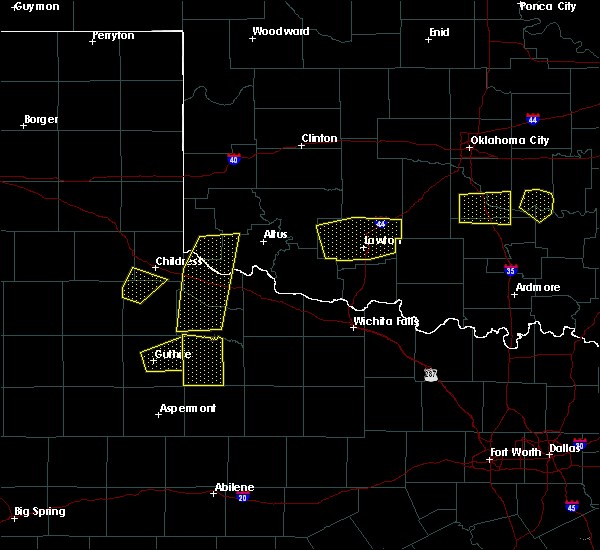 At 641 pm cdt, a severe thunderstorm was located 14 miles west of benjamin, moving east at 20 mph (radar indicated). Hazards include 60 mph wind gusts and quarter size hail. Hail damage to vehicles is expected. expect wind damage to roofs, siding, and trees. Locations impacted include, guthrie. At 641 pm cdt, a severe thunderstorm was located 14 miles west of benjamin, moving east at 20 mph (radar indicated). Hazards include 60 mph wind gusts and quarter size hail. Hail damage to vehicles is expected. expect wind damage to roofs, siding, and trees. Locations impacted include, guthrie.
|
| 6/30/2017 6:25 PM CDT |
 At 625 pm cdt, a severe thunderstorm was located near guthrie, moving east at 15 mph (radar indicated). Hazards include 60 mph wind gusts and quarter size hail. Hail damage to vehicles is expected. Expect wind damage to roofs, siding, and trees. At 625 pm cdt, a severe thunderstorm was located near guthrie, moving east at 15 mph (radar indicated). Hazards include 60 mph wind gusts and quarter size hail. Hail damage to vehicles is expected. Expect wind damage to roofs, siding, and trees.
|
| 5/18/2017 1:45 PM CDT | Quarter sized hail reported 0.9 miles SW of Guthrie, TX |
| 5/18/2017 1:30 PM CDT |
 At 130 pm cdt, a severe thunderstorm was located near guthrie, moving northeast at 35 mph (radar indicated). Hazards include 60 mph wind gusts and quarter size hail. Hail damage to vehicles is expected. Expect wind damage to roofs, siding, and trees. At 130 pm cdt, a severe thunderstorm was located near guthrie, moving northeast at 35 mph (radar indicated). Hazards include 60 mph wind gusts and quarter size hail. Hail damage to vehicles is expected. Expect wind damage to roofs, siding, and trees.
|
| 5/16/2017 10:34 PM CDT |
 At 1034 pm cdt, severe thunderstorms were located along a line extending from 11 miles south of dumont to 9 miles southeast of lake alan henry, moving northeast at 45 mph (radar indicated). Hazards include 60 mph wind gusts and quarter size hail. Hail damage to vehicles is expected. expect wind damage to roofs, siding, and trees. Locations impacted include, jayton, guthrie, girard and clairemont. At 1034 pm cdt, severe thunderstorms were located along a line extending from 11 miles south of dumont to 9 miles southeast of lake alan henry, moving northeast at 45 mph (radar indicated). Hazards include 60 mph wind gusts and quarter size hail. Hail damage to vehicles is expected. expect wind damage to roofs, siding, and trees. Locations impacted include, jayton, guthrie, girard and clairemont.
|
| 5/16/2017 10:10 PM CDT |
 At 1009 pm cdt, severe thunderstorms were located along a line extending from 7 miles southeast of dickens to near lake alan henry, moving northeast at 50 mph (radar indicated). Hazards include 60 mph wind gusts and half dollar size hail. Hail damage to vehicles is expected. Expect wind damage to roofs, siding, and trees. At 1009 pm cdt, severe thunderstorms were located along a line extending from 7 miles southeast of dickens to near lake alan henry, moving northeast at 50 mph (radar indicated). Hazards include 60 mph wind gusts and half dollar size hail. Hail damage to vehicles is expected. Expect wind damage to roofs, siding, and trees.
|
| 5/16/2017 9:15 PM CDT |
 At 915 pm cdt, a severe thunderstorm was located 10 miles southeast of guthrie, moving northeast at 50 mph (radar indicated). Hazards include two inch hail and 60 mph wind gusts. People and animals outdoors will be injured. expect hail damage to roofs, siding, windows, and vehicles. expect wind damage to roofs, siding, and trees. locations impacted include, guthrie. A tornado watch remains in effect until 1000 pm cdt for northwestern texas. At 915 pm cdt, a severe thunderstorm was located 10 miles southeast of guthrie, moving northeast at 50 mph (radar indicated). Hazards include two inch hail and 60 mph wind gusts. People and animals outdoors will be injured. expect hail damage to roofs, siding, windows, and vehicles. expect wind damage to roofs, siding, and trees. locations impacted include, guthrie. A tornado watch remains in effect until 1000 pm cdt for northwestern texas.
|
| 5/16/2017 9:02 PM CDT |
 At 902 pm cdt, a severe thunderstorm was located 7 miles south of guthrie, moving northeast at 50 mph (radar indicated). Hazards include two inch hail and 60 mph wind gusts. People and animals outdoors will be injured. expect hail damage to roofs, siding, windows, and vehicles. Expect wind damage to roofs, siding, and trees. At 902 pm cdt, a severe thunderstorm was located 7 miles south of guthrie, moving northeast at 50 mph (radar indicated). Hazards include two inch hail and 60 mph wind gusts. People and animals outdoors will be injured. expect hail damage to roofs, siding, windows, and vehicles. Expect wind damage to roofs, siding, and trees.
|
| 3/28/2017 5:22 PM CDT |
 At 522 pm cdt, a severe thunderstorm capable of producing a tornado was located 9 miles southeast of guthrie, moving northeast at 25 mph (radar indicated rotation). Hazards include tornado and quarter size hail. Flying debris will be dangerous to those caught without shelter. mobile homes will be damaged or destroyed. damage to roofs, windows, and vehicles will occur. tree damage is likely. Locations impacted include, guthrie. At 522 pm cdt, a severe thunderstorm capable of producing a tornado was located 9 miles southeast of guthrie, moving northeast at 25 mph (radar indicated rotation). Hazards include tornado and quarter size hail. Flying debris will be dangerous to those caught without shelter. mobile homes will be damaged or destroyed. damage to roofs, windows, and vehicles will occur. tree damage is likely. Locations impacted include, guthrie.
|
| 3/28/2017 5:16 PM CDT |
 At 515 pm cdt, a severe thunderstorm capable of producing a tornado was located 10 miles southeast of guthrie, moving northeast at 30 mph (radar indicated rotation). Hazards include tornado. Flying debris will be dangerous to those caught without shelter. mobile homes will be damaged or destroyed. damage to roofs, windows, and vehicles will occur. tree damage is likely. Locations impacted include, guthrie. At 515 pm cdt, a severe thunderstorm capable of producing a tornado was located 10 miles southeast of guthrie, moving northeast at 30 mph (radar indicated rotation). Hazards include tornado. Flying debris will be dangerous to those caught without shelter. mobile homes will be damaged or destroyed. damage to roofs, windows, and vehicles will occur. tree damage is likely. Locations impacted include, guthrie.
|
| 3/28/2017 5:08 PM CDT |
 At 508 pm cdt, a severe thunderstorm capable of producing a tornado was located 11 miles south of guthrie, moving northeast at 25 mph. a strong circulation was located about 8 miles south of guthrie (radar indicated rotation). Hazards include tornado. Flying debris will be dangerous to those caught without shelter. mobile homes will be damaged or destroyed. damage to roofs, windows, and vehicles will occur. tree damage is likely. This tornadic thunderstorm will remain over mainly rural areas of eastern king and south central cottle counties. At 508 pm cdt, a severe thunderstorm capable of producing a tornado was located 11 miles south of guthrie, moving northeast at 25 mph. a strong circulation was located about 8 miles south of guthrie (radar indicated rotation). Hazards include tornado. Flying debris will be dangerous to those caught without shelter. mobile homes will be damaged or destroyed. damage to roofs, windows, and vehicles will occur. tree damage is likely. This tornadic thunderstorm will remain over mainly rural areas of eastern king and south central cottle counties.
|
| 3/28/2017 5:02 PM CDT |
 At 501 pm cdt, a severe thunderstorm was located 12 miles south of guthrie, moving north at 60 mph. a strong circulation was located about 11 miles south of guthrie. residents of guthrie should closely monitor this developing situation (radar indicated). Hazards include two inch hail and 60 mph wind gusts. People and animals outdoors will be injured. expect hail damage to roofs, siding, windows, and vehicles. expect wind damage to roofs, siding, and trees. locations impacted include, aspermont, guthrie, peacock and swenson. A tornado watch remains in effect until 1100 pm cdt for northwestern texas. At 501 pm cdt, a severe thunderstorm was located 12 miles south of guthrie, moving north at 60 mph. a strong circulation was located about 11 miles south of guthrie. residents of guthrie should closely monitor this developing situation (radar indicated). Hazards include two inch hail and 60 mph wind gusts. People and animals outdoors will be injured. expect hail damage to roofs, siding, windows, and vehicles. expect wind damage to roofs, siding, and trees. locations impacted include, aspermont, guthrie, peacock and swenson. A tornado watch remains in effect until 1100 pm cdt for northwestern texas.
|
| 3/28/2017 4:52 PM CDT | Sheet metal and power pole sheared off in king county TX, 8.8 miles E of Guthrie, TX |
| 3/28/2017 4:46 PM CDT |
 At 446 pm cdt, a severe thunderstorm was located near swenson, or 11 miles northwest of aspermont, moving north at 60 mph (radar indicated). Hazards include two inch hail and 60 mph wind gusts. People and animals outdoors will be injured. expect hail damage to roofs, siding, windows, and vehicles. expect wind damage to roofs, siding, and trees. locations impacted include, aspermont, guthrie, peacock and swenson. A tornado watch remains in effect until 1100 pm cdt for northwestern texas. At 446 pm cdt, a severe thunderstorm was located near swenson, or 11 miles northwest of aspermont, moving north at 60 mph (radar indicated). Hazards include two inch hail and 60 mph wind gusts. People and animals outdoors will be injured. expect hail damage to roofs, siding, windows, and vehicles. expect wind damage to roofs, siding, and trees. locations impacted include, aspermont, guthrie, peacock and swenson. A tornado watch remains in effect until 1100 pm cdt for northwestern texas.
|
| 3/28/2017 4:44 PM CDT |
 At 442 pm cdt, a severe thunderstorm capable of producing a tornado was located 9 miles southwest of guthrie, moving north at 55 mph. another strong circulation was located near highway 82 near the dickens and king county line (radar indicated rotation). Hazards include tornado. Flying debris will be dangerous to those caught without shelter. mobile homes will be damaged or destroyed. damage to roofs, windows, and vehicles will occur. tree damage is likely. Locations impacted include, guthrie. At 442 pm cdt, a severe thunderstorm capable of producing a tornado was located 9 miles southwest of guthrie, moving north at 55 mph. another strong circulation was located near highway 82 near the dickens and king county line (radar indicated rotation). Hazards include tornado. Flying debris will be dangerous to those caught without shelter. mobile homes will be damaged or destroyed. damage to roofs, windows, and vehicles will occur. tree damage is likely. Locations impacted include, guthrie.
|
| 3/28/2017 4:41 PM CDT |
 At 441 pm cdt, a severe thunderstorm was located over peacock, or 9 miles west of aspermont, moving north at 60 mph. this storm is exhibiting rotation 8 miles west of aspermont (radar indicated). Hazards include ping pong ball size hail. People and animals outdoors will be injured. Expect damage to roofs, siding, windows, and vehicles. At 441 pm cdt, a severe thunderstorm was located over peacock, or 9 miles west of aspermont, moving north at 60 mph. this storm is exhibiting rotation 8 miles west of aspermont (radar indicated). Hazards include ping pong ball size hail. People and animals outdoors will be injured. Expect damage to roofs, siding, windows, and vehicles.
|
| 3/28/2017 4:36 PM CDT |
 At 436 pm cdt, a severe thunderstorm capable of producing a tornado was located 12 miles west of guthrie, moving northeast at 30 mph. a second, more broad rotation, was located 12 miles southwest of guthrie (radar indicated rotation). Hazards include tornado. Flying debris will be dangerous to those caught without shelter. mobile homes will be damaged or destroyed. damage to roofs, windows, and vehicles will occur. tree damage is likely. Locations impacted include, guthrie. At 436 pm cdt, a severe thunderstorm capable of producing a tornado was located 12 miles west of guthrie, moving northeast at 30 mph. a second, more broad rotation, was located 12 miles southwest of guthrie (radar indicated rotation). Hazards include tornado. Flying debris will be dangerous to those caught without shelter. mobile homes will be damaged or destroyed. damage to roofs, windows, and vehicles will occur. tree damage is likely. Locations impacted include, guthrie.
|
| 3/28/2017 4:30 PM CDT |
 At 429 pm cdt, a severe thunderstorm capable of producing a tornado was located 14 miles east of dickens, moving northeast at 45 mph. an additional strong circulation was indicated just northeast of jayton (radar indicated rotation). Hazards include tornado. Flying debris will be dangerous to those caught without shelter. mobile homes will be damaged or destroyed. damage to roofs, windows, and vehicles will occur. tree damage is likely. Locations impacted include, jayton, guthrie and girard. At 429 pm cdt, a severe thunderstorm capable of producing a tornado was located 14 miles east of dickens, moving northeast at 45 mph. an additional strong circulation was indicated just northeast of jayton (radar indicated rotation). Hazards include tornado. Flying debris will be dangerous to those caught without shelter. mobile homes will be damaged or destroyed. damage to roofs, windows, and vehicles will occur. tree damage is likely. Locations impacted include, jayton, guthrie and girard.
|
| 3/28/2017 4:24 PM CDT |
 At 423 pm cdt, a severe thunderstorm capable of producing a tornado was located over jayton, moving northeast at 35 mph. a possible second tornado was developing about 10 miles east of dickens. a third circulation of concern was located 12 miles northwest of aspermont (radar indicated rotation). Hazards include tornado. Flying debris will be dangerous to those caught without shelter. mobile homes will be damaged or destroyed. damage to roofs, windows, and vehicles will occur. tree damage is likely. This tornadic thunderstorm will remain over mainly rural areas of northeastern kent, eastern dickens, southern king and northwestern stonewall counties. At 423 pm cdt, a severe thunderstorm capable of producing a tornado was located over jayton, moving northeast at 35 mph. a possible second tornado was developing about 10 miles east of dickens. a third circulation of concern was located 12 miles northwest of aspermont (radar indicated rotation). Hazards include tornado. Flying debris will be dangerous to those caught without shelter. mobile homes will be damaged or destroyed. damage to roofs, windows, and vehicles will occur. tree damage is likely. This tornadic thunderstorm will remain over mainly rural areas of northeastern kent, eastern dickens, southern king and northwestern stonewall counties.
|
| 11/2/2016 6:09 PM CDT |
 At 607 pm cdt, a severe thunderstorm was located just east of girard and extended southwest to jayton, and was moving northeast at 40 mph (trained weather spotters reported wind damage in jayton). Hazards include 60 mph wind gusts and quarter size hail. Hail damage to vehicles is expected. expect wind damage to roofs, siding and trees. Locations impacted include, jayton, guthrie, girard and clairemont. At 607 pm cdt, a severe thunderstorm was located just east of girard and extended southwest to jayton, and was moving northeast at 40 mph (trained weather spotters reported wind damage in jayton). Hazards include 60 mph wind gusts and quarter size hail. Hail damage to vehicles is expected. expect wind damage to roofs, siding and trees. Locations impacted include, jayton, guthrie, girard and clairemont.
|
| 11/2/2016 5:47 PM CDT |
 At 547 pm cdt, a severe thunderstorm was located over girard, moving northeast at 40 mph (radar indicated). Hazards include 60 mph wind gusts and quarter size hail. Hail damage to vehicles is expected. Expect wind damage to roofs, siding and trees. At 547 pm cdt, a severe thunderstorm was located over girard, moving northeast at 40 mph (radar indicated). Hazards include 60 mph wind gusts and quarter size hail. Hail damage to vehicles is expected. Expect wind damage to roofs, siding and trees.
|
| 10/6/2016 5:13 PM CDT |
 At 511 pm cdt, a severe thunderstorm was located 5 miles southwest of guthrie, moving northeast at 30 mph (radar indicated). Hazards include 60 mph wind gusts and quarter size hail. Hail damage to vehicles is expected. expect wind damage to roofs, siding and trees. Locations impacted include, guthrie and motorists along highway 82 in western king county. At 511 pm cdt, a severe thunderstorm was located 5 miles southwest of guthrie, moving northeast at 30 mph (radar indicated). Hazards include 60 mph wind gusts and quarter size hail. Hail damage to vehicles is expected. expect wind damage to roofs, siding and trees. Locations impacted include, guthrie and motorists along highway 82 in western king county.
|
| 10/6/2016 4:57 PM CDT |
 At 457 pm cdt, a severe thunderstorm was located over 12 miles southwest of guthrie, moving northeast at 30 mph (radar indicated). Hazards include 60 mph wind gusts and half dollar size hail. Hail damage to vehicles is expected. Expect wind damage to roofs, siding and trees. At 457 pm cdt, a severe thunderstorm was located over 12 miles southwest of guthrie, moving northeast at 30 mph (radar indicated). Hazards include 60 mph wind gusts and half dollar size hail. Hail damage to vehicles is expected. Expect wind damage to roofs, siding and trees.
|
| 9/15/2016 6:32 PM CDT |
 At 632 pm cdt, a severe thunderstorm was located near guthrie, moving north at 20 mph (radar indicated). Hazards include 60 mph wind gusts and quarter size hail. Hail damage to vehicles is expected. expect wind damage to roofs, siding and trees. Locations impacted include, guthrie. At 632 pm cdt, a severe thunderstorm was located near guthrie, moving north at 20 mph (radar indicated). Hazards include 60 mph wind gusts and quarter size hail. Hail damage to vehicles is expected. expect wind damage to roofs, siding and trees. Locations impacted include, guthrie.
|
| 9/15/2016 6:13 PM CDT |
 At 612 pm cdt, a severe thunderstorm was located 10 miles south of guthrie, moving northeast at 30 mph (radar indicated). Hazards include 60 mph wind gusts and quarter size hail. Hail damage to vehicles is expected. Expect wind damage to roofs, siding and trees. At 612 pm cdt, a severe thunderstorm was located 10 miles south of guthrie, moving northeast at 30 mph (radar indicated). Hazards include 60 mph wind gusts and quarter size hail. Hail damage to vehicles is expected. Expect wind damage to roofs, siding and trees.
|
| 7/14/2016 8:14 PM CDT |
 At 813 pm cdt, severe thunderstorms were located along a line extending from near paducah to 10 miles northeast of girard to near hudd, moving east at 50 mph. these are very dangerous storms (radar indicated). Hazards include 80 mph wind gusts. Mobile homes will be heavily damaged. flying debris will be dangerous to people and animals. expect considerable damage to roofs, windows and vehicles. extensive tree damage and power outages are likely. Locations impacted include, paducah, aspermont, jayton, guthrie, girard, dumont, clairemont, grow, finney, chalk, delwin, peacock, old glory and swenson. At 813 pm cdt, severe thunderstorms were located along a line extending from near paducah to 10 miles northeast of girard to near hudd, moving east at 50 mph. these are very dangerous storms (radar indicated). Hazards include 80 mph wind gusts. Mobile homes will be heavily damaged. flying debris will be dangerous to people and animals. expect considerable damage to roofs, windows and vehicles. extensive tree damage and power outages are likely. Locations impacted include, paducah, aspermont, jayton, guthrie, girard, dumont, clairemont, grow, finney, chalk, delwin, peacock, old glory and swenson.
|
| 7/14/2016 8:00 PM CDT | Wind gust reported by west texas mesonet site 10 wsw guthrie in king county TX, 9.4 miles ENE of Guthrie, TX |
| 7/14/2016 7:56 PM CDT |
 At 755 pm cdt, severe thunderstorms were located along a line extending from near paducah to 6 miles east of spur to 9 miles northwest of hudd, moving east at 50 mph (radar indicated). Hazards include 70 mph wind gusts. Expect considerable tree damage. Damage is likely to mobile homes, roofs and outbuildings. At 755 pm cdt, severe thunderstorms were located along a line extending from near paducah to 6 miles east of spur to 9 miles northwest of hudd, moving east at 50 mph (radar indicated). Hazards include 70 mph wind gusts. Expect considerable tree damage. Damage is likely to mobile homes, roofs and outbuildings.
|
| 7/8/2016 6:38 PM CDT |
 At 638 pm cdt, a severe thunderstorm was located near jayton, moving southwest at 20 mph (radar indicated). Hazards include 70 mph wind gusts and half dollar size hail. Hail damage to vehicles is expected. expect considerable tree damage. wind damage is also likely to mobile homes, roofs and outbuildings. Locations impacted include, jayton, girard, clairemont and peacock. At 638 pm cdt, a severe thunderstorm was located near jayton, moving southwest at 20 mph (radar indicated). Hazards include 70 mph wind gusts and half dollar size hail. Hail damage to vehicles is expected. expect considerable tree damage. wind damage is also likely to mobile homes, roofs and outbuildings. Locations impacted include, jayton, girard, clairemont and peacock.
|
| 7/8/2016 6:29 PM CDT |
 At 629 pm cdt, a severe thunderstorm was located near girard, or 7 miles north of jayton, moving southwest at 20 mph (radar indicated). Hazards include 70 mph wind gusts and ping pong ball size hail. People and animals outdoors will be injured. expect hail damage to roofs, siding, windows and vehicles. expect considerable tree damage. Wind damage is also likely to mobile homes, roofs and outbuildings. At 629 pm cdt, a severe thunderstorm was located near girard, or 7 miles north of jayton, moving southwest at 20 mph (radar indicated). Hazards include 70 mph wind gusts and ping pong ball size hail. People and animals outdoors will be injured. expect hail damage to roofs, siding, windows and vehicles. expect considerable tree damage. Wind damage is also likely to mobile homes, roofs and outbuildings.
|
| 7/8/2016 6:20 PM CDT |
 At 620 pm cdt, a severe thunderstorm was located 7 miles southwest of guthrie, moving southwest at 10 mph (radar indicated). Hazards include tennis ball size hail and 70 mph wind gusts. People and animals outdoors will be injured. expect hail damage to roofs, siding, windows and vehicles. expect considerable tree damage. wind damage is also likely to mobile homes, roofs and outbuildings. Locations impacted include, guthrie. At 620 pm cdt, a severe thunderstorm was located 7 miles southwest of guthrie, moving southwest at 10 mph (radar indicated). Hazards include tennis ball size hail and 70 mph wind gusts. People and animals outdoors will be injured. expect hail damage to roofs, siding, windows and vehicles. expect considerable tree damage. wind damage is also likely to mobile homes, roofs and outbuildings. Locations impacted include, guthrie.
|
| 7/8/2016 6:09 PM CDT |
 At 609 pm cdt, a severe thunderstorm was located near guthrie, moving southwest at 10 mph (radar indicated). Hazards include two inch hail and 70 mph wind gusts. People and animals outdoors will be injured. expect hail damage to roofs, siding, windows and vehicles. expect considerable tree damage. Wind damage is also likely to mobile homes, roofs and outbuildings. At 609 pm cdt, a severe thunderstorm was located near guthrie, moving southwest at 10 mph (radar indicated). Hazards include two inch hail and 70 mph wind gusts. People and animals outdoors will be injured. expect hail damage to roofs, siding, windows and vehicles. expect considerable tree damage. Wind damage is also likely to mobile homes, roofs and outbuildings.
|
| 7/8/2016 6:04 PM CDT |
 At 603 pm cdt, a severe thunderstorm was located near finney, or 8 miles north of guthrie, moving northeast at 10 mph. this is a very dangerous storm (radar indicated). Hazards include baseball size hail and 70 mph wind gusts. People and animals outdoors will be severely injured. expect shattered windows, extensive damage to roofs, siding and vehicles. Locations impacted include, guthrie, delwin, grow, finney and chalk. At 603 pm cdt, a severe thunderstorm was located near finney, or 8 miles north of guthrie, moving northeast at 10 mph. this is a very dangerous storm (radar indicated). Hazards include baseball size hail and 70 mph wind gusts. People and animals outdoors will be severely injured. expect shattered windows, extensive damage to roofs, siding and vehicles. Locations impacted include, guthrie, delwin, grow, finney and chalk.
|
| 7/8/2016 5:54 PM CDT |
 At 554 pm cdt, a severe thunderstorm was located near finney, or near guthrie, moving northeast at 10 mph (radar indicated). Hazards include 70 mph wind gusts and quarter size hail. Hail damage to vehicles is expected. expect considerable tree damage. wind damage is also likely to mobile homes, roofs and outbuildings. Locations impacted include, guthrie, delwin, grow, finney and chalk. At 554 pm cdt, a severe thunderstorm was located near finney, or near guthrie, moving northeast at 10 mph (radar indicated). Hazards include 70 mph wind gusts and quarter size hail. Hail damage to vehicles is expected. expect considerable tree damage. wind damage is also likely to mobile homes, roofs and outbuildings. Locations impacted include, guthrie, delwin, grow, finney and chalk.
|
| 7/8/2016 5:51 PM CDT | Quarter sized hail reported 9.2 miles S of Guthrie, TX |
| 7/8/2016 5:44 PM CDT |
 At 543 pm cdt, a severe thunderstorm was located near finney, or near guthrie, moving northeast at 10 mph (radar indicated). Hazards include 70 mph wind gusts and quarter size hail. Hail damage to vehicles is expected. expect considerable tree damage. Wind damage is also likely to mobile homes, roofs and outbuildings. At 543 pm cdt, a severe thunderstorm was located near finney, or near guthrie, moving northeast at 10 mph (radar indicated). Hazards include 70 mph wind gusts and quarter size hail. Hail damage to vehicles is expected. expect considerable tree damage. Wind damage is also likely to mobile homes, roofs and outbuildings.
|
| 5/30/2016 10:02 PM CDT |
 At 1001 pm cdt, a severe thunderstorm was located 13 miles north of swenson, or 16 miles north of aspermont, moving northeast at 30 mph (radar indicated). Hazards include 60 mph wind gusts and quarter size hail. Hail damage to vehicles is expected. expect wind damage to roofs, siding and trees. Locations impacted include, guthrie and highway 83 between guthrie and aspermont. At 1001 pm cdt, a severe thunderstorm was located 13 miles north of swenson, or 16 miles north of aspermont, moving northeast at 30 mph (radar indicated). Hazards include 60 mph wind gusts and quarter size hail. Hail damage to vehicles is expected. expect wind damage to roofs, siding and trees. Locations impacted include, guthrie and highway 83 between guthrie and aspermont.
|
| 5/30/2016 9:50 PM CDT |
 At 950 pm cdt, a severe thunderstorm was located 8 miles north of swenson, or 13 miles north of aspermont, moving northeast at 30 mph (radar indicated). Hazards include ping pong ball size hail and 60 mph wind gusts. People and animals outdoors will be injured. expect hail damage to roofs, siding, windows and vehicles. Expect wind damage to roofs, siding and trees. At 950 pm cdt, a severe thunderstorm was located 8 miles north of swenson, or 13 miles north of aspermont, moving northeast at 30 mph (radar indicated). Hazards include ping pong ball size hail and 60 mph wind gusts. People and animals outdoors will be injured. expect hail damage to roofs, siding, windows and vehicles. Expect wind damage to roofs, siding and trees.
|
| 5/29/2016 7:14 PM CDT |
 At 713 pm cdt, a severe thunderstorm was located near guthrie, moving east at 15 mph (radar indicated). Hazards include 60 mph wind gusts and half dollar size hail. Hail damage to vehicles is expected. expect wind damage to roofs, siding and trees. Locations impacted include, guthrie, grow and finney. At 713 pm cdt, a severe thunderstorm was located near guthrie, moving east at 15 mph (radar indicated). Hazards include 60 mph wind gusts and half dollar size hail. Hail damage to vehicles is expected. expect wind damage to roofs, siding and trees. Locations impacted include, guthrie, grow and finney.
|
| 5/29/2016 6:58 PM CDT |
 At 658 pm cdt, a severe thunderstorm was located 9 miles west of guthrie, moving east at 20 mph (radar indicated). Hazards include 60 mph wind gusts and half dollar size hail. Hail damage to vehicles is expected. Expect wind damage to roofs, siding and trees. At 658 pm cdt, a severe thunderstorm was located 9 miles west of guthrie, moving east at 20 mph (radar indicated). Hazards include 60 mph wind gusts and half dollar size hail. Hail damage to vehicles is expected. Expect wind damage to roofs, siding and trees.
|
| 5/13/2016 9:22 PM CDT |
 At 920 pm cdt, a severe thunderstorm was located 8 miles south of guthrie, moving south-southeast at 25 mph. another severe storm was about 13 miles southwest of guthrie, also moving southeast at 25 mph (radar indicated). Hazards include ping pong ball size hail and 60 mph wind gusts. Expect hail damage to roofs. siding. windows and vehicles. expect wind damage to roofs, siding and trees. Locations impacted include, jayton, peacock and swenson. At 920 pm cdt, a severe thunderstorm was located 8 miles south of guthrie, moving south-southeast at 25 mph. another severe storm was about 13 miles southwest of guthrie, also moving southeast at 25 mph (radar indicated). Hazards include ping pong ball size hail and 60 mph wind gusts. Expect hail damage to roofs. siding. windows and vehicles. expect wind damage to roofs, siding and trees. Locations impacted include, jayton, peacock and swenson.
|
| 5/13/2016 9:08 PM CDT |
 At 907 pm cdt, a severe thunderstorm was located 13 miles southwest of guthrie, moving southeast at 35 mph. this is a very dangerous storm! (radar indicated). Hazards include 80 mph wind gusts and three inch hail. Mobile homes will be heavily damaged. flying debris will be dangerous to people and animals. expect considerable damage to roofs, windows and vehicles. extensive tree damage and power outages are likely. Locations impacted include, jayton, girard, peacock and swenson. At 907 pm cdt, a severe thunderstorm was located 13 miles southwest of guthrie, moving southeast at 35 mph. this is a very dangerous storm! (radar indicated). Hazards include 80 mph wind gusts and three inch hail. Mobile homes will be heavily damaged. flying debris will be dangerous to people and animals. expect considerable damage to roofs, windows and vehicles. extensive tree damage and power outages are likely. Locations impacted include, jayton, girard, peacock and swenson.
|
| 5/13/2016 8:59 PM CDT |
 At 858 pm cdt, a severe thunderstorm was located 15 miles west of guthrie and moving southeast at 25 mph (radar indicated). Hazards include two inch hail and 70 mph wind gusts. People and animals outdoors will be injured. expect hail damage to roofs, siding, windows and vehicles. expect considerable tree damage. Wind damage is also likely to mobile homes, roofs and outbuildings. At 858 pm cdt, a severe thunderstorm was located 15 miles west of guthrie and moving southeast at 25 mph (radar indicated). Hazards include two inch hail and 70 mph wind gusts. People and animals outdoors will be injured. expect hail damage to roofs, siding, windows and vehicles. expect considerable tree damage. Wind damage is also likely to mobile homes, roofs and outbuildings.
|
| 5/13/2016 8:32 PM CDT |
 At 830 pm cdt, severe thunderstorms were located along a line extending from near roaring springs, to dumont, and near hackberry. these storms are moving southeast at 30 mph. earlier, these storms produced considerable tree damage 8 miles north of paducah (radar indicated). Hazards include 70 mph wind gusts and quarter size hail. Expect considerable tree damage. wind damage is also likely to mobile homes, roofs and outbuildings. minor hail damage is also possible. Locations impacted include, spur, dickens, guthrie, mcadoo, dumont and grow. At 830 pm cdt, severe thunderstorms were located along a line extending from near roaring springs, to dumont, and near hackberry. these storms are moving southeast at 30 mph. earlier, these storms produced considerable tree damage 8 miles north of paducah (radar indicated). Hazards include 70 mph wind gusts and quarter size hail. Expect considerable tree damage. wind damage is also likely to mobile homes, roofs and outbuildings. minor hail damage is also possible. Locations impacted include, spur, dickens, guthrie, mcadoo, dumont and grow.
|
| 5/13/2016 7:59 PM CDT |
 At 758 pm cdt, severe thunderstorms were located along a line extending from near matador, to delwin to near swearingen, moving southeast at 25 mph (radar indicated). Hazards include 70 mph wind gusts and quarter size hail. Expect wind damage to trees. mobile homes. roofs and outbuildings. Minor hail damage is also likely. At 758 pm cdt, severe thunderstorms were located along a line extending from near matador, to delwin to near swearingen, moving southeast at 25 mph (radar indicated). Hazards include 70 mph wind gusts and quarter size hail. Expect wind damage to trees. mobile homes. roofs and outbuildings. Minor hail damage is also likely.
|
| 4/19/2016 5:01 PM CDT |
 At 500 pm cdt, a severe thunderstorm was located 7 miles northeast of guthrie, moving east at 45 mph (radar indicated). Hazards include ping pong ball size hail. People and animals outdoors will be injured. expect damage to roofs, siding, windows and vehicles. Locations impacted include, guthrie and grow. At 500 pm cdt, a severe thunderstorm was located 7 miles northeast of guthrie, moving east at 45 mph (radar indicated). Hazards include ping pong ball size hail. People and animals outdoors will be injured. expect damage to roofs, siding, windows and vehicles. Locations impacted include, guthrie and grow.
|
| 4/19/2016 4:44 PM CDT |
 At 444 pm cdt, a severe thunderstorm was located near finney, or 7 miles northwest of guthrie, moving east at 40 mph (radar indicated). Hazards include quarter size hail. damage to vehicles is expected At 444 pm cdt, a severe thunderstorm was located near finney, or 7 miles northwest of guthrie, moving east at 40 mph (radar indicated). Hazards include quarter size hail. damage to vehicles is expected
|
| 4/16/2016 7:58 PM CDT | Ping Pong Ball sized hail reported 13.2 miles S of Guthrie, TX, covering ground on us83 |
| 4/16/2016 7:28 PM CDT | Hen Egg sized hail reported 13.1 miles S of Guthrie, TX |
| 4/16/2016 7:21 PM CDT | Hen Egg sized hail reported 12.6 miles S of Guthrie, TX |
| 4/16/2016 7:15 PM CDT | Half Dollar sized hail reported 12.5 miles S of Guthrie, TX |
| 4/16/2016 7:00 PM CDT | Quarter sized hail reported 16.6 miles SE of Guthrie, TX, covering ground |
| 4/16/2016 6:23 PM CDT | Quarter sized hail reported 16.6 miles SE of Guthrie, TX |
| 4/16/2016 2:55 PM CDT |
 At 254 pm cdt, a severe thunderstorm was located near girard, or 14 miles northwest of jayton, moving northeast at 45 mph (radar indicated). Hazards include golf ball size hail and 60 mph wind gusts. People and animals outdoors will be injured. expect hail damage to roofs, siding, windows and vehicles. Expect wind damage to roofs, siding and trees. At 254 pm cdt, a severe thunderstorm was located near girard, or 14 miles northwest of jayton, moving northeast at 45 mph (radar indicated). Hazards include golf ball size hail and 60 mph wind gusts. People and animals outdoors will be injured. expect hail damage to roofs, siding, windows and vehicles. Expect wind damage to roofs, siding and trees.
|
| 4/10/2016 7:26 PM CDT | Tennis Ball sized hail reported 5.6 miles S of Guthrie, TX |
| 4/10/2016 7:00 PM CDT |
 At 659 pm cdt, a severe thunderstorm was located 12 miles west-northwest of guthrie, moving east at 35 mph (radar indicated). Hazards include half dollar size hail. damage to vehicles is expected At 659 pm cdt, a severe thunderstorm was located 12 miles west-northwest of guthrie, moving east at 35 mph (radar indicated). Hazards include half dollar size hail. damage to vehicles is expected
|
| 5/28/2015 3:18 PM CDT | At 310 pm cdt, a trained weather spotter reported two inch hail about 3 miles north of guthrie. at 316 pm the severe thunderstorm was located three miles northeast of guthrie, moving east at 15 mph (trained weather spotters). Hazards include two inch hail and 60 mph wind gusts. People and animals outdoors will be injured. expect hail damage to roofs, siding, windows and vehicles. expect wind damage to roofs, siding and trees. locations impacted include, guthrie, dumont, grow and finney. A tornado watch remains in effect until 800 pm cdt for northwestern texas. |
| 5/28/2015 3:10 PM CDT | Hen Egg sized hail reported 3.5 miles S of Guthrie, TX |
| 5/28/2015 3:02 PM CDT | At 301 pm cdt, a severe thunderstorm was located near guthrie, moving east at 15 mph (radar indicated). Hazards include two inch hail and 60 mph wind gusts. People and animals outdoors will be injured. expect hail damage to roofs, siding, windows and vehicles. expect wind damage to roofs, siding and trees. locations impacted include, guthrie, dumont, grow and finney. A tornado watch remains in effect until 800 pm cdt for northwestern texas. |
| 5/28/2015 2:49 PM CDT | At 248 pm cdt, a severe thunderstorm was located near guthrie, moving east at 15 mph (radar indicated). Hazards include golf ball size hail and 60 mph wind gusts. People and animals outdoors will be injured. expect hail damage to roofs, siding, windows and vehicles. Expect wind damage to roofs, siding and trees. |
| 5/23/2015 7:56 PM CDT | The severe thunderstorm warning for northwestern king, southeastern motley, northeastern dickens and southwestern cottle counties will expire at 800 pm cdt, the storm which prompted the warning has weakened below severe limits, and no longer poses an immediate threat to life or property. therefore the warning will be allowed to expire. however gusty winds are still possible with this thunderstorm. a tornado watch remains in effect until 200 am cdt for northwestern texas. |
| 5/23/2015 7:42 PM CDT | At 742 pm cdt, a severe thunderstorm was located 9 miles west of guthrie, moving northeast at 35 mph (radar indicated). Hazards include 70 mph wind gusts and nickel size hail. Expect considerable tree damage. Damage is likely to mobile homes, roofs and outbuildings. |
| 5/23/2015 7:30 PM CDT | Measured by the texas tech university west texas mesonet. severe wind gusts from 730 to 735p in king county TX, 9.4 miles ENE of Guthrie, TX |
| 5/8/2015 4:51 PM CDT | At 450 pm cdt, a severe thunderstorm was located 12 miles northeast of swenson, or 21 miles southeast of guthrie, moving east at 45 mph. strong rotation is noted with this storm. additional storm development with modest rotation is occurring just northwest of aspermont (radar indicated). Hazards include 70 mph wind gusts and half dollar size hail. Hail damage to vehicles is expected. expect considerable tree damage. Wind damage is also likely to mobile homes, roofs and outbuildings. |
| 5/8/2015 4:46 PM CDT | At 445 pm cdt, a severe thunderstorm was located 13 miles north of swenson, or 17 miles south of guthrie, moving east at 50 mph (radar indicated). Hazards include half dollar size hail and 70 mph wind gusts. Hail damage to vehicles is expected. expect considerable tree damage. wind damage is also likely to mobile homes, roofs and outbuildings. locations impacted include, guthrie and swenson. a tornado watch remains in effect until 500 pm cdt for northwestern texas. Possible. |
| 5/8/2015 4:35 PM CDT | At 434 pm cdt, a severe thunderstorm was located 14 miles north of swenson, or 14 miles northeast of jayton, moving east at 40 mph. the storm continues to have a strong low level rotation. the storm will affect us highway 83 between aspermont and guthrie by 5 pm. tornado development remains possible with this storm (radar indicated). Hazards include half dollar size hail and 70 mph wind gusts. Hail damage to vehicles is expected. expect considerable tree damage. wind damage is also likely to mobile homes, roofs and outbuildings. locations impacted include, guthrie and swenson. a tornado watch remains in effect until 500 pm cdt for northwestern texas. Possible. |
| 5/8/2015 4:23 PM CDT | At 422 pm cdt, a severe thunderstorm was located 9 miles east of girard, or 11 miles north of jayton, moving east at 55 mph. this storm is showing indications of rotation on radar (radar indicated). Hazards include half dollar size hail and 70 mph wind gusts. Hail damage to vehicles is expected. expect considerable tree damage. wind damage is also likely to mobile homes, roofs and outbuildings. locations impacted include, guthrie, girard, swenson and finney. a tornado watch remains in effect until 500 pm cdt for northwestern texas. Possible. |
| 5/8/2015 4:10 PM CDT | At 410 pm cdt, a severe thunderstorm was located near girard, or 14 miles north of jayton, moving east at 50 mph (radar indicated). Hazards include 70 mph wind gusts and ping pong ball size hail. People and animals outdoors will be injured. expect hail damage to roofs, siding, windows and vehicles. expect considerable tree damage. Wind damage is also likely to mobile homes, roofs and outbuildings. |
| 4/26/2015 6:03 PM CDT | At 603 pm cdt, a severe thunderstorm was located near girard, moving east at 20 mph (radar indicated). Hazards include golf ball size hail and 60 mph wind gusts. People and animals outdoors will be injured. expect hail damage to roofs, siding, windows and vehicles. Expect wind damage to roofs, siding and trees. |
| 4/26/2015 12:52 PM CDT | At 1250 pm cdt, a severe thunderstorm was located 6 miles northwest of swenson, moving northeast at 30 mph (radar indicated). Hazards include ping pong ball size hail and 60 mph wind gusts. People and animals outdoors will be injured. expect hail damage to roofs, siding, windows and vehicles. Expect wind damage to roofs, siding and trees. |
| 4/22/2015 10:29 PM CDT | At 1029 pm cdt, a severe thunderstorm was located 14 miles south of guthrie, moving southeast at 25 mph (radar indicated). Hazards include golf ball size hail and 60 mph wind gusts. People and animals outdoors will be injured. expect hail damage to roofs, siding, windows and vehicles. Expect wind damage to roofs, siding and trees. |
| 4/22/2015 10:14 PM CDT | At 1012 pm cdt, a severe thunderstorm was located 12 miles southwest of guthrie, moving southeast at 25 mph (radar indicated). Hazards include golf ball size hail and 60 mph wind gusts. People and animals outdoors will be injured. expect hail damage to roofs, siding, windows and vehicles. expect wind damage to roofs, siding and trees. locations impacted include, guthrie and rural areas east of dickens. a tornado watch remains in effect until midnight cdt for northwestern texas. Possible. |
| 4/22/2015 9:51 PM CDT | At 950 pm cdt, a severe thunderstorm was located 12 miles east of dickens, moving east at 35 mph (radar indicated). Hazards include golf ball size hail and 60 mph wind gusts. People and animals outdoors will be injured. expect hail damage to roofs, siding, windows and vehicles. Expect wind damage to roofs, siding and trees. |
| 4/22/2015 9:39 PM CDT | At 937 pm cdt, a severe thunderstorm was located near chalk, or 14 miles northeast of guthrie, moving southeast at 45 mph (emergency management). Hazards include golf ball size hail and 60 mph wind gusts. People and animals outdoors will be injured. expect hail damage to roofs, siding, windows and vehicles. expect wind damage to roofs, siding and trees. locations impacted include, guthrie, dumont, grow, chalk, finney and delwin. a tornado watch remains in effect until 1000 pm cdt for northwestern texas. Possible. |
| 4/22/2015 9:09 PM CDT | At 908 pm cdt, a severe thunderstorm was located near dumont, or 15 miles southwest of paducah, moving southeast at 45 mph (radar indicated). Hazards include golf ball size hail and 60 mph wind gusts. People and animals outdoors will be injured. expect hail damage to roofs, siding, windows and vehicles. Expect wind damage to roofs, siding and trees. |
| 4/8/2015 9:15 PM CDT | The national weather service in lubbock has issued a * severe thunderstorm warning for. northeastern stonewall county in northwestern texas. king county in northwestern texas. southern cottle county in northwestern texas. Until 930 pm cdt. |
| 4/8/2015 9:02 PM CDT | A severe thunderstorm warning remains in effect until 915 pm cdt for stonewall. king. eastern kent and eastern dickens counties. at 850 pm cst. the west texas mesonet site 10 miles southwest of guthrie reported a 64 mph wind gust at 850 pm. at 858 pm cdt. Severe thunderstorms were located along a line extending from near finney to 9 miles south of guthrie to 9 miles northeast of. |
| 4/8/2015 8:50 PM CDT | Reported by west texas mesone in king county TX, 9.4 miles ENE of Guthrie, TX |
| 4/8/2015 8:45 PM CDT | The national weather service in lubbock has issued a * severe thunderstorm warning for. stonewall county in northwestern texas. king county in northwestern texas. eastern kent county in northwestern texas. Eastern dickens county in northwestern texas. |
| 9/26/2012 7:45 PM CDT | West texas mesonet report in king county TX, 9.4 miles ENE of Guthrie, TX |
| 8/25/2012 6:30 PM CDT | West tx mesonet 10wsw guthrie in king county TX, 9.4 miles ENE of Guthrie, TX |
| 7/23/2012 7:30 PM CDT | West texas mesonet report in king county TX, 9.4 miles ENE of Guthrie, TX |
| 6/4/2012 8:15 PM CDT | Delayed report...a lot of downed tree limbs at pitchfork ranch. time estimate in dickens county TX, 11.7 miles E of Guthrie, TX |
| 11/7/2011 7:25 PM CST | Quarter sized hail reported 10.2 miles NE of Guthrie, TX, brief period of hail. |
| 1/1/0001 12:00 AM | Roof damage reported on a home. wind gusts est over 70 mp in king county TX, 16.6 miles SE of Guthrie, TX |
| 1/1/0001 12:00 AM | Tree damage occurring and heavy outdoor objects being blown about. small hail increasing in size. est 70 plus mp in king county TX, 16.6 miles SE of Guthrie, TX |
Hail Maps for Guthrie, TX
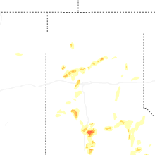
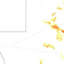
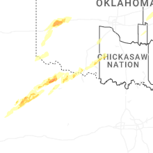
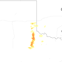


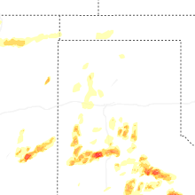
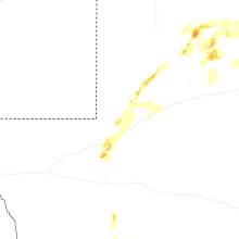

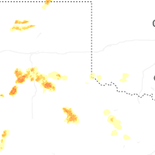
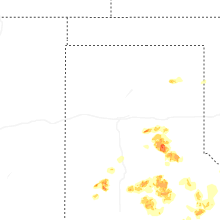


Connect with Interactive Hail Maps