

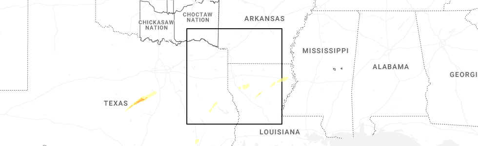
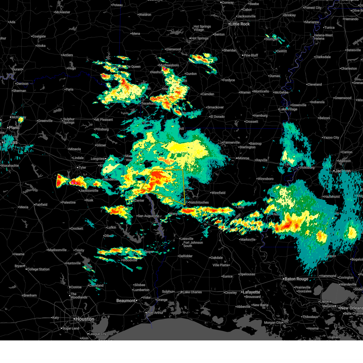
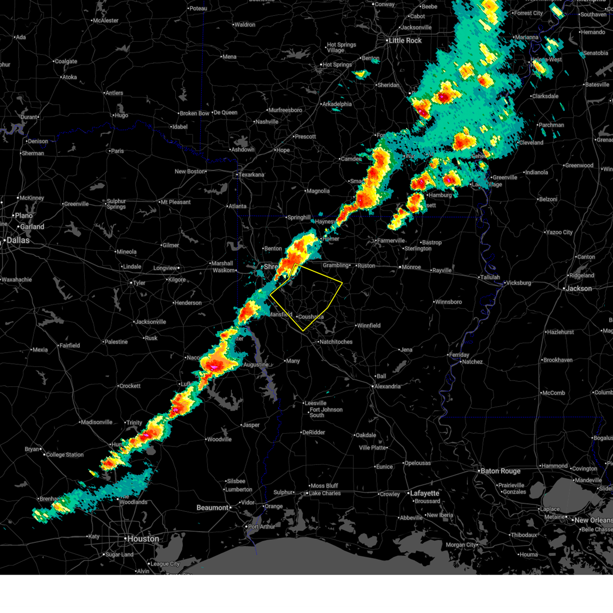
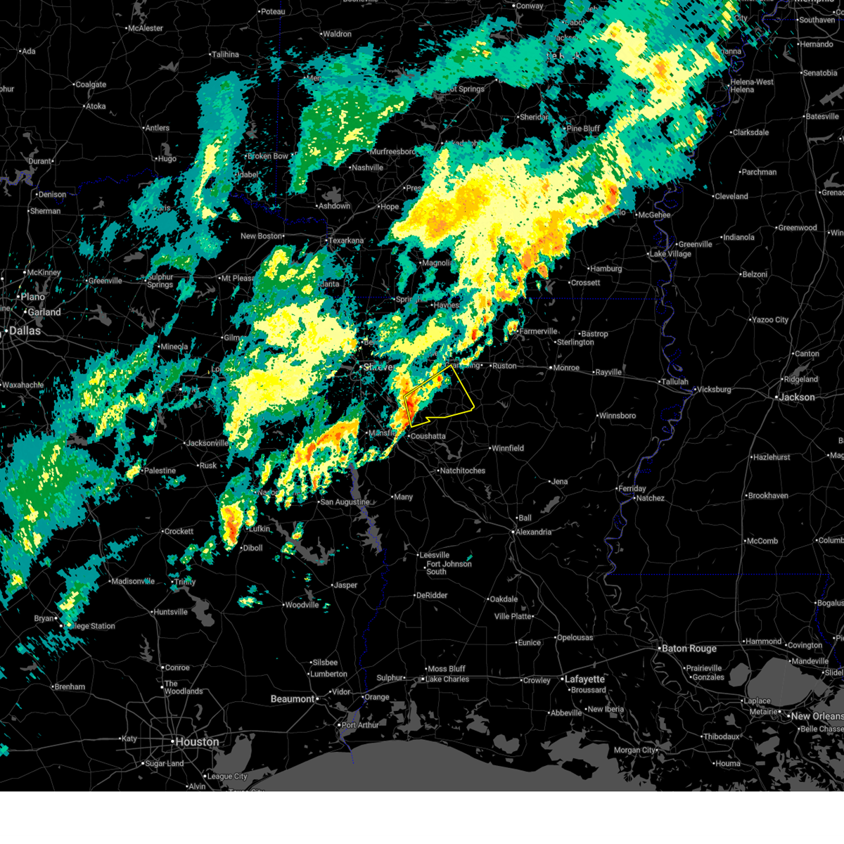
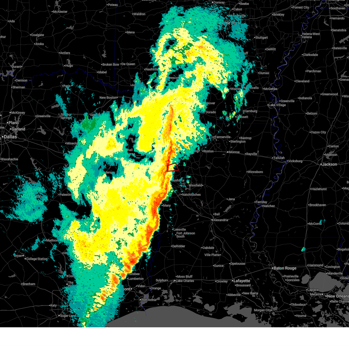
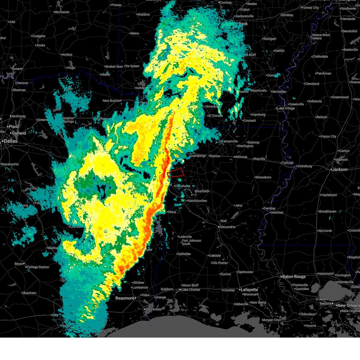
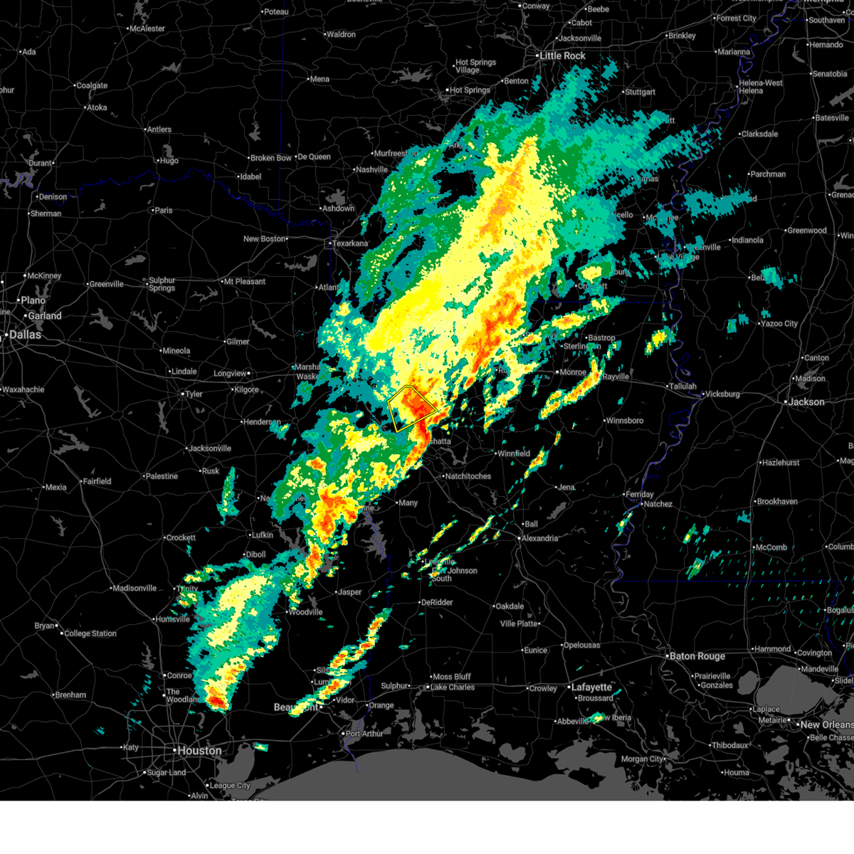
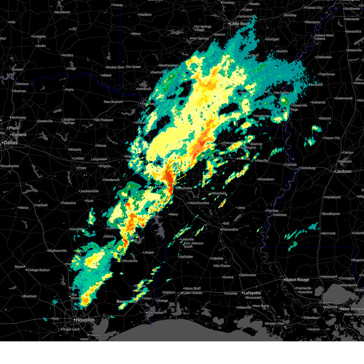
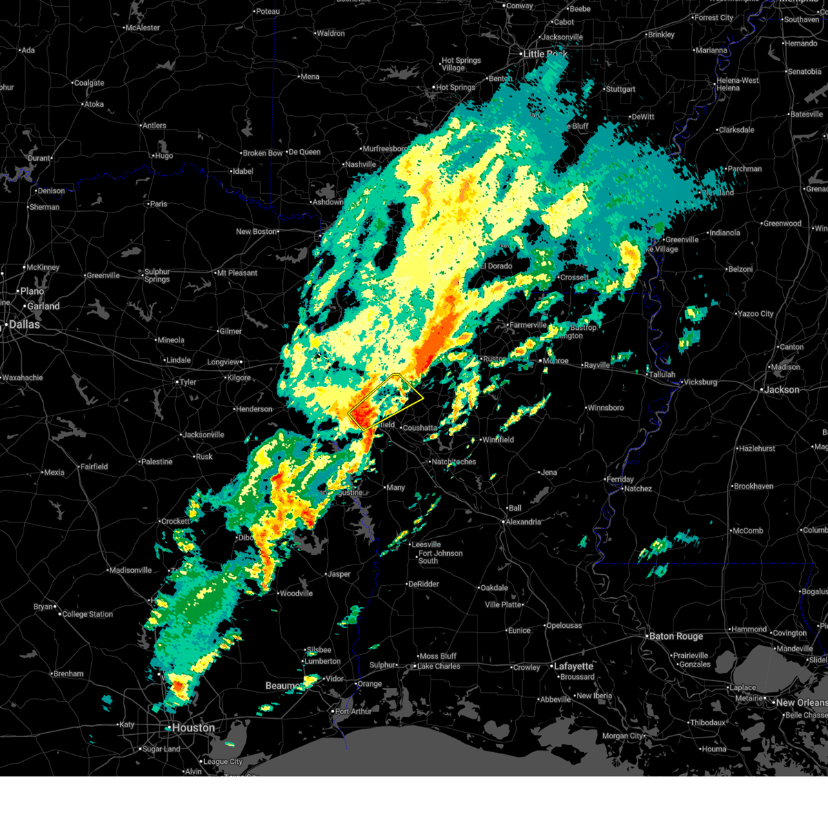
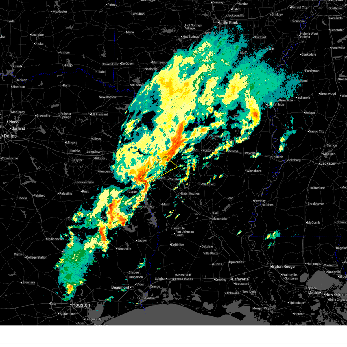
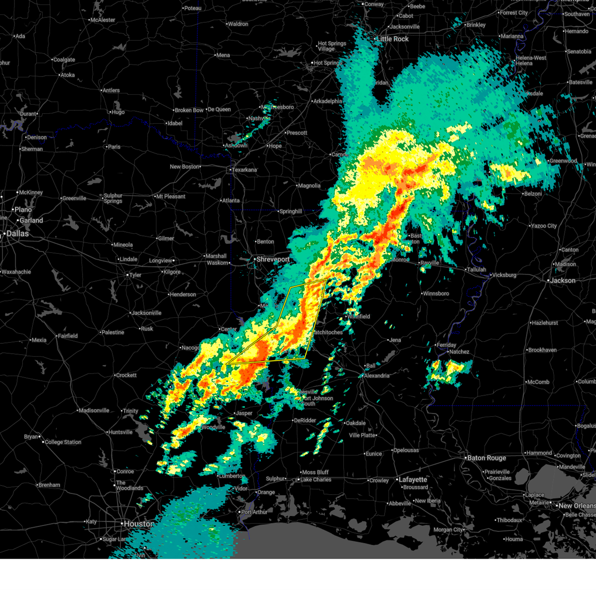
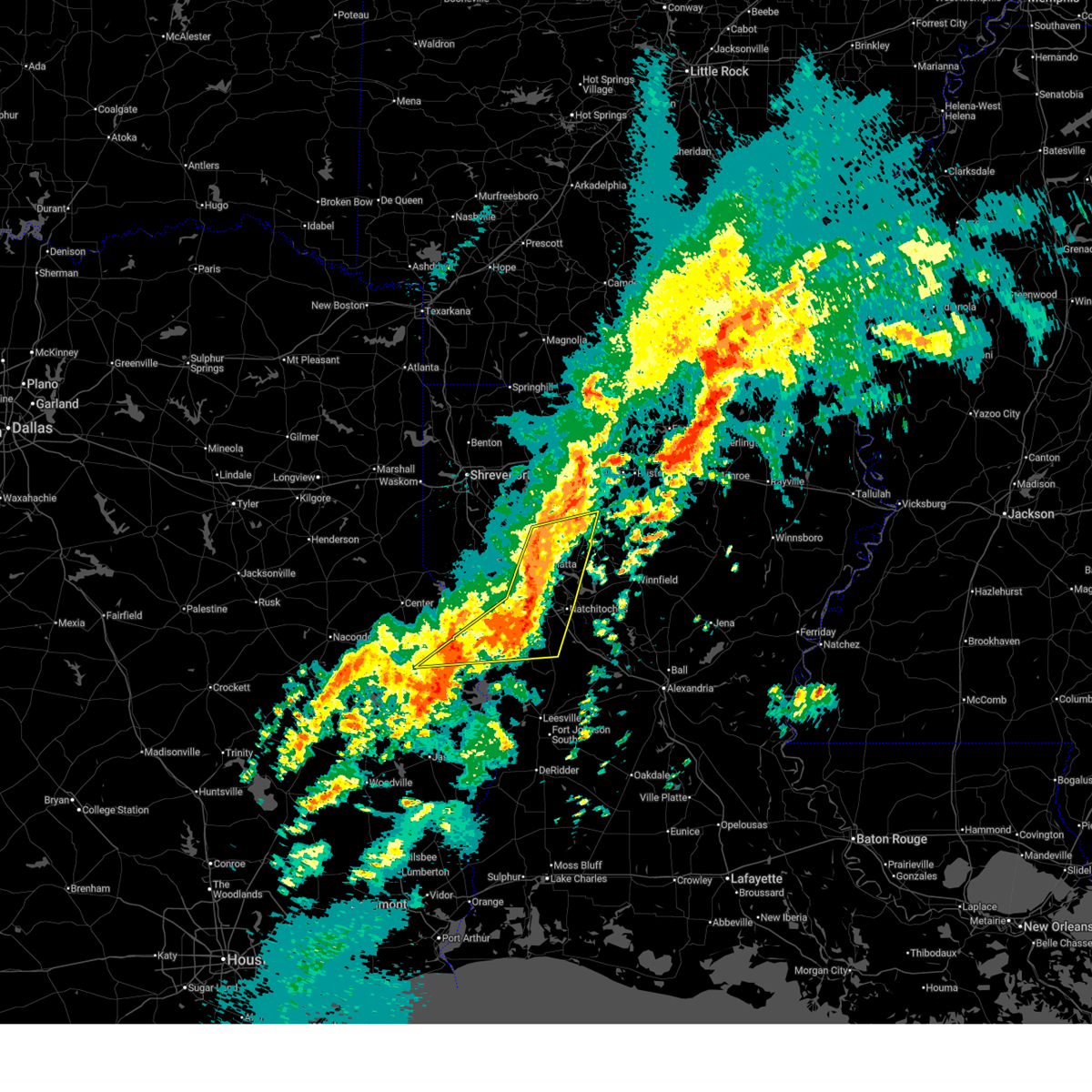
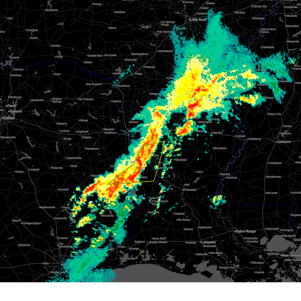
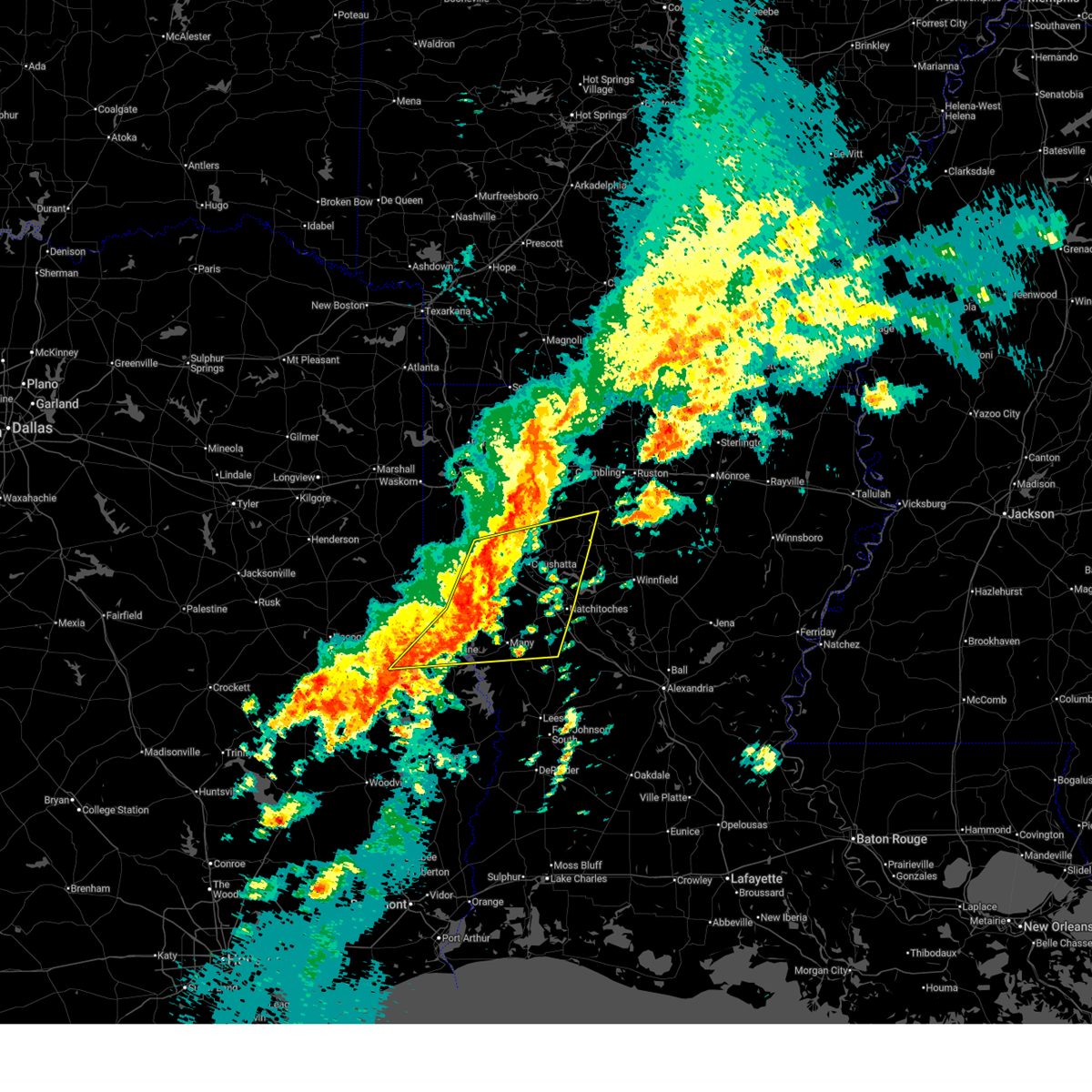
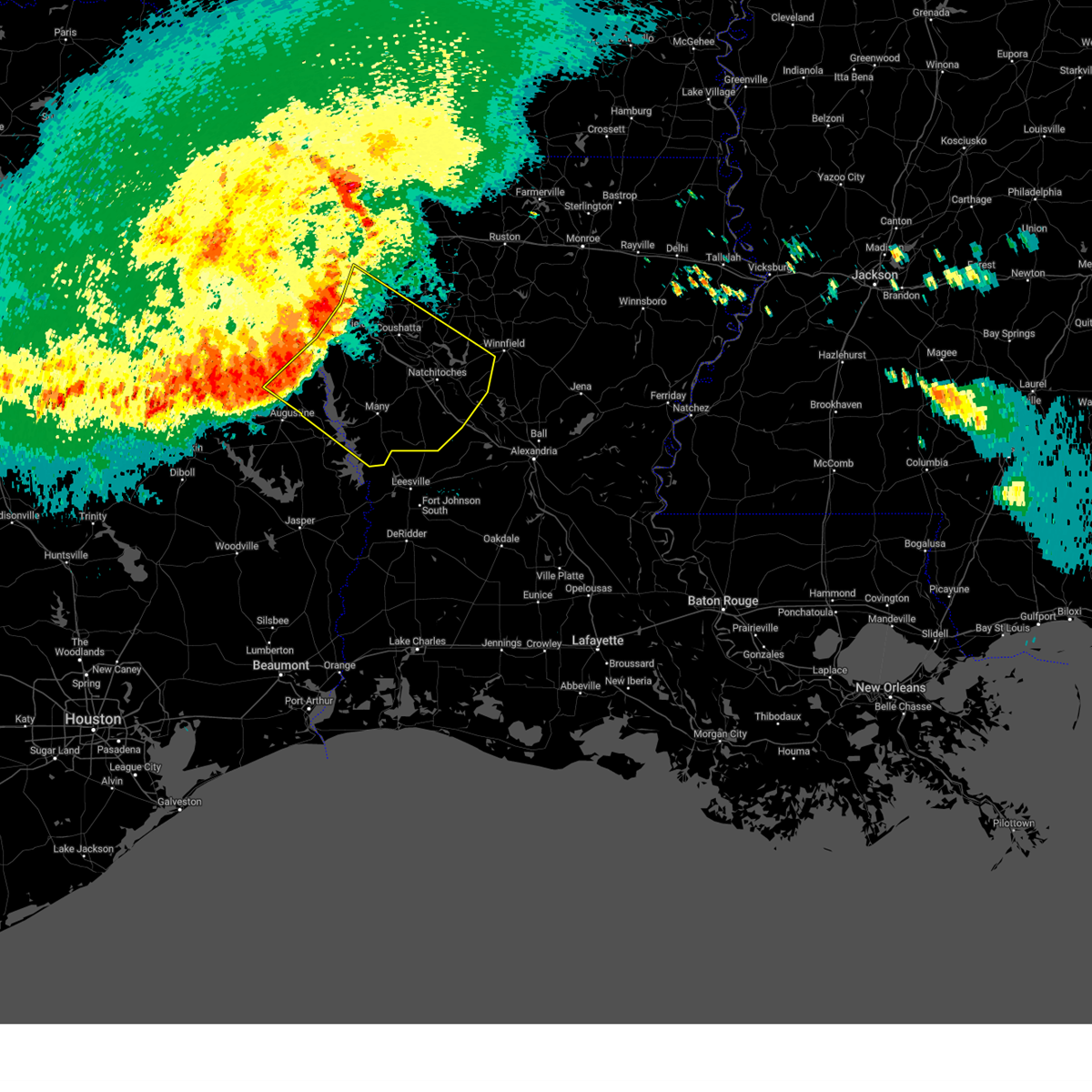
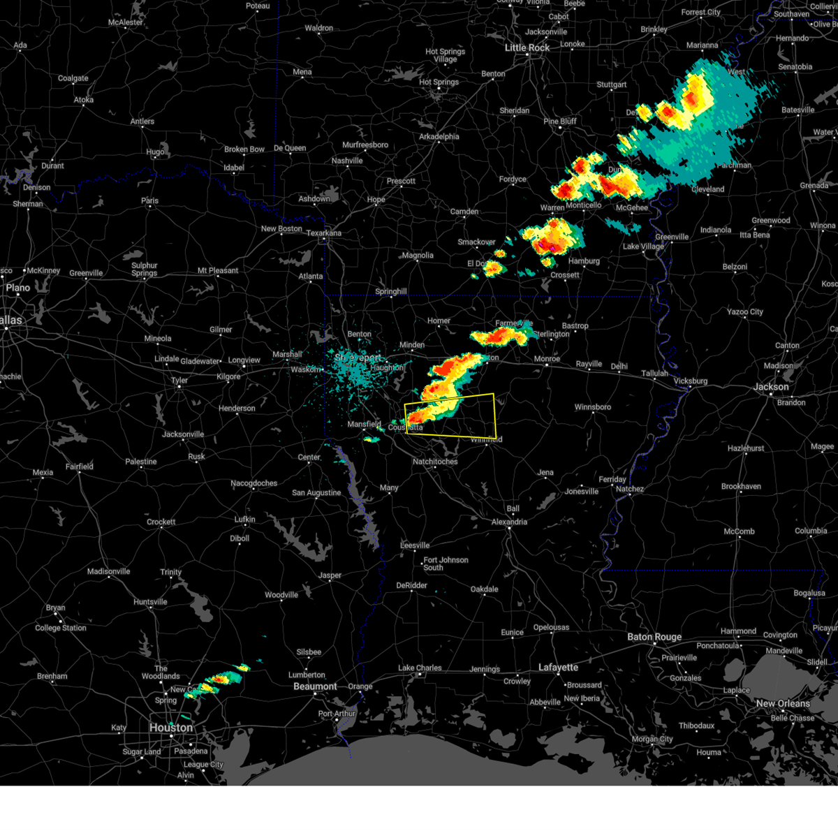
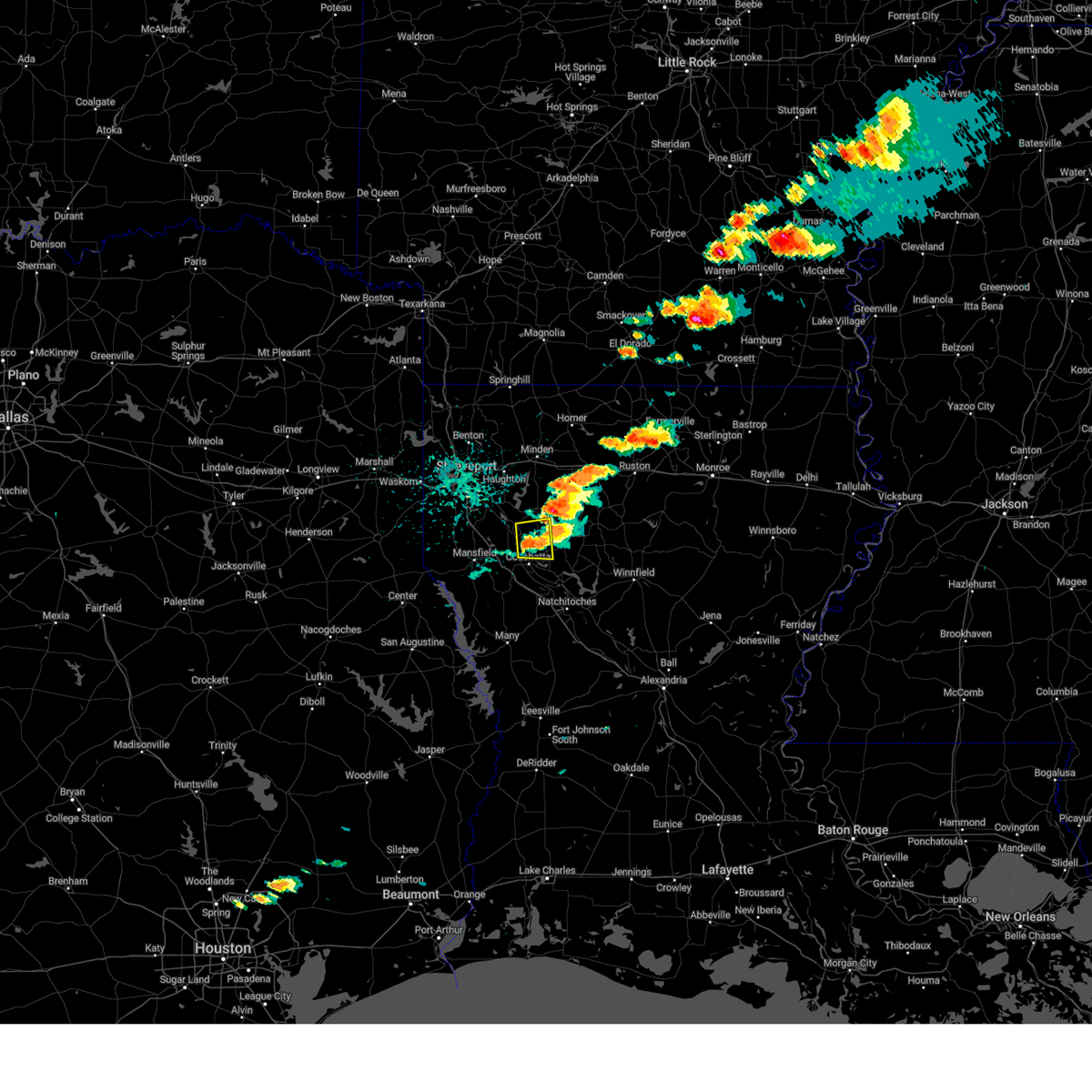
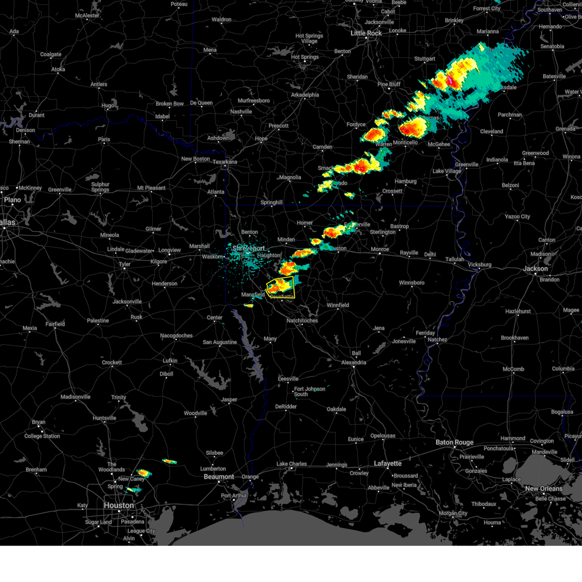
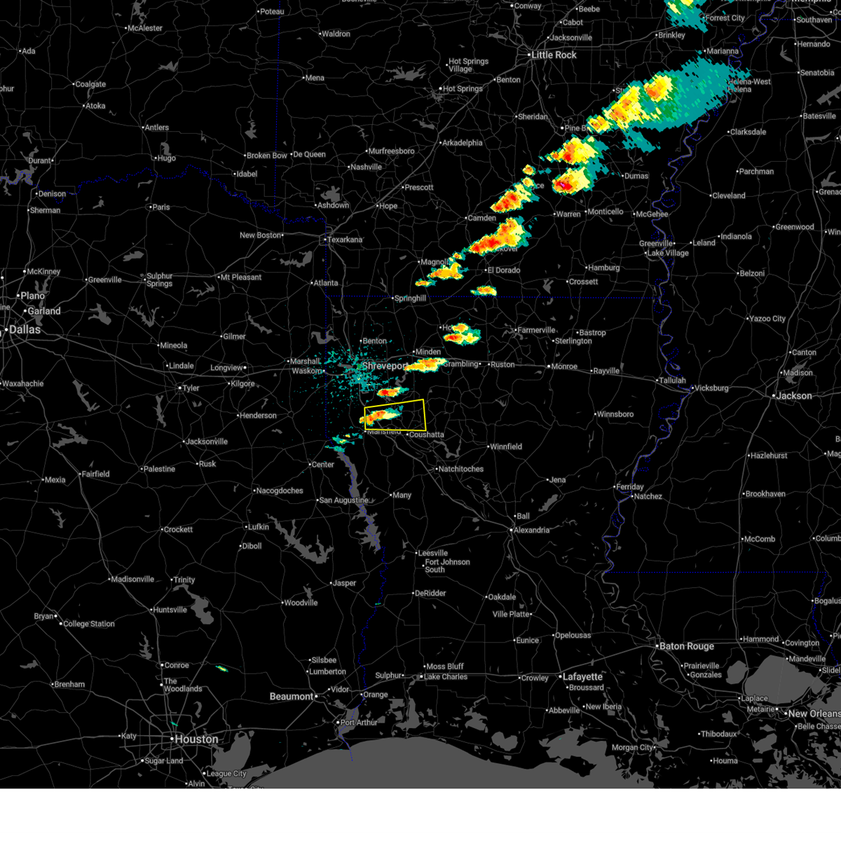
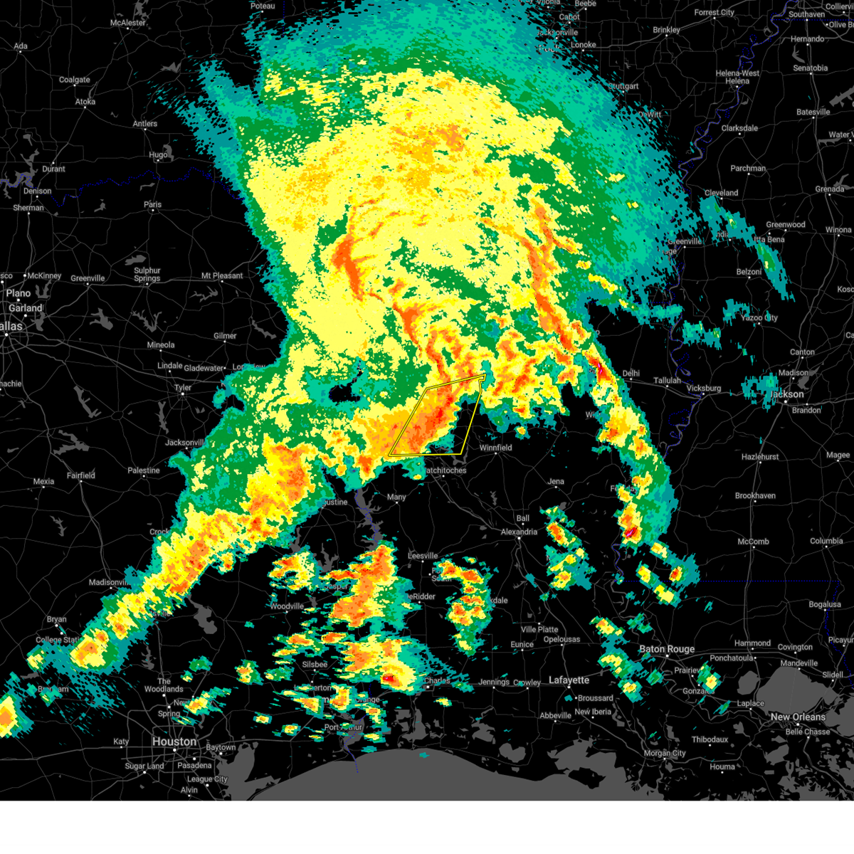
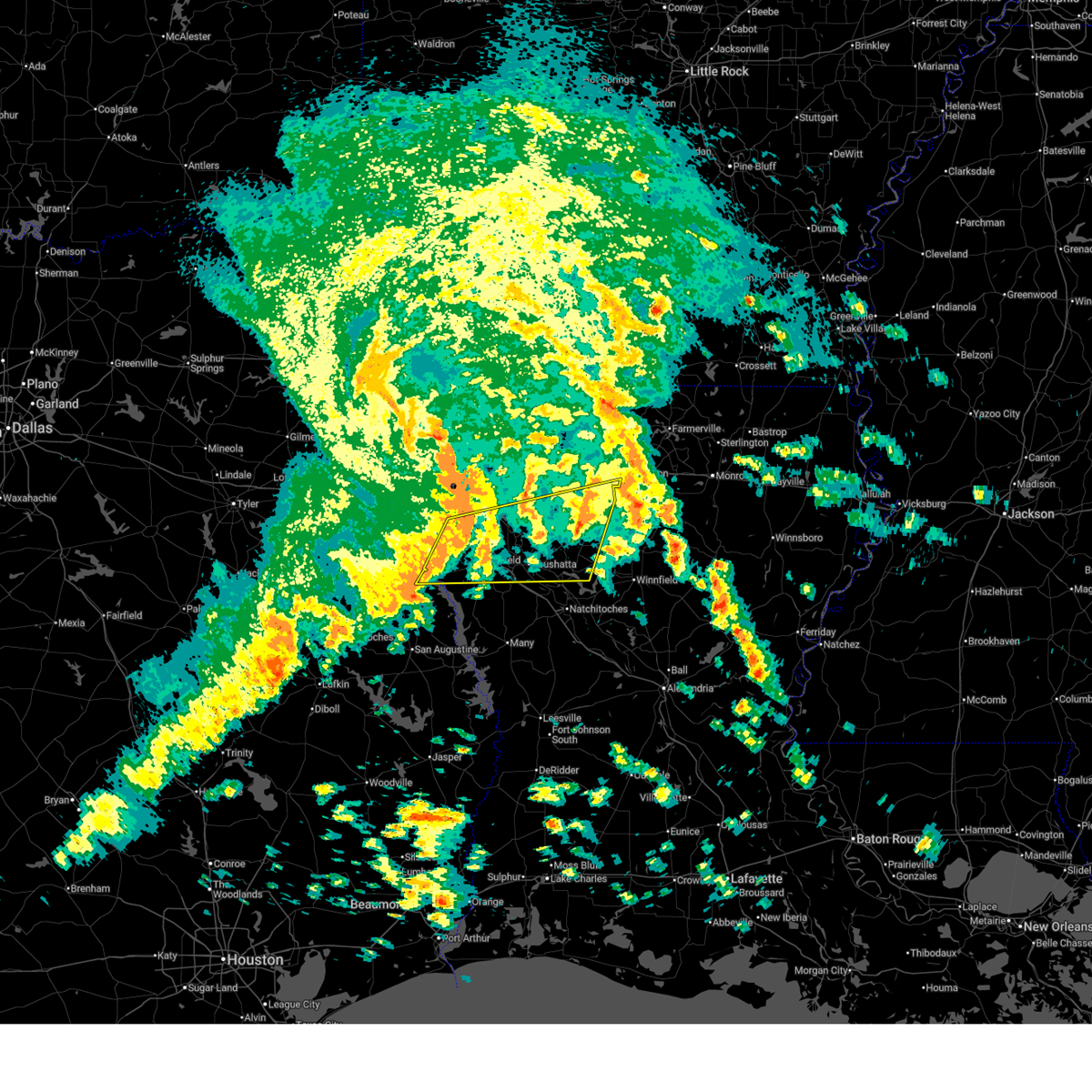
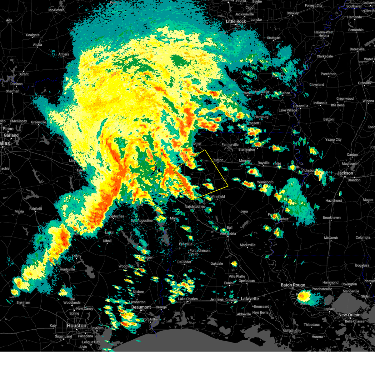
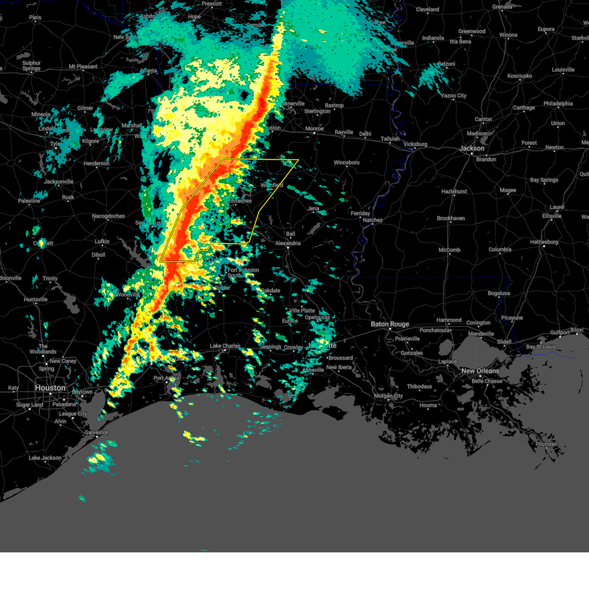
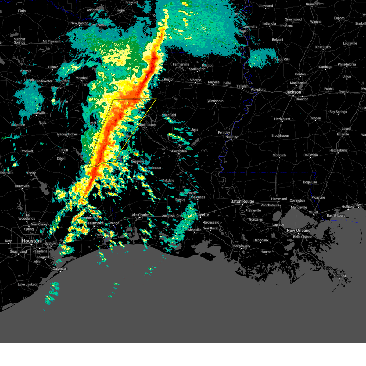
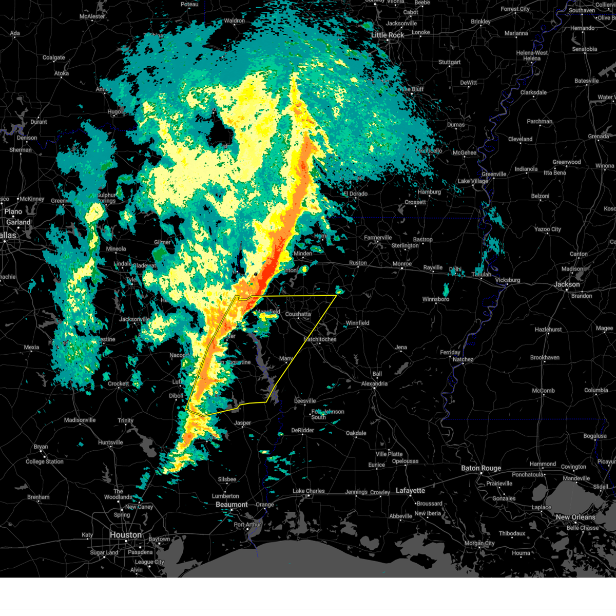
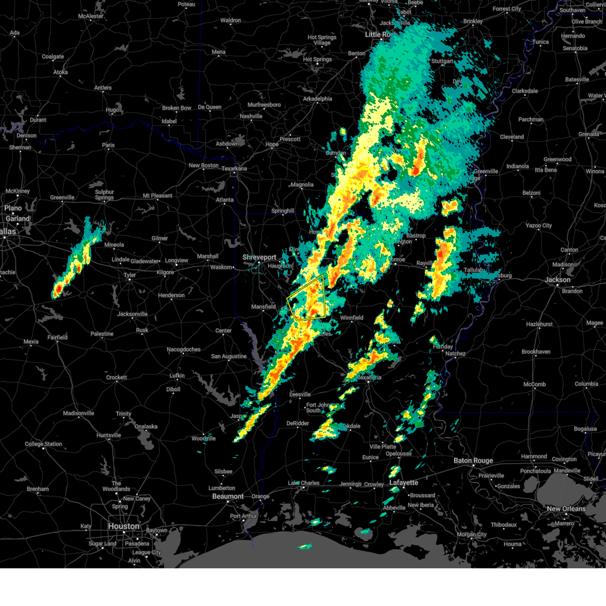
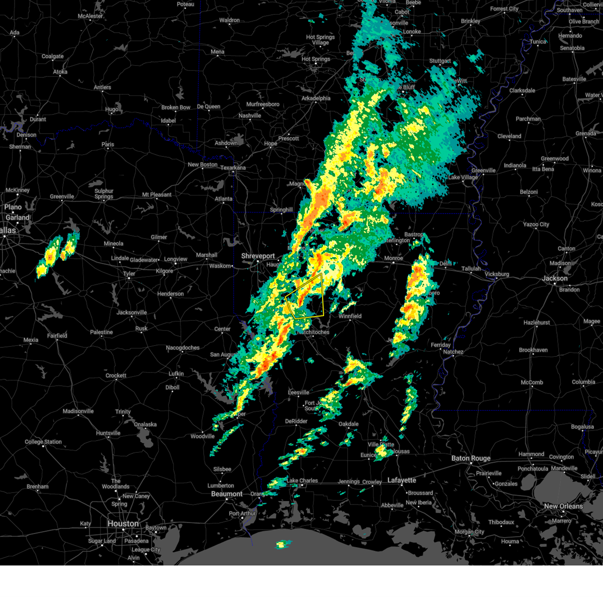
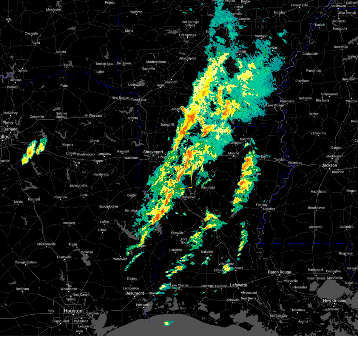
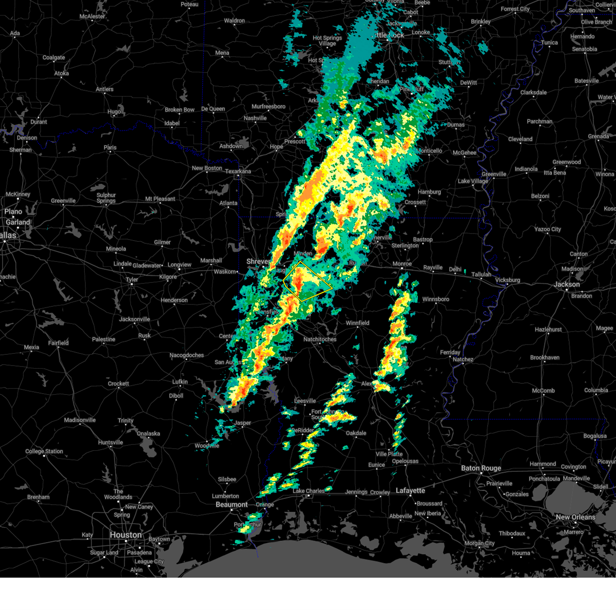
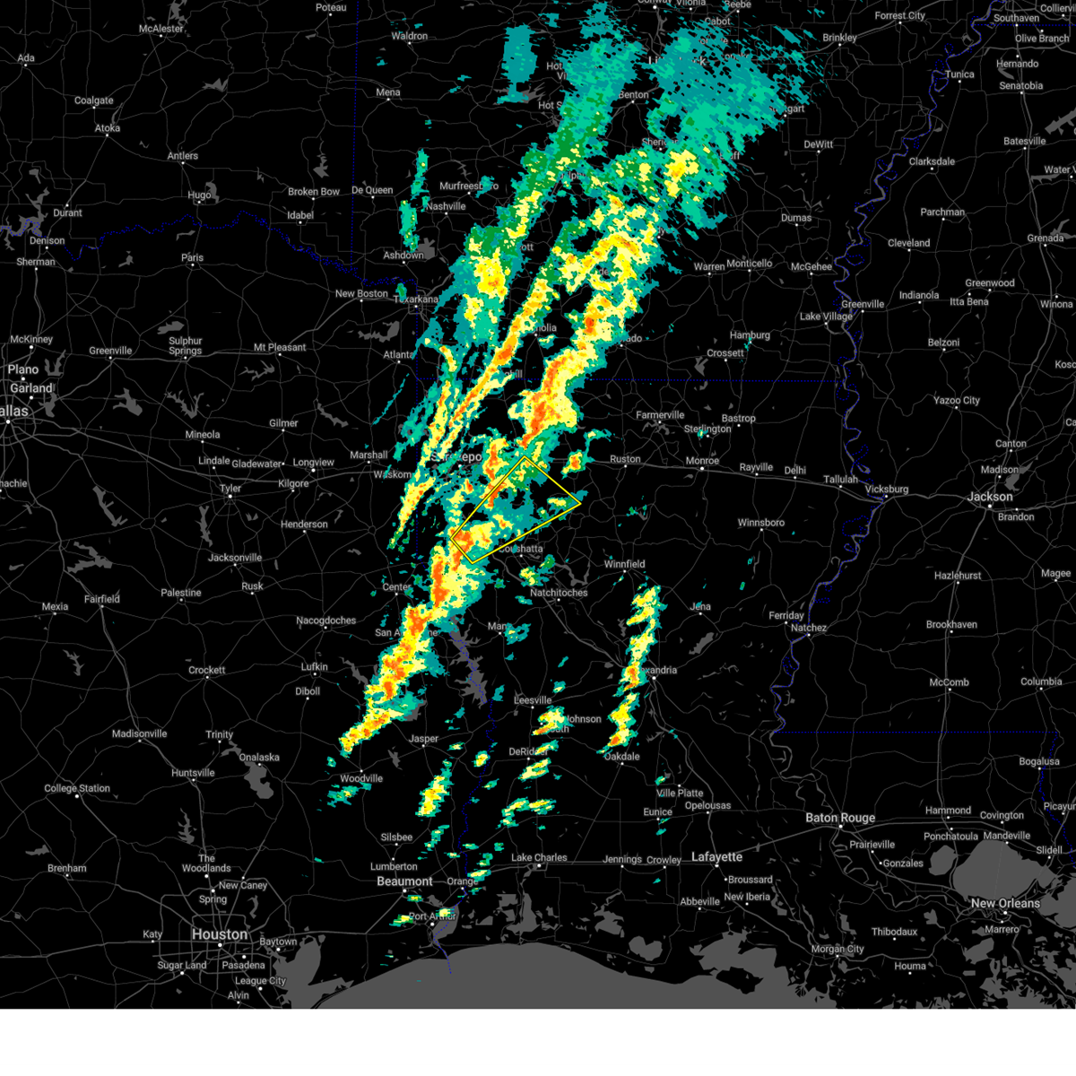
Hail Map for Hall Summit, LA
The Hall Summit, LA area has had 6 reports of on-the-ground hail by trained spotters, and has been under severe weather warnings 19 times during the past 12 months. Doppler radar has detected hail at or near Hall Summit, LA on 49 occasions, including 3 occasions during the past year.
| Name: | Hall Summit, LA |
| Where Located: | 34.9 miles SE of Shreveport, LA |
| Map: | Google Map for Hall Summit, LA |
| Population: | 300 |
| Housing Units: | 136 |
| More Info: | Search Google for Hall Summit, LA |
1
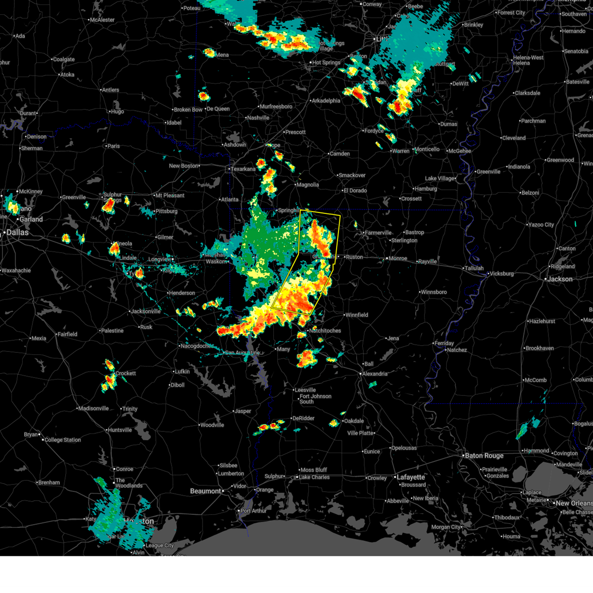
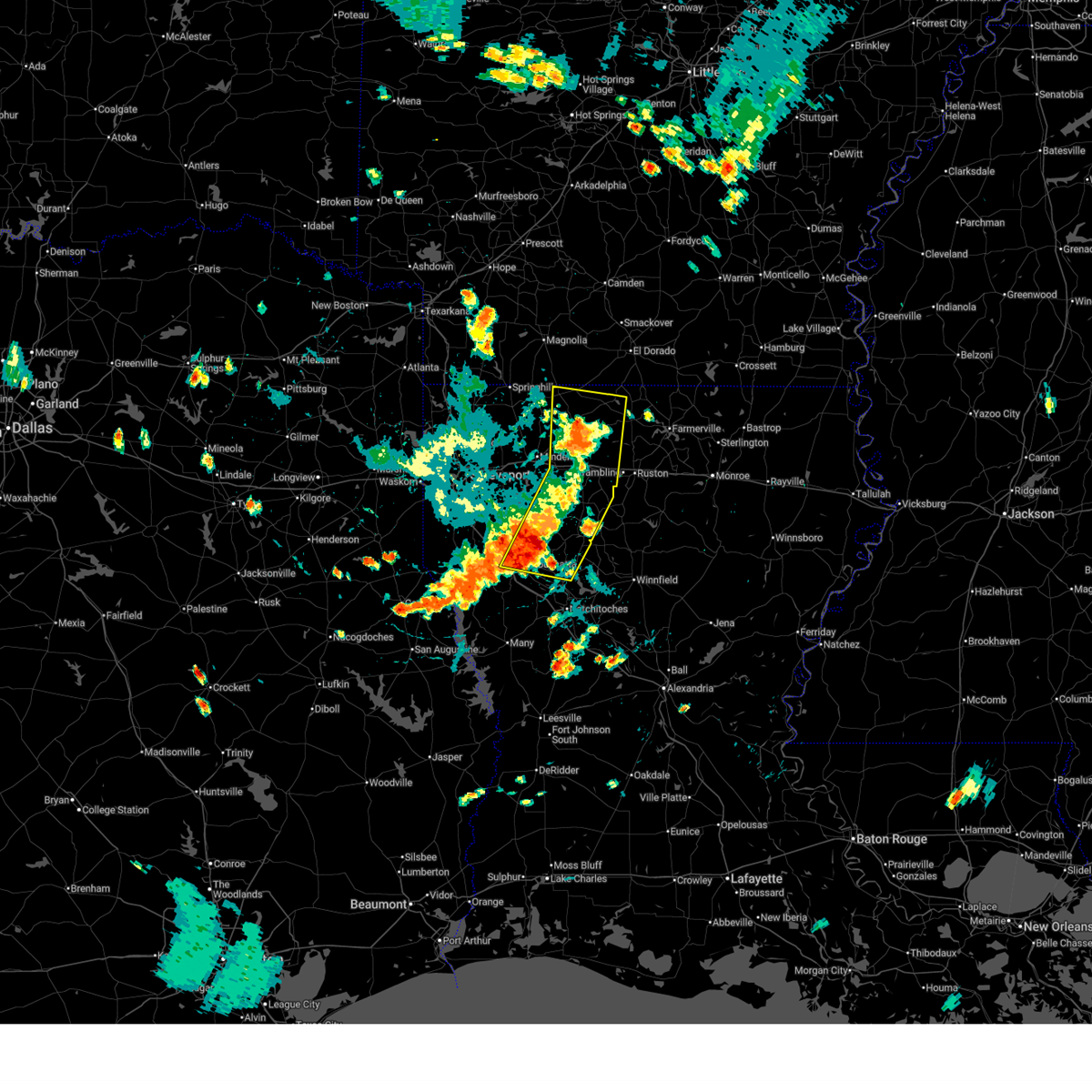
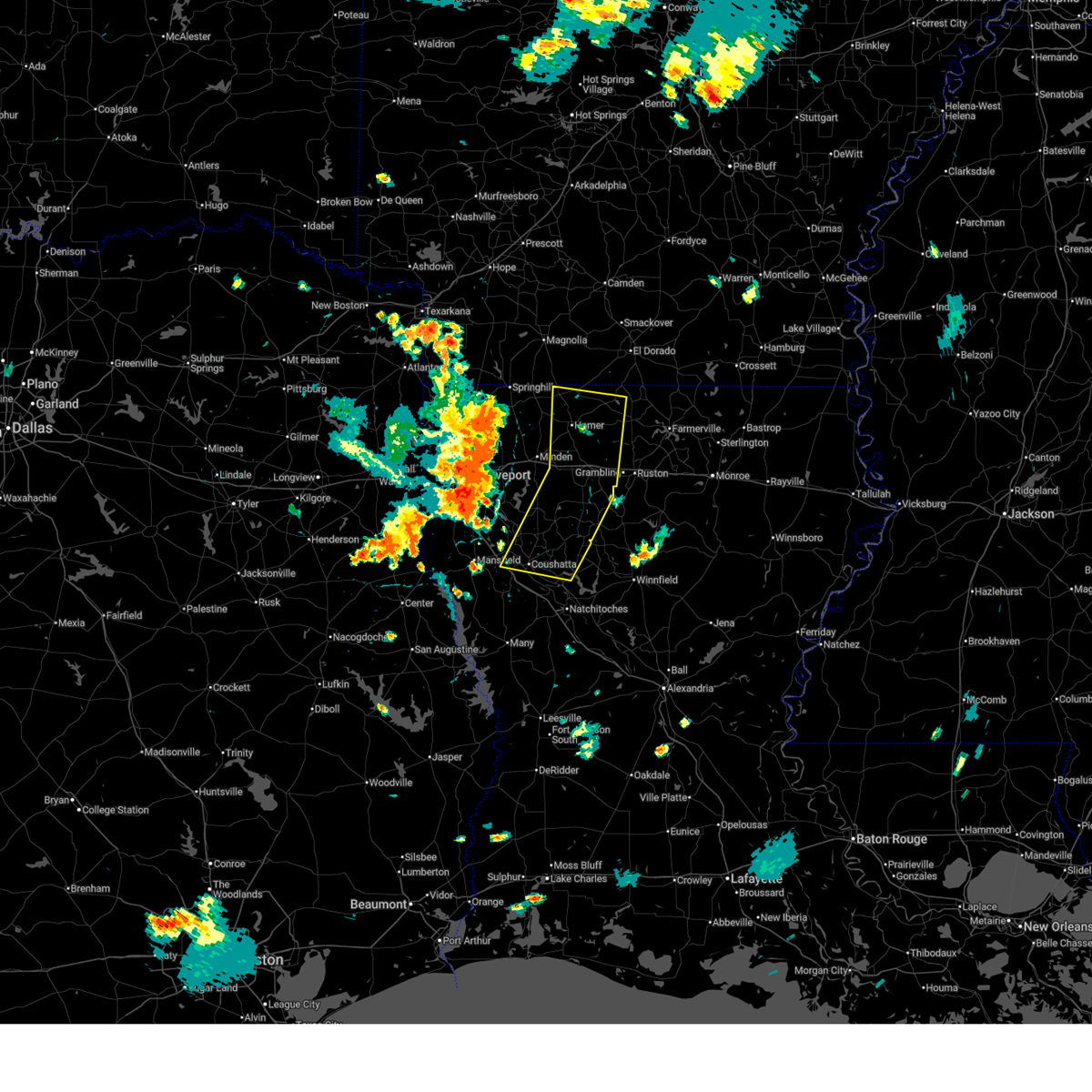
The Top Recent Hail Date for Hall Summit, LA is Friday, January 9, 2026 (9th out of 49)
Hail and Wind Damage Spotted near Hall Summit, LA
| Date / Time | Report Details |
|---|---|
| 7/6/2026 6:47 PM CDT |
 The storms which prompted the warning have weakened below severe limits, and have exited the warned area. therefore, the warning has been allowed to expire. however, gusty winds and heavy rain are still possible with these thunderstorms. to report severe weather, contact your nearest law enforcement agency. they will send your report to the national weather service office. a severe thunderstorm watch remains in effect until 1000 pm cdt for portions of north central and northwest louisiana. The storms which prompted the warning have weakened below severe limits, and have exited the warned area. therefore, the warning has been allowed to expire. however, gusty winds and heavy rain are still possible with these thunderstorms. to report severe weather, contact your nearest law enforcement agency. they will send your report to the national weather service office. a severe thunderstorm watch remains in effect until 1000 pm cdt for portions of north central and northwest louisiana.
|
| 7/6/2026 6:29 PM CDT |
 At 629 pm cdt, severe thunderstorms were located along a line from 7 miles west of bernice to 6 miles north of campti, or along a line from 13 miles south of junction city to 17 miles north of natchitoches, moving east at 35 mph (radar indicated). Hazards include 60 mph wind gusts and small hail. Expect damage to roofs, siding, and trees. Locations impacted include, homer, arcadia, haynesville, coushatta, ringgold, gibsland, heflin, simsboro, martin, hall summit, saline, lucky, ashland, castor, athens, bienville, edgefield, lisbon, jamestown and bryceland. At 629 pm cdt, severe thunderstorms were located along a line from 7 miles west of bernice to 6 miles north of campti, or along a line from 13 miles south of junction city to 17 miles north of natchitoches, moving east at 35 mph (radar indicated). Hazards include 60 mph wind gusts and small hail. Expect damage to roofs, siding, and trees. Locations impacted include, homer, arcadia, haynesville, coushatta, ringgold, gibsland, heflin, simsboro, martin, hall summit, saline, lucky, ashland, castor, athens, bienville, edgefield, lisbon, jamestown and bryceland.
|
| 7/6/2026 5:29 PM CDT |
 Svrshv the national weather service in shreveport has issued a * severe thunderstorm warning for, western lincoln parish in north central louisiana, west central union parish in north central louisiana, bienville parish in northwestern louisiana, claiborne parish in northwestern louisiana, east central de soto parish in northwestern louisiana, north central natchitoches parish in northwestern louisiana, red river parish in northwestern louisiana, southeastern webster parish in northwestern louisiana, * until 645 pm cdt. * at 529 pm cdt, severe thunderstorms were located along a line from near shongaloo to over mansfield, or along a line from 8 miles southeast of springhill to over mansfield, moving east at 35 mph (radar indicated). Hazards include 60 mph wind gusts and small hail. expect damage to roofs, siding, and trees Svrshv the national weather service in shreveport has issued a * severe thunderstorm warning for, western lincoln parish in north central louisiana, west central union parish in north central louisiana, bienville parish in northwestern louisiana, claiborne parish in northwestern louisiana, east central de soto parish in northwestern louisiana, north central natchitoches parish in northwestern louisiana, red river parish in northwestern louisiana, southeastern webster parish in northwestern louisiana, * until 645 pm cdt. * at 529 pm cdt, severe thunderstorms were located along a line from near shongaloo to over mansfield, or along a line from 8 miles southeast of springhill to over mansfield, moving east at 35 mph (radar indicated). Hazards include 60 mph wind gusts and small hail. expect damage to roofs, siding, and trees
|
| 4/29/2026 5:28 PM CDT |
 Svrshv the national weather service in shreveport has issued a * severe thunderstorm warning for, southwestern bienville parish in northwestern louisiana, southern bossier parish in northwestern louisiana, southeastern caddo parish in northwestern louisiana, de soto parish in northwestern louisiana, west central natchitoches parish in northwestern louisiana, red river parish in northwestern louisiana, * until 630 pm cdt. * at 528 pm cdt, a severe thunderstorm was located 8 miles northwest of mansfield, moving east at 35 mph (radar indicated). Hazards include 60 mph wind gusts and quarter size hail. Hail damage to vehicles is expected. Expect wind damage to roofs, siding, and trees. Svrshv the national weather service in shreveport has issued a * severe thunderstorm warning for, southwestern bienville parish in northwestern louisiana, southern bossier parish in northwestern louisiana, southeastern caddo parish in northwestern louisiana, de soto parish in northwestern louisiana, west central natchitoches parish in northwestern louisiana, red river parish in northwestern louisiana, * until 630 pm cdt. * at 528 pm cdt, a severe thunderstorm was located 8 miles northwest of mansfield, moving east at 35 mph (radar indicated). Hazards include 60 mph wind gusts and quarter size hail. Hail damage to vehicles is expected. Expect wind damage to roofs, siding, and trees.
|
| 3/15/2026 6:48 PM CDT |
 Svrshv the national weather service in shreveport has issued a * severe thunderstorm warning for, bienville parish in northwestern louisiana, southeastern bossier parish in northwestern louisiana, southeastern caddo parish in northwestern louisiana, northeastern de soto parish in northwestern louisiana, northwestern natchitoches parish in northwestern louisiana, red river parish in northwestern louisiana, southeastern webster parish in northwestern louisiana, * until 745 pm cdt. * at 648 pm cdt, severe thunderstorms were located along a line from over dubberly to 13 miles northeast of mansfield, or along a line from 6 miles southeast of minden to 13 miles northeast of mansfield, moving southeast at 35 mph (radar indicated). Hazards include 60 mph wind gusts and quarter size hail. Hail damage to vehicles is expected. Expect wind damage to roofs, siding, and trees. Svrshv the national weather service in shreveport has issued a * severe thunderstorm warning for, bienville parish in northwestern louisiana, southeastern bossier parish in northwestern louisiana, southeastern caddo parish in northwestern louisiana, northeastern de soto parish in northwestern louisiana, northwestern natchitoches parish in northwestern louisiana, red river parish in northwestern louisiana, southeastern webster parish in northwestern louisiana, * until 745 pm cdt. * at 648 pm cdt, severe thunderstorms were located along a line from over dubberly to 13 miles northeast of mansfield, or along a line from 6 miles southeast of minden to 13 miles northeast of mansfield, moving southeast at 35 mph (radar indicated). Hazards include 60 mph wind gusts and quarter size hail. Hail damage to vehicles is expected. Expect wind damage to roofs, siding, and trees.
|
| 3/11/2026 9:32 AM CDT |
 Svrshv the national weather service in shreveport has issued a * severe thunderstorm warning for, bienville parish in northwestern louisiana, northeastern red river parish in northwestern louisiana, * until 1015 am cdt. * at 932 am cdt, a severe thunderstorm was located 9 miles south of ringgold, or 29 miles south of minden, moving northeast at 30 mph (radar indicated). Hazards include 60 mph wind gusts and quarter size hail. Hail damage to vehicles is expected. Expect wind damage to roofs, siding, and trees. Svrshv the national weather service in shreveport has issued a * severe thunderstorm warning for, bienville parish in northwestern louisiana, northeastern red river parish in northwestern louisiana, * until 1015 am cdt. * at 932 am cdt, a severe thunderstorm was located 9 miles south of ringgold, or 29 miles south of minden, moving northeast at 30 mph (radar indicated). Hazards include 60 mph wind gusts and quarter size hail. Hail damage to vehicles is expected. Expect wind damage to roofs, siding, and trees.
|
| 2/14/2026 7:18 PM CST |
 At 718 pm cst, a severe thunderstorm capable of producing a tornado was located 6 miles south of ringgold, or 26 miles south of minden, moving east at 35 mph (radar indicated rotation). Hazards include tornado. Flying debris will be dangerous to those caught without shelter. mobile homes will be damaged or destroyed. damage to roofs, windows and vehicles will occur. tree damage is likely. Locations impacted include, hall summit and castor. At 718 pm cst, a severe thunderstorm capable of producing a tornado was located 6 miles south of ringgold, or 26 miles south of minden, moving east at 35 mph (radar indicated rotation). Hazards include tornado. Flying debris will be dangerous to those caught without shelter. mobile homes will be damaged or destroyed. damage to roofs, windows and vehicles will occur. tree damage is likely. Locations impacted include, hall summit and castor.
|
| 2/14/2026 7:03 PM CST |
 Torshv the national weather service in shreveport has issued a * tornado warning for, southwestern bienville parish in northwestern louisiana, northeastern red river parish in northwestern louisiana, * until 730 pm cst. * at 703 pm cst, a severe thunderstorm capable of producing a tornado was located 11 miles southwest of ringgold, or 20 miles northeast of mansfield, moving east at 35 mph (radar indicated rotation). Hazards include tornado. Flying debris will be dangerous to those caught without shelter. mobile homes will be damaged or destroyed. damage to roofs, windows and vehicles will occur. Tree damage is likely. Torshv the national weather service in shreveport has issued a * tornado warning for, southwestern bienville parish in northwestern louisiana, northeastern red river parish in northwestern louisiana, * until 730 pm cst. * at 703 pm cst, a severe thunderstorm capable of producing a tornado was located 11 miles southwest of ringgold, or 20 miles northeast of mansfield, moving east at 35 mph (radar indicated rotation). Hazards include tornado. Flying debris will be dangerous to those caught without shelter. mobile homes will be damaged or destroyed. damage to roofs, windows and vehicles will occur. Tree damage is likely.
|
| 1/10/2026 12:11 AM CST |
 The storm which prompted the warning has weakened below severe limits, and no longer poses an immediate threat to life or property. therefore, the warning will be allowed to expire. The storm which prompted the warning has weakened below severe limits, and no longer poses an immediate threat to life or property. therefore, the warning will be allowed to expire.
|
| 1/10/2026 12:03 AM CST |
 At 1203 am cst, a severe thunderstorm was located 9 miles southwest of ringgold, or 22 miles northeast of mansfield, moving northeast at 50 mph (radar indicated). Hazards include 60 mph wind gusts and small hail. Expect damage to roofs, siding, and trees. Locations impacted include, ringgold, hall summit, castor, ninock, loggy bayou, lake bistineau south, crichton and caspiana. At 1203 am cst, a severe thunderstorm was located 9 miles southwest of ringgold, or 22 miles northeast of mansfield, moving northeast at 50 mph (radar indicated). Hazards include 60 mph wind gusts and small hail. Expect damage to roofs, siding, and trees. Locations impacted include, ringgold, hall summit, castor, ninock, loggy bayou, lake bistineau south, crichton and caspiana.
|
| 1/10/2026 12:03 AM CST |
 the severe thunderstorm warning has been cancelled and is no longer in effect the severe thunderstorm warning has been cancelled and is no longer in effect
|
| 1/10/2026 12:02 AM CST |
 Svrshv the national weather service in shreveport has issued a * severe thunderstorm warning for, south central bienville parish in northwestern louisiana, southeastern de soto parish in northwestern louisiana, northwestern natchitoches parish in northwestern louisiana, red river parish in northwestern louisiana, * until 1245 am cst. * at 1202 am cst, a severe thunderstorm was located over coushatta, or 21 miles east of mansfield, moving east at 45 mph (radar indicated). Hazards include 60 mph wind gusts and small hail. expect damage to roofs, siding, and trees Svrshv the national weather service in shreveport has issued a * severe thunderstorm warning for, south central bienville parish in northwestern louisiana, southeastern de soto parish in northwestern louisiana, northwestern natchitoches parish in northwestern louisiana, red river parish in northwestern louisiana, * until 1245 am cst. * at 1202 am cst, a severe thunderstorm was located over coushatta, or 21 miles east of mansfield, moving east at 45 mph (radar indicated). Hazards include 60 mph wind gusts and small hail. expect damage to roofs, siding, and trees
|
| 1/9/2026 11:46 PM CST |
 At 1146 pm cst, a severe thunderstorm was located 8 miles northeast of mansfield, moving northeast at 50 mph (radar indicated). Hazards include 60 mph wind gusts and small hail. Expect damage to roofs, siding, and trees. Locations impacted include, mansfield, ringgold, hall summit, castor, ninock, loggy bayou, crichton, caspiana, grand bayou, mc dade, lake bistineau south, carmel and kingston. At 1146 pm cst, a severe thunderstorm was located 8 miles northeast of mansfield, moving northeast at 50 mph (radar indicated). Hazards include 60 mph wind gusts and small hail. Expect damage to roofs, siding, and trees. Locations impacted include, mansfield, ringgold, hall summit, castor, ninock, loggy bayou, crichton, caspiana, grand bayou, mc dade, lake bistineau south, carmel and kingston.
|
| 1/9/2026 11:33 PM CST |
 Svrshv the national weather service in shreveport has issued a * severe thunderstorm warning for, southwestern bienville parish in northwestern louisiana, southeastern bossier parish in northwestern louisiana, southeastern caddo parish in northwestern louisiana, central de soto parish in northwestern louisiana, northwestern red river parish in northwestern louisiana, * until 1215 am cst. * at 1133 pm cst, a severe thunderstorm was located near mansfield, moving northeast at 50 mph (radar indicated). Hazards include 60 mph wind gusts and small hail. expect damage to roofs, siding, and trees Svrshv the national weather service in shreveport has issued a * severe thunderstorm warning for, southwestern bienville parish in northwestern louisiana, southeastern bossier parish in northwestern louisiana, southeastern caddo parish in northwestern louisiana, central de soto parish in northwestern louisiana, northwestern red river parish in northwestern louisiana, * until 1215 am cst. * at 1133 pm cst, a severe thunderstorm was located near mansfield, moving northeast at 50 mph (radar indicated). Hazards include 60 mph wind gusts and small hail. expect damage to roofs, siding, and trees
|
| 11/24/2025 9:30 PM CST |
 The storms which prompted the warning have weakened below severe limits, and no longer pose an immediate threat to life or property. therefore, the warning has been allowed to expire. however, small hail, gusty winds, and heavy rain are still possible with these thunderstorms. to report severe weather, contact your nearest law enforcement agency. they will send your report to the national weather service office. The storms which prompted the warning have weakened below severe limits, and no longer pose an immediate threat to life or property. therefore, the warning has been allowed to expire. however, small hail, gusty winds, and heavy rain are still possible with these thunderstorms. to report severe weather, contact your nearest law enforcement agency. they will send your report to the national weather service office.
|
| 11/24/2025 9:15 PM CST |
 At 915 pm cst, severe thunderstorms were located along a line from 17 miles southeast of ringgold to near many, or along a line from 21 miles west of jonesboro to 20 miles southwest of natchitoches, moving east at 60 mph (radar indicated). Hazards include 60 mph wind gusts and small hail. Expect damage to roofs, siding, and trees. Locations impacted include, natchitoches, milam, many, coushatta, zwolle, campti, allen, pleasant hill, florien, provencal, martin, clarence, hall summit, saline, lucky, ashland, castor, noble, fisher and edgefield. At 915 pm cst, severe thunderstorms were located along a line from 17 miles southeast of ringgold to near many, or along a line from 21 miles west of jonesboro to 20 miles southwest of natchitoches, moving east at 60 mph (radar indicated). Hazards include 60 mph wind gusts and small hail. Expect damage to roofs, siding, and trees. Locations impacted include, natchitoches, milam, many, coushatta, zwolle, campti, allen, pleasant hill, florien, provencal, martin, clarence, hall summit, saline, lucky, ashland, castor, noble, fisher and edgefield.
|
| 11/24/2025 9:15 PM CST |
 the severe thunderstorm warning has been cancelled and is no longer in effect the severe thunderstorm warning has been cancelled and is no longer in effect
|
| 11/24/2025 9:03 PM CST |
 At 903 pm cst, severe thunderstorms were located along a line from 10 miles northeast of coushatta to 5 miles southeast of zwolle, or along a line from 28 miles east of mansfield to 31 miles west of natchitoches, moving east at 60 mph (radar indicated). Hazards include 60 mph wind gusts and small hail. Expect damage to roofs, siding, and trees. Locations impacted include, natchitoches, milam, many, san augustine, coushatta, zwolle, campti, converse, allen, oak grove, pleasant hill, florien, provencal, martin, clarence, hall summit, saline, lucky, ashland and castor. At 903 pm cst, severe thunderstorms were located along a line from 10 miles northeast of coushatta to 5 miles southeast of zwolle, or along a line from 28 miles east of mansfield to 31 miles west of natchitoches, moving east at 60 mph (radar indicated). Hazards include 60 mph wind gusts and small hail. Expect damage to roofs, siding, and trees. Locations impacted include, natchitoches, milam, many, san augustine, coushatta, zwolle, campti, converse, allen, oak grove, pleasant hill, florien, provencal, martin, clarence, hall summit, saline, lucky, ashland and castor.
|
| 11/24/2025 8:40 PM CST |
 Svrshv the national weather service in shreveport has issued a * severe thunderstorm warning for, southeastern bienville parish in northwestern louisiana, southeastern de soto parish in northwestern louisiana, western natchitoches parish in northwestern louisiana, red river parish in northwestern louisiana, sabine parish in northwestern louisiana, northwestern sabine county in eastern texas, northeastern san augustine county in eastern texas, southeastern shelby county in eastern texas, * until 930 pm cst. * at 840 pm cst, severe thunderstorms were located along a line from near mansfield to 6 miles north of rosevine, or along a line from near mansfield to 23 miles southeast of center, moving east at 60 mph (radar indicated). Hazards include 60 mph wind gusts and small hail. expect damage to roofs, siding, and trees Svrshv the national weather service in shreveport has issued a * severe thunderstorm warning for, southeastern bienville parish in northwestern louisiana, southeastern de soto parish in northwestern louisiana, western natchitoches parish in northwestern louisiana, red river parish in northwestern louisiana, sabine parish in northwestern louisiana, northwestern sabine county in eastern texas, northeastern san augustine county in eastern texas, southeastern shelby county in eastern texas, * until 930 pm cst. * at 840 pm cst, severe thunderstorms were located along a line from near mansfield to 6 miles north of rosevine, or along a line from near mansfield to 23 miles southeast of center, moving east at 60 mph (radar indicated). Hazards include 60 mph wind gusts and small hail. expect damage to roofs, siding, and trees
|
| 6/9/2025 1:55 AM CDT |
 Svrshv the national weather service in shreveport has issued a * severe thunderstorm warning for, west central grant parish in north central louisiana, de soto parish in northwestern louisiana, red river parish in northwestern louisiana, natchitoches parish in northwestern louisiana, southeastern caddo parish in northwestern louisiana, southwestern bienville parish in northwestern louisiana, south central bossier parish in northwestern louisiana, sabine parish in northwestern louisiana, southwestern winn parish in north central louisiana, eastern shelby county in eastern texas, northeastern sabine county in eastern texas, * until 315 am cdt. * at 155 am cdt, severe thunderstorms were located along a line extending from 14 miles west of ringgold to 15 miles southeast of stonewall to 7 miles southwest of mansfield to near patroon to near neuville, moving southeast at 40 mph (radar indicated). Hazards include 60 mph wind gusts and quarter size hail. Hail damage to vehicles is expected. Expect wind damage to roofs, siding, and trees. Svrshv the national weather service in shreveport has issued a * severe thunderstorm warning for, west central grant parish in north central louisiana, de soto parish in northwestern louisiana, red river parish in northwestern louisiana, natchitoches parish in northwestern louisiana, southeastern caddo parish in northwestern louisiana, southwestern bienville parish in northwestern louisiana, south central bossier parish in northwestern louisiana, sabine parish in northwestern louisiana, southwestern winn parish in north central louisiana, eastern shelby county in eastern texas, northeastern sabine county in eastern texas, * until 315 am cdt. * at 155 am cdt, severe thunderstorms were located along a line extending from 14 miles west of ringgold to 15 miles southeast of stonewall to 7 miles southwest of mansfield to near patroon to near neuville, moving southeast at 40 mph (radar indicated). Hazards include 60 mph wind gusts and quarter size hail. Hail damage to vehicles is expected. Expect wind damage to roofs, siding, and trees.
|
| 5/20/2025 3:39 PM CDT |
 Svrshv the national weather service in shreveport has issued a * severe thunderstorm warning for, southwestern jackson parish in north central louisiana, northeastern red river parish in northwestern louisiana, north central natchitoches parish in northwestern louisiana, southeastern bienville parish in northwestern louisiana, northwestern winn parish in north central louisiana, * until 430 pm cdt. * at 338 pm cdt, a severe thunderstorm was located 10 miles northeast of coushatta, or 26 miles north of natchitoches, moving east at 45 mph (radar indicated). Hazards include 60 mph wind gusts and quarter size hail. Hail damage to vehicles is expected. Expect wind damage to roofs, siding, and trees. Svrshv the national weather service in shreveport has issued a * severe thunderstorm warning for, southwestern jackson parish in north central louisiana, northeastern red river parish in northwestern louisiana, north central natchitoches parish in northwestern louisiana, southeastern bienville parish in northwestern louisiana, northwestern winn parish in north central louisiana, * until 430 pm cdt. * at 338 pm cdt, a severe thunderstorm was located 10 miles northeast of coushatta, or 26 miles north of natchitoches, moving east at 45 mph (radar indicated). Hazards include 60 mph wind gusts and quarter size hail. Hail damage to vehicles is expected. Expect wind damage to roofs, siding, and trees.
|
| 5/20/2025 3:28 PM CDT |
 At 328 pm cdt, a severe thunderstorm was located 8 miles north of coushatta, or 22 miles east of mansfield, moving east at 30 mph (radar indicated). Hazards include 60 mph wind gusts and quarter size hail. Hail damage to vehicles is expected. expect wind damage to roofs, siding, and trees. Locations impacted include, womack, martin, edgefield, and hall summit. At 328 pm cdt, a severe thunderstorm was located 8 miles north of coushatta, or 22 miles east of mansfield, moving east at 30 mph (radar indicated). Hazards include 60 mph wind gusts and quarter size hail. Hail damage to vehicles is expected. expect wind damage to roofs, siding, and trees. Locations impacted include, womack, martin, edgefield, and hall summit.
|
| 5/20/2025 3:17 PM CDT |
 the severe thunderstorm warning has been cancelled and is no longer in effect the severe thunderstorm warning has been cancelled and is no longer in effect
|
| 5/20/2025 3:17 PM CDT |
 At 317 pm cdt, a severe thunderstorm was located 9 miles northwest of coushatta, or 16 miles northeast of mansfield, moving east at 30 mph (radar indicated). Hazards include 60 mph wind gusts and quarter size hail. Hail damage to vehicles is expected. expect wind damage to roofs, siding, and trees. Locations impacted include, womack, crichton, hall summit, grand bayou, martin, edgefield, loggy bayou, and coushatta. At 317 pm cdt, a severe thunderstorm was located 9 miles northwest of coushatta, or 16 miles northeast of mansfield, moving east at 30 mph (radar indicated). Hazards include 60 mph wind gusts and quarter size hail. Hail damage to vehicles is expected. expect wind damage to roofs, siding, and trees. Locations impacted include, womack, crichton, hall summit, grand bayou, martin, edgefield, loggy bayou, and coushatta.
|
| 5/20/2025 2:59 PM CDT |
 Svrshv the national weather service in shreveport has issued a * severe thunderstorm warning for, central de soto parish in northwestern louisiana, red river parish in northwestern louisiana, southwestern bienville parish in northwestern louisiana, * until 345 pm cdt. * at 259 pm cdt, a severe thunderstorm was located 9 miles northeast of mansfield, moving east at 30 mph (radar indicated). Hazards include 60 mph wind gusts and quarter size hail. Hail damage to vehicles is expected. Expect wind damage to roofs, siding, and trees. Svrshv the national weather service in shreveport has issued a * severe thunderstorm warning for, central de soto parish in northwestern louisiana, red river parish in northwestern louisiana, southwestern bienville parish in northwestern louisiana, * until 345 pm cdt. * at 259 pm cdt, a severe thunderstorm was located 9 miles northeast of mansfield, moving east at 30 mph (radar indicated). Hazards include 60 mph wind gusts and quarter size hail. Hail damage to vehicles is expected. Expect wind damage to roofs, siding, and trees.
|
| 5/6/2025 4:21 PM CDT |
 At 420 pm cdt, severe thunderstorms were located along a line extending from 8 miles south of gibsland to 7 miles southeast of coushatta, moving east at 55 mph (radar indicated). Hazards include 60 mph wind gusts. Expect damage to roofs, siding, and trees. Locations impacted include, lake end, saline, brice, edgefield, hanna, friendship, liberty hill, goldonna, chestnut, ashland, armistead, evelyn, castor, hall summit, martin, lucky, womack, jamestown, black lake, and coushatta. At 420 pm cdt, severe thunderstorms were located along a line extending from 8 miles south of gibsland to 7 miles southeast of coushatta, moving east at 55 mph (radar indicated). Hazards include 60 mph wind gusts. Expect damage to roofs, siding, and trees. Locations impacted include, lake end, saline, brice, edgefield, hanna, friendship, liberty hill, goldonna, chestnut, ashland, armistead, evelyn, castor, hall summit, martin, lucky, womack, jamestown, black lake, and coushatta.
|
| 5/6/2025 4:21 PM CDT |
 the severe thunderstorm warning has been cancelled and is no longer in effect the severe thunderstorm warning has been cancelled and is no longer in effect
|
| 5/6/2025 3:44 PM CDT |
 Svrshv the national weather service in shreveport has issued a * severe thunderstorm warning for, de soto parish in northwestern louisiana, red river parish in northwestern louisiana, northwestern natchitoches parish in northwestern louisiana, southeastern caddo parish in northwestern louisiana, bienville parish in northwestern louisiana, southeastern bossier parish in northwestern louisiana, southwestern lincoln parish in north central louisiana, northwestern winn parish in north central louisiana, northeastern shelby county in eastern texas, * until 445 pm cdt. * at 344 pm cdt, severe thunderstorms were located along a line extending from 8 miles northeast of stonewall to near mansfield, moving east at 65 mph (radar indicated). Hazards include 60 mph wind gusts and penny size hail. expect damage to roofs, siding, and trees Svrshv the national weather service in shreveport has issued a * severe thunderstorm warning for, de soto parish in northwestern louisiana, red river parish in northwestern louisiana, northwestern natchitoches parish in northwestern louisiana, southeastern caddo parish in northwestern louisiana, bienville parish in northwestern louisiana, southeastern bossier parish in northwestern louisiana, southwestern lincoln parish in north central louisiana, northwestern winn parish in north central louisiana, northeastern shelby county in eastern texas, * until 445 pm cdt. * at 344 pm cdt, severe thunderstorms were located along a line extending from 8 miles northeast of stonewall to near mansfield, moving east at 65 mph (radar indicated). Hazards include 60 mph wind gusts and penny size hail. expect damage to roofs, siding, and trees
|
| 5/6/2025 3:03 PM CDT |
 Svrshv the national weather service in shreveport has issued a * severe thunderstorm warning for, southeastern webster parish in northwestern louisiana, western jackson parish in north central louisiana, northeastern red river parish in northwestern louisiana, north central natchitoches parish in northwestern louisiana, south central claiborne parish in northwestern louisiana, bienville parish in northwestern louisiana, southeastern bossier parish in northwestern louisiana, southwestern lincoln parish in north central louisiana, northwestern winn parish in north central louisiana, * until 345 pm cdt. * at 302 pm cdt, severe thunderstorms were located along a line extending from 9 miles south of haughton to near campti, moving northeast at 55 mph (radar indicated). Hazards include quarter size hail. damage to vehicles is expected Svrshv the national weather service in shreveport has issued a * severe thunderstorm warning for, southeastern webster parish in northwestern louisiana, western jackson parish in north central louisiana, northeastern red river parish in northwestern louisiana, north central natchitoches parish in northwestern louisiana, south central claiborne parish in northwestern louisiana, bienville parish in northwestern louisiana, southeastern bossier parish in northwestern louisiana, southwestern lincoln parish in north central louisiana, northwestern winn parish in north central louisiana, * until 345 pm cdt. * at 302 pm cdt, severe thunderstorms were located along a line extending from 9 miles south of haughton to near campti, moving northeast at 55 mph (radar indicated). Hazards include quarter size hail. damage to vehicles is expected
|
| 5/2/2025 3:54 PM CDT |
 At 354 pm cdt, severe thunderstorms were located along a line from near ringgold to 13 miles southwest of jonesboro, or along a line from 16 miles south of minden to 13 miles southwest of jonesboro, moving northeast at 40 mph (radar indicated). Hazards include 60 mph wind gusts and quarter size hail. Hail damage to vehicles is expected. expect wind damage to roofs, siding, and trees. Locations impacted include, jonesboro, ringgold, sibley, dubberly, heflin, martin, hodge, goldonna, north hodge, dodson, hall summit, east hodge, saline, lucky, ashland, castor, calvin, bienville, quitman and jamestown. At 354 pm cdt, severe thunderstorms were located along a line from near ringgold to 13 miles southwest of jonesboro, or along a line from 16 miles south of minden to 13 miles southwest of jonesboro, moving northeast at 40 mph (radar indicated). Hazards include 60 mph wind gusts and quarter size hail. Hail damage to vehicles is expected. expect wind damage to roofs, siding, and trees. Locations impacted include, jonesboro, ringgold, sibley, dubberly, heflin, martin, hodge, goldonna, north hodge, dodson, hall summit, east hodge, saline, lucky, ashland, castor, calvin, bienville, quitman and jamestown.
|
| 5/2/2025 3:54 PM CDT |
 the severe thunderstorm warning has been cancelled and is no longer in effect the severe thunderstorm warning has been cancelled and is no longer in effect
|
| 5/2/2025 3:27 PM CDT |
 Svrshv the national weather service in shreveport has issued a * severe thunderstorm warning for, southwestern jackson parish in north central louisiana, western winn parish in north central louisiana, bienville parish in northwestern louisiana, southeastern bossier parish in northwestern louisiana, east central de soto parish in northwestern louisiana, northeastern natchitoches parish in northwestern louisiana, red river parish in northwestern louisiana, southeastern webster parish in northwestern louisiana, * until 415 pm cdt. * at 327 pm cdt, severe thunderstorms were located along a line from 11 miles northwest of coushatta to 9 miles east of campti, or along a line from 19 miles northeast of mansfield to 11 miles northeast of natchitoches, moving northeast at 40 mph (radar indicated). Hazards include 60 mph wind gusts and quarter size hail. Hail damage to vehicles is expected. Expect wind damage to roofs, siding, and trees. Svrshv the national weather service in shreveport has issued a * severe thunderstorm warning for, southwestern jackson parish in north central louisiana, western winn parish in north central louisiana, bienville parish in northwestern louisiana, southeastern bossier parish in northwestern louisiana, east central de soto parish in northwestern louisiana, northeastern natchitoches parish in northwestern louisiana, red river parish in northwestern louisiana, southeastern webster parish in northwestern louisiana, * until 415 pm cdt. * at 327 pm cdt, severe thunderstorms were located along a line from 11 miles northwest of coushatta to 9 miles east of campti, or along a line from 19 miles northeast of mansfield to 11 miles northeast of natchitoches, moving northeast at 40 mph (radar indicated). Hazards include 60 mph wind gusts and quarter size hail. Hail damage to vehicles is expected. Expect wind damage to roofs, siding, and trees.
|
| 5/2/2025 2:45 PM CDT |
 Svrshv the national weather service in shreveport has issued a * severe thunderstorm warning for, south central bienville parish in northwestern louisiana, southeastern de soto parish in northwestern louisiana, northwestern natchitoches parish in northwestern louisiana, red river parish in northwestern louisiana, northeastern sabine parish in northwestern louisiana, * until 345 pm cdt. * at 245 pm cdt, a severe thunderstorm was located 8 miles northeast of many, or 18 miles west of natchitoches, moving northeast at 45 mph (radar indicated). Hazards include 60 mph wind gusts and quarter size hail. Hail damage to vehicles is expected. Expect wind damage to roofs, siding, and trees. Svrshv the national weather service in shreveport has issued a * severe thunderstorm warning for, south central bienville parish in northwestern louisiana, southeastern de soto parish in northwestern louisiana, northwestern natchitoches parish in northwestern louisiana, red river parish in northwestern louisiana, northeastern sabine parish in northwestern louisiana, * until 345 pm cdt. * at 245 pm cdt, a severe thunderstorm was located 8 miles northeast of many, or 18 miles west of natchitoches, moving northeast at 45 mph (radar indicated). Hazards include 60 mph wind gusts and quarter size hail. Hail damage to vehicles is expected. Expect wind damage to roofs, siding, and trees.
|
| 3/23/2025 10:29 PM CDT |
 Svrshv the national weather service in shreveport has issued a * severe thunderstorm warning for, bienville parish in northwestern louisiana, southeastern bossier parish in northwestern louisiana, southeastern caddo parish in northwestern louisiana, northeastern de soto parish in northwestern louisiana, northern red river parish in northwestern louisiana, southeastern webster parish in northwestern louisiana, * until 1130 pm cdt. * at 1029 pm cdt, a severe thunderstorm was located 12 miles south of fosters, or 12 miles south of bossier city, moving east at 30 mph (radar indicated). Hazards include 60 mph wind gusts and quarter size hail. Hail damage to vehicles is expected. Expect wind damage to roofs, siding, and trees. Svrshv the national weather service in shreveport has issued a * severe thunderstorm warning for, bienville parish in northwestern louisiana, southeastern bossier parish in northwestern louisiana, southeastern caddo parish in northwestern louisiana, northeastern de soto parish in northwestern louisiana, northern red river parish in northwestern louisiana, southeastern webster parish in northwestern louisiana, * until 1130 pm cdt. * at 1029 pm cdt, a severe thunderstorm was located 12 miles south of fosters, or 12 miles south of bossier city, moving east at 30 mph (radar indicated). Hazards include 60 mph wind gusts and quarter size hail. Hail damage to vehicles is expected. Expect wind damage to roofs, siding, and trees.
|
| 3/4/2025 10:38 AM CST |
 Svrshv the national weather service in shreveport has issued a * severe thunderstorm warning for, west central grant parish in north central louisiana, southern jackson parish in north central louisiana, winn parish in north central louisiana, southeastern bienville parish in northwestern louisiana, southeastern de soto parish in northwestern louisiana, natchitoches parish in northwestern louisiana, red river parish in northwestern louisiana, sabine parish in northwestern louisiana, sabine county in eastern texas, * until 1145 am cst. * at 1038 am cst, severe thunderstorms were located along a line from 16 miles west of jonesboro to 12 miles southeast of hemphill, or along a line from 16 miles west of jonesboro to 48 miles southeast of center, moving east at 45 mph (radar indicated). Hazards include 60 mph wind gusts and quarter size hail. Hail damage to vehicles is expected. Expect wind damage to roofs, siding, and trees. Svrshv the national weather service in shreveport has issued a * severe thunderstorm warning for, west central grant parish in north central louisiana, southern jackson parish in north central louisiana, winn parish in north central louisiana, southeastern bienville parish in northwestern louisiana, southeastern de soto parish in northwestern louisiana, natchitoches parish in northwestern louisiana, red river parish in northwestern louisiana, sabine parish in northwestern louisiana, sabine county in eastern texas, * until 1145 am cst. * at 1038 am cst, severe thunderstorms were located along a line from 16 miles west of jonesboro to 12 miles southeast of hemphill, or along a line from 16 miles west of jonesboro to 48 miles southeast of center, moving east at 45 mph (radar indicated). Hazards include 60 mph wind gusts and quarter size hail. Hail damage to vehicles is expected. Expect wind damage to roofs, siding, and trees.
|
| 3/4/2025 10:21 AM CST |
 the severe thunderstorm warning has been cancelled and is no longer in effect the severe thunderstorm warning has been cancelled and is no longer in effect
|
| 3/4/2025 10:21 AM CST |
 At 1021 am cst, severe thunderstorms were located along a line from 10 miles south of ringgold to 17 miles south of pineland, or along a line from 27 miles east of mansfield to 43 miles east of diboll, moving east at 40 mph (radar indicated). Hazards include 60 mph wind gusts and small hail. Expect damage to roofs, siding, and trees. Locations impacted include, mansfield, milam, many, coushatta, zwolle, hemphill, pineland, converse, patroon, rosevine, allen, oak grove, pleasant hill, martin, huxley, south mansfield, hall summit, saline, lucky and ashland. At 1021 am cst, severe thunderstorms were located along a line from 10 miles south of ringgold to 17 miles south of pineland, or along a line from 27 miles east of mansfield to 43 miles east of diboll, moving east at 40 mph (radar indicated). Hazards include 60 mph wind gusts and small hail. Expect damage to roofs, siding, and trees. Locations impacted include, mansfield, milam, many, coushatta, zwolle, hemphill, pineland, converse, patroon, rosevine, allen, oak grove, pleasant hill, martin, huxley, south mansfield, hall summit, saline, lucky and ashland.
|
| 3/4/2025 9:40 AM CST |
 Svrshv the national weather service in shreveport has issued a * severe thunderstorm warning for, southeastern bienville parish in northwestern louisiana, de soto parish in northwestern louisiana, northwestern natchitoches parish in northwestern louisiana, red river parish in northwestern louisiana, sabine parish in northwestern louisiana, southeastern angelina county in eastern texas, southeastern nacogdoches county in eastern texas, sabine county in eastern texas, san augustine county in eastern texas, shelby county in eastern texas, southeastern panola county in northeastern texas, * until 1045 am cst. * at 940 am cst, severe thunderstorms were located along a line from 6 miles southeast of stonewall to 15 miles south of huntington, or along a line from 13 miles north of mansfield to 17 miles southeast of diboll, moving east at 40 mph (radar indicated). Hazards include 60 mph wind gusts and small hail. expect damage to roofs, siding, and trees Svrshv the national weather service in shreveport has issued a * severe thunderstorm warning for, southeastern bienville parish in northwestern louisiana, de soto parish in northwestern louisiana, northwestern natchitoches parish in northwestern louisiana, red river parish in northwestern louisiana, sabine parish in northwestern louisiana, southeastern angelina county in eastern texas, southeastern nacogdoches county in eastern texas, sabine county in eastern texas, san augustine county in eastern texas, shelby county in eastern texas, southeastern panola county in northeastern texas, * until 1045 am cst. * at 940 am cst, severe thunderstorms were located along a line from 6 miles southeast of stonewall to 15 miles south of huntington, or along a line from 13 miles north of mansfield to 17 miles southeast of diboll, moving east at 40 mph (radar indicated). Hazards include 60 mph wind gusts and small hail. expect damage to roofs, siding, and trees
|
| 2/15/2025 6:39 PM CST |
 The storms which prompted the warning have moved out of the area. therefore, the warning will be allowed to expire. however, gusty winds and heavy rain are still possible with these thunderstorms. The storms which prompted the warning have moved out of the area. therefore, the warning will be allowed to expire. however, gusty winds and heavy rain are still possible with these thunderstorms.
|
| 2/15/2025 6:09 PM CST |
 At 609 pm cst, severe thunderstorms were located along a line from 15 miles south of gibsland to 9 miles south of coushatta, or along a line from 21 miles west of jonesboro to 18 miles northwest of natchitoches, moving east at 35 mph (radar indicated). Hazards include 60 mph wind gusts and small hail. Expect damage to roofs, siding, and trees. Locations impacted include, coushatta, martin, hall summit, saline, lucky, ashland, castor, edgefield, bienville, womack, chestnut, black lake and creston. At 609 pm cst, severe thunderstorms were located along a line from 15 miles south of gibsland to 9 miles south of coushatta, or along a line from 21 miles west of jonesboro to 18 miles northwest of natchitoches, moving east at 35 mph (radar indicated). Hazards include 60 mph wind gusts and small hail. Expect damage to roofs, siding, and trees. Locations impacted include, coushatta, martin, hall summit, saline, lucky, ashland, castor, edgefield, bienville, womack, chestnut, black lake and creston.
|
| 2/15/2025 6:09 PM CST |
 the severe thunderstorm warning has been cancelled and is no longer in effect the severe thunderstorm warning has been cancelled and is no longer in effect
|
| 2/15/2025 5:40 PM CST |
 Svrshv the national weather service in shreveport has issued a * severe thunderstorm warning for, south central bienville parish in northwestern louisiana, southeastern de soto parish in northwestern louisiana, northwestern natchitoches parish in northwestern louisiana, red river parish in northwestern louisiana, * until 645 pm cst. * at 540 pm cst, severe thunderstorms were located along a line from 7 miles south of ringgold to 6 miles northeast of converse, or along a line from 26 miles northeast of mansfield to 16 miles south of mansfield, moving east at 35 mph (radar indicated). Hazards include 60 mph wind gusts and small hail. expect damage to roofs, siding, and trees Svrshv the national weather service in shreveport has issued a * severe thunderstorm warning for, south central bienville parish in northwestern louisiana, southeastern de soto parish in northwestern louisiana, northwestern natchitoches parish in northwestern louisiana, red river parish in northwestern louisiana, * until 645 pm cst. * at 540 pm cst, severe thunderstorms were located along a line from 7 miles south of ringgold to 6 miles northeast of converse, or along a line from 26 miles northeast of mansfield to 16 miles south of mansfield, moving east at 35 mph (radar indicated). Hazards include 60 mph wind gusts and small hail. expect damage to roofs, siding, and trees
|
| 2/15/2025 5:39 PM CST |
 the severe thunderstorm warning has been cancelled and is no longer in effect the severe thunderstorm warning has been cancelled and is no longer in effect
|
| 2/15/2025 5:39 PM CST |
 At 539 pm cst, a severe thunderstorm was located near ringgold, or 21 miles south of minden, moving northeast at 40 mph (radar indicated). Hazards include 60 mph wind gusts and small hail. Expect damage to roofs, siding, and trees. Locations impacted include, ringgold, sibley, dubberly, heflin, hall summit, lucky, castor, bienville, jamestown, ogden, plum orchard landing, noles landing, lake bistineau north, lake bistineau south, sailes, curtis and koran. At 539 pm cst, a severe thunderstorm was located near ringgold, or 21 miles south of minden, moving northeast at 40 mph (radar indicated). Hazards include 60 mph wind gusts and small hail. Expect damage to roofs, siding, and trees. Locations impacted include, ringgold, sibley, dubberly, heflin, hall summit, lucky, castor, bienville, jamestown, ogden, plum orchard landing, noles landing, lake bistineau north, lake bistineau south, sailes, curtis and koran.
|
| 2/15/2025 5:05 PM CST |
 Svrshv the national weather service in shreveport has issued a * severe thunderstorm warning for, southwestern bienville parish in northwestern louisiana, southeastern bossier parish in northwestern louisiana, southeastern caddo parish in northwestern louisiana, central de soto parish in northwestern louisiana, northwestern red river parish in northwestern louisiana, southeastern webster parish in northwestern louisiana, * until 600 pm cst. * at 505 pm cst, a severe thunderstorm was located 6 miles northeast of mansfield, moving northeast at 40 mph (radar indicated). Hazards include 60 mph wind gusts. expect damage to roofs, siding, and trees Svrshv the national weather service in shreveport has issued a * severe thunderstorm warning for, southwestern bienville parish in northwestern louisiana, southeastern bossier parish in northwestern louisiana, southeastern caddo parish in northwestern louisiana, central de soto parish in northwestern louisiana, northwestern red river parish in northwestern louisiana, southeastern webster parish in northwestern louisiana, * until 600 pm cst. * at 505 pm cst, a severe thunderstorm was located 6 miles northeast of mansfield, moving northeast at 40 mph (radar indicated). Hazards include 60 mph wind gusts. expect damage to roofs, siding, and trees
|
| 7/8/2024 6:02 PM CDT |
 the tornado warning has been cancelled and is no longer in effect the tornado warning has been cancelled and is no longer in effect
|
| 7/8/2024 6:02 PM CDT |
 At 602 pm cdt, a severe thunderstorm capable of producing a tornado was located 9 miles south of ringgold, or 25 miles northeast of mansfield, moving north at 30 mph (radar indicated rotation). Hazards include tornado. Flying debris will be dangerous to those caught without shelter. mobile homes will be damaged or destroyed. damage to roofs, windows, and vehicles will occur. tree damage is likely. Locations impacted include, ringgold and hall summit. At 602 pm cdt, a severe thunderstorm capable of producing a tornado was located 9 miles south of ringgold, or 25 miles northeast of mansfield, moving north at 30 mph (radar indicated rotation). Hazards include tornado. Flying debris will be dangerous to those caught without shelter. mobile homes will be damaged or destroyed. damage to roofs, windows, and vehicles will occur. tree damage is likely. Locations impacted include, ringgold and hall summit.
|
| 7/8/2024 5:46 PM CDT |
 the tornado warning has been cancelled and is no longer in effect the tornado warning has been cancelled and is no longer in effect
|
| 7/8/2024 5:46 PM CDT |
 At 545 pm cdt, a severe thunderstorm capable of producing a tornado was located 8 miles north of coushatta, or 20 miles east of mansfield, moving north at 45 mph (radar indicated rotation). Hazards include tornado. Flying debris will be dangerous to those caught without shelter. mobile homes will be damaged or destroyed. damage to roofs, windows, and vehicles will occur. tree damage is likely. This tornadic thunderstorm will remain over mainly rural areas of north central red river, southeastern caddo, southwestern bienville and southeastern bossier parishes, including the following locations, ninock, crichton, mc dade, hall summit, and loggy bayou. At 545 pm cdt, a severe thunderstorm capable of producing a tornado was located 8 miles north of coushatta, or 20 miles east of mansfield, moving north at 45 mph (radar indicated rotation). Hazards include tornado. Flying debris will be dangerous to those caught without shelter. mobile homes will be damaged or destroyed. damage to roofs, windows, and vehicles will occur. tree damage is likely. This tornadic thunderstorm will remain over mainly rural areas of north central red river, southeastern caddo, southwestern bienville and southeastern bossier parishes, including the following locations, ninock, crichton, mc dade, hall summit, and loggy bayou.
|
| 7/8/2024 5:26 PM CDT |
 Torshv the national weather service in shreveport has issued a * tornado warning for, southeastern de soto parish in northwestern louisiana, central red river parish in northwestern louisiana, west central natchitoches parish in northwestern louisiana, southeastern caddo parish in northwestern louisiana, southwestern bienville parish in northwestern louisiana, southeastern bossier parish in northwestern louisiana, * until 615 pm cdt. * at 525 pm cdt, a severe thunderstorm capable of producing a tornado was located 7 miles south of coushatta, or 20 miles northwest of natchitoches, moving north at 45 mph (radar indicated rotation). Hazards include tornado. Flying debris will be dangerous to those caught without shelter. mobile homes will be damaged or destroyed. damage to roofs, windows, and vehicles will occur. tree damage is likely. this dangerous storm will be near, coushatta around 530 pm cdt. Other locations impacted by this tornadic thunderstorm include lake end, evelyn, hall summit, grand bayou, edgefield, hanna, loggy bayou, ninock, crichton, and mc dade. Torshv the national weather service in shreveport has issued a * tornado warning for, southeastern de soto parish in northwestern louisiana, central red river parish in northwestern louisiana, west central natchitoches parish in northwestern louisiana, southeastern caddo parish in northwestern louisiana, southwestern bienville parish in northwestern louisiana, southeastern bossier parish in northwestern louisiana, * until 615 pm cdt. * at 525 pm cdt, a severe thunderstorm capable of producing a tornado was located 7 miles south of coushatta, or 20 miles northwest of natchitoches, moving north at 45 mph (radar indicated rotation). Hazards include tornado. Flying debris will be dangerous to those caught without shelter. mobile homes will be damaged or destroyed. damage to roofs, windows, and vehicles will occur. tree damage is likely. this dangerous storm will be near, coushatta around 530 pm cdt. Other locations impacted by this tornadic thunderstorm include lake end, evelyn, hall summit, grand bayou, edgefield, hanna, loggy bayou, ninock, crichton, and mc dade.
|
| 7/8/2024 3:44 PM CDT |
 Torshv the national weather service in shreveport has issued a * tornado warning for, southern webster parish in northwestern louisiana, north central red river parish in northwestern louisiana, southwestern bienville parish in northwestern louisiana, southeastern bossier parish in northwestern louisiana, * until 430 pm cdt. * at 344 pm cdt, a severe thunderstorm capable of producing a tornado was located near ringgold, or 24 miles south of minden, moving northwest at 50 mph (radar indicated rotation). Hazards include tornado. Flying debris will be dangerous to those caught without shelter. mobile homes will be damaged or destroyed. damage to roofs, windows, and vehicles will occur. tree damage is likely. this dangerous storm will be near, ringgold around 350 pm cdt. doyline around 400 pm cdt. haughton around 405 pm cdt. Other locations impacted by this tornadic thunderstorm include castor, jamestown, curtis, hall summit, lake bistineau south, noles landing, lake bistineau north, bodcau, plum orchard landing, and ogden. Torshv the national weather service in shreveport has issued a * tornado warning for, southern webster parish in northwestern louisiana, north central red river parish in northwestern louisiana, southwestern bienville parish in northwestern louisiana, southeastern bossier parish in northwestern louisiana, * until 430 pm cdt. * at 344 pm cdt, a severe thunderstorm capable of producing a tornado was located near ringgold, or 24 miles south of minden, moving northwest at 50 mph (radar indicated rotation). Hazards include tornado. Flying debris will be dangerous to those caught without shelter. mobile homes will be damaged or destroyed. damage to roofs, windows, and vehicles will occur. tree damage is likely. this dangerous storm will be near, ringgold around 350 pm cdt. doyline around 400 pm cdt. haughton around 405 pm cdt. Other locations impacted by this tornadic thunderstorm include castor, jamestown, curtis, hall summit, lake bistineau south, noles landing, lake bistineau north, bodcau, plum orchard landing, and ogden.
|
| 7/8/2024 3:31 PM CDT |
 At 331 pm cdt, a severe thunderstorm capable of producing a tornado was located near ringgold, or 23 miles south of minden, moving north at 40 mph (radar indicated rotation). Hazards include tornado. Flying debris will be dangerous to those caught without shelter. mobile homes will be damaged or destroyed. damage to roofs, windows, and vehicles will occur. tree damage is likely. this dangerous storm will be near, ringgold around 335 pm cdt. Other locations impacted by this tornadic thunderstorm include womack, jamestown, hall summit, loggy bayou, and martin. At 331 pm cdt, a severe thunderstorm capable of producing a tornado was located near ringgold, or 23 miles south of minden, moving north at 40 mph (radar indicated rotation). Hazards include tornado. Flying debris will be dangerous to those caught without shelter. mobile homes will be damaged or destroyed. damage to roofs, windows, and vehicles will occur. tree damage is likely. this dangerous storm will be near, ringgold around 335 pm cdt. Other locations impacted by this tornadic thunderstorm include womack, jamestown, hall summit, loggy bayou, and martin.
|
| 7/8/2024 3:31 PM CDT |
 the tornado warning has been cancelled and is no longer in effect the tornado warning has been cancelled and is no longer in effect
|
| 7/8/2024 2:58 PM CDT |
 Torshv the national weather service in shreveport has issued a * tornado warning for, red river parish in northwestern louisiana, northwestern natchitoches parish in northwestern louisiana, southwestern bienville parish in northwestern louisiana, southeastern bossier parish in northwestern louisiana, * until 345 pm cdt. * at 257 pm cdt, a severe thunderstorm capable of producing a tornado was located 7 miles southeast of coushatta, or 17 miles northwest of natchitoches, moving north at 40 mph (radar indicated rotation). Hazards include tornado. Flying debris will be dangerous to those caught without shelter. mobile homes will be damaged or destroyed. damage to roofs, windows, and vehicles will occur. tree damage is likely. this dangerous storm will be near, coushatta around 305 pm cdt. ringgold around 330 pm cdt. Other locations impacted by this tornadic thunderstorm include womack, crichton, jamestown, hall summit, martin, edgefield, loggy bayou, castor, powhatan, and ashland. Torshv the national weather service in shreveport has issued a * tornado warning for, red river parish in northwestern louisiana, northwestern natchitoches parish in northwestern louisiana, southwestern bienville parish in northwestern louisiana, southeastern bossier parish in northwestern louisiana, * until 345 pm cdt. * at 257 pm cdt, a severe thunderstorm capable of producing a tornado was located 7 miles southeast of coushatta, or 17 miles northwest of natchitoches, moving north at 40 mph (radar indicated rotation). Hazards include tornado. Flying debris will be dangerous to those caught without shelter. mobile homes will be damaged or destroyed. damage to roofs, windows, and vehicles will occur. tree damage is likely. this dangerous storm will be near, coushatta around 305 pm cdt. ringgold around 330 pm cdt. Other locations impacted by this tornadic thunderstorm include womack, crichton, jamestown, hall summit, martin, edgefield, loggy bayou, castor, powhatan, and ashland.
|
| 6/26/2024 2:03 PM CDT |
 At 202 pm cdt, severe thunderstorms were located along a line extending from 6 miles southeast of ringgold to 7 miles east of mansfield to 6 miles northeast of center, moving southeast at 45 mph (radar indicated). Hazards include 60 mph wind gusts. Expect damage to roofs, siding, and trees. Locations impacted include, center, mansfield, coushatta, logansport, ringgold, tenaha, joaquin, converse, neuville, shelbyville, oak grove, pleasant hill, martin, huxley, south mansfield, hall summit, saline, lucky, ashland, and castor. At 202 pm cdt, severe thunderstorms were located along a line extending from 6 miles southeast of ringgold to 7 miles east of mansfield to 6 miles northeast of center, moving southeast at 45 mph (radar indicated). Hazards include 60 mph wind gusts. Expect damage to roofs, siding, and trees. Locations impacted include, center, mansfield, coushatta, logansport, ringgold, tenaha, joaquin, converse, neuville, shelbyville, oak grove, pleasant hill, martin, huxley, south mansfield, hall summit, saline, lucky, ashland, and castor.
|
| 6/26/2024 2:03 PM CDT |
 the severe thunderstorm warning has been cancelled and is no longer in effect the severe thunderstorm warning has been cancelled and is no longer in effect
|
| 6/26/2024 1:27 PM CDT |
 Svrshv the national weather service in shreveport has issued a * severe thunderstorm warning for, de soto parish in northwestern louisiana, red river parish in northwestern louisiana, northwestern natchitoches parish in northwestern louisiana, southeastern caddo parish in northwestern louisiana, southwestern bienville parish in northwestern louisiana, southeastern bossier parish in northwestern louisiana, northwestern sabine parish in northwestern louisiana, southeastern panola county in northeastern texas, shelby county in eastern texas, * until 230 pm cdt. * at 127 pm cdt, severe thunderstorms were located along a line extending from near doyline to near stonewall to near beckville, moving southeast at 50 mph (radar indicated). Hazards include 60 mph wind gusts. expect damage to roofs, siding, and trees Svrshv the national weather service in shreveport has issued a * severe thunderstorm warning for, de soto parish in northwestern louisiana, red river parish in northwestern louisiana, northwestern natchitoches parish in northwestern louisiana, southeastern caddo parish in northwestern louisiana, southwestern bienville parish in northwestern louisiana, southeastern bossier parish in northwestern louisiana, northwestern sabine parish in northwestern louisiana, southeastern panola county in northeastern texas, shelby county in eastern texas, * until 230 pm cdt. * at 127 pm cdt, severe thunderstorms were located along a line extending from near doyline to near stonewall to near beckville, moving southeast at 50 mph (radar indicated). Hazards include 60 mph wind gusts. expect damage to roofs, siding, and trees
|
| 6/3/2024 10:37 PM CDT |
 Svrshv the national weather service in shreveport has issued a * severe thunderstorm warning for, west central grant parish in north central louisiana, southwestern jackson parish in north central louisiana, southeastern de soto parish in northwestern louisiana, red river parish in northwestern louisiana, natchitoches parish in northwestern louisiana, southern bienville parish in northwestern louisiana, southeastern bossier parish in northwestern louisiana, sabine parish in northwestern louisiana, western winn parish in north central louisiana, * until 1130 pm cdt. * at 1037 pm cdt, severe thunderstorms were located along a line extending from near ringgold to 13 miles northeast of converse to 9 miles west of zwolle, moving southeast at 40 mph (radar indicated. numerous trees and power lines have been downed across southern caddo and desoto parishes from these storms). Hazards include 60 mph wind gusts. expect damage to roofs, siding, and trees Svrshv the national weather service in shreveport has issued a * severe thunderstorm warning for, west central grant parish in north central louisiana, southwestern jackson parish in north central louisiana, southeastern de soto parish in northwestern louisiana, red river parish in northwestern louisiana, natchitoches parish in northwestern louisiana, southern bienville parish in northwestern louisiana, southeastern bossier parish in northwestern louisiana, sabine parish in northwestern louisiana, western winn parish in north central louisiana, * until 1130 pm cdt. * at 1037 pm cdt, severe thunderstorms were located along a line extending from near ringgold to 13 miles northeast of converse to 9 miles west of zwolle, moving southeast at 40 mph (radar indicated. numerous trees and power lines have been downed across southern caddo and desoto parishes from these storms). Hazards include 60 mph wind gusts. expect damage to roofs, siding, and trees
|
| 6/3/2024 10:13 PM CDT |
 At 1013 pm cdt, severe thunderstorms were located along a line extending from 7 miles southeast of bossier city to 8 miles southeast of stonewall to near mansfield to near shelbyville, moving east at 50 mph (radar indicated. numerous trees and power lines have been downed throughout panola county from these storms). Hazards include 70 mph wind gusts. Expect considerable tree damage. damage is likely to mobile homes, roofs, and outbuildings. Locations impacted include, shreveport, bossier city, center, mansfield, haughton, stonewall, logansport, ringgold, joaquin, converse, heflin, fosters, shelbyville, oak grove, pleasant hill, huxley, south mansfield, hall summit, keachi, and noble. At 1013 pm cdt, severe thunderstorms were located along a line extending from 7 miles southeast of bossier city to 8 miles southeast of stonewall to near mansfield to near shelbyville, moving east at 50 mph (radar indicated. numerous trees and power lines have been downed throughout panola county from these storms). Hazards include 70 mph wind gusts. Expect considerable tree damage. damage is likely to mobile homes, roofs, and outbuildings. Locations impacted include, shreveport, bossier city, center, mansfield, haughton, stonewall, logansport, ringgold, joaquin, converse, heflin, fosters, shelbyville, oak grove, pleasant hill, huxley, south mansfield, hall summit, keachi, and noble.
|
| 6/3/2024 10:13 PM CDT |
 the severe thunderstorm warning has been cancelled and is no longer in effect the severe thunderstorm warning has been cancelled and is no longer in effect
|
| 6/3/2024 9:39 PM CDT |
 Svrshv the national weather service in shreveport has issued a * severe thunderstorm warning for, south central webster parish in northwestern louisiana, de soto parish in northwestern louisiana, northwestern red river parish in northwestern louisiana, southern caddo parish in northwestern louisiana, southwestern bienville parish in northwestern louisiana, southern bossier parish in northwestern louisiana, northwestern sabine parish in northwestern louisiana, southeastern harrison county in northeastern texas, eastern panola county in northeastern texas, northern shelby county in eastern texas, * until 1045 pm cdt. * at 939 pm cdt, severe thunderstorms were located along a line extending from near waskom to near deberry to 6 miles north of joaquin to near timpson, moving east at 50 mph (radar indicated. numerous trees and power lines have been downed from these storms across rusk and panola counties). Hazards include 70 mph wind gusts. Expect considerable tree damage. Damage is likely to mobile homes, roofs, and outbuildings. Svrshv the national weather service in shreveport has issued a * severe thunderstorm warning for, south central webster parish in northwestern louisiana, de soto parish in northwestern louisiana, northwestern red river parish in northwestern louisiana, southern caddo parish in northwestern louisiana, southwestern bienville parish in northwestern louisiana, southern bossier parish in northwestern louisiana, northwestern sabine parish in northwestern louisiana, southeastern harrison county in northeastern texas, eastern panola county in northeastern texas, northern shelby county in eastern texas, * until 1045 pm cdt. * at 939 pm cdt, severe thunderstorms were located along a line extending from near waskom to near deberry to 6 miles north of joaquin to near timpson, moving east at 50 mph (radar indicated. numerous trees and power lines have been downed from these storms across rusk and panola counties). Hazards include 70 mph wind gusts. Expect considerable tree damage. Damage is likely to mobile homes, roofs, and outbuildings.
|
| 6/2/2024 10:13 PM CDT |
 At 1013 pm cdt, severe thunderstorms were located along a line extending from haynesville to near gibsland to 7 miles south of ringgold to near coushatta to 16 miles west of campti to 10 miles northeast of converse, moving east at 35 mph (radar indicated). Hazards include 60 mph wind gusts. Expect damage to roofs, siding, and trees. Locations impacted include, minden, mansfield, homer, arcadia, haynesville, coushatta, ringgold, sibley, gibsland, doyline, dixie inn, dubberly, heflin, shongaloo, martin, south mansfield, evergreen, hall summit, ashland, and castor. At 1013 pm cdt, severe thunderstorms were located along a line extending from haynesville to near gibsland to 7 miles south of ringgold to near coushatta to 16 miles west of campti to 10 miles northeast of converse, moving east at 35 mph (radar indicated). Hazards include 60 mph wind gusts. Expect damage to roofs, siding, and trees. Locations impacted include, minden, mansfield, homer, arcadia, haynesville, coushatta, ringgold, sibley, gibsland, doyline, dixie inn, dubberly, heflin, shongaloo, martin, south mansfield, evergreen, hall summit, ashland, and castor.
|
| 6/2/2024 10:13 PM CDT |
 the severe thunderstorm warning has been cancelled and is no longer in effect the severe thunderstorm warning has been cancelled and is no longer in effect
|
| 6/2/2024 10:09 PM CDT |
 Svrshv the national weather service in shreveport has issued a * severe thunderstorm warning for, jackson parish in north central louisiana, southeastern de soto parish in northwestern louisiana, eastern red river parish in northwestern louisiana, northern natchitoches parish in northwestern louisiana, bienville parish in northwestern louisiana, southwestern lincoln parish in north central louisiana, winn parish in north central louisiana, * until 1115 pm cdt. * at 1009 pm cdt, severe thunderstorms were located along a line extending from 6 miles northeast of ringgold to 15 miles north of campti to 7 miles southwest of coushatta, moving east at 50 mph (radar indicated). Hazards include 70 mph wind gusts. Expect considerable tree damage. Damage is likely to mobile homes, roofs, and outbuildings. Svrshv the national weather service in shreveport has issued a * severe thunderstorm warning for, jackson parish in north central louisiana, southeastern de soto parish in northwestern louisiana, eastern red river parish in northwestern louisiana, northern natchitoches parish in northwestern louisiana, bienville parish in northwestern louisiana, southwestern lincoln parish in north central louisiana, winn parish in north central louisiana, * until 1115 pm cdt. * at 1009 pm cdt, severe thunderstorms were located along a line extending from 6 miles northeast of ringgold to 15 miles north of campti to 7 miles southwest of coushatta, moving east at 50 mph (radar indicated). Hazards include 70 mph wind gusts. Expect considerable tree damage. Damage is likely to mobile homes, roofs, and outbuildings.
|
| 6/2/2024 9:51 PM CDT |
 At 951 pm cdt, severe thunderstorms were located along a line extending from near shongaloo to dixie inn to 12 miles west of ringgold to 14 miles northwest of coushatta to 7 miles east of mansfield to 11 miles north of converse, moving east at 45 mph (radar indicated). Hazards include 70 mph wind gusts. Expect considerable tree damage. damage is likely to mobile homes, roofs, and outbuildings. Locations impacted include, shreveport, bossier city, minden, springhill, mansfield, homer, haughton, arcadia, haynesville, coushatta, stonewall, ringgold, sibley, cullen, cotton valley, gibsland, sarepta, doyline, dixie inn, and dubberly. At 951 pm cdt, severe thunderstorms were located along a line extending from near shongaloo to dixie inn to 12 miles west of ringgold to 14 miles northwest of coushatta to 7 miles east of mansfield to 11 miles north of converse, moving east at 45 mph (radar indicated). Hazards include 70 mph wind gusts. Expect considerable tree damage. damage is likely to mobile homes, roofs, and outbuildings. Locations impacted include, shreveport, bossier city, minden, springhill, mansfield, homer, haughton, arcadia, haynesville, coushatta, stonewall, ringgold, sibley, cullen, cotton valley, gibsland, sarepta, doyline, dixie inn, and dubberly.
|
| 6/2/2024 9:30 PM CDT |
 Svrshv the national weather service in shreveport has issued a * severe thunderstorm warning for, webster parish in northwestern louisiana, de soto parish in northwestern louisiana, red river parish in northwestern louisiana, southern caddo parish in northwestern louisiana, claiborne parish in northwestern louisiana, bienville parish in northwestern louisiana, bossier parish in northwestern louisiana, * until 1030 pm cdt. * at 929 pm cdt, severe thunderstorms were located along a line extending from near cullen to eastwood to 7 miles south of shreveport to near stonewall to near mansfield, moving east at 35 mph (radar indicated). Hazards include 60 mph wind gusts. expect damage to roofs, siding, and trees Svrshv the national weather service in shreveport has issued a * severe thunderstorm warning for, webster parish in northwestern louisiana, de soto parish in northwestern louisiana, red river parish in northwestern louisiana, southern caddo parish in northwestern louisiana, claiborne parish in northwestern louisiana, bienville parish in northwestern louisiana, bossier parish in northwestern louisiana, * until 1030 pm cdt. * at 929 pm cdt, severe thunderstorms were located along a line extending from near cullen to eastwood to 7 miles south of shreveport to near stonewall to near mansfield, moving east at 35 mph (radar indicated). Hazards include 60 mph wind gusts. expect damage to roofs, siding, and trees
|
| 6/1/2024 7:05 PM CDT | Large limbs down near the intersection of hwy 514 and hwy. 783 west of hall summi in red river county LA, 1.6 miles E of Hall Summit, LA |
| 6/1/2024 6:59 PM CDT |
 Svrshv the national weather service in shreveport has issued a * severe thunderstorm warning for, south central webster parish in northwestern louisiana, southwestern jackson parish in north central louisiana, southeastern de soto parish in northwestern louisiana, red river parish in northwestern louisiana, northern natchitoches parish in northwestern louisiana, bienville parish in northwestern louisiana, southeastern bossier parish in northwestern louisiana, northern sabine parish in northwestern louisiana, northwestern winn parish in north central louisiana, * until 745 pm cdt. * at 658 pm cdt, severe thunderstorms were located along a line extending from 9 miles southwest of haughton to 8 miles south of ringgold to near coushatta to near converse, moving east at 40 mph (radar indicated). Hazards include 60 mph wind gusts and quarter size hail. Hail damage to vehicles is expected. Expect wind damage to roofs, siding, and trees. Svrshv the national weather service in shreveport has issued a * severe thunderstorm warning for, south central webster parish in northwestern louisiana, southwestern jackson parish in north central louisiana, southeastern de soto parish in northwestern louisiana, red river parish in northwestern louisiana, northern natchitoches parish in northwestern louisiana, bienville parish in northwestern louisiana, southeastern bossier parish in northwestern louisiana, northern sabine parish in northwestern louisiana, northwestern winn parish in north central louisiana, * until 745 pm cdt. * at 658 pm cdt, severe thunderstorms were located along a line extending from 9 miles southwest of haughton to 8 miles south of ringgold to near coushatta to near converse, moving east at 40 mph (radar indicated). Hazards include 60 mph wind gusts and quarter size hail. Hail damage to vehicles is expected. Expect wind damage to roofs, siding, and trees.
|
| 6/1/2024 6:29 PM CDT |
 Svrshv the national weather service in shreveport has issued a * severe thunderstorm warning for, de soto parish in northwestern louisiana, red river parish in northwestern louisiana, southeastern caddo parish in northwestern louisiana, southwestern bienville parish in northwestern louisiana, southeastern bossier parish in northwestern louisiana, northwestern sabine parish in northwestern louisiana, northeastern shelby county in eastern texas, * until 715 pm cdt. * at 629 pm cdt, severe thunderstorms were located along a line extending from near shreveport to 6 miles northeast of stonewall to near mansfield to 8 miles southeast of logansport, moving east at 35 mph (radar indicated). Hazards include 60 mph wind gusts and quarter size hail. Hail damage to vehicles is expected. Expect wind damage to roofs, siding, and trees. Svrshv the national weather service in shreveport has issued a * severe thunderstorm warning for, de soto parish in northwestern louisiana, red river parish in northwestern louisiana, southeastern caddo parish in northwestern louisiana, southwestern bienville parish in northwestern louisiana, southeastern bossier parish in northwestern louisiana, northwestern sabine parish in northwestern louisiana, northeastern shelby county in eastern texas, * until 715 pm cdt. * at 629 pm cdt, severe thunderstorms were located along a line extending from near shreveport to 6 miles northeast of stonewall to near mansfield to 8 miles southeast of logansport, moving east at 35 mph (radar indicated). Hazards include 60 mph wind gusts and quarter size hail. Hail damage to vehicles is expected. Expect wind damage to roofs, siding, and trees.
|
| 5/30/2024 8:48 PM CDT |
 Svrshv the national weather service in shreveport has issued a * severe thunderstorm warning for, eastern de soto parish in northwestern louisiana, red river parish in northwestern louisiana, northwestern natchitoches parish in northwestern louisiana, bienville parish in northwestern louisiana, northwestern winn parish in north central louisiana, * until 930 pm cdt. * at 848 pm cdt, severe thunderstorms were located along a line extending from near ringgold to 10 miles west of campti, moving northeast at 35 mph (radar indicated). Hazards include 60 mph wind gusts. expect damage to roofs, siding, and trees Svrshv the national weather service in shreveport has issued a * severe thunderstorm warning for, eastern de soto parish in northwestern louisiana, red river parish in northwestern louisiana, northwestern natchitoches parish in northwestern louisiana, bienville parish in northwestern louisiana, northwestern winn parish in north central louisiana, * until 930 pm cdt. * at 848 pm cdt, severe thunderstorms were located along a line extending from near ringgold to 10 miles west of campti, moving northeast at 35 mph (radar indicated). Hazards include 60 mph wind gusts. expect damage to roofs, siding, and trees
|
| 5/30/2024 8:00 PM CDT |
 Svrshv the national weather service in shreveport has issued a * severe thunderstorm warning for, eastern de soto parish in northwestern louisiana, red river parish in northwestern louisiana, northwestern natchitoches parish in northwestern louisiana, southeastern caddo parish in northwestern louisiana, southwestern bienville parish in northwestern louisiana, southeastern bossier parish in northwestern louisiana, north central sabine parish in northwestern louisiana, * until 845 pm cdt. * at 800 pm cdt, severe thunderstorms were located along a line extending from 12 miles east of stonewall to 12 miles northwest of coushatta to 9 miles east of mansfield to 7 miles east of converse, moving northeast at 50 mph (radar indicated). Hazards include 60 mph wind gusts. expect damage to roofs, siding, and trees Svrshv the national weather service in shreveport has issued a * severe thunderstorm warning for, eastern de soto parish in northwestern louisiana, red river parish in northwestern louisiana, northwestern natchitoches parish in northwestern louisiana, southeastern caddo parish in northwestern louisiana, southwestern bienville parish in northwestern louisiana, southeastern bossier parish in northwestern louisiana, north central sabine parish in northwestern louisiana, * until 845 pm cdt. * at 800 pm cdt, severe thunderstorms were located along a line extending from 12 miles east of stonewall to 12 miles northwest of coushatta to 9 miles east of mansfield to 7 miles east of converse, moving northeast at 50 mph (radar indicated). Hazards include 60 mph wind gusts. expect damage to roofs, siding, and trees
|
| 5/9/2024 8:40 PM CDT | Golf Ball sized hail reported 0.3 miles SW of Hall Summit, LA, public photos of golf ball sized hail in hall summit posted to broadcast media social media page. |
| 5/9/2024 8:29 PM CDT |
 Svrshv the national weather service in shreveport has issued a * severe thunderstorm warning for, northeastern red river parish in northwestern louisiana, north central natchitoches parish in northwestern louisiana, southern bienville parish in northwestern louisiana, northwestern winn parish in north central louisiana, * until 915 pm cdt. * at 829 pm cdt, a severe thunderstorm was located 7 miles south of ringgold, or 25 miles northeast of mansfield, moving east at 35 mph (radar indicated). Hazards include ping pong ball size hail and 60 mph wind gusts. People and animals outdoors will be injured. expect hail damage to roofs, siding, windows, and vehicles. Expect wind damage to roofs, siding, and trees. Svrshv the national weather service in shreveport has issued a * severe thunderstorm warning for, northeastern red river parish in northwestern louisiana, north central natchitoches parish in northwestern louisiana, southern bienville parish in northwestern louisiana, northwestern winn parish in north central louisiana, * until 915 pm cdt. * at 829 pm cdt, a severe thunderstorm was located 7 miles south of ringgold, or 25 miles northeast of mansfield, moving east at 35 mph (radar indicated). Hazards include ping pong ball size hail and 60 mph wind gusts. People and animals outdoors will be injured. expect hail damage to roofs, siding, windows, and vehicles. Expect wind damage to roofs, siding, and trees.
|
| 5/9/2024 7:57 PM CDT |
 At 756 pm cdt, a severe thunderstorm was located near martin, or 8 miles northeast of coushatta, moving northeast at 15 mph (radar indicated). Hazards include 60 mph wind gusts and half dollar size hail. Hail damage to vehicles is expected. expect wind damage to roofs, siding, and trees. Locations impacted include, coushatta, martin, hall summit, lucky, ashland, castor, edgefield, womack, and chestnut. At 756 pm cdt, a severe thunderstorm was located near martin, or 8 miles northeast of coushatta, moving northeast at 15 mph (radar indicated). Hazards include 60 mph wind gusts and half dollar size hail. Hail damage to vehicles is expected. expect wind damage to roofs, siding, and trees. Locations impacted include, coushatta, martin, hall summit, lucky, ashland, castor, edgefield, womack, and chestnut.
|
| 5/9/2024 7:40 PM CDT |
 Svrshv the national weather service in shreveport has issued a * severe thunderstorm warning for, eastern red river parish in northwestern louisiana, north central natchitoches parish in northwestern louisiana, south central bienville parish in northwestern louisiana, * until 845 pm cdt. * at 739 pm cdt, a severe thunderstorm was located near coushatta, or 25 miles northwest of natchitoches, moving northeast at 15 mph (radar indicated). Hazards include 60 mph wind gusts and half dollar size hail. Hail damage to vehicles is expected. Expect wind damage to roofs, siding, and trees. Svrshv the national weather service in shreveport has issued a * severe thunderstorm warning for, eastern red river parish in northwestern louisiana, north central natchitoches parish in northwestern louisiana, south central bienville parish in northwestern louisiana, * until 845 pm cdt. * at 739 pm cdt, a severe thunderstorm was located near coushatta, or 25 miles northwest of natchitoches, moving northeast at 15 mph (radar indicated). Hazards include 60 mph wind gusts and half dollar size hail. Hail damage to vehicles is expected. Expect wind damage to roofs, siding, and trees.
|
| 4/28/2024 11:44 PM CDT |
 At 1144 pm cdt, a severe thunderstorm was located 13 miles southwest of coushatta, or 15 miles southeast of mansfield, moving northeast at 35 mph (radar indicated). Hazards include 60 mph wind gusts and quarter size hail. Hail damage to vehicles is expected. expect wind damage to roofs, siding, and trees. Locations impacted include, mansfield, coushatta, campti, converse, allen, oak grove, pleasant hill, martin, south mansfield, hall summit, ashland, edgefield, robeline, powhatan, carmel, lake end, grand bayou, belmont, hanna, and loggy bayou. At 1144 pm cdt, a severe thunderstorm was located 13 miles southwest of coushatta, or 15 miles southeast of mansfield, moving northeast at 35 mph (radar indicated). Hazards include 60 mph wind gusts and quarter size hail. Hail damage to vehicles is expected. expect wind damage to roofs, siding, and trees. Locations impacted include, mansfield, coushatta, campti, converse, allen, oak grove, pleasant hill, martin, south mansfield, hall summit, ashland, edgefield, robeline, powhatan, carmel, lake end, grand bayou, belmont, hanna, and loggy bayou.
|
| 4/28/2024 11:32 PM CDT |
 Svrshv the national weather service in shreveport has issued a * severe thunderstorm warning for, southeastern de soto parish in northwestern louisiana, red river parish in northwestern louisiana, northwestern natchitoches parish in northwestern louisiana, northern sabine parish in northwestern louisiana, * until 1215 am cdt. * at 1132 pm cdt, a severe thunderstorm was located 8 miles east of converse, or 17 miles southeast of mansfield, moving northeast at 40 mph (radar indicated). Hazards include 60 mph wind gusts and quarter size hail. Hail damage to vehicles is expected. Expect wind damage to roofs, siding, and trees. Svrshv the national weather service in shreveport has issued a * severe thunderstorm warning for, southeastern de soto parish in northwestern louisiana, red river parish in northwestern louisiana, northwestern natchitoches parish in northwestern louisiana, northern sabine parish in northwestern louisiana, * until 1215 am cdt. * at 1132 pm cdt, a severe thunderstorm was located 8 miles east of converse, or 17 miles southeast of mansfield, moving northeast at 40 mph (radar indicated). Hazards include 60 mph wind gusts and quarter size hail. Hail damage to vehicles is expected. Expect wind damage to roofs, siding, and trees.
|
| 4/28/2024 7:57 PM CDT |
 Svrshv the national weather service in shreveport has issued a * severe thunderstorm warning for, southeastern lafayette county in southwestern arkansas, union county in south central arkansas, southeastern nevada county in southwestern arkansas, columbia county in southwestern arkansas, webster parish in northwestern louisiana, union parish in north central louisiana, northeastern red river parish in northwestern louisiana, ouachita parish in north central louisiana, northwestern caldwell parish in north central louisiana, jackson parish in north central louisiana, claiborne parish in northwestern louisiana, bienville parish in northwestern louisiana, eastern bossier parish in northwestern louisiana, lincoln parish in north central louisiana, * until 900 pm cdt. * at 756 pm cdt, severe thunderstorms were located along a line extending from stamps to 16 miles northwest of winnfield, moving east at 50 mph (radar indicated). Hazards include 70 mph wind gusts and nickel size hail. Expect considerable tree damage. Damage is likely to mobile homes, roofs, and outbuildings. Svrshv the national weather service in shreveport has issued a * severe thunderstorm warning for, southeastern lafayette county in southwestern arkansas, union county in south central arkansas, southeastern nevada county in southwestern arkansas, columbia county in southwestern arkansas, webster parish in northwestern louisiana, union parish in north central louisiana, northeastern red river parish in northwestern louisiana, ouachita parish in north central louisiana, northwestern caldwell parish in north central louisiana, jackson parish in north central louisiana, claiborne parish in northwestern louisiana, bienville parish in northwestern louisiana, eastern bossier parish in northwestern louisiana, lincoln parish in north central louisiana, * until 900 pm cdt. * at 756 pm cdt, severe thunderstorms were located along a line extending from stamps to 16 miles northwest of winnfield, moving east at 50 mph (radar indicated). Hazards include 70 mph wind gusts and nickel size hail. Expect considerable tree damage. Damage is likely to mobile homes, roofs, and outbuildings.
|
| 4/28/2024 7:23 PM CDT |
 Svrshv the national weather service in shreveport has issued a * severe thunderstorm warning for, lafayette county in southwestern arkansas, southwestern union county in south central arkansas, southeastern nevada county in southwestern arkansas, southern miller county in southwestern arkansas, columbia county in southwestern arkansas, webster parish in northwestern louisiana, eastern de soto parish in northwestern louisiana, red river parish in northwestern louisiana, north central natchitoches parish in northwestern louisiana, central caddo parish in northwestern louisiana, western jackson parish in north central louisiana, claiborne parish in northwestern louisiana, bienville parish in northwestern louisiana, bossier parish in northwestern louisiana, western lincoln parish in north central louisiana, northwestern winn parish in north central louisiana, * until 800 pm cdt. * at 722 pm cdt, severe thunderstorms were located along a line extending from near brightstar to near coushatta, moving east at 55 mph (radar indicated). Hazards include 70 mph wind gusts and nickel size hail. Expect considerable tree damage. Damage is likely to mobile homes, roofs, and outbuildings. Svrshv the national weather service in shreveport has issued a * severe thunderstorm warning for, lafayette county in southwestern arkansas, southwestern union county in south central arkansas, southeastern nevada county in southwestern arkansas, southern miller county in southwestern arkansas, columbia county in southwestern arkansas, webster parish in northwestern louisiana, eastern de soto parish in northwestern louisiana, red river parish in northwestern louisiana, north central natchitoches parish in northwestern louisiana, central caddo parish in northwestern louisiana, western jackson parish in north central louisiana, claiborne parish in northwestern louisiana, bienville parish in northwestern louisiana, bossier parish in northwestern louisiana, western lincoln parish in north central louisiana, northwestern winn parish in north central louisiana, * until 800 pm cdt. * at 722 pm cdt, severe thunderstorms were located along a line extending from near brightstar to near coushatta, moving east at 55 mph (radar indicated). Hazards include 70 mph wind gusts and nickel size hail. Expect considerable tree damage. Damage is likely to mobile homes, roofs, and outbuildings.
|
| 4/9/2024 4:14 PM CDT |
 At 413 pm cdt, severe thunderstorms were located along a line extending from near shreveport to 10 miles east of stonewall to 19 miles northwest of coushatta to mansfield, moving northeast at 50 mph (radar indicated). Hazards include 60 mph wind gusts and penny size hail. Expect damage to roofs, siding, and trees. Locations impacted include, shreveport, bossier city, mansfield, haughton, greenwood, coushatta, stonewall, ringgold, doyline, eastwood, fosters, south mansfield, hall summit, keachi, grand cane, edgefield, stanley, ferguson, curtis, and grand bayou. At 413 pm cdt, severe thunderstorms were located along a line extending from near shreveport to 10 miles east of stonewall to 19 miles northwest of coushatta to mansfield, moving northeast at 50 mph (radar indicated). Hazards include 60 mph wind gusts and penny size hail. Expect damage to roofs, siding, and trees. Locations impacted include, shreveport, bossier city, mansfield, haughton, greenwood, coushatta, stonewall, ringgold, doyline, eastwood, fosters, south mansfield, hall summit, keachi, grand cane, edgefield, stanley, ferguson, curtis, and grand bayou.
|
| 4/9/2024 4:14 PM CDT |
 the severe thunderstorm warning has been cancelled and is no longer in effect the severe thunderstorm warning has been cancelled and is no longer in effect
|
| 4/9/2024 3:52 PM CDT |
 Svrshv the national weather service in shreveport has issued a * severe thunderstorm warning for, southwestern webster parish in northwestern louisiana, de soto parish in northwestern louisiana, northwestern red river parish in northwestern louisiana, southern caddo parish in northwestern louisiana, southwestern bienville parish in northwestern louisiana, southern bossier parish in northwestern louisiana, southeastern harrison county in northeastern texas, northeastern panola county in northeastern texas, northeastern shelby county in eastern texas, * until 430 pm cdt. * at 351 pm cdt, severe thunderstorms were located along a line extending from near deberry to 7 miles southwest of stonewall to 11 miles northwest of mansfield to near logansport, moving east at 50 mph (radar indicated). Hazards include 60 mph wind gusts and penny size hail. expect damage to roofs, siding, and trees Svrshv the national weather service in shreveport has issued a * severe thunderstorm warning for, southwestern webster parish in northwestern louisiana, de soto parish in northwestern louisiana, northwestern red river parish in northwestern louisiana, southern caddo parish in northwestern louisiana, southwestern bienville parish in northwestern louisiana, southern bossier parish in northwestern louisiana, southeastern harrison county in northeastern texas, northeastern panola county in northeastern texas, northeastern shelby county in eastern texas, * until 430 pm cdt. * at 351 pm cdt, severe thunderstorms were located along a line extending from near deberry to 7 miles southwest of stonewall to 11 miles northwest of mansfield to near logansport, moving east at 50 mph (radar indicated). Hazards include 60 mph wind gusts and penny size hail. expect damage to roofs, siding, and trees
|
| 3/5/2024 4:59 AM CST |
 Svrshv the national weather service in shreveport has issued a * severe thunderstorm warning for, southeastern webster parish in northwestern louisiana, southwestern jackson parish in north central louisiana, red river parish in northwestern louisiana, north central natchitoches parish in northwestern louisiana, south central claiborne parish in northwestern louisiana, bienville parish in northwestern louisiana, southeastern bossier parish in northwestern louisiana, southwestern lincoln parish in north central louisiana, northwestern winn parish in north central louisiana, * until 600 am cst. * at 458 am cst, a severe thunderstorm was located 7 miles north of coushatta, or 23 miles east of mansfield, moving northeast at 25 mph (radar indicated). Hazards include 60 mph wind gusts and quarter size hail. Hail damage to vehicles is expected. Expect wind damage to roofs, siding, and trees. Svrshv the national weather service in shreveport has issued a * severe thunderstorm warning for, southeastern webster parish in northwestern louisiana, southwestern jackson parish in north central louisiana, red river parish in northwestern louisiana, north central natchitoches parish in northwestern louisiana, south central claiborne parish in northwestern louisiana, bienville parish in northwestern louisiana, southeastern bossier parish in northwestern louisiana, southwestern lincoln parish in north central louisiana, northwestern winn parish in north central louisiana, * until 600 am cst. * at 458 am cst, a severe thunderstorm was located 7 miles north of coushatta, or 23 miles east of mansfield, moving northeast at 25 mph (radar indicated). Hazards include 60 mph wind gusts and quarter size hail. Hail damage to vehicles is expected. Expect wind damage to roofs, siding, and trees.
|
| 2/11/2024 10:36 AM CST |
 At 1035 am cst, severe thunderstorms were located along a line extending from 13 miles southwest of heflin to 7 miles southwest of ringgold to 6 miles north of coushatta, moving east at 50 mph (radar indicated). Hazards include 60 mph wind gusts and quarter size hail. Hail damage to vehicles is expected. Expect wind damage to roofs, siding, and trees. At 1035 am cst, severe thunderstorms were located along a line extending from 13 miles southwest of heflin to 7 miles southwest of ringgold to 6 miles north of coushatta, moving east at 50 mph (radar indicated). Hazards include 60 mph wind gusts and quarter size hail. Hail damage to vehicles is expected. Expect wind damage to roofs, siding, and trees.
|
| 8/27/2023 9:42 PM CDT |
 At 941 pm cdt, a severe thunderstorm was located 11 miles southwest of ringgold, or 19 miles northeast of mansfield, moving southeast at 35 mph (radar indicated). Hazards include 60 mph wind gusts and penny size hail. Expect damage to roofs, siding, and trees. locations impacted include, coushatta, ringgold, martin, hall summit, castor, edgefield, grand bayou, lake bistineau south, loggy bayou, womack, crichton, armistead, and evelyn. hail threat, radar indicated max hail size, 0. 75 in wind threat, radar indicated max wind gust, 60 mph. At 941 pm cdt, a severe thunderstorm was located 11 miles southwest of ringgold, or 19 miles northeast of mansfield, moving southeast at 35 mph (radar indicated). Hazards include 60 mph wind gusts and penny size hail. Expect damage to roofs, siding, and trees. locations impacted include, coushatta, ringgold, martin, hall summit, castor, edgefield, grand bayou, lake bistineau south, loggy bayou, womack, crichton, armistead, and evelyn. hail threat, radar indicated max hail size, 0. 75 in wind threat, radar indicated max wind gust, 60 mph.
|
| 8/27/2023 9:22 PM CDT |
 At 921 pm cdt, a severe thunderstorm was located 13 miles east of stonewall, or 14 miles south of bossier city, moving southeast at 35 mph (radar indicated). Hazards include 60 mph wind gusts and penny size hail. expect damage to roofs, siding, and trees At 921 pm cdt, a severe thunderstorm was located 13 miles east of stonewall, or 14 miles south of bossier city, moving southeast at 35 mph (radar indicated). Hazards include 60 mph wind gusts and penny size hail. expect damage to roofs, siding, and trees
|
| 6/26/2023 7:32 AM CDT |
 At 731 am cdt, severe thunderstorms were located along a line extending from 16 miles south of gibsland to near stonewall, moving southeast at 60 mph (radar indicated). Hazards include 70 mph wind gusts and nickel size hail. Expect considerable tree damage. Damage is likely to mobile homes, roofs, and outbuildings. At 731 am cdt, severe thunderstorms were located along a line extending from 16 miles south of gibsland to near stonewall, moving southeast at 60 mph (radar indicated). Hazards include 70 mph wind gusts and nickel size hail. Expect considerable tree damage. Damage is likely to mobile homes, roofs, and outbuildings.
|
| 6/16/2023 2:13 AM CDT |
 At 213 am cdt, severe thunderstorms were located along a line extending from near heflin to 9 miles west of coushatta, moving east at 50 mph (radar indicated). Hazards include 80 mph wind gusts and ping pong ball size hail. Flying debris will be dangerous to those caught without shelter. mobile homes will be heavily damaged. expect considerable damage to roofs, windows, and vehicles. extensive tree damage and power outages are likely. locations impacted include, mansfield, arcadia, coushatta, ringgold, sibley, gibsland, doyline, dubberly, heflin, allen, martin, south mansfield, hall summit, lucky, ashland, castor, edgefield, bienville, jamestown and bryceland. thunderstorm damage threat, destructive hail threat, radar indicated max hail size, 1. 50 in wind threat, radar indicated max wind gust, 80 mph. At 213 am cdt, severe thunderstorms were located along a line extending from near heflin to 9 miles west of coushatta, moving east at 50 mph (radar indicated). Hazards include 80 mph wind gusts and ping pong ball size hail. Flying debris will be dangerous to those caught without shelter. mobile homes will be heavily damaged. expect considerable damage to roofs, windows, and vehicles. extensive tree damage and power outages are likely. locations impacted include, mansfield, arcadia, coushatta, ringgold, sibley, gibsland, doyline, dubberly, heflin, allen, martin, south mansfield, hall summit, lucky, ashland, castor, edgefield, bienville, jamestown and bryceland. thunderstorm damage threat, destructive hail threat, radar indicated max hail size, 1. 50 in wind threat, radar indicated max wind gust, 80 mph.
|
| 6/16/2023 1:43 AM CDT |
 At 141 am cdt, severe thunderstorms were located along a line extending from near bossier city to near logansport, moving east at 50 mph. these are destructive storms for portions of northeastern louisiana (radar indicated). Hazards include 80 mph wind gusts and ping pong ball size hail. Flying debris will be dangerous to those caught without shelter. mobile homes will be heavily damaged. expect considerable damage to roofs, windows, and vehicles. Extensive tree damage and power outages are likely. At 141 am cdt, severe thunderstorms were located along a line extending from near bossier city to near logansport, moving east at 50 mph. these are destructive storms for portions of northeastern louisiana (radar indicated). Hazards include 80 mph wind gusts and ping pong ball size hail. Flying debris will be dangerous to those caught without shelter. mobile homes will be heavily damaged. expect considerable damage to roofs, windows, and vehicles. Extensive tree damage and power outages are likely.
|
| 6/10/2023 3:08 PM CDT |
 At 308 pm cdt, severe thunderstorms were located along a line extending from 10 miles south of ringgold to 7 miles north of converse to near shelbyville, moving east at 25 mph (radar indicated). Hazards include 60 mph wind gusts and quarter size hail. Hail damage to vehicles is expected. expect wind damage to roofs, siding, and trees. locations impacted include, center, coushatta, converse, patroon, shelbyville, neuville, oak grove, pleasant hill, martin, huxley, hall summit, ashland, edgefield, evelyn, hurstown, jericho, grand bayou, hanna, womack and pelican. hail threat, radar indicated max hail size, 1. 00 in wind threat, radar indicated max wind gust, 60 mph. At 308 pm cdt, severe thunderstorms were located along a line extending from 10 miles south of ringgold to 7 miles north of converse to near shelbyville, moving east at 25 mph (radar indicated). Hazards include 60 mph wind gusts and quarter size hail. Hail damage to vehicles is expected. expect wind damage to roofs, siding, and trees. locations impacted include, center, coushatta, converse, patroon, shelbyville, neuville, oak grove, pleasant hill, martin, huxley, hall summit, ashland, edgefield, evelyn, hurstown, jericho, grand bayou, hanna, womack and pelican. hail threat, radar indicated max hail size, 1. 00 in wind threat, radar indicated max wind gust, 60 mph.
|
| 6/10/2023 2:26 PM CDT |
 At 225 pm cdt, severe thunderstorms were located along a line extending from 10 miles west of ringgold to 9 miles northeast of logansport to near timpson, moving southeast at 25 mph (radar indicated). Hazards include 60 mph wind gusts and quarter size hail. Hail damage to vehicles is expected. Expect wind damage to roofs, siding, and trees. At 225 pm cdt, severe thunderstorms were located along a line extending from 10 miles west of ringgold to 9 miles northeast of logansport to near timpson, moving southeast at 25 mph (radar indicated). Hazards include 60 mph wind gusts and quarter size hail. Hail damage to vehicles is expected. Expect wind damage to roofs, siding, and trees.
|
| 6/4/2023 7:39 PM CDT | Tree reported down on highway 78 in red river county LA, 1.6 miles E of Hall Summit, LA |
| 6/4/2023 7:26 PM CDT |
 At 726 pm cdt, a severe thunderstorm was located 9 miles southwest of coushatta, or 13 miles southeast of mansfield, moving northwest at 35 mph (radar indicated). Hazards include 60 mph wind gusts and quarter size hail. Hail damage to vehicles is expected. Expect wind damage to roofs, siding, and trees. At 726 pm cdt, a severe thunderstorm was located 9 miles southwest of coushatta, or 13 miles southeast of mansfield, moving northwest at 35 mph (radar indicated). Hazards include 60 mph wind gusts and quarter size hail. Hail damage to vehicles is expected. Expect wind damage to roofs, siding, and trees.
|
| 5/11/2023 8:59 AM CDT |
 At 858 am cdt, a severe thunderstorm capable of producing a tornado was located 8 miles north of coushatta, or 20 miles east of mansfield, moving northeast at 30 mph (radar indicated rotation). Hazards include tornado. Flying debris will be dangerous to those caught without shelter. mobile homes will be damaged or destroyed. damage to roofs, windows, and vehicles will occur. tree damage is likely. This tornadic thunderstorm will remain over mainly rural areas of northeastern red river and south central bienville parishes, including the following locations, womack and hall summit. At 858 am cdt, a severe thunderstorm capable of producing a tornado was located 8 miles north of coushatta, or 20 miles east of mansfield, moving northeast at 30 mph (radar indicated rotation). Hazards include tornado. Flying debris will be dangerous to those caught without shelter. mobile homes will be damaged or destroyed. damage to roofs, windows, and vehicles will occur. tree damage is likely. This tornadic thunderstorm will remain over mainly rural areas of northeastern red river and south central bienville parishes, including the following locations, womack and hall summit.
|
| 4/15/2023 6:41 PM CDT |
 At 641 pm cdt, a severe thunderstorm was located 12 miles northwest of coushatta, or 13 miles northeast of mansfield, moving east at 25 mph (radar indicated). Hazards include ping pong ball size hail and 60 mph wind gusts. People and animals outdoors will be injured. expect hail damage to roofs, siding, windows, and vehicles. Expect wind damage to roofs, siding, and trees. At 641 pm cdt, a severe thunderstorm was located 12 miles northwest of coushatta, or 13 miles northeast of mansfield, moving east at 25 mph (radar indicated). Hazards include ping pong ball size hail and 60 mph wind gusts. People and animals outdoors will be injured. expect hail damage to roofs, siding, windows, and vehicles. Expect wind damage to roofs, siding, and trees.
|
| 4/2/2023 8:20 PM CDT |
 At 819 pm cdt, severe thunderstorms were located along a line extending from 6 miles northwest of dixie inn to near doyline to 8 miles southeast of haughton to 10 miles northeast of stonewall, moving east at 50 mph (radar indicated. at 749 pm, a 73 mph wind gust was measured at the shreveport regional airport. nickel size hail also fell in the southern hills area of south shreveport). Hazards include 60 mph wind gusts and half dollar size hail. Hail damage to vehicles is expected. expect wind damage to roofs, siding, and trees. locations impacted include, shreveport, bossier city, minden, haughton, ringgold, sibley, cotton valley, doyline, dubberly, dixie inn, heflin, eastwood, fosters, martin, evergreen, hall summit, jamestown, curtis, fillmore and bodcau. hail threat, radar indicated max hail size, 1. 25 in wind threat, observed max wind gust, 60 mph. At 819 pm cdt, severe thunderstorms were located along a line extending from 6 miles northwest of dixie inn to near doyline to 8 miles southeast of haughton to 10 miles northeast of stonewall, moving east at 50 mph (radar indicated. at 749 pm, a 73 mph wind gust was measured at the shreveport regional airport. nickel size hail also fell in the southern hills area of south shreveport). Hazards include 60 mph wind gusts and half dollar size hail. Hail damage to vehicles is expected. expect wind damage to roofs, siding, and trees. locations impacted include, shreveport, bossier city, minden, haughton, ringgold, sibley, cotton valley, doyline, dubberly, dixie inn, heflin, eastwood, fosters, martin, evergreen, hall summit, jamestown, curtis, fillmore and bodcau. hail threat, radar indicated max hail size, 1. 25 in wind threat, observed max wind gust, 60 mph.
|
| 4/2/2023 7:53 PM CDT |
 At 751 pm cdt, severe thunderstorms were located along a line extending from belcher to 6 miles northwest of fosters to near shreveport to 8 miles south of greenwood, moving east at 50 mph (radar indicated. at 749 pm, the shreveport regional airport measured a 73 mph wind gust). Hazards include two inch hail and 70 mph wind gusts. People and animals outdoors will be injured. expect hail damage to roofs, siding, windows, and vehicles. expect considerable tree damage. wind damage is also likely to mobile homes, roofs, and outbuildings. locations impacted include, shreveport, bossier city, minden, haughton, greenwood, blanchard, benton, stonewall, ringgold, sibley, cotton valley, doyline, dixie inn, dubberly, belcher, heflin, eastwood, fosters, martin and evergreen. thunderstorm damage threat, considerable hail threat, radar indicated max hail size, 2. 00 in wind threat, radar indicated max wind gust, 70 mph. At 751 pm cdt, severe thunderstorms were located along a line extending from belcher to 6 miles northwest of fosters to near shreveport to 8 miles south of greenwood, moving east at 50 mph (radar indicated. at 749 pm, the shreveport regional airport measured a 73 mph wind gust). Hazards include two inch hail and 70 mph wind gusts. People and animals outdoors will be injured. expect hail damage to roofs, siding, windows, and vehicles. expect considerable tree damage. wind damage is also likely to mobile homes, roofs, and outbuildings. locations impacted include, shreveport, bossier city, minden, haughton, greenwood, blanchard, benton, stonewall, ringgold, sibley, cotton valley, doyline, dixie inn, dubberly, belcher, heflin, eastwood, fosters, martin and evergreen. thunderstorm damage threat, considerable hail threat, radar indicated max hail size, 2. 00 in wind threat, radar indicated max wind gust, 70 mph.
|
| 4/2/2023 7:44 PM CDT |
 At 743 pm cdt, severe thunderstorms were located along a line extending from near oil city to near blanchard to near greenwood to near deberry, moving east at 50 mph. the largest hail is associated with the southwest flank of the storm along the harrison and panola county line, and will affect mainly rural areas in southwest caddo parish and northern desoto parish (radar indicated). Hazards include two inch hail and 60 mph wind gusts. People and animals outdoors will be injured. expect hail damage to roofs, siding, windows, and vehicles. Expect wind damage to roofs, siding, and trees. At 743 pm cdt, severe thunderstorms were located along a line extending from near oil city to near blanchard to near greenwood to near deberry, moving east at 50 mph. the largest hail is associated with the southwest flank of the storm along the harrison and panola county line, and will affect mainly rural areas in southwest caddo parish and northern desoto parish (radar indicated). Hazards include two inch hail and 60 mph wind gusts. People and animals outdoors will be injured. expect hail damage to roofs, siding, windows, and vehicles. Expect wind damage to roofs, siding, and trees.
|
| 3/26/2023 2:02 PM CDT |
 At 202 pm cdt, a severe thunderstorm was located 12 miles southwest of ringgold, or 19 miles northeast of mansfield, moving northeast at 55 mph (radar indicated). Hazards include golf ball size hail and 60 mph wind gusts. People and animals outdoors will be injured. expect hail damage to roofs, siding, windows, and vehicles. expect wind damage to roofs, siding, and trees. locations impacted include, ringgold, hall summit, castor, jamestown and loggy bayou. thunderstorm damage threat, considerable hail threat, radar indicated max hail size, 1. 75 in wind threat, radar indicated max wind gust, 60 mph. At 202 pm cdt, a severe thunderstorm was located 12 miles southwest of ringgold, or 19 miles northeast of mansfield, moving northeast at 55 mph (radar indicated). Hazards include golf ball size hail and 60 mph wind gusts. People and animals outdoors will be injured. expect hail damage to roofs, siding, windows, and vehicles. expect wind damage to roofs, siding, and trees. locations impacted include, ringgold, hall summit, castor, jamestown and loggy bayou. thunderstorm damage threat, considerable hail threat, radar indicated max hail size, 1. 75 in wind threat, radar indicated max wind gust, 60 mph.
|
| 3/26/2023 1:50 PM CDT |
 At 150 pm cdt, a severe thunderstorm was located 7 miles north of mansfield, moving northeast at 50 mph (radar indicated). Hazards include ping pong ball size hail and 60 mph wind gusts. People and animals outdoors will be injured. expect hail damage to roofs, siding, windows, and vehicles. Expect wind damage to roofs, siding, and trees. At 150 pm cdt, a severe thunderstorm was located 7 miles north of mansfield, moving northeast at 50 mph (radar indicated). Hazards include ping pong ball size hail and 60 mph wind gusts. People and animals outdoors will be injured. expect hail damage to roofs, siding, windows, and vehicles. Expect wind damage to roofs, siding, and trees.
|
| 3/3/2023 12:51 AM CST |
 At 1250 am cst, severe thunderstorms were located along a line extending from ringgold to 8 miles northwest of hornbeck, moving east at 50 mph (radar indicated). Hazards include 60 mph wind gusts. Expect damage to roofs, siding, and trees. locations impacted include, natchitoches, coushatta, zwolle, ringgold, campti, allen, oak grove, pleasant hill, provencal, natchez, martin, clarence, hall summit, saline, lucky, ashland, castor, noble, edgefield and bienville. hail threat, radar indicated max hail size, <. 75 in wind threat, radar indicated max wind gust, 60 mph. At 1250 am cst, severe thunderstorms were located along a line extending from ringgold to 8 miles northwest of hornbeck, moving east at 50 mph (radar indicated). Hazards include 60 mph wind gusts. Expect damage to roofs, siding, and trees. locations impacted include, natchitoches, coushatta, zwolle, ringgold, campti, allen, oak grove, pleasant hill, provencal, natchez, martin, clarence, hall summit, saline, lucky, ashland, castor, noble, edgefield and bienville. hail threat, radar indicated max hail size, <. 75 in wind threat, radar indicated max wind gust, 60 mph.
|
| 3/3/2023 12:17 AM CST |
 At 1216 am cst, severe thunderstorms were located along a line extending from 8 miles south of bossier city to near milam, moving east at 45 mph (radar indicated). Hazards include 60 mph wind gusts. expect damage to roofs, siding, and trees At 1216 am cst, severe thunderstorms were located along a line extending from 8 miles south of bossier city to near milam, moving east at 45 mph (radar indicated). Hazards include 60 mph wind gusts. expect damage to roofs, siding, and trees
|
| 1/7/2023 10:31 PM CST |
 At 1030 pm cst, a severe thunderstorm was located near coushatta, or 22 miles east of mansfield, moving east at 30 mph (radar indicated). Hazards include 60 mph wind gusts and quarter size hail. Hail damage to vehicles is expected. expect wind damage to roofs, siding, and trees. locations impacted include, coushatta, martin, hall summit, ashland, edgefield and womack. hail threat, radar indicated max hail size, 1. 00 in wind threat, radar indicated max wind gust, 60 mph. At 1030 pm cst, a severe thunderstorm was located near coushatta, or 22 miles east of mansfield, moving east at 30 mph (radar indicated). Hazards include 60 mph wind gusts and quarter size hail. Hail damage to vehicles is expected. expect wind damage to roofs, siding, and trees. locations impacted include, coushatta, martin, hall summit, ashland, edgefield and womack. hail threat, radar indicated max hail size, 1. 00 in wind threat, radar indicated max wind gust, 60 mph.
|
| 1/7/2023 10:00 PM CST |
 At 1000 pm cst, a severe thunderstorm was located 7 miles northeast of mansfield, moving east at 30 mph (radar indicated). Hazards include 60 mph wind gusts and quarter size hail. Hail damage to vehicles is expected. Expect wind damage to roofs, siding, and trees. At 1000 pm cst, a severe thunderstorm was located 7 miles northeast of mansfield, moving east at 30 mph (radar indicated). Hazards include 60 mph wind gusts and quarter size hail. Hail damage to vehicles is expected. Expect wind damage to roofs, siding, and trees.
|
| 1/2/2023 3:52 PM CST |
 At 352 pm cst, a severe thunderstorm capable of producing a tornado was located near coushatta, or 25 miles east of mansfield, moving northeast at 35 mph (radar indicated rotation). Hazards include tornado. Flying debris will be dangerous to those caught without shelter. mobile homes will be damaged or destroyed. damage to roofs, windows, and vehicles will occur. tree damage is likely. This tornadic thunderstorm will remain over mainly rural areas of northeastern red river, north central natchitoches and southeastern bienville parishes, including the following locations, womack, castor, jamestown, martin, lucky, ashland, hall summit and bienville. At 352 pm cst, a severe thunderstorm capable of producing a tornado was located near coushatta, or 25 miles east of mansfield, moving northeast at 35 mph (radar indicated rotation). Hazards include tornado. Flying debris will be dangerous to those caught without shelter. mobile homes will be damaged or destroyed. damage to roofs, windows, and vehicles will occur. tree damage is likely. This tornadic thunderstorm will remain over mainly rural areas of northeastern red river, north central natchitoches and southeastern bienville parishes, including the following locations, womack, castor, jamestown, martin, lucky, ashland, hall summit and bienville.
|
| 1/2/2023 3:36 PM CST |
 At 335 pm cst, a severe thunderstorm capable of producing a tornado was located near coushatta, or 20 miles northwest of natchitoches, moving northeast at 45 mph (radar indicated rotation). Hazards include tornado. Flying debris will be dangerous to those caught without shelter. mobile homes will be damaged or destroyed. damage to roofs, windows, and vehicles will occur. tree damage is likely. This tornadic thunderstorm will remain over mainly rural areas of eastern red river, northwestern natchitoches and southeastern bienville parishes, including the following locations, lake end, castor, saline, martin, edgefield, hanna, lucky, womack, friendship and jamestown. At 335 pm cst, a severe thunderstorm capable of producing a tornado was located near coushatta, or 20 miles northwest of natchitoches, moving northeast at 45 mph (radar indicated rotation). Hazards include tornado. Flying debris will be dangerous to those caught without shelter. mobile homes will be damaged or destroyed. damage to roofs, windows, and vehicles will occur. tree damage is likely. This tornadic thunderstorm will remain over mainly rural areas of eastern red river, northwestern natchitoches and southeastern bienville parishes, including the following locations, lake end, castor, saline, martin, edgefield, hanna, lucky, womack, friendship and jamestown.
|
| 11/4/2022 10:53 PM CDT |
 At 1053 pm cdt, severe thunderstorms were located along a line extending from 8 miles south of doyline to near converse, moving east at 40 mph (radar indicated). Hazards include 60 mph wind gusts. expect damage to roofs, siding, and trees At 1053 pm cdt, severe thunderstorms were located along a line extending from 8 miles south of doyline to near converse, moving east at 40 mph (radar indicated). Hazards include 60 mph wind gusts. expect damage to roofs, siding, and trees
|
| 10/25/2022 2:40 AM CDT |
 At 239 am cdt, severe thunderstorms were located along a line extending from near haynesville to 8 miles south of homer to 7 miles southeast of heflin to near coushatta, moving east at 40 mph (trained weather spotters). Hazards include 60 mph wind gusts. Expect damage to roofs, siding, and trees. locations impacted include, minden, homer, haynesville, ringgold, sibley, gibsland, dubberly, dixie inn, heflin, shongaloo, evergreen, hall summit, castor, athens, jamestown, mount lebanon, leton, grand bayou, plum orchard landing and loggy bayou. hail threat, radar indicated max hail size, <. 75 in wind threat, radar indicated max wind gust, 60 mph. At 239 am cdt, severe thunderstorms were located along a line extending from near haynesville to 8 miles south of homer to 7 miles southeast of heflin to near coushatta, moving east at 40 mph (trained weather spotters). Hazards include 60 mph wind gusts. Expect damage to roofs, siding, and trees. locations impacted include, minden, homer, haynesville, ringgold, sibley, gibsland, dubberly, dixie inn, heflin, shongaloo, evergreen, hall summit, castor, athens, jamestown, mount lebanon, leton, grand bayou, plum orchard landing and loggy bayou. hail threat, radar indicated max hail size, <. 75 in wind threat, radar indicated max wind gust, 60 mph.
|
| 10/25/2022 2:26 AM CDT |
 At 226 am cdt, severe thunderstorms were located along a line extending from near shongaloo to 6 miles east of minden to near ringgold to 10 miles east of mansfield, moving east at 40 mph (trained weather spotters). Hazards include 60 mph wind gusts. Expect damage to roofs, siding, and trees. locations impacted include, minden, mansfield, homer, haughton, haynesville, coushatta, ringgold, sibley, cotton valley, gibsland, doyline, dubberly, dixie inn, heflin, shongaloo, evergreen, hall summit, castor, athens and edgefield. hail threat, radar indicated max hail size, <. 75 in wind threat, radar indicated max wind gust, 60 mph. At 226 am cdt, severe thunderstorms were located along a line extending from near shongaloo to 6 miles east of minden to near ringgold to 10 miles east of mansfield, moving east at 40 mph (trained weather spotters). Hazards include 60 mph wind gusts. Expect damage to roofs, siding, and trees. locations impacted include, minden, mansfield, homer, haughton, haynesville, coushatta, ringgold, sibley, cotton valley, gibsland, doyline, dubberly, dixie inn, heflin, shongaloo, evergreen, hall summit, castor, athens and edgefield. hail threat, radar indicated max hail size, <. 75 in wind threat, radar indicated max wind gust, 60 mph.
|
| 10/25/2022 1:58 AM CDT |
 At 157 am cdt, severe thunderstorms were located along a line extending from near sarepta to 6 miles north of doyline to 13 miles south of bossier city to 8 miles southwest of mansfield, moving east at 40 mph (trained weather spotters). Hazards include 60 mph wind gusts. expect damage to roofs, siding, and trees At 157 am cdt, severe thunderstorms were located along a line extending from near sarepta to 6 miles north of doyline to 13 miles south of bossier city to 8 miles southwest of mansfield, moving east at 40 mph (trained weather spotters). Hazards include 60 mph wind gusts. expect damage to roofs, siding, and trees
|
| 4/30/2022 11:20 PM CDT |
 At 1119 pm cdt, a severe thunderstorm was located 11 miles northeast of mansfield, moving east at 15 mph (radar indicated). Hazards include 60 mph wind gusts and quarter size hail. Hail damage to vehicles is expected. Expect wind damage to roofs, siding, and trees. At 1119 pm cdt, a severe thunderstorm was located 11 miles northeast of mansfield, moving east at 15 mph (radar indicated). Hazards include 60 mph wind gusts and quarter size hail. Hail damage to vehicles is expected. Expect wind damage to roofs, siding, and trees.
|
| 4/12/2022 10:19 PM CDT |
 At 1019 pm cdt, a severe thunderstorm capable of producing a tornado was located 8 miles southwest of ringgold, or 23 miles northeast of mansfield, moving east at 65 mph (radar indicated rotation). Hazards include tornado. Flying debris will be dangerous to those caught without shelter. mobile homes will be damaged or destroyed. damage to roofs, windows, and vehicles will occur. tree damage is likely. This tornadic thunderstorm will remain over mainly rural areas of northeastern red river, northern natchitoches, southeastern caddo, southern bienville and southeastern bossier parishes, including the following locations, castor, hall summit, saline, brice, lucky, loggy bayou, womack, friendship, jamestown and bienville. At 1019 pm cdt, a severe thunderstorm capable of producing a tornado was located 8 miles southwest of ringgold, or 23 miles northeast of mansfield, moving east at 65 mph (radar indicated rotation). Hazards include tornado. Flying debris will be dangerous to those caught without shelter. mobile homes will be damaged or destroyed. damage to roofs, windows, and vehicles will occur. tree damage is likely. This tornadic thunderstorm will remain over mainly rural areas of northeastern red river, northern natchitoches, southeastern caddo, southern bienville and southeastern bossier parishes, including the following locations, castor, hall summit, saline, brice, lucky, loggy bayou, womack, friendship, jamestown and bienville.
|
| 4/12/2022 10:12 PM CDT |
 At 1012 pm cdt, a severe thunderstorm capable of producing a tornado was located 9 miles east of mansfield, moving east at 50 mph (radar indicated rotation). Hazards include tornado. Flying debris will be dangerous to those caught without shelter. mobile homes will be damaged or destroyed. damage to roofs, windows, and vehicles will occur. tree damage is likely. this dangerous storm will be near, coushatta around 1025 pm cdt. Other locations impacted by this tornadic thunderstorm include carmel, evelyn, hall summit, grand bayou, martin, edgefield, hanna, womack, crichton and black lake. At 1012 pm cdt, a severe thunderstorm capable of producing a tornado was located 9 miles east of mansfield, moving east at 50 mph (radar indicated rotation). Hazards include tornado. Flying debris will be dangerous to those caught without shelter. mobile homes will be damaged or destroyed. damage to roofs, windows, and vehicles will occur. tree damage is likely. this dangerous storm will be near, coushatta around 1025 pm cdt. Other locations impacted by this tornadic thunderstorm include carmel, evelyn, hall summit, grand bayou, martin, edgefield, hanna, womack, crichton and black lake.
|
| 4/12/2022 10:03 PM CDT |
 At 1003 pm cdt, severe thunderstorms were located along a line extending from near bossier city to 8 miles southeast of logansport, moving east at 65 mph (radar indicated). Hazards include 60 mph wind gusts and penny size hail. expect damage to roofs, siding, and trees At 1003 pm cdt, severe thunderstorms were located along a line extending from near bossier city to 8 miles southeast of logansport, moving east at 65 mph (radar indicated). Hazards include 60 mph wind gusts and penny size hail. expect damage to roofs, siding, and trees
|
| 4/5/2022 3:14 AM CDT |
 At 313 am cdt, severe thunderstorms were located along a line extending from 8 miles northwest of ringgold to 6 miles east of logansport, moving east at 60 mph (radar indicated). Hazards include 60 mph wind gusts and quarter size hail. Hail damage to vehicles is expected. Expect wind damage to roofs, siding, and trees. At 313 am cdt, severe thunderstorms were located along a line extending from 8 miles northwest of ringgold to 6 miles east of logansport, moving east at 60 mph (radar indicated). Hazards include 60 mph wind gusts and quarter size hail. Hail damage to vehicles is expected. Expect wind damage to roofs, siding, and trees.
|
| 3/30/2022 11:48 AM CDT |
 At 1148 am cdt, a severe thunderstorm capable of producing a tornado was located 10 miles northeast of coushatta, or 26 miles north of natchitoches, moving east at 45 mph (radar indicated rotation). Hazards include tornado. Flying debris will be dangerous to those caught without shelter. mobile homes will be damaged or destroyed. damage to roofs, windows, and vehicles will occur. tree damage is likely. Locations impacted include, coushatta, martin, goldonna, hall summit, saline, lucky, ashland, castor, womack and chestnut. At 1148 am cdt, a severe thunderstorm capable of producing a tornado was located 10 miles northeast of coushatta, or 26 miles north of natchitoches, moving east at 45 mph (radar indicated rotation). Hazards include tornado. Flying debris will be dangerous to those caught without shelter. mobile homes will be damaged or destroyed. damage to roofs, windows, and vehicles will occur. tree damage is likely. Locations impacted include, coushatta, martin, goldonna, hall summit, saline, lucky, ashland, castor, womack and chestnut.
|
| 3/30/2022 11:41 AM CDT |
 At 1139 am cdt, a severe thunderstorm capable of producing a tornado was located near coushatta, or 23 miles east of mansfield, moving east at 45 mph (radar indicated rotation). Hazards include tornado. Flying debris will be dangerous to those caught without shelter. mobile homes will be damaged or destroyed. damage to roofs, windows, and vehicles will occur. tree damage is likely. This tornadic thunderstorm will remain over mainly rural areas of northeastern red river, north central natchitoches and south central bienville parishes, including the following locations, womack, crichton, castor, hall summit, chestnut, martin, edgefield, ashland, armistead and saline. At 1139 am cdt, a severe thunderstorm capable of producing a tornado was located near coushatta, or 23 miles east of mansfield, moving east at 45 mph (radar indicated rotation). Hazards include tornado. Flying debris will be dangerous to those caught without shelter. mobile homes will be damaged or destroyed. damage to roofs, windows, and vehicles will occur. tree damage is likely. This tornadic thunderstorm will remain over mainly rural areas of northeastern red river, north central natchitoches and south central bienville parishes, including the following locations, womack, crichton, castor, hall summit, chestnut, martin, edgefield, ashland, armistead and saline.
|
| 3/30/2022 11:21 AM CDT |
 At 1121 am cdt, a severe thunderstorm capable of producing a tornado was located 10 miles east of mansfield, moving east at 45 mph (radar indicated rotation). Hazards include tornado. Flying debris will be dangerous to those caught without shelter. mobile homes will be damaged or destroyed. damage to roofs, windows, and vehicles will occur. tree damage is likely. this dangerous storm will be near, coushatta around 1135 am cdt. Other locations impacted by this tornadic thunderstorm include carmel, evelyn, castor, hall summit, grand bayou, martin, edgefield, hanna, womack and crichton. At 1121 am cdt, a severe thunderstorm capable of producing a tornado was located 10 miles east of mansfield, moving east at 45 mph (radar indicated rotation). Hazards include tornado. Flying debris will be dangerous to those caught without shelter. mobile homes will be damaged or destroyed. damage to roofs, windows, and vehicles will occur. tree damage is likely. this dangerous storm will be near, coushatta around 1135 am cdt. Other locations impacted by this tornadic thunderstorm include carmel, evelyn, castor, hall summit, grand bayou, martin, edgefield, hanna, womack and crichton.
|
| 3/30/2022 11:01 AM CDT |
 At 1101 am cdt, severe thunderstorms were located along a line extending from 14 miles south of bossier city to 10 miles east of stonewall to mansfield to 16 miles east of logansport to 6 miles west of converse to 6 miles southeast of patroon to rosevine, moving east at 35 mph (radar indicated). Hazards include 60 mph wind gusts. expect damage to roofs, siding, and trees At 1101 am cdt, severe thunderstorms were located along a line extending from 14 miles south of bossier city to 10 miles east of stonewall to mansfield to 16 miles east of logansport to 6 miles west of converse to 6 miles southeast of patroon to rosevine, moving east at 35 mph (radar indicated). Hazards include 60 mph wind gusts. expect damage to roofs, siding, and trees
|
| 1/8/2022 3:33 PM CST |
 At 332 pm cst, a severe thunderstorm was located 9 miles southwest of ringgold, or 22 miles northeast of mansfield, moving northeast at 50 mph (radar indicated). Hazards include 60 mph wind gusts and quarter size hail. Hail damage to vehicles is expected. expect wind damage to roofs, siding, and trees. locations impacted include, ringgold, hall summit, ninock and loggy bayou. hail threat, radar indicated max hail size, 1. 00 in wind threat, radar indicated max wind gust, 60 mph. At 332 pm cst, a severe thunderstorm was located 9 miles southwest of ringgold, or 22 miles northeast of mansfield, moving northeast at 50 mph (radar indicated). Hazards include 60 mph wind gusts and quarter size hail. Hail damage to vehicles is expected. expect wind damage to roofs, siding, and trees. locations impacted include, ringgold, hall summit, ninock and loggy bayou. hail threat, radar indicated max hail size, 1. 00 in wind threat, radar indicated max wind gust, 60 mph.
|
| 1/8/2022 3:17 PM CST |
 At 316 pm cst, a severe thunderstorm was located 9 miles east of mansfield, moving northeast at 50 mph (radar indicated). Hazards include 60 mph wind gusts and quarter size hail. Hail damage to vehicles is expected. expect wind damage to roofs, siding, and trees. locations impacted include, mansfield, ringgold, hall summit, ninock, carmel, evelyn, crichton, caspiana, grand bayou, mc dade and loggy bayou. hail threat, radar indicated max hail size, 1. 00 in wind threat, radar indicated max wind gust, 60 mph. At 316 pm cst, a severe thunderstorm was located 9 miles east of mansfield, moving northeast at 50 mph (radar indicated). Hazards include 60 mph wind gusts and quarter size hail. Hail damage to vehicles is expected. expect wind damage to roofs, siding, and trees. locations impacted include, mansfield, ringgold, hall summit, ninock, carmel, evelyn, crichton, caspiana, grand bayou, mc dade and loggy bayou. hail threat, radar indicated max hail size, 1. 00 in wind threat, radar indicated max wind gust, 60 mph.
|
| 1/8/2022 2:59 PM CST |
 At 258 pm cst, a severe thunderstorm was located 7 miles north of converse, or 10 miles south of mansfield, moving northeast at 50 mph (radar indicated). Hazards include 60 mph wind gusts and quarter size hail. Hail damage to vehicles is expected. Expect wind damage to roofs, siding, and trees. At 258 pm cst, a severe thunderstorm was located 7 miles north of converse, or 10 miles south of mansfield, moving northeast at 50 mph (radar indicated). Hazards include 60 mph wind gusts and quarter size hail. Hail damage to vehicles is expected. Expect wind damage to roofs, siding, and trees.
|
| 10/27/2021 12:17 PM CDT |
 At 1216 pm cdt, severe thunderstorms were located along a line extending from 9 miles south of doyline to near coushatta to 10 miles northeast of many, moving east at 25 mph (radar indicated). Hazards include 60 mph wind gusts. Expect damage to roofs, siding, and trees. Locations impacted include, natchitoches, coushatta, ringgold, campti, heflin, allen, natchez, martin, clarence, hall summit, ashland, castor, edgefield, robeline, jamestown, powhatan, lake end, grand bayou, plum orchard landing and hanna. At 1216 pm cdt, severe thunderstorms were located along a line extending from 9 miles south of doyline to near coushatta to 10 miles northeast of many, moving east at 25 mph (radar indicated). Hazards include 60 mph wind gusts. Expect damage to roofs, siding, and trees. Locations impacted include, natchitoches, coushatta, ringgold, campti, heflin, allen, natchez, martin, clarence, hall summit, ashland, castor, edgefield, robeline, jamestown, powhatan, lake end, grand bayou, plum orchard landing and hanna.
|
| 10/27/2021 11:40 AM CDT |
 At 1139 am cdt, severe thunderstorms were located along a line extending from 7 miles northeast of stonewall to near mansfield to near zwolle, moving east at 25 mph (radar indicated). Hazards include 60 mph wind gusts. expect damage to roofs, siding, and trees At 1139 am cdt, severe thunderstorms were located along a line extending from 7 miles northeast of stonewall to near mansfield to near zwolle, moving east at 25 mph (radar indicated). Hazards include 60 mph wind gusts. expect damage to roofs, siding, and trees
|
| 6/8/2021 12:53 PM CDT |
 The severe thunderstorm warning for south central webster, central de soto, red river, southeastern caddo, southwestern bienville and southeastern bossier parishes will expire at 100 pm cdt, the storms which prompted the warning have weakened. therefore, the warning will be allowed to expire. a severe thunderstorm watch remains in effect until 700 pm cdt for northwestern louisiana. The severe thunderstorm warning for south central webster, central de soto, red river, southeastern caddo, southwestern bienville and southeastern bossier parishes will expire at 100 pm cdt, the storms which prompted the warning have weakened. therefore, the warning will be allowed to expire. a severe thunderstorm watch remains in effect until 700 pm cdt for northwestern louisiana.
|
| 6/8/2021 12:40 PM CDT |
 At 1239 pm cdt, severe thunderstorms were located along a line extending from 6 miles southwest of haughton to 16 miles southwest of ringgold to 7 miles southeast of mansfield, moving east at 50 mph (radar indicated). Hazards include 60 mph wind gusts. Expect damage to roofs, siding, and trees. Locations impacted include, shreveport, bossier city, mansfield, coushatta, ringgold, heflin, martin, south mansfield, hall summit, edgefield, jamestown, carmel, curtis, grand bayou, plum orchard landing, hanna, loggy bayou, koran, ninock and crichton. At 1239 pm cdt, severe thunderstorms were located along a line extending from 6 miles southwest of haughton to 16 miles southwest of ringgold to 7 miles southeast of mansfield, moving east at 50 mph (radar indicated). Hazards include 60 mph wind gusts. Expect damage to roofs, siding, and trees. Locations impacted include, shreveport, bossier city, mansfield, coushatta, ringgold, heflin, martin, south mansfield, hall summit, edgefield, jamestown, carmel, curtis, grand bayou, plum orchard landing, hanna, loggy bayou, koran, ninock and crichton.
|
| 6/8/2021 12:17 PM CDT |
 At 1217 pm cdt, severe thunderstorms were located along a line extending from near greenwood to near stonewall to 8 miles east of logansport, moving east at 50 mph (radar indicated). Hazards include 60 mph wind gusts. expect damage to roofs, siding, and trees At 1217 pm cdt, severe thunderstorms were located along a line extending from near greenwood to near stonewall to 8 miles east of logansport, moving east at 50 mph (radar indicated). Hazards include 60 mph wind gusts. expect damage to roofs, siding, and trees
|
| 5/28/2021 3:48 AM CDT |
 At 347 am cdt, severe thunderstorms were located along a line extending from 11 miles north of farmerville to grambling to 9 miles north of coushatta, moving east at 45 mph (radar indicated). Hazards include 60 mph wind gusts and penny size hail. Expect damage to roofs, siding, and trees. Locations impacted include, ruston, grambling, farmerville, dubach, choudrant, simsboro, marion, martin, vienna, hall summit, saline, lucky, ashland, castor, bienville, quitman, downsville, bryceland, d arbonne and brice. At 347 am cdt, severe thunderstorms were located along a line extending from 11 miles north of farmerville to grambling to 9 miles north of coushatta, moving east at 45 mph (radar indicated). Hazards include 60 mph wind gusts and penny size hail. Expect damage to roofs, siding, and trees. Locations impacted include, ruston, grambling, farmerville, dubach, choudrant, simsboro, marion, martin, vienna, hall summit, saline, lucky, ashland, castor, bienville, quitman, downsville, bryceland, d arbonne and brice.
|
| 5/28/2021 3:38 AM CDT |
 At 337 am cdt, severe thunderstorms were located along a line extending from 9 miles northeast of cooley to near grambling to 11 miles northwest of coushatta, moving east at 45 mph (radar indicated). Hazards include 60 mph wind gusts and penny size hail. Expect damage to roofs, siding, and trees. Locations impacted include, ruston, grambling, farmerville, arcadia, bernice, ringgold, cooley, dubach, choudrant, simsboro, marion, martin, vienna, hall summit, saline, lucky, ashland, castor, bienville and lisbon. At 337 am cdt, severe thunderstorms were located along a line extending from 9 miles northeast of cooley to near grambling to 11 miles northwest of coushatta, moving east at 45 mph (radar indicated). Hazards include 60 mph wind gusts and penny size hail. Expect damage to roofs, siding, and trees. Locations impacted include, ruston, grambling, farmerville, arcadia, bernice, ringgold, cooley, dubach, choudrant, simsboro, marion, martin, vienna, hall summit, saline, lucky, ashland, castor, bienville and lisbon.
|
| 5/28/2021 3:15 AM CDT |
 At 314 am cdt, severe thunderstorms were located along a line extending from junction city to near gibsland to 9 miles east of stonewall, moving east at 50 mph (radar indicated). Hazards include 60 mph wind gusts and penny size hail. expect damage to roofs, siding, and trees At 314 am cdt, severe thunderstorms were located along a line extending from junction city to near gibsland to 9 miles east of stonewall, moving east at 50 mph (radar indicated). Hazards include 60 mph wind gusts and penny size hail. expect damage to roofs, siding, and trees
|
| 5/10/2021 4:40 PM CDT |
 At 439 pm cdt, a severe thunderstorm was located 14 miles southeast of ringgold, or 21 miles west of jonesboro, moving east at 40 mph (radar indicated). Hazards include 60 mph wind gusts and quarter size hail. Hail damage to vehicles is expected. expect wind damage to roofs, siding, and trees. Locations impacted include, ringgold, martin, hall summit, saline, lucky, ashland, castor, bienville, jamestown, brice, womack, friendship, liberty hill and sailes. At 439 pm cdt, a severe thunderstorm was located 14 miles southeast of ringgold, or 21 miles west of jonesboro, moving east at 40 mph (radar indicated). Hazards include 60 mph wind gusts and quarter size hail. Hail damage to vehicles is expected. expect wind damage to roofs, siding, and trees. Locations impacted include, ringgold, martin, hall summit, saline, lucky, ashland, castor, bienville, jamestown, brice, womack, friendship, liberty hill and sailes.
|
| 5/10/2021 4:29 PM CDT | Quarter sized hail reported 0.5 miles SE of Hall Summit, LA |
| 5/10/2021 4:28 PM CDT | Reports of trees down on hwy 71... hwy 514... hwy 783... hwy 371. damages reported to homes in hall summit... root damage... damage to vehicles... power lines down as w in red river county LA, 0.5 miles SE of Hall Summit, LA |
| 5/10/2021 4:16 PM CDT |
 At 416 pm cdt, a severe thunderstorm was located near ringgold, or 24 miles south of minden, moving east at 40 mph (radar indicated). Hazards include 60 mph wind gusts and quarter size hail. Hail damage to vehicles is expected. Expect wind damage to roofs, siding, and trees. At 416 pm cdt, a severe thunderstorm was located near ringgold, or 24 miles south of minden, moving east at 40 mph (radar indicated). Hazards include 60 mph wind gusts and quarter size hail. Hail damage to vehicles is expected. Expect wind damage to roofs, siding, and trees.
|
| 5/4/2021 12:05 PM CDT |
 At 1204 pm cdt, severe thunderstorms were located along a line extending from 9 miles north of mansfield to near converse, moving east at 65 mph (public). Hazards include 60 mph wind gusts and quarter size hail. Hail damage to vehicles is expected. Expect wind damage to roofs, siding, and trees. At 1204 pm cdt, severe thunderstorms were located along a line extending from 9 miles north of mansfield to near converse, moving east at 65 mph (public). Hazards include 60 mph wind gusts and quarter size hail. Hail damage to vehicles is expected. Expect wind damage to roofs, siding, and trees.
|
| 4/9/2021 6:49 PM CDT |
 At 648 pm cdt, a severe thunderstorm was located near mansfield, moving northeast at 20 mph (radar indicated). Hazards include 60 mph wind gusts and quarter size hail. Hail damage to vehicles is expected. Expect wind damage to roofs, siding, and trees. At 648 pm cdt, a severe thunderstorm was located near mansfield, moving northeast at 20 mph (radar indicated). Hazards include 60 mph wind gusts and quarter size hail. Hail damage to vehicles is expected. Expect wind damage to roofs, siding, and trees.
|
| 4/9/2021 6:23 PM CDT |
 At 623 pm cdt, a severe thunderstorm was located 16 miles northeast of coushatta, or 23 miles west of jonesboro, moving northeast at 35 mph (radar indicated). Hazards include 60 mph wind gusts and quarter size hail. Hail damage to vehicles is expected. Expect wind damage to roofs, siding, and trees. At 623 pm cdt, a severe thunderstorm was located 16 miles northeast of coushatta, or 23 miles west of jonesboro, moving northeast at 35 mph (radar indicated). Hazards include 60 mph wind gusts and quarter size hail. Hail damage to vehicles is expected. Expect wind damage to roofs, siding, and trees.
|
| 4/7/2021 4:52 PM CDT |
 At 452 pm cdt, a severe thunderstorm capable of producing a tornado was located near ringgold, or 26 miles south of minden, moving east at 40 mph (radar indicated rotation). Hazards include tornado. Flying debris will be dangerous to those caught without shelter. mobile homes will be damaged or destroyed. damage to roofs, windows, and vehicles will occur. tree damage is likely. this dangerous storm will be near, ringgold around 500 pm cdt. Other locations impacted by this tornadic thunderstorm include womack, friendship, castor, jamestown, liberty hill, hall summit, bienville, saline, brice and lucky. At 452 pm cdt, a severe thunderstorm capable of producing a tornado was located near ringgold, or 26 miles south of minden, moving east at 40 mph (radar indicated rotation). Hazards include tornado. Flying debris will be dangerous to those caught without shelter. mobile homes will be damaged or destroyed. damage to roofs, windows, and vehicles will occur. tree damage is likely. this dangerous storm will be near, ringgold around 500 pm cdt. Other locations impacted by this tornadic thunderstorm include womack, friendship, castor, jamestown, liberty hill, hall summit, bienville, saline, brice and lucky.
|
| 4/7/2021 4:42 PM CDT |
 At 441 pm cdt, a confirmed tornado was located 10 miles southwest of ringgold, or 20 miles northeast of mansfield, moving east at 40 mph (radar confirmed tornado). Hazards include damaging tornado. Flying debris will be dangerous to those caught without shelter. mobile homes will be damaged or destroyed. damage to roofs, windows, and vehicles will occur. tree damage is likely. this tornado will be near, ringgold around 500 pm cdt. Other locations impacted by this tornadic thunderstorm include womack, ninock, crichton, hall summit, caspiana and loggy bayou. At 441 pm cdt, a confirmed tornado was located 10 miles southwest of ringgold, or 20 miles northeast of mansfield, moving east at 40 mph (radar confirmed tornado). Hazards include damaging tornado. Flying debris will be dangerous to those caught without shelter. mobile homes will be damaged or destroyed. damage to roofs, windows, and vehicles will occur. tree damage is likely. this tornado will be near, ringgold around 500 pm cdt. Other locations impacted by this tornadic thunderstorm include womack, ninock, crichton, hall summit, caspiana and loggy bayou.
|
| 4/7/2021 4:20 PM CDT |
 At 420 pm cdt, a severe thunderstorm capable of producing a tornado was located 8 miles north of mansfield, moving east at 40 mph (radar indicated rotation). Hazards include tornado. Flying debris will be dangerous to those caught without shelter. mobile homes will be damaged or destroyed. damage to roofs, windows, and vehicles will occur. tree damage is likely. this dangerous storm will be near, ringgold around 500 pm cdt. Other locations impacted by this tornadic thunderstorm include womack, ninock, carmel, frierson, crichton, hall summit, caspiana, kingston and loggy bayou. At 420 pm cdt, a severe thunderstorm capable of producing a tornado was located 8 miles north of mansfield, moving east at 40 mph (radar indicated rotation). Hazards include tornado. Flying debris will be dangerous to those caught without shelter. mobile homes will be damaged or destroyed. damage to roofs, windows, and vehicles will occur. tree damage is likely. this dangerous storm will be near, ringgold around 500 pm cdt. Other locations impacted by this tornadic thunderstorm include womack, ninock, carmel, frierson, crichton, hall summit, caspiana, kingston and loggy bayou.
|
| 4/29/2020 1:34 AM CDT |
 At 134 am cdt, severe thunderstorms were located along a line extending from near ruston to 9 miles southwest of grambling to 7 miles east of ringgold to 16 miles northeast of mansfield to 10 miles southwest of stonewall, moving southeast at 60 mph (radar indicated). Hazards include 60 mph wind gusts and quarter size hail. Hail damage to vehicles is expected. Expect wind damage to roofs, siding, and trees. At 134 am cdt, severe thunderstorms were located along a line extending from near ruston to 9 miles southwest of grambling to 7 miles east of ringgold to 16 miles northeast of mansfield to 10 miles southwest of stonewall, moving southeast at 60 mph (radar indicated). Hazards include 60 mph wind gusts and quarter size hail. Hail damage to vehicles is expected. Expect wind damage to roofs, siding, and trees.
|
| 4/24/2020 9:53 PM CDT |
 At 953 pm cdt, a severe thunderstorm was located near coushatta, or 18 miles east of mansfield, moving east at 55 mph (radar indicated). Hazards include 70 mph wind gusts and half dollar size hail. Hail damage to vehicles is expected. expect considerable tree damage. Wind damage is also likely to mobile homes, roofs, and outbuildings. At 953 pm cdt, a severe thunderstorm was located near coushatta, or 18 miles east of mansfield, moving east at 55 mph (radar indicated). Hazards include 70 mph wind gusts and half dollar size hail. Hail damage to vehicles is expected. expect considerable tree damage. Wind damage is also likely to mobile homes, roofs, and outbuildings.
|
| 4/24/2020 9:31 PM CDT |
 At 931 pm cdt, a severe thunderstorm was located near mansfield, moving east at 50 mph (radar indicated). Hazards include golf ball size hail and 70 mph wind gusts. People and animals outdoors will be injured. expect hail damage to roofs, siding, windows, and vehicles. expect considerable tree damage. wind damage is also likely to mobile homes, roofs, and outbuildings. Locations impacted include, shreveport, mansfield, coushatta, pleasant hill, martin, south mansfield, hall summit, grand cane, edgefield, stanley, carmel, lake end, grand bayou, kingston, hanna, loggy bayou, ninock, pelican, crichton and mc dade. At 931 pm cdt, a severe thunderstorm was located near mansfield, moving east at 50 mph (radar indicated). Hazards include golf ball size hail and 70 mph wind gusts. People and animals outdoors will be injured. expect hail damage to roofs, siding, windows, and vehicles. expect considerable tree damage. wind damage is also likely to mobile homes, roofs, and outbuildings. Locations impacted include, shreveport, mansfield, coushatta, pleasant hill, martin, south mansfield, hall summit, grand cane, edgefield, stanley, carmel, lake end, grand bayou, kingston, hanna, loggy bayou, ninock, pelican, crichton and mc dade.
|
| 4/24/2020 9:17 PM CDT |
 At 917 pm cdt, a severe thunderstorm was located 9 miles southwest of stonewall, or 13 miles northwest of mansfield, moving east at 50 mph (radar indicated). Hazards include 70 mph wind gusts and half dollar size hail. Hail damage to vehicles is expected. expect considerable tree damage. Wind damage is also likely to mobile homes, roofs, and outbuildings. At 917 pm cdt, a severe thunderstorm was located 9 miles southwest of stonewall, or 13 miles northwest of mansfield, moving east at 50 mph (radar indicated). Hazards include 70 mph wind gusts and half dollar size hail. Hail damage to vehicles is expected. expect considerable tree damage. Wind damage is also likely to mobile homes, roofs, and outbuildings.
|
| 4/22/2020 9:18 PM CDT |
 At 918 pm cdt, a severe thunderstorm was located near coushatta, or 14 miles east of mansfield, moving northeast at 45 mph (radar indicated). Hazards include 60 mph wind gusts and quarter size hail. Hail damage to vehicles is expected. Expect wind damage to roofs, siding, and trees. At 918 pm cdt, a severe thunderstorm was located near coushatta, or 14 miles east of mansfield, moving northeast at 45 mph (radar indicated). Hazards include 60 mph wind gusts and quarter size hail. Hail damage to vehicles is expected. Expect wind damage to roofs, siding, and trees.
|
| 4/19/2020 12:40 PM CDT |
 At 1240 pm cdt, severe thunderstorms were located along a line extending from 7 miles northeast of mansfield to 10 miles southwest of coushatta to near zwolle, moving east northeast at 60 mph (radar indicated). Hazards include 60 mph wind gusts and quarter size hail. Hail damage to vehicles is expected. expect wind damage to roofs, siding, and trees. Locations impacted include, mansfield, coushatta, converse, allen, oak grove, pleasant hill, martin, huxley, south mansfield, hall summit, noble, edgefield, robeline, carmel, lake end, grand bayou, belmont, hanna, loggy bayou and pelican. At 1240 pm cdt, severe thunderstorms were located along a line extending from 7 miles northeast of mansfield to 10 miles southwest of coushatta to near zwolle, moving east northeast at 60 mph (radar indicated). Hazards include 60 mph wind gusts and quarter size hail. Hail damage to vehicles is expected. expect wind damage to roofs, siding, and trees. Locations impacted include, mansfield, coushatta, converse, allen, oak grove, pleasant hill, martin, huxley, south mansfield, hall summit, noble, edgefield, robeline, carmel, lake end, grand bayou, belmont, hanna, loggy bayou and pelican.
|
| 4/19/2020 12:08 PM CDT |
 At 1208 pm cdt, a severe thunderstorm was located just south of logansport, or 12 miles northeast of center, moving east at 50 mph (radar indicated). Hazards include 60 mph wind gusts and quarter size hail. Hail damage to vehicles is expected. Expect wind damage to roofs, siding, and trees. At 1208 pm cdt, a severe thunderstorm was located just south of logansport, or 12 miles northeast of center, moving east at 50 mph (radar indicated). Hazards include 60 mph wind gusts and quarter size hail. Hail damage to vehicles is expected. Expect wind damage to roofs, siding, and trees.
|
| 4/19/2020 11:40 AM CDT |
 At 1140 am cdt, a severe thunderstorm was located 9 miles northeast of coushatta, or 27 miles north of natchitoches, moving east at 50 mph (radar indicated). Hazards include 60 mph wind gusts and quarter size hail. Hail damage to vehicles is expected. Expect wind damage to roofs, siding, and trees. At 1140 am cdt, a severe thunderstorm was located 9 miles northeast of coushatta, or 27 miles north of natchitoches, moving east at 50 mph (radar indicated). Hazards include 60 mph wind gusts and quarter size hail. Hail damage to vehicles is expected. Expect wind damage to roofs, siding, and trees.
|
| 4/19/2020 11:06 AM CDT |
 At 1106 am cdt, severe thunderstorms were located along a line extending from 10 miles southeast of stonewall to near mansfield to near converse, moving northeast at 65 mph (radar indicated). Hazards include 60 mph wind gusts and half dollar size hail. Hail damage to vehicles is expected. Expect wind damage to roofs, siding, and trees. At 1106 am cdt, severe thunderstorms were located along a line extending from 10 miles southeast of stonewall to near mansfield to near converse, moving northeast at 65 mph (radar indicated). Hazards include 60 mph wind gusts and half dollar size hail. Hail damage to vehicles is expected. Expect wind damage to roofs, siding, and trees.
|
| 4/12/2020 8:37 PM CDT |
 At 835 pm cdt, a line of severe winds were located along a line from near bossier city south to mansfield, moving east at 40 mph (radar indicated). Hazards include 60 mph wind gusts. expect damage to roofs, siding, and trees At 835 pm cdt, a line of severe winds were located along a line from near bossier city south to mansfield, moving east at 40 mph (radar indicated). Hazards include 60 mph wind gusts. expect damage to roofs, siding, and trees
|
| 4/12/2020 9:58 AM CDT |
 At 958 am cdt, severe thunderstorms were located along a line extending from 8 miles northeast of mansfield to near converse, moving northeast at 55 mph (radar indicated). Hazards include 60 mph wind gusts and penny size hail. expect damage to roofs, siding, and trees At 958 am cdt, severe thunderstorms were located along a line extending from 8 miles northeast of mansfield to near converse, moving northeast at 55 mph (radar indicated). Hazards include 60 mph wind gusts and penny size hail. expect damage to roofs, siding, and trees
|
| 4/12/2020 9:35 AM CDT |
 At 934 am cdt, severe thunderstorms were located along a line extending from near greenwood to 12 miles southeast of waskom to 7 miles southwest of stonewall to 7 miles north of logansport, moving east at 60 mph. these are very dangerous storms (radar indicated). Hazards include 80 mph wind gusts and quarter size hail. Flying debris will be dangerous to those caught without shelter. mobile homes will be heavily damaged. expect considerable damage to roofs, windows, and vehicles. extensive tree damage and power outages are likely. Locations impacted include, shreveport, bossier city, mansfield, haughton, greenwood, stonewall, ringgold, doyline, hall summit, keachi, grand cane, edgefield, longstreet, keat chie, carmel, curtis, spring ridge, grand bayou, kingston and plum orchard landing. At 934 am cdt, severe thunderstorms were located along a line extending from near greenwood to 12 miles southeast of waskom to 7 miles southwest of stonewall to 7 miles north of logansport, moving east at 60 mph. these are very dangerous storms (radar indicated). Hazards include 80 mph wind gusts and quarter size hail. Flying debris will be dangerous to those caught without shelter. mobile homes will be heavily damaged. expect considerable damage to roofs, windows, and vehicles. extensive tree damage and power outages are likely. Locations impacted include, shreveport, bossier city, mansfield, haughton, greenwood, stonewall, ringgold, doyline, hall summit, keachi, grand cane, edgefield, longstreet, keat chie, carmel, curtis, spring ridge, grand bayou, kingston and plum orchard landing.
|
| 4/12/2020 9:15 AM CDT |
 At 914 am cdt, severe thunderstorms were located along a line extending from deberry to 10 miles south of elysian fields to 7 miles east of carthage to 6 miles north of tenaha, moving east at 60 mph. these are very dangerous storms (radar indicated). Hazards include 80 mph wind gusts and quarter size hail. Flying debris will be dangerous to those caught without shelter. mobile homes will be heavily damaged. expect considerable damage to roofs, windows, and vehicles. Extensive tree damage and power outages are likely. At 914 am cdt, severe thunderstorms were located along a line extending from deberry to 10 miles south of elysian fields to 7 miles east of carthage to 6 miles north of tenaha, moving east at 60 mph. these are very dangerous storms (radar indicated). Hazards include 80 mph wind gusts and quarter size hail. Flying debris will be dangerous to those caught without shelter. mobile homes will be heavily damaged. expect considerable damage to roofs, windows, and vehicles. Extensive tree damage and power outages are likely.
|
| 1/11/2020 2:05 AM CST |
 At 205 am cst, severe thunderstorms were located along a line extending from near atlanta to 6 miles east of homer to 7 miles southwest of gibsland to near coushatta, moving east at 30 mph (radar indicated). Hazards include 60 mph wind gusts. Expect damage to roofs, siding, and trees. Locations impacted include, minden, homer, junction city, arcadia, haynesville, ringgold, sibley, gibsland, dubberly, heflin, wesson, lisbon, atlanta, simsboro, martin, hall summit, saline, lucky, ashland and castor. At 205 am cst, severe thunderstorms were located along a line extending from near atlanta to 6 miles east of homer to 7 miles southwest of gibsland to near coushatta, moving east at 30 mph (radar indicated). Hazards include 60 mph wind gusts. Expect damage to roofs, siding, and trees. Locations impacted include, minden, homer, junction city, arcadia, haynesville, ringgold, sibley, gibsland, dubberly, heflin, wesson, lisbon, atlanta, simsboro, martin, hall summit, saline, lucky, ashland and castor.
|
| 1/11/2020 1:30 AM CST |
 At 130 am cst, severe thunderstorms were located along a line extending from springhill to near cotton valley to 10 miles south of doyline to near mansfield, moving east at 45 mph (radar indicated). Hazards include 60 mph wind gusts. expect damage to roofs, siding, and trees At 130 am cst, severe thunderstorms were located along a line extending from springhill to near cotton valley to 10 miles south of doyline to near mansfield, moving east at 45 mph (radar indicated). Hazards include 60 mph wind gusts. expect damage to roofs, siding, and trees
|
| 12/16/2019 12:38 PM CST |
 At 1238 pm cst, severe thunderstorms were located along a line extending from arcadia to 12 miles south of gibsland to 7 miles southeast of ringgold, moving northeast at 35 mph (radar indicated). Hazards include 60 mph wind gusts and quarter size hail. Hail damage to vehicles is expected. Expect wind damage to roofs, siding, and trees. At 1238 pm cst, severe thunderstorms were located along a line extending from arcadia to 12 miles south of gibsland to 7 miles southeast of ringgold, moving northeast at 35 mph (radar indicated). Hazards include 60 mph wind gusts and quarter size hail. Hail damage to vehicles is expected. Expect wind damage to roofs, siding, and trees.
|
| 5/19/2019 12:59 AM CDT |
 At 1258 am cdt, severe thunderstorms were located along a line extending from near heflin to 9 miles southeast of ringgold to 8 miles northwest of campti to 10 miles north of many to near milam, moving east at 45 mph (radar indicated). Hazards include 60 mph wind gusts and quarter size hail. Hail damage to vehicles is expected. Expect wind damage to roofs, siding, and trees. At 1258 am cdt, severe thunderstorms were located along a line extending from near heflin to 9 miles southeast of ringgold to 8 miles northwest of campti to 10 miles north of many to near milam, moving east at 45 mph (radar indicated). Hazards include 60 mph wind gusts and quarter size hail. Hail damage to vehicles is expected. Expect wind damage to roofs, siding, and trees.
|
| 5/19/2019 12:15 AM CDT |
 The national weather service in shreveport has issued a * severe thunderstorm warning for. southeastern webster parish in northwestern louisiana. de soto parish in northwestern louisiana. red river parish in northwestern louisiana. Northwestern natchitoches parish in northwestern louisiana. The national weather service in shreveport has issued a * severe thunderstorm warning for. southeastern webster parish in northwestern louisiana. de soto parish in northwestern louisiana. red river parish in northwestern louisiana. Northwestern natchitoches parish in northwestern louisiana.
|
| 5/18/2019 11:09 PM CDT |
 At 1109 pm cdt, severe thunderstorms were located along a line extending from 9 miles south of bossier city to 16 miles southwest of ringgold to 6 miles east of mansfield to near converse, moving east at 25 mph (radar indicated). Hazards include 60 mph wind gusts and quarter size hail. Hail damage to vehicles is expected. Expect wind damage to roofs, siding, and trees. At 1109 pm cdt, severe thunderstorms were located along a line extending from 9 miles south of bossier city to 16 miles southwest of ringgold to 6 miles east of mansfield to near converse, moving east at 25 mph (radar indicated). Hazards include 60 mph wind gusts and quarter size hail. Hail damage to vehicles is expected. Expect wind damage to roofs, siding, and trees.
|
| 5/8/2019 5:07 PM CDT |
 At 506 pm cdt, severe thunderstorms were located along a line extending from near ingalls to 8 miles west of west crossett to 7 miles southwest of huttig to near farmerville to 14 miles northeast of ruston, moving east at 55 mph (radar indicated). Hazards include 60 mph wind gusts and penny size hail. Expect damage to roofs, siding, and trees. Locations impacted include, ruston, grambling, jonesboro, homer, arcadia, bernice, ringgold, gibsland, dubberly, heflin, cooley, dubach, choudrant, simsboro, junction city, hodge, north hodge, vienna, hall summit and east hodge. At 506 pm cdt, severe thunderstorms were located along a line extending from near ingalls to 8 miles west of west crossett to 7 miles southwest of huttig to near farmerville to 14 miles northeast of ruston, moving east at 55 mph (radar indicated). Hazards include 60 mph wind gusts and penny size hail. Expect damage to roofs, siding, and trees. Locations impacted include, ruston, grambling, jonesboro, homer, arcadia, bernice, ringgold, gibsland, dubberly, heflin, cooley, dubach, choudrant, simsboro, junction city, hodge, north hodge, vienna, hall summit and east hodge.
|
| 5/8/2019 4:27 PM CDT |
 At 426 pm cdt, severe thunderstorms were located along a line extending from near atlanta to 6 miles north of homer to 6 miles northeast of minden to dubberly to near ringgold, moving east at 85 mph (radar indicated). Hazards include 60 mph wind gusts and penny size hail. expect damage to roofs, siding, and trees At 426 pm cdt, severe thunderstorms were located along a line extending from near atlanta to 6 miles north of homer to 6 miles northeast of minden to dubberly to near ringgold, moving east at 85 mph (radar indicated). Hazards include 60 mph wind gusts and penny size hail. expect damage to roofs, siding, and trees
|
| 5/8/2019 4:12 PM CDT |
 At 412 pm cdt, severe thunderstorms were located along a line extending from 9 miles southwest of lamont to near hampton to near calion to 7 miles northwest of bernice to 11 miles north of arcadia, moving northeast at 115 mph (radar indicated). Hazards include 60 mph wind gusts and penny size hail. Expect damage to roofs, siding, and trees. Locations impacted include, shreveport, bossier city, minden, magnolia, springhill, mansfield, stamps, waldo, lewisville, haughton, coushatta, ringgold, sibley, cullen, cotton valley, sarepta, doyline, bradley, taylor and buckner. At 412 pm cdt, severe thunderstorms were located along a line extending from 9 miles southwest of lamont to near hampton to near calion to 7 miles northwest of bernice to 11 miles north of arcadia, moving northeast at 115 mph (radar indicated). Hazards include 60 mph wind gusts and penny size hail. Expect damage to roofs, siding, and trees. Locations impacted include, shreveport, bossier city, minden, magnolia, springhill, mansfield, stamps, waldo, lewisville, haughton, coushatta, ringgold, sibley, cullen, cotton valley, sarepta, doyline, bradley, taylor and buckner.
|
| 5/8/2019 3:37 PM CDT |
 At 337 pm cdt, severe thunderstorms were located along a line extending from near willisville to taylor to 7 miles west of cotton valley to 7 miles southeast of shreveport to near stonewall, moving northeast at 55 mph (radar indicated). Hazards include 60 mph wind gusts and penny size hail. Expect damage to roofs, siding, and trees. Locations impacted include, shreveport, bossier city, minden, magnolia, springhill, mansfield, stamps, waldo, lewisville, haughton, greenwood, blanchard, coushatta, benton, stonewall, logansport, ringgold, sibley, cullen and plain dealing. At 337 pm cdt, severe thunderstorms were located along a line extending from near willisville to taylor to 7 miles west of cotton valley to 7 miles southeast of shreveport to near stonewall, moving northeast at 55 mph (radar indicated). Hazards include 60 mph wind gusts and penny size hail. Expect damage to roofs, siding, and trees. Locations impacted include, shreveport, bossier city, minden, magnolia, springhill, mansfield, stamps, waldo, lewisville, haughton, greenwood, blanchard, coushatta, benton, stonewall, logansport, ringgold, sibley, cullen and plain dealing.
|
| 5/8/2019 3:30 PM CDT |
 At 330 pm cdt, severe thunderstorms were located along a line extending from near stamps to 7 miles southeast of bradley to benton to near stonewall to 10 miles north of logansport, moving northeast at 115 mph (radar indicated). Hazards include 60 mph wind gusts and penny size hail. expect damage to roofs, siding, and trees At 330 pm cdt, severe thunderstorms were located along a line extending from near stamps to 7 miles southeast of bradley to benton to near stonewall to 10 miles north of logansport, moving northeast at 115 mph (radar indicated). Hazards include 60 mph wind gusts and penny size hail. expect damage to roofs, siding, and trees
|
| 5/8/2019 3:30 PM CDT |
 The national weather service in shreveport has issued a * severe thunderstorm warning for. southern miller county in southwestern arkansas. lafayette county in southwestern arkansas. western columbia county in southwestern arkansas. Webster parish in northwestern louisiana. The national weather service in shreveport has issued a * severe thunderstorm warning for. southern miller county in southwestern arkansas. lafayette county in southwestern arkansas. western columbia county in southwestern arkansas. Webster parish in northwestern louisiana.
|
| 4/25/2019 12:36 AM CDT |
 At 1236 am cdt, a severe thunderstorm capable of producing a tornado was located over coushatta, or 20 miles east of mansfield, moving northeast at 30 mph (radar indicated rotation). Hazards include tornado. Flying debris will be dangerous to those caught without shelter. mobile homes will be damaged or destroyed. damage to roofs, windows, and vehicles will occur. Tree damage is likely. At 1236 am cdt, a severe thunderstorm capable of producing a tornado was located over coushatta, or 20 miles east of mansfield, moving northeast at 30 mph (radar indicated rotation). Hazards include tornado. Flying debris will be dangerous to those caught without shelter. mobile homes will be damaged or destroyed. damage to roofs, windows, and vehicles will occur. Tree damage is likely.
|
| 4/25/2019 12:32 AM CDT |
 At 1232 am cdt, a severe thunderstorm was located just southwest of coushatta, or 17 miles east of mansfield, moving northeast at 45 mph (radar indicated). Hazards include 60 mph wind gusts. expect damage to roofs, siding, and trees At 1232 am cdt, a severe thunderstorm was located just southwest of coushatta, or 17 miles east of mansfield, moving northeast at 45 mph (radar indicated). Hazards include 60 mph wind gusts. expect damage to roofs, siding, and trees
|
| 4/13/2019 3:55 PM CDT |
 At 355 pm cdt, severe thunderstorms were located along a line extending from near coushatta to 12 miles northeast of zwolle to near many to 6 miles west of hornbeck, moving east at 45 mph (radar indicated). Hazards include 60 mph wind gusts and quarter size hail. Hail damage to vehicles is expected. Expect wind damage to roofs, siding, and trees. At 355 pm cdt, severe thunderstorms were located along a line extending from near coushatta to 12 miles northeast of zwolle to near many to 6 miles west of hornbeck, moving east at 45 mph (radar indicated). Hazards include 60 mph wind gusts and quarter size hail. Hail damage to vehicles is expected. Expect wind damage to roofs, siding, and trees.
|
| 4/13/2019 1:54 PM CDT |
 The severe thunderstorm warning for northeastern red river, south central claiborne and central bienville parishes will expire at 200 pm cdt, the storm which prompted the warning has moved out of the area. therefore, the warning will be allowed to expire. a tornado watch remains in effect until 700 pm cdt for northwestern louisiana. a severe thunderstorm watch remains in effect until 300 pm cdt for northwestern louisiana. The severe thunderstorm warning for northeastern red river, south central claiborne and central bienville parishes will expire at 200 pm cdt, the storm which prompted the warning has moved out of the area. therefore, the warning will be allowed to expire. a tornado watch remains in effect until 700 pm cdt for northwestern louisiana. a severe thunderstorm watch remains in effect until 300 pm cdt for northwestern louisiana.
|
| 4/13/2019 1:39 PM CDT |
 At 138 pm cdt, a severe thunderstorm was located 11 miles northeast of coushatta, or 25 miles north of natchitoches, moving northeast at 30 mph (radar indicated). Hazards include 60 mph wind gusts and quarter size hail. Hail damage to vehicles is expected. expect wind damage to roofs, siding, and trees. Locations impacted include, coushatta, gibsland, martin, ashland, castor, edgefield, jamestown, womack and sailes. At 138 pm cdt, a severe thunderstorm was located 11 miles northeast of coushatta, or 25 miles north of natchitoches, moving northeast at 30 mph (radar indicated). Hazards include 60 mph wind gusts and quarter size hail. Hail damage to vehicles is expected. expect wind damage to roofs, siding, and trees. Locations impacted include, coushatta, gibsland, martin, ashland, castor, edgefield, jamestown, womack and sailes.
|
| 4/13/2019 12:55 PM CDT |
 At 1255 pm cdt, a severe thunderstorm was located 8 miles south of ringgold, or 25 miles northeast of mansfield, moving north at 45 mph (radar indicated). Hazards include 60 mph wind gusts and quarter size hail. Hail damage to vehicles is expected. Expect wind damage to roofs, siding, and trees. At 1255 pm cdt, a severe thunderstorm was located 8 miles south of ringgold, or 25 miles northeast of mansfield, moving north at 45 mph (radar indicated). Hazards include 60 mph wind gusts and quarter size hail. Hail damage to vehicles is expected. Expect wind damage to roofs, siding, and trees.
|
| 4/7/2019 3:59 PM CDT |
 At 359 pm cdt, severe thunderstorms were located along a line extending from 16 miles southeast of ringgold to 8 miles northwest of coushatta to 9 miles northeast of converse, moving northwest at 40 mph (radar indicated). Hazards include 60 mph wind gusts and quarter size hail. Hail damage to vehicles is expected. expect wind damage to roofs, siding, and trees. Locations impacted include, hall summit, lucky, castor, womack, carmel, pelican, friendship, crichton, grand bayou and loggy bayou. At 359 pm cdt, severe thunderstorms were located along a line extending from 16 miles southeast of ringgold to 8 miles northwest of coushatta to 9 miles northeast of converse, moving northwest at 40 mph (radar indicated). Hazards include 60 mph wind gusts and quarter size hail. Hail damage to vehicles is expected. expect wind damage to roofs, siding, and trees. Locations impacted include, hall summit, lucky, castor, womack, carmel, pelican, friendship, crichton, grand bayou and loggy bayou.
|
| 4/7/2019 3:57 PM CDT |
 At 357 pm cdt, severe thunderstorms were located along a line extending from 12 miles south of arcadia to 10 miles west of coushatta, moving northwest at 40 mph (radar indicated). Hazards include 60 mph wind gusts and quarter size hail. Hail damage to vehicles is expected. Expect wind damage to roofs, siding, and trees. At 357 pm cdt, severe thunderstorms were located along a line extending from 12 miles south of arcadia to 10 miles west of coushatta, moving northwest at 40 mph (radar indicated). Hazards include 60 mph wind gusts and quarter size hail. Hail damage to vehicles is expected. Expect wind damage to roofs, siding, and trees.
|
| 4/7/2019 3:26 PM CDT |
 At 326 pm cdt, severe thunderstorms were located along a line extending from 11 miles west of winnfield to 8 miles west of campti to 7 miles northeast of many, moving northwest at 40 mph (radar indicated). Hazards include 60 mph wind gusts and quarter size hail. Hail damage to vehicles is expected. expect wind damage to roofs, siding, and trees. Locations impacted include, coushatta, campti, allen, pleasant hill, martin, goldonna, hall summit, saline, lucky, ashland, castor, calvin, edgefield, powhatan, carmel, lake end, grand bayou, belmont, hanna and loggy bayou. At 326 pm cdt, severe thunderstorms were located along a line extending from 11 miles west of winnfield to 8 miles west of campti to 7 miles northeast of many, moving northwest at 40 mph (radar indicated). Hazards include 60 mph wind gusts and quarter size hail. Hail damage to vehicles is expected. expect wind damage to roofs, siding, and trees. Locations impacted include, coushatta, campti, allen, pleasant hill, martin, goldonna, hall summit, saline, lucky, ashland, castor, calvin, edgefield, powhatan, carmel, lake end, grand bayou, belmont, hanna and loggy bayou.
|
| 4/7/2019 3:13 PM CDT |
 At 313 pm cdt, severe thunderstorms were located along a line extending from 7 miles west of winnfield to near natchitoches to 10 miles east of many, moving northwest at 40 mph (radar indicated). Hazards include 60 mph wind gusts and quarter size hail. Hail damage to vehicles is expected. Expect wind damage to roofs, siding, and trees. At 313 pm cdt, severe thunderstorms were located along a line extending from 7 miles west of winnfield to near natchitoches to 10 miles east of many, moving northwest at 40 mph (radar indicated). Hazards include 60 mph wind gusts and quarter size hail. Hail damage to vehicles is expected. Expect wind damage to roofs, siding, and trees.
|
| 10/31/2018 9:22 PM CDT |
 At 922 pm cdt, severe thunderstorms were located along a line extending from dixie inn to doyline to near heflin to near ringgold to near coushatta to near zwolle, moving east at 35 mph (radar indicated). Hazards include 60 mph wind gusts. Expect damage to roofs, siding, and trees. locations impacted include, minden, coushatta, zwolle, ringgold, sibley, gibsland, doyline, converse, dubberly, dixie inn, heflin, oak grove, pleasant hill, martin, hall summit, ashland, castor, noble, edgefield and jamestown. a tornado watch remains in effect until 1000 pm cdt for northwestern louisiana. A tornado watch also remains in effect until 400 am cdt for northwestern louisiana. At 922 pm cdt, severe thunderstorms were located along a line extending from dixie inn to doyline to near heflin to near ringgold to near coushatta to near zwolle, moving east at 35 mph (radar indicated). Hazards include 60 mph wind gusts. Expect damage to roofs, siding, and trees. locations impacted include, minden, coushatta, zwolle, ringgold, sibley, gibsland, doyline, converse, dubberly, dixie inn, heflin, oak grove, pleasant hill, martin, hall summit, ashland, castor, noble, edgefield and jamestown. a tornado watch remains in effect until 1000 pm cdt for northwestern louisiana. A tornado watch also remains in effect until 400 am cdt for northwestern louisiana.
|
| 10/31/2018 8:36 PM CDT |
 At 836 pm cdt, severe thunderstorms were located along a line extending from near stonewall to near mansfield to near patroon, moving northeast at 45 mph (radar indicated. numerous trees have been downed across portions of east texas from these storms). Hazards include 60 mph wind gusts. expect damage to roofs, siding, and trees At 836 pm cdt, severe thunderstorms were located along a line extending from near stonewall to near mansfield to near patroon, moving northeast at 45 mph (radar indicated. numerous trees have been downed across portions of east texas from these storms). Hazards include 60 mph wind gusts. expect damage to roofs, siding, and trees
|
| 4/14/2018 1:23 AM CDT |
 At 122 am cdt, severe thunderstorms were located along a line extending from 9 miles west of junction city to 9 miles west of bernice to near arcadia to 13 miles northwest of jonesboro to 9 miles north of campti to 13 miles south of coushatta, moving east at 70 mph (radar indicated). Hazards include 60 mph wind gusts and penny size hail. Expect damage to roofs, siding, and trees. locations impacted include, ruston, el dorado, minden, magnolia, grambling, jonesboro, homer, smackover, norphlet, farmerville, arcadia, haynesville, coushatta, bernice, ringgold, sibley, campti, gibsland, emerson and dubberly. A tornado watch remains in effect until 600 am cdt for south central and southwestern arkansas, and north central and northwestern louisiana. At 122 am cdt, severe thunderstorms were located along a line extending from 9 miles west of junction city to 9 miles west of bernice to near arcadia to 13 miles northwest of jonesboro to 9 miles north of campti to 13 miles south of coushatta, moving east at 70 mph (radar indicated). Hazards include 60 mph wind gusts and penny size hail. Expect damage to roofs, siding, and trees. locations impacted include, ruston, el dorado, minden, magnolia, grambling, jonesboro, homer, smackover, norphlet, farmerville, arcadia, haynesville, coushatta, bernice, ringgold, sibley, campti, gibsland, emerson and dubberly. A tornado watch remains in effect until 600 am cdt for south central and southwestern arkansas, and north central and northwestern louisiana.
|
| 4/14/2018 12:59 AM CDT |
 At 1259 am cdt, severe thunderstorms were located along a line extending from 6 miles east of taylor to near shongaloo to minden to 7 miles northwest of ringgold to 9 miles east of mansfield to 9 miles northwest of converse, moving east at 75 mph (radar indicated). Hazards include 60 mph wind gusts and penny size hail. expect damage to roofs, siding, and trees At 1259 am cdt, severe thunderstorms were located along a line extending from 6 miles east of taylor to near shongaloo to minden to 7 miles northwest of ringgold to 9 miles east of mansfield to 9 miles northwest of converse, moving east at 75 mph (radar indicated). Hazards include 60 mph wind gusts and penny size hail. expect damage to roofs, siding, and trees
|
| 4/14/2018 12:41 AM CDT |
 At 1240 am cdt, severe thunderstorms were located along a line extending from welcome to near cotton valley to 8 miles north of converse, moving east at 50 mph (radar indicated). Hazards include 60 mph wind gusts and penny size hail. Expect damage to roofs, siding, and trees. locations impacted include, shreveport, bossier city, minden, springhill, mansfield, stamps, waldo, lewisville, haughton, coushatta, benton, stonewall, ringgold, sibley, cullen, plain dealing, cotton valley, sarepta, doyline and bradley. A tornado watch remains in effect until 600 am cdt for southwestern arkansas, and northwestern louisiana. At 1240 am cdt, severe thunderstorms were located along a line extending from welcome to near cotton valley to 8 miles north of converse, moving east at 50 mph (radar indicated). Hazards include 60 mph wind gusts and penny size hail. Expect damage to roofs, siding, and trees. locations impacted include, shreveport, bossier city, minden, springhill, mansfield, stamps, waldo, lewisville, haughton, coushatta, benton, stonewall, ringgold, sibley, cullen, plain dealing, cotton valley, sarepta, doyline and bradley. A tornado watch remains in effect until 600 am cdt for southwestern arkansas, and northwestern louisiana.
|
| 4/14/2018 12:41 AM CDT |
 At 1214 am cdt, severe thunderstorms were located along a line extending from 8 miles southeast of fouke to near plain dealing to near logansport, moving southeast at 50 mph (radar indicated). Hazards include 60 mph wind gusts and penny size hail. expect damage to roofs, siding, and trees At 1214 am cdt, severe thunderstorms were located along a line extending from 8 miles southeast of fouke to near plain dealing to near logansport, moving southeast at 50 mph (radar indicated). Hazards include 60 mph wind gusts and penny size hail. expect damage to roofs, siding, and trees
|
| 4/14/2018 12:15 AM CDT |
 At 1214 am cdt, severe thunderstorms were located along a line extending from 8 miles southeast of fouke to near plain dealing to near logansport, moving southeast at 50 mph (radar indicated). Hazards include 60 mph wind gusts and penny size hail. expect damage to roofs, siding, and trees At 1214 am cdt, severe thunderstorms were located along a line extending from 8 miles southeast of fouke to near plain dealing to near logansport, moving southeast at 50 mph (radar indicated). Hazards include 60 mph wind gusts and penny size hail. expect damage to roofs, siding, and trees
|
| 4/6/2018 8:07 PM CDT |
 At 806 pm cdt, a severe thunderstorm was located near mansfield, moving southeast at 60 mph (radar indicated). Hazards include 60 mph wind gusts and quarter size hail. Hail damage to vehicles is expected. expect wind damage to roofs, siding, and trees. locations impacted include, mansfield, coushatta, stonewall, campti, martin, south mansfield, hall summit, grand cane, edgefield, powhatan, carmel, lake end, grand bayou, kingston, hanna, loggy bayou, pelican, crichton, kickapoo and reeds store. A tornado watch remains in effect until 1100 pm cdt for northwestern louisiana. At 806 pm cdt, a severe thunderstorm was located near mansfield, moving southeast at 60 mph (radar indicated). Hazards include 60 mph wind gusts and quarter size hail. Hail damage to vehicles is expected. expect wind damage to roofs, siding, and trees. locations impacted include, mansfield, coushatta, stonewall, campti, martin, south mansfield, hall summit, grand cane, edgefield, powhatan, carmel, lake end, grand bayou, kingston, hanna, loggy bayou, pelican, crichton, kickapoo and reeds store. A tornado watch remains in effect until 1100 pm cdt for northwestern louisiana.
|
| 4/6/2018 7:30 PM CDT |
 At 730 pm cdt, a severe thunderstorm was located near mansfield, moving southeast at 60 mph (radar indicated). Hazards include 60 mph wind gusts and quarter size hail. Hail damage to vehicles is expected. Expect wind damage to roofs, siding, and trees. At 730 pm cdt, a severe thunderstorm was located near mansfield, moving southeast at 60 mph (radar indicated). Hazards include 60 mph wind gusts and quarter size hail. Hail damage to vehicles is expected. Expect wind damage to roofs, siding, and trees.
|
| 4/6/2018 7:25 PM CDT |
 At 724 pm cdt, a severe thunderstorm capable of producing a tornado was located 10 miles southwest of ringgold, or 22 miles northeast of mansfield, moving east at 15 mph (radar indicated rotation). Hazards include tornado and golf ball size hail. Flying debris will be dangerous to those caught without shelter. mobile homes will be damaged or destroyed. damage to roofs, windows, and vehicles will occur. tree damage is likely. This tornadic thunderstorm will remain over mainly rural areas of northeastern red river and southwestern bienville parishes, including the following locations: womack and hall summit. At 724 pm cdt, a severe thunderstorm capable of producing a tornado was located 10 miles southwest of ringgold, or 22 miles northeast of mansfield, moving east at 15 mph (radar indicated rotation). Hazards include tornado and golf ball size hail. Flying debris will be dangerous to those caught without shelter. mobile homes will be damaged or destroyed. damage to roofs, windows, and vehicles will occur. tree damage is likely. This tornadic thunderstorm will remain over mainly rural areas of northeastern red river and southwestern bienville parishes, including the following locations: womack and hall summit.
|
| 4/6/2018 7:10 PM CDT |
 At 709 pm cdt, a severe thunderstorm capable of producing a tornado was located near mansfield, moving east at 25 mph (radar indicated rotation). Hazards include tornado and quarter size hail. Flying debris will be dangerous to those caught without shelter. mobile homes will be damaged or destroyed. damage to roofs, windows, and vehicles will occur. Tree damage is likely. At 709 pm cdt, a severe thunderstorm capable of producing a tornado was located near mansfield, moving east at 25 mph (radar indicated rotation). Hazards include tornado and quarter size hail. Flying debris will be dangerous to those caught without shelter. mobile homes will be damaged or destroyed. damage to roofs, windows, and vehicles will occur. Tree damage is likely.
|
| 4/6/2018 6:40 PM CDT |
 At 639 pm cdt, a severe thunderstorm was located near mansfield, moving east at 35 mph (radar indicated). Hazards include 60 mph wind gusts and quarter size hail. Hail damage to vehicles is expected. Expect wind damage to roofs, siding, and trees. At 639 pm cdt, a severe thunderstorm was located near mansfield, moving east at 35 mph (radar indicated). Hazards include 60 mph wind gusts and quarter size hail. Hail damage to vehicles is expected. Expect wind damage to roofs, siding, and trees.
|
| 4/3/2018 5:30 PM CDT |
 At 529 pm cdt, severe thunderstorms were located along a line extending from near jonesboro to near natchitoches, moving east at 55 mph (radar indicated). Hazards include 60 mph wind gusts and penny size hail. expect damage to roofs, siding, and trees At 529 pm cdt, severe thunderstorms were located along a line extending from near jonesboro to near natchitoches, moving east at 55 mph (radar indicated). Hazards include 60 mph wind gusts and penny size hail. expect damage to roofs, siding, and trees
|
| 4/3/2018 4:44 PM CDT |
 At 444 pm cdt, severe thunderstorms were located along a line extending from 11 miles southwest of ringgold to near converse, moving east at 60 mph (radar indicated). Hazards include 60 mph wind gusts and quarter size hail. Hail damage to vehicles is expected. Expect wind damage to roofs, siding, and trees. At 444 pm cdt, severe thunderstorms were located along a line extending from 11 miles southwest of ringgold to near converse, moving east at 60 mph (radar indicated). Hazards include 60 mph wind gusts and quarter size hail. Hail damage to vehicles is expected. Expect wind damage to roofs, siding, and trees.
|
| 3/11/2018 4:23 AM CDT |
 At 423 am cdt, a severe thunderstorm was located 8 miles north of coushatta, or 24 miles east of mansfield, moving east at 30 mph (radar indicated). Hazards include 60 mph wind gusts and quarter size hail. Hail damage to vehicles is expected. Expect wind damage to roofs, siding, and trees. At 423 am cdt, a severe thunderstorm was located 8 miles north of coushatta, or 24 miles east of mansfield, moving east at 30 mph (radar indicated). Hazards include 60 mph wind gusts and quarter size hail. Hail damage to vehicles is expected. Expect wind damage to roofs, siding, and trees.
|
| 9/5/2017 7:22 PM CDT |
 At 722 pm cdt, a severe thunderstorm was located near ringgold, or 21 miles south of minden, moving south at 10 mph (radar indicated). Hazards include 60 mph wind gusts and quarter size hail. Hail damage to vehicles is expected. expect wind damage to roofs, siding, and trees. Locations impacted include, ringgold, hall summit, womack, ninock, crichton and loggy bayou. At 722 pm cdt, a severe thunderstorm was located near ringgold, or 21 miles south of minden, moving south at 10 mph (radar indicated). Hazards include 60 mph wind gusts and quarter size hail. Hail damage to vehicles is expected. expect wind damage to roofs, siding, and trees. Locations impacted include, ringgold, hall summit, womack, ninock, crichton and loggy bayou.
|
| 9/5/2017 7:01 PM CDT |
 At 701 pm cdt, a severe thunderstorm was located 7 miles northwest of ringgold, or 18 miles south of minden, moving south at 10 mph (radar indicated). Hazards include 60 mph wind gusts and quarter size hail. Hail damage to vehicles is expected. Expect wind damage to roofs, siding, and trees. At 701 pm cdt, a severe thunderstorm was located 7 miles northwest of ringgold, or 18 miles south of minden, moving south at 10 mph (radar indicated). Hazards include 60 mph wind gusts and quarter size hail. Hail damage to vehicles is expected. Expect wind damage to roofs, siding, and trees.
|
| 7/14/2017 5:36 PM CDT |
 At 534 pm cdt, severe thunderstorms were located from near grand bayou and hall summit to near castor louisiana. these storms were moving slowly southward and will contain damaging wind gusts to near 60 mph along with small hail to near dime size (radar indicated). Hazards include 60 mph wind gusts and penny size hail. expect damage to roofs, siding, and trees At 534 pm cdt, severe thunderstorms were located from near grand bayou and hall summit to near castor louisiana. these storms were moving slowly southward and will contain damaging wind gusts to near 60 mph along with small hail to near dime size (radar indicated). Hazards include 60 mph wind gusts and penny size hail. expect damage to roofs, siding, and trees
|
| 5/28/2017 6:51 PM CDT |
 At 651 pm cdt, severe thunderstorms were located along a line extending from near doyline to 8 miles northeast of converse, moving east at 60 mph (radar indicated). Hazards include 60 mph wind gusts and quarter size hail. Hail damage to vehicles is expected. Expect wind damage to roofs, siding, and trees. At 651 pm cdt, severe thunderstorms were located along a line extending from near doyline to 8 miles northeast of converse, moving east at 60 mph (radar indicated). Hazards include 60 mph wind gusts and quarter size hail. Hail damage to vehicles is expected. Expect wind damage to roofs, siding, and trees.
|
| 5/3/2017 5:32 PM CDT |
 At 532 pm cdt, severe thunderstorms were located along a line extending from near doyline to 9 miles southwest of ringgold to near coushatta to 14 miles west of campti to 16 miles east of converse, moving east at 65 mph (radar indicated). Hazards include 60 mph wind gusts and quarter size hail. Hail damage to vehicles is expected. expect wind damage to roofs, siding, and trees. Locations impacted include, coushatta, hall summit, edgefield, ninock, lake end, curtis, lake bistineau south, hanna, loggy bayou, koran, armistead and ajax. At 532 pm cdt, severe thunderstorms were located along a line extending from near doyline to 9 miles southwest of ringgold to near coushatta to 14 miles west of campti to 16 miles east of converse, moving east at 65 mph (radar indicated). Hazards include 60 mph wind gusts and quarter size hail. Hail damage to vehicles is expected. expect wind damage to roofs, siding, and trees. Locations impacted include, coushatta, hall summit, edgefield, ninock, lake end, curtis, lake bistineau south, hanna, loggy bayou, koran, armistead and ajax.
|
| 5/3/2017 5:28 PM CDT |
 At 528 pm cdt, severe thunderstorms were located along a line extending from near doyline to near coushatta to 19 miles west of campti to 7 miles east of converse, moving east at 60 mph (radar indicated). Hazards include 60 mph wind gusts and quarter size hail. Hail damage to vehicles is expected. Expect wind damage to roofs, siding, and trees. At 528 pm cdt, severe thunderstorms were located along a line extending from near doyline to near coushatta to 19 miles west of campti to 7 miles east of converse, moving east at 60 mph (radar indicated). Hazards include 60 mph wind gusts and quarter size hail. Hail damage to vehicles is expected. Expect wind damage to roofs, siding, and trees.
|
| 5/3/2017 5:20 PM CDT |
 At 520 pm cdt, severe thunderstorms were located along a line extending from near bossier city to 10 miles east of stonewall to 10 miles west of coushatta to 11 miles southeast of mansfield to 7 miles northeast of converse, moving east at 65 mph (radar indicated). Hazards include 60 mph wind gusts and quarter size hail. Hail damage to vehicles is expected. expect wind damage to roofs, siding, and trees. Locations impacted include, bossier city, coushatta, hall summit, edgefield, lake end, curtis, grand bayou, hanna, loggy bayou, koran, ninock, pelican, crichton, mc dade, armistead, ajax, evelyn, frierson, caspiana and lake bistineau south. At 520 pm cdt, severe thunderstorms were located along a line extending from near bossier city to 10 miles east of stonewall to 10 miles west of coushatta to 11 miles southeast of mansfield to 7 miles northeast of converse, moving east at 65 mph (radar indicated). Hazards include 60 mph wind gusts and quarter size hail. Hail damage to vehicles is expected. expect wind damage to roofs, siding, and trees. Locations impacted include, bossier city, coushatta, hall summit, edgefield, lake end, curtis, grand bayou, hanna, loggy bayou, koran, ninock, pelican, crichton, mc dade, armistead, ajax, evelyn, frierson, caspiana and lake bistineau south.
|
| 5/3/2017 5:15 PM CDT |
 At 514 pm cdt, severe thunderstorms were located along a line extending from near shreveport to 7 miles east of stonewall to 6 miles northeast of mansfield to 17 miles west of coushatta to 6 miles north of converse, moving east at 65 mph (radar indicated). Hazards include 60 mph wind gusts and quarter size hail. Hail damage to vehicles is expected. expect wind damage to roofs, siding, and trees. Locations impacted include, shreveport, bossier city, mansfield, coushatta, stonewall, hall summit, edgefield, carmel, lake end, curtis, grand bayou, kingston, hanna, loggy bayou, koran, ninock, pelican, crichton, mc dade and armistead. At 514 pm cdt, severe thunderstorms were located along a line extending from near shreveport to 7 miles east of stonewall to 6 miles northeast of mansfield to 17 miles west of coushatta to 6 miles north of converse, moving east at 65 mph (radar indicated). Hazards include 60 mph wind gusts and quarter size hail. Hail damage to vehicles is expected. expect wind damage to roofs, siding, and trees. Locations impacted include, shreveport, bossier city, mansfield, coushatta, stonewall, hall summit, edgefield, carmel, lake end, curtis, grand bayou, kingston, hanna, loggy bayou, koran, ninock, pelican, crichton, mc dade and armistead.
|
| 5/3/2017 5:07 PM CDT |
 At 507 pm cdt, severe thunderstorms were located along a line extending from near shreveport to stonewall to near mansfield to 15 miles east of logansport to 8 miles northwest of converse, moving east at 50 mph (radar indicated). Hazards include 60 mph wind gusts and quarter size hail. Hail damage to vehicles is expected. expect wind damage to roofs, siding, and trees. Locations impacted include, shreveport, bossier city, mansfield, greenwood, coushatta, stonewall, south mansfield, hall summit, grand cane, edgefield, carmel, lake end, curtis, grand bayou, kingston, hanna, loggy bayou, koran, ninock and pelican. At 507 pm cdt, severe thunderstorms were located along a line extending from near shreveport to stonewall to near mansfield to 15 miles east of logansport to 8 miles northwest of converse, moving east at 50 mph (radar indicated). Hazards include 60 mph wind gusts and quarter size hail. Hail damage to vehicles is expected. expect wind damage to roofs, siding, and trees. Locations impacted include, shreveport, bossier city, mansfield, greenwood, coushatta, stonewall, south mansfield, hall summit, grand cane, edgefield, carmel, lake end, curtis, grand bayou, kingston, hanna, loggy bayou, koran, ninock and pelican.
|
| 5/3/2017 4:42 PM CDT |
 At 441 pm cdt, severe thunderstorms were located along a line extending from near waskom to joaquin, moving east at 65 mph (radar indicated). Hazards include 70 mph wind gusts and quarter size hail. Hail damage to vehicles is expected. expect considerable tree damage. Wind damage is also likely to mobile homes, roofs, and outbuildings. At 441 pm cdt, severe thunderstorms were located along a line extending from near waskom to joaquin, moving east at 65 mph (radar indicated). Hazards include 70 mph wind gusts and quarter size hail. Hail damage to vehicles is expected. expect considerable tree damage. Wind damage is also likely to mobile homes, roofs, and outbuildings.
|
| 4/29/2017 2:53 PM CDT |
 At 252 pm cdt, a severe thunderstorm was located 14 miles north of many, or 19 miles west of natchitoches, moving northeast at 55 mph (radar indicated). Hazards include 60 mph wind gusts and quarter size hail. Hail damage to vehicles is expected. Expect wind damage to roofs, siding, and trees. At 252 pm cdt, a severe thunderstorm was located 14 miles north of many, or 19 miles west of natchitoches, moving northeast at 55 mph (radar indicated). Hazards include 60 mph wind gusts and quarter size hail. Hail damage to vehicles is expected. Expect wind damage to roofs, siding, and trees.
|
| 4/26/2017 5:14 PM CDT |
 At 514 pm cdt, a severe thunderstorm was located near coushatta, or 18 miles east of mansfield, moving northeast at 50 mph (radar indicated). Hazards include 60 mph wind gusts and quarter size hail. Hail damage to vehicles is expected. Expect wind damage to roofs, siding, and trees. At 514 pm cdt, a severe thunderstorm was located near coushatta, or 18 miles east of mansfield, moving northeast at 50 mph (radar indicated). Hazards include 60 mph wind gusts and quarter size hail. Hail damage to vehicles is expected. Expect wind damage to roofs, siding, and trees.
|
| 4/2/2017 2:37 PM CDT |
 At 237 pm cdt, a severe thunderstorm was located over doyline, or 11 miles southwest of minden, moving east at 35 mph (radar indicated). Hazards include 70 mph wind gusts and quarter size hail. Hail damage to vehicles is expected. expect considerable tree damage. Wind damage is also likely to mobile homes, roofs, and outbuildings. At 237 pm cdt, a severe thunderstorm was located over doyline, or 11 miles southwest of minden, moving east at 35 mph (radar indicated). Hazards include 70 mph wind gusts and quarter size hail. Hail damage to vehicles is expected. expect considerable tree damage. Wind damage is also likely to mobile homes, roofs, and outbuildings.
|
| 4/2/2017 9:48 AM CDT | At 947 am cdt, severe thunderstorms were located along a line extending from near coushatta to 18 miles southwest of ringgold to 13 miles southeast of stonewall to near mansfield, moving north at 40 mph (radar indicated). Hazards include 60 mph wind gusts and quarter size hail. Hail damage to vehicles is expected. Expect wind damage to roofs, siding, and trees. |
| 3/24/2017 11:00 PM CDT |
 At 1100 pm cdt, severe thunderstorms were located along a line extending from 9 miles north of coushatta to 6 miles west of campti to 10 miles southwest of natchitoches to 7 miles northwest of hornbeck, moving east at 40 mph (radar indicated). Hazards include 60 mph wind gusts. expect damage to roofs, siding, and trees At 1100 pm cdt, severe thunderstorms were located along a line extending from 9 miles north of coushatta to 6 miles west of campti to 10 miles southwest of natchitoches to 7 miles northwest of hornbeck, moving east at 40 mph (radar indicated). Hazards include 60 mph wind gusts. expect damage to roofs, siding, and trees
|
| 3/24/2017 10:46 PM CDT |
 At 1046 pm cdt, a severe thunderstorm capable of producing a tornado was located just northeast of mansfield, moving northeast at 45 mph (radar indicated rotation). Hazards include tornado. Flying debris will be dangerous to those caught without shelter. mobile homes will be damaged or destroyed. damage to roofs, windows, and vehicles will occur. tree damage is likely. this dangerous storm will be near, ringgold around 1120 pm cdt. Other locations impacted by this tornadic thunderstorm include womack, carmel, crichton, castor, hall summit, grand bayou, loggy bayou, jamestown and martin. At 1046 pm cdt, a severe thunderstorm capable of producing a tornado was located just northeast of mansfield, moving northeast at 45 mph (radar indicated rotation). Hazards include tornado. Flying debris will be dangerous to those caught without shelter. mobile homes will be damaged or destroyed. damage to roofs, windows, and vehicles will occur. tree damage is likely. this dangerous storm will be near, ringgold around 1120 pm cdt. Other locations impacted by this tornadic thunderstorm include womack, carmel, crichton, castor, hall summit, grand bayou, loggy bayou, jamestown and martin.
|
| 11/29/2016 3:11 PM CST |
 The severe thunderstorm warning for northwestern jackson, northeastern red river, northern natchitoches, bienville, southeastern bossier and southwestern lincoln parishes will expire at 315 pm cst, the severe thunderstorm which prompted the warning has moved out of the warned area. therefore, the warning will be allowed to expire. a tornado watch remains in effect until 900 pm cst for north central and northwestern louisiana. The severe thunderstorm warning for northwestern jackson, northeastern red river, northern natchitoches, bienville, southeastern bossier and southwestern lincoln parishes will expire at 315 pm cst, the severe thunderstorm which prompted the warning has moved out of the warned area. therefore, the warning will be allowed to expire. a tornado watch remains in effect until 900 pm cst for north central and northwestern louisiana.
|
| 11/29/2016 2:26 PM CST |
 At 226 pm cst, a severe thunderstorm was located 7 miles south of ringgold, or 26 miles northeast of mansfield, moving northeast at 50 mph (radar indicated). Hazards include 60 mph wind gusts and quarter size hail. Hail damage to vehicles is expected. Expect wind damage to roofs, siding, and trees. At 226 pm cst, a severe thunderstorm was located 7 miles south of ringgold, or 26 miles northeast of mansfield, moving northeast at 50 mph (radar indicated). Hazards include 60 mph wind gusts and quarter size hail. Hail damage to vehicles is expected. Expect wind damage to roofs, siding, and trees.
|
| 7/15/2016 9:35 PM CDT |
 At 934 pm cdt, a severe thunderstorm was located 10 miles south of ringgold, or 23 miles northeast of mansfield, moving southeast at 30 mph (radar indicated). Hazards include 60 mph wind gusts. Expect damage to roofs. siding. and trees. Locations impacted include, coushatta, ringgold, martin, hall summit, lucky, castor, edgefield, mc dade, caspiana, ninock, frierson, loggy bayou, taylortown, crichton, armistead, lake bistineau south, hanna, womack, grand bayou and elm grove. At 934 pm cdt, a severe thunderstorm was located 10 miles south of ringgold, or 23 miles northeast of mansfield, moving southeast at 30 mph (radar indicated). Hazards include 60 mph wind gusts. Expect damage to roofs. siding. and trees. Locations impacted include, coushatta, ringgold, martin, hall summit, lucky, castor, edgefield, mc dade, caspiana, ninock, frierson, loggy bayou, taylortown, crichton, armistead, lake bistineau south, hanna, womack, grand bayou and elm grove.
|
| 7/15/2016 8:49 PM CDT |
 At 848 pm cdt, a severe thunderstorm was located 7 miles northeast of stonewall, or 12 miles southeast of shreveport, moving southeast at 30 mph (radar indicated). Hazards include 60 mph wind gusts. Expect damage to roofs. siding. And trees. At 848 pm cdt, a severe thunderstorm was located 7 miles northeast of stonewall, or 12 miles southeast of shreveport, moving southeast at 30 mph (radar indicated). Hazards include 60 mph wind gusts. Expect damage to roofs. siding. And trees.
|
| 6/18/2016 12:46 PM CDT |
 At 1246 pm cdt, severe thunderstorms were located along a line extending from minden to near ringgold to 6 miles north of campti, moving west at 20 mph (radar indicated). Hazards include 60 mph wind gusts. Expect damage to roofs. siding. And trees. At 1246 pm cdt, severe thunderstorms were located along a line extending from minden to near ringgold to 6 miles north of campti, moving west at 20 mph (radar indicated). Hazards include 60 mph wind gusts. Expect damage to roofs. siding. And trees.
|
| 4/30/2016 6:05 AM CDT |
 At 604 am cdt, a severe thunderstorm was located near ringgold, or 25 miles south of minden, moving northeast at 25 mph (radar indicated). Hazards include 60 mph wind gusts and penny size hail. Expect damage to roofs. siding. and trees. Locations impacted include, hall summit, castor and jamestown. At 604 am cdt, a severe thunderstorm was located near ringgold, or 25 miles south of minden, moving northeast at 25 mph (radar indicated). Hazards include 60 mph wind gusts and penny size hail. Expect damage to roofs. siding. and trees. Locations impacted include, hall summit, castor and jamestown.
|
| 4/30/2016 5:49 AM CDT |
 At 548 am cdt, a severe thunderstorm was located 10 miles north of coushatta, or 21 miles northeast of mansfield, moving northeast at 25 mph (radar indicated). Hazards include 60 mph wind gusts and quarter size hail. Hail damage to vehicles is expected. expect wind damage to roofs, siding, and trees. Locations impacted include, ringgold, martin, hall summit, castor, jamestown, loggy bayou, crichton and womack. At 548 am cdt, a severe thunderstorm was located 10 miles north of coushatta, or 21 miles northeast of mansfield, moving northeast at 25 mph (radar indicated). Hazards include 60 mph wind gusts and quarter size hail. Hail damage to vehicles is expected. expect wind damage to roofs, siding, and trees. Locations impacted include, ringgold, martin, hall summit, castor, jamestown, loggy bayou, crichton and womack.
|
| 4/30/2016 5:31 AM CDT |
 At 531 am cdt, a severe thunderstorm was located 8 miles east of mansfield, moving northeast at 25 mph (radar indicated). Hazards include 60 mph wind gusts and quarter size hail. Hail damage to vehicles is expected. Expect wind damage to roofs, siding, and trees. At 531 am cdt, a severe thunderstorm was located 8 miles east of mansfield, moving northeast at 25 mph (radar indicated). Hazards include 60 mph wind gusts and quarter size hail. Hail damage to vehicles is expected. Expect wind damage to roofs, siding, and trees.
|
| 4/30/2016 5:19 AM CDT |
 At 518 am cdt, a severe thunderstorm was located 7 miles east of mansfield, moving northeast at 30 mph (radar indicated). Hazards include 60 mph wind gusts. Expect damage to roofs. siding. and trees. Locations impacted include, mansfield, coushatta, south mansfield, hall summit, edgefield, loggy bayou, crichton, armistead, carmel, hanna, grand bayou, evelyn and rambin. At 518 am cdt, a severe thunderstorm was located 7 miles east of mansfield, moving northeast at 30 mph (radar indicated). Hazards include 60 mph wind gusts. Expect damage to roofs. siding. and trees. Locations impacted include, mansfield, coushatta, south mansfield, hall summit, edgefield, loggy bayou, crichton, armistead, carmel, hanna, grand bayou, evelyn and rambin.
|
| 4/30/2016 5:02 AM CDT |
 At 501 am cdt, a severe thunderstorm was located near mansfield, moving northeast at 30 mph (radar indicated). Hazards include 60 mph wind gusts and nickel size hail. Expect damage to roofs. siding. and trees. Locations impacted include, mansfield, coushatta, converse, allen, oak grove, pleasant hill, south mansfield, hall summit, noble, edgefield, marthaville, ajax, belmont, loggy bayou, crichton, armistead, carmel, pelican, hanna and grand bayou. At 501 am cdt, a severe thunderstorm was located near mansfield, moving northeast at 30 mph (radar indicated). Hazards include 60 mph wind gusts and nickel size hail. Expect damage to roofs. siding. and trees. Locations impacted include, mansfield, coushatta, converse, allen, oak grove, pleasant hill, south mansfield, hall summit, noble, edgefield, marthaville, ajax, belmont, loggy bayou, crichton, armistead, carmel, pelican, hanna and grand bayou.
|
| 4/30/2016 4:30 AM CDT |
 At 429 am cdt, a severe thunderstorm was located 9 miles southeast of logansport, or 15 miles southwest of mansfield, moving northeast at 50 mph (radar indicated). Hazards include 60 mph wind gusts and nickel size hail. Expect damage to roofs. siding. And trees. At 429 am cdt, a severe thunderstorm was located 9 miles southeast of logansport, or 15 miles southwest of mansfield, moving northeast at 50 mph (radar indicated). Hazards include 60 mph wind gusts and nickel size hail. Expect damage to roofs. siding. And trees.
|
| 4/29/2016 9:49 AM CDT |
 At 949 am cdt, a severe thunderstorm was located near coushatta, or 18 miles east of mansfield, moving northeast at 50 mph (radar indicated). Hazards include 60 mph wind gusts and quarter size hail. Hail damage to vehicles is expected. Expect wind damage to roofs, siding, and trees. At 949 am cdt, a severe thunderstorm was located near coushatta, or 18 miles east of mansfield, moving northeast at 50 mph (radar indicated). Hazards include 60 mph wind gusts and quarter size hail. Hail damage to vehicles is expected. Expect wind damage to roofs, siding, and trees.
|
| 3/17/2016 11:12 PM CDT | Quarter sized hail reported 0.3 miles SW of Hall Summit, LA, hail ranging in size from nickel to quarter size lasting from 4 to 5 minutes |
| 3/17/2016 11:11 PM CDT |
 At 1110 pm cdt, a severe thunderstorm was located 10 miles west of coushatta, or 11 miles east of mansfield, moving east at 45 mph (radar indicated). Hazards include 60 mph wind gusts and half dollar size hail. Hail damage to vehicles is expected. Expect wind damage to roofs, siding, and trees. At 1110 pm cdt, a severe thunderstorm was located 10 miles west of coushatta, or 11 miles east of mansfield, moving east at 45 mph (radar indicated). Hazards include 60 mph wind gusts and half dollar size hail. Hail damage to vehicles is expected. Expect wind damage to roofs, siding, and trees.
|
| 1/21/2016 7:06 AM CST |
 At 706 am cst, a severe thunderstorm was located 7 miles southeast of ringgold, or 26 miles south of minden, moving east at 30 mph (radar indicated). Hazards include quarter size hail. Damage to vehicles is expected. Locations impacted include, martin, hall summit, saline, lucky, ashland, castor, bienville, friendship, womack, brice and liberty hill. At 706 am cst, a severe thunderstorm was located 7 miles southeast of ringgold, or 26 miles south of minden, moving east at 30 mph (radar indicated). Hazards include quarter size hail. Damage to vehicles is expected. Locations impacted include, martin, hall summit, saline, lucky, ashland, castor, bienville, friendship, womack, brice and liberty hill.
|
| 1/21/2016 6:52 AM CST | Quarter sized hail reported 0.3 miles SW of Hall Summit, LA, quarter sized hail reported |
| 1/21/2016 6:49 AM CST |
 At 649 am cst, a severe thunderstorm was located 9 miles north of coushatta, or 21 miles northeast of mansfield, moving east at 30 mph (radar indicated). Hazards include ping pong ball size hail. People and animals outdoors will be injured. Expect damage to roofs, siding, windows, and vehicles. At 649 am cst, a severe thunderstorm was located 9 miles north of coushatta, or 21 miles northeast of mansfield, moving east at 30 mph (radar indicated). Hazards include ping pong ball size hail. People and animals outdoors will be injured. Expect damage to roofs, siding, windows, and vehicles.
|
| 1/8/2016 8:20 PM CST |
 The national weather service in shreveport has issued a * severe thunderstorm warning for. western bienville parish in northwestern louisiana. southeastern bossier parish in northwestern louisiana. southern webster parish in northwestern louisiana. Southwestern claiborne parish in northwestern louisiana. The national weather service in shreveport has issued a * severe thunderstorm warning for. western bienville parish in northwestern louisiana. southeastern bossier parish in northwestern louisiana. southern webster parish in northwestern louisiana. Southwestern claiborne parish in northwestern louisiana.
|
| 12/27/2015 11:10 PM CST |
 At 1109 pm cst, a severe thunderstorm was located 7 miles northeast of coushatta, or 25 miles east of mansfield, moving northeast at 60 mph (radar indicated). Hazards include 60 mph wind gusts. Expect damage to roofs. siding. And trees. At 1109 pm cst, a severe thunderstorm was located 7 miles northeast of coushatta, or 25 miles east of mansfield, moving northeast at 60 mph (radar indicated). Hazards include 60 mph wind gusts. Expect damage to roofs. siding. And trees.
|
| 12/27/2015 10:38 PM CST |
 At 1037 pm cst, a severe thunderstorm was located over gibsland, or 15 miles east of minden, moving northeast at 80 mph (radar indicated). Hazards include 60 mph wind gusts. Expect damage to roofs. siding. and trees. locations impacted include, ringgold, sibley, heflin, hall summit, castor, jamestown and ogden. A tornado watch remains in effect until 500 am cst for northwestern louisiana. At 1037 pm cst, a severe thunderstorm was located over gibsland, or 15 miles east of minden, moving northeast at 80 mph (radar indicated). Hazards include 60 mph wind gusts. Expect damage to roofs. siding. and trees. locations impacted include, ringgold, sibley, heflin, hall summit, castor, jamestown and ogden. A tornado watch remains in effect until 500 am cst for northwestern louisiana.
|
| 12/27/2015 10:18 PM CST |
 At 1017 pm cst, a severe thunderstorm was located near ringgold, or 24 miles south of minden, moving northeast at 50 mph (radar indicated). Hazards include 60 mph wind gusts. Expect damage to roofs. siding. And trees. At 1017 pm cst, a severe thunderstorm was located near ringgold, or 24 miles south of minden, moving northeast at 50 mph (radar indicated). Hazards include 60 mph wind gusts. Expect damage to roofs. siding. And trees.
|
| 12/27/2015 7:24 PM CST |
 At 724 pm cst, a severe thunderstorm capable of producing a tornado was located 7 miles north of coushatta, or 23 miles east of mansfield, moving north at 45 mph (radar indicated rotation). Hazards include tornado. Flying debris will be dangerous to those caught without shelter. mobile homes will be damaged or destroyed. damage to roofs, windows, and vehicles will occur. tree damage is likely. this dangerous storm will be near, ringgold around 745 pm cst. Other locations impacted by this tornadic thunderstorm include jamestown, womack, hall summit, lake bistineau south and martin. At 724 pm cst, a severe thunderstorm capable of producing a tornado was located 7 miles north of coushatta, or 23 miles east of mansfield, moving north at 45 mph (radar indicated rotation). Hazards include tornado. Flying debris will be dangerous to those caught without shelter. mobile homes will be damaged or destroyed. damage to roofs, windows, and vehicles will occur. tree damage is likely. this dangerous storm will be near, ringgold around 745 pm cst. Other locations impacted by this tornadic thunderstorm include jamestown, womack, hall summit, lake bistineau south and martin.
|
| 12/27/2015 7:14 PM CST |
 At 714 pm cst, a severe thunderstorm capable of producing a tornado was located over coushatta, or 22 miles northwest of natchitoches, moving north at 45 mph (radar indicated rotation). Hazards include tornado. Flying debris will be dangerous to those caught without shelter. mobile homes will be damaged or destroyed. damage to roofs, windows, and vehicles will occur. tree damage is likely. this dangerous storm will be near, ringgold around 745 pm cst. Other locations impacted by this tornadic thunderstorm include armistead, lake bistineau south, jamestown, womack, edgefield, hall summit and martin. At 714 pm cst, a severe thunderstorm capable of producing a tornado was located over coushatta, or 22 miles northwest of natchitoches, moving north at 45 mph (radar indicated rotation). Hazards include tornado. Flying debris will be dangerous to those caught without shelter. mobile homes will be damaged or destroyed. damage to roofs, windows, and vehicles will occur. tree damage is likely. this dangerous storm will be near, ringgold around 745 pm cst. Other locations impacted by this tornadic thunderstorm include armistead, lake bistineau south, jamestown, womack, edgefield, hall summit and martin.
|
| 12/13/2015 10:30 AM CST |
 At 1027 am cst, showers containing strong wind gusts were located along a line extending from mcneil to 6 miles west of homer to 8 miles west of campti, moving east at 25 mph (radar indicated). Hazards include 60 mph wind gusts. Expect damage to roofs. siding. and trees. Locations impacted include, minden, magnolia, homer, waldo, mcneil, arcadia, haynesville, coushatta, ringgold, sibley, campti, gibsland, emerson, dubberly, dixie inn, heflin, shongaloo, macedonia, atlanta and village. At 1027 am cst, showers containing strong wind gusts were located along a line extending from mcneil to 6 miles west of homer to 8 miles west of campti, moving east at 25 mph (radar indicated). Hazards include 60 mph wind gusts. Expect damage to roofs. siding. and trees. Locations impacted include, minden, magnolia, homer, waldo, mcneil, arcadia, haynesville, coushatta, ringgold, sibley, campti, gibsland, emerson, dubberly, dixie inn, heflin, shongaloo, macedonia, atlanta and village.
|
| 12/13/2015 9:58 AM CST |
 At 958 am cst, showers with strong wind gusts were located along a line extending from near buckner to near cotton valley to 8 miles west of coushatta, moving east at 25 mph (radar indicated). Hazards include 60 mph wind gusts. Expect damage to roofs. siding. And trees. At 958 am cst, showers with strong wind gusts were located along a line extending from near buckner to near cotton valley to 8 miles west of coushatta, moving east at 25 mph (radar indicated). Hazards include 60 mph wind gusts. Expect damage to roofs. siding. And trees.
|
| 11/17/2015 12:25 PM CST | Trees down near social springs baptist church on hwy 37 in red river county LA, 2.7 miles SSW of Hall Summit, LA |
| 11/17/2015 12:20 PM CST | Trees down near intersection of hwy 71 and ac whatley r in red river county LA, 5.1 miles ENE of Hall Summit, LA |
| 11/17/2015 12:14 PM CST |
 At 1212 pm cst, a severe thunderstorm was located 8 miles northwest of coushatta or 17 miles east of mansfield, moving northeast at 50 mph (radar indicated). Hazards include 60 mph wind gusts. Expect damage to roofs. siding. and trees. A tornado watch remains in effect until 400 pm cst for northwestern louisiana. At 1212 pm cst, a severe thunderstorm was located 8 miles northwest of coushatta or 17 miles east of mansfield, moving northeast at 50 mph (radar indicated). Hazards include 60 mph wind gusts. Expect damage to roofs. siding. and trees. A tornado watch remains in effect until 400 pm cst for northwestern louisiana.
|
| 7/5/2015 6:51 PM CDT |
 The severe thunderstorm warning for southeastern bossier, southeastern caddo, southwestern bienville and north central red river parishes will expire at 700 pm cdt, the storm which prompted the warning has weakened below severe limits, and no longer pose an immediate threat to life or property. therefore the warning will be allowed to expire. The severe thunderstorm warning for southeastern bossier, southeastern caddo, southwestern bienville and north central red river parishes will expire at 700 pm cdt, the storm which prompted the warning has weakened below severe limits, and no longer pose an immediate threat to life or property. therefore the warning will be allowed to expire.
|
| 7/5/2015 6:20 PM CDT | Tree down on hwy 1 north of westdale in red river county LA, 9.2 miles E of Hall Summit, LA |
| 7/5/2015 6:10 PM CDT |
 At 610 pm cdt, a severe thunderstorm was located 11 miles southwest of ringgold, or 19 miles northeast of mansfield, moving northeast at 15 mph (radar indicated). Hazards include 60 mph wind gusts and quarter size hail. Hail damage to vehicles is expected. Expect wind damage to roofs, siding and trees. At 610 pm cdt, a severe thunderstorm was located 11 miles southwest of ringgold, or 19 miles northeast of mansfield, moving northeast at 15 mph (radar indicated). Hazards include 60 mph wind gusts and quarter size hail. Hail damage to vehicles is expected. Expect wind damage to roofs, siding and trees.
|
| 5/25/2015 8:56 PM CDT | At 855 pm cdt, severe thunderstorms were located along a line extending from near haynesville to near homer to dubberly to 6 miles south of ringgold to near coushatta, moving east at 50 mph (radar indicated). Hazards include 70 mph wind gusts and quarter size hail. Hail damage to vehicles is expected. expect considerable tree damage. wind damage is also likely to mobile homes, roofs and outbuildings. locations impacted include, minden, homer, arcadia, haynesville, ringgold, sibley, gibsland, doyline, dubberly, dixie inn, heflin, shongaloo, martin, evergreen, hall summit, saline, lucky, ashland, castor and athens. A tornado watch remains in effect until 200 am cdt for northwestern louisiana. |
| 5/25/2015 8:26 PM CDT | At 826 pm cdt, severe thunderstorms were located along a line extending from 7 miles west of springhill to 6 miles west of cotton valley to near eastwood to 9 miles east of stonewall to near mansfield, moving east at 50 mph (radar indicated). Hazards include 70 mph wind gusts and quarter size hail. Hail damage to vehicles is expected. expect considerable tree damage. Wind damage is also likely to mobile homes, roofs and outbuildings. |
| 4/24/2015 10:32 PM CDT | At 1032 pm cdt, a severe thunderstorm was located near haughton, or 10 miles southeast of bossier city, moving east at 50 mph (radar indicated). Hazards include 60 mph wind gusts. Expect damage to roofs. Siding and trees. |
| 4/24/2015 10:32 PM CDT | At 1032 pm cdt, a severe thunderstorm was located near haughton, or 10 miles southeast of bossier city, moving east at 50 mph (radar indicated). Hazards include 60 mph wind gusts. Expect damage to roofs. Siding and trees. |
| 4/19/2015 2:22 AM CDT | At 221 am cdt, severe thunderstorms were located along a line extending from near ringgold to near flatwoods, moving east at 40 mph (radar indicated). Hazards include 60 mph wind gusts. Expect damage to roofs. Siding and trees. |
| 7/23/2014 7:50 PM CDT | Trees down in red river county LA, 0.3 miles SW of Hall Summit, LA |
| 7/27/2013 1:00 AM CDT | Trees down along with wood debris from a barn and hen house in red river county LA, 0.3 miles SW of Hall Summit, LA |
| 7/27/2013 1:00 AM CDT | Trees down along with wood debris from a barn and hen houses on la514 and stewart s in red river county LA, 0.3 miles SW of Hall Summit, LA |
| 7/27/2013 1:00 AM CDT | Trees down in red river county LA, 0.3 miles SW of Hall Summit, LA |
| 1/12/2013 11:35 AM CST | Tree down along hwy 1 near yearwood road in red river county LA, 10.4 miles E of Hall Summit, LA |
| 1/1/0001 12:00 AM | Tree down on springhill church roa in red river county LA, 4.1 miles SE of Hall Summit, LA |
| 1/1/0001 12:00 AM | Numerous trees and power lines down near hall summit. possible tornad in red river county LA, 0.3 miles SW of Hall Summit, LA |
| 4/26/2011 10:55 PM CDT | Golf Ball sized hail reported 0.3 miles SW of Hall Summit, LA, golf ball size hail in hall summit. |
| 4/26/2011 8:47 PM CDT | Quarter sized hail reported 0.3 miles SW of Hall Summit, LA |
Hail Maps for Hall Summit, LA
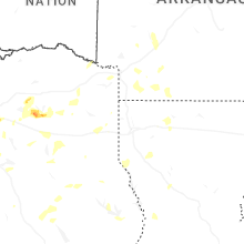
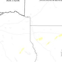
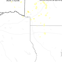
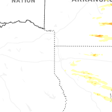


Connect with Interactive Hail Maps